

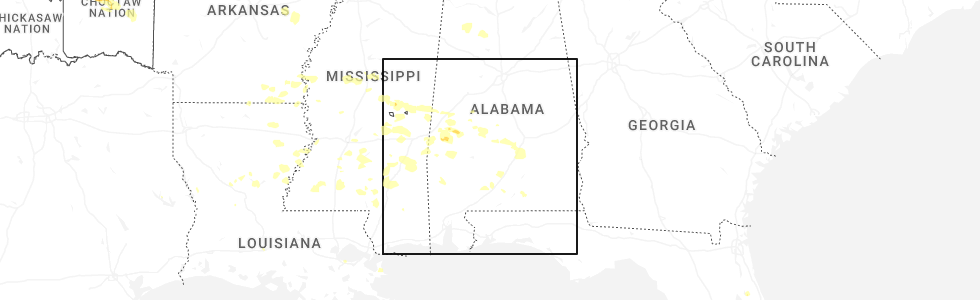
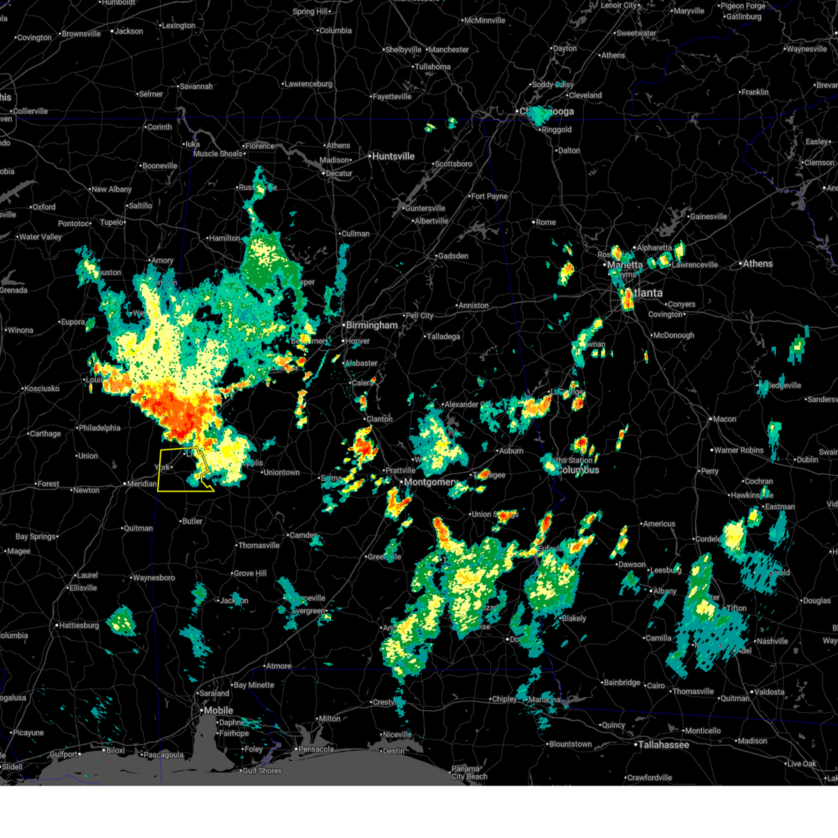
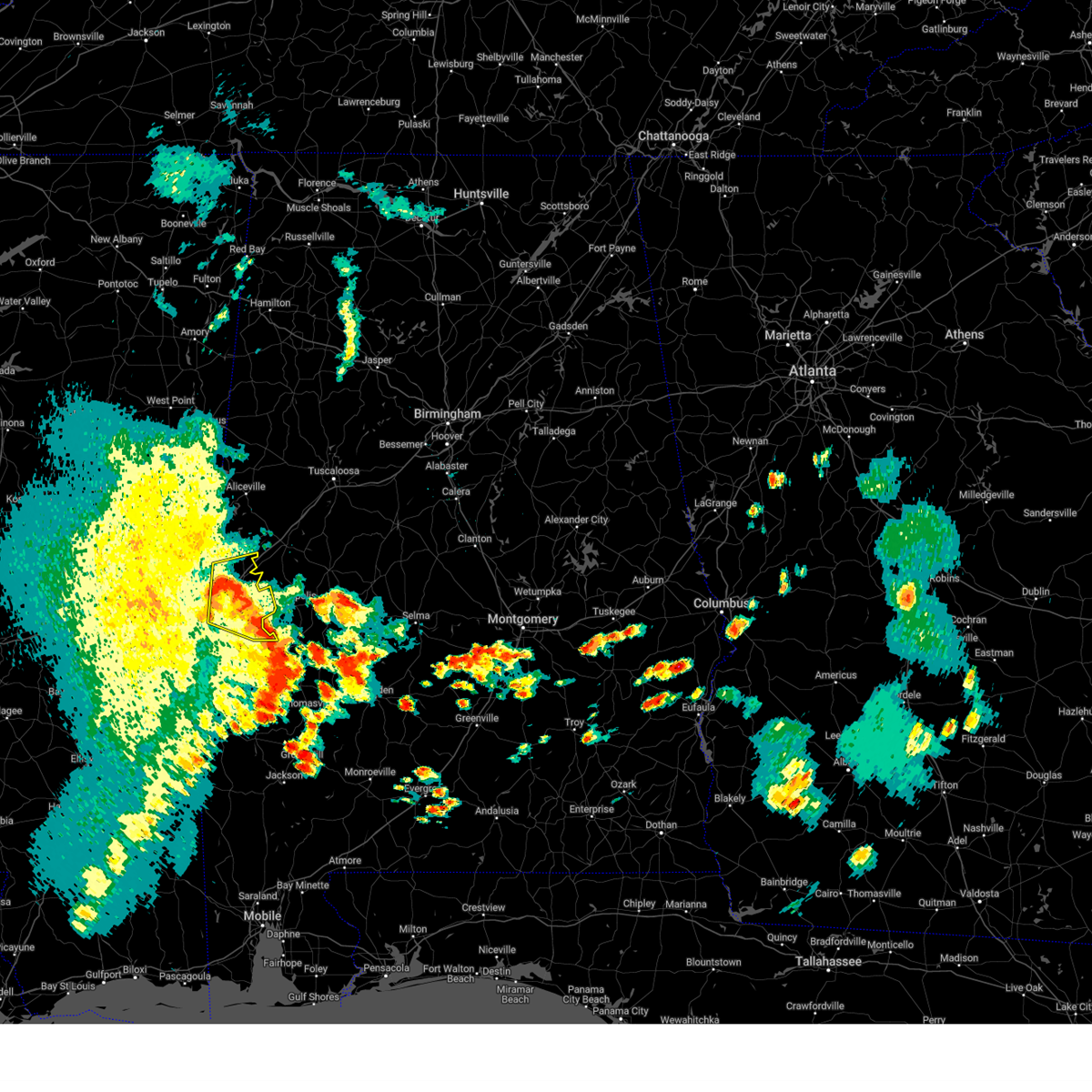
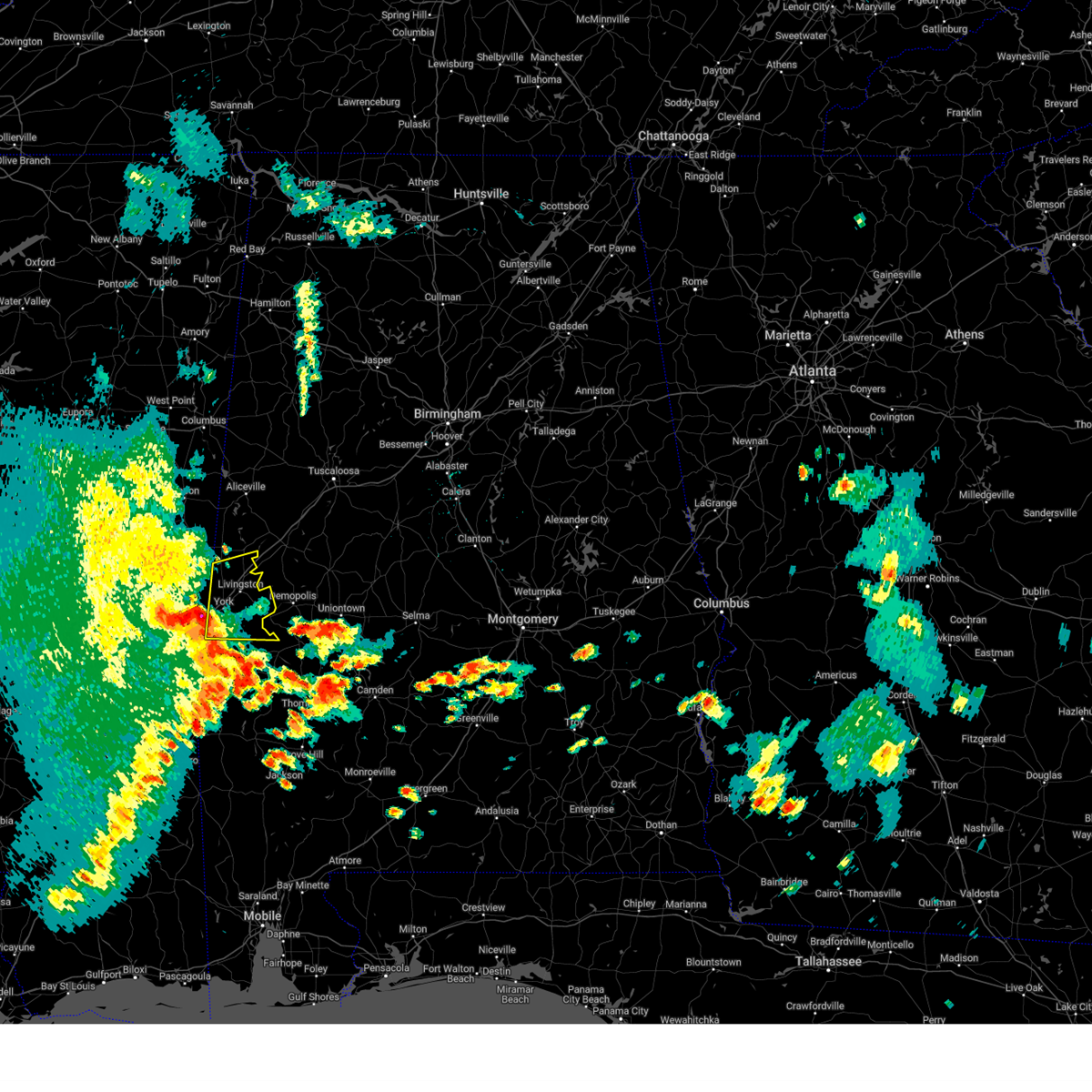
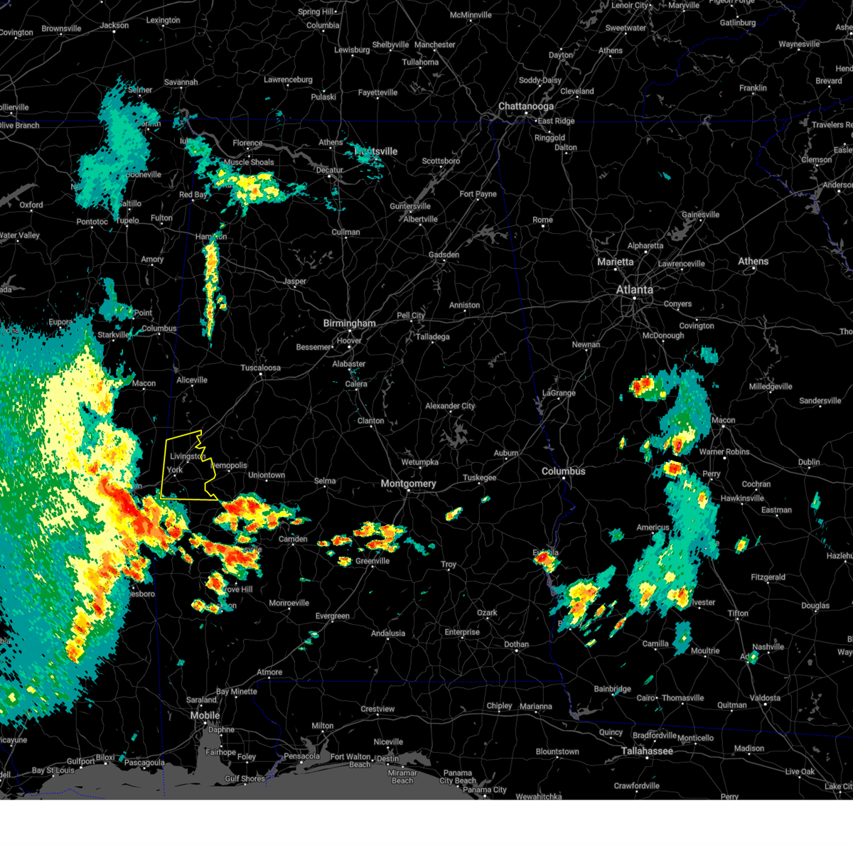
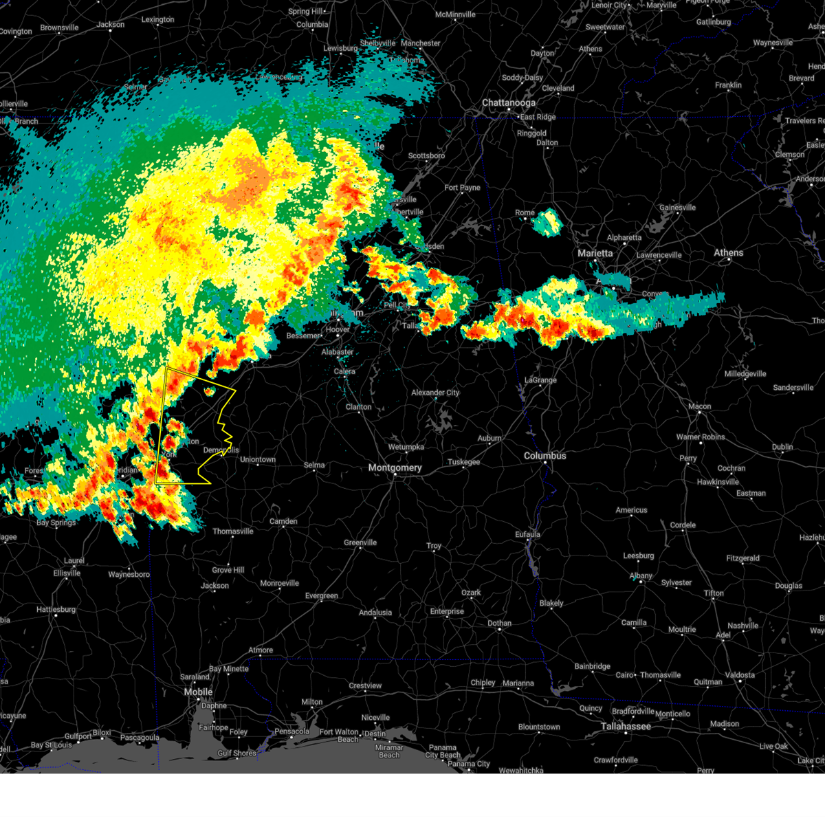
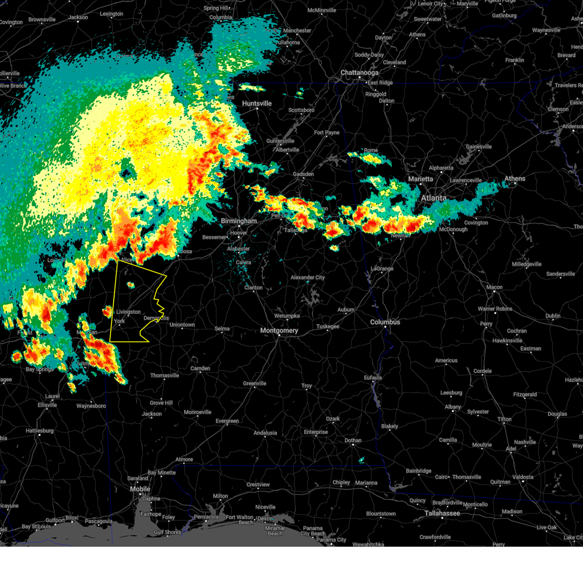
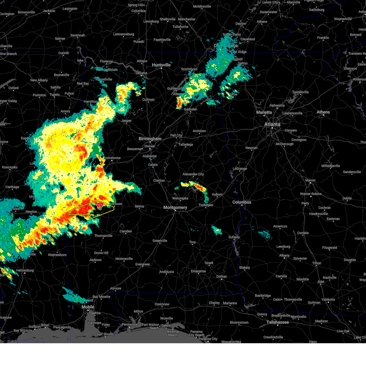
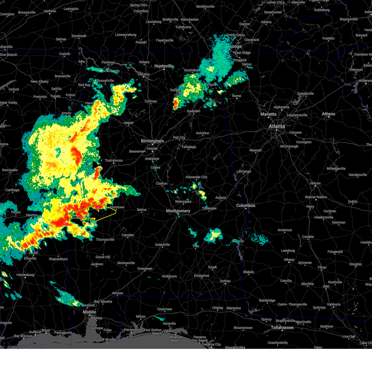
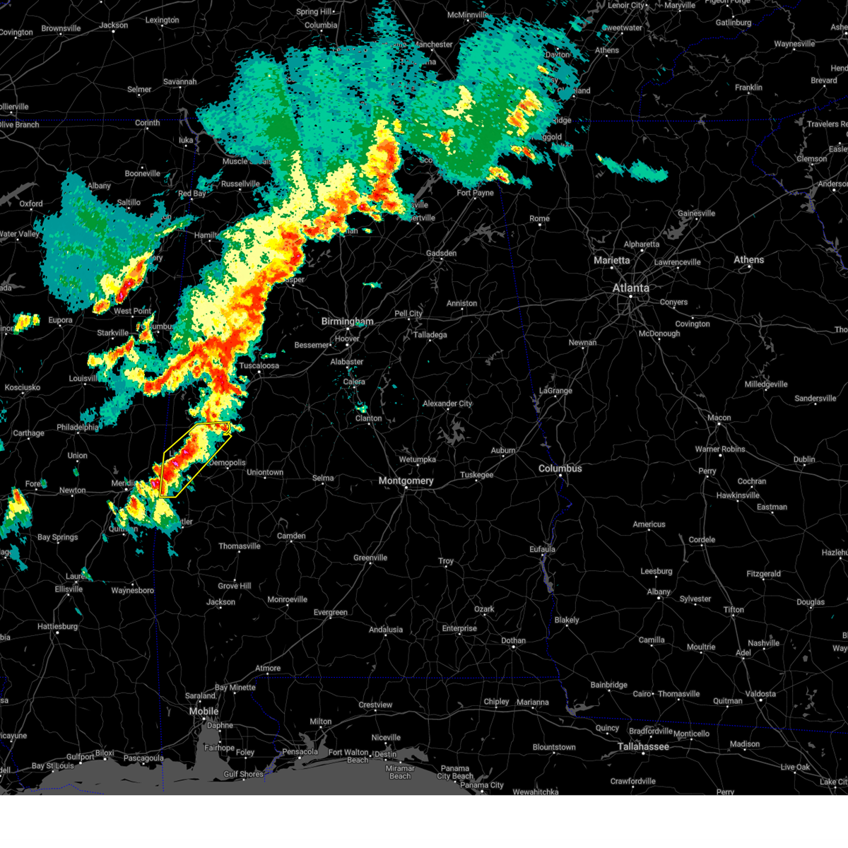
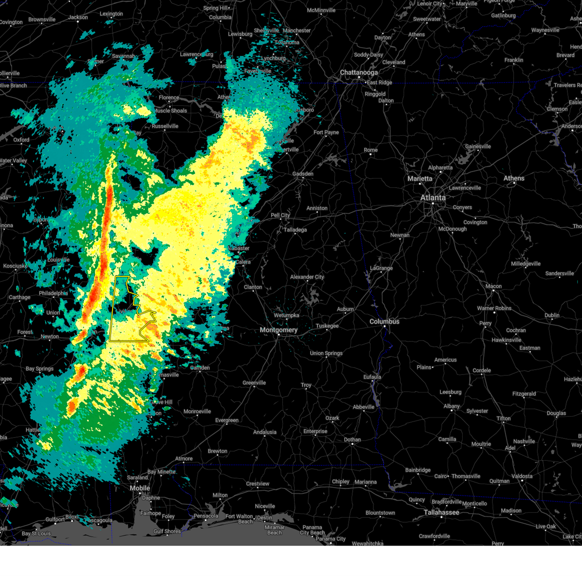
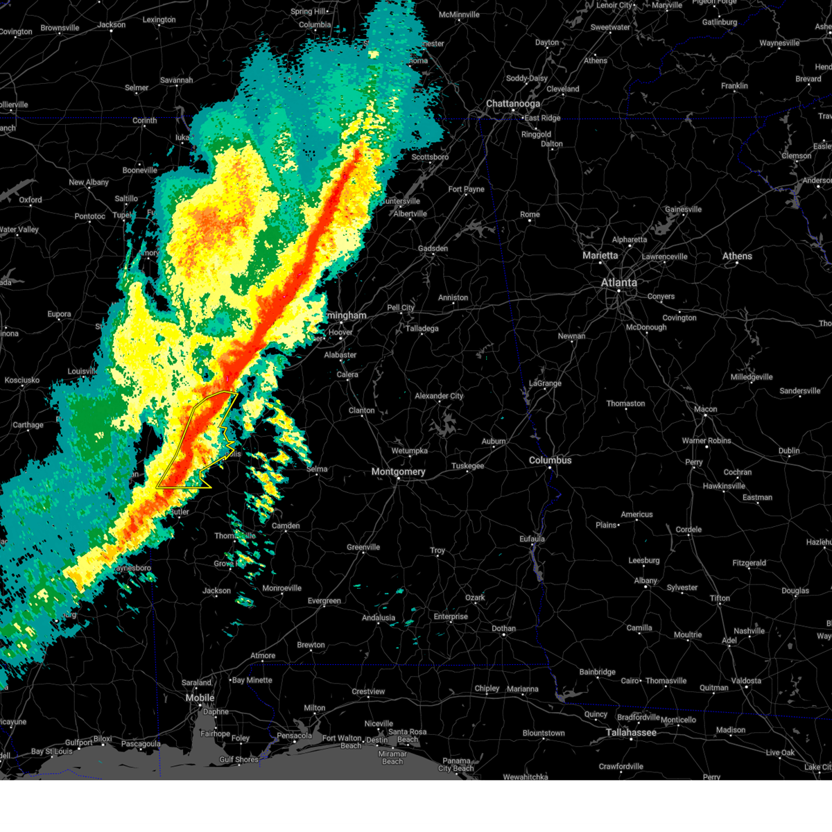
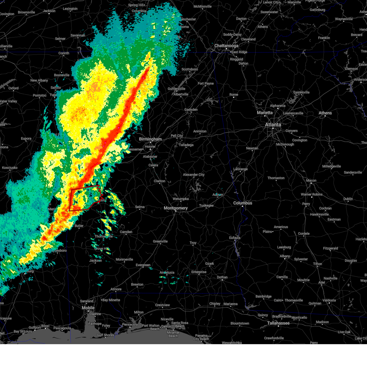
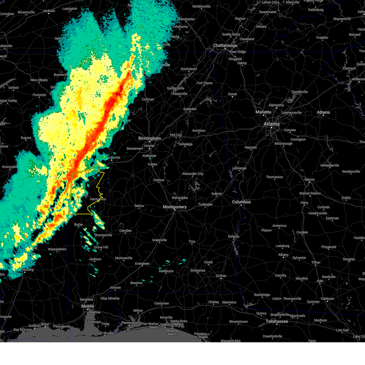
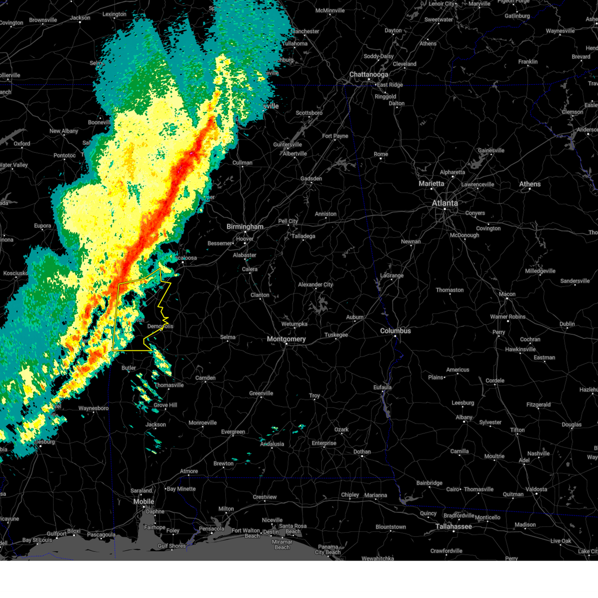
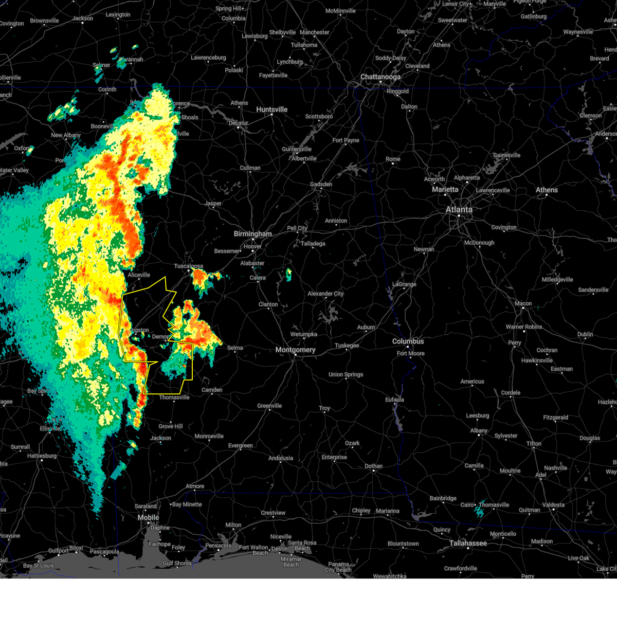
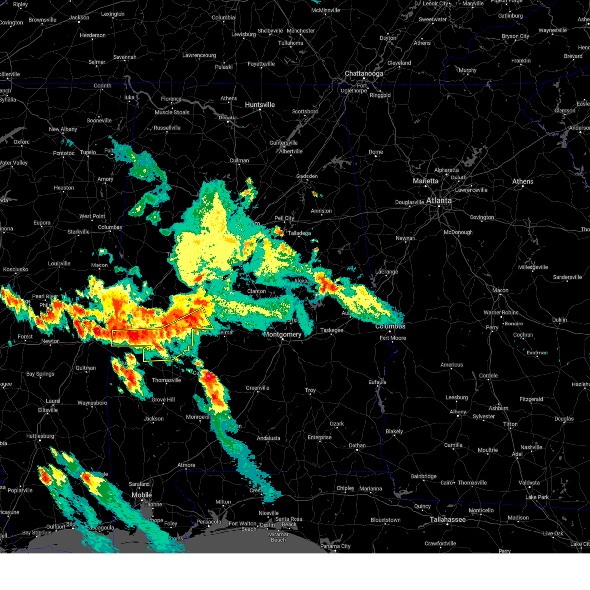
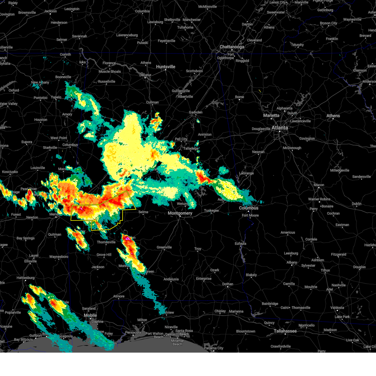
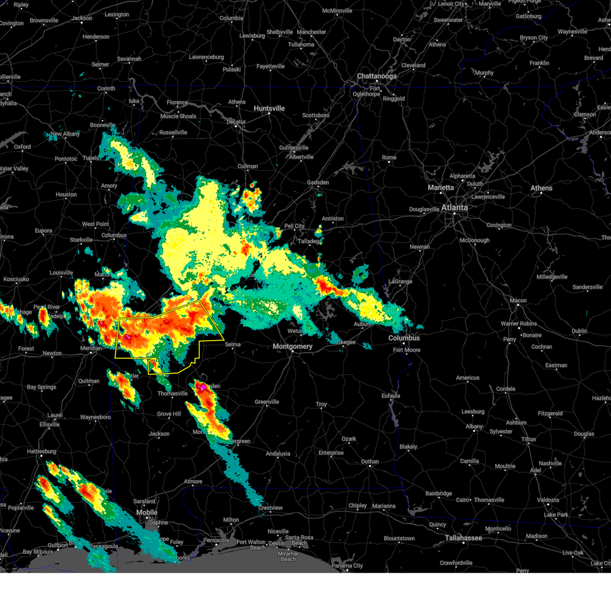
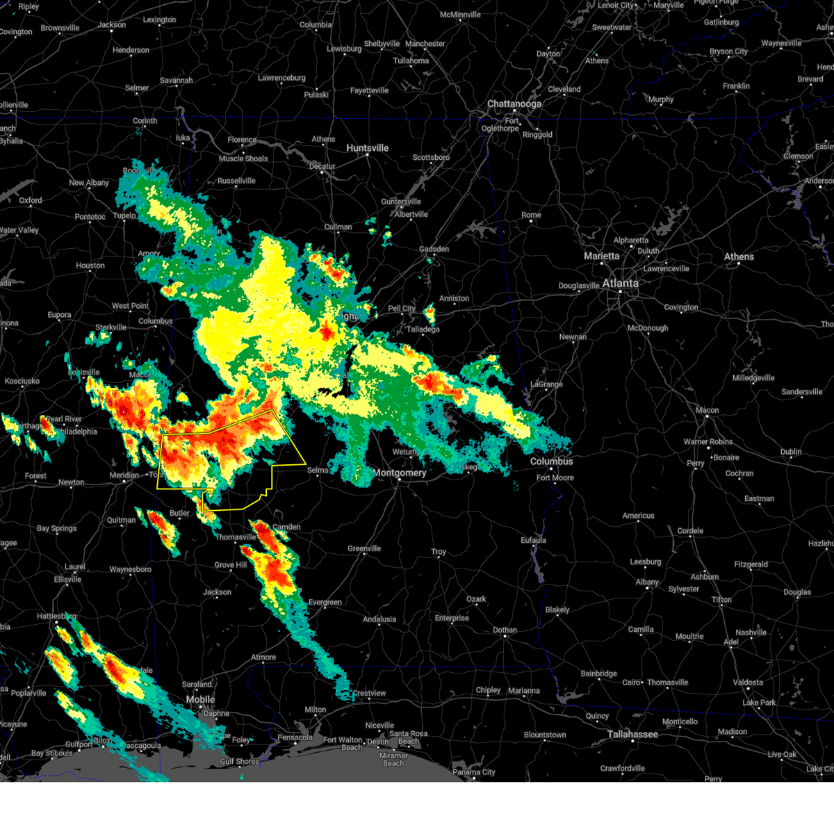
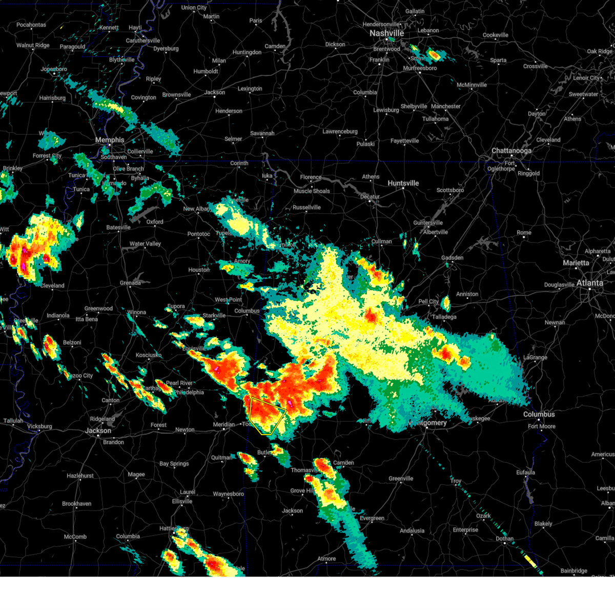
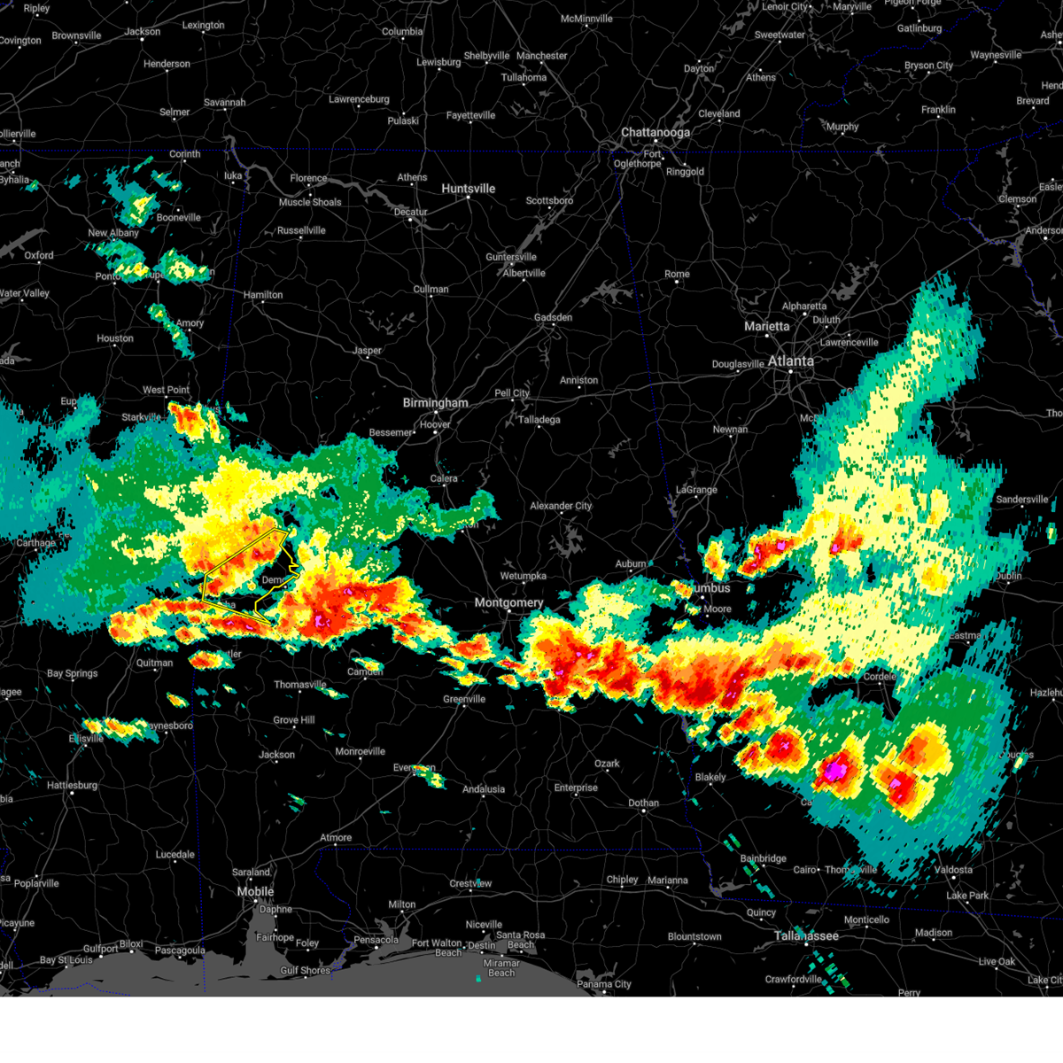
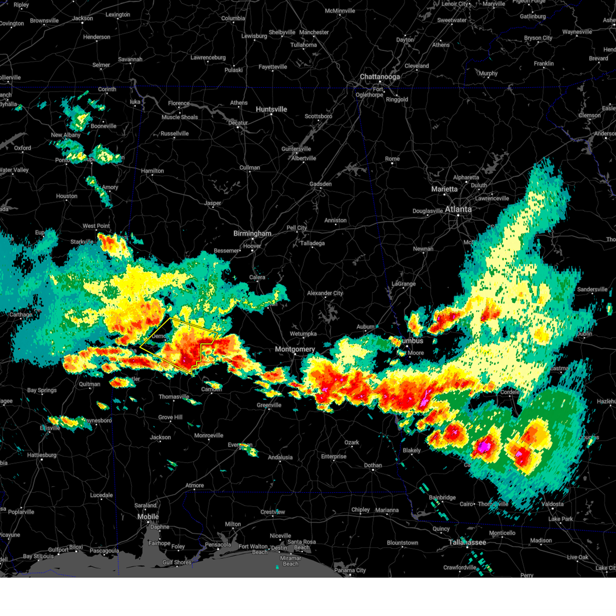
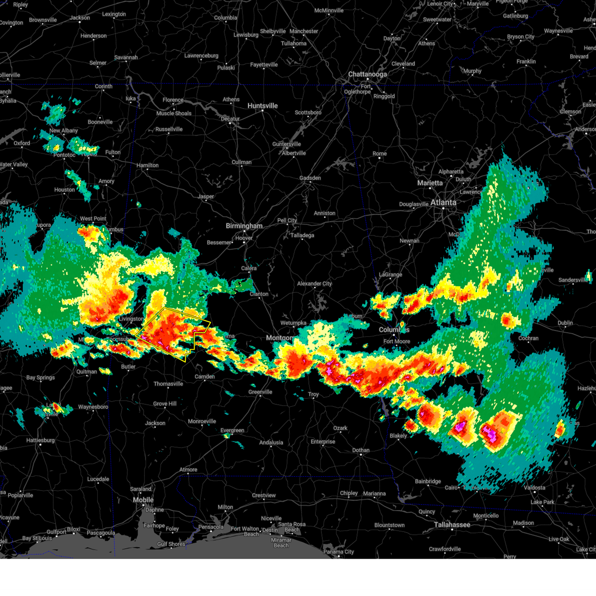
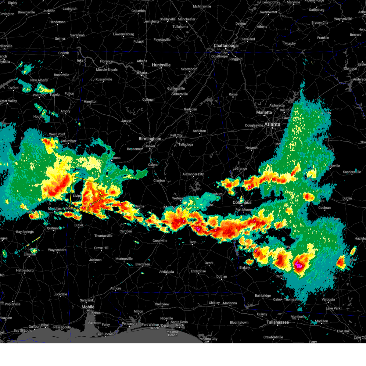
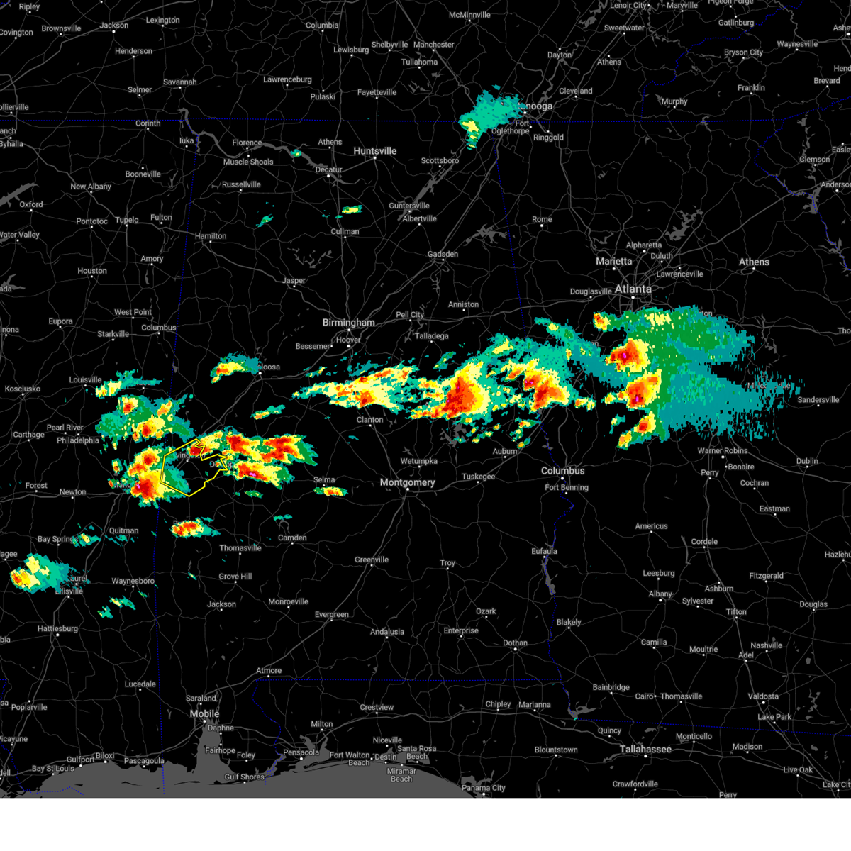
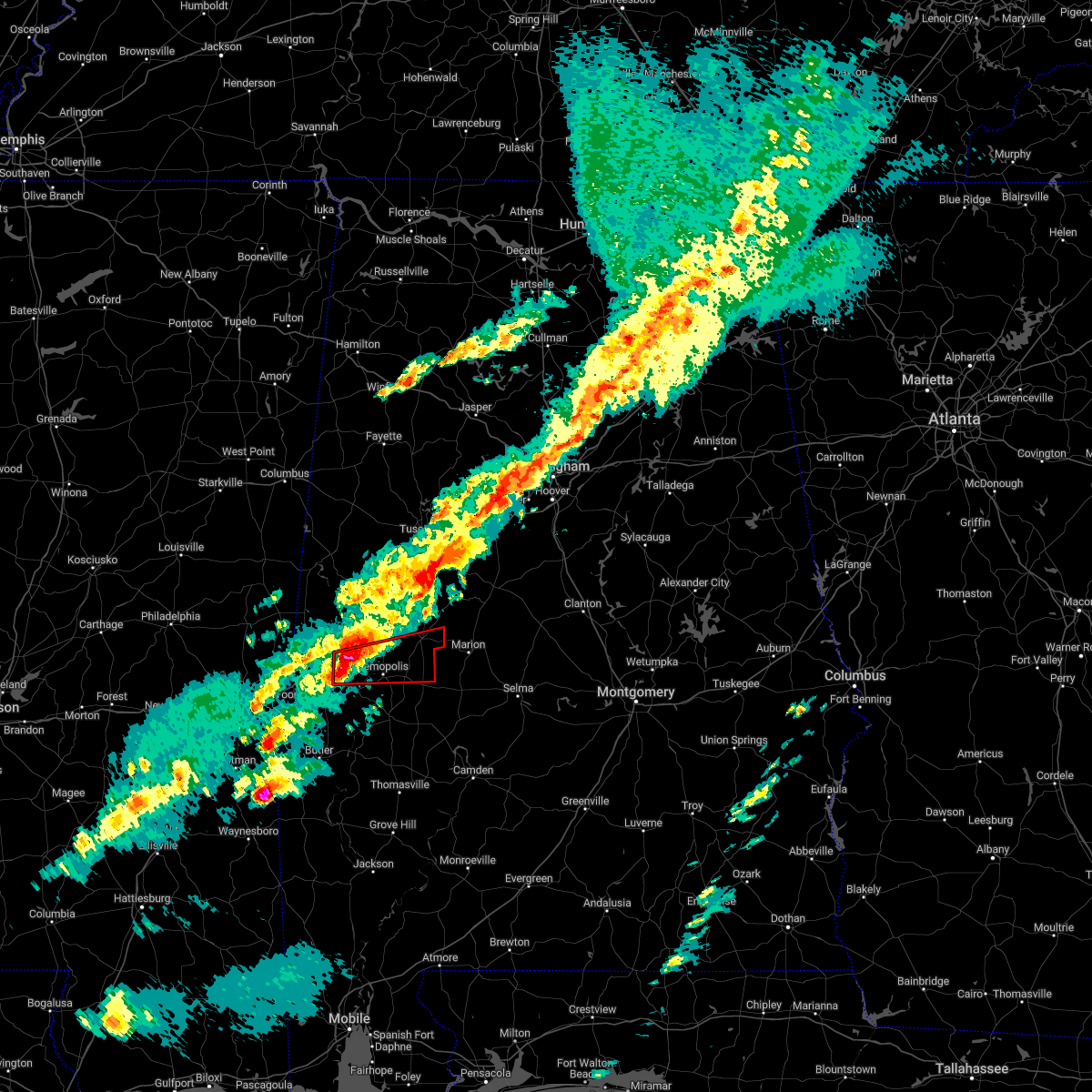
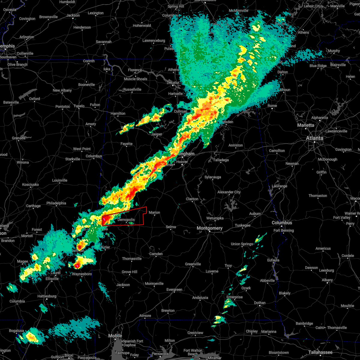
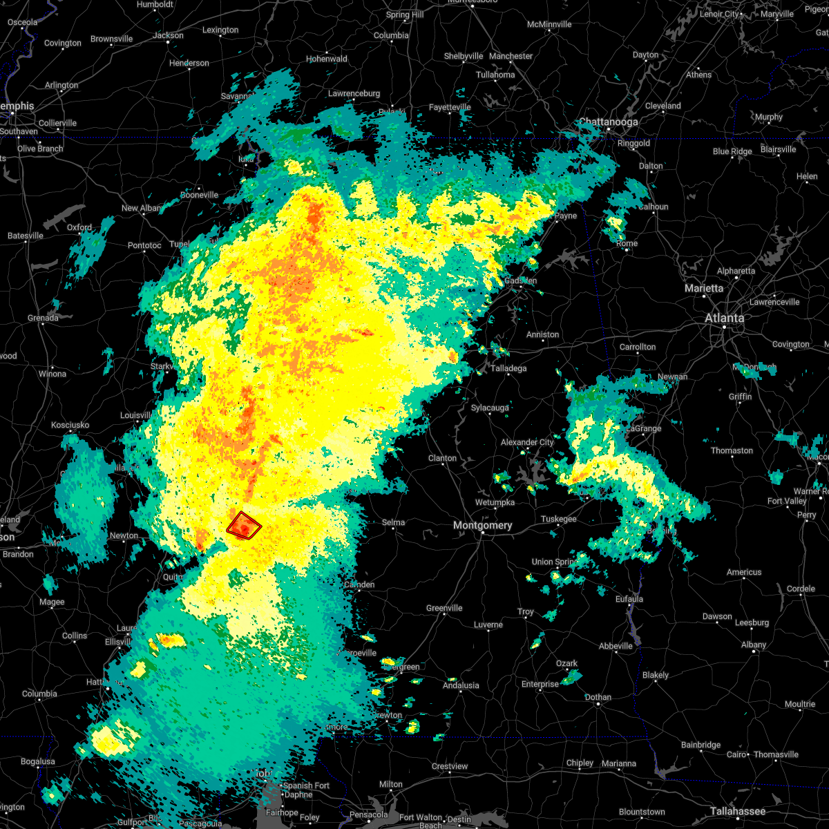
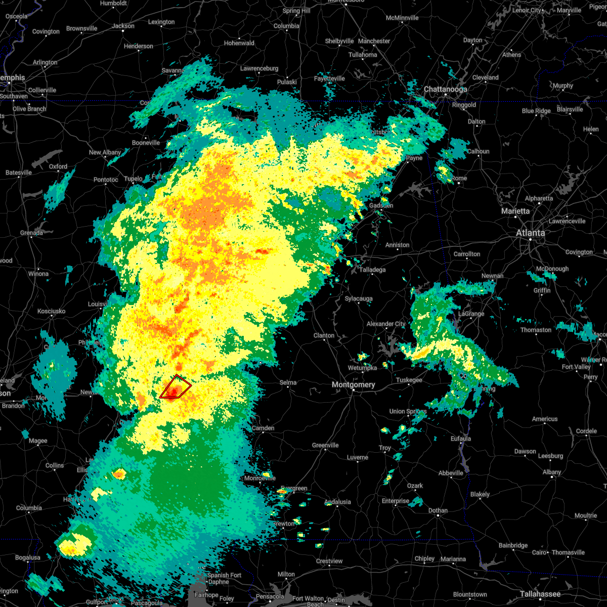
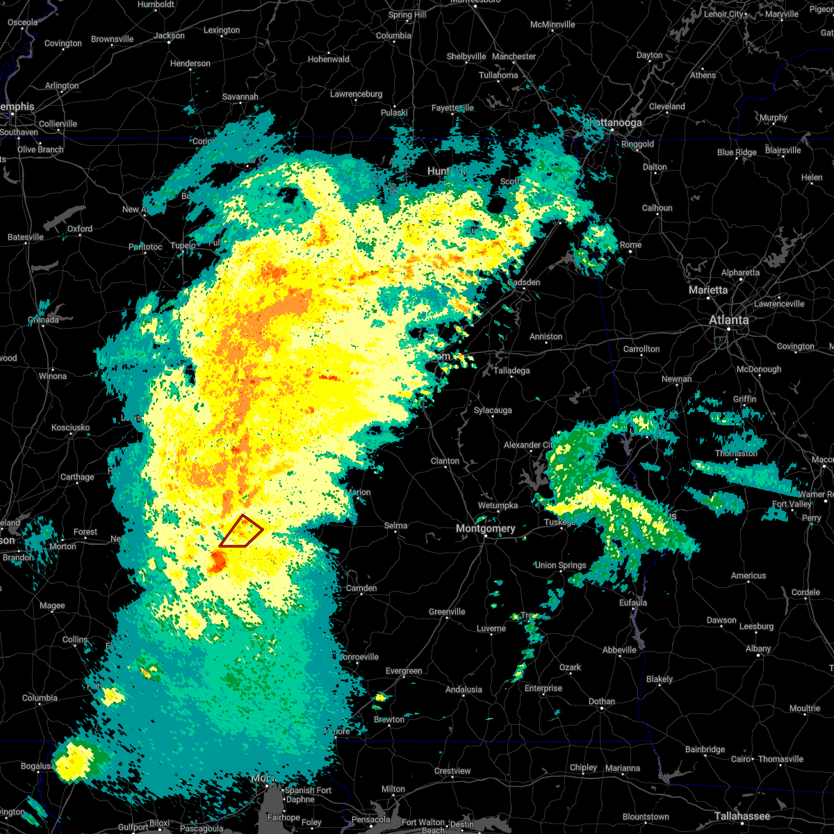
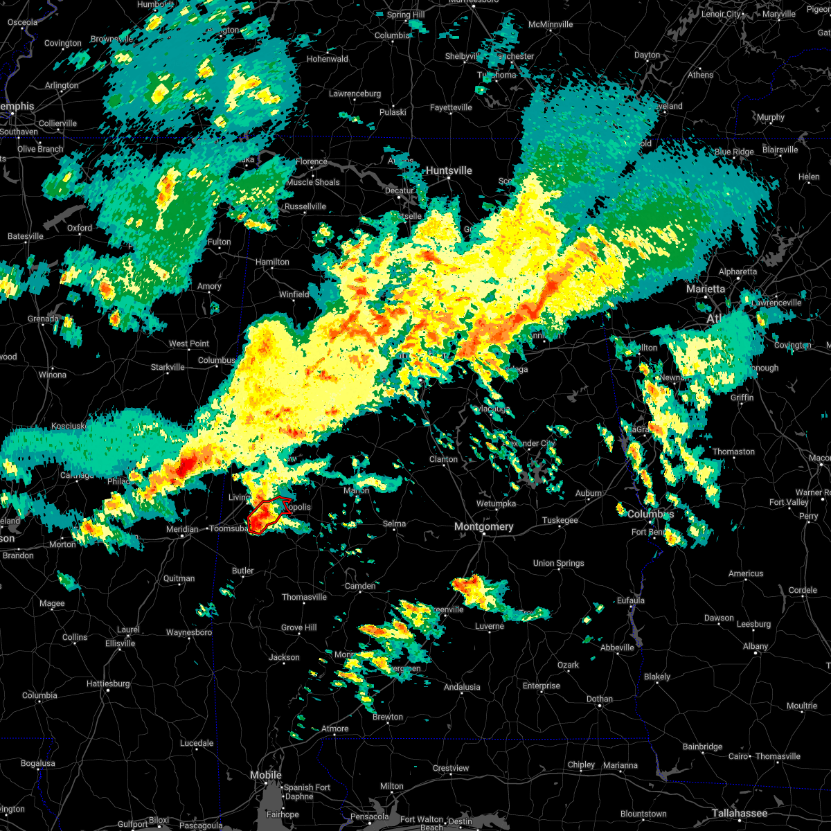
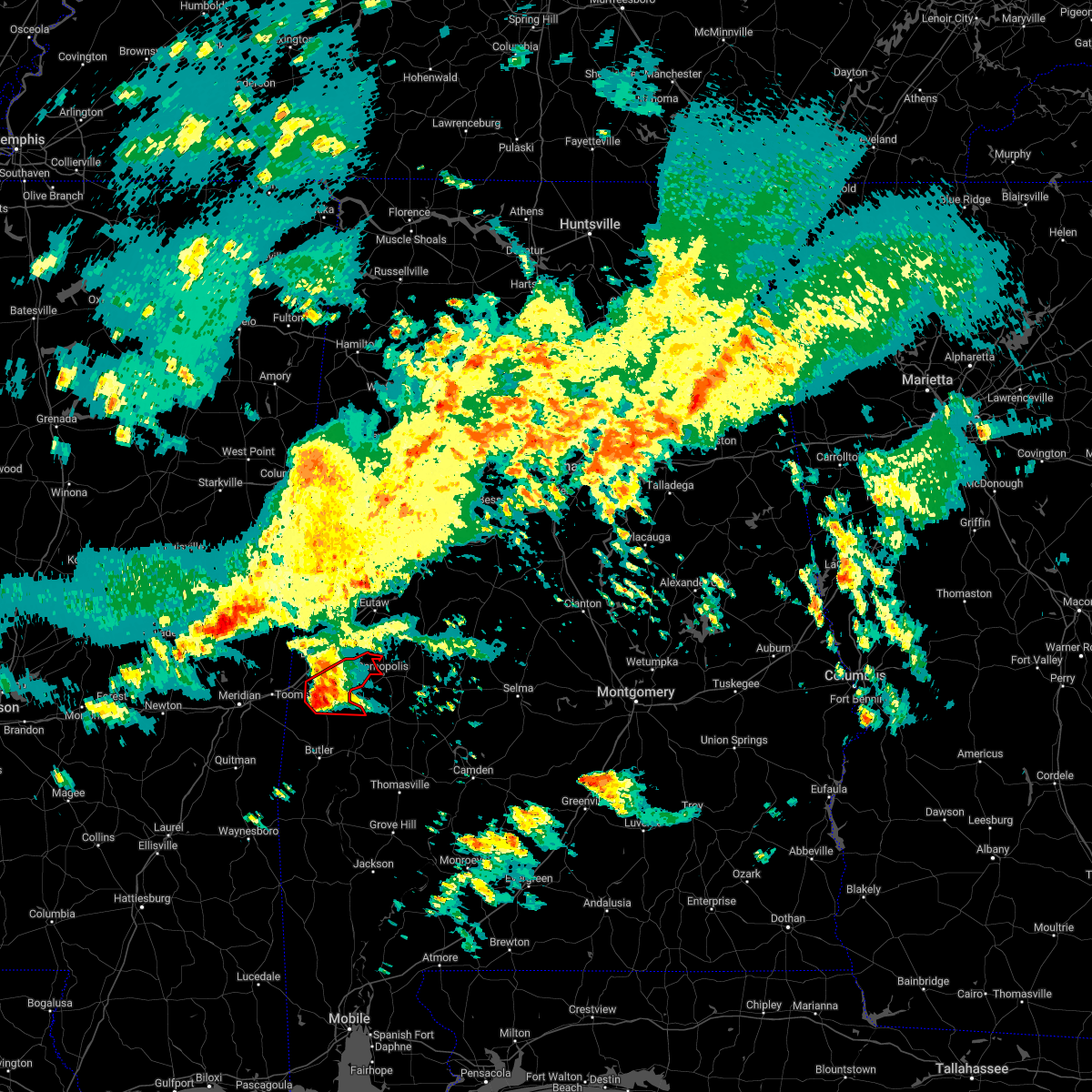
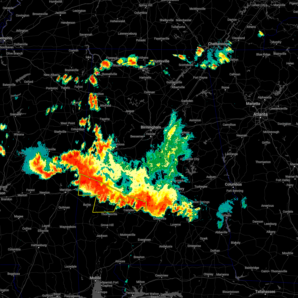
Hail Map for Bellamy, AL
The Bellamy, AL area has had 0 reports of on-the-ground hail by trained spotters, and has been under severe weather warnings 29 times during the past 12 months. Doppler radar has detected hail at or near Bellamy, AL on 65 occasions, including 6 occasions during the past year.
| Name: | Bellamy, AL |
| Where Located: | 58.6 miles WNW of Camden, AL |
| Map: | Google Map for Bellamy, AL |
| Population: | 543 |
| Housing Units: | 286 |
| More Info: | Search Google for Bellamy, AL |
1
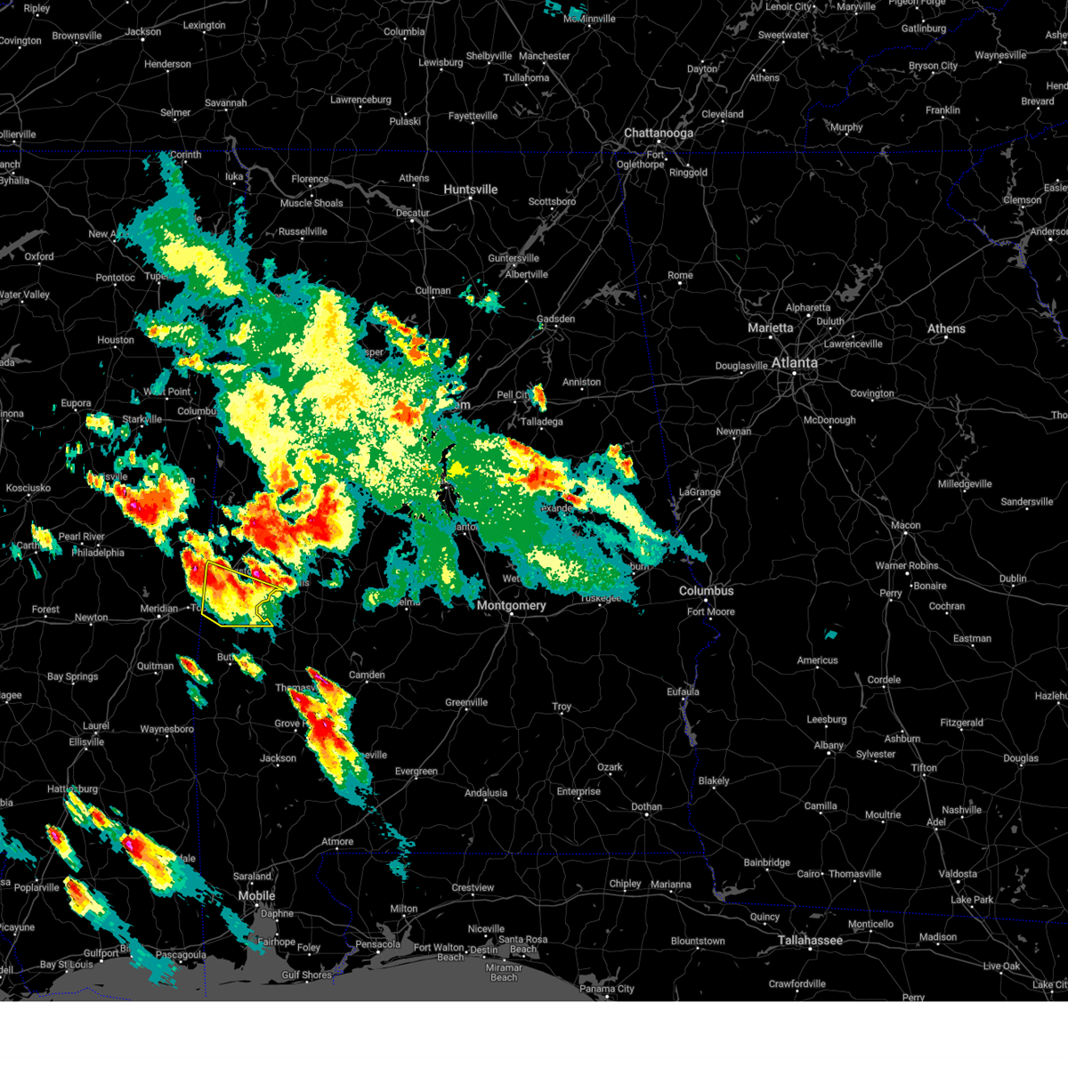
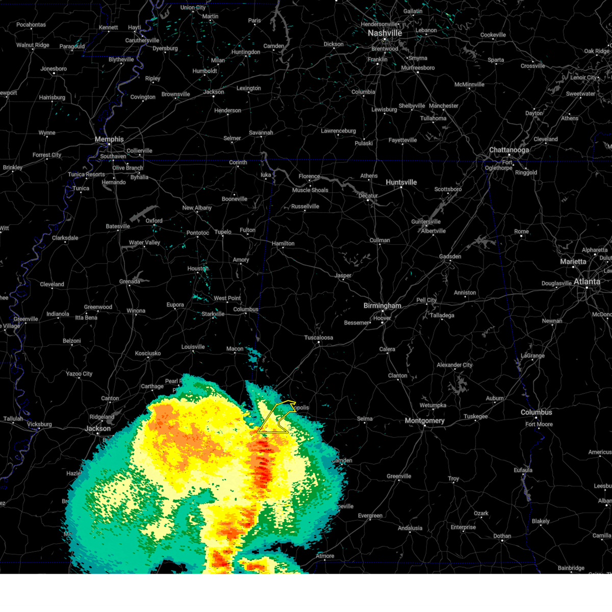
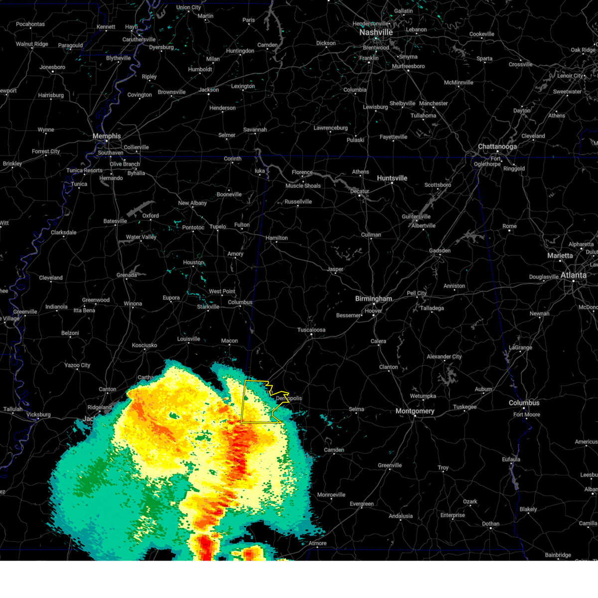
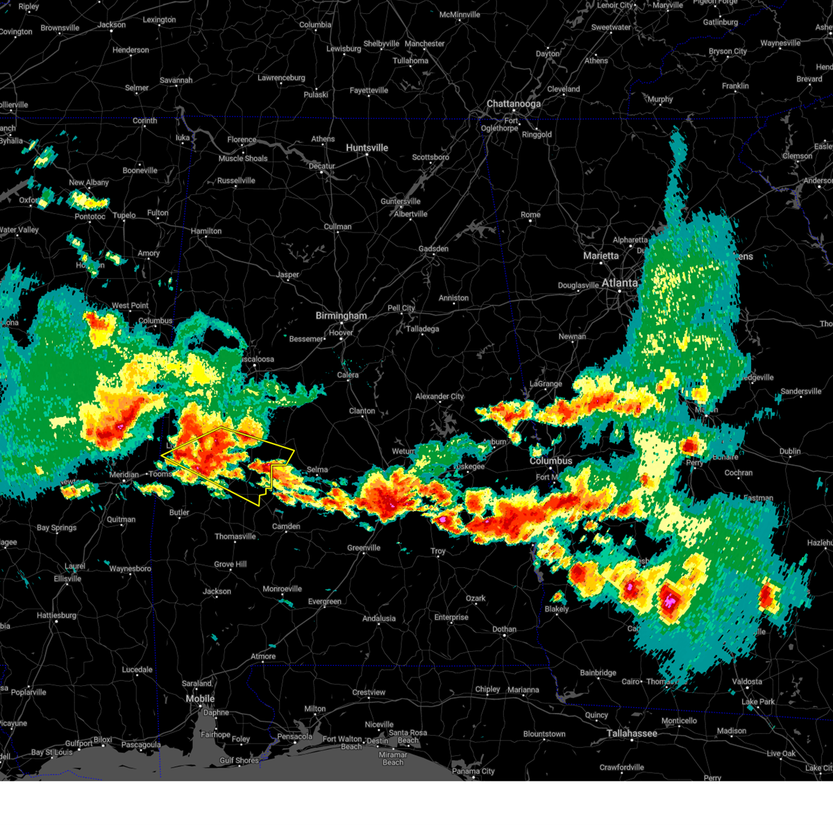
The Top Recent Hail Date for Bellamy, AL is Saturday, May 24, 2025 (11th out of 65)
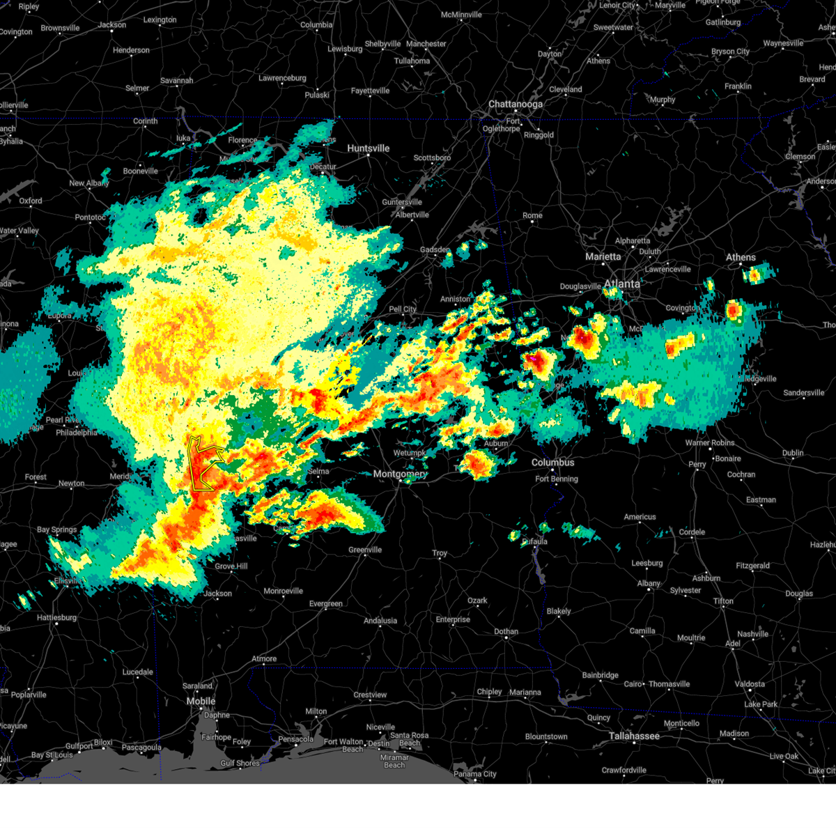
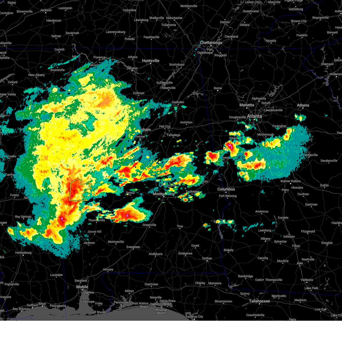
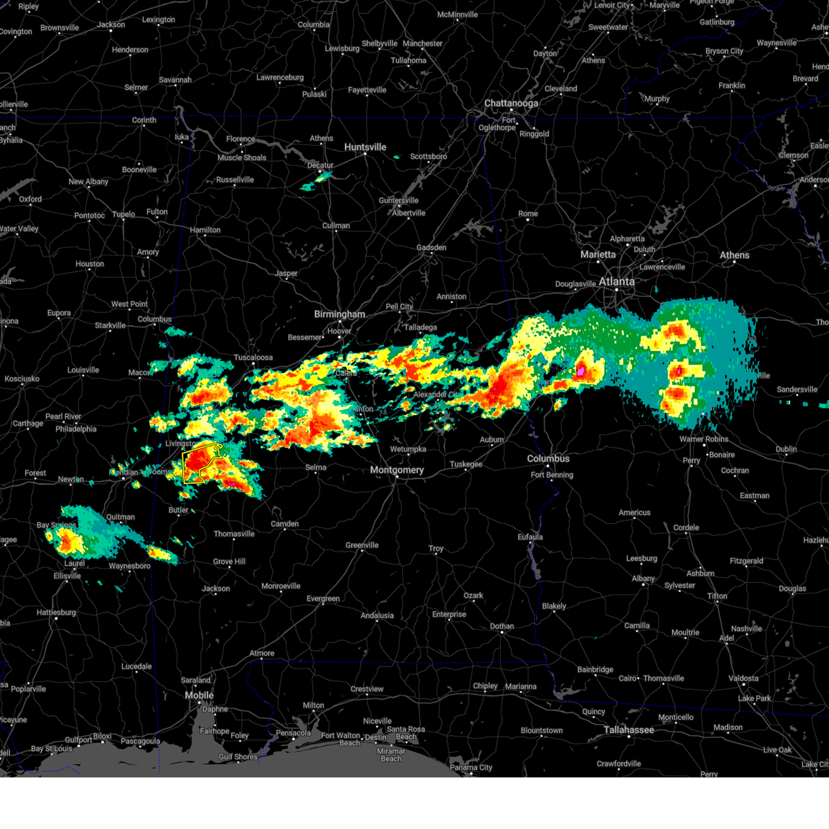
Hail and Wind Damage Spotted near Bellamy, AL
| Date / Time | Report Details |
|---|---|
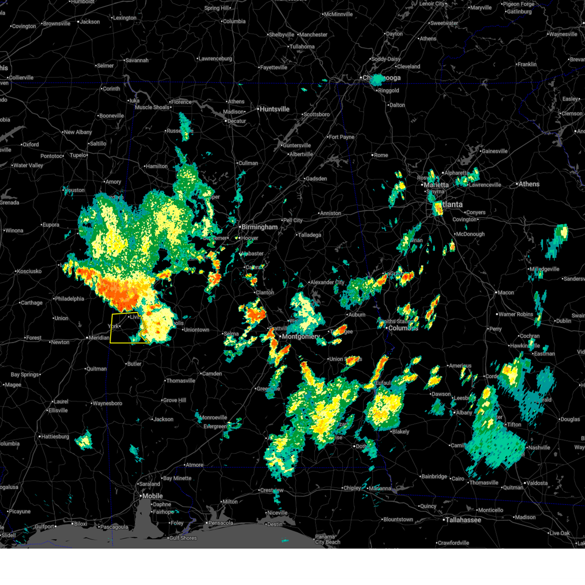
| 6/30/2025 8:30 PM CDT |
 At 830 pm cdt, a severe thunderstorm was located over york, moving south at 25 mph (radar indicated). Hazards include 60 mph wind gusts. Expect damage to roofs, siding, and trees. Locations impacted include, livingston, york, cuba, coatopa, kinterbish, dug hill, old mallard airport, i 20 welcome center at cuba, bellamy, ward, whitfield, and lilita. At 830 pm cdt, a severe thunderstorm was located over york, moving south at 25 mph (radar indicated). Hazards include 60 mph wind gusts. Expect damage to roofs, siding, and trees. Locations impacted include, livingston, york, cuba, coatopa, kinterbish, dug hill, old mallard airport, i 20 welcome center at cuba, bellamy, ward, whitfield, and lilita.
|
| 6/30/2025 8:18 PM CDT |
 At 818 pm cdt, a severe thunderstorm was located over york, moving south at 25 mph (radar indicated). Hazards include 60 mph wind gusts. Expect damage to roofs, siding, and trees. Locations impacted include, livingston, york, cuba, the university of west alabama, bluffport, coatopa, kinterbish, dug hill, old mallard airport, lilita, i 20 welcome center at cuba, bellamy, ward, whitfield, and payneville. At 818 pm cdt, a severe thunderstorm was located over york, moving south at 25 mph (radar indicated). Hazards include 60 mph wind gusts. Expect damage to roofs, siding, and trees. Locations impacted include, livingston, york, cuba, the university of west alabama, bluffport, coatopa, kinterbish, dug hill, old mallard airport, lilita, i 20 welcome center at cuba, bellamy, ward, whitfield, and payneville.
|
| 6/30/2025 8:06 PM CDT |
 At 806 pm cdt, a severe thunderstorm was located near boyd, or near york, moving south at 30 mph (radar indicated). Hazards include 60 mph wind gusts. Expect damage to roofs, siding, and trees. Locations impacted include, livingston, york, cuba, the university of west alabama, bluffport, coatopa, kinterbish, dug hill, old mallard airport, lilita, i 20 welcome center at cuba, bellamy, ward, whitfield, and payneville. At 806 pm cdt, a severe thunderstorm was located near boyd, or near york, moving south at 30 mph (radar indicated). Hazards include 60 mph wind gusts. Expect damage to roofs, siding, and trees. Locations impacted include, livingston, york, cuba, the university of west alabama, bluffport, coatopa, kinterbish, dug hill, old mallard airport, lilita, i 20 welcome center at cuba, bellamy, ward, whitfield, and payneville.
|
| 6/30/2025 7:40 PM CDT |
 Svrbmx the national weather service in birmingham has issued a * severe thunderstorm warning for, southwestern sumter county in west central alabama, * until 845 pm cdt. * at 740 pm cdt, a severe thunderstorm was located near boyd, or near livingston, moving south at 30 mph (radar indicated). Hazards include 60 mph wind gusts. expect damage to roofs, siding, and trees Svrbmx the national weather service in birmingham has issued a * severe thunderstorm warning for, southwestern sumter county in west central alabama, * until 845 pm cdt. * at 740 pm cdt, a severe thunderstorm was located near boyd, or near livingston, moving south at 30 mph (radar indicated). Hazards include 60 mph wind gusts. expect damage to roofs, siding, and trees
|
| 5/26/2025 5:11 PM CDT |
 At 511 pm cdt, severe thunderstorms were located along a line extending from near emelle to near coatopa to near myrtlewood, moving northeast at 40 mph (radar indicated). Hazards include 60 mph wind gusts and quarter size hail. Hail damage to vehicles is expected. expect wind damage to roofs, siding, and trees. Locations impacted include, livingston, york, cuba, epes, emelle, boyd, the university of west alabama, bluffport, coatopa, dug hill, old mallard airport, sumterville, lilita, bellamy, payneville, and whitfield. At 511 pm cdt, severe thunderstorms were located along a line extending from near emelle to near coatopa to near myrtlewood, moving northeast at 40 mph (radar indicated). Hazards include 60 mph wind gusts and quarter size hail. Hail damage to vehicles is expected. expect wind damage to roofs, siding, and trees. Locations impacted include, livingston, york, cuba, epes, emelle, boyd, the university of west alabama, bluffport, coatopa, dug hill, old mallard airport, sumterville, lilita, bellamy, payneville, and whitfield.
|
| 5/26/2025 4:48 PM CDT |
 At 447 pm cdt, severe thunderstorms were located along a line extending from near kewanee to near lisman to 7 miles southwest of butler, moving east at 45 mph (radar indicated). Hazards include 70 mph wind gusts and quarter size hail. Hail damage to vehicles is expected. expect considerable tree damage. wind damage is also likely to mobile homes, roofs, and outbuildings. Locations impacted include, livingston, york, cuba, epes, emelle, boyd, the university of west alabama, bluffport, coatopa, kinterbish, dug hill, old mallard airport, sumterville, lilita, i 20 welcome center at cuba, bellamy, ward, payneville, and whitfield. At 447 pm cdt, severe thunderstorms were located along a line extending from near kewanee to near lisman to 7 miles southwest of butler, moving east at 45 mph (radar indicated). Hazards include 70 mph wind gusts and quarter size hail. Hail damage to vehicles is expected. expect considerable tree damage. wind damage is also likely to mobile homes, roofs, and outbuildings. Locations impacted include, livingston, york, cuba, epes, emelle, boyd, the university of west alabama, bluffport, coatopa, kinterbish, dug hill, old mallard airport, sumterville, lilita, i 20 welcome center at cuba, bellamy, ward, payneville, and whitfield.
|
| 5/26/2025 4:23 PM CDT |
 Svrbmx the national weather service in birmingham has issued a * severe thunderstorm warning for, sumter county in west central alabama, * until 530 pm cdt. * at 423 pm cdt, severe thunderstorms were located along a line extending from near nellieburg to near sykes to near de soto, moving east at 45 mph (radar indicated). Hazards include 60 mph wind gusts and quarter size hail. Hail damage to vehicles is expected. Expect wind damage to roofs, siding, and trees. Svrbmx the national weather service in birmingham has issued a * severe thunderstorm warning for, sumter county in west central alabama, * until 530 pm cdt. * at 423 pm cdt, severe thunderstorms were located along a line extending from near nellieburg to near sykes to near de soto, moving east at 45 mph (radar indicated). Hazards include 60 mph wind gusts and quarter size hail. Hail damage to vehicles is expected. Expect wind damage to roofs, siding, and trees.
|
| 5/25/2025 10:03 PM CDT |
 At 1002 pm cdt, severe thunderstorms were located along a line extending from near panola to suqualena, moving east at 30 mph (radar indicated). Hazards include 60 mph wind gusts and quarter size hail. Hail damage to vehicles is expected. expect wind damage to roofs, siding, and trees. Locations impacted include, livingston, eutaw, york, aliceville, cuba, forkland, boligee, union, gainesville, epes, emelle, memphis, panola, west greene, thornhill, boyd, knoxville, coatopa, kinterbish, and walden quarters. At 1002 pm cdt, severe thunderstorms were located along a line extending from near panola to suqualena, moving east at 30 mph (radar indicated). Hazards include 60 mph wind gusts and quarter size hail. Hail damage to vehicles is expected. expect wind damage to roofs, siding, and trees. Locations impacted include, livingston, eutaw, york, aliceville, cuba, forkland, boligee, union, gainesville, epes, emelle, memphis, panola, west greene, thornhill, boyd, knoxville, coatopa, kinterbish, and walden quarters.
|
| 5/25/2025 9:29 PM CDT |
 Svrbmx the national weather service in birmingham has issued a * severe thunderstorm warning for, southwestern pickens county in west central alabama, greene county in west central alabama, sumter county in west central alabama, * until 1030 pm cdt. * at 928 pm cdt, severe thunderstorms were located along a line extending from prairie point to near prospect, moving southeast at 40 mph (radar indicated). Hazards include 60 mph wind gusts and quarter size hail. Hail damage to vehicles is expected. Expect wind damage to roofs, siding, and trees. Svrbmx the national weather service in birmingham has issued a * severe thunderstorm warning for, southwestern pickens county in west central alabama, greene county in west central alabama, sumter county in west central alabama, * until 1030 pm cdt. * at 928 pm cdt, severe thunderstorms were located along a line extending from prairie point to near prospect, moving southeast at 40 mph (radar indicated). Hazards include 60 mph wind gusts and quarter size hail. Hail damage to vehicles is expected. Expect wind damage to roofs, siding, and trees.
|
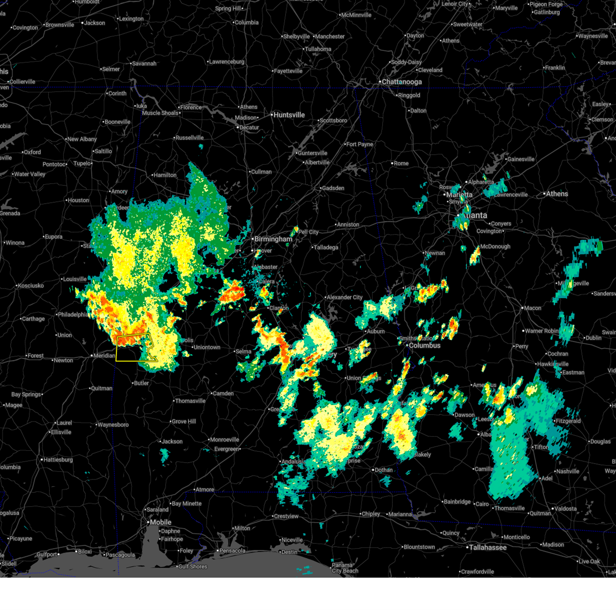
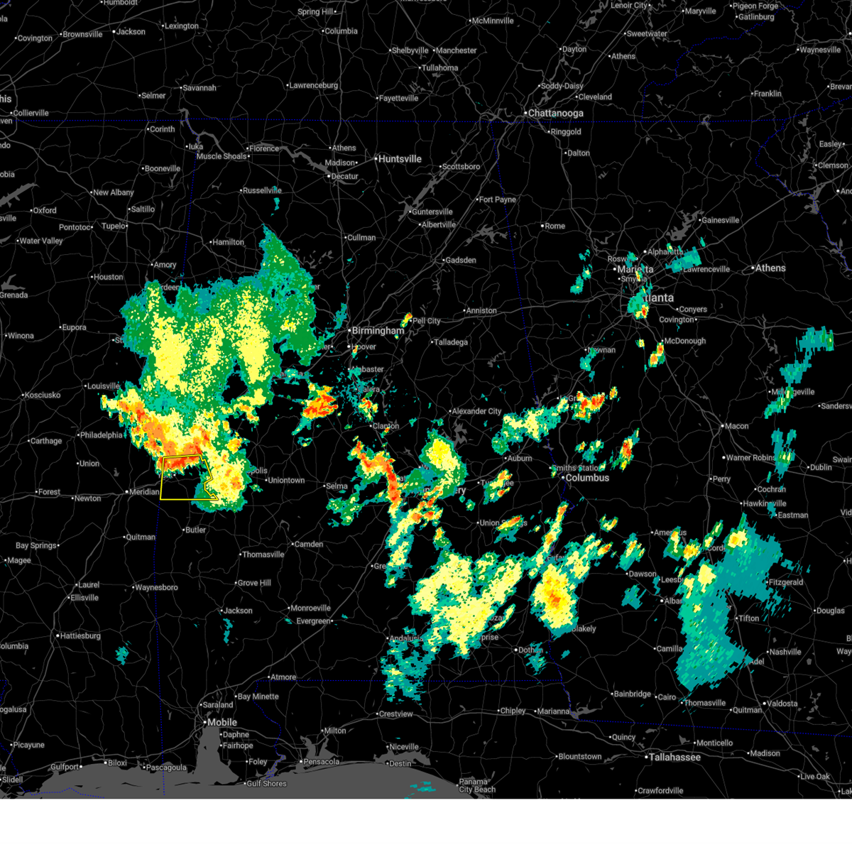
| 5/24/2025 6:26 PM CDT |
 At 626 pm cdt, severe thunderstorms were located along a line extending from near demopolis to near kinterbish, moving east at 20 mph (radar indicated). Hazards include golf ball size hail and 60 mph wind gusts. People and animals outdoors will be injured. expect hail damage to roofs, siding, windows, and vehicles. expect wind damage to roofs, siding, and trees. locations impacted include, demopolis, linden, jefferson, myrtlewood, faunsdale, dayton, pin hook, kinterbish, chickasaw state park, u. s. 80 and al 28, old spring hill, demopolis lock and dam, bellamy, ward, whitfield, demopolis municipal airport, and mcdowell. At 626 pm cdt, severe thunderstorms were located along a line extending from near demopolis to near kinterbish, moving east at 20 mph (radar indicated). Hazards include golf ball size hail and 60 mph wind gusts. People and animals outdoors will be injured. expect hail damage to roofs, siding, windows, and vehicles. expect wind damage to roofs, siding, and trees. locations impacted include, demopolis, linden, jefferson, myrtlewood, faunsdale, dayton, pin hook, kinterbish, chickasaw state park, u. s. 80 and al 28, old spring hill, demopolis lock and dam, bellamy, ward, whitfield, demopolis municipal airport, and mcdowell.
|
| 5/24/2025 6:19 PM CDT |
 Svrbmx the national weather service in birmingham has issued a * severe thunderstorm warning for, northern marengo county in southwestern alabama, southern sumter county in west central alabama, * until 715 pm cdt. * at 618 pm cdt, severe thunderstorms were located along a line extending from demopolis to near alamucha, moving east at 20 mph (radar indicated). Hazards include 60 mph wind gusts and quarter size hail. Hail damage to vehicles is expected. Expect wind damage to roofs, siding, and trees. Svrbmx the national weather service in birmingham has issued a * severe thunderstorm warning for, northern marengo county in southwestern alabama, southern sumter county in west central alabama, * until 715 pm cdt. * at 618 pm cdt, severe thunderstorms were located along a line extending from demopolis to near alamucha, moving east at 20 mph (radar indicated). Hazards include 60 mph wind gusts and quarter size hail. Hail damage to vehicles is expected. Expect wind damage to roofs, siding, and trees.
|
| 5/2/2025 4:52 PM CDT | At 452 pm cdt, severe thunderstorms were located along a line extending from near boligee to cuba, moving northeast at 20 mph (radar indicated). Hazards include 60 mph wind gusts and quarter size hail. Hail damage to vehicles is expected. expect wind damage to roofs, siding, and trees. Locations impacted include, old mallard airport, york, boyd, livingston, allison, walden quarters, sumterville, eutaw municipal airport, lilita, the university of west alabama, bluffport, cuba, thornhill, i 20 welcome center at cuba, five points intersection, ward, boligee, payneville, epes, and eutaw. |
| 5/2/2025 4:32 PM CDT |
 Svrbmx the national weather service in birmingham has issued a * severe thunderstorm warning for, southern greene county in west central alabama, southern sumter county in west central alabama, * until 530 pm cdt. * at 432 pm cdt, severe thunderstorms were located along a line extending from epes to kewanee, moving northeast at 20 mph (radar indicated). Hazards include 60 mph wind gusts and quarter size hail. Hail damage to vehicles is expected. Expect wind damage to roofs, siding, and trees. Svrbmx the national weather service in birmingham has issued a * severe thunderstorm warning for, southern greene county in west central alabama, southern sumter county in west central alabama, * until 530 pm cdt. * at 432 pm cdt, severe thunderstorms were located along a line extending from epes to kewanee, moving northeast at 20 mph (radar indicated). Hazards include 60 mph wind gusts and quarter size hail. Hail damage to vehicles is expected. Expect wind damage to roofs, siding, and trees.
|
| 3/15/2025 5:32 PM CDT | the tornado warning has been cancelled and is no longer in effect |
| 3/15/2025 5:25 PM CDT | At 525 pm cdt, a severe thunderstorm capable of producing a tornado was located near the university of west alabama, or near livingston, moving northeast at 50 mph (radar indicated rotation). Hazards include tornado. Flying debris will be dangerous to those caught without shelter. mobile homes will be damaged or destroyed. damage to roofs, windows, and vehicles will occur. tree damage is likely. Locations impacted include, bluffport, old mallard airport, lilita, the university of west alabama, livingston, and york. |
| 3/15/2025 5:16 PM CDT | Torbmx the national weather service in birmingham has issued a * tornado warning for, southern sumter county in west central alabama, * until 600 pm cdt. * at 516 pm cdt, a severe thunderstorm capable of producing a tornado was located near kinterbish, or near york, moving northeast at 50 mph (radar indicated rotation). Hazards include tornado. Flying debris will be dangerous to those caught without shelter. mobile homes will be damaged or destroyed. damage to roofs, windows, and vehicles will occur. Tree damage is likely. |
| 3/4/2025 7:18 PM CST |
 the severe thunderstorm warning has been cancelled and is no longer in effect the severe thunderstorm warning has been cancelled and is no longer in effect
|
| 3/4/2025 6:55 PM CST |
 At 655 pm cst, severe thunderstorms were located along a line extending from near new west greene to near kinterbish, moving east at 40 mph (radar indicated). Hazards include 60 mph wind gusts. Expect damage to roofs, siding, and trees. Locations impacted include, old mallard airport, emelle, york, belmont, panola, demopolis lock and dam, sumterville, the university of west alabama, mcdowell, bellamy, epes, dug hill, geiger, warsaw, boyd, livingston, lilita, bluffport, cuba, and gainesville. At 655 pm cst, severe thunderstorms were located along a line extending from near new west greene to near kinterbish, moving east at 40 mph (radar indicated). Hazards include 60 mph wind gusts. Expect damage to roofs, siding, and trees. Locations impacted include, old mallard airport, emelle, york, belmont, panola, demopolis lock and dam, sumterville, the university of west alabama, mcdowell, bellamy, epes, dug hill, geiger, warsaw, boyd, livingston, lilita, bluffport, cuba, and gainesville.
|
| 3/4/2025 6:35 PM CST |
 At 635 pm cst, severe thunderstorms were located along a line extending from near cooksville to causeyville, moving east at 40 mph (radar indicated). Hazards include 60 mph wind gusts. Expect damage to roofs, siding, and trees. Locations impacted include, old mallard airport, emelle, york, belmont, panola, demopolis lock and dam, sumterville, the university of west alabama, mcdowell, bellamy, epes, dug hill, geiger, warsaw, boyd, livingston, lilita, bluffport, cuba, and gainesville. At 635 pm cst, severe thunderstorms were located along a line extending from near cooksville to causeyville, moving east at 40 mph (radar indicated). Hazards include 60 mph wind gusts. Expect damage to roofs, siding, and trees. Locations impacted include, old mallard airport, emelle, york, belmont, panola, demopolis lock and dam, sumterville, the university of west alabama, mcdowell, bellamy, epes, dug hill, geiger, warsaw, boyd, livingston, lilita, bluffport, cuba, and gainesville.
|
| 3/4/2025 6:19 PM CST |
 Svrbmx the national weather service in birmingham has issued a * severe thunderstorm warning for, sumter county in west central alabama, * until 730 pm cst. * at 619 pm cst, severe thunderstorms were located along a line extending from near paulette to near savoy, moving east at 40 mph (radar indicated). Hazards include 60 mph wind gusts. expect damage to roofs, siding, and trees Svrbmx the national weather service in birmingham has issued a * severe thunderstorm warning for, sumter county in west central alabama, * until 730 pm cst. * at 619 pm cst, severe thunderstorms were located along a line extending from near paulette to near savoy, moving east at 40 mph (radar indicated). Hazards include 60 mph wind gusts. expect damage to roofs, siding, and trees
|
| 2/16/2025 12:28 AM CST |
 At 1227 am cst, severe thunderstorms were located along a line extending from near tuscaloosa regional airport to 9 miles southwest of coatopa, moving east at 65 mph (radar indicated). Hazards include 70 mph wind gusts. Expect considerable tree damage. damage is likely to mobile homes, roofs, and outbuildings. Locations impacted include, demopolis, livingston, eutaw, york, forkland, boligee, union, epes, walden quarters, the university of west alabama, thornhill, dug hill, tishabee, allison, duffys bend, bluffport, knoxville, coatopa, kinterbish, and old mallard airport. At 1227 am cst, severe thunderstorms were located along a line extending from near tuscaloosa regional airport to 9 miles southwest of coatopa, moving east at 65 mph (radar indicated). Hazards include 70 mph wind gusts. Expect considerable tree damage. damage is likely to mobile homes, roofs, and outbuildings. Locations impacted include, demopolis, livingston, eutaw, york, forkland, boligee, union, epes, walden quarters, the university of west alabama, thornhill, dug hill, tishabee, allison, duffys bend, bluffport, knoxville, coatopa, kinterbish, and old mallard airport.
|
| 2/16/2025 12:15 AM CST | At 1215 am cst, severe thunderstorms were located along a line extending from jena to 8 miles south of coatopa, moving east at 65 mph (radar indicated). Hazards include 70 mph wind gusts. Expect considerable tree damage. damage is likely to mobile homes, roofs, and outbuildings. Locations impacted include, demopolis, livingston, eutaw, york, cuba, forkland, boligee, union, gainesville, epes, emelle, west greene, thornhill, boyd, knoxville, coatopa, kinterbish, walden quarters, the university of west alabama, and dug hill. |
| 2/16/2025 12:14 AM CST |
 Torbmx the national weather service in birmingham has issued a * tornado warning for, southern greene county in west central alabama, sumter county in west central alabama, * until 100 am cst. * at 1214 am cst, a severe thunderstorm capable of producing a tornado was located near york, moving east at 55 mph (radar indicated rotation). Hazards include tornado. Flying debris will be dangerous to those caught without shelter. mobile homes will be damaged or destroyed. damage to roofs, windows, and vehicles will occur. Tree damage is likely. Torbmx the national weather service in birmingham has issued a * tornado warning for, southern greene county in west central alabama, sumter county in west central alabama, * until 100 am cst. * at 1214 am cst, a severe thunderstorm capable of producing a tornado was located near york, moving east at 55 mph (radar indicated rotation). Hazards include tornado. Flying debris will be dangerous to those caught without shelter. mobile homes will be damaged or destroyed. damage to roofs, windows, and vehicles will occur. Tree damage is likely.
|
| 2/16/2025 12:09 AM CST | At 1209 am cst, severe thunderstorms were located along a line extending from benevola to 6 miles east of kinterbish, moving east at 65 mph (radar indicated). Hazards include 60 mph wind gusts. Expect damage to roofs, siding, and trees. Locations impacted include, demopolis, livingston, eutaw, york, cuba, forkland, boligee, union, gainesville, epes, emelle, west greene, thornhill, boyd, knoxville, coatopa, kinterbish, walden quarters, the university of west alabama, and dug hill. |
| 2/15/2025 11:48 PM CST |
 At 1148 pm cst, severe thunderstorms were located along a line extending from near aliceville to near alamucha, moving east at 60 mph (radar indicated). Hazards include 60 mph wind gusts. Expect damage to roofs, siding, and trees. Locations impacted include, demopolis, livingston, eutaw, york, cuba, forkland, boligee, union, gainesville, epes, emelle, panola, west greene, thornhill, boyd, knoxville, coatopa, kinterbish, walden quarters, and the university of west alabama. At 1148 pm cst, severe thunderstorms were located along a line extending from near aliceville to near alamucha, moving east at 60 mph (radar indicated). Hazards include 60 mph wind gusts. Expect damage to roofs, siding, and trees. Locations impacted include, demopolis, livingston, eutaw, york, cuba, forkland, boligee, union, gainesville, epes, emelle, panola, west greene, thornhill, boyd, knoxville, coatopa, kinterbish, walden quarters, and the university of west alabama.
|
| 2/15/2025 11:46 PM CST |
 Svrbmx the national weather service in birmingham has issued a * severe thunderstorm warning for, greene county in west central alabama, sumter county in west central alabama, * until 1245 am cst. * at 1145 pm cst, severe thunderstorms were located along a line extending from near memphis to near causeyville, moving east at 80 mph (radar indicated). Hazards include 60 mph wind gusts. expect damage to roofs, siding, and trees Svrbmx the national weather service in birmingham has issued a * severe thunderstorm warning for, greene county in west central alabama, sumter county in west central alabama, * until 1245 am cst. * at 1145 pm cst, severe thunderstorms were located along a line extending from near memphis to near causeyville, moving east at 80 mph (radar indicated). Hazards include 60 mph wind gusts. expect damage to roofs, siding, and trees
|
| 12/28/2024 9:54 PM CST |
 At 954 pm cst, severe thunderstorms were located along a line extending from near reform to near coatopa, moving east at 55 mph (radar indicated). Hazards include 70 mph wind gusts. Expect considerable tree damage. damage is likely to mobile homes, roofs, and outbuildings. Locations impacted include, demopolis, eutaw, aliceville, gordo, reform, carrollton, forkland, boligee, union, gainesville, epes, walden quarters, west greene, thornhill, benevola, johnston lake, dug hill, tishabee, new west greene, and mantua. At 954 pm cst, severe thunderstorms were located along a line extending from near reform to near coatopa, moving east at 55 mph (radar indicated). Hazards include 70 mph wind gusts. Expect considerable tree damage. damage is likely to mobile homes, roofs, and outbuildings. Locations impacted include, demopolis, eutaw, aliceville, gordo, reform, carrollton, forkland, boligee, union, gainesville, epes, walden quarters, west greene, thornhill, benevola, johnston lake, dug hill, tishabee, new west greene, and mantua.
|
| 12/28/2024 9:36 PM CST |
 At 935 pm cst, severe thunderstorms were located along a line extending from near carrollton to near kinterbish, moving east at 55 mph (radar indicated). Hazards include 70 mph wind gusts. Expect considerable tree damage. damage is likely to mobile homes, roofs, and outbuildings. Locations impacted include, demopolis, livingston, eutaw, york, aliceville, gordo, reform, carrollton, pickensville, cuba, forkland, boligee, union, gainesville, epes, ethelsville, emelle, mcmullen, panola, and west greene. At 935 pm cst, severe thunderstorms were located along a line extending from near carrollton to near kinterbish, moving east at 55 mph (radar indicated). Hazards include 70 mph wind gusts. Expect considerable tree damage. damage is likely to mobile homes, roofs, and outbuildings. Locations impacted include, demopolis, livingston, eutaw, york, aliceville, gordo, reform, carrollton, pickensville, cuba, forkland, boligee, union, gainesville, epes, ethelsville, emelle, mcmullen, panola, and west greene.
|
| 12/28/2024 8:56 PM CST |
 Svrbmx the national weather service in birmingham has issued a * severe thunderstorm warning for, pickens county in west central alabama, greene county in west central alabama, sumter county in west central alabama, * until 1015 pm cst. * at 855 pm cst, severe thunderstorms were located along a line extending from near crawford to near meridian, moving east at 45 mph (radar indicated). Hazards include 70 mph wind gusts. Expect considerable tree damage. Damage is likely to mobile homes, roofs, and outbuildings. Svrbmx the national weather service in birmingham has issued a * severe thunderstorm warning for, pickens county in west central alabama, greene county in west central alabama, sumter county in west central alabama, * until 1015 pm cst. * at 855 pm cst, severe thunderstorms were located along a line extending from near crawford to near meridian, moving east at 45 mph (radar indicated). Hazards include 70 mph wind gusts. Expect considerable tree damage. Damage is likely to mobile homes, roofs, and outbuildings.
|
| 6/5/2024 6:24 PM CDT |
 Svrbmx the national weather service in birmingham has issued a * severe thunderstorm warning for, marengo county in southwestern alabama, greene county in west central alabama, western hale county in west central alabama, sumter county in west central alabama, * until 730 pm cdt. * at 624 pm cdt, severe thunderstorms were located along a line extending from near panola to 8 miles west of jefferson, moving northeast at 55 mph (radar indicated). Hazards include 60 mph wind gusts and penny size hail. expect damage to roofs, siding, and trees Svrbmx the national weather service in birmingham has issued a * severe thunderstorm warning for, marengo county in southwestern alabama, greene county in west central alabama, western hale county in west central alabama, sumter county in west central alabama, * until 730 pm cdt. * at 624 pm cdt, severe thunderstorms were located along a line extending from near panola to 8 miles west of jefferson, moving northeast at 55 mph (radar indicated). Hazards include 60 mph wind gusts and penny size hail. expect damage to roofs, siding, and trees
|
| 5/10/2024 12:33 AM CDT |
 At 1232 am cdt, severe thunderstorms were located along a line extending from near boyd to near snell to near de soto, moving east at 45 mph (radar indicated). Hazards include 60 mph wind gusts and quarter size hail. Hail damage to vehicles is expected. expect wind damage to roofs, siding, and trees. locations impacted include, demopolis, livingston, york, cuba, jefferson, myrtlewood, nanafalia, the university of west alabama, dug hill, boyd, pin hook, bluffport, coatopa, kinterbish, old mallard airport, u. s. 80 and al 28, belmont, demopolis lock and dam, mcdowell, and bellamy. At 1232 am cdt, severe thunderstorms were located along a line extending from near boyd to near snell to near de soto, moving east at 45 mph (radar indicated). Hazards include 60 mph wind gusts and quarter size hail. Hail damage to vehicles is expected. expect wind damage to roofs, siding, and trees. locations impacted include, demopolis, livingston, york, cuba, jefferson, myrtlewood, nanafalia, the university of west alabama, dug hill, boyd, pin hook, bluffport, coatopa, kinterbish, old mallard airport, u. s. 80 and al 28, belmont, demopolis lock and dam, mcdowell, and bellamy.
|
| 5/10/2024 12:12 AM CDT |
 Svrbmx the national weather service in birmingham has issued a * severe thunderstorm warning for, western marengo county in southwestern alabama, sumter county in west central alabama, * until 115 am cdt. * at 1212 am cdt, severe thunderstorms were located along a line extending from meridian station to near sable to near heidelberg, moving east at 50 mph (radar indicated). Hazards include 60 mph wind gusts and quarter size hail. Hail damage to vehicles is expected. Expect wind damage to roofs, siding, and trees. Svrbmx the national weather service in birmingham has issued a * severe thunderstorm warning for, western marengo county in southwestern alabama, sumter county in west central alabama, * until 115 am cdt. * at 1212 am cdt, severe thunderstorms were located along a line extending from meridian station to near sable to near heidelberg, moving east at 50 mph (radar indicated). Hazards include 60 mph wind gusts and quarter size hail. Hail damage to vehicles is expected. Expect wind damage to roofs, siding, and trees.
|
| 2/12/2024 1:51 AM CST |
 At 151 am cst, a severe thunderstorm was located near kinterbish, or 10 miles south of cuba, moving northeast at 50 mph (radar indicated). Hazards include 60 mph wind gusts and penny size hail. expect damage to roofs, siding, and trees At 151 am cst, a severe thunderstorm was located near kinterbish, or 10 miles south of cuba, moving northeast at 50 mph (radar indicated). Hazards include 60 mph wind gusts and penny size hail. expect damage to roofs, siding, and trees
|
| 6/16/2023 8:11 PM CDT |
 At 811 pm cdt, severe thunderstorms were located along a line extending from near vaiden to pin hook to alamucha, moving southeast at 35 mph (radar indicated). Hazards include 60 mph wind gusts and quarter size hail. Hail damage to vehicles is expected. expect wind damage to roofs, siding, and trees. locations impacted include, demopolis, marion, linden, uniontown, cuba, jefferson, thomaston, newbern, myrtlewood, faunsdale, dayton, vaiden, consul, freddie jones field, pin hook, kinterbish, chickasaw state park, miller, half acre and u. s. 80 and al 28. hail threat, radar indicated max hail size, 1. 00 in wind threat, radar indicated max wind gust, 60 mph. At 811 pm cdt, severe thunderstorms were located along a line extending from near vaiden to pin hook to alamucha, moving southeast at 35 mph (radar indicated). Hazards include 60 mph wind gusts and quarter size hail. Hail damage to vehicles is expected. expect wind damage to roofs, siding, and trees. locations impacted include, demopolis, marion, linden, uniontown, cuba, jefferson, thomaston, newbern, myrtlewood, faunsdale, dayton, vaiden, consul, freddie jones field, pin hook, kinterbish, chickasaw state park, miller, half acre and u. s. 80 and al 28. hail threat, radar indicated max hail size, 1. 00 in wind threat, radar indicated max wind gust, 60 mph.
|
| 6/16/2023 8:01 PM CDT |
 At 801 pm cdt, severe thunderstorms were located along a line extending from 6 miles northeast of newbern to near demopolis to cuba, moving southeast at 30 mph (radar indicated). Hazards include 60 mph wind gusts and quarter size hail. Hail damage to vehicles is expected. expect wind damage to roofs, siding, and trees. locations impacted include, demopolis, marion, york, linden, uniontown, cuba, jefferson, thomaston, newbern, myrtlewood, faunsdale, dayton, vaiden, consul, arcola, dug hill, freddie jones field, pin hook, coatopa and kinterbish. hail threat, radar indicated max hail size, 1. 00 in wind threat, radar indicated max wind gust, 60 mph. At 801 pm cdt, severe thunderstorms were located along a line extending from 6 miles northeast of newbern to near demopolis to cuba, moving southeast at 30 mph (radar indicated). Hazards include 60 mph wind gusts and quarter size hail. Hail damage to vehicles is expected. expect wind damage to roofs, siding, and trees. locations impacted include, demopolis, marion, york, linden, uniontown, cuba, jefferson, thomaston, newbern, myrtlewood, faunsdale, dayton, vaiden, consul, arcola, dug hill, freddie jones field, pin hook, coatopa and kinterbish. hail threat, radar indicated max hail size, 1. 00 in wind threat, radar indicated max wind gust, 60 mph.
|
| 6/16/2023 7:47 PM CDT |
 At 747 pm cdt, severe thunderstorms were located along a line extending from 6 miles east of greensboro to near demopolis to near tamola, moving southeast at 30 mph (radar indicated). Hazards include 60 mph wind gusts and quarter size hail. Hail damage to vehicles is expected. expect wind damage to roofs, siding, and trees. locations impacted include, demopolis, marion, livingston, york, greensboro, linden, uniontown, cuba, jefferson, forkland, thomaston, epes, newbern, myrtlewood, faunsdale, dayton, vaiden, consul, thornhill and boyd. hail threat, radar indicated max hail size, 1. 00 in wind threat, radar indicated max wind gust, 60 mph. At 747 pm cdt, severe thunderstorms were located along a line extending from 6 miles east of greensboro to near demopolis to near tamola, moving southeast at 30 mph (radar indicated). Hazards include 60 mph wind gusts and quarter size hail. Hail damage to vehicles is expected. expect wind damage to roofs, siding, and trees. locations impacted include, demopolis, marion, livingston, york, greensboro, linden, uniontown, cuba, jefferson, forkland, thomaston, epes, newbern, myrtlewood, faunsdale, dayton, vaiden, consul, thornhill and boyd. hail threat, radar indicated max hail size, 1. 00 in wind threat, radar indicated max wind gust, 60 mph.
|
| 6/16/2023 7:37 PM CDT |
 At 737 pm cdt, severe thunderstorms were located along a line extending from 6 miles northeast of greensboro to near tishabee to near tamola, moving southeast at 30 mph (radar indicated). Hazards include 60 mph wind gusts and quarter size hail. Hail damage to vehicles is expected. Expect wind damage to roofs, siding, and trees. At 737 pm cdt, severe thunderstorms were located along a line extending from 6 miles northeast of greensboro to near tishabee to near tamola, moving southeast at 30 mph (radar indicated). Hazards include 60 mph wind gusts and quarter size hail. Hail damage to vehicles is expected. Expect wind damage to roofs, siding, and trees.
|
| 6/16/2023 7:34 PM CDT |
 At 734 pm cdt, a severe thunderstorm was located near york, moving southeast at 25 mph (radar indicated). Hazards include 60 mph wind gusts and quarter size hail. Hail damage to vehicles is expected. expect wind damage to roofs, siding, and trees. locations impacted include, livingston, york, cuba, boyd, the university of west alabama, bluffport, coatopa, dug hill, kinterbish, old mallard airport, lilita, bellamy, ward and payneville. hail threat, radar indicated max hail size, 1. 00 in wind threat, radar indicated max wind gust, 60 mph. At 734 pm cdt, a severe thunderstorm was located near york, moving southeast at 25 mph (radar indicated). Hazards include 60 mph wind gusts and quarter size hail. Hail damage to vehicles is expected. expect wind damage to roofs, siding, and trees. locations impacted include, livingston, york, cuba, boyd, the university of west alabama, bluffport, coatopa, dug hill, kinterbish, old mallard airport, lilita, bellamy, ward and payneville. hail threat, radar indicated max hail size, 1. 00 in wind threat, radar indicated max wind gust, 60 mph.
|
| 6/16/2023 7:24 PM CDT |
 At 724 pm cdt, a severe thunderstorm was located near boyd, or near york, moving southeast at 30 mph (radar indicated). Hazards include 60 mph wind gusts and quarter size hail. Hail damage to vehicles is expected. expect wind damage to roofs, siding, and trees. locations impacted include, livingston, york, cuba, boyd, the university of west alabama, bluffport, coatopa, dug hill, kinterbish, old mallard airport, demopolis lock and dam, lilita, mcdowell, bellamy, i 20 welcome center at cuba, whitfield, ward and payneville. hail threat, radar indicated max hail size, 1. 00 in wind threat, radar indicated max wind gust, 60 mph. At 724 pm cdt, a severe thunderstorm was located near boyd, or near york, moving southeast at 30 mph (radar indicated). Hazards include 60 mph wind gusts and quarter size hail. Hail damage to vehicles is expected. expect wind damage to roofs, siding, and trees. locations impacted include, livingston, york, cuba, boyd, the university of west alabama, bluffport, coatopa, dug hill, kinterbish, old mallard airport, demopolis lock and dam, lilita, mcdowell, bellamy, i 20 welcome center at cuba, whitfield, ward and payneville. hail threat, radar indicated max hail size, 1. 00 in wind threat, radar indicated max wind gust, 60 mph.
|
| 6/16/2023 6:42 PM CDT |
 At 642 pm cdt, a severe thunderstorm was located near boyd, or near york, moving southeast at 30 mph (radar indicated). Hazards include golf ball size hail and 60 mph wind gusts. People and animals outdoors will be injured. expect hail damage to roofs, siding, windows, and vehicles. Expect wind damage to roofs, siding, and trees. At 642 pm cdt, a severe thunderstorm was located near boyd, or near york, moving southeast at 30 mph (radar indicated). Hazards include golf ball size hail and 60 mph wind gusts. People and animals outdoors will be injured. expect hail damage to roofs, siding, windows, and vehicles. Expect wind damage to roofs, siding, and trees.
|
| 6/16/2023 7:39 AM CDT |
 The severe thunderstorm warning for southeastern sumter county will expire at 745 am cdt, the storms which prompted the warning have moved out of the area. therefore, the warning will be allowed to expire. The severe thunderstorm warning for southeastern sumter county will expire at 745 am cdt, the storms which prompted the warning have moved out of the area. therefore, the warning will be allowed to expire.
|
| 6/16/2023 7:27 AM CDT |
 At 727 am cdt, severe thunderstorms were located along a line extending from dug hill to near nanafalia to 7 miles south of coffeeville to near wagarville, moving east at 65 mph (radar indicated). Hazards include 60 mph wind gusts and penny size hail. Expect damage to roofs, siding, and trees. locations impacted include, coatopa, dug hill, bellamy, whitfield, belmont, demopolis lock and dam, lilita and mcdowell. hail threat, radar indicated max hail size, 0. 75 in wind threat, radar indicated max wind gust, 60 mph. At 727 am cdt, severe thunderstorms were located along a line extending from dug hill to near nanafalia to 7 miles south of coffeeville to near wagarville, moving east at 65 mph (radar indicated). Hazards include 60 mph wind gusts and penny size hail. Expect damage to roofs, siding, and trees. locations impacted include, coatopa, dug hill, bellamy, whitfield, belmont, demopolis lock and dam, lilita and mcdowell. hail threat, radar indicated max hail size, 0. 75 in wind threat, radar indicated max wind gust, 60 mph.
|
| 6/16/2023 7:12 AM CDT |
 At 712 am cdt, severe thunderstorms were located along a line extending from york to near butler to near millry to near fruitdale, moving east at 65 mph (radar indicated). Hazards include 60 mph wind gusts and penny size hail. Expect damage to roofs, siding, and trees. locations impacted include, livingston, york, cuba, epes, emelle, boyd, the university of west alabama, bluffport, coatopa, dug hill, kinterbish, old mallard airport, belmont, demopolis lock and dam, sumterville, lilita, mcdowell, bellamy, i 20 welcome center at cuba and whitfield. hail threat, radar indicated max hail size, 0. 75 in wind threat, radar indicated max wind gust, 60 mph. At 712 am cdt, severe thunderstorms were located along a line extending from york to near butler to near millry to near fruitdale, moving east at 65 mph (radar indicated). Hazards include 60 mph wind gusts and penny size hail. Expect damage to roofs, siding, and trees. locations impacted include, livingston, york, cuba, epes, emelle, boyd, the university of west alabama, bluffport, coatopa, dug hill, kinterbish, old mallard airport, belmont, demopolis lock and dam, sumterville, lilita, mcdowell, bellamy, i 20 welcome center at cuba and whitfield. hail threat, radar indicated max hail size, 0. 75 in wind threat, radar indicated max wind gust, 60 mph.
|
| 6/16/2023 6:40 AM CDT |
 At 640 am cdt, severe thunderstorms were located along a line extending from near martin to near stonewall to near mill creek to near richton, moving east at 65 mph (radar indicated). Hazards include 70 mph wind gusts and quarter size hail. Hail damage to vehicles is expected. expect considerable tree damage. Wind damage is also likely to mobile homes, roofs, and outbuildings. At 640 am cdt, severe thunderstorms were located along a line extending from near martin to near stonewall to near mill creek to near richton, moving east at 65 mph (radar indicated). Hazards include 70 mph wind gusts and quarter size hail. Hail damage to vehicles is expected. expect considerable tree damage. Wind damage is also likely to mobile homes, roofs, and outbuildings.
|
| 6/15/2023 10:27 AM CDT |
 At 1027 am cdt, a severe thunderstorm was located over kinterbish, or 8 miles southeast of cuba, moving east at 35 mph (radar indicated). Hazards include 60 mph wind gusts and quarter size hail. Hail damage to vehicles is expected. Expect wind damage to roofs, siding, and trees. At 1027 am cdt, a severe thunderstorm was located over kinterbish, or 8 miles southeast of cuba, moving east at 35 mph (radar indicated). Hazards include 60 mph wind gusts and quarter size hail. Hail damage to vehicles is expected. Expect wind damage to roofs, siding, and trees.
|
| 6/15/2023 9:56 AM CDT |
 At 956 am cdt, a severe thunderstorm was located over york, moving east at 35 mph (radar indicated). Hazards include 60 mph wind gusts and quarter size hail. Hail damage to vehicles is expected. expect wind damage to roofs, siding, and trees. locations impacted include, livingston, york, cuba, epes, boyd, the university of west alabama, bluffport, coatopa, dug hill, kinterbish, old mallard airport, belmont, lilita, mcdowell, bellamy, i 20 welcome center at cuba, whitfield, ward and payneville. hail threat, radar indicated max hail size, 1. 00 in wind threat, radar indicated max wind gust, 60 mph. At 956 am cdt, a severe thunderstorm was located over york, moving east at 35 mph (radar indicated). Hazards include 60 mph wind gusts and quarter size hail. Hail damage to vehicles is expected. expect wind damage to roofs, siding, and trees. locations impacted include, livingston, york, cuba, epes, boyd, the university of west alabama, bluffport, coatopa, dug hill, kinterbish, old mallard airport, belmont, lilita, mcdowell, bellamy, i 20 welcome center at cuba, whitfield, ward and payneville. hail threat, radar indicated max hail size, 1. 00 in wind threat, radar indicated max wind gust, 60 mph.
|
| 6/15/2023 9:34 AM CDT |
 At 934 am cdt, a severe thunderstorm was located over lauderdale, moving east at 35 mph (radar indicated). Hazards include 60 mph wind gusts and quarter size hail. Hail damage to vehicles is expected. Expect wind damage to roofs, siding, and trees. At 934 am cdt, a severe thunderstorm was located over lauderdale, moving east at 35 mph (radar indicated). Hazards include 60 mph wind gusts and quarter size hail. Hail damage to vehicles is expected. Expect wind damage to roofs, siding, and trees.
|
| 6/15/2023 12:28 AM CDT |
 At 1227 am cdt, a severe thunderstorm was located over alamucha, or 9 miles southwest of cuba, moving east at 40 mph (radar indicated). Hazards include 60 mph wind gusts and half dollar size hail. Hail damage to vehicles is expected. Expect wind damage to roofs, siding, and trees. At 1227 am cdt, a severe thunderstorm was located over alamucha, or 9 miles southwest of cuba, moving east at 40 mph (radar indicated). Hazards include 60 mph wind gusts and half dollar size hail. Hail damage to vehicles is expected. Expect wind damage to roofs, siding, and trees.
|
| 6/14/2023 4:39 PM CDT |
 At 439 pm cdt, severe thunderstorms were located along a line extending from near walden quarters to near york, moving east at 80 mph (radar indicated). Hazards include 70 mph wind gusts and quarter size hail. Hail damage to vehicles is expected. expect considerable tree damage. wind damage is also likely to mobile homes, roofs, and outbuildings. locations impacted include, livingston, eutaw, york, cuba, forkland, boligee, epes, walden quarters, the university of west alabama, thornhill, dug hill, tishabee, boyd, allison, bluffport, coatopa, old mallard airport, belmont, eutaw municipal airport and mcdowell. thunderstorm damage threat, considerable hail threat, radar indicated max hail size, 1. 00 in wind threat, radar indicated max wind gust, 70 mph. At 439 pm cdt, severe thunderstorms were located along a line extending from near walden quarters to near york, moving east at 80 mph (radar indicated). Hazards include 70 mph wind gusts and quarter size hail. Hail damage to vehicles is expected. expect considerable tree damage. wind damage is also likely to mobile homes, roofs, and outbuildings. locations impacted include, livingston, eutaw, york, cuba, forkland, boligee, epes, walden quarters, the university of west alabama, thornhill, dug hill, tishabee, boyd, allison, bluffport, coatopa, old mallard airport, belmont, eutaw municipal airport and mcdowell. thunderstorm damage threat, considerable hail threat, radar indicated max hail size, 1. 00 in wind threat, radar indicated max wind gust, 70 mph.
|
| 6/14/2023 4:38 PM CDT |
 At 438 pm cdt, severe thunderstorms were located along a line extending from near walden quarters to near york, moving east at 55 mph (radar indicated). Hazards include 70 mph wind gusts. Expect considerable tree damage. damage is likely to mobile homes, roofs, and outbuildings. locations impacted include, demopolis, marion, greensboro, linden, uniontown, jefferson, forkland, thomaston, newbern, faunsdale, dayton, vaiden, consul, arcola, dug hill, freddie jones field, greensboro municipal airport, pin hook, duffys bend and coatopa. thunderstorm damage threat, considerable hail threat, radar indicated max hail size, <. 75 in wind threat, radar indicated max wind gust, 70 mph. At 438 pm cdt, severe thunderstorms were located along a line extending from near walden quarters to near york, moving east at 55 mph (radar indicated). Hazards include 70 mph wind gusts. Expect considerable tree damage. damage is likely to mobile homes, roofs, and outbuildings. locations impacted include, demopolis, marion, greensboro, linden, uniontown, jefferson, forkland, thomaston, newbern, faunsdale, dayton, vaiden, consul, arcola, dug hill, freddie jones field, greensboro municipal airport, pin hook, duffys bend and coatopa. thunderstorm damage threat, considerable hail threat, radar indicated max hail size, <. 75 in wind threat, radar indicated max wind gust, 70 mph.
|
| 6/14/2023 4:26 PM CDT |
 At 426 pm cdt, severe thunderstorms were located along a line extending from newbern to near jefferson, moving east at 50 mph (radar indicated). Hazards include 70 mph wind gusts and quarter size hail. Hail damage to vehicles is expected. expect considerable tree damage. wind damage is also likely to mobile homes, roofs, and outbuildings. locations impacted include, demopolis, marion, greensboro, linden, uniontown, jefferson, forkland, thomaston, newbern, faunsdale, dayton, vaiden, consul, arcola, dug hill, freddie jones field, greensboro municipal airport, pin hook, duffys bend and coatopa. thunderstorm damage threat, considerable hail threat, radar indicated max hail size, 1. 00 in wind threat, radar indicated max wind gust, 70 mph. At 426 pm cdt, severe thunderstorms were located along a line extending from newbern to near jefferson, moving east at 50 mph (radar indicated). Hazards include 70 mph wind gusts and quarter size hail. Hail damage to vehicles is expected. expect considerable tree damage. wind damage is also likely to mobile homes, roofs, and outbuildings. locations impacted include, demopolis, marion, greensboro, linden, uniontown, jefferson, forkland, thomaston, newbern, faunsdale, dayton, vaiden, consul, arcola, dug hill, freddie jones field, greensboro municipal airport, pin hook, duffys bend and coatopa. thunderstorm damage threat, considerable hail threat, radar indicated max hail size, 1. 00 in wind threat, radar indicated max wind gust, 70 mph.
|
| 6/14/2023 4:20 PM CDT |
 At 420 pm cdt, severe thunderstorms were located along a line extending from 6 miles west of gainesville to near meridian station, moving east at 75 mph. these are destructive storms for sumter and greene county (radar indicated). Hazards include 80 mph wind gusts and quarter size hail. Flying debris will be dangerous to those caught without shelter. mobile homes will be heavily damaged. expect considerable damage to roofs, windows, and vehicles. Extensive tree damage and power outages are likely. At 420 pm cdt, severe thunderstorms were located along a line extending from 6 miles west of gainesville to near meridian station, moving east at 75 mph. these are destructive storms for sumter and greene county (radar indicated). Hazards include 80 mph wind gusts and quarter size hail. Flying debris will be dangerous to those caught without shelter. mobile homes will be heavily damaged. expect considerable damage to roofs, windows, and vehicles. Extensive tree damage and power outages are likely.
|
| 6/14/2023 4:09 PM CDT |
 At 409 pm cdt, severe thunderstorms were located along a line extending from near duffys bend to near coatopa, moving east at 50 mph (radar indicated). Hazards include 70 mph wind gusts and quarter size hail. Hail damage to vehicles is expected. expect considerable tree damage. Wind damage is also likely to mobile homes, roofs, and outbuildings. At 409 pm cdt, severe thunderstorms were located along a line extending from near duffys bend to near coatopa, moving east at 50 mph (radar indicated). Hazards include 70 mph wind gusts and quarter size hail. Hail damage to vehicles is expected. expect considerable tree damage. Wind damage is also likely to mobile homes, roofs, and outbuildings.
|
| 3/26/2023 8:05 PM CDT |
 At 805 pm cdt, a severe thunderstorm was located near dug hill, or 9 miles west of demopolis, moving east at 40 mph (radar indicated). Hazards include 60 mph wind gusts and quarter size hail. Hail damage to vehicles is expected. expect wind damage to roofs, siding, and trees. locations impacted include, epes, bluffport, coatopa, dug hill, whitfield, belmont, demopolis lock and dam, lilita and mcdowell. hail threat, radar indicated max hail size, 1. 00 in wind threat, radar indicated max wind gust, 60 mph. At 805 pm cdt, a severe thunderstorm was located near dug hill, or 9 miles west of demopolis, moving east at 40 mph (radar indicated). Hazards include 60 mph wind gusts and quarter size hail. Hail damage to vehicles is expected. expect wind damage to roofs, siding, and trees. locations impacted include, epes, bluffport, coatopa, dug hill, whitfield, belmont, demopolis lock and dam, lilita and mcdowell. hail threat, radar indicated max hail size, 1. 00 in wind threat, radar indicated max wind gust, 60 mph.
|
| 3/26/2023 7:41 PM CDT |
 At 741 pm cdt, a severe thunderstorm was located near york, moving east at 40 mph (radar indicated). Hazards include 60 mph wind gusts and quarter size hail. Hail damage to vehicles is expected. expect wind damage to roofs, siding, and trees. locations impacted include, livingston, york, epes, the university of west alabama, bluffport, coatopa, dug hill, kinterbish, old mallard airport, belmont, demopolis lock and dam, lilita, mcdowell, bellamy, whitfield and ward. hail threat, radar indicated max hail size, 1. 00 in wind threat, radar indicated max wind gust, 60 mph. At 741 pm cdt, a severe thunderstorm was located near york, moving east at 40 mph (radar indicated). Hazards include 60 mph wind gusts and quarter size hail. Hail damage to vehicles is expected. expect wind damage to roofs, siding, and trees. locations impacted include, livingston, york, epes, the university of west alabama, bluffport, coatopa, dug hill, kinterbish, old mallard airport, belmont, demopolis lock and dam, lilita, mcdowell, bellamy, whitfield and ward. hail threat, radar indicated max hail size, 1. 00 in wind threat, radar indicated max wind gust, 60 mph.
|
| 3/26/2023 7:11 PM CDT |
 At 711 pm cdt, a severe thunderstorm was located near marion, or near meridian, moving east at 40 mph (radar indicated). Hazards include golf ball size hail and 70 mph wind gusts. People and animals outdoors will be injured. expect hail damage to roofs, siding, windows, and vehicles. expect considerable tree damage. Wind damage is also likely to mobile homes, roofs, and outbuildings. At 711 pm cdt, a severe thunderstorm was located near marion, or near meridian, moving east at 40 mph (radar indicated). Hazards include golf ball size hail and 70 mph wind gusts. People and animals outdoors will be injured. expect hail damage to roofs, siding, windows, and vehicles. expect considerable tree damage. Wind damage is also likely to mobile homes, roofs, and outbuildings.
|
| 3/26/2023 5:30 AM CDT |
 At 530 am cdt, a severe thunderstorm was located near dug hill, or 9 miles west of demopolis, moving east at 40 mph (radar indicated). Hazards include 60 mph wind gusts and quarter size hail. Hail damage to vehicles is expected. expect wind damage to roofs, siding, and trees. locations impacted include, coatopa, dug hill, bellamy, whitfield, belmont, demopolis lock and dam, lilita and mcdowell. hail threat, radar indicated max hail size, 1. 00 in wind threat, radar indicated max wind gust, 60 mph. At 530 am cdt, a severe thunderstorm was located near dug hill, or 9 miles west of demopolis, moving east at 40 mph (radar indicated). Hazards include 60 mph wind gusts and quarter size hail. Hail damage to vehicles is expected. expect wind damage to roofs, siding, and trees. locations impacted include, coatopa, dug hill, bellamy, whitfield, belmont, demopolis lock and dam, lilita and mcdowell. hail threat, radar indicated max hail size, 1. 00 in wind threat, radar indicated max wind gust, 60 mph.
|
| 3/26/2023 4:58 AM CDT |
 At 458 am cdt, a severe thunderstorm was located over cuba, moving east at 40 mph (radar indicated). Hazards include 60 mph wind gusts and half dollar size hail. Hail damage to vehicles is expected. Expect wind damage to roofs, siding, and trees. At 458 am cdt, a severe thunderstorm was located over cuba, moving east at 40 mph (radar indicated). Hazards include 60 mph wind gusts and half dollar size hail. Hail damage to vehicles is expected. Expect wind damage to roofs, siding, and trees.
|
| 3/26/2023 4:47 AM CDT |
 At 447 am cdt, a severe thunderstorm was located over toomsuba, or 7 miles west of cuba, moving east at 50 mph (radar indicated). Hazards include 60 mph wind gusts and half dollar size hail. Hail damage to vehicles is expected. expect wind damage to roofs, siding, and trees. locations impacted include, livingston, york, cuba, epes, boyd, the university of west alabama, bluffport, coatopa, dug hill, old mallard airport, belmont, demopolis lock and dam, lilita, mcdowell, bellamy, i 20 welcome center at cuba and payneville. hail threat, radar indicated max hail size, 1. 25 in wind threat, radar indicated max wind gust, 60 mph. At 447 am cdt, a severe thunderstorm was located over toomsuba, or 7 miles west of cuba, moving east at 50 mph (radar indicated). Hazards include 60 mph wind gusts and half dollar size hail. Hail damage to vehicles is expected. expect wind damage to roofs, siding, and trees. locations impacted include, livingston, york, cuba, epes, boyd, the university of west alabama, bluffport, coatopa, dug hill, old mallard airport, belmont, demopolis lock and dam, lilita, mcdowell, bellamy, i 20 welcome center at cuba and payneville. hail threat, radar indicated max hail size, 1. 25 in wind threat, radar indicated max wind gust, 60 mph.
|
| 3/26/2023 4:07 AM CDT |
 At 407 am cdt, severe thunderstorms were located along a line extending from near lauderdale to 8 miles northwest of myrtlewood, moving east at 45 mph (radar indicated). Hazards include 60 mph wind gusts and half dollar size hail. Hail damage to vehicles is expected. Expect wind damage to roofs, siding, and trees. At 407 am cdt, severe thunderstorms were located along a line extending from near lauderdale to 8 miles northwest of myrtlewood, moving east at 45 mph (radar indicated). Hazards include 60 mph wind gusts and half dollar size hail. Hail damage to vehicles is expected. Expect wind damage to roofs, siding, and trees.
|
| 1/12/2023 10:22 AM CST |
 At 1021 am cst, a severe thunderstorm capable of producing a tornado was located near coatopa, or 7 miles southeast of livingston, moving east at 45 mph (radar indicated rotation). Hazards include tornado and ping pong ball size hail. Flying debris will be dangerous to those caught without shelter. mobile homes will be damaged or destroyed. damage to roofs, windows, and vehicles will occur. tree damage is likely. Locations impacted include, demopolis, greensboro, forkland, newbern, greensboro municipal airport, duffys bend, bluffport, arcola, coatopa, dug hill, tishabee, belmont, demopolis lock and dam, gallion, lilita, mcdowell, birdine, laneville and cedarville. At 1021 am cst, a severe thunderstorm capable of producing a tornado was located near coatopa, or 7 miles southeast of livingston, moving east at 45 mph (radar indicated rotation). Hazards include tornado and ping pong ball size hail. Flying debris will be dangerous to those caught without shelter. mobile homes will be damaged or destroyed. damage to roofs, windows, and vehicles will occur. tree damage is likely. Locations impacted include, demopolis, greensboro, forkland, newbern, greensboro municipal airport, duffys bend, bluffport, arcola, coatopa, dug hill, tishabee, belmont, demopolis lock and dam, gallion, lilita, mcdowell, birdine, laneville and cedarville.
|
| 1/12/2023 10:12 AM CST |
 At 1012 am cst, a severe thunderstorm capable of producing a tornado was located near york, moving east at 45 mph (radar indicated rotation). Hazards include tornado. Flying debris will be dangerous to those caught without shelter. mobile homes will be damaged or destroyed. damage to roofs, windows, and vehicles will occur. Tree damage is likely. At 1012 am cst, a severe thunderstorm capable of producing a tornado was located near york, moving east at 45 mph (radar indicated rotation). Hazards include tornado. Flying debris will be dangerous to those caught without shelter. mobile homes will be damaged or destroyed. damage to roofs, windows, and vehicles will occur. Tree damage is likely.
|
| 12/14/2022 3:24 PM CST |
 At 324 pm cst, a severe thunderstorm capable of producing a tornado was located near kinterbish, or 7 miles southeast of york, moving northeast at 30 mph (radar indicated rotation). Hazards include tornado. Flying debris will be dangerous to those caught without shelter. mobile homes will be damaged or destroyed. damage to roofs, windows, and vehicles will occur. tree damage is likely. Locations impacted include, bellamy. At 324 pm cst, a severe thunderstorm capable of producing a tornado was located near kinterbish, or 7 miles southeast of york, moving northeast at 30 mph (radar indicated rotation). Hazards include tornado. Flying debris will be dangerous to those caught without shelter. mobile homes will be damaged or destroyed. damage to roofs, windows, and vehicles will occur. tree damage is likely. Locations impacted include, bellamy.
|
| 12/14/2022 3:14 PM CST |
 At 314 pm cst, a severe thunderstorm capable of producing a tornado was located over kinterbish, or 9 miles southeast of cuba, moving northeast at 30 mph (radar indicated rotation). Hazards include tornado. Flying debris will be dangerous to those caught without shelter. mobile homes will be damaged or destroyed. damage to roofs, windows, and vehicles will occur. tree damage is likely. Locations impacted include, kinterbish, ward and bellamy. At 314 pm cst, a severe thunderstorm capable of producing a tornado was located over kinterbish, or 9 miles southeast of cuba, moving northeast at 30 mph (radar indicated rotation). Hazards include tornado. Flying debris will be dangerous to those caught without shelter. mobile homes will be damaged or destroyed. damage to roofs, windows, and vehicles will occur. tree damage is likely. Locations impacted include, kinterbish, ward and bellamy.
|
| 12/14/2022 3:05 PM CST |
 The national weather service in birmingham has issued a * tornado warning for. south central sumter county in west central alabama. until 345 pm cst. At 305 pm cst, a severe thunderstorm capable of producing a tornado was located near kinterbish, or 11 miles south of cuba, moving. The national weather service in birmingham has issued a * tornado warning for. south central sumter county in west central alabama. until 345 pm cst. At 305 pm cst, a severe thunderstorm capable of producing a tornado was located near kinterbish, or 11 miles south of cuba, moving.
|
| 11/29/2022 8:34 PM CST |
 At 834 pm cst, a severe thunderstorm capable of producing a tornado was located near coatopa, or 9 miles southeast of livingston, moving northeast at 45 mph (radar indicated rotation). Hazards include tornado. Flying debris will be dangerous to those caught without shelter. mobile homes will be damaged or destroyed. damage to roofs, windows, and vehicles will occur. tree damage is likely. Locations impacted include, coatopa, dug hill, bellamy, belmont, demopolis lock and dam, lilita and mcdowell. At 834 pm cst, a severe thunderstorm capable of producing a tornado was located near coatopa, or 9 miles southeast of livingston, moving northeast at 45 mph (radar indicated rotation). Hazards include tornado. Flying debris will be dangerous to those caught without shelter. mobile homes will be damaged or destroyed. damage to roofs, windows, and vehicles will occur. tree damage is likely. Locations impacted include, coatopa, dug hill, bellamy, belmont, demopolis lock and dam, lilita and mcdowell.
|
| 11/29/2022 8:25 PM CST |
 At 824 pm cst, a severe thunderstorm capable of producing a tornado was located near kinterbish, or 8 miles southeast of york, moving northeast at 40 mph (radar indicated rotation). Hazards include tornado. Flying debris will be dangerous to those caught without shelter. mobile homes will be damaged or destroyed. damage to roofs, windows, and vehicles will occur. tree damage is likely. Locations impacted include, york, coatopa, dug hill, bellamy, whitfield, ward, belmont, demopolis lock and dam, lilita and mcdowell. At 824 pm cst, a severe thunderstorm capable of producing a tornado was located near kinterbish, or 8 miles southeast of york, moving northeast at 40 mph (radar indicated rotation). Hazards include tornado. Flying debris will be dangerous to those caught without shelter. mobile homes will be damaged or destroyed. damage to roofs, windows, and vehicles will occur. tree damage is likely. Locations impacted include, york, coatopa, dug hill, bellamy, whitfield, ward, belmont, demopolis lock and dam, lilita and mcdowell.
|
| 11/29/2022 8:16 PM CST |
 At 816 pm cst, a severe thunderstorm capable of producing a tornado was located over kinterbish, or near cuba, moving northeast at 40 mph (radar indicated rotation). Hazards include tornado. Flying debris will be dangerous to those caught without shelter. mobile homes will be damaged or destroyed. damage to roofs, windows, and vehicles will occur. Tree damage is likely. At 816 pm cst, a severe thunderstorm capable of producing a tornado was located over kinterbish, or near cuba, moving northeast at 40 mph (radar indicated rotation). Hazards include tornado. Flying debris will be dangerous to those caught without shelter. mobile homes will be damaged or destroyed. damage to roofs, windows, and vehicles will occur. Tree damage is likely.
|
| 7/21/2022 9:28 PM CDT |
 At 928 pm cdt, severe thunderstorms were located along a line extending from near porterville to 6 miles southwest of coatopa to near sweet water to 9 miles east of magnolia, moving south at 20 mph (radar indicated). Hazards include 60 mph wind gusts. Expect damage to roofs, siding, and trees. locations impacted include, livingston, york, linden, cuba, sweet water, myrtlewood, nanafalia, surginer, putnam, freddie jones field, boyd, magnolia, wayne, miller, kinterbish, dixons mill, vineland, half acre, old mallard airport and octagon. hail threat, radar indicated max hail size, <. 75 in wind threat, radar indicated max wind gust, 60 mph. At 928 pm cdt, severe thunderstorms were located along a line extending from near porterville to 6 miles southwest of coatopa to near sweet water to 9 miles east of magnolia, moving south at 20 mph (radar indicated). Hazards include 60 mph wind gusts. Expect damage to roofs, siding, and trees. locations impacted include, livingston, york, linden, cuba, sweet water, myrtlewood, nanafalia, surginer, putnam, freddie jones field, boyd, magnolia, wayne, miller, kinterbish, dixons mill, vineland, half acre, old mallard airport and octagon. hail threat, radar indicated max hail size, <. 75 in wind threat, radar indicated max wind gust, 60 mph.
|
| 7/21/2022 9:17 PM CDT |
 At 917 pm cdt, severe thunderstorms were located along a line extending from near electric mills to near coatopa to near myrtlewood to 8 miles south of consul, moving south at 30 mph (radar indicated). Hazards include 60 mph wind gusts. Expect damage to roofs, siding, and trees. locations impacted include, livingston, york, linden, cuba, jefferson, sweet water, myrtlewood, emelle, nanafalia, the university of west alabama, surginer, dug hill, putnam, freddie jones field, boyd, pin hook, magnolia, bluffport, wayne and miller. hail threat, radar indicated max hail size, <. 75 in wind threat, radar indicated max wind gust, 60 mph. At 917 pm cdt, severe thunderstorms were located along a line extending from near electric mills to near coatopa to near myrtlewood to 8 miles south of consul, moving south at 30 mph (radar indicated). Hazards include 60 mph wind gusts. Expect damage to roofs, siding, and trees. locations impacted include, livingston, york, linden, cuba, jefferson, sweet water, myrtlewood, emelle, nanafalia, the university of west alabama, surginer, dug hill, putnam, freddie jones field, boyd, pin hook, magnolia, bluffport, wayne and miller. hail threat, radar indicated max hail size, <. 75 in wind threat, radar indicated max wind gust, 60 mph.
|
| 7/21/2022 8:53 PM CDT |
 At 853 pm cdt, severe thunderstorms were located along a line extending from near electric mills to near coatopa to near linden to near central mills, moving south at 20 mph (radar indicated). Hazards include 60 mph wind gusts. expect damage to roofs, siding, and trees At 853 pm cdt, severe thunderstorms were located along a line extending from near electric mills to near coatopa to near linden to near central mills, moving south at 20 mph (radar indicated). Hazards include 60 mph wind gusts. expect damage to roofs, siding, and trees
|
| 7/21/2022 8:49 PM CDT |
 At 849 pm cdt, severe thunderstorms were located along a line extending from 6 miles east of belknap to 7 miles west of dannelly reservoir to near boyd, moving south at 35 mph (radar indicated). Hazards include 60 mph wind gusts and quarter size hail. Hail damage to vehicles is expected. expect wind damage to roofs, siding, and trees. locations impacted include, demopolis, livingston, york, linden, cuba, jefferson, thomaston, sweet water, myrtlewood, dayton, nanafalia, consul, dannelly reservoir, boyd, magnolia, wayne, miller, coatopa, kinterbish and vineland. hail threat, radar indicated max hail size, 1. 00 in wind threat, radar indicated max wind gust, 60 mph. At 849 pm cdt, severe thunderstorms were located along a line extending from 6 miles east of belknap to 7 miles west of dannelly reservoir to near boyd, moving south at 35 mph (radar indicated). Hazards include 60 mph wind gusts and quarter size hail. Hail damage to vehicles is expected. expect wind damage to roofs, siding, and trees. locations impacted include, demopolis, livingston, york, linden, cuba, jefferson, thomaston, sweet water, myrtlewood, dayton, nanafalia, consul, dannelly reservoir, boyd, magnolia, wayne, miller, coatopa, kinterbish and vineland. hail threat, radar indicated max hail size, 1. 00 in wind threat, radar indicated max wind gust, 60 mph.
|
| 7/21/2022 8:37 PM CDT |
 At 837 pm cdt, severe thunderstorms were located along a line extending from near benton to near dannelly reservoir to near york, moving south at 35 mph (radar indicated). Hazards include 60 mph wind gusts and quarter size hail. Hail damage to vehicles is expected. expect wind damage to roofs, siding, and trees. locations impacted include, demopolis, livingston, york, linden, cuba, jefferson, thomaston, sweet water, myrtlewood, dayton, nanafalia, consul, dannelly reservoir, boyd, magnolia, dallas lake, wayne, miller, coatopa and kinterbish. hail threat, radar indicated max hail size, 1. 00 in wind threat, radar indicated max wind gust, 60 mph. At 837 pm cdt, severe thunderstorms were located along a line extending from near benton to near dannelly reservoir to near york, moving south at 35 mph (radar indicated). Hazards include 60 mph wind gusts and quarter size hail. Hail damage to vehicles is expected. expect wind damage to roofs, siding, and trees. locations impacted include, demopolis, livingston, york, linden, cuba, jefferson, thomaston, sweet water, myrtlewood, dayton, nanafalia, consul, dannelly reservoir, boyd, magnolia, dallas lake, wayne, miller, coatopa and kinterbish. hail threat, radar indicated max hail size, 1. 00 in wind threat, radar indicated max wind gust, 60 mph.
|
| 7/21/2022 8:25 PM CDT |
 At 825 pm cdt, severe thunderstorms were located along a line extending from hunter to orrville to near york, moving south at 25 mph (radar indicated). Hazards include 60 mph wind gusts and quarter size hail. Hail damage to vehicles is expected. expect wind damage to roofs, siding, and trees. locations impacted include, prattville, selma, demopolis, livingston, york, linden, uniontown, cuba, selmont-west selmont, jefferson, autaugaville, thomaston, sweet water, orrville, myrtlewood, faunsdale, dayton, bogue chitto, nanafalia and tyler. hail threat, radar indicated max hail size, 1. 00 in wind threat, radar indicated max wind gust, 60 mph. At 825 pm cdt, severe thunderstorms were located along a line extending from hunter to orrville to near york, moving south at 25 mph (radar indicated). Hazards include 60 mph wind gusts and quarter size hail. Hail damage to vehicles is expected. expect wind damage to roofs, siding, and trees. locations impacted include, prattville, selma, demopolis, livingston, york, linden, uniontown, cuba, selmont-west selmont, jefferson, autaugaville, thomaston, sweet water, orrville, myrtlewood, faunsdale, dayton, bogue chitto, nanafalia and tyler. hail threat, radar indicated max hail size, 1. 00 in wind threat, radar indicated max wind gust, 60 mph.
|
| 7/21/2022 8:24 PM CDT |
 At 824 pm cdt, severe thunderstorms were located along a line extending from near hunter to near orrville to york, moving east at 45 mph (radar indicated). Hazards include 60 mph wind gusts and quarter size hail. Hail damage to vehicles is expected. expect wind damage to roofs, siding, and trees. locations impacted include, prattville, selma, demopolis, livingston, york, linden, uniontown, cuba, selmont-west selmont, jefferson, autaugaville, thomaston, sweet water, orrville, myrtlewood, faunsdale, dayton, bogue chitto, nanafalia and tyler. hail threat, radar indicated max hail size, 1. 00 in wind threat, radar indicated max wind gust, 60 mph. At 824 pm cdt, severe thunderstorms were located along a line extending from near hunter to near orrville to york, moving east at 45 mph (radar indicated). Hazards include 60 mph wind gusts and quarter size hail. Hail damage to vehicles is expected. expect wind damage to roofs, siding, and trees. locations impacted include, prattville, selma, demopolis, livingston, york, linden, uniontown, cuba, selmont-west selmont, jefferson, autaugaville, thomaston, sweet water, orrville, myrtlewood, faunsdale, dayton, bogue chitto, nanafalia and tyler. hail threat, radar indicated max hail size, 1. 00 in wind threat, radar indicated max wind gust, 60 mph.
|
| 7/21/2022 8:05 PM CDT |
 At 805 pm cdt, severe thunderstorms were located along a line extending from near autauga county airport to near dayton to near cuba, moving south at 25 mph (radar indicated). Hazards include 60 mph wind gusts and quarter size hail. Hail damage to vehicles is expected. expect wind damage to roofs, siding, and trees. locations impacted include, prattville, selma, millbrook, demopolis, livingston, york, linden, uniontown, cuba, selmont-west selmont, jefferson, autaugaville, thomaston, sweet water, orrville, myrtlewood, faunsdale, dayton, bogue chitto and nanafalia. hail threat, radar indicated max hail size, 1. 00 in wind threat, radar indicated max wind gust, 60 mph. At 805 pm cdt, severe thunderstorms were located along a line extending from near autauga county airport to near dayton to near cuba, moving south at 25 mph (radar indicated). Hazards include 60 mph wind gusts and quarter size hail. Hail damage to vehicles is expected. expect wind damage to roofs, siding, and trees. locations impacted include, prattville, selma, millbrook, demopolis, livingston, york, linden, uniontown, cuba, selmont-west selmont, jefferson, autaugaville, thomaston, sweet water, orrville, myrtlewood, faunsdale, dayton, bogue chitto and nanafalia. hail threat, radar indicated max hail size, 1. 00 in wind threat, radar indicated max wind gust, 60 mph.
|
| 7/21/2022 7:51 PM CDT |
 At 750 pm cdt, severe thunderstorms were located along a line extending from near autauga county airport to near dayton to near boyd, moving south at 35 mph (radar indicated). Hazards include 60 mph wind gusts and quarter size hail. Hail damage to vehicles is expected. Expect wind damage to roofs, siding, and trees. At 750 pm cdt, severe thunderstorms were located along a line extending from near autauga county airport to near dayton to near boyd, moving south at 35 mph (radar indicated). Hazards include 60 mph wind gusts and quarter size hail. Hail damage to vehicles is expected. Expect wind damage to roofs, siding, and trees.
|
| 4/13/2022 9:33 PM CDT |
 At 933 pm cdt, severe thunderstorms were located along a line extending from near ethelsville to near union to near kinterbish, moving east at 55 mph (radar indicated). Hazards include 70 mph wind gusts and penny size hail. Expect considerable tree damage. Damage is likely to mobile homes, roofs, and outbuildings. At 933 pm cdt, severe thunderstorms were located along a line extending from near ethelsville to near union to near kinterbish, moving east at 55 mph (radar indicated). Hazards include 70 mph wind gusts and penny size hail. Expect considerable tree damage. Damage is likely to mobile homes, roofs, and outbuildings.
|
| 4/13/2022 9:05 PM CDT |
 At 905 pm cdt, severe thunderstorms were located along a line extending from near deerbrook to near prairie point to near panola to kewanee, moving east at 55 mph (radar indicated). Hazards include 70 mph wind gusts and penny size hail. Expect considerable tree damage. damage is likely to mobile homes, roofs, and outbuildings. Locations impacted include, demopolis, livingston, eutaw, york, aliceville, gordo, reform, carrollton, pickensville, cuba, forkland, boligee, union, gainesville, epes, ethelsville, emelle, mcmullen, panola and west greene. At 905 pm cdt, severe thunderstorms were located along a line extending from near deerbrook to near prairie point to near panola to kewanee, moving east at 55 mph (radar indicated). Hazards include 70 mph wind gusts and penny size hail. Expect considerable tree damage. damage is likely to mobile homes, roofs, and outbuildings. Locations impacted include, demopolis, livingston, eutaw, york, aliceville, gordo, reform, carrollton, pickensville, cuba, forkland, boligee, union, gainesville, epes, ethelsville, emelle, mcmullen, panola and west greene.
|
| 4/13/2022 8:46 PM CDT |
 At 845 pm cdt, severe thunderstorms were located along a line extending from 6 miles south of oktoc to near macon to 8 miles northeast of de kalb to meridian, moving east at 70 mph (radar indicated). Hazards include 60 mph wind gusts and penny size hail. expect damage to roofs, siding, and trees At 845 pm cdt, severe thunderstorms were located along a line extending from 6 miles south of oktoc to near macon to 8 miles northeast of de kalb to meridian, moving east at 70 mph (radar indicated). Hazards include 60 mph wind gusts and penny size hail. expect damage to roofs, siding, and trees
|
| 3/30/2022 8:55 PM CDT |
 At 855 pm cdt, severe thunderstorms were located along a line extending from near ashcraft corner to 8 miles northeast of kinterbish, moving northeast at 35 mph (radar indicated). Hazards include 60 mph wind gusts. Expect damage to roofs, siding, and trees. locations impacted include, livingston, eutaw, york, aliceville, gordo, reform, carrollton, forkland, boligee, union, gainesville, epes, mcmullen, west greene, thornhill, benevola, johnston lake, knoxville, coatopa and kinterbish. hail threat, radar indicated max hail size, <. 75 in wind threat, radar indicated max wind gust, 60 mph. At 855 pm cdt, severe thunderstorms were located along a line extending from near ashcraft corner to 8 miles northeast of kinterbish, moving northeast at 35 mph (radar indicated). Hazards include 60 mph wind gusts. Expect damage to roofs, siding, and trees. locations impacted include, livingston, eutaw, york, aliceville, gordo, reform, carrollton, forkland, boligee, union, gainesville, epes, mcmullen, west greene, thornhill, benevola, johnston lake, knoxville, coatopa and kinterbish. hail threat, radar indicated max hail size, <. 75 in wind threat, radar indicated max wind gust, 60 mph.
|
| 3/30/2022 8:45 PM CDT |
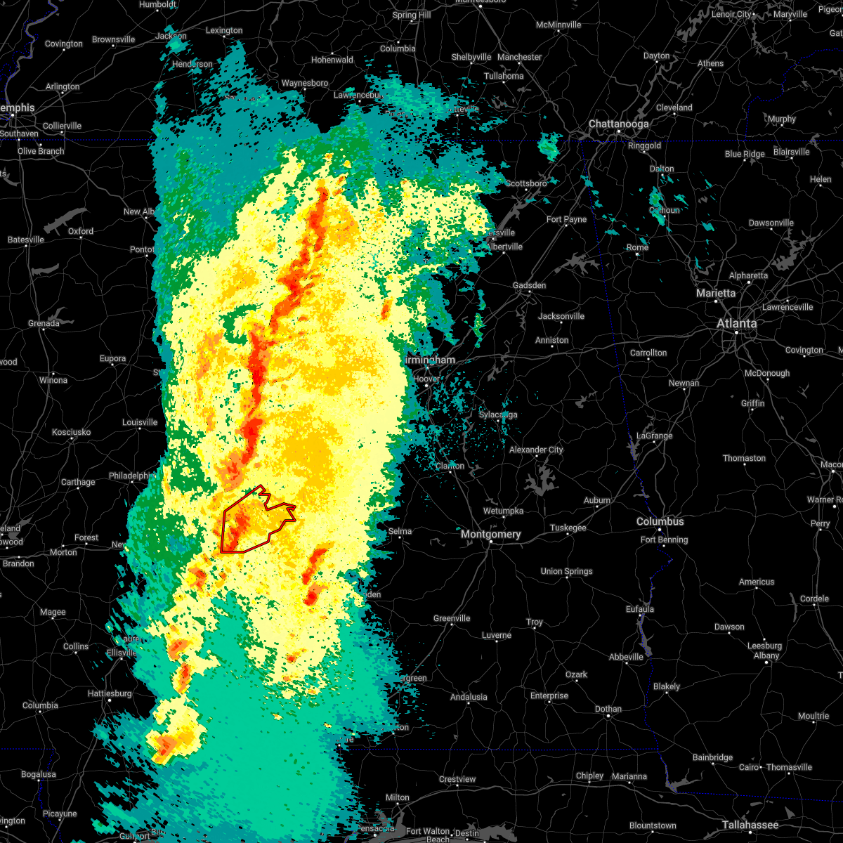 At 845 pm cdt, a severe thunderstorm capable of producing a tornado was located near york, moving northeast at 45 mph (radar indicated rotation). Hazards include tornado. Flying debris will be dangerous to those caught without shelter. mobile homes will be damaged or destroyed. damage to roofs, windows, and vehicles will occur. tree damage is likely. Locations impacted include, livingston, york, cuba, epes, boyd, the university of west alabama, bluffport, coatopa, dug hill, kinterbish, old mallard airport, belmont, demopolis lock and dam, lilita, mcdowell, bellamy, i 20 welcome center at cuba, ward and whitfield. At 845 pm cdt, a severe thunderstorm capable of producing a tornado was located near york, moving northeast at 45 mph (radar indicated rotation). Hazards include tornado. Flying debris will be dangerous to those caught without shelter. mobile homes will be damaged or destroyed. damage to roofs, windows, and vehicles will occur. tree damage is likely. Locations impacted include, livingston, york, cuba, epes, boyd, the university of west alabama, bluffport, coatopa, dug hill, kinterbish, old mallard airport, belmont, demopolis lock and dam, lilita, mcdowell, bellamy, i 20 welcome center at cuba, ward and whitfield.
|
| 3/30/2022 8:27 PM CDT |
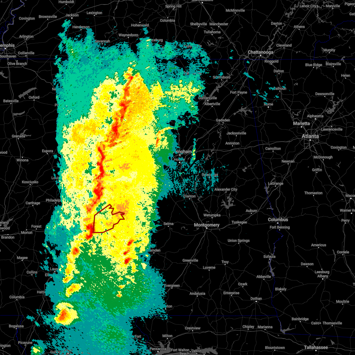 At 827 pm cdt, a severe thunderstorm capable of producing a tornado was located over alamucha, or 7 miles southwest of cuba, moving northeast at 60 mph (radar indicated rotation). Hazards include tornado. Flying debris will be dangerous to those caught without shelter. mobile homes will be damaged or destroyed. damage to roofs, windows, and vehicles will occur. Tree damage is likely. At 827 pm cdt, a severe thunderstorm capable of producing a tornado was located over alamucha, or 7 miles southwest of cuba, moving northeast at 60 mph (radar indicated rotation). Hazards include tornado. Flying debris will be dangerous to those caught without shelter. mobile homes will be damaged or destroyed. damage to roofs, windows, and vehicles will occur. Tree damage is likely.
|
| 3/30/2022 8:25 PM CDT |
 At 824 pm cdt, severe thunderstorms were located along a line extending from ethelsville to snell, moving northeast at 55 mph (radar indicated). Hazards include 60 mph wind gusts. Expect damage to roofs, siding, and trees. locations impacted include, demopolis, livingston, eutaw, york, aliceville, gordo, reform, carrollton, pickensville, cuba, forkland, boligee, union, gainesville, epes, ethelsville, emelle, mcmullen, panola and west greene. hail threat, radar indicated max hail size, <. 75 in wind threat, radar indicated max wind gust, 60 mph. At 824 pm cdt, severe thunderstorms were located along a line extending from ethelsville to snell, moving northeast at 55 mph (radar indicated). Hazards include 60 mph wind gusts. Expect damage to roofs, siding, and trees. locations impacted include, demopolis, livingston, eutaw, york, aliceville, gordo, reform, carrollton, pickensville, cuba, forkland, boligee, union, gainesville, epes, ethelsville, emelle, mcmullen, panola and west greene. hail threat, radar indicated max hail size, <. 75 in wind threat, radar indicated max wind gust, 60 mph.
|
| 3/30/2022 8:00 PM CDT |
 At 800 pm cdt, severe thunderstorms were located along a line extending from near deerbrook to near stonewall, moving northeast at 55 mph (radar indicated). Hazards include 60 mph wind gusts. expect damage to roofs, siding, and trees At 800 pm cdt, severe thunderstorms were located along a line extending from near deerbrook to near stonewall, moving northeast at 55 mph (radar indicated). Hazards include 60 mph wind gusts. expect damage to roofs, siding, and trees
|
| 2/3/2022 1:20 PM CST |
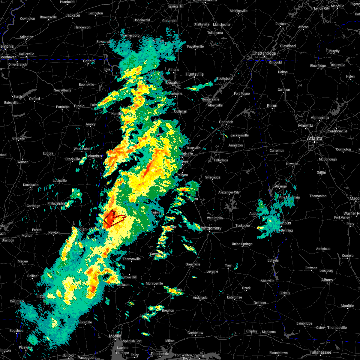 At 120 pm cst, a confirmed tornado was located over bluffport, or near livingston, moving northeast at 50 mph (radar confirmed tornado). Hazards include damaging tornado. Flying debris will be dangerous to those caught without shelter. mobile homes will be damaged or destroyed. damage to roofs, windows, and vehicles will occur. tree damage is likely. Locations impacted include, livingston, bluffport, coatopa, dug hill, the university of west alabama, bellamy, belmont and lilita. At 120 pm cst, a confirmed tornado was located over bluffport, or near livingston, moving northeast at 50 mph (radar confirmed tornado). Hazards include damaging tornado. Flying debris will be dangerous to those caught without shelter. mobile homes will be damaged or destroyed. damage to roofs, windows, and vehicles will occur. tree damage is likely. Locations impacted include, livingston, bluffport, coatopa, dug hill, the university of west alabama, bellamy, belmont and lilita.
|
| 2/3/2022 1:09 PM CST |
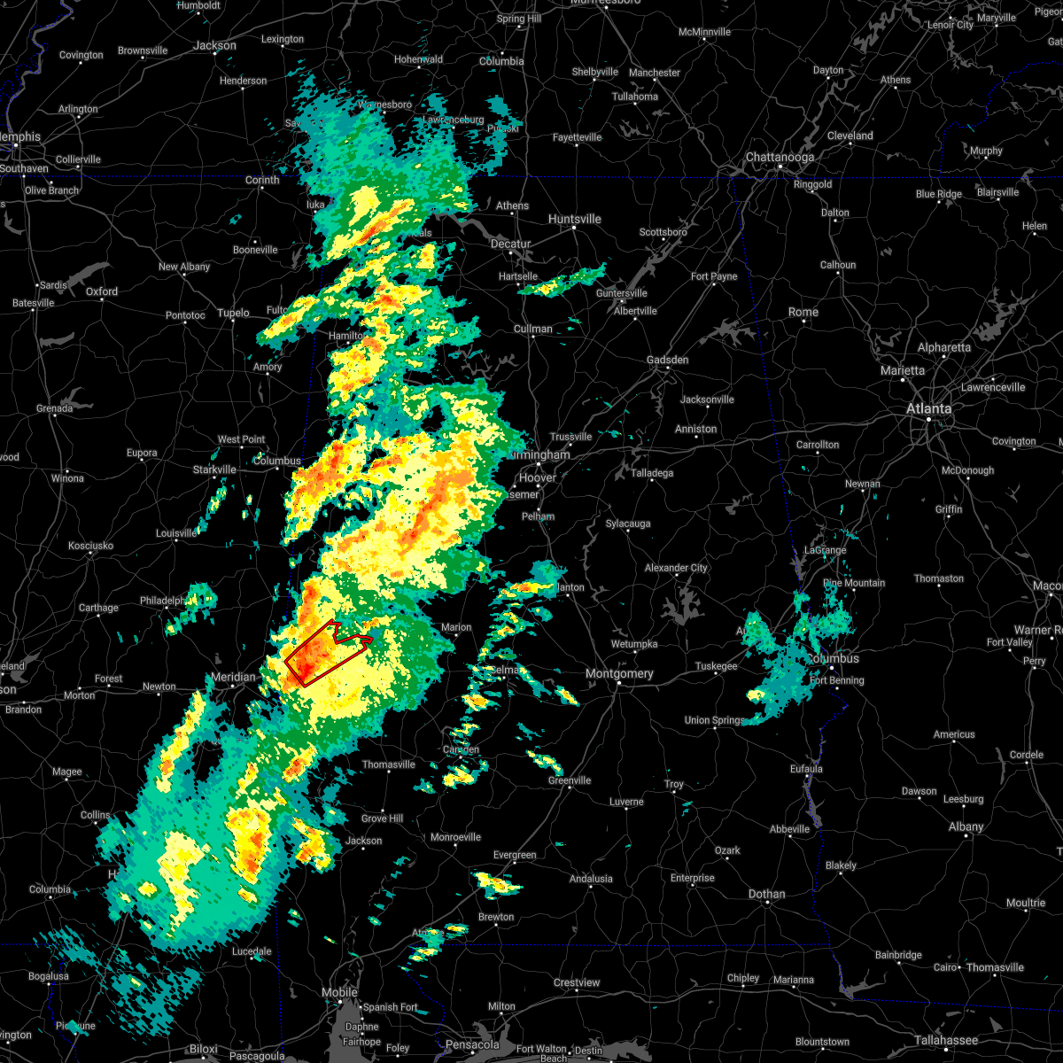 At 109 pm cst, a confirmed tornado was located near york, moving northeast at 50 mph (radar confirmed tornado). Hazards include damaging tornado. Flying debris will be dangerous to those caught without shelter. mobile homes will be damaged or destroyed. damage to roofs, windows, and vehicles will occur. tree damage is likely. Locations impacted include, livingston, york, epes, bluffport, coatopa, dug hill, the university of west alabama, old mallard airport, bellamy, belmont and lilita. At 109 pm cst, a confirmed tornado was located near york, moving northeast at 50 mph (radar confirmed tornado). Hazards include damaging tornado. Flying debris will be dangerous to those caught without shelter. mobile homes will be damaged or destroyed. damage to roofs, windows, and vehicles will occur. tree damage is likely. Locations impacted include, livingston, york, epes, bluffport, coatopa, dug hill, the university of west alabama, old mallard airport, bellamy, belmont and lilita.
|
| 2/3/2022 1:07 PM CST |
 At 106 pm cst, a severe thunderstorm capable of producing a tornado was located over york, moving northeast at 40 mph (radar indicated rotation). Hazards include tornado. Flying debris will be dangerous to those caught without shelter. mobile homes will be damaged or destroyed. damage to roofs, windows, and vehicles will occur. tree damage is likely. Locations impacted include, livingston, york, epes, bluffport, coatopa, dug hill, the university of west alabama, old mallard airport, bellamy, belmont and lilita. At 106 pm cst, a severe thunderstorm capable of producing a tornado was located over york, moving northeast at 40 mph (radar indicated rotation). Hazards include tornado. Flying debris will be dangerous to those caught without shelter. mobile homes will be damaged or destroyed. damage to roofs, windows, and vehicles will occur. tree damage is likely. Locations impacted include, livingston, york, epes, bluffport, coatopa, dug hill, the university of west alabama, old mallard airport, bellamy, belmont and lilita.
|
| 2/3/2022 12:51 PM CST |
 At 1251 pm cst, a severe thunderstorm capable of producing a tornado was located near cuba, moving northeast at 50 mph (radar indicated rotation). Hazards include tornado. Flying debris will be dangerous to those caught without shelter. mobile homes will be damaged or destroyed. damage to roofs, windows, and vehicles will occur. Tree damage is likely. At 1251 pm cst, a severe thunderstorm capable of producing a tornado was located near cuba, moving northeast at 50 mph (radar indicated rotation). Hazards include tornado. Flying debris will be dangerous to those caught without shelter. mobile homes will be damaged or destroyed. damage to roofs, windows, and vehicles will occur. Tree damage is likely.
|
| 5/4/2021 4:06 PM CDT |
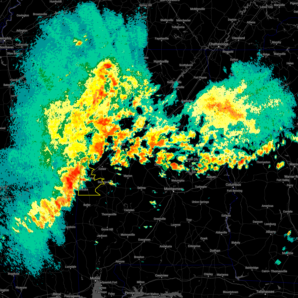 At 405 pm cdt, severe thunderstorms were located along a line extending from near electric mills to near alamucha, moving east at 60 mph. this line of severe storms will cross into alabama shortly (radar indicated). Hazards include 70 mph wind gusts. a wind gust to 63 mph was recently measured at the meridian airport. Expect considerable tree damage. damage is likely to mobile homes, roofs, and outbuildings. Locations impacted include, livingston, york, cuba, gainesville, epes, emelle, panola, the university of west alabama, dug hill, boyd, bluffport, coatopa, kinterbish, geiger, old mallard airport, belmont, demopolis lock and dam, sumterville, mcdowell and bellamy. At 405 pm cdt, severe thunderstorms were located along a line extending from near electric mills to near alamucha, moving east at 60 mph. this line of severe storms will cross into alabama shortly (radar indicated). Hazards include 70 mph wind gusts. a wind gust to 63 mph was recently measured at the meridian airport. Expect considerable tree damage. damage is likely to mobile homes, roofs, and outbuildings. Locations impacted include, livingston, york, cuba, gainesville, epes, emelle, panola, the university of west alabama, dug hill, boyd, bluffport, coatopa, kinterbish, geiger, old mallard airport, belmont, demopolis lock and dam, sumterville, mcdowell and bellamy.
|
| 5/4/2021 3:50 PM CDT |
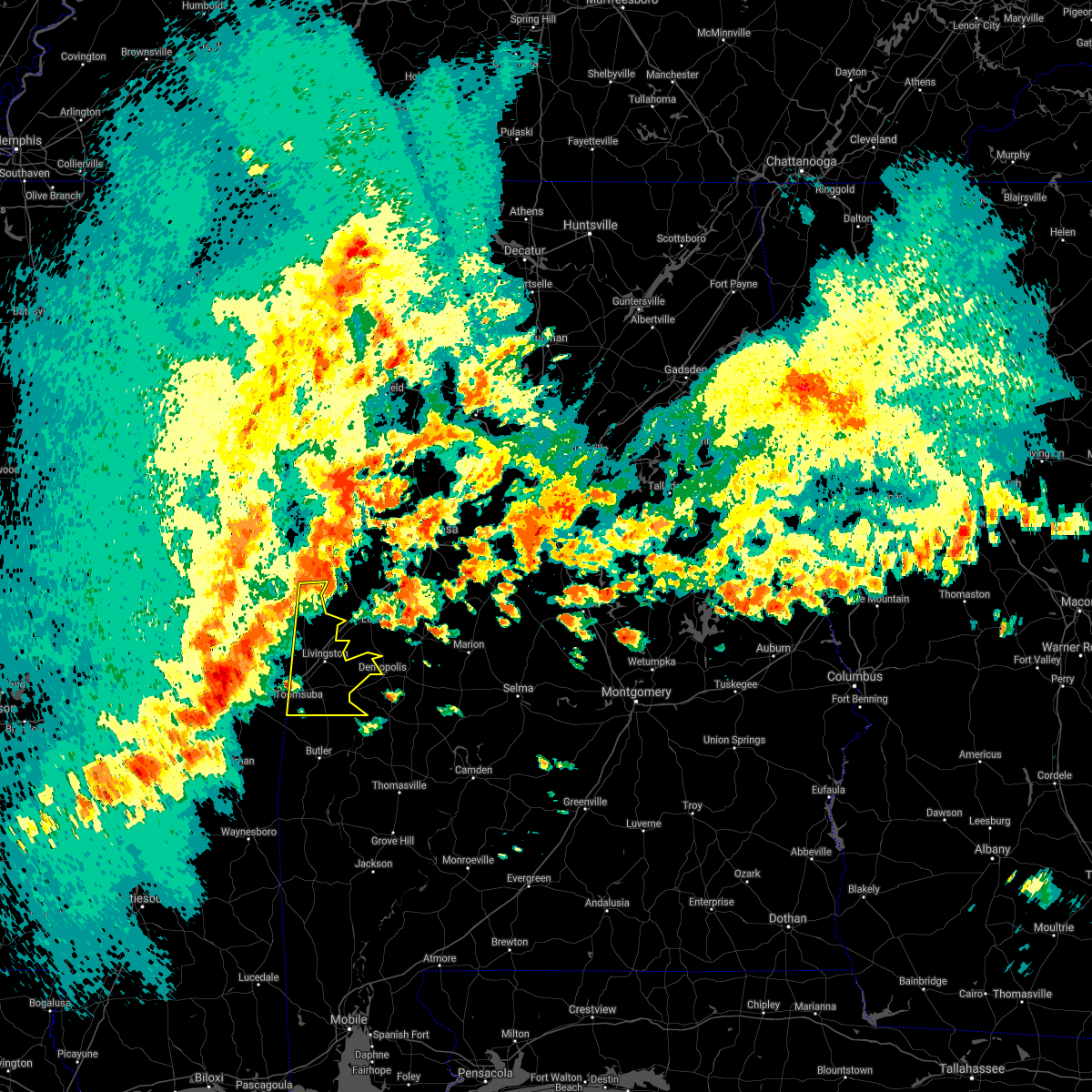 At 349 pm cdt, severe thunderstorms were located along a line extending from near bluff springs to near nellieburg, moving east at 60 mph (radar indicated). Hazards include 70 mph wind gusts. Expect considerable tree damage. Damage is likely to mobile homes, roofs, and outbuildings. At 349 pm cdt, severe thunderstorms were located along a line extending from near bluff springs to near nellieburg, moving east at 60 mph (radar indicated). Hazards include 70 mph wind gusts. Expect considerable tree damage. Damage is likely to mobile homes, roofs, and outbuildings.
|
| 4/9/2021 4:13 PM CDT |
 At 413 pm cdt, severe thunderstorms were located along a line extending from near duffys bend to near coatopa, moving east at 15 mph (radar indicated). Hazards include 60 mph wind gusts and quarter size hail. Hail damage to vehicles is expected. Expect wind damage to roofs, siding, and trees. At 413 pm cdt, severe thunderstorms were located along a line extending from near duffys bend to near coatopa, moving east at 15 mph (radar indicated). Hazards include 60 mph wind gusts and quarter size hail. Hail damage to vehicles is expected. Expect wind damage to roofs, siding, and trees.
|
| 3/25/2021 4:01 PM CDT |
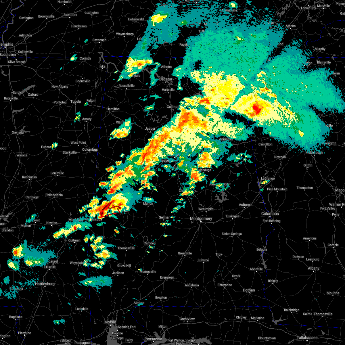 At 401 pm cdt, a severe thunderstorm capable of producing a tornado was located over bluffport, or near livingston, moving northeast at 50 mph (radar indicated rotation). Hazards include tornado. Flying debris will be dangerous to those caught without shelter. mobile homes will be damaged or destroyed. damage to roofs, windows, and vehicles will occur. tree damage is likely. Locations impacted include, livingston, bluffport, dug hill, belmont, demopolis lock and dam, lilita and mcdowell. At 401 pm cdt, a severe thunderstorm capable of producing a tornado was located over bluffport, or near livingston, moving northeast at 50 mph (radar indicated rotation). Hazards include tornado. Flying debris will be dangerous to those caught without shelter. mobile homes will be damaged or destroyed. damage to roofs, windows, and vehicles will occur. tree damage is likely. Locations impacted include, livingston, bluffport, dug hill, belmont, demopolis lock and dam, lilita and mcdowell.
|
| 3/25/2021 3:52 PM CDT |
 At 352 pm cdt, a severe thunderstorm capable of producing a tornado was located over york, moving northeast at 45 mph (radar indicated rotation). Hazards include tornado. Flying debris will be dangerous to those caught without shelter. mobile homes will be damaged or destroyed. damage to roofs, windows, and vehicles will occur. tree damage is likely. Locations impacted include, livingston, york, bluffport, coatopa, dug hill, the university of west alabama, old mallard airport, bellamy, belmont, demopolis lock and dam, lilita and mcdowell. At 352 pm cdt, a severe thunderstorm capable of producing a tornado was located over york, moving northeast at 45 mph (radar indicated rotation). Hazards include tornado. Flying debris will be dangerous to those caught without shelter. mobile homes will be damaged or destroyed. damage to roofs, windows, and vehicles will occur. tree damage is likely. Locations impacted include, livingston, york, bluffport, coatopa, dug hill, the university of west alabama, old mallard airport, bellamy, belmont, demopolis lock and dam, lilita and mcdowell.
|
| 3/25/2021 3:37 PM CDT |
 At 337 pm cdt, a severe thunderstorm capable of producing a tornado was located over alamucha, or near cuba, moving northeast at 45 mph (radar indicated rotation). Hazards include tornado. Flying debris will be dangerous to those caught without shelter. mobile homes will be damaged or destroyed. damage to roofs, windows, and vehicles will occur. Tree damage is likely. At 337 pm cdt, a severe thunderstorm capable of producing a tornado was located over alamucha, or near cuba, moving northeast at 45 mph (radar indicated rotation). Hazards include tornado. Flying debris will be dangerous to those caught without shelter. mobile homes will be damaged or destroyed. damage to roofs, windows, and vehicles will occur. Tree damage is likely.
|
| 3/16/2021 10:11 PM CDT |
 At 1011 pm cdt, a severe thunderstorm was located over lauderdale, moving east at 35 mph (radar indicated). Hazards include 60 mph wind gusts and quarter size hail. Hail damage to vehicles is expected. Expect wind damage to roofs, siding, and trees. At 1011 pm cdt, a severe thunderstorm was located over lauderdale, moving east at 35 mph (radar indicated). Hazards include 60 mph wind gusts and quarter size hail. Hail damage to vehicles is expected. Expect wind damage to roofs, siding, and trees.
|
| 6/25/2020 7:54 PM CDT |
 The severe thunderstorm warning for sumter county will expire at 800 pm cdt, the storms which prompted the warning have weakened below severe limits, and no longer pose an immediate threat to life or property. therefore, the warning will be allowed to expire. however gusty winds are still possible with these thunderstorms. The severe thunderstorm warning for sumter county will expire at 800 pm cdt, the storms which prompted the warning have weakened below severe limits, and no longer pose an immediate threat to life or property. therefore, the warning will be allowed to expire. however gusty winds are still possible with these thunderstorms.
|
| 6/25/2020 7:23 PM CDT |
 At 722 pm cdt, severe thunderstorms were located along a line extending from 7 miles northeast of de kalb to near pennington, moving northeast at 40 mph (radar indicated). Hazards include 60 mph wind gusts. a wind gust to 51 mph was measured at the meridian airport. this line of storms has a history of producing wind damage in mississippi. Expect damage to roofs, siding, and trees. Locations impacted include, livingston, york, cuba, gainesville, epes, emelle, panola, the university of west alabama, dug hill, boyd, bluffport, coatopa, kinterbish, geiger, old mallard airport, belmont, demopolis lock and dam, sumterville, mcdowell and bellamy. At 722 pm cdt, severe thunderstorms were located along a line extending from 7 miles northeast of de kalb to near pennington, moving northeast at 40 mph (radar indicated). Hazards include 60 mph wind gusts. a wind gust to 51 mph was measured at the meridian airport. this line of storms has a history of producing wind damage in mississippi. Expect damage to roofs, siding, and trees. Locations impacted include, livingston, york, cuba, gainesville, epes, emelle, panola, the university of west alabama, dug hill, boyd, bluffport, coatopa, kinterbish, geiger, old mallard airport, belmont, demopolis lock and dam, sumterville, mcdowell and bellamy.
|
| 6/25/2020 7:03 PM CDT |
 At 702 pm cdt, severe thunderstorms were located along a line extending from bluff springs to near lisman, moving northeast at 40 mph (radar indicated). Hazards include 60 mph wind gusts. a wind gust to 51 mph was reported at the meridian airport. this line of storms has a history of producing wind damage in mississippi. Expect damage to roofs, siding, and trees. Locations impacted include, livingston, york, cuba, gainesville, epes, emelle, panola, the university of west alabama, dug hill, boyd, bluffport, coatopa, kinterbish, geiger, old mallard airport, belmont, demopolis lock and dam, sumterville, mcdowell and bellamy. At 702 pm cdt, severe thunderstorms were located along a line extending from bluff springs to near lisman, moving northeast at 40 mph (radar indicated). Hazards include 60 mph wind gusts. a wind gust to 51 mph was reported at the meridian airport. this line of storms has a history of producing wind damage in mississippi. Expect damage to roofs, siding, and trees. Locations impacted include, livingston, york, cuba, gainesville, epes, emelle, panola, the university of west alabama, dug hill, boyd, bluffport, coatopa, kinterbish, geiger, old mallard airport, belmont, demopolis lock and dam, sumterville, mcdowell and bellamy.
|
| 6/25/2020 6:49 PM CDT |
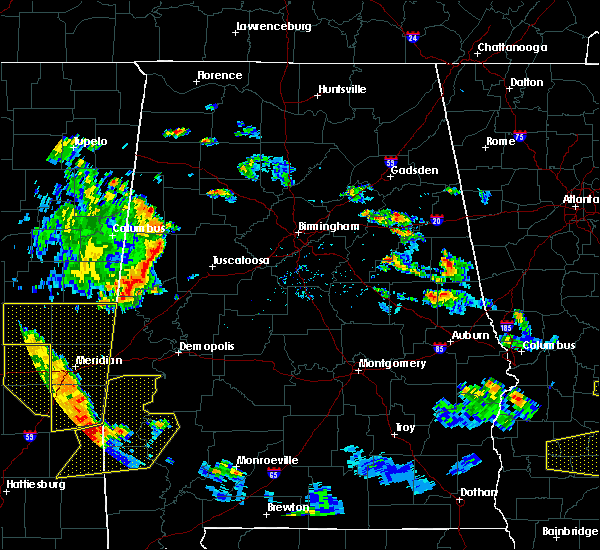 At 648 pm cdt, severe thunderstorms were located along a line extending from near forestdale to 7 miles northeast of crandall, moving northeast at 40 mph (radar indicated). Hazards include 60 mph wind gusts. this line of storms has a history of producing wind damage in mississippi. expect damage to roofs, siding, and trees At 648 pm cdt, severe thunderstorms were located along a line extending from near forestdale to 7 miles northeast of crandall, moving northeast at 40 mph (radar indicated). Hazards include 60 mph wind gusts. this line of storms has a history of producing wind damage in mississippi. expect damage to roofs, siding, and trees
|
| 5/23/2020 4:44 PM CDT |
 At 444 pm cdt, severe thunderstorms were located along a line extending from near boyd to near the university of west alabama, moving northeast at 15 mph (radar indicated). Hazards include 60 mph wind gusts and quarter size hail. Hail damage to vehicles is expected. Expect wind damage to roofs, siding, and trees. At 444 pm cdt, severe thunderstorms were located along a line extending from near boyd to near the university of west alabama, moving northeast at 15 mph (radar indicated). Hazards include 60 mph wind gusts and quarter size hail. Hail damage to vehicles is expected. Expect wind damage to roofs, siding, and trees.
|
| 4/19/2020 5:32 PM CDT |
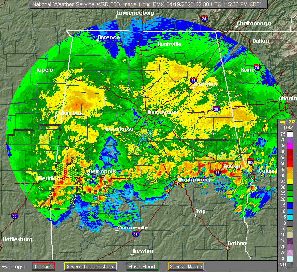 At 532 pm cdt, severe thunderstorms were located along a line extending from near epes to kinterbish, moving east at 40 mph (radar indicated). Hazards include 60 mph wind gusts and nickel size hail. Expect damage to roofs, siding, and trees. Locations impacted include, livingston, york, epes, the university of west alabama, bluffport, coatopa, dug hill, kinterbish, old mallard airport, lilita, bellamy, ward and whitfield. At 532 pm cdt, severe thunderstorms were located along a line extending from near epes to kinterbish, moving east at 40 mph (radar indicated). Hazards include 60 mph wind gusts and nickel size hail. Expect damage to roofs, siding, and trees. Locations impacted include, livingston, york, epes, the university of west alabama, bluffport, coatopa, dug hill, kinterbish, old mallard airport, lilita, bellamy, ward and whitfield.
|
| 4/19/2020 5:08 PM CDT |
 At 508 pm cdt, severe thunderstorms were located along a line extending from near boyd to alamucha, moving east at 85 mph (radar indicated). Hazards include 60 mph wind gusts and nickel size hail. expect damage to roofs, siding, and trees At 508 pm cdt, severe thunderstorms were located along a line extending from near boyd to alamucha, moving east at 85 mph (radar indicated). Hazards include 60 mph wind gusts and nickel size hail. expect damage to roofs, siding, and trees
|
| 4/8/2020 3:09 PM CDT |
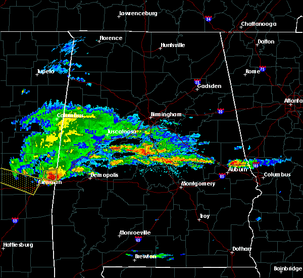 At 309 pm cdt, a severe thunderstorm was located over york, moving east at 55 mph (radar indicated). Hazards include 60 mph wind gusts and quarter size hail. Hail damage to vehicles is expected. Expect wind damage to roofs, siding, and trees. At 309 pm cdt, a severe thunderstorm was located over york, moving east at 55 mph (radar indicated). Hazards include 60 mph wind gusts and quarter size hail. Hail damage to vehicles is expected. Expect wind damage to roofs, siding, and trees.
|
| 3/4/2020 4:50 AM CST |
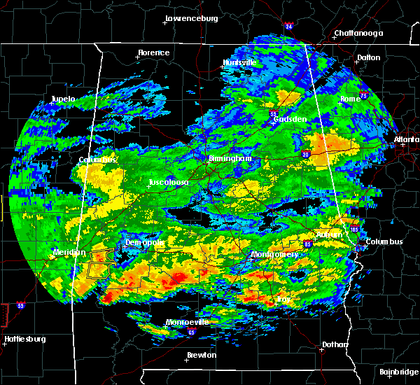 At 450 am cst, a severe thunderstorm was located 8 miles south of coatopa, or 14 miles southeast of york, moving east at 50 mph (radar indicated). Hazards include 60 mph wind gusts. Expect damage to roofs, siding, and trees. Locations impacted include, whitfield and bellamy. At 450 am cst, a severe thunderstorm was located 8 miles south of coatopa, or 14 miles southeast of york, moving east at 50 mph (radar indicated). Hazards include 60 mph wind gusts. Expect damage to roofs, siding, and trees. Locations impacted include, whitfield and bellamy.
|
| 3/4/2020 4:39 AM CST |
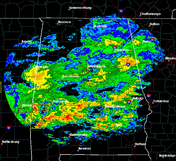 At 439 am cst, a severe thunderstorm was located over kinterbish, or 9 miles southeast of cuba, moving east at 45 mph (radar indicated). Hazards include 60 mph wind gusts. Expect damage to roofs, siding, and trees. Locations impacted include, kinterbish, bellamy, ward and whitfield. At 439 am cst, a severe thunderstorm was located over kinterbish, or 9 miles southeast of cuba, moving east at 45 mph (radar indicated). Hazards include 60 mph wind gusts. Expect damage to roofs, siding, and trees. Locations impacted include, kinterbish, bellamy, ward and whitfield.
|
| 3/4/2020 4:20 AM CST |
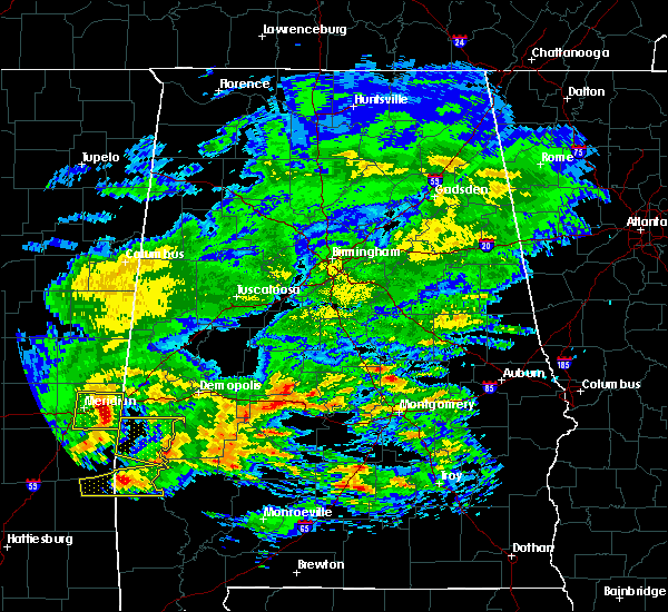 At 420 am cst, a severe thunderstorm was located over alamucha, or 8 miles southwest of cuba, moving east at 50 mph (radar indicated). Hazards include 60 mph wind gusts. expect damage to roofs, siding, and trees At 420 am cst, a severe thunderstorm was located over alamucha, or 8 miles southwest of cuba, moving east at 50 mph (radar indicated). Hazards include 60 mph wind gusts. expect damage to roofs, siding, and trees
|
| 2/6/2020 2:58 AM CST |
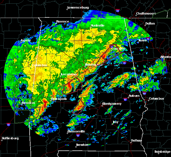 At 257 am cst, a severe thunderstorm was located near jefferson, or 8 miles southwest of demopolis, moving northeast at 55 mph (radar indicated). Hazards include 60 mph wind gusts and quarter size hail. Hail damage to vehicles is expected. Expect wind damage to roofs, siding, and trees. At 257 am cst, a severe thunderstorm was located near jefferson, or 8 miles southwest of demopolis, moving northeast at 55 mph (radar indicated). Hazards include 60 mph wind gusts and quarter size hail. Hail damage to vehicles is expected. Expect wind damage to roofs, siding, and trees.
|
| 2/6/2020 1:57 AM CST |
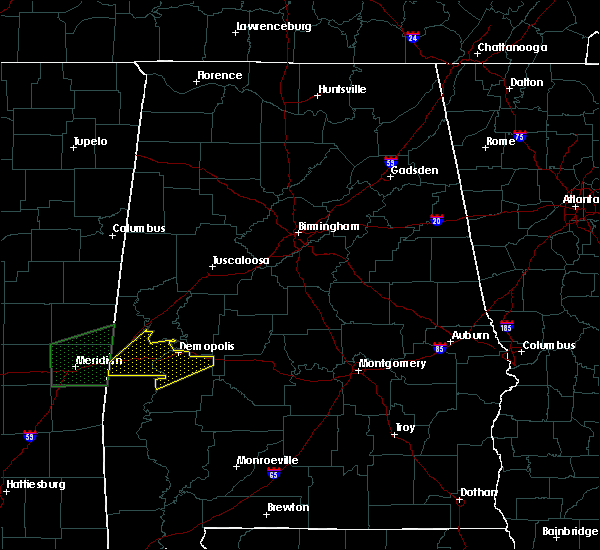 At 157 am cst, a severe thunderstorm was located near dug hill, or 7 miles west of demopolis, moving northeast at 65 mph (radar indicated). Hazards include 60 mph wind gusts and quarter size hail. Hail damage to vehicles is expected. expect wind damage to roofs, siding, and trees. locations impacted include, demopolis, linden, uniontown, jefferson, faunsdale, pin hook, bluffport, coatopa, dug hill, chickasaw state park, u. s. 80 and al 28, old spring hill, belmont, demopolis lock and dam, mcdowell, whitfield and demopolis municipal airport. At 157 am cst, a severe thunderstorm was located near dug hill, or 7 miles west of demopolis, moving northeast at 65 mph (radar indicated). Hazards include 60 mph wind gusts and quarter size hail. Hail damage to vehicles is expected. expect wind damage to roofs, siding, and trees. locations impacted include, demopolis, linden, uniontown, jefferson, faunsdale, pin hook, bluffport, coatopa, dug hill, chickasaw state park, u. s. 80 and al 28, old spring hill, belmont, demopolis lock and dam, mcdowell, whitfield and demopolis municipal airport.
|
| 2/6/2020 1:47 AM CST |
 At 146 am cst, a severe thunderstorm was located 7 miles south of coatopa, or 13 miles southeast of york, moving northeast at 55 mph (radar indicated). Hazards include 60 mph wind gusts and quarter size hail. Hail damage to vehicles is expected. expect wind damage to roofs, siding, and trees. locations impacted include, demopolis, livingston, york, linden, uniontown, jefferson, epes, faunsdale, pin hook, the university of west alabama, bluffport, coatopa, dug hill, chickasaw state park, old mallard airport, u. s. 80 and al 28, old spring hill, belmont, demopolis lock and dam and lilita. At 146 am cst, a severe thunderstorm was located 7 miles south of coatopa, or 13 miles southeast of york, moving northeast at 55 mph (radar indicated). Hazards include 60 mph wind gusts and quarter size hail. Hail damage to vehicles is expected. expect wind damage to roofs, siding, and trees. locations impacted include, demopolis, livingston, york, linden, uniontown, jefferson, epes, faunsdale, pin hook, the university of west alabama, bluffport, coatopa, dug hill, chickasaw state park, old mallard airport, u. s. 80 and al 28, old spring hill, belmont, demopolis lock and dam and lilita.
|
| 2/6/2020 1:19 AM CST |
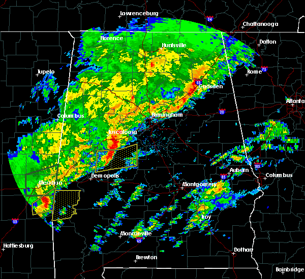 At 119 am cst, a severe thunderstorm was located over snell, or 17 miles southeast of meridian, moving northeast at 65 mph (radar indicated). Hazards include 60 mph wind gusts and quarter size hail. Hail damage to vehicles is expected. Expect wind damage to roofs, siding, and trees. At 119 am cst, a severe thunderstorm was located over snell, or 17 miles southeast of meridian, moving northeast at 65 mph (radar indicated). Hazards include 60 mph wind gusts and quarter size hail. Hail damage to vehicles is expected. Expect wind damage to roofs, siding, and trees.
|
| 2/6/2020 12:15 AM CST |
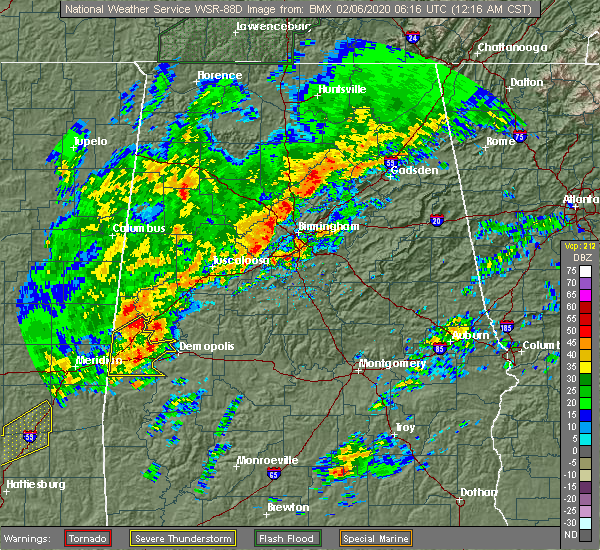 At 1215 am cst, severe thunderstorms were located along a line extending from near emelle to near coatopa, moving northeast at 65 mph (radar indicated). Hazards include 60 mph wind gusts. Expect damage to roofs, siding, and trees. Locations impacted include, livingston, york, gainesville, epes, boyd, the university of west alabama, bluffport, coatopa, dug hill, old mallard airport, belmont, demopolis lock and dam, sumterville, lilita, mcdowell, bellamy and payneville. At 1215 am cst, severe thunderstorms were located along a line extending from near emelle to near coatopa, moving northeast at 65 mph (radar indicated). Hazards include 60 mph wind gusts. Expect damage to roofs, siding, and trees. Locations impacted include, livingston, york, gainesville, epes, boyd, the university of west alabama, bluffport, coatopa, dug hill, old mallard airport, belmont, demopolis lock and dam, sumterville, lilita, mcdowell, bellamy and payneville.
|
| 2/6/2020 12:06 AM CST |
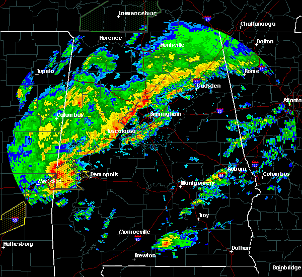 At 1205 am cst, severe thunderstorms were located along a line extending from near boyd to near kinterbish, moving northeast at 70 mph (radar indicated). Hazards include 60 mph wind gusts and quarter size hail. Hail damage to vehicles is expected. expect wind damage to roofs, siding, and trees. Locations impacted include, livingston, york, cuba, gainesville, epes, boyd, the university of west alabama, bluffport, coatopa, dug hill, kinterbish, old mallard airport, belmont, demopolis lock and dam, sumterville, lilita, mcdowell, bellamy, i 20 welcome center at cuba and ward. At 1205 am cst, severe thunderstorms were located along a line extending from near boyd to near kinterbish, moving northeast at 70 mph (radar indicated). Hazards include 60 mph wind gusts and quarter size hail. Hail damage to vehicles is expected. expect wind damage to roofs, siding, and trees. Locations impacted include, livingston, york, cuba, gainesville, epes, boyd, the university of west alabama, bluffport, coatopa, dug hill, kinterbish, old mallard airport, belmont, demopolis lock and dam, sumterville, lilita, mcdowell, bellamy, i 20 welcome center at cuba and ward.
|
| 2/5/2020 11:44 PM CST |
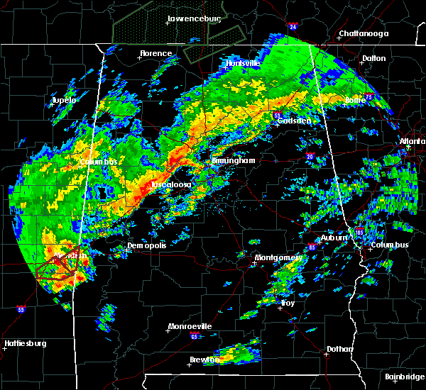 At 1143 pm cst, severe thunderstorms were located along a line extending from marion to near sable, moving northeast at 65 mph (radar indicated). Hazards include 60 mph wind gusts. expect damage to roofs, siding, and trees At 1143 pm cst, severe thunderstorms were located along a line extending from marion to near sable, moving northeast at 65 mph (radar indicated). Hazards include 60 mph wind gusts. expect damage to roofs, siding, and trees
|
| 1/11/2020 11:28 PM CST | A few trees were blown down around bellam in sumter county AL, 0.6 miles N of Bellamy, AL |
| 1/11/2020 11:46 AM CST |
 At 1145 am cst, severe thunderstorms were located along a line extending from near glen allen to near coker to near jefferson, moving northeast at 50 mph (radar indicated). Hazards include 60 mph wind gusts. Expect damage to roofs, siding, and trees. Locations impacted include, tuscaloosa, northport, demopolis, winfield, fayette, eutaw, greensboro, uniontown, gordo, holt, jefferson, moundville, berry, coker, forkland, glen allen, akron, union, newbern and faunsdale. At 1145 am cst, severe thunderstorms were located along a line extending from near glen allen to near coker to near jefferson, moving northeast at 50 mph (radar indicated). Hazards include 60 mph wind gusts. Expect damage to roofs, siding, and trees. Locations impacted include, tuscaloosa, northport, demopolis, winfield, fayette, eutaw, greensboro, uniontown, gordo, holt, jefferson, moundville, berry, coker, forkland, glen allen, akron, union, newbern and faunsdale.
|
| 1/11/2020 11:28 AM CST | Corrects previous tstm wnd dmg report from 2 s lilita. a few trees were blown down around bellam in sumter county AL, 0.6 miles N of Bellamy, AL |
| 1/11/2020 11:27 AM CST |
 At 1127 am cst, severe thunderstorms were located along a line extending from near fayette to near coatopa, moving northeast at 45 mph (radar indicated). Hazards include 60 mph wind gusts. expect damage to roofs, siding, and trees At 1127 am cst, severe thunderstorms were located along a line extending from near fayette to near coatopa, moving northeast at 45 mph (radar indicated). Hazards include 60 mph wind gusts. expect damage to roofs, siding, and trees
|
| 1/11/2020 11:08 AM CST |
 At 1108 am cst, severe thunderstorms were located along a line extending from 6 miles northwest of carrollton to near west greene to 7 miles east of kinterbish, moving northeast at 55 mph (radar indicated). Hazards include 60 mph wind gusts. Expect damage to roofs, siding, and trees. Locations impacted include, demopolis, livingston, eutaw, york, aliceville, gordo, reform, carrollton, pickensville, cuba, forkland, boligee, union, gainesville, epes, ethelsville, emelle, mcmullen, panola and west greene. At 1108 am cst, severe thunderstorms were located along a line extending from 6 miles northwest of carrollton to near west greene to 7 miles east of kinterbish, moving northeast at 55 mph (radar indicated). Hazards include 60 mph wind gusts. Expect damage to roofs, siding, and trees. Locations impacted include, demopolis, livingston, eutaw, york, aliceville, gordo, reform, carrollton, pickensville, cuba, forkland, boligee, union, gainesville, epes, ethelsville, emelle, mcmullen, panola and west greene.
|
| 1/11/2020 10:36 AM CST |
 At 1035 am cst, severe thunderstorms were located along a line extending from near macon to near electric mills to middleton, moving northeast at 55 mph (radar indicated). Hazards include 60 mph wind gusts. expect damage to roofs, siding, and trees At 1035 am cst, severe thunderstorms were located along a line extending from near macon to near electric mills to middleton, moving northeast at 55 mph (radar indicated). Hazards include 60 mph wind gusts. expect damage to roofs, siding, and trees
|
| 12/16/2019 7:58 PM CST |
 At 758 pm cst, a confirmed large and extremely dangerous tornado was located near coatopa, or 14 miles southeast of york, moving northeast at 45 mph. this is a particularly dangerous situation. take cover now! (radar confirmed tornado). Hazards include damaging tornado. You are in a life-threatening situation. flying debris may be deadly to those caught without shelter. mobile homes will be destroyed. considerable damage to homes, businesses, and vehicles is likely and complete destruction is possible. locations impacted include, demopolis, jefferson, coatopa, dug hill, u. s. 80 and al 28, bellamy, whitfield, belmont, demopolis lock and dam, lilita, mcdowell and demopolis municipal airport. At 758 pm cst, a confirmed large and extremely dangerous tornado was located near coatopa, or 14 miles southeast of york, moving northeast at 45 mph. this is a particularly dangerous situation. take cover now! (radar confirmed tornado). Hazards include damaging tornado. You are in a life-threatening situation. flying debris may be deadly to those caught without shelter. mobile homes will be destroyed. considerable damage to homes, businesses, and vehicles is likely and complete destruction is possible. locations impacted include, demopolis, jefferson, coatopa, dug hill, u. s. 80 and al 28, bellamy, whitfield, belmont, demopolis lock and dam, lilita, mcdowell and demopolis municipal airport.
|
| 12/16/2019 7:50 PM CST |
 At 750 pm cst, a confirmed large and extremely dangerous tornado was located 7 miles east of kinterbish, or 14 miles southeast of york, moving northeast at 40 mph. this is a particularly dangerous situation. take cover now! (radar confirmed tornado). Hazards include damaging tornado. You are in a life-threatening situation. flying debris may be deadly to those caught without shelter. mobile homes will be destroyed. considerable damage to homes, businesses, and vehicles is likely and complete destruction is possible. locations impacted include, demopolis, jefferson, coatopa, dug hill, kinterbish, u. s. 80 and al 28, belmont, demopolis lock and dam, lilita, mcdowell, bellamy, ward, whitfield and demopolis municipal airport. At 750 pm cst, a confirmed large and extremely dangerous tornado was located 7 miles east of kinterbish, or 14 miles southeast of york, moving northeast at 40 mph. this is a particularly dangerous situation. take cover now! (radar confirmed tornado). Hazards include damaging tornado. You are in a life-threatening situation. flying debris may be deadly to those caught without shelter. mobile homes will be destroyed. considerable damage to homes, businesses, and vehicles is likely and complete destruction is possible. locations impacted include, demopolis, jefferson, coatopa, dug hill, kinterbish, u. s. 80 and al 28, belmont, demopolis lock and dam, lilita, mcdowell, bellamy, ward, whitfield and demopolis municipal airport.
|
| 12/16/2019 7:45 PM CST |
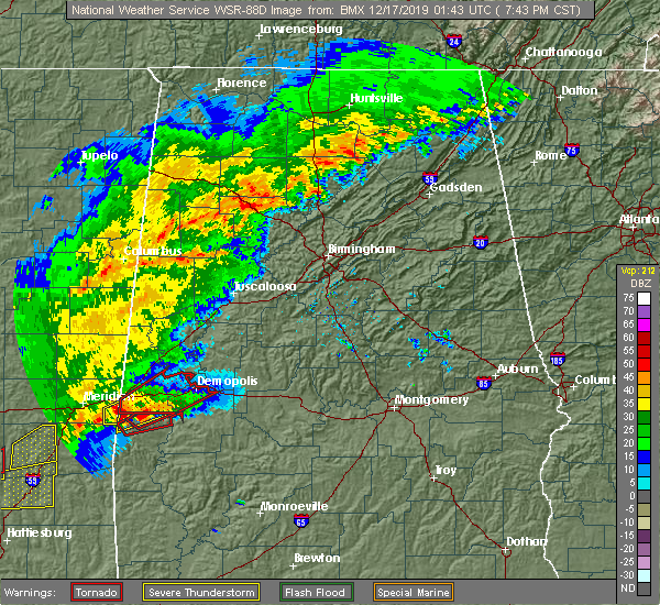 At 745 pm cst, a severe thunderstorm capable of producing a tornado was located near kinterbish, or 14 miles southeast of cuba, moving northeast at 40 mph (radar indicated rotation). Hazards include tornado. Flying debris will be dangerous to those caught without shelter. mobile homes will be damaged or destroyed. damage to roofs, windows, and vehicles will occur. tree damage is likely. locations impacted include, demopolis, livingston, york, cuba, jefferson, bluffport, coatopa, dug hill, kinterbish, old mallard airport, u. s. 80 and al 28, old spring hill, belmont, demopolis lock and dam, lilita, mcdowell, bellamy, ward, whitfield and demopolis municipal airport. At 745 pm cst, a severe thunderstorm capable of producing a tornado was located near kinterbish, or 14 miles southeast of cuba, moving northeast at 40 mph (radar indicated rotation). Hazards include tornado. Flying debris will be dangerous to those caught without shelter. mobile homes will be damaged or destroyed. damage to roofs, windows, and vehicles will occur. tree damage is likely. locations impacted include, demopolis, livingston, york, cuba, jefferson, bluffport, coatopa, dug hill, kinterbish, old mallard airport, u. s. 80 and al 28, old spring hill, belmont, demopolis lock and dam, lilita, mcdowell, bellamy, ward, whitfield and demopolis municipal airport.
|
| 12/16/2019 7:34 PM CST |
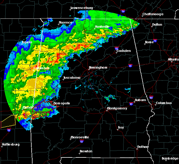 At 734 pm cst, a severe thunderstorm capable of producing a tornado was located near lisman, or 10 miles north of butler, moving northeast at 40 mph (radar indicated rotation). Hazards include tornado. Flying debris will be dangerous to those caught without shelter. mobile homes will be damaged or destroyed. damage to roofs, windows, and vehicles will occur. Tree damage is likely. At 734 pm cst, a severe thunderstorm capable of producing a tornado was located near lisman, or 10 miles north of butler, moving northeast at 40 mph (radar indicated rotation). Hazards include tornado. Flying debris will be dangerous to those caught without shelter. mobile homes will be damaged or destroyed. damage to roofs, windows, and vehicles will occur. Tree damage is likely.
|
| 4/18/2019 4:31 PM CDT |
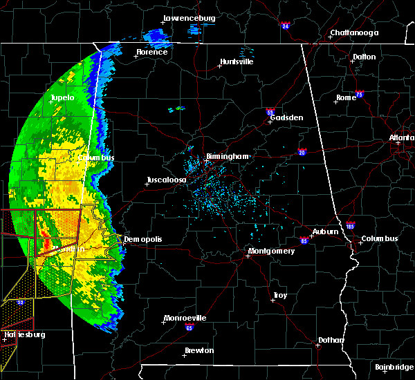 At 430 pm cdt, severe thunderstorms were located along a line extending from near liberty to near daleville to savoy, moving northeast at 55 mph (radar indicated). Hazards include 60 mph wind gusts. expect damage to roofs, siding, and trees At 430 pm cdt, severe thunderstorms were located along a line extending from near liberty to near daleville to savoy, moving northeast at 55 mph (radar indicated). Hazards include 60 mph wind gusts. expect damage to roofs, siding, and trees
|
| 6/28/2018 5:08 PM CDT |
 At 508 pm cdt, severe thunderstorms were located along a line extending from pickensville to near central mills, moving southwest at 25 mph (radar indicated). Hazards include 60 mph wind gusts. expect damage to roofs, siding, and trees At 508 pm cdt, severe thunderstorms were located along a line extending from pickensville to near central mills, moving southwest at 25 mph (radar indicated). Hazards include 60 mph wind gusts. expect damage to roofs, siding, and trees
|
| 4/27/2017 1:33 AM CDT |
 At 132 am cdt, a severe thunderstorm was located near coatopa, or 11 miles southeast of livingston, moving northeast at 50 mph (radar indicated). Hazards include 60 mph wind gusts and quarter size hail. Hail damage to vehicles is expected. expect wind damage to roofs, siding, and trees. Locations impacted include, coatopa, dug hill, bellamy, whitfield, belmont, demopolis lock and dam, lilita and mcdowell. At 132 am cdt, a severe thunderstorm was located near coatopa, or 11 miles southeast of livingston, moving northeast at 50 mph (radar indicated). Hazards include 60 mph wind gusts and quarter size hail. Hail damage to vehicles is expected. expect wind damage to roofs, siding, and trees. Locations impacted include, coatopa, dug hill, bellamy, whitfield, belmont, demopolis lock and dam, lilita and mcdowell.
|
| 4/27/2017 1:16 AM CDT |
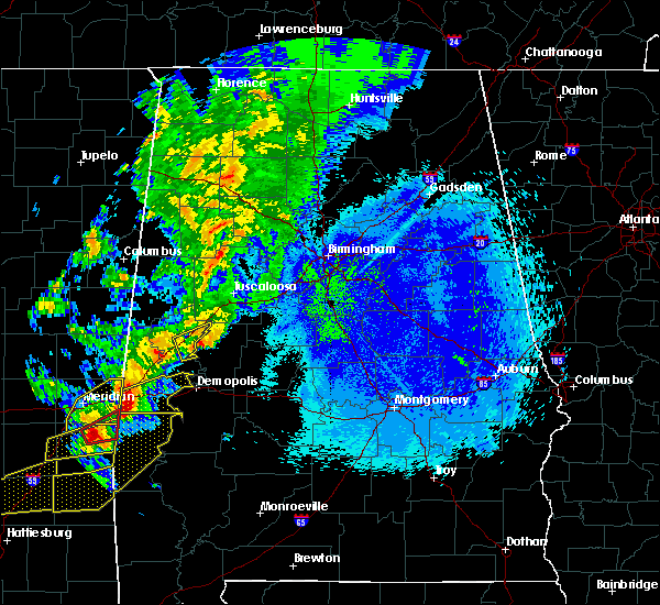 At 116 am cdt, a severe thunderstorm was located over kinterbish, or 7 miles southeast of cuba, moving east at 45 mph (radar indicated). Hazards include 60 mph wind gusts and quarter size hail. Hail damage to vehicles is expected. expect wind damage to roofs, siding, and trees. Locations impacted include, cuba, coatopa, dug hill, kinterbish, bellamy, whitfield, ward, belmont, demopolis lock and dam, lilita and mcdowell. At 116 am cdt, a severe thunderstorm was located over kinterbish, or 7 miles southeast of cuba, moving east at 45 mph (radar indicated). Hazards include 60 mph wind gusts and quarter size hail. Hail damage to vehicles is expected. expect wind damage to roofs, siding, and trees. Locations impacted include, cuba, coatopa, dug hill, kinterbish, bellamy, whitfield, ward, belmont, demopolis lock and dam, lilita and mcdowell.
|
| 4/27/2017 12:56 AM CDT |
 At 1256 am cdt, a severe thunderstorm was located over alamucha, or 7 miles southwest of cuba, moving east at 55 mph (radar indicated). Hazards include 60 mph wind gusts and quarter size hail. Hail damage to vehicles is expected. Expect wind damage to roofs, siding, and trees. At 1256 am cdt, a severe thunderstorm was located over alamucha, or 7 miles southwest of cuba, moving east at 55 mph (radar indicated). Hazards include 60 mph wind gusts and quarter size hail. Hail damage to vehicles is expected. Expect wind damage to roofs, siding, and trees.
|
| 4/3/2017 4:07 AM CDT |
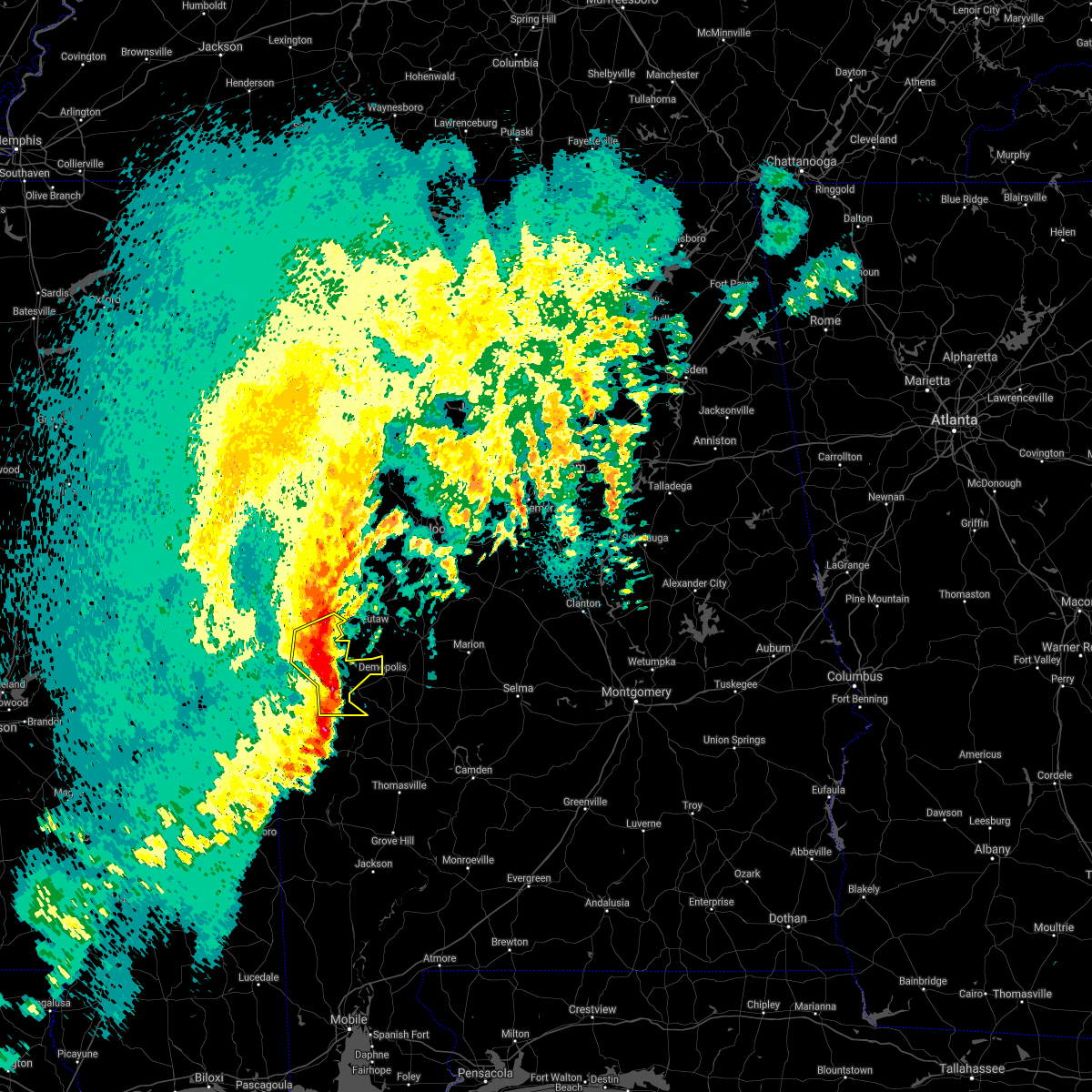 At 407 am cdt, severe thunderstorms were located along a line extending from near epes to near coatopa to 7 miles north of pennington, moving northeast at 50 mph (radar indicated). Hazards include 60 mph wind gusts. Expect damage to roofs, siding, and trees. Locations impacted include, demopolis, livingston, york, gainesville, epes, emelle, boyd, the university of west alabama, bluffport, coatopa, dug hill, old mallard airport, belmont, demopolis lock and dam, sumterville, lilita, mcdowell, bellamy, whitfield and payneville. At 407 am cdt, severe thunderstorms were located along a line extending from near epes to near coatopa to 7 miles north of pennington, moving northeast at 50 mph (radar indicated). Hazards include 60 mph wind gusts. Expect damage to roofs, siding, and trees. Locations impacted include, demopolis, livingston, york, gainesville, epes, emelle, boyd, the university of west alabama, bluffport, coatopa, dug hill, old mallard airport, belmont, demopolis lock and dam, sumterville, lilita, mcdowell, bellamy, whitfield and payneville.
|
| 4/3/2017 3:52 AM CDT |
 At 352 am cdt, severe thunderstorms were located along a line extending from near emelle to near cuba to 6 miles northwest of lisman, moving northeast at 40 mph (radar indicated). Hazards include 60 mph wind gusts. Expect damage to roofs, siding, and trees. Locations impacted include, livingston, york, cuba, gainesville, epes, emelle, boyd, the university of west alabama, bluffport, coatopa, dug hill, kinterbish, old mallard airport, belmont, demopolis lock and dam, sumterville, lilita, mcdowell, bellamy and i 20 welcome center at cuba. At 352 am cdt, severe thunderstorms were located along a line extending from near emelle to near cuba to 6 miles northwest of lisman, moving northeast at 40 mph (radar indicated). Hazards include 60 mph wind gusts. Expect damage to roofs, siding, and trees. Locations impacted include, livingston, york, cuba, gainesville, epes, emelle, boyd, the university of west alabama, bluffport, coatopa, dug hill, kinterbish, old mallard airport, belmont, demopolis lock and dam, sumterville, lilita, mcdowell, bellamy and i 20 welcome center at cuba.
|
| 4/3/2017 3:39 AM CDT |
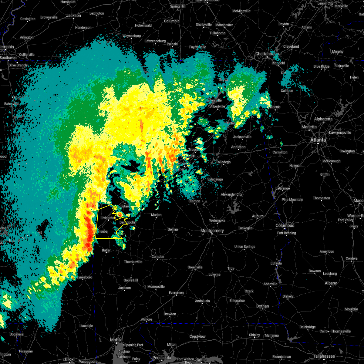 At 338 am cdt, severe thunderstorms were located along a line extending from near tamola to kewanee to snell, moving northeast at 50 mph (radar indicated). Hazards include 60 mph wind gusts. expect damage to roofs, siding, and trees At 338 am cdt, severe thunderstorms were located along a line extending from near tamola to kewanee to snell, moving northeast at 50 mph (radar indicated). Hazards include 60 mph wind gusts. expect damage to roofs, siding, and trees
|
| 11/28/2016 7:17 PM CST |
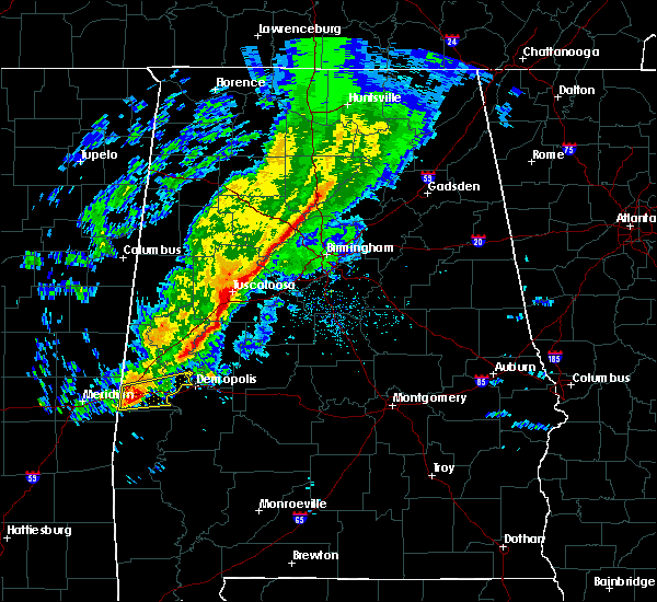 At 717 pm cst, a severe thunderstorm was located near coatopa, or 10 miles east of york, moving east at 50 mph (radar indicated). Hazards include 60 mph wind gusts. Expect damage to roofs. siding. and trees. Locations impacted include, york, coatopa, dug hill, lilita, mcdowell, bellamy, ward, belmont, demopolis lock and dam, whitfield and old mallard airport. At 717 pm cst, a severe thunderstorm was located near coatopa, or 10 miles east of york, moving east at 50 mph (radar indicated). Hazards include 60 mph wind gusts. Expect damage to roofs. siding. and trees. Locations impacted include, york, coatopa, dug hill, lilita, mcdowell, bellamy, ward, belmont, demopolis lock and dam, whitfield and old mallard airport.
|
| 11/28/2016 6:59 PM CST |
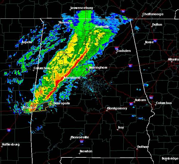 At 659 pm cst, a severe thunderstorm was located over cuba, moving east at 50 mph (radar indicated). Hazards include 60 mph wind gusts and nickel size hail. Expect damage to roofs. siding. And trees. At 659 pm cst, a severe thunderstorm was located over cuba, moving east at 50 mph (radar indicated). Hazards include 60 mph wind gusts and nickel size hail. Expect damage to roofs. siding. And trees.
|
| 6/17/2016 4:11 PM CDT |
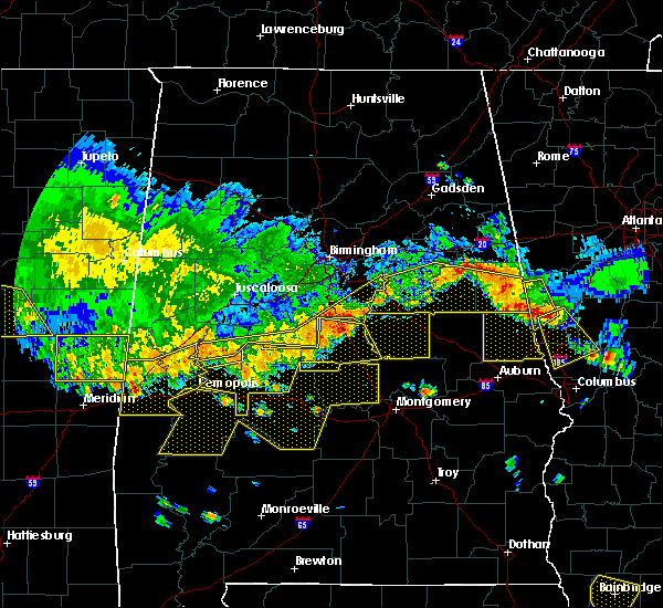 At 411 pm cdt, severe thunderstorms were located along a line extending from near tamola to near the university of west alabama to near duffys bend, moving south at 30 mph (radar indicated). Hazards include 60 mph wind gusts. Expect damage to roofs. siding. and trees. Locations impacted include, demopolis, livingston, york, cuba, forkland, duffys bend, bluffport, thornhill, walden quarters, coatopa, kinterbish, the university of west alabama, dug hill, tishabee, boyd, payneville, ward, belmont, birdine and mcdowell. At 411 pm cdt, severe thunderstorms were located along a line extending from near tamola to near the university of west alabama to near duffys bend, moving south at 30 mph (radar indicated). Hazards include 60 mph wind gusts. Expect damage to roofs. siding. and trees. Locations impacted include, demopolis, livingston, york, cuba, forkland, duffys bend, bluffport, thornhill, walden quarters, coatopa, kinterbish, the university of west alabama, dug hill, tishabee, boyd, payneville, ward, belmont, birdine and mcdowell.
|
| 6/17/2016 4:03 PM CDT |
 At 403 pm cdt, severe thunderstorms were located along a line extending from near porterville to the university of west alabama to near sawyerville, moving south at 35 mph (radar indicated). Hazards include 60 mph wind gusts. Expect damage to roofs. siding. and trees. Locations impacted include, demopolis, livingston, eutaw, york, cuba, forkland, boligee, epes, emelle, duffys bend, bluffport, thornhill, allison, walden quarters, coatopa, kinterbish, the university of west alabama, dug hill, tishabee and boyd. At 403 pm cdt, severe thunderstorms were located along a line extending from near porterville to the university of west alabama to near sawyerville, moving south at 35 mph (radar indicated). Hazards include 60 mph wind gusts. Expect damage to roofs. siding. and trees. Locations impacted include, demopolis, livingston, eutaw, york, cuba, forkland, boligee, epes, emelle, duffys bend, bluffport, thornhill, allison, walden quarters, coatopa, kinterbish, the university of west alabama, dug hill, tishabee and boyd.
|
| 6/17/2016 3:49 PM CDT |
 At 349 pm cdt, severe thunderstorms were located along a line extending from 7 miles northeast of de kalb to near gainesville to near akron, moving south at 30 mph (radar indicated). Hazards include 60 mph wind gusts. Expect damage to roofs. siding. and trees. Locations impacted include, demopolis, livingston, eutaw, york, cuba, forkland, boligee, gainesville, epes, emelle, duffys bend, bluffport, thornhill, allison, knoxville, walden quarters, coatopa, kinterbish, the university of west alabama and dug hill. At 349 pm cdt, severe thunderstorms were located along a line extending from 7 miles northeast of de kalb to near gainesville to near akron, moving south at 30 mph (radar indicated). Hazards include 60 mph wind gusts. Expect damage to roofs. siding. and trees. Locations impacted include, demopolis, livingston, eutaw, york, cuba, forkland, boligee, gainesville, epes, emelle, duffys bend, bluffport, thornhill, allison, knoxville, walden quarters, coatopa, kinterbish, the university of west alabama and dug hill.
|
| 6/17/2016 3:38 PM CDT |
 At 338 pm cdt, severe thunderstorms were located along a line extending from 9 miles east of gholson to near gainesville to near knoxville, moving south at 30 mph (radar indicated). Hazards include 60 mph wind gusts. Expect damage to roofs. siding. and trees. Locations impacted include, demopolis, livingston, eutaw, york, cuba, forkland, boligee, union, gainesville, epes, emelle, duffys bend, bluffport, thornhill, mantua, allison, knoxville, walden quarters, kinterbish and the university of west alabama. At 338 pm cdt, severe thunderstorms were located along a line extending from 9 miles east of gholson to near gainesville to near knoxville, moving south at 30 mph (radar indicated). Hazards include 60 mph wind gusts. Expect damage to roofs. siding. and trees. Locations impacted include, demopolis, livingston, eutaw, york, cuba, forkland, boligee, union, gainesville, epes, emelle, duffys bend, bluffport, thornhill, mantua, allison, knoxville, walden quarters, kinterbish and the university of west alabama.
|
| 6/17/2016 3:12 PM CDT |
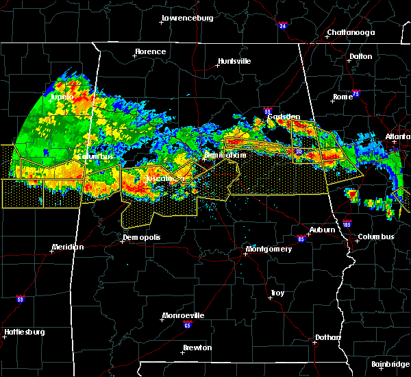 At 312 pm cdt, severe thunderstorms were located along a line extending from near macon to near panola to jena, moving south at 30 mph (radar indicated). Hazards include 60 mph wind gusts. Expect damage to roofs. siding. And trees. At 312 pm cdt, severe thunderstorms were located along a line extending from near macon to near panola to jena, moving south at 30 mph (radar indicated). Hazards include 60 mph wind gusts. Expect damage to roofs. siding. And trees.
|
| 3/31/2016 7:55 PM CDT |
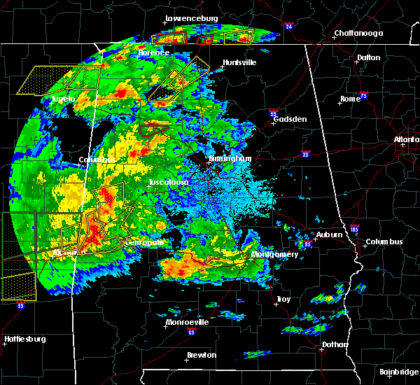 At 755 pm cdt, severe thunderstorms were located along a line extending from near gainesville to near epes to near york, moving east at 55 mph (radar indicated). Hazards include 60 mph wind gusts. Expect damage to roofs. siding. and trees. locations impacted include, livingston, york, cuba, gainesville, epes, coatopa, bluffport, the university of west alabama, dug hill, warsaw, lilita, belmont, demopolis lock and dam, old mallard airport, mcdowell, bellamy and sumterville. A tornado watch remains in effect until 100 am cdt for southwestern alabama. At 755 pm cdt, severe thunderstorms were located along a line extending from near gainesville to near epes to near york, moving east at 55 mph (radar indicated). Hazards include 60 mph wind gusts. Expect damage to roofs. siding. and trees. locations impacted include, livingston, york, cuba, gainesville, epes, coatopa, bluffport, the university of west alabama, dug hill, warsaw, lilita, belmont, demopolis lock and dam, old mallard airport, mcdowell, bellamy and sumterville. A tornado watch remains in effect until 100 am cdt for southwestern alabama.
|
| 3/31/2016 7:34 PM CDT |
 At 734 pm cdt, severe thunderstorms were located along a line extending from near electric mills to near tamola to near toomsuba, moving east at 55 mph (radar indicated). Hazards include 60 mph wind gusts. Expect damage to roofs. siding. And trees. At 734 pm cdt, severe thunderstorms were located along a line extending from near electric mills to near tamola to near toomsuba, moving east at 55 mph (radar indicated). Hazards include 60 mph wind gusts. Expect damage to roofs. siding. And trees.
|
| 2/23/2016 7:12 PM CST |
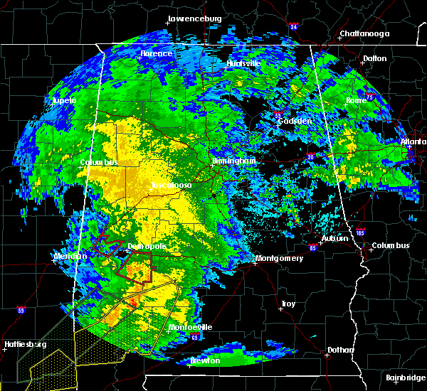 At 712 pm cst, a severe thunderstorm capable of producing a tornado was located near bluffport, or near livingston, moving northeast at 45 mph (radar indicated rotation). Hazards include tornado. Flying debris will be dangerous to those caught without shelter. mobile homes will be damaged or destroyed. damage to roofs, windows and vehicles will occur. tree damage is likely. Locations impacted include, livingston, epes, coatopa, bluffport, the university of west alabama, dug hill, lilita and belmont. At 712 pm cst, a severe thunderstorm capable of producing a tornado was located near bluffport, or near livingston, moving northeast at 45 mph (radar indicated rotation). Hazards include tornado. Flying debris will be dangerous to those caught without shelter. mobile homes will be damaged or destroyed. damage to roofs, windows and vehicles will occur. tree damage is likely. Locations impacted include, livingston, epes, coatopa, bluffport, the university of west alabama, dug hill, lilita and belmont.
|
| 2/23/2016 7:02 PM CST |
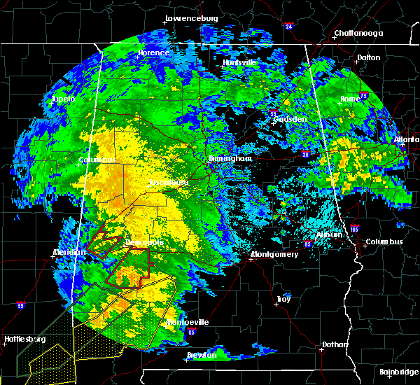 At 702 pm cst, a severe thunderstorm capable of producing a tornado was located over bluffport, or near livingston, moving northeast at 55 mph (radar indicated rotation. tree damage was reported in the ward community). Hazards include tornado. Flying debris will be dangerous to those caught without shelter. mobile homes will be damaged or destroyed. damage to roofs, windows and vehicles will occur. tree damage is likely. Locations impacted include, livingston, york, epes, coatopa, bluffport, the university of west alabama, dug hill, lilita, bellamy, belmont, whitfield and old mallard airport. At 702 pm cst, a severe thunderstorm capable of producing a tornado was located over bluffport, or near livingston, moving northeast at 55 mph (radar indicated rotation. tree damage was reported in the ward community). Hazards include tornado. Flying debris will be dangerous to those caught without shelter. mobile homes will be damaged or destroyed. damage to roofs, windows and vehicles will occur. tree damage is likely. Locations impacted include, livingston, york, epes, coatopa, bluffport, the university of west alabama, dug hill, lilita, bellamy, belmont, whitfield and old mallard airport.
|
| 2/23/2016 6:55 PM CST |
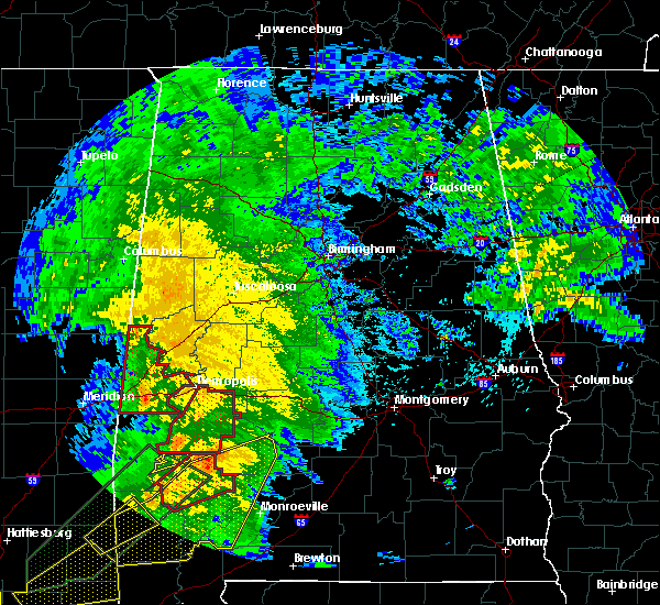 At 655 pm cst, a severe thunderstorm capable of producing a tornado was located near coatopa, or 7 miles east of york, moving northeast at 45 mph (radar indicated rotation). Hazards include tornado. Flying debris will be dangerous to those caught without shelter. mobile homes will be damaged or destroyed. damage to roofs, windows and vehicles will occur. tree damage is likely. locations impacted include, livingston, york, epes, coatopa, bluffport, the university of west alabama, dug hill, lilita, belmont, demopolis lock and dam, old mallard airport, mcdowell, bellamy and whitfield. This includes interstate 20 near mile marker 23. At 655 pm cst, a severe thunderstorm capable of producing a tornado was located near coatopa, or 7 miles east of york, moving northeast at 45 mph (radar indicated rotation). Hazards include tornado. Flying debris will be dangerous to those caught without shelter. mobile homes will be damaged or destroyed. damage to roofs, windows and vehicles will occur. tree damage is likely. locations impacted include, livingston, york, epes, coatopa, bluffport, the university of west alabama, dug hill, lilita, belmont, demopolis lock and dam, old mallard airport, mcdowell, bellamy and whitfield. This includes interstate 20 near mile marker 23.
|
| 2/23/2016 6:37 PM CST |
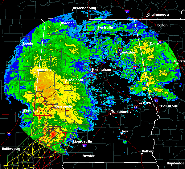 At 637 pm cst, severe thunderstorms capable of producing tornadoes were located along a line extending from tamola to near butler, moving northeast at 40 mph (radar indicated rotation). Hazards include tornado. Flying debris will be dangerous to those caught without shelter. mobile homes will be damaged or destroyed. damage to roofs, windows and vehicles will occur. tree damage is likely. locations impacted include, livingston, york, cuba, gainesville, epes, emelle, bluffport, panola, coatopa, kinterbish, the university of west alabama, dug hill, boyd, geiger, warsaw, payneville, ward, belmont, mcdowell and bellamy. This includes interstate 20 between mile markers 1 and 23. At 637 pm cst, severe thunderstorms capable of producing tornadoes were located along a line extending from tamola to near butler, moving northeast at 40 mph (radar indicated rotation). Hazards include tornado. Flying debris will be dangerous to those caught without shelter. mobile homes will be damaged or destroyed. damage to roofs, windows and vehicles will occur. tree damage is likely. locations impacted include, livingston, york, cuba, gainesville, epes, emelle, bluffport, panola, coatopa, kinterbish, the university of west alabama, dug hill, boyd, geiger, warsaw, payneville, ward, belmont, mcdowell and bellamy. This includes interstate 20 between mile markers 1 and 23.
|
| 2/23/2016 6:25 PM CST |
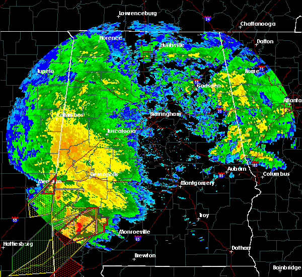 At 624 pm cst, a severe thunderstorm capable of producing a tornado was located 7 miles southwest of kinterbish, or 12 miles south of cuba, moving northeast at 55 mph (radar indicated rotation). Hazards include tornado. Flying debris will be dangerous to those caught without shelter. mobile homes will be damaged or destroyed. damage to roofs, windows and vehicles will occur. Tree damage is likely. At 624 pm cst, a severe thunderstorm capable of producing a tornado was located 7 miles southwest of kinterbish, or 12 miles south of cuba, moving northeast at 55 mph (radar indicated rotation). Hazards include tornado. Flying debris will be dangerous to those caught without shelter. mobile homes will be damaged or destroyed. damage to roofs, windows and vehicles will occur. Tree damage is likely.
|
| 2/15/2016 3:48 PM CST |
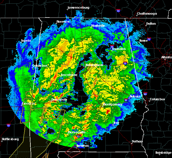 At 348 pm cst, severe thunderstorms were located along a line extending from near emelle to 6 miles northeast of toxey, moving east at 55 mph (radar indicated). Hazards include 60 mph wind gusts. Expect damage to roofs. Siding and trees. At 348 pm cst, severe thunderstorms were located along a line extending from near emelle to 6 miles northeast of toxey, moving east at 55 mph (radar indicated). Hazards include 60 mph wind gusts. Expect damage to roofs. Siding and trees.
|
| 8/10/2015 6:30 PM CDT | Several trees down along county road 10 between alabama 17 and 9. damage to an outbuilding and car. also chimney damaged due to wind in sumter county AL, 9.2 miles NE of Bellamy, AL |
| 8/7/2015 1:16 PM CDT |
 At 116 pm cdt, a severe thunderstorm was located near dug hill, or 10 miles southwest of demopolis, moving southeast at 35 mph (radar indicated). Hazards include 60 mph wind gusts. Expect damage to roofs. siding and trees. Locations impacted include, coatopa, dug hill, lilita, whitfield, mcdowell and bellamy. At 116 pm cdt, a severe thunderstorm was located near dug hill, or 10 miles southwest of demopolis, moving southeast at 35 mph (radar indicated). Hazards include 60 mph wind gusts. Expect damage to roofs. siding and trees. Locations impacted include, coatopa, dug hill, lilita, whitfield, mcdowell and bellamy.
|
| 8/7/2015 1:12 PM CDT | A few trees were blown down along highway 28 at coatop in sumter county AL, 4 miles WSW of Bellamy, AL |
| 8/7/2015 1:07 PM CDT |
 At 106 pm cdt, a severe thunderstorm was located over coatopa, or 8 miles southeast of livingston, moving southeast at 35 mph (radar indicated). Hazards include 60 mph wind gusts. Expect damage to roofs. siding and trees. Locations impacted include, livingston, york, epes, coatopa, bluffport, the university of west alabama, dug hill, lilita, mcdowell, bellamy, whitfield and old mallard airport. At 106 pm cdt, a severe thunderstorm was located over coatopa, or 8 miles southeast of livingston, moving southeast at 35 mph (radar indicated). Hazards include 60 mph wind gusts. Expect damage to roofs. siding and trees. Locations impacted include, livingston, york, epes, coatopa, bluffport, the university of west alabama, dug hill, lilita, mcdowell, bellamy, whitfield and old mallard airport.
|
| 8/7/2015 12:49 PM CDT |
 At 1248 pm cdt, a severe thunderstorm was located over livingston, moving southeast at 35 mph (radar indicated). Hazards include 60 mph wind gusts. Expect damage to roofs. Siding and trees. At 1248 pm cdt, a severe thunderstorm was located over livingston, moving southeast at 35 mph (radar indicated). Hazards include 60 mph wind gusts. Expect damage to roofs. Siding and trees.
|
| 4/25/2015 4:16 AM CDT | At 415 am cdt, severe thunderstorms were located along a line extending from near union to near akron to walden quarters to near tishabee to near coatopa to near york, moving east at 55 mph (radar indicated). Hazards include 60 mph wind gusts. Expect damage to roofs. siding and trees. locations impacted include, demopolis, york, cuba, jefferson, coatopa, pin hook, kinterbish, bluffport, dug hill, lilita, ward, belmont, u. s. 80 and al 28, demopolis lock and dam, oakchia, demopolis municipal airport, old mallard airport, mcdowell, bellamy and i 20 welcome center at cuba. a tornado watch remains in effect until 800 am cdt for southwestern alabama. 75in. |
| 4/25/2015 3:57 AM CDT | At 357 am cdt, severe thunderstorms were located along a line extending from near panola to near west greene to epes to livingston to near york to toomsuba, moving east at 55 mph (radar indicated). Hazards include 70 mph wind gusts. Expect considerable tree damage. damage is likely to mobile homes, roofs and outbuildings. locations impacted include, demopolis, livingston, york, cuba, jefferson, gainesville, epes, emelle, pin hook, bluffport, coatopa, kinterbish, the university of west alabama, dug hill, boyd, payneville, ward, belmont, oakchia and demopolis municipal airport. a tornado watch remains in effect until 800 am cdt for southwestern alabama. 75in. |
| 4/25/2015 3:45 AM CDT | At 344 am cdt, severe thunderstorms were located along a line extending from 6 miles south of cooksville to near gainesville to near emelle to near boyd to near lauderdale to near meridian, moving east at 55 mph (radar indicated). Hazards include 70 mph wind gusts. Expect considerable tree damage. damage is likely to mobile homes, roofs and outbuildings. locations impacted include, demopolis, livingston, york, cuba, jefferson, gainesville, epes, emelle, pin hook, bluffport, panola, coatopa, kinterbish, the university of west alabama, dug hill, boyd, geiger, warsaw, payneville and ward. a tornado watch remains in effect until 800 am cdt for west central alabama. Possible. |
| 4/25/2015 3:27 AM CDT | At 327 am cdt, severe thunderstorms were located along a line extending from 7 miles north of de kalb to near electric mills to near porterville to near meridian station to near suqualena to near meehan, moving east at 55 mph (radar indicated). Hazards include 70 mph wind gusts. Expect considerable tree damage. Damage is likely to mobile homes, roofs and outbuildings. |
| 4/10/2015 1:07 PM CDT | Single tree down in two locations in bellamy along pine street and magnolia circle. winds estimated 40-50 mp in sumter county AL, 0.9 miles NE of Bellamy, AL |
| 6/28/2013 7:40 PM CDT | Several trees were blown down from near coatopa to near bellamy. small hail also fell during the storm in sumter county AL, 5 miles SSW of Bellamy, AL |
| 1/1/0001 12:00 AM | Sheriff office reports trees down and homes damaged from a possible tornoado in the whitfield area near county road 42 and state road 1 in sumter county AL, 7.7 miles NNE of Bellamy, AL |
| 1/1/0001 12:00 AM | Trees down on county road 42 near derby in sumter county AL, 6.2 miles N of Bellamy, AL |
| 1/1/0001 12:00 AM | Tree down near the intersection of cr 23 and al hwy 28 near coatopa. another tree down 2 miles west of us hwy 80 near coatopa drive. winds estimated around 50 mp in sumter county AL, 4 miles WSW of Bellamy, AL |
| 1/1/0001 12:00 AM | Tree down on county road 2 in sumter county AL, 2.9 miles S of Bellamy, AL |
Hail Maps for Bellamy, AL
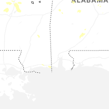
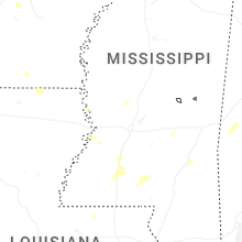
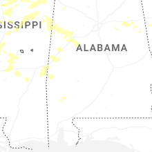
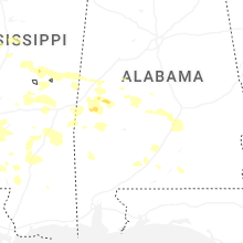
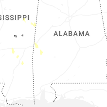
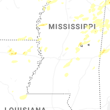


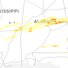


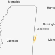


Connect with Interactive Hail Maps