

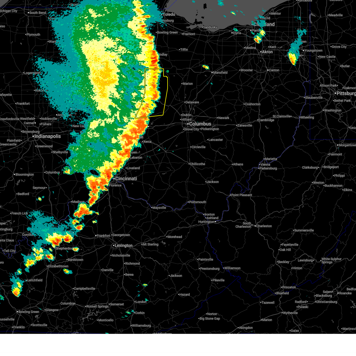
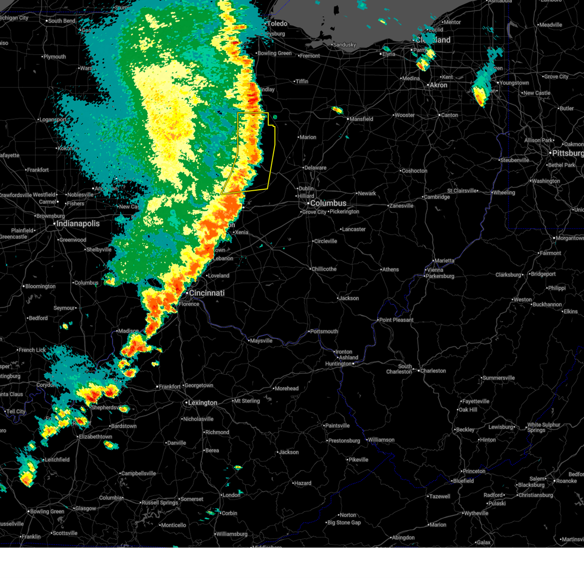
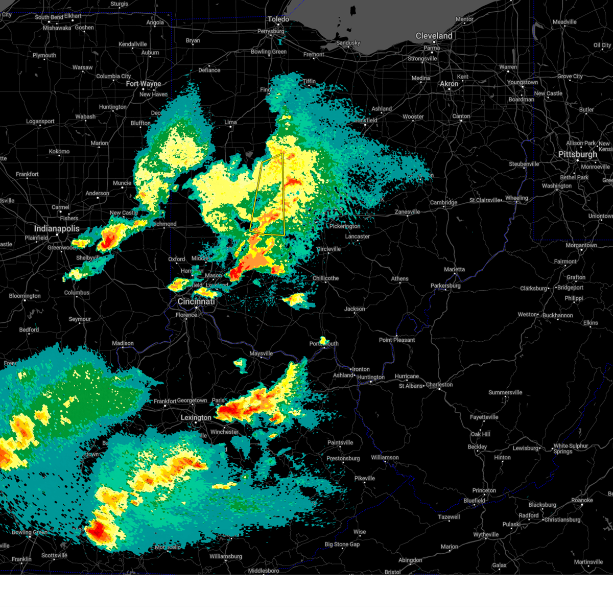
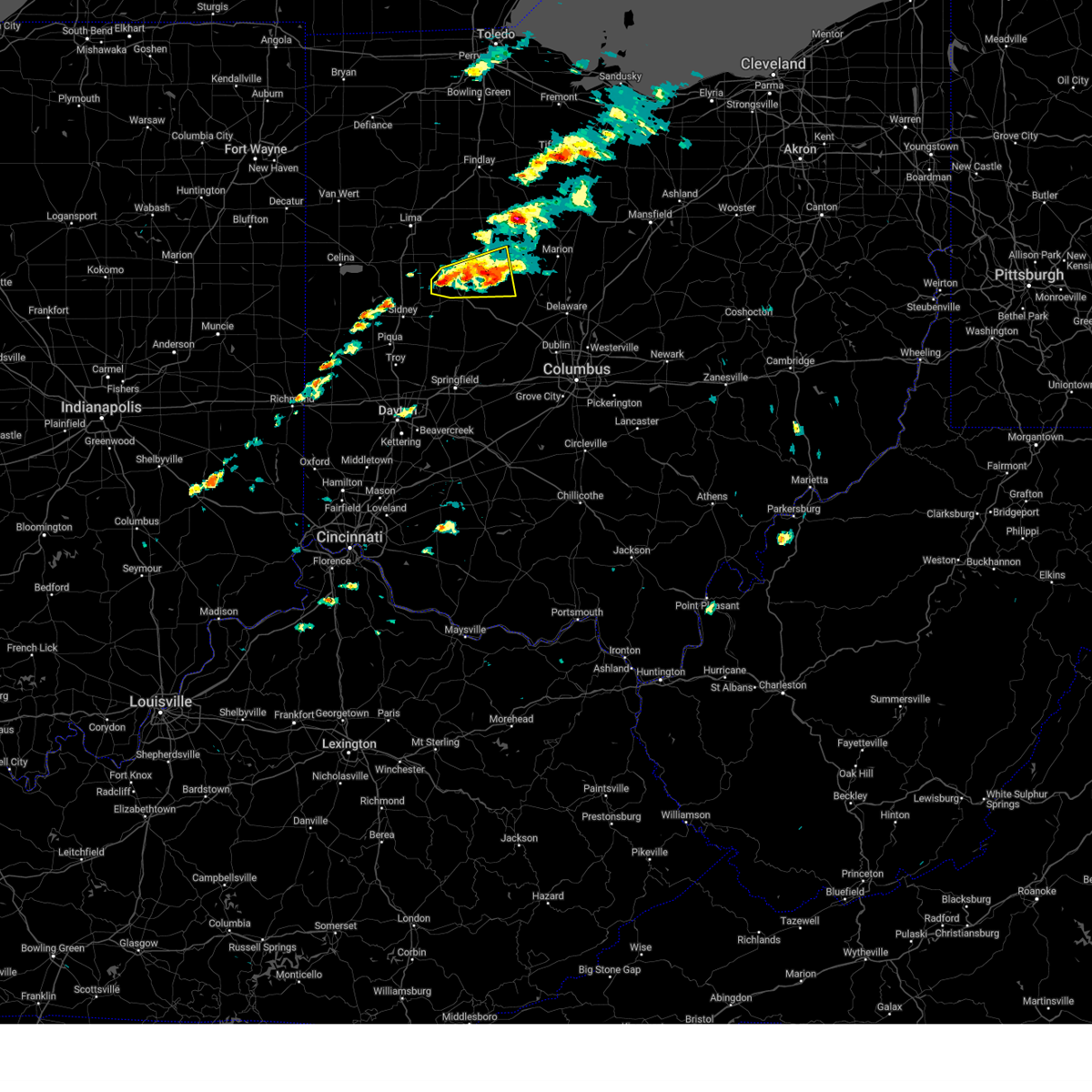
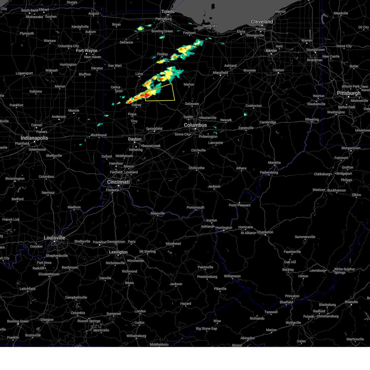
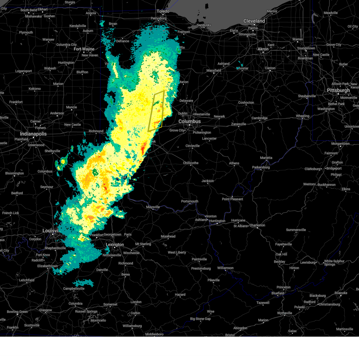
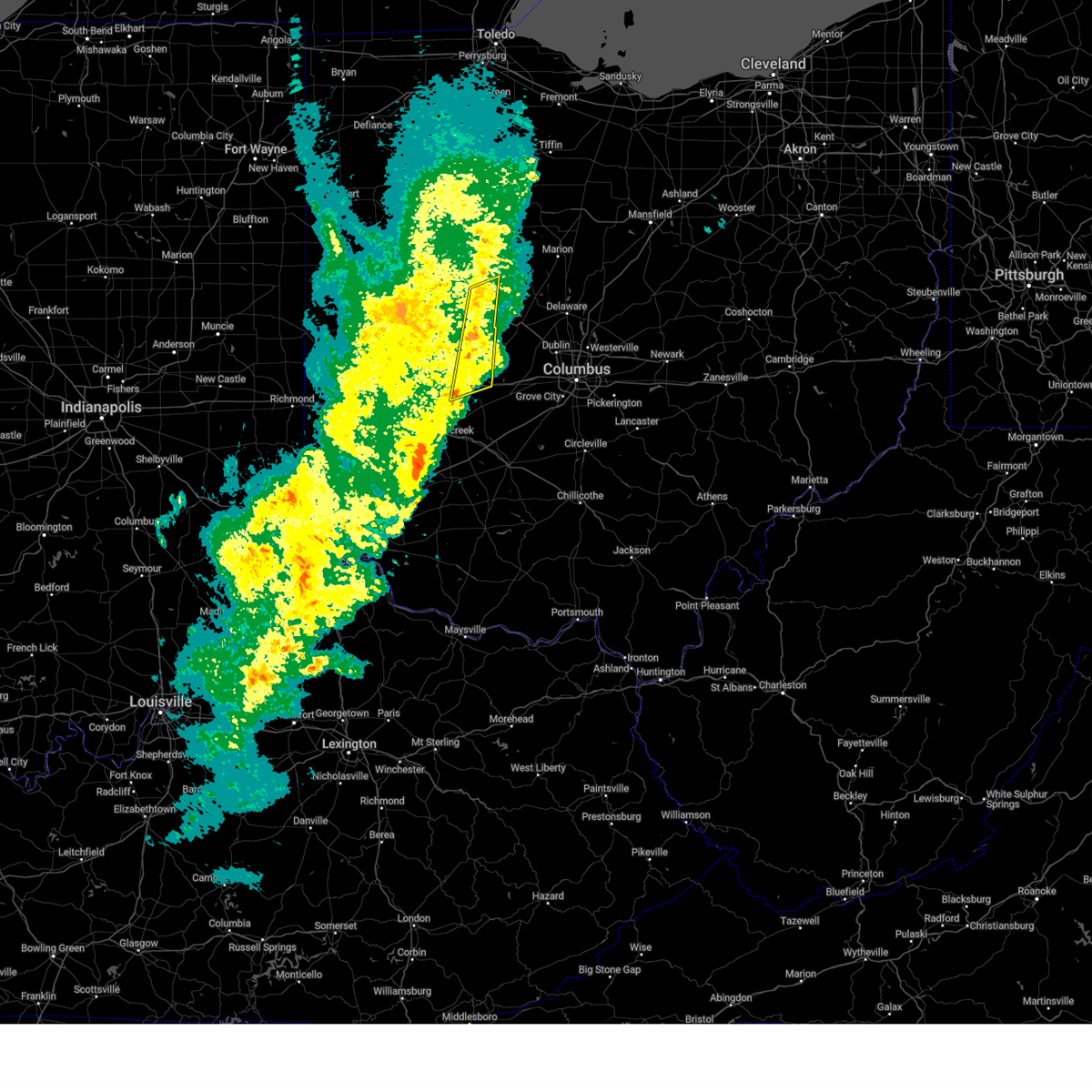
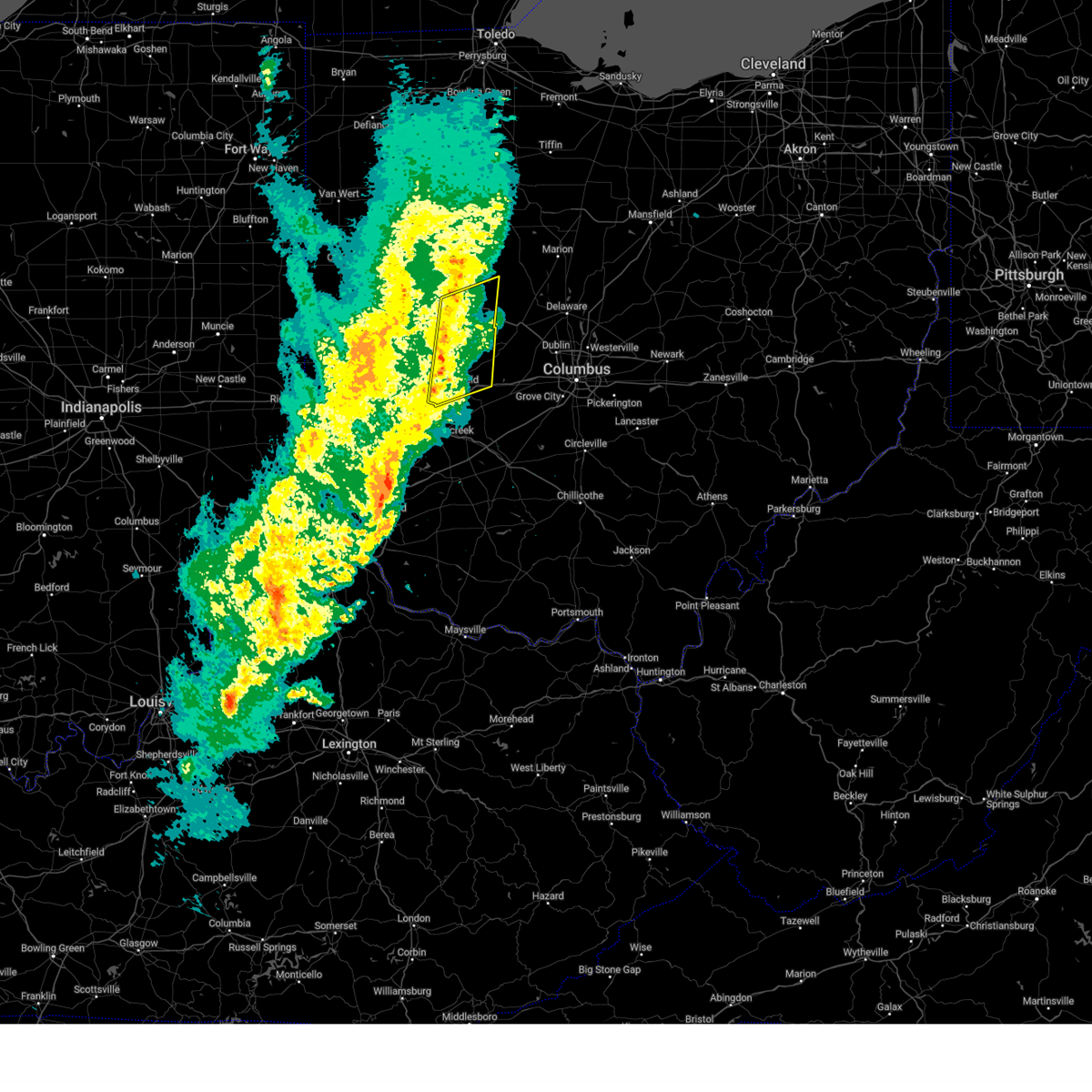
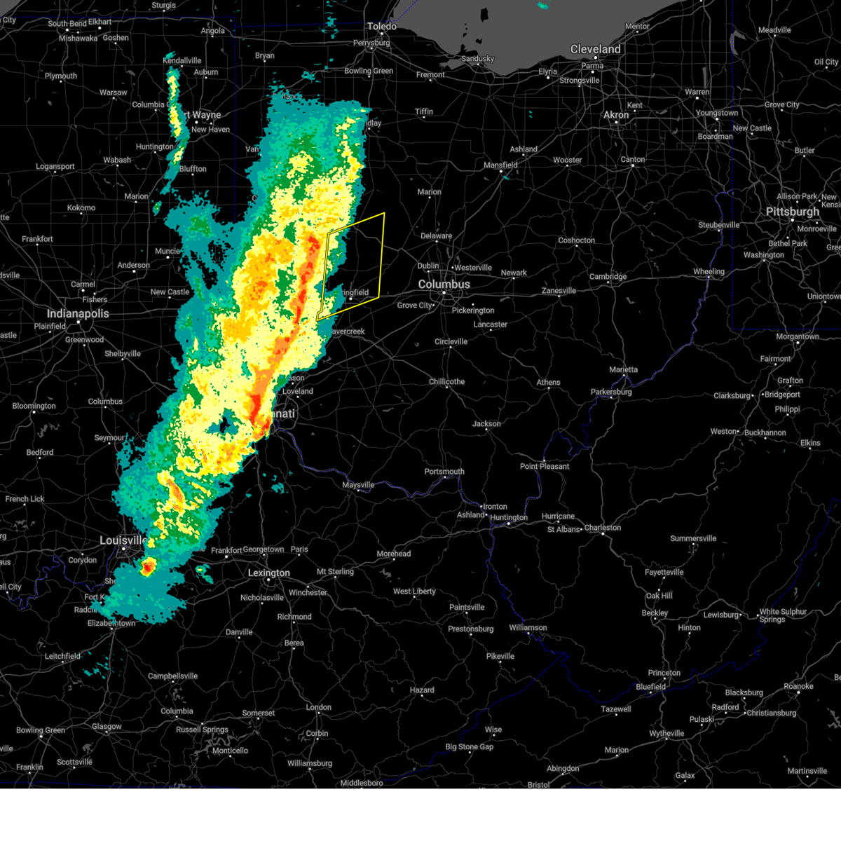
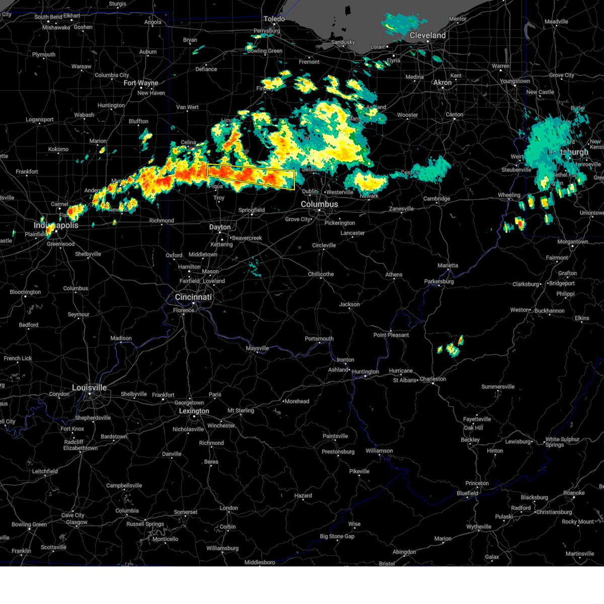
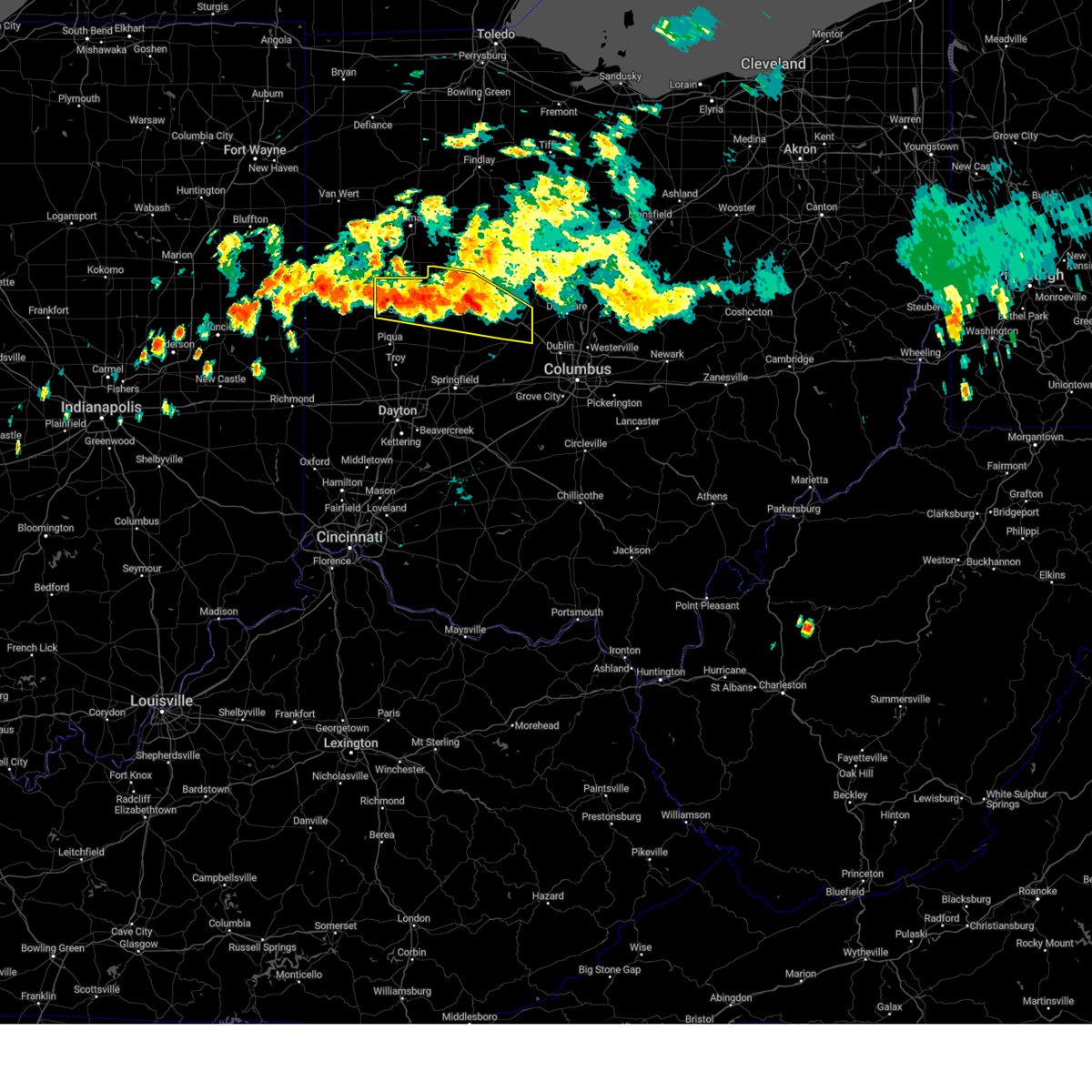
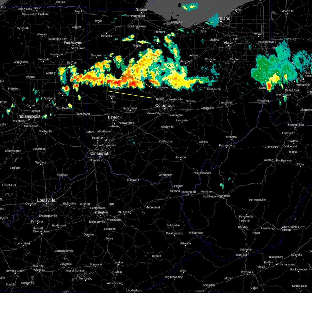
Hail Map for Bellefontaine, OH
The Bellefontaine, OH area has had 3 reports of on-the-ground hail by trained spotters, and has been under severe weather warnings 36 times during the past 12 months. Doppler radar has detected hail at or near Bellefontaine, OH on 55 occasions, including 2 occasions during the past year.
| Name: | Bellefontaine, OH |
| Where Located: | 48.5 miles NW of Columbus, OH |
| Map: | Google Map for Bellefontaine, OH |
| Population: | 13370 |
| Housing Units: | 6115 |
| More Info: | Search Google for Bellefontaine, OH |
3
The Top Recent Hail Date for Bellefontaine, OH is Tuesday, August 6, 2024 (8th out of 55)

Hail and Wind Damage Spotted near Bellefontaine, OH
| Date / Time | Report Details |
|---|---|
| 6/18/2025 7:14 PM EDT |
 the severe thunderstorm warning has been cancelled and is no longer in effect the severe thunderstorm warning has been cancelled and is no longer in effect
|
| 6/18/2025 7:14 PM EDT |
 At 714 pm edt, severe thunderstorms were located along a line extending from 6 miles southeast of alger to 6 miles west of northridge, moving east at 35 mph (radar indicated). Hazards include 60 mph wind gusts. Expect damage to trees and power lines. locations impacted include, bellefontaine, urbana, kenton, ada, st. Paris, west liberty, north lewisburg, forest, de graff, dunkirk, alger, belle center, west mansfield, chippewa park, northwood, blanchard, roundhead, mount victory, christiansburg, and rushsylvania. At 714 pm edt, severe thunderstorms were located along a line extending from 6 miles southeast of alger to 6 miles west of northridge, moving east at 35 mph (radar indicated). Hazards include 60 mph wind gusts. Expect damage to trees and power lines. locations impacted include, bellefontaine, urbana, kenton, ada, st. Paris, west liberty, north lewisburg, forest, de graff, dunkirk, alger, belle center, west mansfield, chippewa park, northwood, blanchard, roundhead, mount victory, christiansburg, and rushsylvania.
|
| 6/18/2025 6:43 PM EDT | Svriln the national weather service in wilmington has issued a * severe thunderstorm warning for, eastern shelby county in west central ohio, champaign county in west central ohio, logan county in west central ohio, western union county in central ohio, hardin county in west central ohio, northeastern auglaize county in west central ohio, northeastern miami county in west central ohio, * until 745 pm edt. * at 642 pm edt, severe thunderstorms were located along a line extending from cridersville to near tipp city, moving east at 35 mph (emergency management. at 620 pm structural damage was reported near montezuma in mercer county). Hazards include 60 mph wind gusts. expect damage to trees and power lines |
| 5/16/2025 9:40 PM EDT | The storms which prompted the warning have moved out of the area. therefore, the warning will be allowed to expire. however, a severe thunderstorm warning still exists in portions of logan, champaign, clark, madison and union counties. a tornado watch remains in effect until 300 am edt for central and west central ohio. please report previous wind damage or hail to the national weather service by going to our website at weather.gov/iln and submitting your report via social media. |
| 5/16/2025 9:32 PM EDT |
 At 932 pm edt, severe thunderstorms were located along a line extending from near dunkirk to urbana, moving east northeast at 45 mph (radar indicated). Hazards include 60 mph wind gusts. Expect damage to trees and power lines. locations impacted include, cable, mechanicsburg, new jerusalem, zanesfield, hustead, state route 4 at state route 161, south vienna, choctaw lake, woodstock, powhattan, selma, pottersburg, catawba station, kennard, south charleston, west liberty, west mansfield, east liberty, valley hi, and buck creek state park. This includes i-70 in ohio between mile markers 53 and 73. At 932 pm edt, severe thunderstorms were located along a line extending from near dunkirk to urbana, moving east northeast at 45 mph (radar indicated). Hazards include 60 mph wind gusts. Expect damage to trees and power lines. locations impacted include, cable, mechanicsburg, new jerusalem, zanesfield, hustead, state route 4 at state route 161, south vienna, choctaw lake, woodstock, powhattan, selma, pottersburg, catawba station, kennard, south charleston, west liberty, west mansfield, east liberty, valley hi, and buck creek state park. This includes i-70 in ohio between mile markers 53 and 73.
|
| 5/16/2025 9:16 PM EDT | the severe thunderstorm warning has been cancelled and is no longer in effect |
| 5/16/2025 9:16 PM EDT | At 914 pm edt, severe thunderstorms were located along a line extending from 6 miles east of waynesfield to 6 miles northeast of new carlisle, moving east northeast at 50 mph (radar indicated). Hazards include 60 mph wind gusts. Expect damage to trees and power lines. locations impacted include, new jerusalem, south vienna, choctaw lake, woodstock, selma, millerstown, kiser lake state park, south charleston, terre haute, dialton, west mansfield, east liberty, st. paris, buck creek state park, logansville, north lewisburg, harmony, lisbon, pickrelltown, and lippincott. This includes i-70 in ohio between mile markers 45 and 73. |
| 5/16/2025 8:58 PM EDT | A new severe thunderstorm warning has been issued downstream, allowing this warning to expire. a tornado watch remains in effect until 300 am edt for west central ohio. please report previous wind damage or hail to the national weather service by going to our website at weather.gov/iln and submitting your report via social media. |
| 5/16/2025 8:56 PM EDT | Svriln the national weather service in wilmington has issued a * severe thunderstorm warning for, eastern shelby county in west central ohio, champaign county in west central ohio, logan county in west central ohio, northern greene county in west central ohio, clark county in west central ohio, northeastern montgomery county in west central ohio, western union county in central ohio, western madison county in central ohio, eastern miami county in west central ohio, * until 945 pm edt. * at 855 pm edt, severe thunderstorms were located along a line extending from near jackson center to huber heights, moving east northeast at 50 mph (radar indicated). Hazards include 60 mph wind gusts. expect damage to trees and power lines |
| 5/16/2025 8:50 PM EDT | the severe thunderstorm warning has been cancelled and is no longer in effect |
| 5/16/2025 8:50 PM EDT | At 849 pm edt, severe thunderstorms were located along a line extending from fort shawnee to near piqua, moving east at 65 mph (radar indicated). Hazards include 60 mph wind gusts. Expect damage to trees and power lines. locations impacted include, ginghamsburg, vandalia, montra, casstown, millerstown, kiser lake state park, yellow springs, new carlisle, terre haute, dayton international airport, pemberton, dialton, st. paris, logansville, lippincott, clifton, sidney, plattsville, troy, and snyderville. this includes the following interstates, i-70 in ohio between mile markers 35 and 56. I-75 in ohio between mile markers 62 and 82, and between mile markers 84 and 99. |
| 5/16/2025 8:38 PM EDT | the severe thunderstorm warning has been cancelled and is no longer in effect |
| 5/16/2025 8:38 PM EDT | At 837 pm edt, severe thunderstorms were located along a line extending from near st. marys to near covington, moving east at 65 mph (radar indicated). Hazards include 60 mph wind gusts. Expect damage to trees and power lines. locations impacted include, fryburg, englewood, casstown, newbern, bradford, potsdam, huntersville, lockington, west milton, covington, new knoxville, fort loramie, kiser lake state park, wright-patterson afb, yellow springs, new carlisle, hardin, pemberton, dialton, and logansville. this includes the following interstates, i-70 in ohio between mile markers 21 and 57. I-75 in ohio between mile markers 56 and 118. |
| 5/16/2025 8:13 PM EDT | Svriln the national weather service in wilmington has issued a * severe thunderstorm warning for, east central wayne county in east central indiana, shelby county in west central ohio, western champaign county in west central ohio, northern preble county in west central ohio, western logan county in west central ohio, darke county in west central ohio, western clark county in west central ohio, auglaize county in west central ohio, mercer county in west central ohio, northwestern greene county in west central ohio, northern montgomery county in west central ohio, western hardin county in west central ohio, miami county in west central ohio, * until 900 pm edt. * at 813 pm edt, severe thunderstorms were located along a line extending from near fort recovery to 6 miles west of new madison, moving east at 65 mph (radar indicated). Hazards include 60 mph wind gusts. expect damage to trees and power lines |
| 5/2/2025 12:53 PM EDT |
 At 1252 pm edt, a severe thunderstorm was located 8 miles north of west mansfield, moving east at 35 mph (trained weather spotters. this storm has a history of producing hail over 1 inch in diameter). Hazards include 60 mph wind gusts and quarter size hail. Minor hail damage to vehicles is possible. expect wind damage to trees and power lines. Locations impacted include, huntsville, silver creek, belle center, rushsylvania, lakeview, byhalia, ridgeway, pfeiffer, hepburn, mcmorran, mount victory, russells point, mentzer, northwood, big springs, bloom center, west mansfield, chippewa park, lewistown, and bellefontaine. At 1252 pm edt, a severe thunderstorm was located 8 miles north of west mansfield, moving east at 35 mph (trained weather spotters. this storm has a history of producing hail over 1 inch in diameter). Hazards include 60 mph wind gusts and quarter size hail. Minor hail damage to vehicles is possible. expect wind damage to trees and power lines. Locations impacted include, huntsville, silver creek, belle center, rushsylvania, lakeview, byhalia, ridgeway, pfeiffer, hepburn, mcmorran, mount victory, russells point, mentzer, northwood, big springs, bloom center, west mansfield, chippewa park, lewistown, and bellefontaine.
|
| 5/2/2025 12:33 PM EDT | At 1232 pm edt, a severe thunderstorm was located over belle center, moving east at 35 mph (radar indicated). Hazards include ping pong ball size hail and 60 mph wind gusts. People and animals outdoors will be injured. expect hail damage to roofs, siding, windows, and vehicles. expect wind damage to trees and power lines. Locations impacted include, huntsville, silver creek, belle center, rushsylvania, lakeview, byhalia, ridgeway, pfeiffer, hepburn, mcmorran, mount victory, russells point, mentzer, northwood, big springs, bloom center, west mansfield, chippewa park, lewistown, and bellefontaine. |
| 5/2/2025 12:17 PM EDT |
 Svriln the national weather service in wilmington has issued a * severe thunderstorm warning for, northern logan county in west central ohio, northwestern union county in central ohio, southern hardin county in west central ohio, * until 100 pm edt. * at 1217 pm edt, a severe thunderstorm was located over lakeview, moving east at 35 mph (radar indicated). Hazards include 60 mph wind gusts and quarter size hail. Minor hail damage to vehicles is possible. Expect wind damage to trees and power lines. Svriln the national weather service in wilmington has issued a * severe thunderstorm warning for, northern logan county in west central ohio, northwestern union county in central ohio, southern hardin county in west central ohio, * until 100 pm edt. * at 1217 pm edt, a severe thunderstorm was located over lakeview, moving east at 35 mph (radar indicated). Hazards include 60 mph wind gusts and quarter size hail. Minor hail damage to vehicles is possible. Expect wind damage to trees and power lines.
|
| 4/3/2025 12:51 AM EDT | the severe thunderstorm warning has been cancelled and is no longer in effect |
| 4/3/2025 12:36 AM EDT |
 The severe thunderstorm which prompted the warning has moved out of the warned area. therefore, the warning will be allowed to expire. a tornado watch remains in effect until 400 am edt for west central ohio. please report previous wind damage or hail to the national weather service by going to our website at weather.gov/iln and submitting your report via social media. The severe thunderstorm which prompted the warning has moved out of the warned area. therefore, the warning will be allowed to expire. a tornado watch remains in effect until 400 am edt for west central ohio. please report previous wind damage or hail to the national weather service by going to our website at weather.gov/iln and submitting your report via social media.
|
| 4/3/2025 12:24 AM EDT |
 At 1224 am edt, a severe thunderstorm was located over jackson center, moving northeast at 60 mph (radar indicated). Hazards include 60 mph wind gusts. Expect damage to trees and power lines. locations impacted include, montra, logansville, huntsville, quincy, lakeview, de graff, mcmorran, maplewood, russells point, bellefontaine, jackson center, new hampshire, bloom center, pemberton, chippewa park, lewistown, waynesfield, and st. Johns. At 1224 am edt, a severe thunderstorm was located over jackson center, moving northeast at 60 mph (radar indicated). Hazards include 60 mph wind gusts. Expect damage to trees and power lines. locations impacted include, montra, logansville, huntsville, quincy, lakeview, de graff, mcmorran, maplewood, russells point, bellefontaine, jackson center, new hampshire, bloom center, pemberton, chippewa park, lewistown, waynesfield, and st. Johns.
|
| 4/3/2025 12:23 AM EDT |
 Svriln the national weather service in wilmington has issued a * severe thunderstorm warning for, northeastern logan county in west central ohio, northwestern union county in central ohio, hardin county in west central ohio, northeastern auglaize county in west central ohio, * until 115 am edt. * at 1222 am edt, a severe thunderstorm was located over lakeview, moving northeast at 60 mph (radar indicated). Hazards include 60 mph wind gusts. expect damage to trees and power lines Svriln the national weather service in wilmington has issued a * severe thunderstorm warning for, northeastern logan county in west central ohio, northwestern union county in central ohio, hardin county in west central ohio, northeastern auglaize county in west central ohio, * until 115 am edt. * at 1222 am edt, a severe thunderstorm was located over lakeview, moving northeast at 60 mph (radar indicated). Hazards include 60 mph wind gusts. expect damage to trees and power lines
|
| 4/3/2025 12:12 AM EDT | At 1211 am edt, a severe thunderstorm was located near sidney, moving northeast at 60 mph (radar indicated). Hazards include 60 mph wind gusts. Expect damage to trees and power lines. locations impacted include, fryburg, montra, huntsville, newbern, quincy, mcmorran, botkins, maplewood, kettlersville, jackson center, hardin, bloom center, pemberton, anna, lewistown, logansville, lakeview, lake loramie state park, de graff, and sidney. This includes i-75 in ohio between mile markers 86 and 107. |
| 4/3/2025 12:12 AM EDT | the severe thunderstorm warning has been cancelled and is no longer in effect |
| 4/3/2025 12:00 AM EDT | Svriln the national weather service in wilmington has issued a * severe thunderstorm warning for, shelby county in west central ohio, western logan county in west central ohio, northeastern darke county in west central ohio, southern auglaize county in west central ohio, northwestern miami county in west central ohio, * until 1245 am edt. * at 1200 am edt, a severe thunderstorm was located near newport, moving northeast at 60 mph (radar indicated). Hazards include 60 mph wind gusts. expect damage to trees and power lines |
| 3/19/2025 11:42 PM EDT |
 The storm which prompted the warning has moved out of the area. therefore, the warning will be allowed to expire. however, gusty winds and heavy rain are still possible with this thunderstorm. please report previous wind damage or hail to the national weather service by going to our website at weather.gov/iln and submitting your report via social media. The storm which prompted the warning has moved out of the area. therefore, the warning will be allowed to expire. however, gusty winds and heavy rain are still possible with this thunderstorm. please report previous wind damage or hail to the national weather service by going to our website at weather.gov/iln and submitting your report via social media.
|
| 3/19/2025 11:36 PM EDT |
 At 1136 pm edt, a severe thunderstorm was located near north lewisburg, moving northeast at 65 mph (radar indicated). Hazards include 60 mph wind gusts. Expect damage to trees and power lines. locations impacted include, cable, mechanicsburg, new jerusalem, zanesfield, south vienna, powhattan, catawba station, kennard, west mansfield, east liberty, valley hi, buck creek state park, north lewisburg, harmony, pickrelltown, middleburg, urbana, northridge, catawba, and mingo. This includes i-70 in ohio between mile markers 54 and 68. At 1136 pm edt, a severe thunderstorm was located near north lewisburg, moving northeast at 65 mph (radar indicated). Hazards include 60 mph wind gusts. Expect damage to trees and power lines. locations impacted include, cable, mechanicsburg, new jerusalem, zanesfield, south vienna, powhattan, catawba station, kennard, west mansfield, east liberty, valley hi, buck creek state park, north lewisburg, harmony, pickrelltown, middleburg, urbana, northridge, catawba, and mingo. This includes i-70 in ohio between mile markers 54 and 68.
|
| 3/19/2025 11:20 PM EDT |
 At 1120 pm edt, a severe thunderstorm was located over west liberty, moving northeast at 65 mph (radar indicated). Hazards include 60 mph wind gusts. Expect damage to trees and power lines. locations impacted include, green meadows, cable, mechanicsburg, thackery, westville, new jerusalem, zanesfield, enon, south vienna, powhattan, mcmorran, millerstown, catawba station, kennard, terre haute, west liberty, dialton, west mansfield, east liberty, and valley hi. This includes i-70 in ohio between mile markers 45 and 68. At 1120 pm edt, a severe thunderstorm was located over west liberty, moving northeast at 65 mph (radar indicated). Hazards include 60 mph wind gusts. Expect damage to trees and power lines. locations impacted include, green meadows, cable, mechanicsburg, thackery, westville, new jerusalem, zanesfield, enon, south vienna, powhattan, mcmorran, millerstown, catawba station, kennard, terre haute, west liberty, dialton, west mansfield, east liberty, and valley hi. This includes i-70 in ohio between mile markers 45 and 68.
|
| 3/19/2025 11:20 PM EDT |
 the severe thunderstorm warning has been cancelled and is no longer in effect the severe thunderstorm warning has been cancelled and is no longer in effect
|
| 3/19/2025 11:06 PM EDT |
 Svriln the national weather service in wilmington has issued a * severe thunderstorm warning for, champaign county in west central ohio, logan county in west central ohio, northwestern greene county in west central ohio, clark county in west central ohio, * until 1145 pm edt. * at 1105 pm edt, a severe thunderstorm was located near st. paris, moving northeast at 65 mph (radar indicated). Hazards include 60 mph wind gusts. expect damage to trees and power lines Svriln the national weather service in wilmington has issued a * severe thunderstorm warning for, champaign county in west central ohio, logan county in west central ohio, northwestern greene county in west central ohio, clark county in west central ohio, * until 1145 pm edt. * at 1105 pm edt, a severe thunderstorm was located near st. paris, moving northeast at 65 mph (radar indicated). Hazards include 60 mph wind gusts. expect damage to trees and power lines
|
| 3/15/2025 7:40 AM EDT |
 At 739 am edt, severe thunderstorms were located along a line extending from near bellefontaine to near new carlisle, moving northeast at 60 mph (radar indicated). Hazards include 60 mph wind gusts. Expect damage to trees and power lines. locations impacted include, cable, thackery, westville, new jerusalem, zanesfield, south vienna, powhattan, millerstown, catawba station, kennard, terre haute, state route 41 at state route 235, west liberty, dialton, west mansfield, east liberty, valley hi, buck creek state park, north hampton, and donnelsville. This includes i-70 in ohio between mile markers 48 and 68. At 739 am edt, severe thunderstorms were located along a line extending from near bellefontaine to near new carlisle, moving northeast at 60 mph (radar indicated). Hazards include 60 mph wind gusts. Expect damage to trees and power lines. locations impacted include, cable, thackery, westville, new jerusalem, zanesfield, south vienna, powhattan, millerstown, catawba station, kennard, terre haute, state route 41 at state route 235, west liberty, dialton, west mansfield, east liberty, valley hi, buck creek state park, north hampton, and donnelsville. This includes i-70 in ohio between mile markers 48 and 68.
|
| 3/15/2025 7:40 AM EDT |
 the severe thunderstorm warning has been cancelled and is no longer in effect the severe thunderstorm warning has been cancelled and is no longer in effect
|
| 3/15/2025 7:29 AM EDT |
 Svriln the national weather service in wilmington has issued a * severe thunderstorm warning for, champaign county in west central ohio, southern logan county in west central ohio, clark county in west central ohio, northeastern montgomery county in west central ohio, southeastern miami county in west central ohio, * until 815 am edt. * at 728 am edt, severe thunderstorms were located along a line extending from near de graff to near vandalia, moving east at 45 mph (radar indicated). Hazards include 60 mph wind gusts. expect damage to trees and power lines Svriln the national weather service in wilmington has issued a * severe thunderstorm warning for, champaign county in west central ohio, southern logan county in west central ohio, clark county in west central ohio, northeastern montgomery county in west central ohio, southeastern miami county in west central ohio, * until 815 am edt. * at 728 am edt, severe thunderstorms were located along a line extending from near de graff to near vandalia, moving east at 45 mph (radar indicated). Hazards include 60 mph wind gusts. expect damage to trees and power lines
|
| 8/6/2024 7:41 PM EDT |
 The storm which prompted the warning has weakened below severe limits and has exited the warned area. therefore, the warning will be allowed to expire. however, gusty winds and heavy rain are still possible with this thunderstorm. please report previous wind damage or hail to the national weather service by going to our website at weather.gov/iln and submitting your report via social media. The storm which prompted the warning has weakened below severe limits and has exited the warned area. therefore, the warning will be allowed to expire. however, gusty winds and heavy rain are still possible with this thunderstorm. please report previous wind damage or hail to the national weather service by going to our website at weather.gov/iln and submitting your report via social media.
|
| 8/6/2024 7:29 PM EDT |
 At 729 pm edt, a severe thunderstorm was located over north lewisburg, moving southeast at 20 mph (radar indicated). Hazards include 60 mph wind gusts and penny size hail. Expect damage to trees and power lines. locations impacted include, marysville, sidney, bellefontaine, west liberty, north lewisburg, de graff, hardin, milford center, quincy, port jefferson, woodstock, valley hi, zanesfield, pottersburg, pemberton, east liberty, logansville, pickrelltown, lake loramie state park, and middleburg. This includes i-75 in ohio between mile markers 91 and 98. At 729 pm edt, a severe thunderstorm was located over north lewisburg, moving southeast at 20 mph (radar indicated). Hazards include 60 mph wind gusts and penny size hail. Expect damage to trees and power lines. locations impacted include, marysville, sidney, bellefontaine, west liberty, north lewisburg, de graff, hardin, milford center, quincy, port jefferson, woodstock, valley hi, zanesfield, pottersburg, pemberton, east liberty, logansville, pickrelltown, lake loramie state park, and middleburg. This includes i-75 in ohio between mile markers 91 and 98.
|
| 8/6/2024 7:04 PM EDT |
 At 703 pm edt, a severe thunderstorm was located near bellefontaine, moving southeast at 20 mph (radar indicated). Hazards include 60 mph wind gusts and penny size hail. Expect damage to trees and power lines. locations impacted include, marysville, sidney, bellefontaine, west liberty, anna, north lewisburg, jackson center, russells point, de graff, botkins, lakeview, belle center, west mansfield, chippewa park, hardin, northwood, milford center, quincy, rushsylvania, and huntsville. This includes i-75 in ohio between mile markers 91 and 105. At 703 pm edt, a severe thunderstorm was located near bellefontaine, moving southeast at 20 mph (radar indicated). Hazards include 60 mph wind gusts and penny size hail. Expect damage to trees and power lines. locations impacted include, marysville, sidney, bellefontaine, west liberty, anna, north lewisburg, jackson center, russells point, de graff, botkins, lakeview, belle center, west mansfield, chippewa park, hardin, northwood, milford center, quincy, rushsylvania, and huntsville. This includes i-75 in ohio between mile markers 91 and 105.
|
| 8/6/2024 7:02 PM EDT | Corrects previous tstm wnd dmg report from bellefontaine. reports of numerous trees down throughout bellefontaine. time estimated from rada in logan county OH, 0.4 miles NE of Bellefontaine, OH |
| 8/6/2024 6:53 PM EDT |
 Svriln the national weather service in wilmington has issued a * severe thunderstorm warning for, shelby county in west central ohio, northern champaign county in west central ohio, logan county in west central ohio, southwestern union county in central ohio, * until 745 pm edt. * at 653 pm edt, a severe thunderstorm was located over bellefontaine, moving southeast at 20 mph (radar indicated). Hazards include 60 mph wind gusts and penny size hail. expect damage to trees and power lines Svriln the national weather service in wilmington has issued a * severe thunderstorm warning for, shelby county in west central ohio, northern champaign county in west central ohio, logan county in west central ohio, southwestern union county in central ohio, * until 745 pm edt. * at 653 pm edt, a severe thunderstorm was located over bellefontaine, moving southeast at 20 mph (radar indicated). Hazards include 60 mph wind gusts and penny size hail. expect damage to trees and power lines
|
| 8/6/2024 6:48 PM EDT | Reports of numerous trees down throughout bellefontaine. time estimated from rada in logan county OH, 0.4 miles NE of Bellefontaine, OH |
| 7/4/2024 8:46 PM EDT | Tree damage. possible weak tornad in logan county OH, 7.5 miles NE of Bellefontaine, OH |
| 6/25/2024 11:59 AM EDT |
 Svriln the national weather service in wilmington has issued a * severe thunderstorm warning for, eastern champaign county in west central ohio, southeastern logan county in west central ohio, southern union county in central ohio, north central madison county in central ohio, * until 1245 pm edt. * at 1159 am edt, a severe thunderstorm was located over bellefontaine, moving southeast at 35 mph (radar indicated). Hazards include 60 mph wind gusts and quarter size hail. Minor hail damage to vehicles is possible. Expect wind damage to trees and power lines. Svriln the national weather service in wilmington has issued a * severe thunderstorm warning for, eastern champaign county in west central ohio, southeastern logan county in west central ohio, southern union county in central ohio, north central madison county in central ohio, * until 1245 pm edt. * at 1159 am edt, a severe thunderstorm was located over bellefontaine, moving southeast at 35 mph (radar indicated). Hazards include 60 mph wind gusts and quarter size hail. Minor hail damage to vehicles is possible. Expect wind damage to trees and power lines.
|
| 3/14/2024 8:16 PM EDT |
 At 815 pm edt, a severe thunderstorm capable of producing a tornado was located near west mansfield, moving east at 55 mph (radar indicated rotation). Hazards include tornado and ping pong ball size hail. Flying debris will be dangerous to those caught without shelter. mobile homes will be damaged or destroyed. damage to roofs, windows, and vehicles will occur. tree damage is likely. Locations impacted include, bellefontaine, belle center, west mansfield, northwood, rushsylvania, zanesfield, raymond, new jerusalem, byhalia, broadway, somersville, big springs, and east liberty. At 815 pm edt, a severe thunderstorm capable of producing a tornado was located near west mansfield, moving east at 55 mph (radar indicated rotation). Hazards include tornado and ping pong ball size hail. Flying debris will be dangerous to those caught without shelter. mobile homes will be damaged or destroyed. damage to roofs, windows, and vehicles will occur. tree damage is likely. Locations impacted include, bellefontaine, belle center, west mansfield, northwood, rushsylvania, zanesfield, raymond, new jerusalem, byhalia, broadway, somersville, big springs, and east liberty.
|
| 3/14/2024 8:08 PM EDT |
 At 808 pm edt, a severe thunderstorm capable of producing a tornado was located near huntsville, moving east at 35 mph (radar indicated rotation). Hazards include tornado and half dollar size hail. Flying debris will be dangerous to those caught without shelter. mobile homes will be damaged or destroyed. damage to roofs, windows, and vehicles will occur. tree damage is likely. Locations impacted include, bellefontaine, belle center, west mansfield, northwood, rushsylvania, zanesfield, raymond, new jerusalem, byhalia, broadway, somersville, big springs, and east liberty. At 808 pm edt, a severe thunderstorm capable of producing a tornado was located near huntsville, moving east at 35 mph (radar indicated rotation). Hazards include tornado and half dollar size hail. Flying debris will be dangerous to those caught without shelter. mobile homes will be damaged or destroyed. damage to roofs, windows, and vehicles will occur. tree damage is likely. Locations impacted include, bellefontaine, belle center, west mansfield, northwood, rushsylvania, zanesfield, raymond, new jerusalem, byhalia, broadway, somersville, big springs, and east liberty.
|
| 3/14/2024 7:58 PM EDT |
 At 758 pm edt, a severe thunderstorm was located over russells point, moving east at 50 mph (radar indicated). Hazards include two inch hail and 60 mph wind gusts. People and animals outdoors will be injured. expect hail damage to roofs, siding, windows, and vehicles. expect wind damage to trees and power lines. Locations impacted include, bellefontaine, jackson center, russells point, lakeview, belle center, chippewa park, northwood, huntsville, montra, mcmorran, new hampshire, bloom center, and lewistown. At 758 pm edt, a severe thunderstorm was located over russells point, moving east at 50 mph (radar indicated). Hazards include two inch hail and 60 mph wind gusts. People and animals outdoors will be injured. expect hail damage to roofs, siding, windows, and vehicles. expect wind damage to trees and power lines. Locations impacted include, bellefontaine, jackson center, russells point, lakeview, belle center, chippewa park, northwood, huntsville, montra, mcmorran, new hampshire, bloom center, and lewistown.
|
| 3/14/2024 7:51 PM EDT |
 Toriln the national weather service in wilmington has issued a * tornado warning for, central logan county in west central ohio, northwestern union county in central ohio, * until 830 pm edt. * at 750 pm edt, a large and extremely dangerous tornado was located near russells point, moving east at 40 mph. this is a particularly dangerous situation. take cover now! (radar indicated rotation). Hazards include damaging tornado. You are in a life-threatening situation. flying debris may be deadly to those caught without shelter. mobile homes will be destroyed. Considerable damage to homes, businesses, and vehicles is likely and complete destruction is possible. Toriln the national weather service in wilmington has issued a * tornado warning for, central logan county in west central ohio, northwestern union county in central ohio, * until 830 pm edt. * at 750 pm edt, a large and extremely dangerous tornado was located near russells point, moving east at 40 mph. this is a particularly dangerous situation. take cover now! (radar indicated rotation). Hazards include damaging tornado. You are in a life-threatening situation. flying debris may be deadly to those caught without shelter. mobile homes will be destroyed. Considerable damage to homes, businesses, and vehicles is likely and complete destruction is possible.
|
| 3/14/2024 7:45 PM EDT |
 At 745 pm edt, a severe thunderstorm was located near jackson center, moving east at 50 mph (radar indicated). Hazards include two inch hail and 60 mph wind gusts. People and animals outdoors will be injured. expect hail damage to roofs, siding, windows, and vehicles. expect wind damage to trees and power lines. locations impacted include, bellefontaine, wapakoneta, anna, jackson center, russells point, botkins, lakeview, belle center, chippewa park, northwood, huntsville, fryburg, montra, logansville, st. johns, mcmorran, maplewood, new hampshire, bloom center, and lewistown. This includes i-75 in ohio between mile markers 100 and 111. At 745 pm edt, a severe thunderstorm was located near jackson center, moving east at 50 mph (radar indicated). Hazards include two inch hail and 60 mph wind gusts. People and animals outdoors will be injured. expect hail damage to roofs, siding, windows, and vehicles. expect wind damage to trees and power lines. locations impacted include, bellefontaine, wapakoneta, anna, jackson center, russells point, botkins, lakeview, belle center, chippewa park, northwood, huntsville, fryburg, montra, logansville, st. johns, mcmorran, maplewood, new hampshire, bloom center, and lewistown. This includes i-75 in ohio between mile markers 100 and 111.
|
| 3/14/2024 7:38 PM EDT |
 Svriln the national weather service in wilmington has issued a * severe thunderstorm warning for, northeastern shelby county in west central ohio, western logan county in west central ohio, central auglaize county in west central ohio, southwestern hardin county in west central ohio, * until 815 pm edt. * at 738 pm edt, a severe thunderstorm was located over botkins, moving east at 50 mph (radar indicated). Hazards include ping pong ball size hail and 60 mph wind gusts. People and animals outdoors will be injured. expect hail damage to roofs, siding, windows, and vehicles. Expect wind damage to trees and power lines. Svriln the national weather service in wilmington has issued a * severe thunderstorm warning for, northeastern shelby county in west central ohio, western logan county in west central ohio, central auglaize county in west central ohio, southwestern hardin county in west central ohio, * until 815 pm edt. * at 738 pm edt, a severe thunderstorm was located over botkins, moving east at 50 mph (radar indicated). Hazards include ping pong ball size hail and 60 mph wind gusts. People and animals outdoors will be injured. expect hail damage to roofs, siding, windows, and vehicles. Expect wind damage to trees and power lines.
|
| 7/29/2023 4:42 AM EDT |
 The severe thunderstorm warning for logan and hardin counties will expire at 445 am edt, the storms which prompted the warning have weakened below severe limits, and have exited the warned area. therefore, the warning will be allowed to expire. a severe thunderstorm watch remains in effect until 1100 am edt for central and west central ohio. please report previous wind damage or hail to the national weather service by going to our website at weather.gov/iln and submitting your report via social media. The severe thunderstorm warning for logan and hardin counties will expire at 445 am edt, the storms which prompted the warning have weakened below severe limits, and have exited the warned area. therefore, the warning will be allowed to expire. a severe thunderstorm watch remains in effect until 1100 am edt for central and west central ohio. please report previous wind damage or hail to the national weather service by going to our website at weather.gov/iln and submitting your report via social media.
|
| 7/29/2023 4:18 AM EDT |
 At 418 am edt, severe thunderstorms were located along a line extending from dunkirk to russells point, moving east at 50 mph (radar indicated). Hazards include 60 mph wind gusts. Expect damage to trees and power lines. locations impacted include, bellefontaine, kenton, ada, west liberty, forest, russells point, de graff, lakeview, dunkirk, alger, belle center, west mansfield, chippewa park, northwood, blanchard, roundhead, quincy, mount victory, rushsylvania and mcguffey. hail threat, radar indicated max hail size, <. 75 in wind threat, radar indicated max wind gust, 60 mph. At 418 am edt, severe thunderstorms were located along a line extending from dunkirk to russells point, moving east at 50 mph (radar indicated). Hazards include 60 mph wind gusts. Expect damage to trees and power lines. locations impacted include, bellefontaine, kenton, ada, west liberty, forest, russells point, de graff, lakeview, dunkirk, alger, belle center, west mansfield, chippewa park, northwood, blanchard, roundhead, quincy, mount victory, rushsylvania and mcguffey. hail threat, radar indicated max hail size, <. 75 in wind threat, radar indicated max wind gust, 60 mph.
|
| 7/29/2023 4:05 AM EDT |
 At 405 am edt, severe thunderstorms were located along a line extending from near bluffton to near jackson center, moving east at 40 mph (radar indicated). Hazards include 60 mph wind gusts. expect damage to trees and power lines At 405 am edt, severe thunderstorms were located along a line extending from near bluffton to near jackson center, moving east at 40 mph (radar indicated). Hazards include 60 mph wind gusts. expect damage to trees and power lines
|
| 7/20/2023 8:09 PM EDT |
 The severe thunderstorm warning for northeastern champaign, southeastern logan counties in west central ohio and southwestern union counties in central ohio will expire at 815 pm edt, the storm which prompted the warning has moved out of the area. therefore, the warning will be allowed to expire. a severe thunderstorm watch remains in effect until 1100 pm edt for central and west central ohio. please report previous wind damage or hail to the national weather service by going to our website at weather.gov/iln and submitting your report via social media. remember, a tornado warning still remains in effect for central and southern madison county until 8:30 pm edt. The severe thunderstorm warning for northeastern champaign, southeastern logan counties in west central ohio and southwestern union counties in central ohio will expire at 815 pm edt, the storm which prompted the warning has moved out of the area. therefore, the warning will be allowed to expire. a severe thunderstorm watch remains in effect until 1100 pm edt for central and west central ohio. please report previous wind damage or hail to the national weather service by going to our website at weather.gov/iln and submitting your report via social media. remember, a tornado warning still remains in effect for central and southern madison county until 8:30 pm edt.
|
| 7/20/2023 7:47 PM EDT |
 At 746 pm edt, a severe thunderstorm was located 7 miles northeast of west mansfield, moving east at 25 mph (radar indicated). Hazards include 60 mph wind gusts and quarter size hail. Minor hail damage to vehicles is possible. expect wind damage to trees and power lines. locations impacted include, west mansfield, mount victory, ridgeway, new jerusalem, somersville, byhalia, broadway, essex and raymond. hail threat, radar indicated max hail size, 1. 00 in wind threat, radar indicated max wind gust, 60 mph. At 746 pm edt, a severe thunderstorm was located 7 miles northeast of west mansfield, moving east at 25 mph (radar indicated). Hazards include 60 mph wind gusts and quarter size hail. Minor hail damage to vehicles is possible. expect wind damage to trees and power lines. locations impacted include, west mansfield, mount victory, ridgeway, new jerusalem, somersville, byhalia, broadway, essex and raymond. hail threat, radar indicated max hail size, 1. 00 in wind threat, radar indicated max wind gust, 60 mph.
|
| 7/20/2023 7:42 PM EDT |
 At 742 pm edt, a severe thunderstorm was located near west liberty, moving east at 30 mph (radar indicated). Hazards include 60 mph wind gusts and quarter size hail. Minor hail damage to vehicles is possible. expect wind damage to trees and power lines. locations impacted include, bellefontaine, urbana, west liberty, north lewisburg, west mansfield, milford center, woodstock, valley hi, zanesfield, cable, raymond, new jerusalem, pickrelltown, lippincott, middleburg, mingo, pottersburg, kennard and east liberty. hail threat, radar indicated max hail size, 1. 00 in wind threat, radar indicated max wind gust, 60 mph. At 742 pm edt, a severe thunderstorm was located near west liberty, moving east at 30 mph (radar indicated). Hazards include 60 mph wind gusts and quarter size hail. Minor hail damage to vehicles is possible. expect wind damage to trees and power lines. locations impacted include, bellefontaine, urbana, west liberty, north lewisburg, west mansfield, milford center, woodstock, valley hi, zanesfield, cable, raymond, new jerusalem, pickrelltown, lippincott, middleburg, mingo, pottersburg, kennard and east liberty. hail threat, radar indicated max hail size, 1. 00 in wind threat, radar indicated max wind gust, 60 mph.
|
| 7/20/2023 7:26 PM EDT |
 At 726 pm edt, a severe thunderstorm was located near west liberty, moving east at 30 mph (radar indicated). Hazards include 60 mph wind gusts and quarter size hail. Minor hail damage to vehicles is possible. Expect wind damage to trees and power lines. At 726 pm edt, a severe thunderstorm was located near west liberty, moving east at 30 mph (radar indicated). Hazards include 60 mph wind gusts and quarter size hail. Minor hail damage to vehicles is possible. Expect wind damage to trees and power lines.
|
| 7/20/2023 7:14 PM EDT |
 At 713 pm edt, a severe thunderstorm was located over belle center, moving east at 40 mph (radar indicated). Hazards include 60 mph wind gusts and quarter size hail. Minor hail damage to vehicles is possible. Expect wind damage to trees and power lines. At 713 pm edt, a severe thunderstorm was located over belle center, moving east at 40 mph (radar indicated). Hazards include 60 mph wind gusts and quarter size hail. Minor hail damage to vehicles is possible. Expect wind damage to trees and power lines.
|
| 7/23/2022 10:54 AM EDT | Power poles down on township hwy 199 west. time estimated from rada in logan county OH, 3 miles N of Bellefontaine, OH |
| 7/23/2022 10:53 AM EDT |
 At 1052 am edt, severe thunderstorms were located along a line extending from belle center to st. paris, moving east at 50 mph (radar indicated). Hazards include 60 mph wind gusts and penny size hail. Expect damage to trees and power lines. locations impacted include, springfield, bellefontaine, urbana, new carlisle, st. paris, west liberty, mechanicsburg, north lewisburg, russells point, de graff, lakeview, belle center, west mansfield, chippewa park, northwood, quincy, christiansburg, rushsylvania, north hampton and huntsville. hail threat, radar indicated max hail size, 0. 75 in wind threat, radar indicated max wind gust, 60 mph. At 1052 am edt, severe thunderstorms were located along a line extending from belle center to st. paris, moving east at 50 mph (radar indicated). Hazards include 60 mph wind gusts and penny size hail. Expect damage to trees and power lines. locations impacted include, springfield, bellefontaine, urbana, new carlisle, st. paris, west liberty, mechanicsburg, north lewisburg, russells point, de graff, lakeview, belle center, west mansfield, chippewa park, northwood, quincy, christiansburg, rushsylvania, north hampton and huntsville. hail threat, radar indicated max hail size, 0. 75 in wind threat, radar indicated max wind gust, 60 mph.
|
| 7/23/2022 10:37 AM EDT |
 At 1036 am edt, severe thunderstorms were located along a line extending from near lakeview to near piqua, moving east at 55 mph (radar indicated). Hazards include 60 mph wind gusts and penny size hail. expect damage to trees and power lines At 1036 am edt, severe thunderstorms were located along a line extending from near lakeview to near piqua, moving east at 55 mph (radar indicated). Hazards include 60 mph wind gusts and penny size hail. expect damage to trees and power lines
|
| 6/14/2022 12:24 AM EDT |
 At 1224 am edt, a severe thunderstorm was located near north lewisburg, moving southeast at 45 mph (radar indicated). Hazards include 70 mph wind gusts and nickel size hail. Expect considerable tree damage. damage is likely to mobile homes, roofs, and outbuildings. locations impacted include, marysville, bellefontaine, urbana, richwood, st. paris, west liberty, mechanicsburg, north lewisburg, west mansfield, milford center, rushsylvania, ridgeway, woodstock, valley hi, zanesfield, mutual, cable, thackery, raymond and westville. thunderstorm damage threat, considerable hail threat, radar indicated max hail size, 0. 88 in wind threat, radar indicated max wind gust, 70 mph. At 1224 am edt, a severe thunderstorm was located near north lewisburg, moving southeast at 45 mph (radar indicated). Hazards include 70 mph wind gusts and nickel size hail. Expect considerable tree damage. damage is likely to mobile homes, roofs, and outbuildings. locations impacted include, marysville, bellefontaine, urbana, richwood, st. paris, west liberty, mechanicsburg, north lewisburg, west mansfield, milford center, rushsylvania, ridgeway, woodstock, valley hi, zanesfield, mutual, cable, thackery, raymond and westville. thunderstorm damage threat, considerable hail threat, radar indicated max hail size, 0. 88 in wind threat, radar indicated max wind gust, 70 mph.
|
| 6/14/2022 12:13 AM EDT |
 At 1213 am edt, a severe thunderstorm was located near west liberty, moving southeast at 45 mph (radar indicated). Hazards include 70 mph wind gusts and nickel size hail. Expect considerable tree damage. damage is likely to mobile homes, roofs, and outbuildings. locations impacted include, marysville, bellefontaine, urbana, kenton, richwood, st. paris, west liberty, mechanicsburg, north lewisburg, de graff, west mansfield, northwood, milford center, quincy, mount victory, rushsylvania, ridgeway, woodstock, valley hi and zanesfield. thunderstorm damage threat, considerable hail threat, radar indicated max hail size, 0. 88 in wind threat, radar indicated max wind gust, 70 mph. At 1213 am edt, a severe thunderstorm was located near west liberty, moving southeast at 45 mph (radar indicated). Hazards include 70 mph wind gusts and nickel size hail. Expect considerable tree damage. damage is likely to mobile homes, roofs, and outbuildings. locations impacted include, marysville, bellefontaine, urbana, kenton, richwood, st. paris, west liberty, mechanicsburg, north lewisburg, de graff, west mansfield, northwood, milford center, quincy, mount victory, rushsylvania, ridgeway, woodstock, valley hi and zanesfield. thunderstorm damage threat, considerable hail threat, radar indicated max hail size, 0. 88 in wind threat, radar indicated max wind gust, 70 mph.
|
| 6/14/2022 12:12 AM EDT |
 The severe thunderstorm warning for shelby, western logan, central auglaize and southwestern hardin counties will expire at 1215 am edt, the storm which prompted the warning has moved out of the area. therefore, the warning will be allowed to expire. however gusty winds and heavy rain are still possible with this thunderstorm. a severe thunderstorm watch remains in effect until 300 am edt for west central ohio. please report previous wind damage or hail to the national weather service by going to our website at weather.gov/iln and submitting your report via social media. remember, a severe thunderstorm warning still remains in effect for portions of hardin and logan counties. The severe thunderstorm warning for shelby, western logan, central auglaize and southwestern hardin counties will expire at 1215 am edt, the storm which prompted the warning has moved out of the area. therefore, the warning will be allowed to expire. however gusty winds and heavy rain are still possible with this thunderstorm. a severe thunderstorm watch remains in effect until 300 am edt for west central ohio. please report previous wind damage or hail to the national weather service by going to our website at weather.gov/iln and submitting your report via social media. remember, a severe thunderstorm warning still remains in effect for portions of hardin and logan counties.
|
| 6/14/2022 12:03 AM EDT |
 At 1203 am edt, a severe thunderstorm was located near west liberty, moving southeast at 45 mph (radar indicated). Hazards include 70 mph wind gusts and nickel size hail. Expect considerable tree damage. damage is likely to mobile homes, roofs, and outbuildings. locations impacted include, marysville, sidney, bellefontaine, urbana, kenton, richwood, st. paris, newport, west liberty, mechanicsburg, north lewisburg, de graff, west mansfield, hardin, northwood, milford center, quincy, mount victory, rushsylvania and ridgeway. this includes i-75 in ohio between mile markers 85 and 93. thunderstorm damage threat, considerable hail threat, radar indicated max hail size, 0. 88 in wind threat, radar indicated max wind gust, 70 mph. At 1203 am edt, a severe thunderstorm was located near west liberty, moving southeast at 45 mph (radar indicated). Hazards include 70 mph wind gusts and nickel size hail. Expect considerable tree damage. damage is likely to mobile homes, roofs, and outbuildings. locations impacted include, marysville, sidney, bellefontaine, urbana, kenton, richwood, st. paris, newport, west liberty, mechanicsburg, north lewisburg, de graff, west mansfield, hardin, northwood, milford center, quincy, mount victory, rushsylvania and ridgeway. this includes i-75 in ohio between mile markers 85 and 93. thunderstorm damage threat, considerable hail threat, radar indicated max hail size, 0. 88 in wind threat, radar indicated max wind gust, 70 mph.
|
| 6/14/2022 12:00 AM EDT | Widespread tree damage throughout the country. numerous reports of damage. time estimated by rada in logan county OH, 0.4 miles NE of Bellefontaine, OH |
| 6/14/2022 12:00 AM EDT | Large tree fell on house on wright street... damaging structure. time estimated by rada in logan county OH, 1.6 miles N of Bellefontaine, OH |
| 6/13/2022 11:58 PM EDT | Huge limb fell on car. camper awning shredded. time estimated from rada in logan county OH, 0.3 miles NW of Bellefontaine, OH |
| 6/13/2022 11:56 PM EDT |
 At 1156 pm edt, a severe thunderstorm was located over jackson center, moving southeast at 40 mph (radar indicated). Hazards include 70 mph wind gusts and penny size hail. Expect considerable tree damage. damage is likely to mobile homes, roofs, and outbuildings. locations impacted include, sidney, bellefontaine, wapakoneta, new bremen, minster, newport, anna, fort loramie, jackson center, russells point, de graff, botkins, lakeview, new knoxville, alger, waynesfield, belle center, chippewa park, hardin and northwood. this includes i-75 in ohio between mile markers 92 and 115. thunderstorm damage threat, considerable hail threat, radar indicated max hail size, 0. 75 in wind threat, radar indicated max wind gust, 70 mph. At 1156 pm edt, a severe thunderstorm was located over jackson center, moving southeast at 40 mph (radar indicated). Hazards include 70 mph wind gusts and penny size hail. Expect considerable tree damage. damage is likely to mobile homes, roofs, and outbuildings. locations impacted include, sidney, bellefontaine, wapakoneta, new bremen, minster, newport, anna, fort loramie, jackson center, russells point, de graff, botkins, lakeview, new knoxville, alger, waynesfield, belle center, chippewa park, hardin and northwood. this includes i-75 in ohio between mile markers 92 and 115. thunderstorm damage threat, considerable hail threat, radar indicated max hail size, 0. 75 in wind threat, radar indicated max wind gust, 70 mph.
|
| 6/13/2022 11:49 PM EDT | At 1149 pm edt, a severe thunderstorm was located near jackson center, moving southeast at 45 mph (radar indicated). Hazards include 70 mph wind gusts and penny size hail. Expect considerable tree damage. Damage is likely to mobile homes, roofs, and outbuildings. |
| 6/13/2022 11:32 PM EDT |
 At 1131 pm edt, a severe thunderstorm was located near wapakoneta, moving southeast at 55 mph. this is a destructive storm for auglaize, logan, hardin, and shelby counties (radar indicated). Hazards include 80 mph wind gusts and penny size hail. Flying debris will be dangerous to those caught without shelter. mobile homes will be heavily damaged. expect considerable damage to roofs, windows, and vehicles. extensive tree damage and power outages are likely. locations impacted include, sidney, bellefontaine, wapakoneta, fort shawnee, new bremen, minster, newport, cridersville, anna, fort loramie, jackson center, russells point, de graff, botkins, lakeview, new knoxville, alger, waynesfield, belle center and chippewa park. this includes i-75 in ohio between mile markers 92 and 118. thunderstorm damage threat, destructive hail threat, radar indicated max hail size, 0. 75 in wind threat, radar indicated max wind gust, 80 mph. At 1131 pm edt, a severe thunderstorm was located near wapakoneta, moving southeast at 55 mph. this is a destructive storm for auglaize, logan, hardin, and shelby counties (radar indicated). Hazards include 80 mph wind gusts and penny size hail. Flying debris will be dangerous to those caught without shelter. mobile homes will be heavily damaged. expect considerable damage to roofs, windows, and vehicles. extensive tree damage and power outages are likely. locations impacted include, sidney, bellefontaine, wapakoneta, fort shawnee, new bremen, minster, newport, cridersville, anna, fort loramie, jackson center, russells point, de graff, botkins, lakeview, new knoxville, alger, waynesfield, belle center and chippewa park. this includes i-75 in ohio between mile markers 92 and 118. thunderstorm damage threat, destructive hail threat, radar indicated max hail size, 0. 75 in wind threat, radar indicated max wind gust, 80 mph.
|
| 6/13/2022 11:22 PM EDT |
 At 1122 pm edt, a severe thunderstorm was located near spencerville, moving southeast at 40 mph (radar indicated). Hazards include 70 mph wind gusts and penny size hail. Expect considerable tree damage. Damage is likely to mobile homes, roofs, and outbuildings. At 1122 pm edt, a severe thunderstorm was located near spencerville, moving southeast at 40 mph (radar indicated). Hazards include 70 mph wind gusts and penny size hail. Expect considerable tree damage. Damage is likely to mobile homes, roofs, and outbuildings.
|
| 5/21/2022 5:21 PM EDT |
 At 521 pm edt, a severe thunderstorm was located 7 miles north of west mansfield, moving northeast at 50 mph (radar indicated). Hazards include 60 mph wind gusts and quarter size hail. Minor hail damage to vehicles is possible. expect wind damage to trees and power lines. locations impacted include, bellefontaine, urbana, kenton, st. paris, west liberty, mechanicsburg, north lewisburg, russells point, de graff, lakeview, belle center, west mansfield, chippewa park, northwood, roundhead, quincy, mount victory, christiansburg, rushsylvania and huntsville. hail threat, radar indicated max hail size, 1. 00 in wind threat, radar indicated max wind gust, 60 mph. At 521 pm edt, a severe thunderstorm was located 7 miles north of west mansfield, moving northeast at 50 mph (radar indicated). Hazards include 60 mph wind gusts and quarter size hail. Minor hail damage to vehicles is possible. expect wind damage to trees and power lines. locations impacted include, bellefontaine, urbana, kenton, st. paris, west liberty, mechanicsburg, north lewisburg, russells point, de graff, lakeview, belle center, west mansfield, chippewa park, northwood, roundhead, quincy, mount victory, christiansburg, rushsylvania and huntsville. hail threat, radar indicated max hail size, 1. 00 in wind threat, radar indicated max wind gust, 60 mph.
|
| 5/21/2022 5:07 PM EDT | Trees down in several areas including zanesfiel in logan county OH, 4.2 miles WNW of Bellefontaine, OH |
| 5/21/2022 4:48 PM EDT |
 At 448 pm edt, a severe thunderstorm was located over sidney, moving northeast at 25 mph (radar indicated). Hazards include 60 mph wind gusts and quarter size hail. Minor hail damage to vehicles is possible. Expect wind damage to trees and power lines. At 448 pm edt, a severe thunderstorm was located over sidney, moving northeast at 25 mph (radar indicated). Hazards include 60 mph wind gusts and quarter size hail. Minor hail damage to vehicles is possible. Expect wind damage to trees and power lines.
|
| 4/25/2022 12:20 PM EDT |
 The severe thunderstorm warning for northeastern shelby, northwestern logan, east central auglaize and southwestern hardin counties will expire at 1230 pm edt, the storm which prompted the warning has weakened below severe limits, and has exited the warned area. therefore, the warning will be allowed to expire. please report previous wind damage or hail to the national weather service by going to our website at weather.gov/iln and submitting your report via social media. The severe thunderstorm warning for northeastern shelby, northwestern logan, east central auglaize and southwestern hardin counties will expire at 1230 pm edt, the storm which prompted the warning has weakened below severe limits, and has exited the warned area. therefore, the warning will be allowed to expire. please report previous wind damage or hail to the national weather service by going to our website at weather.gov/iln and submitting your report via social media.
|
| 4/25/2022 12:12 PM EDT |
 At 1211 pm edt, a severe thunderstorm was located near russells point, moving northeast at 40 mph (radar indicated). Hazards include 60 mph wind gusts. Expect damage to trees and power lines. locations impacted include, bellefontaine, jackson center, russells point, de graff, lakeview, belle center, chippewa park, northwood, roundhead, rushsylvania, huntsville, logansville, mcmorran, new hampshire, bloom center, state route 195 at state route 235 and lewistown. hail threat, radar indicated max hail size, <. 75 in wind threat, radar indicated max wind gust, 60 mph. At 1211 pm edt, a severe thunderstorm was located near russells point, moving northeast at 40 mph (radar indicated). Hazards include 60 mph wind gusts. Expect damage to trees and power lines. locations impacted include, bellefontaine, jackson center, russells point, de graff, lakeview, belle center, chippewa park, northwood, roundhead, rushsylvania, huntsville, logansville, mcmorran, new hampshire, bloom center, state route 195 at state route 235 and lewistown. hail threat, radar indicated max hail size, <. 75 in wind threat, radar indicated max wind gust, 60 mph.
|
| 4/25/2022 11:56 AM EDT |
 At 1156 am edt, a severe thunderstorm was located near sidney, moving northeast at 40 mph (radar indicated). Hazards include 60 mph wind gusts. expect damage to trees and power lines At 1156 am edt, a severe thunderstorm was located near sidney, moving northeast at 40 mph (radar indicated). Hazards include 60 mph wind gusts. expect damage to trees and power lines
|
| 11/15/2020 11:25 AM EST |
 At 1124 am est, severe thunderstorms were located along a line extending from near vanlue to near urbana, moving northeast at 55 mph (radar indicated). Hazards include 60 mph wind gusts. Expect damage to trees and power lines. locations impacted include, bellefontaine, urbana, kenton, st. Paris, west liberty, mechanicsburg, north lewisburg, forest, dunkirk, belle center, west mansfield, northwood, blanchard, mount victory, rushsylvania, huntsville, ridgeway, woodstock, valley hi and zanesfield. At 1124 am est, severe thunderstorms were located along a line extending from near vanlue to near urbana, moving northeast at 55 mph (radar indicated). Hazards include 60 mph wind gusts. Expect damage to trees and power lines. locations impacted include, bellefontaine, urbana, kenton, st. Paris, west liberty, mechanicsburg, north lewisburg, forest, dunkirk, belle center, west mansfield, northwood, blanchard, mount victory, rushsylvania, huntsville, ridgeway, woodstock, valley hi and zanesfield.
|
| 11/15/2020 11:09 AM EST |
 At 1109 am est, severe thunderstorms were located along a line extending from near dunkirk to near new carlisle, moving northeast at 55 mph (radar indicated). Hazards include 60 mph wind gusts. expect damage to trees and power lines At 1109 am est, severe thunderstorms were located along a line extending from near dunkirk to near new carlisle, moving northeast at 55 mph (radar indicated). Hazards include 60 mph wind gusts. expect damage to trees and power lines
|
| 11/15/2020 11:05 AM EST | Storm damage reported in logan county OH, 3.5 miles E of Bellefontaine, OH |
| 9/7/2020 4:57 PM EDT |
 The severe thunderstorm warning for eastern logan county in west central ohio, northwestern delaware and northern union counties in central ohio will expire at 500 pm edt, the severe thunderstorm which prompted the warning has moved out of logan county, but another severe thunderstorm warning remains in effect for union and delaware counties until 545 pm edt. please report previous wind damage or hail to the national weather service by going to our website at weather.gov/iln and submitting your report via social media. The severe thunderstorm warning for eastern logan county in west central ohio, northwestern delaware and northern union counties in central ohio will expire at 500 pm edt, the severe thunderstorm which prompted the warning has moved out of logan county, but another severe thunderstorm warning remains in effect for union and delaware counties until 545 pm edt. please report previous wind damage or hail to the national weather service by going to our website at weather.gov/iln and submitting your report via social media.
|
| 9/7/2020 4:36 PM EDT |
 At 436 pm edt, a severe thunderstorm was located near west mansfield, moving east at 35 mph (radar indicated). Hazards include 60 mph wind gusts and quarter size hail. Minor hail damage to vehicles is possible. expect wind damage to trees and power lines. Locations impacted include, marysville, bellefontaine, richwood, west mansfield, northwood, ostrander, rushsylvania, ridgeway, magnetic springs, valley hi, zanesfield, raymond, new jerusalem, pickrelltown, byhalia, broadway, middleburg, warrensburg, pharisburg and somersville. At 436 pm edt, a severe thunderstorm was located near west mansfield, moving east at 35 mph (radar indicated). Hazards include 60 mph wind gusts and quarter size hail. Minor hail damage to vehicles is possible. expect wind damage to trees and power lines. Locations impacted include, marysville, bellefontaine, richwood, west mansfield, northwood, ostrander, rushsylvania, ridgeway, magnetic springs, valley hi, zanesfield, raymond, new jerusalem, pickrelltown, byhalia, broadway, middleburg, warrensburg, pharisburg and somersville.
|
| 9/7/2020 4:20 PM EDT |
 At 420 pm edt, a severe thunderstorm was located near bellefontaine, moving east at 35 mph (radar indicated). Hazards include 60 mph wind gusts and half dollar size hail. Minor hail damage to vehicles is possible. Expect wind damage to trees and power lines. At 420 pm edt, a severe thunderstorm was located near bellefontaine, moving east at 35 mph (radar indicated). Hazards include 60 mph wind gusts and half dollar size hail. Minor hail damage to vehicles is possible. Expect wind damage to trees and power lines.
|
| 7/19/2020 4:39 PM EDT |
 At 424 pm edt, a severe thunderstorm was located near de graff, moving east at 35 mph (radar indicated). Hazards include 60 mph wind gusts. Expect damage to trees and power lines. locations impacted include, troy, piqua, bellefontaine, st. paris, west liberty, russells point, de graff, lakeview, northwood, quincy, christiansburg, rushsylvania, fletcher, huntsville, port jefferson, casstown, valley hi, zanesfield, thackery and westville. This includes i-75 in ohio between mile markers 75 and 82. At 424 pm edt, a severe thunderstorm was located near de graff, moving east at 35 mph (radar indicated). Hazards include 60 mph wind gusts. Expect damage to trees and power lines. locations impacted include, troy, piqua, bellefontaine, st. paris, west liberty, russells point, de graff, lakeview, northwood, quincy, christiansburg, rushsylvania, fletcher, huntsville, port jefferson, casstown, valley hi, zanesfield, thackery and westville. This includes i-75 in ohio between mile markers 75 and 82.
|
| 7/19/2020 4:24 PM EDT |
 At 424 pm edt, a severe thunderstorm was located near de graff, moving east at 35 mph (radar indicated). Hazards include 60 mph wind gusts. Expect damage to trees and power lines. locations impacted include, troy, piqua, bellefontaine, st. paris, west liberty, russells point, de graff, lakeview, northwood, quincy, christiansburg, rushsylvania, fletcher, huntsville, port jefferson, casstown, valley hi, zanesfield, thackery and westville. This includes i-75 in ohio between mile markers 75 and 82. At 424 pm edt, a severe thunderstorm was located near de graff, moving east at 35 mph (radar indicated). Hazards include 60 mph wind gusts. Expect damage to trees and power lines. locations impacted include, troy, piqua, bellefontaine, st. paris, west liberty, russells point, de graff, lakeview, northwood, quincy, christiansburg, rushsylvania, fletcher, huntsville, port jefferson, casstown, valley hi, zanesfield, thackery and westville. This includes i-75 in ohio between mile markers 75 and 82.
|
| 7/19/2020 3:55 PM EDT |
 At 355 pm edt, a severe thunderstorm was located near sidney, moving east at 35 mph (radar indicated). Hazards include 60 mph wind gusts. expect damage to trees and power lines At 355 pm edt, a severe thunderstorm was located near sidney, moving east at 35 mph (radar indicated). Hazards include 60 mph wind gusts. expect damage to trees and power lines
|
| 6/10/2020 5:15 PM EDT | Storm damage reported in logan county OH, 3.5 miles E of Bellefontaine, OH |
| 6/10/2020 5:04 PM EDT |
 At 503 pm edt, a severe thunderstorm was located over bellefontaine, moving northeast at 60 mph (radar indicated). Hazards include 70 mph wind gusts. Expect considerable tree damage. damage is likely to mobile homes, roofs, and outbuildings. Locations impacted include, bellefontaine, kenton, ada, west liberty, russells point, de graff, lakeview, alger, belle center, chippewa park, northwood, blanchard, roundhead, quincy, mount victory, rushsylvania, mcguffey, huntsville, ridgeway and valley hi. At 503 pm edt, a severe thunderstorm was located over bellefontaine, moving northeast at 60 mph (radar indicated). Hazards include 70 mph wind gusts. Expect considerable tree damage. damage is likely to mobile homes, roofs, and outbuildings. Locations impacted include, bellefontaine, kenton, ada, west liberty, russells point, de graff, lakeview, alger, belle center, chippewa park, northwood, blanchard, roundhead, quincy, mount victory, rushsylvania, mcguffey, huntsville, ridgeway and valley hi.
|
| 6/10/2020 4:53 PM EDT |
 At 453 pm edt, a severe thunderstorm was located near de graff, moving northeast at 55 mph (radar indicated). Hazards include 70 mph wind gusts. Expect considerable tree damage. damage is likely to mobile homes, roofs, and outbuildings. locations impacted include, bellefontaine, kenton, ada, st. Paris, west liberty, russells point, de graff, lakeview, alger, belle center, chippewa park, northwood, blanchard, roundhead, quincy, mount victory, rushsylvania, mcguffey, huntsville and ridgeway. At 453 pm edt, a severe thunderstorm was located near de graff, moving northeast at 55 mph (radar indicated). Hazards include 70 mph wind gusts. Expect considerable tree damage. damage is likely to mobile homes, roofs, and outbuildings. locations impacted include, bellefontaine, kenton, ada, st. Paris, west liberty, russells point, de graff, lakeview, alger, belle center, chippewa park, northwood, blanchard, roundhead, quincy, mount victory, rushsylvania, mcguffey, huntsville and ridgeway.
|
| 6/10/2020 4:41 PM EDT |
 At 441 pm edt, a severe thunderstorm was located near st. paris, moving northeast at 60 mph (radar indicated). Hazards include 70 mph wind gusts. Expect considerable tree damage. Damage is likely to mobile homes, roofs, and outbuildings. At 441 pm edt, a severe thunderstorm was located near st. paris, moving northeast at 60 mph (radar indicated). Hazards include 70 mph wind gusts. Expect considerable tree damage. Damage is likely to mobile homes, roofs, and outbuildings.
|
| 6/10/2020 4:31 PM EDT |
 At 431 pm edt, a severe thunderstorm was located near troy, moving northeast at 60 mph (radar indicated). Hazards include 70 mph wind gusts. Expect considerable tree damage. damage is likely to mobile homes, roofs, and outbuildings. locations impacted include, troy, sidney, piqua, bellefontaine, tipp city, new carlisle, st. paris, west liberty, de graff, quincy, christiansburg, fletcher, port jefferson, casstown, valley hi, thackery, maplewood, kiser lake state park, millerstown and state route 41 at state route 235. This includes i-75 in ohio between mile markers 71 and 76. At 431 pm edt, a severe thunderstorm was located near troy, moving northeast at 60 mph (radar indicated). Hazards include 70 mph wind gusts. Expect considerable tree damage. damage is likely to mobile homes, roofs, and outbuildings. locations impacted include, troy, sidney, piqua, bellefontaine, tipp city, new carlisle, st. paris, west liberty, de graff, quincy, christiansburg, fletcher, port jefferson, casstown, valley hi, thackery, maplewood, kiser lake state park, millerstown and state route 41 at state route 235. This includes i-75 in ohio between mile markers 71 and 76.
|
| 6/10/2020 4:06 PM EDT |
 At 406 pm edt, a severe thunderstorm was located near tipp city, moving northeast at 40 mph (radar indicated). Hazards include 60 mph wind gusts. expect damage to trees and power lines At 406 pm edt, a severe thunderstorm was located near tipp city, moving northeast at 40 mph (radar indicated). Hazards include 60 mph wind gusts. expect damage to trees and power lines
|
| 5/10/2020 3:57 PM EDT |
 The severe thunderstorm warning for northern logan and hardin counties will expire at 400 pm edt, the storms which prompted the warning have weakened below severe limits, and no longer pose an immediate threat to life or property. therefore, the warning will be allowed to expire. please report previous wind damage or hail to the national weather service by going to our website at weather.gov/iln and submitting your report via social media. The severe thunderstorm warning for northern logan and hardin counties will expire at 400 pm edt, the storms which prompted the warning have weakened below severe limits, and no longer pose an immediate threat to life or property. therefore, the warning will be allowed to expire. please report previous wind damage or hail to the national weather service by going to our website at weather.gov/iln and submitting your report via social media.
|
| 5/10/2020 3:57 PM EDT |
 At 356 pm edt, severe thunderstorms were located along a line extending from near west liberty to near yellow springs, moving east at 55 mph (radar indicated). Hazards include 60 mph wind gusts. Expect damage to trees and power lines. locations impacted include, springfield, fairborn, bellefontaine, urbana, new carlisle, yellow springs, wright-patterson afb, northridge, enon, st. paris, west liberty, south charleston, mechanicsburg, north lewisburg, de graff, harmony, lisbon, brighton, north hampton and south vienna. This includes i-70 in ohio between mile markers 43 and 70. At 356 pm edt, severe thunderstorms were located along a line extending from near west liberty to near yellow springs, moving east at 55 mph (radar indicated). Hazards include 60 mph wind gusts. Expect damage to trees and power lines. locations impacted include, springfield, fairborn, bellefontaine, urbana, new carlisle, yellow springs, wright-patterson afb, northridge, enon, st. paris, west liberty, south charleston, mechanicsburg, north lewisburg, de graff, harmony, lisbon, brighton, north hampton and south vienna. This includes i-70 in ohio between mile markers 43 and 70.
|
| 5/10/2020 3:44 PM EDT |
 At 344 pm edt, severe thunderstorms were located along a line extending from near de graff to wright-patterson afb, moving east at 45 mph (radar indicated). Hazards include 60 mph wind gusts. Expect damage to trees and power lines. locations impacted include, dayton, springfield, huber heights, fairborn, vandalia, bellefontaine, urbana, tipp city, new carlisle, yellow springs, wright-patterson afb, northridge, enon, st. paris, west liberty, south charleston, mechanicsburg, north lewisburg, de graff and brown. this includes the following interstates, i-70 in ohio between mile markers 33 and 70. I-75 in ohio between mile markers 56 and 69. At 344 pm edt, severe thunderstorms were located along a line extending from near de graff to wright-patterson afb, moving east at 45 mph (radar indicated). Hazards include 60 mph wind gusts. Expect damage to trees and power lines. locations impacted include, dayton, springfield, huber heights, fairborn, vandalia, bellefontaine, urbana, tipp city, new carlisle, yellow springs, wright-patterson afb, northridge, enon, st. paris, west liberty, south charleston, mechanicsburg, north lewisburg, de graff and brown. this includes the following interstates, i-70 in ohio between mile markers 33 and 70. I-75 in ohio between mile markers 56 and 69.
|
| 5/10/2020 3:40 PM EDT |
 At 340 pm edt, severe thunderstorms were located along a line extending from near kenton to near bellefontaine, moving east at 55 mph (radar indicated). Hazards include 60 mph wind gusts. Expect damage to trees and power lines. Locations impacted include, bellefontaine, kenton, forest, russells point, dunkirk, belle center, west mansfield, chippewa park, northwood, blanchard, roundhead, mount victory, rushsylvania, mcguffey, huntsville, ridgeway, patterson, dola, new jerusalem and huntersville. At 340 pm edt, severe thunderstorms were located along a line extending from near kenton to near bellefontaine, moving east at 55 mph (radar indicated). Hazards include 60 mph wind gusts. Expect damage to trees and power lines. Locations impacted include, bellefontaine, kenton, forest, russells point, dunkirk, belle center, west mansfield, chippewa park, northwood, blanchard, roundhead, mount victory, rushsylvania, mcguffey, huntsville, ridgeway, patterson, dola, new jerusalem and huntersville.
|
| 5/10/2020 3:30 PM EDT |
 At 330 pm edt, severe thunderstorms were located along a line extending from near sidney to near northridge, moving east at 55 mph (radar indicated). Hazards include 60 mph wind gusts. expect damage to trees and power lines At 330 pm edt, severe thunderstorms were located along a line extending from near sidney to near northridge, moving east at 55 mph (radar indicated). Hazards include 60 mph wind gusts. expect damage to trees and power lines
|
| 5/10/2020 3:24 PM EDT |
 At 323 pm edt, severe thunderstorms were located along a line extending from near alger to near de graff, moving east at 40 mph (radar indicated). Hazards include 60 mph wind gusts. Expect damage to trees and power lines. Locations impacted include, bellefontaine, kenton, ada, jackson center, forest, russells point, lakeview, dunkirk, alger, waynesfield, belle center, west mansfield, chippewa park, northwood, blanchard, roundhead, mount victory, rushsylvania, mcguffey and huntsville. At 323 pm edt, severe thunderstorms were located along a line extending from near alger to near de graff, moving east at 40 mph (radar indicated). Hazards include 60 mph wind gusts. Expect damage to trees and power lines. Locations impacted include, bellefontaine, kenton, ada, jackson center, forest, russells point, lakeview, dunkirk, alger, waynesfield, belle center, west mansfield, chippewa park, northwood, blanchard, roundhead, mount victory, rushsylvania, mcguffey and huntsville.
|
| 5/10/2020 3:11 PM EDT |
 At 311 pm edt, severe thunderstorms were located along a line extending from 6 miles east of lima to near anna, moving east at 50 mph (radar indicated). Hazards include 60 mph wind gusts. expect damage to trees and power lines At 311 pm edt, severe thunderstorms were located along a line extending from 6 miles east of lima to near anna, moving east at 50 mph (radar indicated). Hazards include 60 mph wind gusts. expect damage to trees and power lines
|
| 4/8/2020 2:07 AM EDT |
 The severe thunderstorm warning for northeastern shelby, logan and central auglaize counties will expire at 215 am edt, the storm which prompted the warning has moved out of the area. therefore, the warning will be allowed to expire. additional severe thunderstorm warnings remain in effect for portions of shelby and logan counties. a severe thunderstorm watch remains in effect until 300 am edt for west central ohio. a severe thunderstorm watch also remains in effect until 600 am edt for west central ohio. please report previous wind damage or hail to the national weather service by going to our website at weather.gov/iln and submitting your report via social media. The severe thunderstorm warning for northeastern shelby, logan and central auglaize counties will expire at 215 am edt, the storm which prompted the warning has moved out of the area. therefore, the warning will be allowed to expire. additional severe thunderstorm warnings remain in effect for portions of shelby and logan counties. a severe thunderstorm watch remains in effect until 300 am edt for west central ohio. a severe thunderstorm watch also remains in effect until 600 am edt for west central ohio. please report previous wind damage or hail to the national weather service by going to our website at weather.gov/iln and submitting your report via social media.
|
| 4/8/2020 1:57 AM EDT |
 At 156 am edt, a severe thunderstorm was located over de graff, moving east at 45 mph (radar indicated). Hazards include 60 mph wind gusts and penny size hail. Expect damage to trees and power lines. locations impacted include, sidney, bellefontaine, new bremen, west liberty, anna, jackson center, russells point, de graff, botkins, lakeview, new knoxville, quincy, huntsville, port jefferson, valley hi, zanesfield, kettlersville, montra, new jerusalem and mcmorran. This includes i-75 in ohio between mile markers 94 and 107. At 156 am edt, a severe thunderstorm was located over de graff, moving east at 45 mph (radar indicated). Hazards include 60 mph wind gusts and penny size hail. Expect damage to trees and power lines. locations impacted include, sidney, bellefontaine, new bremen, west liberty, anna, jackson center, russells point, de graff, botkins, lakeview, new knoxville, quincy, huntsville, port jefferson, valley hi, zanesfield, kettlersville, montra, new jerusalem and mcmorran. This includes i-75 in ohio between mile markers 94 and 107.
|
| 4/8/2020 1:42 AM EDT | 911 call center reported several reports of trees down in the town of bellefontaine in logan county OH, 0.4 miles NE of Bellefontaine, OH |
| 4/8/2020 1:40 AM EDT |
 At 140 am edt, a severe thunderstorm was located near bellefontaine, moving east at 60 mph (radar indicated). Hazards include 60 mph wind gusts and quarter size hail. Minor hail damage to vehicles is possible. expect wind damage to trees and power lines. locations impacted include, sidney, bellefontaine, wapakoneta, st. marys, new bremen, west liberty, anna, jackson center, russells point, de graff, botkins, lakeview, new knoxville, belle center, chippewa park, northwood, moulton, quincy, rushsylvania and huntsville. This includes i-75 in ohio between mile markers 94 and 111. At 140 am edt, a severe thunderstorm was located near bellefontaine, moving east at 60 mph (radar indicated). Hazards include 60 mph wind gusts and quarter size hail. Minor hail damage to vehicles is possible. expect wind damage to trees and power lines. locations impacted include, sidney, bellefontaine, wapakoneta, st. marys, new bremen, west liberty, anna, jackson center, russells point, de graff, botkins, lakeview, new knoxville, belle center, chippewa park, northwood, moulton, quincy, rushsylvania and huntsville. This includes i-75 in ohio between mile markers 94 and 111.
|
| 4/8/2020 1:24 AM EDT |
 At 124 am edt, a severe thunderstorm was located near wapakoneta, moving east at 40 mph (radar indicated). Hazards include 60 mph wind gusts and quarter size hail. Minor hail damage to vehicles is possible. Expect wind damage to trees and power lines. At 124 am edt, a severe thunderstorm was located near wapakoneta, moving east at 40 mph (radar indicated). Hazards include 60 mph wind gusts and quarter size hail. Minor hail damage to vehicles is possible. Expect wind damage to trees and power lines.
|
| 3/28/2020 7:22 PM EDT |
 At 722 pm edt, a severe thunderstorm was located over bellefontaine, moving east at 55 mph (radar indicated). Hazards include quarter size hail. minor damage to vehicles is possible At 722 pm edt, a severe thunderstorm was located over bellefontaine, moving east at 55 mph (radar indicated). Hazards include quarter size hail. minor damage to vehicles is possible
|
| 8/14/2019 6:26 PM EDT |
 The severe thunderstorm warning for central logan county will expire at 630 pm edt, the storm which prompted the warning has weakened below severe limits, and no longer poses an immediate threat to life or property. therefore, the warning will be allowed to expire. please report previous wind damage or hail to the national weather service by going to our website at weather.gov/iln and submitting your report via social media. The severe thunderstorm warning for central logan county will expire at 630 pm edt, the storm which prompted the warning has weakened below severe limits, and no longer poses an immediate threat to life or property. therefore, the warning will be allowed to expire. please report previous wind damage or hail to the national weather service by going to our website at weather.gov/iln and submitting your report via social media.
|
| 8/14/2019 6:00 PM EDT |
 A severe thunderstorm warning remains in effect until 630 pm edt for central logan county. at 600 pm edt, a severe thunderstorm was located near de graff, moving east at 25 mph. hazard. 60 mph wind gusts and quarter size hail. source. Radar indicated. A severe thunderstorm warning remains in effect until 630 pm edt for central logan county. at 600 pm edt, a severe thunderstorm was located near de graff, moving east at 25 mph. hazard. 60 mph wind gusts and quarter size hail. source. Radar indicated.
|
| 8/14/2019 5:45 PM EDT |
 At 544 pm edt, a severe thunderstorm was located near jackson center, moving east at 25 mph (radar indicated). Hazards include 60 mph wind gusts and quarter size hail. Minor hail damage to vehicles is possible. Expect wind damage to trees and power lines. At 544 pm edt, a severe thunderstorm was located near jackson center, moving east at 25 mph (radar indicated). Hazards include 60 mph wind gusts and quarter size hail. Minor hail damage to vehicles is possible. Expect wind damage to trees and power lines.
|
| 8/8/2019 9:08 PM EDT |
 At 908 pm edt, a severe thunderstorm was located over de graff, moving east at 40 mph (radar indicated). Hazards include 60 mph wind gusts and quarter size hail. Minor hail damage to vehicles is possible. expect wind damage to trees and power lines. Locations impacted include, bellefontaine, west liberty, de graff, quincy, mcmorran and logansville. At 908 pm edt, a severe thunderstorm was located over de graff, moving east at 40 mph (radar indicated). Hazards include 60 mph wind gusts and quarter size hail. Minor hail damage to vehicles is possible. expect wind damage to trees and power lines. Locations impacted include, bellefontaine, west liberty, de graff, quincy, mcmorran and logansville.
|
| 8/8/2019 8:58 PM EDT |
 At 858 pm edt, a severe thunderstorm was located near de graff, moving east at 40 mph (radar indicated). Hazards include 60 mph wind gusts and quarter size hail. Minor hail damage to vehicles is possible. Expect wind damage to trees and power lines. At 858 pm edt, a severe thunderstorm was located near de graff, moving east at 40 mph (radar indicated). Hazards include 60 mph wind gusts and quarter size hail. Minor hail damage to vehicles is possible. Expect wind damage to trees and power lines.
|
| 7/16/2019 5:08 PM EDT |
 At 508 pm edt, severe thunderstorms were located along a line extending from near bellefontaine to near north lewisburg, moving northeast at 40 mph (radar indicated). Hazards include 60 mph wind gusts. expect damage to trees and power lines At 508 pm edt, severe thunderstorms were located along a line extending from near bellefontaine to near north lewisburg, moving northeast at 40 mph (radar indicated). Hazards include 60 mph wind gusts. expect damage to trees and power lines
|
| 7/16/2019 5:00 PM EDT | A tree was downed near the intersection of county road 1 and township road 30. time estimated from rada in logan county OH, 5.2 miles NNW of Bellefontaine, OH |
| 7/16/2019 4:39 PM EDT |
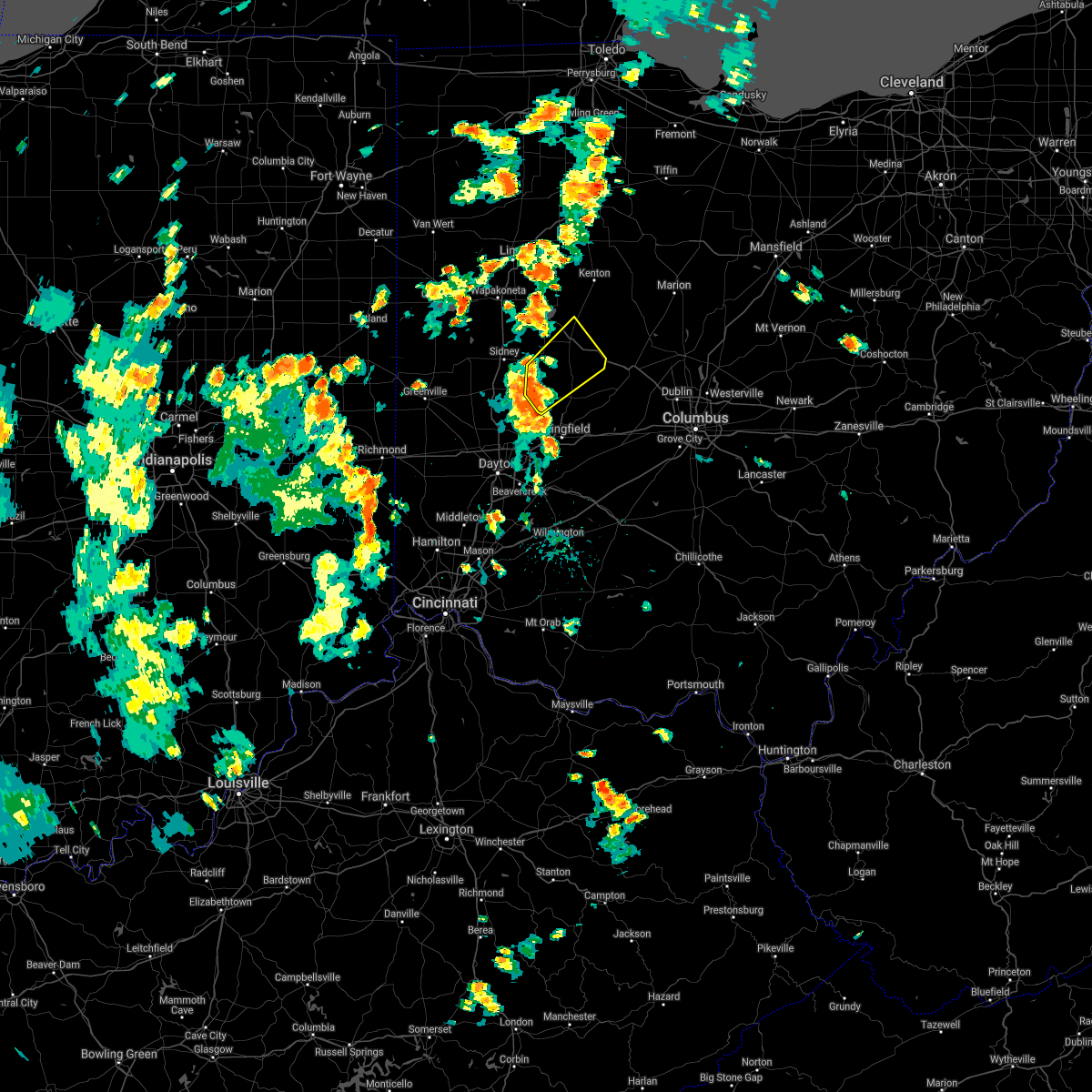 At 439 pm edt, a severe thunderstorm was located near st. paris, moving northeast at 30 mph (radar indicated). Hazards include 60 mph wind gusts. expect damage to trees and power lines At 439 pm edt, a severe thunderstorm was located near st. paris, moving northeast at 30 mph (radar indicated). Hazards include 60 mph wind gusts. expect damage to trees and power lines
|
| 6/19/2019 5:17 PM EDT |
 At 517 pm edt, a severe thunderstorm was located near russells point, moving east at 20 mph (radar indicated). Hazards include 60 mph wind gusts and quarter size hail. Minor hail damage to vehicles is possible. expect wind damage to trees and power lines. Locations impacted include, bellefontaine, russells point, de graff, lakeview, chippewa park, huntsville, mcmorran, logansville, bloom center and lewistown. At 517 pm edt, a severe thunderstorm was located near russells point, moving east at 20 mph (radar indicated). Hazards include 60 mph wind gusts and quarter size hail. Minor hail damage to vehicles is possible. expect wind damage to trees and power lines. Locations impacted include, bellefontaine, russells point, de graff, lakeview, chippewa park, huntsville, mcmorran, logansville, bloom center and lewistown.
|
| 6/19/2019 5:06 PM EDT |
 At 506 pm edt, a severe thunderstorm was located over jackson center, moving east at 20 mph (radar indicated). Hazards include 60 mph wind gusts and quarter size hail. Minor hail damage to vehicles is possible. expect wind damage to trees and power lines. Locations impacted include, bellefontaine, jackson center, russells point, de graff, lakeview, chippewa park, quincy, huntsville, port jefferson, montra, logansville, mcmorran, maplewood, bloom center, pemberton and lewistown. At 506 pm edt, a severe thunderstorm was located over jackson center, moving east at 20 mph (radar indicated). Hazards include 60 mph wind gusts and quarter size hail. Minor hail damage to vehicles is possible. expect wind damage to trees and power lines. Locations impacted include, bellefontaine, jackson center, russells point, de graff, lakeview, chippewa park, quincy, huntsville, port jefferson, montra, logansville, mcmorran, maplewood, bloom center, pemberton and lewistown.
|
| 6/19/2019 4:54 PM EDT |
 The national weather service in wilmington has issued a * severe thunderstorm warning for. northeastern shelby county in west central ohio. western logan county in west central ohio. central auglaize county in west central ohio. Until 545 pm edt. The national weather service in wilmington has issued a * severe thunderstorm warning for. northeastern shelby county in west central ohio. western logan county in west central ohio. central auglaize county in west central ohio. Until 545 pm edt.
|
| 6/15/2019 11:33 PM EDT |
 At 1132 pm edt, a severe thunderstorm was located near st. paris, moving northeast at 45 mph (radar indicated). Hazards include 60 mph wind gusts. Expect damage to trees and power lines. Locations impacted include, bellefontaine, west liberty, de graff, quincy, logansville, rosewood, carysville, plattsville, mcmorran, maplewood, springhills, bloom center, pemberton and lewistown. At 1132 pm edt, a severe thunderstorm was located near st. paris, moving northeast at 45 mph (radar indicated). Hazards include 60 mph wind gusts. Expect damage to trees and power lines. Locations impacted include, bellefontaine, west liberty, de graff, quincy, logansville, rosewood, carysville, plattsville, mcmorran, maplewood, springhills, bloom center, pemberton and lewistown.
|
| 6/15/2019 11:23 PM EDT |
 The national weather service in wilmington has issued a * severe thunderstorm warning for. southeastern shelby county in west central ohio. northwestern champaign county in west central ohio. southwestern logan county in west central ohio. Northeastern miami county in west central ohio. The national weather service in wilmington has issued a * severe thunderstorm warning for. southeastern shelby county in west central ohio. northwestern champaign county in west central ohio. southwestern logan county in west central ohio. Northeastern miami county in west central ohio.
|
| 5/17/2019 1:30 AM EDT | Quarter sized hail reported 1.9 miles E of Bellefontaine, OH |
| 5/17/2019 1:28 AM EDT |
 The severe thunderstorm warning for northeastern shelby, northwestern logan and east central auglaize counties will expire at 130 am edt, the storm which prompted the warning has weakened below severe limits, and no longer poses an immediate threat to life or property. therefore, the warning will be allowed to expire. please report previous wind damage or hail to the national weather service by going to our website at weather.gov/iln and submitting your report via social media. The severe thunderstorm warning for northeastern shelby, northwestern logan and east central auglaize counties will expire at 130 am edt, the storm which prompted the warning has weakened below severe limits, and no longer poses an immediate threat to life or property. therefore, the warning will be allowed to expire. please report previous wind damage or hail to the national weather service by going to our website at weather.gov/iln and submitting your report via social media.
|
| 5/17/2019 1:19 AM EDT |
 At 119 am edt, a severe thunderstorm was located near botkins, moving southeast at 15 mph (radar indicated). Hazards include quarter size hail. Minor damage to vehicles is possible. locations impacted include, bellefontaine, anna, jackson center, russells point, de graff, botkins, lakeview, chippewa park, quincy, port jefferson, fryburg, montra, logansville, st. johns, mcmorran, maplewood, bloom center, pemberton and lewistown. This includes i-75 in ohio between mile markers 100 and 108. At 119 am edt, a severe thunderstorm was located near botkins, moving southeast at 15 mph (radar indicated). Hazards include quarter size hail. Minor damage to vehicles is possible. locations impacted include, bellefontaine, anna, jackson center, russells point, de graff, botkins, lakeview, chippewa park, quincy, port jefferson, fryburg, montra, logansville, st. johns, mcmorran, maplewood, bloom center, pemberton and lewistown. This includes i-75 in ohio between mile markers 100 and 108.
|
| 5/17/2019 1:00 AM EDT |
 At 1247 am edt, a severe thunderstorm was located over botkins, moving southeast at 35 mph (radar indicated). Hazards include quarter size hail. Minor damage to vehicles is possible. locations impacted include, sidney, bellefontaine, wapakoneta, anna, jackson center, russells point, de graff, botkins, lakeview, new knoxville, chippewa park, quincy, port jefferson, kettlersville, fryburg, montra, mcmorran, maplewood, bloom center and pemberton. This includes i-75 in ohio between mile markers 96 and 112. At 1247 am edt, a severe thunderstorm was located over botkins, moving southeast at 35 mph (radar indicated). Hazards include quarter size hail. Minor damage to vehicles is possible. locations impacted include, sidney, bellefontaine, wapakoneta, anna, jackson center, russells point, de graff, botkins, lakeview, new knoxville, chippewa park, quincy, port jefferson, kettlersville, fryburg, montra, mcmorran, maplewood, bloom center and pemberton. This includes i-75 in ohio between mile markers 96 and 112.
|
| 5/17/2019 12:48 AM EDT |
 A severe thunderstorm warning remains in effect until 130 am edt for northeastern shelby. northwestern logan and central auglaize counties. at 1247 am edt, a severe thunderstorm was located over botkins, moving southeast at 35 mph. hazard. Quarter size hail. A severe thunderstorm warning remains in effect until 130 am edt for northeastern shelby. northwestern logan and central auglaize counties. at 1247 am edt, a severe thunderstorm was located over botkins, moving southeast at 35 mph. hazard. Quarter size hail.
|
| 5/17/2019 12:39 AM EDT |
 At 1239 am edt, a severe thunderstorm was located near new knoxville, moving southeast at 35 mph (radar indicated). Hazards include quarter size hail. minor damage to vehicles is possible At 1239 am edt, a severe thunderstorm was located near new knoxville, moving southeast at 35 mph (radar indicated). Hazards include quarter size hail. minor damage to vehicles is possible
|
| 4/14/2019 4:56 PM EDT |
 At 455 pm edt, a severe thunderstorm was located near jackson center, moving northeast at 50 mph (radar indicated). Hazards include 60 mph wind gusts and penny size hail. Expect damage to trees and power lines. this storm has produced several measured wind gusts around 50 mph recently. locations impacted include, sidney, bellefontaine, wapakoneta, anna, jackson center, russells point, de graff, botkins, lakeview, quincy, port jefferson, fryburg, montra, logansville, ballou, st. johns, plattsville, mcmorran, maplewood and bloom center. this includes i-75 in ohio between mile markers 90 and 111. A tornado watch remains in effect until 900 pm edt for west central ohio. At 455 pm edt, a severe thunderstorm was located near jackson center, moving northeast at 50 mph (radar indicated). Hazards include 60 mph wind gusts and penny size hail. Expect damage to trees and power lines. this storm has produced several measured wind gusts around 50 mph recently. locations impacted include, sidney, bellefontaine, wapakoneta, anna, jackson center, russells point, de graff, botkins, lakeview, quincy, port jefferson, fryburg, montra, logansville, ballou, st. johns, plattsville, mcmorran, maplewood and bloom center. this includes i-75 in ohio between mile markers 90 and 111. A tornado watch remains in effect until 900 pm edt for west central ohio.
|
| 4/14/2019 4:39 PM EDT |
 At 439 pm edt, a severe thunderstorm was located near sidney, moving northeast at 50 mph (radar indicated). Hazards include 60 mph wind gusts and nickel size hail. Expect damage to trees and power lines. locations impacted include, sidney, piqua, bellefontaine, wapakoneta, minster, covington, newport, anna, fort loramie, jackson center, russells point, de graff, pleasant hill, botkins, lakeview, hardin, quincy, port jefferson, kettlersville and lockington. this includes i-75 in ohio between mile markers 79 and 111. A tornado watch remains in effect until 900 pm edt for west central ohio. At 439 pm edt, a severe thunderstorm was located near sidney, moving northeast at 50 mph (radar indicated). Hazards include 60 mph wind gusts and nickel size hail. Expect damage to trees and power lines. locations impacted include, sidney, piqua, bellefontaine, wapakoneta, minster, covington, newport, anna, fort loramie, jackson center, russells point, de graff, pleasant hill, botkins, lakeview, hardin, quincy, port jefferson, kettlersville and lockington. this includes i-75 in ohio between mile markers 79 and 111. A tornado watch remains in effect until 900 pm edt for west central ohio.
|
| 4/14/2019 4:25 PM EDT |
 At 424 pm edt, a severe thunderstorm was located over bradford, moving northeast at 50 mph (radar indicated). Hazards include 60 mph wind gusts and quarter size hail. Minor hail damage to vehicles is possible. Expect wind damage to trees and power lines. At 424 pm edt, a severe thunderstorm was located over bradford, moving northeast at 50 mph (radar indicated). Hazards include 60 mph wind gusts and quarter size hail. Minor hail damage to vehicles is possible. Expect wind damage to trees and power lines.
|
| 4/12/2019 8:15 AM EDT | Storm damage reported in logan county OH, 3.5 miles E of Bellefontaine, OH |
| 4/12/2019 8:09 AM EDT |
 The severe thunderstorm warning for eastern shelby, western champaign, logan, southwestern hardin and northeastern miami counties will expire at 815 am edt, the storms which prompted the warning have weakened below severe limits, and no longer pose an immediate threat to life or property. therefore, the warning will be allowed to expire. however gusty winds are still possible with these thunderstorms. please report previous wind damage or hail to the national weather service by going to our website at weather.gov/iln and submitting your report via social media. The severe thunderstorm warning for eastern shelby, western champaign, logan, southwestern hardin and northeastern miami counties will expire at 815 am edt, the storms which prompted the warning have weakened below severe limits, and no longer pose an immediate threat to life or property. therefore, the warning will be allowed to expire. however gusty winds are still possible with these thunderstorms. please report previous wind damage or hail to the national weather service by going to our website at weather.gov/iln and submitting your report via social media.
|
| 4/12/2019 8:01 AM EDT |
 At 801 am edt, severe thunderstorms were located along a line extending from near lakeview to near st. paris, moving northeast at 75 mph (radar indicated). Hazards include 60 mph wind gusts. Expect damage to trees and power lines. locations impacted include, bellefontaine, st. Paris, west liberty, jackson center, russells point, de graff, lakeview, belle center, chippewa park, northwood, roundhead, quincy, christiansburg, huntsville, mcmorran, maplewood, kiser lake state park, millerstown, bloom center and pemberton. At 801 am edt, severe thunderstorms were located along a line extending from near lakeview to near st. paris, moving northeast at 75 mph (radar indicated). Hazards include 60 mph wind gusts. Expect damage to trees and power lines. locations impacted include, bellefontaine, st. Paris, west liberty, jackson center, russells point, de graff, lakeview, belle center, chippewa park, northwood, roundhead, quincy, christiansburg, huntsville, mcmorran, maplewood, kiser lake state park, millerstown, bloom center and pemberton.
|
| 4/12/2019 7:47 AM EDT |
 At 747 am edt, severe thunderstorms were located along a line extending from sidney to near tipp city, moving northeast at 70 mph (radar indicated). Hazards include 60 mph wind gusts. expect damage to trees and power lines At 747 am edt, severe thunderstorms were located along a line extending from sidney to near tipp city, moving northeast at 70 mph (radar indicated). Hazards include 60 mph wind gusts. expect damage to trees and power lines
|
| 8/20/2018 6:13 PM EDT |
 At 613 pm edt, a severe thunderstorm capable of producing a tornado was located over west liberty, moving northeast at 25 mph (weather spotters reported a funnel cloud). Hazards include tornado. Flying debris will be dangerous to those caught without shelter. mobile homes will be damaged or destroyed. damage to roofs, windows, and vehicles will occur. tree damage is likely. Locations impacted include, bellefontaine, urbana, west liberty, belle center, west mansfield, northwood, rushsylvania, huntsville, valley hi, zanesfield, new jerusalem, pickrelltown, lippincott, middleburg, springhills, kiser lake state park, mingo, kennard and east liberty. At 613 pm edt, a severe thunderstorm capable of producing a tornado was located over west liberty, moving northeast at 25 mph (weather spotters reported a funnel cloud). Hazards include tornado. Flying debris will be dangerous to those caught without shelter. mobile homes will be damaged or destroyed. damage to roofs, windows, and vehicles will occur. tree damage is likely. Locations impacted include, bellefontaine, urbana, west liberty, belle center, west mansfield, northwood, rushsylvania, huntsville, valley hi, zanesfield, new jerusalem, pickrelltown, lippincott, middleburg, springhills, kiser lake state park, mingo, kennard and east liberty.
|
| 8/20/2018 6:05 PM EDT |
 At 602 pm edt, a severe thunderstorm capable of producing a tornado was located near west liberty, moving northeast at 25 mph (radar indicated rotation). Hazards include tornado. Flying debris will be dangerous to those caught without shelter. mobile homes will be damaged or destroyed. damage to roofs, windows, and vehicles will occur. Tree damage is likely. At 602 pm edt, a severe thunderstorm capable of producing a tornado was located near west liberty, moving northeast at 25 mph (radar indicated rotation). Hazards include tornado. Flying debris will be dangerous to those caught without shelter. mobile homes will be damaged or destroyed. damage to roofs, windows, and vehicles will occur. Tree damage is likely.
|
| 5/4/2018 2:45 PM EDT |
 The national weather service in wilmington has issued a * severe thunderstorm warning for. eastern logan county in west central ohio. northern delaware county in central ohio. northern union county in central ohio. Until 330 pm edt. The national weather service in wilmington has issued a * severe thunderstorm warning for. eastern logan county in west central ohio. northern delaware county in central ohio. northern union county in central ohio. Until 330 pm edt.
|
| 5/4/2018 2:45 PM EDT |
 At 245 pm edt, a severe thunderstorm was located near bellefontaine, moving east at 55 mph (radar indicated). Hazards include 60 mph wind gusts. expect damage to trees and power lines At 245 pm edt, a severe thunderstorm was located near bellefontaine, moving east at 55 mph (radar indicated). Hazards include 60 mph wind gusts. expect damage to trees and power lines
|
| 7/21/2017 8:11 AM EDT |
 The severe thunderstorm warning for shelby, champaign, southwestern logan, northwestern fayette, northeastern darke, clark, southwestern auglaize, southeastern mercer, northwestern warren, greene, montgomery, southwestern madison and miami counties will expire at 815 am edt, the storms which prompted the warning have moved out of the area. therefore, the warning will be allowed to expire. however gusty winds are still possible with these thunderstorms. please report previous wind damage or hail to the national weather service by going to our website at weather.gov/iln and submitting your report via social media. remember, a new severe thunderstorm warning has been issued for portions of shelby, logan, miami, champaign, clark, greene, madison, and fayette counties. The severe thunderstorm warning for shelby, champaign, southwestern logan, northwestern fayette, northeastern darke, clark, southwestern auglaize, southeastern mercer, northwestern warren, greene, montgomery, southwestern madison and miami counties will expire at 815 am edt, the storms which prompted the warning have moved out of the area. therefore, the warning will be allowed to expire. however gusty winds are still possible with these thunderstorms. please report previous wind damage or hail to the national weather service by going to our website at weather.gov/iln and submitting your report via social media. remember, a new severe thunderstorm warning has been issued for portions of shelby, logan, miami, champaign, clark, greene, madison, and fayette counties.
|
| 7/21/2017 8:08 AM EDT |
 At 808 am edt, severe thunderstorms were located along a line extending from near newport to 7 miles south of xenia, moving east at 65 mph (radar indicated). Hazards include 60 mph wind gusts. expect damage to trees and power lines At 808 am edt, severe thunderstorms were located along a line extending from near newport to 7 miles south of xenia, moving east at 65 mph (radar indicated). Hazards include 60 mph wind gusts. expect damage to trees and power lines
|
| 7/21/2017 7:49 AM EDT |
 At 749 am edt, severe thunderstorms were located along a line extending from anna to bellbrook, moving east at 55 mph (radar indicated). Hazards include 60 mph wind gusts. Expect damage to trees and power lines. locations impacted include, dayton, springfield, kettering, beavercreek, huber heights, fairborn, xenia, troy, trotwood, sidney, piqua, miamisburg, springboro, vandalia, englewood, bellefontaine, urbana, franklin, tipp city and bellbrook. this includes the following interstates, i-70 in ohio between mile markers 24 and 71. i-71 in ohio between mile markers 59 and 67. I-75 in ohio between mile markers 40 and 104. At 749 am edt, severe thunderstorms were located along a line extending from anna to bellbrook, moving east at 55 mph (radar indicated). Hazards include 60 mph wind gusts. Expect damage to trees and power lines. locations impacted include, dayton, springfield, kettering, beavercreek, huber heights, fairborn, xenia, troy, trotwood, sidney, piqua, miamisburg, springboro, vandalia, englewood, bellefontaine, urbana, franklin, tipp city and bellbrook. this includes the following interstates, i-70 in ohio between mile markers 24 and 71. i-71 in ohio between mile markers 59 and 67. I-75 in ohio between mile markers 40 and 104.
|
| 7/21/2017 7:28 AM EDT |
 At 728 am edt, severe thunderstorms were located along a line extending from 6 miles west of minster to near carlisle, moving east at 55 mph (radar indicated). Hazards include 60 mph wind gusts. expect damage to trees and power lines At 728 am edt, severe thunderstorms were located along a line extending from 6 miles west of minster to near carlisle, moving east at 55 mph (radar indicated). Hazards include 60 mph wind gusts. expect damage to trees and power lines
|
| 6/13/2017 8:41 PM EDT |
 At 841 pm edt, a severe thunderstorm was located near west liberty, moving southeast at 30 mph (radar indicated). Hazards include 60 mph wind gusts and quarter size hail. Hail damage to vehicles is expected. Expect wind damage to roofs, siding, and trees. At 841 pm edt, a severe thunderstorm was located near west liberty, moving southeast at 30 mph (radar indicated). Hazards include 60 mph wind gusts and quarter size hail. Hail damage to vehicles is expected. Expect wind damage to roofs, siding, and trees.
|
| 6/13/2017 8:30 PM EDT |
 At 828 pm edt, a severe thunderstorm was located over de graff, moving southeast at 20 mph (law enforcement. this storm has a history of producing damage to trees by shelby county law enforcement). Hazards include 60 mph wind gusts and quarter size hail. Hail damage to vehicles is expected. expect wind damage to roofs, siding, and trees. Locations impacted include, bellefontaine, west liberty, de graff, quincy, valley hi, zanesfield, logansville, rosewood, new jerusalem, mcmorran, springhills, bloom center and lewistown. At 828 pm edt, a severe thunderstorm was located over de graff, moving southeast at 20 mph (law enforcement. this storm has a history of producing damage to trees by shelby county law enforcement). Hazards include 60 mph wind gusts and quarter size hail. Hail damage to vehicles is expected. expect wind damage to roofs, siding, and trees. Locations impacted include, bellefontaine, west liberty, de graff, quincy, valley hi, zanesfield, logansville, rosewood, new jerusalem, mcmorran, springhills, bloom center and lewistown.
|
| 6/13/2017 8:25 PM EDT | Tree down along county road 11. time estimated by rada in logan county OH, 4.8 miles ENE of Bellefontaine, OH |
| 6/13/2017 8:16 PM EDT |
 At 814 pm edt, a severe thunderstorm was located near jackson center, moving southeast at 15 mph (law enforcement. at 810 pm, shelby county sheriffs office reported that there had been several trees down with this storm in the botkins and jackson center area). Hazards include 60 mph wind gusts and quarter size hail. Hail damage to vehicles is expected. expect wind damage to roofs, siding, and trees. Locations impacted include, sidney, bellefontaine, west liberty, jackson center, russells point, de graff, port jefferson, zanesfield, logansville, plattsville, maplewood, springhills, kiser lake state park and millerstown. At 814 pm edt, a severe thunderstorm was located near jackson center, moving southeast at 15 mph (law enforcement. at 810 pm, shelby county sheriffs office reported that there had been several trees down with this storm in the botkins and jackson center area). Hazards include 60 mph wind gusts and quarter size hail. Hail damage to vehicles is expected. expect wind damage to roofs, siding, and trees. Locations impacted include, sidney, bellefontaine, west liberty, jackson center, russells point, de graff, port jefferson, zanesfield, logansville, plattsville, maplewood, springhills, kiser lake state park and millerstown.
|
| 6/13/2017 7:57 PM EDT |
 At 756 pm edt, a severe thunderstorm was located over jackson center, moving southeast at 15 mph (radar indicated). Hazards include 60 mph wind gusts and quarter size hail. Hail damage to vehicles is expected. Expect wind damage to roofs, siding, and trees. At 756 pm edt, a severe thunderstorm was located over jackson center, moving southeast at 15 mph (radar indicated). Hazards include 60 mph wind gusts and quarter size hail. Hail damage to vehicles is expected. Expect wind damage to roofs, siding, and trees.
|
| 6/4/2017 4:58 PM EDT |
 The severe thunderstorm warning for eastern logan county will expire at 500 pm edt, the storm which prompted the warning has weakened below severe limits, and no longer poses an immediate threat to life or property. therefore, the warning will be allowed to expire. however small hail and gusty winds are still possible with this thunderstorm. please report previous wind damage or hail to the national weather service by going to our website at weather.gov/iln and submitting your report via social media. The severe thunderstorm warning for eastern logan county will expire at 500 pm edt, the storm which prompted the warning has weakened below severe limits, and no longer poses an immediate threat to life or property. therefore, the warning will be allowed to expire. however small hail and gusty winds are still possible with this thunderstorm. please report previous wind damage or hail to the national weather service by going to our website at weather.gov/iln and submitting your report via social media.
|
| 6/4/2017 4:42 PM EDT |
 At 441 pm edt, a severe thunderstorm was located over bellefontaine, moving southeast at 5 mph (radar indicated). Hazards include 60 mph wind gusts and penny size hail. Expect damage to roofs, siding, and trees. Locations impacted include, bellefontaine, west mansfield, rushsylvania, valley hi, zanesfield, new jerusalem, pickrelltown and east liberty. At 441 pm edt, a severe thunderstorm was located over bellefontaine, moving southeast at 5 mph (radar indicated). Hazards include 60 mph wind gusts and penny size hail. Expect damage to roofs, siding, and trees. Locations impacted include, bellefontaine, west mansfield, rushsylvania, valley hi, zanesfield, new jerusalem, pickrelltown and east liberty.
|
| 6/4/2017 4:25 PM EDT |
 At 425 pm edt, a severe thunderstorm was located over bellefontaine, moving southeast at 5 mph (radar indicated). Hazards include 60 mph wind gusts and quarter size hail. Hail damage to vehicles is expected. Expect wind damage to roofs, siding, and trees. At 425 pm edt, a severe thunderstorm was located over bellefontaine, moving southeast at 5 mph (radar indicated). Hazards include 60 mph wind gusts and quarter size hail. Hail damage to vehicles is expected. Expect wind damage to roofs, siding, and trees.
|
| 8/28/2016 8:35 PM EDT | Several trees down between bellefontaine and west liberty. time estimated from rada in logan county OH, 3.7 miles N of Bellefontaine, OH |
| 8/28/2016 8:24 PM EDT |
 At 824 pm edt, a severe thunderstorm was located over bellefontaine, moving southeast at 25 mph (radar indicated). Hazards include 60 mph wind gusts. Expect damage to roofs. siding. and trees. Locations impacted include, bellefontaine, west liberty, northwood, rushsylvania, huntsville, valley hi, zanesfield, lewistown, mcmorran, new jerusalem and east liberty. At 824 pm edt, a severe thunderstorm was located over bellefontaine, moving southeast at 25 mph (radar indicated). Hazards include 60 mph wind gusts. Expect damage to roofs. siding. and trees. Locations impacted include, bellefontaine, west liberty, northwood, rushsylvania, huntsville, valley hi, zanesfield, lewistown, mcmorran, new jerusalem and east liberty.
|
| 8/28/2016 8:21 PM EDT |
 The national weather service in wilmington has issued a * severe thunderstorm warning for. northwestern union county in central ohio. central logan county in west central ohio. southeastern hardin county in west central ohio. Until 845 pm edt. The national weather service in wilmington has issued a * severe thunderstorm warning for. northwestern union county in central ohio. central logan county in west central ohio. southeastern hardin county in west central ohio. Until 845 pm edt.
|
| 8/20/2016 8:08 PM EDT |
 The tornado warning for northeastern champaign and eastern logan counties will expire at 815 pm edt, the tornado threat has diminished and the tornado warning has been cancelled. however, large hail and damaging winds remain likely and a severe thunderstorm warning remains in effect for the area. please report previous tornadoes, wind damage or hail to the national weather service by going to our website at weather.gov/iln and submitting your report via social media. remember, a severe thunderstorm warning still remains in effect for union and logan counties. The tornado warning for northeastern champaign and eastern logan counties will expire at 815 pm edt, the tornado threat has diminished and the tornado warning has been cancelled. however, large hail and damaging winds remain likely and a severe thunderstorm warning remains in effect for the area. please report previous tornadoes, wind damage or hail to the national weather service by going to our website at weather.gov/iln and submitting your report via social media. remember, a severe thunderstorm warning still remains in effect for union and logan counties.
|
| 8/20/2016 8:06 PM EDT |
 At 805 pm edt, a severe thunderstorm was located near west mansfield, moving east at 30 mph (radar indicated). Hazards include 60 mph wind gusts. Expect damage to roofs. siding. And trees. At 805 pm edt, a severe thunderstorm was located near west mansfield, moving east at 30 mph (radar indicated). Hazards include 60 mph wind gusts. Expect damage to roofs. siding. And trees.
|
| 8/20/2016 7:56 PM EDT |
 At 756 pm edt, a severe thunderstorm capable of producing a tornado was located near bellefontaine, moving east at 30 mph (radar indicated rotation). Hazards include tornado. Flying debris will be dangerous to those caught without shelter. mobile homes will be damaged or destroyed. damage to roofs, windows, and vehicles will occur. tree damage is likely. Locations impacted include, bellefontaine, west liberty, north lewisburg, rushsylvania, valley hi, zanesfield, middleburg, east liberty, pickrelltown and new jerusalem. At 756 pm edt, a severe thunderstorm capable of producing a tornado was located near bellefontaine, moving east at 30 mph (radar indicated rotation). Hazards include tornado. Flying debris will be dangerous to those caught without shelter. mobile homes will be damaged or destroyed. damage to roofs, windows, and vehicles will occur. tree damage is likely. Locations impacted include, bellefontaine, west liberty, north lewisburg, rushsylvania, valley hi, zanesfield, middleburg, east liberty, pickrelltown and new jerusalem.
|
| 8/20/2016 7:42 PM EDT |
 At 741 pm edt, a severe thunderstorm with a history of producing a tornado near de graff, moving east at 30 mph (radar indicated rotation). Hazards include tornado. Flying debris will be dangerous to those caught without shelter. mobile homes will be damaged or destroyed. damage to roofs, windows, and vehicles will occur. Tree damage is likely. At 741 pm edt, a severe thunderstorm with a history of producing a tornado near de graff, moving east at 30 mph (radar indicated rotation). Hazards include tornado. Flying debris will be dangerous to those caught without shelter. mobile homes will be damaged or destroyed. damage to roofs, windows, and vehicles will occur. Tree damage is likely.
|
| 8/20/2016 7:22 PM EDT |
 At 721 pm edt, a severe thunderstorm with the history of producing a tornado was located near de graff, moving east at 25 mph (radar indicated rotation). Hazards include tornado. Flying debris will be dangerous to those caught without shelter. mobile homes will be damaged or destroyed. damage to roofs, windows, and vehicles will occur. Tree damage is likely. At 721 pm edt, a severe thunderstorm with the history of producing a tornado was located near de graff, moving east at 25 mph (radar indicated rotation). Hazards include tornado. Flying debris will be dangerous to those caught without shelter. mobile homes will be damaged or destroyed. damage to roofs, windows, and vehicles will occur. Tree damage is likely.
|
| 6/23/2016 1:29 AM EDT |
 At 128 am edt, a severe thunderstorm was located near bellefontaine, moving southeast at 30 mph (radar indicated). Hazards include 60 mph wind gusts. Expect damage to roofs. siding. And trees. At 128 am edt, a severe thunderstorm was located near bellefontaine, moving southeast at 30 mph (radar indicated). Hazards include 60 mph wind gusts. Expect damage to roofs. siding. And trees.
|
| 6/23/2016 1:07 AM EDT |
 At 107 am edt, a severe thunderstorm was located 7 miles south of kenton, moving east at 45 mph (radar indicated). Hazards include 60 mph wind gusts and penny size hail. Expect damage to roofs. siding. and trees. locations impacted include, bellefontaine, russells point, belle center, west mansfield, northwood, mount victory, rushsylvania, huntsville, ridgeway, valley hi, zanesfield, somersville, lewistown, big springs, raymond, new jerusalem, east liberty, mcmorran, broadway and byhalia. A tornado watch remains in effect until 500 am edt for west central and central ohio. At 107 am edt, a severe thunderstorm was located 7 miles south of kenton, moving east at 45 mph (radar indicated). Hazards include 60 mph wind gusts and penny size hail. Expect damage to roofs. siding. and trees. locations impacted include, bellefontaine, russells point, belle center, west mansfield, northwood, mount victory, rushsylvania, huntsville, ridgeway, valley hi, zanesfield, somersville, lewistown, big springs, raymond, new jerusalem, east liberty, mcmorran, broadway and byhalia. A tornado watch remains in effect until 500 am edt for west central and central ohio.
|
| 6/23/2016 12:41 AM EDT |
 At 1241 am edt, a severe thunderstorm was located near lakeview, moving east at 45 mph (radar indicated). Hazards include 70 mph wind gusts and nickel size hail. Expect considerable tree damage. Damage is likely to mobile homes, roofs, and outbuildings. At 1241 am edt, a severe thunderstorm was located near lakeview, moving east at 45 mph (radar indicated). Hazards include 70 mph wind gusts and nickel size hail. Expect considerable tree damage. Damage is likely to mobile homes, roofs, and outbuildings.
|
| 12/23/2015 5:58 PM EST | Large tree down near intersection of township rd. 30 and county road 18. time estimated by rada in logan county OH, 6.1 miles NE of Bellefontaine, OH |
| 12/23/2015 5:53 PM EST | At 553 pm est, radar indicated that the severe thunderstorms had weakened. these storms were located along a line extending from near de graff to near enon, moving east at 60 mph. storm hazards include, winds to 60 mph, locations impacted include, springfield, bellefontaine, urbana, st. paris, west liberty, de graff, belle center, northwood, quincy, rushsylvania, north hampton, huntsville, tremont city, port jefferson, catawba, valley hi, zanesfield, mutual, powhattan and springhills. |
| 12/23/2015 5:46 PM EST | Severe thunderstorm warning remains in effect for northeastern miami. champaign. northern clark. southeastern shelby and central logan counties until 600 pm est. at 546 pm est. radar indicated severe thunderstorms located along a line extending from 6 miles south of jackson center to near new carlisle. Moving northeast at 60 mph. |
| 12/23/2015 5:22 PM EST | At 522 pm est, radar indicated severe thunderstorms located along a line extending from near versailles to near englewood, moving northeast at 60 mph. storm hazards include, winds to 60 mph,. |
| 9/4/2015 3:09 PM EDT |
 At 308 pm edt, radar indicated severe thunderstorms located along a line extending from near russells point to near fort loramie, moving southeast at 30 mph. storm hazards include, winds to 60 mph, penny size hail, locations impacted include, sidney, bellefontaine, new bremen, minster, anna, fort loramie, jackson center, russells point, botkins, lakeview, new knoxville, waynesfield, belle center, hardin, northwood, roundhead, huntsville, port jefferson, chickasaw and kettlersville. this includes i-75 in ohio between mile markers 91 and 108. At 308 pm edt, radar indicated severe thunderstorms located along a line extending from near russells point to near fort loramie, moving southeast at 30 mph. storm hazards include, winds to 60 mph, penny size hail, locations impacted include, sidney, bellefontaine, new bremen, minster, anna, fort loramie, jackson center, russells point, botkins, lakeview, new knoxville, waynesfield, belle center, hardin, northwood, roundhead, huntsville, port jefferson, chickasaw and kettlersville. this includes i-75 in ohio between mile markers 91 and 108.
|
| 9/4/2015 2:44 PM EDT |
 At 243 pm edt, radar indicated severe thunderstorms located along a line extending from near waynesfield to near st. marys, moving southeast at 30 mph. storm hazards include, winds to 60 mph, penny size hail,. At 243 pm edt, radar indicated severe thunderstorms located along a line extending from near waynesfield to near st. marys, moving southeast at 30 mph. storm hazards include, winds to 60 mph, penny size hail,.
|
| 7/14/2015 1:21 PM EDT |
 The severe thunderstorm warning for northwestern union, southeastern hardin and northern logan counties will expire at 130 pm edt, the storm which prompted the warning has moved out of the area. therefore the warning will be allowed to expire. another severe thunderstorm warning remains in effect for northern union county until 2 pm. please report previous wind damage or hail to the national weather service by going to our website at weather.gov/iln and submit your report via social media. The severe thunderstorm warning for northwestern union, southeastern hardin and northern logan counties will expire at 130 pm edt, the storm which prompted the warning has moved out of the area. therefore the warning will be allowed to expire. another severe thunderstorm warning remains in effect for northern union county until 2 pm. please report previous wind damage or hail to the national weather service by going to our website at weather.gov/iln and submit your report via social media.
|
| 7/14/2015 1:04 PM EDT |
 At 103 pm edt, radar indicated a severe thunderstorm located near jackson center, moving southeast at 45 mph. storm hazards include, winds to 60 mph, quarter size hail, locations impacted include, sidney, bellefontaine, anna, jackson center, russells point, botkins, lakeview, port jefferson, kettlersville, montra, bloom center, lewistown, maplewood, logansville, swanders, mcmorran and mccartyville. At 103 pm edt, radar indicated a severe thunderstorm located near jackson center, moving southeast at 45 mph. storm hazards include, winds to 60 mph, quarter size hail, locations impacted include, sidney, bellefontaine, anna, jackson center, russells point, botkins, lakeview, port jefferson, kettlersville, montra, bloom center, lewistown, maplewood, logansville, swanders, mcmorran and mccartyville.
|
| 7/14/2015 1:03 PM EDT |
 At 103 pm edt, radar indicated a severe thunderstorm located near belle center, moving southeast at 40 mph. storm hazards include, winds to 60 mph, quarter size hail, locations impacted include, bellefontaine, kenton, russells point, lakeview, belle center, west mansfield, northwood, mount victory, rushsylvania, huntsville, ridgeway, hepburn, pfeiffer, mentzer, big springs, new jerusalem, silver creek and byhalia. At 103 pm edt, radar indicated a severe thunderstorm located near belle center, moving southeast at 40 mph. storm hazards include, winds to 60 mph, quarter size hail, locations impacted include, bellefontaine, kenton, russells point, lakeview, belle center, west mansfield, northwood, mount victory, rushsylvania, huntsville, ridgeway, hepburn, pfeiffer, mentzer, big springs, new jerusalem, silver creek and byhalia.
|
| 7/14/2015 12:55 PM EDT |
 At 1254 pm edt, radar indicated a severe thunderstorm located over botkins, moving southeast at 40 mph. storm hazards include, winds to 60 mph, quarter size hail, locations impacted include, sidney, bellefontaine, wapakoneta, new bremen, anna, jackson center, russells point, botkins, lakeview, new knoxville, port jefferson, kettlersville, montra, bloom center, lewistown, maplewood, logansville, fryburg, swanders and mcmorran. At 1254 pm edt, radar indicated a severe thunderstorm located over botkins, moving southeast at 40 mph. storm hazards include, winds to 60 mph, quarter size hail, locations impacted include, sidney, bellefontaine, wapakoneta, new bremen, anna, jackson center, russells point, botkins, lakeview, new knoxville, port jefferson, kettlersville, montra, bloom center, lewistown, maplewood, logansville, fryburg, swanders and mcmorran.
|
| 7/14/2015 12:51 PM EDT |
 At 1250 pm edt, radar indicated a severe thunderstorm located near belle center, moving southeast at 40 mph. storm hazards include, winds to 60 mph, quarter size hail,. At 1250 pm edt, radar indicated a severe thunderstorm located near belle center, moving southeast at 40 mph. storm hazards include, winds to 60 mph, quarter size hail,.
|
| 7/14/2015 12:41 PM EDT |
 At 1241 pm edt, radar indicated a severe thunderstorm located over new knoxville, moving southeast at 40 mph. storm hazards include, winds to 60 mph, quarter size hail,. At 1241 pm edt, radar indicated a severe thunderstorm located over new knoxville, moving southeast at 40 mph. storm hazards include, winds to 60 mph, quarter size hail,.
|
| 5/26/2015 4:56 PM EDT | At 454 pm edt, radar indicated a severe thunderstorm located near bellefontaine, moving northeast at 40 mph. storm hazards include, winds to 60 mph, quarter size hail,. |
| 5/11/2015 4:07 PM EDT | The severe thunderstorm warning for southern logan and northern champaign counties will expire at 415 pm edt, the storm has weakened below severe limits, therefore the severe thunderstorm warning will be allowed to expire. please report previous wind damage or hail to the national weather service by going to our website at weather.gov/iln and submitting your report via social media. |
| 5/11/2015 4:02 PM EDT | At 400 pm edt, radar continued to indicate a severe thunderstorm located near west liberty, moving northeast at 50 mph. storm hazards include, winds to 60 mph, this storm will affect mainly rural areas of northern champaign and southern logan counties, including mingo and pickrelltown. , <0.75in. |
| 5/11/2015 3:48 PM EDT | At 346 pm edt, radar continued to indicate a severe thunderstorm located near st. paris, moving northeast at 50 mph. storm hazards include, winds to 60 mph, locations impacted include, urbana and west liberty. in addition, carysville, westville, rosewood, springhills, lippincott, kennard, cable and mingo are near the path of this storm. , <0.75in. |
| 5/11/2015 3:38 PM EDT | At 336 pm edt, radar indicated a severe thunderstorm located near christiansburg, moving northeast at 50 mph. storm hazards include, winds to 60 mph,. |
| 4/10/2015 3:27 AM EDT | A severe thunderstorm warning remains in effect until 400 am edt for southeastern montgomery. southern logan. western greene. clark and champaign counties. at 325 am edt. radar continued to indicate severe thunderstorms located along a line extending from westville to greene county airport. Moving northeast at 60 mph. |
| 4/10/2015 3:11 AM EDT | The national weather service in wilmington has issued a * severe thunderstorm warning for. southeastern shelby county in west central ohio. eastern montgomery county in west central ohio. eastern miami county in west central ohio. Southern logan county in west central ohio. |
| 7/27/2014 1:33 PM EDT | Ping Pong Ball sized hail reported 4.2 miles WNW of Bellefontaine, OH, time estimated from radar. |
| 11/17/2013 6:20 PM EST | Storm damage reported in logan county OH, 3.5 miles E of Bellefontaine, OH |
| 6/29/2012 4:37 PM EDT | Numerous large trees and limbs are down throughout the county. power lines down. 2 house fire in logan county OH, 0.4 miles NE of Bellefontaine, OH |
| 6/29/2012 4:24 PM EDT | Ohio dot senso in logan county OH, 0.9 miles WSW of Bellefontaine, OH |
| 6/29/2012 4:20 PM EDT | Numerous trees down and roof damage to several building in logan county OH, 0.4 miles NE of Bellefontaine, OH |
| 6/29/2012 4:15 PM EDT | Large branches broken. time estimated from rada in logan county OH, 0.4 miles NE of Bellefontaine, OH |
| 6/29/2012 4:15 PM EDT | Large tree branches dow in logan county OH, 0.4 miles NE of Bellefontaine, OH |
| 6/29/2012 4:15 PM EDT | Large branch blocking us 33/68 exit ramp. also water ponded here. other large limbs down in are in logan county OH, 1.2 miles SSW of Bellefontaine, OH |
| 1/1/0001 12:00 AM | Trees and power poles down across the western half of the county in logan county OH, 0.4 miles NE of Bellefontaine, OH |
| 1/1/0001 12:00 AM | Storm damage reported in logan county OH, 3.5 miles E of Bellefontaine, OH |
| 1/1/0001 12:00 AM | Quarter sized hail reported 5.4 miles ESE of Bellefontaine, OH |
| 1/1/0001 12:00 AM | Power pole snapped and a tree down on a house in the city of bellefontain in logan county OH, 0.4 miles NE of Bellefontaine, OH |
Hail Maps for Bellefontaine, OH


Connect with Interactive Hail Maps