

Hail Map for Brook Park, MN
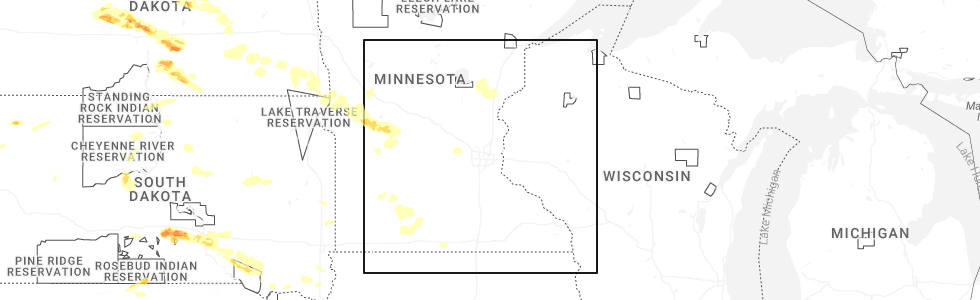
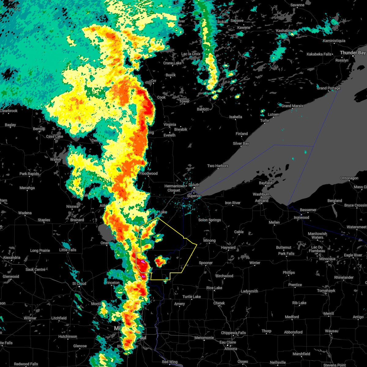
The Brook Park, MN area has had 2 reports of on-the-ground hail by trained spotters, and has been under severe weather warnings 2 times during the past 12 months. Doppler radar has detected hail at or near Brook Park, MN on 51 occasions, including 4 occasions during the past year.
| Name: | Brook Park, MN |
| Where Located: | 67.7 miles N of Minneapolis, MN |
| Map: | Google Map for Brook Park, MN |
| Population: | 139 |
| Housing Units: | 60 |
| More Info: | Search Google for Brook Park, MN |
2
The Top Recent Hail Date for Brook Park, MN is Friday, June 27, 2025 (7th out of 51)
Hail and Wind Damage Spotted near Brook Park, MN
| Date / Time | Report Details |
|---|---|
| 6/16/2025 7:17 PM CDT | At 716 pm cdt, severe thunderstorms were located along a line extending from 7 miles east of hinckley to 6 miles southwest of saint croix state park to near pine city to grasston, moving east at 55 mph (radar indicated). Hazards include 60 mph wind gusts. Expect damage to roofs, siding, and trees. Locations impacted include, pine city, hinckley, rock creek, grantsburg, trade lake, siren, webster, webb lake wisconsin, brook park, henriette, saint croix band sand lake area, saint croix band bashaw area, saint croix band clam lake area, danbury, hertel, saint croix state park, saint croix band pike lake area, branstad, mille lacs band lena lake area, and randall. |
| 6/16/2025 6:53 PM CDT | Svrdlh the national weather service in duluth mn has issued a * severe thunderstorm warning for, southern pine county in east central minnesota, burnett county in northwestern wisconsin, * until 800 pm cdt. * at 653 pm cdt, severe thunderstorms were located along a line extending from 6 miles north of brook park to near quamba to near bock, moving east at 45 mph (radar indicated). Hazards include 60 mph wind gusts and penny size hail. expect damage to roofs, siding, and trees |
| 8/11/2023 3:32 PM CDT |
 At 332 pm cdt, a severe thunderstorm was located over rock creek, or near pine city, moving southeast at 45 mph. this is a destructive storm for southern pine and burnett counties (radar indicated). Hazards include 80 mph wind gusts and quarter size hail. Flying debris will be dangerous to those caught without shelter. mobile homes will be heavily damaged. expect considerable damage to roofs, windows, and vehicles. extensive tree damage and power outages are likely. this severe thunderstorm will be near, rock creek around 335 pm cdt. grantsburg around 350 pm cdt. other locations in the path of this severe thunderstorm include branstad and trade lake. thunderstorm damage threat, destructive hail threat, radar indicated max hail size, 1. 00 in wind threat, radar indicated max wind gust, 80 mph. At 332 pm cdt, a severe thunderstorm was located over rock creek, or near pine city, moving southeast at 45 mph. this is a destructive storm for southern pine and burnett counties (radar indicated). Hazards include 80 mph wind gusts and quarter size hail. Flying debris will be dangerous to those caught without shelter. mobile homes will be heavily damaged. expect considerable damage to roofs, windows, and vehicles. extensive tree damage and power outages are likely. this severe thunderstorm will be near, rock creek around 335 pm cdt. grantsburg around 350 pm cdt. other locations in the path of this severe thunderstorm include branstad and trade lake. thunderstorm damage threat, destructive hail threat, radar indicated max hail size, 1. 00 in wind threat, radar indicated max wind gust, 80 mph.
|
| 8/11/2023 3:06 PM CDT |
 At 306 pm cdt, a severe thunderstorm was located near mora, or 18 miles west of pine city, moving southeast at 40 mph (radar indicated). Hazards include 70 mph wind gusts and quarter size hail. Hail damage to vehicles is expected. expect considerable tree damage. wind damage is also likely to mobile homes, roofs, and outbuildings. this severe thunderstorm will be near, henriette around 320 pm cdt. other locations in the path of this severe thunderstorm include pine city, rock creek and grantsburg. thunderstorm damage threat, considerable hail threat, radar indicated max hail size, 1. 00 in wind threat, radar indicated max wind gust, 70 mph. At 306 pm cdt, a severe thunderstorm was located near mora, or 18 miles west of pine city, moving southeast at 40 mph (radar indicated). Hazards include 70 mph wind gusts and quarter size hail. Hail damage to vehicles is expected. expect considerable tree damage. wind damage is also likely to mobile homes, roofs, and outbuildings. this severe thunderstorm will be near, henriette around 320 pm cdt. other locations in the path of this severe thunderstorm include pine city, rock creek and grantsburg. thunderstorm damage threat, considerable hail threat, radar indicated max hail size, 1. 00 in wind threat, radar indicated max wind gust, 70 mph.
|
| 7/27/2023 5:31 PM CDT |
 At 531 pm cdt, severe thunderstorms were located along a line extending from foxboro, to 7 miles west of webster, moving east at 25 mph (trained weather spotters). Hazards include golf ball size hail and 60 mph wind gusts. People and animals outdoors will be injured. expect hail damage to roofs, siding, windows, and vehicles. expect wind damage to roofs, siding, and trees. locations impacted include, danbury and webster. thunderstorm damage threat, considerable hail threat, radar indicated max hail size, 1. 75 in wind threat, radar indicated max wind gust, 60 mph. At 531 pm cdt, severe thunderstorms were located along a line extending from foxboro, to 7 miles west of webster, moving east at 25 mph (trained weather spotters). Hazards include golf ball size hail and 60 mph wind gusts. People and animals outdoors will be injured. expect hail damage to roofs, siding, windows, and vehicles. expect wind damage to roofs, siding, and trees. locations impacted include, danbury and webster. thunderstorm damage threat, considerable hail threat, radar indicated max hail size, 1. 75 in wind threat, radar indicated max wind gust, 60 mph.
|
| 7/27/2023 5:00 PM CDT |
 At 459 pm cdt, severe thunderstorms were located along a line extending from nemadji, to 9 miles southeast of hinckley, moving east at 25 mph (trained weather spotters reported 1 inch hail west of hinckley). Hazards include golf ball size hail and 60 mph wind gusts. People and animals outdoors will be injured. expect hail damage to roofs, siding, windows, and vehicles. expect wind damage to roofs, siding, and trees. severe thunderstorms will be near, nemadji around 505 pm cdt. other locations in the path of these severe thunderstorms include holyoke, webster and danbury. thunderstorm damage threat, considerable hail threat, radar indicated max hail size, 1. 75 in wind threat, radar indicated max wind gust, 60 mph. At 459 pm cdt, severe thunderstorms were located along a line extending from nemadji, to 9 miles southeast of hinckley, moving east at 25 mph (trained weather spotters reported 1 inch hail west of hinckley). Hazards include golf ball size hail and 60 mph wind gusts. People and animals outdoors will be injured. expect hail damage to roofs, siding, windows, and vehicles. expect wind damage to roofs, siding, and trees. severe thunderstorms will be near, nemadji around 505 pm cdt. other locations in the path of these severe thunderstorms include holyoke, webster and danbury. thunderstorm damage threat, considerable hail threat, radar indicated max hail size, 1. 75 in wind threat, radar indicated max wind gust, 60 mph.
|
| 6/27/2022 4:56 PM CDT |
 At 455 pm cdt, a severe thunderstorm was located over brook park, or near hinckley, moving southeast at 25 mph (radar indicated). Hazards include quarter size hail. Damage to vehicles is expected. this severe thunderstorm will be near, pine city around 510 pm cdt. other locations in the path of this severe thunderstorm include grantsburg. hail threat, radar indicated max hail size, 1. 00 in wind threat, radar indicated max wind gust, <50 mph. At 455 pm cdt, a severe thunderstorm was located over brook park, or near hinckley, moving southeast at 25 mph (radar indicated). Hazards include quarter size hail. Damage to vehicles is expected. this severe thunderstorm will be near, pine city around 510 pm cdt. other locations in the path of this severe thunderstorm include grantsburg. hail threat, radar indicated max hail size, 1. 00 in wind threat, radar indicated max wind gust, <50 mph.
|
| 6/23/2022 10:40 PM CDT |
 The severe thunderstorm warning for southwestern pine and southwestern burnett counties will expire at 1045 pm cdt, the storms which prompted the warning have weakened below severe limits, and no longer pose an immediate threat to life or property. therefore, the warning will be allowed to expire. however small hail and gusty winds are still possible with these thunderstorms. a severe thunderstorm watch remains in effect until 100 am cdt for east central minnesota. The severe thunderstorm warning for southwestern pine and southwestern burnett counties will expire at 1045 pm cdt, the storms which prompted the warning have weakened below severe limits, and no longer pose an immediate threat to life or property. therefore, the warning will be allowed to expire. however small hail and gusty winds are still possible with these thunderstorms. a severe thunderstorm watch remains in effect until 100 am cdt for east central minnesota.
|
| 6/23/2022 10:32 PM CDT |
 At 1031 pm cdt, severe thunderstorms were located along a line extending from near pine city, to siren, moving east at 25 mph (trained weather spotters). Hazards include 60 mph wind gusts and quarter size hail. Hail damage to vehicles is expected. expect wind damage to roofs, siding, and trees. Locations impacted include, siren and grantsburg. At 1031 pm cdt, severe thunderstorms were located along a line extending from near pine city, to siren, moving east at 25 mph (trained weather spotters). Hazards include 60 mph wind gusts and quarter size hail. Hail damage to vehicles is expected. expect wind damage to roofs, siding, and trees. Locations impacted include, siren and grantsburg.
|
| 6/23/2022 10:08 PM CDT |
 At 1006 pm cdt, severe thunderstorms were located along a line extending from quamba, to 7 miles east of grantsburg, moving southeast at 25 mph (trained weather spotters reported funnel clouds near grantsburg). Hazards include 60 mph wind gusts and quarter size hail. Hail damage to vehicles is expected. expect wind damage to roofs, siding, and trees. severe thunderstorms will be near, siren around 1025 pm cdt. Other locations in the path of these severe thunderstorms include pine city, rock creek and grantsburg. At 1006 pm cdt, severe thunderstorms were located along a line extending from quamba, to 7 miles east of grantsburg, moving southeast at 25 mph (trained weather spotters reported funnel clouds near grantsburg). Hazards include 60 mph wind gusts and quarter size hail. Hail damage to vehicles is expected. expect wind damage to roofs, siding, and trees. severe thunderstorms will be near, siren around 1025 pm cdt. Other locations in the path of these severe thunderstorms include pine city, rock creek and grantsburg.
|
| 5/30/2022 7:54 PM CDT |
 At 754 pm cdt, severe thunderstorms were located along a line extending from 8 miles southwest of rutledge, to 7 miles southeast of sandstone, to 7 miles southwest of branstad, moving northeast at 70 mph (radar indicated). Hazards include 70 mph wind gusts and quarter size hail. Hail damage to vehicles is expected. expect considerable tree damage. wind damage is also likely to mobile homes, roofs, and outbuildings. Locations impacted include, pine city, hinckley, sandstone, rock creek, grantsburg, trade lake, siren, webster, willow river, askov, webb lake wisconsin, rutledge, brook park, bruno, henriette, cloverton, duxbury, danbury, branstad, and mille lacs band lena lake area. At 754 pm cdt, severe thunderstorms were located along a line extending from 8 miles southwest of rutledge, to 7 miles southeast of sandstone, to 7 miles southwest of branstad, moving northeast at 70 mph (radar indicated). Hazards include 70 mph wind gusts and quarter size hail. Hail damage to vehicles is expected. expect considerable tree damage. wind damage is also likely to mobile homes, roofs, and outbuildings. Locations impacted include, pine city, hinckley, sandstone, rock creek, grantsburg, trade lake, siren, webster, willow river, askov, webb lake wisconsin, rutledge, brook park, bruno, henriette, cloverton, duxbury, danbury, branstad, and mille lacs band lena lake area.
|
| 5/30/2022 7:45 PM CDT |
 At 744 pm cdt, a severe thunderstorm was located near pine city, moving northeast at 65 mph (radar indicated). Hazards include 60 mph wind gusts and quarter size hail. Hail damage to vehicles is expected. expect wind damage to roofs, siding, and trees. this severe thunderstorm will be near, hinckley around 750 pm cdt. Other locations in the path of this severe thunderstorm include askov, mille lacs band lena lake area and duxbury. At 744 pm cdt, a severe thunderstorm was located near pine city, moving northeast at 65 mph (radar indicated). Hazards include 60 mph wind gusts and quarter size hail. Hail damage to vehicles is expected. expect wind damage to roofs, siding, and trees. this severe thunderstorm will be near, hinckley around 750 pm cdt. Other locations in the path of this severe thunderstorm include askov, mille lacs band lena lake area and duxbury.
|
| 5/30/2022 7:37 PM CDT |
 At 737 pm cdt, severe thunderstorms were located along a line extending from 7 miles south of mcgrath, to rock creek, to near north branch, moving northeast at 55 mph (radar indicated). Hazards include 60 mph wind gusts and quarter size hail. Hail damage to vehicles is expected. expect wind damage to roofs, siding, and trees. Locations impacted include, pine city, hinckley, sandstone, rock creek, grantsburg, trade lake, askov, rutledge, brook park, henriette, branstad, randall, finlayson, arthyde, banning state park, four corners, west rock, trade river, friesland, and beroun. At 737 pm cdt, severe thunderstorms were located along a line extending from 7 miles south of mcgrath, to rock creek, to near north branch, moving northeast at 55 mph (radar indicated). Hazards include 60 mph wind gusts and quarter size hail. Hail damage to vehicles is expected. expect wind damage to roofs, siding, and trees. Locations impacted include, pine city, hinckley, sandstone, rock creek, grantsburg, trade lake, askov, rutledge, brook park, henriette, branstad, randall, finlayson, arthyde, banning state park, four corners, west rock, trade river, friesland, and beroun.
|
| 5/30/2022 7:19 PM CDT |
 At 718 pm cdt, severe thunderstorms were located along a line extending from near mora, to 8 miles northeast of cambridge, to near east bethel, moving northeast at 60 mph (radar indicated). Hazards include 60 mph wind gusts and half dollar size hail. Hail damage to vehicles is expected. Expect wind damage to roofs, siding, and trees. At 718 pm cdt, severe thunderstorms were located along a line extending from near mora, to 8 miles northeast of cambridge, to near east bethel, moving northeast at 60 mph (radar indicated). Hazards include 60 mph wind gusts and half dollar size hail. Hail damage to vehicles is expected. Expect wind damage to roofs, siding, and trees.
|
| 5/12/2022 1:10 PM CDT |
 At 109 pm cdt, a severe thunderstorm was located over rock creek, or near pine city, moving northeast at 45 mph (trained weather spotters). Hazards include half dollar size hail. Damage to vehicles is expected. locations impacted include, pine city, hinckley, sandstone, rock creek, grantsburg, trade lake, askov, brook park, branstad, mille lacs band lena lake area, randall, finlayson, grindstone lake pine county, falun, phantom lake, chengwatana state forest, banning state park, saint croix state park, four corners, and alpha. hail threat, observed max hail size, 1. 25 in wind threat, radar indicated max wind gust, <50 mph. At 109 pm cdt, a severe thunderstorm was located over rock creek, or near pine city, moving northeast at 45 mph (trained weather spotters). Hazards include half dollar size hail. Damage to vehicles is expected. locations impacted include, pine city, hinckley, sandstone, rock creek, grantsburg, trade lake, askov, brook park, branstad, mille lacs band lena lake area, randall, finlayson, grindstone lake pine county, falun, phantom lake, chengwatana state forest, banning state park, saint croix state park, four corners, and alpha. hail threat, observed max hail size, 1. 25 in wind threat, radar indicated max wind gust, <50 mph.
|
| 5/12/2022 12:40 PM CDT |
 At 1239 pm cdt, a severe thunderstorm was located near brunswick, or 10 miles north of cambridge, moving northeast at 40 mph (radar indicated). Hazards include half dollar size hail. damage to vehicles is expected At 1239 pm cdt, a severe thunderstorm was located near brunswick, or 10 miles north of cambridge, moving northeast at 40 mph (radar indicated). Hazards include half dollar size hail. damage to vehicles is expected
|
| 5/11/2022 9:06 PM CDT |
 At 906 pm cdt, severe thunderstorms were located along a line extending from near ogilvie, to near rock creek, to 7 miles north of center city, moving northeast at 55 mph (radar indicated). Hazards include 70 mph wind gusts and quarter size hail. Hail damage to vehicles is expected. expect considerable tree damage. wind damage is also likely to mobile homes, roofs, and outbuildings. Locations impacted include, pine city, hinckley, rock creek, grantsburg, trade lake, siren, webster, brook park, henriette, branstad, randall, falun, greely, phantom lake, chengwatana state forest, four corners, west rock, alpha, trade river, and beroun. At 906 pm cdt, severe thunderstorms were located along a line extending from near ogilvie, to near rock creek, to 7 miles north of center city, moving northeast at 55 mph (radar indicated). Hazards include 70 mph wind gusts and quarter size hail. Hail damage to vehicles is expected. expect considerable tree damage. wind damage is also likely to mobile homes, roofs, and outbuildings. Locations impacted include, pine city, hinckley, rock creek, grantsburg, trade lake, siren, webster, brook park, henriette, branstad, randall, falun, greely, phantom lake, chengwatana state forest, four corners, west rock, alpha, trade river, and beroun.
|
| 5/11/2022 8:46 PM CDT |
 At 846 pm cdt, severe thunderstorms were located along a line extending from near foreston, to 7 miles northwest of cambridge, to near east bethel, moving east at 55 mph (radar indicated). Hazards include 70 mph wind gusts and ping pong ball size hail. People and animals outdoors will be injured. expect hail damage to roofs, siding, windows, and vehicles. expect considerable tree damage. Wind damage is also likely to mobile homes, roofs, and outbuildings. At 846 pm cdt, severe thunderstorms were located along a line extending from near foreston, to 7 miles northwest of cambridge, to near east bethel, moving east at 55 mph (radar indicated). Hazards include 70 mph wind gusts and ping pong ball size hail. People and animals outdoors will be injured. expect hail damage to roofs, siding, windows, and vehicles. expect considerable tree damage. Wind damage is also likely to mobile homes, roofs, and outbuildings.
|
| 5/11/2022 4:43 PM CDT |
 At 442 pm cdt, a severe thunderstorm was located near rock creek, or 8 miles southwest of pine city, moving northeast at 30 mph (radar indicated). Hazards include 60 mph wind gusts and half dollar size hail. Hail damage to vehicles is expected. expect wind damage to roofs, siding, and trees. locations impacted include, pine city, hinckley, rock creek, grantsburg, brook park, henriette, branstad, randall, greely, west rock, chengwatana state forest, and beroun. hail threat, radar indicated max hail size, 1. 25 in wind threat, radar indicated max wind gust, 60 mph. At 442 pm cdt, a severe thunderstorm was located near rock creek, or 8 miles southwest of pine city, moving northeast at 30 mph (radar indicated). Hazards include 60 mph wind gusts and half dollar size hail. Hail damage to vehicles is expected. expect wind damage to roofs, siding, and trees. locations impacted include, pine city, hinckley, rock creek, grantsburg, brook park, henriette, branstad, randall, greely, west rock, chengwatana state forest, and beroun. hail threat, radar indicated max hail size, 1. 25 in wind threat, radar indicated max wind gust, 60 mph.
|
| 5/11/2022 4:26 PM CDT |
 At 426 pm cdt, a severe thunderstorm was located 8 miles south of grasston, or 9 miles north of cambridge, moving northeast at 25 mph (radar indicated). Hazards include 60 mph wind gusts and half dollar size hail. Hail damage to vehicles is expected. Expect wind damage to roofs, siding, and trees. At 426 pm cdt, a severe thunderstorm was located 8 miles south of grasston, or 9 miles north of cambridge, moving northeast at 25 mph (radar indicated). Hazards include 60 mph wind gusts and half dollar size hail. Hail damage to vehicles is expected. Expect wind damage to roofs, siding, and trees.
|
| 5/11/2022 4:00 PM CDT |
 At 400 pm cdt, a severe thunderstorm was located over brunswick, or 15 miles west of pine city, moving northeast at 25 mph (radar indicated). Hazards include ping pong ball size hail and 60 mph wind gusts. People and animals outdoors will be injured. expect hail damage to roofs, siding, windows, and vehicles. Expect wind damage to roofs, siding, and trees. At 400 pm cdt, a severe thunderstorm was located over brunswick, or 15 miles west of pine city, moving northeast at 25 mph (radar indicated). Hazards include ping pong ball size hail and 60 mph wind gusts. People and animals outdoors will be injured. expect hail damage to roofs, siding, windows, and vehicles. Expect wind damage to roofs, siding, and trees.
|
| 8/28/2021 1:11 PM CDT |
 At 110 pm cdt, severe thunderstorms were located along a line extending from near mcgrath, to near brook park, to near rock creek, moving east northeast at 45 mph (radar indicated). Hazards include 70 mph wind gusts and ping pong ball size hail. People and animals outdoors will be injured. expect hail damage to roofs, siding, windows, and vehicles. expect considerable tree damage. wind damage is also likely to mobile homes, roofs, and outbuildings. Locations impacted include, pine city, rock creek, hinckley, grantsburg and branstad. At 110 pm cdt, severe thunderstorms were located along a line extending from near mcgrath, to near brook park, to near rock creek, moving east northeast at 45 mph (radar indicated). Hazards include 70 mph wind gusts and ping pong ball size hail. People and animals outdoors will be injured. expect hail damage to roofs, siding, windows, and vehicles. expect considerable tree damage. wind damage is also likely to mobile homes, roofs, and outbuildings. Locations impacted include, pine city, rock creek, hinckley, grantsburg and branstad.
|
| 8/28/2021 12:47 PM CDT |
 At 1247 pm cdt, severe thunderstorms were located along a line extending from isle, to mora, to 6 miles south of brunswick, moving east northeast at 45 mph (radar indicated). Hazards include two inch hail and 70 mph wind gusts. People and animals outdoors will be injured. expect hail damage to roofs, siding, windows, and vehicles. expect considerable tree damage. wind damage is also likely to mobile homes, roofs, and outbuildings. severe thunderstorms will be near, henriette around 100 pm cdt. brook park around 105 pm cdt. Other locations in the path of these severe thunderstorms include pine city, rock creek, hinckley, grantsburg and branstad. At 1247 pm cdt, severe thunderstorms were located along a line extending from isle, to mora, to 6 miles south of brunswick, moving east northeast at 45 mph (radar indicated). Hazards include two inch hail and 70 mph wind gusts. People and animals outdoors will be injured. expect hail damage to roofs, siding, windows, and vehicles. expect considerable tree damage. wind damage is also likely to mobile homes, roofs, and outbuildings. severe thunderstorms will be near, henriette around 100 pm cdt. brook park around 105 pm cdt. Other locations in the path of these severe thunderstorms include pine city, rock creek, hinckley, grantsburg and branstad.
|
| 8/10/2020 4:00 AM CDT |
 At 359 am cdt, a severe thunderstorm was located over pine city, moving east at 35 mph (radar indicated). Hazards include 60 mph wind gusts and half dollar size hail. Hail damage to vehicles is expected. expect wind damage to roofs, siding, and trees. Locations impacted include, pine city, rock creek, grantsburg, brook park, henriette, branstad, randall, greely, phantom lake, chengwatana state forest, saint croix state park, west rock, and beroun. At 359 am cdt, a severe thunderstorm was located over pine city, moving east at 35 mph (radar indicated). Hazards include 60 mph wind gusts and half dollar size hail. Hail damage to vehicles is expected. expect wind damage to roofs, siding, and trees. Locations impacted include, pine city, rock creek, grantsburg, brook park, henriette, branstad, randall, greely, phantom lake, chengwatana state forest, saint croix state park, west rock, and beroun.
|
| 8/10/2020 3:35 AM CDT |
 At 335 am cdt, a severe thunderstorm was located over brunswick, or 14 miles west of pine city, moving east at 35 mph (radar indicated). Hazards include 60 mph wind gusts and half dollar size hail. Hail damage to vehicles is expected. Expect wind damage to roofs, siding, and trees. At 335 am cdt, a severe thunderstorm was located over brunswick, or 14 miles west of pine city, moving east at 35 mph (radar indicated). Hazards include 60 mph wind gusts and half dollar size hail. Hail damage to vehicles is expected. Expect wind damage to roofs, siding, and trees.
|
| 6/1/2020 11:38 AM CDT |
 At 1137 am cdt, a severe thunderstorm was located near brook park, or near hinckley, moving east at 45 mph (radar indicated). Hazards include quarter size hail. damage to vehicles is expected At 1137 am cdt, a severe thunderstorm was located near brook park, or near hinckley, moving east at 45 mph (radar indicated). Hazards include quarter size hail. damage to vehicles is expected
|
| 6/1/2020 11:28 AM CDT | Quarter sized hail reported 6.6 miles SE of Brook Park, MN, quarter inch hail at pomroy lake... mn. time estimated from radar. |
| 7/19/2019 4:36 PM CDT |
 At 434 pm cdt, a large and extremely dangerous severe thunderstorm was located over rock creek, or near pine city, moving southeast at 50 mph (radar indicated. golf ball size hail was reported just north of henriette at 430 pm cdt). Hazards include 90 mph wind gusts and golf ball size hail. You are in a life-threatening situation. flying debris may be deadly to those caught without shelter. mobile homes will be heavily damaged or destroyed. homes and businesses will have substantial roof and window damage. expect extensive tree damage and power outages. Locations impacted include, pine city, hinckley, rock creek, grantsburg, trade lake, brook park, henriette, branstad, randall, falun, greely, phantom lake, chengwatana state forest, four corners, west rock, alpha, trade river, beroun, yellow lake, and saint croix state park. At 434 pm cdt, a large and extremely dangerous severe thunderstorm was located over rock creek, or near pine city, moving southeast at 50 mph (radar indicated. golf ball size hail was reported just north of henriette at 430 pm cdt). Hazards include 90 mph wind gusts and golf ball size hail. You are in a life-threatening situation. flying debris may be deadly to those caught without shelter. mobile homes will be heavily damaged or destroyed. homes and businesses will have substantial roof and window damage. expect extensive tree damage and power outages. Locations impacted include, pine city, hinckley, rock creek, grantsburg, trade lake, brook park, henriette, branstad, randall, falun, greely, phantom lake, chengwatana state forest, four corners, west rock, alpha, trade river, beroun, yellow lake, and saint croix state park.
|
| 7/19/2019 4:28 PM CDT |
 At 415 pm cdt, a large and extremely dangerous severe thunderstorm was located over quamba, or 10 miles northwest of pine city, moving east-southeast at 50 mph (radar indicated). Hazards include 80 mph wind gusts and golf ball size hail. Flying debris will be dangerous to those caught without shelter. mobile homes will be heavily damaged. expect considerable damage to roofs, windows, and vehicles. Extensive tree damage and power outages are likely. At 415 pm cdt, a large and extremely dangerous severe thunderstorm was located over quamba, or 10 miles northwest of pine city, moving east-southeast at 50 mph (radar indicated). Hazards include 80 mph wind gusts and golf ball size hail. Flying debris will be dangerous to those caught without shelter. mobile homes will be heavily damaged. expect considerable damage to roofs, windows, and vehicles. Extensive tree damage and power outages are likely.
|
| 7/19/2019 4:28 PM CDT |
 At 425 pm cdt, a large and extremely dangerous severe thunderstorm was located over henriette, moving southeast at 50 mph (radar indicated). Hazards include 90 mph wind gusts and golf ball size hail. You are in a life-threatening situation. flying debris may be deadly to those caught without shelter. mobile homes will be heavily damaged or destroyed. homes and businesses will have substantial roof and window damage. expect extensive tree damage and power outages. locations impacted include, pine city, hinckley, rock creek, grantsburg, trade lake, brook park, henriette, branstad, randall, falun, greely, phantom lake, chengwatana state forest, saint croix state park, four corners, west rock, alpha, trade river, beroun, and yellow lake. This also includes interstate 35 between rush city and hinckley. At 425 pm cdt, a large and extremely dangerous severe thunderstorm was located over henriette, moving southeast at 50 mph (radar indicated). Hazards include 90 mph wind gusts and golf ball size hail. You are in a life-threatening situation. flying debris may be deadly to those caught without shelter. mobile homes will be heavily damaged or destroyed. homes and businesses will have substantial roof and window damage. expect extensive tree damage and power outages. locations impacted include, pine city, hinckley, rock creek, grantsburg, trade lake, brook park, henriette, branstad, randall, falun, greely, phantom lake, chengwatana state forest, saint croix state park, four corners, west rock, alpha, trade river, beroun, and yellow lake. This also includes interstate 35 between rush city and hinckley.
|
| 7/19/2019 4:16 PM CDT |
 At 415 pm cdt, a large and extremely dangerous severe thunderstorm was located over quamba, or 10 miles northwest of pine city, moving east-southeast at 50 mph (radar indicated). Hazards include 80 mph wind gusts and golf ball size hail. Flying debris will be dangerous to those caught without shelter. mobile homes will be heavily damaged. expect considerable damage to roofs, windows, and vehicles. Extensive tree damage and power outages are likely. At 415 pm cdt, a large and extremely dangerous severe thunderstorm was located over quamba, or 10 miles northwest of pine city, moving east-southeast at 50 mph (radar indicated). Hazards include 80 mph wind gusts and golf ball size hail. Flying debris will be dangerous to those caught without shelter. mobile homes will be heavily damaged. expect considerable damage to roofs, windows, and vehicles. Extensive tree damage and power outages are likely.
|
| 7/19/2019 4:15 PM CDT | Quarter sized hail reported 5.1 miles E of Brook Park, MN |
| 6/30/2019 11:21 AM CDT |
 The severe thunderstorm warning for southern pine, northwestern washburn and central burnett counties will expire at 1130 am cdt, the storms which prompted the warning have moved out of the area. therefore, the warning will be allowed to expire. The severe thunderstorm warning for southern pine, northwestern washburn and central burnett counties will expire at 1130 am cdt, the storms which prompted the warning have moved out of the area. therefore, the warning will be allowed to expire.
|
| 6/30/2019 10:59 AM CDT |
 At 1058 am cdt, severe thunderstorms were located along a line extending from 7 miles northeast of webb lake wisconsin, to near webster, to 9 miles northwest of grantsburg, moving southeast at 55 mph (radar indicated). Hazards include 60 mph wind gusts and quarter size hail. Hail damage to vehicles is expected. expect wind damage to roofs, siding, and trees. Locations impacted include, pine city, hinckley, rock creek, webster, webb lake wisconsin, brook park, henriette, danbury, oakland, greely, minong flowage, phantom lake, chengwatana state forest, markville, saint croix state park, west rock, cloverdale, beroun, riverside, and yellow lake. At 1058 am cdt, severe thunderstorms were located along a line extending from 7 miles northeast of webb lake wisconsin, to near webster, to 9 miles northwest of grantsburg, moving southeast at 55 mph (radar indicated). Hazards include 60 mph wind gusts and quarter size hail. Hail damage to vehicles is expected. expect wind damage to roofs, siding, and trees. Locations impacted include, pine city, hinckley, rock creek, webster, webb lake wisconsin, brook park, henriette, danbury, oakland, greely, minong flowage, phantom lake, chengwatana state forest, markville, saint croix state park, west rock, cloverdale, beroun, riverside, and yellow lake.
|
| 6/30/2019 10:59 AM CDT |
 A severe thunderstorm warning remains in effect until 1130 am cdt for southern pine. northwestern washburn and central burnett counties. At 1058 am cdt, severe thunderstorms were located along a line extending from 7 miles northeast of webb lake wisconsin, to near webster, to 9 miles northwest of grantsburg, moving southeast at 55. A severe thunderstorm warning remains in effect until 1130 am cdt for southern pine. northwestern washburn and central burnett counties. At 1058 am cdt, severe thunderstorms were located along a line extending from 7 miles northeast of webb lake wisconsin, to near webster, to 9 miles northwest of grantsburg, moving southeast at 55.
|
| 6/30/2019 10:38 AM CDT |
 At 1037 am cdt, severe thunderstorms were located along a line extending from 8 miles north of cloverton, to 8 miles west of duxbury, to 6 miles northwest of hinckley, moving southeast at 55 mph (radar indicated). Hazards include 60 mph wind gusts and quarter size hail. Hail damage to vehicles is expected. Expect wind damage to roofs, siding, and trees. At 1037 am cdt, severe thunderstorms were located along a line extending from 8 miles north of cloverton, to 8 miles west of duxbury, to 6 miles northwest of hinckley, moving southeast at 55 mph (radar indicated). Hazards include 60 mph wind gusts and quarter size hail. Hail damage to vehicles is expected. Expect wind damage to roofs, siding, and trees.
|
| 8/27/2018 5:45 PM CDT |
 At 545 pm cdt, a severe thunderstorm was located near sandstone, or 8 miles northeast of hinckley, moving northeast at 50 mph (radar indicated). Hazards include 60 mph wind gusts. Expect damage to roofs, siding, and trees. locations impacted include, pine city, hinckley, sandstone, rock creek, willow river, askov, rutledge, brook park, bruno, henriette, cloverton, duxbury, sturgeon lake, finlayson, kerrick, denham, duquette, banning state park, kingsdale, and west rock. This includes interstate 35 between pine city and willow river. At 545 pm cdt, a severe thunderstorm was located near sandstone, or 8 miles northeast of hinckley, moving northeast at 50 mph (radar indicated). Hazards include 60 mph wind gusts. Expect damage to roofs, siding, and trees. locations impacted include, pine city, hinckley, sandstone, rock creek, willow river, askov, rutledge, brook park, bruno, henriette, cloverton, duxbury, sturgeon lake, finlayson, kerrick, denham, duquette, banning state park, kingsdale, and west rock. This includes interstate 35 between pine city and willow river.
|
| 8/27/2018 5:34 PM CDT |
 At 534 pm cdt, a severe thunderstorm was located over hinckley, moving northeast at 50 mph (radar indicated). Hazards include 60 mph wind gusts and torrential rainfall. expect damage to roofs, siding, and trees At 534 pm cdt, a severe thunderstorm was located over hinckley, moving northeast at 50 mph (radar indicated). Hazards include 60 mph wind gusts and torrential rainfall. expect damage to roofs, siding, and trees
|
| 8/27/2018 3:06 PM CDT |
 At 306 pm cdt, severe thunderstorms were located along a line extending from near askov, to 10 miles east of hinckley, to 6 miles west of grantsburg, moving east at 40 mph (radar indicated). Hazards include 60 mph wind gusts and torrential rainfall. Expect damage to roofs, siding, and trees. locations impacted include, pine city, hinckley, sandstone, rock creek, grantsburg, askov, duxbury, finlayson, falun, grindstone lake pine county, greely, phantom lake, banning state park, saint croix state park, west rock, alpha, cloverdale, friesland, and beroun. This also includes interstate 35 between pine city and sandstone. At 306 pm cdt, severe thunderstorms were located along a line extending from near askov, to 10 miles east of hinckley, to 6 miles west of grantsburg, moving east at 40 mph (radar indicated). Hazards include 60 mph wind gusts and torrential rainfall. Expect damage to roofs, siding, and trees. locations impacted include, pine city, hinckley, sandstone, rock creek, grantsburg, askov, duxbury, finlayson, falun, grindstone lake pine county, greely, phantom lake, banning state park, saint croix state park, west rock, alpha, cloverdale, friesland, and beroun. This also includes interstate 35 between pine city and sandstone.
|
| 8/27/2018 2:55 PM CDT |
 At 255 pm cdt, severe thunderstorms were located along a line extending from near sandstone, to near hinckley, to rock creek, moving east at 40 mph (radar indicated). Hazards include 60 mph wind gusts and torrential rainfall. Expect damage to roofs, siding, and trees. locations impacted include, pine city, hinckley, sandstone, rock creek, grantsburg, trade lake, askov, brook park, henriette, duxbury, branstad, danbury, randall, finlayson, falun, banning state park, four corners, west rock, trade river, and friesland. This also includes interstate 35 between rush city and sandstone. At 255 pm cdt, severe thunderstorms were located along a line extending from near sandstone, to near hinckley, to rock creek, moving east at 40 mph (radar indicated). Hazards include 60 mph wind gusts and torrential rainfall. Expect damage to roofs, siding, and trees. locations impacted include, pine city, hinckley, sandstone, rock creek, grantsburg, trade lake, askov, brook park, henriette, duxbury, branstad, danbury, randall, finlayson, falun, banning state park, four corners, west rock, trade river, and friesland. This also includes interstate 35 between rush city and sandstone.
|
| 8/27/2018 2:41 PM CDT |
 At 241 pm cdt, severe thunderstorms were located along a line extending from 7 miles northwest of hinckley, to near brook park, to near grasston, moving east at 30 mph (radar indicated). Hazards include 60 mph wind gusts and penny size hail. Expect damage to roofs, siding, and trees. locations impacted include, pine city, hinckley, sandstone, rock creek, grantsburg, trade lake, askov, brook park, henriette, duxbury, branstad, danbury, randall, finlayson, falun, banning state park, four corners, west rock, trade river, and friesland. This also includes interstate 35 between rush city and sandstone. At 241 pm cdt, severe thunderstorms were located along a line extending from 7 miles northwest of hinckley, to near brook park, to near grasston, moving east at 30 mph (radar indicated). Hazards include 60 mph wind gusts and penny size hail. Expect damage to roofs, siding, and trees. locations impacted include, pine city, hinckley, sandstone, rock creek, grantsburg, trade lake, askov, brook park, henriette, duxbury, branstad, danbury, randall, finlayson, falun, banning state park, four corners, west rock, trade river, and friesland. This also includes interstate 35 between rush city and sandstone.
|
| 8/27/2018 2:41 PM CDT |
 At 229 pm cdt, a severe thunderstorm was located over just east of mora, or 8 miles west of pine city, moving east at 40 mph (radar indicated). Hazards include 60 mph wind gusts and penny size hail and torrential rainfall. expect damage to roofs, siding, and trees At 229 pm cdt, a severe thunderstorm was located over just east of mora, or 8 miles west of pine city, moving east at 40 mph (radar indicated). Hazards include 60 mph wind gusts and penny size hail and torrential rainfall. expect damage to roofs, siding, and trees
|
| 8/27/2018 2:30 PM CDT |
 At 229 pm cdt, a severe thunderstorm was located over just east of mora, or 8 miles west of pine city, moving east at 40 mph (radar indicated). Hazards include 60 mph wind gusts and penny size hail and torrential rainfall. expect damage to roofs, siding, and trees At 229 pm cdt, a severe thunderstorm was located over just east of mora, or 8 miles west of pine city, moving east at 40 mph (radar indicated). Hazards include 60 mph wind gusts and penny size hail and torrential rainfall. expect damage to roofs, siding, and trees
|
| 6/17/2018 2:47 PM CDT |
 At 247 pm cdt, severe thunderstorms were located along a line extending from near holyoke, to 7 miles southeast of hinckley, moving east at 40 mph (radar indicated). Hazards include 70 mph wind gusts and quarter size hail. Hail damage to vehicles is expected. expect considerable tree damage. wind damage is also likely to mobile homes, roofs, and outbuildings. locations impacted include, pine city, hinckley, sandstone, rock creek, grantsburg, carlton, mahtowa, barnum, willow river, wrenshall, oliver, askov, rutledge, holyoke, thomson, brook park, bruno, henriette, cloverton, and nemadji. A tornado watch remains in effect until 900 pm cdt for northeastern and east central minnesota, and northwestern wisconsin. At 247 pm cdt, severe thunderstorms were located along a line extending from near holyoke, to 7 miles southeast of hinckley, moving east at 40 mph (radar indicated). Hazards include 70 mph wind gusts and quarter size hail. Hail damage to vehicles is expected. expect considerable tree damage. wind damage is also likely to mobile homes, roofs, and outbuildings. locations impacted include, pine city, hinckley, sandstone, rock creek, grantsburg, carlton, mahtowa, barnum, willow river, wrenshall, oliver, askov, rutledge, holyoke, thomson, brook park, bruno, henriette, cloverton, and nemadji. A tornado watch remains in effect until 900 pm cdt for northeastern and east central minnesota, and northwestern wisconsin.
|
| 6/17/2018 2:29 PM CDT |
 At 228 pm cdt, severe thunderstorms were located along a line extending from near barnum, to near quamba, moving east at 45 mph (radar indicated). Hazards include 70 mph wind gusts and quarter size hail. Hail damage to vehicles is expected. expect considerable tree damage. Wind damage is also likely to mobile homes, roofs, and outbuildings. At 228 pm cdt, severe thunderstorms were located along a line extending from near barnum, to near quamba, moving east at 45 mph (radar indicated). Hazards include 70 mph wind gusts and quarter size hail. Hail damage to vehicles is expected. expect considerable tree damage. Wind damage is also likely to mobile homes, roofs, and outbuildings.
|
| 9/22/2017 5:44 AM CDT |
 At 544 am cdt, a severe thunderstorm was located near pine city, moving northeast at 35 mph (radar indicated). Hazards include ping pong ball size hail and 60 mph wind gusts. People and animals outdoors will be injured. expect hail damage to roofs, siding, windows, and vehicles. Expect wind damage to roofs, siding, and trees. At 544 am cdt, a severe thunderstorm was located near pine city, moving northeast at 35 mph (radar indicated). Hazards include ping pong ball size hail and 60 mph wind gusts. People and animals outdoors will be injured. expect hail damage to roofs, siding, windows, and vehicles. Expect wind damage to roofs, siding, and trees.
|
| 9/20/2017 2:51 AM CDT |
 At 251 am cdt, severe thunderstorms were located along a line extending from 8 miles southwest of brookston, to 6 miles south of barnum, to hinckley, moving east at 60 mph (radar indicated). Hazards include 70 mph wind gusts and penny size hail. Expect considerable tree damage. damage is likely to mobile homes, roofs, and outbuildings. Locations impacted include, cloquet, pine city, hinckley, sandstone, scanlon, carlton, mahtowa, barnum, willow river, wrenshall, askov, cromwell, rutledge, holyoke, kettle river, thomson, brook park, bruno, henriette, and cloverton. At 251 am cdt, severe thunderstorms were located along a line extending from 8 miles southwest of brookston, to 6 miles south of barnum, to hinckley, moving east at 60 mph (radar indicated). Hazards include 70 mph wind gusts and penny size hail. Expect considerable tree damage. damage is likely to mobile homes, roofs, and outbuildings. Locations impacted include, cloquet, pine city, hinckley, sandstone, scanlon, carlton, mahtowa, barnum, willow river, wrenshall, askov, cromwell, rutledge, holyoke, kettle river, thomson, brook park, bruno, henriette, and cloverton.
|
| 9/20/2017 2:39 AM CDT |
 At 239 am cdt, severe thunderstorms were located along a line extending from 7 miles northwest of cromwell, to near willow river, to near hinckley, moving east at 70 mph (radar indicated). Hazards include 70 mph wind gusts and penny size hail. Expect considerable tree damage. damage is likely to mobile homes, roofs, and outbuildings. locations impacted include, cloquet, pine city, hinckley, sandstone, scanlon, carlton, mahtowa, barnum, willow river, wrenshall, askov, cromwell, rutledge, holyoke, kettle river, thomson, brook park, bruno, tamarack, and henriette. This also includes interstate 35 between cloquet and pine city. At 239 am cdt, severe thunderstorms were located along a line extending from 7 miles northwest of cromwell, to near willow river, to near hinckley, moving east at 70 mph (radar indicated). Hazards include 70 mph wind gusts and penny size hail. Expect considerable tree damage. damage is likely to mobile homes, roofs, and outbuildings. locations impacted include, cloquet, pine city, hinckley, sandstone, scanlon, carlton, mahtowa, barnum, willow river, wrenshall, askov, cromwell, rutledge, holyoke, kettle river, thomson, brook park, bruno, tamarack, and henriette. This also includes interstate 35 between cloquet and pine city.
|
| 9/20/2017 2:29 AM CDT |
 At 229 am cdt, severe thunderstorms were located along a line extending from 6 miles north of tamarack, to 12 miles northeast of mcgrath, to 12 miles west of hinckley, moving east at 65 mph (radar indicated). Hazards include 70 mph wind gusts and penny size hail. Expect considerable tree damage. Damage is likely to mobile homes, roofs, and outbuildings. At 229 am cdt, severe thunderstorms were located along a line extending from 6 miles north of tamarack, to 12 miles northeast of mcgrath, to 12 miles west of hinckley, moving east at 65 mph (radar indicated). Hazards include 70 mph wind gusts and penny size hail. Expect considerable tree damage. Damage is likely to mobile homes, roofs, and outbuildings.
|
| 7/6/2017 5:17 AM CDT |
 At 517 am cdt, severe thunderstorms were located along a line extending from near askov, to 6 miles east of pine city, to 8 miles northeast of cambridge, moving east at 45 mph (radar indicated). Hazards include 60 mph wind gusts and quarter size hail. Hail damage to vehicles is expected. expect wind damage to roofs, siding, and trees. Locations impacted include, pine city, hinckley, sandstone, rock creek, grantsburg, trade lake, siren, webster, askov, rutledge, brook park, henriette, cloverton, duxbury, danbury, branstad, randall, oakland, finlayson, and falun. At 517 am cdt, severe thunderstorms were located along a line extending from near askov, to 6 miles east of pine city, to 8 miles northeast of cambridge, moving east at 45 mph (radar indicated). Hazards include 60 mph wind gusts and quarter size hail. Hail damage to vehicles is expected. expect wind damage to roofs, siding, and trees. Locations impacted include, pine city, hinckley, sandstone, rock creek, grantsburg, trade lake, siren, webster, askov, rutledge, brook park, henriette, cloverton, duxbury, danbury, branstad, randall, oakland, finlayson, and falun.
|
| 7/6/2017 5:13 AM CDT |
 At 512 am cdt, severe thunderstorms were located along a line extending from askov, to near pine city, to 8 miles south of brunswick, moving east at 45 mph (radar indicated). Hazards include 60 mph wind gusts and quarter size hail. Hail damage to vehicles is expected. Expect wind damage to roofs, siding, and trees. At 512 am cdt, severe thunderstorms were located along a line extending from askov, to near pine city, to 8 miles south of brunswick, moving east at 45 mph (radar indicated). Hazards include 60 mph wind gusts and quarter size hail. Hail damage to vehicles is expected. Expect wind damage to roofs, siding, and trees.
|
| 7/6/2017 4:48 AM CDT |
 At 448 am cdt, severe thunderstorms were located along a line extending from 7 miles east of mcgrath, to near quamba, to near bock, moving east at 45 mph (radar indicated). Hazards include 60 mph wind gusts and quarter size hail. Hail damage to vehicles is expected. Expect wind damage to roofs, siding, and trees. At 448 am cdt, severe thunderstorms were located along a line extending from 7 miles east of mcgrath, to near quamba, to near bock, moving east at 45 mph (radar indicated). Hazards include 60 mph wind gusts and quarter size hail. Hail damage to vehicles is expected. Expect wind damage to roofs, siding, and trees.
|
| 8/10/2016 7:03 PM CDT |
 At 701 pm cdt, a severe thunderstorm was located near pine city, moving east at 25 mph (radar indicated). Hazards include 60 mph wind gusts and penny size hail. Expect damage to roofs. siding. and trees. locations impacted include, pine city, hinckley, sandstone, rock creek, brook park, henriette, greely, beroun, west rock, cloverdale, friesland, saint croix state park, grindstone lake pine county and banning state park. This also affects interstate 35 between sandstone and rush city. At 701 pm cdt, a severe thunderstorm was located near pine city, moving east at 25 mph (radar indicated). Hazards include 60 mph wind gusts and penny size hail. Expect damage to roofs. siding. and trees. locations impacted include, pine city, hinckley, sandstone, rock creek, brook park, henriette, greely, beroun, west rock, cloverdale, friesland, saint croix state park, grindstone lake pine county and banning state park. This also affects interstate 35 between sandstone and rush city.
|
| 8/10/2016 6:48 PM CDT |
 At 647 pm cdt, a severe thunderstorm was located over henriette, or just west of pine city, moving east at 25 mph (radar indicated). Hazards include 60 mph wind gusts and penny size hail. Expect damage to roofs. siding. and trees. locations impacted include, pine city, hinckley, sandstone, rock creek, brook park, henriette, greely, beroun, west rock, cloverdale, friesland, saint croix state park, grindstone lake pine county and banning state park. This also affects interstate 35 between sandstone and rush city. At 647 pm cdt, a severe thunderstorm was located over henriette, or just west of pine city, moving east at 25 mph (radar indicated). Hazards include 60 mph wind gusts and penny size hail. Expect damage to roofs. siding. and trees. locations impacted include, pine city, hinckley, sandstone, rock creek, brook park, henriette, greely, beroun, west rock, cloverdale, friesland, saint croix state park, grindstone lake pine county and banning state park. This also affects interstate 35 between sandstone and rush city.
|
| 8/10/2016 6:33 PM CDT |
 At 633 pm cdt, a severe thunderstorm was located near quamba, or 11 miles west of pine city, moving southeast at 40 mph (radar indicated). Hazards include 60 mph wind gusts and penny size hail. Expect damage to roofs. siding. And trees. At 633 pm cdt, a severe thunderstorm was located near quamba, or 11 miles west of pine city, moving southeast at 40 mph (radar indicated). Hazards include 60 mph wind gusts and penny size hail. Expect damage to roofs. siding. And trees.
|
| 8/4/2016 4:35 AM CDT |
 At 434 am cdt, severe thunderstorms were located along a line extending from willow river, to 8 miles northeast of pine city, moving east at 45 mph (radar indicated). Hazards include 70 mph wind gusts and penny size hail. Expect considerable tree damage. damage is likely to mobile homes, roofs, and outbuildings. Locations impacted include, pine city, hinckley, sandstone, webster, askov, brook park, bruno, henriette, danbury, cloverton, duxbury, oakland, finlayson, nickerson, kerrick, beroun, riverside, cloverdale, cozy corner and harlis. At 434 am cdt, severe thunderstorms were located along a line extending from willow river, to 8 miles northeast of pine city, moving east at 45 mph (radar indicated). Hazards include 70 mph wind gusts and penny size hail. Expect considerable tree damage. damage is likely to mobile homes, roofs, and outbuildings. Locations impacted include, pine city, hinckley, sandstone, webster, askov, brook park, bruno, henriette, danbury, cloverton, duxbury, oakland, finlayson, nickerson, kerrick, beroun, riverside, cloverdale, cozy corner and harlis.
|
| 8/4/2016 4:18 AM CDT |
 At 417 am cdt, severe thunderstorms were located along a line extending from 9 miles west of rutledge, to near henriette, moving east at 50 mph (radar indicated). Hazards include 70 mph wind gusts and penny size hail. Expect considerable tree damage. Damage is likely to mobile homes, roofs, and outbuildings. At 417 am cdt, severe thunderstorms were located along a line extending from 9 miles west of rutledge, to near henriette, moving east at 50 mph (radar indicated). Hazards include 70 mph wind gusts and penny size hail. Expect considerable tree damage. Damage is likely to mobile homes, roofs, and outbuildings.
|
| 7/11/2016 5:21 PM CDT |
 At 521 pm cdt, a severe thunderstorm was located over rush city, or 8 miles south of pine city, moving northeast at 35 mph (radar indicated). Hazards include 60 mph wind gusts and quarter size hail. Hail damage to vehicles is expected. expect wind damage to roofs, siding, and trees. this severe thunderstorm will be near, pine city around 530 pm cdt. grantsburg and branstad around 540 pm cdt. webster around 610 pm cdt. danbury around 615 pm cdt. Other locations impacted by this severe thunderstorm include greely, beroun, alpha, falun, randall, west rock, four corners, cloverdale, phantom lake and saint croix state park. At 521 pm cdt, a severe thunderstorm was located over rush city, or 8 miles south of pine city, moving northeast at 35 mph (radar indicated). Hazards include 60 mph wind gusts and quarter size hail. Hail damage to vehicles is expected. expect wind damage to roofs, siding, and trees. this severe thunderstorm will be near, pine city around 530 pm cdt. grantsburg and branstad around 540 pm cdt. webster around 610 pm cdt. danbury around 615 pm cdt. Other locations impacted by this severe thunderstorm include greely, beroun, alpha, falun, randall, west rock, four corners, cloverdale, phantom lake and saint croix state park.
|
| 7/11/2016 2:59 PM CDT |
 At 257 pm cdt, a severe thunderstorm was located over hinckley, moving northeast at 30 mph (there was a public report of golf ball size hail when this storm was near mora). Hazards include golf ball size hail. People and animals outdoors will be injured. expect damage to roofs, siding, windows, and vehicles. this severe storm will be near, sandstone around 310 pm cdt. askov around 315 pm cdt. Other locations impacted by this severe thunderstorm include banning state park, grindstone lake pine county, cloverdale, finlayson, friesland and saint croix state park. At 257 pm cdt, a severe thunderstorm was located over hinckley, moving northeast at 30 mph (there was a public report of golf ball size hail when this storm was near mora). Hazards include golf ball size hail. People and animals outdoors will be injured. expect damage to roofs, siding, windows, and vehicles. this severe storm will be near, sandstone around 310 pm cdt. askov around 315 pm cdt. Other locations impacted by this severe thunderstorm include banning state park, grindstone lake pine county, cloverdale, finlayson, friesland and saint croix state park.
|
| 7/11/2016 2:41 PM CDT |
 At 240 pm cdt, a severe thunderstorm was located near hinckley, moving east at 40 mph (there was a public report of golf ball size hail near mora with this storm). Hazards include golf ball size hail. People and animals outdoors will be injured. expect damage to roofs, siding, windows, and vehicles. this severe storm will be near, sandstone around 255 pm cdt. askov around 300 pm cdt. Other locations impacted by this severe thunderstorm include saint croix state park, beroun, banning state park, grindstone lake pine county, cloverdale, finlayson and friesland. At 240 pm cdt, a severe thunderstorm was located near hinckley, moving east at 40 mph (there was a public report of golf ball size hail near mora with this storm). Hazards include golf ball size hail. People and animals outdoors will be injured. expect damage to roofs, siding, windows, and vehicles. this severe storm will be near, sandstone around 255 pm cdt. askov around 300 pm cdt. Other locations impacted by this severe thunderstorm include saint croix state park, beroun, banning state park, grindstone lake pine county, cloverdale, finlayson and friesland.
|
| 7/11/2016 2:26 PM CDT |
 At 225 pm cdt, a severe thunderstorm was located near quamba, or 12 miles west of hinckley, moving east at 40 mph (radar indicated). Hazards include half dollar size hail. Damage to vehicles is expected. this severe thunderstorm will be near, brook park around 235 pm cdt. hinckley around 245 pm cdt. sandstone around 255 pm cdt. askov around 300 pm cdt. Other locations impacted by this severe thunderstorm include saint croix state park, beroun, banning state park, grindstone lake pine county, cloverdale, finlayson and friesland. At 225 pm cdt, a severe thunderstorm was located near quamba, or 12 miles west of hinckley, moving east at 40 mph (radar indicated). Hazards include half dollar size hail. Damage to vehicles is expected. this severe thunderstorm will be near, brook park around 235 pm cdt. hinckley around 245 pm cdt. sandstone around 255 pm cdt. askov around 300 pm cdt. Other locations impacted by this severe thunderstorm include saint croix state park, beroun, banning state park, grindstone lake pine county, cloverdale, finlayson and friesland.
|
| 6/19/2016 10:40 PM CDT |
 At 1040 pm cdt, a severe thunderstorm was located 7 miles west of danbury, or 19 miles east of hinckley, moving east at 60 mph (radar indicated). Hazards include 60 mph wind gusts and half dollar size hail. Hail damage to vehicles is expected. expect wind damage to roofs, siding, and trees. this severe storm will be near, webster and danbury around 1050 pm cdt. webb lake wisconsin around 1100 pm cdt. Other locations impacted by this severe thunderstorm include saint croix state park, beroun, big sand lake, yellow lake, birch island lake, riverside, oakland, markville, cloverdale and phantom lake. At 1040 pm cdt, a severe thunderstorm was located 7 miles west of danbury, or 19 miles east of hinckley, moving east at 60 mph (radar indicated). Hazards include 60 mph wind gusts and half dollar size hail. Hail damage to vehicles is expected. expect wind damage to roofs, siding, and trees. this severe storm will be near, webster and danbury around 1050 pm cdt. webb lake wisconsin around 1100 pm cdt. Other locations impacted by this severe thunderstorm include saint croix state park, beroun, big sand lake, yellow lake, birch island lake, riverside, oakland, markville, cloverdale and phantom lake.
|
| 6/19/2016 10:29 PM CDT |
 At 1029 pm cdt, a severe thunderstorm was located 8 miles east of hinckley, moving east at 60 mph (radar indicated). Hazards include 60 mph wind gusts and half dollar size hail. Hail damage to vehicles is expected. expect wind damage to roofs, siding, and trees. this severe thunderstorm will be near, webster and danbury around 1050 pm cdt. webb lake wisconsin around 1100 pm cdt. Other locations impacted by this severe thunderstorm include saint croix state park, beroun, big sand lake, yellow lake, birch island lake, riverside, oakland, markville, cloverdale and phantom lake. At 1029 pm cdt, a severe thunderstorm was located 8 miles east of hinckley, moving east at 60 mph (radar indicated). Hazards include 60 mph wind gusts and half dollar size hail. Hail damage to vehicles is expected. expect wind damage to roofs, siding, and trees. this severe thunderstorm will be near, webster and danbury around 1050 pm cdt. webb lake wisconsin around 1100 pm cdt. Other locations impacted by this severe thunderstorm include saint croix state park, beroun, big sand lake, yellow lake, birch island lake, riverside, oakland, markville, cloverdale and phantom lake.
|
| 6/22/2015 3:52 AM CDT |
 At 352 am cdt, a severe thunderstorm was located near brook park, or 8 miles west of hinckley, moving northeast at 35 mph (radar indicated). Hazards include quarter size hail and 60 mph wind gusts. Hail damage to vehicles is expected. Expect wind damage to roofs, siding and trees. At 352 am cdt, a severe thunderstorm was located near brook park, or 8 miles west of hinckley, moving northeast at 35 mph (radar indicated). Hazards include quarter size hail and 60 mph wind gusts. Hail damage to vehicles is expected. Expect wind damage to roofs, siding and trees.
|
Hail Maps for Brook Park, MN


Connect with Interactive Hail Maps