

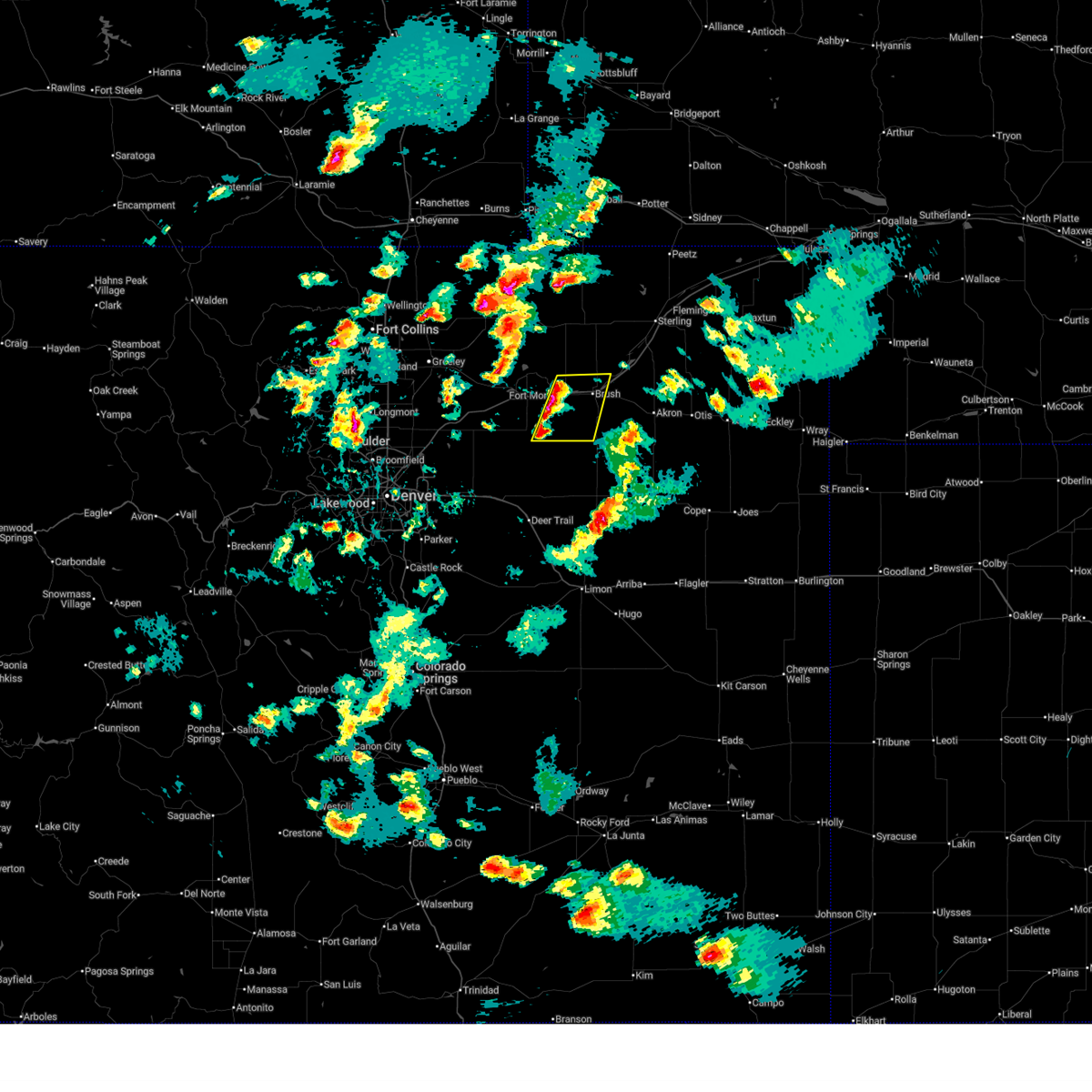
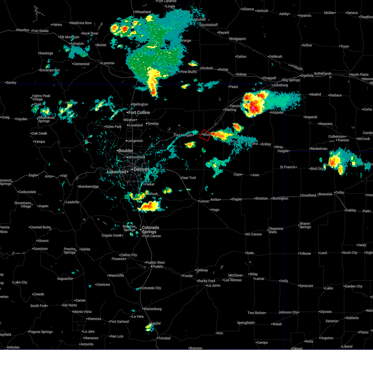
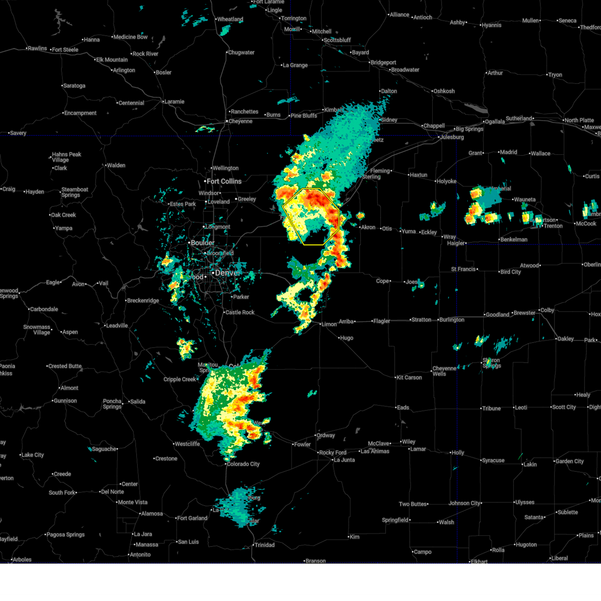
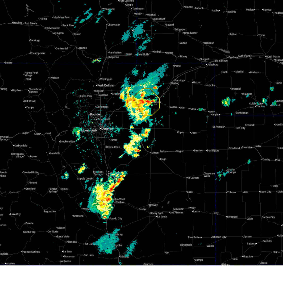
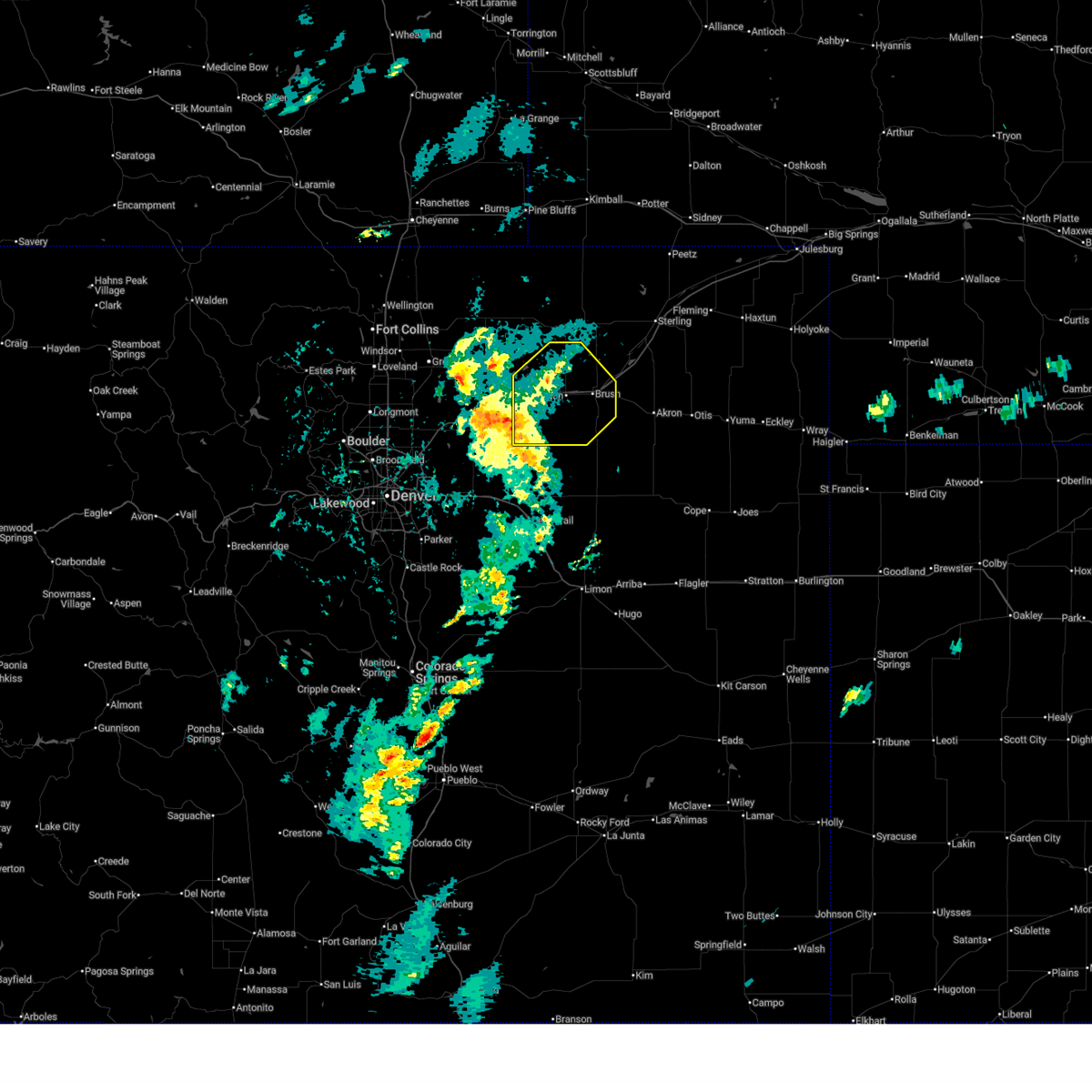
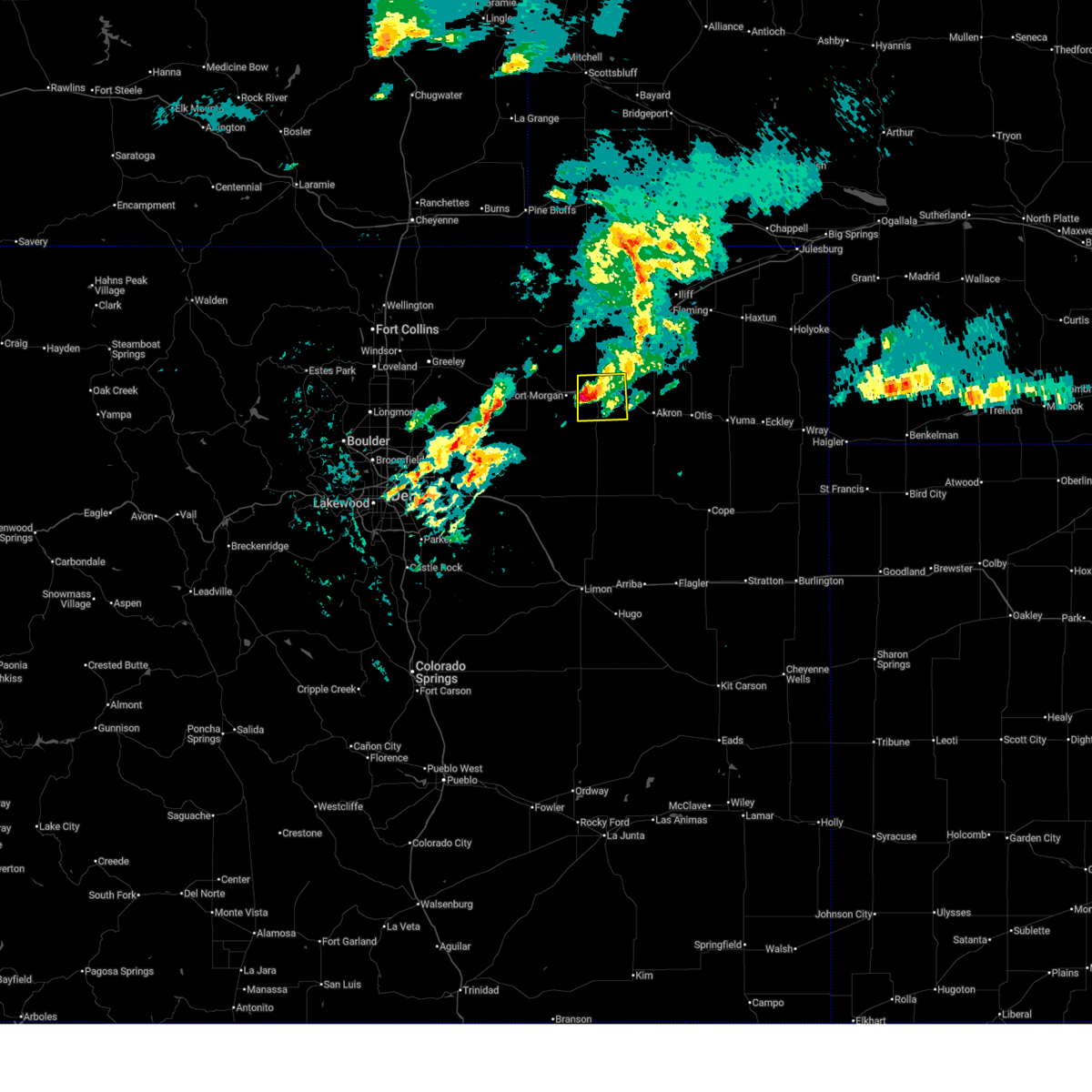
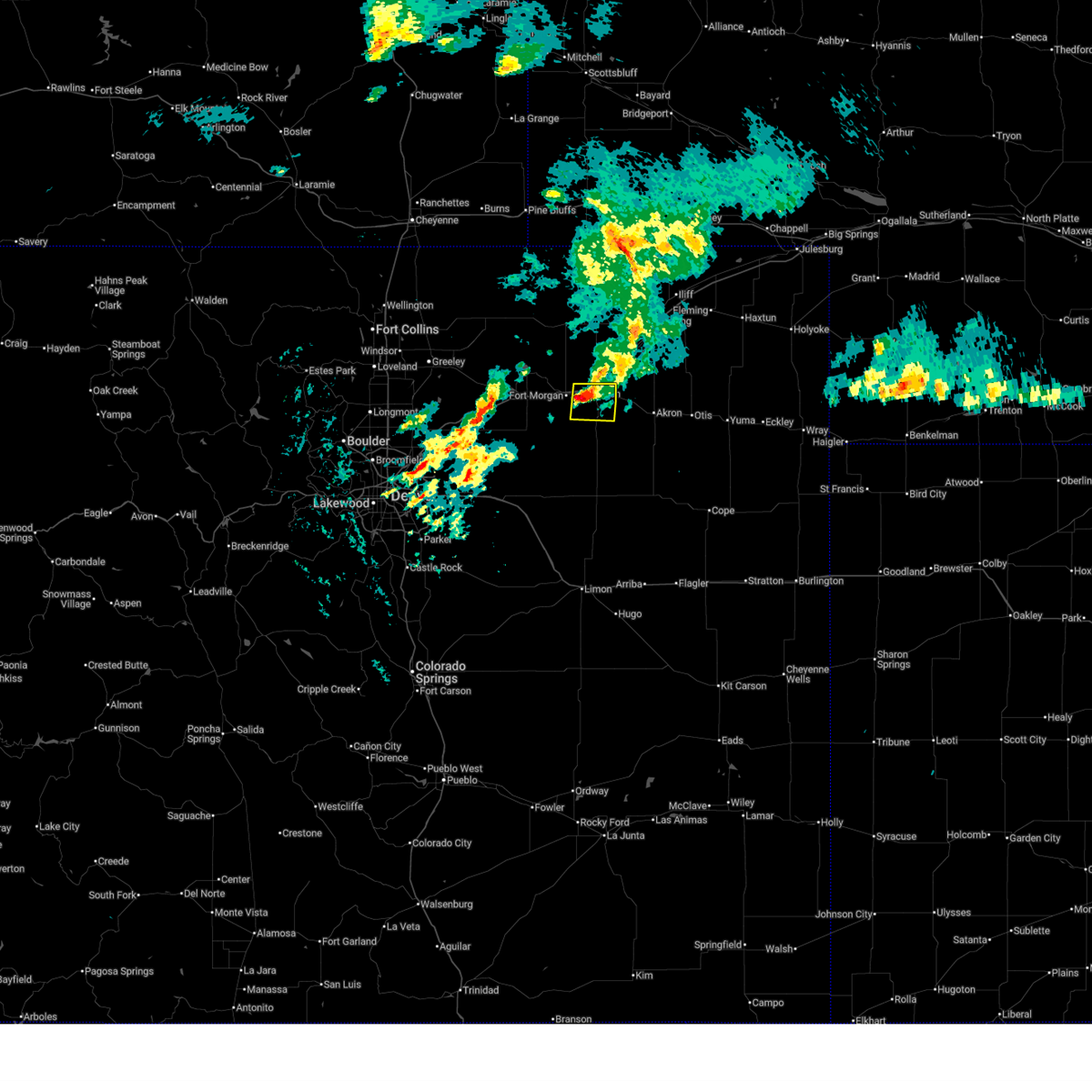
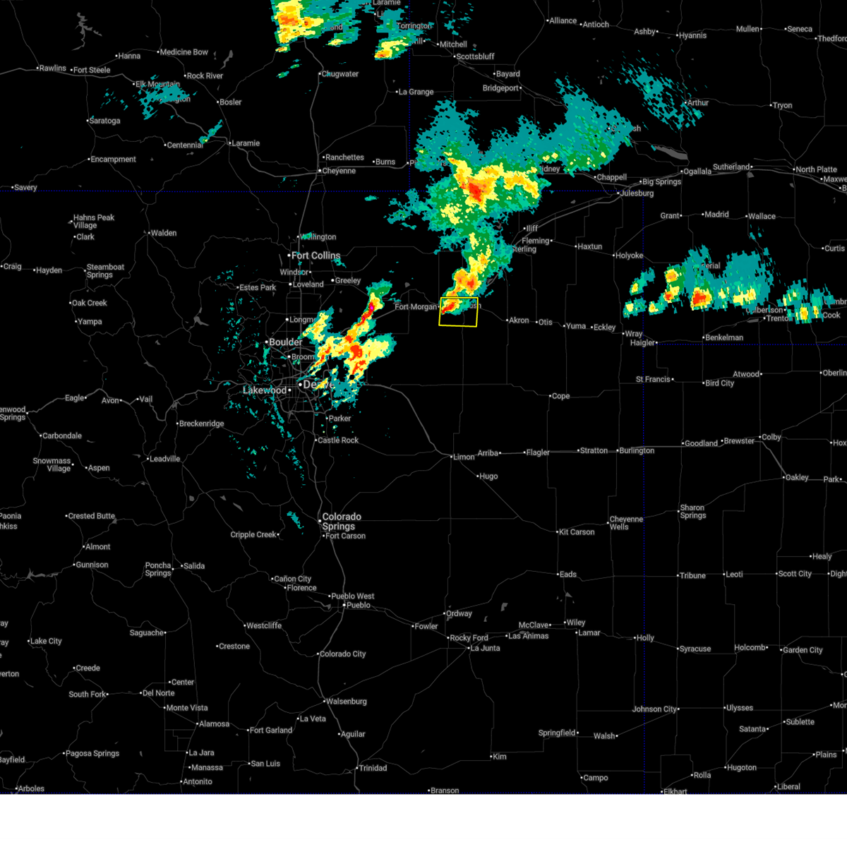
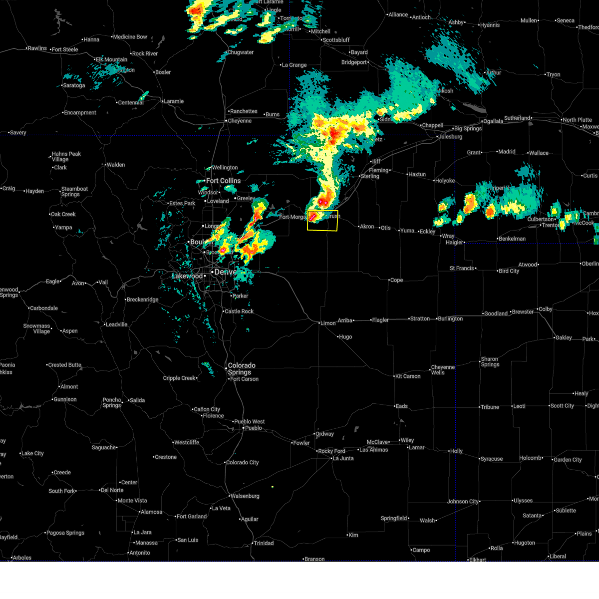
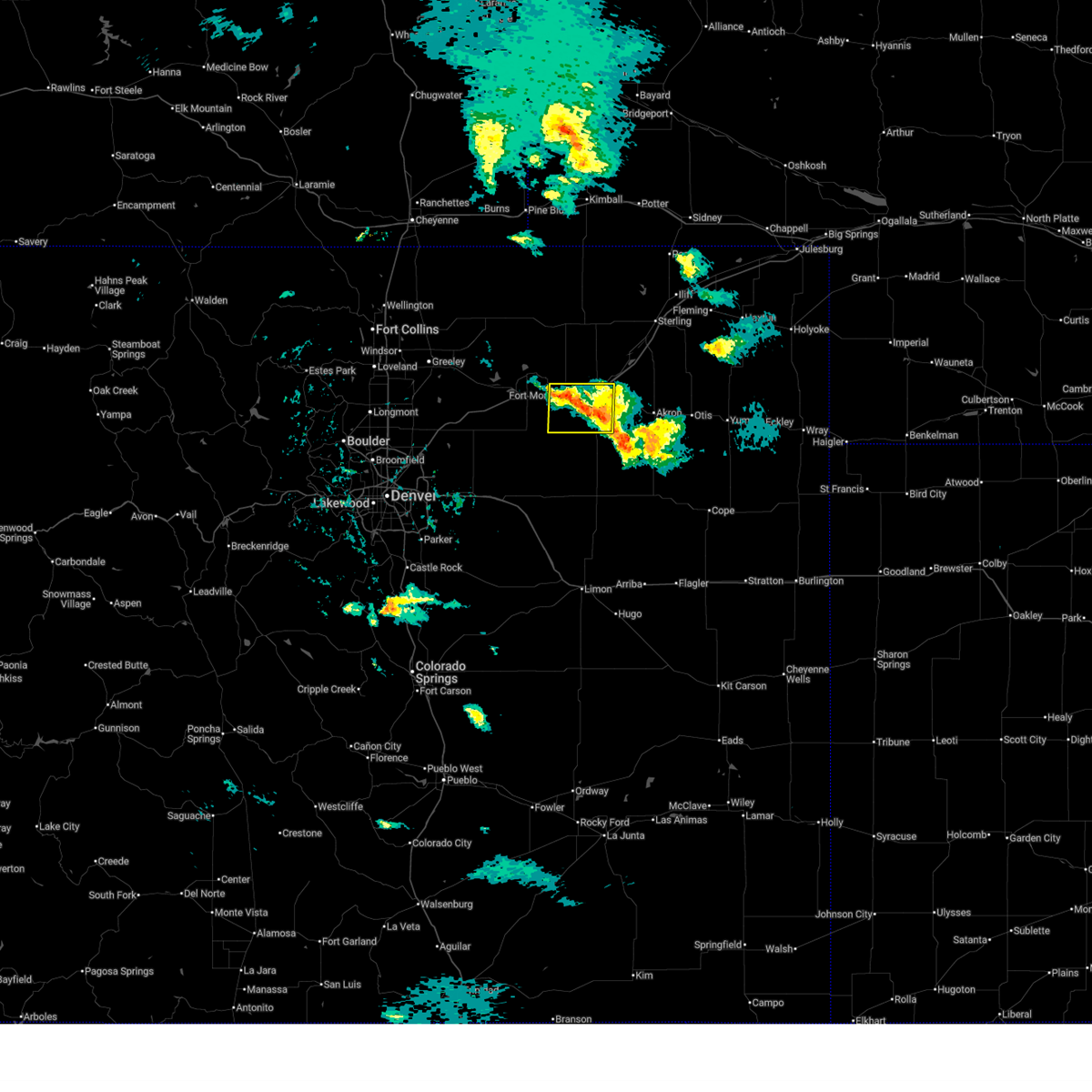
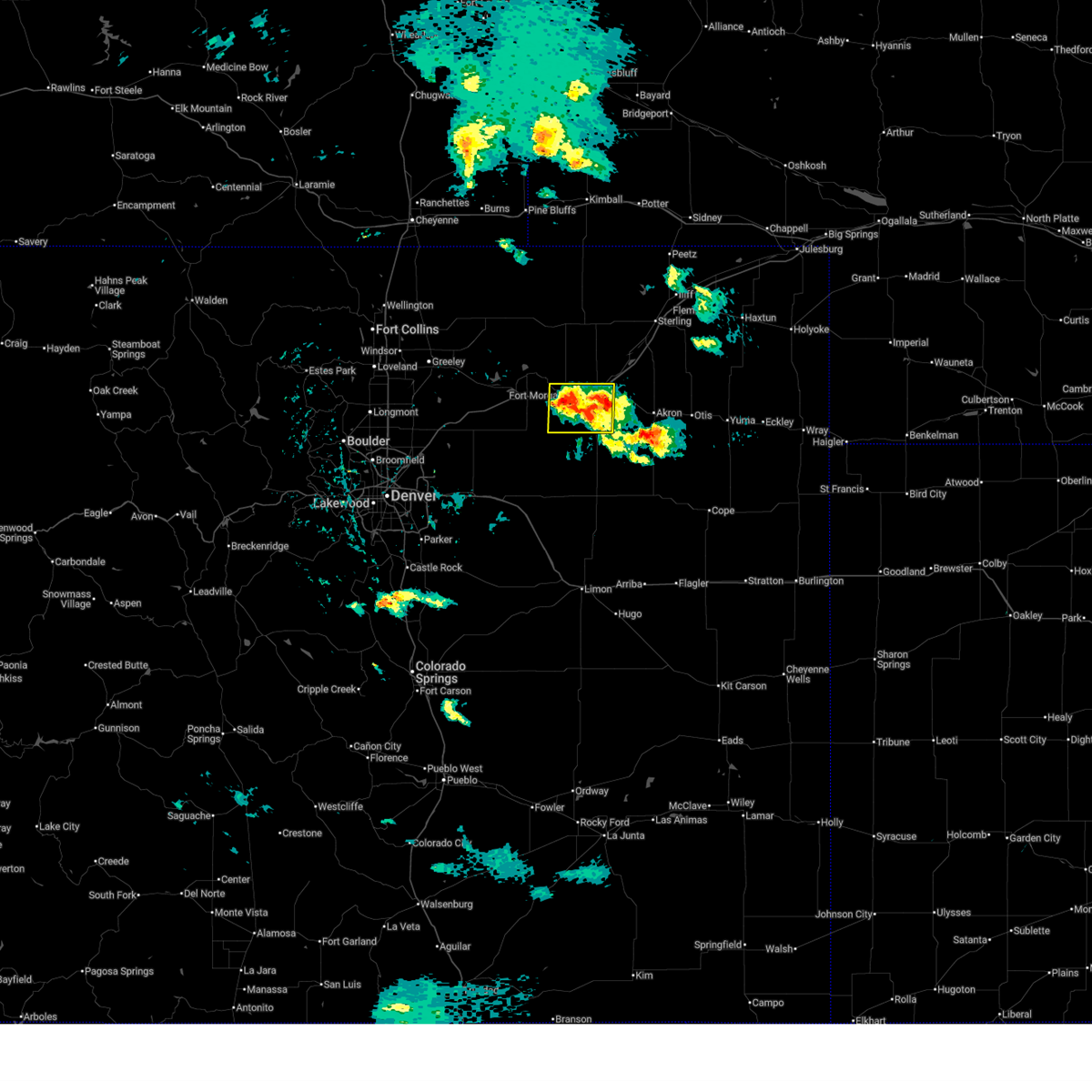
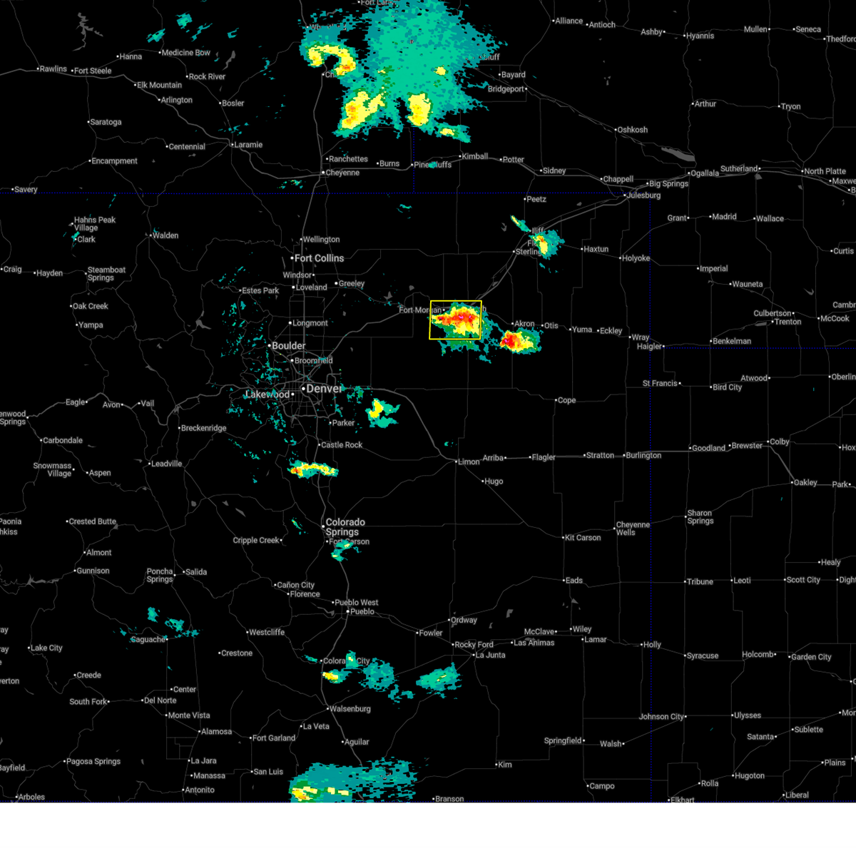
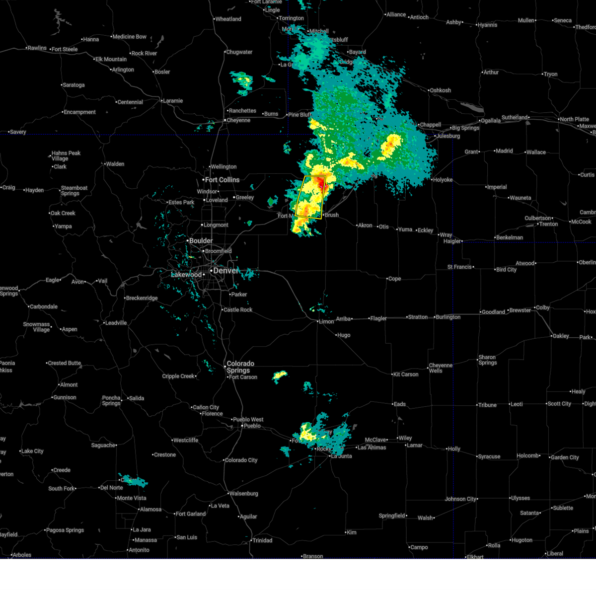
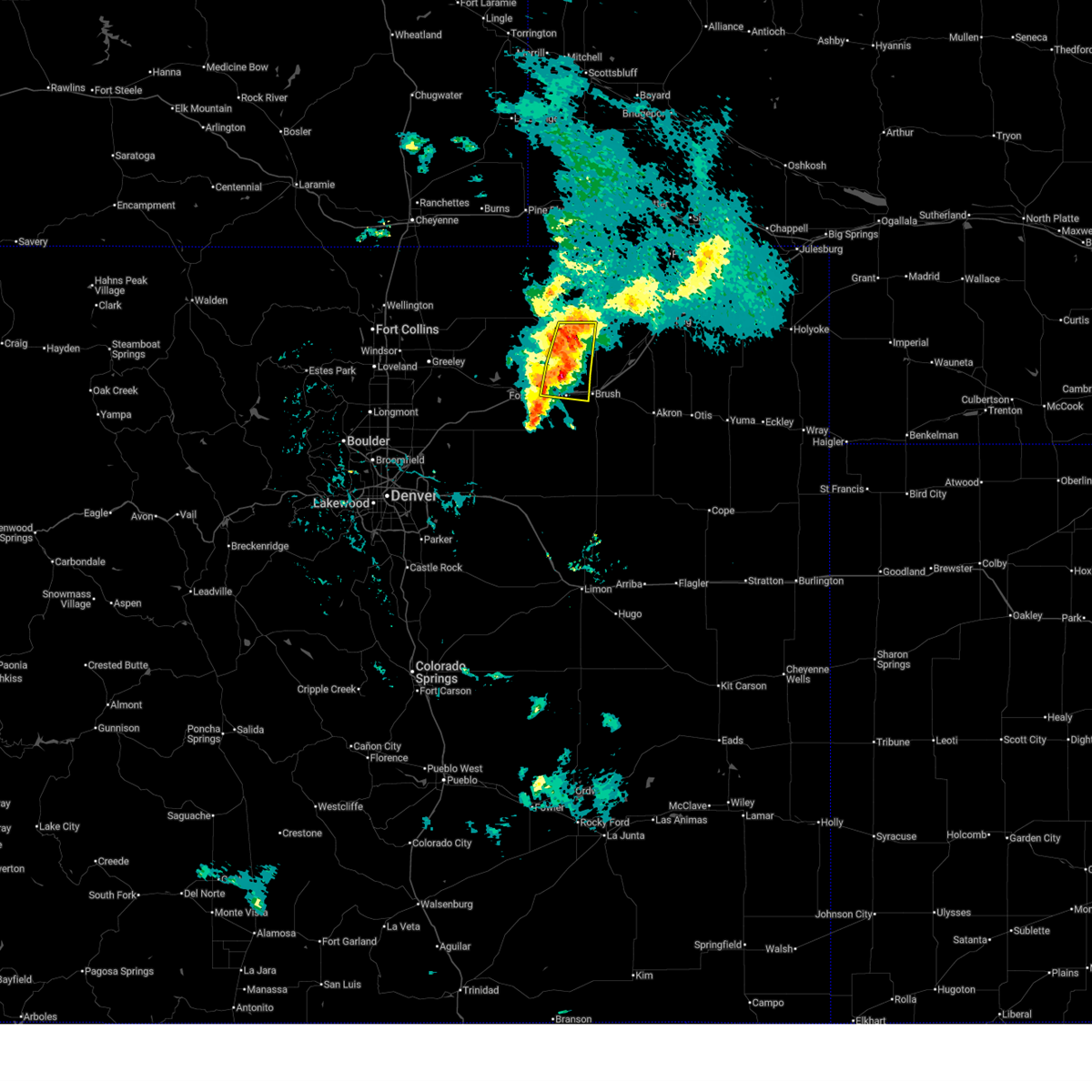
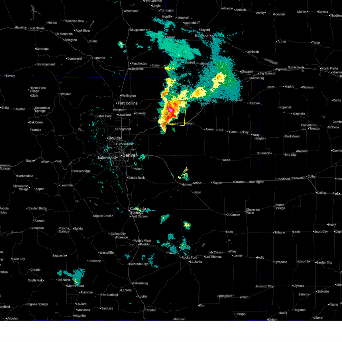
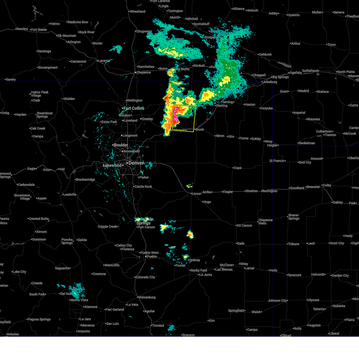
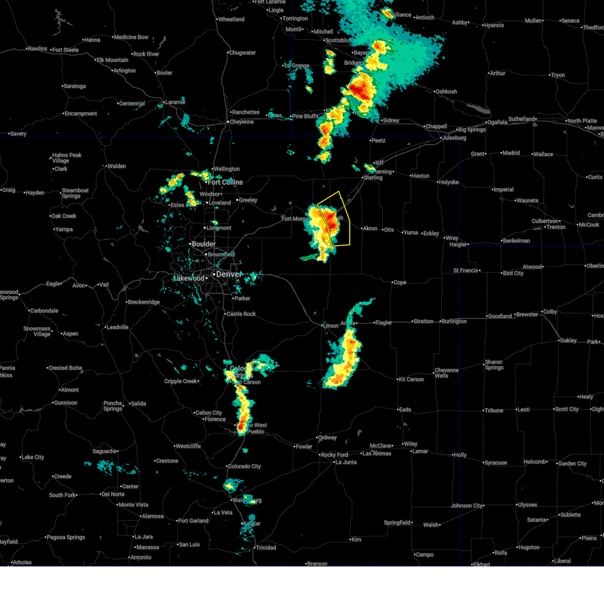
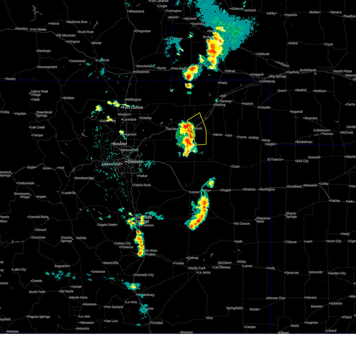
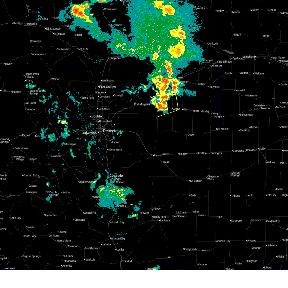
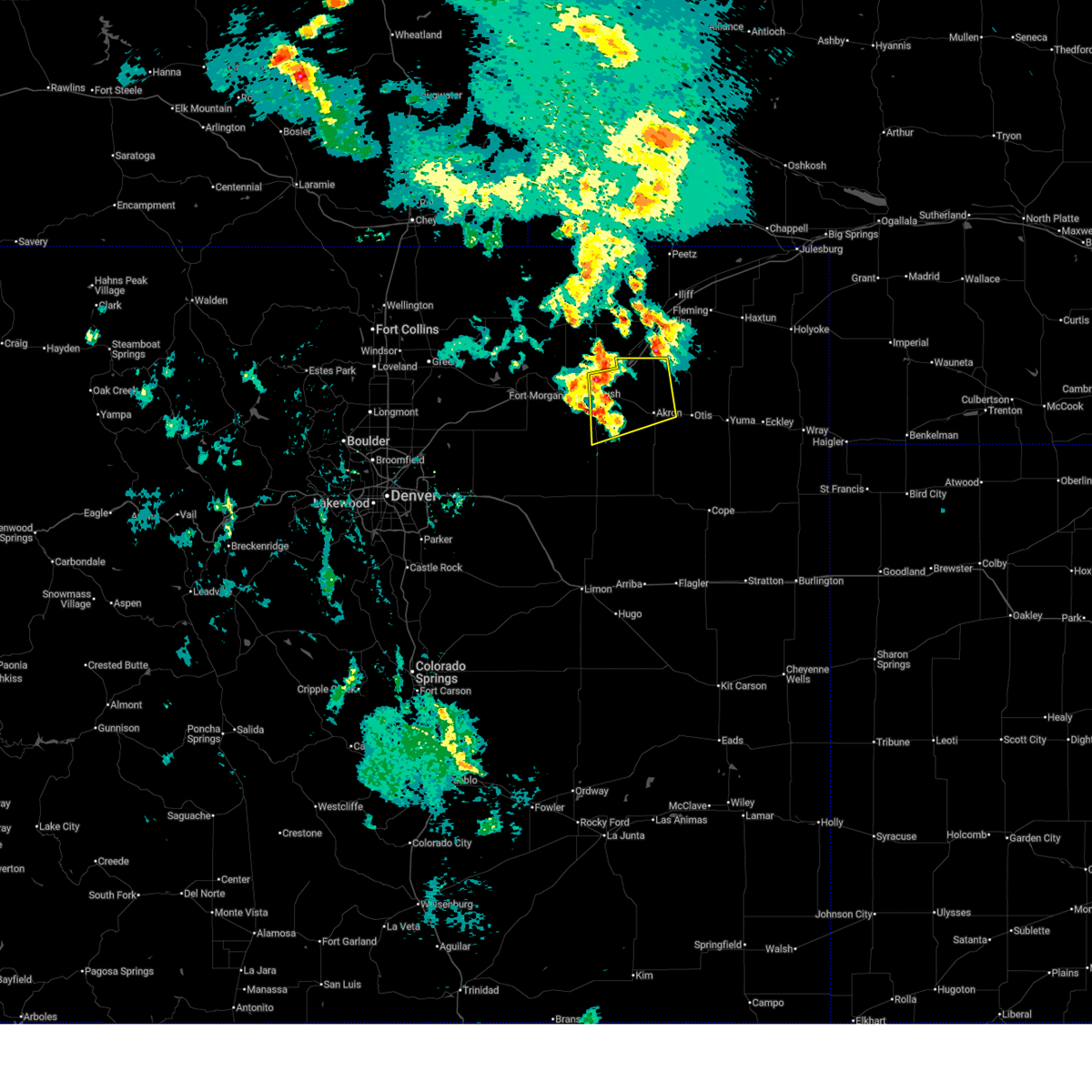
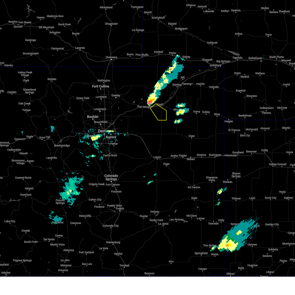
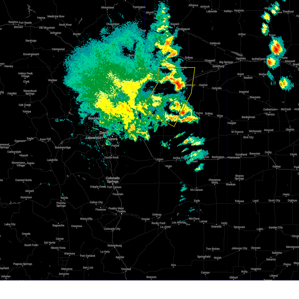
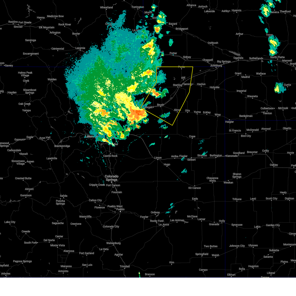
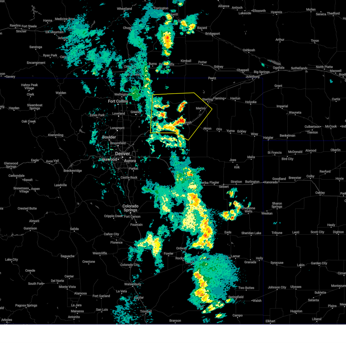
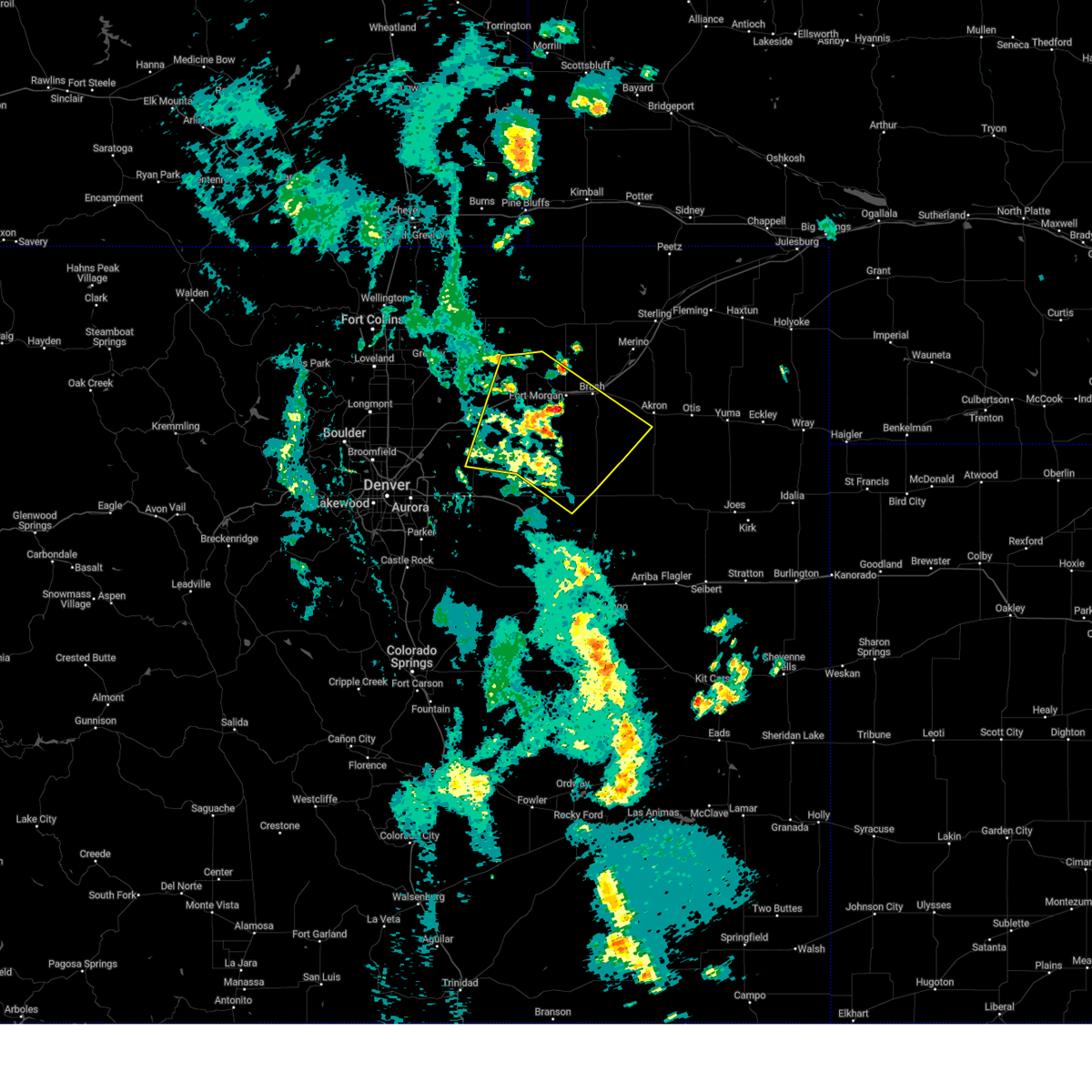
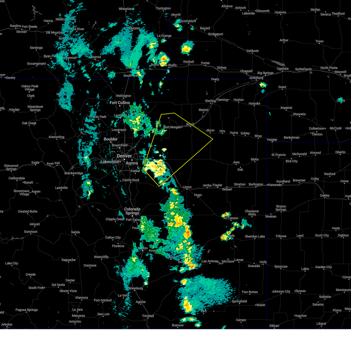
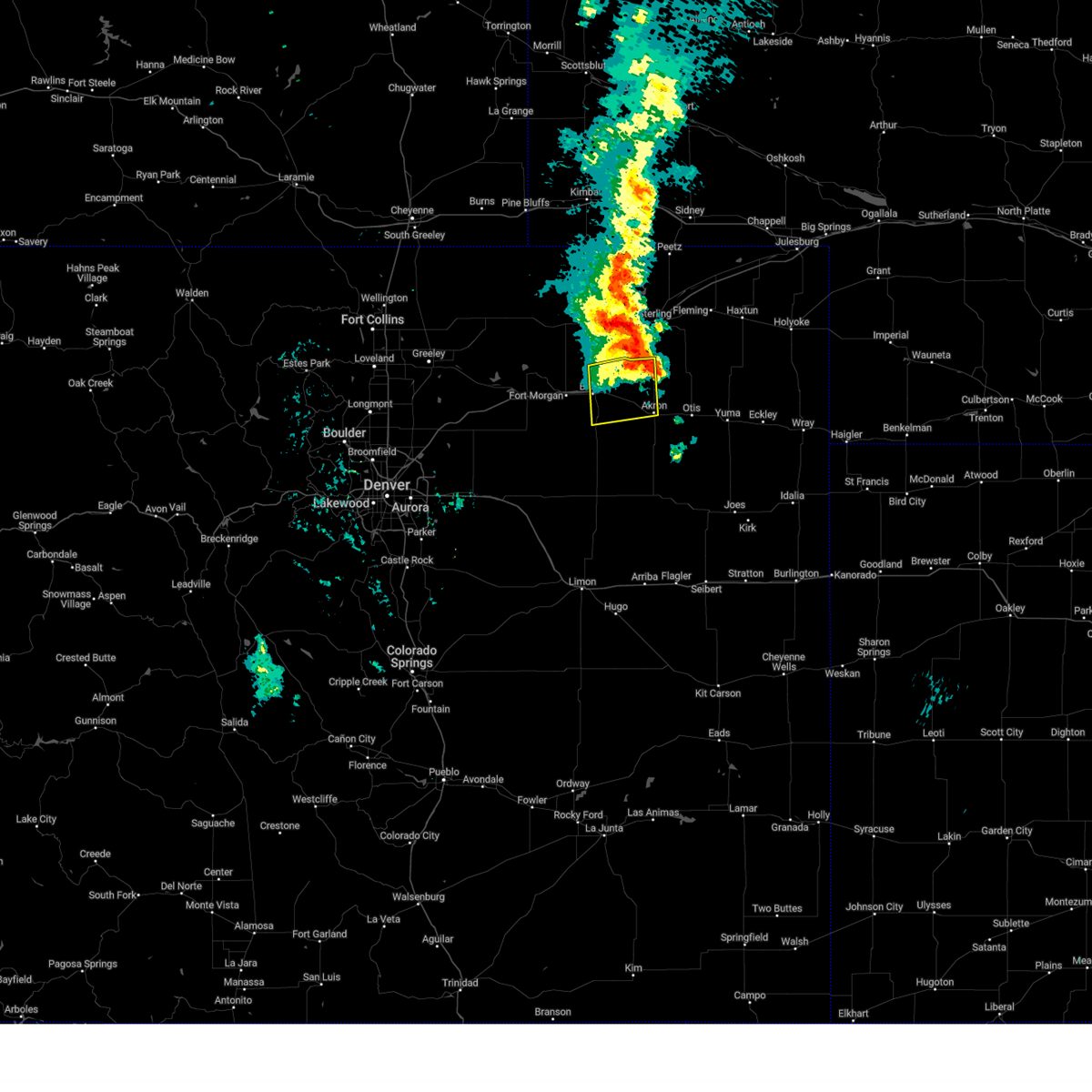
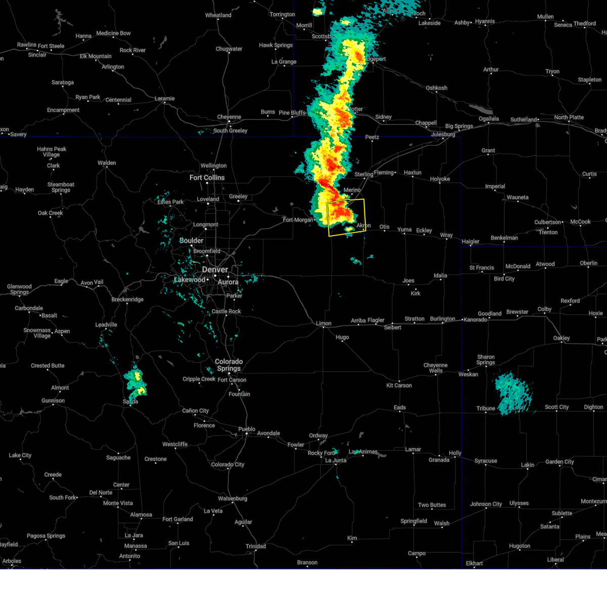
Hail Map for Brush, CO
The Brush, CO area has had 39 reports of on-the-ground hail by trained spotters, and has been under severe weather warnings 45 times during the past 12 months. Doppler radar has detected hail at or near Brush, CO on 82 occasions, including 7 occasions during the past year.
| Name: | Brush, CO |
| Where Located: | 49 miles W of Yuma, CO |
| Map: | Google Map for Brush, CO |
| Population: | 5463 |
| Housing Units: | 2295 |
| More Info: | Search Google for Brush, CO |
3
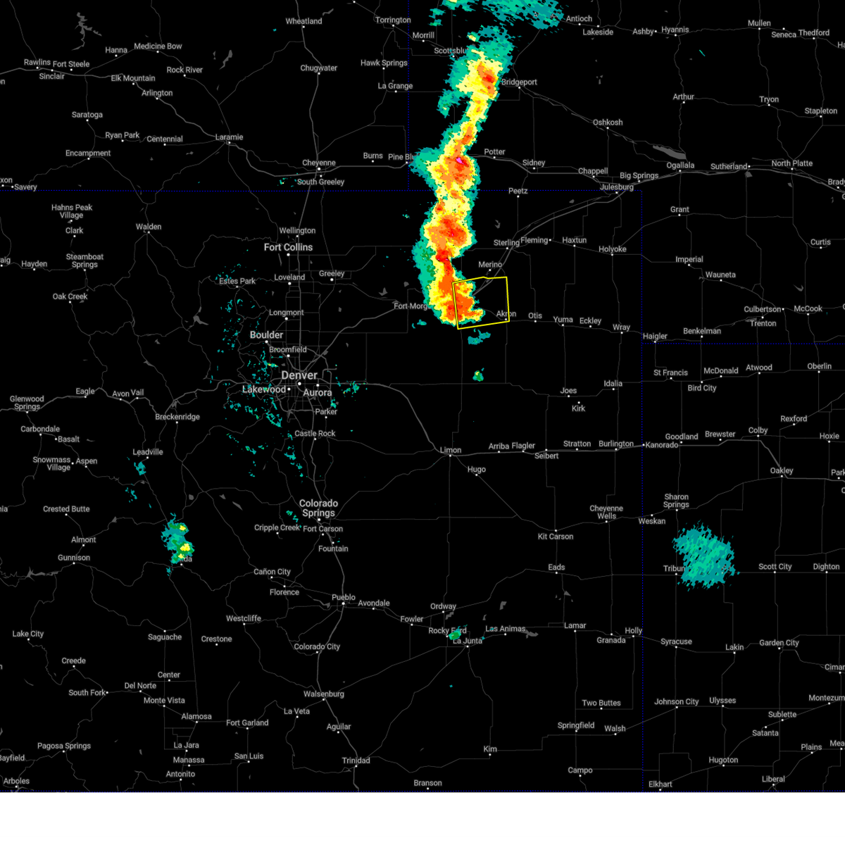
The Top Recent Hail Date for Brush, CO is Monday, August 12, 2024 (5th out of 82)

Hail and Wind Damage Spotted near Brush, CO
| Date / Time | Report Details |
|---|---|
| 7/11/2025 6:55 PM MDT | The storm which prompted the warning has weakened below severe limits, and no longer poses an immediate threat to life or property. therefore, the warning will be allowed to expire. however, small hail, gusty winds, and heavy rain are still possible with this thunderstorm. a severe thunderstorm watch remains in effect until 1100 pm mdt friday for a portion of northeast colorado. |
| 7/11/2025 6:36 PM MDT | At 636 pm mdt, a severe thunderstorm was located over fort morgan, moving east at 20 mph (radar indicated). Hazards include golf ball size hail and 60 mph wind gusts. People and animals outdoors will be injured. expect hail damage to roofs, siding, windows, and vehicles. expect wind damage to roofs, siding, and trees. Locations impacted include, fort morgan, brush, log lane village, hillrose, adena school, twelve-mile corner, snyder, fort morgan airport and union. |
| 7/11/2025 6:23 PM MDT | At 623 pm mdt, a severe thunderstorm was located near log lane village, or near fort morgan, moving east at 15 mph (radar indicated). Hazards include two inch hail and 60 mph wind gusts. People and animals outdoors will be injured. expect hail damage to roofs, siding, windows, and vehicles. expect wind damage to roofs, siding, and trees. Locations impacted include, fort morgan, brush, log lane village, hillrose, adena school, twelve-mile corner, snyder and fort morgan airport. |
| 7/11/2025 6:12 PM MDT |
 Svrbou the national weather service in denver has issued a * severe thunderstorm warning for, southeastern morgan county in northeastern colorado, * until 700 pm mdt. * at 612 pm mdt, a severe thunderstorm was located 7 miles southwest of log lane village, or 8 miles southwest of fort morgan, moving east at 15 mph (radar indicated). Hazards include half dollar size hail. damage to vehicles is expected Svrbou the national weather service in denver has issued a * severe thunderstorm warning for, southeastern morgan county in northeastern colorado, * until 700 pm mdt. * at 612 pm mdt, a severe thunderstorm was located 7 miles southwest of log lane village, or 8 miles southwest of fort morgan, moving east at 15 mph (radar indicated). Hazards include half dollar size hail. damage to vehicles is expected
|
| 7/6/2025 4:04 PM MDT |
 the tornado warning has been cancelled and is no longer in effect the tornado warning has been cancelled and is no longer in effect
|
| 7/6/2025 3:52 PM MDT | Torbou the national weather service in denver has issued a * tornado warning for, east central morgan county in northeastern colorado, * until 415 pm mdt. * at 352 pm mdt, a confirmed tornado was located 6 miles south of hillrose, or 13 miles east of fort morgan, moving northwest at 20 mph (weather spotters confirmed tornado). Hazards include tornado. expect damage to mobile homes, roofs, and vehicles |
| 6/24/2025 4:20 PM MDT |
 The severe thunderstorm warning that was previously in effect has been reissued for morgan county and is in effect until 500 pm mdt. please refer to that bulletin for the latest severe weather information. a severe thunderstorm watch remains in effect until 800 pm mdt tuesday for a portion of northeast colorado. The severe thunderstorm warning that was previously in effect has been reissued for morgan county and is in effect until 500 pm mdt. please refer to that bulletin for the latest severe weather information. a severe thunderstorm watch remains in effect until 800 pm mdt tuesday for a portion of northeast colorado.
|
| 6/24/2025 3:50 PM MDT |
 At 350 pm mdt, severe thunderstorms were located along a line from over weldona to 7 miles south of brush, or along a line from 11 miles northwest of fort morgan to 9 miles southeast of fort morgan, moving northeast at 30 mph (automated weather station reported. at 336 pm, a cdot sensor recorded a 58 mph wind gust near i-76 and highway 34, just east of wiggins). Hazards include 60 mph wind gusts and small hail. Expect damage to roofs, siding, and trees. Locations impacted include, fort morgan, brush, log lane village, hillrose, adena school, antelope springs, twelve-mile corner, weldona, snyder, adena, gary, goodrich, jackson reservoir, orchard and fort morgan airport. At 350 pm mdt, severe thunderstorms were located along a line from over weldona to 7 miles south of brush, or along a line from 11 miles northwest of fort morgan to 9 miles southeast of fort morgan, moving northeast at 30 mph (automated weather station reported. at 336 pm, a cdot sensor recorded a 58 mph wind gust near i-76 and highway 34, just east of wiggins). Hazards include 60 mph wind gusts and small hail. Expect damage to roofs, siding, and trees. Locations impacted include, fort morgan, brush, log lane village, hillrose, adena school, antelope springs, twelve-mile corner, weldona, snyder, adena, gary, goodrich, jackson reservoir, orchard and fort morgan airport.
|
| 6/24/2025 3:25 PM MDT |
 Svrbou the national weather service in denver has issued a * severe thunderstorm warning for, morgan county in northeastern colorado, * until 415 pm mdt. * at 325 pm mdt, severe thunderstorms were located along a line from over wiggins to over adena, or along a line from 17 miles west of fort morgan to 16 miles south of fort morgan, moving northeast at 30 mph (radar indicated). Hazards include 60 mph wind gusts and small hail. expect damage to roofs, siding, and trees Svrbou the national weather service in denver has issued a * severe thunderstorm warning for, morgan county in northeastern colorado, * until 415 pm mdt. * at 325 pm mdt, severe thunderstorms were located along a line from over wiggins to over adena, or along a line from 17 miles west of fort morgan to 16 miles south of fort morgan, moving northeast at 30 mph (radar indicated). Hazards include 60 mph wind gusts and small hail. expect damage to roofs, siding, and trees
|
| 6/17/2025 4:58 AM MDT |
 Svrbou the national weather service in denver has issued a * severe thunderstorm warning for, east central morgan county in northeastern colorado, north central washington county in northeastern colorado, * until 530 am mdt. * at 458 am mdt, a severe thunderstorm was located over brush, or 9 miles east of fort morgan, moving east at 15 mph (radar indicated). Hazards include half dollar size hail. damage to vehicles is expected Svrbou the national weather service in denver has issued a * severe thunderstorm warning for, east central morgan county in northeastern colorado, north central washington county in northeastern colorado, * until 530 am mdt. * at 458 am mdt, a severe thunderstorm was located over brush, or 9 miles east of fort morgan, moving east at 15 mph (radar indicated). Hazards include half dollar size hail. damage to vehicles is expected
|
| 6/17/2025 4:49 AM MDT |
 At 449 am mdt, a severe thunderstorm was located near brush, or 11 miles east of fort morgan, moving east at 30 mph (radar indicated). Hazards include golf ball size hail and 60 mph wind gusts. People and animals outdoors will be injured. expect hail damage to roofs, siding, windows, and vehicles. expect wind damage to roofs, siding, and trees. Locations impacted include, fort morgan and brush. At 449 am mdt, a severe thunderstorm was located near brush, or 11 miles east of fort morgan, moving east at 30 mph (radar indicated). Hazards include golf ball size hail and 60 mph wind gusts. People and animals outdoors will be injured. expect hail damage to roofs, siding, windows, and vehicles. expect wind damage to roofs, siding, and trees. Locations impacted include, fort morgan and brush.
|
| 6/17/2025 4:41 AM MDT |
 At 441 am mdt, a severe thunderstorm was located near brush, or 7 miles east of fort morgan, moving east at 20 mph (radar indicated). Hazards include ping pong ball size hail and 60 mph wind gusts. People and animals outdoors will be injured. expect hail damage to roofs, siding, windows, and vehicles. expect wind damage to roofs, siding, and trees. Locations impacted include, fort morgan and brush. At 441 am mdt, a severe thunderstorm was located near brush, or 7 miles east of fort morgan, moving east at 20 mph (radar indicated). Hazards include ping pong ball size hail and 60 mph wind gusts. People and animals outdoors will be injured. expect hail damage to roofs, siding, windows, and vehicles. expect wind damage to roofs, siding, and trees. Locations impacted include, fort morgan and brush.
|
| 6/17/2025 4:26 AM MDT |
 Svrbou the national weather service in denver has issued a * severe thunderstorm warning for, east central morgan county in northeastern colorado, * until 500 am mdt. * at 426 am mdt, a severe thunderstorm was located over fort morgan, moving east at 20 mph (radar indicated). Hazards include golf ball size hail and 60 mph wind gusts. People and animals outdoors will be injured. expect hail damage to roofs, siding, windows, and vehicles. Expect wind damage to roofs, siding, and trees. Svrbou the national weather service in denver has issued a * severe thunderstorm warning for, east central morgan county in northeastern colorado, * until 500 am mdt. * at 426 am mdt, a severe thunderstorm was located over fort morgan, moving east at 20 mph (radar indicated). Hazards include golf ball size hail and 60 mph wind gusts. People and animals outdoors will be injured. expect hail damage to roofs, siding, windows, and vehicles. Expect wind damage to roofs, siding, and trees.
|
| 6/15/2025 5:13 PM MDT |
 The storm which prompted the warning has weakened below severe limits, and no longer poses an immediate threat to life or property. therefore, the warning will be allowed to expire. however, small hail, gusty winds, and heavy rain are still possible with this thunderstorm. a severe thunderstorm watch remains in effect until 1100 pm mdt sunday for a portion of northeast colorado. The storm which prompted the warning has weakened below severe limits, and no longer poses an immediate threat to life or property. therefore, the warning will be allowed to expire. however, small hail, gusty winds, and heavy rain are still possible with this thunderstorm. a severe thunderstorm watch remains in effect until 1100 pm mdt sunday for a portion of northeast colorado.
|
| 6/15/2025 5:01 PM MDT |
 At 501 pm mdt, a severe thunderstorm was located near brush, or 8 miles southeast of fort morgan, moving east at 15 mph (radar indicated). Hazards include 60 mph wind gusts and quarter size hail. Hail damage to vehicles is expected. expect wind damage to roofs, siding, and trees. Locations impacted include, fort morgan, brush, log lane village, adena school, twelve-mile corner and gary. At 501 pm mdt, a severe thunderstorm was located near brush, or 8 miles southeast of fort morgan, moving east at 15 mph (radar indicated). Hazards include 60 mph wind gusts and quarter size hail. Hail damage to vehicles is expected. expect wind damage to roofs, siding, and trees. Locations impacted include, fort morgan, brush, log lane village, adena school, twelve-mile corner and gary.
|
| 6/15/2025 4:39 PM MDT |
 Svrbou the national weather service in denver has issued a * severe thunderstorm warning for, southeastern morgan county in northeastern colorado, * until 515 pm mdt. * at 439 pm mdt, a severe thunderstorm was located near adena school, or 6 miles south of fort morgan, moving east at 20 mph (radar indicated). Hazards include 60 mph wind gusts and half dollar size hail. Hail damage to vehicles is expected. Expect wind damage to roofs, siding, and trees. Svrbou the national weather service in denver has issued a * severe thunderstorm warning for, southeastern morgan county in northeastern colorado, * until 515 pm mdt. * at 439 pm mdt, a severe thunderstorm was located near adena school, or 6 miles south of fort morgan, moving east at 20 mph (radar indicated). Hazards include 60 mph wind gusts and half dollar size hail. Hail damage to vehicles is expected. Expect wind damage to roofs, siding, and trees.
|
| 6/14/2025 8:30 PM MDT |
 The storms which prompted the warning have moved out of the area. therefore, the warning has been allowed to expire. a severe thunderstorm watch remains in effect until 900 pm mdt saturday for a portion of northeast colorado. The storms which prompted the warning have moved out of the area. therefore, the warning has been allowed to expire. a severe thunderstorm watch remains in effect until 900 pm mdt saturday for a portion of northeast colorado.
|
| 6/14/2025 8:13 PM MDT |
 At 813 pm mdt, severe thunderstorms were located along a line from near stoneham to over fort morgan, or along a line from 21 miles north of fort morgan to over fort morgan, moving east at 25 mph (radar indicated). Hazards include 70 mph wind gusts and half dollar size hail. Hail damage to vehicles is expected. expect considerable tree damage. wind damage is also likely to mobile homes, roofs, and outbuildings. Locations impacted include, fort morgan, brush, log lane village, antelope springs, new raymer, stoneham and fort morgan airport. At 813 pm mdt, severe thunderstorms were located along a line from near stoneham to over fort morgan, or along a line from 21 miles north of fort morgan to over fort morgan, moving east at 25 mph (radar indicated). Hazards include 70 mph wind gusts and half dollar size hail. Hail damage to vehicles is expected. expect considerable tree damage. wind damage is also likely to mobile homes, roofs, and outbuildings. Locations impacted include, fort morgan, brush, log lane village, antelope springs, new raymer, stoneham and fort morgan airport.
|
| 6/14/2025 7:57 PM MDT |
 At 757 pm mdt, severe thunderstorms were located along a line from near new raymer to near log lane village, or along a line from 21 miles north of fort morgan to 6 miles west of fort morgan, moving east at 20 mph (radar indicated). Hazards include 60 mph wind gusts and half dollar size hail. Hail damage to vehicles is expected. expect wind damage to roofs, siding, and trees. Locations impacted include, fort morgan, brush, log lane village, antelope springs, weldona, new raymer, stoneham, fort morgan airport and buckingham. At 757 pm mdt, severe thunderstorms were located along a line from near new raymer to near log lane village, or along a line from 21 miles north of fort morgan to 6 miles west of fort morgan, moving east at 20 mph (radar indicated). Hazards include 60 mph wind gusts and half dollar size hail. Hail damage to vehicles is expected. expect wind damage to roofs, siding, and trees. Locations impacted include, fort morgan, brush, log lane village, antelope springs, weldona, new raymer, stoneham, fort morgan airport and buckingham.
|
| 6/14/2025 7:44 PM MDT |
 Svrbou the national weather service in denver has issued a * severe thunderstorm warning for, northwestern morgan county in northeastern colorado, east central weld county in northeastern colorado, * until 830 pm mdt. * at 744 pm mdt, severe thunderstorms were located along a line from near new raymer to near wiggins, or along a line from 23 miles north of fort morgan to 11 miles west of fort morgan, moving east at 20 mph (radar indicated). Hazards include 60 mph wind gusts and half dollar size hail. Hail damage to vehicles is expected. Expect wind damage to roofs, siding, and trees. Svrbou the national weather service in denver has issued a * severe thunderstorm warning for, northwestern morgan county in northeastern colorado, east central weld county in northeastern colorado, * until 830 pm mdt. * at 744 pm mdt, severe thunderstorms were located along a line from near new raymer to near wiggins, or along a line from 23 miles north of fort morgan to 11 miles west of fort morgan, moving east at 20 mph (radar indicated). Hazards include 60 mph wind gusts and half dollar size hail. Hail damage to vehicles is expected. Expect wind damage to roofs, siding, and trees.
|
| 6/13/2025 6:32 PM MDT |
 At 632 pm mdt, severe thunderstorms were located along a line from 5 miles north of snyder to 5 miles southeast of gary, or along a line from 14 miles northeast of fort morgan to 17 miles southwest of akron, moving northeast at 15 mph (radar indicated). Hazards include 60 mph wind gusts and small hail. Expect damage to roofs, siding, and trees. Locations impacted include, brush, hillrose, snyder, midway, gary and union. At 632 pm mdt, severe thunderstorms were located along a line from 5 miles north of snyder to 5 miles southeast of gary, or along a line from 14 miles northeast of fort morgan to 17 miles southwest of akron, moving northeast at 15 mph (radar indicated). Hazards include 60 mph wind gusts and small hail. Expect damage to roofs, siding, and trees. Locations impacted include, brush, hillrose, snyder, midway, gary and union.
|
| 6/13/2025 6:18 PM MDT |
 Svrbou the national weather service in denver has issued a * severe thunderstorm warning for, eastern morgan county in northeastern colorado, northwestern washington county in northeastern colorado, * until 645 pm mdt. * at 618 pm mdt, severe thunderstorms were located along a line from near antelope springs to over woodrow, or along a line from 10 miles north of fort morgan to 21 miles southwest of akron, moving northeast at 15 mph (radar indicated). Hazards include 60 mph wind gusts and small hail. expect damage to roofs, siding, and trees Svrbou the national weather service in denver has issued a * severe thunderstorm warning for, eastern morgan county in northeastern colorado, northwestern washington county in northeastern colorado, * until 645 pm mdt. * at 618 pm mdt, severe thunderstorms were located along a line from near antelope springs to over woodrow, or along a line from 10 miles north of fort morgan to 21 miles southwest of akron, moving northeast at 15 mph (radar indicated). Hazards include 60 mph wind gusts and small hail. expect damage to roofs, siding, and trees
|
| 6/12/2025 6:14 PM MDT |
 the severe thunderstorm warning has been cancelled and is no longer in effect the severe thunderstorm warning has been cancelled and is no longer in effect
|
| 6/12/2025 5:51 PM MDT |
 Svrbou the national weather service in denver has issued a * severe thunderstorm warning for, southeastern morgan county in northeastern colorado, north central washington county in northeastern colorado, * until 630 pm mdt. * at 551 pm mdt, severe thunderstorms were located across eastern morgan county, moving east at 25 mph (radar indicated). Hazards include 60 mph wind gusts and quarter size hail. Hail damage to vehicles is expected. Expect wind damage to roofs, siding, and trees. Svrbou the national weather service in denver has issued a * severe thunderstorm warning for, southeastern morgan county in northeastern colorado, north central washington county in northeastern colorado, * until 630 pm mdt. * at 551 pm mdt, severe thunderstorms were located across eastern morgan county, moving east at 25 mph (radar indicated). Hazards include 60 mph wind gusts and quarter size hail. Hail damage to vehicles is expected. Expect wind damage to roofs, siding, and trees.
|
| 6/5/2025 4:23 PM MDT | Storm damage reported in washington county CO, 18.7 miles N of Brush, CO |
| 6/5/2025 2:35 PM MDT |
 Svrbou the national weather service in denver has issued a * severe thunderstorm warning for, southeastern morgan county in northeastern colorado, * until 315 pm mdt. * at 235 pm mdt, a severe thunderstorm was located over fort morgan, moving southeast at 30 mph (radar indicated). Hazards include two inch hail. People and animals outdoors will be injured. Expect damage to roofs, siding, windows, and vehicles. Svrbou the national weather service in denver has issued a * severe thunderstorm warning for, southeastern morgan county in northeastern colorado, * until 315 pm mdt. * at 235 pm mdt, a severe thunderstorm was located over fort morgan, moving southeast at 30 mph (radar indicated). Hazards include two inch hail. People and animals outdoors will be injured. Expect damage to roofs, siding, windows, and vehicles.
|
| 5/14/2025 5:28 PM MDT |
 The severe thunderstorm warning that was previously in effect has been reissued for logan and washington counties and is in effect until 600 pm mdt. please refer to that bulletin for the latest severe weather information. a severe thunderstorm watch remains in effect until 1000 pm mdt for a portion of northeast colorado. The severe thunderstorm warning that was previously in effect has been reissued for logan and washington counties and is in effect until 600 pm mdt. please refer to that bulletin for the latest severe weather information. a severe thunderstorm watch remains in effect until 1000 pm mdt for a portion of northeast colorado.
|
| 5/14/2025 5:17 PM MDT | Weatherlink statio in washington county CO, 18.7 miles N of Brush, CO |
| 5/14/2025 5:13 PM MDT | Spotter and social media posts of at least one tree down on a house in brush. time and location estimate in morgan county CO, 0.5 miles E of Brush, CO |
| 5/14/2025 5:12 PM MDT | Multiple 3-4 inch diameter tree limbs down. time estimate in morgan county CO, 0 miles SSW of Brush, CO |
| 5/14/2025 5:12 PM MDT | Weatherlink statio in morgan county CO, 2.9 miles NW of Brush, CO |
| 5/14/2025 5:07 PM MDT |
 At 507 pm mdt, severe thunderstorms were located along a line from near padroni to over gary, or along a line from 14 miles north of sterling to 18 miles southeast of fort morgan, moving southeast at 60 mph (weather station reported. at 455 pm, a 64 mph wind gust was recorded at the fort morgan airport). Hazards include 65 mph wind gusts and small hail. Expect damage to roofs, siding, and trees. Locations impacted include, sterling, fort morgan, akron, brush, wiggins, log lane village, merino, iliff, hillrose, peetz, willard, prewitt reservoir, pawnee pass, logan corners, atwood, snyder, stoneham, midway, north sterling reservoir and antelope springs. At 507 pm mdt, severe thunderstorms were located along a line from near padroni to over gary, or along a line from 14 miles north of sterling to 18 miles southeast of fort morgan, moving southeast at 60 mph (weather station reported. at 455 pm, a 64 mph wind gust was recorded at the fort morgan airport). Hazards include 65 mph wind gusts and small hail. Expect damage to roofs, siding, and trees. Locations impacted include, sterling, fort morgan, akron, brush, wiggins, log lane village, merino, iliff, hillrose, peetz, willard, prewitt reservoir, pawnee pass, logan corners, atwood, snyder, stoneham, midway, north sterling reservoir and antelope springs.
|
| 5/14/2025 4:45 PM MDT |
 Svrbou the national weather service in denver has issued a * severe thunderstorm warning for, logan county in northeastern colorado, morgan county in northeastern colorado, northwestern washington county in northeastern colorado, northeastern weld county in northeastern colorado, * until 530 pm mdt. * at 445 pm mdt, severe thunderstorms were located along a line from 6 miles east of westplains to near adena school, or along a line from 21 miles northwest of sterling to 9 miles south of fort morgan, moving southeast at 60 mph (public reported at 425 pm, a 58 mph wind gust was recorded on highway 34 west of wiggins. fort morgan airport recently reported a gust to 57 mph). Hazards include 60 mph wind gusts and small hail. expect damage to roofs, siding, and trees Svrbou the national weather service in denver has issued a * severe thunderstorm warning for, logan county in northeastern colorado, morgan county in northeastern colorado, northwestern washington county in northeastern colorado, northeastern weld county in northeastern colorado, * until 530 pm mdt. * at 445 pm mdt, severe thunderstorms were located along a line from 6 miles east of westplains to near adena school, or along a line from 21 miles northwest of sterling to 9 miles south of fort morgan, moving southeast at 60 mph (public reported at 425 pm, a 58 mph wind gust was recorded on highway 34 west of wiggins. fort morgan airport recently reported a gust to 57 mph). Hazards include 60 mph wind gusts and small hail. expect damage to roofs, siding, and trees
|
| 9/17/2024 4:39 PM MDT |
 Svrbou the national weather service in denver colorado has issued a * severe thunderstorm warning for, southeastern weld county in northeastern colorado, morgan county in northeastern colorado, north central washington county in northeastern colorado, southwestern logan county in northeastern colorado, * until 515 pm mdt. * at 438 pm mdt, severe thunderstorms were located along a line extending from 4 miles east of roggen to 6 miles southwest of log lane village to 3 miles west of gary, or along a line extending from 29 miles southeast of greeley to 6 miles southwest of fort morgan to 24 miles west of akron, moving northeast at 60 mph (radar indicated). Hazards include 60 mph wind gusts. expect damage to roofs, siding, and trees Svrbou the national weather service in denver colorado has issued a * severe thunderstorm warning for, southeastern weld county in northeastern colorado, morgan county in northeastern colorado, north central washington county in northeastern colorado, southwestern logan county in northeastern colorado, * until 515 pm mdt. * at 438 pm mdt, severe thunderstorms were located along a line extending from 4 miles east of roggen to 6 miles southwest of log lane village to 3 miles west of gary, or along a line extending from 29 miles southeast of greeley to 6 miles southwest of fort morgan to 24 miles west of akron, moving northeast at 60 mph (radar indicated). Hazards include 60 mph wind gusts. expect damage to roofs, siding, and trees
|
| 9/17/2024 4:31 PM MDT |
 the severe thunderstorm warning has been cancelled and is no longer in effect the severe thunderstorm warning has been cancelled and is no longer in effect
|
| 9/17/2024 4:31 PM MDT |
 At 431 pm mdt, severe thunderstorms were located along a line extending from 5 miles east of prospect valley to 3 miles east of hoyt to near shamrock, or along a line extending from 34 miles southeast of greeley to 20 miles southwest of fort morgan to 36 miles southwest of akron, moving northeast at 45 mph (radar indicated). Hazards include 60 mph wind gusts. Expect damage to roofs, siding, and trees. Locations impacted include, fort morgan, brush, wiggins, log lane village, gary, hoyt, shamrock, weldona, leader, twelve-mile corner, jackson reservoir, adena school, orchard, adena, riverside reservoir, goodrich, and woodrow. At 431 pm mdt, severe thunderstorms were located along a line extending from 5 miles east of prospect valley to 3 miles east of hoyt to near shamrock, or along a line extending from 34 miles southeast of greeley to 20 miles southwest of fort morgan to 36 miles southwest of akron, moving northeast at 45 mph (radar indicated). Hazards include 60 mph wind gusts. Expect damage to roofs, siding, and trees. Locations impacted include, fort morgan, brush, wiggins, log lane village, gary, hoyt, shamrock, weldona, leader, twelve-mile corner, jackson reservoir, adena school, orchard, adena, riverside reservoir, goodrich, and woodrow.
|
| 9/17/2024 4:04 PM MDT |
 Svrbou the national weather service in denver colorado has issued a * severe thunderstorm warning for, south central weld county in northeastern colorado, north central elbert county in east central colorado, arapahoe county in northeastern colorado, morgan county in northeastern colorado, west central washington county in northeastern colorado, adams county in northeastern colorado, * until 445 pm mdt. * at 403 pm mdt, severe thunderstorms were located along a line extending from near strasburg to 6 miles southwest of deer trail, or along a line extending from 34 miles east of denver to 30 miles northwest of limon, moving northeast at 70 mph (radar indicated. at 353 pm mdt, a 62 mph wind gust was reported northeast of kiowa). Hazards include 60 mph wind gusts. expect damage to roofs, siding, and trees Svrbou the national weather service in denver colorado has issued a * severe thunderstorm warning for, south central weld county in northeastern colorado, north central elbert county in east central colorado, arapahoe county in northeastern colorado, morgan county in northeastern colorado, west central washington county in northeastern colorado, adams county in northeastern colorado, * until 445 pm mdt. * at 403 pm mdt, severe thunderstorms were located along a line extending from near strasburg to 6 miles southwest of deer trail, or along a line extending from 34 miles east of denver to 30 miles northwest of limon, moving northeast at 70 mph (radar indicated. at 353 pm mdt, a 62 mph wind gust was reported northeast of kiowa). Hazards include 60 mph wind gusts. expect damage to roofs, siding, and trees
|
| 8/23/2024 5:55 PM MDT |
 The storm which prompted the warning has moved out of the area. therefore, the warning will be allowed to expire. The storm which prompted the warning has moved out of the area. therefore, the warning will be allowed to expire.
|
| 8/23/2024 5:34 PM MDT |
 At 534 pm mdt, a severe thunderstorm was located 4 miles north of midway, or 13 miles northwest of akron, moving east at 30 mph (radar indicated). Hazards include 60 mph wind gusts and penny size hail. Expect damage to roofs, siding, and trees. Locations impacted include, akron, brush, hillrose, prewitt reservoir, snyder, and midway. At 534 pm mdt, a severe thunderstorm was located 4 miles north of midway, or 13 miles northwest of akron, moving east at 30 mph (radar indicated). Hazards include 60 mph wind gusts and penny size hail. Expect damage to roofs, siding, and trees. Locations impacted include, akron, brush, hillrose, prewitt reservoir, snyder, and midway.
|
| 8/23/2024 5:21 PM MDT |
 Svrbou the national weather service in denver colorado has issued a * severe thunderstorm warning for, southeastern morgan county in northeastern colorado, north central washington county in northeastern colorado, * until 600 pm mdt. * at 520 pm mdt, a severe thunderstorm was located 4 miles south of hillrose, or 13 miles east of fort morgan, moving east at 30 mph (radar indicated). Hazards include 60 mph wind gusts and penny size hail. expect damage to roofs, siding, and trees Svrbou the national weather service in denver colorado has issued a * severe thunderstorm warning for, southeastern morgan county in northeastern colorado, north central washington county in northeastern colorado, * until 600 pm mdt. * at 520 pm mdt, a severe thunderstorm was located 4 miles south of hillrose, or 13 miles east of fort morgan, moving east at 30 mph (radar indicated). Hazards include 60 mph wind gusts and penny size hail. expect damage to roofs, siding, and trees
|
| 8/12/2024 8:06 PM MDT | Windows blown out in brush... estimated due to high straight line wind in morgan county CO, 0 miles SSW of Brush, CO |
| 8/12/2024 7:49 PM MDT |
 At 749 pm mdt, a severe thunderstorm was located near brush, or 5 miles east of fort morgan, moving south at 5 mph (radar indicated). Hazards include golf ball size hail and 60 mph wind gusts. tornado warning is also in effect. Expect damage to roofs, siding, and trees. people and animals outdoors will be injured. expect hail damage to roofs, siding, windows, and vehicles. Locations impacted include, brush. At 749 pm mdt, a severe thunderstorm was located near brush, or 5 miles east of fort morgan, moving south at 5 mph (radar indicated). Hazards include golf ball size hail and 60 mph wind gusts. tornado warning is also in effect. Expect damage to roofs, siding, and trees. people and animals outdoors will be injured. expect hail damage to roofs, siding, windows, and vehicles. Locations impacted include, brush.
|
| 8/12/2024 7:27 PM MDT | Reports of apparent tornado damage. powerlines and trees dow in morgan county CO, 1.5 miles SSE of Brush, CO |
| 8/12/2024 7:24 PM MDT |
 Torbou the national weather service in denver colorado has issued a * tornado warning for, southeastern morgan county in northeastern colorado, * until 800 pm mdt. * at 724 pm mdt, a severe thunderstorm capable of producing a tornado was located over brush, or 7 miles east of fort morgan, moving southeast at 5 mph (radar indicated rotation). Hazards include tornado and golf ball size hail. Flying debris will be dangerous to those caught without shelter. mobile homes will be damaged or destroyed. damage to roofs, windows, and vehicles will occur. Tree damage is likely. Torbou the national weather service in denver colorado has issued a * tornado warning for, southeastern morgan county in northeastern colorado, * until 800 pm mdt. * at 724 pm mdt, a severe thunderstorm capable of producing a tornado was located over brush, or 7 miles east of fort morgan, moving southeast at 5 mph (radar indicated rotation). Hazards include tornado and golf ball size hail. Flying debris will be dangerous to those caught without shelter. mobile homes will be damaged or destroyed. damage to roofs, windows, and vehicles will occur. Tree damage is likely.
|
| 8/12/2024 7:16 PM MDT |
 Svrbou the national weather service in denver colorado has issued a * severe thunderstorm warning for, east central morgan county in northeastern colorado, * until 800 pm mdt. * at 716 pm mdt, a severe thunderstorm was located near brush, or 6 miles east of fort morgan, moving south at 5 mph (radar indicated). Hazards include golf ball size hail and 60 mph wind gusts. Expect damage to roofs, siding, and trees. people and animals outdoors will be injured. Expect hail damage to roofs, siding, windows, and vehicles. Svrbou the national weather service in denver colorado has issued a * severe thunderstorm warning for, east central morgan county in northeastern colorado, * until 800 pm mdt. * at 716 pm mdt, a severe thunderstorm was located near brush, or 6 miles east of fort morgan, moving south at 5 mph (radar indicated). Hazards include golf ball size hail and 60 mph wind gusts. Expect damage to roofs, siding, and trees. people and animals outdoors will be injured. Expect hail damage to roofs, siding, windows, and vehicles.
|
| 8/12/2024 7:15 PM MDT |
 Svrbou the national weather service in denver colorado has issued a * severe thunderstorm warning for, east central morgan county in northeastern colorado, * until 800 pm mdt. * at 715 pm mdt, a severe thunderstorm was located over brush, or 6 miles east of fort morgan, and is nearly stationary (radar indicated). Hazards include golf ball size hail and 60 mph wind gusts. Expect damage to roofs, siding, and trees. people and animals outdoors will be injured. Expect hail damage to roofs, siding, windows, and vehicles. Svrbou the national weather service in denver colorado has issued a * severe thunderstorm warning for, east central morgan county in northeastern colorado, * until 800 pm mdt. * at 715 pm mdt, a severe thunderstorm was located over brush, or 6 miles east of fort morgan, and is nearly stationary (radar indicated). Hazards include golf ball size hail and 60 mph wind gusts. Expect damage to roofs, siding, and trees. people and animals outdoors will be injured. Expect hail damage to roofs, siding, windows, and vehicles.
|
| 8/12/2024 5:54 PM MDT |
 Svrbou the national weather service in denver colorado has issued a * severe thunderstorm warning for, northeastern morgan county in northeastern colorado, * until 645 pm mdt. * at 553 pm mdt, a severe thunderstorm was located 5 miles south of antelope springs, or 9 miles northeast of fort morgan, moving northeast at 15 mph (radar indicated). Hazards include golf ball size hail and 60 mph wind gusts. Expect damage to roofs, siding, and trees. people and animals outdoors will be injured. Expect hail damage to roofs, siding, windows, and vehicles. Svrbou the national weather service in denver colorado has issued a * severe thunderstorm warning for, northeastern morgan county in northeastern colorado, * until 645 pm mdt. * at 553 pm mdt, a severe thunderstorm was located 5 miles south of antelope springs, or 9 miles northeast of fort morgan, moving northeast at 15 mph (radar indicated). Hazards include golf ball size hail and 60 mph wind gusts. Expect damage to roofs, siding, and trees. people and animals outdoors will be injured. Expect hail damage to roofs, siding, windows, and vehicles.
|
| 8/2/2024 6:05 PM MDT | Storm damage reported in morgan county CO, 0.5 miles W of Brush, CO |
| 7/20/2024 5:55 PM MDT |
 The storms which prompted the warning have weakened below severe limits, and no longer pose an immediate threat to life or property. therefore, the warning will be allowed to expire. however, small hail, gusty winds and heavy rain are still possible with these thunderstorms. The storms which prompted the warning have weakened below severe limits, and no longer pose an immediate threat to life or property. therefore, the warning will be allowed to expire. however, small hail, gusty winds and heavy rain are still possible with these thunderstorms.
|
| 7/20/2024 5:41 PM MDT |
 At 541 pm mdt, severe thunderstorms were located along a line extending from 3 miles north of gary to 3 miles southeast of wiggins, or along a line extending from 19 miles west of akron to 12 miles west of fort morgan, moving south at 35 mph (radar indicated). Hazards include 60 mph wind gusts and quarter size hail. Expect damage to roofs, siding, and trees. hail damage to vehicles is expected. Locations impacted include, fort morgan, brush, log lane village, gary, twelve-mile corner, adena school, and adena. At 541 pm mdt, severe thunderstorms were located along a line extending from 3 miles north of gary to 3 miles southeast of wiggins, or along a line extending from 19 miles west of akron to 12 miles west of fort morgan, moving south at 35 mph (radar indicated). Hazards include 60 mph wind gusts and quarter size hail. Expect damage to roofs, siding, and trees. hail damage to vehicles is expected. Locations impacted include, fort morgan, brush, log lane village, gary, twelve-mile corner, adena school, and adena.
|
| 7/20/2024 5:29 PM MDT |
 Svrbou the national weather service in denver colorado has issued a * severe thunderstorm warning for, southern morgan county in northeastern colorado, * until 600 pm mdt. * at 529 pm mdt, severe thunderstorms were located along a line extending from 3 miles southeast of brush to 4 miles northeast of wiggins, or along a line extending from 11 miles east of fort morgan to 39 miles east of greeley, moving south at 35 mph (radar indicated). Hazards include 60 mph wind gusts and quarter size hail. Expect damage to roofs, siding, and trees. Hail damage to vehicles is expected. Svrbou the national weather service in denver colorado has issued a * severe thunderstorm warning for, southern morgan county in northeastern colorado, * until 600 pm mdt. * at 529 pm mdt, severe thunderstorms were located along a line extending from 3 miles southeast of brush to 4 miles northeast of wiggins, or along a line extending from 11 miles east of fort morgan to 39 miles east of greeley, moving south at 35 mph (radar indicated). Hazards include 60 mph wind gusts and quarter size hail. Expect damage to roofs, siding, and trees. Hail damage to vehicles is expected.
|
| 7/20/2024 5:08 PM MDT |
 At 508 pm mdt, severe thunderstorms were located along a line extending from 4 miles southwest of midway to 4 miles north of weldona, or along a line extending from 13 miles west of akron to 14 miles northwest of fort morgan, moving south at 25 mph (radar indicated). Hazards include golf ball size hail and 60 mph wind gusts. Expect damage to roofs, siding, and trees. people and animals outdoors will be injured. expect hail damage to roofs, siding, windows, and vehicles. Locations impacted include, fort morgan, brush, log lane village, hillrose, antelope springs, weldona, and snyder. At 508 pm mdt, severe thunderstorms were located along a line extending from 4 miles southwest of midway to 4 miles north of weldona, or along a line extending from 13 miles west of akron to 14 miles northwest of fort morgan, moving south at 25 mph (radar indicated). Hazards include golf ball size hail and 60 mph wind gusts. Expect damage to roofs, siding, and trees. people and animals outdoors will be injured. expect hail damage to roofs, siding, windows, and vehicles. Locations impacted include, fort morgan, brush, log lane village, hillrose, antelope springs, weldona, and snyder.
|
| 7/20/2024 4:54 PM MDT |
 Svrbou the national weather service in denver colorado has issued a * severe thunderstorm warning for, morgan county in northeastern colorado, * until 530 pm mdt. * at 453 pm mdt, severe thunderstorms were located along a line extending from 4 miles northwest of midway to 8 miles northeast of jackson reservoir, or along a line extending from 15 miles northwest of akron to 40 miles east of greeley, moving south at 25 mph (radar indicated). Hazards include ping pong ball size hail and 60 mph wind gusts. Expect damage to roofs, siding, and trees. people and animals outdoors will be injured. Expect hail damage to roofs, siding, windows, and vehicles. Svrbou the national weather service in denver colorado has issued a * severe thunderstorm warning for, morgan county in northeastern colorado, * until 530 pm mdt. * at 453 pm mdt, severe thunderstorms were located along a line extending from 4 miles northwest of midway to 8 miles northeast of jackson reservoir, or along a line extending from 15 miles northwest of akron to 40 miles east of greeley, moving south at 25 mph (radar indicated). Hazards include ping pong ball size hail and 60 mph wind gusts. Expect damage to roofs, siding, and trees. people and animals outdoors will be injured. Expect hail damage to roofs, siding, windows, and vehicles.
|
| 7/7/2024 2:47 PM MDT |
 Svrbou the national weather service in denver colorado has issued a * severe thunderstorm warning for, southern morgan county in northeastern colorado, west central washington county in northeastern colorado, northeastern adams county in northeastern colorado, * until 315 pm mdt. * at 247 pm mdt, a severe thunderstorm was located 5 miles northeast of wiggins, or 9 miles west of fort morgan, moving southeast at 40 mph (radar indicated). Hazards include quarter size hail. damage to vehicles is expected Svrbou the national weather service in denver colorado has issued a * severe thunderstorm warning for, southern morgan county in northeastern colorado, west central washington county in northeastern colorado, northeastern adams county in northeastern colorado, * until 315 pm mdt. * at 247 pm mdt, a severe thunderstorm was located 5 miles northeast of wiggins, or 9 miles west of fort morgan, moving southeast at 40 mph (radar indicated). Hazards include quarter size hail. damage to vehicles is expected
|
| 6/8/2024 4:34 PM MDT | Storm damage reported in washington county CO, 19.5 miles N of Brush, CO |
| 6/8/2024 4:20 PM MDT | Report from mping: 3-inch tree limbs broken; power poles broke in morgan county CO, 1 miles E of Brush, CO |
| 6/8/2024 3:58 PM MDT |
 Svrbou the national weather service in denver colorado has issued a * severe thunderstorm warning for, northeastern arapahoe county in northeastern colorado, morgan county in northeastern colorado, northwestern washington county in northeastern colorado, eastern adams county in northeastern colorado, * until 445 pm mdt. * at 357 pm mdt, severe thunderstorms were located along a line extending from 5 miles southwest of prewitt reservoir to 7 miles west of leader, or along a line extending from 20 miles northeast of fort morgan to 41 miles east of denver, moving southeast at 20 mph (trained weather spotters). Hazards include 70 mph wind gusts and penny size hail. Expect considerable tree damage. damage is likely to mobile homes, roofs, and outbuildings. severe thunderstorms will be near, brush, hillrose, adena school, adena, leader, and twelve-mile corner around 405 pm mdt. Other locations in the path of these severe thunderstorms include midway and gary. Svrbou the national weather service in denver colorado has issued a * severe thunderstorm warning for, northeastern arapahoe county in northeastern colorado, morgan county in northeastern colorado, northwestern washington county in northeastern colorado, eastern adams county in northeastern colorado, * until 445 pm mdt. * at 357 pm mdt, severe thunderstorms were located along a line extending from 5 miles southwest of prewitt reservoir to 7 miles west of leader, or along a line extending from 20 miles northeast of fort morgan to 41 miles east of denver, moving southeast at 20 mph (trained weather spotters). Hazards include 70 mph wind gusts and penny size hail. Expect considerable tree damage. damage is likely to mobile homes, roofs, and outbuildings. severe thunderstorms will be near, brush, hillrose, adena school, adena, leader, and twelve-mile corner around 405 pm mdt. Other locations in the path of these severe thunderstorms include midway and gary.
|
| 6/8/2024 3:37 PM MDT |
 At 337 pm mdt, severe thunderstorms were located along a line extending from 4 miles southwest of antelope springs to 7 miles west of hoyt, or along a line extending from 8 miles north of fort morgan to 42 miles southeast of greeley, moving east at 35 mph (trained weather spotters). Hazards include 70 mph wind gusts and quarter size hail. Expect considerable tree damage. damage is likely to mobile homes, roofs, and outbuildings. hail damage to vehicles is expected. Locations impacted include, fort morgan, log lane village, hoyt, brush, adena school, adena, snyder, hillrose, twelve-mile corner, gary and midway. At 337 pm mdt, severe thunderstorms were located along a line extending from 4 miles southwest of antelope springs to 7 miles west of hoyt, or along a line extending from 8 miles north of fort morgan to 42 miles southeast of greeley, moving east at 35 mph (trained weather spotters). Hazards include 70 mph wind gusts and quarter size hail. Expect considerable tree damage. damage is likely to mobile homes, roofs, and outbuildings. hail damage to vehicles is expected. Locations impacted include, fort morgan, log lane village, hoyt, brush, adena school, adena, snyder, hillrose, twelve-mile corner, gary and midway.
|
| 6/8/2024 3:14 PM MDT |
 Svrbou the national weather service in denver colorado has issued a * severe thunderstorm warning for, southeastern weld county in northeastern colorado, morgan county in northeastern colorado, northwestern washington county in northeastern colorado, eastern adams county in northeastern colorado, * until 400 pm mdt. * at 314 pm mdt, severe thunderstorms were located along a line extending from near weldona to 9 miles south of prospect valley, or along a line extending from 9 miles northwest of fort morgan to 35 miles northeast of denver, moving southeast at 75 mph (radar indicated). Hazards include 60 mph wind gusts and quarter size hail. Expect damage to roofs, siding, and trees. hail damage to vehicles is expected. severe thunderstorms will be near, fort morgan, log lane village, and hoyt around 320 pm mdt. brush, adena school, adena, leader, and twelve-mile corner around 325 pm mdt. Shamrock and gary around 330 pm mdt. Svrbou the national weather service in denver colorado has issued a * severe thunderstorm warning for, southeastern weld county in northeastern colorado, morgan county in northeastern colorado, northwestern washington county in northeastern colorado, eastern adams county in northeastern colorado, * until 400 pm mdt. * at 314 pm mdt, severe thunderstorms were located along a line extending from near weldona to 9 miles south of prospect valley, or along a line extending from 9 miles northwest of fort morgan to 35 miles northeast of denver, moving southeast at 75 mph (radar indicated). Hazards include 60 mph wind gusts and quarter size hail. Expect damage to roofs, siding, and trees. hail damage to vehicles is expected. severe thunderstorms will be near, fort morgan, log lane village, and hoyt around 320 pm mdt. brush, adena school, adena, leader, and twelve-mile corner around 325 pm mdt. Shamrock and gary around 330 pm mdt.
|
| 5/20/2024 7:52 PM MDT | Golf Ball sized hail reported 16 miles N of Brush, CO, report from mping: golf ball (1.75 in.). |
| 5/20/2024 7:35 PM MDT | Golf Ball sized hail reported 9.8 miles N of Brush, CO, report from mping: golf ball (1.75 in.). |
| 5/20/2024 6:45 PM MDT | Tennis Ball sized hail reported 11.2 miles N of Brush, CO, corrects previous hail report from 2 nnw gary. destroyed windshield. |
| 5/20/2024 6:32 PM MDT | Ping Pong Ball sized hail reported 7.7 miles NNW of Brush, CO |
| 6/28/2023 11:28 PM MDT |
 The tornado warning for northeastern morgan county will expire at 1130 pm mdt, the storm which prompted the warning has moved out of the area. therefore, the warning will be allowed to expire. a severe thunderstorm watch remains in effect until 300 am mdt for northeastern colorado. The tornado warning for northeastern morgan county will expire at 1130 pm mdt, the storm which prompted the warning has moved out of the area. therefore, the warning will be allowed to expire. a severe thunderstorm watch remains in effect until 300 am mdt for northeastern colorado.
|
| 6/28/2023 11:19 PM MDT |
 At 1118 pm mdt, a severe thunderstorm was located 5 miles west of midway, or 15 miles west of akron, moving east at 15 mph (radar indicated). Hazards include tennis ball size hail. People and animals outdoors will be injured. expect damage to roofs, siding, windows, and vehicles. this severe thunderstorm will remain over mainly rural areas of east central morgan county, including the following locations, union. thunderstorm damage threat, considerable hail threat, radar indicated max hail size, 2. 50 in wind threat, radar indicated max wind gust, <50 mph. At 1118 pm mdt, a severe thunderstorm was located 5 miles west of midway, or 15 miles west of akron, moving east at 15 mph (radar indicated). Hazards include tennis ball size hail. People and animals outdoors will be injured. expect damage to roofs, siding, windows, and vehicles. this severe thunderstorm will remain over mainly rural areas of east central morgan county, including the following locations, union. thunderstorm damage threat, considerable hail threat, radar indicated max hail size, 2. 50 in wind threat, radar indicated max wind gust, <50 mph.
|
| 6/28/2023 11:16 PM MDT | Baseball sized hail reported 0.9 miles SW of Brush, CO, report from mping: baseball (2.75 in.). |
| 6/28/2023 11:07 PM MDT | Tea Cup sized hail reported 0 miles SSW of Brush, CO, twitter post of hail slightly larger than a baseball. |
| 6/28/2023 11:05 PM MDT |
 At 1104 pm mdt, a severe thunderstorm capable of producing a tornado was located near brush, or 12 miles east of fort morgan, moving east at 20 mph (radar indicated rotation). Hazards include tornado and baseball size hail. Flying debris will be dangerous to those caught without shelter. mobile homes will be damaged or destroyed. damage to roofs, windows, and vehicles will occur. tree damage is likely. This tornadic thunderstorm will remain over mainly rural areas of northeastern morgan county, including the following locations, union. At 1104 pm mdt, a severe thunderstorm capable of producing a tornado was located near brush, or 12 miles east of fort morgan, moving east at 20 mph (radar indicated rotation). Hazards include tornado and baseball size hail. Flying debris will be dangerous to those caught without shelter. mobile homes will be damaged or destroyed. damage to roofs, windows, and vehicles will occur. tree damage is likely. This tornadic thunderstorm will remain over mainly rural areas of northeastern morgan county, including the following locations, union.
|
| 6/28/2023 11:00 PM MDT | Tennis Ball sized hail reported 0.9 miles SE of Brush, CO, report from mping: tennis ball (2.50 in.). |
| 6/28/2023 11:00 PM MDT | Baseball sized hail reported 0 miles SSW of Brush, CO, report from mping: baseball (2.75 in.). |
| 6/28/2023 10:53 PM MDT |
 At 1053 pm mdt, a severe thunderstorm capable of producing a tornado was located over brush, or 7 miles east of fort morgan, moving east at 20 mph (radar indicated rotation). Hazards include tornado and tennis ball size hail. Flying debris will be dangerous to those caught without shelter. mobile homes will be damaged or destroyed. damage to roofs, windows, and vehicles will occur. tree damage is likely. this dangerous storm will be near, snyder around 1105 pm mdt. Other locations in the path of this tornadic thunderstorm include hillrose. At 1053 pm mdt, a severe thunderstorm capable of producing a tornado was located over brush, or 7 miles east of fort morgan, moving east at 20 mph (radar indicated rotation). Hazards include tornado and tennis ball size hail. Flying debris will be dangerous to those caught without shelter. mobile homes will be damaged or destroyed. damage to roofs, windows, and vehicles will occur. tree damage is likely. this dangerous storm will be near, snyder around 1105 pm mdt. Other locations in the path of this tornadic thunderstorm include hillrose.
|
| 6/28/2023 10:43 PM MDT |
 At 1042 pm mdt, a severe thunderstorm was located near log lane village, or near fort morgan, moving east at 15 mph (radar indicated). Hazards include tennis ball size hail and 60 mph wind gusts. Expect damage to roofs, siding, and trees. people and animals outdoors will be injured. expect hail damage to roofs, siding, windows, and vehicles. locations impacted include, brush and snyder. thunderstorm damage threat, considerable hail threat, radar indicated max hail size, 2. 50 in wind threat, radar indicated max wind gust, 60 mph. At 1042 pm mdt, a severe thunderstorm was located near log lane village, or near fort morgan, moving east at 15 mph (radar indicated). Hazards include tennis ball size hail and 60 mph wind gusts. Expect damage to roofs, siding, and trees. people and animals outdoors will be injured. expect hail damage to roofs, siding, windows, and vehicles. locations impacted include, brush and snyder. thunderstorm damage threat, considerable hail threat, radar indicated max hail size, 2. 50 in wind threat, radar indicated max wind gust, 60 mph.
|
| 6/28/2023 10:34 PM MDT |
 At 1034 pm mdt, a severe thunderstorm was located near log lane village, or 4 miles northwest of fort morgan, moving east at 20 mph (radar indicated). Hazards include ping pong ball size hail and 60 mph wind gusts. Expect damage to roofs, siding, and trees. people and animals outdoors will be injured. expect hail damage to roofs, siding, windows, and vehicles. this severe thunderstorm will be near, log lane village around 1040 pm mdt. fort morgan around 1045 pm mdt. other locations in the path of this severe thunderstorm include brush and snyder. hail threat, radar indicated max hail size, 1. 50 in wind threat, radar indicated max wind gust, 60 mph. At 1034 pm mdt, a severe thunderstorm was located near log lane village, or 4 miles northwest of fort morgan, moving east at 20 mph (radar indicated). Hazards include ping pong ball size hail and 60 mph wind gusts. Expect damage to roofs, siding, and trees. people and animals outdoors will be injured. expect hail damage to roofs, siding, windows, and vehicles. this severe thunderstorm will be near, log lane village around 1040 pm mdt. fort morgan around 1045 pm mdt. other locations in the path of this severe thunderstorm include brush and snyder. hail threat, radar indicated max hail size, 1. 50 in wind threat, radar indicated max wind gust, 60 mph.
|
| 6/21/2023 5:16 PM MDT |
 At 515 pm mdt, a severe thunderstorm was located 4 miles east of adena school, or 9 miles southeast of fort morgan, moving east at 5 mph (radar indicated). Hazards include golf ball size hail and 60 mph wind gusts. Expect damage to roofs, siding, and trees. people and animals outdoors will be injured. expect hail damage to roofs, siding, windows, and vehicles. This severe thunderstorm will remain over mainly rural areas of southeastern morgan county. At 515 pm mdt, a severe thunderstorm was located 4 miles east of adena school, or 9 miles southeast of fort morgan, moving east at 5 mph (radar indicated). Hazards include golf ball size hail and 60 mph wind gusts. Expect damage to roofs, siding, and trees. people and animals outdoors will be injured. expect hail damage to roofs, siding, windows, and vehicles. This severe thunderstorm will remain over mainly rural areas of southeastern morgan county.
|
| 5/31/2023 6:28 PM MDT |
 At 628 pm mdt, a severe thunderstorm was located 4 miles northwest of brush, or 6 miles northeast of fort morgan, moving north at 30 mph (radar indicated). Hazards include 60 mph wind gusts and penny size hail. Expect damage to roofs, siding, and trees. locations impacted include, fort morgan, brush, antelope springs and snyder. hail threat, radar indicated max hail size, 0. 75 in wind threat, radar indicated max wind gust, 60 mph. At 628 pm mdt, a severe thunderstorm was located 4 miles northwest of brush, or 6 miles northeast of fort morgan, moving north at 30 mph (radar indicated). Hazards include 60 mph wind gusts and penny size hail. Expect damage to roofs, siding, and trees. locations impacted include, fort morgan, brush, antelope springs and snyder. hail threat, radar indicated max hail size, 0. 75 in wind threat, radar indicated max wind gust, 60 mph.
|
| 5/31/2023 6:23 PM MDT | Half Dollar sized hail reported 2.7 miles ESE of Brush, CO |
| 5/31/2023 6:13 PM MDT |
 At 613 pm mdt, a severe thunderstorm was located 6 miles southwest of brush, or 6 miles southeast of fort morgan, moving north at 35 mph (radar indicated). Hazards include 60 mph wind gusts and quarter size hail. Expect damage to roofs, siding, and trees. Hail damage to vehicles is expected. At 613 pm mdt, a severe thunderstorm was located 6 miles southwest of brush, or 6 miles southeast of fort morgan, moving north at 35 mph (radar indicated). Hazards include 60 mph wind gusts and quarter size hail. Expect damage to roofs, siding, and trees. Hail damage to vehicles is expected.
|
| 5/26/2023 5:01 PM MDT |
 At 500 pm mdt, a line of thunderstorms capable of producing a tornado was located 5 miles west of brush, or 7 miles east of fort morgan, moving north at 30 mph (weather spotters reported landspout tornado). Hazards include tornado. Flying debris will be dangerous to those caught without shelter. mobile homes will be damaged or destroyed. damage to roofs, windows, and vehicles will occur. tree damage is likely. This tornado will be near, snyder around 505 pm mdt. At 500 pm mdt, a line of thunderstorms capable of producing a tornado was located 5 miles west of brush, or 7 miles east of fort morgan, moving north at 30 mph (weather spotters reported landspout tornado). Hazards include tornado. Flying debris will be dangerous to those caught without shelter. mobile homes will be damaged or destroyed. damage to roofs, windows, and vehicles will occur. tree damage is likely. This tornado will be near, snyder around 505 pm mdt.
|
| 5/26/2023 4:49 PM MDT |
 At 449 pm mdt, a severe thunderstorm capable of producing a tornado was located 4 miles east of fort morgan, moving north at 30 mph (weather spotters reported funnel cloud). Hazards include tornado. Flying debris will be dangerous to those caught without shelter. mobile homes will be damaged or destroyed. damage to roofs, windows, and vehicles will occur. tree damage is likely. This dangerous storm will be near, snyder around 505 pm mdt. At 449 pm mdt, a severe thunderstorm capable of producing a tornado was located 4 miles east of fort morgan, moving north at 30 mph (weather spotters reported funnel cloud). Hazards include tornado. Flying debris will be dangerous to those caught without shelter. mobile homes will be damaged or destroyed. damage to roofs, windows, and vehicles will occur. tree damage is likely. This dangerous storm will be near, snyder around 505 pm mdt.
|
| 5/10/2023 6:26 PM MDT |
 At 625 pm mdt, a severe thunderstorm capable of producing a tornado was located over snyder, or 11 miles east of fort morgan, moving north at 25 mph (radar indicated rotation). Hazards include tornado and ping pong ball size hail. Flying debris will be dangerous to those caught without shelter. mobile homes will be damaged or destroyed. damage to roofs, windows, and vehicles will occur. tree damage is likely. This tornadic thunderstorm will remain over mainly rural areas of northeastern morgan county. At 625 pm mdt, a severe thunderstorm capable of producing a tornado was located over snyder, or 11 miles east of fort morgan, moving north at 25 mph (radar indicated rotation). Hazards include tornado and ping pong ball size hail. Flying debris will be dangerous to those caught without shelter. mobile homes will be damaged or destroyed. damage to roofs, windows, and vehicles will occur. tree damage is likely. This tornadic thunderstorm will remain over mainly rural areas of northeastern morgan county.
|
| 5/10/2023 6:21 PM MDT | Tennis Ball sized hail reported 4.6 miles SW of Brush, CO, delayed report via spotternetwork. |
| 5/10/2023 6:20 PM MDT | Hen Egg sized hail reported 5.2 miles WSW of Brush, CO |
| 5/10/2023 6:14 PM MDT | Baseball sized hail reported 18.5 miles NNW of Brush, CO |
| 5/10/2023 6:14 PM MDT |
 At 614 pm mdt, a severe thunderstorm capable of producing a tornado was located 4 miles southwest of brush, or 7 miles southeast of fort morgan, moving north at 35 mph (radar indicated rotation). Hazards include tornado and ping pong ball size hail. Flying debris will be dangerous to those caught without shelter. mobile homes will be damaged or destroyed. damage to roofs, windows, and vehicles will occur. tree damage is likely. this dangerous storm will be near, brush around 625 pm mdt. snyder around 630 pm mdt. Other locations in the path of this tornadic thunderstorm include hillrose and antelope springs. At 614 pm mdt, a severe thunderstorm capable of producing a tornado was located 4 miles southwest of brush, or 7 miles southeast of fort morgan, moving north at 35 mph (radar indicated rotation). Hazards include tornado and ping pong ball size hail. Flying debris will be dangerous to those caught without shelter. mobile homes will be damaged or destroyed. damage to roofs, windows, and vehicles will occur. tree damage is likely. this dangerous storm will be near, brush around 625 pm mdt. snyder around 630 pm mdt. Other locations in the path of this tornadic thunderstorm include hillrose and antelope springs.
|
| 5/10/2023 6:13 PM MDT | Grapefruit sized hail reported 13.9 miles NW of Brush, CO |
| 5/10/2023 6:00 PM MDT |
 At 600 pm mdt, a severe thunderstorm capable of producing a tornado was located 6 miles northeast of adena school, or 8 miles southeast of fort morgan, moving north at 30 mph (radar indicated rotation). Hazards include tornado and two inch hail. Flying debris will be dangerous to those caught without shelter. mobile homes will be damaged or destroyed. damage to roofs, windows, and vehicles will occur. tree damage is likely. Locations impacted include, fort morgan, brush, gary, twelve-mile corner and adena school. At 600 pm mdt, a severe thunderstorm capable of producing a tornado was located 6 miles northeast of adena school, or 8 miles southeast of fort morgan, moving north at 30 mph (radar indicated rotation). Hazards include tornado and two inch hail. Flying debris will be dangerous to those caught without shelter. mobile homes will be damaged or destroyed. damage to roofs, windows, and vehicles will occur. tree damage is likely. Locations impacted include, fort morgan, brush, gary, twelve-mile corner and adena school.
|
| 5/10/2023 5:52 PM MDT |
 At 551 pm mdt, a severe thunderstorm capable of producing a tornado was located 5 miles east of adena school, or 11 miles southeast of fort morgan, moving north at 30 mph (radar indicated rotation). Hazards include tornado and tennis ball size hail. Flying debris will be dangerous to those caught without shelter. mobile homes will be damaged or destroyed. damage to roofs, windows, and vehicles will occur. Tree damage is likely. At 551 pm mdt, a severe thunderstorm capable of producing a tornado was located 5 miles east of adena school, or 11 miles southeast of fort morgan, moving north at 30 mph (radar indicated rotation). Hazards include tornado and tennis ball size hail. Flying debris will be dangerous to those caught without shelter. mobile homes will be damaged or destroyed. damage to roofs, windows, and vehicles will occur. Tree damage is likely.
|
| 5/10/2023 5:51 PM MDT | Tea Cup sized hail reported 17.5 miles N of Brush, CO, delayed report via spotternetwork. |
| 5/10/2023 5:34 PM MDT | Baseball sized hail reported 18.5 miles NNW of Brush, CO, corrects previous hail report from 3 ene woodrow. |
| 5/9/2023 11:03 PM MDT |
 At 1102 pm mdt, a severe thunderstorm was located 6 miles south of brush, or 11 miles southeast of fort morgan, moving east at 15 mph (radar indicated). Hazards include 60 mph wind gusts and quarter size hail. Expect damage to roofs, siding, and trees. hail damage to vehicles is expected. locations impacted include, fort morgan and brush. hail threat, radar indicated max hail size, 1. 00 in wind threat, radar indicated max wind gust, 60 mph. At 1102 pm mdt, a severe thunderstorm was located 6 miles south of brush, or 11 miles southeast of fort morgan, moving east at 15 mph (radar indicated). Hazards include 60 mph wind gusts and quarter size hail. Expect damage to roofs, siding, and trees. hail damage to vehicles is expected. locations impacted include, fort morgan and brush. hail threat, radar indicated max hail size, 1. 00 in wind threat, radar indicated max wind gust, 60 mph.
|
| 5/9/2023 10:48 PM MDT |
 At 1048 pm mdt, a severe thunderstorm was located 6 miles east of adena school, or 9 miles southeast of fort morgan, moving east at 15 mph (radar indicated). Hazards include 60 mph wind gusts and quarter size hail. Expect damage to roofs, siding, and trees. hail damage to vehicles is expected. locations impacted include, fort morgan and brush. hail threat, radar indicated max hail size, 1. 00 in wind threat, radar indicated max wind gust, 60 mph. At 1048 pm mdt, a severe thunderstorm was located 6 miles east of adena school, or 9 miles southeast of fort morgan, moving east at 15 mph (radar indicated). Hazards include 60 mph wind gusts and quarter size hail. Expect damage to roofs, siding, and trees. hail damage to vehicles is expected. locations impacted include, fort morgan and brush. hail threat, radar indicated max hail size, 1. 00 in wind threat, radar indicated max wind gust, 60 mph.
|
| 5/9/2023 10:28 PM MDT |
 At 1028 pm mdt, a severe thunderstorm was located over adena school, or 9 miles south of fort morgan, moving east at 15 mph (trained weather spotters). Hazards include 60 mph wind gusts and half dollar size hail. Expect damage to roofs, siding, and trees. Hail damage to vehicles is expected. At 1028 pm mdt, a severe thunderstorm was located over adena school, or 9 miles south of fort morgan, moving east at 15 mph (trained weather spotters). Hazards include 60 mph wind gusts and half dollar size hail. Expect damage to roofs, siding, and trees. Hail damage to vehicles is expected.
|
| 7/24/2022 4:11 PM MDT | Report from mping: 1-inch tree limbs broken; shingles blown of in morgan county CO, 1.5 miles SSE of Brush, CO |
| 7/12/2022 6:40 PM MDT |
 The severe thunderstorm warning for east central morgan and north central washington counties will expire at 645 pm mdt, the storm which prompted the warning has moved out of the area. therefore, the warning will be allowed to expire. to report severe weather, contact your nearest law enforcement agency. they will relay your report to the national weather service denver colorado. The severe thunderstorm warning for east central morgan and north central washington counties will expire at 645 pm mdt, the storm which prompted the warning has moved out of the area. therefore, the warning will be allowed to expire. to report severe weather, contact your nearest law enforcement agency. they will relay your report to the national weather service denver colorado.
|
| 7/12/2022 6:32 PM MDT |
 At 631 pm mdt, a severe thunderstorm was located 4 miles southeast of hillrose, or 16 miles northwest of akron, moving east at 25 mph (radar indicated). Hazards include 60 mph wind gusts and half dollar size hail. Expect damage to roofs, siding, and trees. hail damage to vehicles is expected. locations impacted include, hillrose, snyder and midway. hail threat, radar indicated max hail size, 1. 25 in wind threat, radar indicated max wind gust, 60 mph. At 631 pm mdt, a severe thunderstorm was located 4 miles southeast of hillrose, or 16 miles northwest of akron, moving east at 25 mph (radar indicated). Hazards include 60 mph wind gusts and half dollar size hail. Expect damage to roofs, siding, and trees. hail damage to vehicles is expected. locations impacted include, hillrose, snyder and midway. hail threat, radar indicated max hail size, 1. 25 in wind threat, radar indicated max wind gust, 60 mph.
|
| 7/12/2022 6:23 PM MDT |
 At 623 pm mdt, a severe thunderstorm was located near snyder, or 12 miles east of fort morgan, moving east at 25 mph (radar indicated). Hazards include 60 mph wind gusts and quarter size hail. Expect damage to roofs, siding, and trees. hail damage to vehicles is expected. locations impacted include, midway. hail threat, radar indicated max hail size, 1. 00 in wind threat, radar indicated max wind gust, 60 mph. At 623 pm mdt, a severe thunderstorm was located near snyder, or 12 miles east of fort morgan, moving east at 25 mph (radar indicated). Hazards include 60 mph wind gusts and quarter size hail. Expect damage to roofs, siding, and trees. hail damage to vehicles is expected. locations impacted include, midway. hail threat, radar indicated max hail size, 1. 00 in wind threat, radar indicated max wind gust, 60 mph.
|
| 7/12/2022 6:22 PM MDT | Quarter sized hail reported 6.3 miles WSW of Brush, CO, delayed report. time estimated by radar. |
| 7/12/2022 6:17 PM MDT | Quarter sized hail reported 4.9 miles SSW of Brush, CO |
| 7/12/2022 6:05 PM MDT | Quarter sized hail reported 3 miles SE of Brush, CO, report via facebook. time and location estimated by radar. |
| 7/12/2022 6:00 PM MDT |
 At 600 pm mdt, a severe thunderstorm was located near fort morgan, moving east at 25 mph (radar indicated). Hazards include 60 mph wind gusts and quarter size hail. Expect damage to roofs, siding, and trees. hail damage to vehicles is expected. this severe thunderstorm will be near, brush around 615 pm mdt. snyder around 620 pm mdt. other locations in the path of this severe thunderstorm include hillrose and midway. hail threat, radar indicated max hail size, 1. 00 in wind threat, radar indicated max wind gust, 60 mph. At 600 pm mdt, a severe thunderstorm was located near fort morgan, moving east at 25 mph (radar indicated). Hazards include 60 mph wind gusts and quarter size hail. Expect damage to roofs, siding, and trees. hail damage to vehicles is expected. this severe thunderstorm will be near, brush around 615 pm mdt. snyder around 620 pm mdt. other locations in the path of this severe thunderstorm include hillrose and midway. hail threat, radar indicated max hail size, 1. 00 in wind threat, radar indicated max wind gust, 60 mph.
|
| 7/7/2022 3:54 PM MDT |
 At 353 pm mdt, a severe thunderstorm was located 5 miles east of antelope springs, or 14 miles northeast of fort morgan, moving east at 20 mph (radar indicated). Hazards include 60 mph wind gusts and quarter size hail. Expect damage to roofs, siding, and trees. hail damage to vehicles is expected. locations impacted include, hillrose, antelope springs and snyder. hail threat, radar indicated max hail size, 1. 00 in wind threat, radar indicated max wind gust, 60 mph. At 353 pm mdt, a severe thunderstorm was located 5 miles east of antelope springs, or 14 miles northeast of fort morgan, moving east at 20 mph (radar indicated). Hazards include 60 mph wind gusts and quarter size hail. Expect damage to roofs, siding, and trees. hail damage to vehicles is expected. locations impacted include, hillrose, antelope springs and snyder. hail threat, radar indicated max hail size, 1. 00 in wind threat, radar indicated max wind gust, 60 mph.
|
| 7/7/2022 3:36 PM MDT |
 At 336 pm mdt, a severe thunderstorm was located near antelope springs, or 10 miles north of fort morgan, moving east at 20 mph (radar indicated). Hazards include 60 mph wind gusts and quarter size hail. Expect damage to roofs, siding, and trees. Hail damage to vehicles is expected. At 336 pm mdt, a severe thunderstorm was located near antelope springs, or 10 miles north of fort morgan, moving east at 20 mph (radar indicated). Hazards include 60 mph wind gusts and quarter size hail. Expect damage to roofs, siding, and trees. Hail damage to vehicles is expected.
|
| 7/6/2022 4:57 PM MDT |
 At 457 pm mdt, a severe thunderstorm capable of producing a tornado was located over brush, or 7 miles east of fort morgan, moving southeast at 20 mph (radar indicated rotation). Hazards include tornado and quarter size hail. Flying debris will be dangerous to those caught without shelter. mobile homes will be damaged or destroyed. damage to roofs, windows, and vehicles will occur. tree damage is likely. This dangerous storm will be near, snyder around 500 pm mdt. At 457 pm mdt, a severe thunderstorm capable of producing a tornado was located over brush, or 7 miles east of fort morgan, moving southeast at 20 mph (radar indicated rotation). Hazards include tornado and quarter size hail. Flying debris will be dangerous to those caught without shelter. mobile homes will be damaged or destroyed. damage to roofs, windows, and vehicles will occur. tree damage is likely. This dangerous storm will be near, snyder around 500 pm mdt.
|
| 7/6/2022 4:44 PM MDT |
 At 444 pm mdt, a severe thunderstorm capable of producing a tornado was located 4 miles east of fort morgan, moving southeast at 20 mph (radar indicated rotation). Hazards include tornado and quarter size hail. Flying debris will be dangerous to those caught without shelter. mobile homes will be damaged or destroyed. damage to roofs, windows, and vehicles will occur. tree damage is likely. this dangerous storm will be near, brush around 455 pm mdt. Snyder around 500 pm mdt. At 444 pm mdt, a severe thunderstorm capable of producing a tornado was located 4 miles east of fort morgan, moving southeast at 20 mph (radar indicated rotation). Hazards include tornado and quarter size hail. Flying debris will be dangerous to those caught without shelter. mobile homes will be damaged or destroyed. damage to roofs, windows, and vehicles will occur. tree damage is likely. this dangerous storm will be near, brush around 455 pm mdt. Snyder around 500 pm mdt.
|
| 6/3/2022 5:35 PM MDT |
 The severe thunderstorm warning for eastern morgan county will expire at 545 pm mdt, the storms which prompted the warning have weakened below severe limits, and have exited the warned area. therefore, the warning will be allowed to expire. however gusty winds are still possible with these thunderstorms. The severe thunderstorm warning for eastern morgan county will expire at 545 pm mdt, the storms which prompted the warning have weakened below severe limits, and have exited the warned area. therefore, the warning will be allowed to expire. however gusty winds are still possible with these thunderstorms.
|
| 6/3/2022 5:21 PM MDT |
 The severe thunderstorm warning for central morgan county will expire at 530 pm mdt, the storms which prompted the warning have moved out of the area and into eastern morgan county. therefore, the warning will be allowed to expire. however gusty winds are still possible with these thunderstorms. remember, a severe thunderstorm warning still remains in effect for eastern morgan county until 545 pm mdt. The severe thunderstorm warning for central morgan county will expire at 530 pm mdt, the storms which prompted the warning have moved out of the area and into eastern morgan county. therefore, the warning will be allowed to expire. however gusty winds are still possible with these thunderstorms. remember, a severe thunderstorm warning still remains in effect for eastern morgan county until 545 pm mdt.
|
| 6/3/2022 5:18 PM MDT |
 At 517 pm mdt, severe thunderstorms were located along a line extending from 4 miles east of antelope springs to near adena school, or along a line extending from 26 miles southwest of sterling to 9 miles south of fort morgan, moving southeast at 35 mph (radar indicated). Hazards include 70 mph wind gusts. Expect considerable tree damage. damage is likely to mobile homes, roofs, and outbuildings. severe thunderstorms will be near, brush around 525 pm mdt. hillrose and gary around 535 pm mdt. thunderstorm damage threat, considerable hail threat, radar indicated max hail size, <. 75 in wind threat, radar indicated max wind gust, 70 mph. At 517 pm mdt, severe thunderstorms were located along a line extending from 4 miles east of antelope springs to near adena school, or along a line extending from 26 miles southwest of sterling to 9 miles south of fort morgan, moving southeast at 35 mph (radar indicated). Hazards include 70 mph wind gusts. Expect considerable tree damage. damage is likely to mobile homes, roofs, and outbuildings. severe thunderstorms will be near, brush around 525 pm mdt. hillrose and gary around 535 pm mdt. thunderstorm damage threat, considerable hail threat, radar indicated max hail size, <. 75 in wind threat, radar indicated max wind gust, 70 mph.
|
| 6/3/2022 5:05 PM MDT |
 At 504 pm mdt, severe thunderstorms were located along a line extending from near antelope springs to fort morgan to 4 miles southeast of wiggins, moving southeast at 15 mph (radar indicated). Hazards include 60 mph wind gusts and quarter size hail. Expect damage to roofs, siding, and trees. hail damage to vehicles is expected. locations impacted include, fort morgan, antelope springs, brush and adena school. hail threat, radar indicated max hail size, 1. 00 in wind threat, radar indicated max wind gust, 60 mph. At 504 pm mdt, severe thunderstorms were located along a line extending from near antelope springs to fort morgan to 4 miles southeast of wiggins, moving southeast at 15 mph (radar indicated). Hazards include 60 mph wind gusts and quarter size hail. Expect damage to roofs, siding, and trees. hail damage to vehicles is expected. locations impacted include, fort morgan, antelope springs, brush and adena school. hail threat, radar indicated max hail size, 1. 00 in wind threat, radar indicated max wind gust, 60 mph.
|
| 6/3/2022 4:45 PM MDT |
 At 444 pm mdt, severe thunderstorms were located over northwest morgan county, moving southeast at 20 mph (radar indicated). Hazards include 60 mph wind gusts and quarter size hail. Expect damage to roofs, siding, and trees. hail damage to vehicles is expected. severe thunderstorms will be near, antelope springs around 455 pm mdt. other locations in the path of these severe thunderstorms include fort morgan, log lane village and brush. hail threat, radar indicated max hail size, 1. 00 in wind threat, radar indicated max wind gust, 60 mph. At 444 pm mdt, severe thunderstorms were located over northwest morgan county, moving southeast at 20 mph (radar indicated). Hazards include 60 mph wind gusts and quarter size hail. Expect damage to roofs, siding, and trees. hail damage to vehicles is expected. severe thunderstorms will be near, antelope springs around 455 pm mdt. other locations in the path of these severe thunderstorms include fort morgan, log lane village and brush. hail threat, radar indicated max hail size, 1. 00 in wind threat, radar indicated max wind gust, 60 mph.
|
| 4/10/2022 5:47 PM MDT | Report from mping: 3-inch tree limbs broken; power poles broke in morgan county CO, 0 miles SSW of Brush, CO |
| 7/17/2021 8:50 PM MDT |
 The severe thunderstorm warning for eastern morgan, north central washington and southwestern logan counties will expire at 900 pm mdt, the storms which prompted the warning have weakened below severe limits, and no longer pose an immediate threat to life or property. therefore, the warning will be allowed to expire. The severe thunderstorm warning for eastern morgan, north central washington and southwestern logan counties will expire at 900 pm mdt, the storms which prompted the warning have weakened below severe limits, and no longer pose an immediate threat to life or property. therefore, the warning will be allowed to expire.
|
| 7/17/2021 8:38 PM MDT |
 At 836 pm mdt, severe thunderstorms were located along a line extending from near merino to 7 miles southeast of brush, or along a line extending from 14 miles southwest of sterling to 14 miles east of fort morgan, moving east at 15 mph (radar indicated). Hazards include 60 mph wind gusts and quarter size hail. Expect damage to roofs, siding, and trees. hail damage to vehicles is expected. Locations impacted include, brush, merino, hillrose, prewitt reservoir, atwood, snyder, midway and willard. At 836 pm mdt, severe thunderstorms were located along a line extending from near merino to 7 miles southeast of brush, or along a line extending from 14 miles southwest of sterling to 14 miles east of fort morgan, moving east at 15 mph (radar indicated). Hazards include 60 mph wind gusts and quarter size hail. Expect damage to roofs, siding, and trees. hail damage to vehicles is expected. Locations impacted include, brush, merino, hillrose, prewitt reservoir, atwood, snyder, midway and willard.
|
| 7/17/2021 8:15 PM MDT | Small tree limbs snappe in morgan county CO, 1.8 miles WSW of Brush, CO |
| 7/17/2021 8:10 PM MDT |
 At 810 pm mdt, severe thunderstorms were located along a line extending from 4 miles southwest of willard to 4 miles south of brush, or along a line extending from 19 miles southwest of sterling to 8 miles southeast of fort morgan, moving east at 20 mph (radar indicated). Hazards include 60 mph wind gusts and quarter size hail. Expect damage to roofs, siding, and trees. Hail damage to vehicles is expected. At 810 pm mdt, severe thunderstorms were located along a line extending from 4 miles southwest of willard to 4 miles south of brush, or along a line extending from 19 miles southwest of sterling to 8 miles southeast of fort morgan, moving east at 20 mph (radar indicated). Hazards include 60 mph wind gusts and quarter size hail. Expect damage to roofs, siding, and trees. Hail damage to vehicles is expected.
|
| 5/22/2021 1:58 PM MDT | Ping Pong Ball sized hail reported 7.9 miles W of Brush, CO, m149... chasing. |
| 5/22/2021 1:58 PM MDT |
 At 158 pm mdt, a severe thunderstorm was located near midway, or 14 miles northwest of akron, moving northeast at 40 mph (radar indicated). Hazards include 60 mph wind gusts and quarter size hail. Expect damage to roofs, siding, and trees. Hail damage to vehicles is expected. At 158 pm mdt, a severe thunderstorm was located near midway, or 14 miles northwest of akron, moving northeast at 40 mph (radar indicated). Hazards include 60 mph wind gusts and quarter size hail. Expect damage to roofs, siding, and trees. Hail damage to vehicles is expected.
|
| 5/22/2021 1:45 PM MDT |
 At 144 pm mdt, a severe thunderstorm capable of producing a tornado was located 6 miles north of gary, or 13 miles southeast of fort morgan, moving north at 25 mph (radar indicated rotation). Hazards include tornado and quarter size hail. Flying debris will be dangerous to those caught without shelter. mobile homes will be damaged or destroyed. damage to roofs, windows, and vehicles will occur. Tree damage is likely. At 144 pm mdt, a severe thunderstorm capable of producing a tornado was located 6 miles north of gary, or 13 miles southeast of fort morgan, moving north at 25 mph (radar indicated rotation). Hazards include tornado and quarter size hail. Flying debris will be dangerous to those caught without shelter. mobile homes will be damaged or destroyed. damage to roofs, windows, and vehicles will occur. Tree damage is likely.
|
| 5/22/2021 1:39 PM MDT |
 At 138 pm mdt, a severe thunderstorm was located near brush, or 8 miles east of fort morgan, moving north at 45 mph (radar indicated). Hazards include 60 mph wind gusts and quarter size hail. Expect damage to roofs, siding, and trees. hail damage to vehicles is expected. Locations impacted include, fort morgan, brush, log lane village, merino, hillrose, gary, prewitt reservoir, antelope springs, snyder, midway and adena school. At 138 pm mdt, a severe thunderstorm was located near brush, or 8 miles east of fort morgan, moving north at 45 mph (radar indicated). Hazards include 60 mph wind gusts and quarter size hail. Expect damage to roofs, siding, and trees. hail damage to vehicles is expected. Locations impacted include, fort morgan, brush, log lane village, merino, hillrose, gary, prewitt reservoir, antelope springs, snyder, midway and adena school.
|
| 5/22/2021 1:28 PM MDT |
 At 127 pm mdt, a confirmed tornado was located near gary, or 17 miles southeast of fort morgan, moving north at 45 mph (weather spotters confirmed tornado). Hazards include damaging tornado and quarter size hail. Flying debris will be dangerous to those caught without shelter. mobile homes will be damaged or destroyed. damage to roofs, windows, and vehicles will occur. Tree damage is likely. At 127 pm mdt, a confirmed tornado was located near gary, or 17 miles southeast of fort morgan, moving north at 45 mph (weather spotters confirmed tornado). Hazards include damaging tornado and quarter size hail. Flying debris will be dangerous to those caught without shelter. mobile homes will be damaged or destroyed. damage to roofs, windows, and vehicles will occur. Tree damage is likely.
|
| 5/22/2021 1:11 PM MDT |
 At 111 pm mdt, a severe thunderstorm was located near woodrow, or 18 miles southeast of fort morgan, moving north at 45 mph (radar indicated). Hazards include 60 mph wind gusts and quarter size hail. Expect damage to roofs, siding, and trees. Hail damage to vehicles is expected. At 111 pm mdt, a severe thunderstorm was located near woodrow, or 18 miles southeast of fort morgan, moving north at 45 mph (radar indicated). Hazards include 60 mph wind gusts and quarter size hail. Expect damage to roofs, siding, and trees. Hail damage to vehicles is expected.
|
| 5/21/2021 6:45 PM MDT | Power lines down in the brush and hillrose are in morgan county CO, 3.8 miles SW of Brush, CO |
| 5/21/2021 3:51 PM MDT |
 At 350 pm mdt, a severe thunderstorm was located 7 miles east of gary, or 14 miles southwest of akron, moving north at 50 mph (radar indicated). Hazards include 60 mph wind gusts and quarter size hail. Expect damage to roofs, siding, and trees. Hail damage to vehicles is expected. At 350 pm mdt, a severe thunderstorm was located 7 miles east of gary, or 14 miles southwest of akron, moving north at 50 mph (radar indicated). Hazards include 60 mph wind gusts and quarter size hail. Expect damage to roofs, siding, and trees. Hail damage to vehicles is expected.
|
| 5/14/2021 7:44 PM MDT | Hen Egg sized hail reported 4.8 miles W of Brush, CO |
| 5/14/2021 7:41 PM MDT | Golf Ball sized hail reported 1.1 miles W of Brush, CO |
| 5/14/2021 7:41 PM MDT | Golf Ball sized hail reported 2.7 miles W of Brush, CO, near brush airport. |
| 5/14/2021 7:40 PM MDT | Ping Pong Ball sized hail reported 0.7 miles N of Brush, CO, report from mping: ping pong ball (1.50 in.). |
| 5/14/2021 7:40 PM MDT |
 At 739 pm mdt, a severe thunderstorm was located 4 miles southeast of snyder, or 13 miles east of fort morgan, moving southeast at 25 mph (radar indicated). Hazards include golf ball size hail and 60 mph wind gusts. Expect damage to roofs, siding, and trees. people and animals outdoors will be injured. Expect hail damage to roofs, siding, windows, and vehicles. At 739 pm mdt, a severe thunderstorm was located 4 miles southeast of snyder, or 13 miles east of fort morgan, moving southeast at 25 mph (radar indicated). Hazards include golf ball size hail and 60 mph wind gusts. Expect damage to roofs, siding, and trees. people and animals outdoors will be injured. Expect hail damage to roofs, siding, windows, and vehicles.
|
| 5/14/2021 7:29 PM MDT |
 At 729 pm mdt, a severe thunderstorm was located over hillrose, or 14 miles east of fort morgan, moving southeast at 25 mph (trained weather spotters). Hazards include golf ball size hail and 60 mph wind gusts. Expect damage to roofs, siding, and trees. people and animals outdoors will be injured. expect hail damage to roofs, siding, windows, and vehicles. Locations impacted include, brush, hillrose, antelope springs and snyder. At 729 pm mdt, a severe thunderstorm was located over hillrose, or 14 miles east of fort morgan, moving southeast at 25 mph (trained weather spotters). Hazards include golf ball size hail and 60 mph wind gusts. Expect damage to roofs, siding, and trees. people and animals outdoors will be injured. expect hail damage to roofs, siding, windows, and vehicles. Locations impacted include, brush, hillrose, antelope springs and snyder.
|
| 5/14/2021 7:17 PM MDT |
 At 716 pm mdt, a severe thunderstorm was located 4 miles north of snyder, or 13 miles northeast of fort morgan, moving southeast at 25 mph (radar indicated). Hazards include 60 mph wind gusts and quarter size hail. Expect damage to roofs, siding, and trees. Hail damage to vehicles is expected. At 716 pm mdt, a severe thunderstorm was located 4 miles north of snyder, or 13 miles northeast of fort morgan, moving southeast at 25 mph (radar indicated). Hazards include 60 mph wind gusts and quarter size hail. Expect damage to roofs, siding, and trees. Hail damage to vehicles is expected.
|
| 5/2/2021 1:39 PM MDT |
 The severe thunderstorm warning for eastern morgan, western washington, southwestern logan and eastern adams counties will expire at 145 pm mdt, the storms which prompted the warning have weakened below severe limits, and no longer pose an immediate threat to life or property. therefore, the warning will be allowed to expire. however gusty winds are still possible with these thunderstorms. a severe thunderstorm watch remains in effect until 700 pm mdt for northeastern colorado. The severe thunderstorm warning for eastern morgan, western washington, southwestern logan and eastern adams counties will expire at 145 pm mdt, the storms which prompted the warning have weakened below severe limits, and no longer pose an immediate threat to life or property. therefore, the warning will be allowed to expire. however gusty winds are still possible with these thunderstorms. a severe thunderstorm watch remains in effect until 700 pm mdt for northeastern colorado.
|
| 5/2/2021 1:17 PM MDT |
 At 116 pm mdt, severe thunderstorms were located along a line extending from 5 miles north of antelope springs to 7 miles north of cottonwood valley, or along a line extending from 18 miles north of fort morgan to 33 miles north of limon, moving east at 25 mph (radar indicated). Hazards include 60 mph wind gusts and quarter size hail. Expect damage to roofs, siding, and trees. Hail damage to vehicles is expected. At 116 pm mdt, severe thunderstorms were located along a line extending from 5 miles north of antelope springs to 7 miles north of cottonwood valley, or along a line extending from 18 miles north of fort morgan to 33 miles north of limon, moving east at 25 mph (radar indicated). Hazards include 60 mph wind gusts and quarter size hail. Expect damage to roofs, siding, and trees. Hail damage to vehicles is expected.
|
| 8/5/2020 5:30 PM MDT |
 At 529 pm mdt, a severe thunderstorm was located 4 miles east of brush, or 12 miles east of fort morgan, moving northeast at 30 mph (radar indicated). Hazards include 60 mph wind gusts and quarter size hail. Expect damage to roofs, siding, and trees. Hail damage to vehicles is expected. At 529 pm mdt, a severe thunderstorm was located 4 miles east of brush, or 12 miles east of fort morgan, moving northeast at 30 mph (radar indicated). Hazards include 60 mph wind gusts and quarter size hail. Expect damage to roofs, siding, and trees. Hail damage to vehicles is expected.
|
| 8/5/2020 5:29 PM MDT | Quarter sized hail reported 3.2 miles NNW of Brush, CO |
| 8/5/2020 5:10 PM MDT |
 At 510 pm mdt, a severe thunderstorm was located 5 miles southwest of brush, or 6 miles southeast of fort morgan, moving east at 30 mph (radar indicated). Hazards include ping pong ball size hail and 60 mph wind gusts. Expect damage to roofs, siding, and trees. people and animals outdoors will be injured. expect hail damage to roofs, siding, windows, and vehicles. Locations impacted include, fort morgan, brush, log lane village, hillrose, gary, antelope springs, adena, twelve-mile corner, snyder and adena school. At 510 pm mdt, a severe thunderstorm was located 5 miles southwest of brush, or 6 miles southeast of fort morgan, moving east at 30 mph (radar indicated). Hazards include ping pong ball size hail and 60 mph wind gusts. Expect damage to roofs, siding, and trees. people and animals outdoors will be injured. expect hail damage to roofs, siding, windows, and vehicles. Locations impacted include, fort morgan, brush, log lane village, hillrose, gary, antelope springs, adena, twelve-mile corner, snyder and adena school.
|
| 8/5/2020 4:45 PM MDT |
 At 444 pm mdt, a severe thunderstorm was located near log lane village, or 5 miles west of fort morgan, moving northeast at 35 mph (radar indicated). Hazards include 60 mph wind gusts and quarter size hail. Expect damage to roofs, siding, and trees. Hail damage to vehicles is expected. At 444 pm mdt, a severe thunderstorm was located near log lane village, or 5 miles west of fort morgan, moving northeast at 35 mph (radar indicated). Hazards include 60 mph wind gusts and quarter size hail. Expect damage to roofs, siding, and trees. Hail damage to vehicles is expected.
|
| 7/13/2020 5:59 PM MDT |
 The national weather service in denver colorado has issued a * severe thunderstorm warning for. eastern morgan county in northeastern colorado. northern washington county in northeastern colorado. logan county in northeastern colorado. Until 700 pm mdt. The national weather service in denver colorado has issued a * severe thunderstorm warning for. eastern morgan county in northeastern colorado. northern washington county in northeastern colorado. logan county in northeastern colorado. Until 700 pm mdt.
|
| 7/13/2020 5:38 PM MDT |
 At 538 pm mdt, severe thunderstorms were located along a line extending from 5 miles south of new raymer to 3 miles west of hoyt, or along a line extending from 18 miles north of fort morgan to 42 miles southeast of greeley, moving east at 50 mph (radar indicated). Hazards include 60 mph wind gusts. expect damage to roofs, siding, and trees At 538 pm mdt, severe thunderstorms were located along a line extending from 5 miles south of new raymer to 3 miles west of hoyt, or along a line extending from 18 miles north of fort morgan to 42 miles southeast of greeley, moving east at 50 mph (radar indicated). Hazards include 60 mph wind gusts. expect damage to roofs, siding, and trees
|
| 7/3/2020 5:24 PM MDT |
 At 524 pm mdt, a severe thunderstorm was located 5 miles northwest of adena school, or 6 miles southwest of fort morgan, and is nearly stationary (radar indicated). Hazards include ping pong ball size hail and 60 mph wind gusts. Expect damage to roofs, siding, and trees. people and animals outdoors will be injured. Expect hail damage to roofs, siding, windows, and vehicles. At 524 pm mdt, a severe thunderstorm was located 5 miles northwest of adena school, or 6 miles southwest of fort morgan, and is nearly stationary (radar indicated). Hazards include ping pong ball size hail and 60 mph wind gusts. Expect damage to roofs, siding, and trees. people and animals outdoors will be injured. Expect hail damage to roofs, siding, windows, and vehicles.
|
| 6/9/2020 12:13 AM MDT |
 The severe thunderstorm warning for southeastern morgan, northwestern washington and northeastern adams counties will expire at 1215 am mdt, the storm which prompted the warning has weakened below severe limits, and no longer poses an immediate threat to life or property. therefore, the warning will be allowed to expire. however small hail and gusty winds are still possible with this thunderstorm. The severe thunderstorm warning for southeastern morgan, northwestern washington and northeastern adams counties will expire at 1215 am mdt, the storm which prompted the warning has weakened below severe limits, and no longer poses an immediate threat to life or property. therefore, the warning will be allowed to expire. however small hail and gusty winds are still possible with this thunderstorm.
|
| 6/8/2020 11:46 PM MDT |
 At 1146 pm mdt, a severe thunderstorm was located near woodrow, or 19 miles southeast of fort morgan, moving north at 40 mph (radar indicated). Hazards include 60 mph wind gusts and half dollar size hail. Expect damage to roofs, siding, and trees. Hail damage to vehicles is expected. At 1146 pm mdt, a severe thunderstorm was located near woodrow, or 19 miles southeast of fort morgan, moving north at 40 mph (radar indicated). Hazards include 60 mph wind gusts and half dollar size hail. Expect damage to roofs, siding, and trees. Hail damage to vehicles is expected.
|
| 6/6/2020 5:48 PM MDT |
 At 547 pm mdt, severe thunderstorms were located along a line extending from 4 miles southwest of north sterling reservoir to 6 miles southeast of cottonwood valley, or along a line extending from 9 miles northwest of sterling to 22 miles north of limon, moving northeast at 60 mph (radar indicated). Hazards include 70 mph wind gusts. Expect considerable tree damage. damage is likely to mobile homes, roofs, and outbuildings. Locations impacted include, sterling, fort morgan, akron, brush, log lane village, merino, iliff, hillrose, peetz, prewitt reservoir, shamrock, padroni, atwood, twelve-mile corner, stoneham, westplains, cottonwood valley, lindon, snyder and midway. At 547 pm mdt, severe thunderstorms were located along a line extending from 4 miles southwest of north sterling reservoir to 6 miles southeast of cottonwood valley, or along a line extending from 9 miles northwest of sterling to 22 miles north of limon, moving northeast at 60 mph (radar indicated). Hazards include 70 mph wind gusts. Expect considerable tree damage. damage is likely to mobile homes, roofs, and outbuildings. Locations impacted include, sterling, fort morgan, akron, brush, log lane village, merino, iliff, hillrose, peetz, prewitt reservoir, shamrock, padroni, atwood, twelve-mile corner, stoneham, westplains, cottonwood valley, lindon, snyder and midway.
|
| 6/6/2020 5:44 PM MDT |
 At 543 pm mdt, severe thunderstorms were located along a line extending from 4 miles southwest of north sterling reservoir to 4 miles southeast of cottonwood valley, or along a line extending from 10 miles northwest of sterling to 23 miles north of limon, moving southeast at 60 mph (radar indicated). Hazards include 70 mph wind gusts. Expect considerable tree damage. damage is likely to mobile homes, roofs, and outbuildings. Locations impacted include, sterling, fort morgan, akron, brush, log lane village, merino, iliff, hillrose, peetz, prewitt reservoir, shamrock, padroni, atwood, twelve-mile corner, stoneham, westplains, cottonwood valley, lindon, snyder and midway. At 543 pm mdt, severe thunderstorms were located along a line extending from 4 miles southwest of north sterling reservoir to 4 miles southeast of cottonwood valley, or along a line extending from 10 miles northwest of sterling to 23 miles north of limon, moving southeast at 60 mph (radar indicated). Hazards include 70 mph wind gusts. Expect considerable tree damage. damage is likely to mobile homes, roofs, and outbuildings. Locations impacted include, sterling, fort morgan, akron, brush, log lane village, merino, iliff, hillrose, peetz, prewitt reservoir, shamrock, padroni, atwood, twelve-mile corner, stoneham, westplains, cottonwood valley, lindon, snyder and midway.
|
| 6/6/2020 5:18 PM MDT |
 At 517 pm mdt, severe thunderstorms were located along a line extending from 9 miles south of kimball airport to 5 miles northeast of antelope springs to near leader, or along a line extending from 12 miles south of kimball to 18 miles northeast of fort morgan to 48 miles north of limon, moving northeast at 60 mph (radar indicated). Hazards include 70 mph wind gusts. Expect considerable tree damage. Damage is likely to mobile homes, roofs, and outbuildings. At 517 pm mdt, severe thunderstorms were located along a line extending from 9 miles south of kimball airport to 5 miles northeast of antelope springs to near leader, or along a line extending from 12 miles south of kimball to 18 miles northeast of fort morgan to 48 miles north of limon, moving northeast at 60 mph (radar indicated). Hazards include 70 mph wind gusts. Expect considerable tree damage. Damage is likely to mobile homes, roofs, and outbuildings.
|
| 6/4/2020 3:14 PM MDT |
 At 313 pm mdt, strong winds from severe thunderstorms were located along a line extending from 3 miles southwest of merino to 7 miles east of gary, or along a line extending from 15 miles southwest of sterling to 15 miles southwest of akron, moving east at 35 mph (radar indicated. winds gusted to 56 mph at the fort morgan airport as these storms passed). Hazards include 70 mph wind gusts. Expect considerable tree damage. damage is likely to mobile homes, roofs, and outbuildings. Locations impacted include, akron, brush, hillrose, gary, prewitt reservoir, snyder, midway and woodrow. At 313 pm mdt, strong winds from severe thunderstorms were located along a line extending from 3 miles southwest of merino to 7 miles east of gary, or along a line extending from 15 miles southwest of sterling to 15 miles southwest of akron, moving east at 35 mph (radar indicated. winds gusted to 56 mph at the fort morgan airport as these storms passed). Hazards include 70 mph wind gusts. Expect considerable tree damage. damage is likely to mobile homes, roofs, and outbuildings. Locations impacted include, akron, brush, hillrose, gary, prewitt reservoir, snyder, midway and woodrow.
|
| 6/4/2020 2:39 PM MDT |
 At 238 pm mdt, the leading edge of strong winds from a severe thunderstorm were located along a line extending from near antelope springs to 4 miles east of adena, or along a line extending from 11 miles north of fort morgan to 33 miles west of akron, moving east at 35 mph (radar indicated). Hazards include 70 mph wind gusts. a gust to 64 mph was reported in wiggins. Expect considerable tree damage. Damage is likely to mobile homes, roofs, and outbuildings. At 238 pm mdt, the leading edge of strong winds from a severe thunderstorm were located along a line extending from near antelope springs to 4 miles east of adena, or along a line extending from 11 miles north of fort morgan to 33 miles west of akron, moving east at 35 mph (radar indicated). Hazards include 70 mph wind gusts. a gust to 64 mph was reported in wiggins. Expect considerable tree damage. Damage is likely to mobile homes, roofs, and outbuildings.
|
| 5/3/2020 11:53 PM MDT |
 The severe thunderstorm warning for eastern weld, northeastern morgan, north central washington and southwestern logan counties will expire at midnight mdt, the storm which prompted the warning has moved out of the area. therefore, the warning will be allowed to expire. The severe thunderstorm warning for eastern weld, northeastern morgan, north central washington and southwestern logan counties will expire at midnight mdt, the storm which prompted the warning has moved out of the area. therefore, the warning will be allowed to expire.
|
| 5/3/2020 11:18 PM MDT |
 At 1118 pm mdt, a severe thunderstorm was located over antelope springs, or 12 miles north of fort morgan, moving east at 35 mph (radar indicated). Hazards include 60 mph wind gusts and half dollar size hail. Expect damage to roofs, siding, and trees. Hail damage to vehicles is expected. At 1118 pm mdt, a severe thunderstorm was located over antelope springs, or 12 miles north of fort morgan, moving east at 35 mph (radar indicated). Hazards include 60 mph wind gusts and half dollar size hail. Expect damage to roofs, siding, and trees. Hail damage to vehicles is expected.
|
| 6/7/2019 7:03 PM MDT |
 At 702 pm mdt, a severe thunderstorm was located 4 miles west of woodrow, or 19 miles south of fort morgan, moving northeast at 30 mph (radar indicated). Hazards include 60 mph wind gusts and quarter size hail. Expect damage to roofs, siding, and trees. Hail damage to vehicles is expected. At 702 pm mdt, a severe thunderstorm was located 4 miles west of woodrow, or 19 miles south of fort morgan, moving northeast at 30 mph (radar indicated). Hazards include 60 mph wind gusts and quarter size hail. Expect damage to roofs, siding, and trees. Hail damage to vehicles is expected.
|
| 7/29/2018 4:58 PM MDT |
 At 457 pm mdt, a severe thunderstorm was located near jackson reservoir, or 16 miles northwest of fort morgan, moving southeast at 50 mph (radar indicated). Hazards include ping pong ball size hail and 60 mph wind gusts. Expect damage to roofs, siding, and trees. people and animals outdoors will be injured. Expect hail damage to roofs, siding, windows, and vehicles. At 457 pm mdt, a severe thunderstorm was located near jackson reservoir, or 16 miles northwest of fort morgan, moving southeast at 50 mph (radar indicated). Hazards include ping pong ball size hail and 60 mph wind gusts. Expect damage to roofs, siding, and trees. people and animals outdoors will be injured. Expect hail damage to roofs, siding, windows, and vehicles.
|
| 7/29/2018 4:51 PM MDT |
 At 451 pm mdt, a severe thunderstorm capable of producing a tornado was located near midway, or 11 miles west of akron, moving southeast at 50 mph (radar indicated rotation). Hazards include tornado and two inch hail. Flying debris will be dangerous to those caught without shelter. mobile homes will be damaged or destroyed. damage to roofs, windows, and vehicles will occur. tree damage is likely. Locations impacted include, akron, brush, hillrose, snyder and midway. At 451 pm mdt, a severe thunderstorm capable of producing a tornado was located near midway, or 11 miles west of akron, moving southeast at 50 mph (radar indicated rotation). Hazards include tornado and two inch hail. Flying debris will be dangerous to those caught without shelter. mobile homes will be damaged or destroyed. damage to roofs, windows, and vehicles will occur. tree damage is likely. Locations impacted include, akron, brush, hillrose, snyder and midway.
|
| 7/29/2018 4:37 PM MDT |
 At 437 pm mdt, a severe thunderstorm capable of producing a tornado was located near hillrose, or 14 miles northeast of fort morgan, moving southeast at 50 mph (radar indicated rotation). Hazards include tornado and hail up to two inches in diameter. Flying debris will be dangerous to those caught without shelter. mobile homes will be damaged or destroyed. damage to roofs, windows, and vehicles will occur. Tree damage is likely. At 437 pm mdt, a severe thunderstorm capable of producing a tornado was located near hillrose, or 14 miles northeast of fort morgan, moving southeast at 50 mph (radar indicated rotation). Hazards include tornado and hail up to two inches in diameter. Flying debris will be dangerous to those caught without shelter. mobile homes will be damaged or destroyed. damage to roofs, windows, and vehicles will occur. Tree damage is likely.
|
| 7/24/2018 8:26 PM MDT |
 At 825 pm mdt, a severe thunderstorm was located 4 miles east of hillrose, or 16 miles northwest of akron, moving northeast at 20 mph (trained weather spotters near hillrose reported half dollar size hail). Hazards include 60 mph wind gusts and half dollar size hail. Expect damage to roofs, siding, and trees. hail damage to vehicles is expected. Locations impacted include, brush, merino, hillrose, prewitt reservoir, snyder and midway. At 825 pm mdt, a severe thunderstorm was located 4 miles east of hillrose, or 16 miles northwest of akron, moving northeast at 20 mph (trained weather spotters near hillrose reported half dollar size hail). Hazards include 60 mph wind gusts and half dollar size hail. Expect damage to roofs, siding, and trees. hail damage to vehicles is expected. Locations impacted include, brush, merino, hillrose, prewitt reservoir, snyder and midway.
|
| 7/24/2018 8:12 PM MDT |
 At 812 pm mdt, a severe thunderstorm was located over brush, or 9 miles east of fort morgan, moving northeast at 15 mph (radar indicated). Hazards include 60 mph wind gusts and quarter size hail. Expect damage to roofs, siding, and trees. Hail damage to vehicles is expected. At 812 pm mdt, a severe thunderstorm was located over brush, or 9 miles east of fort morgan, moving northeast at 15 mph (radar indicated). Hazards include 60 mph wind gusts and quarter size hail. Expect damage to roofs, siding, and trees. Hail damage to vehicles is expected.
|
| 7/24/2018 7:56 PM MDT |
 At 755 pm mdt, a severe thunderstorm was located near brush, or 5 miles east of fort morgan, moving east at 20 mph (radar and spotters. spotters reported 1 to 1.25 inch diameter hail on the southeast side of fort morgan). Hazards include quarter size hail. Damage to vehicles is expected. Locations impacted include, fort morgan, brush, log lane village, gary, twelve-mile corner, snyder and adena school. At 755 pm mdt, a severe thunderstorm was located near brush, or 5 miles east of fort morgan, moving east at 20 mph (radar and spotters. spotters reported 1 to 1.25 inch diameter hail on the southeast side of fort morgan). Hazards include quarter size hail. Damage to vehicles is expected. Locations impacted include, fort morgan, brush, log lane village, gary, twelve-mile corner, snyder and adena school.
|
| 7/24/2018 7:35 PM MDT |
 At 734 pm mdt, a severe thunderstorm was located near hoyt, or 19 miles southwest of fort morgan, moving east at 15 mph (radar indicated). Hazards include quarter size hail. damage to vehicles is expected At 734 pm mdt, a severe thunderstorm was located near hoyt, or 19 miles southwest of fort morgan, moving east at 15 mph (radar indicated). Hazards include quarter size hail. damage to vehicles is expected
|
| 6/18/2018 9:31 PM MDT |
 At 931 pm mdt, a severe thunderstorm was located near antelope springs, or 11 miles northeast of fort morgan, moving northeast at 25 mph (trained weather spotters). Hazards include golf ball size hail and 70 mph wind gusts. Expect considerable tree damage. damage is likely to mobile homes, roofs, and outbuildings. people and animals outdoors will be injured. expect hail damage to roofs, siding, windows, and vehicles. Locations impacted include, brush, hillrose, antelope springs and snyder. At 931 pm mdt, a severe thunderstorm was located near antelope springs, or 11 miles northeast of fort morgan, moving northeast at 25 mph (trained weather spotters). Hazards include golf ball size hail and 70 mph wind gusts. Expect considerable tree damage. damage is likely to mobile homes, roofs, and outbuildings. people and animals outdoors will be injured. expect hail damage to roofs, siding, windows, and vehicles. Locations impacted include, brush, hillrose, antelope springs and snyder.
|
| 6/18/2018 9:17 PM MDT |
 At 917 pm mdt, a severe thunderstorm was located 4 miles northeast of fort morgan, moving northeast at 20 mph (radar indicated). Hazards include golf ball size hail and 60 mph wind gusts. Expect damage to roofs, siding, and trees. people and animals outdoors will be injured. Expect hail damage to roofs, siding, windows, and vehicles. At 917 pm mdt, a severe thunderstorm was located 4 miles northeast of fort morgan, moving northeast at 20 mph (radar indicated). Hazards include golf ball size hail and 60 mph wind gusts. Expect damage to roofs, siding, and trees. people and animals outdoors will be injured. Expect hail damage to roofs, siding, windows, and vehicles.
|
| 5/28/2018 6:35 PM MDT |
 At 634 pm mdt, a severe thunderstorm capable of producing a tornado was located 5 miles northwest of brush, or 6 miles northeast of fort morgan, moving northeast at 25 mph (radar indicated rotation). Hazards include tornado. Flying debris will be dangerous to those caught without shelter. mobile homes will be damaged or destroyed. damage to roofs, windows, and vehicles will occur. Tree damage is likely. At 634 pm mdt, a severe thunderstorm capable of producing a tornado was located 5 miles northwest of brush, or 6 miles northeast of fort morgan, moving northeast at 25 mph (radar indicated rotation). Hazards include tornado. Flying debris will be dangerous to those caught without shelter. mobile homes will be damaged or destroyed. damage to roofs, windows, and vehicles will occur. Tree damage is likely.
|
| 5/27/2018 4:28 PM MDT |
 At 427 pm mdt, a severe thunderstorm capable of producing a tornado was located near snyder, or 9 miles east of fort morgan, moving north at 20 mph (radar indicated rotation). Hazards include tornado. expect damage to mobile homes, roofs, and vehicles At 427 pm mdt, a severe thunderstorm capable of producing a tornado was located near snyder, or 9 miles east of fort morgan, moving north at 20 mph (radar indicated rotation). Hazards include tornado. expect damage to mobile homes, roofs, and vehicles
|
| 8/24/2017 7:11 PM MDT |
 At 711 pm mdt, a severe thunderstorm was located near brush, or 6 miles east of fort morgan, moving northeast at 10 mph (radar indicated). Hazards include 60 mph wind gusts and quarter size hail. Hail damage to vehicles is expected. expect wind damage to roofs, siding, and trees. Locations impacted include, fort morgan, brush and snyder. At 711 pm mdt, a severe thunderstorm was located near brush, or 6 miles east of fort morgan, moving northeast at 10 mph (radar indicated). Hazards include 60 mph wind gusts and quarter size hail. Hail damage to vehicles is expected. expect wind damage to roofs, siding, and trees. Locations impacted include, fort morgan, brush and snyder.
|
| 8/24/2017 6:42 PM MDT |
 At 642 pm mdt, a severe thunderstorm was located over fort morgan, moving northeast at 10 mph (radar indicated). Hazards include 60 mph wind gusts and half dollar size hail. Hail damage to vehicles is expected. Expect wind damage to roofs, siding, and trees. At 642 pm mdt, a severe thunderstorm was located over fort morgan, moving northeast at 10 mph (radar indicated). Hazards include 60 mph wind gusts and half dollar size hail. Hail damage to vehicles is expected. Expect wind damage to roofs, siding, and trees.
|
| 8/14/2017 9:26 PM MDT |
 The severe thunderstorm warning for southeastern morgan, north central washington and south central logan counties will expire at 930 pm mdt, the storm which prompted the warning has moved out of the area. therefore the warning will be allowed to expire. a severe thunderstorm warning is now in effect for southeastern morgan and western washington counties until 1000 pm. flash flooding is continuing in the brush area as a result of this storm. a flash flood warning remains in effect for east central morgan county until 1145 pm. The severe thunderstorm warning for southeastern morgan, north central washington and south central logan counties will expire at 930 pm mdt, the storm which prompted the warning has moved out of the area. therefore the warning will be allowed to expire. a severe thunderstorm warning is now in effect for southeastern morgan and western washington counties until 1000 pm. flash flooding is continuing in the brush area as a result of this storm. a flash flood warning remains in effect for east central morgan county until 1145 pm.
|
| 8/14/2017 9:08 PM MDT |
 At 907 pm mdt, severe thunderstorms were located along a line extending from 4 miles south of brush to near woodrow to 3 miles northwest of woodlin school, or along a line extending from 10 miles southeast of fort morgan to 44 miles west of yuma to 38 miles north of limon, moving northeast at 10 mph (radar indicated). Hazards include ping pong ball size hail and 60 mph wind gusts. People and animals outdoors will be injured. expect hail damage to roofs, siding, windows, and vehicles. Expect wind damage to roofs, siding, and trees. At 907 pm mdt, severe thunderstorms were located along a line extending from 4 miles south of brush to near woodrow to 3 miles northwest of woodlin school, or along a line extending from 10 miles southeast of fort morgan to 44 miles west of yuma to 38 miles north of limon, moving northeast at 10 mph (radar indicated). Hazards include ping pong ball size hail and 60 mph wind gusts. People and animals outdoors will be injured. expect hail damage to roofs, siding, windows, and vehicles. Expect wind damage to roofs, siding, and trees.
|
| 8/14/2017 8:57 PM MDT |
 At 856 pm mdt, a severe thunderstorm was located 5 miles northwest of gary, or 11 miles southeast of fort morgan, moving northeast at 15 mph. another storm was located 10 miles west of merino (radar indicated). Hazards include 60 mph wind gusts and half dollar size hail. Hail damage to vehicles is expected. expect wind damage to roofs, siding, and trees. Locations impacted include, fort morgan, brush, merino, hillrose, prewitt reservoir, snyder and midway. At 856 pm mdt, a severe thunderstorm was located 5 miles northwest of gary, or 11 miles southeast of fort morgan, moving northeast at 15 mph. another storm was located 10 miles west of merino (radar indicated). Hazards include 60 mph wind gusts and half dollar size hail. Hail damage to vehicles is expected. expect wind damage to roofs, siding, and trees. Locations impacted include, fort morgan, brush, merino, hillrose, prewitt reservoir, snyder and midway.
|
| 8/14/2017 8:29 PM MDT |
 At 829 pm mdt, a severe thunderstorm was located 4 miles southwest of brush, or 5 miles southeast of fort morgan, moving east at 15 mph (radar indicated). Hazards include 60 mph wind gusts and quarter size hail. Hail damage to vehicles is expected. Expect wind damage to roofs, siding, and trees. At 829 pm mdt, a severe thunderstorm was located 4 miles southwest of brush, or 5 miles southeast of fort morgan, moving east at 15 mph (radar indicated). Hazards include 60 mph wind gusts and quarter size hail. Hail damage to vehicles is expected. Expect wind damage to roofs, siding, and trees.
|
| 8/8/2017 5:05 PM MDT |
 At 505 pm mdt, a severe thunderstorm was located near antelope springs, or 11 miles north of fort morgan, moving southeast at 5 mph (radar indicated). Hazards include 60 mph wind gusts and half dollar size hail. Hail damage to vehicles is expected. Expect wind damage to roofs, siding, and trees. At 505 pm mdt, a severe thunderstorm was located near antelope springs, or 11 miles north of fort morgan, moving southeast at 5 mph (radar indicated). Hazards include 60 mph wind gusts and half dollar size hail. Hail damage to vehicles is expected. Expect wind damage to roofs, siding, and trees.
|
| 6/7/2017 6:10 PM MDT |
 At 610 pm mdt, a severe thunderstorm was located near snyder, or 9 miles northeast of fort morgan, moving south at 15 mph (radar indicated). Hazards include two inch hail and 60 mph wind gusts. People and animals outdoors will be injured. expect hail damage to roofs, siding, windows, and vehicles. expect wind damage to roofs, siding, and trees. Locations impacted include, brush, hillrose and snyder. At 610 pm mdt, a severe thunderstorm was located near snyder, or 9 miles northeast of fort morgan, moving south at 15 mph (radar indicated). Hazards include two inch hail and 60 mph wind gusts. People and animals outdoors will be injured. expect hail damage to roofs, siding, windows, and vehicles. expect wind damage to roofs, siding, and trees. Locations impacted include, brush, hillrose and snyder.
|
| 6/7/2017 6:00 PM MDT | Quarter sized hail reported 16.8 miles NNW of Brush, CO |
| 6/7/2017 5:37 PM MDT |
 At 537 pm mdt, a severe thunderstorm was located 4 miles east of antelope springs, or 15 miles northeast of fort morgan, moving south at 15 mph (radar indicated). Hazards include half dollar size hail. damage to vehicles is expected At 537 pm mdt, a severe thunderstorm was located 4 miles east of antelope springs, or 15 miles northeast of fort morgan, moving south at 15 mph (radar indicated). Hazards include half dollar size hail. damage to vehicles is expected
|
| 5/31/2017 7:23 PM MDT |
 The severe thunderstorm warning for east central weld, northeastern morgan, north central washington and southwestern logan counties will expire at 730 pm mdt, the severe thunderstorm which prompted the warning has weakened. therefore the warning will be allowed to expire. The severe thunderstorm warning for east central weld, northeastern morgan, north central washington and southwestern logan counties will expire at 730 pm mdt, the severe thunderstorm which prompted the warning has weakened. therefore the warning will be allowed to expire.
|
| 5/31/2017 7:07 PM MDT |
 At 705 pm mdt, a severe thunderstorm was located 5 miles northeast of antelope springs, or 17 miles northeast of fort morgan, moving southeast at 35 mph (trained weather spotters at 658 pm, reported 1 inch hail at stoneham in weld county). Hazards include quarter size hail. Damage to vehicles is expected. Locations impacted include, brush, merino, hillrose, new raymer, prewitt reservoir, antelope springs, stoneham, snyder, pawnee pass and willard. At 705 pm mdt, a severe thunderstorm was located 5 miles northeast of antelope springs, or 17 miles northeast of fort morgan, moving southeast at 35 mph (trained weather spotters at 658 pm, reported 1 inch hail at stoneham in weld county). Hazards include quarter size hail. Damage to vehicles is expected. Locations impacted include, brush, merino, hillrose, new raymer, prewitt reservoir, antelope springs, stoneham, snyder, pawnee pass and willard.
|
| 5/31/2017 6:51 PM MDT |
 At 651 pm mdt, a severe thunderstorm was located over stoneham, or 23 miles north of fort morgan, moving southeast at 35 mph (radar indicated). Hazards include 60 mph wind gusts and quarter size hail. Hail damage to vehicles is expected. Expect wind damage to roofs, siding, and trees. At 651 pm mdt, a severe thunderstorm was located over stoneham, or 23 miles north of fort morgan, moving southeast at 35 mph (radar indicated). Hazards include 60 mph wind gusts and quarter size hail. Hail damage to vehicles is expected. Expect wind damage to roofs, siding, and trees.
|
| 5/26/2017 4:05 PM MDT | Ping Pong Ball sized hail reported 20.1 miles N of Brush, CO |
| 9/4/2016 5:21 PM MDT | Quarter sized hail reported 5 miles WSW of Brush, CO |
| 7/27/2016 7:27 PM MDT |
 At 727 pm mdt, a severe thunderstorm was located near brush, or 11 miles east of fort morgan, moving east at 20 mph (radar indicated). Hazards include 60 mph wind gusts and quarter size hail. Hail damage to vehicles is expected. Expect wind damage to roofs, siding, and trees. At 727 pm mdt, a severe thunderstorm was located near brush, or 11 miles east of fort morgan, moving east at 20 mph (radar indicated). Hazards include 60 mph wind gusts and quarter size hail. Hail damage to vehicles is expected. Expect wind damage to roofs, siding, and trees.
|
| 7/27/2016 7:09 PM MDT |
 At 709 pm mdt, a severe thunderstorm was located near brush, or 5 miles east of fort morgan, moving east at 15 mph (radar indicated). Hazards include 60 mph wind gusts and quarter size hail. Hail damage to vehicles is expected. expect wind damage to roofs, siding, and trees. Locations impacted include, fort morgan, brush, hillrose, snyder and midway. At 709 pm mdt, a severe thunderstorm was located near brush, or 5 miles east of fort morgan, moving east at 15 mph (radar indicated). Hazards include 60 mph wind gusts and quarter size hail. Hail damage to vehicles is expected. expect wind damage to roofs, siding, and trees. Locations impacted include, fort morgan, brush, hillrose, snyder and midway.
|
| 7/27/2016 7:00 PM MDT |
 At 659 pm mdt, a severe thunderstorm was located near fort morgan, moving east at 20 mph (radar indicated). Hazards include 60 mph wind gusts and quarter size hail. Hail damage to vehicles is expected. Expect wind damage to roofs, siding, and trees. At 659 pm mdt, a severe thunderstorm was located near fort morgan, moving east at 20 mph (radar indicated). Hazards include 60 mph wind gusts and quarter size hail. Hail damage to vehicles is expected. Expect wind damage to roofs, siding, and trees.
|
| 7/24/2016 6:09 PM MDT |
 At 607 pm mdt, a severe thunderstorm was located 5 miles southwest of brush, or 7 miles southeast of fort morgan, moving southeast at 20 mph (radar indicated). Hazards include 60 mph wind gusts and quarter size hail. Hail damage to vehicles is expected. expect wind damage to roofs, siding, and trees. Locations impacted include, fort morgan, brush, log lane village, snyder and adena school. At 607 pm mdt, a severe thunderstorm was located 5 miles southwest of brush, or 7 miles southeast of fort morgan, moving southeast at 20 mph (radar indicated). Hazards include 60 mph wind gusts and quarter size hail. Hail damage to vehicles is expected. expect wind damage to roofs, siding, and trees. Locations impacted include, fort morgan, brush, log lane village, snyder and adena school.
|
| 7/24/2016 5:34 PM MDT |
 At 532 pm mdt, a severe thunderstorm was located 4 miles north of fort morgan, moving southeast at 20 mph (radar indicated). Hazards include 60 mph wind gusts and quarter size hail. Hail damage to vehicles is expected. Expect wind damage to roofs, siding, and trees. At 532 pm mdt, a severe thunderstorm was located 4 miles north of fort morgan, moving southeast at 20 mph (radar indicated). Hazards include 60 mph wind gusts and quarter size hail. Hail damage to vehicles is expected. Expect wind damage to roofs, siding, and trees.
|
| 6/26/2016 11:13 PM MDT |
 At 1113 pm mdt, a severe thunderstorm was located over hillrose, or 14 miles east of fort morgan, moving southeast at 20 mph (radar indicated). Hazards include 60 mph wind gusts and quarter size hail. Hail damage to vehicles is expected. Expect wind damage to roofs, siding, and trees. At 1113 pm mdt, a severe thunderstorm was located over hillrose, or 14 miles east of fort morgan, moving southeast at 20 mph (radar indicated). Hazards include 60 mph wind gusts and quarter size hail. Hail damage to vehicles is expected. Expect wind damage to roofs, siding, and trees.
|
| 6/26/2016 10:57 PM MDT |
 At 1057 pm mdt, a severe thunderstorm was located over snyder, or 12 miles east of fort morgan, moving east at 25 mph (radar indicated). Hazards include 60 mph wind gusts and quarter size hail. Hail damage to vehicles is expected. expect wind damage to roofs, siding, and trees. Locations impacted include, brush, hillrose, snyder and midway. At 1057 pm mdt, a severe thunderstorm was located over snyder, or 12 miles east of fort morgan, moving east at 25 mph (radar indicated). Hazards include 60 mph wind gusts and quarter size hail. Hail damage to vehicles is expected. expect wind damage to roofs, siding, and trees. Locations impacted include, brush, hillrose, snyder and midway.
|
| 6/26/2016 10:40 PM MDT |
 At 1040 pm mdt, a severe thunderstorm was located near snyder, or 9 miles northeast of fort morgan, moving east at 35 mph (radar indicated). Hazards include 60 mph wind gusts and quarter size hail. Hail damage to vehicles is expected. Expect wind damage to roofs, siding, and trees. At 1040 pm mdt, a severe thunderstorm was located near snyder, or 9 miles northeast of fort morgan, moving east at 35 mph (radar indicated). Hazards include 60 mph wind gusts and quarter size hail. Hail damage to vehicles is expected. Expect wind damage to roofs, siding, and trees.
|
| 6/24/2016 7:21 PM MDT |
 At 721 pm mdt, a severe thunderstorm was located 4 miles north of snyder, or 12 miles northeast of fort morgan, moving northeast at 30 mph (radar indicated). Hazards include 60 mph wind gusts and quarter size hail. Hail damage to vehicles is expected. expect wind damage to roofs, siding, and trees. Locations impacted include, brush, hillrose and snyder. At 721 pm mdt, a severe thunderstorm was located 4 miles north of snyder, or 12 miles northeast of fort morgan, moving northeast at 30 mph (radar indicated). Hazards include 60 mph wind gusts and quarter size hail. Hail damage to vehicles is expected. expect wind damage to roofs, siding, and trees. Locations impacted include, brush, hillrose and snyder.
|
| 6/24/2016 7:07 PM MDT |
 At 706 pm mdt, a severe thunderstorm was located near brush, or 6 miles east of fort morgan, moving northeast at 25 mph (radar indicated). Hazards include 60 mph wind gusts and quarter size hail. Hail damage to vehicles is expected. Expect wind damage to roofs, siding, and trees. At 706 pm mdt, a severe thunderstorm was located near brush, or 6 miles east of fort morgan, moving northeast at 25 mph (radar indicated). Hazards include 60 mph wind gusts and quarter size hail. Hail damage to vehicles is expected. Expect wind damage to roofs, siding, and trees.
|
| 6/23/2016 4:37 PM MDT |
 At 437 pm mdt, a severe thunderstorm was located near adena school, or 8 miles south of fort morgan, moving north at 10 mph (radar indicated). Hazards include quarter size hail. damage to vehicles is expected At 437 pm mdt, a severe thunderstorm was located near adena school, or 8 miles south of fort morgan, moving north at 10 mph (radar indicated). Hazards include quarter size hail. damage to vehicles is expected
|
| 6/13/2016 5:57 PM MDT | The tornado warning for morgan and northeastern adams counties will expire at 600 pm mdt, the storm which prompted the warning has weakened below severe limits, and no longer appears capable of producing a tornado. therefore the warning will be allowed to expire. however hail up to 1 1/2 inch in diameter, wind gusts to 50 mph and heavy rain are still possible with this thunderstorm. a tornado watch remains in effect until 900 pm mdt for northeastern colorado. |
| 6/13/2016 5:26 PM MDT |
 At 526 pm mdt, a severe thunderstorm capable of producing a tornado was located 5 miles northeast of hoyt, or 14 miles southwest of fort morgan, moving northeast at 40 mph (radar indicated rotation). Hazards include tornado and hail up to two inches in diameter. Flying debris will be dangerous to those caught without shelter. mobile homes will be damaged or destroyed. damage to roofs, windows, and vehicles will occur. Tree damage is likely. At 526 pm mdt, a severe thunderstorm capable of producing a tornado was located 5 miles northeast of hoyt, or 14 miles southwest of fort morgan, moving northeast at 40 mph (radar indicated rotation). Hazards include tornado and hail up to two inches in diameter. Flying debris will be dangerous to those caught without shelter. mobile homes will be damaged or destroyed. damage to roofs, windows, and vehicles will occur. Tree damage is likely.
|
| 5/7/2016 4:39 PM MDT |
 At 439 pm mdt, severe thunderstorms were located along a line extending from 3 miles west of twelve-mile corner to 5 miles southeast of last chance, or along a line extending from 14 miles south of fort morgan to 28 miles north of limon, moving northeast at 20 mph (radar indicated). Hazards include 60 mph wind gusts and half dollar size hail. Hail damage to vehicles is expected. Expect wind damage to roofs, siding and trees. At 439 pm mdt, severe thunderstorms were located along a line extending from 3 miles west of twelve-mile corner to 5 miles southeast of last chance, or along a line extending from 14 miles south of fort morgan to 28 miles north of limon, moving northeast at 20 mph (radar indicated). Hazards include 60 mph wind gusts and half dollar size hail. Hail damage to vehicles is expected. Expect wind damage to roofs, siding and trees.
|
| 8/17/2015 4:28 PM MDT |
 At 427 pm mdt, severe thunderstorms were located along a line extending from near antelope springs to near simla, or along a line extending from 13 miles north of fort morgan to 22 miles southwest of limon, moving east at 65 mph (radar indicated). Hazards include 60 mph wind gusts and half dollar size hail. Hail damage to vehicles is expected. Expect wind damage to roofs, siding and trees. At 427 pm mdt, severe thunderstorms were located along a line extending from near antelope springs to near simla, or along a line extending from 13 miles north of fort morgan to 22 miles southwest of limon, moving east at 65 mph (radar indicated). Hazards include 60 mph wind gusts and half dollar size hail. Hail damage to vehicles is expected. Expect wind damage to roofs, siding and trees.
|
| 8/7/2015 7:06 PM MDT |
 The tornado warning for southeastern morgan and north central washington counties will expire at 715 pm mdt, the storm which prompted the warning has weakened below severe limits, and no longer appears capable of producing a tornado. therefore the warning will be allowed to expire. a severe thunderstorm watch remains in effect until 1100 pm mdt for northeastern colorado. The tornado warning for southeastern morgan and north central washington counties will expire at 715 pm mdt, the storm which prompted the warning has weakened below severe limits, and no longer appears capable of producing a tornado. therefore the warning will be allowed to expire. a severe thunderstorm watch remains in effect until 1100 pm mdt for northeastern colorado.
|
| 8/7/2015 6:49 PM MDT |
 At 649 pm mdt, a severe thunderstorm capable of producing a tornado was located near brush, or 10 miles east of fort morgan, moving east at 30 mph (radar indicated rotation). Hazards include tornado and ping pong ball size hail. Flying debris will be dangerous to those caught without shelter. mobile homes will be damaged or destroyed. damage to roofs, windows and vehicles will occur. Tree damage is likely. At 649 pm mdt, a severe thunderstorm capable of producing a tornado was located near brush, or 10 miles east of fort morgan, moving east at 30 mph (radar indicated rotation). Hazards include tornado and ping pong ball size hail. Flying debris will be dangerous to those caught without shelter. mobile homes will be damaged or destroyed. damage to roofs, windows and vehicles will occur. Tree damage is likely.
|
| 8/7/2015 6:14 PM MDT |
 At 613 pm mdt, a severe thunderstorm was located near adena school, or 6 miles south of fort morgan, moving east at 25 mph (radar indicated). Hazards include 60 mph wind gusts and half dollar size hail. Hail damage to vehicles is expected. Expect wind damage to roofs, siding and trees. At 613 pm mdt, a severe thunderstorm was located near adena school, or 6 miles south of fort morgan, moving east at 25 mph (radar indicated). Hazards include 60 mph wind gusts and half dollar size hail. Hail damage to vehicles is expected. Expect wind damage to roofs, siding and trees.
|
| 8/7/2015 6:01 PM MDT | Quarter sized hail reported 1.2 miles ENE of Brush, CO |
| 8/7/2015 5:44 PM MDT |
 At 543 pm mdt, a severe thunderstorm was located 4 miles southwest of brush, or 5 miles southeast of fort morgan, moving east at 15 mph (radar indicated). Hazards include ping pong ball size hail and 60 mph wind gusts. People and animals outdoors will be injured. expect hail damage to roofs, siding, windows and vehicles. Expect wind damage to roofs, siding and trees. At 543 pm mdt, a severe thunderstorm was located 4 miles southwest of brush, or 5 miles southeast of fort morgan, moving east at 15 mph (radar indicated). Hazards include ping pong ball size hail and 60 mph wind gusts. People and animals outdoors will be injured. expect hail damage to roofs, siding, windows and vehicles. Expect wind damage to roofs, siding and trees.
|
| 8/7/2015 5:14 PM MDT |
 At 514 pm mdt, a severe thunderstorm capable of producing a tornado was located over fort morgan, moving east at 15 mph (radar indicated rotation). Hazards include tornado and ping pong ball size hail. Flying debris will be dangerous to those caught without shelter. mobile homes will be damaged or destroyed. damage to roofs, windows and vehicles will occur. Tree damage is likely. At 514 pm mdt, a severe thunderstorm capable of producing a tornado was located over fort morgan, moving east at 15 mph (radar indicated rotation). Hazards include tornado and ping pong ball size hail. Flying debris will be dangerous to those caught without shelter. mobile homes will be damaged or destroyed. damage to roofs, windows and vehicles will occur. Tree damage is likely.
|
| 7/26/2015 1:12 PM MDT |
 At 112 pm mdt, a severe thunderstorm was located near gary, or 18 miles west of akron, moving northeast at 35 mph (radar indicated). Hazards include 60 mph wind gusts and quarter size hail. Hail damage to vehicles is expected. Expect wind damage to roofs, siding and trees. At 112 pm mdt, a severe thunderstorm was located near gary, or 18 miles west of akron, moving northeast at 35 mph (radar indicated). Hazards include 60 mph wind gusts and quarter size hail. Hail damage to vehicles is expected. Expect wind damage to roofs, siding and trees.
|
| 6/16/2015 6:43 PM MDT |
 At 640 pm mdt, a severe thunderstorm was located near adena school, or 10 miles south of fort morgan, moving east at 30 mph (radar indicated. a spotter southeast of wiggins reported marble size hail and 35 mph wind gusts at 535 pm mdt. strengthening of this storm is possible as it moves across southern morgan county). Hazards include 60 mph wind gusts and quarter size hail. Hail damage to vehicles is expected. Expect wind damage to roofs, siding and trees. At 640 pm mdt, a severe thunderstorm was located near adena school, or 10 miles south of fort morgan, moving east at 30 mph (radar indicated. a spotter southeast of wiggins reported marble size hail and 35 mph wind gusts at 535 pm mdt. strengthening of this storm is possible as it moves across southern morgan county). Hazards include 60 mph wind gusts and quarter size hail. Hail damage to vehicles is expected. Expect wind damage to roofs, siding and trees.
|
| 6/6/2015 4:22 PM MDT | At 420 pm mdt, a severe thunderstorm capable of producing a tornado was located near brush, or 5 miles east of fort morgan, moving east at 35 mph (reports of brief funnel cloud activity have been received from this storm as it was approaching fort morgan). Hazards include tornado and quarter size hail. Flying debris will be dangerous to those caught without shelter. mobile homes will be damaged or destroyed. damage to roofs, windows and vehicles will occur. tree damage is likely. Locations impacted include, fort morgan, brush, log lane village, hillrose and snyder. |
| 6/6/2015 4:04 PM MDT | At 403 pm mdt, a severe thunderstorm capable of producing a tornado was located near log lane village, or 4 miles west of fort morgan, moving east at 35 mph (weather spotters reported funnel cloud). Hazards include tornado and quarter size hail. Flying debris will be dangerous to those caught without shelter. mobile homes will be damaged or destroyed. damage to roofs, windows and vehicles will occur. Tree damage is likely. |
| 6/5/2015 5:50 PM MDT | At 548 pm mdt, a severe thunderstorm was located 6 miles northeast of midway, or 11 miles northwest of akron, moving north at 35 mph (radar indicated). Hazards include golf ball size hail and 60 mph wind gusts. People and animals outdoors could be injured. expect hail damage to roofs, siding, windows and vehicles. expect wind damage to roofs, siding and trees. locations impacted include, akron, brush, merino, hillrose, atwood, midway, gary, snyder and prewitt reservoir. A tornado watch remains in effect until 700 pm mdt for northeastern colorado. |
| 6/5/2015 5:24 PM MDT | At 523 pm mdt, a severe thunderstorm was located 5 miles southeast of midway, or 7 miles west of akron, moving north at 40 mph (radar indicated). Hazards include golf ball size hail and 60 mph wind gusts. People and animals outdoors could be injured. expect hail damage to roofs, siding, windows and vehicles. Expect wind damage to roofs, siding and trees. |
| 5/15/2015 6:08 PM MDT | The severe thunderstorm warning for northeastern morgan and southwestern logan counties will expire at 615 pm mdt, the storm which prompted the warning has weakened below severe limits and exited the warned area. therefore the warning will be allowed to expire. however gusty winds are still possible with this thunderstorm. a spotter 5 miles north of brush reported half inch hail at 542 pm mdt. a tornado watch remains in effect until 800 pm mdt for northeastern colorado. |
| 5/15/2015 5:46 PM MDT | At 545 pm mdt, a severe thunderstorm was located 4 miles northwest of snyder, or 10 miles northeast of fort morgan, moving northeast at 35 mph (radar indicated). Hazards include 60 mph wind gusts and half dollar size hail. Hail damage to vehicles is expected. Expect wind damage to roofs, siding and trees. |
| 6/22/2014 7:07 PM MDT | Ping Pong Ball sized hail reported 0 miles SSW of Brush, CO, very heavy rain with hail |
| 8/18/2013 5:39 PM MDT | Quarter sized hail reported 0.9 miles SW of Brush, CO |
| 8/18/2013 5:29 PM MDT | Golf Ball sized hail reported 0.7 miles S of Brush, CO |
| 7/10/2013 4:06 PM MDT | Part of the roof from the old gary school was blown of in morgan county CO, 13.3 miles NNW of Brush, CO |
| 6/22/2013 6:03 PM MDT | Quarter sized hail reported 15.9 miles N of Brush, CO |
| 6/7/2012 5:53 PM MDT | Ping Pong Ball sized hail reported 4.9 miles SSW of Brush, CO |
| 6/2/2012 4:48 PM MDT | A 60 foot tall 24 inch diameter pine tree toppled. tree estimated at 80 years old. a large 12 inch diameter tree branch was blown into home. large cottonwood tree blown in morgan county CO, 0 miles SSW of Brush, CO |
| 6/2/2012 4:04 PM MDT | Storm damage reported in morgan county CO, 2.1 miles E of Brush, CO |
| 6/2/2012 3:52 PM MDT | Storm damage reported in washington county CO, 19.5 miles N of Brush, CO |
| 1/1/0001 12:00 AM | Golf Ball sized hail reported 18.6 miles SSW of Brush, CO |
| 1/1/0001 12:00 AM | Quarter sized hail reported 17.4 miles N of Brush, CO |
| 1/1/0001 12:00 AM | Storm damage reported in washington county CO, 19.5 miles N of Brush, CO |
| 1/1/0001 12:00 AM | Half Dollar sized hail reported 19 miles NNW of Brush, CO |
| 1/1/0001 12:00 AM | Golf Ball sized hail reported 17.4 miles N of Brush, CO |
| 1/1/0001 12:00 AM | Golf Ball sized hail reported 15.9 miles N of Brush, CO |
| 1/1/0001 12:00 AM | Quarter sized hail reported 9.9 miles NNW of Brush, CO, also reported a funnel cloud with this storm |
Hail Maps for Brush, CO
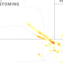
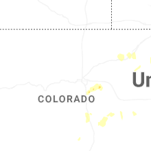
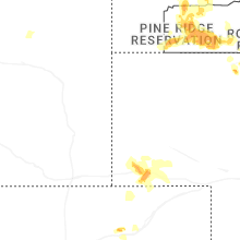
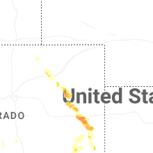
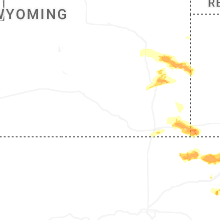


Connect with Interactive Hail Maps