

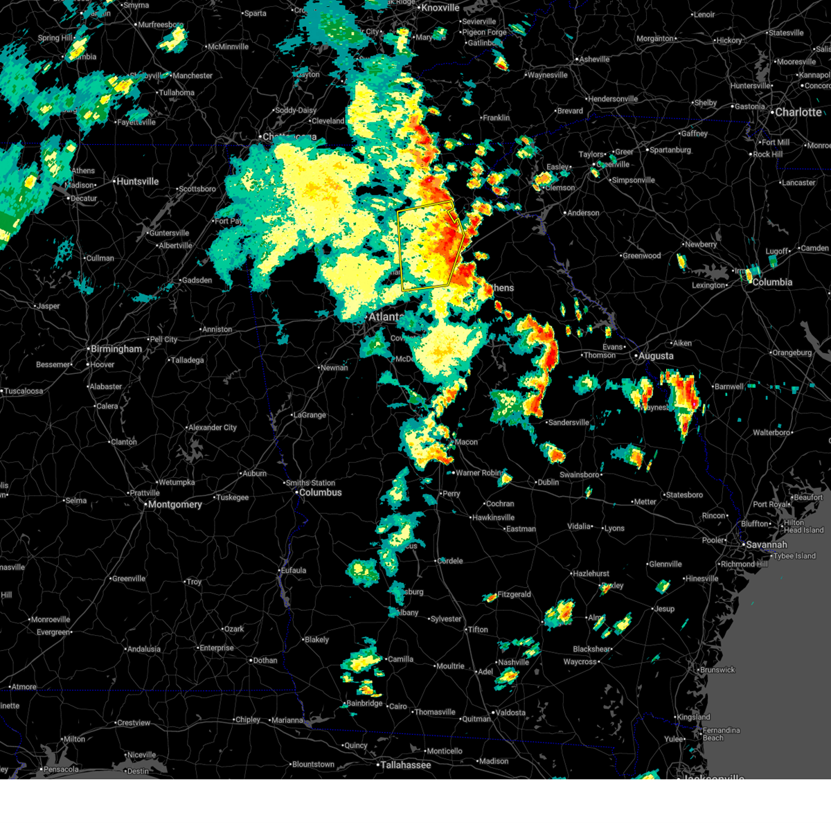
Hail Map for Buford, GA
The Buford, GA area has had 4 reports of on-the-ground hail by trained spotters, and has been under severe weather warnings 39 times during the past 12 months. Doppler radar has detected hail at or near Buford, GA on 44 occasions, including 4 occasions during the past year.
| Name: | Buford, GA |
| Where Located: | 34.7 miles NE of Atlanta, GA |
| Map: | Google Map for Buford, GA |
| Population: | 12225 |
| Housing Units: | 5096 |
| More Info: | Search Google for Buford, GA |
2
The Top Recent Hail Date for Buford, GA is Thursday, April 10, 2025 (6th out of 44)

Hail and Wind Damage Spotted near Buford, GA
| Date / Time | Report Details |
|---|---|
| 6/28/2025 8:48 PM EDT | Public called in with report of tree and fence down and trampoline lifted at two bridge ct near two bridge d in gwinnett county GA, 3.5 miles NNE of Buford, GA |
| 6/27/2025 7:05 PM EDT |
 The storm which prompted the warning has weakened below severe limits, and no longer poses an immediate threat to life or property. therefore, the warning has been allowed to expire. however, heavy rain is still possible with this thunderstorm. The storm which prompted the warning has weakened below severe limits, and no longer poses an immediate threat to life or property. therefore, the warning has been allowed to expire. however, heavy rain is still possible with this thunderstorm.
|
| 6/27/2025 6:36 PM EDT |
 The storm which prompted the warning has moved out of the area. therefore, the warning will be allowed to expire. however, gusty winds and heavy rain are still possible with this thunderstorm. remember, a severe thunderstorm warning still remains in effect for southern forsyth and northern gwinnett counties. The storm which prompted the warning has moved out of the area. therefore, the warning will be allowed to expire. however, gusty winds and heavy rain are still possible with this thunderstorm. remember, a severe thunderstorm warning still remains in effect for southern forsyth and northern gwinnett counties.
|
| 6/27/2025 6:31 PM EDT |
 The storm which prompted the warning has weakened below severe limits, and no longer poses an immediate threat to life or property. therefore, the warning has been allowed to expire. however, gusty winds and heavy rain are still possible with this thunderstorm. The storm which prompted the warning has weakened below severe limits, and no longer poses an immediate threat to life or property. therefore, the warning has been allowed to expire. however, gusty winds and heavy rain are still possible with this thunderstorm.
|
| 6/27/2025 6:29 PM EDT |
 Svrffc the national weather service in peachtree city has issued a * severe thunderstorm warning for, southwestern forsyth county in north central georgia, north central gwinnett county in north central georgia, northeastern fulton county in north central georgia, * until 700 pm edt. * at 629 pm edt, a severe thunderstorm was located near brookwood, or near cumming, and is nearly stationary (radar indicated). Hazards include 60 mph wind gusts and quarter size hail. Hail damage to vehicles is expected. Expect wind damage to roofs, siding, and trees. Svrffc the national weather service in peachtree city has issued a * severe thunderstorm warning for, southwestern forsyth county in north central georgia, north central gwinnett county in north central georgia, northeastern fulton county in north central georgia, * until 700 pm edt. * at 629 pm edt, a severe thunderstorm was located near brookwood, or near cumming, and is nearly stationary (radar indicated). Hazards include 60 mph wind gusts and quarter size hail. Hail damage to vehicles is expected. Expect wind damage to roofs, siding, and trees.
|
| 6/27/2025 6:10 PM EDT |
 Svrffc the national weather service in peachtree city has issued a * severe thunderstorm warning for, central forsyth county in north central georgia, north central gwinnett county in north central georgia, southwestern hall county in north central georgia, * until 645 pm edt. * at 610 pm edt, a severe thunderstorm was located near buford dam-lake lanier parks, or near cumming, and is nearly stationary (radar indicated). Hazards include 60 mph wind gusts and nickel size hail. expect damage to roofs, siding, and trees Svrffc the national weather service in peachtree city has issued a * severe thunderstorm warning for, central forsyth county in north central georgia, north central gwinnett county in north central georgia, southwestern hall county in north central georgia, * until 645 pm edt. * at 610 pm edt, a severe thunderstorm was located near buford dam-lake lanier parks, or near cumming, and is nearly stationary (radar indicated). Hazards include 60 mph wind gusts and nickel size hail. expect damage to roofs, siding, and trees
|
| 6/27/2025 5:43 PM EDT | Svrffc the national weather service in peachtree city has issued a * severe thunderstorm warning for, northeastern forsyth county in north central georgia, southwestern hall county in north central georgia, * until 630 pm edt. * at 543 pm edt, a severe thunderstorm was located over oscarville, or 7 miles southwest of gainesville, and is nearly stationary (radar indicated). Hazards include 60 mph wind gusts and quarter size hail. Hail damage to vehicles is expected. Expect wind damage to roofs, siding, and trees. |
| 6/26/2025 4:40 PM EDT |
 the severe thunderstorm warning has been cancelled and is no longer in effect the severe thunderstorm warning has been cancelled and is no longer in effect
|
| 6/26/2025 4:26 PM EDT |
 The storm which prompted the warning has moved out of the area. therefore, the warning will be allowed to expire. however, small hail and gusty winds are still possible with this thunderstorm. The storm which prompted the warning has moved out of the area. therefore, the warning will be allowed to expire. however, small hail and gusty winds are still possible with this thunderstorm.
|
| 6/26/2025 4:25 PM EDT |
 Svrffc the national weather service in peachtree city has issued a * severe thunderstorm warning for, northwestern barrow county in north central georgia, central forsyth county in north central georgia, northeastern gwinnett county in north central georgia, southern hall county in north central georgia, northwestern jackson county in northeastern georgia, * until 500 pm edt. * at 425 pm edt, severe thunderstorms were located along a line extending from near talmo to oakwood to coal mountain, moving southwest at 10 mph (radar indicated). Hazards include 60 mph wind gusts and quarter size hail. Hail damage to vehicles is expected. Expect wind damage to roofs, siding, and trees. Svrffc the national weather service in peachtree city has issued a * severe thunderstorm warning for, northwestern barrow county in north central georgia, central forsyth county in north central georgia, northeastern gwinnett county in north central georgia, southern hall county in north central georgia, northwestern jackson county in northeastern georgia, * until 500 pm edt. * at 425 pm edt, severe thunderstorms were located along a line extending from near talmo to oakwood to coal mountain, moving southwest at 10 mph (radar indicated). Hazards include 60 mph wind gusts and quarter size hail. Hail damage to vehicles is expected. Expect wind damage to roofs, siding, and trees.
|
| 6/26/2025 4:05 PM EDT |
 Svrffc the national weather service in peachtree city has issued a * severe thunderstorm warning for, northeastern forsyth county in north central georgia, central hall county in north central georgia, * until 430 pm edt. * at 405 pm edt, a severe thunderstorm was located over gainesville, moving southwest at 5 mph (radar indicated). Hazards include 60 mph wind gusts and quarter size hail. Hail damage to vehicles is expected. Expect wind damage to roofs, siding, and trees. Svrffc the national weather service in peachtree city has issued a * severe thunderstorm warning for, northeastern forsyth county in north central georgia, central hall county in north central georgia, * until 430 pm edt. * at 405 pm edt, a severe thunderstorm was located over gainesville, moving southwest at 5 mph (radar indicated). Hazards include 60 mph wind gusts and quarter size hail. Hail damage to vehicles is expected. Expect wind damage to roofs, siding, and trees.
|
| 6/26/2025 3:02 PM EDT |
 Svrffc the national weather service in peachtree city has issued a * severe thunderstorm warning for, northern forsyth county in north central georgia, southeastern lumpkin county in north central georgia, southeastern dawson county in north central georgia, central hall county in north central georgia, * until 345 pm edt. * at 301 pm edt, a severe thunderstorm was located near murrayville, or 9 miles north of gainesville, moving southwest at 20 mph (radar indicated). Hazards include 60 mph wind gusts and penny size hail. expect damage to roofs, siding, and trees Svrffc the national weather service in peachtree city has issued a * severe thunderstorm warning for, northern forsyth county in north central georgia, southeastern lumpkin county in north central georgia, southeastern dawson county in north central georgia, central hall county in north central georgia, * until 345 pm edt. * at 301 pm edt, a severe thunderstorm was located near murrayville, or 9 miles north of gainesville, moving southwest at 20 mph (radar indicated). Hazards include 60 mph wind gusts and penny size hail. expect damage to roofs, siding, and trees
|
| 6/17/2025 7:15 PM EDT |
 The storms which prompted the warning have moved out of the area. therefore, the warning will be allowed to expire. remember, a severe thunderstorm warning still remains in effect for hall, white, banks, and jackson counties. The storms which prompted the warning have moved out of the area. therefore, the warning will be allowed to expire. remember, a severe thunderstorm warning still remains in effect for hall, white, banks, and jackson counties.
|
| 6/17/2025 6:57 PM EDT |
 At 656 pm edt, severe thunderstorms were located along a line extending from garland to gainesville to near thompsons mill to hog mountain, moving east at 45 mph (radar indicated). Hazards include 60 mph wind gusts. Expect damage to roofs, siding, and trees. Locations impacted include, gainesville, lawrenceville, winder, jefferson, dahlonega, dawsonville, sugar hill, suwanee, buford, braselton, auburn, flowery branch, dacula, oakwood, lula, maysville, hoschton, clermont, pendergrass, and carl. At 656 pm edt, severe thunderstorms were located along a line extending from garland to gainesville to near thompsons mill to hog mountain, moving east at 45 mph (radar indicated). Hazards include 60 mph wind gusts. Expect damage to roofs, siding, and trees. Locations impacted include, gainesville, lawrenceville, winder, jefferson, dahlonega, dawsonville, sugar hill, suwanee, buford, braselton, auburn, flowery branch, dacula, oakwood, lula, maysville, hoschton, clermont, pendergrass, and carl.
|
| 6/17/2025 6:57 PM EDT |
 the severe thunderstorm warning has been cancelled and is no longer in effect the severe thunderstorm warning has been cancelled and is no longer in effect
|
| 6/17/2025 6:32 PM EDT |
 Svrffc the national weather service in peachtree city has issued a * severe thunderstorm warning for, northwestern dekalb county in north central georgia, northern gwinnett county in north central georgia, hall county in north central georgia, northwestern jackson county in northeastern georgia, northwestern barrow county in north central georgia, northeastern cherokee county in north central georgia, forsyth county in north central georgia, southern lumpkin county in north central georgia, western banks county in northeastern georgia, southern white county in northeastern georgia, dawson county in north central georgia, northeastern fulton county in north central georgia, southeastern pickens county in north central georgia, * until 715 pm edt. * at 631 pm edt, severe thunderstorms were located along a line extending from near juno to cumming to johns creek to near mechanicsville, moving east at 45 mph (radar indicated. at 615 pm a 54 mph wind gust was reported in canton). Hazards include 60 mph wind gusts. expect damage to roofs, siding, and trees Svrffc the national weather service in peachtree city has issued a * severe thunderstorm warning for, northwestern dekalb county in north central georgia, northern gwinnett county in north central georgia, hall county in north central georgia, northwestern jackson county in northeastern georgia, northwestern barrow county in north central georgia, northeastern cherokee county in north central georgia, forsyth county in north central georgia, southern lumpkin county in north central georgia, western banks county in northeastern georgia, southern white county in northeastern georgia, dawson county in north central georgia, northeastern fulton county in north central georgia, southeastern pickens county in north central georgia, * until 715 pm edt. * at 631 pm edt, severe thunderstorms were located along a line extending from near juno to cumming to johns creek to near mechanicsville, moving east at 45 mph (radar indicated. at 615 pm a 54 mph wind gust was reported in canton). Hazards include 60 mph wind gusts. expect damage to roofs, siding, and trees
|
| 6/10/2025 4:07 PM EDT |
 The storm which prompted the warning has weakened below severe limits, and no longer poses an immediate threat to life or property. therefore, the warning will be allowed to expire. The storm which prompted the warning has weakened below severe limits, and no longer poses an immediate threat to life or property. therefore, the warning will be allowed to expire.
|
| 6/10/2025 3:59 PM EDT |
 At 358 pm edt, a severe thunderstorm was located over rest haven, or 9 miles east of cumming, moving east at 15 mph (radar indicated). Hazards include 60 mph wind gusts. Expect damage to roofs, siding, and trees. Locations impacted include, gainesville, sugar hill, buford, flowery branch, oakwood, rest haven, aqualand park, oscarville, buford dam-lake lanier parks, lake lanier islands, and hog mountain. At 358 pm edt, a severe thunderstorm was located over rest haven, or 9 miles east of cumming, moving east at 15 mph (radar indicated). Hazards include 60 mph wind gusts. Expect damage to roofs, siding, and trees. Locations impacted include, gainesville, sugar hill, buford, flowery branch, oakwood, rest haven, aqualand park, oscarville, buford dam-lake lanier parks, lake lanier islands, and hog mountain.
|
| 6/10/2025 3:34 PM EDT |
 Svrffc the national weather service in peachtree city has issued a * severe thunderstorm warning for, central forsyth county in north central georgia, northeastern gwinnett county in north central georgia, southwestern hall county in north central georgia, * until 415 pm edt. * at 334 pm edt, a severe thunderstorm was located over cumming, moving east at 15 mph (radar indicated). Hazards include 60 mph wind gusts. expect damage to roofs, siding, and trees Svrffc the national weather service in peachtree city has issued a * severe thunderstorm warning for, central forsyth county in north central georgia, northeastern gwinnett county in north central georgia, southwestern hall county in north central georgia, * until 415 pm edt. * at 334 pm edt, a severe thunderstorm was located over cumming, moving east at 15 mph (radar indicated). Hazards include 60 mph wind gusts. expect damage to roofs, siding, and trees
|
| 6/7/2025 6:25 PM EDT |
 Svrffc the national weather service in peachtree city has issued a * severe thunderstorm warning for, northwestern barrow county in north central georgia, northeastern gwinnett county in north central georgia, south central hall county in north central georgia, jackson county in northeastern georgia, * until 715 pm edt. * at 625 pm edt, a severe thunderstorm was located over hog mountain, or 8 miles northeast of lawrenceville, moving east at 50 mph (radar indicated). Hazards include 60 mph wind gusts. expect damage to roofs, siding, and trees Svrffc the national weather service in peachtree city has issued a * severe thunderstorm warning for, northwestern barrow county in north central georgia, northeastern gwinnett county in north central georgia, south central hall county in north central georgia, jackson county in northeastern georgia, * until 715 pm edt. * at 625 pm edt, a severe thunderstorm was located over hog mountain, or 8 miles northeast of lawrenceville, moving east at 50 mph (radar indicated). Hazards include 60 mph wind gusts. expect damage to roofs, siding, and trees
|
| 5/21/2025 1:09 AM EDT |
 the severe thunderstorm warning has been cancelled and is no longer in effect the severe thunderstorm warning has been cancelled and is no longer in effect
|
| 5/21/2025 12:54 AM EDT |
 The storms which prompted the warning have moved out of the area. therefore, the warning will be allowed to expire. a tornado watch remains in effect until 200 am edt for north central and northwestern georgia. remember, a severe thunderstorm warning still remains in effect for cobb, fulton, forsyth, hall, gwinnett, and dekalb. The storms which prompted the warning have moved out of the area. therefore, the warning will be allowed to expire. a tornado watch remains in effect until 200 am edt for north central and northwestern georgia. remember, a severe thunderstorm warning still remains in effect for cobb, fulton, forsyth, hall, gwinnett, and dekalb.
|
| 5/21/2025 12:50 AM EDT |
 Svrffc the national weather service in peachtree city has issued a * severe thunderstorm warning for, northwestern barrow county in north central georgia, northwestern dekalb county in north central georgia, central forsyth county in north central georgia, central cobb county in north central georgia, gwinnett county in north central georgia, southwestern banks county in northeastern georgia, southern hall county in north central georgia, northwestern jackson county in northeastern georgia, northeastern fulton county in north central georgia, * until 130 am edt. * at 1250 am edt, severe thunderstorms were located along a line extending from near oscarville to near roswell to near hiram, moving east at 45 mph (radar indicated). Hazards include 60 mph wind gusts and penny size hail. expect damage to roofs, siding, and trees Svrffc the national weather service in peachtree city has issued a * severe thunderstorm warning for, northwestern barrow county in north central georgia, northwestern dekalb county in north central georgia, central forsyth county in north central georgia, central cobb county in north central georgia, gwinnett county in north central georgia, southwestern banks county in northeastern georgia, southern hall county in north central georgia, northwestern jackson county in northeastern georgia, northeastern fulton county in north central georgia, * until 130 am edt. * at 1250 am edt, severe thunderstorms were located along a line extending from near oscarville to near roswell to near hiram, moving east at 45 mph (radar indicated). Hazards include 60 mph wind gusts and penny size hail. expect damage to roofs, siding, and trees
|
| 5/21/2025 12:47 AM EDT |
 the severe thunderstorm warning has been cancelled and is no longer in effect the severe thunderstorm warning has been cancelled and is no longer in effect
|
| 5/21/2025 12:47 AM EDT |
 At 1247 am edt, severe thunderstorms were located along a line extending from murrayville to near sugar hill to white water park, moving east at 50 mph (radar indicated). Hazards include 60 mph wind gusts and quarter size hail. Hail damage to vehicles is expected. expect wind damage to roofs, siding, and trees. Locations impacted include, atlanta, marietta, gainesville, canton, dallas, cumming, peachtree corners, mountain park, sandy springs, roswell, johns creek, alpharetta, smyrna, dunwoody, milton, kennesaw, duluth, woodstock, acworth, and sugar hill. At 1247 am edt, severe thunderstorms were located along a line extending from murrayville to near sugar hill to white water park, moving east at 50 mph (radar indicated). Hazards include 60 mph wind gusts and quarter size hail. Hail damage to vehicles is expected. expect wind damage to roofs, siding, and trees. Locations impacted include, atlanta, marietta, gainesville, canton, dallas, cumming, peachtree corners, mountain park, sandy springs, roswell, johns creek, alpharetta, smyrna, dunwoody, milton, kennesaw, duluth, woodstock, acworth, and sugar hill.
|
| 5/21/2025 12:19 AM EDT |
 Svrffc the national weather service in peachtree city has issued a * severe thunderstorm warning for, central paulding county in northwestern georgia, cherokee county in north central georgia, northwestern dekalb county in north central georgia, forsyth county in north central georgia, cobb county in north central georgia, northern gwinnett county in north central georgia, southern dawson county in north central georgia, hall county in north central georgia, northeastern fulton county in north central georgia, southeastern pickens county in north central georgia, * until 100 am edt. * at 1219 am edt, severe thunderstorms were located along a line extending from near marblehill to lebanon to near braswell, moving east at 50 mph (radar indicated). Hazards include 60 mph wind gusts and quarter size hail. Hail damage to vehicles is expected. Expect wind damage to roofs, siding, and trees. Svrffc the national weather service in peachtree city has issued a * severe thunderstorm warning for, central paulding county in northwestern georgia, cherokee county in north central georgia, northwestern dekalb county in north central georgia, forsyth county in north central georgia, cobb county in north central georgia, northern gwinnett county in north central georgia, southern dawson county in north central georgia, hall county in north central georgia, northeastern fulton county in north central georgia, southeastern pickens county in north central georgia, * until 100 am edt. * at 1219 am edt, severe thunderstorms were located along a line extending from near marblehill to lebanon to near braswell, moving east at 50 mph (radar indicated). Hazards include 60 mph wind gusts and quarter size hail. Hail damage to vehicles is expected. Expect wind damage to roofs, siding, and trees.
|
| 5/2/2025 9:43 PM EDT |
 Svrffc the national weather service in peachtree city has issued a * severe thunderstorm warning for, dekalb county in north central georgia, northeastern fayette county in north central georgia, central gwinnett county in north central georgia, northwestern henry county in north central georgia, clayton county in north central georgia, southeastern fulton county in north central georgia, * until 1030 pm edt. * at 943 pm edt, severe thunderstorms were located along a line extending from berkeley lake to near union city, moving east at 25 mph (radar indicated). Hazards include 60 mph wind gusts and penny size hail. expect damage to roofs, siding, and trees Svrffc the national weather service in peachtree city has issued a * severe thunderstorm warning for, dekalb county in north central georgia, northeastern fayette county in north central georgia, central gwinnett county in north central georgia, northwestern henry county in north central georgia, clayton county in north central georgia, southeastern fulton county in north central georgia, * until 1030 pm edt. * at 943 pm edt, severe thunderstorms were located along a line extending from berkeley lake to near union city, moving east at 25 mph (radar indicated). Hazards include 60 mph wind gusts and penny size hail. expect damage to roofs, siding, and trees
|
| 5/2/2025 1:26 PM EDT | the severe thunderstorm warning has been cancelled and is no longer in effect |
| 5/2/2025 1:13 PM EDT | At 113 pm edt, a severe thunderstorm was located over sugar hill, or 7 miles southeast of cumming, moving east at 20 mph (radar indicated). Hazards include 60 mph wind gusts and quarter size hail. Hail damage to vehicles is expected. expect wind damage to roofs, siding, and trees. Locations impacted include, cumming, duluth, sugar hill, suwanee, buford, rest haven, buford dam-lake lanier parks, and lake lanier islands. |
| 5/2/2025 1:13 PM EDT | the severe thunderstorm warning has been cancelled and is no longer in effect |
| 5/2/2025 12:54 PM EDT |
 Svrffc the national weather service in peachtree city has issued a * severe thunderstorm warning for, central forsyth county in north central georgia, northern gwinnett county in north central georgia, southwestern hall county in north central georgia, northeastern fulton county in north central georgia, * until 145 pm edt. * at 1254 pm edt, a severe thunderstorm was located over brookwood, or 8 miles north of peachtree corners, moving east at 20 mph (radar indicated). Hazards include 60 mph wind gusts and quarter size hail. Hail damage to vehicles is expected. Expect wind damage to roofs, siding, and trees. Svrffc the national weather service in peachtree city has issued a * severe thunderstorm warning for, central forsyth county in north central georgia, northern gwinnett county in north central georgia, southwestern hall county in north central georgia, northeastern fulton county in north central georgia, * until 145 pm edt. * at 1254 pm edt, a severe thunderstorm was located over brookwood, or 8 miles north of peachtree corners, moving east at 20 mph (radar indicated). Hazards include 60 mph wind gusts and quarter size hail. Hail damage to vehicles is expected. Expect wind damage to roofs, siding, and trees.
|
| 4/10/2025 8:48 PM EDT |
 the severe thunderstorm warning has been cancelled and is no longer in effect the severe thunderstorm warning has been cancelled and is no longer in effect
|
| 4/10/2025 8:39 PM EDT | Quarter sized hail reported 2 miles ENE of Buford, GA, quarter sized hail reported near drake street and swimming pool road. |
| 4/10/2025 8:24 PM EDT |
 At 823 pm edt, severe thunderstorms were located along a line extending from near rest haven to sweat mountain, moving southeast at 20 mph (public). Hazards include golf ball size hail and 60 mph wind gusts. People and animals outdoors will be injured. expect hail damage to roofs, siding, windows, and vehicles. expect wind damage to roofs, siding, and trees. Locations impacted include, drew, duluth, suwanee, rest haven, buford dam-lake lanier parks, johns creek, brookwood, alpharetta, lake lanier islands, hog mountain, berkeley lake, cumming, birmingham, buford, aqualand park, roswell, peachtree corners, sugar hill, mountain park, and flowery branch. At 823 pm edt, severe thunderstorms were located along a line extending from near rest haven to sweat mountain, moving southeast at 20 mph (public). Hazards include golf ball size hail and 60 mph wind gusts. People and animals outdoors will be injured. expect hail damage to roofs, siding, windows, and vehicles. expect wind damage to roofs, siding, and trees. Locations impacted include, drew, duluth, suwanee, rest haven, buford dam-lake lanier parks, johns creek, brookwood, alpharetta, lake lanier islands, hog mountain, berkeley lake, cumming, birmingham, buford, aqualand park, roswell, peachtree corners, sugar hill, mountain park, and flowery branch.
|
| 4/10/2025 8:18 PM EDT |
 Svrffc the national weather service in peachtree city has issued a * severe thunderstorm warning for, southeastern cherokee county in north central georgia, central forsyth county in north central georgia, northern gwinnett county in north central georgia, southwestern hall county in north central georgia, northeastern fulton county in north central georgia, * until 900 pm edt. * at 818 pm edt, severe thunderstorms were located along a line extending from rest haven to sweat mountain, moving southeast at 20 mph (radar indicated). Hazards include 60 mph wind gusts and half dollar size hail. Hail damage to vehicles is expected. Expect wind damage to roofs, siding, and trees. Svrffc the national weather service in peachtree city has issued a * severe thunderstorm warning for, southeastern cherokee county in north central georgia, central forsyth county in north central georgia, northern gwinnett county in north central georgia, southwestern hall county in north central georgia, northeastern fulton county in north central georgia, * until 900 pm edt. * at 818 pm edt, severe thunderstorms were located along a line extending from rest haven to sweat mountain, moving southeast at 20 mph (radar indicated). Hazards include 60 mph wind gusts and half dollar size hail. Hail damage to vehicles is expected. Expect wind damage to roofs, siding, and trees.
|
| 4/10/2025 8:06 PM EDT | Quarter sized hail reported 5.3 miles NNW of Buford, GA, quarter sized hail reported on morgan chase drive ne. |
| 2/16/2025 5:02 AM EST | At 502 am est, severe thunderstorms were located along a line extending from near hog mountain to near lakeview estates to lovejoy, moving east at 55 mph (radar indicated). Hazards include 60 mph wind gusts. Expect damage to roofs, siding, and trees. Locations impacted include, lawrenceville, mcdonough, conyers, winder, stockbridge, sugar hill, snellville, suwanee, buford, lilburn, loganville, braselton, hampton, auburn, lovejoy, stone mountain, dacula, grayson, lithonia, and hoschton. |
| 2/16/2025 5:02 AM EST | the severe thunderstorm warning has been cancelled and is no longer in effect |
| 2/16/2025 4:48 AM EST |
 Svrffc the national weather service in peachtree city has issued a * severe thunderstorm warning for, southeastern dekalb county in north central georgia, gwinnett county in north central georgia, clarke county in northeastern georgia, northeastern butts county in central georgia, southwestern hall county in north central georgia, southern jackson county in northeastern georgia, newton county in north central georgia, rockdale county in north central georgia, oconee county in northeastern georgia, barrow county in north central georgia, western morgan county in north central georgia, henry county in north central georgia, walton county in north central georgia, eastern clayton county in north central georgia, northern jasper county in central georgia, * until 530 am est. * at 447 am est, severe thunderstorms were located along a line extending from near hog mountain to atlanta motor speedway, moving east at 65 mph (radar indicated). Hazards include 60 mph wind gusts. expect damage to roofs, siding, and trees Svrffc the national weather service in peachtree city has issued a * severe thunderstorm warning for, southeastern dekalb county in north central georgia, gwinnett county in north central georgia, clarke county in northeastern georgia, northeastern butts county in central georgia, southwestern hall county in north central georgia, southern jackson county in northeastern georgia, newton county in north central georgia, rockdale county in north central georgia, oconee county in northeastern georgia, barrow county in north central georgia, western morgan county in north central georgia, henry county in north central georgia, walton county in north central georgia, eastern clayton county in north central georgia, northern jasper county in central georgia, * until 530 am est. * at 447 am est, severe thunderstorms were located along a line extending from near hog mountain to atlanta motor speedway, moving east at 65 mph (radar indicated). Hazards include 60 mph wind gusts. expect damage to roofs, siding, and trees
|
| 2/16/2025 4:25 AM EST |
 Svrffc the national weather service in peachtree city has issued a * severe thunderstorm warning for, rockdale county in north central georgia, western barrow county in north central georgia, dekalb county in north central georgia, fayette county in north central georgia, southwestern forsyth county in north central georgia, eastern cobb county in north central georgia, gwinnett county in north central georgia, henry county in north central georgia, northwestern walton county in north central georgia, northern coweta county in west central georgia, fulton county in north central georgia, clayton county in north central georgia, * until 515 am est. * at 424 am est, severe thunderstorms were located along a line extending from near roswell to near six flags over georgia to dunaway gardens, moving east at 55 mph (radar indicated). Hazards include 60 mph wind gusts. expect damage to roofs, siding, and trees Svrffc the national weather service in peachtree city has issued a * severe thunderstorm warning for, rockdale county in north central georgia, western barrow county in north central georgia, dekalb county in north central georgia, fayette county in north central georgia, southwestern forsyth county in north central georgia, eastern cobb county in north central georgia, gwinnett county in north central georgia, henry county in north central georgia, northwestern walton county in north central georgia, northern coweta county in west central georgia, fulton county in north central georgia, clayton county in north central georgia, * until 515 am est. * at 424 am est, severe thunderstorms were located along a line extending from near roswell to near six flags over georgia to dunaway gardens, moving east at 55 mph (radar indicated). Hazards include 60 mph wind gusts. expect damage to roofs, siding, and trees
|
| 7/30/2024 8:21 PM EDT |
 The storms which prompted the warning have weakened below severe limits, and no longer pose an immediate threat to life or property. therefore, the warning will be allowed to expire. a severe thunderstorm watch remains in effect until 1100 pm edt for north central and northwestern georgia. The storms which prompted the warning have weakened below severe limits, and no longer pose an immediate threat to life or property. therefore, the warning will be allowed to expire. a severe thunderstorm watch remains in effect until 1100 pm edt for north central and northwestern georgia.
|
| 7/30/2024 7:52 PM EDT |
 Svrffc the national weather service in peachtree city has issued a * severe thunderstorm warning for, paulding county in northwestern georgia, southern cherokee county in north central georgia, northwestern dekalb county in north central georgia, forsyth county in north central georgia, cobb county in north central georgia, central gwinnett county in north central georgia, southwestern hall county in north central georgia, northeastern fulton county in north central georgia, southern bartow county in northwestern georgia, * until 830 pm edt. * at 752 pm edt, severe thunderstorms were located along a line extending from near silver city to holly springs to near kingston, moving south at 30 mph (radar indicated). Hazards include 60 mph wind gusts and quarter size hail. Hail damage to vehicles is expected. Expect wind damage to roofs, siding, and trees. Svrffc the national weather service in peachtree city has issued a * severe thunderstorm warning for, paulding county in northwestern georgia, southern cherokee county in north central georgia, northwestern dekalb county in north central georgia, forsyth county in north central georgia, cobb county in north central georgia, central gwinnett county in north central georgia, southwestern hall county in north central georgia, northeastern fulton county in north central georgia, southern bartow county in northwestern georgia, * until 830 pm edt. * at 752 pm edt, severe thunderstorms were located along a line extending from near silver city to holly springs to near kingston, moving south at 30 mph (radar indicated). Hazards include 60 mph wind gusts and quarter size hail. Hail damage to vehicles is expected. Expect wind damage to roofs, siding, and trees.
|
| 7/7/2024 7:50 PM EDT |
 At 750 pm edt, a severe thunderstorm was located over chestatee, or 7 miles west of gainesville, and is nearly stationary (radar indicated). Hazards include 60 mph wind gusts and penny size hail. Expect damage to roofs, siding, and trees. Locations impacted include, flowery branch, oakwood, aqualand park, chestatee, oscarville, and lake lanier islands. At 750 pm edt, a severe thunderstorm was located over chestatee, or 7 miles west of gainesville, and is nearly stationary (radar indicated). Hazards include 60 mph wind gusts and penny size hail. Expect damage to roofs, siding, and trees. Locations impacted include, flowery branch, oakwood, aqualand park, chestatee, oscarville, and lake lanier islands.
|
| 7/7/2024 7:50 PM EDT |
 the severe thunderstorm warning has been cancelled and is no longer in effect the severe thunderstorm warning has been cancelled and is no longer in effect
|
| 7/7/2024 7:30 PM EDT |
 Svrffc the national weather service in peachtree city has issued a * severe thunderstorm warning for, northeastern forsyth county in north central georgia, southeastern dawson county in north central georgia, southwestern hall county in north central georgia, * until 815 pm edt. * at 730 pm edt, a severe thunderstorm was located over chestatee, or 7 miles west of gainesville, and is nearly stationary (radar indicated). Hazards include 60 mph wind gusts and penny size hail. expect damage to roofs, siding, and trees Svrffc the national weather service in peachtree city has issued a * severe thunderstorm warning for, northeastern forsyth county in north central georgia, southeastern dawson county in north central georgia, southwestern hall county in north central georgia, * until 815 pm edt. * at 730 pm edt, a severe thunderstorm was located over chestatee, or 7 miles west of gainesville, and is nearly stationary (radar indicated). Hazards include 60 mph wind gusts and penny size hail. expect damage to roofs, siding, and trees
|
| 5/9/2024 7:58 AM EDT |
 Svrffc the national weather service in peachtree city has issued a * severe thunderstorm warning for, northern barrow county in north central georgia, banks county in northeastern georgia, northwestern clarke county in northeastern georgia, southeastern hall county in north central georgia, jackson county in northeastern georgia, northwestern madison county in northeastern georgia, * until 845 am edt. * at 758 am edt, a severe thunderstorm was located over gillsville, or 7 miles west of homer, moving east at 65 mph (radar indicated). Hazards include 60 mph wind gusts and quarter size hail. Hail damage to vehicles is expected. Expect wind damage to roofs, siding, and trees. Svrffc the national weather service in peachtree city has issued a * severe thunderstorm warning for, northern barrow county in north central georgia, banks county in northeastern georgia, northwestern clarke county in northeastern georgia, southeastern hall county in north central georgia, jackson county in northeastern georgia, northwestern madison county in northeastern georgia, * until 845 am edt. * at 758 am edt, a severe thunderstorm was located over gillsville, or 7 miles west of homer, moving east at 65 mph (radar indicated). Hazards include 60 mph wind gusts and quarter size hail. Hail damage to vehicles is expected. Expect wind damage to roofs, siding, and trees.
|
| 5/9/2024 7:42 AM EDT |
 Svrffc the national weather service in peachtree city has issued a * severe thunderstorm warning for, paulding county in northwestern georgia, southern cherokee county in north central georgia, northwestern dekalb county in north central georgia, southwestern forsyth county in north central georgia, northeastern haralson county in northwestern georgia, cobb county in north central georgia, northeastern douglas county in north central georgia, northern gwinnett county in north central georgia, northeastern fulton county in north central georgia, eastern polk county in northwestern georgia, southern bartow county in northwestern georgia, * until 830 am edt. * at 742 am edt, a severe thunderstorm was located over acworth, or 10 miles northwest of marietta, moving southeast at 65 mph (radar indicated). Hazards include 60 mph wind gusts and penny size hail. expect damage to roofs, siding, and trees Svrffc the national weather service in peachtree city has issued a * severe thunderstorm warning for, paulding county in northwestern georgia, southern cherokee county in north central georgia, northwestern dekalb county in north central georgia, southwestern forsyth county in north central georgia, northeastern haralson county in northwestern georgia, cobb county in north central georgia, northeastern douglas county in north central georgia, northern gwinnett county in north central georgia, northeastern fulton county in north central georgia, eastern polk county in northwestern georgia, southern bartow county in northwestern georgia, * until 830 am edt. * at 742 am edt, a severe thunderstorm was located over acworth, or 10 miles northwest of marietta, moving southeast at 65 mph (radar indicated). Hazards include 60 mph wind gusts and penny size hail. expect damage to roofs, siding, and trees
|
| 5/9/2024 7:33 AM EDT |
 Svrffc the national weather service in peachtree city has issued a * severe thunderstorm warning for, east central cherokee county in north central georgia, forsyth county in north central georgia, northeastern gwinnett county in north central georgia, southeastern dawson county in north central georgia, southern hall county in north central georgia, * until 815 am edt. * at 733 am edt, a severe thunderstorm was located over hightower, or 8 miles northwest of cumming, moving east at 50 mph (radar indicated). Hazards include 60 mph wind gusts and penny size hail. expect damage to roofs, siding, and trees Svrffc the national weather service in peachtree city has issued a * severe thunderstorm warning for, east central cherokee county in north central georgia, forsyth county in north central georgia, northeastern gwinnett county in north central georgia, southeastern dawson county in north central georgia, southern hall county in north central georgia, * until 815 am edt. * at 733 am edt, a severe thunderstorm was located over hightower, or 8 miles northwest of cumming, moving east at 50 mph (radar indicated). Hazards include 60 mph wind gusts and penny size hail. expect damage to roofs, siding, and trees
|
| 5/9/2024 3:10 AM EDT |
 the severe thunderstorm warning has been cancelled and is no longer in effect the severe thunderstorm warning has been cancelled and is no longer in effect
|
| 5/9/2024 3:10 AM EDT |
 At 310 am edt, a severe thunderstorm was located over talmo, or 7 miles west of jefferson, moving southeast at 35 mph (radar indicated). Hazards include 60 mph wind gusts and quarter size hail. Hail damage to vehicles is expected. expect wind damage to roofs, siding, and trees. Locations impacted include, gainesville, jefferson, commerce, braselton, flowery branch, oakwood, maysville, arcade, hoschton, pendergrass, gillsville, talmo, candler, peach state speedway, thompsons mill, chateau elan, chestnut mountain, and road atlanta-lanier speedway. At 310 am edt, a severe thunderstorm was located over talmo, or 7 miles west of jefferson, moving southeast at 35 mph (radar indicated). Hazards include 60 mph wind gusts and quarter size hail. Hail damage to vehicles is expected. expect wind damage to roofs, siding, and trees. Locations impacted include, gainesville, jefferson, commerce, braselton, flowery branch, oakwood, maysville, arcade, hoschton, pendergrass, gillsville, talmo, candler, peach state speedway, thompsons mill, chateau elan, chestnut mountain, and road atlanta-lanier speedway.
|
| 5/9/2024 2:53 AM EDT |
 Svrffc the national weather service in peachtree city has issued a * severe thunderstorm warning for, northwestern barrow county in north central georgia, northeastern forsyth county in north central georgia, hall county in north central georgia, central jackson county in northeastern georgia, * until 345 am edt. * at 252 am edt, a severe thunderstorm was located over oakwood, or near gainesville, moving southeast at 30 mph (radar indicated). Hazards include 60 mph wind gusts and quarter size hail. Hail damage to vehicles is expected. Expect wind damage to roofs, siding, and trees. Svrffc the national weather service in peachtree city has issued a * severe thunderstorm warning for, northwestern barrow county in north central georgia, northeastern forsyth county in north central georgia, hall county in north central georgia, central jackson county in northeastern georgia, * until 345 am edt. * at 252 am edt, a severe thunderstorm was located over oakwood, or near gainesville, moving southeast at 30 mph (radar indicated). Hazards include 60 mph wind gusts and quarter size hail. Hail damage to vehicles is expected. Expect wind damage to roofs, siding, and trees.
|
| 2/28/2024 3:22 PM EST | Tree down near the intersection of buford dr and gravel springs r in gwinnett county GA, 3.1 miles N of Buford, GA |
| 2/28/2024 3:13 PM EST |
 Svrffc the national weather service in peachtree city has issued a * severe thunderstorm warning for, barrow county in north central georgia, south central forsyth county in north central georgia, gwinnett county in north central georgia, banks county in northeastern georgia, southern hall county in north central georgia, jackson county in northeastern georgia, northeastern fulton county in north central georgia, western madison county in northeastern georgia, * until 345 pm est. * at 313 pm est, severe thunderstorms were located along a line extending from near pinefield crossroads to talmo to peachtree corners, moving east at 50 mph (radar indicated). Hazards include 60 mph wind gusts and penny size hail. expect damage to roofs, siding, and trees Svrffc the national weather service in peachtree city has issued a * severe thunderstorm warning for, barrow county in north central georgia, south central forsyth county in north central georgia, gwinnett county in north central georgia, banks county in northeastern georgia, southern hall county in north central georgia, jackson county in northeastern georgia, northeastern fulton county in north central georgia, western madison county in northeastern georgia, * until 345 pm est. * at 313 pm est, severe thunderstorms were located along a line extending from near pinefield crossroads to talmo to peachtree corners, moving east at 50 mph (radar indicated). Hazards include 60 mph wind gusts and penny size hail. expect damage to roofs, siding, and trees
|
| 2/28/2024 3:07 PM EST |
 At 307 pm est, severe thunderstorms were located along a line extending from near lula to near gainesville to lake lanier islands, moving east at 50 mph (radar indicated). Hazards include 60 mph wind gusts and quarter size hail. Hail damage to vehicles is expected. expect wind damage to roofs, siding, and trees. Locations impacted include, gainesville, cumming, sugar hill, buford, braselton, flowery branch, oakwood, lula, hoschton, pendergrass, gillsville, talmo, rest haven, candler, buford dam-lake lanier parks, aqualand park, chestnut mountain, oscarville, road atlanta-lanier speedway, and lake lanier islands. At 307 pm est, severe thunderstorms were located along a line extending from near lula to near gainesville to lake lanier islands, moving east at 50 mph (radar indicated). Hazards include 60 mph wind gusts and quarter size hail. Hail damage to vehicles is expected. expect wind damage to roofs, siding, and trees. Locations impacted include, gainesville, cumming, sugar hill, buford, braselton, flowery branch, oakwood, lula, hoschton, pendergrass, gillsville, talmo, rest haven, candler, buford dam-lake lanier parks, aqualand park, chestnut mountain, oscarville, road atlanta-lanier speedway, and lake lanier islands.
|
| 2/28/2024 2:51 PM EST |
 Svrffc the national weather service in peachtree city has issued a * severe thunderstorm warning for, central forsyth county in north central georgia, northeastern gwinnett county in north central georgia, western banks county in northeastern georgia, southeastern dawson county in north central georgia, hall county in north central georgia, northwestern jackson county in northeastern georgia, * until 315 pm est. * at 251 pm est, severe thunderstorms were located along a line extending from near war hill park to near coal mountain to near milton, moving east at 50 mph (radar indicated). Hazards include 60 mph wind gusts and quarter size hail. Hail damage to vehicles is expected. Expect wind damage to roofs, siding, and trees. Svrffc the national weather service in peachtree city has issued a * severe thunderstorm warning for, central forsyth county in north central georgia, northeastern gwinnett county in north central georgia, western banks county in northeastern georgia, southeastern dawson county in north central georgia, hall county in north central georgia, northwestern jackson county in northeastern georgia, * until 315 pm est. * at 251 pm est, severe thunderstorms were located along a line extending from near war hill park to near coal mountain to near milton, moving east at 50 mph (radar indicated). Hazards include 60 mph wind gusts and quarter size hail. Hail damage to vehicles is expected. Expect wind damage to roofs, siding, and trees.
|
| 8/28/2023 4:52 PM EDT |
 The severe thunderstorm warning for southwestern forsyth, northwestern gwinnett and northeastern fulton counties will expire at 500 pm edt, the storm which prompted the warning has weakened below severe limits, and no longer poses an immediate threat to life or property. therefore, the warning will be allowed to expire. however, small hail is still possible with this thunderstorm. The severe thunderstorm warning for southwestern forsyth, northwestern gwinnett and northeastern fulton counties will expire at 500 pm edt, the storm which prompted the warning has weakened below severe limits, and no longer poses an immediate threat to life or property. therefore, the warning will be allowed to expire. however, small hail is still possible with this thunderstorm.
|
| 8/28/2023 4:10 PM EDT |
 At 410 pm edt, a severe thunderstorm was located over alpharetta, or near peachtree corners, moving east at 10 mph (radar indicated). Hazards include 60 mph wind gusts and nickel size hail. expect damage to roofs, siding, and trees At 410 pm edt, a severe thunderstorm was located over alpharetta, or near peachtree corners, moving east at 10 mph (radar indicated). Hazards include 60 mph wind gusts and nickel size hail. expect damage to roofs, siding, and trees
|
| 8/27/2023 4:06 PM EDT |
 At 405 pm edt, a severe thunderstorm was located over lake lanier islands, or near cumming, moving northeast at 15 mph (radar indicated). Hazards include 60 mph wind gusts. Expect damage to roofs, siding, and trees. locations impacted include, gainesville, cumming, sugar hill, suwanee, buford, flowery branch, oakwood, rest haven, buford dam-lake lanier parks, aqualand park, chestatee, chestnut mountain, oscarville, and lake lanier islands. hail threat, radar indicated max hail size, <. 75 in wind threat, radar indicated max wind gust, 60 mph. At 405 pm edt, a severe thunderstorm was located over lake lanier islands, or near cumming, moving northeast at 15 mph (radar indicated). Hazards include 60 mph wind gusts. Expect damage to roofs, siding, and trees. locations impacted include, gainesville, cumming, sugar hill, suwanee, buford, flowery branch, oakwood, rest haven, buford dam-lake lanier parks, aqualand park, chestatee, chestnut mountain, oscarville, and lake lanier islands. hail threat, radar indicated max hail size, <. 75 in wind threat, radar indicated max wind gust, 60 mph.
|
| 8/27/2023 3:31 PM EDT |
 At 330 pm edt, a severe thunderstorm was located near brookwood, or near cumming, moving northeast at 15 mph (radar indicated). Hazards include 60 mph wind gusts. expect damage to roofs, siding, and trees At 330 pm edt, a severe thunderstorm was located near brookwood, or near cumming, moving northeast at 15 mph (radar indicated). Hazards include 60 mph wind gusts. expect damage to roofs, siding, and trees
|
| 8/27/2023 3:26 PM EDT |
 At 326 pm edt, a severe thunderstorm was located over lawrenceville, moving east at 10 mph (radar indicated). Hazards include 60 mph wind gusts. expect damage to roofs, siding, and trees At 326 pm edt, a severe thunderstorm was located over lawrenceville, moving east at 10 mph (radar indicated). Hazards include 60 mph wind gusts. expect damage to roofs, siding, and trees
|
| 8/7/2023 6:35 PM EDT |
 The severe thunderstorm warning for northeastern rockdale, northwestern oconee, barrow, eastern gwinnett, walton and northeastern newton counties will expire at 645 pm edt, the storms which prompted the warning have moved out of the area. therefore, the warning will be allowed to expire. a severe thunderstorm watch remains in effect until 800 pm edt for north central and northeastern georgia. The severe thunderstorm warning for northeastern rockdale, northwestern oconee, barrow, eastern gwinnett, walton and northeastern newton counties will expire at 645 pm edt, the storms which prompted the warning have moved out of the area. therefore, the warning will be allowed to expire. a severe thunderstorm watch remains in effect until 800 pm edt for north central and northeastern georgia.
|
| 8/7/2023 6:11 PM EDT |
 The severe thunderstorm warning for dekalb, south central forsyth, cobb, douglas, western gwinnett, fulton and northwestern clayton counties will expire at 615 pm edt, the storms which prompted the warning have moved out of the area. therefore, the warning will be allowed to expire. a severe thunderstorm watch remains in effect until 800 pm edt for north central and northwestern georgia. The severe thunderstorm warning for dekalb, south central forsyth, cobb, douglas, western gwinnett, fulton and northwestern clayton counties will expire at 615 pm edt, the storms which prompted the warning have moved out of the area. therefore, the warning will be allowed to expire. a severe thunderstorm watch remains in effect until 800 pm edt for north central and northwestern georgia.
|
| 8/7/2023 6:07 PM EDT |
 At 607 pm edt, severe thunderstorms were located along a line extending from dacula to near loganville to lakeview estates, moving east at 45 mph (radar indicated). Hazards include 60 mph wind gusts and quarter size hail. Hail damage to vehicles is expected. Expect wind damage to roofs, siding, and trees. At 607 pm edt, severe thunderstorms were located along a line extending from dacula to near loganville to lakeview estates, moving east at 45 mph (radar indicated). Hazards include 60 mph wind gusts and quarter size hail. Hail damage to vehicles is expected. Expect wind damage to roofs, siding, and trees.
|
| 8/7/2023 5:27 PM EDT |
 At 527 pm edt, severe thunderstorms were located along a line extending from near sandy plains to treasure lake, moving east at 50 mph (radar indicated). Hazards include 60 mph wind gusts and quarter size hail. Hail damage to vehicles is expected. Expect wind damage to roofs, siding, and trees. At 527 pm edt, severe thunderstorms were located along a line extending from near sandy plains to treasure lake, moving east at 50 mph (radar indicated). Hazards include 60 mph wind gusts and quarter size hail. Hail damage to vehicles is expected. Expect wind damage to roofs, siding, and trees.
|
| 8/7/2023 5:05 PM EDT |
 The severe thunderstorm warning for southern cherokee, forsyth, northeastern gwinnett, southern hall and northeastern fulton counties will expire at 515 pm edt, the storms which prompted the warning have weakened below severe limits, and have exited the warned area. therefore, the warning will be allowed to expire. a severe thunderstorm watch remains in effect until 800 pm edt for north central, northeastern and northwestern georgia. The severe thunderstorm warning for southern cherokee, forsyth, northeastern gwinnett, southern hall and northeastern fulton counties will expire at 515 pm edt, the storms which prompted the warning have weakened below severe limits, and have exited the warned area. therefore, the warning will be allowed to expire. a severe thunderstorm watch remains in effect until 800 pm edt for north central, northeastern and northwestern georgia.
|
| 8/7/2023 5:04 PM EDT |
 At 504 pm edt, severe thunderstorms were located along a line extending from near county line to windsor, moving east at 35 mph (radar indicated). Hazards include 60 mph wind gusts and quarter size hail. Hail damage to vehicles is expected. Expect wind damage to roofs, siding, and trees. At 504 pm edt, severe thunderstorms were located along a line extending from near county line to windsor, moving east at 35 mph (radar indicated). Hazards include 60 mph wind gusts and quarter size hail. Hail damage to vehicles is expected. Expect wind damage to roofs, siding, and trees.
|
| 8/7/2023 4:33 PM EDT |
 At 432 pm edt, severe thunderstorms were located along a line extending from matt to birmingham to near george washington carver state park, moving east at 35 mph (radar indicated). Hazards include 60 mph wind gusts and quarter size hail. Hail damage to vehicles is expected. Expect wind damage to roofs, siding, and trees. At 432 pm edt, severe thunderstorms were located along a line extending from matt to birmingham to near george washington carver state park, moving east at 35 mph (radar indicated). Hazards include 60 mph wind gusts and quarter size hail. Hail damage to vehicles is expected. Expect wind damage to roofs, siding, and trees.
|
| 7/20/2023 6:13 PM EDT |
 At 612 pm edt, severe thunderstorms were located along a line extending from near clermont to suwanee, moving southeast at 50 mph (radar indicated). Hazards include 70 mph wind gusts and penny size hail. Expect considerable tree damage. Damage is likely to mobile homes, roofs, and outbuildings. At 612 pm edt, severe thunderstorms were located along a line extending from near clermont to suwanee, moving southeast at 50 mph (radar indicated). Hazards include 70 mph wind gusts and penny size hail. Expect considerable tree damage. Damage is likely to mobile homes, roofs, and outbuildings.
|
| 7/20/2023 6:03 PM EDT |
 At 603 pm edt, severe thunderstorms were located along a line extending from 6 miles northeast of banks crossing to near duluth, moving southeast at 50 mph (trained weather spotters). Hazards include 70 mph wind gusts and penny size hail. Expect considerable tree damage. damage is likely to mobile homes, roofs, and outbuildings. locations impacted include, gainesville, canton, jefferson, commerce, cumming, homer, sugar hill, suwanee, buford, braselton, auburn, flowery branch, dacula, oakwood, lula, maysville, hoschton, clermont, pendergrass and gillsville. thunderstorm damage threat, considerable hail threat, radar indicated max hail size, 0. 75 in wind threat, observed max wind gust, 70 mph. At 603 pm edt, severe thunderstorms were located along a line extending from 6 miles northeast of banks crossing to near duluth, moving southeast at 50 mph (trained weather spotters). Hazards include 70 mph wind gusts and penny size hail. Expect considerable tree damage. damage is likely to mobile homes, roofs, and outbuildings. locations impacted include, gainesville, canton, jefferson, commerce, cumming, homer, sugar hill, suwanee, buford, braselton, auburn, flowery branch, dacula, oakwood, lula, maysville, hoschton, clermont, pendergrass and gillsville. thunderstorm damage threat, considerable hail threat, radar indicated max hail size, 0. 75 in wind threat, observed max wind gust, 70 mph.
|
| 7/20/2023 5:30 PM EDT |
 At 529 pm edt, severe thunderstorms were located along a line extending from mossy creek to buffington, moving southeast at 50 mph (radar indicated). Hazards include 60 mph wind gusts and quarter size hail. Hail damage to vehicles is expected. Expect wind damage to roofs, siding, and trees. At 529 pm edt, severe thunderstorms were located along a line extending from mossy creek to buffington, moving southeast at 50 mph (radar indicated). Hazards include 60 mph wind gusts and quarter size hail. Hail damage to vehicles is expected. Expect wind damage to roofs, siding, and trees.
|
| 7/2/2023 6:16 PM EDT |
 At 616 pm edt, a severe thunderstorm was located over aqualand park, or 8 miles east of cumming, moving northeast at 25 mph (radar indicated). Hazards include 60 mph wind gusts. expect damage to roofs, siding, and trees At 616 pm edt, a severe thunderstorm was located over aqualand park, or 8 miles east of cumming, moving northeast at 25 mph (radar indicated). Hazards include 60 mph wind gusts. expect damage to roofs, siding, and trees
|
| 6/25/2023 5:56 PM EDT |
 The severe thunderstorm warning for northwestern barrow, forsyth, northeastern gwinnett, banks, southeastern dawson, hall and jackson counties will expire at 600 pm edt, the storms which prompted the warning have moved out of the area. therefore, the warning will be allowed to expire. however gusty winds are still possible with these thunderstorms. a severe thunderstorm watch remains in effect until 800 pm edt for north central georgia. remember, a severe thunderstorm warning still remains in effect for barrow, northern gwinnett, southern forsyth, southern banks, southern hall, and jackson counties. The severe thunderstorm warning for northwestern barrow, forsyth, northeastern gwinnett, banks, southeastern dawson, hall and jackson counties will expire at 600 pm edt, the storms which prompted the warning have moved out of the area. therefore, the warning will be allowed to expire. however gusty winds are still possible with these thunderstorms. a severe thunderstorm watch remains in effect until 800 pm edt for north central georgia. remember, a severe thunderstorm warning still remains in effect for barrow, northern gwinnett, southern forsyth, southern banks, southern hall, and jackson counties.
|
| 6/25/2023 5:43 PM EDT |
 At 543 pm edt, severe thunderstorms were located along a line extending from banks crossing to milton, moving southeast at 45 mph (radar indicated). Hazards include 60 mph wind gusts and penny size hail. expect damage to roofs, siding, and trees At 543 pm edt, severe thunderstorms were located along a line extending from banks crossing to milton, moving southeast at 45 mph (radar indicated). Hazards include 60 mph wind gusts and penny size hail. expect damage to roofs, siding, and trees
|
| 6/25/2023 5:15 PM EDT |
 At 515 pm edt, severe thunderstorms were located along a line extending from free home to near hollingsworth, moving southeast at 25 mph (radar indicated). Hazards include 60 mph wind gusts. expect damage to roofs, siding, and trees At 515 pm edt, severe thunderstorms were located along a line extending from free home to near hollingsworth, moving southeast at 25 mph (radar indicated). Hazards include 60 mph wind gusts. expect damage to roofs, siding, and trees
|
| 6/11/2023 7:16 PM EDT |
 At 716 pm edt, a severe thunderstorm was located near lilburn, or near lawrenceville, moving northeast at 30 mph (radar indicated). Hazards include 60 mph wind gusts and quarter size hail. Hail damage to vehicles is expected. Expect wind damage to roofs, siding, and trees. At 716 pm edt, a severe thunderstorm was located near lilburn, or near lawrenceville, moving northeast at 30 mph (radar indicated). Hazards include 60 mph wind gusts and quarter size hail. Hail damage to vehicles is expected. Expect wind damage to roofs, siding, and trees.
|
| 6/11/2023 7:08 PM EDT | Tree down blocking roadway at intersection of vinings court and paces vale plac in gwinnett county GA, 6.5 miles NNW of Buford, GA |
| 3/26/2023 10:19 PM EDT |
 At 1019 pm edt, a severe thunderstorm was located over hog mountain, or 7 miles north of lawrenceville, moving northeast at 30 mph (radar indicated). Hazards include 60 mph wind gusts and quarter size hail. Hail damage to vehicles is expected. Expect wind damage to roofs, siding, and trees. At 1019 pm edt, a severe thunderstorm was located over hog mountain, or 7 miles north of lawrenceville, moving northeast at 30 mph (radar indicated). Hazards include 60 mph wind gusts and quarter size hail. Hail damage to vehicles is expected. Expect wind damage to roofs, siding, and trees.
|
| 3/3/2023 5:20 PM EST |
 At 520 pm est, a severe thunderstorm was located over oscarville, or 9 miles east of cumming, moving northeast at 80 mph (radar indicated). Hazards include 60 mph wind gusts. Expect damage to roofs, siding, and trees. Locations impacted include, gainesville, cumming, mountain park, sandy springs, roswell, johns creek, alpharetta, milton, sugar hill, suwanee, buford, flowery branch, oakwood, rest haven, dougherty, drew, buford dam-lake lanier parks, coal mountain, brookwood and matt. At 520 pm est, a severe thunderstorm was located over oscarville, or 9 miles east of cumming, moving northeast at 80 mph (radar indicated). Hazards include 60 mph wind gusts. Expect damage to roofs, siding, and trees. Locations impacted include, gainesville, cumming, mountain park, sandy springs, roswell, johns creek, alpharetta, milton, sugar hill, suwanee, buford, flowery branch, oakwood, rest haven, dougherty, drew, buford dam-lake lanier parks, coal mountain, brookwood and matt.
|
| 3/3/2023 5:00 PM EST |
 At 500 pm est, a severe thunderstorm was located over roswell, or near mountain park, moving northeast at 80 mph (radar indicated). Hazards include 60 mph wind gusts. expect damage to roofs, siding, and trees At 500 pm est, a severe thunderstorm was located over roswell, or near mountain park, moving northeast at 80 mph (radar indicated). Hazards include 60 mph wind gusts. expect damage to roofs, siding, and trees
|
| 3/3/2023 4:11 PM EST |
 At 411 pm est, severe thunderstorms were located along a line extending from ball ground to buffington to acworth, moving east at 55 mph (radar indicated). Hazards include 60 mph wind gusts. expect damage to roofs, siding, and trees At 411 pm est, severe thunderstorms were located along a line extending from ball ground to buffington to acworth, moving east at 55 mph (radar indicated). Hazards include 60 mph wind gusts. expect damage to roofs, siding, and trees
|
| 1/12/2023 3:56 PM EST |
 At 356 pm est, severe thunderstorms were located along a line extending from near gainesville to near duluth, moving east at 60 mph (radar indicated). Hazards include 60 mph wind gusts. expect damage to roofs, siding, and trees At 356 pm est, severe thunderstorms were located along a line extending from near gainesville to near duluth, moving east at 60 mph (radar indicated). Hazards include 60 mph wind gusts. expect damage to roofs, siding, and trees
|
| 1/12/2023 3:31 PM EST |
 At 331 pm est, severe thunderstorms were located along a line extending from sandy plains to near mableton to chattahoochee hills, moving northeast at 55 mph (radar indicated). Hazards include 60 mph wind gusts. expect damage to roofs, siding, and trees At 331 pm est, severe thunderstorms were located along a line extending from sandy plains to near mableton to chattahoochee hills, moving northeast at 55 mph (radar indicated). Hazards include 60 mph wind gusts. expect damage to roofs, siding, and trees
|
| 7/7/2022 5:30 PM EDT | Two trees down at apaloosa ln and ivy creek rd in gwinnett county GA, 5.1 miles N of Buford, GA |
| 7/7/2022 5:20 PM EDT | Tree down at tuggle rd and hamilton rd in gwinnett county GA, 3.8 miles WNW of Buford, GA |
| 7/7/2022 5:17 PM EDT |
 At 516 pm edt, a severe thunderstorm was located over sugar hill, or 8 miles southeast of cumming, moving southeast at 5 mph (radar indicated). Hazards include 60 mph wind gusts and quarter size hail. Hail damage to vehicles is expected. Expect wind damage to roofs, siding, and trees. At 516 pm edt, a severe thunderstorm was located over sugar hill, or 8 miles southeast of cumming, moving southeast at 5 mph (radar indicated). Hazards include 60 mph wind gusts and quarter size hail. Hail damage to vehicles is expected. Expect wind damage to roofs, siding, and trees.
|
| 6/17/2022 5:48 PM EDT |
 At 548 pm edt, a severe thunderstorm was located near hog mountain, or 7 miles north of lawrenceville, moving southeast at 20 mph (radar indicated). Hazards include 60 mph wind gusts and quarter size hail. Hail damage to vehicles is expected. expect wind damage to roofs, siding, and trees. locations impacted include, sugar hill, suwanee, buford, rest haven and hog mountain. hail threat, radar indicated max hail size, 1. 00 in wind threat, radar indicated max wind gust, 60 mph. At 548 pm edt, a severe thunderstorm was located near hog mountain, or 7 miles north of lawrenceville, moving southeast at 20 mph (radar indicated). Hazards include 60 mph wind gusts and quarter size hail. Hail damage to vehicles is expected. expect wind damage to roofs, siding, and trees. locations impacted include, sugar hill, suwanee, buford, rest haven and hog mountain. hail threat, radar indicated max hail size, 1. 00 in wind threat, radar indicated max wind gust, 60 mph.
|
| 6/17/2022 5:40 PM EDT | A tree was downed onto a structure on suwanee mill driv in gwinnett county GA, 3.8 miles NE of Buford, GA |
| 6/17/2022 5:27 PM EDT |
 At 527 pm edt, a severe thunderstorm was located near buford dam-lake lanier parks, or near cumming, moving east at 20 mph (radar indicated). Hazards include 60 mph wind gusts and quarter size hail. Hail damage to vehicles is expected. Expect wind damage to roofs, siding, and trees. At 527 pm edt, a severe thunderstorm was located near buford dam-lake lanier parks, or near cumming, moving east at 20 mph (radar indicated). Hazards include 60 mph wind gusts and quarter size hail. Hail damage to vehicles is expected. Expect wind damage to roofs, siding, and trees.
|
| 6/17/2022 2:07 AM EDT |
 The severe thunderstorm warning for northeastern forsyth and southern hall counties will expire at 215 am edt, the storm which prompted the warning has weakened below severe limits, and no longer poses an immediate threat to life or property. therefore, the warning will be allowed to expire. however heavy rain is still possible with this thunderstorm. The severe thunderstorm warning for northeastern forsyth and southern hall counties will expire at 215 am edt, the storm which prompted the warning has weakened below severe limits, and no longer poses an immediate threat to life or property. therefore, the warning will be allowed to expire. however heavy rain is still possible with this thunderstorm.
|
| 6/17/2022 2:01 AM EDT |
 At 200 am edt, a severe thunderstorm was located over oakwood, or near gainesville, moving northeast at 10 mph (radar indicated). Hazards include 60 mph wind gusts and quarter size hail. Hail damage to vehicles is expected. expect wind damage to roofs, siding, and trees. locations impacted include, gainesville, flowery branch, oakwood, candler, aqualand park, chestatee, chestnut mountain, oscarville and lake lanier islands. hail threat, radar indicated max hail size, 1. 00 in wind threat, radar indicated max wind gust, 60 mph. At 200 am edt, a severe thunderstorm was located over oakwood, or near gainesville, moving northeast at 10 mph (radar indicated). Hazards include 60 mph wind gusts and quarter size hail. Hail damage to vehicles is expected. expect wind damage to roofs, siding, and trees. locations impacted include, gainesville, flowery branch, oakwood, candler, aqualand park, chestatee, chestnut mountain, oscarville and lake lanier islands. hail threat, radar indicated max hail size, 1. 00 in wind threat, radar indicated max wind gust, 60 mph.
|
| 6/17/2022 1:27 AM EDT |
 At 126 am edt, a severe thunderstorm was located over rest haven, or 10 miles east of cumming, moving northeast at 10 mph (radar indicated). Hazards include 60 mph wind gusts and quarter size hail. Hail damage to vehicles is expected. Expect wind damage to roofs, siding, and trees. At 126 am edt, a severe thunderstorm was located over rest haven, or 10 miles east of cumming, moving northeast at 10 mph (radar indicated). Hazards include 60 mph wind gusts and quarter size hail. Hail damage to vehicles is expected. Expect wind damage to roofs, siding, and trees.
|
| 6/14/2022 12:19 PM EDT |
 At 1218 pm edt, a severe thunderstorm was located near war hill park, or near gainesville, moving southwest at 10 mph (radar indicated). Hazards include 60 mph wind gusts and quarter size hail. Hail damage to vehicles is expected. Expect wind damage to roofs, siding, and trees. At 1218 pm edt, a severe thunderstorm was located near war hill park, or near gainesville, moving southwest at 10 mph (radar indicated). Hazards include 60 mph wind gusts and quarter size hail. Hail damage to vehicles is expected. Expect wind damage to roofs, siding, and trees.
|
| 5/4/2021 2:21 PM EDT |
 A severe thunderstorm warning remains in effect until 230 pm edt for northern gwinnett and southwestern hall counties. at 221 pm edt, a severe thunderstorm was located over sugar hill, or 8 miles north of lawrenceville, moving east at 45 mph. hazard. 60 mph wind gusts. source. Radar indicated. A severe thunderstorm warning remains in effect until 230 pm edt for northern gwinnett and southwestern hall counties. at 221 pm edt, a severe thunderstorm was located over sugar hill, or 8 miles north of lawrenceville, moving east at 45 mph. hazard. 60 mph wind gusts. source. Radar indicated.
|
| 5/4/2021 2:08 PM EDT |
 A severe thunderstorm warning remains in effect until 230 pm edt for central forsyth. northern gwinnett. southwestern hall and northeastern fulton counties. at 207 pm edt, a severe thunderstorm was located over johns creek, or 10 miles south of cumming, moving east at 45 mph. hazard. 60 mph wind gusts. A severe thunderstorm warning remains in effect until 230 pm edt for central forsyth. northern gwinnett. southwestern hall and northeastern fulton counties. at 207 pm edt, a severe thunderstorm was located over johns creek, or 10 miles south of cumming, moving east at 45 mph. hazard. 60 mph wind gusts.
|
| 5/4/2021 1:52 PM EDT |
 At 151 pm edt, a severe thunderstorm was located over roswell, or 10 miles northeast of marietta, moving east at 45 mph (radar indicated). Hazards include 60 mph wind gusts. expect damage to roofs, siding, and trees At 151 pm edt, a severe thunderstorm was located over roswell, or 10 miles northeast of marietta, moving east at 45 mph (radar indicated). Hazards include 60 mph wind gusts. expect damage to roofs, siding, and trees
|
| 3/25/2021 2:10 PM EDT |
 The severe thunderstorm warning for northwestern barrow, northeastern gwinnett, southern hall and northwestern jackson counties will expire at 215 pm edt, the storm which prompted the warning has weakened below severe limits, and no longer poses an immediate threat to life or property. therefore, the warning will be allowed to expire. however gusty winds are still possible with this thunderstorm. The severe thunderstorm warning for northwestern barrow, northeastern gwinnett, southern hall and northwestern jackson counties will expire at 215 pm edt, the storm which prompted the warning has weakened below severe limits, and no longer poses an immediate threat to life or property. therefore, the warning will be allowed to expire. however gusty winds are still possible with this thunderstorm.
|
| 3/25/2021 2:04 PM EDT |
 At 204 pm edt, a severe thunderstorm was located over candler, or near gainesville, moving east at 60 mph (trained weather spotters). Hazards include 60 mph wind gusts and nickel size hail. Expect damage to roofs, siding, and trees. Locations impacted include, gainesville, sugar hill, buford, braselton, flowery branch, oakwood, hoschton, pendergrass, talmo, rest haven, candler, thompsons mill, chateau elan, buford dam-lake lanier parks, aqualand park, chestnut mountain, road atlanta-lanier speedway and lake lanier islands. At 204 pm edt, a severe thunderstorm was located over candler, or near gainesville, moving east at 60 mph (trained weather spotters). Hazards include 60 mph wind gusts and nickel size hail. Expect damage to roofs, siding, and trees. Locations impacted include, gainesville, sugar hill, buford, braselton, flowery branch, oakwood, hoschton, pendergrass, talmo, rest haven, candler, thompsons mill, chateau elan, buford dam-lake lanier parks, aqualand park, chestnut mountain, road atlanta-lanier speedway and lake lanier islands.
|
| 3/25/2021 1:58 PM EDT |
 At 157 pm edt, a severe thunderstorm was located over oakwood, or near gainesville, moving east at 60 mph (trained weather spotters). Hazards include 60 mph wind gusts and nickel size hail. Expect damage to roofs, siding, and trees. Locations impacted include, gainesville, cumming, sugar hill, suwanee, buford, braselton, flowery branch, oakwood, hoschton, pendergrass, talmo, rest haven, candler, drew, chateau elan, buford dam-lake lanier parks, brookwood, road atlanta-lanier speedway, lake lanier islands and thompsons mill. At 157 pm edt, a severe thunderstorm was located over oakwood, or near gainesville, moving east at 60 mph (trained weather spotters). Hazards include 60 mph wind gusts and nickel size hail. Expect damage to roofs, siding, and trees. Locations impacted include, gainesville, cumming, sugar hill, suwanee, buford, braselton, flowery branch, oakwood, hoschton, pendergrass, talmo, rest haven, candler, drew, chateau elan, buford dam-lake lanier parks, brookwood, road atlanta-lanier speedway, lake lanier islands and thompsons mill.
|
| 3/25/2021 1:43 PM EDT |
 At 142 pm edt, a severe thunderstorm was located over cumming, moving east at 60 mph (trained weather spotters have reported wind damage and nickel-sized hail with this storm. storm has a history of quarter-sized hail). Hazards include 60 mph wind gusts and nickel size hail. Expect damage to roofs, siding, and trees. Locations impacted include, gainesville, cumming, roswell, johns creek, alpharetta, milton, sugar hill, suwanee, buford, braselton, flowery branch, oakwood, hoschton, pendergrass, talmo, rest haven, candler, drew, chateau elan and buford dam-lake lanier parks. At 142 pm edt, a severe thunderstorm was located over cumming, moving east at 60 mph (trained weather spotters have reported wind damage and nickel-sized hail with this storm. storm has a history of quarter-sized hail). Hazards include 60 mph wind gusts and nickel size hail. Expect damage to roofs, siding, and trees. Locations impacted include, gainesville, cumming, roswell, johns creek, alpharetta, milton, sugar hill, suwanee, buford, braselton, flowery branch, oakwood, hoschton, pendergrass, talmo, rest haven, candler, drew, chateau elan and buford dam-lake lanier parks.
|
| 3/25/2021 1:30 PM EDT |
 At 130 pm edt, a severe thunderstorm was located near birmingham, or 9 miles southeast of canton, moving east at 60 mph (radar indicated). Hazards include 60 mph wind gusts and quarter size hail. Hail damage to vehicles is expected. Expect wind damage to roofs, siding, and trees. At 130 pm edt, a severe thunderstorm was located near birmingham, or 9 miles southeast of canton, moving east at 60 mph (radar indicated). Hazards include 60 mph wind gusts and quarter size hail. Hail damage to vehicles is expected. Expect wind damage to roofs, siding, and trees.
|
| 8/13/2020 6:55 PM EDT | Large pine snapped and fell damaging a home's porch along river island circl in gwinnett county GA, 4.9 miles ESE of Buford, GA |
| 8/10/2020 3:27 PM EDT |
 At 327 pm edt, severe thunderstorms were located along a line extending from dacula to lilburn to near sandy plains, moving southeast at 40 mph (radar indicated). Hazards include 60 mph wind gusts and nickel size hail. Expect damage to roofs, siding, and trees. Locations impacted include, atlanta, marietta, lawrenceville, decatur, sandy springs, roswell, johns creek, alpharetta, smyrna, dunwoody, milton, kennesaw, duluth, acworth, sugar hill, snellville, suwanee, buford, lilburn and chamblee. At 327 pm edt, severe thunderstorms were located along a line extending from dacula to lilburn to near sandy plains, moving southeast at 40 mph (radar indicated). Hazards include 60 mph wind gusts and nickel size hail. Expect damage to roofs, siding, and trees. Locations impacted include, atlanta, marietta, lawrenceville, decatur, sandy springs, roswell, johns creek, alpharetta, smyrna, dunwoody, milton, kennesaw, duluth, acworth, sugar hill, snellville, suwanee, buford, lilburn and chamblee.
|
| 8/10/2020 2:54 PM EDT |
 At 253 pm edt, severe thunderstorms were located along a line extending from woodstock to cumming and chestatee, moving southeast at 40 mph (radar indicated). Hazards include 60 mph wind gusts and nickel size hail. expect damage to roofs, siding, and trees At 253 pm edt, severe thunderstorms were located along a line extending from woodstock to cumming and chestatee, moving southeast at 40 mph (radar indicated). Hazards include 60 mph wind gusts and nickel size hail. expect damage to roofs, siding, and trees
|
| 8/3/2020 2:30 PM EDT |
 At 229 pm edt, a severe thunderstorm was located near aqualand park, or 10 miles east of cumming, moving north at 15 mph. other strong storms were approaching from the south and moving toward northern gwinnett county (radar indicated). Hazards include golf ball size hail and 60 mph wind gusts. People and animals outdoors will be injured. expect hail damage to roofs, siding, windows, and vehicles. expect wind damage to roofs, siding, and trees. Locations impacted include, gainesville, sugar hill, suwanee, buford, flowery branch, oakwood, rest haven, buford dam-lake lanier parks, aqualand park, chestatee, chestnut mountain, oscarville, lake lanier islands and hog mountain. At 229 pm edt, a severe thunderstorm was located near aqualand park, or 10 miles east of cumming, moving north at 15 mph. other strong storms were approaching from the south and moving toward northern gwinnett county (radar indicated). Hazards include golf ball size hail and 60 mph wind gusts. People and animals outdoors will be injured. expect hail damage to roofs, siding, windows, and vehicles. expect wind damage to roofs, siding, and trees. Locations impacted include, gainesville, sugar hill, suwanee, buford, flowery branch, oakwood, rest haven, buford dam-lake lanier parks, aqualand park, chestatee, chestnut mountain, oscarville, lake lanier islands and hog mountain.
|
| 8/3/2020 2:10 PM EDT |
 At 209 pm edt, a severe thunderstorm was located over rest haven, or 10 miles southeast of cumming, moving northwest at 10 mph (radar indicated). Hazards include 60 mph wind gusts and half dollar size hail. Hail damage to vehicles is expected. Expect wind damage to roofs, siding, and trees. At 209 pm edt, a severe thunderstorm was located over rest haven, or 10 miles southeast of cumming, moving northwest at 10 mph (radar indicated). Hazards include 60 mph wind gusts and half dollar size hail. Hail damage to vehicles is expected. Expect wind damage to roofs, siding, and trees.
|
| 7/25/2020 2:44 PM EDT |
 At 244 pm edt, a severe thunderstorm was located near hog mountain, or near lawrenceville, and is nearly stationary (radar indicated). Hazards include 60 mph wind gusts and quarter size hail. Hail damage to vehicles is expected. expect wind damage to roofs, siding, and trees. Locations impacted include, buford, braselton, dacula and hog mountain. At 244 pm edt, a severe thunderstorm was located near hog mountain, or near lawrenceville, and is nearly stationary (radar indicated). Hazards include 60 mph wind gusts and quarter size hail. Hail damage to vehicles is expected. expect wind damage to roofs, siding, and trees. Locations impacted include, buford, braselton, dacula and hog mountain.
|
| 7/25/2020 2:28 PM EDT |
 At 228 pm edt, a severe thunderstorm was located near hog mountain, or near lawrenceville, and is nearly stationary (radar indicated). Hazards include 60 mph wind gusts and quarter size hail. Hail damage to vehicles is expected. Expect wind damage to roofs, siding, and trees. At 228 pm edt, a severe thunderstorm was located near hog mountain, or near lawrenceville, and is nearly stationary (radar indicated). Hazards include 60 mph wind gusts and quarter size hail. Hail damage to vehicles is expected. Expect wind damage to roofs, siding, and trees.
|
| 7/8/2020 8:30 PM EDT | 2 trees reported down along rolling creek drive n in gwinnett county GA, 2.6 miles NNW of Buford, GA |
| 7/8/2020 8:30 PM EDT | Large tree down along stoneleigh run drive which damaged the roof of a ca in gwinnett county GA, 2.3 miles W of Buford, GA |
| 7/8/2020 8:22 PM EDT |
 At 822 pm edt, a severe thunderstorm was located near rest haven, or 9 miles north of lawrenceville, moving southeast at 10 mph (radar indicated). Hazards include 60 mph wind gusts and quarter size hail. Hail damage to vehicles is expected. Expect wind damage to roofs, siding, and trees. At 822 pm edt, a severe thunderstorm was located near rest haven, or 9 miles north of lawrenceville, moving southeast at 10 mph (radar indicated). Hazards include 60 mph wind gusts and quarter size hail. Hail damage to vehicles is expected. Expect wind damage to roofs, siding, and trees.
|
| 5/22/2020 1:17 PM EDT |
 At 117 pm edt, a severe thunderstorm was located over aqualand park, or 9 miles southwest of gainesville, moving east at 30 mph (radar indicated). Hazards include 60 mph wind gusts and quarter size hail. Hail damage to vehicles is expected. Expect wind damage to roofs, siding, and trees. At 117 pm edt, a severe thunderstorm was located over aqualand park, or 9 miles southwest of gainesville, moving east at 30 mph (radar indicated). Hazards include 60 mph wind gusts and quarter size hail. Hail damage to vehicles is expected. Expect wind damage to roofs, siding, and trees.
|
| 5/22/2020 12:59 PM EDT |
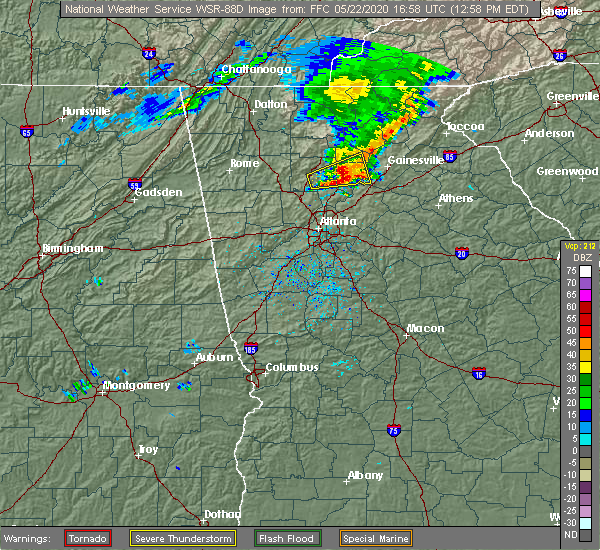 At 1258 pm edt, a severe thunderstorm was located over drew, or near cumming, moving east at 30 mph (radar indicated). Hazards include 60 mph wind gusts and half dollar size hail. Hail damage to vehicles is expected. expect wind damage to roofs, siding, and trees. Locations impacted include, cumming, free home, dougherty, matt, drew, silver city, holbrook, lathemtown, ducktown, coal mountain, hightower and lake lanier islands. At 1258 pm edt, a severe thunderstorm was located over drew, or near cumming, moving east at 30 mph (radar indicated). Hazards include 60 mph wind gusts and half dollar size hail. Hail damage to vehicles is expected. expect wind damage to roofs, siding, and trees. Locations impacted include, cumming, free home, dougherty, matt, drew, silver city, holbrook, lathemtown, ducktown, coal mountain, hightower and lake lanier islands.
|
| 5/22/2020 12:38 PM EDT |
 At 1237 pm edt, a severe thunderstorm was located over union hill, or near canton, moving east at 35 mph (radar indicated). Hazards include 60 mph wind gusts and quarter size hail. Hail damage to vehicles is expected. Expect wind damage to roofs, siding, and trees. At 1237 pm edt, a severe thunderstorm was located over union hill, or near canton, moving east at 35 mph (radar indicated). Hazards include 60 mph wind gusts and quarter size hail. Hail damage to vehicles is expected. Expect wind damage to roofs, siding, and trees.
|
| 4/13/2020 2:46 AM EDT |
 At 246 am edt, a severe thunderstorm was located over road atlanta-lanier speedway, or 10 miles south of gainesville, moving east at 85 mph (radar indicated). Hazards include 60 mph wind gusts. Expect damage to roofs, siding, and trees. Locations impacted include, gainesville, lawrenceville, winder, jefferson, commerce, duluth, sugar hill, suwanee, buford, braselton, auburn, flowery branch, dacula, oakwood, maysville, arcade, nicholson, hoschton, pendergrass and carl. At 246 am edt, a severe thunderstorm was located over road atlanta-lanier speedway, or 10 miles south of gainesville, moving east at 85 mph (radar indicated). Hazards include 60 mph wind gusts. Expect damage to roofs, siding, and trees. Locations impacted include, gainesville, lawrenceville, winder, jefferson, commerce, duluth, sugar hill, suwanee, buford, braselton, auburn, flowery branch, dacula, oakwood, maysville, arcade, nicholson, hoschton, pendergrass and carl.
|
| 4/13/2020 2:22 AM EDT |
 At 222 am edt, a severe thunderstorm was located over roswell, or 11 miles northeast of marietta, moving east at 85 mph (radar indicated). Hazards include 60 mph wind gusts. expect damage to roofs, siding, and trees At 222 am edt, a severe thunderstorm was located over roswell, or 11 miles northeast of marietta, moving east at 85 mph (radar indicated). Hazards include 60 mph wind gusts. expect damage to roofs, siding, and trees
|
| 2/6/2020 8:28 AM EST |
 At 827 am est, a severe thunderstorm capable of producing a tornado was located over lawrenceville, moving northeast at 55 mph (radar indicated rotation). Hazards include tornado. Flying debris will be dangerous to those caught without shelter. mobile homes will be damaged or destroyed. damage to roofs, windows, and vehicles will occur. tree damage is likely. Locations impacted include, lawrenceville, winder, jefferson, buford, braselton, auburn, dacula, grayson, arcade, hoschton, pendergrass, carl, talmo, fort yargo state park, county line, thompsons mill, harbin, chateau elan, russell and road atlanta-lanier speedway. At 827 am est, a severe thunderstorm capable of producing a tornado was located over lawrenceville, moving northeast at 55 mph (radar indicated rotation). Hazards include tornado. Flying debris will be dangerous to those caught without shelter. mobile homes will be damaged or destroyed. damage to roofs, windows, and vehicles will occur. tree damage is likely. Locations impacted include, lawrenceville, winder, jefferson, buford, braselton, auburn, dacula, grayson, arcade, hoschton, pendergrass, carl, talmo, fort yargo state park, county line, thompsons mill, harbin, chateau elan, russell and road atlanta-lanier speedway.
|
| 2/6/2020 8:16 AM EST |
 At 816 am est, a severe thunderstorm capable of producing a tornado was located over mountain park, or 9 miles southwest of lawrenceville, moving northeast at 55 mph (radar indicated rotation). Hazards include tornado. Flying debris will be dangerous to those caught without shelter. mobile homes will be damaged or destroyed. damage to roofs, windows, and vehicles will occur. Tree damage is likely. At 816 am est, a severe thunderstorm capable of producing a tornado was located over mountain park, or 9 miles southwest of lawrenceville, moving northeast at 55 mph (radar indicated rotation). Hazards include tornado. Flying debris will be dangerous to those caught without shelter. mobile homes will be damaged or destroyed. damage to roofs, windows, and vehicles will occur. Tree damage is likely.
|
| 2/6/2020 7:42 AM EST |
 At 742 am est, a severe thunderstorm was located over chamblee, or 8 miles north of decatur, moving northeast at 70 mph (radar indicated). Hazards include 60 mph wind gusts. expect damage to roofs, siding, and trees At 742 am est, a severe thunderstorm was located over chamblee, or 8 miles north of decatur, moving northeast at 70 mph (radar indicated). Hazards include 60 mph wind gusts. expect damage to roofs, siding, and trees
|
| 1/11/2020 6:10 PM EST |
 At 610 pm est, severe thunderstorms were located along a line extending from near raoul to snellville to near mountain park, moving east at 45 mph (radar indicated). Hazards include 60 mph wind gusts. expect damage to roofs, siding, and trees At 610 pm est, severe thunderstorms were located along a line extending from near raoul to snellville to near mountain park, moving east at 45 mph (radar indicated). Hazards include 60 mph wind gusts. expect damage to roofs, siding, and trees
|
| 1/11/2020 5:34 PM EST | One tree downed onto vehicle and another tree downed across roadway... both on hillcrest driv in gwinnett county GA, 2.5 miles ENE of Buford, GA |
| 1/11/2020 5:24 PM EST |
 At 523 pm est, severe thunderstorms were located along a line extending from near hollis lathem reservoir to near palmetto, moving east at 40 mph (radar indicated). Hazards include 60 mph wind gusts. expect damage to roofs, siding, and trees At 523 pm est, severe thunderstorms were located along a line extending from near hollis lathem reservoir to near palmetto, moving east at 40 mph (radar indicated). Hazards include 60 mph wind gusts. expect damage to roofs, siding, and trees
|
| 6/24/2019 7:20 PM EDT |
 At 720 pm edt, a severe thunderstorm was located over lawrenceville, moving east at 35 mph (radar indicated). Hazards include 60 mph wind gusts. Expect damage to roofs, siding, and trees. Locations impacted include, lawrenceville, duluth, sugar hill, snellville, suwanee, buford, lilburn, norcross, clarkston, braselton, stone mountain, flowery branch, dacula, grayson, pine lake, rest haven, tucker, north decatur, mountain park and chestnut mountain. At 720 pm edt, a severe thunderstorm was located over lawrenceville, moving east at 35 mph (radar indicated). Hazards include 60 mph wind gusts. Expect damage to roofs, siding, and trees. Locations impacted include, lawrenceville, duluth, sugar hill, snellville, suwanee, buford, lilburn, norcross, clarkston, braselton, stone mountain, flowery branch, dacula, grayson, pine lake, rest haven, tucker, north decatur, mountain park and chestnut mountain.
|
| 6/24/2019 7:07 PM EDT |
 At 707 pm edt, a severe thunderstorm was located near duluth, or near lawrenceville, moving east at 35 mph (radar indicated). Hazards include 60 mph wind gusts. Expect damage to roofs, siding, and trees. Locations impacted include, atlanta, lawrenceville, sandy springs, roswell, johns creek, alpharetta, dunwoody, duluth, sugar hill, snellville, suwanee, buford, lilburn, chamblee, norcross, doraville, clarkston, braselton, stone mountain and flowery branch. At 707 pm edt, a severe thunderstorm was located near duluth, or near lawrenceville, moving east at 35 mph (radar indicated). Hazards include 60 mph wind gusts. Expect damage to roofs, siding, and trees. Locations impacted include, atlanta, lawrenceville, sandy springs, roswell, johns creek, alpharetta, dunwoody, duluth, sugar hill, snellville, suwanee, buford, lilburn, chamblee, norcross, doraville, clarkston, braselton, stone mountain and flowery branch.
|
| 6/24/2019 6:58 PM EDT | Tree reported down at the intersection of bart johnson rd and goldmist dr n in gwinnett county GA, 2.8 miles NW of Buford, GA |
| 6/24/2019 6:52 PM EDT | A tree was reported down near the intersection of whitehead road and sugar ridge drive n in gwinnett county GA, 3.8 miles ENE of Buford, GA |
| 6/24/2019 6:39 PM EDT |
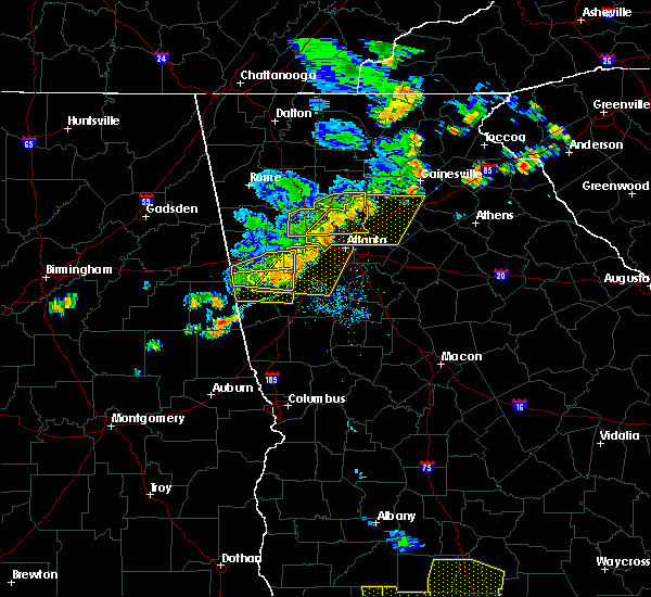 At 638 pm edt, a severe thunderstorm was located over mount bethel, or 7 miles east of marietta, moving east at 35 mph (radar indicated). Hazards include 60 mph wind gusts and penny size hail. expect damage to roofs, siding, and trees At 638 pm edt, a severe thunderstorm was located over mount bethel, or 7 miles east of marietta, moving east at 35 mph (radar indicated). Hazards include 60 mph wind gusts and penny size hail. expect damage to roofs, siding, and trees
|
| 6/22/2019 1:50 AM EDT |
 At 150 am edt, severe thunderstorms were located along a line extending from near eastanolee to near suwanee, moving southeast at 45 mph (radar indicated). Hazards include 60 mph wind gusts. Expect damage to roofs, siding, and trees. Locations impacted include, gainesville, cumming, sandy springs, roswell, johns creek, alpharetta, milton, duluth, sugar hill, suwanee, buford, braselton, flowery branch, oakwood, berkeley lake, rest haven, candler, drew, buford dam-lake lanier parks and coal mountain. At 150 am edt, severe thunderstorms were located along a line extending from near eastanolee to near suwanee, moving southeast at 45 mph (radar indicated). Hazards include 60 mph wind gusts. Expect damage to roofs, siding, and trees. Locations impacted include, gainesville, cumming, sandy springs, roswell, johns creek, alpharetta, milton, duluth, sugar hill, suwanee, buford, braselton, flowery branch, oakwood, berkeley lake, rest haven, candler, drew, buford dam-lake lanier parks and coal mountain.
|
| 6/22/2019 1:17 AM EDT |
 At 116 am edt, severe thunderstorms were located along a line extending from near sautee to canton, moving southeast at 45 mph (radar indicated). Hazards include 60 mph wind gusts. expect damage to roofs, siding, and trees At 116 am edt, severe thunderstorms were located along a line extending from near sautee to canton, moving southeast at 45 mph (radar indicated). Hazards include 60 mph wind gusts. expect damage to roofs, siding, and trees
|
| 4/19/2019 5:26 AM EDT |
 The tornado warning for south central forsyth and north central gwinnett counties will expire at 530 am edt, the storm which prompted the warning has weakened below severe limits, and has exited the warned area. therefore, the warning will be allowed to expire. to report severe weather, contact your nearest law enforcement agency. they will relay your report to the national weather service peachtree city. The tornado warning for south central forsyth and north central gwinnett counties will expire at 530 am edt, the storm which prompted the warning has weakened below severe limits, and has exited the warned area. therefore, the warning will be allowed to expire. to report severe weather, contact your nearest law enforcement agency. they will relay your report to the national weather service peachtree city.
|
| 4/19/2019 5:20 AM EDT |
 At 519 am edt, a severe thunderstorm capable of producing a tornado was located near buford dam-lake lanier parks, or 7 miles southeast of cumming, moving northeast at 40 mph (radar indicated rotation). Hazards include tornado. Flying debris will be dangerous to those caught without shelter. mobile homes will be damaged or destroyed. damage to roofs, windows, and vehicles will occur. tree damage is likely. Locations impacted include, sugar hill, suwanee, buford and buford dam-lake lanier parks. At 519 am edt, a severe thunderstorm capable of producing a tornado was located near buford dam-lake lanier parks, or 7 miles southeast of cumming, moving northeast at 40 mph (radar indicated rotation). Hazards include tornado. Flying debris will be dangerous to those caught without shelter. mobile homes will be damaged or destroyed. damage to roofs, windows, and vehicles will occur. tree damage is likely. Locations impacted include, sugar hill, suwanee, buford and buford dam-lake lanier parks.
|
| 4/19/2019 5:13 AM EDT |
 At 513 am edt, a severe thunderstorm capable of producing a tornado was located over johns creek, or 10 miles south of cumming, moving northeast at 40 mph (radar indicated rotation). Hazards include tornado. Flying debris will be dangerous to those caught without shelter. mobile homes will be damaged or destroyed. damage to roofs, windows, and vehicles will occur. tree damage is likely. Locations impacted include, johns creek, duluth, sugar hill, suwanee, buford, buford dam-lake lanier parks and brookwood. At 513 am edt, a severe thunderstorm capable of producing a tornado was located over johns creek, or 10 miles south of cumming, moving northeast at 40 mph (radar indicated rotation). Hazards include tornado. Flying debris will be dangerous to those caught without shelter. mobile homes will be damaged or destroyed. damage to roofs, windows, and vehicles will occur. tree damage is likely. Locations impacted include, johns creek, duluth, sugar hill, suwanee, buford, buford dam-lake lanier parks and brookwood.
|
| 4/19/2019 5:03 AM EDT |
 At 503 am edt, a severe thunderstorm capable of producing a tornado was located near berkeley lake, or 14 miles west of lawrenceville, moving northeast at 30 mph (radar indicated rotation). Hazards include tornado. Flying debris will be dangerous to those caught without shelter. mobile homes will be damaged or destroyed. damage to roofs, windows, and vehicles will occur. Tree damage is likely. At 503 am edt, a severe thunderstorm capable of producing a tornado was located near berkeley lake, or 14 miles west of lawrenceville, moving northeast at 30 mph (radar indicated rotation). Hazards include tornado. Flying debris will be dangerous to those caught without shelter. mobile homes will be damaged or destroyed. damage to roofs, windows, and vehicles will occur. Tree damage is likely.
|
| 4/14/2019 1:27 PM EDT |
 The tornado warning for central gwinnett county will expire at 130 pm edt, the storm which prompted the warning has moved out of the area. therefore, the warning will be allowed to expire. a tornado watch remains in effect until 200 pm edt for north central georgia. The tornado warning for central gwinnett county will expire at 130 pm edt, the storm which prompted the warning has moved out of the area. therefore, the warning will be allowed to expire. a tornado watch remains in effect until 200 pm edt for north central georgia.
|
| 4/14/2019 1:01 PM EDT |
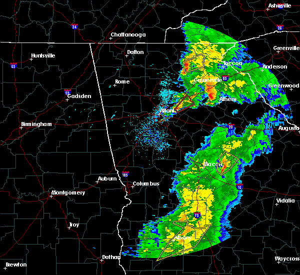 At 101 pm edt, a severe thunderstorm capable of producing a tornado was located near snellville, or 8 miles southwest of lawrenceville, moving northeast at 50 mph (radar indicated rotation). Hazards include tornado. Flying debris will be dangerous to those caught without shelter. mobile homes will be damaged or destroyed. damage to roofs, windows, and vehicles will occur. Tree damage is likely. At 101 pm edt, a severe thunderstorm capable of producing a tornado was located near snellville, or 8 miles southwest of lawrenceville, moving northeast at 50 mph (radar indicated rotation). Hazards include tornado. Flying debris will be dangerous to those caught without shelter. mobile homes will be damaged or destroyed. damage to roofs, windows, and vehicles will occur. Tree damage is likely.
|
| 9/26/2018 5:08 PM EDT |
 At 508 pm edt, a severe thunderstorm was located over hog mountain, or 10 miles northeast of lawrenceville, moving east at 15 mph (radar indicated). Hazards include 60 mph wind gusts and quarter size hail. Hail damage to vehicles is expected. Expect wind damage to roofs, siding, and trees. At 508 pm edt, a severe thunderstorm was located over hog mountain, or 10 miles northeast of lawrenceville, moving east at 15 mph (radar indicated). Hazards include 60 mph wind gusts and quarter size hail. Hail damage to vehicles is expected. Expect wind damage to roofs, siding, and trees.
|
| 7/21/2018 9:37 PM EDT |
 At 937 pm edt, a severe thunderstorm was located over flowery branch, or 10 miles southwest of gainesville, moving east at 35 mph (radar indicated). Hazards include 60 mph wind gusts and penny size hail. Expect damage to roofs, siding, and trees. Locations impacted include, gainesville, cumming, sugar hill, suwanee, buford, braselton, flowery branch, oakwood, rest haven, candler, drew, buford dam-lake lanier parks, brookwood, aqualand park, chestnut mountain, oscarville, road atlanta-lanier speedway, ducktown and lake lanier islands. At 937 pm edt, a severe thunderstorm was located over flowery branch, or 10 miles southwest of gainesville, moving east at 35 mph (radar indicated). Hazards include 60 mph wind gusts and penny size hail. Expect damage to roofs, siding, and trees. Locations impacted include, gainesville, cumming, sugar hill, suwanee, buford, braselton, flowery branch, oakwood, rest haven, candler, drew, buford dam-lake lanier parks, brookwood, aqualand park, chestnut mountain, oscarville, road atlanta-lanier speedway, ducktown and lake lanier islands.
|
| 7/21/2018 9:18 PM EDT |
 At 917 pm edt, a severe thunderstorm was located near buford dam-lake lanier parks, or near cumming, moving east at 35 mph (radar indicated). Hazards include 60 mph wind gusts and quarter size hail. Hail damage to vehicles is expected. expect wind damage to roofs, siding, and trees. Locations impacted include, gainesville, cumming, sugar hill, suwanee, buford, braselton, flowery branch, oakwood, rest haven, candler, drew, buford dam-lake lanier parks, brookwood, aqualand park, chestnut mountain, oscarville, road atlanta-lanier speedway, ducktown and lake lanier islands. At 917 pm edt, a severe thunderstorm was located near buford dam-lake lanier parks, or near cumming, moving east at 35 mph (radar indicated). Hazards include 60 mph wind gusts and quarter size hail. Hail damage to vehicles is expected. expect wind damage to roofs, siding, and trees. Locations impacted include, gainesville, cumming, sugar hill, suwanee, buford, braselton, flowery branch, oakwood, rest haven, candler, drew, buford dam-lake lanier parks, brookwood, aqualand park, chestnut mountain, oscarville, road atlanta-lanier speedway, ducktown and lake lanier islands.
|
| 7/21/2018 9:01 PM EDT |
 At 901 pm edt, a severe thunderstorm was located over holbrook, or 8 miles west of cumming, moving east at 35 mph (radar indicated). Hazards include 60 mph wind gusts and half dollar size hail. Hail damage to vehicles is expected. Expect wind damage to roofs, siding, and trees. At 901 pm edt, a severe thunderstorm was located over holbrook, or 8 miles west of cumming, moving east at 35 mph (radar indicated). Hazards include 60 mph wind gusts and half dollar size hail. Hail damage to vehicles is expected. Expect wind damage to roofs, siding, and trees.
|
| 7/21/2018 6:25 AM EDT |
 At 625 am edt, severe thunderstorms were located along a line extending from lake lanier islands to suwanee to near berkeley lake, moving southeast at 45 mph (radar indicated). Hazards include 60 mph wind gusts and quarter size hail. Hail damage to vehicles is expected. Expect wind damage to roofs, siding, and trees. At 625 am edt, severe thunderstorms were located along a line extending from lake lanier islands to suwanee to near berkeley lake, moving southeast at 45 mph (radar indicated). Hazards include 60 mph wind gusts and quarter size hail. Hail damage to vehicles is expected. Expect wind damage to roofs, siding, and trees.
|
| 7/21/2018 6:04 AM EDT |
 At 603 am edt, severe thunderstorms were located along a line extending from near hightower to near holbrook, moving southeast at 40 mph (radar indicated). Hazards include 60 mph wind gusts and quarter size hail. Hail damage to vehicles is expected. expect wind damage to roofs, siding, and trees. Locations impacted include, lawrenceville, cumming, sugar hill, suwanee, buford, flowery branch, oakwood, rest haven, drew, buford dam-lake lanier parks, coal mountain, brookwood, hightower, matt, aqualand park, oscarville, ducktown, lake lanier islands and hog mountain. At 603 am edt, severe thunderstorms were located along a line extending from near hightower to near holbrook, moving southeast at 40 mph (radar indicated). Hazards include 60 mph wind gusts and quarter size hail. Hail damage to vehicles is expected. expect wind damage to roofs, siding, and trees. Locations impacted include, lawrenceville, cumming, sugar hill, suwanee, buford, flowery branch, oakwood, rest haven, drew, buford dam-lake lanier parks, coal mountain, brookwood, hightower, matt, aqualand park, oscarville, ducktown, lake lanier islands and hog mountain.
|
| 7/21/2018 5:44 AM EDT |
 At 544 am edt, severe thunderstorms were located along a line extending from near amicalola falls state park to hollis lathem reservoir to near buffington, moving southeast at 50 mph (radar indicated). Hazards include ping pong ball size hail and 60 mph wind gusts. People and animals outdoors will be injured. expect hail damage to roofs, siding, windows, and vehicles. Expect wind damage to roofs, siding, and trees. At 544 am edt, severe thunderstorms were located along a line extending from near amicalola falls state park to hollis lathem reservoir to near buffington, moving southeast at 50 mph (radar indicated). Hazards include ping pong ball size hail and 60 mph wind gusts. People and animals outdoors will be injured. expect hail damage to roofs, siding, windows, and vehicles. Expect wind damage to roofs, siding, and trees.
|
| 6/22/2018 5:13 PM EDT |
 At 511 pm edt, a severe thunderstorm was located over alpharetta, moving northeast at 40 mph (radar indicated). Hazards include 60 mph wind gusts and penny size hail. expect damage to roofs, siding, and trees At 511 pm edt, a severe thunderstorm was located over alpharetta, moving northeast at 40 mph (radar indicated). Hazards include 60 mph wind gusts and penny size hail. expect damage to roofs, siding, and trees
|
| 6/1/2018 4:33 PM EDT |
 At 433 pm edt, a severe thunderstorm was located over oakwood, or near gainesville, moving east at 20 mph (radar indicated). Hazards include 60 mph wind gusts and quarter size hail. Hail damage to vehicles is expected. expect wind damage to roofs, siding, and trees. Locations impacted include, gainesville, sugar hill, buford, braselton, flowery branch, oakwood, rest haven, candler, aqualand park, chestnut mountain, road atlanta-lanier speedway, lake lanier islands and buford dam-lake lanier parks. At 433 pm edt, a severe thunderstorm was located over oakwood, or near gainesville, moving east at 20 mph (radar indicated). Hazards include 60 mph wind gusts and quarter size hail. Hail damage to vehicles is expected. expect wind damage to roofs, siding, and trees. Locations impacted include, gainesville, sugar hill, buford, braselton, flowery branch, oakwood, rest haven, candler, aqualand park, chestnut mountain, road atlanta-lanier speedway, lake lanier islands and buford dam-lake lanier parks.
|
| 6/1/2018 4:02 PM EDT |
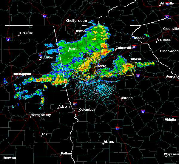 At 402 pm edt, a severe thunderstorm was located near coal mountain, or near cumming, moving east at 15 mph (radar indicated). Hazards include 60 mph wind gusts and quarter size hail. Hail damage to vehicles is expected. Expect wind damage to roofs, siding, and trees. At 402 pm edt, a severe thunderstorm was located near coal mountain, or near cumming, moving east at 15 mph (radar indicated). Hazards include 60 mph wind gusts and quarter size hail. Hail damage to vehicles is expected. Expect wind damage to roofs, siding, and trees.
|
| 6/1/2018 12:44 AM EDT |
 At 1243 am edt, severe thunderstorms were located along a line extending from silver city to near white, moving south at 25 mph (radar indicated). Hazards include 60 mph wind gusts and quarter size hail. Hail damage to vehicles is expected. Expect wind damage to roofs, siding, and trees. At 1243 am edt, severe thunderstorms were located along a line extending from silver city to near white, moving south at 25 mph (radar indicated). Hazards include 60 mph wind gusts and quarter size hail. Hail damage to vehicles is expected. Expect wind damage to roofs, siding, and trees.
|
| 5/28/2018 9:18 PM EDT | Two trees reported down by emergency manager across roadway in area of tuggle rd between w. rock quarry rd and kay morgan r in gwinnett county GA, 5.4 miles WNW of Buford, GA |
| 7/11/2017 4:38 PM EDT | Trees and wires down at the 2300 block of rick springs roa in gwinnett county GA, 5.2 miles NNW of Buford, GA |
| 7/11/2017 4:12 PM EDT |
 At 412 pm edt, a severe thunderstorm was located over suwanee, or 9 miles south of cumming, and is nearly stationary (radar indicated). Hazards include 60 mph wind gusts and quarter size hail. Hail damage to vehicles is expected. Expect wind damage to roofs, siding, and trees. At 412 pm edt, a severe thunderstorm was located over suwanee, or 9 miles south of cumming, and is nearly stationary (radar indicated). Hazards include 60 mph wind gusts and quarter size hail. Hail damage to vehicles is expected. Expect wind damage to roofs, siding, and trees.
|
| 7/1/2017 5:27 PM EDT |
 At 527 pm edt, a severe thunderstorm was located over lawrenceville, moving east at 35 mph (radar indicated). Hazards include 60 mph wind gusts and quarter size hail. Hail damage to vehicles is expected. Expect wind damage to roofs, siding, and trees. At 527 pm edt, a severe thunderstorm was located over lawrenceville, moving east at 35 mph (radar indicated). Hazards include 60 mph wind gusts and quarter size hail. Hail damage to vehicles is expected. Expect wind damage to roofs, siding, and trees.
|
| 6/23/2017 8:50 PM EDT |
 At 849 pm edt, a severe thunderstorm was located near hog mountain, or 11 miles northeast of lawrenceville, moving east at 50 mph (radar indicated). Hazards include 60 mph wind gusts. expect damage to roofs, siding, and trees At 849 pm edt, a severe thunderstorm was located near hog mountain, or 11 miles northeast of lawrenceville, moving east at 50 mph (radar indicated). Hazards include 60 mph wind gusts. expect damage to roofs, siding, and trees
|
| 6/23/2017 8:31 PM EDT |
 At 831 pm edt, severe thunderstorms were located along a line extending from near murrayville to near gainesville to near oakwood, moving northeast at 50 mph (radar indicated). Hazards include 60 mph wind gusts. Expect damage to roofs, siding, and trees. Locations impacted include, gainesville, homer, flowery branch, oakwood, lula, clermont, gillsville, candler, murrayville and hollingsworth. At 831 pm edt, severe thunderstorms were located along a line extending from near murrayville to near gainesville to near oakwood, moving northeast at 50 mph (radar indicated). Hazards include 60 mph wind gusts. Expect damage to roofs, siding, and trees. Locations impacted include, gainesville, homer, flowery branch, oakwood, lula, clermont, gillsville, candler, murrayville and hollingsworth.
|
| 6/23/2017 8:13 PM EDT |
 At 812 pm edt, severe thunderstorms were located along a line extending from near silver city to near chestatee to buford dam-lake lanier parks, moving northeast at 45 mph (radar indicated). Hazards include 60 mph wind gusts. expect damage to roofs, siding, and trees At 812 pm edt, severe thunderstorms were located along a line extending from near silver city to near chestatee to buford dam-lake lanier parks, moving northeast at 45 mph (radar indicated). Hazards include 60 mph wind gusts. expect damage to roofs, siding, and trees
|
| 6/15/2017 5:32 PM EDT |
 At 531 pm edt, a severe thunderstorm was located near hog mountain, or near lawrenceville, and is nearly stationary (radar indicated). Hazards include 60 mph wind gusts. expect damage to roofs, siding, and trees At 531 pm edt, a severe thunderstorm was located near hog mountain, or near lawrenceville, and is nearly stationary (radar indicated). Hazards include 60 mph wind gusts. expect damage to roofs, siding, and trees
|
| 5/4/2017 10:44 PM EDT | Tree down on power line on friar tuck lan in gwinnett county GA, 1.5 miles NW of Buford, GA |
| 4/5/2017 12:07 PM EDT |
 At 1207 pm edt, severe thunderstorms were located along a line extending from near dacula to gum creek, moving northeast at 65 mph (radar indicated). Hazards include 60 mph wind gusts and half dollar size hail. Hail damage to vehicles is expected. Expect wind damage to roofs, siding, and trees. At 1207 pm edt, severe thunderstorms were located along a line extending from near dacula to gum creek, moving northeast at 65 mph (radar indicated). Hazards include 60 mph wind gusts and half dollar size hail. Hail damage to vehicles is expected. Expect wind damage to roofs, siding, and trees.
|
| 3/30/2017 9:06 PM EDT |
 The severe thunderstorm warning for gwinnett county will expire at 915 pm edt, the storm which prompted the warning has weakened below severe limits, and is exiting the warned area. therefore, the warning will be allowed to expire. however gusty winds over 40 mph are still possible with this thunderstorm. The severe thunderstorm warning for gwinnett county will expire at 915 pm edt, the storm which prompted the warning has weakened below severe limits, and is exiting the warned area. therefore, the warning will be allowed to expire. however gusty winds over 40 mph are still possible with this thunderstorm.
|
| 3/30/2017 8:48 PM EDT |
 At 848 pm edt, a severe thunderstorm was located near snellville, moving north at 40 mph (radar indicated). Hazards include 60 mph wind gusts and penny size hail. Expect damage to roofs, siding, and trees. Locations impacted include, lawrenceville, duluth, sugar hill, snellville, suwanee, buford, lilburn, norcross, dacula, grayson, berkeley lake, tucker, mountain park, harbin, rosebud and hog mountain. At 848 pm edt, a severe thunderstorm was located near snellville, moving north at 40 mph (radar indicated). Hazards include 60 mph wind gusts and penny size hail. Expect damage to roofs, siding, and trees. Locations impacted include, lawrenceville, duluth, sugar hill, snellville, suwanee, buford, lilburn, norcross, dacula, grayson, berkeley lake, tucker, mountain park, harbin, rosebud and hog mountain.
|
| 3/30/2017 8:38 PM EDT |
 At 838 pm edt, a severe thunderstorm was located near mountain park, moving north at 40 mph (radar indicated). Hazards include 60 mph wind gusts and penny size hail. expect damage to roofs, siding, and trees At 838 pm edt, a severe thunderstorm was located near mountain park, moving north at 40 mph (radar indicated). Hazards include 60 mph wind gusts and penny size hail. expect damage to roofs, siding, and trees
|
| 3/21/2017 9:09 PM EDT | Numerous reports of trees down throughout gwinnett county across roads.. notably i85 at mm 117 in bufor in gwinnett county GA, 4.6 miles NNW of Buford, GA |
| 3/21/2017 8:44 PM EDT |
 At 843 pm edt, severe thunderstorms were located extending from demorest to near gainesville to buford, moving east-southeast at 50 mph (radar indicated, plus multiple reports of downed trees and powerlines due to the very strong winds). Hazards include 60 mph wind gusts and penny size hail. expect damage to roofs, siding, and trees At 843 pm edt, severe thunderstorms were located extending from demorest to near gainesville to buford, moving east-southeast at 50 mph (radar indicated, plus multiple reports of downed trees and powerlines due to the very strong winds). Hazards include 60 mph wind gusts and penny size hail. expect damage to roofs, siding, and trees
|
| 3/21/2017 8:40 PM EDT |
 At 838 pm edt, severe thunderstorms were located extending from near milton to sandy plains to near eubank lake to near piedmont, moving southeast at 40 mph (radar indicated, plus multiple reports of downed trees and powerlines due to the very strong winds). Hazards include 60 mph wind gusts and penny size hail. expect damage to roofs, siding, and trees At 838 pm edt, severe thunderstorms were located extending from near milton to sandy plains to near eubank lake to near piedmont, moving southeast at 40 mph (radar indicated, plus multiple reports of downed trees and powerlines due to the very strong winds). Hazards include 60 mph wind gusts and penny size hail. expect damage to roofs, siding, and trees
|
| 3/10/2017 3:28 AM EST |
 At 328 am est, a severe thunderstorm was located over lathemtown, or 9 miles east of canton, moving east at 55 mph (radar indicated). Hazards include 60 mph wind gusts and quarter size hail. Hail damage to vehicles is expected. Expect wind damage to roofs, siding, and trees. At 328 am est, a severe thunderstorm was located over lathemtown, or 9 miles east of canton, moving east at 55 mph (radar indicated). Hazards include 60 mph wind gusts and quarter size hail. Hail damage to vehicles is expected. Expect wind damage to roofs, siding, and trees.
|
| 12/29/2016 3:38 AM EST |
 At 337 am est, a severe thunderstorm was located near flowery branch, or 11 miles south of gainesville, moving east at 45 mph (radar indicated). Hazards include 60 mph wind gusts. expect damage to roofs, siding, and trees At 337 am est, a severe thunderstorm was located near flowery branch, or 11 miles south of gainesville, moving east at 45 mph (radar indicated). Hazards include 60 mph wind gusts. expect damage to roofs, siding, and trees
|
| 11/30/2016 2:14 PM EST |
 At 211 pm est, a severe thunderstorm capable of producing a tornado was located over brookwood, or near cumming, moving east at 25 mph (radar indicated rotation). Hazards include tornado. Flying debris will be dangerous to those caught without shelter. mobile homes will be damaged or destroyed. damage to roofs, windows, and vehicles will occur. Tree damage is likely. At 211 pm est, a severe thunderstorm capable of producing a tornado was located over brookwood, or near cumming, moving east at 25 mph (radar indicated rotation). Hazards include tornado. Flying debris will be dangerous to those caught without shelter. mobile homes will be damaged or destroyed. damage to roofs, windows, and vehicles will occur. Tree damage is likely.
|
| 11/30/2016 2:11 PM EST |
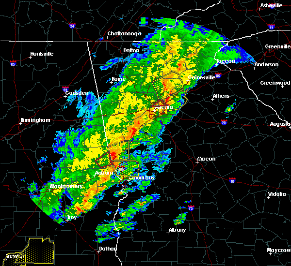 At 210 pm est, a severe thunderstorm capable of producing a tornado was located over brookwood, or near cumming, moving east at 25 mph (radar indicated rotation). Hazards include tornado. Flying debris will be dangerous to those caught without shelter. mobile homes will be damaged or destroyed. damage to roofs, windows, and vehicles will occur. Tree damage is likely. At 210 pm est, a severe thunderstorm capable of producing a tornado was located over brookwood, or near cumming, moving east at 25 mph (radar indicated rotation). Hazards include tornado. Flying debris will be dangerous to those caught without shelter. mobile homes will be damaged or destroyed. damage to roofs, windows, and vehicles will occur. Tree damage is likely.
|
| 11/30/2016 2:08 PM EST |
 At 207 pm est, severe thunderstorms were located along a line extending from berkeley lake to lilburn to belvedere park, moving northeast at 60 mph (radar indicated). Hazards include 60 mph wind gusts. Expect damage to roofs. siding. And trees. At 207 pm est, severe thunderstorms were located along a line extending from berkeley lake to lilburn to belvedere park, moving northeast at 60 mph (radar indicated). Hazards include 60 mph wind gusts. Expect damage to roofs. siding. And trees.
|
| 11/30/2016 1:58 PM EST |
 At 157 pm est, severe thunderstorms were located along a line extending from near lathemtown to near milton to near mechanicsville, moving northeast at 40 mph (radar indicated). Hazards include 60 mph wind gusts. Expect damage to roofs. siding. And trees. At 157 pm est, severe thunderstorms were located along a line extending from near lathemtown to near milton to near mechanicsville, moving northeast at 40 mph (radar indicated). Hazards include 60 mph wind gusts. Expect damage to roofs. siding. And trees.
|
| 8/1/2016 8:08 PM EDT |
 At 807 pm edt, a severe thunderstorm was located near flowery branch, 9 miles east of cumming, moving south at 5 mph (radar indicated). Hazards include 60 mph wind gusts and nickel size hail. Expect damage to roofs. siding. and trees. Other locations in the warning include but are not limited to gainesville, sugar hill, buford, braselton, flowery branch, oakwood, rest haven, buford dam-lake lanier parks, aqualand park, lake lanier islands, road atlanta-lanier speedway, chestnut mountain and oscarville. At 807 pm edt, a severe thunderstorm was located near flowery branch, 9 miles east of cumming, moving south at 5 mph (radar indicated). Hazards include 60 mph wind gusts and nickel size hail. Expect damage to roofs. siding. and trees. Other locations in the warning include but are not limited to gainesville, sugar hill, buford, braselton, flowery branch, oakwood, rest haven, buford dam-lake lanier parks, aqualand park, lake lanier islands, road atlanta-lanier speedway, chestnut mountain and oscarville.
|
| 8/1/2016 8:00 PM EDT |
 At 759 pm edt, a severe thunderstorm was located near flowery branch, or 9 miles east of cumming, moving south at 5 mph (radar indicated). Hazards include 60 mph wind gusts and nickel size hail. Expect damage to roofs. siding. and trees. Other locations in the warning include but are not limited to gainesville, sugar hill, buford, braselton, flowery branch, oakwood, rest haven, buford dam-lake lanier parks, aqualand park, lake lanier islands, road atlanta-lanier speedway, chestnut mountain and oscarville. At 759 pm edt, a severe thunderstorm was located near flowery branch, or 9 miles east of cumming, moving south at 5 mph (radar indicated). Hazards include 60 mph wind gusts and nickel size hail. Expect damage to roofs. siding. and trees. Other locations in the warning include but are not limited to gainesville, sugar hill, buford, braselton, flowery branch, oakwood, rest haven, buford dam-lake lanier parks, aqualand park, lake lanier islands, road atlanta-lanier speedway, chestnut mountain and oscarville.
|
| 7/11/2016 7:01 PM EDT |
 At 700 pm edt, severe thunderstorms were located along a line extending from tucker to near loganville to near covington, moving northeast at 45 mph (radar indicated). Hazards include 60 mph wind gusts. Expect damage to roofs. siding. and trees. Other locations in the warning include but are not limited to lawrenceville, conyers, winder, monroe, covington, duluth, sugar hill, snellville, suwanee, buford, lilburn, loganville, norcross, clarkston, braselton, auburn, stone mountain, dacula, social circle and grayson. At 700 pm edt, severe thunderstorms were located along a line extending from tucker to near loganville to near covington, moving northeast at 45 mph (radar indicated). Hazards include 60 mph wind gusts. Expect damage to roofs. siding. and trees. Other locations in the warning include but are not limited to lawrenceville, conyers, winder, monroe, covington, duluth, sugar hill, snellville, suwanee, buford, lilburn, loganville, norcross, clarkston, braselton, auburn, stone mountain, dacula, social circle and grayson.
|
| 6/30/2016 2:32 PM EDT |
 At 231 pm edt, a severe thunderstorm was located over lawrenceville, and is nearly stationary (radar indicated). Hazards include 60 mph wind gusts and quarter size hail. Hail damage to vehicles is expected. expect wind damage to roofs, siding, and trees. Other locations in the warning include but are not limited to lawrenceville, sugar hill, suwanee, buford, dacula, grayson, rest haven and hog mountain. At 231 pm edt, a severe thunderstorm was located over lawrenceville, and is nearly stationary (radar indicated). Hazards include 60 mph wind gusts and quarter size hail. Hail damage to vehicles is expected. expect wind damage to roofs, siding, and trees. Other locations in the warning include but are not limited to lawrenceville, sugar hill, suwanee, buford, dacula, grayson, rest haven and hog mountain.
|
| 6/1/2016 6:41 PM EDT | The severe thunderstorm warning for southwestern hall and north central gwinnett counties will expire at 645 pm edt, the storm which prompted the warning has weakened below severe limits, and no longer pose an immediate threat to life or property. therefore the warning will be allowed to expire. however gusty winds and heavy rain are still possible with this thunderstorm. |
| 6/1/2016 6:24 PM EDT |
 At 624 pm edt, a severe thunderstorm was located over rest haven, or 8 miles southeast of cumming, moving north at 10 mph (radar indicated). Hazards include 60 mph wind gusts. Expect damage to roofs. siding. and trees. Other locations in the warning include but are not limited to sugar hill, suwanee, buford, flowery branch, rest haven, lake lanier islands, buford dam-lake lanier parks and aqualand park. At 624 pm edt, a severe thunderstorm was located over rest haven, or 8 miles southeast of cumming, moving north at 10 mph (radar indicated). Hazards include 60 mph wind gusts. Expect damage to roofs. siding. and trees. Other locations in the warning include but are not limited to sugar hill, suwanee, buford, flowery branch, rest haven, lake lanier islands, buford dam-lake lanier parks and aqualand park.
|
| 6/1/2016 6:15 PM EDT | Several pine trees snapped at residence along copper grove lane near buford. also had nickel-sized hail. time estimated from rada in gwinnett county GA, 1.7 miles E of Buford, GA |
| 6/1/2016 6:10 PM EDT |
 At 609 pm edt, a severe thunderstorm was located over buford, or 10 miles southeast of cumming, moving north at 10 mph (radar indicated). Hazards include 60 mph wind gusts and quarter size hail. Hail damage to vehicles is expected. expect wind damage to roofs, siding, and trees. Other locations in the warning include but are not limited to sugar hill, suwanee, buford, flowery branch, rest haven, lake lanier islands, buford dam-lake lanier parks, aqualand park and hog mountain. At 609 pm edt, a severe thunderstorm was located over buford, or 10 miles southeast of cumming, moving north at 10 mph (radar indicated). Hazards include 60 mph wind gusts and quarter size hail. Hail damage to vehicles is expected. expect wind damage to roofs, siding, and trees. Other locations in the warning include but are not limited to sugar hill, suwanee, buford, flowery branch, rest haven, lake lanier islands, buford dam-lake lanier parks, aqualand park and hog mountain.
|
| 4/7/2016 12:27 AM EDT |
 At 1226 am edt, severe thunderstorms were located along a line extending from buford to near lithonia to near sunny side, moving east at 50 mph (radar indicated. damaging winds have already been reported with this line). Hazards include 60 mph wind gusts and nickel size hail. Expect damage to roofs. siding. and trees. Other locations in the warning include but are not limited to lawrenceville, mcdonough, conyers, winder, monroe, covington, jefferson, watkinsville, snellville, buford, loganville, braselton, auburn, locust grove, dacula, social circle, grayson, statham, oxford and arcade. At 1226 am edt, severe thunderstorms were located along a line extending from buford to near lithonia to near sunny side, moving east at 50 mph (radar indicated. damaging winds have already been reported with this line). Hazards include 60 mph wind gusts and nickel size hail. Expect damage to roofs. siding. and trees. Other locations in the warning include but are not limited to lawrenceville, mcdonough, conyers, winder, monroe, covington, jefferson, watkinsville, snellville, buford, loganville, braselton, auburn, locust grove, dacula, social circle, grayson, statham, oxford and arcade.
|
| 4/6/2016 10:31 PM EDT |
 At 1030 pm edt, a severe thunderstorm was located over holly springs, or near canton, moving east at 40 mph (radar indicated). Hazards include 60 mph wind gusts and quarter size hail. Hail damage to vehicles is expected. expect wind damage to roofs, siding, and trees. Other locations in the warning include but are not limited to canton, cumming, roswell, johns creek, alpharetta, milton, woodstock, sugar hill, suwanee, buford, holly springs, ball ground, buffington, free home, lathemtown, holbrook, lebanon, union hill, bridgemill and kellogg creek. At 1030 pm edt, a severe thunderstorm was located over holly springs, or near canton, moving east at 40 mph (radar indicated). Hazards include 60 mph wind gusts and quarter size hail. Hail damage to vehicles is expected. expect wind damage to roofs, siding, and trees. Other locations in the warning include but are not limited to canton, cumming, roswell, johns creek, alpharetta, milton, woodstock, sugar hill, suwanee, buford, holly springs, ball ground, buffington, free home, lathemtown, holbrook, lebanon, union hill, bridgemill and kellogg creek.
|
| 8/18/2015 6:11 PM EDT |
 The severe thunderstorm warning for northeastern gwinnett and northwestern barrow counties will expire at 615 pm edt, the severe storm which prompted the warning has weakened below severe limits, and no longer pose an immediate threat to life or property. therefore the warning will be allowed to expire. however small. The severe thunderstorm warning for northeastern gwinnett and northwestern barrow counties will expire at 615 pm edt, the severe storm which prompted the warning has weakened below severe limits, and no longer pose an immediate threat to life or property. therefore the warning will be allowed to expire. however small.
|
| 8/18/2015 5:45 PM EDT |
 At 545 pm edt, a severe thunderstorm was located near buford, or 7 miles north of lawrenceville, moving east at 15 mph (radar indicated). Hazards include 60 mph wind gusts and penny size hail. Expect minor damage to roofs. siding and downed trees. Other locations in the warning include but are not limited to buford, braselton, auburn, rest haven, hog mountain, chateau elan and county line. At 545 pm edt, a severe thunderstorm was located near buford, or 7 miles north of lawrenceville, moving east at 15 mph (radar indicated). Hazards include 60 mph wind gusts and penny size hail. Expect minor damage to roofs. siding and downed trees. Other locations in the warning include but are not limited to buford, braselton, auburn, rest haven, hog mountain, chateau elan and county line.
|
| 8/18/2015 5:37 PM EDT |
 At 536 pm edt, a severe thunderstorm was located over suwanee, or 8 miles north of lawrenceville, moving east at 15 mph (radar indicated). Hazards include 60 mph wind gusts and penny size hail. Expect minor damage to roofs. siding and downed trees. Other locations in the warning include but are not limited to sugar hill, suwanee, buford and rest haven. At 536 pm edt, a severe thunderstorm was located over suwanee, or 8 miles north of lawrenceville, moving east at 15 mph (radar indicated). Hazards include 60 mph wind gusts and penny size hail. Expect minor damage to roofs. siding and downed trees. Other locations in the warning include but are not limited to sugar hill, suwanee, buford and rest haven.
|
| 8/18/2015 5:18 PM EDT |
 At 517 pm edt, a severe thunderstorm was located over johns creek, or 9 miles south of cumming, moving east at 20 mph (radar indicated). Hazards include 60 mph wind gusts and penny size hail. Expect minor damage to roofs. siding and downed trees. Other locations in the warning include but are not limited to johns creek, alpharetta, duluth, sugar hill, suwanee, buford, rest haven, buford dam-lake lanier parks and brookwood. At 517 pm edt, a severe thunderstorm was located over johns creek, or 9 miles south of cumming, moving east at 20 mph (radar indicated). Hazards include 60 mph wind gusts and penny size hail. Expect minor damage to roofs. siding and downed trees. Other locations in the warning include but are not limited to johns creek, alpharetta, duluth, sugar hill, suwanee, buford, rest haven, buford dam-lake lanier parks and brookwood.
|
| 7/14/2015 9:22 PM EDT |
 At 921 pm edt, severe thunderstorms were located extending from near suwanee to lilburn to pine lake to near hapeville to near college park to near fairburn to near chattahoochee hills, moving southeast at 45 mph (radar indicated). Hazards include 60 mph wind gusts and nickel size hail. Expect damage to roofs. siding and trees. Other locations in the warning include but are not limited to atlanta, newnan, lawrenceville, mcdonough, decatur, fayetteville, conyers, winder, monroe, covington, jonesboro, peachtree city, east point, duluth, stockbridge, union city, sugar hill, forest park, snellville and suwanee. At 921 pm edt, severe thunderstorms were located extending from near suwanee to lilburn to pine lake to near hapeville to near college park to near fairburn to near chattahoochee hills, moving southeast at 45 mph (radar indicated). Hazards include 60 mph wind gusts and nickel size hail. Expect damage to roofs. siding and trees. Other locations in the warning include but are not limited to atlanta, newnan, lawrenceville, mcdonough, decatur, fayetteville, conyers, winder, monroe, covington, jonesboro, peachtree city, east point, duluth, stockbridge, union city, sugar hill, forest park, snellville and suwanee.
|
| 7/14/2015 8:12 PM EDT |
 At 811 pm edt, severe thunderstorms were located extending from 9 miles northwest of gainesville to near flowery branch to near free home, moving southeast at 35 mph (radar indicated). Hazards include 60 mph wind gusts. Expect damage to roofs. siding and trees. Other locations in the warning include but are not limited to gainesville, lawrenceville, winder, jefferson, cumming, duluth, sugar hill, suwanee, buford, braselton, auburn, flowery branch, dacula, oakwood, statham, arcade, hoschton, bethlehem, pendergrass and carl. At 811 pm edt, severe thunderstorms were located extending from 9 miles northwest of gainesville to near flowery branch to near free home, moving southeast at 35 mph (radar indicated). Hazards include 60 mph wind gusts. Expect damage to roofs. siding and trees. Other locations in the warning include but are not limited to gainesville, lawrenceville, winder, jefferson, cumming, duluth, sugar hill, suwanee, buford, braselton, auburn, flowery branch, dacula, oakwood, statham, arcade, hoschton, bethlehem, pendergrass and carl.
|
| 5/31/2015 2:18 PM EDT | At 216 pm edt, a severe thunderstorm was located over flowery branch, or 9 miles southwest of gainesville, moving northeast at 10 mph (radar indicated. at 2pm edt penny sized hail was reported near buford). Hazards include 60 mph wind gusts and nickel size hail. Expect damage to roofs. siding and trees. Other locations in the warning include but are not limited to gainesville, sugar hill, suwanee, buford, braselton, flowery branch, oakwood, rest haven, candler, buford dam-lake lanier parks, aqualand park, lake lanier islands, road atlanta-lanier speedway, chestnut mountain and hog mountain. |
| 5/31/2015 1:49 PM EDT | At 148 pm edt, a severe thunderstorm was located over rest haven, or 10 miles east of cumming, moving northeast at 10 mph (radar indicated). Hazards include 60 mph wind gusts... nickel size hail and heavy rain. Expect damage to roofs. siding and trees. Other locations in the warning include but are not limited to gainesville, cumming, sugar hill, suwanee, buford, braselton, flowery branch, oakwood, rest haven, candler, buford dam-lake lanier parks, aqualand park, lake lanier islands, road atlanta-lanier speedway, chestnut mountain, hog mountain and oscarville. |
| 4/20/2015 3:04 PM EDT | At 304 pm edt, a severe thunderstorm capable of producing a tornado was located near auburn, or 8 miles northwest of winder, moving east at 40 mph (radar indicated rotation). Hazards include tornado and golf ball size hail. Flying debris will be dangerous to those caught without shelter. mobile homes will be damaged or destroyed. damage to roofs, windows and vehicles will occur. tree damage is likely. other locations in the warning include but are not limited to winder, jefferson, braselton, auburn, flowery branch, dacula, hoschton, pendergrass, carl, talmo, candler, chateau elan, county line, road atlanta-lanier speedway, thompsons mill, chestnut mountain and hog mountain. Radar indicated. |
| 4/20/2015 2:54 PM EDT | At 253 pm edt, a severe thunderstorm capable of producing a tornado was located near sugar hill, or near lawrenceville, moving east at 35 mph (radar indicated rotation). Hazards include tornado and golf ball size hail. Flying debris will be dangerous to those caught without shelter. mobile homes will be damaged or destroyed. damage to roofs, windows and vehicles will occur. tree damage is likely. other locations in the warning include but are not limited to winder, jefferson, sugar hill, suwanee, buford, braselton, auburn, flowery branch, dacula, hoschton, pendergrass, carl, talmo, rest haven, candler, chateau elan, county line, road atlanta-lanier speedway, thompsons mill and chestnut mountain. Radar indicated. |
| 4/20/2015 2:44 PM EDT | At 244 pm edt, a severe thunderstorm capable of producing a tornado was located over suwanee, or 7 miles northwest of lawrenceville, moving east at 35 mph (radar indicated rotation). Hazards include tornado and golf ball size hail. Flying debris will be dangerous to those caught without shelter. mobile homes will be damaged or destroyed. damage to roofs, windows and vehicles will occur. tree damage is likely. other locations in the warning include but are not limited to lawrenceville, winder, jefferson, duluth, sugar hill, suwanee, buford, braselton, auburn, flowery branch, dacula, hoschton, pendergrass, carl, talmo, rest haven, candler, chateau elan, county line and fort yargo state park. Radar indicated. |
| 4/20/2015 2:37 PM EDT | At 237 pm edt, a severe thunderstorm capable of producing a tornado was located over johns creek, or 11 miles northwest of lawrenceville, moving east at 35 mph (radar indicated rotation). Hazards include tornado and golf ball size hail. Flying debris will be dangerous to those caught without shelter. mobile homes will be damaged or destroyed. damage to roofs, windows and vehicles will occur. tree damage is likely. other locations in the warning include but are not limited to lawrenceville, johns creek, alpharetta, duluth, sugar hill, suwanee, buford, berkeley lake, brookwood and hog mountain. Radar indicated. |
| 4/20/2015 2:28 PM EDT | At 228 pm edt, a severe thunderstorm capable of producing a tornado was located near alpharetta, or 15 miles southwest of cumming, moving east at 35 mph (radar indicated rotation). Hazards include tornado and golf ball size hail. Flying debris will be dangerous to those caught without shelter. mobile homes will be damaged or destroyed. damage to roofs, windows and vehicles will occur. tree damage is likely. other locations in the warning include but are not limited to lawrenceville, sandy springs, roswell, johns creek, alpharetta, dunwoody, duluth, sugar hill, suwanee, buford, norcross, berkeley lake, brookwood and hog mountain. Radar indicated. |
| 4/20/2015 2:21 PM EDT | At 220 pm edt, a severe thunderstorm capable of producing a tornado was located over roswell, or 11 miles east of marietta, moving east at 35 mph (radar indicated rotation). Hazards include tornado and quarter size hail. Flying debris will be dangerous to those caught without shelter. mobile homes will be damaged or destroyed. damage to roofs, windows and vehicles will occur. tree damage is likely. other locations in the warning include but are not limited to lawrenceville, sandy springs, roswell, johns creek, alpharetta, dunwoody, duluth, sugar hill, suwanee, buford, lilburn, chamblee, norcross, doraville, berkeley lake, mount bethel, brookwood, hog mountain and mechanicsville. Radar indicated. |
| 4/20/2015 2:07 PM EDT | At 207 pm edt, a severe thunderstorm capable of producing a tornado was located over marietta, moving east at 35 mph (radar indicated rotation). Hazards include tornado and quarter size hail. Flying debris will be dangerous to those caught without shelter. mobile homes will be damaged or destroyed. damage to roofs, windows and vehicles will occur. tree damage is likely. other locations in the warning include but are not limited to marietta, lawrenceville, sandy springs, roswell, johns creek, alpharetta, smyrna, dunwoody, duluth, sugar hill, suwanee, buford, lilburn, chamblee, norcross, doraville, berkeley lake, fair oaks, dobbins air reserve base and hog mountain. Radar indicated. |
| 9/3/2014 6:20 PM EDT | Estimated 60-70 mph winds. 2 large pine trees blown over and 1 hardwood snapped about 25 feet u in hall county GA, 5.4 miles SSE of Buford, GA |
| 5/19/2013 5:05 AM EDT | Tree down on i-85 near buford dr in gwinnett county GA, 4.4 miles N of Buford, GA |
| 5/19/2013 5:00 AM EDT | An amateur radio operator reported a tree fell on a house near hog mountain causing damage to the back of the hous in gwinnett county GA, 6.2 miles NNW of Buford, GA |
| 5/19/2013 4:40 AM EDT | Large tree down which broke 5 to 6 power pole in gwinnett county GA, 1.1 miles NNW of Buford, GA |
| 1/1/0001 12:00 AM | Local news reported about 10 trees down along buford highway in bufor in gwinnett county GA, 0.6 miles ENE of Buford, GA |
| 1/1/0001 12:00 AM | Damage to billboard and traffic ligh in hall county GA, 1.8 miles WSW of Buford, GA |
| 1/1/0001 12:00 AM | Gwinnett county 911 call center relayed a report of powerlines down in the buford are in gwinnett county GA, 0.6 miles ENE of Buford, GA |
| 1/1/0001 12:00 AM | Half Dollar sized hail reported 2.5 miles ENE of Buford, GA, richmond hill subdivision. |
| 1/1/0001 12:00 AM | Quarter sized hail reported 3.3 miles ENE of Buford, GA |
Hail Maps for Buford, GA


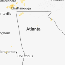


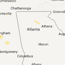


Connect with Interactive Hail Maps