

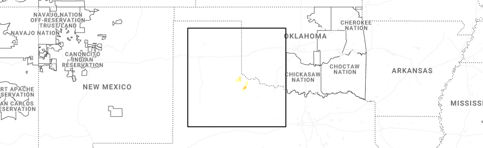
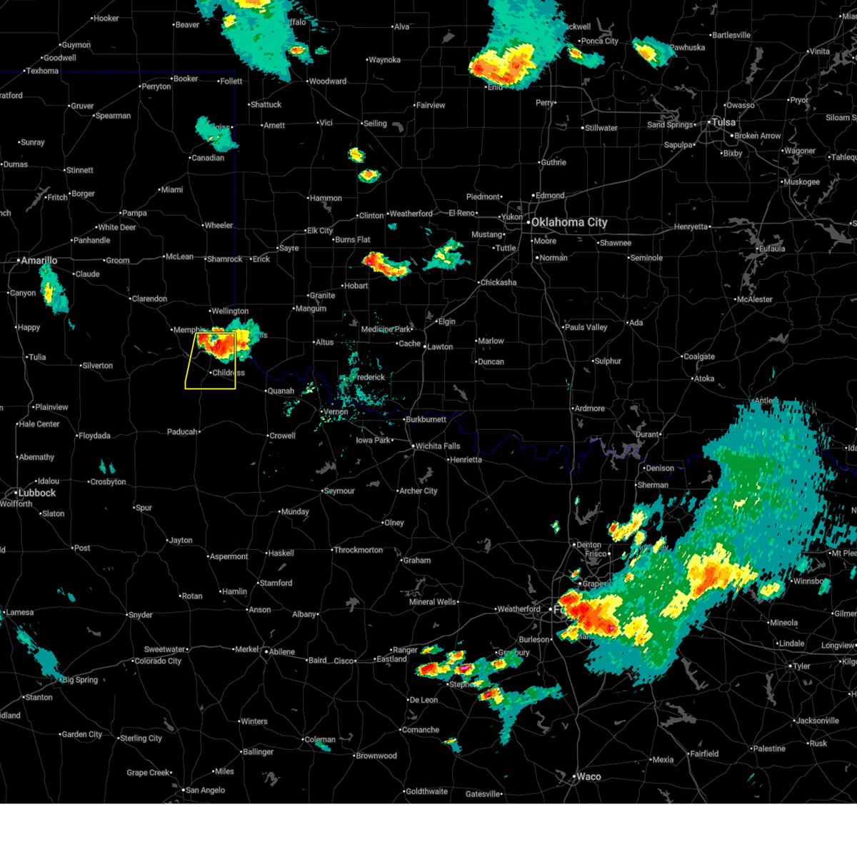
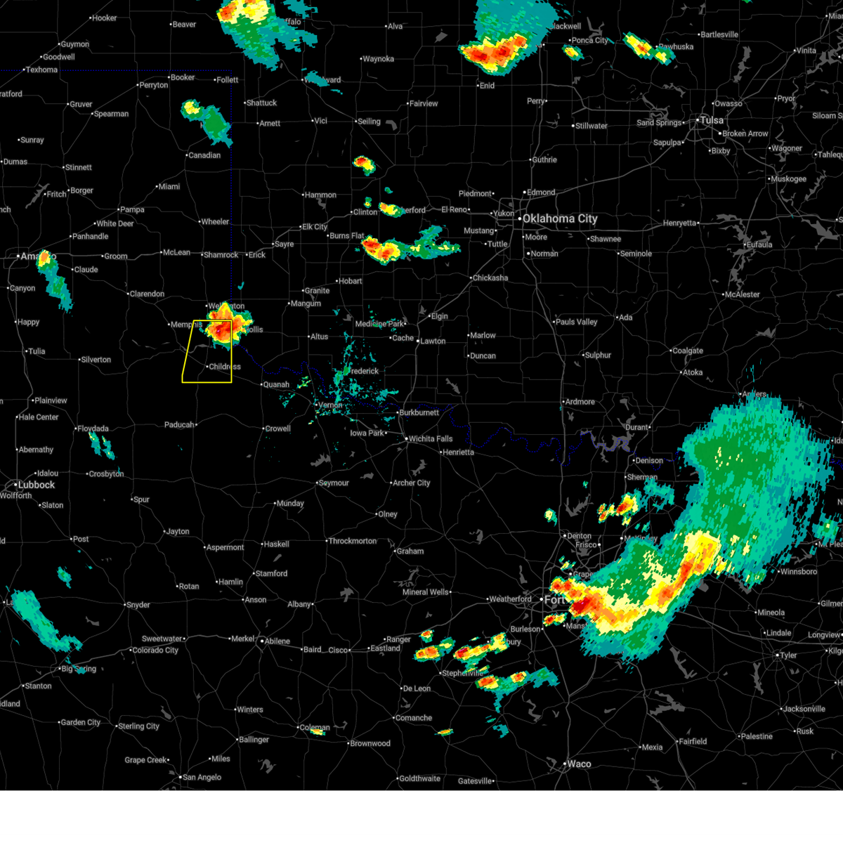
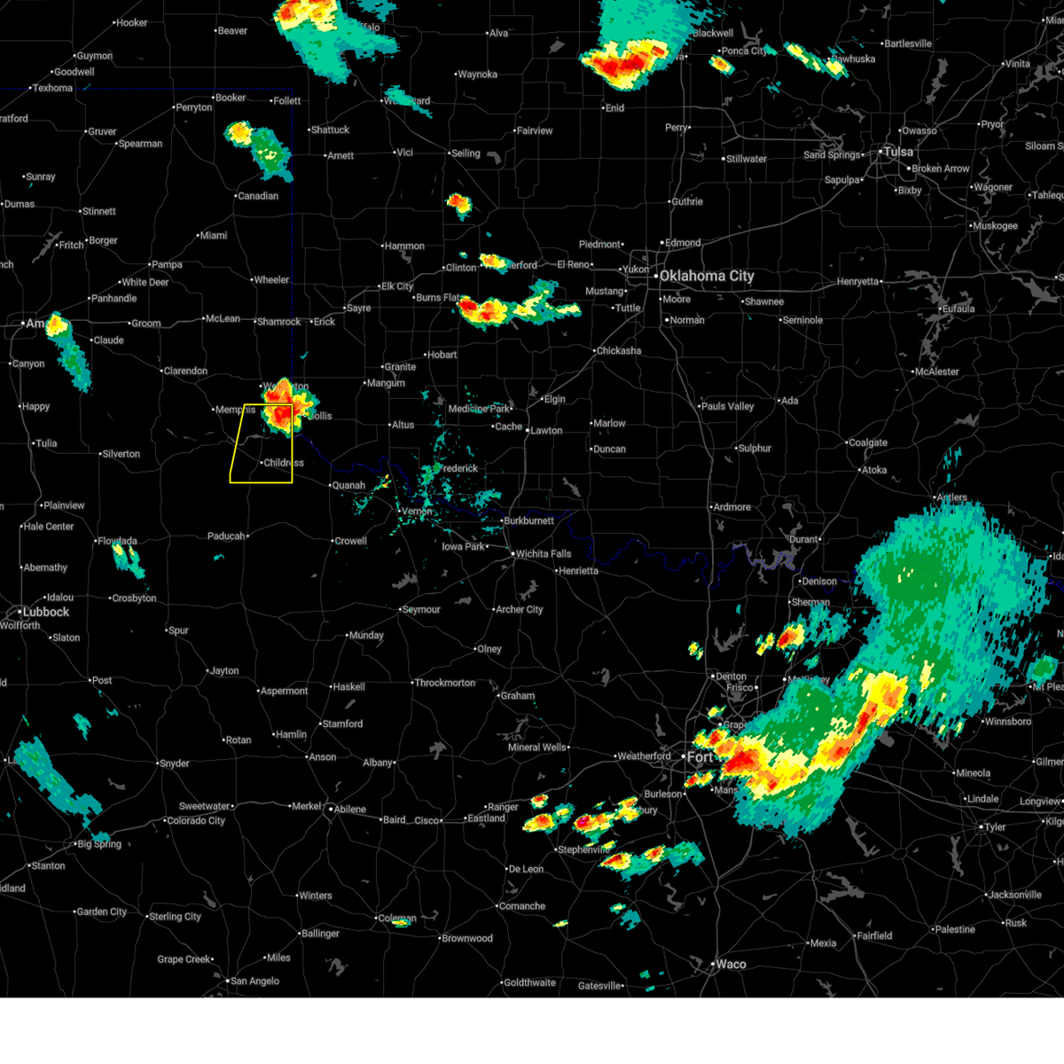
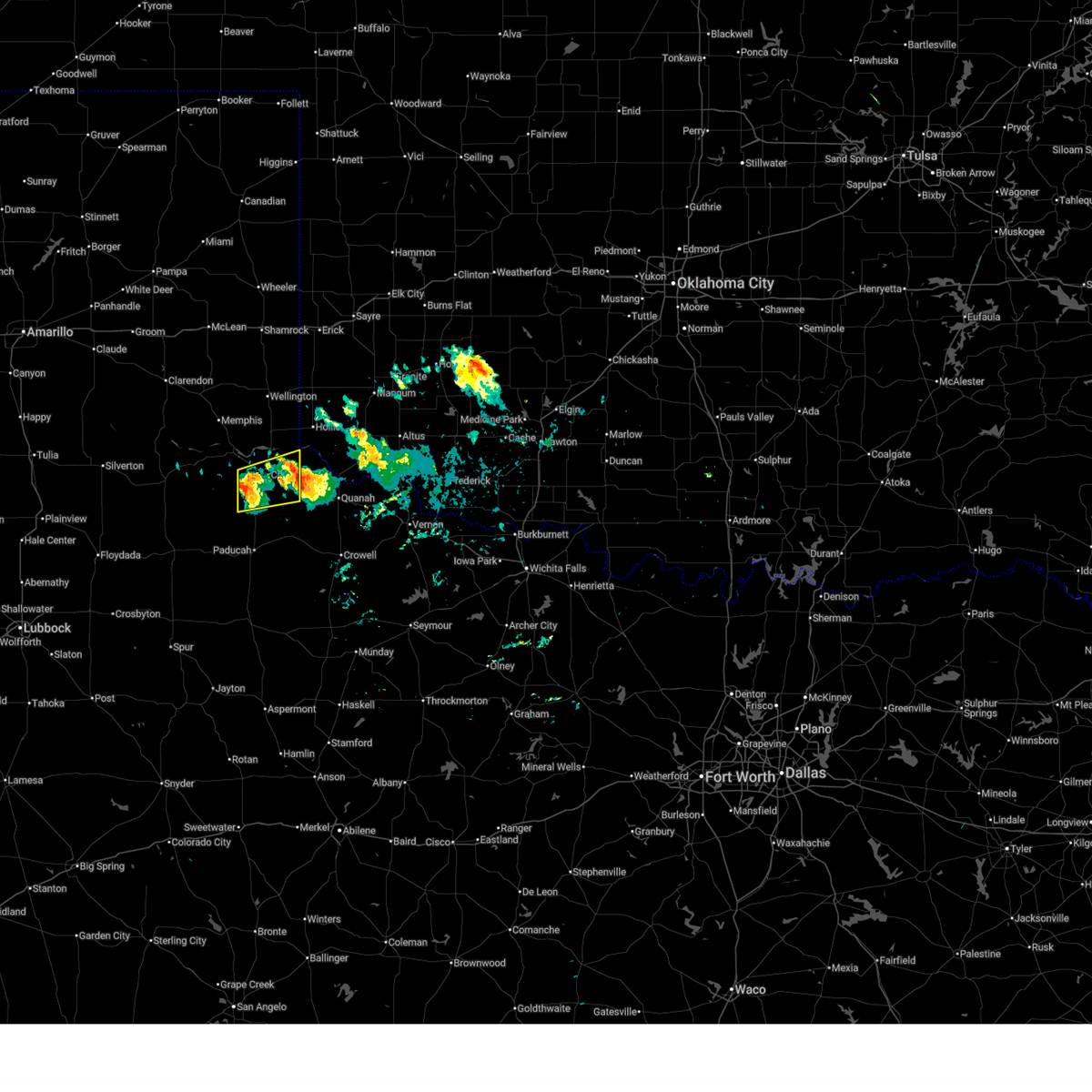
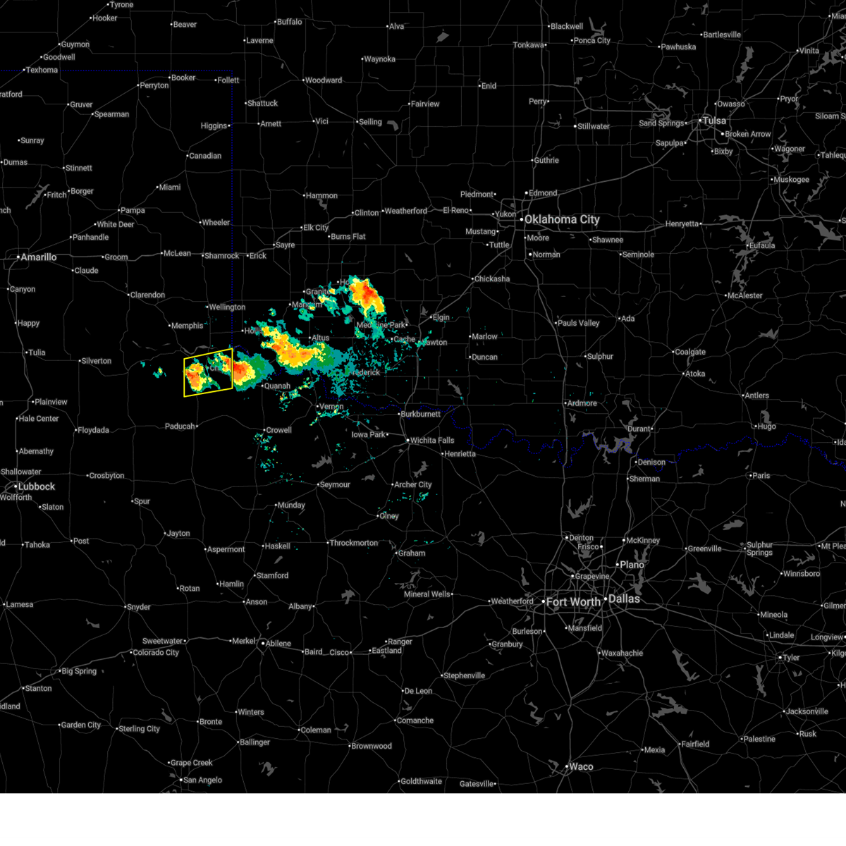
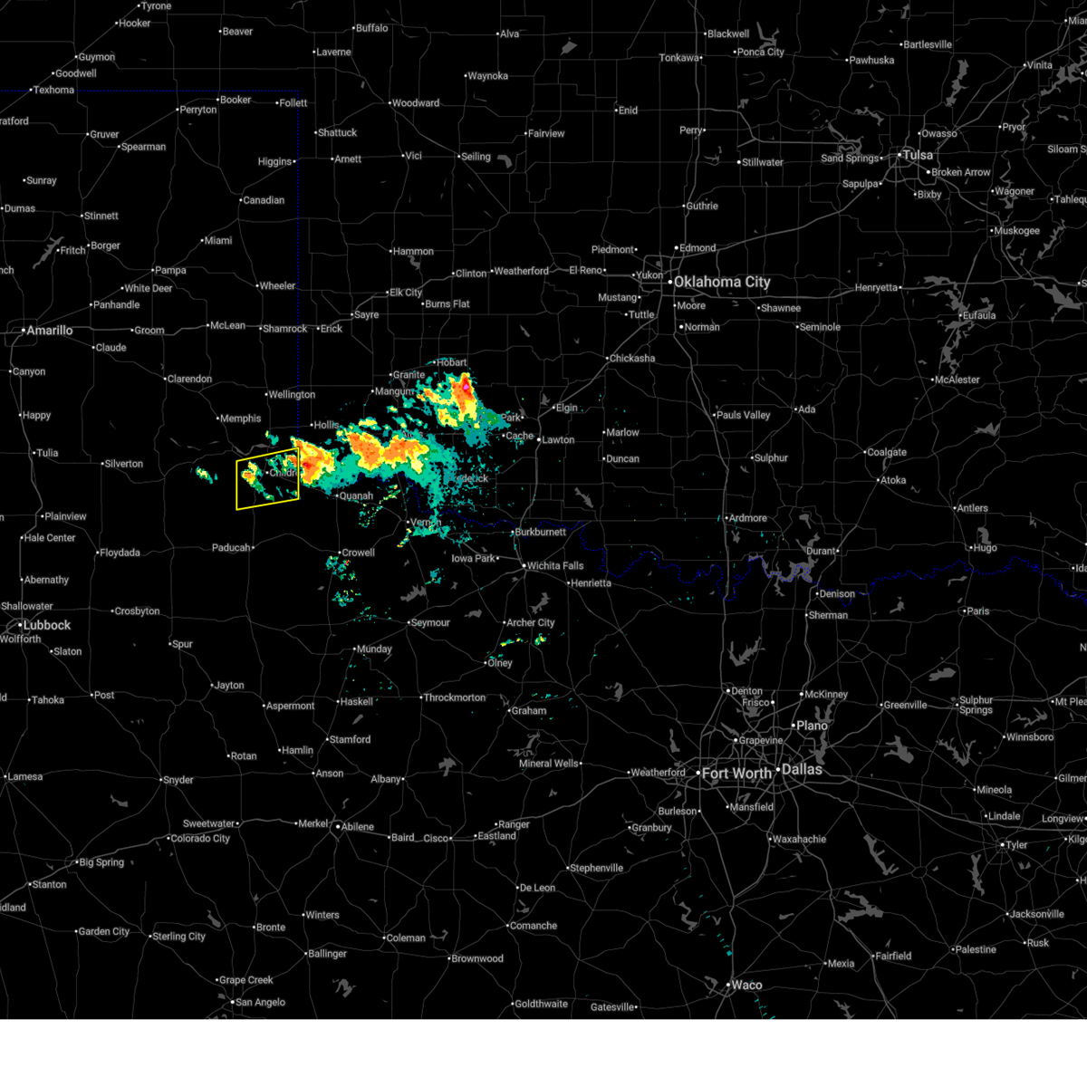
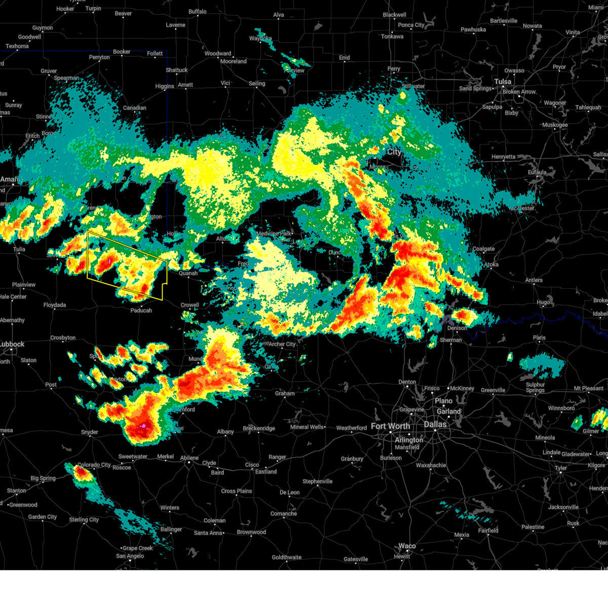
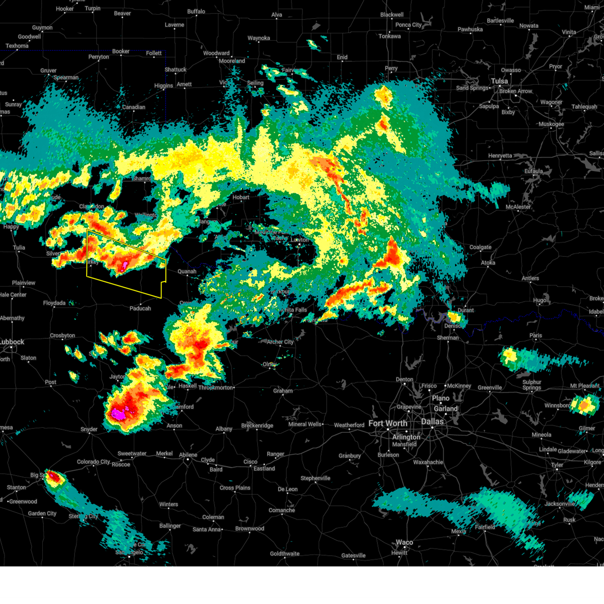
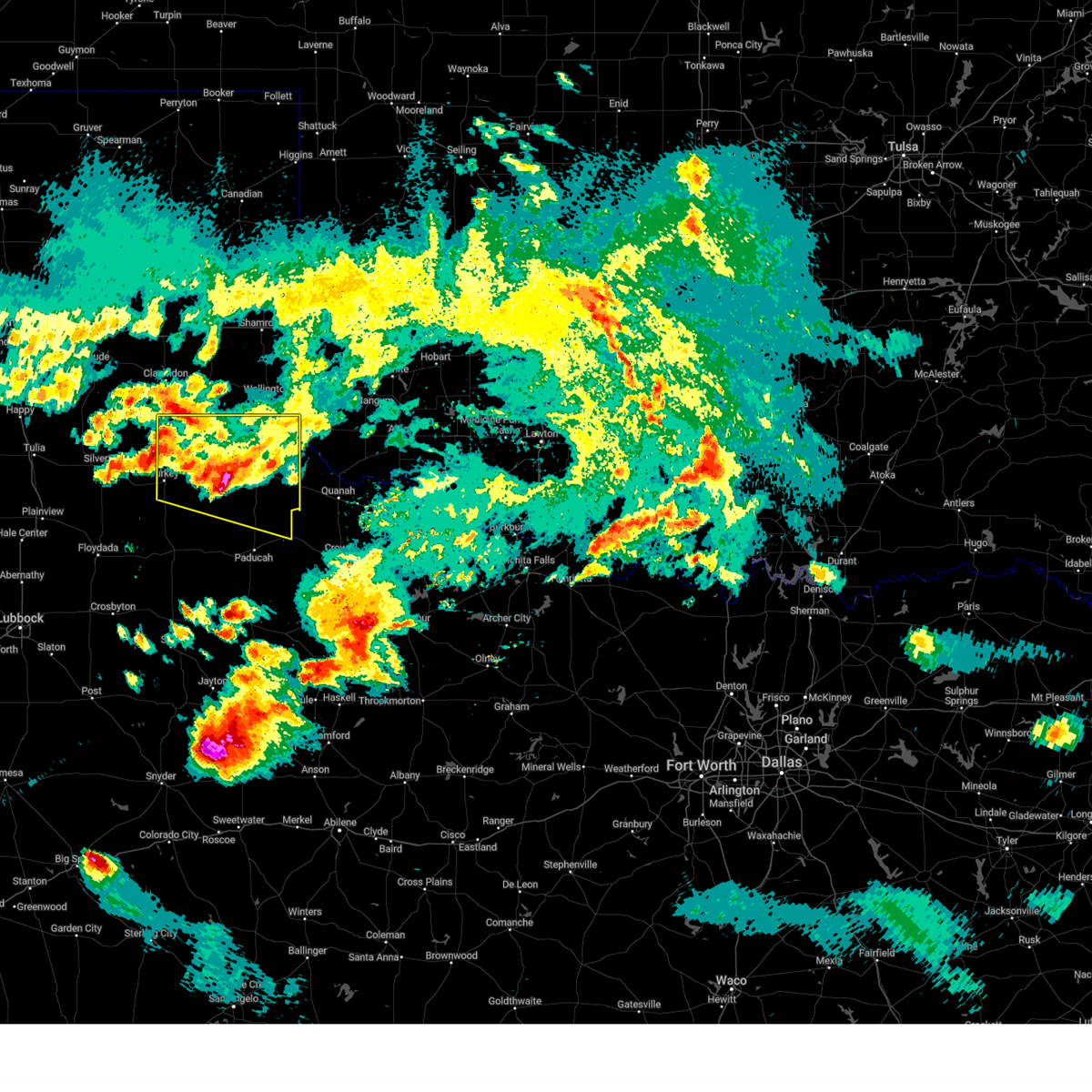
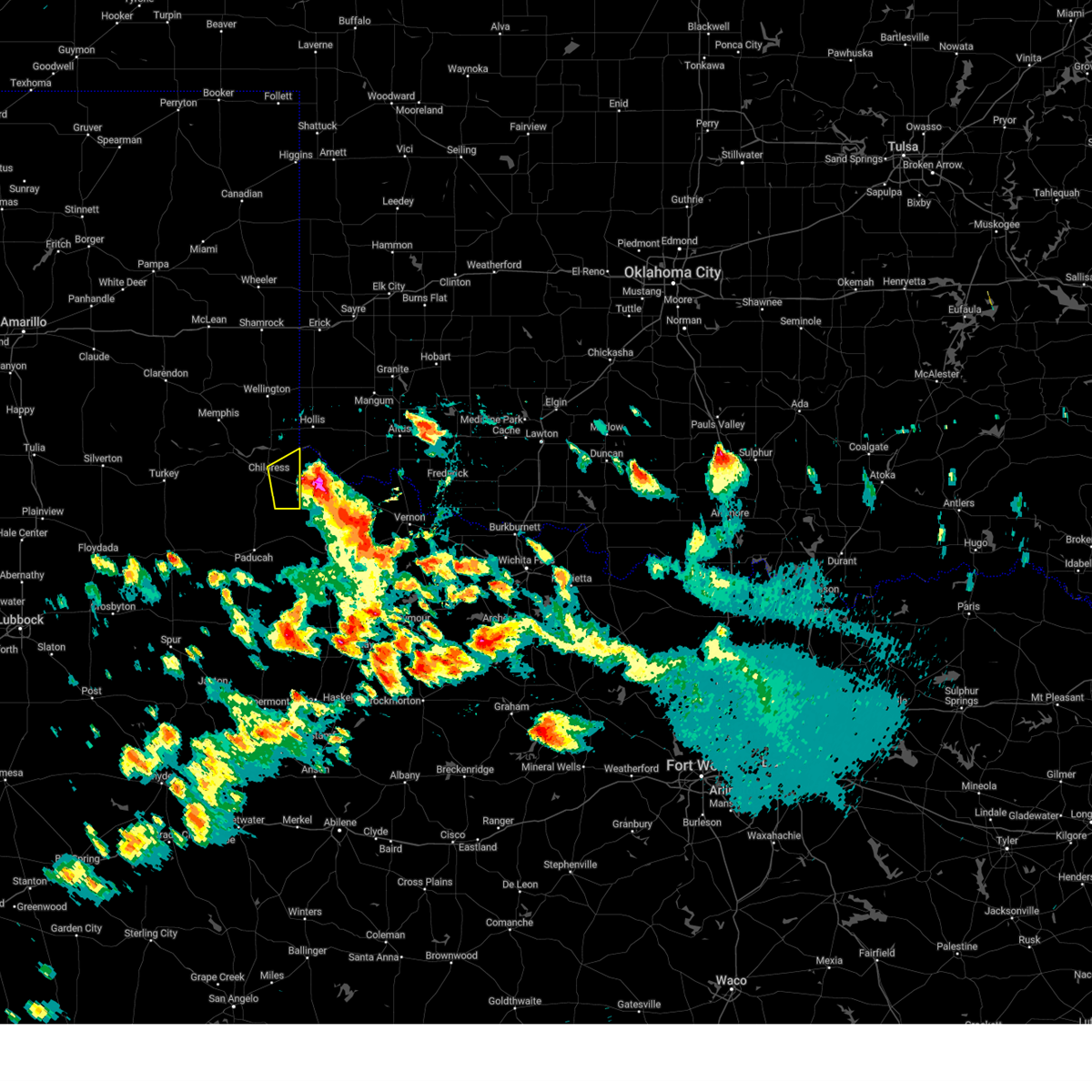
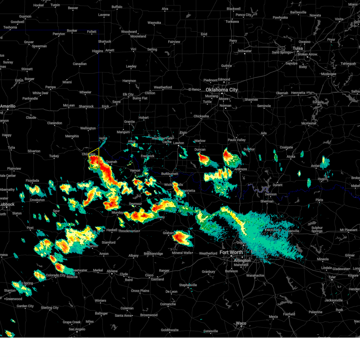
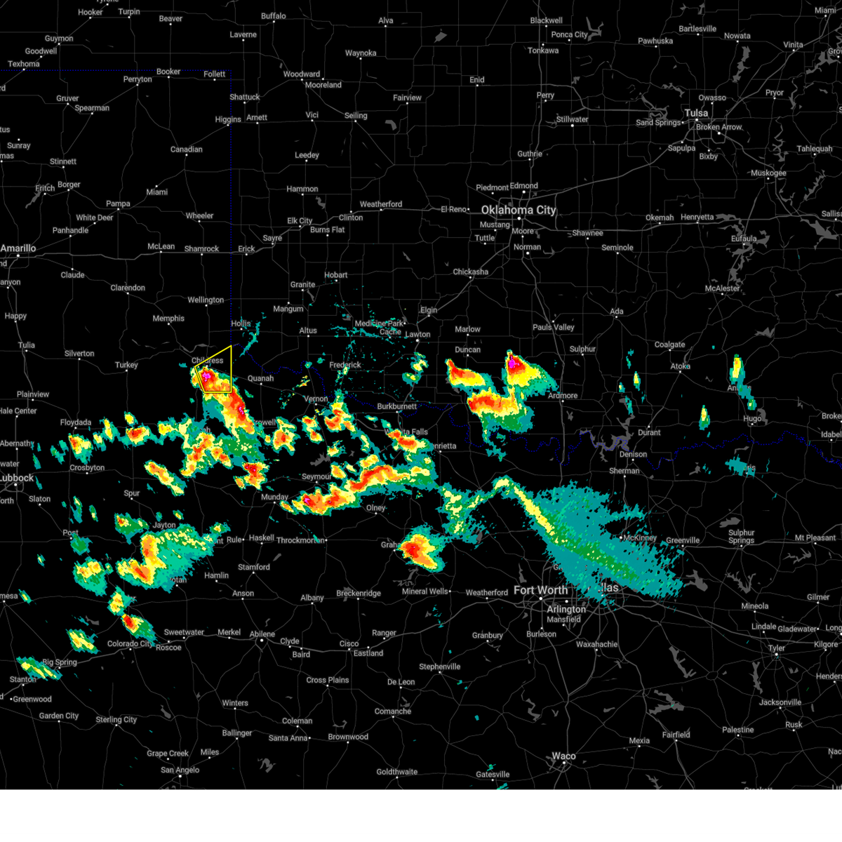
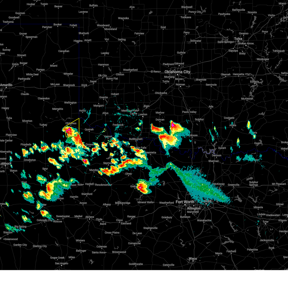
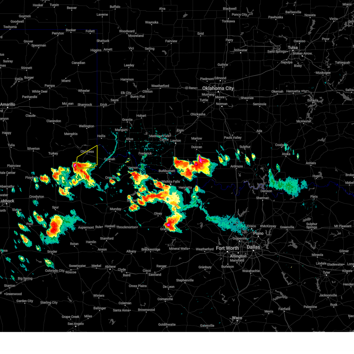
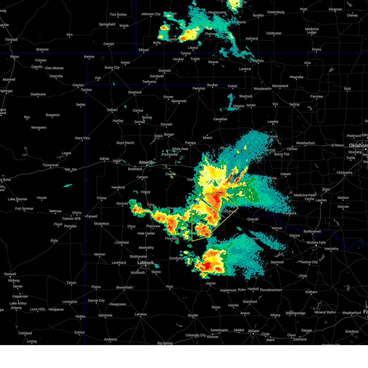
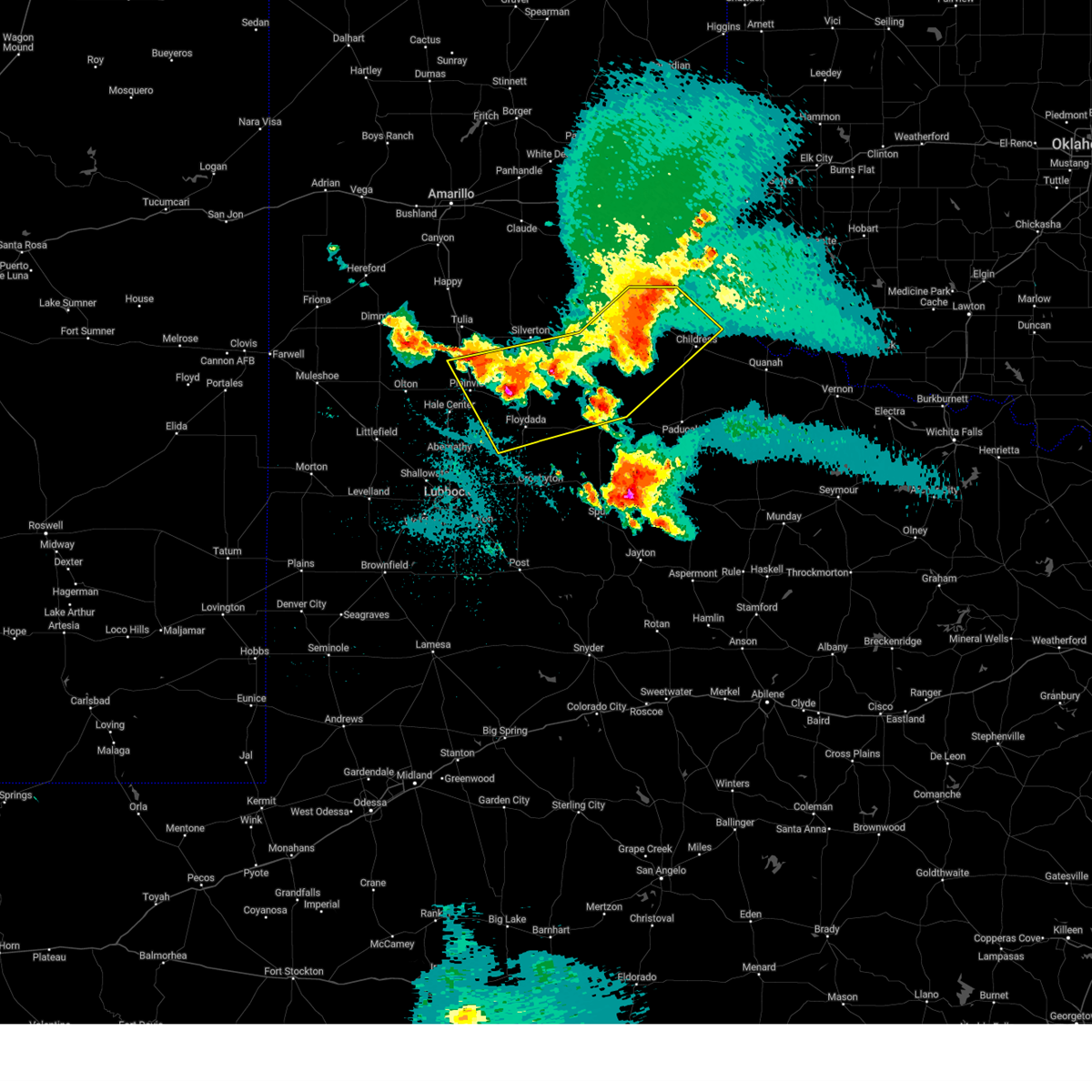
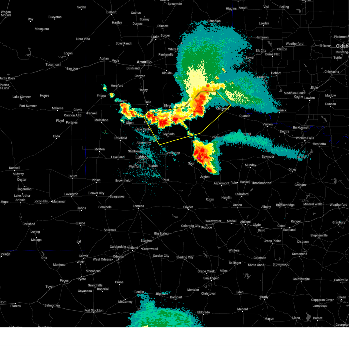
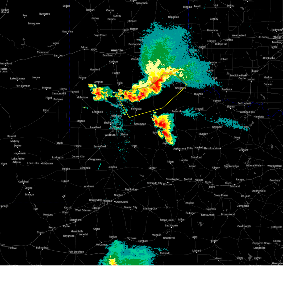
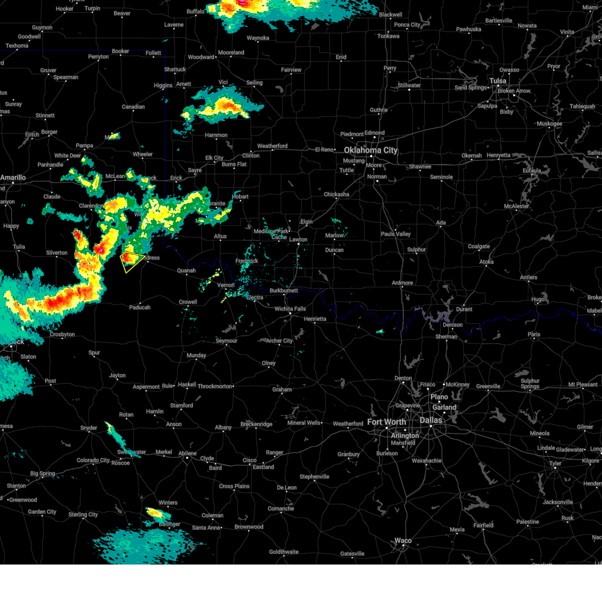
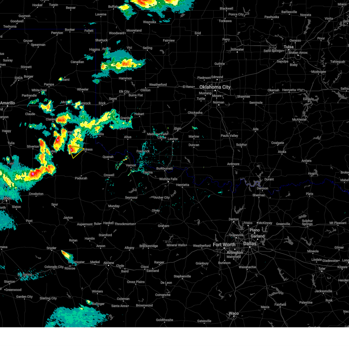
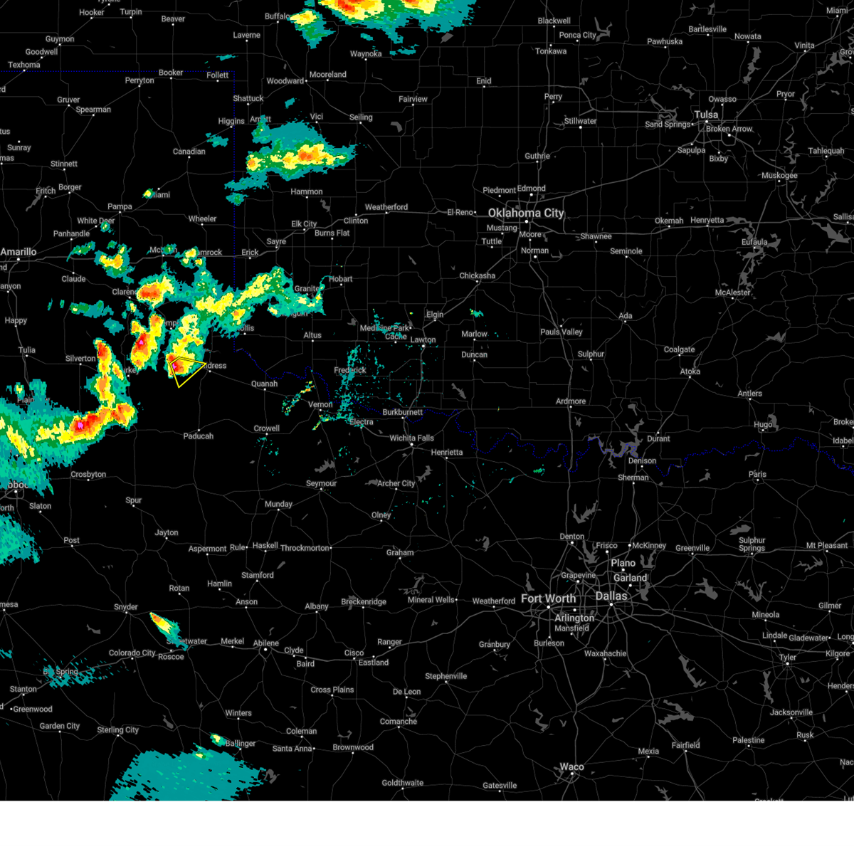
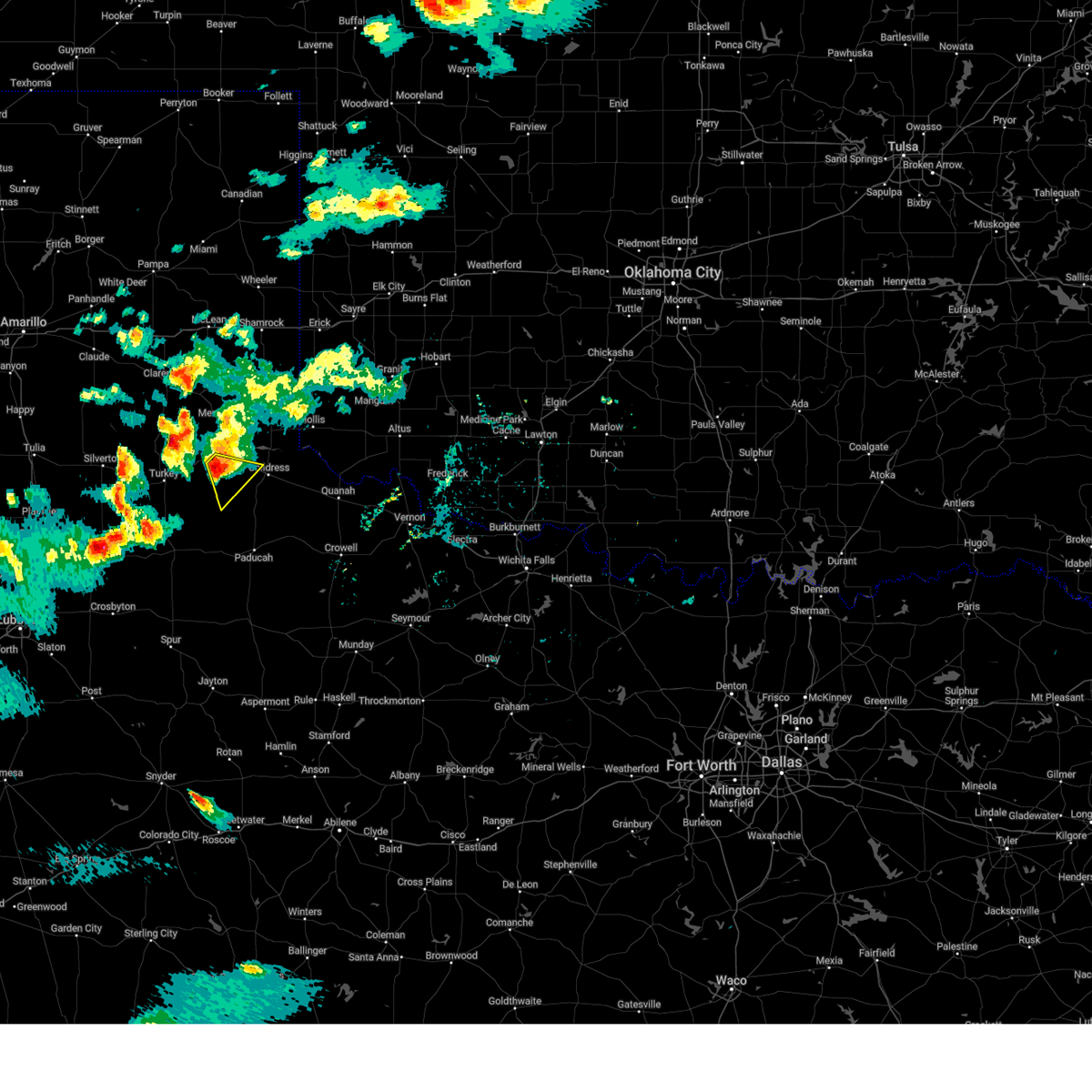
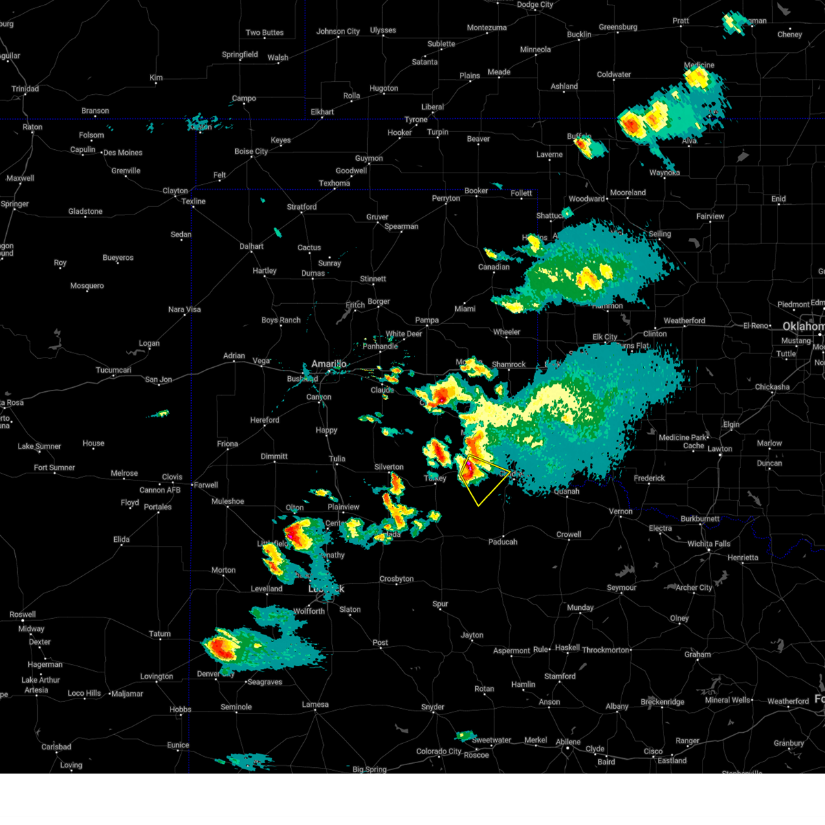
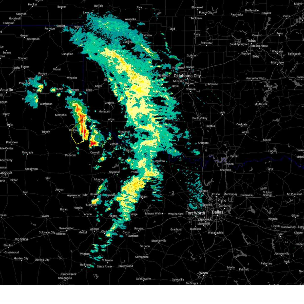
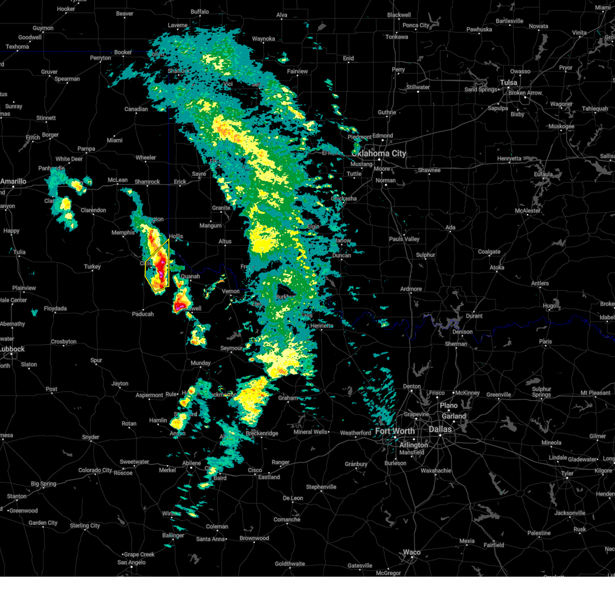
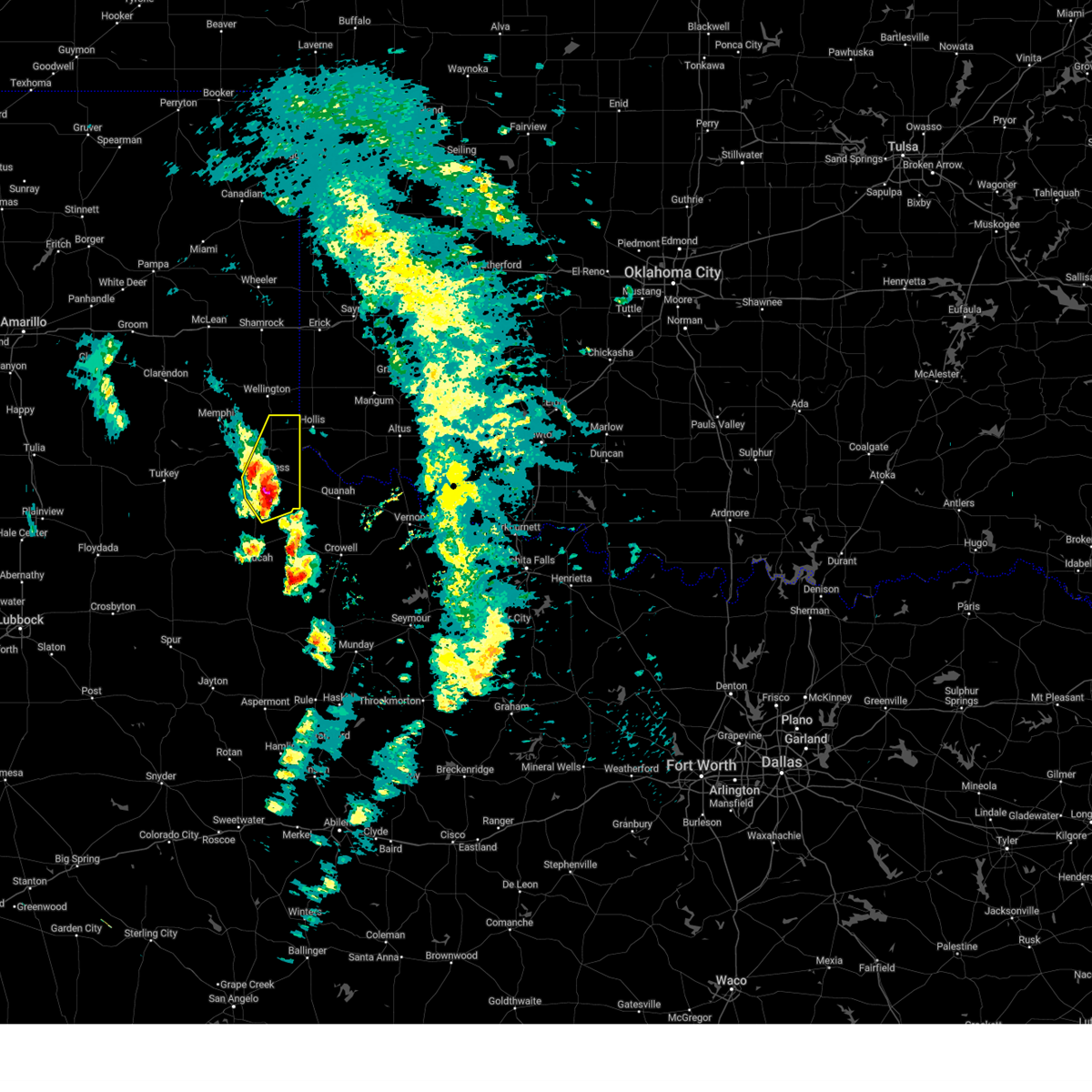
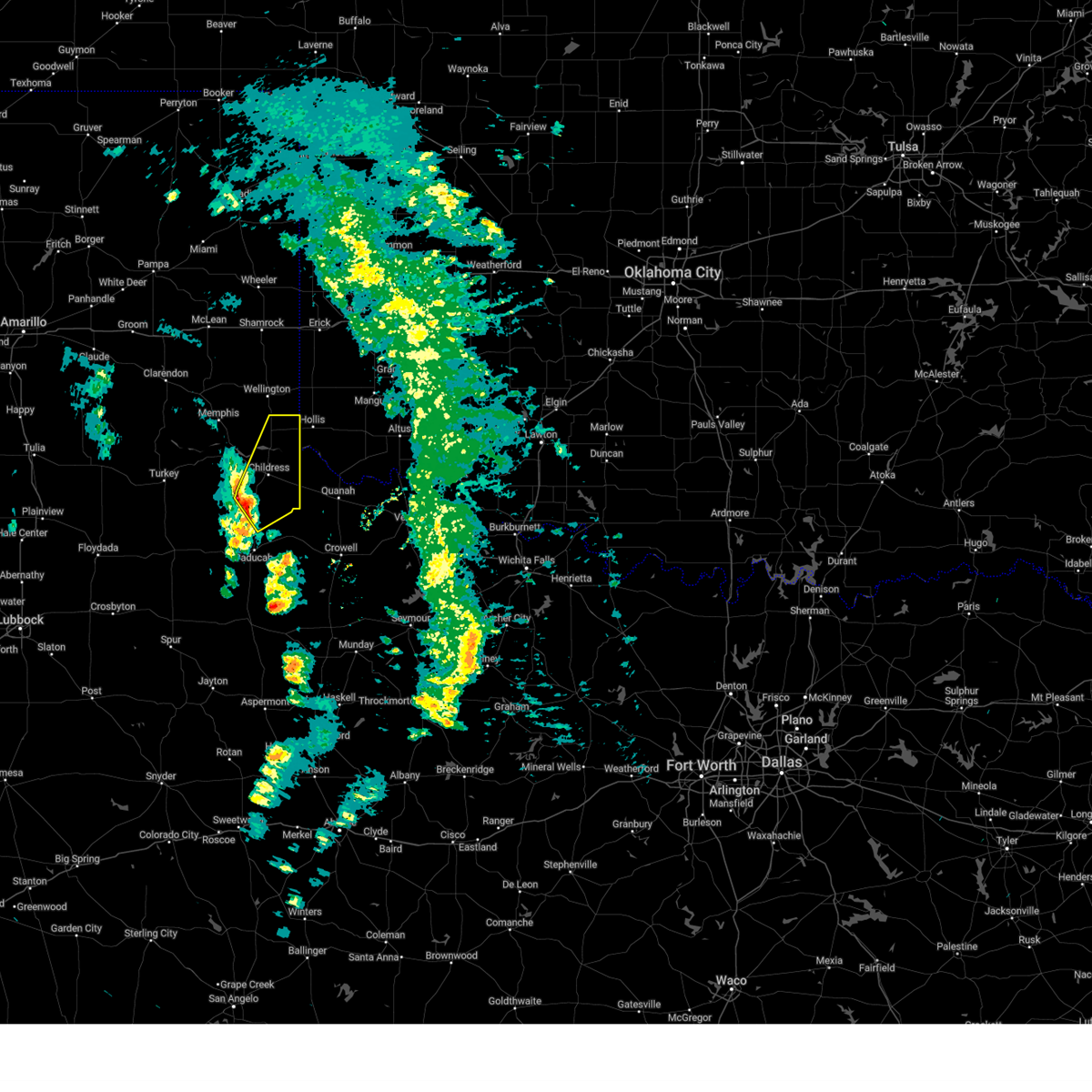
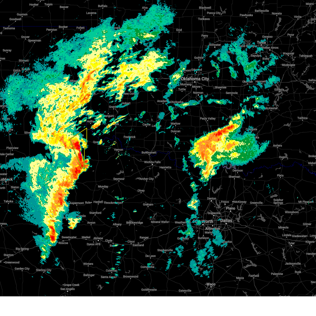
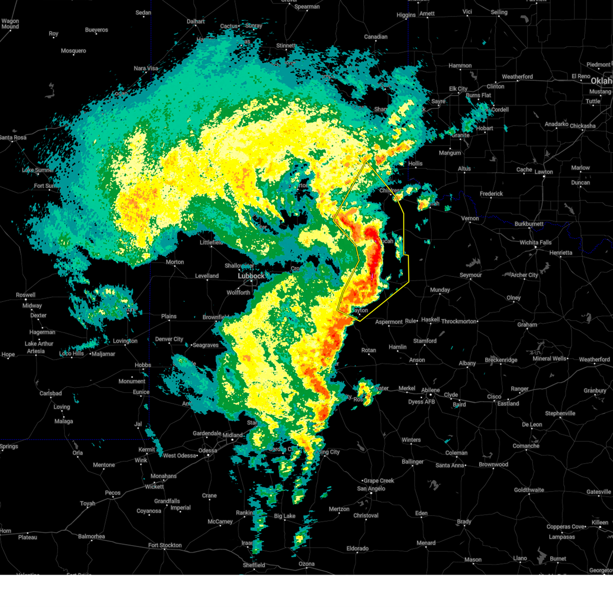
Hail Map for Childress, TX
The Childress, TX area has had 75 reports of on-the-ground hail by trained spotters, and has been under severe weather warnings 42 times during the past 12 months. Doppler radar has detected hail at or near Childress, TX on 119 occasions, including 7 occasions during the past year.
| Name: | Childress, TX |
| Where Located: | 1.6 miles W of Childress, TX |
| Map: | Google Map for Childress, TX |
| Population: | 6105 |
| Housing Units: | 2363 |
| More Info: | Search Google for Childress, TX |
1
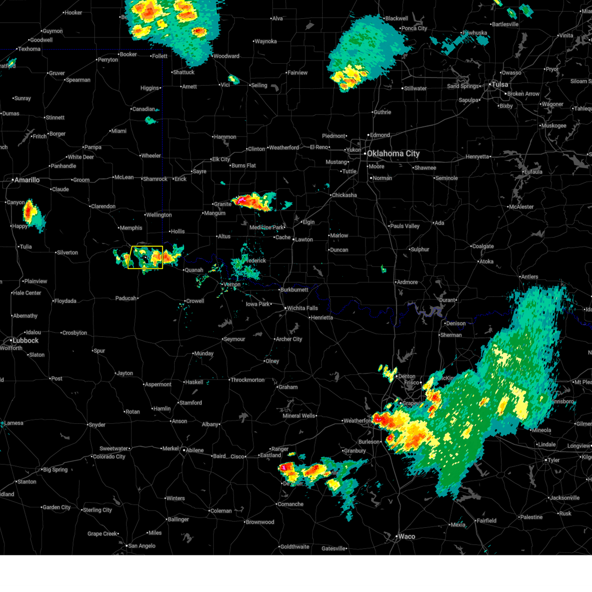
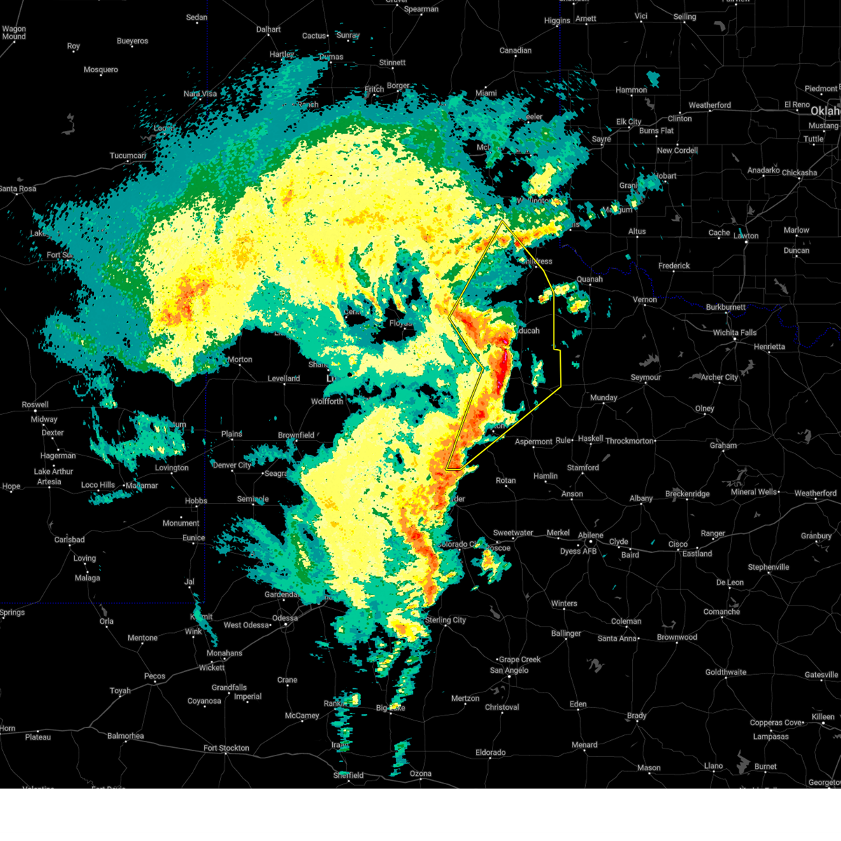
The Top Recent Hail Date for Childress, TX is Sunday, March 2, 2025 (64th out of 119)
Hail and Wind Damage Spotted near Childress, TX
| Date / Time | Report Details |
|---|---|
| 7/8/2025 8:43 PM CDT |
 The storm which prompted the warning has weakened below severe limits, and no longer poses an immediate threat to life or property. therefore, the warning will be allowed to expire. The storm which prompted the warning has weakened below severe limits, and no longer poses an immediate threat to life or property. therefore, the warning will be allowed to expire.
|
| 7/8/2025 8:37 PM CDT |
 At 836 pm cdt, a severe thunderstorm was located 6 miles southeast of childress, moving south at 30 mph (radar indicated). Hazards include 60 mph wind gusts. Expect damage to roofs, siding, and trees. Locations impacted include, childress, tell, and kirkland. At 836 pm cdt, a severe thunderstorm was located 6 miles southeast of childress, moving south at 30 mph (radar indicated). Hazards include 60 mph wind gusts. Expect damage to roofs, siding, and trees. Locations impacted include, childress, tell, and kirkland.
|
| 7/8/2025 8:24 PM CDT |
 At 823 pm cdt, a severe thunderstorm was located over childress, moving south at 25 mph (radar indicated). Hazards include 60 mph wind gusts. Expect damage to roofs, siding, and trees. Locations impacted include, childress, tell, and kirkland. At 823 pm cdt, a severe thunderstorm was located over childress, moving south at 25 mph (radar indicated). Hazards include 60 mph wind gusts. Expect damage to roofs, siding, and trees. Locations impacted include, childress, tell, and kirkland.
|
| 7/8/2025 8:11 PM CDT |
 At 811 pm cdt, a severe thunderstorm was located 5 miles northeast of childress, moving south at 30 mph (radar indicated). Hazards include 60 mph wind gusts and quarter size hail. Hail damage to vehicles is expected. expect wind damage to roofs, siding, and trees. Locations impacted include, childress, tell, and kirkland. At 811 pm cdt, a severe thunderstorm was located 5 miles northeast of childress, moving south at 30 mph (radar indicated). Hazards include 60 mph wind gusts and quarter size hail. Hail damage to vehicles is expected. expect wind damage to roofs, siding, and trees. Locations impacted include, childress, tell, and kirkland.
|
| 7/8/2025 7:57 PM CDT |
 At 756 pm cdt, a severe thunderstorm was located 12 miles southwest of dodson, or 13 miles northeast of childress, moving south at 25 mph (emergency management reported quarter size hail 17 miles north of childress at 753 pm). Hazards include 60 mph wind gusts and quarter size hail. Hail damage to vehicles is expected. expect wind damage to roofs, siding, and trees. Locations impacted include, childress, tell, and kirkland. At 756 pm cdt, a severe thunderstorm was located 12 miles southwest of dodson, or 13 miles northeast of childress, moving south at 25 mph (emergency management reported quarter size hail 17 miles north of childress at 753 pm). Hazards include 60 mph wind gusts and quarter size hail. Hail damage to vehicles is expected. expect wind damage to roofs, siding, and trees. Locations impacted include, childress, tell, and kirkland.
|
| 7/8/2025 7:53 PM CDT | Quarter sized hail reported 17.7 miles S of Childress, TX, ground reported to be covered with hail. |
| 7/8/2025 7:47 PM CDT |
 Svrlub the national weather service in lubbock texas has issued a * severe thunderstorm warning for, childress county in the panhandle of texas, * until 845 pm cdt. * at 747 pm cdt, a severe thunderstorm was located 10 miles southwest of dodson, or 10 miles west of hollis, moving south at 25 mph (radar and west texas mesonet indicated). Hazards include 60 mph wind gusts and quarter size hail. Hail damage to vehicles is expected. Expect wind damage to roofs, siding, and trees. Svrlub the national weather service in lubbock texas has issued a * severe thunderstorm warning for, childress county in the panhandle of texas, * until 845 pm cdt. * at 747 pm cdt, a severe thunderstorm was located 10 miles southwest of dodson, or 10 miles west of hollis, moving south at 25 mph (radar and west texas mesonet indicated). Hazards include 60 mph wind gusts and quarter size hail. Hail damage to vehicles is expected. Expect wind damage to roofs, siding, and trees.
|
| 6/18/2025 8:55 PM CDT |
 At 855 pm cdt, a severe thunderstorm was located near kirkland, or 14 miles east of childress, moving south at 10 mph (radar indicated). Hazards include 60 mph wind gusts and quarter size hail. Hail damage to vehicles is expected. expect wind damage to roofs, siding, and trees. Locations impacted include, childress, tell, and kirkland. At 855 pm cdt, a severe thunderstorm was located near kirkland, or 14 miles east of childress, moving south at 10 mph (radar indicated). Hazards include 60 mph wind gusts and quarter size hail. Hail damage to vehicles is expected. expect wind damage to roofs, siding, and trees. Locations impacted include, childress, tell, and kirkland.
|
| 6/18/2025 8:40 PM CDT |
 At 840 pm cdt, a severe thunderstorm was located near tell, or 6 miles southwest of childress, moving south at 10 mph (radar indicated). Hazards include 60 mph wind gusts and quarter size hail. Hail damage to vehicles is expected. expect wind damage to roofs, siding, and trees. Locations impacted include, childress, tell, and kirkland. At 840 pm cdt, a severe thunderstorm was located near tell, or 6 miles southwest of childress, moving south at 10 mph (radar indicated). Hazards include 60 mph wind gusts and quarter size hail. Hail damage to vehicles is expected. expect wind damage to roofs, siding, and trees. Locations impacted include, childress, tell, and kirkland.
|
| 6/18/2025 8:20 PM CDT |
 Svrlub the national weather service in lubbock texas has issued a * severe thunderstorm warning for, southern childress county in the panhandle of texas, northeastern cottle county in northwestern texas, * until 915 pm cdt. * at 820 pm cdt, a severe thunderstorm was located near childress, and is nearly stationary (radar indicated). Hazards include 60 mph wind gusts and quarter size hail. Hail damage to vehicles is expected. Expect wind damage to roofs, siding, and trees. Svrlub the national weather service in lubbock texas has issued a * severe thunderstorm warning for, southern childress county in the panhandle of texas, northeastern cottle county in northwestern texas, * until 915 pm cdt. * at 820 pm cdt, a severe thunderstorm was located near childress, and is nearly stationary (radar indicated). Hazards include 60 mph wind gusts and quarter size hail. Hail damage to vehicles is expected. Expect wind damage to roofs, siding, and trees.
|
| 6/8/2025 8:29 PM CDT |
 The storm which prompted the warning has weakened below severe limits, and no longer poses an immediate threat to life or property. therefore, the warning will be allowed to expire. however, small hail, gusty winds and heavy rain are still possible with this thunderstorm. a severe thunderstorm watch remains in effect until 1100 pm cdt for the panhandle of and northwestern texas. The storm which prompted the warning has weakened below severe limits, and no longer poses an immediate threat to life or property. therefore, the warning will be allowed to expire. however, small hail, gusty winds and heavy rain are still possible with this thunderstorm. a severe thunderstorm watch remains in effect until 1100 pm cdt for the panhandle of and northwestern texas.
|
| 6/8/2025 8:14 PM CDT |
 At 814 pm cdt, a severe thunderstorm was located 6 miles east of turkey, moving east at 50 mph (radar indicated). Hazards include 60 mph wind gusts and quarter size hail. Hail damage to vehicles is expected. expect wind damage to roofs, siding, and trees. Locations impacted include, childress, turkey, cee vee, tell, kirkland, northfield, brice, swearingen, estelline, lakeview, and plaska community. At 814 pm cdt, a severe thunderstorm was located 6 miles east of turkey, moving east at 50 mph (radar indicated). Hazards include 60 mph wind gusts and quarter size hail. Hail damage to vehicles is expected. expect wind damage to roofs, siding, and trees. Locations impacted include, childress, turkey, cee vee, tell, kirkland, northfield, brice, swearingen, estelline, lakeview, and plaska community.
|
| 6/8/2025 8:07 PM CDT |
 At 807 pm cdt, a severe thunderstorm was located over tell, or 8 miles southwest of childress, moving east at 35 mph (radar indicated). Hazards include 70 mph wind gusts and quarter size hail. Hail damage to vehicles is expected. expect considerable tree damage. wind damage is also likely to mobile homes, roofs, and outbuildings. Locations impacted include, childress, memphis, turkey, cee vee, tell, kirkland, northfield, brice, swearingen, estelline, lakeview, and plaska community. At 807 pm cdt, a severe thunderstorm was located over tell, or 8 miles southwest of childress, moving east at 35 mph (radar indicated). Hazards include 70 mph wind gusts and quarter size hail. Hail damage to vehicles is expected. expect considerable tree damage. wind damage is also likely to mobile homes, roofs, and outbuildings. Locations impacted include, childress, memphis, turkey, cee vee, tell, kirkland, northfield, brice, swearingen, estelline, lakeview, and plaska community.
|
| 6/8/2025 8:00 PM CDT |
 At 800 pm cdt, a severe thunderstorm was located near tell, or 12 miles west of childress, moving southeast at 40 mph (radar indicated). Hazards include 70 mph wind gusts and quarter size hail. Hail damage to vehicles is expected. expect considerable tree damage. wind damage is also likely to mobile homes, roofs, and outbuildings. Locations impacted include, childress, memphis, turkey, cee vee, tell, kirkland, northfield, brice, swearingen, estelline, lakeview, and plaska community. At 800 pm cdt, a severe thunderstorm was located near tell, or 12 miles west of childress, moving southeast at 40 mph (radar indicated). Hazards include 70 mph wind gusts and quarter size hail. Hail damage to vehicles is expected. expect considerable tree damage. wind damage is also likely to mobile homes, roofs, and outbuildings. Locations impacted include, childress, memphis, turkey, cee vee, tell, kirkland, northfield, brice, swearingen, estelline, lakeview, and plaska community.
|
| 6/8/2025 7:52 PM CDT | Peak wind gust measured by the west texas mesonet with this round of storms. additional gusts of 59 mph or greater occurred at 7:51 and 7:53 p in motley county TX, 23.4 miles ENE of Childress, TX |
| 6/8/2025 7:45 PM CDT | At 745 pm cdt, a severe thunderstorm was located 9 miles north of northfield, or 15 miles east of turkey, moving east at 35 mph (radar indicated). Hazards include ping pong ball size hail and 60 mph wind gusts. People and animals outdoors will be injured. expect hail damage to roofs, siding, windows, and vehicles. expect wind damage to roofs, siding, and trees. Locations impacted include, childress, memphis, turkey, cee vee, tell, kirkland, northfield, brice, swearingen, estelline, lakeview, and plaska community. |
| 6/8/2025 7:35 PM CDT | Svrlub the national weather service in lubbock texas has issued a * severe thunderstorm warning for, childress county in the panhandle of texas, northeastern motley county in northwestern texas, northern cottle county in northwestern texas, hall county in the panhandle of texas, * until 830 pm cdt. * at 735 pm cdt, a severe thunderstorm was located 11 miles northeast of turkey, moving east at 35 mph (radar indicated). Hazards include 60 mph wind gusts and quarter size hail. Hail damage to vehicles is expected. Expect wind damage to roofs, siding, and trees. |
| 6/8/2025 6:14 PM CDT | Golf Ball sized hail reported 14.5 miles NNE of Childress, TX, hail as large as golf balls falling currently. |
| 6/8/2025 6:00 PM CDT | Steeple of church blown off. time of damage estimate in cottle county TX, 17.9 miles NE of Childress, TX |
| 6/8/2025 6:00 PM CDT | Power pole bent over the roadway. lines still attached... hanging at about 6 to 7 feet above the roadway. time is when the report came in. damage may have occurred earl in motley county TX, 18.9 miles ENE of Childress, TX |
| 6/8/2025 5:51 PM CDT | Measured by the west texas mesonet. another gust to 60 mph was measured at 5:53 p in motley county TX, 23.4 miles ENE of Childress, TX |
| 5/26/2025 10:04 PM CDT |
 At 1003 pm cdt, a severe thunderstorm was located near childress, moving southeast at 25 mph (radar indicated). Hazards include quarter size hail. Damage to vehicles is expected. Locations impacted include, childress. At 1003 pm cdt, a severe thunderstorm was located near childress, moving southeast at 25 mph (radar indicated). Hazards include quarter size hail. Damage to vehicles is expected. Locations impacted include, childress.
|
| 5/26/2025 9:45 PM CDT |
 At 945 pm cdt, a severe thunderstorm was located 10 miles northwest of childress, moving southeast at 20 mph (radar indicated). Hazards include 60 mph wind gusts and quarter size hail. Hail damage to vehicles is expected. expect wind damage to roofs, siding, and trees. Locations impacted include, childress. At 945 pm cdt, a severe thunderstorm was located 10 miles northwest of childress, moving southeast at 20 mph (radar indicated). Hazards include 60 mph wind gusts and quarter size hail. Hail damage to vehicles is expected. expect wind damage to roofs, siding, and trees. Locations impacted include, childress.
|
| 5/26/2025 9:45 PM CDT |
 the severe thunderstorm warning has been cancelled and is no longer in effect the severe thunderstorm warning has been cancelled and is no longer in effect
|
| 5/26/2025 9:29 PM CDT |
 Svrlub the national weather service in lubbock texas has issued a * severe thunderstorm warning for, southern childress county in the panhandle of texas, east central hall county in the panhandle of texas, * until 1015 pm cdt. * at 929 pm cdt, a severe thunderstorm was located 11 miles southeast of memphis, moving southeast at 25 mph (radar indicated). Hazards include 60 mph wind gusts and quarter size hail. Hail damage to vehicles is expected. Expect wind damage to roofs, siding, and trees. Svrlub the national weather service in lubbock texas has issued a * severe thunderstorm warning for, southern childress county in the panhandle of texas, east central hall county in the panhandle of texas, * until 1015 pm cdt. * at 929 pm cdt, a severe thunderstorm was located 11 miles southeast of memphis, moving southeast at 25 mph (radar indicated). Hazards include 60 mph wind gusts and quarter size hail. Hail damage to vehicles is expected. Expect wind damage to roofs, siding, and trees.
|
| 5/22/2025 6:09 PM CDT |
 the severe thunderstorm warning has been cancelled and is no longer in effect the severe thunderstorm warning has been cancelled and is no longer in effect
|
| 5/22/2025 5:51 PM CDT |
 At 551 pm cdt, a severe thunderstorm was located over kirkland, or 10 miles east of childress, moving northeast at 30 mph (radar indicated). Hazards include 60 mph wind gusts and quarter size hail. Hail damage to vehicles is expected. expect wind damage to roofs, siding, and trees. Locations impacted include, childress and kirkland. At 551 pm cdt, a severe thunderstorm was located over kirkland, or 10 miles east of childress, moving northeast at 30 mph (radar indicated). Hazards include 60 mph wind gusts and quarter size hail. Hail damage to vehicles is expected. expect wind damage to roofs, siding, and trees. Locations impacted include, childress and kirkland.
|
| 5/22/2025 5:37 PM CDT |
 At 536 pm cdt, a severe thunderstorm was located 4 miles southeast of childress, moving northeast at 30 mph (radar indicated). Hazards include 60 mph wind gusts and half dollar size hail. Hail damage to vehicles is expected. expect wind damage to roofs, siding, and trees. Locations impacted include, childress and kirkland. At 536 pm cdt, a severe thunderstorm was located 4 miles southeast of childress, moving northeast at 30 mph (radar indicated). Hazards include 60 mph wind gusts and half dollar size hail. Hail damage to vehicles is expected. expect wind damage to roofs, siding, and trees. Locations impacted include, childress and kirkland.
|
| 5/22/2025 5:27 PM CDT |
 At 527 pm cdt, a severe thunderstorm was located 6 miles south of childress, moving northeast at 30 mph (radar indicated). Hazards include ping pong ball size hail and 60 mph wind gusts. People and animals outdoors will be injured. expect hail damage to roofs, siding, windows, and vehicles. expect wind damage to roofs, siding, and trees. Locations impacted include, childress and kirkland. At 527 pm cdt, a severe thunderstorm was located 6 miles south of childress, moving northeast at 30 mph (radar indicated). Hazards include ping pong ball size hail and 60 mph wind gusts. People and animals outdoors will be injured. expect hail damage to roofs, siding, windows, and vehicles. expect wind damage to roofs, siding, and trees. Locations impacted include, childress and kirkland.
|
| 5/22/2025 5:08 PM CDT |
 Svrlub the national weather service in lubbock texas has issued a * severe thunderstorm warning for, southern childress county in the panhandle of texas, northern cottle county in northwestern texas, * until 630 pm cdt. * at 508 pm cdt, a severe thunderstorm was located 5 miles northeast of cee vee, or 12 miles southwest of childress, moving northeast at 25 mph (radar indicated). Hazards include ping pong ball size hail and 60 mph wind gusts. People and animals outdoors will be injured. expect hail damage to roofs, siding, windows, and vehicles. Expect wind damage to roofs, siding, and trees. Svrlub the national weather service in lubbock texas has issued a * severe thunderstorm warning for, southern childress county in the panhandle of texas, northern cottle county in northwestern texas, * until 630 pm cdt. * at 508 pm cdt, a severe thunderstorm was located 5 miles northeast of cee vee, or 12 miles southwest of childress, moving northeast at 25 mph (radar indicated). Hazards include ping pong ball size hail and 60 mph wind gusts. People and animals outdoors will be injured. expect hail damage to roofs, siding, windows, and vehicles. Expect wind damage to roofs, siding, and trees.
|
| 4/24/2025 12:13 AM CDT | Childress 2nne measured a wind gusts of 64 mph... following the 12:09 am gusts of 60 mp in childress county TX, 3.1 miles SW of Childress, TX |
| 4/24/2025 12:09 AM CDT | Wtm childress 2nne measured 60 mp in childress county TX, 3.1 miles SW of Childress, TX |
| 4/23/2025 11:56 PM CDT | Corrects previous tstm wnd gst report from 4 w childress. at 11:56 pm kcds measured a wind gusts of 60 mph. correcte in childress county TX, 2.4 miles E of Childress, TX |
| 4/23/2025 11:40 PM CDT |
 At 1140 pm cdt, severe thunderstorms were located along a line extending from 9 miles east of memphis to 3 miles northwest of cee vee to 11 miles northeast of matador, moving southeast at 20 mph (radar indicated). Hazards include 60 mph wind gusts and quarter size hail. Hail damage to vehicles is expected. expect wind damage to roofs, siding, and trees. Locations impacted include, matador, turkey, cee vee, plaska community, tell, lakeview, estelline, northfield, memphis, and childress. At 1140 pm cdt, severe thunderstorms were located along a line extending from 9 miles east of memphis to 3 miles northwest of cee vee to 11 miles northeast of matador, moving southeast at 20 mph (radar indicated). Hazards include 60 mph wind gusts and quarter size hail. Hail damage to vehicles is expected. expect wind damage to roofs, siding, and trees. Locations impacted include, matador, turkey, cee vee, plaska community, tell, lakeview, estelline, northfield, memphis, and childress.
|
| 4/23/2025 11:40 PM CDT |
 the severe thunderstorm warning has been cancelled and is no longer in effect the severe thunderstorm warning has been cancelled and is no longer in effect
|
| 4/23/2025 11:27 PM CDT |
 At 1126 pm cdt, severe thunderstorms were located along a line extending from 13 miles south of wellington to 5 miles east of northfield to 3 miles southeast of lockney, moving southeast at 30 mph (radar indicated). Hazards include 60 mph wind gusts and quarter size hail. Hail damage to vehicles is expected. expect wind damage to roofs, siding, and trees. Locations impacted include, cee vee, lakeview, south plains, claytonville, estelline, kress, caprock canyon state park, aiken, seth ward, flomot, valley schools, matador, turkey, plaska community, tell, northfield, quitaque, memphis, childress, and lockney. At 1126 pm cdt, severe thunderstorms were located along a line extending from 13 miles south of wellington to 5 miles east of northfield to 3 miles southeast of lockney, moving southeast at 30 mph (radar indicated). Hazards include 60 mph wind gusts and quarter size hail. Hail damage to vehicles is expected. expect wind damage to roofs, siding, and trees. Locations impacted include, cee vee, lakeview, south plains, claytonville, estelline, kress, caprock canyon state park, aiken, seth ward, flomot, valley schools, matador, turkey, plaska community, tell, northfield, quitaque, memphis, childress, and lockney.
|
| 4/23/2025 11:09 PM CDT |
 At 1108 pm cdt, severe thunderstorms were located along a line extending from 9 miles east of memphis to 6 miles north of northfield to aiken, moving southeast at 30 mph (radar indicated). Hazards include 60 mph wind gusts and quarter size hail. Hail damage to vehicles is expected. expect wind damage to roofs, siding, and trees. Locations impacted include, cee vee, lakeview, south plains, claytonville, estelline, kress, caprock canyon state park, aiken, seth ward, flomot, valley schools, matador, turkey, plaska community, tell, northfield, quitaque, memphis, childress, and lockney. At 1108 pm cdt, severe thunderstorms were located along a line extending from 9 miles east of memphis to 6 miles north of northfield to aiken, moving southeast at 30 mph (radar indicated). Hazards include 60 mph wind gusts and quarter size hail. Hail damage to vehicles is expected. expect wind damage to roofs, siding, and trees. Locations impacted include, cee vee, lakeview, south plains, claytonville, estelline, kress, caprock canyon state park, aiken, seth ward, flomot, valley schools, matador, turkey, plaska community, tell, northfield, quitaque, memphis, childress, and lockney.
|
| 4/23/2025 10:53 PM CDT |
 Svrlub the national weather service in lubbock texas has issued a * severe thunderstorm warning for, floyd county in northwestern texas, childress county in the panhandle of texas, northwestern cottle county in northwestern texas, motley county in northwestern texas, northeastern hale county in northwestern texas, hall county in the panhandle of texas, southeastern swisher county in the panhandle of texas, southern briscoe county in the panhandle of texas, * until midnight cdt. * at 1053 pm cdt, severe thunderstorms were located along a line extending from 7 miles south of quail to near turkey to 6 miles northwest of aiken, moving southeast at 25 mph (radar indicated). Hazards include 60 mph wind gusts and quarter size hail. Hail damage to vehicles is expected. Expect wind damage to roofs, siding, and trees. Svrlub the national weather service in lubbock texas has issued a * severe thunderstorm warning for, floyd county in northwestern texas, childress county in the panhandle of texas, northwestern cottle county in northwestern texas, motley county in northwestern texas, northeastern hale county in northwestern texas, hall county in the panhandle of texas, southeastern swisher county in the panhandle of texas, southern briscoe county in the panhandle of texas, * until midnight cdt. * at 1053 pm cdt, severe thunderstorms were located along a line extending from 7 miles south of quail to near turkey to 6 miles northwest of aiken, moving southeast at 25 mph (radar indicated). Hazards include 60 mph wind gusts and quarter size hail. Hail damage to vehicles is expected. Expect wind damage to roofs, siding, and trees.
|
| 4/23/2025 11:56 AM CDT | At 11:56 pm kcds measured a wind gusts of 60 mp in childress county TX, 2.4 miles E of Childress, TX |
| 4/22/2025 8:07 PM CDT |
 the severe thunderstorm warning has been cancelled and is no longer in effect the severe thunderstorm warning has been cancelled and is no longer in effect
|
| 4/22/2025 7:55 PM CDT |
 the severe thunderstorm warning has been cancelled and is no longer in effect the severe thunderstorm warning has been cancelled and is no longer in effect
|
| 4/22/2025 7:55 PM CDT |
 At 754 pm cdt, a severe thunderstorm was located 6 miles west of tell, or 14 miles west of childress, moving southeast at 15 mph (radar indicated). Hazards include ping pong ball size hail and 60 mph wind gusts. People and animals outdoors will be injured. expect hail damage to roofs, siding, windows, and vehicles. expect wind damage to roofs, siding, and trees. Locations impacted include, tell and childress. At 754 pm cdt, a severe thunderstorm was located 6 miles west of tell, or 14 miles west of childress, moving southeast at 15 mph (radar indicated). Hazards include ping pong ball size hail and 60 mph wind gusts. People and animals outdoors will be injured. expect hail damage to roofs, siding, windows, and vehicles. expect wind damage to roofs, siding, and trees. Locations impacted include, tell and childress.
|
| 4/22/2025 7:45 PM CDT |
 At 745 pm cdt, a severe thunderstorm was located 9 miles northwest of tell, or 16 miles west of childress, moving southeast at 15 mph (radar indicated). Hazards include ping pong ball size hail and 60 mph wind gusts. People and animals outdoors will be injured. expect hail damage to roofs, siding, windows, and vehicles. expect wind damage to roofs, siding, and trees. Locations impacted include, tell and childress. At 745 pm cdt, a severe thunderstorm was located 9 miles northwest of tell, or 16 miles west of childress, moving southeast at 15 mph (radar indicated). Hazards include ping pong ball size hail and 60 mph wind gusts. People and animals outdoors will be injured. expect hail damage to roofs, siding, windows, and vehicles. expect wind damage to roofs, siding, and trees. Locations impacted include, tell and childress.
|
| 4/22/2025 7:34 PM CDT |
 Svrlub the national weather service in lubbock texas has issued a * severe thunderstorm warning for, southwestern childress county in the panhandle of texas, northwestern cottle county in northwestern texas, northeastern motley county in northwestern texas, southeastern hall county in the panhandle of texas, * until 830 pm cdt. * at 734 pm cdt, a severe thunderstorm was located 11 miles northwest of tell, or 17 miles south of memphis, moving southeast at 15 mph (radar indicated). Hazards include ping pong ball size hail and 60 mph wind gusts. People and animals outdoors will be injured. expect hail damage to roofs, siding, windows, and vehicles. Expect wind damage to roofs, siding, and trees. Svrlub the national weather service in lubbock texas has issued a * severe thunderstorm warning for, southwestern childress county in the panhandle of texas, northwestern cottle county in northwestern texas, northeastern motley county in northwestern texas, southeastern hall county in the panhandle of texas, * until 830 pm cdt. * at 734 pm cdt, a severe thunderstorm was located 11 miles northwest of tell, or 17 miles south of memphis, moving southeast at 15 mph (radar indicated). Hazards include ping pong ball size hail and 60 mph wind gusts. People and animals outdoors will be injured. expect hail damage to roofs, siding, windows, and vehicles. Expect wind damage to roofs, siding, and trees.
|
| 3/2/2025 2:42 PM CST |
 The storm which prompted the warning has moved out of the area. therefore, the warning will be allowed to expire. The storm which prompted the warning has moved out of the area. therefore, the warning will be allowed to expire.
|
| 3/2/2025 2:24 PM CST |
 At 223 pm cst, a severe thunderstorm was located 10 miles northeast of kirkland, or 11 miles south of hollis, moving northeast at 45 mph (trained weather spotters). Hazards include 60 mph wind gusts and quarter size hail. Hail damage to vehicles is expected. expect wind damage to roofs, siding, and trees. Locations impacted include, childress and kirkland. At 223 pm cst, a severe thunderstorm was located 10 miles northeast of kirkland, or 11 miles south of hollis, moving northeast at 45 mph (trained weather spotters). Hazards include 60 mph wind gusts and quarter size hail. Hail damage to vehicles is expected. expect wind damage to roofs, siding, and trees. Locations impacted include, childress and kirkland.
|
| 3/2/2025 2:15 PM CST | Quarter sized hail reported 8.9 miles WNW of Childress, TX, report from mping: quarter (1.00 in.). |
| 3/2/2025 2:01 PM CST |
 At 201 pm cst, a severe thunderstorm was located 6 miles southwest of kirkland, or 8 miles southeast of childress, moving northeast at 35 mph (radar indicated). Hazards include 60 mph wind gusts and half dollar size hail. Hail damage to vehicles is expected. expect wind damage to roofs, siding, and trees. Locations impacted include, childress and kirkland. At 201 pm cst, a severe thunderstorm was located 6 miles southwest of kirkland, or 8 miles southeast of childress, moving northeast at 35 mph (radar indicated). Hazards include 60 mph wind gusts and half dollar size hail. Hail damage to vehicles is expected. expect wind damage to roofs, siding, and trees. Locations impacted include, childress and kirkland.
|
| 3/2/2025 1:45 PM CST |
 Svrlub the national weather service in lubbock texas has issued a * severe thunderstorm warning for, childress county in the panhandle of texas, northeastern cottle county in northwestern texas, * until 245 pm cst. * at 144 pm cst, a severe thunderstorm was located 8 miles southeast of tell, or 9 miles south of childress, moving northeast at 45 mph (radar indicated). Hazards include 60 mph wind gusts and half dollar size hail. Hail damage to vehicles is expected. Expect wind damage to roofs, siding, and trees. Svrlub the national weather service in lubbock texas has issued a * severe thunderstorm warning for, childress county in the panhandle of texas, northeastern cottle county in northwestern texas, * until 245 pm cst. * at 144 pm cst, a severe thunderstorm was located 8 miles southeast of tell, or 9 miles south of childress, moving northeast at 45 mph (radar indicated). Hazards include 60 mph wind gusts and half dollar size hail. Hail damage to vehicles is expected. Expect wind damage to roofs, siding, and trees.
|
| 11/18/2024 2:14 AM CST |
 Svrlub the national weather service in lubbock texas has issued a * severe thunderstorm warning for, southern childress county in the panhandle of texas, eastern cottle county in northwestern texas, * until 230 am cst. * at 214 am cst, severe thunderstorms were located along a line extending from 7 miles north of swearingen to 11 miles east of paducah, moving northeast at 55 mph (radar indicated). Hazards include 60 mph wind gusts. expect damage to roofs, siding, and trees Svrlub the national weather service in lubbock texas has issued a * severe thunderstorm warning for, southern childress county in the panhandle of texas, eastern cottle county in northwestern texas, * until 230 am cst. * at 214 am cst, severe thunderstorms were located along a line extending from 7 miles north of swearingen to 11 miles east of paducah, moving northeast at 55 mph (radar indicated). Hazards include 60 mph wind gusts. expect damage to roofs, siding, and trees
|
| 11/18/2024 1:55 AM CST |
 At 155 am cst, severe thunderstorms were located along a line extending from 6 miles west of northfield to 9 miles northwest of paducah to 3 miles northeast of delwin to 4 miles southwest of finney to near girard, moving northeast at 55 mph (radar indicated). Hazards include 70 mph wind gusts. Expect considerable tree damage. damage is likely to mobile homes, roofs, and outbuildings. Locations impacted include, childress, paducah, jayton, guthrie, girard, cee vee, swearingen, grow, dumont, tell, northfield, finney, delwin, chalk, hackberry, and estelline. At 155 am cst, severe thunderstorms were located along a line extending from 6 miles west of northfield to 9 miles northwest of paducah to 3 miles northeast of delwin to 4 miles southwest of finney to near girard, moving northeast at 55 mph (radar indicated). Hazards include 70 mph wind gusts. Expect considerable tree damage. damage is likely to mobile homes, roofs, and outbuildings. Locations impacted include, childress, paducah, jayton, guthrie, girard, cee vee, swearingen, grow, dumont, tell, northfield, finney, delwin, chalk, hackberry, and estelline.
|
| 11/18/2024 1:41 AM CST |
 At 140 am cst, severe thunderstorms were located along a line extending from 9 miles southeast of flomot to 11 miles west of delwin to near dumont to 14 miles west of guthrie to 3 miles north of clairemont, moving northeast at 55 mph (radar indicated). Hazards include 60 mph wind gusts. Expect damage to roofs, siding, and trees. Locations impacted include, childress, paducah, matador, jayton, guthrie, girard, cee vee, clairemont, swearingen, grow, dumont, tell, northfield, finney, delwin, chalk, hackberry, and estelline. At 140 am cst, severe thunderstorms were located along a line extending from 9 miles southeast of flomot to 11 miles west of delwin to near dumont to 14 miles west of guthrie to 3 miles north of clairemont, moving northeast at 55 mph (radar indicated). Hazards include 60 mph wind gusts. Expect damage to roofs, siding, and trees. Locations impacted include, childress, paducah, matador, jayton, guthrie, girard, cee vee, clairemont, swearingen, grow, dumont, tell, northfield, finney, delwin, chalk, hackberry, and estelline.
|
| 11/18/2024 1:15 AM CST |
 Svrlub the national weather service in lubbock texas has issued a * severe thunderstorm warning for, central kent county in northwestern texas, dickens county in northwestern texas, southwestern childress county in the panhandle of texas, king county in northwestern texas, cottle county in northwestern texas, motley county in northwestern texas, eastern hall county in the panhandle of texas, northwestern stonewall county in northwestern texas, * until 215 am cst. * at 114 am cst, severe thunderstorms were located along a line extending from near dougherty to 3 miles north of dickens to 7 miles northeast of spur to 8 miles west of girard to 8 miles southeast of lake alan henry, moving northeast at 55 mph (radar indicated). Hazards include 60 mph wind gusts. expect damage to roofs, siding, and trees Svrlub the national weather service in lubbock texas has issued a * severe thunderstorm warning for, central kent county in northwestern texas, dickens county in northwestern texas, southwestern childress county in the panhandle of texas, king county in northwestern texas, cottle county in northwestern texas, motley county in northwestern texas, eastern hall county in the panhandle of texas, northwestern stonewall county in northwestern texas, * until 215 am cst. * at 114 am cst, severe thunderstorms were located along a line extending from near dougherty to 3 miles north of dickens to 7 miles northeast of spur to 8 miles west of girard to 8 miles southeast of lake alan henry, moving northeast at 55 mph (radar indicated). Hazards include 60 mph wind gusts. expect damage to roofs, siding, and trees
|
| 6/27/2024 4:05 AM CDT | Storm damage reported in childress county TX, 2.4 miles E of Childress, TX |
| 6/26/2024 7:08 PM CDT |
 the severe thunderstorm warning has been cancelled and is no longer in effect the severe thunderstorm warning has been cancelled and is no longer in effect
|
| 6/26/2024 6:55 PM CDT |
 the severe thunderstorm warning has been cancelled and is no longer in effect the severe thunderstorm warning has been cancelled and is no longer in effect
|
| 6/26/2024 6:55 PM CDT |
 At 654 pm cdt, a severe thunderstorm was located over kirkland, or 11 miles east of childress, moving west at 10 mph (radar indicated). Hazards include 60 mph wind gusts and quarter size hail. Hail damage to vehicles is expected. expect wind damage to roofs, siding, and trees. Locations impacted include, kirkland. At 654 pm cdt, a severe thunderstorm was located over kirkland, or 11 miles east of childress, moving west at 10 mph (radar indicated). Hazards include 60 mph wind gusts and quarter size hail. Hail damage to vehicles is expected. expect wind damage to roofs, siding, and trees. Locations impacted include, kirkland.
|
| 6/26/2024 6:42 PM CDT |
 At 641 pm cdt, a severe thunderstorm was located near kirkland, or 14 miles east of childress, moving west at 10 mph (radar indicated). Hazards include 70 mph wind gusts and quarter size hail. Hail damage to vehicles is expected. expect considerable tree damage. wind damage is also likely to mobile homes, roofs, and outbuildings. Locations impacted include, childress and kirkland. At 641 pm cdt, a severe thunderstorm was located near kirkland, or 14 miles east of childress, moving west at 10 mph (radar indicated). Hazards include 70 mph wind gusts and quarter size hail. Hail damage to vehicles is expected. expect considerable tree damage. wind damage is also likely to mobile homes, roofs, and outbuildings. Locations impacted include, childress and kirkland.
|
| 6/26/2024 6:27 PM CDT |
 Svrlub the national weather service in lubbock texas has issued a * severe thunderstorm warning for, southern childress county in the panhandle of texas, northeastern cottle county in northwestern texas, * until 730 pm cdt. * at 627 pm cdt, a severe thunderstorm was located 5 miles east of kirkland, or 14 miles northwest of quanah, moving west at 15 mph (radar indicated). Hazards include 70 mph wind gusts and ping pong ball size hail. People and animals outdoors will be injured. expect hail damage to roofs, siding, windows, and vehicles. expect considerable tree damage. Wind damage is also likely to mobile homes, roofs, and outbuildings. Svrlub the national weather service in lubbock texas has issued a * severe thunderstorm warning for, southern childress county in the panhandle of texas, northeastern cottle county in northwestern texas, * until 730 pm cdt. * at 627 pm cdt, a severe thunderstorm was located 5 miles east of kirkland, or 14 miles northwest of quanah, moving west at 15 mph (radar indicated). Hazards include 70 mph wind gusts and ping pong ball size hail. People and animals outdoors will be injured. expect hail damage to roofs, siding, windows, and vehicles. expect considerable tree damage. Wind damage is also likely to mobile homes, roofs, and outbuildings.
|
| 5/30/2024 9:04 AM CDT |
 At 904 am cdt, a severe thunderstorm was located 9 miles north of swearingen, or 10 miles south of childress, moving south at 40 mph (radar indicated). Hazards include 70 mph wind gusts and quarter size hail. Hail damage to vehicles is expected. expect considerable tree damage. wind damage is also likely to mobile homes, roofs, and outbuildings. Locations impacted include, childress, paducah, tell, swearingen, and kirkland. At 904 am cdt, a severe thunderstorm was located 9 miles north of swearingen, or 10 miles south of childress, moving south at 40 mph (radar indicated). Hazards include 70 mph wind gusts and quarter size hail. Hail damage to vehicles is expected. expect considerable tree damage. wind damage is also likely to mobile homes, roofs, and outbuildings. Locations impacted include, childress, paducah, tell, swearingen, and kirkland.
|
| 5/30/2024 8:55 AM CDT |
 At 854 am cdt, a severe thunderstorm was located 8 miles south of childress, moving south at 45 mph. this is a destructive storm for southern childress county (radar indicated). Hazards include 80 mph wind gusts and quarter size hail. Flying debris will be dangerous to those caught without shelter. mobile homes will be heavily damaged. expect considerable damage to roofs, windows, and vehicles. extensive tree damage and power outages are likely. Locations impacted include, childress, paducah, tell, swearingen, and kirkland. At 854 am cdt, a severe thunderstorm was located 8 miles south of childress, moving south at 45 mph. this is a destructive storm for southern childress county (radar indicated). Hazards include 80 mph wind gusts and quarter size hail. Flying debris will be dangerous to those caught without shelter. mobile homes will be heavily damaged. expect considerable damage to roofs, windows, and vehicles. extensive tree damage and power outages are likely. Locations impacted include, childress, paducah, tell, swearingen, and kirkland.
|
| 5/30/2024 8:52 AM CDT |
 Svrlub the national weather service in lubbock texas has issued a * severe thunderstorm warning for, southern childress county in the panhandle of texas, northeastern cottle county in northwestern texas, * until 915 am cdt. * at 851 am cdt, a severe thunderstorm was located 5 miles south of childress, moving south at 45 mph (radar indicated). Hazards include 60 mph wind gusts and quarter size hail. Hail damage to vehicles is expected. Expect wind damage to roofs, siding, and trees. Svrlub the national weather service in lubbock texas has issued a * severe thunderstorm warning for, southern childress county in the panhandle of texas, northeastern cottle county in northwestern texas, * until 915 am cdt. * at 851 am cdt, a severe thunderstorm was located 5 miles south of childress, moving south at 45 mph (radar indicated). Hazards include 60 mph wind gusts and quarter size hail. Hail damage to vehicles is expected. Expect wind damage to roofs, siding, and trees.
|
| 5/30/2024 8:51 AM CDT | Half Dollar sized hail reported 1.3 miles SW of Childress, TX, report from mping: half dollar (1.25 in.). |
| 5/30/2024 8:45 AM CDT | Childress aso in childress county TX, 2.4 miles E of Childress, TX |
| 5/30/2024 8:45 AM CDT | Motel lost part of roo in childress county TX, 1.3 miles SW of Childress, TX |
| 5/30/2024 8:45 AM CDT | Minor damage to greenhouse roof. time estimate in childress county TX, 2.2 miles W of Childress, TX |
| 5/30/2024 8:44 AM CDT | Also gusted from 61 mph to 79 mph from 841 am until 846 am. measured by the west texas mesone in childress county TX, 3.1 miles SW of Childress, TX |
| 5/30/2024 3:43 AM CDT |
 The storms which prompted the warning have weakened below severe limits, and no longer pose an immediate threat to life or property. therefore, the warning will be allowed to expire. however, small hail, gusty winds and heavy rain are still possible with these thunderstorms. The storms which prompted the warning have weakened below severe limits, and no longer pose an immediate threat to life or property. therefore, the warning will be allowed to expire. however, small hail, gusty winds and heavy rain are still possible with these thunderstorms.
|
| 5/30/2024 3:37 AM CDT |
 the severe thunderstorm warning has been cancelled and is no longer in effect the severe thunderstorm warning has been cancelled and is no longer in effect
|
| 5/30/2024 3:37 AM CDT |
 At 336 am cdt, severe thunderstorms were located along a line extending from 10 miles northwest of swearingen to 6 miles east of matador to 9 miles northeast of floydada, moving southeast at 15 mph (radar indicated). Hazards include 60 mph wind gusts and quarter size hail. Hail damage to vehicles is expected. expect wind damage to roofs, siding, and trees. Locations impacted include, childress, paducah, matador, turkey, caprock canyon state park, lockney, quitaque, cee vee, south plains, kirkland, swearingen, valley schools, flomot, tell, northfield, and hackberry. At 336 am cdt, severe thunderstorms were located along a line extending from 10 miles northwest of swearingen to 6 miles east of matador to 9 miles northeast of floydada, moving southeast at 15 mph (radar indicated). Hazards include 60 mph wind gusts and quarter size hail. Hail damage to vehicles is expected. expect wind damage to roofs, siding, and trees. Locations impacted include, childress, paducah, matador, turkey, caprock canyon state park, lockney, quitaque, cee vee, south plains, kirkland, swearingen, valley schools, flomot, tell, northfield, and hackberry.
|
| 5/30/2024 3:06 AM CDT |
 At 306 am cdt, severe thunderstorms were located along a line extending from 3 miles southwest of childress to 10 miles south of northfield to 4 miles south of south plains, moving east at 60 mph (radar indicated). Hazards include 70 mph wind gusts and half dollar size hail. Hail damage to vehicles is expected. expect considerable tree damage. wind damage is also likely to mobile homes, roofs, and outbuildings. Locations impacted include, childress, paducah, matador, turkey, caprock canyon state park, lockney, quitaque, cee vee, south plains, kirkland, aiken, swearingen, valley schools, flomot, tell, northfield, hackberry, estelline, lakeview, and plaska community. At 306 am cdt, severe thunderstorms were located along a line extending from 3 miles southwest of childress to 10 miles south of northfield to 4 miles south of south plains, moving east at 60 mph (radar indicated). Hazards include 70 mph wind gusts and half dollar size hail. Hail damage to vehicles is expected. expect considerable tree damage. wind damage is also likely to mobile homes, roofs, and outbuildings. Locations impacted include, childress, paducah, matador, turkey, caprock canyon state park, lockney, quitaque, cee vee, south plains, kirkland, aiken, swearingen, valley schools, flomot, tell, northfield, hackberry, estelline, lakeview, and plaska community.
|
| 5/30/2024 2:47 AM CDT |
 Svrlub the national weather service in lubbock texas has issued a * severe thunderstorm warning for, northern floyd county in northwestern texas, southern childress county in the panhandle of texas, cottle county in northwestern texas, motley county in northwestern texas, northeastern hale county in northwestern texas, hall county in the panhandle of texas, southeastern briscoe county in the panhandle of texas, * until 345 am cdt. * at 247 am cdt, severe thunderstorms were located along a line extending from 6 miles north of northfield to 6 miles south of flomot to 5 miles west of aiken, moving east at 60 mph (radar indicated). Hazards include 60 mph wind gusts and half dollar size hail. Hail damage to vehicles is expected. Expect wind damage to roofs, siding, and trees. Svrlub the national weather service in lubbock texas has issued a * severe thunderstorm warning for, northern floyd county in northwestern texas, southern childress county in the panhandle of texas, cottle county in northwestern texas, motley county in northwestern texas, northeastern hale county in northwestern texas, hall county in the panhandle of texas, southeastern briscoe county in the panhandle of texas, * until 345 am cdt. * at 247 am cdt, severe thunderstorms were located along a line extending from 6 miles north of northfield to 6 miles south of flomot to 5 miles west of aiken, moving east at 60 mph (radar indicated). Hazards include 60 mph wind gusts and half dollar size hail. Hail damage to vehicles is expected. Expect wind damage to roofs, siding, and trees.
|
| 5/23/2024 4:48 PM CDT | Hen Egg sized hail reported 21.9 miles SSW of Childress, TX, social media photo shows mostly quarter to ping pong size hail with a few stones near two inches in diameter. location estimated. |
| 5/23/2024 4:38 PM CDT | Ping Pong Ball sized hail reported 19.6 miles S of Childress, TX, report from mping: ping pong ball (1.50 in.). |
| 5/1/2024 10:11 PM CDT |
 the severe thunderstorm warning has been cancelled and is no longer in effect the severe thunderstorm warning has been cancelled and is no longer in effect
|
| 5/1/2024 10:00 PM CDT |
 At 959 pm cdt, severe thunderstorms were located along a line extending from 7 miles southwest of quail to 10 miles northeast of childress to 5 miles northwest of goodlett to 7 miles southwest of quanah, moving northeast at 25 mph (radar indicated). Hazards include 60 mph wind gusts and quarter size hail. Hail damage to vehicles is expected. expect wind damage to roofs, siding, and trees. Locations impacted include, childress and kirkland. At 959 pm cdt, severe thunderstorms were located along a line extending from 7 miles southwest of quail to 10 miles northeast of childress to 5 miles northwest of goodlett to 7 miles southwest of quanah, moving northeast at 25 mph (radar indicated). Hazards include 60 mph wind gusts and quarter size hail. Hail damage to vehicles is expected. expect wind damage to roofs, siding, and trees. Locations impacted include, childress and kirkland.
|
| 5/1/2024 10:00 PM CDT |
 the severe thunderstorm warning has been cancelled and is no longer in effect the severe thunderstorm warning has been cancelled and is no longer in effect
|
| 5/1/2024 9:30 PM CDT |
 At 929 pm cdt, a severe thunderstorm was located 9 miles south of memphis, moving east at 15 mph (radar indicated). Hazards include 60 mph wind gusts and quarter size hail. Hail damage to vehicles is expected. expect wind damage to roofs, siding, and trees. Locations impacted include, childress, tell, lakeview, and plaska community. At 929 pm cdt, a severe thunderstorm was located 9 miles south of memphis, moving east at 15 mph (radar indicated). Hazards include 60 mph wind gusts and quarter size hail. Hail damage to vehicles is expected. expect wind damage to roofs, siding, and trees. Locations impacted include, childress, tell, lakeview, and plaska community.
|
| 5/1/2024 9:30 PM CDT |
 the severe thunderstorm warning has been cancelled and is no longer in effect the severe thunderstorm warning has been cancelled and is no longer in effect
|
| 5/1/2024 9:28 PM CDT |
 Svrlub the national weather service in lubbock texas has issued a * severe thunderstorm warning for, childress county in the panhandle of texas, northeastern cottle county in northwestern texas, northeastern hall county in the panhandle of texas, * until 1030 pm cdt. * at 927 pm cdt, severe thunderstorms were located along a line extending from 7 miles west of memphis to 3 miles southwest of childress to 8 miles north of swearingen to 17 miles northwest of crowell, moving northeast at 25 mph (radar indicated). Hazards include 60 mph wind gusts and quarter size hail. Hail damage to vehicles is expected. Expect wind damage to roofs, siding, and trees. Svrlub the national weather service in lubbock texas has issued a * severe thunderstorm warning for, childress county in the panhandle of texas, northeastern cottle county in northwestern texas, northeastern hall county in the panhandle of texas, * until 1030 pm cdt. * at 927 pm cdt, severe thunderstorms were located along a line extending from 7 miles west of memphis to 3 miles southwest of childress to 8 miles north of swearingen to 17 miles northwest of crowell, moving northeast at 25 mph (radar indicated). Hazards include 60 mph wind gusts and quarter size hail. Hail damage to vehicles is expected. Expect wind damage to roofs, siding, and trees.
|
| 5/1/2024 9:09 PM CDT |
 At 909 pm cdt, a severe thunderstorm was located 14 miles southwest of memphis, moving northeast at 20 mph (radar indicated). Hazards include 60 mph wind gusts and quarter size hail. Hail damage to vehicles is expected. expect wind damage to roofs, siding, and trees. Locations impacted include, childress, northfield, tell, lakeview, and plaska community. At 909 pm cdt, a severe thunderstorm was located 14 miles southwest of memphis, moving northeast at 20 mph (radar indicated). Hazards include 60 mph wind gusts and quarter size hail. Hail damage to vehicles is expected. expect wind damage to roofs, siding, and trees. Locations impacted include, childress, northfield, tell, lakeview, and plaska community.
|
| 5/1/2024 8:45 PM CDT |
 Svrlub the national weather service in lubbock texas has issued a * severe thunderstorm warning for, southwestern childress county in the panhandle of texas, northwestern cottle county in northwestern texas, northeastern motley county in northwestern texas, hall county in the panhandle of texas, east central briscoe county in the panhandle of texas, * until 945 pm cdt. * at 845 pm cdt, a severe thunderstorm was located 13 miles southwest of memphis, moving northeast at 15 mph (radar indicated). Hazards include 60 mph wind gusts and quarter size hail. Hail damage to vehicles is expected. Expect wind damage to roofs, siding, and trees. Svrlub the national weather service in lubbock texas has issued a * severe thunderstorm warning for, southwestern childress county in the panhandle of texas, northwestern cottle county in northwestern texas, northeastern motley county in northwestern texas, hall county in the panhandle of texas, east central briscoe county in the panhandle of texas, * until 945 pm cdt. * at 845 pm cdt, a severe thunderstorm was located 13 miles southwest of memphis, moving northeast at 15 mph (radar indicated). Hazards include 60 mph wind gusts and quarter size hail. Hail damage to vehicles is expected. Expect wind damage to roofs, siding, and trees.
|
| 2/2/2024 6:33 PM CST |
 At 632 pm cst, a severe thunderstorm was located 7 miles north of kirkland, or 10 miles northeast of childress, moving northeast at 35 mph (trained weather spotters). Hazards include 60 mph wind gusts and quarter size hail. Hail damage to vehicles is expected. expect wind damage to roofs, siding, and trees. locations impacted include, childress. hail threat, observed max hail size, 1. 00 in wind threat, radar indicated max wind gust, 60 mph. At 632 pm cst, a severe thunderstorm was located 7 miles north of kirkland, or 10 miles northeast of childress, moving northeast at 35 mph (trained weather spotters). Hazards include 60 mph wind gusts and quarter size hail. Hail damage to vehicles is expected. expect wind damage to roofs, siding, and trees. locations impacted include, childress. hail threat, observed max hail size, 1. 00 in wind threat, radar indicated max wind gust, 60 mph.
|
| 2/2/2024 6:22 PM CST | Half Dollar sized hail reported 7 miles NNW of Childress, TX, media relayed report of hail up to half dollar size south of childress. |
| 2/2/2024 6:21 PM CST | Quarter sized hail reported 7.7 miles NNW of Childress, TX, media relayed report of quarter size hail south of childress. |
| 2/2/2024 6:16 PM CST | Quarter sized hail reported 2.2 miles W of Childress, TX, quarter size hail observed falling in childress on live-streaming webcam. |
| 2/2/2024 6:11 PM CST |
 At 611 pm cst, a severe thunderstorm was located 12 miles northwest of childress, moving northeast at 30 mph (radar indicated). Hazards include 60 mph wind gusts and quarter size hail. Hail damage to vehicles is expected. expect wind damage to roofs, siding, and trees. locations impacted include, childress, memphis, and estelline. hail threat, radar indicated max hail size, 1. 00 in wind threat, radar indicated max wind gust, 60 mph. At 611 pm cst, a severe thunderstorm was located 12 miles northwest of childress, moving northeast at 30 mph (radar indicated). Hazards include 60 mph wind gusts and quarter size hail. Hail damage to vehicles is expected. expect wind damage to roofs, siding, and trees. locations impacted include, childress, memphis, and estelline. hail threat, radar indicated max hail size, 1. 00 in wind threat, radar indicated max wind gust, 60 mph.
|
| 2/2/2024 5:51 PM CST |
 At 549 pm cst, a severe thunderstorm was located 12 miles northwest of tell, or 14 miles south of memphis, moving northeast at 30 mph (trained weather spotters reported quarter size hail 10 miles northeast of turkey). Hazards include 60 mph wind gusts and quarter size hail. Hail damage to vehicles is expected. Expect wind damage to roofs, siding, and trees. At 549 pm cst, a severe thunderstorm was located 12 miles northwest of tell, or 14 miles south of memphis, moving northeast at 30 mph (trained weather spotters reported quarter size hail 10 miles northeast of turkey). Hazards include 60 mph wind gusts and quarter size hail. Hail damage to vehicles is expected. Expect wind damage to roofs, siding, and trees.
|
| 9/24/2023 8:38 PM CDT | Storm damage reported in motley county TX, 23.4 miles ENE of Childress, TX |
| 9/19/2023 5:38 PM CDT | Tennis Ball sized hail reported 9.6 miles W of Childress, TX |
| 9/19/2023 5:36 PM CDT |
 At 536 pm cdt, a severe thunderstorm was located 5 miles northwest of kirkland, or 8 miles east of childress, moving east at 30 mph (radar indicated). Hazards include 60 mph wind gusts and quarter size hail. Hail damage to vehicles is expected. expect wind damage to roofs, siding, and trees. locations impacted include, childress. hail threat, radar indicated max hail size, 1. 00 in wind threat, radar indicated max wind gust, 60 mph. At 536 pm cdt, a severe thunderstorm was located 5 miles northwest of kirkland, or 8 miles east of childress, moving east at 30 mph (radar indicated). Hazards include 60 mph wind gusts and quarter size hail. Hail damage to vehicles is expected. expect wind damage to roofs, siding, and trees. locations impacted include, childress. hail threat, radar indicated max hail size, 1. 00 in wind threat, radar indicated max wind gust, 60 mph.
|
| 9/19/2023 5:26 PM CDT |
 At 526 pm cdt, a severe thunderstorm was located 8 miles northeast of childress, moving east at 30 mph (radar indicated). Hazards include 60 mph wind gusts and quarter size hail. Hail damage to vehicles is expected. Expect wind damage to roofs, siding, and trees. At 526 pm cdt, a severe thunderstorm was located 8 miles northeast of childress, moving east at 30 mph (radar indicated). Hazards include 60 mph wind gusts and quarter size hail. Hail damage to vehicles is expected. Expect wind damage to roofs, siding, and trees.
|
| 9/11/2023 1:24 AM CDT |
 At 124 am cdt, severe thunderstorms were located along a line extending from 7 miles southwest of dodson to 7 miles north of paducah, moving east at 30 mph (radar indicated). Hazards include 60 mph wind gusts and penny size hail. Expect damage to roofs, siding, and trees. locations impacted include, childress, paducah, cee vee, tell, swearingen, and kirkland. hail threat, radar indicated max hail size, 0. 75 in wind threat, radar indicated max wind gust, 60 mph. At 124 am cdt, severe thunderstorms were located along a line extending from 7 miles southwest of dodson to 7 miles north of paducah, moving east at 30 mph (radar indicated). Hazards include 60 mph wind gusts and penny size hail. Expect damage to roofs, siding, and trees. locations impacted include, childress, paducah, cee vee, tell, swearingen, and kirkland. hail threat, radar indicated max hail size, 0. 75 in wind threat, radar indicated max wind gust, 60 mph.
|
| 9/11/2023 1:09 AM CDT |
 At 108 am cdt, severe thunderstorms were located along a line extending from 11 miles southwest of dodson to 7 miles south of cee vee, moving east at 30 mph (radar indicated). Hazards include 60 mph wind gusts and penny size hail. Expect damage to roofs, siding, and trees. locations impacted include, childress, paducah, cee vee, tell, swearingen, and kirkland. hail threat, radar indicated max hail size, 0. 75 in wind threat, radar indicated max wind gust, 60 mph. At 108 am cdt, severe thunderstorms were located along a line extending from 11 miles southwest of dodson to 7 miles south of cee vee, moving east at 30 mph (radar indicated). Hazards include 60 mph wind gusts and penny size hail. Expect damage to roofs, siding, and trees. locations impacted include, childress, paducah, cee vee, tell, swearingen, and kirkland. hail threat, radar indicated max hail size, 0. 75 in wind threat, radar indicated max wind gust, 60 mph.
|
| 9/11/2023 12:47 AM CDT |
 At 1247 am cdt, severe thunderstorms were located along a line extending from 11 miles east of memphis to 10 miles south of northfield, moving east at 30 mph (radar indicated). Hazards include 60 mph wind gusts and penny size hail. expect damage to roofs, siding, and trees At 1247 am cdt, severe thunderstorms were located along a line extending from 11 miles east of memphis to 10 miles south of northfield, moving east at 30 mph (radar indicated). Hazards include 60 mph wind gusts and penny size hail. expect damage to roofs, siding, and trees
|
| 9/11/2023 12:40 AM CDT |
 At 1240 am cdt, a severe thunderstorm was located 12 miles northwest of childress, moving east at 35 mph (radar indicated). Hazards include 60 mph wind gusts and penny size hail. Expect damage to roofs, siding, and trees. locations impacted include, childress, memphis, tell, kirkland, estelline, and plaska community. hail threat, radar indicated max hail size, 0. 75 in wind threat, radar indicated max wind gust, 60 mph. At 1240 am cdt, a severe thunderstorm was located 12 miles northwest of childress, moving east at 35 mph (radar indicated). Hazards include 60 mph wind gusts and penny size hail. Expect damage to roofs, siding, and trees. locations impacted include, childress, memphis, tell, kirkland, estelline, and plaska community. hail threat, radar indicated max hail size, 0. 75 in wind threat, radar indicated max wind gust, 60 mph.
|
| 9/11/2023 12:25 AM CDT |
 At 1225 am cdt, a severe thunderstorm was located 4 miles south of memphis, moving east at 30 mph (radar indicated). Hazards include 60 mph wind gusts and penny size hail. Expect damage to roofs, siding, and trees. locations impacted include, childress, memphis, turkey, tell, kirkland, estelline, lakeview, and plaska community. hail threat, radar indicated max hail size, 0. 75 in wind threat, radar indicated max wind gust, 60 mph. At 1225 am cdt, a severe thunderstorm was located 4 miles south of memphis, moving east at 30 mph (radar indicated). Hazards include 60 mph wind gusts and penny size hail. Expect damage to roofs, siding, and trees. locations impacted include, childress, memphis, turkey, tell, kirkland, estelline, lakeview, and plaska community. hail threat, radar indicated max hail size, 0. 75 in wind threat, radar indicated max wind gust, 60 mph.
|
| 9/11/2023 12:00 AM CDT |
 At 1200 am cdt, a severe thunderstorm was located 6 miles southeast of brice, or 14 miles west of memphis, moving east at 40 mph (radar indicated). Hazards include 60 mph wind gusts and penny size hail. expect damage to roofs, siding, and trees At 1200 am cdt, a severe thunderstorm was located 6 miles southeast of brice, or 14 miles west of memphis, moving east at 40 mph (radar indicated). Hazards include 60 mph wind gusts and penny size hail. expect damage to roofs, siding, and trees
|
| 8/8/2023 11:38 PM CDT |
 At 1138 pm cdt, a severe thunderstorm was located near childress, moving east at 30 mph (radar indicated). Hazards include 60 mph wind gusts. Expect damage to roofs, siding, and trees. locations impacted include, childress, tell and kirkland. hail threat, radar indicated max hail size, <. 75 in wind threat, observed max wind gust, 60 mph. At 1138 pm cdt, a severe thunderstorm was located near childress, moving east at 30 mph (radar indicated). Hazards include 60 mph wind gusts. Expect damage to roofs, siding, and trees. locations impacted include, childress, tell and kirkland. hail threat, radar indicated max hail size, <. 75 in wind threat, observed max wind gust, 60 mph.
|
| 8/8/2023 11:16 PM CDT |
 At 1115 pm cdt, a severe thunderstorm was located 11 miles north of childress, moving east at 45 mph (west texas mesonet. a mesonet station near memphis recorded a wind gust to 68 mph at 1049 pm cdt). Hazards include 70 mph wind gusts. Expect considerable tree damage. damage is likely to mobile homes, roofs, and outbuildings. locations impacted include, childress, memphis, tell, kirkland and estelline. thunderstorm damage threat, considerable hail threat, radar indicated max hail size, <. 75 in wind threat, observed max wind gust, 70 mph. At 1115 pm cdt, a severe thunderstorm was located 11 miles north of childress, moving east at 45 mph (west texas mesonet. a mesonet station near memphis recorded a wind gust to 68 mph at 1049 pm cdt). Hazards include 70 mph wind gusts. Expect considerable tree damage. damage is likely to mobile homes, roofs, and outbuildings. locations impacted include, childress, memphis, tell, kirkland and estelline. thunderstorm damage threat, considerable hail threat, radar indicated max hail size, <. 75 in wind threat, observed max wind gust, 70 mph.
|
| 8/8/2023 11:01 PM CDT |
 At 1100 pm cdt, a severe thunderstorm was located 8 miles east of memphis, moving east at 40 mph (west texas mesonet. a mesonet station near memphis recorded a wind gust to 68 mph at 1049 pm cdt). Hazards include 70 mph wind gusts and penny size hail. Expect considerable tree damage. damage is likely to mobile homes, roofs, and outbuildings. locations impacted include, childress, memphis, tell, kirkland, estelline, lakeview and plaska community. thunderstorm damage threat, considerable hail threat, radar indicated max hail size, 0. 75 in wind threat, observed max wind gust, 70 mph. At 1100 pm cdt, a severe thunderstorm was located 8 miles east of memphis, moving east at 40 mph (west texas mesonet. a mesonet station near memphis recorded a wind gust to 68 mph at 1049 pm cdt). Hazards include 70 mph wind gusts and penny size hail. Expect considerable tree damage. damage is likely to mobile homes, roofs, and outbuildings. locations impacted include, childress, memphis, tell, kirkland, estelline, lakeview and plaska community. thunderstorm damage threat, considerable hail threat, radar indicated max hail size, 0. 75 in wind threat, observed max wind gust, 70 mph.
|
| 8/8/2023 10:50 PM CDT |
 At 1047 pm cdt, a severe thunderstorm was located 4 miles southeast of memphis, moving east at 50 mph (west texas mesonet. a mesonet station near memphis recorded a wind gust to 61 mph at 1040 pm cdt). Hazards include 70 mph wind gusts and penny size hail. Expect considerable tree damage. damage is likely to mobile homes, roofs, and outbuildings. locations impacted include, childress, memphis, turkey, tell, kirkland, estelline, lakeview and plaska community. thunderstorm damage threat, considerable hail threat, radar indicated max hail size, 0. 75 in wind threat, observed max wind gust, 70 mph. At 1047 pm cdt, a severe thunderstorm was located 4 miles southeast of memphis, moving east at 50 mph (west texas mesonet. a mesonet station near memphis recorded a wind gust to 61 mph at 1040 pm cdt). Hazards include 70 mph wind gusts and penny size hail. Expect considerable tree damage. damage is likely to mobile homes, roofs, and outbuildings. locations impacted include, childress, memphis, turkey, tell, kirkland, estelline, lakeview and plaska community. thunderstorm damage threat, considerable hail threat, radar indicated max hail size, 0. 75 in wind threat, observed max wind gust, 70 mph.
|
| 8/8/2023 10:31 PM CDT |
 At 1030 pm cdt, a severe thunderstorm was located 4 miles east of brice, or 15 miles west of memphis, moving east at 45 mph (west texas mesonet. a mesonet site near lesley recorded a wind gust to 66 mph at 1021 pm cdt ). Hazards include 70 mph wind gusts and penny size hail. Expect considerable tree damage. Damage is likely to mobile homes, roofs, and outbuildings. At 1030 pm cdt, a severe thunderstorm was located 4 miles east of brice, or 15 miles west of memphis, moving east at 45 mph (west texas mesonet. a mesonet site near lesley recorded a wind gust to 66 mph at 1021 pm cdt ). Hazards include 70 mph wind gusts and penny size hail. Expect considerable tree damage. Damage is likely to mobile homes, roofs, and outbuildings.
|
| 7/14/2023 1:08 AM CDT |
 At 107 am cdt, a severe thunderstorm was located 5 miles southwest of tell, or 13 miles southwest of childress, moving east at 30 mph (radar indicated). Hazards include 70 mph wind gusts. Expect considerable tree damage. damage is likely to mobile homes, roofs, and outbuildings. locations impacted include, childress, northfield, cee vee, tell and kirkland. thunderstorm damage threat, considerable hail threat, radar indicated max hail size, <. 75 in wind threat, observed max wind gust, 70 mph. At 107 am cdt, a severe thunderstorm was located 5 miles southwest of tell, or 13 miles southwest of childress, moving east at 30 mph (radar indicated). Hazards include 70 mph wind gusts. Expect considerable tree damage. damage is likely to mobile homes, roofs, and outbuildings. locations impacted include, childress, northfield, cee vee, tell and kirkland. thunderstorm damage threat, considerable hail threat, radar indicated max hail size, <. 75 in wind threat, observed max wind gust, 70 mph.
|
| 7/14/2023 12:48 AM CDT |
 At 1247 am cdt, a severe thunderstorm was located 7 miles north of childress, moving east at 30 mph. the childress west texas mesonet site reported a 66 mph wind gust at 12:40 am (west texas mesonet). Hazards include 70 mph wind gusts. Expect considerable tree damage. damage is likely to mobile homes, roofs, and outbuildings. locations impacted include, childress and estelline. thunderstorm damage threat, considerable hail threat, radar indicated max hail size, <. 75 in wind threat, observed max wind gust, 70 mph. At 1247 am cdt, a severe thunderstorm was located 7 miles north of childress, moving east at 30 mph. the childress west texas mesonet site reported a 66 mph wind gust at 12:40 am (west texas mesonet). Hazards include 70 mph wind gusts. Expect considerable tree damage. damage is likely to mobile homes, roofs, and outbuildings. locations impacted include, childress and estelline. thunderstorm damage threat, considerable hail threat, radar indicated max hail size, <. 75 in wind threat, observed max wind gust, 70 mph.
|
| 1/1/0001 12:00 AM | Asos station kcds childress municipal airport. also recorded a 64 mph gust at 1242 a in childress county TX, 2.4 miles E of Childress, TX |
| 1/1/0001 12:00 AM | West texas mesonet. also recorded a gust to 64 mph at 1239 a in childress county TX, 3.1 miles SW of Childress, TX |
| 7/14/2023 12:39 AM CDT |
 At 1239 am cdt, a severe thunderstorm was located 7 miles southwest of northfield, or 14 miles northeast of matador, moving east at 20 mph (radar indicated). Hazards include 70 mph wind gusts. Expect considerable tree damage. Damage is likely to mobile homes, roofs, and outbuildings. At 1239 am cdt, a severe thunderstorm was located 7 miles southwest of northfield, or 14 miles northeast of matador, moving east at 20 mph (radar indicated). Hazards include 70 mph wind gusts. Expect considerable tree damage. Damage is likely to mobile homes, roofs, and outbuildings.
|
| 7/14/2023 12:32 AM CDT |
 At 1230 am cdt, a severe thunderstorm was located 12 miles southeast of memphis, moving east at 30 mph. the estelline west texas mesonet site reported a 59 mph wind gust at 12:22 am (west texas mesonet). Hazards include 70 mph wind gusts. Expect considerable tree damage. Damage is likely to mobile homes, roofs, and outbuildings. At 1230 am cdt, a severe thunderstorm was located 12 miles southeast of memphis, moving east at 30 mph. the estelline west texas mesonet site reported a 59 mph wind gust at 12:22 am (west texas mesonet). Hazards include 70 mph wind gusts. Expect considerable tree damage. Damage is likely to mobile homes, roofs, and outbuildings.
|
| 1/1/0001 12:00 AM | Asos station kcds childress municipal airpor in childress county TX, 2.4 miles E of Childress, TX |
| 7/5/2023 9:42 PM CDT |
 The severe thunderstorm warning for southeastern childress and northeastern cottle counties will expire at 945 pm cdt, the storm which prompted the warning is rapidly weakening and no longer poses an immediate threat to life or property. therefore, the warning will be allowed to expire at 945 pm. however strong winds up to 50 mph are still possible with this decaying thunderstorm. The severe thunderstorm warning for southeastern childress and northeastern cottle counties will expire at 945 pm cdt, the storm which prompted the warning is rapidly weakening and no longer poses an immediate threat to life or property. therefore, the warning will be allowed to expire at 945 pm. however strong winds up to 50 mph are still possible with this decaying thunderstorm.
|
| 7/5/2023 9:32 PM CDT |
 At 932 pm cdt, a severe thunderstorm was located near kirkland, or 12 miles southeast of childress, moving southeast at 5 mph (radar indicated). Hazards include 70 mph wind gusts and ping pong ball size hail. People and animals outdoors will be injured. expect hail damage to roofs, siding, windows, and vehicles. expect considerable tree damage. wind damage is also likely to mobile homes, roofs, and outbuildings. locations impacted include, childress and kirkland. thunderstorm damage threat, considerable hail threat, radar indicated max hail size, 1. 50 in wind threat, radar indicated max wind gust, 70 mph. At 932 pm cdt, a severe thunderstorm was located near kirkland, or 12 miles southeast of childress, moving southeast at 5 mph (radar indicated). Hazards include 70 mph wind gusts and ping pong ball size hail. People and animals outdoors will be injured. expect hail damage to roofs, siding, windows, and vehicles. expect considerable tree damage. wind damage is also likely to mobile homes, roofs, and outbuildings. locations impacted include, childress and kirkland. thunderstorm damage threat, considerable hail threat, radar indicated max hail size, 1. 50 in wind threat, radar indicated max wind gust, 70 mph.
|
| 7/5/2023 9:23 PM CDT |
 At 922 pm cdt, a severe thunderstorm was located over kirkland, or 12 miles east of childress, moving southeast at 5 mph (radar indicated). Hazards include tennis ball size hail and 70 mph wind gusts. People and animals outdoors will be injured. expect hail damage to roofs, siding, windows, and vehicles. expect considerable tree damage. wind damage is also likely to mobile homes, roofs, and outbuildings. locations impacted include, childress and kirkland. thunderstorm damage threat, considerable hail threat, radar indicated max hail size, 2. 50 in wind threat, radar indicated max wind gust, 70 mph. At 922 pm cdt, a severe thunderstorm was located over kirkland, or 12 miles east of childress, moving southeast at 5 mph (radar indicated). Hazards include tennis ball size hail and 70 mph wind gusts. People and animals outdoors will be injured. expect hail damage to roofs, siding, windows, and vehicles. expect considerable tree damage. wind damage is also likely to mobile homes, roofs, and outbuildings. locations impacted include, childress and kirkland. thunderstorm damage threat, considerable hail threat, radar indicated max hail size, 2. 50 in wind threat, radar indicated max wind gust, 70 mph.
|
| 7/5/2023 9:12 PM CDT |
 At 912 pm cdt, a severe thunderstorm was located over kirkland, or 11 miles east of childress, moving southeast at 5 mph (radar indicated). Hazards include golf ball size hail and 60 mph wind gusts. People and animals outdoors will be injured. expect hail damage to roofs, siding, windows, and vehicles. expect wind damage to roofs, siding, and trees. locations impacted include, childress and kirkland. thunderstorm damage threat, considerable hail threat, radar indicated max hail size, 1. 75 in wind threat, radar indicated max wind gust, 60 mph. At 912 pm cdt, a severe thunderstorm was located over kirkland, or 11 miles east of childress, moving southeast at 5 mph (radar indicated). Hazards include golf ball size hail and 60 mph wind gusts. People and animals outdoors will be injured. expect hail damage to roofs, siding, windows, and vehicles. expect wind damage to roofs, siding, and trees. locations impacted include, childress and kirkland. thunderstorm damage threat, considerable hail threat, radar indicated max hail size, 1. 75 in wind threat, radar indicated max wind gust, 60 mph.
|
| 7/5/2023 9:01 PM CDT |
 At 900 pm cdt, a severe thunderstorm was located near kirkland, or 9 miles east of childress, and is nearly stationary (radar indicated). Hazards include ping pong ball size hail and 60 mph wind gusts. People and animals outdoors will be injured. expect hail damage to roofs, siding, windows, and vehicles. Expect wind damage to roofs, siding, and trees. At 900 pm cdt, a severe thunderstorm was located near kirkland, or 9 miles east of childress, and is nearly stationary (radar indicated). Hazards include ping pong ball size hail and 60 mph wind gusts. People and animals outdoors will be injured. expect hail damage to roofs, siding, windows, and vehicles. Expect wind damage to roofs, siding, and trees.
|
| 6/22/2023 6:23 PM CDT |
 At 623 pm cdt, a severe thunderstorm was located 11 miles southwest of dodson, or 13 miles west of hollis, moving southeast at 20 mph (radar indicated). Hazards include 70 mph wind gusts and ping pong ball size hail. People and animals outdoors will be injured. expect hail damage to roofs, siding, windows, and vehicles. expect considerable tree damage. wind damage is also likely to mobile homes, roofs, and outbuildings. locations impacted include, childress and kirkland. thunderstorm damage threat, considerable hail threat, radar indicated max hail size, 1. 50 in wind threat, radar indicated max wind gust, 70 mph. At 623 pm cdt, a severe thunderstorm was located 11 miles southwest of dodson, or 13 miles west of hollis, moving southeast at 20 mph (radar indicated). Hazards include 70 mph wind gusts and ping pong ball size hail. People and animals outdoors will be injured. expect hail damage to roofs, siding, windows, and vehicles. expect considerable tree damage. wind damage is also likely to mobile homes, roofs, and outbuildings. locations impacted include, childress and kirkland. thunderstorm damage threat, considerable hail threat, radar indicated max hail size, 1. 50 in wind threat, radar indicated max wind gust, 70 mph.
|
| 6/22/2023 6:10 PM CDT |
 At 609 pm cdt, a severe thunderstorm was located 10 miles southwest of dodson, or 11 miles south of wellington, moving southeast at 25 mph. another severe thunderstorm was located 8 miles east of childress, moving southeast at 20 mph (radar indicated). Hazards include golf ball size hail and 70 mph wind gusts. People and animals outdoors will be injured. expect hail damage to roofs, siding, windows, and vehicles. expect considerable tree damage. wind damage is also likely to mobile homes, roofs, and outbuildings. locations impacted include, childress and kirkland. thunderstorm damage threat, considerable hail threat, radar indicated max hail size, 1. 75 in wind threat, radar indicated max wind gust, 70 mph. At 609 pm cdt, a severe thunderstorm was located 10 miles southwest of dodson, or 11 miles south of wellington, moving southeast at 25 mph. another severe thunderstorm was located 8 miles east of childress, moving southeast at 20 mph (radar indicated). Hazards include golf ball size hail and 70 mph wind gusts. People and animals outdoors will be injured. expect hail damage to roofs, siding, windows, and vehicles. expect considerable tree damage. wind damage is also likely to mobile homes, roofs, and outbuildings. locations impacted include, childress and kirkland. thunderstorm damage threat, considerable hail threat, radar indicated max hail size, 1. 75 in wind threat, radar indicated max wind gust, 70 mph.
|
| 6/22/2023 5:59 PM CDT |
 At 558 pm cdt, a severe thunderstorm was located 7 miles west of dodson, or 9 miles southeast of wellington, moving southeast at 30 mph. another severe thunderstorm was located 5 miles east of childress and a third severe thunderstorm was located 15 miles east of childress. both of these storms were moving southeast at 20 mph (radar indicated). Hazards include golf ball size hail and 70 mph wind gusts. People and animals outdoors will be injured. expect hail damage to roofs, siding, windows, and vehicles. expect considerable tree damage. wind damage is also likely to mobile homes, roofs, and outbuildings. locations impacted include, childress and kirkland. thunderstorm damage threat, considerable hail threat, radar indicated max hail size, 1. 75 in wind threat, radar indicated max wind gust, 70 mph. At 558 pm cdt, a severe thunderstorm was located 7 miles west of dodson, or 9 miles southeast of wellington, moving southeast at 30 mph. another severe thunderstorm was located 5 miles east of childress and a third severe thunderstorm was located 15 miles east of childress. both of these storms were moving southeast at 20 mph (radar indicated). Hazards include golf ball size hail and 70 mph wind gusts. People and animals outdoors will be injured. expect hail damage to roofs, siding, windows, and vehicles. expect considerable tree damage. wind damage is also likely to mobile homes, roofs, and outbuildings. locations impacted include, childress and kirkland. thunderstorm damage threat, considerable hail threat, radar indicated max hail size, 1. 75 in wind threat, radar indicated max wind gust, 70 mph.
|
| 6/22/2023 5:47 PM CDT |
 At 545 pm cdt, a severe thunderstorm was located 5 miles northeast of childress, moving southeast at 20 mph. another severe thunderstorm was located 15 miles northeast of childress, also moving southeast at 20 mph (radar indicated). Hazards include 60 mph wind gusts and half dollar size hail. Hail damage to vehicles is expected. Expect wind damage to roofs, siding, and trees. At 545 pm cdt, a severe thunderstorm was located 5 miles northeast of childress, moving southeast at 20 mph. another severe thunderstorm was located 15 miles northeast of childress, also moving southeast at 20 mph (radar indicated). Hazards include 60 mph wind gusts and half dollar size hail. Hail damage to vehicles is expected. Expect wind damage to roofs, siding, and trees.
|
| 6/15/2023 5:29 PM CDT |
 At 529 pm cdt, a severe thunderstorm was located 10 miles southeast of memphis, moving east at 25 mph (radar indicated). Hazards include 60 mph wind gusts and quarter size hail. Hail damage to vehicles is expected. expect wind damage to roofs, siding, and trees. locations impacted include, childress, memphis and estelline. hail threat, radar indicated max hail size, 1. 00 in wind threat, radar indicated max wind gust, 60 mph. At 529 pm cdt, a severe thunderstorm was located 10 miles southeast of memphis, moving east at 25 mph (radar indicated). Hazards include 60 mph wind gusts and quarter size hail. Hail damage to vehicles is expected. expect wind damage to roofs, siding, and trees. locations impacted include, childress, memphis and estelline. hail threat, radar indicated max hail size, 1. 00 in wind threat, radar indicated max wind gust, 60 mph.
|
| 6/15/2023 5:14 PM CDT |
 At 514 pm cdt, a severe thunderstorm was located 8 miles south of memphis, moving east at 40 mph (radar indicated). Hazards include ping pong ball size hail and 60 mph wind gusts. People and animals outdoors will be injured. expect hail damage to roofs, siding, windows, and vehicles. expect wind damage to roofs, siding, and trees. locations impacted include, childress, memphis, estelline and plaska community. hail threat, radar indicated max hail size, 1. 50 in wind threat, radar indicated max wind gust, 60 mph. At 514 pm cdt, a severe thunderstorm was located 8 miles south of memphis, moving east at 40 mph (radar indicated). Hazards include ping pong ball size hail and 60 mph wind gusts. People and animals outdoors will be injured. expect hail damage to roofs, siding, windows, and vehicles. expect wind damage to roofs, siding, and trees. locations impacted include, childress, memphis, estelline and plaska community. hail threat, radar indicated max hail size, 1. 50 in wind threat, radar indicated max wind gust, 60 mph.
|
| 6/15/2023 5:01 PM CDT |
 At 500 pm cdt, a severe thunderstorm was located 9 miles southwest of memphis, moving east at 25 mph (radar indicated). Hazards include golf ball size hail and 60 mph wind gusts. People and animals outdoors will be injured. expect hail damage to roofs, siding, windows, and vehicles. Expect wind damage to roofs, siding, and trees. At 500 pm cdt, a severe thunderstorm was located 9 miles southwest of memphis, moving east at 25 mph (radar indicated). Hazards include golf ball size hail and 60 mph wind gusts. People and animals outdoors will be injured. expect hail damage to roofs, siding, windows, and vehicles. Expect wind damage to roofs, siding, and trees.
|
| 6/11/2023 11:18 PM CDT |
 At 1118 pm cdt, a severe thunderstorm was located over childress, moving east at 35 mph (radar indicated). Hazards include 60 mph wind gusts and quarter size hail. Hail damage to vehicles is expected. expect wind damage to roofs, siding, and trees. locations impacted include, childress and kirkland. hail threat, radar indicated max hail size, 1. 00 in wind threat, radar indicated max wind gust, 60 mph. At 1118 pm cdt, a severe thunderstorm was located over childress, moving east at 35 mph (radar indicated). Hazards include 60 mph wind gusts and quarter size hail. Hail damage to vehicles is expected. expect wind damage to roofs, siding, and trees. locations impacted include, childress and kirkland. hail threat, radar indicated max hail size, 1. 00 in wind threat, radar indicated max wind gust, 60 mph.
|
| 6/11/2023 11:08 PM CDT |
 At 1108 pm cdt, a severe thunderstorm was located over tell, or 7 miles southwest of childress, moving east at 35 mph (radar indicated). Hazards include ping pong ball size hail and 60 mph wind gusts. People and animals outdoors will be injured. expect hail damage to roofs, siding, windows, and vehicles. Expect wind damage to roofs, siding, and trees. At 1108 pm cdt, a severe thunderstorm was located over tell, or 7 miles southwest of childress, moving east at 35 mph (radar indicated). Hazards include ping pong ball size hail and 60 mph wind gusts. People and animals outdoors will be injured. expect hail damage to roofs, siding, windows, and vehicles. Expect wind damage to roofs, siding, and trees.
|
| 6/11/2023 11:03 PM CDT |
 At 1103 pm cdt, a severe thunderstorm was located over tell, or 10 miles west of childress, moving east at 30 mph (radar indicated). Hazards include ping pong ball size hail and 60 mph wind gusts. People and animals outdoors will be injured. expect hail damage to roofs, siding, windows, and vehicles. expect wind damage to roofs, siding, and trees. locations impacted include, childress and tell. hail threat, radar indicated max hail size, 1. 50 in wind threat, radar indicated max wind gust, 60 mph. At 1103 pm cdt, a severe thunderstorm was located over tell, or 10 miles west of childress, moving east at 30 mph (radar indicated). Hazards include ping pong ball size hail and 60 mph wind gusts. People and animals outdoors will be injured. expect hail damage to roofs, siding, windows, and vehicles. expect wind damage to roofs, siding, and trees. locations impacted include, childress and tell. hail threat, radar indicated max hail size, 1. 50 in wind threat, radar indicated max wind gust, 60 mph.
|
| 6/11/2023 10:54 PM CDT |
 At 1054 pm cdt, a severe thunderstorm was located 6 miles west of tell, or 14 miles west of childress, moving east at 35 mph (radar indicated). Hazards include ping pong ball size hail and 60 mph wind gusts. People and animals outdoors will be injured. expect hail damage to roofs, siding, windows, and vehicles. expect wind damage to roofs, siding, and trees. locations impacted include, childress and tell. hail threat, radar indicated max hail size, 1. 50 in wind threat, radar indicated max wind gust, 60 mph. At 1054 pm cdt, a severe thunderstorm was located 6 miles west of tell, or 14 miles west of childress, moving east at 35 mph (radar indicated). Hazards include ping pong ball size hail and 60 mph wind gusts. People and animals outdoors will be injured. expect hail damage to roofs, siding, windows, and vehicles. expect wind damage to roofs, siding, and trees. locations impacted include, childress and tell. hail threat, radar indicated max hail size, 1. 50 in wind threat, radar indicated max wind gust, 60 mph.
|
| 6/11/2023 10:41 PM CDT |
 At 1041 pm cdt, a severe thunderstorm was located 9 miles northwest of northfield, or 13 miles east of turkey, moving east at 25 mph (radar indicated). Hazards include tennis ball size hail and 60 mph wind gusts. People and animals outdoors will be injured. expect hail damage to roofs, siding, windows, and vehicles. expect wind damage to roofs, siding, and trees. locations impacted include, childress, northfield, cee vee and tell. thunderstorm damage threat, considerable hail threat, radar indicated max hail size, 2. 50 in wind threat, radar indicated max wind gust, 60 mph. At 1041 pm cdt, a severe thunderstorm was located 9 miles northwest of northfield, or 13 miles east of turkey, moving east at 25 mph (radar indicated). Hazards include tennis ball size hail and 60 mph wind gusts. People and animals outdoors will be injured. expect hail damage to roofs, siding, windows, and vehicles. expect wind damage to roofs, siding, and trees. locations impacted include, childress, northfield, cee vee and tell. thunderstorm damage threat, considerable hail threat, radar indicated max hail size, 2. 50 in wind threat, radar indicated max wind gust, 60 mph.
|
| 6/11/2023 10:26 PM CDT |
 At 1025 pm cdt, a severe thunderstorm was located 6 miles east of turkey, moving east at 30 mph (radar indicated). Hazards include tennis ball size hail and 60 mph wind gusts. People and animals outdoors will be injured. expect hail damage to roofs, siding, windows, and vehicles. expect wind damage to roofs, siding, and trees. locations impacted include, childress, northfield, cee vee and tell. thunderstorm damage threat, considerable hail threat, radar indicated max hail size, 2. 50 in wind threat, radar indicated max wind gust, 60 mph. At 1025 pm cdt, a severe thunderstorm was located 6 miles east of turkey, moving east at 30 mph (radar indicated). Hazards include tennis ball size hail and 60 mph wind gusts. People and animals outdoors will be injured. expect hail damage to roofs, siding, windows, and vehicles. expect wind damage to roofs, siding, and trees. locations impacted include, childress, northfield, cee vee and tell. thunderstorm damage threat, considerable hail threat, radar indicated max hail size, 2. 50 in wind threat, radar indicated max wind gust, 60 mph.
|
| 6/11/2023 10:14 PM CDT |
 At 1013 pm cdt, a severe thunderstorm was located over turkey, moving southeast at 25 mph (radar indicated). Hazards include tennis ball size hail and 60 mph wind gusts. People and animals outdoors will be injured. expect hail damage to roofs, siding, windows, and vehicles. Expect wind damage to roofs, siding, and trees. At 1013 pm cdt, a severe thunderstorm was located over turkey, moving southeast at 25 mph (radar indicated). Hazards include tennis ball size hail and 60 mph wind gusts. People and animals outdoors will be injured. expect hail damage to roofs, siding, windows, and vehicles. Expect wind damage to roofs, siding, and trees.
|
| 6/2/2023 6:44 PM CDT |
 At 644 pm cdt, a severe thunderstorm was located 4 miles west of kirkland, or 6 miles east of childress, moving northeast at 20 mph (radar indicated). Hazards include 60 mph wind gusts. Expect damage to roofs, siding, and trees. this severe thunderstorm will remain over mainly rural areas of south central childress county. hail threat, radar indicated max hail size, <. 75 in wind threat, radar indicated max wind gust, 60 mph. At 644 pm cdt, a severe thunderstorm was located 4 miles west of kirkland, or 6 miles east of childress, moving northeast at 20 mph (radar indicated). Hazards include 60 mph wind gusts. Expect damage to roofs, siding, and trees. this severe thunderstorm will remain over mainly rural areas of south central childress county. hail threat, radar indicated max hail size, <. 75 in wind threat, radar indicated max wind gust, 60 mph.
|
| 6/2/2023 6:36 PM CDT |
 At 635 pm cdt, a severe thunderstorm was located near childress, moving northeast at 25 mph (radar indicated). Hazards include 60 mph wind gusts. Expect damage to roofs, siding, and trees. locations impacted include, childress. hail threat, radar indicated max hail size, <. 75 in wind threat, radar indicated max wind gust, 60 mph. At 635 pm cdt, a severe thunderstorm was located near childress, moving northeast at 25 mph (radar indicated). Hazards include 60 mph wind gusts. Expect damage to roofs, siding, and trees. locations impacted include, childress. hail threat, radar indicated max hail size, <. 75 in wind threat, radar indicated max wind gust, 60 mph.
|
| 6/2/2023 6:28 PM CDT |
 At 627 pm cdt, a severe thunderstorm was located 5 miles north of childress, moving north at 25 mph (west texas mesonet. at 614 pm cdt, a wind gust of 61 mph was measured by the mesonet near childress). Hazards include 60 mph wind gusts and penny size hail. Expect damage to roofs, siding, and trees. locations impacted include, childress and tell. hail threat, radar indicated max hail size, 0. 75 in wind threat, radar indicated max wind gust, 60 mph. At 627 pm cdt, a severe thunderstorm was located 5 miles north of childress, moving north at 25 mph (west texas mesonet. at 614 pm cdt, a wind gust of 61 mph was measured by the mesonet near childress). Hazards include 60 mph wind gusts and penny size hail. Expect damage to roofs, siding, and trees. locations impacted include, childress and tell. hail threat, radar indicated max hail size, 0. 75 in wind threat, radar indicated max wind gust, 60 mph.
|
| 6/2/2023 6:21 PM CDT |
 At 620 pm cdt, a severe thunderstorm was located over childress, moving north at 20 mph (west texas mesonet. at 614 pm cdt, a wind gust of 61 mph was measured by the mesonet near childress). Hazards include 60 mph wind gusts and penny size hail. Expect damage to roofs, siding, and trees. locations impacted include, childress and tell. hail threat, radar indicated max hail size, 0. 75 in wind threat, radar indicated max wind gust, 60 mph. At 620 pm cdt, a severe thunderstorm was located over childress, moving north at 20 mph (west texas mesonet. at 614 pm cdt, a wind gust of 61 mph was measured by the mesonet near childress). Hazards include 60 mph wind gusts and penny size hail. Expect damage to roofs, siding, and trees. locations impacted include, childress and tell. hail threat, radar indicated max hail size, 0. 75 in wind threat, radar indicated max wind gust, 60 mph.
|
| 6/2/2023 6:16 PM CDT |
 At 616 pm cdt, a severe thunderstorm was located over childress, moving north at 25 mph (west texas mesonet. at 609 pm cdt, a wind gust of 64 mph was measured by the mesonet near childress). Hazards include 60 mph wind gusts and penny size hail. Expect damage to roofs, siding, and trees. locations impacted include, childress and tell. hail threat, radar indicated max hail size, 0. 75 in wind threat, radar indicated max wind gust, 60 mph. At 616 pm cdt, a severe thunderstorm was located over childress, moving north at 25 mph (west texas mesonet. at 609 pm cdt, a wind gust of 64 mph was measured by the mesonet near childress). Hazards include 60 mph wind gusts and penny size hail. Expect damage to roofs, siding, and trees. locations impacted include, childress and tell. hail threat, radar indicated max hail size, 0. 75 in wind threat, radar indicated max wind gust, 60 mph.
|
| 6/2/2023 6:09 PM CDT | West texas mesonet in childress county TX, 3.1 miles SW of Childress, TX |
| 6/2/2023 6:01 PM CDT |
 At 600 pm cdt, a severe thunderstorm was located 4 miles west of childress, moving north at 20 mph (the childress airport weather station measured a wind gust of 58 mph). Hazards include 60 mph wind gusts and penny size hail. expect damage to roofs, siding, and trees At 600 pm cdt, a severe thunderstorm was located 4 miles west of childress, moving north at 20 mph (the childress airport weather station measured a wind gust of 58 mph). Hazards include 60 mph wind gusts and penny size hail. expect damage to roofs, siding, and trees
|
| 6/2/2023 5:55 PM CDT | Storm damage reported in childress county TX, 2.4 miles E of Childress, TX |
| 5/23/2023 10:09 PM CDT |
 At 1008 pm cdt, severe thunderstorms were located along a line extending from 5 miles north of kirkland to 4 miles east of swearingen to 5 miles east of chalk, moving east at 50 mph (radar indicated). Hazards include 60 mph wind gusts and quarter size hail. Hail damage to vehicles is expected. expect wind damage to roofs, siding, and trees. locations impacted include, childress, paducah, tell, kirkland, delwin, chalk, swearingen and hackberry. hail threat, radar indicated max hail size, 1. 00 in wind threat, radar indicated max wind gust, 60 mph. At 1008 pm cdt, severe thunderstorms were located along a line extending from 5 miles north of kirkland to 4 miles east of swearingen to 5 miles east of chalk, moving east at 50 mph (radar indicated). Hazards include 60 mph wind gusts and quarter size hail. Hail damage to vehicles is expected. expect wind damage to roofs, siding, and trees. locations impacted include, childress, paducah, tell, kirkland, delwin, chalk, swearingen and hackberry. hail threat, radar indicated max hail size, 1. 00 in wind threat, radar indicated max wind gust, 60 mph.
|
| 5/23/2023 9:58 PM CDT |
 At 958 pm cdt, severe thunderstorms were located along a line extending from 4 miles northeast of childress to 3 miles north of swearingen to 4 miles northwest of chalk, moving east at 45 mph (radar indicated). Hazards include 70 mph wind gusts and quarter size hail. Hail damage to vehicles is expected. expect considerable tree damage. wind damage is also likely to mobile homes, roofs, and outbuildings. locations impacted include, childress, paducah, cee vee, tell, kirkland, delwin, chalk, swearingen, hackberry and estelline. thunderstorm damage threat, considerable hail threat, radar indicated max hail size, 1. 00 in wind threat, radar indicated max wind gust, 70 mph. At 958 pm cdt, severe thunderstorms were located along a line extending from 4 miles northeast of childress to 3 miles north of swearingen to 4 miles northwest of chalk, moving east at 45 mph (radar indicated). Hazards include 70 mph wind gusts and quarter size hail. Hail damage to vehicles is expected. expect considerable tree damage. wind damage is also likely to mobile homes, roofs, and outbuildings. locations impacted include, childress, paducah, cee vee, tell, kirkland, delwin, chalk, swearingen, hackberry and estelline. thunderstorm damage threat, considerable hail threat, radar indicated max hail size, 1. 00 in wind threat, radar indicated max wind gust, 70 mph.
|
| 5/23/2023 9:48 PM CDT |
 At 948 pm cdt, severe thunderstorms were located along a line extending from 6 miles north of childress to 6 miles northwest of swearingen to 5 miles southwest of paducah, moving east at 45 mph (radar indicated). Hazards include 70 mph wind gusts and quarter size hail. Hail damage to vehicles is expected. expect considerable tree damage. wind damage is also likely to mobile homes, roofs, and outbuildings. locations impacted include, childress, memphis, paducah, cee vee, tell, kirkland, northfield, delwin, chalk, swearingen, hackberry and estelline. thunderstorm damage threat, considerable hail threat, radar indicated max hail size, 1. 00 in wind threat, radar indicated max wind gust, 70 mph. At 948 pm cdt, severe thunderstorms were located along a line extending from 6 miles north of childress to 6 miles northwest of swearingen to 5 miles southwest of paducah, moving east at 45 mph (radar indicated). Hazards include 70 mph wind gusts and quarter size hail. Hail damage to vehicles is expected. expect considerable tree damage. wind damage is also likely to mobile homes, roofs, and outbuildings. locations impacted include, childress, memphis, paducah, cee vee, tell, kirkland, northfield, delwin, chalk, swearingen, hackberry and estelline. thunderstorm damage threat, considerable hail threat, radar indicated max hail size, 1. 00 in wind threat, radar indicated max wind gust, 70 mph.
|
| 5/23/2023 9:37 PM CDT |
 At 936 pm cdt, severe thunderstorms were located along a line extending from 8 miles north of childress to 10 miles southeast of tell to 9 miles northwest of delwin, moving east at 55 mph (west texas mesonet. a 60 mph wind gust was measured by the west texas mesonet station in northfield). Hazards include 70 mph wind gusts and quarter size hail. Hail damage to vehicles is expected. expect considerable tree damage. wind damage is also likely to mobile homes, roofs, and outbuildings. locations impacted include, childress, memphis, paducah, cee vee, kirkland, swearingen, tell, northfield, delwin, chalk, hackberry, estelline, lakeview and plaska community. thunderstorm damage threat, considerable hail threat, radar indicated max hail size, 1. 00 in wind threat, observed max wind gust, 70 mph. At 936 pm cdt, severe thunderstorms were located along a line extending from 8 miles north of childress to 10 miles southeast of tell to 9 miles northwest of delwin, moving east at 55 mph (west texas mesonet. a 60 mph wind gust was measured by the west texas mesonet station in northfield). Hazards include 70 mph wind gusts and quarter size hail. Hail damage to vehicles is expected. expect considerable tree damage. wind damage is also likely to mobile homes, roofs, and outbuildings. locations impacted include, childress, memphis, paducah, cee vee, kirkland, swearingen, tell, northfield, delwin, chalk, hackberry, estelline, lakeview and plaska community. thunderstorm damage threat, considerable hail threat, radar indicated max hail size, 1. 00 in wind threat, observed max wind gust, 70 mph.
|
| 5/23/2023 9:29 PM CDT |
 At 929 pm cdt, severe thunderstorms were located along a line extending from 11 miles northwest of childress to 6 miles south of tell to 11 miles east of matador, moving east at 40 mph (radar indicated). Hazards include 70 mph wind gusts and quarter size hail. Hail damage to vehicles is expected. expect considerable tree damage. wind damage is also likely to mobile homes, roofs, and outbuildings. locations impacted include, childress, memphis, paducah, matador, cee vee, kirkland, swearingen, tell, northfield, delwin, chalk, hackberry, estelline, lakeview and plaska community. thunderstorm damage threat, considerable hail threat, radar indicated max hail size, 1. 00 in wind threat, radar indicated max wind gust, 70 mph. At 929 pm cdt, severe thunderstorms were located along a line extending from 11 miles northwest of childress to 6 miles south of tell to 11 miles east of matador, moving east at 40 mph (radar indicated). Hazards include 70 mph wind gusts and quarter size hail. Hail damage to vehicles is expected. expect considerable tree damage. wind damage is also likely to mobile homes, roofs, and outbuildings. locations impacted include, childress, memphis, paducah, matador, cee vee, kirkland, swearingen, tell, northfield, delwin, chalk, hackberry, estelline, lakeview and plaska community. thunderstorm damage threat, considerable hail threat, radar indicated max hail size, 1. 00 in wind threat, radar indicated max wind gust, 70 mph.
|
| 5/23/2023 9:17 PM CDT | Storm damage reported in motley county TX, 23.4 miles ENE of Childress, TX |
| 5/23/2023 9:13 PM CDT |
 At 913 pm cdt, severe thunderstorms were located along a line extending from 11 miles south of memphis to 4 miles west of tell to 10 miles southwest of northfield, moving east at 55 mph (radar indicated). Hazards include 70 mph wind gusts and half dollar size hail. Hail damage to vehicles is expected. expect considerable tree damage. Wind damage is also likely to mobile homes, roofs, and outbuildings. At 913 pm cdt, severe thunderstorms were located along a line extending from 11 miles south of memphis to 4 miles west of tell to 10 miles southwest of northfield, moving east at 55 mph (radar indicated). Hazards include 70 mph wind gusts and half dollar size hail. Hail damage to vehicles is expected. expect considerable tree damage. Wind damage is also likely to mobile homes, roofs, and outbuildings.
|
| 5/22/2023 6:10 PM CDT |
 At 609 pm cdt, a severe thunderstorm was located 6 miles north of swearingen, or 14 miles southeast of childress, moving east at 25 mph (radar indicated). Hazards include 60 mph wind gusts. Expect damage to roofs, siding, and trees. locations impacted include, childress, paducah, swearingen and kirkland. hail threat, radar indicated max hail size, <. 75 in wind threat, radar indicated max wind gust, 60 mph. At 609 pm cdt, a severe thunderstorm was located 6 miles north of swearingen, or 14 miles southeast of childress, moving east at 25 mph (radar indicated). Hazards include 60 mph wind gusts. Expect damage to roofs, siding, and trees. locations impacted include, childress, paducah, swearingen and kirkland. hail threat, radar indicated max hail size, <. 75 in wind threat, radar indicated max wind gust, 60 mph.
|
| 5/22/2023 5:46 PM CDT |
 At 546 pm cdt, a severe thunderstorm was located 8 miles east of cee vee, or 11 miles south of childress, moving east at 25 mph (radar indicated). Hazards include 60 mph wind gusts. Expect damage to roofs, siding, and trees. locations impacted include, childress, paducah, cee vee, tell, swearingen and kirkland. hail threat, radar indicated max hail size, <. 75 in wind threat, radar indicated max wind gust, 60 mph. At 546 pm cdt, a severe thunderstorm was located 8 miles east of cee vee, or 11 miles south of childress, moving east at 25 mph (radar indicated). Hazards include 60 mph wind gusts. Expect damage to roofs, siding, and trees. locations impacted include, childress, paducah, cee vee, tell, swearingen and kirkland. hail threat, radar indicated max hail size, <. 75 in wind threat, radar indicated max wind gust, 60 mph.
|
| 5/22/2023 5:32 PM CDT |
 At 531 pm cdt, a severe thunderstorm was located near cee vee, or 14 miles southwest of childress, moving east at 25 mph (radar indicated). Hazards include 60 mph wind gusts and quarter size hail. Hail damage to vehicles is expected. expect wind damage to roofs, siding, and trees. locations impacted include, childress, paducah, cee vee, tell, kirkland, northfield and swearingen. hail threat, radar indicated max hail size, 1. 00 in wind threat, radar indicated max wind gust, 60 mph. At 531 pm cdt, a severe thunderstorm was located near cee vee, or 14 miles southwest of childress, moving east at 25 mph (radar indicated). Hazards include 60 mph wind gusts and quarter size hail. Hail damage to vehicles is expected. expect wind damage to roofs, siding, and trees. locations impacted include, childress, paducah, cee vee, tell, kirkland, northfield and swearingen. hail threat, radar indicated max hail size, 1. 00 in wind threat, radar indicated max wind gust, 60 mph.
|
| 5/22/2023 5:21 PM CDT |
 At 521 pm cdt, a severe thunderstorm was located 4 miles northwest of cee vee, or 16 miles southwest of childress, moving east at 25 mph (radar indicated). Hazards include golf ball size hail and 70 mph wind gusts. People and animals outdoors will be injured. expect hail damage to roofs, siding, windows, and vehicles. expect considerable tree damage. wind damage is also likely to mobile homes, roofs, and outbuildings. Locations impacted include, childress, paducah, cee vee, tell, kirkland, northfield and swearingen. At 521 pm cdt, a severe thunderstorm was located 4 miles northwest of cee vee, or 16 miles southwest of childress, moving east at 25 mph (radar indicated). Hazards include golf ball size hail and 70 mph wind gusts. People and animals outdoors will be injured. expect hail damage to roofs, siding, windows, and vehicles. expect considerable tree damage. wind damage is also likely to mobile homes, roofs, and outbuildings. Locations impacted include, childress, paducah, cee vee, tell, kirkland, northfield and swearingen.
|
| 5/22/2023 5:20 PM CDT |
 At 519 pm cdt, a severe thunderstorm was located 5 miles northwest of cee vee, or 17 miles southwest of childress, moving east at 25 mph (radar indicated). Hazards include golf ball size hail and 70 mph wind gusts. People and animals outdoors will be injured. expect hail damage to roofs, siding, windows, and vehicles. expect considerable tree damage. Wind damage is also likely to mobile homes, roofs, and outbuildings. At 519 pm cdt, a severe thunderstorm was located 5 miles northwest of cee vee, or 17 miles southwest of childress, moving east at 25 mph (radar indicated). Hazards include golf ball size hail and 70 mph wind gusts. People and animals outdoors will be injured. expect hail damage to roofs, siding, windows, and vehicles. expect considerable tree damage. Wind damage is also likely to mobile homes, roofs, and outbuildings.
|
| 5/22/2023 5:20 PM CDT |
 At 521 pm cdt, a severe thunderstorm was located 4 miles northwest of cee vee, or 16 miles southwest of childress, moving east at 25 mph (radar indicated). Hazards include golf ball size hail and 70 mph wind gusts. People and animals outdoors will be injured. expect hail damage to roofs, siding, windows, and vehicles. expect considerable tree damage. wind damage is also likely to mobile homes, roofs, and outbuildings. Locations impacted include, childress, paducah, cee vee, tell, kirkland, northfield and swearingen. At 521 pm cdt, a severe thunderstorm was located 4 miles northwest of cee vee, or 16 miles southwest of childress, moving east at 25 mph (radar indicated). Hazards include golf ball size hail and 70 mph wind gusts. People and animals outdoors will be injured. expect hail damage to roofs, siding, windows, and vehicles. expect considerable tree damage. wind damage is also likely to mobile homes, roofs, and outbuildings. Locations impacted include, childress, paducah, cee vee, tell, kirkland, northfield and swearingen.
|
| 5/22/2023 5:15 PM CDT | Hen Egg sized hail reported 15.9 miles ENE of Childress, TX, observer also reported a rotating wall cloud |
| 5/22/2023 5:08 PM CDT | West texas mesonet report. first severe gust of 60 mph at 5:05 pm in motley county TX, 23.4 miles ENE of Childress, TX |
| 5/22/2023 3:50 PM CDT | Hen Egg sized hail reported 15.5 miles SW of Childress, TX, delayed report. time estimated by radar. |
| 2/26/2023 7:22 PM CST |
 At 722 pm cst, severe thunderstorms were located along a line extending from 4 miles north of gould to 3 miles northwest of goodlett to 6 miles east of paducah, moving east at 65 mph. these are destructive storms for eastern childress county, and central and eastern cottle county (radar indicated). Hazards include 80 mph wind gusts and quarter size hail. Flying debris will be dangerous to those caught without shelter. mobile homes will be heavily damaged. expect considerable damage to roofs, windows, and vehicles. extensive tree damage and power outages are likely. Locations impacted include, childress, paducah, kirkland, delwin, chalk, swearingen, and hackberry. At 722 pm cst, severe thunderstorms were located along a line extending from 4 miles north of gould to 3 miles northwest of goodlett to 6 miles east of paducah, moving east at 65 mph. these are destructive storms for eastern childress county, and central and eastern cottle county (radar indicated). Hazards include 80 mph wind gusts and quarter size hail. Flying debris will be dangerous to those caught without shelter. mobile homes will be heavily damaged. expect considerable damage to roofs, windows, and vehicles. extensive tree damage and power outages are likely. Locations impacted include, childress, paducah, kirkland, delwin, chalk, swearingen, and hackberry.
|
| 2/26/2023 7:09 PM CST |
 At 708 pm cst, severe thunderstorms were located along a line extending from 4 miles southeast of lutie to 7 miles southwest of dodson to 9 miles south of cee vee, moving east at 55 mph. these are destructive storms for central and eastern childress county, northern cottle county, and far eastern motley county. (radar indicated). Hazards include 80 mph wind gusts and quarter size hail. Flying debris will be dangerous to those caught without shelter. mobile homes will be heavily damaged. expect considerable damage to roofs, windows, and vehicles. extensive tree damage and power outages are likely. Locations impacted include, childress, cee vee, tell, kirkland, and swearingen. At 708 pm cst, severe thunderstorms were located along a line extending from 4 miles southeast of lutie to 7 miles southwest of dodson to 9 miles south of cee vee, moving east at 55 mph. these are destructive storms for central and eastern childress county, northern cottle county, and far eastern motley county. (radar indicated). Hazards include 80 mph wind gusts and quarter size hail. Flying debris will be dangerous to those caught without shelter. mobile homes will be heavily damaged. expect considerable damage to roofs, windows, and vehicles. extensive tree damage and power outages are likely. Locations impacted include, childress, cee vee, tell, kirkland, and swearingen.
|
| 2/26/2023 7:07 PM CST |
 At 706 pm cst, severe thunderstorms were located along a line extending from near dodson to 5 miles southeast of childress to 9 miles west of paducah, moving east at 65 mph. these are destructive storms for central and eastern childress county, cottle county, and eastern motley county (radar indicated). Hazards include 80 mph wind gusts and quarter size hail. Flying debris will be dangerous to those caught without shelter. mobile homes will be heavily damaged. expect considerable damage to roofs, windows, and vehicles. Extensive tree damage and power outages are likely. At 706 pm cst, severe thunderstorms were located along a line extending from near dodson to 5 miles southeast of childress to 9 miles west of paducah, moving east at 65 mph. these are destructive storms for central and eastern childress county, cottle county, and eastern motley county (radar indicated). Hazards include 80 mph wind gusts and quarter size hail. Flying debris will be dangerous to those caught without shelter. mobile homes will be heavily damaged. expect considerable damage to roofs, windows, and vehicles. Extensive tree damage and power outages are likely.
|
| 2/26/2023 7:03 PM CST | Measured by the west texas mesonet as a line of thunderstorms moved throug in childress county TX, 3.1 miles SW of Childress, TX |
| 2/26/2023 6:59 PM CST | Storm damage reported in childress county TX, 2.4 miles E of Childress, TX |
| 2/26/2023 6:54 PM CST |
 At 652 pm cst, severe thunderstorms were located along a line extending from 5 miles north of quail to 13 miles east of memphis to 8 miles northeast of matador, moving east at 55 mph. these are destructive storms for eastern hall county, childress county, northeastern motley county, and northern cottle county (west texas mesonet. at 637 pm cst, a wind gust of 114 mph was measured by the west texas mesonet near memphis). Hazards include 100 mph wind gusts and golf ball size hail. You are in a life-threatening situation. flying debris may be deadly to those caught without shelter. mobile homes will be destroyed. expect considerable damage to homes and businesses. expect extensive tree damage and power outages. Locations impacted include, childress, memphis, cee vee, tell, kirkland, northfield, swearingen, estelline, and plaska community. At 652 pm cst, severe thunderstorms were located along a line extending from 5 miles north of quail to 13 miles east of memphis to 8 miles northeast of matador, moving east at 55 mph. these are destructive storms for eastern hall county, childress county, northeastern motley county, and northern cottle county (west texas mesonet. at 637 pm cst, a wind gust of 114 mph was measured by the west texas mesonet near memphis). Hazards include 100 mph wind gusts and golf ball size hail. You are in a life-threatening situation. flying debris may be deadly to those caught without shelter. mobile homes will be destroyed. expect considerable damage to homes and businesses. expect extensive tree damage and power outages. Locations impacted include, childress, memphis, cee vee, tell, kirkland, northfield, swearingen, estelline, and plaska community.
|
| 2/26/2023 6:50 PM CST |
 At 649 pm cst, severe thunderstorms were located along a line extending from 5 miles northwest of quail to 10 miles southeast of memphis to 6 miles northeast of matador, moving east at 55 mph. these are destructive storms for eastern hall county, childress county, northeastern motley county, and northern cottle county (west texas mesonet. at 637 pm cst, a wind gust of 114 mph was measured by the west texas mesonet near memphis). Hazards include 100 mph wind gusts and quarter size hail. You are in a life-threatening situation. flying debris may be deadly to those caught without shelter. mobile homes will be destroyed. expect considerable damage to homes and businesses. expect extensive tree damage and power outages. Locations impacted include, childress, memphis, cee vee, tell, kirkland, northfield, swearingen, estelline, and plaska community. At 649 pm cst, severe thunderstorms were located along a line extending from 5 miles northwest of quail to 10 miles southeast of memphis to 6 miles northeast of matador, moving east at 55 mph. these are destructive storms for eastern hall county, childress county, northeastern motley county, and northern cottle county (west texas mesonet. at 637 pm cst, a wind gust of 114 mph was measured by the west texas mesonet near memphis). Hazards include 100 mph wind gusts and quarter size hail. You are in a life-threatening situation. flying debris may be deadly to those caught without shelter. mobile homes will be destroyed. expect considerable damage to homes and businesses. expect extensive tree damage and power outages. Locations impacted include, childress, memphis, cee vee, tell, kirkland, northfield, swearingen, estelline, and plaska community.
|
| 2/26/2023 6:48 PM CST |
 At 647 pm cst, severe thunderstorms were located along a line extending from 6 miles northwest of quail to 9 miles southeast of memphis to 5 miles northeast of matador, moving east at 55 mph. these are destructive storms for eastern hall county, childress county, northeastern motley county, and northern cottle county (west texas mesonet). Hazards include 100 mph wind gusts and quarter size hail. You are in a life-threatening situation. flying debris may be deadly to those caught without shelter. mobile homes will be destroyed. expect considerable damage to homes and businesses. expect extensive tree damage and power outages. Locations impacted include, childress, memphis, cee vee, tell, kirkland, northfield, swearingen, estelline, and plaska community. At 647 pm cst, severe thunderstorms were located along a line extending from 6 miles northwest of quail to 9 miles southeast of memphis to 5 miles northeast of matador, moving east at 55 mph. these are destructive storms for eastern hall county, childress county, northeastern motley county, and northern cottle county (west texas mesonet). Hazards include 100 mph wind gusts and quarter size hail. You are in a life-threatening situation. flying debris may be deadly to those caught without shelter. mobile homes will be destroyed. expect considerable damage to homes and businesses. expect extensive tree damage and power outages. Locations impacted include, childress, memphis, cee vee, tell, kirkland, northfield, swearingen, estelline, and plaska community.
|
| 2/26/2023 6:45 PM CST |
 At 643 pm cst, severe thunderstorms were located along a line extending from 8 miles northwest of quail to 6 miles southeast of memphis to 4 miles north of matador, moving east at 55 mph. these are destructive storms for central and eastern hall county, childress county, and northern motley and cottle counties (law enforcement). Hazards include 80 mph wind gusts and quarter size hail. Flying debris will be dangerous to those caught without shelter. mobile homes will be heavily damaged. expect considerable damage to roofs, windows, and vehicles. extensive tree damage and power outages are likely. Locations impacted include, childress, memphis, cee vee, tell, kirkland, northfield, swearingen, estelline, and plaska community. At 643 pm cst, severe thunderstorms were located along a line extending from 8 miles northwest of quail to 6 miles southeast of memphis to 4 miles north of matador, moving east at 55 mph. these are destructive storms for central and eastern hall county, childress county, and northern motley and cottle counties (law enforcement). Hazards include 80 mph wind gusts and quarter size hail. Flying debris will be dangerous to those caught without shelter. mobile homes will be heavily damaged. expect considerable damage to roofs, windows, and vehicles. extensive tree damage and power outages are likely. Locations impacted include, childress, memphis, cee vee, tell, kirkland, northfield, swearingen, estelline, and plaska community.
|
| 2/26/2023 6:36 PM CST |
 At 635 pm cst, severe thunderstorms were located along a line extending from 8 miles north of hedley to 4 miles southwest of memphis to 8 miles northwest of matador, moving east at 55 mph. these are destructive storms for hall and childress counties, and northern motley and cottle counties (radar indicated). Hazards include 80 mph wind gusts and quarter size hail. Flying debris will be dangerous to those caught without shelter. mobile homes will be heavily damaged. expect considerable damage to roofs, windows, and vehicles. extensive tree damage and power outages are likely. Locations impacted include, childress, memphis, turkey, cee vee, kirkland, brice, swearingen, flomot, tell, northfield, estelline, lakeview, and plaska community. At 635 pm cst, severe thunderstorms were located along a line extending from 8 miles north of hedley to 4 miles southwest of memphis to 8 miles northwest of matador, moving east at 55 mph. these are destructive storms for hall and childress counties, and northern motley and cottle counties (radar indicated). Hazards include 80 mph wind gusts and quarter size hail. Flying debris will be dangerous to those caught without shelter. mobile homes will be heavily damaged. expect considerable damage to roofs, windows, and vehicles. extensive tree damage and power outages are likely. Locations impacted include, childress, memphis, turkey, cee vee, kirkland, brice, swearingen, flomot, tell, northfield, estelline, lakeview, and plaska community.
|
| 2/26/2023 6:28 PM CST |
 At 627 pm cst, severe thunderstorms were located along a line extending from 5 miles north of lelia lake to 9 miles southwest of memphis to 9 miles north of dougherty, moving east at 55 mph. these are destructive storms for far eastern briscoe county, hall and childress county, far northeastern floyd county, and northern motley and cottle counties (radar indicated). Hazards include 80 mph wind gusts and quarter size hail. Flying debris will be dangerous to those caught without shelter. mobile homes will be heavily damaged. expect considerable damage to roofs, windows, and vehicles. extensive tree damage and power outages are likely. Locations impacted include, childress, memphis, turkey, caprock canyon state park, quitaque, cee vee, kirkland, brice, swearingen, valley schools, flomot, tell, northfield, estelline, lakeview, and plaska community. At 627 pm cst, severe thunderstorms were located along a line extending from 5 miles north of lelia lake to 9 miles southwest of memphis to 9 miles north of dougherty, moving east at 55 mph. these are destructive storms for far eastern briscoe county, hall and childress county, far northeastern floyd county, and northern motley and cottle counties (radar indicated). Hazards include 80 mph wind gusts and quarter size hail. Flying debris will be dangerous to those caught without shelter. mobile homes will be heavily damaged. expect considerable damage to roofs, windows, and vehicles. extensive tree damage and power outages are likely. Locations impacted include, childress, memphis, turkey, caprock canyon state park, quitaque, cee vee, kirkland, brice, swearingen, valley schools, flomot, tell, northfield, estelline, lakeview, and plaska community.
|
| 2/26/2023 6:10 PM CST |
 At 609 pm cst, severe thunderstorms were located along a line extending from 8 miles west of greenbelt lake to 6 miles southwest of brice to 5 miles north of floydada, moving east at 55 mph. these are destructive storms for eastern briscoe county, hall and childress county, northeastern floyd county, and northern motley and cottle counties (radar indicated). Hazards include 80 mph wind gusts and quarter size hail. Flying debris will be dangerous to those caught without shelter. mobile homes will be heavily damaged. expect considerable damage to roofs, windows, and vehicles. Extensive tree damage and power outages are likely. At 609 pm cst, severe thunderstorms were located along a line extending from 8 miles west of greenbelt lake to 6 miles southwest of brice to 5 miles north of floydada, moving east at 55 mph. these are destructive storms for eastern briscoe county, hall and childress county, northeastern floyd county, and northern motley and cottle counties (radar indicated). Hazards include 80 mph wind gusts and quarter size hail. Flying debris will be dangerous to those caught without shelter. mobile homes will be heavily damaged. expect considerable damage to roofs, windows, and vehicles. Extensive tree damage and power outages are likely.
|
| 10/27/2022 7:16 PM CDT |
 At 715 pm cdt, a severe thunderstorm was located near swearingen, or 15 miles northeast of paducah, moving east at 25 mph (radar indicated). Hazards include golf ball size hail and 60 mph wind gusts. People and animals outdoors will be injured. expect hail damage to roofs, siding, windows, and vehicles. expect wind damage to roofs, siding, and trees. locations impacted include, childress and kirkland. thunderstorm damage threat, considerable hail threat, radar indicated max hail size, 1. 75 in wind threat, radar indicated max wind gust, 60 mph. At 715 pm cdt, a severe thunderstorm was located near swearingen, or 15 miles northeast of paducah, moving east at 25 mph (radar indicated). Hazards include golf ball size hail and 60 mph wind gusts. People and animals outdoors will be injured. expect hail damage to roofs, siding, windows, and vehicles. expect wind damage to roofs, siding, and trees. locations impacted include, childress and kirkland. thunderstorm damage threat, considerable hail threat, radar indicated max hail size, 1. 75 in wind threat, radar indicated max wind gust, 60 mph.
|
| 10/27/2022 6:57 PM CDT |
 At 657 pm cdt, a severe thunderstorm was located 7 miles east of cee vee, or 13 miles north of paducah, moving northeast at 20 mph (radar indicated). Hazards include golf ball size hail and 60 mph wind gusts. People and animals outdoors will be injured. expect hail damage to roofs, siding, windows, and vehicles. Expect wind damage to roofs, siding, and trees. At 657 pm cdt, a severe thunderstorm was located 7 miles east of cee vee, or 13 miles north of paducah, moving northeast at 20 mph (radar indicated). Hazards include golf ball size hail and 60 mph wind gusts. People and animals outdoors will be injured. expect hail damage to roofs, siding, windows, and vehicles. Expect wind damage to roofs, siding, and trees.
|
| 10/27/2022 6:13 PM CDT |
 At 613 pm cdt, a severe thunderstorm was located 7 miles northeast of cee vee, or 11 miles south of childress, moving northeast at 25 mph (radar indicated). Hazards include ping pong ball size hail and 60 mph wind gusts. People and animals outdoors will be injured. expect hail damage to roofs, siding, windows, and vehicles. expect wind damage to roofs, siding, and trees. locations impacted include, childress, cee vee, tell and kirkland. hail threat, radar indicated max hail size, 1. 50 in wind threat, radar indicated max wind gust, 60 mph. At 613 pm cdt, a severe thunderstorm was located 7 miles northeast of cee vee, or 11 miles south of childress, moving northeast at 25 mph (radar indicated). Hazards include ping pong ball size hail and 60 mph wind gusts. People and animals outdoors will be injured. expect hail damage to roofs, siding, windows, and vehicles. expect wind damage to roofs, siding, and trees. locations impacted include, childress, cee vee, tell and kirkland. hail threat, radar indicated max hail size, 1. 50 in wind threat, radar indicated max wind gust, 60 mph.
|
| 10/27/2022 6:01 PM CDT |
 At 600 pm cdt, a severe thunderstorm was located near cee vee, or 14 miles southwest of childress, moving northeast at 35 mph (radar indicated). Hazards include 60 mph wind gusts and quarter size hail. Hail damage to vehicles is expected. Expect wind damage to roofs, siding, and trees. At 600 pm cdt, a severe thunderstorm was located near cee vee, or 14 miles southwest of childress, moving northeast at 35 mph (radar indicated). Hazards include 60 mph wind gusts and quarter size hail. Hail damage to vehicles is expected. Expect wind damage to roofs, siding, and trees.
|
| 9/1/2022 10:23 PM CDT |
 At 1023 pm cdt, a severe thunderstorm was located 10 miles east of memphis, moving south at 25 mph (radar indicated). Hazards include 60 mph wind gusts. Expect damage to roofs, siding, and trees. locations impacted include, childress, memphis and estelline. hail threat, radar indicated max hail size, <. 75 in wind threat, radar indicated max wind gust, 60 mph. At 1023 pm cdt, a severe thunderstorm was located 10 miles east of memphis, moving south at 25 mph (radar indicated). Hazards include 60 mph wind gusts. Expect damage to roofs, siding, and trees. locations impacted include, childress, memphis and estelline. hail threat, radar indicated max hail size, <. 75 in wind threat, radar indicated max wind gust, 60 mph.
|
| 9/1/2022 9:59 PM CDT |
 At 958 pm cdt, a severe thunderstorm was located 5 miles southeast of quail, or 6 miles west of wellington, moving south at 25 mph (radar indicated). Hazards include 60 mph wind gusts. expect damage to roofs, siding, and trees At 958 pm cdt, a severe thunderstorm was located 5 miles southeast of quail, or 6 miles west of wellington, moving south at 25 mph (radar indicated). Hazards include 60 mph wind gusts. expect damage to roofs, siding, and trees
|
| 8/10/2022 5:03 PM CDT | Childress airport asos in childress county TX, 2.4 miles E of Childress, TX |
| 8/4/2022 7:50 PM CDT |
 At 750 pm cdt, a severe thunderstorm was located near childress, moving west at 10 mph (radar indicated). Hazards include 60 mph wind gusts. Expect damage to roofs, siding, and trees. locations impacted include, childress, tell and estelline. hail threat, radar indicated max hail size, <. 75 in wind threat, radar indicated max wind gust, 60 mph. At 750 pm cdt, a severe thunderstorm was located near childress, moving west at 10 mph (radar indicated). Hazards include 60 mph wind gusts. Expect damage to roofs, siding, and trees. locations impacted include, childress, tell and estelline. hail threat, radar indicated max hail size, <. 75 in wind threat, radar indicated max wind gust, 60 mph.
|
| 8/4/2022 7:35 PM CDT |
 At 735 pm cdt, a severe thunderstorm was located over childress, moving west at 10 mph (radar indicated). Hazards include 60 mph wind gusts. Expect damage to roofs, siding, and trees. locations impacted include, childress, tell and estelline. hail threat, radar indicated max hail size, <. 75 in wind threat, observed max wind gust, 60 mph. At 735 pm cdt, a severe thunderstorm was located over childress, moving west at 10 mph (radar indicated). Hazards include 60 mph wind gusts. Expect damage to roofs, siding, and trees. locations impacted include, childress, tell and estelline. hail threat, radar indicated max hail size, <. 75 in wind threat, observed max wind gust, 60 mph.
|
| 8/4/2022 7:25 PM CDT |
 At 724 pm cdt, a severe thunderstorm was located over childress, moving west at 10 mph (radar indicated. at 714 pm a 75 mph wind gust was reported at the west texas mesonet station located 2 miles north northeast of childress). Hazards include 70 mph wind gusts. Expect considerable tree damage. Damage is likely to mobile homes, roofs, and outbuildings. At 724 pm cdt, a severe thunderstorm was located over childress, moving west at 10 mph (radar indicated. at 714 pm a 75 mph wind gust was reported at the west texas mesonet station located 2 miles north northeast of childress). Hazards include 70 mph wind gusts. Expect considerable tree damage. Damage is likely to mobile homes, roofs, and outbuildings.
|
| 8/4/2022 7:14 PM CDT | Storm damage reported in childress county TX, 3.1 miles SW of Childress, TX |
| 6/10/2022 1:45 AM CDT | Storm damage reported in childress county TX, 2.4 miles E of Childress, TX |
| 6/10/2022 12:20 AM CDT |
 The severe thunderstorm warning for southern childress county will expire at 1230 am cdt, the storms which prompted the warning have weakened below severe limits, and have exited the warned area. therefore, the warning will be allowed to expire. however small hail, gusty winds, and heavy rain are still possible with these thunderstorms. a severe thunderstorm watch remains in effect until 200 am cdt for the panhandle of and northwestern texas. to report severe weather, contact your nearest law enforcement agency. they will relay your report to the national weather service lubbock texas. The severe thunderstorm warning for southern childress county will expire at 1230 am cdt, the storms which prompted the warning have weakened below severe limits, and have exited the warned area. therefore, the warning will be allowed to expire. however small hail, gusty winds, and heavy rain are still possible with these thunderstorms. a severe thunderstorm watch remains in effect until 200 am cdt for the panhandle of and northwestern texas. to report severe weather, contact your nearest law enforcement agency. they will relay your report to the national weather service lubbock texas.
|
| 6/10/2022 12:08 AM CDT |
 At 1207 am cdt, severe thunderstorms were located along a line extending from 5 miles south of gould to 3 miles northeast of kirkland to 4 miles southeast of tell, moving southeast at 35 mph (radar indicated). Hazards include 60 mph wind gusts and penny size hail. Expect damage to roofs, siding, and trees. locations impacted include, childress and kirkland. hail threat, radar indicated max hail size, 0. 75 in wind threat, radar indicated max wind gust, 60 mph. At 1207 am cdt, severe thunderstorms were located along a line extending from 5 miles south of gould to 3 miles northeast of kirkland to 4 miles southeast of tell, moving southeast at 35 mph (radar indicated). Hazards include 60 mph wind gusts and penny size hail. Expect damage to roofs, siding, and trees. locations impacted include, childress and kirkland. hail threat, radar indicated max hail size, 0. 75 in wind threat, radar indicated max wind gust, 60 mph.
|
| 6/9/2022 11:58 PM CDT |
 At 1157 pm cdt, severe thunderstorms were located along a line extending from 4 miles southwest of gould to 3 miles north of kirkland to near tell, moving east at 40 mph (radar indicated). Hazards include 60 mph wind gusts and nickel size hail. Expect damage to roofs, siding, and trees. locations impacted include, childress, tell, and kirkland. hail threat, radar indicated max hail size, 0. 88 in wind threat, radar indicated max wind gust, 60 mph. At 1157 pm cdt, severe thunderstorms were located along a line extending from 4 miles southwest of gould to 3 miles north of kirkland to near tell, moving east at 40 mph (radar indicated). Hazards include 60 mph wind gusts and nickel size hail. Expect damage to roofs, siding, and trees. locations impacted include, childress, tell, and kirkland. hail threat, radar indicated max hail size, 0. 88 in wind threat, radar indicated max wind gust, 60 mph.
|
| 6/9/2022 11:41 PM CDT |
 At 1140 pm cdt, severe thunderstorms were located along a line extending from dodson to 4 miles northwest of childress to 9 miles southeast of turkey, moving southeast at 35 mph (west texas mesonet. at 1135 pm cdt, the west texas mesonet near childress measured a wind gust of 60 mph). Hazards include 60 mph wind gusts and nickel size hail. Expect damage to roofs, siding, and trees. locations impacted include, childress, northfield, cee vee, tell, kirkland, and swearingen. hail threat, radar indicated max hail size, 0. 88 in wind threat, observed max wind gust, 60 mph. At 1140 pm cdt, severe thunderstorms were located along a line extending from dodson to 4 miles northwest of childress to 9 miles southeast of turkey, moving southeast at 35 mph (west texas mesonet. at 1135 pm cdt, the west texas mesonet near childress measured a wind gust of 60 mph). Hazards include 60 mph wind gusts and nickel size hail. Expect damage to roofs, siding, and trees. locations impacted include, childress, northfield, cee vee, tell, kirkland, and swearingen. hail threat, radar indicated max hail size, 0. 88 in wind threat, observed max wind gust, 60 mph.
|
| 6/9/2022 11:39 PM CDT | West texas mesonet 2nne childres in childress county TX, 3.1 miles SW of Childress, TX |
| 6/9/2022 11:37 PM CDT |
 At 1137 pm cdt, severe thunderstorms were located along a line extending from 12 miles south of wellington to tell to 8 miles northwest of northfield, moving east at 50 mph (radar indicated). Hazards include 60 mph wind gusts and nickel size hail. Expect damage to roofs, siding, and trees. locations impacted include, childress, tell, and kirkland. hail threat, radar indicated max hail size, 0. 88 in wind threat, radar indicated max wind gust, 60 mph. At 1137 pm cdt, severe thunderstorms were located along a line extending from 12 miles south of wellington to tell to 8 miles northwest of northfield, moving east at 50 mph (radar indicated). Hazards include 60 mph wind gusts and nickel size hail. Expect damage to roofs, siding, and trees. locations impacted include, childress, tell, and kirkland. hail threat, radar indicated max hail size, 0. 88 in wind threat, radar indicated max wind gust, 60 mph.
|
| 6/9/2022 11:35 PM CDT |
 At 1135 pm cdt, severe thunderstorms were located along a line extending from 4 miles northwest of dodson to 6 miles northwest of childress to 6 miles southeast of turkey, moving southeast at 35 mph (radar indicated). Hazards include 60 mph wind gusts and nickel size hail. expect damage to roofs, siding, and trees At 1135 pm cdt, severe thunderstorms were located along a line extending from 4 miles northwest of dodson to 6 miles northwest of childress to 6 miles southeast of turkey, moving southeast at 35 mph (radar indicated). Hazards include 60 mph wind gusts and nickel size hail. expect damage to roofs, siding, and trees
|
| 6/9/2022 11:30 PM CDT |
 At 1130 pm cdt, severe thunderstorms were located along a line extending from 12 miles southwest of wellington to 5 miles west of tell to 5 miles east of turkey, moving east at 50 mph (radar indicated). Hazards include 70 mph wind gusts and nickel size hail. Expect considerable tree damage. damage is likely to mobile homes, roofs, and outbuildings. locations impacted include, childress, memphis, tell, kirkland, estelline, and plaska community. thunderstorm damage threat, considerable hail threat, radar indicated max hail size, 0. 88 in wind threat, radar indicated max wind gust, 70 mph. At 1130 pm cdt, severe thunderstorms were located along a line extending from 12 miles southwest of wellington to 5 miles west of tell to 5 miles east of turkey, moving east at 50 mph (radar indicated). Hazards include 70 mph wind gusts and nickel size hail. Expect considerable tree damage. damage is likely to mobile homes, roofs, and outbuildings. locations impacted include, childress, memphis, tell, kirkland, estelline, and plaska community. thunderstorm damage threat, considerable hail threat, radar indicated max hail size, 0. 88 in wind threat, radar indicated max wind gust, 70 mph.
|
| 6/9/2022 11:21 PM CDT |
 At 1120 pm cdt, severe thunderstorms were located along a line extending from 7 miles east of memphis to 8 miles north of northfield to turkey, moving east at 50 mph. these are destructive storms for memphis and estelline (west texas mesonet. at 1103 pm cdt, the west texas mesonet near memphis measured a wind gust of 75 mph). Hazards include 80 mph wind gusts and nickel size hail. Flying debris will be dangerous to those caught without shelter. mobile homes will be heavily damaged. expect considerable damage to roofs, windows, and vehicles. extensive tree damage and power outages are likely. locations impacted include, childress, memphis, turkey, tell, kirkland, estelline, lakeview, and plaska community. thunderstorm damage threat, destructive hail threat, radar indicated max hail size, 0. 88 in wind threat, observed max wind gust, 80 mph. At 1120 pm cdt, severe thunderstorms were located along a line extending from 7 miles east of memphis to 8 miles north of northfield to turkey, moving east at 50 mph. these are destructive storms for memphis and estelline (west texas mesonet. at 1103 pm cdt, the west texas mesonet near memphis measured a wind gust of 75 mph). Hazards include 80 mph wind gusts and nickel size hail. Flying debris will be dangerous to those caught without shelter. mobile homes will be heavily damaged. expect considerable damage to roofs, windows, and vehicles. extensive tree damage and power outages are likely. locations impacted include, childress, memphis, turkey, tell, kirkland, estelline, lakeview, and plaska community. thunderstorm damage threat, destructive hail threat, radar indicated max hail size, 0. 88 in wind threat, observed max wind gust, 80 mph.
|
| 6/9/2022 11:12 PM CDT |
 At 1111 pm cdt, severe thunderstorms were located along a line extending from near memphis to 11 miles northwest of northfield to 3 miles north of valley schools, moving southeast at 35 mph. these are destructive storms for memphis, lakeview, and estelline (west texas mesonet. at 1103 pm cdt, the west texas mesonet near memphis measured a wind gust of 75 mph). Hazards include 80 mph wind gusts and nickel size hail. Flying debris will be dangerous to those caught without shelter. mobile homes will be heavily damaged. expect considerable damage to roofs, windows, and vehicles. extensive tree damage and power outages are likely. locations impacted include, childress, memphis, turkey, tell, kirkland, brice, estelline, lakeview, and plaska community. thunderstorm damage threat, destructive hail threat, radar indicated max hail size, 0. 88 in wind threat, radar indicated max wind gust, 80 mph. At 1111 pm cdt, severe thunderstorms were located along a line extending from near memphis to 11 miles northwest of northfield to 3 miles north of valley schools, moving southeast at 35 mph. these are destructive storms for memphis, lakeview, and estelline (west texas mesonet. at 1103 pm cdt, the west texas mesonet near memphis measured a wind gust of 75 mph). Hazards include 80 mph wind gusts and nickel size hail. Flying debris will be dangerous to those caught without shelter. mobile homes will be heavily damaged. expect considerable damage to roofs, windows, and vehicles. extensive tree damage and power outages are likely. locations impacted include, childress, memphis, turkey, tell, kirkland, brice, estelline, lakeview, and plaska community. thunderstorm damage threat, destructive hail threat, radar indicated max hail size, 0. 88 in wind threat, radar indicated max wind gust, 80 mph.
|
| 6/9/2022 11:05 PM CDT |
 At 1104 pm cdt, severe thunderstorms were located along a line extending from 5 miles southwest of dozier to 4 miles south of memphis to 8 miles northeast of caprock canyon state park, moving east at 50 mph (west texas mesonet. at 1056 pm cdt, the west texas mesonet near turkey measured a wind gust of 64 mph). Hazards include 65 mph wind gusts and nickel size hail. Expect damage to roofs, siding, and trees. locations impacted include, childress, memphis, turkey, caprock canyon state park, quitaque, valley schools, tell, kirkland, brice, estelline, lakeview, and plaska community. hail threat, radar indicated max hail size, 0. 88 in wind threat, radar indicated max wind gust, 60 mph. At 1104 pm cdt, severe thunderstorms were located along a line extending from 5 miles southwest of dozier to 4 miles south of memphis to 8 miles northeast of caprock canyon state park, moving east at 50 mph (west texas mesonet. at 1056 pm cdt, the west texas mesonet near turkey measured a wind gust of 64 mph). Hazards include 65 mph wind gusts and nickel size hail. Expect damage to roofs, siding, and trees. locations impacted include, childress, memphis, turkey, caprock canyon state park, quitaque, valley schools, tell, kirkland, brice, estelline, lakeview, and plaska community. hail threat, radar indicated max hail size, 0. 88 in wind threat, radar indicated max wind gust, 60 mph.
|
| 6/9/2022 11:01 PM CDT |
 At 1059 pm cdt, severe thunderstorms were located along a line extending from 7 miles west of dozier to 4 miles southwest of memphis to 8 miles north of caprock canyon state park, moving east at 50 mph (west texas mesonet. at 1055 pm cdt, the west texas mesonet near turkey measured a wind gust of 60 mph. a wind gust of 64 mph was measured near lesley at 1045 pm cdt). Hazards include 65 mph wind gusts and quarter size hail. Hail damage to vehicles is expected. expect wind damage to roofs, siding, and trees. locations impacted include, childress, memphis, turkey, caprock canyon state park, quitaque, valley schools, tell, kirkland, brice, estelline, lakeview, and plaska community. hail threat, radar indicated max hail size, 1. 00 in wind threat, radar indicated max wind gust, 60 mph. At 1059 pm cdt, severe thunderstorms were located along a line extending from 7 miles west of dozier to 4 miles southwest of memphis to 8 miles north of caprock canyon state park, moving east at 50 mph (west texas mesonet. at 1055 pm cdt, the west texas mesonet near turkey measured a wind gust of 60 mph. a wind gust of 64 mph was measured near lesley at 1045 pm cdt). Hazards include 65 mph wind gusts and quarter size hail. Hail damage to vehicles is expected. expect wind damage to roofs, siding, and trees. locations impacted include, childress, memphis, turkey, caprock canyon state park, quitaque, valley schools, tell, kirkland, brice, estelline, lakeview, and plaska community. hail threat, radar indicated max hail size, 1. 00 in wind threat, radar indicated max wind gust, 60 mph.
|
| 6/9/2022 10:51 PM CDT |
 At 1050 pm cdt, severe thunderstorms were located along a line extending from 11 miles south of mclean to 7 miles west of memphis to 9 miles north of caprock canyon state park, moving east at 50 mph (west texas mesonet. at 1045 pm cdt, the west texas mesonet near lesley measured a wind gust of 64 mph). Hazards include 65 mph wind gusts and quarter size hail. Hail damage to vehicles is expected. expect wind damage to roofs, siding, and trees. locations impacted include, childress, memphis, turkey, caprock canyon state park, quitaque, valley schools, tell, kirkland, brice, estelline, lakeview, and plaska community. hail threat, radar indicated max hail size, 1. 00 in wind threat, radar indicated max wind gust, 60 mph. At 1050 pm cdt, severe thunderstorms were located along a line extending from 11 miles south of mclean to 7 miles west of memphis to 9 miles north of caprock canyon state park, moving east at 50 mph (west texas mesonet. at 1045 pm cdt, the west texas mesonet near lesley measured a wind gust of 64 mph). Hazards include 65 mph wind gusts and quarter size hail. Hail damage to vehicles is expected. expect wind damage to roofs, siding, and trees. locations impacted include, childress, memphis, turkey, caprock canyon state park, quitaque, valley schools, tell, kirkland, brice, estelline, lakeview, and plaska community. hail threat, radar indicated max hail size, 1. 00 in wind threat, radar indicated max wind gust, 60 mph.
|
| 6/9/2022 10:38 PM CDT |
 At 1037 pm cdt, severe thunderstorms were located along a line extending from 7 miles south of alanreed to 3 miles east of brice to 10 miles north of silverton, moving east at 50 mph (radar indicated). Hazards include 60 mph wind gusts and quarter size hail. Hail damage to vehicles is expected. Expect wind damage to roofs, siding, and trees. At 1037 pm cdt, severe thunderstorms were located along a line extending from 7 miles south of alanreed to 3 miles east of brice to 10 miles north of silverton, moving east at 50 mph (radar indicated). Hazards include 60 mph wind gusts and quarter size hail. Hail damage to vehicles is expected. Expect wind damage to roofs, siding, and trees.
|
| 6/8/2022 9:24 AM CDT |
 The severe thunderstorm warning for northeastern floyd, childress, northern motley, northern cottle, hall and eastern briscoe counties will expire at 930 am cdt, the storms which prompted the warning have weakened below severe limits, and no longer pose an immediate threat to life or property. therefore, the warning will be allowed to expire. however gusty winds are still possible with these thunderstorms. a severe thunderstorm watch remains in effect until 100 pm cdt for the panhandle of and northwestern texas. The severe thunderstorm warning for northeastern floyd, childress, northern motley, northern cottle, hall and eastern briscoe counties will expire at 930 am cdt, the storms which prompted the warning have weakened below severe limits, and no longer pose an immediate threat to life or property. therefore, the warning will be allowed to expire. however gusty winds are still possible with these thunderstorms. a severe thunderstorm watch remains in effect until 100 pm cdt for the panhandle of and northwestern texas.
|
| 6/8/2022 8:57 AM CDT |
 At 856 am cdt, severe thunderstorms were located along a line extending from 10 miles west of eldorado to 8 miles southwest of flomot, moving southeast at 60 mph (radar indicated). Hazards include 60 mph wind gusts. Expect damage to roofs, siding, and trees. locations impacted include, childress, memphis, turkey, caprock canyon state park, quitaque, cee vee, south plains, kirkland, brice, swearingen, valley schools, flomot, tell, northfield, estelline, lakeview and plaska community. hail threat, radar indicated max hail size, <. 75 in wind threat, radar indicated max wind gust, 60 mph. At 856 am cdt, severe thunderstorms were located along a line extending from 10 miles west of eldorado to 8 miles southwest of flomot, moving southeast at 60 mph (radar indicated). Hazards include 60 mph wind gusts. Expect damage to roofs, siding, and trees. locations impacted include, childress, memphis, turkey, caprock canyon state park, quitaque, cee vee, south plains, kirkland, brice, swearingen, valley schools, flomot, tell, northfield, estelline, lakeview and plaska community. hail threat, radar indicated max hail size, <. 75 in wind threat, radar indicated max wind gust, 60 mph.
|
| 6/8/2022 8:44 AM CDT |
 At 844 am cdt, severe thunderstorms were located along a line extending from 6 miles southwest of hollis to 5 miles east of south plains, moving southeast at 65 mph (radar indicated). Hazards include 70 mph wind gusts. Expect considerable tree damage. Damage is likely to mobile homes, roofs, and outbuildings. At 844 am cdt, severe thunderstorms were located along a line extending from 6 miles southwest of hollis to 5 miles east of south plains, moving southeast at 65 mph (radar indicated). Hazards include 70 mph wind gusts. Expect considerable tree damage. Damage is likely to mobile homes, roofs, and outbuildings.
|
| 6/8/2022 8:26 AM CDT |
 At 825 am cdt, severe thunderstorms were located along a line extending from 4 miles west of cee vee to near goodlett, moving south at 70 mph (radar indicated. at 810 am cdt the west texas mesonet in childress reported a wind gust of 60 mph). Hazards include 70 mph wind gusts. Expect considerable tree damage. damage is likely to mobile homes, roofs, and outbuildings. locations impacted include, childress, memphis, cee vee, tell, kirkland, swearingen and estelline. thunderstorm damage threat, considerable hail threat, radar indicated max hail size, <. 75 in wind threat, radar indicated max wind gust, 70 mph. At 825 am cdt, severe thunderstorms were located along a line extending from 4 miles west of cee vee to near goodlett, moving south at 70 mph (radar indicated. at 810 am cdt the west texas mesonet in childress reported a wind gust of 60 mph). Hazards include 70 mph wind gusts. Expect considerable tree damage. damage is likely to mobile homes, roofs, and outbuildings. locations impacted include, childress, memphis, cee vee, tell, kirkland, swearingen and estelline. thunderstorm damage threat, considerable hail threat, radar indicated max hail size, <. 75 in wind threat, radar indicated max wind gust, 70 mph.
|
| 6/8/2022 8:11 AM CDT | Childress municipal airpor in childress county TX, 2.4 miles ENE of Childress, TX |
| 6/8/2022 8:10 AM CDT | West texas mesone in childress county TX, 1.6 miles SSW of Childress, TX |
| 6/8/2022 8:09 AM CDT |
 At 809 am cdt, severe thunderstorms were located along a line extending from 10 miles north of northfield to 10 miles south of hollis, moving south at 70 mph (radar indicated). Hazards include 70 mph wind gusts. Expect considerable tree damage. damage is likely to mobile homes, roofs, and outbuildings. locations impacted include, childress, memphis, cee vee, tell, kirkland, swearingen and estelline. thunderstorm damage threat, considerable hail threat, radar indicated max hail size, <. 75 in wind threat, radar indicated max wind gust, 70 mph. At 809 am cdt, severe thunderstorms were located along a line extending from 10 miles north of northfield to 10 miles south of hollis, moving south at 70 mph (radar indicated). Hazards include 70 mph wind gusts. Expect considerable tree damage. damage is likely to mobile homes, roofs, and outbuildings. locations impacted include, childress, memphis, cee vee, tell, kirkland, swearingen and estelline. thunderstorm damage threat, considerable hail threat, radar indicated max hail size, <. 75 in wind threat, radar indicated max wind gust, 70 mph.
|
| 6/8/2022 7:53 AM CDT |
 At 753 am cdt, severe thunderstorms were located along a line extending from 7 miles southwest of memphis to near dodson, moving south at 80 mph (radar indicated). Hazards include 70 mph wind gusts. Expect considerable tree damage. Damage is likely to mobile homes, roofs, and outbuildings. At 753 am cdt, severe thunderstorms were located along a line extending from 7 miles southwest of memphis to near dodson, moving south at 80 mph (radar indicated). Hazards include 70 mph wind gusts. Expect considerable tree damage. Damage is likely to mobile homes, roofs, and outbuildings.
|
| 6/1/2022 1:34 AM CDT | Storm damage reported in childress county TX, 2.4 miles E of Childress, TX |
| 5/31/2022 9:56 PM CDT |
 At 955 pm cdt, a severe thunderstorm was located near kirkland, or 7 miles east of childress, moving east at 25 mph (radar indicated). Hazards include 60 mph wind gusts and quarter size hail. Hail damage to vehicles is expected. Expect wind damage to roofs, siding, and trees. At 955 pm cdt, a severe thunderstorm was located near kirkland, or 7 miles east of childress, moving east at 25 mph (radar indicated). Hazards include 60 mph wind gusts and quarter size hail. Hail damage to vehicles is expected. Expect wind damage to roofs, siding, and trees.
|
| 5/31/2022 8:53 PM CDT |
 At 853 pm cdt, a severe thunderstorm was located 6 miles southeast of tell, or 7 miles south of childress, moving northeast at 35 mph (radar indicated). Hazards include ping pong ball size hail and 60 mph wind gusts. People and animals outdoors will be injured. expect hail damage to roofs, siding, windows, and vehicles. Expect wind damage to roofs, siding, and trees. At 853 pm cdt, a severe thunderstorm was located 6 miles southeast of tell, or 7 miles south of childress, moving northeast at 35 mph (radar indicated). Hazards include ping pong ball size hail and 60 mph wind gusts. People and animals outdoors will be injured. expect hail damage to roofs, siding, windows, and vehicles. Expect wind damage to roofs, siding, and trees.
|
| 5/31/2022 7:58 PM CDT |
 At 758 pm cdt, a severe thunderstorm was located 11 miles north of tell, or 12 miles northwest of childress, moving east at 15 mph (radar indicated). Hazards include two inch hail and 60 mph wind gusts. People and animals outdoors will be injured. expect hail damage to roofs, siding, windows, and vehicles. Expect wind damage to roofs, siding, and trees. At 758 pm cdt, a severe thunderstorm was located 11 miles north of tell, or 12 miles northwest of childress, moving east at 15 mph (radar indicated). Hazards include two inch hail and 60 mph wind gusts. People and animals outdoors will be injured. expect hail damage to roofs, siding, windows, and vehicles. Expect wind damage to roofs, siding, and trees.
|
| 5/31/2022 6:58 PM CDT |
 At 658 pm cdt, a severe thunderstorm was located 13 miles south of wellington, moving northeast at 25 mph (radar indicated). Hazards include 70 mph wind gusts and ping pong ball size hail. People and animals outdoors will be injured. expect hail damage to roofs, siding, windows, and vehicles. expect considerable tree damage. Wind damage is also likely to mobile homes, roofs, and outbuildings. At 658 pm cdt, a severe thunderstorm was located 13 miles south of wellington, moving northeast at 25 mph (radar indicated). Hazards include 70 mph wind gusts and ping pong ball size hail. People and animals outdoors will be injured. expect hail damage to roofs, siding, windows, and vehicles. expect considerable tree damage. Wind damage is also likely to mobile homes, roofs, and outbuildings.
|
| 5/24/2022 3:37 AM CDT |
 The severe thunderstorm warning for childress county will expire at 345 am cdt, the storm which prompted the warning has weakened below severe limits, and no longer poses an immediate threat to life or property. therefore, the warning will be allowed to expire. however gusty winds and heavy rain are still possible with this thunderstorm. The severe thunderstorm warning for childress county will expire at 345 am cdt, the storm which prompted the warning has weakened below severe limits, and no longer poses an immediate threat to life or property. therefore, the warning will be allowed to expire. however gusty winds and heavy rain are still possible with this thunderstorm.
|
| 5/24/2022 3:33 AM CDT |
 At 332 am cdt, a severe thunderstorm was located 13 miles north of childress, moving northeast at 40 mph (radar indicated). Hazards include 60 mph wind gusts and nickel size hail. Expect damage to roofs, siding, and trees. locations impacted include, childress, tell and kirkland. hail threat, radar indicated max hail size, 0. 88 in wind threat, radar indicated max wind gust, 60 mph. At 332 am cdt, a severe thunderstorm was located 13 miles north of childress, moving northeast at 40 mph (radar indicated). Hazards include 60 mph wind gusts and nickel size hail. Expect damage to roofs, siding, and trees. locations impacted include, childress, tell and kirkland. hail threat, radar indicated max hail size, 0. 88 in wind threat, radar indicated max wind gust, 60 mph.
|
| 5/24/2022 3:26 AM CDT | Storm damage reported in childress county TX, 2.4 miles E of Childress, TX |
| 5/24/2022 3:21 AM CDT |
 At 321 am cdt, a severe thunderstorm was located 9 miles northwest of childress, moving northeast at 40 mph (radar indicated). Hazards include 60 mph wind gusts and nickel size hail. Expect damage to roofs, siding, and trees. locations impacted include, childress, tell, kirkland and estelline. hail threat, radar indicated max hail size, 0. 88 in wind threat, radar indicated max wind gust, 60 mph. At 321 am cdt, a severe thunderstorm was located 9 miles northwest of childress, moving northeast at 40 mph (radar indicated). Hazards include 60 mph wind gusts and nickel size hail. Expect damage to roofs, siding, and trees. locations impacted include, childress, tell, kirkland and estelline. hail threat, radar indicated max hail size, 0. 88 in wind threat, radar indicated max wind gust, 60 mph.
|
| 5/24/2022 2:58 AM CDT |
 At 258 am cdt, a severe thunderstorm was located 6 miles northeast of northfield, or 16 miles west of childress, moving northeast at 40 mph (radar indicated). Hazards include 60 mph wind gusts and nickel size hail. expect damage to roofs, siding, and trees At 258 am cdt, a severe thunderstorm was located 6 miles northeast of northfield, or 16 miles west of childress, moving northeast at 40 mph (radar indicated). Hazards include 60 mph wind gusts and nickel size hail. expect damage to roofs, siding, and trees
|
| 5/16/2022 10:57 PM CDT |
 At 1056 pm cdt, severe thunderstorms were located along a line extending from 5 miles north of childress to 7 miles southwest of goodlett to 10 miles west of crowell, moving northeast at 45 mph (radar indicated). Hazards include 60 mph wind gusts and penny size hail. Expect damage to roofs, siding, and trees. locations impacted include, childress, chalk, tell, kirkland, swearingen and hackberry. hail threat, radar indicated max hail size, 0. 75 in wind threat, radar indicated max wind gust, 60 mph. At 1056 pm cdt, severe thunderstorms were located along a line extending from 5 miles north of childress to 7 miles southwest of goodlett to 10 miles west of crowell, moving northeast at 45 mph (radar indicated). Hazards include 60 mph wind gusts and penny size hail. Expect damage to roofs, siding, and trees. locations impacted include, childress, chalk, tell, kirkland, swearingen and hackberry. hail threat, radar indicated max hail size, 0. 75 in wind threat, radar indicated max wind gust, 60 mph.
|
| 5/16/2022 10:32 PM CDT |
 At 1030 pm cdt, severe thunderstorms were located along a line extending from 8 miles northeast of northfield to 7 miles west of swearingen to near chalk, moving northeast at 45 mph. at 1020 pm, a west texas mesonet near northfield measured a wind gust to 61 mph (west texas mesonet). Hazards include 70 mph wind gusts and penny size hail. Expect considerable tree damage. Damage is likely to mobile homes, roofs, and outbuildings. At 1030 pm cdt, severe thunderstorms were located along a line extending from 8 miles northeast of northfield to 7 miles west of swearingen to near chalk, moving northeast at 45 mph. at 1020 pm, a west texas mesonet near northfield measured a wind gust to 61 mph (west texas mesonet). Hazards include 70 mph wind gusts and penny size hail. Expect considerable tree damage. Damage is likely to mobile homes, roofs, and outbuildings.
|
| 5/16/2022 10:20 PM CDT | West texas mesonet in motley county TX, 23.4 miles ENE of Childress, TX |
| 5/11/2022 12:07 AM CDT |
 At 1207 am cdt, a severe thunderstorm was located 4 miles east of childress, moving north at 50 mph (radar indicated). Hazards include 60 mph wind gusts. Expect damage to roofs, siding, and trees. locations impacted include, childress, paducah, kirkland, delwin, chalk, swearingen, and hackberry. hail threat, radar indicated max hail size, <. 75 in wind threat, radar indicated max wind gust, 60 mph. At 1207 am cdt, a severe thunderstorm was located 4 miles east of childress, moving north at 50 mph (radar indicated). Hazards include 60 mph wind gusts. Expect damage to roofs, siding, and trees. locations impacted include, childress, paducah, kirkland, delwin, chalk, swearingen, and hackberry. hail threat, radar indicated max hail size, <. 75 in wind threat, radar indicated max wind gust, 60 mph.
|
| 5/10/2022 11:59 PM CDT |
 At 1158 pm cdt, a severe thunderstorm was located 8 miles south of childress, moving north at 50 mph (radar indicated). Hazards include 60 mph wind gusts and penny size hail. Expect damage to roofs, siding, and trees. locations impacted include, childress, paducah, cee vee, tell, kirkland, delwin, chalk, swearingen, and hackberry. hail threat, radar indicated max hail size, 0. 75 in wind threat, radar indicated max wind gust, 60 mph. At 1158 pm cdt, a severe thunderstorm was located 8 miles south of childress, moving north at 50 mph (radar indicated). Hazards include 60 mph wind gusts and penny size hail. Expect damage to roofs, siding, and trees. locations impacted include, childress, paducah, cee vee, tell, kirkland, delwin, chalk, swearingen, and hackberry. hail threat, radar indicated max hail size, 0. 75 in wind threat, radar indicated max wind gust, 60 mph.
|
| 5/10/2022 11:54 PM CDT |
 At 1153 pm cdt, a severe thunderstorm was located 8 miles northwest of swearingen, or 12 miles south of childress, moving north at 50 mph (trained weather spotters). Hazards include 60 mph wind gusts and penny size hail. Expect damage to roofs, siding, and trees. locations impacted include, childress, memphis, paducah, cee vee, tell, kirkland, delwin, chalk, swearingen, hackberry, and estelline. hail threat, radar indicated max hail size, 0. 75 in wind threat, radar indicated max wind gust, 60 mph. At 1153 pm cdt, a severe thunderstorm was located 8 miles northwest of swearingen, or 12 miles south of childress, moving north at 50 mph (trained weather spotters). Hazards include 60 mph wind gusts and penny size hail. Expect damage to roofs, siding, and trees. locations impacted include, childress, memphis, paducah, cee vee, tell, kirkland, delwin, chalk, swearingen, hackberry, and estelline. hail threat, radar indicated max hail size, 0. 75 in wind threat, radar indicated max wind gust, 60 mph.
|
| 5/10/2022 11:42 PM CDT |
 At 1141 pm cdt, a severe thunderstorm was located 5 miles north of paducah, moving north at 50 mph (trained weather spotters measured a wind gust of 65 mph 6 miles west-southwest of paducah at 1140 pm cdt). Hazards include 65 mph wind gusts and penny size hail. Expect damage to roofs, siding, and trees. locations impacted include, childress, memphis, paducah, cee vee, tell, kirkland, delwin, chalk, swearingen, hackberry, and estelline. hail threat, radar indicated max hail size, 0. 75 in wind threat, radar indicated max wind gust, 60 mph. At 1141 pm cdt, a severe thunderstorm was located 5 miles north of paducah, moving north at 50 mph (trained weather spotters measured a wind gust of 65 mph 6 miles west-southwest of paducah at 1140 pm cdt). Hazards include 65 mph wind gusts and penny size hail. Expect damage to roofs, siding, and trees. locations impacted include, childress, memphis, paducah, cee vee, tell, kirkland, delwin, chalk, swearingen, hackberry, and estelline. hail threat, radar indicated max hail size, 0. 75 in wind threat, radar indicated max wind gust, 60 mph.
|
| 5/10/2022 11:39 PM CDT |
 At 1139 pm cdt, a severe thunderstorm was located 4 miles north of paducah, moving north at 50 mph (radar indicated). Hazards include 60 mph wind gusts and penny size hail. expect damage to roofs, siding, and trees At 1139 pm cdt, a severe thunderstorm was located 4 miles north of paducah, moving north at 50 mph (radar indicated). Hazards include 60 mph wind gusts and penny size hail. expect damage to roofs, siding, and trees
|
| 5/10/2022 11:33 PM CDT |
 At 1132 pm cdt, severe thunderstorms were located along a line extending from 10 miles north of northfield to 8 miles north of swearingen, moving northeast at 40 mph (radar indicated). Hazards include 60 mph wind gusts and penny size hail. Expect damage to roofs, siding, and trees. locations impacted include, childress, memphis, cee vee, tell, kirkland, and estelline. hail threat, radar indicated max hail size, 0. 75 in wind threat, radar indicated max wind gust, 60 mph. At 1132 pm cdt, severe thunderstorms were located along a line extending from 10 miles north of northfield to 8 miles north of swearingen, moving northeast at 40 mph (radar indicated). Hazards include 60 mph wind gusts and penny size hail. Expect damage to roofs, siding, and trees. locations impacted include, childress, memphis, cee vee, tell, kirkland, and estelline. hail threat, radar indicated max hail size, 0. 75 in wind threat, radar indicated max wind gust, 60 mph.
|
| 5/10/2022 11:21 PM CDT |
 At 1120 pm cdt, severe thunderstorms were located along a line extending from 3 miles east of lelia lake to 8 miles south of wellington, moving east at 60 mph (public reported quarter size hail 2 miles east-northeast of childress at 1111 pm cdt). Hazards include 60 mph wind gusts and quarter size hail. Hail damage to vehicles is expected. expect wind damage to roofs, siding, and trees. locations impacted include, childress, memphis, cee vee, tell, kirkland, northfield, and estelline. hail threat, radar indicated max hail size, 1. 00 in wind threat, radar indicated max wind gust, 60 mph. At 1120 pm cdt, severe thunderstorms were located along a line extending from 3 miles east of lelia lake to 8 miles south of wellington, moving east at 60 mph (public reported quarter size hail 2 miles east-northeast of childress at 1111 pm cdt). Hazards include 60 mph wind gusts and quarter size hail. Hail damage to vehicles is expected. expect wind damage to roofs, siding, and trees. locations impacted include, childress, memphis, cee vee, tell, kirkland, northfield, and estelline. hail threat, radar indicated max hail size, 1. 00 in wind threat, radar indicated max wind gust, 60 mph.
|
| 5/10/2022 11:13 PM CDT |
 At 1112 pm cdt, severe thunderstorms were located along a line extending from 4 miles south of lelia lake to 13 miles east of memphis, moving north at 60 mph (public reported quarter size hail 2 miles east-northeast of childress at 1111 pm cdt). Hazards include 70 mph wind gusts and quarter size hail. Hail damage to vehicles is expected. expect considerable tree damage. wind damage is also likely to mobile homes, roofs, and outbuildings. locations impacted include, childress, memphis, turkey, cee vee, tell, kirkland, northfield, estelline, lakeview, and plaska community. thunderstorm damage threat, considerable hail threat, radar indicated max hail size, 1. 00 in wind threat, radar indicated max wind gust, 70 mph. At 1112 pm cdt, severe thunderstorms were located along a line extending from 4 miles south of lelia lake to 13 miles east of memphis, moving north at 60 mph (public reported quarter size hail 2 miles east-northeast of childress at 1111 pm cdt). Hazards include 70 mph wind gusts and quarter size hail. Hail damage to vehicles is expected. expect considerable tree damage. wind damage is also likely to mobile homes, roofs, and outbuildings. locations impacted include, childress, memphis, turkey, cee vee, tell, kirkland, northfield, estelline, lakeview, and plaska community. thunderstorm damage threat, considerable hail threat, radar indicated max hail size, 1. 00 in wind threat, radar indicated max wind gust, 70 mph.
|
| 5/10/2022 11:11 PM CDT | Quarter sized hail reported 1.3 miles SW of Childress, TX |
| 5/10/2022 11:05 PM CDT |
 At 1105 pm cdt, severe thunderstorms were located along a line extending from 5 miles east of brice to 10 miles northwest of childress, moving north at 60 mph (radar indicated). Hazards include 70 mph wind gusts and quarter size hail. Hail damage to vehicles is expected. expect considerable tree damage. wind damage is also likely to mobile homes, roofs, and outbuildings. locations impacted include, childress, memphis, turkey, cee vee, tell, kirkland, northfield, estelline, lakeview, and plaska community. thunderstorm damage threat, considerable hail threat, radar indicated max hail size, 1. 00 in wind threat, radar indicated max wind gust, 70 mph. At 1105 pm cdt, severe thunderstorms were located along a line extending from 5 miles east of brice to 10 miles northwest of childress, moving north at 60 mph (radar indicated). Hazards include 70 mph wind gusts and quarter size hail. Hail damage to vehicles is expected. expect considerable tree damage. wind damage is also likely to mobile homes, roofs, and outbuildings. locations impacted include, childress, memphis, turkey, cee vee, tell, kirkland, northfield, estelline, lakeview, and plaska community. thunderstorm damage threat, considerable hail threat, radar indicated max hail size, 1. 00 in wind threat, radar indicated max wind gust, 70 mph.
|
| 5/10/2022 10:49 PM CDT |
 At 1047 pm cdt, severe thunderstorms were located along a line extending from 7 miles northeast of turkey to 4 miles south of tell, moving north at 60 mph. these storms have a history of producing destructive wind gusts (radar indicated). Hazards include 70 mph wind gusts and quarter size hail. Hail damage to vehicles is expected. expect considerable tree damage. Wind damage is also likely to mobile homes, roofs, and outbuildings. At 1047 pm cdt, severe thunderstorms were located along a line extending from 7 miles northeast of turkey to 4 miles south of tell, moving north at 60 mph. these storms have a history of producing destructive wind gusts (radar indicated). Hazards include 70 mph wind gusts and quarter size hail. Hail damage to vehicles is expected. expect considerable tree damage. Wind damage is also likely to mobile homes, roofs, and outbuildings.
|
| 5/10/2022 10:43 PM CDT | West texas mesonet reported continous severe gusts from 10:41 pm through 10:44 p in motley county TX, 23.4 miles ENE of Childress, TX |
| 9/17/2021 8:36 PM CDT |
 At 836 pm cdt, a severe thunderstorm was located 11 miles southeast of memphis, moving south at 15 mph (radar indicated). Hazards include 60 mph wind gusts and quarter size hail. Hail damage to vehicles is expected. expect wind damage to roofs, siding, and trees. locations impacted include, childress and estelline. hail threat, radar indicated max hail size, 1. 00 in wind threat, radar indicated max wind gust, 60 mph. At 836 pm cdt, a severe thunderstorm was located 11 miles southeast of memphis, moving south at 15 mph (radar indicated). Hazards include 60 mph wind gusts and quarter size hail. Hail damage to vehicles is expected. expect wind damage to roofs, siding, and trees. locations impacted include, childress and estelline. hail threat, radar indicated max hail size, 1. 00 in wind threat, radar indicated max wind gust, 60 mph.
|
| 9/17/2021 8:05 PM CDT |
 At 805 pm cdt, a severe thunderstorm was located 10 miles southwest of wellington, moving south at 15 mph (radar indicated). Hazards include 60 mph wind gusts and quarter size hail. Hail damage to vehicles is expected. Expect wind damage to roofs, siding, and trees. At 805 pm cdt, a severe thunderstorm was located 10 miles southwest of wellington, moving south at 15 mph (radar indicated). Hazards include 60 mph wind gusts and quarter size hail. Hail damage to vehicles is expected. Expect wind damage to roofs, siding, and trees.
|
| 7/18/2021 9:25 PM CDT |
 The severe thunderstorm warning for childress, northwestern cottle and hall counties will expire at 930 pm cdt, the storms which prompted the warning have weakened below severe limits, and no longer pose an immediate threat to life or property. therefore, the warning will be allowed to expire. however gusty winds and heavy rain are still possible with these thunderstorms. The severe thunderstorm warning for childress, northwestern cottle and hall counties will expire at 930 pm cdt, the storms which prompted the warning have weakened below severe limits, and no longer pose an immediate threat to life or property. therefore, the warning will be allowed to expire. however gusty winds and heavy rain are still possible with these thunderstorms.
|
| 7/18/2021 9:10 PM CDT |
 At 910 pm cdt, severe thunderstorms were located along a line extending from near kirkland to 10 miles north of tell to 3 miles north of turkey, moving south at 20 mph (radar indicated). Hazards include 60 mph wind gusts and nickel size hail. Expect damage to roofs, siding, and trees. Locations impacted include, childress, turkey, tell, kirkland, estelline and plaska community. At 910 pm cdt, severe thunderstorms were located along a line extending from near kirkland to 10 miles north of tell to 3 miles north of turkey, moving south at 20 mph (radar indicated). Hazards include 60 mph wind gusts and nickel size hail. Expect damage to roofs, siding, and trees. Locations impacted include, childress, turkey, tell, kirkland, estelline and plaska community.
|
| 7/18/2021 8:54 PM CDT |
 At 854 pm cdt, severe thunderstorms were located along a line extending from 10 miles southwest of hollis to 9 miles northeast of caprock canyon state park, moving south at 25 mph (radar indicated). Hazards include 60 mph wind gusts and nickel size hail. Expect damage to roofs, siding, and trees. Locations impacted include, childress, memphis, turkey, tell, kirkland, brice, estelline, lakeview and plaska community. At 854 pm cdt, severe thunderstorms were located along a line extending from 10 miles southwest of hollis to 9 miles northeast of caprock canyon state park, moving south at 25 mph (radar indicated). Hazards include 60 mph wind gusts and nickel size hail. Expect damage to roofs, siding, and trees. Locations impacted include, childress, memphis, turkey, tell, kirkland, brice, estelline, lakeview and plaska community.
|
| 7/18/2021 8:35 PM CDT |
 At 833 pm cdt, severe thunderstorms were located along a line extending from 5 miles northeast of gould to 8 miles southwest of hedley, moving southeast at 30 mph (58 mph wind gust measured at the wellington, tx west texas mesonet). Hazards include 60 mph wind gusts and nickel size hail. expect damage to roofs, siding, and trees At 833 pm cdt, severe thunderstorms were located along a line extending from 5 miles northeast of gould to 8 miles southwest of hedley, moving southeast at 30 mph (58 mph wind gust measured at the wellington, tx west texas mesonet). Hazards include 60 mph wind gusts and nickel size hail. expect damage to roofs, siding, and trees
|
| 5/17/2021 10:35 PM CDT | West texas mesonet in childress county TX, 3.1 miles SW of Childress, TX |
| 5/17/2021 9:44 PM CDT |
 At 944 pm cdt, severe thunderstorms were located along a line extending from 4 miles south of lelia lake to 9 miles north of turkey to 7 miles northeast of south plains, moving east at 40 mph (radar indicated). Hazards include 60 mph wind gusts and quarter size hail. Hail damage to vehicles is expected. Expect wind damage to roofs, siding, and trees. At 944 pm cdt, severe thunderstorms were located along a line extending from 4 miles south of lelia lake to 9 miles north of turkey to 7 miles northeast of south plains, moving east at 40 mph (radar indicated). Hazards include 60 mph wind gusts and quarter size hail. Hail damage to vehicles is expected. Expect wind damage to roofs, siding, and trees.
|
| 5/17/2021 8:08 PM CDT |
 At 808 pm cdt, a severe thunderstorm was located near tell, or 9 miles west of childress, moving northeast at 30 mph (radar indicated). Hazards include 60 mph wind gusts and quarter size hail. Hail damage to vehicles is expected. expect wind damage to roofs, siding, and trees. Locations impacted include, childress, northfield, tell and estelline. At 808 pm cdt, a severe thunderstorm was located near tell, or 9 miles west of childress, moving northeast at 30 mph (radar indicated). Hazards include 60 mph wind gusts and quarter size hail. Hail damage to vehicles is expected. expect wind damage to roofs, siding, and trees. Locations impacted include, childress, northfield, tell and estelline.
|
| 5/17/2021 7:59 PM CDT |
 At 737 pm cdt, a severe thunderstorm was located over northfield, or 17 miles southeast of turkey, moving northeast at 30 mph (radar indicated). Hazards include 60 mph wind gusts and quarter size hail. Hail damage to vehicles is expected. Expect wind damage to roofs, siding, and trees. At 737 pm cdt, a severe thunderstorm was located over northfield, or 17 miles southeast of turkey, moving northeast at 30 mph (radar indicated). Hazards include 60 mph wind gusts and quarter size hail. Hail damage to vehicles is expected. Expect wind damage to roofs, siding, and trees.
|
| 5/17/2021 7:37 PM CDT |
 At 737 pm cdt, a severe thunderstorm was located over northfield, or 17 miles southeast of turkey, moving northeast at 30 mph (radar indicated). Hazards include 60 mph wind gusts and quarter size hail. Hail damage to vehicles is expected. Expect wind damage to roofs, siding, and trees. At 737 pm cdt, a severe thunderstorm was located over northfield, or 17 miles southeast of turkey, moving northeast at 30 mph (radar indicated). Hazards include 60 mph wind gusts and quarter size hail. Hail damage to vehicles is expected. Expect wind damage to roofs, siding, and trees.
|
| 5/16/2021 10:28 PM CDT |
 At 1027 pm cdt, severe thunderstorms were located along a line extending from 5 miles south of dodson to 9 miles north of swearingen to 7 miles southwest of cee vee to 7 miles northeast of dougherty, moving southeast at 35 mph (radar indicated). Hazards include 60 mph wind gusts and quarter size hail. Hail damage to vehicles is expected. expect wind damage to roofs, siding, and trees. Locations impacted include, childress, paducah, matador, cee vee, tell, kirkland, northfield and swearingen. At 1027 pm cdt, severe thunderstorms were located along a line extending from 5 miles south of dodson to 9 miles north of swearingen to 7 miles southwest of cee vee to 7 miles northeast of dougherty, moving southeast at 35 mph (radar indicated). Hazards include 60 mph wind gusts and quarter size hail. Hail damage to vehicles is expected. expect wind damage to roofs, siding, and trees. Locations impacted include, childress, paducah, matador, cee vee, tell, kirkland, northfield and swearingen.
|
| 5/16/2021 10:20 PM CDT |
 At 1019 pm cdt, severe thunderstorms were located along a line extending from 7 miles southwest of dodson to 10 miles northwest of swearingen to 8 miles northeast of dougherty, moving east at 45 mph (radar indicated). Hazards include 60 mph wind gusts and quarter size hail. Hail damage to vehicles is expected. expect wind damage to roofs, siding, and trees. Locations impacted include, childress, paducah, matador, flomot, cee vee, tell, kirkland, northfield and swearingen. At 1019 pm cdt, severe thunderstorms were located along a line extending from 7 miles southwest of dodson to 10 miles northwest of swearingen to 8 miles northeast of dougherty, moving east at 45 mph (radar indicated). Hazards include 60 mph wind gusts and quarter size hail. Hail damage to vehicles is expected. expect wind damage to roofs, siding, and trees. Locations impacted include, childress, paducah, matador, flomot, cee vee, tell, kirkland, northfield and swearingen.
|
| 5/16/2021 10:11 PM CDT |
 At 1011 pm cdt, severe thunderstorms were located along a line extending from 8 miles south of wellington to 3 miles south of tell to 9 miles north of dougherty, moving east at 40 mph (radar indicated). Hazards include 70 mph wind gusts and quarter size hail. Hail damage to vehicles is expected. expect considerable tree damage. wind damage is also likely to mobile homes, roofs, and outbuildings. Locations impacted include, childress, memphis, paducah, matador, flomot, cee vee, tell, kirkland, northfield, swearingen and estelline. At 1011 pm cdt, severe thunderstorms were located along a line extending from 8 miles south of wellington to 3 miles south of tell to 9 miles north of dougherty, moving east at 40 mph (radar indicated). Hazards include 70 mph wind gusts and quarter size hail. Hail damage to vehicles is expected. expect considerable tree damage. wind damage is also likely to mobile homes, roofs, and outbuildings. Locations impacted include, childress, memphis, paducah, matador, flomot, cee vee, tell, kirkland, northfield, swearingen and estelline.
|
| 5/16/2021 10:03 PM CDT |
 At 1002 pm cdt, severe thunderstorms were located along a line extending from 8 miles south of wellington to near tell to 5 miles northwest of matador, moving east at 45 mph (radar indicated). Hazards include 70 mph wind gusts and quarter size hail. Hail damage to vehicles is expected. expect considerable tree damage. wind damage is also likely to mobile homes, roofs, and outbuildings. Locations impacted include, childress, memphis, paducah, matador, flomot, cee vee, tell, kirkland, northfield, swearingen and estelline. At 1002 pm cdt, severe thunderstorms were located along a line extending from 8 miles south of wellington to near tell to 5 miles northwest of matador, moving east at 45 mph (radar indicated). Hazards include 70 mph wind gusts and quarter size hail. Hail damage to vehicles is expected. expect considerable tree damage. wind damage is also likely to mobile homes, roofs, and outbuildings. Locations impacted include, childress, memphis, paducah, matador, flomot, cee vee, tell, kirkland, northfield, swearingen and estelline.
|
| 5/16/2021 9:56 PM CDT |
 At 956 pm cdt, severe thunderstorms were located along a line extending from 8 miles south of wellington to 4 miles west of tell to 8 miles west of matador, moving east at 45 mph. these are very dangerous storms (west texas mesonet. at 928 pm, the mesonet near lesley recorded sustained winds of 61 mph with gusts to 73 mph). Hazards include 80 mph wind gusts and quarter size hail. Flying debris will be dangerous to those caught without shelter. mobile homes will be heavily damaged. expect considerable damage to roofs, windows, and vehicles. extensive tree damage and power outages are likely. Locations impacted include, childress, memphis, paducah, matador, cee vee, kirkland, swearingen, flomot, tell, northfield, estelline, lakeview and plaska community. At 956 pm cdt, severe thunderstorms were located along a line extending from 8 miles south of wellington to 4 miles west of tell to 8 miles west of matador, moving east at 45 mph. these are very dangerous storms (west texas mesonet. at 928 pm, the mesonet near lesley recorded sustained winds of 61 mph with gusts to 73 mph). Hazards include 80 mph wind gusts and quarter size hail. Flying debris will be dangerous to those caught without shelter. mobile homes will be heavily damaged. expect considerable damage to roofs, windows, and vehicles. extensive tree damage and power outages are likely. Locations impacted include, childress, memphis, paducah, matador, cee vee, kirkland, swearingen, flomot, tell, northfield, estelline, lakeview and plaska community.
|
| 5/16/2021 9:40 PM CDT |
 At 939 pm cdt, severe thunderstorms were located along a line extending from 5 miles northeast of memphis to 9 miles northwest of northfield to 11 miles southeast of south plains, moving east at 45 mph. these are very dangerous storms (west texas mesonet. at 928 pm, the mesonet near lesley recorded sustained winds of 61 mph with gusts to 73 mph). Hazards include 80 mph wind gusts and quarter size hail. Flying debris will be dangerous to those caught without shelter. mobile homes will be heavily damaged. expect considerable damage to roofs, windows, and vehicles. Extensive tree damage and power outages are likely. At 939 pm cdt, severe thunderstorms were located along a line extending from 5 miles northeast of memphis to 9 miles northwest of northfield to 11 miles southeast of south plains, moving east at 45 mph. these are very dangerous storms (west texas mesonet. at 928 pm, the mesonet near lesley recorded sustained winds of 61 mph with gusts to 73 mph). Hazards include 80 mph wind gusts and quarter size hail. Flying debris will be dangerous to those caught without shelter. mobile homes will be heavily damaged. expect considerable damage to roofs, windows, and vehicles. Extensive tree damage and power outages are likely.
|
| 5/16/2021 6:30 PM CDT |
 At 630 pm cdt, a severe thunderstorm was located 5 miles east of tell, or 6 miles southwest of childress, moving southeast at 15 mph (radar indicated). Hazards include 60 mph wind gusts and half dollar size hail. Hail damage to vehicles is expected. expect wind damage to roofs, siding, and trees. Locations impacted include, childress and tell. At 630 pm cdt, a severe thunderstorm was located 5 miles east of tell, or 6 miles southwest of childress, moving southeast at 15 mph (radar indicated). Hazards include 60 mph wind gusts and half dollar size hail. Hail damage to vehicles is expected. expect wind damage to roofs, siding, and trees. Locations impacted include, childress and tell.
|
| 5/16/2021 5:53 PM CDT |
 At 553 pm cdt, a severe thunderstorm was located 5 miles northwest of tell, or 11 miles west of childress, moving southeast at 15 mph (radar indicated). Hazards include 60 mph wind gusts and half dollar size hail. Hail damage to vehicles is expected. Expect wind damage to roofs, siding, and trees. At 553 pm cdt, a severe thunderstorm was located 5 miles northwest of tell, or 11 miles west of childress, moving southeast at 15 mph (radar indicated). Hazards include 60 mph wind gusts and half dollar size hail. Hail damage to vehicles is expected. Expect wind damage to roofs, siding, and trees.
|
| 5/16/2021 5:50 PM CDT | Quarter sized hail reported 10 miles WNW of Childress, TX, sheriff reports quarter sized hail in town. |
| 5/16/2021 4:55 PM CDT |
 At 454 pm cdt, a severe thunderstorm was located 10 miles southwest of memphis, moving east at 20 mph (radar indicated). Hazards include 60 mph wind gusts and quarter size hail. Hail damage to vehicles is expected. Expect wind damage to roofs, siding, and trees. At 454 pm cdt, a severe thunderstorm was located 10 miles southwest of memphis, moving east at 20 mph (radar indicated). Hazards include 60 mph wind gusts and quarter size hail. Hail damage to vehicles is expected. Expect wind damage to roofs, siding, and trees.
|
| 4/23/2021 6:13 PM CDT | Hen Egg sized hail reported 11.5 miles E of Childress, TX |
| 4/23/2021 4:37 PM CDT |
 At 437 pm cdt, a severe thunderstorm was located 8 miles north of swearingen, or 11 miles south of childress, moving east at 35 mph (radar indicated). Hazards include golf ball size hail and 60 mph wind gusts. People and animals outdoors will be injured. expect hail damage to roofs, siding, windows, and vehicles. expect wind damage to roofs, siding, and trees. Locations impacted include, childress and kirkland. At 437 pm cdt, a severe thunderstorm was located 8 miles north of swearingen, or 11 miles south of childress, moving east at 35 mph (radar indicated). Hazards include golf ball size hail and 60 mph wind gusts. People and animals outdoors will be injured. expect hail damage to roofs, siding, windows, and vehicles. expect wind damage to roofs, siding, and trees. Locations impacted include, childress and kirkland.
|
| 4/23/2021 4:28 PM CDT |
 At 428 pm cdt, a severe thunderstorm was located 7 miles north of kirkland, or 11 miles northeast of childress, moving northeast at 35 mph (radar indicated). Hazards include 60 mph wind gusts and half dollar size hail. Hail damage to vehicles is expected. expect wind damage to roofs, siding, and trees. Locations impacted include, childress, cee vee and kirkland. At 428 pm cdt, a severe thunderstorm was located 7 miles north of kirkland, or 11 miles northeast of childress, moving northeast at 35 mph (radar indicated). Hazards include 60 mph wind gusts and half dollar size hail. Hail damage to vehicles is expected. expect wind damage to roofs, siding, and trees. Locations impacted include, childress, cee vee and kirkland.
|
| 4/23/2021 4:27 PM CDT | Golf Ball sized hail reported 11.7 miles NNE of Childress, TX |
| 4/23/2021 4:24 PM CDT |
 At 424 pm cdt, a severe thunderstorm was located 6 miles north of kirkland, or 9 miles east of childress, moving northeast at 35 mph (radar indicated). Hazards include 60 mph wind gusts and half dollar size hail. Hail damage to vehicles is expected. expect wind damage to roofs, siding, and trees. Locations impacted include, childress, cee vee, tell and kirkland. At 424 pm cdt, a severe thunderstorm was located 6 miles north of kirkland, or 9 miles east of childress, moving northeast at 35 mph (radar indicated). Hazards include 60 mph wind gusts and half dollar size hail. Hail damage to vehicles is expected. expect wind damage to roofs, siding, and trees. Locations impacted include, childress, cee vee, tell and kirkland.
|
| 4/23/2021 4:03 PM CDT |
 At 402 pm cdt, a severe thunderstorm was located 4 miles southwest of childress, moving northeast at 35 mph (radar indicated). Hazards include 60 mph wind gusts and half dollar size hail. Hail damage to vehicles is expected. expect wind damage to roofs, siding, and trees. Locations impacted include, childress, cee vee, tell, kirkland and swearingen. At 402 pm cdt, a severe thunderstorm was located 4 miles southwest of childress, moving northeast at 35 mph (radar indicated). Hazards include 60 mph wind gusts and half dollar size hail. Hail damage to vehicles is expected. expect wind damage to roofs, siding, and trees. Locations impacted include, childress, cee vee, tell, kirkland and swearingen.
|
| 4/23/2021 3:51 PM CDT |
 At 350 pm cdt, a severe thunderstorm was located 4 miles south of tell, or 11 miles southwest of childress, moving northeast at 35 mph (radar indicated). Hazards include 60 mph wind gusts and half dollar size hail. Hail damage to vehicles is expected. Expect wind damage to roofs, siding, and trees. At 350 pm cdt, a severe thunderstorm was located 4 miles south of tell, or 11 miles southwest of childress, moving northeast at 35 mph (radar indicated). Hazards include 60 mph wind gusts and half dollar size hail. Hail damage to vehicles is expected. Expect wind damage to roofs, siding, and trees.
|
| 3/22/2021 3:27 PM CDT |
 At 326 pm cdt, severe thunderstorms were located along a line extending from 6 miles southwest of dodson to 5 miles northeast of kirkland to near swearingen to near grow, moving east at 65 mph (radar indicated). Hazards include 60 mph wind gusts and quarter size hail. Hail damage to vehicles is expected. expect wind damage to roofs, siding, and trees. Locations impacted include, childress, paducah, kirkland, delwin, chalk, swearingen and hackberry. At 326 pm cdt, severe thunderstorms were located along a line extending from 6 miles southwest of dodson to 5 miles northeast of kirkland to near swearingen to near grow, moving east at 65 mph (radar indicated). Hazards include 60 mph wind gusts and quarter size hail. Hail damage to vehicles is expected. expect wind damage to roofs, siding, and trees. Locations impacted include, childress, paducah, kirkland, delwin, chalk, swearingen and hackberry.
|
| 3/22/2021 3:11 PM CDT |
 At 311 pm cdt, severe thunderstorms were located along a line extending from near northfield to 5 miles northeast of girard, moving northeast at 50 mph (law enforcement reported wind damage in dickens). Hazards include 60 mph wind gusts and quarter size hail. Hail damage to vehicles is expected. Expect wind damage to roofs, siding, and trees. At 311 pm cdt, severe thunderstorms were located along a line extending from near northfield to 5 miles northeast of girard, moving northeast at 50 mph (law enforcement reported wind damage in dickens). Hazards include 60 mph wind gusts and quarter size hail. Hail damage to vehicles is expected. Expect wind damage to roofs, siding, and trees.
|
| 3/16/2021 8:05 PM CDT |
 At 805 pm cdt, a severe thunderstorm was located near childress, moving northeast at 25 mph (trained weather spotters). Hazards include ping pong ball size hail and 60 mph wind gusts. People and animals outdoors will be injured. expect hail damage to roofs, siding, windows, and vehicles. expect wind damage to roofs, siding, and trees. Locations impacted include, childress and kirkland. At 805 pm cdt, a severe thunderstorm was located near childress, moving northeast at 25 mph (trained weather spotters). Hazards include ping pong ball size hail and 60 mph wind gusts. People and animals outdoors will be injured. expect hail damage to roofs, siding, windows, and vehicles. expect wind damage to roofs, siding, and trees. Locations impacted include, childress and kirkland.
|
| 3/16/2021 7:56 PM CDT |
 At 755 pm cdt, a severe thunderstorm was located over childress, moving northeast at 25 mph (trained weather spotters). Hazards include ping pong ball size hail and 60 mph wind gusts. People and animals outdoors will be injured. expect hail damage to roofs, siding, windows, and vehicles. expect wind damage to roofs, siding, and trees. Locations impacted include, childress and kirkland. At 755 pm cdt, a severe thunderstorm was located over childress, moving northeast at 25 mph (trained weather spotters). Hazards include ping pong ball size hail and 60 mph wind gusts. People and animals outdoors will be injured. expect hail damage to roofs, siding, windows, and vehicles. expect wind damage to roofs, siding, and trees. Locations impacted include, childress and kirkland.
|
| 3/16/2021 7:55 PM CDT | Ping Pong Ball sized hail reported 0.9 miles NE of Childress, TX |
| 3/16/2021 7:45 PM CDT |
 At 744 pm cdt, a severe thunderstorm was located 4 miles east of tell, or 5 miles southwest of childress, moving northeast at 25 mph (radar indicated). Hazards include 60 mph wind gusts and quarter size hail. Hail damage to vehicles is expected. Expect wind damage to roofs, siding, and trees. At 744 pm cdt, a severe thunderstorm was located 4 miles east of tell, or 5 miles southwest of childress, moving northeast at 25 mph (radar indicated). Hazards include 60 mph wind gusts and quarter size hail. Hail damage to vehicles is expected. Expect wind damage to roofs, siding, and trees.
|
| 3/16/2021 7:37 PM CDT |
 At 736 pm cdt, a severe thunderstorm was located 4 miles east of tell, or 4 miles southwest of childress, moving northeast at 40 mph (radar indicated). Hazards include 60 mph wind gusts and quarter size hail. Hail damage to vehicles is expected. expect wind damage to roofs, siding, and trees. Locations impacted include, childress and tell. At 736 pm cdt, a severe thunderstorm was located 4 miles east of tell, or 4 miles southwest of childress, moving northeast at 40 mph (radar indicated). Hazards include 60 mph wind gusts and quarter size hail. Hail damage to vehicles is expected. expect wind damage to roofs, siding, and trees. Locations impacted include, childress and tell.
|
| 3/16/2021 7:32 PM CDT |
 At 731 pm cdt, a severe thunderstorm was located 8 miles north of childress, moving northeast at 45 mph (trained weather spotters). Hazards include golf ball size hail and 60 mph wind gusts. People and animals outdoors will be injured. expect hail damage to roofs, siding, windows, and vehicles. expect wind damage to roofs, siding, and trees. Locations impacted include, childress, tell and estelline. At 731 pm cdt, a severe thunderstorm was located 8 miles north of childress, moving northeast at 45 mph (trained weather spotters). Hazards include golf ball size hail and 60 mph wind gusts. People and animals outdoors will be injured. expect hail damage to roofs, siding, windows, and vehicles. expect wind damage to roofs, siding, and trees. Locations impacted include, childress, tell and estelline.
|
| 3/16/2021 7:21 PM CDT |
 At 721 pm cdt, a severe thunderstorm was located 4 miles west of childress, moving northeast at 45 mph (radar indicated). Hazards include golf ball size hail and 60 mph wind gusts. People and animals outdoors will be injured. expect hail damage to roofs, siding, windows, and vehicles. Expect wind damage to roofs, siding, and trees. At 721 pm cdt, a severe thunderstorm was located 4 miles west of childress, moving northeast at 45 mph (radar indicated). Hazards include golf ball size hail and 60 mph wind gusts. People and animals outdoors will be injured. expect hail damage to roofs, siding, windows, and vehicles. Expect wind damage to roofs, siding, and trees.
|
| 3/16/2021 7:15 PM CDT | Golf Ball sized hail reported 17.9 miles NE of Childress, TX |
| 9/1/2020 8:42 PM CDT |
 The severe thunderstorm warning for southern childress, northwestern cottle and southeastern hall counties will expire at 845 pm cdt, the storm which prompted the warning has weakened below severe limits, and no longer poses an immediate threat to life or property. therefore, the warning will be allowed to expire. a severe thunderstorm watch remains in effect until 1000 pm cdt for the panhandle of and northwestern texas. The severe thunderstorm warning for southern childress, northwestern cottle and southeastern hall counties will expire at 845 pm cdt, the storm which prompted the warning has weakened below severe limits, and no longer poses an immediate threat to life or property. therefore, the warning will be allowed to expire. a severe thunderstorm watch remains in effect until 1000 pm cdt for the panhandle of and northwestern texas.
|
| 9/1/2020 8:21 PM CDT |
 At 820 pm cdt, a severe thunderstorm was located over tell, or 8 miles west of childress, moving southeast at 25 mph (radar indicated). Hazards include 60 mph wind gusts and quarter size hail. Hail damage to vehicles is expected. expect wind damage to roofs, siding, and trees. Locations impacted include, childress, tell and estelline. At 820 pm cdt, a severe thunderstorm was located over tell, or 8 miles west of childress, moving southeast at 25 mph (radar indicated). Hazards include 60 mph wind gusts and quarter size hail. Hail damage to vehicles is expected. expect wind damage to roofs, siding, and trees. Locations impacted include, childress, tell and estelline.
|
| 9/1/2020 7:51 PM CDT |
 At 750 pm cdt, a severe thunderstorm was located 13 miles north of northfield, or 17 miles south of memphis, moving southeast at 25 mph (radar indicated). Hazards include 70 mph wind gusts and quarter size hail. Hail damage to vehicles is expected. expect considerable tree damage. Wind damage is also likely to mobile homes, roofs, and outbuildings. At 750 pm cdt, a severe thunderstorm was located 13 miles north of northfield, or 17 miles south of memphis, moving southeast at 25 mph (radar indicated). Hazards include 70 mph wind gusts and quarter size hail. Hail damage to vehicles is expected. expect considerable tree damage. Wind damage is also likely to mobile homes, roofs, and outbuildings.
|
| 8/30/2020 12:28 AM CDT |
 The severe thunderstorm warning for southeastern childress and northeastern cottle counties will expire at 1230 am cdt, the storm which prompted the warning has moved out of the area. therefore, the warning will be allowed to expire. a severe thunderstorm watch remains in effect until 100 am cdt for the panhandle of and northwestern texas. The severe thunderstorm warning for southeastern childress and northeastern cottle counties will expire at 1230 am cdt, the storm which prompted the warning has moved out of the area. therefore, the warning will be allowed to expire. a severe thunderstorm watch remains in effect until 100 am cdt for the panhandle of and northwestern texas.
|
| 8/30/2020 12:12 AM CDT |
 At 1211 am cdt, a severe thunderstorm was located near kirkland, or 12 miles southeast of childress, moving east at 35 mph (radar indicated). Hazards include ping pong ball size hail and 60 mph wind gusts. People and animals outdoors will be injured. expect hail damage to roofs, siding, windows, and vehicles. expect wind damage to roofs, siding, and trees. Locations impacted include, childress and kirkland. At 1211 am cdt, a severe thunderstorm was located near kirkland, or 12 miles southeast of childress, moving east at 35 mph (radar indicated). Hazards include ping pong ball size hail and 60 mph wind gusts. People and animals outdoors will be injured. expect hail damage to roofs, siding, windows, and vehicles. expect wind damage to roofs, siding, and trees. Locations impacted include, childress and kirkland.
|
| 8/29/2020 11:48 PM CDT |
 At 1148 pm cdt, severe thunderstorms were located along a line extending from 7 miles southwest of hollis to 6 miles southeast of tell, moving southeast at 40 mph (radar indicated). Hazards include ping pong ball size hail and 60 mph wind gusts. People and animals outdoors will be injured. expect hail damage to roofs, siding, windows, and vehicles. expect wind damage to roofs, siding, and trees. Locations impacted include, childress, tell and kirkland. At 1148 pm cdt, severe thunderstorms were located along a line extending from 7 miles southwest of hollis to 6 miles southeast of tell, moving southeast at 40 mph (radar indicated). Hazards include ping pong ball size hail and 60 mph wind gusts. People and animals outdoors will be injured. expect hail damage to roofs, siding, windows, and vehicles. expect wind damage to roofs, siding, and trees. Locations impacted include, childress, tell and kirkland.
|
| 8/29/2020 11:29 PM CDT |
 At 1128 pm cdt, severe thunderstorms were located along a line extending from 10 miles southwest of dodson to 5 miles northeast of northfield, moving east at 30 mph (radar indicated). Hazards include 60 mph wind gusts and penny size hail. expect damage to roofs, siding, and trees At 1128 pm cdt, severe thunderstorms were located along a line extending from 10 miles southwest of dodson to 5 miles northeast of northfield, moving east at 30 mph (radar indicated). Hazards include 60 mph wind gusts and penny size hail. expect damage to roofs, siding, and trees
|
| 8/29/2020 11:09 PM CDT |
 At 1107 pm cdt, a severe thunderstorm was located 14 miles southeast of brice, or 14 miles northeast of turkey, moving east at 40 mph (mesonet site in turkey had a gust to 59 mph at 1055 pm). Hazards include 60 mph wind gusts and quarter size hail. Hail damage to vehicles is expected. expect wind damage to roofs, siding, and trees. Locations impacted include, childress, memphis, kirkland, estelline, lakeview and plaska community. At 1107 pm cdt, a severe thunderstorm was located 14 miles southeast of brice, or 14 miles northeast of turkey, moving east at 40 mph (mesonet site in turkey had a gust to 59 mph at 1055 pm). Hazards include 60 mph wind gusts and quarter size hail. Hail damage to vehicles is expected. expect wind damage to roofs, siding, and trees. Locations impacted include, childress, memphis, kirkland, estelline, lakeview and plaska community.
|
| 8/29/2020 10:25 PM CDT |
 At 1024 pm cdt, a severe thunderstorm was located 9 miles southeast of brice, or 13 miles southwest of memphis, moving east at 35 mph (mesonet site in lesley had a gust to 65 mph at 1015 pm). Hazards include 70 mph wind gusts and quarter size hail. Hail damage to vehicles is expected. expect considerable tree damage. Wind damage is also likely to mobile homes, roofs, and outbuildings. At 1024 pm cdt, a severe thunderstorm was located 9 miles southeast of brice, or 13 miles southwest of memphis, moving east at 35 mph (mesonet site in lesley had a gust to 65 mph at 1015 pm). Hazards include 70 mph wind gusts and quarter size hail. Hail damage to vehicles is expected. expect considerable tree damage. Wind damage is also likely to mobile homes, roofs, and outbuildings.
|
| 8/16/2020 6:17 PM CDT |
 At 616 pm cdt, severe thunderstorms were located along a line extending from 8 miles north of kirkland to 4 miles southeast of paducah, moving southeast at 25 mph (radar indicated). Hazards include 70 mph wind gusts and quarter size hail. Hail damage to vehicles is expected. expect considerable tree damage. wind damage is also likely to mobile homes, roofs, and outbuildings. Locations impacted include, childress, paducah, kirkland, delwin, chalk, swearingen and hackberry. At 616 pm cdt, severe thunderstorms were located along a line extending from 8 miles north of kirkland to 4 miles southeast of paducah, moving southeast at 25 mph (radar indicated). Hazards include 70 mph wind gusts and quarter size hail. Hail damage to vehicles is expected. expect considerable tree damage. wind damage is also likely to mobile homes, roofs, and outbuildings. Locations impacted include, childress, paducah, kirkland, delwin, chalk, swearingen and hackberry.
|
| 8/16/2020 6:02 PM CDT |
 At 601 pm cdt, severe thunderstorms were located along a line extending from 10 miles northeast of childress to paducah, moving east at 25 mph. these are very dangerous storms (radar indicated. at 5:53 pm a wind gust of 78 mph was reported 2 miles south-southeast of hackberry). Hazards include 80 mph wind gusts and quarter size hail. Flying debris will be dangerous to those caught without shelter. mobile homes will be heavily damaged. expect considerable damage to roofs, windows, and vehicles. extensive tree damage and power outages are likely. Locations impacted include, childress, paducah, cee vee, tell, kirkland, delwin, chalk, swearingen, hackberry and estelline. At 601 pm cdt, severe thunderstorms were located along a line extending from 10 miles northeast of childress to paducah, moving east at 25 mph. these are very dangerous storms (radar indicated. at 5:53 pm a wind gust of 78 mph was reported 2 miles south-southeast of hackberry). Hazards include 80 mph wind gusts and quarter size hail. Flying debris will be dangerous to those caught without shelter. mobile homes will be heavily damaged. expect considerable damage to roofs, windows, and vehicles. extensive tree damage and power outages are likely. Locations impacted include, childress, paducah, cee vee, tell, kirkland, delwin, chalk, swearingen, hackberry and estelline.
|
| 8/16/2020 5:56 PM CDT |
 At 556 pm cdt, severe thunderstorms were located along a line extending from 9 miles northeast of childress to near paducah, moving east at 25 mph (radar indicated). Hazards include 70 mph wind gusts and quarter size hail. Hail damage to vehicles is expected. expect considerable tree damage. wind damage is also likely to mobile homes, roofs, and outbuildings. Locations impacted include, childress, paducah, cee vee, tell, kirkland, delwin, chalk, swearingen, hackberry and estelline. At 556 pm cdt, severe thunderstorms were located along a line extending from 9 miles northeast of childress to near paducah, moving east at 25 mph (radar indicated). Hazards include 70 mph wind gusts and quarter size hail. Hail damage to vehicles is expected. expect considerable tree damage. wind damage is also likely to mobile homes, roofs, and outbuildings. Locations impacted include, childress, paducah, cee vee, tell, kirkland, delwin, chalk, swearingen, hackberry and estelline.
|
| 8/16/2020 5:48 PM CDT |
 At 548 pm cdt, severe thunderstorms were located along a line extending from 8 miles north of childress to 4 miles west of paducah, moving southeast at 25 mph (radar indicated). Hazards include 70 mph wind gusts and quarter size hail. Hail damage to vehicles is expected. expect considerable tree damage. wind damage is also likely to mobile homes, roofs, and outbuildings. Locations impacted include, childress, paducah, cee vee, tell, kirkland, northfield, delwin, chalk, swearingen, hackberry and estelline. At 548 pm cdt, severe thunderstorms were located along a line extending from 8 miles north of childress to 4 miles west of paducah, moving southeast at 25 mph (radar indicated). Hazards include 70 mph wind gusts and quarter size hail. Hail damage to vehicles is expected. expect considerable tree damage. wind damage is also likely to mobile homes, roofs, and outbuildings. Locations impacted include, childress, paducah, cee vee, tell, kirkland, northfield, delwin, chalk, swearingen, hackberry and estelline.
|
| 8/16/2020 5:26 PM CDT | At 526 pm cdt, severe thunderstorms were located along a line extending from 13 miles southeast of memphis to 10 miles south of cee vee, moving southeast at 25 mph (radar indicated). Hazards include 70 mph wind gusts and quarter size hail. Hail damage to vehicles is expected. expect considerable tree damage. Wind damage is also likely to mobile homes, roofs, and outbuildings. |
| 8/16/2020 5:20 PM CDT | At 519 pm cdt, a severe thunderstorm was located near childress, moving southeast at 35 mph (radar indicated. at 5:15 pm a wind gust of 69 mph was reported 3 miles south-southeast of estelline). Hazards include 70 mph wind gusts and quarter size hail. Hail damage to vehicles is expected. expect considerable tree damage. wind damage is also likely to mobile homes, roofs, and outbuildings. Locations impacted include, childress, tell and estelline. |
| 8/16/2020 5:16 PM CDT |
 At 516 pm cdt, a severe thunderstorm was located near childress, moving southeast at 25 mph (radar indicated). Hazards include 70 mph wind gusts and quarter size hail. Hail damage to vehicles is expected. expect considerable tree damage. wind damage is also likely to mobile homes, roofs, and outbuildings. Locations impacted include, childress, tell and estelline. At 516 pm cdt, a severe thunderstorm was located near childress, moving southeast at 25 mph (radar indicated). Hazards include 70 mph wind gusts and quarter size hail. Hail damage to vehicles is expected. expect considerable tree damage. wind damage is also likely to mobile homes, roofs, and outbuildings. Locations impacted include, childress, tell and estelline.
|
| 8/16/2020 5:15 PM CDT | Storm damage reported in motley county TX, 23.4 miles ENE of Childress, TX |
| 8/16/2020 5:10 PM CDT | Storm damage reported in motley county TX, 23.4 miles ENE of Childress, TX |
| 8/16/2020 5:05 PM CDT | Storm damage reported in motley county TX, 23.4 miles ENE of Childress, TX |
| 8/16/2020 4:55 PM CDT | Storm damage reported in motley county TX, 23.4 miles ENE of Childress, TX |
| 8/16/2020 4:50 PM CDT |
 At 449 pm cdt, a severe thunderstorm was located 9 miles south of memphis, moving southeast at 30 mph (radar indicated). Hazards include 70 mph wind gusts and quarter size hail. Hail damage to vehicles is expected. expect considerable tree damage. Wind damage is also likely to mobile homes, roofs, and outbuildings. At 449 pm cdt, a severe thunderstorm was located 9 miles south of memphis, moving southeast at 30 mph (radar indicated). Hazards include 70 mph wind gusts and quarter size hail. Hail damage to vehicles is expected. expect considerable tree damage. Wind damage is also likely to mobile homes, roofs, and outbuildings.
|
| 8/2/2020 5:50 PM CDT | Measured by the west texas mesonet in motley county TX, 23.4 miles ENE of Childress, TX |
| 8/2/2020 4:46 PM CDT |
 At 445 pm cdt, a severe thunderstorm was located 7 miles southwest of hedley, or 10 miles west of memphis, moving south at 15 mph (radar indicated). Hazards include 70 mph wind gusts and quarter size hail. Hail damage to vehicles is expected. expect considerable tree damage. Wind damage is also likely to mobile homes, roofs, and outbuildings. At 445 pm cdt, a severe thunderstorm was located 7 miles southwest of hedley, or 10 miles west of memphis, moving south at 15 mph (radar indicated). Hazards include 70 mph wind gusts and quarter size hail. Hail damage to vehicles is expected. expect considerable tree damage. Wind damage is also likely to mobile homes, roofs, and outbuildings.
|
| 7/9/2020 8:01 PM CDT | Half Dollar sized hail reported 22.8 miles ENE of Childress, TX, walnut size hail |
| 7/9/2020 7:17 PM CDT |
 At 717 pm cdt, a severe thunderstorm was located 8 miles west of tell, or 15 miles west of childress, moving southeast at 20 mph (radar indicated). Hazards include 70 mph wind gusts and quarter size hail. Hail damage to vehicles is expected. expect considerable tree damage. wind damage is also likely to mobile homes, roofs, and outbuildings. Locations impacted include, childress, tell and estelline. At 717 pm cdt, a severe thunderstorm was located 8 miles west of tell, or 15 miles west of childress, moving southeast at 20 mph (radar indicated). Hazards include 70 mph wind gusts and quarter size hail. Hail damage to vehicles is expected. expect considerable tree damage. wind damage is also likely to mobile homes, roofs, and outbuildings. Locations impacted include, childress, tell and estelline.
|
| 7/9/2020 6:40 PM CDT |
 At 639 pm cdt, a severe thunderstorm was located 9 miles south of memphis, moving east at 25 mph (radar indicated). Hazards include 70 mph wind gusts and quarter size hail. Hail damage to vehicles is expected. expect considerable tree damage. Wind damage is also likely to mobile homes, roofs, and outbuildings. At 639 pm cdt, a severe thunderstorm was located 9 miles south of memphis, moving east at 25 mph (radar indicated). Hazards include 70 mph wind gusts and quarter size hail. Hail damage to vehicles is expected. expect considerable tree damage. Wind damage is also likely to mobile homes, roofs, and outbuildings.
|
| 7/4/2020 6:21 PM CDT |
 The severe thunderstorm warning for northwestern childress and northeastern hall counties will expire at 630 pm cdt, the storm which prompted the warning has weakened below severe limits, and no longer poses an immediate threat to life or property. therefore, the warning will be allowed to expire. however gusty winds and heavy rain are still possible with this thunderstorm. The severe thunderstorm warning for northwestern childress and northeastern hall counties will expire at 630 pm cdt, the storm which prompted the warning has weakened below severe limits, and no longer poses an immediate threat to life or property. therefore, the warning will be allowed to expire. however gusty winds and heavy rain are still possible with this thunderstorm.
|
| 7/4/2020 6:05 PM CDT |
 At 603 pm cdt, a severe thunderstorm was located 8 miles southeast of memphis, moving east at 15 mph (radar indicated). Hazards include 60 mph wind gusts. Expect damage to roofs, siding, and trees. Locations impacted include, childress and portions of nw childress county. At 603 pm cdt, a severe thunderstorm was located 8 miles southeast of memphis, moving east at 15 mph (radar indicated). Hazards include 60 mph wind gusts. Expect damage to roofs, siding, and trees. Locations impacted include, childress and portions of nw childress county.
|
| 7/4/2020 5:42 PM CDT |
 At 542 pm cdt, a severe thunderstorm was located 7 miles south of memphis, moving east at 10 mph (radar indicated). Hazards include 70 mph wind gusts and quarter size hail. Hail damage to vehicles is expected. expect considerable tree damage. Wind damage is also likely to mobile homes, roofs, and outbuildings. At 542 pm cdt, a severe thunderstorm was located 7 miles south of memphis, moving east at 10 mph (radar indicated). Hazards include 70 mph wind gusts and quarter size hail. Hail damage to vehicles is expected. expect considerable tree damage. Wind damage is also likely to mobile homes, roofs, and outbuildings.
|
| 6/22/2020 11:28 PM CDT |
 At 1128 pm cdt, a severe thunderstorm was located 4 miles east of kirkland, or 15 miles east of childress, moving southeast at 35 mph (radar indicated). Hazards include 60 mph wind gusts. Expect damage to roofs, siding, and trees. Locations impacted include, childress, paducah, cee vee, tell, kirkland, delwin, chalk, swearingen and hackberry. At 1128 pm cdt, a severe thunderstorm was located 4 miles east of kirkland, or 15 miles east of childress, moving southeast at 35 mph (radar indicated). Hazards include 60 mph wind gusts. Expect damage to roofs, siding, and trees. Locations impacted include, childress, paducah, cee vee, tell, kirkland, delwin, chalk, swearingen and hackberry.
|
| 6/22/2020 11:03 PM CDT |
 At 1102 pm cdt, a severe thunderstorm was located 4 miles north of childress, moving southeast at 35 mph (radar indicated). Hazards include 70 mph wind gusts. Expect considerable tree damage. Damage is likely to mobile homes, roofs, and outbuildings. At 1102 pm cdt, a severe thunderstorm was located 4 miles north of childress, moving southeast at 35 mph (radar indicated). Hazards include 70 mph wind gusts. Expect considerable tree damage. Damage is likely to mobile homes, roofs, and outbuildings.
|
| 6/22/2020 10:22 PM CDT |
 At 1022 pm cdt, severe thunderstorms were located along a line extending from 4 miles west of memphis to 6 miles east of silverton, moving southeast at 40 mph (radar indicated). Hazards include 60 mph wind gusts and quarter size hail. Hail damage to vehicles is expected. expect wind damage to roofs, siding, and trees. Locations impacted include, childress, memphis, silverton, turkey, caprock canyon state park, quitaque, kirkland, brice, valley schools, tell, estelline, lakeview and plaska community. At 1022 pm cdt, severe thunderstorms were located along a line extending from 4 miles west of memphis to 6 miles east of silverton, moving southeast at 40 mph (radar indicated). Hazards include 60 mph wind gusts and quarter size hail. Hail damage to vehicles is expected. expect wind damage to roofs, siding, and trees. Locations impacted include, childress, memphis, silverton, turkey, caprock canyon state park, quitaque, kirkland, brice, valley schools, tell, estelline, lakeview and plaska community.
|
| 6/22/2020 9:57 PM CDT |
 At 956 pm cdt, severe thunderstorms were located along a line extending from near lelia lake to 9 miles east of vigo park, moving east at 50 mph (radar indicated). Hazards include 60 mph wind gusts and quarter size hail. Hail damage to vehicles is expected. Expect wind damage to roofs, siding, and trees. At 956 pm cdt, severe thunderstorms were located along a line extending from near lelia lake to 9 miles east of vigo park, moving east at 50 mph (radar indicated). Hazards include 60 mph wind gusts and quarter size hail. Hail damage to vehicles is expected. Expect wind damage to roofs, siding, and trees.
|
| 6/20/2020 11:27 PM CDT | Golf Ball sized hail reported 17.8 miles SSW of Childress, TX |
| 6/4/2020 6:38 PM CDT | Storm damage reported in childress county TX, 2.4 miles E of Childress, TX |
| 5/20/2020 11:05 PM CDT |
 The severe thunderstorm warning for central childress county will expire at 1115 pm cdt, the storm which prompted the warning has weakened below severe limits, and has exited the warned area. therefore, the warning will be allowed to expire. The severe thunderstorm warning for central childress county will expire at 1115 pm cdt, the storm which prompted the warning has weakened below severe limits, and has exited the warned area. therefore, the warning will be allowed to expire.
|
| 5/20/2020 10:47 PM CDT |
 At 1046 pm cdt, a severe thunderstorm was located 8 miles north of childress, moving northeast at 20 mph (radar indicated). Hazards include 60 mph wind gusts and quarter size hail. Hail damage to vehicles is expected. expect wind damage to roofs, siding, and trees. Locations impacted include, childress. At 1046 pm cdt, a severe thunderstorm was located 8 miles north of childress, moving northeast at 20 mph (radar indicated). Hazards include 60 mph wind gusts and quarter size hail. Hail damage to vehicles is expected. expect wind damage to roofs, siding, and trees. Locations impacted include, childress.
|
| 5/20/2020 10:10 PM CDT |
 At 1010 pm cdt, a severe thunderstorm was located near tell, or 7 miles west of childress, moving northeast at 20 mph (radar indicated). Hazards include ping pong ball size hail and 60 mph wind gusts. People and animals outdoors will be injured. expect hail damage to roofs, siding, windows, and vehicles. Expect wind damage to roofs, siding, and trees. At 1010 pm cdt, a severe thunderstorm was located near tell, or 7 miles west of childress, moving northeast at 20 mph (radar indicated). Hazards include ping pong ball size hail and 60 mph wind gusts. People and animals outdoors will be injured. expect hail damage to roofs, siding, windows, and vehicles. Expect wind damage to roofs, siding, and trees.
|
| 5/20/2020 12:18 AM CDT |
 At 1217 am cdt, a severe thunderstorm was located 4 miles east of childress, moving northeast at 25 mph (trained weather spotters). Hazards include 60 mph wind gusts and quarter size hail. Hail damage to vehicles is expected. Expect wind damage to roofs, siding, and trees. At 1217 am cdt, a severe thunderstorm was located 4 miles east of childress, moving northeast at 25 mph (trained weather spotters). Hazards include 60 mph wind gusts and quarter size hail. Hail damage to vehicles is expected. Expect wind damage to roofs, siding, and trees.
|
| 5/15/2020 6:28 PM CDT |
 At 625 pm cdt, a severe thunderstorm was located 7 miles south of kirkland, or 14 miles southeast of childress, moving east at 25 mph. additional severe thunderstorms stretched from 10 miles southwest of northfield to 15 miles south of childress to 5 miles east of kirkland (mesonet weather station. at 6 pm a 64 mph wind gust was reported 2 miles northeast of childress). Hazards include 65 mph wind gusts and penny size hail. Expect damage to roofs, siding, and trees. Locations impacted include, childress, cee vee, tell, kirkland, northfield, swearingen and estelline. At 625 pm cdt, a severe thunderstorm was located 7 miles south of kirkland, or 14 miles southeast of childress, moving east at 25 mph. additional severe thunderstorms stretched from 10 miles southwest of northfield to 15 miles south of childress to 5 miles east of kirkland (mesonet weather station. at 6 pm a 64 mph wind gust was reported 2 miles northeast of childress). Hazards include 65 mph wind gusts and penny size hail. Expect damage to roofs, siding, and trees. Locations impacted include, childress, cee vee, tell, kirkland, northfield, swearingen and estelline.
|
| 5/15/2020 6:19 PM CDT | Half Dollar sized hail reported 12.6 miles WNW of Childress, TX, mping report |
| 5/15/2020 6:03 PM CDT | Social media report with pictures of a church steeple blown over. time estimated from rada in childress county TX, 1.7 miles WNW of Childress, TX |
| 5/15/2020 6:00 PM CDT | Storm damage reported in childress county TX, 3.1 miles SW of Childress, TX |
| 5/15/2020 5:55 PM CDT | Storm damage reported in childress county TX, 3.1 miles SW of Childress, TX |
| 5/15/2020 5:46 PM CDT | Social media report with pictures of two power poles snapped due to straight line winds. time estimated from rada in childress county TX, 11 miles WNW of Childress, TX |
| 5/15/2020 5:42 PM CDT |
 At 541 pm cdt, a severe thunderstorm was located 10 miles southeast of turkey, moving east at 10 mph. additional severe thunderstorms were located near cee vee and kirkland (radar indicated). Hazards include ping pong ball size hail and 60 mph wind gusts. People and animals outdoors will be injured. expect hail damage to roofs, siding, windows, and vehicles. Expect wind damage to roofs, siding, and trees. At 541 pm cdt, a severe thunderstorm was located 10 miles southeast of turkey, moving east at 10 mph. additional severe thunderstorms were located near cee vee and kirkland (radar indicated). Hazards include ping pong ball size hail and 60 mph wind gusts. People and animals outdoors will be injured. expect hail damage to roofs, siding, windows, and vehicles. Expect wind damage to roofs, siding, and trees.
|
| 5/15/2020 5:32 PM CDT | Quarter sized hail reported 17.2 miles NE of Childress, TX, mping report |
| 5/13/2020 7:27 PM CDT |
 The severe thunderstorm warning for eastern childress county will expire at 730 pm cdt, the storm which prompted the warning has moved out of the area. therefore, the warning will be allowed to expire. however heavy rain is still possible with this thunderstorm. a severe thunderstorm watch remains in effect until 1000 pm cdt for the panhandle of texas. The severe thunderstorm warning for eastern childress county will expire at 730 pm cdt, the storm which prompted the warning has moved out of the area. therefore, the warning will be allowed to expire. however heavy rain is still possible with this thunderstorm. a severe thunderstorm watch remains in effect until 1000 pm cdt for the panhandle of texas.
|
| 5/13/2020 7:17 PM CDT |
 At 716 pm cdt, a severe thunderstorm was located near paducah, moving northeast at 55 mph (radar indicated). Hazards include 70 mph wind gusts and quarter size hail. Hail damage to vehicles is expected. expect considerable tree damage. wind damage is also likely to mobile homes, roofs, and outbuildings. Locations impacted include, childress, paducah, matador, cee vee, tell, delwin, swearingen and roaring springs. At 716 pm cdt, a severe thunderstorm was located near paducah, moving northeast at 55 mph (radar indicated). Hazards include 70 mph wind gusts and quarter size hail. Hail damage to vehicles is expected. expect considerable tree damage. wind damage is also likely to mobile homes, roofs, and outbuildings. Locations impacted include, childress, paducah, matador, cee vee, tell, delwin, swearingen and roaring springs.
|
| 5/13/2020 7:12 PM CDT |
 At 712 pm cdt, a severe thunderstorm was located over vinson, or 12 miles north of hollis, moving northeast at 55 mph (radar indicated). Hazards include 60 mph wind gusts and quarter size hail. Hail damage to vehicles is expected. expect wind damage to roofs, siding, and trees. Locations impacted include, kirkland. At 712 pm cdt, a severe thunderstorm was located over vinson, or 12 miles north of hollis, moving northeast at 55 mph (radar indicated). Hazards include 60 mph wind gusts and quarter size hail. Hail damage to vehicles is expected. expect wind damage to roofs, siding, and trees. Locations impacted include, kirkland.
|
| 5/13/2020 7:00 PM CDT |
 At 700 pm cdt, a severe thunderstorm was located 8 miles northwest of delwin, or 13 miles west of paducah, moving northeast at 50 mph (radar indicated). Hazards include 70 mph wind gusts and quarter size hail. Hail damage to vehicles is expected. expect considerable tree damage. Wind damage is also likely to mobile homes, roofs, and outbuildings. At 700 pm cdt, a severe thunderstorm was located 8 miles northwest of delwin, or 13 miles west of paducah, moving northeast at 50 mph (radar indicated). Hazards include 70 mph wind gusts and quarter size hail. Hail damage to vehicles is expected. expect considerable tree damage. Wind damage is also likely to mobile homes, roofs, and outbuildings.
|
| 5/13/2020 6:53 PM CDT | Quarter sized hail reported 9.7 miles SW of Childress, TX |
| 5/13/2020 6:28 PM CDT |
 At 627 pm cdt, a severe thunderstorm was located over tell, or 9 miles west of childress, moving northeast at 45 mph (radar indicated). Hazards include 60 mph wind gusts and quarter size hail. Hail damage to vehicles is expected. expect wind damage to roofs, siding, and trees. Locations impacted include, childress, tell and kirkland. At 627 pm cdt, a severe thunderstorm was located over tell, or 9 miles west of childress, moving northeast at 45 mph (radar indicated). Hazards include 60 mph wind gusts and quarter size hail. Hail damage to vehicles is expected. expect wind damage to roofs, siding, and trees. Locations impacted include, childress, tell and kirkland.
|
| 5/13/2020 6:03 PM CDT |
 At 602 pm cdt, a severe thunderstorm was located 6 miles southwest of northfield, or 15 miles northeast of matador, moving northeast at 45 mph (radar indicated). Hazards include 60 mph wind gusts and quarter size hail. Hail damage to vehicles is expected. Expect wind damage to roofs, siding, and trees. At 602 pm cdt, a severe thunderstorm was located 6 miles southwest of northfield, or 15 miles northeast of matador, moving northeast at 45 mph (radar indicated). Hazards include 60 mph wind gusts and quarter size hail. Hail damage to vehicles is expected. Expect wind damage to roofs, siding, and trees.
|
| 5/7/2020 5:49 PM CDT | Tennis Ball sized hail reported 18.2 miles S of Childress, TX |
| 5/7/2020 5:44 PM CDT | Tea Cup sized hail reported 16.3 miles SSW of Childress, TX, measured with micrometer |
| 5/7/2020 5:42 PM CDT | Tennis Ball sized hail reported 17 miles SSW of Childress, TX |
| 5/7/2020 5:37 PM CDT | Golf Ball sized hail reported 16.9 miles S of Childress, TX |
| 5/7/2020 5:34 PM CDT | Half Dollar sized hail reported 15.5 miles S of Childress, TX |
| 5/7/2020 4:51 PM CDT |
 At 450 pm cdt, a severe thunderstorm was located 4 miles southeast of memphis, moving east at 45 mph (radar indicated). Hazards include 60 mph wind gusts and quarter size hail. Hail damage to vehicles is expected. Expect wind damage to roofs, siding, and trees. At 450 pm cdt, a severe thunderstorm was located 4 miles southeast of memphis, moving east at 45 mph (radar indicated). Hazards include 60 mph wind gusts and quarter size hail. Hail damage to vehicles is expected. Expect wind damage to roofs, siding, and trees.
|
| 4/11/2020 6:21 PM CDT |
 At 621 pm cdt, a severe thunderstorm was located 4 miles south of childress, moving east at 35 mph (radar indicated). Hazards include 60 mph wind gusts and half dollar size hail. Hail damage to vehicles is expected. Expect wind damage to roofs, siding, and trees. At 621 pm cdt, a severe thunderstorm was located 4 miles south of childress, moving east at 35 mph (radar indicated). Hazards include 60 mph wind gusts and half dollar size hail. Hail damage to vehicles is expected. Expect wind damage to roofs, siding, and trees.
|
| 4/11/2020 6:17 PM CDT |
 At 616 pm cdt, a severe thunderstorm was located 13 miles north of childress, moving east-northeast at 25 mph (radar indicated). Hazards include 60 mph wind gusts and half dollar size hail. Hail damage to vehicles is expected. expect wind damage to roofs, siding, and trees. Locations impacted include, childress and tell. At 616 pm cdt, a severe thunderstorm was located 13 miles north of childress, moving east-northeast at 25 mph (radar indicated). Hazards include 60 mph wind gusts and half dollar size hail. Hail damage to vehicles is expected. expect wind damage to roofs, siding, and trees. Locations impacted include, childress and tell.
|
| 4/11/2020 5:47 PM CDT |
 At 547 pm cdt, a severe thunderstorm was located 8 miles northwest of tell, or 12 miles west of childress, moving northeast at 40 mph (radar indicated). Hazards include 60 mph wind gusts and half dollar size hail. Hail damage to vehicles is expected. expect wind damage to roofs, siding, and trees. Locations impacted include, childress, memphis, tell and estelline. At 547 pm cdt, a severe thunderstorm was located 8 miles northwest of tell, or 12 miles west of childress, moving northeast at 40 mph (radar indicated). Hazards include 60 mph wind gusts and half dollar size hail. Hail damage to vehicles is expected. expect wind damage to roofs, siding, and trees. Locations impacted include, childress, memphis, tell and estelline.
|
| 4/11/2020 5:24 PM CDT |
 At 524 pm cdt, a severe thunderstorm was located 9 miles east of memphis, moving northeast at 35 mph (radar indicated). Hazards include 70 mph wind gusts and half dollar size hail. Hail damage to vehicles is expected. expect considerable tree damage. Wind damage is also likely to mobile homes, roofs, and outbuildings. At 524 pm cdt, a severe thunderstorm was located 9 miles east of memphis, moving northeast at 35 mph (radar indicated). Hazards include 70 mph wind gusts and half dollar size hail. Hail damage to vehicles is expected. expect considerable tree damage. Wind damage is also likely to mobile homes, roofs, and outbuildings.
|
| 4/11/2020 4:49 PM CDT | Half Dollar sized hail reported 21.6 miles S of Childress, TX, report from mping |
| 3/18/2020 6:35 PM CDT | Golf Ball sized hail reported 7 miles S of Childress, TX, pictures confirm 1.25 to 1.75 inch hail on highway 83 |
| 3/18/2020 6:08 PM CDT |
 At 606 pm cdt, a severe thunderstorm was located 7 miles northeast of childress, moving north at 35 mph. a second storm was located across far northeast cottle county near lazare (radar indicated). Hazards include golf ball size hail and 60 mph wind gusts. People and animals outdoors will be injured. expect hail damage to roofs, siding, windows, and vehicles. expect wind damage to roofs, siding, and trees. Locations impacted include, childress and kirkland. At 606 pm cdt, a severe thunderstorm was located 7 miles northeast of childress, moving north at 35 mph. a second storm was located across far northeast cottle county near lazare (radar indicated). Hazards include golf ball size hail and 60 mph wind gusts. People and animals outdoors will be injured. expect hail damage to roofs, siding, windows, and vehicles. expect wind damage to roofs, siding, and trees. Locations impacted include, childress and kirkland.
|
| 3/18/2020 6:05 PM CDT | Half Dollar sized hail reported 0.9 miles NE of Childress, TX, half-dollar size hail in southeast childress |
| 3/18/2020 5:59 PM CDT |
 At 559 pm cdt, a severe thunderstorm was located 4 miles east of childress, moving north at 35 mph (radar indicated). Hazards include golf ball size hail and 60 mph wind gusts. People and animals outdoors will be injured. expect hail damage to roofs, siding, windows, and vehicles. expect wind damage to roofs, siding, and trees. Locations impacted include, childress and kirkland. At 559 pm cdt, a severe thunderstorm was located 4 miles east of childress, moving north at 35 mph (radar indicated). Hazards include golf ball size hail and 60 mph wind gusts. People and animals outdoors will be injured. expect hail damage to roofs, siding, windows, and vehicles. expect wind damage to roofs, siding, and trees. Locations impacted include, childress and kirkland.
|
| 3/18/2020 5:56 PM CDT |
 At 555 pm cdt, a severe thunderstorm was located over kirkland, or 8 miles east of childress, moving north at 35 mph (radar indicated). Hazards include 60 mph wind gusts and half dollar size hail. Hail damage to vehicles is expected. expect wind damage to roofs, siding, and trees. Locations impacted include, childress and kirkland. At 555 pm cdt, a severe thunderstorm was located over kirkland, or 8 miles east of childress, moving north at 35 mph (radar indicated). Hazards include 60 mph wind gusts and half dollar size hail. Hail damage to vehicles is expected. expect wind damage to roofs, siding, and trees. Locations impacted include, childress and kirkland.
|
| 3/18/2020 5:48 PM CDT |
 At 547 pm cdt, a severe thunderstorm was located 6 miles southwest of kirkland, or 9 miles southeast of childress, moving northeast at 35 mph (radar indicated). Hazards include 60 mph wind gusts and quarter size hail. Hail damage to vehicles is expected. Expect wind damage to roofs, siding, and trees. At 547 pm cdt, a severe thunderstorm was located 6 miles southwest of kirkland, or 9 miles southeast of childress, moving northeast at 35 mph (radar indicated). Hazards include 60 mph wind gusts and quarter size hail. Hail damage to vehicles is expected. Expect wind damage to roofs, siding, and trees.
|
| 8/22/2019 6:25 PM CDT | West texas mesonet in motley county TX, 23.4 miles ENE of Childress, TX |
| 8/19/2019 12:20 AM CDT | Storm damage reported in childress county TX, 2.4 miles E of Childress, TX |
| 8/18/2019 6:33 PM CDT |
 At 632 pm cdt, severe thunderstorms were located along a line extending from near brice to 4 miles southeast of kirkland, moving east at 15 mph. these thunderstorms have a history of producing severe wind gusts in excess of 59 mph (radar indicated). Hazards include 70 mph wind gusts. Expect considerable tree damage. damage is likely to mobile homes, roofs, and outbuildings. Locations impacted include, childress, memphis, tell, estelline, and lakeview. At 632 pm cdt, severe thunderstorms were located along a line extending from near brice to 4 miles southeast of kirkland, moving east at 15 mph. these thunderstorms have a history of producing severe wind gusts in excess of 59 mph (radar indicated). Hazards include 70 mph wind gusts. Expect considerable tree damage. damage is likely to mobile homes, roofs, and outbuildings. Locations impacted include, childress, memphis, tell, estelline, and lakeview.
|
| 8/18/2019 6:16 PM CDT |
 A severe thunderstorm warning remains in effect until 645 pm cdt for childress and hall counties. at 614 pm cdt, severe thunderstorms were located along a line extending from brice to 4 miles south of kirkland, moving east at 15 mph. This line has a history of producing wind gusts to 59, 65 and 76mph. A severe thunderstorm warning remains in effect until 645 pm cdt for childress and hall counties. at 614 pm cdt, severe thunderstorms were located along a line extending from brice to 4 miles south of kirkland, moving east at 15 mph. This line has a history of producing wind gusts to 59, 65 and 76mph.
|
| 8/18/2019 6:05 PM CDT |
 The national weather service in lubbock texas has issued a * severe thunderstorm warning for. childress county in the panhandle of texas. hall county in the panhandle of texas. until 645 pm cdt. At 604 pm cdt, severe thunderstorms were located along a line. The national weather service in lubbock texas has issued a * severe thunderstorm warning for. childress county in the panhandle of texas. hall county in the panhandle of texas. until 645 pm cdt. At 604 pm cdt, severe thunderstorms were located along a line.
|
| 8/18/2019 5:42 PM CDT |
 At 517 pm cdt, a severe thunderstorm was located 4 miles west of tell, or 12 miles west of childress, moving east at 15 mph (radar indicated). Hazards include 60 mph wind gusts. expect damage to roofs, siding, and trees At 517 pm cdt, a severe thunderstorm was located 4 miles west of tell, or 12 miles west of childress, moving east at 15 mph (radar indicated). Hazards include 60 mph wind gusts. expect damage to roofs, siding, and trees
|
| 8/18/2019 5:31 PM CDT |
 At 517 pm cdt, a severe thunderstorm was located 4 miles west of tell, or 12 miles west of childress, moving east at 15 mph (radar indicated). Hazards include 60 mph wind gusts. expect damage to roofs, siding, and trees At 517 pm cdt, a severe thunderstorm was located 4 miles west of tell, or 12 miles west of childress, moving east at 15 mph (radar indicated). Hazards include 60 mph wind gusts. expect damage to roofs, siding, and trees
|
| 8/18/2019 5:18 PM CDT |
 At 517 pm cdt, a severe thunderstorm was located 4 miles west of tell, or 12 miles west of childress, moving east at 15 mph (radar indicated). Hazards include 60 mph wind gusts. expect damage to roofs, siding, and trees At 517 pm cdt, a severe thunderstorm was located 4 miles west of tell, or 12 miles west of childress, moving east at 15 mph (radar indicated). Hazards include 60 mph wind gusts. expect damage to roofs, siding, and trees
|
| 8/7/2019 7:30 PM CDT | Measured by the ttu west texas mesonet in childress county TX, 3.1 miles SW of Childress, TX |
| 7/11/2019 3:33 AM CDT |
 At 332 am cdt, a severe thunderstorm was located 8 miles southeast of brice, or 14 miles southwest of memphis, moving southwest at 15 mph (radar indicated). Hazards include 60 mph wind gusts and half dollar size hail. Hail damage to vehicles is expected. expect wind damage to roofs, siding, and trees. Locations impacted include, childress, memphis, estelline, lakeview and plaska community. At 332 am cdt, a severe thunderstorm was located 8 miles southeast of brice, or 14 miles southwest of memphis, moving southwest at 15 mph (radar indicated). Hazards include 60 mph wind gusts and half dollar size hail. Hail damage to vehicles is expected. expect wind damage to roofs, siding, and trees. Locations impacted include, childress, memphis, estelline, lakeview and plaska community.
|
| 7/11/2019 3:06 AM CDT |
 The national weather service in lubbock texas has issued a * severe thunderstorm warning for. western childress county in the panhandle of texas. central hall county in the panhandle of texas. until 400 am cdt. At 306 am cdt, a severe thunderstorm was located 4 miles west of. The national weather service in lubbock texas has issued a * severe thunderstorm warning for. western childress county in the panhandle of texas. central hall county in the panhandle of texas. until 400 am cdt. At 306 am cdt, a severe thunderstorm was located 4 miles west of.
|
| 6/15/2019 8:26 PM CDT |
 The severe thunderstorm warning for northern king, childress, cottle and northeastern hall counties will expire at 830 pm cdt, the storms which prompted the warning have moved out of the area. therefore, the warning will be allowed to expire. however gusty winds are still possible with these thunderstorms. a severe thunderstorm watch remains in effect until 1000 pm cdt for the panhandle of and northwestern texas. The severe thunderstorm warning for northern king, childress, cottle and northeastern hall counties will expire at 830 pm cdt, the storms which prompted the warning have moved out of the area. therefore, the warning will be allowed to expire. however gusty winds are still possible with these thunderstorms. a severe thunderstorm watch remains in effect until 1000 pm cdt for the panhandle of and northwestern texas.
|
| 6/15/2019 8:19 PM CDT |
 A severe thunderstorm warning remains in effect until 830 pm cdt for northern king. childress. cottle and northeastern hall counties. At 818 pm cdt, severe thunderstorms were located along a line extending from 7 miles south of wellington to 7 miles north of kirkland to near grow, moving east at 35 mph. A severe thunderstorm warning remains in effect until 830 pm cdt for northern king. childress. cottle and northeastern hall counties. At 818 pm cdt, severe thunderstorms were located along a line extending from 7 miles south of wellington to 7 miles north of kirkland to near grow, moving east at 35 mph.
|
| 6/15/2019 8:11 PM CDT | Highway 62... 5 miles n of childress in childress county TX, 5 miles S of Childress, TX |
| 6/15/2019 8:03 PM CDT |
 At 802 pm cdt, severe thunderstorms were located along a line extending from 8 miles southwest of wellington to childress to 3 miles north of grow, moving northeast at 50 mph. these are very dangerous storms (radar indicated. at 757 pm cdt, the automated weather station at the childress airport reported a peak wind gust to 81 mph with sustained wind speeds of 63 mph from the west). Hazards include 80 mph wind gusts and penny size hail. Flying debris will be dangerous to those caught without shelter. mobile homes will be heavily damaged. expect considerable damage to roofs, windows, and vehicles. extensive tree damage and power outages are likely. Locations impacted include, childress, memphis, paducah, cee vee, kirkland, swearingen, grow, dumont, tell, northfield, delwin, chalk and estelline. At 802 pm cdt, severe thunderstorms were located along a line extending from 8 miles southwest of wellington to childress to 3 miles north of grow, moving northeast at 50 mph. these are very dangerous storms (radar indicated. at 757 pm cdt, the automated weather station at the childress airport reported a peak wind gust to 81 mph with sustained wind speeds of 63 mph from the west). Hazards include 80 mph wind gusts and penny size hail. Flying debris will be dangerous to those caught without shelter. mobile homes will be heavily damaged. expect considerable damage to roofs, windows, and vehicles. extensive tree damage and power outages are likely. Locations impacted include, childress, memphis, paducah, cee vee, kirkland, swearingen, grow, dumont, tell, northfield, delwin, chalk and estelline.
|
| 6/15/2019 8:01 PM CDT | Storm damage reported in childress county TX, 2.4 miles E of Childress, TX |
| 6/15/2019 8:00 PM CDT | Tractor/trailer rig blown over in pilot parking lot on west side of childress on 287. also veteran memorial wall on the courthouse lawn blew dow in childress county TX, 0.9 miles NE of Childress, TX |
| 6/15/2019 7:47 PM CDT |
 At 744 pm cdt, severe thunderstorms were located along a line extending from near memphis to northfield to 4 miles northeast of dumont, moving east at 40 mph. these are very dangerous storms (radar indicated. at 740 pm cdt, the west texas mesonet 1 mile south of northfield reported a sustained southwest wind of 52 mph with a gust to 82 mph). Hazards include 80 mph wind gusts and quarter size hail. Flying debris will be dangerous to those caught without shelter. mobile homes will be heavily damaged. expect considerable damage to roofs, windows, and vehicles. extensive tree damage and power outages are likely. Locations impacted include, childress, memphis, paducah, matador, cee vee, kirkland, swearingen, grow, dumont, tell, finney, northfield, delwin, chalk, roaring springs, estelline, lakeview and plaska community. At 744 pm cdt, severe thunderstorms were located along a line extending from near memphis to northfield to 4 miles northeast of dumont, moving east at 40 mph. these are very dangerous storms (radar indicated. at 740 pm cdt, the west texas mesonet 1 mile south of northfield reported a sustained southwest wind of 52 mph with a gust to 82 mph). Hazards include 80 mph wind gusts and quarter size hail. Flying debris will be dangerous to those caught without shelter. mobile homes will be heavily damaged. expect considerable damage to roofs, windows, and vehicles. extensive tree damage and power outages are likely. Locations impacted include, childress, memphis, paducah, matador, cee vee, kirkland, swearingen, grow, dumont, tell, finney, northfield, delwin, chalk, roaring springs, estelline, lakeview and plaska community.
|
| 6/15/2019 7:40 PM CDT | Storm damage reported in motley county TX, 23.4 miles ENE of Childress, TX |
| 6/15/2019 7:26 PM CDT |
 At 725 pm cdt, severe thunderstorms were located along a line extending from 7 miles west of memphis to 9 miles east of flomot to 7 miles west of dumont, moving east at 30 mph (radar indicated). Hazards include 60 mph wind gusts and quarter size hail. Hail damage to vehicles is expected. Expect wind damage to roofs, siding, and trees. At 725 pm cdt, severe thunderstorms were located along a line extending from 7 miles west of memphis to 9 miles east of flomot to 7 miles west of dumont, moving east at 30 mph (radar indicated). Hazards include 60 mph wind gusts and quarter size hail. Hail damage to vehicles is expected. Expect wind damage to roofs, siding, and trees.
|
| 6/5/2019 9:12 PM CDT |
 The severe thunderstorm warning for childress and cottle counties will expire at 915 pm cdt, the storms which prompted the warning have moved out of the area. therefore, the warning will be allowed to expire. however gusty winds are still possible with these thunderstorms. The severe thunderstorm warning for childress and cottle counties will expire at 915 pm cdt, the storms which prompted the warning have moved out of the area. therefore, the warning will be allowed to expire. however gusty winds are still possible with these thunderstorms.
|
| 6/5/2019 9:05 PM CDT |
 At 904 pm cdt, severe thunderstorms were located along a line extending from 13 miles southwest of dodson to 5 miles east of childress to swearingen to 3 miles northeast of chalk, moving east at 45 mph (radar indicated). Hazards include 70 mph wind gusts. Expect considerable tree damage. damage is likely to mobile homes, roofs, and outbuildings. Locations impacted include, childress, paducah, kirkland, delwin, chalk and swearingen. At 904 pm cdt, severe thunderstorms were located along a line extending from 13 miles southwest of dodson to 5 miles east of childress to swearingen to 3 miles northeast of chalk, moving east at 45 mph (radar indicated). Hazards include 70 mph wind gusts. Expect considerable tree damage. damage is likely to mobile homes, roofs, and outbuildings. Locations impacted include, childress, paducah, kirkland, delwin, chalk and swearingen.
|
| 6/5/2019 8:46 PM CDT |
 At 845 pm cdt, severe thunderstorms were located along a line extending from 9 miles southeast of memphis to 3 miles north of tell to 6 miles south of cee vee to delwin, moving east at 45 mph (radar indicated. at 837 pm cdt, the nws weather station at childress airport reported a wind gust to 63 mph). Hazards include 70 mph wind gusts. Expect considerable tree damage. damage is likely to mobile homes, roofs, and outbuildings. Locations impacted include, childress, memphis, paducah, cee vee, tell, kirkland, northfield, delwin, chalk, swearingen and estelline. At 845 pm cdt, severe thunderstorms were located along a line extending from 9 miles southeast of memphis to 3 miles north of tell to 6 miles south of cee vee to delwin, moving east at 45 mph (radar indicated. at 837 pm cdt, the nws weather station at childress airport reported a wind gust to 63 mph). Hazards include 70 mph wind gusts. Expect considerable tree damage. damage is likely to mobile homes, roofs, and outbuildings. Locations impacted include, childress, memphis, paducah, cee vee, tell, kirkland, northfield, delwin, chalk, swearingen and estelline.
|
| 6/5/2019 8:37 PM CDT | Storm damage reported in childress county TX, 2.4 miles E of Childress, TX |
| 6/5/2019 8:27 PM CDT |
 At 827 pm cdt, severe thunderstorms were located along a line extending from 9 miles southwest of memphis to northfield to 7 miles northwest of dumont, moving east at 45 mph (radar indicated). Hazards include 70 mph wind gusts. Expect considerable tree damage. Damage is likely to mobile homes, roofs, and outbuildings. At 827 pm cdt, severe thunderstorms were located along a line extending from 9 miles southwest of memphis to northfield to 7 miles northwest of dumont, moving east at 45 mph (radar indicated). Hazards include 70 mph wind gusts. Expect considerable tree damage. Damage is likely to mobile homes, roofs, and outbuildings.
|
| 5/24/2019 5:01 PM CDT |
 At 500 pm cdt, a severe thunderstorm was located 9 miles east of cee vee, or 11 miles south of childress, moving northeast at 40 mph (radar indicated). Hazards include two inch hail and 70 mph wind gusts. People and animals outdoors will be injured. expect hail damage to roofs, siding, windows, and vehicles. expect considerable tree damage. Wind damage is also likely to mobile homes, roofs, and outbuildings. At 500 pm cdt, a severe thunderstorm was located 9 miles east of cee vee, or 11 miles south of childress, moving northeast at 40 mph (radar indicated). Hazards include two inch hail and 70 mph wind gusts. People and animals outdoors will be injured. expect hail damage to roofs, siding, windows, and vehicles. expect considerable tree damage. Wind damage is also likely to mobile homes, roofs, and outbuildings.
|
| 5/20/2019 6:06 PM CDT |
 At 606 pm cdt, a severe thunderstorm was located 13 miles south of wellington, moving northeast at 55 mph (radar indicated). Hazards include golf ball size hail and 70 mph wind gusts. People and animals outdoors will be injured. expect hail damage to roofs, siding, windows, and vehicles. expect considerable tree damage. wind damage is also likely to mobile homes, roofs, and outbuildings. Locations impacted include, childress, memphis and estelline. At 606 pm cdt, a severe thunderstorm was located 13 miles south of wellington, moving northeast at 55 mph (radar indicated). Hazards include golf ball size hail and 70 mph wind gusts. People and animals outdoors will be injured. expect hail damage to roofs, siding, windows, and vehicles. expect considerable tree damage. wind damage is also likely to mobile homes, roofs, and outbuildings. Locations impacted include, childress, memphis and estelline.
|
| 5/20/2019 5:46 PM CDT |
 At 546 pm cdt, a severe thunderstorm was located 12 miles northwest of tell, or 15 miles south of memphis, moving northeast at 55 mph (radar indicated). Hazards include golf ball size hail and 70 mph wind gusts. People and animals outdoors will be injured. expect hail damage to roofs, siding, windows, and vehicles. expect considerable tree damage. Wind damage is also likely to mobile homes, roofs, and outbuildings. At 546 pm cdt, a severe thunderstorm was located 12 miles northwest of tell, or 15 miles south of memphis, moving northeast at 55 mph (radar indicated). Hazards include golf ball size hail and 70 mph wind gusts. People and animals outdoors will be injured. expect hail damage to roofs, siding, windows, and vehicles. expect considerable tree damage. Wind damage is also likely to mobile homes, roofs, and outbuildings.
|
| 5/20/2019 4:08 PM CDT |
 At 407 pm cdt, a severe thunderstorm capable of producing a tornado was located over kirkland, or 9 miles east of childress, moving northeast at 35 mph (radar indicated rotation). Hazards include tornado. Flying debris will be dangerous to those caught without shelter. mobile homes will be damaged or destroyed. damage to roofs, windows, and vehicles will occur. tree damage is likely. Locations impacted include, childress and kirkland. At 407 pm cdt, a severe thunderstorm capable of producing a tornado was located over kirkland, or 9 miles east of childress, moving northeast at 35 mph (radar indicated rotation). Hazards include tornado. Flying debris will be dangerous to those caught without shelter. mobile homes will be damaged or destroyed. damage to roofs, windows, and vehicles will occur. tree damage is likely. Locations impacted include, childress and kirkland.
|
| 5/20/2019 3:59 PM CDT |
 At 358 pm cdt, a severe thunderstorm capable of producing a tornado was located 6 miles southwest of kirkland, or 7 miles southeast of childress, moving northeast at 30 mph. a second circulation was located near the red river approaching the eastern childress county line (radar indicated rotation). Hazards include tornado. Flying debris will be dangerous to those caught without shelter. mobile homes will be damaged or destroyed. damage to roofs, windows, and vehicles will occur. Tree damage is likely. At 358 pm cdt, a severe thunderstorm capable of producing a tornado was located 6 miles southwest of kirkland, or 7 miles southeast of childress, moving northeast at 30 mph. a second circulation was located near the red river approaching the eastern childress county line (radar indicated rotation). Hazards include tornado. Flying debris will be dangerous to those caught without shelter. mobile homes will be damaged or destroyed. damage to roofs, windows, and vehicles will occur. Tree damage is likely.
|
| 5/20/2019 3:53 PM CDT |
 At 353 pm cdt, a severe thunderstorm capable of producing a tornado was located 7 miles south of childress, moving northeast at 30 mph (radar indicated rotation). Hazards include tornado and ping pong ball size hail. Flying debris will be dangerous to those caught without shelter. mobile homes will be damaged or destroyed. damage to roofs, windows, and vehicles will occur. tree damage is likely. Locations impacted include, childress. At 353 pm cdt, a severe thunderstorm capable of producing a tornado was located 7 miles south of childress, moving northeast at 30 mph (radar indicated rotation). Hazards include tornado and ping pong ball size hail. Flying debris will be dangerous to those caught without shelter. mobile homes will be damaged or destroyed. damage to roofs, windows, and vehicles will occur. tree damage is likely. Locations impacted include, childress.
|
| 5/20/2019 3:52 PM CDT | Tennis Ball sized hail reported 22.3 miles SSE of Childress, TX |
| 5/20/2019 3:44 PM CDT |
 At 344 pm cdt, a severe thunderstorm capable of producing a tornado was located 10 miles southeast of tell, or 10 miles south of childress, moving northeast at 40 mph (radar indicated rotation). Hazards include tornado and ping pong ball size hail. Flying debris will be dangerous to those caught without shelter. mobile homes will be damaged or destroyed. damage to roofs, windows, and vehicles will occur. tree damage is likely. Locations impacted include, childress. At 344 pm cdt, a severe thunderstorm capable of producing a tornado was located 10 miles southeast of tell, or 10 miles south of childress, moving northeast at 40 mph (radar indicated rotation). Hazards include tornado and ping pong ball size hail. Flying debris will be dangerous to those caught without shelter. mobile homes will be damaged or destroyed. damage to roofs, windows, and vehicles will occur. tree damage is likely. Locations impacted include, childress.
|
| 5/20/2019 3:37 PM CDT |
 At 337 pm cdt, a severe thunderstorm capable of producing a tornado was located 4 miles east of cee vee, or 14 miles north of paducah, moving northeast at 35 mph (radar indicated rotation). Hazards include tornado and golf ball size hail. Flying debris will be dangerous to those caught without shelter. mobile homes will be damaged or destroyed. damage to roofs, windows, and vehicles will occur. tree damage is likely. Locations impacted include, childress, tell and cee vee. At 337 pm cdt, a severe thunderstorm capable of producing a tornado was located 4 miles east of cee vee, or 14 miles north of paducah, moving northeast at 35 mph (radar indicated rotation). Hazards include tornado and golf ball size hail. Flying debris will be dangerous to those caught without shelter. mobile homes will be damaged or destroyed. damage to roofs, windows, and vehicles will occur. tree damage is likely. Locations impacted include, childress, tell and cee vee.
|
| 5/20/2019 3:30 PM CDT |
 At 330 pm cdt, a severe thunderstorm capable of producing a tornado was located 4 miles southeast of cee vee, or 12 miles northwest of paducah, moving northeast at 35 mph (radar indicated rotation). Hazards include tornado and ping pong ball size hail. Flying debris will be dangerous to those caught without shelter. mobile homes will be damaged or destroyed. damage to roofs, windows, and vehicles will occur. Tree damage is likely. At 330 pm cdt, a severe thunderstorm capable of producing a tornado was located 4 miles southeast of cee vee, or 12 miles northwest of paducah, moving northeast at 35 mph (radar indicated rotation). Hazards include tornado and ping pong ball size hail. Flying debris will be dangerous to those caught without shelter. mobile homes will be damaged or destroyed. damage to roofs, windows, and vehicles will occur. Tree damage is likely.
|
| 5/8/2019 2:28 AM CDT |
 The severe thunderstorm warning for northwestern king, eastern childress and cottle counties will expire at 230 am cdt, the storms which prompted the warning have weakened below severe limits, and no longer pose an immediate threat to life or property. therefore, the warning will be allowed to expire. however small hail, gusty winds and heavy rain are still possible with these thunderstorms. The severe thunderstorm warning for northwestern king, eastern childress and cottle counties will expire at 230 am cdt, the storms which prompted the warning have weakened below severe limits, and no longer pose an immediate threat to life or property. therefore, the warning will be allowed to expire. however small hail, gusty winds and heavy rain are still possible with these thunderstorms.
|
| 5/8/2019 2:23 AM CDT |
 At 223 am cdt, severe thunderstorms were located along a line extending from 5 miles southwest of gould to near grow, moving northeast at 50 mph (radar indicated). Hazards include 60 mph wind gusts. Expect damage to roofs, siding, and trees. Locations impacted include, childress, paducah, kirkland, delwin, chalk and swearingen. At 223 am cdt, severe thunderstorms were located along a line extending from 5 miles southwest of gould to near grow, moving northeast at 50 mph (radar indicated). Hazards include 60 mph wind gusts. Expect damage to roofs, siding, and trees. Locations impacted include, childress, paducah, kirkland, delwin, chalk and swearingen.
|
| 5/8/2019 2:02 AM CDT |
 At 201 am cdt, severe thunderstorms were located along a line extending from 4 miles northeast of hollis to 9 miles north of girard, moving east at 40 mph (radar indicated). Hazards include 60 mph wind gusts and quarter size hail. Hail damage to vehicles is expected. expect wind damage to roofs, siding, and trees. Locations impacted include, childress, paducah, dickens, guthrie, cee vee, kirkland, swearingen, grow, dumont, tell, finney, delwin and chalk. At 201 am cdt, severe thunderstorms were located along a line extending from 4 miles northeast of hollis to 9 miles north of girard, moving east at 40 mph (radar indicated). Hazards include 60 mph wind gusts and quarter size hail. Hail damage to vehicles is expected. expect wind damage to roofs, siding, and trees. Locations impacted include, childress, paducah, dickens, guthrie, cee vee, kirkland, swearingen, grow, dumont, tell, finney, delwin and chalk.
|
| 5/8/2019 1:33 AM CDT |
 At 132 am cdt, severe thunderstorms were located along a line extending from 4 miles southwest of dodson to spur, moving east at 30 mph (radar indicated). Hazards include ping pong ball size hail and 60 mph wind gusts. People and animals outdoors will be injured. expect hail damage to roofs, siding, windows, and vehicles. Expect wind damage to roofs, siding, and trees. At 132 am cdt, severe thunderstorms were located along a line extending from 4 miles southwest of dodson to spur, moving east at 30 mph (radar indicated). Hazards include ping pong ball size hail and 60 mph wind gusts. People and animals outdoors will be injured. expect hail damage to roofs, siding, windows, and vehicles. Expect wind damage to roofs, siding, and trees.
|
| 5/7/2019 8:43 PM CDT |
 At 842 pm cdt, severe thunderstorms were located along a line extending from 7 miles north of tell to 8 miles north of paducah, moving northeast at 45 mph (radar indicated). Hazards include 60 mph wind gusts and quarter size hail. Hail damage to vehicles is expected. expect wind damage to roofs, siding, and trees. Locations impacted include, childress, paducah, delwin, cee vee and tell. At 842 pm cdt, severe thunderstorms were located along a line extending from 7 miles north of tell to 8 miles north of paducah, moving northeast at 45 mph (radar indicated). Hazards include 60 mph wind gusts and quarter size hail. Hail damage to vehicles is expected. expect wind damage to roofs, siding, and trees. Locations impacted include, childress, paducah, delwin, cee vee and tell.
|
| 5/7/2019 8:32 PM CDT |
 At 832 pm cdt, severe thunderstorms were located along a line extending from 3 miles west of tell to 5 miles northwest of paducah, moving northeast at 40 mph (radar indicated). Hazards include 60 mph wind gusts and quarter size hail. Hail damage to vehicles is expected. expect wind damage to roofs, siding, and trees. Locations impacted include, childress, paducah, delwin, cee vee and tell. At 832 pm cdt, severe thunderstorms were located along a line extending from 3 miles west of tell to 5 miles northwest of paducah, moving northeast at 40 mph (radar indicated). Hazards include 60 mph wind gusts and quarter size hail. Hail damage to vehicles is expected. expect wind damage to roofs, siding, and trees. Locations impacted include, childress, paducah, delwin, cee vee and tell.
|
| 5/7/2019 8:19 PM CDT |
 At 819 pm cdt, severe thunderstorms were located along a line extending from 4 miles northwest of cee vee to 4 miles northwest of delwin, moving northeast at 40 mph (radar indicated). Hazards include 60 mph wind gusts and half dollar size hail. Hail damage to vehicles is expected. Expect wind damage to roofs, siding, and trees. At 819 pm cdt, severe thunderstorms were located along a line extending from 4 miles northwest of cee vee to 4 miles northwest of delwin, moving northeast at 40 mph (radar indicated). Hazards include 60 mph wind gusts and half dollar size hail. Hail damage to vehicles is expected. Expect wind damage to roofs, siding, and trees.
|
| 5/7/2019 8:18 PM CDT | Quarter sized hail reported 10 miles WNW of Childress, TX, intense quarter size hail |
| 4/28/2019 3:30 AM CDT |
 At 329 am cdt, a severe thunderstorm was located 8 miles north of swearingen, or 11 miles southeast of childress, moving east at 40 mph. this storm has strengthened and could produce half dollar sized hail (radar indicated). Hazards include 60 mph wind gusts and half dollar size hail. Hail damage to vehicles is expected. expect wind damage to roofs, siding, and trees. Locations impacted include, childress and kirkland. At 329 am cdt, a severe thunderstorm was located 8 miles north of swearingen, or 11 miles southeast of childress, moving east at 40 mph. this storm has strengthened and could produce half dollar sized hail (radar indicated). Hazards include 60 mph wind gusts and half dollar size hail. Hail damage to vehicles is expected. expect wind damage to roofs, siding, and trees. Locations impacted include, childress and kirkland.
|
| 4/28/2019 3:25 AM CDT |
 At 325 am cdt, a severe thunderstorm was located 9 miles south of childress, moving east at 40 mph (radar indicated). Hazards include 60 mph wind gusts and quarter size hail. Hail damage to vehicles is expected. Expect wind damage to roofs, siding, and trees. At 325 am cdt, a severe thunderstorm was located 9 miles south of childress, moving east at 40 mph (radar indicated). Hazards include 60 mph wind gusts and quarter size hail. Hail damage to vehicles is expected. Expect wind damage to roofs, siding, and trees.
|
| 4/3/2019 6:14 PM CDT | Golf Ball sized hail reported 19.4 miles SSE of Childress, TX |
| 4/3/2019 5:53 PM CDT | Ping Pong Ball sized hail reported 22.1 miles SSE of Childress, TX |
| 3/9/2019 3:20 AM CST | West texas mesonet in childress county TX, 3.1 miles SW of Childress, TX |
| 3/9/2019 3:16 AM CST | Storm damage reported in childress county TX, 2.4 miles E of Childress, TX |
| 3/9/2019 3:05 AM CST | West texas mesonet in motley county TX, 23.4 miles ENE of Childress, TX |
| 3/9/2019 3:01 AM CST |
 At 300 am cst, severe thunderstorms with a history of damaging wind gusts were located along a line extending from 4 miles southeast of memphis to near dougherty, moving east at 65 mph (radar indicated). Hazards include 70 mph wind gusts. Expect considerable tree damage. Damage is likely to mobile homes, roofs and outbuildings. At 300 am cst, severe thunderstorms with a history of damaging wind gusts were located along a line extending from 4 miles southeast of memphis to near dougherty, moving east at 65 mph (radar indicated). Hazards include 70 mph wind gusts. Expect considerable tree damage. Damage is likely to mobile homes, roofs and outbuildings.
|
| 12/26/2018 4:45 PM CST |
 At 444 pm cst, a severe thunderstorm was located 6 miles north of childress, moving northeast at 50 mph (radar indicated). Hazards include half dollar size hail. Damage to vehicles is expected. Locations impacted include, childress. At 444 pm cst, a severe thunderstorm was located 6 miles north of childress, moving northeast at 50 mph (radar indicated). Hazards include half dollar size hail. Damage to vehicles is expected. Locations impacted include, childress.
|
| 12/26/2018 4:33 PM CST |
 At 432 pm cst, a severe thunderstorm was located over tell, or 6 miles west of childress, moving northeast at 45 mph. a second thunderstorm core was located 2 miles southwest of estelline (radar indicated). Hazards include quarter size hail. Damage to vehicles is expected. Locations impacted include, childress, tell and estelline. At 432 pm cst, a severe thunderstorm was located over tell, or 6 miles west of childress, moving northeast at 45 mph. a second thunderstorm core was located 2 miles southwest of estelline (radar indicated). Hazards include quarter size hail. Damage to vehicles is expected. Locations impacted include, childress, tell and estelline.
|
| 12/26/2018 4:26 PM CST |
 At 424 pm cst, a severe thunderstorm was located 5 miles northwest of tell, or 11 miles west of childress, moving northeast at 50 mph. a radar indicated circulation has been noted at 425pm near tell. it is possible that this storm could produce a tornado (radar indicated). Hazards include quarter size hail. Damage to vehicles is expected. Locations impacted include, childress, tell and estelline. At 424 pm cst, a severe thunderstorm was located 5 miles northwest of tell, or 11 miles west of childress, moving northeast at 50 mph. a radar indicated circulation has been noted at 425pm near tell. it is possible that this storm could produce a tornado (radar indicated). Hazards include quarter size hail. Damage to vehicles is expected. Locations impacted include, childress, tell and estelline.
|
| 12/26/2018 4:13 PM CST |
 At 412 pm cst, a severe thunderstorm was located over northfield, or 19 miles southwest of childress, moving northeast at 50 mph. this storm produced quarter size hail in matador at 350 pm (radar indicated). Hazards include half dollar size hail. damage to vehicles is expected At 412 pm cst, a severe thunderstorm was located over northfield, or 19 miles southwest of childress, moving northeast at 50 mph. this storm produced quarter size hail in matador at 350 pm (radar indicated). Hazards include half dollar size hail. damage to vehicles is expected
|
| 6/29/2018 11:22 PM CDT | Storm damage reported in childress county TX, 2.4 miles E of Childress, TX |
| 6/13/2018 2:40 AM CDT | West texas mesonet report in childress county TX, 3.1 miles SW of Childress, TX |
| 6/7/2018 4:20 PM CDT |
 At 417 pm cdt, a severe thunderstorm was located 9 miles east of cee vee, or 11 miles south of childress, moving southeast at 20 mph. this is a very dangerous storm (radar indicated). Hazards include 80 mph wind gusts and softball size hail. Flying debris will be dangerous to those caught without shelter. mobile homes will be heavily damaged. expect considerable damage to roofs, windows, and vehicles. extensive tree damage and power outages are likely. Locations impacted include, highway 62 south of childress and swearingen. At 417 pm cdt, a severe thunderstorm was located 9 miles east of cee vee, or 11 miles south of childress, moving southeast at 20 mph. this is a very dangerous storm (radar indicated). Hazards include 80 mph wind gusts and softball size hail. Flying debris will be dangerous to those caught without shelter. mobile homes will be heavily damaged. expect considerable damage to roofs, windows, and vehicles. extensive tree damage and power outages are likely. Locations impacted include, highway 62 south of childress and swearingen.
|
| 6/7/2018 3:59 PM CDT |
 At 358 pm cdt, a severe thunderstorm was located near tell, or 10 miles southwest of childress, and is nearly stationary. this is a very dangerous storm (radar indicated). Hazards include 80 mph wind gusts and three inch hail. Flying debris will be dangerous to those caught without shelter. mobile homes will be heavily damaged. expect considerable damage to roofs, windows, and vehicles. Extensive tree damage and power outages are likely. At 358 pm cdt, a severe thunderstorm was located near tell, or 10 miles southwest of childress, and is nearly stationary. this is a very dangerous storm (radar indicated). Hazards include 80 mph wind gusts and three inch hail. Flying debris will be dangerous to those caught without shelter. mobile homes will be heavily damaged. expect considerable damage to roofs, windows, and vehicles. Extensive tree damage and power outages are likely.
|
| 6/7/2018 3:53 PM CDT |
 At 352 pm cdt, a severe thunderstorm was located near tell, or 10 miles southwest of childress, moving east at 10 mph. this is a very dangerous storm (radar indicated). Hazards include baseball size hail and 70 mph wind gusts. People and animals outdoors will be severely injured. expect shattered windows, extensive damage to roofs, siding, and vehicles. Locations impacted include, childress, northfield and tell. At 352 pm cdt, a severe thunderstorm was located near tell, or 10 miles southwest of childress, moving east at 10 mph. this is a very dangerous storm (radar indicated). Hazards include baseball size hail and 70 mph wind gusts. People and animals outdoors will be severely injured. expect shattered windows, extensive damage to roofs, siding, and vehicles. Locations impacted include, childress, northfield and tell.
|
| 6/7/2018 3:47 PM CDT |
 At 347 pm cdt, a severe thunderstorm was located near tell, or 10 miles southwest of childress, moving northeast at 5 mph (radar indicated). Hazards include two inch hail and 70 mph wind gusts. People and animals outdoors will be injured. expect hail damage to roofs, siding, windows, and vehicles. expect considerable tree damage. wind damage is also likely to mobile homes, roofs, and outbuildings. Locations impacted include, childress, northfield, tell and estelline. At 347 pm cdt, a severe thunderstorm was located near tell, or 10 miles southwest of childress, moving northeast at 5 mph (radar indicated). Hazards include two inch hail and 70 mph wind gusts. People and animals outdoors will be injured. expect hail damage to roofs, siding, windows, and vehicles. expect considerable tree damage. wind damage is also likely to mobile homes, roofs, and outbuildings. Locations impacted include, childress, northfield, tell and estelline.
|
| 6/7/2018 3:33 PM CDT |
 At 331 pm cdt, a severe thunderstorm was located near tell, or near childress, moving east at 10 mph. a additional severe thunderstorm is located near northfield (trained weather spotters 2 south of tell observed ping pong ball size hail at 325 pm). Hazards include golf ball size hail and 70 mph wind gusts. People and animals outdoors will be injured. expect hail damage to roofs, siding, windows, and vehicles. expect considerable tree damage. wind damage is also likely to mobile homes, roofs, and outbuildings. Locations impacted include, childress, northfield, tell and estelline. At 331 pm cdt, a severe thunderstorm was located near tell, or near childress, moving east at 10 mph. a additional severe thunderstorm is located near northfield (trained weather spotters 2 south of tell observed ping pong ball size hail at 325 pm). Hazards include golf ball size hail and 70 mph wind gusts. People and animals outdoors will be injured. expect hail damage to roofs, siding, windows, and vehicles. expect considerable tree damage. wind damage is also likely to mobile homes, roofs, and outbuildings. Locations impacted include, childress, northfield, tell and estelline.
|
| 6/7/2018 3:25 PM CDT | Ping Pong Ball sized hail reported 11.1 miles ENE of Childress, TX, hail covering the ground - quarters to ping pong balls. |
| 6/7/2018 3:24 PM CDT |
 At 322 pm cdt, a severe thunderstorm was located near childress, moving northeast at 10 mph. an additional severe thunderstorm was located near northfield, moving northeast at 15 mph (radar indicated). Hazards include golf ball size hail and 70 mph wind gusts. People and animals outdoors will be injured. expect hail damage to roofs, siding, windows, and vehicles. expect considerable tree damage. wind damage is also likely to mobile homes, roofs, and outbuildings. Locations impacted include, childress, northfield, tell and estelline. At 322 pm cdt, a severe thunderstorm was located near childress, moving northeast at 10 mph. an additional severe thunderstorm was located near northfield, moving northeast at 15 mph (radar indicated). Hazards include golf ball size hail and 70 mph wind gusts. People and animals outdoors will be injured. expect hail damage to roofs, siding, windows, and vehicles. expect considerable tree damage. wind damage is also likely to mobile homes, roofs, and outbuildings. Locations impacted include, childress, northfield, tell and estelline.
|
| 6/7/2018 3:13 PM CDT |
 At 312 pm cdt, a severe thunderstorm was located 8 miles north of northfield, or 17 miles east of turkey, moving northeast at 20 mph. another severe storm was located near tell, also moving northeast at 20 mph (radar indicated). Hazards include 60 mph wind gusts and half dollar size hail. Hail damage to vehicles is expected. expect wind damage to roofs, siding, and trees. Locations impacted include, childress, northfield, tell and estelline. At 312 pm cdt, a severe thunderstorm was located 8 miles north of northfield, or 17 miles east of turkey, moving northeast at 20 mph. another severe storm was located near tell, also moving northeast at 20 mph (radar indicated). Hazards include 60 mph wind gusts and half dollar size hail. Hail damage to vehicles is expected. expect wind damage to roofs, siding, and trees. Locations impacted include, childress, northfield, tell and estelline.
|
| 6/7/2018 2:57 PM CDT |
 At 257 pm cdt, a severe thunderstorm was located near northfield, or 13 miles east of turkey, moving northeast at 20 mph (radar indicated). Hazards include 60 mph wind gusts and quarter size hail. Hail damage to vehicles is expected. Expect wind damage to roofs, siding, and trees. At 257 pm cdt, a severe thunderstorm was located near northfield, or 13 miles east of turkey, moving northeast at 20 mph (radar indicated). Hazards include 60 mph wind gusts and quarter size hail. Hail damage to vehicles is expected. Expect wind damage to roofs, siding, and trees.
|
| 5/25/2018 5:57 PM CDT |
 The national weather service in lubbock texas has issued a * severe thunderstorm warning for. southern childress county in the panhandle of texas. northeastern cottle county in northwestern texas. Until 700 pm cdt * at 556 pm cdt, a severe thunderstorm was located near childress,. The national weather service in lubbock texas has issued a * severe thunderstorm warning for. southern childress county in the panhandle of texas. northeastern cottle county in northwestern texas. Until 700 pm cdt * at 556 pm cdt, a severe thunderstorm was located near childress,.
|
| 5/17/2018 7:05 PM CDT | Storm damage reported in motley county TX, 23.4 miles ENE of Childress, TX |
| 5/17/2018 6:26 PM CDT |
 At 626 pm cdt, severe thunderstorms were located along a line extending from near memphis to 7 miles northeast of afton, moving east at 20 mph (radar indicated). Hazards include 70 mph wind gusts and quarter size hail. Hail damage to vehicles is expected. expect considerable tree damage. Wind damage is also likely to mobile homes, roofs, and outbuildings. At 626 pm cdt, severe thunderstorms were located along a line extending from near memphis to 7 miles northeast of afton, moving east at 20 mph (radar indicated). Hazards include 70 mph wind gusts and quarter size hail. Hail damage to vehicles is expected. expect considerable tree damage. Wind damage is also likely to mobile homes, roofs, and outbuildings.
|
| 5/15/2018 10:32 PM CDT |
 At 1032 pm cdt, severe thunderstorms were located along a line extending from near tell to near finney, moving east at 45 mph (radar indicated). Hazards include 60 mph wind gusts. Expect damage to roofs, siding, and trees. Locations impacted include, childress, paducah, matador, guthrie, cee vee, kirkland, swearingen, grow, dumont, tell, finney, northfield, delwin and chalk. At 1032 pm cdt, severe thunderstorms were located along a line extending from near tell to near finney, moving east at 45 mph (radar indicated). Hazards include 60 mph wind gusts. Expect damage to roofs, siding, and trees. Locations impacted include, childress, paducah, matador, guthrie, cee vee, kirkland, swearingen, grow, dumont, tell, finney, northfield, delwin and chalk.
|
| 5/15/2018 10:19 PM CDT |
 At 1018 pm cdt, severe thunderstorms were located along a line extending from near tell to near dumont, moving east at 55 mph (radar indicated). Hazards include 70 mph wind gusts. Expect considerable tree damage. damage is likely to mobile homes, roofs, and outbuildings. Locations impacted include, childress, paducah, matador, guthrie, cee vee, kirkland, afton, swearingen, grow, dumont, tell, finney, northfield, delwin, chalk and roaring springs. At 1018 pm cdt, severe thunderstorms were located along a line extending from near tell to near dumont, moving east at 55 mph (radar indicated). Hazards include 70 mph wind gusts. Expect considerable tree damage. damage is likely to mobile homes, roofs, and outbuildings. Locations impacted include, childress, paducah, matador, guthrie, cee vee, kirkland, afton, swearingen, grow, dumont, tell, finney, northfield, delwin, chalk and roaring springs.
|
| 5/15/2018 10:06 PM CDT |
 At 1005 pm cdt, severe thunderstorms were located along a line extending from near northfield to 9 miles northwest of afton, moving east at 45 mph (radar indicated). Hazards include 70 mph wind gusts. Expect considerable tree damage. Damage is likely to mobile homes, roofs, and outbuildings. At 1005 pm cdt, severe thunderstorms were located along a line extending from near northfield to 9 miles northwest of afton, moving east at 45 mph (radar indicated). Hazards include 70 mph wind gusts. Expect considerable tree damage. Damage is likely to mobile homes, roofs, and outbuildings.
|
| 5/14/2018 6:53 PM CDT | Storm damage reported in childress county TX, 2.4 miles E of Childress, TX |
| 5/14/2018 6:53 PM CDT |
 At 653 pm cdt, a severe thunderstorm was located near dodson, or 7 miles west of hollis, moving northeast at 25 mph (radar indicated). Hazards include 70 mph wind gusts. Expect considerable tree damage. Damage is likely to mobile homes, roofs, and outbuildings. At 653 pm cdt, a severe thunderstorm was located near dodson, or 7 miles west of hollis, moving northeast at 25 mph (radar indicated). Hazards include 70 mph wind gusts. Expect considerable tree damage. Damage is likely to mobile homes, roofs, and outbuildings.
|
| 5/14/2018 6:32 PM CDT | Storm damage reported in childress county TX, 2.4 miles E of Childress, TX |
| 5/14/2018 6:28 PM CDT |
 At 627 pm cdt, a severe thunderstorm was located 13 miles north of childress, moving northeast at 55 mph. a texas tech mesonet site reported a wind gust to 68 mph at estelline (radar indicated). Hazards include 70 mph wind gusts and quarter size hail. Hail damage to vehicles is expected. expect considerable tree damage. wind damage is also likely to mobile homes, roofs, and outbuildings. Locations impacted include, childress, memphis, tell and estelline. At 627 pm cdt, a severe thunderstorm was located 13 miles north of childress, moving northeast at 55 mph. a texas tech mesonet site reported a wind gust to 68 mph at estelline (radar indicated). Hazards include 70 mph wind gusts and quarter size hail. Hail damage to vehicles is expected. expect considerable tree damage. wind damage is also likely to mobile homes, roofs, and outbuildings. Locations impacted include, childress, memphis, tell and estelline.
|
| 5/14/2018 6:06 PM CDT |
 At 606 pm cdt, a severe thunderstorm was located 7 miles northeast of northfield, or 16 miles west of childress, moving northeast at 55 mph (radar indicated). Hazards include 60 mph wind gusts and quarter size hail. Hail damage to vehicles is expected. Expect wind damage to roofs, siding, and trees. At 606 pm cdt, a severe thunderstorm was located 7 miles northeast of northfield, or 16 miles west of childress, moving northeast at 55 mph (radar indicated). Hazards include 60 mph wind gusts and quarter size hail. Hail damage to vehicles is expected. Expect wind damage to roofs, siding, and trees.
|
| 5/14/2018 6:05 PM CDT | Storm damage reported in motley county TX, 23.4 miles ENE of Childress, TX |
| 5/14/2018 5:43 PM CDT | Quarter sized hail reported 0.9 miles NE of Childress, TX |
| 5/13/2018 10:23 PM CDT | Quarter sized hail reported 1.3 miles SW of Childress, TX, hailing continuously for 10 minutes. biggest hail was quarter size. also heavy rain was producing widespread street flooding. |
| 5/13/2018 10:22 PM CDT |
 At 1009 pm cdt, a severe thunderstorm was located over childress, moving east at 25 mph (radar indicated). Hazards include 60 mph wind gusts and half dollar size hail. Hail damage to vehicles is expected. Expect wind damage to roofs, siding, and trees. At 1009 pm cdt, a severe thunderstorm was located over childress, moving east at 25 mph (radar indicated). Hazards include 60 mph wind gusts and half dollar size hail. Hail damage to vehicles is expected. Expect wind damage to roofs, siding, and trees.
|
| 5/13/2018 10:19 PM CDT | Quarter sized hail reported 0.9 miles NE of Childress, TX |
| 5/13/2018 10:10 PM CDT |
 At 1009 pm cdt, a severe thunderstorm was located over childress, moving east at 25 mph (radar indicated). Hazards include 60 mph wind gusts and half dollar size hail. Hail damage to vehicles is expected. Expect wind damage to roofs, siding, and trees. At 1009 pm cdt, a severe thunderstorm was located over childress, moving east at 25 mph (radar indicated). Hazards include 60 mph wind gusts and half dollar size hail. Hail damage to vehicles is expected. Expect wind damage to roofs, siding, and trees.
|
| 5/13/2018 9:41 PM CDT |
 At 939 pm cdt, a line of severe thunderstorms was located near tell, or roughly 7 miles south of estelline, moving northeast at 20 mph (radar indicated). Hazards include 60 mph wind gusts and half dollar size hail. Hail damage to vehicles is expected. expect wind damage to roofs, siding, and trees. Locations impacted include, childress, tell and estelline. At 939 pm cdt, a line of severe thunderstorms was located near tell, or roughly 7 miles south of estelline, moving northeast at 20 mph (radar indicated). Hazards include 60 mph wind gusts and half dollar size hail. Hail damage to vehicles is expected. expect wind damage to roofs, siding, and trees. Locations impacted include, childress, tell and estelline.
|
| 5/13/2018 9:12 PM CDT |
 At 912 pm cdt, a severe thunderstorm was located near tell, or 12 miles southwest of childress, moving northeast at 20 mph (radar indicated). Hazards include 60 mph wind gusts and half dollar size hail. Hail damage to vehicles is expected. Expect wind damage to roofs, siding, and trees. At 912 pm cdt, a severe thunderstorm was located near tell, or 12 miles southwest of childress, moving northeast at 20 mph (radar indicated). Hazards include 60 mph wind gusts and half dollar size hail. Hail damage to vehicles is expected. Expect wind damage to roofs, siding, and trees.
|
| 5/13/2018 8:55 PM CDT |
 At 854 pm cdt, a complex of severe thunderstorms was located 10 miles north of childress, moving northeast at 35 mph. heavy rainfall is also occurring with these storms (radar indicated). Hazards include 60 mph wind gusts and half dollar size hail. Hail damage to vehicles is expected. expect wind damage to roofs, siding, and trees. Locations impacted include, childress, tell, kirkland and estelline. At 854 pm cdt, a complex of severe thunderstorms was located 10 miles north of childress, moving northeast at 35 mph. heavy rainfall is also occurring with these storms (radar indicated). Hazards include 60 mph wind gusts and half dollar size hail. Hail damage to vehicles is expected. expect wind damage to roofs, siding, and trees. Locations impacted include, childress, tell, kirkland and estelline.
|
| 5/13/2018 8:26 PM CDT |
 At 826 pm cdt, a severe thunderstorm was located 12 miles southeast of memphis, moving northeast at 30 mph (radar indicated). Hazards include 60 mph wind gusts and half dollar size hail. Hail damage to vehicles is expected. Expect wind damage to roofs, siding, and trees. At 826 pm cdt, a severe thunderstorm was located 12 miles southeast of memphis, moving northeast at 30 mph (radar indicated). Hazards include 60 mph wind gusts and half dollar size hail. Hail damage to vehicles is expected. Expect wind damage to roofs, siding, and trees.
|
| 5/13/2018 8:18 PM CDT | Ping Pong Ball sized hail reported 7.3 miles ESE of Childress, TX, video feed of ping pong size hail. location estimated. |
| 5/13/2018 8:11 PM CDT | Ping Pong Ball sized hail reported 22.8 miles ENE of Childress, TX, lots of pea size hail with larger stones just under golf ball size |
| 5/13/2018 8:04 PM CDT |
 At 803 pm cdt, a severe thunderstorm was located 7 miles northwest of childress, moving east at 15 mph (radar indicated). Hazards include two inch hail and 60 mph wind gusts. People and animals outdoors will be injured. expect hail damage to roofs, siding, windows, and vehicles. Expect wind damage to roofs, siding, and trees. At 803 pm cdt, a severe thunderstorm was located 7 miles northwest of childress, moving east at 15 mph (radar indicated). Hazards include two inch hail and 60 mph wind gusts. People and animals outdoors will be injured. expect hail damage to roofs, siding, windows, and vehicles. Expect wind damage to roofs, siding, and trees.
|
| 5/13/2018 8:01 PM CDT | Quarter sized hail reported 9.5 miles ESE of Childress, TX |
| 5/13/2018 6:51 PM CDT |
 At 650 pm cdt, a severe thunderstorm was located 13 miles north of childress, moving northeast at 30 mph. lemon sized hail was 3 sse of estelline at 344 pm (trained weather spotters). Hazards include two inch hail and 60 mph wind gusts. People and animals outdoors will be injured. expect hail damage to roofs, siding, windows, and vehicles. expect wind damage to roofs, siding, and trees. Locations impacted include, childress and estelline. At 650 pm cdt, a severe thunderstorm was located 13 miles north of childress, moving northeast at 30 mph. lemon sized hail was 3 sse of estelline at 344 pm (trained weather spotters). Hazards include two inch hail and 60 mph wind gusts. People and animals outdoors will be injured. expect hail damage to roofs, siding, windows, and vehicles. expect wind damage to roofs, siding, and trees. Locations impacted include, childress and estelline.
|
| 5/13/2018 6:32 PM CDT |
 At 631 pm cdt, a severe thunderstorm was located 9 miles north of tell, or 9 miles northwest of childress, moving northeast at 30 mph (radar indicated). Hazards include 60 mph wind gusts and quarter size hail. Hail damage to vehicles is expected. Expect wind damage to roofs, siding, and trees. At 631 pm cdt, a severe thunderstorm was located 9 miles north of tell, or 9 miles northwest of childress, moving northeast at 30 mph (radar indicated). Hazards include 60 mph wind gusts and quarter size hail. Hail damage to vehicles is expected. Expect wind damage to roofs, siding, and trees.
|
| 5/13/2018 5:40 PM CDT |
 At 539 pm cdt, a severe thunderstorm was located near tell, or 14 miles southwest of childress, moving northeast at 20 mph (radar indicated). Hazards include tennis ball size hail and 70 mph wind gusts. People and animals outdoors will be injured. expect hail damage to roofs, siding, windows, and vehicles. expect considerable tree damage. wind damage is also likely to mobile homes, roofs, and outbuildings. Locations impacted include, childress, tell and estelline. At 539 pm cdt, a severe thunderstorm was located near tell, or 14 miles southwest of childress, moving northeast at 20 mph (radar indicated). Hazards include tennis ball size hail and 70 mph wind gusts. People and animals outdoors will be injured. expect hail damage to roofs, siding, windows, and vehicles. expect considerable tree damage. wind damage is also likely to mobile homes, roofs, and outbuildings. Locations impacted include, childress, tell and estelline.
|
| 5/13/2018 5:30 PM CDT |
 At 530 pm cdt, a severe thunderstorm was located near northfield, or 16 miles southwest of childress, moving northeast at 20 mph (radar indicated). Hazards include golf ball size hail and 70 mph wind gusts. People and animals outdoors will be injured. expect hail damage to roofs, siding, windows, and vehicles. expect considerable tree damage. Wind damage is also likely to mobile homes, roofs, and outbuildings. At 530 pm cdt, a severe thunderstorm was located near northfield, or 16 miles southwest of childress, moving northeast at 20 mph (radar indicated). Hazards include golf ball size hail and 70 mph wind gusts. People and animals outdoors will be injured. expect hail damage to roofs, siding, windows, and vehicles. expect considerable tree damage. Wind damage is also likely to mobile homes, roofs, and outbuildings.
|
| 10/6/2017 11:35 PM CDT | West texas mesonet report in motley county TX, 23.4 miles ENE of Childress, TX |
| 10/6/2017 10:59 PM CDT |
 At 1058 pm cdt, a severe thunderstorm was located over turkey, moving east at 50 mph (radar indicated). Hazards include 70 mph wind gusts and nickel size hail. Expect considerable tree damage. Damage is likely to mobile homes, roofs, and outbuildings. At 1058 pm cdt, a severe thunderstorm was located over turkey, moving east at 50 mph (radar indicated). Hazards include 70 mph wind gusts and nickel size hail. Expect considerable tree damage. Damage is likely to mobile homes, roofs, and outbuildings.
|
| 10/4/2017 11:31 PM CDT |
 At 1131 pm cdt, a severe thunderstorm was located 7 miles northwest of childress, moving east at 10 mph (radar indicated). Hazards include 60 mph wind gusts and quarter size hail. Hail damage to vehicles is expected. expect wind damage to roofs, siding, and trees. Locations impacted include, childress and estelline. At 1131 pm cdt, a severe thunderstorm was located 7 miles northwest of childress, moving east at 10 mph (radar indicated). Hazards include 60 mph wind gusts and quarter size hail. Hail damage to vehicles is expected. expect wind damage to roofs, siding, and trees. Locations impacted include, childress and estelline.
|
| 10/4/2017 11:14 PM CDT |
 At 1114 pm cdt, a severe thunderstorm was located 9 miles north of tell, or 10 miles northwest of childress, moving east at 10 mph (radar indicated). Hazards include 60 mph wind gusts and quarter size hail. Hail damage to vehicles is expected. Expect wind damage to roofs, siding, and trees. At 1114 pm cdt, a severe thunderstorm was located 9 miles north of tell, or 10 miles northwest of childress, moving east at 10 mph (radar indicated). Hazards include 60 mph wind gusts and quarter size hail. Hail damage to vehicles is expected. Expect wind damage to roofs, siding, and trees.
|
| 10/4/2017 11:06 PM CDT |
 At 1105 pm cdt, a severe thunderstorm was located 10 miles northwest of childress, moving northeast at 20 mph (radar indicated). Hazards include quarter size hail. Damage to vehicles is expected. Locations impacted include, childress and estelline. At 1105 pm cdt, a severe thunderstorm was located 10 miles northwest of childress, moving northeast at 20 mph (radar indicated). Hazards include quarter size hail. Damage to vehicles is expected. Locations impacted include, childress and estelline.
|
| 10/4/2017 10:50 PM CDT |
 At 1050 pm cdt, a severe thunderstorm was located 10 miles northwest of childress, moving east at 20 mph (radar indicated). Hazards include quarter size hail. damage to vehicles is expected At 1050 pm cdt, a severe thunderstorm was located 10 miles northwest of childress, moving east at 20 mph (radar indicated). Hazards include quarter size hail. damage to vehicles is expected
|
| 9/16/2017 7:19 PM CDT |
 At 718 pm cdt, a severe thunderstorm was located 7 miles south of childress, moving east at 20 mph (radar indicated). Hazards include 60 mph wind gusts and penny size hail. Expect damage to roofs, siding, and trees. Locations impacted include, childress and tell. At 718 pm cdt, a severe thunderstorm was located 7 miles south of childress, moving east at 20 mph (radar indicated). Hazards include 60 mph wind gusts and penny size hail. Expect damage to roofs, siding, and trees. Locations impacted include, childress and tell.
|
| 9/16/2017 7:08 PM CDT |
 At 706 pm cdt, a severe thunderstorm was located near cee vee, or 15 miles southwest of childress, moving northeast at 20 mph. this storm produced a measured wind gust to 73 mph near northfield at 645 pm (radar indicated). Hazards include 70 mph wind gusts and quarter size hail. Hail damage to vehicles is expected. expect considerable tree damage. wind damage is also likely to mobile homes, roofs, and outbuildings. Locations impacted include, childress, tell and cee vee. At 706 pm cdt, a severe thunderstorm was located near cee vee, or 15 miles southwest of childress, moving northeast at 20 mph. this storm produced a measured wind gust to 73 mph near northfield at 645 pm (radar indicated). Hazards include 70 mph wind gusts and quarter size hail. Hail damage to vehicles is expected. expect considerable tree damage. wind damage is also likely to mobile homes, roofs, and outbuildings. Locations impacted include, childress, tell and cee vee.
|
| 9/16/2017 6:52 PM CDT |
 At 650 pm cdt, a severe thunderstorm was located over northfield, or 20 miles east of turkey, moving northeast at 20 mph. this storm produced a measured wind gust to 73 mph near northfield at 645 pm (radar indicated). Hazards include 70 mph wind gusts and quarter size hail. Hail damage to vehicles is expected. expect considerable tree damage. Wind damage is also likely to mobile homes, roofs, and outbuildings. At 650 pm cdt, a severe thunderstorm was located over northfield, or 20 miles east of turkey, moving northeast at 20 mph. this storm produced a measured wind gust to 73 mph near northfield at 645 pm (radar indicated). Hazards include 70 mph wind gusts and quarter size hail. Hail damage to vehicles is expected. expect considerable tree damage. Wind damage is also likely to mobile homes, roofs, and outbuildings.
|
| 9/16/2017 6:45 PM CDT | West texas mesonet report in motley county TX, 23.4 miles ENE of Childress, TX |
| 8/21/2017 7:30 PM CDT | Measured by west texas mesone in motley county TX, 23.4 miles ENE of Childress, TX |
| 8/13/2017 10:35 PM CDT |
 At 1033 pm cdt, severe thunderstorms were located along a line extending from near cee vee to 6 miles north of dougherty, moving southeast at 30 mph (radar indicated). Hazards include 70 mph wind gusts and half dollar size hail. Hail damage to vehicles is expected. expect considerable tree damage. wind damage is also likely to mobile homes, roofs, and outbuildings. Locations impacted include, childress, floydada, paducah, matador, flomot, cee vee, tell, dougherty, northfield, swearingen and roaring springs. At 1033 pm cdt, severe thunderstorms were located along a line extending from near cee vee to 6 miles north of dougherty, moving southeast at 30 mph (radar indicated). Hazards include 70 mph wind gusts and half dollar size hail. Hail damage to vehicles is expected. expect considerable tree damage. wind damage is also likely to mobile homes, roofs, and outbuildings. Locations impacted include, childress, floydada, paducah, matador, flomot, cee vee, tell, dougherty, northfield, swearingen and roaring springs.
|
| 8/13/2017 10:14 PM CDT |
 At 1013 pm cdt, severe thunderstorms were located along a line extending from near tell to 10 miles southwest of flomot, moving southeast at 30 mph (radar indicated). Hazards include two inch hail and 70 mph wind gusts. People and animals outdoors will be injured. expect hail damage to roofs, siding, windows, and vehicles. expect considerable tree damage. Wind damage is also likely to mobile homes, roofs, and outbuildings. At 1013 pm cdt, severe thunderstorms were located along a line extending from near tell to 10 miles southwest of flomot, moving southeast at 30 mph (radar indicated). Hazards include two inch hail and 70 mph wind gusts. People and animals outdoors will be injured. expect hail damage to roofs, siding, windows, and vehicles. expect considerable tree damage. Wind damage is also likely to mobile homes, roofs, and outbuildings.
|
| 8/13/2017 9:55 PM CDT |
 At 954 pm cdt, severe thunderstorms were located along a line extending from near childress to quitaque, moving southeast at 20 mph. a 945 pm the west texas mesonet site near turkey recorded a wind gust to 68 mph (radar indicated). Hazards include two inch hail and 70 mph wind gusts. People and animals outdoors will be injured. expect hail damage to roofs, siding, windows, and vehicles. expect considerable tree damage. wind damage is also likely to mobile homes, roofs, and outbuildings. Locations impacted include, childress, memphis, turkey, caprock canyon state park, quitaque, cee vee, kirkland, brice, flomot, valley schools, tell, northfield, estelline, lakeview and plaska community. At 954 pm cdt, severe thunderstorms were located along a line extending from near childress to quitaque, moving southeast at 20 mph. a 945 pm the west texas mesonet site near turkey recorded a wind gust to 68 mph (radar indicated). Hazards include two inch hail and 70 mph wind gusts. People and animals outdoors will be injured. expect hail damage to roofs, siding, windows, and vehicles. expect considerable tree damage. wind damage is also likely to mobile homes, roofs, and outbuildings. Locations impacted include, childress, memphis, turkey, caprock canyon state park, quitaque, cee vee, kirkland, brice, flomot, valley schools, tell, northfield, estelline, lakeview and plaska community.
|
| 8/13/2017 9:26 PM CDT |
 At 925 pm cdt, severe thunderstorms were located along a line extending from 6 miles northwest of childress to near caprock canyon state park, moving southeast at 20 mph (radar indicated). Hazards include golf ball size hail and 60 mph wind gusts. People and animals outdoors will be injured. expect hail damage to roofs, siding, windows, and vehicles. Expect wind damage to roofs, siding, and trees. At 925 pm cdt, severe thunderstorms were located along a line extending from 6 miles northwest of childress to near caprock canyon state park, moving southeast at 20 mph (radar indicated). Hazards include golf ball size hail and 60 mph wind gusts. People and animals outdoors will be injured. expect hail damage to roofs, siding, windows, and vehicles. Expect wind damage to roofs, siding, and trees.
|
| 6/30/2017 7:43 PM CDT |
 At 743 pm cdt, a severe thunderstorm was located 8 miles north of kirkland, or 9 miles northeast of childress, moving northeast at 25 mph (radar indicated). Hazards include 60 mph wind gusts and quarter size hail. Hail damage to vehicles is expected. expect wind damage to roofs, siding, and trees. Locations impacted include, childress and kirkland. At 743 pm cdt, a severe thunderstorm was located 8 miles north of kirkland, or 9 miles northeast of childress, moving northeast at 25 mph (radar indicated). Hazards include 60 mph wind gusts and quarter size hail. Hail damage to vehicles is expected. expect wind damage to roofs, siding, and trees. Locations impacted include, childress and kirkland.
|
| 6/30/2017 7:37 PM CDT | Tea Cup sized hail reported 0.9 miles NE of Childress, TX, several photos in social media of large hail that hit the south and southeast parts of chilress this evening. |
| 6/30/2017 7:35 PM CDT | Tennis Ball sized hail reported 0.9 miles NE of Childress, TX, reported in southeast childress. photo had several hail stones along with a baseball for comparison. |
| 6/30/2017 7:26 PM CDT |
 At 725 pm cdt, a severe thunderstorm was located over childress, moving northeast at 20 mph (radar indicated). Hazards include ping pong ball size hail and 60 mph wind gusts. People and animals outdoors will be injured. expect hail damage to roofs, siding, windows, and vehicles. Expect wind damage to roofs, siding, and trees. At 725 pm cdt, a severe thunderstorm was located over childress, moving northeast at 20 mph (radar indicated). Hazards include ping pong ball size hail and 60 mph wind gusts. People and animals outdoors will be injured. expect hail damage to roofs, siding, windows, and vehicles. Expect wind damage to roofs, siding, and trees.
|
| 6/30/2017 7:23 PM CDT | Ping Pong Ball sized hail reported 0.9 miles NE of Childress, TX |
| 6/30/2017 7:15 PM CDT |
 At 714 pm cdt, a severe thunderstorm was located near childress, moving northeast at 15 mph (radar indicated). Hazards include 60 mph wind gusts and quarter size hail. Hail damage to vehicles is expected. expect wind damage to roofs, siding, and trees. Locations impacted include, childress. At 714 pm cdt, a severe thunderstorm was located near childress, moving northeast at 15 mph (radar indicated). Hazards include 60 mph wind gusts and quarter size hail. Hail damage to vehicles is expected. expect wind damage to roofs, siding, and trees. Locations impacted include, childress.
|
| 6/30/2017 6:57 PM CDT |
 At 657 pm cdt, a severe thunderstorm was located near tell, or 10 miles southwest of childress, moving northeast at 15 mph (radar indicated). Hazards include 60 mph wind gusts and quarter size hail. Hail damage to vehicles is expected. Expect wind damage to roofs, siding, and trees. At 657 pm cdt, a severe thunderstorm was located near tell, or 10 miles southwest of childress, moving northeast at 15 mph (radar indicated). Hazards include 60 mph wind gusts and quarter size hail. Hail damage to vehicles is expected. Expect wind damage to roofs, siding, and trees.
|
| 6/15/2017 7:15 PM CDT | Storm damage reported in motley county TX, 23.4 miles ENE of Childress, TX |
| 6/15/2017 6:55 PM CDT |
 At 654 pm cdt, severe thunderstorms were located along a line extending from near kirkland to near northfield, moving southeast at 20 mph (radar indicated). Hazards include 70 mph wind gusts and ping pong ball size hail. People and animals outdoors will be injured. expect hail damage to roofs, siding, windows, and vehicles. expect considerable tree damage. wind damage is also likely to mobile homes, roofs, and outbuildings. Locations impacted include, childress, northfield, cee vee, tell, kirkland and estelline. At 654 pm cdt, severe thunderstorms were located along a line extending from near kirkland to near northfield, moving southeast at 20 mph (radar indicated). Hazards include 70 mph wind gusts and ping pong ball size hail. People and animals outdoors will be injured. expect hail damage to roofs, siding, windows, and vehicles. expect considerable tree damage. wind damage is also likely to mobile homes, roofs, and outbuildings. Locations impacted include, childress, northfield, cee vee, tell, kirkland and estelline.
|
| 6/15/2017 6:46 PM CDT | Storm damage reported in childress county TX, 3.1 miles SW of Childress, TX |
| 6/15/2017 6:43 PM CDT |
 At 643 pm cdt, severe thunderstorms were located along a line extending from 6 miles northwest of kirkland to 7 miles northwest of northfield, moving southeast at 20 mph (radar indicated). Hazards include 60 mph wind gusts and half dollar size hail. Hail damage to vehicles is expected. Expect wind damage to roofs, siding, and trees. At 643 pm cdt, severe thunderstorms were located along a line extending from 6 miles northwest of kirkland to 7 miles northwest of northfield, moving southeast at 20 mph (radar indicated). Hazards include 60 mph wind gusts and half dollar size hail. Hail damage to vehicles is expected. Expect wind damage to roofs, siding, and trees.
|
| 6/15/2017 6:36 PM CDT | Storm damage reported in childress county TX, 2.4 miles E of Childress, TX |
| 6/15/2017 6:26 PM CDT |
 At 626 pm cdt, a severe thunderstorm was located 8 miles northwest of tell, or 12 miles west of childress, moving southeast at 15 mph (radar indicated). Hazards include 70 mph wind gusts and penny size hail. Expect considerable tree damage. damage is likely to mobile homes, roofs, and outbuildings. Locations impacted include, childress, tell and estelline. At 626 pm cdt, a severe thunderstorm was located 8 miles northwest of tell, or 12 miles west of childress, moving southeast at 15 mph (radar indicated). Hazards include 70 mph wind gusts and penny size hail. Expect considerable tree damage. damage is likely to mobile homes, roofs, and outbuildings. Locations impacted include, childress, tell and estelline.
|
| 6/15/2017 6:10 PM CDT |
 At 610 pm cdt, a severe thunderstorm was located 11 miles north of tell, or 13 miles northwest of childress, moving southeast at 15 mph (radar indicated). Hazards include 70 mph wind gusts and half dollar size hail. Hail damage to vehicles is expected. expect considerable tree damage. Wind damage is also likely to mobile homes, roofs, and outbuildings. At 610 pm cdt, a severe thunderstorm was located 11 miles north of tell, or 13 miles northwest of childress, moving southeast at 15 mph (radar indicated). Hazards include 70 mph wind gusts and half dollar size hail. Hail damage to vehicles is expected. expect considerable tree damage. Wind damage is also likely to mobile homes, roofs, and outbuildings.
|
| 6/15/2017 5:47 PM CDT |
 At 547 pm cdt, a severe thunderstorm was located 12 miles southeast of memphis, moving southeast at 10 mph (radar indicated). Hazards include ping pong ball size hail and 60 mph wind gusts. People and animals outdoors will be injured. expect hail damage to roofs, siding, windows, and vehicles. expect wind damage to roofs, siding, and trees. Locations impacted include, childress, tell and estelline. At 547 pm cdt, a severe thunderstorm was located 12 miles southeast of memphis, moving southeast at 10 mph (radar indicated). Hazards include ping pong ball size hail and 60 mph wind gusts. People and animals outdoors will be injured. expect hail damage to roofs, siding, windows, and vehicles. expect wind damage to roofs, siding, and trees. Locations impacted include, childress, tell and estelline.
|
| 6/15/2017 5:35 PM CDT |
 At 535 pm cdt, a severe thunderstorm was located 12 miles southeast of memphis, moving southeast at 15 mph (radar indicated). Hazards include ping pong ball size hail and 60 mph wind gusts. People and animals outdoors will be injured. expect hail damage to roofs, siding, windows, and vehicles. Expect wind damage to roofs, siding, and trees. At 535 pm cdt, a severe thunderstorm was located 12 miles southeast of memphis, moving southeast at 15 mph (radar indicated). Hazards include ping pong ball size hail and 60 mph wind gusts. People and animals outdoors will be injured. expect hail damage to roofs, siding, windows, and vehicles. Expect wind damage to roofs, siding, and trees.
|
| 5/16/2017 6:03 PM CDT | Quarter sized hail reported 10 miles WNW of Childress, TX, .5 to 1 inch diameter hail which covered some roads several inches deep. |
| 5/16/2017 5:31 PM CDT |
 At 530 pm cdt, a severe thunderstorm was located near swearingen, or 11 miles northeast of paducah, moving north at 35 mph (radar indicated). Hazards include ping pong ball size hail and 60 mph wind gusts. People and animals outdoors will be injured. expect hail damage to roofs, siding, windows, and vehicles. Expect wind damage to roofs, siding, and trees. At 530 pm cdt, a severe thunderstorm was located near swearingen, or 11 miles northeast of paducah, moving north at 35 mph (radar indicated). Hazards include ping pong ball size hail and 60 mph wind gusts. People and animals outdoors will be injured. expect hail damage to roofs, siding, windows, and vehicles. Expect wind damage to roofs, siding, and trees.
|
| 5/10/2017 4:07 PM CDT | Golf Ball sized hail reported 11.8 miles WNW of Childress, TX |
| 5/10/2017 3:28 PM CDT | Baseball sized hail reported 17.9 miles NE of Childress, TX |
| 5/3/2017 6:00 PM CDT |
 At 559 pm cdt, a severe thunderstorm was located near childress, moving south at 45 mph. a wind gust to 63 mph was reported at the childress airport at 555 pm (radar indicated). Hazards include 60 mph wind gusts and quarter size hail. Hail damage to vehicles is expected. expect wind damage to roofs, siding, and trees. Locations impacted include, childress, tell, swearingen and kirkland. At 559 pm cdt, a severe thunderstorm was located near childress, moving south at 45 mph. a wind gust to 63 mph was reported at the childress airport at 555 pm (radar indicated). Hazards include 60 mph wind gusts and quarter size hail. Hail damage to vehicles is expected. expect wind damage to roofs, siding, and trees. Locations impacted include, childress, tell, swearingen and kirkland.
|
| 5/3/2017 5:55 PM CDT | Measured by childress aso in childress county TX, 2.4 miles E of Childress, TX |
| 5/3/2017 5:52 PM CDT |
 At 551 pm cdt, a severe thunderstorm was located over childress, moving south at 45 mph (radar indicated). Hazards include 60 mph wind gusts and quarter size hail. Hail damage to vehicles is expected. Expect wind damage to roofs, siding, and trees. At 551 pm cdt, a severe thunderstorm was located over childress, moving south at 45 mph (radar indicated). Hazards include 60 mph wind gusts and quarter size hail. Hail damage to vehicles is expected. Expect wind damage to roofs, siding, and trees.
|
| 4/29/2017 1:21 AM CDT |
 At 121 am cdt, a severe thunderstorm was located near kirkland, or 10 miles east of childress, moving northeast at 20 mph (radar indicated). Hazards include quarter size hail. Damage to vehicles is expected. Locations impacted include, childress and kirkland. At 121 am cdt, a severe thunderstorm was located near kirkland, or 10 miles east of childress, moving northeast at 20 mph (radar indicated). Hazards include quarter size hail. Damage to vehicles is expected. Locations impacted include, childress and kirkland.
|
| 4/29/2017 1:19 AM CDT | Quarter sized hail reported 11.5 miles SW of Childress, TX |
| 4/29/2017 1:04 AM CDT |
 At 104 am cdt, a severe thunderstorm was located near kirkland, or near childress, moving northeast at 20 mph (radar indicated). Hazards include quarter size hail. damage to vehicles is expected At 104 am cdt, a severe thunderstorm was located near kirkland, or near childress, moving northeast at 20 mph (radar indicated). Hazards include quarter size hail. damage to vehicles is expected
|
| 4/16/2017 11:56 PM CDT |
 At 1156 pm cdt, a severe thunderstorm was located over childress, and is nearly stationary (radar indicated). Hazards include half dollar size hail. Damage to vehicles is expected. Locations impacted include, childress and tell. At 1156 pm cdt, a severe thunderstorm was located over childress, and is nearly stationary (radar indicated). Hazards include half dollar size hail. Damage to vehicles is expected. Locations impacted include, childress and tell.
|
| 4/16/2017 11:46 PM CDT |
 At 1145 pm cdt, a severe thunderstorm was located over childress, and is nearly stationary (radar indicated). Hazards include ping pong ball size hail. People and animals outdoors will be injured. Expect damage to roofs, siding, windows, and vehicles. At 1145 pm cdt, a severe thunderstorm was located over childress, and is nearly stationary (radar indicated). Hazards include ping pong ball size hail. People and animals outdoors will be injured. Expect damage to roofs, siding, windows, and vehicles.
|
| 3/28/2017 6:00 PM CDT | Storm damage reported in motley county TX, 23.4 miles ENE of Childress, TX |
| 11/2/2016 4:37 PM CDT |
 At 436 pm cdt, a severe thunderstorm was located over childress, moving east at 25 mph. earlier, this storm produced a wind gust to 66 mph at the childress airport (childress airport wind gust). Hazards include 70 mph wind gusts and quarter size hail. Hail damage to vehicles is expected. expect considerable tree damage. wind damage is likely to mobile homes, roofs and outbuildings. Locations impacted include, childress, tell and kirkland. At 436 pm cdt, a severe thunderstorm was located over childress, moving east at 25 mph. earlier, this storm produced a wind gust to 66 mph at the childress airport (childress airport wind gust). Hazards include 70 mph wind gusts and quarter size hail. Hail damage to vehicles is expected. expect considerable tree damage. wind damage is likely to mobile homes, roofs and outbuildings. Locations impacted include, childress, tell and kirkland.
|
| 11/2/2016 4:29 PM CDT | Measured by childress aso in childress county TX, 2.4 miles E of Childress, TX |
| 11/2/2016 4:13 PM CDT |
 At 412 pm cdt, a severe thunderstorm was located over tell, moving east-northeast at 25 mph (radar indicated). Hazards include 60 mph wind gusts and quarter size hail. Hail damage to vehicles is expected. Expect wind damage to roofs, siding and trees. At 412 pm cdt, a severe thunderstorm was located over tell, moving east-northeast at 25 mph (radar indicated). Hazards include 60 mph wind gusts and quarter size hail. Hail damage to vehicles is expected. Expect wind damage to roofs, siding and trees.
|
| 10/6/2016 4:53 PM CDT |
 At 452 pm cdt, a severe thunderstorm was located 8 miles southwest of kirkland, or 10 miles southeast of childress, moving east at 15 mph (radar indicated). Hazards include ping pong ball size hail and 60 mph wind gusts. People and animals outdoors will be injured. expect hail damage to roofs, siding, windows and vehicles. expect wind damage to roofs, siding and trees. Locations impacted include, kirkland. At 452 pm cdt, a severe thunderstorm was located 8 miles southwest of kirkland, or 10 miles southeast of childress, moving east at 15 mph (radar indicated). Hazards include ping pong ball size hail and 60 mph wind gusts. People and animals outdoors will be injured. expect hail damage to roofs, siding, windows and vehicles. expect wind damage to roofs, siding and trees. Locations impacted include, kirkland.
|
| 10/6/2016 4:47 PM CDT |
 At 446 pm cdt, a severe thunderstorm was located 9 miles southwest of kirkland, or 10 miles southeast of childress, moving east northeast at 15 mph (radar indicated). Hazards include two inch hail and 60 mph wind gusts. People and animals outdoors will be injured. expect hail damage to roofs, siding, windows and vehicles. expect wind damage to roofs, siding and trees. Locations impacted include, kirkland. At 446 pm cdt, a severe thunderstorm was located 9 miles southwest of kirkland, or 10 miles southeast of childress, moving east northeast at 15 mph (radar indicated). Hazards include two inch hail and 60 mph wind gusts. People and animals outdoors will be injured. expect hail damage to roofs, siding, windows and vehicles. expect wind damage to roofs, siding and trees. Locations impacted include, kirkland.
|
| 10/6/2016 4:30 PM CDT |
 At 429 pm cdt, a severe thunderstorm was located 10 miles south of childress, moving northeast at 15 mph (radar indicated). Hazards include two inch hail and 60 mph wind gusts. People and animals outdoors will be injured. expect hail damage to roofs, siding, windows and vehicles. Expect wind damage to roofs, siding and trees. At 429 pm cdt, a severe thunderstorm was located 10 miles south of childress, moving northeast at 15 mph (radar indicated). Hazards include two inch hail and 60 mph wind gusts. People and animals outdoors will be injured. expect hail damage to roofs, siding, windows and vehicles. Expect wind damage to roofs, siding and trees.
|
| 10/6/2016 4:11 PM CDT |
 At 409 pm cdt, a severe thunderstorm was located 9 miles northwest of swearingen, or 11 miles south of childress, moving northeast at 15 mph. another severe thunderstorm was located near kirkland also moving northeast at 15 mph. at 402 pm, 1 inch hail was reported near kirkland by a trained weather spotter (trained weather spotters). Hazards include 60 mph wind gusts and quarter size hail. Hail damage to vehicles is expected. expect wind damage to roofs, siding and trees. Locations impacted include, childress and kirkland. At 409 pm cdt, a severe thunderstorm was located 9 miles northwest of swearingen, or 11 miles south of childress, moving northeast at 15 mph. another severe thunderstorm was located near kirkland also moving northeast at 15 mph. at 402 pm, 1 inch hail was reported near kirkland by a trained weather spotter (trained weather spotters). Hazards include 60 mph wind gusts and quarter size hail. Hail damage to vehicles is expected. expect wind damage to roofs, siding and trees. Locations impacted include, childress and kirkland.
|
| 10/6/2016 4:02 PM CDT | Quarter sized hail reported 8.9 miles WNW of Childress, TX |
| 10/6/2016 3:53 PM CDT |
 At 351 pm cdt, a severe thunderstorm was located near kirkland, or 8 miles southeast of childress, moving northeast at 20 mph. additional thunderstorms that may become severe extended to the southwest to near cee vee (radar indicated). Hazards include 60 mph wind gusts and half dollar size hail. Hail damage to vehicles is expected. Expect wind damage to roofs, siding and trees. At 351 pm cdt, a severe thunderstorm was located near kirkland, or 8 miles southeast of childress, moving northeast at 20 mph. additional thunderstorms that may become severe extended to the southwest to near cee vee (radar indicated). Hazards include 60 mph wind gusts and half dollar size hail. Hail damage to vehicles is expected. Expect wind damage to roofs, siding and trees.
|
| 10/6/2016 3:45 PM CDT | Golf Ball sized hail reported 10 miles WNW of Childress, TX |
| 7/15/2016 11:05 PM CDT | West texas mesonet report in motley county TX, 23.4 miles ENE of Childress, TX |
| 7/15/2016 10:50 PM CDT | Childress asos in childress county TX, 2.4 miles E of Childress, TX |
| 7/15/2016 10:57 AM CDT | Childress asos in childress county TX, 2.4 miles E of Childress, TX |
| 7/6/2016 9:26 PM CDT | The severe thunderstorm warning for northeastern cottle and southeastern childress counties will expire at 930 pm cdt, the storm which prompted the warning is moving out of the area. therefore the warning will be allowed to expire. however gusty winds and small hail are still possible with this thunderstorm. |
| 7/6/2016 9:17 PM CDT |
 At 917 pm cdt, a severe thunderstorm was located near kirkland, or 11 miles southeast of childress, moving east at 30 mph (radar indicated). Hazards include 60 mph wind gusts and nickel size hail. Expect damage to roofs. Siding and trees. At 917 pm cdt, a severe thunderstorm was located near kirkland, or 11 miles southeast of childress, moving east at 30 mph (radar indicated). Hazards include 60 mph wind gusts and nickel size hail. Expect damage to roofs. Siding and trees.
|
| 7/6/2016 9:02 PM CDT |
 At 902 pm cdt, a severe thunderstorm was located over childress, moving northeast at 40 mph (radar indicated). Hazards include 70 mph wind gusts and quarter size hail. Hail damage to vehicles is expected. expect considerable tree damage. wind damage is also likely to mobile homes, roofs and outbuildings. Locations impacted include, childress, tell, cee vee, kirkland and swearingen. At 902 pm cdt, a severe thunderstorm was located over childress, moving northeast at 40 mph (radar indicated). Hazards include 70 mph wind gusts and quarter size hail. Hail damage to vehicles is expected. expect considerable tree damage. wind damage is also likely to mobile homes, roofs and outbuildings. Locations impacted include, childress, tell, cee vee, kirkland and swearingen.
|
| 7/6/2016 8:45 PM CDT |
 At 845 pm cdt, a severe thunderstorm was located near childress, moving east at 30 mph. this is a very dangerous storm (radar indicated). Hazards include 80 mph wind gusts and nickel size hail. Mobile homes will be heavily damaged. flying debris will be dangerous to people and animals. expect considerable damage to roofs, windows and vehicles. Extensive tree damage and power outages are likely. At 845 pm cdt, a severe thunderstorm was located near childress, moving east at 30 mph. this is a very dangerous storm (radar indicated). Hazards include 80 mph wind gusts and nickel size hail. Mobile homes will be heavily damaged. flying debris will be dangerous to people and animals. expect considerable damage to roofs, windows and vehicles. Extensive tree damage and power outages are likely.
|
| 7/6/2016 8:40 PM CDT | 2 gas pumps blown over. several awnings blown over at gas stations and buisinesses in downtown. numerous trees and powerlines blown down. brick wall on sw side of build in childress county TX, 0.9 miles NE of Childress, TX |
| 7/6/2016 8:31 PM CDT |
 At 831 pm cdt, a severe thunderstorm was located near childress, moving east at 45 mph. this is a very dangerous storm (radar indicated). Hazards include 90 mph wind gusts. You are in a life-threatening situation. mobile homes will be heavily damaged or destroyed. homes and businesses will have substantial roof and window damage. flying debris will be deadly to people and animals. expect extensive tree damage and power outages. Locations impacted include, childress, tell, kirkland and estelline. At 831 pm cdt, a severe thunderstorm was located near childress, moving east at 45 mph. this is a very dangerous storm (radar indicated). Hazards include 90 mph wind gusts. You are in a life-threatening situation. mobile homes will be heavily damaged or destroyed. homes and businesses will have substantial roof and window damage. flying debris will be deadly to people and animals. expect extensive tree damage and power outages. Locations impacted include, childress, tell, kirkland and estelline.
|
| 7/6/2016 8:25 PM CDT | Wind gusts of 65 mph or greater from 820 pm to 840 p in childress county TX, 3.1 miles SW of Childress, TX |
| 7/6/2016 8:25 PM CDT | Storm damage reported in motley county TX, 23.4 miles ENE of Childress, TX |
| 7/6/2016 8:21 PM CDT | Storm damage reported in childress county TX, 2.4 miles E of Childress, TX |
| 7/6/2016 8:14 PM CDT |
 At 814 pm cdt, a severe thunderstorm was located 8 miles north of tell, or 11 miles northwest of childress, moving east at 45 mph (radar indicated). Hazards include 70 mph wind gusts. Expect considerable tree damage. Damage is likely to mobile homes, roofs and outbuildings. At 814 pm cdt, a severe thunderstorm was located 8 miles north of tell, or 11 miles northwest of childress, moving east at 45 mph (radar indicated). Hazards include 70 mph wind gusts. Expect considerable tree damage. Damage is likely to mobile homes, roofs and outbuildings.
|
| 7/2/2016 4:35 PM CDT | Storm damage reported in motley county TX, 23.4 miles ENE of Childress, TX |
| 6/19/2016 2:19 AM CDT |
 At 219 am cdt, a severe thunderstorm was located near childress, moving southwest at 15 mph (radar indicated). Hazards include 60 mph wind gusts and quarter size hail. Hail damage to vehicles is expected. expect wind damage to roofs, siding and trees. Locations impacted include, childress and kirkland. At 219 am cdt, a severe thunderstorm was located near childress, moving southwest at 15 mph (radar indicated). Hazards include 60 mph wind gusts and quarter size hail. Hail damage to vehicles is expected. expect wind damage to roofs, siding and trees. Locations impacted include, childress and kirkland.
|
| 6/19/2016 2:18 AM CDT | Quarter sized hail reported 3.8 miles NNE of Childress, TX |
| 6/19/2016 2:05 AM CDT |
 At 205 am cdt, a severe thunderstorm was located over childress, moving southwest at 15 mph (radar indicated). Hazards include 60 mph wind gusts and quarter size hail. Hail damage to vehicles is expected. expect wind damage to roofs, siding and trees. Locations impacted include, childress and kirkland. At 205 am cdt, a severe thunderstorm was located over childress, moving southwest at 15 mph (radar indicated). Hazards include 60 mph wind gusts and quarter size hail. Hail damage to vehicles is expected. expect wind damage to roofs, siding and trees. Locations impacted include, childress and kirkland.
|
| 6/19/2016 1:45 AM CDT |
 At 145 am cdt, a severe thunderstorm was located near kirkland, or 7 miles northeast of childress, moving southwest at 15 mph (radar indicated). Hazards include 60 mph wind gusts and quarter size hail. Hail damage to vehicles is expected. Expect wind damage to roofs, siding and trees. At 145 am cdt, a severe thunderstorm was located near kirkland, or 7 miles northeast of childress, moving southwest at 15 mph (radar indicated). Hazards include 60 mph wind gusts and quarter size hail. Hail damage to vehicles is expected. Expect wind damage to roofs, siding and trees.
|
| 6/15/2016 10:25 PM CDT |
 The severe thunderstorm warning for eastern motley, cottle, childress and southeastern hall counties will expire at 1030 pm cdt, the cluster of storm which prompted the warning have weakened below severe limits, and no longer pose an immediate threat to life or property. therefore the warning will be allowed to expire. however gusty winds to 50 mph are still possible with these thunderstorms. The severe thunderstorm warning for eastern motley, cottle, childress and southeastern hall counties will expire at 1030 pm cdt, the cluster of storm which prompted the warning have weakened below severe limits, and no longer pose an immediate threat to life or property. therefore the warning will be allowed to expire. however gusty winds to 50 mph are still possible with these thunderstorms.
|
| 6/15/2016 10:05 PM CDT |
 At 1002 pm cdt, a severe thunderstorm was located near northfield, or 17 miles southwest of childress, moving east at 10 mph. outflow wind gusts to 50 to 60 mph will be possible well ahead of this storm before the storm approaches and rain begins (radar indicated). Hazards include 60 mph wind gusts. Expect damage to roofs. siding and trees. Locations impacted include, childress, paducah, cee vee, kirkland, swearingen, tell, northfield and estelline. At 1002 pm cdt, a severe thunderstorm was located near northfield, or 17 miles southwest of childress, moving east at 10 mph. outflow wind gusts to 50 to 60 mph will be possible well ahead of this storm before the storm approaches and rain begins (radar indicated). Hazards include 60 mph wind gusts. Expect damage to roofs. siding and trees. Locations impacted include, childress, paducah, cee vee, kirkland, swearingen, tell, northfield and estelline.
|
| 6/15/2016 9:47 PM CDT |
 At 946 pm cdt, a severe thunderstorm was located near cee vee, or 15 miles southwest of childress, moving east at 20 mph. outflow ahead of this thunderstorm produced a wind gust to 59 mph at the childress airport at 9:39 pm (radar indicated). Hazards include 60 mph wind gusts and penny size hail. Expect damage to roofs. Siding and trees. At 946 pm cdt, a severe thunderstorm was located near cee vee, or 15 miles southwest of childress, moving east at 20 mph. outflow ahead of this thunderstorm produced a wind gust to 59 mph at the childress airport at 9:39 pm (radar indicated). Hazards include 60 mph wind gusts and penny size hail. Expect damage to roofs. Siding and trees.
|
| 5/29/2016 4:27 PM CDT |
 At 426 pm cdt, a severe thunderstorm was located near cee vee, or 16 miles southwest of childress, moving east at 15 mph (radar indicated). Hazards include golf ball size hail and 60 mph wind gusts. People and animals outdoors will be injured. expect hail damage to roofs, siding, windows and vehicles. expect wind damage to roofs, siding and trees. Locations impacted include, childress, tell, cee vee and northfield. At 426 pm cdt, a severe thunderstorm was located near cee vee, or 16 miles southwest of childress, moving east at 15 mph (radar indicated). Hazards include golf ball size hail and 60 mph wind gusts. People and animals outdoors will be injured. expect hail damage to roofs, siding, windows and vehicles. expect wind damage to roofs, siding and trees. Locations impacted include, childress, tell, cee vee and northfield.
|
| 5/29/2016 4:12 PM CDT |
 At 412 pm cdt, a severe thunderstorm was located near northfield, or 19 miles southwest of childress, moving northeast at 20 mph (radar indicated). Hazards include golf ball size hail and 60 mph wind gusts. People and animals outdoors will be injured. expect hail damage to roofs, siding, windows and vehicles. Expect wind damage to roofs, siding and trees. At 412 pm cdt, a severe thunderstorm was located near northfield, or 19 miles southwest of childress, moving northeast at 20 mph (radar indicated). Hazards include golf ball size hail and 60 mph wind gusts. People and animals outdoors will be injured. expect hail damage to roofs, siding, windows and vehicles. Expect wind damage to roofs, siding and trees.
|
| 5/23/2016 9:45 PM CDT |
 At 943 pm cdt, a severe thunderstorm was located near northfield, or 19 miles northwest of paducah, moving northeast at 40 mph. a second storm, producing a tornado, was located 6 miles southeast of turkey (radar indicated). Hazards include two inch hail and 60 mph wind gusts. People and animals outdoors will be injured. expect hail damage to roofs, siding, windows and vehicles. expect wind damage to roofs, siding and trees. locations impacted include, childress, turkey, tell, cee vee and northfield. A tornado watch remains in effect until 1000 pm cdt for northwestern texas. At 943 pm cdt, a severe thunderstorm was located near northfield, or 19 miles northwest of paducah, moving northeast at 40 mph. a second storm, producing a tornado, was located 6 miles southeast of turkey (radar indicated). Hazards include two inch hail and 60 mph wind gusts. People and animals outdoors will be injured. expect hail damage to roofs, siding, windows and vehicles. expect wind damage to roofs, siding and trees. locations impacted include, childress, turkey, tell, cee vee and northfield. A tornado watch remains in effect until 1000 pm cdt for northwestern texas.
|
| 5/22/2016 11:16 PM CDT |
 At 1132 pm cdt, a severe thunderstorm was located 7 miles southeast of childress moving east at 25 mph (radar indicated). Hazards include 60 mph wind gusts and quarter size hail. Hail damage to vehicles is expected. expect wind damage to roofs, siding and trees. locations impacted include, kirkland. A tornado watch remains in effect until midnight cdt for northwestern texas. At 1132 pm cdt, a severe thunderstorm was located 7 miles southeast of childress moving east at 25 mph (radar indicated). Hazards include 60 mph wind gusts and quarter size hail. Hail damage to vehicles is expected. expect wind damage to roofs, siding and trees. locations impacted include, kirkland. A tornado watch remains in effect until midnight cdt for northwestern texas.
|
| 5/22/2016 10:43 PM CDT | The national weather service in lubbock has issued a * severe thunderstorm warning for. childress county in the panhandle of texas. southeastern hall county in the panhandle of texas. until 1145 pm cdt * at 1041 pm cdt. Severe thunderstorms were located along a line. |
| 5/22/2016 10:27 PM CDT | A severe thunderstorm warning remains in effect until 1045 pm cdt for childress and southeastern hall counties. at 1021 pm cdt. a trained spotter reported golf ball size hail 3 miles south of tell. at 1025 pm cdt. the worst part of this severe thunderstorm was located near tell. or 11 miles west of childress. Moving east at. |
| 5/22/2016 9:45 PM CDT |
 At 945 pm cdt, severe thunderstorms were located along a line extending from 6 miles southeast of memphis to 11 miles north of northfield, moving east at 30 mph (radar indicated). Hazards include golf ball size hail and 60 mph wind gusts. People and animals outdoors will be injured. expect hail damage to roofs, siding, windows and vehicles. Expect wind damage to roofs, siding and trees. At 945 pm cdt, severe thunderstorms were located along a line extending from 6 miles southeast of memphis to 11 miles north of northfield, moving east at 30 mph (radar indicated). Hazards include golf ball size hail and 60 mph wind gusts. People and animals outdoors will be injured. expect hail damage to roofs, siding, windows and vehicles. Expect wind damage to roofs, siding and trees.
|
| 5/22/2016 8:55 PM CDT | The national weather service in lubbock has issued a * severe thunderstorm warning for. childress county in the panhandle of texas. until 930 pm cdt * at 854 pm cdt. Severe thunderstorms were located along a line extending from 10 miles south of wellington to 7 miles south of. |
| 5/22/2016 8:48 PM CDT | Childress airport in childress county TX, 2.4 miles E of Childress, TX |
| 5/17/2016 1:41 AM CDT |
 At 140 am cdt, a severe thunderstorm was located over kirkland, or 11 miles east of childress, moving southeast at 35 mph. at 130 am golf ball size hail was reported on the east side of childress (law enforcement). Hazards include golf ball size hail and 60 mph wind gusts. People and animals outdoors will be injured. expect hail damage to roofs, siding, windows and vehicles. expect wind damage to roofs, siding and trees. Locations impacted include, kirkland and highway 287. At 140 am cdt, a severe thunderstorm was located over kirkland, or 11 miles east of childress, moving southeast at 35 mph. at 130 am golf ball size hail was reported on the east side of childress (law enforcement). Hazards include golf ball size hail and 60 mph wind gusts. People and animals outdoors will be injured. expect hail damage to roofs, siding, windows and vehicles. expect wind damage to roofs, siding and trees. Locations impacted include, kirkland and highway 287.
|
| 5/17/2016 1:35 AM CDT | Ping Pong Ball sized hail reported 0.9 miles NE of Childress, TX, public web report of hail to the size of walnuts on the north side of childress. the report also mentioned the possibility of wind gusts to 60 mph. |
| 5/17/2016 1:33 AM CDT | Quarter sized hail reported 0.9 miles NE of Childress, TX, public report of hail to the size of quarter to half dollar in diameter in childress. report relayed to nws by kvii tv amarillo. |
| 5/17/2016 1:30 AM CDT | Golf Ball sized hail reported 0.9 miles NE of Childress, TX, hail to golfball size in diameter reported at the chilress county sherrifs office. |
| 5/17/2016 1:25 AM CDT |
 At 124 am cdt, a severe thunderstorm was located near childress, moving southeast at 35 mph (radar indicated). Hazards include two inch hail and 70 mph wind gusts. People and animals outdoors will be injured. expect hail damage to roofs, siding, windows and vehicles. expect considerable tree damage. Wind damage is also likely to mobile homes, roofs and outbuildings. At 124 am cdt, a severe thunderstorm was located near childress, moving southeast at 35 mph (radar indicated). Hazards include two inch hail and 70 mph wind gusts. People and animals outdoors will be injured. expect hail damage to roofs, siding, windows and vehicles. expect considerable tree damage. Wind damage is also likely to mobile homes, roofs and outbuildings.
|
| 5/17/2016 1:17 AM CDT |
 At 116 am cdt, a severe thunderstorm was located near childress, moving southeast at 35 mph. the strongest storm was located near childress (radar indicated). Hazards include two inch hail and 60 mph wind gusts. People and animals outdoors will be injured. expect hail damage to roofs, siding, windows and vehicles. expect wind damage to roofs, siding and trees. Locations impacted include, childress, memphis, tell, estelline, lakeview and plaska community. At 116 am cdt, a severe thunderstorm was located near childress, moving southeast at 35 mph. the strongest storm was located near childress (radar indicated). Hazards include two inch hail and 60 mph wind gusts. People and animals outdoors will be injured. expect hail damage to roofs, siding, windows and vehicles. expect wind damage to roofs, siding and trees. Locations impacted include, childress, memphis, tell, estelline, lakeview and plaska community.
|
| 5/17/2016 1:06 AM CDT |
 At 105 am cdt, a severe thunderstorm was located 8 miles north of tell, or 9 miles northwest of childress, moving east at 30 mph (radar indicated). Hazards include golf ball size hail and 60 mph wind gusts. People and animals outdoors will be injured. expect hail damage to roofs, siding, windows and vehicles. expect wind damage to roofs, siding and trees. Locations impacted include, childress, memphis, turkey, tell, estelline, lakeview and plaska community. At 105 am cdt, a severe thunderstorm was located 8 miles north of tell, or 9 miles northwest of childress, moving east at 30 mph (radar indicated). Hazards include golf ball size hail and 60 mph wind gusts. People and animals outdoors will be injured. expect hail damage to roofs, siding, windows and vehicles. expect wind damage to roofs, siding and trees. Locations impacted include, childress, memphis, turkey, tell, estelline, lakeview and plaska community.
|
| 5/17/2016 12:46 AM CDT |
 At 1245 am cdt, a severe thunderstorm was located 9 miles south of memphis, moving southeast at 40 mph (radar indicated). Hazards include 60 mph wind gusts and half dollar size hail. Hail damage to vehicles is expected. Expect wind damage to roofs, siding and trees. At 1245 am cdt, a severe thunderstorm was located 9 miles south of memphis, moving southeast at 40 mph (radar indicated). Hazards include 60 mph wind gusts and half dollar size hail. Hail damage to vehicles is expected. Expect wind damage to roofs, siding and trees.
|
| 5/17/2016 12:38 AM CDT |
 At 1233 am cdt, severe thunderstorms were located along a line extending from near wellington to caprock canyon state park, moving southeast at 30 mph. the strongest storm embedded in the line was located near lakeview (radar indicated). Hazards include two inch hail and 60 mph wind gusts. People and animals outdoors will be injured. expect hail damage to roofs, siding, windows and vehicles. expect wind damage to roofs, siding and trees. Locations impacted include, memphis, turkey, caprock canyon state park, quitaque, valley schools, brice, estelline, lakeview and plaska community. At 1233 am cdt, severe thunderstorms were located along a line extending from near wellington to caprock canyon state park, moving southeast at 30 mph. the strongest storm embedded in the line was located near lakeview (radar indicated). Hazards include two inch hail and 60 mph wind gusts. People and animals outdoors will be injured. expect hail damage to roofs, siding, windows and vehicles. expect wind damage to roofs, siding and trees. Locations impacted include, memphis, turkey, caprock canyon state park, quitaque, valley schools, brice, estelline, lakeview and plaska community.
|
| 5/17/2016 12:17 AM CDT |
 At 1215 am cdt, severe thunderstorms were located along a line extending from near quail to near silverton, moving south at 30 mph. the most intense storm was located near brice (radar indicated). Hazards include two inch hail and 60 mph wind gusts. People and animals outdoors will be injured. expect hail damage to roofs, siding, windows and vehicles. expect wind damage to roofs, siding and trees. Locations impacted include, memphis, silverton, turkey, caprock canyon state park, quitaque, valley schools, brice, estelline, lakeview and plaska community. At 1215 am cdt, severe thunderstorms were located along a line extending from near quail to near silverton, moving south at 30 mph. the most intense storm was located near brice (radar indicated). Hazards include two inch hail and 60 mph wind gusts. People and animals outdoors will be injured. expect hail damage to roofs, siding, windows and vehicles. expect wind damage to roofs, siding and trees. Locations impacted include, memphis, silverton, turkey, caprock canyon state park, quitaque, valley schools, brice, estelline, lakeview and plaska community.
|
| 5/16/2016 11:49 PM CDT |
 At 1149 pm cdt, severe thunderstorms were located along a line extending from near dozier to 12 miles north of silverton, moving south at 30 mph (radar indicated). Hazards include ping pong ball size hail and 60 mph wind gusts. People and animals outdoors will be injured. expect hail damage to roofs, siding, windows and vehicles. Expect wind damage to roofs, siding and trees. At 1149 pm cdt, severe thunderstorms were located along a line extending from near dozier to 12 miles north of silverton, moving south at 30 mph (radar indicated). Hazards include ping pong ball size hail and 60 mph wind gusts. People and animals outdoors will be injured. expect hail damage to roofs, siding, windows and vehicles. Expect wind damage to roofs, siding and trees.
|
| 4/28/2016 7:30 PM CDT | Quarter sized hail reported 17.9 miles NE of Childress, TX |
| 4/28/2016 6:50 PM CDT |
 At 650 pm cdt, a severe thunderstorm was located 13 miles southwest of dodson, or 13 miles north of childress, moving east at 40 mph (radar indicated). Hazards include two inch hail and 60 mph wind gusts. People and animals outdoors will be injured. expect hail damage to roofs, siding, windows and vehicles. expect wind damage to roofs, siding and trees. locations impacted include, childress. A tornado watch remains in effect until 1100 pm cdt for central texas. At 650 pm cdt, a severe thunderstorm was located 13 miles southwest of dodson, or 13 miles north of childress, moving east at 40 mph (radar indicated). Hazards include two inch hail and 60 mph wind gusts. People and animals outdoors will be injured. expect hail damage to roofs, siding, windows and vehicles. expect wind damage to roofs, siding and trees. locations impacted include, childress. A tornado watch remains in effect until 1100 pm cdt for central texas.
|
| 4/28/2016 6:42 PM CDT |
 At 641 pm cdt, a severe thunderstorm was located 11 miles north of childress, moving northeast at 30 mph. this storm produced quarter size hail in estelline (radar indicated). Hazards include golf ball size hail and 60 mph wind gusts. People and animals outdoors will be injured. expect hail damage to roofs, siding, windows and vehicles. expect wind damage to roofs, siding and trees. locations impacted include, childress, tell and kirkland. A tornado watch remains in effect until 1100 pm cdt for central texas. At 641 pm cdt, a severe thunderstorm was located 11 miles north of childress, moving northeast at 30 mph. this storm produced quarter size hail in estelline (radar indicated). Hazards include golf ball size hail and 60 mph wind gusts. People and animals outdoors will be injured. expect hail damage to roofs, siding, windows and vehicles. expect wind damage to roofs, siding and trees. locations impacted include, childress, tell and kirkland. A tornado watch remains in effect until 1100 pm cdt for central texas.
|
| 4/28/2016 6:33 PM CDT |
 At 630 pm cdt, a severe thunderstorm was located near childress, moving east at 40 mph. quarter size hail and damaging winds which caused broken tree branches were reported in the city of estelline. spotter photography suggests winds of 60 mph are to be expected with this storm along with locally dense blowing dust (radar indicated). Hazards include tennis ball size hail and 60 mph wind gusts. People and animals outdoors will be injured. expect hail damage to roofs, siding, windows and vehicles. expect wind damage to roofs, siding and trees. locations impacted include, childress, tell, kirkland and estelline. A tornado watch remains in effect until 1100 pm cdt for central texas. At 630 pm cdt, a severe thunderstorm was located near childress, moving east at 40 mph. quarter size hail and damaging winds which caused broken tree branches were reported in the city of estelline. spotter photography suggests winds of 60 mph are to be expected with this storm along with locally dense blowing dust (radar indicated). Hazards include tennis ball size hail and 60 mph wind gusts. People and animals outdoors will be injured. expect hail damage to roofs, siding, windows and vehicles. expect wind damage to roofs, siding and trees. locations impacted include, childress, tell, kirkland and estelline. A tornado watch remains in effect until 1100 pm cdt for central texas.
|
| 4/28/2016 6:25 PM CDT |
 At 624 pm cdt, a severe thunderstorm was located 7 miles northwest of childress, moving east at 40 mph (radar indicated). Hazards include ping pong ball size hail and 60 mph wind gusts. People and animals outdoors will be injured. expect hail damage to roofs, siding, windows and vehicles. expect wind damage to roofs, siding and trees. locations impacted include, childress, tell, kirkland and estelline. A tornado watch remains in effect until 1100 pm cdt for central texas. At 624 pm cdt, a severe thunderstorm was located 7 miles northwest of childress, moving east at 40 mph (radar indicated). Hazards include ping pong ball size hail and 60 mph wind gusts. People and animals outdoors will be injured. expect hail damage to roofs, siding, windows and vehicles. expect wind damage to roofs, siding and trees. locations impacted include, childress, tell, kirkland and estelline. A tornado watch remains in effect until 1100 pm cdt for central texas.
|
| 4/28/2016 6:13 PM CDT |
 At 610 pm cdt, a severe thunderstorm was located 8 miles northwest of tell, or 14 miles west of childress, moving east at 40 mph. this storm has a history of producing large hail and funnel clouds. an unconfirmed tornado was reported near turkey shortly before 6 pm and the storm continues to exhibit strong mid level rotation (radar indicated). Hazards include ping pong ball size hail and 60 mph wind gusts. People and animals outdoors will be injured. expect hail damage to roofs, siding, windows and vehicles. Expect wind damage to roofs, siding and trees. At 610 pm cdt, a severe thunderstorm was located 8 miles northwest of tell, or 14 miles west of childress, moving east at 40 mph. this storm has a history of producing large hail and funnel clouds. an unconfirmed tornado was reported near turkey shortly before 6 pm and the storm continues to exhibit strong mid level rotation (radar indicated). Hazards include ping pong ball size hail and 60 mph wind gusts. People and animals outdoors will be injured. expect hail damage to roofs, siding, windows and vehicles. Expect wind damage to roofs, siding and trees.
|
| 4/10/2016 9:15 PM CDT |
 At 914 pm cdt, a severe thunderstorm was located over tell, or 7 miles southwest of childress. another sever storm was located 7 miles north-northwest of childress. these storms were moving east at 40 mph (radar indicated). Hazards include 60 mph wind gusts and half dollar size hail. Hail damage to vehicles is expected. expect wind damage to roofs, siding and trees. Locations impacted include, childress, cee vee, kirkland, tell, northfield, estelline and plaska community. At 914 pm cdt, a severe thunderstorm was located over tell, or 7 miles southwest of childress. another sever storm was located 7 miles north-northwest of childress. these storms were moving east at 40 mph (radar indicated). Hazards include 60 mph wind gusts and half dollar size hail. Hail damage to vehicles is expected. expect wind damage to roofs, siding and trees. Locations impacted include, childress, cee vee, kirkland, tell, northfield, estelline and plaska community.
|
| 4/10/2016 8:57 PM CDT |
 At 856 pm cdt, a severe thunderstorm was located near northfield, or 20 miles west of childress. another severe thunderstorm was located near estelline. these storms were moving east at 40 mph (radar indicated). Hazards include 60 mph wind gusts and half dollar size hail. Hail damage to vehicles is expected. Expect wind damage to roofs, siding and trees. At 856 pm cdt, a severe thunderstorm was located near northfield, or 20 miles west of childress. another severe thunderstorm was located near estelline. these storms were moving east at 40 mph (radar indicated). Hazards include 60 mph wind gusts and half dollar size hail. Hail damage to vehicles is expected. Expect wind damage to roofs, siding and trees.
|
| 6/12/2015 7:23 PM CDT |
 At 722 pm cdt, a severe thunderstorm was located 8 miles north of childress, moving north at 20 mph (radar indicated). Hazards include golf ball size hail and 60 mph wind gusts. People and animals outdoors will be injured. expect hail damage to roofs, siding, windows and vehicles. expect wind damage to roofs, siding and trees. locations impacted include, childress. A tornado watch remains in effect until 1000 pm cdt for central texas. At 722 pm cdt, a severe thunderstorm was located 8 miles north of childress, moving north at 20 mph (radar indicated). Hazards include golf ball size hail and 60 mph wind gusts. People and animals outdoors will be injured. expect hail damage to roofs, siding, windows and vehicles. expect wind damage to roofs, siding and trees. locations impacted include, childress. A tornado watch remains in effect until 1000 pm cdt for central texas.
|
| 6/12/2015 6:55 PM CDT |
 At 654 pm cdt, a severe thunderstorm was located over childress, moving northeast at 20 mph (radar indicated). Hazards include golf ball size hail and 60 mph wind gusts. People and animals outdoors will be injured. expect hail damage to roofs, siding, windows and vehicles. Expect wind damage to roofs, siding and trees. At 654 pm cdt, a severe thunderstorm was located over childress, moving northeast at 20 mph (radar indicated). Hazards include golf ball size hail and 60 mph wind gusts. People and animals outdoors will be injured. expect hail damage to roofs, siding, windows and vehicles. Expect wind damage to roofs, siding and trees.
|
| 5/28/2015 1:56 AM CDT | At 155 am cdt, a severe thunderstorm was located 11 miles southwest of hollis oklahoma, moving east at 40 mph (radar indicated). Hazards include 70 mph wind gusts and penny size hail. Expect considerable tree damage. damage is likely to mobile homes, roofs and outbuildings. Locations impacted include, childress and kirkland. |
| 5/28/2015 1:43 AM CDT | At 142 am cdt, severe thunderstorms were located along a line extending from 14 miles east of memphis to near kirkland, moving east at 45 mph (radar indicated). Hazards include 70 mph wind gusts and quarter size hail. Hail damage to vehicles is expected. expect considerable tree damage. Wind damage is also likely to mobile homes, roofs and outbuildings. |
| 5/28/2015 1:40 AM CDT | At 139 am cdt, severe thunderstorms were located along a line extending from 11 miles southeast of memphis to near childress, moving northeast at 30 mph (radar indicated). Hazards include quarter size hail and 70 mph wind gusts. Hail damage to vehicles is expected. expect considerable tree damage. wind damage is also likely to mobile homes, roofs and outbuildings. Locations impacted include, childress, memphis, tell, estelline, lakeview and plaska community. |
| 5/28/2015 1:27 AM CDT | At 127 am cdt, severe thunderstorms were located along a line extending from 8 miles south of memphis to near tell, moving east at 40 mph (radar indicated). Hazards include quarter size hail and 70 mph wind gusts. Hail damage to vehicles is expected. expect considerable tree damage. wind damage is also likely to mobile homes, roofs and outbuildings. Locations impacted include, childress, memphis, tell, estelline, lakeview and plaska community. |
| 5/28/2015 1:08 AM CDT | At 107 am cdt, a severe thunderstorm was located 13 miles north of northfield, or 18 miles south of memphis, moving northeast at 30 mph. this is a very dangerous storm (radar indicated). Hazards include 80 mph wind gusts and half dollar size hail. Mobile homes will be heavily damaged. flying debris will be dangerous to people and animals. expect considerable damage to roofs, windows and vehicles. Extensive tree damage and power outages are likely. |
| 5/16/2015 3:50 PM CDT | At 349 pm cdt, a severe thunderstorm was located near tell, or near childress, moving northeast at 45 mph (radar indicated). Hazards include quarter size hail and 60 mph wind gusts. Hail damage to vehicles is expected. expect wind damage to roofs, siding and trees. locations impacted include, childress and tell. a tornado watch remains in effect until 800 pm cdt for central texas. Possible. |
| 5/16/2015 3:35 PM CDT | At 334 pm cdt, a severe thunderstorm was located near tell, or 11 miles southwest of childress, moving northeast at 50 mph (radar indicated). Hazards include 70 mph wind gusts and ping pong ball size hail. People and animals outdoors will be injured. expect hail damage to roofs, siding, windows and vehicles. expect considerable tree damage. Wind damage is also likely to mobile homes, roofs and outbuildings. |
| 5/8/2015 12:37 PM CDT | The severe thunderstorm warning for childress county will expire at 1245 pm cdt, the storm which prompted the warning has moved out of the area. therefore the warning will be allowed to expire. a tornado watch remains in effect until 500 pm cdt for northwestern texas. |
| 5/8/2015 12:27 PM CDT | At 1226 pm cdt, a severe thunderstorm was located 8 miles north of kirkland, or 13 miles northeast of childress, moving northeast at 55 mph. tennis ball size hail was reported at 1225 pm 5 west of childress (trained weather spotters). Hazards include tennis ball size hail and 60 mph wind gusts. People and animals outdoors will be injured. expect hail damage to roofs, siding, windows and vehicles. expect wind damage to roofs, siding and trees. locations impacted include, childress and kirkland. a tornado watch remains in effect until 500 pm cdt for northwestern texas. 2. 50in. |
| 5/8/2015 12:22 PM CDT | Tennis Ball sized hail reported 4.5 miles W of Childress, TX |
| 5/8/2015 12:20 PM CDT | At 1219 pm cdt, a severe thunderstorm was located near kirkland, or 7 miles northeast of childress, moving northeast at 55 mph (radar indicated). Hazards include half dollar size hail and 60 mph wind gusts. Hail damage to vehicles is expected. expect wind damage to roofs, siding and trees. locations impacted include, childress and kirkland. a tornado watch remains in effect until 500 pm cdt for northwestern texas. 1. 25in. |
| 5/8/2015 12:09 PM CDT | At 1209 pm cdt, a severe thunderstorm was located near tell, or 7 miles west of childress, moving northeast at 55 mph (radar indicated). Hazards include half dollar size hail and 60 mph wind gusts. Hail damage to vehicles is expected. expect wind damage to roofs, siding and trees. locations impacted include, childress, tell, kirkland, northfield and estelline. a tornado watch remains in effect until 500 pm cdt for northwestern texas. 1. 25in. |
| 5/8/2015 11:54 AM CDT | At 1153 am cdt, a severe thunderstorm was located near tell, or 14 miles southwest of childress, moving northeast at 70 mph (radar indicated). Hazards include 60 mph wind gusts and half dollar size hail. Hail damage to vehicles is expected. Expect wind damage to roofs, siding and trees. |
| 4/26/2015 3:02 PM CDT | At 302 pm cdt, a severe thunderstorm was located near childress, moving north at 35 mph (radar indicated). Hazards include 60 mph wind gusts and quarter size hail. Hail damage to vehicles is expected. Expect wind damage to roofs, siding and trees. |
| 4/24/2015 1:40 PM CDT | At 137 pm cdt, a severe thunderstorm was located near kirkland, or near childress, moving northeast at 55 mph. the ttu mesonet site in northfield confirmed a 59 mph wind gust which occurred at 110 pm cdt (radar indicated). Hazards include quarter size hail and 60 mph wind gusts. Hail damage to vehicles is expected. expect wind damage to roofs, siding and trees. locations impacted include, childress, tell and kirkland. 1. 00in. |
| 4/24/2015 1:30 PM CDT | Scattered roof damage. some debris on main stree in childress county TX, 0.9 miles NE of Childress, TX |
| 4/24/2015 1:18 PM CDT | At 118 pm cdt, a severe thunderstorm was located near cee vee, or 14 miles southwest of childress, moving northeast at 55 mph (radar indicated). Hazards include 60 mph wind gusts and quarter size hail. Hail damage to vehicles is expected. Expect wind damage to roofs, siding and trees. |
| 4/12/2015 10:04 PM CDT | A severe thunderstorm warning remains in effect until 1015 pm cdt for childress county. at 1001 pm cdt. a severe thunderstorm was located 11 miles north of childress. moving east northeast at 40 mph. the observing station at the childress municipal airport reported a wind gust of 53 mph. hazard. Quarter size hail and 60 mph wind gusts. |
| 4/12/2015 9:46 PM CDT | The national weather service in lubbock has issued a * severe thunderstorm warning for. southeastern hall county in the panhandle of texas. north central cottle county in northwestern texas. childress county in the panhandle of texas. Until 1015 pm cdt. |
| 8/28/2014 5:03 PM CDT | Storm damage reported in childress county TX, 0.9 miles NE of Childress, TX |
| 5/7/2014 6:53 PM CDT | Storm damage reported in childress county TX, 2 miles ESE of Childress, TX |
| 4/23/2014 6:14 PM CDT | Ping Pong Ball sized hail reported 3.6 miles S of Childress, TX |
| 4/20/2014 8:10 PM CDT | Baseball sized hail reported 0.9 miles NE of Childress, TX |
| 4/20/2014 7:46 PM CDT | Golf Ball sized hail reported 0.9 miles NE of Childress, TX, quarter to golf ball sized hail on the ground |
| 4/20/2014 5:34 PM CDT | Hen Egg sized hail reported 8.2 miles SSW of Childress, TX, 1.5 inch to 2.0 inch hail on the ground |
| 8/8/2013 6:00 PM CDT | 18 wheeler blown over on 287 e approx 2-3 mi e of childress in childress county TX, 0.9 miles NE of Childress, TX |
| 6/17/2013 2:53 AM CDT | Storm damage reported in childress county TX, 2 miles ESE of Childress, TX |
| 6/17/2013 2:50 AM CDT | Storm damage reported in childress county TX, 1.6 miles SSW of Childress, TX |
| 6/17/2013 2:45 AM CDT | Storm damage reported in childress county TX, 1.6 miles SSW of Childress, TX |
| 6/17/2013 2:42 AM CDT | Storm damage reported in childress county TX, 2 miles ESE of Childress, TX |
| 5/27/2013 5:45 PM CDT | Golf Ball sized hail reported 0.9 miles NE of Childress, TX, nickel to golf ball size hail in town |
| 5/27/2013 5:45 PM CDT | Baseball sized hail reported 9.3 miles ENE of Childress, TX, relayed report of up to baseball size hail |
| 4/1/2013 4:48 PM CDT | Hen Egg sized hail reported 4.1 miles N of Childress, TX, windshield busted out with hail covering ground |
| 4/1/2013 4:17 PM CDT | Golf Ball sized hail reported 6.3 miles SE of Childress, TX, golfball size hail covering hwy 287 nw of childress |
| 2/9/2013 9:14 PM CST | Quarter sized hail reported 13.1 miles ESE of Childress, TX, a lot of pea-sized hail with a few stones to the size of quarters |
| 12/14/2012 5:20 PM CST | Carport damaged in childress county TX, 9.3 miles ENE of Childress, TX |
| 6/15/2012 2:10 AM CDT | Gusts from dissipating showers in excess of 60 mph from 205 am to 220 am peaking at 210 am in childress county TX, 1.6 miles SSW of Childress, TX |
| 6/15/2012 1:50 AM CDT | West texas mesonet report in childress county TX, 1.6 miles SSW of Childress, TX |
| 6/15/2012 1:50 AM CDT | Storm damage reported in childress county TX, 2 miles ESE of Childress, TX |
| 6/3/2012 8:20 PM CDT | Storm damage reported in childress county TX, 2 miles ESE of Childress, TX |
| 5/30/2012 5:42 PM CDT | Quarter sized hail reported 4 miles NE of Childress, TX, hail reported at prison southwest of childress |
| 4/13/2012 7:10 PM CDT | Golf Ball sized hail reported 18.1 miles S of Childress, TX, reported by sheriff office at wellington tx. location was the intersection of highway 62 and 63 |
| 4/9/2012 7:10 PM CDT | Large power poles down on hwy 62 1.5mi e of hwy 83 in childress county TX, 9.7 miles SSW of Childress, TX |
| 4/9/2012 6:50 PM CDT | Golf Ball sized hail reported 22.2 miles S of Childress, TX |
| 3/19/2012 2:37 AM CDT | Quarter sized hail reported 0.9 miles NE of Childress, TX, dime to quarter size hail. |
| 3/18/2012 5:09 PM CDT | Golf Ball sized hail reported 9.8 miles S of Childress, TX, along hwy 83 |
| 3/18/2012 4:37 PM CDT | Quarter sized hail reported 7 miles S of Childress, TX |
| 3/18/2012 4:05 PM CDT | Quarter sized hail reported 9.3 miles ENE of Childress, TX |
| 1/1/0001 12:00 AM | Two trees down. time estimate in childress county TX, 7.7 miles ENE of Childress, TX |
| 1/1/0001 12:00 AM | Storm damage reported in childress county TX, 2 miles ESE of Childress, TX |
| 1/1/0001 12:00 AM | Storm damage reported in childress county TX, 2 miles ESE of Childress, TX |
| 1/1/0001 12:00 AM | Storm damage reported in childress county TX, 2 miles ESE of Childress, TX |
| 1/1/0001 12:00 AM | Storm damage reported in childress county TX, 2 miles ESE of Childress, TX |
| 1/1/0001 12:00 AM | Storm damage reported in childress county TX, 2 miles ESE of Childress, TX |
| 1/1/0001 12:00 AM | Quarter sized hail reported 0.9 miles NE of Childress, TX, time estimated... mostly nickel but a few near 1 inch |
| 1/1/0001 12:00 AM | Golf Ball sized hail reported 10.6 miles NE of Childress, TX, most of the hail was nickel size with a few golf ball sized stones |
Hail Maps for Childress, TX
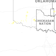

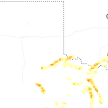
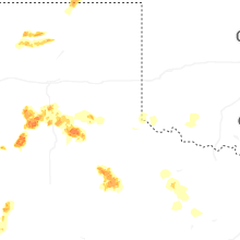
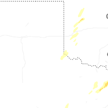
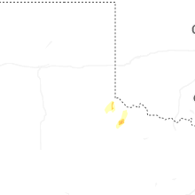
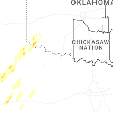


Connect with Interactive Hail Maps