

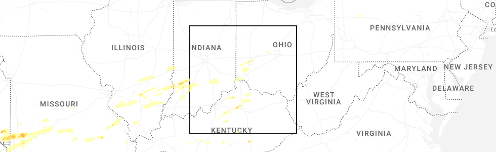
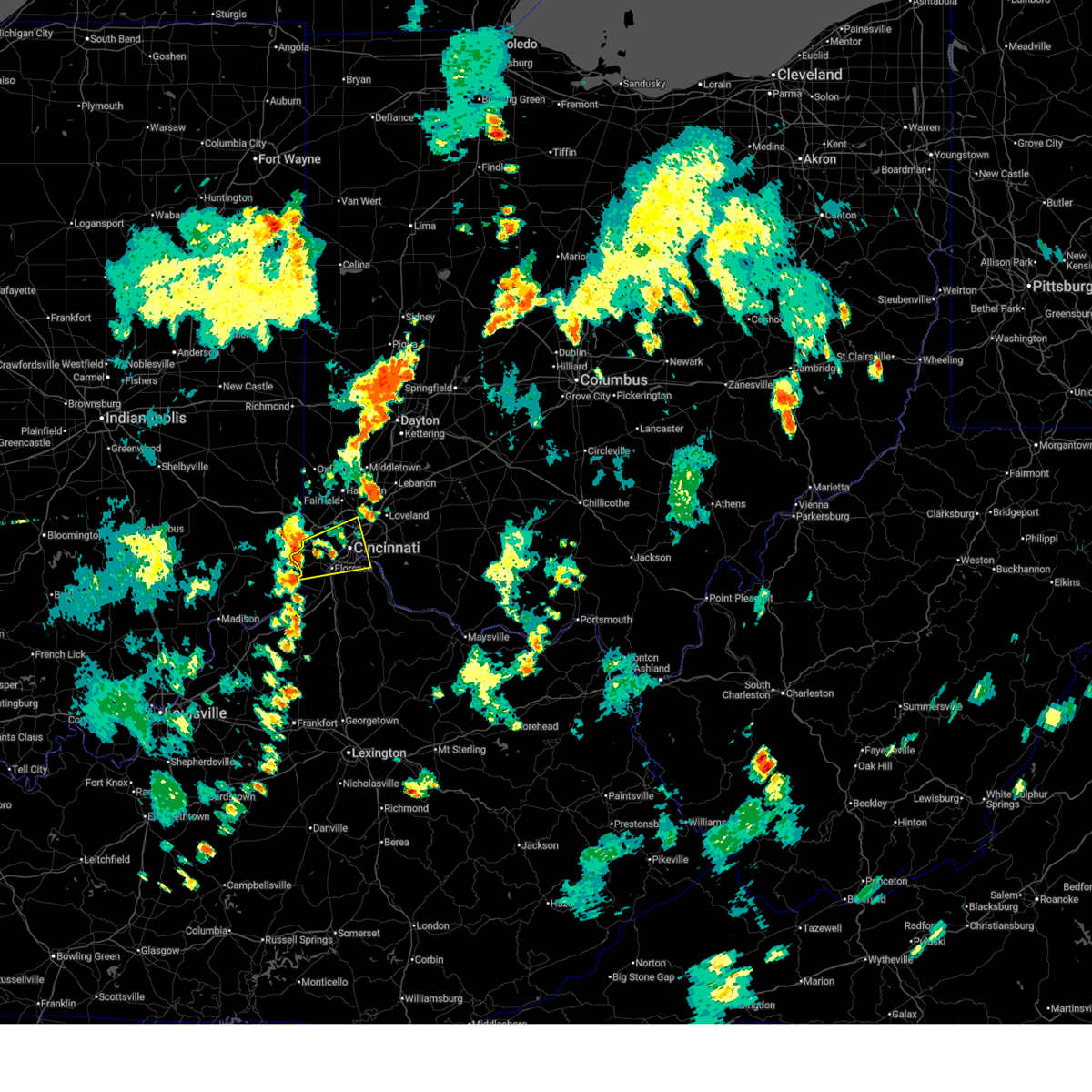
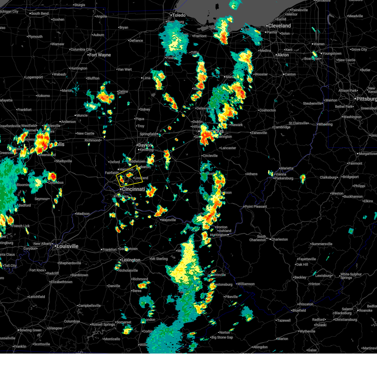
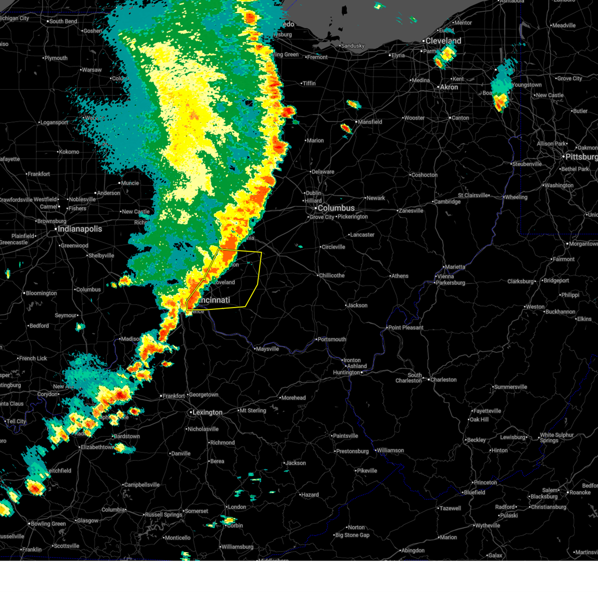
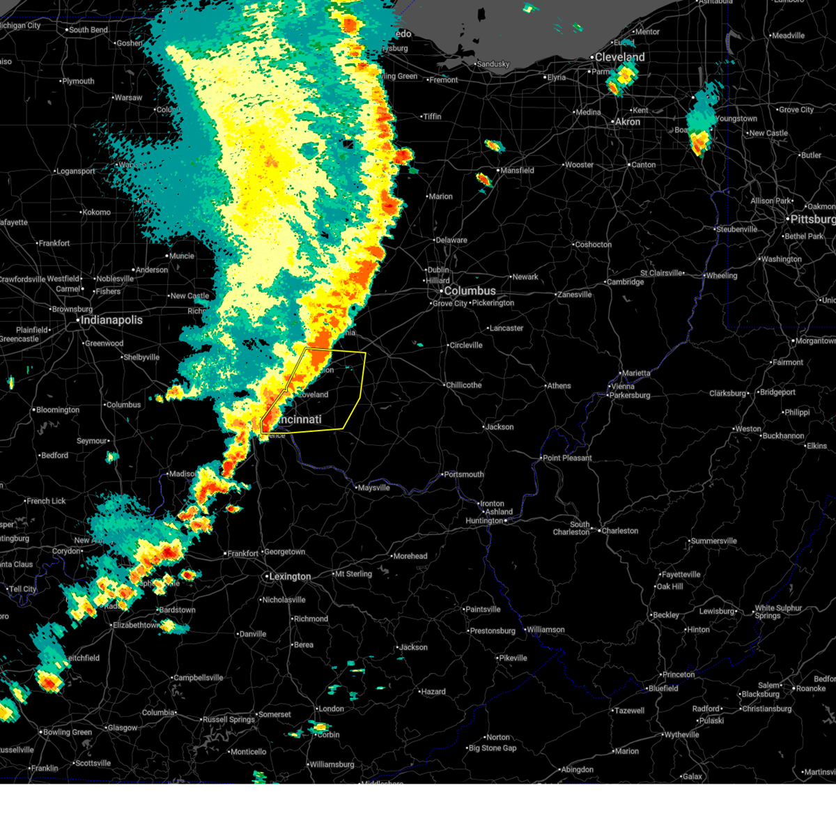
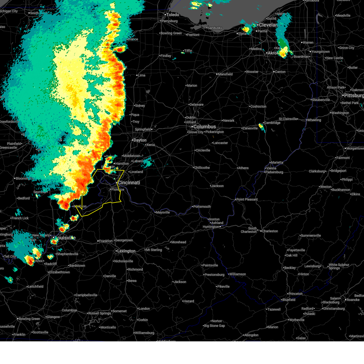
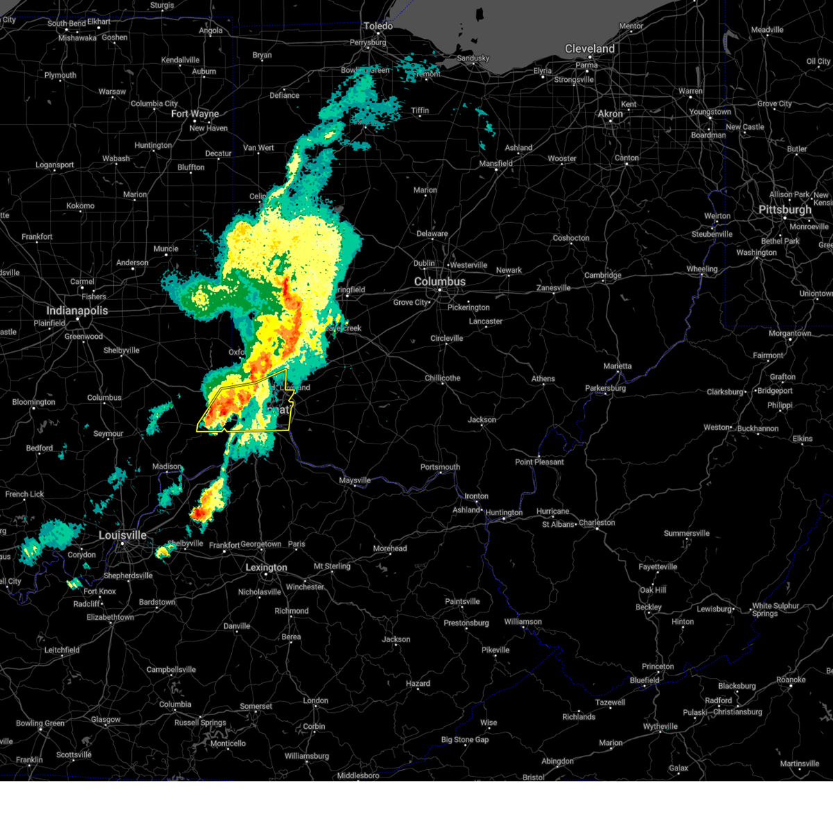
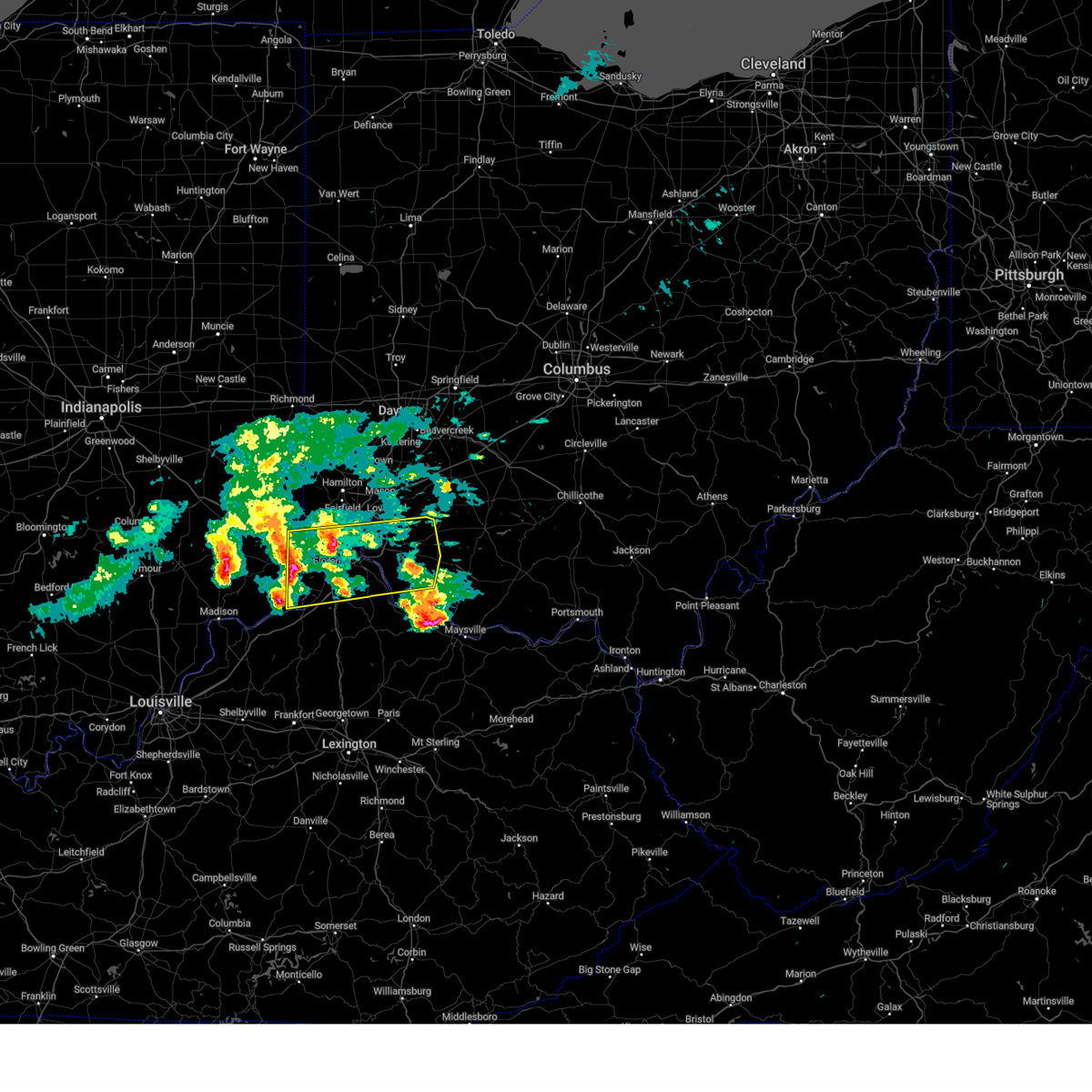
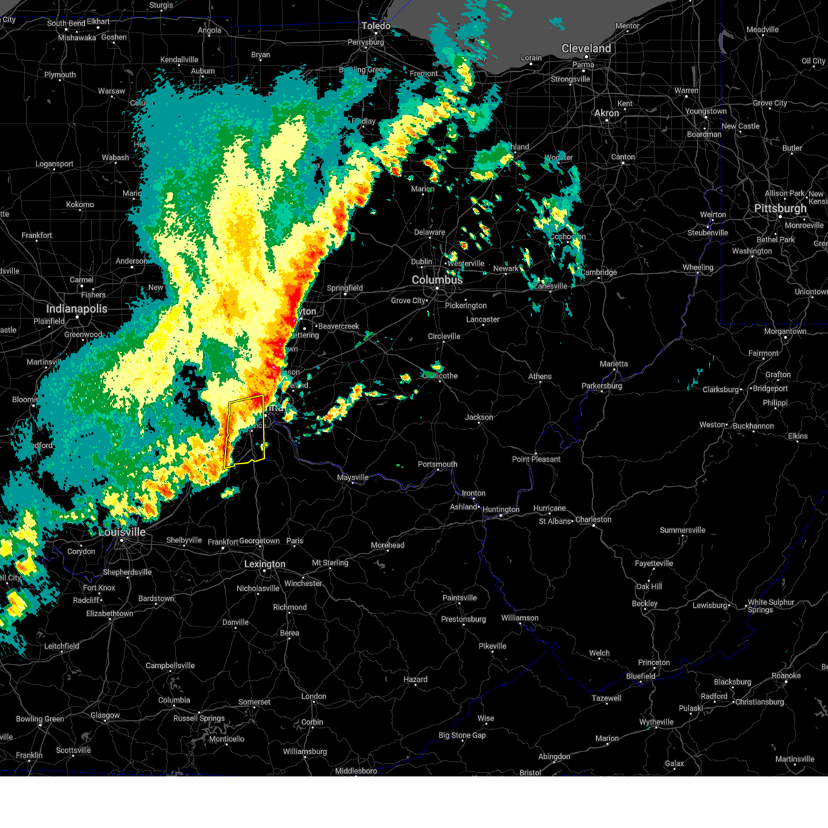
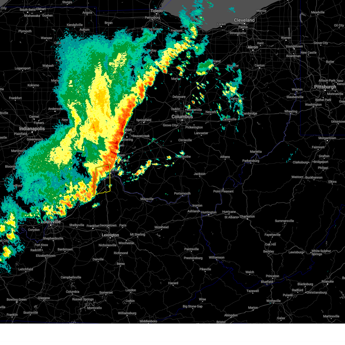
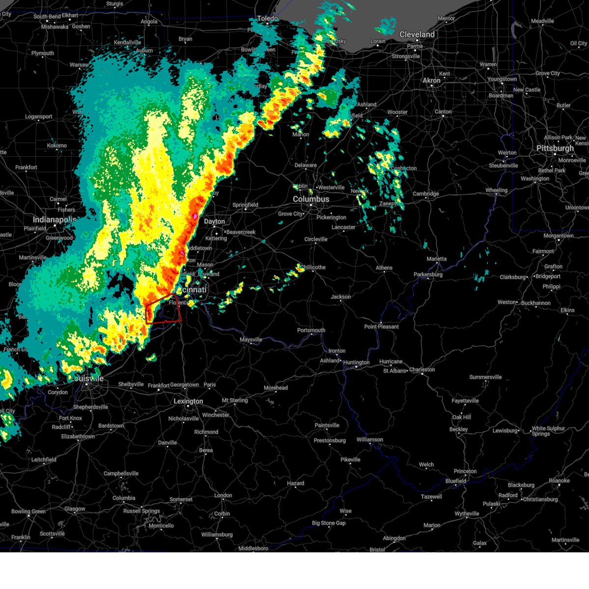
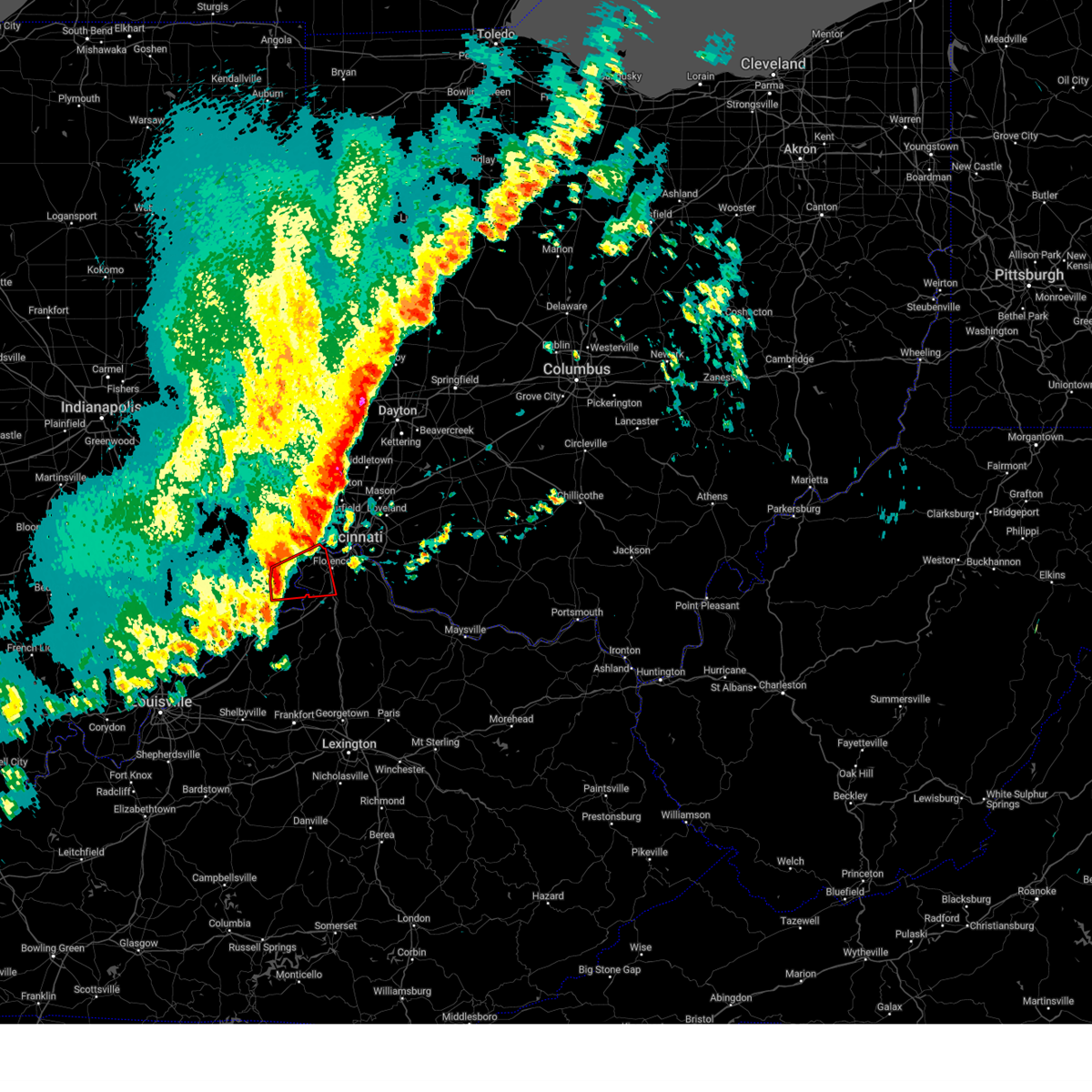
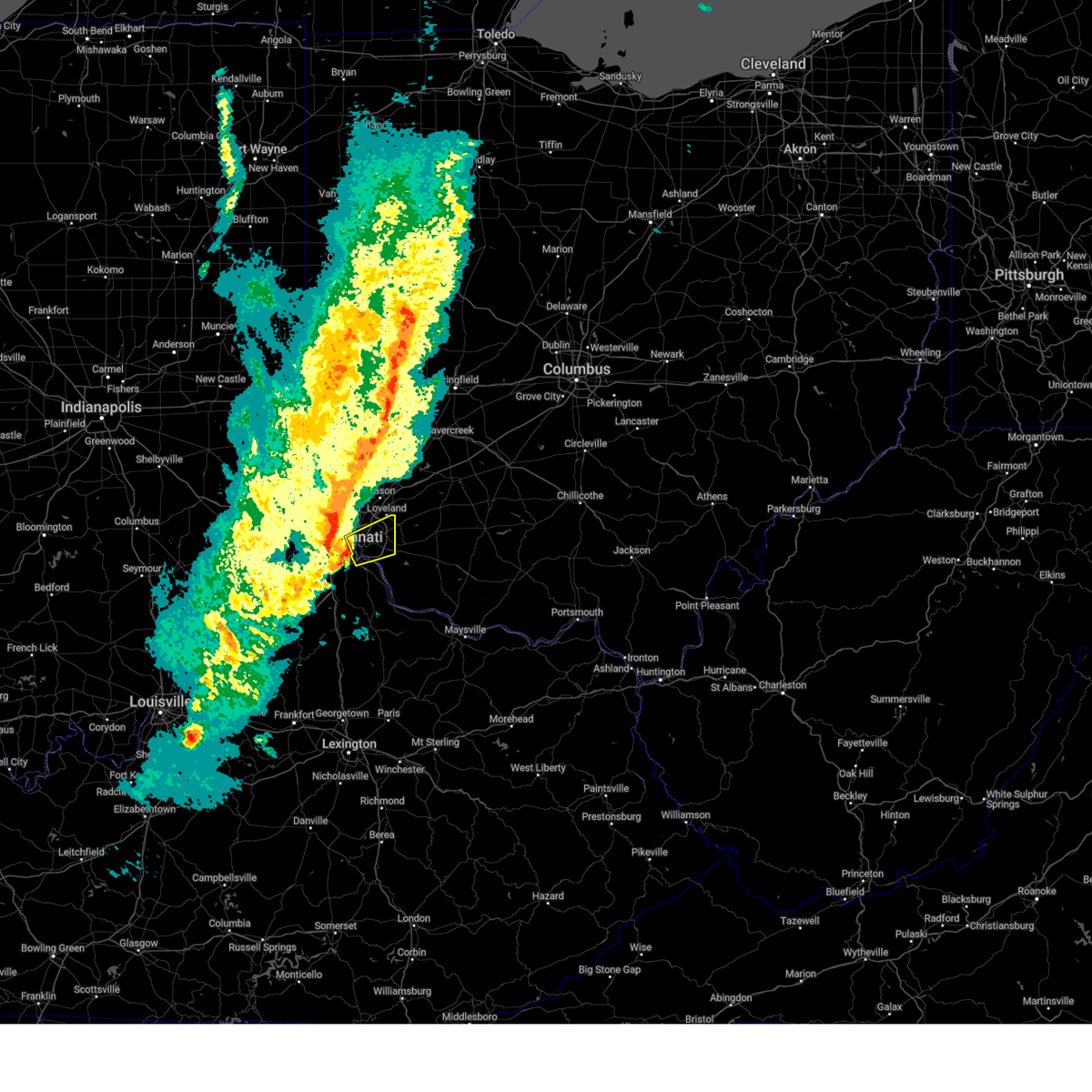
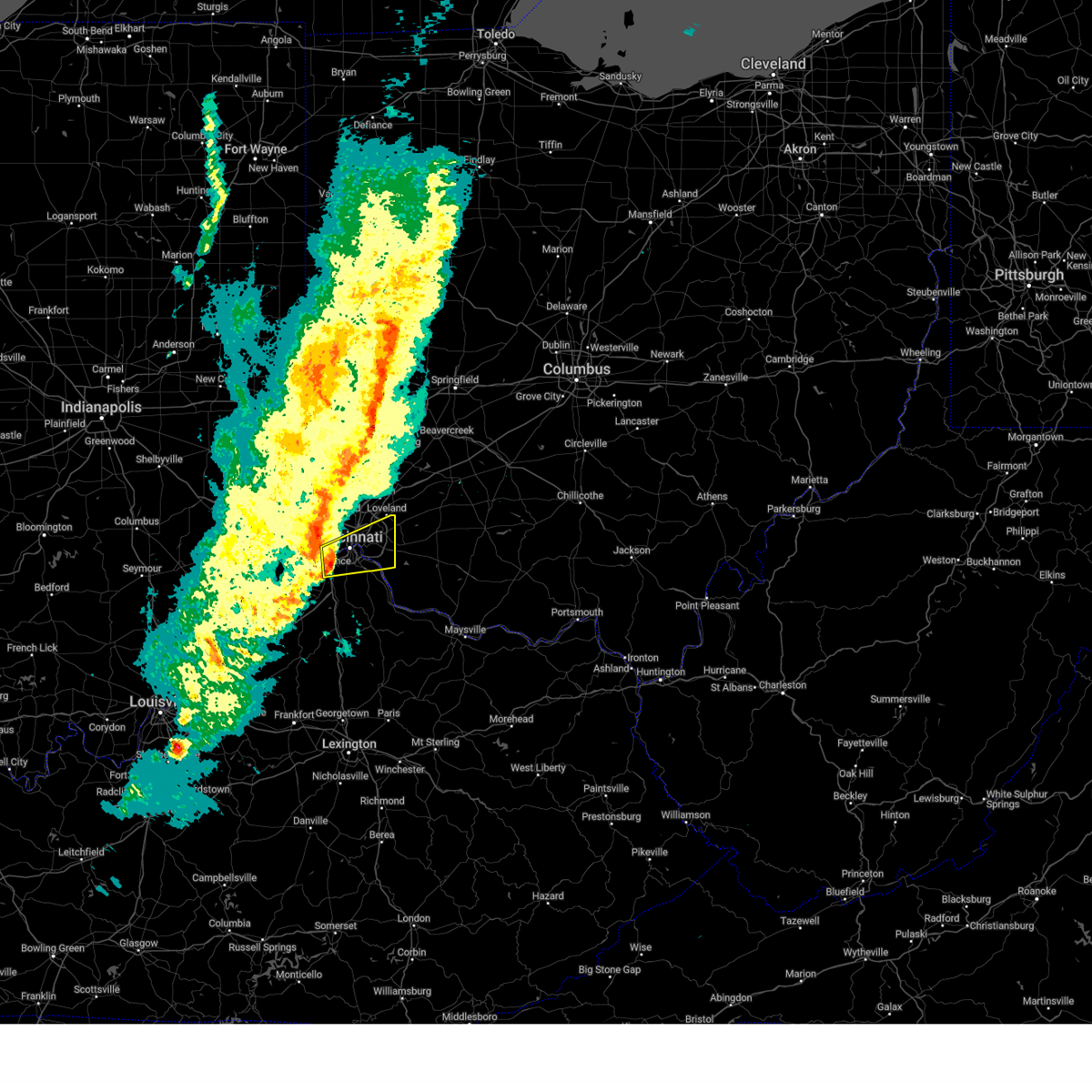
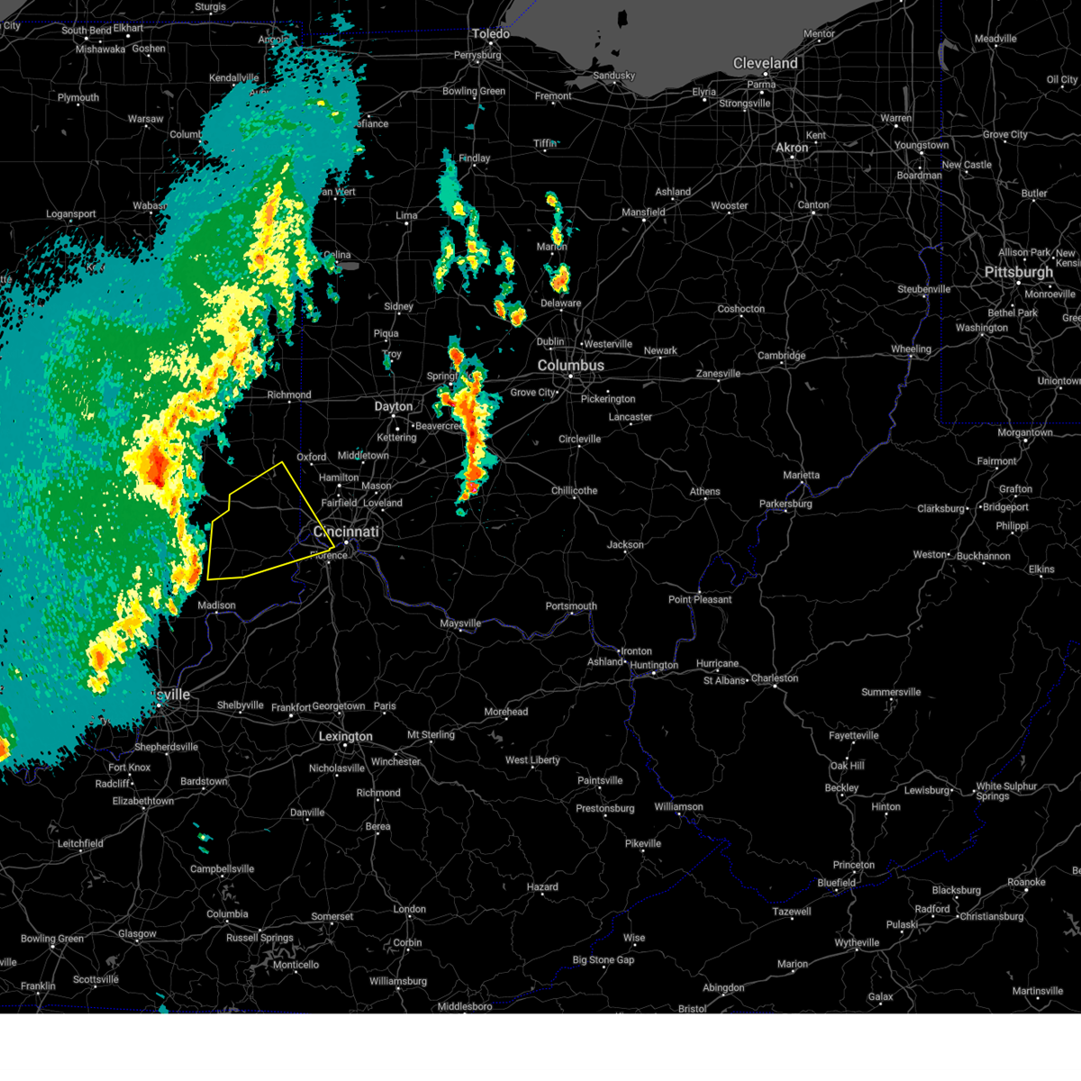
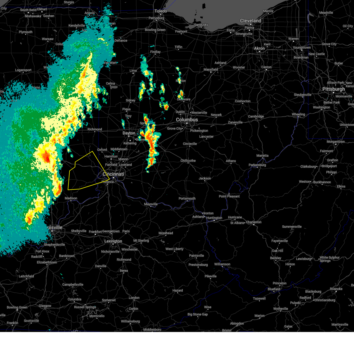
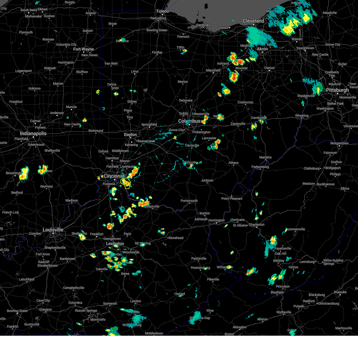
Hail Map for Cincinnati, OH
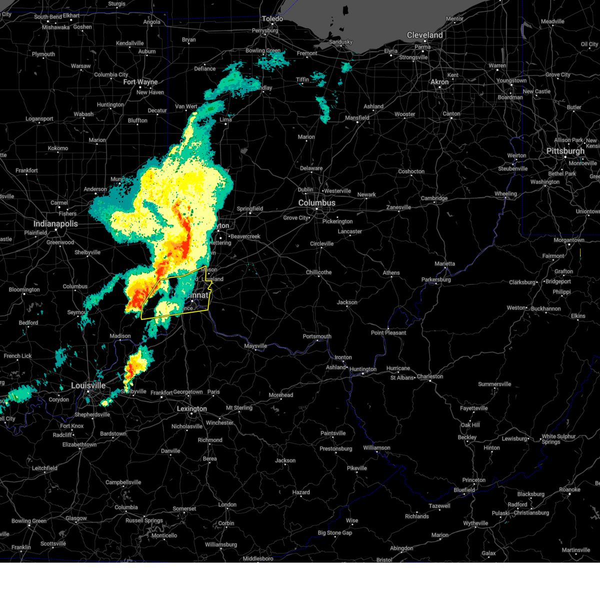
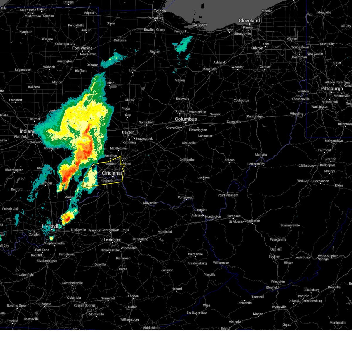
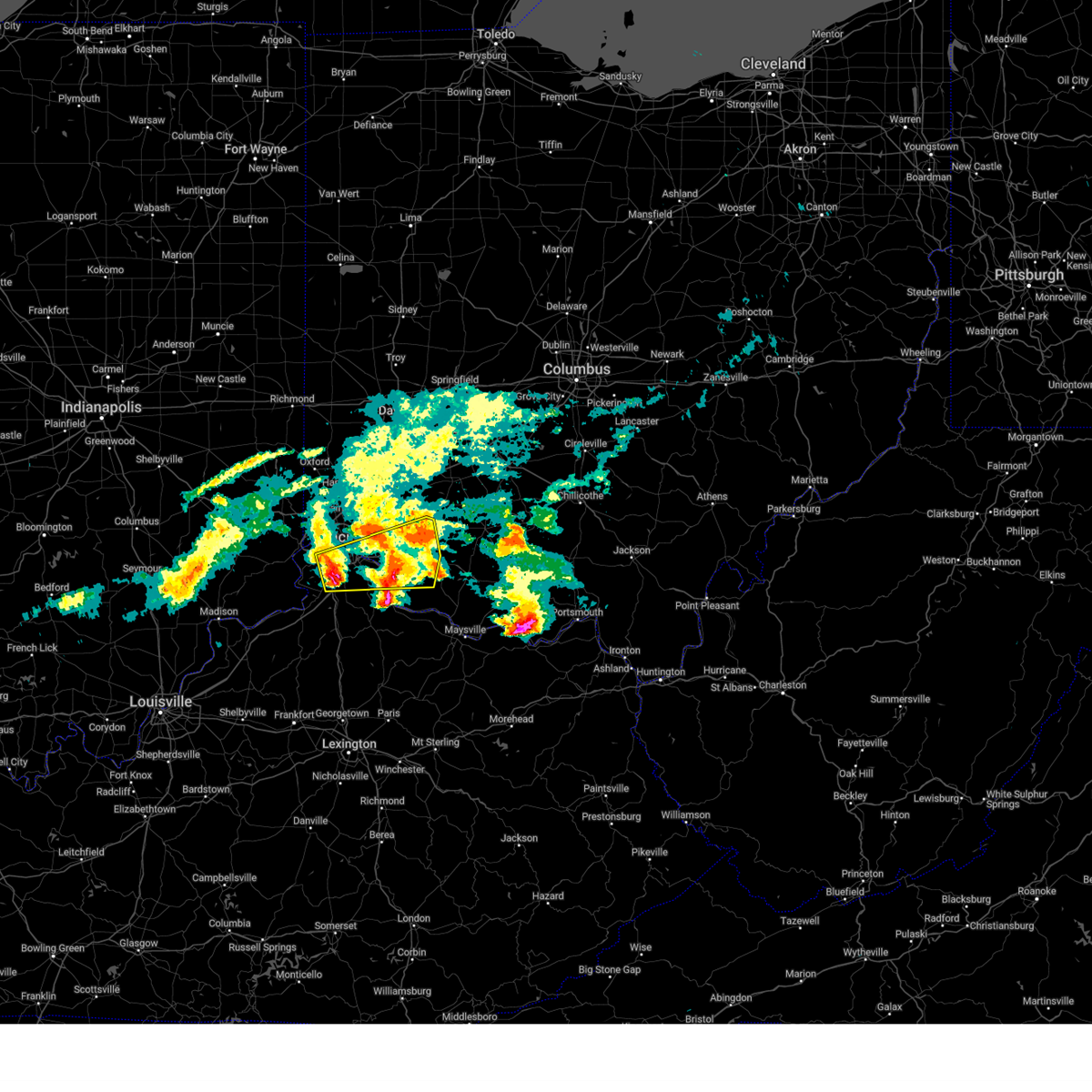
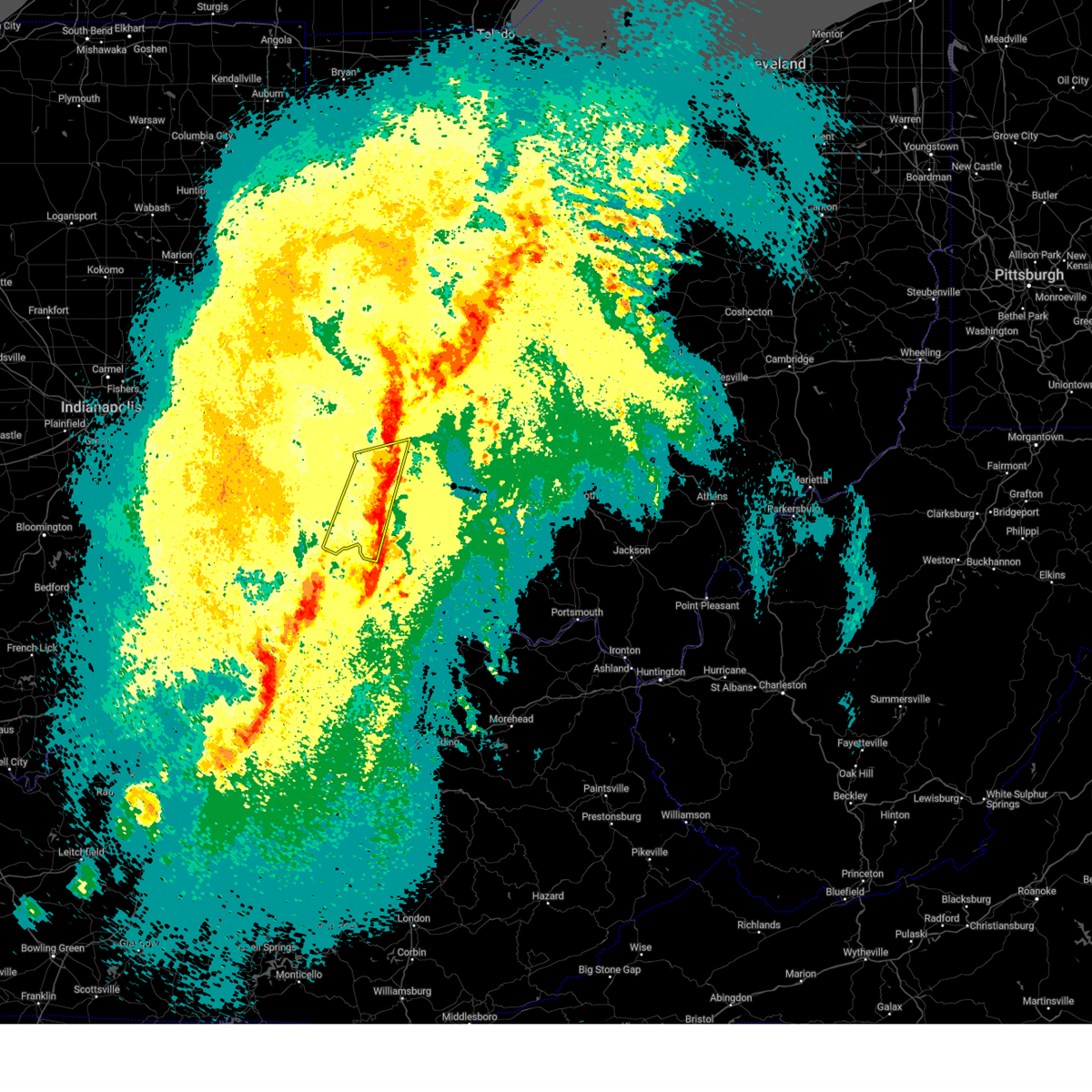
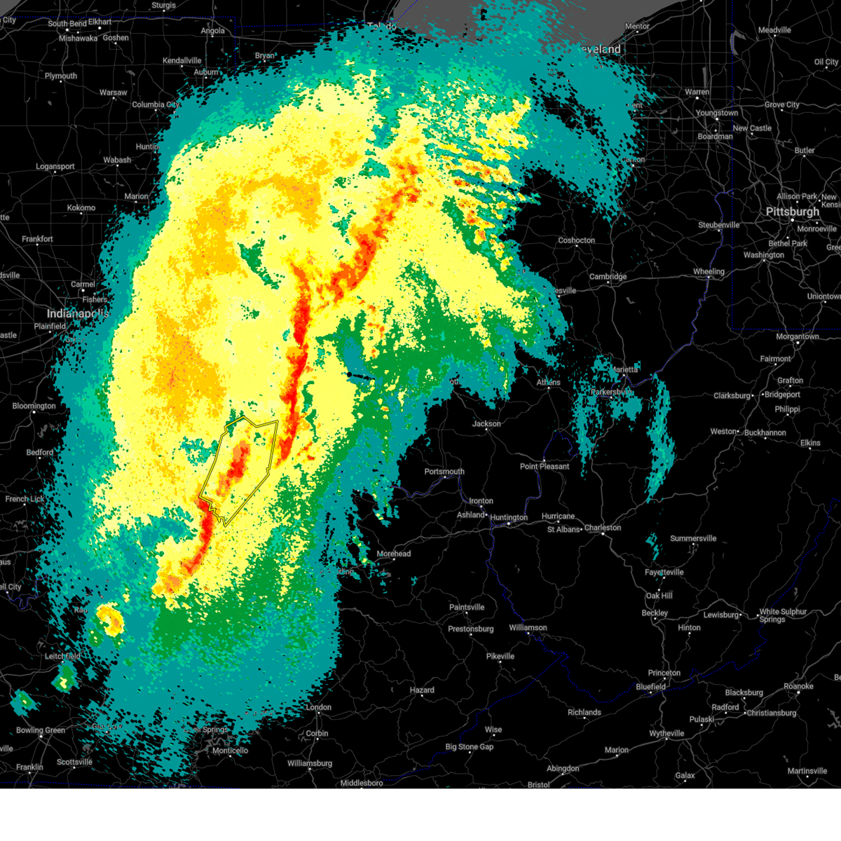
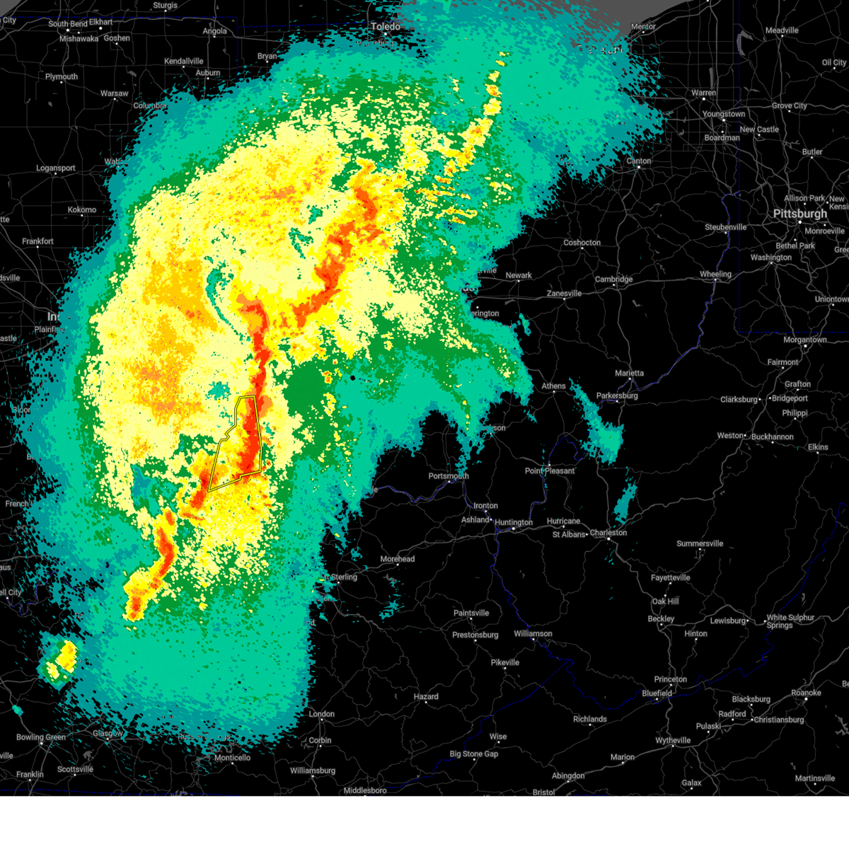
The Cincinnati, OH area has had 64 reports of on-the-ground hail by trained spotters, and has been under severe weather warnings 81 times during the past 12 months. Doppler radar has detected hail at or near Cincinnati, OH on 99 occasions, including 6 occasions during the past year.
| Name: | Cincinnati, OH |
| Where Located: | 2.3 miles N of Cincinnati, OH |
| Map: | Google Map for Cincinnati, OH |
| Population: | 296943 |
| Housing Units: | 161095 |
| More Info: | Search Google for Cincinnati, OH |
3
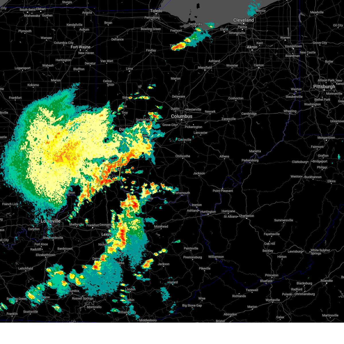
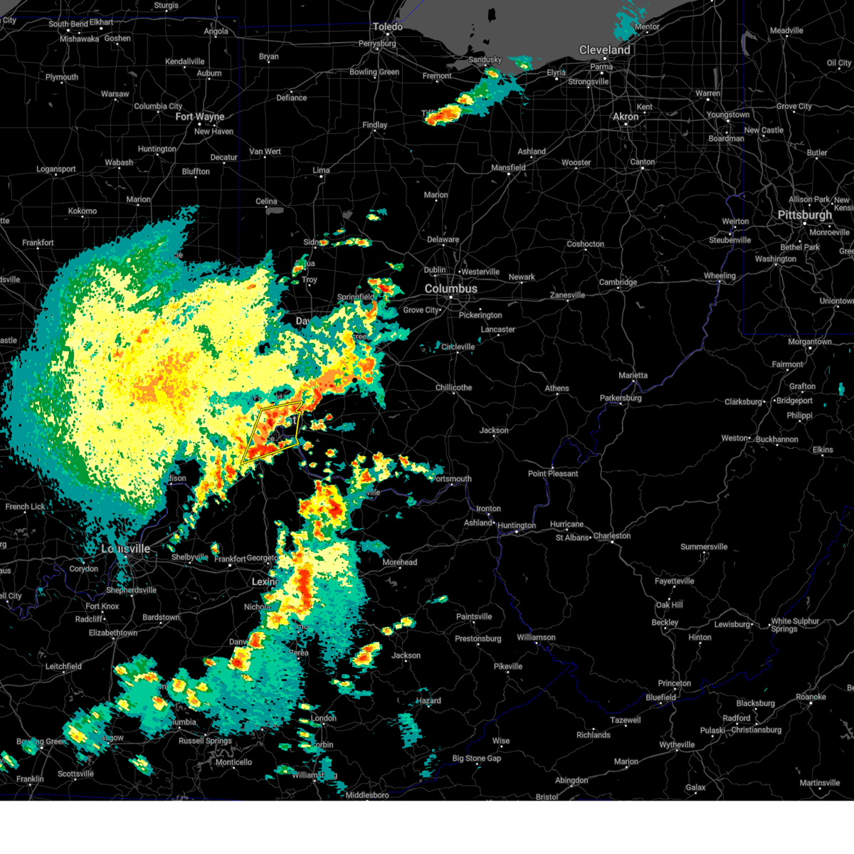
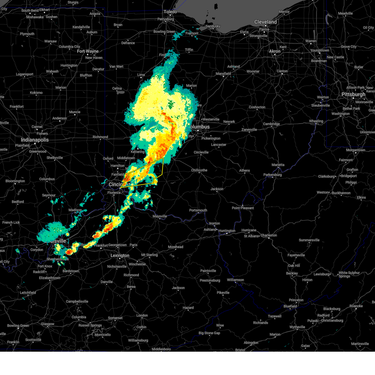
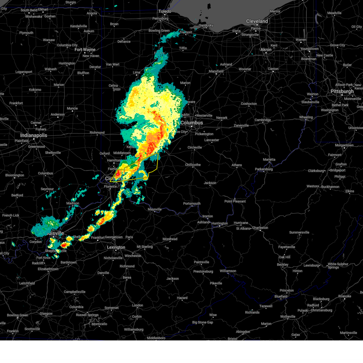
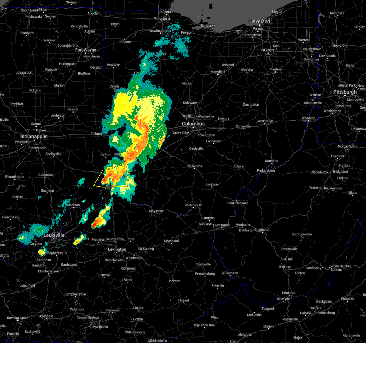
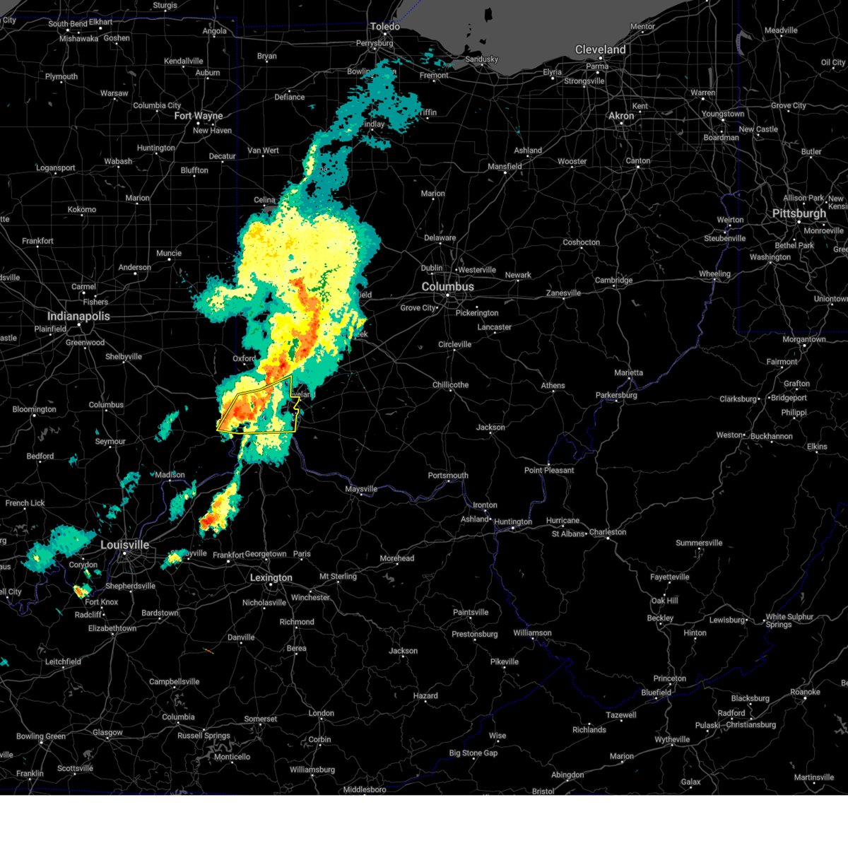
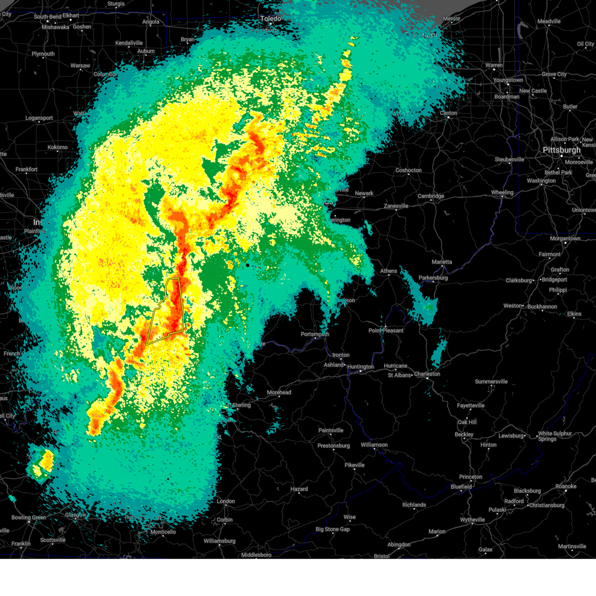
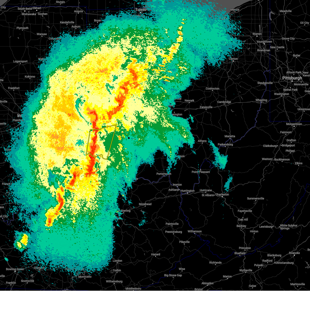
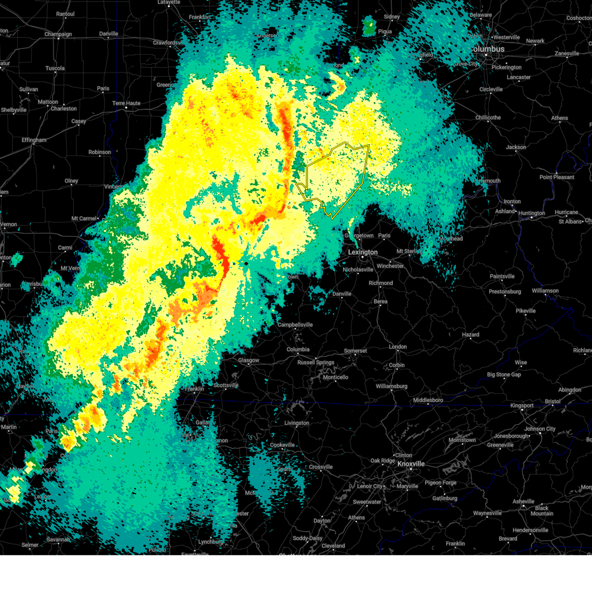
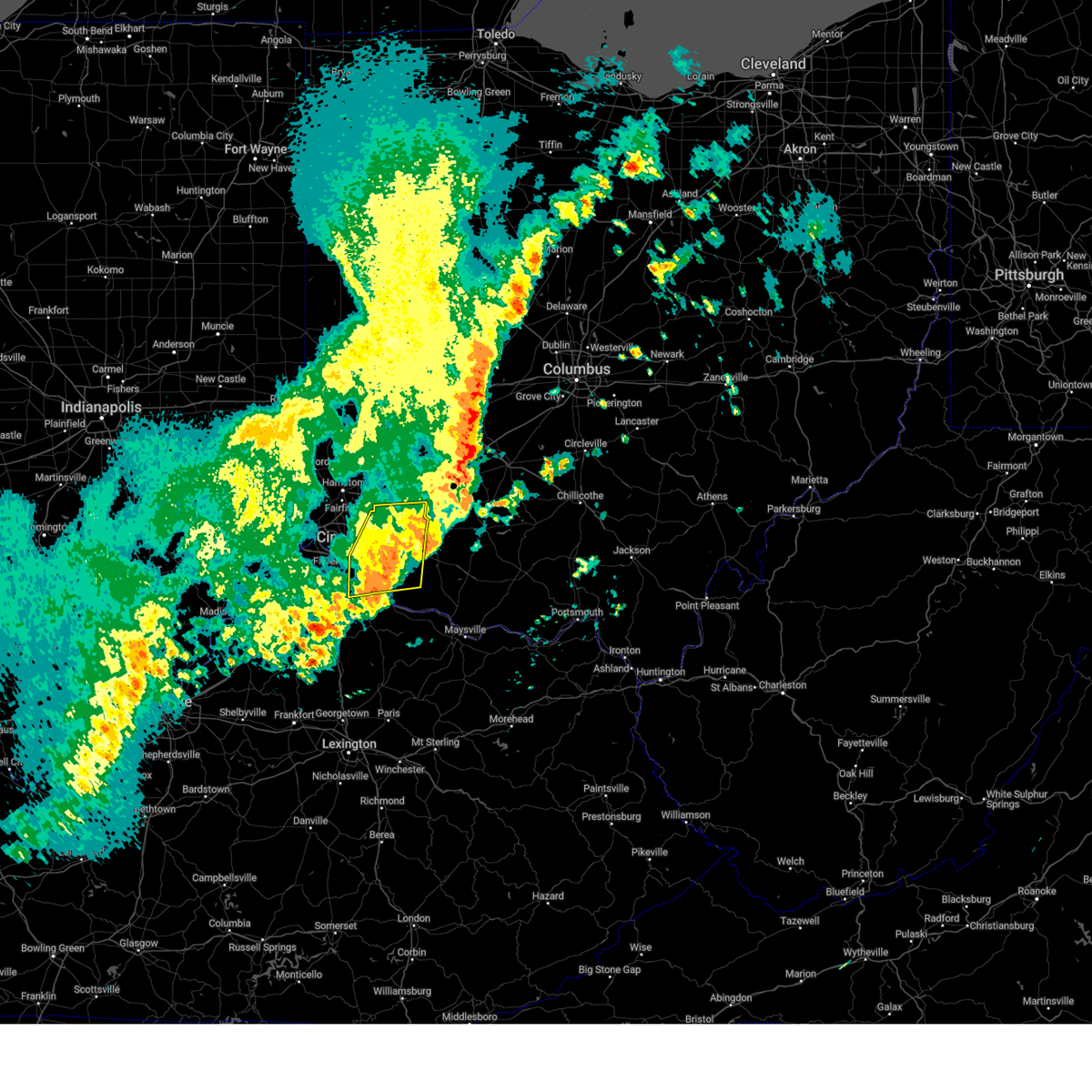
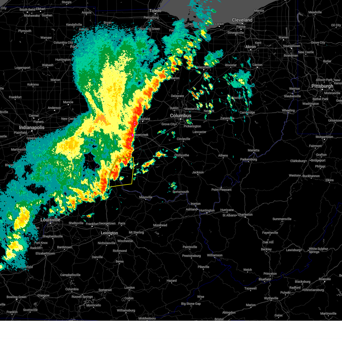
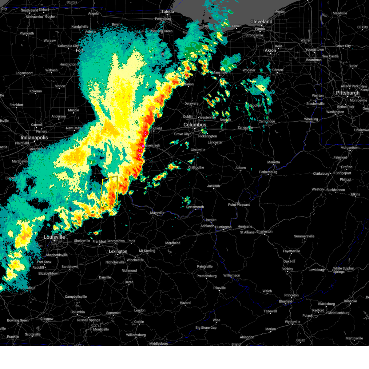
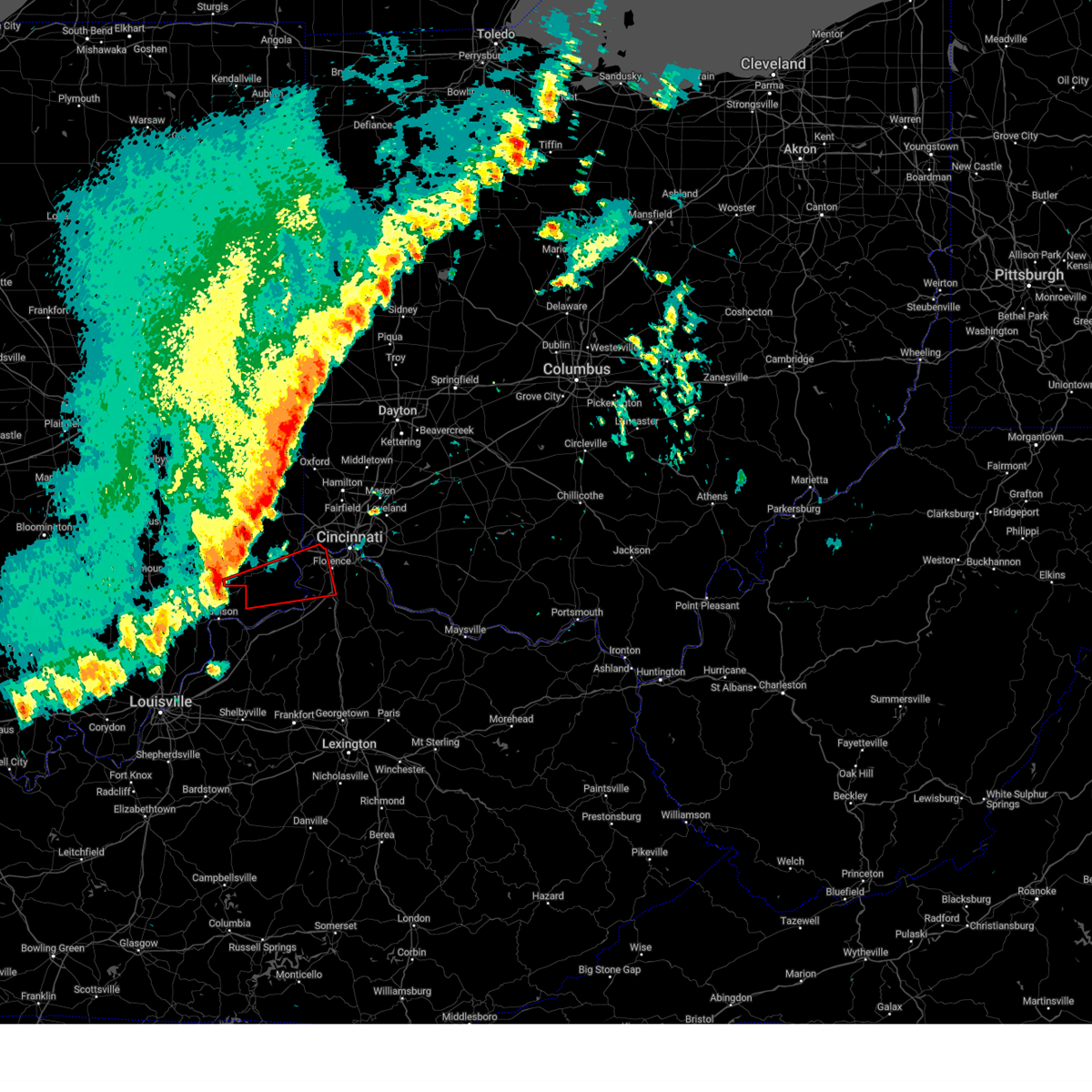
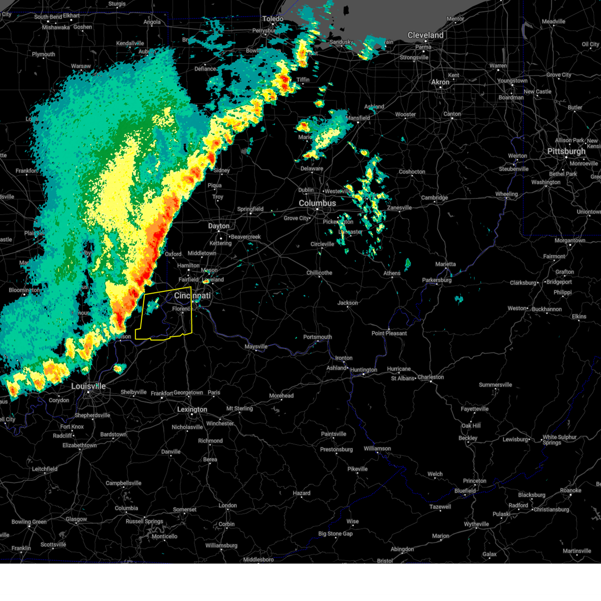
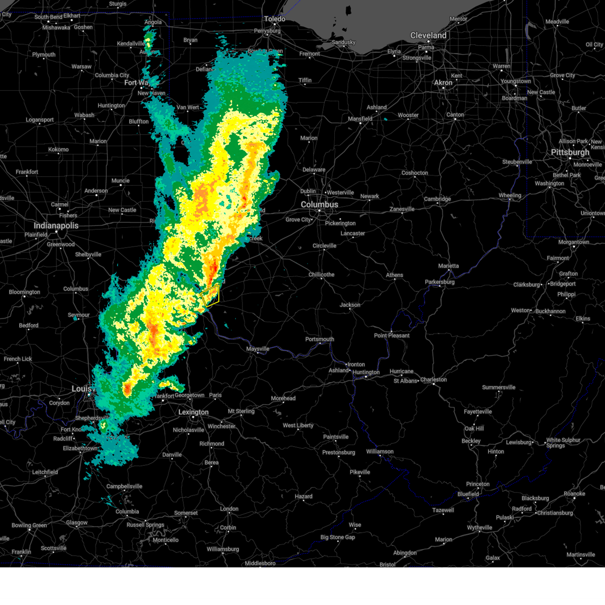
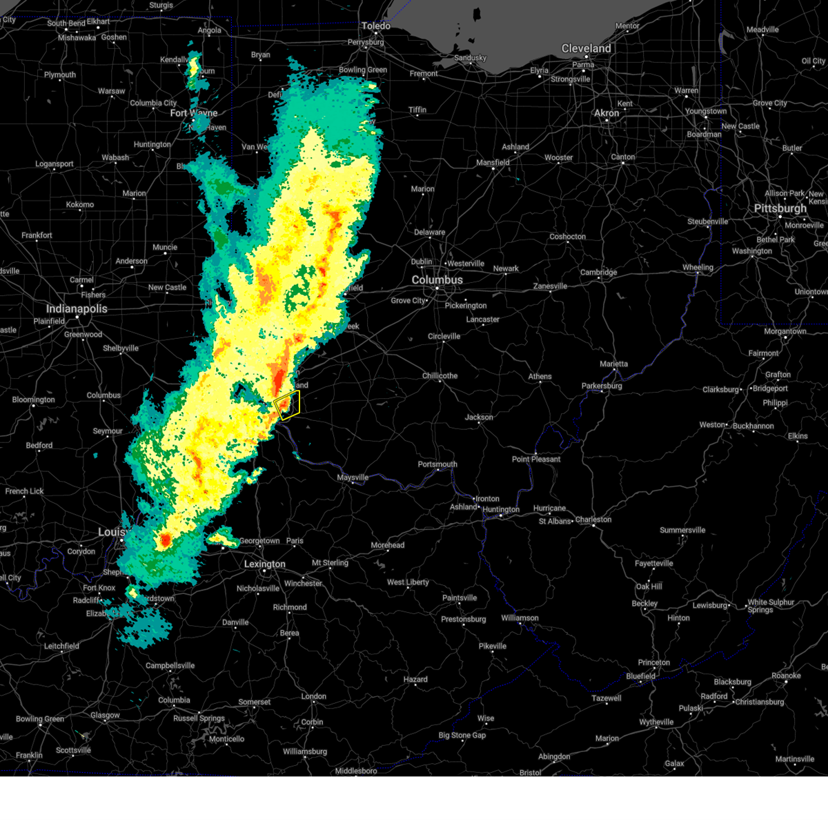
The Top Recent Hail Date for Cincinnati, OH is Tuesday, April 29, 2025 (10th out of 99)
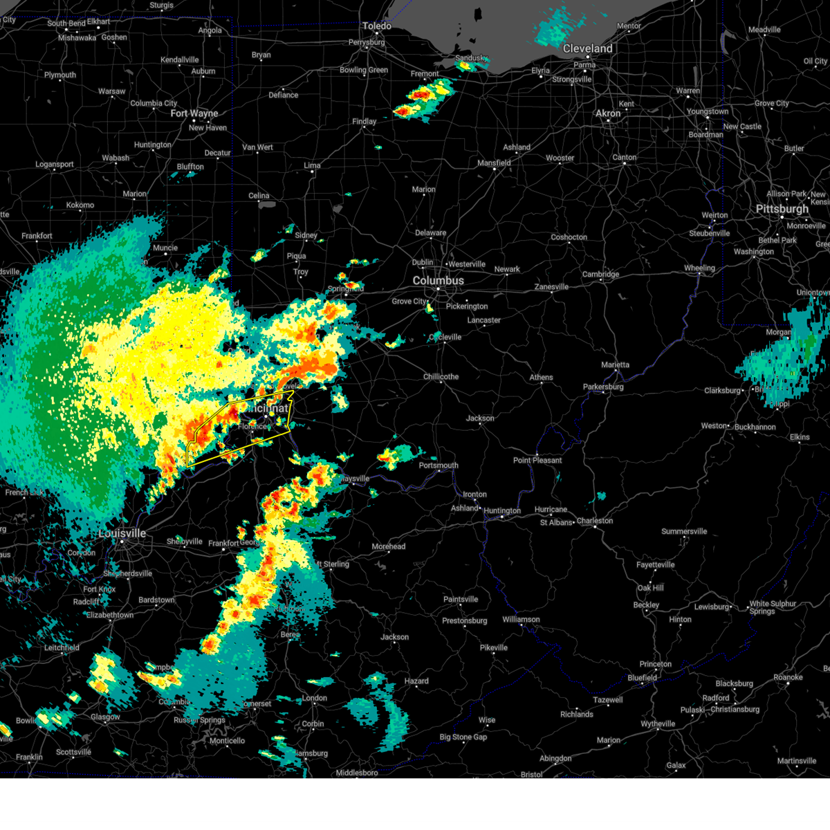
Hail and Wind Damage Spotted near Cincinnati, OH
| Date / Time | Report Details |
|---|---|
| 7/12/2025 7:12 PM EDT |
 The storm which prompted the warning has weakened below severe limits and no longer poses an immediate threat to life or property. therefore, the warning will be allowed to expire. please report previous wind damage or hail to the national weather service by going to our website at weather.gov/iln and submitting your report via social media. The storm which prompted the warning has weakened below severe limits and no longer poses an immediate threat to life or property. therefore, the warning will be allowed to expire. please report previous wind damage or hail to the national weather service by going to our website at weather.gov/iln and submitting your report via social media.
|
| 7/12/2025 7:06 PM EDT |
 At 705 pm edt, a severe thunderstorm was located over newport, moving northeast at 20 mph (radar indicated). Hazards include 60 mph wind gusts. Expect damage to trees and power lines. locations impacted include, cincinnati, covington, norwood, fort thomas, newport, edgewood, fort mitchell, villa hills, highland heights, taylor mill, bellevue, fort wright, dayton, ludlow, southgate, crescent springs, crestview hills, park hills, lakeside park, and wilder. this includes the following interstates, i-71 in ohio between mile markers 0 and 6. i-75 in kentucky between mile markers 187 and 191. I-75 in ohio between mile markers 0 and 3. At 705 pm edt, a severe thunderstorm was located over newport, moving northeast at 20 mph (radar indicated). Hazards include 60 mph wind gusts. Expect damage to trees and power lines. locations impacted include, cincinnati, covington, norwood, fort thomas, newport, edgewood, fort mitchell, villa hills, highland heights, taylor mill, bellevue, fort wright, dayton, ludlow, southgate, crescent springs, crestview hills, park hills, lakeside park, and wilder. this includes the following interstates, i-71 in ohio between mile markers 0 and 6. i-75 in kentucky between mile markers 187 and 191. I-75 in ohio between mile markers 0 and 3.
|
| 7/12/2025 7:06 PM EDT |
 the severe thunderstorm warning has been cancelled and is no longer in effect the severe thunderstorm warning has been cancelled and is no longer in effect
|
| 7/12/2025 6:41 PM EDT |
 Svriln the national weather service in wilmington has issued a * severe thunderstorm warning for, northern kenton county in northern kentucky, northern campbell county in northern kentucky, northern boone county in northern kentucky, central hamilton county in southwestern ohio, * until 715 pm edt. * at 641 pm edt, a severe thunderstorm was located near burlington, moving east at 30 mph (radar indicated). Hazards include 60 mph wind gusts. expect damage to trees and power lines Svriln the national weather service in wilmington has issued a * severe thunderstorm warning for, northern kenton county in northern kentucky, northern campbell county in northern kentucky, northern boone county in northern kentucky, central hamilton county in southwestern ohio, * until 715 pm edt. * at 641 pm edt, a severe thunderstorm was located near burlington, moving east at 30 mph (radar indicated). Hazards include 60 mph wind gusts. expect damage to trees and power lines
|
| 7/12/2025 4:00 PM EDT | Trees and powerlines down in the 300 block of larami in hamilton county OH, 6.2 miles S of Cincinnati, OH |
| 7/12/2025 3:55 PM EDT | Trees down along burns avenue... near both cooper and east mills. time estimated from rada in hamilton county OH, 5.8 miles SSW of Cincinnati, OH |
| 7/12/2025 3:54 PM EDT | Several trees down in lincoln heights. downed trees reported near the intersection of prairie ave and leggett st... along with wabash av in hamilton county OH, 7.9 miles SSW of Cincinnati, OH |
| 7/12/2025 3:54 PM EDT | Trees and powerlines down along woodknoll terrace. time estimated from rada in hamilton county OH, 5.6 miles S of Cincinnati, OH |
| 7/12/2025 3:53 PM EDT |
 Svriln the national weather service in wilmington has issued a * severe thunderstorm warning for, northeastern hamilton county in southwestern ohio, southeastern butler county in southwestern ohio, northwestern clermont county in southwestern ohio, southwestern warren county in southwestern ohio, * until 430 pm edt. * at 353 pm edt, a severe thunderstorm was located over wyoming, moving east at 15 mph (radar indicated). Hazards include 60 mph wind gusts. expect damage to trees and power lines Svriln the national weather service in wilmington has issued a * severe thunderstorm warning for, northeastern hamilton county in southwestern ohio, southeastern butler county in southwestern ohio, northwestern clermont county in southwestern ohio, southwestern warren county in southwestern ohio, * until 430 pm edt. * at 353 pm edt, a severe thunderstorm was located over wyoming, moving east at 15 mph (radar indicated). Hazards include 60 mph wind gusts. expect damage to trees and power lines
|
| 6/26/2025 4:23 PM EDT | One large healthy pine tree downed at kenwood road and galbraith road. one large maple tree downed on power lines at kenwood road and kugler mill roa in hamilton county OH, 8.1 miles SW of Cincinnati, OH |
| 6/18/2025 7:35 PM EDT | Asos station kluk cincinnati lunken fiel in hamilton county OH, 4.8 miles WNW of Cincinnati, OH |
| 6/18/2025 7:30 PM EDT |
 At 730 pm edt, severe thunderstorms were located along a line extending from waynesville to newport, moving east at 50 mph (radar indicated). Hazards include 60 mph wind gusts and penny size hail. Expect damage to trees and power lines. locations impacted include, cincinnati, covington, mason, lebanon, norwood, fort thomas, newport, sharonville, wilmington, blue ash, loveland, reading, montgomery, madeira, edgewood, fort mitchell, villa hills, highland heights, milford, and taylor mill. this includes the following interstates, i-71 in ohio between mile markers 0 and 57. i-75 in kentucky between mile markers 187 and 191. I-75 in ohio between mile markers 0 and 2, and near mile marker 8. At 730 pm edt, severe thunderstorms were located along a line extending from waynesville to newport, moving east at 50 mph (radar indicated). Hazards include 60 mph wind gusts and penny size hail. Expect damage to trees and power lines. locations impacted include, cincinnati, covington, mason, lebanon, norwood, fort thomas, newport, sharonville, wilmington, blue ash, loveland, reading, montgomery, madeira, edgewood, fort mitchell, villa hills, highland heights, milford, and taylor mill. this includes the following interstates, i-71 in ohio between mile markers 0 and 57. i-75 in kentucky between mile markers 187 and 191. I-75 in ohio between mile markers 0 and 2, and near mile marker 8.
|
| 6/18/2025 7:30 PM EDT |
 the severe thunderstorm warning has been cancelled and is no longer in effect the severe thunderstorm warning has been cancelled and is no longer in effect
|
| 6/18/2025 7:04 PM EDT | Svriln the national weather service in wilmington has issued a * severe thunderstorm warning for, north central kenton county in northern kentucky, northern campbell county in northern kentucky, eastern hamilton county in southwestern ohio, eastern butler county in southwestern ohio, northern clermont county in southwestern ohio, northwestern brown county in southwestern ohio, warren county in southwestern ohio, clinton county in southwestern ohio, northwestern highland county in south central ohio, * until 800 pm edt. * at 704 pm edt, severe thunderstorms were located along a line extending from middletown to burlington, moving northeast at 30 mph (radar indicated). Hazards include 60 mph wind gusts and penny size hail. expect damage to trees and power lines |
| 6/18/2025 6:53 PM EDT | At 652 pm edt, severe thunderstorms were located along a line extending from harrison to vevay, moving east at 35 mph (radar indicated). Hazards include 60 mph wind gusts and quarter size hail. Minor hail damage to vehicles is possible. expect wind damage to trees and power lines. locations impacted include, cincinnati, covington, florence, independence, norwood, forest park, erlanger, newport, sharonville, blue ash, springdale, reading, harrison, north college hill, edgewood, elsmere, wyoming, cheviot, fort mitchell, and villa hills. this includes the following interstates, i-71 in kentucky between mile markers 39 and 77. i-71 in ohio between mile markers 0 and 5. i-74 in indiana near mile marker 171. i-74 in ohio between mile markers 0 and 19. i-75 in kentucky between mile markers 167 and 191. I-75 in ohio between mile markers 0 and 17. |
| 6/18/2025 6:32 PM EDT |
 Svriln the national weather service in wilmington has issued a * severe thunderstorm warning for, ohio county in southeastern indiana, dearborn county in southeastern indiana, switzerland county in southeastern indiana, carroll county in northern kentucky, kenton county in northern kentucky, campbell county in northern kentucky, boone county in northern kentucky, gallatin county in northern kentucky, hamilton county in southwestern ohio, * until 730 pm edt. * at 631 pm edt, severe thunderstorms were located along a line extending from 6 miles west of bright to 9 miles southwest of dillsboro, moving east at 40 mph (radar indicated). Hazards include 60 mph wind gusts and quarter size hail. Minor hail damage to vehicles is possible. Expect wind damage to trees and power lines. Svriln the national weather service in wilmington has issued a * severe thunderstorm warning for, ohio county in southeastern indiana, dearborn county in southeastern indiana, switzerland county in southeastern indiana, carroll county in northern kentucky, kenton county in northern kentucky, campbell county in northern kentucky, boone county in northern kentucky, gallatin county in northern kentucky, hamilton county in southwestern ohio, * until 730 pm edt. * at 631 pm edt, severe thunderstorms were located along a line extending from 6 miles west of bright to 9 miles southwest of dillsboro, moving east at 40 mph (radar indicated). Hazards include 60 mph wind gusts and quarter size hail. Minor hail damage to vehicles is possible. Expect wind damage to trees and power lines.
|
| 4/29/2025 7:41 PM EDT | The storm which prompted the warning has moved out of the area. therefore, the warning will be allowed to expire. a severe thunderstorm watch remains in effect until midnight edt for northern kentucky, and southwestern ohio. please report previous wind damage or hail to the national weather service by going to our website at weather.gov/iln and submitting your report via social media. |
| 4/29/2025 7:25 PM EDT | the severe thunderstorm warning has been cancelled and is no longer in effect |
| 4/29/2025 7:25 PM EDT | At 724 pm edt, a severe thunderstorm was located over mariemont, moving east at 40 mph (radar indicated). Hazards include 60 mph wind gusts and quarter size hail. Minor hail damage to vehicles is possible. expect wind damage to trees and power lines. locations impacted include, taylor mill, lockland, camp dennison, dillonvale, covington, melbourne, highland heights, fairview, riverbend and coney island, ricedale, lunken airport, evendale, deer park, turpin hills, fort thomas, cold spring, remington, mariemont, southgate, and latonia lakes. this includes the following interstates, i-71 in ohio between mile markers 0 and 17. i-75 in kentucky between mile markers 189 and 191. I-75 in ohio near mile marker 0, and between mile markers 10 and 13. |
| 4/29/2025 7:12 PM EDT |
 At 712 pm edt, a severe thunderstorm was located over edgewood, moving east at 45 mph (radar indicated). Hazards include 60 mph wind gusts and quarter size hail. Minor hail damage to vehicles is possible. expect wind damage to trees and power lines. locations impacted include, lockland, florence, cincinnati, big bone lick, covington, highland heights, villa hills, crescent park, ricedale, lincoln heights, crestview hills, fort thomas, mount healthy, remington, southgate, plainville, edgewood, bromley, erlanger, and montgomery. this includes the following interstates, i-71 in ohio between mile markers 0 and 17. i-74 in ohio between mile markers 14 and 19. i-75 in kentucky between mile markers 176 and 191. I-75 in ohio between mile markers 0 and 14. At 712 pm edt, a severe thunderstorm was located over edgewood, moving east at 45 mph (radar indicated). Hazards include 60 mph wind gusts and quarter size hail. Minor hail damage to vehicles is possible. expect wind damage to trees and power lines. locations impacted include, lockland, florence, cincinnati, big bone lick, covington, highland heights, villa hills, crescent park, ricedale, lincoln heights, crestview hills, fort thomas, mount healthy, remington, southgate, plainville, edgewood, bromley, erlanger, and montgomery. this includes the following interstates, i-71 in ohio between mile markers 0 and 17. i-74 in ohio between mile markers 14 and 19. i-75 in kentucky between mile markers 176 and 191. I-75 in ohio between mile markers 0 and 14.
|
| 4/29/2025 7:12 PM EDT |
 the severe thunderstorm warning has been cancelled and is no longer in effect the severe thunderstorm warning has been cancelled and is no longer in effect
|
| 4/29/2025 7:05 PM EDT | At 704 pm edt, a severe thunderstorm was located near rising sun, moving east at 40 mph (radar indicated). Hazards include 60 mph wind gusts and quarter size hail. Minor hail damage to vehicles is possible. expect wind damage to trees and power lines. locations impacted include, lockland, florence, dent, cincinnati, big bone lick, covington, highland heights, villa hills, aurora, crescent park, ricedale, lincoln heights, crestview hills, miami heights, fort thomas, mount healthy, quercus grove, hidden valley, remington, and southgate. this includes the following interstates, i-71 in ohio between mile markers 0 and 17. i-74 in ohio between mile markers 8 and 19. i-75 in kentucky between mile markers 176 and 191. I-75 in ohio between mile markers 0 and 14. |
| 4/29/2025 6:49 PM EDT |
 Svriln the national weather service in wilmington has issued a * severe thunderstorm warning for, ohio county in southeastern indiana, southern dearborn county in southeastern indiana, switzerland county in southeastern indiana, northern kenton county in northern kentucky, northern campbell county in northern kentucky, boone county in northern kentucky, hamilton county in southwestern ohio, * until 745 pm edt. * at 649 pm edt, a severe thunderstorm was located near dillsboro, moving east at 40 mph (radar indicated). Hazards include 60 mph wind gusts and quarter size hail. Minor hail damage to vehicles is possible. Expect wind damage to trees and power lines. Svriln the national weather service in wilmington has issued a * severe thunderstorm warning for, ohio county in southeastern indiana, southern dearborn county in southeastern indiana, switzerland county in southeastern indiana, northern kenton county in northern kentucky, northern campbell county in northern kentucky, boone county in northern kentucky, hamilton county in southwestern ohio, * until 745 pm edt. * at 649 pm edt, a severe thunderstorm was located near dillsboro, moving east at 40 mph (radar indicated). Hazards include 60 mph wind gusts and quarter size hail. Minor hail damage to vehicles is possible. Expect wind damage to trees and power lines.
|
| 4/29/2025 2:21 PM EDT |
 At 221 pm edt, a severe thunderstorm was located over loveland, moving east at 55 mph (radar indicated). Hazards include 60 mph wind gusts and quarter size hail. Minor hail damage to vehicles is possible. expect wind damage to trees and power lines. locations impacted include, murdock, clarksville, fort ancient, camp dennison, dillonvale, dallasburg, blanchester, deer park, martinsville, morrisville, highpoint, wilmington, ogden, springvale, remington, mariemont, cowan lake state park, plainville, mulberry, and montgomery. This includes i-71 in ohio between mile markers 6 and 24. At 221 pm edt, a severe thunderstorm was located over loveland, moving east at 55 mph (radar indicated). Hazards include 60 mph wind gusts and quarter size hail. Minor hail damage to vehicles is possible. expect wind damage to trees and power lines. locations impacted include, murdock, clarksville, fort ancient, camp dennison, dillonvale, dallasburg, blanchester, deer park, martinsville, morrisville, highpoint, wilmington, ogden, springvale, remington, mariemont, cowan lake state park, plainville, mulberry, and montgomery. This includes i-71 in ohio between mile markers 6 and 24.
|
| 4/29/2025 2:15 PM EDT |
 At 215 pm edt, a severe thunderstorm was located over montgomery, moving east at 65 mph (radar indicated). Hazards include 60 mph wind gusts and quarter size hail. Minor hail damage to vehicles is possible. expect wind damage to trees and power lines. locations impacted include, murdock, clarksville, elmwood place, fort ancient, lockland, wyoming, cincinnati, camp dennison, dillonvale, glendale, dallasburg, blanchester, lincoln heights, evendale, deer park, martinsville, morrisville, highpoint, wilmington, and ogden. this includes the following interstates, i-71 in ohio between mile markers 3 and 24. i-74 in ohio between mile markers 16 and 19. I-75 in ohio between mile markers 2 and 17. At 215 pm edt, a severe thunderstorm was located over montgomery, moving east at 65 mph (radar indicated). Hazards include 60 mph wind gusts and quarter size hail. Minor hail damage to vehicles is possible. expect wind damage to trees and power lines. locations impacted include, murdock, clarksville, elmwood place, fort ancient, lockland, wyoming, cincinnati, camp dennison, dillonvale, glendale, dallasburg, blanchester, lincoln heights, evendale, deer park, martinsville, morrisville, highpoint, wilmington, and ogden. this includes the following interstates, i-71 in ohio between mile markers 3 and 24. i-74 in ohio between mile markers 16 and 19. I-75 in ohio between mile markers 2 and 17.
|
| 4/29/2025 1:57 PM EDT |
 The storm which prompted the warning has moved out of the area. therefore, the warning will be allowed to expire. however, gusty winds and heavy rain are still possible with this thunderstorm. a severe thunderstorm watch remains in effect until 700 pm edt for southeastern indiana, northern kentucky, and southwestern ohio. please report previous wind damage or hail to the national weather service by going to our website at weather.gov/iln and submitting your report via social media. remember, a severe thunderstorm warning still remains in effect for portions of hamilton and butler counties. The storm which prompted the warning has moved out of the area. therefore, the warning will be allowed to expire. however, gusty winds and heavy rain are still possible with this thunderstorm. a severe thunderstorm watch remains in effect until 700 pm edt for southeastern indiana, northern kentucky, and southwestern ohio. please report previous wind damage or hail to the national weather service by going to our website at weather.gov/iln and submitting your report via social media. remember, a severe thunderstorm warning still remains in effect for portions of hamilton and butler counties.
|
| 4/29/2025 1:53 PM EDT |
 Svriln the national weather service in wilmington has issued a * severe thunderstorm warning for, northeastern hamilton county in southwestern ohio, northern clermont county in southwestern ohio, northwestern brown county in southwestern ohio, southern warren county in southwestern ohio, clinton county in southwestern ohio, * until 245 pm edt. * at 153 pm edt, a severe thunderstorm was located over blue ash, moving east at 55 mph (radar indicated). Hazards include 60 mph wind gusts and penny size hail. expect damage to trees and power lines Svriln the national weather service in wilmington has issued a * severe thunderstorm warning for, northeastern hamilton county in southwestern ohio, northern clermont county in southwestern ohio, northwestern brown county in southwestern ohio, southern warren county in southwestern ohio, clinton county in southwestern ohio, * until 245 pm edt. * at 153 pm edt, a severe thunderstorm was located over blue ash, moving east at 55 mph (radar indicated). Hazards include 60 mph wind gusts and penny size hail. expect damage to trees and power lines
|
| 4/29/2025 1:46 PM EDT |
 At 146 pm edt, a severe thunderstorm was located over monfort heights, moving east at 55 mph (radar indicated). Hazards include 60 mph wind gusts and penny size hail. Expect damage to trees and power lines. locations impacted include, lockland, dent, beckett ridge, cincinnati, bright, glendale, villa hills, aurora, lincoln heights, miami heights, fort thomas, mount healthy, hidden valley, highpoint, remington, southgate, plainville, bromley, dry ridge, and montgomery. this includes the following interstates, i-71 in ohio between mile markers 0 and 19. i-74 in indiana near mile marker 171. i-74 in ohio between mile markers 0 and 19. i-75 in kentucky between mile markers 189 and 191. I-75 in ohio between mile markers 0 and 28. At 146 pm edt, a severe thunderstorm was located over monfort heights, moving east at 55 mph (radar indicated). Hazards include 60 mph wind gusts and penny size hail. Expect damage to trees and power lines. locations impacted include, lockland, dent, beckett ridge, cincinnati, bright, glendale, villa hills, aurora, lincoln heights, miami heights, fort thomas, mount healthy, hidden valley, highpoint, remington, southgate, plainville, bromley, dry ridge, and montgomery. this includes the following interstates, i-71 in ohio between mile markers 0 and 19. i-74 in indiana near mile marker 171. i-74 in ohio between mile markers 0 and 19. i-75 in kentucky between mile markers 189 and 191. I-75 in ohio between mile markers 0 and 28.
|
| 4/29/2025 1:36 PM EDT |
 At 135 pm edt, a severe thunderstorm was located over cleves, moving east at 55 mph (radar indicated). Hazards include 60 mph wind gusts and quarter size hail. Minor hail damage to vehicles is possible. expect wind damage to trees and power lines. locations impacted include, dillsboro, lockland, dent, beckett ridge, cincinnati, cold springs, bright, covington, glendale, highland heights, villa hills, aurora, crescent park, lincoln heights, crestview hills, miami heights, guilford, fort thomas, mount healthy, and hidden valley. this includes the following interstates, i-71 in ohio between mile markers 0 and 19. i-74 in indiana between mile markers 166 and 171. i-74 in ohio between mile markers 0 and 19. i-75 in kentucky between mile markers 183 and 191. I-75 in ohio between mile markers 0 and 28. At 135 pm edt, a severe thunderstorm was located over cleves, moving east at 55 mph (radar indicated). Hazards include 60 mph wind gusts and quarter size hail. Minor hail damage to vehicles is possible. expect wind damage to trees and power lines. locations impacted include, dillsboro, lockland, dent, beckett ridge, cincinnati, cold springs, bright, covington, glendale, highland heights, villa hills, aurora, crescent park, lincoln heights, crestview hills, miami heights, guilford, fort thomas, mount healthy, and hidden valley. this includes the following interstates, i-71 in ohio between mile markers 0 and 19. i-74 in indiana between mile markers 166 and 171. i-74 in ohio between mile markers 0 and 19. i-75 in kentucky between mile markers 183 and 191. I-75 in ohio between mile markers 0 and 28.
|
| 4/29/2025 1:36 PM EDT |
 the severe thunderstorm warning has been cancelled and is no longer in effect the severe thunderstorm warning has been cancelled and is no longer in effect
|
| 4/29/2025 1:17 PM EDT |
 At 117 pm edt, a severe thunderstorm was located over moores hill, moving east at 55 mph (radar indicated). Hazards include 60 mph wind gusts and quarter size hail. Minor hail damage to vehicles is possible. expect wind damage to trees and power lines. locations impacted include, dillsboro, lockland, florence, dent, beckett ridge, cincinnati, cold springs, bright, covington, glendale, highland heights, villa hills, aurora, crescent park, lincoln heights, crestview hills, miami heights, guilford, fort thomas, and mount healthy. this includes the following interstates, i-71 in ohio between mile markers 0 and 19. i-74 in indiana between mile markers 166 and 171. i-74 in ohio between mile markers 0 and 19. i-75 in kentucky between mile markers 180 and 191. I-75 in ohio between mile markers 0 and 28. At 117 pm edt, a severe thunderstorm was located over moores hill, moving east at 55 mph (radar indicated). Hazards include 60 mph wind gusts and quarter size hail. Minor hail damage to vehicles is possible. expect wind damage to trees and power lines. locations impacted include, dillsboro, lockland, florence, dent, beckett ridge, cincinnati, cold springs, bright, covington, glendale, highland heights, villa hills, aurora, crescent park, lincoln heights, crestview hills, miami heights, guilford, fort thomas, and mount healthy. this includes the following interstates, i-71 in ohio between mile markers 0 and 19. i-74 in indiana between mile markers 166 and 171. i-74 in ohio between mile markers 0 and 19. i-75 in kentucky between mile markers 180 and 191. I-75 in ohio between mile markers 0 and 28.
|
| 4/29/2025 1:03 PM EDT |
 Svriln the national weather service in wilmington has issued a * severe thunderstorm warning for, ohio county in southeastern indiana, dearborn county in southeastern indiana, northern kenton county in northern kentucky, northern campbell county in northern kentucky, northern boone county in northern kentucky, hamilton county in southwestern ohio, southern butler county in southwestern ohio, * until 200 pm edt. * at 103 pm edt, a severe thunderstorm was located near versailles, moving east at 55 mph (radar indicated). Hazards include 60 mph wind gusts and quarter size hail. Minor hail damage to vehicles is possible. Expect wind damage to trees and power lines. Svriln the national weather service in wilmington has issued a * severe thunderstorm warning for, ohio county in southeastern indiana, dearborn county in southeastern indiana, northern kenton county in northern kentucky, northern campbell county in northern kentucky, northern boone county in northern kentucky, hamilton county in southwestern ohio, southern butler county in southwestern ohio, * until 200 pm edt. * at 103 pm edt, a severe thunderstorm was located near versailles, moving east at 55 mph (radar indicated). Hazards include 60 mph wind gusts and quarter size hail. Minor hail damage to vehicles is possible. Expect wind damage to trees and power lines.
|
| 4/14/2025 3:59 PM EDT |
 At 358 pm edt, a severe thunderstorm was located over withamsville, moving east at 65 mph (radar indicated). Hazards include 60 mph wind gusts and quarter size hail. Minor hail damage to vehicles is possible. expect wind damage to trees and power lines. locations impacted include, new richmond, florence, new palestine, covington, highland heights, villa hills, crescent park, ricedale, crestview hills, fort thomas, southgate, plainville, edgewood, bromley, clermont county airport, erlanger, california, coldstream, fairfax, and woodlawn. this includes the following interstates, i-71 in ohio between mile markers 0 and 3. i-75 in kentucky between mile markers 173 and 191. I-75 in ohio between mile markers 0 and 2. At 358 pm edt, a severe thunderstorm was located over withamsville, moving east at 65 mph (radar indicated). Hazards include 60 mph wind gusts and quarter size hail. Minor hail damage to vehicles is possible. expect wind damage to trees and power lines. locations impacted include, new richmond, florence, new palestine, covington, highland heights, villa hills, crescent park, ricedale, crestview hills, fort thomas, southgate, plainville, edgewood, bromley, clermont county airport, erlanger, california, coldstream, fairfax, and woodlawn. this includes the following interstates, i-71 in ohio between mile markers 0 and 3. i-75 in kentucky between mile markers 173 and 191. I-75 in ohio between mile markers 0 and 2.
|
| 4/14/2025 3:59 PM EDT |
 the severe thunderstorm warning has been cancelled and is no longer in effect the severe thunderstorm warning has been cancelled and is no longer in effect
|
| 4/14/2025 3:30 PM EDT |
 Svriln the national weather service in wilmington has issued a * severe thunderstorm warning for, ohio county in southeastern indiana, southeastern dearborn county in southeastern indiana, northeastern switzerland county in southeastern indiana, kenton county in northern kentucky, campbell county in northern kentucky, boone county in northern kentucky, eastern gallatin county in northern kentucky, central hamilton county in southwestern ohio, clermont county in southwestern ohio, northwestern brown county in southwestern ohio, * until 415 pm edt. * at 330 pm edt, a severe thunderstorm was located near burlington, moving east at 55 mph (radar indicated). Hazards include 60 mph wind gusts and quarter size hail. Minor hail damage to vehicles is possible. Expect wind damage to trees and power lines. Svriln the national weather service in wilmington has issued a * severe thunderstorm warning for, ohio county in southeastern indiana, southeastern dearborn county in southeastern indiana, northeastern switzerland county in southeastern indiana, kenton county in northern kentucky, campbell county in northern kentucky, boone county in northern kentucky, eastern gallatin county in northern kentucky, central hamilton county in southwestern ohio, clermont county in southwestern ohio, northwestern brown county in southwestern ohio, * until 415 pm edt. * at 330 pm edt, a severe thunderstorm was located near burlington, moving east at 55 mph (radar indicated). Hazards include 60 mph wind gusts and quarter size hail. Minor hail damage to vehicles is possible. Expect wind damage to trees and power lines.
|
| 4/3/2025 1:22 AM EDT |
 the severe thunderstorm warning has been cancelled and is no longer in effect the severe thunderstorm warning has been cancelled and is no longer in effect
|
| 4/3/2025 1:22 AM EDT |
 At 121 am edt, a severe thunderstorm was located over lynchburg, moving east at 75 mph (radar indicated). Hazards include 70 mph wind gusts and penny size hail. Expect considerable tree damage. damage is likely to mobile homes, roofs, and outbuildings. locations impacted include, new richmond, atwood, bradford, lumberton, new palestine, bracht, morrisville, cowan lake state park, mulberry, woolcutt, clermont county airport, harmony, long ridge, california, lenoxburg, knoxville, russell, keefer, midland, and reesville. this includes the following interstates, i-71 in kentucky near mile marker 65. i-71 in ohio between mile markers 35 and 65. I-75 in kentucky between mile markers 143 and 167. At 121 am edt, a severe thunderstorm was located over lynchburg, moving east at 75 mph (radar indicated). Hazards include 70 mph wind gusts and penny size hail. Expect considerable tree damage. damage is likely to mobile homes, roofs, and outbuildings. locations impacted include, new richmond, atwood, bradford, lumberton, new palestine, bracht, morrisville, cowan lake state park, mulberry, woolcutt, clermont county airport, harmony, long ridge, california, lenoxburg, knoxville, russell, keefer, midland, and reesville. this includes the following interstates, i-71 in kentucky near mile marker 65. i-71 in ohio between mile markers 35 and 65. I-75 in kentucky between mile markers 143 and 167.
|
| 4/3/2025 1:09 AM EDT |
 At 108 am edt, a severe thunderstorm was located 7 miles north of williamsburg, moving northeast at 70 mph (radar indicated). Hazards include 70 mph wind gusts and penny size hail. Expect considerable tree damage. damage is likely to mobile homes, roofs, and outbuildings. locations impacted include, new richmond, atwood, bradford, lumberton, new palestine, bracht, pekin, corwin, morrisville, cowan lake state park, mulberry, woolcutt, clermont county airport, harmony, long ridge, california, lenoxburg, knoxville, russell, and keefer. this includes the following interstates, i-71 in kentucky near mile marker 65. i-71 in ohio between mile markers 27 and 65. i-75 in kentucky between mile markers 143 and 167. I-75 in ohio between mile markers 40 and 43. At 108 am edt, a severe thunderstorm was located 7 miles north of williamsburg, moving northeast at 70 mph (radar indicated). Hazards include 70 mph wind gusts and penny size hail. Expect considerable tree damage. damage is likely to mobile homes, roofs, and outbuildings. locations impacted include, new richmond, atwood, bradford, lumberton, new palestine, bracht, pekin, corwin, morrisville, cowan lake state park, mulberry, woolcutt, clermont county airport, harmony, long ridge, california, lenoxburg, knoxville, russell, and keefer. this includes the following interstates, i-71 in kentucky near mile marker 65. i-71 in ohio between mile markers 27 and 65. i-75 in kentucky between mile markers 143 and 167. I-75 in ohio between mile markers 40 and 43.
|
| 4/3/2025 1:09 AM EDT |
 the severe thunderstorm warning has been cancelled and is no longer in effect the severe thunderstorm warning has been cancelled and is no longer in effect
|
| 4/3/2025 1:03 AM EDT | Several mature trees uprooted or had large limbs split of in clermont county OH, 11.6 miles WNW of Cincinnati, OH |
| 4/3/2025 1:00 AM EDT | Asos station kluk cincinnati lunken fiel in hamilton county OH, 4.8 miles WNW of Cincinnati, OH |
| 4/3/2025 12:59 AM EDT |
 The storm which prompted the warning has moved out of the area. therefore, the warning will be allowed to expire. however, gusty winds and heavy rain are still possible with this thunderstorm. a tornado watch remains in effect until 400 am edt for northern kentucky, and southwestern and west central ohio. please report previous wind damage or hail to the national weather service by going to our website at weather.gov/iln and submitting your report via social media. remember, a severe thunderstorm warning still remains in effect for parts of warren and clermont counties. The storm which prompted the warning has moved out of the area. therefore, the warning will be allowed to expire. however, gusty winds and heavy rain are still possible with this thunderstorm. a tornado watch remains in effect until 400 am edt for northern kentucky, and southwestern and west central ohio. please report previous wind damage or hail to the national weather service by going to our website at weather.gov/iln and submitting your report via social media. remember, a severe thunderstorm warning still remains in effect for parts of warren and clermont counties.
|
| 4/3/2025 12:57 AM EDT |
 The storm which prompted the warning has moved out of the area. therefore, the warning will be allowed to expire. however, gusty winds and heavy rain are still possible with this thunderstorm. a tornado watch remains in effect until 400 am edt for southeastern indiana, northern kentucky, and southwestern ohio. please report previous wind damage or hail to the national weather service by going to our website at weather.gov/iln and submitting your report via social media. The storm which prompted the warning has moved out of the area. therefore, the warning will be allowed to expire. however, gusty winds and heavy rain are still possible with this thunderstorm. a tornado watch remains in effect until 400 am edt for southeastern indiana, northern kentucky, and southwestern ohio. please report previous wind damage or hail to the national weather service by going to our website at weather.gov/iln and submitting your report via social media.
|
| 4/3/2025 12:56 AM EDT |
 The storm which prompted the warning has moved out of the area. therefore, the warning will be allowed to expire. however, gusty winds and heavy rain are still possible with this thunderstorm. a tornado watch remains in effect until 400 am edt for southeastern indiana, northern kentucky, and southwestern ohio. please report previous wind damage or hail to the national weather service by going to our website at weather.gov/iln and submitting your report via social media. The storm which prompted the warning has moved out of the area. therefore, the warning will be allowed to expire. however, gusty winds and heavy rain are still possible with this thunderstorm. a tornado watch remains in effect until 400 am edt for southeastern indiana, northern kentucky, and southwestern ohio. please report previous wind damage or hail to the national weather service by going to our website at weather.gov/iln and submitting your report via social media.
|
| 4/3/2025 12:53 AM EDT | At 1253 am edt, a severe thunderstorm was located over coldstream, moving northeast at 75 mph (radar indicated). Hazards include 70 mph wind gusts and penny size hail. Expect considerable tree damage. damage is likely to mobile homes, roofs, and outbuildings. locations impacted include, franklin, new richmond, atwood, bradford, lumberton, new palestine, bracht, pekin, corwin, morrisville, cowan lake state park, mulberry, hunter, woolcutt, clermont county airport, harmony, long ridge, california, lenoxburg, and knoxville. this includes the following interstates, i-71 in kentucky near mile marker 65. i-71 in ohio between mile markers 20 and 65. i-75 in kentucky between mile markers 143 and 167. I-75 in ohio between mile markers 27 and 44. |
| 4/3/2025 12:52 AM EDT | Asos station kluk cincinnati lunken fiel in hamilton county OH, 4.8 miles WNW of Cincinnati, OH |
| 4/3/2025 12:50 AM EDT | At 1250 am edt, a severe thunderstorm was located over west chester, moving northeast at 65 mph (radar indicated). Hazards include 70 mph wind gusts and penny size hail. Expect considerable tree damage. damage is likely to mobile homes, roofs, and outbuildings. locations impacted include, franklin, state route 63 at state route 741, lockland, beckett ridge, cincinnati, pekin, glendale, south middletown, lincoln heights, mount healthy, highpoint, remington, plainville, hunter, montgomery, university of cincinnati, coldstream, fairfax, woodlawn, and miamiville. this includes the following interstates, i-71 in ohio between mile markers 2 and 29. i-74 in ohio between mile markers 13 and 19. I-75 in ohio between mile markers 1 and 44. |
| 4/3/2025 12:49 AM EDT | the severe thunderstorm warning has been cancelled and is no longer in effect |
| 4/3/2025 12:49 AM EDT | At 1249 am edt, a severe thunderstorm was located over patriot, moving northeast at 75 mph (radar indicated). Hazards include 60 mph wind gusts and penny size hail. Expect damage to trees and power lines. locations impacted include, atwood, florence, ryle, northcutt, big bone lick, wheatley, bracht, covington, highland heights, villa hills, crescent park, ricedale, crestview hills, fort thomas, quercus grove, southgate, edgewood, ethridge, bromley, and dry ridge. this includes the following interstates, i-71 in kentucky between mile markers 47 and 77. I-75 in kentucky between mile markers 158 and 191. |
| 4/3/2025 12:47 AM EDT | Svriln the national weather service in wilmington has issued a * severe thunderstorm warning for, southern kenton county in northern kentucky, western bracken county in northern kentucky, campbell county in northern kentucky, grant county in northern kentucky, owen county in northern kentucky, pendleton county in northern kentucky, eastern gallatin county in northern kentucky, northeastern butler county in southwestern ohio, clermont county in southwestern ohio, western fayette county in central ohio, eastern hamilton county in southwestern ohio, northern brown county in southwestern ohio, warren county in southwestern ohio, clinton county in southwestern ohio, greene county in west central ohio, western highland county in south central ohio, southeastern montgomery county in west central ohio, * until 130 am edt. * at 1247 am edt, a severe thunderstorm was located over mariemont, moving east at 75 mph (radar indicated). Hazards include 60 mph wind gusts and penny size hail. expect damage to trees and power lines |
| 4/3/2025 12:39 AM EDT |
 the severe thunderstorm warning has been cancelled and is no longer in effect the severe thunderstorm warning has been cancelled and is no longer in effect
|
| 4/3/2025 12:39 AM EDT |
 At 1239 am edt, a severe thunderstorm was located over delhi hills, moving northeast at 70 mph (radar indicated). Hazards include 70 mph wind gusts and penny size hail. Expect considerable tree damage. damage is likely to mobile homes, roofs, and outbuildings. locations impacted include, bridgetown, florence, dent, addyston, ryle, idlewild, big bone lick, steele bottom, waterloo, taylor creek, petersburg, rabbit hash, miami heights, kentucky speedway, beaverlick, quercus grove, north landing, egypt bottom, ethridge, and warsaw. this includes the following interstates, i-71 in kentucky between mile markers 60 and 77. i-74 in ohio between mile markers 2 and 12. I-75 in kentucky between mile markers 170 and 183. At 1239 am edt, a severe thunderstorm was located over delhi hills, moving northeast at 70 mph (radar indicated). Hazards include 70 mph wind gusts and penny size hail. Expect considerable tree damage. damage is likely to mobile homes, roofs, and outbuildings. locations impacted include, bridgetown, florence, dent, addyston, ryle, idlewild, big bone lick, steele bottom, waterloo, taylor creek, petersburg, rabbit hash, miami heights, kentucky speedway, beaverlick, quercus grove, north landing, egypt bottom, ethridge, and warsaw. this includes the following interstates, i-71 in kentucky between mile markers 60 and 77. i-74 in ohio between mile markers 2 and 12. I-75 in kentucky between mile markers 170 and 183.
|
| 4/3/2025 12:38 AM EDT |
 At 1238 am edt, a severe thunderstorm was located over fairfield, moving east at 70 mph (radar indicated). Hazards include 70 mph wind gusts and penny size hail. Expect considerable tree damage. damage is likely to mobile homes, roofs, and outbuildings. locations impacted include, franklin, state route 63 at state route 741, lockland, dent, beckett ridge, cincinnati, pekin, glendale, south middletown, lincoln heights, miami heights, mount healthy, highpoint, remington, plainville, hunter, dry ridge, montgomery, blue jay, and university of cincinnati. this includes the following interstates, i-71 in ohio between mile markers 2 and 29. i-74 in ohio between mile markers 3 and 19. I-75 in ohio between mile markers 1 and 44. At 1238 am edt, a severe thunderstorm was located over fairfield, moving east at 70 mph (radar indicated). Hazards include 70 mph wind gusts and penny size hail. Expect considerable tree damage. damage is likely to mobile homes, roofs, and outbuildings. locations impacted include, franklin, state route 63 at state route 741, lockland, dent, beckett ridge, cincinnati, pekin, glendale, south middletown, lincoln heights, miami heights, mount healthy, highpoint, remington, plainville, hunter, dry ridge, montgomery, blue jay, and university of cincinnati. this includes the following interstates, i-71 in ohio between mile markers 2 and 29. i-74 in ohio between mile markers 3 and 19. I-75 in ohio between mile markers 1 and 44.
|
| 4/3/2025 12:38 AM EDT |
 the severe thunderstorm warning has been cancelled and is no longer in effect the severe thunderstorm warning has been cancelled and is no longer in effect
|
| 4/3/2025 12:31 AM EDT | At 1231 am edt, a severe thunderstorm was located near burlington, moving northeast at 70 mph. this is a destructive storm for far north central kentucky (radar indicated). Hazards include 80 mph wind gusts and penny size hail. Flying debris will be dangerous to those caught without shelter. mobile homes will be heavily damaged. expect considerable damage to roofs, windows, and vehicles. extensive tree damage and power outages are likely. locations impacted include, bridgetown, florence, dent, addyston, ryle, idlewild, big bone lick, steele bottom, waterloo, bright, taylor creek, aurora, petersburg, west harrison, rabbit hash, miami heights, kentucky speedway, guilford, beaverlick, and quercus grove. this includes the following interstates, i-71 in kentucky between mile markers 60 and 77. i-74 in indiana near mile marker 171. i-74 in ohio between mile markers 0 and 12. I-75 in kentucky between mile markers 170 and 183. |
| 4/3/2025 12:29 AM EDT |
 At 1229 am edt, a severe thunderstorm was located over ross, moving east at 70 mph (radar indicated). Hazards include 70 mph wind gusts and penny size hail. Expect considerable tree damage. damage is likely to mobile homes, roofs, and outbuildings. locations impacted include, franklin, state route 63 at state route 741, lockland, dent, beckett ridge, cincinnati, bright, pekin, glendale, south middletown, lincoln heights, miami heights, mount healthy, highpoint, remington, plainville, hunter, dry ridge, montgomery, and blue jay. this includes the following interstates, i-71 in ohio between mile markers 2 and 29. i-74 in indiana between mile markers 168 and 171. i-74 in ohio between mile markers 0 and 19. I-75 in ohio between mile markers 1 and 44. At 1229 am edt, a severe thunderstorm was located over ross, moving east at 70 mph (radar indicated). Hazards include 70 mph wind gusts and penny size hail. Expect considerable tree damage. damage is likely to mobile homes, roofs, and outbuildings. locations impacted include, franklin, state route 63 at state route 741, lockland, dent, beckett ridge, cincinnati, bright, pekin, glendale, south middletown, lincoln heights, miami heights, mount healthy, highpoint, remington, plainville, hunter, dry ridge, montgomery, and blue jay. this includes the following interstates, i-71 in ohio between mile markers 2 and 29. i-74 in indiana between mile markers 168 and 171. i-74 in ohio between mile markers 0 and 19. I-75 in ohio between mile markers 1 and 44.
|
| 4/3/2025 12:29 AM EDT |
 the severe thunderstorm warning has been cancelled and is no longer in effect the severe thunderstorm warning has been cancelled and is no longer in effect
|
| 4/3/2025 12:27 AM EDT | At 1226 am edt, a severe thunderstorm was located over rising sun, moving northeast at 70 mph (radar indicated). Hazards include 70 mph wind gusts and penny size hail. Expect considerable tree damage. damage is likely to mobile homes, roofs, and outbuildings. locations impacted include, carrollton, atwood, florence, ryle, northcutt, big bone lick, wheatley, bracht, covington, moorefield, villa hills, crescent park, ricedale, vevay, crestview hills, fort thomas, quercus grove, southgate, edgewood, and ethridge. this includes the following interstates, i-71 in kentucky between mile markers 39 and 77. I-75 in kentucky between mile markers 158 and 191. |
| 4/3/2025 12:16 AM EDT |
 Svriln the national weather service in wilmington has issued a * severe thunderstorm warning for, ohio county in southeastern indiana, dearborn county in southeastern indiana, switzerland county in southeastern indiana, central carroll county in northern kentucky, central kenton county in northern kentucky, boone county in northern kentucky, gallatin county in northern kentucky, western hamilton county in southwestern ohio, * until 100 am edt. * at 1216 am edt, a severe thunderstorm was located 9 miles north of vevay, moving northeast at 70 mph. this is a destructive storm for southeast indiana, southwestern ohio, and far northern kentucky (radar indicated). Hazards include 80 mph wind gusts and penny size hail. Flying debris will be dangerous to those caught without shelter. mobile homes will be heavily damaged. expect considerable damage to roofs, windows, and vehicles. Extensive tree damage and power outages are likely. Svriln the national weather service in wilmington has issued a * severe thunderstorm warning for, ohio county in southeastern indiana, dearborn county in southeastern indiana, switzerland county in southeastern indiana, central carroll county in northern kentucky, central kenton county in northern kentucky, boone county in northern kentucky, gallatin county in northern kentucky, western hamilton county in southwestern ohio, * until 100 am edt. * at 1216 am edt, a severe thunderstorm was located 9 miles north of vevay, moving northeast at 70 mph. this is a destructive storm for southeast indiana, southwestern ohio, and far northern kentucky (radar indicated). Hazards include 80 mph wind gusts and penny size hail. Flying debris will be dangerous to those caught without shelter. mobile homes will be heavily damaged. expect considerable damage to roofs, windows, and vehicles. Extensive tree damage and power outages are likely.
|
| 4/3/2025 12:12 AM EDT | Svriln the national weather service in wilmington has issued a * severe thunderstorm warning for, eastern franklin county in southeastern indiana, southern union county in east central indiana, northeastern dearborn county in southeastern indiana, southeastern fayette county in east central indiana, hamilton county in southwestern ohio, butler county in southwestern ohio, northwestern clermont county in southwestern ohio, western warren county in southwestern ohio, southern montgomery county in west central ohio, * until 100 am edt. * at 1211 am edt, a severe thunderstorm was located near milan, moving east at 70 mph (radar indicated). Hazards include 70 mph wind gusts and penny size hail. Expect considerable tree damage. Damage is likely to mobile homes, roofs, and outbuildings. |
| 4/3/2025 12:01 AM EDT |
 Svriln the national weather service in wilmington has issued a * severe thunderstorm warning for, ohio county in southeastern indiana, southeastern dearborn county in southeastern indiana, switzerland county in southeastern indiana, carroll county in northern kentucky, kenton county in northern kentucky, northern campbell county in northern kentucky, boone county in northern kentucky, northern grant county in northern kentucky, central owen county in northern kentucky, gallatin county in northern kentucky, * until 100 am edt. * at 1200 am edt, a severe thunderstorm was located over madison, moving east at 70 mph (radar indicated). Hazards include 70 mph wind gusts and penny size hail. Expect considerable tree damage. Damage is likely to mobile homes, roofs, and outbuildings. Svriln the national weather service in wilmington has issued a * severe thunderstorm warning for, ohio county in southeastern indiana, southeastern dearborn county in southeastern indiana, switzerland county in southeastern indiana, carroll county in northern kentucky, kenton county in northern kentucky, northern campbell county in northern kentucky, boone county in northern kentucky, northern grant county in northern kentucky, central owen county in northern kentucky, gallatin county in northern kentucky, * until 100 am edt. * at 1200 am edt, a severe thunderstorm was located over madison, moving east at 70 mph (radar indicated). Hazards include 70 mph wind gusts and penny size hail. Expect considerable tree damage. Damage is likely to mobile homes, roofs, and outbuildings.
|
| 3/30/2025 9:36 PM EDT |
 The storms which prompted the warning have weakened below severe limits and no longer pose an immediate threat to life or property. therefore, the warning will be allowed to expire. however, gusty winds are still possible with these thunderstorms. a tornado watch remains in effect until 100 am edt for northern kentucky, and southwestern ohio. please report previous wind damage or hail to the national weather service by going to our website at weather.gov/iln and submitting your report via social media. The storms which prompted the warning have weakened below severe limits and no longer pose an immediate threat to life or property. therefore, the warning will be allowed to expire. however, gusty winds are still possible with these thunderstorms. a tornado watch remains in effect until 100 am edt for northern kentucky, and southwestern ohio. please report previous wind damage or hail to the national weather service by going to our website at weather.gov/iln and submitting your report via social media.
|
| 3/30/2025 9:15 PM EDT |
 the severe thunderstorm warning has been cancelled and is no longer in effect the severe thunderstorm warning has been cancelled and is no longer in effect
|
| 3/30/2025 9:15 PM EDT |
 At 914 pm edt, severe thunderstorms were located along a line extending from near loveland to near independence, moving east at 50 mph (radar indicated). Hazards include 60 mph wind gusts and penny size hail. Expect damage to trees and power lines. locations impacted include, new richmond, new palestine, highland heights, fort thomas, highpoint, springvale, remington, southgate, plainville, mulberry, clermont county airport, montgomery, california, coldstream, fairfax, woodlawn, miamiville, loveland park, concorde hills, and dry run. This includes i-71 in ohio between mile markers 6 and 22. At 914 pm edt, severe thunderstorms were located along a line extending from near loveland to near independence, moving east at 50 mph (radar indicated). Hazards include 60 mph wind gusts and penny size hail. Expect damage to trees and power lines. locations impacted include, new richmond, new palestine, highland heights, fort thomas, highpoint, springvale, remington, southgate, plainville, mulberry, clermont county airport, montgomery, california, coldstream, fairfax, woodlawn, miamiville, loveland park, concorde hills, and dry run. This includes i-71 in ohio between mile markers 6 and 22.
|
| 3/30/2025 9:12 PM EDT |
 The storm which prompted the warning has weakened below severe limits and no longer poses an immediate threat to life or property. therefore, the warning will be allowed to expire. however, gusty winds are still possible with this thunderstorm. a tornado watch remains in effect until 100 am edt for northern kentucky, and southwestern ohio. please report previous wind damage or hail to the national weather service by going to our website at weather.gov/iln and submitting your report via social media. The storm which prompted the warning has weakened below severe limits and no longer poses an immediate threat to life or property. therefore, the warning will be allowed to expire. however, gusty winds are still possible with this thunderstorm. a tornado watch remains in effect until 100 am edt for northern kentucky, and southwestern ohio. please report previous wind damage or hail to the national weather service by going to our website at weather.gov/iln and submitting your report via social media.
|
| 3/30/2025 8:58 PM EDT |
 At 857 pm edt, a severe thunderstorm was located over oakbrook, moving east at 45 mph (radar indicated). Hazards include 60 mph wind gusts and quarter size hail. Minor hail damage to vehicles is possible. expect wind damage to trees and power lines. locations impacted include, bridgetown, atwood, florence, dent, addyston, ryle, idlewild, big bone lick, steele bottom, waterloo, bracht, villa hills, crescent park, ricedale, rabbit hash, crestview hills, miami heights, beaverlick, mount healthy, and white oak. this includes the following interstates, i-71 in kentucky between mile markers 64 and 77. i-74 in ohio near mile marker 8, and between mile markers 10 and 19. i-75 in kentucky between mile markers 167 and 189. I-75 in ohio between mile markers 1 and 5. At 857 pm edt, a severe thunderstorm was located over oakbrook, moving east at 45 mph (radar indicated). Hazards include 60 mph wind gusts and quarter size hail. Minor hail damage to vehicles is possible. expect wind damage to trees and power lines. locations impacted include, bridgetown, atwood, florence, dent, addyston, ryle, idlewild, big bone lick, steele bottom, waterloo, bracht, villa hills, crescent park, ricedale, rabbit hash, crestview hills, miami heights, beaverlick, mount healthy, and white oak. this includes the following interstates, i-71 in kentucky between mile markers 64 and 77. i-74 in ohio near mile marker 8, and between mile markers 10 and 19. i-75 in kentucky between mile markers 167 and 189. I-75 in ohio between mile markers 1 and 5.
|
| 3/30/2025 8:58 PM EDT |
 the severe thunderstorm warning has been cancelled and is no longer in effect the severe thunderstorm warning has been cancelled and is no longer in effect
|
| 3/30/2025 8:49 PM EDT | Quarter sized hail reported 8.8 miles ENE of Cincinnati, OH |
| 3/30/2025 8:43 PM EDT |
 The tornado threat has diminished and the tornado warning has been cancelled. however, large hail and damaging winds remain likely and a severe thunderstorm warning remains in effect for the area. a tornado watch remains in effect until 100 am edt for southeastern indiana, northern kentucky, and southwestern ohio. please report previous tornadoes, wind damage or hail to the national weather service by going to our website at weather.gov/iln and submitting your report via social media. remember, a severe thunderstorm warning still remains in effect for portions of dearborn, switzerland, gallatin, boone, kenton, and hamilton counties until 9:15 pm edt. The tornado threat has diminished and the tornado warning has been cancelled. however, large hail and damaging winds remain likely and a severe thunderstorm warning remains in effect for the area. a tornado watch remains in effect until 100 am edt for southeastern indiana, northern kentucky, and southwestern ohio. please report previous tornadoes, wind damage or hail to the national weather service by going to our website at weather.gov/iln and submitting your report via social media. remember, a severe thunderstorm warning still remains in effect for portions of dearborn, switzerland, gallatin, boone, kenton, and hamilton counties until 9:15 pm edt.
|
| 3/30/2025 8:43 PM EDT |
 At 842 pm edt, a severe thunderstorm was located near rising sun, moving east at 45 mph (radar indicated). Hazards include 60 mph wind gusts and quarter size hail. Minor hail damage to vehicles is possible. expect wind damage to trees and power lines. locations impacted include, dillsboro, atwood, florence, dent, ryle, big bone lick, bracht, villa hills, aurora, crescent park, ricedale, crestview hills, miami heights, guilford, mount healthy, quercus grove, hidden valley, edgewood, ethridge, and bromley. this includes the following interstates, i-71 in kentucky between mile markers 64 and 77. i-74 in ohio between mile markers 7 and 19. i-75 in kentucky between mile markers 167 and 189. I-75 in ohio between mile markers 1 and 5. At 842 pm edt, a severe thunderstorm was located near rising sun, moving east at 45 mph (radar indicated). Hazards include 60 mph wind gusts and quarter size hail. Minor hail damage to vehicles is possible. expect wind damage to trees and power lines. locations impacted include, dillsboro, atwood, florence, dent, ryle, big bone lick, bracht, villa hills, aurora, crescent park, ricedale, crestview hills, miami heights, guilford, mount healthy, quercus grove, hidden valley, edgewood, ethridge, and bromley. this includes the following interstates, i-71 in kentucky between mile markers 64 and 77. i-74 in ohio between mile markers 7 and 19. i-75 in kentucky between mile markers 167 and 189. I-75 in ohio between mile markers 1 and 5.
|
| 3/30/2025 8:40 PM EDT |
 Svriln the national weather service in wilmington has issued a * severe thunderstorm warning for, kenton county in northern kentucky, campbell county in northern kentucky, eastern hamilton county in southwestern ohio, southeastern butler county in southwestern ohio, clermont county in southwestern ohio, southern warren county in southwestern ohio, * until 945 pm edt. * at 839 pm edt, severe thunderstorms were located along a line extending from taylor creek to near florence, moving east at 50 mph (radar indicated). Hazards include 60 mph wind gusts and penny size hail. expect damage to trees and power lines Svriln the national weather service in wilmington has issued a * severe thunderstorm warning for, kenton county in northern kentucky, campbell county in northern kentucky, eastern hamilton county in southwestern ohio, southeastern butler county in southwestern ohio, clermont county in southwestern ohio, southern warren county in southwestern ohio, * until 945 pm edt. * at 839 pm edt, severe thunderstorms were located along a line extending from taylor creek to near florence, moving east at 50 mph (radar indicated). Hazards include 60 mph wind gusts and penny size hail. expect damage to trees and power lines
|
| 3/30/2025 8:39 PM EDT |
 At 838 pm edt, a severe thunderstorm capable of producing a tornado was located over rising sun, moving east at 55 mph (radar indicated rotation). Hazards include tornado and quarter size hail. Flying debris will be dangerous to those caught without shelter. mobile homes will be damaged or destroyed. damage to roofs, windows, and vehicles will occur. tree damage is likely. locations impacted include, aberdeen, richwood, florence, oakbrook, idlewild, big bone lick, waterloo, union, petersburg, french, rabbit hash, hebron, burlington, beaverlick, quercus grove, north landing, pate, francisville, belleview, and walton. this includes the following interstates, i-71 in kentucky between mile markers 75 and 77. I-75 in kentucky between mile markers 172 and 181. At 838 pm edt, a severe thunderstorm capable of producing a tornado was located over rising sun, moving east at 55 mph (radar indicated rotation). Hazards include tornado and quarter size hail. Flying debris will be dangerous to those caught without shelter. mobile homes will be damaged or destroyed. damage to roofs, windows, and vehicles will occur. tree damage is likely. locations impacted include, aberdeen, richwood, florence, oakbrook, idlewild, big bone lick, waterloo, union, petersburg, french, rabbit hash, hebron, burlington, beaverlick, quercus grove, north landing, pate, francisville, belleview, and walton. this includes the following interstates, i-71 in kentucky between mile markers 75 and 77. I-75 in kentucky between mile markers 172 and 181.
|
| 3/30/2025 8:39 PM EDT |
 the tornado warning has been cancelled and is no longer in effect the tornado warning has been cancelled and is no longer in effect
|
| 3/30/2025 8:19 PM EDT |
 Toriln the national weather service in wilmington has issued a * tornado warning for, ohio county in southeastern indiana, southeastern ripley county in southeastern indiana, southern dearborn county in southeastern indiana, switzerland county in southeastern indiana, boone county in northern kentucky, eastern gallatin county in northern kentucky, * until 845 pm edt. * at 819 pm edt, a severe thunderstorm capable of producing a tornado was located 11 miles northeast of madison, moving east at 55 mph (radar indicated rotation). Hazards include tornado and quarter size hail. Flying debris will be dangerous to those caught without shelter. mobile homes will be damaged or destroyed. damage to roofs, windows, and vehicles will occur. Tree damage is likely. Toriln the national weather service in wilmington has issued a * tornado warning for, ohio county in southeastern indiana, southeastern ripley county in southeastern indiana, southern dearborn county in southeastern indiana, switzerland county in southeastern indiana, boone county in northern kentucky, eastern gallatin county in northern kentucky, * until 845 pm edt. * at 819 pm edt, a severe thunderstorm capable of producing a tornado was located 11 miles northeast of madison, moving east at 55 mph (radar indicated rotation). Hazards include tornado and quarter size hail. Flying debris will be dangerous to those caught without shelter. mobile homes will be damaged or destroyed. damage to roofs, windows, and vehicles will occur. Tree damage is likely.
|
| 3/30/2025 8:10 PM EDT |
 Svriln the national weather service in wilmington has issued a * severe thunderstorm warning for, ohio county in southeastern indiana, dearborn county in southeastern indiana, switzerland county in southeastern indiana, kenton county in northern kentucky, boone county in northern kentucky, central gallatin county in northern kentucky, southwestern hamilton county in southwestern ohio, * until 915 pm edt. * at 809 pm edt, a severe thunderstorm was located near versailles, moving east at 45 mph (radar indicated). Hazards include 60 mph wind gusts and quarter size hail. Minor hail damage to vehicles is possible. Expect wind damage to trees and power lines. Svriln the national weather service in wilmington has issued a * severe thunderstorm warning for, ohio county in southeastern indiana, dearborn county in southeastern indiana, switzerland county in southeastern indiana, kenton county in northern kentucky, boone county in northern kentucky, central gallatin county in northern kentucky, southwestern hamilton county in southwestern ohio, * until 915 pm edt. * at 809 pm edt, a severe thunderstorm was located near versailles, moving east at 45 mph (radar indicated). Hazards include 60 mph wind gusts and quarter size hail. Minor hail damage to vehicles is possible. Expect wind damage to trees and power lines.
|
| 3/19/2025 11:21 PM EDT |
 The storm which prompted the warning has weakened below severe limits and no longer poses an immediate threat to life or property. therefore, the warning will be allowed to expire. however, gusty winds are still possible with this thunderstorm. a severe thunderstorm watch remains in effect until 100 am edt for southwestern ohio. please report previous wind damage or hail to the national weather service by going to our website at weather.gov/iln and submitting your report via social media. The storm which prompted the warning has weakened below severe limits and no longer poses an immediate threat to life or property. therefore, the warning will be allowed to expire. however, gusty winds are still possible with this thunderstorm. a severe thunderstorm watch remains in effect until 100 am edt for southwestern ohio. please report previous wind damage or hail to the national weather service by going to our website at weather.gov/iln and submitting your report via social media.
|
| 3/19/2025 11:16 PM EDT |
 At 1116 pm edt, a severe thunderstorm was located over milford, moving northeast at 50 mph (radar indicated). Hazards include 60 mph wind gusts. Expect damage to trees and power lines. locations impacted include, perintown, camp dennison, silverton, day heights, the village of indian hill, newtown, deer park, turpin hills, terrace park, rossmoyne, remington, mariemont, plainville, mulberry, milford, mount carmel, fairfax, sherwood, miamiville, and kenwood. This includes i-71 in ohio between mile markers 10 and 13. At 1116 pm edt, a severe thunderstorm was located over milford, moving northeast at 50 mph (radar indicated). Hazards include 60 mph wind gusts. Expect damage to trees and power lines. locations impacted include, perintown, camp dennison, silverton, day heights, the village of indian hill, newtown, deer park, turpin hills, terrace park, rossmoyne, remington, mariemont, plainville, mulberry, milford, mount carmel, fairfax, sherwood, miamiville, and kenwood. This includes i-71 in ohio between mile markers 10 and 13.
|
| 3/19/2025 11:16 PM EDT |
 the severe thunderstorm warning has been cancelled and is no longer in effect the severe thunderstorm warning has been cancelled and is no longer in effect
|
| 3/19/2025 11:08 PM EDT |
 the severe thunderstorm warning has been cancelled and is no longer in effect the severe thunderstorm warning has been cancelled and is no longer in effect
|
| 3/19/2025 11:08 PM EDT |
 At 1108 pm edt, a severe thunderstorm was located over mariemont, moving northeast at 50 mph (radar indicated). Hazards include 60 mph wind gusts. Expect damage to trees and power lines. locations impacted include, cincinnati, camp dennison, highland heights, riverbend and coney island, lunken airport, deer park, turpin hills, fort thomas, remington, mariemont, southgate, plainville, mulberry, clermont county airport, university of cincinnati, coldstream, fairfax, woodlawn, miamiville, and fruit hill. this includes the following interstates, i-71 in ohio between mile markers 2 and 14. I-75 in ohio between mile markers 5 and 8. At 1108 pm edt, a severe thunderstorm was located over mariemont, moving northeast at 50 mph (radar indicated). Hazards include 60 mph wind gusts. Expect damage to trees and power lines. locations impacted include, cincinnati, camp dennison, highland heights, riverbend and coney island, lunken airport, deer park, turpin hills, fort thomas, remington, mariemont, southgate, plainville, mulberry, clermont county airport, university of cincinnati, coldstream, fairfax, woodlawn, miamiville, and fruit hill. this includes the following interstates, i-71 in ohio between mile markers 2 and 14. I-75 in ohio between mile markers 5 and 8.
|
| 3/19/2025 11:01 PM EDT |
 the severe thunderstorm warning has been cancelled and is no longer in effect the severe thunderstorm warning has been cancelled and is no longer in effect
|
| 3/19/2025 11:01 PM EDT |
 At 1101 pm edt, a severe thunderstorm was located over newport, moving northeast at 50 mph (radar indicated). Hazards include 60 mph wind gusts. Expect damage to trees and power lines. locations impacted include, taylor mill, cincinnati, camp dennison, new palestine, covington, melbourne, highland heights, fairview, villa hills, crescent park, riverbend and coney island, lunken airport, crestview hills, deer park, turpin hills, fort thomas, cold spring, remington, mariemont, and southgate. this includes the following interstates, i-71 in ohio between mile markers 0 and 14. i-74 in ohio near mile marker 19. i-75 in kentucky between mile markers 184 and 191. I-75 in ohio between mile markers 0 and 8. At 1101 pm edt, a severe thunderstorm was located over newport, moving northeast at 50 mph (radar indicated). Hazards include 60 mph wind gusts. Expect damage to trees and power lines. locations impacted include, taylor mill, cincinnati, camp dennison, new palestine, covington, melbourne, highland heights, fairview, villa hills, crescent park, riverbend and coney island, lunken airport, crestview hills, deer park, turpin hills, fort thomas, cold spring, remington, mariemont, and southgate. this includes the following interstates, i-71 in ohio between mile markers 0 and 14. i-74 in ohio near mile marker 19. i-75 in kentucky between mile markers 184 and 191. I-75 in ohio between mile markers 0 and 8.
|
| 3/19/2025 11:00 PM EDT | Numerous trees down in colerain townshi in hamilton county OH, 8.7 miles SE of Cincinnati, OH |
| 3/19/2025 10:55 PM EDT |
 Svriln the national weather service in wilmington has issued a * severe thunderstorm warning for, northern kenton county in northern kentucky, northern campbell county in northern kentucky, northern boone county in northern kentucky, southern hamilton county in southwestern ohio, northwestern clermont county in southwestern ohio, * until 1130 pm edt. * at 1055 pm edt, a severe thunderstorm was located over villa hills, moving northeast at 50 mph (radar indicated). Hazards include 60 mph wind gusts. expect damage to trees and power lines Svriln the national weather service in wilmington has issued a * severe thunderstorm warning for, northern kenton county in northern kentucky, northern campbell county in northern kentucky, northern boone county in northern kentucky, southern hamilton county in southwestern ohio, northwestern clermont county in southwestern ohio, * until 1130 pm edt. * at 1055 pm edt, a severe thunderstorm was located over villa hills, moving northeast at 50 mph (radar indicated). Hazards include 60 mph wind gusts. expect damage to trees and power lines
|
| 3/15/2025 6:24 AM EDT |
 The storm which prompted the warning has weakened below severe limits and no longer poses an immediate threat to life or property. therefore, the warning will be allowed to expire. however, gusty winds are still possible with this thunderstorm. a tornado watch remains in effect until 1000 am edt for southeastern indiana, northern kentucky, and southwestern ohio. please report previous wind damage or hail to the national weather service by going to our website at weather.gov/iln and submitting your report via social media. The storm which prompted the warning has weakened below severe limits and no longer poses an immediate threat to life or property. therefore, the warning will be allowed to expire. however, gusty winds are still possible with this thunderstorm. a tornado watch remains in effect until 1000 am edt for southeastern indiana, northern kentucky, and southwestern ohio. please report previous wind damage or hail to the national weather service by going to our website at weather.gov/iln and submitting your report via social media.
|
| 3/15/2025 6:06 AM EDT |
 At 606 am edt, a severe thunderstorm was located near milan, moving northeast at 60 mph (radar indicated). Hazards include 60 mph wind gusts and penny size hail. Expect damage to trees and power lines. locations impacted include, dillsboro, rexville, addyston, huntersville, idlewild, cold springs, penntown, interstate 74 at us route 52, bright, aurora, st. leon, osgood, petersburg, west harrison, versailles lake, sharptown, miami heights, guilford, hidden valley, and oldenburg. this includes the following interstates, i-74 in indiana between mile markers 145 and 171. I-74 in ohio between mile markers 0 and 8. At 606 am edt, a severe thunderstorm was located near milan, moving northeast at 60 mph (radar indicated). Hazards include 60 mph wind gusts and penny size hail. Expect damage to trees and power lines. locations impacted include, dillsboro, rexville, addyston, huntersville, idlewild, cold springs, penntown, interstate 74 at us route 52, bright, aurora, st. leon, osgood, petersburg, west harrison, versailles lake, sharptown, miami heights, guilford, hidden valley, and oldenburg. this includes the following interstates, i-74 in indiana between mile markers 145 and 171. I-74 in ohio between mile markers 0 and 8.
|
| 3/15/2025 5:49 AM EDT |
 At 548 am edt, a severe thunderstorm was located 9 miles southwest of versailles, moving northeast at 65 mph (radar indicated). Hazards include 60 mph wind gusts and quarter size hail. Minor hail damage to vehicles is possible. expect wind damage to trees and power lines. locations impacted include, dillsboro, rexville, addyston, huntersville, idlewild, cold springs, penntown, interstate 74 at us route 52, bright, aurora, st. leon, osgood, petersburg, west harrison, versailles lake, sharptown, miami heights, guilford, hidden valley, and oldenburg. this includes the following interstates, i-74 in indiana between mile markers 145 and 171. I-74 in ohio between mile markers 0 and 8. At 548 am edt, a severe thunderstorm was located 9 miles southwest of versailles, moving northeast at 65 mph (radar indicated). Hazards include 60 mph wind gusts and quarter size hail. Minor hail damage to vehicles is possible. expect wind damage to trees and power lines. locations impacted include, dillsboro, rexville, addyston, huntersville, idlewild, cold springs, penntown, interstate 74 at us route 52, bright, aurora, st. leon, osgood, petersburg, west harrison, versailles lake, sharptown, miami heights, guilford, hidden valley, and oldenburg. this includes the following interstates, i-74 in indiana between mile markers 145 and 171. I-74 in ohio between mile markers 0 and 8.
|
| 3/15/2025 5:41 AM EDT |
 Svriln the national weather service in wilmington has issued a * severe thunderstorm warning for, ohio county in southeastern indiana, central franklin county in southeastern indiana, ripley county in southeastern indiana, dearborn county in southeastern indiana, northern boone county in northern kentucky, western hamilton county in southwestern ohio, southwestern butler county in southwestern ohio, * until 630 am edt. * at 540 am edt, a severe thunderstorm was located near vernon, moving northeast at 65 mph (radar indicated). Hazards include 60 mph wind gusts and nickel size hail. expect damage to trees and power lines Svriln the national weather service in wilmington has issued a * severe thunderstorm warning for, ohio county in southeastern indiana, central franklin county in southeastern indiana, ripley county in southeastern indiana, dearborn county in southeastern indiana, northern boone county in northern kentucky, western hamilton county in southwestern ohio, southwestern butler county in southwestern ohio, * until 630 am edt. * at 540 am edt, a severe thunderstorm was located near vernon, moving northeast at 65 mph (radar indicated). Hazards include 60 mph wind gusts and nickel size hail. expect damage to trees and power lines
|
| 8/30/2024 6:14 PM EDT | Large tree snapped and fell down onto vehicl in hamilton county OH, 7.5 miles ESE of Cincinnati, OH |
| 8/30/2024 4:42 PM EDT |
 The storm which prompted the warning has weakened below severe limits and no longer poses an immediate threat to life or property. therefore, the warning will be allowed to expire. gusty winds are still possible with this thunderstorm. an additional severe thunderstorm warning remains in effect for northern clermont county until 500 pm. please report previous wind damage or hail to the national weather service by going to our website at weather.gov/iln and submitting your report via social media. The storm which prompted the warning has weakened below severe limits and no longer poses an immediate threat to life or property. therefore, the warning will be allowed to expire. gusty winds are still possible with this thunderstorm. an additional severe thunderstorm warning remains in effect for northern clermont county until 500 pm. please report previous wind damage or hail to the national weather service by going to our website at weather.gov/iln and submitting your report via social media.
|
| 8/30/2024 4:29 PM EDT |
 At 427 pm edt, a severe thunderstorm was located over withamsville, moving east at 20 mph (radar indicated). Hazards include 60 mph wind gusts. Expect damage to trees and power lines. Locations impacted include, cincinnati, forestville, amelia, new richmond, salem heights, coldstream, withamsville, newtown, sherwood, clermont county airport, lindale, mount carmel, cherry grove, new palestine, fruit hill, blairsville, willowville, summerside, turpin hills, and dry run. At 427 pm edt, a severe thunderstorm was located over withamsville, moving east at 20 mph (radar indicated). Hazards include 60 mph wind gusts. Expect damage to trees and power lines. Locations impacted include, cincinnati, forestville, amelia, new richmond, salem heights, coldstream, withamsville, newtown, sherwood, clermont county airport, lindale, mount carmel, cherry grove, new palestine, fruit hill, blairsville, willowville, summerside, turpin hills, and dry run.
|
| 8/30/2024 4:29 PM EDT |
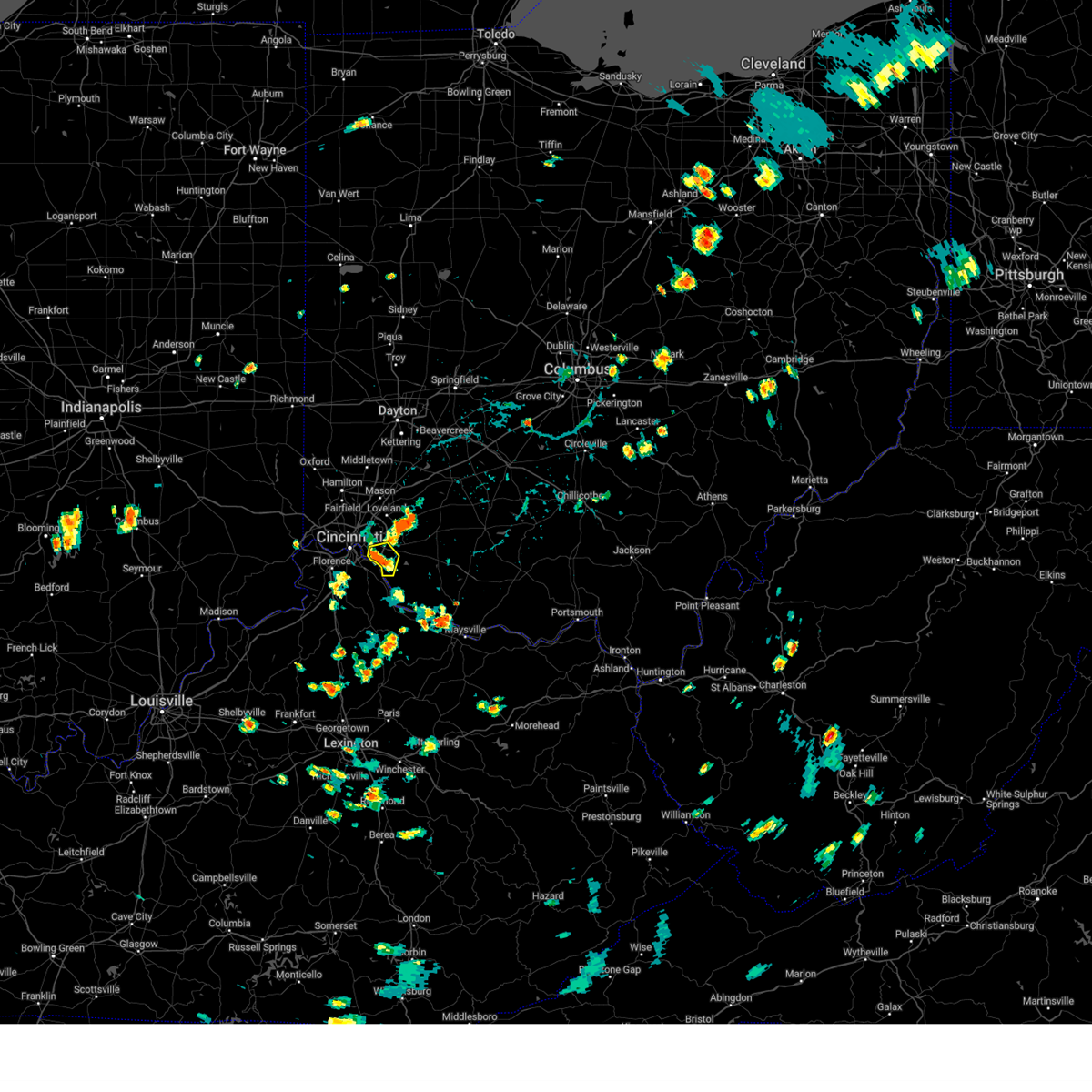 the severe thunderstorm warning has been cancelled and is no longer in effect the severe thunderstorm warning has been cancelled and is no longer in effect
|
| 8/30/2024 4:10 PM EDT |
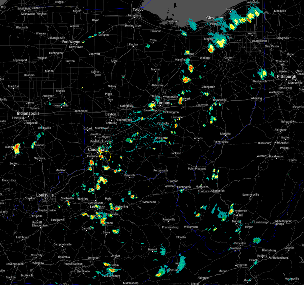 Svriln the national weather service in wilmington has issued a * severe thunderstorm warning for, northern campbell county in northern kentucky, southeastern hamilton county in southwestern ohio, west central clermont county in southwestern ohio, * until 445 pm edt. * at 410 pm edt, a severe thunderstorm was located over silver grove, moving east at 20 mph (radar indicated). Hazards include 60 mph wind gusts. expect damage to trees and power lines Svriln the national weather service in wilmington has issued a * severe thunderstorm warning for, northern campbell county in northern kentucky, southeastern hamilton county in southwestern ohio, west central clermont county in southwestern ohio, * until 445 pm edt. * at 410 pm edt, a severe thunderstorm was located over silver grove, moving east at 20 mph (radar indicated). Hazards include 60 mph wind gusts. expect damage to trees and power lines
|
| 8/30/2024 3:44 PM EDT | *** 1 inj *** two trees fell on two separate houses in the same area. time estimated from radar dat in hamilton county OH, 4.7 miles SW of Cincinnati, OH |
| 6/29/2024 7:23 PM EDT |
 At 723 pm edt, a severe thunderstorm was located 8 miles east of milford, moving east at 25 mph (radar indicated). Hazards include 60 mph wind gusts and penny size hail. Expect damage to trees and power lines. locations impacted include, cincinnati, norwood, loveland, montgomery, madeira, milford, deer park, dayton, mariemont, terrace park, batavia, camp dennison, remington, plainville, university of cincinnati, concorde hills, rossmoyne, the village of indian hill, silverton, and st. bernard. this includes the following interstates, i-71 in ohio between mile markers 3 and 13. I-75 in ohio between mile markers 3 and 4. At 723 pm edt, a severe thunderstorm was located 8 miles east of milford, moving east at 25 mph (radar indicated). Hazards include 60 mph wind gusts and penny size hail. Expect damage to trees and power lines. locations impacted include, cincinnati, norwood, loveland, montgomery, madeira, milford, deer park, dayton, mariemont, terrace park, batavia, camp dennison, remington, plainville, university of cincinnati, concorde hills, rossmoyne, the village of indian hill, silverton, and st. bernard. this includes the following interstates, i-71 in ohio between mile markers 3 and 13. I-75 in ohio between mile markers 3 and 4.
|
| 6/29/2024 7:02 PM EDT |
 Svriln the national weather service in wilmington has issued a * severe thunderstorm warning for, northeastern hamilton county in southwestern ohio, northern clermont county in southwestern ohio, * until 730 pm edt. * at 701 pm edt, a severe thunderstorm was located over remington, moving east at 35 mph (radar indicated). Hazards include 60 mph wind gusts and penny size hail. expect damage to trees and power lines Svriln the national weather service in wilmington has issued a * severe thunderstorm warning for, northeastern hamilton county in southwestern ohio, northern clermont county in southwestern ohio, * until 730 pm edt. * at 701 pm edt, a severe thunderstorm was located over remington, moving east at 35 mph (radar indicated). Hazards include 60 mph wind gusts and penny size hail. expect damage to trees and power lines
|
| 5/27/2024 12:48 AM EDT |
 Svriln the national weather service in wilmington has issued a * severe thunderstorm warning for, central kenton county in northern kentucky, campbell county in northern kentucky, southeastern hamilton county in southwestern ohio, clermont county in southwestern ohio, northwestern brown county in southwestern ohio, * until 130 am edt. * at 1248 am edt, a severe thunderstorm was located near alexandria, moving northeast at 50 mph (radar indicated). Hazards include 60 mph wind gusts. expect damage to trees and power lines Svriln the national weather service in wilmington has issued a * severe thunderstorm warning for, central kenton county in northern kentucky, campbell county in northern kentucky, southeastern hamilton county in southwestern ohio, clermont county in southwestern ohio, northwestern brown county in southwestern ohio, * until 130 am edt. * at 1248 am edt, a severe thunderstorm was located near alexandria, moving northeast at 50 mph (radar indicated). Hazards include 60 mph wind gusts. expect damage to trees and power lines
|
| 5/26/2024 2:10 PM EDT |
 The storms which prompted the warning have moved out of the area. therefore, the warning will be allowed to expire. a severe thunderstorm watch remains in effect until 800 pm edt for northern and northeastern kentucky, and south central and southwestern ohio. please report previous wind damage or hail to the national weather service by going to our website at weather.gov/iln and submitting your report via social media. remember, a severe thunderstorm warning still remains in effect for northeast hamilton, northern clermont, brown, and adams county!. The storms which prompted the warning have moved out of the area. therefore, the warning will be allowed to expire. a severe thunderstorm watch remains in effect until 800 pm edt for northern and northeastern kentucky, and south central and southwestern ohio. please report previous wind damage or hail to the national weather service by going to our website at weather.gov/iln and submitting your report via social media. remember, a severe thunderstorm warning still remains in effect for northeast hamilton, northern clermont, brown, and adams county!.
|
| 5/26/2024 2:07 PM EDT | Trees down into wires. time estimated from rada in hamilton county OH, 6.6 miles WSW of Cincinnati, OH |
| 5/26/2024 2:01 PM EDT | Trees down into wires. time estimated from rada in hamilton county OH, 3.3 miles W of Cincinnati, OH |
| 5/26/2024 2:01 PM EDT | Trees down into wires. time estimated from rada in hamilton county OH, 6.9 miles WNW of Cincinnati, OH |
| 5/26/2024 1:59 PM EDT |
 At 159 pm edt, severe thunderstorms were located along a line extending from near ross to near felicity, moving northeast at 50 mph (radar indicated). Hazards include 60 mph wind gusts and penny size hail. Expect damage to trees and power lines. locations impacted include, cincinnati, fairfield, covington, norwood, forest park, fort thomas, newport, sharonville, blue ash, springdale, reading, montgomery, north college hill, maysville, madeira, edgewood, alexandria, wyoming, cheviot, and fort mitchell. this includes the following interstates, i-71 in ohio between mile markers 0 and 15. i-74 in ohio between mile markers 8 and 19. i-75 in kentucky between mile markers 186 and 191. I-75 in ohio between mile markers 0 and 16. At 159 pm edt, severe thunderstorms were located along a line extending from near ross to near felicity, moving northeast at 50 mph (radar indicated). Hazards include 60 mph wind gusts and penny size hail. Expect damage to trees and power lines. locations impacted include, cincinnati, fairfield, covington, norwood, forest park, fort thomas, newport, sharonville, blue ash, springdale, reading, montgomery, north college hill, maysville, madeira, edgewood, alexandria, wyoming, cheviot, and fort mitchell. this includes the following interstates, i-71 in ohio between mile markers 0 and 15. i-74 in ohio between mile markers 8 and 19. i-75 in kentucky between mile markers 186 and 191. I-75 in ohio between mile markers 0 and 16.
|
| 5/26/2024 1:59 PM EDT |
 the severe thunderstorm warning has been cancelled and is no longer in effect the severe thunderstorm warning has been cancelled and is no longer in effect
|
| 5/26/2024 1:55 PM EDT |
 Svriln the national weather service in wilmington has issued a * severe thunderstorm warning for, northeastern hamilton county in southwestern ohio, eastern butler county in southwestern ohio, northern clermont county in southwestern ohio, central brown county in southwestern ohio, warren county in southwestern ohio, northern adams county in south central ohio, southwestern clinton county in southwestern ohio, west central pike county in south central ohio, highland county in south central ohio, south central montgomery county in west central ohio, * until 300 pm edt. * at 155 pm edt, severe thunderstorms were located along a line extending from bridgetown to near aberdeen, moving northeast at 55 mph (radar indicated). Hazards include 60 mph wind gusts. expect damage to trees and power lines Svriln the national weather service in wilmington has issued a * severe thunderstorm warning for, northeastern hamilton county in southwestern ohio, eastern butler county in southwestern ohio, northern clermont county in southwestern ohio, central brown county in southwestern ohio, warren county in southwestern ohio, northern adams county in south central ohio, southwestern clinton county in southwestern ohio, west central pike county in south central ohio, highland county in south central ohio, south central montgomery county in west central ohio, * until 300 pm edt. * at 155 pm edt, severe thunderstorms were located along a line extending from bridgetown to near aberdeen, moving northeast at 55 mph (radar indicated). Hazards include 60 mph wind gusts. expect damage to trees and power lines
|
| 5/26/2024 1:53 PM EDT | Trees down into wires. time estimated from rada in hamilton county OH, 2.7 miles ENE of Cincinnati, OH |
| 5/26/2024 1:44 PM EDT |
 the severe thunderstorm warning has been cancelled and is no longer in effect the severe thunderstorm warning has been cancelled and is no longer in effect
|
| 5/26/2024 1:44 PM EDT |
 At 144 pm edt, severe thunderstorms were located along a line extending from bright to near neville, moving northeast at 50 mph (radar indicated). Hazards include 60 mph wind gusts and penny size hail. Expect damage to trees and power lines. locations impacted include, cincinnati, fairfield, covington, florence, independence, norwood, forest park, erlanger, fort thomas, newport, sharonville, blue ash, springdale, reading, montgomery, north college hill, maysville, madeira, edgewood, and alexandria. this includes the following interstates, i-71 in ohio between mile markers 0 and 15. i-74 in ohio between mile markers 7 and 19. i-75 in kentucky between mile markers 174 and 191. I-75 in ohio between mile markers 0 and 16. At 144 pm edt, severe thunderstorms were located along a line extending from bright to near neville, moving northeast at 50 mph (radar indicated). Hazards include 60 mph wind gusts and penny size hail. Expect damage to trees and power lines. locations impacted include, cincinnati, fairfield, covington, florence, independence, norwood, forest park, erlanger, fort thomas, newport, sharonville, blue ash, springdale, reading, montgomery, north college hill, maysville, madeira, edgewood, and alexandria. this includes the following interstates, i-71 in ohio between mile markers 0 and 15. i-74 in ohio between mile markers 7 and 19. i-75 in kentucky between mile markers 174 and 191. I-75 in ohio between mile markers 0 and 16.
|
| 5/26/2024 1:16 PM EDT |
 At 116 pm edt, severe thunderstorms were located along a line extending from near dillsboro to 10 miles northwest of cynthiana, moving northeast at 50 mph (radar indicated). Hazards include 60 mph wind gusts and penny size hail. Expect damage to trees and power lines. locations impacted include, cincinnati, fairfield, covington, florence, independence, norwood, forest park, erlanger, fort thomas, newport, sharonville, blue ash, springdale, reading, montgomery, harrison, north college hill, maysville, madeira, and edgewood. this includes the following interstates, i-71 in kentucky between mile markers 70 and 77. i-71 in ohio between mile markers 0 and 15. i-74 in ohio between mile markers 1 and 19. i-75 in kentucky between mile markers 160 and 191. I-75 in ohio between mile markers 0 and 16. At 116 pm edt, severe thunderstorms were located along a line extending from near dillsboro to 10 miles northwest of cynthiana, moving northeast at 50 mph (radar indicated). Hazards include 60 mph wind gusts and penny size hail. Expect damage to trees and power lines. locations impacted include, cincinnati, fairfield, covington, florence, independence, norwood, forest park, erlanger, fort thomas, newport, sharonville, blue ash, springdale, reading, montgomery, harrison, north college hill, maysville, madeira, and edgewood. this includes the following interstates, i-71 in kentucky between mile markers 70 and 77. i-71 in ohio between mile markers 0 and 15. i-74 in ohio between mile markers 1 and 19. i-75 in kentucky between mile markers 160 and 191. I-75 in ohio between mile markers 0 and 16.
|
| 5/26/2024 1:01 PM EDT |
 Svriln the national weather service in wilmington has issued a * severe thunderstorm warning for, mason county in northern kentucky, robertson county in northern kentucky, kenton county in northern kentucky, boone county in northern kentucky, bracken county in northern kentucky, campbell county in northern kentucky, northeastern grant county in northern kentucky, pendleton county in northern kentucky, eastern gallatin county in northern kentucky, southwestern butler county in southwestern ohio, clermont county in southwestern ohio, hamilton county in southwestern ohio, brown county in southwestern ohio, southwestern adams county in south central ohio, * until 215 pm edt. * at 100 pm edt, severe thunderstorms were located along a line extending from 8 miles northeast of madison to 8 miles north of georgetown, moving northeast at 50 mph (radar indicated). Hazards include 70 mph wind gusts and penny size hail. Expect considerable tree damage. Damage is likely to mobile homes, roofs, and outbuildings. Svriln the national weather service in wilmington has issued a * severe thunderstorm warning for, mason county in northern kentucky, robertson county in northern kentucky, kenton county in northern kentucky, boone county in northern kentucky, bracken county in northern kentucky, campbell county in northern kentucky, northeastern grant county in northern kentucky, pendleton county in northern kentucky, eastern gallatin county in northern kentucky, southwestern butler county in southwestern ohio, clermont county in southwestern ohio, hamilton county in southwestern ohio, brown county in southwestern ohio, southwestern adams county in south central ohio, * until 215 pm edt. * at 100 pm edt, severe thunderstorms were located along a line extending from 8 miles northeast of madison to 8 miles north of georgetown, moving northeast at 50 mph (radar indicated). Hazards include 70 mph wind gusts and penny size hail. Expect considerable tree damage. Damage is likely to mobile homes, roofs, and outbuildings.
|
| 5/7/2024 10:51 PM EDT |
 The storm which prompted the warning has moved out of the area. therefore, the warning will be allowed to expire. a tornado watch remains in effect until 100 am edt for southwestern ohio. please report previous wind damage or hail to the national weather service by going to our website at weather.gov/iln and submitting your report via social media. The storm which prompted the warning has moved out of the area. therefore, the warning will be allowed to expire. a tornado watch remains in effect until 100 am edt for southwestern ohio. please report previous wind damage or hail to the national weather service by going to our website at weather.gov/iln and submitting your report via social media.
|
| 5/7/2024 10:35 PM EDT | Tree fell into two houses. time estimated from radar dat in hamilton county OH, 9 miles S of Cincinnati, OH |
| 5/7/2024 10:34 PM EDT |
 At 1033 pm edt, a severe thunderstorm was located over blue jay, moving east at 40 mph (radar indicated). Hazards include 60 mph wind gusts and quarter size hail. Minor hail damage to vehicles is possible. expect wind damage to trees and power lines. locations impacted include, cincinnati, hamilton, fairfield, norwood, forest park, sharonville, blue ash, springdale, reading, montgomery, north college hill, madeira, wyoming, mount healthy, deer park, finneytown, west chester, ross, mariemont, and taylor creek. this includes the following interstates, i-71 in ohio between mile markers 7 and 16. i-74 in ohio between mile markers 12 and 16. I-75 in ohio between mile markers 6 and 25. At 1033 pm edt, a severe thunderstorm was located over blue jay, moving east at 40 mph (radar indicated). Hazards include 60 mph wind gusts and quarter size hail. Minor hail damage to vehicles is possible. expect wind damage to trees and power lines. locations impacted include, cincinnati, hamilton, fairfield, norwood, forest park, sharonville, blue ash, springdale, reading, montgomery, north college hill, madeira, wyoming, mount healthy, deer park, finneytown, west chester, ross, mariemont, and taylor creek. this includes the following interstates, i-71 in ohio between mile markers 7 and 16. i-74 in ohio between mile markers 12 and 16. I-75 in ohio between mile markers 6 and 25.
|
| 5/7/2024 10:23 PM EDT |
 Svriln the national weather service in wilmington has issued a * severe thunderstorm warning for, northern hamilton county in southwestern ohio, southern butler county in southwestern ohio, * until 1100 pm edt. * at 1023 pm edt, a severe thunderstorm was located near bright, moving east at 40 mph (radar indicated). Hazards include 60 mph wind gusts and quarter size hail. Minor hail damage to vehicles is possible. Expect wind damage to trees and power lines. Svriln the national weather service in wilmington has issued a * severe thunderstorm warning for, northern hamilton county in southwestern ohio, southern butler county in southwestern ohio, * until 1100 pm edt. * at 1023 pm edt, a severe thunderstorm was located near bright, moving east at 40 mph (radar indicated). Hazards include 60 mph wind gusts and quarter size hail. Minor hail damage to vehicles is possible. Expect wind damage to trees and power lines.
|
| 5/7/2024 10:13 PM EDT |
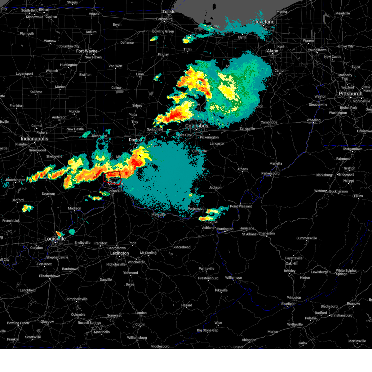 The storm which prompted the warning has weakened below severe limits and no longer appears capable of producing a tornado. therefore, the warning will be allowed to expire. a tornado watch remains in effect until 100 am edt for southwestern ohio. please report previous tornadoes, wind damage or hail to the national weather service by going to our website at weather.gov/iln and submitting your report via social media. The storm which prompted the warning has weakened below severe limits and no longer appears capable of producing a tornado. therefore, the warning will be allowed to expire. a tornado watch remains in effect until 100 am edt for southwestern ohio. please report previous tornadoes, wind damage or hail to the national weather service by going to our website at weather.gov/iln and submitting your report via social media.
|
| 5/7/2024 10:05 PM EDT |
 At 1004 pm edt, a severe thunderstorm capable of producing a tornado was located over taylor creek, moving east at 40 mph (radar indicated rotation). Hazards include tornado and quarter size hail. Flying debris will be dangerous to those caught without shelter. mobile homes will be damaged or destroyed. damage to roofs, windows, and vehicles will occur. tree damage is likely. locations impacted include, cincinnati, fairfield, forest park, springdale, harrison, north college hill, wyoming, cheviot, mount healthy, finneytown, ross, cleves, taylor creek, bridgetown, pleasant hills, miami heights, dry ridge, skyline acres, blue jay, and university of cincinnati. this includes the following interstates, i-74 in ohio between mile markers 1 and 19. I-75 in ohio between mile markers 4 and 9. At 1004 pm edt, a severe thunderstorm capable of producing a tornado was located over taylor creek, moving east at 40 mph (radar indicated rotation). Hazards include tornado and quarter size hail. Flying debris will be dangerous to those caught without shelter. mobile homes will be damaged or destroyed. damage to roofs, windows, and vehicles will occur. tree damage is likely. locations impacted include, cincinnati, fairfield, forest park, springdale, harrison, north college hill, wyoming, cheviot, mount healthy, finneytown, ross, cleves, taylor creek, bridgetown, pleasant hills, miami heights, dry ridge, skyline acres, blue jay, and university of cincinnati. this includes the following interstates, i-74 in ohio between mile markers 1 and 19. I-75 in ohio between mile markers 4 and 9.
|
| 5/7/2024 10:05 PM EDT |
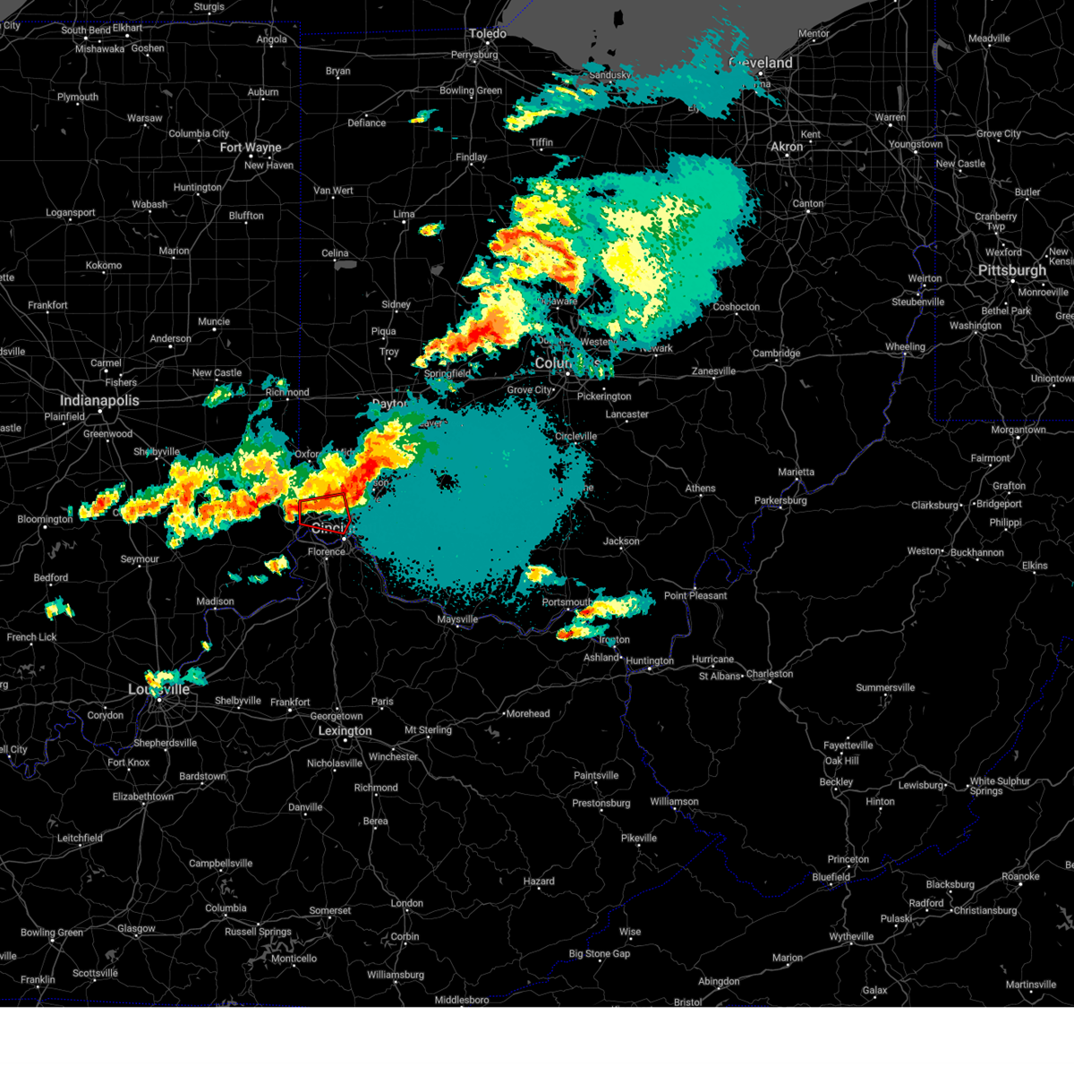 the tornado warning has been cancelled and is no longer in effect the tornado warning has been cancelled and is no longer in effect
|
| 5/7/2024 9:51 PM EDT |
 Toriln the national weather service in wilmington has issued a * tornado warning for, northeastern dearborn county in southeastern indiana, northwestern hamilton county in southwestern ohio, southwestern butler county in southwestern ohio, * until 1015 pm edt. * at 951 pm edt, a severe thunderstorm capable of producing a tornado was located over bright, moving east at 40 mph (radar indicated rotation). Hazards include tornado and quarter size hail. Flying debris will be dangerous to those caught without shelter. mobile homes will be damaged or destroyed. damage to roofs, windows, and vehicles will occur. Tree damage is likely. Toriln the national weather service in wilmington has issued a * tornado warning for, northeastern dearborn county in southeastern indiana, northwestern hamilton county in southwestern ohio, southwestern butler county in southwestern ohio, * until 1015 pm edt. * at 951 pm edt, a severe thunderstorm capable of producing a tornado was located over bright, moving east at 40 mph (radar indicated rotation). Hazards include tornado and quarter size hail. Flying debris will be dangerous to those caught without shelter. mobile homes will be damaged or destroyed. damage to roofs, windows, and vehicles will occur. Tree damage is likely.
|
| 5/7/2024 1:28 PM EDT |
 The storm which prompted the warning has moved out of the area. therefore, the warning will be allowed to expire. however, gusty winds are still possible with this thunderstorm. please report previous wind damage or hail to the national weather service by going to our website at weather.gov/iln and submitting your report via social media. The storm which prompted the warning has moved out of the area. therefore, the warning will be allowed to expire. however, gusty winds are still possible with this thunderstorm. please report previous wind damage or hail to the national weather service by going to our website at weather.gov/iln and submitting your report via social media.
|
| 5/7/2024 1:20 PM EDT | Large tree and wires down near ridgeland place and montgomery roa in hamilton county OH, 3.9 miles WSW of Cincinnati, OH |
| 5/7/2024 1:16 PM EDT |
 At 116 pm edt, a severe thunderstorm was located over madeira, moving east at 35 mph (radar indicated). Hazards include 60 mph wind gusts and quarter size hail. Minor hail damage to vehicles is possible. expect wind damage to trees and power lines. locations impacted include, cincinnati, norwood, blue ash, loveland, reading, montgomery, madeira, wyoming, milford, deer park, finneytown, forestville, mariemont, terrace park, camp dennison, sixteen mile stand, rossmoyne, remington, plainville, and concorde hills. this includes the following interstates, i-71 in ohio between mile markers 6 and 17. I-75 in ohio between mile markers 9 and 13. At 116 pm edt, a severe thunderstorm was located over madeira, moving east at 35 mph (radar indicated). Hazards include 60 mph wind gusts and quarter size hail. Minor hail damage to vehicles is possible. expect wind damage to trees and power lines. locations impacted include, cincinnati, norwood, blue ash, loveland, reading, montgomery, madeira, wyoming, milford, deer park, finneytown, forestville, mariemont, terrace park, camp dennison, sixteen mile stand, rossmoyne, remington, plainville, and concorde hills. this includes the following interstates, i-71 in ohio between mile markers 6 and 17. I-75 in ohio between mile markers 9 and 13.
|
| 5/7/2024 1:16 PM EDT |
 the severe thunderstorm warning has been cancelled and is no longer in effect the severe thunderstorm warning has been cancelled and is no longer in effect
|
| 5/7/2024 1:05 PM EDT |
 Svriln the national weather service in wilmington has issued a * severe thunderstorm warning for, north central kenton county in northern kentucky, northern campbell county in northern kentucky, eastern hamilton county in southwestern ohio, northwestern clermont county in southwestern ohio, south central warren county in southwestern ohio, * until 130 pm edt. * at 104 pm edt, a severe thunderstorm was located over cincinnati, moving east at 35 mph (radar indicated). Hazards include 60 mph wind gusts and quarter size hail. Minor hail damage to vehicles is possible. Expect wind damage to trees and power lines. Svriln the national weather service in wilmington has issued a * severe thunderstorm warning for, north central kenton county in northern kentucky, northern campbell county in northern kentucky, eastern hamilton county in southwestern ohio, northwestern clermont county in southwestern ohio, south central warren county in southwestern ohio, * until 130 pm edt. * at 104 pm edt, a severe thunderstorm was located over cincinnati, moving east at 35 mph (radar indicated). Hazards include 60 mph wind gusts and quarter size hail. Minor hail damage to vehicles is possible. Expect wind damage to trees and power lines.
|
| 4/2/2024 6:38 PM EDT |
 Svriln the national weather service in wilmington has issued a * severe thunderstorm warning for, northern campbell county in northern kentucky, southeastern hamilton county in southwestern ohio, northern clermont county in southwestern ohio, northwestern brown county in southwestern ohio, southeastern warren county in southwestern ohio, southwestern clinton county in southwestern ohio, southwestern highland county in south central ohio, * until 730 pm edt. * at 638 pm edt, a severe thunderstorm was located over fort thomas, moving east at 50 mph (radar indicated). Hazards include 60 mph wind gusts and quarter size hail. Minor hail damage to vehicles is possible. Expect wind damage to trees and power lines. Svriln the national weather service in wilmington has issued a * severe thunderstorm warning for, northern campbell county in northern kentucky, southeastern hamilton county in southwestern ohio, northern clermont county in southwestern ohio, northwestern brown county in southwestern ohio, southeastern warren county in southwestern ohio, southwestern clinton county in southwestern ohio, southwestern highland county in south central ohio, * until 730 pm edt. * at 638 pm edt, a severe thunderstorm was located over fort thomas, moving east at 50 mph (radar indicated). Hazards include 60 mph wind gusts and quarter size hail. Minor hail damage to vehicles is possible. Expect wind damage to trees and power lines.
|
| 4/2/2024 6:33 PM EDT |
 the severe thunderstorm warning has been cancelled and is no longer in effect the severe thunderstorm warning has been cancelled and is no longer in effect
|
| 4/2/2024 6:33 PM EDT |
 At 633 pm edt, a severe thunderstorm was located over fort wright, moving east at 45 mph (radar indicated). Hazards include 60 mph wind gusts and quarter size hail. Minor hail damage to vehicles is possible. expect wind damage to trees and power lines. locations impacted include, cincinnati, covington, independence, norwood, erlanger, fort thomas, newport, madeira, edgewood, alexandria, elsmere, fort mitchell, villa hills, highland heights, taylor mill, bellevue, fort wright, dayton, ludlow, and southgate. this includes the following interstates, i-71 in ohio between mile markers 0 and 10. i-75 in kentucky between mile markers 184 and 191. I-75 in ohio between mile markers 0 and 4. At 633 pm edt, a severe thunderstorm was located over fort wright, moving east at 45 mph (radar indicated). Hazards include 60 mph wind gusts and quarter size hail. Minor hail damage to vehicles is possible. expect wind damage to trees and power lines. locations impacted include, cincinnati, covington, independence, norwood, erlanger, fort thomas, newport, madeira, edgewood, alexandria, elsmere, fort mitchell, villa hills, highland heights, taylor mill, bellevue, fort wright, dayton, ludlow, and southgate. this includes the following interstates, i-71 in ohio between mile markers 0 and 10. i-75 in kentucky between mile markers 184 and 191. I-75 in ohio between mile markers 0 and 4.
|
| 4/2/2024 6:28 PM EDT |
 The storm which prompted the warning has moved out of the area. therefore, the warning will be allowed to expire. a tornado watch remains in effect until 1000 pm edt for southeastern indiana, northern kentucky, and southwestern ohio. please report previous wind damage or hail to the national weather service by going to our website at weather.gov/iln and submitting your report via social media. The storm which prompted the warning has moved out of the area. therefore, the warning will be allowed to expire. a tornado watch remains in effect until 1000 pm edt for southeastern indiana, northern kentucky, and southwestern ohio. please report previous wind damage or hail to the national weather service by going to our website at weather.gov/iln and submitting your report via social media.
|
| 4/2/2024 6:19 PM EDT |
 At 619 pm edt, a severe thunderstorm was located over oakbrook, moving east at 55 mph (radar indicated). Hazards include 60 mph wind gusts and half dollar size hail. Minor hail damage to vehicles is possible. expect wind damage to trees and power lines. locations impacted include, cincinnati, covington, florence, independence, norwood, erlanger, fort thomas, newport, madeira, edgewood, alexandria, elsmere, fort mitchell, villa hills, highland heights, taylor mill, bellevue, fort wright, dayton, and ludlow. this includes the following interstates, i-71 in ohio between mile markers 0 and 10. i-75 in kentucky between mile markers 177 and 191. I-75 in ohio between mile markers 0 and 4. At 619 pm edt, a severe thunderstorm was located over oakbrook, moving east at 55 mph (radar indicated). Hazards include 60 mph wind gusts and half dollar size hail. Minor hail damage to vehicles is possible. expect wind damage to trees and power lines. locations impacted include, cincinnati, covington, florence, independence, norwood, erlanger, fort thomas, newport, madeira, edgewood, alexandria, elsmere, fort mitchell, villa hills, highland heights, taylor mill, bellevue, fort wright, dayton, and ludlow. this includes the following interstates, i-71 in ohio between mile markers 0 and 10. i-75 in kentucky between mile markers 177 and 191. I-75 in ohio between mile markers 0 and 4.
|
| 4/2/2024 6:19 PM EDT |
 the severe thunderstorm warning has been cancelled and is no longer in effect the severe thunderstorm warning has been cancelled and is no longer in effect
|
| 4/2/2024 6:09 PM EDT |
 At 609 pm edt, a severe thunderstorm was located over rising sun, moving east at 55 mph (radar indicated). Hazards include 60 mph wind gusts and half dollar size hail. Minor hail damage to vehicles is possible. expect wind damage to trees and power lines. locations impacted include, cincinnati, covington, florence, independence, norwood, erlanger, fort thomas, newport, madeira, edgewood, alexandria, elsmere, fort mitchell, villa hills, highland heights, taylor mill, bellevue, fort wright, dayton, and lawrenceburg. this includes the following interstates, i-71 in kentucky between mile markers 74 and 77. i-71 in ohio between mile markers 0 and 11. i-75 in kentucky between mile markers 171 and 191. I-75 in ohio between mile markers 0 and 4. At 609 pm edt, a severe thunderstorm was located over rising sun, moving east at 55 mph (radar indicated). Hazards include 60 mph wind gusts and half dollar size hail. Minor hail damage to vehicles is possible. expect wind damage to trees and power lines. locations impacted include, cincinnati, covington, florence, independence, norwood, erlanger, fort thomas, newport, madeira, edgewood, alexandria, elsmere, fort mitchell, villa hills, highland heights, taylor mill, bellevue, fort wright, dayton, and lawrenceburg. this includes the following interstates, i-71 in kentucky between mile markers 74 and 77. i-71 in ohio between mile markers 0 and 11. i-75 in kentucky between mile markers 171 and 191. I-75 in ohio between mile markers 0 and 4.
|
| 4/2/2024 6:00 PM EDT |
 At 559 pm edt, a severe thunderstorm was located near dillsboro, moving east at 45 mph (public). Hazards include golf ball size hail and 60 mph wind gusts. People and animals outdoors will be injured. expect hail damage to roofs, siding, windows, and vehicles. expect wind damage to trees and power lines. locations impacted include, cincinnati, covington, florence, independence, norwood, erlanger, fort thomas, newport, madeira, edgewood, alexandria, elsmere, fort mitchell, villa hills, highland heights, taylor mill, bellevue, fort wright, dayton, and lawrenceburg. this includes the following interstates, i-71 in kentucky between mile markers 74 and 77. i-71 in ohio between mile markers 0 and 11. i-74 in ohio near mile marker 19. i-75 in kentucky between mile markers 171 and 191. I-75 in ohio between mile markers 0 and 5. At 559 pm edt, a severe thunderstorm was located near dillsboro, moving east at 45 mph (public). Hazards include golf ball size hail and 60 mph wind gusts. People and animals outdoors will be injured. expect hail damage to roofs, siding, windows, and vehicles. expect wind damage to trees and power lines. locations impacted include, cincinnati, covington, florence, independence, norwood, erlanger, fort thomas, newport, madeira, edgewood, alexandria, elsmere, fort mitchell, villa hills, highland heights, taylor mill, bellevue, fort wright, dayton, and lawrenceburg. this includes the following interstates, i-71 in kentucky between mile markers 74 and 77. i-71 in ohio between mile markers 0 and 11. i-74 in ohio near mile marker 19. i-75 in kentucky between mile markers 171 and 191. I-75 in ohio between mile markers 0 and 5.
|
| 4/2/2024 5:54 PM EDT |
 Svriln the national weather service in wilmington has issued a * severe thunderstorm warning for, ohio county in southeastern indiana, southern dearborn county in southeastern indiana, northeastern switzerland county in southeastern indiana, kenton county in northern kentucky, campbell county in northern kentucky, boone county in northern kentucky, southern hamilton county in southwestern ohio, west central clermont county in southwestern ohio, * until 645 pm edt. * at 553 pm edt, a severe thunderstorm was located near dillsboro, moving east at 50 mph (radar indicated). Hazards include 60 mph wind gusts and quarter size hail. Minor hail damage to vehicles is possible. Expect wind damage to trees and power lines. Svriln the national weather service in wilmington has issued a * severe thunderstorm warning for, ohio county in southeastern indiana, southern dearborn county in southeastern indiana, northeastern switzerland county in southeastern indiana, kenton county in northern kentucky, campbell county in northern kentucky, boone county in northern kentucky, southern hamilton county in southwestern ohio, west central clermont county in southwestern ohio, * until 645 pm edt. * at 553 pm edt, a severe thunderstorm was located near dillsboro, moving east at 50 mph (radar indicated). Hazards include 60 mph wind gusts and quarter size hail. Minor hail damage to vehicles is possible. Expect wind damage to trees and power lines.
|
| 4/2/2024 5:54 PM EDT |
 the severe thunderstorm warning has been cancelled and is no longer in effect the severe thunderstorm warning has been cancelled and is no longer in effect
|
| 4/2/2024 5:54 PM EDT |
 At 551 pm edt, a severe thunderstorm was located over blue jay, moving northeast at 50 mph (trained weather spotters have reported one inch hail with this storm near harrison). Hazards include 60 mph wind gusts and quarter size hail. Minor hail damage to vehicles is possible. expect wind damage to trees and power lines. locations impacted include, cincinnati, hamilton, fairfield, forest park, sharonville, blue ash, springdale, reading, montgomery, harrison, north college hill, madeira, wyoming, cheviot, mount healthy, deer park, finneytown, west chester, ross, and cleves. this includes the following interstates, i-71 in ohio between mile markers 12 and 17. i-74 in ohio between mile markers 0 and 16. I-75 in ohio between mile markers 9 and 26. At 551 pm edt, a severe thunderstorm was located over blue jay, moving northeast at 50 mph (trained weather spotters have reported one inch hail with this storm near harrison). Hazards include 60 mph wind gusts and quarter size hail. Minor hail damage to vehicles is possible. expect wind damage to trees and power lines. locations impacted include, cincinnati, hamilton, fairfield, forest park, sharonville, blue ash, springdale, reading, montgomery, harrison, north college hill, madeira, wyoming, cheviot, mount healthy, deer park, finneytown, west chester, ross, and cleves. this includes the following interstates, i-71 in ohio between mile markers 12 and 17. i-74 in ohio between mile markers 0 and 16. I-75 in ohio between mile markers 9 and 26.
|
| 4/2/2024 5:41 PM EDT |
 Svriln the national weather service in wilmington has issued a * severe thunderstorm warning for, northeastern dearborn county in southeastern indiana, northern hamilton county in southwestern ohio, southern butler county in southwestern ohio, * until 630 pm edt. * at 541 pm edt, a severe thunderstorm was located over hidden valley, moving northeast at 50 mph (radar indicated). Hazards include 60 mph wind gusts and quarter size hail. Minor hail damage to vehicles is possible. Expect wind damage to trees and power lines. Svriln the national weather service in wilmington has issued a * severe thunderstorm warning for, northeastern dearborn county in southeastern indiana, northern hamilton county in southwestern ohio, southern butler county in southwestern ohio, * until 630 pm edt. * at 541 pm edt, a severe thunderstorm was located over hidden valley, moving northeast at 50 mph (radar indicated). Hazards include 60 mph wind gusts and quarter size hail. Minor hail damage to vehicles is possible. Expect wind damage to trees and power lines.
|
| 4/2/2024 6:01 AM EDT |
 the severe thunderstorm warning has been cancelled and is no longer in effect the severe thunderstorm warning has been cancelled and is no longer in effect
|
| 4/2/2024 5:55 AM EDT |
 At 554 am edt, a severe thunderstorm was located near lawrenceburg, moving east at 55 mph (radar indicated). Hazards include 60 mph wind gusts. Expect damage to trees and power lines. locations impacted include, cincinnati, covington, florence, independence, norwood, erlanger, fort thomas, newport, reading, madeira, edgewood, alexandria, elsmere, cheviot, fort mitchell, villa hills, highland heights, taylor mill, bellevue, and deer park. this includes the following interstates, i-71 in ohio between mile markers 0 and 13. i-74 in ohio between mile markers 11 and 19. i-75 in kentucky between mile markers 176 and 191. I-75 in ohio between mile markers 0 and 11. At 554 am edt, a severe thunderstorm was located near lawrenceburg, moving east at 55 mph (radar indicated). Hazards include 60 mph wind gusts. Expect damage to trees and power lines. locations impacted include, cincinnati, covington, florence, independence, norwood, erlanger, fort thomas, newport, reading, madeira, edgewood, alexandria, elsmere, cheviot, fort mitchell, villa hills, highland heights, taylor mill, bellevue, and deer park. this includes the following interstates, i-71 in ohio between mile markers 0 and 13. i-74 in ohio between mile markers 11 and 19. i-75 in kentucky between mile markers 176 and 191. I-75 in ohio between mile markers 0 and 11.
|
| 4/2/2024 5:55 AM EDT |
 the severe thunderstorm warning has been cancelled and is no longer in effect the severe thunderstorm warning has been cancelled and is no longer in effect
|
| 4/2/2024 5:42 AM EDT |
 At 542 am edt, a severe thunderstorm was located near dillsboro, moving east at 55 mph (radar indicated). Hazards include 60 mph wind gusts and penny size hail. Expect damage to trees and power lines. locations impacted include, cincinnati, covington, florence, independence, norwood, erlanger, fort thomas, newport, reading, madeira, edgewood, alexandria, elsmere, cheviot, fort mitchell, villa hills, highland heights, taylor mill, bellevue, and deer park. this includes the following interstates, i-71 in ohio between mile markers 0 and 13. i-74 in ohio between mile markers 11 and 19. i-75 in kentucky between mile markers 176 and 191. I-75 in ohio between mile markers 0 and 11. At 542 am edt, a severe thunderstorm was located near dillsboro, moving east at 55 mph (radar indicated). Hazards include 60 mph wind gusts and penny size hail. Expect damage to trees and power lines. locations impacted include, cincinnati, covington, florence, independence, norwood, erlanger, fort thomas, newport, reading, madeira, edgewood, alexandria, elsmere, cheviot, fort mitchell, villa hills, highland heights, taylor mill, bellevue, and deer park. this includes the following interstates, i-71 in ohio between mile markers 0 and 13. i-74 in ohio between mile markers 11 and 19. i-75 in kentucky between mile markers 176 and 191. I-75 in ohio between mile markers 0 and 11.
|
| 4/2/2024 5:31 AM EDT |
 Svriln the national weather service in wilmington has issued a * severe thunderstorm warning for, ohio county in southeastern indiana, central ripley county in southeastern indiana, dearborn county in southeastern indiana, northern kenton county in northern kentucky, northern campbell county in northern kentucky, boone county in northern kentucky, central hamilton county in southwestern ohio, * until 615 am edt. * at 531 am edt, a severe thunderstorm was located over versailles, moving east at 55 mph (radar indicated). Hazards include 60 mph wind gusts and penny size hail. expect damage to trees and power lines Svriln the national weather service in wilmington has issued a * severe thunderstorm warning for, ohio county in southeastern indiana, central ripley county in southeastern indiana, dearborn county in southeastern indiana, northern kenton county in northern kentucky, northern campbell county in northern kentucky, boone county in northern kentucky, central hamilton county in southwestern ohio, * until 615 am edt. * at 531 am edt, a severe thunderstorm was located over versailles, moving east at 55 mph (radar indicated). Hazards include 60 mph wind gusts and penny size hail. expect damage to trees and power lines
|
| 3/14/2024 11:11 PM EDT |
 Svriln the national weather service in wilmington has issued a * severe thunderstorm warning for, southeastern hamilton county in southwestern ohio, northern clermont county in southwestern ohio, northwestern brown county in southwestern ohio, southeastern warren county in southwestern ohio, southwestern clinton county in southwestern ohio, * until midnight edt. * at 1110 pm edt, a severe thunderstorm was located over mariemont, moving east at 40 mph (asos observation). Hazards include 60 mph wind gusts. expect damage to trees and power lines Svriln the national weather service in wilmington has issued a * severe thunderstorm warning for, southeastern hamilton county in southwestern ohio, northern clermont county in southwestern ohio, northwestern brown county in southwestern ohio, southeastern warren county in southwestern ohio, southwestern clinton county in southwestern ohio, * until midnight edt. * at 1110 pm edt, a severe thunderstorm was located over mariemont, moving east at 40 mph (asos observation). Hazards include 60 mph wind gusts. expect damage to trees and power lines
|
| 3/14/2024 11:05 PM EDT | Kluk aso in hamilton county OH, 4.8 miles WNW of Cincinnati, OH |
| 7/29/2023 5:07 AM EDT |
 The severe thunderstorm warning for ohio, southeastern franklin, dearborn, northern boone, northwestern hamilton and southern butler counties will expire at 515 am edt, the storm which prompted the warning has weakened below severe limits, and has exited the warned area. therefore, the warning will be allowed to expire. a severe thunderstorm watch remains in effect until 1100 am edt for southwestern ohio. please report previous wind damage or hail to the national weather service by going to our website at weather.gov/iln and submitting your report via social media. The severe thunderstorm warning for ohio, southeastern franklin, dearborn, northern boone, northwestern hamilton and southern butler counties will expire at 515 am edt, the storm which prompted the warning has weakened below severe limits, and has exited the warned area. therefore, the warning will be allowed to expire. a severe thunderstorm watch remains in effect until 1100 am edt for southwestern ohio. please report previous wind damage or hail to the national weather service by going to our website at weather.gov/iln and submitting your report via social media.
|
| 7/29/2023 4:55 AM EDT |
 At 455 am edt, a severe thunderstorm was located over bridgetown, moving southeast at 45 mph (radar indicated). Hazards include 60 mph wind gusts and penny size hail. expect damage to trees and power lines At 455 am edt, a severe thunderstorm was located over bridgetown, moving southeast at 45 mph (radar indicated). Hazards include 60 mph wind gusts and penny size hail. expect damage to trees and power lines
|
| 7/29/2023 4:51 AM EDT |
 At 451 am edt, a severe thunderstorm was located near ross, moving east at 45 mph (radar indicated). Hazards include 60 mph wind gusts and penny size hail. Expect damage to trees and power lines. locations impacted include, hamilton, fairfield, forest park, monroe, springdale, harrison, north college hill, mount healthy, lawrenceburg, greendale, aurora, bright, hidden valley, ross, cleves, shawnee, moores hill, taylor creek, miami heights and dry ridge. this includes the following interstates, i-74 in indiana between mile markers 158 and 171. i-74 in ohio between mile markers 0 and 14. i-75 in ohio between mile markers 25 and 28. hail threat, radar indicated max hail size, 0. 75 in wind threat, radar indicated max wind gust, 60 mph. At 451 am edt, a severe thunderstorm was located near ross, moving east at 45 mph (radar indicated). Hazards include 60 mph wind gusts and penny size hail. Expect damage to trees and power lines. locations impacted include, hamilton, fairfield, forest park, monroe, springdale, harrison, north college hill, mount healthy, lawrenceburg, greendale, aurora, bright, hidden valley, ross, cleves, shawnee, moores hill, taylor creek, miami heights and dry ridge. this includes the following interstates, i-74 in indiana between mile markers 158 and 171. i-74 in ohio between mile markers 0 and 14. i-75 in ohio between mile markers 25 and 28. hail threat, radar indicated max hail size, 0. 75 in wind threat, radar indicated max wind gust, 60 mph.
|
| 7/29/2023 4:33 AM EDT |
 At 433 am edt, a severe thunderstorm was located over brookville, moving east at 45 mph (radar indicated). Hazards include 60 mph wind gusts and penny size hail. expect damage to trees and power lines At 433 am edt, a severe thunderstorm was located over brookville, moving east at 45 mph (radar indicated). Hazards include 60 mph wind gusts and penny size hail. expect damage to trees and power lines
|
| 7/27/2023 10:36 PM EDT | 2-3 inch diameter healthy tree limb dow in hamilton county OH, 5.5 miles W of Cincinnati, OH |
| 7/27/2023 10:26 PM EDT |
 The severe thunderstorm warning for kenton, northern campbell, northern boone and southern hamilton counties will expire at 1030 pm edt, the storm which prompted the warning has weakened below severe limits, and no longer poses an immediate threat to life or property. therefore, the warning will be allowed to expire. however gusty winds are still possible with this thunderstorm. please report previous wind damage or hail to the national weather service by going to our website at weather.gov/iln and submitting your report via social media. The severe thunderstorm warning for kenton, northern campbell, northern boone and southern hamilton counties will expire at 1030 pm edt, the storm which prompted the warning has weakened below severe limits, and no longer poses an immediate threat to life or property. therefore, the warning will be allowed to expire. however gusty winds are still possible with this thunderstorm. please report previous wind damage or hail to the national weather service by going to our website at weather.gov/iln and submitting your report via social media.
|
| 7/27/2023 10:11 PM EDT |
 At 1011 pm edt, a severe thunderstorm was located over crestview hills, moving southeast at 20 mph (radar indicated). Hazards include 60 mph wind gusts and penny size hail. Expect damage to trees and power lines. locations impacted include, cincinnati, covington, florence, independence, erlanger, fort thomas, newport, edgewood, alexandria, elsmere, cheviot, fort mitchell, villa hills, highland heights, taylor mill, bellevue, fort wright, dayton, ludlow and southgate. this includes the following interstates, i-71 in kentucky near mile marker 77. i-71 in ohio between mile markers 0 and 2. i-75 in kentucky between mile markers 172 and 191. i-75 in ohio between mile markers 0 and 3. hail threat, radar indicated max hail size, 0. 75 in wind threat, radar indicated max wind gust, 60 mph. At 1011 pm edt, a severe thunderstorm was located over crestview hills, moving southeast at 20 mph (radar indicated). Hazards include 60 mph wind gusts and penny size hail. Expect damage to trees and power lines. locations impacted include, cincinnati, covington, florence, independence, erlanger, fort thomas, newport, edgewood, alexandria, elsmere, cheviot, fort mitchell, villa hills, highland heights, taylor mill, bellevue, fort wright, dayton, ludlow and southgate. this includes the following interstates, i-71 in kentucky near mile marker 77. i-71 in ohio between mile markers 0 and 2. i-75 in kentucky between mile markers 172 and 191. i-75 in ohio between mile markers 0 and 3. hail threat, radar indicated max hail size, 0. 75 in wind threat, radar indicated max wind gust, 60 mph.
|
| 7/27/2023 10:09 PM EDT | Downed tree limbs... approx. 3 inches in diameter... over werk roa in hamilton county OH, 8.5 miles E of Cincinnati, OH |
| 7/27/2023 9:57 PM EDT |
 At 956 pm edt, a severe thunderstorm was located over villa hills, moving southeast at 20 mph (radar indicated). Hazards include 60 mph wind gusts and penny size hail. Expect damage to trees and power lines. locations impacted include, cincinnati, covington, florence, independence, norwood, erlanger, fort thomas, newport, north college hill, edgewood, alexandria, elsmere, cheviot, fort mitchell, villa hills, highland heights, taylor mill, bellevue, fort wright and dayton. this includes the following interstates, i-71 in kentucky near mile marker 77. i-71 in ohio between mile markers 0 and 7. i-74 in ohio between mile markers 7 and 19. i-75 in kentucky between mile markers 172 and 191. i-75 in ohio between mile markers 0 and 8. hail threat, radar indicated max hail size, 0. 75 in wind threat, radar indicated max wind gust, 60 mph. At 956 pm edt, a severe thunderstorm was located over villa hills, moving southeast at 20 mph (radar indicated). Hazards include 60 mph wind gusts and penny size hail. Expect damage to trees and power lines. locations impacted include, cincinnati, covington, florence, independence, norwood, erlanger, fort thomas, newport, north college hill, edgewood, alexandria, elsmere, cheviot, fort mitchell, villa hills, highland heights, taylor mill, bellevue, fort wright and dayton. this includes the following interstates, i-71 in kentucky near mile marker 77. i-71 in ohio between mile markers 0 and 7. i-74 in ohio between mile markers 7 and 19. i-75 in kentucky between mile markers 172 and 191. i-75 in ohio between mile markers 0 and 8. hail threat, radar indicated max hail size, 0. 75 in wind threat, radar indicated max wind gust, 60 mph.
|
| 7/27/2023 9:40 PM EDT |
 At 940 pm edt, a severe thunderstorm was located over bridgetown, moving southeast at 25 mph (radar indicated). Hazards include 60 mph wind gusts and penny size hail. expect damage to trees and power lines At 940 pm edt, a severe thunderstorm was located over bridgetown, moving southeast at 25 mph (radar indicated). Hazards include 60 mph wind gusts and penny size hail. expect damage to trees and power lines
|
| 7/27/2023 6:15 PM EDT | Trees down on car in hamilton county OH, 6.5 miles W of Cincinnati, OH |
| 7/27/2023 6:08 PM EDT | Wires knocked down. time estimated from rada in hamilton county OH, 7.7 miles SE of Cincinnati, OH |
| 7/27/2023 6:06 PM EDT | Trees and wires knocked down onto car. time estimated from rada in hamilton county OH, 2.2 miles SW of Cincinnati, OH |
| 7/24/2023 5:43 PM EDT |
 The severe thunderstorm warning for northern campbell, southeastern hamilton and northern clermont counties will expire at 545 pm edt, the storm which prompted the warning has weakened below severe limits, and no longer poses an immediate threat to life or property. therefore, the warning will be allowed to expire. however small hail, gusty winds and heavy rain are still possible with this thunderstorm. a severe thunderstorm watch remains in effect until 1000 pm edt for northern kentucky, and southwestern ohio. please report previous wind damage or hail to the national weather service by going to our website at weather.gov/iln and submitting your report via social media. The severe thunderstorm warning for northern campbell, southeastern hamilton and northern clermont counties will expire at 545 pm edt, the storm which prompted the warning has weakened below severe limits, and no longer poses an immediate threat to life or property. therefore, the warning will be allowed to expire. however small hail, gusty winds and heavy rain are still possible with this thunderstorm. a severe thunderstorm watch remains in effect until 1000 pm edt for northern kentucky, and southwestern ohio. please report previous wind damage or hail to the national weather service by going to our website at weather.gov/iln and submitting your report via social media.
|
| 7/24/2023 5:29 PM EDT |
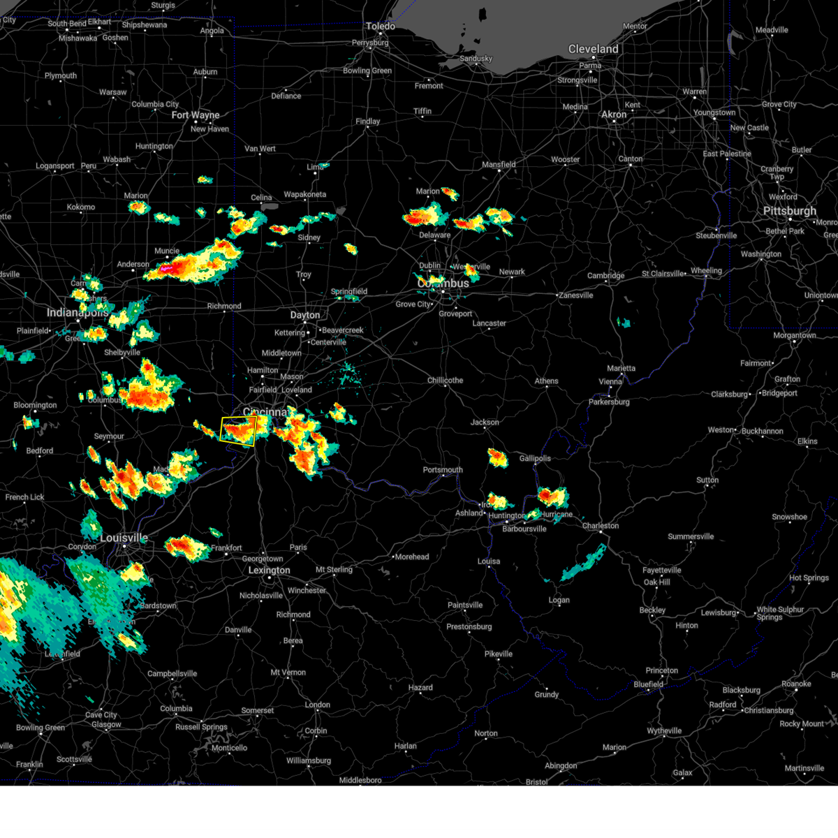 The severe thunderstorm warning for ohio, southeastern dearborn, northern boone and southwestern hamilton counties will expire at 530 pm edt, the storm which prompted the warning has weakened below severe limits, and no longer poses an immediate threat to life or property. therefore, the warning will be allowed to expire. however small hail, gusty winds and heavy rain are still possible with this thunderstorm. a severe thunderstorm watch remains in effect until 1000 pm edt for southeastern indiana, northern kentucky, and southwestern ohio. please report previous wind damage or hail to the national weather service by going to our website at weather.gov/iln and submitting your report via social media. The severe thunderstorm warning for ohio, southeastern dearborn, northern boone and southwestern hamilton counties will expire at 530 pm edt, the storm which prompted the warning has weakened below severe limits, and no longer poses an immediate threat to life or property. therefore, the warning will be allowed to expire. however small hail, gusty winds and heavy rain are still possible with this thunderstorm. a severe thunderstorm watch remains in effect until 1000 pm edt for southeastern indiana, northern kentucky, and southwestern ohio. please report previous wind damage or hail to the national weather service by going to our website at weather.gov/iln and submitting your report via social media.
|
| 7/24/2023 5:23 PM EDT | Quarter sized hail reported 12.2 miles WNW of Cincinnati, OH, report from mping: quarter (1.00 in.). |
| 7/24/2023 5:10 PM EDT |
 At 510 pm edt, a severe thunderstorm was located near aurora, moving east at 15 mph (radar indicated). Hazards include 60 mph wind gusts and quarter size hail. Minor hail damage to vehicles is possible. expect wind damage to trees and power lines. locations impacted include, cincinnati, florence, villa hills, lawrenceburg, greendale, aurora, rising sun, oakbrook, burlington, union, shawnee, delhi township, delhi hills, mack, french, addyston, idlewild, waterloo, petersburg and constance. this includes i-75 in kentucky between mile markers 179 and 182. hail threat, radar indicated max hail size, 1. 00 in wind threat, radar indicated max wind gust, 60 mph. At 510 pm edt, a severe thunderstorm was located near aurora, moving east at 15 mph (radar indicated). Hazards include 60 mph wind gusts and quarter size hail. Minor hail damage to vehicles is possible. expect wind damage to trees and power lines. locations impacted include, cincinnati, florence, villa hills, lawrenceburg, greendale, aurora, rising sun, oakbrook, burlington, union, shawnee, delhi township, delhi hills, mack, french, addyston, idlewild, waterloo, petersburg and constance. this includes i-75 in kentucky between mile markers 179 and 182. hail threat, radar indicated max hail size, 1. 00 in wind threat, radar indicated max wind gust, 60 mph.
|
| 7/24/2023 5:10 PM EDT |
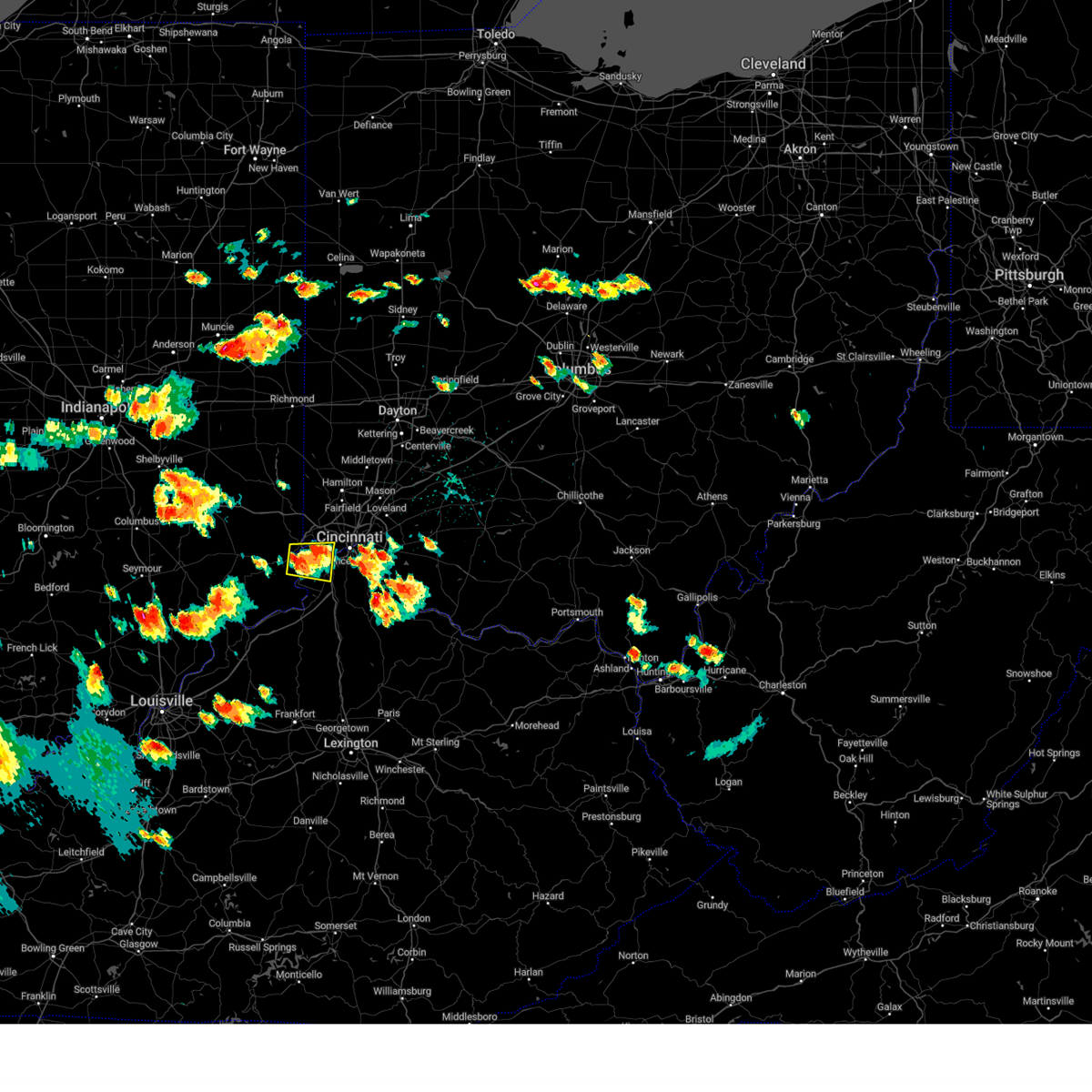 At 510 pm edt, a severe thunderstorm was located near aurora, moving east at 15 mph (radar indicated). Hazards include 60 mph wind gusts and quarter size hail. Minor hail damage to vehicles is possible. expect wind damage to trees and power lines. locations impacted include, cincinnati, florence, villa hills, lawrenceburg, greendale, aurora, rising sun, oakbrook, burlington, union, shawnee, delhi township, delhi hills, mack, french, addyston, idlewild, waterloo, petersburg and constance. this includes i-75 in kentucky between mile markers 179 and 182. hail threat, radar indicated max hail size, 1. 00 in wind threat, radar indicated max wind gust, 60 mph. At 510 pm edt, a severe thunderstorm was located near aurora, moving east at 15 mph (radar indicated). Hazards include 60 mph wind gusts and quarter size hail. Minor hail damage to vehicles is possible. expect wind damage to trees and power lines. locations impacted include, cincinnati, florence, villa hills, lawrenceburg, greendale, aurora, rising sun, oakbrook, burlington, union, shawnee, delhi township, delhi hills, mack, french, addyston, idlewild, waterloo, petersburg and constance. this includes i-75 in kentucky between mile markers 179 and 182. hail threat, radar indicated max hail size, 1. 00 in wind threat, radar indicated max wind gust, 60 mph.
|
| 7/24/2023 5:07 PM EDT |
 At 507 pm edt, a severe thunderstorm was located over salem heights, moving northeast at 20 mph (trained weather spotters). Hazards include 60 mph wind gusts and quarter size hail. Minor hail damage to vehicles is possible. Expect wind damage to trees and power lines. At 507 pm edt, a severe thunderstorm was located over salem heights, moving northeast at 20 mph (trained weather spotters). Hazards include 60 mph wind gusts and quarter size hail. Minor hail damage to vehicles is possible. Expect wind damage to trees and power lines.
|
| 7/24/2023 5:06 PM EDT | Quarter sized hail reported 3.9 miles WNW of Cincinnati, OH, report from mping: quarter (1.00 in.). |
| 7/24/2023 5:04 PM EDT | Quarter sized hail reported 4.3 miles WNW of Cincinnati, OH, at lunken airport. |
| 7/24/2023 5:03 PM EDT | Tree down due to thunderstorm winds. time estimated from rada in hamilton county OH, 10.4 miles W of Cincinnati, OH |
| 7/24/2023 4:59 PM EDT |
 At 459 pm edt, a severe thunderstorm was located over aurora, moving east at 15 mph (fire department reported quarter size hail in aurora). Hazards include 60 mph wind gusts and quarter size hail. Minor hail damage to vehicles is possible. expect wind damage to trees and power lines. locations impacted include, cincinnati, florence, villa hills, lawrenceburg, greendale, aurora, rising sun, oakbrook, burlington, union, shawnee, delhi township, delhi hills, mack, wilmington, french, addyston, hartford, idlewild and waterloo. this includes i-75 in kentucky between mile markers 179 and 182. hail threat, observed max hail size, 1. 00 in wind threat, radar indicated max wind gust, 60 mph. At 459 pm edt, a severe thunderstorm was located over aurora, moving east at 15 mph (fire department reported quarter size hail in aurora). Hazards include 60 mph wind gusts and quarter size hail. Minor hail damage to vehicles is possible. expect wind damage to trees and power lines. locations impacted include, cincinnati, florence, villa hills, lawrenceburg, greendale, aurora, rising sun, oakbrook, burlington, union, shawnee, delhi township, delhi hills, mack, wilmington, french, addyston, hartford, idlewild and waterloo. this includes i-75 in kentucky between mile markers 179 and 182. hail threat, observed max hail size, 1. 00 in wind threat, radar indicated max wind gust, 60 mph.
|
| 7/24/2023 4:59 PM EDT |
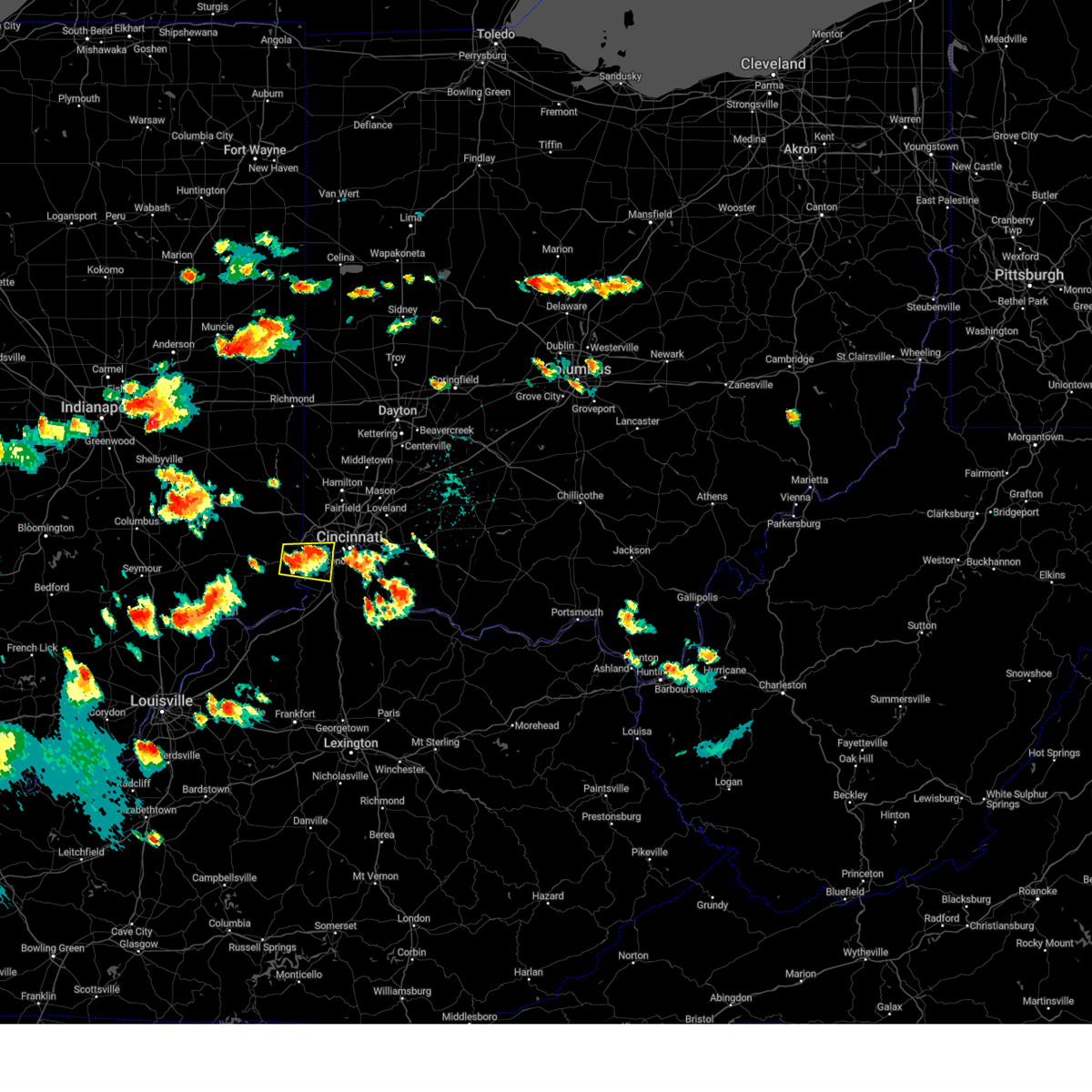 At 459 pm edt, a severe thunderstorm was located over aurora, moving east at 15 mph (fire department reported quarter size hail in aurora). Hazards include 60 mph wind gusts and quarter size hail. Minor hail damage to vehicles is possible. expect wind damage to trees and power lines. locations impacted include, cincinnati, florence, villa hills, lawrenceburg, greendale, aurora, rising sun, oakbrook, burlington, union, shawnee, delhi township, delhi hills, mack, wilmington, french, addyston, hartford, idlewild and waterloo. this includes i-75 in kentucky between mile markers 179 and 182. hail threat, observed max hail size, 1. 00 in wind threat, radar indicated max wind gust, 60 mph. At 459 pm edt, a severe thunderstorm was located over aurora, moving east at 15 mph (fire department reported quarter size hail in aurora). Hazards include 60 mph wind gusts and quarter size hail. Minor hail damage to vehicles is possible. expect wind damage to trees and power lines. locations impacted include, cincinnati, florence, villa hills, lawrenceburg, greendale, aurora, rising sun, oakbrook, burlington, union, shawnee, delhi township, delhi hills, mack, wilmington, french, addyston, hartford, idlewild and waterloo. this includes i-75 in kentucky between mile markers 179 and 182. hail threat, observed max hail size, 1. 00 in wind threat, radar indicated max wind gust, 60 mph.
|
| 7/24/2023 4:46 PM EDT |
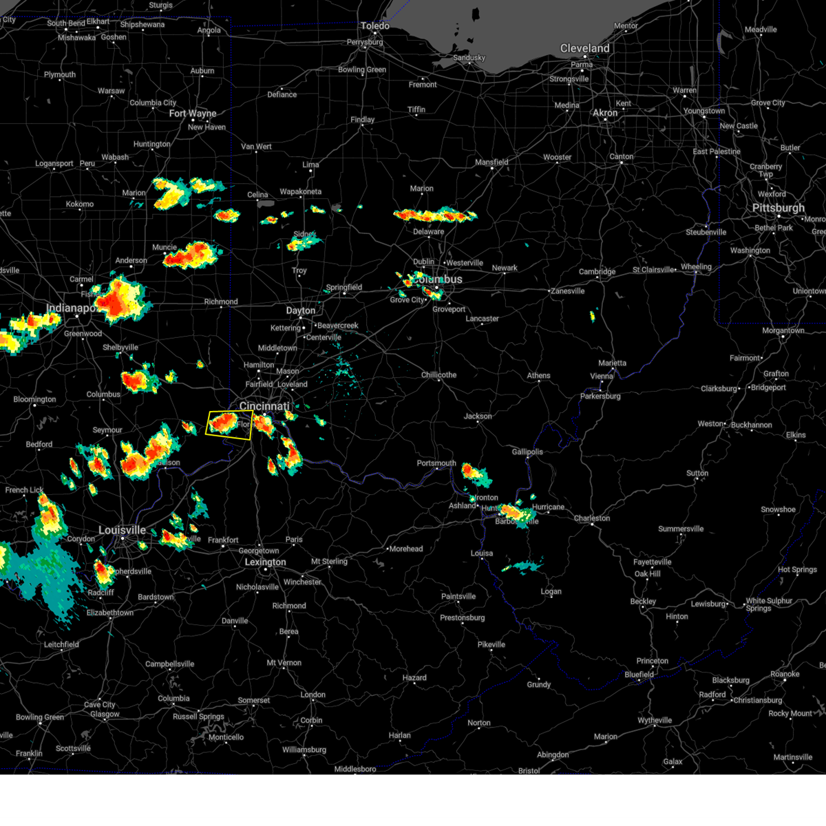 At 446 pm edt, a severe thunderstorm was located over aurora, moving east at 15 mph (radar indicated). Hazards include 60 mph wind gusts and quarter size hail. Minor hail damage to vehicles is possible. Expect wind damage to trees and power lines. At 446 pm edt, a severe thunderstorm was located over aurora, moving east at 15 mph (radar indicated). Hazards include 60 mph wind gusts and quarter size hail. Minor hail damage to vehicles is possible. Expect wind damage to trees and power lines.
|
| 7/15/2023 9:12 AM EDT |
 At 912 am edt, a severe thunderstorm was located over blue ash, moving east at 25 mph (radar indicated). Hazards include 60 mph wind gusts and quarter size hail. Minor hail damage to vehicles is possible. expect wind damage to trees and power lines. locations impacted include, middletown, mason, lebanon, norwood, sharonville, monroe, blue ash, loveland, springdale, reading, montgomery, madeira, wyoming, milford, deer park, west chester, waynesville, terrace park and morrow. this includes the following interstates, i-71 in ohio between mile markers 8 and 37. i-75 in ohio between mile markers 9 and 32. hail threat, radar indicated max hail size, 1. 00 in wind threat, radar indicated max wind gust, 60 mph. At 912 am edt, a severe thunderstorm was located over blue ash, moving east at 25 mph (radar indicated). Hazards include 60 mph wind gusts and quarter size hail. Minor hail damage to vehicles is possible. expect wind damage to trees and power lines. locations impacted include, middletown, mason, lebanon, norwood, sharonville, monroe, blue ash, loveland, springdale, reading, montgomery, madeira, wyoming, milford, deer park, west chester, waynesville, terrace park and morrow. this includes the following interstates, i-71 in ohio between mile markers 8 and 37. i-75 in ohio between mile markers 9 and 32. hail threat, radar indicated max hail size, 1. 00 in wind threat, radar indicated max wind gust, 60 mph.
|
| 7/15/2023 9:00 AM EDT | Tree limbs downed on springfield pike in woodlawn and wyoming. time estimated from rada in hamilton county OH, 7.8 miles SSW of Cincinnati, OH |
| 7/15/2023 9:00 AM EDT |
 At 900 am edt, a severe thunderstorm was located over sharonville, moving east at 35 mph (radar indicated). Hazards include 60 mph wind gusts and quarter size hail. Minor hail damage to vehicles is possible. Expect wind damage to trees and power lines. At 900 am edt, a severe thunderstorm was located over sharonville, moving east at 35 mph (radar indicated). Hazards include 60 mph wind gusts and quarter size hail. Minor hail damage to vehicles is possible. Expect wind damage to trees and power lines.
|
| 7/2/2023 7:10 PM EDT | Half Dollar sized hail reported 3.4 miles WNW of Cincinnati, OH |
| 7/2/2023 7:01 PM EDT | One large healthy branch downed along i-71 near florence avenue. time estimated by rada in hamilton county OH, 1.8 miles SW of Cincinnati, OH |
| 7/2/2023 3:46 PM EDT | Report from mping: 3-inch tree limbs broken; power poles broke in hamilton county OH, 10 miles ESE of Cincinnati, OH |
| 7/2/2023 3:45 PM EDT | Quarter sized hail reported 9.2 miles SSW of Cincinnati, OH, nickel to quarter sized hail |
| 7/2/2023 3:23 PM EDT |
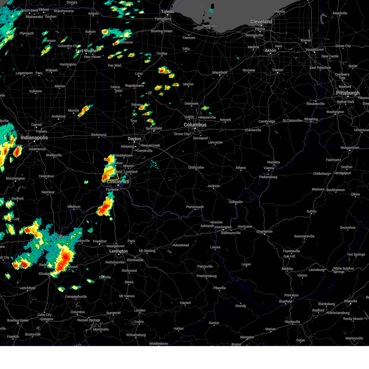 The severe thunderstorm warning for northwestern hamilton and south central butler counties will expire at 330 pm edt, the storm which prompted the warning has weakened below severe limits, and no longer poses an immediate threat to life or property. therefore, the warning will be allowed to expire. however gusty winds are still possible with this thunderstorm. a severe thunderstorm watch remains in effect until 900 pm edt for southeastern indiana, and southwestern ohio. please report previous wind damage or hail to the national weather service by going to our website at weather.gov/iln and submitting your report via social media. The severe thunderstorm warning for northwestern hamilton and south central butler counties will expire at 330 pm edt, the storm which prompted the warning has weakened below severe limits, and no longer poses an immediate threat to life or property. therefore, the warning will be allowed to expire. however gusty winds are still possible with this thunderstorm. a severe thunderstorm watch remains in effect until 900 pm edt for southeastern indiana, and southwestern ohio. please report previous wind damage or hail to the national weather service by going to our website at weather.gov/iln and submitting your report via social media.
|
| 7/2/2023 3:20 PM EDT |
 At 319 pm edt, a severe thunderstorm was located near ross, moving northeast at 35 mph (radar indicated). Hazards include 60 mph wind gusts and penny size hail. Expect damage to trees and power lines. locations impacted include, cincinnati, hamilton, fairfield, forest park, harrison, north college hill, mount healthy, finneytown, ross, cleves, shawnee, taylor creek, pleasant hills, miami heights, dry ridge, skyline acres, blue jay, dunlap, colerain township and monfort heights. this includes i-74 in ohio between mile markers 2 and 14. hail threat, radar indicated max hail size, 0. 75 in wind threat, radar indicated max wind gust, 60 mph. At 319 pm edt, a severe thunderstorm was located near ross, moving northeast at 35 mph (radar indicated). Hazards include 60 mph wind gusts and penny size hail. Expect damage to trees and power lines. locations impacted include, cincinnati, hamilton, fairfield, forest park, harrison, north college hill, mount healthy, finneytown, ross, cleves, shawnee, taylor creek, pleasant hills, miami heights, dry ridge, skyline acres, blue jay, dunlap, colerain township and monfort heights. this includes i-74 in ohio between mile markers 2 and 14. hail threat, radar indicated max hail size, 0. 75 in wind threat, radar indicated max wind gust, 60 mph.
|
| 7/2/2023 3:06 PM EDT |
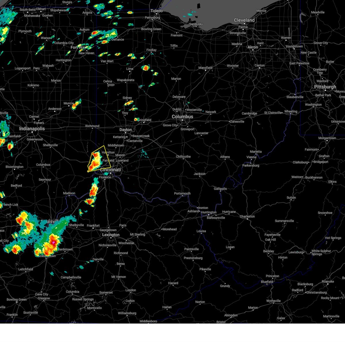 At 306 pm edt, a severe thunderstorm was located near harrison, moving northeast at 35 mph (radar indicated). Hazards include 60 mph wind gusts and quarter size hail. Minor hail damage to vehicles is possible. expect wind damage to trees and power lines. locations impacted include, cincinnati, hamilton, fairfield, oxford, forest park, harrison, north college hill, mount healthy, greendale, bright, hidden valley, finneytown, ross, cleves, shawnee, taylor creek, miami heights, dry ridge, blue jay and dunlap. this includes the following interstates, i-74 in indiana between mile markers 165 and 171. i-74 in ohio between mile markers 0 and 14. hail threat, radar indicated max hail size, 1. 00 in wind threat, radar indicated max wind gust, 60 mph. At 306 pm edt, a severe thunderstorm was located near harrison, moving northeast at 35 mph (radar indicated). Hazards include 60 mph wind gusts and quarter size hail. Minor hail damage to vehicles is possible. expect wind damage to trees and power lines. locations impacted include, cincinnati, hamilton, fairfield, oxford, forest park, harrison, north college hill, mount healthy, greendale, bright, hidden valley, finneytown, ross, cleves, shawnee, taylor creek, miami heights, dry ridge, blue jay and dunlap. this includes the following interstates, i-74 in indiana between mile markers 165 and 171. i-74 in ohio between mile markers 0 and 14. hail threat, radar indicated max hail size, 1. 00 in wind threat, radar indicated max wind gust, 60 mph.
|
| 7/2/2023 3:06 PM EDT |
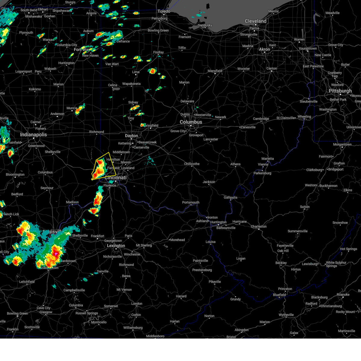 At 306 pm edt, a severe thunderstorm was located near harrison, moving northeast at 35 mph (radar indicated). Hazards include 60 mph wind gusts and quarter size hail. Minor hail damage to vehicles is possible. expect wind damage to trees and power lines. locations impacted include, cincinnati, hamilton, fairfield, oxford, forest park, harrison, north college hill, mount healthy, greendale, bright, hidden valley, finneytown, ross, cleves, shawnee, taylor creek, miami heights, dry ridge, blue jay and dunlap. this includes the following interstates, i-74 in indiana between mile markers 165 and 171. i-74 in ohio between mile markers 0 and 14. hail threat, radar indicated max hail size, 1. 00 in wind threat, radar indicated max wind gust, 60 mph. At 306 pm edt, a severe thunderstorm was located near harrison, moving northeast at 35 mph (radar indicated). Hazards include 60 mph wind gusts and quarter size hail. Minor hail damage to vehicles is possible. expect wind damage to trees and power lines. locations impacted include, cincinnati, hamilton, fairfield, oxford, forest park, harrison, north college hill, mount healthy, greendale, bright, hidden valley, finneytown, ross, cleves, shawnee, taylor creek, miami heights, dry ridge, blue jay and dunlap. this includes the following interstates, i-74 in indiana between mile markers 165 and 171. i-74 in ohio between mile markers 0 and 14. hail threat, radar indicated max hail size, 1. 00 in wind threat, radar indicated max wind gust, 60 mph.
|
| 7/2/2023 2:48 PM EDT |
 At 248 pm edt, a severe thunderstorm was located near bright, moving northeast at 35 mph (radar indicated). Hazards include 60 mph wind gusts and quarter size hail. Minor hail damage to vehicles is possible. Expect wind damage to trees and power lines. At 248 pm edt, a severe thunderstorm was located near bright, moving northeast at 35 mph (radar indicated). Hazards include 60 mph wind gusts and quarter size hail. Minor hail damage to vehicles is possible. Expect wind damage to trees and power lines.
|
| 7/2/2023 2:48 PM EDT |
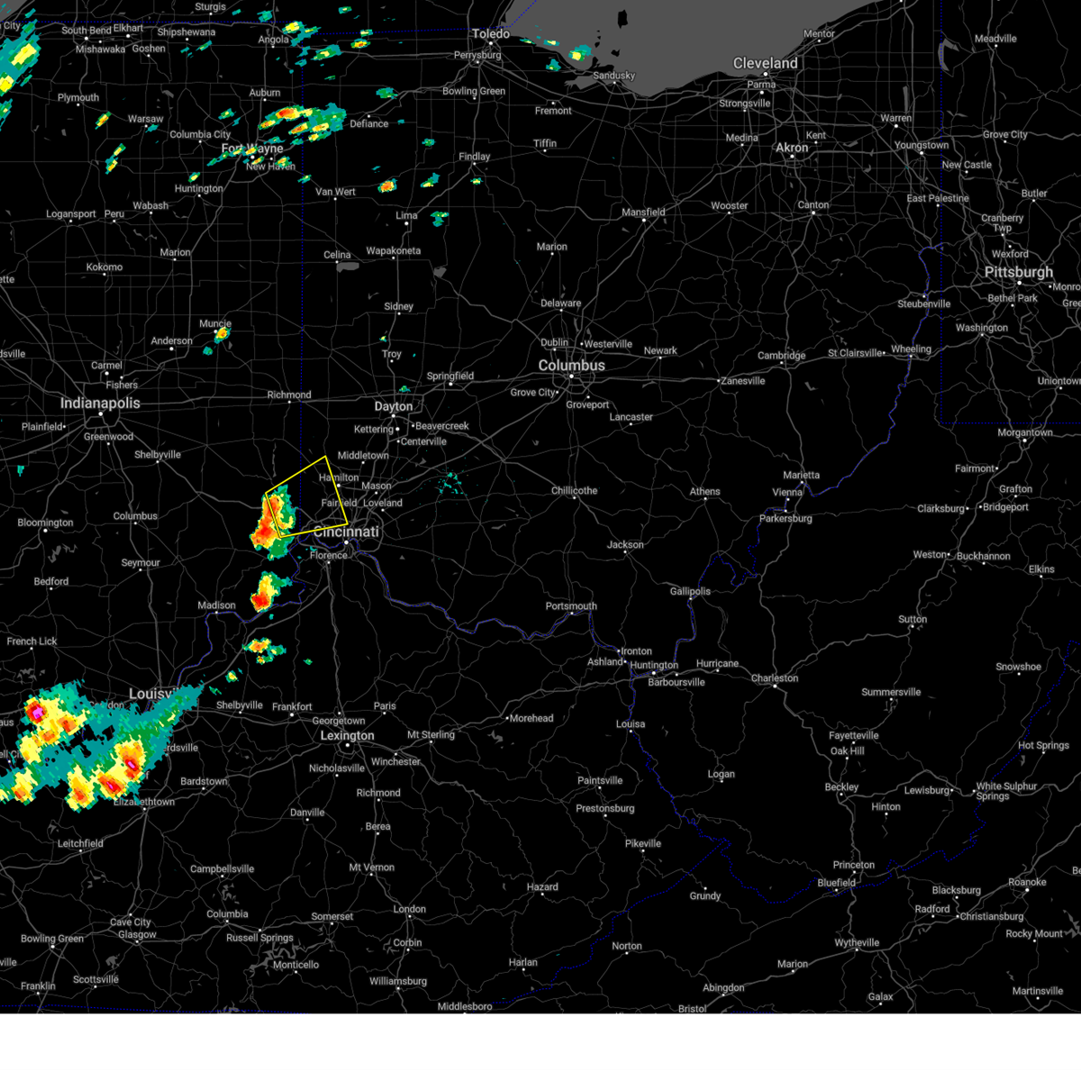 At 248 pm edt, a severe thunderstorm was located near bright, moving northeast at 35 mph (radar indicated). Hazards include 60 mph wind gusts and quarter size hail. Minor hail damage to vehicles is possible. Expect wind damage to trees and power lines. At 248 pm edt, a severe thunderstorm was located near bright, moving northeast at 35 mph (radar indicated). Hazards include 60 mph wind gusts and quarter size hail. Minor hail damage to vehicles is possible. Expect wind damage to trees and power lines.
|
| 4/5/2023 4:27 PM EDT |
 At 426 pm edt, a severe thunderstorm was located near batavia, moving east at 50 mph (radar indicated). Hazards include 60 mph wind gusts. Expect damage to trees and power lines. locations impacted include, cincinnati, covington, independence, fort thomas, blue ash, loveland, montgomery, madeira, alexandria, highland heights, milford, taylor mill, deer park, dayton, southgate, claryville, forestville, amelia, mariemont and wilder. this includes the following interstates, i-71 in ohio between mile markers 9 and 18. i-75 in kentucky near mile marker 168. hail threat, radar indicated max hail size, <. 75 in wind threat, radar indicated max wind gust, 60 mph. At 426 pm edt, a severe thunderstorm was located near batavia, moving east at 50 mph (radar indicated). Hazards include 60 mph wind gusts. Expect damage to trees and power lines. locations impacted include, cincinnati, covington, independence, fort thomas, blue ash, loveland, montgomery, madeira, alexandria, highland heights, milford, taylor mill, deer park, dayton, southgate, claryville, forestville, amelia, mariemont and wilder. this includes the following interstates, i-71 in ohio between mile markers 9 and 18. i-75 in kentucky near mile marker 168. hail threat, radar indicated max hail size, <. 75 in wind threat, radar indicated max wind gust, 60 mph.
|
| 4/5/2023 4:15 PM EDT | 12 inch tree down... blocking road on grand vista avenu in hamilton county OH, 5.2 miles WSW of Cincinnati, OH |
| 4/5/2023 4:14 PM EDT |
 At 414 pm edt, a severe thunderstorm was located over terrace park, moving east at 50 mph (radar indicated). Hazards include 60 mph wind gusts. expect damage to trees and power lines At 414 pm edt, a severe thunderstorm was located over terrace park, moving east at 50 mph (radar indicated). Hazards include 60 mph wind gusts. expect damage to trees and power lines
|
| 4/5/2023 4:07 PM EDT | Storm damage reported in hamilton county OH, 5.2 miles WNW of Cincinnati, OH |
| 3/3/2023 5:12 PM EST |
 The severe thunderstorm warning for northern kenton, western bracken, campbell, pendleton, eastern hamilton, clermont and northwestern brown counties will expire at 515 pm est, the storms which prompted the warning have moved out of the area. therefore, the warning will be allowed to expire. however gusty winds are still possible with these thunderstorms. a tornado watch remains in effect until 700 pm est for northern kentucky, and southwestern ohio. please report previous wind damage or hail to the national weather service by going to our website at weather.gov/iln and submitting your report via social media. remember, a severe thunderstorm warning still remains in effect for clermont and brown counties in ohio and campbell, pendleton, and bracken counties in kentucky. The severe thunderstorm warning for northern kenton, western bracken, campbell, pendleton, eastern hamilton, clermont and northwestern brown counties will expire at 515 pm est, the storms which prompted the warning have moved out of the area. therefore, the warning will be allowed to expire. however gusty winds are still possible with these thunderstorms. a tornado watch remains in effect until 700 pm est for northern kentucky, and southwestern ohio. please report previous wind damage or hail to the national weather service by going to our website at weather.gov/iln and submitting your report via social media. remember, a severe thunderstorm warning still remains in effect for clermont and brown counties in ohio and campbell, pendleton, and bracken counties in kentucky.
|
| 3/3/2023 4:52 PM EST |
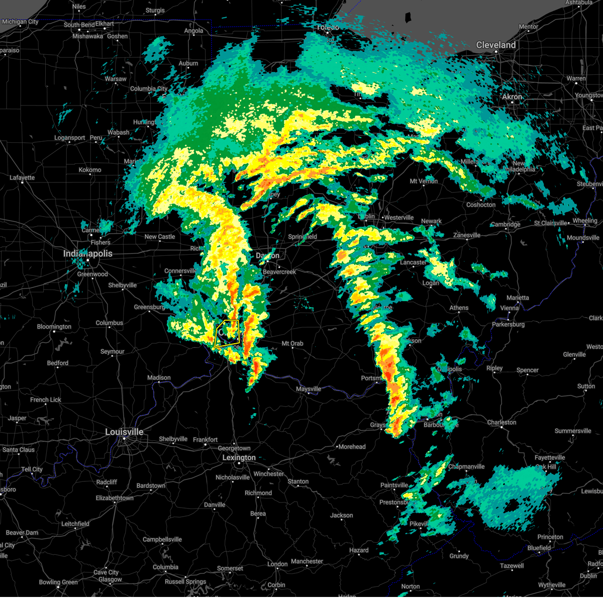 The severe thunderstorm warning for northern kenton, northern boone and western hamilton counties will expire at 500 pm est, the storm which prompted the warning has weakened below severe limits, and no longer poses an immediate threat to life or property. therefore, the warning will be allowed to expire. a tornado watch remains in effect until 700 pm est for northern kentucky, and southwestern ohio. please report previous wind damage or hail to the national weather service by going to our website at weather.gov/iln and submitting your report via social media. The severe thunderstorm warning for northern kenton, northern boone and western hamilton counties will expire at 500 pm est, the storm which prompted the warning has weakened below severe limits, and no longer poses an immediate threat to life or property. therefore, the warning will be allowed to expire. a tornado watch remains in effect until 700 pm est for northern kentucky, and southwestern ohio. please report previous wind damage or hail to the national weather service by going to our website at weather.gov/iln and submitting your report via social media.
|
| 3/3/2023 4:50 PM EST |
 At 449 pm est, severe thunderstorms were located along a line extending from montgomery to near falmouth, moving northeast at 45 mph (radar indicated). Hazards include 70 mph wind gusts. Expect considerable tree damage. damage is likely to mobile homes, roofs, and outbuildings. locations impacted include, cincinnati, covington, norwood, fort thomas, newport, blue ash, loveland, reading, montgomery, madeira, alexandria, wyoming, highland heights, milford, taylor mill, bellevue, deer park, dayton, southgate and falmouth. this includes the following interstates, i-71 in ohio between mile markers 1 and 16. i-75 in ohio between mile markers 7 and 13. thunderstorm damage threat, considerable hail threat, radar indicated max hail size, <. 75 in wind threat, radar indicated max wind gust, 70 mph. At 449 pm est, severe thunderstorms were located along a line extending from montgomery to near falmouth, moving northeast at 45 mph (radar indicated). Hazards include 70 mph wind gusts. Expect considerable tree damage. damage is likely to mobile homes, roofs, and outbuildings. locations impacted include, cincinnati, covington, norwood, fort thomas, newport, blue ash, loveland, reading, montgomery, madeira, alexandria, wyoming, highland heights, milford, taylor mill, bellevue, deer park, dayton, southgate and falmouth. this includes the following interstates, i-71 in ohio between mile markers 1 and 16. i-75 in ohio between mile markers 7 and 13. thunderstorm damage threat, considerable hail threat, radar indicated max hail size, <. 75 in wind threat, radar indicated max wind gust, 70 mph.
|
| 3/3/2023 4:41 PM EST |
 At 440 pm est, a severe thunderstorm was located over monfort heights, moving northeast at 45 mph (radar indicated). Hazards include 60 mph wind gusts. Expect damage to trees and power lines. locations impacted include, cincinnati, covington, erlanger, newport, north college hill, cheviot, fort mitchell, villa hills, mount healthy, fort wright, ludlow, crescent springs, park hills, finneytown, burlington, cleves, taylor creek, bridgetown, pleasant hills and delhi township. this includes the following interstates, i-71 in ohio between mile markers 0 and 1. i-74 in ohio between mile markers 7 and 19. i-75 in kentucky between mile markers 190 and 191. i-75 in ohio between mile markers 0 and 6. hail threat, radar indicated max hail size, <. 75 in wind threat, radar indicated max wind gust, 60 mph. At 440 pm est, a severe thunderstorm was located over monfort heights, moving northeast at 45 mph (radar indicated). Hazards include 60 mph wind gusts. Expect damage to trees and power lines. locations impacted include, cincinnati, covington, erlanger, newport, north college hill, cheviot, fort mitchell, villa hills, mount healthy, fort wright, ludlow, crescent springs, park hills, finneytown, burlington, cleves, taylor creek, bridgetown, pleasant hills and delhi township. this includes the following interstates, i-71 in ohio between mile markers 0 and 1. i-74 in ohio between mile markers 7 and 19. i-75 in kentucky between mile markers 190 and 191. i-75 in ohio between mile markers 0 and 6. hail threat, radar indicated max hail size, <. 75 in wind threat, radar indicated max wind gust, 60 mph.
|
| 3/3/2023 4:41 PM EST |
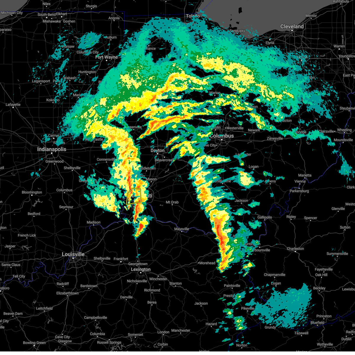 At 440 pm est, a severe thunderstorm was located over monfort heights, moving northeast at 45 mph (radar indicated). Hazards include 60 mph wind gusts. Expect damage to trees and power lines. locations impacted include, cincinnati, covington, erlanger, newport, north college hill, cheviot, fort mitchell, villa hills, mount healthy, fort wright, ludlow, crescent springs, park hills, finneytown, burlington, cleves, taylor creek, bridgetown, pleasant hills and delhi township. this includes the following interstates, i-71 in ohio between mile markers 0 and 1. i-74 in ohio between mile markers 7 and 19. i-75 in kentucky between mile markers 190 and 191. i-75 in ohio between mile markers 0 and 6. hail threat, radar indicated max hail size, <. 75 in wind threat, radar indicated max wind gust, 60 mph. At 440 pm est, a severe thunderstorm was located over monfort heights, moving northeast at 45 mph (radar indicated). Hazards include 60 mph wind gusts. Expect damage to trees and power lines. locations impacted include, cincinnati, covington, erlanger, newport, north college hill, cheviot, fort mitchell, villa hills, mount healthy, fort wright, ludlow, crescent springs, park hills, finneytown, burlington, cleves, taylor creek, bridgetown, pleasant hills and delhi township. this includes the following interstates, i-71 in ohio between mile markers 0 and 1. i-74 in ohio between mile markers 7 and 19. i-75 in kentucky between mile markers 190 and 191. i-75 in ohio between mile markers 0 and 6. hail threat, radar indicated max hail size, <. 75 in wind threat, radar indicated max wind gust, 60 mph.
|
| 3/3/2023 4:35 PM EST |
 At 434 pm est, severe thunderstorms were located along a line extending from finneytown to 9 miles south of williamstown, moving northeast at 70 mph (radar indicated). Hazards include 70 mph wind gusts. Expect considerable tree damage. Damage is likely to mobile homes, roofs, and outbuildings. At 434 pm est, severe thunderstorms were located along a line extending from finneytown to 9 miles south of williamstown, moving northeast at 70 mph (radar indicated). Hazards include 70 mph wind gusts. Expect considerable tree damage. Damage is likely to mobile homes, roofs, and outbuildings.
|
| 3/3/2023 4:35 PM EST |
 At 435 pm est, severe thunderstorms were located along a line extending from ludlow to near williamstown, moving northeast at 65 mph (radar indicated). Hazards include 70 mph wind gusts. Expect considerable tree damage. damage is likely to mobile homes, roofs, and outbuildings. locations impacted include, covington, florence, independence, erlanger, edgewood, elsmere, fort mitchell, villa hills, taylor mill, fort wright, ludlow, williamstown, crescent springs, walton, crestview hills, park hills, lakeside park, falmouth, oakbrook and burlington. this includes the following interstates, i-71 in kentucky between mile markers 70 and 77. i-75 in kentucky between mile markers 144 and 191. thunderstorm damage threat, considerable hail threat, radar indicated max hail size, <. 75 in wind threat, radar indicated max wind gust, 70 mph. At 435 pm est, severe thunderstorms were located along a line extending from ludlow to near williamstown, moving northeast at 65 mph (radar indicated). Hazards include 70 mph wind gusts. Expect considerable tree damage. damage is likely to mobile homes, roofs, and outbuildings. locations impacted include, covington, florence, independence, erlanger, edgewood, elsmere, fort mitchell, villa hills, taylor mill, fort wright, ludlow, williamstown, crescent springs, walton, crestview hills, park hills, lakeside park, falmouth, oakbrook and burlington. this includes the following interstates, i-71 in kentucky between mile markers 70 and 77. i-75 in kentucky between mile markers 144 and 191. thunderstorm damage threat, considerable hail threat, radar indicated max hail size, <. 75 in wind threat, radar indicated max wind gust, 70 mph.
|
| 3/3/2023 4:35 PM EST |
 At 434 pm est, severe thunderstorms were located along a line extending from finneytown to 9 miles south of williamstown, moving northeast at 70 mph (radar indicated). Hazards include 70 mph wind gusts. Expect considerable tree damage. Damage is likely to mobile homes, roofs, and outbuildings. At 434 pm est, severe thunderstorms were located along a line extending from finneytown to 9 miles south of williamstown, moving northeast at 70 mph (radar indicated). Hazards include 70 mph wind gusts. Expect considerable tree damage. Damage is likely to mobile homes, roofs, and outbuildings.
|
| 3/3/2023 4:31 PM EST |
 At 430 pm est, severe thunderstorms were located along a line extending from near erlanger to 8 miles southwest of williamstown, moving northeast at 55 mph (radar indicated). Hazards include 60 mph wind gusts. Expect damage to trees and power lines. locations impacted include, covington, florence, independence, erlanger, edgewood, elsmere, fort mitchell, villa hills, taylor mill, fort wright, ludlow, williamstown, crescent springs, walton, crestview hills, park hills, lakeside park, rising sun, falmouth and oakbrook. this includes the following interstates, i-71 in kentucky between mile markers 65 and 77. i-75 in kentucky between mile markers 144 and 191. hail threat, radar indicated max hail size, <. 75 in wind threat, radar indicated max wind gust, 60 mph. At 430 pm est, severe thunderstorms were located along a line extending from near erlanger to 8 miles southwest of williamstown, moving northeast at 55 mph (radar indicated). Hazards include 60 mph wind gusts. Expect damage to trees and power lines. locations impacted include, covington, florence, independence, erlanger, edgewood, elsmere, fort mitchell, villa hills, taylor mill, fort wright, ludlow, williamstown, crescent springs, walton, crestview hills, park hills, lakeside park, rising sun, falmouth and oakbrook. this includes the following interstates, i-71 in kentucky between mile markers 65 and 77. i-75 in kentucky between mile markers 144 and 191. hail threat, radar indicated max hail size, <. 75 in wind threat, radar indicated max wind gust, 60 mph.
|
| 3/3/2023 4:30 PM EST |
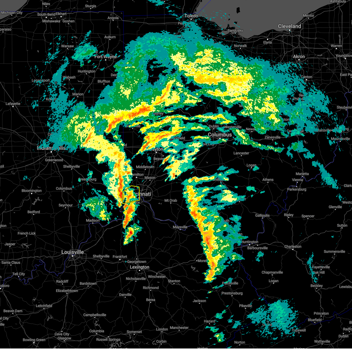 At 429 pm est, a severe thunderstorm was located over shawnee, moving northeast at 50 mph (radar indicated). Hazards include 60 mph wind gusts. Expect damage to trees and power lines. locations impacted include, cincinnati, covington, erlanger, newport, north college hill, cheviot, fort mitchell, villa hills, mount healthy, fort wright, ludlow, crescent springs, park hills, finneytown, burlington, cleves, shawnee, taylor creek, bridgetown and miami heights. this includes the following interstates, i-71 in ohio between mile markers 0 and 1. i-74 in ohio between mile markers 5 and 19. i-75 in kentucky between mile markers 190 and 191. I-75 in ohio between mile markers 0 and 6. At 429 pm est, a severe thunderstorm was located over shawnee, moving northeast at 50 mph (radar indicated). Hazards include 60 mph wind gusts. Expect damage to trees and power lines. locations impacted include, cincinnati, covington, erlanger, newport, north college hill, cheviot, fort mitchell, villa hills, mount healthy, fort wright, ludlow, crescent springs, park hills, finneytown, burlington, cleves, shawnee, taylor creek, bridgetown and miami heights. this includes the following interstates, i-71 in ohio between mile markers 0 and 1. i-74 in ohio between mile markers 5 and 19. i-75 in kentucky between mile markers 190 and 191. I-75 in ohio between mile markers 0 and 6.
|
| 3/3/2023 4:22 PM EST |
 At 421 pm est, a severe thunderstorm was located over aurora, moving northeast at 45 mph (radar indicated). Hazards include 60 mph wind gusts. expect damage to trees and power lines At 421 pm est, a severe thunderstorm was located over aurora, moving northeast at 45 mph (radar indicated). Hazards include 60 mph wind gusts. expect damage to trees and power lines
|
| 3/3/2023 4:22 PM EST |
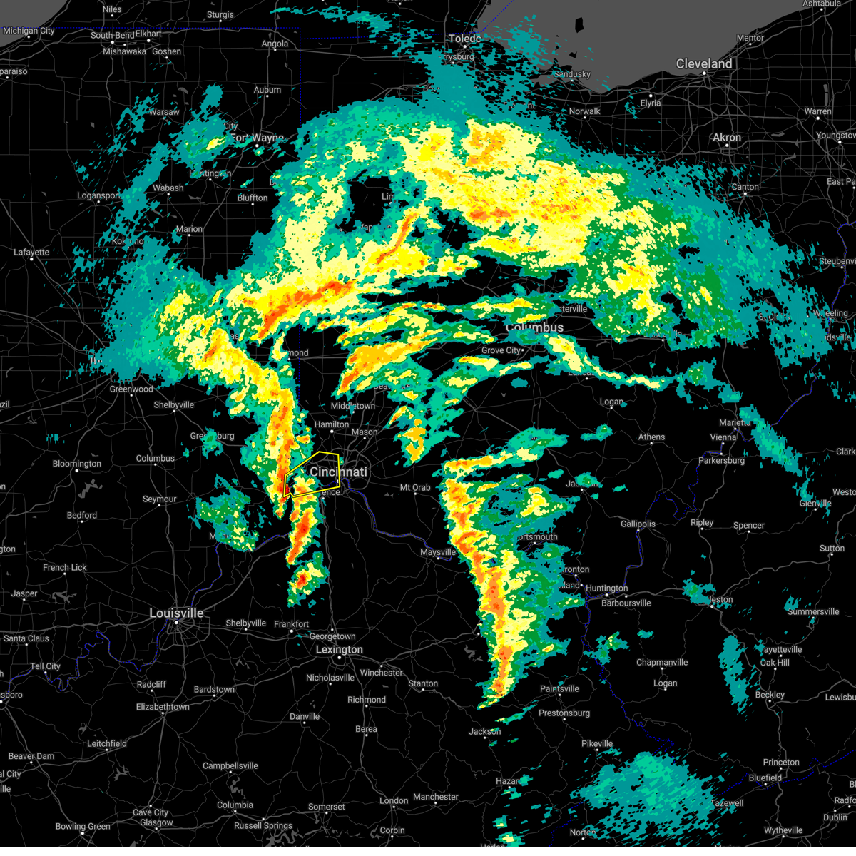 At 421 pm est, a severe thunderstorm was located over aurora, moving northeast at 45 mph (radar indicated). Hazards include 60 mph wind gusts. expect damage to trees and power lines At 421 pm est, a severe thunderstorm was located over aurora, moving northeast at 45 mph (radar indicated). Hazards include 60 mph wind gusts. expect damage to trees and power lines
|
| 3/3/2023 4:19 PM EST |
 At 419 pm est, severe thunderstorms were located along a line extending from oakbrook to 8 miles south of owenton, moving northeast at 65 mph (radar indicated). Hazards include 60 mph wind gusts. Expect damage to trees and power lines. locations impacted include, covington, florence, independence, erlanger, edgewood, elsmere, fort mitchell, villa hills, taylor mill, fort wright, ludlow, williamstown, crescent springs, walton, crestview hills, park hills, lakeside park, rising sun, falmouth and oakbrook. this includes the following interstates, i-71 in kentucky between mile markers 61 and 77. i-75 in kentucky between mile markers 144 and 191. hail threat, radar indicated max hail size, <. 75 in wind threat, radar indicated max wind gust, 60 mph. At 419 pm est, severe thunderstorms were located along a line extending from oakbrook to 8 miles south of owenton, moving northeast at 65 mph (radar indicated). Hazards include 60 mph wind gusts. Expect damage to trees and power lines. locations impacted include, covington, florence, independence, erlanger, edgewood, elsmere, fort mitchell, villa hills, taylor mill, fort wright, ludlow, williamstown, crescent springs, walton, crestview hills, park hills, lakeside park, rising sun, falmouth and oakbrook. this includes the following interstates, i-71 in kentucky between mile markers 61 and 77. i-75 in kentucky between mile markers 144 and 191. hail threat, radar indicated max hail size, <. 75 in wind threat, radar indicated max wind gust, 60 mph.
|
| 3/3/2023 4:06 PM EST |
 At 406 pm est, severe thunderstorms were located along a line extending from near patriot to 8 miles northwest of frankfort, moving northeast at 65 mph (radar indicated). Hazards include 60 mph wind gusts. expect damage to trees and power lines At 406 pm est, severe thunderstorms were located along a line extending from near patriot to 8 miles northwest of frankfort, moving northeast at 65 mph (radar indicated). Hazards include 60 mph wind gusts. expect damage to trees and power lines
|
| 2/27/2023 2:31 PM EST |
 At 230 pm est, a severe thunderstorm was located over north college hill, moving northeast at 55 mph (radar indicated). Hazards include 60 mph wind gusts and quarter size hail. Minor hail damage to vehicles is possible. Expect wind damage to trees and power lines. At 230 pm est, a severe thunderstorm was located over north college hill, moving northeast at 55 mph (radar indicated). Hazards include 60 mph wind gusts and quarter size hail. Minor hail damage to vehicles is possible. Expect wind damage to trees and power lines.
|
| 9/21/2022 8:25 PM EDT |
 The severe thunderstorm warning for northeastern switzerland, kenton and boone counties will expire at 830 pm edt, the storm which prompted the warning has moved out of the area. therefore, the warning will be allowed to expire. please report previous wind damage or hail to the national weather service by going to our website at weather.gov/iln and submitting your report via social media. remember, a severe thunderstorm warning still remains in effect for kenton, campbell, southern boone and northern pendleton counties until 9 00 pm edt. The severe thunderstorm warning for northeastern switzerland, kenton and boone counties will expire at 830 pm edt, the storm which prompted the warning has moved out of the area. therefore, the warning will be allowed to expire. please report previous wind damage or hail to the national weather service by going to our website at weather.gov/iln and submitting your report via social media. remember, a severe thunderstorm warning still remains in effect for kenton, campbell, southern boone and northern pendleton counties until 9 00 pm edt.
|
| 9/21/2022 8:25 PM EDT |
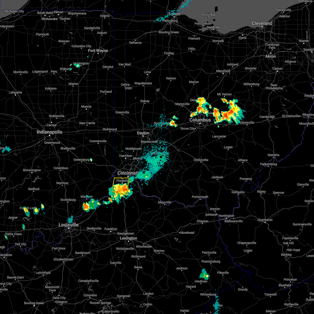 The severe thunderstorm warning for northeastern switzerland, kenton and boone counties will expire at 830 pm edt, the storm which prompted the warning has moved out of the area. therefore, the warning will be allowed to expire. please report previous wind damage or hail to the national weather service by going to our website at weather.gov/iln and submitting your report via social media. remember, a severe thunderstorm warning still remains in effect for kenton, campbell, southern boone and northern pendleton counties until 9 00 pm edt. The severe thunderstorm warning for northeastern switzerland, kenton and boone counties will expire at 830 pm edt, the storm which prompted the warning has moved out of the area. therefore, the warning will be allowed to expire. please report previous wind damage or hail to the national weather service by going to our website at weather.gov/iln and submitting your report via social media. remember, a severe thunderstorm warning still remains in effect for kenton, campbell, southern boone and northern pendleton counties until 9 00 pm edt.
|
| 9/21/2022 8:04 PM EDT |
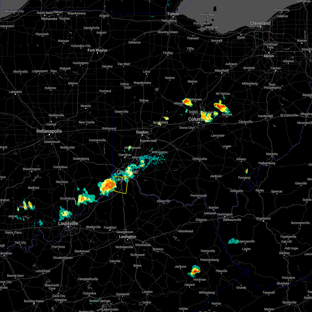 At 803 pm edt, a severe thunderstorm was located near union, moving east at 35 mph (radar indicated). Hazards include 60 mph wind gusts and penny size hail. Expect damage to trees and power lines. locations impacted include, covington, florence, independence, erlanger, edgewood, elsmere, fort mitchell, villa hills, taylor mill, fort wright, ludlow, crescent springs, walton, crestview hills, park hills, lakeside park, oakbrook, burlington, union and wilder. hail threat, radar indicated max hail size, 0. 75 in wind threat, radar indicated max wind gust, 60 mph. At 803 pm edt, a severe thunderstorm was located near union, moving east at 35 mph (radar indicated). Hazards include 60 mph wind gusts and penny size hail. Expect damage to trees and power lines. locations impacted include, covington, florence, independence, erlanger, edgewood, elsmere, fort mitchell, villa hills, taylor mill, fort wright, ludlow, crescent springs, walton, crestview hills, park hills, lakeside park, oakbrook, burlington, union and wilder. hail threat, radar indicated max hail size, 0. 75 in wind threat, radar indicated max wind gust, 60 mph.
|
| 9/21/2022 8:04 PM EDT |
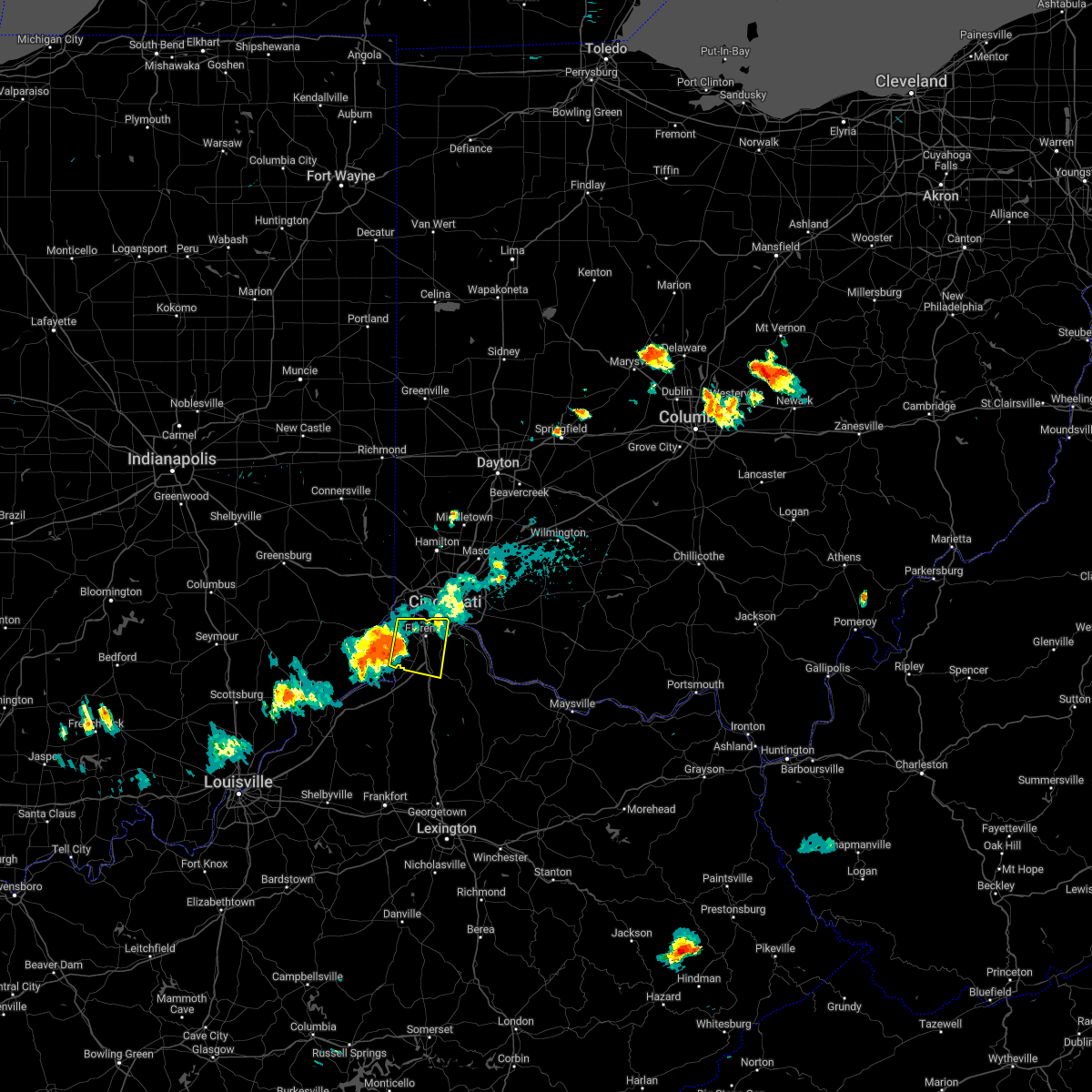 At 803 pm edt, a severe thunderstorm was located near union, moving east at 35 mph (radar indicated). Hazards include 60 mph wind gusts and penny size hail. Expect damage to trees and power lines. locations impacted include, covington, florence, independence, erlanger, edgewood, elsmere, fort mitchell, villa hills, taylor mill, fort wright, ludlow, crescent springs, walton, crestview hills, park hills, lakeside park, oakbrook, burlington, union and wilder. hail threat, radar indicated max hail size, 0. 75 in wind threat, radar indicated max wind gust, 60 mph. At 803 pm edt, a severe thunderstorm was located near union, moving east at 35 mph (radar indicated). Hazards include 60 mph wind gusts and penny size hail. Expect damage to trees and power lines. locations impacted include, covington, florence, independence, erlanger, edgewood, elsmere, fort mitchell, villa hills, taylor mill, fort wright, ludlow, crescent springs, walton, crestview hills, park hills, lakeside park, oakbrook, burlington, union and wilder. hail threat, radar indicated max hail size, 0. 75 in wind threat, radar indicated max wind gust, 60 mph.
|
| 9/21/2022 7:39 PM EDT |
 At 739 pm edt, a severe thunderstorm was located near dillsboro, moving east at 35 mph (radar indicated). Hazards include 60 mph wind gusts and penny size hail. expect damage to trees and power lines At 739 pm edt, a severe thunderstorm was located near dillsboro, moving east at 35 mph (radar indicated). Hazards include 60 mph wind gusts and penny size hail. expect damage to trees and power lines
|
| 9/21/2022 7:39 PM EDT |
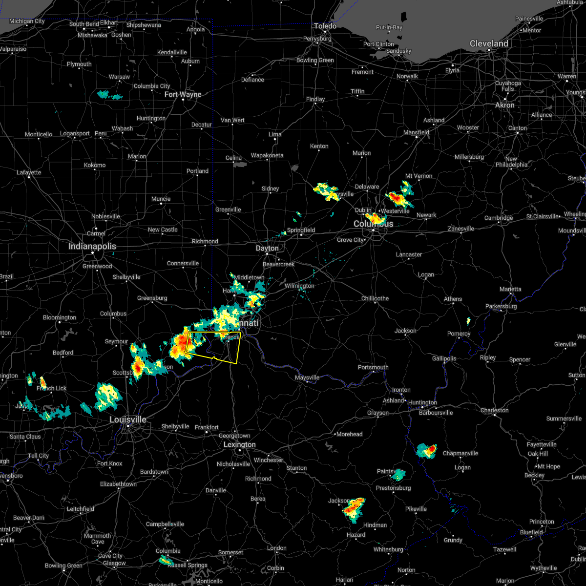 At 739 pm edt, a severe thunderstorm was located near dillsboro, moving east at 35 mph (radar indicated). Hazards include 60 mph wind gusts and penny size hail. expect damage to trees and power lines At 739 pm edt, a severe thunderstorm was located near dillsboro, moving east at 35 mph (radar indicated). Hazards include 60 mph wind gusts and penny size hail. expect damage to trees and power lines
|
| 7/6/2022 2:58 PM EDT | Large tree down in hamilton county OH, 10.3 miles WNW of Cincinnati, OH |
| 7/6/2022 2:56 PM EDT |
 At 254 pm edt, severe thunderstorms were located along a line extending from camp dennison to near independence to near kentucky speedway, moving east at 40 mph (observed via automated observations. 58 mph gust was measured at cincinnati northern kentucky airport. 67 mph measured at lunken airport). Hazards include 70 mph wind gusts. Expect considerable tree damage. damage is likely to mobile homes, roofs, and outbuildings. locations impacted include, cincinnati, covington, florence, independence, norwood, forest park, erlanger, fort thomas, newport, sharonville, blue ash, loveland, springdale, reading, montgomery, north college hill, madeira, edgewood, alexandria and elsmere. this includes the following interstates, i-71 in kentucky between mile markers 56 and 77. i-71 in ohio between mile markers 0 and 19. i-74 in ohio between mile markers 17 and 19. i-75 in kentucky between mile markers 151 and 191. i-75 in ohio between mile markers 0 and 17. thunderstorm damage threat, considerable hail threat, radar indicated max hail size, <. 75 in wind threat, radar indicated max wind gust, 70 mph. At 254 pm edt, severe thunderstorms were located along a line extending from camp dennison to near independence to near kentucky speedway, moving east at 40 mph (observed via automated observations. 58 mph gust was measured at cincinnati northern kentucky airport. 67 mph measured at lunken airport). Hazards include 70 mph wind gusts. Expect considerable tree damage. damage is likely to mobile homes, roofs, and outbuildings. locations impacted include, cincinnati, covington, florence, independence, norwood, forest park, erlanger, fort thomas, newport, sharonville, blue ash, loveland, springdale, reading, montgomery, north college hill, madeira, edgewood, alexandria and elsmere. this includes the following interstates, i-71 in kentucky between mile markers 56 and 77. i-71 in ohio between mile markers 0 and 19. i-74 in ohio between mile markers 17 and 19. i-75 in kentucky between mile markers 151 and 191. i-75 in ohio between mile markers 0 and 17. thunderstorm damage threat, considerable hail threat, radar indicated max hail size, <. 75 in wind threat, radar indicated max wind gust, 70 mph.
|
| 7/6/2022 2:51 PM EDT | Storm damage reported in hamilton county OH, 5.2 miles WNW of Cincinnati, OH |
| 7/6/2022 2:48 PM EDT | Large tree down on roe stree in hamilton county OH, 6.1 miles WSW of Cincinnati, OH |
| 7/6/2022 2:36 PM EDT |
 At 235 pm edt, a severe thunderstorm was located near aurora, moving east at 25 mph (radar indicated). Hazards include 70 mph wind gusts. Expect considerable tree damage. damage is likely to mobile homes, roofs, and outbuildings. locations impacted include, harrison, lawrenceburg, greendale, aurora, rising sun, burlington, hidden valley, cleves, warsaw, shawnee, taylor creek, miami heights, blue jay, mack, grandview, french, addyston, hartford, north bend and fairview. this includes i-74 in ohio between mile markers 4 and 8. thunderstorm damage threat, considerable hail threat, radar indicated max hail size, <. 75 in wind threat, radar indicated max wind gust, 70 mph. At 235 pm edt, a severe thunderstorm was located near aurora, moving east at 25 mph (radar indicated). Hazards include 70 mph wind gusts. Expect considerable tree damage. damage is likely to mobile homes, roofs, and outbuildings. locations impacted include, harrison, lawrenceburg, greendale, aurora, rising sun, burlington, hidden valley, cleves, warsaw, shawnee, taylor creek, miami heights, blue jay, mack, grandview, french, addyston, hartford, north bend and fairview. this includes i-74 in ohio between mile markers 4 and 8. thunderstorm damage threat, considerable hail threat, radar indicated max hail size, <. 75 in wind threat, radar indicated max wind gust, 70 mph.
|
| 7/6/2022 2:36 PM EDT |
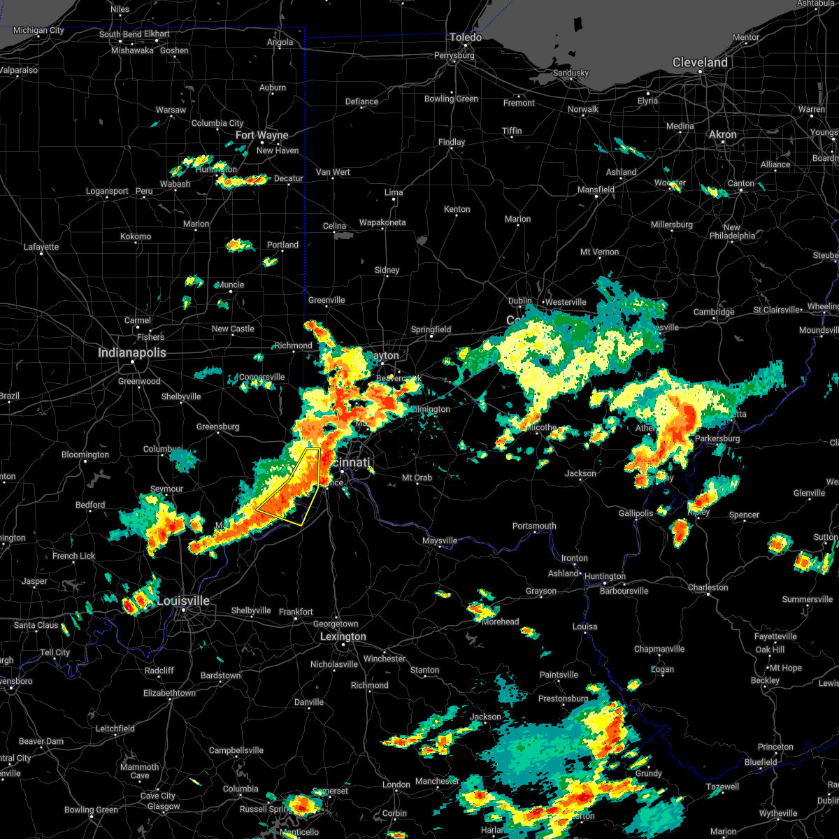 At 235 pm edt, a severe thunderstorm was located near aurora, moving east at 25 mph (radar indicated). Hazards include 70 mph wind gusts. Expect considerable tree damage. damage is likely to mobile homes, roofs, and outbuildings. locations impacted include, harrison, lawrenceburg, greendale, aurora, rising sun, burlington, hidden valley, cleves, warsaw, shawnee, taylor creek, miami heights, blue jay, mack, grandview, french, addyston, hartford, north bend and fairview. this includes i-74 in ohio between mile markers 4 and 8. thunderstorm damage threat, considerable hail threat, radar indicated max hail size, <. 75 in wind threat, radar indicated max wind gust, 70 mph. At 235 pm edt, a severe thunderstorm was located near aurora, moving east at 25 mph (radar indicated). Hazards include 70 mph wind gusts. Expect considerable tree damage. damage is likely to mobile homes, roofs, and outbuildings. locations impacted include, harrison, lawrenceburg, greendale, aurora, rising sun, burlington, hidden valley, cleves, warsaw, shawnee, taylor creek, miami heights, blue jay, mack, grandview, french, addyston, hartford, north bend and fairview. this includes i-74 in ohio between mile markers 4 and 8. thunderstorm damage threat, considerable hail threat, radar indicated max hail size, <. 75 in wind threat, radar indicated max wind gust, 70 mph.
|
| 7/6/2022 2:27 PM EDT |
 At 226 pm edt, severe thunderstorms were located along a line extending from colerain township to near rising sun to near vevay, moving east at 40 mph (radar indicated). Hazards include 70 mph wind gusts possible. Expect considerable tree damage. Damage is likely to mobile homes, roofs, and outbuildings. At 226 pm edt, severe thunderstorms were located along a line extending from colerain township to near rising sun to near vevay, moving east at 40 mph (radar indicated). Hazards include 70 mph wind gusts possible. Expect considerable tree damage. Damage is likely to mobile homes, roofs, and outbuildings.
|
| 7/6/2022 2:10 PM EDT |
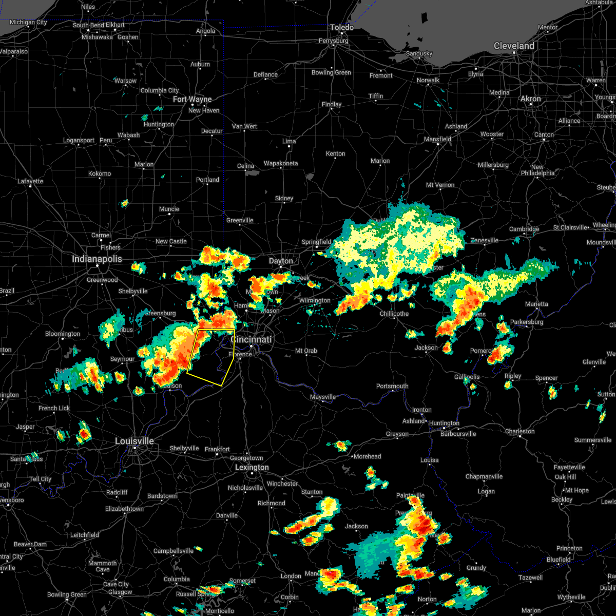 At 210 pm edt, a severe thunderstorm was located near dillsboro, moving east at 30 mph (radar indicated). Hazards include 70 mph wind gusts. Expect considerable tree damage. damage is likely to mobile homes, roofs, and outbuildings. locations impacted include, harrison, lawrenceburg, greendale, aurora, rising sun, bright, hidden valley, burlington, cleves, milan, warsaw, dillsboro, shawnee, moores hill, taylor creek, miami heights, blue jay, mack, guilford and wilmington. this includes i-74 in ohio between mile markers 4 and 8. thunderstorm damage threat, considerable hail threat, radar indicated max hail size, <. 75 in wind threat, radar indicated max wind gust, 70 mph. At 210 pm edt, a severe thunderstorm was located near dillsboro, moving east at 30 mph (radar indicated). Hazards include 70 mph wind gusts. Expect considerable tree damage. damage is likely to mobile homes, roofs, and outbuildings. locations impacted include, harrison, lawrenceburg, greendale, aurora, rising sun, bright, hidden valley, burlington, cleves, milan, warsaw, dillsboro, shawnee, moores hill, taylor creek, miami heights, blue jay, mack, guilford and wilmington. this includes i-74 in ohio between mile markers 4 and 8. thunderstorm damage threat, considerable hail threat, radar indicated max hail size, <. 75 in wind threat, radar indicated max wind gust, 70 mph.
|
| 7/6/2022 2:10 PM EDT |
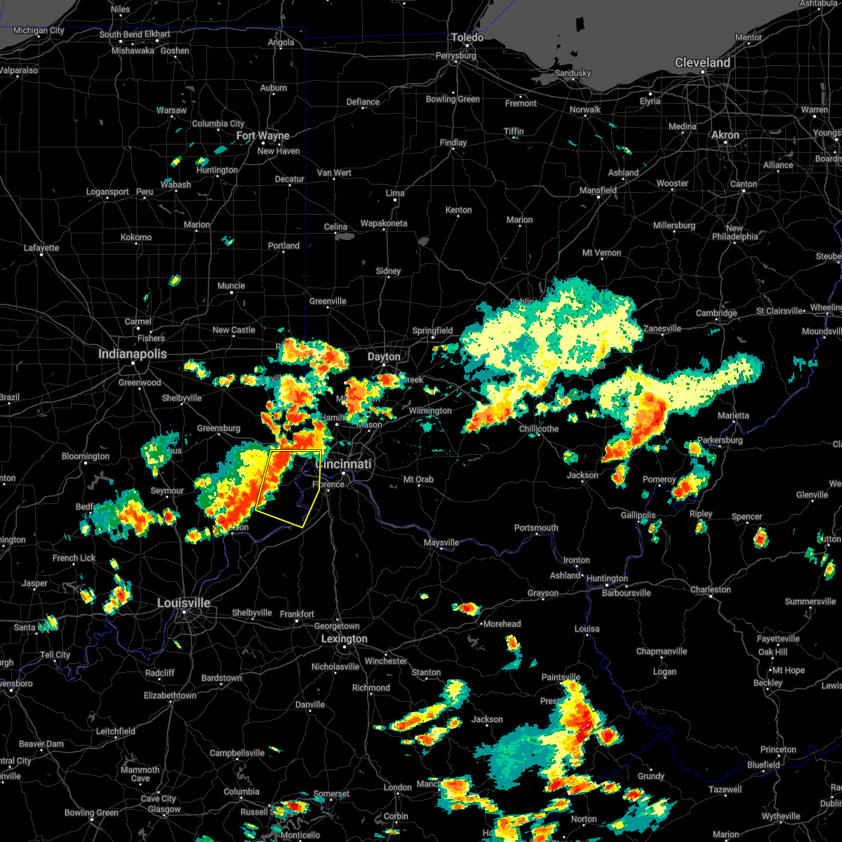 At 210 pm edt, a severe thunderstorm was located near dillsboro, moving east at 30 mph (radar indicated). Hazards include 70 mph wind gusts. Expect considerable tree damage. damage is likely to mobile homes, roofs, and outbuildings. locations impacted include, harrison, lawrenceburg, greendale, aurora, rising sun, bright, hidden valley, burlington, cleves, milan, warsaw, dillsboro, shawnee, moores hill, taylor creek, miami heights, blue jay, mack, guilford and wilmington. this includes i-74 in ohio between mile markers 4 and 8. thunderstorm damage threat, considerable hail threat, radar indicated max hail size, <. 75 in wind threat, radar indicated max wind gust, 70 mph. At 210 pm edt, a severe thunderstorm was located near dillsboro, moving east at 30 mph (radar indicated). Hazards include 70 mph wind gusts. Expect considerable tree damage. damage is likely to mobile homes, roofs, and outbuildings. locations impacted include, harrison, lawrenceburg, greendale, aurora, rising sun, bright, hidden valley, burlington, cleves, milan, warsaw, dillsboro, shawnee, moores hill, taylor creek, miami heights, blue jay, mack, guilford and wilmington. this includes i-74 in ohio between mile markers 4 and 8. thunderstorm damage threat, considerable hail threat, radar indicated max hail size, <. 75 in wind threat, radar indicated max wind gust, 70 mph.
|
| 7/6/2022 1:49 PM EDT |
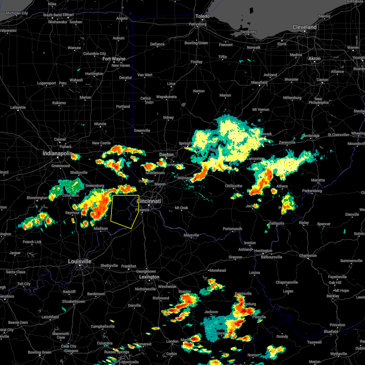 At 148 pm edt, a severe thunderstorm was located over osgood, moving east at 25 mph (radar indicated). Hazards include 70 mph wind gusts. Expect considerable tree damage. Damage is likely to mobile homes, roofs, and outbuildings. At 148 pm edt, a severe thunderstorm was located over osgood, moving east at 25 mph (radar indicated). Hazards include 70 mph wind gusts. Expect considerable tree damage. Damage is likely to mobile homes, roofs, and outbuildings.
|
| 7/5/2022 1:24 PM EDT |
 At 124 pm edt, a severe thunderstorm was located near camp dennison, moving southeast at 25 mph (radar indicated). Hazards include 60 mph wind gusts and quarter size hail. Minor hail damage to vehicles is possible. expect wind damage to trees and power lines. locations impacted include, cincinnati, loveland, montgomery, madeira, milford, mariemont, terrace park, batavia, camp dennison, remington, plainville, concorde hills, sixteen mile stand, the village of indian hill, newtown, fairfax, owensville, goshen, newtonsville and perintown. hail threat, radar indicated max hail size, 1. 00 in wind threat, radar indicated max wind gust, 60 mph. At 124 pm edt, a severe thunderstorm was located near camp dennison, moving southeast at 25 mph (radar indicated). Hazards include 60 mph wind gusts and quarter size hail. Minor hail damage to vehicles is possible. expect wind damage to trees and power lines. locations impacted include, cincinnati, loveland, montgomery, madeira, milford, mariemont, terrace park, batavia, camp dennison, remington, plainville, concorde hills, sixteen mile stand, the village of indian hill, newtown, fairfax, owensville, goshen, newtonsville and perintown. hail threat, radar indicated max hail size, 1. 00 in wind threat, radar indicated max wind gust, 60 mph.
|
| 7/5/2022 1:08 PM EDT |
 At 108 pm edt, a severe thunderstorm was located over loveland, moving southeast at 25 mph (radar indicated). Hazards include 60 mph wind gusts and quarter size hail. Minor hail damage to vehicles is possible. Expect wind damage to trees and power lines. At 108 pm edt, a severe thunderstorm was located over loveland, moving southeast at 25 mph (radar indicated). Hazards include 60 mph wind gusts and quarter size hail. Minor hail damage to vehicles is possible. Expect wind damage to trees and power lines.
|
| 6/22/2022 4:52 PM EDT |
 The severe thunderstorm warning for northern boone and west central hamilton counties will expire at 500 pm edt, the storms which prompted the warning have weakened below severe limits, and have exited the warned area. therefore, the warning will be allowed to expire. however heavy rain is still possible with these thunderstorms. a severe thunderstorm watch remains in effect until 800 pm edt for northern kentucky, and southwestern ohio. please report previous wind damage or hail to the national weather service by going to our website at weather.gov/iln and submitting your report via social media. The severe thunderstorm warning for northern boone and west central hamilton counties will expire at 500 pm edt, the storms which prompted the warning have weakened below severe limits, and have exited the warned area. therefore, the warning will be allowed to expire. however heavy rain is still possible with these thunderstorms. a severe thunderstorm watch remains in effect until 800 pm edt for northern kentucky, and southwestern ohio. please report previous wind damage or hail to the national weather service by going to our website at weather.gov/iln and submitting your report via social media.
|
| 6/22/2022 4:52 PM EDT |
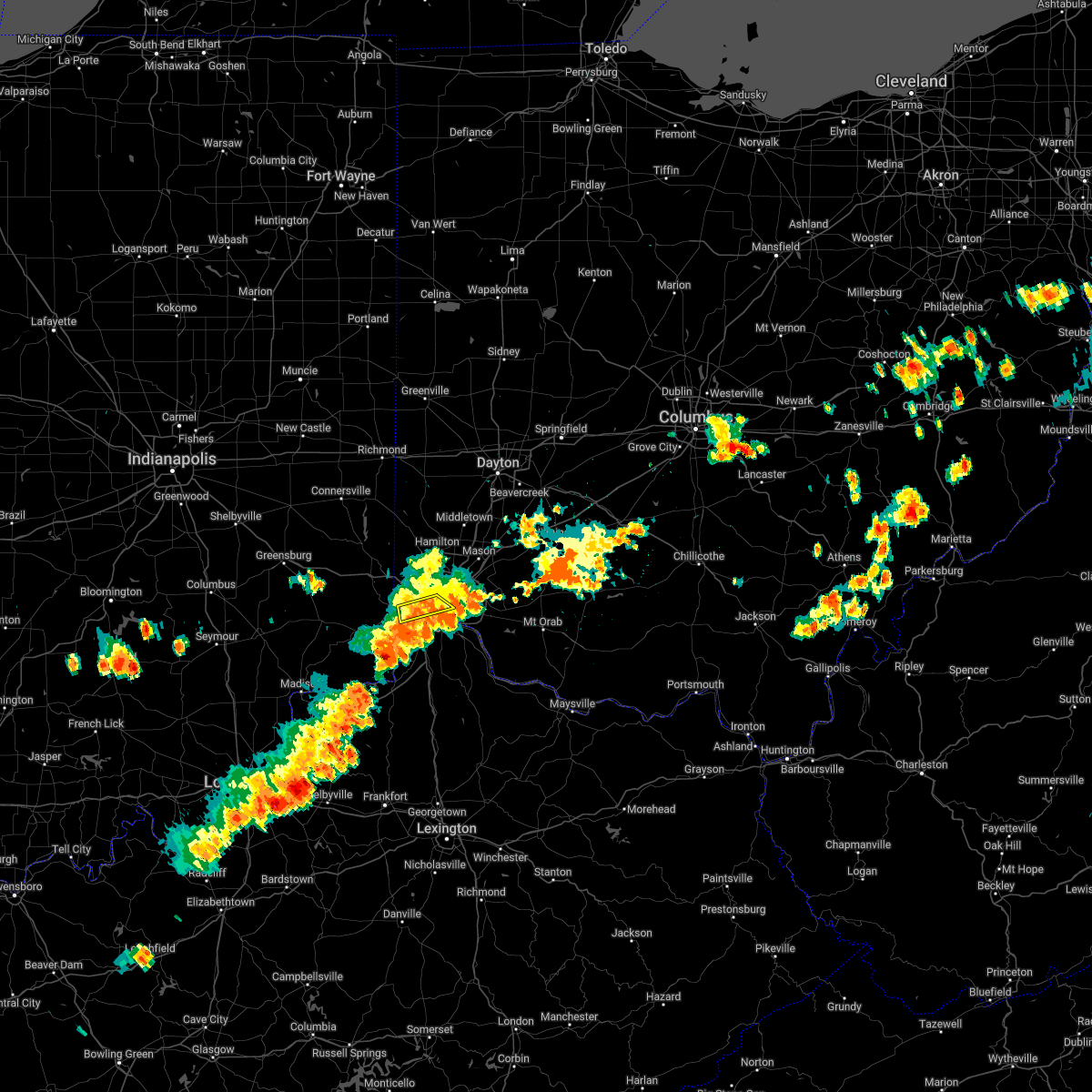 The severe thunderstorm warning for northern boone and west central hamilton counties will expire at 500 pm edt, the storms which prompted the warning have weakened below severe limits, and have exited the warned area. therefore, the warning will be allowed to expire. however heavy rain is still possible with these thunderstorms. a severe thunderstorm watch remains in effect until 800 pm edt for northern kentucky, and southwestern ohio. please report previous wind damage or hail to the national weather service by going to our website at weather.gov/iln and submitting your report via social media. The severe thunderstorm warning for northern boone and west central hamilton counties will expire at 500 pm edt, the storms which prompted the warning have weakened below severe limits, and have exited the warned area. therefore, the warning will be allowed to expire. however heavy rain is still possible with these thunderstorms. a severe thunderstorm watch remains in effect until 800 pm edt for northern kentucky, and southwestern ohio. please report previous wind damage or hail to the national weather service by going to our website at weather.gov/iln and submitting your report via social media.
|
| 6/22/2022 4:42 PM EDT |
 At 442 pm edt, severe thunderstorms were located from delhi hills to near rising sun, moving southeast at 20 mph (radar indicated). Hazards include 60 mph wind gusts. Expect damage to trees and power lines. locations impacted include, cincinnati, covington, florence, independence, erlanger, edgewood, elsmere, fort mitchell, villa hills, taylor mill, fort wright, crescent springs, walton, crestview hills, lakeside park, rising sun, oakbrook, burlington, claryville and union. this includes the following interstates, i-71 in kentucky between mile markers 62 and 77. i-75 in kentucky between mile markers 165 and 186. hail threat, radar indicated max hail size, <. 75 in wind threat, radar indicated max wind gust, 60 mph. At 442 pm edt, severe thunderstorms were located from delhi hills to near rising sun, moving southeast at 20 mph (radar indicated). Hazards include 60 mph wind gusts. Expect damage to trees and power lines. locations impacted include, cincinnati, covington, florence, independence, erlanger, edgewood, elsmere, fort mitchell, villa hills, taylor mill, fort wright, crescent springs, walton, crestview hills, lakeside park, rising sun, oakbrook, burlington, claryville and union. this includes the following interstates, i-71 in kentucky between mile markers 62 and 77. i-75 in kentucky between mile markers 165 and 186. hail threat, radar indicated max hail size, <. 75 in wind threat, radar indicated max wind gust, 60 mph.
|
| 6/22/2022 4:40 PM EDT |
 At 440 pm edt, severe thunderstorms were located from near north college hill to near shawnee, moving southeast at 15 mph (radar indicated). Hazards include 60 mph wind gusts. Expect damage to trees and power lines. locations impacted include, cincinnati, cheviot, shawnee, bridgetown, university of cincinnati, delhi township, mack, monfort heights, delhi hills, miami heights, addyston, north bend, francisville, covedale, hebron and dent. this includes the following interstates, i-71 in ohio between mile markers 3 and 4. i-74 in ohio between mile markers 16 and 19. i-75 in ohio between mile markers 2 and 6. hail threat, radar indicated max hail size, <. 75 in wind threat, radar indicated max wind gust, 60 mph. At 440 pm edt, severe thunderstorms were located from near north college hill to near shawnee, moving southeast at 15 mph (radar indicated). Hazards include 60 mph wind gusts. Expect damage to trees and power lines. locations impacted include, cincinnati, cheviot, shawnee, bridgetown, university of cincinnati, delhi township, mack, monfort heights, delhi hills, miami heights, addyston, north bend, francisville, covedale, hebron and dent. this includes the following interstates, i-71 in ohio between mile markers 3 and 4. i-74 in ohio between mile markers 16 and 19. i-75 in ohio between mile markers 2 and 6. hail threat, radar indicated max hail size, <. 75 in wind threat, radar indicated max wind gust, 60 mph.
|
| 6/22/2022 4:40 PM EDT |
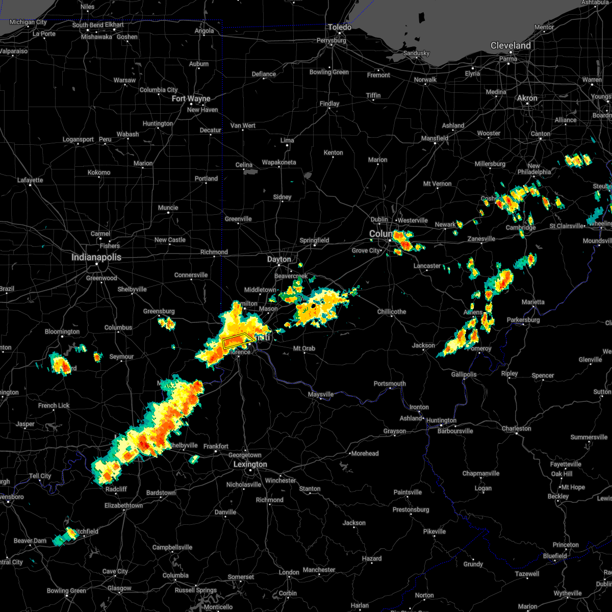 At 440 pm edt, severe thunderstorms were located from near north college hill to near shawnee, moving southeast at 15 mph (radar indicated). Hazards include 60 mph wind gusts. Expect damage to trees and power lines. locations impacted include, cincinnati, cheviot, shawnee, bridgetown, university of cincinnati, delhi township, mack, monfort heights, delhi hills, miami heights, addyston, north bend, francisville, covedale, hebron and dent. this includes the following interstates, i-71 in ohio between mile markers 3 and 4. i-74 in ohio between mile markers 16 and 19. i-75 in ohio between mile markers 2 and 6. hail threat, radar indicated max hail size, <. 75 in wind threat, radar indicated max wind gust, 60 mph. At 440 pm edt, severe thunderstorms were located from near north college hill to near shawnee, moving southeast at 15 mph (radar indicated). Hazards include 60 mph wind gusts. Expect damage to trees and power lines. locations impacted include, cincinnati, cheviot, shawnee, bridgetown, university of cincinnati, delhi township, mack, monfort heights, delhi hills, miami heights, addyston, north bend, francisville, covedale, hebron and dent. this includes the following interstates, i-71 in ohio between mile markers 3 and 4. i-74 in ohio between mile markers 16 and 19. i-75 in ohio between mile markers 2 and 6. hail threat, radar indicated max hail size, <. 75 in wind threat, radar indicated max wind gust, 60 mph.
|
| 6/22/2022 4:27 PM EDT | Erroneous report from a previous day regarding damage in reading in hamilton county OH, 7 miles SSW of Cincinnati, OH |
| 6/22/2022 4:27 PM EDT |
 At 427 pm edt, severe thunderstorms were located from near delhi township to near rising sun, moving southeast at 25 mph (radar indicated). Hazards include 60 mph wind gusts. expect damage to trees and power lines At 427 pm edt, severe thunderstorms were located from near delhi township to near rising sun, moving southeast at 25 mph (radar indicated). Hazards include 60 mph wind gusts. expect damage to trees and power lines
|
| 6/22/2022 4:24 PM EDT |
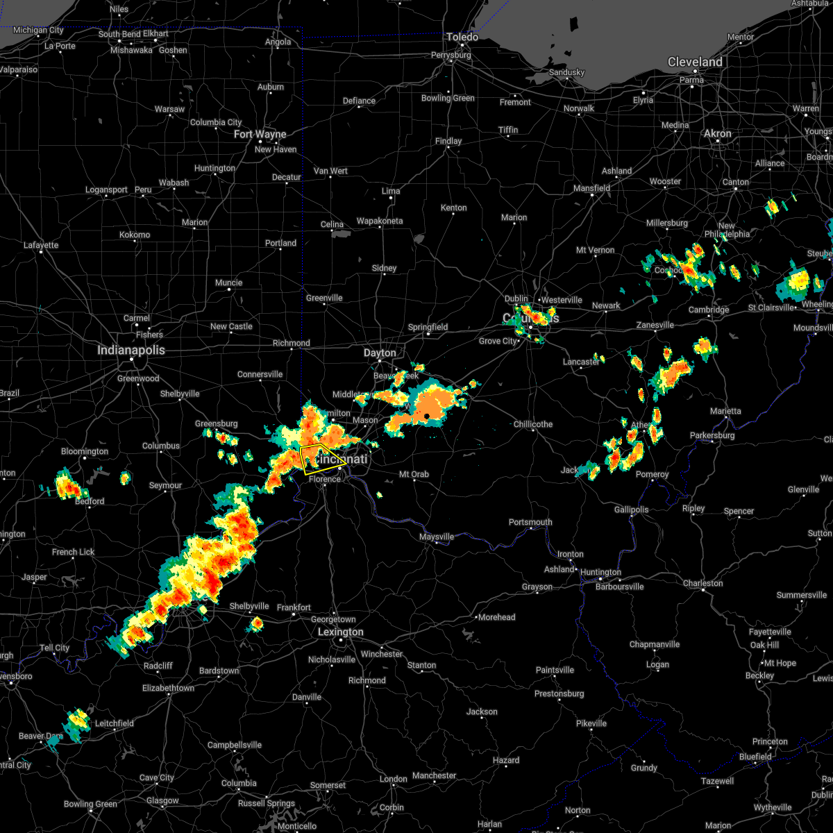 At 423 pm edt, a severe thunderstorm was located over miami heights, moving southeast at 15 mph (radar indicated). Hazards include 60 mph wind gusts and penny size hail. Expect damage to trees and power lines. locations impacted include, cincinnati, cheviot, cleves, shawnee, taylor creek, bridgetown, blue jay, university of cincinnati, delhi township, monfort heights, miami heights, mack, delhi hills, grandview, addyston, north bend, dent, francisville, covedale and miamitown. this includes the following interstates, i-71 in ohio between mile markers 3 and 4. i-74 in ohio between mile markers 5 and 19. i-75 in ohio between mile markers 2 and 6. hail threat, radar indicated max hail size, 0. 75 in wind threat, radar indicated max wind gust, 60 mph. At 423 pm edt, a severe thunderstorm was located over miami heights, moving southeast at 15 mph (radar indicated). Hazards include 60 mph wind gusts and penny size hail. Expect damage to trees and power lines. locations impacted include, cincinnati, cheviot, cleves, shawnee, taylor creek, bridgetown, blue jay, university of cincinnati, delhi township, monfort heights, miami heights, mack, delhi hills, grandview, addyston, north bend, dent, francisville, covedale and miamitown. this includes the following interstates, i-71 in ohio between mile markers 3 and 4. i-74 in ohio between mile markers 5 and 19. i-75 in ohio between mile markers 2 and 6. hail threat, radar indicated max hail size, 0. 75 in wind threat, radar indicated max wind gust, 60 mph.
|
| 6/22/2022 4:14 PM EDT |
 At 414 pm edt, a severe thunderstorm was located over harrison, moving southeast at 20 mph (radar indicated). Hazards include 60 mph wind gusts and quarter size hail. Minor hail damage to vehicles is possible. Expect wind damage to trees and power lines. At 414 pm edt, a severe thunderstorm was located over harrison, moving southeast at 20 mph (radar indicated). Hazards include 60 mph wind gusts and quarter size hail. Minor hail damage to vehicles is possible. Expect wind damage to trees and power lines.
|
| 6/13/2022 6:18 PM EDT |
 At 618 pm edt, a severe thunderstorm was located over batavia, moving southeast at 40 mph (radar indicated). Hazards include 60 mph wind gusts. Expect damage to trees and power lines. locations impacted include, cincinnati, covington, independence, norwood, erlanger, fort thomas, newport, blue ash, loveland, montgomery, madeira, edgewood, alexandria, elsmere, fort mitchell, villa hills, highland heights, milford, taylor mill and bellevue. this includes the following interstates, i-71 in ohio between mile markers 0 and 14. i-75 in kentucky between mile markers 184 and 191. i-75 in ohio between mile markers 0 and 2. hail threat, radar indicated max hail size, <. 75 in wind threat, radar indicated max wind gust, 60 mph. At 618 pm edt, a severe thunderstorm was located over batavia, moving southeast at 40 mph (radar indicated). Hazards include 60 mph wind gusts. Expect damage to trees and power lines. locations impacted include, cincinnati, covington, independence, norwood, erlanger, fort thomas, newport, blue ash, loveland, montgomery, madeira, edgewood, alexandria, elsmere, fort mitchell, villa hills, highland heights, milford, taylor mill and bellevue. this includes the following interstates, i-71 in ohio between mile markers 0 and 14. i-75 in kentucky between mile markers 184 and 191. i-75 in ohio between mile markers 0 and 2. hail threat, radar indicated max hail size, <. 75 in wind threat, radar indicated max wind gust, 60 mph.
|
| 6/13/2022 6:16 PM EDT | Large tree uprooted in hamilton county OH, 8.9 miles SW of Cincinnati, OH |
| 6/13/2022 6:13 PM EDT |
 At 613 pm edt, a severe thunderstorm was located over alexandria, moving southeast at 35 mph (radar indicated). Hazards include 60 mph wind gusts. Expect damage to trees and power lines. locations impacted include, covington, florence, independence, erlanger, edgewood, alexandria, elsmere, fort mitchell, villa hills, taylor mill, fort wright, crescent springs, walton, crestview hills, lakeside park, oakbrook, claryville, union, amelia and wilder. this includes the following interstates, i-71 in kentucky between mile markers 74 and 77. i-75 in kentucky between mile markers 167 and 186. hail threat, radar indicated max hail size, <. 75 in wind threat, radar indicated max wind gust, 60 mph. At 613 pm edt, a severe thunderstorm was located over alexandria, moving southeast at 35 mph (radar indicated). Hazards include 60 mph wind gusts. Expect damage to trees and power lines. locations impacted include, covington, florence, independence, erlanger, edgewood, alexandria, elsmere, fort mitchell, villa hills, taylor mill, fort wright, crescent springs, walton, crestview hills, lakeside park, oakbrook, claryville, union, amelia and wilder. this includes the following interstates, i-71 in kentucky between mile markers 74 and 77. i-75 in kentucky between mile markers 167 and 186. hail threat, radar indicated max hail size, <. 75 in wind threat, radar indicated max wind gust, 60 mph.
|
| 6/13/2022 6:11 PM EDT | Large trees down near fields ertel rd and mccauly rd in hamilton county OH, 12.8 miles SW of Cincinnati, OH |
| 6/13/2022 6:05 PM EDT |
 At 605 pm edt, a severe thunderstorm was located near forestville, moving southeast at 45 mph (radar indicated). Hazards include 60 mph wind gusts. Expect damage to trees and power lines. locations impacted include, cincinnati, covington, independence, norwood, forest park, erlanger, fort thomas, newport, sharonville, blue ash, loveland, springdale, reading, montgomery, north college hill, madeira, edgewood, alexandria, elsmere and wyoming. this includes the following interstates, i-71 in ohio between mile markers 0 and 19. i-74 in ohio between mile markers 14 and 19. i-75 in kentucky between mile markers 184 and 191. i-75 in ohio between mile markers 0 and 17. hail threat, radar indicated max hail size, <. 75 in wind threat, radar indicated max wind gust, 60 mph. At 605 pm edt, a severe thunderstorm was located near forestville, moving southeast at 45 mph (radar indicated). Hazards include 60 mph wind gusts. Expect damage to trees and power lines. locations impacted include, cincinnati, covington, independence, norwood, forest park, erlanger, fort thomas, newport, sharonville, blue ash, loveland, springdale, reading, montgomery, north college hill, madeira, edgewood, alexandria, elsmere and wyoming. this includes the following interstates, i-71 in ohio between mile markers 0 and 19. i-74 in ohio between mile markers 14 and 19. i-75 in kentucky between mile markers 184 and 191. i-75 in ohio between mile markers 0 and 17. hail threat, radar indicated max hail size, <. 75 in wind threat, radar indicated max wind gust, 60 mph.
|
| 6/13/2022 6:04 PM EDT | Spotter reports multiple 2+ inch limbs down- car damage from limbs fallin in hamilton county OH, 6.4 miles SE of Cincinnati, OH |
| 6/13/2022 6:02 PM EDT |
 At 601 pm edt, a severe thunderstorm was located over park hills, moving southeast at 40 mph (radar indicated). Hazards include 60 mph wind gusts. Expect damage to trees and power lines. locations impacted include, covington, florence, independence, erlanger, edgewood, alexandria, elsmere, fort mitchell, villa hills, taylor mill, fort wright, crescent springs, walton, crestview hills, lakeside park, oakbrook, burlington, claryville, union and amelia. this includes the following interstates, i-71 in kentucky between mile markers 71 and 77. i-75 in kentucky between mile markers 162 and 186. hail threat, radar indicated max hail size, <. 75 in wind threat, radar indicated max wind gust, 60 mph. At 601 pm edt, a severe thunderstorm was located over park hills, moving southeast at 40 mph (radar indicated). Hazards include 60 mph wind gusts. Expect damage to trees and power lines. locations impacted include, covington, florence, independence, erlanger, edgewood, alexandria, elsmere, fort mitchell, villa hills, taylor mill, fort wright, crescent springs, walton, crestview hills, lakeside park, oakbrook, burlington, claryville, union and amelia. this includes the following interstates, i-71 in kentucky between mile markers 71 and 77. i-75 in kentucky between mile markers 162 and 186. hail threat, radar indicated max hail size, <. 75 in wind threat, radar indicated max wind gust, 60 mph.
|
| 6/13/2022 5:57 PM EDT |
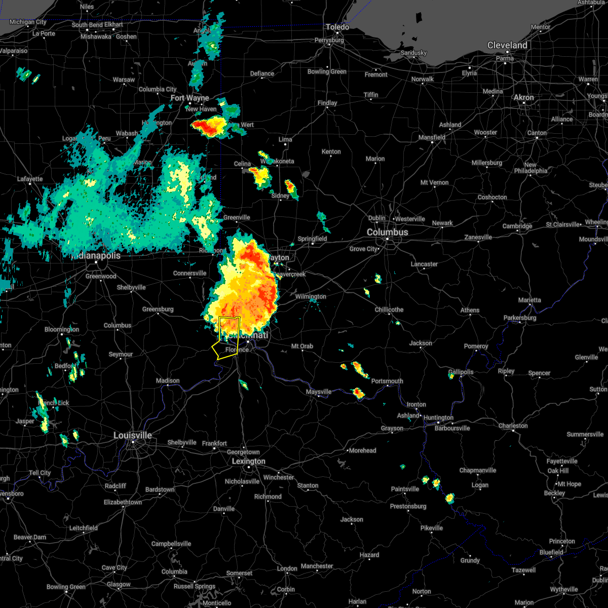 At 556 pm edt, a severe thunderstorm was located near cleves, moving southeast at 35 mph (radar indicated). Hazards include 70 mph wind gusts and penny size hail. Expect considerable tree damage. damage is likely to mobile homes, roofs, and outbuildings. locations impacted include, cincinnati, florence, harrison, cheviot, lawrenceburg, aurora, rising sun, oakbrook, burlington, cleves, shawnee, taylor creek, bridgetown, delhi township, miami heights, dry ridge, blue jay, dunlap, colerain township and mack. this includes the following interstates, i-74 in ohio between mile markers 1 and 14. i-75 in kentucky between mile markers 181 and 182. thunderstorm damage threat, considerable hail threat, radar indicated max hail size, 0. 75 in wind threat, radar indicated max wind gust, 70 mph. At 556 pm edt, a severe thunderstorm was located near cleves, moving southeast at 35 mph (radar indicated). Hazards include 70 mph wind gusts and penny size hail. Expect considerable tree damage. damage is likely to mobile homes, roofs, and outbuildings. locations impacted include, cincinnati, florence, harrison, cheviot, lawrenceburg, aurora, rising sun, oakbrook, burlington, cleves, shawnee, taylor creek, bridgetown, delhi township, miami heights, dry ridge, blue jay, dunlap, colerain township and mack. this includes the following interstates, i-74 in ohio between mile markers 1 and 14. i-75 in kentucky between mile markers 181 and 182. thunderstorm damage threat, considerable hail threat, radar indicated max hail size, 0. 75 in wind threat, radar indicated max wind gust, 70 mph.
|
| 6/13/2022 5:50 PM EDT | Branches down on cars and on banning roa in hamilton county OH, 6.4 miles SE of Cincinnati, OH |
| 6/13/2022 5:44 PM EDT |
 At 544 pm edt, a severe thunderstorm was located over monfort heights, moving southeast at 40 mph (radar indicated). Hazards include 70 mph wind gusts. Expect considerable tree damage. Damage is likely to mobile homes, roofs, and outbuildings. At 544 pm edt, a severe thunderstorm was located over monfort heights, moving southeast at 40 mph (radar indicated). Hazards include 70 mph wind gusts. Expect considerable tree damage. Damage is likely to mobile homes, roofs, and outbuildings.
|
| 6/13/2022 5:40 PM EDT |
 At 540 pm edt, a severe thunderstorm was located over forest park, moving southeast at 45 mph (radar indicated). Hazards include 70 mph wind gusts and penny size hail. Expect considerable tree damage. damage is likely to mobile homes, roofs, and outbuildings. locations impacted include, cincinnati, covington, independence, norwood, forest park, erlanger, fort thomas, newport, sharonville, blue ash, loveland, springdale, reading, montgomery, north college hill, madeira, edgewood, alexandria, elsmere and wyoming. this includes the following interstates, i-71 in ohio between mile markers 0 and 19. i-74 in ohio between mile markers 14 and 19. i-75 in kentucky between mile markers 184 and 191. i-75 in ohio between mile markers 0 and 17. thunderstorm damage threat, considerable hail threat, radar indicated max hail size, 0. 75 in wind threat, radar indicated max wind gust, 70 mph. At 540 pm edt, a severe thunderstorm was located over forest park, moving southeast at 45 mph (radar indicated). Hazards include 70 mph wind gusts and penny size hail. Expect considerable tree damage. damage is likely to mobile homes, roofs, and outbuildings. locations impacted include, cincinnati, covington, independence, norwood, forest park, erlanger, fort thomas, newport, sharonville, blue ash, loveland, springdale, reading, montgomery, north college hill, madeira, edgewood, alexandria, elsmere and wyoming. this includes the following interstates, i-71 in ohio between mile markers 0 and 19. i-74 in ohio between mile markers 14 and 19. i-75 in kentucky between mile markers 184 and 191. i-75 in ohio between mile markers 0 and 17. thunderstorm damage threat, considerable hail threat, radar indicated max hail size, 0. 75 in wind threat, radar indicated max wind gust, 70 mph.
|
| 6/13/2022 5:27 PM EDT |
 At 527 pm edt, a severe thunderstorm was located near harrison, moving southeast at 45 mph (radar indicated). Hazards include 70 mph wind gusts and penny size hail. Expect considerable tree damage. Damage is likely to mobile homes, roofs, and outbuildings. At 527 pm edt, a severe thunderstorm was located near harrison, moving southeast at 45 mph (radar indicated). Hazards include 70 mph wind gusts and penny size hail. Expect considerable tree damage. Damage is likely to mobile homes, roofs, and outbuildings.
|
| 6/13/2022 5:16 PM EDT |
 At 516 pm edt, a severe thunderstorm was located over brookville, moving southeast at 35 mph (radar indicated). Hazards include 70 mph wind gusts and penny size hail. Expect considerable tree damage. Damage is likely to mobile homes, roofs, and outbuildings. At 516 pm edt, a severe thunderstorm was located over brookville, moving southeast at 35 mph (radar indicated). Hazards include 70 mph wind gusts and penny size hail. Expect considerable tree damage. Damage is likely to mobile homes, roofs, and outbuildings.
|
| 6/13/2022 5:16 PM EDT |
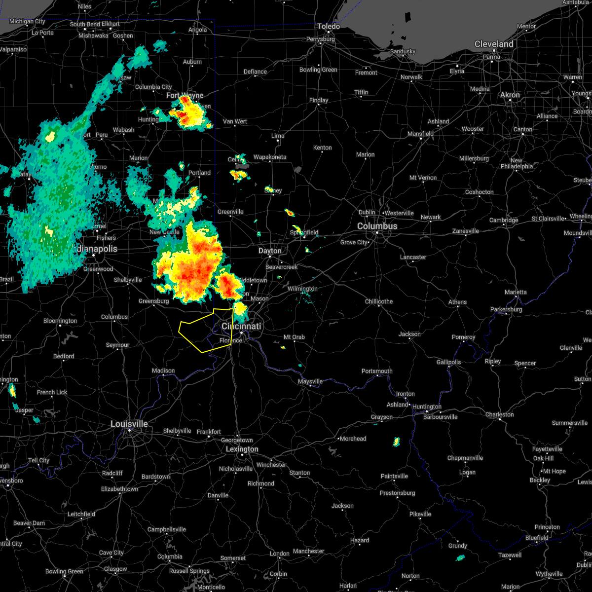 At 516 pm edt, a severe thunderstorm was located over brookville, moving southeast at 35 mph (radar indicated). Hazards include 70 mph wind gusts and penny size hail. Expect considerable tree damage. Damage is likely to mobile homes, roofs, and outbuildings. At 516 pm edt, a severe thunderstorm was located over brookville, moving southeast at 35 mph (radar indicated). Hazards include 70 mph wind gusts and penny size hail. Expect considerable tree damage. Damage is likely to mobile homes, roofs, and outbuildings.
|
| 6/8/2022 6:37 PM EDT |
 At 637 pm edt, a severe thunderstorm was located near independence, moving east at 35 mph (radar indicated). Hazards include 60 mph wind gusts and quarter size hail. Minor hail damage to vehicles is possible. Expect wind damage to trees and power lines. At 637 pm edt, a severe thunderstorm was located near independence, moving east at 35 mph (radar indicated). Hazards include 60 mph wind gusts and quarter size hail. Minor hail damage to vehicles is possible. Expect wind damage to trees and power lines.
|
| 6/8/2022 5:11 PM EDT |
 The severe thunderstorm warning for central campbell, southeastern hamilton and west central clermont counties will expire at 515 pm edt, the storm which prompted the warning has weakened below severe limits, and no longer poses an immediate threat to life or property. therefore, the warning will be allowed to expire. however small hail, gusty winds and heavy rain are still possible with this thunderstorm. a tornado watch remains in effect until 1000 pm edt for northern kentucky, and southwestern ohio. please report previous wind damage or hail to the national weather service by going to our website at weather.gov/iln and submitting your report via social media. The severe thunderstorm warning for central campbell, southeastern hamilton and west central clermont counties will expire at 515 pm edt, the storm which prompted the warning has weakened below severe limits, and no longer poses an immediate threat to life or property. therefore, the warning will be allowed to expire. however small hail, gusty winds and heavy rain are still possible with this thunderstorm. a tornado watch remains in effect until 1000 pm edt for northern kentucky, and southwestern ohio. please report previous wind damage or hail to the national weather service by going to our website at weather.gov/iln and submitting your report via social media.
|
| 6/8/2022 5:03 PM EDT |
 At 502 pm edt, a severe thunderstorm was located over melbourne, moving east at 30 mph (radar indicated). Hazards include 60 mph wind gusts and penny size hail. Expect damage to trees and power lines. Locations impacted include, cincinnati, fort thomas, alexandria, highland heights, southgate, forestville, amelia, wilder, new richmond, batavia, silver grove, melbourne, salem heights, riverbend and coney island, withamsville, coldstream, cold spring, ryland heights, sherwood and crestview. At 502 pm edt, a severe thunderstorm was located over melbourne, moving east at 30 mph (radar indicated). Hazards include 60 mph wind gusts and penny size hail. Expect damage to trees and power lines. Locations impacted include, cincinnati, fort thomas, alexandria, highland heights, southgate, forestville, amelia, wilder, new richmond, batavia, silver grove, melbourne, salem heights, riverbend and coney island, withamsville, coldstream, cold spring, ryland heights, sherwood and crestview.
|
| 6/8/2022 4:53 PM EDT |
 At 453 pm edt, a severe thunderstorm capable of producing a tornado was located near highland heights, moving east at 35 mph (radar indicated rotation). Hazards include tornado. Flying debris will be dangerous to those caught without shelter. mobile homes will be damaged or destroyed. damage to roofs, windows, and vehicles will occur. tree damage is likely. Locations impacted include, fort thomas, alexandria, highland heights, taylor mill, southgate, wilder, silver grove, melbourne, cold spring, ryland heights, crestview and fairview. At 453 pm edt, a severe thunderstorm capable of producing a tornado was located near highland heights, moving east at 35 mph (radar indicated rotation). Hazards include tornado. Flying debris will be dangerous to those caught without shelter. mobile homes will be damaged or destroyed. damage to roofs, windows, and vehicles will occur. tree damage is likely. Locations impacted include, fort thomas, alexandria, highland heights, taylor mill, southgate, wilder, silver grove, melbourne, cold spring, ryland heights, crestview and fairview.
|
| 6/8/2022 4:47 PM EDT |
 At 447 pm edt, a severe thunderstorm capable of producing a tornado was located over taylor mill, moving east at 35 mph (radar indicated rotation). Hazards include tornado. Flying debris will be dangerous to those caught without shelter. mobile homes will be damaged or destroyed. damage to roofs, windows, and vehicles will occur. Tree damage is likely. At 447 pm edt, a severe thunderstorm capable of producing a tornado was located over taylor mill, moving east at 35 mph (radar indicated rotation). Hazards include tornado. Flying debris will be dangerous to those caught without shelter. mobile homes will be damaged or destroyed. damage to roofs, windows, and vehicles will occur. Tree damage is likely.
|
| 6/8/2022 4:42 PM EDT |
 At 442 pm edt, a severe thunderstorm was located over taylor mill, moving east at 35 mph (radar indicated). Hazards include 60 mph wind gusts and quarter size hail. Minor hail damage to vehicles is possible. expect wind damage to trees and power lines. locations impacted include, cincinnati, covington, independence, erlanger, fort thomas, newport, edgewood, alexandria, elsmere, fort mitchell, highland heights, milford, taylor mill, fort wright, southgate, crescent springs, crestview hills, park hills, lakeside park and claryville. This includes i-75 in kentucky between mile markers 184 and 190. At 442 pm edt, a severe thunderstorm was located over taylor mill, moving east at 35 mph (radar indicated). Hazards include 60 mph wind gusts and quarter size hail. Minor hail damage to vehicles is possible. expect wind damage to trees and power lines. locations impacted include, cincinnati, covington, independence, erlanger, fort thomas, newport, edgewood, alexandria, elsmere, fort mitchell, highland heights, milford, taylor mill, fort wright, southgate, crescent springs, crestview hills, park hills, lakeside park and claryville. This includes i-75 in kentucky between mile markers 184 and 190.
|
| 6/8/2022 4:31 PM EDT |
 At 431 pm edt, a severe thunderstorm was located over elsmere, moving east at 35 mph (radar indicated). Hazards include 60 mph wind gusts and quarter size hail. Minor hail damage to vehicles is possible. Expect wind damage to trees and power lines. At 431 pm edt, a severe thunderstorm was located over elsmere, moving east at 35 mph (radar indicated). Hazards include 60 mph wind gusts and quarter size hail. Minor hail damage to vehicles is possible. Expect wind damage to trees and power lines.
|
| 6/6/2022 4:12 PM EDT |
 The severe thunderstorm warning for northeastern dearborn, northern kenton, northern campbell, northern boone, hamilton, southwestern butler and northwestern clermont counties will expire at 415 pm edt, the storm which prompted the warning has moved out of the area. therefore, the warning will be allowed to expire. however gusty winds and heavy rain are still possible with this thunderstorm. please report previous wind damage or hail to the national weather service by going to our website at weather.gov/iln and submitting your report via social media. The severe thunderstorm warning for northeastern dearborn, northern kenton, northern campbell, northern boone, hamilton, southwestern butler and northwestern clermont counties will expire at 415 pm edt, the storm which prompted the warning has moved out of the area. therefore, the warning will be allowed to expire. however gusty winds and heavy rain are still possible with this thunderstorm. please report previous wind damage or hail to the national weather service by going to our website at weather.gov/iln and submitting your report via social media.
|
| 6/6/2022 4:02 PM EDT |
 At 401 pm edt, a severe thunderstorm was located over wyoming, moving northeast at 50 mph (radar indicated). Hazards include 60 mph wind gusts. Expect damage to trees and power lines. locations impacted include, cincinnati, hamilton, fairfield, covington, florence, independence, norwood, forest park, erlanger, fort thomas, newport, sharonville, blue ash, springdale, reading, montgomery, harrison, north college hill, madeira and edgewood. this includes the following interstates, i-71 in ohio between mile markers 0 and 18. i-74 in indiana between mile markers 165 and 171. i-74 in ohio between mile markers 0 and 19. i-75 in kentucky between mile markers 179 and 191. i-75 in ohio between mile markers 0 and 20. hail threat, radar indicated max hail size, <. 75 in wind threat, radar indicated max wind gust, 60 mph. At 401 pm edt, a severe thunderstorm was located over wyoming, moving northeast at 50 mph (radar indicated). Hazards include 60 mph wind gusts. Expect damage to trees and power lines. locations impacted include, cincinnati, hamilton, fairfield, covington, florence, independence, norwood, forest park, erlanger, fort thomas, newport, sharonville, blue ash, springdale, reading, montgomery, harrison, north college hill, madeira and edgewood. this includes the following interstates, i-71 in ohio between mile markers 0 and 18. i-74 in indiana between mile markers 165 and 171. i-74 in ohio between mile markers 0 and 19. i-75 in kentucky between mile markers 179 and 191. i-75 in ohio between mile markers 0 and 20. hail threat, radar indicated max hail size, <. 75 in wind threat, radar indicated max wind gust, 60 mph.
|
| 6/6/2022 3:52 PM EDT | Several thick branches down at residential address. time estimated from radar in hamilton county OH, 6.8 miles ENE of Cincinnati, OH |
| 6/6/2022 3:52 PM EDT |
 At 351 pm edt, a severe thunderstorm was located over monfort heights, moving northeast at 50 mph (radar indicated). Hazards include 60 mph wind gusts. Expect damage to trees and power lines. locations impacted include, cincinnati, hamilton, fairfield, covington, florence, independence, norwood, forest park, erlanger, fort thomas, newport, sharonville, blue ash, springdale, reading, montgomery, harrison, north college hill, madeira and edgewood. this includes the following interstates, i-71 in ohio between mile markers 0 and 18. i-74 in indiana between mile markers 165 and 171. i-74 in ohio between mile markers 0 and 19. i-75 in kentucky between mile markers 174 and 191. i-75 in ohio between mile markers 0 and 20. hail threat, radar indicated max hail size, <. 75 in wind threat, radar indicated max wind gust, 60 mph. At 351 pm edt, a severe thunderstorm was located over monfort heights, moving northeast at 50 mph (radar indicated). Hazards include 60 mph wind gusts. Expect damage to trees and power lines. locations impacted include, cincinnati, hamilton, fairfield, covington, florence, independence, norwood, forest park, erlanger, fort thomas, newport, sharonville, blue ash, springdale, reading, montgomery, harrison, north college hill, madeira and edgewood. this includes the following interstates, i-71 in ohio between mile markers 0 and 18. i-74 in indiana between mile markers 165 and 171. i-74 in ohio between mile markers 0 and 19. i-75 in kentucky between mile markers 174 and 191. i-75 in ohio between mile markers 0 and 20. hail threat, radar indicated max hail size, <. 75 in wind threat, radar indicated max wind gust, 60 mph.
|
| 6/6/2022 3:45 PM EDT | Tree down on wires on trumbull court. time estimated from rada in hamilton county OH, 10.2 miles E of Cincinnati, OH |
| 6/6/2022 3:40 PM EDT |
 At 339 pm edt, a severe thunderstorm was located near shawnee, moving northeast at 50 mph (radar indicated). Hazards include 60 mph wind gusts. Expect damage to trees and power lines. locations impacted include, cincinnati, hamilton, fairfield, covington, florence, independence, norwood, forest park, erlanger, fort thomas, newport, sharonville, blue ash, springdale, reading, montgomery, harrison, north college hill, madeira and edgewood. this includes the following interstates, i-71 in ohio between mile markers 0 and 18. i-74 in indiana between mile markers 165 and 171. i-74 in ohio between mile markers 0 and 19. i-75 in kentucky between mile markers 174 and 191. i-75 in ohio between mile markers 0 and 20. hail threat, radar indicated max hail size, <. 75 in wind threat, radar indicated max wind gust, 60 mph. At 339 pm edt, a severe thunderstorm was located near shawnee, moving northeast at 50 mph (radar indicated). Hazards include 60 mph wind gusts. Expect damage to trees and power lines. locations impacted include, cincinnati, hamilton, fairfield, covington, florence, independence, norwood, forest park, erlanger, fort thomas, newport, sharonville, blue ash, springdale, reading, montgomery, harrison, north college hill, madeira and edgewood. this includes the following interstates, i-71 in ohio between mile markers 0 and 18. i-74 in indiana between mile markers 165 and 171. i-74 in ohio between mile markers 0 and 19. i-75 in kentucky between mile markers 174 and 191. i-75 in ohio between mile markers 0 and 20. hail threat, radar indicated max hail size, <. 75 in wind threat, radar indicated max wind gust, 60 mph.
|
| 6/6/2022 3:22 PM EDT |
 At 322 pm edt, a severe thunderstorm was located near rising sun, moving northeast at 50 mph (radar indicated). Hazards include 60 mph wind gusts. expect damage to trees and power lines At 322 pm edt, a severe thunderstorm was located near rising sun, moving northeast at 50 mph (radar indicated). Hazards include 60 mph wind gusts. expect damage to trees and power lines
|
| 5/25/2022 4:33 PM EDT |
 At 433 pm edt, a severe thunderstorm was located near shawnee, moving north at 40 mph (radar indicated). Hazards include 60 mph wind gusts and quarter size hail. Minor hail damage to vehicles is possible. expect wind damage to trees and power lines. locations impacted include, cincinnati, florence, forest park, harrison, north college hill, cheviot, villa hills, mount healthy, oakbrook, burlington, ross, cleves, shawnee, taylor creek, bridgetown, miami heights, dry ridge, blue jay, dunlap and mack. this includes the following interstates, i-74 in ohio between mile markers 1 and 16. i-75 in kentucky between mile markers 180 and 182. hail threat, radar indicated max hail size, 1. 00 in wind threat, radar indicated max wind gust, 60 mph. At 433 pm edt, a severe thunderstorm was located near shawnee, moving north at 40 mph (radar indicated). Hazards include 60 mph wind gusts and quarter size hail. Minor hail damage to vehicles is possible. expect wind damage to trees and power lines. locations impacted include, cincinnati, florence, forest park, harrison, north college hill, cheviot, villa hills, mount healthy, oakbrook, burlington, ross, cleves, shawnee, taylor creek, bridgetown, miami heights, dry ridge, blue jay, dunlap and mack. this includes the following interstates, i-74 in ohio between mile markers 1 and 16. i-75 in kentucky between mile markers 180 and 182. hail threat, radar indicated max hail size, 1. 00 in wind threat, radar indicated max wind gust, 60 mph.
|
| 5/25/2022 4:33 PM EDT |
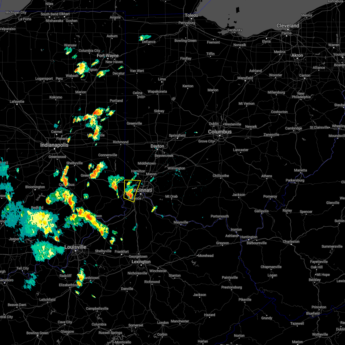 At 433 pm edt, a severe thunderstorm was located near shawnee, moving north at 40 mph (radar indicated). Hazards include 60 mph wind gusts and quarter size hail. Minor hail damage to vehicles is possible. expect wind damage to trees and power lines. locations impacted include, cincinnati, florence, forest park, harrison, north college hill, cheviot, villa hills, mount healthy, oakbrook, burlington, ross, cleves, shawnee, taylor creek, bridgetown, miami heights, dry ridge, blue jay, dunlap and mack. this includes the following interstates, i-74 in ohio between mile markers 1 and 16. i-75 in kentucky between mile markers 180 and 182. hail threat, radar indicated max hail size, 1. 00 in wind threat, radar indicated max wind gust, 60 mph. At 433 pm edt, a severe thunderstorm was located near shawnee, moving north at 40 mph (radar indicated). Hazards include 60 mph wind gusts and quarter size hail. Minor hail damage to vehicles is possible. expect wind damage to trees and power lines. locations impacted include, cincinnati, florence, forest park, harrison, north college hill, cheviot, villa hills, mount healthy, oakbrook, burlington, ross, cleves, shawnee, taylor creek, bridgetown, miami heights, dry ridge, blue jay, dunlap and mack. this includes the following interstates, i-74 in ohio between mile markers 1 and 16. i-75 in kentucky between mile markers 180 and 182. hail threat, radar indicated max hail size, 1. 00 in wind threat, radar indicated max wind gust, 60 mph.
|
| 5/25/2022 4:28 PM EDT |
 At 428 pm edt, a severe thunderstorm was located over burlington, moving north at 35 mph (radar indicated). Hazards include 60 mph wind gusts and quarter size hail. Minor hail damage to vehicles is possible. expect wind damage to trees and power lines. locations impacted include, cincinnati, florence, forest park, harrison, north college hill, cheviot, villa hills, mount healthy, lawrenceburg, greendale, bright, hidden valley, oakbrook, burlington, union, cleves, shawnee, taylor creek, bridgetown and miami heights. this includes the following interstates, i-74 in indiana between mile markers 169 and 171. i-74 in ohio between mile markers 0 and 16. i-75 in kentucky between mile markers 181 and 182. hail threat, radar indicated max hail size, 1. 00 in wind threat, radar indicated max wind gust, 60 mph. At 428 pm edt, a severe thunderstorm was located over burlington, moving north at 35 mph (radar indicated). Hazards include 60 mph wind gusts and quarter size hail. Minor hail damage to vehicles is possible. expect wind damage to trees and power lines. locations impacted include, cincinnati, florence, forest park, harrison, north college hill, cheviot, villa hills, mount healthy, lawrenceburg, greendale, bright, hidden valley, oakbrook, burlington, union, cleves, shawnee, taylor creek, bridgetown and miami heights. this includes the following interstates, i-74 in indiana between mile markers 169 and 171. i-74 in ohio between mile markers 0 and 16. i-75 in kentucky between mile markers 181 and 182. hail threat, radar indicated max hail size, 1. 00 in wind threat, radar indicated max wind gust, 60 mph.
|
| 5/25/2022 4:28 PM EDT |
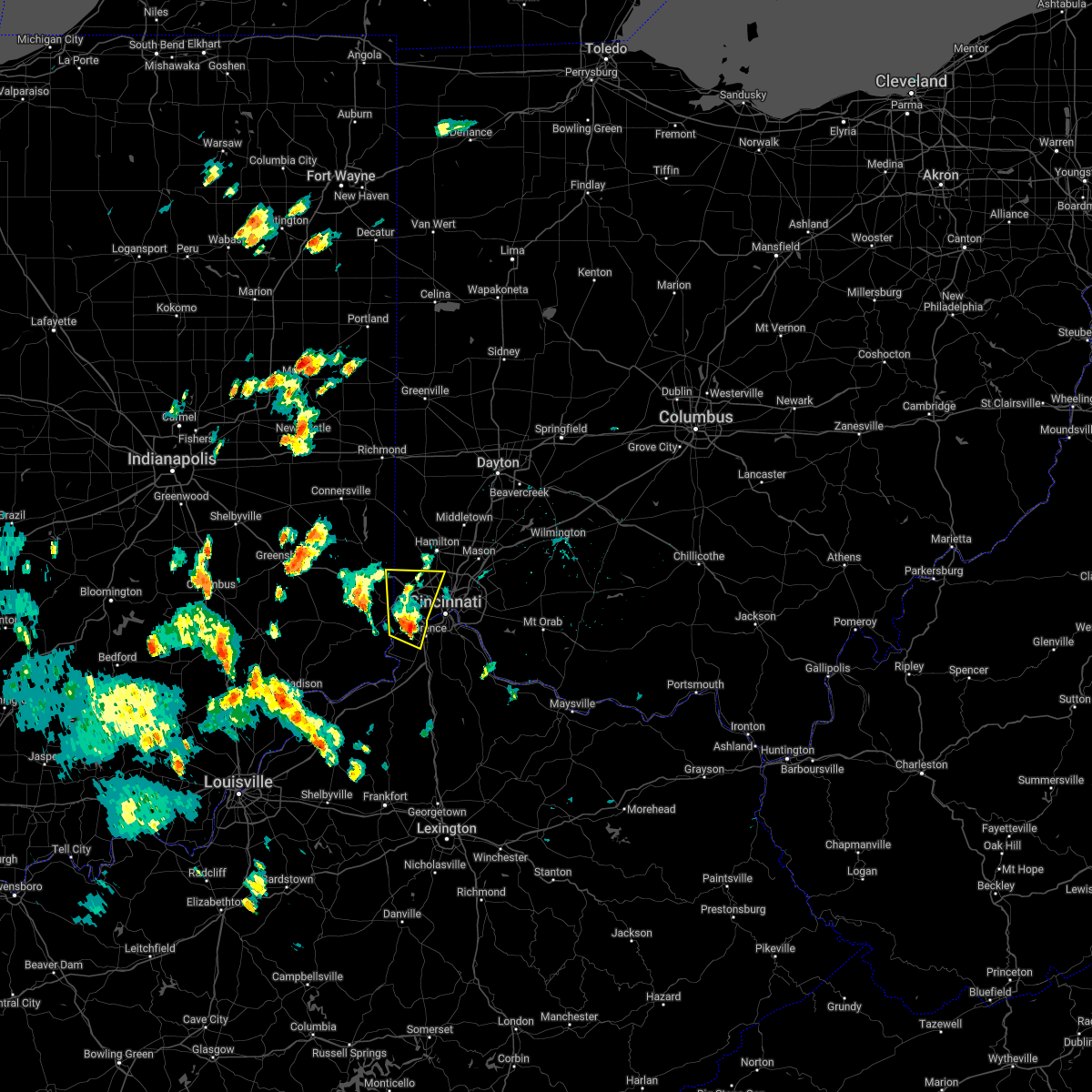 At 428 pm edt, a severe thunderstorm was located over burlington, moving north at 35 mph (radar indicated). Hazards include 60 mph wind gusts and quarter size hail. Minor hail damage to vehicles is possible. expect wind damage to trees and power lines. locations impacted include, cincinnati, florence, forest park, harrison, north college hill, cheviot, villa hills, mount healthy, lawrenceburg, greendale, bright, hidden valley, oakbrook, burlington, union, cleves, shawnee, taylor creek, bridgetown and miami heights. this includes the following interstates, i-74 in indiana between mile markers 169 and 171. i-74 in ohio between mile markers 0 and 16. i-75 in kentucky between mile markers 181 and 182. hail threat, radar indicated max hail size, 1. 00 in wind threat, radar indicated max wind gust, 60 mph. At 428 pm edt, a severe thunderstorm was located over burlington, moving north at 35 mph (radar indicated). Hazards include 60 mph wind gusts and quarter size hail. Minor hail damage to vehicles is possible. expect wind damage to trees and power lines. locations impacted include, cincinnati, florence, forest park, harrison, north college hill, cheviot, villa hills, mount healthy, lawrenceburg, greendale, bright, hidden valley, oakbrook, burlington, union, cleves, shawnee, taylor creek, bridgetown and miami heights. this includes the following interstates, i-74 in indiana between mile markers 169 and 171. i-74 in ohio between mile markers 0 and 16. i-75 in kentucky between mile markers 181 and 182. hail threat, radar indicated max hail size, 1. 00 in wind threat, radar indicated max wind gust, 60 mph.
|
| 5/25/2022 4:23 PM EDT |
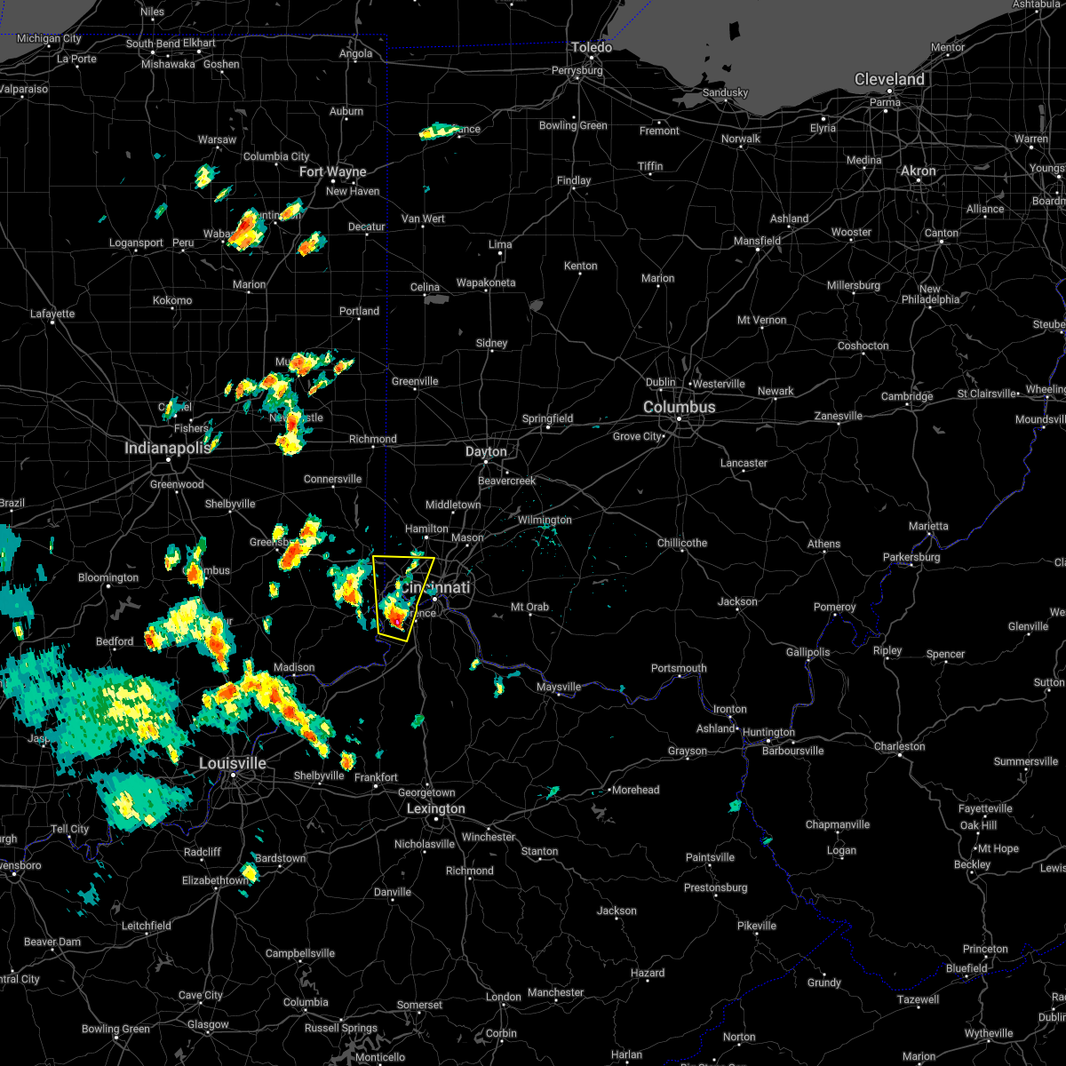 At 423 pm edt, a severe thunderstorm was located over burlington, moving north at 40 mph (radar indicated). Hazards include 60 mph wind gusts and half dollar size hail. Minor hail damage to vehicles is possible. expect wind damage to trees and power lines. locations impacted include, cincinnati, florence, forest park, harrison, north college hill, cheviot, villa hills, mount healthy, lawrenceburg, greendale, rising sun, bright, hidden valley, oakbrook, burlington, union, cleves, shawnee, taylor creek and bridgetown. this includes the following interstates, i-74 in indiana between mile markers 168 and 171. i-74 in ohio between mile markers 0 and 16. i-75 in kentucky near mile marker 181. hail threat, radar indicated max hail size, 1. 25 in wind threat, radar indicated max wind gust, 60 mph. At 423 pm edt, a severe thunderstorm was located over burlington, moving north at 40 mph (radar indicated). Hazards include 60 mph wind gusts and half dollar size hail. Minor hail damage to vehicles is possible. expect wind damage to trees and power lines. locations impacted include, cincinnati, florence, forest park, harrison, north college hill, cheviot, villa hills, mount healthy, lawrenceburg, greendale, rising sun, bright, hidden valley, oakbrook, burlington, union, cleves, shawnee, taylor creek and bridgetown. this includes the following interstates, i-74 in indiana between mile markers 168 and 171. i-74 in ohio between mile markers 0 and 16. i-75 in kentucky near mile marker 181. hail threat, radar indicated max hail size, 1. 25 in wind threat, radar indicated max wind gust, 60 mph.
|
| 5/25/2022 4:23 PM EDT |
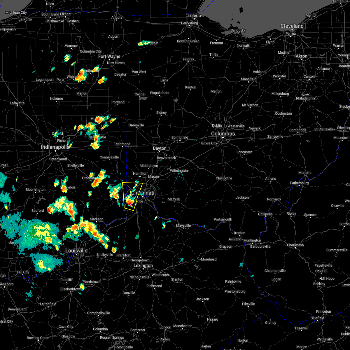 At 423 pm edt, a severe thunderstorm was located over burlington, moving north at 40 mph (radar indicated). Hazards include 60 mph wind gusts and half dollar size hail. Minor hail damage to vehicles is possible. expect wind damage to trees and power lines. locations impacted include, cincinnati, florence, forest park, harrison, north college hill, cheviot, villa hills, mount healthy, lawrenceburg, greendale, rising sun, bright, hidden valley, oakbrook, burlington, union, cleves, shawnee, taylor creek and bridgetown. this includes the following interstates, i-74 in indiana between mile markers 168 and 171. i-74 in ohio between mile markers 0 and 16. i-75 in kentucky near mile marker 181. hail threat, radar indicated max hail size, 1. 25 in wind threat, radar indicated max wind gust, 60 mph. At 423 pm edt, a severe thunderstorm was located over burlington, moving north at 40 mph (radar indicated). Hazards include 60 mph wind gusts and half dollar size hail. Minor hail damage to vehicles is possible. expect wind damage to trees and power lines. locations impacted include, cincinnati, florence, forest park, harrison, north college hill, cheviot, villa hills, mount healthy, lawrenceburg, greendale, rising sun, bright, hidden valley, oakbrook, burlington, union, cleves, shawnee, taylor creek and bridgetown. this includes the following interstates, i-74 in indiana between mile markers 168 and 171. i-74 in ohio between mile markers 0 and 16. i-75 in kentucky near mile marker 181. hail threat, radar indicated max hail size, 1. 25 in wind threat, radar indicated max wind gust, 60 mph.
|
| 5/25/2022 4:15 PM EDT |
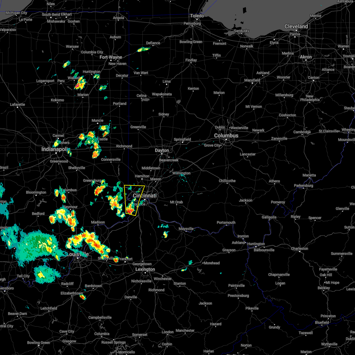 At 415 pm edt, a severe thunderstorm was located near rising sun, moving north at 40 mph (radar indicated). Hazards include 60 mph wind gusts and quarter size hail. Minor hail damage to vehicles is possible. Expect wind damage to trees and power lines. At 415 pm edt, a severe thunderstorm was located near rising sun, moving north at 40 mph (radar indicated). Hazards include 60 mph wind gusts and quarter size hail. Minor hail damage to vehicles is possible. Expect wind damage to trees and power lines.
|
| 5/25/2022 4:15 PM EDT |
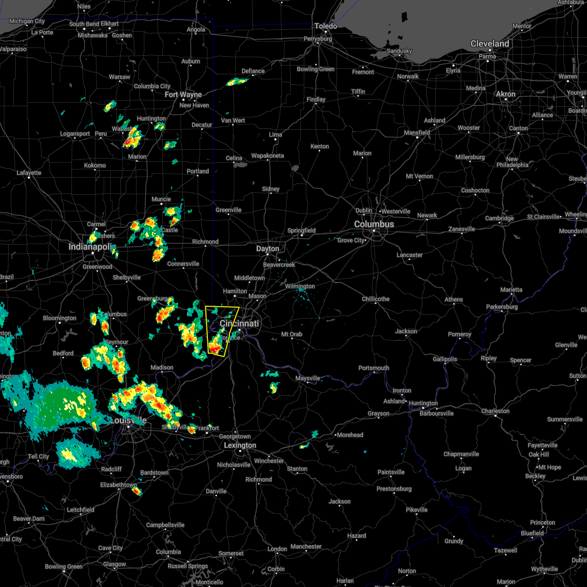 At 415 pm edt, a severe thunderstorm was located near rising sun, moving north at 40 mph (radar indicated). Hazards include 60 mph wind gusts and quarter size hail. Minor hail damage to vehicles is possible. Expect wind damage to trees and power lines. At 415 pm edt, a severe thunderstorm was located near rising sun, moving north at 40 mph (radar indicated). Hazards include 60 mph wind gusts and quarter size hail. Minor hail damage to vehicles is possible. Expect wind damage to trees and power lines.
|
| 5/21/2022 5:41 PM EDT |
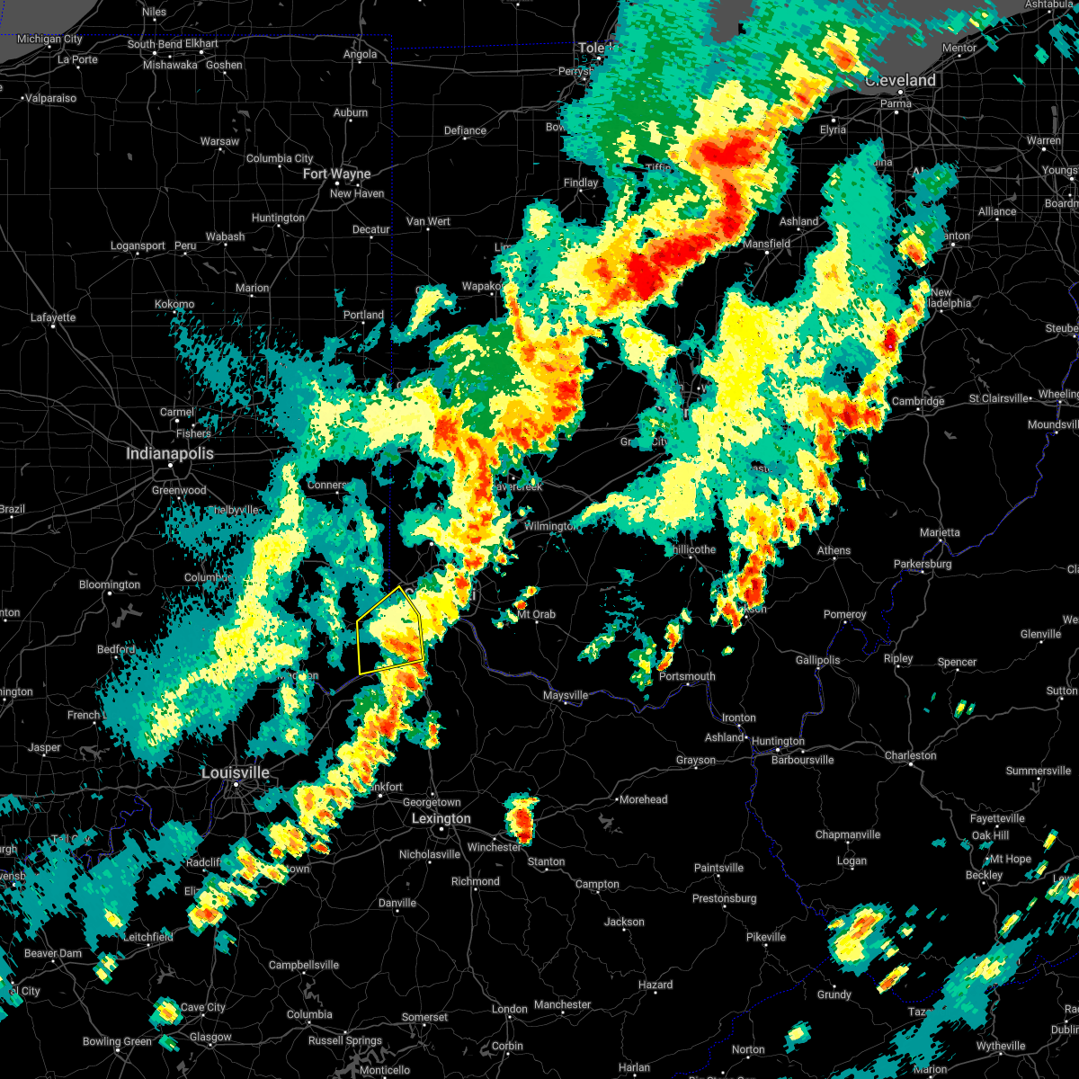 The severe thunderstorm warning for ohio, southeastern dearborn, northeastern switzerland, boone, central gallatin and west central hamilton counties will expire at 545 pm edt, the storm which prompted the warning has weakened below severe limits, and no longer poses an immediate threat to life or property. therefore, the warning will be allowed to expire. however gusty winds and heavy rain are still possible with this thunderstorm. a severe thunderstorm watch remains in effect until 700 pm edt for southeastern indiana, northern kentucky, and southwestern ohio. please report previous wind damage or hail to the national weather service by going to our website at weather.gov/iln and submitting your report via social media. The severe thunderstorm warning for ohio, southeastern dearborn, northeastern switzerland, boone, central gallatin and west central hamilton counties will expire at 545 pm edt, the storm which prompted the warning has weakened below severe limits, and no longer poses an immediate threat to life or property. therefore, the warning will be allowed to expire. however gusty winds and heavy rain are still possible with this thunderstorm. a severe thunderstorm watch remains in effect until 700 pm edt for southeastern indiana, northern kentucky, and southwestern ohio. please report previous wind damage or hail to the national weather service by going to our website at weather.gov/iln and submitting your report via social media.
|
| 5/21/2022 5:17 PM EDT |
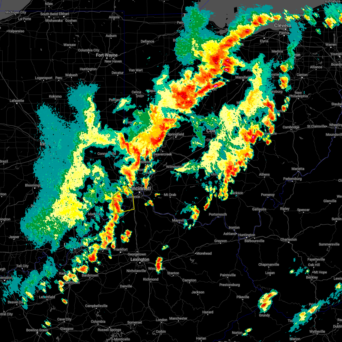 At 517 pm edt, a severe thunderstorm was located near rising sun, moving east at 45 mph (radar indicated). Hazards include 60 mph wind gusts and quarter size hail. Minor hail damage to vehicles is possible. expect wind damage to trees and power lines. locations impacted include, cincinnati, florence, lawrenceburg, greendale, aurora, walton, rising sun, oakbrook, burlington, hidden valley, union, cleves, shawnee, miami heights, mack, wilmington, grandview, french, addyston and hartford. this includes the following interstates, i-71 in kentucky between mile markers 73 and 77. i-75 in kentucky between mile markers 171 and 182. hail threat, radar indicated max hail size, 1. 00 in wind threat, radar indicated max wind gust, 60 mph. At 517 pm edt, a severe thunderstorm was located near rising sun, moving east at 45 mph (radar indicated). Hazards include 60 mph wind gusts and quarter size hail. Minor hail damage to vehicles is possible. expect wind damage to trees and power lines. locations impacted include, cincinnati, florence, lawrenceburg, greendale, aurora, walton, rising sun, oakbrook, burlington, hidden valley, union, cleves, shawnee, miami heights, mack, wilmington, grandview, french, addyston and hartford. this includes the following interstates, i-71 in kentucky between mile markers 73 and 77. i-75 in kentucky between mile markers 171 and 182. hail threat, radar indicated max hail size, 1. 00 in wind threat, radar indicated max wind gust, 60 mph.
|
| 5/21/2022 5:10 PM EDT | Numerous trees downed in sayler park... including on catalpa road... fernbank ave... and river roa in hamilton county OH, 10.8 miles E of Cincinnati, OH |
| 5/21/2022 5:03 PM EDT |
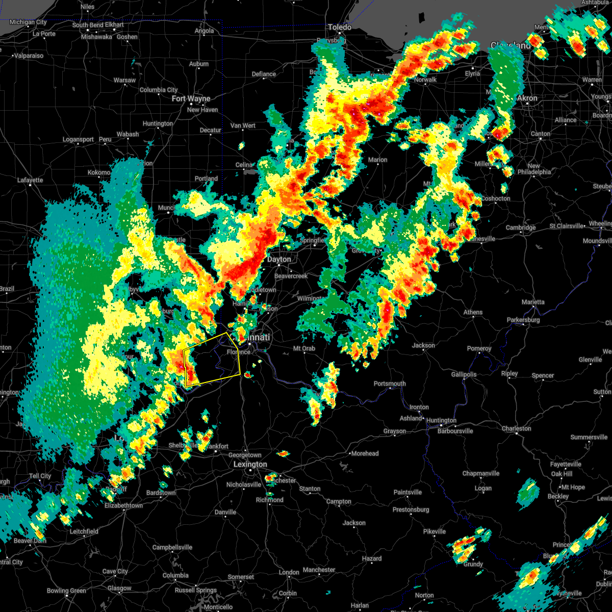 At 503 pm edt, a severe thunderstorm was located near dillsboro, moving east at 40 mph (radar indicated). Hazards include 60 mph wind gusts and quarter size hail. Minor hail damage to vehicles is possible. Expect wind damage to trees and power lines. At 503 pm edt, a severe thunderstorm was located near dillsboro, moving east at 40 mph (radar indicated). Hazards include 60 mph wind gusts and quarter size hail. Minor hail damage to vehicles is possible. Expect wind damage to trees and power lines.
|
| 5/21/2022 4:55 PM EDT | Tree limb downed near westwood. time of event estimate in hamilton county OH, 4.8 miles E of Cincinnati, OH |
| 5/21/2022 2:50 PM EDT |
 At 250 pm edt, a severe thunderstorm was located over milford, moving northeast at 30 mph (radar indicated). Hazards include 60 mph wind gusts and quarter size hail. Minor hail damage to vehicles is possible. Expect wind damage to trees and power lines. At 250 pm edt, a severe thunderstorm was located over milford, moving northeast at 30 mph (radar indicated). Hazards include 60 mph wind gusts and quarter size hail. Minor hail damage to vehicles is possible. Expect wind damage to trees and power lines.
|
| 5/20/2022 4:28 AM EDT |
 At 428 am edt, a severe thunderstorm was located over alexandria, moving east at 45 mph (radar indicated). Hazards include 60 mph wind gusts. expect damage to trees and power lines At 428 am edt, a severe thunderstorm was located over alexandria, moving east at 45 mph (radar indicated). Hazards include 60 mph wind gusts. expect damage to trees and power lines
|
| 5/19/2022 9:14 PM EDT |
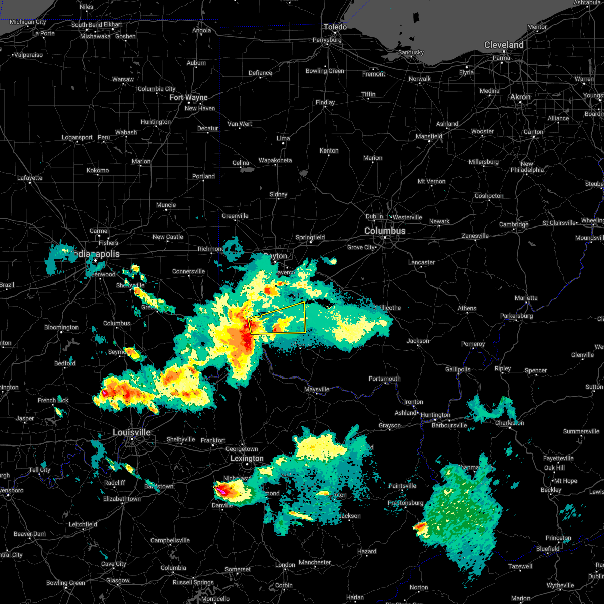 At 914 pm edt, a severe thunderstorm was located over rossmoyne, moving east at 45 mph (radar indicated). Hazards include 60 mph wind gusts and penny size hail. expect damage to trees and power lines At 914 pm edt, a severe thunderstorm was located over rossmoyne, moving east at 45 mph (radar indicated). Hazards include 60 mph wind gusts and penny size hail. expect damage to trees and power lines
|
| 5/19/2022 9:10 PM EDT |
 At 909 pm edt, severe thunderstorms were located from mariemont to claryville to near crittenden, moving east at 65 mph (radar indicated). Hazards include 60 mph wind gusts. Expect damage to trees and power lines. locations impacted include, cincinnati, covington, independence, norwood, fort thomas, newport, alexandria, highland heights, milford, taylor mill, bellevue, fort wright, dayton, southgate, park hills, claryville, forestville, amelia, mariemont and wilder. this includes the following interstates, i-71 in ohio between mile markers 0 and 6. i-75 in kentucky near mile marker 167, and between mile markers 189 and 191. i-75 in ohio between mile markers 0 and 4. hail threat, radar indicated max hail size, <. 75 in wind threat, radar indicated max wind gust, 60 mph. At 909 pm edt, severe thunderstorms were located from mariemont to claryville to near crittenden, moving east at 65 mph (radar indicated). Hazards include 60 mph wind gusts. Expect damage to trees and power lines. locations impacted include, cincinnati, covington, independence, norwood, fort thomas, newport, alexandria, highland heights, milford, taylor mill, bellevue, fort wright, dayton, southgate, park hills, claryville, forestville, amelia, mariemont and wilder. this includes the following interstates, i-71 in ohio between mile markers 0 and 6. i-75 in kentucky near mile marker 167, and between mile markers 189 and 191. i-75 in ohio between mile markers 0 and 4. hail threat, radar indicated max hail size, <. 75 in wind threat, radar indicated max wind gust, 60 mph.
|
| 5/19/2022 8:56 PM EDT |
 At 855 pm edt, severe thunderstorms were located from delhi hills to near union to near patriot, moving east at 45 mph (radar indicated). Hazards include 60 mph wind gusts. Expect damage to trees and power lines. locations impacted include, cincinnati, covington, florence, independence, norwood, erlanger, fort thomas, newport, edgewood, alexandria, elsmere, cheviot, fort mitchell, villa hills, highland heights, milford, taylor mill, bellevue, fort wright and dayton. this includes the following interstates, i-71 in kentucky between mile markers 68 and 77. i-71 in ohio between mile markers 0 and 7. i-75 in kentucky between mile markers 165 and 191. i-75 in ohio between mile markers 0 and 4. hail threat, radar indicated max hail size, <. 75 in wind threat, radar indicated max wind gust, 60 mph. At 855 pm edt, severe thunderstorms were located from delhi hills to near union to near patriot, moving east at 45 mph (radar indicated). Hazards include 60 mph wind gusts. Expect damage to trees and power lines. locations impacted include, cincinnati, covington, florence, independence, norwood, erlanger, fort thomas, newport, edgewood, alexandria, elsmere, cheviot, fort mitchell, villa hills, highland heights, milford, taylor mill, bellevue, fort wright and dayton. this includes the following interstates, i-71 in kentucky between mile markers 68 and 77. i-71 in ohio between mile markers 0 and 7. i-75 in kentucky between mile markers 165 and 191. i-75 in ohio between mile markers 0 and 4. hail threat, radar indicated max hail size, <. 75 in wind threat, radar indicated max wind gust, 60 mph.
|
| 5/19/2022 8:54 PM EDT |
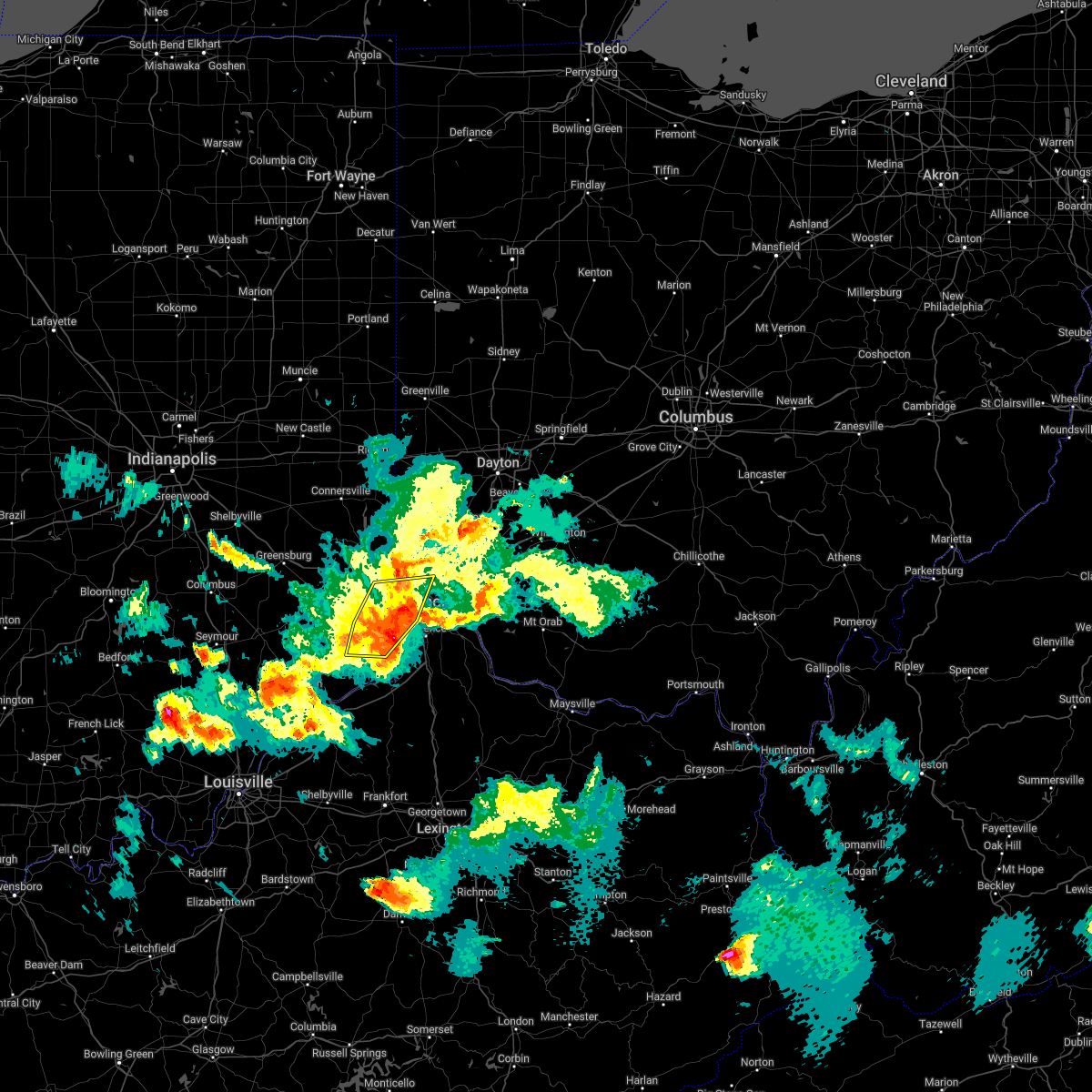 The severe thunderstorm warning for ohio, central dearborn, northern boone and northwestern hamilton counties will expire at 900 pm edt, the storms which prompted the warning have moved out of the area. therefore, the warning will be allowed to expire. a severe thunderstorm watch remains in effect until 200 am edt for southeastern indiana, northern kentucky, and southwestern ohio. please report previous wind damage or hail to the national weather service by going to our website at weather.gov/iln and submitting your report via social media. remember, a severe thunderstorm warning still remains in effect for parts of hamilton and boone counties until 930 pm. The severe thunderstorm warning for ohio, central dearborn, northern boone and northwestern hamilton counties will expire at 900 pm edt, the storms which prompted the warning have moved out of the area. therefore, the warning will be allowed to expire. a severe thunderstorm watch remains in effect until 200 am edt for southeastern indiana, northern kentucky, and southwestern ohio. please report previous wind damage or hail to the national weather service by going to our website at weather.gov/iln and submitting your report via social media. remember, a severe thunderstorm warning still remains in effect for parts of hamilton and boone counties until 930 pm.
|
| 5/19/2022 8:49 PM EDT |
 At 848 pm edt, severe thunderstorms were located from near mack to near rising sun to patriot, moving east at 45 mph (radar indicated). Hazards include 60 mph wind gusts. expect damage to trees and power lines At 848 pm edt, severe thunderstorms were located from near mack to near rising sun to patriot, moving east at 45 mph (radar indicated). Hazards include 60 mph wind gusts. expect damage to trees and power lines
|
| 5/19/2022 8:37 PM EDT |
 At 837 pm edt, severe thunderstorms were located from bright to near aurora to near rising sun to 8 miles southeast of dillsboro, moving east at 45 mph (radar indicated). Hazards include 60 mph wind gusts. Expect damage to trees and power lines. locations impacted include, cincinnati, harrison, lawrenceburg, greendale, aurora, rising sun, bright, hidden valley, burlington, cleves, dillsboro, shawnee, taylor creek, miami heights, dry ridge, blue jay, mack, colerain township, bridgetown and monfort heights. this includes i-74 in ohio between mile markers 2 and 13. hail threat, radar indicated max hail size, <. 75 in wind threat, radar indicated max wind gust, 60 mph. At 837 pm edt, severe thunderstorms were located from bright to near aurora to near rising sun to 8 miles southeast of dillsboro, moving east at 45 mph (radar indicated). Hazards include 60 mph wind gusts. Expect damage to trees and power lines. locations impacted include, cincinnati, harrison, lawrenceburg, greendale, aurora, rising sun, bright, hidden valley, burlington, cleves, dillsboro, shawnee, taylor creek, miami heights, dry ridge, blue jay, mack, colerain township, bridgetown and monfort heights. this includes i-74 in ohio between mile markers 2 and 13. hail threat, radar indicated max hail size, <. 75 in wind threat, radar indicated max wind gust, 60 mph.
|
| 5/19/2022 8:37 PM EDT |
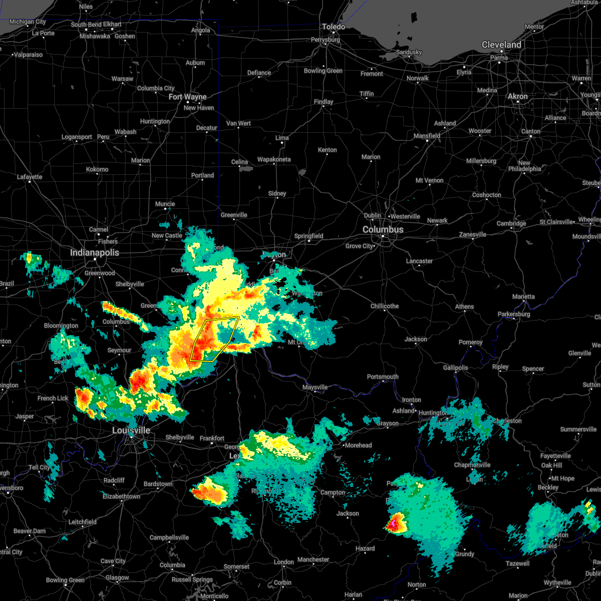 At 837 pm edt, severe thunderstorms were located from bright to near aurora to near rising sun to 8 miles southeast of dillsboro, moving east at 45 mph (radar indicated). Hazards include 60 mph wind gusts. Expect damage to trees and power lines. locations impacted include, cincinnati, harrison, lawrenceburg, greendale, aurora, rising sun, bright, hidden valley, burlington, cleves, dillsboro, shawnee, taylor creek, miami heights, dry ridge, blue jay, mack, colerain township, bridgetown and monfort heights. this includes i-74 in ohio between mile markers 2 and 13. hail threat, radar indicated max hail size, <. 75 in wind threat, radar indicated max wind gust, 60 mph. At 837 pm edt, severe thunderstorms were located from bright to near aurora to near rising sun to 8 miles southeast of dillsboro, moving east at 45 mph (radar indicated). Hazards include 60 mph wind gusts. Expect damage to trees and power lines. locations impacted include, cincinnati, harrison, lawrenceburg, greendale, aurora, rising sun, bright, hidden valley, burlington, cleves, dillsboro, shawnee, taylor creek, miami heights, dry ridge, blue jay, mack, colerain township, bridgetown and monfort heights. this includes i-74 in ohio between mile markers 2 and 13. hail threat, radar indicated max hail size, <. 75 in wind threat, radar indicated max wind gust, 60 mph.
|
| 5/19/2022 8:17 PM EDT |
 At 816 pm edt, severe thunderstorms were located from 6 miles north of moores hill to near milan to 11 miles southwest of versailles, moving east at 30 mph (radar indicated). Hazards include 60 mph wind gusts. expect damage to trees and power lines At 816 pm edt, severe thunderstorms were located from 6 miles north of moores hill to near milan to 11 miles southwest of versailles, moving east at 30 mph (radar indicated). Hazards include 60 mph wind gusts. expect damage to trees and power lines
|
| 5/19/2022 8:17 PM EDT |
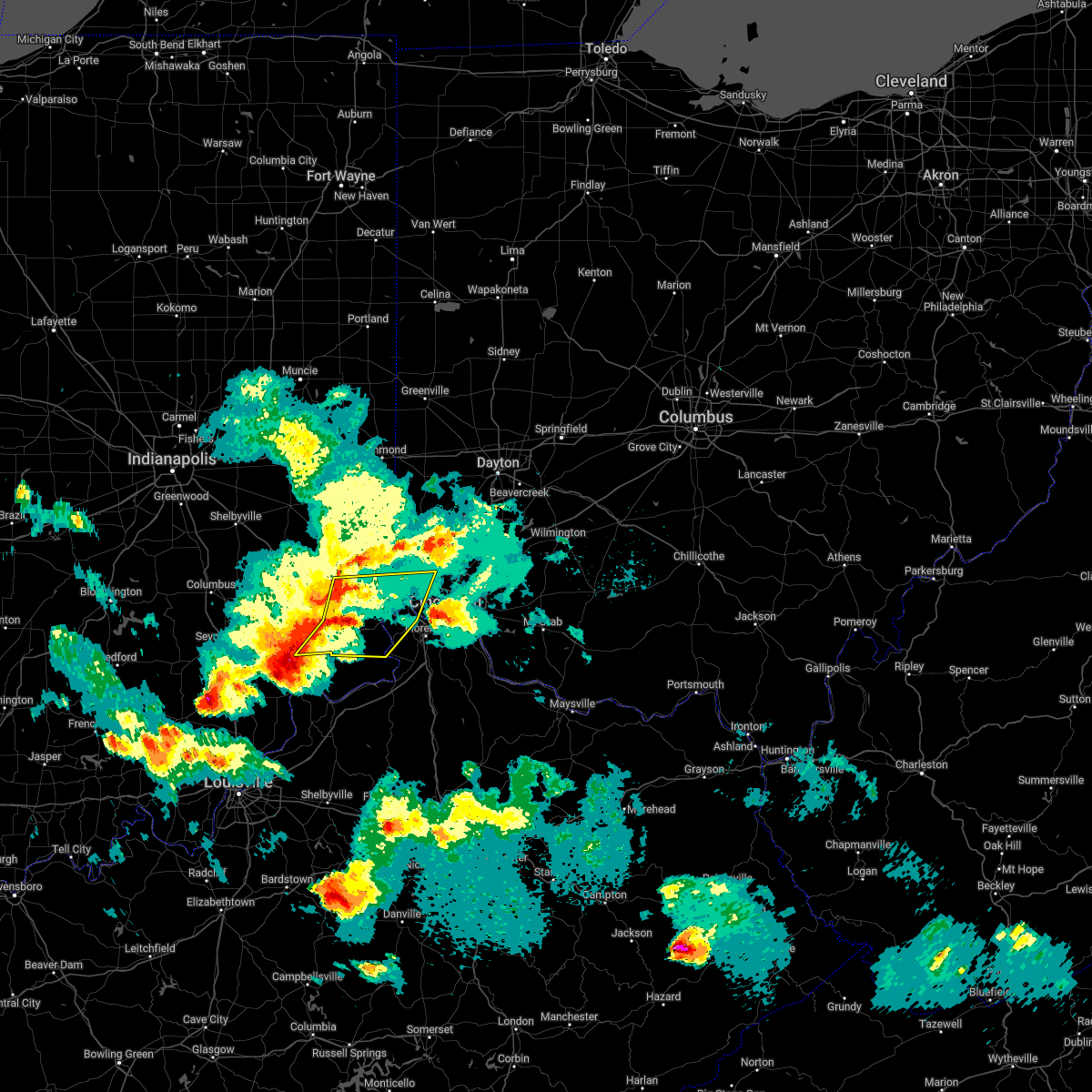 At 816 pm edt, severe thunderstorms were located from 6 miles north of moores hill to near milan to 11 miles southwest of versailles, moving east at 30 mph (radar indicated). Hazards include 60 mph wind gusts. expect damage to trees and power lines At 816 pm edt, severe thunderstorms were located from 6 miles north of moores hill to near milan to 11 miles southwest of versailles, moving east at 30 mph (radar indicated). Hazards include 60 mph wind gusts. expect damage to trees and power lines
|
| 5/19/2022 7:55 PM EDT |
 The severe thunderstorm warning for northern kenton, northern boone and southwestern hamilton counties will expire at 800 pm edt, the storm which prompted the warning has weakened below severe limits, and no longer poses an immediate threat to life or property. therefore, the warning will be allowed to expire. please report previous wind damage or hail to the national weather service by going to our website at weather.gov/iln and submitting your report via social media. The severe thunderstorm warning for northern kenton, northern boone and southwestern hamilton counties will expire at 800 pm edt, the storm which prompted the warning has weakened below severe limits, and no longer poses an immediate threat to life or property. therefore, the warning will be allowed to expire. please report previous wind damage or hail to the national weather service by going to our website at weather.gov/iln and submitting your report via social media.
|
| 5/19/2022 7:55 PM EDT |
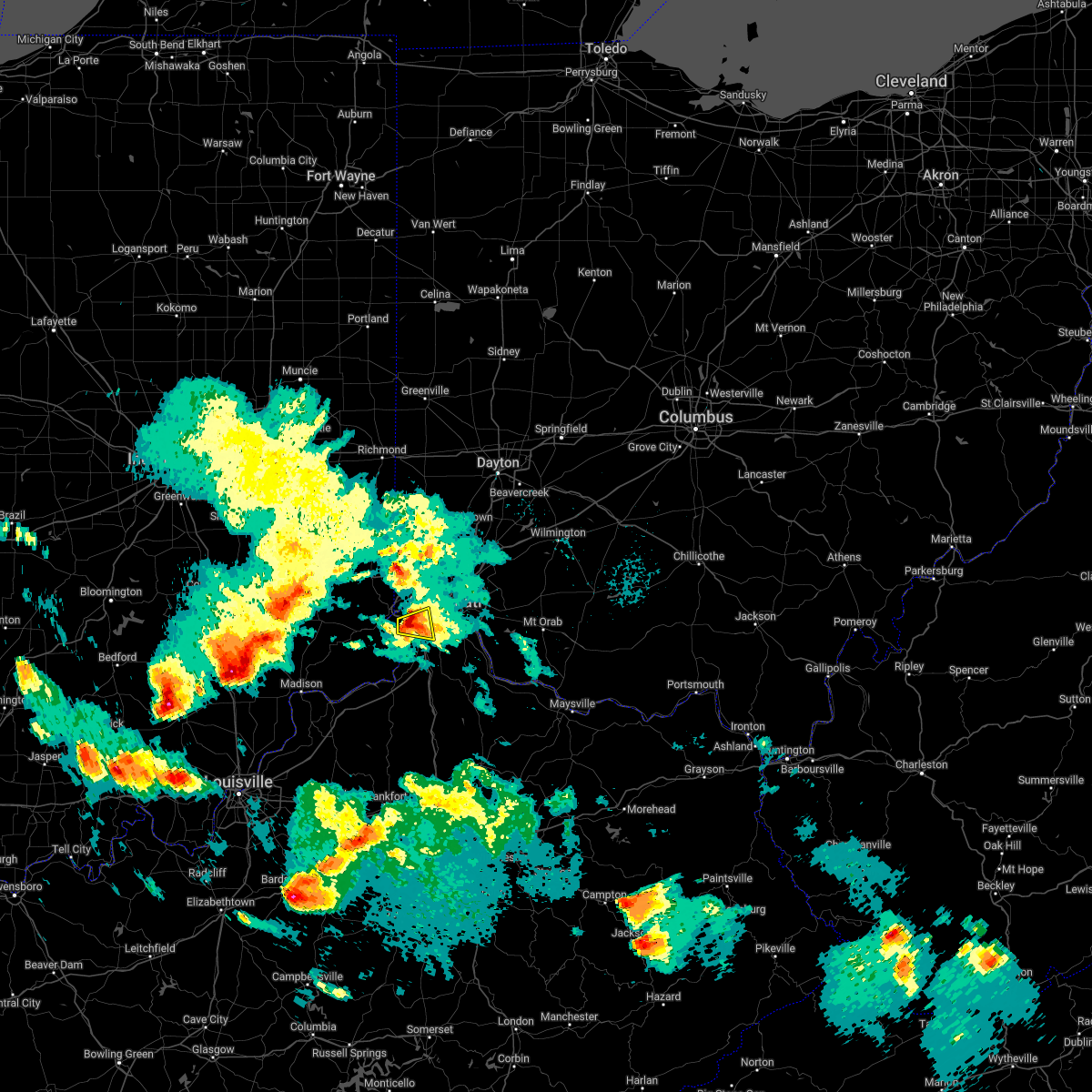 The severe thunderstorm warning for northern kenton, northern boone and southwestern hamilton counties will expire at 800 pm edt, the storm which prompted the warning has weakened below severe limits, and no longer poses an immediate threat to life or property. therefore, the warning will be allowed to expire. please report previous wind damage or hail to the national weather service by going to our website at weather.gov/iln and submitting your report via social media. The severe thunderstorm warning for northern kenton, northern boone and southwestern hamilton counties will expire at 800 pm edt, the storm which prompted the warning has weakened below severe limits, and no longer poses an immediate threat to life or property. therefore, the warning will be allowed to expire. please report previous wind damage or hail to the national weather service by going to our website at weather.gov/iln and submitting your report via social media.
|
| 5/19/2022 7:49 PM EDT |
 At 749 pm edt, a severe thunderstorm was located over burlington, moving east at 25 mph (radar indicated). Hazards include 60 mph wind gusts and quarter size hail. Minor hail damage to vehicles is possible. expect wind damage to trees and power lines. locations impacted include, cincinnati, florence, erlanger, edgewood, elsmere, villa hills, crescent springs, oakbrook, burlington, delhi township, delhi hills, delshire, idlewild, constance, hebron, cvg airport, covedale and francisville. this includes i-75 in kentucky between mile markers 181 and 185. hail threat, radar indicated max hail size, 1. 00 in wind threat, radar indicated max wind gust, 60 mph. At 749 pm edt, a severe thunderstorm was located over burlington, moving east at 25 mph (radar indicated). Hazards include 60 mph wind gusts and quarter size hail. Minor hail damage to vehicles is possible. expect wind damage to trees and power lines. locations impacted include, cincinnati, florence, erlanger, edgewood, elsmere, villa hills, crescent springs, oakbrook, burlington, delhi township, delhi hills, delshire, idlewild, constance, hebron, cvg airport, covedale and francisville. this includes i-75 in kentucky between mile markers 181 and 185. hail threat, radar indicated max hail size, 1. 00 in wind threat, radar indicated max wind gust, 60 mph.
|
| 5/19/2022 7:49 PM EDT |
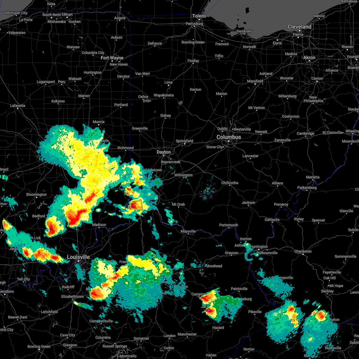 At 749 pm edt, a severe thunderstorm was located over burlington, moving east at 25 mph (radar indicated). Hazards include 60 mph wind gusts and quarter size hail. Minor hail damage to vehicles is possible. expect wind damage to trees and power lines. locations impacted include, cincinnati, florence, erlanger, edgewood, elsmere, villa hills, crescent springs, oakbrook, burlington, delhi township, delhi hills, delshire, idlewild, constance, hebron, cvg airport, covedale and francisville. this includes i-75 in kentucky between mile markers 181 and 185. hail threat, radar indicated max hail size, 1. 00 in wind threat, radar indicated max wind gust, 60 mph. At 749 pm edt, a severe thunderstorm was located over burlington, moving east at 25 mph (radar indicated). Hazards include 60 mph wind gusts and quarter size hail. Minor hail damage to vehicles is possible. expect wind damage to trees and power lines. locations impacted include, cincinnati, florence, erlanger, edgewood, elsmere, villa hills, crescent springs, oakbrook, burlington, delhi township, delhi hills, delshire, idlewild, constance, hebron, cvg airport, covedale and francisville. this includes i-75 in kentucky between mile markers 181 and 185. hail threat, radar indicated max hail size, 1. 00 in wind threat, radar indicated max wind gust, 60 mph.
|
| 5/19/2022 7:42 PM EDT |
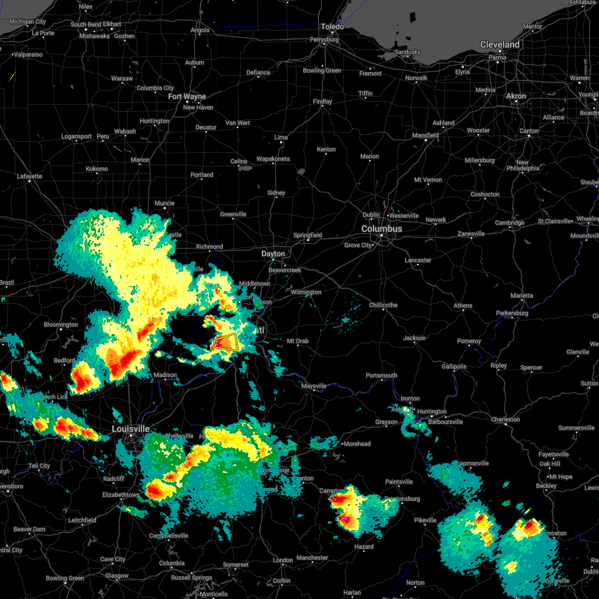 At 742 pm edt, a severe thunderstorm was located near burlington, moving east at 30 mph (radar indicated). Hazards include golf ball size hail and 60 mph wind gusts. People and animals outdoors will be injured. expect hail damage to roofs, siding, windows, and vehicles. expect wind damage to trees and power lines. locations impacted include, cincinnati, florence, erlanger, edgewood, elsmere, villa hills, crescent springs, oakbrook, burlington, delhi township, delhi hills, delshire, idlewild, constance, hebron, cvg airport, covedale, francisville and petersburg. this includes i-75 in kentucky between mile markers 181 and 185. thunderstorm damage threat, considerable hail threat, radar indicated max hail size, 1. 75 in wind threat, radar indicated max wind gust, 60 mph. At 742 pm edt, a severe thunderstorm was located near burlington, moving east at 30 mph (radar indicated). Hazards include golf ball size hail and 60 mph wind gusts. People and animals outdoors will be injured. expect hail damage to roofs, siding, windows, and vehicles. expect wind damage to trees and power lines. locations impacted include, cincinnati, florence, erlanger, edgewood, elsmere, villa hills, crescent springs, oakbrook, burlington, delhi township, delhi hills, delshire, idlewild, constance, hebron, cvg airport, covedale, francisville and petersburg. this includes i-75 in kentucky between mile markers 181 and 185. thunderstorm damage threat, considerable hail threat, radar indicated max hail size, 1. 75 in wind threat, radar indicated max wind gust, 60 mph.
|
| 5/19/2022 7:31 PM EDT |
 At 731 pm edt, a severe thunderstorm was located near aurora, moving east at 20 mph (radar indicated). Hazards include golf ball size hail and 60 mph wind gusts. People and animals outdoors will be injured. expect hail damage to roofs, siding, windows, and vehicles. expect wind damage to trees and power lines. locations impacted include, cincinnati, florence, erlanger, edgewood, elsmere, villa hills, crescent springs, aurora, oakbrook, burlington, delhi township, delhi hills, delshire, french, idlewild, constance, hebron, cvg airport, petersburg and covedale. this includes i-75 in kentucky between mile markers 180 and 185. thunderstorm damage threat, considerable hail threat, radar indicated max hail size, 1. 75 in wind threat, radar indicated max wind gust, 60 mph. At 731 pm edt, a severe thunderstorm was located near aurora, moving east at 20 mph (radar indicated). Hazards include golf ball size hail and 60 mph wind gusts. People and animals outdoors will be injured. expect hail damage to roofs, siding, windows, and vehicles. expect wind damage to trees and power lines. locations impacted include, cincinnati, florence, erlanger, edgewood, elsmere, villa hills, crescent springs, aurora, oakbrook, burlington, delhi township, delhi hills, delshire, french, idlewild, constance, hebron, cvg airport, petersburg and covedale. this includes i-75 in kentucky between mile markers 180 and 185. thunderstorm damage threat, considerable hail threat, radar indicated max hail size, 1. 75 in wind threat, radar indicated max wind gust, 60 mph.
|
| 5/19/2022 7:31 PM EDT |
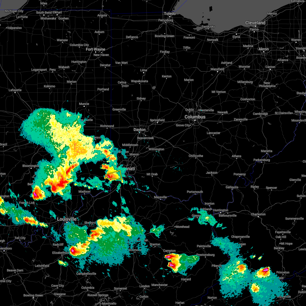 At 731 pm edt, a severe thunderstorm was located near aurora, moving east at 20 mph (radar indicated). Hazards include golf ball size hail and 60 mph wind gusts. People and animals outdoors will be injured. expect hail damage to roofs, siding, windows, and vehicles. expect wind damage to trees and power lines. locations impacted include, cincinnati, florence, erlanger, edgewood, elsmere, villa hills, crescent springs, aurora, oakbrook, burlington, delhi township, delhi hills, delshire, french, idlewild, constance, hebron, cvg airport, petersburg and covedale. this includes i-75 in kentucky between mile markers 180 and 185. thunderstorm damage threat, considerable hail threat, radar indicated max hail size, 1. 75 in wind threat, radar indicated max wind gust, 60 mph. At 731 pm edt, a severe thunderstorm was located near aurora, moving east at 20 mph (radar indicated). Hazards include golf ball size hail and 60 mph wind gusts. People and animals outdoors will be injured. expect hail damage to roofs, siding, windows, and vehicles. expect wind damage to trees and power lines. locations impacted include, cincinnati, florence, erlanger, edgewood, elsmere, villa hills, crescent springs, aurora, oakbrook, burlington, delhi township, delhi hills, delshire, french, idlewild, constance, hebron, cvg airport, petersburg and covedale. this includes i-75 in kentucky between mile markers 180 and 185. thunderstorm damage threat, considerable hail threat, radar indicated max hail size, 1. 75 in wind threat, radar indicated max wind gust, 60 mph.
|
| 5/19/2022 7:11 PM EDT |
 At 711 pm edt, a severe thunderstorm was located near aurora, moving east at 30 mph (radar indicated). Hazards include 60 mph wind gusts and half dollar size hail. Minor hail damage to vehicles is possible. Expect wind damage to trees and power lines. At 711 pm edt, a severe thunderstorm was located near aurora, moving east at 30 mph (radar indicated). Hazards include 60 mph wind gusts and half dollar size hail. Minor hail damage to vehicles is possible. Expect wind damage to trees and power lines.
|
| 5/14/2022 7:05 PM EDT | Large healthy elm down. photos on social medi in hamilton county OH, 10.8 miles SSW of Cincinnati, OH |
| 3/23/2022 2:26 PM EDT |
 The severe thunderstorm warning for kenton, boone and north central grant counties will expire at 230 pm edt, the storm which prompted the warning has weakened below severe limits, and no longer poses an immediate threat to life or property. therefore, the warning will be allowed to expire. however small hail and gusty winds are still possible with this thunderstorm. a severe thunderstorm watch remains in effect until 900 pm edt for southwestern ohio. please report previous wind damage or hail to the national weather service by going to our website at weather.gov/iln and submitting your report via social media. The severe thunderstorm warning for kenton, boone and north central grant counties will expire at 230 pm edt, the storm which prompted the warning has weakened below severe limits, and no longer poses an immediate threat to life or property. therefore, the warning will be allowed to expire. however small hail and gusty winds are still possible with this thunderstorm. a severe thunderstorm watch remains in effect until 900 pm edt for southwestern ohio. please report previous wind damage or hail to the national weather service by going to our website at weather.gov/iln and submitting your report via social media.
|
| 3/23/2022 2:20 PM EDT |
 At 220 pm edt, a severe thunderstorm was located over burlington, moving north at 55 mph (radar indicated). Hazards include 60 mph wind gusts and quarter size hail. Minor hail damage to vehicles is possible. expect wind damage to trees and power lines. locations impacted include, cincinnati, covington, florence, independence, erlanger, edgewood, elsmere, fort mitchell, villa hills, taylor mill, fort wright, ludlow, crescent springs, walton, crestview hills, park hills, lakeside park, oakbrook, burlington and union. this includes the following interstates, i-71 in kentucky between mile markers 71 and 77. i-71 in ohio near mile marker 0. i-75 in kentucky between mile markers 165 and 191. i-75 in ohio near mile marker 0. hail threat, radar indicated max hail size, 1. 00 in wind threat, radar indicated max wind gust, 60 mph. At 220 pm edt, a severe thunderstorm was located over burlington, moving north at 55 mph (radar indicated). Hazards include 60 mph wind gusts and quarter size hail. Minor hail damage to vehicles is possible. expect wind damage to trees and power lines. locations impacted include, cincinnati, covington, florence, independence, erlanger, edgewood, elsmere, fort mitchell, villa hills, taylor mill, fort wright, ludlow, crescent springs, walton, crestview hills, park hills, lakeside park, oakbrook, burlington and union. this includes the following interstates, i-71 in kentucky between mile markers 71 and 77. i-71 in ohio near mile marker 0. i-75 in kentucky between mile markers 165 and 191. i-75 in ohio near mile marker 0. hail threat, radar indicated max hail size, 1. 00 in wind threat, radar indicated max wind gust, 60 mph.
|
| 3/23/2022 2:10 PM EDT |
 At 210 pm edt, a severe thunderstorm was located near patriot, moving north at 55 mph (radar indicated). Hazards include 60 mph wind gusts and quarter size hail. Minor hail damage to vehicles is possible. expect wind damage to trees and power lines. locations impacted include, cincinnati, covington, florence, independence, erlanger, edgewood, elsmere, fort mitchell, villa hills, taylor mill, fort wright, ludlow, crescent springs, walton, crestview hills, park hills, lakeside park, oakbrook, burlington and union. this includes the following interstates, i-71 in kentucky between mile markers 62 and 77. i-71 in ohio near mile marker 0. i-75 in kentucky between mile markers 165 and 191. i-75 in ohio near mile marker 0. hail threat, radar indicated max hail size, 1. 00 in wind threat, radar indicated max wind gust, 60 mph. At 210 pm edt, a severe thunderstorm was located near patriot, moving north at 55 mph (radar indicated). Hazards include 60 mph wind gusts and quarter size hail. Minor hail damage to vehicles is possible. expect wind damage to trees and power lines. locations impacted include, cincinnati, covington, florence, independence, erlanger, edgewood, elsmere, fort mitchell, villa hills, taylor mill, fort wright, ludlow, crescent springs, walton, crestview hills, park hills, lakeside park, oakbrook, burlington and union. this includes the following interstates, i-71 in kentucky between mile markers 62 and 77. i-71 in ohio near mile marker 0. i-75 in kentucky between mile markers 165 and 191. i-75 in ohio near mile marker 0. hail threat, radar indicated max hail size, 1. 00 in wind threat, radar indicated max wind gust, 60 mph.
|
| 3/23/2022 2:03 PM EDT |
 At 202 pm edt, a severe thunderstorm was located over warsaw, moving northeast at 55 mph (radar indicated). Hazards include 60 mph wind gusts and nickel size hail. expect damage to trees and power lines At 202 pm edt, a severe thunderstorm was located over warsaw, moving northeast at 55 mph (radar indicated). Hazards include 60 mph wind gusts and nickel size hail. expect damage to trees and power lines
|
| 3/7/2022 5:13 AM EST |
 The severe thunderstorm warning for northern kenton, northern campbell, central boone and southeastern hamilton counties will expire at 515 am est, the storm which prompted the warning has weakened below severe limits, and has exited the warned area. therefore, the warning will be allowed to expire. however heavy rain is still possible with this thunderstorm. please report previous wind damage or hail to the national weather service by going to our website at weather.gov/iln and submitting your report via social media. The severe thunderstorm warning for northern kenton, northern campbell, central boone and southeastern hamilton counties will expire at 515 am est, the storm which prompted the warning has weakened below severe limits, and has exited the warned area. therefore, the warning will be allowed to expire. however heavy rain is still possible with this thunderstorm. please report previous wind damage or hail to the national weather service by going to our website at weather.gov/iln and submitting your report via social media.
|
| 3/7/2022 5:05 AM EST |
 At 505 am est, a severe thunderstorm was located over covington, moving east at 65 mph (radar indicated). Hazards include 60 mph wind gusts. Expect damage to trees and power lines. locations impacted include, cincinnati, covington, florence, independence, norwood, erlanger, fort thomas, newport, edgewood, alexandria, elsmere, fort mitchell, villa hills, highland heights, milford, taylor mill, bellevue, fort wright, dayton and ludlow. this includes the following interstates, i-71 in ohio between mile markers 0 and 7. i-75 in kentucky between mile markers 176 and 191. i-75 in ohio between mile markers 0 and 3. hail threat, radar indicated max hail size, <. 75 in wind threat, radar indicated max wind gust, 60 mph. At 505 am est, a severe thunderstorm was located over covington, moving east at 65 mph (radar indicated). Hazards include 60 mph wind gusts. Expect damage to trees and power lines. locations impacted include, cincinnati, covington, florence, independence, norwood, erlanger, fort thomas, newport, edgewood, alexandria, elsmere, fort mitchell, villa hills, highland heights, milford, taylor mill, bellevue, fort wright, dayton and ludlow. this includes the following interstates, i-71 in ohio between mile markers 0 and 7. i-75 in kentucky between mile markers 176 and 191. i-75 in ohio between mile markers 0 and 3. hail threat, radar indicated max hail size, <. 75 in wind threat, radar indicated max wind gust, 60 mph.
|
| 3/7/2022 4:58 AM EST |
 At 458 am est, a severe thunderstorm was located over florence, moving east at 65 mph (radar indicated). Hazards include 60 mph wind gusts. Expect damage to trees and power lines. locations impacted include, cincinnati, covington, florence, independence, norwood, erlanger, fort thomas, newport, madeira, edgewood, alexandria, elsmere, fort mitchell, villa hills, highland heights, milford, taylor mill, bellevue, fort wright and dayton. this includes the following interstates, i-71 in ohio between mile markers 0 and 7. i-75 in kentucky between mile markers 176 and 191. i-75 in ohio between mile markers 0 and 3. hail threat, radar indicated max hail size, <. 75 in wind threat, radar indicated max wind gust, 60 mph. At 458 am est, a severe thunderstorm was located over florence, moving east at 65 mph (radar indicated). Hazards include 60 mph wind gusts. Expect damage to trees and power lines. locations impacted include, cincinnati, covington, florence, independence, norwood, erlanger, fort thomas, newport, madeira, edgewood, alexandria, elsmere, fort mitchell, villa hills, highland heights, milford, taylor mill, bellevue, fort wright and dayton. this includes the following interstates, i-71 in ohio between mile markers 0 and 7. i-75 in kentucky between mile markers 176 and 191. i-75 in ohio between mile markers 0 and 3. hail threat, radar indicated max hail size, <. 75 in wind threat, radar indicated max wind gust, 60 mph.
|
| 3/7/2022 4:47 AM EST |
 At 447 am est, a severe thunderstorm was located over rising sun, moving east at 65 mph (radar indicated). Hazards include 60 mph wind gusts. expect damage to trees and power lines At 447 am est, a severe thunderstorm was located over rising sun, moving east at 65 mph (radar indicated). Hazards include 60 mph wind gusts. expect damage to trees and power lines
|
| 8/27/2021 5:53 PM EDT | Trees down. time estimated by rada in hamilton county OH, 9.3 miles WNW of Cincinnati, OH |
| 8/10/2021 8:56 AM EDT |
 The severe thunderstorm warning for northern kenton, northern campbell and central hamilton counties will expire at 900 am edt, the storm which prompted the warning has weakened below severe limits, and no longer poses an immediate threat to life or property. therefore, the warning will be allowed to expire. however gusty winds are still possible with this thunderstorm. please report previous wind damage or hail to the national weather service by going to our website at weather.gov/iln and submitting your report via social media. The severe thunderstorm warning for northern kenton, northern campbell and central hamilton counties will expire at 900 am edt, the storm which prompted the warning has weakened below severe limits, and no longer poses an immediate threat to life or property. therefore, the warning will be allowed to expire. however gusty winds are still possible with this thunderstorm. please report previous wind damage or hail to the national weather service by going to our website at weather.gov/iln and submitting your report via social media.
|
| 8/10/2021 8:52 AM EDT |
 At 852 am edt, a severe thunderstorm was located over university of cincinnati, moving east at 35 mph (radar indicated). Hazards include 60 mph wind gusts and quarter size hail. Minor hail damage to vehicles is possible. expect wind damage to trees and power lines. locations impacted include, cincinnati, covington, norwood, erlanger, fort thomas, newport, sharonville, blue ash, loveland, reading, montgomery, north college hill, madeira, edgewood, wyoming, cheviot, fort mitchell, villa hills, highland heights and taylor mill. this includes the following interstates, i-71 in ohio between mile markers 0 and 19. i-74 in ohio between mile markers 9 and 19. i-75 in kentucky between mile markers 184 and 191. i-75 in ohio between mile markers 0 and 15. hail threat, radar indicated max hail size, 1. 00 in wind threat, radar indicated max wind gust, 60 mph. At 852 am edt, a severe thunderstorm was located over university of cincinnati, moving east at 35 mph (radar indicated). Hazards include 60 mph wind gusts and quarter size hail. Minor hail damage to vehicles is possible. expect wind damage to trees and power lines. locations impacted include, cincinnati, covington, norwood, erlanger, fort thomas, newport, sharonville, blue ash, loveland, reading, montgomery, north college hill, madeira, edgewood, wyoming, cheviot, fort mitchell, villa hills, highland heights and taylor mill. this includes the following interstates, i-71 in ohio between mile markers 0 and 19. i-74 in ohio between mile markers 9 and 19. i-75 in kentucky between mile markers 184 and 191. i-75 in ohio between mile markers 0 and 15. hail threat, radar indicated max hail size, 1. 00 in wind threat, radar indicated max wind gust, 60 mph.
|
| 8/10/2021 8:39 AM EDT |
 At 839 am edt, a severe thunderstorm was located over mack, moving east at 35 mph (radar indicated). Hazards include 60 mph wind gusts and quarter size hail. Minor hail damage to vehicles is possible. Expect wind damage to trees and power lines. At 839 am edt, a severe thunderstorm was located over mack, moving east at 35 mph (radar indicated). Hazards include 60 mph wind gusts and quarter size hail. Minor hail damage to vehicles is possible. Expect wind damage to trees and power lines.
|
| 7/16/2021 7:03 PM EDT |
 At 703 pm edt, a severe thunderstorm was located over blue jay, moving east at 30 mph (radar indicated). Hazards include 60 mph wind gusts. Expect damage to trees and power lines. locations impacted include, harrison, cheviot, lawrenceburg, greendale, bright, hidden valley, cleves, shawnee, taylor creek, bridgetown, miami heights, blue jay, mack, monfort heights, logan, new haven, grandview, addyston, north bend and west harrison. This includes i-74 in ohio between mile markers 0 and 13. At 703 pm edt, a severe thunderstorm was located over blue jay, moving east at 30 mph (radar indicated). Hazards include 60 mph wind gusts. Expect damage to trees and power lines. locations impacted include, harrison, cheviot, lawrenceburg, greendale, bright, hidden valley, cleves, shawnee, taylor creek, bridgetown, miami heights, blue jay, mack, monfort heights, logan, new haven, grandview, addyston, north bend and west harrison. This includes i-74 in ohio between mile markers 0 and 13.
|
| 7/16/2021 6:56 PM EDT |
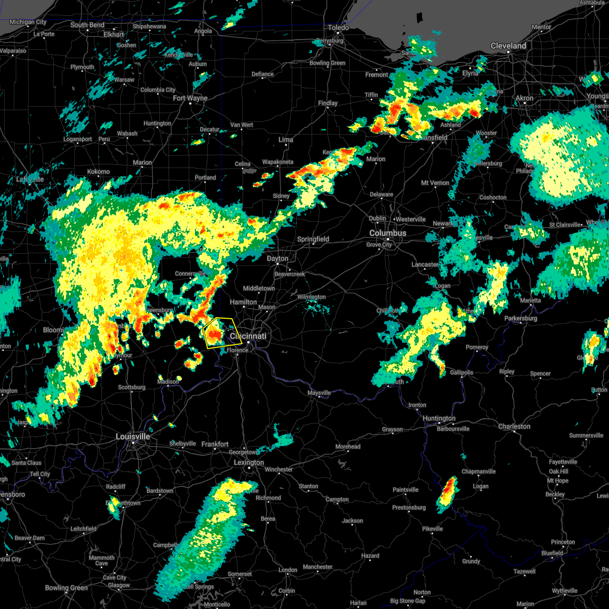 At 656 pm edt, a severe thunderstorm was located over hidden valley, moving northeast at 30 mph (radar indicated). Hazards include 60 mph wind gusts. Expect damage to trees and power lines. locations impacted include, cincinnati, harrison, cheviot, lawrenceburg, greendale, aurora, bright, hidden valley, cleves, shawnee, taylor creek, bridgetown, delhi township, miami heights, blue jay, delshire, mack, delhi hills, monfort heights and guilford. this includes the following interstates, i-74 in indiana between mile markers 167 and 171. I-74 in ohio between mile markers 0 and 13. At 656 pm edt, a severe thunderstorm was located over hidden valley, moving northeast at 30 mph (radar indicated). Hazards include 60 mph wind gusts. Expect damage to trees and power lines. locations impacted include, cincinnati, harrison, cheviot, lawrenceburg, greendale, aurora, bright, hidden valley, cleves, shawnee, taylor creek, bridgetown, delhi township, miami heights, blue jay, delshire, mack, delhi hills, monfort heights and guilford. this includes the following interstates, i-74 in indiana between mile markers 167 and 171. I-74 in ohio between mile markers 0 and 13.
|
| 7/16/2021 6:48 PM EDT |
 At 648 pm edt, a severe thunderstorm was located over greendale, moving northeast at 30 mph (radar indicated). Hazards include 60 mph wind gusts. Expect damage to trees and power lines. locations impacted include, cincinnati, harrison, cheviot, lawrenceburg, greendale, aurora, bright, hidden valley, cleves, shawnee, taylor creek, bridgetown, delhi township, miami heights, blue jay, delshire, mack, delhi hills, monfort heights and guilford. this includes the following interstates, i-74 in indiana between mile markers 166 and 171. I-74 in ohio between mile markers 0 and 13. At 648 pm edt, a severe thunderstorm was located over greendale, moving northeast at 30 mph (radar indicated). Hazards include 60 mph wind gusts. Expect damage to trees and power lines. locations impacted include, cincinnati, harrison, cheviot, lawrenceburg, greendale, aurora, bright, hidden valley, cleves, shawnee, taylor creek, bridgetown, delhi township, miami heights, blue jay, delshire, mack, delhi hills, monfort heights and guilford. this includes the following interstates, i-74 in indiana between mile markers 166 and 171. I-74 in ohio between mile markers 0 and 13.
|
| 7/16/2021 6:48 PM EDT |
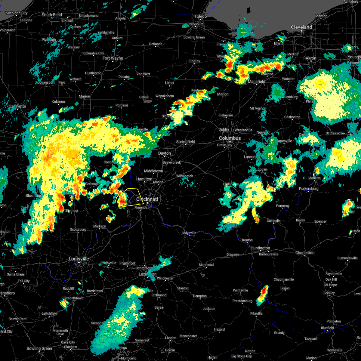 At 648 pm edt, a severe thunderstorm was located over greendale, moving northeast at 30 mph (radar indicated). Hazards include 60 mph wind gusts. Expect damage to trees and power lines. locations impacted include, cincinnati, harrison, cheviot, lawrenceburg, greendale, aurora, bright, hidden valley, cleves, shawnee, taylor creek, bridgetown, delhi township, miami heights, blue jay, delshire, mack, delhi hills, monfort heights and guilford. this includes the following interstates, i-74 in indiana between mile markers 166 and 171. I-74 in ohio between mile markers 0 and 13. At 648 pm edt, a severe thunderstorm was located over greendale, moving northeast at 30 mph (radar indicated). Hazards include 60 mph wind gusts. Expect damage to trees and power lines. locations impacted include, cincinnati, harrison, cheviot, lawrenceburg, greendale, aurora, bright, hidden valley, cleves, shawnee, taylor creek, bridgetown, delhi township, miami heights, blue jay, delshire, mack, delhi hills, monfort heights and guilford. this includes the following interstates, i-74 in indiana between mile markers 166 and 171. I-74 in ohio between mile markers 0 and 13.
|
| 7/16/2021 6:40 PM EDT |
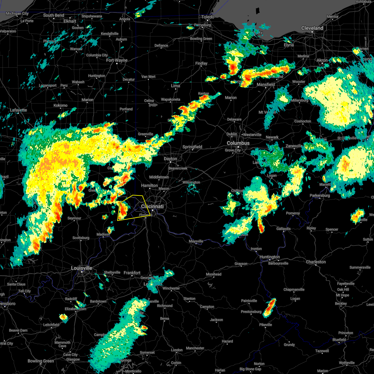 At 640 pm edt, a severe thunderstorm was located near aurora, moving east at 30 mph (radar indicated). Hazards include 60 mph wind gusts. Expect damage to trees and power lines. locations impacted include, cincinnati, florence, erlanger, harrison, cheviot, fort mitchell, villa hills, lawrenceburg, greendale, crescent springs, aurora, crestview hills, lakeside park, bright, hidden valley, burlington, oakbrook, cleves, dillsboro and shawnee. this includes the following interstates, i-74 in indiana between mile markers 165 and 171. i-74 in ohio between mile markers 0 and 13. I-75 in kentucky between mile markers 184 and 187. At 640 pm edt, a severe thunderstorm was located near aurora, moving east at 30 mph (radar indicated). Hazards include 60 mph wind gusts. Expect damage to trees and power lines. locations impacted include, cincinnati, florence, erlanger, harrison, cheviot, fort mitchell, villa hills, lawrenceburg, greendale, crescent springs, aurora, crestview hills, lakeside park, bright, hidden valley, burlington, oakbrook, cleves, dillsboro and shawnee. this includes the following interstates, i-74 in indiana between mile markers 165 and 171. i-74 in ohio between mile markers 0 and 13. I-75 in kentucky between mile markers 184 and 187.
|
| 7/16/2021 6:31 PM EDT |
 At 631 pm edt, a severe thunderstorm was located near dillsboro, moving east at 30 mph (radar indicated). Hazards include 60 mph wind gusts. expect damage to trees and power lines At 631 pm edt, a severe thunderstorm was located near dillsboro, moving east at 30 mph (radar indicated). Hazards include 60 mph wind gusts. expect damage to trees and power lines
|
| 7/16/2021 6:31 PM EDT |
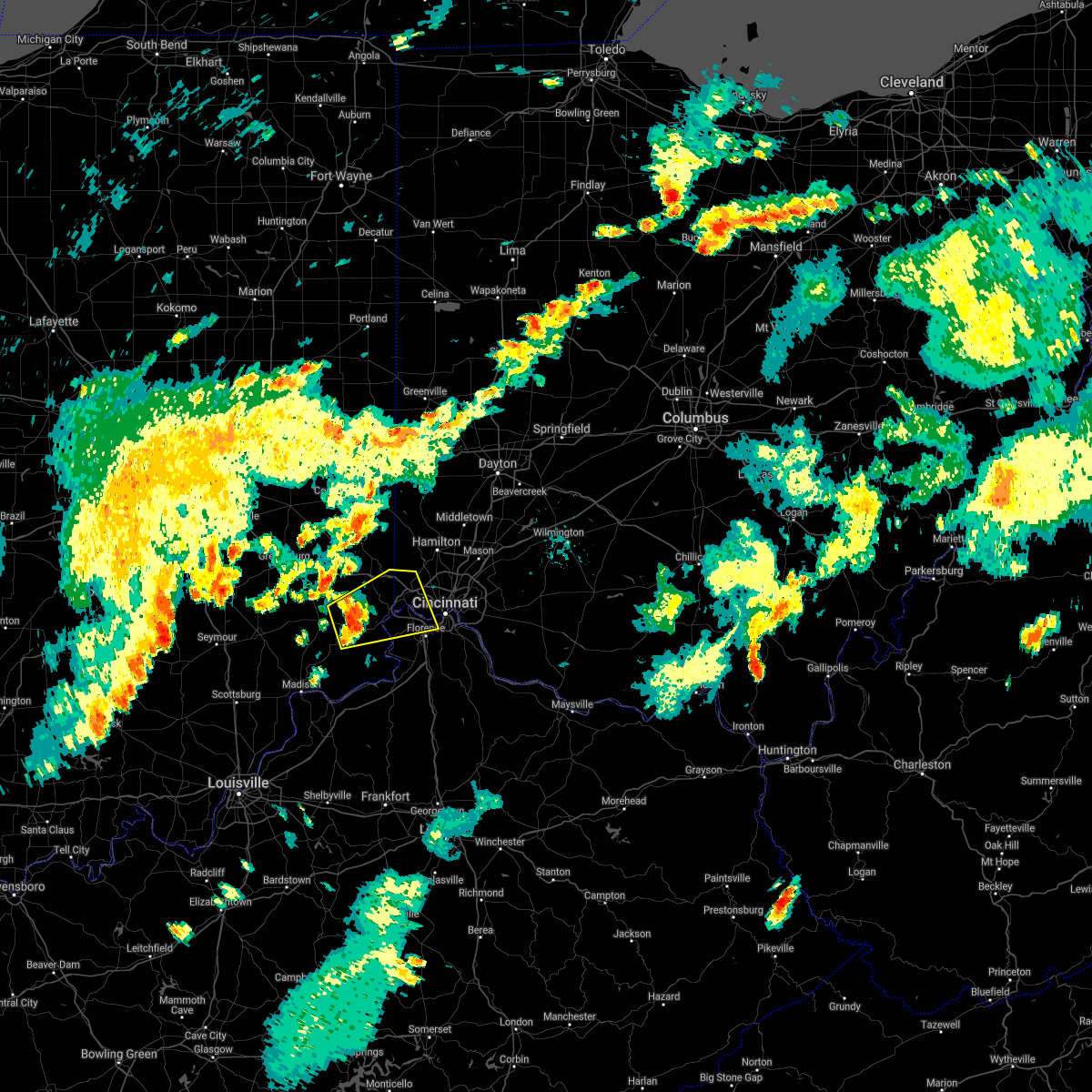 At 631 pm edt, a severe thunderstorm was located near dillsboro, moving east at 30 mph (radar indicated). Hazards include 60 mph wind gusts. expect damage to trees and power lines At 631 pm edt, a severe thunderstorm was located near dillsboro, moving east at 30 mph (radar indicated). Hazards include 60 mph wind gusts. expect damage to trees and power lines
|
| 7/16/2021 3:11 PM EDT |
 The severe thunderstorm warning for northern kenton, northern campbell, southeastern hamilton and northwestern clermont counties will expire at 315 pm edt, the storm which prompted the warning has moved out of the area. therefore, the warning will be allowed to expire. please report previous wind damage or hail to the national weather service by going to our website at weather.gov/iln and submitting your report via social media. remember, a severe thunderstorm warning still remains in effect for far eastern campbell and southeast hamilton counties, as well as northern clermont until 345 pm. The severe thunderstorm warning for northern kenton, northern campbell, southeastern hamilton and northwestern clermont counties will expire at 315 pm edt, the storm which prompted the warning has moved out of the area. therefore, the warning will be allowed to expire. please report previous wind damage or hail to the national weather service by going to our website at weather.gov/iln and submitting your report via social media. remember, a severe thunderstorm warning still remains in effect for far eastern campbell and southeast hamilton counties, as well as northern clermont until 345 pm.
|
| 7/16/2021 3:08 PM EDT |
 At 308 pm edt, a severe thunderstorm was located over withamsville, moving northeast at 55 mph (radar indicated). Hazards include 70 mph wind gusts. Expect considerable tree damage. Damage is likely to mobile homes, roofs, and outbuildings. At 308 pm edt, a severe thunderstorm was located over withamsville, moving northeast at 55 mph (radar indicated). Hazards include 70 mph wind gusts. Expect considerable tree damage. Damage is likely to mobile homes, roofs, and outbuildings.
|
| 7/16/2021 3:02 PM EDT |
 At 301 pm edt, a severe thunderstorm was located over coldstream, moving northeast at 45 mph (radar indicated). Hazards include 70 mph wind gusts. Expect considerable tree damage. damage is likely to mobile homes, roofs, and outbuildings. locations impacted include, cincinnati, covington, norwood, fort thomas, newport, blue ash, loveland, montgomery, madeira, alexandria, highland heights, milford, taylor mill, bellevue, deer park, fort wright, dayton, ludlow, southgate and park hills. this includes the following interstates, i-71 in ohio between mile markers 0 and 14. i-75 in kentucky between mile markers 189 and 191. I-75 in ohio between mile markers 0 and 1. At 301 pm edt, a severe thunderstorm was located over coldstream, moving northeast at 45 mph (radar indicated). Hazards include 70 mph wind gusts. Expect considerable tree damage. damage is likely to mobile homes, roofs, and outbuildings. locations impacted include, cincinnati, covington, norwood, fort thomas, newport, blue ash, loveland, montgomery, madeira, alexandria, highland heights, milford, taylor mill, bellevue, deer park, fort wright, dayton, ludlow, southgate and park hills. this includes the following interstates, i-71 in ohio between mile markers 0 and 14. i-75 in kentucky between mile markers 189 and 191. I-75 in ohio between mile markers 0 and 1.
|
| 7/16/2021 2:56 PM EDT | Multiple power lines dow in hamilton county OH, 7.1 miles ESE of Cincinnati, OH |
| 7/16/2021 2:55 PM EDT |
 A severe thunderstorm warning remains in effect until 315 pm edt for northern kenton. northern campbell. southeastern hamilton and northwestern clermont counties. at 255 pm edt, a severe thunderstorm was located over dayton, moving northeast at 45 mph. hazard. 60 mph wind gusts. A severe thunderstorm warning remains in effect until 315 pm edt for northern kenton. northern campbell. southeastern hamilton and northwestern clermont counties. at 255 pm edt, a severe thunderstorm was located over dayton, moving northeast at 45 mph. hazard. 60 mph wind gusts.
|
| 7/16/2021 2:55 PM EDT |
 At 255 pm edt, a severe thunderstorm was located over dayton, moving northeast at 45 mph (radar indicated). Hazards include 60 mph wind gusts. Expect damage to trees and power lines. locations impacted include, cincinnati, covington, florence, independence, norwood, erlanger, fort thomas, newport, sharonville, blue ash, loveland, reading, montgomery, madeira, edgewood, alexandria, elsmere, wyoming, cheviot and fort mitchell. this includes the following interstates, i-71 in ohio between mile markers 0 and 19. i-74 in ohio between mile markers 16 and 19. i-75 in kentucky between mile markers 184 and 191. I-75 in ohio between mile markers 0 and 13. At 255 pm edt, a severe thunderstorm was located over dayton, moving northeast at 45 mph (radar indicated). Hazards include 60 mph wind gusts. Expect damage to trees and power lines. locations impacted include, cincinnati, covington, florence, independence, norwood, erlanger, fort thomas, newport, sharonville, blue ash, loveland, reading, montgomery, madeira, edgewood, alexandria, elsmere, wyoming, cheviot and fort mitchell. this includes the following interstates, i-71 in ohio between mile markers 0 and 19. i-74 in ohio between mile markers 16 and 19. i-75 in kentucky between mile markers 184 and 191. I-75 in ohio between mile markers 0 and 13.
|
| 7/16/2021 2:36 PM EDT |
 At 235 pm edt, a severe thunderstorm was located over oakbrook, moving northeast at 45 mph (radar indicated). Hazards include 60 mph wind gusts. expect damage to trees and power lines At 235 pm edt, a severe thunderstorm was located over oakbrook, moving northeast at 45 mph (radar indicated). Hazards include 60 mph wind gusts. expect damage to trees and power lines
|
| 7/16/2021 2:00 PM EDT | Multiple trees dow in hamilton county OH, 8.7 miles SSE of Cincinnati, OH |
| 6/29/2021 7:09 PM EDT |
 The severe thunderstorm warning for northeastern hamilton county will expire at 715 pm edt, this warning has been replaced with an additional severe thunderstorm warning for northeastern hamilton county until 800 pm. please report previous wind damage or hail to the national weather service by going to our website at weather.gov/iln and submitting your report via social media. The severe thunderstorm warning for northeastern hamilton county will expire at 715 pm edt, this warning has been replaced with an additional severe thunderstorm warning for northeastern hamilton county until 800 pm. please report previous wind damage or hail to the national weather service by going to our website at weather.gov/iln and submitting your report via social media.
|
| 6/29/2021 7:03 PM EDT |
 At 703 pm edt, a severe thunderstorm was located over sharonville, moving northeast at 30 mph (radar indicated). Hazards include 60 mph wind gusts. Expect damage to trees and power lines. locations impacted include, fairfield, norwood, forest park, sharonville, blue ash, loveland, springdale, reading, montgomery, north college hill, madeira, wyoming, mount healthy, deer park, dayton, finneytown, mariemont, terrace park and highpoint. this includes the following interstates, i-71 in ohio between mile markers 4 and 19. i-74 in ohio between mile markers 17 and 19. I-75 in ohio between mile markers 4 and 17. At 703 pm edt, a severe thunderstorm was located over sharonville, moving northeast at 30 mph (radar indicated). Hazards include 60 mph wind gusts. Expect damage to trees and power lines. locations impacted include, fairfield, norwood, forest park, sharonville, blue ash, loveland, springdale, reading, montgomery, north college hill, madeira, wyoming, mount healthy, deer park, dayton, finneytown, mariemont, terrace park and highpoint. this includes the following interstates, i-71 in ohio between mile markers 4 and 19. i-74 in ohio between mile markers 17 and 19. I-75 in ohio between mile markers 4 and 17.
|
| 6/29/2021 6:56 PM EDT |
 At 656 pm edt, a severe thunderstorm was located over north college hill, moving northeast at 20 mph (radar indicated). Hazards include 60 mph wind gusts. Expect damage to trees and power lines. locations impacted include, cincinnati, norwood, forest park, sharonville, blue ash, loveland, springdale, reading, montgomery, north college hill, madeira, wyoming, cheviot, villa hills, mount healthy, deer park, dayton, ludlow, finneytown and mariemont. this includes the following interstates, i-71 in ohio between mile markers 1 and 19. i-74 in ohio between mile markers 7 and 19. I-75 in ohio between mile markers 1 and 17. At 656 pm edt, a severe thunderstorm was located over north college hill, moving northeast at 20 mph (radar indicated). Hazards include 60 mph wind gusts. Expect damage to trees and power lines. locations impacted include, cincinnati, norwood, forest park, sharonville, blue ash, loveland, springdale, reading, montgomery, north college hill, madeira, wyoming, cheviot, villa hills, mount healthy, deer park, dayton, ludlow, finneytown and mariemont. this includes the following interstates, i-71 in ohio between mile markers 1 and 19. i-74 in ohio between mile markers 7 and 19. I-75 in ohio between mile markers 1 and 17.
|
| 6/29/2021 6:55 PM EDT | Large tree branches down in yar in hamilton county OH, 7.8 miles SE of Cincinnati, OH |
| 6/29/2021 6:44 PM EDT |
 At 644 pm edt, a severe thunderstorm was located over cheviot, moving northeast at 15 mph (radar indicated). Hazards include 60 mph wind gusts and penny size hail. Expect damage to trees and power lines. locations impacted include, cincinnati, covington, norwood, forest park, erlanger, fort thomas, newport, sharonville, blue ash, loveland, springdale, reading, montgomery, north college hill, madeira, wyoming, cheviot, fort mitchell, villa hills and highland heights. this includes the following interstates, i-71 in ohio between mile markers 0 and 19. i-74 in ohio between mile markers 7 and 19. i-75 in kentucky between mile markers 186 and 191. I-75 in ohio between mile markers 0 and 17. At 644 pm edt, a severe thunderstorm was located over cheviot, moving northeast at 15 mph (radar indicated). Hazards include 60 mph wind gusts and penny size hail. Expect damage to trees and power lines. locations impacted include, cincinnati, covington, norwood, forest park, erlanger, fort thomas, newport, sharonville, blue ash, loveland, springdale, reading, montgomery, north college hill, madeira, wyoming, cheviot, fort mitchell, villa hills and highland heights. this includes the following interstates, i-71 in ohio between mile markers 0 and 19. i-74 in ohio between mile markers 7 and 19. i-75 in kentucky between mile markers 186 and 191. I-75 in ohio between mile markers 0 and 17.
|
| 6/29/2021 6:34 PM EDT | Tree down on julmar dr. time est from rada in hamilton county OH, 6.5 miles ENE of Cincinnati, OH |
| 6/29/2021 6:31 PM EDT |
 At 630 pm edt, a severe thunderstorm was located over delhi township, moving northeast at 15 mph (radar indicated). Hazards include 60 mph wind gusts and penny size hail. expect damage to trees and power lines At 630 pm edt, a severe thunderstorm was located over delhi township, moving northeast at 15 mph (radar indicated). Hazards include 60 mph wind gusts and penny size hail. expect damage to trees and power lines
|
| 6/18/2021 11:03 PM EDT |
 At 1102 pm edt, a severe thunderstorm was located over fairfield, moving east at 35 mph (radar indicated). Hazards include quarter size hail. minor damage to vehicles is possible At 1102 pm edt, a severe thunderstorm was located over fairfield, moving east at 35 mph (radar indicated). Hazards include quarter size hail. minor damage to vehicles is possible
|
| 6/18/2021 9:30 PM EDT |
 At 929 pm edt, severe thunderstorms were located along a line extending from florence to near union to near rising sun, moving southeast at 40 mph (radar indicated). Hazards include 70 mph wind gusts. Expect considerable tree damage. Damage is likely to mobile homes, roofs, and outbuildings. At 929 pm edt, severe thunderstorms were located along a line extending from florence to near union to near rising sun, moving southeast at 40 mph (radar indicated). Hazards include 70 mph wind gusts. Expect considerable tree damage. Damage is likely to mobile homes, roofs, and outbuildings.
|
| 6/18/2021 9:15 PM EDT |
 At 915 pm edt, a severe thunderstorm was located near blanchester, moving southeast at 50 mph (radar indicated). Hazards include 60 mph wind gusts and quarter size hail. Minor hail damage to vehicles is possible. Expect wind damage to trees and power lines. At 915 pm edt, a severe thunderstorm was located near blanchester, moving southeast at 50 mph (radar indicated). Hazards include 60 mph wind gusts and quarter size hail. Minor hail damage to vehicles is possible. Expect wind damage to trees and power lines.
|
| 6/18/2021 9:11 PM EDT |
 At 910 pm edt, a severe thunderstorm capable of producing a tornado was located over shawnee, moving east at 35 mph (radar indicated rotation). Hazards include tornado. Flying debris will be dangerous to those caught without shelter. mobile homes will be damaged or destroyed. damage to roofs, windows, and vehicles will occur. Tree damage is likely. At 910 pm edt, a severe thunderstorm capable of producing a tornado was located over shawnee, moving east at 35 mph (radar indicated rotation). Hazards include tornado. Flying debris will be dangerous to those caught without shelter. mobile homes will be damaged or destroyed. damage to roofs, windows, and vehicles will occur. Tree damage is likely.
|
| 6/18/2021 8:24 PM EDT |
 At 824 pm edt, a severe thunderstorm was located near bright, moving east at 30 mph (radar indicated). Hazards include 60 mph wind gusts and quarter size hail. Minor hail damage to vehicles is possible. expect wind damage to trees and power lines. locations impacted include, cincinnati, harrison, lawrenceburg, greendale, bright, hidden valley, cleves, shawnee, taylor creek, miami heights, blue jay, mack, guilford, logan, manchester, new haven, grandview, sunman, addyston and north bend. this includes the following interstates, i-74 in indiana between mile markers 156 and 171. i-74 in ohio between mile markers 0 and 9. A tornado watch remains in effect until 1100 pm edt for southeastern indiana, and southwestern ohio. At 824 pm edt, a severe thunderstorm was located near bright, moving east at 30 mph (radar indicated). Hazards include 60 mph wind gusts and quarter size hail. Minor hail damage to vehicles is possible. expect wind damage to trees and power lines. locations impacted include, cincinnati, harrison, lawrenceburg, greendale, bright, hidden valley, cleves, shawnee, taylor creek, miami heights, blue jay, mack, guilford, logan, manchester, new haven, grandview, sunman, addyston and north bend. this includes the following interstates, i-74 in indiana between mile markers 156 and 171. i-74 in ohio between mile markers 0 and 9. A tornado watch remains in effect until 1100 pm edt for southeastern indiana, and southwestern ohio.
|
| 6/18/2021 8:10 PM EDT |
 At 809 pm edt, a severe thunderstorm was located near milan, moving east at 30 mph (radar indicated). Hazards include 60 mph wind gusts and quarter size hail. Minor hail damage to vehicles is possible. Expect wind damage to trees and power lines. At 809 pm edt, a severe thunderstorm was located near milan, moving east at 30 mph (radar indicated). Hazards include 60 mph wind gusts and quarter size hail. Minor hail damage to vehicles is possible. Expect wind damage to trees and power lines.
|
| 6/18/2021 8:10 PM EDT |
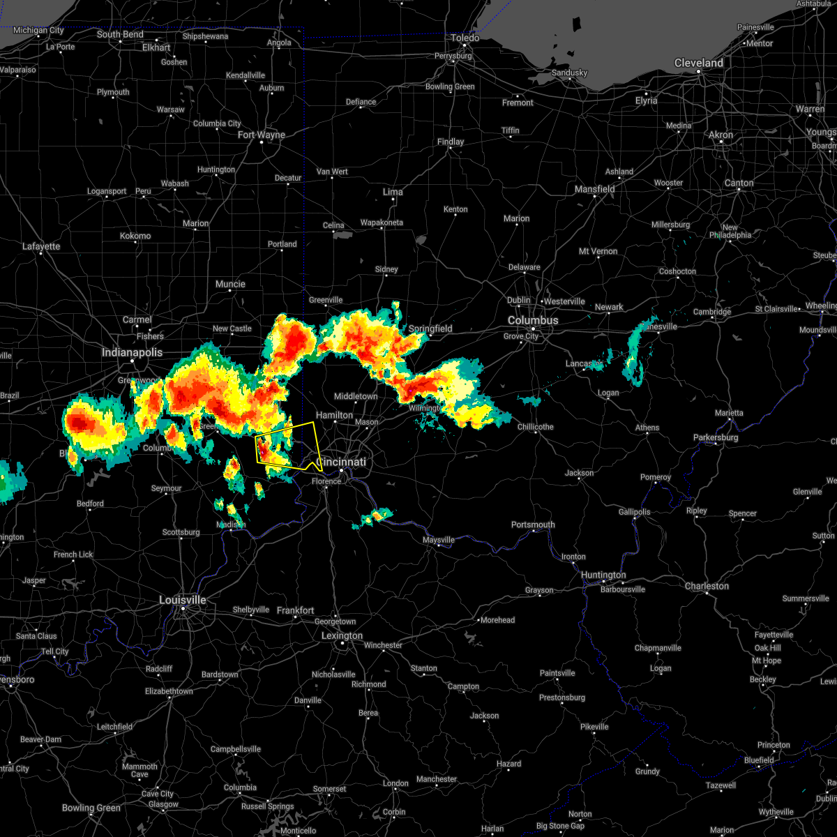 At 809 pm edt, a severe thunderstorm was located near milan, moving east at 30 mph (radar indicated). Hazards include 60 mph wind gusts and quarter size hail. Minor hail damage to vehicles is possible. Expect wind damage to trees and power lines. At 809 pm edt, a severe thunderstorm was located near milan, moving east at 30 mph (radar indicated). Hazards include 60 mph wind gusts and quarter size hail. Minor hail damage to vehicles is possible. Expect wind damage to trees and power lines.
|
| 6/18/2021 11:09 AM EDT | Multiple large branches down in hamilton county OH, 7.6 miles SE of Cincinnati, OH |
| 3/28/2021 1:20 AM EDT | Quarter sized hail reported 7.8 miles SE of Cincinnati, OH |
| 3/28/2021 1:20 AM EDT | Quarter sized hail reported 8.4 miles SE of Cincinnati, OH, near commons circle and colerain avenue. |
| 3/26/2021 12:39 AM EDT |
 The severe thunderstorm warning for northeastern hamilton and eastern butler counties will expire at 1245 am edt, the storms which prompted the warning have weakened below severe limits and are exiting the warned area. therefore, the warning will be allowed to expire. please report previous wind damage or hail to the national weather service by going to our website at weather.gov/iln and submitting your report via social media. The severe thunderstorm warning for northeastern hamilton and eastern butler counties will expire at 1245 am edt, the storms which prompted the warning have weakened below severe limits and are exiting the warned area. therefore, the warning will be allowed to expire. please report previous wind damage or hail to the national weather service by going to our website at weather.gov/iln and submitting your report via social media.
|
| 3/26/2021 12:26 AM EDT |
 At 1225 am edt, severe thunderstorms were located along a line extending from hamilton to forest park to cheviot, moving northeast at 60 mph (radar indicated). Hazards include 60 mph wind gusts. Expect damage to trees and power lines. locations impacted include, cincinnati, hamilton, middletown, fairfield, norwood, forest park, sharonville, monroe, blue ash, trenton, springdale, reading, north college hill, wyoming, cheviot, mount healthy, deer park, south middletown, finneytown and west chester. this includes the following interstates, i-71 in ohio between mile markers 8 and 9. i-74 in ohio between mile markers 13 and 19. I-75 in ohio between mile markers 3 and 28. At 1225 am edt, severe thunderstorms were located along a line extending from hamilton to forest park to cheviot, moving northeast at 60 mph (radar indicated). Hazards include 60 mph wind gusts. Expect damage to trees and power lines. locations impacted include, cincinnati, hamilton, middletown, fairfield, norwood, forest park, sharonville, monroe, blue ash, trenton, springdale, reading, north college hill, wyoming, cheviot, mount healthy, deer park, south middletown, finneytown and west chester. this includes the following interstates, i-71 in ohio between mile markers 8 and 9. i-74 in ohio between mile markers 13 and 19. I-75 in ohio between mile markers 3 and 28.
|
| 3/26/2021 12:17 AM EDT |
 At 1216 am edt, severe thunderstorms were located along a line extending from near ross to taylor creek to near burlington, moving northeast at 55 mph (radar indicated). Hazards include 60 mph wind gusts. Expect damage to trees and power lines. locations impacted include, cincinnati, hamilton, middletown, fairfield, norwood, forest park, sharonville, monroe, blue ash, trenton, springdale, reading, harrison, north college hill, wyoming, cheviot, mount healthy, deer park, south middletown and finneytown. this includes the following interstates, i-71 in ohio between mile markers 8 and 9. i-74 in ohio between mile markers 4 and 19. I-75 in ohio between mile markers 3 and 28. At 1216 am edt, severe thunderstorms were located along a line extending from near ross to taylor creek to near burlington, moving northeast at 55 mph (radar indicated). Hazards include 60 mph wind gusts. Expect damage to trees and power lines. locations impacted include, cincinnati, hamilton, middletown, fairfield, norwood, forest park, sharonville, monroe, blue ash, trenton, springdale, reading, harrison, north college hill, wyoming, cheviot, mount healthy, deer park, south middletown and finneytown. this includes the following interstates, i-71 in ohio between mile markers 8 and 9. i-74 in ohio between mile markers 4 and 19. I-75 in ohio between mile markers 3 and 28.
|
| 3/26/2021 12:11 AM EDT |
 At 1211 am edt, severe thunderstorms were located along a line extending from near harrison to blue jay to near lawrenceburg, moving northeast at 55 mph (radar indicated). Hazards include 60 mph wind gusts. expect damage to trees and power lines At 1211 am edt, severe thunderstorms were located along a line extending from near harrison to blue jay to near lawrenceburg, moving northeast at 55 mph (radar indicated). Hazards include 60 mph wind gusts. expect damage to trees and power lines
|
| 3/25/2021 8:49 PM EDT |
 At 848 pm edt, a severe thunderstorm was located near hebron, moving northeast at 55 mph (radar indicated). Hazards include quarter size hail. Minor damage to vehicles is possible. locations impacted include, cincinnati, north college hill, cheviot, burlington, cleves, taylor creek, bridgetown, delhi township, miami heights, dry ridge, skyline acres, monfort heights, colerain township, mack, delhi hills, blue jay, dunlap, grandview, addyston and north bend. This includes i-74 in ohio between mile markers 7 and 17. At 848 pm edt, a severe thunderstorm was located near hebron, moving northeast at 55 mph (radar indicated). Hazards include quarter size hail. Minor damage to vehicles is possible. locations impacted include, cincinnati, north college hill, cheviot, burlington, cleves, taylor creek, bridgetown, delhi township, miami heights, dry ridge, skyline acres, monfort heights, colerain township, mack, delhi hills, blue jay, dunlap, grandview, addyston and north bend. This includes i-74 in ohio between mile markers 7 and 17.
|
| 3/25/2021 8:36 PM EDT |
 At 836 pm edt, a severe thunderstorm was located near rising sun, moving northeast at 60 mph (radar indicated). Hazards include quarter size hail. Minor damage to vehicles is possible. locations impacted include, cincinnati, harrison, north college hill, cheviot, lawrenceburg, greendale, rising sun, burlington, hidden valley, oakbrook, bright, cleves, shawnee, taylor creek, bridgetown, miami heights, dry ridge, blue jay, mack and delhi township. This includes i-74 in ohio between mile markers 3 and 17. At 836 pm edt, a severe thunderstorm was located near rising sun, moving northeast at 60 mph (radar indicated). Hazards include quarter size hail. Minor damage to vehicles is possible. locations impacted include, cincinnati, harrison, north college hill, cheviot, lawrenceburg, greendale, rising sun, burlington, hidden valley, oakbrook, bright, cleves, shawnee, taylor creek, bridgetown, miami heights, dry ridge, blue jay, mack and delhi township. This includes i-74 in ohio between mile markers 3 and 17.
|
| 3/25/2021 8:36 PM EDT |
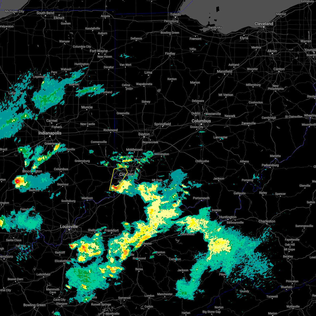 At 836 pm edt, a severe thunderstorm was located near rising sun, moving northeast at 60 mph (radar indicated). Hazards include quarter size hail. Minor damage to vehicles is possible. locations impacted include, cincinnati, harrison, north college hill, cheviot, lawrenceburg, greendale, rising sun, burlington, hidden valley, oakbrook, bright, cleves, shawnee, taylor creek, bridgetown, miami heights, dry ridge, blue jay, mack and delhi township. This includes i-74 in ohio between mile markers 3 and 17. At 836 pm edt, a severe thunderstorm was located near rising sun, moving northeast at 60 mph (radar indicated). Hazards include quarter size hail. Minor damage to vehicles is possible. locations impacted include, cincinnati, harrison, north college hill, cheviot, lawrenceburg, greendale, rising sun, burlington, hidden valley, oakbrook, bright, cleves, shawnee, taylor creek, bridgetown, miami heights, dry ridge, blue jay, mack and delhi township. This includes i-74 in ohio between mile markers 3 and 17.
|
| 3/25/2021 8:28 PM EDT |
 At 827 pm edt, a severe thunderstorm was located over warsaw, moving northeast at 60 mph (radar indicated). Hazards include half dollar size hail. minor damage to vehicles is possible At 827 pm edt, a severe thunderstorm was located over warsaw, moving northeast at 60 mph (radar indicated). Hazards include half dollar size hail. minor damage to vehicles is possible
|
| 3/25/2021 8:28 PM EDT |
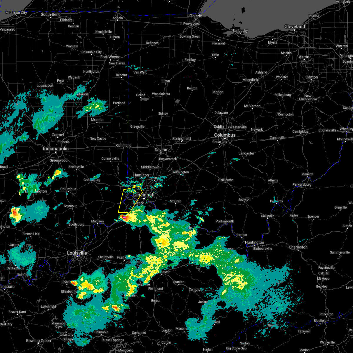 At 827 pm edt, a severe thunderstorm was located over warsaw, moving northeast at 60 mph (radar indicated). Hazards include half dollar size hail. minor damage to vehicles is possible At 827 pm edt, a severe thunderstorm was located over warsaw, moving northeast at 60 mph (radar indicated). Hazards include half dollar size hail. minor damage to vehicles is possible
|
| 8/25/2020 6:19 PM EDT |
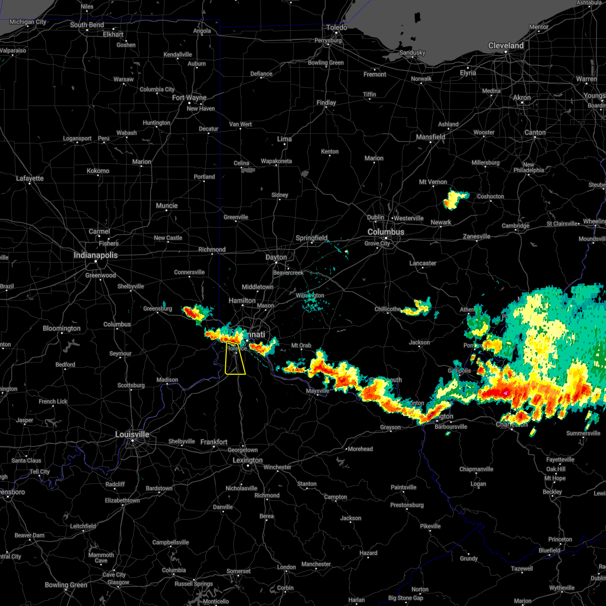 At 619 pm edt, a severe thunderstorm was located near delhi hills, moving south at 25 mph (radar indicated). Hazards include 60 mph wind gusts. expect damage to trees and power lines At 619 pm edt, a severe thunderstorm was located near delhi hills, moving south at 25 mph (radar indicated). Hazards include 60 mph wind gusts. expect damage to trees and power lines
|
| 7/27/2020 6:27 PM EDT | A 4 inch and 6 inch branch down in hamilton county OH, 9.3 miles SW of Cincinnati, OH |
| 7/19/2020 5:56 PM EDT |
 The severe thunderstorm warning for ohio, northern kenton, northern campbell, northern boone and hamilton counties will expire at 600 pm edt, the storm which prompted the warning has weakened below severe limits, and no longer poses an immediate threat to life or property. therefore, the warning will be allowed to expire. however gusty winds and heavy rain are still possible with this thunderstorm. please report previous wind damage or hail to the national weather service by going to our website at weather.gov/iln and submitting your report via social media. The severe thunderstorm warning for ohio, northern kenton, northern campbell, northern boone and hamilton counties will expire at 600 pm edt, the storm which prompted the warning has weakened below severe limits, and no longer poses an immediate threat to life or property. therefore, the warning will be allowed to expire. however gusty winds and heavy rain are still possible with this thunderstorm. please report previous wind damage or hail to the national weather service by going to our website at weather.gov/iln and submitting your report via social media.
|
| 7/19/2020 5:43 PM EDT |
 At 542 pm edt, a severe thunderstorm was located over fort thomas, moving southeast at 30 mph (radar indicated). Hazards include 60 mph wind gusts. Expect damage to trees and power lines. locations impacted include, cincinnati, covington, florence, independence, norwood, erlanger, fort thomas, newport, sharonville, blue ash, loveland, reading, montgomery, north college hill, madeira, edgewood, elsmere, wyoming, cheviot and fort mitchell. this includes the following interstates, i-71 in ohio between mile markers 0 and 16. i-74 in ohio between mile markers 5 and 19. i-75 in kentucky between mile markers 179 and 191. I-75 in ohio between mile markers 0 and 14. At 542 pm edt, a severe thunderstorm was located over fort thomas, moving southeast at 30 mph (radar indicated). Hazards include 60 mph wind gusts. Expect damage to trees and power lines. locations impacted include, cincinnati, covington, florence, independence, norwood, erlanger, fort thomas, newport, sharonville, blue ash, loveland, reading, montgomery, north college hill, madeira, edgewood, elsmere, wyoming, cheviot and fort mitchell. this includes the following interstates, i-71 in ohio between mile markers 0 and 16. i-74 in ohio between mile markers 5 and 19. i-75 in kentucky between mile markers 179 and 191. I-75 in ohio between mile markers 0 and 14.
|
| 7/19/2020 5:21 PM EDT | Numerous trees and powerlines downed throughout the county... especially in colerain and greene townships. time estimated by rada in hamilton county OH, 10.8 miles SE of Cincinnati, OH |
| 7/19/2020 5:16 PM EDT |
 At 516 pm edt, a severe thunderstorm was located over bridgetown, moving southeast at 30 mph (radar indicated). Hazards include 60 mph wind gusts. expect damage to trees and power lines At 516 pm edt, a severe thunderstorm was located over bridgetown, moving southeast at 30 mph (radar indicated). Hazards include 60 mph wind gusts. expect damage to trees and power lines
|
| 7/11/2020 7:25 PM EDT |
 The severe thunderstorm warning for ohio, southeastern dearborn, northern kenton, northern boone and western hamilton counties will expire at 730 pm edt, the storm which prompted the warning has moved out of the area. therefore, the warning will be allowed to expire. please report previous wind damage or hail to the national weather service by going to our website at weather.gov/iln and submitting your report via social media. The severe thunderstorm warning for ohio, southeastern dearborn, northern kenton, northern boone and western hamilton counties will expire at 730 pm edt, the storm which prompted the warning has moved out of the area. therefore, the warning will be allowed to expire. please report previous wind damage or hail to the national weather service by going to our website at weather.gov/iln and submitting your report via social media.
|
| 7/11/2020 7:25 PM EDT |
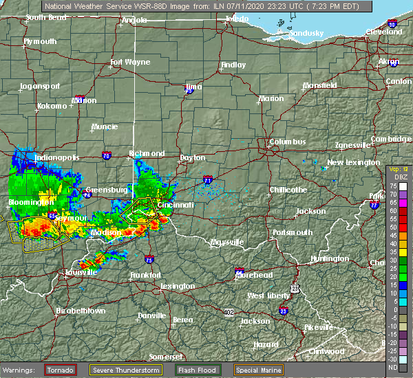 The severe thunderstorm warning for ohio, southeastern dearborn, northern kenton, northern boone and western hamilton counties will expire at 730 pm edt, the storm which prompted the warning has moved out of the area. therefore, the warning will be allowed to expire. please report previous wind damage or hail to the national weather service by going to our website at weather.gov/iln and submitting your report via social media. The severe thunderstorm warning for ohio, southeastern dearborn, northern kenton, northern boone and western hamilton counties will expire at 730 pm edt, the storm which prompted the warning has moved out of the area. therefore, the warning will be allowed to expire. please report previous wind damage or hail to the national weather service by going to our website at weather.gov/iln and submitting your report via social media.
|
| 7/11/2020 7:01 PM EDT | A few pieces of siding were pulled loose from a house and a fence was damaged on considine av in hamilton county OH, 3.8 miles ENE of Cincinnati, OH |
| 7/11/2020 6:55 PM EDT |
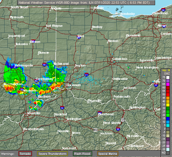 At 655 pm edt, a severe thunderstorm was located over lawrenceburg, moving southeast at 30 mph (radar indicated). Hazards include 60 mph wind gusts. Expect damage to trees and power lines. locations impacted include, burlington, covington, florence, erlanger, newport, harrison, north college hill, edgewood, elsmere, cheviot, fort mitchell, villa hills, mount healthy, fort wright, lawrenceburg, greendale, ludlow, crescent springs, aurora and crestview hills. this includes the following interstates, i-71 in ohio between mile markers 0 and 1. i-74 in ohio between mile markers 3 and 19. i-75 in kentucky between mile markers 178 and 191. I-75 in ohio between mile markers 0 and 5. At 655 pm edt, a severe thunderstorm was located over lawrenceburg, moving southeast at 30 mph (radar indicated). Hazards include 60 mph wind gusts. Expect damage to trees and power lines. locations impacted include, burlington, covington, florence, erlanger, newport, harrison, north college hill, edgewood, elsmere, cheviot, fort mitchell, villa hills, mount healthy, fort wright, lawrenceburg, greendale, ludlow, crescent springs, aurora and crestview hills. this includes the following interstates, i-71 in ohio between mile markers 0 and 1. i-74 in ohio between mile markers 3 and 19. i-75 in kentucky between mile markers 178 and 191. I-75 in ohio between mile markers 0 and 5.
|
| 7/11/2020 6:40 PM EDT |
 At 640 pm edt, a severe thunderstorm was located near greendale, moving southeast at 45 mph (radar indicated). Hazards include 60 mph wind gusts. expect damage to trees and power lines At 640 pm edt, a severe thunderstorm was located near greendale, moving southeast at 45 mph (radar indicated). Hazards include 60 mph wind gusts. expect damage to trees and power lines
|
| 7/6/2020 6:38 PM EDT |
 The severe thunderstorm warning for southeastern hamilton and northwestern clermont counties will expire at 645 pm edt, the storm which prompted the warning has weakened below severe limits. therefore, the warning will be allowed to expire. flash flood warnings remain in effect for portions of hamilton and clermont counties. please report previous wind damage or hail to the national weather service by going to our website at weather.gov/iln and submitting your report via social media. The severe thunderstorm warning for southeastern hamilton and northwestern clermont counties will expire at 645 pm edt, the storm which prompted the warning has weakened below severe limits. therefore, the warning will be allowed to expire. flash flood warnings remain in effect for portions of hamilton and clermont counties. please report previous wind damage or hail to the national weather service by going to our website at weather.gov/iln and submitting your report via social media.
|
| 7/6/2020 6:22 PM EDT |
 At 621 pm edt, a severe thunderstorm was located near milford, moving northeast at 10 mph (radar indicated). Hazards include 60 mph wind gusts. Expect damage to trees and power lines. Locations impacted include, cincinnati, madeira, milford, forestville, amelia, mariemont, terrace park, batavia, silver grove, salem heights, camp dennison, riverbend and coney island, withamsville, plainville, coldstream, the village of indian hill, newtown, fairfax, sherwood and owensville. At 621 pm edt, a severe thunderstorm was located near milford, moving northeast at 10 mph (radar indicated). Hazards include 60 mph wind gusts. Expect damage to trees and power lines. Locations impacted include, cincinnati, madeira, milford, forestville, amelia, mariemont, terrace park, batavia, silver grove, salem heights, camp dennison, riverbend and coney island, withamsville, plainville, coldstream, the village of indian hill, newtown, fairfax, sherwood and owensville.
|
| 7/6/2020 6:09 PM EDT |
 At 608 pm edt, a severe thunderstorm was located over milford, moving east at 10 mph (radar indicated). Hazards include 60 mph wind gusts. expect damage to trees and power lines At 608 pm edt, a severe thunderstorm was located over milford, moving east at 10 mph (radar indicated). Hazards include 60 mph wind gusts. expect damage to trees and power lines
|
| 6/21/2020 3:06 PM EDT | An 11 inch tree branch was downe in hamilton county OH, 9.3 miles SW of Cincinnati, OH |
| 6/10/2020 4:40 PM EDT |
 The severe thunderstorm warning for northeastern hamilton, southeastern butler and southwestern warren counties will expire at 445 pm edt, the storm which prompted the warning has weakened below severe limits, and has exited the warned area. therefore, the warning will be allowed to expire. a severe thunderstorm watch remains in effect until 1000 pm edt for southwestern ohio. please report previous wind damage or hail to the national weather service by going to our website at weather.gov/iln and submitting your report via social media. The severe thunderstorm warning for northeastern hamilton, southeastern butler and southwestern warren counties will expire at 445 pm edt, the storm which prompted the warning has weakened below severe limits, and has exited the warned area. therefore, the warning will be allowed to expire. a severe thunderstorm watch remains in effect until 1000 pm edt for southwestern ohio. please report previous wind damage or hail to the national weather service by going to our website at weather.gov/iln and submitting your report via social media.
|
| 6/10/2020 4:33 PM EDT |
 At 433 pm edt, a severe thunderstorm was located over reading, moving northeast at 35 mph (radar indicated). Hazards include 60 mph wind gusts. Expect damage to trees and power lines. locations impacted include, cincinnati, hamilton, fairfield, mason, forest park, sharonville, blue ash, loveland, springdale, reading, montgomery, north college hill, madeira, wyoming, mount healthy, deer park, finneytown, west chester, ross and highpoint. this includes the following interstates, i-71 in ohio between mile markers 13 and 24. I-75 in ohio between mile markers 11 and 23. At 433 pm edt, a severe thunderstorm was located over reading, moving northeast at 35 mph (radar indicated). Hazards include 60 mph wind gusts. Expect damage to trees and power lines. locations impacted include, cincinnati, hamilton, fairfield, mason, forest park, sharonville, blue ash, loveland, springdale, reading, montgomery, north college hill, madeira, wyoming, mount healthy, deer park, finneytown, west chester, ross and highpoint. this includes the following interstates, i-71 in ohio between mile markers 13 and 24. I-75 in ohio between mile markers 11 and 23.
|
| 6/10/2020 4:23 PM EDT |
 At 422 pm edt, a severe thunderstorm was located over norwood, moving northeast at 35 mph (radar indicated). Hazards include 60 mph wind gusts. Expect damage to trees and power lines. locations impacted include, cincinnati, hamilton, fairfield, mason, norwood, forest park, sharonville, blue ash, loveland, springdale, reading, montgomery, north college hill, madeira, wyoming, cheviot, mount healthy, deer park, dayton and ludlow. this includes the following interstates, i-71 in ohio between mile markers 1 and 24. i-74 in ohio between mile markers 6 and 19. I-75 in ohio between mile markers 1 and 23. At 422 pm edt, a severe thunderstorm was located over norwood, moving northeast at 35 mph (radar indicated). Hazards include 60 mph wind gusts. Expect damage to trees and power lines. locations impacted include, cincinnati, hamilton, fairfield, mason, norwood, forest park, sharonville, blue ash, loveland, springdale, reading, montgomery, north college hill, madeira, wyoming, cheviot, mount healthy, deer park, dayton and ludlow. this includes the following interstates, i-71 in ohio between mile markers 1 and 24. i-74 in ohio between mile markers 6 and 19. I-75 in ohio between mile markers 1 and 23.
|
| 6/10/2020 4:12 PM EDT | 3-4 inch branches down in yar in hamilton county OH, 10.8 miles SE of Cincinnati, OH |
| 6/10/2020 4:07 PM EDT |
 At 407 pm edt, a severe thunderstorm was located over fort wright, moving northeast at 35 mph (radar indicated). Hazards include 60 mph wind gusts. expect damage to trees and power lines At 407 pm edt, a severe thunderstorm was located over fort wright, moving northeast at 35 mph (radar indicated). Hazards include 60 mph wind gusts. expect damage to trees and power lines
|
| 6/9/2020 3:55 PM EDT |
 The severe thunderstorm warning for northwestern hamilton and butler counties will expire at 400 pm edt, the storm which prompted the warning has weakened below severe limits, and is exiting the warned area. therefore, the warning will be allowed to expire. please report previous wind damage or hail to the national weather service by going to our website at weather.gov/iln and submitting your report via social media. The severe thunderstorm warning for northwestern hamilton and butler counties will expire at 400 pm edt, the storm which prompted the warning has weakened below severe limits, and is exiting the warned area. therefore, the warning will be allowed to expire. please report previous wind damage or hail to the national weather service by going to our website at weather.gov/iln and submitting your report via social media.
|
| 6/9/2020 3:38 PM EDT |
 At 337 pm edt, a severe thunderstorm was located over dry ridge, moving north at 35 mph (trained weather spotters. at 325 pm, a 60 mph wind gust reported at delhi township). Hazards include 60 mph wind gusts. Expect damage to trees and power lines. locations impacted include, cincinnati, hamilton, fairfield, norwood, forest park, sharonville, monroe, trenton, springdale, north college hill, wyoming, cheviot, mount healthy, finneytown, ross, cleves, seven mile, taylor creek, bridgetown and miami heights. this includes the following interstates, i-71 in ohio near mile marker 5. i-74 in ohio between mile markers 7 and 19. I-75 in ohio between mile markers 4 and 10. At 337 pm edt, a severe thunderstorm was located over dry ridge, moving north at 35 mph (trained weather spotters. at 325 pm, a 60 mph wind gust reported at delhi township). Hazards include 60 mph wind gusts. Expect damage to trees and power lines. locations impacted include, cincinnati, hamilton, fairfield, norwood, forest park, sharonville, monroe, trenton, springdale, north college hill, wyoming, cheviot, mount healthy, finneytown, ross, cleves, seven mile, taylor creek, bridgetown and miami heights. this includes the following interstates, i-71 in ohio near mile marker 5. i-74 in ohio between mile markers 7 and 19. I-75 in ohio between mile markers 4 and 10.
|
| 6/9/2020 3:31 PM EDT |
 At 328 pm edt, a severe thunderstorm was located over monfort heights, moving north at 35 mph (trained weather spotters. at 325 pm, a 60 mph wind gust reported at delhi township). Hazards include 60 mph wind gusts. Expect damage to trees and power lines. locations impacted include, cincinnati, hamilton, fairfield, covington, florence, norwood, forest park, erlanger, newport, sharonville, monroe, trenton, springdale, north college hill, edgewood, elsmere, wyoming, cheviot, fort mitchell and villa hills. this includes the following interstates, i-71 in ohio between mile markers 0 and 5. i-74 in ohio between mile markers 7 and 19. i-75 in kentucky between mile markers 182 and 191. I-75 in ohio between mile markers 0 and 10. At 328 pm edt, a severe thunderstorm was located over monfort heights, moving north at 35 mph (trained weather spotters. at 325 pm, a 60 mph wind gust reported at delhi township). Hazards include 60 mph wind gusts. Expect damage to trees and power lines. locations impacted include, cincinnati, hamilton, fairfield, covington, florence, norwood, forest park, erlanger, newport, sharonville, monroe, trenton, springdale, north college hill, edgewood, elsmere, wyoming, cheviot, fort mitchell and villa hills. this includes the following interstates, i-71 in ohio between mile markers 0 and 5. i-74 in ohio between mile markers 7 and 19. i-75 in kentucky between mile markers 182 and 191. I-75 in ohio between mile markers 0 and 10.
|
| 6/9/2020 3:25 PM EDT | Storm damage reported in hamilton county OH, 7.5 miles ENE of Cincinnati, OH |
| 6/9/2020 3:21 PM EDT |
 At 321 pm edt, a severe thunderstorm was located over delhi township, moving north at 35 mph (radar indicated). Hazards include 60 mph wind gusts. expect damage to trees and power lines At 321 pm edt, a severe thunderstorm was located over delhi township, moving north at 35 mph (radar indicated). Hazards include 60 mph wind gusts. expect damage to trees and power lines
|
| 6/4/2020 1:40 PM EDT |
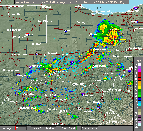 The severe thunderstorm warning for northwestern hamilton county will expire at 145 pm edt, the storm which prompted the warning has weakened below severe limits, and no longer poses an immediate threat to life or property. therefore, the warning will be allowed to expire. however gusty winds and heavy rain are still possible with this thunderstorm. please report previous wind damage or hail to the national weather service by going to our website at weather.gov/iln and submitting your report via social media. The severe thunderstorm warning for northwestern hamilton county will expire at 145 pm edt, the storm which prompted the warning has weakened below severe limits, and no longer poses an immediate threat to life or property. therefore, the warning will be allowed to expire. however gusty winds and heavy rain are still possible with this thunderstorm. please report previous wind damage or hail to the national weather service by going to our website at weather.gov/iln and submitting your report via social media.
|
| 6/4/2020 1:23 PM EDT |
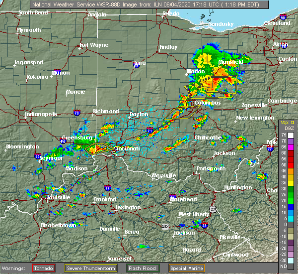 At 123 pm edt, a severe thunderstorm was located over blue jay, moving northeast at 25 mph (radar indicated). Hazards include 60 mph wind gusts and quarter size hail. Minor hail damage to vehicles is possible. expect wind damage to trees and power lines. locations impacted include, cincinnati, harrison, north college hill, mount healthy, finneytown, cleves, shawnee, taylor creek, miami heights, dry ridge, skyline acres, blue jay, monfort heights, colerain township, mack, bridgetown, dunlap, new haven, grandview and addyston. This includes i-74 in ohio between mile markers 1 and 15. At 123 pm edt, a severe thunderstorm was located over blue jay, moving northeast at 25 mph (radar indicated). Hazards include 60 mph wind gusts and quarter size hail. Minor hail damage to vehicles is possible. expect wind damage to trees and power lines. locations impacted include, cincinnati, harrison, north college hill, mount healthy, finneytown, cleves, shawnee, taylor creek, miami heights, dry ridge, skyline acres, blue jay, monfort heights, colerain township, mack, bridgetown, dunlap, new haven, grandview and addyston. This includes i-74 in ohio between mile markers 1 and 15.
|
| 6/4/2020 12:59 PM EDT |
 At 1259 pm edt, a severe thunderstorm was located over hidden valley, moving northeast at 25 mph (radar indicated). Hazards include 60 mph wind gusts and half dollar size hail. Minor hail damage to vehicles is possible. Expect wind damage to trees and power lines. At 1259 pm edt, a severe thunderstorm was located over hidden valley, moving northeast at 25 mph (radar indicated). Hazards include 60 mph wind gusts and half dollar size hail. Minor hail damage to vehicles is possible. Expect wind damage to trees and power lines.
|
| 6/4/2020 12:59 PM EDT |
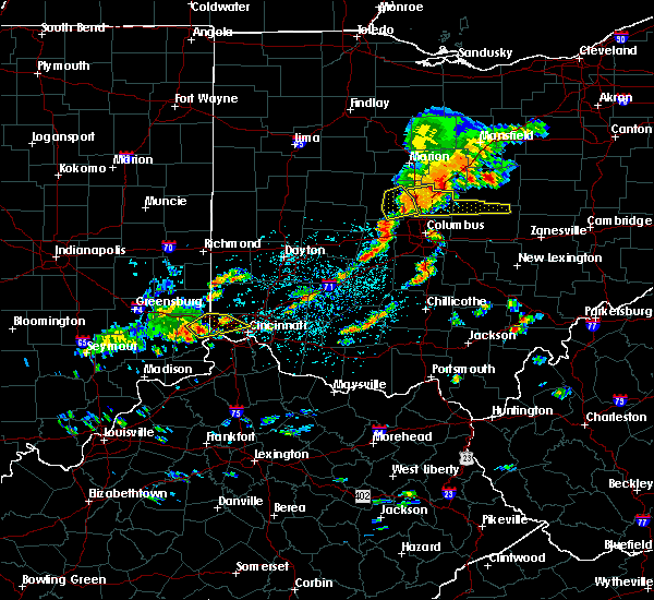 At 1259 pm edt, a severe thunderstorm was located over hidden valley, moving northeast at 25 mph (radar indicated). Hazards include 60 mph wind gusts and half dollar size hail. Minor hail damage to vehicles is possible. Expect wind damage to trees and power lines. At 1259 pm edt, a severe thunderstorm was located over hidden valley, moving northeast at 25 mph (radar indicated). Hazards include 60 mph wind gusts and half dollar size hail. Minor hail damage to vehicles is possible. Expect wind damage to trees and power lines.
|
| 5/24/2020 4:42 PM EDT |
 At 442 pm edt, a severe thunderstorm was located over taylor mill, and is nearly stationary (radar indicated). Hazards include 60 mph wind gusts and quarter size hail. Minor hail damage to vehicles is possible. Expect wind damage to trees and power lines. At 442 pm edt, a severe thunderstorm was located over taylor mill, and is nearly stationary (radar indicated). Hazards include 60 mph wind gusts and quarter size hail. Minor hail damage to vehicles is possible. Expect wind damage to trees and power lines.
|
| 5/23/2020 6:05 PM EDT | Very large tree down time estimated in clermont county OH, 13.6 miles WNW of Cincinnati, OH |
| 5/23/2020 6:04 PM EDT | Quarter sized hail reported 10.6 miles WNW of Cincinnati, OH, video posted to broadcast media social media account |
| 5/23/2020 6:01 PM EDT | Personal weather station in hamilton county OH, 11.3 miles WNW of Cincinnati, OH |
| 5/23/2020 5:59 PM EDT |
 At 548 pm edt, a severe thunderstorm was located over forestville, moving east at 10 mph (radar indicated). Hazards include half dollar size hail. Minor damage to vehicles is possible. Locations impacted include, cincinnati, fort thomas, forestville, amelia, new richmond, batavia, silver grove, melbourne, salem heights, riverbend and coney island, withamsville, coldstream, cold spring, newtown, sherwood, crestview, california, new palestine, lunken airport and turpin hills. At 548 pm edt, a severe thunderstorm was located over forestville, moving east at 10 mph (radar indicated). Hazards include half dollar size hail. Minor damage to vehicles is possible. Locations impacted include, cincinnati, fort thomas, forestville, amelia, new richmond, batavia, silver grove, melbourne, salem heights, riverbend and coney island, withamsville, coldstream, cold spring, newtown, sherwood, crestview, california, new palestine, lunken airport and turpin hills.
|
| 5/23/2020 5:59 PM EDT |
 At 559 pm edt, a severe thunderstorm was located over withamsville, moving east at 20 mph (radar indicated). Hazards include ping pong ball size hail and 60 mph wind gusts. People and animals outdoors will be injured. expect hail damage to roofs, siding, windows, and vehicles. expect wind damage to trees and power lines. Locations impacted include, forestville, amelia, new richmond, batavia, silver grove, melbourne, coldstream, withamsville, salem heights, sherwood, california, clermont county airport, mount carmel, cherry grove, new palestine, fruit hill, blairsville, willowville, dry run and summerside. At 559 pm edt, a severe thunderstorm was located over withamsville, moving east at 20 mph (radar indicated). Hazards include ping pong ball size hail and 60 mph wind gusts. People and animals outdoors will be injured. expect hail damage to roofs, siding, windows, and vehicles. expect wind damage to trees and power lines. Locations impacted include, forestville, amelia, new richmond, batavia, silver grove, melbourne, coldstream, withamsville, salem heights, sherwood, california, clermont county airport, mount carmel, cherry grove, new palestine, fruit hill, blairsville, willowville, dry run and summerside.
|
| 5/23/2020 5:58 PM EDT | Half Dollar sized hail reported 10.6 miles WNW of Cincinnati, OH, mainly quarter sized but some up to half-dollar sized |
| 5/23/2020 5:56 PM EDT | Multiple large limbs downed along absury hills drive in anderson township. time estimated by rada in hamilton county OH, 10.3 miles WNW of Cincinnati, OH |
| 5/23/2020 5:48 PM EDT |
 At 548 pm edt, a severe thunderstorm was located over forestville, moving east at 10 mph (radar indicated). Hazards include half dollar size hail. Minor damage to vehicles is possible. Locations impacted include, cincinnati, fort thomas, forestville, amelia, new richmond, batavia, silver grove, melbourne, salem heights, riverbend and coney island, withamsville, coldstream, cold spring, newtown, sherwood, crestview, california, new palestine, lunken airport and turpin hills. At 548 pm edt, a severe thunderstorm was located over forestville, moving east at 10 mph (radar indicated). Hazards include half dollar size hail. Minor damage to vehicles is possible. Locations impacted include, cincinnati, fort thomas, forestville, amelia, new richmond, batavia, silver grove, melbourne, salem heights, riverbend and coney island, withamsville, coldstream, cold spring, newtown, sherwood, crestview, california, new palestine, lunken airport and turpin hills.
|
| 5/23/2020 5:42 PM EDT |
 At 542 pm edt, a severe thunderstorm was located over salem heights, moving east at 10 mph (radar indicated). Hazards include quarter size hail. minor damage to vehicles is possible At 542 pm edt, a severe thunderstorm was located over salem heights, moving east at 10 mph (radar indicated). Hazards include quarter size hail. minor damage to vehicles is possible
|
| 5/10/2020 4:51 PM EDT |
 At 450 pm edt, a severe thunderstorm was located over north college hill, moving east at 40 mph (trained weather spotters). Hazards include 60 mph wind gusts and quarter size hail. Minor hail damage to vehicles is possible. expect wind damage to trees and power lines. locations impacted include, cincinnati, mason, lebanon, norwood, forest park, sharonville, blue ash, loveland, springdale, reading, montgomery, north college hill, madeira, wyoming, cheviot, milford, mount healthy, deer park, dayton and finneytown. this includes the following interstates, i-71 in ohio between mile markers 3 and 27. i-74 in ohio between mile markers 15 and 19. I-75 in ohio between mile markers 2 and 23. At 450 pm edt, a severe thunderstorm was located over north college hill, moving east at 40 mph (trained weather spotters). Hazards include 60 mph wind gusts and quarter size hail. Minor hail damage to vehicles is possible. expect wind damage to trees and power lines. locations impacted include, cincinnati, mason, lebanon, norwood, forest park, sharonville, blue ash, loveland, springdale, reading, montgomery, north college hill, madeira, wyoming, cheviot, milford, mount healthy, deer park, dayton and finneytown. this includes the following interstates, i-71 in ohio between mile markers 3 and 27. i-74 in ohio between mile markers 15 and 19. I-75 in ohio between mile markers 2 and 23.
|
| 5/10/2020 4:46 PM EDT | Quarter sized hail reported 7.6 miles SE of Cincinnati, OH |
| 5/10/2020 4:42 PM EDT |
 At 441 pm edt, a severe thunderstorm was located over mack, moving east at 40 mph (radar indicated). Hazards include 60 mph wind gusts and quarter size hail. Minor hail damage to vehicles is possible. Expect wind damage to trees and power lines. At 441 pm edt, a severe thunderstorm was located over mack, moving east at 40 mph (radar indicated). Hazards include 60 mph wind gusts and quarter size hail. Minor hail damage to vehicles is possible. Expect wind damage to trees and power lines.
|
| 5/10/2020 3:42 PM EDT |
 At 342 pm edt, severe thunderstorms were located along a line extending from near finneytown to near walton, moving northeast at 65 mph (radar indicated). Hazards include 60 mph wind gusts. Expect damage to trees and power lines. locations impacted include, cincinnati, covington, florence, independence, erlanger, fort thomas, newport, edgewood, alexandria, elsmere, fort mitchell, villa hills, highland heights, taylor mill, bellevue, fort wright, southgate, crescent springs, walton and crestview hills. this includes the following interstates, i-71 in kentucky between mile markers 74 and 77. I-75 in kentucky between mile markers 159 and 179, and between mile markers 183 and 191. At 342 pm edt, severe thunderstorms were located along a line extending from near finneytown to near walton, moving northeast at 65 mph (radar indicated). Hazards include 60 mph wind gusts. Expect damage to trees and power lines. locations impacted include, cincinnati, covington, florence, independence, erlanger, fort thomas, newport, edgewood, alexandria, elsmere, fort mitchell, villa hills, highland heights, taylor mill, bellevue, fort wright, southgate, crescent springs, walton and crestview hills. this includes the following interstates, i-71 in kentucky between mile markers 74 and 77. I-75 in kentucky between mile markers 159 and 179, and between mile markers 183 and 191.
|
| 5/10/2020 3:40 PM EDT | Large tree down across road. photo sent to office. time estimated from rada in hamilton county OH, 13.5 miles SW of Cincinnati, OH |
| 5/10/2020 3:32 PM EDT |
 At 332 pm edt, severe thunderstorms were located along a line extending from near wetherington to newport, moving northeast at 60 mph (radar indicated). Hazards include 60 mph wind gusts and penny size hail. expect damage to trees and power lines At 332 pm edt, severe thunderstorms were located along a line extending from near wetherington to newport, moving northeast at 60 mph (radar indicated). Hazards include 60 mph wind gusts and penny size hail. expect damage to trees and power lines
|
| 5/10/2020 3:27 PM EDT |
 At 327 pm edt, severe thunderstorms were located along a line extending from burlington to 7 miles southeast of kentucky speedway, moving northeast at 65 mph (radar indicated). Hazards include 60 mph wind gusts. expect damage to trees and power lines At 327 pm edt, severe thunderstorms were located along a line extending from burlington to 7 miles southeast of kentucky speedway, moving northeast at 65 mph (radar indicated). Hazards include 60 mph wind gusts. expect damage to trees and power lines
|
| 4/8/2020 10:54 PM EDT | Many trees down in hamilton county OH, 6.4 miles WSW of Cincinnati, OH |
| 4/8/2020 10:42 PM EDT | Trees downed... storefront window broken along hamilton ave in mount healthy. time estimated by rada in hamilton county OH, 6.7 miles SSE of Cincinnati, OH |
| 4/8/2020 10:40 PM EDT |
 The severe thunderstorm warning for ohio, ripley, dearborn, switzerland, northern boone and hamilton counties will expire at 1045 pm edt, the storms which prompted the warning have moved out of the warned area.therefore, the warning will be allowed to expire. however gusty winds and heavy rain are still possible with these thunderstorms. a tornado watch remains in effect until 200 am edt for southeastern indiana, northern kentucky, and southwestern ohio. please report previous wind damage or hail to the national weather service by going to our website at weather.gov/iln and submitting your report via social media. The severe thunderstorm warning for ohio, ripley, dearborn, switzerland, northern boone and hamilton counties will expire at 1045 pm edt, the storms which prompted the warning have moved out of the warned area.therefore, the warning will be allowed to expire. however gusty winds and heavy rain are still possible with these thunderstorms. a tornado watch remains in effect until 200 am edt for southeastern indiana, northern kentucky, and southwestern ohio. please report previous wind damage or hail to the national weather service by going to our website at weather.gov/iln and submitting your report via social media.
|
| 4/8/2020 10:38 PM EDT | Siding removed from a house. time estimated by rada in hamilton county OH, 5.4 miles W of Cincinnati, OH |
| 4/8/2020 10:36 PM EDT |
 At 1036 pm edt, a severe thunderstorm capable of producing a tornado was located over concorde hills, moving east at 50 mph (radar indicated rotation). Hazards include tornado and quarter size hail. Flying debris will be dangerous to those caught without shelter. mobile homes will be damaged or destroyed. damage to roofs, windows, and vehicles will occur. tree damage is likely. locations impacted include, cincinnati, norwood, sharonville, blue ash, loveland, reading, montgomery, madeira, milford, deer park, mariemont, terrace park, batavia, camp dennison, highpoint, remington, plainville, concorde hills, sixteen mile stand and rossmoyne. this includes the following interstates, i-71 in ohio between mile markers 7 and 19. I-75 in ohio between mile markers 8 and 15. At 1036 pm edt, a severe thunderstorm capable of producing a tornado was located over concorde hills, moving east at 50 mph (radar indicated rotation). Hazards include tornado and quarter size hail. Flying debris will be dangerous to those caught without shelter. mobile homes will be damaged or destroyed. damage to roofs, windows, and vehicles will occur. tree damage is likely. locations impacted include, cincinnati, norwood, sharonville, blue ash, loveland, reading, montgomery, madeira, milford, deer park, mariemont, terrace park, batavia, camp dennison, highpoint, remington, plainville, concorde hills, sixteen mile stand and rossmoyne. this includes the following interstates, i-71 in ohio between mile markers 7 and 19. I-75 in ohio between mile markers 8 and 15.
|
| 4/8/2020 10:35 PM EDT | Large tree downed. time estimated by rada in hamilton county OH, 8.5 miles SW of Cincinnati, OH |
| 4/8/2020 10:33 PM EDT | Large tree downed. time estimated by rada in hamilton county OH, 5.6 miles SW of Cincinnati, OH |
| 4/8/2020 10:33 PM EDT | Large tree uprooted in silverton. time estimated by rada in hamilton county OH, 6.4 miles WSW of Cincinnati, OH |
| 4/8/2020 10:32 PM EDT | Tree downed along vine street. time estimated by rada in hamilton county OH, 1.4 miles S of Cincinnati, OH |
| 4/8/2020 10:26 PM EDT | Large tree downed along shamrock ave in north college hill. time estimated by rada in hamilton county OH, 5.9 miles SSE of Cincinnati, OH |
| 4/8/2020 10:26 PM EDT | Numerous trees down and pea-sized hail in hamilton county OH, 10.8 miles SE of Cincinnati, OH |
| 4/8/2020 10:26 PM EDT |
 At 1025 pm edt, a severe thunderstorm capable of producing a tornado was located over pleasant hills, moving east at 45 mph (radar indicated rotation). Hazards include tornado and quarter size hail. Flying debris will be dangerous to those caught without shelter. mobile homes will be damaged or destroyed. damage to roofs, windows, and vehicles will occur. Tree damage is likely. At 1025 pm edt, a severe thunderstorm capable of producing a tornado was located over pleasant hills, moving east at 45 mph (radar indicated rotation). Hazards include tornado and quarter size hail. Flying debris will be dangerous to those caught without shelter. mobile homes will be damaged or destroyed. damage to roofs, windows, and vehicles will occur. Tree damage is likely.
|
| 4/8/2020 10:25 PM EDT | Quarter sized hail reported 11.1 miles SW of Cincinnati, OH |
| 4/8/2020 10:25 PM EDT | Trees downed... storefront window broken along hamilton ave in mount healthy. time estimated by rada in hamilton county OH, 6.7 miles SSE of Cincinnati, OH |
| 4/8/2020 10:22 PM EDT | Quarter sized hail reported 10 miles SW of Cincinnati, OH |
| 4/8/2020 10:21 PM EDT | Tree downed near nortgate mall. time estimated by rada in hamilton county OH, 8.4 miles SE of Cincinnati, OH |
| 4/8/2020 10:19 PM EDT | Half Dollar sized hail reported 7.9 miles SSW of Cincinnati, OH |
| 4/8/2020 10:18 PM EDT | Ping Pong Ball sized hail reported 10 miles SW of Cincinnati, OH, time estimated by radar. |
| 4/8/2020 10:15 PM EDT | Quarter sized hail reported 10.4 miles S of Cincinnati, OH, time estimated by radar. |
| 4/8/2020 10:15 PM EDT |
 At 1014 pm edt, a severe thunderstorm was located over reading, moving east at 45 mph (radar indicated). Hazards include 70 mph wind gusts and quarter size hail. Minor hail damage to vehicles is possible. expect considerable tree damage. Wind damage is also likely to mobile homes, roofs, and outbuildings. At 1014 pm edt, a severe thunderstorm was located over reading, moving east at 45 mph (radar indicated). Hazards include 70 mph wind gusts and quarter size hail. Minor hail damage to vehicles is possible. expect considerable tree damage. Wind damage is also likely to mobile homes, roofs, and outbuildings.
|
| 4/8/2020 10:07 PM EDT |
 At 1007 pm edt, severe thunderstorms were located along a line extending from 6 miles west of ross to 10 miles southwest of versailles, moving southeast at 60 mph (radar indicated). Hazards include 70 mph wind gusts and quarter size hail. Minor hail damage to vehicles is possible. expect considerable tree damage. wind damage is also likely to mobile homes, roofs, and outbuildings. locations impacted include, cincinnati, fairfield, forest park, sharonville, springdale, reading, harrison, north college hill, wyoming, cheviot, villa hills, mount healthy, lawrenceburg, greendale, aurora, rising sun, bright, hidden valley, burlington and oakbrook. this includes the following interstates, i-74 in indiana between mile markers 155 and 171. i-74 in ohio between mile markers 0 and 19. i-75 in ohio between mile markers 4 and 6, and between mile markers 13 and 17. A tornado watch remains in effect until 200 am edt for southeastern indiana, northern kentucky, and southwestern ohio. At 1007 pm edt, severe thunderstorms were located along a line extending from 6 miles west of ross to 10 miles southwest of versailles, moving southeast at 60 mph (radar indicated). Hazards include 70 mph wind gusts and quarter size hail. Minor hail damage to vehicles is possible. expect considerable tree damage. wind damage is also likely to mobile homes, roofs, and outbuildings. locations impacted include, cincinnati, fairfield, forest park, sharonville, springdale, reading, harrison, north college hill, wyoming, cheviot, villa hills, mount healthy, lawrenceburg, greendale, aurora, rising sun, bright, hidden valley, burlington and oakbrook. this includes the following interstates, i-74 in indiana between mile markers 155 and 171. i-74 in ohio between mile markers 0 and 19. i-75 in ohio between mile markers 4 and 6, and between mile markers 13 and 17. A tornado watch remains in effect until 200 am edt for southeastern indiana, northern kentucky, and southwestern ohio.
|
| 4/8/2020 10:07 PM EDT |
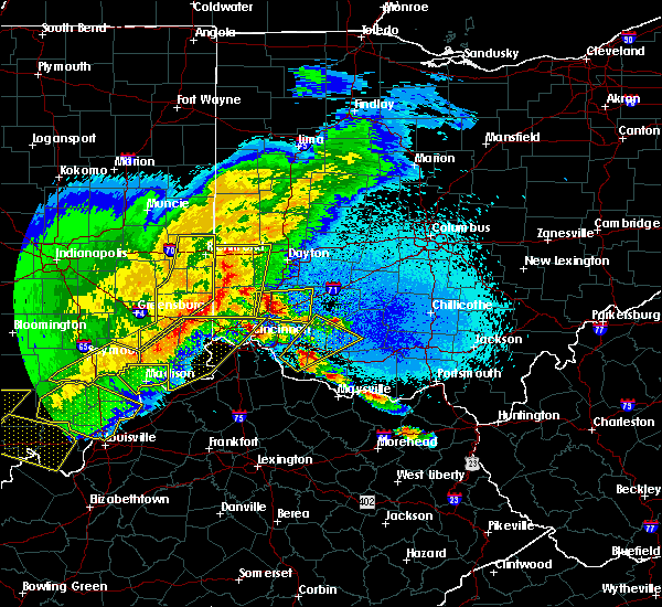 At 1007 pm edt, severe thunderstorms were located along a line extending from 6 miles west of ross to 10 miles southwest of versailles, moving southeast at 60 mph (radar indicated). Hazards include 70 mph wind gusts and quarter size hail. Minor hail damage to vehicles is possible. expect considerable tree damage. wind damage is also likely to mobile homes, roofs, and outbuildings. locations impacted include, cincinnati, fairfield, forest park, sharonville, springdale, reading, harrison, north college hill, wyoming, cheviot, villa hills, mount healthy, lawrenceburg, greendale, aurora, rising sun, bright, hidden valley, burlington and oakbrook. this includes the following interstates, i-74 in indiana between mile markers 155 and 171. i-74 in ohio between mile markers 0 and 19. i-75 in ohio between mile markers 4 and 6, and between mile markers 13 and 17. A tornado watch remains in effect until 200 am edt for southeastern indiana, northern kentucky, and southwestern ohio. At 1007 pm edt, severe thunderstorms were located along a line extending from 6 miles west of ross to 10 miles southwest of versailles, moving southeast at 60 mph (radar indicated). Hazards include 70 mph wind gusts and quarter size hail. Minor hail damage to vehicles is possible. expect considerable tree damage. wind damage is also likely to mobile homes, roofs, and outbuildings. locations impacted include, cincinnati, fairfield, forest park, sharonville, springdale, reading, harrison, north college hill, wyoming, cheviot, villa hills, mount healthy, lawrenceburg, greendale, aurora, rising sun, bright, hidden valley, burlington and oakbrook. this includes the following interstates, i-74 in indiana between mile markers 155 and 171. i-74 in ohio between mile markers 0 and 19. i-75 in ohio between mile markers 4 and 6, and between mile markers 13 and 17. A tornado watch remains in effect until 200 am edt for southeastern indiana, northern kentucky, and southwestern ohio.
|
| 4/8/2020 9:46 PM EDT |
 At 945 pm edt, severe thunderstorms were located along a line extending from 7 miles southeast of connersville to 9 miles northwest of north vernon, moving southeast at 60 mph (radar indicated). Hazards include 70 mph wind gusts and quarter size hail. Minor hail damage to vehicles is possible. expect considerable tree damage. Wind damage is also likely to mobile homes, roofs, and outbuildings. At 945 pm edt, severe thunderstorms were located along a line extending from 7 miles southeast of connersville to 9 miles northwest of north vernon, moving southeast at 60 mph (radar indicated). Hazards include 70 mph wind gusts and quarter size hail. Minor hail damage to vehicles is possible. expect considerable tree damage. Wind damage is also likely to mobile homes, roofs, and outbuildings.
|
| 4/8/2020 9:46 PM EDT |
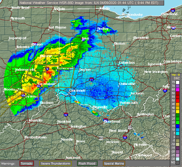 At 945 pm edt, severe thunderstorms were located along a line extending from 7 miles southeast of connersville to 9 miles northwest of north vernon, moving southeast at 60 mph (radar indicated). Hazards include 70 mph wind gusts and quarter size hail. Minor hail damage to vehicles is possible. expect considerable tree damage. Wind damage is also likely to mobile homes, roofs, and outbuildings. At 945 pm edt, severe thunderstorms were located along a line extending from 7 miles southeast of connersville to 9 miles northwest of north vernon, moving southeast at 60 mph (radar indicated). Hazards include 70 mph wind gusts and quarter size hail. Minor hail damage to vehicles is possible. expect considerable tree damage. Wind damage is also likely to mobile homes, roofs, and outbuildings.
|
| 3/29/2020 12:27 AM EDT |
 The severe thunderstorm warning for kenton and campbell counties will expire at 1230 am edt, the storm which prompted the warning has weakened below severe limits, and no longer poses an immediate threat to life or property. therefore, the warning will be allowed to expire. please report previous wind damage or hail to the national weather service by going to our website at weather.gov/iln and submitting your report via social media. The severe thunderstorm warning for kenton and campbell counties will expire at 1230 am edt, the storm which prompted the warning has weakened below severe limits, and no longer poses an immediate threat to life or property. therefore, the warning will be allowed to expire. please report previous wind damage or hail to the national weather service by going to our website at weather.gov/iln and submitting your report via social media.
|
| 3/29/2020 12:20 AM EDT |
 At 1220 am edt, a severe thunderstorm was located over taylor mill, moving east at 50 mph (radar indicated). Hazards include 60 mph wind gusts. Expect damage to trees and power lines. locations impacted include, covington, independence, erlanger, fort thomas, newport, edgewood, alexandria, elsmere, fort mitchell, villa hills, highland heights, taylor mill, fort wright, southgate, crescent springs, walton, crestview hills, park hills, lakeside park and claryville. This includes i-75 in kentucky between mile markers 167 and 169, and between mile markers 184 and 190. At 1220 am edt, a severe thunderstorm was located over taylor mill, moving east at 50 mph (radar indicated). Hazards include 60 mph wind gusts. Expect damage to trees and power lines. locations impacted include, covington, independence, erlanger, fort thomas, newport, edgewood, alexandria, elsmere, fort mitchell, villa hills, highland heights, taylor mill, fort wright, southgate, crescent springs, walton, crestview hills, park hills, lakeside park and claryville. This includes i-75 in kentucky between mile markers 167 and 169, and between mile markers 184 and 190.
|
| 3/29/2020 12:13 AM EDT |
 At 1213 am edt, a severe thunderstorm was located near union, moving east at 45 mph (radar indicated). Hazards include 60 mph wind gusts. Expect damage to trees and power lines. locations impacted include, covington, florence, independence, erlanger, fort thomas, newport, edgewood, alexandria, elsmere, fort mitchell, villa hills, highland heights, taylor mill, fort wright, southgate, crescent springs, walton, crestview hills, park hills and lakeside park. this includes the following interstates, i-71 in kentucky between mile markers 73 and 77. I-75 in kentucky between mile markers 167 and 190. At 1213 am edt, a severe thunderstorm was located near union, moving east at 45 mph (radar indicated). Hazards include 60 mph wind gusts. Expect damage to trees and power lines. locations impacted include, covington, florence, independence, erlanger, fort thomas, newport, edgewood, alexandria, elsmere, fort mitchell, villa hills, highland heights, taylor mill, fort wright, southgate, crescent springs, walton, crestview hills, park hills and lakeside park. this includes the following interstates, i-71 in kentucky between mile markers 73 and 77. I-75 in kentucky between mile markers 167 and 190.
|
| 3/29/2020 12:04 AM EDT |
 At 1203 am edt, a severe thunderstorm was located over patriot, moving east at 40 mph (radar indicated). Hazards include 60 mph wind gusts. expect damage to trees and power lines At 1203 am edt, a severe thunderstorm was located over patriot, moving east at 40 mph (radar indicated). Hazards include 60 mph wind gusts. expect damage to trees and power lines
|
| 3/20/2020 12:12 AM EDT | Several trees downed along wales road. car dealership sign also damaged. semi-trailer partially blown over near mile marker 19 of i7 in hamilton county OH, 14.2 miles SW of Cincinnati, OH |
| 3/19/2020 9:21 PM EDT |
 The tornado warning for northern boone and southwestern hamilton counties will expire at 930 pm edt, the storm which prompted the warning has weakened below severe limits, and no longer appears capable of producing a tornado. therefore, the warning will be allowed to expire. however heavy rain is still possible with this thunderstorm. please report previous tornadoes, wind damage or hail to the national weather service by going to our website at weather.gov/iln and submitting your report via social media. The tornado warning for northern boone and southwestern hamilton counties will expire at 930 pm edt, the storm which prompted the warning has weakened below severe limits, and no longer appears capable of producing a tornado. therefore, the warning will be allowed to expire. however heavy rain is still possible with this thunderstorm. please report previous tornadoes, wind damage or hail to the national weather service by going to our website at weather.gov/iln and submitting your report via social media.
|
| 3/19/2020 9:21 PM EDT |
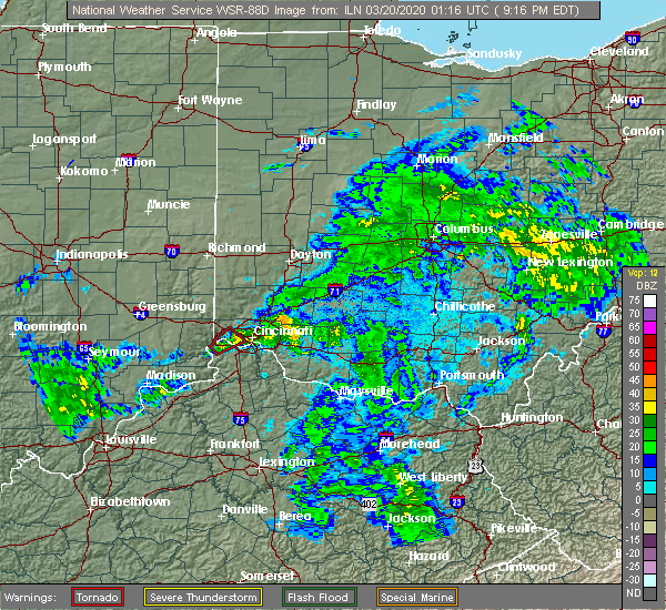 The tornado warning for northern boone and southwestern hamilton counties will expire at 930 pm edt, the storm which prompted the warning has weakened below severe limits, and no longer appears capable of producing a tornado. therefore, the warning will be allowed to expire. however heavy rain is still possible with this thunderstorm. please report previous tornadoes, wind damage or hail to the national weather service by going to our website at weather.gov/iln and submitting your report via social media. The tornado warning for northern boone and southwestern hamilton counties will expire at 930 pm edt, the storm which prompted the warning has weakened below severe limits, and no longer appears capable of producing a tornado. therefore, the warning will be allowed to expire. however heavy rain is still possible with this thunderstorm. please report previous tornadoes, wind damage or hail to the national weather service by going to our website at weather.gov/iln and submitting your report via social media.
|
| 3/19/2020 9:16 PM EDT |
 At 915 pm edt, a severe thunderstorm capable of producing a tornado was located near shawnee, moving northeast at 45 mph (radar indicated rotation). Hazards include tornado. Flying debris will be dangerous to those caught without shelter. mobile homes will be damaged or destroyed. damage to roofs, windows, and vehicles will occur. tree damage is likely. locations impacted include, cincinnati, cheviot, burlington, cleves, shawnee, taylor creek, bridgetown, delhi township, miami heights, mack, delhi hills, monfort heights, grandview, addyston, north bend, dent, francisville, idlewild, covedale and hebron. This includes i-74 in ohio between mile markers 7 and 13. At 915 pm edt, a severe thunderstorm capable of producing a tornado was located near shawnee, moving northeast at 45 mph (radar indicated rotation). Hazards include tornado. Flying debris will be dangerous to those caught without shelter. mobile homes will be damaged or destroyed. damage to roofs, windows, and vehicles will occur. tree damage is likely. locations impacted include, cincinnati, cheviot, burlington, cleves, shawnee, taylor creek, bridgetown, delhi township, miami heights, mack, delhi hills, monfort heights, grandview, addyston, north bend, dent, francisville, idlewild, covedale and hebron. This includes i-74 in ohio between mile markers 7 and 13.
|
| 3/19/2020 9:09 PM EDT |
 At 909 pm edt, a severe thunderstorm capable of producing a tornado was located near aurora, moving northeast at 45 mph (radar indicated rotation). Hazards include tornado. Flying debris will be dangerous to those caught without shelter. mobile homes will be damaged or destroyed. damage to roofs, windows, and vehicles will occur. Tree damage is likely. At 909 pm edt, a severe thunderstorm capable of producing a tornado was located near aurora, moving northeast at 45 mph (radar indicated rotation). Hazards include tornado. Flying debris will be dangerous to those caught without shelter. mobile homes will be damaged or destroyed. damage to roofs, windows, and vehicles will occur. Tree damage is likely.
|
| 3/19/2020 9:09 PM EDT |
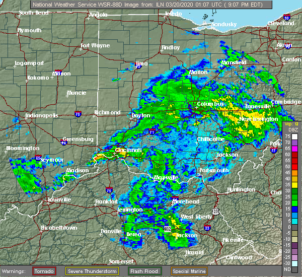 At 909 pm edt, a severe thunderstorm capable of producing a tornado was located near aurora, moving northeast at 45 mph (radar indicated rotation). Hazards include tornado. Flying debris will be dangerous to those caught without shelter. mobile homes will be damaged or destroyed. damage to roofs, windows, and vehicles will occur. Tree damage is likely. At 909 pm edt, a severe thunderstorm capable of producing a tornado was located near aurora, moving northeast at 45 mph (radar indicated rotation). Hazards include tornado. Flying debris will be dangerous to those caught without shelter. mobile homes will be damaged or destroyed. damage to roofs, windows, and vehicles will occur. Tree damage is likely.
|
| 1/11/2020 9:28 PM EST |
 At 927 pm est, a severe thunderstorm was located over florence, moving northeast at 55 mph (radar indicated). Hazards include 70 mph wind gusts. Expect considerable tree damage. damage is likely to mobile homes, roofs, and outbuildings. locations impacted include, cincinnati, covington, florence, independence, norwood, erlanger, fort thomas, newport, blue ash, reading, madeira, edgewood, alexandria, elsmere, wyoming, fort mitchell, villa hills, highland heights, taylor mill and bellevue. this includes the following interstates, i-71 in ohio between mile markers 0 and 13. i-74 in ohio between mile markers 18 and 19. i-75 in kentucky between mile markers 177 and 191. I-75 in ohio between mile markers 0 and 12. At 927 pm est, a severe thunderstorm was located over florence, moving northeast at 55 mph (radar indicated). Hazards include 70 mph wind gusts. Expect considerable tree damage. damage is likely to mobile homes, roofs, and outbuildings. locations impacted include, cincinnati, covington, florence, independence, norwood, erlanger, fort thomas, newport, blue ash, reading, madeira, edgewood, alexandria, elsmere, wyoming, fort mitchell, villa hills, highland heights, taylor mill and bellevue. this includes the following interstates, i-71 in ohio between mile markers 0 and 13. i-74 in ohio between mile markers 18 and 19. i-75 in kentucky between mile markers 177 and 191. I-75 in ohio between mile markers 0 and 12.
|
| 1/11/2020 9:18 PM EST |
 At 917 pm est, a severe thunderstorm was located over rising sun, moving northeast at 55 mph (radar indicated). Hazards include 70 mph wind gusts. Expect considerable tree damage. Damage is likely to mobile homes, roofs, and outbuildings. At 917 pm est, a severe thunderstorm was located over rising sun, moving northeast at 55 mph (radar indicated). Hazards include 70 mph wind gusts. Expect considerable tree damage. Damage is likely to mobile homes, roofs, and outbuildings.
|
| 8/30/2019 4:55 PM EDT | One tree branch... approximately 6 inches in diameter... downed along eastern avenue. time estimated from rada in hamilton county OH, 3.9 miles WNW of Cincinnati, OH |
| 8/20/2019 4:36 PM EDT |
 The severe thunderstorm warning for northern campbell, eastern hamilton and northwestern clermont counties will expire at 445 pm edt, the storm which prompted the warning has weakened and moved out of the area. therefore, the warning will be allowed to expire. this storm will still be capable of wind gusts to 50 mph. a severe thunderstorm watch remains in effect until 900 pm edt for northern kentucky, and southwestern ohio. please report previous wind damage or hail to the national weather service by going to our website at weather.gov/iln and submitting your report via social media. The severe thunderstorm warning for northern campbell, eastern hamilton and northwestern clermont counties will expire at 445 pm edt, the storm which prompted the warning has weakened and moved out of the area. therefore, the warning will be allowed to expire. this storm will still be capable of wind gusts to 50 mph. a severe thunderstorm watch remains in effect until 900 pm edt for northern kentucky, and southwestern ohio. please report previous wind damage or hail to the national weather service by going to our website at weather.gov/iln and submitting your report via social media.
|
| 8/20/2019 4:21 PM EDT | One large tree downed on a house along miami av in hamilton county OH, 8.6 miles WSW of Cincinnati, OH |
| 8/20/2019 4:16 PM EDT |
 At 416 pm edt, a severe thunderstorm was located over norwood, moving northeast at 20 mph (radar indicated). Hazards include 60 mph wind gusts and quarter size hail. Minor hail damage to vehicles is possible. expect wind damage to trees and power lines. locations impacted include, cincinnati, norwood, fort thomas, newport, sharonville, blue ash, loveland, reading, montgomery, madeira, wyoming, highland heights, milford, bellevue, deer park, dayton, southgate, forestville, finneytown and amelia. this includes the following interstates, i-71 in ohio between mile markers 5 and 19. I-75 in ohio between mile markers 8 and 16. At 416 pm edt, a severe thunderstorm was located over norwood, moving northeast at 20 mph (radar indicated). Hazards include 60 mph wind gusts and quarter size hail. Minor hail damage to vehicles is possible. expect wind damage to trees and power lines. locations impacted include, cincinnati, norwood, fort thomas, newport, sharonville, blue ash, loveland, reading, montgomery, madeira, wyoming, highland heights, milford, bellevue, deer park, dayton, southgate, forestville, finneytown and amelia. this includes the following interstates, i-71 in ohio between mile markers 5 and 19. I-75 in ohio between mile markers 8 and 16.
|
| 8/20/2019 4:16 PM EDT |
 A severe thunderstorm warning remains in effect until 445 pm edt for northern campbell. eastern hamilton and northwestern clermont counties. at 416 pm edt, a severe thunderstorm was located over norwood, moving northeast at 20 mph. hazard. 60 mph wind gusts and quarter size hail. A severe thunderstorm warning remains in effect until 445 pm edt for northern campbell. eastern hamilton and northwestern clermont counties. at 416 pm edt, a severe thunderstorm was located over norwood, moving northeast at 20 mph. hazard. 60 mph wind gusts and quarter size hail.
|
| 8/20/2019 4:10 PM EDT |
 The national weather service in wilmington has issued a * severe thunderstorm warning for. northeastern dearborn county in southeastern indiana. northwestern hamilton county in southwestern ohio. until 445 pm edt. At 410 pm edt, a severe thunderstorm was located over taylor creek,. The national weather service in wilmington has issued a * severe thunderstorm warning for. northeastern dearborn county in southeastern indiana. northwestern hamilton county in southwestern ohio. until 445 pm edt. At 410 pm edt, a severe thunderstorm was located over taylor creek,.
|
| 8/20/2019 4:10 PM EDT |
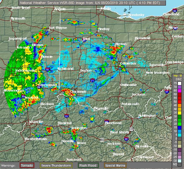 The national weather service in wilmington has issued a * severe thunderstorm warning for. northeastern dearborn county in southeastern indiana. northwestern hamilton county in southwestern ohio. until 445 pm edt. At 410 pm edt, a severe thunderstorm was located over taylor creek,. The national weather service in wilmington has issued a * severe thunderstorm warning for. northeastern dearborn county in southeastern indiana. northwestern hamilton county in southwestern ohio. until 445 pm edt. At 410 pm edt, a severe thunderstorm was located over taylor creek,.
|
| 8/20/2019 4:06 PM EDT |
 At 405 pm edt, a severe thunderstorm was located near newport, moving northeast at 25 mph (radar indicated). Hazards include 60 mph wind gusts and quarter size hail. Minor hail damage to vehicles is possible. Expect wind damage to trees and power lines. At 405 pm edt, a severe thunderstorm was located near newport, moving northeast at 25 mph (radar indicated). Hazards include 60 mph wind gusts and quarter size hail. Minor hail damage to vehicles is possible. Expect wind damage to trees and power lines.
|
| 8/20/2019 3:40 PM EDT | Numerous large limbs and a couple of large trees broken in hamilton county OH, 9.2 miles E of Cincinnati, OH |
| 8/17/2019 3:33 PM EDT | One tree and one large branch blown down. time estimated from radar dat in clermont county OH, 12.1 miles WNW of Cincinnati, OH |
| 7/30/2019 4:11 PM EDT |
 At 411 pm edt, a severe thunderstorm was located over taylor mill, moving southeast at 15 mph (radar indicated). Hazards include 60 mph wind gusts and quarter size hail. Minor hail damage to vehicles is possible. Expect wind damage to trees and power lines. At 411 pm edt, a severe thunderstorm was located over taylor mill, moving southeast at 15 mph (radar indicated). Hazards include 60 mph wind gusts and quarter size hail. Minor hail damage to vehicles is possible. Expect wind damage to trees and power lines.
|
| 7/30/2019 3:24 PM EDT |
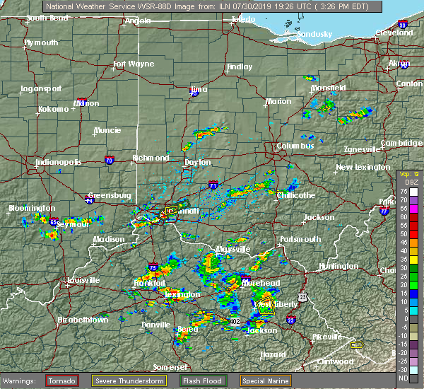 The severe thunderstorm warning for northeastern hamilton county will expire at 330 pm edt, the storm which prompted the warning has weakened below severe limits, and no longer poses an immediate threat to life or property. therefore, the warning will be allowed to expire. please report previous wind damage or hail to the national weather service by going to our website at weather.gov/iln and submitting your report via social media. The severe thunderstorm warning for northeastern hamilton county will expire at 330 pm edt, the storm which prompted the warning has weakened below severe limits, and no longer poses an immediate threat to life or property. therefore, the warning will be allowed to expire. please report previous wind damage or hail to the national weather service by going to our website at weather.gov/iln and submitting your report via social media.
|
| 7/30/2019 2:58 PM EDT |
 At 258 pm edt, a severe thunderstorm was located over montgomery, and is nearly stationary (trained weather spotters). Hazards include 60 mph wind gusts and quarter size hail. Minor hail damage to vehicles is possible. expect wind damage to trees and power lines. locations impacted include, cincinnati, norwood, blue ash, loveland, reading, montgomery, madeira, deer park, concorde hills, rossmoyne, remington, camp dennison, the village of indian hill, silverton, golf manor, amberley, evendale, dillonvale, kenwood and miamiville. This includes i-71 in ohio between mile markers 8 and 16. At 258 pm edt, a severe thunderstorm was located over montgomery, and is nearly stationary (trained weather spotters). Hazards include 60 mph wind gusts and quarter size hail. Minor hail damage to vehicles is possible. expect wind damage to trees and power lines. locations impacted include, cincinnati, norwood, blue ash, loveland, reading, montgomery, madeira, deer park, concorde hills, rossmoyne, remington, camp dennison, the village of indian hill, silverton, golf manor, amberley, evendale, dillonvale, kenwood and miamiville. This includes i-71 in ohio between mile markers 8 and 16.
|
| 7/30/2019 2:55 PM EDT | Large tree fell on home on sturbridge drive. photo verified. time estimated from rada in hamilton county OH, 8.5 miles SW of Cincinnati, OH |
| 7/30/2019 2:50 PM EDT | Wires down on cooper road. time estimated from rada in hamilton county OH, 9.1 miles SW of Cincinnati, OH |
| 7/30/2019 2:50 PM EDT |
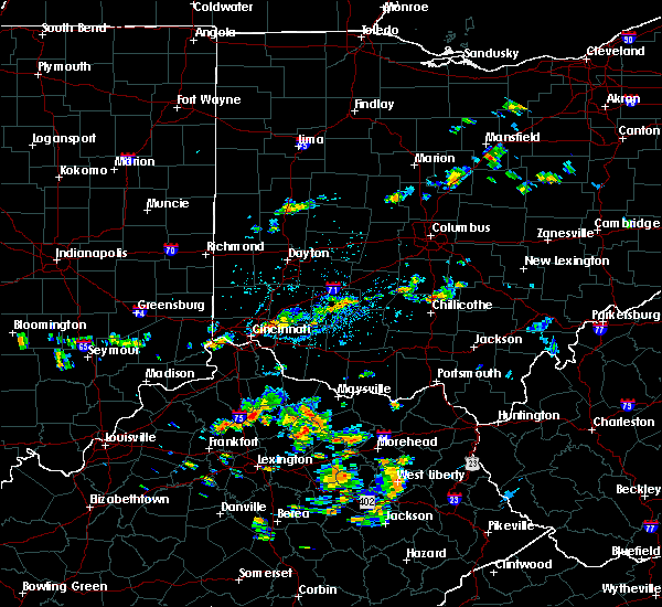 At 249 pm edt, a severe thunderstorm was located over montgomery, and is nearly stationary (radar indicated). Hazards include 60 mph wind gusts. expect damage to trees and power lines At 249 pm edt, a severe thunderstorm was located over montgomery, and is nearly stationary (radar indicated). Hazards include 60 mph wind gusts. expect damage to trees and power lines
|
| 6/23/2019 5:58 PM EDT | Several large tree branches down and one tree partially uprooted. report is from wyoming near state route in hamilton county OH, 6.3 miles S of Cincinnati, OH |
| 6/17/2019 8:08 PM EDT |
 At 744 pm edt, severe thunderstorms were located along a line extending from near burlington to near union, moving east at 40 mph (radar indicated). Hazards include 60 mph wind gusts. Expect damage to trees and power lines. locations impacted include, cincinnati, covington, florence, independence, erlanger, edgewood, elsmere, fort mitchell, villa hills, taylor mill, fort wright, ludlow, crescent springs, crestview hills, park hills, lakeside park, oakbrook, burlington, union and delhi township. this includes the following interstates, i-71 in ohio near mile marker 0. i-75 in kentucky between mile markers 174 and 191. I-75 in ohio between mile markers 0 and 2. At 744 pm edt, severe thunderstorms were located along a line extending from near burlington to near union, moving east at 40 mph (radar indicated). Hazards include 60 mph wind gusts. Expect damage to trees and power lines. locations impacted include, cincinnati, covington, florence, independence, erlanger, edgewood, elsmere, fort mitchell, villa hills, taylor mill, fort wright, ludlow, crescent springs, crestview hills, park hills, lakeside park, oakbrook, burlington, union and delhi township. this includes the following interstates, i-71 in ohio near mile marker 0. i-75 in kentucky between mile markers 174 and 191. I-75 in ohio between mile markers 0 and 2.
|
| 6/17/2019 8:08 PM EDT |
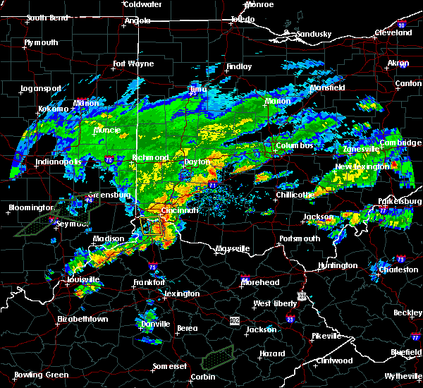 The severe thunderstorm warning for northern kenton, northern boone and southwestern hamilton counties will expire at 815 pm edt, the storms which prompted the warning have weakened below severe limits, and have exited the warned area. therefore, the warning will be allowed to expire. please report previous wind damage or hail to the national weather service by going to our website at weather.gov/iln and submitting your report via social media. The severe thunderstorm warning for northern kenton, northern boone and southwestern hamilton counties will expire at 815 pm edt, the storms which prompted the warning have weakened below severe limits, and have exited the warned area. therefore, the warning will be allowed to expire. please report previous wind damage or hail to the national weather service by going to our website at weather.gov/iln and submitting your report via social media.
|
| 6/17/2019 7:45 PM EDT |
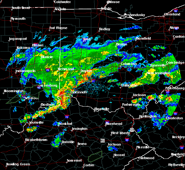 At 744 pm edt, severe thunderstorms were located along a line extending from near burlington to near union, moving east at 40 mph (radar indicated). Hazards include 60 mph wind gusts. Expect damage to trees and power lines. locations impacted include, cincinnati, covington, florence, independence, erlanger, edgewood, elsmere, fort mitchell, villa hills, taylor mill, fort wright, ludlow, crescent springs, crestview hills, park hills, lakeside park, oakbrook, burlington, union and delhi township. this includes the following interstates, i-71 in ohio near mile marker 0. i-75 in kentucky between mile markers 174 and 191. I-75 in ohio between mile markers 0 and 2. At 744 pm edt, severe thunderstorms were located along a line extending from near burlington to near union, moving east at 40 mph (radar indicated). Hazards include 60 mph wind gusts. Expect damage to trees and power lines. locations impacted include, cincinnati, covington, florence, independence, erlanger, edgewood, elsmere, fort mitchell, villa hills, taylor mill, fort wright, ludlow, crescent springs, crestview hills, park hills, lakeside park, oakbrook, burlington, union and delhi township. this includes the following interstates, i-71 in ohio near mile marker 0. i-75 in kentucky between mile markers 174 and 191. I-75 in ohio between mile markers 0 and 2.
|
| 6/17/2019 7:33 PM EDT |
 At 732 pm edt, severe thunderstorms were located along a line extending from near lawrenceburg to near patriot, moving east at 40 mph (radar indicated). Hazards include 60 mph wind gusts. expect damage to trees and power lines At 732 pm edt, severe thunderstorms were located along a line extending from near lawrenceburg to near patriot, moving east at 40 mph (radar indicated). Hazards include 60 mph wind gusts. expect damage to trees and power lines
|
| 6/15/2019 11:42 PM EDT |
 The severe thunderstorm warning for northeastern hamilton county will expire at 1145 pm edt, the severe thunderstorm which prompted the warning has weakened and moved out of the warned area. therefore, the warning will be allowed to expire. a tornado watch remains in effect until 200 am edt for northern kentucky, and southwestern ohio. please report previous wind damage or hail to the national weather service by going to our website at weather.gov/iln and submitting your report via social media. The severe thunderstorm warning for northeastern hamilton county will expire at 1145 pm edt, the severe thunderstorm which prompted the warning has weakened and moved out of the warned area. therefore, the warning will be allowed to expire. a tornado watch remains in effect until 200 am edt for northern kentucky, and southwestern ohio. please report previous wind damage or hail to the national weather service by going to our website at weather.gov/iln and submitting your report via social media.
|
| 6/15/2019 11:29 PM EDT |
 At 1128 pm edt, a severe thunderstorm was located over madeira, moving east at 35 mph (radar indicated). Hazards include 60 mph wind gusts. Expect damage to trees and power lines. locations impacted include, cincinnati, norwood, sharonville, blue ash, loveland, reading, montgomery, madeira, milford, deer park, dayton, mariemont, terrace park, camp dennison, sixteen mile stand, rossmoyne, remington, plainville, concorde hills and brecon. this includes i-71 in ohio between mile markers 6 and 18. A tornado watch remains in effect until 200 am edt for northern kentucky, and southwestern ohio. At 1128 pm edt, a severe thunderstorm was located over madeira, moving east at 35 mph (radar indicated). Hazards include 60 mph wind gusts. Expect damage to trees and power lines. locations impacted include, cincinnati, norwood, sharonville, blue ash, loveland, reading, montgomery, madeira, milford, deer park, dayton, mariemont, terrace park, camp dennison, sixteen mile stand, rossmoyne, remington, plainville, concorde hills and brecon. this includes i-71 in ohio between mile markers 6 and 18. A tornado watch remains in effect until 200 am edt for northern kentucky, and southwestern ohio.
|
| 6/15/2019 11:18 PM EDT |
 At 1118 pm edt, a severe thunderstorm was located over norwood, moving east at 35 mph (radar indicated). Hazards include 60 mph wind gusts. Expect damage to trees and power lines. locations impacted include, cincinnati, norwood, sharonville, blue ash, loveland, reading, montgomery, north college hill, madeira, wyoming, cheviot, milford, mount healthy, deer park, dayton, finneytown, mariemont, terrace park, pleasant hills and camp dennison. this includes the following interstates, i-71 in ohio between mile markers 3 and 17. i-74 in ohio between mile markers 14 and 19. i-75 in ohio between mile markers 3 and 14. A tornado watch remains in effect until 200 am edt for northern kentucky, and southwestern ohio. At 1118 pm edt, a severe thunderstorm was located over norwood, moving east at 35 mph (radar indicated). Hazards include 60 mph wind gusts. Expect damage to trees and power lines. locations impacted include, cincinnati, norwood, sharonville, blue ash, loveland, reading, montgomery, north college hill, madeira, wyoming, cheviot, milford, mount healthy, deer park, dayton, finneytown, mariemont, terrace park, pleasant hills and camp dennison. this includes the following interstates, i-71 in ohio between mile markers 3 and 17. i-74 in ohio between mile markers 14 and 19. i-75 in ohio between mile markers 3 and 14. A tornado watch remains in effect until 200 am edt for northern kentucky, and southwestern ohio.
|
| 6/15/2019 11:15 PM EDT |
 At 1115 pm edt, a severe thunderstorm was located over cincinnati, moving east at 35 mph (radar indicated). Hazards include 60 mph wind gusts. expect damage to trees and power lines At 1115 pm edt, a severe thunderstorm was located over cincinnati, moving east at 35 mph (radar indicated). Hazards include 60 mph wind gusts. expect damage to trees and power lines
|
| 6/5/2019 7:26 PM EDT |
 The severe thunderstorm warning for southern kenton, campbell, southeastern hamilton and west central clermont counties will expire at 730 pm edt, the storm which prompted the warning has moved out of the area, where a new severe thunderstorm warning has been issued. therefore, the warning will be allowed to expire. however gusty winds are still possible with this thunderstorm. a severe thunderstorm watch remains in effect until 900 pm edt for northern kentucky, and southwestern ohio. a severe thunderstorm watch also remains in effect until 100 am edt for southwestern ohio. please report previous wind damage or hail to the national weather service by going to our website at weather.gov/iln and submitting your report via social media. The severe thunderstorm warning for southern kenton, campbell, southeastern hamilton and west central clermont counties will expire at 730 pm edt, the storm which prompted the warning has moved out of the area, where a new severe thunderstorm warning has been issued. therefore, the warning will be allowed to expire. however gusty winds are still possible with this thunderstorm. a severe thunderstorm watch remains in effect until 900 pm edt for northern kentucky, and southwestern ohio. a severe thunderstorm watch also remains in effect until 100 am edt for southwestern ohio. please report previous wind damage or hail to the national weather service by going to our website at weather.gov/iln and submitting your report via social media.
|
| 6/5/2019 7:18 PM EDT |
 At 706 pm edt, a severe thunderstorm was located over alexandria, moving southeast at 35 mph (trained weather spotters). Hazards include 70 mph wind gusts and quarter size hail. Minor hail damage to vehicles is possible. expect considerable tree damage. wind damage is also likely to mobile homes, roofs, and outbuildings. locations impacted include, cincinnati, covington, independence, erlanger, fort thomas, newport, edgewood, alexandria, elsmere, fort mitchell, villa hills, highland heights, milford, taylor mill, bellevue, fort wright, dayton, ludlow, southgate and crescent springs. this includes the following interstates, i-71 in ohio near mile marker 0. i-75 in kentucky between mile markers 184 and 191. I-75 in ohio near mile marker 0. At 706 pm edt, a severe thunderstorm was located over alexandria, moving southeast at 35 mph (trained weather spotters). Hazards include 70 mph wind gusts and quarter size hail. Minor hail damage to vehicles is possible. expect considerable tree damage. wind damage is also likely to mobile homes, roofs, and outbuildings. locations impacted include, cincinnati, covington, independence, erlanger, fort thomas, newport, edgewood, alexandria, elsmere, fort mitchell, villa hills, highland heights, milford, taylor mill, bellevue, fort wright, dayton, ludlow, southgate and crescent springs. this includes the following interstates, i-71 in ohio near mile marker 0. i-75 in kentucky between mile markers 184 and 191. I-75 in ohio near mile marker 0.
|
| 6/5/2019 7:18 PM EDT |
 At 718 pm edt, a severe thunderstorm was located over alexandria, moving southeast at 25 mph (trained weather spotters). Hazards include 70 mph wind gusts and quarter size hail. Minor hail damage to vehicles is possible. expect considerable tree damage. wind damage is also likely to mobile homes, roofs, and outbuildings. Locations impacted include, cincinnati, fort thomas, alexandria, highland heights, claryville, forestville, new richmond, silver grove, melbourne, salem heights, riverbend and coney island, cold spring, ryland heights, sherwood, crestview, mentor, california and visalia. At 718 pm edt, a severe thunderstorm was located over alexandria, moving southeast at 25 mph (trained weather spotters). Hazards include 70 mph wind gusts and quarter size hail. Minor hail damage to vehicles is possible. expect considerable tree damage. wind damage is also likely to mobile homes, roofs, and outbuildings. Locations impacted include, cincinnati, fort thomas, alexandria, highland heights, claryville, forestville, new richmond, silver grove, melbourne, salem heights, riverbend and coney island, cold spring, ryland heights, sherwood, crestview, mentor, california and visalia.
|
| 6/5/2019 7:06 PM EDT |
 At 706 pm edt, a severe thunderstorm was located over alexandria, moving southeast at 35 mph (trained weather spotters). Hazards include 70 mph wind gusts and quarter size hail. Minor hail damage to vehicles is possible. expect considerable tree damage. wind damage is also likely to mobile homes, roofs, and outbuildings. locations impacted include, cincinnati, covington, independence, erlanger, fort thomas, newport, edgewood, alexandria, elsmere, fort mitchell, villa hills, highland heights, milford, taylor mill, bellevue, fort wright, dayton, ludlow, southgate and crescent springs. this includes the following interstates, i-71 in ohio near mile marker 0. i-75 in kentucky between mile markers 184 and 191. I-75 in ohio near mile marker 0. At 706 pm edt, a severe thunderstorm was located over alexandria, moving southeast at 35 mph (trained weather spotters). Hazards include 70 mph wind gusts and quarter size hail. Minor hail damage to vehicles is possible. expect considerable tree damage. wind damage is also likely to mobile homes, roofs, and outbuildings. locations impacted include, cincinnati, covington, independence, erlanger, fort thomas, newport, edgewood, alexandria, elsmere, fort mitchell, villa hills, highland heights, milford, taylor mill, bellevue, fort wright, dayton, ludlow, southgate and crescent springs. this includes the following interstates, i-71 in ohio near mile marker 0. i-75 in kentucky between mile markers 184 and 191. I-75 in ohio near mile marker 0.
|
| 6/5/2019 6:55 PM EDT |
 At 655 pm edt, a severe thunderstorm was located over taylor mill, moving southeast at 35 mph (radar indicated). Hazards include 70 mph wind gusts. Expect considerable tree damage. Damage is likely to mobile homes, roofs, and outbuildings. At 655 pm edt, a severe thunderstorm was located over taylor mill, moving southeast at 35 mph (radar indicated). Hazards include 70 mph wind gusts. Expect considerable tree damage. Damage is likely to mobile homes, roofs, and outbuildings.
|
| 6/5/2019 6:48 PM EDT |
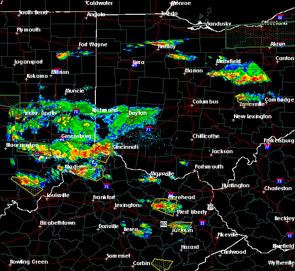 At 648 pm edt, a severe thunderstorm was located over covington, moving southeast at 35 mph (trained weather spotters). Hazards include 70 mph wind gusts and quarter size hail. Minor hail damage to vehicles is possible. expect considerable tree damage. wind damage is also likely to mobile homes, roofs, and outbuildings. locations impacted include, cincinnati, covington, florence, independence, erlanger, edgewood, elsmere, fort mitchell, villa hills, fort wright, lawrenceburg, ludlow, crescent springs, aurora, crestview hills, park hills, lakeside park, oakbrook, burlington and union. this includes the following interstates, i-71 in ohio near mile marker 0. i-74 in ohio near mile marker 19. i-75 in kentucky between mile markers 175 and 188, and near mile marker 191. I-75 in ohio between mile markers 0 and 6. At 648 pm edt, a severe thunderstorm was located over covington, moving southeast at 35 mph (trained weather spotters). Hazards include 70 mph wind gusts and quarter size hail. Minor hail damage to vehicles is possible. expect considerable tree damage. wind damage is also likely to mobile homes, roofs, and outbuildings. locations impacted include, cincinnati, covington, florence, independence, erlanger, edgewood, elsmere, fort mitchell, villa hills, fort wright, lawrenceburg, ludlow, crescent springs, aurora, crestview hills, park hills, lakeside park, oakbrook, burlington and union. this includes the following interstates, i-71 in ohio near mile marker 0. i-74 in ohio near mile marker 19. i-75 in kentucky between mile markers 175 and 188, and near mile marker 191. I-75 in ohio between mile markers 0 and 6.
|
| 6/5/2019 6:42 PM EDT |
 At 641 pm edt, a severe thunderstorm was located over villa hills, moving southeast at 35 mph (trained weather spotters). Hazards include 60 mph wind gusts and quarter size hail. Minor hail damage to vehicles is possible. expect wind damage to trees and power lines. locations impacted include, cincinnati, covington, florence, independence, erlanger, harrison, north college hill, edgewood, elsmere, wyoming, cheviot, fort mitchell, villa hills, mount healthy, fort wright, lawrenceburg, ludlow, crescent springs, aurora and crestview hills. this includes the following interstates, i-71 in ohio near mile marker 0. i-74 in ohio between mile markers 4 and 19. i-75 in kentucky between mile markers 175 and 188, and near mile marker 191. I-75 in ohio between mile markers 0 and 10. At 641 pm edt, a severe thunderstorm was located over villa hills, moving southeast at 35 mph (trained weather spotters). Hazards include 60 mph wind gusts and quarter size hail. Minor hail damage to vehicles is possible. expect wind damage to trees and power lines. locations impacted include, cincinnati, covington, florence, independence, erlanger, harrison, north college hill, edgewood, elsmere, wyoming, cheviot, fort mitchell, villa hills, mount healthy, fort wright, lawrenceburg, ludlow, crescent springs, aurora and crestview hills. this includes the following interstates, i-71 in ohio near mile marker 0. i-74 in ohio between mile markers 4 and 19. i-75 in kentucky between mile markers 175 and 188, and near mile marker 191. I-75 in ohio between mile markers 0 and 10.
|
| 6/5/2019 6:42 PM EDT |
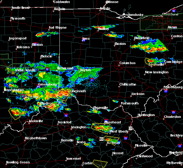 At 641 pm edt, a severe thunderstorm was located over villa hills, moving southeast at 35 mph (trained weather spotters). Hazards include 60 mph wind gusts and quarter size hail. Minor hail damage to vehicles is possible. expect wind damage to trees and power lines. locations impacted include, cincinnati, covington, florence, independence, erlanger, harrison, north college hill, edgewood, elsmere, wyoming, cheviot, fort mitchell, villa hills, mount healthy, fort wright, lawrenceburg, ludlow, crescent springs, aurora and crestview hills. this includes the following interstates, i-71 in ohio near mile marker 0. i-74 in ohio between mile markers 4 and 19. i-75 in kentucky between mile markers 175 and 188, and near mile marker 191. I-75 in ohio between mile markers 0 and 10. At 641 pm edt, a severe thunderstorm was located over villa hills, moving southeast at 35 mph (trained weather spotters). Hazards include 60 mph wind gusts and quarter size hail. Minor hail damage to vehicles is possible. expect wind damage to trees and power lines. locations impacted include, cincinnati, covington, florence, independence, erlanger, harrison, north college hill, edgewood, elsmere, wyoming, cheviot, fort mitchell, villa hills, mount healthy, fort wright, lawrenceburg, ludlow, crescent springs, aurora and crestview hills. this includes the following interstates, i-71 in ohio near mile marker 0. i-74 in ohio between mile markers 4 and 19. i-75 in kentucky between mile markers 175 and 188, and near mile marker 191. I-75 in ohio between mile markers 0 and 10.
|
| 6/5/2019 6:39 PM EDT | Quarter sized hail reported 6.8 miles ENE of Cincinnati, OH, quarter hail in delhi. |
| 6/5/2019 6:23 PM EDT |
 At 623 pm edt, a severe thunderstorm was located over shawnee, moving southeast at 35 mph (radar indicated). Hazards include 60 mph wind gusts and quarter size hail. Minor hail damage to vehicles is possible. Expect wind damage to trees and power lines. At 623 pm edt, a severe thunderstorm was located over shawnee, moving southeast at 35 mph (radar indicated). Hazards include 60 mph wind gusts and quarter size hail. Minor hail damage to vehicles is possible. Expect wind damage to trees and power lines.
|
| 5/26/2019 4:22 PM EDT |
 At 422 pm edt, a severe thunderstorm was located near union, moving east at 35 mph (radar indicated). Hazards include 60 mph wind gusts and penny size hail. Expect damage to trees and power lines. locations impacted include, cincinnati, florence, erlanger, cheviot, villa hills, lawrenceburg, aurora, walton, rising sun, oakbrook, burlington, union, shawnee, delhi township, delhi hills, bridgetown, mack, addyston, richwood and idlewild. this includes the following interstates, i-71 in kentucky between mile markers 70 and 77. I-75 in kentucky between mile markers 170 and 183. At 422 pm edt, a severe thunderstorm was located near union, moving east at 35 mph (radar indicated). Hazards include 60 mph wind gusts and penny size hail. Expect damage to trees and power lines. locations impacted include, cincinnati, florence, erlanger, cheviot, villa hills, lawrenceburg, aurora, walton, rising sun, oakbrook, burlington, union, shawnee, delhi township, delhi hills, bridgetown, mack, addyston, richwood and idlewild. this includes the following interstates, i-71 in kentucky between mile markers 70 and 77. I-75 in kentucky between mile markers 170 and 183.
|
| 5/26/2019 4:07 PM EDT |
 At 407 pm edt, a severe thunderstorm was located near rising sun, moving east at 40 mph (radar indicated). Hazards include 60 mph wind gusts and quarter size hail. Minor hail damage to vehicles is possible. Expect wind damage to trees and power lines. At 407 pm edt, a severe thunderstorm was located near rising sun, moving east at 40 mph (radar indicated). Hazards include 60 mph wind gusts and quarter size hail. Minor hail damage to vehicles is possible. Expect wind damage to trees and power lines.
|
| 5/26/2019 3:03 PM EDT |
 At 303 pm edt, a severe thunderstorm was located over sharonville, moving east at 30 mph (radar indicated). Hazards include 60 mph wind gusts and quarter size hail. Minor hail damage to vehicles is possible. Expect wind damage to trees and power lines. At 303 pm edt, a severe thunderstorm was located over sharonville, moving east at 30 mph (radar indicated). Hazards include 60 mph wind gusts and quarter size hail. Minor hail damage to vehicles is possible. Expect wind damage to trees and power lines.
|
| 5/23/2019 6:14 PM EDT |
 At 613 pm edt, a severe thunderstorm was located near coldstream, moving east at 40 mph (radar indicated). Hazards include 60 mph wind gusts and quarter size hail. Minor hail damage to vehicles is possible. expect wind damage to trees and power lines. Locations impacted include, cincinnati, alexandria, claryville, forestville, amelia, new richmond, silver grove, melbourne, riverbend and coney island, coldstream, salem heights, withamsville, cold spring, crestview, mentor, moscow, california, saltair, new palestine and gubser mill. At 613 pm edt, a severe thunderstorm was located near coldstream, moving east at 40 mph (radar indicated). Hazards include 60 mph wind gusts and quarter size hail. Minor hail damage to vehicles is possible. expect wind damage to trees and power lines. Locations impacted include, cincinnati, alexandria, claryville, forestville, amelia, new richmond, silver grove, melbourne, riverbend and coney island, coldstream, salem heights, withamsville, cold spring, crestview, mentor, moscow, california, saltair, new palestine and gubser mill.
|
| 5/23/2019 6:05 PM EDT |
 At 605 pm edt, a severe thunderstorm was located over taylor mill, moving east at 30 mph (radar indicated). Hazards include 60 mph wind gusts and quarter size hail. Minor hail damage to vehicles is possible. Expect wind damage to trees and power lines. At 605 pm edt, a severe thunderstorm was located over taylor mill, moving east at 30 mph (radar indicated). Hazards include 60 mph wind gusts and quarter size hail. Minor hail damage to vehicles is possible. Expect wind damage to trees and power lines.
|
| 5/17/2019 4:48 PM EDT |
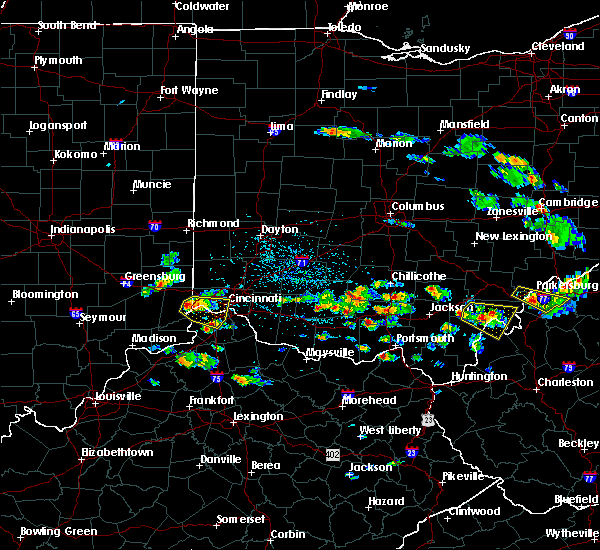 At 448 pm edt, a severe thunderstorm was located over shawnee, moving east at 25 mph (radar indicated). Hazards include 60 mph wind gusts and quarter size hail. Minor hail damage to vehicles is possible. expect wind damage to trees and power lines. locations impacted include, cincinnati, covington, florence, independence, erlanger, newport, edgewood, elsmere, cheviot, fort mitchell, villa hills, taylor mill, fort wright, lawrenceburg, greendale, ludlow, crescent springs, aurora, crestview hills and park hills. this includes the following interstates, i-71 in ohio between mile markers 0 and 3. i-74 in ohio between mile markers 7 and 19. i-75 in kentucky between mile markers 177 and 191. I-75 in ohio between mile markers 0 and 9. At 448 pm edt, a severe thunderstorm was located over shawnee, moving east at 25 mph (radar indicated). Hazards include 60 mph wind gusts and quarter size hail. Minor hail damage to vehicles is possible. expect wind damage to trees and power lines. locations impacted include, cincinnati, covington, florence, independence, erlanger, newport, edgewood, elsmere, cheviot, fort mitchell, villa hills, taylor mill, fort wright, lawrenceburg, greendale, ludlow, crescent springs, aurora, crestview hills and park hills. this includes the following interstates, i-71 in ohio between mile markers 0 and 3. i-74 in ohio between mile markers 7 and 19. i-75 in kentucky between mile markers 177 and 191. I-75 in ohio between mile markers 0 and 9.
|
| 5/17/2019 4:36 PM EDT |
 At 435 pm edt, a severe thunderstorm was located near greendale, moving east at 20 mph (radar indicated). Hazards include 60 mph wind gusts and quarter size hail. Minor hail damage to vehicles is possible. Expect wind damage to trees and power lines. At 435 pm edt, a severe thunderstorm was located near greendale, moving east at 20 mph (radar indicated). Hazards include 60 mph wind gusts and quarter size hail. Minor hail damage to vehicles is possible. Expect wind damage to trees and power lines.
|
| 5/17/2019 4:36 PM EDT |
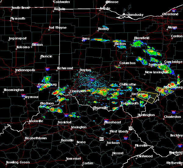 At 435 pm edt, a severe thunderstorm was located near greendale, moving east at 20 mph (radar indicated). Hazards include 60 mph wind gusts and quarter size hail. Minor hail damage to vehicles is possible. Expect wind damage to trees and power lines. At 435 pm edt, a severe thunderstorm was located near greendale, moving east at 20 mph (radar indicated). Hazards include 60 mph wind gusts and quarter size hail. Minor hail damage to vehicles is possible. Expect wind damage to trees and power lines.
|
| 5/1/2019 7:10 PM EDT |
 The severe thunderstorm warning for northwestern hamilton, southeastern butler and west central warren counties will expire at 715 pm edt, the storm which prompted the warning has weakened below severe limits, and no longer poses an immediate threat to life or property. therefore, the warning will be allowed to expire. please report previous wind damage or hail to the national weather service by going to our website at weather.gov/iln and submitting your report via social media. The severe thunderstorm warning for northwestern hamilton, southeastern butler and west central warren counties will expire at 715 pm edt, the storm which prompted the warning has weakened below severe limits, and no longer poses an immediate threat to life or property. therefore, the warning will be allowed to expire. please report previous wind damage or hail to the national weather service by going to our website at weather.gov/iln and submitting your report via social media.
|
| 5/1/2019 7:02 PM EDT |
 At 702 pm edt, a severe thunderstorm was located over springboro, moving northeast at 45 mph (radar indicated). Hazards include 60 mph wind gusts and quarter size hail. Minor hail damage to vehicles is possible. expect wind damage to trees and power lines. locations impacted include, cincinnati, hamilton, fairfield, mason, forest park, sharonville, monroe, blue ash, trenton, springdale, reading, north college hill, wyoming, mount healthy, finneytown, west chester, ross, taylor creek, dry ridge and dunlap. this includes the following interstates, i-74 in ohio between mile markers 15 and 16, and between mile markers 18 and 19. I-75 in ohio near mile marker 5, and between mile markers 12 and 26. At 702 pm edt, a severe thunderstorm was located over springboro, moving northeast at 45 mph (radar indicated). Hazards include 60 mph wind gusts and quarter size hail. Minor hail damage to vehicles is possible. expect wind damage to trees and power lines. locations impacted include, cincinnati, hamilton, fairfield, mason, forest park, sharonville, monroe, blue ash, trenton, springdale, reading, north college hill, wyoming, mount healthy, finneytown, west chester, ross, taylor creek, dry ridge and dunlap. this includes the following interstates, i-74 in ohio between mile markers 15 and 16, and between mile markers 18 and 19. I-75 in ohio near mile marker 5, and between mile markers 12 and 26.
|
| 5/1/2019 6:51 PM EDT |
 At 650 pm edt, a severe thunderstorm was located over bridgetown, moving northeast at 40 mph (radar indicated). Hazards include 60 mph wind gusts and quarter size hail. Minor hail damage to vehicles is possible. Expect wind damage to trees and power lines. At 650 pm edt, a severe thunderstorm was located over bridgetown, moving northeast at 40 mph (radar indicated). Hazards include 60 mph wind gusts and quarter size hail. Minor hail damage to vehicles is possible. Expect wind damage to trees and power lines.
|
| 4/14/2019 4:54 PM EDT |
 At 454 pm edt, a severe thunderstorm was located over milford, moving northeast at 60 mph (radar indicated). Hazards include 60 mph wind gusts. Expect damage to trees and power lines. locations impacted include, cincinnati, mason, blue ash, loveland, montgomery, madeira, milford, deer park, forestville, mariemont, terrace park, batavia, morrow, camp dennison, remington, plainville, concorde hills, kings island, sixteen mile stand and withamsville. this includes i-71 in ohio between mile markers 10 and 14, and between mile markers 19 and 24. A tornado watch remains in effect until 900 pm edt for southwestern ohio. At 454 pm edt, a severe thunderstorm was located over milford, moving northeast at 60 mph (radar indicated). Hazards include 60 mph wind gusts. Expect damage to trees and power lines. locations impacted include, cincinnati, mason, blue ash, loveland, montgomery, madeira, milford, deer park, forestville, mariemont, terrace park, batavia, morrow, camp dennison, remington, plainville, concorde hills, kings island, sixteen mile stand and withamsville. this includes i-71 in ohio between mile markers 10 and 14, and between mile markers 19 and 24. A tornado watch remains in effect until 900 pm edt for southwestern ohio.
|
| 4/14/2019 4:44 PM EDT |
 At 443 pm edt, a severe thunderstorm was located over silver grove, moving northeast at 60 mph (radar indicated). Hazards include 70 mph wind gusts. Expect considerable tree damage. damage is likely to mobile homes, roofs, and outbuildings. locations impacted include, cincinnati, covington, mason, fort thomas, newport, blue ash, loveland, montgomery, madeira, alexandria, highland heights, milford, taylor mill, deer park, dayton, southgate, forestville, claryville, amelia and mariemont. this includes i-71 in ohio between mile markers 10 and 15, and between mile markers 18 and 24. A tornado watch remains in effect until 900 pm edt for northern kentucky, and southwestern ohio. At 443 pm edt, a severe thunderstorm was located over silver grove, moving northeast at 60 mph (radar indicated). Hazards include 70 mph wind gusts. Expect considerable tree damage. damage is likely to mobile homes, roofs, and outbuildings. locations impacted include, cincinnati, covington, mason, fort thomas, newport, blue ash, loveland, montgomery, madeira, alexandria, highland heights, milford, taylor mill, deer park, dayton, southgate, forestville, claryville, amelia and mariemont. this includes i-71 in ohio between mile markers 10 and 15, and between mile markers 18 and 24. A tornado watch remains in effect until 900 pm edt for northern kentucky, and southwestern ohio.
|
| 4/14/2019 4:38 PM EDT |
 At 438 pm edt, a severe thunderstorm was located near independence, moving northeast at 60 mph (radar indicated). Hazards include 60 mph wind gusts. expect damage to trees and power lines At 438 pm edt, a severe thunderstorm was located near independence, moving northeast at 60 mph (radar indicated). Hazards include 60 mph wind gusts. expect damage to trees and power lines
|
| 4/12/2019 8:24 AM EDT |
 The severe thunderstorm warning for northern campbell, southeastern hamilton, northern clermont and south central warren counties will expire at 830 am edt, the storm which prompted the warning has weakened below severe limits, and no longer poses an immediate threat to life or property. therefore, the warning will be allowed to expire. however gusty winds are still possible with this thunderstorm. please report previous wind damage or hail to the national weather service by going to our website at weather.gov/iln and submitting your report via social media. The severe thunderstorm warning for northern campbell, southeastern hamilton, northern clermont and south central warren counties will expire at 830 am edt, the storm which prompted the warning has weakened below severe limits, and no longer poses an immediate threat to life or property. therefore, the warning will be allowed to expire. however gusty winds are still possible with this thunderstorm. please report previous wind damage or hail to the national weather service by going to our website at weather.gov/iln and submitting your report via social media.
|
| 4/12/2019 8:04 AM EDT |
 At 803 am edt, a severe thunderstorm was located over salem heights, moving northeast at 55 mph (radar indicated). Hazards include 60 mph wind gusts and penny size hail. expect damage to trees and power lines At 803 am edt, a severe thunderstorm was located over salem heights, moving northeast at 55 mph (radar indicated). Hazards include 60 mph wind gusts and penny size hail. expect damage to trees and power lines
|
| 4/12/2019 8:01 AM EDT |
 At 801 am edt, a severe thunderstorm capable of producing a tornado was located over salem heights, moving northeast at 55 mph (radar indicated rotation). Hazards include tornado and quarter size hail. Flying debris will be dangerous to those caught without shelter. mobile homes will be damaged or destroyed. damage to roofs, windows, and vehicles will occur. tree damage is likely. Locations impacted include, cincinnati, fort thomas, newport, alexandria, highland heights, milford, bellevue, dayton, southgate, forestville, mariemont, wilder, terrace park, batavia, silver grove, melbourne, salem heights, riverbend and coney island, withamsville and plainville. At 801 am edt, a severe thunderstorm capable of producing a tornado was located over salem heights, moving northeast at 55 mph (radar indicated rotation). Hazards include tornado and quarter size hail. Flying debris will be dangerous to those caught without shelter. mobile homes will be damaged or destroyed. damage to roofs, windows, and vehicles will occur. tree damage is likely. Locations impacted include, cincinnati, fort thomas, newport, alexandria, highland heights, milford, bellevue, dayton, southgate, forestville, mariemont, wilder, terrace park, batavia, silver grove, melbourne, salem heights, riverbend and coney island, withamsville and plainville.
|
| 4/12/2019 8:01 AM EDT |
 A tornado warning remains in effect until 815 am edt for northern campbell. southeastern hamilton and northwestern clermont counties. at 801 am edt, a severe thunderstorm capable of producing a tornado was located over salem heights, moving northeast at 55 mph. hazard. Tornado and quarter size hail. A tornado warning remains in effect until 815 am edt for northern campbell. southeastern hamilton and northwestern clermont counties. at 801 am edt, a severe thunderstorm capable of producing a tornado was located over salem heights, moving northeast at 55 mph. hazard. Tornado and quarter size hail.
|
| 4/12/2019 7:56 AM EDT |
 At 755 am edt, a severe thunderstorm capable of producing a tornado was located over taylor mill, moving northeast at 55 mph (radar indicated rotation). Hazards include tornado and quarter size hail. Flying debris will be dangerous to those caught without shelter. mobile homes will be damaged or destroyed. damage to roofs, windows, and vehicles will occur. Tree damage is likely. At 755 am edt, a severe thunderstorm capable of producing a tornado was located over taylor mill, moving northeast at 55 mph (radar indicated rotation). Hazards include tornado and quarter size hail. Flying debris will be dangerous to those caught without shelter. mobile homes will be damaged or destroyed. damage to roofs, windows, and vehicles will occur. Tree damage is likely.
|
| 4/12/2019 7:54 AM EDT |
 At 754 am edt, a severe thunderstorm was located over edgewood, moving northeast at 55 mph (radar indicated). Hazards include 70 mph wind gusts and quarter size hail. Minor hail damage to vehicles is possible. expect considerable tree damage. wind damage is also likely to mobile homes, roofs, and outbuildings. locations impacted include, covington, florence, independence, erlanger, fort thomas, newport, edgewood, alexandria, elsmere, fort mitchell, villa hills, highland heights, taylor mill, fort wright, southgate, crescent springs, crestview hills, park hills, lakeside park and claryville. This includes i-75 in kentucky between mile markers 180 and 190. At 754 am edt, a severe thunderstorm was located over edgewood, moving northeast at 55 mph (radar indicated). Hazards include 70 mph wind gusts and quarter size hail. Minor hail damage to vehicles is possible. expect considerable tree damage. wind damage is also likely to mobile homes, roofs, and outbuildings. locations impacted include, covington, florence, independence, erlanger, fort thomas, newport, edgewood, alexandria, elsmere, fort mitchell, villa hills, highland heights, taylor mill, fort wright, southgate, crescent springs, crestview hills, park hills, lakeside park and claryville. This includes i-75 in kentucky between mile markers 180 and 190.
|
| 4/12/2019 7:44 AM EDT |
 At 743 am edt, a severe thunderstorm was located near union, moving northeast at 55 mph (radar indicated). Hazards include 70 mph wind gusts and quarter size hail. Minor hail damage to vehicles is possible. expect considerable tree damage. Wind damage is also likely to mobile homes, roofs, and outbuildings. At 743 am edt, a severe thunderstorm was located near union, moving northeast at 55 mph (radar indicated). Hazards include 70 mph wind gusts and quarter size hail. Minor hail damage to vehicles is possible. expect considerable tree damage. Wind damage is also likely to mobile homes, roofs, and outbuildings.
|
| 3/14/2019 6:48 PM EDT | Quarter sized hail reported 10.8 miles WNW of Cincinnati, OH, near julifs park. |
| 3/14/2019 6:42 PM EDT |
 At 642 pm edt, a severe thunderstorm was located over riverbend and coney island, moving northeast at 55 mph (radar indicated). Hazards include 60 mph wind gusts and penny size hail. Expect damage to trees and power lines. locations impacted include, cincinnati, covington, florence, independence, erlanger, fort thomas, edgewood, alexandria, elsmere, fort mitchell, highland heights, taylor mill, fort wright, southgate, walton, crestview hills, lakeside park, claryville, forestville and union. this includes the following interstates, i-71 in kentucky between mile markers 50 and 77. I-75 in kentucky between mile markers 160 and 180. At 642 pm edt, a severe thunderstorm was located over riverbend and coney island, moving northeast at 55 mph (radar indicated). Hazards include 60 mph wind gusts and penny size hail. Expect damage to trees and power lines. locations impacted include, cincinnati, covington, florence, independence, erlanger, fort thomas, edgewood, alexandria, elsmere, fort mitchell, highland heights, taylor mill, fort wright, southgate, walton, crestview hills, lakeside park, claryville, forestville and union. this includes the following interstates, i-71 in kentucky between mile markers 50 and 77. I-75 in kentucky between mile markers 160 and 180.
|
| 3/14/2019 6:40 PM EDT | Quarter sized hail reported 10.8 miles WNW of Cincinnati, OH |
| 3/14/2019 6:19 PM EDT |
 At 618 pm edt, a severe thunderstorm was located near union, moving northeast at 55 mph (radar indicated). Hazards include 60 mph wind gusts and penny size hail. expect damage to trees and power lines At 618 pm edt, a severe thunderstorm was located near union, moving northeast at 55 mph (radar indicated). Hazards include 60 mph wind gusts and penny size hail. expect damage to trees and power lines
|
| 3/14/2019 6:16 PM EDT |
 At 616 pm edt, a severe thunderstorm was located over kings island, moving northeast at 55 mph (radar indicated). Hazards include 60 mph wind gusts and quarter size hail. Minor hail damage to vehicles is possible. expect wind damage to trees and power lines. locations impacted include, cincinnati, mason, lebanon, norwood, sharonville, monroe, blue ash, loveland, reading, montgomery, madeira, deer park, morrow, highpoint, remington, concorde hills, kings island, sixteen mile stand, four bridges and rossmoyne. this includes the following interstates, i-71 in ohio between mile markers 8 and 41. I-75 in ohio between mile markers 23 and 30. At 616 pm edt, a severe thunderstorm was located over kings island, moving northeast at 55 mph (radar indicated). Hazards include 60 mph wind gusts and quarter size hail. Minor hail damage to vehicles is possible. expect wind damage to trees and power lines. locations impacted include, cincinnati, mason, lebanon, norwood, sharonville, monroe, blue ash, loveland, reading, montgomery, madeira, deer park, morrow, highpoint, remington, concorde hills, kings island, sixteen mile stand, four bridges and rossmoyne. this includes the following interstates, i-71 in ohio between mile markers 8 and 41. I-75 in ohio between mile markers 23 and 30.
|
| 3/14/2019 6:15 PM EDT | Quarter sized hail reported 7.6 miles WSW of Cincinnati, OH |
| 3/14/2019 6:13 PM EDT | Quarter sized hail reported 4.7 miles SW of Cincinnati, OH, occurred in pleasant ridge. twitter report |
| 3/14/2019 6:07 PM EDT |
 At 607 pm edt, a severe thunderstorm was located over finneytown, moving northeast at 65 mph (radar indicated). Hazards include 60 mph wind gusts and quarter size hail. Minor hail damage to vehicles is possible. expect wind damage to trees and power lines. locations impacted include, cincinnati, fairfield, covington, norwood, forest park, erlanger, fort thomas, newport, sharonville, blue ash, springdale, reading, north college hill, madeira, edgewood, elsmere, wyoming, cheviot, fort mitchell and villa hills. this includes the following interstates, i-71 in ohio between mile markers 0 and 10. i-74 in ohio between mile markers 13 and 19. i-75 in kentucky between mile markers 184 and 191. I-75 in ohio between mile markers 0 and 17. At 607 pm edt, a severe thunderstorm was located over finneytown, moving northeast at 65 mph (radar indicated). Hazards include 60 mph wind gusts and quarter size hail. Minor hail damage to vehicles is possible. expect wind damage to trees and power lines. locations impacted include, cincinnati, fairfield, covington, norwood, forest park, erlanger, fort thomas, newport, sharonville, blue ash, springdale, reading, north college hill, madeira, edgewood, elsmere, wyoming, cheviot, fort mitchell and villa hills. this includes the following interstates, i-71 in ohio between mile markers 0 and 10. i-74 in ohio between mile markers 13 and 19. i-75 in kentucky between mile markers 184 and 191. I-75 in ohio between mile markers 0 and 17.
|
| 3/14/2019 6:04 PM EDT |
 At 604 pm edt, a severe thunderstorm was located over sharonville, moving northeast at 55 mph (radar indicated). Hazards include 60 mph wind gusts and penny size hail. expect damage to trees and power lines At 604 pm edt, a severe thunderstorm was located over sharonville, moving northeast at 55 mph (radar indicated). Hazards include 60 mph wind gusts and penny size hail. expect damage to trees and power lines
|
| 3/14/2019 5:52 PM EDT |
 At 551 pm edt, a severe thunderstorm was located near burlington, moving northeast at 65 mph (radar indicated). Hazards include 60 mph wind gusts. Expect damage to trees and power lines. locations impacted include, cincinnati, fairfield, covington, florence, norwood, forest park, erlanger, fort thomas, newport, sharonville, blue ash, springdale, reading, north college hill, madeira, edgewood, elsmere, wyoming, cheviot and fort mitchell. this includes the following interstates, i-71 in ohio between mile markers 0 and 10. i-74 in ohio between mile markers 10 and 19. i-75 in kentucky between mile markers 180 and 191. I-75 in ohio between mile markers 0 and 17. At 551 pm edt, a severe thunderstorm was located near burlington, moving northeast at 65 mph (radar indicated). Hazards include 60 mph wind gusts. Expect damage to trees and power lines. locations impacted include, cincinnati, fairfield, covington, florence, norwood, forest park, erlanger, fort thomas, newport, sharonville, blue ash, springdale, reading, north college hill, madeira, edgewood, elsmere, wyoming, cheviot and fort mitchell. this includes the following interstates, i-71 in ohio between mile markers 0 and 10. i-74 in ohio between mile markers 10 and 19. i-75 in kentucky between mile markers 180 and 191. I-75 in ohio between mile markers 0 and 17.
|
| 3/14/2019 5:44 PM EDT | Large tree uprooted and on hous in hamilton county OH, 7.5 miles ENE of Cincinnati, OH |
| 3/14/2019 5:41 PM EDT |
 At 541 pm edt, a severe thunderstorm was located near rising sun, moving northeast at 65 mph (radar indicated). Hazards include 60 mph wind gusts. expect damage to trees and power lines At 541 pm edt, a severe thunderstorm was located near rising sun, moving northeast at 65 mph (radar indicated). Hazards include 60 mph wind gusts. expect damage to trees and power lines
|
| 3/14/2019 5:23 PM EDT |
 The tornado warning for northern campbell, southeastern hamilton and northwestern clermont counties will expire at 530 pm edt, the storm which prompted the warning has moved out of the area. therefore, the warning will be allowed to expire. a severe thunderstorm watch remains in effect until 1000 pm edt for northern kentucky, and southwestern ohio. please report previous tornadoes, wind damage or hail to the national weather service by going to our website at weather.gov/iln and submitting your report via social media. The tornado warning for northern campbell, southeastern hamilton and northwestern clermont counties will expire at 530 pm edt, the storm which prompted the warning has moved out of the area. therefore, the warning will be allowed to expire. a severe thunderstorm watch remains in effect until 1000 pm edt for northern kentucky, and southwestern ohio. please report previous tornadoes, wind damage or hail to the national weather service by going to our website at weather.gov/iln and submitting your report via social media.
|
| 3/14/2019 5:19 PM EDT | Significant damage to gas station canopy on montgomery rd near interstate 71. time estimated via rada in hamilton county OH, 8.2 miles WSW of Cincinnati, OH |
| 3/14/2019 5:13 PM EDT | Storm damage reported in hamilton county OH, 5.2 miles WNW of Cincinnati, OH |
| 3/14/2019 5:13 PM EDT |
 At 512 pm edt, a severe thunderstorm capable of producing a tornado was located over wilder, moving northeast at 55 mph (radar indicated rotation). Hazards include tornado and quarter size hail. Flying debris will be dangerous to those caught without shelter. mobile homes will be damaged or destroyed. damage to roofs, windows, and vehicles will occur. tree damage is likely. locations impacted include, cincinnati, norwood, fort thomas, newport, blue ash, loveland, montgomery, madeira, highland heights, milford, bellevue, deer park, dayton, southgate, forestville, mariemont, wilder, terrace park, batavia and silver grove. this includes the following interstates, i-71 in ohio between mile markers 2 and 14. I-75 in ohio between mile markers 6 and 8. At 512 pm edt, a severe thunderstorm capable of producing a tornado was located over wilder, moving northeast at 55 mph (radar indicated rotation). Hazards include tornado and quarter size hail. Flying debris will be dangerous to those caught without shelter. mobile homes will be damaged or destroyed. damage to roofs, windows, and vehicles will occur. tree damage is likely. locations impacted include, cincinnati, norwood, fort thomas, newport, blue ash, loveland, montgomery, madeira, highland heights, milford, bellevue, deer park, dayton, southgate, forestville, mariemont, wilder, terrace park, batavia and silver grove. this includes the following interstates, i-71 in ohio between mile markers 2 and 14. I-75 in ohio between mile markers 6 and 8.
|
| 3/14/2019 5:10 PM EDT | Quarter sized hail reported 1.7 miles SE of Cincinnati, OH |
| 3/14/2019 5:09 PM EDT |
 At 508 pm edt, a severe thunderstorm capable of producing a tornado was located over covington, moving northeast at 55 mph (radar indicated rotation). Hazards include tornado and quarter size hail. Flying debris will be dangerous to those caught without shelter. mobile homes will be damaged or destroyed. damage to roofs, windows, and vehicles will occur. tree damage is likely. locations impacted include, cincinnati, covington, norwood, erlanger, fort thomas, newport, blue ash, loveland, montgomery, madeira, edgewood, fort mitchell, villa hills, highland heights, milford, taylor mill, bellevue, deer park, fort wright and dayton. this includes the following interstates, i-71 in ohio between mile markers 0 and 14. i-74 in ohio near mile marker 19. i-75 in kentucky between mile markers 186 and 191. I-75 in ohio between mile markers 0 and 8. At 508 pm edt, a severe thunderstorm capable of producing a tornado was located over covington, moving northeast at 55 mph (radar indicated rotation). Hazards include tornado and quarter size hail. Flying debris will be dangerous to those caught without shelter. mobile homes will be damaged or destroyed. damage to roofs, windows, and vehicles will occur. tree damage is likely. locations impacted include, cincinnati, covington, norwood, erlanger, fort thomas, newport, blue ash, loveland, montgomery, madeira, edgewood, fort mitchell, villa hills, highland heights, milford, taylor mill, bellevue, deer park, fort wright and dayton. this includes the following interstates, i-71 in ohio between mile markers 0 and 14. i-74 in ohio near mile marker 19. i-75 in kentucky between mile markers 186 and 191. I-75 in ohio between mile markers 0 and 8.
|
| 3/14/2019 4:59 PM EDT |
 At 459 pm edt, a severe thunderstorm capable of producing a tornado was located over florence, moving northeast at 55 mph (radar indicated rotation). Hazards include tornado and quarter size hail. Flying debris will be dangerous to those caught without shelter. mobile homes will be damaged or destroyed. damage to roofs, windows, and vehicles will occur. Tree damage is likely. At 459 pm edt, a severe thunderstorm capable of producing a tornado was located over florence, moving northeast at 55 mph (radar indicated rotation). Hazards include tornado and quarter size hail. Flying debris will be dangerous to those caught without shelter. mobile homes will be damaged or destroyed. damage to roofs, windows, and vehicles will occur. Tree damage is likely.
|
| 2/7/2019 3:41 PM EST |
 At 341 pm est, a severe thunderstorm was located over coldstream, moving northeast at 55 mph (radar indicated). Hazards include 60 mph wind gusts. expect damage to trees and power lines At 341 pm est, a severe thunderstorm was located over coldstream, moving northeast at 55 mph (radar indicated). Hazards include 60 mph wind gusts. expect damage to trees and power lines
|
| 12/1/2018 7:53 PM EST |
 The severe thunderstorm warning for northeastern hamilton, southeastern butler, northwestern clermont and southern warren counties will expire at 800 pm est, the storm which prompted the warning has weakened below severe limits, and no longer poses an immediate threat to life or property. therefore, the warning will be allowed to expire. however small hail and heavy rain are still possible with this thunderstorm. please report previous wind damage or hail to the national weather service by going to our website at weather.gov/iln and submitting your report via social media. The severe thunderstorm warning for northeastern hamilton, southeastern butler, northwestern clermont and southern warren counties will expire at 800 pm est, the storm which prompted the warning has weakened below severe limits, and no longer poses an immediate threat to life or property. therefore, the warning will be allowed to expire. however small hail and heavy rain are still possible with this thunderstorm. please report previous wind damage or hail to the national weather service by going to our website at weather.gov/iln and submitting your report via social media.
|
| 12/1/2018 7:52 PM EST | Half Dollar sized hail reported 6.8 miles SW of Cincinnati, OH |
| 12/1/2018 7:47 PM EST | Quarter sized hail reported 11.1 miles SW of Cincinnati, OH |
| 12/1/2018 7:47 PM EST | Half Dollar sized hail reported 8.5 miles SW of Cincinnati, OH |
| 12/1/2018 7:46 PM EST | Quarter sized hail reported 6.4 miles WSW of Cincinnati, OH |
| 12/1/2018 7:46 PM EST |
 At 745 pm est, a severe thunderstorm was located over concorde hills, moving northeast at 55 mph (radar indicated). Hazards include quarter size hail. minor damage to vehicles is possible At 745 pm est, a severe thunderstorm was located over concorde hills, moving northeast at 55 mph (radar indicated). Hazards include quarter size hail. minor damage to vehicles is possible
|
| 12/1/2018 7:45 PM EST | Quarter sized hail reported 8.2 miles WSW of Cincinnati, OH |
| 12/1/2018 7:44 PM EST | Quarter sized hail reported 4.4 miles W of Cincinnati, OH |
| 12/1/2018 7:43 PM EST | Quarter sized hail reported 3.4 miles WNW of Cincinnati, OH |
| 9/5/2018 7:22 PM EDT |
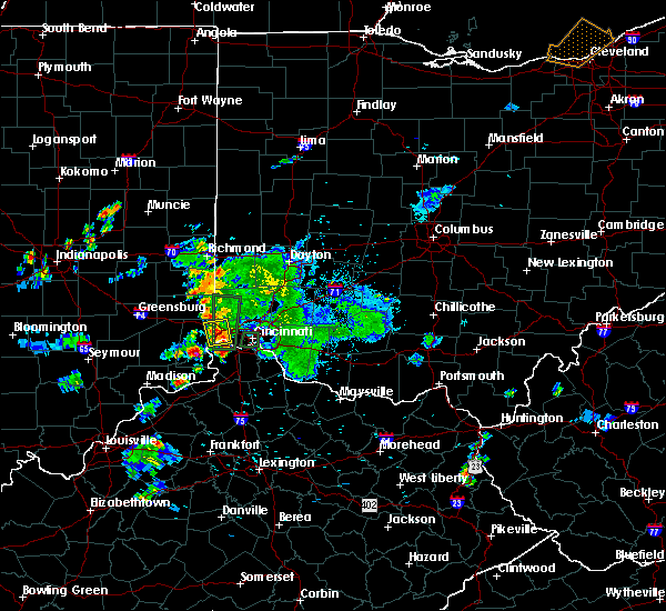 The severe thunderstorm warning for northeastern dearborn, northern boone and northwestern hamilton counties will expire at 730 pm edt, the storm which prompted the warning has weakened below severe limits, and no longer poses an immediate threat to life or property. therefore, the warning will be allowed to expire. however gusty winds and heavy rain are still possible with this thunderstorm. please report previous wind damage or hail to the national weather service by going to our website at weather.gov/iln and submitting your report via social media. The severe thunderstorm warning for northeastern dearborn, northern boone and northwestern hamilton counties will expire at 730 pm edt, the storm which prompted the warning has weakened below severe limits, and no longer poses an immediate threat to life or property. therefore, the warning will be allowed to expire. however gusty winds and heavy rain are still possible with this thunderstorm. please report previous wind damage or hail to the national weather service by going to our website at weather.gov/iln and submitting your report via social media.
|
| 9/5/2018 7:13 PM EDT |
 At 713 pm edt, a severe thunderstorm was located over bright, moving north at 25 mph (radar indicated). Hazards include 60 mph wind gusts. Expect damage to trees and power lines. locations impacted include, cincinnati, harrison, lawrenceburg, greendale, bright, hidden valley, cleves, shawnee, taylor creek, blue jay, miami heights, mack, logan, new haven, grandview, addyston, north bend, west harrison, francisville and interstate 74 at us route 52. this includes the following interstates, i-74 in indiana between mile markers 167 and 171. I-74 in ohio between mile markers 0 and 8. At 713 pm edt, a severe thunderstorm was located over bright, moving north at 25 mph (radar indicated). Hazards include 60 mph wind gusts. Expect damage to trees and power lines. locations impacted include, cincinnati, harrison, lawrenceburg, greendale, bright, hidden valley, cleves, shawnee, taylor creek, blue jay, miami heights, mack, logan, new haven, grandview, addyston, north bend, west harrison, francisville and interstate 74 at us route 52. this includes the following interstates, i-74 in indiana between mile markers 167 and 171. I-74 in ohio between mile markers 0 and 8.
|
| 9/5/2018 7:13 PM EDT |
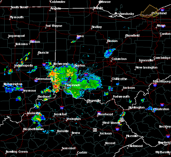 At 713 pm edt, a severe thunderstorm was located over bright, moving north at 25 mph (radar indicated). Hazards include 60 mph wind gusts. Expect damage to trees and power lines. locations impacted include, cincinnati, harrison, lawrenceburg, greendale, bright, hidden valley, cleves, shawnee, taylor creek, blue jay, miami heights, mack, logan, new haven, grandview, addyston, north bend, west harrison, francisville and interstate 74 at us route 52. this includes the following interstates, i-74 in indiana between mile markers 167 and 171. I-74 in ohio between mile markers 0 and 8. At 713 pm edt, a severe thunderstorm was located over bright, moving north at 25 mph (radar indicated). Hazards include 60 mph wind gusts. Expect damage to trees and power lines. locations impacted include, cincinnati, harrison, lawrenceburg, greendale, bright, hidden valley, cleves, shawnee, taylor creek, blue jay, miami heights, mack, logan, new haven, grandview, addyston, north bend, west harrison, francisville and interstate 74 at us route 52. this includes the following interstates, i-74 in indiana between mile markers 167 and 171. I-74 in ohio between mile markers 0 and 8.
|
| 9/5/2018 7:03 PM EDT |
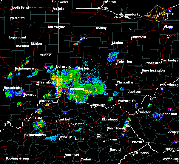 At 703 pm edt, a severe thunderstorm was located over shawnee, moving north at 40 mph (radar indicated). Hazards include 60 mph wind gusts and penny size hail. expect damage to trees and power lines At 703 pm edt, a severe thunderstorm was located over shawnee, moving north at 40 mph (radar indicated). Hazards include 60 mph wind gusts and penny size hail. expect damage to trees and power lines
|
| 9/5/2018 7:03 PM EDT |
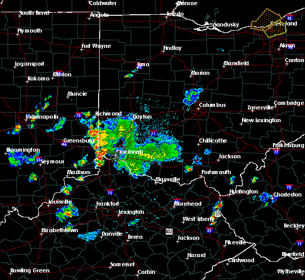 At 703 pm edt, a severe thunderstorm was located over shawnee, moving north at 40 mph (radar indicated). Hazards include 60 mph wind gusts and penny size hail. expect damage to trees and power lines At 703 pm edt, a severe thunderstorm was located over shawnee, moving north at 40 mph (radar indicated). Hazards include 60 mph wind gusts and penny size hail. expect damage to trees and power lines
|
| 9/5/2018 6:32 PM EDT | Tree down. time estimated from radar dat in hamilton county OH, 9.8 miles ESE of Cincinnati, OH |
| 9/5/2018 6:25 PM EDT | Tree down. time estimated from radar dat in hamilton county OH, 6.5 miles ENE of Cincinnati, OH |
| 9/5/2018 6:14 PM EDT | Roof blown off apartment building in east price hill. time estimated from radar dat in hamilton county OH, 3.8 miles ENE of Cincinnati, OH |
| 9/5/2018 6:02 PM EDT | Tree down across interstate 75 northbound. time estimated from rada in hamilton county OH, 2.1 miles NE of Cincinnati, OH |
| 9/5/2018 5:50 PM EDT | Tree down. time estimated from radar dat in hamilton county OH, 12.7 miles ESE of Cincinnati, OH |
| 8/10/2018 5:37 PM EDT |
 The severe thunderstorm warning for east central hamilton and northwestern clermont counties will expire at 545 pm edt, the storm which prompted the warning has weakened below severe limits, and no longer poses an immediate threat to life or property. therefore, the warning will be allowed to expire. please report previous wind damage or hail to the national weather service by going to our website at weather.gov/iln and submitting your report via social media. The severe thunderstorm warning for east central hamilton and northwestern clermont counties will expire at 545 pm edt, the storm which prompted the warning has weakened below severe limits, and no longer poses an immediate threat to life or property. therefore, the warning will be allowed to expire. please report previous wind damage or hail to the national weather service by going to our website at weather.gov/iln and submitting your report via social media.
|
| 8/10/2018 5:32 PM EDT |
 At 531 pm edt, a severe thunderstorm was located over terrace park, moving southeast at 5 mph (radar indicated). Hazards include quarter size hail. Minor damage to vehicles is possible. locations impacted include, cincinnati, norwood, blue ash, montgomery, madeira, milford, deer park, forestville, mariemont, terrace park, camp dennison, rossmoyne, remington, plainville, concorde hills, withamsville, the village of indian hill, silverton, amberley and newtown. This includes i-71 in ohio between mile markers 8 and 15. At 531 pm edt, a severe thunderstorm was located over terrace park, moving southeast at 5 mph (radar indicated). Hazards include quarter size hail. Minor damage to vehicles is possible. locations impacted include, cincinnati, norwood, blue ash, montgomery, madeira, milford, deer park, forestville, mariemont, terrace park, camp dennison, rossmoyne, remington, plainville, concorde hills, withamsville, the village of indian hill, silverton, amberley and newtown. This includes i-71 in ohio between mile markers 8 and 15.
|
| 8/10/2018 5:17 PM EDT |
 At 516 pm edt, a severe thunderstorm was located over camp dennison, moving southeast at 5 mph (radar indicated). Hazards include quarter size hail. minor damage to vehicles is possible At 516 pm edt, a severe thunderstorm was located over camp dennison, moving southeast at 5 mph (radar indicated). Hazards include quarter size hail. minor damage to vehicles is possible
|
| 8/4/2018 5:45 PM EDT | Several trees down on old 5 mile and forest road. time estimated from rada in hamilton county OH, 9.4 miles WNW of Cincinnati, OH |
| 8/4/2018 5:40 PM EDT | Tree branches everywhere on red bank near i-7 in hamilton county OH, 5.8 miles WSW of Cincinnati, OH |
| 8/4/2018 5:40 PM EDT | Tree branches everywhere on red bank near i-7 in hamilton county OH, 5.8 miles WSW of Cincinnati, OH |
| 8/4/2018 5:30 PM EDT | Large tree down on reeves golf cours in hamilton county OH, 5.3 miles WNW of Cincinnati, OH |
| 8/4/2018 5:28 PM EDT | 28066kts in hamilton county OH, 5.2 miles WNW of Cincinnati, OH |
| 7/20/2018 3:13 PM EDT |
 The severe thunderstorm warning for northern kenton, northern campbell, northern boone and southeastern hamilton counties will expire at 315 pm edt, the storm which prompted the warning has moved out of the area. therefore, the warning will be allowed to expire. however heavy rain is still possible with this thunderstorm. a tornado watch remains in effect until 900 pm edt for northern kentucky, and southwestern ohio. please report previous wind damage or hail to the national weather service by going to our website at weather.gov/iln and submitting your report via social media. The severe thunderstorm warning for northern kenton, northern campbell, northern boone and southeastern hamilton counties will expire at 315 pm edt, the storm which prompted the warning has moved out of the area. therefore, the warning will be allowed to expire. however heavy rain is still possible with this thunderstorm. a tornado watch remains in effect until 900 pm edt for northern kentucky, and southwestern ohio. please report previous wind damage or hail to the national weather service by going to our website at weather.gov/iln and submitting your report via social media.
|
| 7/20/2018 2:56 PM EDT |
 At 256 pm edt, a severe thunderstorm was located near cincinnati, moving east at 25 mph (radar indicated). Hazards include 60 mph wind gusts and penny size hail. Expect damage to trees and power lines. locations impacted include, cincinnati, covington, florence, independence, erlanger, fort thomas, newport, edgewood, alexandria, elsmere, fort mitchell, villa hills, highland heights, taylor mill, bellevue, fort wright, dayton, ludlow, southgate and crescent springs. this includes the following interstates, i-71 in ohio between mile markers 0 and 1. i-75 in kentucky between mile markers 181 and 191. i-75 in ohio between mile markers 0 and 1. A tornado watch remains in effect until 900 pm edt for northern kentucky, and southwestern ohio. At 256 pm edt, a severe thunderstorm was located near cincinnati, moving east at 25 mph (radar indicated). Hazards include 60 mph wind gusts and penny size hail. Expect damage to trees and power lines. locations impacted include, cincinnati, covington, florence, independence, erlanger, fort thomas, newport, edgewood, alexandria, elsmere, fort mitchell, villa hills, highland heights, taylor mill, bellevue, fort wright, dayton, ludlow, southgate and crescent springs. this includes the following interstates, i-71 in ohio between mile markers 0 and 1. i-75 in kentucky between mile markers 181 and 191. i-75 in ohio between mile markers 0 and 1. A tornado watch remains in effect until 900 pm edt for northern kentucky, and southwestern ohio.
|
| 7/20/2018 2:51 PM EDT | Via social media. large tree fell on 4 cars. time estimated from radar. corrected for 1 non life threatening injury. *** 1 inj *** in hamilton county OH, 3.1 miles WSW of Cincinnati, OH |
| 7/20/2018 2:51 PM EDT | Via social media. large tree fell on 4 cars. time estimated from radar. corrected for 1 non life threatening injury. *** 1 inj *** in hamilton county OH, 3.1 miles WSW of Cincinnati, OH |
| 7/20/2018 2:36 PM EDT |
 At 235 pm edt, a severe thunderstorm was located over mack, moving east at 25 mph (radar indicated). Hazards include 60 mph wind gusts and penny size hail. expect damage to trees and power lines At 235 pm edt, a severe thunderstorm was located over mack, moving east at 25 mph (radar indicated). Hazards include 60 mph wind gusts and penny size hail. expect damage to trees and power lines
|
| 7/1/2018 2:51 PM EDT | Tree down causing car damage and some property damage. time estimated from radar dat in hamilton county OH, 0.9 miles SW of Cincinnati, OH |
| 6/8/2018 6:54 PM EDT | A couple of trees were knocked down on colerain ave... between kemper rd. and struble r in hamilton county OH, 11.3 miles SSE of Cincinnati, OH |
| 5/31/2018 4:05 PM EDT | 8 inch diameter tree reported broken off at the groun in hamilton county OH, 6.7 miles SW of Cincinnati, OH |
| 5/31/2018 4:02 PM EDT | Tree downe in hamilton county OH, 8.8 miles WNW of Cincinnati, OH |
| 5/31/2018 4:00 PM EDT | Numerous trees and branches reported down. time estimated from rada in hamilton county OH, 9.2 miles ESE of Cincinnati, OH |
| 5/31/2018 3:58 PM EDT | Shingles reported off roof of house along with tree limbs down. time estimated from rada in hamilton county OH, 8.5 miles NW of Cincinnati, OH |
| 5/31/2018 3:57 PM EDT | Storm damage reported in hamilton county OH, 5.2 miles WNW of Cincinnati, OH |
| 5/31/2018 3:57 PM EDT |
 At 357 pm edt, severe thunderstorms were located along a line extending from north college hill to melbourne to near butler, moving east at 45 mph (radar indicated). Hazards include 60 mph wind gusts. expect damage to trees and power lines At 357 pm edt, severe thunderstorms were located along a line extending from north college hill to melbourne to near butler, moving east at 45 mph (radar indicated). Hazards include 60 mph wind gusts. expect damage to trees and power lines
|
| 5/31/2018 3:56 PM EDT | One tree reported down in anderson township near salem rd. time estimated from rada in hamilton county OH, 7.7 miles NW of Cincinnati, OH |
| 5/31/2018 3:54 PM EDT | Reported via mping. trees uprooted or snapped... roof damag in hamilton county OH, 7.6 miles ENE of Cincinnati, OH |
| 5/31/2018 3:40 PM EDT | 2-3 inch limbs reported broken. occurred ahead of the main stor in hamilton county OH, 7.5 miles ENE of Cincinnati, OH |
| 5/31/2018 3:36 PM EDT |
 A severe thunderstorm warning remains in effect until 400 pm edt for ohio. eastern franklin. dearborn. northeastern switzerland. kenton. campbell. boone. gallatin. hamilton and butler counties. At 335 pm edt, severe thunderstorms were located along a line extending from near brookville to near lawrenceburg to near patriot,. A severe thunderstorm warning remains in effect until 400 pm edt for ohio. eastern franklin. dearborn. northeastern switzerland. kenton. campbell. boone. gallatin. hamilton and butler counties. At 335 pm edt, severe thunderstorms were located along a line extending from near brookville to near lawrenceburg to near patriot,.
|
| 5/31/2018 3:36 PM EDT |
 At 335 pm edt, severe thunderstorms were located along a line extending from near brookville to near lawrenceburg to near patriot, moving northeast at 45 mph (radar indicated). Hazards include 70 mph wind gusts. Expect considerable tree damage. damage is likely to mobile homes, roofs, and outbuildings. locations impacted include, cincinnati, hamilton, fairfield, covington, florence, independence, oxford, norwood, forest park, erlanger, fort thomas, newport, sharonville, blue ash, springdale, reading, harrison, north college hill, madeira and edgewood. this includes the following interstates, i-71 in kentucky between mile markers 55 and 77. i-71 in ohio between mile markers 0 and 12. i-74 in indiana between mile markers 158 and 171. i-74 in ohio between mile markers 0 and 19. i-75 in kentucky between mile markers 167 and 191. I-75 in ohio between mile markers 0 and 18. At 335 pm edt, severe thunderstorms were located along a line extending from near brookville to near lawrenceburg to near patriot, moving northeast at 45 mph (radar indicated). Hazards include 70 mph wind gusts. Expect considerable tree damage. damage is likely to mobile homes, roofs, and outbuildings. locations impacted include, cincinnati, hamilton, fairfield, covington, florence, independence, oxford, norwood, forest park, erlanger, fort thomas, newport, sharonville, blue ash, springdale, reading, harrison, north college hill, madeira and edgewood. this includes the following interstates, i-71 in kentucky between mile markers 55 and 77. i-71 in ohio between mile markers 0 and 12. i-74 in indiana between mile markers 158 and 171. i-74 in ohio between mile markers 0 and 19. i-75 in kentucky between mile markers 167 and 191. I-75 in ohio between mile markers 0 and 18.
|
| 5/31/2018 3:13 PM EDT |
 At 313 pm edt, severe thunderstorms were located along a line extending from near batesville to near dillsboro to near vevay, moving northeast at 45 mph (radar indicated). Hazards include 70 mph wind gusts. Expect considerable tree damage. Damage is likely to mobile homes, roofs, and outbuildings. At 313 pm edt, severe thunderstorms were located along a line extending from near batesville to near dillsboro to near vevay, moving northeast at 45 mph (radar indicated). Hazards include 70 mph wind gusts. Expect considerable tree damage. Damage is likely to mobile homes, roofs, and outbuildings.
|
| 5/31/2018 3:13 PM EDT |
 The national weather service in wilmington has issued a * severe thunderstorm warning for. ohio county in southeastern indiana. franklin county in southeastern indiana. ripley county in southeastern indiana. Dearborn county in southeastern indiana. The national weather service in wilmington has issued a * severe thunderstorm warning for. ohio county in southeastern indiana. franklin county in southeastern indiana. ripley county in southeastern indiana. Dearborn county in southeastern indiana.
|
| 5/31/2018 3:13 PM EDT |
 At 313 pm edt, severe thunderstorms were located along a line extending from near batesville to near dillsboro to near vevay, moving northeast at 45 mph (radar indicated). Hazards include 70 mph wind gusts. Expect considerable tree damage. Damage is likely to mobile homes, roofs, and outbuildings. At 313 pm edt, severe thunderstorms were located along a line extending from near batesville to near dillsboro to near vevay, moving northeast at 45 mph (radar indicated). Hazards include 70 mph wind gusts. Expect considerable tree damage. Damage is likely to mobile homes, roofs, and outbuildings.
|
| 5/26/2018 4:18 PM EDT | Tree down and wires over roadway. time estimated via rada in hamilton county OH, 1.2 miles SE of Cincinnati, OH |
| 5/26/2018 4:12 PM EDT | Tree fell on deck and house. time estimated via rada in hamilton county OH, 4.7 miles ENE of Cincinnati, OH |
| 5/22/2018 6:42 PM EDT | Tree down. time estimated based on radar dat in hamilton county OH, 6 miles ENE of Cincinnati, OH |
| 5/6/2018 5:47 PM EDT | Two trees reported down near bennett rd and dunwoodie dr. time estimated from rada in hamilton county OH, 9.8 miles NW of Cincinnati, OH |
| 4/3/2018 8:28 PM EDT |
 The severe thunderstorm warning for northern kenton. northern campbell. central boone. southeastern hamilton and central clermont counties will expire at 830 pm edt. the storm which prompted the warning has weakened below severe limits, and no longer poses an immediate threat to life or property. Therefore, the warning will be allowed to expire. The severe thunderstorm warning for northern kenton. northern campbell. central boone. southeastern hamilton and central clermont counties will expire at 830 pm edt. the storm which prompted the warning has weakened below severe limits, and no longer poses an immediate threat to life or property. Therefore, the warning will be allowed to expire.
|
| 4/3/2018 8:06 PM EDT |
 At 805 pm edt, a severe thunderstorm was located over crestview hills, moving northeast at 55 mph (radar indicated). Hazards include quarter size hail. minor damage to vehicles is possible At 805 pm edt, a severe thunderstorm was located over crestview hills, moving northeast at 55 mph (radar indicated). Hazards include quarter size hail. minor damage to vehicles is possible
|
| 4/3/2018 4:42 PM EDT |
 At 442 pm edt, a severe thunderstorm was located near madison, moving east at 50 mph (radar indicated). Hazards include 60 mph wind gusts and quarter size hail. Minor hail damage to vehicles is possible. Expect wind damage to trees and power lines. At 442 pm edt, a severe thunderstorm was located near madison, moving east at 50 mph (radar indicated). Hazards include 60 mph wind gusts and quarter size hail. Minor hail damage to vehicles is possible. Expect wind damage to trees and power lines.
|
| 8/17/2017 3:00 PM EDT | Trees and a power line down on worthington avenue just east of burns avenue. time esitmated by rada in hamilton county OH, 6.4 miles SSW of Cincinnati, OH |
| 7/11/2017 3:02 PM EDT |
 At 301 pm edt, a severe thunderstorm was located near claryville, moving southeast at 45 mph (radar indicated). Hazards include 60 mph wind gusts. Expect damage to trees and power lines. locations impacted include, covington, independence, erlanger, edgewood, alexandria, elsmere, fort mitchell, villa hills, highland heights, taylor mill, fort wright, crescent springs, walton, crestview hills, lakeside park, falmouth, claryville, crittenden, wilder and butler. This includes i-75 in kentucky between mile markers 166 and 169, and between mile markers 184 and 188. At 301 pm edt, a severe thunderstorm was located near claryville, moving southeast at 45 mph (radar indicated). Hazards include 60 mph wind gusts. Expect damage to trees and power lines. locations impacted include, covington, independence, erlanger, edgewood, alexandria, elsmere, fort mitchell, villa hills, highland heights, taylor mill, fort wright, crescent springs, walton, crestview hills, lakeside park, falmouth, claryville, crittenden, wilder and butler. This includes i-75 in kentucky between mile markers 166 and 169, and between mile markers 184 and 188.
|
| 7/11/2017 2:45 PM EDT |
 At 244 pm edt, a severe thunderstorm was located over union, moving southeast at 45 mph (radar indicated). Hazards include 60 mph wind gusts. expect damage to trees and power lines At 244 pm edt, a severe thunderstorm was located over union, moving southeast at 45 mph (radar indicated). Hazards include 60 mph wind gusts. expect damage to trees and power lines
|
| 7/11/2017 2:25 PM EDT |
 At 225 pm edt, a severe thunderstorm was located over greendale, moving southeast at 60 mph (radar indicated). Hazards include 70 mph wind gusts. Expect considerable tree damage. damage is likely to mobile homes, roofs, and outbuildings. locations impacted include, cincinnati, florence, independence, erlanger, elsmere, villa hills, lawrenceburg, greendale, aurora, walton, rising sun, bright, hidden valley, oakbrook, burlington, union, cleves, shawnee, moores hill and delhi township. this includes the following interstates, i-71 in kentucky between mile markers 73 and 77. i-74 in indiana between mile markers 160 and 164. I-75 in kentucky between mile markers 170 and 183. At 225 pm edt, a severe thunderstorm was located over greendale, moving southeast at 60 mph (radar indicated). Hazards include 70 mph wind gusts. Expect considerable tree damage. damage is likely to mobile homes, roofs, and outbuildings. locations impacted include, cincinnati, florence, independence, erlanger, elsmere, villa hills, lawrenceburg, greendale, aurora, walton, rising sun, bright, hidden valley, oakbrook, burlington, union, cleves, shawnee, moores hill and delhi township. this includes the following interstates, i-71 in kentucky between mile markers 73 and 77. i-74 in indiana between mile markers 160 and 164. I-75 in kentucky between mile markers 170 and 183.
|
| 7/11/2017 2:25 PM EDT |
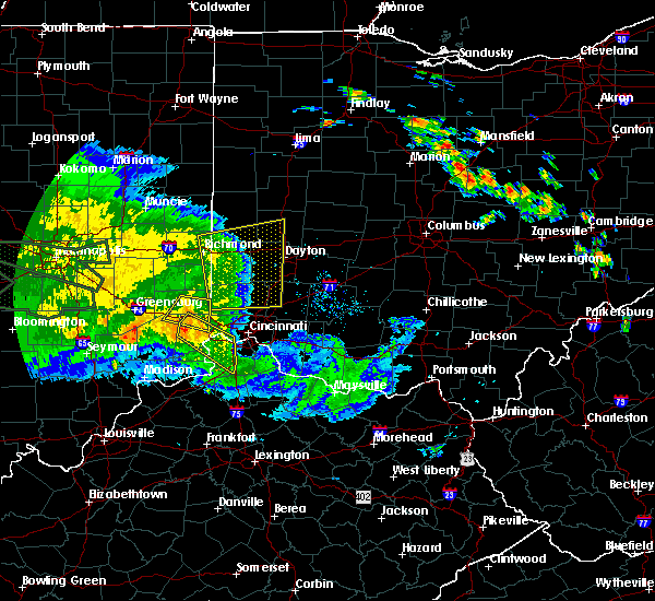 At 225 pm edt, a severe thunderstorm was located over greendale, moving southeast at 60 mph (radar indicated). Hazards include 70 mph wind gusts. Expect considerable tree damage. damage is likely to mobile homes, roofs, and outbuildings. locations impacted include, cincinnati, florence, independence, erlanger, elsmere, villa hills, lawrenceburg, greendale, aurora, walton, rising sun, bright, hidden valley, oakbrook, burlington, union, cleves, shawnee, moores hill and delhi township. this includes the following interstates, i-71 in kentucky between mile markers 73 and 77. i-74 in indiana between mile markers 160 and 164. I-75 in kentucky between mile markers 170 and 183. At 225 pm edt, a severe thunderstorm was located over greendale, moving southeast at 60 mph (radar indicated). Hazards include 70 mph wind gusts. Expect considerable tree damage. damage is likely to mobile homes, roofs, and outbuildings. locations impacted include, cincinnati, florence, independence, erlanger, elsmere, villa hills, lawrenceburg, greendale, aurora, walton, rising sun, bright, hidden valley, oakbrook, burlington, union, cleves, shawnee, moores hill and delhi township. this includes the following interstates, i-71 in kentucky between mile markers 73 and 77. i-74 in indiana between mile markers 160 and 164. I-75 in kentucky between mile markers 170 and 183.
|
| 7/11/2017 2:17 PM EDT |
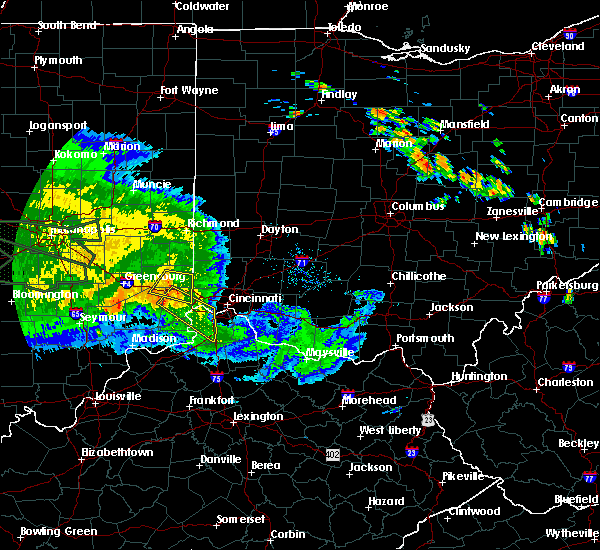 At 216 pm edt, a severe thunderstorm was located 7 miles northeast of moores hill, moving southeast at 55 mph (radar indicated). Hazards include 60 mph wind gusts. expect damage to trees and power lines At 216 pm edt, a severe thunderstorm was located 7 miles northeast of moores hill, moving southeast at 55 mph (radar indicated). Hazards include 60 mph wind gusts. expect damage to trees and power lines
|
| 7/7/2017 6:47 PM EDT |
 At 646 pm edt, a severe thunderstorm was located near hillsboro, moving east at 45 mph (radar indicated). Hazards include 70 mph wind gusts and quarter size hail. Minor hail damage to vehicles is possible. expect considerable tree damage. wind damage is also likely to mobile homes, roofs, and outbuildings. locations impacted include, cincinnati, madeira, milford, hillsboro, blanchester, mount orab, mariemont, williamsburg, terrace park, batavia, lynchburg, leesburg, new vienna, sardinia, camp dennison, plainville, the village of indian hill, russell, silverton and woodville. This includes i-71 in ohio between mile markers 9 and 11. At 646 pm edt, a severe thunderstorm was located near hillsboro, moving east at 45 mph (radar indicated). Hazards include 70 mph wind gusts and quarter size hail. Minor hail damage to vehicles is possible. expect considerable tree damage. wind damage is also likely to mobile homes, roofs, and outbuildings. locations impacted include, cincinnati, madeira, milford, hillsboro, blanchester, mount orab, mariemont, williamsburg, terrace park, batavia, lynchburg, leesburg, new vienna, sardinia, camp dennison, plainville, the village of indian hill, russell, silverton and woodville. This includes i-71 in ohio between mile markers 9 and 11.
|
| 7/7/2017 6:41 PM EDT |
 The severe thunderstorm warning for central hamilton county will expire at 645 pm edt, the storm which prompted the warning has moved out of the area. therefore, the warning will be allowed to expire. a severe thunderstorm watch remains in effect until 1100 pm edt for southeastern indiana, northern kentucky, and southwestern ohio. please report previous wind damage or hail to the national weather service by going to our website at weather.gov/iln and submitting your report via social media. The severe thunderstorm warning for central hamilton county will expire at 645 pm edt, the storm which prompted the warning has moved out of the area. therefore, the warning will be allowed to expire. a severe thunderstorm watch remains in effect until 1100 pm edt for southeastern indiana, northern kentucky, and southwestern ohio. please report previous wind damage or hail to the national weather service by going to our website at weather.gov/iln and submitting your report via social media.
|
| 7/7/2017 6:39 PM EDT |
 At 639 pm edt, a severe thunderstorm was located over lynchburg, moving east at 45 mph (radar indicated). Hazards include 70 mph wind gusts and quarter size hail. Minor hail damage to vehicles is possible. expect considerable tree damage. wind damage is also likely to mobile homes, roofs, and outbuildings. locations impacted include, cincinnati, loveland, madeira, milford, hillsboro, deer park, blanchester, mount orab, mariemont, williamsburg, terrace park, batavia, lynchburg, leesburg, new vienna, sardinia, camp dennison, remington, concorde hills and plainville. This includes i-71 in ohio between mile markers 9 and 13. At 639 pm edt, a severe thunderstorm was located over lynchburg, moving east at 45 mph (radar indicated). Hazards include 70 mph wind gusts and quarter size hail. Minor hail damage to vehicles is possible. expect considerable tree damage. wind damage is also likely to mobile homes, roofs, and outbuildings. locations impacted include, cincinnati, loveland, madeira, milford, hillsboro, deer park, blanchester, mount orab, mariemont, williamsburg, terrace park, batavia, lynchburg, leesburg, new vienna, sardinia, camp dennison, remington, concorde hills and plainville. This includes i-71 in ohio between mile markers 9 and 13.
|
| 7/7/2017 6:23 PM EDT | In madisonville in hamilton county OH, 6.1 miles WSW of Cincinnati, OH |
| 7/7/2017 6:20 PM EDT | Downed tree between sycamore and main streets. time estimated from rada in hamilton county OH, 2.1 miles NNE of Cincinnati, OH |
| 7/7/2017 6:20 PM EDT |
 At 620 pm edt, a severe thunderstorm was located over university of cincinnati, moving southeast at 25 mph (radar indicated). Hazards include 60 mph wind gusts and quarter size hail. Minor hail damage to vehicles is possible. Expect wind damage to trees and power lines. At 620 pm edt, a severe thunderstorm was located over university of cincinnati, moving southeast at 25 mph (radar indicated). Hazards include 60 mph wind gusts and quarter size hail. Minor hail damage to vehicles is possible. Expect wind damage to trees and power lines.
|
| 7/7/2017 6:15 PM EDT | Quarter sized hail reported 10 miles SW of Cincinnati, OH, between quarter and half dollar sized |
| 7/7/2017 6:14 PM EDT |
 At 614 pm edt, a severe thunderstorm was located near morrow, moving east at 45 mph (radar indicated). Hazards include 60 mph wind gusts and quarter size hail. Minor hail damage to vehicles is possible. Expect wind damage to trees and power lines. At 614 pm edt, a severe thunderstorm was located near morrow, moving east at 45 mph (radar indicated). Hazards include 60 mph wind gusts and quarter size hail. Minor hail damage to vehicles is possible. Expect wind damage to trees and power lines.
|
| 7/7/2017 6:14 PM EDT |
 At 614 pm edt, a severe thunderstorm was located over colerain township, moving southeast at 30 mph (radar indicated). Hazards include 60 mph wind gusts and quarter size hail. Minor hail damage to vehicles is possible. expect wind damage to trees and power lines. locations impacted include, cincinnati, covington, norwood, harrison, north college hill, wyoming, cheviot, villa hills, mount healthy, dayton, ludlow, finneytown, ross, mariemont, taylor creek, bridgetown, pleasant hills, delhi township, miami heights and dry ridge. this includes the following interstates, i-71 in ohio between mile markers 2 and 8. i-74 in ohio between mile markers 2 and 19. I-75 in ohio between mile markers 1 and 10. At 614 pm edt, a severe thunderstorm was located over colerain township, moving southeast at 30 mph (radar indicated). Hazards include 60 mph wind gusts and quarter size hail. Minor hail damage to vehicles is possible. expect wind damage to trees and power lines. locations impacted include, cincinnati, covington, norwood, harrison, north college hill, wyoming, cheviot, villa hills, mount healthy, dayton, ludlow, finneytown, ross, mariemont, taylor creek, bridgetown, pleasant hills, delhi township, miami heights and dry ridge. this includes the following interstates, i-71 in ohio between mile markers 2 and 8. i-74 in ohio between mile markers 2 and 19. I-75 in ohio between mile markers 1 and 10.
|
| 7/7/2017 6:13 PM EDT |
 At 613 pm edt, a severe thunderstorm was located over sharonville, moving southeast at 35 mph (radar indicated). Hazards include 60 mph wind gusts and quarter size hail. Minor hail damage to vehicles is possible. expect wind damage to trees and power lines. locations impacted include, cincinnati, hamilton, fairfield, mason, lebanon, forest park, sharonville, monroe, blue ash, loveland, springdale, reading, montgomery, madeira, wyoming, deer park, west chester, mariemont, highpoint and remington. this includes the following interstates, i-71 in ohio between mile markers 9 and 26. I-75 in ohio between mile markers 11 and 27. At 613 pm edt, a severe thunderstorm was located over sharonville, moving southeast at 35 mph (radar indicated). Hazards include 60 mph wind gusts and quarter size hail. Minor hail damage to vehicles is possible. expect wind damage to trees and power lines. locations impacted include, cincinnati, hamilton, fairfield, mason, lebanon, forest park, sharonville, monroe, blue ash, loveland, springdale, reading, montgomery, madeira, wyoming, deer park, west chester, mariemont, highpoint and remington. this includes the following interstates, i-71 in ohio between mile markers 9 and 26. I-75 in ohio between mile markers 11 and 27.
|
| 7/7/2017 6:12 PM EDT | Several trees down in hamilton county OH, 10.8 miles SE of Cincinnati, OH |
| 7/7/2017 6:02 PM EDT |
 At 601 pm edt, a severe thunderstorm was located over ross, moving southeast at 30 mph (radar indicated). Hazards include 60 mph wind gusts and quarter size hail. Minor hail damage to vehicles is possible. Expect wind damage to trees and power lines. At 601 pm edt, a severe thunderstorm was located over ross, moving southeast at 30 mph (radar indicated). Hazards include 60 mph wind gusts and quarter size hail. Minor hail damage to vehicles is possible. Expect wind damage to trees and power lines.
|
| 7/7/2017 5:52 PM EDT |
 The national weather service in wilmington has issued a * severe thunderstorm warning for. northeastern hamilton county in southwestern ohio. butler county in southwestern ohio. southwestern warren county in southwestern ohio. Until 630 pm edt. The national weather service in wilmington has issued a * severe thunderstorm warning for. northeastern hamilton county in southwestern ohio. butler county in southwestern ohio. southwestern warren county in southwestern ohio. Until 630 pm edt.
|
| 6/13/2017 12:20 PM EDT |
 The severe thunderstorm warning for central hamilton and southeastern butler counties will expire at 1230 pm edt, the storms which prompted the warning have weakened. therefore, the warning will be allowed to expire. please report previous wind damage or hail to the national weather service by going to our website at weather.gov/iln and submitting your report via social media. The severe thunderstorm warning for central hamilton and southeastern butler counties will expire at 1230 pm edt, the storms which prompted the warning have weakened. therefore, the warning will be allowed to expire. please report previous wind damage or hail to the national weather service by going to our website at weather.gov/iln and submitting your report via social media.
|
| 6/13/2017 12:02 PM EDT |
 At 1201 pm edt, severe thunderstorms were located along a line extending from fairfield to near delhi township, moving east at 25 mph (radar indicated). Hazards include 60 mph wind gusts and penny size hail. Expect damage to roofs, siding, and trees. locations impacted include, cincinnati, hamilton, fairfield, norwood, forest park, sharonville, blue ash, springdale, reading, montgomery, north college hill, madeira, wyoming, cheviot, mount healthy, deer park, dayton, finneytown, west chester and ross. this includes the following interstates, i-71 in ohio between mile markers 2 and 16. i-74 in ohio between mile markers 9 and 19. I-75 in ohio between mile markers 1 and 27. At 1201 pm edt, severe thunderstorms were located along a line extending from fairfield to near delhi township, moving east at 25 mph (radar indicated). Hazards include 60 mph wind gusts and penny size hail. Expect damage to roofs, siding, and trees. locations impacted include, cincinnati, hamilton, fairfield, norwood, forest park, sharonville, blue ash, springdale, reading, montgomery, north college hill, madeira, wyoming, cheviot, mount healthy, deer park, dayton, finneytown, west chester and ross. this includes the following interstates, i-71 in ohio between mile markers 2 and 16. i-74 in ohio between mile markers 9 and 19. I-75 in ohio between mile markers 1 and 27.
|
| 6/13/2017 11:44 AM EDT |
 At 1144 am edt, severe thunderstorms were located along a line extending from near ross to near shawnee, moving east at 25 mph (law enforcement reported trees down in eastern dearborn county). Hazards include 60 mph wind gusts and penny size hail. expect damage to roofs, siding, and trees At 1144 am edt, severe thunderstorms were located along a line extending from near ross to near shawnee, moving east at 25 mph (law enforcement reported trees down in eastern dearborn county). Hazards include 60 mph wind gusts and penny size hail. expect damage to roofs, siding, and trees
|
| 5/20/2017 3:09 PM EDT |
 At 309 pm edt, a severe thunderstorm was located near claryville, moving northeast at 20 mph (radar indicated). Hazards include 60 mph wind gusts and quarter size hail. Hail damage to vehicles is expected. expect wind damage to roofs, siding, and trees. locations impacted include, cincinnati, covington, independence, erlanger, fort thomas, newport, montgomery, madeira, edgewood, alexandria, highland heights, milford, taylor mill, bellevue, fort wright, dayton, southgate, walton, claryville and forestville. this includes the following interstates, i-71 in ohio between mile markers 10 and 13. I-75 in kentucky between mile markers 174 and 175. At 309 pm edt, a severe thunderstorm was located near claryville, moving northeast at 20 mph (radar indicated). Hazards include 60 mph wind gusts and quarter size hail. Hail damage to vehicles is expected. expect wind damage to roofs, siding, and trees. locations impacted include, cincinnati, covington, independence, erlanger, fort thomas, newport, montgomery, madeira, edgewood, alexandria, highland heights, milford, taylor mill, bellevue, fort wright, dayton, southgate, walton, claryville and forestville. this includes the following interstates, i-71 in ohio between mile markers 10 and 13. I-75 in kentucky between mile markers 174 and 175.
|
| 5/20/2017 2:56 PM EDT |
 At 255 pm edt, a severe thunderstorm was located near independence, moving northeast at 20 mph (radar indicated). Hazards include 60 mph wind gusts and quarter size hail. Hail damage to vehicles is expected. Expect wind damage to roofs, siding, and trees. At 255 pm edt, a severe thunderstorm was located near independence, moving northeast at 20 mph (radar indicated). Hazards include 60 mph wind gusts and quarter size hail. Hail damage to vehicles is expected. Expect wind damage to roofs, siding, and trees.
|
| 5/19/2017 4:45 PM EDT | A giant tree was toppled and it fell on a ca in hamilton county OH, 3.9 miles WNW of Cincinnati, OH |
| 5/19/2017 4:45 PM EDT | Several mature trees were knocked down blocking delta avenue. also a power pole was cracked by at the bas in hamilton county OH, 3.9 miles W of Cincinnati, OH |
| 4/30/2017 1:30 AM EDT |
 At 130 am edt, a severe thunderstorm was located over dunlap, moving northeast at 50 mph (radar indicated). Hazards include 60 mph wind gusts and penny size hail. expect damage to roofs, siding, and trees At 130 am edt, a severe thunderstorm was located over dunlap, moving northeast at 50 mph (radar indicated). Hazards include 60 mph wind gusts and penny size hail. expect damage to roofs, siding, and trees
|
| 4/29/2017 8:59 AM EDT | Tree down near intersection of hunley rd. and clough pike. time estimated by rada in hamilton county OH, 7.6 miles WNW of Cincinnati, OH |
| 4/29/2017 8:53 AM EDT |
 The severe thunderstorm warning for northern kenton, northern campbell, boone and southeastern hamilton counties will expire at 900 am edt, the storm which prompted the warning has weakened below severe limits, and has exited the warned area. therefore, the warning will be allowed to expire. however gusty winds and heavy rain are still possible with this thunderstorm. please report previous wind damage or hail to the national weather service by going to our website at weather.gov/iln and submitting your report via social media. The severe thunderstorm warning for northern kenton, northern campbell, boone and southeastern hamilton counties will expire at 900 am edt, the storm which prompted the warning has weakened below severe limits, and has exited the warned area. therefore, the warning will be allowed to expire. however gusty winds and heavy rain are still possible with this thunderstorm. please report previous wind damage or hail to the national weather service by going to our website at weather.gov/iln and submitting your report via social media.
|
| 4/29/2017 8:43 AM EDT |
 At 843 am edt, a severe thunderstorm was located over villa hills, moving east at 50 mph (radar indicated). Hazards include 60 mph wind gusts and quarter size hail. Hail damage to vehicles is expected. expect wind damage to roofs, siding, and trees. locations impacted include, cincinnati, covington, florence, independence, norwood, erlanger, fort thomas, newport, blue ash, loveland, reading, montgomery, madeira, edgewood, alexandria, elsmere, wyoming, cheviot, fort mitchell and villa hills. this includes the following interstates, i-71 in ohio between mile markers 0 and 17. i-74 in ohio between mile markers 15 and 19. i-75 in kentucky between mile markers 175 and 191. I-75 in ohio between mile markers 0 and 12. At 843 am edt, a severe thunderstorm was located over villa hills, moving east at 50 mph (radar indicated). Hazards include 60 mph wind gusts and quarter size hail. Hail damage to vehicles is expected. expect wind damage to roofs, siding, and trees. locations impacted include, cincinnati, covington, florence, independence, norwood, erlanger, fort thomas, newport, blue ash, loveland, reading, montgomery, madeira, edgewood, alexandria, elsmere, wyoming, cheviot, fort mitchell and villa hills. this includes the following interstates, i-71 in ohio between mile markers 0 and 17. i-74 in ohio between mile markers 15 and 19. i-75 in kentucky between mile markers 175 and 191. I-75 in ohio between mile markers 0 and 12.
|
| 4/29/2017 8:40 AM EDT |
 The severe thunderstorm warning for southeastern franklin, ripley, dearborn, northwestern hamilton and southwestern butler counties will expire at 845 am edt, the storm which prompted the warning has moved out of the area. therefore, the warning will be allowed to expire. however heavy rain is still possible with this thunderstorm. please report previous wind damage or hail to the national weather service by going to our website at weather.gov/iln and submitting your report via social media. The severe thunderstorm warning for southeastern franklin, ripley, dearborn, northwestern hamilton and southwestern butler counties will expire at 845 am edt, the storm which prompted the warning has moved out of the area. therefore, the warning will be allowed to expire. however heavy rain is still possible with this thunderstorm. please report previous wind damage or hail to the national weather service by going to our website at weather.gov/iln and submitting your report via social media.
|
| 4/29/2017 8:40 AM EDT |
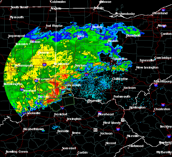 The severe thunderstorm warning for southeastern franklin, ripley, dearborn, northwestern hamilton and southwestern butler counties will expire at 845 am edt, the storm which prompted the warning has moved out of the area. therefore, the warning will be allowed to expire. however heavy rain is still possible with this thunderstorm. please report previous wind damage or hail to the national weather service by going to our website at weather.gov/iln and submitting your report via social media. The severe thunderstorm warning for southeastern franklin, ripley, dearborn, northwestern hamilton and southwestern butler counties will expire at 845 am edt, the storm which prompted the warning has moved out of the area. therefore, the warning will be allowed to expire. however heavy rain is still possible with this thunderstorm. please report previous wind damage or hail to the national weather service by going to our website at weather.gov/iln and submitting your report via social media.
|
| 4/29/2017 8:22 AM EDT |
 At 821 am edt, a severe thunderstorm was located near rising sun, moving east at 50 mph (radar indicated). Hazards include 60 mph wind gusts and quarter size hail. Hail damage to vehicles is expected. Expect wind damage to roofs, siding, and trees. At 821 am edt, a severe thunderstorm was located near rising sun, moving east at 50 mph (radar indicated). Hazards include 60 mph wind gusts and quarter size hail. Hail damage to vehicles is expected. Expect wind damage to roofs, siding, and trees.
|
| 4/29/2017 8:13 AM EDT |
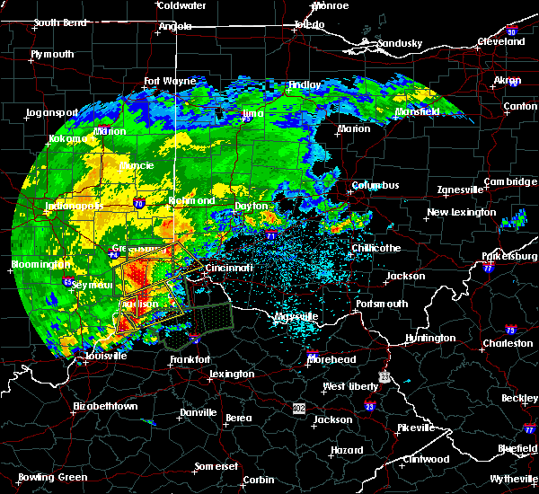 At 813 am edt, a severe thunderstorm was located over milan, moving northeast at 50 mph (radar indicated). Hazards include 60 mph wind gusts and quarter size hail. Hail damage to vehicles is expected. expect wind damage to roofs, siding, and trees. locations impacted include, cincinnati, fairfield, harrison, north college hill, batesville, mount healthy, lawrenceburg, greendale, aurora, bright, hidden valley, finneytown, ross, cleves, versailles, milan, osgood, dillsboro, shawnee and moores hill. this includes the following interstates, i-74 in indiana between mile markers 151 and 171. I-74 in ohio between mile markers 0 and 14. At 813 am edt, a severe thunderstorm was located over milan, moving northeast at 50 mph (radar indicated). Hazards include 60 mph wind gusts and quarter size hail. Hail damage to vehicles is expected. expect wind damage to roofs, siding, and trees. locations impacted include, cincinnati, fairfield, harrison, north college hill, batesville, mount healthy, lawrenceburg, greendale, aurora, bright, hidden valley, finneytown, ross, cleves, versailles, milan, osgood, dillsboro, shawnee and moores hill. this includes the following interstates, i-74 in indiana between mile markers 151 and 171. I-74 in ohio between mile markers 0 and 14.
|
| 4/28/2017 9:26 PM EDT | Numerous large branches knocked dow in hamilton county OH, 5.6 miles SW of Cincinnati, OH |
| 4/28/2017 9:08 PM EDT |
 At 907 pm edt, a severe thunderstorm was located over taylor creek, moving east at 40 mph (radar indicated). Hazards include ping pong ball size hail and 60 mph wind gusts. People and animals outdoors will be injured. expect hail damage to roofs, siding, windows, and vehicles. expect wind damage to roofs, siding, and trees. locations impacted include, cincinnati, hamilton, fairfield, mason, norwood, forest park, sharonville, blue ash, springdale, reading, montgomery, north college hill, madeira, wyoming, cheviot, milford, mount healthy, deer park, dayton and finneytown. this includes the following interstates, i-71 in ohio between mile markers 3 and 20. i-74 in ohio between mile markers 12 and 19. I-75 in ohio between mile markers 3 and 23. At 907 pm edt, a severe thunderstorm was located over taylor creek, moving east at 40 mph (radar indicated). Hazards include ping pong ball size hail and 60 mph wind gusts. People and animals outdoors will be injured. expect hail damage to roofs, siding, windows, and vehicles. expect wind damage to roofs, siding, and trees. locations impacted include, cincinnati, hamilton, fairfield, mason, norwood, forest park, sharonville, blue ash, springdale, reading, montgomery, north college hill, madeira, wyoming, cheviot, milford, mount healthy, deer park, dayton and finneytown. this includes the following interstates, i-71 in ohio between mile markers 3 and 20. i-74 in ohio between mile markers 12 and 19. I-75 in ohio between mile markers 3 and 23.
|
| 4/28/2017 8:52 PM EDT |
 At 852 pm edt, a severe thunderstorm was located over bright, moving east at 40 mph (radar indicated). Hazards include ping pong ball size hail and 60 mph wind gusts. People and animals outdoors will be injured. expect hail damage to roofs, siding, windows, and vehicles. Expect wind damage to roofs, siding, and trees. At 852 pm edt, a severe thunderstorm was located over bright, moving east at 40 mph (radar indicated). Hazards include ping pong ball size hail and 60 mph wind gusts. People and animals outdoors will be injured. expect hail damage to roofs, siding, windows, and vehicles. Expect wind damage to roofs, siding, and trees.
|
| 4/16/2017 6:40 PM EDT |
 At 639 pm edt, a severe thunderstorm was located near burlington, moving east at 40 mph (radar indicated). Hazards include 60 mph wind gusts and penny size hail. expect damage to roofs, siding, and trees At 639 pm edt, a severe thunderstorm was located near burlington, moving east at 40 mph (radar indicated). Hazards include 60 mph wind gusts and penny size hail. expect damage to roofs, siding, and trees
|
| 4/16/2017 6:22 PM EDT | Quarter sized hail reported 11.4 miles W of Cincinnati, OH |
| 4/16/2017 6:18 PM EDT | Quarter sized hail reported 12.2 miles WNW of Cincinnati, OH |
| 4/16/2017 6:12 PM EDT |
 At 612 pm edt, a severe thunderstorm was located near terrace park, moving east at 30 mph (radar indicated). Hazards include 60 mph wind gusts and quarter size hail. Hail damage to vehicles is expected. Expect wind damage to roofs, siding, and trees. At 612 pm edt, a severe thunderstorm was located near terrace park, moving east at 30 mph (radar indicated). Hazards include 60 mph wind gusts and quarter size hail. Hail damage to vehicles is expected. Expect wind damage to roofs, siding, and trees.
|
| 4/5/2017 6:56 PM EDT |
 The severe thunderstorm warning for southeastern hamilton and clermont counties will expire at 700 pm edt. the storm which prompted the warning has moved out of the area. therefore, the warning will be allowed to expire. a severe thunderstorm watch remains in effect until 900 pm edt for northern kentucky. And southwestern ohio. The severe thunderstorm warning for southeastern hamilton and clermont counties will expire at 700 pm edt. the storm which prompted the warning has moved out of the area. therefore, the warning will be allowed to expire. a severe thunderstorm watch remains in effect until 900 pm edt for northern kentucky. And southwestern ohio.
|
| 4/5/2017 6:44 PM EDT |
 At 643 pm edt, a severe thunderstorm was located over withamsville, moving northeast at 40 mph (radar indicated). Hazards include 60 mph wind gusts and quarter size hail. Hail damage to vehicles is expected. expect wind damage to roofs, siding, and trees. Locations impacted include, milford, forestville, amelia, new richmond, williamsburg, terrace park, batavia, salem heights, withamsville, coldstream, camp dennison, newtown, sherwood, owensville, goshen, newtonsville, perintown, day heights, new palestine and springvale. At 643 pm edt, a severe thunderstorm was located over withamsville, moving northeast at 40 mph (radar indicated). Hazards include 60 mph wind gusts and quarter size hail. Hail damage to vehicles is expected. expect wind damage to roofs, siding, and trees. Locations impacted include, milford, forestville, amelia, new richmond, williamsburg, terrace park, batavia, salem heights, withamsville, coldstream, camp dennison, newtown, sherwood, owensville, goshen, newtonsville, perintown, day heights, new palestine and springvale.
|
| 4/5/2017 6:32 PM EDT | Dime sized hail as wel in hamilton county OH, 1.8 miles NW of Cincinnati, OH |
| 4/5/2017 6:31 PM EDT |
 At 631 pm edt, a severe thunderstorm was located over alexandria, moving northeast at 40 mph (radar indicated). Hazards include 60 mph wind gusts and quarter size hail. Hail damage to vehicles is expected. Expect wind damage to roofs, siding, and trees. At 631 pm edt, a severe thunderstorm was located over alexandria, moving northeast at 40 mph (radar indicated). Hazards include 60 mph wind gusts and quarter size hail. Hail damage to vehicles is expected. Expect wind damage to roofs, siding, and trees.
|
| 4/5/2017 6:26 PM EDT |
 At 625 pm edt, a severe thunderstorm was located near shawnee, moving northeast at 45 mph (radar indicated). Hazards include 60 mph wind gusts and penny size hail. Expect damage to roofs, siding, and trees. locations impacted include, cincinnati, fairfield, covington, norwood, forest park, reading, north college hill, wyoming, cheviot, villa hills, mount healthy, dayton, lawrenceburg, greendale, ludlow, aurora, finneytown, hidden valley, burlington and mariemont. this includes the following interstates, i-71 in ohio between mile markers 1 and 10. i-74 in ohio between mile markers 6 and 19. I-75 in ohio between mile markers 1 and 11. At 625 pm edt, a severe thunderstorm was located near shawnee, moving northeast at 45 mph (radar indicated). Hazards include 60 mph wind gusts and penny size hail. Expect damage to roofs, siding, and trees. locations impacted include, cincinnati, fairfield, covington, norwood, forest park, reading, north college hill, wyoming, cheviot, villa hills, mount healthy, dayton, lawrenceburg, greendale, ludlow, aurora, finneytown, hidden valley, burlington and mariemont. this includes the following interstates, i-71 in ohio between mile markers 1 and 10. i-74 in ohio between mile markers 6 and 19. I-75 in ohio between mile markers 1 and 11.
|
| 4/5/2017 6:23 PM EDT |
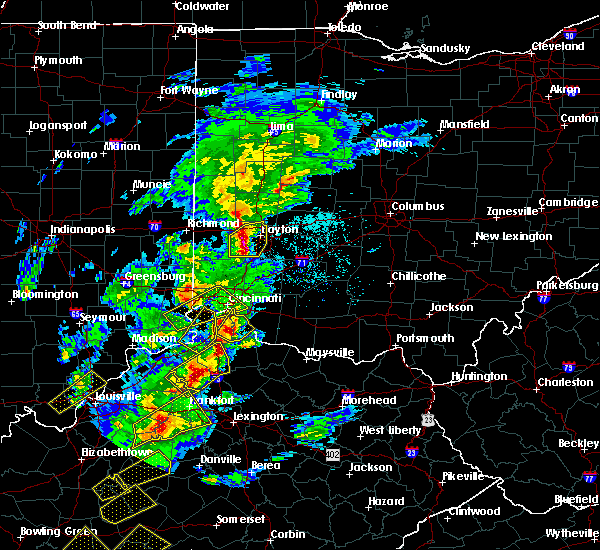 The severe thunderstorm warning for northeastern switzerland, boone, northwestern grant and central gallatin counties will expire at 630 pm edt, the storm which prompted the warning has moved out of the area. therefore, the warning will be allowed to expire. a severe thunderstorm watch remains in effect until 900 pm edt for southeastern indiana, northern kentucky, and southwestern ohio. please report previous wind damage or hail to the national weather service by going to our website at weather.gov/iln and submitting your report via social media. The severe thunderstorm warning for northeastern switzerland, boone, northwestern grant and central gallatin counties will expire at 630 pm edt, the storm which prompted the warning has moved out of the area. therefore, the warning will be allowed to expire. a severe thunderstorm watch remains in effect until 900 pm edt for southeastern indiana, northern kentucky, and southwestern ohio. please report previous wind damage or hail to the national weather service by going to our website at weather.gov/iln and submitting your report via social media.
|
| 4/5/2017 6:16 PM EDT |
 At 615 pm edt, a severe thunderstorm was located near claryville, moving northeast at 30 mph (radar indicated). Hazards include 60 mph wind gusts and quarter size hail. Hail damage to vehicles is expected. Expect wind damage to roofs, siding, and trees. At 615 pm edt, a severe thunderstorm was located near claryville, moving northeast at 30 mph (radar indicated). Hazards include 60 mph wind gusts and quarter size hail. Hail damage to vehicles is expected. Expect wind damage to roofs, siding, and trees.
|
| 4/5/2017 6:12 PM EDT |
 At 611 pm edt, a severe thunderstorm was located near union, moving northeast at 55 mph (radar indicated). Hazards include 60 mph wind gusts and quarter size hail. Hail damage to vehicles is expected. expect wind damage to roofs, siding, and trees. locations impacted include, florence, independence, erlanger, elsmere, villa hills, walton, oakbrook, burlington, union, warsaw, glencoe, patriot, richwood, ryle, big bone lick, interstate 71 at us route 127, steele bottom, waterloo, constance and hebron. this includes the following interstates, i-71 in kentucky between mile markers 62 and 77. I-75 in kentucky between mile markers 170 and 183. At 611 pm edt, a severe thunderstorm was located near union, moving northeast at 55 mph (radar indicated). Hazards include 60 mph wind gusts and quarter size hail. Hail damage to vehicles is expected. expect wind damage to roofs, siding, and trees. locations impacted include, florence, independence, erlanger, elsmere, villa hills, walton, oakbrook, burlington, union, warsaw, glencoe, patriot, richwood, ryle, big bone lick, interstate 71 at us route 127, steele bottom, waterloo, constance and hebron. this includes the following interstates, i-71 in kentucky between mile markers 62 and 77. I-75 in kentucky between mile markers 170 and 183.
|
| 4/5/2017 6:12 PM EDT |
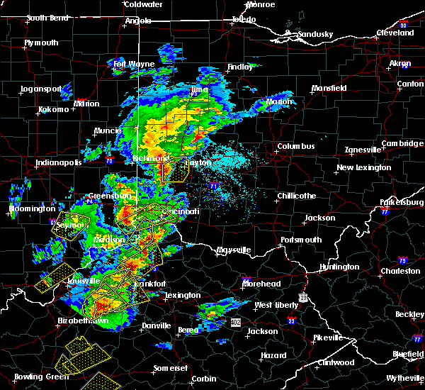 At 611 pm edt, a severe thunderstorm was located near union, moving northeast at 55 mph (radar indicated). Hazards include 60 mph wind gusts and quarter size hail. Hail damage to vehicles is expected. expect wind damage to roofs, siding, and trees. locations impacted include, florence, independence, erlanger, elsmere, villa hills, walton, oakbrook, burlington, union, warsaw, glencoe, patriot, richwood, ryle, big bone lick, interstate 71 at us route 127, steele bottom, waterloo, constance and hebron. this includes the following interstates, i-71 in kentucky between mile markers 62 and 77. I-75 in kentucky between mile markers 170 and 183. At 611 pm edt, a severe thunderstorm was located near union, moving northeast at 55 mph (radar indicated). Hazards include 60 mph wind gusts and quarter size hail. Hail damage to vehicles is expected. expect wind damage to roofs, siding, and trees. locations impacted include, florence, independence, erlanger, elsmere, villa hills, walton, oakbrook, burlington, union, warsaw, glencoe, patriot, richwood, ryle, big bone lick, interstate 71 at us route 127, steele bottom, waterloo, constance and hebron. this includes the following interstates, i-71 in kentucky between mile markers 62 and 77. I-75 in kentucky between mile markers 170 and 183.
|
| 4/5/2017 6:08 PM EDT |
 At 608 pm edt, a severe thunderstorm was located near aurora, moving northeast at 45 mph (radar indicated). Hazards include 60 mph wind gusts and quarter size hail. Hail damage to vehicles is expected. Expect wind damage to roofs, siding, and trees. At 608 pm edt, a severe thunderstorm was located near aurora, moving northeast at 45 mph (radar indicated). Hazards include 60 mph wind gusts and quarter size hail. Hail damage to vehicles is expected. Expect wind damage to roofs, siding, and trees.
|
| 4/5/2017 5:57 PM EDT |
 At 557 pm edt, a severe thunderstorm was located near warsaw, moving northeast at 55 mph (radar indicated). Hazards include 60 mph wind gusts and quarter size hail. Hail damage to vehicles is expected. Expect wind damage to roofs, siding, and trees. At 557 pm edt, a severe thunderstorm was located near warsaw, moving northeast at 55 mph (radar indicated). Hazards include 60 mph wind gusts and quarter size hail. Hail damage to vehicles is expected. Expect wind damage to roofs, siding, and trees.
|
| 3/20/2017 6:36 PM EDT |
 At 635 pm edt, a severe thunderstorm was located over salem heights, moving southeast at 50 mph (radar indicated). Hazards include quarter size hail. Damage to vehicles is expected. locations impacted include, cincinnati, covington, norwood, fort thomas, newport, madeira, edgewood, fort mitchell, villa hills, highland heights, taylor mill, bellevue, fort wright, dayton, ludlow, southgate, crescent springs, crestview hills, park hills and lakeside park. this includes the following interstates, i-71 in ohio between mile markers 0 and 10. i-75 in kentucky between mile markers 187 and 191. I-75 in ohio between mile markers 0 and 2. At 635 pm edt, a severe thunderstorm was located over salem heights, moving southeast at 50 mph (radar indicated). Hazards include quarter size hail. Damage to vehicles is expected. locations impacted include, cincinnati, covington, norwood, fort thomas, newport, madeira, edgewood, fort mitchell, villa hills, highland heights, taylor mill, bellevue, fort wright, dayton, ludlow, southgate, crescent springs, crestview hills, park hills and lakeside park. this includes the following interstates, i-71 in ohio between mile markers 0 and 10. i-75 in kentucky between mile markers 187 and 191. I-75 in ohio between mile markers 0 and 2.
|
| 3/20/2017 6:27 PM EDT |
 At 627 pm edt, a severe thunderstorm was located over university of cincinnati, moving southeast at 50 mph (radar indicated). Hazards include quarter size hail. Damage to vehicles is expected. locations impacted include, cincinnati, covington, norwood, fort thomas, newport, north college hill, madeira, edgewood, cheviot, fort mitchell, villa hills, highland heights, taylor mill, bellevue, fort wright, dayton, ludlow, southgate, crescent springs and crestview hills. this includes the following interstates, i-71 in ohio between mile markers 0 and 11. i-74 in ohio between mile markers 15 and 19. i-75 in kentucky between mile markers 187 and 191. I-75 in ohio between mile markers 0 and 10. At 627 pm edt, a severe thunderstorm was located over university of cincinnati, moving southeast at 50 mph (radar indicated). Hazards include quarter size hail. Damage to vehicles is expected. locations impacted include, cincinnati, covington, norwood, fort thomas, newport, north college hill, madeira, edgewood, cheviot, fort mitchell, villa hills, highland heights, taylor mill, bellevue, fort wright, dayton, ludlow, southgate, crescent springs and crestview hills. this includes the following interstates, i-71 in ohio between mile markers 0 and 11. i-74 in ohio between mile markers 15 and 19. i-75 in kentucky between mile markers 187 and 191. I-75 in ohio between mile markers 0 and 10.
|
| 3/20/2017 6:18 PM EDT |
 At 618 pm edt, a severe thunderstorm was located over monfort heights, moving southeast at 50 mph (radar indicated). Hazards include quarter size hail. Damage to vehicles is expected. locations impacted include, cincinnati, covington, norwood, fort thomas, newport, reading, north college hill, madeira, edgewood, wyoming, cheviot, fort mitchell, villa hills, highland heights, taylor mill, mount healthy, bellevue, deer park, fort wright and dayton. this includes the following interstates, i-71 in ohio between mile markers 0 and 12. i-74 in ohio between mile markers 7 and 19. i-75 in kentucky between mile markers 187 and 191. I-75 in ohio between mile markers 0 and 11. At 618 pm edt, a severe thunderstorm was located over monfort heights, moving southeast at 50 mph (radar indicated). Hazards include quarter size hail. Damage to vehicles is expected. locations impacted include, cincinnati, covington, norwood, fort thomas, newport, reading, north college hill, madeira, edgewood, wyoming, cheviot, fort mitchell, villa hills, highland heights, taylor mill, mount healthy, bellevue, deer park, fort wright and dayton. this includes the following interstates, i-71 in ohio between mile markers 0 and 12. i-74 in ohio between mile markers 7 and 19. i-75 in kentucky between mile markers 187 and 191. I-75 in ohio between mile markers 0 and 11.
|
| 3/20/2017 6:09 PM EDT |
 At 609 pm edt, a severe thunderstorm was located over blue jay, moving southeast at 50 mph (radar indicated). Hazards include quarter size hail. damage to vehicles is expected At 609 pm edt, a severe thunderstorm was located over blue jay, moving southeast at 50 mph (radar indicated). Hazards include quarter size hail. damage to vehicles is expected
|
| 3/1/2017 7:26 AM EST |
 The severe thunderstorm warning for east central hamilton, northern clermont, northwestern brown, eastern warren, western clinton and southern greene counties will expire at 730 am est, the storms which prompted the warning have moved out of the area. therefore, the warning will be allowed to expire. a tornado watch remains in effect until 1100 am est for southwestern ohio. please report previous wind damage or hail to the national weather service by going to our website at weather.gov/iln and submitting your report via social media. The severe thunderstorm warning for east central hamilton, northern clermont, northwestern brown, eastern warren, western clinton and southern greene counties will expire at 730 am est, the storms which prompted the warning have moved out of the area. therefore, the warning will be allowed to expire. a tornado watch remains in effect until 1100 am est for southwestern ohio. please report previous wind damage or hail to the national weather service by going to our website at weather.gov/iln and submitting your report via social media.
|
| 3/1/2017 7:10 AM EST |
 At 709 am est, severe thunderstorms were located along a line extending from melbourne to 9 miles southeast of owenton, moving east at 60 mph (radar indicated). Hazards include 70 mph wind gusts and penny size hail. Expect considerable tree damage. damage is likely to mobile homes, roofs, and outbuildings. locations impacted include, cincinnati, alexandria, williamstown, falmouth, forestville, claryville, amelia, crittenden, mount orab, bethel, new richmond, williamsburg, dry ridge, batavia, augusta, silver grove, felicity, brooksville, butler and melbourne. this includes i-75 in kentucky between mile markers 144 and 166. A tornado watch remains in effect until 1100 am est for northern kentucky, and southwestern ohio. At 709 am est, severe thunderstorms were located along a line extending from melbourne to 9 miles southeast of owenton, moving east at 60 mph (radar indicated). Hazards include 70 mph wind gusts and penny size hail. Expect considerable tree damage. damage is likely to mobile homes, roofs, and outbuildings. locations impacted include, cincinnati, alexandria, williamstown, falmouth, forestville, claryville, amelia, crittenden, mount orab, bethel, new richmond, williamsburg, dry ridge, batavia, augusta, silver grove, felicity, brooksville, butler and melbourne. this includes i-75 in kentucky between mile markers 144 and 166. A tornado watch remains in effect until 1100 am est for northern kentucky, and southwestern ohio.
|
| 3/1/2017 7:10 AM EST |
 At 710 am est, severe thunderstorms were located along a line extending from near bellbrook to near morrow to near forestville, moving east at 50 mph (radar indicated). Hazards include 60 mph wind gusts and quarter size hail. Hail damage to vehicles is expected. expect wind damage to roofs, siding, and trees. locations impacted include, cincinnati, wilmington, loveland, milford, blanchester, mariemont, waynesville, terrace park, jamestown, batavia, new vienna, morrow, camp dennison, plainville, the village of indian hill, newtown, new jasper, woodville, maineville and owensville. this includes i-71 in ohio between mile markers 33 and 60. A tornado watch remains in effect until 1100 am est for southwestern ohio. At 710 am est, severe thunderstorms were located along a line extending from near bellbrook to near morrow to near forestville, moving east at 50 mph (radar indicated). Hazards include 60 mph wind gusts and quarter size hail. Hail damage to vehicles is expected. expect wind damage to roofs, siding, and trees. locations impacted include, cincinnati, wilmington, loveland, milford, blanchester, mariemont, waynesville, terrace park, jamestown, batavia, new vienna, morrow, camp dennison, plainville, the village of indian hill, newtown, new jasper, woodville, maineville and owensville. this includes i-71 in ohio between mile markers 33 and 60. A tornado watch remains in effect until 1100 am est for southwestern ohio.
|
| 3/1/2017 7:10 AM EST |
 At 709 am est, severe thunderstorms were located along a line extending from melbourne to 9 miles southeast of owenton, moving east at 60 mph (radar indicated). Hazards include 70 mph wind gusts and penny size hail. Expect considerable tree damage. damage is likely to mobile homes, roofs, and outbuildings. locations impacted include, cincinnati, alexandria, williamstown, falmouth, forestville, claryville, amelia, crittenden, mount orab, bethel, new richmond, williamsburg, dry ridge, batavia, augusta, silver grove, felicity, brooksville, butler and melbourne. this includes i-75 in kentucky between mile markers 144 and 166. A tornado watch remains in effect until 1100 am est for northern kentucky, and southwestern ohio. At 709 am est, severe thunderstorms were located along a line extending from melbourne to 9 miles southeast of owenton, moving east at 60 mph (radar indicated). Hazards include 70 mph wind gusts and penny size hail. Expect considerable tree damage. damage is likely to mobile homes, roofs, and outbuildings. locations impacted include, cincinnati, alexandria, williamstown, falmouth, forestville, claryville, amelia, crittenden, mount orab, bethel, new richmond, williamsburg, dry ridge, batavia, augusta, silver grove, felicity, brooksville, butler and melbourne. this includes i-75 in kentucky between mile markers 144 and 166. A tornado watch remains in effect until 1100 am est for northern kentucky, and southwestern ohio.
|
| 3/1/2017 7:07 AM EST | Roofs blown off homes... walls missing from homes. multiple trees down in anderson townshi in hamilton county OH, 7.7 miles NW of Cincinnati, OH |
| 3/1/2017 7:05 AM EST | 20 pine trees and other trees down and uproote in hamilton county OH, 7.3 miles NW of Cincinnati, OH |
| 3/1/2017 7:04 AM EST | Quarter sized hail reported 10.8 miles SE of Cincinnati, OH |
| 3/1/2017 7:03 AM EST | Trees down and other debris near the intersection of salem rd and kellogg av in hamilton county OH, 6 miles NW of Cincinnati, OH |
| 3/1/2017 7:02 AM EST | Quarter sized hail reported 11.1 miles SW of Cincinnati, OH |
| 3/1/2017 7:00 AM EST |
 At 700 am est, severe thunderstorms were located along a line extending from newport to near owenton, moving east at 60 mph (radar indicated). Hazards include 70 mph wind gusts and penny size hail. Expect considerable tree damage. Damage is likely to mobile homes, roofs, and outbuildings. At 700 am est, severe thunderstorms were located along a line extending from newport to near owenton, moving east at 60 mph (radar indicated). Hazards include 70 mph wind gusts and penny size hail. Expect considerable tree damage. Damage is likely to mobile homes, roofs, and outbuildings.
|
| 3/1/2017 6:55 AM EST |
 At 654 am est, severe thunderstorms were located along a line extending from elsmere to owenton, moving east at 55 mph (radar and observation indicated. a 79 mph wind gust was measured at carrolton). Hazards include 70 mph wind gusts and penny size hail. Expect considerable tree damage. damage is likely to mobile homes, roofs, and outbuildings. locations impacted include, cincinnati, covington, florence, independence, erlanger, fort thomas, newport, edgewood, alexandria, elsmere, fort mitchell, villa hills, highland heights, taylor mill, bellevue, fort wright, dayton, ludlow, williamstown and southgate. this includes the following interstates, i-71 in kentucky between mile markers 58 and 77. i-71 in ohio between mile markers 0 and 1. i-75 in kentucky between mile markers 144 and 191. i-75 in ohio near mile marker 0. A tornado watch remains in effect until 1100 am est for southeastern indiana, northern kentucky, and southwestern ohio. At 654 am est, severe thunderstorms were located along a line extending from elsmere to owenton, moving east at 55 mph (radar and observation indicated. a 79 mph wind gust was measured at carrolton). Hazards include 70 mph wind gusts and penny size hail. Expect considerable tree damage. damage is likely to mobile homes, roofs, and outbuildings. locations impacted include, cincinnati, covington, florence, independence, erlanger, fort thomas, newport, edgewood, alexandria, elsmere, fort mitchell, villa hills, highland heights, taylor mill, bellevue, fort wright, dayton, ludlow, williamstown and southgate. this includes the following interstates, i-71 in kentucky between mile markers 58 and 77. i-71 in ohio between mile markers 0 and 1. i-75 in kentucky between mile markers 144 and 191. i-75 in ohio near mile marker 0. A tornado watch remains in effect until 1100 am est for southeastern indiana, northern kentucky, and southwestern ohio.
|
| 3/1/2017 6:52 AM EST |
 At 651 am est, severe thunderstorms were located along a line extending from near carlisle to monroe to near north college hill, moving east at 65 mph (radar indicated). Hazards include 60 mph wind gusts and half dollar size hail. Hail damage to vehicles is expected. expect wind damage to roofs, siding, and trees. locations impacted include, cincinnati, hamilton, middletown, fairfield, norwood, forest park, sharonville, monroe, blue ash, trenton, springdale, reading, montgomery, north college hill, madeira, wyoming, cheviot, mount healthy, deer park and dayton. this includes the following interstates, i-71 in ohio between mile markers 0 and 16. i-74 in ohio between mile markers 12 and 19. i-75 in ohio between mile markers 0 and 28. a tornado watch remains in effect until 700 am est for west central ohio. A tornado watch also remains in effect until 1100 am est for northern kentucky, and southwestern ohio. At 651 am est, severe thunderstorms were located along a line extending from near carlisle to monroe to near north college hill, moving east at 65 mph (radar indicated). Hazards include 60 mph wind gusts and half dollar size hail. Hail damage to vehicles is expected. expect wind damage to roofs, siding, and trees. locations impacted include, cincinnati, hamilton, middletown, fairfield, norwood, forest park, sharonville, monroe, blue ash, trenton, springdale, reading, montgomery, north college hill, madeira, wyoming, cheviot, mount healthy, deer park and dayton. this includes the following interstates, i-71 in ohio between mile markers 0 and 16. i-74 in ohio between mile markers 12 and 19. i-75 in ohio between mile markers 0 and 28. a tornado watch remains in effect until 700 am est for west central ohio. A tornado watch also remains in effect until 1100 am est for northern kentucky, and southwestern ohio.
|
| 3/1/2017 6:49 AM EST | Quarter sized hail reported 9.2 miles ESE of Cincinnati, OH |
| 3/1/2017 6:49 AM EST |
 At 649 am est, severe thunderstorms were located along a line extending from near burlington to near kentucky speedway, moving east at 70 mph (radar indicated). Hazards include 60 mph wind gusts and penny size hail. Expect damage to roofs, siding, and trees. locations impacted include, cincinnati, covington, independence, erlanger, fort thomas, newport, edgewood, alexandria, elsmere, fort mitchell, villa hills, highland heights, taylor mill, bellevue, fort wright, dayton, ludlow, williamstown, southgate and crescent springs. this includes the following interstates, i-71 in kentucky between mile markers 48 and 77. i-71 in ohio between mile markers 0 and 1. i-75 in kentucky between mile markers 144 and 191. i-75 in ohio near mile marker 0. A tornado watch remains in effect until 1100 am est for southeastern indiana, northern kentucky, and southwestern ohio. At 649 am est, severe thunderstorms were located along a line extending from near burlington to near kentucky speedway, moving east at 70 mph (radar indicated). Hazards include 60 mph wind gusts and penny size hail. Expect damage to roofs, siding, and trees. locations impacted include, cincinnati, covington, independence, erlanger, fort thomas, newport, edgewood, alexandria, elsmere, fort mitchell, villa hills, highland heights, taylor mill, bellevue, fort wright, dayton, ludlow, williamstown, southgate and crescent springs. this includes the following interstates, i-71 in kentucky between mile markers 48 and 77. i-71 in ohio between mile markers 0 and 1. i-75 in kentucky between mile markers 144 and 191. i-75 in ohio near mile marker 0. A tornado watch remains in effect until 1100 am est for southeastern indiana, northern kentucky, and southwestern ohio.
|
| 3/1/2017 6:48 AM EST |
 At 647 am est, severe thunderstorms were located along a line extending from near middletown to olde west chester to near mack, moving east at 55 mph (radar indicated). Hazards include 60 mph wind gusts and half dollar size hail. Hail damage to vehicles is expected. Expect wind damage to roofs, siding, and trees. At 647 am est, severe thunderstorms were located along a line extending from near middletown to olde west chester to near mack, moving east at 55 mph (radar indicated). Hazards include 60 mph wind gusts and half dollar size hail. Hail damage to vehicles is expected. Expect wind damage to roofs, siding, and trees.
|
| 3/1/2017 6:43 AM EST |
 At 643 am est, severe thunderstorms were located along a line extending from near seven mile to hamilton to miami heights, moving east at 70 mph (radar indicated). Hazards include golf ball size hail and 60 mph wind gusts. People and animals outdoors will be injured. expect hail damage to roofs, siding, windows, and vehicles. expect wind damage to roofs, siding, and trees. locations impacted include, cincinnati, hamilton, middletown, fairfield, norwood, forest park, sharonville, monroe, blue ash, trenton, springdale, reading, montgomery, harrison, north college hill, madeira, wyoming, cheviot, mount healthy and deer park. this includes the following interstates, i-71 in ohio between mile markers 0 and 16. i-74 in ohio between mile markers 4 and 19. i-75 in ohio between mile markers 0 and 28. a tornado watch remains in effect until 700 am est for west central ohio. A tornado watch also remains in effect until 1100 am est for southeastern indiana, northern kentucky, and southwestern ohio. At 643 am est, severe thunderstorms were located along a line extending from near seven mile to hamilton to miami heights, moving east at 70 mph (radar indicated). Hazards include golf ball size hail and 60 mph wind gusts. People and animals outdoors will be injured. expect hail damage to roofs, siding, windows, and vehicles. expect wind damage to roofs, siding, and trees. locations impacted include, cincinnati, hamilton, middletown, fairfield, norwood, forest park, sharonville, monroe, blue ash, trenton, springdale, reading, montgomery, harrison, north college hill, madeira, wyoming, cheviot, mount healthy and deer park. this includes the following interstates, i-71 in ohio between mile markers 0 and 16. i-74 in ohio between mile markers 4 and 19. i-75 in ohio between mile markers 0 and 28. a tornado watch remains in effect until 700 am est for west central ohio. A tornado watch also remains in effect until 1100 am est for southeastern indiana, northern kentucky, and southwestern ohio.
|
| 3/1/2017 6:39 AM EST |
 At 639 am est, severe thunderstorms were located along a line extending from hidden valley to near carrollton, moving east at 55 mph (radar indicated). Hazards include 60 mph wind gusts and penny size hail. expect damage to roofs, siding, and trees At 639 am est, severe thunderstorms were located along a line extending from hidden valley to near carrollton, moving east at 55 mph (radar indicated). Hazards include 60 mph wind gusts and penny size hail. expect damage to roofs, siding, and trees
|
| 3/1/2017 6:30 AM EST |
 At 629 am est, severe thunderstorms were located along a line extending from near oxford to near harrison to near moores hill, moving east at 65 mph (radar indicated). Hazards include 60 mph wind gusts and half dollar size hail. Hail damage to vehicles is expected. Expect wind damage to roofs, siding, and trees. At 629 am est, severe thunderstorms were located along a line extending from near oxford to near harrison to near moores hill, moving east at 65 mph (radar indicated). Hazards include 60 mph wind gusts and half dollar size hail. Hail damage to vehicles is expected. Expect wind damage to roofs, siding, and trees.
|
| 3/1/2017 3:42 AM EST |
 The severe thunderstorm warning for northern campbell county will expire at 345 am est, the storm which prompted the warning has moved out of the area. therefore, the warning will be allowed to expire. a tornado watch remains in effect until 700 am est for northern kentucky, and southwestern ohio. please report previous wind damage or hail to the national weather service by going to our website at weather.gov/iln and submitting your report via social media. The severe thunderstorm warning for northern campbell county will expire at 345 am est, the storm which prompted the warning has moved out of the area. therefore, the warning will be allowed to expire. a tornado watch remains in effect until 700 am est for northern kentucky, and southwestern ohio. please report previous wind damage or hail to the national weather service by going to our website at weather.gov/iln and submitting your report via social media.
|
| 3/1/2017 3:31 AM EST |
 At 330 am est, a severe thunderstorm was located over silver grove, moving east at 50 mph (radar indicated). Hazards include 60 mph wind gusts. Expect damage to roofs, siding, and trees. locations impacted include, covington, fort thomas, newport, alexandria, highland heights, taylor mill, bellevue, southgate, wilder, silver grove, melbourne, coldstream, cold spring, ryland heights, crestview and woodlawn. A tornado watch remains in effect until 700 am est for northern kentucky, and southwestern ohio. At 330 am est, a severe thunderstorm was located over silver grove, moving east at 50 mph (radar indicated). Hazards include 60 mph wind gusts. Expect damage to roofs, siding, and trees. locations impacted include, covington, fort thomas, newport, alexandria, highland heights, taylor mill, bellevue, southgate, wilder, silver grove, melbourne, coldstream, cold spring, ryland heights, crestview and woodlawn. A tornado watch remains in effect until 700 am est for northern kentucky, and southwestern ohio.
|
| 3/1/2017 3:26 AM EST |
 At 326 am est, a severe thunderstorm was located over taylor mill, moving east at 60 mph (radar indicated). Hazards include 60 mph wind gusts. Expect damage to roofs, siding, and trees. locations impacted include, cincinnati, covington, florence, independence, erlanger, fort thomas, newport, edgewood, alexandria, elsmere, fort mitchell, villa hills, highland heights, taylor mill, bellevue, fort wright, ludlow, southgate, crescent springs and crestview hills. this includes the following interstates, i-71 in ohio near mile marker 0. i-75 in kentucky between mile markers 176 and 191. i-75 in ohio near mile marker 0. A tornado watch remains in effect until 700 am est for northern kentucky, and southwestern ohio. At 326 am est, a severe thunderstorm was located over taylor mill, moving east at 60 mph (radar indicated). Hazards include 60 mph wind gusts. Expect damage to roofs, siding, and trees. locations impacted include, cincinnati, covington, florence, independence, erlanger, fort thomas, newport, edgewood, alexandria, elsmere, fort mitchell, villa hills, highland heights, taylor mill, bellevue, fort wright, ludlow, southgate, crescent springs and crestview hills. this includes the following interstates, i-71 in ohio near mile marker 0. i-75 in kentucky between mile markers 176 and 191. i-75 in ohio near mile marker 0. A tornado watch remains in effect until 700 am est for northern kentucky, and southwestern ohio.
|
| 3/1/2017 3:15 AM EST |
 At 314 am est, a severe thunderstorm was located near union, moving east at 50 mph (radar indicated). Hazards include 60 mph wind gusts. Expect damage to roofs, siding, and trees. locations impacted include, cincinnati, covington, florence, independence, erlanger, fort thomas, newport, edgewood, alexandria, elsmere, fort mitchell, villa hills, highland heights, taylor mill, bellevue, fort wright, ludlow, southgate, crescent springs and walton. this includes the following interstates, i-71 in kentucky between mile markers 75 and 77. i-71 in ohio near mile marker 0. i-75 in kentucky between mile markers 171 and 191. i-75 in ohio near mile marker 0. A tornado watch remains in effect until 700 am est for southeastern indiana, northern kentucky, and southwestern ohio. At 314 am est, a severe thunderstorm was located near union, moving east at 50 mph (radar indicated). Hazards include 60 mph wind gusts. Expect damage to roofs, siding, and trees. locations impacted include, cincinnati, covington, florence, independence, erlanger, fort thomas, newport, edgewood, alexandria, elsmere, fort mitchell, villa hills, highland heights, taylor mill, bellevue, fort wright, ludlow, southgate, crescent springs and walton. this includes the following interstates, i-71 in kentucky between mile markers 75 and 77. i-71 in ohio near mile marker 0. i-75 in kentucky between mile markers 171 and 191. i-75 in ohio near mile marker 0. A tornado watch remains in effect until 700 am est for southeastern indiana, northern kentucky, and southwestern ohio.
|
| 3/1/2017 3:04 AM EST |
 At 304 am est, a severe thunderstorm was located over rising sun, moving east at 50 mph (radar indicated). Hazards include 60 mph wind gusts. expect damage to roofs, siding, and trees At 304 am est, a severe thunderstorm was located over rising sun, moving east at 50 mph (radar indicated). Hazards include 60 mph wind gusts. expect damage to roofs, siding, and trees
|
| 10/19/2016 7:18 PM EDT |
 At 716 pm edt, a severe thunderstorm was located over independence, moving east at 30 mph (radar indicated. trained spotter has reported one inch hail at union kentucky). Hazards include golf ball size hail and 70 mph wind gusts. People and animals outdoors will be injured. expect hail damage to roofs, siding, windows, and vehicles. expect considerable tree damage. wind damage is also likely to mobile homes, roofs, and outbuildings. locations impacted include, cincinnati, covington, florence, independence, erlanger, fort thomas, edgewood, alexandria, elsmere, fort mitchell, highland heights, taylor mill, fort wright, southgate, walton, crestview hills, lakeside park, forestville, oakbrook and claryville. this includes the following interstates, i-71 in kentucky between mile markers 72 and 77. I-75 in kentucky between mile markers 167 and 183. At 716 pm edt, a severe thunderstorm was located over independence, moving east at 30 mph (radar indicated. trained spotter has reported one inch hail at union kentucky). Hazards include golf ball size hail and 70 mph wind gusts. People and animals outdoors will be injured. expect hail damage to roofs, siding, windows, and vehicles. expect considerable tree damage. wind damage is also likely to mobile homes, roofs, and outbuildings. locations impacted include, cincinnati, covington, florence, independence, erlanger, fort thomas, edgewood, alexandria, elsmere, fort mitchell, highland heights, taylor mill, fort wright, southgate, walton, crestview hills, lakeside park, forestville, oakbrook and claryville. this includes the following interstates, i-71 in kentucky between mile markers 72 and 77. I-75 in kentucky between mile markers 167 and 183.
|
| 10/19/2016 6:58 PM EDT |
 At 656 pm edt, a severe thunderstorm was located over union, moving east at 30 mph. this is a very dangerous storm (radar indicated. large hail has been reported by law enforcement earlier from this storm). Hazards include three inch hail and 70 mph wind gusts. People and animals outdoors will be severely injured. Expect shattered windows, extensive damage to roofs, siding, and vehicles. At 656 pm edt, a severe thunderstorm was located over union, moving east at 30 mph. this is a very dangerous storm (radar indicated. large hail has been reported by law enforcement earlier from this storm). Hazards include three inch hail and 70 mph wind gusts. People and animals outdoors will be severely injured. Expect shattered windows, extensive damage to roofs, siding, and vehicles.
|
| 10/19/2016 6:50 PM EDT |
 At 647 pm edt, a severe thunderstorm was located over silver grove, moving east at 50 mph. this is a very dangerous storm (radar indicated. law enforcement reported 3" hail). Hazards include softball size hail and 70 mph wind gusts. People and animals outdoors will be severely injured. expect shattered windows, extensive damage to roofs, siding, and vehicles. locations impacted include, florence, lawrenceburg, aurora, walton, rising sun, burlington, oakbrook, union, french, addyston, rabbit hash, francisville, hebron, idlewild, belleview, hueys corners, petersburg, north landing, big bone lick and beaverlick. This includes i-71 in kentucky between mile markers 72 and 76. At 647 pm edt, a severe thunderstorm was located over silver grove, moving east at 50 mph. this is a very dangerous storm (radar indicated. law enforcement reported 3" hail). Hazards include softball size hail and 70 mph wind gusts. People and animals outdoors will be severely injured. expect shattered windows, extensive damage to roofs, siding, and vehicles. locations impacted include, florence, lawrenceburg, aurora, walton, rising sun, burlington, oakbrook, union, french, addyston, rabbit hash, francisville, hebron, idlewild, belleview, hueys corners, petersburg, north landing, big bone lick and beaverlick. This includes i-71 in kentucky between mile markers 72 and 76.
|
| 10/19/2016 6:39 PM EDT |
 The severe thunderstorm warning for ohio, southern dearborn, southeastern ripley, northern switzerland, central gallatin and boone counties will expire at 645 pm edt, the storm which prompted the warning has moved out of the area. therefore, the warning will be allowed to expire. another warning is in effect downstream. please report previous wind damage or hail to the national weather service by going to our website at weather.gov/iln and submitting your report via social media. The severe thunderstorm warning for ohio, southern dearborn, southeastern ripley, northern switzerland, central gallatin and boone counties will expire at 645 pm edt, the storm which prompted the warning has moved out of the area. therefore, the warning will be allowed to expire. another warning is in effect downstream. please report previous wind damage or hail to the national weather service by going to our website at weather.gov/iln and submitting your report via social media.
|
| 10/19/2016 6:37 PM EDT |
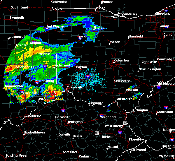 At 636 pm edt, a severe thunderstorm was located over elsmere, moving east at 50 mph. this is a very dangerous storm (radar indicated). Hazards include softball size hail and 60 mph wind gusts. People and animals outdoors will be severely injured. Expect shattered windows, extensive damage to roofs, siding, and vehicles. At 636 pm edt, a severe thunderstorm was located over elsmere, moving east at 50 mph. this is a very dangerous storm (radar indicated). Hazards include softball size hail and 60 mph wind gusts. People and animals outdoors will be severely injured. Expect shattered windows, extensive damage to roofs, siding, and vehicles.
|
| 10/19/2016 6:04 PM EDT |
 At 604 pm edt, a severe thunderstorm was located near dillsboro, moving east at 50 mph (radar indicated). Hazards include ping pong ball size hail and 60 mph wind gusts. People and animals outdoors will be injured. expect hail damage to roofs, siding, windows, and vehicles. Expect wind damage to roofs, siding, and trees. At 604 pm edt, a severe thunderstorm was located near dillsboro, moving east at 50 mph (radar indicated). Hazards include ping pong ball size hail and 60 mph wind gusts. People and animals outdoors will be injured. expect hail damage to roofs, siding, windows, and vehicles. Expect wind damage to roofs, siding, and trees.
|
| 10/19/2016 6:04 PM EDT |
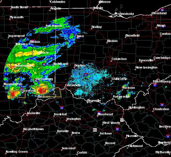 At 604 pm edt, a severe thunderstorm was located near dillsboro, moving east at 50 mph (radar indicated). Hazards include ping pong ball size hail and 60 mph wind gusts. People and animals outdoors will be injured. expect hail damage to roofs, siding, windows, and vehicles. Expect wind damage to roofs, siding, and trees. At 604 pm edt, a severe thunderstorm was located near dillsboro, moving east at 50 mph (radar indicated). Hazards include ping pong ball size hail and 60 mph wind gusts. People and animals outdoors will be injured. expect hail damage to roofs, siding, windows, and vehicles. Expect wind damage to roofs, siding, and trees.
|
| 9/10/2016 4:34 PM EDT | Tree hit car and blocked bradbury rd between 9 mile rd. and 10 mile rd. time estimated from rada in clermont county OH, 13.7 miles WNW of Cincinnati, OH |
| 9/10/2016 4:27 PM EDT | Tree down on weil rd. time estimated from rada in hamilton county OH, 12.3 miles SW of Cincinnati, OH |
| 9/10/2016 4:25 PM EDT |
 The severe thunderstorm warning for northern kenton, northern campbell, boone and southwestern hamilton counties will expire at 430 pm edt, the storm which prompted the warning has weakened below severe limits, and is exiting the warned area. therefore the warning will be allowed to expire. a severe thunderstorm watch remains in effect until 900 pm edt for southeastern indiana, northern kentucky, and southwestern ohio. please report previous wind damage or hail to the national weather service by going to our website at weather.gov/iln and submitting your report via social media. The severe thunderstorm warning for northern kenton, northern campbell, boone and southwestern hamilton counties will expire at 430 pm edt, the storm which prompted the warning has weakened below severe limits, and is exiting the warned area. therefore the warning will be allowed to expire. a severe thunderstorm watch remains in effect until 900 pm edt for southeastern indiana, northern kentucky, and southwestern ohio. please report previous wind damage or hail to the national weather service by going to our website at weather.gov/iln and submitting your report via social media.
|
| 9/10/2016 4:14 PM EDT |
 At 414 pm edt, a severe thunderstorm was located over lakeside park, moving east at 45 mph (radar indicated). Hazards include 60 mph wind gusts. Expect damage to roofs. siding. and trees. Locations impacted include, cincinnati, covington, florence, independence, norwood, erlanger, fort thomas, newport, edgewood, elsmere, fort mitchell, villa hills, highland heights, taylor mill, bellevue, fort wright, dayton, ludlow, southgate and crescent springs. At 414 pm edt, a severe thunderstorm was located over lakeside park, moving east at 45 mph (radar indicated). Hazards include 60 mph wind gusts. Expect damage to roofs. siding. and trees. Locations impacted include, cincinnati, covington, florence, independence, norwood, erlanger, fort thomas, newport, edgewood, elsmere, fort mitchell, villa hills, highland heights, taylor mill, bellevue, fort wright, dayton, ludlow, southgate and crescent springs.
|
| 9/10/2016 3:54 PM EDT |
 At 354 pm edt, a severe thunderstorm was located near aurora, moving east at 45 mph (radar indicated). Hazards include 60 mph wind gusts and penny size hail. Expect damage to roofs. siding. And trees. At 354 pm edt, a severe thunderstorm was located near aurora, moving east at 45 mph (radar indicated). Hazards include 60 mph wind gusts and penny size hail. Expect damage to roofs. siding. And trees.
|
| 9/10/2016 3:54 PM EDT |
 The national weather service in wilmington has issued a * severe thunderstorm warning for. ohio county in southeastern indiana. southeastern dearborn county in southeastern indiana. northern kenton county in northern kentucky. Northern campbell county in northern kentucky. The national weather service in wilmington has issued a * severe thunderstorm warning for. ohio county in southeastern indiana. southeastern dearborn county in southeastern indiana. northern kenton county in northern kentucky. Northern campbell county in northern kentucky.
|
| 8/15/2016 5:40 PM EDT |
 At 540 pm edt, a severe thunderstorm was located over olde west chester, moving northeast at 40 mph (radar indicated). Hazards include 60 mph wind gusts. Expect damage to roofs. siding. and trees. Locations impacted include, cincinnati, hamilton, fairfield, mason, forest park, sharonville, blue ash, loveland, springdale, reading, montgomery, madeira, wyoming, mount healthy, deer park, finneytown, west chester, olde west chester, kings island and wetherington. At 540 pm edt, a severe thunderstorm was located over olde west chester, moving northeast at 40 mph (radar indicated). Hazards include 60 mph wind gusts. Expect damage to roofs. siding. and trees. Locations impacted include, cincinnati, hamilton, fairfield, mason, forest park, sharonville, blue ash, loveland, springdale, reading, montgomery, madeira, wyoming, mount healthy, deer park, finneytown, west chester, olde west chester, kings island and wetherington.
|
| 8/15/2016 5:35 PM EDT | Tree knocked down and blocking sheffield roa in hamilton county OH, 9 miles S of Cincinnati, OH |
| 8/15/2016 5:29 PM EDT |
 At 529 pm edt, a severe thunderstorm was located over wyoming, moving northeast at 40 mph (radar indicated). Hazards include 60 mph wind gusts. Expect damage to roofs. siding. And trees. At 529 pm edt, a severe thunderstorm was located over wyoming, moving northeast at 40 mph (radar indicated). Hazards include 60 mph wind gusts. Expect damage to roofs. siding. And trees.
|
| 7/15/2016 5:05 PM EDT |
 The severe thunderstorm warning for northern kenton, central campbell, northwestern clermont and southeastern hamilton counties will expire at 515 pm edt, the storm which prompted the warning has weakened below severe limits, and no longer poses an immediate threat to life or property. therefore the warning will be allowed to expire. however gusty winds and heavy rain are still possible with this thunderstorm. please report previous wind damage or hail to the national weather service by going to our website at weather.gov/iln and submitting your report via social media. The severe thunderstorm warning for northern kenton, central campbell, northwestern clermont and southeastern hamilton counties will expire at 515 pm edt, the storm which prompted the warning has weakened below severe limits, and no longer poses an immediate threat to life or property. therefore the warning will be allowed to expire. however gusty winds and heavy rain are still possible with this thunderstorm. please report previous wind damage or hail to the national weather service by going to our website at weather.gov/iln and submitting your report via social media.
|
| 7/15/2016 4:42 PM EDT |
 At 441 pm edt, a severe thunderstorm was located over taylor mill, moving northeast at 25 mph (radar indicated). Hazards include 70 mph wind gusts. Expect considerable tree damage. damage is likely to mobile homes, roofs, and outbuildings. Locations impacted include, cincinnati, covington, independence, fort thomas, alexandria, highland heights, milford, taylor mill, fort wright, southgate, forestville, claryville, amelia, wilder, new richmond, terrace park, batavia, silver grove, melbourne and riverbend and coney island. At 441 pm edt, a severe thunderstorm was located over taylor mill, moving northeast at 25 mph (radar indicated). Hazards include 70 mph wind gusts. Expect considerable tree damage. damage is likely to mobile homes, roofs, and outbuildings. Locations impacted include, cincinnati, covington, independence, fort thomas, alexandria, highland heights, milford, taylor mill, fort wright, southgate, forestville, claryville, amelia, wilder, new richmond, terrace park, batavia, silver grove, melbourne and riverbend and coney island.
|
| 7/15/2016 4:37 PM EDT |
 At 437 pm edt, a severe thunderstorm was located over independence, moving northeast at 20 mph (radar indicated). Hazards include 60 mph wind gusts. Expect damage to roofs. siding. And trees. At 437 pm edt, a severe thunderstorm was located over independence, moving northeast at 20 mph (radar indicated). Hazards include 60 mph wind gusts. Expect damage to roofs. siding. And trees.
|
| 7/13/2016 11:05 PM EDT |
 The severe thunderstorm warning for northern campbell and southeastern hamilton counties will expire at 1115 pm edt, the storm which prompted the warning has weakened below severe limits, and have exited the warned area. therefore the warning will be allowed to expire. a severe thunderstorm watch remains in effect until 100 am edt for northern kentucky, and southwestern ohio. please report previous wind damage or hail to the national weather service by going to our website at weather.gov/iln and submitting your report via social media. The severe thunderstorm warning for northern campbell and southeastern hamilton counties will expire at 1115 pm edt, the storm which prompted the warning has weakened below severe limits, and have exited the warned area. therefore the warning will be allowed to expire. a severe thunderstorm watch remains in effect until 100 am edt for northern kentucky, and southwestern ohio. please report previous wind damage or hail to the national weather service by going to our website at weather.gov/iln and submitting your report via social media.
|
| 7/13/2016 10:58 PM EDT |
 At 1058 pm edt, a severe thunderstorm was located over terrace park, moving east at 40 mph (radar indicated). Hazards include 60 mph wind gusts and penny size hail. Expect damage to roofs. siding. And trees. At 1058 pm edt, a severe thunderstorm was located over terrace park, moving east at 40 mph (radar indicated). Hazards include 60 mph wind gusts and penny size hail. Expect damage to roofs. siding. And trees.
|
| 7/13/2016 10:55 PM EDT |
 At 1054 pm edt, a severe thunderstorm was located over riverbend and coney island, moving east at 40 mph (trained weather spotters). Hazards include 60 mph wind gusts and penny size hail. Expect damage to roofs. siding. and trees. Locations impacted include, cincinnati, norwood, fort thomas, newport, highland heights, bellevue, dayton, southgate, forestville, mariemont, wilder, terrace park, silver grove, melbourne, riverbend and coney island, newtown, fairfax and sherwood. At 1054 pm edt, a severe thunderstorm was located over riverbend and coney island, moving east at 40 mph (trained weather spotters). Hazards include 60 mph wind gusts and penny size hail. Expect damage to roofs. siding. and trees. Locations impacted include, cincinnati, norwood, fort thomas, newport, highland heights, bellevue, dayton, southgate, forestville, mariemont, wilder, terrace park, silver grove, melbourne, riverbend and coney island, newtown, fairfax and sherwood.
|
| 7/13/2016 10:47 PM EDT | Tree knocked down across the road. time estimated from rada in hamilton county OH, 0.7 miles S of Cincinnati, OH |
| 7/13/2016 10:46 PM EDT | Roof blown off of a church. time estimated from rada in hamilton county OH, 1.2 miles SE of Cincinnati, OH |
| 7/13/2016 10:45 PM EDT | Large diameter tree knocked down. time estimated from rada in hamilton county OH, 1.7 miles W of Cincinnati, OH |
| 7/13/2016 10:44 PM EDT |
 At 1044 pm edt, a severe thunderstorm was located over park hills, moving east at 40 mph (radar indicated). Hazards include 60 mph wind gusts and penny size hail. Expect damage to roofs. siding. And trees. At 1044 pm edt, a severe thunderstorm was located over park hills, moving east at 40 mph (radar indicated). Hazards include 60 mph wind gusts and penny size hail. Expect damage to roofs. siding. And trees.
|
| 7/13/2016 10:29 PM EDT | Numerous trees knocked down on roadwa in hamilton county OH, 3.4 miles WSW of Cincinnati, OH |
| 7/13/2016 10:24 PM EDT | Tree knocked down across the road. time estimated from rada in hamilton county OH, 0.7 miles S of Cincinnati, OH |
| 7/13/2016 10:24 PM EDT | Roof blown off of a church. time estimated from rada in hamilton county OH, 1.2 miles SE of Cincinnati, OH |
| 7/13/2016 10:24 PM EDT | Large diameter tree knocked down. time estimated from rada in hamilton county OH, 1.7 miles W of Cincinnati, OH |
| 7/13/2016 10:23 PM EDT | Roofs blown off of 2 buildings and damage within the building. several trees also knocked down or damaged. forty apartments worth of residents displaced. time estimated in hamilton county OH, 3.2 miles E of Cincinnati, OH |
| 7/13/2016 10:22 PM EDT | Roofs blown off of 2 buildings and damage within the building. several trees also knocked down or damaged. forty apartments worth of residents displaced. time estimated in hamilton county OH, 3.2 miles E of Cincinnati, OH |
| 7/8/2016 12:01 PM EDT |
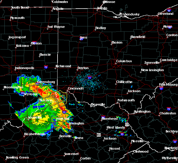 At 1201 pm edt, severe thunderstorms were located along a line extending from burlington to crittenden, moving northeast at 50 mph (radar indicated). Hazards include 60 mph wind gusts. Expect damage to roofs. siding. and trees. Locations impacted include, covington, florence, independence, erlanger, edgewood, elsmere, fort mitchell, villa hills, taylor mill, fort wright, lawrenceburg, greendale, crescent springs, aurora, walton, crestview hills, lakeside park, rising sun, oakbrook and burlington. At 1201 pm edt, severe thunderstorms were located along a line extending from burlington to crittenden, moving northeast at 50 mph (radar indicated). Hazards include 60 mph wind gusts. Expect damage to roofs. siding. and trees. Locations impacted include, covington, florence, independence, erlanger, edgewood, elsmere, fort mitchell, villa hills, taylor mill, fort wright, lawrenceburg, greendale, crescent springs, aurora, walton, crestview hills, lakeside park, rising sun, oakbrook and burlington.
|
| 7/8/2016 11:48 AM EDT |
 At 1147 am edt, severe thunderstorms were located along a line extending from near rising sun to near sparta, moving northeast at 55 mph (radar indicated). Hazards include 60 mph wind gusts. Expect damage to roofs. siding. And trees. At 1147 am edt, severe thunderstorms were located along a line extending from near rising sun to near sparta, moving northeast at 55 mph (radar indicated). Hazards include 60 mph wind gusts. Expect damage to roofs. siding. And trees.
|
| 6/23/2016 5:08 AM EDT |
 At 507 am edt, a severe thunderstorm was located over new richmond, moving southeast at 55 mph (radar indicated). Hazards include 60 mph wind gusts and nickel size hail. Expect damage to roofs. siding. and trees. locations impacted include, cincinnati, covington, florence, independence, erlanger, fort thomas, newport, edgewood, alexandria, elsmere, fort mitchell, villa hills, highland heights, milford, taylor mill, bellevue, fort wright, dayton, southgate and crescent springs. A tornado watch remains in effect until 700 am edt for northern kentucky, and southwestern ohio. At 507 am edt, a severe thunderstorm was located over new richmond, moving southeast at 55 mph (radar indicated). Hazards include 60 mph wind gusts and nickel size hail. Expect damage to roofs. siding. and trees. locations impacted include, cincinnati, covington, florence, independence, erlanger, fort thomas, newport, edgewood, alexandria, elsmere, fort mitchell, villa hills, highland heights, milford, taylor mill, bellevue, fort wright, dayton, southgate and crescent springs. A tornado watch remains in effect until 700 am edt for northern kentucky, and southwestern ohio.
|
| 6/23/2016 4:54 AM EDT |
 The severe thunderstorm warning for southeastern butler and central hamilton counties will expire at 500 am edt, the storm which prompted the warning has moved out of the area. therefore the warning will be allowed to expire. however heavy rain is still possible with this thunderstorm. a tornado watch remains in effect until 500 am edt for southeastern indiana, northern kentucky, and southwestern ohio. remember, a severe thunderstorm warning still remains in effect for southeast hamilton county until 530 am. The severe thunderstorm warning for southeastern butler and central hamilton counties will expire at 500 am edt, the storm which prompted the warning has moved out of the area. therefore the warning will be allowed to expire. however heavy rain is still possible with this thunderstorm. a tornado watch remains in effect until 500 am edt for southeastern indiana, northern kentucky, and southwestern ohio. remember, a severe thunderstorm warning still remains in effect for southeast hamilton county until 530 am.
|
| 6/23/2016 4:53 AM EDT | Kellogg ave. closed at lanter ln by a tree in the roadwa in hamilton county OH, 7 miles NW of Cincinnati, OH |
| 6/23/2016 4:52 AM EDT | Tree fell on a parked ca in hamilton county OH, 3.4 miles WSW of Cincinnati, OH |
| 6/23/2016 4:51 AM EDT | Tree down on 2 house in hamilton county OH, 2.2 miles W of Cincinnati, OH |
| 6/23/2016 4:48 AM EDT |
 At 448 am edt, a severe thunderstorm was located over ludlow, moving southeast at 55 mph (radar indicated). Hazards include 60 mph wind gusts and quarter size hail. Hail damage to vehicles is expected. Expect wind damage to roofs, siding, and trees. At 448 am edt, a severe thunderstorm was located over ludlow, moving southeast at 55 mph (radar indicated). Hazards include 60 mph wind gusts and quarter size hail. Hail damage to vehicles is expected. Expect wind damage to roofs, siding, and trees.
|
| 6/23/2016 4:43 AM EDT |
 At 442 am edt, a severe thunderstorm was located over wyoming, moving southeast at 55 mph (radar indicated). Hazards include 60 mph wind gusts. Expect damage to roofs. siding. and trees. locations impacted include, cincinnati, hamilton, fairfield, mason, norwood, forest park, sharonville, monroe, blue ash, springdale, reading, montgomery, north college hill, madeira, wyoming, cheviot, mount healthy, deer park, dayton and finneytown. A tornado watch remains in effect until 500 am edt for southeastern indiana, northern kentucky, and southwestern ohio. At 442 am edt, a severe thunderstorm was located over wyoming, moving southeast at 55 mph (radar indicated). Hazards include 60 mph wind gusts. Expect damage to roofs. siding. and trees. locations impacted include, cincinnati, hamilton, fairfield, mason, norwood, forest park, sharonville, monroe, blue ash, springdale, reading, montgomery, north college hill, madeira, wyoming, cheviot, mount healthy, deer park, dayton and finneytown. A tornado watch remains in effect until 500 am edt for southeastern indiana, northern kentucky, and southwestern ohio.
|
| 6/23/2016 4:33 AM EDT |
 At 433 am edt, a severe thunderstorm was located over colerain township, moving southeast at 55 mph (radar indicated). Hazards include 70 mph wind gusts. Expect considerable tree damage. damage is likely to mobile homes, roofs, and outbuildings. locations impacted include, cincinnati, hamilton, fairfield, mason, oxford, norwood, forest park, sharonville, monroe, blue ash, springdale, reading, montgomery, harrison, north college hill, madeira, wyoming, cheviot, mount healthy and deer park. A tornado watch remains in effect until 500 am edt for southeastern indiana, northern kentucky, and southwestern ohio. At 433 am edt, a severe thunderstorm was located over colerain township, moving southeast at 55 mph (radar indicated). Hazards include 70 mph wind gusts. Expect considerable tree damage. damage is likely to mobile homes, roofs, and outbuildings. locations impacted include, cincinnati, hamilton, fairfield, mason, oxford, norwood, forest park, sharonville, monroe, blue ash, springdale, reading, montgomery, harrison, north college hill, madeira, wyoming, cheviot, mount healthy and deer park. A tornado watch remains in effect until 500 am edt for southeastern indiana, northern kentucky, and southwestern ohio.
|
| 6/23/2016 4:28 AM EDT |
 At 428 am edt, a severe thunderstorm was located over ross, moving southeast at 55 mph (radar indicated). Hazards include 70 mph wind gusts. Expect considerable tree damage. damage is likely to mobile homes, roofs, and outbuildings. locations impacted include, cincinnati, hamilton, fairfield, mason, oxford, norwood, forest park, sharonville, monroe, blue ash, springdale, reading, montgomery, harrison, north college hill, madeira, wyoming, cheviot, mount healthy and deer park. A tornado watch remains in effect until 500 am edt for southeastern indiana, northern kentucky, and southwestern ohio. At 428 am edt, a severe thunderstorm was located over ross, moving southeast at 55 mph (radar indicated). Hazards include 70 mph wind gusts. Expect considerable tree damage. damage is likely to mobile homes, roofs, and outbuildings. locations impacted include, cincinnati, hamilton, fairfield, mason, oxford, norwood, forest park, sharonville, monroe, blue ash, springdale, reading, montgomery, harrison, north college hill, madeira, wyoming, cheviot, mount healthy and deer park. A tornado watch remains in effect until 500 am edt for southeastern indiana, northern kentucky, and southwestern ohio.
|
| 6/23/2016 4:15 AM EDT |
 At 415 am edt, a severe thunderstorm was located near brookville, moving southeast at 55 mph (radar indicated). Hazards include 60 mph wind gusts. Expect damage to roofs. siding. And trees. At 415 am edt, a severe thunderstorm was located near brookville, moving southeast at 55 mph (radar indicated). Hazards include 60 mph wind gusts. Expect damage to roofs. siding. And trees.
|
| 6/21/2016 1:37 AM EDT |
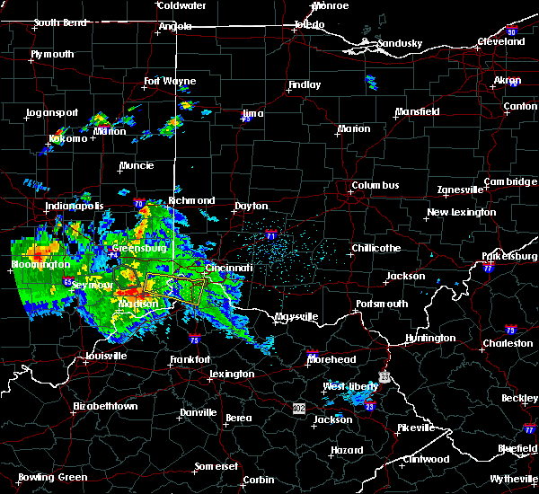 At 136 am edt, a severe thunderstorm was located over florence, moving east at 40 mph (radar indicated). Hazards include 60 mph wind gusts. Expect damage to roofs. siding. and trees. Locations impacted include, covington, florence, independence, erlanger, edgewood, elsmere, fort mitchell, villa hills, taylor mill, fort wright, lawrenceburg, greendale, ludlow, crescent springs, aurora, walton, crestview hills, park hills, lakeside park and rising sun. At 136 am edt, a severe thunderstorm was located over florence, moving east at 40 mph (radar indicated). Hazards include 60 mph wind gusts. Expect damage to roofs. siding. and trees. Locations impacted include, covington, florence, independence, erlanger, edgewood, elsmere, fort mitchell, villa hills, taylor mill, fort wright, lawrenceburg, greendale, ludlow, crescent springs, aurora, walton, crestview hills, park hills, lakeside park and rising sun.
|
| 6/21/2016 1:08 AM EDT |
 At 106 am edt, a severe thunderstorm was located over dillsboro, moving east at 40 mph (radar indicated). Hazards include 60 mph wind gusts. Expect damage to roofs. siding. And trees. At 106 am edt, a severe thunderstorm was located over dillsboro, moving east at 40 mph (radar indicated). Hazards include 60 mph wind gusts. Expect damage to roofs. siding. And trees.
|
| 6/21/2016 1:08 AM EDT |
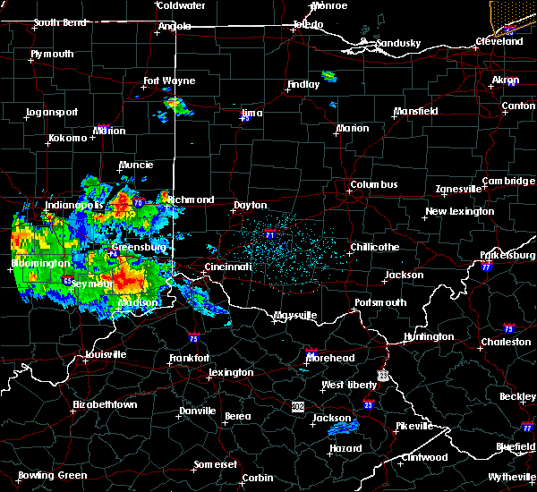 At 106 am edt, a severe thunderstorm was located over dillsboro, moving east at 40 mph (radar indicated). Hazards include 60 mph wind gusts. Expect damage to roofs. siding. And trees. At 106 am edt, a severe thunderstorm was located over dillsboro, moving east at 40 mph (radar indicated). Hazards include 60 mph wind gusts. Expect damage to roofs. siding. And trees.
|
| 6/15/2016 7:13 PM EDT | Several six inch tree limbs broke in hamilton county OH, 8.8 miles ENE of Cincinnati, OH |
| 6/15/2016 7:06 PM EDT |
 At 705 pm edt, a severe thunderstorm was located over burlington, moving southeast at 40 mph (radar indicated). Hazards include 60 mph wind gusts. Expect damage to roofs. siding. and trees. Locations impacted include, cincinnati, covington, florence, independence, erlanger, edgewood, elsmere, cheviot, fort mitchell, villa hills, fort wright, lawrenceburg, greendale, ludlow, crescent springs, aurora, crestview hills, lakeside park, rising sun and oakbrook. At 705 pm edt, a severe thunderstorm was located over burlington, moving southeast at 40 mph (radar indicated). Hazards include 60 mph wind gusts. Expect damage to roofs. siding. and trees. Locations impacted include, cincinnati, covington, florence, independence, erlanger, edgewood, elsmere, cheviot, fort mitchell, villa hills, fort wright, lawrenceburg, greendale, ludlow, crescent springs, aurora, crestview hills, lakeside park, rising sun and oakbrook.
|
| 6/15/2016 7:06 PM EDT |
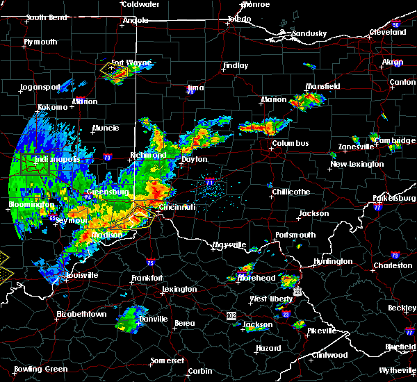 At 705 pm edt, a severe thunderstorm was located over burlington, moving southeast at 40 mph (radar indicated). Hazards include 60 mph wind gusts. Expect damage to roofs. siding. and trees. Locations impacted include, cincinnati, covington, florence, independence, erlanger, edgewood, elsmere, cheviot, fort mitchell, villa hills, fort wright, lawrenceburg, greendale, ludlow, crescent springs, aurora, crestview hills, lakeside park, rising sun and oakbrook. At 705 pm edt, a severe thunderstorm was located over burlington, moving southeast at 40 mph (radar indicated). Hazards include 60 mph wind gusts. Expect damage to roofs. siding. and trees. Locations impacted include, cincinnati, covington, florence, independence, erlanger, edgewood, elsmere, cheviot, fort mitchell, villa hills, fort wright, lawrenceburg, greendale, ludlow, crescent springs, aurora, crestview hills, lakeside park, rising sun and oakbrook.
|
| 6/15/2016 6:47 PM EDT |
 At 647 pm edt, a severe thunderstorm was located near greendale, moving southeast at 40 mph (radar indicated). Hazards include 60 mph wind gusts. Expect damage to roofs. siding. And trees. At 647 pm edt, a severe thunderstorm was located near greendale, moving southeast at 40 mph (radar indicated). Hazards include 60 mph wind gusts. Expect damage to roofs. siding. And trees.
|
| 6/15/2016 6:47 PM EDT |
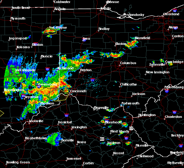 At 647 pm edt, a severe thunderstorm was located near greendale, moving southeast at 40 mph (radar indicated). Hazards include 60 mph wind gusts. Expect damage to roofs. siding. And trees. At 647 pm edt, a severe thunderstorm was located near greendale, moving southeast at 40 mph (radar indicated). Hazards include 60 mph wind gusts. Expect damage to roofs. siding. And trees.
|
| 6/4/2016 6:41 PM EDT |
 The severe thunderstorm warning for east central switzerland, kenton, northwestern grant, eastern gallatin, campbell, southern boone and south central hamilton counties will expire at 645 pm edt, the severe thunderstorm which prompted the warning has weakened. therefore the warning will be allowed to expire. however gusty winds and heavy rain are still possible with this thunderstorm. please report previous wind damage or hail to the national weather service by going to our website at weather.gov/iln and submitting your report via social media. The severe thunderstorm warning for east central switzerland, kenton, northwestern grant, eastern gallatin, campbell, southern boone and south central hamilton counties will expire at 645 pm edt, the severe thunderstorm which prompted the warning has weakened. therefore the warning will be allowed to expire. however gusty winds and heavy rain are still possible with this thunderstorm. please report previous wind damage or hail to the national weather service by going to our website at weather.gov/iln and submitting your report via social media.
|
| 6/4/2016 6:32 PM EDT |
 At 631 pm edt, a severe thunderstorm was located near independence, moving northeast at 50 mph (radar indicated). Hazards include 60 mph wind gusts. Expect damage to roofs. siding. and trees. Locations impacted include, cincinnati, covington, florence, independence, erlanger, fort thomas, edgewood, alexandria, elsmere, fort mitchell, highland heights, taylor mill, fort wright, southgate, walton, crestview hills, lakeside park, claryville, union and crittenden. At 631 pm edt, a severe thunderstorm was located near independence, moving northeast at 50 mph (radar indicated). Hazards include 60 mph wind gusts. Expect damage to roofs. siding. and trees. Locations impacted include, cincinnati, covington, florence, independence, erlanger, fort thomas, edgewood, alexandria, elsmere, fort mitchell, highland heights, taylor mill, fort wright, southgate, walton, crestview hills, lakeside park, claryville, union and crittenden.
|
| 6/4/2016 6:09 PM EDT |
 At 609 pm edt, a severe thunderstorm was located over warsaw, moving northeast at 50 mph (radar indicated). Hazards include 60 mph wind gusts. Expect damage to roofs. siding. And trees. At 609 pm edt, a severe thunderstorm was located over warsaw, moving northeast at 50 mph (radar indicated). Hazards include 60 mph wind gusts. Expect damage to roofs. siding. And trees.
|
| 5/10/2016 4:27 PM EDT | One tree knocked down at corner of oak and may streets. reported via the medi in hamilton county OH, 0.7 miles N of Cincinnati, OH |
| 5/1/2016 7:06 PM EDT |
 The severe thunderstorm warning for northern campbell, west central clermont and eastern hamilton counties will expire at 715 pm edt, the storm which prompted the warning has weakened below severe limits, and no longer pose an immediate threat to life or property. therefore the warning will be allowed to expire. a severe thunderstorm watch remains in effect until 900 pm edt for northern kentucky, and southwestern ohio. please report previous wind damage or hail to the national weather service by going to our website at weather.gov/iln and submitting your report via social media. The severe thunderstorm warning for northern campbell, west central clermont and eastern hamilton counties will expire at 715 pm edt, the storm which prompted the warning has weakened below severe limits, and no longer pose an immediate threat to life or property. therefore the warning will be allowed to expire. a severe thunderstorm watch remains in effect until 900 pm edt for northern kentucky, and southwestern ohio. please report previous wind damage or hail to the national weather service by going to our website at weather.gov/iln and submitting your report via social media.
|
| 5/1/2016 7:00 PM EDT | Power pole with wires down. time estimated based on radar in hamilton county OH, 6 miles SW of Cincinnati, OH |
| 5/1/2016 6:58 PM EDT |
 At 658 pm edt, a severe thunderstorm was located over dayton, moving northeast at 20 mph (radar indicated). Hazards include 60 mph wind gusts and quarter size hail. Hail damage to vehicles is expected. expect wind damage to roofs, siding, and trees. Locations impacted include, cincinnati, norwood, fort thomas, newport, sharonville, blue ash, reading, montgomery, madeira, milford, bellevue, deer park, dayton, forestville, mariemont, terrace park, the village of indian hill, silverton, golf manor and amberley. At 658 pm edt, a severe thunderstorm was located over dayton, moving northeast at 20 mph (radar indicated). Hazards include 60 mph wind gusts and quarter size hail. Hail damage to vehicles is expected. expect wind damage to roofs, siding, and trees. Locations impacted include, cincinnati, norwood, fort thomas, newport, sharonville, blue ash, reading, montgomery, madeira, milford, bellevue, deer park, dayton, forestville, mariemont, terrace park, the village of indian hill, silverton, golf manor and amberley.
|
| 5/1/2016 6:41 PM EDT |
 At 640 pm edt, a severe thunderstorm was located over ludlow, moving northeast at 20 mph (radar indicated). Hazards include 60 mph wind gusts and quarter size hail. Hail damage to vehicles is expected. Expect wind damage to roofs, siding, and trees. At 640 pm edt, a severe thunderstorm was located over ludlow, moving northeast at 20 mph (radar indicated). Hazards include 60 mph wind gusts and quarter size hail. Hail damage to vehicles is expected. Expect wind damage to roofs, siding, and trees.
|
| 4/26/2016 7:35 PM EDT |
 At 735 pm edt, a severe thunderstorm was located over alexandria, moving east at 40 mph (radar indicated). Hazards include quarter size hail. Damage to vehicles is expected. Locations impacted include, cincinnati, fort thomas, newport, highland heights, bellevue, dayton, southgate, forestville, wilder, silver grove, melbourne, riverbend and coney island, cold spring, sherwood, woodlawn, lunken airport, fruit hill, cherry grove, turpin hills and dry run. At 735 pm edt, a severe thunderstorm was located over alexandria, moving east at 40 mph (radar indicated). Hazards include quarter size hail. Damage to vehicles is expected. Locations impacted include, cincinnati, fort thomas, newport, highland heights, bellevue, dayton, southgate, forestville, wilder, silver grove, melbourne, riverbend and coney island, cold spring, sherwood, woodlawn, lunken airport, fruit hill, cherry grove, turpin hills and dry run.
|
| 4/26/2016 7:23 PM EDT |
 At 723 pm edt, a severe thunderstorm was located over edgewood, and is nearly stationary (radar indicated). Hazards include 60 mph wind gusts and quarter size hail. Hail damage to vehicles is expected. expect wind damage to roofs, siding, and trees. Locations impacted include, cincinnati, covington, florence, independence, erlanger, fort thomas, newport, edgewood, alexandria, elsmere, fort mitchell, villa hills, highland heights, taylor mill, bellevue, fort wright, dayton, ludlow, southgate and crescent springs. At 723 pm edt, a severe thunderstorm was located over edgewood, and is nearly stationary (radar indicated). Hazards include 60 mph wind gusts and quarter size hail. Hail damage to vehicles is expected. expect wind damage to roofs, siding, and trees. Locations impacted include, cincinnati, covington, florence, independence, erlanger, fort thomas, newport, edgewood, alexandria, elsmere, fort mitchell, villa hills, highland heights, taylor mill, bellevue, fort wright, dayton, ludlow, southgate and crescent springs.
|
| 4/26/2016 7:22 PM EDT | Storm damage reported in hamilton county OH, 5.2 miles WNW of Cincinnati, OH |
| 4/26/2016 7:20 PM EDT |
 The severe thunderstorm warning for northern dearborn, east central ripley, southeastern franklin, north central boone, west central warren, southern butler and hamilton counties will expire at 730 pm edt, the storms which prompted the warning have weakened below severe limits, and no longer pose an immediate threat to life or property. therefore the warning will be allowed to expire. a severe thunderstorm watch remains in effect until 200 am edt for southeastern indiana, northern kentucky, and southwestern ohio. please report previous wind damage or hail to the national weather service by going to our website at weather.gov/iln and submitting your report via social media. The severe thunderstorm warning for northern dearborn, east central ripley, southeastern franklin, north central boone, west central warren, southern butler and hamilton counties will expire at 730 pm edt, the storms which prompted the warning have weakened below severe limits, and no longer pose an immediate threat to life or property. therefore the warning will be allowed to expire. a severe thunderstorm watch remains in effect until 200 am edt for southeastern indiana, northern kentucky, and southwestern ohio. please report previous wind damage or hail to the national weather service by going to our website at weather.gov/iln and submitting your report via social media.
|
| 4/26/2016 7:08 PM EDT |
 At 708 pm edt, radar indicated a severe thunderstorm located over burlington, moving east at 40 mph. storm hazards include, winds to 60 mph, quarter size hail,. At 708 pm edt, radar indicated a severe thunderstorm located over burlington, moving east at 40 mph. storm hazards include, winds to 60 mph, quarter size hail,.
|
| 4/26/2016 6:54 PM EDT |
 The severe thunderstorm warning for northern kenton, central campbell, central clermont and southeastern hamilton counties will expire at 700 pm edt, the severe thunderstorm which prompted the warning has weakened. therefore the warning will be allowed to expire. a severe thunderstorm watch remains in effect until 200 am edt for northern kentucky, and southwestern ohio. please report previous wind damage or hail to the national weather service by going to our website at weather.gov/iln and submitting your report via social media. The severe thunderstorm warning for northern kenton, central campbell, central clermont and southeastern hamilton counties will expire at 700 pm edt, the severe thunderstorm which prompted the warning has weakened. therefore the warning will be allowed to expire. a severe thunderstorm watch remains in effect until 200 am edt for northern kentucky, and southwestern ohio. please report previous wind damage or hail to the national weather service by going to our website at weather.gov/iln and submitting your report via social media.
|
| 4/26/2016 6:51 PM EDT |
 At 651 pm edt, radar indicated severe thunderstorms located along a line extending from 6 miles south of oxford to 8 miles north of moores hill, moving east at 45 mph. storm hazards include, winds to 60 mph, quarter size hail,. At 651 pm edt, radar indicated severe thunderstorms located along a line extending from 6 miles south of oxford to 8 miles north of moores hill, moving east at 45 mph. storm hazards include, winds to 60 mph, quarter size hail,.
|
| 4/26/2016 6:37 PM EDT |
 At 636 pm edt, radar indicated a severe thunderstorm located over silver grove, moving east at 25 mph. storm hazards include, winds to 60 mph, quarter size hail,. At 636 pm edt, radar indicated a severe thunderstorm located over silver grove, moving east at 25 mph. storm hazards include, winds to 60 mph, quarter size hail,.
|
| 4/26/2016 6:12 PM EDT | Quarter sized hail reported 8.1 miles NW of Cincinnati, OH, 1/2 to 1 inch hail. |
| 4/26/2016 6:04 PM EDT | Half Dollar sized hail reported 10.6 miles NW of Cincinnati, OH |
| 4/26/2016 6:01 PM EDT |
 At 601 pm edt, a severe thunderstorm was located over forestville, moving east at 30 mph (trained weather spotters). Hazards include quarter size hail. damage to vehicles is expected At 601 pm edt, a severe thunderstorm was located over forestville, moving east at 30 mph (trained weather spotters). Hazards include quarter size hail. damage to vehicles is expected
|
| 4/26/2016 5:15 PM EDT |
 At 515 pm edt, a severe thunderstorm was located over bellevue, moving east at 25 mph (radar indicated). Hazards include 60 mph wind gusts and quarter size hail. Hail damage to vehicles is expected. expect wind damage to roofs, siding, and trees. Locations impacted include, cincinnati, covington, norwood, fort thomas, newport, madeira, highland heights, taylor mill, bellevue, fort wright, dayton, ludlow, southgate, park hills, forestville, mariemont, wilder, silver grove, melbourne and riverbend and coney island. At 515 pm edt, a severe thunderstorm was located over bellevue, moving east at 25 mph (radar indicated). Hazards include 60 mph wind gusts and quarter size hail. Hail damage to vehicles is expected. expect wind damage to roofs, siding, and trees. Locations impacted include, cincinnati, covington, norwood, fort thomas, newport, madeira, highland heights, taylor mill, bellevue, fort wright, dayton, ludlow, southgate, park hills, forestville, mariemont, wilder, silver grove, melbourne and riverbend and coney island.
|
| 4/26/2016 5:04 PM EDT |
 At 504 pm edt, a severe thunderstorm was located over ludlow, moving east at 20 mph (radar indicated). Hazards include 60 mph wind gusts and quarter size hail. Hail damage to vehicles is expected. Expect wind damage to roofs, siding, and trees. At 504 pm edt, a severe thunderstorm was located over ludlow, moving east at 20 mph (radar indicated). Hazards include 60 mph wind gusts and quarter size hail. Hail damage to vehicles is expected. Expect wind damage to roofs, siding, and trees.
|
| 3/31/2016 5:52 PM EDT | Tree down on wolfangel and state roads in anderson townshi in hamilton county OH, 9.6 miles WNW of Cincinnati, OH |
| 12/23/2015 8:06 PM EST | At 805 pm est, radar indicated a severe thunderstorm located near butler, moving northeast at 70 mph. storm hazards include, damaging winds to 70 mph, quarter size hail, locations impacted include, covington, independence, erlanger, fort thomas, edgewood, alexandria, highland heights, taylor mill, fort wright, williamstown, falmouth, claryville, wilder, new richmond, silver grove, butler, melbourne, cold spring, ryland heights and crestview. |
| 12/23/2015 8:00 PM EST | At 759 pm est, radar indicated a severe thunderstorm located over crittenden, moving northeast at 70 mph. at 751 pm, the kentucky mesonet site 5 miles east of owenton recorded a 75 mph wind gust. storm hazards include, damaging winds to 70 mph, penny size hail, locations impacted include, covington, independence, erlanger, fort thomas, edgewood, alexandria, elsmere, highland heights, taylor mill, fort wright, williamstown, walton, falmouth, claryville, crittenden, wilder, new richmond, dry ridge, silver grove and butler. this includes the following interstates, i-71 in kentucky between mile markers 70 and 77. i-75 in kentucky between mile markers 149 and 176. |
| 12/23/2015 7:53 PM EST | At 753 pm est, radar indicated a severe thunderstorm located near dry ridge, moving northeast at 70 mph. storm hazards include, winds to 60 mph, penny size hail,. |
| 12/23/2015 5:34 PM EST | At 502 pm est, radar indicated severe thunderstorms located along a line extending from near hidden valley to 7 miles southeast of dillsboro, moving east at 45 mph. storm hazards include, winds to 60 mph,. |
| 12/23/2015 5:34 PM EST | At 502 pm est, radar indicated severe thunderstorms located along a line extending from near hidden valley to 7 miles southeast of dillsboro, moving east at 45 mph. storm hazards include, winds to 60 mph,. |
| 12/23/2015 5:15 PM EST | At 515 pm est, radar indicated severe thunderstorms located along a line extending from near lewisburg to near gratis to near cleves, moving east at 55 mph. storm hazards include, winds to 60 mph, locations impacted include, cincinnati, dayton, hamilton, kettering, middletown, fairfield, covington, huber heights, mason, trotwood, miamisburg, lebanon, norwood, forest park, springboro, fort thomas, vandalia, sharonville, englewood and monroe. this includes the following interstates, i-70 in ohio between mile markers 13 and 36. i-71 in ohio between mile markers 0 and 29. i-74 in ohio between mile markers 6 and 19. i-75 in ohio between mile markers 0 and 64. |
| 12/23/2015 5:03 PM EST | At 502 pm est, radar indicated severe thunderstorms located along a line extending from near hidden valley to 7 miles southeast of dillsboro, moving east at 45 mph. storm hazards include, winds to 60 mph,. |
| 12/23/2015 5:03 PM EST | At 502 pm est, radar indicated severe thunderstorms located along a line extending from near hidden valley to 7 miles southeast of dillsboro, moving east at 45 mph. storm hazards include, winds to 60 mph,. |
| 12/23/2015 5:03 PM EST | At 502 pm est, radar indicated severe thunderstorms located along a line extending from near hidden valley to 7 miles southeast of dillsboro, moving east at 45 mph. storm hazards include, winds to 60 mph,. |
| 12/23/2015 4:49 PM EST | At 449 pm est, radar indicated severe thunderstorms located along a line extending from richmond to near moores hill, moving east at 50 mph. storm hazards include, winds to 60 mph,. |
| 9/4/2015 7:01 PM EDT |
 At 701 pm edt, radar indicated a severe thunderstorm located over southgate, moving southwest at 20 mph. storm hazards include, damaging winds to 70 mph, quarter size hail,. At 701 pm edt, radar indicated a severe thunderstorm located over southgate, moving southwest at 20 mph. storm hazards include, damaging winds to 70 mph, quarter size hail,.
|
| 9/4/2015 6:53 PM EDT | Quarter sized hail reported 3.6 miles WNW of Cincinnati, OH |
| 9/4/2015 6:53 PM EDT | Storm damage reported in hamilton county OH, 5.2 miles WNW of Cincinnati, OH |
| 9/4/2015 6:42 PM EDT | Trees and power lines down on roe street in madisonvill in hamilton county OH, 6.1 miles WSW of Cincinnati, OH |
| 8/3/2015 7:14 PM EDT |
 At 714 pm edt, the public reported golf ball size hail south of covington near taylor mill. radar indicated that this storm was located over claryville, moving southeast at 35 mph. storm hazards include, winds to 60 mph, damaging hail up to golf ball size, very heavy rain which may cause minor flooding, locations impacted include, cincinnati, covington, independence, erlanger, fort thomas, newport, edgewood, alexandria, fort mitchell, highland heights, taylor mill, bellevue, fort wright, dayton, southgate, crescent springs, crestview hills, park hills, lakeside park and claryville. this includes i-75 in kentucky between mile markers 186 and 190. At 714 pm edt, the public reported golf ball size hail south of covington near taylor mill. radar indicated that this storm was located over claryville, moving southeast at 35 mph. storm hazards include, winds to 60 mph, damaging hail up to golf ball size, very heavy rain which may cause minor flooding, locations impacted include, cincinnati, covington, independence, erlanger, fort thomas, newport, edgewood, alexandria, fort mitchell, highland heights, taylor mill, bellevue, fort wright, dayton, southgate, crescent springs, crestview hills, park hills, lakeside park and claryville. this includes i-75 in kentucky between mile markers 186 and 190.
|
| 8/3/2015 7:01 PM EDT |
 At 701 pm edt, radar indicated a severe thunderstorm located over taylor mill, moving southeast at 35 mph. storm hazards include, winds to 60 mph, quarter size hail,. At 701 pm edt, radar indicated a severe thunderstorm located over taylor mill, moving southeast at 35 mph. storm hazards include, winds to 60 mph, quarter size hail,.
|
| 8/3/2015 6:26 PM EDT |
 The severe thunderstorm warning for northeastern dearborn, kenton, boone, southwestern butler and northwestern hamilton counties will expire at 630 pm edt, the storm which prompted the warning has weakened below severe limits. therefore the warning will be allowed to expire. please report previous wind damage or hail to the national weather service by going to our website at weather.gov/iln and submit your report via social media. The severe thunderstorm warning for northeastern dearborn, kenton, boone, southwestern butler and northwestern hamilton counties will expire at 630 pm edt, the storm which prompted the warning has weakened below severe limits. therefore the warning will be allowed to expire. please report previous wind damage or hail to the national weather service by going to our website at weather.gov/iln and submit your report via social media.
|
| 8/3/2015 6:25 PM EDT |
 The severe thunderstorm warning for northeastern dearborn, northwestern kenton, northeastern boone and western hamilton counties will expire at 630 pm edt, the storm which prompted the warning has weakened below severe limits. therefore the warning will be allowed to expire. small hail and gusty winds are still possible with this storm. please report previous wind damage or hail to the national weather service by going to our website at weather.gov/iln and submit your report via social media. The severe thunderstorm warning for northeastern dearborn, northwestern kenton, northeastern boone and western hamilton counties will expire at 630 pm edt, the storm which prompted the warning has weakened below severe limits. therefore the warning will be allowed to expire. small hail and gusty winds are still possible with this storm. please report previous wind damage or hail to the national weather service by going to our website at weather.gov/iln and submit your report via social media.
|
| 8/3/2015 6:25 PM EDT |
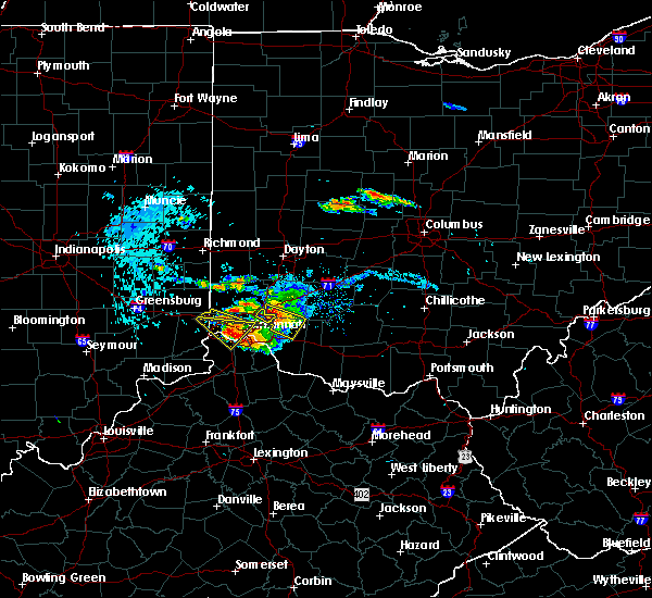 The severe thunderstorm warning for northeastern dearborn, northwestern kenton, northeastern boone and western hamilton counties will expire at 630 pm edt, the storm which prompted the warning has weakened below severe limits. therefore the warning will be allowed to expire. small hail and gusty winds are still possible with this storm. please report previous wind damage or hail to the national weather service by going to our website at weather.gov/iln and submit your report via social media. The severe thunderstorm warning for northeastern dearborn, northwestern kenton, northeastern boone and western hamilton counties will expire at 630 pm edt, the storm which prompted the warning has weakened below severe limits. therefore the warning will be allowed to expire. small hail and gusty winds are still possible with this storm. please report previous wind damage or hail to the national weather service by going to our website at weather.gov/iln and submit your report via social media.
|
| 8/3/2015 6:16 PM EDT | Quarter sized hail reported 13.1 miles SSW of Cincinnati, OH, report at route 42 and dimmick roads. |
| 8/3/2015 6:15 PM EDT | Half Dollar sized hail reported 10.8 miles SE of Cincinnati, OH, hail ranged in size from nickel to half dollar size. |
| 8/3/2015 6:15 PM EDT | Hen Egg sized hail reported 12.1 miles SSW of Cincinnati, OH |
| 8/3/2015 6:02 PM EDT | Golf Ball sized hail reported 11.4 miles SSW of Cincinnati, OH, public report at intersection of cresentville and chesterdale roads on butler/hamilton county line. |
| 8/3/2015 6:02 PM EDT | Golf Ball sized hail reported 12 miles SSW of Cincinnati, OH, via media |
| 8/3/2015 5:55 PM EDT |
 At 555 pm edt, radar indicated a severe thunderstorm located over fairfield, moving southeast at 30 mph. storm hazards include, winds to 60 mph, quarter size hail, frequent cloud to ground lightning, very heavy rain which may cause minor flooding,. At 555 pm edt, radar indicated a severe thunderstorm located over fairfield, moving southeast at 30 mph. storm hazards include, winds to 60 mph, quarter size hail, frequent cloud to ground lightning, very heavy rain which may cause minor flooding,.
|
| 8/3/2015 5:51 PM EDT |
 At 551 pm edt, radar indicated a severe thunderstorm located over harrison, moving southeast at 25 mph. storm hazards include, winds to 60 mph, half dollar size hail,. At 551 pm edt, radar indicated a severe thunderstorm located over harrison, moving southeast at 25 mph. storm hazards include, winds to 60 mph, half dollar size hail,.
|
| 8/3/2015 5:49 PM EDT |
 At 549 pm edt, radar indicated a severe thunderstorm located over harrison, moving southeast at 25 mph. storm hazards include, winds to 60 mph, half dollar size hail,. At 549 pm edt, radar indicated a severe thunderstorm located over harrison, moving southeast at 25 mph. storm hazards include, winds to 60 mph, half dollar size hail,.
|
| 8/3/2015 5:49 PM EDT |
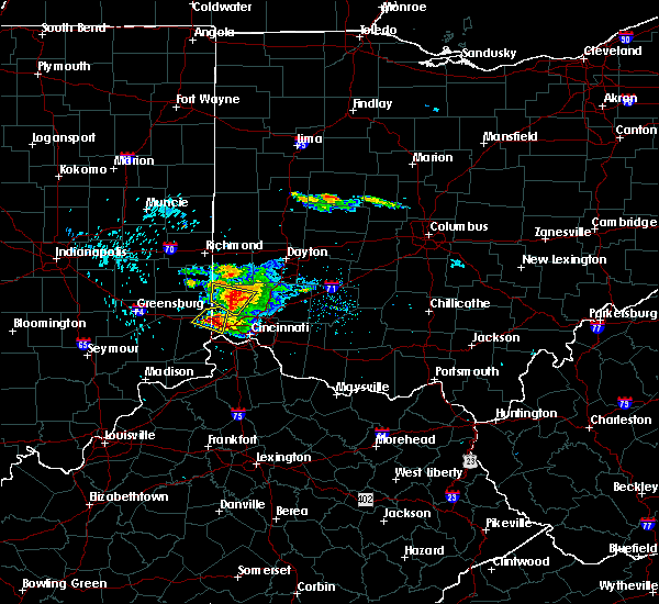 At 549 pm edt, radar indicated a severe thunderstorm located over harrison, moving southeast at 25 mph. storm hazards include, winds to 60 mph, half dollar size hail,. At 549 pm edt, radar indicated a severe thunderstorm located over harrison, moving southeast at 25 mph. storm hazards include, winds to 60 mph, half dollar size hail,.
|
| 8/3/2015 5:49 PM EDT |
 The national weather service in wilmington has issued a * severe thunderstorm warning for. northeastern dearborn county in southeastern indiana. northwestern kenton county in northern kentucky. northeastern boone county in northern kentucky. Southwestern butler county in southwestern ohio. The national weather service in wilmington has issued a * severe thunderstorm warning for. northeastern dearborn county in southeastern indiana. northwestern kenton county in northern kentucky. northeastern boone county in northern kentucky. Southwestern butler county in southwestern ohio.
|
| 7/13/2015 1:45 PM EDT | Several trees down across east walnut hills area. time estimated from rada in hamilton county OH, 1.3 miles WNW of Cincinnati, OH |
| 7/13/2015 1:36 PM EDT | 8-10 inch diameter tree uprooted near the 1100 block of seymour avenue. time estimated from rada in hamilton county OH, 3.6 miles SSW of Cincinnati, OH |
| 7/13/2015 1:34 PM EDT | One tree down across keys crescent near madison rd. time estimated from rada in hamilton county OH, 1.8 miles WNW of Cincinnati, OH |
| 7/13/2015 1:34 PM EDT | Numerous reports of trees and wires down due to thunderstorm wind in hamilton county OH, 2.8 miles N of Cincinnati, OH |
| 7/13/2015 1:34 PM EDT |
 At 132 pm edt, radar indicated severe thunderstorms located along a line extending from montgomery to 11 miles east of vernon, moving south at 40 mph. storm hazards include, winds to 60 mph, penny size hail, frequent cloud to ground lightning, very heavy rain which may cause minor flooding,. At 132 pm edt, radar indicated severe thunderstorms located along a line extending from montgomery to 11 miles east of vernon, moving south at 40 mph. storm hazards include, winds to 60 mph, penny size hail, frequent cloud to ground lightning, very heavy rain which may cause minor flooding,.
|
| 7/13/2015 1:30 PM EDT | Tree and large limbs down in east walnut hills due to win in hamilton county OH, 1.3 miles WNW of Cincinnati, OH |
| 7/13/2015 1:30 PM EDT | Several large trees down across north avondale area. time estimated from rada in hamilton county OH, 0.9 miles SW of Cincinnati, OH |
| 7/13/2015 1:29 PM EDT | Multiple large trees limbs down near grandview avenue and fleming street. time estimated from rada in hamilton county OH, 1.8 miles NW of Cincinnati, OH |
| 7/13/2015 1:29 PM EDT | Large tree down. time estimated from rada in hamilton county OH, 3 miles ENE of Cincinnati, OH |
| 7/13/2015 12:57 PM EDT |
 At 1257 pm edt, radar indicated severe thunderstorms located along a line extending from near carlisle to near oldenburg, moving southeast at 40 mph. storm hazards include, winds to 60 mph, penny size hail, frequent cloud to ground lightning, very heavy rain which may cause minor flooding,. At 1257 pm edt, radar indicated severe thunderstorms located along a line extending from near carlisle to near oldenburg, moving southeast at 40 mph. storm hazards include, winds to 60 mph, penny size hail, frequent cloud to ground lightning, very heavy rain which may cause minor flooding,.
|
| 6/30/2015 2:08 PM EDT |
 At 205 pm edt, radar indicated a severe thunderstorm located near rising sun, moving east at 25 mph. storm hazards include, winds to 60 mph, quarter size hail,. At 205 pm edt, radar indicated a severe thunderstorm located near rising sun, moving east at 25 mph. storm hazards include, winds to 60 mph, quarter size hail,.
|
| 6/30/2015 1:55 PM EDT |
 At 154 pm edt, radar indicated a severe thunderstorm located near burlington, moving east at 20 mph. storm hazards include, winds to 60 mph, quarter size hail,. At 154 pm edt, radar indicated a severe thunderstorm located near burlington, moving east at 20 mph. storm hazards include, winds to 60 mph, quarter size hail,.
|
| 5/11/2015 3:01 PM EDT | At 257 pm edt, radar continued to indicate a severe thunderstorm located near melbourne, moving northeast at 40 mph. storm hazards include, winds to 60 mph, locations impacted include, amelia, madeira, batavia, milford and loveland. in addition, nicholsville, lindale, cherry grove, fairfax, dry run, mariemont, newtown and withamsville are near the path of this storm. this includes the following interstate, i-71 between mile markers 8 and 14 in ohio, , <0.75in. |
| 5/11/2015 3:01 PM EDT | At 257 pm edt, radar continued to indicate a severe thunderstorm located near melbourne, moving northeast at 40 mph. storm hazards include, winds to 60 mph, locations impacted include, amelia, madeira, batavia, milford and loveland. in addition, nicholsville, lindale, cherry grove, fairfax, dry run, mariemont, newtown and withamsville are near the path of this storm. this includes the following interstate, i-71 between mile markers 8 and 14 in ohio, , <0.75in. |
| 5/11/2015 2:50 PM EDT | At 248 pm edt, radar indicated a severe thunderstorm located near white tower, moving northeast at 35 mph. storm hazards include, winds to 60 mph,. |
| 5/11/2015 2:50 PM EDT | At 248 pm edt, radar indicated a severe thunderstorm located near white tower, moving northeast at 35 mph. storm hazards include, winds to 60 mph,. |
| 4/10/2015 3:16 AM EDT | A severe thunderstorm warning remains in effect until 345 am edt for northwestern clermont. western warren. eastern hamilton. eastern butler. campbell and kenton counties. at 314 am edt. radar continued to indicate severe thunderstorms located along a line extending from middletown to crestview. Moving east at 60 mph. |
| 4/10/2015 3:16 AM EDT | A severe thunderstorm warning remains in effect until 345 am edt for northwestern clermont. western warren. eastern hamilton. eastern butler. campbell and kenton counties. at 314 am edt. radar continued to indicate severe thunderstorms located along a line extending from middletown to crestview. Moving east at 60 mph. |
| 4/10/2015 2:59 AM EDT | The national weather service in wilmington has issued a * severe thunderstorm warning for. northwestern clermont county in southwest ohio. western warren county in southwest ohio. hamilton county in southwest ohio. Butler county in southwest ohio. |
| 4/10/2015 2:59 AM EDT | The national weather service in wilmington has issued a * severe thunderstorm warning for. northwestern clermont county in southwest ohio. western warren county in southwest ohio. hamilton county in southwest ohio. Butler county in southwest ohio. |
| 4/9/2015 6:56 PM EDT | The severe thunderstorm warning for northern clermont. southern warren and eastern hamilton counties will expire at 700 pm edt. the storm has weakened below severe limits. therefore the severe thunderstorm warning will be allowed to expire. however. Small hail and gusty winds are still possible with this storm. |
| 4/9/2015 6:43 PM EDT | A severe thunderstorm warning remains in effect until 700 pm edt for northern clermont. southern warren and eastern hamilton counties. at 640 pm edt. national weather service radar continued to indicate a severe thunderstorm. this storm is located near miamiville. Moving northeast at 45 mph. |
| 4/9/2015 6:33 PM EDT | A severe thunderstorm warning remains in effect until 700 pm edt for northern clermont. southern warren. eastern hamilton and southeastern butler counties. at 631 pm edt. radar continued to indicate a severe thunderstorm located near silverton. moving northeast at 45 mph. Trained spotters have reported hail of up to one and a half inches in. |
| 4/9/2015 6:27 PM EDT | The severe thunderstorm warning for hamilton. butler. campbell. boone and kenton counties will expire at 630 pm edt. additional severe thunderstorm warnings have been issued for parts of hamilton. campbell. and butler counties. please report previous wind damage or hail to the national weather service by going to our website at weather. Gov/iln and submitting. |
| 4/9/2015 6:27 PM EDT | The severe thunderstorm warning for hamilton. butler. campbell. boone and kenton counties will expire at 630 pm edt. additional severe thunderstorm warnings have been issued for parts of hamilton. campbell. and butler counties. please report previous wind damage or hail to the national weather service by going to our website at weather. Gov/iln and submitting. |
| 4/9/2015 6:22 PM EDT | A tree was downed on harrison ave near queen city ave. time estimated from rada in hamilton county OH, 2.7 miles ENE of Cincinnati, OH |
| 4/9/2015 6:21 PM EDT | Hen Egg sized hail reported 4.5 miles ENE of Cincinnati, OH, reported near 1st ave and talbert street in price hill. time of event estimated from radar. |
| 4/9/2015 6:21 PM EDT | The national weather service in wilmington has issued a * severe thunderstorm warning for. northern clermont county in southwest ohio. southern warren county in southwest ohio. eastern hamilton county in southwest ohio. Southeastern butler county in southwest ohio. |
| 4/9/2015 6:21 PM EDT | The national weather service in wilmington has issued a * severe thunderstorm warning for. northern clermont county in southwest ohio. southern warren county in southwest ohio. eastern hamilton county in southwest ohio. Southeastern butler county in southwest ohio. |
| 4/9/2015 6:15 PM EDT | Half Dollar sized hail reported 2.6 miles NE of Cincinnati, OH |
| 4/9/2015 6:13 PM EDT | A severe thunderstorm warning remains in effect until 630 pm edt for hamilton. butler. campbell. boone and kenton counties. at 608 pm edt. radar continued to indicate a severe thunderstorm located 2 miles northeast of hebron. this storm remains capable of producing golf ball size hail and winds to 60 mph. this storm will affect southern hamilton county. Including downtown. |
| 4/9/2015 6:13 PM EDT | A severe thunderstorm warning remains in effect until 630 pm edt for hamilton. butler. campbell. boone and kenton counties. at 608 pm edt. radar continued to indicate a severe thunderstorm located 2 miles northeast of hebron. this storm remains capable of producing golf ball size hail and winds to 60 mph. this storm will affect southern hamilton county. Including downtown. |
| 4/9/2015 6:07 PM EDT | A severe thunderstorm warning remains in effect until 630 pm edt for hamilton. butler. campbell. boone and kenton counties. at 603 pm edt. radar continued to indicate a severe thunderstorm located near hebron. this storm has strengthened. and is now capable of producing golf ball size hail and 60 mph winds. another severe thunderstorm is located 6 miles west of hamilton. Capable of. |
| 4/9/2015 6:07 PM EDT | A severe thunderstorm warning remains in effect until 630 pm edt for hamilton. butler. campbell. boone and kenton counties. at 603 pm edt. radar continued to indicate a severe thunderstorm located near hebron. this storm has strengthened. and is now capable of producing golf ball size hail and 60 mph winds. another severe thunderstorm is located 6 miles west of hamilton. Capable of. |
| 4/9/2015 5:57 PM EDT | The national weather service in wilmington has issued a * severe thunderstorm warning for. hamilton county in southwest ohio. butler county in southwest ohio. campbell county in northern kentucky. Boone county in northern kentucky. |
| 4/9/2015 5:57 PM EDT | The national weather service in wilmington has issued a * severe thunderstorm warning for. hamilton county in southwest ohio. butler county in southwest ohio. campbell county in northern kentucky. Boone county in northern kentucky. |
| 4/9/2015 5:57 PM EDT | The national weather service in wilmington has issued a * severe thunderstorm warning for. hamilton county in southwest ohio. butler county in southwest ohio. campbell county in northern kentucky. Boone county in northern kentucky. |
| 4/9/2015 1:54 PM EDT | The severe thunderstorm warning for grant. eastern gallatin. campbell. boone. pendleton. northern owen and kenton counties will expire at 200 pm edt. the storms have weakened below severe limits. therefore the severe thunderstorm warning will be allowed to expire. Small hail and gusty winds are still possible with these storms. |
| 4/9/2015 1:48 PM EDT | The national weather service in wilmington has issued a * severe thunderstorm warning for. clermont county in southwest ohio. southeastern hamilton county in southwest ohio. campbell county in northern kentucky. Until 230 pm edt. |
| 4/9/2015 1:48 PM EDT | The national weather service in wilmington has issued a * severe thunderstorm warning for. clermont county in southwest ohio. southeastern hamilton county in southwest ohio. campbell county in northern kentucky. Until 230 pm edt. |
| 4/9/2015 1:38 PM EDT | A severe thunderstorm warning remains in effect until 200 pm edt for grant. eastern gallatin. campbell. boone. pendleton. northern owen and kenton counties. at 136 pm edt. radar continued to indicate severe thunderstorms located along a line extending from independence to twin bridges. Moving northeast at 55 mph. |
| 4/9/2015 1:38 PM EDT | A severe thunderstorm warning remains in effect until 200 pm edt for grant. eastern gallatin. campbell. boone. pendleton. northern owen and kenton counties. at 136 pm edt. radar continued to indicate severe thunderstorms located along a line extending from independence to twin bridges. Moving northeast at 55 mph. |
| 4/9/2015 1:28 PM EDT | The national weather service in wilmington has issued a * severe thunderstorm warning for. grant county in northern kentucky. eastern gallatin county in northern kentucky. campbell county in northern kentucky. Boone county in northern kentucky. |
| 4/9/2015 1:28 PM EDT | The national weather service in wilmington has issued a * severe thunderstorm warning for. grant county in northern kentucky. eastern gallatin county in northern kentucky. campbell county in northern kentucky. Boone county in northern kentucky. |
| 4/8/2015 8:52 PM EDT | The national weather service in wilmington has issued a * severe thunderstorm warning for. northern clermont county in southwest ohio. southern warren county in southwest ohio. northeastern hamilton county in southwest ohio. Southwestern clinton county in southwest ohio. |
| 4/8/2015 11:01 AM EDT | A severe thunderstorm warning remains in effect until 1115 am edt for highland. northern clermont. southeastern warren. eastern hamilton. southern clinton and northwestern brown counties. at 1059 am edt. radar continued to indicate severe thunderstorms located along a line extending from midland to edenton to perintown. Moving east at 60 mph. |
| 4/8/2015 10:41 AM EDT | The national weather service in wilmington has issued a * severe thunderstorm warning for. highland county in southwest ohio. northern clermont county in southwest ohio. southern warren county in southwest ohio. Northeastern hamilton county in southwest ohio. |
| 4/29/2014 6:43 PM EDT | A tree was reported down in a street in pleasant ridg in hamilton county OH, 5.1 miles SW of Cincinnati, OH |
| 4/29/2014 6:34 PM EDT | A tree was reported down on a roof in east walnut hill in hamilton county OH, 1.8 miles WNW of Cincinnati, OH |
| 11/17/2013 6:35 PM EST | Two trees in hamilton county OH, 2.1 miles N of Cincinnati, OH |
| 10/31/2013 11:40 PM EDT | Roof removed from building in hamilton county OH, 1.6 miles E of Cincinnati, OH |
| 8/31/2013 5:45 PM EDT | Multiple trees and power lines were downed in the central part of the county due to thunderstorm wind in hamilton county OH, 6.3 miles S of Cincinnati, OH |
| 7/19/2013 3:04 PM EDT | A couple 6 to 8 inch diameter branches dow in clermont county OH, 11.4 miles W of Cincinnati, OH |
| 6/13/2013 8:57 AM EDT | One tree was downed and numerous other trees were damaged at losantiville country clu in hamilton county OH, 4.3 miles SW of Cincinnati, OH |
| 6/13/2013 8:57 AM EDT | A tractor trailer was blown over in roselaw in hamilton county OH, 4.1 miles SSW of Cincinnati, OH |
| 6/13/2013 8:57 AM EDT | A tractor trailer was blown over in roselawn near the intersection of reading road and losantiville avenue. sections of roofing were blown off an apartment building acr in hamilton county OH, 4.1 miles SSW of Cincinnati, OH |
| 6/13/2013 8:57 AM EDT | Half a roof reported blown off at the old social securtiy building near the corner of reading rd. and losantiville ave. time estimated from rada in hamilton county OH, 4.1 miles SSW of Cincinnati, OH |
| 4/16/2013 5:06 PM EDT | Ping Pong Ball sized hail reported 10.8 miles SSW of Cincinnati, OH |
| 9/5/2012 4:45 PM EDT | Large tree split and fell on a house in madisonville in hamilton county OH, 6.1 miles WSW of Cincinnati, OH |
| 7/27/2012 5:11 PM EDT | 4 inch diameter branches down in downtown cincinnat in hamilton county OH, 0.5 miles E of Cincinnati, OH |
| 7/27/2012 5:04 PM EDT | A tree was downed in sayler par in hamilton county OH, 10.4 miles ENE of Cincinnati, OH |
| 7/27/2012 5:02 PM EDT | A tree was downed at the fernbank golf cours in hamilton county OH, 10.8 miles E of Cincinnati, OH |
| 7/26/2012 3:32 PM EDT | Several large trees onto structures and power lines on victoria av in hamilton county OH, 3.8 miles W of Cincinnati, OH |
| 7/26/2012 3:30 PM EDT | Trees down on grandin road in hamilton county OH, 2.8 miles WNW of Cincinnati, OH |
| 7/26/2012 3:23 PM EDT | Quarter sized hail reported 2.1 miles N of Cincinnati, OH |
| 7/18/2012 4:35 PM EDT | Trees down near sayler park in hamilton county OH, 10.4 miles ENE of Cincinnati, OH |
| 7/18/2012 4:15 PM EDT | Half Dollar sized hail reported 7.6 miles WSW of Cincinnati, OH, larger than quarter size |
| 7/1/2012 6:58 PM EDT | Quarter sized hail reported 11.1 miles SW of Cincinnati, OH, penny to quarter size hail. |
| 6/29/2012 5:17 PM EDT | At lunken fiel in hamilton county OH, 5.2 miles WNW of Cincinnati, OH |
| 5/1/2012 5:55 PM EDT | Golf Ball sized hail reported 6.8 miles SW of Cincinnati, OH |
| 5/1/2012 5:39 PM EDT | Quarter sized hail reported 6.3 miles S of Cincinnati, OH |
| 5/1/2012 5:32 PM EDT | Quarter sized hail reported 9.2 miles ESE of Cincinnati, OH |
| 5/1/2012 5:30 PM EDT | Quarter sized hail reported 8 miles SE of Cincinnati, OH |
| 5/1/2012 5:29 PM EDT | Golf Ball sized hail reported 8 miles SE of Cincinnati, OH |
| 5/1/2012 5:27 PM EDT | Golf Ball sized hail reported 0.5 miles E of Cincinnati, OH |
| 4/25/2012 11:36 PM EDT | Half Dollar sized hail reported 5.9 miles E of Cincinnati, OH |
| 4/1/2012 11:39 PM EDT | Quarter sized hail reported 8.5 miles SW of Cincinnati, OH |
| 4/1/2012 11:25 PM EDT | Quarter sized hail reported 10.8 miles SSW of Cincinnati, OH |
| 4/1/2012 11:22 PM EDT | Quarter sized hail reported 0.5 miles E of Cincinnati, OH |
| 3/15/2012 11:28 AM EDT | Quarter sized hail reported 5.6 miles SE of Cincinnati, OH, via broadcast media |
| 3/15/2012 11:00 AM EDT | Quarter sized hail reported 8 miles SE of Cincinnati, OH |
| 1/1/0001 12:00 AM | Large branches down in fernban in hamilton county OH, 10.8 miles E of Cincinnati, OH |
| 1/1/0001 12:00 AM | Large branches down in fernban in hamilton county OH, 10.8 miles E of Cincinnati, OH |
| 1/1/0001 12:00 AM | Storm damage reported in hamilton county OH, 5.2 miles WNW of Cincinnati, OH |
| 1/1/0001 12:00 AM | Storm damage reported in hamilton county OH, 5.2 miles WNW of Cincinnati, OH |
| 1/1/0001 12:00 AM | Peak gust at lunken airport asos in hamilton county OH, 5.2 miles WNW of Cincinnati, OH |
| 1/1/0001 12:00 AM | Storm damage reported in hamilton county OH, 5.2 miles WNW of Cincinnati, OH |
| 1/1/0001 12:00 AM | Large tree limbs snappe in hamilton county OH, 6.5 miles ENE of Cincinnati, OH |
| 1/1/0001 12:00 AM | Quarter sized hail reported 8 miles SE of Cincinnati, OH |
| 5/22/2011 5:37 PM EDT | Hen Egg sized hail reported 9.2 miles ESE of Cincinnati, OH |
| 1/1/0001 12:00 AM | 58 kt wind gust at kluk asos in hamilton county OH, 5.2 miles WNW of Cincinnati, OH |
| 1/1/0001 12:00 AM | Large sign blown into highwa in hamilton county OH, 6.5 miles ENE of Cincinnati, OH |
| 1/1/0001 12:00 AM | Large branches broken in hamilton county OH, 0.5 miles E of Cincinnati, OH |
| 1/1/0001 12:00 AM | Quarter sized hail reported 13.7 miles SW of Cincinnati, OH |
| 1/1/0001 12:00 AM | Numerous trees down in hamilton county OH, 0.5 miles E of Cincinnati, OH |
Hail Maps for Cincinnati, OH
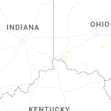
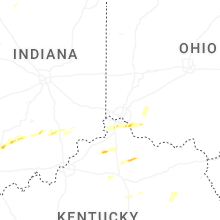

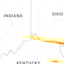


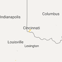


Connect with Interactive Hail Maps