

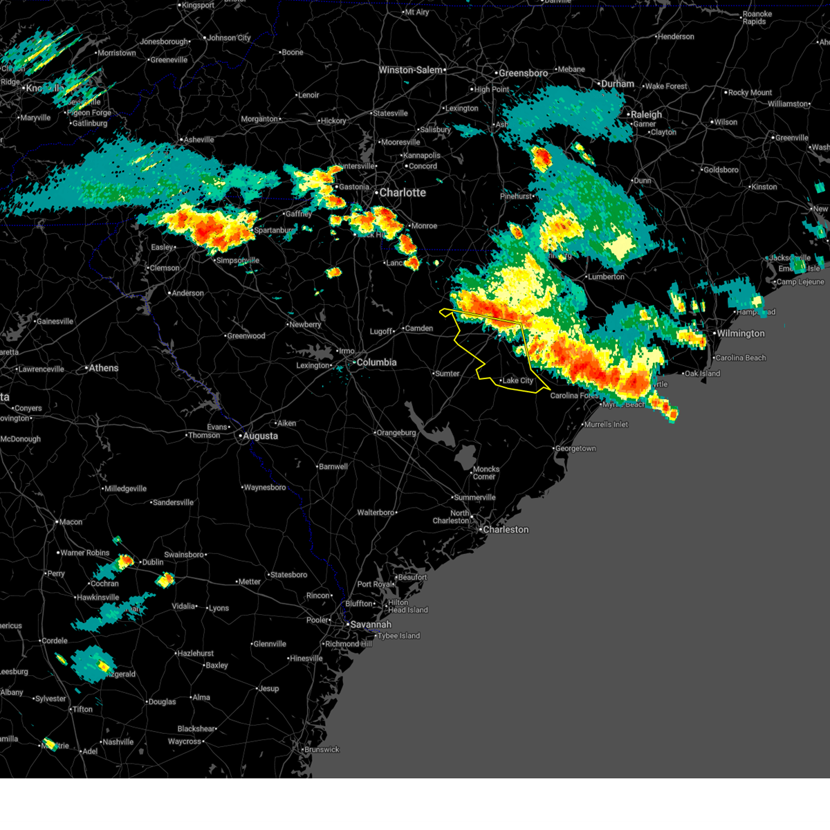
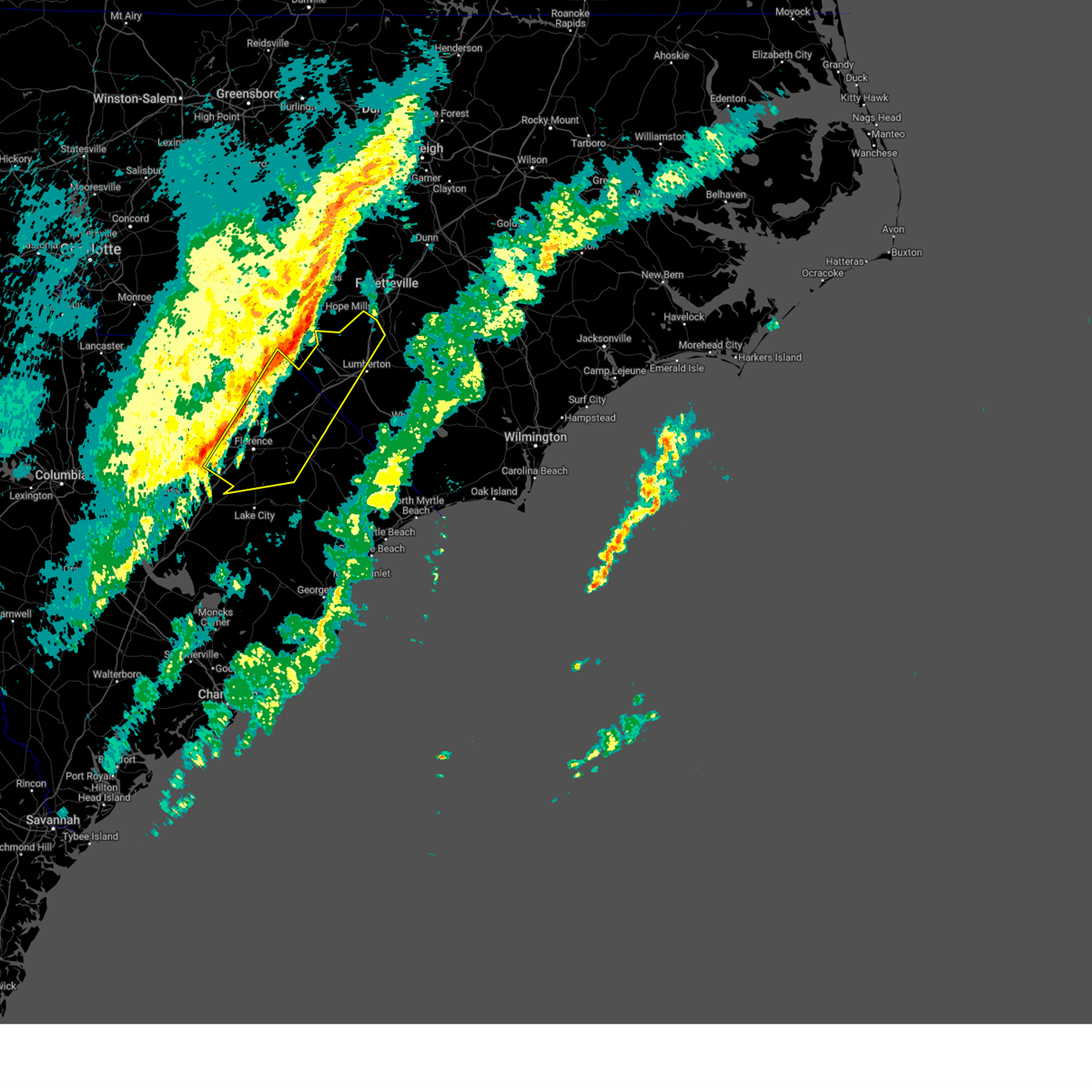
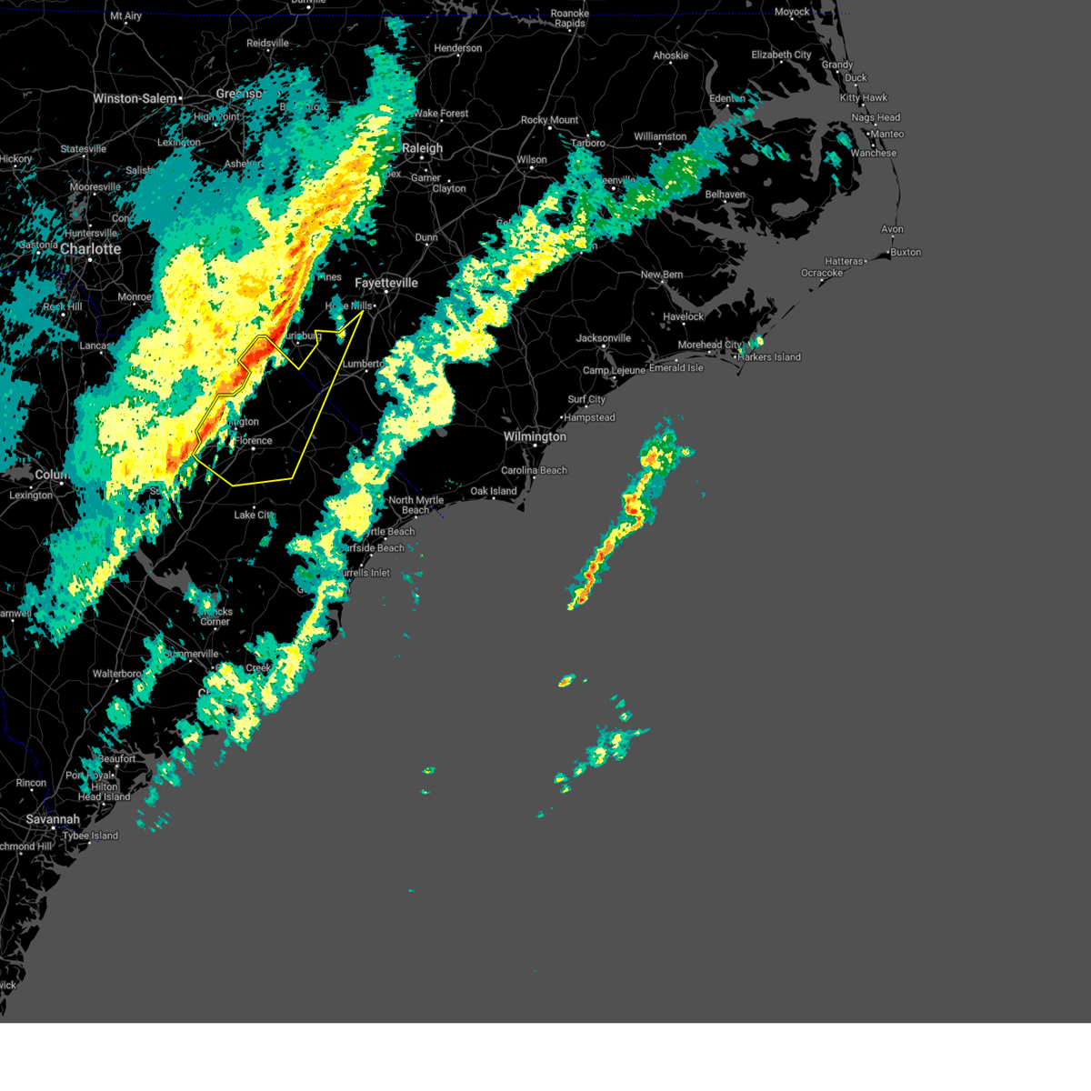
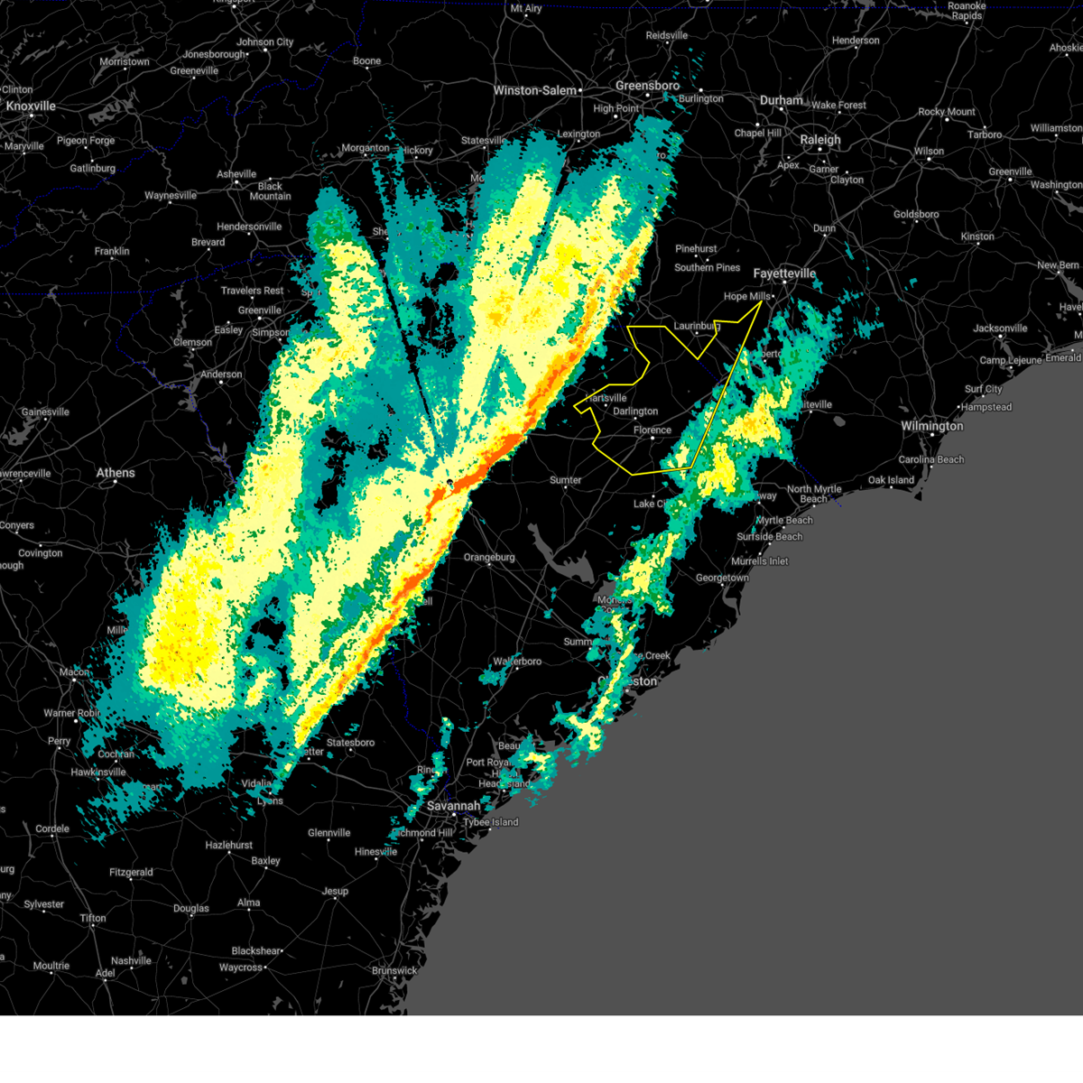
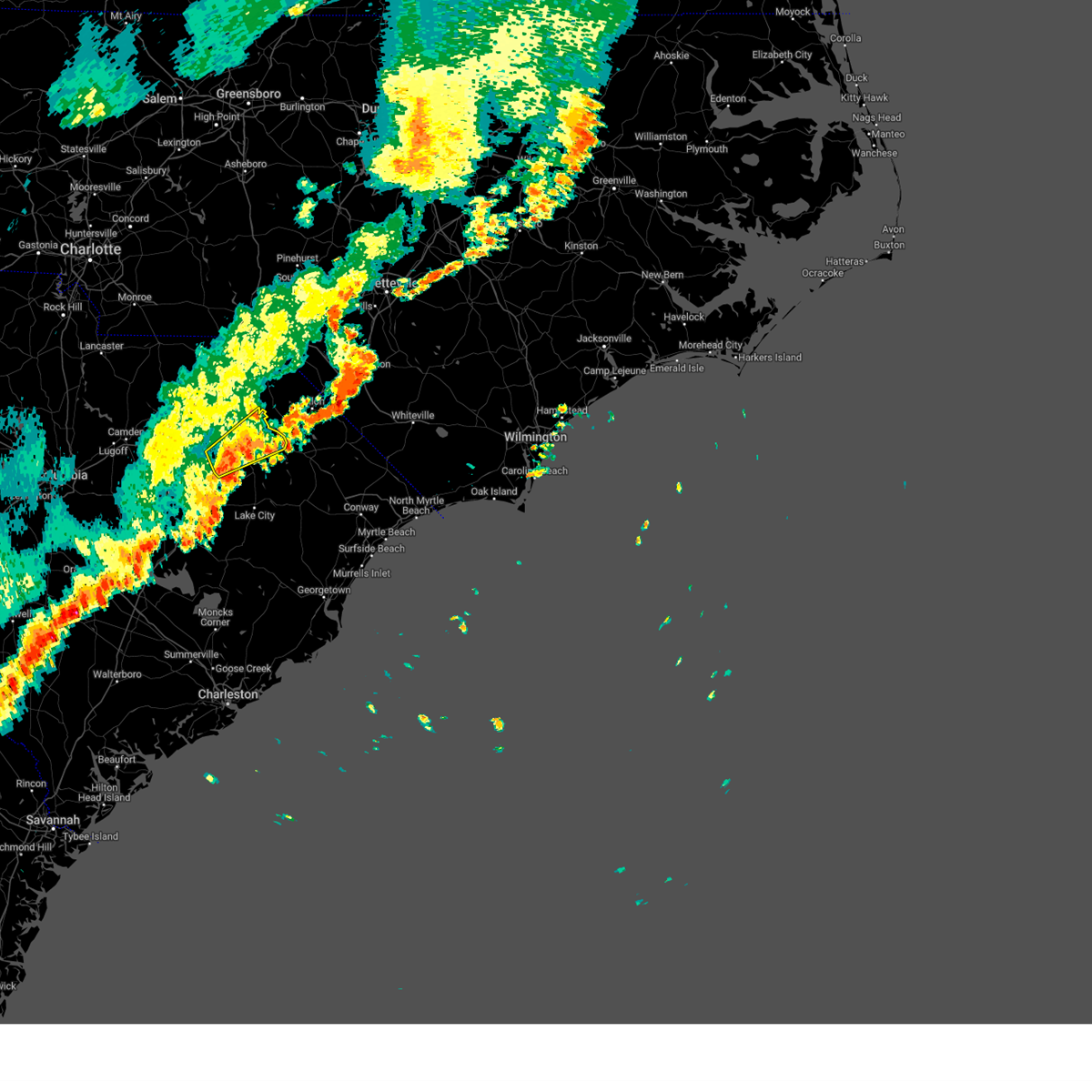
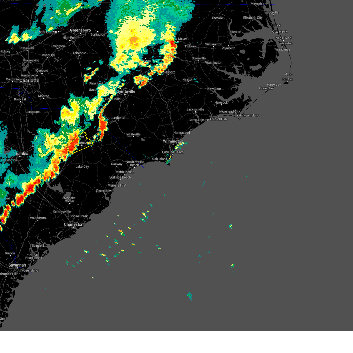
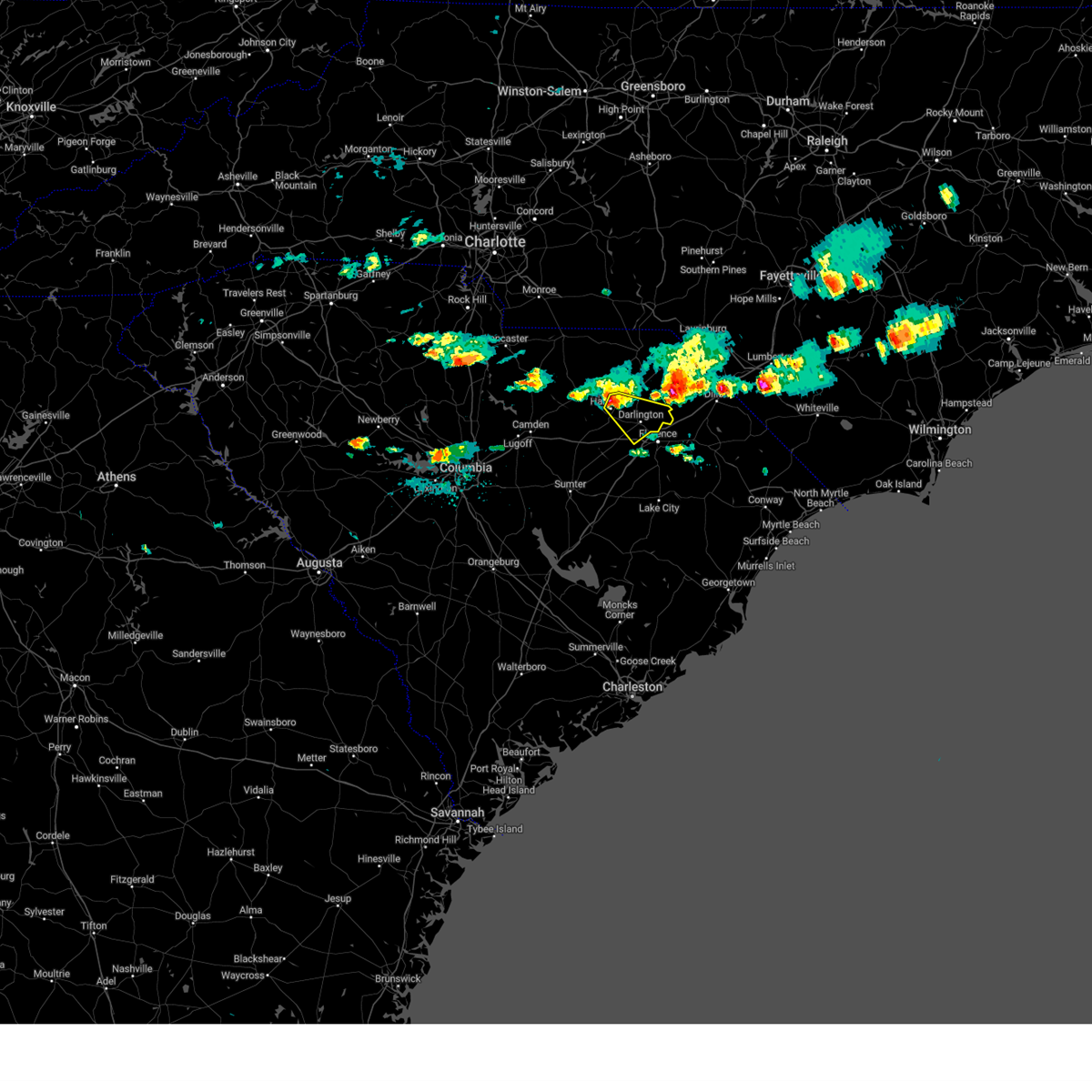
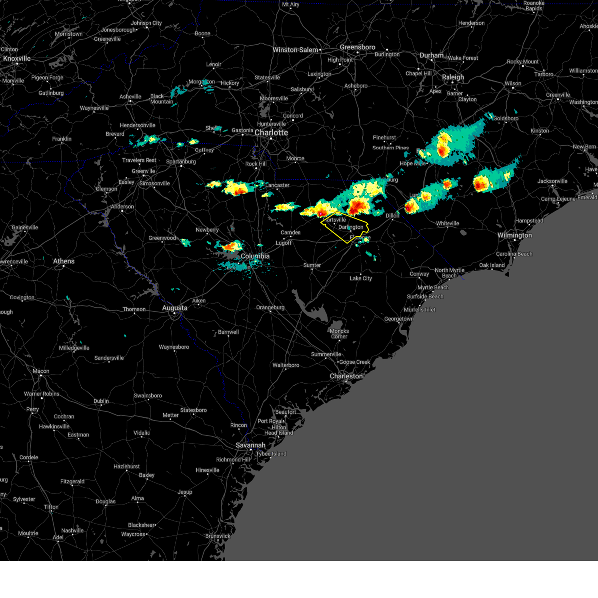
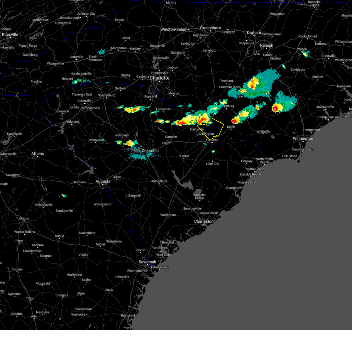
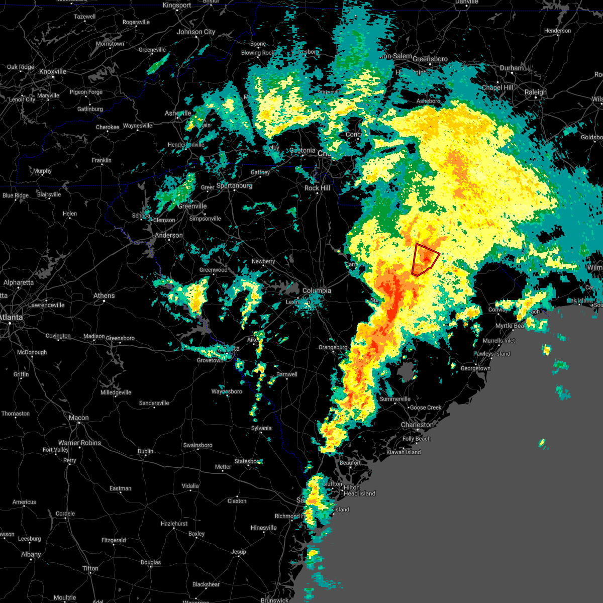
Hail Map for Darlington, SC
The Darlington, SC area has had 7 reports of on-the-ground hail by trained spotters, and has been under severe weather warnings 11 times during the past 12 months. Doppler radar has detected hail at or near Darlington, SC on 52 occasions, including 2 occasions during the past year.
| Name: | Darlington, SC |
| Where Located: | 76.6 miles N of Charleston, SC |
| Map: | Google Map for Darlington, SC |
| Population: | 6289 |
| Housing Units: | 2994 |
| More Info: | Search Google for Darlington, SC |
1
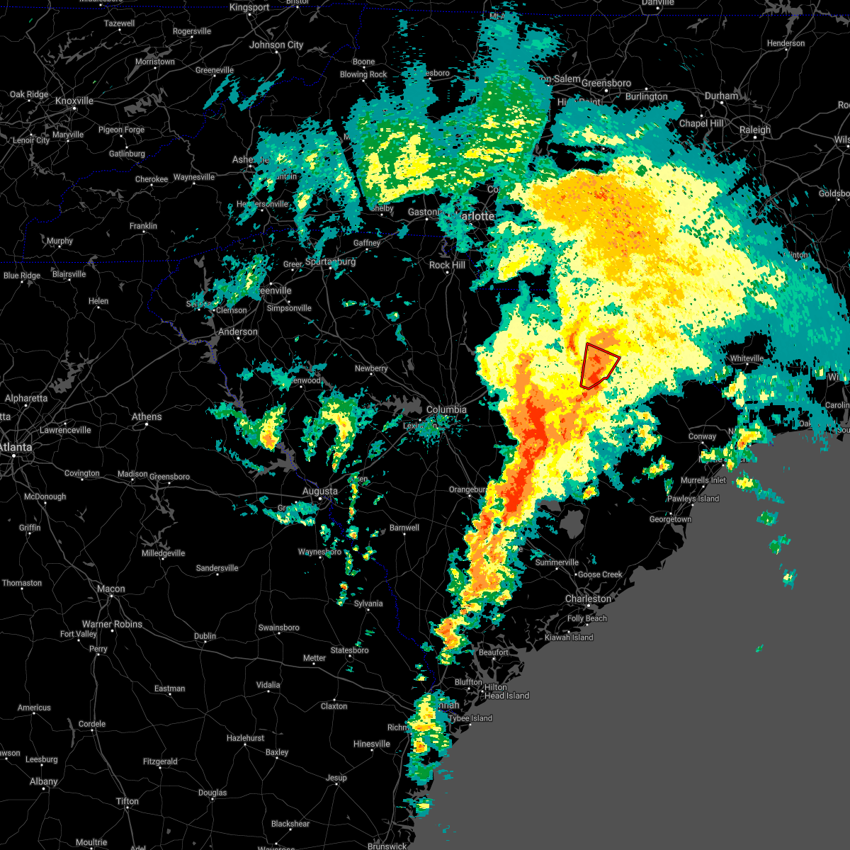
The Top Recent Hail Date for Darlington, SC is Friday, June 27, 2025 (9th out of 52)

Hail and Wind Damage Spotted near Darlington, SC
| Date / Time | Report Details |
|---|---|
| 6/25/2025 6:43 PM EDT |
 Svrilm the national weather service in wilmington has issued a * severe thunderstorm warning for, florence county in northeastern south carolina, southern darlington county in northeastern south carolina, * until 745 pm edt. * at 642 pm edt, severe thunderstorms were located along a line extending from kellytown to near quinby, moving south at 30 mph (trained weather spotters). Hazards include 60 mph wind gusts and quarter size hail. Minor hail damage to vehicles is possible. Expect wind damage to trees and power lines. Svrilm the national weather service in wilmington has issued a * severe thunderstorm warning for, florence county in northeastern south carolina, southern darlington county in northeastern south carolina, * until 745 pm edt. * at 642 pm edt, severe thunderstorms were located along a line extending from kellytown to near quinby, moving south at 30 mph (trained weather spotters). Hazards include 60 mph wind gusts and quarter size hail. Minor hail damage to vehicles is possible. Expect wind damage to trees and power lines.
|
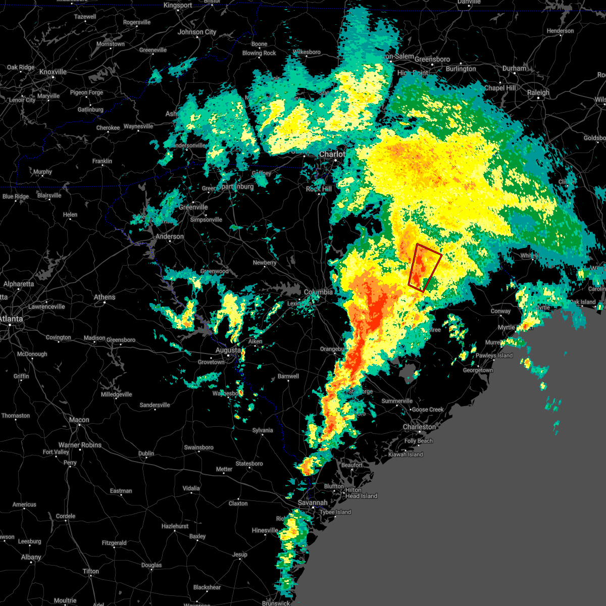
| 6/25/2025 6:35 PM EDT |
 At 634 pm edt, severe thunderstorms were located along a line extending from near auburn to near brownsville, moving south at 15 mph (radar indicated). Hazards include 60 mph wind gusts and quarter size hail. Minor hail damage to vehicles is possible. expect wind damage to trees and power lines. Locations impacted include, florence, hartsville, darlington, quinby, north hartsville, dovesville, mont clare, mars bluff, lydia, auburn, darlington raceway, swift creek, florence darlington technical college main campus, francis marion university, clyde, mechanicsville, oats, floyd, kellytown, and mcleod regional medical center. At 634 pm edt, severe thunderstorms were located along a line extending from near auburn to near brownsville, moving south at 15 mph (radar indicated). Hazards include 60 mph wind gusts and quarter size hail. Minor hail damage to vehicles is possible. expect wind damage to trees and power lines. Locations impacted include, florence, hartsville, darlington, quinby, north hartsville, dovesville, mont clare, mars bluff, lydia, auburn, darlington raceway, swift creek, florence darlington technical college main campus, francis marion university, clyde, mechanicsville, oats, floyd, kellytown, and mcleod regional medical center.
|
| 6/25/2025 6:29 PM EDT | Tree down on chestnut st in darlington in darlington county SC, 0.9 miles NNE of Darlington, SC |
| 6/25/2025 6:20 PM EDT |
 Svrilm the national weather service in wilmington has issued a * severe thunderstorm warning for, northern florence county in northeastern south carolina, darlington county in northeastern south carolina, southeastern marlboro county in northeastern south carolina, * until 715 pm edt. * at 620 pm edt, severe thunderstorms were located along a line extending from near auburn to near brownsville, moving south at 5 mph (radar indicated). Hazards include 60 mph wind gusts and quarter size hail. Minor hail damage to vehicles is possible. Expect wind damage to trees and power lines. Svrilm the national weather service in wilmington has issued a * severe thunderstorm warning for, northern florence county in northeastern south carolina, darlington county in northeastern south carolina, southeastern marlboro county in northeastern south carolina, * until 715 pm edt. * at 620 pm edt, severe thunderstorms were located along a line extending from near auburn to near brownsville, moving south at 5 mph (radar indicated). Hazards include 60 mph wind gusts and quarter size hail. Minor hail damage to vehicles is possible. Expect wind damage to trees and power lines.
|
| 6/25/2025 6:05 PM EDT | Report of tree down on mechanicsville hgwy near greenfield rd in darlington county SC, 6.2 miles SSW of Darlington, SC |
| 6/25/2025 6:01 PM EDT |
 At 601 pm edt, severe thunderstorms were located along a line extending from 7 miles northeast of mont clare to near lake view, moving south at 20 mph (radar indicated). Hazards include 60 mph wind gusts and quarter size hail. Minor hail damage to vehicles is possible. expect wind damage to trees and power lines. Locations impacted include, marion, dillon, mullins, latta, lake view, sellers, fork, zion, blue brick, brownsville, oak grove, gapway, bingham, floydale, mechanicsville, smithboro, kemper, nichols, blenheim, and mcleod medical center. At 601 pm edt, severe thunderstorms were located along a line extending from 7 miles northeast of mont clare to near lake view, moving south at 20 mph (radar indicated). Hazards include 60 mph wind gusts and quarter size hail. Minor hail damage to vehicles is possible. expect wind damage to trees and power lines. Locations impacted include, marion, dillon, mullins, latta, lake view, sellers, fork, zion, blue brick, brownsville, oak grove, gapway, bingham, floydale, mechanicsville, smithboro, kemper, nichols, blenheim, and mcleod medical center.
|
| 6/25/2025 5:48 PM EDT | At 548 pm edt, severe thunderstorms were located along a line extending from near mccoll to lake view, moving southeast at 20 mph (radar indicated). Hazards include 60 mph wind gusts and quarter size hail. Minor hail damage to vehicles is possible. expect wind damage to trees and power lines. Locations impacted include, bennettsville, marion, dillon, mullins, mccoll, latta, lake view, clio, sellers, fork, zion, blue brick, hamer, brownsville, south of the border, gapway, minturn, oak grove, bingham, and floydale. |
| 6/25/2025 5:23 PM EDT | Svrilm the national weather service in wilmington has issued a * severe thunderstorm warning for, dillon county in northeastern south carolina, northeastern darlington county in northeastern south carolina, northern marion county in northeastern south carolina, marlboro county in northeastern south carolina, * until 630 pm edt. * at 522 pm edt, severe thunderstorms were located along a line extending from near bennettsville to rowland, moving south at 25 mph (radar indicated). Hazards include 60 mph wind gusts and quarter size hail. Minor hail damage to vehicles is possible. Expect wind damage to trees and power lines. |
| 5/29/2025 4:28 PM EDT | Roof blown off dominion church along mciver rd. emergency manager said damage was highly localized near the structure with only a single downed limb observed otherwis in darlington county SC, 5.1 miles NW of Darlington, SC |
| 2/16/2025 8:58 AM EST |
 Svrilm the national weather service in wilmington has issued a * severe thunderstorm warning for, robeson county in southeastern north carolina, central florence county in northeastern south carolina, dillon county in northeastern south carolina, eastern darlington county in northeastern south carolina, northwestern marion county in northeastern south carolina, eastern marlboro county in northeastern south carolina, * until 1000 am est. * at 858 am est, severe thunderstorms were located along a line extending from near maxton to near lamar, moving east at 55 mph (radar indicated). Hazards include 60 mph wind gusts. expect wind damage to trees and power lines Svrilm the national weather service in wilmington has issued a * severe thunderstorm warning for, robeson county in southeastern north carolina, central florence county in northeastern south carolina, dillon county in northeastern south carolina, eastern darlington county in northeastern south carolina, northwestern marion county in northeastern south carolina, eastern marlboro county in northeastern south carolina, * until 1000 am est. * at 858 am est, severe thunderstorms were located along a line extending from near maxton to near lamar, moving east at 55 mph (radar indicated). Hazards include 60 mph wind gusts. expect wind damage to trees and power lines
|
| 2/16/2025 8:54 AM EST | Multiple trees down in darlington county along potato house road. report arrived at 9:01 am... damage time estimated via rada in darlington county SC, 4.3 miles E of Darlington, SC |
| 2/16/2025 8:45 AM EST |
 At 845 am est, severe thunderstorms were located along a line extending from 7 miles northwest of laurinburg to near elliott, moving east at 45 mph (radar indicated). Hazards include 60 mph wind gusts. Expect wind damage to trees and power lines. Locations impacted include, florence, bennettsville, hartsville, dillon, darlington, red springs, pembroke, maxton, timmonsville, mccoll, latta, rowland, lamar, quinby, clio, sellers, blue brick, hamer, brownsville, and darlington raceway. At 845 am est, severe thunderstorms were located along a line extending from 7 miles northwest of laurinburg to near elliott, moving east at 45 mph (radar indicated). Hazards include 60 mph wind gusts. Expect wind damage to trees and power lines. Locations impacted include, florence, bennettsville, hartsville, dillon, darlington, red springs, pembroke, maxton, timmonsville, mccoll, latta, rowland, lamar, quinby, clio, sellers, blue brick, hamer, brownsville, and darlington raceway.
|
| 2/16/2025 8:06 AM EST |
 Svrilm the national weather service in wilmington has issued a * severe thunderstorm warning for, northwestern robeson county in southeastern north carolina, northwestern florence county in northeastern south carolina, dillon county in northeastern south carolina, darlington county in northeastern south carolina, northwestern marion county in northeastern south carolina, marlboro county in northeastern south carolina, * until 900 am est. * at 805 am est, severe thunderstorms were located along a line extending from 6 miles north of chesterfield to 7 miles southeast of elgin, moving east at 65 mph (radar indicated). Hazards include 60 mph wind gusts. expect wind damage to trees and power lines Svrilm the national weather service in wilmington has issued a * severe thunderstorm warning for, northwestern robeson county in southeastern north carolina, northwestern florence county in northeastern south carolina, dillon county in northeastern south carolina, darlington county in northeastern south carolina, northwestern marion county in northeastern south carolina, marlboro county in northeastern south carolina, * until 900 am est. * at 805 am est, severe thunderstorms were located along a line extending from 6 miles north of chesterfield to 7 miles southeast of elgin, moving east at 65 mph (radar indicated). Hazards include 60 mph wind gusts. expect wind damage to trees and power lines
|
| 8/3/2024 7:36 PM EDT |
 The storm which prompted the warning has weakened below severe limits, and no longer poses an immediate threat to life or property. therefore, the warning will be allowed to expire. please send your reports of hail and/or wind damage, including trees or large limbs downed, by calling the national weather service office in wilmington at 1-800-697-3901. The storm which prompted the warning has weakened below severe limits, and no longer poses an immediate threat to life or property. therefore, the warning will be allowed to expire. please send your reports of hail and/or wind damage, including trees or large limbs downed, by calling the national weather service office in wilmington at 1-800-697-3901.
|
| 8/3/2024 6:59 PM EDT |
 Svrilm the national weather service in wilmington has issued a * severe thunderstorm warning for, northwestern florence county in northeastern south carolina, southeastern darlington county in northeastern south carolina, * until 745 pm edt. * at 659 pm edt, a severe thunderstorm was located near timmonsville, or near florence, moving northeast at 30 mph (radar indicated). Hazards include 60 mph wind gusts. expect wind damage to trees and power lines Svrilm the national weather service in wilmington has issued a * severe thunderstorm warning for, northwestern florence county in northeastern south carolina, southeastern darlington county in northeastern south carolina, * until 745 pm edt. * at 659 pm edt, a severe thunderstorm was located near timmonsville, or near florence, moving northeast at 30 mph (radar indicated). Hazards include 60 mph wind gusts. expect wind damage to trees and power lines
|
| 5/10/2024 6:07 PM EDT |
 At 607 pm edt, severe thunderstorms were located along a line extending from near bishopville to near darlington raceway, moving southeast at 35 mph (radar indicated). Hazards include 60 mph wind gusts and quarter size hail. Minor hail damage to vehicles is possible. expect wind damage to trees and power lines. these severe storms will be near, florence, lamar, and florence darlington technical college main campus around 610 pm edt. timmonsville around 615 pm edt. cartersville around 620 pm edt. Evergreen, effingham, sardis, and claussen around 630 pm edt. At 607 pm edt, severe thunderstorms were located along a line extending from near bishopville to near darlington raceway, moving southeast at 35 mph (radar indicated). Hazards include 60 mph wind gusts and quarter size hail. Minor hail damage to vehicles is possible. expect wind damage to trees and power lines. these severe storms will be near, florence, lamar, and florence darlington technical college main campus around 610 pm edt. timmonsville around 615 pm edt. cartersville around 620 pm edt. Evergreen, effingham, sardis, and claussen around 630 pm edt.
|
| 5/10/2024 6:00 PM EDT | Quarter sized hail reported 2.6 miles NE of Darlington, SC, pictures of quarter sized hail reported via social media along timmonsville highway. time estimated via radar. |
| 5/10/2024 5:54 PM EDT |
 Svrilm the national weather service in wilmington has issued a * severe thunderstorm warning for, northwestern florence county in northeastern south carolina, southern darlington county in northeastern south carolina, * until 645 pm edt. * at 554 pm edt, severe thunderstorms were located along a line extending from 8 miles west of bishopville to swift creek, moving southeast at 35 mph (radar indicated). Hazards include 60 mph wind gusts and quarter size hail. Minor hail damage to vehicles is possible. expect wind damage to trees and power lines. severe thunderstorms will be near, darlington, darlington raceway, and oats around 600 pm edt. lamar and florence darlington technical college main campus around 605 pm edt. florence and timmonsville around 610 pm edt. cartersville around 620 pm edt. evergreen, effingham, sardis, and claussen around 630 pm edt. Other locations impacted by these severe thunderstorms include carolinas hospital system, mcleod regional medical center, carolinas hospital system - cedar tower, and health south rehabilitation hospital. Svrilm the national weather service in wilmington has issued a * severe thunderstorm warning for, northwestern florence county in northeastern south carolina, southern darlington county in northeastern south carolina, * until 645 pm edt. * at 554 pm edt, severe thunderstorms were located along a line extending from 8 miles west of bishopville to swift creek, moving southeast at 35 mph (radar indicated). Hazards include 60 mph wind gusts and quarter size hail. Minor hail damage to vehicles is possible. expect wind damage to trees and power lines. severe thunderstorms will be near, darlington, darlington raceway, and oats around 600 pm edt. lamar and florence darlington technical college main campus around 605 pm edt. florence and timmonsville around 610 pm edt. cartersville around 620 pm edt. evergreen, effingham, sardis, and claussen around 630 pm edt. Other locations impacted by these severe thunderstorms include carolinas hospital system, mcleod regional medical center, carolinas hospital system - cedar tower, and health south rehabilitation hospital.
|
| 5/10/2024 5:21 PM EDT |
 The storm which prompted the warning has weakened below severe limits, and no longer poses an immediate threat to life or property. therefore, the warning will be allowed to expire. a severe thunderstorm watch remains in effect until 900 pm edt for northeastern south carolina. please send your reports of hail and/or wind damage, including trees or large limbs downed, by calling the national weather service office in wilmington at 1-800-697-3901. The storm which prompted the warning has weakened below severe limits, and no longer poses an immediate threat to life or property. therefore, the warning will be allowed to expire. a severe thunderstorm watch remains in effect until 900 pm edt for northeastern south carolina. please send your reports of hail and/or wind damage, including trees or large limbs downed, by calling the national weather service office in wilmington at 1-800-697-3901.
|
| 5/10/2024 5:12 PM EDT | Half Dollar sized hail reported 6.5 miles WSW of Darlington, SC, picture of hail stones larger than a quarter in mechanicsville submitted via social media. time estimated via radar. |
| 5/10/2024 5:08 PM EDT |
 At 507 pm edt, a severe thunderstorm was located between mechanicsville and darlington, moving east at 35 mph (radar indicated). Hazards include 60 mph wind gusts and quarter size hail. Minor hail damage to vehicles is possible. expect wind damage to trees and power lines. This severe thunderstorm will remain over mainly rural areas of east central darlington county. At 507 pm edt, a severe thunderstorm was located between mechanicsville and darlington, moving east at 35 mph (radar indicated). Hazards include 60 mph wind gusts and quarter size hail. Minor hail damage to vehicles is possible. expect wind damage to trees and power lines. This severe thunderstorm will remain over mainly rural areas of east central darlington county.
|
| 5/10/2024 4:58 PM EDT |
 At 458 pm edt, a severe thunderstorm was located over floyd and darlington, moving southeast at 35 mph (radar indicated). Hazards include 60 mph wind gusts and quarter size hail. Minor hail damage to vehicles is possible. expect wind damage to trees and power lines. this severe storm will be near, darlington and mechanicsville around 505 pm edt. Florence darlington technical college main campus around 510 pm edt. At 458 pm edt, a severe thunderstorm was located over floyd and darlington, moving southeast at 35 mph (radar indicated). Hazards include 60 mph wind gusts and quarter size hail. Minor hail damage to vehicles is possible. expect wind damage to trees and power lines. this severe storm will be near, darlington and mechanicsville around 505 pm edt. Florence darlington technical college main campus around 510 pm edt.
|
| 5/10/2024 4:45 PM EDT |
 At 445 pm edt, a severe thunderstorm was located over north hartsville, moving southeast at 40 mph (radar indicated). Hazards include 60 mph wind gusts and quarter size hail. Minor hail damage to vehicles is possible. expect wind damage to trees and power lines. this severe storm will be near, auburn, dovesville, floyd, and swift creek around 450 pm edt. darlington and darlington raceway around 455 pm edt. Mechanicsville and florence darlington technical college main campus around 505 pm edt. At 445 pm edt, a severe thunderstorm was located over north hartsville, moving southeast at 40 mph (radar indicated). Hazards include 60 mph wind gusts and quarter size hail. Minor hail damage to vehicles is possible. expect wind damage to trees and power lines. this severe storm will be near, auburn, dovesville, floyd, and swift creek around 450 pm edt. darlington and darlington raceway around 455 pm edt. Mechanicsville and florence darlington technical college main campus around 505 pm edt.
|
| 5/10/2024 4:29 PM EDT |
 Svrilm the national weather service in wilmington has issued a * severe thunderstorm warning for, darlington county in northeastern south carolina, * until 530 pm edt. * at 429 pm edt, a severe thunderstorm was located near clyde, or 9 miles northwest of hartsville, moving southeast at 35 mph (radar indicated). Hazards include 60 mph wind gusts and quarter size hail. Minor hail damage to vehicles is possible. Expect wind damage to trees and power lines. Svrilm the national weather service in wilmington has issued a * severe thunderstorm warning for, darlington county in northeastern south carolina, * until 530 pm edt. * at 429 pm edt, a severe thunderstorm was located near clyde, or 9 miles northwest of hartsville, moving southeast at 35 mph (radar indicated). Hazards include 60 mph wind gusts and quarter size hail. Minor hail damage to vehicles is possible. Expect wind damage to trees and power lines.
|
| 5/10/2024 4:15 PM EDT |
 Svrilm the national weather service in wilmington has issued a * severe thunderstorm warning for, eastern darlington county in northeastern south carolina, southern marlboro county in northeastern south carolina, * until 500 pm edt. * at 414 pm edt, severe thunderstorms were located along a line extending from near cheraw state park to 6 miles north of north hartsville, moving southeast at 35 mph (radar indicated). Hazards include 60 mph wind gusts and quarter size hail. Minor hail damage to vehicles is possible. expect wind damage to trees and power lines. severe thunderstorms will be near, dovesville around 425 pm edt. mont clare and floyd around 430 pm edt. darlington and mechanicsville around 440 pm edt. brownsville around 445 pm edt. Other locations impacted by these severe thunderstorms include blenheim and society hill. Svrilm the national weather service in wilmington has issued a * severe thunderstorm warning for, eastern darlington county in northeastern south carolina, southern marlboro county in northeastern south carolina, * until 500 pm edt. * at 414 pm edt, severe thunderstorms were located along a line extending from near cheraw state park to 6 miles north of north hartsville, moving southeast at 35 mph (radar indicated). Hazards include 60 mph wind gusts and quarter size hail. Minor hail damage to vehicles is possible. expect wind damage to trees and power lines. severe thunderstorms will be near, dovesville around 425 pm edt. mont clare and floyd around 430 pm edt. darlington and mechanicsville around 440 pm edt. brownsville around 445 pm edt. Other locations impacted by these severe thunderstorms include blenheim and society hill.
|
| 5/8/2024 6:55 PM EDT |
 At 655 pm edt, severe thunderstorms were located along a line extending from near minturn to near mars bluff to near cartersville, moving east at 40 mph (radar indicated). Hazards include ping pong ball size hail and 60 mph wind gusts. People and animals outdoors will be injured. expect hail damage to roofs, siding, windows, and vehicles. expect wind damage to trees and power lines. Locations impacted include, florence, marion, dillon, lake city, darlington, mullins, timmonsville, latta, pamplico, lamar, quinby, lake view, sellers, blue brick, hamer, brownsville, darlington raceway, swift creek, rains, and floyd. At 655 pm edt, severe thunderstorms were located along a line extending from near minturn to near mars bluff to near cartersville, moving east at 40 mph (radar indicated). Hazards include ping pong ball size hail and 60 mph wind gusts. People and animals outdoors will be injured. expect hail damage to roofs, siding, windows, and vehicles. expect wind damage to trees and power lines. Locations impacted include, florence, marion, dillon, lake city, darlington, mullins, timmonsville, latta, pamplico, lamar, quinby, lake view, sellers, blue brick, hamer, brownsville, darlington raceway, swift creek, rains, and floyd.
|
| 5/8/2024 6:48 PM EDT |
 The storms which prompted the warning have received a new severe thunderstorm warning for darlington, marlboro, florence, dillon, and marion counties, in effect until 745 pm. a severe thunderstorm watch remains in effect until 1000 pm edt for northeastern south carolina. please send your reports of hail and/or wind damage, including trees or large limbs downed, by calling the national weather service office in wilmington at 1-800-697-3901. The storms which prompted the warning have received a new severe thunderstorm warning for darlington, marlboro, florence, dillon, and marion counties, in effect until 745 pm. a severe thunderstorm watch remains in effect until 1000 pm edt for northeastern south carolina. please send your reports of hail and/or wind damage, including trees or large limbs downed, by calling the national weather service office in wilmington at 1-800-697-3901.
|
| 5/8/2024 6:40 PM EDT |
 Svrilm the national weather service in wilmington has issued a * severe thunderstorm warning for, southwestern robeson county in southeastern north carolina, florence county in northeastern south carolina, dillon county in northeastern south carolina, darlington county in northeastern south carolina, marion county in northeastern south carolina, southern marlboro county in northeastern south carolina, * until 745 pm edt. * at 639 pm edt, severe thunderstorms were located along a line extending from near dunbar to near florence darlington technical college main campus to elliott, moving east at 40 mph (radar indicated). Hazards include 60 mph wind gusts and quarter size hail. Minor hail damage to vehicles is possible. Expect wind damage to trees and power lines. Svrilm the national weather service in wilmington has issued a * severe thunderstorm warning for, southwestern robeson county in southeastern north carolina, florence county in northeastern south carolina, dillon county in northeastern south carolina, darlington county in northeastern south carolina, marion county in northeastern south carolina, southern marlboro county in northeastern south carolina, * until 745 pm edt. * at 639 pm edt, severe thunderstorms were located along a line extending from near dunbar to near florence darlington technical college main campus to elliott, moving east at 40 mph (radar indicated). Hazards include 60 mph wind gusts and quarter size hail. Minor hail damage to vehicles is possible. Expect wind damage to trees and power lines.
|
| 5/8/2024 6:27 PM EDT |
 At 627 pm edt, severe thunderstorms were located along a line extending from laurinburg to near mont clare to near lee state park, moving east at 30 mph (radar indicated). Hazards include ping pong ball size hail and 60 mph wind gusts. People and animals outdoors will be injured. expect hail damage to roofs, siding, windows, and vehicles. expect wind damage to trees and power lines. Locations impacted include, hartsville, darlington, lamar, north hartsville, dovesville, mont clare, brownsville, lydia, darlington raceway, auburn, swift creek, clyde, mechanicsville, oats, floyd, dunbar, kellytown, florence darlington technical college main campus, society hill, and blenheim. At 627 pm edt, severe thunderstorms were located along a line extending from laurinburg to near mont clare to near lee state park, moving east at 30 mph (radar indicated). Hazards include ping pong ball size hail and 60 mph wind gusts. People and animals outdoors will be injured. expect hail damage to roofs, siding, windows, and vehicles. expect wind damage to trees and power lines. Locations impacted include, hartsville, darlington, lamar, north hartsville, dovesville, mont clare, brownsville, lydia, darlington raceway, auburn, swift creek, clyde, mechanicsville, oats, floyd, dunbar, kellytown, florence darlington technical college main campus, society hill, and blenheim.
|
| 5/8/2024 6:13 PM EDT |
 At 613 pm edt, severe thunderstorms were located along a line extending from 6 miles east of hamlet to 8 miles north of dovesville to near cassatt, moving southeast at 35 mph (radar indicated). Hazards include 60 mph wind gusts and quarter size hail. Minor hail damage to vehicles is possible. expect wind damage to trees and power lines. Locations impacted include, bennettsville, hartsville, darlington, mccoll, lamar, clio, mont clare, brownsville, lydia, darlington raceway, swift creek, oats, chavistown, floyd, north hartsville, dovesville, auburn, wallace, clyde, and mechanicsville. At 613 pm edt, severe thunderstorms were located along a line extending from 6 miles east of hamlet to 8 miles north of dovesville to near cassatt, moving southeast at 35 mph (radar indicated). Hazards include 60 mph wind gusts and quarter size hail. Minor hail damage to vehicles is possible. expect wind damage to trees and power lines. Locations impacted include, bennettsville, hartsville, darlington, mccoll, lamar, clio, mont clare, brownsville, lydia, darlington raceway, swift creek, oats, chavistown, floyd, north hartsville, dovesville, auburn, wallace, clyde, and mechanicsville.
|
| 5/8/2024 5:31 PM EDT |
 Svrilm the national weather service in wilmington has issued a * severe thunderstorm warning for, darlington county in northeastern south carolina, marlboro county in northeastern south carolina, * until 645 pm edt. * at 530 pm edt, severe thunderstorms were located along a line extending from 11 miles east of ansonville to near chesterfield to near liberty hill, moving southeast at 35 mph (radar indicated). Hazards include 60 mph wind gusts and quarter size hail. Minor hail damage to vehicles is possible. Expect wind damage to trees and power lines. Svrilm the national weather service in wilmington has issued a * severe thunderstorm warning for, darlington county in northeastern south carolina, marlboro county in northeastern south carolina, * until 645 pm edt. * at 530 pm edt, severe thunderstorms were located along a line extending from 11 miles east of ansonville to near chesterfield to near liberty hill, moving southeast at 35 mph (radar indicated). Hazards include 60 mph wind gusts and quarter size hail. Minor hail damage to vehicles is possible. Expect wind damage to trees and power lines.
|
| 4/20/2024 6:53 PM EDT |
 Svrilm the national weather service in wilmington has issued a * severe thunderstorm warning for, southwestern robeson county in southeastern north carolina, north central florence county in northeastern south carolina, dillon county in northeastern south carolina, east central darlington county in northeastern south carolina, northwestern marion county in northeastern south carolina, southeastern marlboro county in northeastern south carolina, * until 800 pm edt. * at 652 pm edt, a severe thunderstorm was located near latta, or near dillon, moving east at 25 mph (radar indicated). Hazards include 60 mph wind gusts and quarter size hail. Minor hail damage to vehicles is possible. Expect wind damage to trees and power lines. Svrilm the national weather service in wilmington has issued a * severe thunderstorm warning for, southwestern robeson county in southeastern north carolina, north central florence county in northeastern south carolina, dillon county in northeastern south carolina, east central darlington county in northeastern south carolina, northwestern marion county in northeastern south carolina, southeastern marlboro county in northeastern south carolina, * until 800 pm edt. * at 652 pm edt, a severe thunderstorm was located near latta, or near dillon, moving east at 25 mph (radar indicated). Hazards include 60 mph wind gusts and quarter size hail. Minor hail damage to vehicles is possible. Expect wind damage to trees and power lines.
|
| 4/20/2024 5:49 PM EDT |
 Svrilm the national weather service in wilmington has issued a * severe thunderstorm warning for, northwestern florence county in northeastern south carolina, northwestern dillon county in northeastern south carolina, darlington county in northeastern south carolina, central marlboro county in northeastern south carolina, * until 700 pm edt. * at 549 pm edt, a severe thunderstorm was located near clyde, or 12 miles west of hartsville, moving southeast at 30 mph (radar indicated). Hazards include 60 mph wind gusts and half dollar size hail. Minor hail damage to vehicles is possible. Expect wind damage to trees and power lines. Svrilm the national weather service in wilmington has issued a * severe thunderstorm warning for, northwestern florence county in northeastern south carolina, northwestern dillon county in northeastern south carolina, darlington county in northeastern south carolina, central marlboro county in northeastern south carolina, * until 700 pm edt. * at 549 pm edt, a severe thunderstorm was located near clyde, or 12 miles west of hartsville, moving southeast at 30 mph (radar indicated). Hazards include 60 mph wind gusts and half dollar size hail. Minor hail damage to vehicles is possible. Expect wind damage to trees and power lines.
|
| 1/9/2024 5:05 PM EST | Several trees reported down in the eastern part of darlington count in darlington county SC, 7.3 miles WSW of Darlington, SC |
| 1/9/2024 4:59 PM EST |
 At 457 pm est, severe thunderstorms were located along a line extending from 8 miles southeast of hamlet to near gourdin, moving east at 55 mph (emergency management reported many trees down around darlington). Hazards include 60 mph wind gusts. expect wind damage to trees and power lines At 457 pm est, severe thunderstorms were located along a line extending from 8 miles southeast of hamlet to near gourdin, moving east at 55 mph (emergency management reported many trees down around darlington). Hazards include 60 mph wind gusts. expect wind damage to trees and power lines
|
| 1/9/2024 4:40 PM EST |
 At 439 pm est, severe thunderstorms were located along a line extending from rockingham to 6 miles southwest of cross, moving northeast at 50 mph (emergency management. many trees down around darlington). Hazards include 60 mph wind gusts. Expect wind damage to trees and power lines. Locations impacted include, florence, bennettsville, hartsville, lake city, darlington, kingstree, timmonsville, mccoll, lamar, quinby, clio, brownsville, cades, darlington raceway, swift creek, chavistown, floyd, new hope, north hartsville, and effingham. At 439 pm est, severe thunderstorms were located along a line extending from rockingham to 6 miles southwest of cross, moving northeast at 50 mph (emergency management. many trees down around darlington). Hazards include 60 mph wind gusts. Expect wind damage to trees and power lines. Locations impacted include, florence, bennettsville, hartsville, lake city, darlington, kingstree, timmonsville, mccoll, lamar, quinby, clio, brownsville, cades, darlington raceway, swift creek, chavistown, floyd, new hope, north hartsville, and effingham.
|
| 1/9/2024 3:58 PM EST |
 At 356 pm est, severe thunderstorms were located along a line extending from near ansonville to 7 miles northwest of holly hill, moving northeast at 80 mph (radar indicated). Hazards include 60 mph wind gusts. expect wind damage to trees and power lines At 356 pm est, severe thunderstorms were located along a line extending from near ansonville to 7 miles northwest of holly hill, moving northeast at 80 mph (radar indicated). Hazards include 60 mph wind gusts. expect wind damage to trees and power lines
|
| 8/15/2023 5:11 PM EDT | Tree snapped approximately 10 feet above base entirely blocking south charleston road near intersection with pocket road east of darlington... sc. time estimated based in darlington county SC, 5.4 miles W of Darlington, SC |
| 8/15/2023 4:30 PM EDT | Tree snapped approximately 10 feet above base blocking south charleston road near intersection with pocket road east of darlington... sc. other large trees uprooted nea in darlington county SC, 5.4 miles W of Darlington, SC |
| 8/7/2023 8:06 PM EDT |
 The severe thunderstorm warning for northwestern florence, west central dillon, darlington and central marlboro counties will expire at 815 pm edt, the storm which prompted the warning has moved out of the area. therefore, the warning will be allowed to expire. however, gusty winds are still possible with this thunderstorm. a severe thunderstorm watch remains in effect until midnight edt for northeastern south carolina. remember, a severe thunderstorm warning still remains in effect for the florence, sc area until 8:30 pm edt. The severe thunderstorm warning for northwestern florence, west central dillon, darlington and central marlboro counties will expire at 815 pm edt, the storm which prompted the warning has moved out of the area. therefore, the warning will be allowed to expire. however, gusty winds are still possible with this thunderstorm. a severe thunderstorm watch remains in effect until midnight edt for northeastern south carolina. remember, a severe thunderstorm warning still remains in effect for the florence, sc area until 8:30 pm edt.
|
| 8/7/2023 7:43 PM EDT |
 At 743 pm edt, a severe thunderstorm was located over mont clare, or 8 miles north of darlington, moving southeast at 45 mph (radar indicated). Hazards include 60 mph wind gusts and penny size hail. expect wind damage to trees and power lines At 743 pm edt, a severe thunderstorm was located over mont clare, or 8 miles north of darlington, moving southeast at 45 mph (radar indicated). Hazards include 60 mph wind gusts and penny size hail. expect wind damage to trees and power lines
|
| 8/7/2023 7:37 PM EDT |
 The severe thunderstorm warning for northern robeson, northwestern florence, northwestern dillon, darlington and marlboro counties will expire at 745 pm edt, the storm which prompted the warning has begun to move out of the area. therefore, the warning will be allowed to expire. however, gusty winds are still possible with this thunderstorm and a new severe thunderstorm warning will be issued for portions of the area. a severe thunderstorm watch remains in effect until midnight edt for southeastern north carolina, and northeastern south carolina. to report severe weather, contact your nearest law enforcement agency. they will relay your report to the national weather service wilmington. The severe thunderstorm warning for northern robeson, northwestern florence, northwestern dillon, darlington and marlboro counties will expire at 745 pm edt, the storm which prompted the warning has begun to move out of the area. therefore, the warning will be allowed to expire. however, gusty winds are still possible with this thunderstorm and a new severe thunderstorm warning will be issued for portions of the area. a severe thunderstorm watch remains in effect until midnight edt for southeastern north carolina, and northeastern south carolina. to report severe weather, contact your nearest law enforcement agency. they will relay your report to the national weather service wilmington.
|
| 8/7/2023 7:27 PM EDT |
 At 726 pm edt, a severe thunderstorm was located near mccoll, or 9 miles south of laurinburg, moving southeast at 45 mph (trained weather spotters). Hazards include 60 mph wind gusts and penny size hail. Expect wind damage to trees and power lines. locations impacted include, bennettsville, hartsville, darlington, red springs, pembroke, maxton, mccoll, st. pauls, rowland, lamar, quinby, clio, rex, hamer, brownsville, darlington raceway, swift creek, shannon, chavistown, and floyd. hail threat, radar indicated max hail size, 0. 75 in wind threat, observed max wind gust, 60 mph. At 726 pm edt, a severe thunderstorm was located near mccoll, or 9 miles south of laurinburg, moving southeast at 45 mph (trained weather spotters). Hazards include 60 mph wind gusts and penny size hail. Expect wind damage to trees and power lines. locations impacted include, bennettsville, hartsville, darlington, red springs, pembroke, maxton, mccoll, st. pauls, rowland, lamar, quinby, clio, rex, hamer, brownsville, darlington raceway, swift creek, shannon, chavistown, and floyd. hail threat, radar indicated max hail size, 0. 75 in wind threat, observed max wind gust, 60 mph.
|
| 8/7/2023 7:10 PM EDT |
 At 710 pm edt, a severe thunderstorm was located near chavistown, or 7 miles north of bennettsville, moving southeast at 45 mph (radar indicated). Hazards include 60 mph wind gusts and penny size hail. Expect wind damage to trees and power lines. locations impacted include, bennettsville, hartsville, darlington, red springs, pembroke, maxton, mccoll, st. pauls, rowland, lamar, quinby, clio, rex, hamer, brownsville, darlington raceway, swift creek, shannon, chavistown, and floyd. hail threat, radar indicated max hail size, 0. 75 in wind threat, radar indicated max wind gust, 60 mph. At 710 pm edt, a severe thunderstorm was located near chavistown, or 7 miles north of bennettsville, moving southeast at 45 mph (radar indicated). Hazards include 60 mph wind gusts and penny size hail. Expect wind damage to trees and power lines. locations impacted include, bennettsville, hartsville, darlington, red springs, pembroke, maxton, mccoll, st. pauls, rowland, lamar, quinby, clio, rex, hamer, brownsville, darlington raceway, swift creek, shannon, chavistown, and floyd. hail threat, radar indicated max hail size, 0. 75 in wind threat, radar indicated max wind gust, 60 mph.
|
| 8/7/2023 6:43 PM EDT |
 At 643 pm edt, a severe thunderstorm was located near wadesboro, moving southeast at 45 mph (radar indicated). Hazards include 60 mph wind gusts and penny size hail. expect wind damage to trees and power lines At 643 pm edt, a severe thunderstorm was located near wadesboro, moving southeast at 45 mph (radar indicated). Hazards include 60 mph wind gusts and penny size hail. expect wind damage to trees and power lines
|
| 7/23/2023 6:20 PM EDT | Tempest weather system... id...pee dee rec in darlington county SC, 7.1 miles W of Darlington, SC |
| 6/7/2023 12:07 AM EDT |
 At 1207 am edt, a severe thunderstorm was located over florence, moving northeast at 25 mph (radar indicated). Hazards include quarter size hail. Minor damage to vehicles is possible. locations impacted include, florence, quinby, mars bluff, effingham, florence darlington technical college main campus, francis marion university, mechanicsville, claussen, new hope, evergreen, carolinas hospital system, mcleod regional medical center, carolinas hospital system - cedar tower and health south rehabilitation hospital. hail threat, radar indicated max hail size, 1. 00 in wind threat, radar indicated max wind gust, <50 mph. At 1207 am edt, a severe thunderstorm was located over florence, moving northeast at 25 mph (radar indicated). Hazards include quarter size hail. Minor damage to vehicles is possible. locations impacted include, florence, quinby, mars bluff, effingham, florence darlington technical college main campus, francis marion university, mechanicsville, claussen, new hope, evergreen, carolinas hospital system, mcleod regional medical center, carolinas hospital system - cedar tower and health south rehabilitation hospital. hail threat, radar indicated max hail size, 1. 00 in wind threat, radar indicated max wind gust, <50 mph.
|
| 6/6/2023 11:45 PM EDT |
 At 1144 pm edt, a severe thunderstorm was located near timmonsville, or 9 miles southwest of florence, moving northeast at 25 mph (radar indicated). Hazards include 60 mph wind gusts and quarter size hail. Minor hail damage to vehicles is possible. Expect wind damage to trees and power lines. At 1144 pm edt, a severe thunderstorm was located near timmonsville, or 9 miles southwest of florence, moving northeast at 25 mph (radar indicated). Hazards include 60 mph wind gusts and quarter size hail. Minor hail damage to vehicles is possible. Expect wind damage to trees and power lines.
|
| 8/3/2022 4:13 PM EDT |
 At 413 pm edt, a severe thunderstorm was located over quinby, or over florence, and is nearly stationary (radar indicated). Hazards include 60 mph wind gusts and penny size hail. expect wind damage to trees and power lines At 413 pm edt, a severe thunderstorm was located over quinby, or over florence, and is nearly stationary (radar indicated). Hazards include 60 mph wind gusts and penny size hail. expect wind damage to trees and power lines
|
| 6/17/2022 8:18 PM EDT | Tree down in roadway on old georgetown rd in darlington county in darlington county SC, 7.8 miles W of Darlington, SC |
| 6/17/2022 8:17 PM EDT |
 At 817 pm edt, a severe thunderstorm was located near brownsville, or 13 miles northeast of darlington, moving southeast at 25 mph (radar indicated). Hazards include 60 mph wind gusts. Expect wind damage to trees and power lines. locations impacted include, marion, dillon, latta, quinby, sellers, fork, blue brick, zion, mont clare, mars bluff, brownsville, oak grove, francis marion university, bingham, mechanicsville, floydale, smithboro, claussen, dunbar and little rock. hail threat, radar indicated max hail size, <. 75 in wind threat, radar indicated max wind gust, 60 mph. At 817 pm edt, a severe thunderstorm was located near brownsville, or 13 miles northeast of darlington, moving southeast at 25 mph (radar indicated). Hazards include 60 mph wind gusts. Expect wind damage to trees and power lines. locations impacted include, marion, dillon, latta, quinby, sellers, fork, blue brick, zion, mont clare, mars bluff, brownsville, oak grove, francis marion university, bingham, mechanicsville, floydale, smithboro, claussen, dunbar and little rock. hail threat, radar indicated max hail size, <. 75 in wind threat, radar indicated max wind gust, 60 mph.
|
| 6/17/2022 8:16 PM EDT | Tree down in roadway at leavensworth rd and yvette lane in darlington county SC, 5.1 miles SE of Darlington, SC |
| 6/17/2022 8:08 PM EDT |
 At 808 pm edt, severe thunderstorms were located along a line extending from near florence darlington technical college main campus to near cartersville, moving southeast at 25 mph (radar indicated). Hazards include 60 mph wind gusts. Expect wind damage to trees and power lines. locations impacted include, florence, darlington, timmonsville, lamar, sardis, effingham, darlington raceway, swift creek, cartersville, florence darlington technical college main campus, floyd, new hope, evergreen, oats, coward, olanta, carolinas hospital system, mcleod regional medical center, carolinas hospital system - cedar tower and health south rehabilitation hospital. hail threat, radar indicated max hail size, <. 75 in wind threat, radar indicated max wind gust, 60 mph. At 808 pm edt, severe thunderstorms were located along a line extending from near florence darlington technical college main campus to near cartersville, moving southeast at 25 mph (radar indicated). Hazards include 60 mph wind gusts. Expect wind damage to trees and power lines. locations impacted include, florence, darlington, timmonsville, lamar, sardis, effingham, darlington raceway, swift creek, cartersville, florence darlington technical college main campus, floyd, new hope, evergreen, oats, coward, olanta, carolinas hospital system, mcleod regional medical center, carolinas hospital system - cedar tower and health south rehabilitation hospital. hail threat, radar indicated max hail size, <. 75 in wind threat, radar indicated max wind gust, 60 mph.
|
| 6/17/2022 8:04 PM EDT | Tree down in roadway at lide springs rd and isgett rd in darlington county SC, 4.2 miles SW of Darlington, SC |
| 6/17/2022 8:04 PM EDT |
 At 804 pm edt, a severe thunderstorm was located near mont clare, or 12 miles south of bennettsville, moving southeast at 25 mph (radar indicated). Hazards include 60 mph wind gusts. Expect wind damage to trees and power lines. locations impacted include, florence, bennettsville, marion, dillon, darlington, latta, quinby, clio, sellers, fork, blue brick, zion, mont clare, mars bluff, brownsville, floyd, minturn, dovesville, oak grove and francis marion university. hail threat, radar indicated max hail size, <. 75 in wind threat, radar indicated max wind gust, 60 mph. At 804 pm edt, a severe thunderstorm was located near mont clare, or 12 miles south of bennettsville, moving southeast at 25 mph (radar indicated). Hazards include 60 mph wind gusts. Expect wind damage to trees and power lines. locations impacted include, florence, bennettsville, marion, dillon, darlington, latta, quinby, clio, sellers, fork, blue brick, zion, mont clare, mars bluff, brownsville, floyd, minturn, dovesville, oak grove and francis marion university. hail threat, radar indicated max hail size, <. 75 in wind threat, radar indicated max wind gust, 60 mph.
|
| 6/17/2022 7:33 PM EDT |
 At 733 pm edt, severe thunderstorms were located along a line extending from near clyde to 6 miles northeast of sumter county airport, moving east at 20 mph (radar indicated). Hazards include 60 mph wind gusts and quarter size hail. Minor hail damage to vehicles is possible. Expect wind damage to trees and power lines. At 733 pm edt, severe thunderstorms were located along a line extending from near clyde to 6 miles northeast of sumter county airport, moving east at 20 mph (radar indicated). Hazards include 60 mph wind gusts and quarter size hail. Minor hail damage to vehicles is possible. Expect wind damage to trees and power lines.
|
| 6/17/2022 7:25 PM EDT |
 At 725 pm edt, a severe thunderstorm was located over cheraw state park, or near cheraw, moving southeast at 25 mph (radar indicated). Hazards include 60 mph wind gusts and quarter size hail. Minor hail damage to vehicles is possible. Expect wind damage to trees and power lines. At 725 pm edt, a severe thunderstorm was located over cheraw state park, or near cheraw, moving southeast at 25 mph (radar indicated). Hazards include 60 mph wind gusts and quarter size hail. Minor hail damage to vehicles is possible. Expect wind damage to trees and power lines.
|
| 6/16/2022 7:02 PM EDT |
 At 702 pm edt, severe thunderstorms were located along a line extending from 6 miles north of bennettsville to near mont clare to near timmonsville, moving southeast at 10 mph (radar indicated). Hazards include 60 mph wind gusts and quarter size hail. Minor hail damage to vehicles is possible. expect wind damage to trees and power lines. locations impacted include, bennettsville, hartsville, darlington, mccoll, lamar, clio, mont clare, brownsville, lydia, darlington raceway, swift creek, oats, chavistown, floyd, minturn, dovesville, auburn, wallace, bingham and mechanicsville. hail threat, radar indicated max hail size, 1. 00 in wind threat, radar indicated max wind gust, 60 mph. At 702 pm edt, severe thunderstorms were located along a line extending from 6 miles north of bennettsville to near mont clare to near timmonsville, moving southeast at 10 mph (radar indicated). Hazards include 60 mph wind gusts and quarter size hail. Minor hail damage to vehicles is possible. expect wind damage to trees and power lines. locations impacted include, bennettsville, hartsville, darlington, mccoll, lamar, clio, mont clare, brownsville, lydia, darlington raceway, swift creek, oats, chavistown, floyd, minturn, dovesville, auburn, wallace, bingham and mechanicsville. hail threat, radar indicated max hail size, 1. 00 in wind threat, radar indicated max wind gust, 60 mph.
|
| 6/16/2022 6:45 PM EDT |
 At 645 pm edt, severe thunderstorms were located along a line extending from near chavistown to near mont clare to near lamar, moving southeast at 15 mph (radar indicated). Hazards include 60 mph wind gusts and quarter size hail. Minor hail damage to vehicles is possible. expect wind damage to trees and power lines. locations impacted include, bennettsville, hartsville, darlington, mccoll, lamar, clio, mont clare, brownsville, lydia, darlington raceway, swift creek, oats, chavistown, floyd, minturn, north hartsville, dovesville, auburn, wallace and bingham. hail threat, radar indicated max hail size, 1. 00 in wind threat, radar indicated max wind gust, 60 mph. At 645 pm edt, severe thunderstorms were located along a line extending from near chavistown to near mont clare to near lamar, moving southeast at 15 mph (radar indicated). Hazards include 60 mph wind gusts and quarter size hail. Minor hail damage to vehicles is possible. expect wind damage to trees and power lines. locations impacted include, bennettsville, hartsville, darlington, mccoll, lamar, clio, mont clare, brownsville, lydia, darlington raceway, swift creek, oats, chavistown, floyd, minturn, north hartsville, dovesville, auburn, wallace and bingham. hail threat, radar indicated max hail size, 1. 00 in wind threat, radar indicated max wind gust, 60 mph.
|
| 6/16/2022 6:08 PM EDT |
 At 608 pm edt, severe thunderstorms were located along a line extending from near cheraw municipal airport to near cassatt, moving southeast at 20 mph (radar indicated). Hazards include 60 mph wind gusts and quarter size hail. Minor hail damage to vehicles is possible. Expect wind damage to trees and power lines. At 608 pm edt, severe thunderstorms were located along a line extending from near cheraw municipal airport to near cassatt, moving southeast at 20 mph (radar indicated). Hazards include 60 mph wind gusts and quarter size hail. Minor hail damage to vehicles is possible. Expect wind damage to trees and power lines.
|
| 6/3/2022 6:10 PM EDT |
 At 609 pm edt, a severe thunderstorm was located over dovesville, or 9 miles north of darlington, moving east at 20 mph (radar indicated). Hazards include 60 mph wind gusts and penny size hail. Expect wind damage to trees and power lines. locations impacted include, hartsville, north hartsville, wallace, dovesville, mont clare, chavistown, darlington raceway, auburn, floyd and society hill. hail threat, radar indicated max hail size, 0. 75 in wind threat, radar indicated max wind gust, 60 mph. At 609 pm edt, a severe thunderstorm was located over dovesville, or 9 miles north of darlington, moving east at 20 mph (radar indicated). Hazards include 60 mph wind gusts and penny size hail. Expect wind damage to trees and power lines. locations impacted include, hartsville, north hartsville, wallace, dovesville, mont clare, chavistown, darlington raceway, auburn, floyd and society hill. hail threat, radar indicated max hail size, 0. 75 in wind threat, radar indicated max wind gust, 60 mph.
|
| 6/3/2022 5:51 PM EDT |
 At 551 pm edt, a severe thunderstorm was located over cheraw state park, or near cheraw, moving east at 30 mph (radar indicated). Hazards include 60 mph wind gusts and penny size hail. expect wind damage to trees and power lines At 551 pm edt, a severe thunderstorm was located over cheraw state park, or near cheraw, moving east at 30 mph (radar indicated). Hazards include 60 mph wind gusts and penny size hail. expect wind damage to trees and power lines
|
| 5/6/2022 6:38 PM EDT | Several trees reported down between society hill and dovesvill in darlington county SC, 8.9 miles S of Darlington, SC |
| 5/6/2022 6:00 PM EDT |
 At 600 pm edt, a severe thunderstorm was located near bishopville, moving northeast at 45 mph (radar indicated). Hazards include 60 mph wind gusts and quarter size hail. Minor hail damage to vehicles is possible. Expect wind damage to trees and power lines. At 600 pm edt, a severe thunderstorm was located near bishopville, moving northeast at 45 mph (radar indicated). Hazards include 60 mph wind gusts and quarter size hail. Minor hail damage to vehicles is possible. Expect wind damage to trees and power lines.
|
| 4/5/2022 8:06 PM EDT |
 At 805 pm edt, a severe thunderstorm was located over new hope, or 9 miles south of florence, moving east at 50 mph (radar indicated). Hazards include 60 mph wind gusts. expect wind damage to trees and power lines At 805 pm edt, a severe thunderstorm was located over new hope, or 9 miles south of florence, moving east at 50 mph (radar indicated). Hazards include 60 mph wind gusts. expect wind damage to trees and power lines
|
| 4/5/2022 7:45 PM EDT |
 At 745 pm edt, severe thunderstorms were located along a line extending from near sardis to 6 miles east of holly hill, moving east at 50 mph (radar indicated). Hazards include 60 mph wind gusts. Expect wind damage to trees and power lines. Locations impacted include, florence, lake city, darlington, kingstree, timmonsville, lamar, quinby, mars bluff, brownsville, lydia, cades, darlington raceway, swift creek, cartersville, florence darlington technical college main campus, oats, hebron, new hope, trio and salters. At 745 pm edt, severe thunderstorms were located along a line extending from near sardis to 6 miles east of holly hill, moving east at 50 mph (radar indicated). Hazards include 60 mph wind gusts. Expect wind damage to trees and power lines. Locations impacted include, florence, lake city, darlington, kingstree, timmonsville, lamar, quinby, mars bluff, brownsville, lydia, cades, darlington raceway, swift creek, cartersville, florence darlington technical college main campus, oats, hebron, new hope, trio and salters.
|
| 4/5/2022 7:29 PM EDT |
 At 729 pm edt, severe thunderstorms were located along a line extending from 8 miles south of elliott to near holly hill, moving east at 50 mph (radar indicated). Hazards include 60 mph wind gusts. expect wind damage to trees and power lines At 729 pm edt, severe thunderstorms were located along a line extending from 8 miles south of elliott to near holly hill, moving east at 50 mph (radar indicated). Hazards include 60 mph wind gusts. expect wind damage to trees and power lines
|
| 4/5/2022 6:44 PM EDT |
 At 644 pm edt, a severe thunderstorm was located near oak grove, or 12 miles northeast of florence, moving northeast at 40 mph (radar indicated). Hazards include 60 mph wind gusts. Expect wind damage to trees and power lines. locations impacted include, florence, marion, dillon, darlington, mullins, latta, quinby, sellers, fork, blue brick, zion, mars bluff, brownsville, darlington raceway, florence darlington technical college main campus, minturn, oak grove, francis marion university, bingham and mechanicsville. hail threat, radar indicated max hail size, <. 75 in wind threat, radar indicated max wind gust, 60 mph. At 644 pm edt, a severe thunderstorm was located near oak grove, or 12 miles northeast of florence, moving northeast at 40 mph (radar indicated). Hazards include 60 mph wind gusts. Expect wind damage to trees and power lines. locations impacted include, florence, marion, dillon, darlington, mullins, latta, quinby, sellers, fork, blue brick, zion, mars bluff, brownsville, darlington raceway, florence darlington technical college main campus, minturn, oak grove, francis marion university, bingham and mechanicsville. hail threat, radar indicated max hail size, <. 75 in wind threat, radar indicated max wind gust, 60 mph.
|
| 4/5/2022 6:30 PM EDT |
 At 630 pm edt, a severe thunderstorm was located over quinby, or near florence, moving northeast at 40 mph (radar indicated). Hazards include 60 mph wind gusts. expect wind damage to trees and power lines At 630 pm edt, a severe thunderstorm was located over quinby, or near florence, moving northeast at 40 mph (radar indicated). Hazards include 60 mph wind gusts. expect wind damage to trees and power lines
|
| 4/5/2022 6:15 PM EDT |
 At 615 pm edt, a severe thunderstorm was located over mechanicsville, or near darlington, moving northeast at 45 mph (radar indicated). Hazards include 60 mph wind gusts. Expect wind damage to trees and power lines. Locations impacted include, florence, bennettsville, marion, darlington, timmonsville, lamar, quinby, sellers, blue brick, mont clare, mars bluff, brownsville, darlington raceway, swift creek, cartersville, florence darlington technical college main campus, floyd, dovesville, oak grove and auburn. At 615 pm edt, a severe thunderstorm was located over mechanicsville, or near darlington, moving northeast at 45 mph (radar indicated). Hazards include 60 mph wind gusts. Expect wind damage to trees and power lines. Locations impacted include, florence, bennettsville, marion, darlington, timmonsville, lamar, quinby, sellers, blue brick, mont clare, mars bluff, brownsville, darlington raceway, swift creek, cartersville, florence darlington technical college main campus, floyd, dovesville, oak grove and auburn.
|
| 4/5/2022 6:01 PM EDT |
 At 601 pm edt, a severe thunderstorm was located near darlington raceway, or near darlington, moving northeast at 45 mph (radar indicated). Hazards include 60 mph wind gusts. expect wind damage to trees and power lines At 601 pm edt, a severe thunderstorm was located near darlington raceway, or near darlington, moving northeast at 45 mph (radar indicated). Hazards include 60 mph wind gusts. expect wind damage to trees and power lines
|
| 1/3/2022 6:11 AM EST |
 The severe thunderstorm warning for florence, west central georgetown, southwestern dillon, northeastern darlington, marlboro and central williamsburg counties will expire at 615 am est, the storms which prompted the warning have moved out of the area. therefore, the warning will be allowed to expire. however gusty winds are still possible with these thunderstorms. a tornado watch remains in effect until 1100 am est for northeastern south carolina. The severe thunderstorm warning for florence, west central georgetown, southwestern dillon, northeastern darlington, marlboro and central williamsburg counties will expire at 615 am est, the storms which prompted the warning have moved out of the area. therefore, the warning will be allowed to expire. however gusty winds are still possible with these thunderstorms. a tornado watch remains in effect until 1100 am est for northeastern south carolina.
|
| 1/3/2022 5:55 AM EST | Tree reported in roadway near intersection of lide springs rd and willowtree r in darlington county SC, 3.9 miles SSW of Darlington, SC |
| 1/3/2022 5:51 AM EST |
 At 550 am est, severe thunderstorms were located along a line extending from 8 miles southwest of bennettsville to near salters, moving east at 40 mph (radar indicated). Hazards include 60 mph wind gusts. Expect wind damage to trees and power lines. locations impacted include, florence, bennettsville, lake city, darlington, kingstree, andrews, pamplico, quinby, mont clare, mars bluff, brownsville, cades, florence darlington technical college main campus, indiantown, earle, chavistown, new hope, trio, warsaw and hyman. hail threat, radar indicated max hail size, <. 75 in wind threat, observed max wind gust, 60 mph. At 550 am est, severe thunderstorms were located along a line extending from 8 miles southwest of bennettsville to near salters, moving east at 40 mph (radar indicated). Hazards include 60 mph wind gusts. Expect wind damage to trees and power lines. locations impacted include, florence, bennettsville, lake city, darlington, kingstree, andrews, pamplico, quinby, mont clare, mars bluff, brownsville, cades, florence darlington technical college main campus, indiantown, earle, chavistown, new hope, trio, warsaw and hyman. hail threat, radar indicated max hail size, <. 75 in wind threat, observed max wind gust, 60 mph.
|
| 1/3/2022 5:29 AM EST |
 At 528 am est, severe thunderstorms were located along a line extending from near auburn to near saint stephen, moving east at 40 mph (radar indicated). Hazards include 60 mph wind gusts. Expect wind damage to trees and power lines. locations impacted include, florence, bennettsville, hartsville, lake city, darlington, kingstree, andrews, timmonsville, pamplico, lamar, quinby, brownsville, cades, darlington raceway, swift creek, chavistown, floyd, new hope, north hartsville and warsaw. hail threat, radar indicated max hail size, <. 75 in wind threat, radar indicated max wind gust, 60 mph. At 528 am est, severe thunderstorms were located along a line extending from near auburn to near saint stephen, moving east at 40 mph (radar indicated). Hazards include 60 mph wind gusts. Expect wind damage to trees and power lines. locations impacted include, florence, bennettsville, hartsville, lake city, darlington, kingstree, andrews, timmonsville, pamplico, lamar, quinby, brownsville, cades, darlington raceway, swift creek, chavistown, floyd, new hope, north hartsville and warsaw. hail threat, radar indicated max hail size, <. 75 in wind threat, radar indicated max wind gust, 60 mph.
|
| 1/3/2022 5:10 AM EST |
 At 509 am est, severe thunderstorms were located along a line extending from near kellytown to cross, moving northeast at 40 mph (radar indicated). Hazards include 60 mph wind gusts. expect wind damage to trees and power lines At 509 am est, severe thunderstorms were located along a line extending from near kellytown to cross, moving northeast at 40 mph (radar indicated). Hazards include 60 mph wind gusts. expect wind damage to trees and power lines
|
| 7/28/2021 6:14 PM EDT |
 At 614 pm edt, a severe thunderstorm was located near north hartsville, or 7 miles northeast of hartsville, moving south at 35 mph (radar indicated). Hazards include 70 mph wind gusts. Expect considerable tree damage. Damage is likely to mobile homes, roofs, and outbuildings. At 614 pm edt, a severe thunderstorm was located near north hartsville, or 7 miles northeast of hartsville, moving south at 35 mph (radar indicated). Hazards include 70 mph wind gusts. Expect considerable tree damage. Damage is likely to mobile homes, roofs, and outbuildings.
|
| 9/17/2020 2:11 PM EDT |
 The tornado warning for eastern darlington county will expire at 215 pm edt, the storm which prompted the warning has weakened below severe limits, and no longer appears capable of producing a tornado. therefore, the warning will be allowed to expire. however heavy rain is still possible with this thunderstorm. a tornado watch remains in effect until 600 pm edt for northeastern south carolina. The tornado warning for eastern darlington county will expire at 215 pm edt, the storm which prompted the warning has weakened below severe limits, and no longer appears capable of producing a tornado. therefore, the warning will be allowed to expire. however heavy rain is still possible with this thunderstorm. a tornado watch remains in effect until 600 pm edt for northeastern south carolina.
|
| 9/17/2020 1:53 PM EDT |
 At 152 pm edt, a severe thunderstorm capable of producing a tornado was located over darlington raceway, or near darlington, moving northeast at 35 mph (radar indicated rotation). Hazards include tornado. Flying debris will be dangerous to those caught without shelter. mobile homes will be damaged or destroyed. damage to roofs, windows, and vehicles will occur. tree damage is likely. this dangerous storm will be near, floyd around 205 pm edt. Mont clare, dovesville and mechanicsville around 210 pm edt. At 152 pm edt, a severe thunderstorm capable of producing a tornado was located over darlington raceway, or near darlington, moving northeast at 35 mph (radar indicated rotation). Hazards include tornado. Flying debris will be dangerous to those caught without shelter. mobile homes will be damaged or destroyed. damage to roofs, windows, and vehicles will occur. tree damage is likely. this dangerous storm will be near, floyd around 205 pm edt. Mont clare, dovesville and mechanicsville around 210 pm edt.
|
| 9/17/2020 1:38 PM EDT |
 At 137 pm edt, a severe thunderstorm capable of producing a tornado was located over timmonsville, or 10 miles west of florence, moving northeast at 35 mph (radar indicated rotation). Hazards include tornado. Flying debris will be dangerous to those caught without shelter. mobile homes will be damaged or destroyed. damage to roofs, windows, and vehicles will occur. tree damage is likely. this dangerous storm will be near, darlington raceway, florence darlington technical college main campus and swift creek around 155 pm edt. darlington around 200 pm edt. floyd and auburn around 205 pm edt. mechanicsville and dovesville around 210 pm edt. mont clare around 215 pm edt. this includes the following highways, interstate 20 between mile markers 131 and 141. Interstate 95 in south carolina near mile marker 146, and between mile markers 150 and 165. At 137 pm edt, a severe thunderstorm capable of producing a tornado was located over timmonsville, or 10 miles west of florence, moving northeast at 35 mph (radar indicated rotation). Hazards include tornado. Flying debris will be dangerous to those caught without shelter. mobile homes will be damaged or destroyed. damage to roofs, windows, and vehicles will occur. tree damage is likely. this dangerous storm will be near, darlington raceway, florence darlington technical college main campus and swift creek around 155 pm edt. darlington around 200 pm edt. floyd and auburn around 205 pm edt. mechanicsville and dovesville around 210 pm edt. mont clare around 215 pm edt. this includes the following highways, interstate 20 between mile markers 131 and 141. Interstate 95 in south carolina near mile marker 146, and between mile markers 150 and 165.
|
| 6/28/2020 8:06 PM EDT |
 At 805 pm edt, a severe thunderstorm was located over florence darlington technical college main campus, or near florence, moving southeast at 35 mph (radar indicated). Hazards include 60 mph wind gusts and penny size hail. expect wind damage to trees and power lines At 805 pm edt, a severe thunderstorm was located over florence darlington technical college main campus, or near florence, moving southeast at 35 mph (radar indicated). Hazards include 60 mph wind gusts and penny size hail. expect wind damage to trees and power lines
|
| 5/29/2020 1:42 PM EDT |
 The severe thunderstorm warning for central darlington county will expire at 145 pm edt, the storm which prompted the warning has weakened below severe limits, and no longer poses an immediate threat to life or property. therefore, the warning will be allowed to expire. however gusty winds, frequent lightning, and heavy rain are still possible with this thunderstorm. The severe thunderstorm warning for central darlington county will expire at 145 pm edt, the storm which prompted the warning has weakened below severe limits, and no longer poses an immediate threat to life or property. therefore, the warning will be allowed to expire. however gusty winds, frequent lightning, and heavy rain are still possible with this thunderstorm.
|
| 5/29/2020 1:32 PM EDT |
 At 131 pm edt, a severe thunderstorm was located over swift creek, or near darlington, moving northeast at 25 mph (radar indicated). Hazards include 60 mph wind gusts and penny size hail. Expect wind damage to trees and power lines. storm also includes frequent lightning and heavy rain that may cause minor flooding. Locations impacted include, hartsville, darlington, north hartsville, dovesville, darlington raceway, auburn, floyd, swift creek, florence darlington technical college main campus and carolina pines regional medical center. At 131 pm edt, a severe thunderstorm was located over swift creek, or near darlington, moving northeast at 25 mph (radar indicated). Hazards include 60 mph wind gusts and penny size hail. Expect wind damage to trees and power lines. storm also includes frequent lightning and heavy rain that may cause minor flooding. Locations impacted include, hartsville, darlington, north hartsville, dovesville, darlington raceway, auburn, floyd, swift creek, florence darlington technical college main campus and carolina pines regional medical center.
|
| 5/29/2020 12:59 PM EDT |
 At 1258 pm edt, a severe thunderstorm was located over bishopville, moving northeast at 25 mph (radar indicated). Hazards include 60 mph wind gusts and quarter size hail. Minor hail damage to vehicles is possible. expect wind damage to trees and power lines. Heavy rain may cause minor flooding. At 1258 pm edt, a severe thunderstorm was located over bishopville, moving northeast at 25 mph (radar indicated). Hazards include 60 mph wind gusts and quarter size hail. Minor hail damage to vehicles is possible. expect wind damage to trees and power lines. Heavy rain may cause minor flooding.
|
| 5/5/2020 8:40 PM EDT | Quarter sized hail reported 7.5 miles S of Darlington, SC, quarter size hail reported on running brook rd in darlington |
| 5/5/2020 8:40 PM EDT | Golf Ball sized hail reported 6.5 miles WSW of Darlington, SC, golf ball size hail reported in mechanicsville in darlington county |
| 5/5/2020 8:38 PM EDT |
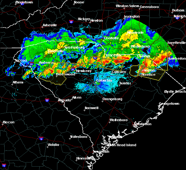 The severe thunderstorm warning for central darlington and west central marlboro counties will expire at 845 pm edt, the storm which prompted the warning has moved out of the area. therefore, the warning will be allowed to expire. a severe thunderstorm watch remains in effect until 1100 pm edt for northeastern south carolina. The severe thunderstorm warning for central darlington and west central marlboro counties will expire at 845 pm edt, the storm which prompted the warning has moved out of the area. therefore, the warning will be allowed to expire. a severe thunderstorm watch remains in effect until 1100 pm edt for northeastern south carolina.
|
| 5/5/2020 8:32 PM EDT |
 At 831 pm edt, a severe thunderstorm was located over mechanicsville, or near darlington, moving east at 40 mph. spotters have reported two inch hail with this activity (radar indicated). Hazards include ping pong ball size hail and 60 mph wind gusts. People and animals outdoors will be injured. expect hail damage to roofs, siding, windows, and vehicles. Expect wind damage to trees and power lines. At 831 pm edt, a severe thunderstorm was located over mechanicsville, or near darlington, moving east at 40 mph. spotters have reported two inch hail with this activity (radar indicated). Hazards include ping pong ball size hail and 60 mph wind gusts. People and animals outdoors will be injured. expect hail damage to roofs, siding, windows, and vehicles. Expect wind damage to trees and power lines.
|
| 5/5/2020 8:30 PM EDT | Tennis Ball sized hail reported 1 miles SW of Darlington, SC, hail estimated around 2 to 3 inches reported on north myrtle st north of darlington |
| 5/5/2020 8:23 PM EDT |
 At 821 pm edt, a severe thunderstorm was located over floyd, or near darlington, moving east at 40 mph. spotters have reported one and three quarter inch hail with this storm (radar indicated). Hazards include 60 mph wind gusts and half dollar size hail. Minor hail damage to vehicles is possible. expect wind damage to trees and power lines. Locations impacted include, hartsville, darlington, north hartsville, dovesville, oats, mont clare, darlington raceway, auburn, floyd, swift creek and society hill. At 821 pm edt, a severe thunderstorm was located over floyd, or near darlington, moving east at 40 mph. spotters have reported one and three quarter inch hail with this storm (radar indicated). Hazards include 60 mph wind gusts and half dollar size hail. Minor hail damage to vehicles is possible. expect wind damage to trees and power lines. Locations impacted include, hartsville, darlington, north hartsville, dovesville, oats, mont clare, darlington raceway, auburn, floyd, swift creek and society hill.
|
| 5/5/2020 7:51 PM EDT |
 At 750 pm edt, a severe thunderstorm was located near clyde, or 9 miles northwest of hartsville, moving east at 40 mph (radar indicated). Hazards include 60 mph wind gusts and half dollar size hail. Minor hail damage to vehicles is possible. Expect wind damage to trees and power lines. At 750 pm edt, a severe thunderstorm was located near clyde, or 9 miles northwest of hartsville, moving east at 40 mph (radar indicated). Hazards include 60 mph wind gusts and half dollar size hail. Minor hail damage to vehicles is possible. Expect wind damage to trees and power lines.
|
| 4/13/2020 7:38 AM EDT |
 The severe thunderstorm warning for northwestern florence, northwestern dillon, darlington and marlboro counties will expire at 745 am edt, the storm which prompted the warning has moved out of the area. therefore, the warning will be allowed to expire. however gusty winds are still possible with this thunderstorm. a tornado watch remains in effect until noon edt for southeastern north carolina, and northeastern south carolina. The severe thunderstorm warning for northwestern florence, northwestern dillon, darlington and marlboro counties will expire at 745 am edt, the storm which prompted the warning has moved out of the area. therefore, the warning will be allowed to expire. however gusty winds are still possible with this thunderstorm. a tornado watch remains in effect until noon edt for southeastern north carolina, and northeastern south carolina.
|
| 4/13/2020 6:58 AM EDT |
 At 658 am edt, a severe thunderstorm was located over auburn, or 7 miles east of hartsville, moving northeast at 75 mph (radar indicated). Hazards include 60 mph wind gusts and penny size hail. expect wind damage to trees and power lines At 658 am edt, a severe thunderstorm was located over auburn, or 7 miles east of hartsville, moving northeast at 75 mph (radar indicated). Hazards include 60 mph wind gusts and penny size hail. expect wind damage to trees and power lines
|
| 4/13/2020 6:49 AM EDT |
 At 649 am edt, a severe thunderstorm was located 7 miles northwest of clyde, or 13 miles northwest of hartsville, moving northeast at 65 mph (radar indicated). Hazards include 60 mph wind gusts and penny size hail. Expect wind damage to trees and power lines. Locations impacted include, bennettsville, hartsville, darlington, timmonsville, mccoll, lamar, mont clare, lydia, darlington raceway, swift creek, cartersville, florence darlington technical college main campus, oats, chavistown, floyd, north hartsville, dovesville, auburn, wallace and clyde. At 649 am edt, a severe thunderstorm was located 7 miles northwest of clyde, or 13 miles northwest of hartsville, moving northeast at 65 mph (radar indicated). Hazards include 60 mph wind gusts and penny size hail. Expect wind damage to trees and power lines. Locations impacted include, bennettsville, hartsville, darlington, timmonsville, mccoll, lamar, mont clare, lydia, darlington raceway, swift creek, cartersville, florence darlington technical college main campus, oats, chavistown, floyd, north hartsville, dovesville, auburn, wallace and clyde.
|
| 4/13/2020 6:32 AM EDT |
 At 631 am edt, a severe thunderstorm was located 8 miles southeast of camden, moving northeast at 65 mph (radar indicated). Hazards include 60 mph wind gusts and penny size hail. expect wind damage to trees and power lines At 631 am edt, a severe thunderstorm was located 8 miles southeast of camden, moving northeast at 65 mph (radar indicated). Hazards include 60 mph wind gusts and penny size hail. expect wind damage to trees and power lines
|
| 3/3/2020 4:41 PM EST |
 At 441 pm est, a severe thunderstorm was located over florence darlington technical college main campus, or near darlington, moving east at 50 mph (radar indicated). Hazards include 60 mph wind gusts. expect wind damage to trees and power lines At 441 pm est, a severe thunderstorm was located over florence darlington technical college main campus, or near darlington, moving east at 50 mph (radar indicated). Hazards include 60 mph wind gusts. expect wind damage to trees and power lines
|
| 2/13/2020 12:57 PM EST |
 At 1256 pm est, severe thunderstorms were located along a line extending from near lamar to 9 miles west of cartersville to near millwood, moving east at 60 mph (radar indicated). Hazards include 60 mph wind gusts. expect wind damage to trees and power lines At 1256 pm est, severe thunderstorms were located along a line extending from near lamar to 9 miles west of cartersville to near millwood, moving east at 60 mph (radar indicated). Hazards include 60 mph wind gusts. expect wind damage to trees and power lines
|
| 2/6/2020 4:41 PM EST |
 At 441 pm est, a severe thunderstorm was located near bishopville, moving northeast at 65 mph (radar indicated). Hazards include 60 mph wind gusts and quarter size hail. Minor hail damage to vehicles is possible. Expect wind damage to trees and power lines. At 441 pm est, a severe thunderstorm was located near bishopville, moving northeast at 65 mph (radar indicated). Hazards include 60 mph wind gusts and quarter size hail. Minor hail damage to vehicles is possible. Expect wind damage to trees and power lines.
|
| 1/11/2020 11:39 PM EST |
 At 1138 pm est, severe thunderstorms were located along a line extending from fort bragg to 7 miles northeast of mulberry, moving east at 45 mph (radar indicated). Hazards include 60 mph wind gusts. expect wind damage to trees and power lines At 1138 pm est, severe thunderstorms were located along a line extending from fort bragg to 7 miles northeast of mulberry, moving east at 45 mph (radar indicated). Hazards include 60 mph wind gusts. expect wind damage to trees and power lines
|
| 10/31/2019 7:45 PM EDT |
 At 745 pm edt, severe thunderstorms were located along a line extending from 14 miles south of biscoe to 9 miles south of bishopville, moving northeast at 55 mph (radar indicated). Hazards include 60 mph wind gusts. Expect wind damage to trees and power lines. Locations impacted include, hartsville, darlington, timmonsville, lamar, north hartsville, dovesville, lydia, darlington raceway, auburn, swift creek, cartersville, wallace, clyde, oats, chavistown, floyd, kellytown, society hill and carolina pines regional medical center. At 745 pm edt, severe thunderstorms were located along a line extending from 14 miles south of biscoe to 9 miles south of bishopville, moving northeast at 55 mph (radar indicated). Hazards include 60 mph wind gusts. Expect wind damage to trees and power lines. Locations impacted include, hartsville, darlington, timmonsville, lamar, north hartsville, dovesville, lydia, darlington raceway, auburn, swift creek, cartersville, wallace, clyde, oats, chavistown, floyd, kellytown, society hill and carolina pines regional medical center.
|
| 10/31/2019 7:22 PM EDT |
 At 722 pm edt, a line of strong and severe thunderstorms was approaching western marlboro and western darlington counties, moving northeast at 50 mph (radar indicated). Hazards include 60 mph wind gusts. expect wind damage to trees and power lines At 722 pm edt, a line of strong and severe thunderstorms was approaching western marlboro and western darlington counties, moving northeast at 50 mph (radar indicated). Hazards include 60 mph wind gusts. expect wind damage to trees and power lines
|
| 6/20/2019 5:18 PM EDT |
 At 517 pm edt, a severe thunderstorm was located over mechanicsville, or near darlington, moving east at 50 mph (radar indicated). Hazards include 60 mph wind gusts. Expect wind damage to trees and power lines. Locations impacted include, florence, marion, dillon, darlington, mullins, timmonsville, latta, pamplico, lamar, quinby, sellers, blue brick, hamer, brownsville, darlington raceway, swift creek, rains, floyd, new hope and minturn. At 517 pm edt, a severe thunderstorm was located over mechanicsville, or near darlington, moving east at 50 mph (radar indicated). Hazards include 60 mph wind gusts. Expect wind damage to trees and power lines. Locations impacted include, florence, marion, dillon, darlington, mullins, timmonsville, latta, pamplico, lamar, quinby, sellers, blue brick, hamer, brownsville, darlington raceway, swift creek, rains, floyd, new hope and minturn.
|
| 6/20/2019 5:17 PM EDT | Tree down on power line on west broad st in darlington in darlington county SC, 0.9 miles E of Darlington, SC |
| 6/20/2019 4:50 PM EDT |
 At 449 pm edt, a severe thunderstorm was located near bishopville, moving east at 45 mph (radar indicated). Hazards include 60 mph wind gusts and pea size hail. expect wind damage to trees and power lines At 449 pm edt, a severe thunderstorm was located near bishopville, moving east at 45 mph (radar indicated). Hazards include 60 mph wind gusts and pea size hail. expect wind damage to trees and power lines
|
| 6/5/2019 3:27 PM EDT |
 At 314 pm edt, law enforcement reported power lines in the roadway near quinby. at 327 pm, this severe thunderstorm was located over florence darlington technical college main campus, or near darlington, moving east at 20 mph (law enforcement). Hazards include 60 mph wind gusts and quarter size hail. Minor hail damage to vehicles is possible. expect wind damage to trees and power lines. Locations impacted include, florence, darlington, quinby, mechanicsville, mars bluff, florence darlington technical college main campus, francis marion university, carolinas hospital system, mcleod regional medical center, mcleod medical center, carolinas hospital system - cedar tower and health south rehabilitation hospital. At 314 pm edt, law enforcement reported power lines in the roadway near quinby. at 327 pm, this severe thunderstorm was located over florence darlington technical college main campus, or near darlington, moving east at 20 mph (law enforcement). Hazards include 60 mph wind gusts and quarter size hail. Minor hail damage to vehicles is possible. expect wind damage to trees and power lines. Locations impacted include, florence, darlington, quinby, mechanicsville, mars bluff, florence darlington technical college main campus, francis marion university, carolinas hospital system, mcleod regional medical center, mcleod medical center, carolinas hospital system - cedar tower and health south rehabilitation hospital.
|
| 6/5/2019 3:10 PM EDT | Around 100 power outages reported in the city of darlington with power lines down outside of the city. event first reported at 310 p in darlington county SC, 0.9 miles E of Darlington, SC |
| 6/5/2019 3:06 PM EDT |
 At 306 pm edt, a severe thunderstorm was located near timmonsville, or 8 miles southwest of darlington, moving east at 20 mph (radar indicated). Hazards include 60 mph wind gusts and quarter size hail. Minor hail damage to vehicles is possible. Expect wind damage to trees and power lines. At 306 pm edt, a severe thunderstorm was located near timmonsville, or 8 miles southwest of darlington, moving east at 20 mph (radar indicated). Hazards include 60 mph wind gusts and quarter size hail. Minor hail damage to vehicles is possible. Expect wind damage to trees and power lines.
|
| 5/4/2019 5:05 PM EDT |
 At 504 pm edt, a severe thunderstorm was located near darlington, moving east at 15 mph (radar indicated). Hazards include 60 mph wind gusts and quarter size hail. Minor hail damage to vehicles is possible. Expect wind damage to trees and power lines. At 504 pm edt, a severe thunderstorm was located near darlington, moving east at 15 mph (radar indicated). Hazards include 60 mph wind gusts and quarter size hail. Minor hail damage to vehicles is possible. Expect wind damage to trees and power lines.
|
| 4/19/2019 3:27 PM EDT |
 At 326 pm edt, severe thunderstorms were located along a line extending from 8 miles south of cheraw to near dongola, moving northeast at 60 mph (radar indicated). Hazards include 70 mph wind gusts. Expect considerable tree damage. damage is likely to mobile homes, roofs, and outbuildings. these severe storms will be near, conway, chavistown and wallace around 335 pm edt. bennettsville and homewood around 340 pm edt. Other locations impacted by these severe thunderstorms include coward, stuckey, lane, blenheim, aynor, scranton, society hill, carolinas hospital system, lake city community hospital and mcleod regional medical center. At 326 pm edt, severe thunderstorms were located along a line extending from 8 miles south of cheraw to near dongola, moving northeast at 60 mph (radar indicated). Hazards include 70 mph wind gusts. Expect considerable tree damage. damage is likely to mobile homes, roofs, and outbuildings. these severe storms will be near, conway, chavistown and wallace around 335 pm edt. bennettsville and homewood around 340 pm edt. Other locations impacted by these severe thunderstorms include coward, stuckey, lane, blenheim, aynor, scranton, society hill, carolinas hospital system, lake city community hospital and mcleod regional medical center.
|
| 4/19/2019 3:20 PM EDT | Trained spotter reported multiple trees down and 70mph wind gusts from a home weather station between darlington and florenc in darlington county SC, 3 miles NNW of Darlington, SC |
| 4/19/2019 2:54 PM EDT |
 At 254 pm edt, severe thunderstorms were located along a line extending from 7 miles northwest of bishopville to earle, moving northeast at 60 mph (radar indicated). Hazards include 70 mph wind gusts. Expect considerable tree damage. damage is likely to mobile homes, roofs, and outbuildings. severe thunderstorms will be near, andrews and warsaw around 300 pm edt. clyde, kellytown and morrisville around 305 pm edt. hartsville, rhems and north hartsville around 310 pm edt. outland and auburn around 315 pm edt. dongola around 325 pm edt. wallace around 330 pm edt. conway, bennettsville, chavistown and homewood around 335 pm edt. Other locations impacted by these severe thunderstorms include coward, stuckey, lane, greeleyville, blenheim, aynor, olanta, scranton, society hill and carolinas hospital system. At 254 pm edt, severe thunderstorms were located along a line extending from 7 miles northwest of bishopville to earle, moving northeast at 60 mph (radar indicated). Hazards include 70 mph wind gusts. Expect considerable tree damage. damage is likely to mobile homes, roofs, and outbuildings. severe thunderstorms will be near, andrews and warsaw around 300 pm edt. clyde, kellytown and morrisville around 305 pm edt. hartsville, rhems and north hartsville around 310 pm edt. outland and auburn around 315 pm edt. dongola around 325 pm edt. wallace around 330 pm edt. conway, bennettsville, chavistown and homewood around 335 pm edt. Other locations impacted by these severe thunderstorms include coward, stuckey, lane, greeleyville, blenheim, aynor, olanta, scranton, society hill and carolinas hospital system.
|
| 3/3/2019 6:55 PM EST |
 At 654 pm est, a severe thunderstorm was located over kellytown, or near hartsville, moving northeast at 55 mph (radar indicated). Hazards include 60 mph wind gusts. expect wind damage to trees and power lines At 654 pm est, a severe thunderstorm was located over kellytown, or near hartsville, moving northeast at 55 mph (radar indicated). Hazards include 60 mph wind gusts. expect wind damage to trees and power lines
|
| 9/27/2018 11:07 PM EDT |
 At 1107 pm edt, a line of showers and thunderstorms, embedded with isolated strong to severe wind gusts, was moving across weatern darlington county, approaching central darlington county, moving northeast at 40 mph (radar indicated). Hazards include 60 mph wind gusts. Expect possible damage from weakened trees, or trees blown over due to wet ground. locations impacted include, bennettsville, hartsville, dillon, darlington, timmonsville, mccoll, lamar, quinby, clio, hamer, mont clare, brownsville, lydia, south of the border, darlington raceway, florence darlington technical college main campus, chavistown, floyd, minturn and north hartsville. this includes the following highways, interstate 20 between mile markers 126 and 141. Interstate 95 in south carolina near mile marker 146, and between mile markers 159 and 198. At 1107 pm edt, a line of showers and thunderstorms, embedded with isolated strong to severe wind gusts, was moving across weatern darlington county, approaching central darlington county, moving northeast at 40 mph (radar indicated). Hazards include 60 mph wind gusts. Expect possible damage from weakened trees, or trees blown over due to wet ground. locations impacted include, bennettsville, hartsville, dillon, darlington, timmonsville, mccoll, lamar, quinby, clio, hamer, mont clare, brownsville, lydia, south of the border, darlington raceway, florence darlington technical college main campus, chavistown, floyd, minturn and north hartsville. this includes the following highways, interstate 20 between mile markers 126 and 141. Interstate 95 in south carolina near mile marker 146, and between mile markers 159 and 198.
|
| 9/27/2018 10:36 PM EDT |
 At 1036 pm edt, a severe thunderstorm was located 7 miles southwest of clyde, or 8 miles north of bishopville, moving northeast at 40 mph (radar indicated). Hazards include 60 mph wind gusts. expect wind damage to trees and power lines At 1036 pm edt, a severe thunderstorm was located 7 miles southwest of clyde, or 8 miles north of bishopville, moving northeast at 40 mph (radar indicated). Hazards include 60 mph wind gusts. expect wind damage to trees and power lines
|
| 9/27/2018 6:24 PM EDT |
 At 621 pm edt, a severe thunderstorm was located 2 miles southeast of florence, moving northeast at 20 mph (radar indicated). Hazards include 60 mph wind gusts and quarter size hail. Minor hail damage to vehicles is possible. expect wind damage to trees and power lines. locations impacted include, florence, darlington, timmonsville, quinby, mars bluff, florence darlington technical college main campus, francis marion university, mechanicsville, claussen, effingham, carolinas hospital system, mcleod regional medical center, mcleod medical center, carolinas hospital system - cedar tower and health south rehabilitation hospital. this includes the following highways, interstate 20 between mile markers 135 and 141. Interstate 95 in south carolina between mile markers 151 and 175. At 621 pm edt, a severe thunderstorm was located 2 miles southeast of florence, moving northeast at 20 mph (radar indicated). Hazards include 60 mph wind gusts and quarter size hail. Minor hail damage to vehicles is possible. expect wind damage to trees and power lines. locations impacted include, florence, darlington, timmonsville, quinby, mars bluff, florence darlington technical college main campus, francis marion university, mechanicsville, claussen, effingham, carolinas hospital system, mcleod regional medical center, mcleod medical center, carolinas hospital system - cedar tower and health south rehabilitation hospital. this includes the following highways, interstate 20 between mile markers 135 and 141. Interstate 95 in south carolina between mile markers 151 and 175.
|
| 9/27/2018 6:07 PM EDT |
 At 605 pm edt, a severe thunderstorm was located just northeast of cartersville, or 13 miles southwest of florence, moving northeast at 20 mph (radar indicated). Hazards include 60 mph wind gusts and quarter size hail. Minor hail damage to vehicles is possible. expect wind damage to trees and power lines. locations impacted include, florence, darlington, timmonsville, quinby, sardis, mars bluff, effingham, darlington raceway, cartersville, florence darlington technical college main campus, francis marion university, mechanicsville, claussen, carolinas hospital system, mcleod regional medical center, mcleod medical center, carolinas hospital system - cedar tower and health south rehabilitation hospital. this includes the following highways, interstate 20 between mile markers 131 and 141. Interstate 95 in south carolina between mile markers 146 and 175. At 605 pm edt, a severe thunderstorm was located just northeast of cartersville, or 13 miles southwest of florence, moving northeast at 20 mph (radar indicated). Hazards include 60 mph wind gusts and quarter size hail. Minor hail damage to vehicles is possible. expect wind damage to trees and power lines. locations impacted include, florence, darlington, timmonsville, quinby, sardis, mars bluff, effingham, darlington raceway, cartersville, florence darlington technical college main campus, francis marion university, mechanicsville, claussen, carolinas hospital system, mcleod regional medical center, mcleod medical center, carolinas hospital system - cedar tower and health south rehabilitation hospital. this includes the following highways, interstate 20 between mile markers 131 and 141. Interstate 95 in south carolina between mile markers 146 and 175.
|
| 9/27/2018 5:57 PM EDT |
 At 554 pm edt, a severe thunderstorm was located over cartersville, or 14 miles southwest of florence. a second severe thunderstorm was 8 miles southwest of darlington. both are moving northeast at 20 mph (radar indicated). Hazards include 60 mph wind gusts and quarter size hail. Minor hail damage to vehicles is possible. Expect wind damage to trees and power lines. At 554 pm edt, a severe thunderstorm was located over cartersville, or 14 miles southwest of florence. a second severe thunderstorm was 8 miles southwest of darlington. both are moving northeast at 20 mph (radar indicated). Hazards include 60 mph wind gusts and quarter size hail. Minor hail damage to vehicles is possible. Expect wind damage to trees and power lines.
|
| 6/25/2018 4:56 PM EDT |
 The severe thunderstorm warning for darlington and central marlboro counties will expire at 500 pm edt, the storm which prompted the warning has weakened below severe limits, and no longer pose an immediate threat to life or property. therefore the warning will be allowed to expire. however gusty winds are still possible with this thunderstorm. The severe thunderstorm warning for darlington and central marlboro counties will expire at 500 pm edt, the storm which prompted the warning has weakened below severe limits, and no longer pose an immediate threat to life or property. therefore the warning will be allowed to expire. however gusty winds are still possible with this thunderstorm.
|
| 6/25/2018 4:42 PM EDT |
 At 441 pm edt, a severe thunderstorm was located 13 miles south of bennettsville, moving east at 10 mph (radar indicated). Hazards include 60 mph wind gusts and penny size hail. Expect damage to trees and powerlines. Locations impacted include, bennettsville, hartsville, darlington, clio, north hartsville, dovesville, mont clare and brownsville. At 441 pm edt, a severe thunderstorm was located 13 miles south of bennettsville, moving east at 10 mph (radar indicated). Hazards include 60 mph wind gusts and penny size hail. Expect damage to trees and powerlines. Locations impacted include, bennettsville, hartsville, darlington, clio, north hartsville, dovesville, mont clare and brownsville.
|
| 6/25/2018 4:18 PM EDT |
 At 417 pm edt, a severe thunderstorm was located 12 miles northeast of darlington, moving east at 10 mph (radar indicated). Hazards include 60 mph wind gusts and quarter size hail. Minor hail damage to vehicles is possible. expect wind damage to trees and powerlines. Locations impacted include, bennettsville, hartsville, darlington, clio, north hartsville, dovesville, mont clare and brownsville. At 417 pm edt, a severe thunderstorm was located 12 miles northeast of darlington, moving east at 10 mph (radar indicated). Hazards include 60 mph wind gusts and quarter size hail. Minor hail damage to vehicles is possible. expect wind damage to trees and powerlines. Locations impacted include, bennettsville, hartsville, darlington, clio, north hartsville, dovesville, mont clare and brownsville.
|
| 6/25/2018 4:02 PM EDT |
 At 402 pm edt, a severe thunderstorm was located 10 miles northeast of darlington, moving east at 10 mph (radar indicated). Hazards include 60 mph wind gusts and quarter size hail. Minor hail damage to vehicles is possible. Expect wind damage to trees and powerlines. At 402 pm edt, a severe thunderstorm was located 10 miles northeast of darlington, moving east at 10 mph (radar indicated). Hazards include 60 mph wind gusts and quarter size hail. Minor hail damage to vehicles is possible. Expect wind damage to trees and powerlines.
|
| 8/31/2017 6:09 PM EDT |
 The severe thunderstorm warning for darlington county will expire at 615 pm edt, the storm which prompted the warning has weakened below severe limits, and no longer poses an immediate threat to life or property. therefore the warning will be allowed to expire. The severe thunderstorm warning for darlington county will expire at 615 pm edt, the storm which prompted the warning has weakened below severe limits, and no longer poses an immediate threat to life or property. therefore the warning will be allowed to expire.
|
| 8/31/2017 6:03 PM EDT | Estimated winds of 60+ mph reported by nws employee at darlington eoc in darlington county SC, 0.3 miles ENE of Darlington, SC |
| 8/31/2017 5:54 PM EDT | Power lines down in road along e. billy farrow hwy about 1/2 miles west of us 52 in darlington county SC, 0.3 miles ENE of Darlington, SC |
| 8/31/2017 5:51 PM EDT | Roof off house at 1525 nancys drive in darlington county SC, 0.3 miles ENE of Darlington, SC |
| 8/31/2017 5:50 PM EDT | Estimated winds of 60+ mph reported by nws employee at darlington eoc in darlington county SC, 0.3 miles ENE of Darlington, SC |
| 8/31/2017 5:45 PM EDT |
 At 544 pm edt, a severe thunderstorm was located over floyd, or near darlington, moving east at 30 mph (radar indicated). Hazards include 60 mph wind gusts and quarter size hail. Minor hail damage to vehicles is possible. expect wind damage to trees and power lines. locations impacted include, hartsville, darlington, north hartsville, dovesville, mont clare, lydia, auburn, darlington raceway, clyde, mechanicsville, oates, floyd, kellytown, florence darlington technical college main campus, society hill, mcleod medical center and carolina pines regional medical center. people attending southern 500 should seek safe shelter immediately! this includes the following highways, interstate 20 between mile markers 129 and 131. Interstate 95 in south carolina mile marker 146 and near mile marker 167. At 544 pm edt, a severe thunderstorm was located over floyd, or near darlington, moving east at 30 mph (radar indicated). Hazards include 60 mph wind gusts and quarter size hail. Minor hail damage to vehicles is possible. expect wind damage to trees and power lines. locations impacted include, hartsville, darlington, north hartsville, dovesville, mont clare, lydia, auburn, darlington raceway, clyde, mechanicsville, oates, floyd, kellytown, florence darlington technical college main campus, society hill, mcleod medical center and carolina pines regional medical center. people attending southern 500 should seek safe shelter immediately! this includes the following highways, interstate 20 between mile markers 129 and 131. Interstate 95 in south carolina mile marker 146 and near mile marker 167.
|
| 8/31/2017 5:13 PM EDT |
 At 512 pm edt, a severe thunderstorm was located over clyde, or 7 miles west of hartsville, moving east at 30 mph (radar indicated). Hazards include 60 mph wind gusts and quarter size hail. Minor hail damage to vehicles is possible. Expect wind damage to trees and power lines. At 512 pm edt, a severe thunderstorm was located over clyde, or 7 miles west of hartsville, moving east at 30 mph (radar indicated). Hazards include 60 mph wind gusts and quarter size hail. Minor hail damage to vehicles is possible. Expect wind damage to trees and power lines.
|
| 7/23/2017 6:35 PM EDT |
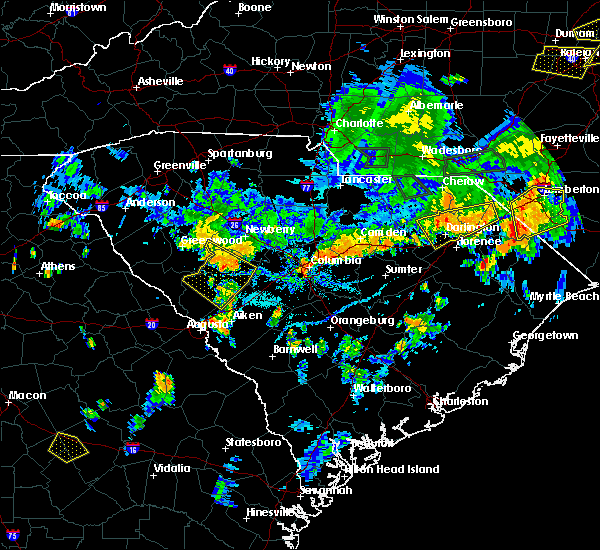 At 634 pm edt, a severe thunderstorm was located over darlington, moving south at 15 mph (radar indicated). Hazards include 60 mph wind gusts. expect damage trees and power lines At 634 pm edt, a severe thunderstorm was located over darlington, moving south at 15 mph (radar indicated). Hazards include 60 mph wind gusts. expect damage trees and power lines
|
| 7/15/2017 5:16 PM EDT |
 At 516 pm edt, a severe thunderstorm was located over kellytown, moving east at 10 mph (radar indicated). Hazards include 60 mph wind gusts and nickel size hail. Expect damage trees and power lines. Locations impacted include, hartsville, darlington, north hartsville, dovesville, lydia, auburn, darlington raceway, clyde, oates, floyd, kellytown, florence darlington technical college main campus, mcleod medical center and carolina pines regional medical center. At 516 pm edt, a severe thunderstorm was located over kellytown, moving east at 10 mph (radar indicated). Hazards include 60 mph wind gusts and nickel size hail. Expect damage trees and power lines. Locations impacted include, hartsville, darlington, north hartsville, dovesville, lydia, auburn, darlington raceway, clyde, oates, floyd, kellytown, florence darlington technical college main campus, mcleod medical center and carolina pines regional medical center.
|
| 7/15/2017 5:01 PM EDT |
 At 501 pm edt, a severe thunderstorm was located over kellytown, or near hartsville, moving east at 10 mph (radar indicated). Hazards include 60 mph wind gusts and nickel size hail. expect damage trees and power lines At 501 pm edt, a severe thunderstorm was located over kellytown, or near hartsville, moving east at 10 mph (radar indicated). Hazards include 60 mph wind gusts and nickel size hail. expect damage trees and power lines
|
| 7/5/2017 5:35 PM EDT |
 The severe thunderstorm warning for northwestern florence and southeastern darlington counties will expire at 545 pm edt, the severe thunderstorm which prompted the warning has weakened. therefore, the warning will be allowed to expire. The severe thunderstorm warning for northwestern florence and southeastern darlington counties will expire at 545 pm edt, the severe thunderstorm which prompted the warning has weakened. therefore, the warning will be allowed to expire.
|
| 7/5/2017 5:19 PM EDT |
 At 518 pm edt, a severe thunderstorm was located near quinby, or 7 miles north of florence, moving east at 25 mph (radar indicated). Hazards include 60 mph wind gusts and quarter size hail. Minor hail damage to vehicles is possible. expect wind damage to trees and power lines. locations impacted include, florence, darlington, quinby, mars bluff, darlington raceway, florence darlington technical college main campus, francis marion university, mechanicsville, claussen, carolinas hospital system, mcleod regional medical center, mcleod medical center, carolinas hospital system - cedar tower and health south rehabilitation hospital. this includes the following highways, interstate 20 between mile markers 137 and 141. Interstate 95 in south carolina between mile markers 159 and 174. At 518 pm edt, a severe thunderstorm was located near quinby, or 7 miles north of florence, moving east at 25 mph (radar indicated). Hazards include 60 mph wind gusts and quarter size hail. Minor hail damage to vehicles is possible. expect wind damage to trees and power lines. locations impacted include, florence, darlington, quinby, mars bluff, darlington raceway, florence darlington technical college main campus, francis marion university, mechanicsville, claussen, carolinas hospital system, mcleod regional medical center, mcleod medical center, carolinas hospital system - cedar tower and health south rehabilitation hospital. this includes the following highways, interstate 20 between mile markers 137 and 141. Interstate 95 in south carolina between mile markers 159 and 174.
|
| 7/5/2017 5:05 PM EDT |
 At 504 pm edt, a severe thunderstorm was located over darlington, moving east at 25 mph (radar indicated). Hazards include 60 mph wind gusts and quarter size hail. Minor hail damage to vehicles is possible. expect wind damage to trees and power lines. locations impacted include, florence, darlington, quinby, mars bluff, auburn, darlington raceway, florence darlington technical college main campus, francis marion university, mechanicsville, floyd, claussen, carolinas hospital system, mcleod regional medical center, mcleod medical center, carolinas hospital system - cedar tower and health south rehabilitation hospital. this includes the following highways, interstate 20 between mile markers 132 and 141. Interstate 95 in south carolina near mile marker 146, and between mile markers 159 and 175. At 504 pm edt, a severe thunderstorm was located over darlington, moving east at 25 mph (radar indicated). Hazards include 60 mph wind gusts and quarter size hail. Minor hail damage to vehicles is possible. expect wind damage to trees and power lines. locations impacted include, florence, darlington, quinby, mars bluff, auburn, darlington raceway, florence darlington technical college main campus, francis marion university, mechanicsville, floyd, claussen, carolinas hospital system, mcleod regional medical center, mcleod medical center, carolinas hospital system - cedar tower and health south rehabilitation hospital. this includes the following highways, interstate 20 between mile markers 132 and 141. Interstate 95 in south carolina near mile marker 146, and between mile markers 159 and 175.
|
| 7/5/2017 4:42 PM EDT |
 At 441 pm edt, a severe thunderstorm was located near auburn, or near hartsville, moving east at 25 mph (radar indicated). Hazards include 60 mph wind gusts and quarter size hail. Minor hail damage to vehicles is possible. Expect wind damage to trees and power lines. At 441 pm edt, a severe thunderstorm was located near auburn, or near hartsville, moving east at 25 mph (radar indicated). Hazards include 60 mph wind gusts and quarter size hail. Minor hail damage to vehicles is possible. Expect wind damage to trees and power lines.
|
| 6/15/2017 7:56 PM EDT |
 At 755 pm edt, a severe thunderstorm was located over timmonsville, or 11 miles southwest of darlington, moving southeast at 20 mph (radar indicated). Hazards include 60 mph wind gusts and quarter size hail. Minor hail damage to vehicles is possible. Expect wind damage to trees and power lines. At 755 pm edt, a severe thunderstorm was located over timmonsville, or 11 miles southwest of darlington, moving southeast at 20 mph (radar indicated). Hazards include 60 mph wind gusts and quarter size hail. Minor hail damage to vehicles is possible. Expect wind damage to trees and power lines.
|
| 6/15/2017 7:39 PM EDT |
 At 739 pm edt, a severe thunderstorm was located over timmonsville, or 10 miles west of florence, moving southeast at 15 mph (radar indicated). Hazards include 70 mph wind gusts and quarter size hail. Minor hail damage to vehicles is possible. expect considerable tree damage. wind damage is also likely to mobile homes, roofs, and outbuildings. locations impacted include, florence, darlington, timmonsville, lamar, quinby, sardis, darlington raceway, florence darlington technical college main campus, mcleod regional medical center, carolinas hospital system - cedar tower and health south rehabilitation hospital. this includes the following highways, interstate 20 between mile markers 126 and 141. Interstate 95 in south carolina near mile marker 146, and between mile markers 149 and 171. At 739 pm edt, a severe thunderstorm was located over timmonsville, or 10 miles west of florence, moving southeast at 15 mph (radar indicated). Hazards include 70 mph wind gusts and quarter size hail. Minor hail damage to vehicles is possible. expect considerable tree damage. wind damage is also likely to mobile homes, roofs, and outbuildings. locations impacted include, florence, darlington, timmonsville, lamar, quinby, sardis, darlington raceway, florence darlington technical college main campus, mcleod regional medical center, carolinas hospital system - cedar tower and health south rehabilitation hospital. this includes the following highways, interstate 20 between mile markers 126 and 141. Interstate 95 in south carolina near mile marker 146, and between mile markers 149 and 171.
|
| 6/15/2017 7:17 PM EDT | Report of tree down on south center rd near country manor rd. time estimated by rada in darlington county SC, 8.3 miles NE of Darlington, SC |
| 6/15/2017 7:17 PM EDT | Report of tree down on south center rd near lake swamp rd. time estimated by rada in darlington county SC, 8.7 miles NE of Darlington, SC |
| 6/15/2017 7:14 PM EDT |
 At 714 pm edt, a severe thunderstorm was located near lamar, or 9 miles southwest of darlington, moving southeast at 10 mph (radar indicated). Hazards include 60 mph wind gusts and quarter size hail. Minor hail damage to vehicles is possible. Expect wind damage to trees and power lines. At 714 pm edt, a severe thunderstorm was located near lamar, or 9 miles southwest of darlington, moving southeast at 10 mph (radar indicated). Hazards include 60 mph wind gusts and quarter size hail. Minor hail damage to vehicles is possible. Expect wind damage to trees and power lines.
|
| 6/5/2017 8:17 PM EDT |
 At 817 pm edt, a severe thunderstorm was located 7 miles northwest of brownsville, or 10 miles south of bennettsville, moving east at 35 mph (radar indicated). Hazards include 60 mph wind gusts. expect damage trees and power lines At 817 pm edt, a severe thunderstorm was located 7 miles northwest of brownsville, or 10 miles south of bennettsville, moving east at 35 mph (radar indicated). Hazards include 60 mph wind gusts. expect damage trees and power lines
|
| 5/28/2017 7:47 PM EDT |
 At 747 pm edt, a severe thunderstorm was located near florence, moving east at 35 mph (radar indicated). Hazards include 60 mph wind gusts and quarter size hail. Minor hail damage to vehicles is possible. Expect wind damage to trees and power lines. At 747 pm edt, a severe thunderstorm was located near florence, moving east at 35 mph (radar indicated). Hazards include 60 mph wind gusts and quarter size hail. Minor hail damage to vehicles is possible. Expect wind damage to trees and power lines.
|
| 5/24/2017 3:31 PM EDT |
 At 330 pm edt, a severe thunderstorm capable of producing a tornado was located near oates, or 9 miles southwest of darlington, moving northeast at 35 mph (radar indicated rotation). Hazards include tornado. expect damage to mobile homes, roofs, and vehicles At 330 pm edt, a severe thunderstorm capable of producing a tornado was located near oates, or 9 miles southwest of darlington, moving northeast at 35 mph (radar indicated rotation). Hazards include tornado. expect damage to mobile homes, roofs, and vehicles
|
| 4/5/2017 4:45 PM EDT |
 At 445 pm edt, a severe thunderstorm was located near brownsville, or 14 miles west of dillon, moving northeast at 40 mph (radar indicated). Hazards include 60 mph wind gusts and quarter size hail. Hail damage to vehicles is expected. expect wind damage to roofs, siding, and trees. locations impacted include, florence, quinby, mechanicsville, mont clare, mars bluff, florence darlington technical college main campus, carolinas hospital system, mcleod regional medical center, mcleod medical center, carolinas hospital system - cedar tower and health south rehabilitation hospital. this includes interstate 95 in south carolina between mile markers 165 and 174. A tornado watch remains in effect until 800 pm edt for northeastern south carolina. At 445 pm edt, a severe thunderstorm was located near brownsville, or 14 miles west of dillon, moving northeast at 40 mph (radar indicated). Hazards include 60 mph wind gusts and quarter size hail. Hail damage to vehicles is expected. expect wind damage to roofs, siding, and trees. locations impacted include, florence, quinby, mechanicsville, mont clare, mars bluff, florence darlington technical college main campus, carolinas hospital system, mcleod regional medical center, mcleod medical center, carolinas hospital system - cedar tower and health south rehabilitation hospital. this includes interstate 95 in south carolina between mile markers 165 and 174. A tornado watch remains in effect until 800 pm edt for northeastern south carolina.
|
| 4/5/2017 4:24 PM EDT |
 At 423 pm edt, a severe thunderstorm was located over florence darlington technical college main campus, or near florence, moving northeast at 45 mph (radar indicated). Hazards include 60 mph wind gusts and quarter size hail. Hail damage to vehicles is expected. expect wind damage to roofs, siding, and trees. locations impacted include, florence, darlington, timmonsville, lamar, quinby, sardis, mont clare, mars bluff, darlington raceway, cartersville, florence darlington technical college main campus, mechanicsville, oats, carolinas hospital system, mcleod regional medical center, mcleod medical center, carolinas hospital system - cedar tower and health south rehabilitation hospital. this includes the following highways, interstate 20 between mile markers 126 and 141. interstate 95 in south carolina near mile marker 146, and between mile markers 148 and 174. A tornado watch remains in effect until 800 pm edt for northeastern south carolina. At 423 pm edt, a severe thunderstorm was located over florence darlington technical college main campus, or near florence, moving northeast at 45 mph (radar indicated). Hazards include 60 mph wind gusts and quarter size hail. Hail damage to vehicles is expected. expect wind damage to roofs, siding, and trees. locations impacted include, florence, darlington, timmonsville, lamar, quinby, sardis, mont clare, mars bluff, darlington raceway, cartersville, florence darlington technical college main campus, mechanicsville, oats, carolinas hospital system, mcleod regional medical center, mcleod medical center, carolinas hospital system - cedar tower and health south rehabilitation hospital. this includes the following highways, interstate 20 between mile markers 126 and 141. interstate 95 in south carolina near mile marker 146, and between mile markers 148 and 174. A tornado watch remains in effect until 800 pm edt for northeastern south carolina.
|
| 4/5/2017 3:50 PM EDT |
 At 349 pm edt, a severe thunderstorm was located 8 miles south of bishopville, moving northeast at 40 mph (radar indicated). Hazards include 60 mph wind gusts and quarter size hail. Hail damage to vehicles is expected. Expect wind damage to roofs, siding, and trees. At 349 pm edt, a severe thunderstorm was located 8 miles south of bishopville, moving northeast at 40 mph (radar indicated). Hazards include 60 mph wind gusts and quarter size hail. Hail damage to vehicles is expected. Expect wind damage to roofs, siding, and trees.
|
| 4/3/2017 5:55 PM EDT |
 At 554 pm edt, a severe thunderstorm was located over mechanicsville, or 7 miles northeast of darlington, moving northeast at 55 mph (radar indicated). Hazards include 60 mph wind gusts and quarter size hail. Hail damage to vehicles is expected. expect wind damage to roofs, siding, and trees. locations impacted include, florence, bennettsville, hartsville, lake city, darlington, timmonsville, mccoll, johnsonville, pamplico, lamar, quinby, clio, brownsville, darlington raceway, chavistown, floyd, new hope, north hartsville, hyman and effingham. this includes the following highways, interstate 20 between mile markers 125 and 141. Interstate 95 in south carolina near mile marker 146, and between mile markers 148 and 175. At 554 pm edt, a severe thunderstorm was located over mechanicsville, or 7 miles northeast of darlington, moving northeast at 55 mph (radar indicated). Hazards include 60 mph wind gusts and quarter size hail. Hail damage to vehicles is expected. expect wind damage to roofs, siding, and trees. locations impacted include, florence, bennettsville, hartsville, lake city, darlington, timmonsville, mccoll, johnsonville, pamplico, lamar, quinby, clio, brownsville, darlington raceway, chavistown, floyd, new hope, north hartsville, hyman and effingham. this includes the following highways, interstate 20 between mile markers 125 and 141. Interstate 95 in south carolina near mile marker 146, and between mile markers 148 and 175.
|
| 4/3/2017 5:36 PM EDT |
 At 535 pm edt, a severe thunderstorm was located near darlington, moving northeast at 50 mph (radar indicated). Hazards include 60 mph wind gusts and quarter size hail. Hail damage to vehicles is expected. expect wind damage to roofs, siding, and trees. locations impacted include, florence, bennettsville, hartsville, lake city, darlington, timmonsville, mccoll, johnsonville, pamplico, lamar, quinby, clio, brownsville, darlington raceway, chavistown, floyd, new hope, north hartsville, hyman and effingham. this includes the following highways, interstate 20 between mile markers 125 and 141. Interstate 95 in south carolina near mile marker 146, and between mile markers 148 and 175. At 535 pm edt, a severe thunderstorm was located near darlington, moving northeast at 50 mph (radar indicated). Hazards include 60 mph wind gusts and quarter size hail. Hail damage to vehicles is expected. expect wind damage to roofs, siding, and trees. locations impacted include, florence, bennettsville, hartsville, lake city, darlington, timmonsville, mccoll, johnsonville, pamplico, lamar, quinby, clio, brownsville, darlington raceway, chavistown, floyd, new hope, north hartsville, hyman and effingham. this includes the following highways, interstate 20 between mile markers 125 and 141. Interstate 95 in south carolina near mile marker 146, and between mile markers 148 and 175.
|
| 4/3/2017 5:15 PM EDT |
 At 514 pm edt, a severe thunderstorm was located near bishopville, moving northeast at 55 mph (radar indicated). Hazards include 60 mph wind gusts and quarter size hail. Hail damage to vehicles is expected. Expect wind damage to roofs, siding, and trees. At 514 pm edt, a severe thunderstorm was located near bishopville, moving northeast at 55 mph (radar indicated). Hazards include 60 mph wind gusts and quarter size hail. Hail damage to vehicles is expected. Expect wind damage to roofs, siding, and trees.
|
| 3/21/2017 11:11 PM EDT |
 At 1111 pm edt, severe thunderstorms were located along a line extending from 7 miles northwest of bishopville to near mulberry, moving east at 45 mph (radar indicated). Hazards include 60 mph wind gusts and penny size hail. expect damage to roofs, siding, and trees At 1111 pm edt, severe thunderstorms were located along a line extending from 7 miles northwest of bishopville to near mulberry, moving east at 45 mph (radar indicated). Hazards include 60 mph wind gusts and penny size hail. expect damage to roofs, siding, and trees
|
| 2/9/2017 2:25 AM EST |
 At 224 am est, a severe thunderstorm was located near clyde, or 10 miles north of bishopville, moving east at 45 mph (radar indicated). Hazards include 60 mph wind gusts and quarter size hail. Hail damage to vehicles is expected. Expect wind damage to roofs, siding, and trees. At 224 am est, a severe thunderstorm was located near clyde, or 10 miles north of bishopville, moving east at 45 mph (radar indicated). Hazards include 60 mph wind gusts and quarter size hail. Hail damage to vehicles is expected. Expect wind damage to roofs, siding, and trees.
|
| 7/19/2016 3:40 PM EDT |
 At 339 pm edt, a severe thunderstorm was located over darlington raceway, or over darlington, moving southeast at 20 mph (radar indicated). Hazards include 60 mph wind gusts and quarter size hail. Hail damage to vehicles is expected. expect wind damage to roofs, siding, and trees. Locations impacted include, hartsville, darlington, lamar, dovesville, darlington raceway, floyd, lydia, auburn, kellytown, oats, mechanicsville, north hartsville, florence darlington technical college main campus, carolina pines regional medical center and mcleod medical center. At 339 pm edt, a severe thunderstorm was located over darlington raceway, or over darlington, moving southeast at 20 mph (radar indicated). Hazards include 60 mph wind gusts and quarter size hail. Hail damage to vehicles is expected. expect wind damage to roofs, siding, and trees. Locations impacted include, hartsville, darlington, lamar, dovesville, darlington raceway, floyd, lydia, auburn, kellytown, oats, mechanicsville, north hartsville, florence darlington technical college main campus, carolina pines regional medical center and mcleod medical center.
|
| 7/19/2016 3:16 PM EDT |
 At 315 pm edt, a severe thunderstorm was located over auburn, or near hartsville, moving southeast at 20 mph (radar indicated). Hazards include 60 mph wind gusts and quarter size hail. Hail damage to vehicles is expected. Expect wind damage to roofs, siding, and trees. At 315 pm edt, a severe thunderstorm was located over auburn, or near hartsville, moving southeast at 20 mph (radar indicated). Hazards include 60 mph wind gusts and quarter size hail. Hail damage to vehicles is expected. Expect wind damage to roofs, siding, and trees.
|
| 7/15/2016 3:01 PM EDT | Report of a tree down on n governor williams hwy. time estimated by rada in darlington county SC, 7.1 miles SSE of Darlington, SC |
| 7/15/2016 3:01 PM EDT | Emergency manager reports 6 trees down on mont clare rd from straight line winds. time estimated by rada in darlington county SC, 6.9 miles SSE of Darlington, SC |
| 7/15/2016 3:01 PM EDT | Emergency manager reports 3 trees down on flatnose rd. time estimated by rada in darlington county SC, 7.7 miles SSE of Darlington, SC |
| 7/15/2016 2:56 PM EDT |
 At 256 pm edt, a severe thunderstorm was located over auburn, or near hartsville, moving northeast at 45 mph (radar indicated). Hazards include 60 mph wind gusts and quarter size hail. Hail damage to vehicles is expected. Expect wind damage to roofs, siding, and trees. At 256 pm edt, a severe thunderstorm was located over auburn, or near hartsville, moving northeast at 45 mph (radar indicated). Hazards include 60 mph wind gusts and quarter size hail. Hail damage to vehicles is expected. Expect wind damage to roofs, siding, and trees.
|
| 7/11/2016 7:16 PM EDT | Trees down on n main stree in darlington county SC, 1.9 miles SE of Darlington, SC |
| 7/11/2016 7:12 PM EDT |
 At 711 pm edt, a severe thunderstorm was located near darlington, moving east at 35 mph (radar indicated). Hazards include 70 mph wind gusts and quarter size hail. Hail damage to vehicles is expected. expect considerable tree damage. wind damage is also likely to mobile homes, roofs, and outbuildings. Locations impacted include, florence, bennettsville, darlington, lamar, quinby, florence darlington technical college main campus, dovesville, mont clare, darlington raceway, floyd, mars bluff, oats, mechanicsville, society hill, blenheim, health south rehabilitation hospital, mcleod regional medical center, carolinas hospital system, carolinas hospital system - cedar tower and mcleod medical center. At 711 pm edt, a severe thunderstorm was located near darlington, moving east at 35 mph (radar indicated). Hazards include 70 mph wind gusts and quarter size hail. Hail damage to vehicles is expected. expect considerable tree damage. wind damage is also likely to mobile homes, roofs, and outbuildings. Locations impacted include, florence, bennettsville, darlington, lamar, quinby, florence darlington technical college main campus, dovesville, mont clare, darlington raceway, floyd, mars bluff, oats, mechanicsville, society hill, blenheim, health south rehabilitation hospital, mcleod regional medical center, carolinas hospital system, carolinas hospital system - cedar tower and mcleod medical center.
|
| 7/11/2016 7:08 PM EDT | Trees down at darlington ave and south dargan s in darlington county SC, 6.5 miles ENE of Darlington, SC |
| 7/11/2016 7:06 PM EDT |
 At 705 pm edt, a severe thunderstorm was located near darlington, moving east at 40 mph (radar indicated). Hazards include 60 mph wind gusts and quarter size hail. Hail damage to vehicles is expected. expect wind damage to roofs, siding, and trees. Locations impacted include, florence, bennettsville, darlington, lamar, quinby, florence darlington technical college main campus, dovesville, mont clare, darlington raceway, floyd, mars bluff, auburn, oats, mechanicsville, society hill, blenheim, health south rehabilitation hospital, mcleod regional medical center, carolinas hospital system and carolinas hospital system - cedar tower. At 705 pm edt, a severe thunderstorm was located near darlington, moving east at 40 mph (radar indicated). Hazards include 60 mph wind gusts and quarter size hail. Hail damage to vehicles is expected. expect wind damage to roofs, siding, and trees. Locations impacted include, florence, bennettsville, darlington, lamar, quinby, florence darlington technical college main campus, dovesville, mont clare, darlington raceway, floyd, mars bluff, auburn, oats, mechanicsville, society hill, blenheim, health south rehabilitation hospital, mcleod regional medical center, carolinas hospital system and carolinas hospital system - cedar tower.
|
| 7/11/2016 7:02 PM EDT | Trees and power lines down on lamar hw in darlington county SC, 6.5 miles ENE of Darlington, SC |
| 7/11/2016 6:56 PM EDT |
 At 656 pm edt, a severe thunderstorm was located over floyd, or near darlington, moving east at 40 mph (radar indicated). Hazards include 60 mph wind gusts and quarter size hail. Hail damage to vehicles is expected. Expect wind damage to roofs, siding, and trees. At 656 pm edt, a severe thunderstorm was located over floyd, or near darlington, moving east at 40 mph (radar indicated). Hazards include 60 mph wind gusts and quarter size hail. Hail damage to vehicles is expected. Expect wind damage to roofs, siding, and trees.
|
| 7/11/2016 5:41 PM EDT | The severe thunderstorm warning for north central florence and east central darlington counties will expire at 545 pm edt, the storm which prompted the warning has weakened below severe limits, and no longer pose an immediate threat to life or property. therefore the warning will be allowed to expire. |
| 7/11/2016 5:31 PM EDT |
 At 530 pm edt, a severe thunderstorm was located over florence darlington technical college main campus, or near darlington, moving east at 15 mph (radar indicated). Hazards include 60 mph wind gusts and quarter size hail. Hail damage to vehicles is expected. expect wind damage to roofs, siding, and trees. Locations impacted include, florence, darlington, quinby, mars bluff, florence darlington technical college main campus, claussen, mechanicsville, health south rehabilitation hospital, mcleod regional medical center, carolinas hospital system, carolinas hospital system - cedar tower and mcleod medical center. At 530 pm edt, a severe thunderstorm was located over florence darlington technical college main campus, or near darlington, moving east at 15 mph (radar indicated). Hazards include 60 mph wind gusts and quarter size hail. Hail damage to vehicles is expected. expect wind damage to roofs, siding, and trees. Locations impacted include, florence, darlington, quinby, mars bluff, florence darlington technical college main campus, claussen, mechanicsville, health south rehabilitation hospital, mcleod regional medical center, carolinas hospital system, carolinas hospital system - cedar tower and mcleod medical center.
|
| 7/11/2016 4:43 PM EDT |
 At 443 pm edt, a severe thunderstorm was located near oats, or 9 miles southwest of darlington, moving east at 15 mph (radar indicated). Hazards include 60 mph wind gusts and quarter size hail. Hail damage to vehicles is expected. Expect wind damage to roofs, siding, and trees. At 443 pm edt, a severe thunderstorm was located near oats, or 9 miles southwest of darlington, moving east at 15 mph (radar indicated). Hazards include 60 mph wind gusts and quarter size hail. Hail damage to vehicles is expected. Expect wind damage to roofs, siding, and trees.
|
| 7/9/2016 12:23 AM EDT |
 At 1221 am edt, severe thunderstorms were located along a line extending from near florence to near south sumter, moving east at 55 mph (radar indicated). Hazards include 60 mph wind gusts and nickel size hail. Expect damage to roofs. siding. And trees. At 1221 am edt, severe thunderstorms were located along a line extending from near florence to near south sumter, moving east at 55 mph (radar indicated). Hazards include 60 mph wind gusts and nickel size hail. Expect damage to roofs. siding. And trees.
|
| 7/9/2016 12:11 AM EDT |
 At 1210 am edt, a severe thunderstorms were located 9 miles southwest of darlington, moving east at 35 mph (radar indicated). Hazards include 60 mph wind gusts and penny size hail. Expect damage to roofs. siding. and trees. Locations impacted include, florence, hartsville, lake city, darlington, timmonsville, lamar, quinby, sardis, bingham, new hope, effingham, kellytown, cartersville, oak grove, florence darlington technical college main campus, brownsville, dovesville, north hartsville, evergreen and mont clare. At 1210 am edt, a severe thunderstorms were located 9 miles southwest of darlington, moving east at 35 mph (radar indicated). Hazards include 60 mph wind gusts and penny size hail. Expect damage to roofs. siding. and trees. Locations impacted include, florence, hartsville, lake city, darlington, timmonsville, lamar, quinby, sardis, bingham, new hope, effingham, kellytown, cartersville, oak grove, florence darlington technical college main campus, brownsville, dovesville, north hartsville, evergreen and mont clare.
|
| 7/8/2016 11:40 PM EDT |
 At 1139 pm edt, a severe thunderstorm was located 7 miles west of clyde, or 9 miles northwest of bishopville, moving east at 35 mph (radar indicated). Hazards include 60 mph wind gusts and penny size hail. Expect damage to roofs. siding. And trees. At 1139 pm edt, a severe thunderstorm was located 7 miles west of clyde, or 9 miles northwest of bishopville, moving east at 35 mph (radar indicated). Hazards include 60 mph wind gusts and penny size hail. Expect damage to roofs. siding. And trees.
|
| 7/7/2016 9:01 PM EDT |
 At 859 pm edt, a gust front from a severe thunderstorm was located along a line extending from near quinby to near florence to near timmonsville, moving east at 45 mph (radar indicated). Hazards include 60 mph wind gusts. Expect damage to roofs. siding. and trees. Locations impacted include, florence, hartsville, lake city, darlington, timmonsville, pamplico, lamar, quinby, new hope, effingham, kellytown, florence darlington technical college main campus, north hartsville, evergreen, friendfield, darlington raceway, floyd, mars bluff, clyde and auburn. At 859 pm edt, a gust front from a severe thunderstorm was located along a line extending from near quinby to near florence to near timmonsville, moving east at 45 mph (radar indicated). Hazards include 60 mph wind gusts. Expect damage to roofs. siding. and trees. Locations impacted include, florence, hartsville, lake city, darlington, timmonsville, pamplico, lamar, quinby, new hope, effingham, kellytown, florence darlington technical college main campus, north hartsville, evergreen, friendfield, darlington raceway, floyd, mars bluff, clyde and auburn.
|
| 7/7/2016 8:47 PM EDT |
 At 846 pm edt, a severe thunderstorm was located over oats, or 9 miles south of hartsville, moving southeast at 40 mph (radar indicated). Hazards include 60 mph wind gusts. Expect damage to roofs. siding. And trees. At 846 pm edt, a severe thunderstorm was located over oats, or 9 miles south of hartsville, moving southeast at 40 mph (radar indicated). Hazards include 60 mph wind gusts. Expect damage to roofs. siding. And trees.
|
| 7/7/2016 5:42 PM EDT | The severe thunderstorm warning for northwestern florence and darlington counties will expire at 545 pm edt, the storms which prompted the warning has moved out of the area. therefore the warning will be allowed to expire. a severe thunderstorm watch remains in effect until 1100 pm edt for northeastern south carolina. |
| 7/7/2016 5:21 PM EDT |
 At 520 pm edt, a cluster of severe thunderstorms producing strong winds was located from near dovesville to darlington and florence, moving east at 40 mph (radar indicated). Hazards include 60 mph wind gusts. Expect damage to roofs. siding. and trees. Locations impacted include, florence, hartsville, darlington, quinby, dovesville, north hartsville, mont clare, floyd, mars bluff, auburn, claussen, mechanicsville, and society hill. At 520 pm edt, a cluster of severe thunderstorms producing strong winds was located from near dovesville to darlington and florence, moving east at 40 mph (radar indicated). Hazards include 60 mph wind gusts. Expect damage to roofs. siding. and trees. Locations impacted include, florence, hartsville, darlington, quinby, dovesville, north hartsville, mont clare, floyd, mars bluff, auburn, claussen, mechanicsville, and society hill.
|
| 7/7/2016 5:15 PM EDT | A large tree reporedly fell onto a house on green street road. no information passed along as to the extent of house damage. the time was estimated based on radar dat in darlington county SC, 4.4 miles NE of Darlington, SC |
| 7/7/2016 4:58 PM EDT |
 At 458 pm edt, a severe thunderstorm was located from near clyde to bishopville, moving east at 40 mph (radar indicated). Hazards include 60 mph wind gusts. Expect damage to roofs. siding. And trees. At 458 pm edt, a severe thunderstorm was located from near clyde to bishopville, moving east at 40 mph (radar indicated). Hazards include 60 mph wind gusts. Expect damage to roofs. siding. And trees.
|
| 7/5/2016 7:26 PM EDT | The severe thunderstorm warning for northwestern florence, marlboro, eastern darlington and western dillon counties will expire at 730 pm edt, the storms which prompted the warning have weakened and therefore the warning will be allowed to expire. |
| 7/5/2016 7:08 PM EDT |
 At 708 pm edt, severe thunderstorms were located along a line extending from near laurinburg to near hebron, moving east at 35 mph (radar indicated). Hazards include 60 mph wind gusts and penny size hail. Expect damage to roofs. siding. and trees. Locations impacted include, florence, bennettsville, darlington, timmonsville, mccoll, quinby, clio, sellers, sardis, bingham, new hope, little rock, minturn, chavistown, effingham, oak grove, florence darlington technical college main campus, brownsville, dovesville and wallace. At 708 pm edt, severe thunderstorms were located along a line extending from near laurinburg to near hebron, moving east at 35 mph (radar indicated). Hazards include 60 mph wind gusts and penny size hail. Expect damage to roofs. siding. and trees. Locations impacted include, florence, bennettsville, darlington, timmonsville, mccoll, quinby, clio, sellers, sardis, bingham, new hope, little rock, minturn, chavistown, effingham, oak grove, florence darlington technical college main campus, brownsville, dovesville and wallace.
|
| 7/5/2016 6:54 PM EDT | Trees in roadway on rodgers road in darlington county SC, 3 miles ENE of Darlington, SC |
| 7/5/2016 6:45 PM EDT |
 At 644 pm edt, severe thunderstorms were located along a line extending from near chavistown to 7 miles northeast of manning, moving east at 35 mph (radar indicated). Hazards include 60 mph wind gusts and penny size hail. Expect damage to roofs. siding. And trees. At 644 pm edt, severe thunderstorms were located along a line extending from near chavistown to 7 miles northeast of manning, moving east at 35 mph (radar indicated). Hazards include 60 mph wind gusts and penny size hail. Expect damage to roofs. siding. And trees.
|
| 7/5/2016 6:23 PM EDT |
 At 622 pm edt, severe thunderstorms were located along a line extending from 9 miles southwest of rockingham to 8 miles northwest of manning, moving east at 50 mph (radar indicated). Hazards include 60 mph wind gusts and penny size hail. Expect damage to roofs. siding. and trees. Locations impacted include, florence, bennettsville, hartsville, darlington, timmonsville, mccoll, lamar, quinby, sardis, chavistown, kellytown, cartersville, florence darlington technical college main campus, dovesville, wallace, north hartsville, mont clare, darlington raceway, floyd and lydia. At 622 pm edt, severe thunderstorms were located along a line extending from 9 miles southwest of rockingham to 8 miles northwest of manning, moving east at 50 mph (radar indicated). Hazards include 60 mph wind gusts and penny size hail. Expect damage to roofs. siding. and trees. Locations impacted include, florence, bennettsville, hartsville, darlington, timmonsville, mccoll, lamar, quinby, sardis, chavistown, kellytown, cartersville, florence darlington technical college main campus, dovesville, wallace, north hartsville, mont clare, darlington raceway, floyd and lydia.
|
| 7/5/2016 6:08 PM EDT |
 At 608 pm edt, severe thunderstorms were located along a line extending from 6 miles north of chesterfield to 11 miles north of elloree, moving east at 50 mph (radar indicated). Hazards include 60 mph wind gusts and penny size hail. Expect damage to roofs. siding. And trees. At 608 pm edt, severe thunderstorms were located along a line extending from 6 miles north of chesterfield to 11 miles north of elloree, moving east at 50 mph (radar indicated). Hazards include 60 mph wind gusts and penny size hail. Expect damage to roofs. siding. And trees.
|
| 7/3/2016 4:02 PM EDT | Report of tree down at the intersection of s charleston rd and dargan farms rd. time estimated by rada in darlington county SC, 6 miles W of Darlington, SC |
| 7/3/2016 3:50 PM EDT |
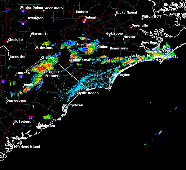 At 349 pm edt, a severe thunderstorm was located near mont clare, or 10 miles northeast of darlington, moving southeast at 20 mph (radar indicated). Hazards include 60 mph wind gusts and nickel size hail. Expect damage to roofs. siding. And trees. At 349 pm edt, a severe thunderstorm was located near mont clare, or 10 miles northeast of darlington, moving southeast at 20 mph (radar indicated). Hazards include 60 mph wind gusts and nickel size hail. Expect damage to roofs. siding. And trees.
|
| 7/3/2016 3:17 PM EDT |
 At 317 pm edt, a severe thunderstorm was located over lamar, or 9 miles southeast of bishopville, moving east at 20 mph (radar indicated). Hazards include 60 mph wind gusts and nickel size hail. Expect damage to roofs. siding. And trees. At 317 pm edt, a severe thunderstorm was located over lamar, or 9 miles southeast of bishopville, moving east at 20 mph (radar indicated). Hazards include 60 mph wind gusts and nickel size hail. Expect damage to roofs. siding. And trees.
|
| 6/24/2016 3:45 PM EDT |
 At 345 pm edt, a severe thunderstorm was located near brownsville, or 12 miles northeast of darlington, moving east at 30 mph. other severe thunderstorms were developing across dillon county (radar indicated). Hazards include 60 mph wind gusts and quarter size hail. Hail damage to vehicles is expected. Expect wind damage to roofs, siding, and trees. At 345 pm edt, a severe thunderstorm was located near brownsville, or 12 miles northeast of darlington, moving east at 30 mph. other severe thunderstorms were developing across dillon county (radar indicated). Hazards include 60 mph wind gusts and quarter size hail. Hail damage to vehicles is expected. Expect wind damage to roofs, siding, and trees.
|
| 6/14/2016 10:54 PM EDT |
 At 1052 pm edt, a cluster of strong to severe thunderstorms was located over northern florence and southern darlington counties respectively, and are moving east at 25 mph (radar indicated). Hazards include quarter size hail and 50 to 60 mph wind gusts. Hail damage to vehicles is expected. expect wind damage to roofs, siding, and trees. Locations impacted include, florence, marion, darlington, timmonsville, quinby, sellers, florence darlington technical college main campus, brownsville, blue brick, darlington raceway, floyd, mars bluff, claussen, mechanicsville, oak grove, health south rehabilitation hospital, mcleod regional medical center, carolinas hospital system, carolinas hospital system - cedar tower and mcleod medical center. At 1052 pm edt, a cluster of strong to severe thunderstorms was located over northern florence and southern darlington counties respectively, and are moving east at 25 mph (radar indicated). Hazards include quarter size hail and 50 to 60 mph wind gusts. Hail damage to vehicles is expected. expect wind damage to roofs, siding, and trees. Locations impacted include, florence, marion, darlington, timmonsville, quinby, sellers, florence darlington technical college main campus, brownsville, blue brick, darlington raceway, floyd, mars bluff, claussen, mechanicsville, oak grove, health south rehabilitation hospital, mcleod regional medical center, carolinas hospital system, carolinas hospital system - cedar tower and mcleod medical center.
|
| 6/14/2016 10:29 PM EDT |
 At 1027 pm edt, a severe thunderstorm was located near lamar, or 9 miles southwest of darlington, moving east at 25 mph. additional severe thunderstorms will develop within the warned area as this activity progresses eastward (radar indicated). Hazards include quarter size hail and 60 mph wind gusts. Hail damage to vehicles is expected. Expect wind damage to roofs, siding, and trees. At 1027 pm edt, a severe thunderstorm was located near lamar, or 9 miles southwest of darlington, moving east at 25 mph. additional severe thunderstorms will develop within the warned area as this activity progresses eastward (radar indicated). Hazards include quarter size hail and 60 mph wind gusts. Hail damage to vehicles is expected. Expect wind damage to roofs, siding, and trees.
|
| 2/24/2016 4:21 PM EST |
 At 420 pm est, doppler radar indicated a severe thunderstorm capable of producing damaging winds in excess of 60 mph. this storm was located over dunbar, or 10 miles southeast of bennettsville, moving northeast at 70 mph. locations impacted include, florence, dillon, darlington, pembroke, fairmont, maxton, timmonsville, mccoll, latta, rowland, quinby, clio, bingham, little rock, minturn, hamer, elrod, oak grove, raemon and florence darlington technical college main campus. this includes the following highways, interstate 20 between mile markers 135 and 141. interstate 74 near mile marker 191, between mile markers 208 and 209, and between mile markers 210 and 200. interstate 95 in south carolina between mile markers 150 and 198. interstate 95 in north carolina between mile markers 1 and 13. us route 74 between mile markers 367 and 370. At 420 pm est, doppler radar indicated a severe thunderstorm capable of producing damaging winds in excess of 60 mph. this storm was located over dunbar, or 10 miles southeast of bennettsville, moving northeast at 70 mph. locations impacted include, florence, dillon, darlington, pembroke, fairmont, maxton, timmonsville, mccoll, latta, rowland, quinby, clio, bingham, little rock, minturn, hamer, elrod, oak grove, raemon and florence darlington technical college main campus. this includes the following highways, interstate 20 between mile markers 135 and 141. interstate 74 near mile marker 191, between mile markers 208 and 209, and between mile markers 210 and 200. interstate 95 in south carolina between mile markers 150 and 198. interstate 95 in north carolina between mile markers 1 and 13. us route 74 between mile markers 367 and 370.
|
| 2/24/2016 4:05 PM EST |
 At 405 pm est, doppler radar indicated a severe thunderstorm capable of producing damaging winds in excess of 60 mph. this storm was located over florence darlington technical college main campus, or near darlington, and moving northeast at 70 mph. At 405 pm est, doppler radar indicated a severe thunderstorm capable of producing damaging winds in excess of 60 mph. this storm was located over florence darlington technical college main campus, or near darlington, and moving northeast at 70 mph.
|
| 2/3/2016 4:34 PM EST |
 At 432 pm est, doppler radar indicated a line of severe thunderstorms capable of producing damaging winds in excess of 60 mph. these storms were located along a line extending from 9 miles northeast of mont clare to near mechanicsville to near florence darlington technical college main campus, moving northeast at 35 mph. locations impacted include, florence, bennettsville, darlington, timmonsville, latta, quinby, bingham, oak grove, florence darlington technical college main campus, brownsville, mont clare, darlington raceway, mars bluff, dunbar, mechanicsville, floyd, dovesville, society hill, blenheim and health south rehabilitation hospital. this includes the following highways, interstate 20 between mile markers 135 and 141. interstate 95 in south carolina between mile markers 150 and 186. At 432 pm est, doppler radar indicated a line of severe thunderstorms capable of producing damaging winds in excess of 60 mph. these storms were located along a line extending from 9 miles northeast of mont clare to near mechanicsville to near florence darlington technical college main campus, moving northeast at 35 mph. locations impacted include, florence, bennettsville, darlington, timmonsville, latta, quinby, bingham, oak grove, florence darlington technical college main campus, brownsville, mont clare, darlington raceway, mars bluff, dunbar, mechanicsville, floyd, dovesville, society hill, blenheim and health south rehabilitation hospital. this includes the following highways, interstate 20 between mile markers 135 and 141. interstate 95 in south carolina between mile markers 150 and 186.
|
| 2/3/2016 4:21 PM EST |
 At 421 pm est, doppler radar indicated a line of severe thunderstorms capable of producing damaging winds in excess of 60 mph. these storms were located along a line extending from near mont clare to darlington raceway to near timmonsville, moving northeast at 35 mph. locations impacted include, florence, bennettsville, marion, darlington, timmonsville, latta, lamar, quinby, sellers, bingham, blue brick, cartersville, oak grove, florence darlington technical college main campus, brownsville, dovesville, mont clare, darlington raceway, floyd and mars bluff. this includes the following highways, interstate 20 between mile markers 126 and 141. interstate 95 in south carolina near mile marker 146, and between mile markers 149 and 186. At 421 pm est, doppler radar indicated a line of severe thunderstorms capable of producing damaging winds in excess of 60 mph. these storms were located along a line extending from near mont clare to darlington raceway to near timmonsville, moving northeast at 35 mph. locations impacted include, florence, bennettsville, marion, darlington, timmonsville, latta, lamar, quinby, sellers, bingham, blue brick, cartersville, oak grove, florence darlington technical college main campus, brownsville, dovesville, mont clare, darlington raceway, floyd and mars bluff. this includes the following highways, interstate 20 between mile markers 126 and 141. interstate 95 in south carolina near mile marker 146, and between mile markers 149 and 186.
|
| 2/3/2016 4:00 PM EST |
 At 400 pm est, doppler radar indicated a line of severe thunderstorms capable of producing damaging winds in excess of 60 mph. these storms were located along a line extending from near auburn to 9 miles west of cartersville, moving east at 35 mph. locations impacted include, florence, bennettsville, hartsville, marion, darlington, timmonsville, latta, lamar, quinby, sellers, sardis, bingham, blue brick, effingham, kellytown, cartersville, oak grove, florence darlington technical college main campus, brownsville and dovesville. this includes the following highways, interstate 20 between mile markers 126 and 141. interstate 95 in south carolina between mile markers 146 and 186. At 400 pm est, doppler radar indicated a line of severe thunderstorms capable of producing damaging winds in excess of 60 mph. these storms were located along a line extending from near auburn to 9 miles west of cartersville, moving east at 35 mph. locations impacted include, florence, bennettsville, hartsville, marion, darlington, timmonsville, latta, lamar, quinby, sellers, sardis, bingham, blue brick, effingham, kellytown, cartersville, oak grove, florence darlington technical college main campus, brownsville and dovesville. this includes the following highways, interstate 20 between mile markers 126 and 141. interstate 95 in south carolina between mile markers 146 and 186.
|
| 2/3/2016 3:41 PM EST |
 The national weather service in wilmington has issued a * severe thunderstorm warning for. northwestern marion county in northeastern south carolina. southwestern dillon county in northeastern south carolina. northwestern florence county in northeastern south carolina. Darlington county in northeastern south carolina. The national weather service in wilmington has issued a * severe thunderstorm warning for. northwestern marion county in northeastern south carolina. southwestern dillon county in northeastern south carolina. northwestern florence county in northeastern south carolina. Darlington county in northeastern south carolina.
|
| 8/5/2015 3:55 PM EDT |
 At 355 pm edt, doppler radar indicated a severe thunderstorm capable of producing quarter size hail and damaging winds in excess of 60 mph. this storm was located over quinby, or near florence, and moving east at 15 mph. At 355 pm edt, doppler radar indicated a severe thunderstorm capable of producing quarter size hail and damaging winds in excess of 60 mph. this storm was located over quinby, or near florence, and moving east at 15 mph.
|
| 7/23/2015 5:14 PM EDT |
 At 514 pm edt, doppler radar indicated a severe thunderstorm capable of producing quarter size hail and damaging winds in excess of 60 mph. this storm was located 7 miles southwest of cheraw, and moving southeast at 25 mph. At 514 pm edt, doppler radar indicated a severe thunderstorm capable of producing quarter size hail and damaging winds in excess of 60 mph. this storm was located 7 miles southwest of cheraw, and moving southeast at 25 mph.
|
| 7/21/2015 6:52 PM EDT |
 At 652 pm edt, doppler radar indicated a severe thunderstorm capable of producing quarter size hail and damaging winds in excess of 60 mph. this storm was located over clyde, or 7 miles west of hartsville, and moving southeast at 30 mph. At 652 pm edt, doppler radar indicated a severe thunderstorm capable of producing quarter size hail and damaging winds in excess of 60 mph. this storm was located over clyde, or 7 miles west of hartsville, and moving southeast at 30 mph.
|
| 7/2/2015 5:46 PM EDT | Report of tree in roadway near intersection of gilchrist rd and wire rd. time estimated by rada in darlington county SC, 2.9 miles ESE of Darlington, SC |
| 7/2/2015 5:38 PM EDT | A tree was reported down near the intersection of pocket road and charleston road. the time was estimated based on radar dat in darlington county SC, 5.4 miles W of Darlington, SC |
| 7/2/2015 5:35 PM EDT |
 At 535 pm edt, doppler radar indicated a severe thunderstorm capable of producing quarter size hail and damaging winds in excess of 60 mph. this storm was located over florence darlington technical college main campus, or near darlington, and moving east at 20 mph. At 535 pm edt, doppler radar indicated a severe thunderstorm capable of producing quarter size hail and damaging winds in excess of 60 mph. this storm was located over florence darlington technical college main campus, or near darlington, and moving east at 20 mph.
|
| 7/2/2015 5:21 PM EDT | Report of tree in roadway at intersection of pocket rd and oxford rd. time estimated by rada in darlington county SC, 2.6 miles WSW of Darlington, SC |
| 7/2/2015 5:21 PM EDT | A tree was reported down in the 600 block of gilchrist road. the time was estimated based on radar dat in darlington county SC, 2.4 miles ESE of Darlington, SC |
| 7/2/2015 5:17 PM EDT | Report of tree down on n main st near citi trends. time estimated by rada in darlington county SC, 0.9 miles E of Darlington, SC |
| 6/30/2015 6:45 PM EDT | Tree down on georgetown roa in darlington county SC, 7.6 miles WSW of Darlington, SC |
| 6/30/2015 6:31 PM EDT | A tree was reported down at the intersection of whit street and plum stree in darlington county SC, 1.1 miles ESE of Darlington, SC |
| 6/30/2015 6:20 PM EDT |
 At 620 pm edt, doppler radar indicated a line of severe thunderstorms capable of producing half dollar size hail and damaging winds in excess of 60 mph. these storms were located along a line extending from near hoffman to near chavistown to 8 miles northwest of dovesville to hartsville, and moving northeast at 55 mph. At 620 pm edt, doppler radar indicated a line of severe thunderstorms capable of producing half dollar size hail and damaging winds in excess of 60 mph. these storms were located along a line extending from near hoffman to near chavistown to 8 miles northwest of dovesville to hartsville, and moving northeast at 55 mph.
|
| 6/27/2015 8:02 PM EDT |
 At 800 pm edt, doppler radar indicated a severe thunderstorm capable of producing quarter size hail and damaging winds in excess of 60 mph. this storm was located near mechanicsville, or 10 miles east of darlington. this storm was moving northeast at 40 mph. locations impacted include, florence, lake city, darlington, timmonsville, pamplico, quinby, kingsburg, sardis, new hope, effingham, hannah, florence darlington technical college main campus, brownsville, dovesville, evergreen, friendfield, mont clare, darlington raceway, floyd and mars bluff. this includes the following highways, interstate 20 between mile markers 132 and 141. interstate 95 in south carolina near mile marker 146, and between mile markers 148 and 175. At 800 pm edt, doppler radar indicated a severe thunderstorm capable of producing quarter size hail and damaging winds in excess of 60 mph. this storm was located near mechanicsville, or 10 miles east of darlington. this storm was moving northeast at 40 mph. locations impacted include, florence, lake city, darlington, timmonsville, pamplico, quinby, kingsburg, sardis, new hope, effingham, hannah, florence darlington technical college main campus, brownsville, dovesville, evergreen, friendfield, mont clare, darlington raceway, floyd and mars bluff. this includes the following highways, interstate 20 between mile markers 132 and 141. interstate 95 in south carolina near mile marker 146, and between mile markers 148 and 175.
|
| 6/27/2015 7:45 PM EDT |
 At 743 pm edt, doppler radar indicated a severe thunderstorm capable of producing quarter size hail and damaging winds in excess of 60 mph. this storm was located over darlington, moving northeast at 45 mph. locations impacted include, florence, hartsville, lake city, darlington, timmonsville, pamplico, lamar, quinby, kingsburg, sardis, new hope, effingham, kellytown, cartersville, hannah, florence darlington technical college main campus, brownsville, dovesville, evergreen and friendfield. this includes the following highways, interstate 20 between mile markers 125 and 141. interstate 95 in south carolina near mile marker 146, and between mile markers 148 and 175. At 743 pm edt, doppler radar indicated a severe thunderstorm capable of producing quarter size hail and damaging winds in excess of 60 mph. this storm was located over darlington, moving northeast at 45 mph. locations impacted include, florence, hartsville, lake city, darlington, timmonsville, pamplico, lamar, quinby, kingsburg, sardis, new hope, effingham, kellytown, cartersville, hannah, florence darlington technical college main campus, brownsville, dovesville, evergreen and friendfield. this includes the following highways, interstate 20 between mile markers 125 and 141. interstate 95 in south carolina near mile marker 146, and between mile markers 148 and 175.
|
| 6/27/2015 7:27 PM EDT |
 At 727 pm edt, doppler radar indicated a severe thunderstorm capable of producing quarter size hail and damaging winds in excess of 60 mph. this storm was located over lamar, or 10 miles east of bishopville, and moving northeast at 45 mph. At 727 pm edt, doppler radar indicated a severe thunderstorm capable of producing quarter size hail and damaging winds in excess of 60 mph. this storm was located over lamar, or 10 miles east of bishopville, and moving northeast at 45 mph.
|
| 6/18/2015 4:21 PM EDT | At 420 pm edt, doppler radar indicated a severe thunderstorm capable of producing quarter size hail and damaging winds in excess of 60 mph. this storm was located over claussen, or near florence, moving southeast at 30 mph. locations impacted include, florence, darlington, timmonsville, lamar, quinby, florence darlington technical college main campus, sardis, new hope, darlington raceway, mars bluff, effingham, cartersville, mechanicsville, coward, health south rehabilitation hospital, mcleod regional medical center, carolinas hospital system, carolinas hospital system - cedar tower and mcleod medical center. this includes the following highways, interstate 20 between mile markers 127 and 141. interstate 95 in south carolina between mile markers 146 and 179. |
| 6/18/2015 4:03 PM EDT | Report of tree in roadway at intersection of hill creek rd and sproud rd. time of event estimated by rada in darlington county SC, 5.6 miles NNE of Darlington, SC |
| 6/18/2015 3:50 PM EDT | Reports of 4 to 5 trees down in and around the city of darlington. time estimated by radar and call times into 911 cente in darlington county SC, 0.3 miles ENE of Darlington, SC |
| 6/18/2015 3:49 PM EDT | At 349 pm edt, doppler radar indicated a severe thunderstorm capable of producing quarter size hail and damaging winds in excess of 60 mph. this storm was located over darlington raceway, or near darlington, and moving southeast at 30 mph. |
| 6/9/2015 7:59 PM EDT | Tree in roadway mccowns millpond rd in darlington county SC, 3.3 miles SE of Darlington, SC |
| 6/9/2015 7:59 PM EDT | Tree in roadway tish d in darlington county SC, 3.3 miles SE of Darlington, SC |
| 6/9/2015 7:59 PM EDT | Tree in roadway mccowns millpond rd in darlington county SC, 3.3 miles SE of Darlington, SC |
| 6/9/2015 7:55 PM EDT |
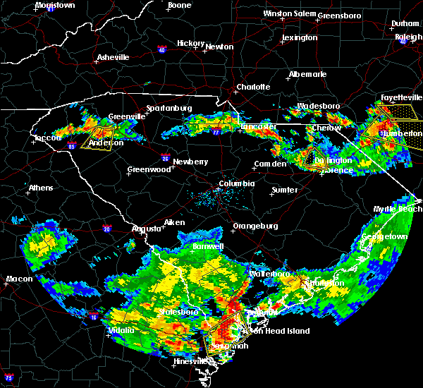 The severe thunderstorm warning for northern florence and northeastern darlington counties will expire at 800 pm edt, the storms that prompted the warning have weakened below severe limits. therefore the warning will be allowed to expire. although the severe threat has diminished a potential remains for thunderstorms with frequent cloud to ground lightning, wind gusts to 35 mph and very heavy downpours through the remainder of the evening. The severe thunderstorm warning for northern florence and northeastern darlington counties will expire at 800 pm edt, the storms that prompted the warning have weakened below severe limits. therefore the warning will be allowed to expire. although the severe threat has diminished a potential remains for thunderstorms with frequent cloud to ground lightning, wind gusts to 35 mph and very heavy downpours through the remainder of the evening.
|
| 6/9/2015 7:43 PM EDT |
 At 742 pm edt, doppler radar continued to indicate a severe thunderstorm capable of producing quarter size hail and damaging winds in excess of 60 mph. this storm was located between quinby and darlington, moving east at 15 mph. additional strong thunderstorms are expected to move across the warned area from the west through 8 pm edt. locations impacted include, darlington, darlington raceway, floyd, dovesville, mechanicsville, and society hill. At 742 pm edt, doppler radar continued to indicate a severe thunderstorm capable of producing quarter size hail and damaging winds in excess of 60 mph. this storm was located between quinby and darlington, moving east at 15 mph. additional strong thunderstorms are expected to move across the warned area from the west through 8 pm edt. locations impacted include, darlington, darlington raceway, floyd, dovesville, mechanicsville, and society hill.
|
| 6/9/2015 7:30 PM EDT | Large tree down on house on elissa dr. occupants inside unharmed. time estimated by rada in darlington county SC, 4.5 miles SSW of Darlington, SC |
| 6/9/2015 7:26 PM EDT | Tree down mineral springs rd in darlington county SC, 2.2 miles SSE of Darlington, SC |
| 6/9/2015 7:20 PM EDT | Tree down jeffords mill rd and mont clare rd in darlington county SC, 6.8 miles S of Darlington, SC |
| 6/9/2015 7:17 PM EDT | Tree down u.s. 52 and dovesville hwy in darlington county SC, 7.1 miles SSE of Darlington, SC |
| 6/9/2015 6:59 PM EDT |
 At 659 pm edt, doppler radar indicated a severe thunderstorm capable of producing quarter size hail and damaging winds in excess of 60 mph. this storm was located over mont clare, or 9 miles north of darlington, and moving east at 20 mph. At 659 pm edt, doppler radar indicated a severe thunderstorm capable of producing quarter size hail and damaging winds in excess of 60 mph. this storm was located over mont clare, or 9 miles north of darlington, and moving east at 20 mph.
|
| 6/9/2015 6:24 PM EDT | Tree down lawson rd and spring s in darlington county SC, 1.6 miles SE of Darlington, SC |
| 4/19/2015 8:09 PM EDT | Tree in roadway in darlington county SC, 0.3 miles ENE of Darlington, SC |
| 4/19/2015 7:11 PM EDT | Trees and power lines down in darlington county SC, 3.4 miles ESE of Darlington, SC |
| 4/19/2015 6:58 PM EDT | Tree in roadway in darlington county SC, 0.3 miles ENE of Darlington, SC |
| 4/19/2015 6:57 PM EDT | At 656 pm edt, trained weather spotters reported a line of severe thunderstorms producing damaging winds in excess of 60 mph. these storms were located along a line extending from near dovesville to near salters, moving northeast at 40 mph. locations impacted include, florence, hartsville, lake city, darlington, kingstree, andrews, timmonsville, johnsonville, pamplico, quinby, hemingway, kingsburg, warsaw, gourdin, hebron, earle, new hope, henry, salters and effingham. this includes the following highways, interstate 20 between mile markers 131 and 141. interstate 95 in south carolina near mile marker 146, and between mile markers 150 and 176. |
| 4/19/2015 6:09 PM EDT | The national weather service in wilmington nc has issued a * severe thunderstorm warning for. florence county in northeastern south carolina. darlington county in northeastern south carolina. williamsburg county in northeastern south carolina. Until 715 pm edt. |
| 8/23/2013 8:50 PM EDT | Report of tree across roadway near intersection of oleander rd and mineral springs rd. time of event estimated by rada in darlington county SC, 2.2 miles SSE of Darlington, SC |
| 8/23/2013 8:47 PM EDT | Report of downed tree on steel mill rd near hwy 52. time of event estimated by rada in darlington county SC, 5.8 miles SSE of Darlington, SC |
| 6/18/2013 5:50 PM EDT | Uprooted trees reported on lawson rd - time estimated based on radar in darlington county SC, 2 miles S of Darlington, SC |
| 4/19/2013 6:22 PM EDT | Tree in roadway at floyds road and leavensworth road in darlington county SC, 6 miles SE of Darlington, SC |
| 7/1/2012 4:31 PM EDT | Tree in road near swift creek church in darlington county SC, 6.1 miles E of Darlington, SC |
| 7/1/2012 4:23 PM EDT | Tree in road at indian branch road and s center road in darlington county SC, 6.8 miles ENE of Darlington, SC |
| 7/1/2012 3:56 PM EDT | Large branches broken in darlington county SC, 0.3 miles ENE of Darlington, SC |
| 5/23/2012 4:15 PM EDT | Quarter sized hail reported 0.9 miles E of Darlington, SC, quarter size hail in darlington. |
| 5/14/2012 1:25 PM EDT | Large tree around 3 ft in diameter fell on trailer on wire rd near intersection of highway 52. man inside sleeping was not harme in darlington county SC, 1.9 miles SE of Darlington, SC |
| 1/1/0001 12:00 AM | Reported powerlines down on n main street in darlington. time of event estimated by rada in darlington county SC, 1.6 miles SE of Darlington, SC |
| 1/1/0001 12:00 AM | Trees...up to 12 inches in diameter reportedly down near the intersection of south charleston highway and pocket roa in darlington county SC, 5.4 miles W of Darlington, SC |
| 1/1/0001 12:00 AM | Trees down on mt clair rd... jeffords mill rd... indian branch rd... and silvia l in darlington county SC, 0.3 miles ENE of Darlington, SC |
| 1/1/0001 12:00 AM | Tree on road at the intersection of indian brach rd and lamar hwy in darlington county SC, 2.1 miles NE of Darlington, SC |
| 1/1/0001 12:00 AM | Tree in road at the intersection of indian brach rd and mciver rd in darlington county SC, 0.3 miles ENE of Darlington, SC |
| 1/1/0001 12:00 AM | Quarter sized hail reported 1.3 miles SSE of Darlington, SC, hail covering ground |
Hail Maps for Darlington, SC
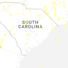


Connect with Interactive Hail Maps