

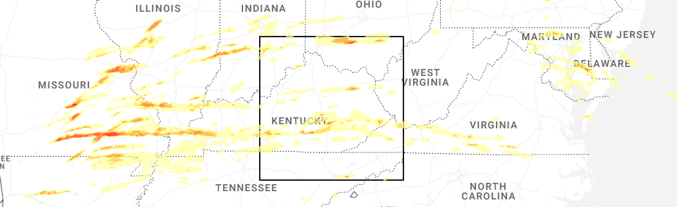
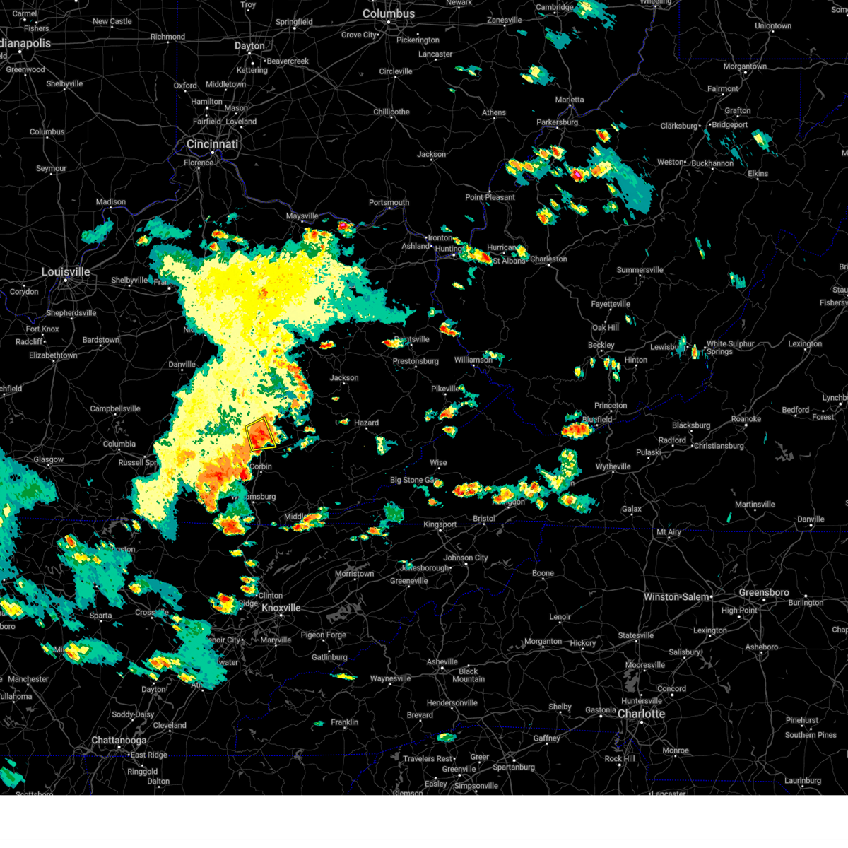
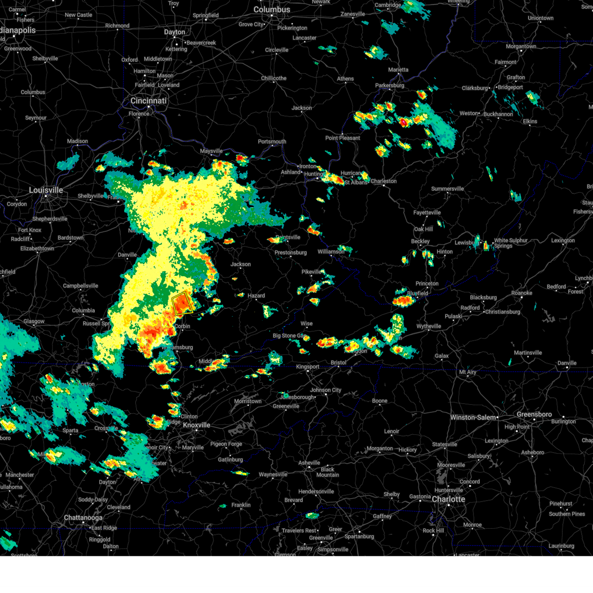
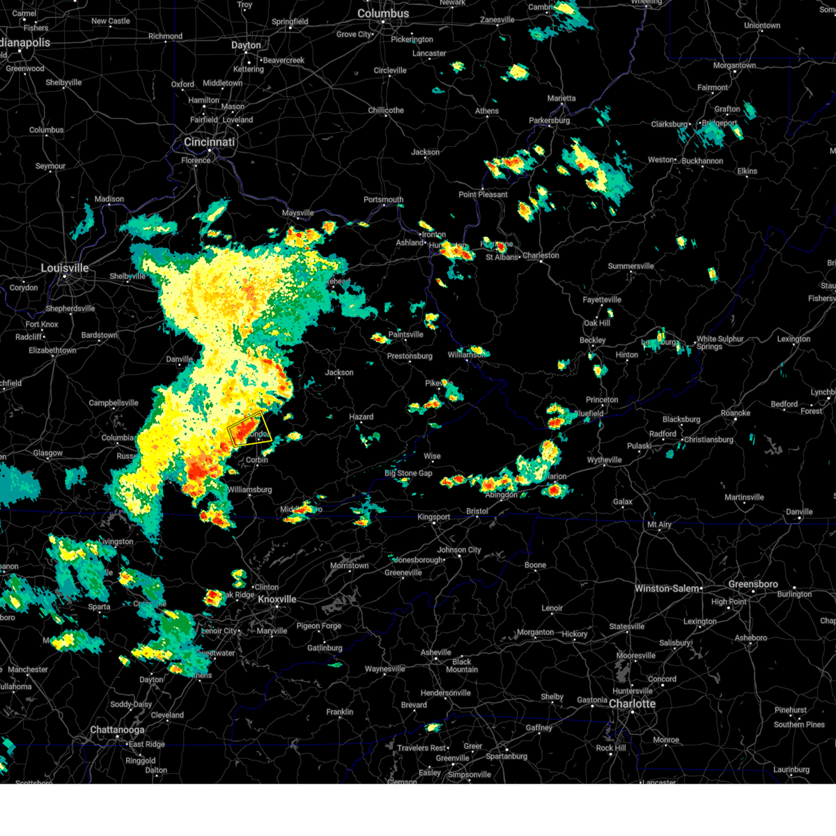
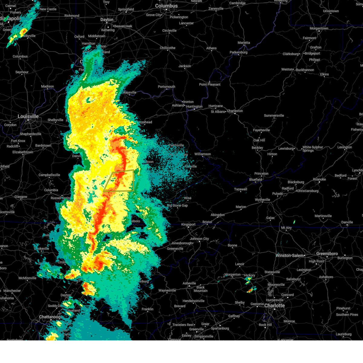
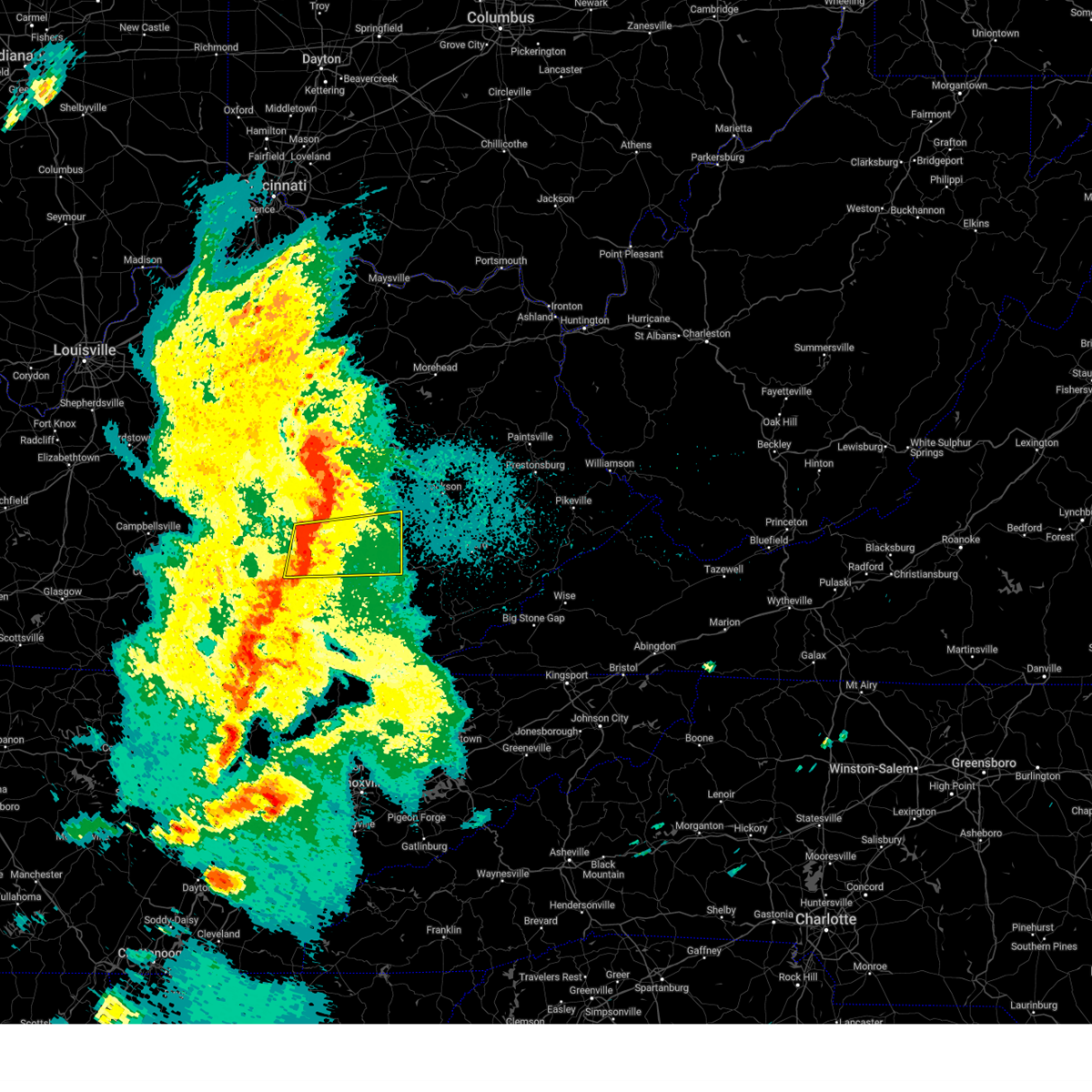
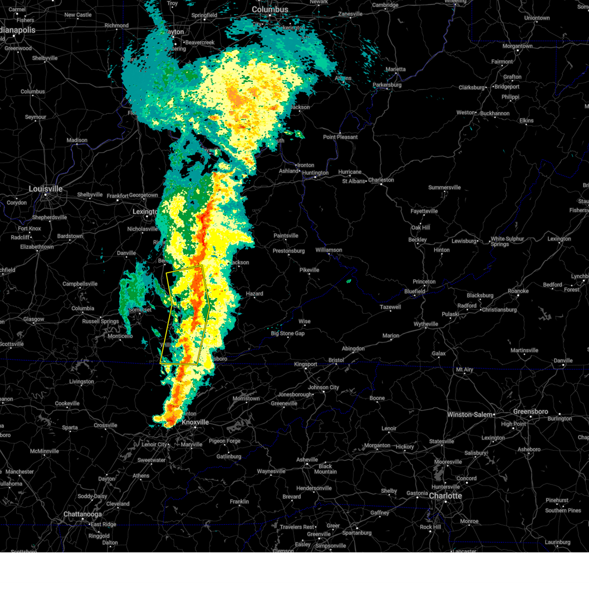
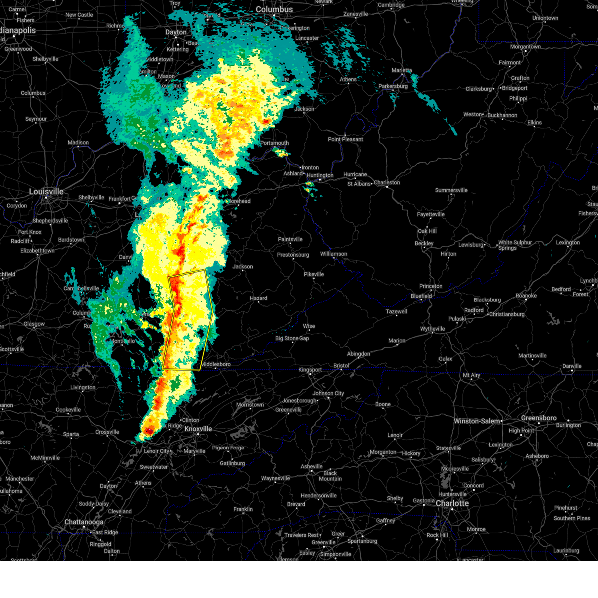
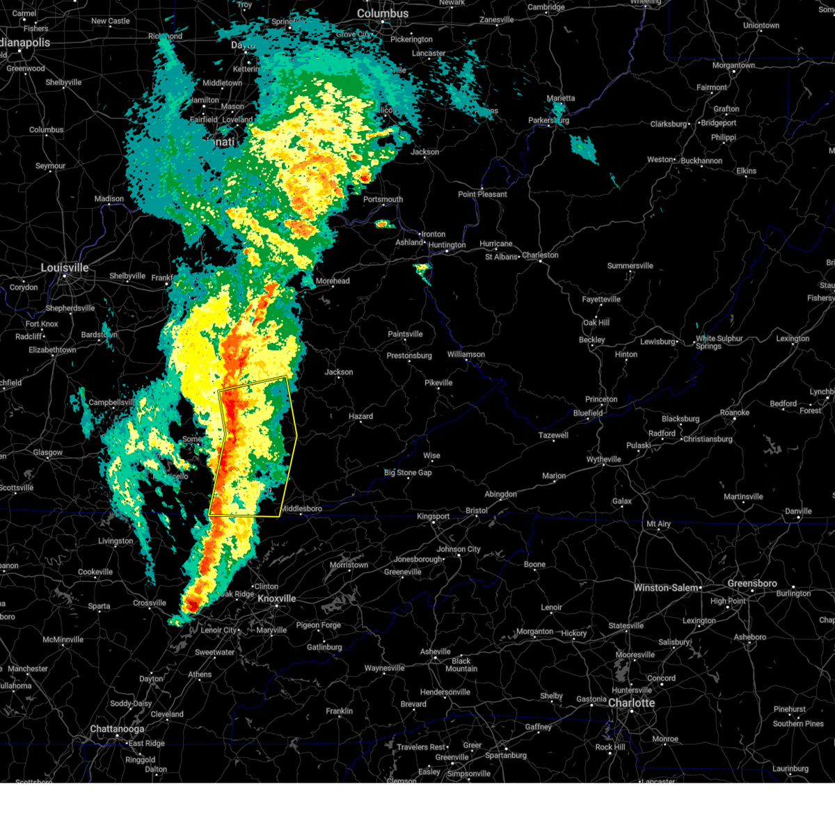
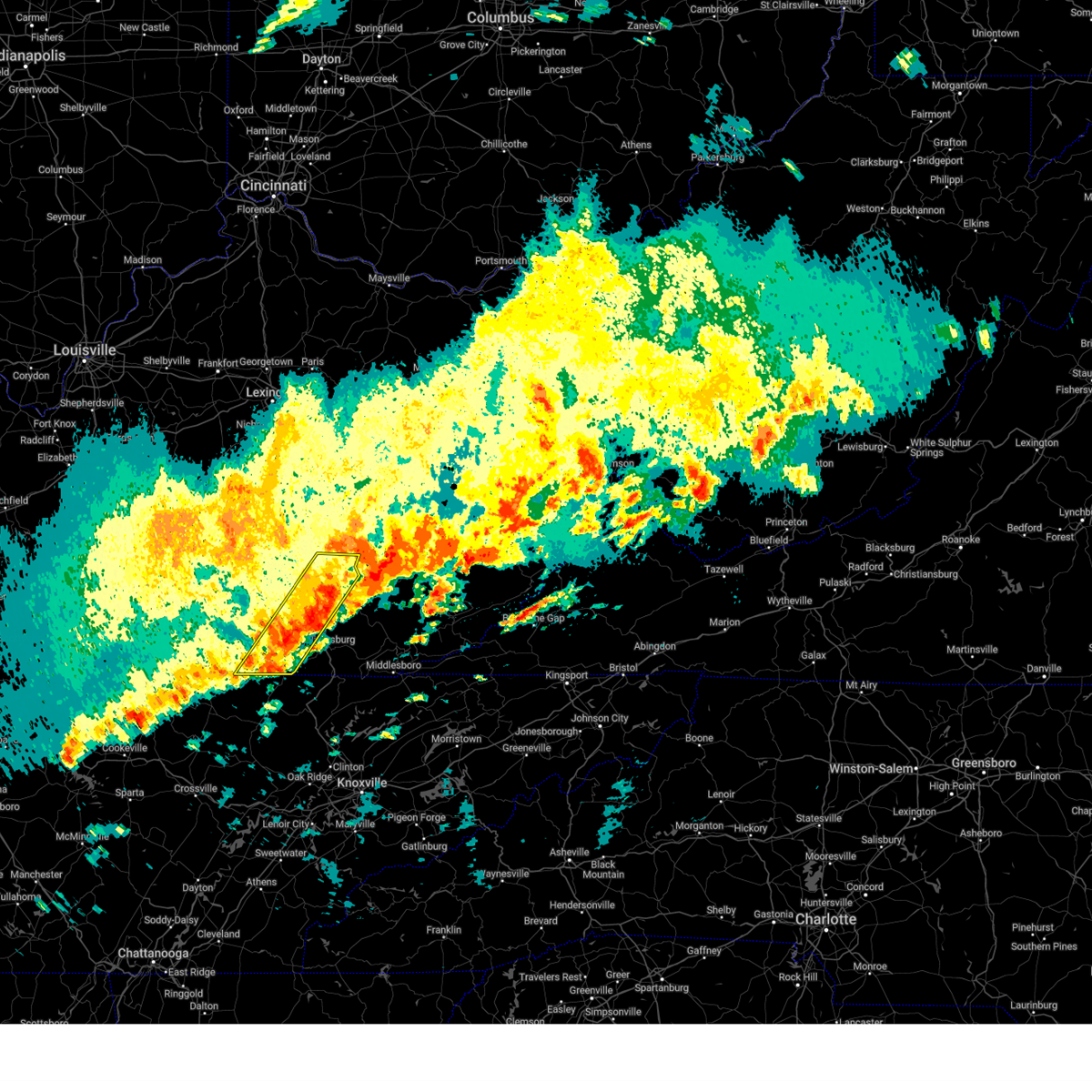
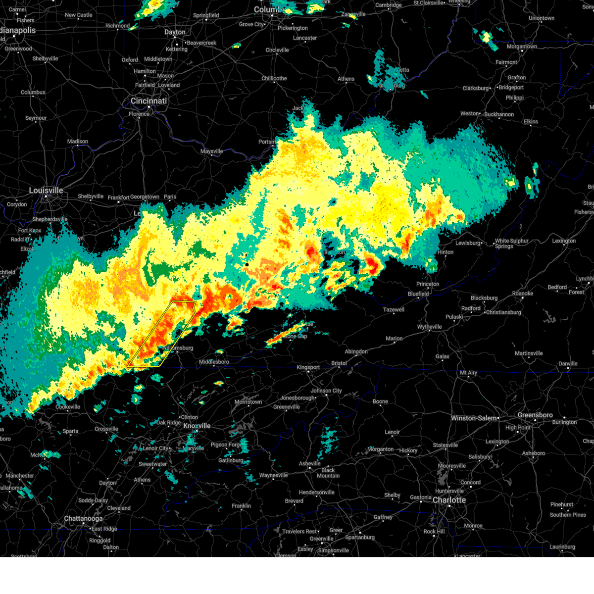
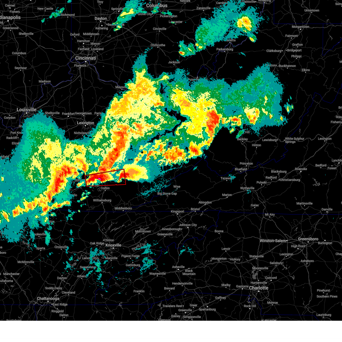
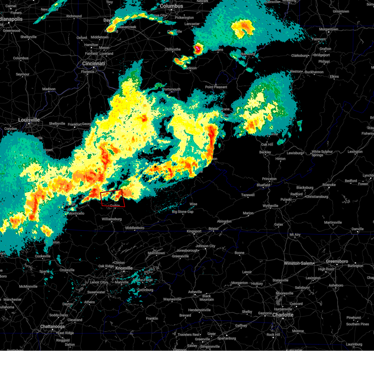
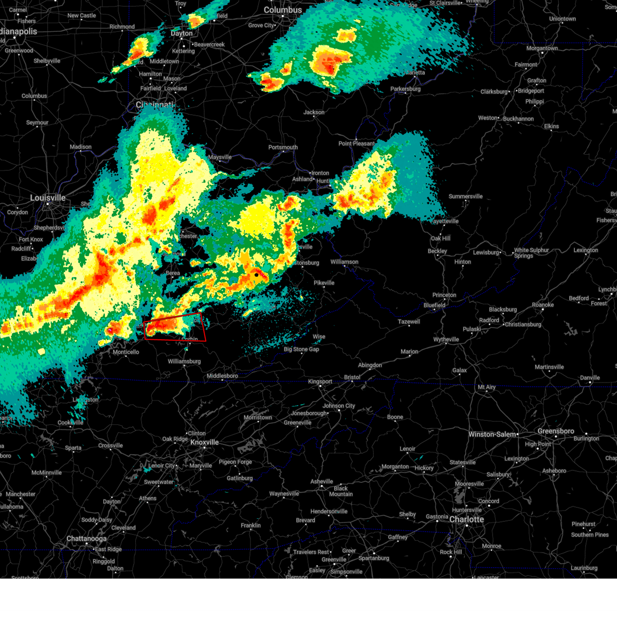
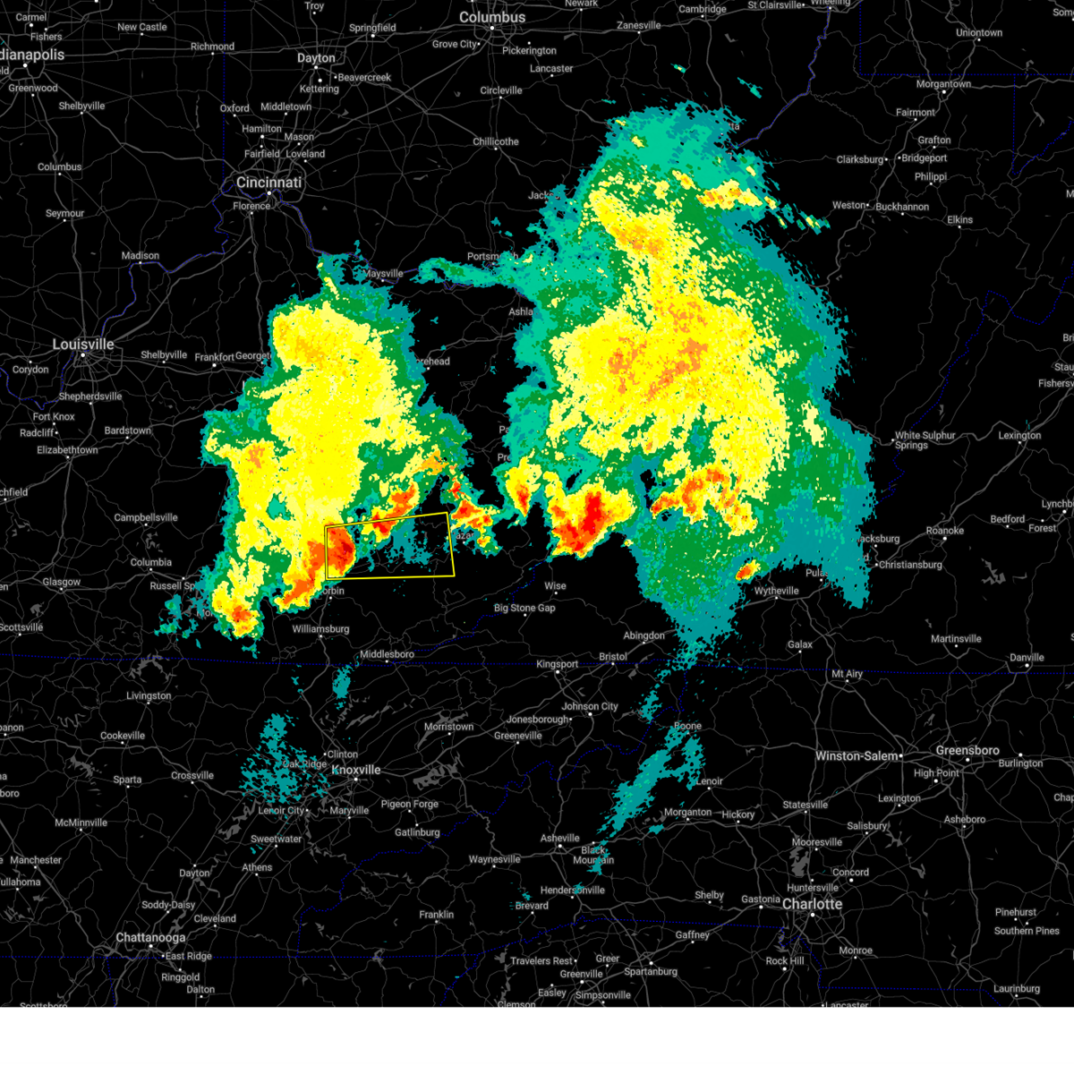
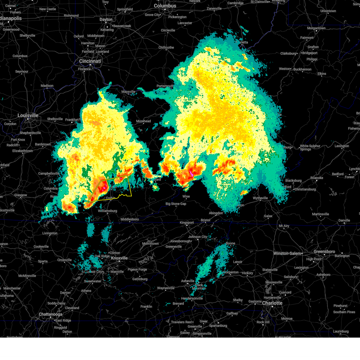
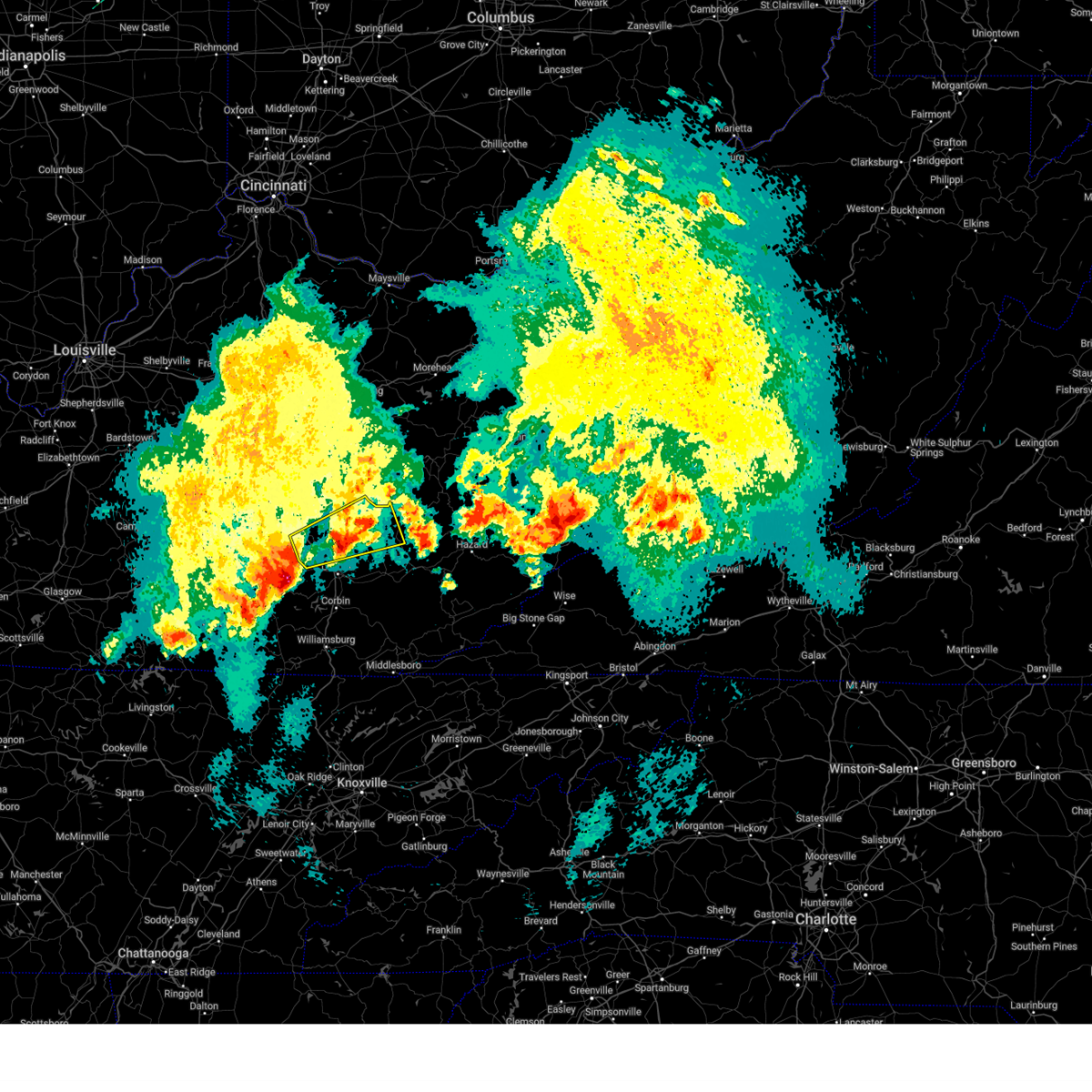
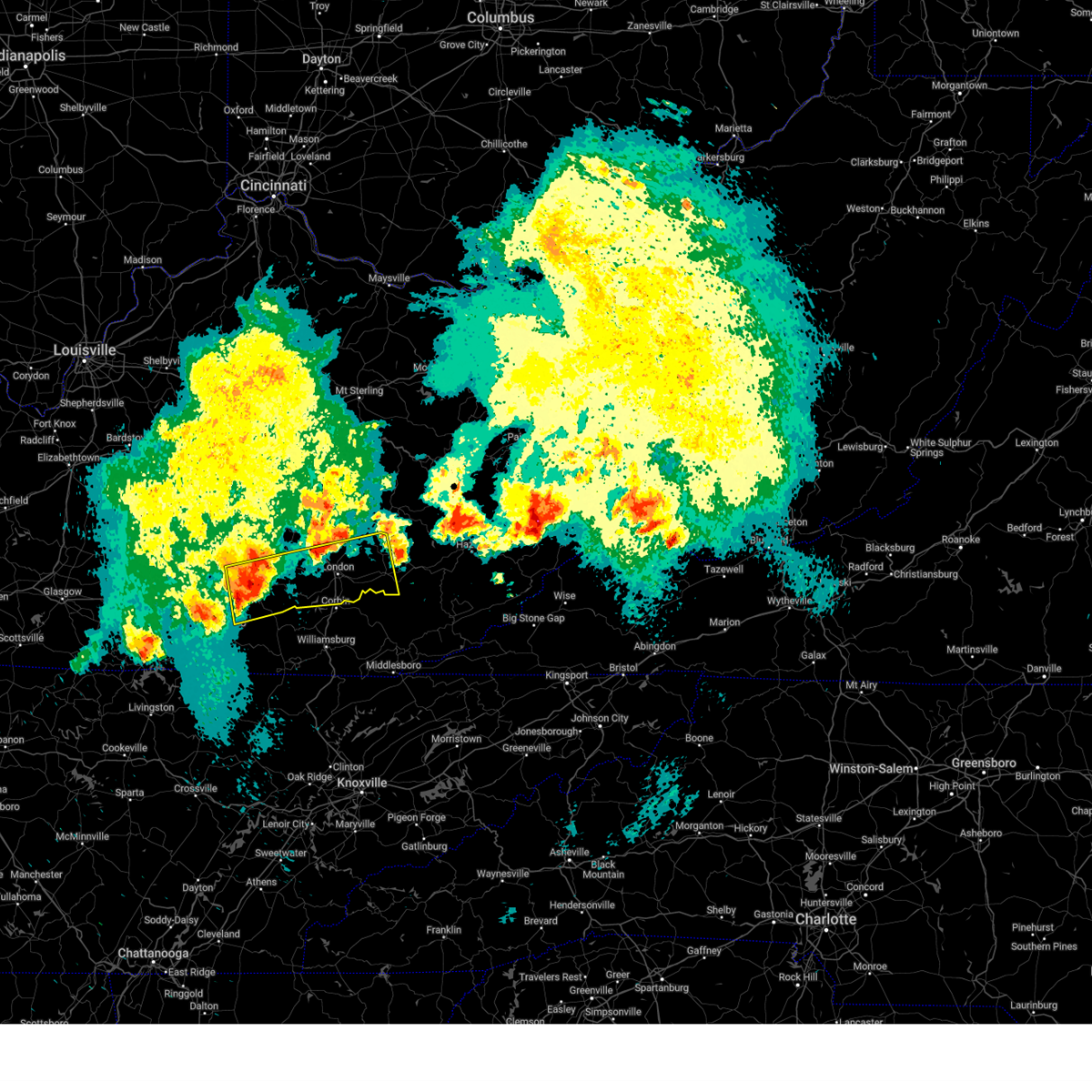
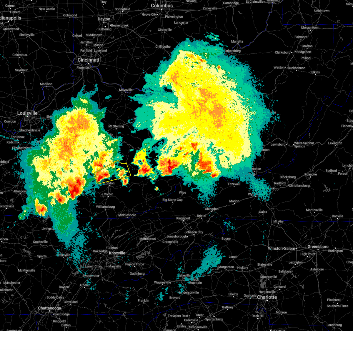
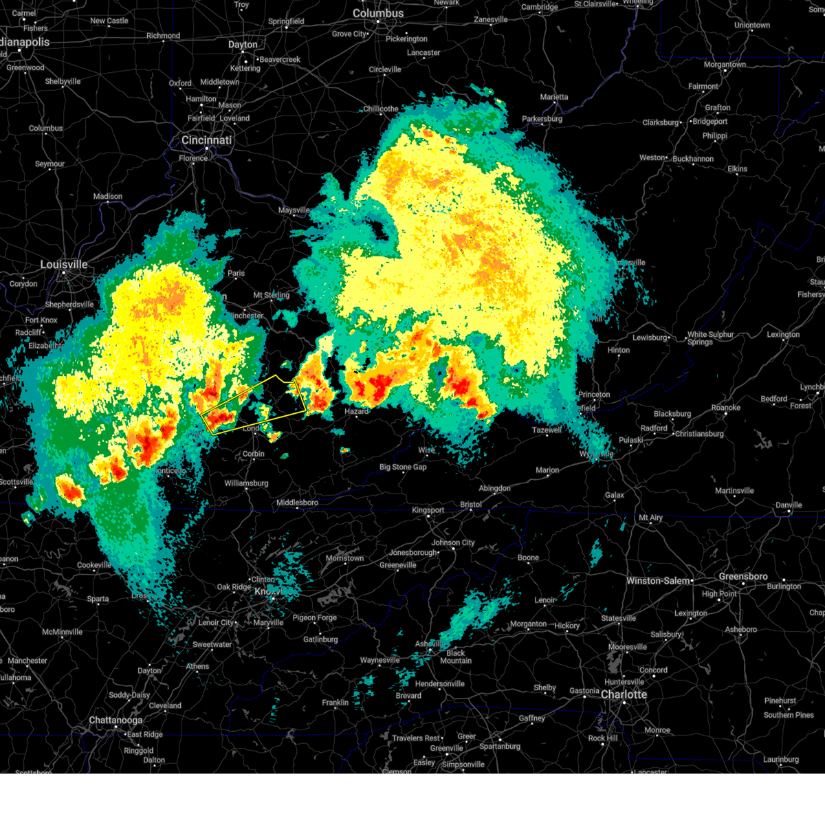
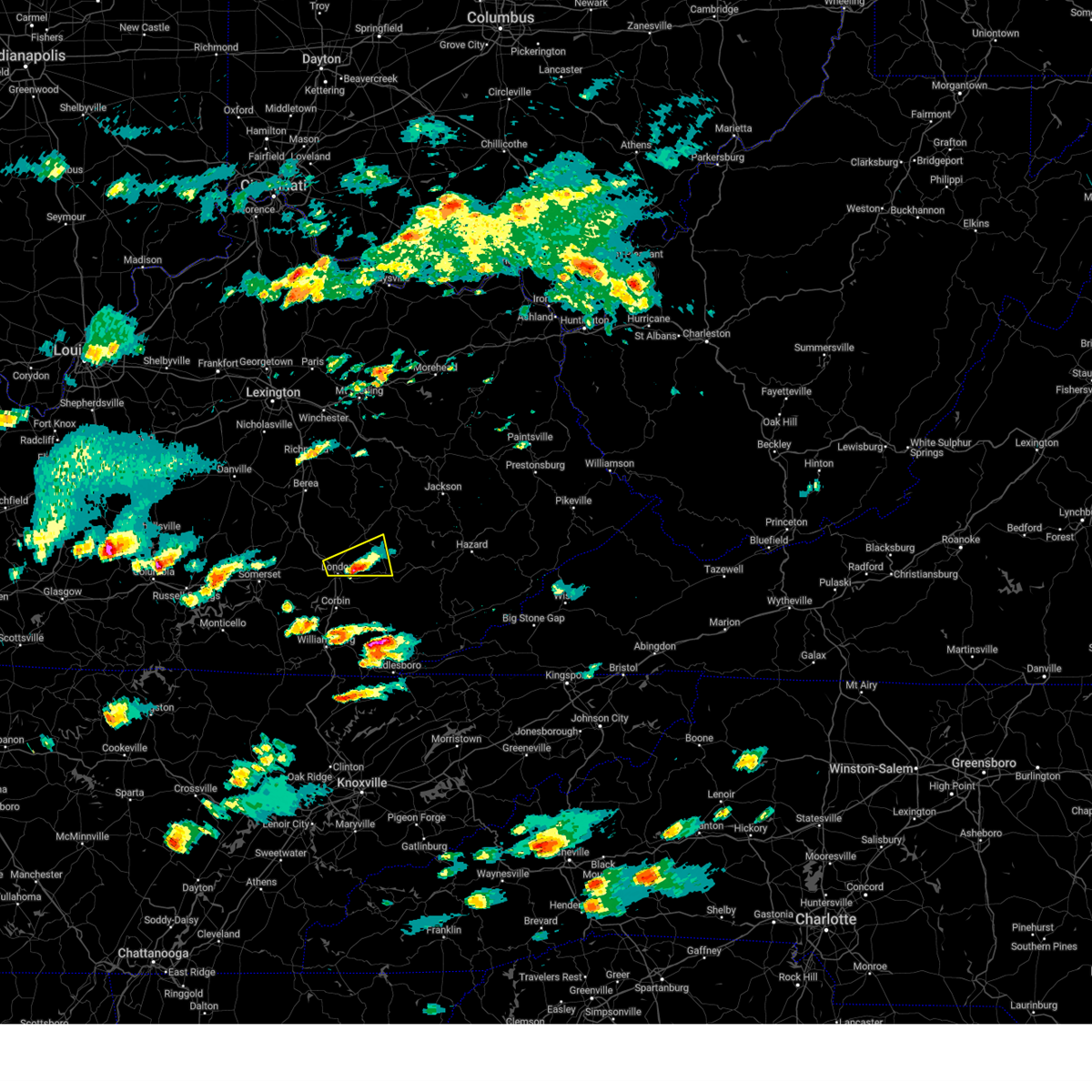
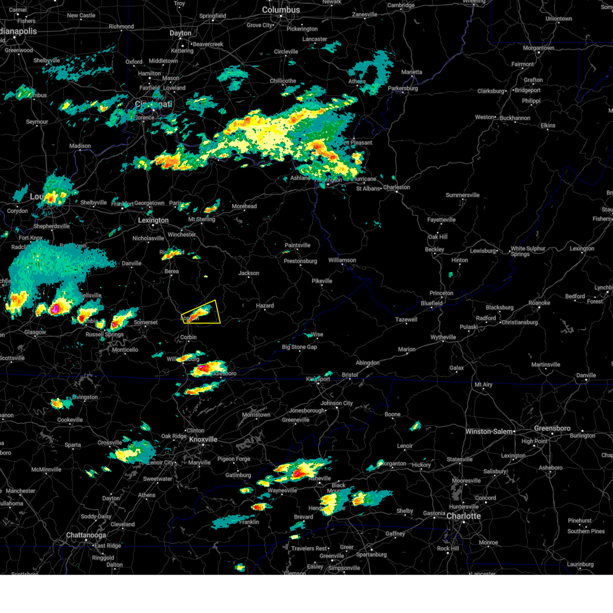
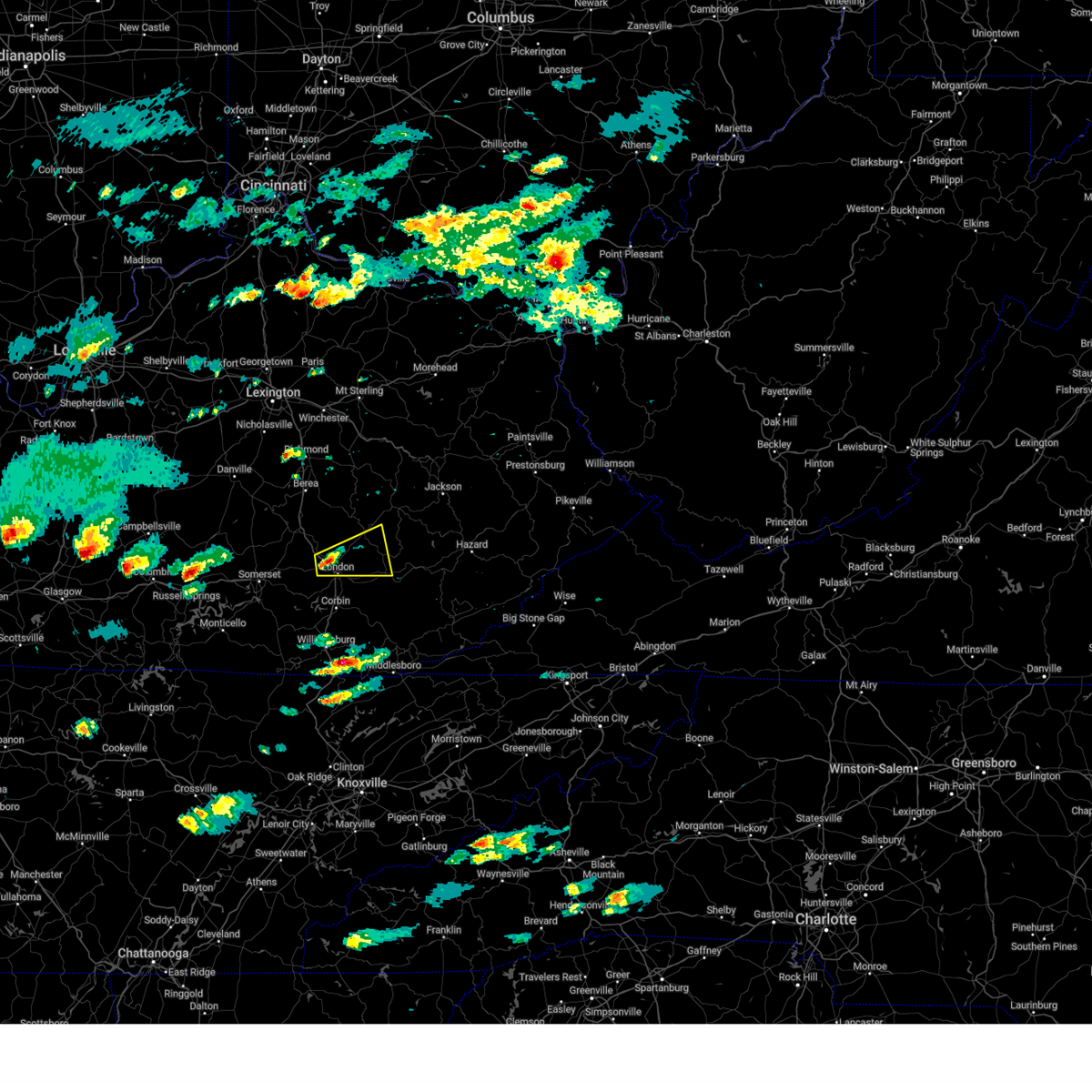
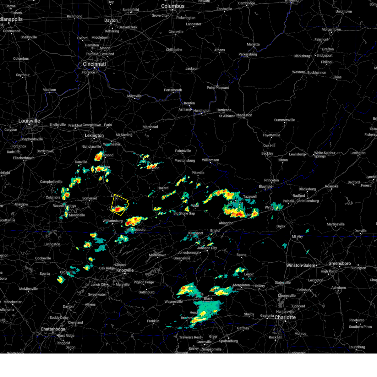
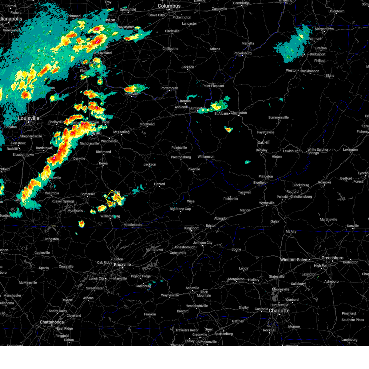
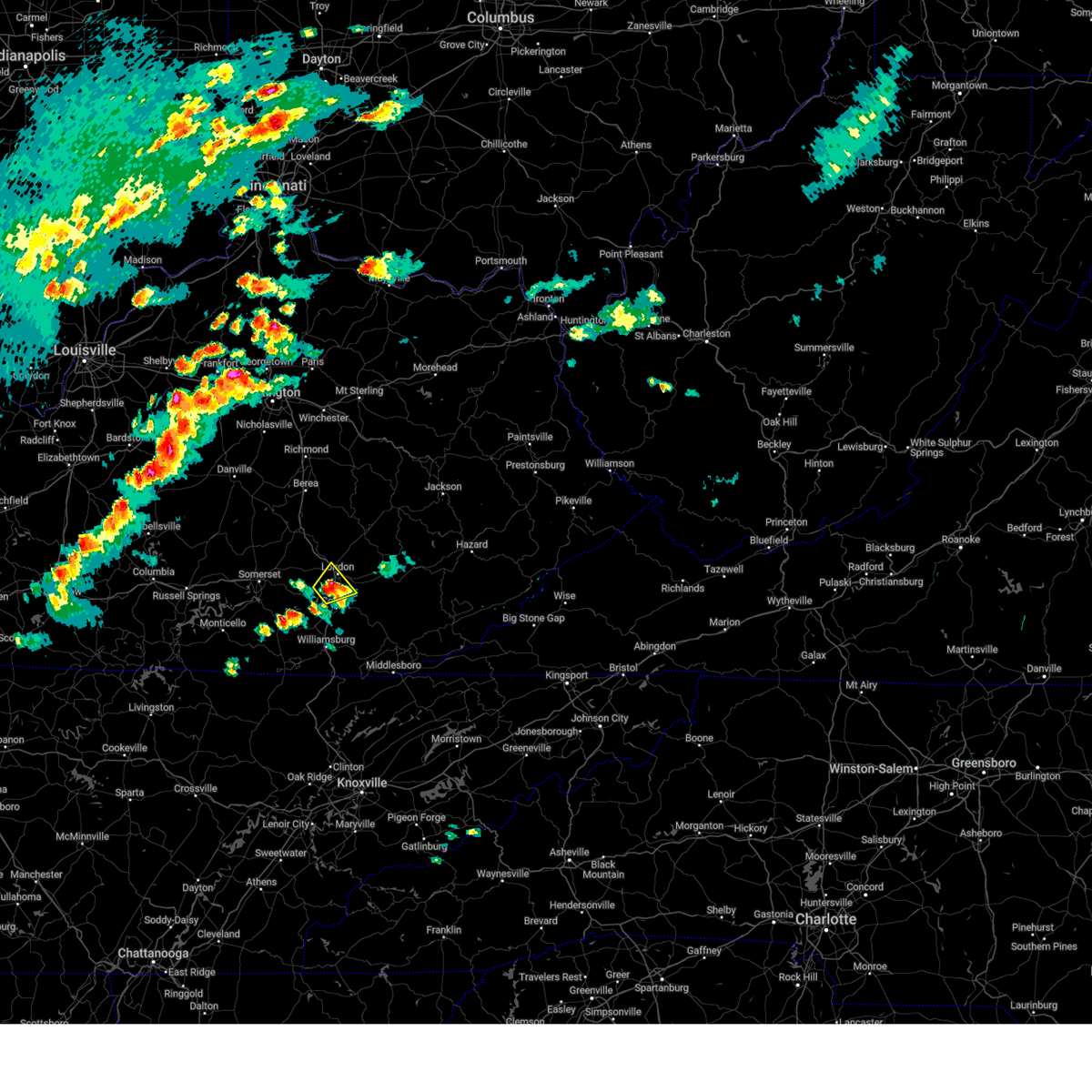
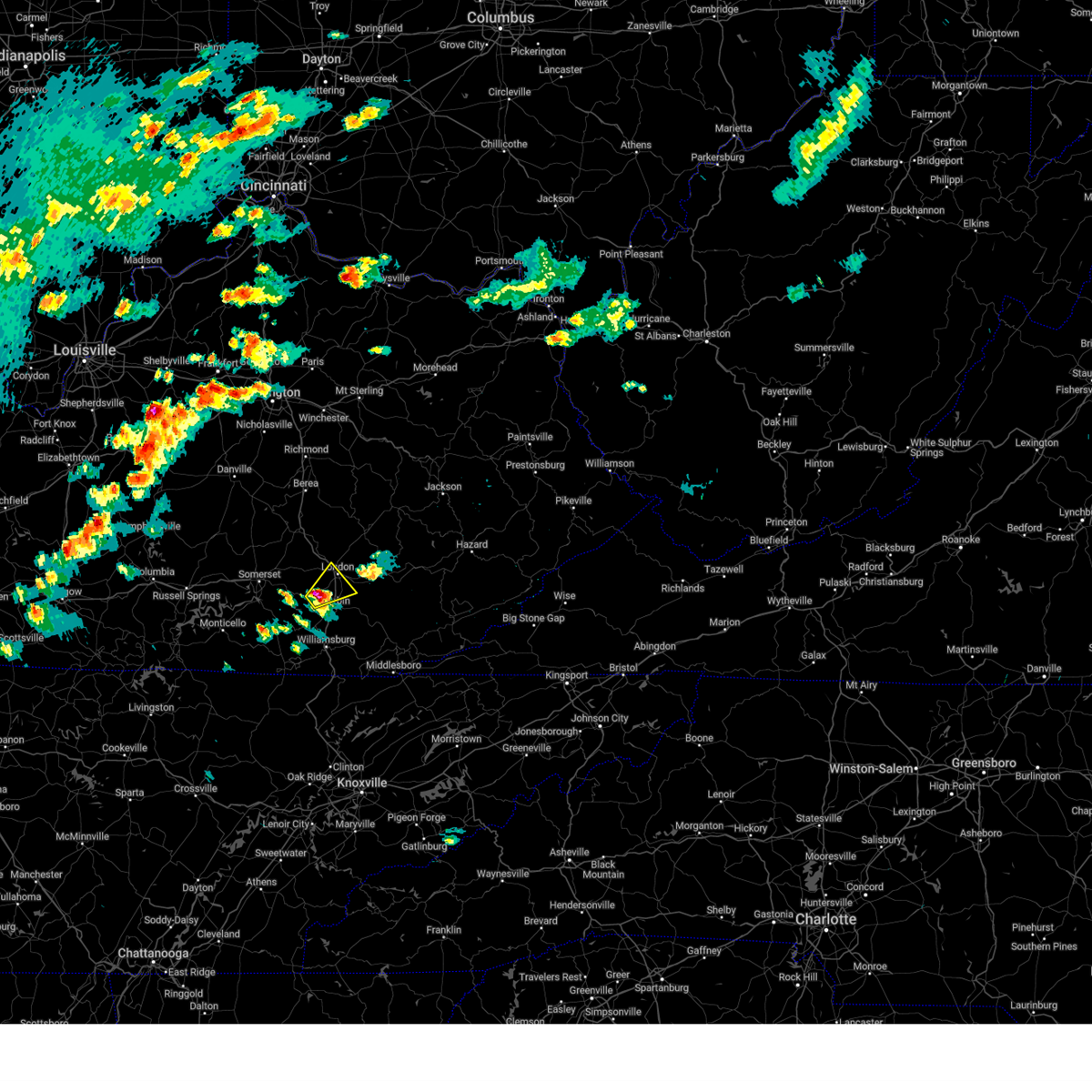
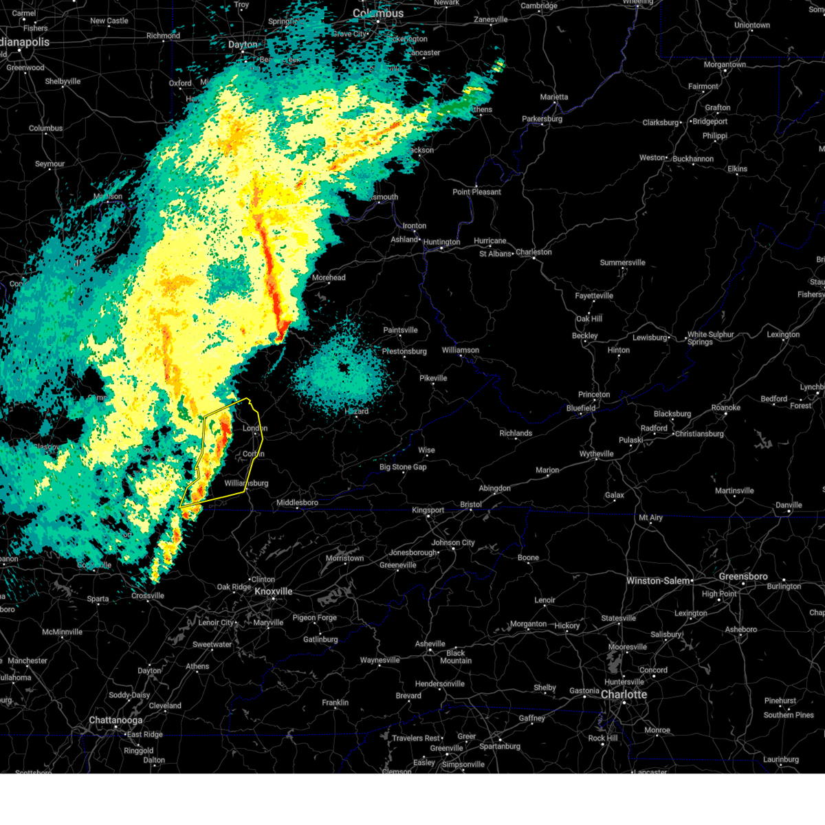
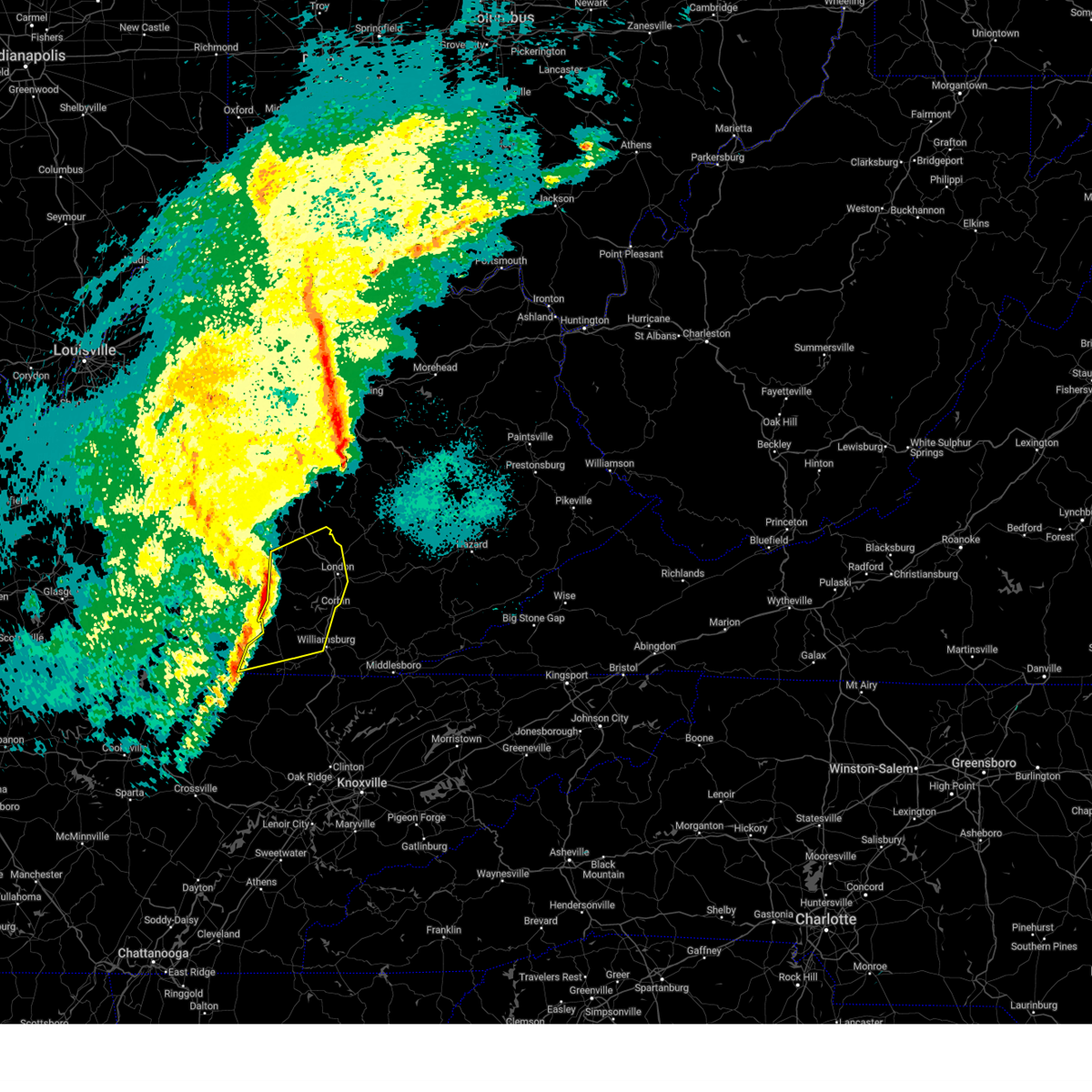
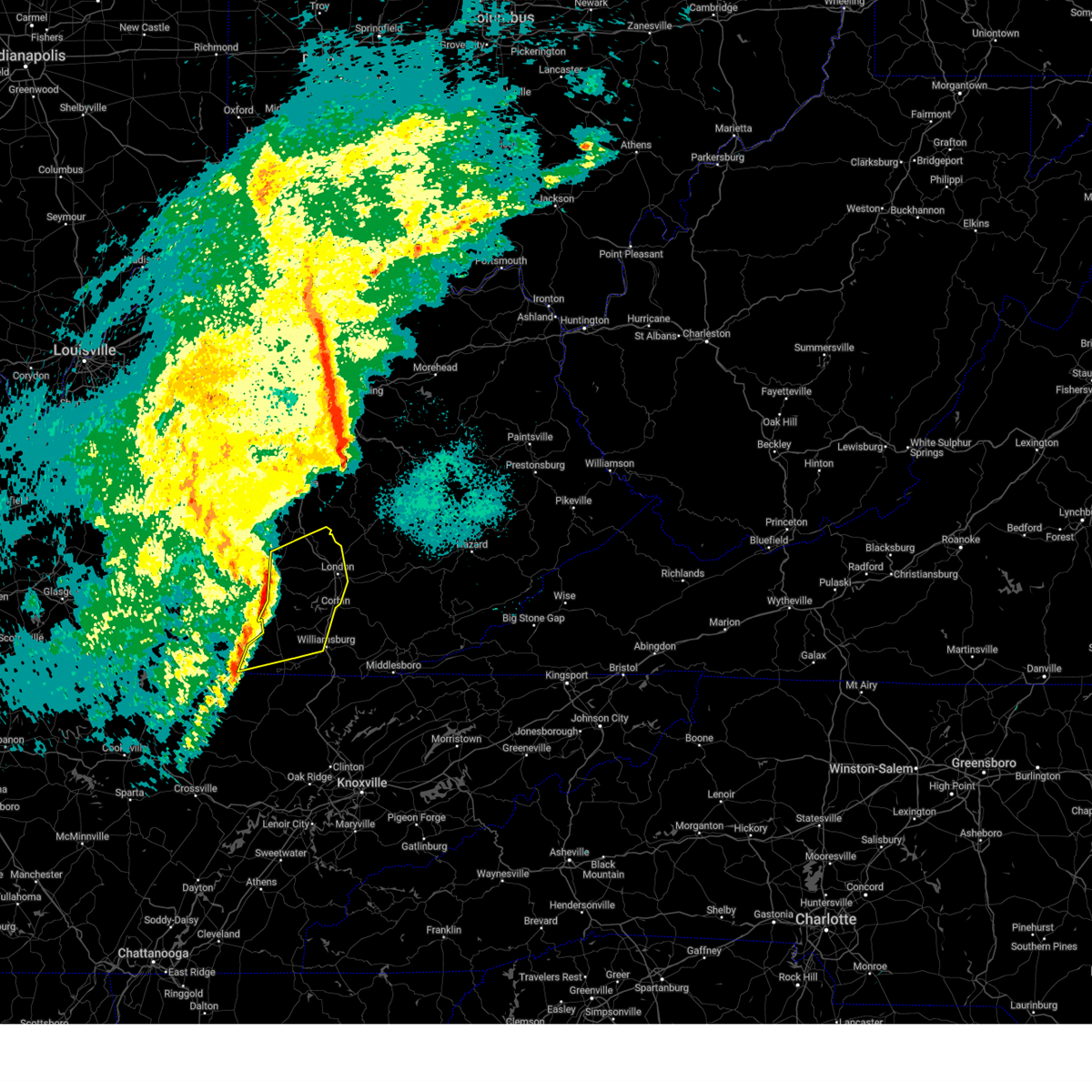
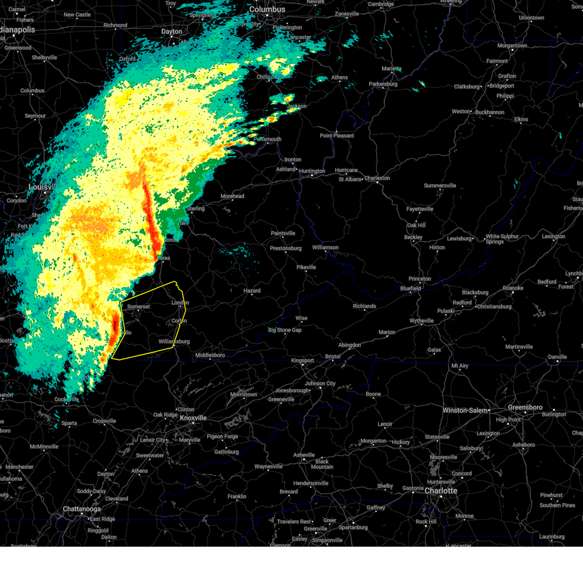
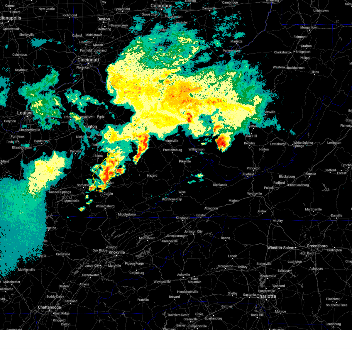
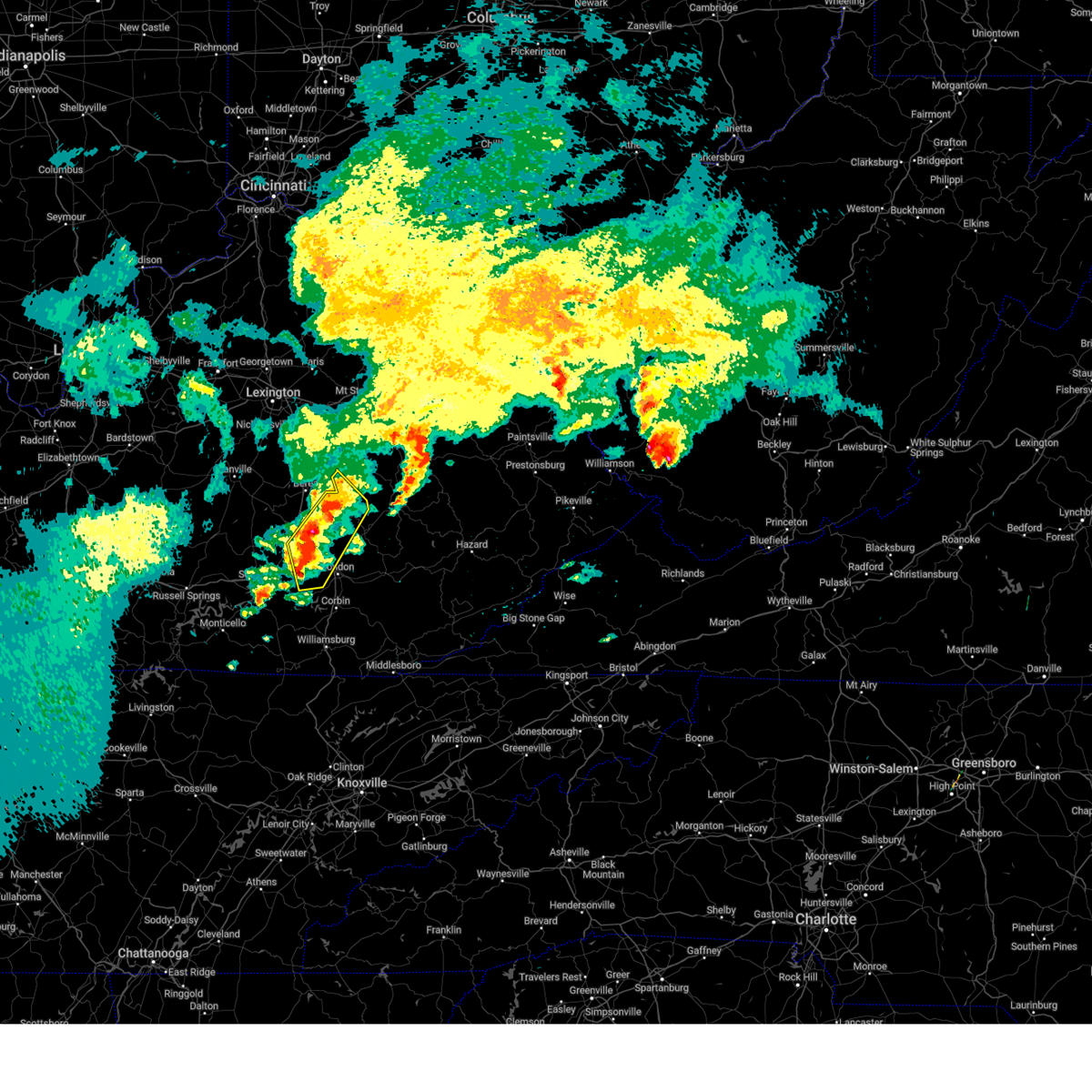
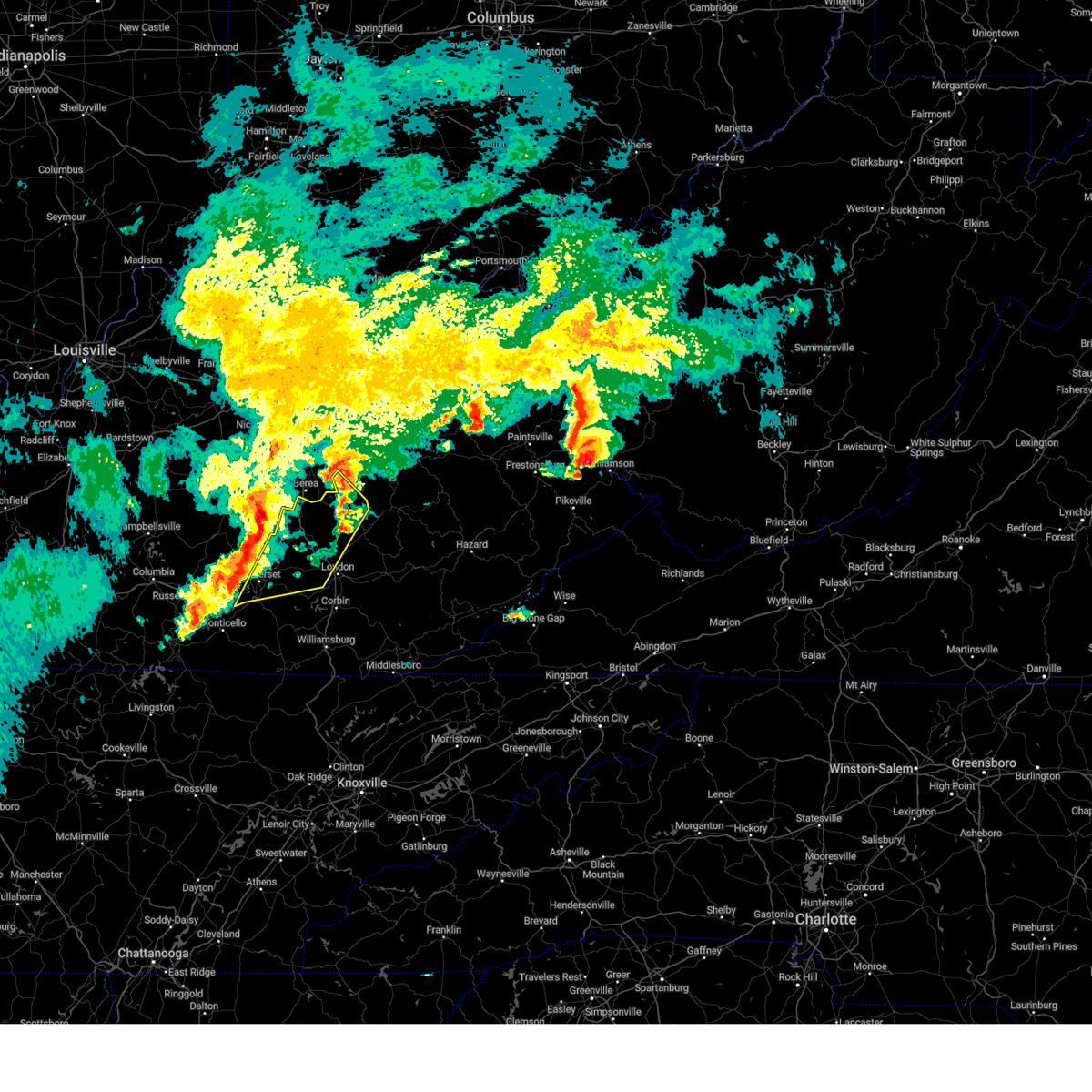
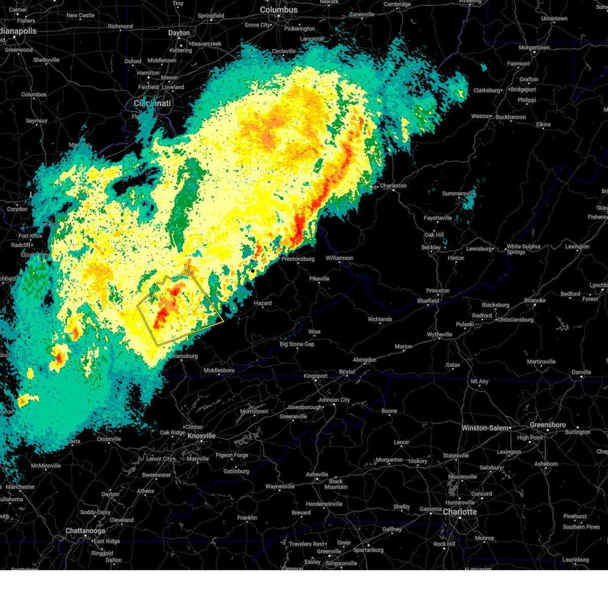
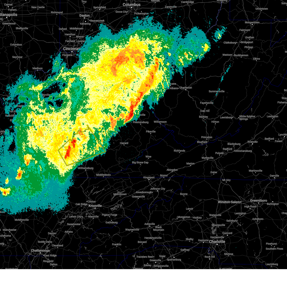
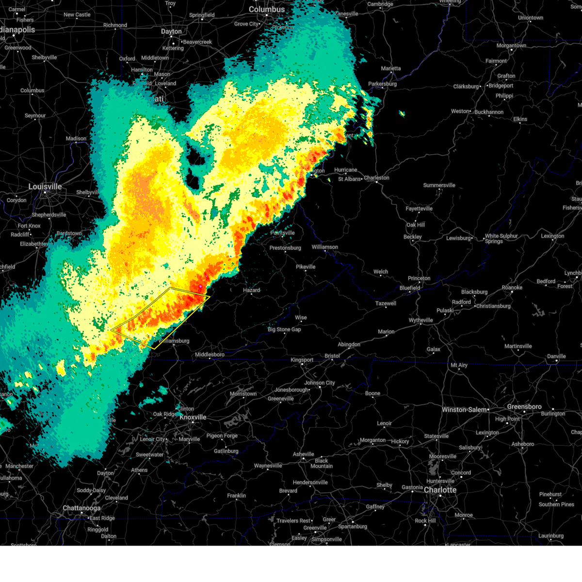
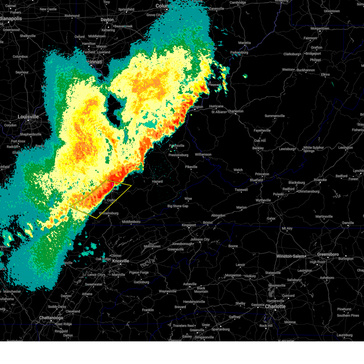
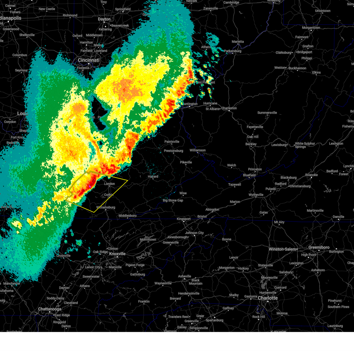
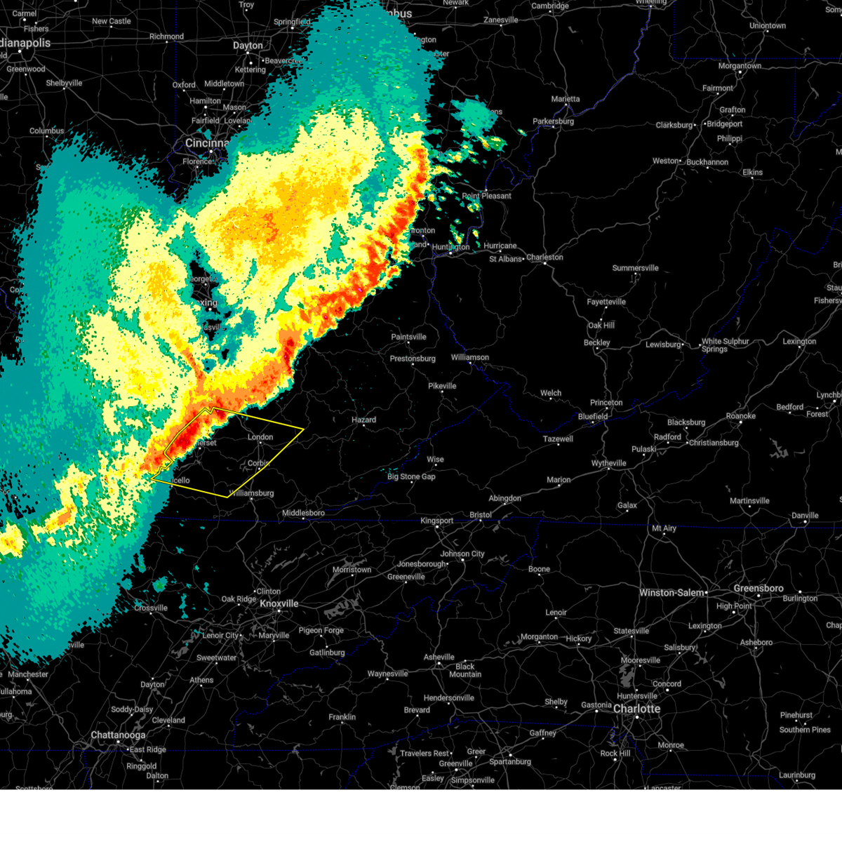
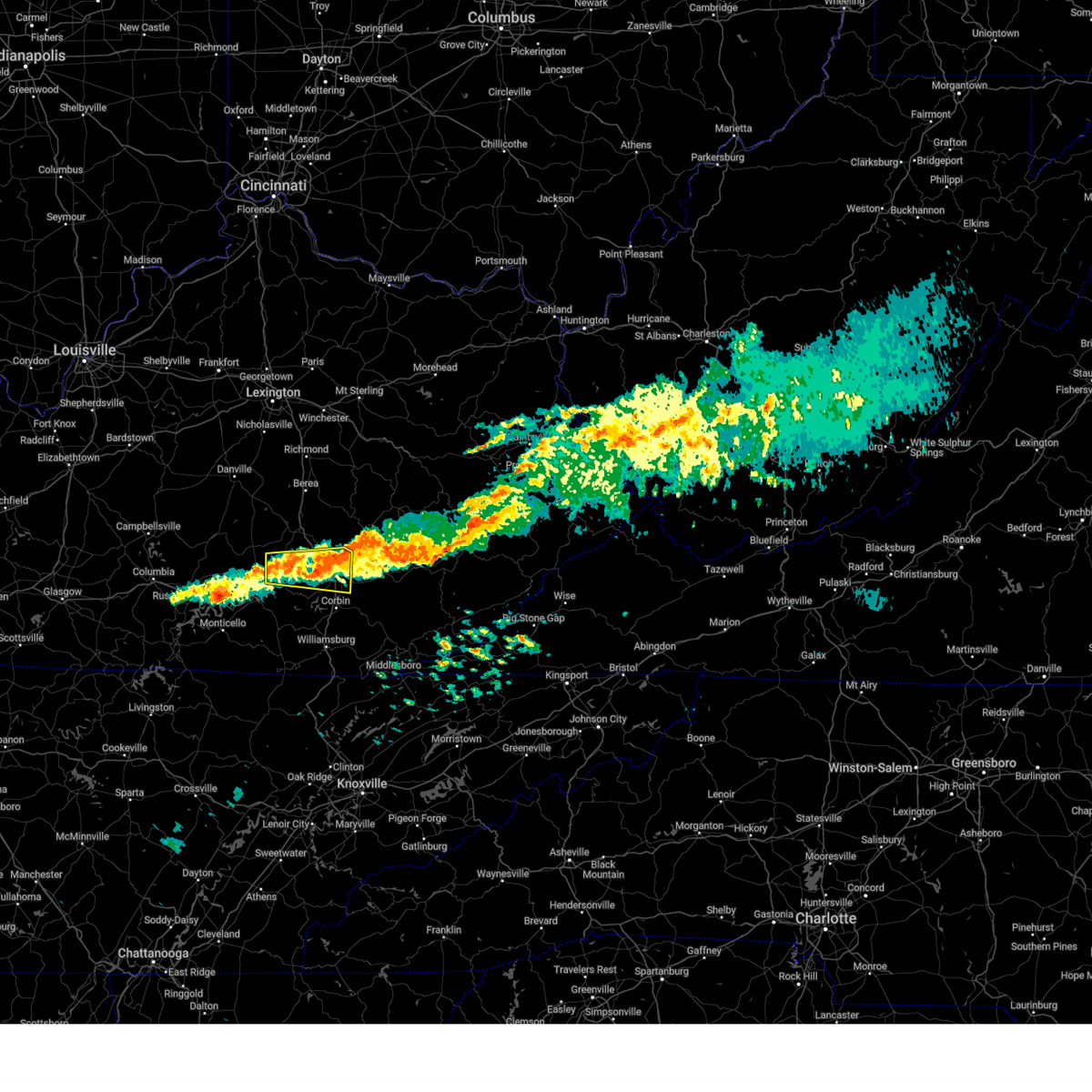
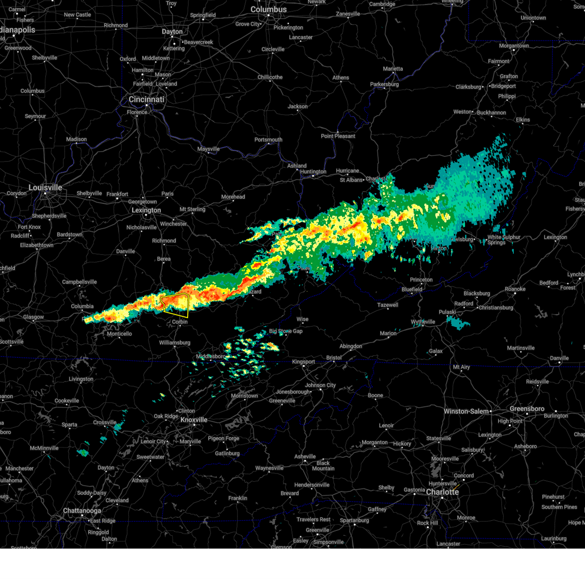
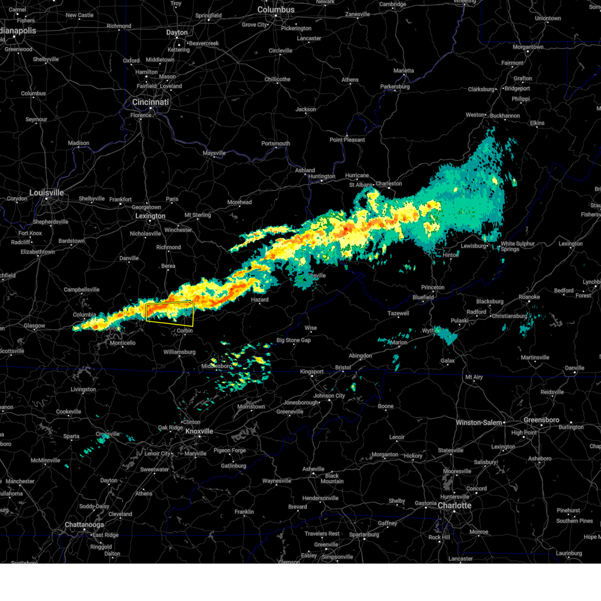
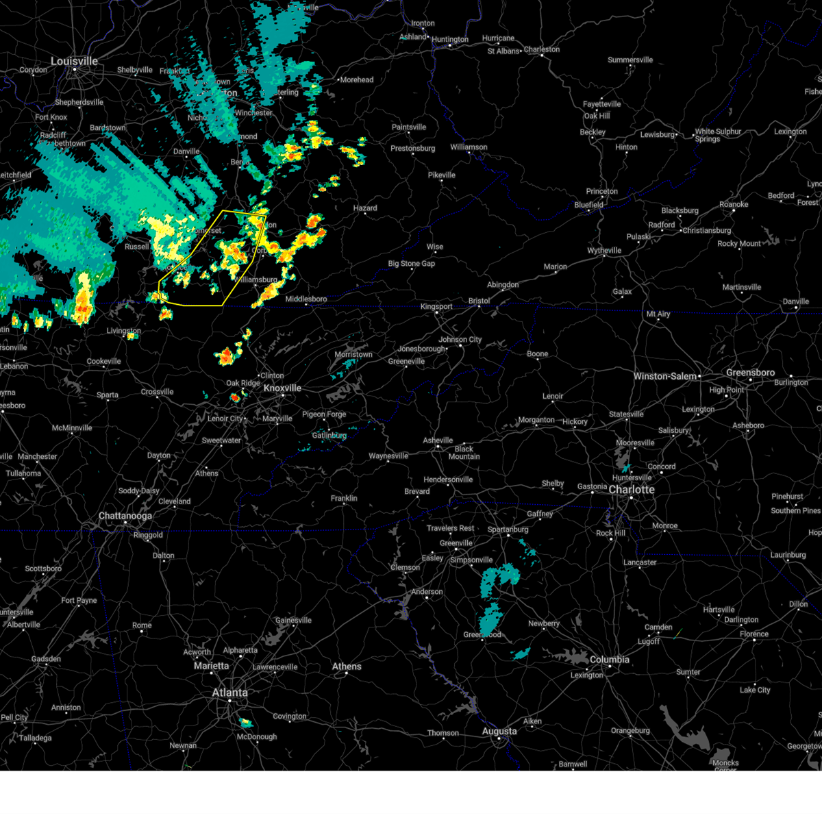
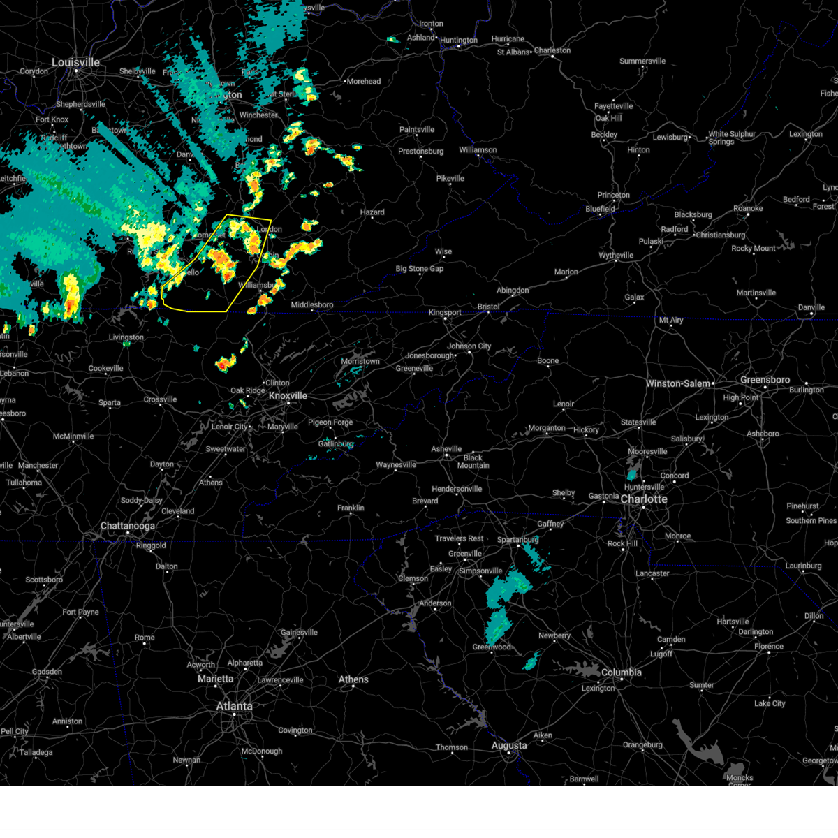
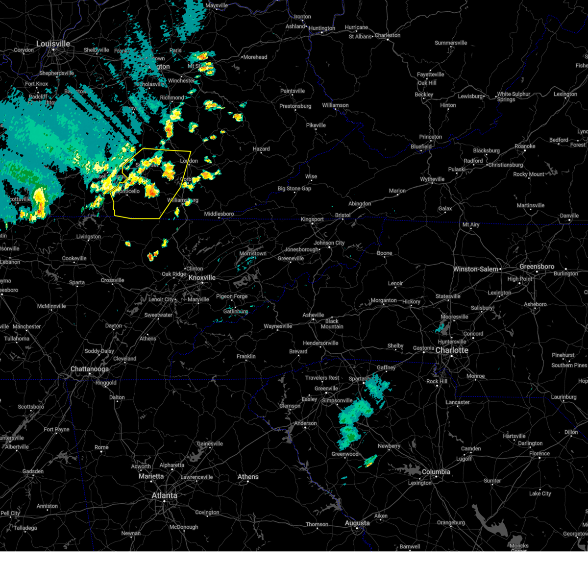
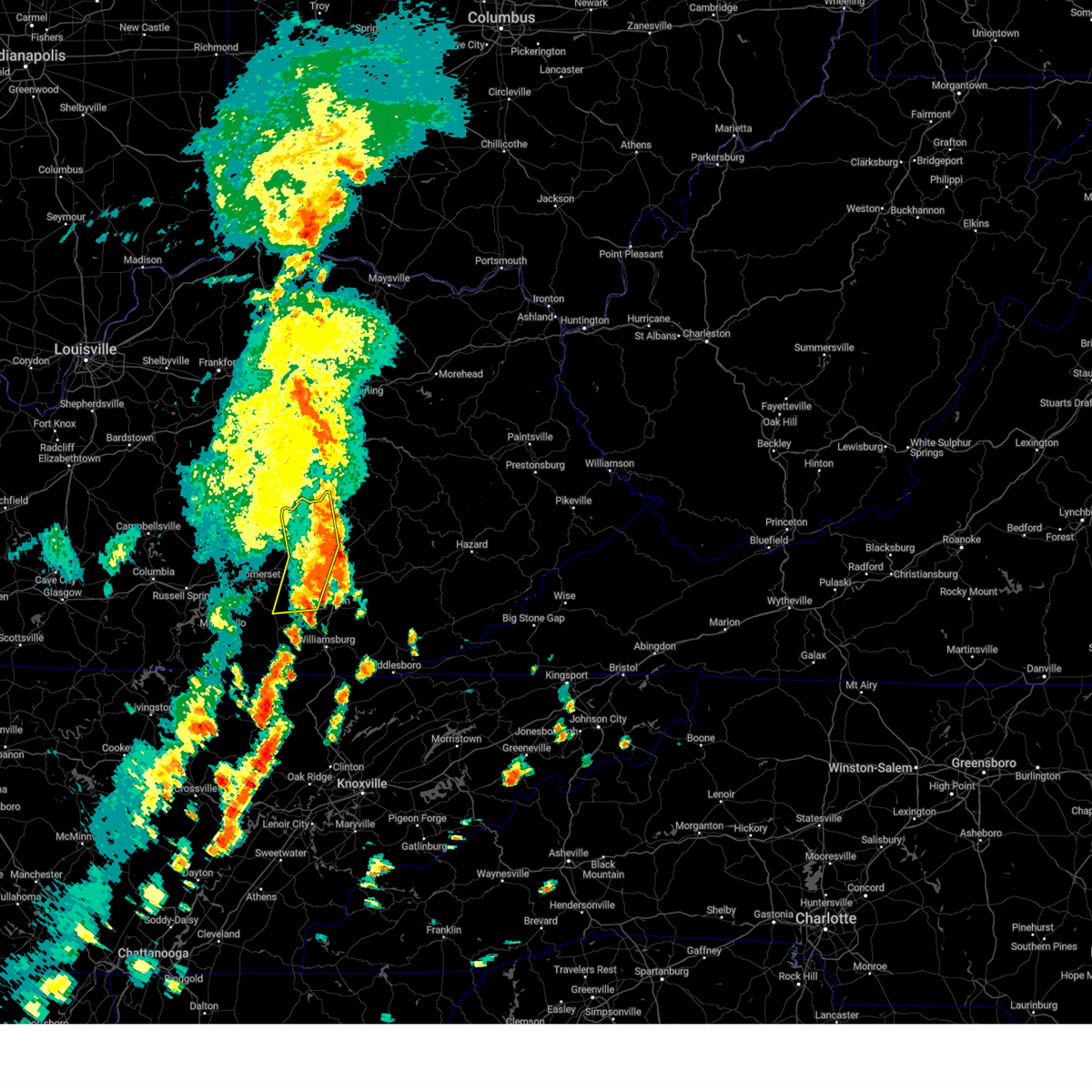
Hail Map for East Bernstadt, KY
The East Bernstadt, KY area has had 3 reports of on-the-ground hail by trained spotters, and has been under severe weather warnings 81 times during the past 12 months. Doppler radar has detected hail at or near East Bernstadt, KY on 30 occasions, including 2 occasions during the past year.
| Name: | East Bernstadt, KY |
| Where Located: | 35.6 miles SSW of Irvine, KY |
| Map: | Google Map for East Bernstadt, KY |
| Population: | 716 |
| Housing Units: | 338 |
| More Info: | Search Google for East Bernstadt, KY |
5
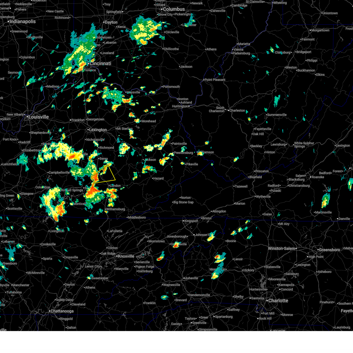
The Top Recent Hail Date for East Bernstadt, KY is Friday, May 16, 2025 (2nd out of 30)
Hail and Wind Damage Spotted near East Bernstadt, KY
| Date / Time | Report Details |
|---|---|
| 6/17/2025 3:15 PM EDT |
 Svrjkl the national weather service in jackson ky has issued a * severe thunderstorm warning for, northern laurel county in south central kentucky, northeastern pulaski county in south central kentucky, southwestern jackson county in southeastern kentucky, southern rockcastle county in south central kentucky, * until 345 pm edt. * at 315 pm edt, a severe thunderstorm was located over bloss, or 9 miles south of mount vernon, moving northeast at 25 mph (radar indicated). Hazards include 60 mph wind gusts. Expect damage to roofs, siding, and trees. this severe thunderstorm will be near, pongo around 320 pm edt. camp wildcat around 325 pm edt. gauley around 330 pm edt. pine hill around 335 pm edt. Other locations in the path of this severe thunderstorm include jep hill. Svrjkl the national weather service in jackson ky has issued a * severe thunderstorm warning for, northern laurel county in south central kentucky, northeastern pulaski county in south central kentucky, southwestern jackson county in southeastern kentucky, southern rockcastle county in south central kentucky, * until 345 pm edt. * at 315 pm edt, a severe thunderstorm was located over bloss, or 9 miles south of mount vernon, moving northeast at 25 mph (radar indicated). Hazards include 60 mph wind gusts. Expect damage to roofs, siding, and trees. this severe thunderstorm will be near, pongo around 320 pm edt. camp wildcat around 325 pm edt. gauley around 330 pm edt. pine hill around 335 pm edt. Other locations in the path of this severe thunderstorm include jep hill.
|
| 6/9/2025 3:08 PM EDT |
 Svrjkl the national weather service in jackson ky has issued a * severe thunderstorm warning for, northeastern laurel county in south central kentucky, northwestern owsley county in southeastern kentucky, southeastern estill county in east central kentucky, jackson county in southeastern kentucky, southwestern lee county in southeastern kentucky, northwestern clay county in southeastern kentucky, * until 345 pm edt. * at 308 pm edt, severe thunderstorms were located along a line extending from loam to parrot to near victory, moving northeast at 35 mph (radar indicated). Hazards include 60 mph wind gusts and quarter size hail. Hail damage to vehicles is expected. expect wind damage to roofs, siding, and trees. severe thunderstorms will be near, mckee around 315 pm edt. new zion around 320 pm edt. arvel around 325 pm edt. Other locations in the path of these severe thunderstorms include travellers rest. Svrjkl the national weather service in jackson ky has issued a * severe thunderstorm warning for, northeastern laurel county in south central kentucky, northwestern owsley county in southeastern kentucky, southeastern estill county in east central kentucky, jackson county in southeastern kentucky, southwestern lee county in southeastern kentucky, northwestern clay county in southeastern kentucky, * until 345 pm edt. * at 308 pm edt, severe thunderstorms were located along a line extending from loam to parrot to near victory, moving northeast at 35 mph (radar indicated). Hazards include 60 mph wind gusts and quarter size hail. Hail damage to vehicles is expected. expect wind damage to roofs, siding, and trees. severe thunderstorms will be near, mckee around 315 pm edt. new zion around 320 pm edt. arvel around 325 pm edt. Other locations in the path of these severe thunderstorms include travellers rest.
|
| 6/6/2025 4:10 PM EDT |
 The storm which prompted the warning has weakened below severe limits, and no longer poses an immediate threat to life or property. therefore, the warning will be allowed to expire. however, small hail and gusty winds are still possible with this thunderstorm. a severe thunderstorm watch remains in effect until 700 pm edt for south central and southeastern kentucky. The storm which prompted the warning has weakened below severe limits, and no longer poses an immediate threat to life or property. therefore, the warning will be allowed to expire. however, small hail and gusty winds are still possible with this thunderstorm. a severe thunderstorm watch remains in effect until 700 pm edt for south central and southeastern kentucky.
|
| 6/6/2025 4:00 PM EDT |
 the severe thunderstorm warning has been cancelled and is no longer in effect the severe thunderstorm warning has been cancelled and is no longer in effect
|
| 6/6/2025 4:00 PM EDT |
 At 400 pm edt, a severe thunderstorm was located over east bernstadt, or near london, moving east at 25 mph (radar indicated). Hazards include 60 mph wind gusts and quarter size hail. Hail damage to vehicles is expected. expect wind damage to roofs, siding, and trees. This severe storm will be near, london around 405 pm edt. At 400 pm edt, a severe thunderstorm was located over east bernstadt, or near london, moving east at 25 mph (radar indicated). Hazards include 60 mph wind gusts and quarter size hail. Hail damage to vehicles is expected. expect wind damage to roofs, siding, and trees. This severe storm will be near, london around 405 pm edt.
|
| 6/6/2025 3:54 PM EDT | A laurel county deputy reported a downed tree along school street in east bernstadt to the county 911 dispatch. time estimated via rada in laurel county KY, 0.7 miles NW of East Bernstadt, KY |
| 6/6/2025 3:46 PM EDT |
 Svrjkl the national weather service in jackson ky has issued a * severe thunderstorm warning for, central laurel county in south central kentucky, east central pulaski county in south central kentucky, southwestern jackson county in southeastern kentucky, south central rockcastle county in south central kentucky, * until 415 pm edt. * at 345 pm edt, a severe thunderstorm was located over bernstadt, or 9 miles west of london, moving east at 25 mph (radar indicated). Hazards include 60 mph wind gusts and quarter size hail. Hail damage to vehicles is expected. expect wind damage to roofs, siding, and trees. this severe thunderstorm will be near, east bernstadt around 350 pm edt. london around 355 pm edt. victory around 400 pm edt. Atlanta around 405 pm edt. Svrjkl the national weather service in jackson ky has issued a * severe thunderstorm warning for, central laurel county in south central kentucky, east central pulaski county in south central kentucky, southwestern jackson county in southeastern kentucky, south central rockcastle county in south central kentucky, * until 415 pm edt. * at 345 pm edt, a severe thunderstorm was located over bernstadt, or 9 miles west of london, moving east at 25 mph (radar indicated). Hazards include 60 mph wind gusts and quarter size hail. Hail damage to vehicles is expected. expect wind damage to roofs, siding, and trees. this severe thunderstorm will be near, east bernstadt around 350 pm edt. london around 355 pm edt. victory around 400 pm edt. Atlanta around 405 pm edt.
|
| 5/20/2025 9:44 PM EDT |
 the severe thunderstorm warning has been cancelled and is no longer in effect the severe thunderstorm warning has been cancelled and is no longer in effect
|
| 5/20/2025 9:44 PM EDT |
 At 943 pm edt, a severe thunderstorm was located over moores creek, or 9 miles south of mckee, moving east at 40 mph (radar indicated). Hazards include 60 mph wind gusts and nickel size hail. Expect damage to roofs, siding, and trees. Locations impacted include, olin, herd, sextons creek, thomas and taff. At 943 pm edt, a severe thunderstorm was located over moores creek, or 9 miles south of mckee, moving east at 40 mph (radar indicated). Hazards include 60 mph wind gusts and nickel size hail. Expect damage to roofs, siding, and trees. Locations impacted include, olin, herd, sextons creek, thomas and taff.
|
| 5/20/2025 9:25 PM EDT |
 Svrjkl the national weather service in jackson ky has issued a * severe thunderstorm warning for, northern laurel county in south central kentucky, central owsley county in southeastern kentucky, east central pulaski county in south central kentucky, southern jackson county in southeastern kentucky, central rockcastle county in south central kentucky, northwestern clay county in southeastern kentucky, * until 1015 pm edt. * at 925 pm edt, a severe thunderstorm was located over camp wildcat, or 9 miles southeast of mount vernon, moving east at 40 mph (radar indicated). Hazards include 60 mph wind gusts and nickel size hail. Expect damage to roofs, siding, and trees. this severe thunderstorm will be near, gauley around 930 pm edt. carico around 935 pm edt. deese around 940 pm edt. royrader around 945 pm edt. Other locations in the path of this severe thunderstorm include tyner and zekes point. Svrjkl the national weather service in jackson ky has issued a * severe thunderstorm warning for, northern laurel county in south central kentucky, central owsley county in southeastern kentucky, east central pulaski county in south central kentucky, southern jackson county in southeastern kentucky, central rockcastle county in south central kentucky, northwestern clay county in southeastern kentucky, * until 1015 pm edt. * at 925 pm edt, a severe thunderstorm was located over camp wildcat, or 9 miles southeast of mount vernon, moving east at 40 mph (radar indicated). Hazards include 60 mph wind gusts and nickel size hail. Expect damage to roofs, siding, and trees. this severe thunderstorm will be near, gauley around 930 pm edt. carico around 935 pm edt. deese around 940 pm edt. royrader around 945 pm edt. Other locations in the path of this severe thunderstorm include tyner and zekes point.
|
| 5/20/2025 3:14 PM EDT |
 However, gusty winds and heavy rain are still possible with these thunderstorms. a tornado watch remains in effect until 800 pm edt for south central, southeastern and east central kentucky. However, gusty winds and heavy rain are still possible with these thunderstorms. a tornado watch remains in effect until 800 pm edt for south central, southeastern and east central kentucky.
|
| 5/20/2025 2:55 PM EDT |
 At 254 pm edt, severe thunderstorms were located along a line extending from sandgap to near maplesville to zion hill, moving east at 35 mph (radar indicated). Hazards include 60 mph wind gusts and quarter size hail. Hail damage to vehicles is expected. expect wind damage to roofs, siding, and trees. Locations impacted include, london, blackwater, barbourville, manchester and brush creek. At 254 pm edt, severe thunderstorms were located along a line extending from sandgap to near maplesville to zion hill, moving east at 35 mph (radar indicated). Hazards include 60 mph wind gusts and quarter size hail. Hail damage to vehicles is expected. expect wind damage to roofs, siding, and trees. Locations impacted include, london, blackwater, barbourville, manchester and brush creek.
|
| 5/20/2025 2:55 PM EDT |
 the severe thunderstorm warning has been cancelled and is no longer in effect the severe thunderstorm warning has been cancelled and is no longer in effect
|
| 5/20/2025 2:37 PM EDT |
 Svrjkl the national weather service in jackson ky has issued a * severe thunderstorm warning for, laurel county in south central kentucky, southwestern bell county in southeastern kentucky, knox county in southeastern kentucky, west central owsley county in southeastern kentucky, southeastern pulaski county in south central kentucky, jackson county in southeastern kentucky, eastern mccreary county in south central kentucky, rockcastle county in south central kentucky, whitley county in south central kentucky, southwestern lee county in southeastern kentucky, western clay county in southeastern kentucky, * until 315 pm edt. * at 237 pm edt, severe thunderstorms were located along a line extending from near hiatt to near billows to near strunk, moving east at 30 mph (radar indicated). Hazards include 60 mph wind gusts and quarter size hail. Hail damage to vehicles is expected. expect wind damage to roofs, siding, and trees. severe thunderstorms will be near, mount vernon around 240 pm edt. london around 245 pm edt. faber around 250 pm edt. carico around 255 pm edt. Other locations in the path of these severe thunderstorms include julip and lot. Svrjkl the national weather service in jackson ky has issued a * severe thunderstorm warning for, laurel county in south central kentucky, southwestern bell county in southeastern kentucky, knox county in southeastern kentucky, west central owsley county in southeastern kentucky, southeastern pulaski county in south central kentucky, jackson county in southeastern kentucky, eastern mccreary county in south central kentucky, rockcastle county in south central kentucky, whitley county in south central kentucky, southwestern lee county in southeastern kentucky, western clay county in southeastern kentucky, * until 315 pm edt. * at 237 pm edt, severe thunderstorms were located along a line extending from near hiatt to near billows to near strunk, moving east at 30 mph (radar indicated). Hazards include 60 mph wind gusts and quarter size hail. Hail damage to vehicles is expected. expect wind damage to roofs, siding, and trees. severe thunderstorms will be near, mount vernon around 240 pm edt. london around 245 pm edt. faber around 250 pm edt. carico around 255 pm edt. Other locations in the path of these severe thunderstorms include julip and lot.
|
| 5/17/2025 1:01 AM EDT |
 The storms which prompted the warning have weakened below severe limits, and have exited the warned area. therefore, the warning has been allowed to expire. however, gusty winds and heavy rain are still possible with these thunderstorms. a tornado watch remains in effect until 300 am edt for south central and southeastern kentucky. to report severe weather, contact your nearest law enforcement agency. they will relay your report to the national weather service jackson ky. The storms which prompted the warning have weakened below severe limits, and have exited the warned area. therefore, the warning has been allowed to expire. however, gusty winds and heavy rain are still possible with these thunderstorms. a tornado watch remains in effect until 300 am edt for south central and southeastern kentucky. to report severe weather, contact your nearest law enforcement agency. they will relay your report to the national weather service jackson ky.
|
| 5/17/2025 12:54 AM EDT |
 The storm which prompted the warning has moved out of the area. therefore, the warning will be allowed to expire. a tornado watch remains in effect until 300 am edt for south central and southeastern kentucky. The storm which prompted the warning has moved out of the area. therefore, the warning will be allowed to expire. a tornado watch remains in effect until 300 am edt for south central and southeastern kentucky.
|
| 5/17/2025 12:54 AM EDT |
 the severe thunderstorm warning has been cancelled and is no longer in effect the severe thunderstorm warning has been cancelled and is no longer in effect
|
| 5/17/2025 12:54 AM EDT |
 At 1253 am edt, severe thunderstorms were located along a line extending from hurley to near great meadows campsites, moving east at 65 mph (radar indicated). Hazards include 60 mph wind gusts and penny size hail. Expect damage to roofs, siding, and trees. locations impacted include, london, whitley city, fariston, pittsburg, cumberland falls s. p. Co- operative, mount victory, north corbin, krupp, hightop, hollyhill, and youngs creek. At 1253 am edt, severe thunderstorms were located along a line extending from hurley to near great meadows campsites, moving east at 65 mph (radar indicated). Hazards include 60 mph wind gusts and penny size hail. Expect damage to roofs, siding, and trees. locations impacted include, london, whitley city, fariston, pittsburg, cumberland falls s. p. Co- operative, mount victory, north corbin, krupp, hightop, hollyhill, and youngs creek.
|
| 5/17/2025 12:44 AM EDT | At 1243 am edt, severe thunderstorms were located along a line extending from johnetta to near mount pisgah, moving east at 65 mph (radar indicated). Hazards include 70 mph wind gusts and penny size hail. Expect considerable tree damage. damage is likely to mobile homes, roofs, and outbuildings. locations impacted include, great meadows campsites, london, levi jackson s. p. And faber. |
| 5/17/2025 12:41 AM EDT | the tornado warning has been cancelled and is no longer in effect |
| 5/17/2025 12:41 AM EDT | At 1241 am edt, a severe thunderstorm capable of producing a tornado was located over deer lick, or near london, moving east at 40 mph (radar indicated rotation). Hazards include tornado and two inch hail. Flying debris will be dangerous to those caught without shelter. mobile homes will be damaged or destroyed. damage to roofs, windows, and vehicles will occur. tree damage is likely. Locations impacted include, london, manchester, grace, fariston, pittsburg, lake, cane creek, fogertown, treadway, goose rock, bush, and chestnutburg. |
| 5/17/2025 12:31 AM EDT | At 1231 am edt, a severe thunderstorm capable of producing a tornado was located over london, moving east at 40 mph (radar indicated rotation). Hazards include tornado and two inch hail. Flying debris will be dangerous to those caught without shelter. mobile homes will be damaged or destroyed. damage to roofs, windows, and vehicles will occur. tree damage is likely. Locations impacted include, london, byron, grace, manchester, fall rock and mill pond. |
| 5/17/2025 12:19 AM EDT | Svrjkl the national weather service in jackson ky has issued a * severe thunderstorm warning for, wayne county in south central kentucky, laurel county in south central kentucky, pulaski county in south central kentucky, mccreary county in south central kentucky, south central rockcastle county in south central kentucky, northwestern whitley county in south central kentucky, * until 100 am edt. * at 1219 am edt, severe thunderstorms were located along a line extending from 8 miles south of stanford to 10 miles northwest of byrdstown, moving east at 65 mph (radar indicated). Hazards include 70 mph wind gusts and penny size hail. Expect considerable tree damage. damage is likely to mobile homes, roofs, and outbuildings. severe thunderstorms will be near, somerset around 1225 am edt. slickford around 1230 am edt. burnside around 1235 am edt. Other locations in the path of these severe thunderstorms include alpine, great meadows campsites and whitley city. |
| 5/17/2025 12:12 AM EDT |
 At 1211 am edt, a confirmed large and extremely dangerous tornado was located near billows, or 11 miles west of london, moving east at 40 mph. this is a particularly dangerous situation. take cover now! (radar confirmed tornado). Hazards include damaging tornado. You are in a life-threatening situation. flying debris may be deadly to those caught without shelter. mobile homes will be destroyed. considerable damage to homes, businesses, and vehicles is likely and complete destruction is possible. the tornado will be near, bunch around 1215 am edt. london around 1220 am edt. sublimity city around 1225 am edt. Other locations in the path of this tornadic thunderstorm include maplesville, langnau and grace. At 1211 am edt, a confirmed large and extremely dangerous tornado was located near billows, or 11 miles west of london, moving east at 40 mph. this is a particularly dangerous situation. take cover now! (radar confirmed tornado). Hazards include damaging tornado. You are in a life-threatening situation. flying debris may be deadly to those caught without shelter. mobile homes will be destroyed. considerable damage to homes, businesses, and vehicles is likely and complete destruction is possible. the tornado will be near, bunch around 1215 am edt. london around 1220 am edt. sublimity city around 1225 am edt. Other locations in the path of this tornadic thunderstorm include maplesville, langnau and grace.
|
| 5/17/2025 12:07 AM EDT |
 Torjkl the national weather service in jackson ky has issued a * tornado warning for, laurel county in south central kentucky, east central pulaski county in south central kentucky, south central jackson county in southeastern kentucky, south central rockcastle county in south central kentucky, northwestern clay county in southeastern kentucky, * until 100 am edt. * at 1207 am edt, a severe thunderstorm capable of producing a tornado was located near bent, or 13 miles east of somerset, moving east at 40 mph (radar indicated rotation). Hazards include tornado and quarter size hail. Flying debris will be dangerous to those caught without shelter. mobile homes will be damaged or destroyed. damage to roofs, windows, and vehicles will occur. tree damage is likely. this dangerous storm will be near, bunch around 1215 am edt. london around 1220 am edt. east bernstadt around 1225 am edt. Other locations in the path of this tornadic thunderstorm include maplesville, langnau and marydell. Torjkl the national weather service in jackson ky has issued a * tornado warning for, laurel county in south central kentucky, east central pulaski county in south central kentucky, south central jackson county in southeastern kentucky, south central rockcastle county in south central kentucky, northwestern clay county in southeastern kentucky, * until 100 am edt. * at 1207 am edt, a severe thunderstorm capable of producing a tornado was located near bent, or 13 miles east of somerset, moving east at 40 mph (radar indicated rotation). Hazards include tornado and quarter size hail. Flying debris will be dangerous to those caught without shelter. mobile homes will be damaged or destroyed. damage to roofs, windows, and vehicles will occur. tree damage is likely. this dangerous storm will be near, bunch around 1215 am edt. london around 1220 am edt. east bernstadt around 1225 am edt. Other locations in the path of this tornadic thunderstorm include maplesville, langnau and marydell.
|
| 5/17/2025 12:00 AM EDT | At 1200 am edt, severe thunderstorms were located along a line extending from rosslyn to mill springs, moving east at 35 mph (radar indicated). Hazards include 60 mph wind gusts and penny size hail. Expect damage to roofs, siding, and trees. Locations impacted include, somerset, lakes, mckee, new zion, beattyville and london. |
| 5/16/2025 11:51 PM EDT |
 The storm which prompted the warning has moved out of the area. therefore, the warning will be allowed to expire. a tornado watch remains in effect until 300 am edt for south central and southeastern kentucky. The storm which prompted the warning has moved out of the area. therefore, the warning will be allowed to expire. a tornado watch remains in effect until 300 am edt for south central and southeastern kentucky.
|
| 5/16/2025 11:42 PM EDT | Torjkl the national weather service in jackson ky has issued a * tornado warning for, laurel county in south central kentucky, northern knox county in southeastern kentucky, west central leslie county in southeastern kentucky, southeastern owsley county in southeastern kentucky, clay county in southeastern kentucky, * until 1230 am edt. * at 1142 pm edt, a confirmed large and extremely dangerous tornado was located over sublimity city, or near london, moving east at 45 mph. this is a particularly dangerous situation. take cover now! (radar confirmed tornado). Hazards include damaging tornado. You are in a life-threatening situation. flying debris may be deadly to those caught without shelter. mobile homes will be destroyed. considerable damage to homes, businesses, and vehicles is likely and complete destruction is possible. the tornado will be near, london around 1145 pm edt. cane creek around 1150 pm edt. blackwater around 1155 pm edt. manchester around 1200 am edt. Other locations in the path of this tornadic thunderstorm include house and hector. |
| 5/16/2025 11:35 PM EDT | Svrjkl the national weather service in jackson ky has issued a * severe thunderstorm warning for, powell county in east central kentucky, laurel county in south central kentucky, owsley county in southeastern kentucky, estill county in east central kentucky, pulaski county in south central kentucky, jackson county in southeastern kentucky, rockcastle county in south central kentucky, northwestern breathitt county in southeastern kentucky, lee county in southeastern kentucky, wolfe county in southeastern kentucky, northwestern clay county in southeastern kentucky, * until 1215 am edt. * at 1135 pm edt, severe thunderstorms were located along a line extending from palmer to near jamestown, moving east at 35 mph (radar indicated). Hazards include 60 mph wind gusts and penny size hail. Expect damage to roofs, siding, and trees. severe thunderstorms will be near, mount vernon around 1140 pm edt. somerset around 1145 pm edt. ravenna around 1150 pm edt. burnside around 1155 pm edt. Other locations in the path of these severe thunderstorms include jep hill and grade. |
| 5/16/2025 11:34 PM EDT | At 1134 pm edt, a confirmed large and extremely dangerous tornado was located over bunch, or near london, moving east at 40 mph. this is a particularly dangerous situation. take cover now! (radar confirmed tornado). Hazards include damaging tornado. You are in a life-threatening situation. flying debris may be deadly to those caught without shelter. mobile homes will be destroyed. considerable damage to homes, businesses, and vehicles is likely and complete destruction is possible. Locations impacted include, london, lesbas and lida. |
| 5/16/2025 11:18 PM EDT | At 1118 pm edt, a confirmed large and extremely dangerous tornado was located near mount victory, or 13 miles east of somerset, moving east at 45 mph. this is a particularly dangerous situation. take cover now! (radar confirmed tornado). Hazards include damaging tornado. You are in a life-threatening situation. flying debris may be deadly to those caught without shelter. mobile homes will be destroyed. considerable damage to homes, businesses, and vehicles is likely and complete destruction is possible. the tornado will be near, bunch around 1125 pm edt. other locations in the path of this tornadic thunderstorm include bernstadt, london, levi jackson s. p. And lida. |
| 5/16/2025 11:07 PM EDT |
 Torjkl the national weather service in jackson ky has issued a * tornado warning for, laurel county in south central kentucky, northwestern knox county in southeastern kentucky, east central pulaski county in south central kentucky, south central rockcastle county in south central kentucky, * until midnight edt. * at 1107 pm edt, a confirmed large and extremely dangerous tornado was located over ruth, or near somerset, moving east at 45 mph. this is a particularly dangerous situation. take cover now! (weather spotters confirmed tornado). Hazards include damaging tornado. You are in a life-threatening situation. flying debris may be deadly to those caught without shelter. mobile homes will be destroyed. considerable damage to homes, businesses, and vehicles is likely and complete destruction is possible. the tornado will be near, mount victory around 1115 pm edt. bunch around 1125 pm edt. other locations in the path of this tornadic thunderstorm include london, levi jackson s. p. And lesbas. Torjkl the national weather service in jackson ky has issued a * tornado warning for, laurel county in south central kentucky, northwestern knox county in southeastern kentucky, east central pulaski county in south central kentucky, south central rockcastle county in south central kentucky, * until midnight edt. * at 1107 pm edt, a confirmed large and extremely dangerous tornado was located over ruth, or near somerset, moving east at 45 mph. this is a particularly dangerous situation. take cover now! (weather spotters confirmed tornado). Hazards include damaging tornado. You are in a life-threatening situation. flying debris may be deadly to those caught without shelter. mobile homes will be destroyed. considerable damage to homes, businesses, and vehicles is likely and complete destruction is possible. the tornado will be near, mount victory around 1115 pm edt. bunch around 1125 pm edt. other locations in the path of this tornadic thunderstorm include london, levi jackson s. p. And lesbas.
|
| 5/16/2025 1:14 PM EDT |
 Svrjkl the national weather service in jackson ky has issued a * severe thunderstorm warning for, northeastern laurel county in south central kentucky, northwestern leslie county in southeastern kentucky, southern owsley county in southeastern kentucky, northwestern perry county in southeastern kentucky, southern jackson county in southeastern kentucky, southwestern breathitt county in southeastern kentucky, clay county in southeastern kentucky, * until 145 pm edt. * at 114 pm edt, a severe thunderstorm was located over crawford, or 9 miles west of manchester, moving east at 70 mph (radar indicated). Hazards include 60 mph wind gusts and quarter size hail. Hail damage to vehicles is expected. expect wind damage to roofs, siding, and trees. this severe thunderstorm will be near, manchester around 120 pm edt. seth around 125 pm edt. sizerock around 130 pm edt. Other locations in the path of this severe thunderstorm include dryhill and toulouse. Svrjkl the national weather service in jackson ky has issued a * severe thunderstorm warning for, northeastern laurel county in south central kentucky, northwestern leslie county in southeastern kentucky, southern owsley county in southeastern kentucky, northwestern perry county in southeastern kentucky, southern jackson county in southeastern kentucky, southwestern breathitt county in southeastern kentucky, clay county in southeastern kentucky, * until 145 pm edt. * at 114 pm edt, a severe thunderstorm was located over crawford, or 9 miles west of manchester, moving east at 70 mph (radar indicated). Hazards include 60 mph wind gusts and quarter size hail. Hail damage to vehicles is expected. expect wind damage to roofs, siding, and trees. this severe thunderstorm will be near, manchester around 120 pm edt. seth around 125 pm edt. sizerock around 130 pm edt. Other locations in the path of this severe thunderstorm include dryhill and toulouse.
|
| 5/16/2025 1:07 PM EDT |
 the severe thunderstorm warning has been cancelled and is no longer in effect the severe thunderstorm warning has been cancelled and is no longer in effect
|
| 5/16/2025 1:07 PM EDT |
 At 106 pm edt, a severe thunderstorm was located over maplesville, or near london, moving east at 85 mph (radar indicated). Hazards include 60 mph wind gusts and quarter size hail. Hail damage to vehicles is expected. expect wind damage to roofs, siding, and trees. Locations impacted include, grace and fall rock. At 106 pm edt, a severe thunderstorm was located over maplesville, or near london, moving east at 85 mph (radar indicated). Hazards include 60 mph wind gusts and quarter size hail. Hail damage to vehicles is expected. expect wind damage to roofs, siding, and trees. Locations impacted include, grace and fall rock.
|
| 5/16/2025 12:57 PM EDT |
 The storm which prompted the warning has expired. a new severe thunderstorm warning has replaced the expired warning for some counties. a severe thunderstorm watch remains in effect until 600 pm edt for south central and southeastern kentucky. to report severe weather, contact your nearest law enforcement agency. they will relay your report to the national weather service jackson ky. The storm which prompted the warning has expired. a new severe thunderstorm warning has replaced the expired warning for some counties. a severe thunderstorm watch remains in effect until 600 pm edt for south central and southeastern kentucky. to report severe weather, contact your nearest law enforcement agency. they will relay your report to the national weather service jackson ky.
|
| 5/16/2025 12:55 PM EDT | Svrjkl the national weather service in jackson ky has issued a * severe thunderstorm warning for, northeastern laurel county in south central kentucky, owsley county in southeastern kentucky, southern jackson county in southeastern kentucky, east central rockcastle county in south central kentucky, northwestern clay county in southeastern kentucky, * until 130 pm edt. * at 1254 pm edt, a severe thunderstorm was located over deese, or 7 miles south of mckee, moving east at 55 mph (radar indicated). Hazards include 60 mph wind gusts and quarter size hail. Hail damage to vehicles is expected. expect wind damage to roofs, siding, and trees. this severe thunderstorm will be near, atkinstown around 100 pm edt. sturgeon around 105 pm edt. taff around 110 pm edt. Other locations in the path of this severe thunderstorm include booneville and arnett. |
| 5/16/2025 12:47 PM EDT |
 Svrjkl the national weather service in jackson ky has issued a * severe thunderstorm warning for, northeastern wayne county in south central kentucky, laurel county in south central kentucky, pulaski county in south central kentucky, southeastern jackson county in southeastern kentucky, south central rockcastle county in south central kentucky, western clay county in southeastern kentucky, * until 115 pm edt. * at 1246 pm edt, a severe thunderstorm was located over ruth, or near somerset, moving east at 85 mph (radar indicated). Hazards include 60 mph wind gusts and quarter size hail. Hail damage to vehicles is expected. expect wind damage to roofs, siding, and trees. this severe thunderstorm will be near, grade around 1250 pm edt. billows around 1255 pm edt. london around 100 pm edt. langnau around 105 pm edt. Other locations in the path of this severe thunderstorm include grace and sidell. Svrjkl the national weather service in jackson ky has issued a * severe thunderstorm warning for, northeastern wayne county in south central kentucky, laurel county in south central kentucky, pulaski county in south central kentucky, southeastern jackson county in southeastern kentucky, south central rockcastle county in south central kentucky, western clay county in southeastern kentucky, * until 115 pm edt. * at 1246 pm edt, a severe thunderstorm was located over ruth, or near somerset, moving east at 85 mph (radar indicated). Hazards include 60 mph wind gusts and quarter size hail. Hail damage to vehicles is expected. expect wind damage to roofs, siding, and trees. this severe thunderstorm will be near, grade around 1250 pm edt. billows around 1255 pm edt. london around 100 pm edt. langnau around 105 pm edt. Other locations in the path of this severe thunderstorm include grace and sidell.
|
| 5/16/2025 12:42 PM EDT |
 At 1241 pm edt, a severe thunderstorm was located over sand hill, or 7 miles southeast of mount vernon, moving northeast at 65 mph (radar indicated). Hazards include ping pong ball size hail and 60 mph wind gusts. People and animals outdoors will be injured. expect hail damage to roofs, siding, windows, and vehicles. expect wind damage to roofs, siding, and trees. this severe storm will be near, carico around 1245 pm edt. deese around 1250 pm edt. Other locations in the path of this severe thunderstorm include mckee, new zion, sturgeon and scoville. At 1241 pm edt, a severe thunderstorm was located over sand hill, or 7 miles southeast of mount vernon, moving northeast at 65 mph (radar indicated). Hazards include ping pong ball size hail and 60 mph wind gusts. People and animals outdoors will be injured. expect hail damage to roofs, siding, windows, and vehicles. expect wind damage to roofs, siding, and trees. this severe storm will be near, carico around 1245 pm edt. deese around 1250 pm edt. Other locations in the path of this severe thunderstorm include mckee, new zion, sturgeon and scoville.
|
| 5/16/2025 12:42 PM EDT |
 the severe thunderstorm warning has been cancelled and is no longer in effect the severe thunderstorm warning has been cancelled and is no longer in effect
|
| 5/16/2025 12:32 PM EDT |
 Svrjkl the national weather service in jackson ky has issued a * severe thunderstorm warning for, northern laurel county in south central kentucky, northwestern owsley county in southeastern kentucky, northeastern pulaski county in south central kentucky, jackson county in southeastern kentucky, southern rockcastle county in south central kentucky, northwestern clay county in southeastern kentucky, * until 100 pm edt. * at 1232 pm edt, a severe thunderstorm was located near level green, or 10 miles southwest of mount vernon, moving northeast at 65 mph (radar indicated). Hazards include 60 mph wind gusts and half dollar size hail. Hail damage to vehicles is expected. expect wind damage to roofs, siding, and trees. this severe thunderstorm will be near, sand springs around 1235 pm edt. gauley around 1240 pm edt. carico around 1245 pm edt. deese around 1250 pm edt. Other locations in the path of this severe thunderstorm include mckee and privett. Svrjkl the national weather service in jackson ky has issued a * severe thunderstorm warning for, northern laurel county in south central kentucky, northwestern owsley county in southeastern kentucky, northeastern pulaski county in south central kentucky, jackson county in southeastern kentucky, southern rockcastle county in south central kentucky, northwestern clay county in southeastern kentucky, * until 100 pm edt. * at 1232 pm edt, a severe thunderstorm was located near level green, or 10 miles southwest of mount vernon, moving northeast at 65 mph (radar indicated). Hazards include 60 mph wind gusts and half dollar size hail. Hail damage to vehicles is expected. expect wind damage to roofs, siding, and trees. this severe thunderstorm will be near, sand springs around 1235 pm edt. gauley around 1240 pm edt. carico around 1245 pm edt. deese around 1250 pm edt. Other locations in the path of this severe thunderstorm include mckee and privett.
|
| 5/8/2025 3:57 PM EDT |
 The storm which prompted the warning has moved out of the area. therefore, the warning will be allowed to expire. however, small hail and gusty winds are still possible with this thunderstorm. a severe thunderstorm watch remains in effect until 1100 pm edt for south central and southeastern kentucky. The storm which prompted the warning has moved out of the area. therefore, the warning will be allowed to expire. however, small hail and gusty winds are still possible with this thunderstorm. a severe thunderstorm watch remains in effect until 1100 pm edt for south central and southeastern kentucky.
|
| 5/8/2025 3:40 PM EDT |
 At 340 pm edt, a severe thunderstorm was located over maplesville, or near london, moving east at 25 mph (radar indicated). Hazards include 60 mph wind gusts and half dollar size hail. Hail damage to vehicles is expected. expect wind damage to roofs, siding, and trees. this severe storm will be near, langnau around 345 pm edt. Other locations in the path of this severe thunderstorm include portersburg, grace, sidell and hooker. At 340 pm edt, a severe thunderstorm was located over maplesville, or near london, moving east at 25 mph (radar indicated). Hazards include 60 mph wind gusts and half dollar size hail. Hail damage to vehicles is expected. expect wind damage to roofs, siding, and trees. this severe storm will be near, langnau around 345 pm edt. Other locations in the path of this severe thunderstorm include portersburg, grace, sidell and hooker.
|
| 5/8/2025 3:40 PM EDT |
 the severe thunderstorm warning has been cancelled and is no longer in effect the severe thunderstorm warning has been cancelled and is no longer in effect
|
| 5/8/2025 3:25 PM EDT |
 Svrjkl the national weather service in jackson ky has issued a * severe thunderstorm warning for, central laurel county in south central kentucky, southwestern owsley county in southeastern kentucky, southeastern jackson county in southeastern kentucky, northwestern clay county in southeastern kentucky, * until 400 pm edt. * at 325 pm edt, a severe thunderstorm was located over carmichael, or near london, moving east at 30 mph (radar indicated). Hazards include 60 mph wind gusts and half dollar size hail. Hail damage to vehicles is expected. expect wind damage to roofs, siding, and trees. this severe thunderstorm will be near, greenmount around 330 pm edt. mcwhorter around 335 pm edt. royrader around 340 pm edt. fogertown around 345 pm edt. Other locations in the path of this severe thunderstorm include grace and shepherdtown. Svrjkl the national weather service in jackson ky has issued a * severe thunderstorm warning for, central laurel county in south central kentucky, southwestern owsley county in southeastern kentucky, southeastern jackson county in southeastern kentucky, northwestern clay county in southeastern kentucky, * until 400 pm edt. * at 325 pm edt, a severe thunderstorm was located over carmichael, or near london, moving east at 30 mph (radar indicated). Hazards include 60 mph wind gusts and half dollar size hail. Hail damage to vehicles is expected. expect wind damage to roofs, siding, and trees. this severe thunderstorm will be near, greenmount around 330 pm edt. mcwhorter around 335 pm edt. royrader around 340 pm edt. fogertown around 345 pm edt. Other locations in the path of this severe thunderstorm include grace and shepherdtown.
|
| 5/2/2025 6:00 PM EDT | Svrjkl the national weather service in jackson ky has issued a * severe thunderstorm warning for, northeastern laurel county in south central kentucky, northwestern owsley county in southeastern kentucky, southwestern estill county in east central kentucky, jackson county in southeastern kentucky, southeastern rockcastle county in south central kentucky, * until 630 pm edt. * at 600 pm edt, a severe thunderstorm was located over eberle, or 10 miles north of london, moving northeast at 45 mph (radar indicated). Hazards include 60 mph wind gusts and quarter size hail. Hail damage to vehicles is expected. expect wind damage to roofs, siding, and trees. this severe thunderstorm will be near, carico around 605 pm edt. atkinstown around 610 pm edt. turkey foot around 615 pm edt. New zion around 620 pm edt. |
| 5/2/2025 5:55 PM EDT | The storm which prompted the warning has moved out of the area. therefore, the warning will be allowed to expire. a severe thunderstorm watch remains in effect until 900 pm edt for south central and southeastern kentucky. |
| 5/2/2025 5:41 PM EDT | Svrjkl the national weather service in jackson ky has issued a * severe thunderstorm warning for, central laurel county in south central kentucky, east central pulaski county in south central kentucky, south central jackson county in southeastern kentucky, west central clay county in southeastern kentucky, * until 600 pm edt. * at 541 pm edt, a severe thunderstorm was located over bunch, or near london, moving northeast at 40 mph (radar indicated). Hazards include 60 mph wind gusts and nickel size hail. Expect damage to roofs, siding, and trees. this severe thunderstorm will be near, east bernstadt around 545 pm edt. atlanta around 550 pm edt. Greenmount around 555 pm edt. |
| 4/30/2025 3:15 PM EDT |
 At 315 pm edt, a severe thunderstorm was located over mchargue, or 9 miles south of london, moving northeast at 10 mph (radar indicated). Hazards include 60 mph wind gusts and quarter size hail. Hail damage to vehicles is expected. expect wind damage to roofs, siding, and trees. this severe storm will be near, lynn camp around 320 pm edt. levi jackson s. p. around 325 pm edt. Other locations in the path of this severe thunderstorm include lesbas, london-corbin airport, london and lida. At 315 pm edt, a severe thunderstorm was located over mchargue, or 9 miles south of london, moving northeast at 10 mph (radar indicated). Hazards include 60 mph wind gusts and quarter size hail. Hail damage to vehicles is expected. expect wind damage to roofs, siding, and trees. this severe storm will be near, lynn camp around 320 pm edt. levi jackson s. p. around 325 pm edt. Other locations in the path of this severe thunderstorm include lesbas, london-corbin airport, london and lida.
|
| 4/30/2025 3:06 PM EDT |
 Svrjkl the national weather service in jackson ky has issued a * severe thunderstorm warning for, southeastern laurel county in south central kentucky, northwestern knox county in southeastern kentucky, north central whitley county in south central kentucky, * until 345 pm edt. * at 306 pm edt, a severe thunderstorm was located over north corbin, or 10 miles south of london, moving northeast at 10 mph (radar indicated). Hazards include 60 mph wind gusts and quarter size hail. Hail damage to vehicles is expected. expect wind damage to roofs, siding, and trees. this severe thunderstorm will be near, dorthae around 310 pm edt. fariston around 320 pm edt. levi jackson s. p. around 325 pm edt. Other locations in the path of this severe thunderstorm include london-corbin airport. Svrjkl the national weather service in jackson ky has issued a * severe thunderstorm warning for, southeastern laurel county in south central kentucky, northwestern knox county in southeastern kentucky, north central whitley county in south central kentucky, * until 345 pm edt. * at 306 pm edt, a severe thunderstorm was located over north corbin, or 10 miles south of london, moving northeast at 10 mph (radar indicated). Hazards include 60 mph wind gusts and quarter size hail. Hail damage to vehicles is expected. expect wind damage to roofs, siding, and trees. this severe thunderstorm will be near, dorthae around 310 pm edt. fariston around 320 pm edt. levi jackson s. p. around 325 pm edt. Other locations in the path of this severe thunderstorm include london-corbin airport.
|
| 4/29/2025 8:44 PM EDT | Svrjkl the national weather service in jackson ky has issued a * severe thunderstorm warning for, northeastern laurel county in south central kentucky, west central owsley county in southeastern kentucky, jackson county in southeastern kentucky, southeastern rockcastle county in south central kentucky, northwestern clay county in southeastern kentucky, * until 915 pm edt. * at 844 pm edt, severe thunderstorms were located along a line extending from waneta to horse lick to sand hill, moving east at 35 mph (radar indicated). Hazards include 60 mph wind gusts and quarter size hail. Hail damage to vehicles is expected. expect wind damage to roofs, siding, and trees. severe thunderstorms will be near, carico around 850 pm edt. tyner around 855 pm edt. Sturgeon around 900 pm edt. |
| 4/29/2025 6:09 PM EDT |
 The storm which prompted the warning has weakened below severe limits, and has exited the warned area. therefore, the warning will be allowed to expire. however, small hail is still possible with this thunderstorm. to report severe weather, contact your nearest law enforcement agency. they will relay your report to the national weather service jackson ky. The storm which prompted the warning has weakened below severe limits, and has exited the warned area. therefore, the warning will be allowed to expire. however, small hail is still possible with this thunderstorm. to report severe weather, contact your nearest law enforcement agency. they will relay your report to the national weather service jackson ky.
|
| 4/29/2025 5:57 PM EDT |
 At 557 pm edt, a severe thunderstorm was located near london-corbin airport, or near london, moving northeast at 25 mph (radar indicated). Hazards include 60 mph wind gusts and quarter size hail. Hail damage to vehicles is expected. expect wind damage to roofs, siding, and trees. this severe storm will be near, levi jackson s. p. Around 600 pm edt. At 557 pm edt, a severe thunderstorm was located near london-corbin airport, or near london, moving northeast at 25 mph (radar indicated). Hazards include 60 mph wind gusts and quarter size hail. Hail damage to vehicles is expected. expect wind damage to roofs, siding, and trees. this severe storm will be near, levi jackson s. p. Around 600 pm edt.
|
| 4/29/2025 5:40 PM EDT |
 Svrjkl the national weather service in jackson ky has issued a * severe thunderstorm warning for, southern laurel county in south central kentucky, * until 615 pm edt. * at 540 pm edt, a severe thunderstorm was located over vox, or 11 miles southwest of london, moving northeast at 25 mph (radar indicated). Hazards include ping pong ball size hail and 60 mph wind gusts. People and animals outdoors will be injured. expect hail damage to roofs, siding, windows, and vehicles. expect wind damage to roofs, siding, and trees. this severe thunderstorm will be near, hightop around 545 pm edt. london-corbin airport around 555 pm edt. levi jackson s. p. Around 600 pm edt. Svrjkl the national weather service in jackson ky has issued a * severe thunderstorm warning for, southern laurel county in south central kentucky, * until 615 pm edt. * at 540 pm edt, a severe thunderstorm was located over vox, or 11 miles southwest of london, moving northeast at 25 mph (radar indicated). Hazards include ping pong ball size hail and 60 mph wind gusts. People and animals outdoors will be injured. expect hail damage to roofs, siding, windows, and vehicles. expect wind damage to roofs, siding, and trees. this severe thunderstorm will be near, hightop around 545 pm edt. london-corbin airport around 555 pm edt. levi jackson s. p. Around 600 pm edt.
|
| 4/5/2025 8:59 PM EDT |
 The storms which prompted the warning have weakened below severe limits, and no longer pose an immediate threat to life or property. therefore, the warning will be allowed to expire. a tornado watch remains in effect until 1100 pm edt for south central and southeastern kentucky. The storms which prompted the warning have weakened below severe limits, and no longer pose an immediate threat to life or property. therefore, the warning will be allowed to expire. a tornado watch remains in effect until 1100 pm edt for south central and southeastern kentucky.
|
| 4/5/2025 8:41 PM EDT |
 At 840 pm edt, severe thunderstorms were located along a line extending from bloss to near huxley to blue heron, moving east at 40 mph (radar indicated). Hazards include 60 mph wind gusts. Expect damage to roofs, siding, and trees. Locations impacted include, honeybee, rye, cruise, faber and bon. At 840 pm edt, severe thunderstorms were located along a line extending from bloss to near huxley to blue heron, moving east at 40 mph (radar indicated). Hazards include 60 mph wind gusts. Expect damage to roofs, siding, and trees. Locations impacted include, honeybee, rye, cruise, faber and bon.
|
| 4/5/2025 8:41 PM EDT |
 the severe thunderstorm warning has been cancelled and is no longer in effect the severe thunderstorm warning has been cancelled and is no longer in effect
|
| 4/5/2025 8:14 PM EDT |
 Svrjkl the national weather service in jackson ky has issued a * severe thunderstorm warning for, eastern wayne county in south central kentucky, laurel county in south central kentucky, pulaski county in south central kentucky, mccreary county in south central kentucky, southern rockcastle county in south central kentucky, northwestern whitley county in south central kentucky, * until 900 pm edt. * at 813 pm edt, severe thunderstorms were located along a line extending from near stab to near kidder to near mount pisgah, moving east at 50 mph (radar indicated). Hazards include 60 mph wind gusts. Expect damage to roofs, siding, and trees. severe thunderstorms will be near, science hill around 820 pm edt. grade around 825 pm edt. blue heron around 830 pm edt. Other locations in the path of these severe thunderstorms include honeybee, sand springs and gauley. Svrjkl the national weather service in jackson ky has issued a * severe thunderstorm warning for, eastern wayne county in south central kentucky, laurel county in south central kentucky, pulaski county in south central kentucky, mccreary county in south central kentucky, southern rockcastle county in south central kentucky, northwestern whitley county in south central kentucky, * until 900 pm edt. * at 813 pm edt, severe thunderstorms were located along a line extending from near stab to near kidder to near mount pisgah, moving east at 50 mph (radar indicated). Hazards include 60 mph wind gusts. Expect damage to roofs, siding, and trees. severe thunderstorms will be near, science hill around 820 pm edt. grade around 825 pm edt. blue heron around 830 pm edt. Other locations in the path of these severe thunderstorms include honeybee, sand springs and gauley.
|
| 4/3/2025 4:42 PM EDT |
 The storms which prompted the warning have weakened below severe limits, and no longer pose an immediate threat to life or property. therefore, the warning will be allowed to expire. however, small hail and gusty winds are still possible with these thunderstorms. a tornado watch remains in effect until 1100 pm edt for south central and southeastern kentucky. to report severe weather, contact your nearest law enforcement agency. they will relay your report to the national weather service jackson ky. The storms which prompted the warning have weakened below severe limits, and no longer pose an immediate threat to life or property. therefore, the warning will be allowed to expire. however, small hail and gusty winds are still possible with these thunderstorms. a tornado watch remains in effect until 1100 pm edt for south central and southeastern kentucky. to report severe weather, contact your nearest law enforcement agency. they will relay your report to the national weather service jackson ky.
|
| 4/3/2025 4:34 PM EDT |
 At 433 pm edt, severe thunderstorms were located along a line extending from wisemantown to near loam to near billows, moving east at 50 mph (radar indicated). Hazards include 60 mph wind gusts and quarter size hail. Hail damage to vehicles is expected. expect wind damage to roofs, siding, and trees. Locations impacted include, carico. At 433 pm edt, severe thunderstorms were located along a line extending from wisemantown to near loam to near billows, moving east at 50 mph (radar indicated). Hazards include 60 mph wind gusts and quarter size hail. Hail damage to vehicles is expected. expect wind damage to roofs, siding, and trees. Locations impacted include, carico.
|
| 4/3/2025 4:08 PM EDT |
 Svrjkl the national weather service in jackson ky has issued a * severe thunderstorm warning for, northwestern laurel county in south central kentucky, southwestern estill county in east central kentucky, central pulaski county in south central kentucky, jackson county in southeastern kentucky, rockcastle county in south central kentucky, * until 445 pm edt. * at 407 pm edt, severe thunderstorms were located along a line extending from near boone to bromo to near somerset pulaski airport, moving east at 50 mph (radar indicated). Hazards include 60 mph wind gusts and quarter size hail. Hail damage to vehicles is expected. expect wind damage to roofs, siding, and trees. severe thunderstorms will be near, pine hill around 415 pm edt. goochland around 420 pm edt. ardery around 425 pm edt. Other locations in the path of these severe thunderstorms include carico and east bernstadt. Svrjkl the national weather service in jackson ky has issued a * severe thunderstorm warning for, northwestern laurel county in south central kentucky, southwestern estill county in east central kentucky, central pulaski county in south central kentucky, jackson county in southeastern kentucky, rockcastle county in south central kentucky, * until 445 pm edt. * at 407 pm edt, severe thunderstorms were located along a line extending from near boone to bromo to near somerset pulaski airport, moving east at 50 mph (radar indicated). Hazards include 60 mph wind gusts and quarter size hail. Hail damage to vehicles is expected. expect wind damage to roofs, siding, and trees. severe thunderstorms will be near, pine hill around 415 pm edt. goochland around 420 pm edt. ardery around 425 pm edt. Other locations in the path of these severe thunderstorms include carico and east bernstadt.
|
| 4/3/2025 5:20 AM EDT | The storm which prompted the warning has moved out of the area. therefore, the warning will be allowed to expire. a tornado watch remains in effect until 700 am edt for south central and southeastern kentucky. |
| 4/3/2025 5:14 AM EDT | Svrjkl the national weather service in jackson ky has issued a * severe thunderstorm warning for, southeastern powell county in east central kentucky, northeastern laurel county in south central kentucky, owsley county in southeastern kentucky, southeastern estill county in east central kentucky, northwestern perry county in southeastern kentucky, jackson county in southeastern kentucky, east central rockcastle county in south central kentucky, southwestern breathitt county in southeastern kentucky, lee county in southeastern kentucky, southwestern wolfe county in southeastern kentucky, northern clay county in southeastern kentucky, * until 545 am edt. * at 514 am edt, a severe thunderstorm was located over gray hawk, or near mckee, moving northeast at 65 mph (radar indicated). Hazards include 60 mph wind gusts. Expect damage to roofs, siding, and trees. this severe thunderstorm will be near, sturgeon around 520 am edt. pebworth around 525 am edt. tallega around 530 am edt. Other locations in the path of this severe thunderstorm include chenowee and widecreek. |
| 4/3/2025 5:06 AM EDT | At 506 am edt, a severe thunderstorm was located over victory, or 7 miles north of london, moving northeast at 55 mph (radar indicated). Hazards include 60 mph wind gusts. Expect damage to roofs, siding, and trees. Locations impacted include, donaro, bummer, robinet, fariston, shop branch, fogertown, tyner, horse lick, mershons, shepherdtown, hazel patch, and pine hill. |
| 4/3/2025 5:06 AM EDT | the severe thunderstorm warning has been cancelled and is no longer in effect |
| 4/3/2025 4:55 AM EDT |
 At 455 am edt, a severe thunderstorm was located over wood creek lake, or 9 miles northwest of london, moving northeast at 75 mph (radar indicated). Hazards include 60 mph wind gusts. Expect damage to roofs, siding, and trees. Locations impacted include, hazel patch, olin and atkinstown. At 455 am edt, a severe thunderstorm was located over wood creek lake, or 9 miles northwest of london, moving northeast at 75 mph (radar indicated). Hazards include 60 mph wind gusts. Expect damage to roofs, siding, and trees. Locations impacted include, hazel patch, olin and atkinstown.
|
| 4/3/2025 4:55 AM EDT |
 the severe thunderstorm warning has been cancelled and is no longer in effect the severe thunderstorm warning has been cancelled and is no longer in effect
|
| 4/3/2025 4:39 AM EDT |
 Svrjkl the national weather service in jackson ky has issued a * severe thunderstorm warning for, northeastern wayne county in south central kentucky, laurel county in south central kentucky, southwestern estill county in east central kentucky, pulaski county in south central kentucky, jackson county in southeastern kentucky, north central mccreary county in south central kentucky, rockcastle county in south central kentucky, northwestern whitley county in south central kentucky, northwestern clay county in southeastern kentucky, * until 530 am edt. * at 439 am edt, a severe thunderstorm was located near shopville, or near somerset, moving northeast at 65 mph (radar indicated). Hazards include 60 mph wind gusts. Expect damage to roofs, siding, and trees. this severe thunderstorm will be near, bent around 445 am edt. pongo around 450 am edt. hazel patch around 455 am edt. Other locations in the path of this severe thunderstorm include cruise, carico and atkinstown. Svrjkl the national weather service in jackson ky has issued a * severe thunderstorm warning for, northeastern wayne county in south central kentucky, laurel county in south central kentucky, southwestern estill county in east central kentucky, pulaski county in south central kentucky, jackson county in southeastern kentucky, north central mccreary county in south central kentucky, rockcastle county in south central kentucky, northwestern whitley county in south central kentucky, northwestern clay county in southeastern kentucky, * until 530 am edt. * at 439 am edt, a severe thunderstorm was located near shopville, or near somerset, moving northeast at 65 mph (radar indicated). Hazards include 60 mph wind gusts. Expect damage to roofs, siding, and trees. this severe thunderstorm will be near, bent around 445 am edt. pongo around 450 am edt. hazel patch around 455 am edt. Other locations in the path of this severe thunderstorm include cruise, carico and atkinstown.
|
| 3/31/2025 1:22 AM EDT |
 The storms which prompted the warning have moved out of the area. therefore, the warning will be allowed to expire. however, small hail and gusty winds are still possible with these thunderstorms. a severe thunderstorm watch remains in effect until 600 am edt for south central and southeastern kentucky. The storms which prompted the warning have moved out of the area. therefore, the warning will be allowed to expire. however, small hail and gusty winds are still possible with these thunderstorms. a severe thunderstorm watch remains in effect until 600 am edt for south central and southeastern kentucky.
|
| 3/31/2025 1:10 AM EDT |
 At 110 am edt, severe thunderstorms were located along a line extending from green hill to near bunch to denney, moving east at 40 mph (radar indicated). Hazards include 60 mph wind gusts and penny size hail. Expect damage to roofs, siding, and trees. Locations impacted include, honeybee, rye and lake. At 110 am edt, severe thunderstorms were located along a line extending from green hill to near bunch to denney, moving east at 40 mph (radar indicated). Hazards include 60 mph wind gusts and penny size hail. Expect damage to roofs, siding, and trees. Locations impacted include, honeybee, rye and lake.
|
| 3/31/2025 12:56 AM EDT |
 The storms which prompted the warning have moved out of the area. therefore, the warning will be allowed to expire. however, small hail and gusty winds are still possible with these thunderstorms. a severe thunderstorm watch remains in effect until 600 am edt for south central and southeastern kentucky. The storms which prompted the warning have moved out of the area. therefore, the warning will be allowed to expire. however, small hail and gusty winds are still possible with these thunderstorms. a severe thunderstorm watch remains in effect until 600 am edt for south central and southeastern kentucky.
|
| 3/31/2025 12:53 AM EDT |
 Svrjkl the national weather service in jackson ky has issued a * severe thunderstorm warning for, northern wayne county in south central kentucky, laurel county in south central kentucky, northwestern knox county in southeastern kentucky, pulaski county in south central kentucky, south central jackson county in southeastern kentucky, central mccreary county in south central kentucky, southern rockcastle county in south central kentucky, northwestern whitley county in south central kentucky, west central clay county in southeastern kentucky, * until 130 am edt. * at 1253 am edt, severe thunderstorms were located along a line extending from robinet to billows to frazer, moving east at 75 mph (radar indicated). Hazards include 60 mph wind gusts and penny size hail. Expect damage to roofs, siding, and trees. severe thunderstorms will be near, hazel patch around 100 am edt. hightop around 105 am edt. fall rock around 110 am edt. Other locations in the path of these severe thunderstorms include marydell and lynn camp. Svrjkl the national weather service in jackson ky has issued a * severe thunderstorm warning for, northern wayne county in south central kentucky, laurel county in south central kentucky, northwestern knox county in southeastern kentucky, pulaski county in south central kentucky, south central jackson county in southeastern kentucky, central mccreary county in south central kentucky, southern rockcastle county in south central kentucky, northwestern whitley county in south central kentucky, west central clay county in southeastern kentucky, * until 130 am edt. * at 1253 am edt, severe thunderstorms were located along a line extending from robinet to billows to frazer, moving east at 75 mph (radar indicated). Hazards include 60 mph wind gusts and penny size hail. Expect damage to roofs, siding, and trees. severe thunderstorms will be near, hazel patch around 100 am edt. hightop around 105 am edt. fall rock around 110 am edt. Other locations in the path of these severe thunderstorms include marydell and lynn camp.
|
| 3/31/2025 12:35 AM EDT |
 Svrjkl the national weather service in jackson ky has issued a * severe thunderstorm warning for, northern wayne county in south central kentucky, laurel county in south central kentucky, northwestern knox county in southeastern kentucky, pulaski county in south central kentucky, south central jackson county in southeastern kentucky, northeastern mccreary county in south central kentucky, southern rockcastle county in south central kentucky, northwestern whitley county in south central kentucky, west central clay county in southeastern kentucky, * until 100 am edt. * at 1234 am edt, severe thunderstorms were located along a line extending from bee lick to near somerset to near cabell, moving east at 75 mph (radar indicated). Hazards include 60 mph wind gusts and penny size hail. Expect damage to roofs, siding, and trees. severe thunderstorms will be near, sand springs around 1240 am edt. gauley around 1245 am edt. bunch around 1250 am edt. Other locations in the path of these severe thunderstorms include alpine. Svrjkl the national weather service in jackson ky has issued a * severe thunderstorm warning for, northern wayne county in south central kentucky, laurel county in south central kentucky, northwestern knox county in southeastern kentucky, pulaski county in south central kentucky, south central jackson county in southeastern kentucky, northeastern mccreary county in south central kentucky, southern rockcastle county in south central kentucky, northwestern whitley county in south central kentucky, west central clay county in southeastern kentucky, * until 100 am edt. * at 1234 am edt, severe thunderstorms were located along a line extending from bee lick to near somerset to near cabell, moving east at 75 mph (radar indicated). Hazards include 60 mph wind gusts and penny size hail. Expect damage to roofs, siding, and trees. severe thunderstorms will be near, sand springs around 1240 am edt. gauley around 1245 am edt. bunch around 1250 am edt. Other locations in the path of these severe thunderstorms include alpine.
|
| 2/6/2025 8:53 AM EST |
 A tornado watch remains in effect until 1100 am est for south central and southeastern kentucky. remember, a severe thunderstorm warning still remains in effect for central laurel and south central rockcastle county until 915 am est!. A tornado watch remains in effect until 1100 am est for south central and southeastern kentucky. remember, a severe thunderstorm warning still remains in effect for central laurel and south central rockcastle county until 915 am est!.
|
| 2/6/2025 8:49 AM EST |
 Svrjkl the national weather service in jackson ky has issued a * severe thunderstorm warning for, central laurel county in south central kentucky, south central rockcastle county in south central kentucky, * until 915 am est. * at 849 am est, a severe thunderstorm was located over bernstadt, or 9 miles west of london, moving east at 50 mph (radar indicated). Hazards include 60 mph wind gusts. Expect damage to roofs, siding, and trees. this severe thunderstorm will be near, london around 855 am est. Maplesville around 900 am est. Svrjkl the national weather service in jackson ky has issued a * severe thunderstorm warning for, central laurel county in south central kentucky, south central rockcastle county in south central kentucky, * until 915 am est. * at 849 am est, a severe thunderstorm was located over bernstadt, or 9 miles west of london, moving east at 50 mph (radar indicated). Hazards include 60 mph wind gusts. Expect damage to roofs, siding, and trees. this severe thunderstorm will be near, london around 855 am est. Maplesville around 900 am est.
|
| 2/6/2025 8:37 AM EST |
 Svrjkl the national weather service in jackson ky has issued a * severe thunderstorm warning for, central laurel county in south central kentucky, northeastern pulaski county in south central kentucky, south central rockcastle county in south central kentucky, * until 900 am est. * at 837 am est, a severe thunderstorm was located over shopville, or 9 miles northeast of somerset, moving east at 45 mph (radar indicated). Hazards include 60 mph wind gusts. Expect damage to roofs, siding, and trees. this severe thunderstorm will be near, bent around 840 am est. billows around 845 am est. bunch around 850 am est. London around 855 am est. Svrjkl the national weather service in jackson ky has issued a * severe thunderstorm warning for, central laurel county in south central kentucky, northeastern pulaski county in south central kentucky, south central rockcastle county in south central kentucky, * until 900 am est. * at 837 am est, a severe thunderstorm was located over shopville, or 9 miles northeast of somerset, moving east at 45 mph (radar indicated). Hazards include 60 mph wind gusts. Expect damage to roofs, siding, and trees. this severe thunderstorm will be near, bent around 840 am est. billows around 845 am est. bunch around 850 am est. London around 855 am est.
|
| 8/1/2024 7:52 PM EDT |
 The storms which prompted the warning have moved out of the area. therefore, the warning will be allowed to expire. a severe thunderstorm watch remains in effect until midnight edt for south central kentucky. The storms which prompted the warning have moved out of the area. therefore, the warning will be allowed to expire. a severe thunderstorm watch remains in effect until midnight edt for south central kentucky.
|
| 8/1/2024 7:44 PM EDT |
 At 744 pm edt, severe thunderstorms were located along a line extending from near billows to alpine to slickford, moving east at 40 mph (radar indicated). Hazards include 60 mph wind gusts. Expect damage to roofs, siding, and trees. Locations impacted include, london, whitley city and pine knot. At 744 pm edt, severe thunderstorms were located along a line extending from near billows to alpine to slickford, moving east at 40 mph (radar indicated). Hazards include 60 mph wind gusts. Expect damage to roofs, siding, and trees. Locations impacted include, london, whitley city and pine knot.
|
| 8/1/2024 7:29 PM EDT |
 Svrjkl the national weather service in jackson ky has issued a * severe thunderstorm warning for, wayne county in south central kentucky, western laurel county in south central kentucky, pulaski county in south central kentucky, mccreary county in south central kentucky, southwestern rockcastle county in south central kentucky, northwestern whitley county in south central kentucky, * until 800 pm edt. * at 729 pm edt, severe thunderstorms were located along a line extending from near hansford to frazer to near zula, moving east at 40 mph (radar indicated). Hazards include 60 mph wind gusts. Expect damage to roofs, siding, and trees. severe thunderstorms will be near, somerset around 735 pm edt. hazel patch around 740 pm edt. slavens around 745 pm edt. Other locations in the path of these severe thunderstorms include parmleysville. Svrjkl the national weather service in jackson ky has issued a * severe thunderstorm warning for, wayne county in south central kentucky, western laurel county in south central kentucky, pulaski county in south central kentucky, mccreary county in south central kentucky, southwestern rockcastle county in south central kentucky, northwestern whitley county in south central kentucky, * until 800 pm edt. * at 729 pm edt, severe thunderstorms were located along a line extending from near hansford to frazer to near zula, moving east at 40 mph (radar indicated). Hazards include 60 mph wind gusts. Expect damage to roofs, siding, and trees. severe thunderstorms will be near, somerset around 735 pm edt. hazel patch around 740 pm edt. slavens around 745 pm edt. Other locations in the path of these severe thunderstorms include parmleysville.
|
| 7/30/2024 4:21 PM EDT | The storm which prompted the warning has moved out of the area. therefore, the warning will be allowed to expire. a severe thunderstorm watch remains in effect until 900 pm edt for south central and southeastern kentucky. |
| 7/30/2024 4:17 PM EDT | At 417 pm edt, a severe thunderstorm was located over carico, or 9 miles southwest of mckee, moving southeast at 25 mph (radar indicated). Hazards include 60 mph wind gusts and quarter size hail. Hail damage to vehicles is expected. expect wind damage to roofs, siding, and trees. Locations impacted include, annville and royrader. |
| 7/30/2024 3:58 PM EDT |
 Svrjkl the national weather service in jackson ky has issued a * severe thunderstorm warning for, northeastern laurel county in south central kentucky, southern jackson county in southeastern kentucky, northeastern rockcastle county in south central kentucky, * until 430 pm edt. * at 358 pm edt, a severe thunderstorm was located over cooksburg, or 7 miles east of mount vernon, moving southeast at 25 mph (radar indicated). Hazards include 60 mph wind gusts and quarter size hail. Hail damage to vehicles is expected. expect wind damage to roofs, siding, and trees. this severe thunderstorm will be near, carico around 405 pm edt. lamero around 410 pm edt. parrot around 415 pm edt. Other locations in the path of this severe thunderstorm include deese and dabolt. Svrjkl the national weather service in jackson ky has issued a * severe thunderstorm warning for, northeastern laurel county in south central kentucky, southern jackson county in southeastern kentucky, northeastern rockcastle county in south central kentucky, * until 430 pm edt. * at 358 pm edt, a severe thunderstorm was located over cooksburg, or 7 miles east of mount vernon, moving southeast at 25 mph (radar indicated). Hazards include 60 mph wind gusts and quarter size hail. Hail damage to vehicles is expected. expect wind damage to roofs, siding, and trees. this severe thunderstorm will be near, carico around 405 pm edt. lamero around 410 pm edt. parrot around 415 pm edt. Other locations in the path of this severe thunderstorm include deese and dabolt.
|
| 7/5/2024 12:05 PM EDT |
 A new downstream severe thunderstorm warning has been issued for eastern laurel county, northwestern knox county, owsley county, central jackson county, southern lee county and clay county until 1230 pm edt. A new downstream severe thunderstorm warning has been issued for eastern laurel county, northwestern knox county, owsley county, central jackson county, southern lee county and clay county until 1230 pm edt.
|
| 7/5/2024 11:46 AM EDT |
 At 1145 am edt, severe thunderstorms were located along a line extending from alcorn to benge to near lynn camp, moving east at 35 mph (radar indicated). Hazards include 60 mph wind gusts. Expect damage to roofs, siding, and trees. Locations impacted include, london, mckee, robinet, fariston, shop branch, fogertown, tyner, privett, horse lick, shirley, mershons, and shepherdtown. At 1145 am edt, severe thunderstorms were located along a line extending from alcorn to benge to near lynn camp, moving east at 35 mph (radar indicated). Hazards include 60 mph wind gusts. Expect damage to roofs, siding, and trees. Locations impacted include, london, mckee, robinet, fariston, shop branch, fogertown, tyner, privett, horse lick, shirley, mershons, and shepherdtown.
|
| 7/5/2024 11:37 AM EDT |
 A new downstream severe thunderstorm warning has been issued. see that bulletin for futher details. remember, a severe thunderstorm warning still remains in effect for laurel, northwestern knox, west central owsley, jackson, eastern rockcastle, north central whitley, southwestern lee county and northwestern clay county until noon eastern daylight time. A new downstream severe thunderstorm warning has been issued. see that bulletin for futher details. remember, a severe thunderstorm warning still remains in effect for laurel, northwestern knox, west central owsley, jackson, eastern rockcastle, north central whitley, southwestern lee county and northwestern clay county until noon eastern daylight time.
|
| 7/5/2024 11:30 AM EDT | A tree was blown down on little arthur ridge road near east bernstadt. the event time is radar estimate in laurel county KY, 1.7 miles SSE of East Bernstadt, KY |
| 7/5/2024 11:25 AM EDT |
 Svrjkl the national weather service in jackson ky has issued a * severe thunderstorm warning for, laurel county in south central kentucky, northwestern knox county in southeastern kentucky, west central owsley county in southeastern kentucky, jackson county in southeastern kentucky, eastern rockcastle county in south central kentucky, north central whitley county in south central kentucky, southwestern lee county in southeastern kentucky, northwestern clay county in southeastern kentucky, * until noon edt. * at 1124 am edt, severe thunderstorms were located along a line extending from morrill to wood creek lake to near holly bay rec. area, moving east at 30 mph (radar indicated). Hazards include 60 mph wind gusts. Expect damage to roofs, siding, and trees. severe thunderstorms will be near, london around 1130 am edt. mckee around 1135 am edt. atkinstown around 1140 am edt. fogertown around 1145 am edt. Other locations impacted by these severe thunderstorms include brock. Svrjkl the national weather service in jackson ky has issued a * severe thunderstorm warning for, laurel county in south central kentucky, northwestern knox county in southeastern kentucky, west central owsley county in southeastern kentucky, jackson county in southeastern kentucky, eastern rockcastle county in south central kentucky, north central whitley county in south central kentucky, southwestern lee county in southeastern kentucky, northwestern clay county in southeastern kentucky, * until noon edt. * at 1124 am edt, severe thunderstorms were located along a line extending from morrill to wood creek lake to near holly bay rec. area, moving east at 30 mph (radar indicated). Hazards include 60 mph wind gusts. Expect damage to roofs, siding, and trees. severe thunderstorms will be near, london around 1130 am edt. mckee around 1135 am edt. atkinstown around 1140 am edt. fogertown around 1145 am edt. Other locations impacted by these severe thunderstorms include brock.
|
| 7/5/2024 11:22 AM EDT |
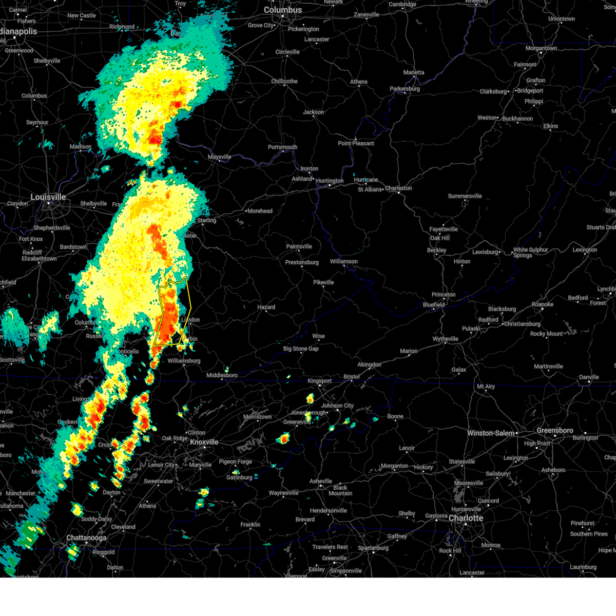 At 1121 am edt, severe thunderstorms were located along a line extending from climax to hazel patch to baldrock, moving east at 30 mph (radar indicated). Hazards include 60 mph wind gusts. Expect damage to roofs, siding, and trees. these severe storms will be near, carico around 1125 am edt. shirley around 1130 am edt. Other locations impacted by these severe thunderstorms include brodhead. At 1121 am edt, severe thunderstorms were located along a line extending from climax to hazel patch to baldrock, moving east at 30 mph (radar indicated). Hazards include 60 mph wind gusts. Expect damage to roofs, siding, and trees. these severe storms will be near, carico around 1125 am edt. shirley around 1130 am edt. Other locations impacted by these severe thunderstorms include brodhead.
|
| 7/5/2024 10:58 AM EDT |
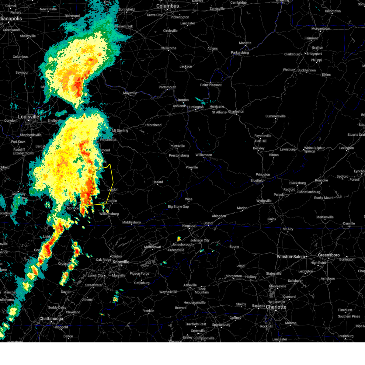 Svrjkl the national weather service in jackson ky has issued a * severe thunderstorm warning for, western laurel county in south central kentucky, eastern pulaski county in south central kentucky, western jackson county in southeastern kentucky, north central mccreary county in south central kentucky, rockcastle county in south central kentucky, northern whitley county in south central kentucky, * until 1130 am edt. * at 1057 am edt, severe thunderstorms were located along a line extending from indian lakes park to near bloss to alpine, moving northeast at 35 mph (radar indicated). Hazards include 60 mph wind gusts. Expect damage to roofs, siding, and trees. severe thunderstorms will be near, mount vernon around 1105 am edt. boone around 1110 am edt. goochland around 1115 am edt. Other locations impacted by these severe thunderstorms include brodhead. Svrjkl the national weather service in jackson ky has issued a * severe thunderstorm warning for, western laurel county in south central kentucky, eastern pulaski county in south central kentucky, western jackson county in southeastern kentucky, north central mccreary county in south central kentucky, rockcastle county in south central kentucky, northern whitley county in south central kentucky, * until 1130 am edt. * at 1057 am edt, severe thunderstorms were located along a line extending from indian lakes park to near bloss to alpine, moving northeast at 35 mph (radar indicated). Hazards include 60 mph wind gusts. Expect damage to roofs, siding, and trees. severe thunderstorms will be near, mount vernon around 1105 am edt. boone around 1110 am edt. goochland around 1115 am edt. Other locations impacted by these severe thunderstorms include brodhead.
|
| 6/30/2024 3:55 PM EDT |
 Svrjkl the national weather service in jackson ky has issued a * severe thunderstorm warning for, southern laurel county in south central kentucky, northwestern knox county in southeastern kentucky, north central whitley county in south central kentucky, * until 430 pm edt. * at 354 pm edt, a severe thunderstorm was located over bunch, or near london, moving southeast at 25 mph (radar indicated). Hazards include 60 mph wind gusts and nickel size hail. Expect damage to roofs, siding, and trees. this severe thunderstorm will be near, hightop around 400 pm edt. keavy around 405 pm edt. north corbin around 410 pm edt. Other locations in the path of this severe thunderstorm include lynn camp and moore hill. Svrjkl the national weather service in jackson ky has issued a * severe thunderstorm warning for, southern laurel county in south central kentucky, northwestern knox county in southeastern kentucky, north central whitley county in south central kentucky, * until 430 pm edt. * at 354 pm edt, a severe thunderstorm was located over bunch, or near london, moving southeast at 25 mph (radar indicated). Hazards include 60 mph wind gusts and nickel size hail. Expect damage to roofs, siding, and trees. this severe thunderstorm will be near, hightop around 400 pm edt. keavy around 405 pm edt. north corbin around 410 pm edt. Other locations in the path of this severe thunderstorm include lynn camp and moore hill.
|
| 5/27/2024 2:06 AM EDT |
 the severe thunderstorm warning has been cancelled and is no longer in effect the severe thunderstorm warning has been cancelled and is no longer in effect
|
| 5/27/2024 2:06 AM EDT |
 At 206 am edt, severe thunderstorms were located along a line extending from green hill to lesbas to north corbin to faber to clio to near zion hill, moving east at 45 mph (radar indicated). Hazards include 60 mph wind gusts and penny size hail. Expect damage to roofs, siding, and trees. Locations impacted include, williamsburg, barbourville, seth, brush creek, dewitt and clear creek springs. At 206 am edt, severe thunderstorms were located along a line extending from green hill to lesbas to north corbin to faber to clio to near zion hill, moving east at 45 mph (radar indicated). Hazards include 60 mph wind gusts and penny size hail. Expect damage to roofs, siding, and trees. Locations impacted include, williamsburg, barbourville, seth, brush creek, dewitt and clear creek springs.
|
| 5/27/2024 1:47 AM EDT |
 The storms which prompted the warning have moved east and a new warning has been issued. therefore, this warning has been allowed to expire. a tornado watch remains in effect until 600 am edt for south central kentucky. remember, a new severe thunderstorm warning is in effect until 245 am edt for eastern wayne county and eastern pulaski county and points to the east. The storms which prompted the warning have moved east and a new warning has been issued. therefore, this warning has been allowed to expire. a tornado watch remains in effect until 600 am edt for south central kentucky. remember, a new severe thunderstorm warning is in effect until 245 am edt for eastern wayne county and eastern pulaski county and points to the east.
|
| 5/27/2024 1:41 AM EDT |
 Svrjkl the national weather service in jackson ky has issued a * severe thunderstorm warning for, eastern wayne county in south central kentucky, laurel county in south central kentucky, central bell county in southeastern kentucky, knox county in southeastern kentucky, southeastern owsley county in southeastern kentucky, eastern pulaski county in south central kentucky, south central jackson county in southeastern kentucky, mccreary county in south central kentucky, southern rockcastle county in south central kentucky, whitley county in south central kentucky, clay county in southeastern kentucky, * until 245 am edt. * at 141 am edt, severe thunderstorms were located along a line extending from luner to near rockcastle springs to near sloans valley to greenwood to near ritner to near great meadows campsites, moving east at 40 mph (radar indicated). Hazards include 60 mph wind gusts and penny size hail. Expect damage to roofs, siding, and trees. severe thunderstorms will be near, whitley city around 145 am edt. london around 150 am edt. levi jackson s. p. around 155 am edt. lesbas around 200 am edt. Other locations in the path of these severe thunderstorms include williamsburg and blackwater. Svrjkl the national weather service in jackson ky has issued a * severe thunderstorm warning for, eastern wayne county in south central kentucky, laurel county in south central kentucky, central bell county in southeastern kentucky, knox county in southeastern kentucky, southeastern owsley county in southeastern kentucky, eastern pulaski county in south central kentucky, south central jackson county in southeastern kentucky, mccreary county in south central kentucky, southern rockcastle county in south central kentucky, whitley county in south central kentucky, clay county in southeastern kentucky, * until 245 am edt. * at 141 am edt, severe thunderstorms were located along a line extending from luner to near rockcastle springs to near sloans valley to greenwood to near ritner to near great meadows campsites, moving east at 40 mph (radar indicated). Hazards include 60 mph wind gusts and penny size hail. Expect damage to roofs, siding, and trees. severe thunderstorms will be near, whitley city around 145 am edt. london around 150 am edt. levi jackson s. p. around 155 am edt. lesbas around 200 am edt. Other locations in the path of these severe thunderstorms include williamsburg and blackwater.
|
| 5/27/2024 1:20 AM EDT |
 At 119 am edt, severe thunderstorms were located along a line extending from science hill to naomi to near parnell to near hidalgo to powersburg to near sunnybrook, moving east at 55 mph (radar indicated). Hazards include 60 mph wind gusts and penny size hail. Expect damage to roofs, siding, and trees. Locations impacted include, somerset, great meadows campsites, blue heron, whitley city, hightop and london. At 119 am edt, severe thunderstorms were located along a line extending from science hill to naomi to near parnell to near hidalgo to powersburg to near sunnybrook, moving east at 55 mph (radar indicated). Hazards include 60 mph wind gusts and penny size hail. Expect damage to roofs, siding, and trees. Locations impacted include, somerset, great meadows campsites, blue heron, whitley city, hightop and london.
|
| 5/27/2024 12:50 AM EDT |
 Svrjkl the national weather service in jackson ky has issued a * severe thunderstorm warning for, wayne county in south central kentucky, southwestern laurel county in south central kentucky, pulaski county in south central kentucky, mccreary county in south central kentucky, south central rockcastle county in south central kentucky, northwestern whitley county in south central kentucky, * until 145 am edt. * at 1249 am edt, severe thunderstorms were located along a line extending from 11 miles southwest of liberty to near jamestown to 11 miles south of columbia to 12 miles northwest of albany to burkesville to 11 miles northeast of celina, moving east at 50 mph (radar indicated). Hazards include 60 mph wind gusts and quarter size hail. Hail damage to vehicles is expected. expect wind damage to roofs, siding, and trees. severe thunderstorms will be near, magnum around 100 am edt. zula around 105 am edt. Other locations in the path of these severe thunderstorms include monticello, somerset, burnside and great meadows campsites. Svrjkl the national weather service in jackson ky has issued a * severe thunderstorm warning for, wayne county in south central kentucky, southwestern laurel county in south central kentucky, pulaski county in south central kentucky, mccreary county in south central kentucky, south central rockcastle county in south central kentucky, northwestern whitley county in south central kentucky, * until 145 am edt. * at 1249 am edt, severe thunderstorms were located along a line extending from 11 miles southwest of liberty to near jamestown to 11 miles south of columbia to 12 miles northwest of albany to burkesville to 11 miles northeast of celina, moving east at 50 mph (radar indicated). Hazards include 60 mph wind gusts and quarter size hail. Hail damage to vehicles is expected. expect wind damage to roofs, siding, and trees. severe thunderstorms will be near, magnum around 100 am edt. zula around 105 am edt. Other locations in the path of these severe thunderstorms include monticello, somerset, burnside and great meadows campsites.
|
| 5/26/2024 1:45 PM EDT |
 A tornado watch remains in effect until 400 pm edt for south central, southeastern and east central kentucky. A tornado watch remains in effect until 400 pm edt for south central, southeastern and east central kentucky.
|
| 5/26/2024 1:39 PM EDT |
 Svrjkl the national weather service in jackson ky has issued a * severe thunderstorm warning for, laurel county in south central kentucky, owsley county in southeastern kentucky, western leslie county in southeastern kentucky, northwestern perry county in southeastern kentucky, jackson county in southeastern kentucky, eastern rockcastle county in south central kentucky, western breathitt county in southeastern kentucky, clay county in southeastern kentucky, * until 230 pm edt. * at 139 pm edt, severe thunderstorms were located along a line extending from hisel to hightop, moving east at 40 mph (radar indicated). Hazards include 60 mph wind gusts and nickel size hail. Expect damage to roofs, siding, and trees. severe thunderstorms will be near, london around 145 pm edt. new zion around 150 pm edt. blackwater around 155 pm edt. Other locations in the path of these severe thunderstorms include sturgeon, manchester and taff. Svrjkl the national weather service in jackson ky has issued a * severe thunderstorm warning for, laurel county in south central kentucky, owsley county in southeastern kentucky, western leslie county in southeastern kentucky, northwestern perry county in southeastern kentucky, jackson county in southeastern kentucky, eastern rockcastle county in south central kentucky, western breathitt county in southeastern kentucky, clay county in southeastern kentucky, * until 230 pm edt. * at 139 pm edt, severe thunderstorms were located along a line extending from hisel to hightop, moving east at 40 mph (radar indicated). Hazards include 60 mph wind gusts and nickel size hail. Expect damage to roofs, siding, and trees. severe thunderstorms will be near, london around 145 pm edt. new zion around 150 pm edt. blackwater around 155 pm edt. Other locations in the path of these severe thunderstorms include sturgeon, manchester and taff.
|
| 5/26/2024 1:20 PM EDT |
 At 120 pm edt, severe thunderstorms were located along a line extending from boone to bromo to somerset pulaski airport, moving east at 50 mph (radar indicated). Hazards include 60 mph wind gusts and nickel size hail. Expect damage to roofs, siding, and trees. Locations impacted include, somerset, jep hill, carico, mckee, london and green hill. At 120 pm edt, severe thunderstorms were located along a line extending from boone to bromo to somerset pulaski airport, moving east at 50 mph (radar indicated). Hazards include 60 mph wind gusts and nickel size hail. Expect damage to roofs, siding, and trees. Locations impacted include, somerset, jep hill, carico, mckee, london and green hill.
|
| 5/26/2024 12:50 PM EDT |
 Svrjkl the national weather service in jackson ky has issued a * severe thunderstorm warning for, laurel county in south central kentucky, central pulaski county in south central kentucky, jackson county in southeastern kentucky, rockcastle county in south central kentucky, * until 145 pm edt. * at 1250 pm edt, severe thunderstorms were located along a line extending from 6 miles northeast of danville to near hogue, moving east at 30 mph (radar indicated). Hazards include 60 mph wind gusts and nickel size hail. Expect damage to roofs, siding, and trees. severe thunderstorms will be near, somerset around 1255 pm edt. bee lick around 100 pm edt. ottowa around 105 pm edt. maretburg around 110 pm edt. Other locations in the path of these severe thunderstorms include mount vernon and boone. Svrjkl the national weather service in jackson ky has issued a * severe thunderstorm warning for, laurel county in south central kentucky, central pulaski county in south central kentucky, jackson county in southeastern kentucky, rockcastle county in south central kentucky, * until 145 pm edt. * at 1250 pm edt, severe thunderstorms were located along a line extending from 6 miles northeast of danville to near hogue, moving east at 30 mph (radar indicated). Hazards include 60 mph wind gusts and nickel size hail. Expect damage to roofs, siding, and trees. severe thunderstorms will be near, somerset around 1255 pm edt. bee lick around 100 pm edt. ottowa around 105 pm edt. maretburg around 110 pm edt. Other locations in the path of these severe thunderstorms include mount vernon and boone.
|
| 3/6/2024 10:07 AM EST |
 Torjkl the national weather service in jackson ky has issued a * this is a test message. tornado warning for, montgomery county in east central kentucky, mccreary county in south central kentucky, rowan county in east central kentucky, morgan county in southeastern kentucky, bath county in east central kentucky, leslie county in southeastern kentucky, estill county in east central kentucky, pulaski county in south central kentucky, rockcastle county in south central kentucky, clay county in southeastern kentucky, elliott county in east central kentucky, wayne county in south central kentucky, harlan county in southeastern kentucky, knox county in southeastern kentucky, owsley county in southeastern kentucky, jackson county in southeastern kentucky, knott county in southeastern kentucky, floyd county in southeastern kentucky, whitley county in south central kentucky, menifee county in east central kentucky, lee county in southeastern kentucky, fleming county in east central kentucky, wolfe county in southeastern kentucky, powell county in east central kentucky, laurel county in south central kentucky, martin county in northeastern kentucky, bell county in southeastern kentucky, johnson county in northeastern kentucky, letcher county in southeastern kentucky, perry county in southeastern kentucky, breathitt county in southeastern kentucky, pike county in southeastern kentucky, magoffin county in southeastern kentucky, * this is a test message. until 1030 am est. * this is a test message. repeat, this is a test tornado warning message. there is no severe weather occuring at this time. this test warning message is part of the annual kentucky tornado drill. if this were an actual severe weather event, you would be given information about the hazard. the national weather service, kentucky emergency management angency, and the kentucky weather preparedness committee, encourges the use of this time to activate and review your severe weather safety plans. repeating, this has been a test tornado warning message for the 2024 kentucky tornado drill. this concludes the test. * this is a test message. Torjkl the national weather service in jackson ky has issued a * this is a test message. tornado warning for, montgomery county in east central kentucky, mccreary county in south central kentucky, rowan county in east central kentucky, morgan county in southeastern kentucky, bath county in east central kentucky, leslie county in southeastern kentucky, estill county in east central kentucky, pulaski county in south central kentucky, rockcastle county in south central kentucky, clay county in southeastern kentucky, elliott county in east central kentucky, wayne county in south central kentucky, harlan county in southeastern kentucky, knox county in southeastern kentucky, owsley county in southeastern kentucky, jackson county in southeastern kentucky, knott county in southeastern kentucky, floyd county in southeastern kentucky, whitley county in south central kentucky, menifee county in east central kentucky, lee county in southeastern kentucky, fleming county in east central kentucky, wolfe county in southeastern kentucky, powell county in east central kentucky, laurel county in south central kentucky, martin county in northeastern kentucky, bell county in southeastern kentucky, johnson county in northeastern kentucky, letcher county in southeastern kentucky, perry county in southeastern kentucky, breathitt county in southeastern kentucky, pike county in southeastern kentucky, magoffin county in southeastern kentucky, * this is a test message. until 1030 am est. * this is a test message. repeat, this is a test tornado warning message. there is no severe weather occuring at this time. this test warning message is part of the annual kentucky tornado drill. if this were an actual severe weather event, you would be given information about the hazard. the national weather service, kentucky emergency management angency, and the kentucky weather preparedness committee, encourges the use of this time to activate and review your severe weather safety plans. repeating, this has been a test tornado warning message for the 2024 kentucky tornado drill. this concludes the test. * this is a test message.
|
| 7/18/2023 8:47 PM EDT |
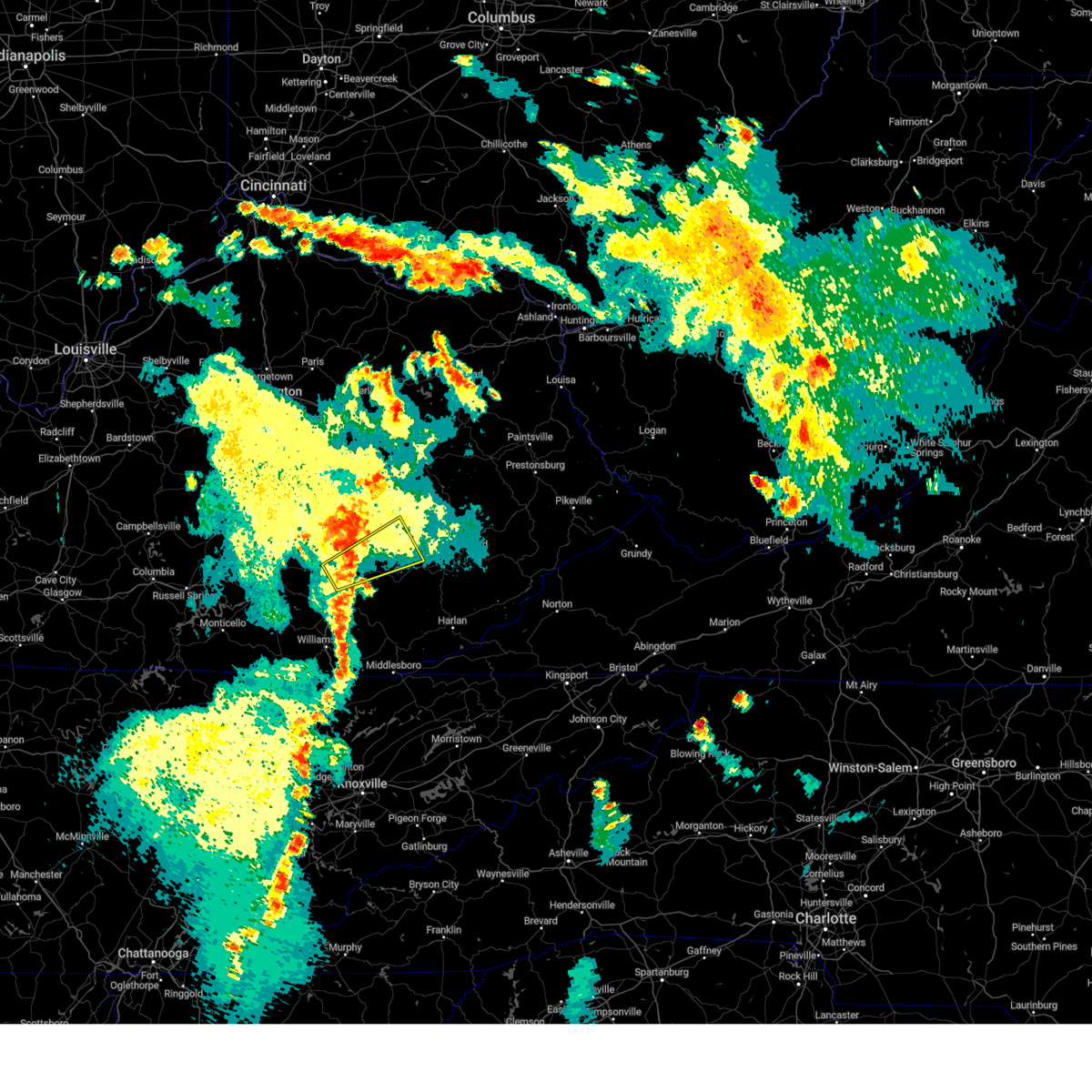 At 846 pm edt, a severe thunderstorm was located over deer lick, or 7 miles east of london, moving northeast at 50 mph (radar indicated). Hazards include 60 mph wind gusts. Expect damage to roofs, siding, and trees. this severe storm will be near, byron around 850 pm edt. grace around 855 pm edt. treadway around 900 pm edt. ammie around 905 pm edt. newfound around 910 pm edt. mistletoe around 915 pm edt. other locations impacted by this severe thunderstorm include brock. hail threat, radar indicated max hail size, <. 75 in wind threat, radar indicated max wind gust, 60 mph. At 846 pm edt, a severe thunderstorm was located over deer lick, or 7 miles east of london, moving northeast at 50 mph (radar indicated). Hazards include 60 mph wind gusts. Expect damage to roofs, siding, and trees. this severe storm will be near, byron around 850 pm edt. grace around 855 pm edt. treadway around 900 pm edt. ammie around 905 pm edt. newfound around 910 pm edt. mistletoe around 915 pm edt. other locations impacted by this severe thunderstorm include brock. hail threat, radar indicated max hail size, <. 75 in wind threat, radar indicated max wind gust, 60 mph.
|
| 7/18/2023 8:36 PM EDT |
 At 836 pm edt, a severe thunderstorm was located over sublimity city, or over london, moving northeast at 50 mph (radar indicated). Hazards include 60 mph wind gusts. Expect damage to roofs, siding, and trees. this severe thunderstorm will be near, maplesville around 840 pm edt. deer lick around 845 pm edt. portersburg around 850 pm edt. grace around 855 pm edt. treadway around 900 pm edt. other locations impacted by this severe thunderstorm include brock. hail threat, radar indicated max hail size, <. 75 in wind threat, radar indicated max wind gust, 60 mph. At 836 pm edt, a severe thunderstorm was located over sublimity city, or over london, moving northeast at 50 mph (radar indicated). Hazards include 60 mph wind gusts. Expect damage to roofs, siding, and trees. this severe thunderstorm will be near, maplesville around 840 pm edt. deer lick around 845 pm edt. portersburg around 850 pm edt. grace around 855 pm edt. treadway around 900 pm edt. other locations impacted by this severe thunderstorm include brock. hail threat, radar indicated max hail size, <. 75 in wind threat, radar indicated max wind gust, 60 mph.
|
| 7/18/2023 8:30 PM EDT | Tree and powerlines down at ky highway 3434 near noelle road. time estimated from radar velocity signatur in laurel county KY, 0.7 miles NW of East Bernstadt, KY |
| 7/2/2023 11:36 PM EDT |
 The severe thunderstorm warning for northeastern laurel, southeastern jackson and northwestern clay counties will expire at 1145 pm edt, the storm which prompted the warning has moved out of the area. therefore, the warning will be allowed to expire. a new warning has been issued for portions of clay and jackson counties. a severe thunderstorm watch remains in effect until midnight edt for south central and southeastern kentucky. The severe thunderstorm warning for northeastern laurel, southeastern jackson and northwestern clay counties will expire at 1145 pm edt, the storm which prompted the warning has moved out of the area. therefore, the warning will be allowed to expire. a new warning has been issued for portions of clay and jackson counties. a severe thunderstorm watch remains in effect until midnight edt for south central and southeastern kentucky.
|
| 7/2/2023 11:23 PM EDT |
 At 1123 pm edt, a severe thunderstorm was located over grace, or 7 miles northwest of manchester, moving northeast at 45 mph (radar indicated). Hazards include 60 mph wind gusts and penny size hail. Expect damage to roofs, siding, and trees. locations impacted include, fall rock and laurel creek. hail threat, radar indicated max hail size, 0. 75 in wind threat, radar indicated max wind gust, 60 mph. At 1123 pm edt, a severe thunderstorm was located over grace, or 7 miles northwest of manchester, moving northeast at 45 mph (radar indicated). Hazards include 60 mph wind gusts and penny size hail. Expect damage to roofs, siding, and trees. locations impacted include, fall rock and laurel creek. hail threat, radar indicated max hail size, 0. 75 in wind threat, radar indicated max wind gust, 60 mph.
|
| 7/2/2023 11:10 PM EDT |
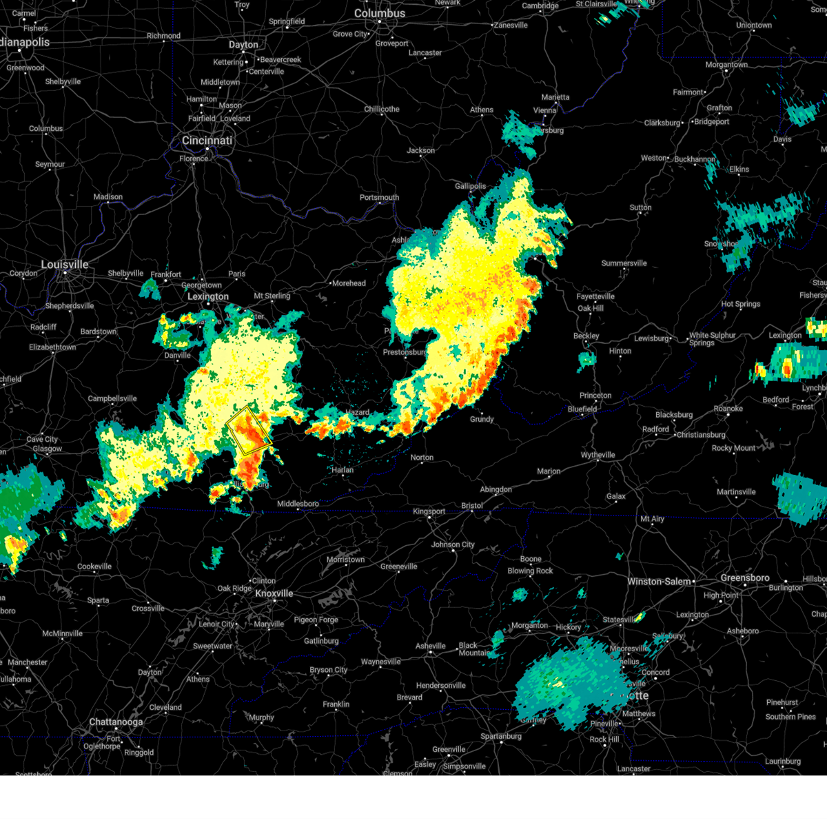 The severe thunderstorm warning for central laurel and southeastern rockcastle counties will expire at 1115 pm edt, the storm which prompted the warning has moved out of the area. therefore, the warning will be allowed to expire. a new warning was issued for laurel and clay counties. a severe thunderstorm watch remains in effect until midnight edt for south central kentucky. The severe thunderstorm warning for central laurel and southeastern rockcastle counties will expire at 1115 pm edt, the storm which prompted the warning has moved out of the area. therefore, the warning will be allowed to expire. a new warning was issued for laurel and clay counties. a severe thunderstorm watch remains in effect until midnight edt for south central kentucky.
|
| 7/2/2023 11:09 PM EDT |
 At 1109 pm edt, a severe thunderstorm was located over london, moving northeast at 45 mph (radar indicated). Hazards include 60 mph wind gusts and penny size hail. Expect damage to roofs, siding, and trees. this severe thunderstorm will be near, langnau around 1115 pm edt. portersburg around 1120 pm edt. grace around 1125 pm edt. other locations in the path of this severe thunderstorm include fall rock and laurel creek. hail threat, radar indicated max hail size, 0. 75 in wind threat, radar indicated max wind gust, 60 mph. At 1109 pm edt, a severe thunderstorm was located over london, moving northeast at 45 mph (radar indicated). Hazards include 60 mph wind gusts and penny size hail. Expect damage to roofs, siding, and trees. this severe thunderstorm will be near, langnau around 1115 pm edt. portersburg around 1120 pm edt. grace around 1125 pm edt. other locations in the path of this severe thunderstorm include fall rock and laurel creek. hail threat, radar indicated max hail size, 0. 75 in wind threat, radar indicated max wind gust, 60 mph.
|
| 7/2/2023 11:06 PM EDT |
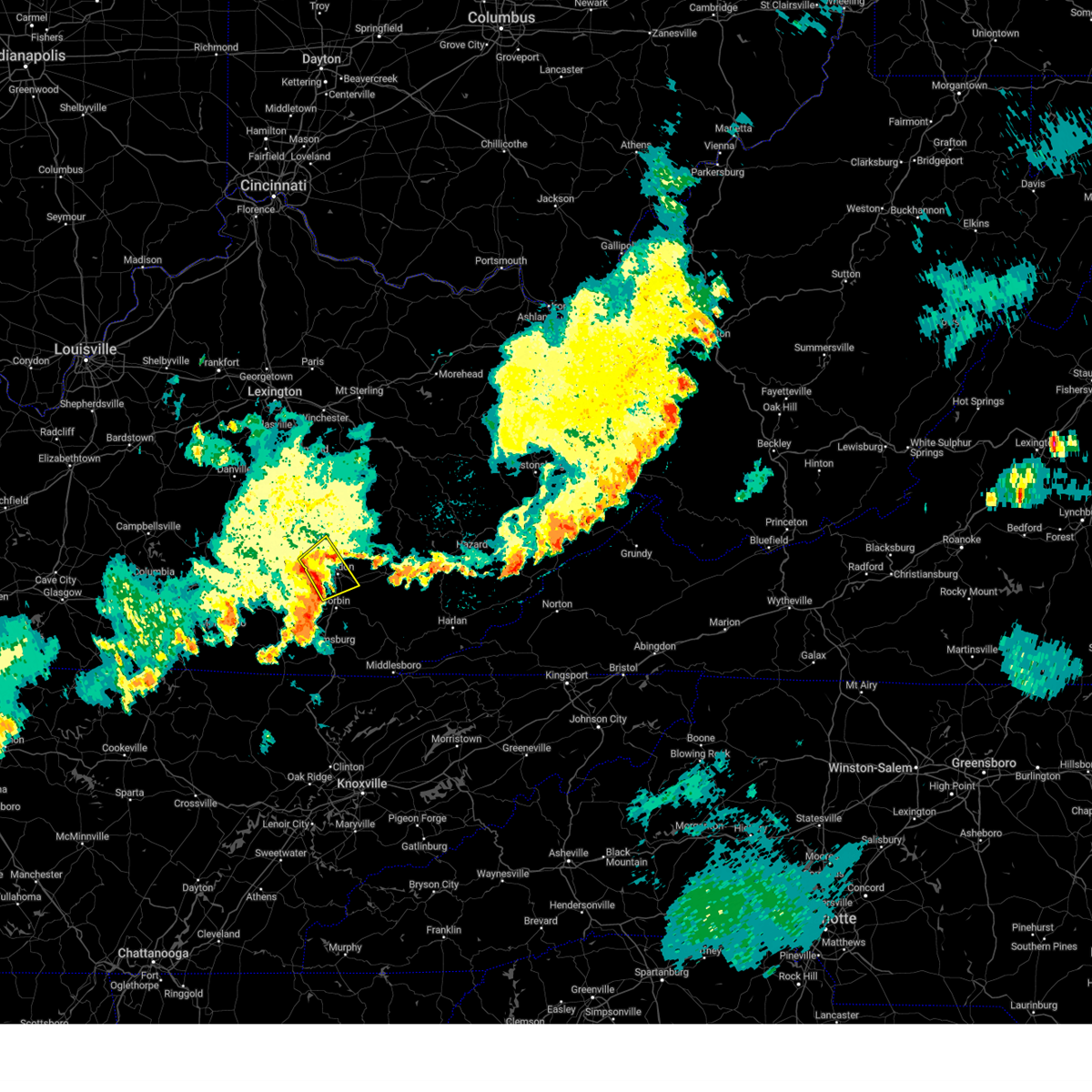 At 1105 pm edt, a severe thunderstorm was located over pittsburg, or near london, moving northeast at 45 mph (radar indicated). Hazards include 60 mph wind gusts and penny size hail. Expect damage to roofs, siding, and trees. this severe thunderstorm will remain over mainly rural areas of central laurel and southeastern rockcastle counties, including the following locations, brock. hail threat, radar indicated max hail size, 0. 75 in wind threat, radar indicated max wind gust, 60 mph. At 1105 pm edt, a severe thunderstorm was located over pittsburg, or near london, moving northeast at 45 mph (radar indicated). Hazards include 60 mph wind gusts and penny size hail. Expect damage to roofs, siding, and trees. this severe thunderstorm will remain over mainly rural areas of central laurel and southeastern rockcastle counties, including the following locations, brock. hail threat, radar indicated max hail size, 0. 75 in wind threat, radar indicated max wind gust, 60 mph.
|
| 7/2/2023 10:54 PM EDT |
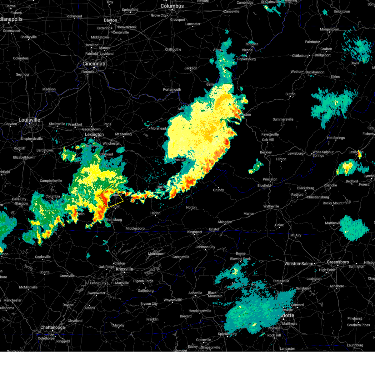 At 1054 pm edt, a severe thunderstorm was located over bunch, or 10 miles west of london, moving northeast at 45 mph (radar indicated). Hazards include 60 mph wind gusts and penny size hail. Expect damage to roofs, siding, and trees. this severe thunderstorm will be near, bernstadt around 1100 pm edt. london around 1105 pm edt. east bernstadt around 1110 pm edt. hail threat, radar indicated max hail size, 0. 75 in wind threat, radar indicated max wind gust, 60 mph. At 1054 pm edt, a severe thunderstorm was located over bunch, or 10 miles west of london, moving northeast at 45 mph (radar indicated). Hazards include 60 mph wind gusts and penny size hail. Expect damage to roofs, siding, and trees. this severe thunderstorm will be near, bernstadt around 1100 pm edt. london around 1105 pm edt. east bernstadt around 1110 pm edt. hail threat, radar indicated max hail size, 0. 75 in wind threat, radar indicated max wind gust, 60 mph.
|
| 7/2/2023 8:58 PM EDT |
 At 858 pm edt, a severe thunderstorm was located over lamero, or 11 miles north of london, moving east at 35 mph (radar indicated). Hazards include 60 mph wind gusts and penny size hail. Expect damage to roofs, siding, and trees. this severe thunderstorm will be near, parrot around 905 pm edt. peoples around 910 pm edt. moores creek around 915 pm edt. other locations in the path of this severe thunderstorm include royrader, shepherdtown and malcomb. hail threat, radar indicated max hail size, 0. 75 in wind threat, radar indicated max wind gust, 60 mph. At 858 pm edt, a severe thunderstorm was located over lamero, or 11 miles north of london, moving east at 35 mph (radar indicated). Hazards include 60 mph wind gusts and penny size hail. Expect damage to roofs, siding, and trees. this severe thunderstorm will be near, parrot around 905 pm edt. peoples around 910 pm edt. moores creek around 915 pm edt. other locations in the path of this severe thunderstorm include royrader, shepherdtown and malcomb. hail threat, radar indicated max hail size, 0. 75 in wind threat, radar indicated max wind gust, 60 mph.
|
| 6/26/2023 1:02 AM EDT |
 At 100 am edt, severe thunderstorms were located along a line extending from beech to brutus to cottongin to mchargue to near huxley, moving east at 45 mph (radar indicated). Hazards include 60 mph wind gusts and penny size hail. Expect damage to roofs, siding, and trees. locations impacted include, london, wood creek lake, pittsburg, egypt, annville, mcwhorter, mount victory, atlanta, bunch, settle store, hazel patch and victory. hail threat, radar indicated max hail size, 0. 75 in wind threat, radar indicated max wind gust, 60 mph. At 100 am edt, severe thunderstorms were located along a line extending from beech to brutus to cottongin to mchargue to near huxley, moving east at 45 mph (radar indicated). Hazards include 60 mph wind gusts and penny size hail. Expect damage to roofs, siding, and trees. locations impacted include, london, wood creek lake, pittsburg, egypt, annville, mcwhorter, mount victory, atlanta, bunch, settle store, hazel patch and victory. hail threat, radar indicated max hail size, 0. 75 in wind threat, radar indicated max wind gust, 60 mph.
|
| 6/26/2023 12:43 AM EDT |
 At 1242 am edt, severe thunderstorms were located along a line extending from southfork to malcomb to london to rockcastle springs to bronston, moving east at 45 mph (radar indicated). Hazards include 60 mph wind gusts and penny size hail. expect damage to roofs, siding, and trees At 1242 am edt, severe thunderstorms were located along a line extending from southfork to malcomb to london to rockcastle springs to bronston, moving east at 45 mph (radar indicated). Hazards include 60 mph wind gusts and penny size hail. expect damage to roofs, siding, and trees
|
| 6/26/2023 12:32 AM EDT |
 At 1231 am edt, severe thunderstorms were located along a line extending from eberle to near rockcastle springs to near zula, moving northeast at 40 mph (radar indicated). Hazards include 60 mph wind gusts and penny size hail. Expect damage to roofs, siding, and trees. severe thunderstorms will be near, bunch around 1240 am edt. london around 1250 am edt. other locations in the path of these severe thunderstorms include maplesville, mcwhorter, benge and datha. hail threat, radar indicated max hail size, 0. 75 in wind threat, radar indicated max wind gust, 60 mph. At 1231 am edt, severe thunderstorms were located along a line extending from eberle to near rockcastle springs to near zula, moving northeast at 40 mph (radar indicated). Hazards include 60 mph wind gusts and penny size hail. Expect damage to roofs, siding, and trees. severe thunderstorms will be near, bunch around 1240 am edt. london around 1250 am edt. other locations in the path of these severe thunderstorms include maplesville, mcwhorter, benge and datha. hail threat, radar indicated max hail size, 0. 75 in wind threat, radar indicated max wind gust, 60 mph.
|
| 6/26/2023 12:06 AM EDT | A tree was reported to have been blown down litton town road. the even time is radar estimate in laurel county KY, 0.5 miles N of East Bernstadt, KY |
| 6/25/2023 11:58 PM EDT |
 At 1158 pm edt, severe thunderstorms were located along a line extending from near rockford to hiatt to near science hill to cains store to near columbia, moving east at 45 mph (radar indicated). Hazards include 60 mph wind gusts and penny size hail. Expect damage to roofs, siding, and trees. severe thunderstorms will be near, mount vernon around 1205 am edt. dudley station around 1210 am edt. robinet around 1215 am edt. other locations in the path of these severe thunderstorms include somerset, deese and dykes. hail threat, radar indicated max hail size, 0. 75 in wind threat, radar indicated max wind gust, 60 mph. At 1158 pm edt, severe thunderstorms were located along a line extending from near rockford to hiatt to near science hill to cains store to near columbia, moving east at 45 mph (radar indicated). Hazards include 60 mph wind gusts and penny size hail. Expect damage to roofs, siding, and trees. severe thunderstorms will be near, mount vernon around 1205 am edt. dudley station around 1210 am edt. robinet around 1215 am edt. other locations in the path of these severe thunderstorms include somerset, deese and dykes. hail threat, radar indicated max hail size, 0. 75 in wind threat, radar indicated max wind gust, 60 mph.
|
| 6/25/2023 11:36 PM EDT |
 At 1136 pm edt, a severe thunderstorm was located over moores creek, or 9 miles south of mckee, moving southeast at 40 mph (radar indicated). Hazards include 60 mph wind gusts and quarter size hail. Hail damage to vehicles is expected. expect wind damage to roofs, siding, and trees. This severe thunderstorm will remain over mainly rural areas of northeastern laurel, southern jackson and northern rockcastle counties, including the following locations, livingston. At 1136 pm edt, a severe thunderstorm was located over moores creek, or 9 miles south of mckee, moving southeast at 40 mph (radar indicated). Hazards include 60 mph wind gusts and quarter size hail. Hail damage to vehicles is expected. expect wind damage to roofs, siding, and trees. This severe thunderstorm will remain over mainly rural areas of northeastern laurel, southern jackson and northern rockcastle counties, including the following locations, livingston.
|
| 6/25/2023 11:17 PM EDT |
 At 1117 pm edt, a severe thunderstorm was located over johnetta, or 7 miles east of mount vernon, moving southeast at 40 mph (radar indicated). Hazards include 70 mph wind gusts and quarter size hail. Hail damage to vehicles is expected. expect considerable tree damage. wind damage is also likely to mobile homes, roofs, and outbuildings. this severe storm will be near, robinet around 1120 pm edt. dango around 1125 pm edt. Other locations in the path of this severe thunderstorm include middlefork, cornelius and green hill. At 1117 pm edt, a severe thunderstorm was located over johnetta, or 7 miles east of mount vernon, moving southeast at 40 mph (radar indicated). Hazards include 70 mph wind gusts and quarter size hail. Hail damage to vehicles is expected. expect considerable tree damage. wind damage is also likely to mobile homes, roofs, and outbuildings. this severe storm will be near, robinet around 1120 pm edt. dango around 1125 pm edt. Other locations in the path of this severe thunderstorm include middlefork, cornelius and green hill.
|
| 6/25/2023 11:07 PM EDT |
 At 1107 pm edt, a severe thunderstorm was located over roundstone, or near mount vernon, moving southeast at 40 mph (radar indicated). Hazards include 70 mph wind gusts and quarter size hail. Hail damage to vehicles is expected. expect considerable tree damage. wind damage is also likely to mobile homes, roofs, and outbuildings. this severe storm will be near, goochland around 1115 pm edt. cooksburg around 1120 pm edt. other locations in the path of this severe thunderstorm include dango, middlefork, cornelius and green hill. thunderstorm damage threat, considerable hail threat, radar indicated max hail size, 1. 00 in wind threat, radar indicated max wind gust, 70 mph. At 1107 pm edt, a severe thunderstorm was located over roundstone, or near mount vernon, moving southeast at 40 mph (radar indicated). Hazards include 70 mph wind gusts and quarter size hail. Hail damage to vehicles is expected. expect considerable tree damage. wind damage is also likely to mobile homes, roofs, and outbuildings. this severe storm will be near, goochland around 1115 pm edt. cooksburg around 1120 pm edt. other locations in the path of this severe thunderstorm include dango, middlefork, cornelius and green hill. thunderstorm damage threat, considerable hail threat, radar indicated max hail size, 1. 00 in wind threat, radar indicated max wind gust, 70 mph.
|
| 6/25/2023 11:00 PM EDT |
 At 1059 pm edt, a severe thunderstorm was located near snider, or 10 miles north of mount vernon, moving southeast at 40 mph (radar indicated). Hazards include 60 mph wind gusts and quarter size hail. Hail damage to vehicles is expected. expect wind damage to roofs, siding, and trees. this severe thunderstorm will be near, boone around 1105 pm edt. roundstone around 1110 pm edt. bummer around 1115 pm edt. other locations in the path of this severe thunderstorm include cooksburg, dango and middlefork. hail threat, radar indicated max hail size, 1. 00 in wind threat, radar indicated max wind gust, 60 mph. At 1059 pm edt, a severe thunderstorm was located near snider, or 10 miles north of mount vernon, moving southeast at 40 mph (radar indicated). Hazards include 60 mph wind gusts and quarter size hail. Hail damage to vehicles is expected. expect wind damage to roofs, siding, and trees. this severe thunderstorm will be near, boone around 1105 pm edt. roundstone around 1110 pm edt. bummer around 1115 pm edt. other locations in the path of this severe thunderstorm include cooksburg, dango and middlefork. hail threat, radar indicated max hail size, 1. 00 in wind threat, radar indicated max wind gust, 60 mph.
|
| 5/16/2023 3:55 PM EDT |
 The severe thunderstorm warning for western laurel and pulaski counties will expire at 400 pm edt, the storm which prompted the warning has weakened below severe limits, and no longer poses an immediate threat to life or property. therefore, the warning will be allowed to expire. however gusty winds are still possible with this thunderstorm. a severe thunderstorm watch remains in effect until 800 pm edt for south central and southeastern kentucky. The severe thunderstorm warning for western laurel and pulaski counties will expire at 400 pm edt, the storm which prompted the warning has weakened below severe limits, and no longer poses an immediate threat to life or property. therefore, the warning will be allowed to expire. however gusty winds are still possible with this thunderstorm. a severe thunderstorm watch remains in effect until 800 pm edt for south central and southeastern kentucky.
|
| 5/16/2023 3:52 PM EDT | A tree was reported to have been blown down in east bernstadt. the time of the event is radar estimate in laurel county KY, 0.5 miles N of East Bernstadt, KY |
| 5/16/2023 3:50 PM EDT |
 At 350 pm edt, a severe thunderstorm was located over green hill, or 9 miles south of mckee, moving east at 35 mph (radar indicated). Hazards include 60 mph wind gusts and quarter size hail. Hail damage to vehicles is expected. expect wind damage to roofs, siding, and trees. this severe thunderstorm will be near, welchburg around 355 pm edt. shepherdtown around 400 pm edt. malcomb around 405 pm edt. chestnutburg around 410 pm edt. Other locations in the path of this severe thunderstorm include thomas and trixie. At 350 pm edt, a severe thunderstorm was located over green hill, or 9 miles south of mckee, moving east at 35 mph (radar indicated). Hazards include 60 mph wind gusts and quarter size hail. Hail damage to vehicles is expected. expect wind damage to roofs, siding, and trees. this severe thunderstorm will be near, welchburg around 355 pm edt. shepherdtown around 400 pm edt. malcomb around 405 pm edt. chestnutburg around 410 pm edt. Other locations in the path of this severe thunderstorm include thomas and trixie.
|
| 5/16/2023 3:38 PM EDT |
 At 337 pm edt, a severe thunderstorm was located over bent, or 8 miles east of somerset, moving east at 50 mph (radar indicated). Hazards include 60 mph wind gusts and nickel size hail. Expect damage to roofs, siding, and trees. Locations impacted include, billows, bunch and london. At 337 pm edt, a severe thunderstorm was located over bent, or 8 miles east of somerset, moving east at 50 mph (radar indicated). Hazards include 60 mph wind gusts and nickel size hail. Expect damage to roofs, siding, and trees. Locations impacted include, billows, bunch and london.
|
| 5/16/2023 3:21 PM EDT |
 At 321 pm edt, a severe thunderstorm was located near pulaski county park, or near somerset, moving east at 50 mph (radar indicated). Hazards include 60 mph wind gusts and nickel size hail. Expect damage to roofs, siding, and trees. this severe thunderstorm will be near, ruth around 335 pm edt. bent around 340 pm edt. Other locations in the path of this severe thunderstorm include billows, bunch and london. At 321 pm edt, a severe thunderstorm was located near pulaski county park, or near somerset, moving east at 50 mph (radar indicated). Hazards include 60 mph wind gusts and nickel size hail. Expect damage to roofs, siding, and trees. this severe thunderstorm will be near, ruth around 335 pm edt. bent around 340 pm edt. Other locations in the path of this severe thunderstorm include billows, bunch and london.
|
| 3/3/2023 3:52 PM EST |
 The severe thunderstorm warning for powell, northeastern laurel, southeastern montgomery, south central bath, northwestern owsley, estill, jackson, west central menifee, western lee and northwestern clay counties will expire at 400 pm est, the storms which prompted the warning have moved out of the area. therefore, the warning will be allowed to expire. however gusty winds are still possible with these thunderstorms. a tornado watch remains in effect until 500 pm est for south central, southeastern and east central kentucky. a tornado watch also remains in effect until 700 pm est for southeastern kentucky. The severe thunderstorm warning for powell, northeastern laurel, southeastern montgomery, south central bath, northwestern owsley, estill, jackson, west central menifee, western lee and northwestern clay counties will expire at 400 pm est, the storms which prompted the warning have moved out of the area. therefore, the warning will be allowed to expire. however gusty winds are still possible with these thunderstorms. a tornado watch remains in effect until 500 pm est for south central, southeastern and east central kentucky. a tornado watch also remains in effect until 700 pm est for southeastern kentucky.
|
| 3/3/2023 3:23 PM EST |
 At 323 pm est, severe thunderstorms were located along a line extending from near palmer to hurley to pittsburg, moving northeast at 65 mph (radar indicated). Hazards include 70 mph wind gusts. Expect considerable tree damage. damage is likely to mobile homes, roofs, and outbuildings. severe thunderstorms will be near, westbend around 330 pm est. camargo around 335 pm est. evelyn around 340 pm est. other locations in the path of these severe thunderstorms include owingsville, ida may and slade. thunderstorm damage threat, considerable hail threat, radar indicated max hail size, <. 75 in wind threat, radar indicated max wind gust, 70 mph. At 323 pm est, severe thunderstorms were located along a line extending from near palmer to hurley to pittsburg, moving northeast at 65 mph (radar indicated). Hazards include 70 mph wind gusts. Expect considerable tree damage. damage is likely to mobile homes, roofs, and outbuildings. severe thunderstorms will be near, westbend around 330 pm est. camargo around 335 pm est. evelyn around 340 pm est. other locations in the path of these severe thunderstorms include owingsville, ida may and slade. thunderstorm damage threat, considerable hail threat, radar indicated max hail size, <. 75 in wind threat, radar indicated max wind gust, 70 mph.
|
| 7/21/2022 12:26 AM EDT |
 At 1225 am edt, a severe thunderstorm was located over high knob, or 11 miles southeast of mckee, moving east at 50 mph (radar indicated). Hazards include 60 mph wind gusts and quarter size hail. Hail damage to vehicles is expected. expect wind damage to roofs, siding, and trees. this severe storm will be near, sacker gap around 1230 am edt. other locations in the path of this severe thunderstorm include sextons creek and trixie. hail threat, radar indicated max hail size, 1. 00 in wind threat, radar indicated max wind gust, 60 mph. At 1225 am edt, a severe thunderstorm was located over high knob, or 11 miles southeast of mckee, moving east at 50 mph (radar indicated). Hazards include 60 mph wind gusts and quarter size hail. Hail damage to vehicles is expected. expect wind damage to roofs, siding, and trees. this severe storm will be near, sacker gap around 1230 am edt. other locations in the path of this severe thunderstorm include sextons creek and trixie. hail threat, radar indicated max hail size, 1. 00 in wind threat, radar indicated max wind gust, 60 mph.
|
| 7/21/2022 12:11 AM EDT |
 At 1211 am edt, a severe thunderstorm was located over victory, or 7 miles north of london, moving east at 50 mph (radar indicated). Hazards include 60 mph wind gusts and quarter size hail. Hail damage to vehicles is expected. expect wind damage to roofs, siding, and trees. this severe thunderstorm will be near, atlanta around 1215 am edt. moores creek around 1220 am edt. high knob around 1225 am edt. malcomb around 1230 am edt. other locations in the path of this severe thunderstorm include sextons creek and thomas. hail threat, radar indicated max hail size, 1. 00 in wind threat, radar indicated max wind gust, 60 mph. At 1211 am edt, a severe thunderstorm was located over victory, or 7 miles north of london, moving east at 50 mph (radar indicated). Hazards include 60 mph wind gusts and quarter size hail. Hail damage to vehicles is expected. expect wind damage to roofs, siding, and trees. this severe thunderstorm will be near, atlanta around 1215 am edt. moores creek around 1220 am edt. high knob around 1225 am edt. malcomb around 1230 am edt. other locations in the path of this severe thunderstorm include sextons creek and thomas. hail threat, radar indicated max hail size, 1. 00 in wind threat, radar indicated max wind gust, 60 mph.
|
| 7/21/2022 12:01 AM EDT |
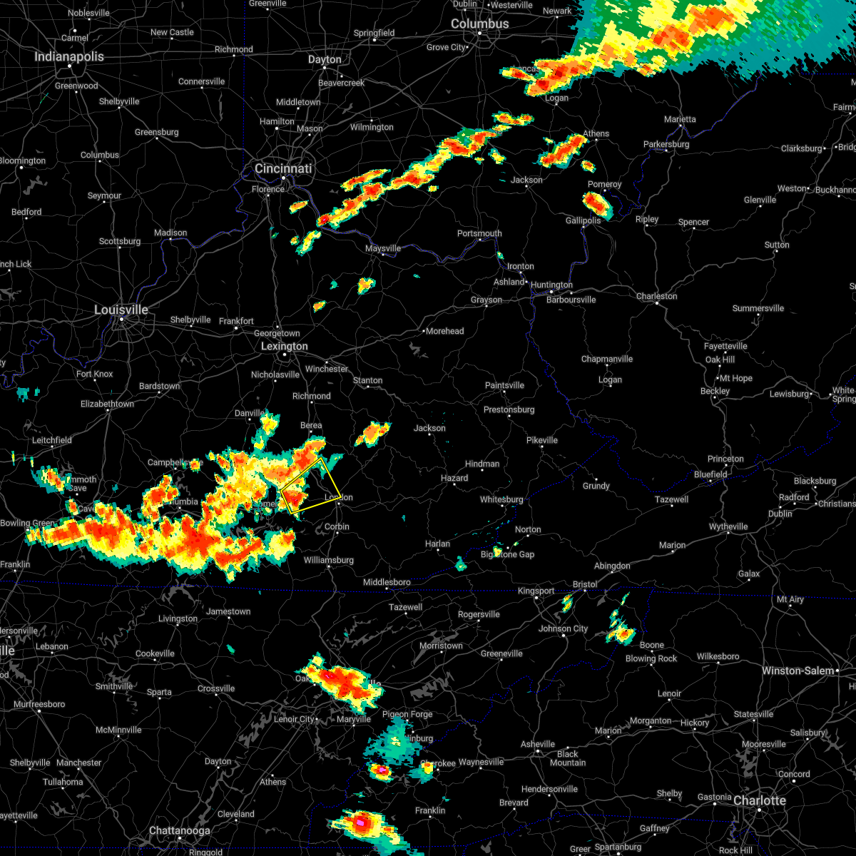 At 1200 am edt, a severe thunderstorm was located over bloss, or 11 miles south of mount vernon, moving northeast at 30 mph (radar indicated). Hazards include 60 mph wind gusts and quarter size hail. Hail damage to vehicles is expected. expect wind damage to roofs, siding, and trees. this severe storm will be near, bloss around 1205 am edt. pongo around 1210 am edt. other locations in the path of this severe thunderstorm include luner, sand hill and camp wildcat. hail threat, radar indicated max hail size, 1. 00 in wind threat, radar indicated max wind gust, 60 mph. At 1200 am edt, a severe thunderstorm was located over bloss, or 11 miles south of mount vernon, moving northeast at 30 mph (radar indicated). Hazards include 60 mph wind gusts and quarter size hail. Hail damage to vehicles is expected. expect wind damage to roofs, siding, and trees. this severe storm will be near, bloss around 1205 am edt. pongo around 1210 am edt. other locations in the path of this severe thunderstorm include luner, sand hill and camp wildcat. hail threat, radar indicated max hail size, 1. 00 in wind threat, radar indicated max wind gust, 60 mph.
|
| 7/20/2022 11:50 PM EDT |
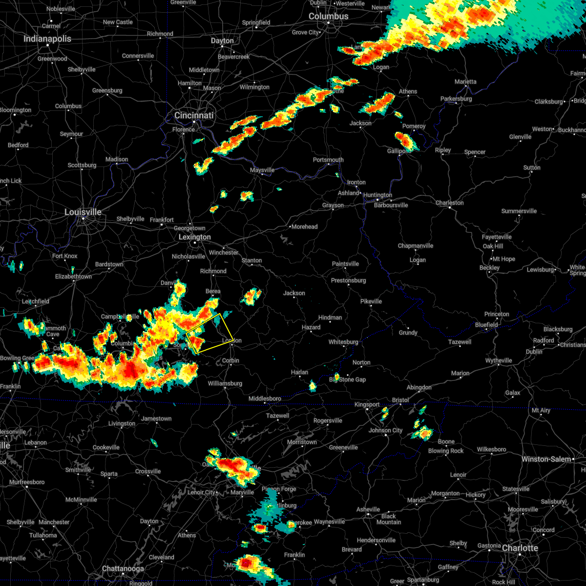 At 1150 pm edt, a severe thunderstorm was located over valley oak, or 9 miles northeast of somerset, moving northeast at 30 mph (radar indicated). Hazards include 60 mph wind gusts and quarter size hail. Hail damage to vehicles is expected. expect wind damage to roofs, siding, and trees. this severe thunderstorm will be near, bloss around 1205 am edt. pongo around 1210 am edt. other locations in the path of this severe thunderstorm include luner. hail threat, radar indicated max hail size, 1. 00 in wind threat, radar indicated max wind gust, 60 mph. At 1150 pm edt, a severe thunderstorm was located over valley oak, or 9 miles northeast of somerset, moving northeast at 30 mph (radar indicated). Hazards include 60 mph wind gusts and quarter size hail. Hail damage to vehicles is expected. expect wind damage to roofs, siding, and trees. this severe thunderstorm will be near, bloss around 1205 am edt. pongo around 1210 am edt. other locations in the path of this severe thunderstorm include luner. hail threat, radar indicated max hail size, 1. 00 in wind threat, radar indicated max wind gust, 60 mph.
|
| 6/17/2022 12:55 PM EDT |
 At 1254 pm edt, severe thunderstorms were located along a line extending from maplesville to near blue heron, moving east at 45 mph (radar indicated). Hazards include 60 mph wind gusts and penny size hail. expect damage to roofs, siding, and trees At 1254 pm edt, severe thunderstorms were located along a line extending from maplesville to near blue heron, moving east at 45 mph (radar indicated). Hazards include 60 mph wind gusts and penny size hail. expect damage to roofs, siding, and trees
|
| 6/17/2022 12:40 PM EDT |
 At 1240 pm edt, severe thunderstorms were located along a line extending from jep hill to near great meadows campsites, moving east at 45 mph (radar indicated). Hazards include 60 mph wind gusts and penny size hail. Expect damage to roofs, siding, and trees. locations impacted include, somerset, london, monticello, mount vernon, whitley city, science hill, burnside, cains store, donaro, robinet, cumberland falls s. p. and co-operative. hail threat, radar indicated max hail size, 0. 75 in wind threat, radar indicated max wind gust, 60 mph. At 1240 pm edt, severe thunderstorms were located along a line extending from jep hill to near great meadows campsites, moving east at 45 mph (radar indicated). Hazards include 60 mph wind gusts and penny size hail. Expect damage to roofs, siding, and trees. locations impacted include, somerset, london, monticello, mount vernon, whitley city, science hill, burnside, cains store, donaro, robinet, cumberland falls s. p. and co-operative. hail threat, radar indicated max hail size, 0. 75 in wind threat, radar indicated max wind gust, 60 mph.
|
| 6/17/2022 12:31 PM EDT |
 At 1231 pm edt, severe thunderstorms were located along a line extending from burr to near great meadows campsites, moving east at 45 mph (radar indicated). Hazards include 60 mph wind gusts and penny size hail. expect damage to roofs, siding, and trees At 1231 pm edt, severe thunderstorms were located along a line extending from burr to near great meadows campsites, moving east at 45 mph (radar indicated). Hazards include 60 mph wind gusts and penny size hail. expect damage to roofs, siding, and trees
|
| 5/18/2022 10:40 PM EDT |
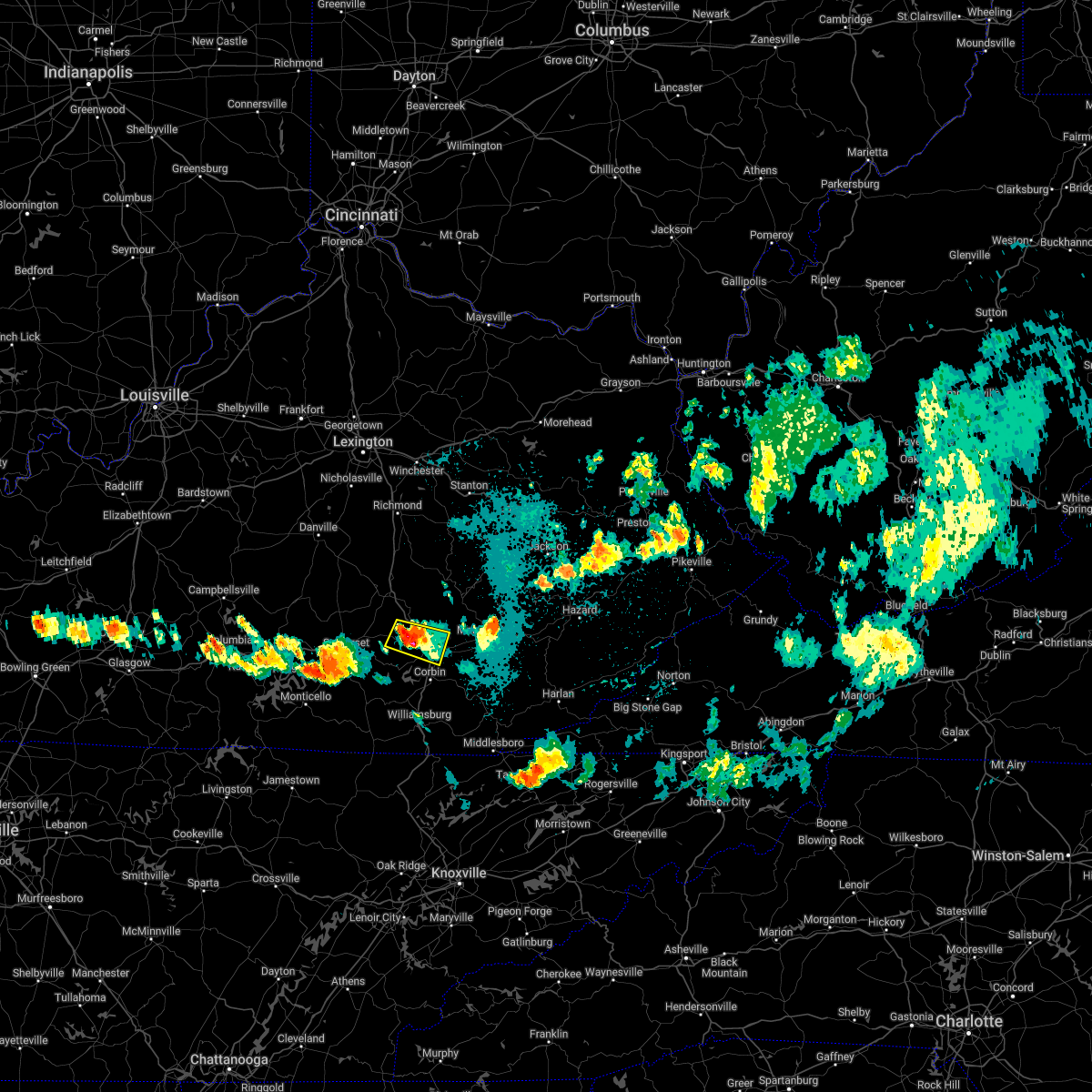 At 1039 pm edt, a severe thunderstorm was located over billows, or 10 miles west of london, moving east at 25 mph (radar indicated). Hazards include 60 mph wind gusts and quarter size hail. Hail damage to vehicles is expected. expect wind damage to roofs, siding, and trees. locations impacted include, bernstadt, carmichael, london, sublimity city and levi jackson s. p. hail threat, radar indicated max hail size, 1. 00 in wind threat, radar indicated max wind gust, 60 mph. At 1039 pm edt, a severe thunderstorm was located over billows, or 10 miles west of london, moving east at 25 mph (radar indicated). Hazards include 60 mph wind gusts and quarter size hail. Hail damage to vehicles is expected. expect wind damage to roofs, siding, and trees. locations impacted include, bernstadt, carmichael, london, sublimity city and levi jackson s. p. hail threat, radar indicated max hail size, 1. 00 in wind threat, radar indicated max wind gust, 60 mph.
|
| 5/18/2022 10:29 PM EDT |
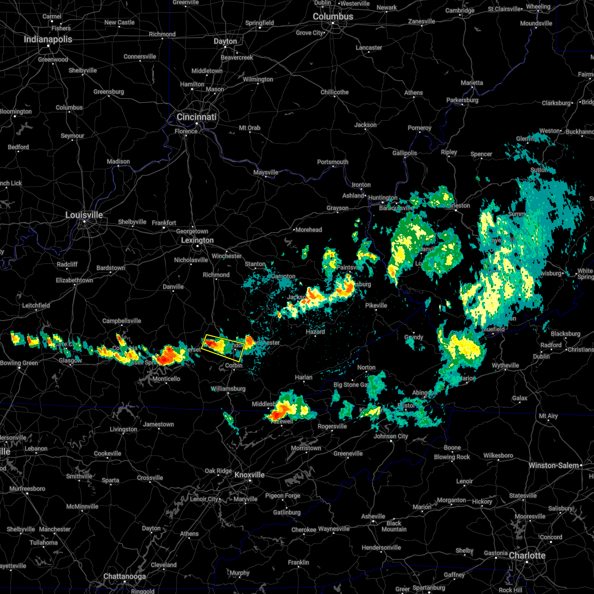 At 1028 pm edt, a severe thunderstorm was located over bloss, or 12 miles south of mount vernon, moving east at 25 mph (radar indicated). Hazards include 60 mph wind gusts and quarter size hail. Hail damage to vehicles is expected. expect wind damage to roofs, siding, and trees. this severe thunderstorm will be near, billows around 1040 pm edt. other locations in the path of this severe thunderstorm include bernstadt, london, pittsburg, sublimity city and levi jackson s. p. hail threat, radar indicated max hail size, 1. 00 in wind threat, radar indicated max wind gust, 60 mph. At 1028 pm edt, a severe thunderstorm was located over bloss, or 12 miles south of mount vernon, moving east at 25 mph (radar indicated). Hazards include 60 mph wind gusts and quarter size hail. Hail damage to vehicles is expected. expect wind damage to roofs, siding, and trees. this severe thunderstorm will be near, billows around 1040 pm edt. other locations in the path of this severe thunderstorm include bernstadt, london, pittsburg, sublimity city and levi jackson s. p. hail threat, radar indicated max hail size, 1. 00 in wind threat, radar indicated max wind gust, 60 mph.
|
| 5/18/2022 7:25 PM EDT |
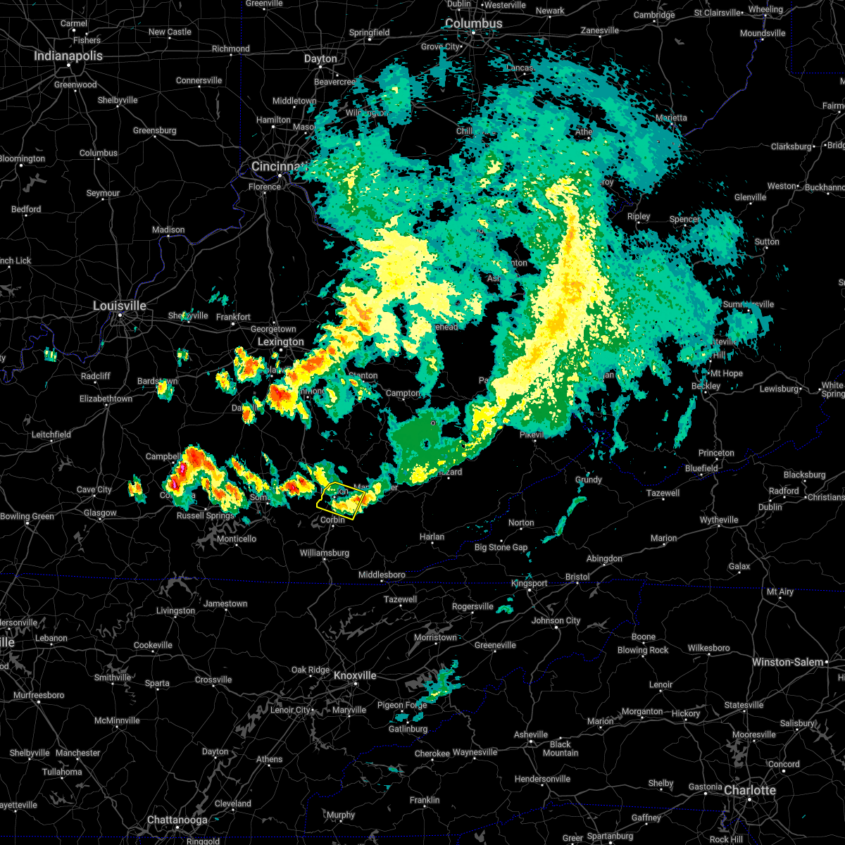 The severe thunderstorm warning for central laurel and west central clay counties will expire at 730 pm edt, the storm which prompted the warning has weakened below severe limits, and no longer poses an immediate threat to life or property. therefore, the warning will be allowed to expire. a severe thunderstorm watch remains in effect until 1000 pm edt for south central and southeastern kentucky. The severe thunderstorm warning for central laurel and west central clay counties will expire at 730 pm edt, the storm which prompted the warning has weakened below severe limits, and no longer poses an immediate threat to life or property. therefore, the warning will be allowed to expire. a severe thunderstorm watch remains in effect until 1000 pm edt for south central and southeastern kentucky.
|
| 5/18/2022 7:13 PM EDT |
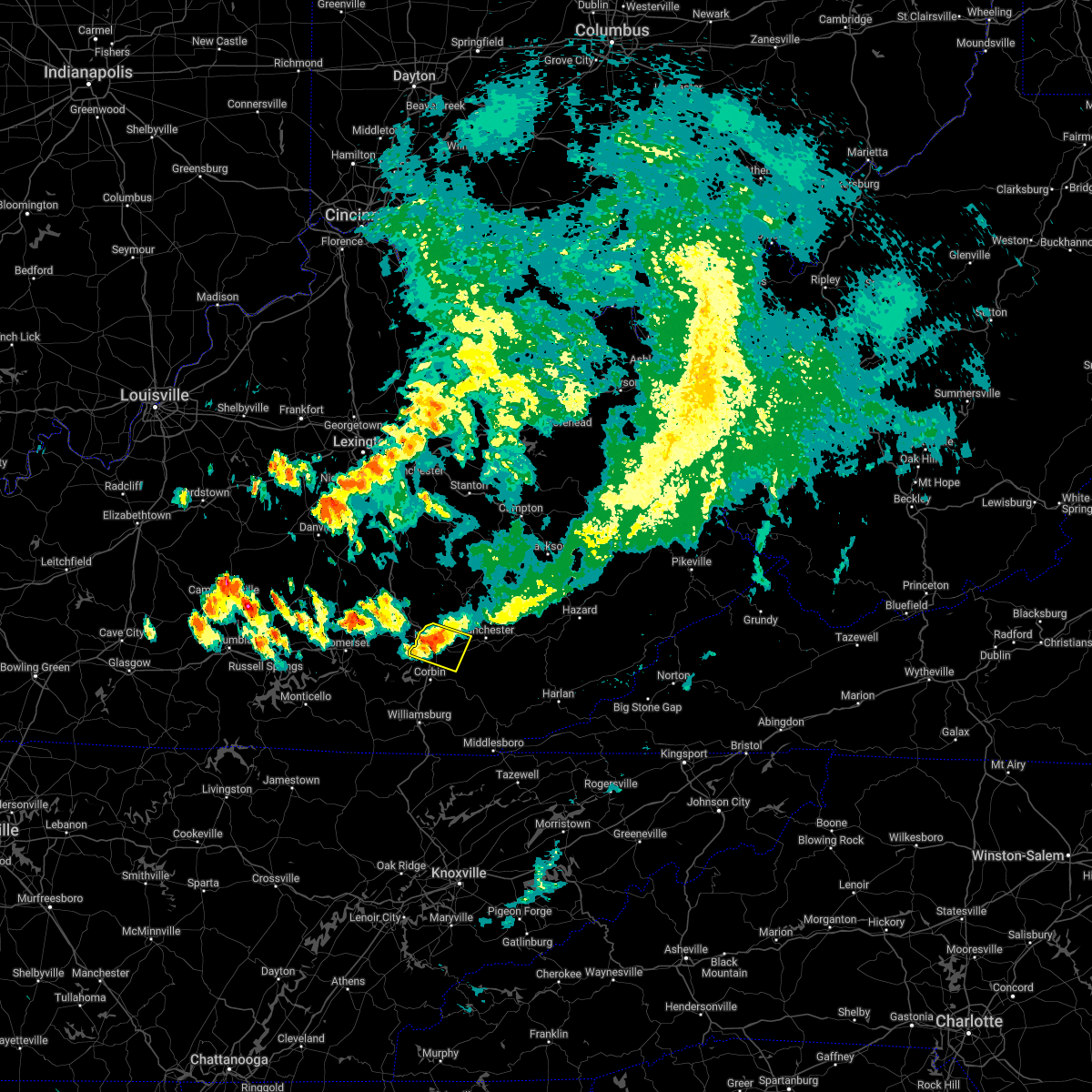 At 712 pm edt, a severe thunderstorm was located over levi jackson s.p., or over london, moving east at 40 mph (radar indicated). Hazards include 60 mph wind gusts and penny size hail. Expect damage to roofs, siding, and trees. locations impacted include, lida and cane creek. hail threat, radar indicated max hail size, 0. 75 in wind threat, radar indicated max wind gust, 60 mph. At 712 pm edt, a severe thunderstorm was located over levi jackson s.p., or over london, moving east at 40 mph (radar indicated). Hazards include 60 mph wind gusts and penny size hail. Expect damage to roofs, siding, and trees. locations impacted include, lida and cane creek. hail threat, radar indicated max hail size, 0. 75 in wind threat, radar indicated max wind gust, 60 mph.
|
| 5/18/2022 6:57 PM EDT |
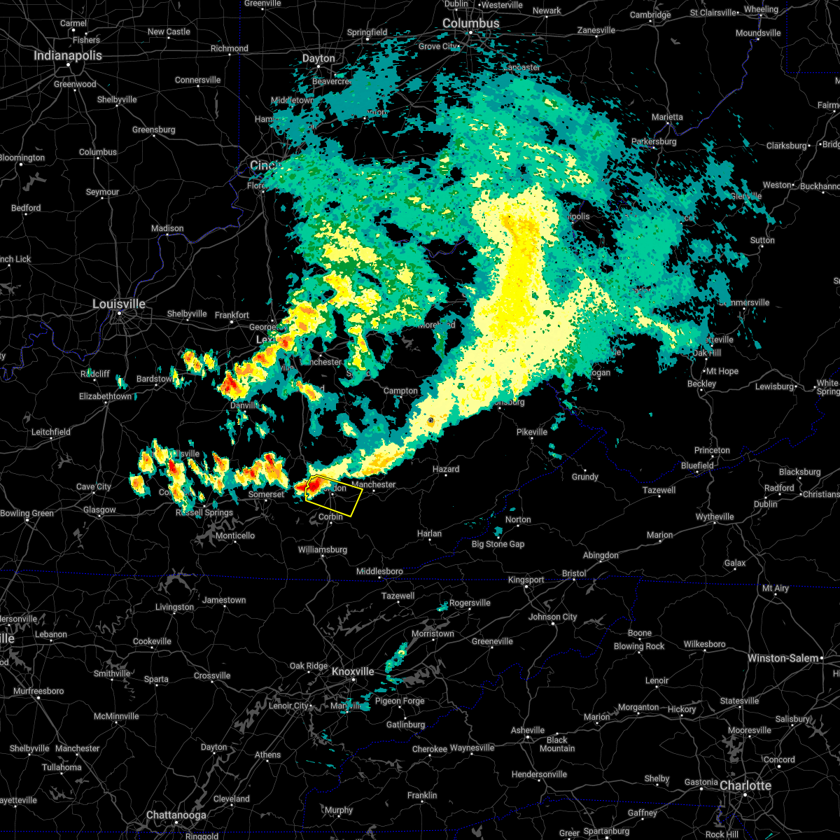 At 656 pm edt, a severe thunderstorm was located over bernstadt, or 8 miles west of london, moving east at 40 mph (radar indicated). Hazards include 60 mph wind gusts and penny size hail. Expect damage to roofs, siding, and trees. this severe thunderstorm will be near, bernstadt around 700 pm edt. london around 705 pm edt. sublimity city around 710 pm edt. levi jackson s. p. around 715 pm edt. other locations in the path of this severe thunderstorm include lida and cane creek. hail threat, radar indicated max hail size, 0. 75 in wind threat, radar indicated max wind gust, 60 mph. At 656 pm edt, a severe thunderstorm was located over bernstadt, or 8 miles west of london, moving east at 40 mph (radar indicated). Hazards include 60 mph wind gusts and penny size hail. Expect damage to roofs, siding, and trees. this severe thunderstorm will be near, bernstadt around 700 pm edt. london around 705 pm edt. sublimity city around 710 pm edt. levi jackson s. p. around 715 pm edt. other locations in the path of this severe thunderstorm include lida and cane creek. hail threat, radar indicated max hail size, 0. 75 in wind threat, radar indicated max wind gust, 60 mph.
|
| 5/6/2022 2:59 PM EDT |
 At 258 pm edt, a severe thunderstorm was located over mcwhorter, or 9 miles northeast of london, moving northeast at 35 mph (radar indicated). Hazards include 60 mph wind gusts. Expect damage to roofs, siding, and trees. Locations impacted include, datha, shepherdtown, malcomb, sextons creek and thomas. At 258 pm edt, a severe thunderstorm was located over mcwhorter, or 9 miles northeast of london, moving northeast at 35 mph (radar indicated). Hazards include 60 mph wind gusts. Expect damage to roofs, siding, and trees. Locations impacted include, datha, shepherdtown, malcomb, sextons creek and thomas.
|
| 5/6/2022 2:46 PM EDT | Multiple trees down between the 5000-5200 block of us 25. house damaged by tree. rv awning flipped ove in laurel county KY, 0.5 miles N of East Bernstadt, KY |
| 5/6/2022 2:44 PM EDT |
 At 244 pm edt, a severe thunderstorm was located over carmichael, or near london, moving northeast at 35 mph (radar indicated). Hazards include 60 mph wind gusts. Expect damage to roofs, siding, and trees. this severe thunderstorm will be near, greenmount around 255 pm edt. moores creek around 300 pm edt. Other locations in the path of this severe thunderstorm include datha, shepherdtown, chestnutburg and sextons creek. At 244 pm edt, a severe thunderstorm was located over carmichael, or near london, moving northeast at 35 mph (radar indicated). Hazards include 60 mph wind gusts. Expect damage to roofs, siding, and trees. this severe thunderstorm will be near, greenmount around 255 pm edt. moores creek around 300 pm edt. Other locations in the path of this severe thunderstorm include datha, shepherdtown, chestnutburg and sextons creek.
|
| 5/6/2022 2:15 PM EDT |
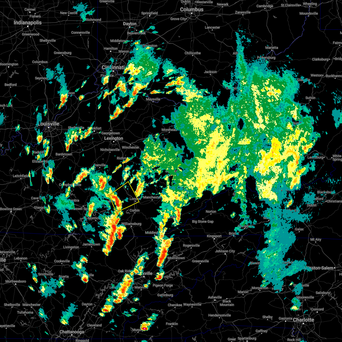 At 214 pm edt, a severe thunderstorm was located near bent, or 12 miles northeast of somerset, moving northeast at 35 mph (radar indicated). Hazards include 60 mph wind gusts and penny size hail. Expect damage to roofs, siding, and trees. this severe storm will be near, bloss around 220 pm edt. other locations in the path of this severe thunderstorm include billows, luner, hazel patch and mershons. hail threat, radar indicated max hail size, 0. 75 in wind threat, radar indicated max wind gust, 60 mph. At 214 pm edt, a severe thunderstorm was located near bent, or 12 miles northeast of somerset, moving northeast at 35 mph (radar indicated). Hazards include 60 mph wind gusts and penny size hail. Expect damage to roofs, siding, and trees. this severe storm will be near, bloss around 220 pm edt. other locations in the path of this severe thunderstorm include billows, luner, hazel patch and mershons. hail threat, radar indicated max hail size, 0. 75 in wind threat, radar indicated max wind gust, 60 mph.
|
| 5/6/2022 2:03 PM EDT |
 At 203 pm edt, a severe thunderstorm was located over ruth, or near somerset, moving northeast at 40 mph (radar indicated). Hazards include 60 mph wind gusts and penny size hail. Expect damage to roofs, siding, and trees. this severe thunderstorm will be near, bloss around 220 pm edt. other locations in the path of this severe thunderstorm include billows and luner. hail threat, radar indicated max hail size, 0. 75 in wind threat, radar indicated max wind gust, 60 mph. At 203 pm edt, a severe thunderstorm was located over ruth, or near somerset, moving northeast at 40 mph (radar indicated). Hazards include 60 mph wind gusts and penny size hail. Expect damage to roofs, siding, and trees. this severe thunderstorm will be near, bloss around 220 pm edt. other locations in the path of this severe thunderstorm include billows and luner. hail threat, radar indicated max hail size, 0. 75 in wind threat, radar indicated max wind gust, 60 mph.
|
| 4/13/2022 9:41 PM EDT |
 At 941 pm edt, severe thunderstorms were located along a line extending from 7 miles southeast of veterans park to near gum sulphur to pulaski county park, moving east at 50 mph (radar indicated). Hazards include 60 mph wind gusts. Expect damage to roofs, siding, and trees. locations impacted include, snider, boone, morrill, kerby knob, brazil and stanton. hail threat, radar indicated max hail size, <. 75 in wind threat, radar indicated max wind gust, 60 mph. At 941 pm edt, severe thunderstorms were located along a line extending from 7 miles southeast of veterans park to near gum sulphur to pulaski county park, moving east at 50 mph (radar indicated). Hazards include 60 mph wind gusts. Expect damage to roofs, siding, and trees. locations impacted include, snider, boone, morrill, kerby knob, brazil and stanton. hail threat, radar indicated max hail size, <. 75 in wind threat, radar indicated max wind gust, 60 mph.
|
| 4/13/2022 9:23 PM EDT |
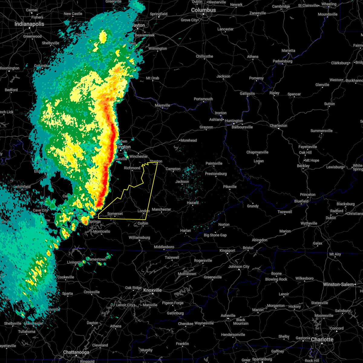 At 922 pm edt, severe thunderstorms were located along a line extending from near nicholasville to near stanford to near faubush, moving east at 65 mph (radar indicated). Hazards include 60 mph wind gusts and penny size hail. Expect damage to roofs, siding, and trees. severe thunderstorms will be near, nancy around 930 pm edt. gum sulphur around 935 pm edt. somerset around 940 pm edt. other locations in the path of these severe thunderstorms include bummer, harris ferry and hargett. hail threat, radar indicated max hail size, 0. 75 in wind threat, radar indicated max wind gust, 60 mph. At 922 pm edt, severe thunderstorms were located along a line extending from near nicholasville to near stanford to near faubush, moving east at 65 mph (radar indicated). Hazards include 60 mph wind gusts and penny size hail. Expect damage to roofs, siding, and trees. severe thunderstorms will be near, nancy around 930 pm edt. gum sulphur around 935 pm edt. somerset around 940 pm edt. other locations in the path of these severe thunderstorms include bummer, harris ferry and hargett. hail threat, radar indicated max hail size, 0. 75 in wind threat, radar indicated max wind gust, 60 mph.
|
| 4/6/2022 6:12 PM EDT | Emergency manager reports trees blown down on power lines in the 5600 block of ky-49 in laurel county KY, 3.8 miles SSW of East Bernstadt, KY |
| 4/6/2022 6:08 PM EDT | Emergency manager reports trees down on power lines along ky-490 in the 1800 block and also in the 900 block of fisherman cove rd. trees were also reported down on the in laurel county KY, 0.5 miles N of East Bernstadt, KY |
| 4/6/2022 6:06 PM EDT | Emergency manager reports tree downed onto power lines along the 5300 block of us-25 nort in laurel county KY, 2.3 miles E of East Bernstadt, KY |
| 4/6/2022 5:12 PM EDT | Corrects previous tstm wnd dmg report from 1 n oakley. emergency manager reports trees blown down on power lines in the 5600 block of ky-49 in laurel county KY, 3.8 miles SSW of East Bernstadt, KY |
| 4/6/2022 5:10 PM EDT | The steeple at first baptist church in east bernstadt was blown off the roo in laurel county KY, 0.7 miles NW of East Bernstadt, KY |
| 4/6/2022 5:08 PM EDT | Corrects previous tstm wnd dmg report from east bernstadt. emergency manager reports trees down on power lines along ky-490 in the 1800 block and also in the 900 block in laurel county KY, 0.5 miles N of East Bernstadt, KY |
| 4/6/2022 5:07 PM EDT | Pictures on social media show sections of a pool fence blown down along norwood driv in laurel county KY, 2.8 miles E of East Bernstadt, KY |
| 4/6/2022 5:06 PM EDT | Corrects previous tstm wnd dmg report from hare. emergency manager reports tree downed onto power lines along the 5300 block of us-25 nort in laurel county KY, 2.3 miles E of East Bernstadt, KY |
| 1/1/2022 4:09 PM EST | At 408 pm est, severe thunderstorms were located along a line extending from victory to gray, moving northeast at 65 mph (radar indicated). Hazards include 60 mph wind gusts. Expect damage to roofs, siding, and trees. severe thunderstorms will be near, cornelius around 415 pm est. tyner around 420 pm est. nathanton around 425 pm est. other locations in the path of these severe thunderstorms include endee, chestnut gap and jacks creek. hail threat, radar indicated max hail size, <. 75 in wind threat, radar indicated max wind gust, 60 mph. |
| 1/1/2022 3:53 PM EST |
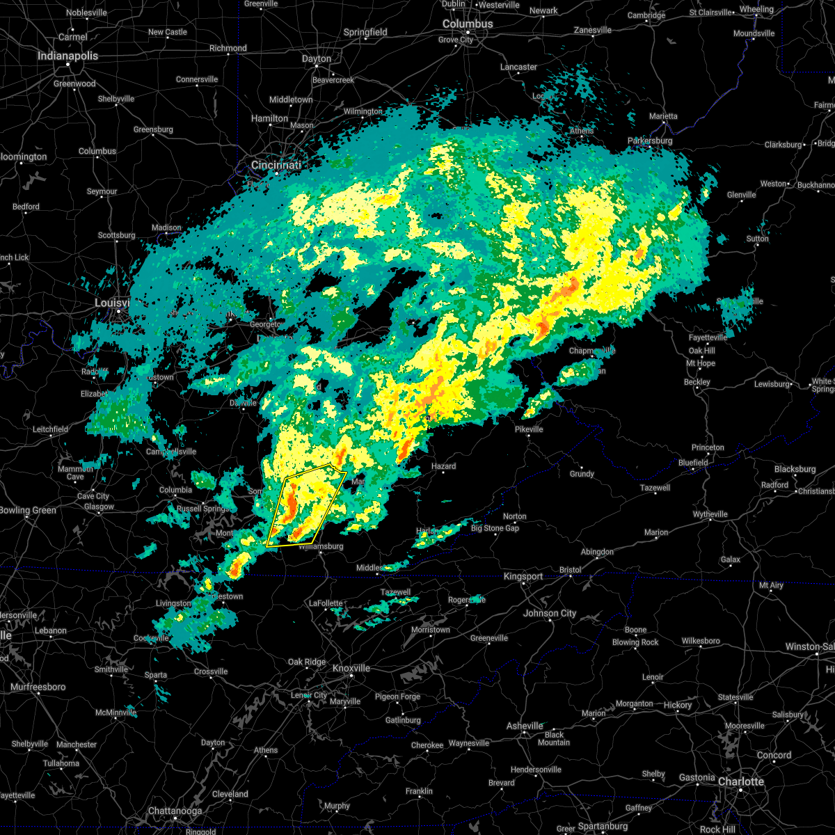 At 353 pm est, severe thunderstorms were located along a line extending from near billows to wiborg, moving east at 60 mph (radar indicated). Hazards include 60 mph wind gusts. Expect damage to roofs, siding, and trees. these severe storms will be near, east bernstadt around 400 pm est. mcwhorter around 405 pm est. Deering around 410 pm est. At 353 pm est, severe thunderstorms were located along a line extending from near billows to wiborg, moving east at 60 mph (radar indicated). Hazards include 60 mph wind gusts. Expect damage to roofs, siding, and trees. these severe storms will be near, east bernstadt around 400 pm est. mcwhorter around 405 pm est. Deering around 410 pm est.
|
| 1/1/2022 3:40 PM EST |
 At 340 pm est, severe thunderstorms were located along a line extending from near dabney to barrier, moving east at 60 mph (radar indicated). Hazards include 60 mph wind gusts. Expect damage to roofs, siding, and trees. severe thunderstorms will be near, valley oak around 345 pm est. bloss around 350 pm est. wiborg around 355 pm est. hazel patch around 400 pm est. Other locations in the path of these severe thunderstorms include victory and greenmount. At 340 pm est, severe thunderstorms were located along a line extending from near dabney to barrier, moving east at 60 mph (radar indicated). Hazards include 60 mph wind gusts. Expect damage to roofs, siding, and trees. severe thunderstorms will be near, valley oak around 345 pm est. bloss around 350 pm est. wiborg around 355 pm est. hazel patch around 400 pm est. Other locations in the path of these severe thunderstorms include victory and greenmount.
|
| 1/1/2022 7:53 AM EST |
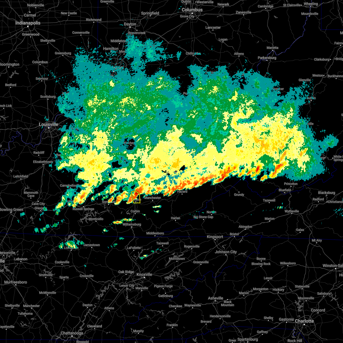 At 753 am est, a severe thunderstorm was located over atlanta, or near london, moving east at 50 mph (radar indicated). Hazards include 60 mph wind gusts and nickel size hail. Expect damage to roofs, siding, and trees. Locations impacted include, london, eberle, east bernstadt, maplesville, atlanta, pittsburg, carmichael, mershons, greenmount, victory and brock. At 753 am est, a severe thunderstorm was located over atlanta, or near london, moving east at 50 mph (radar indicated). Hazards include 60 mph wind gusts and nickel size hail. Expect damage to roofs, siding, and trees. Locations impacted include, london, eberle, east bernstadt, maplesville, atlanta, pittsburg, carmichael, mershons, greenmount, victory and brock.
|
| 1/1/2022 7:51 AM EST |
 At 751 am est, a severe thunderstorm was located over atlanta, or 7 miles north of london, moving east at 55 mph (radar indicated). Hazards include 60 mph wind gusts and quarter size hail. Hail damage to vehicles is expected. expect wind damage to roofs, siding, and trees. this severe thunderstorm will be near, green hill around 755 am est. datha around 800 am est. sacker gap around 805 am est. felty around 810 am est. other locations in the path of this severe thunderstorm include teges and mistletoe. hail threat, radar indicated max hail size, 1. 00 in wind threat, radar indicated max wind gust, 60 mph. At 751 am est, a severe thunderstorm was located over atlanta, or 7 miles north of london, moving east at 55 mph (radar indicated). Hazards include 60 mph wind gusts and quarter size hail. Hail damage to vehicles is expected. expect wind damage to roofs, siding, and trees. this severe thunderstorm will be near, green hill around 755 am est. datha around 800 am est. sacker gap around 805 am est. felty around 810 am est. other locations in the path of this severe thunderstorm include teges and mistletoe. hail threat, radar indicated max hail size, 1. 00 in wind threat, radar indicated max wind gust, 60 mph.
|
| 1/1/2022 7:40 AM EST |
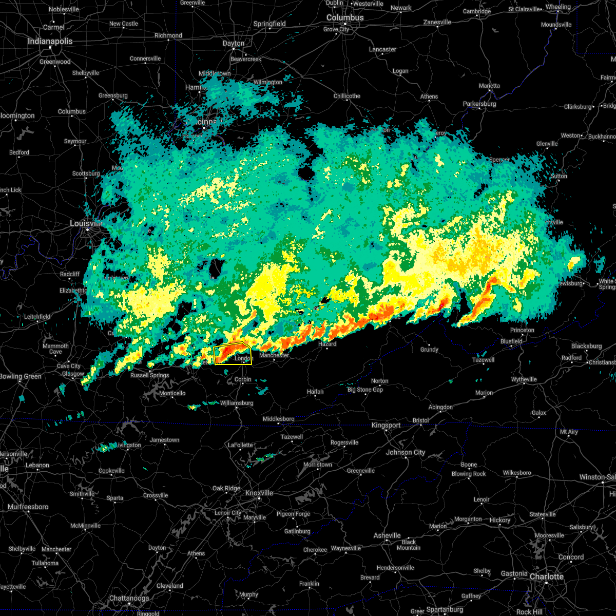 At 739 am est, a severe thunderstorm was located over billows, or 10 miles west of london, moving east at 50 mph (radar indicated). Hazards include 60 mph wind gusts and quarter size hail. Hail damage to vehicles is expected. expect wind damage to roofs, siding, and trees. Locations impacted include, wood creek lake, london and atlanta. At 739 am est, a severe thunderstorm was located over billows, or 10 miles west of london, moving east at 50 mph (radar indicated). Hazards include 60 mph wind gusts and quarter size hail. Hail damage to vehicles is expected. expect wind damage to roofs, siding, and trees. Locations impacted include, wood creek lake, london and atlanta.
|
| 1/1/2022 7:22 AM EST |
 At 722 am est, a severe thunderstorm was located over shopville, or 7 miles northeast of somerset, moving east at 50 mph (radar indicated). Hazards include 70 mph wind gusts and half dollar size hail. Hail damage to vehicles is expected. expect considerable tree damage. wind damage is also likely to mobile homes, roofs, and outbuildings. this severe thunderstorm will be near, bloss around 735 am est. billows around 740 am est. Other locations in the path of this severe thunderstorm include wood creek lake, london and atlanta. At 722 am est, a severe thunderstorm was located over shopville, or 7 miles northeast of somerset, moving east at 50 mph (radar indicated). Hazards include 70 mph wind gusts and half dollar size hail. Hail damage to vehicles is expected. expect considerable tree damage. wind damage is also likely to mobile homes, roofs, and outbuildings. this severe thunderstorm will be near, bloss around 735 am est. billows around 740 am est. Other locations in the path of this severe thunderstorm include wood creek lake, london and atlanta.
|
| 10/21/2021 4:38 PM EDT |
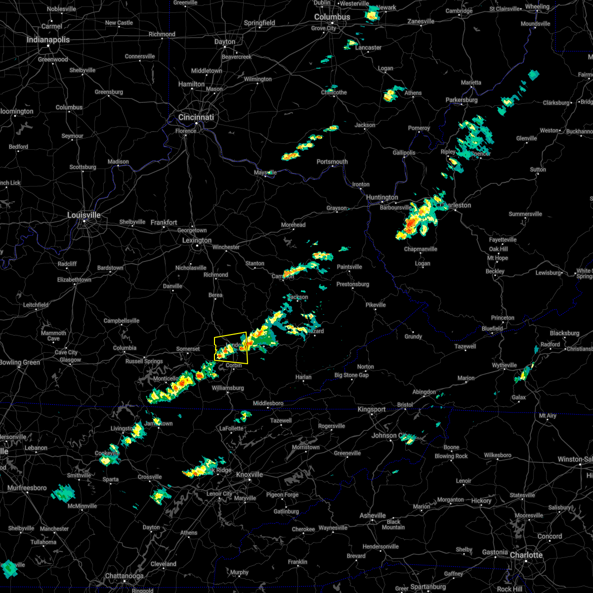 The severe thunderstorm warning for laurel, south central jackson and southern rockcastle counties will expire at 445 pm edt, the storm which prompted the warning has weakened below severe limits, and no longer poses an immediate threat to life or property. therefore, the warning will be allowed to expire. however gusty winds are still possible with this thunderstorm. The severe thunderstorm warning for laurel, south central jackson and southern rockcastle counties will expire at 445 pm edt, the storm which prompted the warning has weakened below severe limits, and no longer poses an immediate threat to life or property. therefore, the warning will be allowed to expire. however gusty winds are still possible with this thunderstorm.
|
| 10/21/2021 4:16 PM EDT |
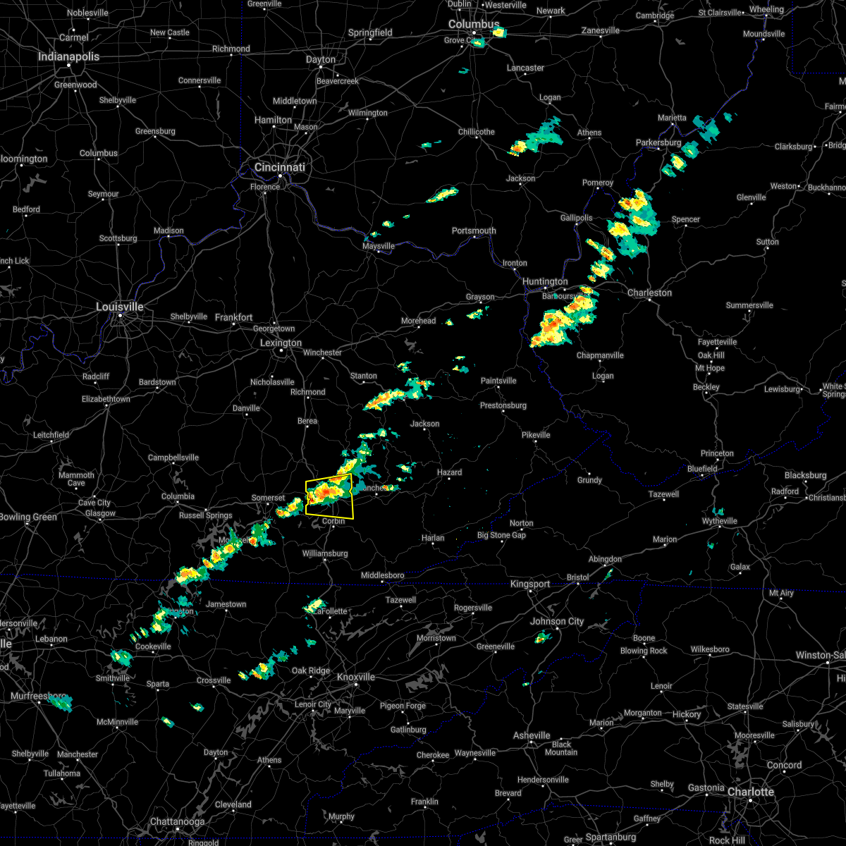 At 416 pm edt, a severe thunderstorm was located over bernstadt, or near london, moving east at 25 mph (radar indicated). Hazards include 60 mph wind gusts. Expect damage to roofs, siding, and trees. this severe storm will be near, london around 420 pm edt. Other locations in the path of this severe thunderstorm include sublimity city, london-corbin airport, maplesville and lesbas. At 416 pm edt, a severe thunderstorm was located over bernstadt, or near london, moving east at 25 mph (radar indicated). Hazards include 60 mph wind gusts. Expect damage to roofs, siding, and trees. this severe storm will be near, london around 420 pm edt. Other locations in the path of this severe thunderstorm include sublimity city, london-corbin airport, maplesville and lesbas.
|
| 10/21/2021 4:00 PM EDT |
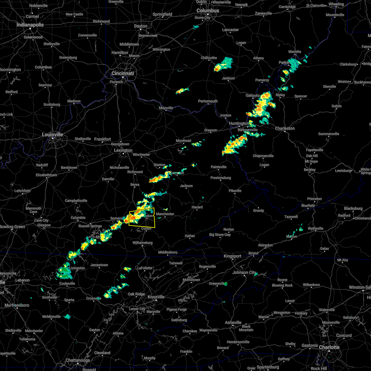 At 359 pm edt, a severe thunderstorm was located near billows, or 12 miles west of london, moving east at 25 mph (radar indicated). Hazards include 60 mph wind gusts. Expect damage to roofs, siding, and trees. this severe thunderstorm will be near, bunch around 410 pm edt. bernstadt around 415 pm edt. Other locations in the path of this severe thunderstorm include london, sublimity city, maplesville and lesbas. At 359 pm edt, a severe thunderstorm was located near billows, or 12 miles west of london, moving east at 25 mph (radar indicated). Hazards include 60 mph wind gusts. Expect damage to roofs, siding, and trees. this severe thunderstorm will be near, bunch around 410 pm edt. bernstadt around 415 pm edt. Other locations in the path of this severe thunderstorm include london, sublimity city, maplesville and lesbas.
|
| 7/1/2021 1:14 AM EDT |
 At 113 am edt, a severe thunderstorm was located over pongo, or 9 miles south of mount vernon, moving northeast at 25 mph (radar indicated). Hazards include 60 mph wind gusts. Expect damage to roofs, siding, and trees. this severe thunderstorm will be near, sand hill around 125 am edt. camp wildcat around 130 am edt. Other locations in the path of this severe thunderstorm include gauley, templer, carico and middlefork. At 113 am edt, a severe thunderstorm was located over pongo, or 9 miles south of mount vernon, moving northeast at 25 mph (radar indicated). Hazards include 60 mph wind gusts. Expect damage to roofs, siding, and trees. this severe thunderstorm will be near, sand hill around 125 am edt. camp wildcat around 130 am edt. Other locations in the path of this severe thunderstorm include gauley, templer, carico and middlefork.
|
| 6/21/2021 4:56 PM EDT |
 At 456 pm edt, a severe thunderstorm was located over hazel patch, or 9 miles northwest of london, moving east at 50 mph (radar indicated). Hazards include 60 mph wind gusts. Expect damage to roofs, siding, and trees. this severe thunderstorm will be near, mershons around 500 pm edt. peoples around 505 pm edt. moores creek around 510 pm edt. welchburg around 515 pm edt. Other locations in the path of this severe thunderstorm include maulden and island city. At 456 pm edt, a severe thunderstorm was located over hazel patch, or 9 miles northwest of london, moving east at 50 mph (radar indicated). Hazards include 60 mph wind gusts. Expect damage to roofs, siding, and trees. this severe thunderstorm will be near, mershons around 500 pm edt. peoples around 505 pm edt. moores creek around 510 pm edt. welchburg around 515 pm edt. Other locations in the path of this severe thunderstorm include maulden and island city.
|
| 6/21/2021 4:48 PM EDT |
 At 448 pm edt, a severe thunderstorm was located over billows, or 10 miles northwest of london, moving east at 55 mph (radar indicated). Hazards include 60 mph wind gusts. Expect damage to roofs, siding, and trees. Locations impacted include, east bernstadt, atlanta and mcwhorter. At 448 pm edt, a severe thunderstorm was located over billows, or 10 miles northwest of london, moving east at 55 mph (radar indicated). Hazards include 60 mph wind gusts. Expect damage to roofs, siding, and trees. Locations impacted include, east bernstadt, atlanta and mcwhorter.
|
| 6/21/2021 4:34 PM EDT |
 At 434 pm edt, a severe thunderstorm was located over bent, or 7 miles east of somerset, moving east at 55 mph (radar indicated). Hazards include 60 mph wind gusts. Expect damage to roofs, siding, and trees. this severe thunderstorm will be near, billows around 445 pm edt. bernstadt around 450 pm edt. Other locations in the path of this severe thunderstorm include hare and atlanta. At 434 pm edt, a severe thunderstorm was located over bent, or 7 miles east of somerset, moving east at 55 mph (radar indicated). Hazards include 60 mph wind gusts. Expect damage to roofs, siding, and trees. this severe thunderstorm will be near, billows around 445 pm edt. bernstadt around 450 pm edt. Other locations in the path of this severe thunderstorm include hare and atlanta.
|
| 6/13/2021 7:17 PM EDT |
 At 716 pm edt, a severe thunderstorm was located over greenmount, or 9 miles northeast of london, moving southeast at 25 mph (radar indicated). Hazards include 60 mph wind gusts and penny size hail. Expect damage to roofs, siding, and trees. Locations impacted include, royrader, benge and langnau. At 716 pm edt, a severe thunderstorm was located over greenmount, or 9 miles northeast of london, moving southeast at 25 mph (radar indicated). Hazards include 60 mph wind gusts and penny size hail. Expect damage to roofs, siding, and trees. Locations impacted include, royrader, benge and langnau.
|
| 6/13/2021 6:57 PM EDT |
 At 656 pm edt, a severe thunderstorm was located over middlefork, or 7 miles southwest of mckee, moving southeast at 25 mph (radar indicated). Hazards include 60 mph wind gusts and penny size hail. Expect damage to roofs, siding, and trees. this severe thunderstorm will be near, templer around 700 pm edt. parrot around 705 pm edt. peoples around 710 pm edt. greenmount around 715 pm edt. Other locations in the path of this severe thunderstorm include mcwhorter and langnau. At 656 pm edt, a severe thunderstorm was located over middlefork, or 7 miles southwest of mckee, moving southeast at 25 mph (radar indicated). Hazards include 60 mph wind gusts and penny size hail. Expect damage to roofs, siding, and trees. this severe thunderstorm will be near, templer around 700 pm edt. parrot around 705 pm edt. peoples around 710 pm edt. greenmount around 715 pm edt. Other locations in the path of this severe thunderstorm include mcwhorter and langnau.
|
| 6/12/2021 5:23 PM EDT |
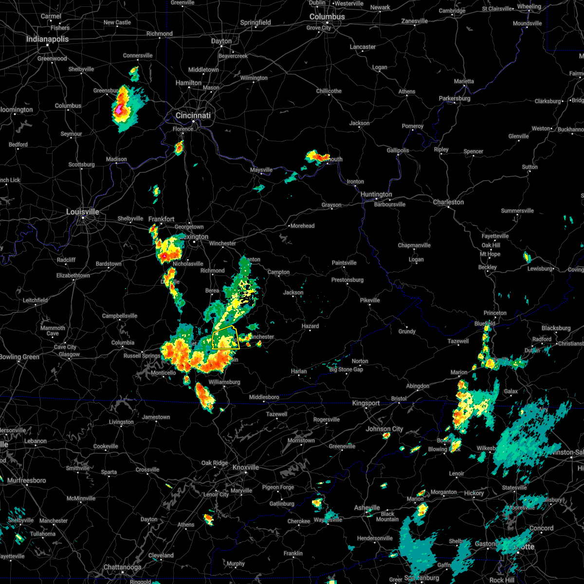 The severe thunderstorm warning for central laurel and southern rockcastle counties will expire at 530 pm edt, the storm which prompted the warning has weakened below severe limits, and has exited the warned area. therefore, the warning will be allowed to expire. The severe thunderstorm warning for central laurel and southern rockcastle counties will expire at 530 pm edt, the storm which prompted the warning has weakened below severe limits, and has exited the warned area. therefore, the warning will be allowed to expire.
|
| 6/12/2021 5:08 PM EDT |
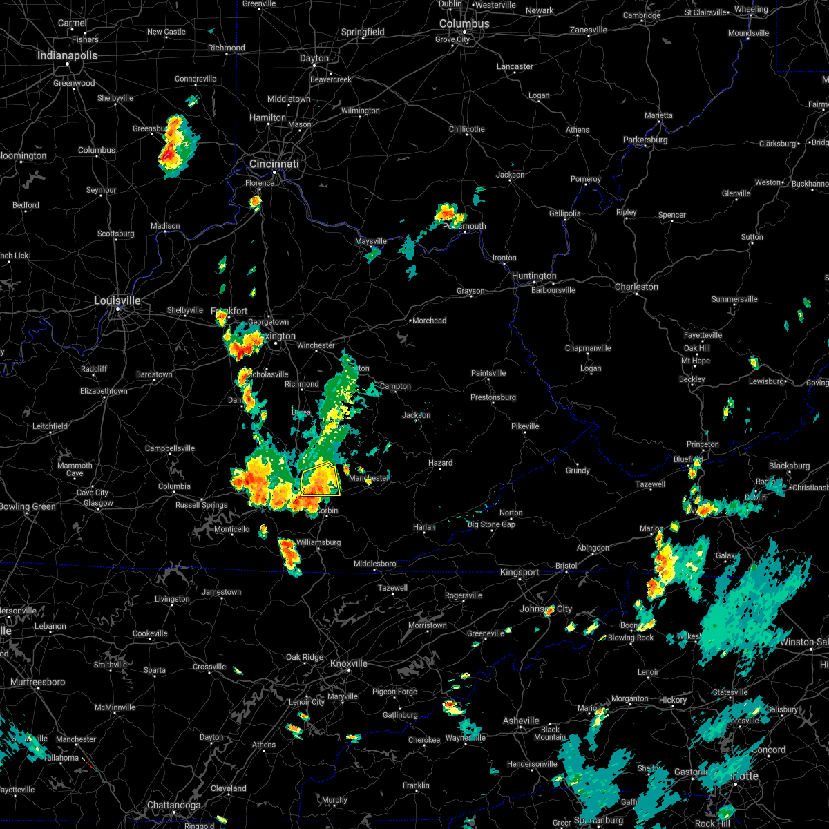 At 508 pm edt, a severe thunderstorm was located over hare, or 7 miles northwest of london, moving south at 15 mph (radar indicated). Hazards include 60 mph wind gusts and penny size hail. Expect damage to roofs, siding, and trees. Locations impacted include, east bernstadt, carmichael, bernstadt and london. At 508 pm edt, a severe thunderstorm was located over hare, or 7 miles northwest of london, moving south at 15 mph (radar indicated). Hazards include 60 mph wind gusts and penny size hail. Expect damage to roofs, siding, and trees. Locations impacted include, east bernstadt, carmichael, bernstadt and london.
|
| 6/12/2021 4:58 PM EDT | Multiple trees knocked down along highway 490 in the vicinity of east bernstad in laurel county KY, 0.5 miles N of East Bernstadt, KY |
| 6/12/2021 4:50 PM EDT |
 At 450 pm edt, a severe thunderstorm was located over lamero, or 11 miles southeast of mount vernon, moving south at 15 mph (radar indicated). Hazards include 60 mph wind gusts and nickel size hail. Expect damage to roofs, siding, and trees. this severe thunderstorm will be near, camp wildcat around 500 pm edt. hazel patch around 505 pm edt. Other locations in the path of this severe thunderstorm include hare, carmichael, pittsburg and london. At 450 pm edt, a severe thunderstorm was located over lamero, or 11 miles southeast of mount vernon, moving south at 15 mph (radar indicated). Hazards include 60 mph wind gusts and nickel size hail. Expect damage to roofs, siding, and trees. this severe thunderstorm will be near, camp wildcat around 500 pm edt. hazel patch around 505 pm edt. Other locations in the path of this severe thunderstorm include hare, carmichael, pittsburg and london.
|
| 4/8/2021 6:32 PM EDT |
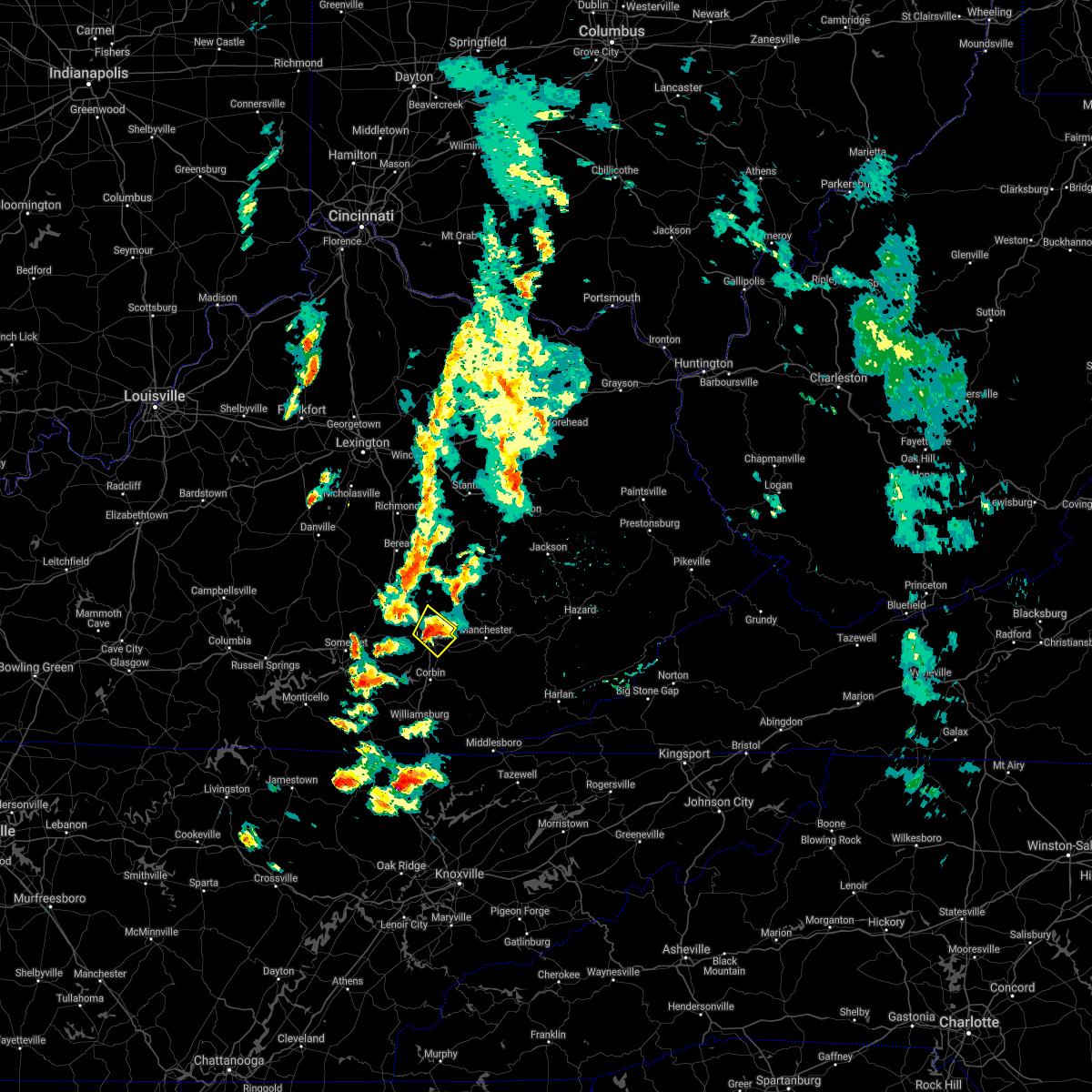 At 632 pm edt, a severe thunderstorm was located over atlanta, or 7 miles northeast of london, moving northeast at 35 mph (radar indicated). Hazards include 60 mph wind gusts and quarter size hail. Hail damage to vehicles is expected. expect wind damage to roofs, siding, and trees. locations impacted include, london, east bernstadt, maplesville, fariston, pittsburg, langnau, levi jackson s. p. Hare, mcwhorter, atlanta, carmichael and sublimity city. At 632 pm edt, a severe thunderstorm was located over atlanta, or 7 miles northeast of london, moving northeast at 35 mph (radar indicated). Hazards include 60 mph wind gusts and quarter size hail. Hail damage to vehicles is expected. expect wind damage to roofs, siding, and trees. locations impacted include, london, east bernstadt, maplesville, fariston, pittsburg, langnau, levi jackson s. p. Hare, mcwhorter, atlanta, carmichael and sublimity city.
|
| 4/8/2021 5:56 PM EDT |
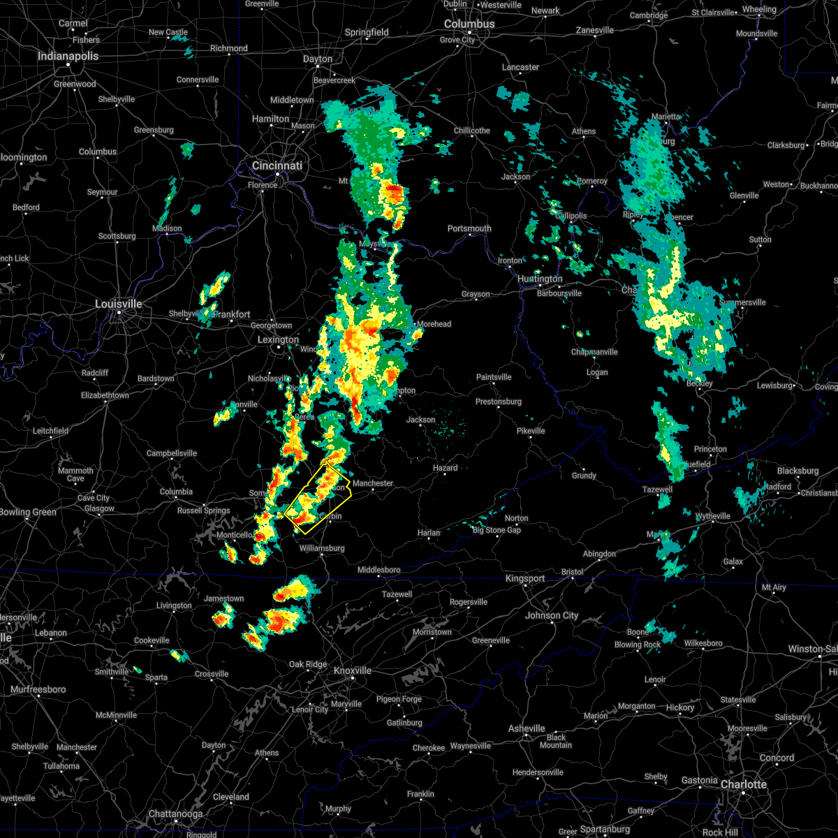 At 556 pm edt, a severe thunderstorm was located over rockcastle springs, or 14 miles southwest of london, moving northeast at 40 mph (radar indicated). Hazards include 60 mph wind gusts and quarter size hail. Hail damage to vehicles is expected. Expect wind damage to roofs, siding, and trees. At 556 pm edt, a severe thunderstorm was located over rockcastle springs, or 14 miles southwest of london, moving northeast at 40 mph (radar indicated). Hazards include 60 mph wind gusts and quarter size hail. Hail damage to vehicles is expected. Expect wind damage to roofs, siding, and trees.
|
| 4/8/2021 3:54 PM EDT |
 At 354 pm edt, a severe thunderstorm was located near valley oak, or 12 miles northeast of somerset, moving northeast at 50 mph (radar indicated). Hazards include 60 mph wind gusts and quarter size hail. Hail damage to vehicles is expected. Expect wind damage to roofs, siding, and trees. At 354 pm edt, a severe thunderstorm was located near valley oak, or 12 miles northeast of somerset, moving northeast at 50 mph (radar indicated). Hazards include 60 mph wind gusts and quarter size hail. Hail damage to vehicles is expected. Expect wind damage to roofs, siding, and trees.
|
| 7/6/2020 7:38 PM EDT |
 The severe thunderstorm warning for central laurel, northeastern pulaski and southwestern rockcastle counties will expire at 745 pm edt, the storm which prompted the warning has weakened below severe limits, and no longer poses an immediate threat to life or property. therefore, the warning will be allowed to expire. The severe thunderstorm warning for central laurel, northeastern pulaski and southwestern rockcastle counties will expire at 745 pm edt, the storm which prompted the warning has weakened below severe limits, and no longer poses an immediate threat to life or property. therefore, the warning will be allowed to expire.
|
| 7/6/2020 7:11 PM EDT |
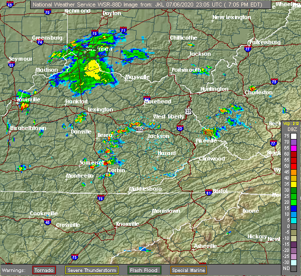 At 710 pm edt, a severe thunderstorm was located over london, moving west at 25 mph (radar indicated). Hazards include 60 mph wind gusts and quarter size hail. Hail damage to vehicles is expected. Expect wind damage to roofs, siding, and trees. At 710 pm edt, a severe thunderstorm was located over london, moving west at 25 mph (radar indicated). Hazards include 60 mph wind gusts and quarter size hail. Hail damage to vehicles is expected. Expect wind damage to roofs, siding, and trees.
|
| 6/21/2020 7:43 PM EDT |
 The severe thunderstorm warning for central laurel, southern jackson and northwestern clay counties will expire at 745 pm edt, the storm which prompted the warning has weakened below severe limits, and no longer poses an immediate threat to life or property. therefore, the warning will be allowed to expire. however gusty winds are still possible with this thunderstorm. to report severe weather, contact your nearest law enforcement agency. they will relay your report to the national weather service jackson ky. The severe thunderstorm warning for central laurel, southern jackson and northwestern clay counties will expire at 745 pm edt, the storm which prompted the warning has weakened below severe limits, and no longer poses an immediate threat to life or property. therefore, the warning will be allowed to expire. however gusty winds are still possible with this thunderstorm. to report severe weather, contact your nearest law enforcement agency. they will relay your report to the national weather service jackson ky.
|
| 6/21/2020 7:29 PM EDT |
 At 729 pm edt, a severe thunderstorm was located over langnau, or near london, moving east at 45 mph (radar indicated). Hazards include 60 mph wind gusts. Expect damage to roofs, siding, and trees. Locations impacted include, london, carico, grace, fariston, pittsburg, shop branch, fogertown, treadway, hurley, settle store, mershons and shepherdtown. At 729 pm edt, a severe thunderstorm was located over langnau, or near london, moving east at 45 mph (radar indicated). Hazards include 60 mph wind gusts. Expect damage to roofs, siding, and trees. Locations impacted include, london, carico, grace, fariston, pittsburg, shop branch, fogertown, treadway, hurley, settle store, mershons and shepherdtown.
|
| 6/21/2020 7:08 PM EDT |
 At 708 pm edt, a severe thunderstorm was located over hightop, or 7 miles southwest of london, moving northeast at 40 mph (radar indicated). Hazards include 60 mph wind gusts. expect damage to roofs, siding, and trees At 708 pm edt, a severe thunderstorm was located over hightop, or 7 miles southwest of london, moving northeast at 40 mph (radar indicated). Hazards include 60 mph wind gusts. expect damage to roofs, siding, and trees
|
| 6/21/2020 3:03 PM EDT |
 At 303 pm edt, a severe thunderstorm was located over moores creek, or 11 miles northeast of london, moving northeast at 30 mph (radar indicated). Hazards include 60 mph wind gusts. Expect damage to roofs, siding, and trees. Locations impacted include, london, olin, egypt, shop branch, annville, mcwhorter, atlanta, settle store, deese, datha, victory and middlefork. At 303 pm edt, a severe thunderstorm was located over moores creek, or 11 miles northeast of london, moving northeast at 30 mph (radar indicated). Hazards include 60 mph wind gusts. Expect damage to roofs, siding, and trees. Locations impacted include, london, olin, egypt, shop branch, annville, mcwhorter, atlanta, settle store, deese, datha, victory and middlefork.
|
| 6/21/2020 2:56 PM EDT |
 At 255 pm edt, a severe thunderstorm was located over moores creek, or 9 miles south of mckee, moving northeast at 55 mph (radar indicated). Hazards include 60 mph wind gusts and penny size hail. Expect damage to roofs, siding, and trees. Locations impacted include, london, carico, olin, pittsburg, egypt, shop branch, annville, mcwhorter, atlanta, settle store, mershons and deese. At 255 pm edt, a severe thunderstorm was located over moores creek, or 9 miles south of mckee, moving northeast at 55 mph (radar indicated). Hazards include 60 mph wind gusts and penny size hail. Expect damage to roofs, siding, and trees. Locations impacted include, london, carico, olin, pittsburg, egypt, shop branch, annville, mcwhorter, atlanta, settle store, mershons and deese.
|
| 6/21/2020 2:43 PM EDT |
 At 242 pm edt, a severe thunderstorm was located over sublimity city, or over london, moving north at 30 mph (radar indicated). Hazards include 60 mph wind gusts and penny size hail. expect damage to roofs, siding, and trees At 242 pm edt, a severe thunderstorm was located over sublimity city, or over london, moving north at 30 mph (radar indicated). Hazards include 60 mph wind gusts and penny size hail. expect damage to roofs, siding, and trees
|
| 6/10/2020 7:10 PM EDT |
 The severe thunderstorm warning for northeastern laurel, owsley, southern jackson and northwestern clay counties will expire at 715 pm edt, the storms which prompted the warning have weakened below severe limits, and no longer pose an immediate threat to life or property. therefore, the warning will be allowed to expire. a severe thunderstorm watch remains in effect until 1000 pm edt for south central and southeastern kentucky. The severe thunderstorm warning for northeastern laurel, owsley, southern jackson and northwestern clay counties will expire at 715 pm edt, the storms which prompted the warning have weakened below severe limits, and no longer pose an immediate threat to life or property. therefore, the warning will be allowed to expire. a severe thunderstorm watch remains in effect until 1000 pm edt for south central and southeastern kentucky.
|
| 6/10/2020 7:06 PM EDT |
 At 706 pm edt, severe thunderstorms were located along a line extending from vincent to near maplesville, moving northeast at 35 mph (radar indicated). Hazards include 60 mph wind gusts. Expect damage to roofs, siding, and trees. Locations impacted include, manchester, mckee, booneville, turin, travellers rest, blake, southfork, shop branch, fogertown, tyner, privett and mershons. At 706 pm edt, severe thunderstorms were located along a line extending from vincent to near maplesville, moving northeast at 35 mph (radar indicated). Hazards include 60 mph wind gusts. Expect damage to roofs, siding, and trees. Locations impacted include, manchester, mckee, booneville, turin, travellers rest, blake, southfork, shop branch, fogertown, tyner, privett and mershons.
|
| 6/10/2020 6:51 PM EDT |
 At 651 pm edt, severe thunderstorms were located along a line extending from yellow rock to lily, moving northeast at 45 mph (radar indicated). Hazards include 60 mph wind gusts. Expect damage to roofs, siding, and trees. Locations impacted include, london, manchester, mckee, booneville, turin, donaro, travellers rest, blake, robinet, fariston, southfork and shop branch. At 651 pm edt, severe thunderstorms were located along a line extending from yellow rock to lily, moving northeast at 45 mph (radar indicated). Hazards include 60 mph wind gusts. Expect damage to roofs, siding, and trees. Locations impacted include, london, manchester, mckee, booneville, turin, donaro, travellers rest, blake, robinet, fariston, southfork and shop branch.
|
| 6/10/2020 6:45 PM EDT | Corrects previous tstm wnd dmg report from 1 ne hazel patch. several large trees down on hazel patch rd and winding blade r in laurel county KY, 5 miles SE of East Bernstadt, KY |
| 6/10/2020 6:45 PM EDT | Corrects previous tstm wnd dmg report from 1 ne hazel patch. several large trees down on hazel patch rd and winding blade r in laurel county KY, 5 miles SE of East Bernstadt, KY |
| 6/10/2020 6:42 PM EDT |
 The severe thunderstorm warning for laurel, northeastern pulaski, western jackson and rockcastle counties will expire at 645 pm edt, the warning is expiring, but has been replaced by a new severe thunderstorm warning ending at 7:15 pm edt. severe winds are still possible with these thunderstorms. a severe thunderstorm watch remains in effect until 1000 pm edt for south central and southeastern kentucky. The severe thunderstorm warning for laurel, northeastern pulaski, western jackson and rockcastle counties will expire at 645 pm edt, the warning is expiring, but has been replaced by a new severe thunderstorm warning ending at 7:15 pm edt. severe winds are still possible with these thunderstorms. a severe thunderstorm watch remains in effect until 1000 pm edt for south central and southeastern kentucky.
|
| 6/10/2020 6:40 PM EDT |
 At 640 pm edt, severe thunderstorms were located along a line extending from wind cave to vox, moving northeast at 45 mph (radar indicated). Hazards include 60 mph wind gusts and penny size hail. expect damage to roofs, siding, and trees At 640 pm edt, severe thunderstorms were located along a line extending from wind cave to vox, moving northeast at 45 mph (radar indicated). Hazards include 60 mph wind gusts and penny size hail. expect damage to roofs, siding, and trees
|
| 6/10/2020 6:31 PM EDT |
 At 630 pm edt, severe thunderstorms were located along a line extending from jinks to near billows, moving northeast at 40 mph (radar indicated). Hazards include 70 mph wind gusts. Expect considerable tree damage. damage is likely to mobile homes, roofs, and outbuildings. Locations impacted include, london, mount vernon, mckee, carico, sand springs, donaro, bummer, threelinks, robinet, pittsburg, shop branch and horse lick. At 630 pm edt, severe thunderstorms were located along a line extending from jinks to near billows, moving northeast at 40 mph (radar indicated). Hazards include 70 mph wind gusts. Expect considerable tree damage. damage is likely to mobile homes, roofs, and outbuildings. Locations impacted include, london, mount vernon, mckee, carico, sand springs, donaro, bummer, threelinks, robinet, pittsburg, shop branch and horse lick.
|
| 6/10/2020 6:11 PM EDT |
 At 611 pm edt, severe thunderstorms were located along a line extending from morrill to dykes, moving northeast at 40 mph (radar indicated). Hazards include 70 mph wind gusts and penny size hail. Expect considerable tree damage. Damage is likely to mobile homes, roofs, and outbuildings. At 611 pm edt, severe thunderstorms were located along a line extending from morrill to dykes, moving northeast at 40 mph (radar indicated). Hazards include 70 mph wind gusts and penny size hail. Expect considerable tree damage. Damage is likely to mobile homes, roofs, and outbuildings.
|
| 5/18/2020 7:12 PM EDT |
 The severe thunderstorm warning for northern laurel, southwestern jackson and southeastern rockcastle counties will expire at 715 pm edt, the storm which prompted the warning has weakened below severe limits, and no longer poses an immediate threat to life or property. therefore, the warning will be allowed to expire. however heavy rain is still possible with this thunderstorm. a tornado watch remains in effect until 900 pm edt for south central and southeastern kentucky. to report severe weather, contact your nearest law enforcement agency. they will relay your report to the national weather service jackson ky. The severe thunderstorm warning for northern laurel, southwestern jackson and southeastern rockcastle counties will expire at 715 pm edt, the storm which prompted the warning has weakened below severe limits, and no longer poses an immediate threat to life or property. therefore, the warning will be allowed to expire. however heavy rain is still possible with this thunderstorm. a tornado watch remains in effect until 900 pm edt for south central and southeastern kentucky. to report severe weather, contact your nearest law enforcement agency. they will relay your report to the national weather service jackson ky.
|
| 5/18/2020 6:57 PM EDT |
 At 657 pm edt, a severe thunderstorm was located over lamero, or 11 miles southeast of mount vernon, moving northeast at 20 mph (radar indicated). Hazards include 60 mph wind gusts and quarter size hail. Hail damage to vehicles is expected. expect wind damage to roofs, siding, and trees. Locations impacted include, carico, donaro, robinet, wood creek lake, shop branch, annville, mcwhorter, horse lick, lamero, atlanta, mershons and hazel patch. At 657 pm edt, a severe thunderstorm was located over lamero, or 11 miles southeast of mount vernon, moving northeast at 20 mph (radar indicated). Hazards include 60 mph wind gusts and quarter size hail. Hail damage to vehicles is expected. expect wind damage to roofs, siding, and trees. Locations impacted include, carico, donaro, robinet, wood creek lake, shop branch, annville, mcwhorter, horse lick, lamero, atlanta, mershons and hazel patch.
|
| 5/18/2020 6:39 PM EDT |
 At 639 pm edt, a severe thunderstorm was located over luner, or 11 miles northwest of london, moving northeast at 20 mph (radar indicated). Hazards include 60 mph wind gusts and quarter size hail. Hail damage to vehicles is expected. Expect wind damage to roofs, siding, and trees. At 639 pm edt, a severe thunderstorm was located over luner, or 11 miles northwest of london, moving northeast at 20 mph (radar indicated). Hazards include 60 mph wind gusts and quarter size hail. Hail damage to vehicles is expected. Expect wind damage to roofs, siding, and trees.
|
| 4/9/2020 12:58 AM EDT |
 The severe thunderstorm warning for northern laurel, owsley, southern estill, jackson, rockcastle, lee and northwestern clay counties will expire at 100 am edt, the storm which prompted the warning is still capable of producing large hail and damaging winds. the warning will be allowed to expire at its designated time, but has been replaced with a new severe thunderstorm warning in effect until 5:30 am edt. a tornado watch remains in effect until 400 am edt for south central, southeastern and east central kentucky. to report severe weather, contact your nearest law enforcement agency. they will relay your report to the national weather service jackson ky. The severe thunderstorm warning for northern laurel, owsley, southern estill, jackson, rockcastle, lee and northwestern clay counties will expire at 100 am edt, the storm which prompted the warning is still capable of producing large hail and damaging winds. the warning will be allowed to expire at its designated time, but has been replaced with a new severe thunderstorm warning in effect until 5:30 am edt. a tornado watch remains in effect until 400 am edt for south central, southeastern and east central kentucky. to report severe weather, contact your nearest law enforcement agency. they will relay your report to the national weather service jackson ky.
|
| 4/9/2020 12:56 AM EDT |
 At 1255 am edt, severe thunderstorms were located along a line extending from ravenna to camp wildcat, moving east at 60 mph (public reported quarter size hail in mt. vernon). Hazards include 60 mph wind gusts and quarter size hail. Hail damage to vehicles is expected. Expect wind damage to roofs, siding, and trees. At 1255 am edt, severe thunderstorms were located along a line extending from ravenna to camp wildcat, moving east at 60 mph (public reported quarter size hail in mt. vernon). Hazards include 60 mph wind gusts and quarter size hail. Hail damage to vehicles is expected. Expect wind damage to roofs, siding, and trees.
|
| 4/9/2020 12:46 AM EDT |
 At 1246 am edt, severe thunderstorms were located along a line extending from wagersville to near woodstock, moving east at 65 mph (radar indicated). Hazards include 60 mph wind gusts and quarter size hail. Hail damage to vehicles is expected. expect wind damage to roofs, siding, and trees. Locations impacted include, london, irvine, mount vernon, beattyville, mckee, booneville, boone, ravenna, turin, donaro, travellers rest and bummer. At 1246 am edt, severe thunderstorms were located along a line extending from wagersville to near woodstock, moving east at 65 mph (radar indicated). Hazards include 60 mph wind gusts and quarter size hail. Hail damage to vehicles is expected. expect wind damage to roofs, siding, and trees. Locations impacted include, london, irvine, mount vernon, beattyville, mckee, booneville, boone, ravenna, turin, donaro, travellers rest and bummer.
|
| 4/9/2020 12:21 AM EDT |
 At 1220 am edt, severe thunderstorms were located along a line extending from 8 miles west of richmond to near liberty, moving east at 65 mph (radar indicated). Hazards include 60 mph wind gusts and quarter size hail. Hail damage to vehicles is expected. Expect wind damage to roofs, siding, and trees. At 1220 am edt, severe thunderstorms were located along a line extending from 8 miles west of richmond to near liberty, moving east at 65 mph (radar indicated). Hazards include 60 mph wind gusts and quarter size hail. Hail damage to vehicles is expected. Expect wind damage to roofs, siding, and trees.
|
| 6/24/2019 4:05 PM EDT | Tree were blown dow in laurel county KY, 0.5 miles N of East Bernstadt, KY |
| 6/24/2019 4:01 PM EDT |
 At 400 pm edt, a severe thunderstorm was located over london, moving northeast at 55 mph (radar indicated). Hazards include 60 mph wind gusts. Expect damage to roofs, siding, and trees. Locations impacted include, london, manchester, carico, grace, fariston, pittsburg, zekes point, lake, cane creek, fogertown, tyner and bush. At 400 pm edt, a severe thunderstorm was located over london, moving northeast at 55 mph (radar indicated). Hazards include 60 mph wind gusts. Expect damage to roofs, siding, and trees. Locations impacted include, london, manchester, carico, grace, fariston, pittsburg, zekes point, lake, cane creek, fogertown, tyner and bush.
|
| 6/24/2019 3:35 PM EDT |
 At 335 pm edt, a severe thunderstorm was located near mount victory, or 11 miles southeast of somerset, moving northeast at 55 mph (radar indicated). Hazards include 60 mph wind gusts. expect damage to roofs, siding, and trees At 335 pm edt, a severe thunderstorm was located near mount victory, or 11 miles southeast of somerset, moving northeast at 55 mph (radar indicated). Hazards include 60 mph wind gusts. expect damage to roofs, siding, and trees
|
| 6/23/2019 7:58 PM EDT |
 The severe thunderstorm warning for northern laurel, southwestern jackson, central rockcastle and west central clay counties will expire at 800 pm edt, the storm which prompted the warning has moved out of the area. therefore, the warning will be allowed to expire. The severe thunderstorm warning for northern laurel, southwestern jackson, central rockcastle and west central clay counties will expire at 800 pm edt, the storm which prompted the warning has moved out of the area. therefore, the warning will be allowed to expire.
|
| 6/23/2019 7:36 PM EDT | Trees down near dollier miller roada nd ky highway 137 in laurel county KY, 1.4 miles SW of East Bernstadt, KY |
| 6/23/2019 7:34 PM EDT |
 The national weather service in jackson ky has issued a * severe thunderstorm warning for. northeastern laurel county in south central kentucky. owsley county in southeastern kentucky. northwestern perry county in southeastern kentucky. Jackson county in southeastern kentucky. The national weather service in jackson ky has issued a * severe thunderstorm warning for. northeastern laurel county in south central kentucky. owsley county in southeastern kentucky. northwestern perry county in southeastern kentucky. Jackson county in southeastern kentucky.
|
| 6/23/2019 7:25 PM EDT |
 At 725 pm edt, a severe thunderstorm was located over lamero, or 11 miles north of london, moving east at 50 mph (radar indicated). Hazards include 60 mph wind gusts. Expect damage to roofs, siding, and trees. Locations impacted include, mount vernon, carico, donaro, bummer, robinet, shop branch, horse lick, wabp, hansford, renfro valley, hurley and mershons. At 725 pm edt, a severe thunderstorm was located over lamero, or 11 miles north of london, moving east at 50 mph (radar indicated). Hazards include 60 mph wind gusts. Expect damage to roofs, siding, and trees. Locations impacted include, mount vernon, carico, donaro, bummer, robinet, shop branch, horse lick, wabp, hansford, renfro valley, hurley and mershons.
|
| 6/23/2019 7:04 PM EDT |
 At 704 pm edt, a severe thunderstorm was located over valley oak, or 12 miles southwest of mount vernon, moving east at 30 mph (radar indicated). Hazards include 60 mph wind gusts. expect damage to roofs, siding, and trees At 704 pm edt, a severe thunderstorm was located over valley oak, or 12 miles southwest of mount vernon, moving east at 30 mph (radar indicated). Hazards include 60 mph wind gusts. expect damage to roofs, siding, and trees
|
| 6/21/2019 10:55 PM EDT |
 At 1054 pm edt, severe thunderstorms were located along a line extending from bent to near cumberland falls s.p. to near hollyhill, moving east at 45 mph (radar indicated). Hazards include 60 mph wind gusts and penny size hail. expect damage to roofs, siding, and trees At 1054 pm edt, severe thunderstorms were located along a line extending from bent to near cumberland falls s.p. to near hollyhill, moving east at 45 mph (radar indicated). Hazards include 60 mph wind gusts and penny size hail. expect damage to roofs, siding, and trees
|
| 2/7/2019 6:13 AM EST |
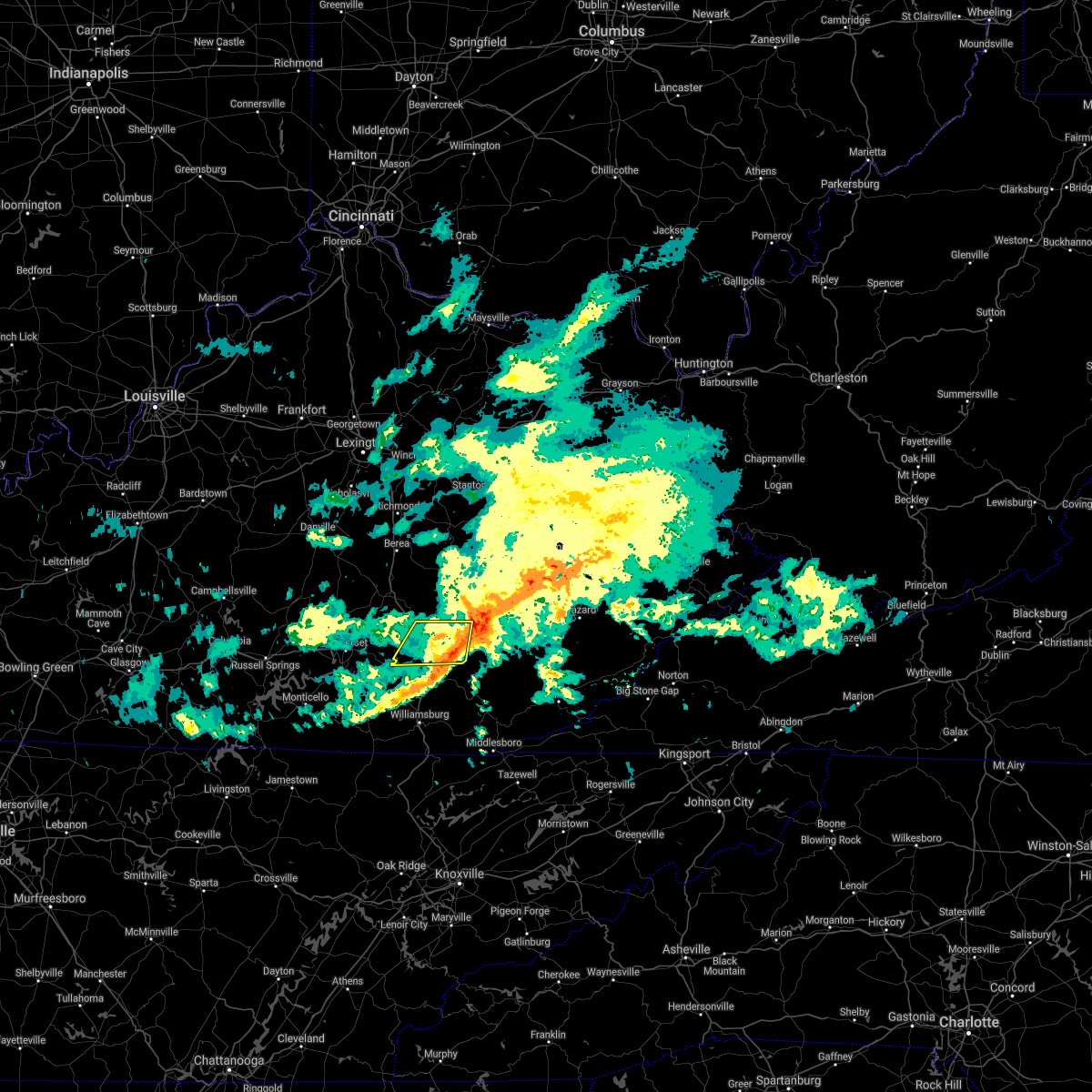 The severe thunderstorm warning for central laurel and west central clay counties will expire at 615 am est, the storm which prompted the warning has weakened below severe limits, and no longer poses an immediate threat to life or property. therefore, the warning will be allowed to expire. however gusty winds and heavy rain are still possible with this thunderstorm. The severe thunderstorm warning for central laurel and west central clay counties will expire at 615 am est, the storm which prompted the warning has weakened below severe limits, and no longer poses an immediate threat to life or property. therefore, the warning will be allowed to expire. however gusty winds and heavy rain are still possible with this thunderstorm.
|
| 2/7/2019 5:59 AM EST |
 At 558 am est, a severe thunderstorm was located over london, moving east at 60 mph (radar indicated). Hazards include 60 mph wind gusts. Expect damage to roofs, siding, and trees. Locations impacted include, london, grace, fariston, wood creek lake, pittsburg, langnau, lake, cane creek, fogertown, sasser, bush and bunch. At 558 am est, a severe thunderstorm was located over london, moving east at 60 mph (radar indicated). Hazards include 60 mph wind gusts. Expect damage to roofs, siding, and trees. Locations impacted include, london, grace, fariston, wood creek lake, pittsburg, langnau, lake, cane creek, fogertown, sasser, bush and bunch.
|
| 2/7/2019 5:46 AM EST |
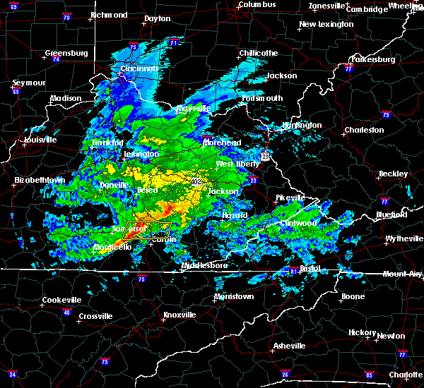 At 546 am est, a severe thunderstorm was located near billows, or 12 miles west of london, moving east at 60 mph (radar indicated). Hazards include 60 mph wind gusts. expect damage to roofs, siding, and trees At 546 am est, a severe thunderstorm was located near billows, or 12 miles west of london, moving east at 60 mph (radar indicated). Hazards include 60 mph wind gusts. expect damage to roofs, siding, and trees
|
| 8/16/2018 4:25 PM EDT |
 The severe thunderstorm warning for northern laurel and southern rockcastle counties will expire at 430 pm edt, the storm which prompted the warning has moved out of the area. therefore, the warning will be allowed to expire. however gusty winds are still possible with this thunderstorm. The severe thunderstorm warning for northern laurel and southern rockcastle counties will expire at 430 pm edt, the storm which prompted the warning has moved out of the area. therefore, the warning will be allowed to expire. however gusty winds are still possible with this thunderstorm.
|
| 8/16/2018 4:05 PM EDT |
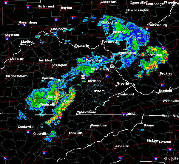 At 404 pm edt, a severe thunderstorm was located over luner, or 10 miles southeast of mount vernon, moving northeast at 35 mph (radar indicated). Hazards include 60 mph wind gusts. Expect damage to roofs, siding, and trees. Locations impacted include, mount vernon, donaro, robinet, wood creek lake, pittsburg, pongo, mcwhorter, horse lick, lamero, hansford, atlanta and mershons. At 404 pm edt, a severe thunderstorm was located over luner, or 10 miles southeast of mount vernon, moving northeast at 35 mph (radar indicated). Hazards include 60 mph wind gusts. Expect damage to roofs, siding, and trees. Locations impacted include, mount vernon, donaro, robinet, wood creek lake, pittsburg, pongo, mcwhorter, horse lick, lamero, hansford, atlanta and mershons.
|
| 8/16/2018 3:51 PM EDT |
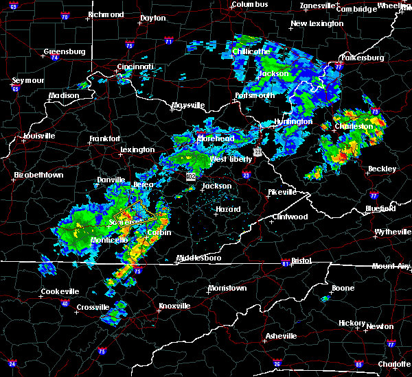 At 351 pm edt, a severe thunderstorm was located near bloss, or 13 miles south of mount vernon, moving northeast at 35 mph (radar indicated). Hazards include 60 mph wind gusts. expect damage to roofs, siding, and trees At 351 pm edt, a severe thunderstorm was located near bloss, or 13 miles south of mount vernon, moving northeast at 35 mph (radar indicated). Hazards include 60 mph wind gusts. expect damage to roofs, siding, and trees
|
| 7/20/2018 8:07 PM EDT |
 At 806 pm edt, a severe thunderstorm was located over pittsburg, or near london, moving east at 25 mph (radar indicated). Hazards include 60 mph wind gusts and quarter size hail. Hail damage to vehicles is expected. Expect wind damage to roofs, siding, and trees. At 806 pm edt, a severe thunderstorm was located over pittsburg, or near london, moving east at 25 mph (radar indicated). Hazards include 60 mph wind gusts and quarter size hail. Hail damage to vehicles is expected. Expect wind damage to roofs, siding, and trees.
|
| 6/26/2018 2:08 PM EDT |
 At 208 pm edt, a severe thunderstorm was located over julip, or near williamsburg, moving east at 25 mph (radar indicated). Hazards include 60 mph wind gusts and penny size hail. Expect damage to roofs, siding, and trees. Locations impacted include, london, manchester, grace, fariston, pittsburg, brightshade, lake, cane creek, salt gum, goose rock, barcreek and bush. At 208 pm edt, a severe thunderstorm was located over julip, or near williamsburg, moving east at 25 mph (radar indicated). Hazards include 60 mph wind gusts and penny size hail. Expect damage to roofs, siding, and trees. Locations impacted include, london, manchester, grace, fariston, pittsburg, brightshade, lake, cane creek, salt gum, goose rock, barcreek and bush.
|
| 6/26/2018 1:46 PM EDT |
 At 146 pm edt, a severe thunderstorm was located near sublimity city, or near london, moving east at 35 mph (radar indicated). Hazards include 60 mph wind gusts and penny size hail. expect damage to roofs, siding, and trees At 146 pm edt, a severe thunderstorm was located near sublimity city, or near london, moving east at 35 mph (radar indicated). Hazards include 60 mph wind gusts and penny size hail. expect damage to roofs, siding, and trees
|
| 6/26/2018 1:29 PM EDT |
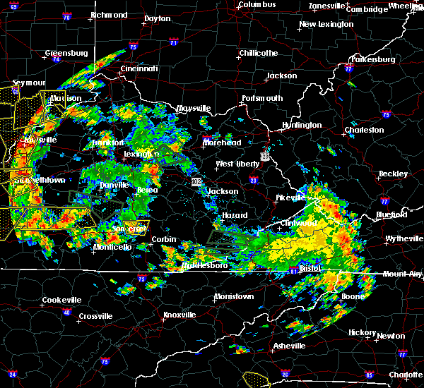 At 128 pm edt, a severe thunderstorm was located over billows, or 11 miles west of london, moving east at 25 mph (radar indicated). Hazards include 60 mph wind gusts. Expect damage to roofs, siding, and trees. Locations impacted include, bernstadt, bloss, luner, wood creek lake, bunch, billows, hazel patch, pongo, hare and east bernstadt. At 128 pm edt, a severe thunderstorm was located over billows, or 11 miles west of london, moving east at 25 mph (radar indicated). Hazards include 60 mph wind gusts. Expect damage to roofs, siding, and trees. Locations impacted include, bernstadt, bloss, luner, wood creek lake, bunch, billows, hazel patch, pongo, hare and east bernstadt.
|
| 6/26/2018 1:11 PM EDT |
 At 111 pm edt, a severe thunderstorm was located over valley oak, or 11 miles northeast of somerset, moving east at 25 mph (radar indicated). Hazards include 60 mph wind gusts. expect damage to roofs, siding, and trees At 111 pm edt, a severe thunderstorm was located over valley oak, or 11 miles northeast of somerset, moving east at 25 mph (radar indicated). Hazards include 60 mph wind gusts. expect damage to roofs, siding, and trees
|
| 6/22/2018 7:46 PM EDT |
 At 746 pm edt, severe thunderstorms were located along a line extending from wellhope to bloss to pulaski county park, moving east at 35 mph (radar indicated). Hazards include 60 mph wind gusts and penny size hail. Expect damage to roofs, siding, and trees. Locations impacted include, somerset, mount vernon, science hill, burnside, donaro, robinet, bandy, woodstock, horse lick, spiro, wabp and hansford. At 746 pm edt, severe thunderstorms were located along a line extending from wellhope to bloss to pulaski county park, moving east at 35 mph (radar indicated). Hazards include 60 mph wind gusts and penny size hail. Expect damage to roofs, siding, and trees. Locations impacted include, somerset, mount vernon, science hill, burnside, donaro, robinet, bandy, woodstock, horse lick, spiro, wabp and hansford.
|
| 6/22/2018 7:28 PM EDT |
 At 727 pm edt, severe thunderstorms were located along a line extending from woodstock to dabney to near faubush, moving east at 35 mph (radar indicated). Hazards include 60 mph wind gusts and penny size hail. expect damage to roofs, siding, and trees At 727 pm edt, severe thunderstorms were located along a line extending from woodstock to dabney to near faubush, moving east at 35 mph (radar indicated). Hazards include 60 mph wind gusts and penny size hail. expect damage to roofs, siding, and trees
|
| 5/15/2018 3:59 PM EDT |
 At 359 pm edt, a severe thunderstorm was located over atlanta, or near london, moving northeast at 20 mph (radar indicated). Hazards include half dollar size hail. Damage to vehicles is expected. this severe thunderstorm will be near, greenmount, mcwhorter and peoples around 410 pm edt. moores creek around 415 pm edt. green hill, royrader, bond, benge and fogertown around 420 pm edt. datha and annville around 425 pm edt. high knob, welchburg and settle store around 430 pm edt. egypt, shepherdtown, tyner and malcomb around 435 pm edt. Burning springs around 440 pm edt. At 359 pm edt, a severe thunderstorm was located over atlanta, or near london, moving northeast at 20 mph (radar indicated). Hazards include half dollar size hail. Damage to vehicles is expected. this severe thunderstorm will be near, greenmount, mcwhorter and peoples around 410 pm edt. moores creek around 415 pm edt. green hill, royrader, bond, benge and fogertown around 420 pm edt. datha and annville around 425 pm edt. high knob, welchburg and settle store around 430 pm edt. egypt, shepherdtown, tyner and malcomb around 435 pm edt. Burning springs around 440 pm edt.
|
| 5/15/2018 3:53 PM EDT | Tree down on hwy 49 in laurel county KY, 0.5 miles N of East Bernstadt, KY |
| 5/15/2018 3:43 PM EDT |
 At 342 pm edt, a severe thunderstorm was located over bernstadt, or near london, moving northeast at 20 mph (radar indicated). Hazards include quarter size hail. Damage to vehicles is expected. Locations impacted include, bernstadt, east bernstadt, wood creek lake, carmichael, mershons, victory, hare and pittsburg. At 342 pm edt, a severe thunderstorm was located over bernstadt, or near london, moving northeast at 20 mph (radar indicated). Hazards include quarter size hail. Damage to vehicles is expected. Locations impacted include, bernstadt, east bernstadt, wood creek lake, carmichael, mershons, victory, hare and pittsburg.
|
| 5/15/2018 3:28 PM EDT |
 At 328 pm edt, a severe thunderstorm was located near bunch, or 10 miles west of london, moving northeast at 20 mph (radar indicated). Hazards include quarter size hail. damage to vehicles is expected At 328 pm edt, a severe thunderstorm was located near bunch, or 10 miles west of london, moving northeast at 20 mph (radar indicated). Hazards include quarter size hail. damage to vehicles is expected
|
| 7/6/2017 5:53 PM EDT |
 At 553 pm edt, severe thunderstorms were located along a line extending from goochland to north corbin to great meadows campsites, moving east at 45 mph (radar indicated). Hazards include 60 mph wind gusts and quarter size hail. Hail damage to vehicles is expected. Expect wind damage to roofs, siding, and trees. At 553 pm edt, severe thunderstorms were located along a line extending from goochland to north corbin to great meadows campsites, moving east at 45 mph (radar indicated). Hazards include 60 mph wind gusts and quarter size hail. Hail damage to vehicles is expected. Expect wind damage to roofs, siding, and trees.
|
| 7/6/2017 5:45 PM EDT |
 At 545 pm edt, severe thunderstorms were located along a line extending from greenmount to cumberland falls s.p. to near great meadows campsites, moving east at 45 mph (radar indicated). Hazards include 60 mph wind gusts and quarter size hail. Hail damage to vehicles is expected. expect wind damage to roofs, siding, and trees. locations impacted include, london, monticello, mount vernon, whitley city, donaro, robinet, fariston, cumberland falls s. p. Co- operative, horse lick, spiro, mount victory, renfro valley, krupp, mershons, hazel patch, pine hill, bark camp, blue heron and camp wildcat. At 545 pm edt, severe thunderstorms were located along a line extending from greenmount to cumberland falls s.p. to near great meadows campsites, moving east at 45 mph (radar indicated). Hazards include 60 mph wind gusts and quarter size hail. Hail damage to vehicles is expected. expect wind damage to roofs, siding, and trees. locations impacted include, london, monticello, mount vernon, whitley city, donaro, robinet, fariston, cumberland falls s. p. Co- operative, horse lick, spiro, mount victory, renfro valley, krupp, mershons, hazel patch, pine hill, bark camp, blue heron and camp wildcat.
|
| 7/6/2017 5:35 PM EDT |
 At 534 pm edt, a severe thunderstorm capable of producing a tornado was located over wabp, or near mount vernon, moving east at 30 mph (radar indicated rotation). Hazards include tornado and quarter size hail. Flying debris will be dangerous to those caught without shelter. mobile homes will be damaged or destroyed. damage to roofs, windows, and vehicles will occur. tree damage is likely. this dangerous storm will be near, sand springs, lake linville and pongo around 540 pm edt. mount vernon, wellhope, burr, pine hill, flat rock, sand hill, orlando, sinks, dudley station and muellersville around 545 pm edt. Other locations impacted by this tornadic thunderstorm include bee lick, eubank, brodhead, pulaski and livingston. At 534 pm edt, a severe thunderstorm capable of producing a tornado was located over wabp, or near mount vernon, moving east at 30 mph (radar indicated rotation). Hazards include tornado and quarter size hail. Flying debris will be dangerous to those caught without shelter. mobile homes will be damaged or destroyed. damage to roofs, windows, and vehicles will occur. tree damage is likely. this dangerous storm will be near, sand springs, lake linville and pongo around 540 pm edt. mount vernon, wellhope, burr, pine hill, flat rock, sand hill, orlando, sinks, dudley station and muellersville around 545 pm edt. Other locations impacted by this tornadic thunderstorm include bee lick, eubank, brodhead, pulaski and livingston.
|
| 7/6/2017 5:20 PM EDT |
 At 519 pm edt, severe thunderstorms were located along a line extending from wabp to kidder to near albany, moving east at 45 mph (radar indicated). Hazards include 60 mph wind gusts and quarter size hail. Hail damage to vehicles is expected. Expect wind damage to roofs, siding, and trees. At 519 pm edt, severe thunderstorms were located along a line extending from wabp to kidder to near albany, moving east at 45 mph (radar indicated). Hazards include 60 mph wind gusts and quarter size hail. Hail damage to vehicles is expected. Expect wind damage to roofs, siding, and trees.
|
| 7/6/2017 5:07 PM EDT |
 The national weather service in jackson ky has issued a * tornado warning for. northwestern laurel county in south central kentucky. northeastern pulaski county in south central kentucky. rockcastle county in south central kentucky. Until 545 pm edt. The national weather service in jackson ky has issued a * tornado warning for. northwestern laurel county in south central kentucky. northeastern pulaski county in south central kentucky. rockcastle county in south central kentucky. Until 545 pm edt.
|
| 5/27/2017 5:57 PM EDT |
 At 556 pm edt, a severe thunderstorm was located over bent, or 10 miles east of somerset, moving east at 25 mph (radar indicated). Hazards include 60 mph wind gusts and quarter size hail. Hail damage to vehicles is expected. Expect wind damage to roofs, siding, and trees. At 556 pm edt, a severe thunderstorm was located over bent, or 10 miles east of somerset, moving east at 25 mph (radar indicated). Hazards include 60 mph wind gusts and quarter size hail. Hail damage to vehicles is expected. Expect wind damage to roofs, siding, and trees.
|
| 3/27/2017 8:06 PM EDT |
 At 806 pm edt, severe thunderstorms were located along a line extending from collingsworth to hazel patch to near billows, moving northeast at 55 mph (radar indicated). Hazards include 60 mph wind gusts. expect damage to roofs, siding, and trees At 806 pm edt, severe thunderstorms were located along a line extending from collingsworth to hazel patch to near billows, moving northeast at 55 mph (radar indicated). Hazards include 60 mph wind gusts. expect damage to roofs, siding, and trees
|
| 3/27/2017 7:15 PM EDT |
 At 713 pm edt, a severe thunderstorm was located over atlanta, or 7 miles north of london, moving east at 25 mph (radar indicated). Hazards include 60 mph wind gusts and half dollar size hail. Hail damage to vehicles is expected. expect wind damage to roofs, siding, and trees. Locations impacted include, london, carico, olin, pittsburg, egypt, zekes point, maulden, annville, tyner, mcwhorter, privett, lamero, mildred, atlanta, settle store, mershons, chestnutburg, benge, shepherdtown and deese. At 713 pm edt, a severe thunderstorm was located over atlanta, or 7 miles north of london, moving east at 25 mph (radar indicated). Hazards include 60 mph wind gusts and half dollar size hail. Hail damage to vehicles is expected. expect wind damage to roofs, siding, and trees. Locations impacted include, london, carico, olin, pittsburg, egypt, zekes point, maulden, annville, tyner, mcwhorter, privett, lamero, mildred, atlanta, settle store, mershons, chestnutburg, benge, shepherdtown and deese.
|
| 3/27/2017 6:59 PM EDT |
 At 659 pm edt, a severe thunderstorm was located over hare, or 7 miles northwest of london, moving northeast at 25 mph (radar indicated). Hazards include quarter size hail. damage to vehicles is expected At 659 pm edt, a severe thunderstorm was located over hare, or 7 miles northwest of london, moving northeast at 25 mph (radar indicated). Hazards include quarter size hail. damage to vehicles is expected
|
| 3/27/2017 6:57 PM EDT | Half Dollar sized hail reported 0.5 miles N of East Bernstadt, KY, hail covered the ground. |
| 3/27/2017 6:45 PM EDT |
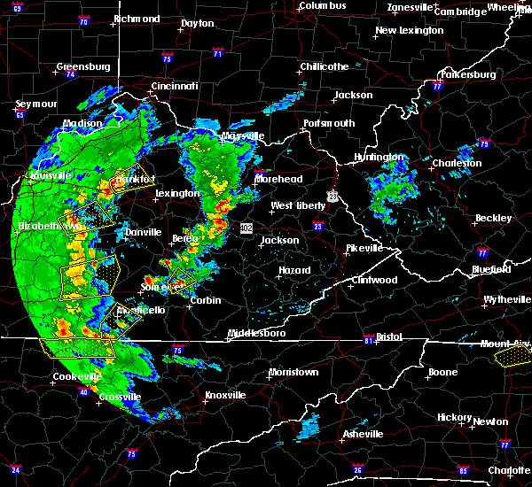 At 644 pm edt, a severe thunderstorm was located over wood creek lake, or 8 miles northwest of london, moving northeast at 30 mph (radar indicated). Hazards include 60 mph wind gusts and half dollar size hail. Hail damage to vehicles is expected. expect wind damage to roofs, siding, and trees. Locations impacted include, camp wildcat, east bernstadt, wood creek lake, billows, hare, gauley, bernstadt, luner, carmichael, bunch, hazel patch, pittsburg and livingston. At 644 pm edt, a severe thunderstorm was located over wood creek lake, or 8 miles northwest of london, moving northeast at 30 mph (radar indicated). Hazards include 60 mph wind gusts and half dollar size hail. Hail damage to vehicles is expected. expect wind damage to roofs, siding, and trees. Locations impacted include, camp wildcat, east bernstadt, wood creek lake, billows, hare, gauley, bernstadt, luner, carmichael, bunch, hazel patch, pittsburg and livingston.
|
| 3/27/2017 6:27 PM EDT |
 At 627 pm edt, a severe thunderstorm was located near billows, or 13 miles west of london, moving northeast at 30 mph (radar indicated). Hazards include 60 mph wind gusts and quarter size hail. Hail damage to vehicles is expected. Expect wind damage to roofs, siding, and trees. At 627 pm edt, a severe thunderstorm was located near billows, or 13 miles west of london, moving northeast at 30 mph (radar indicated). Hazards include 60 mph wind gusts and quarter size hail. Hail damage to vehicles is expected. Expect wind damage to roofs, siding, and trees.
|
| 3/1/2017 8:40 AM EST |
 At 840 am est, severe thunderstorms were located along a line extending from near bee lick to near hogue to 6 miles east of columbia, moving southeast at 40 mph (radar indicated). Hazards include 60 mph wind gusts. expect damage to roofs, siding, and trees At 840 am est, severe thunderstorms were located along a line extending from near bee lick to near hogue to 6 miles east of columbia, moving southeast at 40 mph (radar indicated). Hazards include 60 mph wind gusts. expect damage to roofs, siding, and trees
|
| 12/18/2016 2:29 AM EST |
 At 224 am est, a severe thunderstorm was located 12 miles east of somerset, moving east at 60 mph (radar indicated). Hazards include 60 mph wind gusts. expect damage to roofs, siding, and trees At 224 am est, a severe thunderstorm was located 12 miles east of somerset, moving east at 60 mph (radar indicated). Hazards include 60 mph wind gusts. expect damage to roofs, siding, and trees
|
| 12/18/2016 2:27 AM EST |
 At 224 am est, a severe thunderstorm was located near dykes, or 12 miles east of somerset, moving east at 60 mph (radar indicated). Hazards include 60 mph wind gusts. expect damage to roofs, siding, and trees At 224 am est, a severe thunderstorm was located near dykes, or 12 miles east of somerset, moving east at 60 mph (radar indicated). Hazards include 60 mph wind gusts. expect damage to roofs, siding, and trees
|
| 12/18/2016 2:24 AM EST |
 At 224 am est, a severe thunderstorm was located near dykes, or 12 miles east of somerset, moving east at 60 mph (radar indicated). Hazards include 60 mph wind gusts. expect damage to roofs, siding, and trees At 224 am est, a severe thunderstorm was located near dykes, or 12 miles east of somerset, moving east at 60 mph (radar indicated). Hazards include 60 mph wind gusts. expect damage to roofs, siding, and trees
|
| 12/18/2016 2:03 AM EST |
 At 202 am est, a severe thunderstorm was located over tateville, or 7 miles south of somerset, moving northeast at 65 mph (radar indicated). Hazards include 70 mph wind gusts. Expect considerable tree damage. damage is likely to mobile homes, roofs, and outbuildings. locations impacted include, somerset, london, burnside, dorthae, vox, moore hill, bent, bertha station, bernstadt, east bernstadt, mchargue, kidder, general burnside s. p. Huxley, hightop, bark camp, elihu, rockcastle springs, lynn camp and ruth. At 202 am est, a severe thunderstorm was located over tateville, or 7 miles south of somerset, moving northeast at 65 mph (radar indicated). Hazards include 70 mph wind gusts. Expect considerable tree damage. damage is likely to mobile homes, roofs, and outbuildings. locations impacted include, somerset, london, burnside, dorthae, vox, moore hill, bent, bertha station, bernstadt, east bernstadt, mchargue, kidder, general burnside s. p. Huxley, hightop, bark camp, elihu, rockcastle springs, lynn camp and ruth.
|
| 12/18/2016 1:40 AM EST |
 At 140 am est, a severe thunderstorm was located over monticello, moving northeast at 65 mph (radar indicated). Hazards include 70 mph wind gusts. Expect considerable tree damage. Damage is likely to mobile homes, roofs, and outbuildings. At 140 am est, a severe thunderstorm was located over monticello, moving northeast at 65 mph (radar indicated). Hazards include 70 mph wind gusts. Expect considerable tree damage. Damage is likely to mobile homes, roofs, and outbuildings.
|
| 7/14/2016 3:46 PM EDT |
 At 345 pm edt, a severe thunderstorm was located over hare, or 7 miles north of london, moving east at 30 mph (radar indicated). Hazards include 60 mph wind gusts and nickel size hail. Expect damage to roofs. siding. and trees. locations impacted include, london, hazel patch, bunch, mcwhorter, langnau, pittsburg, horse lick, parrot, bernstadt, carico, crawford, shop branch, greenmount, portersburg, east bernstadt, royrader, middlefork, mershons, dabolt and green hill. this includes the following highways, hal rogers parkway between mile markers 1 and 3. interstate 75 in east central kentucky between mile markers 39 and 56. Kentucky highway 80 in laurel county between mile markers 1 and 11. At 345 pm edt, a severe thunderstorm was located over hare, or 7 miles north of london, moving east at 30 mph (radar indicated). Hazards include 60 mph wind gusts and nickel size hail. Expect damage to roofs. siding. and trees. locations impacted include, london, hazel patch, bunch, mcwhorter, langnau, pittsburg, horse lick, parrot, bernstadt, carico, crawford, shop branch, greenmount, portersburg, east bernstadt, royrader, middlefork, mershons, dabolt and green hill. this includes the following highways, hal rogers parkway between mile markers 1 and 3. interstate 75 in east central kentucky between mile markers 39 and 56. Kentucky highway 80 in laurel county between mile markers 1 and 11.
|
| 7/14/2016 3:42 PM EDT | A tree was reported to have been blown down on us 2 in laurel county KY, 0.5 miles N of East Bernstadt, KY |
| 7/14/2016 3:26 PM EDT |
 At 325 pm edt, a severe thunderstorm was located over billows, or 12 miles south of mount vernon, moving east at 30 mph (radar indicated). Hazards include 60 mph wind gusts and nickel size hail. Expect damage to roofs. siding. And trees. At 325 pm edt, a severe thunderstorm was located over billows, or 12 miles south of mount vernon, moving east at 30 mph (radar indicated). Hazards include 60 mph wind gusts and nickel size hail. Expect damage to roofs. siding. And trees.
|
| 7/14/2016 3:17 PM EDT |
 At 316 pm edt, severe thunderstorms were located along a line extending from near shopville to ruth to near elihu to near huxley to parkers lake, moving east at 30 mph (radar indicated). Hazards include 60 mph wind gusts and penny size hail. Expect damage to roofs. siding. and trees. locations impacted include, somerset, london, burnside, dorthae, vox, hazel patch, donaro, faber, bent, bernstadt, east bernstadt, kidder, general burnside s. p,. huxley, hightop, bark camp, elihu, rockcastle springs, shopville and ruth. this includes the following highways, interstate 75 in east central kentucky between mile markers 19 and 38, and between mile markers 42 and 56. kentucky highway 80 in laurel county between mile markers 1 and 9. kentucky highway 80 in pulaski county between mile markers 17 and 40. louis b. nunn parkway u. s. Highway 25 east in laurel county between mile markers 1 and 2. At 316 pm edt, severe thunderstorms were located along a line extending from near shopville to ruth to near elihu to near huxley to parkers lake, moving east at 30 mph (radar indicated). Hazards include 60 mph wind gusts and penny size hail. Expect damage to roofs. siding. and trees. locations impacted include, somerset, london, burnside, dorthae, vox, hazel patch, donaro, faber, bent, bernstadt, east bernstadt, kidder, general burnside s. p,. huxley, hightop, bark camp, elihu, rockcastle springs, shopville and ruth. this includes the following highways, interstate 75 in east central kentucky between mile markers 19 and 38, and between mile markers 42 and 56. kentucky highway 80 in laurel county between mile markers 1 and 9. kentucky highway 80 in pulaski county between mile markers 17 and 40. louis b. nunn parkway u. s. Highway 25 east in laurel county between mile markers 1 and 2.
|
| 7/14/2016 3:06 PM EDT |
 At 306 pm edt, severe thunderstorms were located along a line extending from near somerset to ruth to elihu to near alpine to greenwood, moving east at 30 mph (radar indicated). Hazards include 60 mph wind gusts and penny size hail. Expect damage to roofs. siding. And trees. At 306 pm edt, severe thunderstorms were located along a line extending from near somerset to ruth to elihu to near alpine to greenwood, moving east at 30 mph (radar indicated). Hazards include 60 mph wind gusts and penny size hail. Expect damage to roofs. siding. And trees.
|
| 7/7/2016 6:43 PM EDT |
 The severe thunderstorm warning for clay, laurel, owsley, jackson and lee counties will expire at 645 pm edt, the storms which prompted the warning have weakened below severe limits, and no longer pose an immediate threat to life or property. therefore the warning will be allowed to expire. however gusty winds are still possible with these thunderstorms. a severe thunderstorm watch remains in effect until midnight edt for south central, southeastern and east central kentucky. The severe thunderstorm warning for clay, laurel, owsley, jackson and lee counties will expire at 645 pm edt, the storms which prompted the warning have weakened below severe limits, and no longer pose an immediate threat to life or property. therefore the warning will be allowed to expire. however gusty winds are still possible with these thunderstorms. a severe thunderstorm watch remains in effect until midnight edt for south central, southeastern and east central kentucky.
|
| 7/7/2016 6:36 PM EDT |
 At 635 pm edt, severe thunderstorms were located along a line extending from near drip rock to malcomb to pigeonroost, moving east at 50 mph (law enforcement). Hazards include 60 mph wind gusts. Expect damage to roofs. siding. and trees. locations impacted include, london, beattyville, manchester, mckee, booneville, hazel patch, bush, cressmont, cottongin, ida may, st. helens, chestnutburg, collingsworth, travellers rest, eglon, gobbard, sturgeon, herron, enline and lucky fork. this includes the following highways, hal rogers parkway between mile markers 1 and 35. interstate 75 in east central kentucky between mile markers 34 and 50. Kentucky highway 80 in laurel county between mile markers 1 and 11. At 635 pm edt, severe thunderstorms were located along a line extending from near drip rock to malcomb to pigeonroost, moving east at 50 mph (law enforcement). Hazards include 60 mph wind gusts. Expect damage to roofs. siding. and trees. locations impacted include, london, beattyville, manchester, mckee, booneville, hazel patch, bush, cressmont, cottongin, ida may, st. helens, chestnutburg, collingsworth, travellers rest, eglon, gobbard, sturgeon, herron, enline and lucky fork. this includes the following highways, hal rogers parkway between mile markers 1 and 35. interstate 75 in east central kentucky between mile markers 34 and 50. Kentucky highway 80 in laurel county between mile markers 1 and 11.
|
| 7/7/2016 6:00 PM EDT |
 At 600 pm edt, severe thunderstorms were located along a line extending from 7 miles northwest of boone to near hansford to near billows, moving east at 50 mph (law enforcement). Hazards include 60 mph wind gusts. Expect damage to roofs. siding. And trees. At 600 pm edt, severe thunderstorms were located along a line extending from 7 miles northwest of boone to near hansford to near billows, moving east at 50 mph (law enforcement). Hazards include 60 mph wind gusts. Expect damage to roofs. siding. And trees.
|
| 7/4/2016 4:51 PM EDT | A tree was blown down in laurel county KY, 5.2 miles SSE of East Bernstadt, KY |
| 6/23/2016 7:51 PM EDT |
 At 750 pm edt, severe thunderstorms were located along a line extending from herd to pittsburg to near bent, moving southeast at 35 mph (radar indicated). Hazards include 60 mph wind gusts. Expect damage to roofs. siding. And trees. At 750 pm edt, severe thunderstorms were located along a line extending from herd to pittsburg to near bent, moving southeast at 35 mph (radar indicated). Hazards include 60 mph wind gusts. Expect damage to roofs. siding. And trees.
|
| 6/23/2016 7:34 PM EDT |
 At 733 pm edt, severe thunderstorms were located along a line extending from old orchard to near bobtown, moving southeast at 55 mph (radar indicated). Hazards include 60 mph wind gusts. Expect damage to roofs. siding. and trees. locations impacted include, mount vernon, mckee, waneta, hazel patch, donaro, bent, parrot, jep hill, welchburg, johnetta, collingsworth, sand springs, cooksburg, lake linville, eglon, muellersville, level green, sturgeon, bandy and foxtown. this includes the following highways, interstate 75 in east central kentucky between mile markers 42 and 64. A tornado watch remains in effect until 1000 pm edt for south central, southeastern and east central kentucky. At 733 pm edt, severe thunderstorms were located along a line extending from old orchard to near bobtown, moving southeast at 55 mph (radar indicated). Hazards include 60 mph wind gusts. Expect damage to roofs. siding. and trees. locations impacted include, mount vernon, mckee, waneta, hazel patch, donaro, bent, parrot, jep hill, welchburg, johnetta, collingsworth, sand springs, cooksburg, lake linville, eglon, muellersville, level green, sturgeon, bandy and foxtown. this includes the following highways, interstate 75 in east central kentucky between mile markers 42 and 64. A tornado watch remains in effect until 1000 pm edt for south central, southeastern and east central kentucky.
|
| 6/23/2016 7:11 PM EDT |
 At 711 pm edt, severe thunderstorms were located along a line extending from near blackburn to near liberty, moving southeast at 65 mph (radar indicated). Hazards include 60 mph wind gusts. Expect damage to roofs. siding. And trees. At 711 pm edt, severe thunderstorms were located along a line extending from near blackburn to near liberty, moving southeast at 65 mph (radar indicated). Hazards include 60 mph wind gusts. Expect damage to roofs. siding. And trees.
|
| 3/31/2016 8:03 PM EDT |
 At 802 pm edt, severe thunderstorms were located along a line extending from jep hill to billows to near mount victory, moving east at 45 mph (radar indicated). Hazards include 60 mph wind gusts. Expect damage to roofs. siding. and trees. Locations impacted include, london, vox, hazel patch, bunch, pittsburg, bent, horse lick, bernstadt, keavy, sinks, greenmount, wellhope, east bernstadt, hightop, grade, mershons, london-corbin airport, rockcastle springs, sublimity city and lamero. At 802 pm edt, severe thunderstorms were located along a line extending from jep hill to billows to near mount victory, moving east at 45 mph (radar indicated). Hazards include 60 mph wind gusts. Expect damage to roofs. siding. and trees. Locations impacted include, london, vox, hazel patch, bunch, pittsburg, bent, horse lick, bernstadt, keavy, sinks, greenmount, wellhope, east bernstadt, hightop, grade, mershons, london-corbin airport, rockcastle springs, sublimity city and lamero.
|
| 3/31/2016 7:38 PM EDT |
 At 737 pm edt, severe thunderstorms were located along a line extending from bandy to near bronston, moving east at 40 mph (radar indicated). Hazards include 60 mph wind gusts. Expect damage to roofs. siding. And trees. At 737 pm edt, severe thunderstorms were located along a line extending from bandy to near bronston, moving east at 40 mph (radar indicated). Hazards include 60 mph wind gusts. Expect damage to roofs. siding. And trees.
|
| 3/1/2016 3:18 PM EST |
 At 317 pm est, a severe thunderstorm was located over lesbas, or near london, moving east at 55 mph (radar indicated). Hazards include 60 mph wind gusts. Expect damage to roofs. siding. And trees. At 317 pm est, a severe thunderstorm was located over lesbas, or near london, moving east at 55 mph (radar indicated). Hazards include 60 mph wind gusts. Expect damage to roofs. siding. And trees.
|
| 3/1/2016 2:59 PM EST |
 At 259 pm est, a severe thunderstorm was located over bunch, or 9 miles west of london, moving northeast at 55 mph (radar indicated). Hazards include 60 mph wind gusts. Expect damage to roofs. siding. and trees. locations impacted include, london, dorthae, vox, hazel patch, parrot, bernstadt, east bernstadt, mchargue, cane creek, huxley, hightop, mershons, rockcastle springs, tuttle, lynn camp, lamero, peoples, holly bay rec. area, lesbas and atlanta. this includes the following highways, hal rogers parkway between mile markers 1 and 9. interstate 75 in east central kentucky between mile markers 28 and 54. kentucky highway 80 in laurel county between mile markers 1 and 11. kentucky highway 80 in pulaski county between mile markers 33 and 40. u. s. Highway 25 east in laurel county between mile markers 1 and 2. At 259 pm est, a severe thunderstorm was located over bunch, or 9 miles west of london, moving northeast at 55 mph (radar indicated). Hazards include 60 mph wind gusts. Expect damage to roofs. siding. and trees. locations impacted include, london, dorthae, vox, hazel patch, parrot, bernstadt, east bernstadt, mchargue, cane creek, huxley, hightop, mershons, rockcastle springs, tuttle, lynn camp, lamero, peoples, holly bay rec. area, lesbas and atlanta. this includes the following highways, hal rogers parkway between mile markers 1 and 9. interstate 75 in east central kentucky between mile markers 28 and 54. kentucky highway 80 in laurel county between mile markers 1 and 11. kentucky highway 80 in pulaski county between mile markers 33 and 40. u. s. Highway 25 east in laurel county between mile markers 1 and 2.
|
| 3/1/2016 2:47 PM EST |
 At 247 pm est, a severe thunderstorm was located over dykes, or 10 miles east of somerset, moving northeast at 55 mph (radar indicated). Hazards include 60 mph wind gusts. Expect damage to roofs. siding. And trees. At 247 pm est, a severe thunderstorm was located over dykes, or 10 miles east of somerset, moving northeast at 55 mph (radar indicated). Hazards include 60 mph wind gusts. Expect damage to roofs. siding. And trees.
|
| 7/14/2015 8:21 PM EDT | Trees were blown down near east bernstad in laurel county KY, 0.5 miles N of East Bernstadt, KY |
| 7/14/2015 8:09 PM EDT |
 At 808 pm edt, severe thunderstorms were located along a line extending from fall rock to mcwhorter to near luner, moving southeast at 40 mph (radar indicated). Hazards include quarter size hail and 60 mph wind gusts. Hail damage to vehicles is expected. Expect wind damage to roofs, siding and trees. At 808 pm edt, severe thunderstorms were located along a line extending from fall rock to mcwhorter to near luner, moving southeast at 40 mph (radar indicated). Hazards include quarter size hail and 60 mph wind gusts. Hail damage to vehicles is expected. Expect wind damage to roofs, siding and trees.
|
| 7/14/2015 11:02 AM EDT |
 At 1101 am edt, a severe thunderstorm was located over lesbas, or near london, moving southeast at 45 mph (radar indicated). Hazards include 60 mph wind gusts and penny size hail. Expect damage to roofs. siding and trees. locations impacted include, london, corbin, dorthae, bunch, pittsburg, bernstadt, keavy, east bernstadt, mchargue, cane creek, lida, hightop, london-corbin airport, tuttle, sasser, lake, levi jackson s. p,. lynn camp, sublimity city and lesbas. this includes the following highways, hal rogers parkway between mile markers 1 and 10. interstate 75 in east central kentucky between mile markers 28 and 44. kentucky highway 80 in laurel county between mile markers 1 and 11. u. s. Highway 25 east in laurel county between mile markers 0 and 2. At 1101 am edt, a severe thunderstorm was located over lesbas, or near london, moving southeast at 45 mph (radar indicated). Hazards include 60 mph wind gusts and penny size hail. Expect damage to roofs. siding and trees. locations impacted include, london, corbin, dorthae, bunch, pittsburg, bernstadt, keavy, east bernstadt, mchargue, cane creek, lida, hightop, london-corbin airport, tuttle, sasser, lake, levi jackson s. p,. lynn camp, sublimity city and lesbas. this includes the following highways, hal rogers parkway between mile markers 1 and 10. interstate 75 in east central kentucky between mile markers 28 and 44. kentucky highway 80 in laurel county between mile markers 1 and 11. u. s. Highway 25 east in laurel county between mile markers 0 and 2.
|
| 7/14/2015 10:38 AM EDT |
 At 1038 am edt, a severe thunderstorm was located over billows, or 11 miles west of london, moving southeast at 45 mph (radar indicated). Hazards include quarter size hail and 60 mph wind gusts. Hail damage to vehicles is expected. Expect wind damage to roofs, siding and trees. At 1038 am edt, a severe thunderstorm was located over billows, or 11 miles west of london, moving southeast at 45 mph (radar indicated). Hazards include quarter size hail and 60 mph wind gusts. Hail damage to vehicles is expected. Expect wind damage to roofs, siding and trees.
|
| 7/14/2015 6:41 AM EDT |
 At 640 am edt, radar indicated severe thunderstorms located along a line extending from island city to near huxley, moving southeast at 55 mph. storm hazards include, winds to 60 mph, quarter size hail,. At 640 am edt, radar indicated severe thunderstorms located along a line extending from island city to near huxley, moving southeast at 55 mph. storm hazards include, winds to 60 mph, quarter size hail,.
|
| 7/14/2015 6:05 AM EDT |
 At 605 am edt, radar indicated severe thunderstorms located along a line extending from near winston to near liberty, moving southeast at 60 mph. storm hazards include, damaging winds to 70 mph, quarter size hail,. At 605 am edt, radar indicated severe thunderstorms located along a line extending from near winston to near liberty, moving southeast at 60 mph. storm hazards include, damaging winds to 70 mph, quarter size hail,.
|
| 7/13/2015 4:50 PM EDT | Tree down across hwy 49 in laurel county KY, 0.5 miles N of East Bernstadt, KY |
| 7/13/2015 4:37 PM EDT |
 At 437 pm edt, a severe thunderstorm was located over hare, or 7 miles northwest of london, moving southeast at 15 mph (radar indicated). Hazards include quarter size hail and 60 mph wind gusts. Hail damage to vehicles is expected. Expect wind damage to roofs, siding and trees. At 437 pm edt, a severe thunderstorm was located over hare, or 7 miles northwest of london, moving southeast at 15 mph (radar indicated). Hazards include quarter size hail and 60 mph wind gusts. Hail damage to vehicles is expected. Expect wind damage to roofs, siding and trees.
|
| 7/9/2015 6:55 PM EDT |
 The severe thunderstorm warning for northeastern laurel, southeastern owsley, west central perry, clay, southeastern jackson and northwestern leslie counties will expire at 700 pm edt, the storm which prompted the warning has weakened below severe limits, and no longer poses an immediate threat to life or property. therefore the warning will be allowed to expire. The severe thunderstorm warning for northeastern laurel, southeastern owsley, west central perry, clay, southeastern jackson and northwestern leslie counties will expire at 700 pm edt, the storm which prompted the warning has weakened below severe limits, and no longer poses an immediate threat to life or property. therefore the warning will be allowed to expire.
|
| 7/9/2015 6:29 PM EDT |
 At 629 pm edt, a severe thunderstorm was located over langnau, or 7 miles northeast of london, moving east at 50 mph (radar indicated). Hazards include 60 mph wind gusts and penny size hail. Expect damage to roofs. Siding and trees. At 629 pm edt, a severe thunderstorm was located over langnau, or 7 miles northeast of london, moving east at 50 mph (radar indicated). Hazards include 60 mph wind gusts and penny size hail. Expect damage to roofs. Siding and trees.
|
| 7/9/2015 6:19 PM EDT |
 At 617 pm edt, a severe thunderstorm was located over pittsburg, or near london, moving east at 40 mph (radar indicated). Hazards include 60 mph wind gusts and penny size hail. Expect damage to roofs. siding and trees. locations impacted include, london, bunch, mcwhorter, byron, langnau, bush, pittsburg, fogertown, bernstadt, crawford, greenmount, portersburg, east bernstadt, royrader, lida, london-corbin airport, sasser, datha, lake and levi jackson s. p. this includes the following highways, hal rogers parkway between mile markers 1 and 15. interstate 75 in east central kentucky between mile markers 34 and 49. Kentucky highway 80 in laurel county between mile markers 2 and 11. At 617 pm edt, a severe thunderstorm was located over pittsburg, or near london, moving east at 40 mph (radar indicated). Hazards include 60 mph wind gusts and penny size hail. Expect damage to roofs. siding and trees. locations impacted include, london, bunch, mcwhorter, byron, langnau, bush, pittsburg, fogertown, bernstadt, crawford, greenmount, portersburg, east bernstadt, royrader, lida, london-corbin airport, sasser, datha, lake and levi jackson s. p. this includes the following highways, hal rogers parkway between mile markers 1 and 15. interstate 75 in east central kentucky between mile markers 34 and 49. Kentucky highway 80 in laurel county between mile markers 2 and 11.
|
| 7/9/2015 5:59 PM EDT |
 The national weather service in jackson ky has issued a * severe thunderstorm warning for. laurel county in south central kentucky. northwestern clay county in southeastern kentucky. east central pulaski county in south central kentucky. Southeastern jackson county in southeastern kentucky. The national weather service in jackson ky has issued a * severe thunderstorm warning for. laurel county in south central kentucky. northwestern clay county in southeastern kentucky. east central pulaski county in south central kentucky. Southeastern jackson county in southeastern kentucky.
|
| 7/9/2015 5:22 PM EDT |
 At 521 pm edt, a severe thunderstorm was located over faubush, or 11 miles west of somerset, moving east at 40 mph (radar indicated). Hazards include 60 mph wind gusts and penny size hail. Expect damage to roofs. siding and trees. locations impacted include, somerset, london, manchester, pulaski, science hill, hazel patch, bent, parrot, welchburg, chestnutburg, portersburg, royrader, elihu, level green, hooker, horse creek junction, herron, green hill, lamero and peoples. this includes the following highways, hal rogers parkway between mile markers 1 and 22. Interstate 75 in east central kentucky between mile markers 36 and 57. At 521 pm edt, a severe thunderstorm was located over faubush, or 11 miles west of somerset, moving east at 40 mph (radar indicated). Hazards include 60 mph wind gusts and penny size hail. Expect damage to roofs. siding and trees. locations impacted include, somerset, london, manchester, pulaski, science hill, hazel patch, bent, parrot, welchburg, chestnutburg, portersburg, royrader, elihu, level green, hooker, horse creek junction, herron, green hill, lamero and peoples. this includes the following highways, hal rogers parkway between mile markers 1 and 22. Interstate 75 in east central kentucky between mile markers 36 and 57.
|
| 7/9/2015 5:10 PM EDT |
 At 510 pm edt, a severe thunderstorm was located over pointer, or 9 miles west of somerset, moving east at 80 mph (radar indicated). Hazards include 60 mph wind gusts and penny size hail. Expect damage to roofs. Siding and trees. At 510 pm edt, a severe thunderstorm was located over pointer, or 9 miles west of somerset, moving east at 80 mph (radar indicated). Hazards include 60 mph wind gusts and penny size hail. Expect damage to roofs. Siding and trees.
|
| 7/9/2015 2:43 PM EDT | At 236 pm edt, a severe thunderstorm was located over elian, or 9 miles east of mckee, moving east at 60 mph (public). Hazards include 70 mph wind gusts. Expect considerable tree damage. damage is likely to mobile homes, roofs and outbuildings. locations impacted include, mckee, waneta, hazel patch, kerby knob, parrot, loam, collingsworth, east bernstadt, lakes, macedonia, eglon, mershons, dabolt, bradshaw, foxtown, green hill, lamero, peoples, atlanta and clover bottom. This includes interstate 75 in east central kentucky between mile markers 44 and 50. |
| 7/9/2015 2:37 PM EDT |
 At 236 pm edt, a severe thunderstorm was located over elian, or 9 miles east of mckee, moving east at 60 mph (public). Hazards include 70 mph wind gusts. Expect considerable tree damage. damage is likely to mobile homes, roofs and outbuildings. locations impacted include, mckee, waneta, hazel patch, kerby knob, parrot, loam, collingsworth, east bernstadt, lakes, macedonia, eglon, mershons, dabolt, bradshaw, foxtown, green hill, lamero, peoples, atlanta and clover bottom. This includes interstate 75 in east central kentucky between mile markers 44 and 50. At 236 pm edt, a severe thunderstorm was located over elian, or 9 miles east of mckee, moving east at 60 mph (public). Hazards include 70 mph wind gusts. Expect considerable tree damage. damage is likely to mobile homes, roofs and outbuildings. locations impacted include, mckee, waneta, hazel patch, kerby knob, parrot, loam, collingsworth, east bernstadt, lakes, macedonia, eglon, mershons, dabolt, bradshaw, foxtown, green hill, lamero, peoples, atlanta and clover bottom. This includes interstate 75 in east central kentucky between mile markers 44 and 50.
|
| 7/9/2015 2:32 PM EDT |
 At 231 pm edt, a severe thunderstorm was located over gray hawk, or near mckee, moving east at 60 mph (public). Hazards include 70 mph wind gusts. Expect considerable tree damage. damage is likely to mobile homes, roofs and outbuildings. locations impacted include, mount vernon, mckee, waneta, hazel patch, donaro, kerby knob, parrot, jep hill, johnetta, wellhope, loam, orlando, collingsworth, east bernstadt, lakes, macedonia, cooksburg, lake linville, eglon and mershons. This includes interstate 75 in east central kentucky between mile markers 44 and 72. At 231 pm edt, a severe thunderstorm was located over gray hawk, or near mckee, moving east at 60 mph (public). Hazards include 70 mph wind gusts. Expect considerable tree damage. damage is likely to mobile homes, roofs and outbuildings. locations impacted include, mount vernon, mckee, waneta, hazel patch, donaro, kerby knob, parrot, jep hill, johnetta, wellhope, loam, orlando, collingsworth, east bernstadt, lakes, macedonia, cooksburg, lake linville, eglon and mershons. This includes interstate 75 in east central kentucky between mile markers 44 and 72.
|
| 7/9/2015 2:08 PM EDT |
 At 208 pm edt, a severe thunderstorm was located over mount vernon, moving east at 55 mph (public). Hazards include 70 mph wind gusts. Expect considerable tree damage. Damage is likely to mobile homes, roofs and outbuildings. At 208 pm edt, a severe thunderstorm was located over mount vernon, moving east at 55 mph (public). Hazards include 70 mph wind gusts. Expect considerable tree damage. Damage is likely to mobile homes, roofs and outbuildings.
|
| 4/25/2015 10:23 PM EDT | At 1023 pm edt, a severe thunderstorm was located over alpine, or 12 miles southeast of somerset, moving east at 55 mph (radar indicated). Hazards include 60 mph wind gusts and penny size hail. Expect damage to roofs. siding and trees. locations impacted include, somerset, london, williamsburg, corbin, liberty, burnside, dorthae, vox, faber, bent, bernstadt, east bernstadt, clio, kidder, general burnside s. p,. denney, huxley, hightop, bark camp and elihu. this includes the following highways, hal rogers parkway between mile markers 1 and 2. interstate 75 in east central kentucky between mile markers 10 and 46. kentucky highway 80 in laurel county between mile markers 1 and 11. kentucky highway 80 in pulaski county between mile markers 20 and 40. u. s. highway 25 east in laurel county near mile marker 2. 0. 75in. |
| 4/25/2015 10:02 PM EDT | At 957 pm edt, a severe thunderstorm was located near faubush, or 15 miles north of monticello, moving east at 50 mph (radar indicated). Hazards include 60 mph wind gusts and penny size hail. Expect damage to roofs. Siding and trees. |
| 4/25/2015 9:56 PM EDT | At 956 pm edt, a severe thunderstorm was located near faubush, or 15 miles north of monticello, moving east at 50 mph (radar indicated). Hazards include 60 mph wind gusts and penny size hail. Expect damage to roofs. Siding and trees. |
| 4/7/2015 7:45 PM EDT | A severe thunderstorm warning remains in effect until 815 pm edt for central laurel. northeastern pulaski. southwestern jackson and rockcastle counties. at 745 pm edt. severe thunderstorms were located along a line extending from 6 miles north of gum sulphur to hiatt to spiro to dabney. Moving east at 35 mph. |
| 4/7/2015 7:19 PM EDT | The national weather service in jackson ky has issued a * severe thunderstorm warning for. central laurel county in south central kentucky. northeastern pulaski county in south central kentucky. western jackson county in southeastern kentucky. Rockcastle county in south central kentucky. |
| 4/2/2015 8:10 PM EDT | A severe thunderstorm warning remains in effect until 830 pm edt for laurel. eastern pulaski. west central knox. northeastern mccreary. southwestern jackson. northwestern whitley and rockcastle counties. at 809 pm edt. severe thunderstorms were located along a line extending from bandy to honeybee. Moving east at 50 mph. |
| 4/2/2015 7:51 PM EDT | The national weather service in jackson ky has issued a * severe thunderstorm warning for. laurel county in south central kentucky. northeastern wayne county in south central kentucky. pulaski county in south central kentucky. West central knox county in southeastern kentucky. |
| 5/21/2014 10:05 PM EDT | Trees and powerlines were reported to have been blown down. the time is estimated from rada in laurel county KY, 0.5 miles N of East Bernstadt, KY |
| 12/22/2013 12:55 AM EST | Several trees down on highway 25 and on hazel patch roa in laurel county KY, 0.5 miles N of East Bernstadt, KY |
| 6/27/2013 12:40 AM EDT | Tree down on house in east bernstadt and second tree down on highway 490. time estimated from rada in laurel county KY, 0.5 miles N of East Bernstadt, KY |
| 9/2/2012 3:21 PM EDT | Tree down on highway 490. time estimated off of rada in laurel county KY, 0.5 miles N of East Bernstadt, KY |
| 7/5/2012 3:30 PM EDT | *** 1 inj *** tree fell on man on hawk creek roa in laurel county KY, 4 miles E of East Bernstadt, KY |
| 4/3/2012 9:55 PM EDT | Quarter sized hail reported 2.8 miles E of East Bernstadt, KY |
| 4/3/2012 4:55 PM EDT | Quarter sized hail reported 2.8 miles E of East Bernstadt, KY |
| 1/1/0001 12:00 AM | Multiple mobile homes damaged on little county roa in laurel county KY, 0.2 miles SSE of East Bernstadt, KY |
| 1/1/0001 12:00 AM | Semi flipped off of i-75 north between mile markers 46 and 47...damage to houses seen just off of the interstate behind the flipped sem in laurel county KY, 2.3 miles E of East Bernstadt, KY |
| 1/1/0001 12:00 AM | Several trees dow in laurel county KY, 0.5 miles N of East Bernstadt, KY |
| 1/1/0001 12:00 AM | 3 large trees down across hwy 122 in laurel county KY, 0.5 miles N of East Bernstadt, KY |
| 1/1/0001 12:00 AM | Tree across road at east bernstad in laurel county KY, 0.5 miles N of East Bernstadt, KY |
| 1/1/0001 12:00 AM | A few shingles were blown off home and everything on patio was blown about 100 yards into the woods. wind speed measured at 77 mp in laurel county KY, 0.5 miles N of East Bernstadt, KY |
| 1/1/0001 12:00 AM | Two to three trees dow in laurel county KY, 0.5 miles N of East Bernstadt, KY |
Hail Maps for East Bernstadt, KY
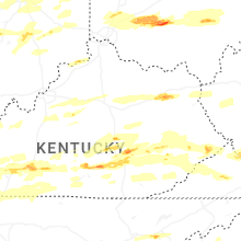


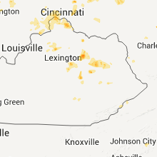


Connect with Interactive Hail Maps