

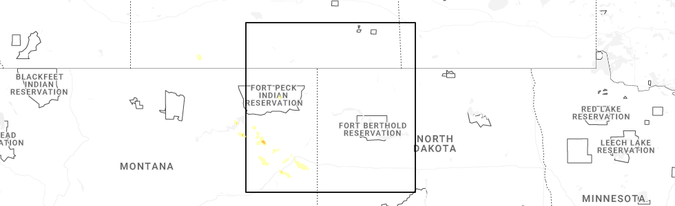
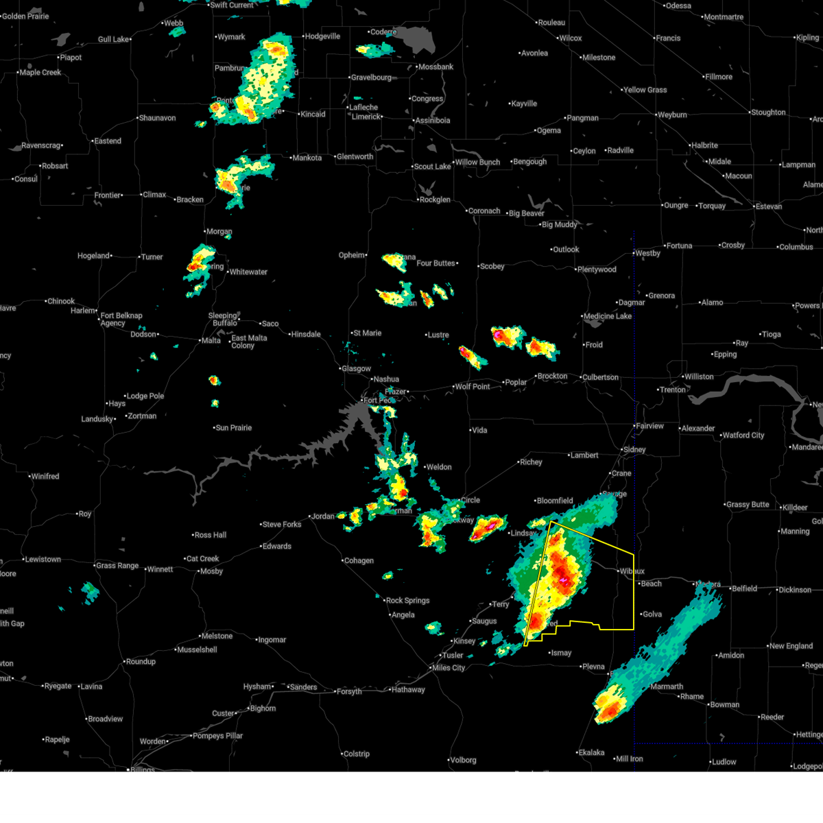
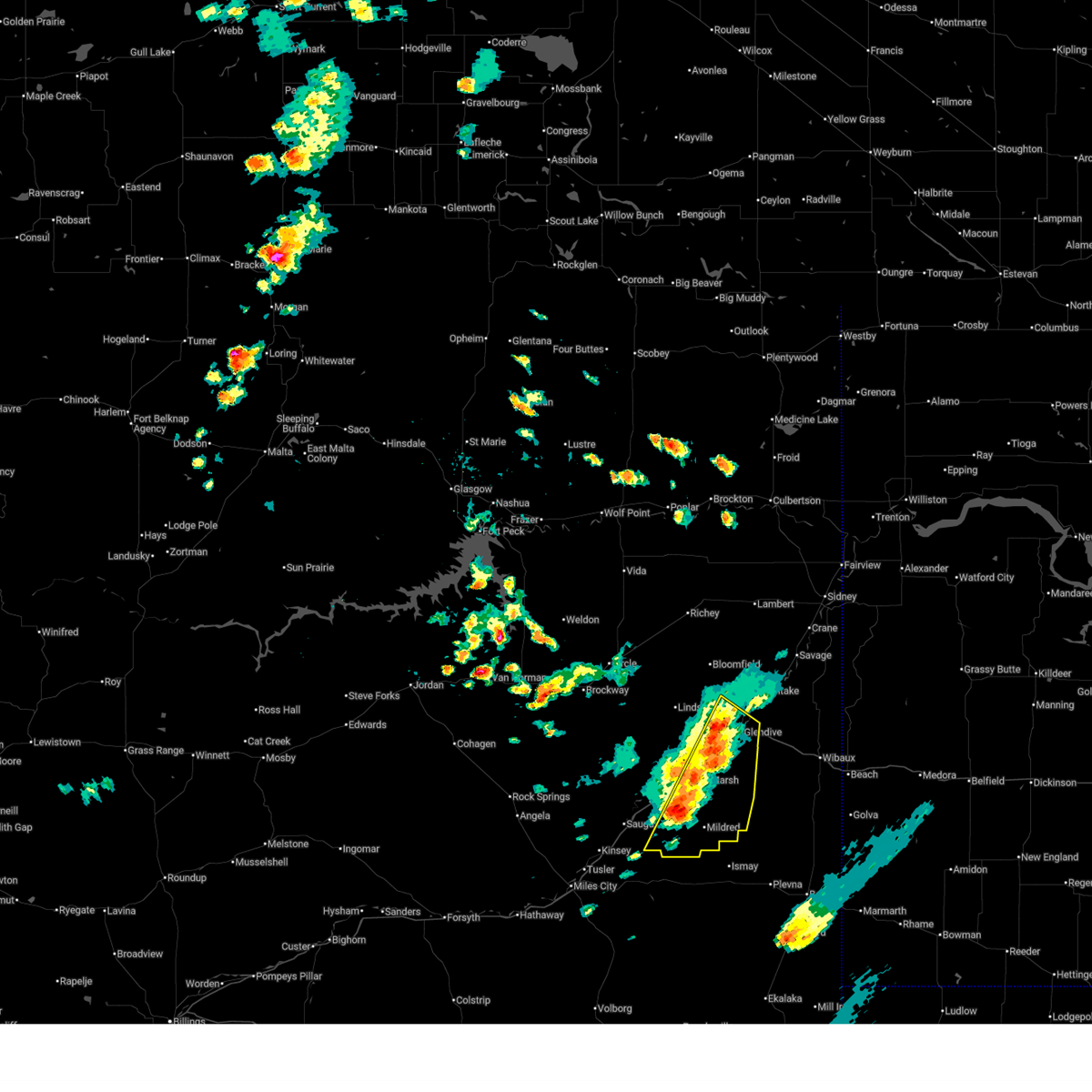
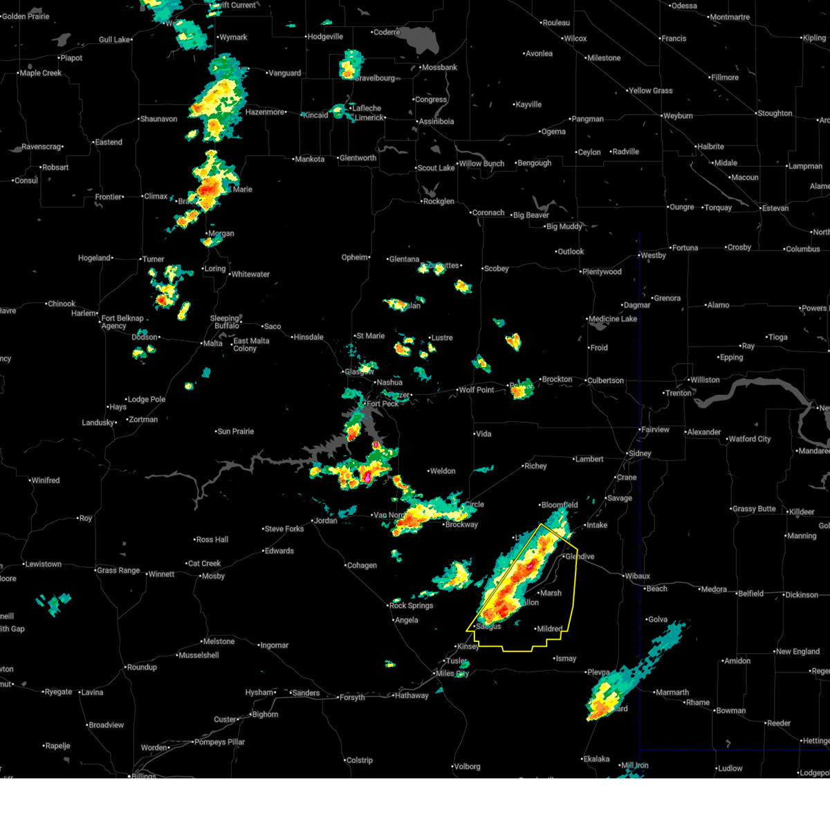
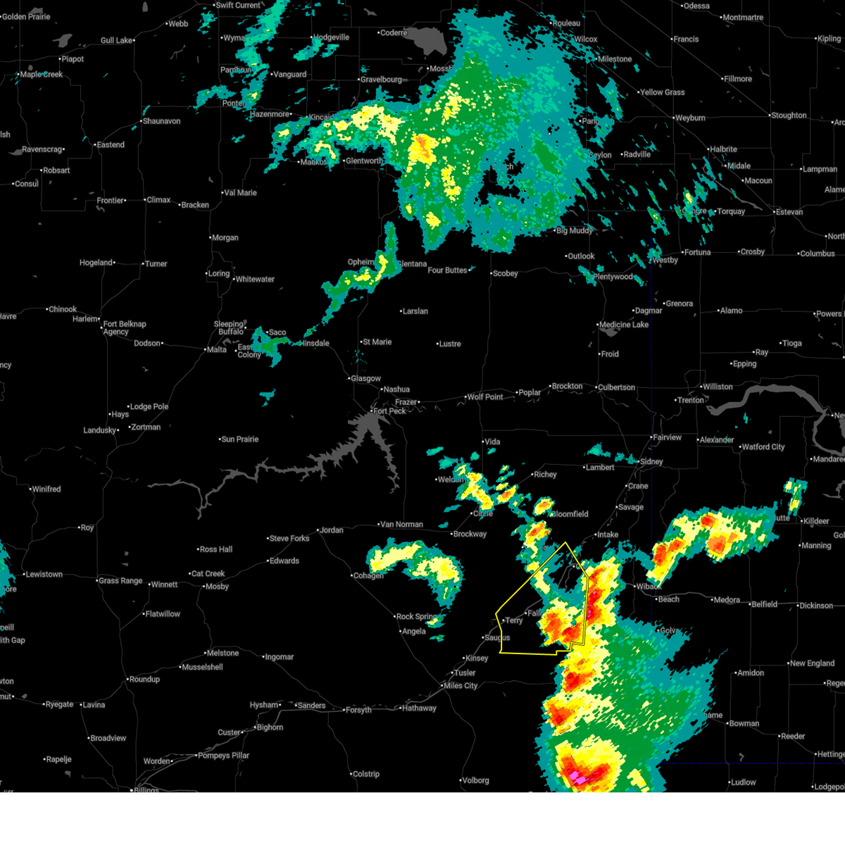
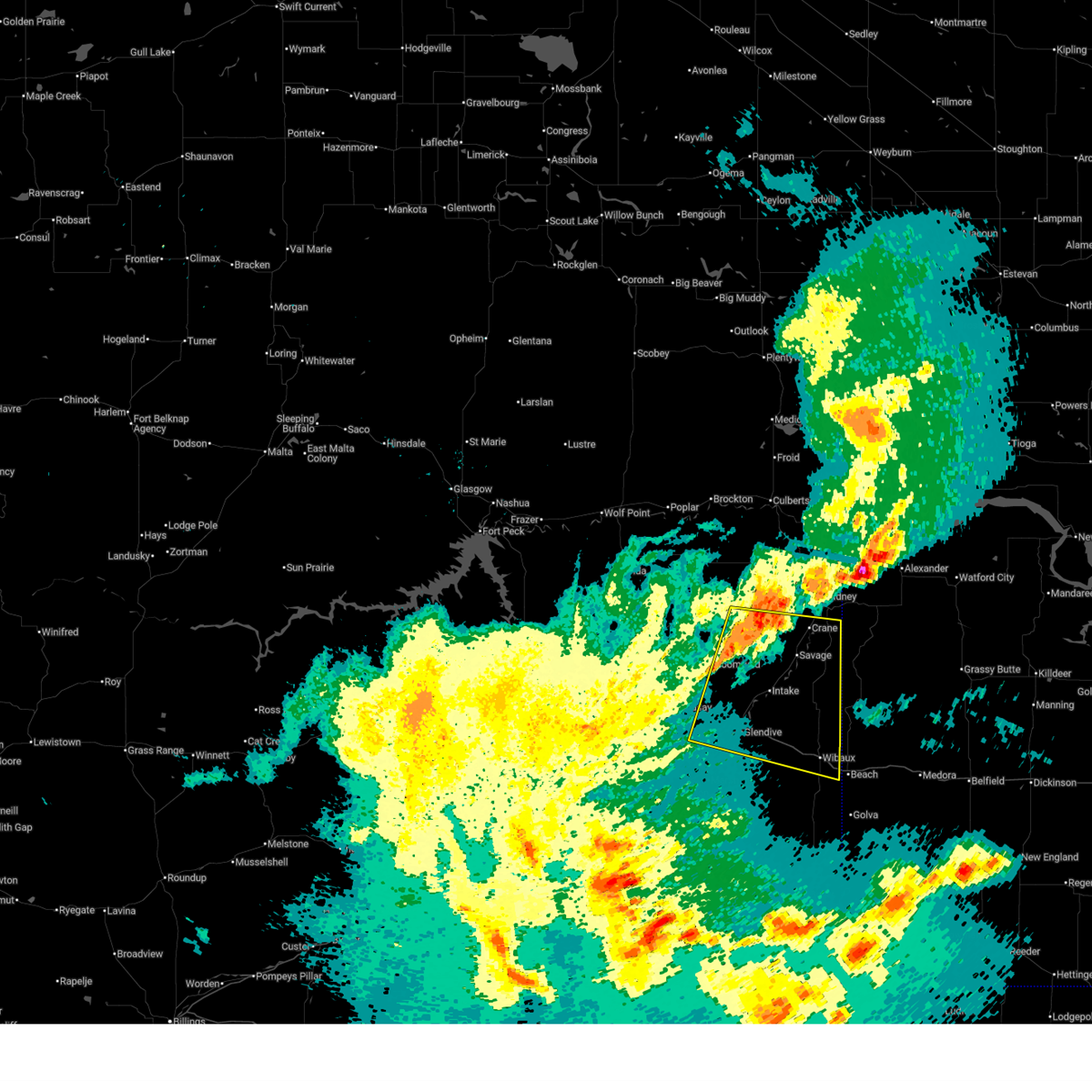
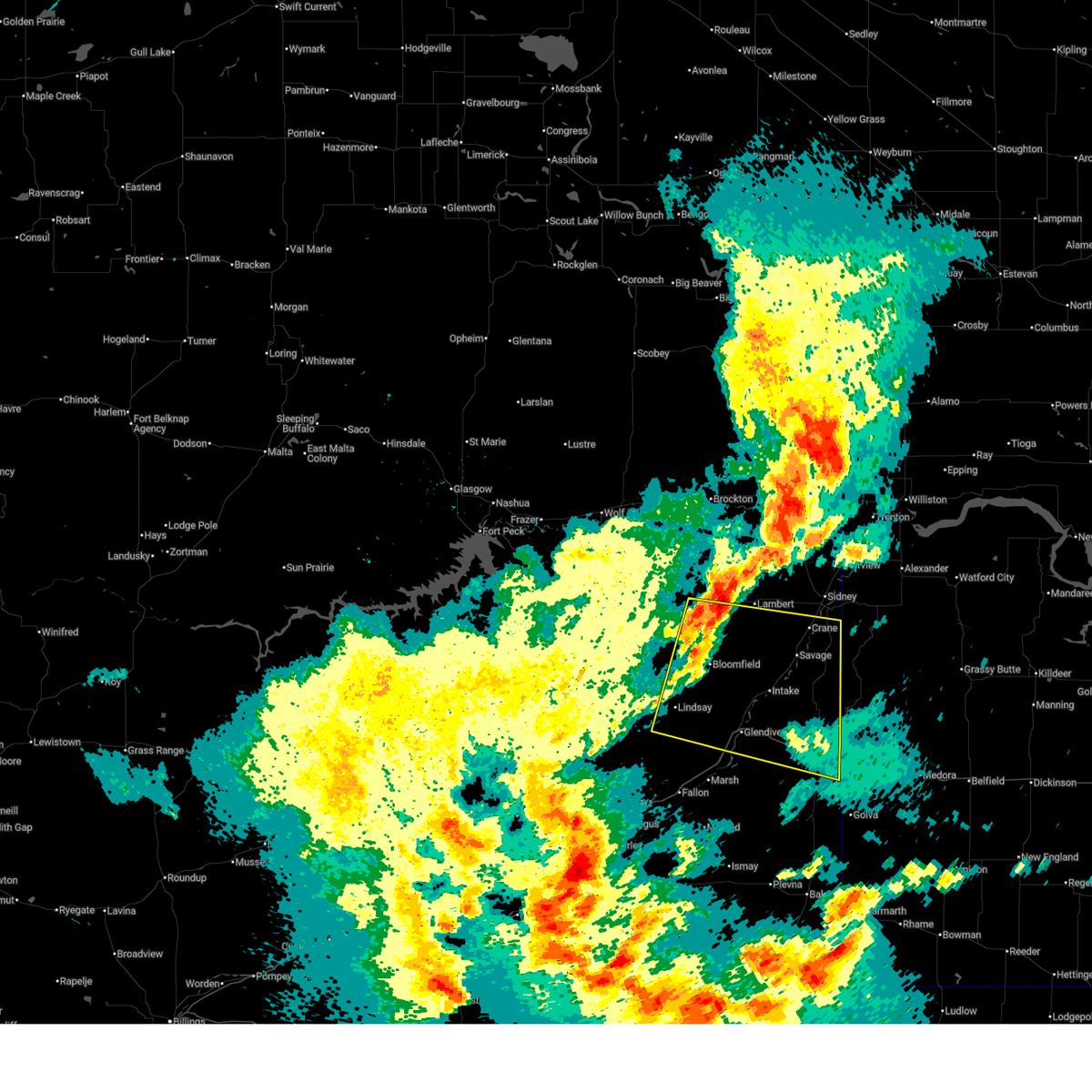
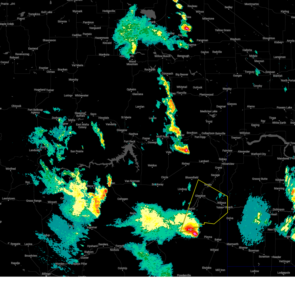
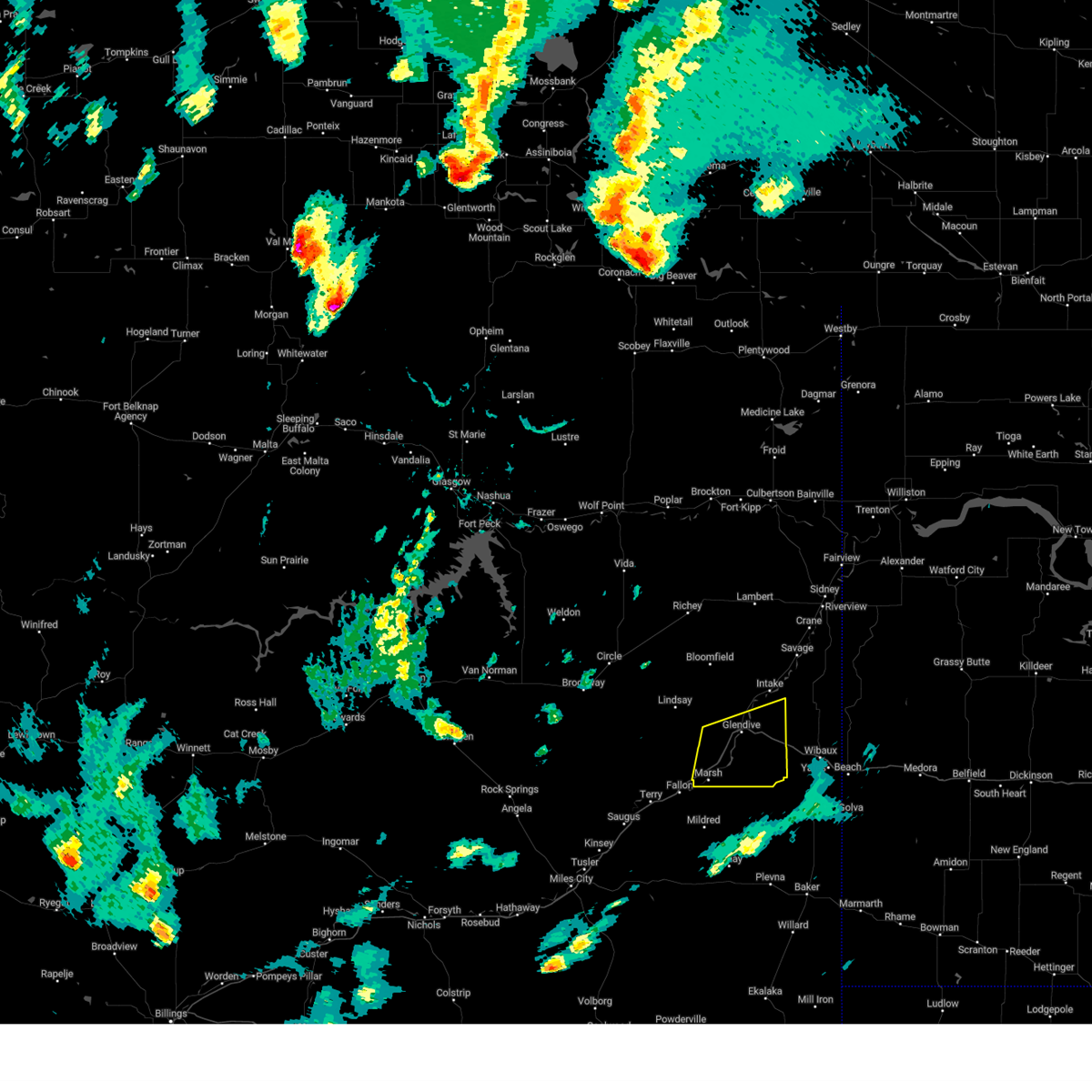
Hail Map for Glendive, MT
The Glendive, MT area has had 38 reports of on-the-ground hail by trained spotters, and has been under severe weather warnings 17 times during the past 12 months. Doppler radar has detected hail at or near Glendive, MT on 30 occasions, including 2 occasions during the past year.
| Name: | Glendive, MT |
| Where Located: | 72.8 miles NE of Miles City, MT |
| Map: | Google Map for Glendive, MT |
| Population: | 4935 |
| Housing Units: | 2267 |
| More Info: | Search Google for Glendive, MT |
0
The Top Recent Hail Date for Glendive, MT is Wednesday, June 25, 2025 (30th out of 30)
Hail and Wind Damage Spotted near Glendive, MT
| Date / Time | Report Details |
|---|---|
| 6/25/2025 4:44 PM MDT |
 Svrggw the national weather service in glasgow has issued a * severe thunderstorm warning for, wibaux county in northeastern montana, southeastern prairie county in northeastern montana, southeastern dawson county in northeastern montana, * until 545 pm mdt. * at 444 pm mdt, a severe thunderstorm was located 16 miles southwest of wibaux, moving east at 15 mph (radar indicated). Hazards include 60 mph wind gusts and quarter size hail. Hail damage to vehicles is expected. Expect wind damage to roofs, siding, and trees. Svrggw the national weather service in glasgow has issued a * severe thunderstorm warning for, wibaux county in northeastern montana, southeastern prairie county in northeastern montana, southeastern dawson county in northeastern montana, * until 545 pm mdt. * at 444 pm mdt, a severe thunderstorm was located 16 miles southwest of wibaux, moving east at 15 mph (radar indicated). Hazards include 60 mph wind gusts and quarter size hail. Hail damage to vehicles is expected. Expect wind damage to roofs, siding, and trees.
|
| 6/25/2025 4:23 PM MDT |
 At 423 pm mdt, a severe thunderstorm was located 11 miles southeast of fallon, or 18 miles east of terry, moving east at 20 mph (radar indicated). Hazards include 60 mph wind gusts and quarter size hail. Hail damage to vehicles is expected. expect wind damage to roofs, siding, and trees. Locations impacted include, glendive, fallon, west glendive, hoyt, mildred, forest park, and marsh. At 423 pm mdt, a severe thunderstorm was located 11 miles southeast of fallon, or 18 miles east of terry, moving east at 20 mph (radar indicated). Hazards include 60 mph wind gusts and quarter size hail. Hail damage to vehicles is expected. expect wind damage to roofs, siding, and trees. Locations impacted include, glendive, fallon, west glendive, hoyt, mildred, forest park, and marsh.
|
| 6/25/2025 3:55 PM MDT |
 Svrggw the national weather service in glasgow has issued a * severe thunderstorm warning for, southeastern prairie county in northeastern montana, south central dawson county in northeastern montana, * until 500 pm mdt. * at 355 pm mdt, a severe thunderstorm was located near fallon, or 9 miles east of terry, moving east at 20 mph (radar indicated). Hazards include 60 mph wind gusts and quarter size hail. Hail damage to vehicles is expected. Expect wind damage to roofs, siding, and trees. Svrggw the national weather service in glasgow has issued a * severe thunderstorm warning for, southeastern prairie county in northeastern montana, south central dawson county in northeastern montana, * until 500 pm mdt. * at 355 pm mdt, a severe thunderstorm was located near fallon, or 9 miles east of terry, moving east at 20 mph (radar indicated). Hazards include 60 mph wind gusts and quarter size hail. Hail damage to vehicles is expected. Expect wind damage to roofs, siding, and trees.
|
| 6/20/2025 4:52 PM MDT |
 The storms which prompted the warning have weakened below severe limits, and have exited the warned area. therefore, the warning will be allowed to expire. however, small hail is still possible with these thunderstorms. a severe thunderstorm watch remains in effect until 900 pm mdt for northeastern montana. to report severe weather, contact your nearest law enforcement agency. they will relay your report to the national weather service glasgow. The storms which prompted the warning have weakened below severe limits, and have exited the warned area. therefore, the warning will be allowed to expire. however, small hail is still possible with these thunderstorms. a severe thunderstorm watch remains in effect until 900 pm mdt for northeastern montana. to report severe weather, contact your nearest law enforcement agency. they will relay your report to the national weather service glasgow.
|
| 6/20/2025 4:29 PM MDT |
 At 429 pm mdt, severe thunderstorms were located along a line extending from 12 miles south of lindsay to 7 miles northeast of fallon to 13 miles east of terry, moving northeast at 45 mph (radar indicated). Hazards include 60 mph wind gusts and quarter size hail. Hail damage to vehicles is expected. expect wind damage to roofs, siding, and trees. Locations impacted include, glendive, terry, fallon, west glendive, hoyt, mildred, forest park, and marsh. At 429 pm mdt, severe thunderstorms were located along a line extending from 12 miles south of lindsay to 7 miles northeast of fallon to 13 miles east of terry, moving northeast at 45 mph (radar indicated). Hazards include 60 mph wind gusts and quarter size hail. Hail damage to vehicles is expected. expect wind damage to roofs, siding, and trees. Locations impacted include, glendive, terry, fallon, west glendive, hoyt, mildred, forest park, and marsh.
|
| 6/20/2025 3:59 PM MDT |
 Svrggw the national weather service in glasgow has issued a * severe thunderstorm warning for, prairie county in northeastern montana, southwestern dawson county in northeastern montana, * until 500 pm mdt. * at 358 pm mdt, severe thunderstorms were located along a line extending from 19 miles west of fallon to near terry, moving northeast at 40 mph (radar indicated). Hazards include 60 mph wind gusts and quarter size hail. Hail damage to vehicles is expected. Expect wind damage to roofs, siding, and trees. Svrggw the national weather service in glasgow has issued a * severe thunderstorm warning for, prairie county in northeastern montana, southwestern dawson county in northeastern montana, * until 500 pm mdt. * at 358 pm mdt, severe thunderstorms were located along a line extending from 19 miles west of fallon to near terry, moving northeast at 40 mph (radar indicated). Hazards include 60 mph wind gusts and quarter size hail. Hail damage to vehicles is expected. Expect wind damage to roofs, siding, and trees.
|
| 6/15/2025 11:22 PM MDT |
 The storm which prompted the warning has weakened below severe limits, and no longer poses an immediate threat to life or property. therefore, the warning will be allowed to expire. however, gusty winds and heavy rain are still possible with this thunderstorm. a severe thunderstorm watch remains in effect until 100 am mdt for northeastern montana. The storm which prompted the warning has weakened below severe limits, and no longer poses an immediate threat to life or property. therefore, the warning will be allowed to expire. however, gusty winds and heavy rain are still possible with this thunderstorm. a severe thunderstorm watch remains in effect until 100 am mdt for northeastern montana.
|
| 6/15/2025 11:00 PM MDT |
 At 1059 pm mdt, a severe thunderstorm was located near savage, or 24 miles southwest of sidney, moving east at 40 mph (radar indicated). Hazards include 60 mph wind gusts. Expect damage to roofs, siding, and trees. Locations impacted include, hodges, forest park, savage, stipek, glendive, intake, west glendive, midway, burns, crane, yates, and wibaux. At 1059 pm mdt, a severe thunderstorm was located near savage, or 24 miles southwest of sidney, moving east at 40 mph (radar indicated). Hazards include 60 mph wind gusts. Expect damage to roofs, siding, and trees. Locations impacted include, hodges, forest park, savage, stipek, glendive, intake, west glendive, midway, burns, crane, yates, and wibaux.
|
| 6/15/2025 10:22 PM MDT |
 Svrggw the national weather service in glasgow has issued a * severe thunderstorm warning for, northeastern wibaux county in northeastern montana, dawson county in northeastern montana, southern richland county in northeastern montana, * until 1130 pm mdt. * at 1022 pm mdt, a severe thunderstorm was located over bloomfield, or 22 miles northwest of glendive, moving east at 40 mph (radar indicated). Hazards include 70 mph wind gusts. Expect considerable tree damage. Damage is likely to mobile homes, roofs, and outbuildings. Svrggw the national weather service in glasgow has issued a * severe thunderstorm warning for, northeastern wibaux county in northeastern montana, dawson county in northeastern montana, southern richland county in northeastern montana, * until 1130 pm mdt. * at 1022 pm mdt, a severe thunderstorm was located over bloomfield, or 22 miles northwest of glendive, moving east at 40 mph (radar indicated). Hazards include 70 mph wind gusts. Expect considerable tree damage. Damage is likely to mobile homes, roofs, and outbuildings.
|
| 9/12/2024 5:55 PM MDT |
 Svrggw the national weather service in glasgow has issued a * severe thunderstorm warning for, wibaux county in northeastern montana, southeastern prairie county in northeastern montana, southeastern dawson county in northeastern montana, * until 700 pm mdt. * at 554 pm mdt, a severe thunderstorm was located 25 miles southeast of fallon, or 27 miles southeast of terry, moving northeast at 60 mph (radar indicated). Hazards include 70 mph wind gusts and quarter size hail. Hail damage to vehicles is expected. expect considerable tree damage. Wind damage is also likely to mobile homes, roofs, and outbuildings. Svrggw the national weather service in glasgow has issued a * severe thunderstorm warning for, wibaux county in northeastern montana, southeastern prairie county in northeastern montana, southeastern dawson county in northeastern montana, * until 700 pm mdt. * at 554 pm mdt, a severe thunderstorm was located 25 miles southeast of fallon, or 27 miles southeast of terry, moving northeast at 60 mph (radar indicated). Hazards include 70 mph wind gusts and quarter size hail. Hail damage to vehicles is expected. expect considerable tree damage. Wind damage is also likely to mobile homes, roofs, and outbuildings.
|
| 8/21/2024 9:13 PM MDT |
 the severe thunderstorm warning has been cancelled and is no longer in effect the severe thunderstorm warning has been cancelled and is no longer in effect
|
| 8/21/2024 8:57 PM MDT |
 At 856 pm mdt, a severe thunderstorm was located near glendive, moving east at 25 mph (radar indicated). Hazards include 60 mph wind gusts and penny size hail. Expect damage to roofs, siding, and trees. Locations impacted include, glendive, west glendive, hoyt, marsh, and forest park. At 856 pm mdt, a severe thunderstorm was located near glendive, moving east at 25 mph (radar indicated). Hazards include 60 mph wind gusts and penny size hail. Expect damage to roofs, siding, and trees. Locations impacted include, glendive, west glendive, hoyt, marsh, and forest park.
|
| 8/21/2024 8:57 PM MDT |
 the severe thunderstorm warning has been cancelled and is no longer in effect the severe thunderstorm warning has been cancelled and is no longer in effect
|
| 8/21/2024 8:49 PM MDT |
 At 848 pm mdt, a severe thunderstorm was located near glendive, moving east at 25 mph (radar indicated). Hazards include 60 mph wind gusts and quarter size hail. Hail damage to vehicles is expected. expect wind damage to roofs, siding, and trees. Locations impacted include, glendive, terry, fallon, west glendive, hoyt, mildred, forest park, stipek, and marsh. At 848 pm mdt, a severe thunderstorm was located near glendive, moving east at 25 mph (radar indicated). Hazards include 60 mph wind gusts and quarter size hail. Hail damage to vehicles is expected. expect wind damage to roofs, siding, and trees. Locations impacted include, glendive, terry, fallon, west glendive, hoyt, mildred, forest park, stipek, and marsh.
|
| 8/21/2024 8:45 PM MDT | Mesonet station mtm28 5.2 e hoyt (mt-meso in dawson county MT, 14.1 miles N of Glendive, MT |
| 8/21/2024 8:25 PM MDT |
 Svrggw the national weather service in glasgow has issued a * severe thunderstorm warning for, southwestern wibaux county in northeastern montana, eastern prairie county in northeastern montana, southern dawson county in northeastern montana, * until 930 pm mdt. * at 825 pm mdt, a severe thunderstorm was located 12 miles northeast of fallon, or 15 miles southwest of glendive, moving east at 25 mph (radar indicated). Hazards include 70 mph wind gusts and half dollar size hail. Hail damage to vehicles is expected. expect considerable tree damage. Wind damage is also likely to mobile homes, roofs, and outbuildings. Svrggw the national weather service in glasgow has issued a * severe thunderstorm warning for, southwestern wibaux county in northeastern montana, eastern prairie county in northeastern montana, southern dawson county in northeastern montana, * until 930 pm mdt. * at 825 pm mdt, a severe thunderstorm was located 12 miles northeast of fallon, or 15 miles southwest of glendive, moving east at 25 mph (radar indicated). Hazards include 70 mph wind gusts and half dollar size hail. Hail damage to vehicles is expected. expect considerable tree damage. Wind damage is also likely to mobile homes, roofs, and outbuildings.
|
| 8/21/2024 7:56 PM MDT |
 At 756 pm mdt, a severe thunderstorm was located 10 miles west of west glendive, or 12 miles west of glendive, moving northeast at 40 mph (radar indicated). Hazards include 60 mph wind gusts and half dollar size hail. Hail damage to vehicles is expected. expect wind damage to roofs, siding, and trees. Locations impacted include, glendive, west glendive, lindsay, hoyt, forest park, stipek, and marsh. At 756 pm mdt, a severe thunderstorm was located 10 miles west of west glendive, or 12 miles west of glendive, moving northeast at 40 mph (radar indicated). Hazards include 60 mph wind gusts and half dollar size hail. Hail damage to vehicles is expected. expect wind damage to roofs, siding, and trees. Locations impacted include, glendive, west glendive, lindsay, hoyt, forest park, stipek, and marsh.
|
| 8/21/2024 7:29 PM MDT |
 Svrggw the national weather service in glasgow has issued a * severe thunderstorm warning for, north central prairie county in northeastern montana, southwestern dawson county in northeastern montana, * until 830 pm mdt. * at 729 pm mdt, severe thunderstorms were located along a line extending from 10 miles northwest of lindsay to 10 miles north of terry, moving east at 30 mph (radar indicated). Hazards include 60 mph wind gusts and quarter size hail. Hail damage to vehicles is expected. Expect wind damage to roofs, siding, and trees. Svrggw the national weather service in glasgow has issued a * severe thunderstorm warning for, north central prairie county in northeastern montana, southwestern dawson county in northeastern montana, * until 830 pm mdt. * at 729 pm mdt, severe thunderstorms were located along a line extending from 10 miles northwest of lindsay to 10 miles north of terry, moving east at 30 mph (radar indicated). Hazards include 60 mph wind gusts and quarter size hail. Hail damage to vehicles is expected. Expect wind damage to roofs, siding, and trees.
|
| 7/5/2024 6:10 PM MDT | Beaver hill i-94 mt do in dawson county MT, 19.1 miles WNW of Glendive, MT |
| 7/5/2024 5:36 PM MDT | Glendive... dawson community airport... mt (asos/awos in dawson county MT, 4.4 miles ESE of Glendive, MT |
| 6/27/2024 5:38 PM MDT |
 The storm which prompted the warning has weakened below severe limits, and has exited the warned area. therefore, the warning will be allowed to expire. however, gusty winds and heavy rain are still possible with this thunderstorm. a severe thunderstorm watch remains in effect until 800 pm mdt for northeastern montana. The storm which prompted the warning has weakened below severe limits, and has exited the warned area. therefore, the warning will be allowed to expire. however, gusty winds and heavy rain are still possible with this thunderstorm. a severe thunderstorm watch remains in effect until 800 pm mdt for northeastern montana.
|
| 6/27/2024 5:30 PM MDT | Measured at the beaver hill mt dot sit in dawson county MT, 19.1 miles WNW of Glendive, MT |
| 6/27/2024 5:30 PM MDT | Report submitted via fb. image indicates that a tree snapped and fell onto a vehicle. same issue with a power pole falling onto the same vehicl in dawson county MT, 0.2 miles N of Glendive, MT |
| 6/27/2024 5:30 PM MDT | Report submitted via fb. image indicates that a tree snapped and fell onto a vehicle. same issue with a power pole falling onto the same vehicl in dawson county MT, 0.2 miles N of Glendive, MT |
| 6/27/2024 5:30 PM MDT | Submitted via fb. image also indicates that a tree of at least 2 ft uprooted onto a yard. unclear if damage was received on the adjacent hom in dawson county MT, 1.5 miles N of Glendive, MT |
| 6/27/2024 5:30 PM MDT | Submitted via fb. image shows a 5 ft tree trunk that fell onto a vehicl in dawson county MT, 0.8 miles N of Glendive, MT |
| 6/27/2024 5:30 PM MDT | Dawson county des sent in an image of a warehouse like building with walls made of a sheet metal material. portions of the wall were ripped off the buildin in dawson county MT, 0.7 miles SW of Glendive, MT |
| 6/27/2024 5:25 PM MDT | Issued a new local storm report now that the observation came into the database. awos station kgdv glendive airpor in dawson county MT, 3.3 miles E of Glendive, MT |
| 6/27/2024 5:20 PM MDT | Report via fb of a portion of the roof torn off the town pump gas station damaging some vehicles and a gas pum in dawson county MT, 1.5 miles ESE of Glendive, MT |
| 6/27/2024 5:16 PM MDT |
 At 516 pm mdt, a severe thunderstorm was located 11 miles northeast of fallon, or 16 miles southwest of glendive, moving northeast at 25 mph (radar indicated). Hazards include 60 mph wind gusts and half dollar size hail. Hail damage to vehicles is expected. expect wind damage to roofs, siding, and trees. Locations impacted include, glendive, west glendive, hoyt, stipek, marsh, and forest park. At 516 pm mdt, a severe thunderstorm was located 11 miles northeast of fallon, or 16 miles southwest of glendive, moving northeast at 25 mph (radar indicated). Hazards include 60 mph wind gusts and half dollar size hail. Hail damage to vehicles is expected. expect wind damage to roofs, siding, and trees. Locations impacted include, glendive, west glendive, hoyt, stipek, marsh, and forest park.
|
| 6/27/2024 5:15 PM MDT | Video of storm passing through. 4 to 6 inch branches were snapped off tree. estimated a minimum of 60 mph gusts. pea-sized hail was also observe in dawson county MT, 2.4 miles SW of Glendive, MT |
| 6/27/2024 5:15 PM MDT | Image sent through fb of a neighbors tree leaning onto home. trunk diameter estimated at 1 to 2 f in dawson county MT, 1.5 miles ESE of Glendive, MT |
| 6/27/2024 5:10 PM MDT | Measured at the glendive airport aso in dawson county MT, 1 miles NNE of Glendive, MT |
| 6/27/2024 4:45 PM MDT | Measured at the blm glendive mesonet sit in dawson county MT, 13.4 miles N of Glendive, MT |
| 6/27/2024 4:45 PM MDT | Measured at the terry agrimet sit in dawson county MT, 16.6 miles NE of Glendive, MT |
| 6/27/2024 4:39 PM MDT |
 Svrggw the national weather service in glasgow has issued a * severe thunderstorm warning for, central prairie county in northeastern montana, southern dawson county in northeastern montana, * until 545 pm mdt. * at 439 pm mdt, a severe thunderstorm was located near terry, moving northeast at 25 mph (radar indicated). Hazards include 60 mph wind gusts and half dollar size hail. Hail damage to vehicles is expected. Expect wind damage to roofs, siding, and trees. Svrggw the national weather service in glasgow has issued a * severe thunderstorm warning for, central prairie county in northeastern montana, southern dawson county in northeastern montana, * until 545 pm mdt. * at 439 pm mdt, a severe thunderstorm was located near terry, moving northeast at 25 mph (radar indicated). Hazards include 60 mph wind gusts and half dollar size hail. Hail damage to vehicles is expected. Expect wind damage to roofs, siding, and trees.
|
| 6/15/2024 8:57 PM MDT |
 The storm which prompted the warning has weakened below severe limits, and no longer poses an immediate threat to life or property. therefore, the warning will be allowed to expire. however, gusty winds are still possible with this thunderstorm. The storm which prompted the warning has weakened below severe limits, and no longer poses an immediate threat to life or property. therefore, the warning will be allowed to expire. however, gusty winds are still possible with this thunderstorm.
|
| 6/15/2024 8:29 PM MDT |
 At 829 pm mdt, a severe thunderstorm was located near intake, or 9 miles northeast of glendive, moving east at 30 mph (radar indicated). Hazards include 60 mph wind gusts. Expect damage to roofs, siding, and trees. Locations impacted include, glendive, wibaux, intake, west glendive, hoyt, hodges, forest park, stipek, burns, and yates. At 829 pm mdt, a severe thunderstorm was located near intake, or 9 miles northeast of glendive, moving east at 30 mph (radar indicated). Hazards include 60 mph wind gusts. Expect damage to roofs, siding, and trees. Locations impacted include, glendive, wibaux, intake, west glendive, hoyt, hodges, forest park, stipek, burns, and yates.
|
| 6/15/2024 8:02 PM MDT |
 Svrggw the national weather service in glasgow has issued a * severe thunderstorm warning for, northern wibaux county in northeastern montana, southeastern richland county in northeastern montana, southern dawson county in northeastern montana, * until 900 pm mdt. * at 802 pm mdt, a severe thunderstorm was located 9 miles south of bloomfield, or 14 miles northwest of glendive, moving east at 30 mph (radar indicated). Hazards include 60 mph wind gusts. expect damage to roofs, siding, and trees Svrggw the national weather service in glasgow has issued a * severe thunderstorm warning for, northern wibaux county in northeastern montana, southeastern richland county in northeastern montana, southern dawson county in northeastern montana, * until 900 pm mdt. * at 802 pm mdt, a severe thunderstorm was located 9 miles south of bloomfield, or 14 miles northwest of glendive, moving east at 30 mph (radar indicated). Hazards include 60 mph wind gusts. expect damage to roofs, siding, and trees
|
| 8/30/2023 8:00 PM MDT | Mesonet station mtm28 5.2 e hoyt (mt-meso in dawson county MT, 14.1 miles N of Glendive, MT |
| 8/30/2023 7:56 PM MDT | Awos station kgdv glendive airpor in dawson county MT, 3.3 miles E of Glendive, MT |
| 8/22/2023 11:40 PM MDT |
 At 1139 pm mdt, severe thunderstorms were located along a line extending from 12 miles west of savage to 15 miles southeast of intake to 12 miles south of wibaux, moving northeast at 45 mph (radar indicated). Hazards include 60 mph wind gusts. expect damage to roofs, siding, and trees At 1139 pm mdt, severe thunderstorms were located along a line extending from 12 miles west of savage to 15 miles southeast of intake to 12 miles south of wibaux, moving northeast at 45 mph (radar indicated). Hazards include 60 mph wind gusts. expect damage to roofs, siding, and trees
|
| 1/1/0001 12:00 AM | An old building wall structure fell during the passage of an outflow boundary and the associated thunderstor in dawson county MT, 0.8 miles N of Glendive, MT |
| 7/11/2023 5:44 PM MDT |
 At 540 pm mdt, a severe thunderstorm was located 9 miles southwest of west glendive, or 10 miles southwest of glendive, moving southeast at 35 mph. a second severe thunderstorm is located south of saint phillip and moving to the southeast at 35 mph (radar indicated). Hazards include ping pong ball size hail and 60 mph wind gusts. People and animals outdoors will be injured. expect hail damage to roofs, siding, windows, and vehicles. Expect wind damage to roofs, siding, and trees. At 540 pm mdt, a severe thunderstorm was located 9 miles southwest of west glendive, or 10 miles southwest of glendive, moving southeast at 35 mph. a second severe thunderstorm is located south of saint phillip and moving to the southeast at 35 mph (radar indicated). Hazards include ping pong ball size hail and 60 mph wind gusts. People and animals outdoors will be injured. expect hail damage to roofs, siding, windows, and vehicles. Expect wind damage to roofs, siding, and trees.
|
| 7/11/2023 5:14 PM MDT |
 At 513 pm mdt, a severe thunderstorm was located 8 miles southwest of wibaux, moving east at 40 mph (radar indicated). Hazards include ping pong ball size hail and 60 mph wind gusts. People and animals outdoors will be injured. expect hail damage to roofs, siding, windows, and vehicles. expect wind damage to roofs, siding, and trees. locations impacted include, glendive, wibaux, west glendive, carlyle, hoyt, hodges, forest park, stipek, marsh, saint phillip and yates. hail threat, radar indicated max hail size, 1. 50 in wind threat, radar indicated max wind gust, 60 mph. At 513 pm mdt, a severe thunderstorm was located 8 miles southwest of wibaux, moving east at 40 mph (radar indicated). Hazards include ping pong ball size hail and 60 mph wind gusts. People and animals outdoors will be injured. expect hail damage to roofs, siding, windows, and vehicles. expect wind damage to roofs, siding, and trees. locations impacted include, glendive, wibaux, west glendive, carlyle, hoyt, hodges, forest park, stipek, marsh, saint phillip and yates. hail threat, radar indicated max hail size, 1. 50 in wind threat, radar indicated max wind gust, 60 mph.
|
| 7/11/2023 4:52 PM MDT | Quarter sized hail reported 16.7 miles ENE of Glendive, MT |
| 7/11/2023 4:47 PM MDT | Quarter sized hail reported 10.5 miles NE of Glendive, MT |
| 7/11/2023 4:41 PM MDT |
 At 440 pm mdt, a severe thunderstorm was located 9 miles south of west glendive, or 9 miles south of glendive, moving southeast at 40 mph (radar indicated). Hazards include 60 mph wind gusts and half dollar size hail. Hail damage to vehicles is expected. Expect wind damage to roofs, siding, and trees. At 440 pm mdt, a severe thunderstorm was located 9 miles south of west glendive, or 9 miles south of glendive, moving southeast at 40 mph (radar indicated). Hazards include 60 mph wind gusts and half dollar size hail. Hail damage to vehicles is expected. Expect wind damage to roofs, siding, and trees.
|
| 7/11/2023 4:07 PM MDT | Quarter sized hail reported 18.4 miles E of Glendive, MT, via facebook. |
| 6/8/2023 6:25 PM MDT |
 At 624 pm mdt, a severe thunderstorm was located near glendive, moving northwest at 10 mph (radar indicated). Hazards include 60 mph wind gusts and half dollar size hail. Hail damage to vehicles is expected. Expect wind damage to roofs, siding, and trees. At 624 pm mdt, a severe thunderstorm was located near glendive, moving northwest at 10 mph (radar indicated). Hazards include 60 mph wind gusts and half dollar size hail. Hail damage to vehicles is expected. Expect wind damage to roofs, siding, and trees.
|
| 6/4/2023 5:21 PM MDT |
 At 520 pm mdt, severe thunderstorms were located along a line extending from near east fairview to 17 miles southwest of terry, moving northwest at 25 mph (trained weather spotter reported an estimated wind gust of 60 mph at 5:20 pm). Hazards include 60 mph wind gusts and penny size hail. expect damage to roofs, siding, and trees At 520 pm mdt, severe thunderstorms were located along a line extending from near east fairview to 17 miles southwest of terry, moving northwest at 25 mph (trained weather spotter reported an estimated wind gust of 60 mph at 5:20 pm). Hazards include 60 mph wind gusts and penny size hail. expect damage to roofs, siding, and trees
|
| 5/28/2023 5:34 PM MDT |
 At 534 pm mdt, a severe thunderstorm was located near glendive, moving east at 5 mph (radar indicated). Hazards include 60 mph wind gusts and half dollar size hail. Hail damage to vehicles is expected. Expect wind damage to roofs, siding, and trees. At 534 pm mdt, a severe thunderstorm was located near glendive, moving east at 5 mph (radar indicated). Hazards include 60 mph wind gusts and half dollar size hail. Hail damage to vehicles is expected. Expect wind damage to roofs, siding, and trees.
|
| 5/27/2023 5:30 PM MDT |
 At 528 pm mdt, a severe thunderstorm was located 15 miles southeast of glendive, moving north at 30 mph (radar indicated). Hazards include 60 mph wind gusts and half dollar size hail. Hail damage to vehicles is expected. expect wind damage to roofs, siding, and trees. locations impacted include, glendive, wibaux, intake, west glendive, carlyle, hoyt, hodges, forest park, stipek, saint phillip and yates. hail threat, radar indicated max hail size, 1. 25 in wind threat, radar indicated max wind gust, 60 mph. At 528 pm mdt, a severe thunderstorm was located 15 miles southeast of glendive, moving north at 30 mph (radar indicated). Hazards include 60 mph wind gusts and half dollar size hail. Hail damage to vehicles is expected. expect wind damage to roofs, siding, and trees. locations impacted include, glendive, wibaux, intake, west glendive, carlyle, hoyt, hodges, forest park, stipek, saint phillip and yates. hail threat, radar indicated max hail size, 1. 25 in wind threat, radar indicated max wind gust, 60 mph.
|
| 5/27/2023 5:05 PM MDT |
 At 505 pm mdt, a severe thunderstorm was located 21 miles west of carlyle, or 21 miles northwest of baker, moving north at 50 mph (radar indicated). Hazards include 60 mph wind gusts and half dollar size hail. Hail damage to vehicles is expected. Expect wind damage to roofs, siding, and trees. At 505 pm mdt, a severe thunderstorm was located 21 miles west of carlyle, or 21 miles northwest of baker, moving north at 50 mph (radar indicated). Hazards include 60 mph wind gusts and half dollar size hail. Hail damage to vehicles is expected. Expect wind damage to roofs, siding, and trees.
|
| 5/25/2023 8:38 PM MDT |
 The severe thunderstorm warning for central dawson county will expire at 845 pm mdt, the storm which prompted the warning has weakened below severe limits, and no longer poses an immediate threat to life or property. therefore, the warning will be allowed to expire. remember, a severe thunderstorm warning still remains in effect for northern dawson county until 915 pm mdt. The severe thunderstorm warning for central dawson county will expire at 845 pm mdt, the storm which prompted the warning has weakened below severe limits, and no longer poses an immediate threat to life or property. therefore, the warning will be allowed to expire. remember, a severe thunderstorm warning still remains in effect for northern dawson county until 915 pm mdt.
|
| 5/25/2023 8:06 PM MDT |
 At 805 pm mdt, a severe thunderstorm was located near west glendive, or near glendive, moving north at 35 mph (radar indicated). Hazards include 60 mph wind gusts and quarter size hail. Hail damage to vehicles is expected. expect wind damage to roofs, siding, and trees. locations impacted include, glendive, west glendive, stipek and forest park. hail threat, observed max hail size, 1. 00 in wind threat, radar indicated max wind gust, 60 mph. At 805 pm mdt, a severe thunderstorm was located near west glendive, or near glendive, moving north at 35 mph (radar indicated). Hazards include 60 mph wind gusts and quarter size hail. Hail damage to vehicles is expected. expect wind damage to roofs, siding, and trees. locations impacted include, glendive, west glendive, stipek and forest park. hail threat, observed max hail size, 1. 00 in wind threat, radar indicated max wind gust, 60 mph.
|
| 5/25/2023 7:55 PM MDT | Quarter sized hail reported 0.2 miles N of Glendive, MT, spotter reported hail stones up to size of gold dollar coin... just larger than a quarter. |
| 5/25/2023 7:49 PM MDT |
 At 749 pm mdt, a severe thunderstorm was located over glendive, moving north at 20 mph (radar indicated). Hazards include 60 mph wind gusts and quarter size hail. Hail damage to vehicles is expected. Expect wind damage to roofs, siding, and trees. At 749 pm mdt, a severe thunderstorm was located over glendive, moving north at 20 mph (radar indicated). Hazards include 60 mph wind gusts and quarter size hail. Hail damage to vehicles is expected. Expect wind damage to roofs, siding, and trees.
|
| 7/10/2022 12:53 AM MDT | Reported via mt dot sit in dawson county MT, 19.1 miles WNW of Glendive, MT |
| 7/10/2022 12:47 AM MDT |
 At 1247 am mdt, severe thunderstorms were located along a line extending from 8 miles southwest of wibaux to near baker, moving east at 50 mph (radar indicated). Hazards include 70 mph wind gusts and half dollar size hail. Hail damage to vehicles is expected. expect considerable tree damage. wind damage is also likely to mobile homes, roofs, and outbuildings. locations impacted include, glendive, wibaux, west glendive, intake, carlyle, hoyt, saint phillip, yates, hodges, mildred, forest park, stipek and marsh. thunderstorm damage threat, considerable hail threat, observed max hail size, 1. 25 in wind threat, observed max wind gust, 70 mph. At 1247 am mdt, severe thunderstorms were located along a line extending from 8 miles southwest of wibaux to near baker, moving east at 50 mph (radar indicated). Hazards include 70 mph wind gusts and half dollar size hail. Hail damage to vehicles is expected. expect considerable tree damage. wind damage is also likely to mobile homes, roofs, and outbuildings. locations impacted include, glendive, wibaux, west glendive, intake, carlyle, hoyt, saint phillip, yates, hodges, mildred, forest park, stipek and marsh. thunderstorm damage threat, considerable hail threat, observed max hail size, 1. 25 in wind threat, observed max wind gust, 70 mph.
|
| 7/10/2022 12:24 AM MDT |
 At 1222 am mdt, severe thunderstorms were located along a line extending from 13 miles east of fallon to 27 miles west of baker, moving east at 70 mph (radar indicated). Hazards include 70 mph wind gusts and half dollar size hail. Hail damage to vehicles is expected. expect considerable tree damage. Wind damage is also likely to mobile homes, roofs, and outbuildings. At 1222 am mdt, severe thunderstorms were located along a line extending from 13 miles east of fallon to 27 miles west of baker, moving east at 70 mph (radar indicated). Hazards include 70 mph wind gusts and half dollar size hail. Hail damage to vehicles is expected. expect considerable tree damage. Wind damage is also likely to mobile homes, roofs, and outbuildings.
|
| 7/9/2022 11:48 PM MDT |
 At 1148 pm mdt, severe thunderstorms were located along a line extending from 13 miles southwest of richey to 12 miles south of terry, moving east at 60 mph (radar indicated). Hazards include 70 mph wind gusts and half dollar size hail. Hail damage to vehicles is expected. expect considerable tree damage. wind damage is also likely to mobile homes, roofs, and outbuildings. locations impacted include, sidney, glendive, terry, wibaux, fallon, fairview, richey, savage, west glendive, intake, bloomfield, lambert, carlyle, lindsay, east fairview, enid, wooley, crane, mildred and calypso. thunderstorm damage threat, considerable hail threat, radar indicated max hail size, 1. 25 in wind threat, radar indicated max wind gust, 70 mph. At 1148 pm mdt, severe thunderstorms were located along a line extending from 13 miles southwest of richey to 12 miles south of terry, moving east at 60 mph (radar indicated). Hazards include 70 mph wind gusts and half dollar size hail. Hail damage to vehicles is expected. expect considerable tree damage. wind damage is also likely to mobile homes, roofs, and outbuildings. locations impacted include, sidney, glendive, terry, wibaux, fallon, fairview, richey, savage, west glendive, intake, bloomfield, lambert, carlyle, lindsay, east fairview, enid, wooley, crane, mildred and calypso. thunderstorm damage threat, considerable hail threat, radar indicated max hail size, 1. 25 in wind threat, radar indicated max wind gust, 70 mph.
|
| 7/9/2022 11:27 PM MDT |
 At 1126 pm mdt, severe thunderstorms were located along a line extending from 10 miles northwest of circle to 15 miles north of miles city, moving east at 60 mph (radar indicated). Hazards include 70 mph wind gusts and half dollar size hail. Hail damage to vehicles is expected. expect considerable tree damage. Wind damage is also likely to mobile homes, roofs, and outbuildings. At 1126 pm mdt, severe thunderstorms were located along a line extending from 10 miles northwest of circle to 15 miles north of miles city, moving east at 60 mph (radar indicated). Hazards include 70 mph wind gusts and half dollar size hail. Hail damage to vehicles is expected. expect considerable tree damage. Wind damage is also likely to mobile homes, roofs, and outbuildings.
|
| 7/9/2022 10:30 PM MDT |
 At 1030 pm mdt, severe thunderstorms were located along a line extending from 11 miles southwest of vida to 14 miles west of terry, moving east at 60 mph (radar indicated). Hazards include 70 mph wind gusts and half dollar size hail. Hail damage to vehicles is expected. expect considerable tree damage. Wind damage is also likely to mobile homes, roofs, and outbuildings. At 1030 pm mdt, severe thunderstorms were located along a line extending from 11 miles southwest of vida to 14 miles west of terry, moving east at 60 mph (radar indicated). Hazards include 70 mph wind gusts and half dollar size hail. Hail damage to vehicles is expected. expect considerable tree damage. Wind damage is also likely to mobile homes, roofs, and outbuildings.
|
| 7/9/2022 1:09 AM MDT | At 108 am mdt, severe thunderstorms were located along a line extending from 8 miles north of archer to 7 miles east of richey, moving east at 70 mph (radar indicated). Hazards include 60 mph wind gusts and penny size hail. Expect damage to roofs, siding, and trees. locations impacted include, sidney, glendive, plentywood, culbertson, wibaux, fairview, medicine lake, bainville, froid, westby, port of raymond, savage, west glendive, intake, lambert, reserve, raymond, enid, comertown and nohly. hail threat, radar indicated max hail size, 0. 75 in wind threat, observed max wind gust, 60 mph. |
| 7/9/2022 12:53 AM MDT | At 1252 am mdt, severe thunderstorms were located along a line extending from 6 miles north of redstone to near richey, moving east at 60 mph (radar indicated). Hazards include 60 mph wind gusts and nickel size hail. Expect considerable tree damage. damage is likely to mobile homes, roofs, and outbuildings. locations impacted include, sidney, glendive, plentywood, poplar, culbertson, wibaux, fairview, brockton, medicine lake, bainville, froid, richey, westby, archer, port of raymond, savage, west glendive, intake, bloomfield and lambert. thunderstorm damage threat, considerable hail threat, radar indicated max hail size, 0. 88 in wind threat, observed max wind gust, 70 mph. |
| 7/9/2022 12:38 AM MDT | At 1237 am mdt, severe thunderstorms were located along a line extending from 6 miles north of redstone to richey, moving east at 70 mph (radar indicated). Hazards include 60 mph wind gusts and nickel size hail. expect damage to roofs, siding, and trees |
| 7/5/2022 9:55 PM MDT |
 The severe thunderstorm warning for southeastern dawson county will expire at 1000 pm mdt, the storm which prompted the warning has weakened below severe limits, and no longer poses an immediate threat to life or property. therefore, the warning will be allowed to expire. however gusty winds and heavy rain are still possible with this thunderstorm. The severe thunderstorm warning for southeastern dawson county will expire at 1000 pm mdt, the storm which prompted the warning has weakened below severe limits, and no longer poses an immediate threat to life or property. therefore, the warning will be allowed to expire. however gusty winds and heavy rain are still possible with this thunderstorm.
|
| 7/5/2022 9:35 PM MDT |
 At 935 pm mdt, a severe thunderstorm was located over glendive, moving east at 40 mph (trained weather spotters). Hazards include 60 mph wind gusts. Expect damage to roofs, siding, and trees. locations impacted include, glendive, intake, west glendive, stipek and forest park. hail threat, radar indicated max hail size, <. 75 in wind threat, radar indicated max wind gust, 60 mph. At 935 pm mdt, a severe thunderstorm was located over glendive, moving east at 40 mph (trained weather spotters). Hazards include 60 mph wind gusts. Expect damage to roofs, siding, and trees. locations impacted include, glendive, intake, west glendive, stipek and forest park. hail threat, radar indicated max hail size, <. 75 in wind threat, radar indicated max wind gust, 60 mph.
|
| 7/5/2022 8:58 PM MDT |
 At 858 pm mdt, a severe thunderstorm was located near lindsay, or 21 miles west of glendive, moving east at 45 mph (trained weather spotters). Hazards include 60 mph wind gusts and quarter size hail. Hail damage to vehicles is expected. Expect wind damage to roofs, siding, and trees. At 858 pm mdt, a severe thunderstorm was located near lindsay, or 21 miles west of glendive, moving east at 45 mph (trained weather spotters). Hazards include 60 mph wind gusts and quarter size hail. Hail damage to vehicles is expected. Expect wind damage to roofs, siding, and trees.
|
| 7/3/2022 8:42 PM MDT | Mesonet site mtbv in dawson county MT, 18.4 miles WNW of Glendive, MT |
| 7/3/2022 8:27 PM MDT |
 At 826 pm mdt, severe thunderstorms were located along a line extending from near intake to 21 miles west of carlyle, moving east at 45 mph (radar indicated). Hazards include 60 mph wind gusts and quarter size hail. Hail damage to vehicles is expected. expect wind damage to roofs, siding, and trees. locations impacted include, glendive, wibaux, intake, carlyle, hoyt, saint phillip, yates, hodges, mildred, stipek and marsh. hail threat, radar indicated max hail size, 1. 00 in wind threat, radar indicated max wind gust, 60 mph. At 826 pm mdt, severe thunderstorms were located along a line extending from near intake to 21 miles west of carlyle, moving east at 45 mph (radar indicated). Hazards include 60 mph wind gusts and quarter size hail. Hail damage to vehicles is expected. expect wind damage to roofs, siding, and trees. locations impacted include, glendive, wibaux, intake, carlyle, hoyt, saint phillip, yates, hodges, mildred, stipek and marsh. hail threat, radar indicated max hail size, 1. 00 in wind threat, radar indicated max wind gust, 60 mph.
|
| 7/3/2022 7:54 PM MDT |
 At 753 pm mdt, severe thunderstorms were located along a line extending from near bloomfield to 20 miles southeast of fallon, moving east at 40 mph (radar indicated). Hazards include 70 mph wind gusts and half dollar size hail. Hail damage to vehicles is expected. expect considerable tree damage. Wind damage is also likely to mobile homes, roofs, and outbuildings. At 753 pm mdt, severe thunderstorms were located along a line extending from near bloomfield to 20 miles southeast of fallon, moving east at 40 mph (radar indicated). Hazards include 70 mph wind gusts and half dollar size hail. Hail damage to vehicles is expected. expect considerable tree damage. Wind damage is also likely to mobile homes, roofs, and outbuildings.
|
| 7/3/2022 7:26 PM MDT |
 At 726 pm mdt, severe thunderstorms were located along a line extending from near richey to 7 miles south of bloomfield to 16 miles southeast of fallon, moving east at 30 mph (radar indicated). Hazards include 70 mph wind gusts and half dollar size hail. Hail damage to vehicles is expected. expect considerable tree damage. wind damage is also likely to mobile homes, roofs, and outbuildings. Locations impacted include, sidney, glendive, terry, wibaux, fallon, richey, savage, west glendive, intake, bloomfield, lambert, carlyle, lindsay, enid, wooley, crane, mildred, midway, hoyt and saint phillip. At 726 pm mdt, severe thunderstorms were located along a line extending from near richey to 7 miles south of bloomfield to 16 miles southeast of fallon, moving east at 30 mph (radar indicated). Hazards include 70 mph wind gusts and half dollar size hail. Hail damage to vehicles is expected. expect considerable tree damage. wind damage is also likely to mobile homes, roofs, and outbuildings. Locations impacted include, sidney, glendive, terry, wibaux, fallon, richey, savage, west glendive, intake, bloomfield, lambert, carlyle, lindsay, enid, wooley, crane, mildred, midway, hoyt and saint phillip.
|
| 7/3/2022 7:01 PM MDT |
 At 701 pm mdt, severe thunderstorms were located along a line extending from near vida to 6 miles northeast of lindsay to 13 miles west of west glendive, moving northeast at 45 mph (radar indicated). Hazards include 60 mph wind gusts and quarter size hail. Hail damage to vehicles is expected. Expect wind damage to roofs, siding, and trees. At 701 pm mdt, severe thunderstorms were located along a line extending from near vida to 6 miles northeast of lindsay to 13 miles west of west glendive, moving northeast at 45 mph (radar indicated). Hazards include 60 mph wind gusts and quarter size hail. Hail damage to vehicles is expected. Expect wind damage to roofs, siding, and trees.
|
| 8/8/2021 10:08 PM MDT | Mesonet station mtbvr 3.8 ne hodges (mt dot in dawson county MT, 19.1 miles WNW of Glendive, MT |
| 7/22/2021 1:53 PM MDT | Higher wind gust of 73 updates the previous report for mesonet station mtbvr 3.8 ne hodges (mt dot in dawson county MT, 19.1 miles WNW of Glendive, MT |
| 7/22/2021 1:41 PM MDT | Mesonet station mtbvr 3.8 ne hodges (mt dot in dawson county MT, 19.1 miles WNW of Glendive, MT |
| 7/8/2021 6:27 PM MDT | Mesonet station mtbvr 3.8 ne hodges (mt dot in dawson county MT, 19.1 miles WNW of Glendive, MT |
| 6/24/2021 3:08 PM MDT |
 At 308 pm mdt, a severe thunderstorm was located over west glendive, or over glendive, moving east at 20 mph (glendive airport measured 64 mph). Hazards include 70 mph wind gusts and nickel size hail. Expect considerable tree damage. Damage is likely to mobile homes, roofs, and outbuildings. At 308 pm mdt, a severe thunderstorm was located over west glendive, or over glendive, moving east at 20 mph (glendive airport measured 64 mph). Hazards include 70 mph wind gusts and nickel size hail. Expect considerable tree damage. Damage is likely to mobile homes, roofs, and outbuildings.
|
| 6/24/2021 3:05 PM MDT | Awos station kgdv glendive airpor in dawson county MT, 3.3 miles E of Glendive, MT |
| 6/8/2021 9:12 PM MDT |
 The severe thunderstorm warning for northwestern wibaux, eastern mccone, northern prairie, dawson and richland counties will expire at 915 pm mdt, the storms which prompted the warning have weakened below severe limits, and no longer pose an immediate threat to life or property. therefore, the warning will be allowed to expire. however gusty winds and heavy rain are still possible with these thunderstorms. a severe thunderstorm watch remains in effect until 1100 pm mdt for northeastern montana. to report severe weather, contact your nearest law enforcement agency. they will relay your report to the national weather service glasgow. The severe thunderstorm warning for northwestern wibaux, eastern mccone, northern prairie, dawson and richland counties will expire at 915 pm mdt, the storms which prompted the warning have weakened below severe limits, and no longer pose an immediate threat to life or property. therefore, the warning will be allowed to expire. however gusty winds and heavy rain are still possible with these thunderstorms. a severe thunderstorm watch remains in effect until 1100 pm mdt for northeastern montana. to report severe weather, contact your nearest law enforcement agency. they will relay your report to the national weather service glasgow.
|
| 6/8/2021 9:02 PM MDT |
 At 900 pm mdt, severe thunderstorms were located along a line extending from 6 miles east of wolf point to 12 miles north of richey to near circle to 14 miles northwest of terry, moving east at 25 mph (radar indicated). Hazards include 60 mph wind gusts and quarter size hail. Hail damage to vehicles is expected. expect wind damage to roofs, siding, and trees. Locations impacted include, glendive, circle, fallon, richey, bloomfield, savage, west glendive, brockway, lambert, vida, intake, lindsay, hoyt, enid, mccloud, crane, hodges, watkins, forest park and stipek. At 900 pm mdt, severe thunderstorms were located along a line extending from 6 miles east of wolf point to 12 miles north of richey to near circle to 14 miles northwest of terry, moving east at 25 mph (radar indicated). Hazards include 60 mph wind gusts and quarter size hail. Hail damage to vehicles is expected. expect wind damage to roofs, siding, and trees. Locations impacted include, glendive, circle, fallon, richey, bloomfield, savage, west glendive, brockway, lambert, vida, intake, lindsay, hoyt, enid, mccloud, crane, hodges, watkins, forest park and stipek.
|
| 6/8/2021 8:20 PM MDT |
 At 819 pm mdt, severe thunderstorms were located along a line extending from 10 miles southeast of frazer to near vida to 8 miles north of brockway to 12 miles north of miles city, moving east at 70 mph (radar indicated). Hazards include 60 mph wind gusts and quarter size hail. Hail damage to vehicles is expected. Expect wind damage to roofs, siding, and trees. At 819 pm mdt, severe thunderstorms were located along a line extending from 10 miles southeast of frazer to near vida to 8 miles north of brockway to 12 miles north of miles city, moving east at 70 mph (radar indicated). Hazards include 60 mph wind gusts and quarter size hail. Hail damage to vehicles is expected. Expect wind damage to roofs, siding, and trees.
|
| 6/8/2021 4:57 PM MDT | Mesonet station mtbvr 3.8 ne hodges (mt dot). sustained wind measured at 4:37pm at 47mph... gusting 56. sustained winds above 40mph continued through 4:47pm. measured g in dawson county MT, 19.1 miles WNW of Glendive, MT |
| 6/8/2021 4:49 PM MDT | Ping Pong Ball sized hail reported 12.3 miles S of Glendive, MT, facebook comment. |
| 6/8/2021 4:49 PM MDT | Ping Pong Ball sized hail reported 15.8 miles SW of Glendive, MT, facebook comment with hail measurement. |
| 6/8/2021 4:37 PM MDT |
 At 436 pm mdt, severe thunderstorms were located along a line extending from 6 miles northeast of glendive to 8 miles west of wibaux to 15 miles northwest of carlyle, moving north at 10 mph (radar indicated). Hazards include 60 mph wind gusts and nickel size hail. expect damage to roofs, siding, and trees At 436 pm mdt, severe thunderstorms were located along a line extending from 6 miles northeast of glendive to 8 miles west of wibaux to 15 miles northwest of carlyle, moving north at 10 mph (radar indicated). Hazards include 60 mph wind gusts and nickel size hail. expect damage to roofs, siding, and trees
|
| 6/8/2021 4:26 PM MDT | Grapefruit sized hail reported 8.6 miles W of Glendive, MT, facebook photo of various hailstones and a measurement of 4 inches. |
| 8/20/2020 11:35 PM MDT |
 The severe thunderstorm warning for western wibaux, southeastern daniels, roosevelt, southwestern sheridan, prairie, dawson and richland counties will expire at 1145 pm mdt, the storms which prompted the warning have weakened below severe limits, and no longer pose an immediate threat to life or property. therefore, the warning will be allowed to expire. however gusty winds are still possible with these thunderstorms. The severe thunderstorm warning for western wibaux, southeastern daniels, roosevelt, southwestern sheridan, prairie, dawson and richland counties will expire at 1145 pm mdt, the storms which prompted the warning have weakened below severe limits, and no longer pose an immediate threat to life or property. therefore, the warning will be allowed to expire. however gusty winds are still possible with these thunderstorms.
|
| 8/20/2020 11:23 PM MDT |
 At 1122 pm mdt, severe thunderstorms were located along a line extending from 12 miles south of redstone to 10 miles northwest of culbertson to 9 miles south of lambert to 24 miles south of fallon, moving east at 45 mph (radar indicated). Hazards include 60 mph wind gusts. Expect damage to roofs, siding, and trees. Locations impacted include, glendive, poplar, culbertson, terry, fallon, brockton, medicine lake, froid, richey, savage, west glendive, intake, bloomfield, lambert, bredette, lindsay, enid, crane, mildred and mccabe. At 1122 pm mdt, severe thunderstorms were located along a line extending from 12 miles south of redstone to 10 miles northwest of culbertson to 9 miles south of lambert to 24 miles south of fallon, moving east at 45 mph (radar indicated). Hazards include 60 mph wind gusts. Expect damage to roofs, siding, and trees. Locations impacted include, glendive, poplar, culbertson, terry, fallon, brockton, medicine lake, froid, richey, savage, west glendive, intake, bloomfield, lambert, bredette, lindsay, enid, crane, mildred and mccabe.
|
| 8/20/2020 11:05 PM MDT |
 At 1104 pm mdt, severe thunderstorms were located along a line extending from 9 miles north of bredette to 6 miles north of brockton to 10 miles north of bloomfield to 20 miles south of terry, moving east at 45 mph (radar indicated). Hazards include 60 mph wind gusts. Expect damage to roofs, siding, and trees. Locations impacted include, glendive, wolf point, poplar, culbertson, circle, terry, fallon, brockton, medicine lake, froid, richey, savage, west glendive, brockway, intake, bloomfield, lambert, bredette, vida and lindsay. At 1104 pm mdt, severe thunderstorms were located along a line extending from 9 miles north of bredette to 6 miles north of brockton to 10 miles north of bloomfield to 20 miles south of terry, moving east at 45 mph (radar indicated). Hazards include 60 mph wind gusts. Expect damage to roofs, siding, and trees. Locations impacted include, glendive, wolf point, poplar, culbertson, circle, terry, fallon, brockton, medicine lake, froid, richey, savage, west glendive, brockway, intake, bloomfield, lambert, bredette, vida and lindsay.
|
| 8/20/2020 10:43 PM MDT |
 At 1039 pm mdt, severe thunderstorms were located along a line extending from 11 miles southeast of peerless to 11 miles northwest of poplar to 8 miles southwest of richey to 15 miles northeast of miles city, moving east at 45 mph (radar indicated). Hazards include 60 mph wind gusts. expect damage to roofs, siding, and trees At 1039 pm mdt, severe thunderstorms were located along a line extending from 11 miles southeast of peerless to 11 miles northwest of poplar to 8 miles southwest of richey to 15 miles northeast of miles city, moving east at 45 mph (radar indicated). Hazards include 60 mph wind gusts. expect damage to roofs, siding, and trees
|
| 7/23/2020 5:35 PM MDT |
 At 535 pm mdt, a severe thunderstorm was located near glendive, moving northeast at 30 mph (radar indicated). Hazards include 60 mph wind gusts and quarter size hail. Hail damage to vehicles is expected. Expect wind damage to roofs, siding, and trees. At 535 pm mdt, a severe thunderstorm was located near glendive, moving northeast at 30 mph (radar indicated). Hazards include 60 mph wind gusts and quarter size hail. Hail damage to vehicles is expected. Expect wind damage to roofs, siding, and trees.
|
| 7/23/2020 4:25 PM MDT |
 The severe thunderstorm warning for north central wibaux, eastern prairie and southeastern dawson counties will expire at 430 pm mdt, the storm which prompted the warning has weakened below severe limits, and no longer poses an immediate threat to life or property. therefore, the warning will be allowed to expire. however gusty winds are still possible with this thunderstorm. a severe thunderstorm watch remains in effect until 900 pm mdt for northeastern montana. The severe thunderstorm warning for north central wibaux, eastern prairie and southeastern dawson counties will expire at 430 pm mdt, the storm which prompted the warning has weakened below severe limits, and no longer poses an immediate threat to life or property. therefore, the warning will be allowed to expire. however gusty winds are still possible with this thunderstorm. a severe thunderstorm watch remains in effect until 900 pm mdt for northeastern montana.
|
| 7/23/2020 4:11 PM MDT |
 At 410 pm mdt, a severe thunderstorm was located near glendive, moving north at 35 mph (radar indicated). Hazards include 60 mph wind gusts and quarter size hail. Hail damage to vehicles is expected. expect wind damage to roofs, siding, and trees. Locations impacted include, glendive, intake, west glendive, hoyt, stipek and forest park. At 410 pm mdt, a severe thunderstorm was located near glendive, moving north at 35 mph (radar indicated). Hazards include 60 mph wind gusts and quarter size hail. Hail damage to vehicles is expected. expect wind damage to roofs, siding, and trees. Locations impacted include, glendive, intake, west glendive, hoyt, stipek and forest park.
|
| 7/23/2020 3:56 PM MDT |
 At 355 pm mdt, a severe thunderstorm was located near glendive, moving north at 35 mph (radar indicated). Hazards include 60 mph wind gusts and quarter size hail. Hail damage to vehicles is expected. expect wind damage to roofs, siding, and trees. Locations impacted include, glendive, wibaux, intake, west glendive, hoyt, hodges, forest park, stipek and yates. At 355 pm mdt, a severe thunderstorm was located near glendive, moving north at 35 mph (radar indicated). Hazards include 60 mph wind gusts and quarter size hail. Hail damage to vehicles is expected. expect wind damage to roofs, siding, and trees. Locations impacted include, glendive, wibaux, intake, west glendive, hoyt, hodges, forest park, stipek and yates.
|
| 7/23/2020 3:31 PM MDT |
 At 330 pm mdt, a severe thunderstorm was located 18 miles southwest of wibaux, moving north at 35 mph (radar indicated). Hazards include 60 mph wind gusts and quarter size hail. Hail damage to vehicles is expected. Expect wind damage to roofs, siding, and trees. At 330 pm mdt, a severe thunderstorm was located 18 miles southwest of wibaux, moving north at 35 mph (radar indicated). Hazards include 60 mph wind gusts and quarter size hail. Hail damage to vehicles is expected. Expect wind damage to roofs, siding, and trees.
|
| 7/10/2020 2:12 PM MDT | Mesonet station mtbvr 3.8 ne hodges (mt dot in dawson county MT, 19.1 miles WNW of Glendive, MT |
| 7/7/2020 8:24 PM MDT |
 At 824 pm mdt, severe thunderstorms were located along a line extending from 12 miles north of skaar to 17 miles west of carlyle, moving east at 45 mph (radar indicated). Hazards include 60 mph wind gusts. expect damage to roofs, siding, and trees At 824 pm mdt, severe thunderstorms were located along a line extending from 12 miles north of skaar to 17 miles west of carlyle, moving east at 45 mph (radar indicated). Hazards include 60 mph wind gusts. expect damage to roofs, siding, and trees
|
| 7/7/2020 8:04 PM MDT |
 At 803 pm mdt, severe thunderstorms were located along a line extending from near bonetrail to near east fairview to west glendive, moving east at 60 mph (radar indicated). Hazards include 60 mph wind gusts. Expect damage to roofs, siding, and trees. Locations impacted include, sidney, glendive, culbertson, wibaux, fallon, fairview, bainville, froid, savage, west glendive, intake, lambert, carlyle, nohly, wooley, crane, mildred, mccabe, midway and hoyt. At 803 pm mdt, severe thunderstorms were located along a line extending from near bonetrail to near east fairview to west glendive, moving east at 60 mph (radar indicated). Hazards include 60 mph wind gusts. Expect damage to roofs, siding, and trees. Locations impacted include, sidney, glendive, culbertson, wibaux, fallon, fairview, bainville, froid, savage, west glendive, intake, lambert, carlyle, nohly, wooley, crane, mildred, mccabe, midway and hoyt.
|
| 7/7/2020 7:24 PM MDT |
 At 724 pm mdt, severe thunderstorms were located along a line extending from 9 miles southwest of froid to 12 miles northwest of lambert to 14 miles northwest of terry, moving east at 55 mph (radar indicated). Hazards include 70 mph wind gusts. Expect considerable tree damage. Damage is likely to mobile homes, roofs, and outbuildings. At 724 pm mdt, severe thunderstorms were located along a line extending from 9 miles southwest of froid to 12 miles northwest of lambert to 14 miles northwest of terry, moving east at 55 mph (radar indicated). Hazards include 70 mph wind gusts. Expect considerable tree damage. Damage is likely to mobile homes, roofs, and outbuildings.
|
| 7/7/2020 7:11 PM MDT |
 At 710 pm mdt, severe thunderstorms were located along a line extending from 6 miles east of froid to 10 miles northeast of lambert to 11 miles south of lindsay, moving east at 90 mph (radar indicated). Hazards include 60 mph wind gusts. Expect damage to roofs, siding, and trees. Locations impacted include, sidney, glendive, wolf point, poplar, culbertson, circle, fairview, brockton, bainville, froid, richey, savage, west glendive, brockway, skaar, intake, bloomfield, lambert, vida and lindsay. At 710 pm mdt, severe thunderstorms were located along a line extending from 6 miles east of froid to 10 miles northeast of lambert to 11 miles south of lindsay, moving east at 90 mph (radar indicated). Hazards include 60 mph wind gusts. Expect damage to roofs, siding, and trees. Locations impacted include, sidney, glendive, wolf point, poplar, culbertson, circle, fairview, brockton, bainville, froid, richey, savage, west glendive, brockway, skaar, intake, bloomfield, lambert, vida and lindsay.
|
| 7/7/2020 6:27 PM MDT |
 At 627 pm mdt, severe thunderstorms were located along a line extending from 12 miles north of wolf point to 14 miles southwest of vida to near hillside, moving east at 70 mph (radar indicated). Hazards include 70 mph wind gusts and quarter size hail. Hail damage to vehicles is expected. expect considerable tree damage. Wind damage is also likely to mobile homes, roofs, and outbuildings. At 627 pm mdt, severe thunderstorms were located along a line extending from 12 miles north of wolf point to 14 miles southwest of vida to near hillside, moving east at 70 mph (radar indicated). Hazards include 70 mph wind gusts and quarter size hail. Hail damage to vehicles is expected. expect considerable tree damage. Wind damage is also likely to mobile homes, roofs, and outbuildings.
|
| 6/29/2020 4:03 PM MDT |
 At 403 pm mdt, a severe thunderstorm was located 8 miles southeast of intake, or 13 miles east of glendive, moving north at 45 mph (radar indicated). Hazards include two inch hail and 70 mph wind gusts. People and animals outdoors will be injured. expect hail damage to roofs, siding, windows, and vehicles. expect considerable tree damage. wind damage is also likely to mobile homes, roofs, and outbuildings. Locations impacted include, glendive, intake, hodges and stipek. At 403 pm mdt, a severe thunderstorm was located 8 miles southeast of intake, or 13 miles east of glendive, moving north at 45 mph (radar indicated). Hazards include two inch hail and 70 mph wind gusts. People and animals outdoors will be injured. expect hail damage to roofs, siding, windows, and vehicles. expect considerable tree damage. wind damage is also likely to mobile homes, roofs, and outbuildings. Locations impacted include, glendive, intake, hodges and stipek.
|
| 6/29/2020 3:35 PM MDT |
 At 334 pm mdt, a severe thunderstorm was located 11 miles southeast of glendive, moving north at 40 mph (radar indicated). Hazards include 60 mph wind gusts and quarter size hail. Hail damage to vehicles is expected. Expect wind damage to roofs, siding, and trees. At 334 pm mdt, a severe thunderstorm was located 11 miles southeast of glendive, moving north at 40 mph (radar indicated). Hazards include 60 mph wind gusts and quarter size hail. Hail damage to vehicles is expected. Expect wind damage to roofs, siding, and trees.
|
| 4/28/2020 3:24 PM MDT | Mesonet station mtbvr 3.8 ne hodges (mt dot). on dawson/wibaux county lin in dawson county MT, 19.1 miles WNW of Glendive, MT |
| 4/28/2020 1:38 PM MDT | Beaver hill i-94 dot site mtbvr. sustained winds of 40 mph began at 1008 am. first wind gustof 58 mph at 124 pm. peak wind gust of 60 mph... so far... at 138 p in wibaux county MT, 19.1 miles WNW of Glendive, MT |
| 9/17/2019 7:20 PM MDT | Wind observed at mdot beaver hill sit in dawson county MT, 19.1 miles WNW of Glendive, MT |
| 8/11/2019 11:23 PM MDT | Storm damage reported in dawson county MT, 18.4 miles WNW of Glendive, MT |
| 7/30/2019 8:13 PM MDT |
 The severe thunderstorm warning for southeastern mccone, northern prairie and southwestern dawson counties will expire at 815 pm mdt, the storm which prompted the warning has weakened below severe limits, and no longer poses an immediate threat to life or property. therefore, the warning will be allowed to expire. however gusty winds are still possible with this thunderstorm. a severe thunderstorm watch remains in effect until midnight mdt for northeastern montana. The severe thunderstorm warning for southeastern mccone, northern prairie and southwestern dawson counties will expire at 815 pm mdt, the storm which prompted the warning has weakened below severe limits, and no longer poses an immediate threat to life or property. therefore, the warning will be allowed to expire. however gusty winds are still possible with this thunderstorm. a severe thunderstorm watch remains in effect until midnight mdt for northeastern montana.
|
| 7/30/2019 7:58 PM MDT |
 At 758 pm mdt, a severe thunderstorm was located 9 miles west of lindsay, or 15 miles southeast of circle, moving southeast at 15 mph (radar indicated). Hazards include 60 mph wind gusts and quarter size hail. Hail damage to vehicles is expected. expect wind damage to roofs, siding, and trees. Locations impacted include, glendive, west glendive, lindsay, hoyt, stipek and forest park. At 758 pm mdt, a severe thunderstorm was located 9 miles west of lindsay, or 15 miles southeast of circle, moving southeast at 15 mph (radar indicated). Hazards include 60 mph wind gusts and quarter size hail. Hail damage to vehicles is expected. expect wind damage to roofs, siding, and trees. Locations impacted include, glendive, west glendive, lindsay, hoyt, stipek and forest park.
|
| 7/30/2019 7:41 PM MDT |
 At 740 pm mdt, a severe thunderstorm was located 11 miles southeast of circle, moving southeast at 15 mph (radar indicated). Hazards include ping pong ball size hail and 60 mph wind gusts. People and animals outdoors will be injured. expect hail damage to roofs, siding, windows, and vehicles. expect wind damage to roofs, siding, and trees. Locations impacted include, glendive, bloomfield, west glendive, lindsay, hoyt, forest park and stipek. At 740 pm mdt, a severe thunderstorm was located 11 miles southeast of circle, moving southeast at 15 mph (radar indicated). Hazards include ping pong ball size hail and 60 mph wind gusts. People and animals outdoors will be injured. expect hail damage to roofs, siding, windows, and vehicles. expect wind damage to roofs, siding, and trees. Locations impacted include, glendive, bloomfield, west glendive, lindsay, hoyt, forest park and stipek.
|
| 7/30/2019 7:18 PM MDT |
 At 718 pm mdt, a severe thunderstorm was located near circle, moving southeast at 15 mph (radar indicated). Hazards include 60 mph wind gusts and half dollar size hail. Hail damage to vehicles is expected. Expect wind damage to roofs, siding, and trees. At 718 pm mdt, a severe thunderstorm was located near circle, moving southeast at 15 mph (radar indicated). Hazards include 60 mph wind gusts and half dollar size hail. Hail damage to vehicles is expected. Expect wind damage to roofs, siding, and trees.
|
| 7/14/2019 11:18 PM MDT |
 At 1117 pm mdt, severe thunderstorms were located along a line extending from near savage to 10 miles northwest of carlyle, moving east at 30 mph (weather observation site). Hazards include 75 mph wind gusts. Expect considerable tree damage. Damage is likely to mobile homes, roofs, powerlines, and outbuildings. At 1117 pm mdt, severe thunderstorms were located along a line extending from near savage to 10 miles northwest of carlyle, moving east at 30 mph (weather observation site). Hazards include 75 mph wind gusts. Expect considerable tree damage. Damage is likely to mobile homes, roofs, powerlines, and outbuildings.
|
| 7/14/2019 11:08 PM MDT | Beaver hill mdot obs site in roosevelt county MT, 19.1 miles WNW of Glendive, MT |
| 7/14/2019 10:33 PM MDT |
 At 1033 pm mdt, a severe thunderstorm was located near west glendive, or 7 miles northwest of glendive, moving east at 50 mph (trained weather spotters). Hazards include 60 mph wind gusts. Expect damage to roofs, siding, and trees. Locations impacted include, glendive, bloomfield, intake, west glendive, hoyt, hodges, forest park, stipek, marsh and saint phillip. At 1033 pm mdt, a severe thunderstorm was located near west glendive, or 7 miles northwest of glendive, moving east at 50 mph (trained weather spotters). Hazards include 60 mph wind gusts. Expect damage to roofs, siding, and trees. Locations impacted include, glendive, bloomfield, intake, west glendive, hoyt, hodges, forest park, stipek, marsh and saint phillip.
|
| 7/14/2019 10:17 PM MDT | Measured at glendive asos kgdv in dawson county MT, 4.4 miles ESE of Glendive, MT |
| 7/14/2019 9:54 PM MDT |
 At 954 pm mdt, a severe thunderstorm was located 18 miles northwest of terry, moving east at 50 mph (radar indicated). Hazards include 60 mph wind gusts. expect damage to roofs, siding, and trees At 954 pm mdt, a severe thunderstorm was located 18 miles northwest of terry, moving east at 50 mph (radar indicated). Hazards include 60 mph wind gusts. expect damage to roofs, siding, and trees
|
| 8/3/2018 8:13 PM MDT |
 The severe thunderstorm warning for southwestern wibaux. southeastern mccone. eastern prairie and southern dawson counties will expire at 815 pm mdt. the gust front which prompted the warning has weakened below severe limits, and has exited the warned area. therefore, the warning will be allowed to expire. However gusty winds are still possible with. The severe thunderstorm warning for southwestern wibaux. southeastern mccone. eastern prairie and southern dawson counties will expire at 815 pm mdt. the gust front which prompted the warning has weakened below severe limits, and has exited the warned area. therefore, the warning will be allowed to expire. However gusty winds are still possible with.
|
| 8/3/2018 7:51 PM MDT |
 At 750 pm mdt, a gust front was producing wind gusts to around 60 mph, moving east northeast at 50 mph (public). Hazards include 60 mph wind gusts. Expect damage to roofs, siding, and trees. Locations impacted include, glendive, fallon, intake, west glendive, lindsay, hoyt, mildred, forest park, stipek and marsh. At 750 pm mdt, a gust front was producing wind gusts to around 60 mph, moving east northeast at 50 mph (public). Hazards include 60 mph wind gusts. Expect damage to roofs, siding, and trees. Locations impacted include, glendive, fallon, intake, west glendive, lindsay, hoyt, mildred, forest park, stipek and marsh.
|
| 8/3/2018 7:40 PM MDT |
 At 740 pm mdt, a gust front was located across western prairie county moving northeast at 50 mph (radar indicated). Hazards include 60 mph wind gusts. Expect damage to roofs, siding, and trees. Locations impacted include, glendive, terry, fallon, west glendive, intake, lindsay, hoyt, zero, mildred, calypso, forest park, stipek and marsh. At 740 pm mdt, a gust front was located across western prairie county moving northeast at 50 mph (radar indicated). Hazards include 60 mph wind gusts. Expect damage to roofs, siding, and trees. Locations impacted include, glendive, terry, fallon, west glendive, intake, lindsay, hoyt, zero, mildred, calypso, forest park, stipek and marsh.
|
| 8/3/2018 7:23 PM MDT |
 At 721 pm mdt, a gust front with little to no precipitation was located just east of miles city north to western prairie county, moving east northeast at 50 mph (radar indicated). Hazards include 70 mph wind gusts. Expect considerable tree damage. Damage is likely to mobile homes, roofs, and outbuildings. At 721 pm mdt, a gust front with little to no precipitation was located just east of miles city north to western prairie county, moving east northeast at 50 mph (radar indicated). Hazards include 70 mph wind gusts. Expect considerable tree damage. Damage is likely to mobile homes, roofs, and outbuildings.
|
| 7/3/2018 9:00 PM MDT | Pea size hail... with estimated 50-60 mph wind in dawson county MT, 19.1 miles SW of Glendive, MT |
| 7/3/2018 8:37 PM MDT |
 At 837 pm mdt, a severe thunderstorm was located 7 miles north of west glendive, or 8 miles north of glendive, moving northeast at 45 mph (radar indicated). Hazards include 60 mph wind gusts and quarter size hail. Hail damage to vehicles is expected. Expect wind damage to roofs, siding, and trees. At 837 pm mdt, a severe thunderstorm was located 7 miles north of west glendive, or 8 miles north of glendive, moving northeast at 45 mph (radar indicated). Hazards include 60 mph wind gusts and quarter size hail. Hail damage to vehicles is expected. Expect wind damage to roofs, siding, and trees.
|
| 7/3/2018 8:25 PM MDT |
 At 825 pm mdt, a severe thunderstorm was located over west glendive, or near glendive, moving east at 40 mph (radar indicated). Hazards include 60 mph wind gusts and quarter size hail. Hail damage to vehicles is expected. expect wind damage to roofs, siding, and trees. Locations impacted include, glendive, west glendive, stipek and forest park. At 825 pm mdt, a severe thunderstorm was located over west glendive, or near glendive, moving east at 40 mph (radar indicated). Hazards include 60 mph wind gusts and quarter size hail. Hail damage to vehicles is expected. expect wind damage to roofs, siding, and trees. Locations impacted include, glendive, west glendive, stipek and forest park.
|
| 7/3/2018 7:57 PM MDT |
 The national weather service in glasgow has issued a * severe thunderstorm warning for. northeastern prairie county in northeastern montana. southwestern dawson county in northeastern montana. until 900 pm mdt. At 756 pm mdt, a severe thunderstorm was located 10 miles south of. The national weather service in glasgow has issued a * severe thunderstorm warning for. northeastern prairie county in northeastern montana. southwestern dawson county in northeastern montana. until 900 pm mdt. At 756 pm mdt, a severe thunderstorm was located 10 miles south of.
|
| 6/28/2018 8:15 PM MDT | Heavy rain was also reporte in dawson county MT, 0.2 miles N of Glendive, MT |
| 6/28/2018 8:12 PM MDT |
 At 812 pm mdt, severe thunderstorms were located along a line extending from 9 miles west of west glendive to near fallon, moving east at 30 mph (radar indicated). Hazards include 70 mph wind gusts and quarter size hail. Hail damage to vehicles is expected. expect considerable tree damage. wind damage is also likely to mobile homes, roofs, and outbuildings. locations impacted include, glendive, terry, fallon, west glendive, hoyt, mildred, zero, calypso, forest park and marsh. A tornado watch remains in effect until 1100 pm mdt for northeastern montana. At 812 pm mdt, severe thunderstorms were located along a line extending from 9 miles west of west glendive to near fallon, moving east at 30 mph (radar indicated). Hazards include 70 mph wind gusts and quarter size hail. Hail damage to vehicles is expected. expect considerable tree damage. wind damage is also likely to mobile homes, roofs, and outbuildings. locations impacted include, glendive, terry, fallon, west glendive, hoyt, mildred, zero, calypso, forest park and marsh. A tornado watch remains in effect until 1100 pm mdt for northeastern montana.
|
| 6/28/2018 7:33 PM MDT |
 At 733 pm mdt, severe thunderstorms were located along a line extending from 9 miles southwest of lindsay to 12 miles west of terry, moving east at 30 mph (radar indicated). Hazards include 70 mph wind gusts and quarter size hail. Hail damage to vehicles is expected. expect considerable tree damage. Wind damage is also likely to mobile homes, roofs, and outbuildings. At 733 pm mdt, severe thunderstorms were located along a line extending from 9 miles southwest of lindsay to 12 miles west of terry, moving east at 30 mph (radar indicated). Hazards include 70 mph wind gusts and quarter size hail. Hail damage to vehicles is expected. expect considerable tree damage. Wind damage is also likely to mobile homes, roofs, and outbuildings.
|
| 5/26/2018 11:52 PM MDT |
 The severe thunderstorm warning for northeastern wibaux, southeastern mccone, northeastern prairie, southeastern richland and dawson counties will expire at midnight mdt, the storms which prompted the warning have weakened below severe limits, and no longer pose an immediate threat to life or property. therefore the warning will be allowed to expire. however, gusty winds and heavy rain are still possible with these thunderstorms. a severe thunderstorm watch remains in effect until 100 am mdt for northeastern montana. The severe thunderstorm warning for northeastern wibaux, southeastern mccone, northeastern prairie, southeastern richland and dawson counties will expire at midnight mdt, the storms which prompted the warning have weakened below severe limits, and no longer pose an immediate threat to life or property. therefore the warning will be allowed to expire. however, gusty winds and heavy rain are still possible with these thunderstorms. a severe thunderstorm watch remains in effect until 100 am mdt for northeastern montana.
|
| 5/26/2018 11:30 PM MDT |
 At 1128 pm mdt, a line of thunderstorms were located along a line extending from near fairview to 10 miles southwest of lindsay, moving southeast at 30 mph (doppler radar indicated). Hazards include 70 mph wind gusts. Expect considerable tree damage. damage is likely to mobile homes, roofs, and outbuildings. Locations impacted include, sidney, glendive, fallon, fairview, bloomfield, savage, west glendive, intake, lindsay, east fairview, hoyt, wooley, crane, forest park, stipek, marsh, midway and burns. At 1128 pm mdt, a line of thunderstorms were located along a line extending from near fairview to 10 miles southwest of lindsay, moving southeast at 30 mph (doppler radar indicated). Hazards include 70 mph wind gusts. Expect considerable tree damage. damage is likely to mobile homes, roofs, and outbuildings. Locations impacted include, sidney, glendive, fallon, fairview, bloomfield, savage, west glendive, intake, lindsay, east fairview, hoyt, wooley, crane, forest park, stipek, marsh, midway and burns.
|
| 5/26/2018 11:02 PM MDT |
 At 1100 pm mdt, severe thunderstorms were located along a line extending from 12 miles west of fort union trading post to 9 miles west of lindsay, moving southeast at 30 mph (asos measured 66 mph wind gust in sidney). Hazards include 70 mph wind gusts. Expect considerable tree damage. Damage is likely to mobile homes, roofs, and outbuildings. At 1100 pm mdt, severe thunderstorms were located along a line extending from 12 miles west of fort union trading post to 9 miles west of lindsay, moving southeast at 30 mph (asos measured 66 mph wind gust in sidney). Hazards include 70 mph wind gusts. Expect considerable tree damage. Damage is likely to mobile homes, roofs, and outbuildings.
|
| 4/29/2018 7:00 PM MDT | Glendive airport awos reported a peak wind of 60 mph at 0100z or 700 p in dawson county MT, 4.4 miles ESE of Glendive, MT |
| 4/29/2018 6:57 PM MDT |
 At 635 pm mdt, a severe thunderstorm was located 12 miles northeast of fallon, or 14 miles southwest of glendive, moving northeast at 30 mph (radar indicated). Hazards include 60 mph wind gusts and quarter size hail. Hail damage to vehicles is expected. expect wind damage to roofs, siding, and trees. Locations impacted include, glendive, west glendive, hoyt, marsh and forest park. At 635 pm mdt, a severe thunderstorm was located 12 miles northeast of fallon, or 14 miles southwest of glendive, moving northeast at 30 mph (radar indicated). Hazards include 60 mph wind gusts and quarter size hail. Hail damage to vehicles is expected. expect wind damage to roofs, siding, and trees. Locations impacted include, glendive, west glendive, hoyt, marsh and forest park.
|
| 4/29/2018 6:36 PM MDT |
 At 635 pm mdt, a severe thunderstorm was located 12 miles northeast of fallon, or 14 miles southwest of glendive, moving northeast at 30 mph (radar indicated). Hazards include 60 mph wind gusts and quarter size hail. Hail damage to vehicles is expected. expect wind damage to roofs, siding, and trees. Locations impacted include, glendive, west glendive, hoyt, marsh and forest park. At 635 pm mdt, a severe thunderstorm was located 12 miles northeast of fallon, or 14 miles southwest of glendive, moving northeast at 30 mph (radar indicated). Hazards include 60 mph wind gusts and quarter size hail. Hail damage to vehicles is expected. expect wind damage to roofs, siding, and trees. Locations impacted include, glendive, west glendive, hoyt, marsh and forest park.
|
| 4/29/2018 6:05 PM MDT |
 At 604 pm mdt, a severe thunderstorm was located over fallon, or 11 miles east of terry, moving north at 30 mph (radar indicated). Hazards include 60 mph wind gusts and half dollar size hail. Hail damage to vehicles is expected. Expect wind damage to roofs, siding, and trees. At 604 pm mdt, a severe thunderstorm was located over fallon, or 11 miles east of terry, moving north at 30 mph (radar indicated). Hazards include 60 mph wind gusts and half dollar size hail. Hail damage to vehicles is expected. Expect wind damage to roofs, siding, and trees.
|
| 7/19/2017 6:57 AM MDT |
 At 607 am mdt, a severe thunderstorm was located near lindsay, or 23 miles southeast of circle, moving east at 60 mph (radar indicated). Hazards include 60 mph wind gusts and quarter size hail. Hail damage to vehicles is expected. Expect wind damage to roofs, siding, and trees. At 607 am mdt, a severe thunderstorm was located near lindsay, or 23 miles southeast of circle, moving east at 60 mph (radar indicated). Hazards include 60 mph wind gusts and quarter size hail. Hail damage to vehicles is expected. Expect wind damage to roofs, siding, and trees.
|
| 7/19/2017 6:35 AM MDT | Measured 58mph wind. nickel size hail in dawson county MT, 19.4 miles ESE of Glendive, MT |
| 7/19/2017 6:08 AM MDT |
 At 607 am mdt, a severe thunderstorm was located near lindsay, or 23 miles southeast of circle, moving east at 60 mph (radar indicated). Hazards include 60 mph wind gusts and quarter size hail. Hail damage to vehicles is expected. Expect wind damage to roofs, siding, and trees. At 607 am mdt, a severe thunderstorm was located near lindsay, or 23 miles southeast of circle, moving east at 60 mph (radar indicated). Hazards include 60 mph wind gusts and quarter size hail. Hail damage to vehicles is expected. Expect wind damage to roofs, siding, and trees.
|
| 7/16/2017 8:00 PM MDT | Power is out in west glendive... m in dawson county MT, 2.3 miles E of Glendive, MT |
| 7/11/2017 8:29 PM MDT |
 At 802 pm mdt, a severe thunderstorm was located 11 miles east of circle, moving southeast at 45 mph (radar indicated). Hazards include 60 mph wind gusts and half dollar size hail. Hail damage to vehicles is expected. Expect wind damage to roofs, siding, and trees. At 802 pm mdt, a severe thunderstorm was located 11 miles east of circle, moving southeast at 45 mph (radar indicated). Hazards include 60 mph wind gusts and half dollar size hail. Hail damage to vehicles is expected. Expect wind damage to roofs, siding, and trees.
|
| 7/11/2017 8:02 PM MDT |
 At 802 pm mdt, a severe thunderstorm was located 11 miles east of circle, moving southeast at 45 mph (radar indicated). Hazards include 60 mph wind gusts and half dollar size hail. Hail damage to vehicles is expected. Expect wind damage to roofs, siding, and trees. At 802 pm mdt, a severe thunderstorm was located 11 miles east of circle, moving southeast at 45 mph (radar indicated). Hazards include 60 mph wind gusts and half dollar size hail. Hail damage to vehicles is expected. Expect wind damage to roofs, siding, and trees.
|
| 9/2/2016 8:57 PM MDT |
 At 856 pm mdt, a severe thunderstorm was located near savage, or 19 miles southwest of sidney, moving northeast at 45 mph (trained weather spotters). Hazards include 60 mph wind gusts. Expect damage to roofs. siding. and trees. Locations impacted include, sidney, glendive, wibaux, fairview, richey, west glendive, intake, bloomfield, savage, lambert, lindsay, east fairview, yates, burns, stipek, enid, wooley, forest park, saint phillip and crane. At 856 pm mdt, a severe thunderstorm was located near savage, or 19 miles southwest of sidney, moving northeast at 45 mph (trained weather spotters). Hazards include 60 mph wind gusts. Expect damage to roofs. siding. and trees. Locations impacted include, sidney, glendive, wibaux, fairview, richey, west glendive, intake, bloomfield, savage, lambert, lindsay, east fairview, yates, burns, stipek, enid, wooley, forest park, saint phillip and crane.
|
| 9/2/2016 8:23 PM MDT |
 At 823 pm mdt, a severe thunderstorm was located near bloomfield, or 17 miles northwest of glendive, moving northeast at 45 mph (trained weather spotters). Hazards include 60 mph wind gusts. Expect damage to roofs. siding. And trees. At 823 pm mdt, a severe thunderstorm was located near bloomfield, or 17 miles northwest of glendive, moving northeast at 45 mph (trained weather spotters). Hazards include 60 mph wind gusts. Expect damage to roofs. siding. And trees.
|
| 9/2/2016 8:21 PM MDT | Storm damage reported in dawson county MT, 0.2 miles N of Glendive, MT |
| 7/30/2016 11:09 PM MDT |
 At 1108 pm mdt, a severe thunderstorm was located 12 miles east of circle, moving southeast at 35 mph (radar indicated). Hazards include 60 mph wind gusts and quarter size hail. Hail damage to vehicles is expected. Expect wind damage to roofs, siding, and trees. At 1108 pm mdt, a severe thunderstorm was located 12 miles east of circle, moving southeast at 35 mph (radar indicated). Hazards include 60 mph wind gusts and quarter size hail. Hail damage to vehicles is expected. Expect wind damage to roofs, siding, and trees.
|
| 7/22/2016 9:09 PM MDT |
 At 908 pm mdt, a severe thunderstorm was located over richey, or 29 miles northeast of circle, moving northeast at 50 mph (trained weather spotters. at 835 pm a 60 mph wind gust was reported 1 mile wsw of circle). Hazards include 60 mph wind gusts and quarter size hail. Hail damage to vehicles is expected. expect wind damage to roofs, siding, and trees. Locations impacted include, glendive, circle, richey, west glendive, bloomfield, lindsay, stipek, enid and forest park. At 908 pm mdt, a severe thunderstorm was located over richey, or 29 miles northeast of circle, moving northeast at 50 mph (trained weather spotters. at 835 pm a 60 mph wind gust was reported 1 mile wsw of circle). Hazards include 60 mph wind gusts and quarter size hail. Hail damage to vehicles is expected. expect wind damage to roofs, siding, and trees. Locations impacted include, glendive, circle, richey, west glendive, bloomfield, lindsay, stipek, enid and forest park.
|
| 7/22/2016 8:30 PM MDT |
 At 829 pm mdt, a severe thunderstorm was located near circle, moving northeast at 50 mph (radar indicated). Hazards include 60 mph wind gusts and quarter size hail. Hail damage to vehicles is expected. Expect wind damage to roofs, siding, and trees. At 829 pm mdt, a severe thunderstorm was located near circle, moving northeast at 50 mph (radar indicated). Hazards include 60 mph wind gusts and quarter size hail. Hail damage to vehicles is expected. Expect wind damage to roofs, siding, and trees.
|
| 7/14/2016 4:00 PM MDT | Quarter sized hail reported 0.2 miles N of Glendive, MT, quarter sized hail reported by the public through social media. |
| 7/14/2016 3:47 PM MDT | Quarter sized hail reported 3.5 miles NNW of Glendive, MT |
| 7/14/2016 3:45 PM MDT | Ping Pong Ball sized hail reported 0.2 miles N of Glendive, MT |
| 7/14/2016 3:45 PM MDT | Half Dollar sized hail reported 2.3 miles E of Glendive, MT |
| 7/14/2016 3:44 PM MDT |
 At 344 pm mdt, a severe thunderstorm was located over glendive, moving southeast at 25 mph (radar indicated). Hazards include quarter size hail. damage to vehicles is expected At 344 pm mdt, a severe thunderstorm was located over glendive, moving southeast at 25 mph (radar indicated). Hazards include quarter size hail. damage to vehicles is expected
|
| 7/14/2016 3:38 PM MDT | Quarter sized hail reported 0.2 miles N of Glendive, MT, quarter sized hail reported with photo from the general public via social media |
| 7/14/2016 3:35 PM MDT | Quarter sized hail reported 0.9 miles E of Glendive, MT |
| 7/10/2016 3:02 PM MDT |
 At 301 pm mdt, a severe thunderstorm was located near west glendive, or near glendive, moving north at 50 mph (radar indicated). Hazards include quarter size hail. Damage to vehicles is expected. Locations impacted include, glendive, west glendive, forest park, stipek and hoyt. At 301 pm mdt, a severe thunderstorm was located near west glendive, or near glendive, moving north at 50 mph (radar indicated). Hazards include quarter size hail. Damage to vehicles is expected. Locations impacted include, glendive, west glendive, forest park, stipek and hoyt.
|
| 7/10/2016 2:43 PM MDT |
 At 243 pm mdt, a severe thunderstorm was located 12 miles east of fallon, or 21 miles south of glendive, moving north at 50 mph (radar indicated). Hazards include quarter size hail. damage to vehicles is expected At 243 pm mdt, a severe thunderstorm was located 12 miles east of fallon, or 21 miles south of glendive, moving north at 50 mph (radar indicated). Hazards include quarter size hail. damage to vehicles is expected
|
| 7/6/2016 2:04 PM MDT |
 At 202 pm mdt, a severe thunderstorm was located 8 miles east of glendive, moving east at 30 mph (trained weather spotters reported ping-pong ball sized hail 3 miles south-southeast of glendive at 1:45 pm mdt). Hazards include ping pong ball size hail and 60 mph wind gusts. People and animals outdoors will be injured. expect hail damage to roofs, siding, windows, and vehicles. Expect wind damage to roofs, siding, and trees. At 202 pm mdt, a severe thunderstorm was located 8 miles east of glendive, moving east at 30 mph (trained weather spotters reported ping-pong ball sized hail 3 miles south-southeast of glendive at 1:45 pm mdt). Hazards include ping pong ball size hail and 60 mph wind gusts. People and animals outdoors will be injured. expect hail damage to roofs, siding, windows, and vehicles. Expect wind damage to roofs, siding, and trees.
|
| 7/6/2016 1:47 PM MDT |
 At 147 pm mdt, a severe thunderstorm was located 7 miles southwest of west glendive, or 9 miles southwest of glendive, moving east at 25 mph (trained weather spotters reported 1 inch hail 15 miles southwest of glendive between 1:00 and 1:15 pm mdt). Hazards include 60 mph wind gusts and quarter size hail. Hail damage to vehicles is expected. expect wind damage to roofs, siding, and trees. Locations impacted include, glendive, west glendive, intake, forest park and stipek. At 147 pm mdt, a severe thunderstorm was located 7 miles southwest of west glendive, or 9 miles southwest of glendive, moving east at 25 mph (trained weather spotters reported 1 inch hail 15 miles southwest of glendive between 1:00 and 1:15 pm mdt). Hazards include 60 mph wind gusts and quarter size hail. Hail damage to vehicles is expected. expect wind damage to roofs, siding, and trees. Locations impacted include, glendive, west glendive, intake, forest park and stipek.
|
| 7/6/2016 1:45 PM MDT | Ping Pong Ball sized hail reported 3.1 miles NNW of Glendive, MT, park ranger at makoshika state park reported ping pong ball sized hail. |
| 7/6/2016 1:13 PM MDT |
 At 112 pm mdt, a severe thunderstorm was located 9 miles north of fallon, or 13 miles northeast of terry, moving east at 25 mph (radar indicated). Hazards include 60 mph wind gusts and quarter size hail. Hail damage to vehicles is expected. Expect wind damage to roofs, siding, and trees. At 112 pm mdt, a severe thunderstorm was located 9 miles north of fallon, or 13 miles northeast of terry, moving east at 25 mph (radar indicated). Hazards include 60 mph wind gusts and quarter size hail. Hail damage to vehicles is expected. Expect wind damage to roofs, siding, and trees.
|
| 7/6/2016 1:00 PM MDT | Quarter sized hail reported 16.5 miles ENE of Glendive, MT, trained spotter reported quarter sized hail lasting for 15 minutes and 35 mph winds. |
| 7/2/2016 9:36 PM MDT |
 The severe thunderstorm warning for southeastern dawson and northeastern wibaux counties will expire at 945 pm mdt, the storm which prompted the warning has weakened below severe limits, and has exited the warned area. therefore, the warning will be allowed to expire. The severe thunderstorm warning for southeastern dawson and northeastern wibaux counties will expire at 945 pm mdt, the storm which prompted the warning has weakened below severe limits, and has exited the warned area. therefore, the warning will be allowed to expire.
|
| 7/2/2016 9:25 PM MDT |
 At 925 pm mdt, a severe thunderstorm was located 7 miles northwest of wibaux, moving east at 50 mph (trained weather spotters). Hazards include ping pong ball size hail and 60 mph wind gusts. People and animals outdoors will be injured. expect hail damage to roofs, siding, windows, and vehicles. expect wind damage to roofs, siding, and trees. Locations impacted include, glendive, wibaux, yates, hodges and saint phillip. At 925 pm mdt, a severe thunderstorm was located 7 miles northwest of wibaux, moving east at 50 mph (trained weather spotters). Hazards include ping pong ball size hail and 60 mph wind gusts. People and animals outdoors will be injured. expect hail damage to roofs, siding, windows, and vehicles. expect wind damage to roofs, siding, and trees. Locations impacted include, glendive, wibaux, yates, hodges and saint phillip.
|
| 7/2/2016 9:04 PM MDT |
 At 904 pm mdt, a severe thunderstorm was located over glendive, moving east at 50 mph (trained weather spotters). Hazards include ping pong ball size hail and 60 mph wind gusts. People and animals outdoors will be injured. expect hail damage to roofs, siding, windows, and vehicles. Expect wind damage to roofs, siding, and trees. At 904 pm mdt, a severe thunderstorm was located over glendive, moving east at 50 mph (trained weather spotters). Hazards include ping pong ball size hail and 60 mph wind gusts. People and animals outdoors will be injured. expect hail damage to roofs, siding, windows, and vehicles. Expect wind damage to roofs, siding, and trees.
|
| 7/2/2016 8:57 PM MDT | Ping Pong Ball sized hail reported 5.8 miles ENE of Glendive, MT, trained spotter reported hail up to the size of ping pong balls. |
| 7/2/2016 8:57 PM MDT | Trained spotter estimated a 60 mph wind gus in dawson county MT, 5.8 miles ENE of Glendive, MT |
| 6/24/2016 7:46 PM MDT |
 At 746 pm mdt, severe thunderstorms were located along a line extending from near richey to 9 miles west of west glendive, moving east at 55 mph (radar indicated). Hazards include 70 mph wind gusts and quarter size hail. Hail damage to vehicles is expected. expect considerable tree damage. Wind damage is also likely to mobile homes, roofs, and outbuildings. At 746 pm mdt, severe thunderstorms were located along a line extending from near richey to 9 miles west of west glendive, moving east at 55 mph (radar indicated). Hazards include 70 mph wind gusts and quarter size hail. Hail damage to vehicles is expected. expect considerable tree damage. Wind damage is also likely to mobile homes, roofs, and outbuildings.
|
| 6/11/2016 12:41 AM MDT | The severe thunderstorm warning for southern richland, dawson and northeastern wibaux counties will expire at 1245 am mdt, the storm which prompted the warning has moved out of the area. therefore the warning will be allowed to expire. a severe thunderstorm watch remains in effect until 200 am mdt for northeastern montana. |
| 6/11/2016 12:07 AM MDT |
 At 1206 am mdt, a severe thunderstorm was located near glendive, moving southeast at 35 mph (glendive airport at midnight). Hazards include 70 mph wind gusts. Expect considerable tree damage. damage is likely to mobile homes, roofs, and outbuildings. Locations impacted include, sidney, glendive, wibaux, richey, west glendive, intake, bloomfield, savage, lambert, lindsay, yates, burns, stipek, enid, wooley, forest park, crane, hodges and midway. At 1206 am mdt, a severe thunderstorm was located near glendive, moving southeast at 35 mph (glendive airport at midnight). Hazards include 70 mph wind gusts. Expect considerable tree damage. damage is likely to mobile homes, roofs, and outbuildings. Locations impacted include, sidney, glendive, wibaux, richey, west glendive, intake, bloomfield, savage, lambert, lindsay, yates, burns, stipek, enid, wooley, forest park, crane, hodges and midway.
|
| 6/11/2016 12:01 AM MDT | Storm damage reported in dawson county MT, 4.4 miles ESE of Glendive, MT |
| 6/10/2016 11:41 PM MDT |
 At 1140 pm mdt, a severe thunderstorm was located 8 miles northeast of bloomfield, or 27 miles north of glendive, moving east at 40 mph (trained weather spotters). Hazards include 60 mph wind gusts. Expect damage to roofs. siding. And trees. At 1140 pm mdt, a severe thunderstorm was located 8 miles northeast of bloomfield, or 27 miles north of glendive, moving east at 40 mph (trained weather spotters). Hazards include 60 mph wind gusts. Expect damage to roofs. siding. And trees.
|
| 6/10/2016 11:18 PM MDT |
 At 1118 pm mdt, a severe thunderstorm was located over bloomfield, or 23 miles north of glendive, moving northeast at 35 mph (radar indicated). Hazards include 60 mph wind gusts and quarter size hail. Hail damage to vehicles is expected. expect wind damage to roofs, siding, and trees. Locations impacted include, glendive, west glendive, bloomfield, lindsay, forest park and stipek. At 1118 pm mdt, a severe thunderstorm was located over bloomfield, or 23 miles north of glendive, moving northeast at 35 mph (radar indicated). Hazards include 60 mph wind gusts and quarter size hail. Hail damage to vehicles is expected. expect wind damage to roofs, siding, and trees. Locations impacted include, glendive, west glendive, bloomfield, lindsay, forest park and stipek.
|
| 6/10/2016 10:41 PM MDT |
 At 1040 pm mdt, a severe thunderstorm was located 12 miles northwest of lindsay, or 12 miles southeast of circle, moving east at 40 mph (radar indicated). Hazards include 60 mph wind gusts and quarter size hail. Hail damage to vehicles is expected. Expect wind damage to roofs, siding, and trees. At 1040 pm mdt, a severe thunderstorm was located 12 miles northwest of lindsay, or 12 miles southeast of circle, moving east at 40 mph (radar indicated). Hazards include 60 mph wind gusts and quarter size hail. Hail damage to vehicles is expected. Expect wind damage to roofs, siding, and trees.
|
| 6/10/2016 10:20 PM MDT |
 At 1020 pm mdt, a severe thunderstorm was located 14 miles east of circle, moving east at 40 mph (radar indicated). Hazards include 60 mph wind gusts and quarter size hail. Hail damage to vehicles is expected. expect wind damage to roofs, siding, and trees. Locations impacted include, glendive, circle, richey, west glendive, vida, brockway, intake, bloomfield, lambert, lindsay, stipek, enid, forest park, weldon and watkins. At 1020 pm mdt, a severe thunderstorm was located 14 miles east of circle, moving east at 40 mph (radar indicated). Hazards include 60 mph wind gusts and quarter size hail. Hail damage to vehicles is expected. expect wind damage to roofs, siding, and trees. Locations impacted include, glendive, circle, richey, west glendive, vida, brockway, intake, bloomfield, lambert, lindsay, stipek, enid, forest park, weldon and watkins.
|
| 6/10/2016 9:50 PM MDT |
 At 950 pm mdt, a severe thunderstorm was located 16 miles northwest of circle, moving east at 70 mph (radar indicated). Hazards include 60 mph wind gusts and quarter size hail. Hail damage to vehicles is expected. Expect wind damage to roofs, siding, and trees. At 950 pm mdt, a severe thunderstorm was located 16 miles northwest of circle, moving east at 70 mph (radar indicated). Hazards include 60 mph wind gusts and quarter size hail. Hail damage to vehicles is expected. Expect wind damage to roofs, siding, and trees.
|
| 6/9/2016 9:05 PM MDT |
 At 904 pm mdt, a severe thunderstorm was located over west glendive, or over glendive, moving east at 70 mph (trained weather spotters). Hazards include 70 mph wind gusts. Expect considerable tree damage. damage is likely to mobile homes, roofs, and outbuildings. Locations impacted include, glendive, terry, fallon, west glendive, intake, lindsay, stipek, forest park, zero, calypso, mccloud, hodges, marsh, mildred and hoyt. At 904 pm mdt, a severe thunderstorm was located over west glendive, or over glendive, moving east at 70 mph (trained weather spotters). Hazards include 70 mph wind gusts. Expect considerable tree damage. damage is likely to mobile homes, roofs, and outbuildings. Locations impacted include, glendive, terry, fallon, west glendive, intake, lindsay, stipek, forest park, zero, calypso, mccloud, hodges, marsh, mildred and hoyt.
|
| 6/9/2016 8:41 PM MDT |
 At 840 pm mdt, a severe thunderstorm was located 15 miles north of terry, moving east at 70 mph (trained weather spotters). Hazards include 70 mph wind gusts and quarter size hail. Hail damage to vehicles is expected. expect considerable tree damage. Wind damage is also likely to mobile homes, roofs, and outbuildings. At 840 pm mdt, a severe thunderstorm was located 15 miles north of terry, moving east at 70 mph (trained weather spotters). Hazards include 70 mph wind gusts and quarter size hail. Hail damage to vehicles is expected. expect considerable tree damage. Wind damage is also likely to mobile homes, roofs, and outbuildings.
|
| 6/9/2016 7:34 PM MDT | Quarter sized hail reported 1 miles NNE of Glendive, MT |
| 6/9/2016 7:32 PM MDT |
 At 731 pm mdt, a severe thunderstorm was located near glendive, moving east at 45 mph. this is a very dangerous storm (trained weather spotters). Hazards include baseball size hail and 60 mph wind gusts. People and animals outdoors will be severely injured. expect shattered windows, extensive damage to roofs, siding, and vehicles. Locations impacted include, glendive, wibaux, west glendive, hodges, forest park and stipek. At 731 pm mdt, a severe thunderstorm was located near glendive, moving east at 45 mph. this is a very dangerous storm (trained weather spotters). Hazards include baseball size hail and 60 mph wind gusts. People and animals outdoors will be severely injured. expect shattered windows, extensive damage to roofs, siding, and vehicles. Locations impacted include, glendive, wibaux, west glendive, hodges, forest park and stipek.
|
| 6/9/2016 7:30 PM MDT | Half Dollar sized hail reported 3.6 miles N of Glendive, MT |
| 6/9/2016 7:25 PM MDT | Quarter sized hail reported 1 miles NNE of Glendive, MT |
| 6/9/2016 7:25 PM MDT | Baseball sized hail reported 10.5 miles NE of Glendive, MT |
| 6/9/2016 7:00 PM MDT | Golf Ball sized hail reported 25 miles ENE of Glendive, MT |
| 6/9/2016 6:58 PM MDT |
 At 657 pm mdt, a severe thunderstorm was located 8 miles south of lindsay, or 21 miles north of terry, moving east at 45 mph (trained weather spotters). Hazards include golf ball size hail and 60 mph wind gusts. People and animals outdoors will be injured. expect hail damage to roofs, siding, windows, and vehicles. Expect wind damage to roofs, siding, and trees. At 657 pm mdt, a severe thunderstorm was located 8 miles south of lindsay, or 21 miles north of terry, moving east at 45 mph (trained weather spotters). Hazards include golf ball size hail and 60 mph wind gusts. People and animals outdoors will be injured. expect hail damage to roofs, siding, windows, and vehicles. Expect wind damage to roofs, siding, and trees.
|
| 9/5/2015 10:53 PM MDT |
 The severe thunderstorm warning for southeastern dawson and northeastern wibaux counties will expire at 1100 pm mdt, the storm which prompted the warning has weakened below severe limits, and no longer pose an immediate threat to life or property. therefore the warning will be allowed to expire. however gusty winds are still possible with this thunderstorm. a severe thunderstorm watch remains in effect until 100 am mdt for northeastern montana. remember, a severe thunderstorm warning still remains in effect for east central montana. The severe thunderstorm warning for southeastern dawson and northeastern wibaux counties will expire at 1100 pm mdt, the storm which prompted the warning has weakened below severe limits, and no longer pose an immediate threat to life or property. therefore the warning will be allowed to expire. however gusty winds are still possible with this thunderstorm. a severe thunderstorm watch remains in effect until 100 am mdt for northeastern montana. remember, a severe thunderstorm warning still remains in effect for east central montana.
|
| 9/5/2015 10:24 PM MDT |
 At 1023 pm mdt, a severe thunderstorm was located near glendive, moving east at 35 mph (radar indicated). Hazards include 60 mph wind gusts. Expect damage to roofs. Siding and trees. At 1023 pm mdt, a severe thunderstorm was located near glendive, moving east at 35 mph (radar indicated). Hazards include 60 mph wind gusts. Expect damage to roofs. Siding and trees.
|
| 7/27/2015 8:49 PM MDT |
 At 848 pm mdt, severe thunderstorms were located along a line extending from 13 miles south of brockway to 13 miles southeast of glendive, and moving northeast at 40 mph (radar indicated). Hazards include 60 mph wind gusts. Expect damage to roofs. siding and trees. severe thunderstorms will be near, glendive around 900 pm mdt. lindsay around 905 pm mdt. intake around 910 pm mdt. Other locations in the warning include forest park and stipek. At 848 pm mdt, severe thunderstorms were located along a line extending from 13 miles south of brockway to 13 miles southeast of glendive, and moving northeast at 40 mph (radar indicated). Hazards include 60 mph wind gusts. Expect damage to roofs. siding and trees. severe thunderstorms will be near, glendive around 900 pm mdt. lindsay around 905 pm mdt. intake around 910 pm mdt. Other locations in the warning include forest park and stipek.
|
| 7/27/2015 8:16 PM MDT |
 At 810 pm mdt, severe thunderstorms were located along a line extending from 20 miles east of hillside to 28 miles southeast of fallon, and moving northeast at 25 mph (radar indicated). Hazards include 60 mph wind gusts. Expect damage to roofs. siding and trees. severe thunderstorms will be near, terry around 825 pm mdt. fallon around 840 pm mdt. Other locations in the warning include calypso, mildred, mccloud, marsh and hoyt. At 810 pm mdt, severe thunderstorms were located along a line extending from 20 miles east of hillside to 28 miles southeast of fallon, and moving northeast at 25 mph (radar indicated). Hazards include 60 mph wind gusts. Expect damage to roofs. siding and trees. severe thunderstorms will be near, terry around 825 pm mdt. fallon around 840 pm mdt. Other locations in the warning include calypso, mildred, mccloud, marsh and hoyt.
|
| 7/27/2015 7:20 PM MDT |
 At 719 pm mdt, severe thunderstorms were located along a line extending from 8 miles northwest of bloomfield to 9 miles east of intake, and moving north at 35 mph (radar indicated). Hazards include 60 mph wind gusts. Expect damage to roofs. siding and trees. severe thunderstorms will be near, richey and savage around 740 pm mdt. Other locations in the warning include burns and midway. At 719 pm mdt, severe thunderstorms were located along a line extending from 8 miles northwest of bloomfield to 9 miles east of intake, and moving north at 35 mph (radar indicated). Hazards include 60 mph wind gusts. Expect damage to roofs. siding and trees. severe thunderstorms will be near, richey and savage around 740 pm mdt. Other locations in the warning include burns and midway.
|
| 7/27/2015 7:06 PM MDT | Storm damage reported in dawson county MT, 17.5 miles SSE of Glendive, MT |
| 7/27/2015 6:47 PM MDT |
 At 642 pm mdt, severe thunderstorms were located along a line extending from lindsay to 13 miles west of wibaux, and moving north at 45 mph (radar indicated). Hazards include 60 mph wind gusts. Expect damage to roofs. siding and trees. severe thunderstorms will be near, glendive around 655 pm. mdt. intake and bloomfield around 705 pm mdt. savage around 715 pm mdt. lambert around 730 pm mdt. Other locations in the warning include stipek, burns, midway, enid, crane and wooley. At 642 pm mdt, severe thunderstorms were located along a line extending from lindsay to 13 miles west of wibaux, and moving north at 45 mph (radar indicated). Hazards include 60 mph wind gusts. Expect damage to roofs. siding and trees. severe thunderstorms will be near, glendive around 655 pm. mdt. intake and bloomfield around 705 pm mdt. savage around 715 pm mdt. lambert around 730 pm mdt. Other locations in the warning include stipek, burns, midway, enid, crane and wooley.
|
| 6/19/2015 3:58 PM MDT |
 At 354 pm mdt, a severe thunderstorm was located 13 miles southeast of lindsay, and moving east at 40 mph (radar indicated). Hazards include 60 mph wind gusts and penny size hail. Expect damage to roofs. siding and trees. the severe thunderstorm will be near, glendive around 410 pm mdt. intake around 430 pm mdt. Other locations in the warning include forest park and stipek. At 354 pm mdt, a severe thunderstorm was located 13 miles southeast of lindsay, and moving east at 40 mph (radar indicated). Hazards include 60 mph wind gusts and penny size hail. Expect damage to roofs. siding and trees. the severe thunderstorm will be near, glendive around 410 pm mdt. intake around 430 pm mdt. Other locations in the warning include forest park and stipek.
|
| 7/24/2014 6:53 PM MDT | Quarter sized hail reported 2.5 miles ENE of Glendive, MT, mostly marble to penny sizzed hail with some quarter sized. |
| 6/17/2014 2:20 PM MDT | Quarter sized hail reported 22.2 miles ENE of Glendive, MT |
| 9/17/2013 9:35 PM MDT | Storm damage reported in dawson county MT, 0.2 miles N of Glendive, MT |
| 7/24/2013 8:32 PM MDT | Golf Ball sized hail reported 17.8 miles ESE of Glendive, MT, golfball sized hail. wind gust ~ 55 mph. |
| 7/24/2013 6:35 PM MDT | Wind gust 59mph 635 p in dawson county MT, 0.2 miles N of Glendive, MT |
| 7/20/2013 8:30 PM MDT | Quarter sized hail reported 21.9 miles NE of Glendive, MT |
| 7/20/2013 8:15 PM MDT | Golf Ball sized hail reported 16.5 miles ENE of Glendive, MT, nickel to golf ball sized hail. |
| 7/8/2013 5:50 PM MDT | Quarter sized hail reported 2.5 miles ENE of Glendive, MT, hail size ranged from pea to quarter. |
| 7/8/2013 5:45 PM MDT | Quarter sized hail reported 0.2 miles N of Glendive, MT, heavy rain flooding the streets and running up over curbs. |
| 7/8/2013 5:45 PM MDT | Quarter sized hail reported 2.3 miles E of Glendive, MT, garden looks very ragged and flat. |
| 7/8/2013 5:37 PM MDT | Quarter sized hail reported 23.3 miles ENE of Glendive, MT, heavy rain |
| 7/8/2013 5:33 PM MDT | Storm damage reported in dawson county MT, 4.7 miles S of Glendive, MT |
| 7/8/2013 5:30 PM MDT | Storm damage reported in dawson county MT, 0.2 miles N of Glendive, MT |
| 7/28/2012 10:15 PM MDT | Airport awos measured northwest wind 37 mph gusting to 60 mp in dawson county MT, 0.2 miles N of Glendive, MT |
| 6/26/2012 4:00 PM MDT | A roof on a building in downtown had a 30 by 30 foot section lifted and blown into the building next door. the highest measured wind gusts were at the glendive airport in dawson county MT, 0.2 miles N of Glendive, MT |
| 6/25/2012 6:53 PM MDT | Quarter sized hail reported 16.5 miles ENE of Glendive, MT, may be larger than quarter...very sporadic |
| 6/23/2012 10:26 AM MDT | Quarter sized hail reported 9 miles W of Glendive, MT |
| 1/1/0001 12:00 AM | Quarter sized hail reported 15.4 miles SW of Glendive, MT, mainly pea size hail with quarter size...heavy rain |
| 1/1/0001 12:00 AM | Quarter sized hail reported 0.2 miles N of Glendive, MT, mainly pea size hail with some penny and quarter size. |
| 1/1/0001 12:00 AM | Quarter sized hail reported 17.6 miles NE of Glendive, MT, dime to quarter size |
| 1/1/0001 12:00 AM | Ping Pong Ball sized hail reported 22.8 miles SSE of Glendive, MT |
| 1/1/0001 12:00 AM | Quarter sized hail reported 22.8 miles SSE of Glendive, MT, mainly pea size hail with quarter size hail...heavy rain |
| 1/1/0001 12:00 AM | Quarter sized hail reported 15.4 miles SW of Glendive, MT, mainly pea size hail with quarter size...heavy rain |
| 1/1/0001 12:00 AM | Storm damage reported in dawson county MT, 0.2 miles N of Glendive, MT |
| 1/1/0001 12:00 AM | Storm damage reported in dawson county MT, 0.2 miles N of Glendive, MT |
| 1/1/0001 12:00 AM | Storm damage reported in dawson county MT, 0.2 miles N of Glendive, MT |
Hail Maps for Glendive, MT
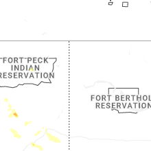


Connect with Interactive Hail Maps