

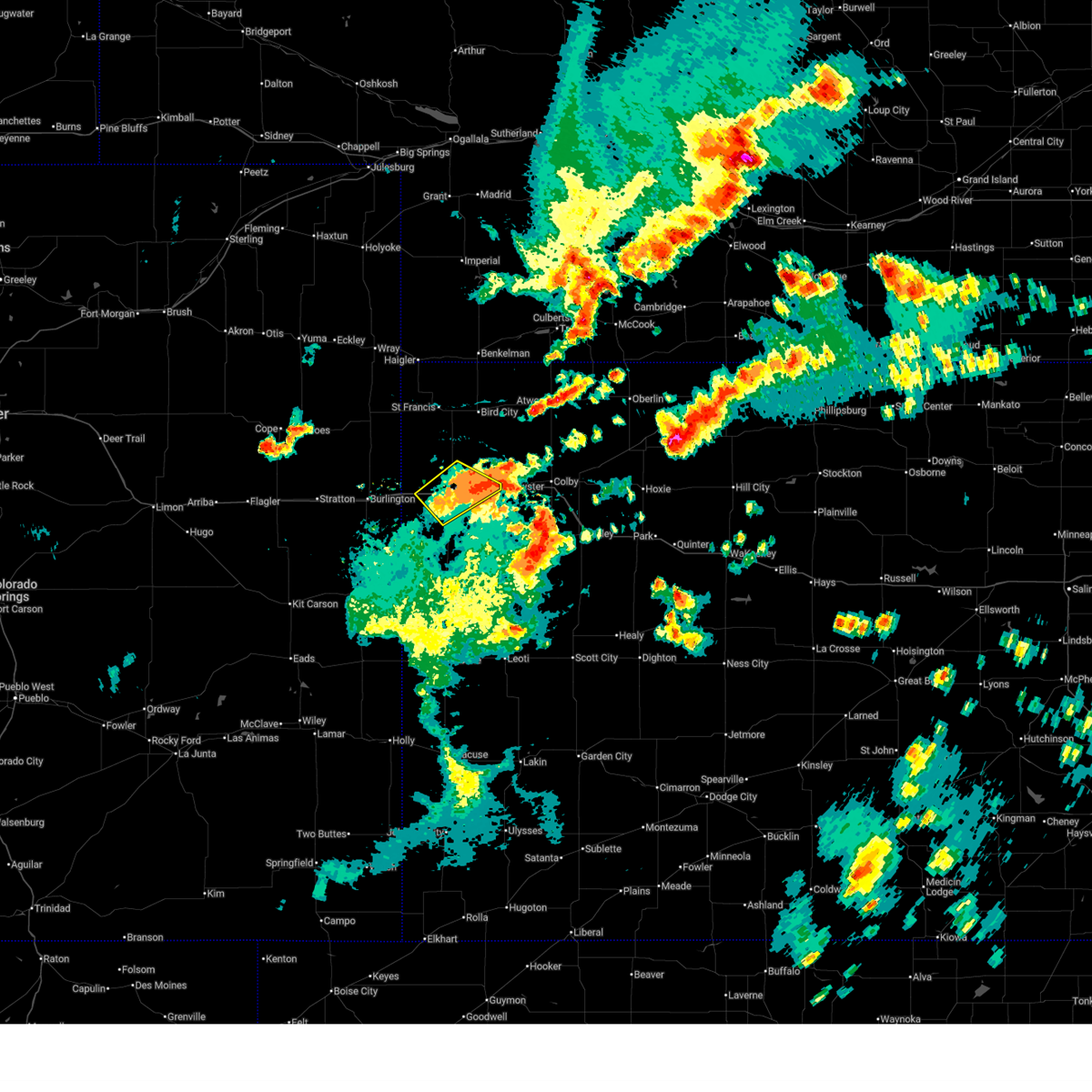
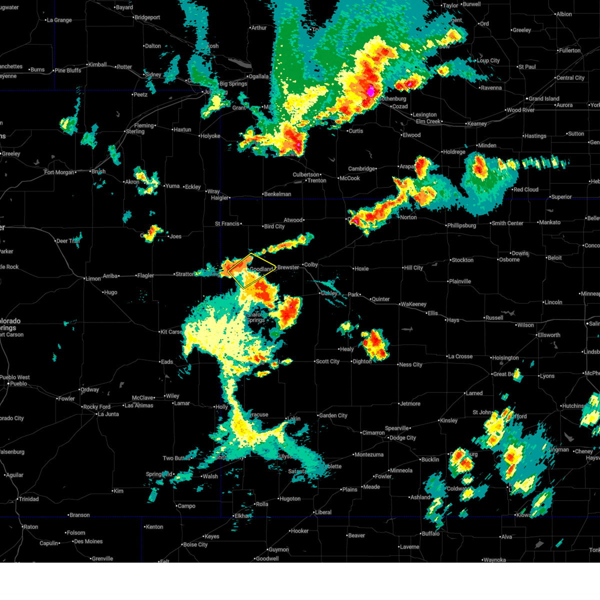
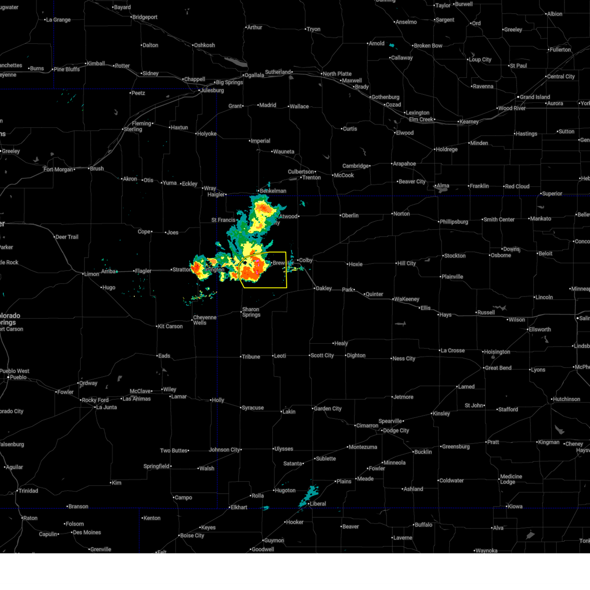
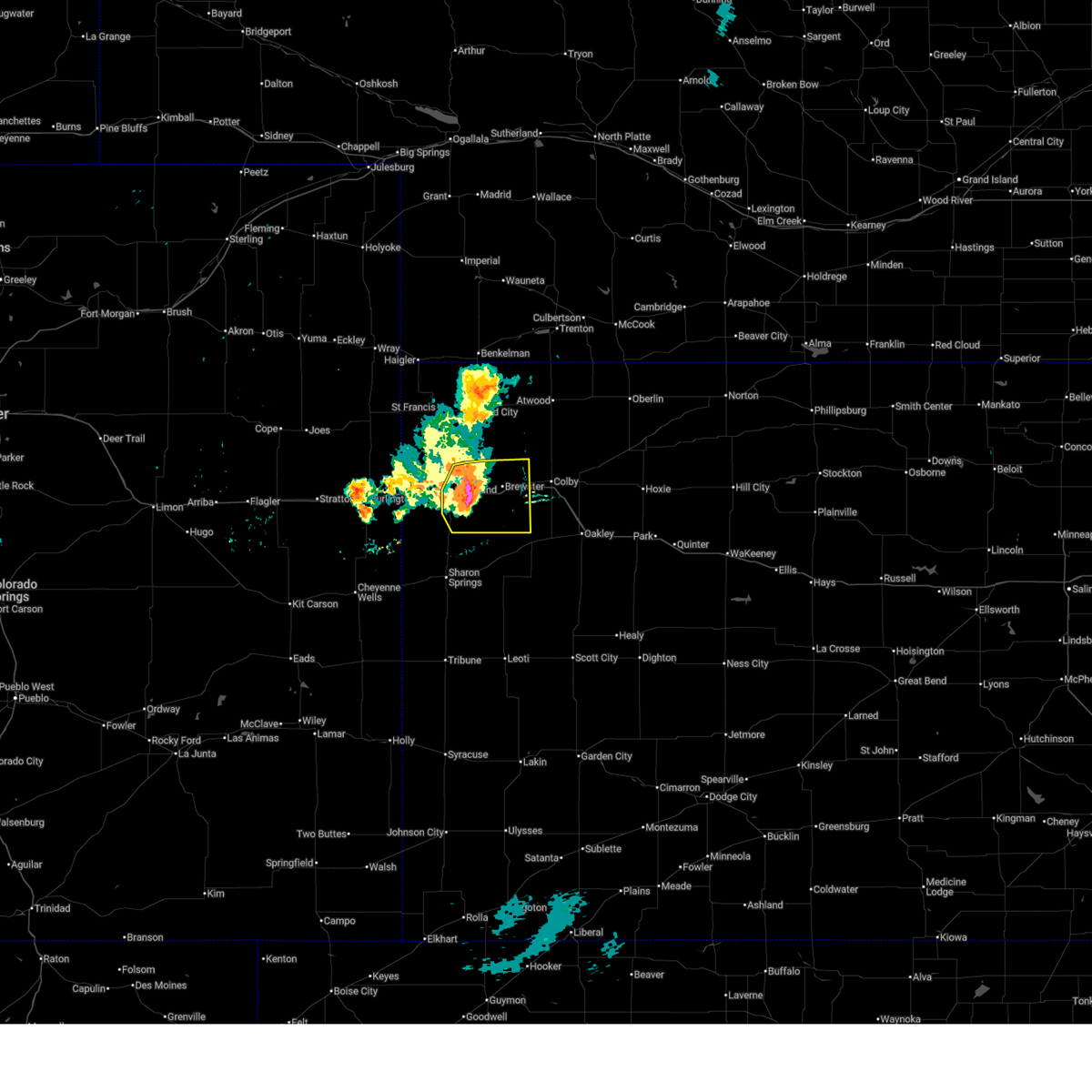
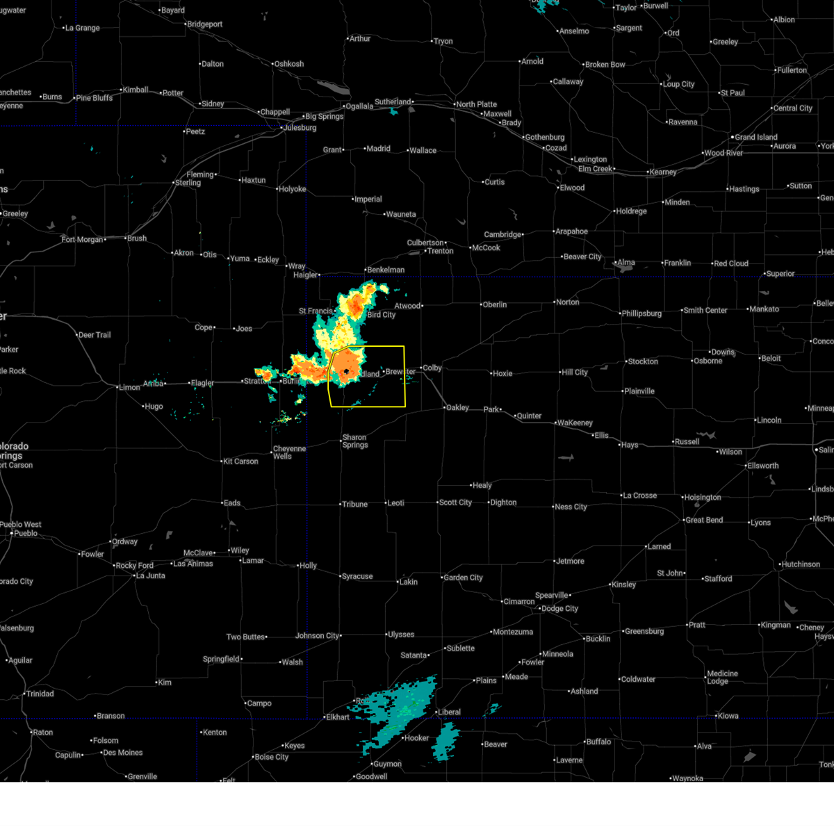
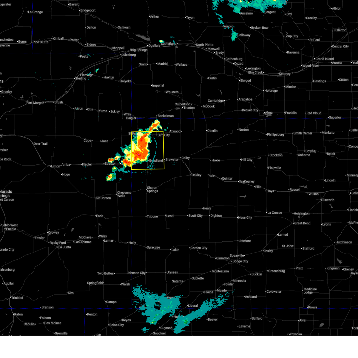
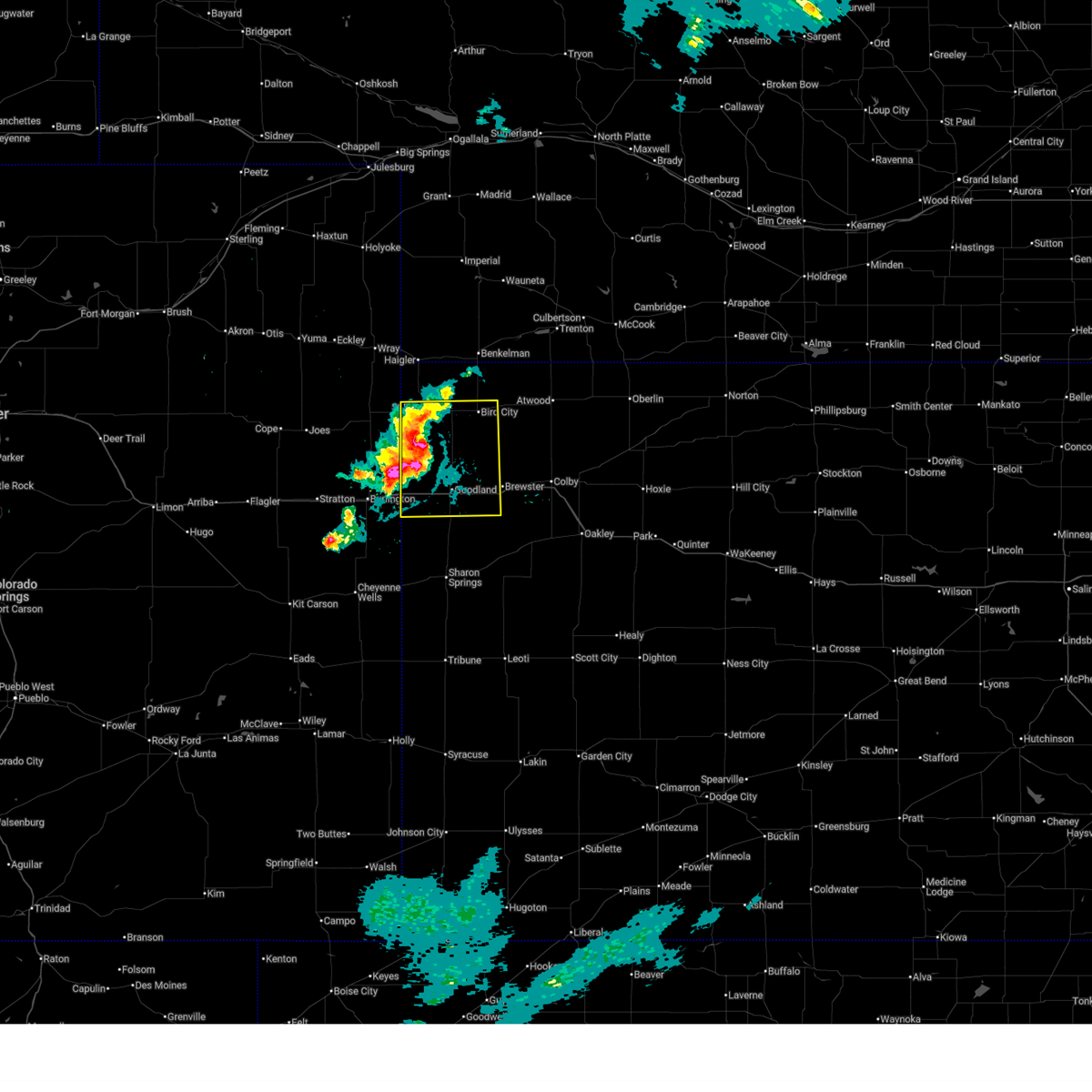
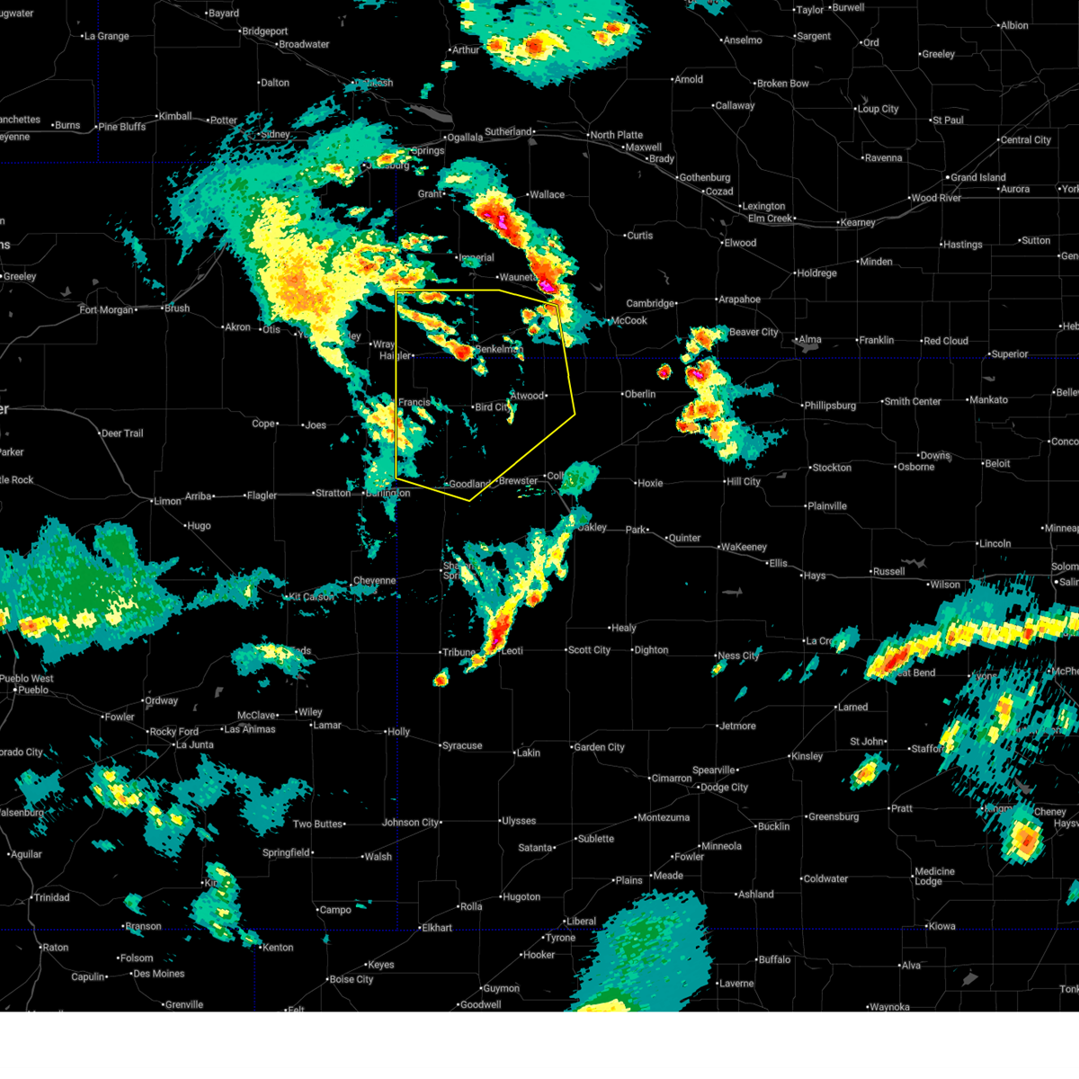
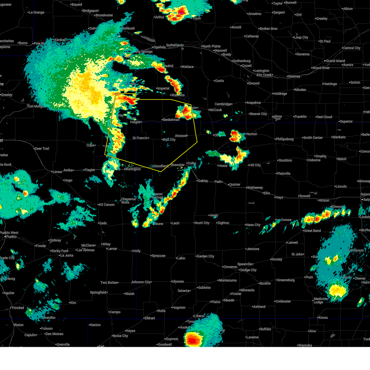
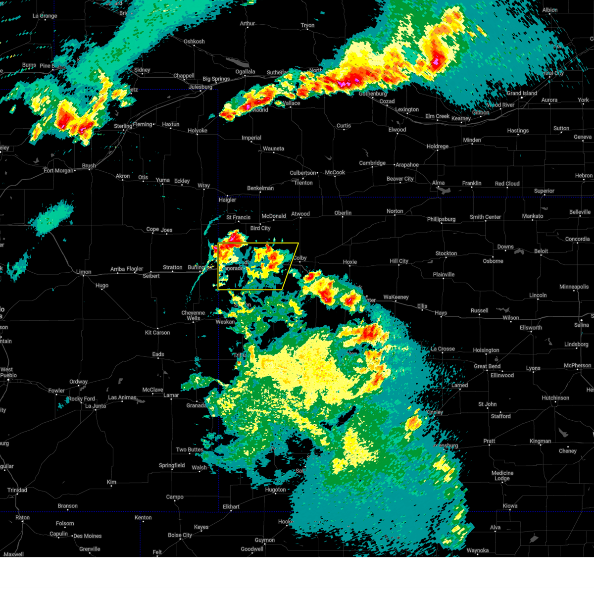
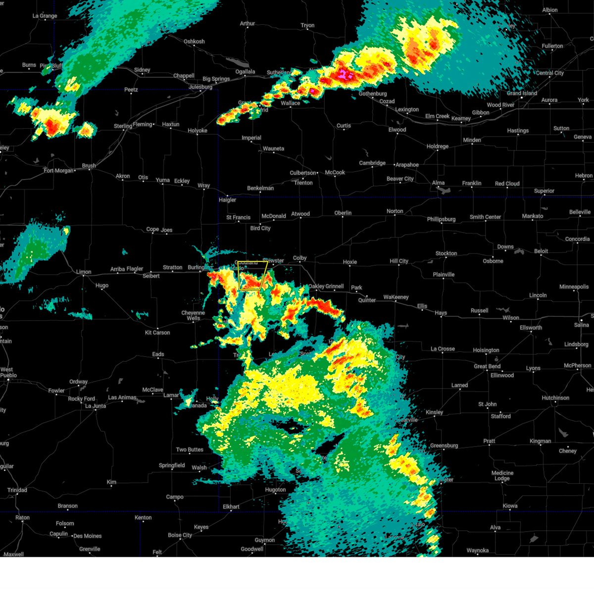
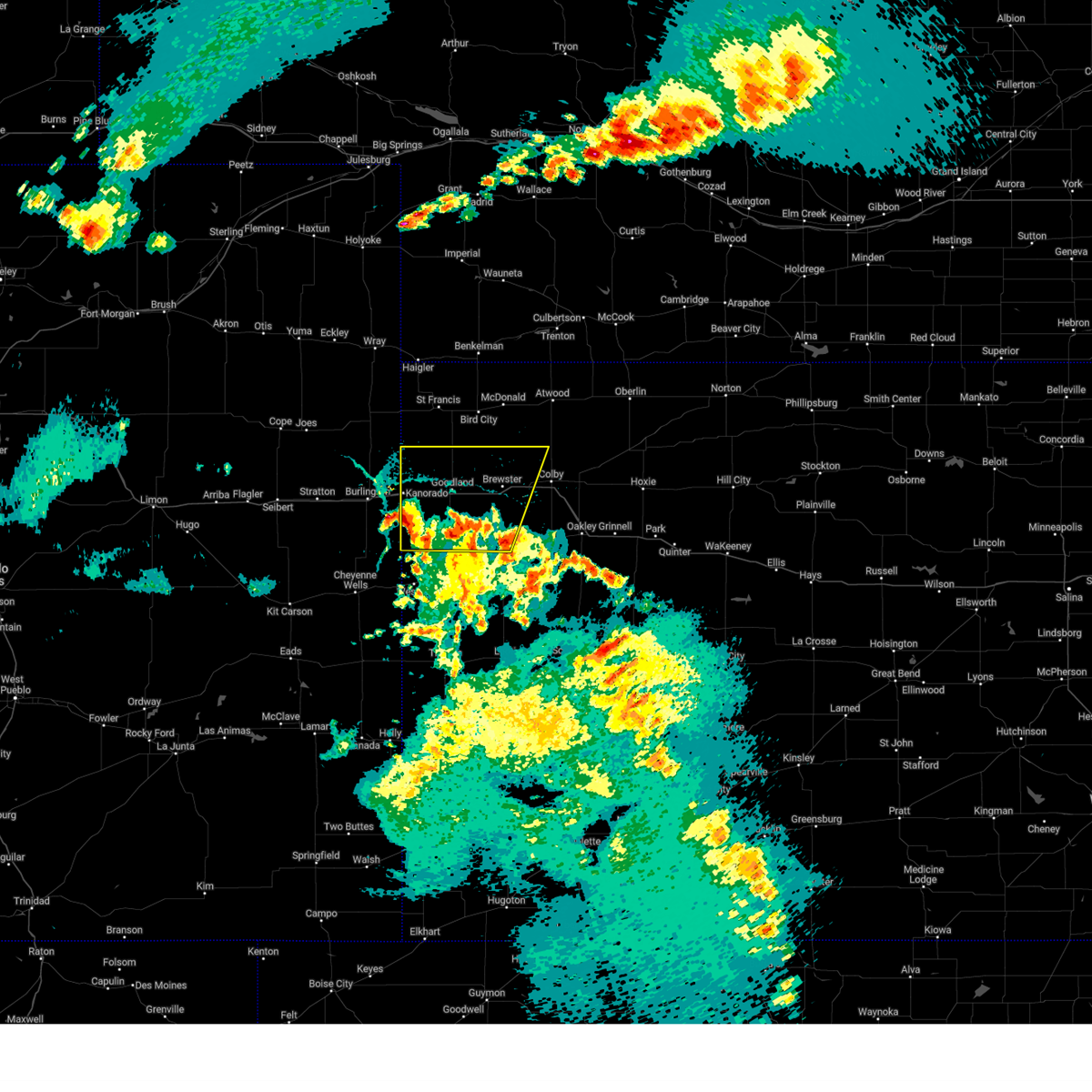
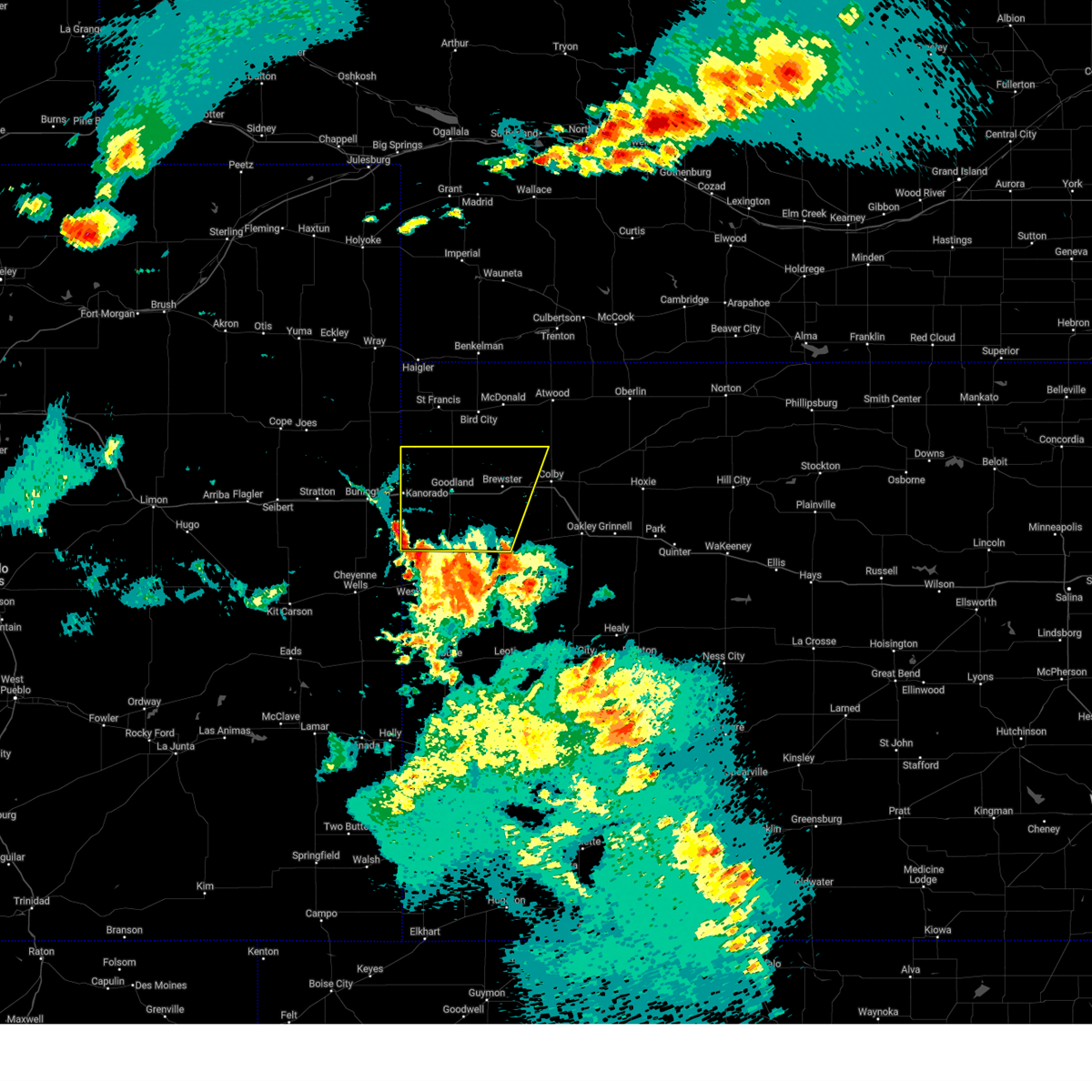
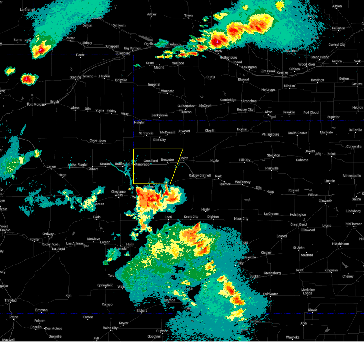
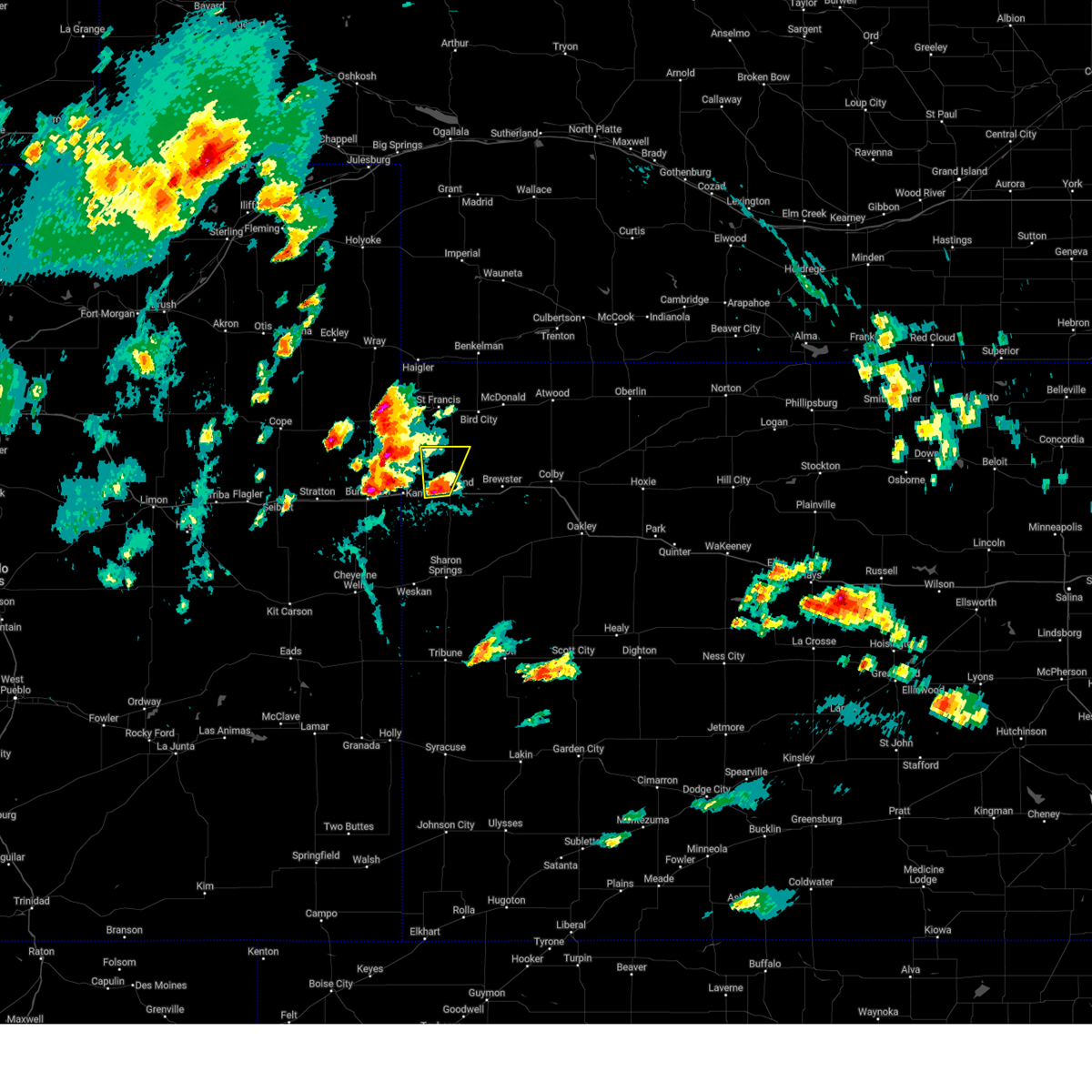
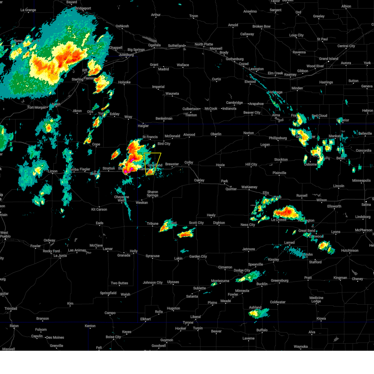
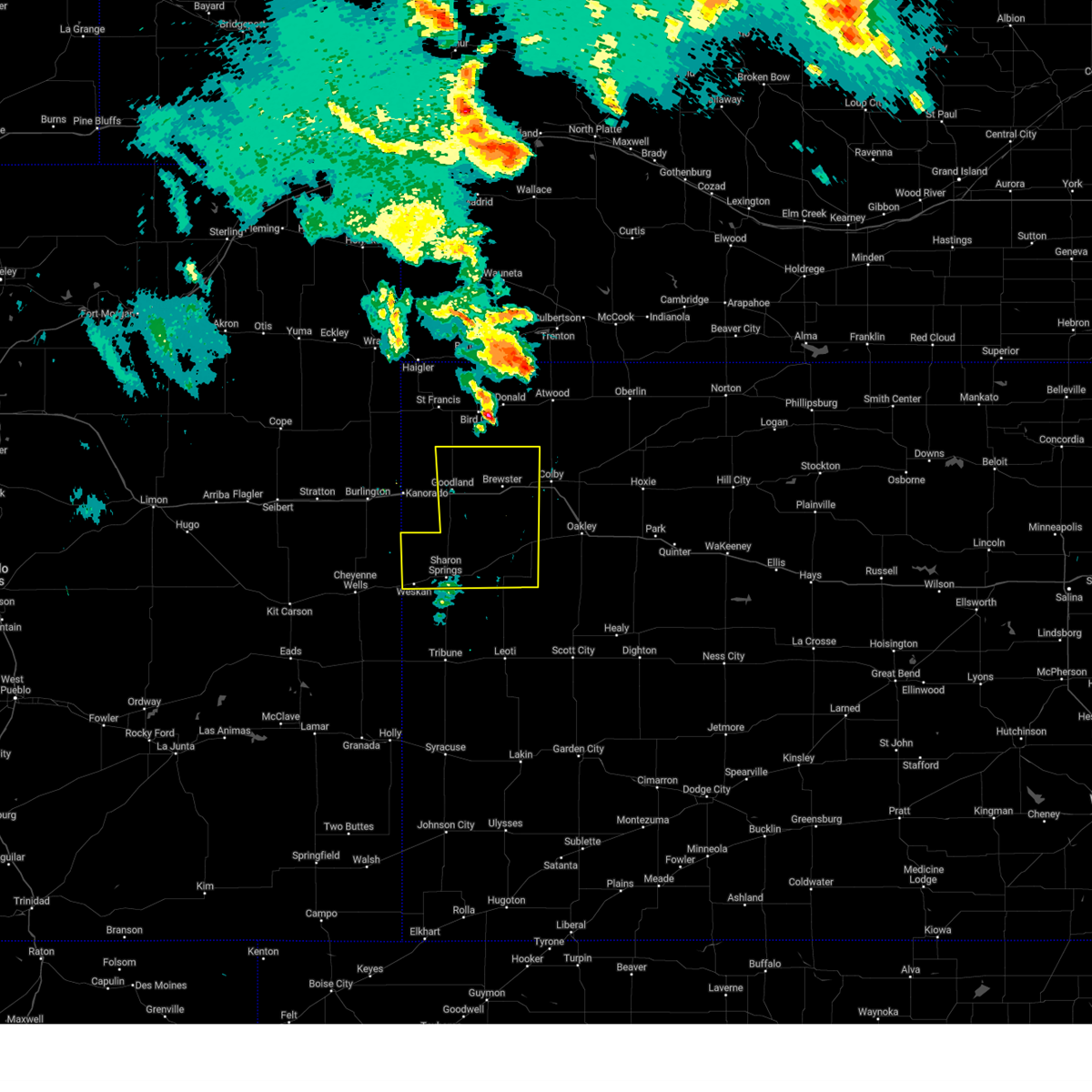
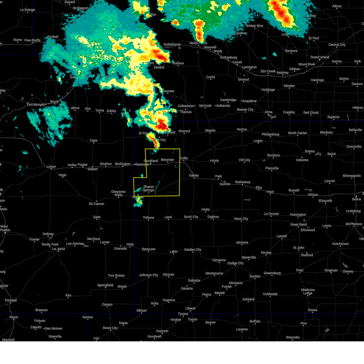
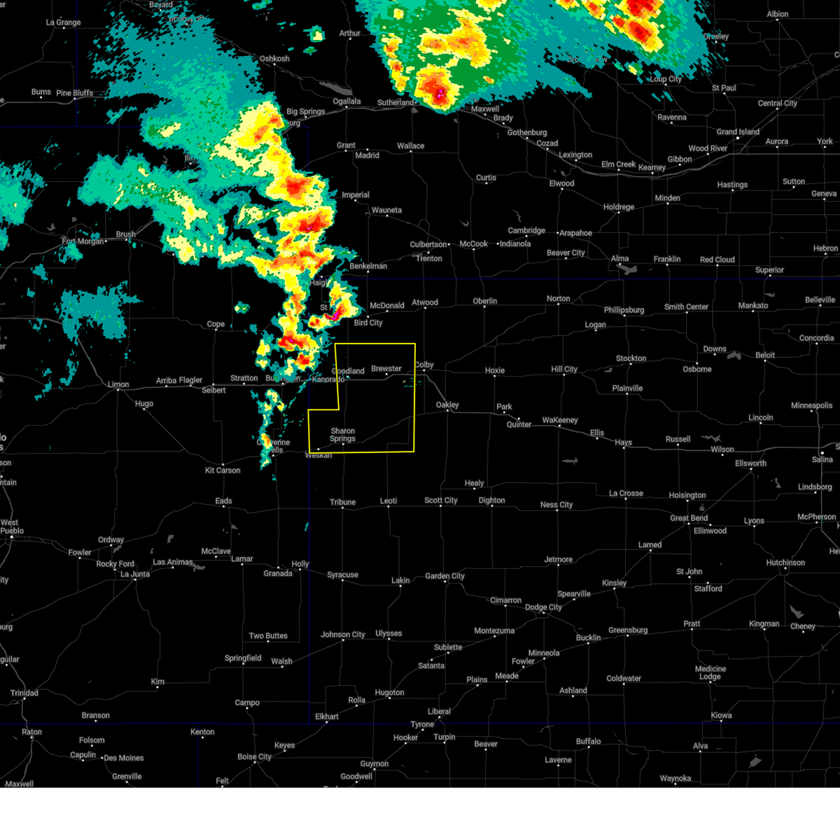
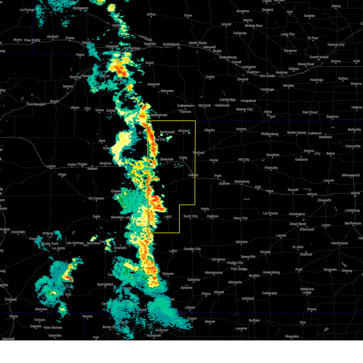
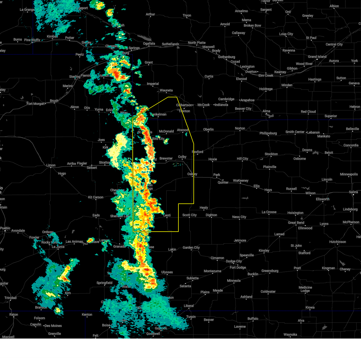
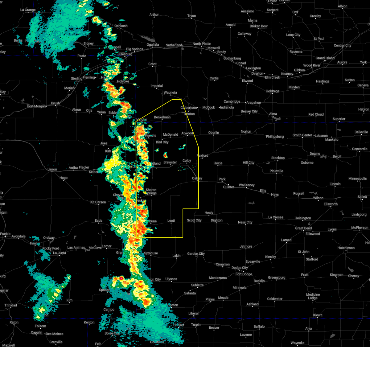
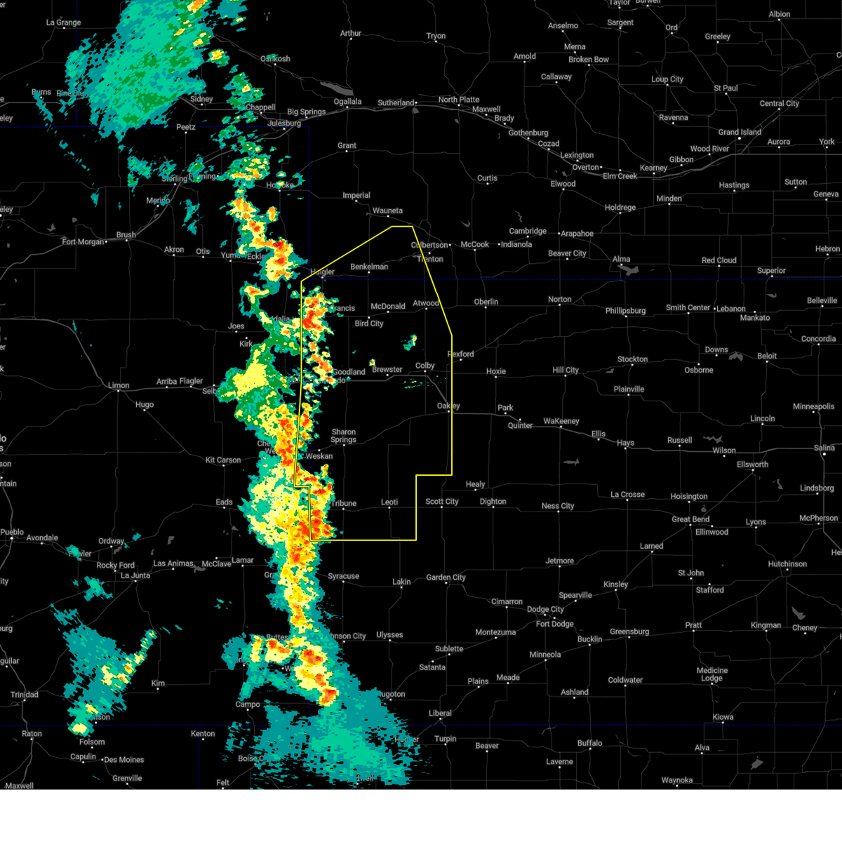
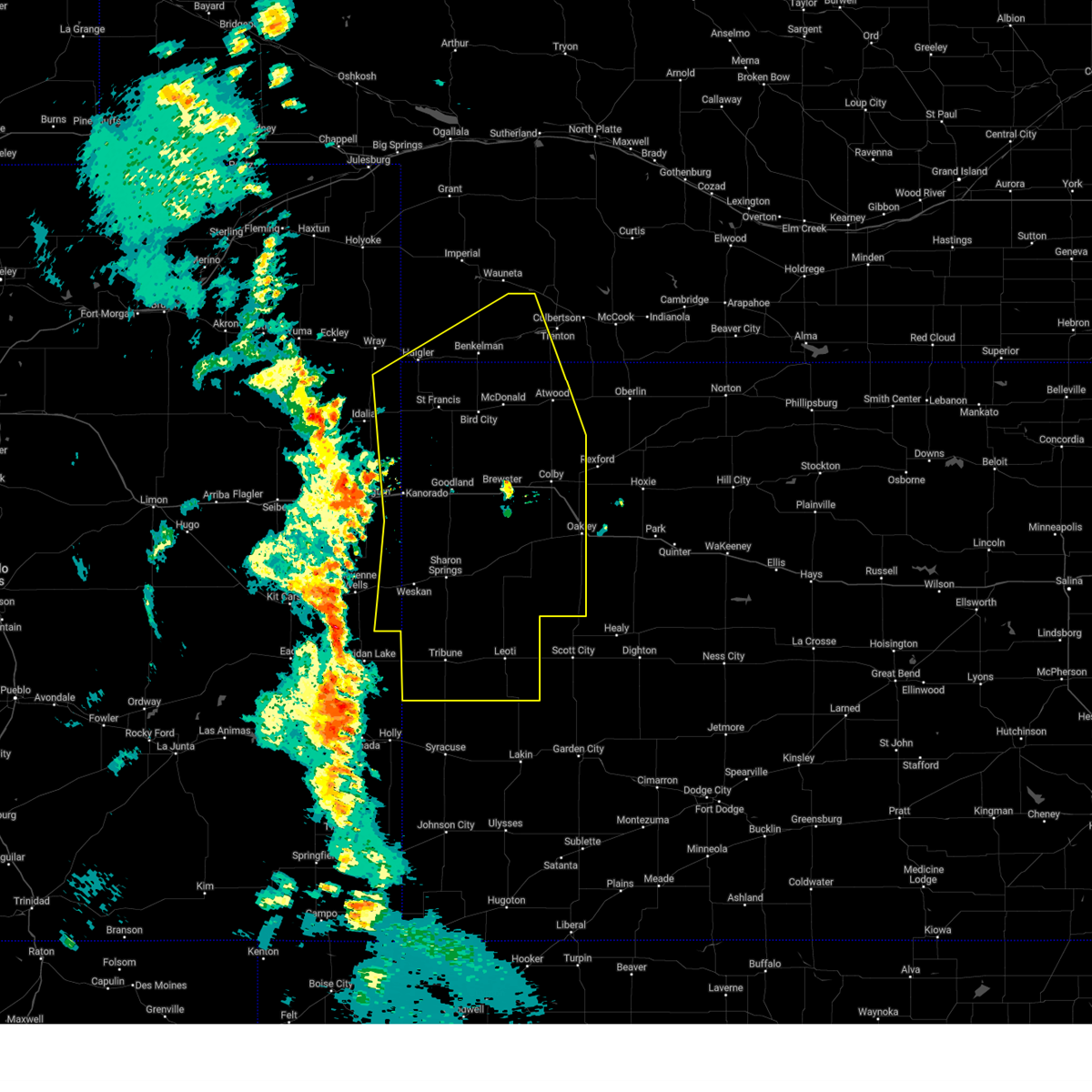
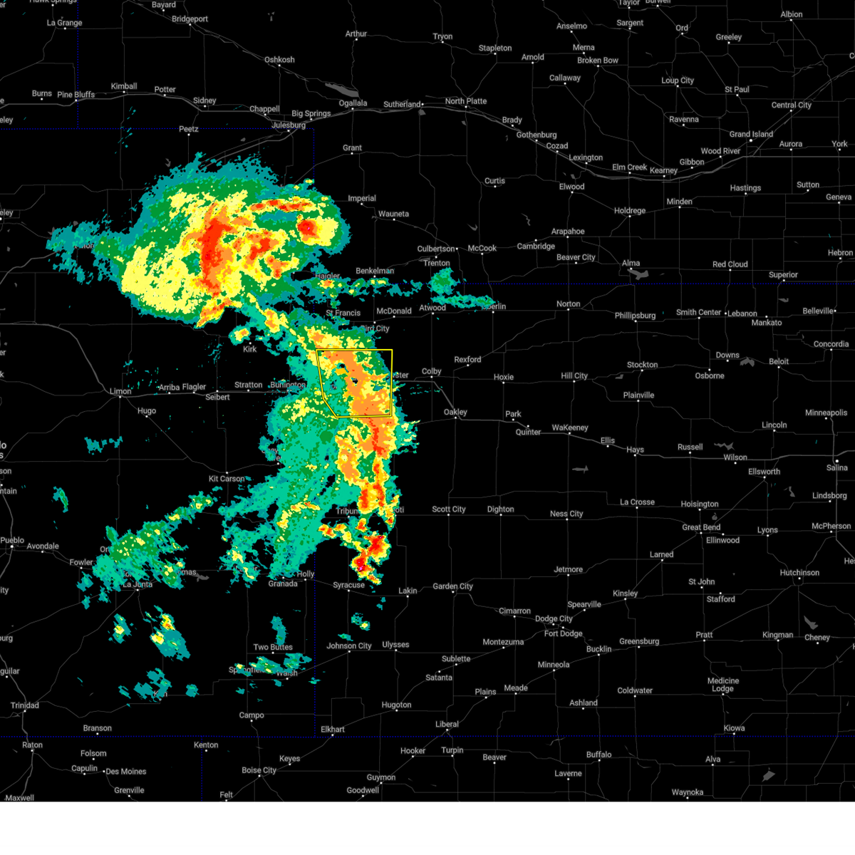
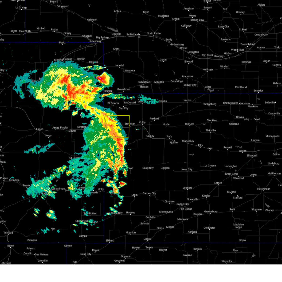
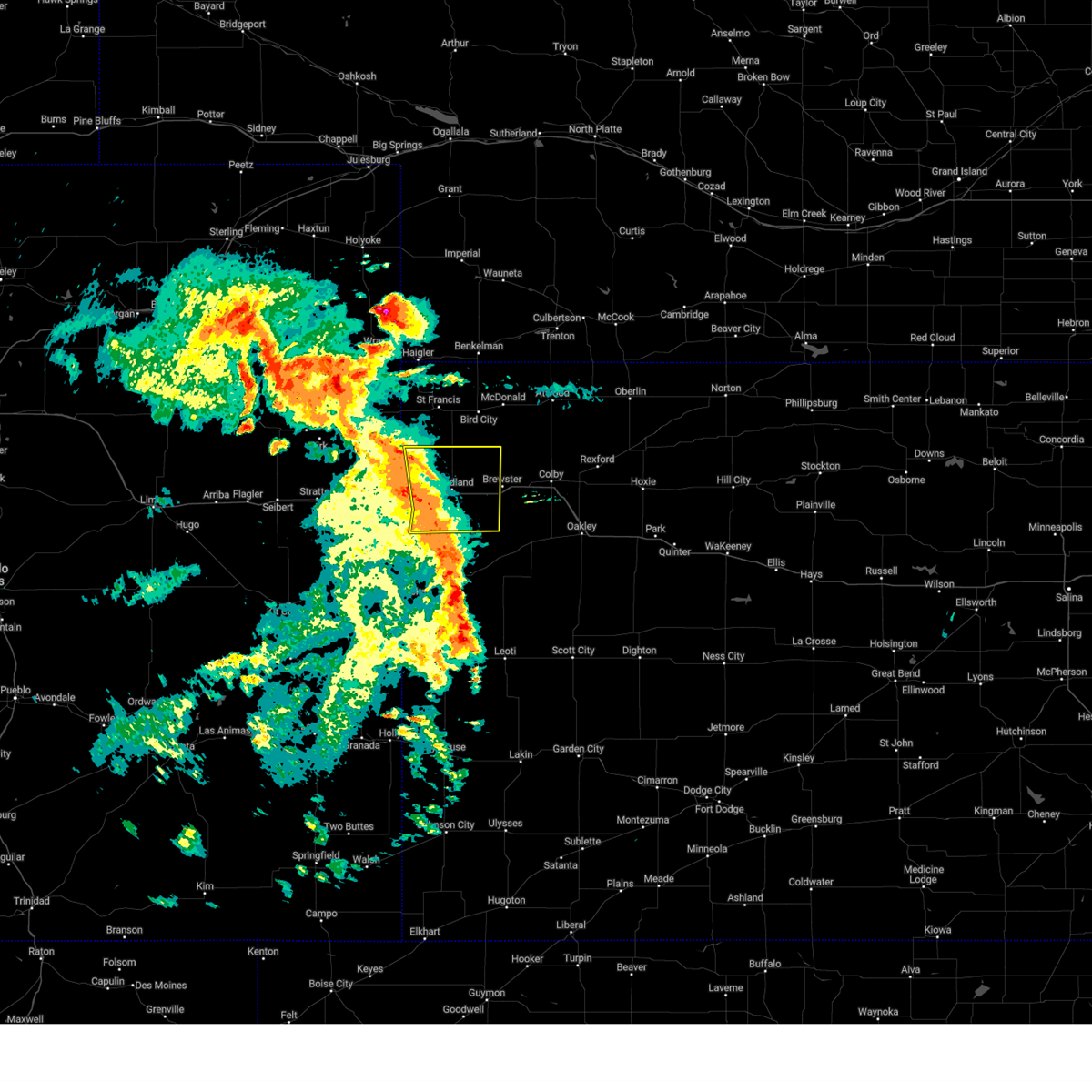
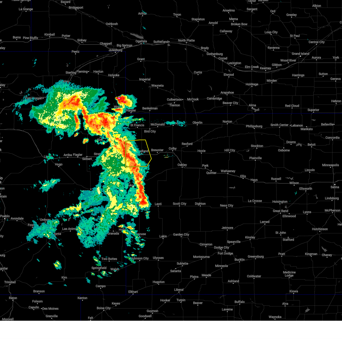
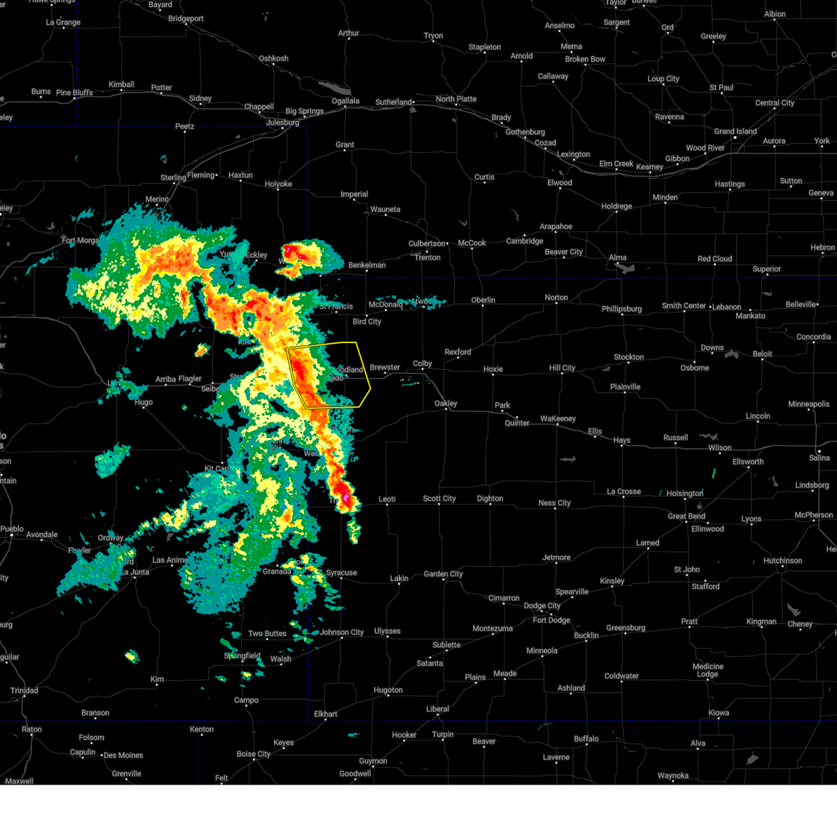
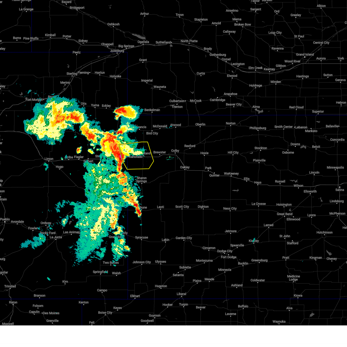
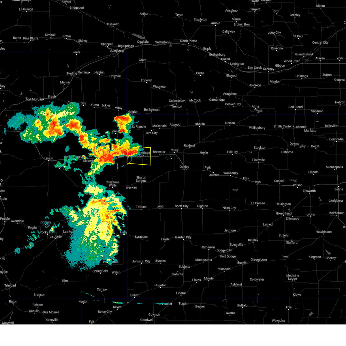
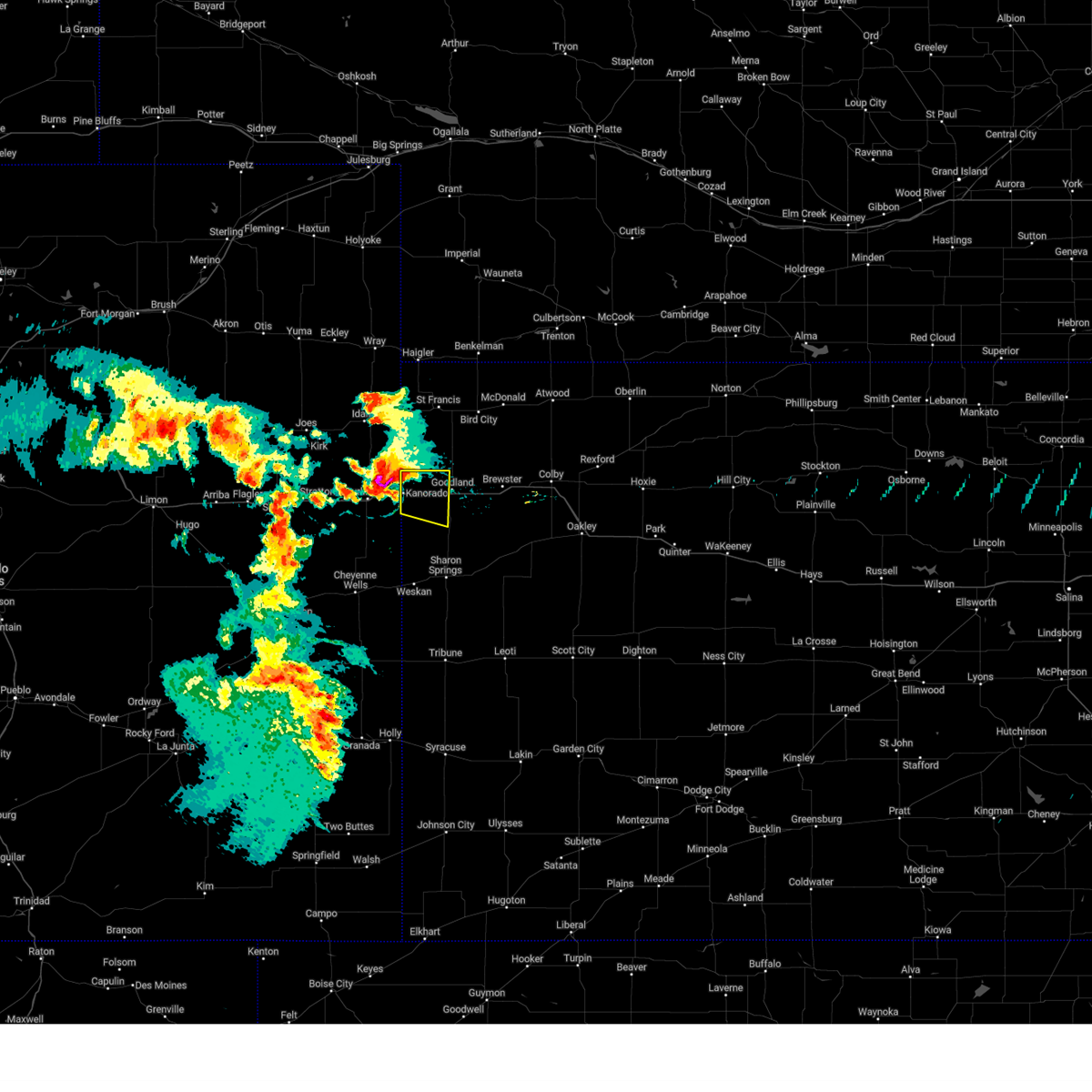
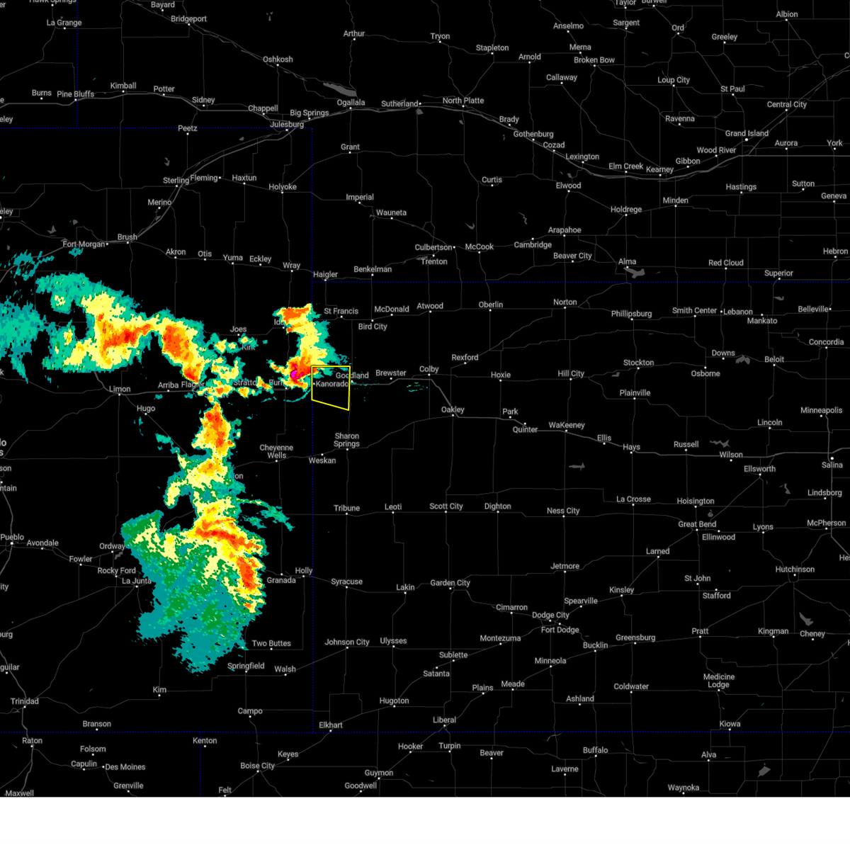
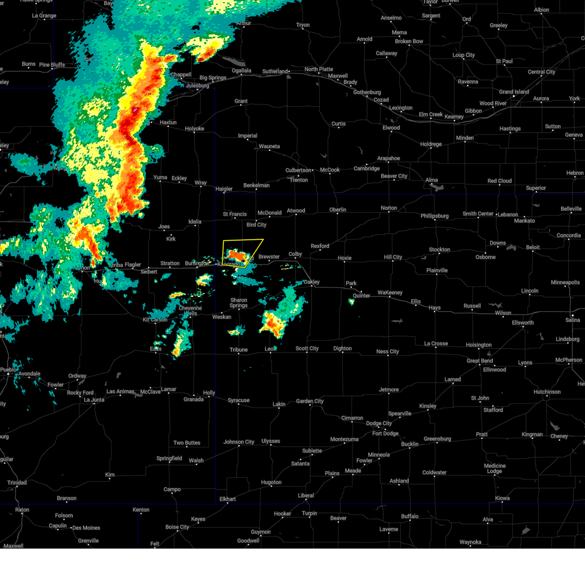
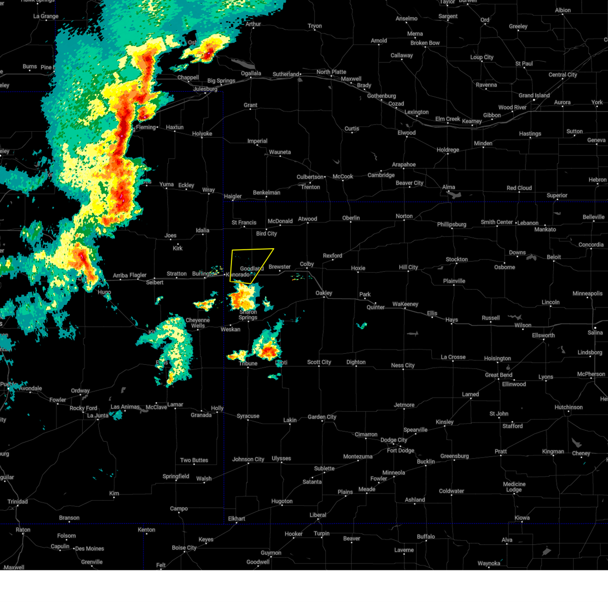
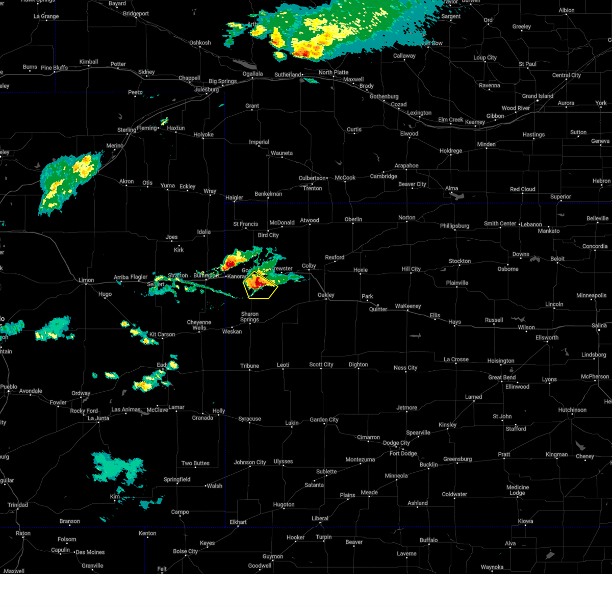
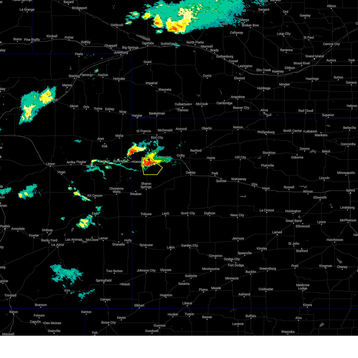
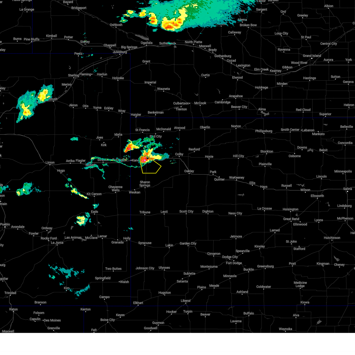
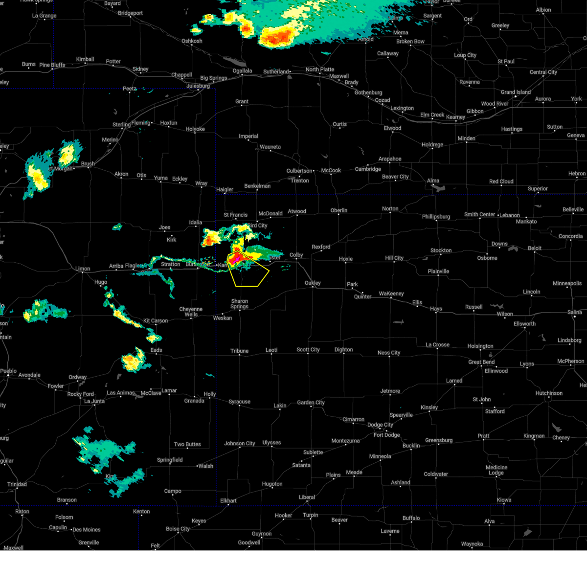
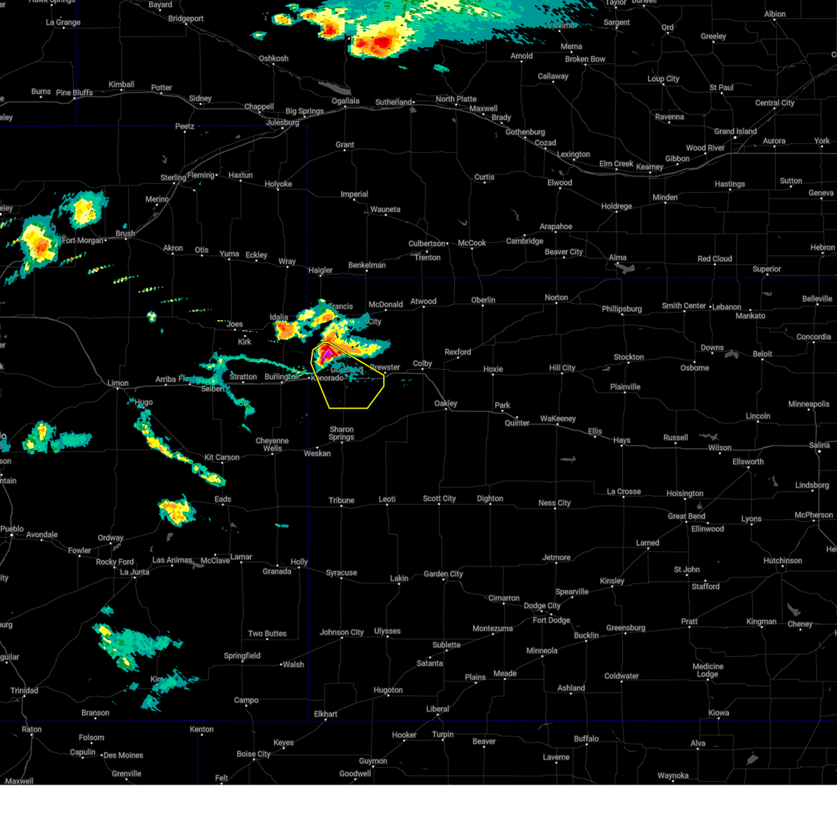
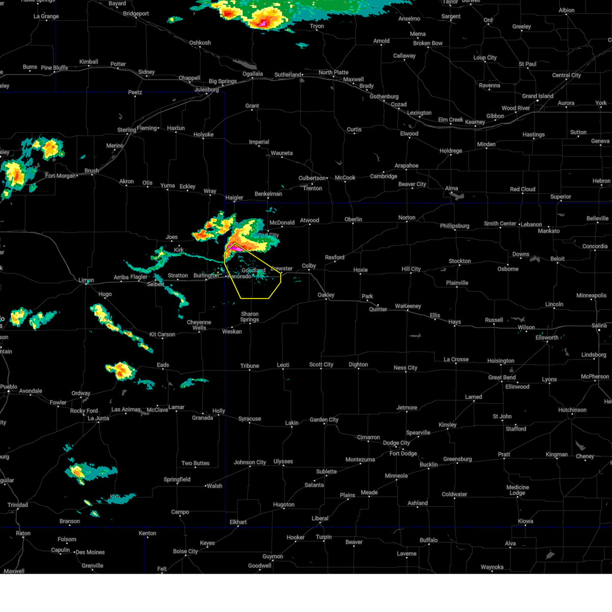
Hail Map for Goodland, KS
The Goodland, KS area has had 187 reports of on-the-ground hail by trained spotters, and has been under severe weather warnings 76 times during the past 12 months. Doppler radar has detected hail at or near Goodland, KS on 91 occasions, including 3 occasions during the past year.
| Name: | Goodland, KS |
| Where Located: | 35.8 miles W of Colby, KS |
| Map: | Google Map for Goodland, KS |
| Population: | 4489 |
| Housing Units: | 2395 |
| More Info: | Search Google for Goodland, KS |
2
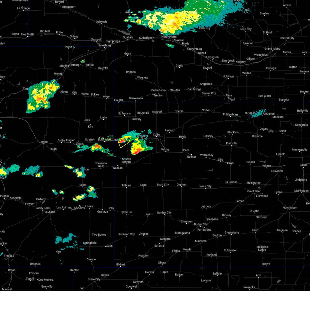
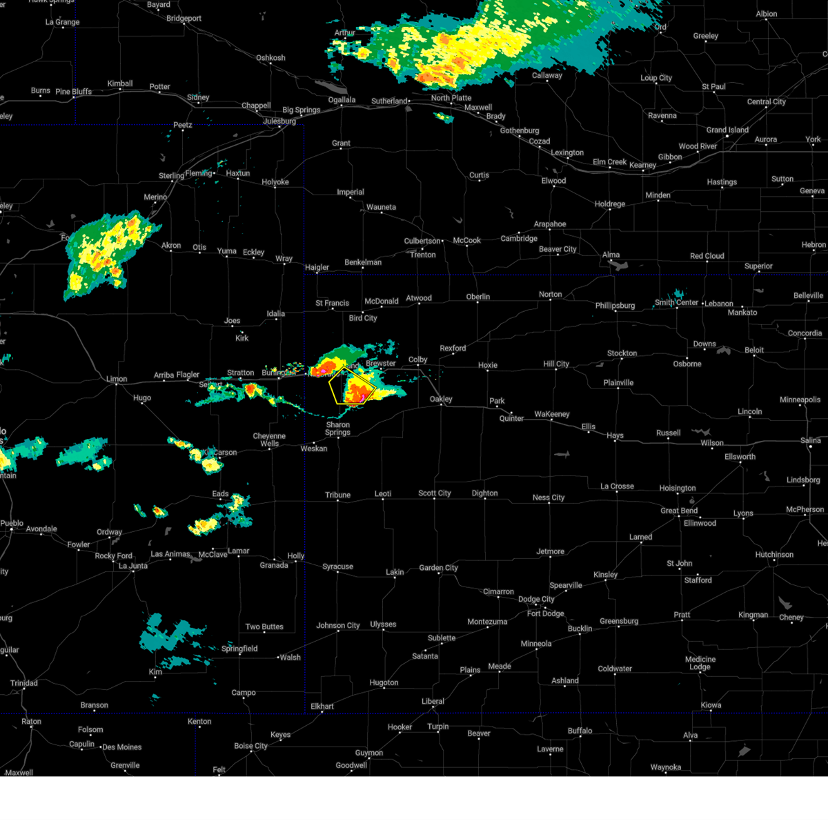
The Top Recent Hail Date for Goodland, KS is Sunday, August 11, 2024 (2nd out of 91)

Hail and Wind Damage Spotted near Goodland, KS
| Date / Time | Report Details |
|---|---|
| 6/30/2025 12:55 AM MDT |
 The storms which prompted the warning have weakened below severe limits, and have exited the warned area. therefore, the warning will be allowed to expire. however, gusty winds and heavy rain are still possible with these thunderstorms. to report severe weather, contact your nearest law enforcement agency. they will relay your report to the national weather service goodland. The storms which prompted the warning have weakened below severe limits, and have exited the warned area. therefore, the warning will be allowed to expire. however, gusty winds and heavy rain are still possible with these thunderstorms. to report severe weather, contact your nearest law enforcement agency. they will relay your report to the national weather service goodland.
|
| 6/30/2025 12:27 AM MDT |
 Svrgld the national weather service in goodland has issued a * severe thunderstorm warning for, central sherman county in northwestern kansas, * until 100 am mdt. * at 1227 am mdt, severe thunderstorms were located along a line extending from 6 miles north of goodland to near ruleton, moving southeast at 20 mph (radar indicated). Hazards include 60 mph wind gusts and quarter size hail. Hail damage to vehicles is expected. expect wind damage to roofs, siding, and trees. severe thunderstorms will be near, goodland around 1235 am mdt. This includes interstate 70 in kansas between mile markers 5 and 33. Svrgld the national weather service in goodland has issued a * severe thunderstorm warning for, central sherman county in northwestern kansas, * until 100 am mdt. * at 1227 am mdt, severe thunderstorms were located along a line extending from 6 miles north of goodland to near ruleton, moving southeast at 20 mph (radar indicated). Hazards include 60 mph wind gusts and quarter size hail. Hail damage to vehicles is expected. expect wind damage to roofs, siding, and trees. severe thunderstorms will be near, goodland around 1235 am mdt. This includes interstate 70 in kansas between mile markers 5 and 33.
|
| 6/27/2025 10:30 PM MDT |
 At 1028 pm mdt/1128 pm cdt/, a severe thunderstorm was located 9 miles southwest of brewster, moving southeast at 15 mph (radar indicated). Hazards include 60 mph wind gusts and nickel size hail. Expect damage to roofs, siding, and trees. locations impacted include, goodland, brewster, and edson. this includes interstate 70 in kansas between mile markers 15 and 46. The national weather service in goodland received 1 inch of rain in 30 minutes, in addition to half inch hail and wind gusts up to 59 mph. At 1028 pm mdt/1128 pm cdt/, a severe thunderstorm was located 9 miles southwest of brewster, moving southeast at 15 mph (radar indicated). Hazards include 60 mph wind gusts and nickel size hail. Expect damage to roofs, siding, and trees. locations impacted include, goodland, brewster, and edson. this includes interstate 70 in kansas between mile markers 15 and 46. The national weather service in goodland received 1 inch of rain in 30 minutes, in addition to half inch hail and wind gusts up to 59 mph.
|
| 6/27/2025 10:20 PM MDT |
 At 1016 pm mdt/1116 pm cdt/, a severe thunderstorm was located 8 miles southeast of goodland, moving southeast at 15 mph (radar indicated). Hazards include 60 mph wind gusts and nickel size hail. Expect damage to roofs, siding, and trees. locations impacted include, goodland, brewster, and edson. this includes interstate 70 in kansas between mile markers 15 and 46. The national weather service in goodland received 1 inch of rain in 30 minutes, in addition to half inch hail and wind gusts up to 59 mph. At 1016 pm mdt/1116 pm cdt/, a severe thunderstorm was located 8 miles southeast of goodland, moving southeast at 15 mph (radar indicated). Hazards include 60 mph wind gusts and nickel size hail. Expect damage to roofs, siding, and trees. locations impacted include, goodland, brewster, and edson. this includes interstate 70 in kansas between mile markers 15 and 46. The national weather service in goodland received 1 inch of rain in 30 minutes, in addition to half inch hail and wind gusts up to 59 mph.
|
| 6/27/2025 10:00 PM MDT |
 Svrgld the national weather service in goodland has issued a * severe thunderstorm warning for, western thomas county in northwestern kansas, sherman county in northwestern kansas, * until 1100 pm mdt/midnight cdt/. * at 959 pm mdt/1059 pm cdt/, a severe thunderstorm was located 4 miles east of goodland, moving east at 15 mph (radar indicated). Hazards include 60 mph wind gusts and nickel size hail. expect damage to roofs, siding, and trees Svrgld the national weather service in goodland has issued a * severe thunderstorm warning for, western thomas county in northwestern kansas, sherman county in northwestern kansas, * until 1100 pm mdt/midnight cdt/. * at 959 pm mdt/1059 pm cdt/, a severe thunderstorm was located 4 miles east of goodland, moving east at 15 mph (radar indicated). Hazards include 60 mph wind gusts and nickel size hail. expect damage to roofs, siding, and trees
|
| 6/27/2025 9:48 PM MDT | Kgld reports 59 mph wind gus in sherman county KS, 1.3 miles SSW of Goodland, KS |
| 6/27/2025 9:35 PM MDT |
 At 931 pm mdt/1031 pm cdt/, severe thunderstorms were located along a line extending from 6 miles southeast of st. francis to 4 miles southeast of kanorado, moving east at 20 mph (radar indicated). Hazards include 60 mph wind gusts. Expect damage to roofs, siding, and trees. these severe storms will be near, ruleton around 935 pm mdt. goodland around 950 pm mdt. bird city around 1055 pm cdt. other locations impacted by these severe thunderstorms include wheeler and edson. this includes interstate 70 in kansas between mile markers 0 and 35. At 925 pm mdt, the national weather service in goodland measured sustained winds at 36 mph and gusts to 46 mph with thunderstorm outflow, in advance of any rain. At 931 pm mdt/1031 pm cdt/, severe thunderstorms were located along a line extending from 6 miles southeast of st. francis to 4 miles southeast of kanorado, moving east at 20 mph (radar indicated). Hazards include 60 mph wind gusts. Expect damage to roofs, siding, and trees. these severe storms will be near, ruleton around 935 pm mdt. goodland around 950 pm mdt. bird city around 1055 pm cdt. other locations impacted by these severe thunderstorms include wheeler and edson. this includes interstate 70 in kansas between mile markers 0 and 35. At 925 pm mdt, the national weather service in goodland measured sustained winds at 36 mph and gusts to 46 mph with thunderstorm outflow, in advance of any rain.
|
| 6/27/2025 9:11 PM MDT |
 Svrgld the national weather service in goodland has issued a * severe thunderstorm warning for, southern cheyenne county in northwestern kansas, sherman county in northwestern kansas, * until 1000 pm mdt/1100 pm cdt/. * at 910 pm mdt/1010 pm cdt/, severe thunderstorms were located along a line extending from 6 miles southeast of st. francis to near kanorado, moving east at 20 mph (radar indicated). Hazards include wind gusts up to 65 mph. Expect damage to roofs, siding, and trees. severe thunderstorms will be near, ruleton around 915 pm mdt. bird city around 1025 pm cdt. other locations in the path of these severe thunderstorms include goodland. This includes interstate 70 in kansas between mile markers 0 and 35. Svrgld the national weather service in goodland has issued a * severe thunderstorm warning for, southern cheyenne county in northwestern kansas, sherman county in northwestern kansas, * until 1000 pm mdt/1100 pm cdt/. * at 910 pm mdt/1010 pm cdt/, severe thunderstorms were located along a line extending from 6 miles southeast of st. francis to near kanorado, moving east at 20 mph (radar indicated). Hazards include wind gusts up to 65 mph. Expect damage to roofs, siding, and trees. severe thunderstorms will be near, ruleton around 915 pm mdt. bird city around 1025 pm cdt. other locations in the path of these severe thunderstorms include goodland. This includes interstate 70 in kansas between mile markers 0 and 35.
|
| 6/17/2025 6:44 PM CDT |
 At 544 pm mdt/644 pm cdt/, severe thunderstorms were located along a line extending from 11 miles south of wauneta to 3 miles northeast of mcdonald to 9 miles north of ruleton, moving east at 50 mph (radar indicated). Hazards include 60 mph wind gusts. Expect damage to roofs, siding, and trees. Locations impacted include, stratton, mcdonald, atwood, goodland, trenton and ludell. At 544 pm mdt/644 pm cdt/, severe thunderstorms were located along a line extending from 11 miles south of wauneta to 3 miles northeast of mcdonald to 9 miles north of ruleton, moving east at 50 mph (radar indicated). Hazards include 60 mph wind gusts. Expect damage to roofs, siding, and trees. Locations impacted include, stratton, mcdonald, atwood, goodland, trenton and ludell.
|
| 6/17/2025 6:44 PM CDT |
 the severe thunderstorm warning has been cancelled and is no longer in effect the severe thunderstorm warning has been cancelled and is no longer in effect
|
| 6/17/2025 5:18 PM MDT |
 Svrgld the national weather service in goodland has issued a * severe thunderstorm warning for, yuma county in northeastern colorado, northeastern kit carson county in east central colorado, cheyenne county in northwestern kansas, northwestern thomas county in northwestern kansas, rawlins county in northwestern kansas, northern sherman county in northwestern kansas, dundy county in southwestern nebraska, western hitchcock county in southwestern nebraska, * until 600 pm mdt/700 pm cdt/. * at 517 pm mdt/617 pm cdt/, severe thunderstorms were located along a line extending from 10 miles southwest of champion to 10 miles northeast of st. francis to 6 miles southwest of bonny reservoir, moving east at 50 mph (radar indicated). Hazards include 60 mph wind gusts. Expect damage to roofs, siding, and trees. severe thunderstorms will be near, st. francis around 625 pm cdt. benkelman around 525 pm mdt. bird city around 630 pm cdt. mcdonald around 635 pm cdt. Other locations in the path of these severe thunderstorms include stratton. Svrgld the national weather service in goodland has issued a * severe thunderstorm warning for, yuma county in northeastern colorado, northeastern kit carson county in east central colorado, cheyenne county in northwestern kansas, northwestern thomas county in northwestern kansas, rawlins county in northwestern kansas, northern sherman county in northwestern kansas, dundy county in southwestern nebraska, western hitchcock county in southwestern nebraska, * until 600 pm mdt/700 pm cdt/. * at 517 pm mdt/617 pm cdt/, severe thunderstorms were located along a line extending from 10 miles southwest of champion to 10 miles northeast of st. francis to 6 miles southwest of bonny reservoir, moving east at 50 mph (radar indicated). Hazards include 60 mph wind gusts. Expect damage to roofs, siding, and trees. severe thunderstorms will be near, st. francis around 625 pm cdt. benkelman around 525 pm mdt. bird city around 630 pm cdt. mcdonald around 635 pm cdt. Other locations in the path of these severe thunderstorms include stratton.
|
| 6/16/2025 7:39 PM MDT | Svrgld the national weather service in goodland has issued a * severe thunderstorm warning for, southeastern yuma county in northeastern colorado, northeastern kit carson county in east central colorado, cheyenne county in northwestern kansas, southwestern rawlins county in northwestern kansas, sherman county in northwestern kansas, * until 815 pm mdt/915 pm cdt/. * at 738 pm mdt/838 pm cdt/, a severe thunderstorm was located 11 miles east of bonny reservoir, moving northeast at 15 mph (radar indicated). Hazards include 70 mph wind gusts and penny size hail. Expect considerable tree damage. damage is likely to mobile homes, roofs, and outbuildings. This severe thunderstorm will remain over mainly rural areas of southeastern yuma county in northeastern colorado, northeastern kit carson county in east central colorado, cheyenne, southwestern rawlins and sherman counties in northwestern kansas, including the following locations, wheeler, hale, and edson. |
| 6/16/2025 6:55 PM MDT | Reported via weatherunderground station kkskanor in sherman county KS, 16.5 miles SE of Goodland, KS |
| 6/2/2025 7:10 PM MDT | The storm which prompted the warning has moved out of the area. therefore, the warning will be allowed to expire. however, heavy rain is still possible with this thunderstorm. a severe thunderstorm watch remains in effect until 900 pm mdt/1000 pm cdt/ for east central colorado, and northwestern and west central kansas. to report severe weather, contact your nearest law enforcement agency. they will relay your report to the national weather service goodland. |
| 6/2/2025 6:54 PM MDT |
 the severe thunderstorm warning has been cancelled and is no longer in effect the severe thunderstorm warning has been cancelled and is no longer in effect
|
| 6/2/2025 6:54 PM MDT |
 At 654 pm mdt/754 pm cdt/, a severe thunderstorm was located 7 miles north of goodland, moving north at 25 mph (mesonet. goodland airport continues to gust around 65 mph). Hazards include 70 mph wind gusts and quarter size hail. Hail damage to vehicles is expected. expect considerable tree damage. wind damage is also likely to mobile homes, roofs, and outbuildings. locations impacted include, goodland, brewster, kanorado, ruleton, levant, and edson. This includes interstate 70 in kansas between mile markers 0 and 48. At 654 pm mdt/754 pm cdt/, a severe thunderstorm was located 7 miles north of goodland, moving north at 25 mph (mesonet. goodland airport continues to gust around 65 mph). Hazards include 70 mph wind gusts and quarter size hail. Hail damage to vehicles is expected. expect considerable tree damage. wind damage is also likely to mobile homes, roofs, and outbuildings. locations impacted include, goodland, brewster, kanorado, ruleton, levant, and edson. This includes interstate 70 in kansas between mile markers 0 and 48.
|
| 6/2/2025 6:30 PM MDT | Camper tipped over on i-70 mm 2 in sherman county KS, 8.2 miles W of Goodland, KS |
| 6/2/2025 6:28 PM MDT | Downed limbs along the 900 block of broadwa in sherman county KS, 0.2 miles N of Goodland, KS |
| 6/2/2025 6:25 PM MDT |
 At 624 pm mdt, a severe thunderstorm was located 9 miles south of goodland, moving north at 20 mph. this is a destructive storm for goodland and locales just north of goodland. Hazards include 80 mph wind gusts. source..mesonet. a 79 mph wind gust was reported north of goodland. Flying debris will be dangerous to those caught without shelter. mobile homes will be heavily damaged. expect considerable damage to roofs, windows, and vehicles. extensive tree damage and power outages are likely. locations impacted include, goodland and edson. This includes interstate 70 in kansas between mile markers 14 and 31. At 624 pm mdt, a severe thunderstorm was located 9 miles south of goodland, moving north at 20 mph. this is a destructive storm for goodland and locales just north of goodland. Hazards include 80 mph wind gusts. source..mesonet. a 79 mph wind gust was reported north of goodland. Flying debris will be dangerous to those caught without shelter. mobile homes will be heavily damaged. expect considerable damage to roofs, windows, and vehicles. extensive tree damage and power outages are likely. locations impacted include, goodland and edson. This includes interstate 70 in kansas between mile markers 14 and 31.
|
| 6/2/2025 6:21 PM MDT |
 At 620 pm mdt/720 pm cdt/, a severe thunderstorm was located 7 miles southeast of goodland, moving northeast at 40 mph (mesonet. the goodland airport reported a 75 mph wind gust). Hazards include 70 mph wind gusts and quarter size hail. Hail damage to vehicles is expected. expect considerable tree damage. wind damage is also likely to mobile homes, roofs, and outbuildings. locations impacted include, goodland, brewster, kanorado, ruleton, levant, and edson. This includes interstate 70 in kansas between mile markers 0 and 48. At 620 pm mdt/720 pm cdt/, a severe thunderstorm was located 7 miles southeast of goodland, moving northeast at 40 mph (mesonet. the goodland airport reported a 75 mph wind gust). Hazards include 70 mph wind gusts and quarter size hail. Hail damage to vehicles is expected. expect considerable tree damage. wind damage is also likely to mobile homes, roofs, and outbuildings. locations impacted include, goodland, brewster, kanorado, ruleton, levant, and edson. This includes interstate 70 in kansas between mile markers 0 and 48.
|
| 6/2/2025 6:19 PM MDT | Kgld reports 74 mph wind gus in sherman county KS, 1.3 miles SSW of Goodland, KS |
| 6/2/2025 6:19 PM MDT | Weather link site rietcheck farms reports 79 mph wind gus in sherman county KS, 6 miles SE of Goodland, KS |
| 6/2/2025 6:16 PM MDT | Svrgld the national weather service in goodland has issued a * severe thunderstorm warning for, southeastern sherman county in northwestern kansas, * until 645 pm mdt. * at 615 pm mdt, a severe thunderstorm was located 13 miles south of goodland, moving north at 20 mph. this is a destructive storm for goodland and edson (radar indicated). Hazards include 80 mph wind gusts. Flying debris will be dangerous to those caught without shelter. mobile homes will be heavily damaged. expect considerable damage to roofs, windows, and vehicles. Extensive tree damage and power outages are likely. |
| 6/2/2025 6:05 PM MDT |
 At 605 pm mdt/705 pm cdt/, a severe thunderstorm was located 14 miles south of goodland, moving north at 20 mph (public. wind gusts of 60-70 mph have been reported across wallace county). Hazards include 70 mph wind gusts and quarter size hail. Hail damage to vehicles is expected. expect considerable tree damage. wind damage is also likely to mobile homes, roofs, and outbuildings. locations impacted include, goodland, brewster, kanorado, ruleton, levant, and edson. This includes interstate 70 in kansas between mile markers 0 and 48. At 605 pm mdt/705 pm cdt/, a severe thunderstorm was located 14 miles south of goodland, moving north at 20 mph (public. wind gusts of 60-70 mph have been reported across wallace county). Hazards include 70 mph wind gusts and quarter size hail. Hail damage to vehicles is expected. expect considerable tree damage. wind damage is also likely to mobile homes, roofs, and outbuildings. locations impacted include, goodland, brewster, kanorado, ruleton, levant, and edson. This includes interstate 70 in kansas between mile markers 0 and 48.
|
| 6/2/2025 5:59 PM MDT |
 Svrgld the national weather service in goodland has issued a * severe thunderstorm warning for, northern wallace county in west central kansas, western thomas county in northwestern kansas, northwestern logan county in west central kansas, sherman county in northwestern kansas, * until 715 pm mdt/815 pm cdt/. * at 558 pm mdt/658 pm cdt/, a severe thunderstorm was located 13 miles north of wallace, or 14 miles north of sharon springs, moving northeast at 40 mph (public. numerous reports of 60-70 mph wind gusts have been reported across wallace county). Hazards include 70 mph wind gusts and penny size hail. Expect considerable tree damage. Damage is likely to mobile homes, roofs, and outbuildings. Svrgld the national weather service in goodland has issued a * severe thunderstorm warning for, northern wallace county in west central kansas, western thomas county in northwestern kansas, northwestern logan county in west central kansas, sherman county in northwestern kansas, * until 715 pm mdt/815 pm cdt/. * at 558 pm mdt/658 pm cdt/, a severe thunderstorm was located 13 miles north of wallace, or 14 miles north of sharon springs, moving northeast at 40 mph (public. numerous reports of 60-70 mph wind gusts have been reported across wallace county). Hazards include 70 mph wind gusts and penny size hail. Expect considerable tree damage. Damage is likely to mobile homes, roofs, and outbuildings.
|
| 5/18/2025 4:06 PM MDT | Asos station kgld goodland measured a 60 mph (52 knot) wind gust at 4:06 pm mdt (2206 utc). sustained at 38 mp in sherman county KS, 1.3 miles SSW of Goodland, KS |
| 5/18/2025 3:58 PM MDT | Asos station kgld goodland measured a 58 mph wind gust at 3:58 pm mdt (2158 utc). sustained at 40 mp in sherman county KS, 1.3 miles SSW of Goodland, KS |
| 5/18/2025 3:56 PM MDT |
 At 356 pm mdt, a severe thunderstorm was located 5 miles northeast of ruleton, moving north at 45 mph (public. half dollar size hail has been reported with this storm). Hazards include ping pong ball size hail and 60 mph wind gusts. People and animals outdoors will be injured. expect hail damage to roofs, siding, windows, and vehicles. expect wind damage to roofs, siding, and trees. locations impacted include, goodland and ruleton. This includes interstate 70 in kansas between mile markers 9 and 17. At 356 pm mdt, a severe thunderstorm was located 5 miles northeast of ruleton, moving north at 45 mph (public. half dollar size hail has been reported with this storm). Hazards include ping pong ball size hail and 60 mph wind gusts. People and animals outdoors will be injured. expect hail damage to roofs, siding, windows, and vehicles. expect wind damage to roofs, siding, and trees. locations impacted include, goodland and ruleton. This includes interstate 70 in kansas between mile markers 9 and 17.
|
| 5/18/2025 3:52 PM MDT | Half Dollar sized hail reported 8.8 miles ENE of Goodland, KS |
| 5/18/2025 3:52 PM MDT |
 At 352 pm mdt, a severe thunderstorm was located 4 miles northeast of ruleton, moving north at 50 mph (radar indicated). Hazards include ping pong ball size hail and 60 mph wind gusts. People and animals outdoors will be injured. expect hail damage to roofs, siding, windows, and vehicles. expect wind damage to roofs, siding, and trees. this severe thunderstorm will remain over mainly rural areas of northwestern sherman county. This includes interstate 70 in kansas between mile markers 9 and 18. At 352 pm mdt, a severe thunderstorm was located 4 miles northeast of ruleton, moving north at 50 mph (radar indicated). Hazards include ping pong ball size hail and 60 mph wind gusts. People and animals outdoors will be injured. expect hail damage to roofs, siding, windows, and vehicles. expect wind damage to roofs, siding, and trees. this severe thunderstorm will remain over mainly rural areas of northwestern sherman county. This includes interstate 70 in kansas between mile markers 9 and 18.
|
| 5/18/2025 3:47 PM MDT |
 Svrgld the national weather service in goodland has issued a * severe thunderstorm warning for, northwestern sherman county in northwestern kansas, * until 415 pm mdt. * at 347 pm mdt, a severe thunderstorm was located 4 miles southeast of ruleton, moving north at 50 mph (radar indicated). Hazards include 60 mph wind gusts and quarter size hail. Hail damage to vehicles is expected. expect wind damage to roofs, siding, and trees. this severe thunderstorm will be near, ruleton around 350 pm mdt. This includes interstate 70 in kansas between mile markers 9 and 18. Svrgld the national weather service in goodland has issued a * severe thunderstorm warning for, northwestern sherman county in northwestern kansas, * until 415 pm mdt. * at 347 pm mdt, a severe thunderstorm was located 4 miles southeast of ruleton, moving north at 50 mph (radar indicated). Hazards include 60 mph wind gusts and quarter size hail. Hail damage to vehicles is expected. expect wind damage to roofs, siding, and trees. this severe thunderstorm will be near, ruleton around 350 pm mdt. This includes interstate 70 in kansas between mile markers 9 and 18.
|
| 5/14/2025 8:02 PM MDT | Off duty nws employee reports roof damage to buildin in sherman county KS, 0.2 miles N of Goodland, KS |
| 5/14/2025 7:58 PM MDT |
 The storms which prompted the warning have moved out of the area. therefore, the warning will be allowed to expire. strong wind gusts will continue across the area into the evening and a high wind warning is in effect. a severe thunderstorm watch remains in effect until 1000 pm mdt/1100 pm cdt/ for northwestern kansas. The storms which prompted the warning have moved out of the area. therefore, the warning will be allowed to expire. strong wind gusts will continue across the area into the evening and a high wind warning is in effect. a severe thunderstorm watch remains in effect until 1000 pm mdt/1100 pm cdt/ for northwestern kansas.
|
| 5/14/2025 7:37 PM MDT |
 At 735 pm mdt/835 pm cdt/, an outflow boundary was located along a line extending from 7 miles northeast of brewster to 7 miles north of wallace, moving east at 60 mph (a 58 mph wind gust was reported at goodland along with near zero visibility in blowing dust). Hazards include 60 mph wind gusts. Expect damage to roofs, siding, and trees. this outflow will be near, levant around 840 pm cdt. winona around 845 pm cdt. russell springs around 855 pm cdt. This includes interstate 70 in kansas between mile markers 14 and 49. At 735 pm mdt/835 pm cdt/, an outflow boundary was located along a line extending from 7 miles northeast of brewster to 7 miles north of wallace, moving east at 60 mph (a 58 mph wind gust was reported at goodland along with near zero visibility in blowing dust). Hazards include 60 mph wind gusts. Expect damage to roofs, siding, and trees. this outflow will be near, levant around 840 pm cdt. winona around 845 pm cdt. russell springs around 855 pm cdt. This includes interstate 70 in kansas between mile markers 14 and 49.
|
| 5/14/2025 7:15 PM MDT | Off duty nws employee reports a moderately healthy 8 to 12 inch diameter branch snapped. estimated tim in sherman county KS, 0.2 miles N of Goodland, KS |
| 5/14/2025 7:08 PM MDT |
 Svrgld the national weather service in goodland has issued a * severe thunderstorm warning for, wallace county in west central kansas, western thomas county in northwestern kansas, northwestern logan county in west central kansas, sherman county in northwestern kansas, * until 800 pm mdt/900 pm cdt/. * at 707 pm mdt/807 pm cdt/, severe thunderstorms were located along a line extending from 14 miles north of goodland to 15 miles south of kanorado, moving east at 60 mph (multiple reports of 60 mph wind gust in burlington, colorado and reports of blowing dust visibility around or below 1/2 a mile). Hazards include 60 mph wind gusts. Expect damage to roofs, siding, and trees. severe thunderstorms will be near, goodland around 710 pm mdt. other locations in the path of these severe thunderstorms include brewster, levant, winona and russell springs. This includes interstate 70 in kansas between mile markers 14 and 49. Svrgld the national weather service in goodland has issued a * severe thunderstorm warning for, wallace county in west central kansas, western thomas county in northwestern kansas, northwestern logan county in west central kansas, sherman county in northwestern kansas, * until 800 pm mdt/900 pm cdt/. * at 707 pm mdt/807 pm cdt/, severe thunderstorms were located along a line extending from 14 miles north of goodland to 15 miles south of kanorado, moving east at 60 mph (multiple reports of 60 mph wind gust in burlington, colorado and reports of blowing dust visibility around or below 1/2 a mile). Hazards include 60 mph wind gusts. Expect damage to roofs, siding, and trees. severe thunderstorms will be near, goodland around 710 pm mdt. other locations in the path of these severe thunderstorms include brewster, levant, winona and russell springs. This includes interstate 70 in kansas between mile markers 14 and 49.
|
| 5/14/2025 7:05 PM MDT | Leonard farms - kkskanor in sherman county KS, 16.5 miles SE of Goodland, KS |
| 3/22/2025 5:31 PM MDT | The asos in goodland (kgld) measured a 51 knot (59 mph) wind gust in association with dry... high-based showers at 5:31 pm mdt (2331 utc). sustained at 35 knots (40 mph in sherman county KS, 1.3 miles SSW of Goodland, KS |
| 9/17/2024 7:58 PM CDT |
 Svrgld the national weather service in goodland has issued a * severe thunderstorm warning for, wichita county in west central kansas, eastern wallace county in west central kansas, eastern cheyenne county in northwestern kansas, thomas county in northwestern kansas, logan county in west central kansas, rawlins county in northwestern kansas, eastern greeley county in west central kansas, eastern sherman county in northwestern kansas, * until 800 pm mdt/900 pm cdt/. * at 657 pm mdt/757 pm cdt/, severe thunderstorms were located along a line extending from 4 miles east of benkelman to 8 miles north of brewster to 6 miles northwest of leoti, moving east at 70 mph (trained weather spotters. at 0640 pm mdt, estimated 60 to 65 mph wind gusts were reported 13 miles nw of edson). Hazards include 60 mph wind gusts. Expect damage to roofs, siding, and trees. severe thunderstorms will be near, levant, winona, and russell springs around 805 pm cdt. colby, atwood, and monument around 810 pm cdt. gem and ludell around 815 pm cdt. other locations in the path of these severe thunderstorms include oakley. This includes interstate 70 in kansas between mile markers 16 and 75. Svrgld the national weather service in goodland has issued a * severe thunderstorm warning for, wichita county in west central kansas, eastern wallace county in west central kansas, eastern cheyenne county in northwestern kansas, thomas county in northwestern kansas, logan county in west central kansas, rawlins county in northwestern kansas, eastern greeley county in west central kansas, eastern sherman county in northwestern kansas, * until 800 pm mdt/900 pm cdt/. * at 657 pm mdt/757 pm cdt/, severe thunderstorms were located along a line extending from 4 miles east of benkelman to 8 miles north of brewster to 6 miles northwest of leoti, moving east at 70 mph (trained weather spotters. at 0640 pm mdt, estimated 60 to 65 mph wind gusts were reported 13 miles nw of edson). Hazards include 60 mph wind gusts. Expect damage to roofs, siding, and trees. severe thunderstorms will be near, levant, winona, and russell springs around 805 pm cdt. colby, atwood, and monument around 810 pm cdt. gem and ludell around 815 pm cdt. other locations in the path of these severe thunderstorms include oakley. This includes interstate 70 in kansas between mile markers 16 and 75.
|
| 9/17/2024 7:51 PM CDT |
 At 650 pm mdt/750 pm cdt/, severe thunderstorms were located along a line extending from 3 miles west of benkelman to 10 miles northwest of brewster to 11 miles northeast of tribune, moving east at 45 mph (trained weather spotters. at 0640 pm mdt, estimated 60 to 65 mph wind gusts were reported 13 miles nw of edson). Hazards include 60 mph wind gusts. Expect damage to roofs, siding, and trees. these severe storms will be near, brewster and bird city around 755 pm cdt. benkelman around 655 pm mdt. mcdonald around 800 pm cdt. winona around 805 pm cdt. levant and russell springs around 810 pm cdt. stratton around 815 pm cdt. colby and atwood around 820 pm cdt. monument around 825 pm cdt. gem and ludell around 830 pm cdt. other locations impacted by these severe thunderstorms include blakeman, selkirk, mingo, marienthal, max, halford, and lydia. This includes interstate 70 in kansas between mile markers 1 and 74. At 650 pm mdt/750 pm cdt/, severe thunderstorms were located along a line extending from 3 miles west of benkelman to 10 miles northwest of brewster to 11 miles northeast of tribune, moving east at 45 mph (trained weather spotters. at 0640 pm mdt, estimated 60 to 65 mph wind gusts were reported 13 miles nw of edson). Hazards include 60 mph wind gusts. Expect damage to roofs, siding, and trees. these severe storms will be near, brewster and bird city around 755 pm cdt. benkelman around 655 pm mdt. mcdonald around 800 pm cdt. winona around 805 pm cdt. levant and russell springs around 810 pm cdt. stratton around 815 pm cdt. colby and atwood around 820 pm cdt. monument around 825 pm cdt. gem and ludell around 830 pm cdt. other locations impacted by these severe thunderstorms include blakeman, selkirk, mingo, marienthal, max, halford, and lydia. This includes interstate 70 in kansas between mile markers 1 and 74.
|
| 9/17/2024 7:32 PM CDT |
 the severe thunderstorm warning has been cancelled and is no longer in effect the severe thunderstorm warning has been cancelled and is no longer in effect
|
| 9/17/2024 7:32 PM CDT |
 At 630 pm mdt/730 pm cdt/, severe thunderstorms were located along a line extending from 7 miles east of haigler to 10 miles northeast of goodland to 7 miles south of tribune, moving northeast at 70 mph (trained spotter. at 0625 pm mdt, estimated 60 mph winds were reported 13 miles northwest of saint francis). Hazards include 60 mph wind gusts and nickel size hail. Expect damage to roofs, siding, and trees. these severe storms will be near, brewster and bird city around 735 pm cdt. wallace around 635 pm mdt. mcdonald around 740 pm cdt. benkelman around 640 pm mdt. leoti, levant, and winona around 745 pm cdt. russell springs around 750 pm cdt. colby, atwood, and stratton around 755 pm cdt. monument, gem, and ludell around 800 pm cdt. other locations impacted by these severe thunderstorms include blakeman, selkirk, mingo, marienthal, max, halford, and lydia. This includes interstate 70 in kansas between mile markers 1 and 74. At 630 pm mdt/730 pm cdt/, severe thunderstorms were located along a line extending from 7 miles east of haigler to 10 miles northeast of goodland to 7 miles south of tribune, moving northeast at 70 mph (trained spotter. at 0625 pm mdt, estimated 60 mph winds were reported 13 miles northwest of saint francis). Hazards include 60 mph wind gusts and nickel size hail. Expect damage to roofs, siding, and trees. these severe storms will be near, brewster and bird city around 735 pm cdt. wallace around 635 pm mdt. mcdonald around 740 pm cdt. benkelman around 640 pm mdt. leoti, levant, and winona around 745 pm cdt. russell springs around 750 pm cdt. colby, atwood, and stratton around 755 pm cdt. monument, gem, and ludell around 800 pm cdt. other locations impacted by these severe thunderstorms include blakeman, selkirk, mingo, marienthal, max, halford, and lydia. This includes interstate 70 in kansas between mile markers 1 and 74.
|
| 9/17/2024 6:21 PM MDT |
 At 620 pm mdt/720 pm cdt/, severe thunderstorms were located along a line extending from 6 miles southwest of haigler to near goodland to 13 miles southwest of horace, moving east at 35 mph (mesonet. at 0607 pm mdt, a 62 mph wind gust was reported near vernon). Hazards include 60 mph wind gusts and nickel size hail. Expect damage to roofs, siding, and trees. these severe storms will be near, st. francis around 725 pm cdt. goodland, sharon springs, tribune, and horace around 625 pm mdt. wallace around 635 pm mdt. brewster and bird city around 745 pm cdt. leoti, winona, and mcdonald around 800 pm cdt. other locations impacted by these severe thunderstorms include blakeman, selkirk, mingo, marienthal, max, halford, and lydia. this includes the following highways, interstate 70 in kansas between mile markers 0 and 74. Interstate 70 in colorado between mile markers 446 and 450. At 620 pm mdt/720 pm cdt/, severe thunderstorms were located along a line extending from 6 miles southwest of haigler to near goodland to 13 miles southwest of horace, moving east at 35 mph (mesonet. at 0607 pm mdt, a 62 mph wind gust was reported near vernon). Hazards include 60 mph wind gusts and nickel size hail. Expect damage to roofs, siding, and trees. these severe storms will be near, st. francis around 725 pm cdt. goodland, sharon springs, tribune, and horace around 625 pm mdt. wallace around 635 pm mdt. brewster and bird city around 745 pm cdt. leoti, winona, and mcdonald around 800 pm cdt. other locations impacted by these severe thunderstorms include blakeman, selkirk, mingo, marienthal, max, halford, and lydia. this includes the following highways, interstate 70 in kansas between mile markers 0 and 74. Interstate 70 in colorado between mile markers 446 and 450.
|
| 9/17/2024 5:57 PM MDT |
 Svrgld the national weather service in goodland has issued a * severe thunderstorm warning for, eastern cheyenne county in east central colorado, southeastern yuma county in northeastern colorado, eastern kit carson county in east central colorado, wichita county in west central kansas, cheyenne county in northwestern kansas, logan county in west central kansas, rawlins county in northwestern kansas, sherman county in northwestern kansas, wallace county in west central kansas, thomas county in northwestern kansas, greeley county in west central kansas, western hitchcock county in southwestern nebraska, southeastern dundy county in southwestern nebraska, * until 700 pm mdt/800 pm cdt/. * at 556 pm mdt/656 pm cdt/, severe thunderstorms were located along a line extending from 18 miles northwest of bonny reservoir to 9 miles southeast of burlington to 17 miles south of holly, moving east at 70 mph (asos. at 0547 pm mdt, a 66 mph wind gust was reported in burlington, colorado). Hazards include 70 mph wind gusts and nickel size hail. Expect considerable tree damage. damage is likely to mobile homes, roofs, and outbuildings. severe thunderstorms will be near, kanorado and bonny reservoir around 600 pm mdt. ruleton and weskan around 605 pm mdt. goodland, sharon springs, tribune, and horace around 615 pm mdt. st. francis around 720 pm cdt. haigler and wallace around 620 pm mdt. brewster and bird city around 730 pm cdt. leoti around 735 pm cdt. benkelman around 635 pm mdt. levant, winona, and mcdonald around 740 pm cdt. colby and russell springs around 745 pm cdt. other locations impacted by these severe thunderstorms include blakeman, beecher island, marienthal, max, halford, lydia, and edson. this includes the following highways, interstate 70 in kansas between mile markers 0 and 74. Interstate 70 in colorado between mile markers 444 and 450. Svrgld the national weather service in goodland has issued a * severe thunderstorm warning for, eastern cheyenne county in east central colorado, southeastern yuma county in northeastern colorado, eastern kit carson county in east central colorado, wichita county in west central kansas, cheyenne county in northwestern kansas, logan county in west central kansas, rawlins county in northwestern kansas, sherman county in northwestern kansas, wallace county in west central kansas, thomas county in northwestern kansas, greeley county in west central kansas, western hitchcock county in southwestern nebraska, southeastern dundy county in southwestern nebraska, * until 700 pm mdt/800 pm cdt/. * at 556 pm mdt/656 pm cdt/, severe thunderstorms were located along a line extending from 18 miles northwest of bonny reservoir to 9 miles southeast of burlington to 17 miles south of holly, moving east at 70 mph (asos. at 0547 pm mdt, a 66 mph wind gust was reported in burlington, colorado). Hazards include 70 mph wind gusts and nickel size hail. Expect considerable tree damage. damage is likely to mobile homes, roofs, and outbuildings. severe thunderstorms will be near, kanorado and bonny reservoir around 600 pm mdt. ruleton and weskan around 605 pm mdt. goodland, sharon springs, tribune, and horace around 615 pm mdt. st. francis around 720 pm cdt. haigler and wallace around 620 pm mdt. brewster and bird city around 730 pm cdt. leoti around 735 pm cdt. benkelman around 635 pm mdt. levant, winona, and mcdonald around 740 pm cdt. colby and russell springs around 745 pm cdt. other locations impacted by these severe thunderstorms include blakeman, beecher island, marienthal, max, halford, lydia, and edson. this includes the following highways, interstate 70 in kansas between mile markers 0 and 74. Interstate 70 in colorado between mile markers 444 and 450.
|
| 8/26/2024 5:38 PM MDT |
 the severe thunderstorm warning has been cancelled and is no longer in effect the severe thunderstorm warning has been cancelled and is no longer in effect
|
| 8/26/2024 5:33 PM MDT |
 At 533 pm mdt, a severe thunderstorm was located 7 miles north of goodland, moving east at 30 mph (radar indicated). Hazards include 60 mph wind gusts and nickel size hail. Expect damage to roofs, siding, and trees. This severe thunderstorm will remain over mainly rural areas of northern sherman county. At 533 pm mdt, a severe thunderstorm was located 7 miles north of goodland, moving east at 30 mph (radar indicated). Hazards include 60 mph wind gusts and nickel size hail. Expect damage to roofs, siding, and trees. This severe thunderstorm will remain over mainly rural areas of northern sherman county.
|
| 8/26/2024 5:18 PM MDT | Off-duty employee estimated 60 mph wind gusts. some blowing dust was also noted with open field in sherman county KS, 12.9 miles SSW of Goodland, KS |
| 8/26/2024 5:09 PM MDT |
 Svrgld the national weather service in goodland has issued a * severe thunderstorm warning for, northern sherman county in northwestern kansas, * until 600 pm mdt. * at 508 pm mdt, a severe thunderstorm was located 5 miles northwest of ruleton, moving east at 30 mph (radar indicated). Hazards include 60 mph wind gusts and nickel size hail. Expect damage to roofs, siding, and trees. This severe thunderstorm will remain over mainly rural areas of northern sherman county. Svrgld the national weather service in goodland has issued a * severe thunderstorm warning for, northern sherman county in northwestern kansas, * until 600 pm mdt. * at 508 pm mdt, a severe thunderstorm was located 5 miles northwest of ruleton, moving east at 30 mph (radar indicated). Hazards include 60 mph wind gusts and nickel size hail. Expect damage to roofs, siding, and trees. This severe thunderstorm will remain over mainly rural areas of northern sherman county.
|
| 8/22/2024 8:18 PM MDT |
 the severe thunderstorm warning has been cancelled and is no longer in effect the severe thunderstorm warning has been cancelled and is no longer in effect
|
| 8/22/2024 8:04 PM MDT |
 At 804 pm mdt, severe thunderstorms were located along a line extending from 12 miles south of st. francis to near goodland to 15 miles southwest of brewster, moving northeast at 40 mph (radar indicated). Hazards include 60 mph wind gusts. Expect damage to roofs, siding, and trees. these severe thunderstorms will remain over mainly rural areas of sherman county, including the following locations, edson. This includes interstate 70 in kansas between mile markers 4 and 35. At 804 pm mdt, severe thunderstorms were located along a line extending from 12 miles south of st. francis to near goodland to 15 miles southwest of brewster, moving northeast at 40 mph (radar indicated). Hazards include 60 mph wind gusts. Expect damage to roofs, siding, and trees. these severe thunderstorms will remain over mainly rural areas of sherman county, including the following locations, edson. This includes interstate 70 in kansas between mile markers 4 and 35.
|
| 8/22/2024 7:57 PM MDT |
 Svrgld the national weather service in goodland has issued a * severe thunderstorm warning for, sherman county in northwestern kansas, * until 830 pm mdt. * at 757 pm mdt, severe thunderstorms were located along a line extending from 13 miles east of bonny reservoir to 3 miles southwest of goodland to 16 miles southeast of ruleton, moving northeast at 50 mph (radar indicated). Hazards include 60 mph wind gusts. Expect damage to roofs, siding, and trees. severe thunderstorms will be near, goodland around 805 pm mdt. This includes interstate 70 in kansas between mile markers 4 and 35. Svrgld the national weather service in goodland has issued a * severe thunderstorm warning for, sherman county in northwestern kansas, * until 830 pm mdt. * at 757 pm mdt, severe thunderstorms were located along a line extending from 13 miles east of bonny reservoir to 3 miles southwest of goodland to 16 miles southeast of ruleton, moving northeast at 50 mph (radar indicated). Hazards include 60 mph wind gusts. Expect damage to roofs, siding, and trees. severe thunderstorms will be near, goodland around 805 pm mdt. This includes interstate 70 in kansas between mile markers 4 and 35.
|
| 8/22/2024 7:49 PM MDT |
 At 749 pm mdt, severe thunderstorms were located along a line extending from 12 miles southeast of bonny reservoir to near ruleton to 13 miles south of goodland, moving northeast at 40 mph (radar indicated). Hazards include 60 mph wind gusts. Expect damage to roofs, siding, and trees. these severe storms will be near, goodland around 755 pm mdt. other locations impacted by these severe thunderstorms include edson. This includes interstate 70 in kansas between mile markers 0 and 27. At 749 pm mdt, severe thunderstorms were located along a line extending from 12 miles southeast of bonny reservoir to near ruleton to 13 miles south of goodland, moving northeast at 40 mph (radar indicated). Hazards include 60 mph wind gusts. Expect damage to roofs, siding, and trees. these severe storms will be near, goodland around 755 pm mdt. other locations impacted by these severe thunderstorms include edson. This includes interstate 70 in kansas between mile markers 0 and 27.
|
| 8/22/2024 7:49 PM MDT |
 the severe thunderstorm warning has been cancelled and is no longer in effect the severe thunderstorm warning has been cancelled and is no longer in effect
|
| 8/22/2024 7:40 PM MDT |
 At 739 pm mdt, severe thunderstorms were located along a line extending from 12 miles southeast of bonny reservoir to ruleton to 14 miles south of kanorado, moving northeast at 15 mph (radar indicated). Hazards include 60 mph wind gusts. Expect damage to roofs, siding, and trees. these severe storms will be near, ruleton around 745 pm mdt. goodland around 755 pm mdt. other locations impacted by these severe thunderstorms include edson. this includes the following highways, interstate 70 in kansas between mile markers 0 and 27. Interstate 70 in colorado between mile markers 444 and 450. At 739 pm mdt, severe thunderstorms were located along a line extending from 12 miles southeast of bonny reservoir to ruleton to 14 miles south of kanorado, moving northeast at 15 mph (radar indicated). Hazards include 60 mph wind gusts. Expect damage to roofs, siding, and trees. these severe storms will be near, ruleton around 745 pm mdt. goodland around 755 pm mdt. other locations impacted by these severe thunderstorms include edson. this includes the following highways, interstate 70 in kansas between mile markers 0 and 27. Interstate 70 in colorado between mile markers 444 and 450.
|
| 8/22/2024 7:22 PM MDT |
 Svrgld the national weather service in goodland has issued a * severe thunderstorm warning for, northeastern kit carson county in east central colorado, sherman county in northwestern kansas, * until 800 pm mdt. * at 722 pm mdt, severe thunderstorms were located along a line extending from 10 miles south of bonny reservoir to 4 miles southwest of kanorado to 15 miles south of burlington, moving east at 30 mph (radar indicated). Hazards include 70 mph wind gusts and ping pong ball size hail. People and animals outdoors will be injured. expect hail damage to roofs, siding, windows, and vehicles. expect considerable tree damage. wind damage is also likely to mobile homes, roofs, and outbuildings. severe thunderstorms will be near, kanorado around 725 pm mdt. ruleton around 740 pm mdt. this includes the following highways, interstate 70 in kansas between mile markers 0 and 27. Interstate 70 in colorado between mile markers 444 and 450. Svrgld the national weather service in goodland has issued a * severe thunderstorm warning for, northeastern kit carson county in east central colorado, sherman county in northwestern kansas, * until 800 pm mdt. * at 722 pm mdt, severe thunderstorms were located along a line extending from 10 miles south of bonny reservoir to 4 miles southwest of kanorado to 15 miles south of burlington, moving east at 30 mph (radar indicated). Hazards include 70 mph wind gusts and ping pong ball size hail. People and animals outdoors will be injured. expect hail damage to roofs, siding, windows, and vehicles. expect considerable tree damage. wind damage is also likely to mobile homes, roofs, and outbuildings. severe thunderstorms will be near, kanorado around 725 pm mdt. ruleton around 740 pm mdt. this includes the following highways, interstate 70 in kansas between mile markers 0 and 27. Interstate 70 in colorado between mile markers 444 and 450.
|
| 8/22/2024 6:55 PM MDT |
 Svrgld the national weather service in goodland has issued a * severe thunderstorm warning for, central sherman county in northwestern kansas, * until 715 pm mdt. * at 655 pm mdt, a severe thunderstorm was located near ruleton, moving east at 35 mph (radar indicated). Hazards include golf ball size hail and 60 mph wind gusts. People and animals outdoors will be injured. expect hail damage to roofs, siding, windows, and vehicles. expect wind damage to roofs, siding, and trees. this severe thunderstorm will be near, ruleton around 700 pm mdt. goodland around 710 pm mdt. This includes interstate 70 in kansas between mile markers 1 and 26. Svrgld the national weather service in goodland has issued a * severe thunderstorm warning for, central sherman county in northwestern kansas, * until 715 pm mdt. * at 655 pm mdt, a severe thunderstorm was located near ruleton, moving east at 35 mph (radar indicated). Hazards include golf ball size hail and 60 mph wind gusts. People and animals outdoors will be injured. expect hail damage to roofs, siding, windows, and vehicles. expect wind damage to roofs, siding, and trees. this severe thunderstorm will be near, ruleton around 700 pm mdt. goodland around 710 pm mdt. This includes interstate 70 in kansas between mile markers 1 and 26.
|
| 8/22/2024 6:32 PM MDT |
 At 632 pm mdt, a severe thunderstorm was located over kanorado, moving east at 20 mph (radar indicated). Hazards include golf ball size hail and 70 mph wind gusts. People and animals outdoors will be injured. expect hail damage to roofs, siding, windows, and vehicles. expect considerable tree damage. wind damage is also likely to mobile homes, roofs, and outbuildings. this severe storm will be near, ruleton around 640 pm mdt. This includes interstate 70 in kansas between mile markers 0 and 16. At 632 pm mdt, a severe thunderstorm was located over kanorado, moving east at 20 mph (radar indicated). Hazards include golf ball size hail and 70 mph wind gusts. People and animals outdoors will be injured. expect hail damage to roofs, siding, windows, and vehicles. expect considerable tree damage. wind damage is also likely to mobile homes, roofs, and outbuildings. this severe storm will be near, ruleton around 640 pm mdt. This includes interstate 70 in kansas between mile markers 0 and 16.
|
| 8/22/2024 6:22 PM MDT |
 Svrgld the national weather service in goodland has issued a * severe thunderstorm warning for, southwestern sherman county in northwestern kansas, * until 700 pm mdt. * at 621 pm mdt, a severe thunderstorm was located over kanorado, moving east at 20 mph. this is a destructive storm for kanorado (radar indicated). Hazards include 80 mph wind gusts and golf ball size hail. Flying debris will be dangerous to those caught without shelter. mobile homes will be heavily damaged. expect considerable damage to roofs, windows, and vehicles. extensive tree damage and power outages are likely. this severe thunderstorm will be near, ruleton around 635 pm mdt. This includes interstate 70 in kansas between mile markers 0 and 16. Svrgld the national weather service in goodland has issued a * severe thunderstorm warning for, southwestern sherman county in northwestern kansas, * until 700 pm mdt. * at 621 pm mdt, a severe thunderstorm was located over kanorado, moving east at 20 mph. this is a destructive storm for kanorado (radar indicated). Hazards include 80 mph wind gusts and golf ball size hail. Flying debris will be dangerous to those caught without shelter. mobile homes will be heavily damaged. expect considerable damage to roofs, windows, and vehicles. extensive tree damage and power outages are likely. this severe thunderstorm will be near, ruleton around 635 pm mdt. This includes interstate 70 in kansas between mile markers 0 and 16.
|
| 8/16/2024 4:46 AM MDT | Kgld measure a 58 mph wind gus in sherman county KS, 1.3 miles SSW of Goodland, KS |
| 8/13/2024 9:30 PM MDT |
 The storm which prompted the warning has moved out of the area. therefore, the warning will be allowed to expire. however, gusty winds and heavy rain are still possible with this thunderstorm. a severe thunderstorm watch remains in effect until 100 am mdt/200 am cdt/ for northwestern kansas. to report severe weather, contact your nearest law enforcement agency. they will relay your report to the national weather service goodland. remember, a severe thunderstorm warning still remains in effect for cheyenne until 10:45 pm ct. The storm which prompted the warning has moved out of the area. therefore, the warning will be allowed to expire. however, gusty winds and heavy rain are still possible with this thunderstorm. a severe thunderstorm watch remains in effect until 100 am mdt/200 am cdt/ for northwestern kansas. to report severe weather, contact your nearest law enforcement agency. they will relay your report to the national weather service goodland. remember, a severe thunderstorm warning still remains in effect for cheyenne until 10:45 pm ct.
|
| 8/13/2024 8:54 PM MDT |
 Svrgld the national weather service in goodland has issued a * severe thunderstorm warning for, southeastern cheyenne county in northwestern kansas, northwestern thomas county in northwestern kansas, northeastern sherman county in northwestern kansas, * until 930 pm mdt/1030 pm cdt/. * at 853 pm mdt/953 pm cdt/, a severe thunderstorm was located near goodland, moving northeast at 30 mph (automated weather station northeast of goodland reported 60 mph winds). Hazards include 60 mph wind gusts. Expect damage to roofs, siding, and trees. this severe thunderstorm will remain over mainly rural areas of southeastern cheyenne, northwestern thomas and northeastern sherman counties in northwestern kansas. This includes interstate 70 in kansas between mile markers 18 and 23. Svrgld the national weather service in goodland has issued a * severe thunderstorm warning for, southeastern cheyenne county in northwestern kansas, northwestern thomas county in northwestern kansas, northeastern sherman county in northwestern kansas, * until 930 pm mdt/1030 pm cdt/. * at 853 pm mdt/953 pm cdt/, a severe thunderstorm was located near goodland, moving northeast at 30 mph (automated weather station northeast of goodland reported 60 mph winds). Hazards include 60 mph wind gusts. Expect damage to roofs, siding, and trees. this severe thunderstorm will remain over mainly rural areas of southeastern cheyenne, northwestern thomas and northeastern sherman counties in northwestern kansas. This includes interstate 70 in kansas between mile markers 18 and 23.
|
| 8/13/2024 8:53 PM MDT | Asos station kgld goodlan in sherman county KS, 1.3 miles SSW of Goodland, KS |
| 8/13/2024 7:56 PM CDT |
 Svrgld the national weather service in goodland has issued a * severe thunderstorm warning for, southeastern cheyenne county in northwestern kansas, north central sherman county in northwestern kansas, * until 730 pm mdt/830 pm cdt/. * at 656 pm mdt/756 pm cdt/, a severe thunderstorm was located 9 miles north of goodland, moving northeast at 35 mph (trained weather spotters). Hazards include 60 mph wind gusts and quarter size hail. Hail damage to vehicles is expected. expect wind damage to roofs, siding, and trees. This severe thunderstorm will remain over mainly rural areas of southeastern cheyenne and north central sherman counties in northwestern kansas, including the following locations, wheeler. Svrgld the national weather service in goodland has issued a * severe thunderstorm warning for, southeastern cheyenne county in northwestern kansas, north central sherman county in northwestern kansas, * until 730 pm mdt/830 pm cdt/. * at 656 pm mdt/756 pm cdt/, a severe thunderstorm was located 9 miles north of goodland, moving northeast at 35 mph (trained weather spotters). Hazards include 60 mph wind gusts and quarter size hail. Hail damage to vehicles is expected. expect wind damage to roofs, siding, and trees. This severe thunderstorm will remain over mainly rural areas of southeastern cheyenne and north central sherman counties in northwestern kansas, including the following locations, wheeler.
|
| 8/13/2024 6:51 PM MDT |
 At 650 pm mdt, a severe thunderstorm was located 8 miles north of goodland, moving north at 30 mph (radar indicated). Hazards include 60 mph wind gusts and quarter size hail. Hail damage to vehicles is expected. expect wind damage to roofs, siding, and trees. this severe thunderstorm will remain over mainly rural areas of northern sherman county. This includes interstate 70 in kansas between mile markers 6 and 21. At 650 pm mdt, a severe thunderstorm was located 8 miles north of goodland, moving north at 30 mph (radar indicated). Hazards include 60 mph wind gusts and quarter size hail. Hail damage to vehicles is expected. expect wind damage to roofs, siding, and trees. this severe thunderstorm will remain over mainly rural areas of northern sherman county. This includes interstate 70 in kansas between mile markers 6 and 21.
|
| 8/13/2024 6:40 PM MDT | Quarter sized hail reported 5.6 miles SE of Goodland, KS, hail ranged from penny to nickel in size. |
| 8/13/2024 6:32 PM MDT |
 Svrgld the national weather service in goodland has issued a * severe thunderstorm warning for, northern sherman county in northwestern kansas, * until 700 pm mdt. * at 632 pm mdt, a severe thunderstorm was located near ruleton, moving north at 40 mph (radar indicated). Hazards include 60 mph wind gusts and quarter size hail. Hail damage to vehicles is expected. expect wind damage to roofs, siding, and trees. this severe thunderstorm will be near, ruleton around 635 pm mdt. This includes interstate 70 in kansas between mile markers 5 and 21. Svrgld the national weather service in goodland has issued a * severe thunderstorm warning for, northern sherman county in northwestern kansas, * until 700 pm mdt. * at 632 pm mdt, a severe thunderstorm was located near ruleton, moving north at 40 mph (radar indicated). Hazards include 60 mph wind gusts and quarter size hail. Hail damage to vehicles is expected. expect wind damage to roofs, siding, and trees. this severe thunderstorm will be near, ruleton around 635 pm mdt. This includes interstate 70 in kansas between mile markers 5 and 21.
|
| 8/11/2024 6:57 PM MDT |
 The storm which prompted the warning has weakened below severe limits, and no longer poses an immediate threat to life or property. therefore, the warning will be allowed to expire. however, small hail, gusty winds and heavy rain are still possible with this thunderstorm. a severe thunderstorm watch remains in effect until 900 pm mdt for northwestern kansas. to report severe weather, contact your nearest law enforcement agency. they will relay your report to the national weather service goodland. The storm which prompted the warning has weakened below severe limits, and no longer poses an immediate threat to life or property. therefore, the warning will be allowed to expire. however, small hail, gusty winds and heavy rain are still possible with this thunderstorm. a severe thunderstorm watch remains in effect until 900 pm mdt for northwestern kansas. to report severe weather, contact your nearest law enforcement agency. they will relay your report to the national weather service goodland.
|
| 8/11/2024 6:48 PM MDT |
 At 648 pm mdt, a severe thunderstorm was located 4 miles southeast of ruleton, moving southeast at 35 mph (radar indicated). Hazards include 60 mph wind gusts and quarter size hail. Hail damage to vehicles is expected. expect wind damage to roofs, siding, and trees. this severe thunderstorm will remain over mainly rural areas of southwestern sherman county. This includes interstate 70 in kansas between mile markers 9 and 17. At 648 pm mdt, a severe thunderstorm was located 4 miles southeast of ruleton, moving southeast at 35 mph (radar indicated). Hazards include 60 mph wind gusts and quarter size hail. Hail damage to vehicles is expected. expect wind damage to roofs, siding, and trees. this severe thunderstorm will remain over mainly rural areas of southwestern sherman county. This includes interstate 70 in kansas between mile markers 9 and 17.
|
| 8/11/2024 6:41 PM MDT |
 The storm which prompted the warning has moved out of the area. therefore, the warning will be allowed to expire. a severe thunderstorm watch remains in effect until 900 pm mdt for northwestern and west central kansas. to report severe weather, contact your nearest law enforcement agency. they will relay your report to the national weather service goodland. remember, a severe thunderstorm warning still remains in effect for sherman county until 7:15 pm mt. The storm which prompted the warning has moved out of the area. therefore, the warning will be allowed to expire. a severe thunderstorm watch remains in effect until 900 pm mdt for northwestern and west central kansas. to report severe weather, contact your nearest law enforcement agency. they will relay your report to the national weather service goodland. remember, a severe thunderstorm warning still remains in effect for sherman county until 7:15 pm mt.
|
| 8/11/2024 6:33 PM MDT |
 At 633 pm mdt, a severe thunderstorm was located near ruleton, moving southeast at 35 mph (radar indicated). Hazards include 70 mph wind gusts and ping pong ball size hail. People and animals outdoors will be injured. expect hail damage to roofs, siding, windows, and vehicles. expect considerable tree damage. wind damage is also likely to mobile homes, roofs, and outbuildings. this severe storm will be near, ruleton around 640 pm mdt. This includes interstate 70 in kansas between mile markers 2 and 18. At 633 pm mdt, a severe thunderstorm was located near ruleton, moving southeast at 35 mph (radar indicated). Hazards include 70 mph wind gusts and ping pong ball size hail. People and animals outdoors will be injured. expect hail damage to roofs, siding, windows, and vehicles. expect considerable tree damage. wind damage is also likely to mobile homes, roofs, and outbuildings. this severe storm will be near, ruleton around 640 pm mdt. This includes interstate 70 in kansas between mile markers 2 and 18.
|
| 8/11/2024 6:32 PM MDT | Delayed report of a tree uprooted and multiple other branches torn off tre in sherman county KS, 3.7 miles E of Goodland, KS |
| 8/11/2024 6:32 PM MDT | Phone call report of wind driven hail with winds estimated around 65 to 70 mph. wind driven hail broke window in sherman county KS, 4.3 miles ENE of Goodland, KS |
| 8/11/2024 6:30 PM MDT |
 At 630 pm mdt, a severe thunderstorm was located 10 miles southeast of goodland, moving southeast at 35 mph (trained weather spotter 4 miles west of goodland reported 2 inch hail and 70 mph winds). Hazards include golf ball size hail and 70 mph wind gusts. People and animals outdoors will be injured. expect hail damage to roofs, siding, windows, and vehicles. expect considerable tree damage. wind damage is also likely to mobile homes, roofs, and outbuildings. locations impacted include, goodland. This includes interstate 70 in kansas between mile markers 16 and 24. At 630 pm mdt, a severe thunderstorm was located 10 miles southeast of goodland, moving southeast at 35 mph (trained weather spotter 4 miles west of goodland reported 2 inch hail and 70 mph winds). Hazards include golf ball size hail and 70 mph wind gusts. People and animals outdoors will be injured. expect hail damage to roofs, siding, windows, and vehicles. expect considerable tree damage. wind damage is also likely to mobile homes, roofs, and outbuildings. locations impacted include, goodland. This includes interstate 70 in kansas between mile markers 16 and 24.
|
| 8/11/2024 6:28 PM MDT |
 Svrgld the national weather service in goodland has issued a * severe thunderstorm warning for, southwestern sherman county in northwestern kansas, * until 700 pm mdt. * at 628 pm mdt, a severe thunderstorm was located 6 miles northeast of kanorado, moving southeast at 35 mph (radar indicated). Hazards include 60 mph wind gusts and quarter size hail. Hail damage to vehicles is expected. expect wind damage to roofs, siding, and trees. this severe thunderstorm will be near, ruleton around 635 pm mdt. This includes interstate 70 in kansas between mile markers 0 and 18. Svrgld the national weather service in goodland has issued a * severe thunderstorm warning for, southwestern sherman county in northwestern kansas, * until 700 pm mdt. * at 628 pm mdt, a severe thunderstorm was located 6 miles northeast of kanorado, moving southeast at 35 mph (radar indicated). Hazards include 60 mph wind gusts and quarter size hail. Hail damage to vehicles is expected. expect wind damage to roofs, siding, and trees. this severe thunderstorm will be near, ruleton around 635 pm mdt. This includes interstate 70 in kansas between mile markers 0 and 18.
|
| 8/11/2024 6:23 PM MDT | Hen Egg sized hail reported 4.3 miles ENE of Goodland, KS, phone call reporting hail between pea and golf ball with a few 2 inch stones. multiple broken windows due to wind driven hail. |
| 8/11/2024 6:22 PM MDT | Half Dollar sized hail reported 2.5 miles NNE of Goodland, KS, relayed report of hail around half dollar in size. |
| 8/11/2024 6:22 PM MDT | Relayed report with picture of a tree with a long branch split and hanging from the main tree. estimated diameter is 3 to 6 inches from pictur in sherman county KS, 2.5 miles NNE of Goodland, KS |
| 8/11/2024 6:22 PM MDT | Delayed report of medium sized tree damage in southwestern goodlan in sherman county KS, 1.9 miles NE of Goodland, KS |
| 8/11/2024 6:22 PM MDT |
 At 622 pm mdt, a severe thunderstorm was located 5 miles south of goodland, moving southeast at 35 mph (nws employee reports quarter sized hail in goodland at 6:17 pm mt. hail is accumulating on roadways. automated weather station 5 miles west of goodland recorded a 64 mph gust). Hazards include 70 mph wind gusts and ping pong ball size hail. People and animals outdoors will be injured. expect hail damage to roofs, siding, windows, and vehicles. expect considerable tree damage. wind damage is also likely to mobile homes, roofs, and outbuildings. locations impacted include, goodland. This includes interstate 70 in kansas between mile markers 11 and 25. At 622 pm mdt, a severe thunderstorm was located 5 miles south of goodland, moving southeast at 35 mph (nws employee reports quarter sized hail in goodland at 6:17 pm mt. hail is accumulating on roadways. automated weather station 5 miles west of goodland recorded a 64 mph gust). Hazards include 70 mph wind gusts and ping pong ball size hail. People and animals outdoors will be injured. expect hail damage to roofs, siding, windows, and vehicles. expect considerable tree damage. wind damage is also likely to mobile homes, roofs, and outbuildings. locations impacted include, goodland. This includes interstate 70 in kansas between mile markers 11 and 25.
|
| 8/11/2024 6:19 PM MDT | Quarter sized hail reported 0.2 miles N of Goodland, KS, multiple reports from employees... spotters... and the public of hail between half an inch to an inch in size. multiple reports of hail covering the ground. |
| 8/11/2024 6:19 PM MDT |
 At 619 pm mdt, a severe thunderstorm was located 4 miles south of goodland, moving southeast at 30 mph (nws employee reports quarter sized hail in goodland at 6:17 pm mt. hail is accumulating on roadways). Hazards include ping pong ball size hail and 60 mph wind gusts. People and animals outdoors will be injured. expect hail damage to roofs, siding, windows, and vehicles. expect wind damage to roofs, siding, and trees. locations impacted include, goodland. This includes interstate 70 in kansas between mile markers 11 and 25. At 619 pm mdt, a severe thunderstorm was located 4 miles south of goodland, moving southeast at 30 mph (nws employee reports quarter sized hail in goodland at 6:17 pm mt. hail is accumulating on roadways). Hazards include ping pong ball size hail and 60 mph wind gusts. People and animals outdoors will be injured. expect hail damage to roofs, siding, windows, and vehicles. expect wind damage to roofs, siding, and trees. locations impacted include, goodland. This includes interstate 70 in kansas between mile markers 11 and 25.
|
| 8/11/2024 6:07 PM MDT |
 At 606 pm mdt, a severe thunderstorm was located near goodland, moving southeast at 35 mph (the public has reported 1.75 inch hail in southwestern cheyenne county at 6:35 pm ct). Hazards include tennis ball size hail and 70 mph wind gusts. People and animals outdoors will be injured. expect hail damage to roofs, siding, windows, and vehicles. expect considerable tree damage. wind damage is also likely to mobile homes, roofs, and outbuildings. locations impacted include, goodland, ruleton, and edson. This includes interstate 70 in kansas between mile markers 9 and 29. At 606 pm mdt, a severe thunderstorm was located near goodland, moving southeast at 35 mph (the public has reported 1.75 inch hail in southwestern cheyenne county at 6:35 pm ct). Hazards include tennis ball size hail and 70 mph wind gusts. People and animals outdoors will be injured. expect hail damage to roofs, siding, windows, and vehicles. expect considerable tree damage. wind damage is also likely to mobile homes, roofs, and outbuildings. locations impacted include, goodland, ruleton, and edson. This includes interstate 70 in kansas between mile markers 9 and 29.
|
| 8/11/2024 6:01 PM MDT |
 At 600 pm mdt, a severe thunderstorm was located 6 miles northeast of ruleton, moving southeast at 35 mph (the public has reported 1.75 inch hail in southwestern cheyenne county at 6:35 pm ct). Hazards include tennis ball size hail and 70 mph wind gusts. People and animals outdoors will be injured. expect hail damage to roofs, siding, windows, and vehicles. expect considerable tree damage. wind damage is also likely to mobile homes, roofs, and outbuildings. locations impacted include, goodland, ruleton, and edson. This includes interstate 70 in kansas between mile markers 5 and 35. At 600 pm mdt, a severe thunderstorm was located 6 miles northeast of ruleton, moving southeast at 35 mph (the public has reported 1.75 inch hail in southwestern cheyenne county at 6:35 pm ct). Hazards include tennis ball size hail and 70 mph wind gusts. People and animals outdoors will be injured. expect hail damage to roofs, siding, windows, and vehicles. expect considerable tree damage. wind damage is also likely to mobile homes, roofs, and outbuildings. locations impacted include, goodland, ruleton, and edson. This includes interstate 70 in kansas between mile markers 5 and 35.
|
| 8/11/2024 5:53 PM MDT |
 the severe thunderstorm warning has been cancelled and is no longer in effect the severe thunderstorm warning has been cancelled and is no longer in effect
|
| 8/11/2024 5:53 PM MDT |
 At 552 pm mdt, a severe thunderstorm was located 8 miles north of ruleton, moving southeast at 40 mph (the public has reported 1.75 inch hail in southwestern cheyenne county at 6:35 pm ct). Hazards include tennis ball size hail and 70 mph wind gusts. People and animals outdoors will be injured. expect hail damage to roofs, siding, windows, and vehicles. expect considerable tree damage. wind damage is also likely to mobile homes, roofs, and outbuildings. locations impacted include, goodland, ruleton, and edson. This includes interstate 70 in kansas between mile markers 5 and 35. At 552 pm mdt, a severe thunderstorm was located 8 miles north of ruleton, moving southeast at 40 mph (the public has reported 1.75 inch hail in southwestern cheyenne county at 6:35 pm ct). Hazards include tennis ball size hail and 70 mph wind gusts. People and animals outdoors will be injured. expect hail damage to roofs, siding, windows, and vehicles. expect considerable tree damage. wind damage is also likely to mobile homes, roofs, and outbuildings. locations impacted include, goodland, ruleton, and edson. This includes interstate 70 in kansas between mile markers 5 and 35.
|
| 8/11/2024 5:47 PM MDT | Quarter sized hail reported 15.6 miles SE of Goodland, KS, phone report of hail ranging from pea to quarter size in hail. no longer hailing as of call. |
| 8/11/2024 5:44 PM MDT |
 Svrgld the national weather service in goodland has issued a * severe thunderstorm warning for, southern cheyenne county in northwestern kansas, sherman county in northwestern kansas, * until 645 pm mdt/745 pm cdt/. * at 542 pm mdt/642 pm cdt/, a severe thunderstorm was located 12 miles east of bonny reservoir, moving southeast at 30 mph (the public has reported 1.75 inch hail in southwestern cheyenne county at 6:35 pm ct). Hazards include tennis ball size hail and 70 mph wind gusts. People and animals outdoors will be injured. expect hail damage to roofs, siding, windows, and vehicles. expect considerable tree damage. Wind damage is also likely to mobile homes, roofs, and outbuildings. Svrgld the national weather service in goodland has issued a * severe thunderstorm warning for, southern cheyenne county in northwestern kansas, sherman county in northwestern kansas, * until 645 pm mdt/745 pm cdt/. * at 542 pm mdt/642 pm cdt/, a severe thunderstorm was located 12 miles east of bonny reservoir, moving southeast at 30 mph (the public has reported 1.75 inch hail in southwestern cheyenne county at 6:35 pm ct). Hazards include tennis ball size hail and 70 mph wind gusts. People and animals outdoors will be injured. expect hail damage to roofs, siding, windows, and vehicles. expect considerable tree damage. Wind damage is also likely to mobile homes, roofs, and outbuildings.
|
| 7/19/2024 10:19 PM MDT |
 At 1018 pm mdt/1118 pm cdt/, severe thunderstorms were located along a line extending from kanorado to 7 miles east of russell springs, moving southwest at 45 mph (the national weather service in goodland measured wind gusts up to 67 mph at 958 pm mdt). Hazards include 70 mph wind gusts. Expect considerable tree damage. damage is likely to mobile homes, roofs, and outbuildings. these severe storms will be near, russell springs around 1125 pm cdt. wallace around 1030 pm mdt. sharon springs around 1040 pm mdt. weskan around 1050 pm mdt. other locations impacted by these severe thunderstorms include edson. This includes the following highways, interstate 70 in kansas between mile markers 0 and 28. At 1018 pm mdt/1118 pm cdt/, severe thunderstorms were located along a line extending from kanorado to 7 miles east of russell springs, moving southwest at 45 mph (the national weather service in goodland measured wind gusts up to 67 mph at 958 pm mdt). Hazards include 70 mph wind gusts. Expect considerable tree damage. damage is likely to mobile homes, roofs, and outbuildings. these severe storms will be near, russell springs around 1125 pm cdt. wallace around 1030 pm mdt. sharon springs around 1040 pm mdt. weskan around 1050 pm mdt. other locations impacted by these severe thunderstorms include edson. This includes the following highways, interstate 70 in kansas between mile markers 0 and 28.
|
| 7/19/2024 10:19 PM MDT |
 the severe thunderstorm warning has been cancelled and is no longer in effect the severe thunderstorm warning has been cancelled and is no longer in effect
|
| 7/19/2024 10:01 PM MDT |
 Svrgld the national weather service in goodland has issued a * severe thunderstorm warning for, northeastern cheyenne county in east central colorado, eastern kit carson county in east central colorado, wichita county in west central kansas, wallace county in west central kansas, southwestern thomas county in northwestern kansas, logan county in west central kansas, northern greeley county in west central kansas, sherman county in northwestern kansas, * until 1100 pm mdt/midnight cdt/. * at 1000 pm mdt/1100 pm cdt/, severe thunderstorms were located along a line extending from 13 miles north of ruleton to 3 miles southwest of oakley, moving south at 60 mph (the national weather service in goodland measured a 67 mph wind gust at 958 pm mdt). Hazards include 70 mph wind gusts. Expect considerable tree damage. damage is likely to mobile homes, roofs, and outbuildings. severe thunderstorms will be near, monument around 1105 pm cdt. goodland and ruleton around 1005 pm mdt. winona around 1110 pm cdt. russell springs around 1115 pm cdt. kanorado around 1015 pm mdt. other locations in the path of these severe thunderstorms include wallace, sharon springs, weskan and leoti. this includes the following highways, interstate 70 in kansas between mile markers 0 and 34. interstate 70 in colorado between mile markers 422 and 450. Highway 385 between mile markers 147 and 206, and near mile marker 211. Svrgld the national weather service in goodland has issued a * severe thunderstorm warning for, northeastern cheyenne county in east central colorado, eastern kit carson county in east central colorado, wichita county in west central kansas, wallace county in west central kansas, southwestern thomas county in northwestern kansas, logan county in west central kansas, northern greeley county in west central kansas, sherman county in northwestern kansas, * until 1100 pm mdt/midnight cdt/. * at 1000 pm mdt/1100 pm cdt/, severe thunderstorms were located along a line extending from 13 miles north of ruleton to 3 miles southwest of oakley, moving south at 60 mph (the national weather service in goodland measured a 67 mph wind gust at 958 pm mdt). Hazards include 70 mph wind gusts. Expect considerable tree damage. damage is likely to mobile homes, roofs, and outbuildings. severe thunderstorms will be near, monument around 1105 pm cdt. goodland and ruleton around 1005 pm mdt. winona around 1110 pm cdt. russell springs around 1115 pm cdt. kanorado around 1015 pm mdt. other locations in the path of these severe thunderstorms include wallace, sharon springs, weskan and leoti. this includes the following highways, interstate 70 in kansas between mile markers 0 and 34. interstate 70 in colorado between mile markers 422 and 450. Highway 385 between mile markers 147 and 206, and near mile marker 211.
|
| 7/19/2024 10:00 PM MDT | Asos station kgld goodlan in sherman county KS, 1.3 miles SSW of Goodland, KS |
| 7/19/2024 10:00 PM MDT | Site k5ed7 reported a 62 mph wind gus in sherman county KS, 7.7 miles WNW of Goodland, KS |
| 7/17/2024 6:45 PM MDT |
 the severe thunderstorm warning has been cancelled and is no longer in effect the severe thunderstorm warning has been cancelled and is no longer in effect
|
| 7/17/2024 6:36 PM MDT |
 At 635 pm mdt, a severe thunderstorm was located near goodland, moving east at 10 mph (radar indicated). Hazards include 60 mph wind gusts and quarter size hail. Hail damage to vehicles is expected. expect wind damage to roofs, siding, and trees. torrential rainfall with this storm may lead to localized flooding. this severe thunderstorm will remain over mainly rural areas of central sherman county, including the following locations, edson. This includes interstate 70 in kansas between mile markers 16 and 28. At 635 pm mdt, a severe thunderstorm was located near goodland, moving east at 10 mph (radar indicated). Hazards include 60 mph wind gusts and quarter size hail. Hail damage to vehicles is expected. expect wind damage to roofs, siding, and trees. torrential rainfall with this storm may lead to localized flooding. this severe thunderstorm will remain over mainly rural areas of central sherman county, including the following locations, edson. This includes interstate 70 in kansas between mile markers 16 and 28.
|
| 7/17/2024 6:30 PM MDT |
 At 629 pm mdt, a severe thunderstorm was located near goodland, moving east at 15 mph (radar indicated). Hazards include 60 mph wind gusts and quarter size hail. Hail damage to vehicles is expected. expect wind damage to roofs, siding, and trees. torrential rainfall with this storm may lead to localized flooding. this severe thunderstorm will remain over mainly rural areas of central sherman county, including the following locations, edson. This includes interstate 70 in kansas between mile markers 14 and 28. At 629 pm mdt, a severe thunderstorm was located near goodland, moving east at 15 mph (radar indicated). Hazards include 60 mph wind gusts and quarter size hail. Hail damage to vehicles is expected. expect wind damage to roofs, siding, and trees. torrential rainfall with this storm may lead to localized flooding. this severe thunderstorm will remain over mainly rural areas of central sherman county, including the following locations, edson. This includes interstate 70 in kansas between mile markers 14 and 28.
|
| 7/17/2024 6:21 PM MDT |
 At 620 pm mdt, a severe thunderstorm was located near goodland, moving east at 15 mph (radar indicated). Hazards include 60 mph wind gusts and quarter size hail. Hail damage to vehicles is expected. expect wind damage to roofs, siding, and trees. this severe storm will be near, goodland around 625 pm mdt. other locations impacted by this severe thunderstorm include edson. This includes interstate 70 in kansas between mile markers 10 and 28. At 620 pm mdt, a severe thunderstorm was located near goodland, moving east at 15 mph (radar indicated). Hazards include 60 mph wind gusts and quarter size hail. Hail damage to vehicles is expected. expect wind damage to roofs, siding, and trees. this severe storm will be near, goodland around 625 pm mdt. other locations impacted by this severe thunderstorm include edson. This includes interstate 70 in kansas between mile markers 10 and 28.
|
| 7/17/2024 6:12 PM MDT | Weatherlink site rietcheck farm in sherman county KS, 6.5 miles SE of Goodland, KS |
| 7/17/2024 6:08 PM MDT |
 Svrgld the national weather service in goodland has issued a * severe thunderstorm warning for, central sherman county in northwestern kansas, * until 700 pm mdt. * at 608 pm mdt, a severe thunderstorm was located 4 miles northwest of goodland, moving east at 15 mph (radar indicated). Hazards include 60 mph wind gusts and quarter size hail. Hail damage to vehicles is expected. expect wind damage to roofs, siding, and trees. this severe thunderstorm will be near, goodland around 615 pm mdt. This includes interstate 70 in kansas between mile markers 7 and 28. Svrgld the national weather service in goodland has issued a * severe thunderstorm warning for, central sherman county in northwestern kansas, * until 700 pm mdt. * at 608 pm mdt, a severe thunderstorm was located 4 miles northwest of goodland, moving east at 15 mph (radar indicated). Hazards include 60 mph wind gusts and quarter size hail. Hail damage to vehicles is expected. expect wind damage to roofs, siding, and trees. this severe thunderstorm will be near, goodland around 615 pm mdt. This includes interstate 70 in kansas between mile markers 7 and 28.
|
| 7/14/2024 9:53 PM MDT | Corrects previous non-tstm wnd gst report from 1 nne goodland. asos station kgld goodlan in sherman county KS, 1.3 miles SSW of Goodland, KS |
| 7/14/2024 9:11 PM MDT |
 The storms which prompted the warning have dissipated and strong winds associated with lingering outflow have weakened. as a result, the warning will be allowed to expire at 915 pm mdt. The storms which prompted the warning have dissipated and strong winds associated with lingering outflow have weakened. as a result, the warning will be allowed to expire at 915 pm mdt.
|
| 7/14/2024 8:59 PM MDT |
 At 857 pm mdt, thunderstorm outflow was located along a line extending from 3 miles northwest of brewster to 12 miles southeast of goodland to 12 miles north of wallace to 3 miles north of sharon springs to 3 miles southeast of weskan to 12 miles east of cheyenne wells, moving southeast at 15 mph (radar indicated). Hazards include 60 mph wind gusts. Expect damage to roofs, siding, and trees. locations impacted include, edson and arapahoe. This includes interstate 70 in kansas between mile markers 15 and 31. At 857 pm mdt, thunderstorm outflow was located along a line extending from 3 miles northwest of brewster to 12 miles southeast of goodland to 12 miles north of wallace to 3 miles north of sharon springs to 3 miles southeast of weskan to 12 miles east of cheyenne wells, moving southeast at 15 mph (radar indicated). Hazards include 60 mph wind gusts. Expect damage to roofs, siding, and trees. locations impacted include, edson and arapahoe. This includes interstate 70 in kansas between mile markers 15 and 31.
|
| 7/14/2024 8:59 PM MDT |
 the severe thunderstorm warning has been cancelled and is no longer in effect the severe thunderstorm warning has been cancelled and is no longer in effect
|
| 7/14/2024 8:40 PM MDT |
 At 838 pm mdt, severe thunderstorms were located along a line extending from 6 miles northwest of brewster to 8 miles southeast of goodland to 15 miles north of wallace to 6 miles northwest of sharon springs to weskan to 9 miles east of cheyenne wells, moving southeast at 35 mph (the automated surface observation site in burlington, colorado measured sustained winds at 48 mph and gusts to 64 mph at 800 pm mdt in association with outflow in advance of approaching thunderstorms. the national weather service in goodland measured a wind gust of 53 mph at 828 pm mdt). Hazards include 60 to 70 mph wind gusts and localized reductions in visibility associated with blowing dust. Expect considerable tree damage. damage is likely to mobile homes, roofs, and outbuildings. these severe thunderstorms will remain over mainly rural areas of northeastern cheyenne and southeastern kit carson counties in east central colorado, western wallace county in west central kansas and sherman counties in northwestern kansas, including the following locations, edson and arapahoe. this includes the following highways, interstate 70 in kansas between mile markers 1 and 31. Highway 385 between mile markers 145 and 176. At 838 pm mdt, severe thunderstorms were located along a line extending from 6 miles northwest of brewster to 8 miles southeast of goodland to 15 miles north of wallace to 6 miles northwest of sharon springs to weskan to 9 miles east of cheyenne wells, moving southeast at 35 mph (the automated surface observation site in burlington, colorado measured sustained winds at 48 mph and gusts to 64 mph at 800 pm mdt in association with outflow in advance of approaching thunderstorms. the national weather service in goodland measured a wind gust of 53 mph at 828 pm mdt). Hazards include 60 to 70 mph wind gusts and localized reductions in visibility associated with blowing dust. Expect considerable tree damage. damage is likely to mobile homes, roofs, and outbuildings. these severe thunderstorms will remain over mainly rural areas of northeastern cheyenne and southeastern kit carson counties in east central colorado, western wallace county in west central kansas and sherman counties in northwestern kansas, including the following locations, edson and arapahoe. this includes the following highways, interstate 70 in kansas between mile markers 1 and 31. Highway 385 between mile markers 145 and 176.
|
| 7/14/2024 8:18 PM MDT |
 At 813 pm mdt, severe thunderstorms were located along a line extending from 15 miles southwest of bird city to 5 miles northwest of goodland to 4 miles south of ruleton to 15 miles south of kanorado to 14 miles northwest of weskan to 7 miles north of cheyenne wells, moving southeast at 15 mph (the automated surface observation site in burlington, colorado measured sustained winds at 48 mph and gusts to 64 mph at 8 pm mdt in association with outflow in advance of approaching thunderstorms). Hazards include 60 to 70 mph wind gusts and localized reductions in visibility associated with blowing dust. Expect considerable tree damage. damage is likely to mobile homes, roofs, and outbuildings. these severe storms will be near, goodland around 820 pm mdt. cheyenne wells around 830 pm mdt. other locations impacted by these severe thunderstorms include edson and arapahoe. this includes the following highways, interstate 70 in kansas between mile markers 1 and 31. Highway 385 between mile markers 145 and 176. At 813 pm mdt, severe thunderstorms were located along a line extending from 15 miles southwest of bird city to 5 miles northwest of goodland to 4 miles south of ruleton to 15 miles south of kanorado to 14 miles northwest of weskan to 7 miles north of cheyenne wells, moving southeast at 15 mph (the automated surface observation site in burlington, colorado measured sustained winds at 48 mph and gusts to 64 mph at 8 pm mdt in association with outflow in advance of approaching thunderstorms). Hazards include 60 to 70 mph wind gusts and localized reductions in visibility associated with blowing dust. Expect considerable tree damage. damage is likely to mobile homes, roofs, and outbuildings. these severe storms will be near, goodland around 820 pm mdt. cheyenne wells around 830 pm mdt. other locations impacted by these severe thunderstorms include edson and arapahoe. this includes the following highways, interstate 70 in kansas between mile markers 1 and 31. Highway 385 between mile markers 145 and 176.
|
| 7/14/2024 8:10 PM MDT |
 Svrgld the national weather service in goodland has issued a * severe thunderstorm warning for, northeastern cheyenne county in east central colorado, southeastern kit carson county in east central colorado, western wallace county in west central kansas, sherman county in northwestern kansas, * until 915 pm mdt. * at 809 pm mdt, severe thunderstorms were located along a line extending from 16 miles south of st. francis to 5 miles northwest of goodland to 5 miles south of ruleton to 14 miles south of kanorado to 15 miles northwest of weskan to 8 miles north of cheyenne wells, moving southeast at 15 mph (radar indicated). Hazards include 70 mph wind gusts. the automated surface observation site in burlington, colorado measured sustained winds at 46 mph and gusts to 64 mph at 8 pm mdt. Expect considerable tree damage. damage is likely to mobile homes, roofs, and outbuildings. severe thunderstorms will be near, goodland around 815 pm mdt. other locations in the path of these severe thunderstorms include cheyenne wells. this includes the following highways, interstate 70 in kansas between mile markers 1 and 31. Highway 385 between mile markers 145 and 176. Svrgld the national weather service in goodland has issued a * severe thunderstorm warning for, northeastern cheyenne county in east central colorado, southeastern kit carson county in east central colorado, western wallace county in west central kansas, sherman county in northwestern kansas, * until 915 pm mdt. * at 809 pm mdt, severe thunderstorms were located along a line extending from 16 miles south of st. francis to 5 miles northwest of goodland to 5 miles south of ruleton to 14 miles south of kanorado to 15 miles northwest of weskan to 8 miles north of cheyenne wells, moving southeast at 15 mph (radar indicated). Hazards include 70 mph wind gusts. the automated surface observation site in burlington, colorado measured sustained winds at 46 mph and gusts to 64 mph at 8 pm mdt. Expect considerable tree damage. damage is likely to mobile homes, roofs, and outbuildings. severe thunderstorms will be near, goodland around 815 pm mdt. other locations in the path of these severe thunderstorms include cheyenne wells. this includes the following highways, interstate 70 in kansas between mile markers 1 and 31. Highway 385 between mile markers 145 and 176.
|
| 6/21/2024 7:13 PM MDT |
 The storm which prompted the warning has weakened below severe limits, and no longer poses an immediate threat to life or property. therefore, the warning will be allowed to expire. however, gusty winds are still possible with this thunderstorm. The storm which prompted the warning has weakened below severe limits, and no longer poses an immediate threat to life or property. therefore, the warning will be allowed to expire. however, gusty winds are still possible with this thunderstorm.
|
| 6/21/2024 6:49 PM MDT |
 the severe thunderstorm warning has been cancelled and is no longer in effect the severe thunderstorm warning has been cancelled and is no longer in effect
|
| 6/21/2024 6:49 PM MDT |
 At 649 pm mdt, a severe thunderstorm was located near ruleton, moving east at 45 mph (radar indicated). Hazards include 60 mph wind gusts. Expect damage to roofs, siding, and trees. this severe storm will be near, goodland around 655 pm mdt. This includes interstate 70 in kansas between mile markers 0 and 24. At 649 pm mdt, a severe thunderstorm was located near ruleton, moving east at 45 mph (radar indicated). Hazards include 60 mph wind gusts. Expect damage to roofs, siding, and trees. this severe storm will be near, goodland around 655 pm mdt. This includes interstate 70 in kansas between mile markers 0 and 24.
|
| 6/21/2024 6:39 PM MDT |
 Svrgld the national weather service in goodland has issued a * severe thunderstorm warning for, east central kit carson county in east central colorado, western sherman county in northwestern kansas, * until 715 pm mdt. * at 639 pm mdt, a severe thunderstorm was located 5 miles south of kanorado, moving northeast at 45 mph (radar indicated). Hazards include 60 mph wind gusts. Expect damage to roofs, siding, and trees. this severe thunderstorm will be near, ruleton around 650 pm mdt. other locations in the path of this severe thunderstorm include goodland. this includes the following highways, interstate 70 in kansas between mile markers 0 and 24. Interstate 70 in colorado between mile markers 446 and 450. Svrgld the national weather service in goodland has issued a * severe thunderstorm warning for, east central kit carson county in east central colorado, western sherman county in northwestern kansas, * until 715 pm mdt. * at 639 pm mdt, a severe thunderstorm was located 5 miles south of kanorado, moving northeast at 45 mph (radar indicated). Hazards include 60 mph wind gusts. Expect damage to roofs, siding, and trees. this severe thunderstorm will be near, ruleton around 650 pm mdt. other locations in the path of this severe thunderstorm include goodland. this includes the following highways, interstate 70 in kansas between mile markers 0 and 24. Interstate 70 in colorado between mile markers 446 and 450.
|
| 6/14/2024 6:43 PM MDT |
 The storms which prompted the warning have moved out of the area. therefore, the warning will be allowed to expire. a severe thunderstorm watch remains in effect until 900 pm mdt for northwestern and west central kansas. a severe thunderstorm watch also remains in effect until 100 am mdt for northwestern and west central kansas. remember, a severe thunderstorm warning still remains in effect for eastern sherman county. The storms which prompted the warning have moved out of the area. therefore, the warning will be allowed to expire. a severe thunderstorm watch remains in effect until 900 pm mdt for northwestern and west central kansas. a severe thunderstorm watch also remains in effect until 100 am mdt for northwestern and west central kansas. remember, a severe thunderstorm warning still remains in effect for eastern sherman county.
|
| 6/14/2024 6:22 PM MDT |
 At 621 pm mdt, severe thunderstorms were located along a line extending from 11 miles north of ruleton to 3 miles south of goodland to 16 miles north of wallace, moving northeast at 50 mph (radar indicated). Hazards include 60 mph wind gusts and areas of blowing dust. Expect damage to roofs, siding, and trees. poor visibility in blowing dust. these severe storms will be near, goodland around 625 pm mdt. other locations impacted by these severe thunderstorms include edson. This includes interstate 70 in kansas between mile markers 1 and 35. At 621 pm mdt, severe thunderstorms were located along a line extending from 11 miles north of ruleton to 3 miles south of goodland to 16 miles north of wallace, moving northeast at 50 mph (radar indicated). Hazards include 60 mph wind gusts and areas of blowing dust. Expect damage to roofs, siding, and trees. poor visibility in blowing dust. these severe storms will be near, goodland around 625 pm mdt. other locations impacted by these severe thunderstorms include edson. This includes interstate 70 in kansas between mile markers 1 and 35.
|
| 6/14/2024 6:03 PM MDT |
 Svrgld the national weather service in goodland has issued a * severe thunderstorm warning for, wallace county in west central kansas, sherman county in northwestern kansas, * until 645 pm mdt. * at 603 pm mdt, severe thunderstorms were located along a line extending from near kanorado to 15 miles south of ruleton to 6 miles northeast of sharon springs, moving northeast at 60 mph (radar indicated). Hazards include 60 mph wind gusts. Expect damage to roofs, siding, and trees. severe thunderstorms will be near, goodland and ruleton around 610 pm mdt. This includes interstate 70 in kansas between mile markers 1 and 35. Svrgld the national weather service in goodland has issued a * severe thunderstorm warning for, wallace county in west central kansas, sherman county in northwestern kansas, * until 645 pm mdt. * at 603 pm mdt, severe thunderstorms were located along a line extending from near kanorado to 15 miles south of ruleton to 6 miles northeast of sharon springs, moving northeast at 60 mph (radar indicated). Hazards include 60 mph wind gusts. Expect damage to roofs, siding, and trees. severe thunderstorms will be near, goodland and ruleton around 610 pm mdt. This includes interstate 70 in kansas between mile markers 1 and 35.
|
| 6/13/2024 3:37 PM MDT |
 The storms which prompted the warning have weakened below severe limits, and no longer pose an immediate threat to life or property. therefore, the warning will be allowed to expire. however, gusty winds are still possible with these thunderstorms. The storms which prompted the warning have weakened below severe limits, and no longer pose an immediate threat to life or property. therefore, the warning will be allowed to expire. however, gusty winds are still possible with these thunderstorms.
|
| 6/13/2024 3:19 PM MDT |
 the severe thunderstorm warning has been cancelled and is no longer in effect the severe thunderstorm warning has been cancelled and is no longer in effect
|
| 6/13/2024 3:19 PM MDT |
 At 317 pm mdt, severe thunderstorms were located along a line extending from 4 miles southeast of kanorado to 11 miles south of ruleton, moving east at 25 mph (radar indicated). Hazards include 60 mph wind gusts. Expect damage to roofs, siding, and trees. locations impacted include, goodland, kanorado, and ruleton. This includes interstate 70 in kansas between mile markers 0 and 23. At 317 pm mdt, severe thunderstorms were located along a line extending from 4 miles southeast of kanorado to 11 miles south of ruleton, moving east at 25 mph (radar indicated). Hazards include 60 mph wind gusts. Expect damage to roofs, siding, and trees. locations impacted include, goodland, kanorado, and ruleton. This includes interstate 70 in kansas between mile markers 0 and 23.
|
| 6/13/2024 3:06 PM MDT |
 the severe thunderstorm warning has been cancelled and is no longer in effect the severe thunderstorm warning has been cancelled and is no longer in effect
|
| 6/13/2024 3:06 PM MDT |
 At 304 pm mdt, severe thunderstorms were located along a line extending from 4 miles south of kanorado to 13 miles south of ruleton, moving east at 25 mph (radar indicated). Hazards include 60 mph wind gusts. Expect damage to roofs, siding, and trees. locations impacted include, goodland, kanorado, and ruleton. This includes interstate 70 in kansas between mile markers 0 and 23. At 304 pm mdt, severe thunderstorms were located along a line extending from 4 miles south of kanorado to 13 miles south of ruleton, moving east at 25 mph (radar indicated). Hazards include 60 mph wind gusts. Expect damage to roofs, siding, and trees. locations impacted include, goodland, kanorado, and ruleton. This includes interstate 70 in kansas between mile markers 0 and 23.
|
| 6/13/2024 2:44 PM MDT |
 Svrgld the national weather service in goodland has issued a * severe thunderstorm warning for, southeastern kit carson county in east central colorado, northern wallace county in west central kansas, western sherman county in northwestern kansas, * until 345 pm mdt. * at 244 pm mdt, severe thunderstorms were located along a line extending from 5 miles southeast of burlington to 15 miles south of kanorado, moving east at 25 mph (radar indicated). Hazards include 60 mph wind gusts. Expect damage to roofs, siding, and trees. these severe thunderstorms will remain over mainly rural areas of southeastern kit carson, northern wallace and western sherman counties. this includes the following highways, interstate 70 in kansas between mile markers 0 and 23. interstate 70 in colorado between mile markers 437 and 450. Highway 385 between mile markers 185 and 188. Svrgld the national weather service in goodland has issued a * severe thunderstorm warning for, southeastern kit carson county in east central colorado, northern wallace county in west central kansas, western sherman county in northwestern kansas, * until 345 pm mdt. * at 244 pm mdt, severe thunderstorms were located along a line extending from 5 miles southeast of burlington to 15 miles south of kanorado, moving east at 25 mph (radar indicated). Hazards include 60 mph wind gusts. Expect damage to roofs, siding, and trees. these severe thunderstorms will remain over mainly rural areas of southeastern kit carson, northern wallace and western sherman counties. this includes the following highways, interstate 70 in kansas between mile markers 0 and 23. interstate 70 in colorado between mile markers 437 and 450. Highway 385 between mile markers 185 and 188.
|
| 6/7/2024 6:40 PM MDT |
 The storms which prompted the warning have weakened below severe limits, and no longer pose an immediate threat to life or property. therefore, the warning will be allowed to expire. however, small hail, gusty winds and heavy rain are still possible with these thunderstorms. a severe thunderstorm watch remains in effect until 900 pm mdt/1000 pm cdt/ for west central kansas. to report severe weather, contact your nearest law enforcement agency. they will relay your report to the national weather service goodland. The storms which prompted the warning have weakened below severe limits, and no longer pose an immediate threat to life or property. therefore, the warning will be allowed to expire. however, small hail, gusty winds and heavy rain are still possible with these thunderstorms. a severe thunderstorm watch remains in effect until 900 pm mdt/1000 pm cdt/ for west central kansas. to report severe weather, contact your nearest law enforcement agency. they will relay your report to the national weather service goodland.
|
| 6/7/2024 6:25 PM MDT |
 At 624 pm mdt/724 pm cdt/, severe thunderstorms were located along a line extending from 9 miles southwest of bonny reservoir to 3 miles southwest of goodland to 5 miles northeast of weskan, moving east at 25 mph (radar indicated). Hazards include 60 mph wind gusts and quarter size hail. Hail damage to vehicles is expected. expect wind damage to roofs, siding, and trees. these severe storms will be near, goodland and ruleton around 630 pm mdt. sharon springs around 635 pm mdt. wallace around 700 pm mdt. other locations impacted by these severe thunderstorms include hale, edson, and idalia. this includes the following highways, interstate 70 in kansas between mile markers 0 and 30. interstate 70 in colorado between mile markers 448 and 450. Highway 385 between mile markers 201 and 217. At 624 pm mdt/724 pm cdt/, severe thunderstorms were located along a line extending from 9 miles southwest of bonny reservoir to 3 miles southwest of goodland to 5 miles northeast of weskan, moving east at 25 mph (radar indicated). Hazards include 60 mph wind gusts and quarter size hail. Hail damage to vehicles is expected. expect wind damage to roofs, siding, and trees. these severe storms will be near, goodland and ruleton around 630 pm mdt. sharon springs around 635 pm mdt. wallace around 700 pm mdt. other locations impacted by these severe thunderstorms include hale, edson, and idalia. this includes the following highways, interstate 70 in kansas between mile markers 0 and 30. interstate 70 in colorado between mile markers 448 and 450. Highway 385 between mile markers 201 and 217.
|
| 6/7/2024 6:25 PM MDT |
 the severe thunderstorm warning has been cancelled and is no longer in effect the severe thunderstorm warning has been cancelled and is no longer in effect
|
| 6/7/2024 6:05 PM MDT |
 At 604 pm mdt/704 pm cdt/, severe thunderstorms were located along a line extending from 14 miles north of bethune to near ruleton to 6 miles northwest of weskan, moving east at 25 mph (off duty nws employee in kanorado reported wind driven hail up to an inch at 6 pm mdt). Hazards include 70 mph wind gusts and quarter size hail. Hail damage to vehicles is expected. expect considerable tree damage. wind damage is also likely to mobile homes, roofs, and outbuildings. these severe storms will be near, ruleton around 610 pm mdt. goodland around 615 pm mdt. sharon springs around 635 pm mdt. other locations impacted by these severe thunderstorms include hale, edson, kirk, and idalia. this includes the following highways, interstate 70 in kansas between mile markers 0 and 30. interstate 70 in colorado between mile markers 438 and 450. Highway 385 between mile markers 187 and 218. At 604 pm mdt/704 pm cdt/, severe thunderstorms were located along a line extending from 14 miles north of bethune to near ruleton to 6 miles northwest of weskan, moving east at 25 mph (off duty nws employee in kanorado reported wind driven hail up to an inch at 6 pm mdt). Hazards include 70 mph wind gusts and quarter size hail. Hail damage to vehicles is expected. expect considerable tree damage. wind damage is also likely to mobile homes, roofs, and outbuildings. these severe storms will be near, ruleton around 610 pm mdt. goodland around 615 pm mdt. sharon springs around 635 pm mdt. other locations impacted by these severe thunderstorms include hale, edson, kirk, and idalia. this includes the following highways, interstate 70 in kansas between mile markers 0 and 30. interstate 70 in colorado between mile markers 438 and 450. Highway 385 between mile markers 187 and 218.
|
| 6/7/2024 5:55 PM MDT | Quarter sized hail reported 14 miles E of Goodland, KS, pea to quarter sized hail that was wind driven. time estimated via report/radar. |
| 6/7/2024 5:46 PM MDT |
 Svrgld the national weather service in goodland has issued a * severe thunderstorm warning for, northeastern cheyenne county in east central colorado, southern yuma county in northeastern colorado, eastern kit carson county in east central colorado, wallace county in west central kansas, southwestern cheyenne county in northwestern kansas, sherman county in northwestern kansas, * until 645 pm mdt/745 pm cdt/. * at 546 pm mdt/646 pm cdt/, severe thunderstorms were located along a line extending from 14 miles north of stratton to 3 miles southeast of kanorado to 11 miles northwest of weskan, moving east at 25 mph (automated weather stations have reported winds up to 66 mph and trained spotter has reported inch sized hail). Hazards include 70 mph wind gusts and quarter size hail. Hail damage to vehicles is expected. expect considerable tree damage. wind damage is also likely to mobile homes, roofs, and outbuildings. severe thunderstorms will be near, kanorado around 550 pm mdt. ruleton around 555 pm mdt. other locations in the path of these severe thunderstorms include goodland. this includes the following highways, interstate 70 in kansas between mile markers 0 and 30. interstate 70 in colorado between mile markers 438 and 450. Highway 385 between mile markers 187 and 218. Svrgld the national weather service in goodland has issued a * severe thunderstorm warning for, northeastern cheyenne county in east central colorado, southern yuma county in northeastern colorado, eastern kit carson county in east central colorado, wallace county in west central kansas, southwestern cheyenne county in northwestern kansas, sherman county in northwestern kansas, * until 645 pm mdt/745 pm cdt/. * at 546 pm mdt/646 pm cdt/, severe thunderstorms were located along a line extending from 14 miles north of stratton to 3 miles southeast of kanorado to 11 miles northwest of weskan, moving east at 25 mph (automated weather stations have reported winds up to 66 mph and trained spotter has reported inch sized hail). Hazards include 70 mph wind gusts and quarter size hail. Hail damage to vehicles is expected. expect considerable tree damage. wind damage is also likely to mobile homes, roofs, and outbuildings. severe thunderstorms will be near, kanorado around 550 pm mdt. ruleton around 555 pm mdt. other locations in the path of these severe thunderstorms include goodland. this includes the following highways, interstate 70 in kansas between mile markers 0 and 30. interstate 70 in colorado between mile markers 438 and 450. Highway 385 between mile markers 187 and 218.
|
| 6/2/2024 7:18 PM MDT | Half Dollar sized hail reported 9.7 miles SE of Goodland, KS, report and photo via social media of hail 10 miles northwest of goodland. estimated from photo to be about the size of a half dollar. |
| 6/2/2024 8:16 PM CDT |
 At 714 pm mdt/814 pm cdt/, severe thunderstorms were located along a line extending from 3 miles northwest of bartley to near atwood to 10 miles north of brewster, moving east at 30 mph (radar indicated). Hazards include 60 mph wind gusts and quarter size hail. Hail damage to vehicles is expected. expect wind damage to roofs, siding, and trees. these severe storms will be near, indianola, bartley, and herndon around 820 pm cdt. danbury around 835 pm cdt. lebanon around 845 pm cdt. oberlin around 850 pm cdt. other locations impacted by these severe thunderstorms include blakeman, cedar bluffs, beardsley, and traer. This includes interstate 70 in kansas between mile markers 36 and 60. At 714 pm mdt/814 pm cdt/, severe thunderstorms were located along a line extending from 3 miles northwest of bartley to near atwood to 10 miles north of brewster, moving east at 30 mph (radar indicated). Hazards include 60 mph wind gusts and quarter size hail. Hail damage to vehicles is expected. expect wind damage to roofs, siding, and trees. these severe storms will be near, indianola, bartley, and herndon around 820 pm cdt. danbury around 835 pm cdt. lebanon around 845 pm cdt. oberlin around 850 pm cdt. other locations impacted by these severe thunderstorms include blakeman, cedar bluffs, beardsley, and traer. This includes interstate 70 in kansas between mile markers 36 and 60.
|
| 6/2/2024 7:56 PM CDT |
 Svrgld the national weather service in goodland has issued a * severe thunderstorm warning for, southeastern cheyenne county in northwestern kansas, northern thomas county in northwestern kansas, rawlins county in northwestern kansas, northwestern decatur county in northwestern kansas, northern sherman county in northwestern kansas, red willow county in southwestern nebraska, hitchcock county in southwestern nebraska, southeastern dundy county in southwestern nebraska, * until 800 pm mdt/900 pm cdt/. * at 656 pm mdt/756 pm cdt/, severe thunderstorms were located along a line extending from 6 miles northwest of indianola to 8 miles west of atwood to 13 miles northwest of brewster, moving east at 30 mph (radar indicated). Hazards include 60 mph wind gusts and quarter size hail. Hail damage to vehicles is expected. expect wind damage to roofs, siding, and trees. severe thunderstorms will be near, mccook, atwood, indianola, and ludell around 800 pm cdt. bartley and herndon around 810 pm cdt. danbury around 830 pm cdt. lebanon around 840 pm cdt. oberlin around 845 pm cdt. other locations impacted by these severe thunderstorms include blakeman, cedar bluffs, beardsley, and traer. This includes interstate 70 in kansas between mile markers 36 and 60. Svrgld the national weather service in goodland has issued a * severe thunderstorm warning for, southeastern cheyenne county in northwestern kansas, northern thomas county in northwestern kansas, rawlins county in northwestern kansas, northwestern decatur county in northwestern kansas, northern sherman county in northwestern kansas, red willow county in southwestern nebraska, hitchcock county in southwestern nebraska, southeastern dundy county in southwestern nebraska, * until 800 pm mdt/900 pm cdt/. * at 656 pm mdt/756 pm cdt/, severe thunderstorms were located along a line extending from 6 miles northwest of indianola to 8 miles west of atwood to 13 miles northwest of brewster, moving east at 30 mph (radar indicated). Hazards include 60 mph wind gusts and quarter size hail. Hail damage to vehicles is expected. expect wind damage to roofs, siding, and trees. severe thunderstorms will be near, mccook, atwood, indianola, and ludell around 800 pm cdt. bartley and herndon around 810 pm cdt. danbury around 830 pm cdt. lebanon around 840 pm cdt. oberlin around 845 pm cdt. other locations impacted by these severe thunderstorms include blakeman, cedar bluffs, beardsley, and traer. This includes interstate 70 in kansas between mile markers 36 and 60.
|
| 5/3/2024 7:42 PM MDT |
 The storms which prompted the warning have weakened below severe limits, and have exited the warned area. therefore, the warning will be allowed to expire. however, gusty winds are still possible with these thunderstorms. a severe thunderstorm watch remains in effect until 1000 pm mdt/1100 pm cdt/ for east central colorado, and west central kansas. a severe thunderstorm watch also remains in effect until 1100 pm mdt/midnight cdt/ for east central colorado, and northwestern kansas. The storms which prompted the warning have weakened below severe limits, and have exited the warned area. therefore, the warning will be allowed to expire. however, gusty winds are still possible with these thunderstorms. a severe thunderstorm watch remains in effect until 1000 pm mdt/1100 pm cdt/ for east central colorado, and west central kansas. a severe thunderstorm watch also remains in effect until 1100 pm mdt/midnight cdt/ for east central colorado, and northwestern kansas.
|
| 5/3/2024 7:12 PM MDT |
 At 712 pm mdt/812 pm cdt/, severe thunderstorms were located along a line extending from near brewster to 13 miles south of goodland to 8 miles north of cheyenne wells to 6 miles west of kit carson, moving east at 40 mph (radar indicated). Hazards include 60 mph wind gusts and quarter size hail. Hail damage to vehicles is expected. expect wind damage to roofs, siding, and trees. these severe storms will be near, brewster around 815 pm cdt. kit carson around 715 pm mdt. levant around 820 pm cdt. cheyenne wells around 725 pm mdt. colby around 830 pm cdt. gem around 845 pm cdt. other locations impacted by these severe thunderstorms include edson, firstview, wild horse, arapahoe, halford, and aroya. this includes the following highways, interstate 70 in kansas between mile markers 0 and 61. interstate 70 in colorado between mile markers 391 and 450. Highway 385 between mile markers 144 and 198. At 712 pm mdt/812 pm cdt/, severe thunderstorms were located along a line extending from near brewster to 13 miles south of goodland to 8 miles north of cheyenne wells to 6 miles west of kit carson, moving east at 40 mph (radar indicated). Hazards include 60 mph wind gusts and quarter size hail. Hail damage to vehicles is expected. expect wind damage to roofs, siding, and trees. these severe storms will be near, brewster around 815 pm cdt. kit carson around 715 pm mdt. levant around 820 pm cdt. cheyenne wells around 725 pm mdt. colby around 830 pm cdt. gem around 845 pm cdt. other locations impacted by these severe thunderstorms include edson, firstview, wild horse, arapahoe, halford, and aroya. this includes the following highways, interstate 70 in kansas between mile markers 0 and 61. interstate 70 in colorado between mile markers 391 and 450. Highway 385 between mile markers 144 and 198.
|
| 5/3/2024 6:57 PM MDT |
 At 656 pm mdt/756 pm cdt/, severe thunderstorms were located along a line extending from 11 miles north of brewster to 4 miles south of goodland to 15 miles south of burlington to 11 miles northwest of kit carson, moving east at 40 mph (radar indicated). Hazards include 70 mph wind gusts and quarter size hail. Hail damage to vehicles is expected. expect considerable tree damage. wind damage is also likely to mobile homes, roofs, and outbuildings. these severe storms will be near, brewster around 800 pm cdt. levant around 815 pm cdt. colby around 825 pm cdt. gem around 835 pm cdt. rexford around 840 pm cdt. other locations impacted by these severe thunderstorms include edson, firstview, wild horse, arapahoe, halford, and aroya. this includes the following highways, interstate 70 in kansas between mile markers 0 and 61. interstate 70 in colorado between mile markers 391 and 450. Highway 385 between mile markers 144 and 198. At 656 pm mdt/756 pm cdt/, severe thunderstorms were located along a line extending from 11 miles north of brewster to 4 miles south of goodland to 15 miles south of burlington to 11 miles northwest of kit carson, moving east at 40 mph (radar indicated). Hazards include 70 mph wind gusts and quarter size hail. Hail damage to vehicles is expected. expect considerable tree damage. wind damage is also likely to mobile homes, roofs, and outbuildings. these severe storms will be near, brewster around 800 pm cdt. levant around 815 pm cdt. colby around 825 pm cdt. gem around 835 pm cdt. rexford around 840 pm cdt. other locations impacted by these severe thunderstorms include edson, firstview, wild horse, arapahoe, halford, and aroya. this includes the following highways, interstate 70 in kansas between mile markers 0 and 61. interstate 70 in colorado between mile markers 391 and 450. Highway 385 between mile markers 144 and 198.
|
| 5/3/2024 6:38 PM MDT |
 Svrgld the national weather service in goodland has issued a * severe thunderstorm warning for, cheyenne county in east central colorado, kit carson county in east central colorado, northern wallace county in west central kansas, thomas county in northwestern kansas, sherman county in northwestern kansas, * until 745 pm mdt/845 pm cdt/. * at 638 pm mdt/738 pm cdt/, severe thunderstorms were located along a line extending from 8 miles southeast of mcdonald to 7 miles north of goodland to 4 miles south of burlington to 15 miles south of seibert, moving south at 40 mph (radar indicated). Hazards include 70 mph wind gusts and nickel size hail. Expect considerable tree damage. damage is likely to mobile homes, roofs, and outbuildings. severe thunderstorms will be near, goodland and ruleton around 645 pm mdt. other locations in the path of these severe thunderstorms include brewster, kit carson and cheyenne wells. this includes the following highways, interstate 70 in kansas between mile markers 0 and 61. interstate 70 in colorado between mile markers 391 and 450. Highway 385 between mile markers 144 and 198. Svrgld the national weather service in goodland has issued a * severe thunderstorm warning for, cheyenne county in east central colorado, kit carson county in east central colorado, northern wallace county in west central kansas, thomas county in northwestern kansas, sherman county in northwestern kansas, * until 745 pm mdt/845 pm cdt/. * at 638 pm mdt/738 pm cdt/, severe thunderstorms were located along a line extending from 8 miles southeast of mcdonald to 7 miles north of goodland to 4 miles south of burlington to 15 miles south of seibert, moving south at 40 mph (radar indicated). Hazards include 70 mph wind gusts and nickel size hail. Expect considerable tree damage. damage is likely to mobile homes, roofs, and outbuildings. severe thunderstorms will be near, goodland and ruleton around 645 pm mdt. other locations in the path of these severe thunderstorms include brewster, kit carson and cheyenne wells. this includes the following highways, interstate 70 in kansas between mile markers 0 and 61. interstate 70 in colorado between mile markers 391 and 450. Highway 385 between mile markers 144 and 198.
|
| 5/1/2024 8:33 PM MDT |
 At 833 pm mdt/933 pm cdt/, severe thunderstorms were located along a line extending from 16 miles northeast of bonny reservoir to 4 miles south of st. francis to 13 miles southwest of bird city to 5 miles north of goodland, moving east at 45 mph (radar indicated). Hazards include 60 mph wind gusts and quarter size hail. Hail damage to vehicles is expected. expect wind damage to roofs, siding, and trees. locations impacted include, goodland, st. francis, ruleton, bird city, edson, and wheeler. This includes interstate 70 in kansas between mile markers 10 and 35. At 833 pm mdt/933 pm cdt/, severe thunderstorms were located along a line extending from 16 miles northeast of bonny reservoir to 4 miles south of st. francis to 13 miles southwest of bird city to 5 miles north of goodland, moving east at 45 mph (radar indicated). Hazards include 60 mph wind gusts and quarter size hail. Hail damage to vehicles is expected. expect wind damage to roofs, siding, and trees. locations impacted include, goodland, st. francis, ruleton, bird city, edson, and wheeler. This includes interstate 70 in kansas between mile markers 10 and 35.
|
| 5/1/2024 8:24 PM MDT |
 the severe thunderstorm warning has been cancelled and is no longer in effect the severe thunderstorm warning has been cancelled and is no longer in effect
|
| 5/1/2024 8:24 PM MDT |
 At 823 pm mdt/923 pm cdt/, severe thunderstorms were located along a line extending from 10 miles northeast of bonny reservoir to 12 miles southwest of st. francis to 7 miles north of ruleton, moving east at 40 mph (radar indicated). Hazards include 60 mph wind gusts and quarter size hail. Hail damage to vehicles is expected. expect wind damage to roofs, siding, and trees. locations impacted include, goodland, st. francis, kanorado, ruleton, bird city, edson, and wheeler. This includes interstate 70 in kansas between mile markers 10 and 35. At 823 pm mdt/923 pm cdt/, severe thunderstorms were located along a line extending from 10 miles northeast of bonny reservoir to 12 miles southwest of st. francis to 7 miles north of ruleton, moving east at 40 mph (radar indicated). Hazards include 60 mph wind gusts and quarter size hail. Hail damage to vehicles is expected. expect wind damage to roofs, siding, and trees. locations impacted include, goodland, st. francis, kanorado, ruleton, bird city, edson, and wheeler. This includes interstate 70 in kansas between mile markers 10 and 35.
|
| 5/1/2024 8:15 PM MDT |
 Svrgld the national weather service in goodland has issued a * severe thunderstorm warning for, southeastern yuma county in northeastern colorado, northeastern kit carson county in east central colorado, southern cheyenne county in northwestern kansas, northern sherman county in northwestern kansas, * until 915 pm mdt/1015 pm cdt/. * at 815 pm mdt/915 pm cdt/, severe thunderstorms were located along a line extending from 5 miles northeast of bonny reservoir to 15 miles southwest of st. francis to 7 miles north of kanorado, moving east at 40 mph (radar indicated). Hazards include 60 mph wind gusts and quarter size hail. Hail damage to vehicles is expected. Expect wind damage to roofs, siding, and trees. Svrgld the national weather service in goodland has issued a * severe thunderstorm warning for, southeastern yuma county in northeastern colorado, northeastern kit carson county in east central colorado, southern cheyenne county in northwestern kansas, northern sherman county in northwestern kansas, * until 915 pm mdt/1015 pm cdt/. * at 815 pm mdt/915 pm cdt/, severe thunderstorms were located along a line extending from 5 miles northeast of bonny reservoir to 15 miles southwest of st. francis to 7 miles north of kanorado, moving east at 40 mph (radar indicated). Hazards include 60 mph wind gusts and quarter size hail. Hail damage to vehicles is expected. Expect wind damage to roofs, siding, and trees.
|
| 4/25/2024 6:42 PM MDT |
 The storm which prompted the warning has weakened below severe limits, and no longer poses an immediate threat to life or property. therefore, the warning will be allowed to expire. however, small hail and heavy rain are still possible with this thunderstorm. a tornado watch remains in effect until 900 pm mdt/1000 pm cdt/ for northwestern kansas. to report severe weather, contact your nearest law enforcement agency. they will relay your report to the national weather service goodland. The storm which prompted the warning has weakened below severe limits, and no longer poses an immediate threat to life or property. therefore, the warning will be allowed to expire. however, small hail and heavy rain are still possible with this thunderstorm. a tornado watch remains in effect until 900 pm mdt/1000 pm cdt/ for northwestern kansas. to report severe weather, contact your nearest law enforcement agency. they will relay your report to the national weather service goodland.
|
| 4/25/2024 6:34 PM MDT |
 the severe thunderstorm warning has been cancelled and is no longer in effect the severe thunderstorm warning has been cancelled and is no longer in effect
|
| 4/25/2024 6:34 PM MDT |
 At 633 pm mdt/733 pm cdt/, a severe thunderstorm was located over goodland, moving north at 40 mph (radar indicated). Hazards include 60 mph wind gusts and quarter size hail. Hail damage to vehicles is expected. expect wind damage to roofs, siding, and trees. locations impacted include, goodland, brewster, and edson. This includes interstate 70 in kansas between mile markers 14 and 38. At 633 pm mdt/733 pm cdt/, a severe thunderstorm was located over goodland, moving north at 40 mph (radar indicated). Hazards include 60 mph wind gusts and quarter size hail. Hail damage to vehicles is expected. expect wind damage to roofs, siding, and trees. locations impacted include, goodland, brewster, and edson. This includes interstate 70 in kansas between mile markers 14 and 38.
|
| 4/25/2024 6:17 PM MDT |
 At 617 pm mdt/717 pm cdt/, a severe thunderstorm was located 9 miles south of goodland, moving north at 20 mph (radar indicated). Hazards include 60 mph wind gusts and quarter size hail. Hail damage to vehicles is expected. expect wind damage to roofs, siding, and trees. locations impacted include, goodland, brewster, and edson. This includes interstate 70 in kansas between mile markers 14 and 46. At 617 pm mdt/717 pm cdt/, a severe thunderstorm was located 9 miles south of goodland, moving north at 20 mph (radar indicated). Hazards include 60 mph wind gusts and quarter size hail. Hail damage to vehicles is expected. expect wind damage to roofs, siding, and trees. locations impacted include, goodland, brewster, and edson. This includes interstate 70 in kansas between mile markers 14 and 46.
|
| 4/25/2024 5:44 PM MDT |
 Svrgld the national weather service in goodland has issued a * severe thunderstorm warning for, northern wallace county in west central kansas, southeastern cheyenne county in northwestern kansas, western thomas county in northwestern kansas, northwestern logan county in west central kansas, southwestern rawlins county in northwestern kansas, sherman county in northwestern kansas, * until 645 pm mdt/745 pm cdt/. * at 544 pm mdt/644 pm cdt/, a severe thunderstorm was located 6 miles north of sharon springs, moving north at 55 mph (law enforcement reported quarter size hail and 60 mph winds in sharon springs). Hazards include ping pong ball size hail and 60 mph wind gusts. People and animals outdoors will be injured. expect hail damage to roofs, siding, windows, and vehicles. Expect wind damage to roofs, siding, and trees. Svrgld the national weather service in goodland has issued a * severe thunderstorm warning for, northern wallace county in west central kansas, southeastern cheyenne county in northwestern kansas, western thomas county in northwestern kansas, northwestern logan county in west central kansas, southwestern rawlins county in northwestern kansas, sherman county in northwestern kansas, * until 645 pm mdt/745 pm cdt/. * at 544 pm mdt/644 pm cdt/, a severe thunderstorm was located 6 miles north of sharon springs, moving north at 55 mph (law enforcement reported quarter size hail and 60 mph winds in sharon springs). Hazards include ping pong ball size hail and 60 mph wind gusts. People and animals outdoors will be injured. expect hail damage to roofs, siding, windows, and vehicles. Expect wind damage to roofs, siding, and trees.
|
| 4/25/2024 3:29 PM MDT |
 The storm which prompted the warning has moved out of the area. therefore, the warning will be allowed to expire. a tornado watch remains in effect until 900 pm mdt for east central colorado, and northwestern kansas. to report severe weather, contact your nearest law enforcement agency. they will relay your report to the national weather service goodland. The storm which prompted the warning has moved out of the area. therefore, the warning will be allowed to expire. a tornado watch remains in effect until 900 pm mdt for east central colorado, and northwestern kansas. to report severe weather, contact your nearest law enforcement agency. they will relay your report to the national weather service goodland.
|
| 4/25/2024 3:20 PM MDT |
 the severe thunderstorm warning has been cancelled and is no longer in effect the severe thunderstorm warning has been cancelled and is no longer in effect
|
| 4/25/2024 3:20 PM MDT |
 At 320 pm mdt, a severe thunderstorm was located 14 miles north of ruleton, moving northeast at 35 mph (radar indicated). Hazards include 60 mph wind gusts and quarter size hail. Hail damage to vehicles is expected. expect wind damage to roofs, siding, and trees. This severe thunderstorm will remain over mainly rural areas of northwestern sherman county. At 320 pm mdt, a severe thunderstorm was located 14 miles north of ruleton, moving northeast at 35 mph (radar indicated). Hazards include 60 mph wind gusts and quarter size hail. Hail damage to vehicles is expected. expect wind damage to roofs, siding, and trees. This severe thunderstorm will remain over mainly rural areas of northwestern sherman county.
|
| 4/25/2024 3:17 PM MDT |
 At 317 pm mdt, a severe thunderstorm was located 12 miles north of ruleton, moving northeast at 35 mph (radar indicated). Hazards include 60 mph wind gusts and quarter size hail. Hail damage to vehicles is expected. expect wind damage to roofs, siding, and trees. This severe thunderstorm will remain over mainly rural areas of northeastern kit carson and northwestern sherman counties. At 317 pm mdt, a severe thunderstorm was located 12 miles north of ruleton, moving northeast at 35 mph (radar indicated). Hazards include 60 mph wind gusts and quarter size hail. Hail damage to vehicles is expected. expect wind damage to roofs, siding, and trees. This severe thunderstorm will remain over mainly rural areas of northeastern kit carson and northwestern sherman counties.
|
| 4/25/2024 3:08 PM MDT |
 At 307 pm mdt, a severe thunderstorm was located 8 miles northeast of kanorado, moving northeast at 35 mph (radar indicated). Hazards include 60 mph wind gusts and quarter size hail. Hail damage to vehicles is expected. expect wind damage to roofs, siding, and trees. locations impacted include, goodland, kanorado, and ruleton. this includes the following highways, interstate 70 in kansas between mile markers 0 and 16. Interstate 70 in colorado between mile markers 440 and 450. At 307 pm mdt, a severe thunderstorm was located 8 miles northeast of kanorado, moving northeast at 35 mph (radar indicated). Hazards include 60 mph wind gusts and quarter size hail. Hail damage to vehicles is expected. expect wind damage to roofs, siding, and trees. locations impacted include, goodland, kanorado, and ruleton. this includes the following highways, interstate 70 in kansas between mile markers 0 and 16. Interstate 70 in colorado between mile markers 440 and 450.
|
| 4/25/2024 2:38 PM MDT |
 At 238 pm mdt, a severe thunderstorm was located 9 miles southwest of kanorado, moving northeast at 35 mph (radar indicated). Hazards include 60 mph wind gusts and quarter size hail. Hail damage to vehicles is expected. expect wind damage to roofs, siding, and trees. locations impacted include, goodland, kanorado, and ruleton. this includes the following highways, interstate 70 in kansas between mile markers 0 and 19. Interstate 70 in colorado between mile markers 440 and 450. At 238 pm mdt, a severe thunderstorm was located 9 miles southwest of kanorado, moving northeast at 35 mph (radar indicated). Hazards include 60 mph wind gusts and quarter size hail. Hail damage to vehicles is expected. expect wind damage to roofs, siding, and trees. locations impacted include, goodland, kanorado, and ruleton. this includes the following highways, interstate 70 in kansas between mile markers 0 and 19. Interstate 70 in colorado between mile markers 440 and 450.
|
| 4/25/2024 2:27 PM MDT |
 Svrgld the national weather service in goodland has issued a * severe thunderstorm warning for, eastern kit carson county in east central colorado, western sherman county in northwestern kansas, * until 330 pm mdt. * at 227 pm mdt, a severe thunderstorm was located 13 miles southeast of burlington, moving northeast at 35 mph (radar indicated). Hazards include 60 mph wind gusts and half dollar size hail. Hail damage to vehicles is expected. Expect wind damage to roofs, siding, and trees. Svrgld the national weather service in goodland has issued a * severe thunderstorm warning for, eastern kit carson county in east central colorado, western sherman county in northwestern kansas, * until 330 pm mdt. * at 227 pm mdt, a severe thunderstorm was located 13 miles southeast of burlington, moving northeast at 35 mph (radar indicated). Hazards include 60 mph wind gusts and half dollar size hail. Hail damage to vehicles is expected. Expect wind damage to roofs, siding, and trees.
|
| 2/7/2024 2:00 PM MST | Storm damage reported in sherman county KS, 1.3 miles SSW of Goodland, KS |
| 10/3/2023 3:20 PM MDT |
 At 320 pm mdt/420 pm cdt/, severe thunderstorms were located along a line extending from 9 miles south of st. francis to 11 miles northeast of goodland to 8 miles west of brewster, moving east at 50 mph (radar indicated). Hazards include 60 mph wind gusts and quarter size hail. Hail damage to vehicles is expected. expect wind damage to roofs, siding, and trees. locations impacted include, goodland. this includes interstate 70 in kansas between mile markers 15 and 20. hail threat, radar indicated max hail size, 1. 00 in wind threat, radar indicated max wind gust, 60 mph. At 320 pm mdt/420 pm cdt/, severe thunderstorms were located along a line extending from 9 miles south of st. francis to 11 miles northeast of goodland to 8 miles west of brewster, moving east at 50 mph (radar indicated). Hazards include 60 mph wind gusts and quarter size hail. Hail damage to vehicles is expected. expect wind damage to roofs, siding, and trees. locations impacted include, goodland. this includes interstate 70 in kansas between mile markers 15 and 20. hail threat, radar indicated max hail size, 1. 00 in wind threat, radar indicated max wind gust, 60 mph.
|
| 10/3/2023 3:10 PM MDT |
 At 310 pm mdt/410 pm cdt/, severe thunderstorms were located along a line extending from 12 miles south of st. francis to 12 miles northeast of ruleton to 3 miles east of goodland, moving east at 50 mph (radar indicated). Hazards include 70 mph wind gusts and quarter size hail. Hail damage to vehicles is expected. expect considerable tree damage. wind damage is also likely to mobile homes, roofs, and outbuildings. these severe thunderstorms will remain over mainly rural areas of southern cheyenne, northwestern thomas, southwestern rawlins and northeastern sherman counties in northwestern kansas. this includes interstate 70 in kansas between mile markers 15 and 20. thunderstorm damage threat, considerable hail threat, radar indicated max hail size, 1. 00 in wind threat, radar indicated max wind gust, 70 mph. At 310 pm mdt/410 pm cdt/, severe thunderstorms were located along a line extending from 12 miles south of st. francis to 12 miles northeast of ruleton to 3 miles east of goodland, moving east at 50 mph (radar indicated). Hazards include 70 mph wind gusts and quarter size hail. Hail damage to vehicles is expected. expect considerable tree damage. wind damage is also likely to mobile homes, roofs, and outbuildings. these severe thunderstorms will remain over mainly rural areas of southern cheyenne, northwestern thomas, southwestern rawlins and northeastern sherman counties in northwestern kansas. this includes interstate 70 in kansas between mile markers 15 and 20. thunderstorm damage threat, considerable hail threat, radar indicated max hail size, 1. 00 in wind threat, radar indicated max wind gust, 70 mph.
|
| 10/3/2023 3:07 PM MDT | Quarter sized hail reported 3.9 miles ESE of Goodland, KS, hail ranged from pea to quarter in size. |
| 10/3/2023 3:02 PM MDT |
 At 301 pm mdt, a severe thunderstorm was located 5 miles northwest of goodland, moving east at 50 mph (radar indicated). Hazards include 70 mph wind gusts and penny size hail. Expect considerable tree damage. damage is likely to mobile homes, roofs, and outbuildings. this severe storm will be near, goodland around 305 pm mdt. other locations impacted by this severe thunderstorm include edson. this includes the following highways, interstate 70 in kansas between mile markers 0 and 27. interstate 70 in colorado between mile markers 448 and 450. thunderstorm damage threat, considerable hail threat, radar indicated max hail size, 0. 75 in wind threat, radar indicated max wind gust, 70 mph. At 301 pm mdt, a severe thunderstorm was located 5 miles northwest of goodland, moving east at 50 mph (radar indicated). Hazards include 70 mph wind gusts and penny size hail. Expect considerable tree damage. damage is likely to mobile homes, roofs, and outbuildings. this severe storm will be near, goodland around 305 pm mdt. other locations impacted by this severe thunderstorm include edson. this includes the following highways, interstate 70 in kansas between mile markers 0 and 27. interstate 70 in colorado between mile markers 448 and 450. thunderstorm damage threat, considerable hail threat, radar indicated max hail size, 0. 75 in wind threat, radar indicated max wind gust, 70 mph.
|
| 10/3/2023 2:50 PM MDT |
 At 249 pm mdt, a severe thunderstorm was located near kanorado, moving east at 45 mph (radar indicated). Hazards include 70 mph wind gusts and quarter size hail. Hail damage to vehicles is expected. expect considerable tree damage. wind damage is also likely to mobile homes, roofs, and outbuildings. this severe storm will be near, ruleton around 255 pm mdt. goodland around 305 pm mdt. other locations impacted by this severe thunderstorm include edson. this includes the following highways, interstate 70 in kansas between mile markers 0 and 27. interstate 70 in colorado between mile markers 443 and 450. thunderstorm damage threat, considerable hail threat, radar indicated max hail size, 1. 00 in wind threat, radar indicated max wind gust, 70 mph. At 249 pm mdt, a severe thunderstorm was located near kanorado, moving east at 45 mph (radar indicated). Hazards include 70 mph wind gusts and quarter size hail. Hail damage to vehicles is expected. expect considerable tree damage. wind damage is also likely to mobile homes, roofs, and outbuildings. this severe storm will be near, ruleton around 255 pm mdt. goodland around 305 pm mdt. other locations impacted by this severe thunderstorm include edson. this includes the following highways, interstate 70 in kansas between mile markers 0 and 27. interstate 70 in colorado between mile markers 443 and 450. thunderstorm damage threat, considerable hail threat, radar indicated max hail size, 1. 00 in wind threat, radar indicated max wind gust, 70 mph.
|
| 10/3/2023 2:40 PM MDT |
 At 240 pm mdt, a severe thunderstorm was located 6 miles west of kanorado, moving east at 40 mph (radar indicated). Hazards include 60 mph wind gusts and quarter size hail. Hail damage to vehicles is expected. expect wind damage to roofs, siding, and trees. this severe thunderstorm will be near, kanorado around 245 pm mdt. ruleton around 300 pm mdt. this includes the following highways, interstate 70 in kansas between mile markers 0 and 27. interstate 70 in colorado between mile markers 443 and 450. hail threat, radar indicated max hail size, 1. 00 in wind threat, radar indicated max wind gust, 60 mph. At 240 pm mdt, a severe thunderstorm was located 6 miles west of kanorado, moving east at 40 mph (radar indicated). Hazards include 60 mph wind gusts and quarter size hail. Hail damage to vehicles is expected. expect wind damage to roofs, siding, and trees. this severe thunderstorm will be near, kanorado around 245 pm mdt. ruleton around 300 pm mdt. this includes the following highways, interstate 70 in kansas between mile markers 0 and 27. interstate 70 in colorado between mile markers 443 and 450. hail threat, radar indicated max hail size, 1. 00 in wind threat, radar indicated max wind gust, 60 mph.
|
| 8/8/2023 9:32 PM MDT |
 At 932 pm mdt, a severe thunderstorm was located 9 miles south of ruleton, moving southeast at 25 mph (radar indicated). Hazards include two inch hail and 70 mph wind gusts. People and animals outdoors will be injured. expect hail damage to roofs, siding, windows, and vehicles. expect considerable tree damage. wind damage is also likely to mobile homes, roofs, and outbuildings. this severe thunderstorm will remain over mainly rural areas of southwestern sherman county. this includes interstate 70 in kansas between mile markers 0 and 17. thunderstorm damage threat, considerable hail threat, radar indicated max hail size, 2. 00 in wind threat, radar indicated max wind gust, 70 mph. At 932 pm mdt, a severe thunderstorm was located 9 miles south of ruleton, moving southeast at 25 mph (radar indicated). Hazards include two inch hail and 70 mph wind gusts. People and animals outdoors will be injured. expect hail damage to roofs, siding, windows, and vehicles. expect considerable tree damage. wind damage is also likely to mobile homes, roofs, and outbuildings. this severe thunderstorm will remain over mainly rural areas of southwestern sherman county. this includes interstate 70 in kansas between mile markers 0 and 17. thunderstorm damage threat, considerable hail threat, radar indicated max hail size, 2. 00 in wind threat, radar indicated max wind gust, 70 mph.
|
| 8/8/2023 9:09 PM MDT |
 At 909 pm mdt, a severe thunderstorm was located near kanorado, moving southeast at 25 mph (radar indicated). Hazards include two inch hail and 70 mph wind gusts. People and animals outdoors will be injured. expect hail damage to roofs, siding, windows, and vehicles. expect considerable tree damage. wind damage is also likely to mobile homes, roofs, and outbuildings. this severe storm will be near, ruleton around 915 pm mdt. this includes the following highways, interstate 70 in kansas between mile markers 0 and 17. interstate 70 in colorado between mile markers 439 and 450. highway 385 between mile markers 192 and 197. thunderstorm damage threat, considerable hail threat, radar indicated max hail size, 2. 00 in wind threat, radar indicated max wind gust, 70 mph. At 909 pm mdt, a severe thunderstorm was located near kanorado, moving southeast at 25 mph (radar indicated). Hazards include two inch hail and 70 mph wind gusts. People and animals outdoors will be injured. expect hail damage to roofs, siding, windows, and vehicles. expect considerable tree damage. wind damage is also likely to mobile homes, roofs, and outbuildings. this severe storm will be near, ruleton around 915 pm mdt. this includes the following highways, interstate 70 in kansas between mile markers 0 and 17. interstate 70 in colorado between mile markers 439 and 450. highway 385 between mile markers 192 and 197. thunderstorm damage threat, considerable hail threat, radar indicated max hail size, 2. 00 in wind threat, radar indicated max wind gust, 70 mph.
|
| 8/8/2023 9:07 PM MDT |
 At 906 pm mdt, a severe thunderstorm was located over kanorado, moving southeast at 25 mph (radar indicated). Hazards include two inch hail and 60 mph wind gusts. People and animals outdoors will be injured. expect hail damage to roofs, siding, windows, and vehicles. expect wind damage to roofs, siding, and trees. this severe storm will be near, ruleton around 915 pm mdt. this includes the following highways, interstate 70 in kansas between mile markers 0 and 17. interstate 70 in colorado between mile markers 439 and 450. highway 385 between mile markers 192 and 197. thunderstorm damage threat, considerable hail threat, radar indicated max hail size, 2. 00 in wind threat, radar indicated max wind gust, 60 mph. At 906 pm mdt, a severe thunderstorm was located over kanorado, moving southeast at 25 mph (radar indicated). Hazards include two inch hail and 60 mph wind gusts. People and animals outdoors will be injured. expect hail damage to roofs, siding, windows, and vehicles. expect wind damage to roofs, siding, and trees. this severe storm will be near, ruleton around 915 pm mdt. this includes the following highways, interstate 70 in kansas between mile markers 0 and 17. interstate 70 in colorado between mile markers 439 and 450. highway 385 between mile markers 192 and 197. thunderstorm damage threat, considerable hail threat, radar indicated max hail size, 2. 00 in wind threat, radar indicated max wind gust, 60 mph.
|
| 8/8/2023 9:03 PM MDT |
 At 903 pm mdt, a severe thunderstorm was located over kanorado, moving southeast at 25 mph (radar indicated). Hazards include two inch hail. People and animals outdoors will be injured. expect damage to roofs, siding, windows, and vehicles. this severe thunderstorm will be near, ruleton around 915 pm mdt. this includes the following highways, interstate 70 in kansas between mile markers 0 and 17. interstate 70 in colorado between mile markers 439 and 450. highway 385 between mile markers 192 and 197. thunderstorm damage threat, considerable hail threat, radar indicated max hail size, 2. 00 in wind threat, radar indicated max wind gust, <50 mph. At 903 pm mdt, a severe thunderstorm was located over kanorado, moving southeast at 25 mph (radar indicated). Hazards include two inch hail. People and animals outdoors will be injured. expect damage to roofs, siding, windows, and vehicles. this severe thunderstorm will be near, ruleton around 915 pm mdt. this includes the following highways, interstate 70 in kansas between mile markers 0 and 17. interstate 70 in colorado between mile markers 439 and 450. highway 385 between mile markers 192 and 197. thunderstorm damage threat, considerable hail threat, radar indicated max hail size, 2. 00 in wind threat, radar indicated max wind gust, <50 mph.
|
| 8/7/2023 6:56 PM MDT |
 The severe thunderstorm warning for northwestern wallace and southern sherman counties will expire at 700 pm mdt, the storm which prompted the warning has moved out of the area. therefore, the warning will be allowed to expire. however small hail and heavy rain are still possible with this thunderstorm. a severe thunderstorm watch remains in effect until 900 pm mdt for east central colorado, and northwestern and west central kansas. to report severe weather, contact your nearest law enforcement agency. they will relay your report to the national weather service goodland. The severe thunderstorm warning for northwestern wallace and southern sherman counties will expire at 700 pm mdt, the storm which prompted the warning has moved out of the area. therefore, the warning will be allowed to expire. however small hail and heavy rain are still possible with this thunderstorm. a severe thunderstorm watch remains in effect until 900 pm mdt for east central colorado, and northwestern and west central kansas. to report severe weather, contact your nearest law enforcement agency. they will relay your report to the national weather service goodland.
|
| 8/7/2023 6:38 PM MDT |
 At 637 pm mdt, a severe thunderstorm was located 7 miles southwest of goodland, moving southeast at 25 mph (a mesonet site in southern sherman county reported a 66 mph wind gust). Hazards include golf ball size hail and 70 mph wind gusts. People and animals outdoors will be injured. expect hail damage to roofs, siding, windows, and vehicles. expect considerable tree damage. wind damage is also likely to mobile homes, roofs, and outbuildings. locations impacted include, goodland. This includes interstate 70 in kansas between mile markers 14 and 23. At 637 pm mdt, a severe thunderstorm was located 7 miles southwest of goodland, moving southeast at 25 mph (a mesonet site in southern sherman county reported a 66 mph wind gust). Hazards include golf ball size hail and 70 mph wind gusts. People and animals outdoors will be injured. expect hail damage to roofs, siding, windows, and vehicles. expect considerable tree damage. wind damage is also likely to mobile homes, roofs, and outbuildings. locations impacted include, goodland. This includes interstate 70 in kansas between mile markers 14 and 23.
|
| 8/7/2023 6:28 PM MDT |
 At 627 pm mdt, a severe thunderstorm was located 4 miles southeast of ruleton, moving southeast at 25 mph (radar indicated). Hazards include golf ball size hail and 70 mph wind gusts. People and animals outdoors will be injured. expect hail damage to roofs, siding, windows, and vehicles. expect considerable tree damage. wind damage is also likely to mobile homes, roofs, and outbuildings. locations impacted include, goodland, kanorado and ruleton. This includes interstate 70 in kansas between mile markers 0 and 23. At 627 pm mdt, a severe thunderstorm was located 4 miles southeast of ruleton, moving southeast at 25 mph (radar indicated). Hazards include golf ball size hail and 70 mph wind gusts. People and animals outdoors will be injured. expect hail damage to roofs, siding, windows, and vehicles. expect considerable tree damage. wind damage is also likely to mobile homes, roofs, and outbuildings. locations impacted include, goodland, kanorado and ruleton. This includes interstate 70 in kansas between mile markers 0 and 23.
|
| 8/7/2023 6:22 PM MDT | Half Dollar sized hail reported 3.3 miles NNE of Goodland, KS, dime to half dollar sized hail observed. |
| 8/7/2023 6:20 PM MDT | Quarter sized hail reported 6.1 miles ENE of Goodland, KS, social media report of pea to quarter sized hail. time estimated from radar. |
| 8/7/2023 6:18 PM MDT |
 At 618 pm mdt, a severe thunderstorm was located over ruleton, moving southeast at 25 mph (radar indicated). Hazards include golf ball size hail and 70 mph wind gusts. People and animals outdoors will be injured. expect hail damage to roofs, siding, windows, and vehicles. expect considerable tree damage. wind damage is also likely to mobile homes, roofs, and outbuildings. locations impacted include, goodland, kanorado and ruleton. this includes the following highways, interstate 70 in kansas between mile markers 0 and 23. Interstate 70 in colorado between mile markers 447 and 450. At 618 pm mdt, a severe thunderstorm was located over ruleton, moving southeast at 25 mph (radar indicated). Hazards include golf ball size hail and 70 mph wind gusts. People and animals outdoors will be injured. expect hail damage to roofs, siding, windows, and vehicles. expect considerable tree damage. wind damage is also likely to mobile homes, roofs, and outbuildings. locations impacted include, goodland, kanorado and ruleton. this includes the following highways, interstate 70 in kansas between mile markers 0 and 23. Interstate 70 in colorado between mile markers 447 and 450.
|
| 8/7/2023 6:15 PM MDT |
 At 615 pm mdt, a severe thunderstorm was located over ruleton, moving southeast at 25 mph (radar indicated). Hazards include golf ball size hail and 70 mph wind gusts. People and animals outdoors will be injured. expect hail damage to roofs, siding, windows, and vehicles. expect considerable tree damage. wind damage is also likely to mobile homes, roofs, and outbuildings. this severe thunderstorm will remain over mainly rural areas of east central kit carson, northwestern wallace and southwestern sherman counties. this includes the following highways, interstate 70 in kansas between mile markers 0 and 23. interstate 70 in colorado between mile markers 447 and 450. thunderstorm damage threat, considerable hail threat, radar indicated max hail size, 1. 75 in wind threat, radar indicated max wind gust, 70 mph. At 615 pm mdt, a severe thunderstorm was located over ruleton, moving southeast at 25 mph (radar indicated). Hazards include golf ball size hail and 70 mph wind gusts. People and animals outdoors will be injured. expect hail damage to roofs, siding, windows, and vehicles. expect considerable tree damage. wind damage is also likely to mobile homes, roofs, and outbuildings. this severe thunderstorm will remain over mainly rural areas of east central kit carson, northwestern wallace and southwestern sherman counties. this includes the following highways, interstate 70 in kansas between mile markers 0 and 23. interstate 70 in colorado between mile markers 447 and 450. thunderstorm damage threat, considerable hail threat, radar indicated max hail size, 1. 75 in wind threat, radar indicated max wind gust, 70 mph.
|
| 8/7/2023 6:13 PM MDT |
 At 612 pm mdt/712 pm cdt/, a severe thunderstorm was located near goodland, moving southeast at 25 mph (trained weather spotters reported ping pong ball size hail at nws goodland office). Hazards include golf ball size hail and 60 mph wind gusts. People and animals outdoors will be injured. expect hail damage to roofs, siding, windows, and vehicles. expect wind damage to roofs, siding, and trees. this severe thunderstorm will remain over mainly rural areas of southwestern thomas, northern logan and eastern sherman counties, including the following locations, edson. this includes interstate 70 in kansas between mile markers 22 and 50. thunderstorm damage threat, considerable hail threat, radar indicated max hail size, 1. 75 in wind threat, radar indicated max wind gust, 60 mph. At 612 pm mdt/712 pm cdt/, a severe thunderstorm was located near goodland, moving southeast at 25 mph (trained weather spotters reported ping pong ball size hail at nws goodland office). Hazards include golf ball size hail and 60 mph wind gusts. People and animals outdoors will be injured. expect hail damage to roofs, siding, windows, and vehicles. expect wind damage to roofs, siding, and trees. this severe thunderstorm will remain over mainly rural areas of southwestern thomas, northern logan and eastern sherman counties, including the following locations, edson. this includes interstate 70 in kansas between mile markers 22 and 50. thunderstorm damage threat, considerable hail threat, radar indicated max hail size, 1. 75 in wind threat, radar indicated max wind gust, 60 mph.
|
| 8/7/2023 6:11 PM MDT |
 At 610 pm mdt, a severe thunderstorm was located near ruleton, moving southeast at 25 mph (trained weather spotters reported ping pong ball size hail at nws goodland office). Hazards include golf ball size hail and 60 mph wind gusts. People and animals outdoors will be injured. expect hail damage to roofs, siding, windows, and vehicles. expect wind damage to roofs, siding, and trees. this severe storm will be near, ruleton around 620 pm mdt. this includes the following highways, interstate 70 in kansas between mile markers 0 and 23. interstate 70 in colorado between mile markers 447 and 450. thunderstorm damage threat, considerable hail threat, radar indicated max hail size, 1. 75 in wind threat, radar indicated max wind gust, 60 mph. At 610 pm mdt, a severe thunderstorm was located near ruleton, moving southeast at 25 mph (trained weather spotters reported ping pong ball size hail at nws goodland office). Hazards include golf ball size hail and 60 mph wind gusts. People and animals outdoors will be injured. expect hail damage to roofs, siding, windows, and vehicles. expect wind damage to roofs, siding, and trees. this severe storm will be near, ruleton around 620 pm mdt. this includes the following highways, interstate 70 in kansas between mile markers 0 and 23. interstate 70 in colorado between mile markers 447 and 450. thunderstorm damage threat, considerable hail threat, radar indicated max hail size, 1. 75 in wind threat, radar indicated max wind gust, 60 mph.
|
| 8/7/2023 6:10 PM MDT |
 At 609 pm mdt/709 pm cdt/, a severe thunderstorm was located 8 miles north of ruleton, moving east at 15 mph (trained weather spotters reported ping pong ball size hail at nws goodland office). Hazards include golf ball size hail and 60 mph wind gusts. People and animals outdoors will be injured. expect hail damage to roofs, siding, windows, and vehicles. expect wind damage to roofs, siding, and trees. locations impacted include, goodland and ruleton. this includes the following highways, interstate 70 in kansas between mile markers 7 and 20. highway 385 between mile markers 198 and 203. thunderstorm damage threat, considerable hail threat, radar indicated max hail size, 1. 75 in wind threat, radar indicated max wind gust, 60 mph. At 609 pm mdt/709 pm cdt/, a severe thunderstorm was located 8 miles north of ruleton, moving east at 15 mph (trained weather spotters reported ping pong ball size hail at nws goodland office). Hazards include golf ball size hail and 60 mph wind gusts. People and animals outdoors will be injured. expect hail damage to roofs, siding, windows, and vehicles. expect wind damage to roofs, siding, and trees. locations impacted include, goodland and ruleton. this includes the following highways, interstate 70 in kansas between mile markers 7 and 20. highway 385 between mile markers 198 and 203. thunderstorm damage threat, considerable hail threat, radar indicated max hail size, 1. 75 in wind threat, radar indicated max wind gust, 60 mph.
|
| 8/7/2023 6:09 PM MDT | Asos station kgld goodlan in sherman county KS, 1.3 miles SSW of Goodland, KS |
| 8/7/2023 6:09 PM MDT | Ping Pong Ball sized hail reported 1.3 miles SSW of Goodland, KS, corrects previous hail report from 1 nne goodland. |
| 8/7/2023 6:06 PM MDT |
 At 606 pm mdt, a severe thunderstorm was located 5 miles northeast of kanorado, moving southeast at 25 mph (radar indicated). Hazards include 60 mph wind gusts and half dollar size hail. Hail damage to vehicles is expected. expect wind damage to roofs, siding, and trees. this severe thunderstorm will be near, ruleton around 620 pm mdt. this includes the following highways, interstate 70 in kansas between mile markers 0 and 23. interstate 70 in colorado between mile markers 447 and 450. hail threat, radar indicated max hail size, 1. 25 in wind threat, radar indicated max wind gust, 60 mph. At 606 pm mdt, a severe thunderstorm was located 5 miles northeast of kanorado, moving southeast at 25 mph (radar indicated). Hazards include 60 mph wind gusts and half dollar size hail. Hail damage to vehicles is expected. expect wind damage to roofs, siding, and trees. this severe thunderstorm will be near, ruleton around 620 pm mdt. this includes the following highways, interstate 70 in kansas between mile markers 0 and 23. interstate 70 in colorado between mile markers 447 and 450. hail threat, radar indicated max hail size, 1. 25 in wind threat, radar indicated max wind gust, 60 mph.
|
| 8/7/2023 5:48 PM MDT | Quarter sized hail reported 0.5 miles ENE of Goodland, KS, off-duty employee reported quarters in town. |
| 8/7/2023 5:47 PM MDT |
 At 546 pm mdt/646 pm cdt/, a severe thunderstorm was located 11 miles north of kanorado, moving southeast at 25 mph (trained spotters reported quarter size hail at the nws goodland office). Hazards include 60 mph wind gusts and half dollar size hail. Hail damage to vehicles is expected. expect wind damage to roofs, siding, and trees. locations impacted include, goodland and ruleton. this includes the following highways, interstate 70 in kansas between mile markers 7 and 20. highway 385 between mile markers 198 and 203. hail threat, radar indicated max hail size, 1. 25 in wind threat, radar indicated max wind gust, 60 mph. At 546 pm mdt/646 pm cdt/, a severe thunderstorm was located 11 miles north of kanorado, moving southeast at 25 mph (trained spotters reported quarter size hail at the nws goodland office). Hazards include 60 mph wind gusts and half dollar size hail. Hail damage to vehicles is expected. expect wind damage to roofs, siding, and trees. locations impacted include, goodland and ruleton. this includes the following highways, interstate 70 in kansas between mile markers 7 and 20. highway 385 between mile markers 198 and 203. hail threat, radar indicated max hail size, 1. 25 in wind threat, radar indicated max wind gust, 60 mph.
|
| 8/7/2023 5:46 PM MDT | Quarter sized hail reported 1.3 miles SSW of Goodland, KS, quarter sized hail reports at nws goodland office. |
| 8/7/2023 5:45 PM MDT | Quarter sized hail reported 0.5 miles S of Goodland, KS |
| 8/7/2023 5:45 PM MDT | Ping Pong Ball sized hail reported 0.5 miles S of Goodland, KS, social media report with picture of hail to ping pong ball in size. |
| 8/7/2023 5:43 PM MDT |
 At 543 pm mdt/643 pm cdt/, a severe thunderstorm was located 5 miles southeast of bonny reservoir, moving east at 15 mph (radar indicated). Hazards include 60 mph wind gusts and quarter size hail. Hail damage to vehicles is expected. expect wind damage to roofs, siding, and trees. locations impacted include, goodland and ruleton. this includes the following highways, interstate 70 in kansas between mile markers 7 and 20. highway 385 between mile markers 198 and 203. hail threat, radar indicated max hail size, 1. 00 in wind threat, radar indicated max wind gust, 60 mph. At 543 pm mdt/643 pm cdt/, a severe thunderstorm was located 5 miles southeast of bonny reservoir, moving east at 15 mph (radar indicated). Hazards include 60 mph wind gusts and quarter size hail. Hail damage to vehicles is expected. expect wind damage to roofs, siding, and trees. locations impacted include, goodland and ruleton. this includes the following highways, interstate 70 in kansas between mile markers 7 and 20. highway 385 between mile markers 198 and 203. hail threat, radar indicated max hail size, 1. 00 in wind threat, radar indicated max wind gust, 60 mph.
|
| 8/7/2023 5:29 PM MDT |
 At 528 pm mdt/628 pm cdt/, a severe thunderstorm was located near bonny reservoir, moving southeast at 15 mph (trained weather spotters reported two inch hail along highway 385 in southern yuma county). Hazards include two inch hail and 60 mph wind gusts. People and animals outdoors will be injured. expect hail damage to roofs, siding, windows, and vehicles. expect wind damage to roofs, siding, and trees. this severe thunderstorm will remain over mainly rural areas of southeastern yuma county in northeastern colorado, northeastern kit carson county in east central colorado, southwestern cheyenne and northwestern sherman counties in northwestern kansas, including the following locations, hale. this includes the following highways, interstate 70 in kansas between mile markers 7 and 20. highway 385 between mile markers 198 and 215. thunderstorm damage threat, considerable hail threat, radar indicated max hail size, 2. 00 in wind threat, radar indicated max wind gust, 60 mph. At 528 pm mdt/628 pm cdt/, a severe thunderstorm was located near bonny reservoir, moving southeast at 15 mph (trained weather spotters reported two inch hail along highway 385 in southern yuma county). Hazards include two inch hail and 60 mph wind gusts. People and animals outdoors will be injured. expect hail damage to roofs, siding, windows, and vehicles. expect wind damage to roofs, siding, and trees. this severe thunderstorm will remain over mainly rural areas of southeastern yuma county in northeastern colorado, northeastern kit carson county in east central colorado, southwestern cheyenne and northwestern sherman counties in northwestern kansas, including the following locations, hale. this includes the following highways, interstate 70 in kansas between mile markers 7 and 20. highway 385 between mile markers 198 and 215. thunderstorm damage threat, considerable hail threat, radar indicated max hail size, 2. 00 in wind threat, radar indicated max wind gust, 60 mph.
|
| 8/7/2023 5:20 PM MDT |
 At 519 pm mdt/619 pm cdt/, a severe thunderstorm was located near bonny reservoir, moving east at 15 mph. an additional strong storm was located west of goodland moving southeast (radar indicated). Hazards include 60 mph wind gusts and quarter size hail. Hail damage to vehicles is expected. expect wind damage to roofs, siding, and trees. this severe thunderstorm will be near, bonny reservoir around 525 pm mdt. this includes the following highways, interstate 70 in kansas between mile markers 7 and 20. highway 385 between mile markers 198 and 215. hail threat, radar indicated max hail size, 1. 00 in wind threat, radar indicated max wind gust, 60 mph. At 519 pm mdt/619 pm cdt/, a severe thunderstorm was located near bonny reservoir, moving east at 15 mph. an additional strong storm was located west of goodland moving southeast (radar indicated). Hazards include 60 mph wind gusts and quarter size hail. Hail damage to vehicles is expected. expect wind damage to roofs, siding, and trees. this severe thunderstorm will be near, bonny reservoir around 525 pm mdt. this includes the following highways, interstate 70 in kansas between mile markers 7 and 20. highway 385 between mile markers 198 and 215. hail threat, radar indicated max hail size, 1. 00 in wind threat, radar indicated max wind gust, 60 mph.
|
| 8/7/2023 4:47 PM MDT |
 At 446 pm mdt/546 pm cdt/, a severe thunderstorm was located 13 miles north of ruleton, moving east at 30 mph (radar indicated). Hazards include 60 mph wind gusts and quarter size hail. Hail damage to vehicles is expected. expect wind damage to roofs, siding, and trees. locations impacted include, goodland. hail threat, radar indicated max hail size, 1. 00 in wind threat, radar indicated max wind gust, 60 mph. At 446 pm mdt/546 pm cdt/, a severe thunderstorm was located 13 miles north of ruleton, moving east at 30 mph (radar indicated). Hazards include 60 mph wind gusts and quarter size hail. Hail damage to vehicles is expected. expect wind damage to roofs, siding, and trees. locations impacted include, goodland. hail threat, radar indicated max hail size, 1. 00 in wind threat, radar indicated max wind gust, 60 mph.
|
| 8/7/2023 4:39 PM MDT |
 At 438 pm mdt/538 pm cdt/, a severe thunderstorm was located 12 miles southeast of bonny reservoir, moving east at 30 mph (radar indicated). Hazards include 60 mph wind gusts and quarter size hail. Hail damage to vehicles is expected. expect wind damage to roofs, siding, and trees. locations impacted include, goodland, st. francis, bonny reservoir and hale. hail threat, radar indicated max hail size, 1. 00 in wind threat, radar indicated max wind gust, 60 mph. At 438 pm mdt/538 pm cdt/, a severe thunderstorm was located 12 miles southeast of bonny reservoir, moving east at 30 mph (radar indicated). Hazards include 60 mph wind gusts and quarter size hail. Hail damage to vehicles is expected. expect wind damage to roofs, siding, and trees. locations impacted include, goodland, st. francis, bonny reservoir and hale. hail threat, radar indicated max hail size, 1. 00 in wind threat, radar indicated max wind gust, 60 mph.
|
| 8/7/2023 4:14 PM MDT |
 At 413 pm mdt/513 pm cdt/, a severe thunderstorm was located 6 miles south of bonny reservoir, moving east at 30 mph (radar indicated). Hazards include 60 mph wind gusts and half dollar size hail. Hail damage to vehicles is expected. expect wind damage to roofs, siding, and trees. this severe thunderstorm will remain over mainly rural areas of southeastern yuma county in northeastern colorado, northeastern kit carson county in east central colorado, southwestern cheyenne and northwestern sherman counties in northwestern kansas, including the following locations, hale. this includes highway 385 between mile markers 196 and 211. hail threat, radar indicated max hail size, 1. 25 in wind threat, radar indicated max wind gust, 60 mph. At 413 pm mdt/513 pm cdt/, a severe thunderstorm was located 6 miles south of bonny reservoir, moving east at 30 mph (radar indicated). Hazards include 60 mph wind gusts and half dollar size hail. Hail damage to vehicles is expected. expect wind damage to roofs, siding, and trees. this severe thunderstorm will remain over mainly rural areas of southeastern yuma county in northeastern colorado, northeastern kit carson county in east central colorado, southwestern cheyenne and northwestern sherman counties in northwestern kansas, including the following locations, hale. this includes highway 385 between mile markers 196 and 211. hail threat, radar indicated max hail size, 1. 25 in wind threat, radar indicated max wind gust, 60 mph.
|
| 8/3/2023 10:28 PM MDT |
 The severe thunderstorm warning for northeastern wallace, southwestern thomas, northwestern logan and sherman counties will expire at 1030 pm mdt/1130 pm cdt/, the storms which prompted the warning have weakened below severe limits, and no longer pose an immediate threat to life or property. therefore, the warning will be allowed to expire. however gusty winds and heavy rain are still possible with these thunderstorms. a severe thunderstorm watch remains in effect until 300 am mdt/400 am cdt/ for northwestern and west central kansas. The severe thunderstorm warning for northeastern wallace, southwestern thomas, northwestern logan and sherman counties will expire at 1030 pm mdt/1130 pm cdt/, the storms which prompted the warning have weakened below severe limits, and no longer pose an immediate threat to life or property. therefore, the warning will be allowed to expire. however gusty winds and heavy rain are still possible with these thunderstorms. a severe thunderstorm watch remains in effect until 300 am mdt/400 am cdt/ for northwestern and west central kansas.
|
| 8/3/2023 10:17 PM MDT |
 At 1016 pm mdt/1116 pm cdt/, severe thunderstorms were located along a line extending from 10 miles northwest of brewster to 7 miles northwest of winona, moving east at 35 mph (radar indicated). Hazards include 70 mph wind gusts and penny size hail. Expect considerable tree damage. damage is likely to mobile homes, roofs, and outbuildings. locations impacted include, goodland, brewster, ruleton, winona and edson. this includes interstate 70 in kansas between mile markers 8 and 41. thunderstorm damage threat, considerable hail threat, radar indicated max hail size, 0. 75 in wind threat, radar indicated max wind gust, 70 mph. At 1016 pm mdt/1116 pm cdt/, severe thunderstorms were located along a line extending from 10 miles northwest of brewster to 7 miles northwest of winona, moving east at 35 mph (radar indicated). Hazards include 70 mph wind gusts and penny size hail. Expect considerable tree damage. damage is likely to mobile homes, roofs, and outbuildings. locations impacted include, goodland, brewster, ruleton, winona and edson. this includes interstate 70 in kansas between mile markers 8 and 41. thunderstorm damage threat, considerable hail threat, radar indicated max hail size, 0. 75 in wind threat, radar indicated max wind gust, 70 mph.
|
| 8/3/2023 10:03 PM MDT |
 At 1002 pm mdt/1102 pm cdt/, severe thunderstorms were located along a line extending from 8 miles northeast of goodland to 10 miles northwest of winona, moving east at 35 mph (radar indicated). Hazards include 70 mph wind gusts and penny size hail. Expect considerable tree damage. damage is likely to mobile homes, roofs, and outbuildings. locations impacted include, goodland, brewster, ruleton, winona and edson. this includes interstate 70 in kansas between mile markers 2 and 41. thunderstorm damage threat, considerable hail threat, radar indicated max hail size, 0. 75 in wind threat, radar indicated max wind gust, 70 mph. At 1002 pm mdt/1102 pm cdt/, severe thunderstorms were located along a line extending from 8 miles northeast of goodland to 10 miles northwest of winona, moving east at 35 mph (radar indicated). Hazards include 70 mph wind gusts and penny size hail. Expect considerable tree damage. damage is likely to mobile homes, roofs, and outbuildings. locations impacted include, goodland, brewster, ruleton, winona and edson. this includes interstate 70 in kansas between mile markers 2 and 41. thunderstorm damage threat, considerable hail threat, radar indicated max hail size, 0. 75 in wind threat, radar indicated max wind gust, 70 mph.
|
| 8/3/2023 9:40 PM MDT |
 At 939 pm mdt/1039 pm cdt/, severe thunderstorms were located along a line extending from 4 miles north of ruleton to 12 miles north of wallace, moving east at 35 mph (radar indicated). Hazards include 70 mph wind gusts and penny size hail. Expect considerable tree damage. damage is likely to mobile homes, roofs, and outbuildings. locations impacted include, goodland and winona. this includes the following highways, interstate 70 in kansas between mile markers 0 and 41. interstate 70 in colorado between mile markers 439 and 450. highway 385 between mile markers 188 and 200. thunderstorm damage threat, considerable hail threat, radar indicated max hail size, 0. 75 in wind threat, radar indicated max wind gust, 70 mph. At 939 pm mdt/1039 pm cdt/, severe thunderstorms were located along a line extending from 4 miles north of ruleton to 12 miles north of wallace, moving east at 35 mph (radar indicated). Hazards include 70 mph wind gusts and penny size hail. Expect considerable tree damage. damage is likely to mobile homes, roofs, and outbuildings. locations impacted include, goodland and winona. this includes the following highways, interstate 70 in kansas between mile markers 0 and 41. interstate 70 in colorado between mile markers 439 and 450. highway 385 between mile markers 188 and 200. thunderstorm damage threat, considerable hail threat, radar indicated max hail size, 0. 75 in wind threat, radar indicated max wind gust, 70 mph.
|
| 8/3/2023 9:27 PM MDT |
 At 927 pm mdt/1027 pm cdt/, severe thunderstorms were located along a line extending from 3 miles northeast of kanorado to 10 miles north of sharon springs, moving east at 35 mph (radar indicated). Hazards include 70 mph wind gusts and penny size hail. Expect considerable tree damage. damage is likely to mobile homes, roofs, and outbuildings. severe thunderstorms will be near, ruleton around 935 pm mdt. other locations in the path of these severe thunderstorms include goodland and winona. this includes the following highways, interstate 70 in kansas between mile markers 0 and 41. interstate 70 in colorado between mile markers 439 and 450. highway 385 between mile markers 188 and 200. thunderstorm damage threat, considerable hail threat, radar indicated max hail size, 0. 75 in wind threat, radar indicated max wind gust, 70 mph. At 927 pm mdt/1027 pm cdt/, severe thunderstorms were located along a line extending from 3 miles northeast of kanorado to 10 miles north of sharon springs, moving east at 35 mph (radar indicated). Hazards include 70 mph wind gusts and penny size hail. Expect considerable tree damage. damage is likely to mobile homes, roofs, and outbuildings. severe thunderstorms will be near, ruleton around 935 pm mdt. other locations in the path of these severe thunderstorms include goodland and winona. this includes the following highways, interstate 70 in kansas between mile markers 0 and 41. interstate 70 in colorado between mile markers 439 and 450. highway 385 between mile markers 188 and 200. thunderstorm damage threat, considerable hail threat, radar indicated max hail size, 0. 75 in wind threat, radar indicated max wind gust, 70 mph.
|
| 7/28/2023 9:06 PM MDT |
 The severe thunderstorm warning for southwestern cheyenne and sherman counties in northwestern kansas will expire at 915 pm mdt/1015 pm cdt/, the storm which prompted the warning has weakened below severe limits, and no longer poses an immediate threat to life or property. therefore, the warning will be allowed to expire. however gusty winds are still possible with this thunderstorm. to report severe weather, contact your nearest law enforcement agency. they will relay your report to the national weather service goodland. The severe thunderstorm warning for southwestern cheyenne and sherman counties in northwestern kansas will expire at 915 pm mdt/1015 pm cdt/, the storm which prompted the warning has weakened below severe limits, and no longer poses an immediate threat to life or property. therefore, the warning will be allowed to expire. however gusty winds are still possible with this thunderstorm. to report severe weather, contact your nearest law enforcement agency. they will relay your report to the national weather service goodland.
|
| 7/28/2023 8:53 PM MDT |
 At 853 pm mdt/953 pm cdt/, a severe thunderstorm was located 5 miles northwest of brewster, moving southeast at 35 mph (radar indicated). Hazards include 60 mph wind gusts. Expect damage to roofs, siding, and trees. locations impacted include, goodland, kanorado, ruleton and edson. this includes interstate 70 in kansas between mile markers 0 and 35. hail threat, radar indicated max hail size, <. 75 in wind threat, radar indicated max wind gust, 60 mph. At 853 pm mdt/953 pm cdt/, a severe thunderstorm was located 5 miles northwest of brewster, moving southeast at 35 mph (radar indicated). Hazards include 60 mph wind gusts. Expect damage to roofs, siding, and trees. locations impacted include, goodland, kanorado, ruleton and edson. this includes interstate 70 in kansas between mile markers 0 and 35. hail threat, radar indicated max hail size, <. 75 in wind threat, radar indicated max wind gust, 60 mph.
|
| 7/28/2023 8:48 PM MDT |
 At 848 pm mdt/948 pm cdt/, a severe thunderstorm was located 9 miles northwest of brewster, moving southeast at 35 mph (radar indicated). Hazards include 60 mph wind gusts. Expect damage to roofs, siding, and trees. locations impacted include, goodland, kanorado, ruleton, edson and hale. this includes interstate 70 in kansas between mile markers 0 and 35. hail threat, radar indicated max hail size, <. 75 in wind threat, radar indicated max wind gust, 60 mph. At 848 pm mdt/948 pm cdt/, a severe thunderstorm was located 9 miles northwest of brewster, moving southeast at 35 mph (radar indicated). Hazards include 60 mph wind gusts. Expect damage to roofs, siding, and trees. locations impacted include, goodland, kanorado, ruleton, edson and hale. this includes interstate 70 in kansas between mile markers 0 and 35. hail threat, radar indicated max hail size, <. 75 in wind threat, radar indicated max wind gust, 60 mph.
|
| 7/28/2023 8:41 PM MDT |
 At 840 pm mdt/940 pm cdt/, a severe thunderstorm was located 9 miles northeast of goodland, moving southeast at 35 mph (radar indicated). Hazards include 60 mph wind gusts and penny size hail. Expect damage to roofs, siding, and trees. locations impacted include, goodland, kanorado, ruleton, hale and edson. this includes interstate 70 in kansas between mile markers 0 and 35. hail threat, radar indicated max hail size, 0. 75 in wind threat, radar indicated max wind gust, 60 mph. At 840 pm mdt/940 pm cdt/, a severe thunderstorm was located 9 miles northeast of goodland, moving southeast at 35 mph (radar indicated). Hazards include 60 mph wind gusts and penny size hail. Expect damage to roofs, siding, and trees. locations impacted include, goodland, kanorado, ruleton, hale and edson. this includes interstate 70 in kansas between mile markers 0 and 35. hail threat, radar indicated max hail size, 0. 75 in wind threat, radar indicated max wind gust, 60 mph.
|
| 7/28/2023 8:11 PM MDT |
 At 811 pm mdt/911 pm cdt/, a severe thunderstorm was located 13 miles east of bonny reservoir, moving southeast at 35 mph (radar indicated). Hazards include 60 mph wind gusts and penny size hail. Expect damage to roofs, siding, and trees. locations impacted include, goodland, kanorado, ruleton, bonny reservoir, hale and edson. this includes the following highways, interstate 70 in kansas between mile markers 0 and 35. highway 385 between mile markers 201 and 211. hail threat, radar indicated max hail size, 0. 75 in wind threat, radar indicated max wind gust, 60 mph. At 811 pm mdt/911 pm cdt/, a severe thunderstorm was located 13 miles east of bonny reservoir, moving southeast at 35 mph (radar indicated). Hazards include 60 mph wind gusts and penny size hail. Expect damage to roofs, siding, and trees. locations impacted include, goodland, kanorado, ruleton, bonny reservoir, hale and edson. this includes the following highways, interstate 70 in kansas between mile markers 0 and 35. highway 385 between mile markers 201 and 211. hail threat, radar indicated max hail size, 0. 75 in wind threat, radar indicated max wind gust, 60 mph.
|
| 7/28/2023 7:56 PM MDT |
 At 756 pm mdt/856 pm cdt/, a severe thunderstorm was located 4 miles east of bonny reservoir, moving southeast at 35 mph (radar indicated). Hazards include 60 mph wind gusts and penny size hail. expect damage to roofs, siding, and trees At 756 pm mdt/856 pm cdt/, a severe thunderstorm was located 4 miles east of bonny reservoir, moving southeast at 35 mph (radar indicated). Hazards include 60 mph wind gusts and penny size hail. expect damage to roofs, siding, and trees
|
| 7/26/2023 7:55 PM MDT | Corrects previous tstm wnd gst report from 13 n edson. trained spotter reports estimated 70 mph wind gust with blowing dust reducing visibility down to near 0 at time in sherman county KS, 13.2 miles SW of Goodland, KS |
| 7/25/2023 9:55 PM MDT |
 At 954 pm mdt, a severe thunderstorm was located 5 miles northeast of goodland, moving east at 35 mph (mesonet. at 9:50pm mt goodland airport reported a 63 mph wind gust). Hazards include 60 mph wind gusts and penny size hail. Expect damage to roofs, siding, and trees. locations impacted include, goodland, ruleton and edson. this includes interstate 70 in kansas between mile markers 9 and 35. hail threat, radar indicated max hail size, 0. 75 in wind threat, radar indicated max wind gust, 60 mph. At 954 pm mdt, a severe thunderstorm was located 5 miles northeast of goodland, moving east at 35 mph (mesonet. at 9:50pm mt goodland airport reported a 63 mph wind gust). Hazards include 60 mph wind gusts and penny size hail. Expect damage to roofs, siding, and trees. locations impacted include, goodland, ruleton and edson. this includes interstate 70 in kansas between mile markers 9 and 35. hail threat, radar indicated max hail size, 0. 75 in wind threat, radar indicated max wind gust, 60 mph.
|
| 7/25/2023 9:52 PM MDT |
 At 951 pm mdt, a severe thunderstorm was located 4 miles northeast of goodland, moving east at 35 mph (mesonet. at 9:50pm mt goodland airport recorded at 63 mph wind gust). Hazards include 60 mph wind gusts and penny size hail. Expect damage to roofs, siding, and trees. this severe thunderstorm will remain over mainly rural areas of central sherman county, including the following locations, edson. this includes interstate 70 in kansas between mile markers 9 and 35. hail threat, radar indicated max hail size, 0. 75 in wind threat, radar indicated max wind gust, 60 mph. At 951 pm mdt, a severe thunderstorm was located 4 miles northeast of goodland, moving east at 35 mph (mesonet. at 9:50pm mt goodland airport recorded at 63 mph wind gust). Hazards include 60 mph wind gusts and penny size hail. Expect damage to roofs, siding, and trees. this severe thunderstorm will remain over mainly rural areas of central sherman county, including the following locations, edson. this includes interstate 70 in kansas between mile markers 9 and 35. hail threat, radar indicated max hail size, 0. 75 in wind threat, radar indicated max wind gust, 60 mph.
|
| 7/25/2023 9:50 PM MDT | Asos station kgld goodlan in sherman county KS, 1.3 miles SSW of Goodland, KS |
| 7/25/2023 9:48 PM MDT | Asos station kgld goodlan in sherman county KS, 1.3 miles SSW of Goodland, KS |
| 7/25/2023 9:38 PM MDT |
 At 938 pm mdt, a severe thunderstorm was located 5 miles northwest of goodland, moving east at 35 mph (radar indicated). Hazards include 60 mph wind gusts and penny size hail. Expect damage to roofs, siding, and trees. this severe thunderstorm will be near, goodland around 950 pm mdt. this includes interstate 70 in kansas between mile markers 9 and 35. hail threat, radar indicated max hail size, 0. 75 in wind threat, radar indicated max wind gust, 60 mph. At 938 pm mdt, a severe thunderstorm was located 5 miles northwest of goodland, moving east at 35 mph (radar indicated). Hazards include 60 mph wind gusts and penny size hail. Expect damage to roofs, siding, and trees. this severe thunderstorm will be near, goodland around 950 pm mdt. this includes interstate 70 in kansas between mile markers 9 and 35. hail threat, radar indicated max hail size, 0. 75 in wind threat, radar indicated max wind gust, 60 mph.
|
| 7/19/2023 4:25 PM MDT | Off duty nws employee reports large tree limb down. time estimate in sherman county KS, 0.5 miles ENE of Goodland, KS |
| 7/10/2023 7:42 PM CDT |
 At 641 pm mdt/741 pm cdt/, severe thunderstorms were located along a line extending from gem to 3 miles southeast of levant to 5 miles northwest of brewster, moving southeast at 40 mph (public reported quarter size hail north of colby). Hazards include 70 mph wind gusts and quarter size hail. Hail damage to vehicles is expected. expect considerable tree damage. wind damage is also likely to mobile homes, roofs, and outbuildings. these severe storms will be near, colby and gem around 745 pm cdt. other locations in the path of these severe thunderstorms include menlo. this includes interstate 70 in kansas between mile markers 20 and 61. thunderstorm damage threat, considerable hail threat, radar indicated max hail size, 1. 00 in wind threat, radar indicated max wind gust, 70 mph. At 641 pm mdt/741 pm cdt/, severe thunderstorms were located along a line extending from gem to 3 miles southeast of levant to 5 miles northwest of brewster, moving southeast at 40 mph (public reported quarter size hail north of colby). Hazards include 70 mph wind gusts and quarter size hail. Hail damage to vehicles is expected. expect considerable tree damage. wind damage is also likely to mobile homes, roofs, and outbuildings. these severe storms will be near, colby and gem around 745 pm cdt. other locations in the path of these severe thunderstorms include menlo. this includes interstate 70 in kansas between mile markers 20 and 61. thunderstorm damage threat, considerable hail threat, radar indicated max hail size, 1. 00 in wind threat, radar indicated max wind gust, 70 mph.
|
| 7/10/2023 7:26 PM CDT |
 At 626 pm mdt/726 pm cdt/, severe thunderstorms were located along a line extending from 5 miles northwest of gem to 7 miles northeast of brewster to 16 miles south of bird city, moving southeast at 50 mph (radar indicated). Hazards include 60 mph wind gusts and quarter size hail. Hail damage to vehicles is expected. expect wind damage to roofs, siding, and trees. severe thunderstorms will be near, levant and gem around 735 pm cdt. colby around 740 pm cdt. menlo around 745 pm cdt. this includes interstate 70 in kansas between mile markers 20 and 61. hail threat, radar indicated max hail size, 1. 00 in wind threat, radar indicated max wind gust, 60 mph. At 626 pm mdt/726 pm cdt/, severe thunderstorms were located along a line extending from 5 miles northwest of gem to 7 miles northeast of brewster to 16 miles south of bird city, moving southeast at 50 mph (radar indicated). Hazards include 60 mph wind gusts and quarter size hail. Hail damage to vehicles is expected. expect wind damage to roofs, siding, and trees. severe thunderstorms will be near, levant and gem around 735 pm cdt. colby around 740 pm cdt. menlo around 745 pm cdt. this includes interstate 70 in kansas between mile markers 20 and 61. hail threat, radar indicated max hail size, 1. 00 in wind threat, radar indicated max wind gust, 60 mph.
|
| 7/8/2023 5:57 PM MDT |
 The severe thunderstorm warning for northwestern thomas and eastern sherman counties will expire at 600 pm mdt/700 pm cdt/, the storms which prompted the warning have weakened below severe limits, and have exited the warned area. therefore, the warning will be allowed to expire. however small hail, gusty winds and heavy rain are still possible with these thunderstorms. a severe thunderstorm watch remains in effect until 900 pm mdt/1000 pm cdt/ for northwestern kansas. to report severe weather, contact your nearest law enforcement agency. they will relay your report to the national weather service goodland. The severe thunderstorm warning for northwestern thomas and eastern sherman counties will expire at 600 pm mdt/700 pm cdt/, the storms which prompted the warning have weakened below severe limits, and have exited the warned area. therefore, the warning will be allowed to expire. however small hail, gusty winds and heavy rain are still possible with these thunderstorms. a severe thunderstorm watch remains in effect until 900 pm mdt/1000 pm cdt/ for northwestern kansas. to report severe weather, contact your nearest law enforcement agency. they will relay your report to the national weather service goodland.
|
| 7/8/2023 5:37 PM MDT |
 At 536 pm mdt/636 pm cdt/, severe thunderstorms were located along a line extending from 17 miles south of bird city to 8 miles west of brewster to 4 miles northeast of goodland, moving southeast at 30 mph (radar indicated). Hazards include 60 mph wind gusts and quarter size hail. Hail damage to vehicles is expected. expect wind damage to roofs, siding, and trees. locations impacted include, goodland, brewster and edson. this includes interstate 70 in kansas between mile markers 15 and 36. hail threat, radar indicated max hail size, 1. 00 in wind threat, radar indicated max wind gust, 60 mph. At 536 pm mdt/636 pm cdt/, severe thunderstorms were located along a line extending from 17 miles south of bird city to 8 miles west of brewster to 4 miles northeast of goodland, moving southeast at 30 mph (radar indicated). Hazards include 60 mph wind gusts and quarter size hail. Hail damage to vehicles is expected. expect wind damage to roofs, siding, and trees. locations impacted include, goodland, brewster and edson. this includes interstate 70 in kansas between mile markers 15 and 36. hail threat, radar indicated max hail size, 1. 00 in wind threat, radar indicated max wind gust, 60 mph.
|
| 7/8/2023 5:34 PM MDT | Rickety fence blown down by strong winds. time estimated via rada in sherman county KS, 0.9 miles N of Goodland, KS |
| 7/8/2023 5:18 PM MDT |
 At 516 pm mdt/616 pm cdt/, severe thunderstorms were located along a line extending from 9 miles south of bird city to 10 miles north of goodland, moving southeast at 35 mph (at 550 pm cdt the public reported 1 inch hail and estimated 70 mph winds in st. francis). Hazards include 70 mph wind gusts and quarter size hail. Hail damage to vehicles is expected. expect considerable tree damage. wind damage is also likely to mobile homes, roofs, and outbuildings. locations impacted include, goodland, brewster and edson. this includes interstate 70 in kansas between mile markers 10 and 36. thunderstorm damage threat, considerable hail threat, observed max hail size, 1. 00 in wind threat, observed max wind gust, 70 mph. At 516 pm mdt/616 pm cdt/, severe thunderstorms were located along a line extending from 9 miles south of bird city to 10 miles north of goodland, moving southeast at 35 mph (at 550 pm cdt the public reported 1 inch hail and estimated 70 mph winds in st. francis). Hazards include 70 mph wind gusts and quarter size hail. Hail damage to vehicles is expected. expect considerable tree damage. wind damage is also likely to mobile homes, roofs, and outbuildings. locations impacted include, goodland, brewster and edson. this includes interstate 70 in kansas between mile markers 10 and 36. thunderstorm damage threat, considerable hail threat, observed max hail size, 1. 00 in wind threat, observed max wind gust, 70 mph.
|
| 7/8/2023 4:56 PM MDT |
 At 454 pm mdt/554 pm cdt/, severe thunderstorms were located along a line extending from 3 miles east of st. francis to 11 miles west of bird city to 17 miles east of bonny reservoir, moving southeast at 25 mph (at 545 pm cdt the public report 70 mph winds, accumulating hail and 1 inch diameter hail in st. francis). Hazards include 70 mph wind gusts and half dollar size hail. Hail damage to vehicles is expected. expect considerable tree damage. Wind damage is also likely to mobile homes, roofs, and outbuildings. At 454 pm mdt/554 pm cdt/, severe thunderstorms were located along a line extending from 3 miles east of st. francis to 11 miles west of bird city to 17 miles east of bonny reservoir, moving southeast at 25 mph (at 545 pm cdt the public report 70 mph winds, accumulating hail and 1 inch diameter hail in st. francis). Hazards include 70 mph wind gusts and half dollar size hail. Hail damage to vehicles is expected. expect considerable tree damage. Wind damage is also likely to mobile homes, roofs, and outbuildings.
|
| 6/30/2023 4:03 PM MDT | Lots of pea-sized hail as wel in sherman county KS, 8.6 miles W of Goodland, KS |
| 6/30/2023 4:54 PM CDT |
 At 353 pm mdt/453 pm cdt/, a severe thunderstorm was located 8 miles north of brewster, moving east at 35 mph (public. golf ball hail and estimated 70 mph winds were observed northeast of goodland). Hazards include golf ball size hail and 70 mph wind gusts. People and animals outdoors will be injured. expect hail damage to roofs, siding, windows, and vehicles. expect considerable tree damage. wind damage is also likely to mobile homes, roofs, and outbuildings. locations impacted include, colby, goodland, brewster, levant, edson and mingo. this includes interstate 70 in kansas between mile markers 17 and 65. thunderstorm damage threat, considerable hail threat, radar indicated max hail size, 1. 75 in wind threat, radar indicated max wind gust, 70 mph. At 353 pm mdt/453 pm cdt/, a severe thunderstorm was located 8 miles north of brewster, moving east at 35 mph (public. golf ball hail and estimated 70 mph winds were observed northeast of goodland). Hazards include golf ball size hail and 70 mph wind gusts. People and animals outdoors will be injured. expect hail damage to roofs, siding, windows, and vehicles. expect considerable tree damage. wind damage is also likely to mobile homes, roofs, and outbuildings. locations impacted include, colby, goodland, brewster, levant, edson and mingo. this includes interstate 70 in kansas between mile markers 17 and 65. thunderstorm damage threat, considerable hail threat, radar indicated max hail size, 1. 75 in wind threat, radar indicated max wind gust, 70 mph.
|
| 6/30/2023 3:41 PM MDT | Golf Ball sized hail reported 14.7 miles SW of Goodland, KS, reported via facebook. |
| 6/30/2023 3:41 PM MDT | Hen Egg sized hail reported 14.7 miles SW of Goodland, KS, corrects previous hail report from 13 n edson. hail up to 2 inches in diameter. |
| 6/30/2023 3:41 PM MDT | Received from faceboo in sherman county KS, 14.7 miles SW of Goodland, KS |
| 6/30/2023 4:41 PM CDT |
 At 340 pm mdt/440 pm cdt/, a severe thunderstorm was located 12 miles northwest of brewster, moving east at 45 mph (public. quarter size hail and 60 mph winds were reported northeast of goodland at 339pm mt). Hazards include golf ball size hail and 70 mph wind gusts. People and animals outdoors will be injured. expect hail damage to roofs, siding, windows, and vehicles. expect considerable tree damage. wind damage is also likely to mobile homes, roofs, and outbuildings. locations impacted include, colby, goodland, brewster, levant, edson and mingo. this includes interstate 70 in kansas between mile markers 17 and 65. thunderstorm damage threat, considerable hail threat, radar indicated max hail size, 1. 75 in wind threat, radar indicated max wind gust, 70 mph. At 340 pm mdt/440 pm cdt/, a severe thunderstorm was located 12 miles northwest of brewster, moving east at 45 mph (public. quarter size hail and 60 mph winds were reported northeast of goodland at 339pm mt). Hazards include golf ball size hail and 70 mph wind gusts. People and animals outdoors will be injured. expect hail damage to roofs, siding, windows, and vehicles. expect considerable tree damage. wind damage is also likely to mobile homes, roofs, and outbuildings. locations impacted include, colby, goodland, brewster, levant, edson and mingo. this includes interstate 70 in kansas between mile markers 17 and 65. thunderstorm damage threat, considerable hail threat, radar indicated max hail size, 1. 75 in wind threat, radar indicated max wind gust, 70 mph.
|
| 6/30/2023 3:40 PM MDT | Powerline blown down from one of the electric poles. estimated time of repor in sherman county KS, 12.1 miles SSW of Goodland, KS |
| 6/30/2023 3:40 PM MDT |
 At 339 pm mdt/439 pm cdt/, a severe thunderstorm was located 10 miles south of st. francis, moving east at 30 mph (public. quarter size hail and 60 mph winds were reported northeast of goodland at 3:39pm mt). Hazards include golf ball size hail and 70 mph wind gusts. People and animals outdoors will be injured. expect hail damage to roofs, siding, windows, and vehicles. expect considerable tree damage. wind damage is also likely to mobile homes, roofs, and outbuildings. this severe thunderstorm will remain over mainly rural areas of southeastern cheyenne and northeastern sherman counties in northwestern kansas. thunderstorm damage threat, considerable hail threat, radar indicated max hail size, 1. 75 in wind threat, radar indicated max wind gust, 70 mph. At 339 pm mdt/439 pm cdt/, a severe thunderstorm was located 10 miles south of st. francis, moving east at 30 mph (public. quarter size hail and 60 mph winds were reported northeast of goodland at 3:39pm mt). Hazards include golf ball size hail and 70 mph wind gusts. People and animals outdoors will be injured. expect hail damage to roofs, siding, windows, and vehicles. expect considerable tree damage. wind damage is also likely to mobile homes, roofs, and outbuildings. this severe thunderstorm will remain over mainly rural areas of southeastern cheyenne and northeastern sherman counties in northwestern kansas. thunderstorm damage threat, considerable hail threat, radar indicated max hail size, 1. 75 in wind threat, radar indicated max wind gust, 70 mph.
|
| 6/30/2023 3:38 PM MDT | Reported at least 60 mph with torrential rai in sherman county KS, 14.7 miles SW of Goodland, KS |
| 6/30/2023 3:38 PM MDT | Quarter sized hail reported 14.7 miles SW of Goodland, KS |
| 6/30/2023 4:32 PM CDT |
 At 332 pm mdt/432 pm cdt/, a severe thunderstorm was located 9 miles north of goodland, moving east at 40 mph (radar indicated). Hazards include golf ball size hail and 70 mph wind gusts. People and animals outdoors will be injured. expect hail damage to roofs, siding, windows, and vehicles. expect considerable tree damage. Wind damage is also likely to mobile homes, roofs, and outbuildings. At 332 pm mdt/432 pm cdt/, a severe thunderstorm was located 9 miles north of goodland, moving east at 40 mph (radar indicated). Hazards include golf ball size hail and 70 mph wind gusts. People and animals outdoors will be injured. expect hail damage to roofs, siding, windows, and vehicles. expect considerable tree damage. Wind damage is also likely to mobile homes, roofs, and outbuildings.
|
| 6/30/2023 3:27 PM MDT | Golf Ball sized hail reported 9.7 miles SSE of Goodland, KS, golf ball size hail on highway 27 about 10 miles north of goodland around 3:25 to 3:30 pm mdt. time estimated via radar. social media report with picture. |
| 6/30/2023 3:10 PM MDT | Golf Ball sized hail reported 17.1 miles SE of Goodland, KS, lots of hail that has broken branches... windows. |
| 6/29/2023 3:21 AM MDT | Quarter sized hail reported 0.2 miles N of Goodland, KS, quarter size hail in goodland. |
| 6/29/2023 3:20 AM MDT | Half Dollar sized hail reported 1.3 miles SSW of Goodland, KS, 1.25 inch diameter hail measured at nws goodland. |
| 6/29/2023 3:20 AM MDT |
 At 320 am mdt/420 am cdt/, a severe thunderstorm was located 5 miles northeast of goodland, moving east at 30 mph (at 313 am mdt the goodland airport reported 60 mph winds. at 319 am mdt nws employees reported 1.25 inch diameter hail). Hazards include ping pong ball size hail and 60 mph wind gusts. People and animals outdoors will be injured. expect hail damage to roofs, siding, windows, and vehicles. expect wind damage to roofs, siding, and trees. locations impacted include, goodland, brewster and edson. this includes interstate 70 in kansas between mile markers 17 and 46. hail threat, observed max hail size, 1. 50 in wind threat, observed max wind gust, 60 mph. At 320 am mdt/420 am cdt/, a severe thunderstorm was located 5 miles northeast of goodland, moving east at 30 mph (at 313 am mdt the goodland airport reported 60 mph winds. at 319 am mdt nws employees reported 1.25 inch diameter hail). Hazards include ping pong ball size hail and 60 mph wind gusts. People and animals outdoors will be injured. expect hail damage to roofs, siding, windows, and vehicles. expect wind damage to roofs, siding, and trees. locations impacted include, goodland, brewster and edson. this includes interstate 70 in kansas between mile markers 17 and 46. hail threat, observed max hail size, 1. 50 in wind threat, observed max wind gust, 60 mph.
|
| 6/29/2023 3:19 AM MDT | Quarter sized hail reported 0.5 miles ENE of Goodland, KS, report from mping: quarter (1.00 in.). |
| 6/29/2023 3:16 AM MDT | Quarter sized hail reported 1.3 miles SSW of Goodland, KS, 1 inch diameter hail measured at nws goodland. |
| 6/29/2023 3:15 AM MDT | Quarter sized hail reported 0.2 miles N of Goodland, KS, delayed report of 1 inch hail in goodland. |
| 6/29/2023 3:14 AM MDT | Ping Pong Ball sized hail reported 0.2 miles N of Goodland, KS, delayed report of 1.5 inch hail in goodland. |
| 6/29/2023 3:13 AM MDT | Corrects previous tstm wnd dmg report from goodland. delayed report of large branches being downed. photos received look like 4-6 inch branches were blown dow in sherman county KS, 0.2 miles N of Goodland, KS |
| 6/29/2023 3:13 AM MDT | Half Dollar sized hail reported 0.2 miles N of Goodland, KS, delayed report of 1.25 inch hail in goodland... ks. large branches were also reported being down. |
| 6/29/2023 3:13 AM MDT | Asos station kgld goodlan in sherman county KS, 1.3 miles SSW of Goodland, KS |
| 6/29/2023 3:13 AM MDT |
 At 313 am mdt/413 am cdt/, a severe thunderstorm was located near goodland, moving east at 25 mph (radar indicated). Hazards include 60 mph wind gusts and quarter size hail. Hail damage to vehicles is expected. Expect wind damage to roofs, siding, and trees. At 313 am mdt/413 am cdt/, a severe thunderstorm was located near goodland, moving east at 25 mph (radar indicated). Hazards include 60 mph wind gusts and quarter size hail. Hail damage to vehicles is expected. Expect wind damage to roofs, siding, and trees.
|
| 6/23/2023 6:55 PM MDT |
 At 654 pm mdt/754 pm cdt/, a severe thunderstorm was located 7 miles northeast of goodland, moving northeast at 35 mph (at 650 pm mdt the public in goodland reported 1 inch diameter hail). Hazards include 60 mph wind gusts and quarter size hail. Hail damage to vehicles is expected. expect wind damage to roofs, siding, and trees. locations impacted include, goodland, brewster, levant and edson. this includes interstate 70 in kansas between mile markers 22 and 34, and between mile markers 36 and 50. hail threat, observed max hail size, 1. 00 in wind threat, radar indicated max wind gust, 60 mph. At 654 pm mdt/754 pm cdt/, a severe thunderstorm was located 7 miles northeast of goodland, moving northeast at 35 mph (at 650 pm mdt the public in goodland reported 1 inch diameter hail). Hazards include 60 mph wind gusts and quarter size hail. Hail damage to vehicles is expected. expect wind damage to roofs, siding, and trees. locations impacted include, goodland, brewster, levant and edson. this includes interstate 70 in kansas between mile markers 22 and 34, and between mile markers 36 and 50. hail threat, observed max hail size, 1. 00 in wind threat, radar indicated max wind gust, 60 mph.
|
| 6/23/2023 6:48 PM MDT | Quarter sized hail reported 0.5 miles ENE of Goodland, KS, lasted about 10 minutes. |
| 6/23/2023 6:41 PM MDT |
 At 640 pm mdt/740 pm cdt/, a severe thunderstorm was located over goodland, moving northeast at 35 mph (radar indicated). Hazards include 60 mph wind gusts and quarter size hail. Hail damage to vehicles is expected. Expect wind damage to roofs, siding, and trees. At 640 pm mdt/740 pm cdt/, a severe thunderstorm was located over goodland, moving northeast at 35 mph (radar indicated). Hazards include 60 mph wind gusts and quarter size hail. Hail damage to vehicles is expected. Expect wind damage to roofs, siding, and trees.
|
| 6/10/2023 8:59 PM MDT | Off duty nws employee estimated 60 mph winds as the house is rattling more than normal for wind and rain is being blown through deadbol in sherman county KS, 13.2 miles SW of Goodland, KS |
| 6/10/2023 8:56 PM MDT |
 The severe thunderstorm warning for cheyenne and sherman counties in northwestern kansas will expire at 900 pm mdt/1000 pm cdt/, the storms which prompted the warning have weakened below severe limits, and no longer pose an immediate threat to life or property. therefore, the warning will be allowed to expire. however gusty winds and heavy rain are still possible with these thunderstorms. to report severe weather, contact your nearest law enforcement agency. they will relay your report to the national weather service goodland. The severe thunderstorm warning for cheyenne and sherman counties in northwestern kansas will expire at 900 pm mdt/1000 pm cdt/, the storms which prompted the warning have weakened below severe limits, and no longer pose an immediate threat to life or property. therefore, the warning will be allowed to expire. however gusty winds and heavy rain are still possible with these thunderstorms. to report severe weather, contact your nearest law enforcement agency. they will relay your report to the national weather service goodland.
|
| 6/10/2023 8:48 PM MDT |
 At 848 pm mdt/948 pm cdt/, severe thunderstorms were located along a line extending from 8 miles north of bird city to 11 miles northwest of brewster to 5 miles southwest of goodland, moving southeast at 35 mph (radar indicated). Hazards include 60 mph wind gusts and nickel size hail. Expect damage to roofs, siding, and trees. locations impacted include, goodland, st. francis, kanorado, ruleton, bird city, edson and wheeler. this includes interstate 70 in kansas between mile markers 0 and 35. hail threat, radar indicated max hail size, 0. 88 in wind threat, radar indicated max wind gust, 60 mph. At 848 pm mdt/948 pm cdt/, severe thunderstorms were located along a line extending from 8 miles north of bird city to 11 miles northwest of brewster to 5 miles southwest of goodland, moving southeast at 35 mph (radar indicated). Hazards include 60 mph wind gusts and nickel size hail. Expect damage to roofs, siding, and trees. locations impacted include, goodland, st. francis, kanorado, ruleton, bird city, edson and wheeler. this includes interstate 70 in kansas between mile markers 0 and 35. hail threat, radar indicated max hail size, 0. 88 in wind threat, radar indicated max wind gust, 60 mph.
|
| 6/10/2023 9:38 PM CDT |
 At 838 pm mdt/938 pm cdt/, severe thunderstorms were located along a line extending from 10 miles southwest of benkelman to 13 miles northeast of goodland to near ruleton, moving east at 35 mph (radar indicated). Hazards include 60 mph wind gusts and nickel size hail. Expect damage to roofs, siding, and trees. these severe thunderstorms will remain over mainly rural areas of southeastern yuma county in northeastern colorado, northeastern kit carson county in east central colorado, cheyenne and sherman counties in northwestern kansas, including the following locations, wheeler, hale and edson. this includes the following highways, interstate 70 in kansas between mile markers 0 and 35. interstate 70 in colorado between mile markers 435 and 450. highway 385 between mile markers 181 and 195. hail threat, radar indicated max hail size, 0. 88 in wind threat, radar indicated max wind gust, 60 mph. At 838 pm mdt/938 pm cdt/, severe thunderstorms were located along a line extending from 10 miles southwest of benkelman to 13 miles northeast of goodland to near ruleton, moving east at 35 mph (radar indicated). Hazards include 60 mph wind gusts and nickel size hail. Expect damage to roofs, siding, and trees. these severe thunderstorms will remain over mainly rural areas of southeastern yuma county in northeastern colorado, northeastern kit carson county in east central colorado, cheyenne and sherman counties in northwestern kansas, including the following locations, wheeler, hale and edson. this includes the following highways, interstate 70 in kansas between mile markers 0 and 35. interstate 70 in colorado between mile markers 435 and 450. highway 385 between mile markers 181 and 195. hail threat, radar indicated max hail size, 0. 88 in wind threat, radar indicated max wind gust, 60 mph.
|
| 6/10/2023 9:05 PM CDT |
 At 805 pm mdt/905 pm cdt/, severe thunderstorms were located along a line extending from near haigler to 9 miles southwest of st. francis to 10 miles northwest of kanorado, moving southeast at 35 mph (radar indicated). Hazards include 60 mph wind gusts and nickel size hail. Expect damage to roofs, siding, and trees. severe thunderstorms will be near, kanorado around 820 pm mdt. other locations in the path of these severe thunderstorms include ruleton, goodland and bird city. this includes the following highways, interstate 70 in kansas between mile markers 0 and 35. interstate 70 in colorado between mile markers 435 and 450. highway 385 between mile markers 181 and 195. hail threat, radar indicated max hail size, 0. 88 in wind threat, radar indicated max wind gust, 60 mph. At 805 pm mdt/905 pm cdt/, severe thunderstorms were located along a line extending from near haigler to 9 miles southwest of st. francis to 10 miles northwest of kanorado, moving southeast at 35 mph (radar indicated). Hazards include 60 mph wind gusts and nickel size hail. Expect damage to roofs, siding, and trees. severe thunderstorms will be near, kanorado around 820 pm mdt. other locations in the path of these severe thunderstorms include ruleton, goodland and bird city. this includes the following highways, interstate 70 in kansas between mile markers 0 and 35. interstate 70 in colorado between mile markers 435 and 450. highway 385 between mile markers 181 and 195. hail threat, radar indicated max hail size, 0. 88 in wind threat, radar indicated max wind gust, 60 mph.
|
| 5/16/2023 8:03 PM MDT |
 At 803 pm mdt/903 pm cdt/, severe thunderstorms were located along a line extending from 13 miles south of bird city to 8 miles north of goodland to 8 miles north of ruleton, moving south at 30 mph (radar indicated). Hazards include 70 mph wind gusts and quarter size hail. Hail damage to vehicles is expected. expect considerable tree damage. wind damage is also likely to mobile homes, roofs, and outbuildings. locations impacted include, goodland, ruleton and edson. this includes interstate 70 in kansas between mile markers 9 and 31. thunderstorm damage threat, considerable hail threat, radar indicated max hail size, 1. 00 in wind threat, radar indicated max wind gust, 70 mph. At 803 pm mdt/903 pm cdt/, severe thunderstorms were located along a line extending from 13 miles south of bird city to 8 miles north of goodland to 8 miles north of ruleton, moving south at 30 mph (radar indicated). Hazards include 70 mph wind gusts and quarter size hail. Hail damage to vehicles is expected. expect considerable tree damage. wind damage is also likely to mobile homes, roofs, and outbuildings. locations impacted include, goodland, ruleton and edson. this includes interstate 70 in kansas between mile markers 9 and 31. thunderstorm damage threat, considerable hail threat, radar indicated max hail size, 1. 00 in wind threat, radar indicated max wind gust, 70 mph.
|
| 5/16/2023 7:48 PM MDT |
 At 748 pm mdt/848 pm cdt/, severe thunderstorms were located along a line extending from 6 miles southwest of bird city to 12 miles southwest of st. francis, moving southeast at 35 mph (radar indicated). Hazards include 70 mph wind gusts and quarter size hail. Hail damage to vehicles is expected. expect considerable tree damage. wind damage is also likely to mobile homes, roofs, and outbuildings. locations impacted include, goodland, ruleton, edson and wheeler. this includes interstate 70 in kansas between mile markers 8 and 31. thunderstorm damage threat, considerable hail threat, radar indicated max hail size, 1. 00 in wind threat, radar indicated max wind gust, 70 mph. At 748 pm mdt/848 pm cdt/, severe thunderstorms were located along a line extending from 6 miles southwest of bird city to 12 miles southwest of st. francis, moving southeast at 35 mph (radar indicated). Hazards include 70 mph wind gusts and quarter size hail. Hail damage to vehicles is expected. expect considerable tree damage. wind damage is also likely to mobile homes, roofs, and outbuildings. locations impacted include, goodland, ruleton, edson and wheeler. this includes interstate 70 in kansas between mile markers 8 and 31. thunderstorm damage threat, considerable hail threat, radar indicated max hail size, 1. 00 in wind threat, radar indicated max wind gust, 70 mph.
|
| 5/16/2023 7:38 PM MDT |
 At 737 pm mdt/837 pm cdt/, severe thunderstorms were located along a line extending from 10 miles west of bird city to 4 miles south of st. francis to 14 miles northeast of bonny reservoir, moving south at 30 mph (radar indicated. at 737 pm mdt, a personal weather station 1 mile south of st. francis reported a wind gust of 67 mph). Hazards include 70 mph wind gusts and quarter size hail. Hail damage to vehicles is expected. expect considerable tree damage. wind damage is also likely to mobile homes, roofs, and outbuildings. locations impacted include, goodland, st. francis, ruleton, edson and wheeler. this includes interstate 70 in kansas between mile markers 8 and 31. thunderstorm damage threat, considerable hail threat, radar indicated max hail size, 1. 00 in wind threat, observed max wind gust, 70 mph. At 737 pm mdt/837 pm cdt/, severe thunderstorms were located along a line extending from 10 miles west of bird city to 4 miles south of st. francis to 14 miles northeast of bonny reservoir, moving south at 30 mph (radar indicated. at 737 pm mdt, a personal weather station 1 mile south of st. francis reported a wind gust of 67 mph). Hazards include 70 mph wind gusts and quarter size hail. Hail damage to vehicles is expected. expect considerable tree damage. wind damage is also likely to mobile homes, roofs, and outbuildings. locations impacted include, goodland, st. francis, ruleton, edson and wheeler. this includes interstate 70 in kansas between mile markers 8 and 31. thunderstorm damage threat, considerable hail threat, radar indicated max hail size, 1. 00 in wind threat, observed max wind gust, 70 mph.
|
| 5/16/2023 7:34 PM MDT |
 At 734 pm mdt/834 pm cdt/, severe thunderstorms were located along a line extending from 10 miles northwest of bird city to 4 miles south of st. francis to 14 miles northeast of bonny reservoir, moving south at 30 mph (radar indicated). Hazards include 60 mph wind gusts and quarter size hail. Hail damage to vehicles is expected. Expect wind damage to roofs, siding, and trees. At 734 pm mdt/834 pm cdt/, severe thunderstorms were located along a line extending from 10 miles northwest of bird city to 4 miles south of st. francis to 14 miles northeast of bonny reservoir, moving south at 30 mph (radar indicated). Hazards include 60 mph wind gusts and quarter size hail. Hail damage to vehicles is expected. Expect wind damage to roofs, siding, and trees.
|
| 5/11/2023 5:41 PM MDT |
 At 540 pm mdt, a confirmed tornado was located 10 miles south of goodland, moving northwest at 10 mph (weather spotters confirmed tornado 10 miles to the south of goodland). Hazards include damaging tornado. Flying debris will be dangerous to those caught without shelter. mobile homes will be damaged or destroyed. damage to roofs, windows, and vehicles will occur. Tree damage is likely. At 540 pm mdt, a confirmed tornado was located 10 miles south of goodland, moving northwest at 10 mph (weather spotters confirmed tornado 10 miles to the south of goodland). Hazards include damaging tornado. Flying debris will be dangerous to those caught without shelter. mobile homes will be damaged or destroyed. damage to roofs, windows, and vehicles will occur. Tree damage is likely.
|
| 5/11/2023 5:37 PM MDT |
 At 537 pm mdt, a severe thunderstorm capable of producing a tornado was located 10 miles south of goodland, moving northwest at 5 mph (radar indicated rotation). Hazards include tornado. Flying debris will be dangerous to those caught without shelter. mobile homes will be damaged or destroyed. damage to roofs, windows, and vehicles will occur. tree damage is likely. this tornadic thunderstorm will remain over mainly rural areas of southwestern sherman county. This includes interstate 70 in kansas between mile markers 8 and 17. At 537 pm mdt, a severe thunderstorm capable of producing a tornado was located 10 miles south of goodland, moving northwest at 5 mph (radar indicated rotation). Hazards include tornado. Flying debris will be dangerous to those caught without shelter. mobile homes will be damaged or destroyed. damage to roofs, windows, and vehicles will occur. tree damage is likely. this tornadic thunderstorm will remain over mainly rural areas of southwestern sherman county. This includes interstate 70 in kansas between mile markers 8 and 17.
|
| 5/10/2023 3:14 PM MDT | Golf Ball sized hail reported 11.8 miles SW of Goodland, KS, location was road 25 and 72. |
| 5/7/2023 3:54 PM MDT |
 At 353 pm mdt, a severe thunderstorm was located 7 miles northwest of brewster, moving east at 35 mph (trained weather spotters reported one and one half inch hail in northern sherman county). Hazards include ping pong ball size hail and 60 mph wind gusts. People and animals outdoors will be injured. expect hail damage to roofs, siding, windows, and vehicles. expect wind damage to roofs, siding, and trees. locations impacted include, goodland and edson. this includes interstate 70 in kansas between mile markers 24 and 35. hail threat, radar indicated max hail size, 1. 50 in wind threat, radar indicated max wind gust, 60 mph. At 353 pm mdt, a severe thunderstorm was located 7 miles northwest of brewster, moving east at 35 mph (trained weather spotters reported one and one half inch hail in northern sherman county). Hazards include ping pong ball size hail and 60 mph wind gusts. People and animals outdoors will be injured. expect hail damage to roofs, siding, windows, and vehicles. expect wind damage to roofs, siding, and trees. locations impacted include, goodland and edson. this includes interstate 70 in kansas between mile markers 24 and 35. hail threat, radar indicated max hail size, 1. 50 in wind threat, radar indicated max wind gust, 60 mph.
|
| 5/7/2023 3:48 PM MDT |
 At 347 pm mdt, a severe thunderstorm was located 10 miles northeast of goodland, moving east at 35 mph (radar indicated). Hazards include ping pong ball size hail and 60 mph wind gusts. People and animals outdoors will be injured. expect hail damage to roofs, siding, windows, and vehicles. expect wind damage to roofs, siding, and trees. locations impacted include, goodland and edson. this includes interstate 70 in kansas between mile markers 24 and 35. hail threat, radar indicated max hail size, 1. 50 in wind threat, radar indicated max wind gust, 60 mph. At 347 pm mdt, a severe thunderstorm was located 10 miles northeast of goodland, moving east at 35 mph (radar indicated). Hazards include ping pong ball size hail and 60 mph wind gusts. People and animals outdoors will be injured. expect hail damage to roofs, siding, windows, and vehicles. expect wind damage to roofs, siding, and trees. locations impacted include, goodland and edson. this includes interstate 70 in kansas between mile markers 24 and 35. hail threat, radar indicated max hail size, 1. 50 in wind threat, radar indicated max wind gust, 60 mph.
|
| 5/7/2023 3:37 PM MDT |
 At 336 pm mdt/436 pm cdt/, a severe thunderstorm was located 7 miles north of goodland, moving east at 35 mph (radar indicated). Hazards include ping pong ball size hail and 60 mph wind gusts. People and animals outdoors will be injured. expect hail damage to roofs, siding, windows, and vehicles. expect wind damage to roofs, siding, and trees. this severe thunderstorm will remain over mainly rural areas of southeastern cheyenne and northeastern sherman counties in northwestern kansas, including the following locations, edson. this includes interstate 70 in kansas between mile markers 23 and 35. hail threat, radar indicated max hail size, 1. 50 in wind threat, radar indicated max wind gust, 60 mph. At 336 pm mdt/436 pm cdt/, a severe thunderstorm was located 7 miles north of goodland, moving east at 35 mph (radar indicated). Hazards include ping pong ball size hail and 60 mph wind gusts. People and animals outdoors will be injured. expect hail damage to roofs, siding, windows, and vehicles. expect wind damage to roofs, siding, and trees. this severe thunderstorm will remain over mainly rural areas of southeastern cheyenne and northeastern sherman counties in northwestern kansas, including the following locations, edson. this includes interstate 70 in kansas between mile markers 23 and 35. hail threat, radar indicated max hail size, 1. 50 in wind threat, radar indicated max wind gust, 60 mph.
|
| 5/7/2023 3:35 PM MDT | Quarter sized hail reported 8.1 miles S of Goodland, KS, nws employee reported penny to quarter size hail covering the ground at the intersection of hwy 27 and county road 73 at 3:35 pm mdt (time estimated via radar). |
| 5/7/2023 3:35 PM MDT | Ping Pong Ball sized hail reported 9.2 miles SSE of Goodland, KS, retired nws employee reports 1-1.5 inch hail... some light accumulation. prior to hail... blowing dust with 1/4 mile visibility occurred. |
| 5/7/2023 3:20 PM MDT | Half Dollar sized hail reported 14.2 miles SE of Goodland, KS, public report via social media with photo of 1-1.25 inch hail. time estimated. |
| 5/7/2023 3:20 PM MDT |
 At 320 pm mdt/420 pm cdt/, a severe thunderstorm was located 10 miles north of ruleton, moving east at 35 mph (radar indicated). Hazards include ping pong ball size hail and 60 mph wind gusts. People and animals outdoors will be injured. expect hail damage to roofs, siding, windows, and vehicles. expect wind damage to roofs, siding, and trees. this severe thunderstorm will be near, goodland around 335 pm mdt. this includes interstate 70 in kansas between mile markers 23 and 35. hail threat, radar indicated max hail size, 1. 50 in wind threat, radar indicated max wind gust, 60 mph. At 320 pm mdt/420 pm cdt/, a severe thunderstorm was located 10 miles north of ruleton, moving east at 35 mph (radar indicated). Hazards include ping pong ball size hail and 60 mph wind gusts. People and animals outdoors will be injured. expect hail damage to roofs, siding, windows, and vehicles. expect wind damage to roofs, siding, and trees. this severe thunderstorm will be near, goodland around 335 pm mdt. this includes interstate 70 in kansas between mile markers 23 and 35. hail threat, radar indicated max hail size, 1. 50 in wind threat, radar indicated max wind gust, 60 mph.
|
| 5/7/2023 3:18 PM MDT | Hen Egg sized hail reported 14.2 miles SE of Goodland, KS, social media report of hail ranging from pea to around to bigger than golf ball size hail. hail lasted around 20 minutes. |
| 5/7/2023 3:13 PM MDT | Ping Pong Ball sized hail reported 13.1 miles SE of Goodland, KS, ping pong size hail reported 10 miles north of ruleton at 3:13 pm mdt (time estimated via radar). |
| 4/27/2023 6:41 PM MDT |
 The severe thunderstorm warning for northern wallace, western thomas, northwestern logan and sherman counties will expire at 645 pm mdt/745 pm cdt/, the storms which prompted the warning have moved out of the area. therefore, the warning will be allowed to expire. however gusty winds are still possible with these thunderstorms. to report severe weather, contact your nearest law enforcement agency. they will relay your report to the national weather service goodland. remember, a severe thunderstorm warning still remains in effect for portions of thomas, wallace and logan counties. The severe thunderstorm warning for northern wallace, western thomas, northwestern logan and sherman counties will expire at 645 pm mdt/745 pm cdt/, the storms which prompted the warning have moved out of the area. therefore, the warning will be allowed to expire. however gusty winds are still possible with these thunderstorms. to report severe weather, contact your nearest law enforcement agency. they will relay your report to the national weather service goodland. remember, a severe thunderstorm warning still remains in effect for portions of thomas, wallace and logan counties.
|
| 4/27/2023 6:13 PM MDT |
 At 613 pm mdt/713 pm cdt/, severe thunderstorms were located along a line extending from 14 miles southeast of bird city to 10 miles southwest of brewster to 14 miles south of ruleton, moving southeast at 20 mph (trained weather spotters). Hazards include 60 mph wind gusts. Expect damage to roofs, siding, and trees. locations impacted include, colby, goodland, sharon springs, brewster, kanorado, ruleton and levant. this includes interstate 70 in kansas between mile markers 1 and 52. hail threat, radar indicated max hail size, <. 75 in wind threat, observed max wind gust, 60 mph. At 613 pm mdt/713 pm cdt/, severe thunderstorms were located along a line extending from 14 miles southeast of bird city to 10 miles southwest of brewster to 14 miles south of ruleton, moving southeast at 20 mph (trained weather spotters). Hazards include 60 mph wind gusts. Expect damage to roofs, siding, and trees. locations impacted include, colby, goodland, sharon springs, brewster, kanorado, ruleton and levant. this includes interstate 70 in kansas between mile markers 1 and 52. hail threat, radar indicated max hail size, <. 75 in wind threat, observed max wind gust, 60 mph.
|
| 4/27/2023 5:59 PM MDT |
 At 557 pm mdt/657 pm cdt/, severe thunderstorms were located along a line extending from 9 miles south of bird city to 6 miles southeast of goodland to 12 miles south of kanorado, moving southeast at 20 mph (radar indicated). Hazards include 60 mph wind gusts. wind gusts to 60 mph are being measured well behind the initial outflow boundary at the goodland airport. Expect damage to roofs, siding, and trees. these severe thunderstorms will remain over mainly rural areas of northern wallace county in west central kansas, southeastern cheyenne and western thomas counties in northwestern kansas, northwestern logan county in west central kansas, southwestern rawlins and sherman counties in northwestern kansas, including the following locations, edson. this includes interstate 70 in kansas between mile markers 1 and 52. hail threat, radar indicated max hail size, <. 75 in wind threat, observed max wind gust, 60 mph. At 557 pm mdt/657 pm cdt/, severe thunderstorms were located along a line extending from 9 miles south of bird city to 6 miles southeast of goodland to 12 miles south of kanorado, moving southeast at 20 mph (radar indicated). Hazards include 60 mph wind gusts. wind gusts to 60 mph are being measured well behind the initial outflow boundary at the goodland airport. Expect damage to roofs, siding, and trees. these severe thunderstorms will remain over mainly rural areas of northern wallace county in west central kansas, southeastern cheyenne and western thomas counties in northwestern kansas, northwestern logan county in west central kansas, southwestern rawlins and sherman counties in northwestern kansas, including the following locations, edson. this includes interstate 70 in kansas between mile markers 1 and 52. hail threat, radar indicated max hail size, <. 75 in wind threat, observed max wind gust, 60 mph.
|
| 4/27/2023 5:58 PM MDT | Storm damage reported in sherman county KS, 1.3 miles SSW of Goodland, KS |
| 4/27/2023 5:50 PM MDT | Storm damage reported in sherman county KS, 1.6 miles SW of Goodland, KS |
| 4/27/2023 5:43 PM MDT | Off duty nws employee reports 60 mph winds lasting 10-15 minutes and blowing dust resulting in reductions to visibility less than a mil in sherman county KS, 13.2 miles SW of Goodland, KS |
| 4/27/2023 5:43 PM MDT |
 At 542 pm mdt/642 pm cdt/, severe thunderstorms were located along a line extending from 6 miles south of bird city to goodland to 10 miles south of burlington, moving southeast at 20 mph (trained weather spotters). Hazards include 60 mph wind gusts. Expect damage to roofs, siding, and trees. severe thunderstorms will be near, goodland around 550 pm mdt. other locations in the path of these severe thunderstorms include levant, winona and weskan. this includes the following highways, interstate 70 in kansas between mile markers 0 and 52. interstate 70 in colorado between mile markers 437 and 450. highway 385 between mile markers 174 and 186. hail threat, radar indicated max hail size, <. 75 in wind threat, radar indicated max wind gust, 60 mph. At 542 pm mdt/642 pm cdt/, severe thunderstorms were located along a line extending from 6 miles south of bird city to goodland to 10 miles south of burlington, moving southeast at 20 mph (trained weather spotters). Hazards include 60 mph wind gusts. Expect damage to roofs, siding, and trees. severe thunderstorms will be near, goodland around 550 pm mdt. other locations in the path of these severe thunderstorms include levant, winona and weskan. this includes the following highways, interstate 70 in kansas between mile markers 0 and 52. interstate 70 in colorado between mile markers 437 and 450. highway 385 between mile markers 174 and 186. hail threat, radar indicated max hail size, <. 75 in wind threat, radar indicated max wind gust, 60 mph.
|
| 4/27/2023 5:40 PM MDT | Storm damage reported in sherman county KS, 1.3 miles SSW of Goodland, KS |
| 4/27/2023 5:26 PM MDT |
 At 525 pm mdt/625 pm cdt/, severe thunderstorms were located along a line extending from 8 miles southeast of st. francis to 12 miles north of ruleton to 6 miles northeast of burlington, moving south at 50 mph (radar indicated). Hazards include 60 mph wind gusts. Expect damage to roofs, siding, and trees. locations impacted include, burlington, kanorado, ruleton and goodland. this includes the following highways, interstate 70 in kansas between mile markers 0 and 32. interstate 70 in colorado between mile markers 433 and 450. highway 385 between mile markers 172 and 219. hail threat, radar indicated max hail size, <. 75 in wind threat, radar indicated max wind gust, 60 mph. At 525 pm mdt/625 pm cdt/, severe thunderstorms were located along a line extending from 8 miles southeast of st. francis to 12 miles north of ruleton to 6 miles northeast of burlington, moving south at 50 mph (radar indicated). Hazards include 60 mph wind gusts. Expect damage to roofs, siding, and trees. locations impacted include, burlington, kanorado, ruleton and goodland. this includes the following highways, interstate 70 in kansas between mile markers 0 and 32. interstate 70 in colorado between mile markers 433 and 450. highway 385 between mile markers 172 and 219. hail threat, radar indicated max hail size, <. 75 in wind threat, radar indicated max wind gust, 60 mph.
|
| 4/27/2023 5:06 PM MDT |
 At 505 pm mdt/605 pm cdt/, severe thunderstorms were located along a line extending from 6 miles northwest of st. francis to 7 miles northeast of bonny reservoir to 11 miles north of bethune, moving southeast at 55 mph (radar indicated). Hazards include 60 mph wind gusts. Expect damage to roofs, siding, and trees. severe thunderstorms will be near, burlington around 520 pm mdt. other locations in the path of these severe thunderstorms include ruleton and goodland. this includes the following highways, interstate 70 in kansas between mile markers 0 and 32. interstate 70 in colorado between mile markers 433 and 450. highway 385 between mile markers 172 and 219. hail threat, radar indicated max hail size, <. 75 in wind threat, radar indicated max wind gust, 60 mph. At 505 pm mdt/605 pm cdt/, severe thunderstorms were located along a line extending from 6 miles northwest of st. francis to 7 miles northeast of bonny reservoir to 11 miles north of bethune, moving southeast at 55 mph (radar indicated). Hazards include 60 mph wind gusts. Expect damage to roofs, siding, and trees. severe thunderstorms will be near, burlington around 520 pm mdt. other locations in the path of these severe thunderstorms include ruleton and goodland. this includes the following highways, interstate 70 in kansas between mile markers 0 and 32. interstate 70 in colorado between mile markers 433 and 450. highway 385 between mile markers 172 and 219. hail threat, radar indicated max hail size, <. 75 in wind threat, radar indicated max wind gust, 60 mph.
|
| 4/13/2023 4:22 PM MDT |
 The severe thunderstorm warning for eastern sherman county will expire at 430 pm mdt, the severe thunderstorm warning in effect for sherman county has been replaced with a high wind warning. several short lived gusts to 60 mph will remain possible through the early evening. The severe thunderstorm warning for eastern sherman county will expire at 430 pm mdt, the severe thunderstorm warning in effect for sherman county has been replaced with a high wind warning. several short lived gusts to 60 mph will remain possible through the early evening.
|
| 4/13/2023 4:16 PM MDT | Kgld reports 61 mph wind gus in sherman county KS, 1.3 miles SSW of Goodland, KS |
| 4/13/2023 4:02 PM MDT |
 At 402 pm mdt, a severe thunderstorm was located 5 miles south of goodland, moving northeast at 35 mph (radar indicated). Hazards include 60 mph wind gusts. Expect damage to roofs, siding, and trees. locations impacted include, goodland. this includes interstate 70 in kansas between mile markers 14 and 34. hail threat, radar indicated max hail size, <. 75 in wind threat, radar indicated max wind gust, 60 mph. At 402 pm mdt, a severe thunderstorm was located 5 miles south of goodland, moving northeast at 35 mph (radar indicated). Hazards include 60 mph wind gusts. Expect damage to roofs, siding, and trees. locations impacted include, goodland. this includes interstate 70 in kansas between mile markers 14 and 34. hail threat, radar indicated max hail size, <. 75 in wind threat, radar indicated max wind gust, 60 mph.
|
| 4/13/2023 3:46 PM MDT |
 At 345 pm mdt, a severe thunderstorm was located 8 miles south of goodland, moving north at 35 mph (radar indicated). Hazards include 60 mph wind gusts. Expect damage to roofs, siding, and trees. this severe thunderstorm will be near, goodland around 405 pm mdt. this includes interstate 70 in kansas between mile markers 14 and 34. hail threat, radar indicated max hail size, <. 75 in wind threat, radar indicated max wind gust, 60 mph. At 345 pm mdt, a severe thunderstorm was located 8 miles south of goodland, moving north at 35 mph (radar indicated). Hazards include 60 mph wind gusts. Expect damage to roofs, siding, and trees. this severe thunderstorm will be near, goodland around 405 pm mdt. this includes interstate 70 in kansas between mile markers 14 and 34. hail threat, radar indicated max hail size, <. 75 in wind threat, radar indicated max wind gust, 60 mph.
|
| 8/31/2022 4:12 PM MDT |
 At 410 pm mdt/510 pm cdt/, a severe thunderstorm was located 8 miles west of winona, or 18 miles south of brewster, moving southeast at 40 mph. hazards, 60 mph wind gusts. blowing dust and torrential rainfall reudcing visibility to near zero (multiple reports of 50 to 60 mph wind gusts and lower visibility in dust and rain). Expect damage to roofs, siding, and trees. locations impacted include, colby, goodland, sharon springs, brewster, levant, winona and gem. this includes interstate 70 in kansas between mile markers 16 and 61. hail threat, radar indicated max hail size, <. 75 in wind threat, radar indicated max wind gust, 60 mph. At 410 pm mdt/510 pm cdt/, a severe thunderstorm was located 8 miles west of winona, or 18 miles south of brewster, moving southeast at 40 mph. hazards, 60 mph wind gusts. blowing dust and torrential rainfall reudcing visibility to near zero (multiple reports of 50 to 60 mph wind gusts and lower visibility in dust and rain). Expect damage to roofs, siding, and trees. locations impacted include, colby, goodland, sharon springs, brewster, levant, winona and gem. this includes interstate 70 in kansas between mile markers 16 and 61. hail threat, radar indicated max hail size, <. 75 in wind threat, radar indicated max wind gust, 60 mph.
|
| 8/31/2022 4:01 PM MDT | Asos station kgld goodlan in sherman county KS, 1.3 miles SSW of Goodland, KS |
| 8/31/2022 3:53 PM MDT | Asos station kgld goodlan in sherman county KS, 1.3 miles SSW of Goodland, KS |
| 8/31/2022 3:44 PM MDT |
 At 343 pm mdt/443 pm cdt/, a severe thunderstorm was located 9 miles southeast of goodland, moving southeast at 45 mph (60 mph wind gust reported at goodland, kansas). Hazards include 60 mph wind gusts. expect damage to roofs, siding, and trees At 343 pm mdt/443 pm cdt/, a severe thunderstorm was located 9 miles southeast of goodland, moving southeast at 45 mph (60 mph wind gust reported at goodland, kansas). Hazards include 60 mph wind gusts. expect damage to roofs, siding, and trees
|
| 8/31/2022 3:35 PM MDT | Observed visibility at 1/4 mile due to blowing dust from gld aso in sherman county KS, 1.3 miles SSW of Goodland, KS |
| 8/31/2022 3:25 PM MDT | Spotter reported estimated wind gust of 60 mp in sherman county KS, 13.2 miles SW of Goodland, KS |
| 8/31/2022 3:20 PM MDT |
 At 319 pm mdt, a severe thunderstorm was located 8 miles northeast of goodland, moving southeast at 45 mph (radar indicated). Hazards include 60 mph wind gusts. Expect damage to roofs, siding, and trees. this severe thunderstorm will remain over mainly rural areas of central sherman county, including the following locations, edson. this includes interstate 70 in kansas between mile markers 14 and 35. hail threat, radar indicated max hail size, <. 75 in wind threat, radar indicated max wind gust, 60 mph. At 319 pm mdt, a severe thunderstorm was located 8 miles northeast of goodland, moving southeast at 45 mph (radar indicated). Hazards include 60 mph wind gusts. Expect damage to roofs, siding, and trees. this severe thunderstorm will remain over mainly rural areas of central sherman county, including the following locations, edson. this includes interstate 70 in kansas between mile markers 14 and 35. hail threat, radar indicated max hail size, <. 75 in wind threat, radar indicated max wind gust, 60 mph.
|
| 8/31/2022 3:04 PM MDT |
 At 303 pm mdt, a severe thunderstorm was located 13 miles north of goodland, moving southeast at 45 mph (radar indicated). Hazards include 60 mph wind gusts. Expect damage to roofs, siding, and trees. this severe thunderstorm will be near, goodland around 315 pm mdt. this includes interstate 70 in kansas between mile markers 14 and 35. hail threat, radar indicated max hail size, <. 75 in wind threat, radar indicated max wind gust, 60 mph. At 303 pm mdt, a severe thunderstorm was located 13 miles north of goodland, moving southeast at 45 mph (radar indicated). Hazards include 60 mph wind gusts. Expect damage to roofs, siding, and trees. this severe thunderstorm will be near, goodland around 315 pm mdt. this includes interstate 70 in kansas between mile markers 14 and 35. hail threat, radar indicated max hail size, <. 75 in wind threat, radar indicated max wind gust, 60 mph.
|
| 7/3/2022 6:00 PM MDT | Power lines blown down in the road 14 between road 60 and 61 reported via social media. time estimated by reporte in sherman county KS, 7.7 miles NE of Goodland, KS |
| 7/3/2022 6:00 PM MDT | Power lines reported down between rd 13 and 14 on road 59. hog hut also blown 30 feet and a t-post was bent. time estimated by reporte in sherman county KS, 9 miles NE of Goodland, KS |
| 7/3/2022 6:00 PM MDT | Report received of power poles down on road 11 back west relayed via dispatc in sherman county KS, 9.6 miles ENE of Goodland, KS |
| 7/3/2022 5:45 PM MDT | Sherman county kansas mesonet site reported 59 mph gus in sherman county KS, 7.7 miles NE of Goodland, KS |
| 6/12/2022 12:55 AM MDT |
 The severe thunderstorm warning for sherman county will expire at 100 am mdt, the storms which prompted the warning have weakened below severe limits, and no longer pose an immediate threat to life or property. therefore, the warning will be allowed to expire. however gusty winds, frequent cloud to ground lightning and heavy rain are still possible with these thunderstorms. The severe thunderstorm warning for sherman county will expire at 100 am mdt, the storms which prompted the warning have weakened below severe limits, and no longer pose an immediate threat to life or property. therefore, the warning will be allowed to expire. however gusty winds, frequent cloud to ground lightning and heavy rain are still possible with these thunderstorms.
|
| 6/12/2022 12:43 AM MDT |
 At 1243 am mdt, severe thunderstorms were located along a line extending from 8 miles northeast of ruleton to near goodland to 17 miles southeast of kanorado, moving east at 30 mph (radar indicated). Hazards include 60 mph wind gusts and quarter size hail. Hail damage to vehicles is expected. expect wind damage to roofs, siding, and trees. locations impacted include, goodland, kanorado, ruleton and edson. this includes interstate 70 in kansas between mile markers 0 and 35. hail threat, radar indicated max hail size, 1. 00 in wind threat, radar indicated max wind gust, 60 mph. At 1243 am mdt, severe thunderstorms were located along a line extending from 8 miles northeast of ruleton to near goodland to 17 miles southeast of kanorado, moving east at 30 mph (radar indicated). Hazards include 60 mph wind gusts and quarter size hail. Hail damage to vehicles is expected. expect wind damage to roofs, siding, and trees. locations impacted include, goodland, kanorado, ruleton and edson. this includes interstate 70 in kansas between mile markers 0 and 35. hail threat, radar indicated max hail size, 1. 00 in wind threat, radar indicated max wind gust, 60 mph.
|
| 6/12/2022 12:33 AM MDT |
 At 1233 am mdt, severe thunderstorms were located along a line extending from 11 miles northwest of goodland to 3 miles east of ruleton to 14 miles north of weskan, moving east at 40 mph (radar indicated). Hazards include 60 mph wind gusts and quarter size hail. Hail damage to vehicles is expected. expect wind damage to roofs, siding, and trees. locations impacted include, goodland. this includes interstate 70 in kansas between mile markers 0 and 35. hail threat, radar indicated max hail size, 1. 00 in wind threat, radar indicated max wind gust, 60 mph. At 1233 am mdt, severe thunderstorms were located along a line extending from 11 miles northwest of goodland to 3 miles east of ruleton to 14 miles north of weskan, moving east at 40 mph (radar indicated). Hazards include 60 mph wind gusts and quarter size hail. Hail damage to vehicles is expected. expect wind damage to roofs, siding, and trees. locations impacted include, goodland. this includes interstate 70 in kansas between mile markers 0 and 35. hail threat, radar indicated max hail size, 1. 00 in wind threat, radar indicated max wind gust, 60 mph.
|
| 6/12/2022 12:16 AM MDT |
 At 1216 am mdt, severe thunderstorms were located along a line extending from 10 miles northwest of ruleton to 4 miles southeast of kanorado to 13 miles northwest of weskan, moving east at 40 mph (radar indicated). Hazards include 60 mph wind gusts and quarter size hail. Hail damage to vehicles is expected. expect wind damage to roofs, siding, and trees. severe thunderstorms will be near, ruleton around 1225 am mdt. goodland around 1235 am mdt. this includes the following highways, interstate 70 in kansas between mile markers 0 and 35. interstate 70 in colorado between mile markers 443 and 450. hail threat, radar indicated max hail size, 1. 00 in wind threat, radar indicated max wind gust, 60 mph. At 1216 am mdt, severe thunderstorms were located along a line extending from 10 miles northwest of ruleton to 4 miles southeast of kanorado to 13 miles northwest of weskan, moving east at 40 mph (radar indicated). Hazards include 60 mph wind gusts and quarter size hail. Hail damage to vehicles is expected. expect wind damage to roofs, siding, and trees. severe thunderstorms will be near, ruleton around 1225 am mdt. goodland around 1235 am mdt. this includes the following highways, interstate 70 in kansas between mile markers 0 and 35. interstate 70 in colorado between mile markers 443 and 450. hail threat, radar indicated max hail size, 1. 00 in wind threat, radar indicated max wind gust, 60 mph.
|
| 6/7/2022 9:02 PM MDT |
 At 901 pm mdt, a severe thunderstorm was located 9 miles north of kanorado, moving southeast at 25 mph (radar indicated). Hazards include 60 mph wind gusts and quarter size hail. Hail damage to vehicles is expected. Expect wind damage to roofs, siding, and trees. At 901 pm mdt, a severe thunderstorm was located 9 miles north of kanorado, moving southeast at 25 mph (radar indicated). Hazards include 60 mph wind gusts and quarter size hail. Hail damage to vehicles is expected. Expect wind damage to roofs, siding, and trees.
|
| 6/7/2022 7:13 PM MDT |
 At 712 pm mdt/812 pm cdt/, a severe thunderstorm was located over sharon springs, moving southeast at 40 mph. an additional severe storm was located in southeastern sherman county (trained weather spotters. at 712 pm mdt...two inch diameter hail was reported in sharon springs). Hazards include two inch hail and 60 mph wind gusts. People and animals outdoors will be injured. expect hail damage to roofs, siding, windows, and vehicles. expect wind damage to roofs, siding, and trees. this severe thunderstorm will remain over mainly rural areas of wallace, southwestern thomas, western logan and southeastern sherman counties. this includes interstate 70 in kansas between mile markers 15 and 18. thunderstorm damage threat, considerable hail threat, observed max hail size, 2. 00 in wind threat, radar indicated max wind gust, 60 mph. At 712 pm mdt/812 pm cdt/, a severe thunderstorm was located over sharon springs, moving southeast at 40 mph. an additional severe storm was located in southeastern sherman county (trained weather spotters. at 712 pm mdt...two inch diameter hail was reported in sharon springs). Hazards include two inch hail and 60 mph wind gusts. People and animals outdoors will be injured. expect hail damage to roofs, siding, windows, and vehicles. expect wind damage to roofs, siding, and trees. this severe thunderstorm will remain over mainly rural areas of wallace, southwestern thomas, western logan and southeastern sherman counties. this includes interstate 70 in kansas between mile markers 15 and 18. thunderstorm damage threat, considerable hail threat, observed max hail size, 2. 00 in wind threat, radar indicated max wind gust, 60 mph.
|
| 6/7/2022 6:56 PM MDT |
 At 656 pm mdt/756 pm cdt/, severe thunderstorms were located along a line extending from 7 miles south of goodland to 10 miles northwest of sharon springs, moving east at 25 mph (radar indicated). Hazards include 70 mph wind gusts and ping pong ball size hail. People and animals outdoors will be injured. expect hail damage to roofs, siding, windows, and vehicles. expect considerable tree damage. wind damage is also likely to mobile homes, roofs, and outbuildings. severe thunderstorms will be near, sharon springs around 715 pm mdt. other locations in the path of these severe thunderstorms include wallace and winona. this includes interstate 70 in kansas between mile markers 15 and 18. thunderstorm damage threat, considerable hail threat, radar indicated max hail size, 1. 50 in wind threat, radar indicated max wind gust, 70 mph. At 656 pm mdt/756 pm cdt/, severe thunderstorms were located along a line extending from 7 miles south of goodland to 10 miles northwest of sharon springs, moving east at 25 mph (radar indicated). Hazards include 70 mph wind gusts and ping pong ball size hail. People and animals outdoors will be injured. expect hail damage to roofs, siding, windows, and vehicles. expect considerable tree damage. wind damage is also likely to mobile homes, roofs, and outbuildings. severe thunderstorms will be near, sharon springs around 715 pm mdt. other locations in the path of these severe thunderstorms include wallace and winona. this includes interstate 70 in kansas between mile markers 15 and 18. thunderstorm damage threat, considerable hail threat, radar indicated max hail size, 1. 50 in wind threat, radar indicated max wind gust, 70 mph.
|
| 6/7/2022 6:50 PM MDT |
 At 649 pm mdt, a severe thunderstorm was located 8 miles south of goodland, moving east at 15 mph (radar indicated). Hazards include 60 mph wind gusts and quarter size hail. Hail damage to vehicles is expected. expect wind damage to roofs, siding, and trees. locations impacted include, goodland and ruleton. this includes interstate 70 in kansas between mile markers 8 and 22. hail threat, radar indicated max hail size, 1. 00 in wind threat, radar indicated max wind gust, 60 mph. At 649 pm mdt, a severe thunderstorm was located 8 miles south of goodland, moving east at 15 mph (radar indicated). Hazards include 60 mph wind gusts and quarter size hail. Hail damage to vehicles is expected. expect wind damage to roofs, siding, and trees. locations impacted include, goodland and ruleton. this includes interstate 70 in kansas between mile markers 8 and 22. hail threat, radar indicated max hail size, 1. 00 in wind threat, radar indicated max wind gust, 60 mph.
|
| 6/7/2022 6:35 PM MDT |
 At 635 pm mdt, a severe thunderstorm was located 7 miles south of goodland, moving east at 30 mph (radar indicated). Hazards include 60 mph wind gusts and quarter size hail. Hail damage to vehicles is expected. expect wind damage to roofs, siding, and trees. this severe thunderstorm will remain over mainly rural areas of northeastern wallace and southern sherman counties. this includes interstate 70 in kansas between mile markers 2 and 18. hail threat, radar indicated max hail size, 1. 00 in wind threat, radar indicated max wind gust, 60 mph. At 635 pm mdt, a severe thunderstorm was located 7 miles south of goodland, moving east at 30 mph (radar indicated). Hazards include 60 mph wind gusts and quarter size hail. Hail damage to vehicles is expected. expect wind damage to roofs, siding, and trees. this severe thunderstorm will remain over mainly rural areas of northeastern wallace and southern sherman counties. this includes interstate 70 in kansas between mile markers 2 and 18. hail threat, radar indicated max hail size, 1. 00 in wind threat, radar indicated max wind gust, 60 mph.
|
| 6/5/2022 7:54 PM MDT |
 At 754 pm mdt, a severe thunderstorm was located 7 miles northeast of goodland, moving southeast at 15 mph (radar indicated). Hazards include 60 mph wind gusts and quarter size hail. Hail damage to vehicles is expected. expect wind damage to roofs, siding, and trees. locations impacted include, goodland and edson. this includes interstate 70 in kansas between mile markers 13 and 35. hail threat, radar indicated max hail size, 1. 00 in wind threat, radar indicated max wind gust, 60 mph. At 754 pm mdt, a severe thunderstorm was located 7 miles northeast of goodland, moving southeast at 15 mph (radar indicated). Hazards include 60 mph wind gusts and quarter size hail. Hail damage to vehicles is expected. expect wind damage to roofs, siding, and trees. locations impacted include, goodland and edson. this includes interstate 70 in kansas between mile markers 13 and 35. hail threat, radar indicated max hail size, 1. 00 in wind threat, radar indicated max wind gust, 60 mph.
|
| 6/5/2022 7:34 PM MDT |
 At 734 pm mdt/834 pm cdt/, a severe thunderstorm was located 13 miles north of goodland, moving southeast at 30 mph (emergency management). Hazards include two inch hail and 60 mph wind gusts. People and animals outdoors will be injured. expect hail damage to roofs, siding, windows, and vehicles. expect wind damage to roofs, siding, and trees. locations impacted include, goodland and brewster. this includes interstate 70 in kansas between mile markers 13 and 53. thunderstorm damage threat, considerable hail threat, observed max hail size, 2. 00 in wind threat, radar indicated max wind gust, 60 mph. At 734 pm mdt/834 pm cdt/, a severe thunderstorm was located 13 miles north of goodland, moving southeast at 30 mph (emergency management). Hazards include two inch hail and 60 mph wind gusts. People and animals outdoors will be injured. expect hail damage to roofs, siding, windows, and vehicles. expect wind damage to roofs, siding, and trees. locations impacted include, goodland and brewster. this includes interstate 70 in kansas between mile markers 13 and 53. thunderstorm damage threat, considerable hail threat, observed max hail size, 2. 00 in wind threat, radar indicated max wind gust, 60 mph.
|
| 6/5/2022 7:16 PM MDT |
 At 716 pm mdt/816 pm cdt/, a severe thunderstorm was located 9 miles south of st. francis, moving southeast at 55 mph (radar indicated). Hazards include 60 mph wind gusts and quarter size hail. Hail damage to vehicles is expected. expect wind damage to roofs, siding, and trees. this severe thunderstorm will be near, goodland around 735 pm mdt. other locations in the path of this severe thunderstorm include brewster. this includes interstate 70 in kansas between mile markers 13 and 53. hail threat, radar indicated max hail size, 1. 00 in wind threat, radar indicated max wind gust, 60 mph. At 716 pm mdt/816 pm cdt/, a severe thunderstorm was located 9 miles south of st. francis, moving southeast at 55 mph (radar indicated). Hazards include 60 mph wind gusts and quarter size hail. Hail damage to vehicles is expected. expect wind damage to roofs, siding, and trees. this severe thunderstorm will be near, goodland around 735 pm mdt. other locations in the path of this severe thunderstorm include brewster. this includes interstate 70 in kansas between mile markers 13 and 53. hail threat, radar indicated max hail size, 1. 00 in wind threat, radar indicated max wind gust, 60 mph.
|
| 6/4/2022 7:25 PM MDT |
 At 725 pm mdt/825 pm cdt/, a severe thunderstorm was located 5 miles west of brewster, moving southeast at 15 mph (radar indicated). Hazards include 60 mph wind gusts and quarter size hail. Hail damage to vehicles is expected. expect wind damage to roofs, siding, and trees. this severe thunderstorm will be near, brewster around 840 pm cdt. this includes interstate 70 in kansas between mile markers 21 and 49. hail threat, radar indicated max hail size, 1. 00 in wind threat, radar indicated max wind gust, 60 mph. At 725 pm mdt/825 pm cdt/, a severe thunderstorm was located 5 miles west of brewster, moving southeast at 15 mph (radar indicated). Hazards include 60 mph wind gusts and quarter size hail. Hail damage to vehicles is expected. expect wind damage to roofs, siding, and trees. this severe thunderstorm will be near, brewster around 840 pm cdt. this includes interstate 70 in kansas between mile markers 21 and 49. hail threat, radar indicated max hail size, 1. 00 in wind threat, radar indicated max wind gust, 60 mph.
|
| 5/30/2022 12:40 PM MDT | Asos station kgld goodlan in sherman county KS, 1.3 miles SSW of Goodland, KS |
| 5/17/2022 8:57 PM MDT |
 At 856 pm mdt/956 pm cdt/, a severe thunderstorm was located 9 miles southwest of brewster, moving southeast at 35 mph (radar indicated. at 8:31 pm mdt, a 58 mph wind gust was reported 1 mile nne goodland, ks). Hazards include 60 mph wind gusts and penny size hail. Expect damage to roofs, siding, and trees. locations impacted include, goodland and edson. this includes interstate 70 in kansas between mile markers 17 and 33. hail threat, radar indicated max hail size, 0. 75 in wind threat, observed max wind gust, 60 mph. At 856 pm mdt/956 pm cdt/, a severe thunderstorm was located 9 miles southwest of brewster, moving southeast at 35 mph (radar indicated. at 8:31 pm mdt, a 58 mph wind gust was reported 1 mile nne goodland, ks). Hazards include 60 mph wind gusts and penny size hail. Expect damage to roofs, siding, and trees. locations impacted include, goodland and edson. this includes interstate 70 in kansas between mile markers 17 and 33. hail threat, radar indicated max hail size, 0. 75 in wind threat, observed max wind gust, 60 mph.
|
| 5/17/2022 8:43 PM MDT |
 At 842 pm mdt/942 pm cdt/, a severe thunderstorm was located 7 miles east of goodland, moving southeast at 35 mph (radar indicated). Hazards include 60 mph wind gusts and penny size hail. Expect damage to roofs, siding, and trees. locations impacted include, goodland and edson. this includes interstate 70 in kansas between mile markers 17 and 33. hail threat, radar indicated max hail size, 0. 75 in wind threat, observed max wind gust, 60 mph. At 842 pm mdt/942 pm cdt/, a severe thunderstorm was located 7 miles east of goodland, moving southeast at 35 mph (radar indicated). Hazards include 60 mph wind gusts and penny size hail. Expect damage to roofs, siding, and trees. locations impacted include, goodland and edson. this includes interstate 70 in kansas between mile markers 17 and 33. hail threat, radar indicated max hail size, 0. 75 in wind threat, observed max wind gust, 60 mph.
|
| 5/17/2022 8:32 PM MDT |
 At 831 pm mdt/931 pm cdt/, a severe thunderstorm was located over goodland, moving southeast at 35 mph (radar indicated). Hazards include 60 mph wind gusts and penny size hail. Expect damage to roofs, siding, and trees. this severe thunderstorm will remain over mainly rural areas of southeastern cheyenne and eastern sherman counties in northwestern kansas, including the following locations, edson. this includes interstate 70 in kansas between mile markers 15 and 33. hail threat, radar indicated max hail size, 0. 75 in wind threat, observed max wind gust, 60 mph. At 831 pm mdt/931 pm cdt/, a severe thunderstorm was located over goodland, moving southeast at 35 mph (radar indicated). Hazards include 60 mph wind gusts and penny size hail. Expect damage to roofs, siding, and trees. this severe thunderstorm will remain over mainly rural areas of southeastern cheyenne and eastern sherman counties in northwestern kansas, including the following locations, edson. this includes interstate 70 in kansas between mile markers 15 and 33. hail threat, radar indicated max hail size, 0. 75 in wind threat, observed max wind gust, 60 mph.
|
| 5/17/2022 8:31 PM MDT | Asos station kgld goodlan in sherman county KS, 1.3 miles SSW of Goodland, KS |
| 4/29/2022 8:53 PM MDT | Asos station kgld goodlan in sherman county KS, 1.3 miles SSW of Goodland, KS |
| 4/22/2022 10:46 PM MDT |
 At 1044 pm mdt/1144 pm cdt/, severe thunderstorms were located along a line extending from 4 miles northeast of goodland to 14 miles northeast of tribune, moving east at 45 mph (law enforcement). Hazards include golf ball size hail and 70 mph wind gusts. People and animals outdoors will be injured. expect hail damage to roofs, siding, windows, and vehicles. expect considerable tree damage. wind damage is also likely to mobile homes, roofs, and outbuildings. locations impacted include, goodland, sharon springs, brewster, kanorado, ruleton, weskan and wallace. this includes interstate 70 in kansas between mile markers 0 and 41. thunderstorm damage threat, considerable hail threat, observed max hail size, 1. 75 in wind threat, radar indicated max wind gust, 70 mph. At 1044 pm mdt/1144 pm cdt/, severe thunderstorms were located along a line extending from 4 miles northeast of goodland to 14 miles northeast of tribune, moving east at 45 mph (law enforcement). Hazards include golf ball size hail and 70 mph wind gusts. People and animals outdoors will be injured. expect hail damage to roofs, siding, windows, and vehicles. expect considerable tree damage. wind damage is also likely to mobile homes, roofs, and outbuildings. locations impacted include, goodland, sharon springs, brewster, kanorado, ruleton, weskan and wallace. this includes interstate 70 in kansas between mile markers 0 and 41. thunderstorm damage threat, considerable hail threat, observed max hail size, 1. 75 in wind threat, radar indicated max wind gust, 70 mph.
|
| 4/22/2022 10:33 PM MDT |
 At 1031 pm mdt/1131 pm cdt/, severe thunderstorms were located along a line extending from 5 miles northeast of ruleton to 10 miles north of horace, moving east at 45 mph (radar indicated. at 1030 pm mdt quarter sized hail was reported in weskan). Hazards include 70 mph wind gusts and quarter size hail. Hail damage to vehicles is expected. expect considerable tree damage. wind damage is also likely to mobile homes, roofs, and outbuildings. locations impacted include, goodland, sharon springs, brewster, kanorado, ruleton, weskan and wallace. this includes the following highways, interstate 70 in kansas between mile markers 0 and 41. interstate 70 in colorado between mile markers 441 and 450. thunderstorm damage threat, considerable hail threat, observed max hail size, 1. 00 in wind threat, radar indicated max wind gust, 70 mph. At 1031 pm mdt/1131 pm cdt/, severe thunderstorms were located along a line extending from 5 miles northeast of ruleton to 10 miles north of horace, moving east at 45 mph (radar indicated. at 1030 pm mdt quarter sized hail was reported in weskan). Hazards include 70 mph wind gusts and quarter size hail. Hail damage to vehicles is expected. expect considerable tree damage. wind damage is also likely to mobile homes, roofs, and outbuildings. locations impacted include, goodland, sharon springs, brewster, kanorado, ruleton, weskan and wallace. this includes the following highways, interstate 70 in kansas between mile markers 0 and 41. interstate 70 in colorado between mile markers 441 and 450. thunderstorm damage threat, considerable hail threat, observed max hail size, 1. 00 in wind threat, radar indicated max wind gust, 70 mph.
|
| 4/22/2022 10:21 PM MDT |
 At 1021 pm mdt/1121 pm cdt/, severe thunderstorms were located along a line extending from 3 miles northwest of ruleton to 12 miles northwest of horace, moving east at 45 mph (radar indicated). Hazards include 60 mph wind gusts and nickel size hail. Expect damage to roofs, siding, and trees. locations impacted include, goodland and brewster. this includes the following highways, interstate 70 in kansas between mile markers 0 and 41. interstate 70 in colorado between mile markers 436 and 450. highway 385 between mile markers 167 and 198. hail threat, radar indicated max hail size, 0. 88 in wind threat, radar indicated max wind gust, 60 mph. At 1021 pm mdt/1121 pm cdt/, severe thunderstorms were located along a line extending from 3 miles northwest of ruleton to 12 miles northwest of horace, moving east at 45 mph (radar indicated). Hazards include 60 mph wind gusts and nickel size hail. Expect damage to roofs, siding, and trees. locations impacted include, goodland and brewster. this includes the following highways, interstate 70 in kansas between mile markers 0 and 41. interstate 70 in colorado between mile markers 436 and 450. highway 385 between mile markers 167 and 198. hail threat, radar indicated max hail size, 0. 88 in wind threat, radar indicated max wind gust, 60 mph.
|
| 4/22/2022 9:56 PM MDT |
 At 956 pm mdt/1056 pm cdt/, severe thunderstorms were located along a line extending from 4 miles northeast of burlington to 11 miles northeast of sheridan lake, moving east at 45 mph (radar indicated). Hazards include 60 mph wind gusts and nickel size hail. Expect damage to roofs, siding, and trees. severe thunderstorms will be near, kanorado around 1010 pm mdt. other locations in the path of these severe thunderstorms include ruleton, goodland and brewster. this includes the following highways, interstate 70 in kansas between mile markers 0 and 41. interstate 70 in colorado between mile markers 430 and 450. highway 385 between mile markers 136 and 198. hail threat, radar indicated max hail size, 0. 88 in wind threat, radar indicated max wind gust, 60 mph. At 956 pm mdt/1056 pm cdt/, severe thunderstorms were located along a line extending from 4 miles northeast of burlington to 11 miles northeast of sheridan lake, moving east at 45 mph (radar indicated). Hazards include 60 mph wind gusts and nickel size hail. Expect damage to roofs, siding, and trees. severe thunderstorms will be near, kanorado around 1010 pm mdt. other locations in the path of these severe thunderstorms include ruleton, goodland and brewster. this includes the following highways, interstate 70 in kansas between mile markers 0 and 41. interstate 70 in colorado between mile markers 430 and 450. highway 385 between mile markers 136 and 198. hail threat, radar indicated max hail size, 0. 88 in wind threat, radar indicated max wind gust, 60 mph.
|
| 10/12/2021 5:32 PM MDT | Dispatch report of car window knocked out of customers car at walmart and a small tree uprooted. possible tornado. time estimated via rada in sherman county KS, 0.2 miles N of Goodland, KS |
| 8/26/2021 5:57 PM MDT |
 The severe thunderstorm warning for northern wallace, west central thomas and southern sherman counties will expire at 600 pm mdt/700 pm cdt/, the storm which prompted the warning has weakened below severe limits, and no longer poses an immediate threat to life or property. therefore, the warning will be allowed to expire. however gusty winds are still possible with this thunderstorm. The severe thunderstorm warning for northern wallace, west central thomas and southern sherman counties will expire at 600 pm mdt/700 pm cdt/, the storm which prompted the warning has weakened below severe limits, and no longer poses an immediate threat to life or property. therefore, the warning will be allowed to expire. however gusty winds are still possible with this thunderstorm.
|
| 8/26/2021 5:50 PM MDT | Report of 60 to 70 mph wind gusts with storms moving through the area. time estimated based on rada in sherman county KS, 7 miles WSW of Goodland, KS |
| 8/26/2021 5:45 PM MDT |
 At 545 pm mdt/645 pm cdt/, a severe thunderstorm was located 10 miles southeast of goodland, moving northeast at 25 mph (radar indicated). Hazards include 60 mph wind gusts. Expect damage to roofs, siding, and trees. locations impacted include, goodland and edson. this includes interstate 70 in kansas between mile markers 15 and 36. hail threat, radar indicated max hail size, <. 75 in wind threat, radar indicated max wind gust, 60 mph. At 545 pm mdt/645 pm cdt/, a severe thunderstorm was located 10 miles southeast of goodland, moving northeast at 25 mph (radar indicated). Hazards include 60 mph wind gusts. Expect damage to roofs, siding, and trees. locations impacted include, goodland and edson. this includes interstate 70 in kansas between mile markers 15 and 36. hail threat, radar indicated max hail size, <. 75 in wind threat, radar indicated max wind gust, 60 mph.
|
| 8/26/2021 5:19 PM MDT | Torrential rain and 60 mph wind gusts (estimated) at 5:19 pm md in sherman county KS, 13.2 miles SW of Goodland, KS |
| 8/26/2021 5:16 PM MDT |
 At 516 pm mdt/616 pm cdt/, a severe thunderstorm was located 11 miles south of goodland, moving northeast at 25 mph (radar indicated). Hazards include 70 mph wind gusts and quarter size hail. Hail damage to vehicles is expected. expect considerable tree damage. wind damage is also likely to mobile homes, roofs, and outbuildings. this severe thunderstorm will remain over mainly rural areas of northern wallace, west central thomas and southern sherman counties, including the following locations, edson. this includes interstate 70 in kansas between mile markers 15 and 36. thunderstorm damage threat, considerable hail threat, radar indicated max hail size, 1. 00 in wind threat, radar indicated max wind gust, 70 mph. At 516 pm mdt/616 pm cdt/, a severe thunderstorm was located 11 miles south of goodland, moving northeast at 25 mph (radar indicated). Hazards include 70 mph wind gusts and quarter size hail. Hail damage to vehicles is expected. expect considerable tree damage. wind damage is also likely to mobile homes, roofs, and outbuildings. this severe thunderstorm will remain over mainly rural areas of northern wallace, west central thomas and southern sherman counties, including the following locations, edson. this includes interstate 70 in kansas between mile markers 15 and 36. thunderstorm damage threat, considerable hail threat, radar indicated max hail size, 1. 00 in wind threat, radar indicated max wind gust, 70 mph.
|
| 8/26/2021 5:04 PM MDT | Dime to penny sized hail falling at location after wind gus in sherman county KS, 13.2 miles SW of Goodland, KS |
| 8/26/2021 5:00 PM MDT | Quarter sized hail reported 13.2 miles SW of Goodland, KS, off duty nws employee reported heavy rain and one one-inch hailstone. |
| 8/19/2021 4:51 PM MDT |
 At 451 pm mdt, a severe thunderstorm was located 9 miles northeast of goodland, moving north at 30 mph (radar indicated). Hazards include 60 mph wind gusts and quarter size hail. Hail damage to vehicles is expected. expect wind damage to roofs, siding, and trees. locations impacted include, goodland. hail threat, radar indicated max hail size, 1. 00 in wind threat, radar indicated max wind gust, 60 mph. At 451 pm mdt, a severe thunderstorm was located 9 miles northeast of goodland, moving north at 30 mph (radar indicated). Hazards include 60 mph wind gusts and quarter size hail. Hail damage to vehicles is expected. expect wind damage to roofs, siding, and trees. locations impacted include, goodland. hail threat, radar indicated max hail size, 1. 00 in wind threat, radar indicated max wind gust, 60 mph.
|
| 8/19/2021 4:27 PM MDT |
 At 426 pm mdt/526 pm cdt/, a severe thunderstorm was located 5 miles southeast of goodland, moving north at 30 mph (radar indicated). Hazards include 60 mph wind gusts and quarter size hail. Hail damage to vehicles is expected. expect wind damage to roofs, siding, and trees. locations impacted include, goodland and edson. this includes interstate 70 in kansas between mile markers 18 and 34. hail threat, radar indicated max hail size, 1. 00 in wind threat, radar indicated max wind gust, 60 mph. At 426 pm mdt/526 pm cdt/, a severe thunderstorm was located 5 miles southeast of goodland, moving north at 30 mph (radar indicated). Hazards include 60 mph wind gusts and quarter size hail. Hail damage to vehicles is expected. expect wind damage to roofs, siding, and trees. locations impacted include, goodland and edson. this includes interstate 70 in kansas between mile markers 18 and 34. hail threat, radar indicated max hail size, 1. 00 in wind threat, radar indicated max wind gust, 60 mph.
|
| 8/19/2021 4:20 PM MDT | Discaptch called to report a downed powerline. time estimated based on rada in sherman county KS, 4.2 miles SW of Goodland, KS |
| 8/19/2021 4:05 PM MDT |
 At 405 pm mdt/505 pm cdt/, a severe thunderstorm was located 13 miles south of goodland, moving north at 30 mph (radar indicated). Hazards include 60 mph wind gusts and quarter size hail. Hail damage to vehicles is expected. Expect wind damage to roofs, siding, and trees. At 405 pm mdt/505 pm cdt/, a severe thunderstorm was located 13 miles south of goodland, moving north at 30 mph (radar indicated). Hazards include 60 mph wind gusts and quarter size hail. Hail damage to vehicles is expected. Expect wind damage to roofs, siding, and trees.
|
| 8/6/2021 9:08 PM MDT |
 The severe thunderstorm warning for southwestern sherman county will expire at 915 pm mdt, the storm which prompted the warning has weakened below severe limits, and no longer poses an immediate threat to life or property. therefore, the warning will be allowed to expire. however gusty winds are still possible with this thunderstorm. The severe thunderstorm warning for southwestern sherman county will expire at 915 pm mdt, the storm which prompted the warning has weakened below severe limits, and no longer poses an immediate threat to life or property. therefore, the warning will be allowed to expire. however gusty winds are still possible with this thunderstorm.
|
| 8/6/2021 8:52 PM MDT |
 At 852 pm mdt, a severe thunderstorm was located 7 miles south of ruleton, moving east at 45 mph (radar indicated). Hazards include 60 mph wind gusts. Expect damage to roofs, siding, and trees. this severe thunderstorm will remain over mainly rural areas of southwestern sherman county. this includes interstate 70 in kansas between mile markers 0 and 22. hail threat, radar indicated max hail size, <. 75 in wind threat, radar indicated max wind gust, 60 mph. At 852 pm mdt, a severe thunderstorm was located 7 miles south of ruleton, moving east at 45 mph (radar indicated). Hazards include 60 mph wind gusts. Expect damage to roofs, siding, and trees. this severe thunderstorm will remain over mainly rural areas of southwestern sherman county. this includes interstate 70 in kansas between mile markers 0 and 22. hail threat, radar indicated max hail size, <. 75 in wind threat, radar indicated max wind gust, 60 mph.
|
| 8/6/2021 8:41 PM MDT |
 At 840 pm mdt, a severe thunderstorm was located 7 miles south of kanorado, moving east at 45 mph (measured at the burlington airport). Hazards include 70 mph wind gusts. Expect considerable tree damage. damage is likely to mobile homes, roofs, and outbuildings. this severe thunderstorm will be near, ruleton around 855 pm mdt. this includes interstate 70 in kansas between mile markers 0 and 22. thunderstorm damage threat, considerable hail threat, radar indicated max hail size, <. 75 in wind threat, radar indicated max wind gust, 70 mph. At 840 pm mdt, a severe thunderstorm was located 7 miles south of kanorado, moving east at 45 mph (measured at the burlington airport). Hazards include 70 mph wind gusts. Expect considerable tree damage. damage is likely to mobile homes, roofs, and outbuildings. this severe thunderstorm will be near, ruleton around 855 pm mdt. this includes interstate 70 in kansas between mile markers 0 and 22. thunderstorm damage threat, considerable hail threat, radar indicated max hail size, <. 75 in wind threat, radar indicated max wind gust, 70 mph.
|
| 7/18/2021 1:17 PM MDT | Ping Pong Ball sized hail reported 0.5 miles S of Goodland, KS, measured 1.6 inch hail with photo. |
| 7/18/2021 1:08 PM MDT | Golf Ball sized hail reported 0.2 miles N of Goodland, KS, facebook video showed golf ball size hail falling. |
| 7/18/2021 1:03 PM MDT |
 At 103 pm mdt, a severe thunderstorm was located over goodland, and is nearly stationary (radar indicated). Hazards include quarter size hail. Damage to vehicles is expected. locations impacted include, goodland. This includes interstate 70 in kansas between mile markers 14 and 22. At 103 pm mdt, a severe thunderstorm was located over goodland, and is nearly stationary (radar indicated). Hazards include quarter size hail. Damage to vehicles is expected. locations impacted include, goodland. This includes interstate 70 in kansas between mile markers 14 and 22.
|
| 7/18/2021 1:00 PM MDT |
 At 100 pm mdt, a severe thunderstorm was located over goodland, and is nearly stationary (trained weather spotters in goodland). Hazards include two inch hail. People and animals outdoors will be injured. expect damage to roofs, siding, windows, and vehicles. locations impacted include, goodland. This includes interstate 70 in kansas between mile markers 14 and 22. At 100 pm mdt, a severe thunderstorm was located over goodland, and is nearly stationary (trained weather spotters in goodland). Hazards include two inch hail. People and animals outdoors will be injured. expect damage to roofs, siding, windows, and vehicles. locations impacted include, goodland. This includes interstate 70 in kansas between mile markers 14 and 22.
|
| 7/18/2021 12:59 PM MDT | Half Dollar sized hail reported 0.6 miles WNW of Goodland, KS, report from mping: half dollar (1.25 in.). |
| 7/18/2021 12:55 PM MDT | Half Dollar sized hail reported 0.7 miles SE of Goodland, KS |
| 7/18/2021 12:54 PM MDT |
 At 1253 pm mdt, a severe thunderstorm was located over goodland, and is nearly stationary (trained weather spotters in goodland). Hazards include two inch hail. People and animals outdoors will be injured. expect damage to roofs, siding, windows, and vehicles. locations impacted include, goodland. This includes interstate 70 in kansas between mile markers 12 and 22. At 1253 pm mdt, a severe thunderstorm was located over goodland, and is nearly stationary (trained weather spotters in goodland). Hazards include two inch hail. People and animals outdoors will be injured. expect damage to roofs, siding, windows, and vehicles. locations impacted include, goodland. This includes interstate 70 in kansas between mile markers 12 and 22.
|
| 7/18/2021 12:53 PM MDT | Golf Ball sized hail reported 0.9 miles N of Goodland, KS |
| 7/18/2021 12:52 PM MDT | Hen Egg sized hail reported 0.2 miles N of Goodland, KS, off duty employee reports 2 inch hail. |
| 7/18/2021 12:52 PM MDT | Half Dollar sized hail reported 0.9 miles N of Goodland, KS, report from mping: half dollar (1.25 in.). |
| 7/18/2021 12:51 PM MDT | Half Dollar sized hail reported 0.7 miles SE of Goodland, KS |
| 7/18/2021 12:48 PM MDT | Quarter sized hail reported 0.5 miles ENE of Goodland, KS |
| 7/18/2021 12:48 PM MDT |
 At 1247 pm mdt, a severe thunderstorm was located over goodland, moving east at 10 mph (radar indicated). Hazards include 60 mph wind gusts and half dollar size hail. Hail damage to vehicles is expected. expect wind damage to roofs, siding, and trees. locations impacted include, goodland and ruleton. This includes interstate 70 in kansas between mile markers 9 and 22. At 1247 pm mdt, a severe thunderstorm was located over goodland, moving east at 10 mph (radar indicated). Hazards include 60 mph wind gusts and half dollar size hail. Hail damage to vehicles is expected. expect wind damage to roofs, siding, and trees. locations impacted include, goodland and ruleton. This includes interstate 70 in kansas between mile markers 9 and 22.
|
| 7/18/2021 12:41 PM MDT |
 At 1241 pm mdt, a severe thunderstorm was located near goodland, and is nearly stationary (radar indicated). Hazards include 60 mph wind gusts and quarter size hail. Hail damage to vehicles is expected. expect wind damage to roofs, siding, and trees. locations impacted include, goodland and ruleton. This includes interstate 70 in kansas between mile markers 7 and 22. At 1241 pm mdt, a severe thunderstorm was located near goodland, and is nearly stationary (radar indicated). Hazards include 60 mph wind gusts and quarter size hail. Hail damage to vehicles is expected. expect wind damage to roofs, siding, and trees. locations impacted include, goodland and ruleton. This includes interstate 70 in kansas between mile markers 7 and 22.
|
| 7/18/2021 12:33 PM MDT |
 At 1233 pm mdt, a severe thunderstorm was located near ruleton, and is nearly stationary (radar indicated). Hazards include 60 mph wind gusts and quarter size hail. Hail damage to vehicles is expected. Expect wind damage to roofs, siding, and trees. At 1233 pm mdt, a severe thunderstorm was located near ruleton, and is nearly stationary (radar indicated). Hazards include 60 mph wind gusts and quarter size hail. Hail damage to vehicles is expected. Expect wind damage to roofs, siding, and trees.
|
| 7/9/2021 10:13 PM MDT | From outflow winds behind the storm in sherman county KS, 1.3 miles SSW of Goodland, KS |
| 7/8/2021 8:13 PM MDT |
 At 813 pm mdt, a severe thunderstorm was located near ruleton, moving southeast at 35 mph (radar indicated). Hazards include 60 mph wind gusts. Expect damage to roofs, siding, and trees. locations impacted include, goodland, kanorado and ruleton. This includes interstate 70 in kansas between mile markers 0 and 26. At 813 pm mdt, a severe thunderstorm was located near ruleton, moving southeast at 35 mph (radar indicated). Hazards include 60 mph wind gusts. Expect damage to roofs, siding, and trees. locations impacted include, goodland, kanorado and ruleton. This includes interstate 70 in kansas between mile markers 0 and 26.
|
| 7/8/2021 8:07 PM MDT |
 At 804 pm mdt, severe thunderstorms were located along a line extending from 12 miles north of ruleton to 3 miles north of kanorado, moving southeast at 35 mph (radar indicated). Hazards include 70 mph wind gusts and penny size hail. Expect considerable tree damage. damage is likely to mobile homes, roofs, and outbuildings. locations impacted include, ruleton and goodland. This includes interstate 70 in kansas between mile markers 0 and 26. At 804 pm mdt, severe thunderstorms were located along a line extending from 12 miles north of ruleton to 3 miles north of kanorado, moving southeast at 35 mph (radar indicated). Hazards include 70 mph wind gusts and penny size hail. Expect considerable tree damage. damage is likely to mobile homes, roofs, and outbuildings. locations impacted include, ruleton and goodland. This includes interstate 70 in kansas between mile markers 0 and 26.
|
| 7/8/2021 7:53 PM MDT |
 At 753 pm mdt, severe thunderstorms were located along a line extending from 7 miles southeast of bonny reservoir to 7 miles northwest of kanorado to 3 miles northeast of burlington, moving southeast at 35 mph (radar indicated). Hazards include 70 mph wind gusts and penny size hail. Expect considerable tree damage. damage is likely to mobile homes, roofs, and outbuildings. severe thunderstorms will be near, kanorado around 805 pm mdt. ruleton around 820 pm mdt. goodland around 830 pm mdt. this includes the following highways, interstate 70 in kansas between mile markers 0 and 26. interstate 70 in colorado between mile markers 438 and 450. Highway 385 between mile markers 187 and 196. At 753 pm mdt, severe thunderstorms were located along a line extending from 7 miles southeast of bonny reservoir to 7 miles northwest of kanorado to 3 miles northeast of burlington, moving southeast at 35 mph (radar indicated). Hazards include 70 mph wind gusts and penny size hail. Expect considerable tree damage. damage is likely to mobile homes, roofs, and outbuildings. severe thunderstorms will be near, kanorado around 805 pm mdt. ruleton around 820 pm mdt. goodland around 830 pm mdt. this includes the following highways, interstate 70 in kansas between mile markers 0 and 26. interstate 70 in colorado between mile markers 438 and 450. Highway 385 between mile markers 187 and 196.
|
| 6/23/2021 5:58 PM MDT | Off duty employee reported 60mph gus in sherman county KS, 13.2 miles SW of Goodland, KS |
| 6/23/2021 5:52 PM MDT |
 The severe thunderstorm warning for central sherman county will expire at 600 pm mdt, the storm which prompted the warning has weakened below severe limits, and no longer poses an immediate threat to life or property. therefore, the warning will be allowed to expire. however gusty winds are still possible with this thunderstorm. The severe thunderstorm warning for central sherman county will expire at 600 pm mdt, the storm which prompted the warning has weakened below severe limits, and no longer poses an immediate threat to life or property. therefore, the warning will be allowed to expire. however gusty winds are still possible with this thunderstorm.
|
| 6/23/2021 5:49 PM MDT |
 At 549 pm mdt, a severe thunderstorm was located near goodland, moving northeast at 30 mph (radar indicated). Hazards include 60 mph wind gusts. Expect damage to roofs, siding, and trees. locations impacted include, goodland and ruleton. This includes interstate 70 in kansas between mile markers 5 and 21. At 549 pm mdt, a severe thunderstorm was located near goodland, moving northeast at 30 mph (radar indicated). Hazards include 60 mph wind gusts. Expect damage to roofs, siding, and trees. locations impacted include, goodland and ruleton. This includes interstate 70 in kansas between mile markers 5 and 21.
|
| 6/23/2021 5:39 PM MDT |
 At 539 pm mdt, a severe thunderstorm was located 5 miles southwest of goodland, moving northeast at 30 mph (radar indicated). Hazards include 60 mph wind gusts. Expect damage to roofs, siding, and trees. locations impacted include, goodland and ruleton. This includes interstate 70 in kansas between mile markers 5 and 21. At 539 pm mdt, a severe thunderstorm was located 5 miles southwest of goodland, moving northeast at 30 mph (radar indicated). Hazards include 60 mph wind gusts. Expect damage to roofs, siding, and trees. locations impacted include, goodland and ruleton. This includes interstate 70 in kansas between mile markers 5 and 21.
|
| 6/23/2021 5:26 PM MDT |
 At 525 pm mdt, a severe thunderstorm was located 4 miles south of ruleton, moving northeast at 30 mph (radar indicated). Hazards include 60 mph wind gusts. Expect damage to roofs, siding, and trees. locations impacted include, goodland, kanorado and ruleton. This includes interstate 70 in kansas between mile markers 0 and 21. At 525 pm mdt, a severe thunderstorm was located 4 miles south of ruleton, moving northeast at 30 mph (radar indicated). Hazards include 60 mph wind gusts. Expect damage to roofs, siding, and trees. locations impacted include, goodland, kanorado and ruleton. This includes interstate 70 in kansas between mile markers 0 and 21.
|
| 6/23/2021 5:18 PM MDT |
 At 518 pm mdt, a severe thunderstorm was located 7 miles southeast of kanorado, moving northeast at 30 mph (radar indicated). Hazards include 60 mph wind gusts. Expect damage to roofs, siding, and trees. locations impacted include, goodland, burlington, kanorado and ruleton. this includes the following highways, interstate 70 in kansas between mile markers 0 and 21. Interstate 70 in colorado between mile markers 440 and 450. At 518 pm mdt, a severe thunderstorm was located 7 miles southeast of kanorado, moving northeast at 30 mph (radar indicated). Hazards include 60 mph wind gusts. Expect damage to roofs, siding, and trees. locations impacted include, goodland, burlington, kanorado and ruleton. this includes the following highways, interstate 70 in kansas between mile markers 0 and 21. Interstate 70 in colorado between mile markers 440 and 450.
|
| 6/23/2021 5:09 PM MDT |
 At 505 pm mdt, a severe thunderstorm was located 9 miles south of kanorado, moving northeast at 30 mph (radar indicated). Hazards include 60 mph wind gusts and quarter size hail. Hail damage to vehicles is expected. expect wind damage to roofs, siding, and trees. locations impacted include, goodland, burlington, kanorado and ruleton. this includes the following highways, interstate 70 in kansas between mile markers 0 and 21. interstate 70 in colorado between mile markers 434 and 450. Highway 385 between mile markers 175 and 189. At 505 pm mdt, a severe thunderstorm was located 9 miles south of kanorado, moving northeast at 30 mph (radar indicated). Hazards include 60 mph wind gusts and quarter size hail. Hail damage to vehicles is expected. expect wind damage to roofs, siding, and trees. locations impacted include, goodland, burlington, kanorado and ruleton. this includes the following highways, interstate 70 in kansas between mile markers 0 and 21. interstate 70 in colorado between mile markers 434 and 450. Highway 385 between mile markers 175 and 189.
|
| 6/23/2021 5:09 PM MDT |
 At 509 pm mdt, a severe thunderstorm was located 7 miles south of kanorado, moving northeast at 30 mph (radar indicated). Hazards include 60 mph wind gusts. Expect damage to roofs, siding, and trees. locations impacted include, goodland, burlington, kanorado and ruleton. this includes the following highways, interstate 70 in kansas between mile markers 0 and 21. interstate 70 in colorado between mile markers 435 and 450. Highway 385 between mile markers 182 and 188. At 509 pm mdt, a severe thunderstorm was located 7 miles south of kanorado, moving northeast at 30 mph (radar indicated). Hazards include 60 mph wind gusts. Expect damage to roofs, siding, and trees. locations impacted include, goodland, burlington, kanorado and ruleton. this includes the following highways, interstate 70 in kansas between mile markers 0 and 21. interstate 70 in colorado between mile markers 435 and 450. Highway 385 between mile markers 182 and 188.
|
| 6/23/2021 5:05 PM MDT |
 At 505 pm mdt, a severe thunderstorm was located 9 miles south of kanorado, moving northeast at 30 mph (radar indicated). Hazards include 60 mph wind gusts and quarter size hail. Hail damage to vehicles is expected. expect wind damage to roofs, siding, and trees. locations impacted include, goodland, burlington, kanorado and ruleton. this includes the following highways, interstate 70 in kansas between mile markers 0 and 21. interstate 70 in colorado between mile markers 434 and 450. Highway 385 between mile markers 175 and 189. At 505 pm mdt, a severe thunderstorm was located 9 miles south of kanorado, moving northeast at 30 mph (radar indicated). Hazards include 60 mph wind gusts and quarter size hail. Hail damage to vehicles is expected. expect wind damage to roofs, siding, and trees. locations impacted include, goodland, burlington, kanorado and ruleton. this includes the following highways, interstate 70 in kansas between mile markers 0 and 21. interstate 70 in colorado between mile markers 434 and 450. Highway 385 between mile markers 175 and 189.
|
| 6/23/2021 4:56 PM MDT |
 At 456 pm mdt, a severe thunderstorm was located 10 miles southeast of burlington, moving northeast at 30 mph (radar indicated). Hazards include 60 mph wind gusts and quarter size hail. Hail damage to vehicles is expected. Expect wind damage to roofs, siding, and trees. At 456 pm mdt, a severe thunderstorm was located 10 miles southeast of burlington, moving northeast at 30 mph (radar indicated). Hazards include 60 mph wind gusts and quarter size hail. Hail damage to vehicles is expected. Expect wind damage to roofs, siding, and trees.
|
| 6/19/2021 6:43 PM MDT |
 At 643 pm mdt, severe thunderstorms were located along a line extending from 15 miles south of bird city to 11 miles southeast of goodland to 4 miles west of sharon springs, moving east at 55 mph (radar indicated). Hazards include 70 mph wind gusts. Expect considerable tree damage. damage is likely to mobile homes, roofs, and outbuildings. these severe thunderstorms will remain over mainly rural areas of wallace and sherman counties, including the following locations, edson. This includes interstate 70 in kansas between mile markers 0 and 35. At 643 pm mdt, severe thunderstorms were located along a line extending from 15 miles south of bird city to 11 miles southeast of goodland to 4 miles west of sharon springs, moving east at 55 mph (radar indicated). Hazards include 70 mph wind gusts. Expect considerable tree damage. damage is likely to mobile homes, roofs, and outbuildings. these severe thunderstorms will remain over mainly rural areas of wallace and sherman counties, including the following locations, edson. This includes interstate 70 in kansas between mile markers 0 and 35.
|
| 6/19/2021 6:00 PM MDT |
 At 600 pm mdt, severe thunderstorms were located along a line extending from 17 miles east of cope to 3 miles west of bethune to 14 miles north of kit carson, moving east at 40 mph (radar indicated). Hazards include 60 mph wind gusts. Expect damage to roofs, siding, and trees. severe thunderstorms will be near, burlington around 620 pm mdt. other locations in the path of these severe thunderstorms include kanorado, ruleton and weskan. people attending parmer park should seek safe shelter immediately! this includes the following highways, interstate 70 in kansas between mile markers 0 and 35. interstate 70 in colorado between mile markers 432 and 450. Highway 385 between mile markers 141 and 206, and near mile marker 211. At 600 pm mdt, severe thunderstorms were located along a line extending from 17 miles east of cope to 3 miles west of bethune to 14 miles north of kit carson, moving east at 40 mph (radar indicated). Hazards include 60 mph wind gusts. Expect damage to roofs, siding, and trees. severe thunderstorms will be near, burlington around 620 pm mdt. other locations in the path of these severe thunderstorms include kanorado, ruleton and weskan. people attending parmer park should seek safe shelter immediately! this includes the following highways, interstate 70 in kansas between mile markers 0 and 35. interstate 70 in colorado between mile markers 432 and 450. Highway 385 between mile markers 141 and 206, and near mile marker 211.
|
| 5/26/2021 9:42 AM MDT |
 At 942 am mdt/1042 am cdt/, a severe thunderstorm was located 7 miles east of goodland, moving northeast at 15 mph (radar indicated). Hazards include ping pong ball size hail. People and animals outdoors will be injured. Expect damage to roofs, siding, windows, and vehicles. At 942 am mdt/1042 am cdt/, a severe thunderstorm was located 7 miles east of goodland, moving northeast at 15 mph (radar indicated). Hazards include ping pong ball size hail. People and animals outdoors will be injured. Expect damage to roofs, siding, windows, and vehicles.
|
| 5/26/2021 9:30 AM MDT | Quarter sized hail reported 2.5 miles NNE of Goodland, KS |
| 5/26/2021 9:29 AM MDT | Quarter sized hail reported 1.9 miles NW of Goodland, KS, report from mping: quarter (1.00 in.). |
| 5/26/2021 9:26 AM MDT | Quarter sized hail reported 7.8 miles NNW of Goodland, KS |
| 5/26/2021 9:18 AM MDT | Tennis Ball sized hail reported 5 miles N of Goodland, KS, delayed report. |
| 5/26/2021 9:12 AM MDT | Half Dollar sized hail reported 7.1 miles N of Goodland, KS, delayed report. |
| 5/26/2021 9:12 AM MDT |
 At 912 am mdt/1012 am cdt/, a severe thunderstorm was located 6 miles south of goodland, moving northeast at 25 mph (radar indicated). Hazards include two inch hail and 60 mph wind gusts. People and animals outdoors will be injured. expect hail damage to roofs, siding, windows, and vehicles. expect wind damage to roofs, siding, and trees. locations impacted include, goodland, brewster and edson. This includes interstate 70 in kansas between mile markers 16 and 35. At 912 am mdt/1012 am cdt/, a severe thunderstorm was located 6 miles south of goodland, moving northeast at 25 mph (radar indicated). Hazards include two inch hail and 60 mph wind gusts. People and animals outdoors will be injured. expect hail damage to roofs, siding, windows, and vehicles. expect wind damage to roofs, siding, and trees. locations impacted include, goodland, brewster and edson. This includes interstate 70 in kansas between mile markers 16 and 35.
|
| 5/26/2021 9:03 AM MDT |
 At 903 am mdt/1003 am cdt/, a severe thunderstorm was located 8 miles southwest of goodland, moving northeast at 20 mph (radar indicated). Hazards include ping pong ball size hail and 60 mph wind gusts. People and animals outdoors will be injured. expect hail damage to roofs, siding, windows, and vehicles. expect wind damage to roofs, siding, and trees. locations impacted include, goodland, brewster and edson. This includes interstate 70 in kansas between mile markers 16 and 37. At 903 am mdt/1003 am cdt/, a severe thunderstorm was located 8 miles southwest of goodland, moving northeast at 20 mph (radar indicated). Hazards include ping pong ball size hail and 60 mph wind gusts. People and animals outdoors will be injured. expect hail damage to roofs, siding, windows, and vehicles. expect wind damage to roofs, siding, and trees. locations impacted include, goodland, brewster and edson. This includes interstate 70 in kansas between mile markers 16 and 37.
|
| 5/26/2021 8:47 AM MDT |
 At 847 am mdt/947 am cdt/, a severe thunderstorm was located 9 miles southeast of ruleton, moving northeast at 35 mph (radar indicated). Hazards include 60 mph wind gusts and half dollar size hail. Hail damage to vehicles is expected. expect wind damage to roofs, siding, and trees. locations impacted include, goodland, brewster and edson. This includes interstate 70 in kansas between mile markers 16 and 37. At 847 am mdt/947 am cdt/, a severe thunderstorm was located 9 miles southeast of ruleton, moving northeast at 35 mph (radar indicated). Hazards include 60 mph wind gusts and half dollar size hail. Hail damage to vehicles is expected. expect wind damage to roofs, siding, and trees. locations impacted include, goodland, brewster and edson. This includes interstate 70 in kansas between mile markers 16 and 37.
|
| 5/26/2021 8:38 AM MDT |
 At 838 am mdt/938 am cdt/, a severe thunderstorm was located 11 miles south of ruleton, moving northeast at 30 mph (radar indicated). Hazards include 60 mph wind gusts and half dollar size hail. Hail damage to vehicles is expected. Expect wind damage to roofs, siding, and trees. At 838 am mdt/938 am cdt/, a severe thunderstorm was located 11 miles south of ruleton, moving northeast at 30 mph (radar indicated). Hazards include 60 mph wind gusts and half dollar size hail. Hail damage to vehicles is expected. Expect wind damage to roofs, siding, and trees.
|
| 5/23/2021 8:30 PM MDT |
 At 829 pm mdt/929 pm cdt/, severe thunderstorms were located along a line extending from 6 miles southwest of bird city to 11 miles south of ruleton, moving east at 30 mph (radar indicated). Hazards include 60 mph wind gusts and quarter size hail. Hail damage to vehicles is expected. expect wind damage to roofs, siding, and trees. locations impacted include, goodland, brewster, kanorado, ruleton and edson. this includes the following highways, interstate 70 in kansas between mile markers 0 and 35. interstate 70 in colorado between mile markers 440 and 450. Highway 385 between mile markers 180 and 181. At 829 pm mdt/929 pm cdt/, severe thunderstorms were located along a line extending from 6 miles southwest of bird city to 11 miles south of ruleton, moving east at 30 mph (radar indicated). Hazards include 60 mph wind gusts and quarter size hail. Hail damage to vehicles is expected. expect wind damage to roofs, siding, and trees. locations impacted include, goodland, brewster, kanorado, ruleton and edson. this includes the following highways, interstate 70 in kansas between mile markers 0 and 35. interstate 70 in colorado between mile markers 440 and 450. Highway 385 between mile markers 180 and 181.
|
| 5/23/2021 7:50 PM MDT |
 At 750 pm mdt/850 pm cdt/, severe thunderstorms were located along a line extending from 9 miles east of bonny reservoir to 13 miles southwest of cheyenne wells, moving northeast at 55 mph (radar indicated). Hazards include 60 mph wind gusts and quarter size hail. Hail damage to vehicles is expected. Expect wind damage to roofs, siding, and trees. At 750 pm mdt/850 pm cdt/, severe thunderstorms were located along a line extending from 9 miles east of bonny reservoir to 13 miles southwest of cheyenne wells, moving northeast at 55 mph (radar indicated). Hazards include 60 mph wind gusts and quarter size hail. Hail damage to vehicles is expected. Expect wind damage to roofs, siding, and trees.
|
| 5/13/2021 7:15 PM MDT |
 At 714 pm mdt, severe thunderstorms were located along a line extending from near goodland to 15 miles east of ruleton to near brewster, moving south at 20 mph (radar indicated). Hazards include quarter size hail. Damage to vehicles is expected. locations impacted include, goodland and edson. This includes interstate 70 in kansas between mile markers 19 and 34. At 714 pm mdt, severe thunderstorms were located along a line extending from near goodland to 15 miles east of ruleton to near brewster, moving south at 20 mph (radar indicated). Hazards include quarter size hail. Damage to vehicles is expected. locations impacted include, goodland and edson. This includes interstate 70 in kansas between mile markers 19 and 34.
|
| 5/13/2021 7:03 PM MDT |
 At 702 pm mdt, severe thunderstorms were located along a line extending from 5 miles north of goodland to 15 miles east of ruleton to 6 miles northwest of brewster, moving southeast at 30 mph (radar indicated). Hazards include quarter size hail. Damage to vehicles is expected. locations impacted include, goodland and edson. This includes interstate 70 in kansas between mile markers 19 and 34. At 702 pm mdt, severe thunderstorms were located along a line extending from 5 miles north of goodland to 15 miles east of ruleton to 6 miles northwest of brewster, moving southeast at 30 mph (radar indicated). Hazards include quarter size hail. Damage to vehicles is expected. locations impacted include, goodland and edson. This includes interstate 70 in kansas between mile markers 19 and 34.
|
| 5/13/2021 6:39 PM MDT |
 At 638 pm mdt/738 pm cdt/, severe thunderstorms were located along a line extending from 14 miles south of st. francis to 16 miles northeast of ruleton to 12 miles north of goodland to 14 miles south of bird city, moving south at 25 mph. this storm has a history of producing golfball size hail (radar indicated). Hazards include golf ball size hail and 60 mph wind gusts. People and animals outdoors will be injured. expect hail damage to roofs, siding, windows, and vehicles. Expect wind damage to roofs, siding, and trees. At 638 pm mdt/738 pm cdt/, severe thunderstorms were located along a line extending from 14 miles south of st. francis to 16 miles northeast of ruleton to 12 miles north of goodland to 14 miles south of bird city, moving south at 25 mph. this storm has a history of producing golfball size hail (radar indicated). Hazards include golf ball size hail and 60 mph wind gusts. People and animals outdoors will be injured. expect hail damage to roofs, siding, windows, and vehicles. Expect wind damage to roofs, siding, and trees.
|
| 5/2/2021 6:42 PM CDT |
 At 541 pm mdt/641 pm cdt/, severe thunderstorms were located along a line extending from 14 miles north of levant to 10 miles northwest of winona, moving east at 35 mph (trained weather spotters east of goodland). Hazards include 70 mph wind gusts and near zero visibility in blowing dust. Expect considerable tree damage. damage is likely to mobile homes, roofs, and outbuildings. locations impacted include, colby, goodland, oakley, brewster, ruleton, levant and rexford. This includes interstate 70 in kansas between mile markers 3 and 75. At 541 pm mdt/641 pm cdt/, severe thunderstorms were located along a line extending from 14 miles north of levant to 10 miles northwest of winona, moving east at 35 mph (trained weather spotters east of goodland). Hazards include 70 mph wind gusts and near zero visibility in blowing dust. Expect considerable tree damage. damage is likely to mobile homes, roofs, and outbuildings. locations impacted include, colby, goodland, oakley, brewster, ruleton, levant and rexford. This includes interstate 70 in kansas between mile markers 3 and 75.
|
| 5/2/2021 5:34 PM MDT | Near zero visibility due to blowing dus in sherman county KS, 7.6 miles W of Goodland, KS |
| 5/2/2021 6:26 PM CDT |
 At 525 pm mdt/625 pm cdt/, severe thunderstorms were located along a line extending from 14 miles south of mcdonald to 15 miles southeast of goodland, moving east at 40 mph (trained weather spotters in brewster). Hazards include quarter size hail. Damage to vehicles is expected. locations impacted include, colby, goodland, oakley, brewster, ruleton, levant and rexford. This includes interstate 70 in kansas between mile markers 3 and 75. At 525 pm mdt/625 pm cdt/, severe thunderstorms were located along a line extending from 14 miles south of mcdonald to 15 miles southeast of goodland, moving east at 40 mph (trained weather spotters in brewster). Hazards include quarter size hail. Damage to vehicles is expected. locations impacted include, colby, goodland, oakley, brewster, ruleton, levant and rexford. This includes interstate 70 in kansas between mile markers 3 and 75.
|
| 5/2/2021 6:23 PM CDT |
 At 522 pm mdt/622 pm cdt/, severe thunderstorms were located along a line extending from 13 miles southeast of bird city to 14 miles south of goodland, moving east at 40 mph (trained weather spotters north of edson). Hazards include 60 mph wind gusts and near zero visibility. Expect damage to roofs, siding, and trees. locations impacted include, colby, goodland, oakley, brewster, ruleton, levant and rexford. This includes interstate 70 in kansas between mile markers 3 and 75. At 522 pm mdt/622 pm cdt/, severe thunderstorms were located along a line extending from 13 miles southeast of bird city to 14 miles south of goodland, moving east at 40 mph (trained weather spotters north of edson). Hazards include 60 mph wind gusts and near zero visibility. Expect damage to roofs, siding, and trees. locations impacted include, colby, goodland, oakley, brewster, ruleton, levant and rexford. This includes interstate 70 in kansas between mile markers 3 and 75.
|
| 5/2/2021 6:14 PM CDT |
 At 514 pm mdt/614 pm cdt/, severe thunderstorms were located along a line extending from 12 miles south of bird city to 15 miles south of ruleton, moving east at 35 mph (radar indicated). Hazards include 60 mph wind gusts and quarter size hail. Hail damage to vehicles is expected. Expect wind damage to roofs, siding, and trees. At 514 pm mdt/614 pm cdt/, severe thunderstorms were located along a line extending from 12 miles south of bird city to 15 miles south of ruleton, moving east at 35 mph (radar indicated). Hazards include 60 mph wind gusts and quarter size hail. Hail damage to vehicles is expected. Expect wind damage to roofs, siding, and trees.
|
| 4/27/2021 7:18 PM MDT | Quarter sized hail reported 11.7 miles SE of Goodland, KS, quarter inch hail that fell for 5 mins. ground is covered white. |
| 4/27/2021 7:14 PM MDT |
 At 714 pm mdt/814 pm cdt/, a severe thunderstorm was located 9 miles north of goodland, moving east at 30 mph (radar indicated). Hazards include 60 mph wind gusts and penny size hail. Expect damage to roofs, siding, and trees. locations impacted include, goodland, kanorado and ruleton. This includes interstate 70 in kansas between mile markers 1 and 20. At 714 pm mdt/814 pm cdt/, a severe thunderstorm was located 9 miles north of goodland, moving east at 30 mph (radar indicated). Hazards include 60 mph wind gusts and penny size hail. Expect damage to roofs, siding, and trees. locations impacted include, goodland, kanorado and ruleton. This includes interstate 70 in kansas between mile markers 1 and 20.
|
| 4/27/2021 6:52 PM MDT |
 At 651 pm mdt/751 pm cdt/, a severe thunderstorm was located 12 miles north of ruleton, moving east at 30 mph (the public reported quarter size hail 7 miles south of idalia, colorado). Hazards include ping pong ball size hail and 60 mph wind gusts. People and animals outdoors will be injured. expect hail damage to roofs, siding, windows, and vehicles. expect wind damage to roofs, siding, and trees. locations impacted include, goodland, kanorado, ruleton, bonny reservoir, hale and idalia. this includes the following highways, interstate 70 in kansas between mile markers 0 and 20. interstate 70 in colorado between mile markers 443 and 450. Highway 385 between mile markers 204 and 216. At 651 pm mdt/751 pm cdt/, a severe thunderstorm was located 12 miles north of ruleton, moving east at 30 mph (the public reported quarter size hail 7 miles south of idalia, colorado). Hazards include ping pong ball size hail and 60 mph wind gusts. People and animals outdoors will be injured. expect hail damage to roofs, siding, windows, and vehicles. expect wind damage to roofs, siding, and trees. locations impacted include, goodland, kanorado, ruleton, bonny reservoir, hale and idalia. this includes the following highways, interstate 70 in kansas between mile markers 0 and 20. interstate 70 in colorado between mile markers 443 and 450. Highway 385 between mile markers 204 and 216.
|
| 4/27/2021 6:23 PM MDT |
 At 623 pm mdt/723 pm cdt/, a severe thunderstorm was located 6 miles southwest of bonny reservoir, moving east at 30 mph (radar indicated). Hazards include 60 mph wind gusts and penny size hail. expect damage to roofs, siding, and trees At 623 pm mdt/723 pm cdt/, a severe thunderstorm was located 6 miles southwest of bonny reservoir, moving east at 30 mph (radar indicated). Hazards include 60 mph wind gusts and penny size hail. expect damage to roofs, siding, and trees
|
| 8/16/2020 6:48 PM MDT |
 At 646 pm mdt/746 pm cdt/, severe thunderstorms were located along a line extending from 8 miles southeast of burlington to 4 miles northeast of russell springs, moving south at 25 mph (these storms have a history of producing wind gusts up to 70 mph. an automated weather observation site in st. francis reported a 67 mph wind gust at 535 pm mdt. the national weather service in goodland measured a 62 mph wind gust at 620 pm mdt). Hazards include 70 mph wind gusts and penny size hail. Expect considerable tree damage. damage is likely to mobile homes, roofs, and outbuildings. locations impacted include, goodland, burlington, cheyenne wells, kanorado, ruleton, bethune and edson. this includes the following highways, interstate 70 in kansas between mile markers 0 and 36. interstate 70 in colorado between mile markers 422 and 450. Highway 385 between mile markers 136 and 206, and near mile marker 211. At 646 pm mdt/746 pm cdt/, severe thunderstorms were located along a line extending from 8 miles southeast of burlington to 4 miles northeast of russell springs, moving south at 25 mph (these storms have a history of producing wind gusts up to 70 mph. an automated weather observation site in st. francis reported a 67 mph wind gust at 535 pm mdt. the national weather service in goodland measured a 62 mph wind gust at 620 pm mdt). Hazards include 70 mph wind gusts and penny size hail. Expect considerable tree damage. damage is likely to mobile homes, roofs, and outbuildings. locations impacted include, goodland, burlington, cheyenne wells, kanorado, ruleton, bethune and edson. this includes the following highways, interstate 70 in kansas between mile markers 0 and 36. interstate 70 in colorado between mile markers 422 and 450. Highway 385 between mile markers 136 and 206, and near mile marker 211.
|
| 8/16/2020 6:28 PM MDT |
 At 627 pm mdt/727 pm cdt/, severe thunderstorms were located along a line extending from 6 miles west of kanorado to 6 miles west of monument, moving south at 25 mph (these storms have a history of producing wind gusts up to 70 mph. the national weather service in goodland measured a wind gust of 62 mph at 620 pm mdt). Hazards include 70 mph wind gusts and penny size hail. Expect considerable tree damage. Damage is likely to mobile homes, roofs, and outbuildings. At 627 pm mdt/727 pm cdt/, severe thunderstorms were located along a line extending from 6 miles west of kanorado to 6 miles west of monument, moving south at 25 mph (these storms have a history of producing wind gusts up to 70 mph. the national weather service in goodland measured a wind gust of 62 mph at 620 pm mdt). Hazards include 70 mph wind gusts and penny size hail. Expect considerable tree damage. Damage is likely to mobile homes, roofs, and outbuildings.
|
| 8/16/2020 6:23 PM MDT | Asos measured gust of 62mp in sherman county KS, 1.3 miles SSW of Goodland, KS |
| 8/16/2020 6:20 PM MDT | Asos station kgld goodlan in sherman county KS, 1.3 miles SSW of Goodland, KS |
| 8/16/2020 6:17 PM MDT | A large maple tree limb roughly 10-12 inches in diameter was blown down in town. estimated time of report from rada in sherman county KS, 0.2 miles N of Goodland, KS |
| 8/16/2020 7:11 PM CDT |
 At 609 pm mdt/709 pm cdt/, severe thunderstorms were located along a line extending from 13 miles east of cope to 8 miles south of bonny reservoir to 5 miles south of goodland to 10 miles south of brewster to near grinnell to 9 miles north of wakeeney, moving south at 25 mph (these storms have a history of producing wind gusts up to 70 mph. an automated weather observation site in st. francis reported a 67 mph wind gust at 535 pm mdt). Hazards include 70 mph wind gusts and penny size hail. Expect considerable tree damage. damage is likely to mobile homes, roofs, and outbuildings. locations impacted include, colby, goodland, burlington, yuma, wray, hill city and st. francis. this includes the following highways, interstate 70 in kansas between mile markers 0 and 74. interstate 70 in colorado between mile markers 423 and 450. Highway 385 between mile markers 170 and 258. At 609 pm mdt/709 pm cdt/, severe thunderstorms were located along a line extending from 13 miles east of cope to 8 miles south of bonny reservoir to 5 miles south of goodland to 10 miles south of brewster to near grinnell to 9 miles north of wakeeney, moving south at 25 mph (these storms have a history of producing wind gusts up to 70 mph. an automated weather observation site in st. francis reported a 67 mph wind gust at 535 pm mdt). Hazards include 70 mph wind gusts and penny size hail. Expect considerable tree damage. damage is likely to mobile homes, roofs, and outbuildings. locations impacted include, colby, goodland, burlington, yuma, wray, hill city and st. francis. this includes the following highways, interstate 70 in kansas between mile markers 0 and 74. interstate 70 in colorado between mile markers 423 and 450. Highway 385 between mile markers 170 and 258.
|
| 8/16/2020 5:56 PM MDT | Off-duty nws employee reported estimated 65-70 mph wind gust in sherman county KS, 11.1 miles SSW of Goodland, KS |
| 8/16/2020 6:54 PM CDT |
 At 552 pm mdt/652 pm cdt/, severe thunderstorms were located along a line extending from 15 miles southwest of eckley to 3 miles north of bonny reservoir to 6 miles north of goodland to near brewster to 7 miles east of menlo to 3 miles southwest of hill city, moving south at 20 mph (these storms have a history of producing wind gusts up to 70 mph. an automated weather observation site in st. francis reported a 67 mph wind gust at 535 pm mdt). Hazards include quarter size hail and 70 mph wind gusts. People and animals outdoors will be injured. expect hail damage to roofs, siding, windows, and vehicles. expect considerable tree damage. wind damage is also likely to mobile homes, roofs, and outbuildings. locations impacted include, colby, goodland, burlington, yuma, wray, oberlin and hill city. this includes the following highways, interstate 70 in kansas between mile markers 0 and 74. interstate 70 in colorado between mile markers 391 and 450. Highway 385 between mile markers 170 and 269. At 552 pm mdt/652 pm cdt/, severe thunderstorms were located along a line extending from 15 miles southwest of eckley to 3 miles north of bonny reservoir to 6 miles north of goodland to near brewster to 7 miles east of menlo to 3 miles southwest of hill city, moving south at 20 mph (these storms have a history of producing wind gusts up to 70 mph. an automated weather observation site in st. francis reported a 67 mph wind gust at 535 pm mdt). Hazards include quarter size hail and 70 mph wind gusts. People and animals outdoors will be injured. expect hail damage to roofs, siding, windows, and vehicles. expect considerable tree damage. wind damage is also likely to mobile homes, roofs, and outbuildings. locations impacted include, colby, goodland, burlington, yuma, wray, oberlin and hill city. this includes the following highways, interstate 70 in kansas between mile markers 0 and 74. interstate 70 in colorado between mile markers 391 and 450. Highway 385 between mile markers 170 and 269.
|
| 8/16/2020 5:50 PM MDT | Off duty nws employee reported an estimated 60 mph wind gusts with pea size hai in sherman county KS, 11.1 miles SSW of Goodland, KS |
| 8/16/2020 6:43 PM CDT |
 At 540 pm mdt/640 pm cdt/, severe thunderstorms were located along a line extending from 8 miles south of yuma to 10 miles north of bonny reservoir to 14 miles north of goodland to 9 miles north of brewster to 6 miles southeast of rexford to 6 miles northwest of hill city, moving south at 20 to 30 mph. the strongest storm within the line was progressing southward from cheyenne county, kansas into sherman county, kansas (these storms have a history of producing quarter to golf ball size hail and wind gusts up to 65 mph). Hazards include quarter to golf ball size hail and 70 mph wind gusts. People and animals outdoors will be injured. expect hail damage to roofs, siding, windows, and vehicles. expect considerable tree damage. wind damage is also likely to mobile homes, roofs, and outbuildings. locations impacted include, colby, goodland, burlington, yuma, norton, wray and oberlin. this includes the following highways, interstate 70 in kansas between mile markers 0 and 74. interstate 70 in colorado between mile markers 391 and 450. Highway 385 between mile markers 170 and 269. At 540 pm mdt/640 pm cdt/, severe thunderstorms were located along a line extending from 8 miles south of yuma to 10 miles north of bonny reservoir to 14 miles north of goodland to 9 miles north of brewster to 6 miles southeast of rexford to 6 miles northwest of hill city, moving south at 20 to 30 mph. the strongest storm within the line was progressing southward from cheyenne county, kansas into sherman county, kansas (these storms have a history of producing quarter to golf ball size hail and wind gusts up to 65 mph). Hazards include quarter to golf ball size hail and 70 mph wind gusts. People and animals outdoors will be injured. expect hail damage to roofs, siding, windows, and vehicles. expect considerable tree damage. wind damage is also likely to mobile homes, roofs, and outbuildings. locations impacted include, colby, goodland, burlington, yuma, norton, wray and oberlin. this includes the following highways, interstate 70 in kansas between mile markers 0 and 74. interstate 70 in colorado between mile markers 391 and 450. Highway 385 between mile markers 170 and 269.
|
| 8/16/2020 6:28 PM CDT |
 At 523 pm mdt/623 pm cdt/, severe thunderstorms were located along a line extending from 8 miles southwest of eckley to 12 miles south of bird city to 9 miles southeast of lenora, moving south at 25 mph. the strongest storm within the line was located in southern cheyenne county kansas, moving southward into sherman county, kansas (these storms have a history of producing quarter to golf ball size hail and wind gusts up to 65 mph). Hazards include quarter to golf ball size hail and 70 mph wind gusts. People and animals outdoors will be injured. expect hail damage to roofs, siding, windows, and vehicles. expect considerable tree damage. wind damage is also likely to mobile homes, roofs, and outbuildings. locations impacted include, colby, goodland, burlington, yuma, norton, wray and oberlin. this includes the following highways, interstate 70 in kansas between mile markers 0 and 74. interstate 70 in colorado between mile markers 391 and 450. Highway 385 between mile markers 170 and 269. At 523 pm mdt/623 pm cdt/, severe thunderstorms were located along a line extending from 8 miles southwest of eckley to 12 miles south of bird city to 9 miles southeast of lenora, moving south at 25 mph. the strongest storm within the line was located in southern cheyenne county kansas, moving southward into sherman county, kansas (these storms have a history of producing quarter to golf ball size hail and wind gusts up to 65 mph). Hazards include quarter to golf ball size hail and 70 mph wind gusts. People and animals outdoors will be injured. expect hail damage to roofs, siding, windows, and vehicles. expect considerable tree damage. wind damage is also likely to mobile homes, roofs, and outbuildings. locations impacted include, colby, goodland, burlington, yuma, norton, wray and oberlin. this includes the following highways, interstate 70 in kansas between mile markers 0 and 74. interstate 70 in colorado between mile markers 391 and 450. Highway 385 between mile markers 170 and 269.
|
| 8/16/2020 6:11 PM CDT |
 At 507 pm mdt/607 pm cdt/, severe thunderstorms were located along a line extending from 7 miles southeast of yuma to 11 miles south of bird city to 3 miles southwest of edmond, moving south at 15 mph. the strongest storm within the line was located in central cheyenne county, kansas moving south toward sherman county, kansas (these storms have a history of producing quarter to golf ball size hail and wind gusts up to 65 mph). Hazards include quarter to golf ball size hail and 70 mph wind gusts. People and animals outdoors will be injured. expect hail damage to roofs, siding, windows, and vehicles. expect considerable tree damage. wind damage is also likely to mobile homes, roofs, and outbuildings. locations impacted include, colby, goodland, burlington, yuma, norton, wray and oberlin. this includes the following highways, interstate 70 in kansas between mile markers 0 and 74. interstate 70 in colorado between mile markers 391 and 450. Highway 385 between mile markers 170 and 269. At 507 pm mdt/607 pm cdt/, severe thunderstorms were located along a line extending from 7 miles southeast of yuma to 11 miles south of bird city to 3 miles southwest of edmond, moving south at 15 mph. the strongest storm within the line was located in central cheyenne county, kansas moving south toward sherman county, kansas (these storms have a history of producing quarter to golf ball size hail and wind gusts up to 65 mph). Hazards include quarter to golf ball size hail and 70 mph wind gusts. People and animals outdoors will be injured. expect hail damage to roofs, siding, windows, and vehicles. expect considerable tree damage. wind damage is also likely to mobile homes, roofs, and outbuildings. locations impacted include, colby, goodland, burlington, yuma, norton, wray and oberlin. this includes the following highways, interstate 70 in kansas between mile markers 0 and 74. interstate 70 in colorado between mile markers 391 and 450. Highway 385 between mile markers 170 and 269.
|
| 8/16/2020 5:54 PM CDT |
 At 453 pm mdt/553 pm cdt/, severe thunderstorms were located along a line extending from 9 miles east of bonny reservoir to 6 miles west of logan, moving south at 15 mph (radar indicated). Hazards include two inch hail and 70 mph wind gusts. People and animals outdoors will be injured. expect hail damage to roofs, siding, windows, and vehicles. expect considerable tree damage. Wind damage is also likely to mobile homes, roofs, and outbuildings. At 453 pm mdt/553 pm cdt/, severe thunderstorms were located along a line extending from 9 miles east of bonny reservoir to 6 miles west of logan, moving south at 15 mph (radar indicated). Hazards include two inch hail and 70 mph wind gusts. People and animals outdoors will be injured. expect hail damage to roofs, siding, windows, and vehicles. expect considerable tree damage. Wind damage is also likely to mobile homes, roofs, and outbuildings.
|
| 8/13/2020 3:17 PM MDT |
 At 316 pm mdt, a severe thunderstorm was located near goodland, moving southeast at 20 mph (radar indicated). Hazards include 60 mph wind gusts and quarter size hail. Hail damage to vehicles is expected. expect wind damage to roofs, siding, and trees. locations impacted include, goodland and edson. This includes interstate 70 in kansas between mile markers 19 and 28. At 316 pm mdt, a severe thunderstorm was located near goodland, moving southeast at 20 mph (radar indicated). Hazards include 60 mph wind gusts and quarter size hail. Hail damage to vehicles is expected. expect wind damage to roofs, siding, and trees. locations impacted include, goodland and edson. This includes interstate 70 in kansas between mile markers 19 and 28.
|
| 8/13/2020 3:03 PM MDT |
 At 302 pm mdt, a severe thunderstorm was located 5 miles northwest of goodland, moving southeast at 15 mph (radar indicated). Hazards include 60 mph wind gusts and half dollar size hail. Hail damage to vehicles is expected. expect wind damage to roofs, siding, and trees. locations impacted include, goodland and edson. This includes interstate 70 in kansas between mile markers 12 and 28. At 302 pm mdt, a severe thunderstorm was located 5 miles northwest of goodland, moving southeast at 15 mph (radar indicated). Hazards include 60 mph wind gusts and half dollar size hail. Hail damage to vehicles is expected. expect wind damage to roofs, siding, and trees. locations impacted include, goodland and edson. This includes interstate 70 in kansas between mile markers 12 and 28.
|
| 8/13/2020 2:55 PM MDT |
 At 254 pm mdt, a severe thunderstorm was located 8 miles northwest of goodland, moving southeast at 10 mph (radar indicated). Hazards include 60 mph wind gusts and half dollar size hail. Hail damage to vehicles is expected. Expect wind damage to roofs, siding, and trees. At 254 pm mdt, a severe thunderstorm was located 8 miles northwest of goodland, moving southeast at 10 mph (radar indicated). Hazards include 60 mph wind gusts and half dollar size hail. Hail damage to vehicles is expected. Expect wind damage to roofs, siding, and trees.
|
| 8/11/2020 7:42 PM CDT |
 At 640 pm mdt/740 pm cdt/, a severe thunderstorm was located 6 miles south of brewster, moving east at 25 mph (radar indicated). Hazards include 60 mph wind gusts and penny size hail. Expect damage to roofs, siding, and trees. locations impacted include, colby, goodland, oakley, brewster, levant, rexford and winona. This includes interstate 70 in kansas between mile markers 19 and 75. At 640 pm mdt/740 pm cdt/, a severe thunderstorm was located 6 miles south of brewster, moving east at 25 mph (radar indicated). Hazards include 60 mph wind gusts and penny size hail. Expect damage to roofs, siding, and trees. locations impacted include, colby, goodland, oakley, brewster, levant, rexford and winona. This includes interstate 70 in kansas between mile markers 19 and 75.
|
| 8/11/2020 7:29 PM CDT |
 At 629 pm mdt/729 pm cdt/, a severe thunderstorm was located 8 miles southwest of brewster, moving east at 30 mph (radar indicated). Hazards include 60 mph wind gusts and quarter size hail. Hail damage to vehicles is expected. expect wind damage to roofs, siding, and trees. locations impacted include, colby, goodland, oakley, sharon springs, brewster, ruleton and levant. This includes interstate 70 in kansas between mile markers 5 and 75. At 629 pm mdt/729 pm cdt/, a severe thunderstorm was located 8 miles southwest of brewster, moving east at 30 mph (radar indicated). Hazards include 60 mph wind gusts and quarter size hail. Hail damage to vehicles is expected. expect wind damage to roofs, siding, and trees. locations impacted include, colby, goodland, oakley, sharon springs, brewster, ruleton and levant. This includes interstate 70 in kansas between mile markers 5 and 75.
|
| 8/11/2020 7:24 PM CDT |
 At 623 pm mdt/723 pm cdt/, a severe thunderstorm was located 11 miles southeast of goodland, moving east at 30 mph (this storm has a history of producing quarter size hail in kit carson county, colorado). Hazards include 70 mph wind gusts and quarter size hail. Hail damage to vehicles is expected. expect considerable tree damage. wind damage is also likely to mobile homes, roofs, and outbuildings. locations impacted include, colby, goodland, oakley, sharon springs, brewster, kanorado and ruleton. This includes interstate 70 in kansas between mile markers 0 and 75. At 623 pm mdt/723 pm cdt/, a severe thunderstorm was located 11 miles southeast of goodland, moving east at 30 mph (this storm has a history of producing quarter size hail in kit carson county, colorado). Hazards include 70 mph wind gusts and quarter size hail. Hail damage to vehicles is expected. expect considerable tree damage. wind damage is also likely to mobile homes, roofs, and outbuildings. locations impacted include, colby, goodland, oakley, sharon springs, brewster, kanorado and ruleton. This includes interstate 70 in kansas between mile markers 0 and 75.
|
| 8/11/2020 6:06 PM MDT |
 At 605 pm mdt, a severe thunderstorm was located 7 miles south of goodland, moving east at 30 mph (this storm has a history of producing quarter size hail in kit carson county, colorado). Hazards include 70 mph wind gusts and quarter size hail. Hail damage to vehicles is expected. expect considerable tree damage. wind damage is also likely to mobile homes, roofs, and outbuildings. locations impacted include, goodland, burlington, kanorado, ruleton and edson. this includes the following highways, interstate 70 in kansas between mile markers 0 and 30. interstate 70 in colorado between mile markers 432 and 450. Highway 385 between mile markers 170 and 195. At 605 pm mdt, a severe thunderstorm was located 7 miles south of goodland, moving east at 30 mph (this storm has a history of producing quarter size hail in kit carson county, colorado). Hazards include 70 mph wind gusts and quarter size hail. Hail damage to vehicles is expected. expect considerable tree damage. wind damage is also likely to mobile homes, roofs, and outbuildings. locations impacted include, goodland, burlington, kanorado, ruleton and edson. this includes the following highways, interstate 70 in kansas between mile markers 0 and 30. interstate 70 in colorado between mile markers 432 and 450. Highway 385 between mile markers 170 and 195.
|
| 8/11/2020 6:58 PM CDT |
 At 558 pm mdt/658 pm cdt/, a severe thunderstorm was located 8 miles south of goodland, moving east at 35 mph (radar indicated). Hazards include 70 mph wind gusts and quarter size hail. Hail damage to vehicles is expected. expect considerable tree damage. Wind damage is also likely to mobile homes, roofs, and outbuildings. At 558 pm mdt/658 pm cdt/, a severe thunderstorm was located 8 miles south of goodland, moving east at 35 mph (radar indicated). Hazards include 70 mph wind gusts and quarter size hail. Hail damage to vehicles is expected. expect considerable tree damage. Wind damage is also likely to mobile homes, roofs, and outbuildings.
|
| 8/11/2020 5:51 PM MDT |
 At 550 pm mdt, a severe thunderstorm was located 4 miles south of ruleton, moving southeast at 30 mph (this storm has a history of producing quarter size hail). Hazards include 70 mph wind gusts and quarter size hail. Hail damage to vehicles is expected. expect considerable tree damage. wind damage is also likely to mobile homes, roofs, and outbuildings. locations impacted include, goodland, burlington, kanorado, ruleton, bethune and edson. this includes the following highways, interstate 70 in kansas between mile markers 0 and 30. interstate 70 in colorado between mile markers 422 and 450. Highway 385 between mile markers 170 and 206, and near mile marker 211. At 550 pm mdt, a severe thunderstorm was located 4 miles south of ruleton, moving southeast at 30 mph (this storm has a history of producing quarter size hail). Hazards include 70 mph wind gusts and quarter size hail. Hail damage to vehicles is expected. expect considerable tree damage. wind damage is also likely to mobile homes, roofs, and outbuildings. locations impacted include, goodland, burlington, kanorado, ruleton, bethune and edson. this includes the following highways, interstate 70 in kansas between mile markers 0 and 30. interstate 70 in colorado between mile markers 422 and 450. Highway 385 between mile markers 170 and 206, and near mile marker 211.
|
| 8/11/2020 5:39 PM MDT |
 At 539 pm mdt/639 pm cdt/, a severe thunderstorm was located near ruleton, moving east at 25 mph (radar indicated). Hazards include 70 mph wind gusts and quarter size hail. Hail damage to vehicles is expected. expect considerable tree damage. wind damage is also likely to mobile homes, roofs, and outbuildings. locations impacted include, goodland, burlington, kanorado, ruleton, bonny reservoir, bird city and bethune. this includes the following highways, interstate 70 in kansas between mile markers 0 and 30. interstate 70 in colorado between mile markers 422 and 450. Highway 385 between mile markers 170 and 211. At 539 pm mdt/639 pm cdt/, a severe thunderstorm was located near ruleton, moving east at 25 mph (radar indicated). Hazards include 70 mph wind gusts and quarter size hail. Hail damage to vehicles is expected. expect considerable tree damage. wind damage is also likely to mobile homes, roofs, and outbuildings. locations impacted include, goodland, burlington, kanorado, ruleton, bonny reservoir, bird city and bethune. this includes the following highways, interstate 70 in kansas between mile markers 0 and 30. interstate 70 in colorado between mile markers 422 and 450. Highway 385 between mile markers 170 and 211.
|
| 8/11/2020 5:33 PM MDT |
 At 532 pm mdt/632 pm cdt/, a severe thunderstorm was located near ruleton, moving east at 35 mph (this storm has a history of producing quarter size hail). Hazards include 70 mph wind gusts and quarter size hail. Hail damage to vehicles is expected. expect considerable tree damage. wind damage is also likely to mobile homes, roofs, and outbuildings. locations impacted include, goodland, burlington, st. francis, kanorado, ruleton, bonny reservoir and bird city. this includes the following highways, interstate 70 in kansas between mile markers 0 and 30. interstate 70 in colorado between mile markers 422 and 450. Highway 385 between mile markers 170 and 211. At 532 pm mdt/632 pm cdt/, a severe thunderstorm was located near ruleton, moving east at 35 mph (this storm has a history of producing quarter size hail). Hazards include 70 mph wind gusts and quarter size hail. Hail damage to vehicles is expected. expect considerable tree damage. wind damage is also likely to mobile homes, roofs, and outbuildings. locations impacted include, goodland, burlington, st. francis, kanorado, ruleton, bonny reservoir and bird city. this includes the following highways, interstate 70 in kansas between mile markers 0 and 30. interstate 70 in colorado between mile markers 422 and 450. Highway 385 between mile markers 170 and 211.
|
| 8/11/2020 5:24 PM MDT |
 At 523 pm mdt/623 pm cdt/, a severe thunderstorm was located near kanorado, moving east at 30 mph (radar indicated). Hazards include 70 mph wind gusts and quarter size hail. Hail damage to vehicles is expected. expect considerable tree damage. wind damage is also likely to mobile homes, roofs, and outbuildings. locations impacted include, goodland, burlington, st. francis, kanorado, ruleton, bonny reservoir and bird city. this includes the following highways, interstate 70 in kansas between mile markers 0 and 30. interstate 70 in colorado between mile markers 422 and 450. Highway 385 between mile markers 170 and 213. At 523 pm mdt/623 pm cdt/, a severe thunderstorm was located near kanorado, moving east at 30 mph (radar indicated). Hazards include 70 mph wind gusts and quarter size hail. Hail damage to vehicles is expected. expect considerable tree damage. wind damage is also likely to mobile homes, roofs, and outbuildings. locations impacted include, goodland, burlington, st. francis, kanorado, ruleton, bonny reservoir and bird city. this includes the following highways, interstate 70 in kansas between mile markers 0 and 30. interstate 70 in colorado between mile markers 422 and 450. Highway 385 between mile markers 170 and 213.
|
| 8/11/2020 5:13 PM MDT |
 At 512 pm mdt/612 pm cdt/, a severe thunderstorm was located 9 miles north of burlington, moving east at 20 mph (radar indicated). Hazards include 70 mph wind gusts and quarter size hail. Hail damage to vehicles is expected. expect considerable tree damage. wind damage is also likely to mobile homes, roofs, and outbuildings. locations impacted include, goodland, burlington, st. francis, stratton, kanorado, ruleton and bonny reservoir. this includes the following highways, interstate 70 in kansas between mile markers 0 and 30. interstate 70 in colorado between mile markers 417 and 450. Highway 385 between mile markers 170 and 217. At 512 pm mdt/612 pm cdt/, a severe thunderstorm was located 9 miles north of burlington, moving east at 20 mph (radar indicated). Hazards include 70 mph wind gusts and quarter size hail. Hail damage to vehicles is expected. expect considerable tree damage. wind damage is also likely to mobile homes, roofs, and outbuildings. locations impacted include, goodland, burlington, st. francis, stratton, kanorado, ruleton and bonny reservoir. this includes the following highways, interstate 70 in kansas between mile markers 0 and 30. interstate 70 in colorado between mile markers 417 and 450. Highway 385 between mile markers 170 and 217.
|
| 8/11/2020 5:06 PM MDT |
 At 505 pm mdt/605 pm cdt/, a severe thunderstorm was located 8 miles north of burlington, moving east at 20 mph (radar indicated). Hazards include 70 mph wind gusts and quarter size hail. Hail damage to vehicles is expected. expect considerable tree damage. wind damage is also likely to mobile homes, roofs, and outbuildings. locations impacted include, goodland, burlington, st. francis, stratton, kanorado, ruleton and bonny reservoir. this includes the following highways, interstate 70 in kansas between mile markers 0 and 30. interstate 70 in colorado between mile markers 414 and 450. Highway 385 between mile markers 170 and 223. At 505 pm mdt/605 pm cdt/, a severe thunderstorm was located 8 miles north of burlington, moving east at 20 mph (radar indicated). Hazards include 70 mph wind gusts and quarter size hail. Hail damage to vehicles is expected. expect considerable tree damage. wind damage is also likely to mobile homes, roofs, and outbuildings. locations impacted include, goodland, burlington, st. francis, stratton, kanorado, ruleton and bonny reservoir. this includes the following highways, interstate 70 in kansas between mile markers 0 and 30. interstate 70 in colorado between mile markers 414 and 450. Highway 385 between mile markers 170 and 223.
|
| 8/11/2020 5:06 PM MDT |
 At 437 pm mdt/537 pm cdt/, a severe thunderstorm was located 13 miles southeast of cope, or 14 miles north of stratton, moving southeast at 15 mph (radar indicated). Hazards include 60 mph wind gusts and quarter size hail. Hail damage to vehicles is expected. Expect wind damage to roofs, siding, and trees. At 437 pm mdt/537 pm cdt/, a severe thunderstorm was located 13 miles southeast of cope, or 14 miles north of stratton, moving southeast at 15 mph (radar indicated). Hazards include 60 mph wind gusts and quarter size hail. Hail damage to vehicles is expected. Expect wind damage to roofs, siding, and trees.
|
| 8/11/2020 4:38 PM MDT |
 At 437 pm mdt/537 pm cdt/, a severe thunderstorm was located 13 miles southeast of cope, or 14 miles north of stratton, moving southeast at 15 mph (radar indicated). Hazards include 60 mph wind gusts and quarter size hail. Hail damage to vehicles is expected. Expect wind damage to roofs, siding, and trees. At 437 pm mdt/537 pm cdt/, a severe thunderstorm was located 13 miles southeast of cope, or 14 miles north of stratton, moving southeast at 15 mph (radar indicated). Hazards include 60 mph wind gusts and quarter size hail. Hail damage to vehicles is expected. Expect wind damage to roofs, siding, and trees.
|
| 8/9/2020 6:15 PM CDT |
 At 513 pm mdt/613 pm cdt/, a severe thunderstorm was located 12 miles north of wallace, or 14 miles northeast of sharon springs, and is nearly stationary (radar indicated). Hazards include 70 mph wind gusts and quarter size hail. Hail damage to vehicles is expected. expect considerable tree damage. wind damage is also likely to mobile homes, roofs, and outbuildings. wind gusts up to 70 mph are possible in association with any thunderstorms developing along and south of interstate 70 in sherman, wallace, thomas, and logan counties. the automated surface observation in burlington, colorado reported a wind gust of 68 mph in association with a nearby thunderstorm at 335 pm mdt. locations impacted include, colby, goodland, oakley, sharon springs, brewster, kanorado and ruleton. This includes interstate 70 in kansas between mile markers 0 and 74. At 513 pm mdt/613 pm cdt/, a severe thunderstorm was located 12 miles north of wallace, or 14 miles northeast of sharon springs, and is nearly stationary (radar indicated). Hazards include 70 mph wind gusts and quarter size hail. Hail damage to vehicles is expected. expect considerable tree damage. wind damage is also likely to mobile homes, roofs, and outbuildings. wind gusts up to 70 mph are possible in association with any thunderstorms developing along and south of interstate 70 in sherman, wallace, thomas, and logan counties. the automated surface observation in burlington, colorado reported a wind gust of 68 mph in association with a nearby thunderstorm at 335 pm mdt. locations impacted include, colby, goodland, oakley, sharon springs, brewster, kanorado and ruleton. This includes interstate 70 in kansas between mile markers 0 and 74.
|
| 8/9/2020 5:55 PM CDT |
 At 453 pm mdt/553 pm cdt/, a severe thunderstorm was located 13 miles north of wallace, or 15 miles north of sharon springs, and is nearly stationary (radar indicated). Hazards include 70 mph wind gusts and quarter size hail. Hail damage to vehicles is expected. expect considerable tree damage. wind damage is also likely to mobile homes, roofs, and outbuildings. wind gusts up to 70 mph are possible in association with any thunderstorms developing along and south of interstate 70 in sherman, wallace, thomas, and logan counties. The automated surface observation in burlington, colorado reported a wind gust of 68 mph in association with a nearby thunderstorm at 335 pm mdt. At 453 pm mdt/553 pm cdt/, a severe thunderstorm was located 13 miles north of wallace, or 15 miles north of sharon springs, and is nearly stationary (radar indicated). Hazards include 70 mph wind gusts and quarter size hail. Hail damage to vehicles is expected. expect considerable tree damage. wind damage is also likely to mobile homes, roofs, and outbuildings. wind gusts up to 70 mph are possible in association with any thunderstorms developing along and south of interstate 70 in sherman, wallace, thomas, and logan counties. The automated surface observation in burlington, colorado reported a wind gust of 68 mph in association with a nearby thunderstorm at 335 pm mdt.
|
| 8/9/2020 4:36 PM MDT |
 At 435 pm mdt/535 pm cdt/, a severe thunderstorm was located 13 miles north of wallace, or 15 miles northeast of sharon springs, moving east at 10 mph (radar indicated). Hazards include 70 mph wind gusts and quarter size hail. Hail damage to vehicles is expected. expect considerable tree damage. wind damage is also likely to mobile homes, roofs, and outbuildings. wind gusts up to 70 mph are possible in association with any thunderstorms developing along and south of interstate 70 from kit carson county, colorado eastward to thomas county, kansas. the automated surface observation in burlington, colorado reported a wind gust of 68 mph at 335 pm mdt. locations impacted include, colby, goodland, burlington, sharon springs, brewster, kanorado and ruleton. this includes the following highways, interstate 70 in kansas between mile markers 0 and 67. interstate 70 in colorado between mile markers 433 and 450. Highway 385 between mile markers 157 and 194. At 435 pm mdt/535 pm cdt/, a severe thunderstorm was located 13 miles north of wallace, or 15 miles northeast of sharon springs, moving east at 10 mph (radar indicated). Hazards include 70 mph wind gusts and quarter size hail. Hail damage to vehicles is expected. expect considerable tree damage. wind damage is also likely to mobile homes, roofs, and outbuildings. wind gusts up to 70 mph are possible in association with any thunderstorms developing along and south of interstate 70 from kit carson county, colorado eastward to thomas county, kansas. the automated surface observation in burlington, colorado reported a wind gust of 68 mph at 335 pm mdt. locations impacted include, colby, goodland, burlington, sharon springs, brewster, kanorado and ruleton. this includes the following highways, interstate 70 in kansas between mile markers 0 and 67. interstate 70 in colorado between mile markers 433 and 450. Highway 385 between mile markers 157 and 194.
|
| 8/9/2020 4:23 PM MDT |
 At 421 pm mdt/521 pm cdt/, a severe thunderstorm was located 13 miles west of winona, or 16 miles south of brewster, and is nearly stationary (radar indicated). Hazards include 70 mph wind gusts and quarter size hail. Hail damage to vehicles is expected. expect considerable tree damage. wind damage is also likely to mobile homes, roofs, and outbuildings. wind gusts up to 70 mph are possible in association with any thunderstorms developing along and south of interstate 70 from kit carson county, colorado eastward to thomas county, kansas. the automated surface observation in burlington, colorado reported a wind gust of 68 mph at 335 pm mdt. locations impacted include, colby, goodland, burlington, sharon springs, brewster, kanorado and ruleton. this includes the following highways, interstate 70 in kansas between mile markers 0 and 67. interstate 70 in colorado between mile markers 431 and 450. Highway 385 between mile markers 155 and 194. At 421 pm mdt/521 pm cdt/, a severe thunderstorm was located 13 miles west of winona, or 16 miles south of brewster, and is nearly stationary (radar indicated). Hazards include 70 mph wind gusts and quarter size hail. Hail damage to vehicles is expected. expect considerable tree damage. wind damage is also likely to mobile homes, roofs, and outbuildings. wind gusts up to 70 mph are possible in association with any thunderstorms developing along and south of interstate 70 from kit carson county, colorado eastward to thomas county, kansas. the automated surface observation in burlington, colorado reported a wind gust of 68 mph at 335 pm mdt. locations impacted include, colby, goodland, burlington, sharon springs, brewster, kanorado and ruleton. this includes the following highways, interstate 70 in kansas between mile markers 0 and 67. interstate 70 in colorado between mile markers 431 and 450. Highway 385 between mile markers 155 and 194.
|
| 8/9/2020 4:16 PM MDT |
 At 413 pm mdt/513 pm cdt/, a severe thunderstorm was located 11 miles northwest of winona, or 16 miles south of brewster, and is nearly stationary (radar indicated). Hazards include 70 mph wind gusts and quarter size hail. Hail damage to vehicles is expected. expect considerable tree damage. wind damage is also likely to mobile homes, roofs, and outbuildings. wind gusts up to 70 mph are possible in association with any thunderstorms developing along and south of interstate 70 from kit carson county, colorado eastward to thomas county, kansas. the automated surface observation in burlington, colorado reported a wind gust of 68 mph at 335 pm mdt. locations impacted include, colby, goodland, burlington, sharon springs, brewster, kanorado and ruleton. this includes the following highways, interstate 70 in kansas between mile markers 0 and 67. interstate 70 in colorado between mile markers 423 and 450. Highway 385 between mile markers 156 and 194. At 413 pm mdt/513 pm cdt/, a severe thunderstorm was located 11 miles northwest of winona, or 16 miles south of brewster, and is nearly stationary (radar indicated). Hazards include 70 mph wind gusts and quarter size hail. Hail damage to vehicles is expected. expect considerable tree damage. wind damage is also likely to mobile homes, roofs, and outbuildings. wind gusts up to 70 mph are possible in association with any thunderstorms developing along and south of interstate 70 from kit carson county, colorado eastward to thomas county, kansas. the automated surface observation in burlington, colorado reported a wind gust of 68 mph at 335 pm mdt. locations impacted include, colby, goodland, burlington, sharon springs, brewster, kanorado and ruleton. this includes the following highways, interstate 70 in kansas between mile markers 0 and 67. interstate 70 in colorado between mile markers 423 and 450. Highway 385 between mile markers 156 and 194.
|
| 8/9/2020 4:02 PM MDT |
 At 359 pm mdt/459 pm cdt/, a severe thunderstorm was located 9 miles northwest of winona, or 15 miles south of brewster, moving east at 15 mph (radar indicated). Hazards include 70 mph wind gusts and quarter size hail. Hail damage to vehicles is expected. expect considerable tree damage. wind damage is also likely to mobile homes, roofs, and outbuildings. locations impacted include, colby, goodland, burlington, sharon springs, brewster, kanorado and ruleton. this includes the following highways, interstate 70 in kansas between mile markers 0 and 67. interstate 70 in colorado between mile markers 423 and 450. highway 385 between mile markers 156 and 194. Wind gusts up to 70 mph are possible in association with any thunderstorms developing along and south of interstate 70 from kit carson county, colorado eastward to thomas county, kansas. At 359 pm mdt/459 pm cdt/, a severe thunderstorm was located 9 miles northwest of winona, or 15 miles south of brewster, moving east at 15 mph (radar indicated). Hazards include 70 mph wind gusts and quarter size hail. Hail damage to vehicles is expected. expect considerable tree damage. wind damage is also likely to mobile homes, roofs, and outbuildings. locations impacted include, colby, goodland, burlington, sharon springs, brewster, kanorado and ruleton. this includes the following highways, interstate 70 in kansas between mile markers 0 and 67. interstate 70 in colorado between mile markers 423 and 450. highway 385 between mile markers 156 and 194. Wind gusts up to 70 mph are possible in association with any thunderstorms developing along and south of interstate 70 from kit carson county, colorado eastward to thomas county, kansas.
|
| 8/9/2020 3:49 PM MDT |
 At 344 pm mdt/444 pm cdt/, a severe thunderstorm was located 15 miles south of burlington, moving east at 10 mph. additional thunderstorms capable of producing wind gusts up to 70 mph were developing along and south of interstate 70 (an automated weather site in burlington measured a wind gust of 68 mph at 335 pm mdt). Hazards include 70 mph wind gusts and dime to penny size hail. Expect considerable tree damage. Damage is likely to mobile homes, roofs, and outbuildings. At 344 pm mdt/444 pm cdt/, a severe thunderstorm was located 15 miles south of burlington, moving east at 10 mph. additional thunderstorms capable of producing wind gusts up to 70 mph were developing along and south of interstate 70 (an automated weather site in burlington measured a wind gust of 68 mph at 335 pm mdt). Hazards include 70 mph wind gusts and dime to penny size hail. Expect considerable tree damage. Damage is likely to mobile homes, roofs, and outbuildings.
|
| 8/8/2020 5:30 PM MDT |
 At 528 pm mdt/628 pm cdt/, a severe thunderstorm was located 10 miles south of goodland, moving east at 10 mph. additional severe thunderstorms may quickly develop within the warned area (radar indicated). Hazards include 70 mph wind gusts and quarter size hail. Hail damage to vehicles is expected. expect considerable tree damage. Wind damage is also likely to mobile homes, roofs, and outbuildings. At 528 pm mdt/628 pm cdt/, a severe thunderstorm was located 10 miles south of goodland, moving east at 10 mph. additional severe thunderstorms may quickly develop within the warned area (radar indicated). Hazards include 70 mph wind gusts and quarter size hail. Hail damage to vehicles is expected. expect considerable tree damage. Wind damage is also likely to mobile homes, roofs, and outbuildings.
|
| 8/8/2020 5:10 PM MDT |
 At 509 pm mdt, a severe thunderstorm was located 7 miles south of ruleton, moving north at 10 mph. additional thunderstorms were developing across portions of wallace and sherman counties (radar indicated). Hazards include 70 mph wind gusts and penny size hail. Expect considerable tree damage. damage is likely to mobile homes, roofs, and outbuildings. locations impacted include, goodland, sharon springs, kanorado, ruleton, weskan and edson. people attending sherman county fairgrounds should seek safe shelter immediately! this includes the following highways, interstate 70 in kansas between mile markers 0 and 30. Interstate 70 in colorado between mile markers 449 and 450. At 509 pm mdt, a severe thunderstorm was located 7 miles south of ruleton, moving north at 10 mph. additional thunderstorms were developing across portions of wallace and sherman counties (radar indicated). Hazards include 70 mph wind gusts and penny size hail. Expect considerable tree damage. damage is likely to mobile homes, roofs, and outbuildings. locations impacted include, goodland, sharon springs, kanorado, ruleton, weskan and edson. people attending sherman county fairgrounds should seek safe shelter immediately! this includes the following highways, interstate 70 in kansas between mile markers 0 and 30. Interstate 70 in colorado between mile markers 449 and 450.
|
| 8/8/2020 5:10 PM MDT |
 At 443 pm mdt, a severe thunderstorm was located 4 miles southwest of goodland, moving northeast at 5 mph (this storm produced golf ball size hail just south of interstate 70 at 440 pm mdt). Hazards include golf ball size hail and 70 mph wind gusts. People and animals outdoors will be injured. expect hail damage to roofs, siding, windows, and vehicles. expect considerable tree damage. wind damage is also likely to mobile homes, roofs, and outbuildings. locations impacted include, goodland, sharon springs, kanorado, ruleton, weskan, edson and arapahoe. people attending sherman county fairgrounds should seek safe shelter immediately! this includes the following highways, interstate 70 in kansas between mile markers 0 and 30. interstate 70 in colorado between mile markers 446 and 450. Highway 385 between mile markers 141 and 142. At 443 pm mdt, a severe thunderstorm was located 4 miles southwest of goodland, moving northeast at 5 mph (this storm produced golf ball size hail just south of interstate 70 at 440 pm mdt). Hazards include golf ball size hail and 70 mph wind gusts. People and animals outdoors will be injured. expect hail damage to roofs, siding, windows, and vehicles. expect considerable tree damage. wind damage is also likely to mobile homes, roofs, and outbuildings. locations impacted include, goodland, sharon springs, kanorado, ruleton, weskan, edson and arapahoe. people attending sherman county fairgrounds should seek safe shelter immediately! this includes the following highways, interstate 70 in kansas between mile markers 0 and 30. interstate 70 in colorado between mile markers 446 and 450. Highway 385 between mile markers 141 and 142.
|
| 8/8/2020 5:00 PM MDT | Quarter sized hail reported 0.6 miles WNW of Goodland, KS, most hail was pea to dime but there was a measured quarter size stone. |
| 8/8/2020 4:52 PM MDT | A dead tree (still solid)... 12-14 inches in diameter at the base... felled by severe wind around 4:50-4:55 pm md in sherman county KS, 0.5 miles S of Goodland, KS |
| 8/8/2020 4:52 PM MDT | Storm damage reported in sherman county KS, 1.2 miles WSW of Goodland, KS |
| 8/8/2020 4:45 PM MDT |
 At 443 pm mdt, a severe thunderstorm was located 4 miles southwest of goodland, moving northeast at 5 mph (this storm produced golf ball size hail just south of interstate 70 at 440 pm mdt). Hazards include golf ball size hail and 70 mph wind gusts. People and animals outdoors will be injured. expect hail damage to roofs, siding, windows, and vehicles. expect considerable tree damage. wind damage is also likely to mobile homes, roofs, and outbuildings. locations impacted include, goodland, sharon springs, kanorado, ruleton, weskan, edson and arapahoe. people attending sherman county fairgrounds should seek safe shelter immediately! this includes the following highways, interstate 70 in kansas between mile markers 0 and 30. interstate 70 in colorado between mile markers 446 and 450. Highway 385 between mile markers 141 and 142. At 443 pm mdt, a severe thunderstorm was located 4 miles southwest of goodland, moving northeast at 5 mph (this storm produced golf ball size hail just south of interstate 70 at 440 pm mdt). Hazards include golf ball size hail and 70 mph wind gusts. People and animals outdoors will be injured. expect hail damage to roofs, siding, windows, and vehicles. expect considerable tree damage. wind damage is also likely to mobile homes, roofs, and outbuildings. locations impacted include, goodland, sharon springs, kanorado, ruleton, weskan, edson and arapahoe. people attending sherman county fairgrounds should seek safe shelter immediately! this includes the following highways, interstate 70 in kansas between mile markers 0 and 30. interstate 70 in colorado between mile markers 446 and 450. Highway 385 between mile markers 141 and 142.
|
| 8/8/2020 4:42 PM MDT | Golf Ball sized hail reported 6.3 miles ENE of Goodland, KS, hail up to golf balls. mixed sizes. |
| 8/8/2020 4:40 PM MDT | Golf Ball sized hail reported 2.7 miles NW of Goodland, KS, delayed report via social media. quarter to golfball size hail cracked a windshield and left several dents in a vehicle traveling on i-70 east of goodland. photo of the |
| 8/8/2020 4:36 PM MDT |
 At 432 pm mdt, a nearly stationary severe thunderstorm was located 5 miles south of ruleton, or 7 miles southwest of goodland. a separate severe thunderstorm was located just north of highway 40 near the cheyenne and wallace county border. this storm was also nearly stationary (radar indicated). Hazards include 70 mph wind gusts and quarter size hail. Hail damage to vehicles is expected. expect considerable tree damage. wind damage is also likely to mobile homes, roofs, and outbuildings. locations impacted include, goodland, sharon springs, kanorado, ruleton, weskan, edson and arapahoe. people attending sherman county fairgrounds should seek safe shelter immediately! this includes the following highways, interstate 70 in kansas between mile markers 0 and 30. interstate 70 in colorado between mile markers 446 and 450. Highway 385 between mile markers 141 and 142. At 432 pm mdt, a nearly stationary severe thunderstorm was located 5 miles south of ruleton, or 7 miles southwest of goodland. a separate severe thunderstorm was located just north of highway 40 near the cheyenne and wallace county border. this storm was also nearly stationary (radar indicated). Hazards include 70 mph wind gusts and quarter size hail. Hail damage to vehicles is expected. expect considerable tree damage. wind damage is also likely to mobile homes, roofs, and outbuildings. locations impacted include, goodland, sharon springs, kanorado, ruleton, weskan, edson and arapahoe. people attending sherman county fairgrounds should seek safe shelter immediately! this includes the following highways, interstate 70 in kansas between mile markers 0 and 30. interstate 70 in colorado between mile markers 446 and 450. Highway 385 between mile markers 141 and 142.
|
| 8/8/2020 4:19 PM MDT |
 At 417 pm mdt, a severe thunderstorm was located 10 miles north of weskan, or 13 miles northwest of sharon springs, and is nearly stationary. additional severe thunderstorms were developing in eastern cheyenne county, colorado and southern sherman county, kansas (radar indicated). Hazards include 70 mph wind gusts and penny size hail. Expect considerable tree damage. Damage is likely to mobile homes, roofs, and outbuildings. At 417 pm mdt, a severe thunderstorm was located 10 miles north of weskan, or 13 miles northwest of sharon springs, and is nearly stationary. additional severe thunderstorms were developing in eastern cheyenne county, colorado and southern sherman county, kansas (radar indicated). Hazards include 70 mph wind gusts and penny size hail. Expect considerable tree damage. Damage is likely to mobile homes, roofs, and outbuildings.
|
| 8/8/2020 4:13 PM MDT |
 At 412 pm mdt, a severe thunderstorm was located 9 miles north of weskan, or 13 miles northwest of sharon springs, and is nearly stationary (radar indicated). Hazards include 70 mph wind gusts and penny size hail. Expect considerable tree damage. damage is likely to mobile homes, roofs, and outbuildings. Locations impacted include, goodland, sharon springs and wallace. At 412 pm mdt, a severe thunderstorm was located 9 miles north of weskan, or 13 miles northwest of sharon springs, and is nearly stationary (radar indicated). Hazards include 70 mph wind gusts and penny size hail. Expect considerable tree damage. damage is likely to mobile homes, roofs, and outbuildings. Locations impacted include, goodland, sharon springs and wallace.
|
| 8/8/2020 3:48 PM MDT |
 At 347 pm mdt, a severe thunderstorm was located 13 miles north of weskan, or 14 miles northwest of sharon springs, moving north at 5 mph (radar indicated). Hazards include 70 mph wind gusts and quarter size hail. Hail damage to vehicles is expected. expect considerable tree damage. wind damage is also likely to mobile homes, roofs, and outbuildings. Locations impacted include, goodland, sharon springs and wallace. At 347 pm mdt, a severe thunderstorm was located 13 miles north of weskan, or 14 miles northwest of sharon springs, moving north at 5 mph (radar indicated). Hazards include 70 mph wind gusts and quarter size hail. Hail damage to vehicles is expected. expect considerable tree damage. wind damage is also likely to mobile homes, roofs, and outbuildings. Locations impacted include, goodland, sharon springs and wallace.
|
| 8/8/2020 3:35 PM MDT |
 At 334 pm mdt, a severe thunderstorm was located 11 miles north of weskan, or 13 miles northwest of sharon springs, moving north at 5 mph (radar indicated). Hazards include 70 mph wind gusts and quarter size hail. Hail damage to vehicles is expected. expect considerable tree damage. Wind damage is also likely to mobile homes, roofs, and outbuildings. At 334 pm mdt, a severe thunderstorm was located 11 miles north of weskan, or 13 miles northwest of sharon springs, moving north at 5 mph (radar indicated). Hazards include 70 mph wind gusts and quarter size hail. Hail damage to vehicles is expected. expect considerable tree damage. Wind damage is also likely to mobile homes, roofs, and outbuildings.
|
| 8/5/2020 9:10 PM MDT |
 At 910 pm mdt, severe thunderstorms were located along a line extending from 5 miles west of brewster to 11 miles south of goodland, moving southeast at 60 mph (radar indicated). Hazards include 60 mph wind gusts. Expect damage to roofs, siding, and trees. locations impacted include, goodland, ruleton and edson. People attending sherman county fairgrounds should seek safe shelter immediately! this includes interstate 70 in kansas between mile markers 5 and 35. At 910 pm mdt, severe thunderstorms were located along a line extending from 5 miles west of brewster to 11 miles south of goodland, moving southeast at 60 mph (radar indicated). Hazards include 60 mph wind gusts. Expect damage to roofs, siding, and trees. locations impacted include, goodland, ruleton and edson. People attending sherman county fairgrounds should seek safe shelter immediately! this includes interstate 70 in kansas between mile markers 5 and 35.
|
| 8/5/2020 8:57 PM MDT |
 At 837 pm mdt, severe thunderstorms were located along a line extending from 13 miles north of goodland to near kanorado, moving southeast at 20 mph (radar indicated). Hazards include 60 mph wind gusts. Expect damage to roofs, siding, and trees. locations impacted include, goodland, kanorado, ruleton and edson. People attending sherman county fairgrounds should seek safe shelter immediately! this includes interstate 70 in kansas between mile markers 0 and 35. At 837 pm mdt, severe thunderstorms were located along a line extending from 13 miles north of goodland to near kanorado, moving southeast at 20 mph (radar indicated). Hazards include 60 mph wind gusts. Expect damage to roofs, siding, and trees. locations impacted include, goodland, kanorado, ruleton and edson. People attending sherman county fairgrounds should seek safe shelter immediately! this includes interstate 70 in kansas between mile markers 0 and 35.
|
| 8/5/2020 8:37 PM MDT |
 At 837 pm mdt, severe thunderstorms were located along a line extending from 13 miles north of goodland to near kanorado, moving southeast at 20 mph (radar indicated). Hazards include 60 mph wind gusts. Expect damage to roofs, siding, and trees. locations impacted include, goodland, kanorado, ruleton and edson. People attending sherman county fairgrounds should seek safe shelter immediately! this includes interstate 70 in kansas between mile markers 0 and 35. At 837 pm mdt, severe thunderstorms were located along a line extending from 13 miles north of goodland to near kanorado, moving southeast at 20 mph (radar indicated). Hazards include 60 mph wind gusts. Expect damage to roofs, siding, and trees. locations impacted include, goodland, kanorado, ruleton and edson. People attending sherman county fairgrounds should seek safe shelter immediately! this includes interstate 70 in kansas between mile markers 0 and 35.
|
| 8/5/2020 8:16 PM MDT |
 At 816 pm mdt, severe thunderstorms were located along a line extending from 14 miles east of bonny reservoir to 7 miles northwest of kanorado, moving southeast at 25 mph (radar indicated). Hazards include 60 mph wind gusts. expect damage to roofs, siding, and trees At 816 pm mdt, severe thunderstorms were located along a line extending from 14 miles east of bonny reservoir to 7 miles northwest of kanorado, moving southeast at 25 mph (radar indicated). Hazards include 60 mph wind gusts. expect damage to roofs, siding, and trees
|
| 7/20/2020 10:13 PM MDT |
 At 1011 pm mdt/1111 pm cdt/, severe thunderstorms were located along a line extending from 5 miles east of winona to 10 miles northwest of sharon springs, moving south at 25 mph (these storms have a history of producing quarter size hail and damaging winds). Hazards include 60 mph wind gusts and quarter size hail. Hail damage to vehicles is expected. expect wind damage to roofs, siding, and trees. locations impacted include, colby, goodland, sharon springs, brewster, weskan, winona and monument. This includes interstate 70 in kansas between mile markers 12 and 59. At 1011 pm mdt/1111 pm cdt/, severe thunderstorms were located along a line extending from 5 miles east of winona to 10 miles northwest of sharon springs, moving south at 25 mph (these storms have a history of producing quarter size hail and damaging winds). Hazards include 60 mph wind gusts and quarter size hail. Hail damage to vehicles is expected. expect wind damage to roofs, siding, and trees. locations impacted include, colby, goodland, sharon springs, brewster, weskan, winona and monument. This includes interstate 70 in kansas between mile markers 12 and 59.
|
| 7/20/2020 10:05 PM MDT |
 At 1004 pm mdt/1104 pm cdt/, severe thunderstorms were located along a line extending from 4 miles northeast of winona to 15 miles northwest of sharon springs, moving south at 20 mph (these storms have a history of producing quarter size hail and damaging winds). Hazards include 60 mph wind gusts and quarter size hail. Hail damage to vehicles is expected. expect wind damage to roofs, siding, and trees. locations impacted include, colby, goodland, sharon springs, brewster, kanorado, ruleton and weskan. This includes interstate 70 in kansas between mile markers 0 and 59. At 1004 pm mdt/1104 pm cdt/, severe thunderstorms were located along a line extending from 4 miles northeast of winona to 15 miles northwest of sharon springs, moving south at 20 mph (these storms have a history of producing quarter size hail and damaging winds). Hazards include 60 mph wind gusts and quarter size hail. Hail damage to vehicles is expected. expect wind damage to roofs, siding, and trees. locations impacted include, colby, goodland, sharon springs, brewster, kanorado, ruleton and weskan. This includes interstate 70 in kansas between mile markers 0 and 59.
|
| 7/20/2020 9:56 PM MDT | Quarter sized hail reported 1 miles NNE of Goodland, KS |
| 7/20/2020 10:51 PM CDT |
 At 950 pm mdt/1050 pm cdt/, severe thunderstorms were located along a line extending from 5 miles northwest of grinnell to 14 miles north of weskan, moving south at 30 mph (these storms have a history of producing quarter size hail and damaging winds). Hazards include 60 mph wind gusts and quarter size hail. Hail damage to vehicles is expected. expect wind damage to roofs, siding, and trees. locations impacted include, colby, goodland, brewster, kanorado, ruleton, levant and rexford. This includes interstate 70 in kansas between mile markers 0 and 74. At 950 pm mdt/1050 pm cdt/, severe thunderstorms were located along a line extending from 5 miles northwest of grinnell to 14 miles north of weskan, moving south at 30 mph (these storms have a history of producing quarter size hail and damaging winds). Hazards include 60 mph wind gusts and quarter size hail. Hail damage to vehicles is expected. expect wind damage to roofs, siding, and trees. locations impacted include, colby, goodland, brewster, kanorado, ruleton, levant and rexford. This includes interstate 70 in kansas between mile markers 0 and 74.
|
| 7/20/2020 9:41 PM MDT |
 At 940 pm mdt/1040 pm cdt/, severe thunderstorms were located along a line extending from 9 miles south of brewster to 8 miles south of kanorado, moving south at 35 mph (these storms have a history of producing quarter size hail and damaging winds). Hazards include 60 mph wind gusts and quarter size hail. Hail damage to vehicles is expected. Expect wind damage to roofs, siding, and trees. At 940 pm mdt/1040 pm cdt/, severe thunderstorms were located along a line extending from 9 miles south of brewster to 8 miles south of kanorado, moving south at 35 mph (these storms have a history of producing quarter size hail and damaging winds). Hazards include 60 mph wind gusts and quarter size hail. Hail damage to vehicles is expected. Expect wind damage to roofs, siding, and trees.
|
| 7/20/2020 10:20 PM CDT |
 At 919 pm mdt/1019 pm cdt/, severe thunderstorms were located along a line extending from 4 miles southeast of rexford to 3 miles south of kanorado, moving south at 35 mph (these storms have a history of producing quarter size hail and damaging winds). Hazards include 60 mph wind gusts and quarter size hail. Hail damage to vehicles is expected. expect wind damage to roofs, siding, and trees. locations impacted include, colby, goodland, brewster, kanorado, ruleton, levant and rexford. This includes interstate 70 in kansas between mile markers 0 and 74. At 919 pm mdt/1019 pm cdt/, severe thunderstorms were located along a line extending from 4 miles southeast of rexford to 3 miles south of kanorado, moving south at 35 mph (these storms have a history of producing quarter size hail and damaging winds). Hazards include 60 mph wind gusts and quarter size hail. Hail damage to vehicles is expected. expect wind damage to roofs, siding, and trees. locations impacted include, colby, goodland, brewster, kanorado, ruleton, levant and rexford. This includes interstate 70 in kansas between mile markers 0 and 74.
|
| 7/20/2020 10:13 PM CDT |
 At 913 pm mdt/1013 pm cdt/, severe thunderstorms were located along a line extending from 3 miles east of rexford to near kanorado, moving south at 30 mph (these storms have a history of producing quarter size hail and damaging winds). Hazards include 60 mph wind gusts and quarter size hail. Hail damage to vehicles is expected. expect wind damage to roofs, siding, and trees. locations impacted include, colby, goodland, st. francis, brewster, kanorado, ruleton and levant. This includes interstate 70 in kansas between mile markers 0 and 74. At 913 pm mdt/1013 pm cdt/, severe thunderstorms were located along a line extending from 3 miles east of rexford to near kanorado, moving south at 30 mph (these storms have a history of producing quarter size hail and damaging winds). Hazards include 60 mph wind gusts and quarter size hail. Hail damage to vehicles is expected. expect wind damage to roofs, siding, and trees. locations impacted include, colby, goodland, st. francis, brewster, kanorado, ruleton and levant. This includes interstate 70 in kansas between mile markers 0 and 74.
|
| 7/20/2020 9:37 PM CDT |
 At 837 pm mdt/937 pm cdt/, severe thunderstorms were located along a line extending from 8 miles southwest of oberlin to 7 miles east of bonny reservoir, moving south at 30 mph (these storms have a history of producing quarter size hail and damaging winds). Hazards include 60 mph wind gusts and quarter size hail. Hail damage to vehicles is expected. Expect wind damage to roofs, siding, and trees. At 837 pm mdt/937 pm cdt/, severe thunderstorms were located along a line extending from 8 miles southwest of oberlin to 7 miles east of bonny reservoir, moving south at 30 mph (these storms have a history of producing quarter size hail and damaging winds). Hazards include 60 mph wind gusts and quarter size hail. Hail damage to vehicles is expected. Expect wind damage to roofs, siding, and trees.
|
| 7/13/2020 11:21 PM CDT |
 At 1020 pm mdt/1120 pm cdt/, severe thunderstorms were located along a line extending from 5 miles southeast of colby to 8 miles southeast of goodland, moving east at 30 mph (trained weather spotters. at 1007 pm mdt/1107 pm cdt...ping pong ball size hail was reported in goodland). Hazards include 60 mph wind gusts and half dollar size hail. Hail damage to vehicles is expected. expect wind damage to roofs, siding, and trees. locations impacted include, colby, goodland, oakley, hoxie, brewster, ruleton and levant. This includes interstate 70 in kansas between mile markers 7 and 75. At 1020 pm mdt/1120 pm cdt/, severe thunderstorms were located along a line extending from 5 miles southeast of colby to 8 miles southeast of goodland, moving east at 30 mph (trained weather spotters. at 1007 pm mdt/1107 pm cdt...ping pong ball size hail was reported in goodland). Hazards include 60 mph wind gusts and half dollar size hail. Hail damage to vehicles is expected. expect wind damage to roofs, siding, and trees. locations impacted include, colby, goodland, oakley, hoxie, brewster, ruleton and levant. This includes interstate 70 in kansas between mile markers 7 and 75.
|
| 7/13/2020 10:07 PM MDT | Ping Pong Ball sized hail reported 0.5 miles ENE of Goodland, KS, off duty nws employee reports 1.5 inch hail. |
| 7/13/2020 10:05 PM MDT | Quarter sized hail reported 0.9 miles N of Goodland, KS, nws employee reported quarter size hail. |
| 7/13/2020 9:56 PM MDT | Quarter sized hail reported 1.3 miles SSW of Goodland, KS, quarter size hail at nws office at 9:56pm mt. |
| 7/13/2020 10:56 PM CDT |
 At 955 pm mdt/1055 pm cdt/, severe thunderstorms were located along a line extending from 4 miles west of selden to near goodland, moving east at 20 mph (trained weather spotters. at 950 pm mdt/1050 pm cdt, quarter size hail was reported in colby. at 955 pm mdt/1055 pm cdt, quarter size hail was reported in goodland). Hazards include 60 mph wind gusts and half dollar size hail. Hail damage to vehicles is expected. expect wind damage to roofs, siding, and trees. locations impacted include, colby, goodland, oakley, hoxie, brewster, ruleton and levant. This includes interstate 70 in kansas between mile markers 7 and 75. At 955 pm mdt/1055 pm cdt/, severe thunderstorms were located along a line extending from 4 miles west of selden to near goodland, moving east at 20 mph (trained weather spotters. at 950 pm mdt/1050 pm cdt, quarter size hail was reported in colby. at 955 pm mdt/1055 pm cdt, quarter size hail was reported in goodland). Hazards include 60 mph wind gusts and half dollar size hail. Hail damage to vehicles is expected. expect wind damage to roofs, siding, and trees. locations impacted include, colby, goodland, oakley, hoxie, brewster, ruleton and levant. This includes interstate 70 in kansas between mile markers 7 and 75.
|
| 7/13/2020 9:50 PM MDT | Half Dollar sized hail reported 0.5 miles ENE of Goodland, KS, off duty nws employee reported 1.25 hail. |
| 7/13/2020 10:43 PM CDT |
 At 943 pm mdt/1043 pm cdt/, severe thunderstorms were located along a line extending from 5 miles north of rexford to 3 miles southwest of goodland, moving east at 20 mph (trained weather spotters. at 942 pm mdt/1042 pm cdt, quarter size hail was reported in goodland. at 930 pm mdt/1030 pm cdt, a 63 mph wind gust was reported in brewster). Hazards include 60 mph wind gusts and quarter size hail. Hail damage to vehicles is expected. Expect wind damage to roofs, siding, and trees. At 943 pm mdt/1043 pm cdt/, severe thunderstorms were located along a line extending from 5 miles north of rexford to 3 miles southwest of goodland, moving east at 20 mph (trained weather spotters. at 942 pm mdt/1042 pm cdt, quarter size hail was reported in goodland. at 930 pm mdt/1030 pm cdt, a 63 mph wind gust was reported in brewster). Hazards include 60 mph wind gusts and quarter size hail. Hail damage to vehicles is expected. Expect wind damage to roofs, siding, and trees.
|
| 7/13/2020 10:37 PM CDT |
 At 936 pm mdt/1036 pm cdt/, severe thunderstorms were located along a line extending from 13 miles southeast of ludell to 8 miles north of levant to 7 miles west of brewster, moving east at 35 mph (trained weather spotters. at 930 pm mdt/1030 pm cdt...a 63 mph wind gust was reported 7 miles north of brewster). Hazards include 60 mph wind gusts and quarter size hail. Hail damage to vehicles is expected. expect wind damage to roofs, siding, and trees. locations impacted include, colby, goodland, oakley, brewster, kanorado, ruleton and levant. This includes interstate 70 in kansas between mile markers 0 and 75. At 936 pm mdt/1036 pm cdt/, severe thunderstorms were located along a line extending from 13 miles southeast of ludell to 8 miles north of levant to 7 miles west of brewster, moving east at 35 mph (trained weather spotters. at 930 pm mdt/1030 pm cdt...a 63 mph wind gust was reported 7 miles north of brewster). Hazards include 60 mph wind gusts and quarter size hail. Hail damage to vehicles is expected. expect wind damage to roofs, siding, and trees. locations impacted include, colby, goodland, oakley, brewster, kanorado, ruleton and levant. This includes interstate 70 in kansas between mile markers 0 and 75.
|
| 7/13/2020 9:35 PM MDT | Quarter sized hail reported 0.8 miles SW of Goodland, KS, hail at nws office at varying in size... biggest appears to be 1 inch. |
| 7/13/2020 10:09 PM CDT |
 At 908 pm mdt/1008 pm cdt/, severe thunderstorms were located along a line extending from 8 miles southwest of atwood to 11 miles north of brewster to 5 miles northeast of ruleton, moving east at 35 mph (trained weather spotters. at 906 pm mdt/1006 pm cdt, 60 to 70 mph wind gusts were reported 12 miles north of edson). Hazards include 60 mph wind gusts and quarter size hail. Hail damage to vehicles is expected. expect wind damage to roofs, siding, and trees. locations impacted include, colby, goodland, oakley, brewster, kanorado, ruleton and levant. This includes interstate 70 in kansas between mile markers 0 and 75. At 908 pm mdt/1008 pm cdt/, severe thunderstorms were located along a line extending from 8 miles southwest of atwood to 11 miles north of brewster to 5 miles northeast of ruleton, moving east at 35 mph (trained weather spotters. at 906 pm mdt/1006 pm cdt, 60 to 70 mph wind gusts were reported 12 miles north of edson). Hazards include 60 mph wind gusts and quarter size hail. Hail damage to vehicles is expected. expect wind damage to roofs, siding, and trees. locations impacted include, colby, goodland, oakley, brewster, kanorado, ruleton and levant. This includes interstate 70 in kansas between mile markers 0 and 75.
|
| 7/13/2020 9:07 PM MDT | Nws employee reported a 60-70mph wind gus in sherman county KS, 14.7 miles SW of Goodland, KS |
| 7/13/2020 9:46 PM CDT |
 At 846 pm mdt/946 pm cdt/, severe thunderstorms were located along a line extending from 5 miles south of mcdonald to 11 miles north of goodland to 5 miles north of kanorado, moving east at 35 mph (radar indicated). Hazards include 60 mph wind gusts and quarter size hail. Hail damage to vehicles is expected. Expect wind damage to roofs, siding, and trees. At 846 pm mdt/946 pm cdt/, severe thunderstorms were located along a line extending from 5 miles south of mcdonald to 11 miles north of goodland to 5 miles north of kanorado, moving east at 35 mph (radar indicated). Hazards include 60 mph wind gusts and quarter size hail. Hail damage to vehicles is expected. Expect wind damage to roofs, siding, and trees.
|
| 7/3/2020 9:09 PM MDT |
 At 908 pm mdt, thunderstorm outflow was located 9 miles southwest of kanorado, moving southeast at 35 mph (radar indicated). Hazards include 60 mph wind gusts. expect damage to roofs, siding, and trees At 908 pm mdt, thunderstorm outflow was located 9 miles southwest of kanorado, moving southeast at 35 mph (radar indicated). Hazards include 60 mph wind gusts. expect damage to roofs, siding, and trees
|
| 7/2/2020 6:33 PM CDT |
 At 533 pm mdt/633 pm cdt/, a severe thunderstorm was located over brewster, moving east at 35 mph (radar indicated). Hazards include 70 mph wind gusts. Expect considerable tree damage. damage is likely to mobile homes, roofs, and outbuildings. locations impacted include, colby, goodland, brewster, levant, rexford, gem and menlo. This includes interstate 70 in kansas between mile markers 17 and 74. At 533 pm mdt/633 pm cdt/, a severe thunderstorm was located over brewster, moving east at 35 mph (radar indicated). Hazards include 70 mph wind gusts. Expect considerable tree damage. damage is likely to mobile homes, roofs, and outbuildings. locations impacted include, colby, goodland, brewster, levant, rexford, gem and menlo. This includes interstate 70 in kansas between mile markers 17 and 74.
|
| 7/2/2020 5:27 PM MDT |
 At 527 pm mdt/627 pm cdt/, a severe thunderstorm was located 7 miles east of goodland, moving east at 40 mph (radar indicated). Hazards include 60 mph wind gusts and nickel size hail. Expect damage to roofs, siding, and trees. locations impacted include, goodland, ruleton and edson. This includes interstate 70 in kansas between mile markers 8 and 29. At 527 pm mdt/627 pm cdt/, a severe thunderstorm was located 7 miles east of goodland, moving east at 40 mph (radar indicated). Hazards include 60 mph wind gusts and nickel size hail. Expect damage to roofs, siding, and trees. locations impacted include, goodland, ruleton and edson. This includes interstate 70 in kansas between mile markers 8 and 29.
|
| 7/2/2020 5:21 PM MDT |
 At 520 pm mdt/620 pm cdt/, a severe thunderstorm was located 4 miles northeast of goodland, moving east at 30 mph (wind gusts were measured at the airport in goodland). Hazards include 60 mph wind gusts and penny size hail. Expect damage to roofs, siding, and trees. locations impacted include, goodland, ruleton and edson. This includes interstate 70 in kansas between mile markers 8 and 29. At 520 pm mdt/620 pm cdt/, a severe thunderstorm was located 4 miles northeast of goodland, moving east at 30 mph (wind gusts were measured at the airport in goodland). Hazards include 60 mph wind gusts and penny size hail. Expect damage to roofs, siding, and trees. locations impacted include, goodland, ruleton and edson. This includes interstate 70 in kansas between mile markers 8 and 29.
|
| 7/2/2020 6:15 PM CDT |
 At 514 pm mdt/614 pm cdt/, severe thunderstorms were located along a line extending from 13 miles southeast of bird city to 13 miles southeast of goodland, moving east at 60 mph (trained weather spotters between edson and bird city). Hazards include 60-70 mph wind gusts. Expect considerable tree damage. damage is likely to mobile homes, roofs, and outbuildings. locations impacted include, colby, goodland, brewster, levant, rexford, gem and menlo. This includes interstate 70 in kansas between mile markers 17 and 74. At 514 pm mdt/614 pm cdt/, severe thunderstorms were located along a line extending from 13 miles southeast of bird city to 13 miles southeast of goodland, moving east at 60 mph (trained weather spotters between edson and bird city). Hazards include 60-70 mph wind gusts. Expect considerable tree damage. damage is likely to mobile homes, roofs, and outbuildings. locations impacted include, colby, goodland, brewster, levant, rexford, gem and menlo. This includes interstate 70 in kansas between mile markers 17 and 74.
|
| 7/2/2020 6:12 PM CDT |
 At 512 pm mdt/612 pm cdt/, severe thunderstorms were located along a line extending from 12 miles southeast of bird city to 13 miles southeast of goodland, moving east at 60 mph (radar indicated). Hazards include 70 mph wind gusts and quarter size hail. Hail damage to vehicles is expected. expect considerable tree damage. Wind damage is also likely to mobile homes, roofs, and outbuildings. At 512 pm mdt/612 pm cdt/, severe thunderstorms were located along a line extending from 12 miles southeast of bird city to 13 miles southeast of goodland, moving east at 60 mph (radar indicated). Hazards include 70 mph wind gusts and quarter size hail. Hail damage to vehicles is expected. expect considerable tree damage. Wind damage is also likely to mobile homes, roofs, and outbuildings.
|
| 7/2/2020 5:08 PM MDT | Asos station kgld goodlan in sherman county KS, 1.3 miles SSW of Goodland, KS |
| 7/2/2020 5:07 PM MDT | Estimated 60-70 mph wind gus in sherman county KS, 11.1 miles SSW of Goodland, KS |
| 7/2/2020 4:43 PM MDT |
 At 443 pm mdt/543 pm cdt/, a severe thunderstorm was located 7 miles northeast of ruleton, moving southeast at 40 mph (radar indicated). Hazards include 70 mph wind gusts and penny size hail. Expect considerable tree damage. Damage is likely to mobile homes, roofs, and outbuildings. At 443 pm mdt/543 pm cdt/, a severe thunderstorm was located 7 miles northeast of ruleton, moving southeast at 40 mph (radar indicated). Hazards include 70 mph wind gusts and penny size hail. Expect considerable tree damage. Damage is likely to mobile homes, roofs, and outbuildings.
|
| 6/27/2020 8:30 PM MDT | Mesonet station k5ed7 i-70 - edson interchang in sherman county KS, 7.2 miles WNW of Goodland, KS |
| 6/27/2020 8:28 PM MDT |
 At 827 pm mdt/927 pm cdt/, severe thunderstorms were located along a line extending from 6 miles west of bird city to 13 miles south of goodland, moving east at 40 mph (radar indicated). Hazards include 60 mph wind gusts and quarter size hail. Hail damage to vehicles is expected. Expect wind damage to roofs, siding, and trees. At 827 pm mdt/927 pm cdt/, severe thunderstorms were located along a line extending from 6 miles west of bird city to 13 miles south of goodland, moving east at 40 mph (radar indicated). Hazards include 60 mph wind gusts and quarter size hail. Hail damage to vehicles is expected. Expect wind damage to roofs, siding, and trees.
|
| 6/27/2020 8:14 PM MDT |
 At 814 pm mdt/914 pm cdt/, severe thunderstorms were located along a line extending from 12 miles south of st. francis to 12 miles south of ruleton, and are nearly stationary (trained weather spotters). Hazards include 60 mph wind gusts and quarter size hail. Hail damage to vehicles is expected. expect wind damage to roofs, siding, and trees. locations impacted include, goodland, kanorado and ruleton. This includes interstate 70 in kansas between mile markers 0 and 27. At 814 pm mdt/914 pm cdt/, severe thunderstorms were located along a line extending from 12 miles south of st. francis to 12 miles south of ruleton, and are nearly stationary (trained weather spotters). Hazards include 60 mph wind gusts and quarter size hail. Hail damage to vehicles is expected. expect wind damage to roofs, siding, and trees. locations impacted include, goodland, kanorado and ruleton. This includes interstate 70 in kansas between mile markers 0 and 27.
|
| 6/27/2020 8:00 PM MDT | Quarter sized hail reported 16 miles SE of Goodland, KS |
| 6/27/2020 7:51 PM MDT |
 At 751 pm mdt/851 pm cdt/, severe thunderstorms were located along a line extending from 12 miles south of st. francis to 12 miles south of ruleton, moving northeast at 30 mph (radar indicated). Hazards include 60 mph wind gusts and quarter size hail. Hail damage to vehicles is expected. Expect wind damage to roofs, siding, and trees. At 751 pm mdt/851 pm cdt/, severe thunderstorms were located along a line extending from 12 miles south of st. francis to 12 miles south of ruleton, moving northeast at 30 mph (radar indicated). Hazards include 60 mph wind gusts and quarter size hail. Hail damage to vehicles is expected. Expect wind damage to roofs, siding, and trees.
|
| 6/26/2020 9:23 PM MDT |
 At 920 pm mdt/1020 pm cdt/, severe thunderstorms were located along a line extending from 13 miles south of bird city to 5 miles west of brewster to 5 miles northwest of sharon springs, moving east at 30 mph (radar indicated). Hazards include 60 mph wind gusts. Expect damage to roofs, siding, and trees. locations impacted include, goodland, st. francis, kanorado, ruleton, bird city, edson and wheeler. this includes the following highways, interstate 70 in kansas between mile markers 1 and 35. Highway 385 between mile markers 166 and 168. At 920 pm mdt/1020 pm cdt/, severe thunderstorms were located along a line extending from 13 miles south of bird city to 5 miles west of brewster to 5 miles northwest of sharon springs, moving east at 30 mph (radar indicated). Hazards include 60 mph wind gusts. Expect damage to roofs, siding, and trees. locations impacted include, goodland, st. francis, kanorado, ruleton, bird city, edson and wheeler. this includes the following highways, interstate 70 in kansas between mile markers 1 and 35. Highway 385 between mile markers 166 and 168.
|
| 6/26/2020 9:06 PM MDT | Storm damage reported in sherman county KS, 1.2 miles WSW of Goodland, KS |
| 6/26/2020 9:00 PM MDT |
 At 858 pm mdt/958 pm cdt/, severe thunderstorms were located along a line extending from 4 miles south of st. francis to near goodland to 12 miles northwest of weskan, moving east at 50 mph (radar indicated). Hazards include 60 mph wind gusts and penny size hail. the observation in burlington reported 41 mph sustained winds with gusts to 55 mph at 845 pm mdt. Expect damage to roofs, siding, and trees. locations impacted include, goodland, burlington, st. francis, kanorado, ruleton, bonny reservoir and bird city. people attending road side park - south of em building should seek safe shelter immediately! this includes the following highways, interstate 70 in kansas between mile markers 0 and 35. interstate 70 in colorado between mile markers 434 and 450. Highway 385 between mile markers 164 and 220. At 858 pm mdt/958 pm cdt/, severe thunderstorms were located along a line extending from 4 miles south of st. francis to near goodland to 12 miles northwest of weskan, moving east at 50 mph (radar indicated). Hazards include 60 mph wind gusts and penny size hail. the observation in burlington reported 41 mph sustained winds with gusts to 55 mph at 845 pm mdt. Expect damage to roofs, siding, and trees. locations impacted include, goodland, burlington, st. francis, kanorado, ruleton, bonny reservoir and bird city. people attending road side park - south of em building should seek safe shelter immediately! this includes the following highways, interstate 70 in kansas between mile markers 0 and 35. interstate 70 in colorado between mile markers 434 and 450. Highway 385 between mile markers 164 and 220.
|
| 6/26/2020 8:49 PM MDT |
 At 832 pm mdt/932 pm cdt/, severe thunderstorms were located along a line extending from 10 miles west of st. francis to 7 miles southeast of bonny reservoir to 16 miles south of burlington, moving east at 30 mph. these are very dangerous storms (radar indicated). Hazards include 60 to 80 mph wind gusts and penny size hail. Flying debris will be dangerous to those caught without shelter. mobile homes will be heavily damaged. expect considerable damage to roofs, windows, and vehicles. extensive tree damage and power outages are likely. locations impacted include, goodland, burlington, st. francis, kanorado, ruleton, bonny reservoir and bird city. people attending road side park - south of em building should seek safe shelter immediately! this includes the following highways, interstate 70 in kansas between mile markers 0 and 35. interstate 70 in colorado between mile markers 434 and 450. Highway 385 between mile markers 164 and 239. At 832 pm mdt/932 pm cdt/, severe thunderstorms were located along a line extending from 10 miles west of st. francis to 7 miles southeast of bonny reservoir to 16 miles south of burlington, moving east at 30 mph. these are very dangerous storms (radar indicated). Hazards include 60 to 80 mph wind gusts and penny size hail. Flying debris will be dangerous to those caught without shelter. mobile homes will be heavily damaged. expect considerable damage to roofs, windows, and vehicles. extensive tree damage and power outages are likely. locations impacted include, goodland, burlington, st. francis, kanorado, ruleton, bonny reservoir and bird city. people attending road side park - south of em building should seek safe shelter immediately! this includes the following highways, interstate 70 in kansas between mile markers 0 and 35. interstate 70 in colorado between mile markers 434 and 450. Highway 385 between mile markers 164 and 239.
|
| 6/26/2020 8:49 PM MDT |
 At 849 pm mdt/949 pm cdt/, severe thunderstorms were located along a line extending from 5 miles west of st. francis to 8 miles north of ruleton to 17 miles south of burlington, moving east at 30 mph (radar indicated). Hazards include 60 mph wind gusts and dime to penny size hail. Expect damage to roofs, siding, and trees. locations impacted include, goodland, burlington, st. francis, kanorado, ruleton, bonny reservoir and bird city. people attending road side park - south of em building should seek safe shelter immediately! this includes the following highways, interstate 70 in kansas between mile markers 0 and 35. interstate 70 in colorado between mile markers 434 and 450. Highway 385 between mile markers 164 and 228. At 849 pm mdt/949 pm cdt/, severe thunderstorms were located along a line extending from 5 miles west of st. francis to 8 miles north of ruleton to 17 miles south of burlington, moving east at 30 mph (radar indicated). Hazards include 60 mph wind gusts and dime to penny size hail. Expect damage to roofs, siding, and trees. locations impacted include, goodland, burlington, st. francis, kanorado, ruleton, bonny reservoir and bird city. people attending road side park - south of em building should seek safe shelter immediately! this includes the following highways, interstate 70 in kansas between mile markers 0 and 35. interstate 70 in colorado between mile markers 434 and 450. Highway 385 between mile markers 164 and 228.
|
| 6/26/2020 8:34 PM MDT |
 At 832 pm mdt/932 pm cdt/, severe thunderstorms were located along a line extending from 10 miles west of st. francis to 7 miles southeast of bonny reservoir to 16 miles south of burlington, moving east at 30 mph. these are very dangerous storms (radar indicated). Hazards include 60 to 80 mph wind gusts and penny size hail. Flying debris will be dangerous to those caught without shelter. mobile homes will be heavily damaged. expect considerable damage to roofs, windows, and vehicles. extensive tree damage and power outages are likely. locations impacted include, goodland, burlington, st. francis, kanorado, ruleton, bonny reservoir and bird city. people attending road side park - south of em building should seek safe shelter immediately! this includes the following highways, interstate 70 in kansas between mile markers 0 and 35. interstate 70 in colorado between mile markers 434 and 450. Highway 385 between mile markers 164 and 239. At 832 pm mdt/932 pm cdt/, severe thunderstorms were located along a line extending from 10 miles west of st. francis to 7 miles southeast of bonny reservoir to 16 miles south of burlington, moving east at 30 mph. these are very dangerous storms (radar indicated). Hazards include 60 to 80 mph wind gusts and penny size hail. Flying debris will be dangerous to those caught without shelter. mobile homes will be heavily damaged. expect considerable damage to roofs, windows, and vehicles. extensive tree damage and power outages are likely. locations impacted include, goodland, burlington, st. francis, kanorado, ruleton, bonny reservoir and bird city. people attending road side park - south of em building should seek safe shelter immediately! this includes the following highways, interstate 70 in kansas between mile markers 0 and 35. interstate 70 in colorado between mile markers 434 and 450. Highway 385 between mile markers 164 and 239.
|
| 6/26/2020 8:27 PM MDT |
 At 826 pm mdt/926 pm cdt/, severe thunderstorms were located along a line extending from 14 miles west of st. francis to 4 miles southeast of bonny reservoir to 8 miles south of bethune, moving east at 30 mph. these are very dangerous storms (radar indicated). Hazards include 80 mph wind gusts. Flying debris will be dangerous to those caught without shelter. mobile homes will be heavily damaged. expect considerable damage to roofs, windows, and vehicles. extensive tree damage and power outages are likely. locations impacted include, goodland, burlington, st. francis, kanorado, ruleton, bonny reservoir and bird city. people attending road side park - south of em building should seek safe shelter immediately! this includes the following highways, interstate 70 in kansas between mile markers 0 and 35. interstate 70 in colorado between mile markers 434 and 450. Highway 385 between mile markers 164 and 239. At 826 pm mdt/926 pm cdt/, severe thunderstorms were located along a line extending from 14 miles west of st. francis to 4 miles southeast of bonny reservoir to 8 miles south of bethune, moving east at 30 mph. these are very dangerous storms (radar indicated). Hazards include 80 mph wind gusts. Flying debris will be dangerous to those caught without shelter. mobile homes will be heavily damaged. expect considerable damage to roofs, windows, and vehicles. extensive tree damage and power outages are likely. locations impacted include, goodland, burlington, st. francis, kanorado, ruleton, bonny reservoir and bird city. people attending road side park - south of em building should seek safe shelter immediately! this includes the following highways, interstate 70 in kansas between mile markers 0 and 35. interstate 70 in colorado between mile markers 434 and 450. Highway 385 between mile markers 164 and 239.
|
| 6/26/2020 8:14 PM MDT |
 At 813 pm mdt/913 pm cdt/, severe thunderstorms were located along a line extending from 14 miles south of wray to 5 miles west of bonny reservoir to 4 miles southwest of bethune, moving east at 30 mph (radar indicated). Hazards include 70 mph wind gusts and penny size hail. Expect considerable tree damage. Damage is likely to mobile homes, roofs, and outbuildings. At 813 pm mdt/913 pm cdt/, severe thunderstorms were located along a line extending from 14 miles south of wray to 5 miles west of bonny reservoir to 4 miles southwest of bethune, moving east at 30 mph (radar indicated). Hazards include 70 mph wind gusts and penny size hail. Expect considerable tree damage. Damage is likely to mobile homes, roofs, and outbuildings.
|
| 6/4/2020 5:48 PM MDT |
 At 546 pm mdt/646 pm cdt/, severe thunderstorms were located along a line extending from 7 miles southwest of stratton to 10 miles south of mcdonald to 15 miles northwest of levant to 8 miles west of brewster to 8 miles south of goodland, moving east at 45 mph (trained weather spotters). Hazards include 60 mph wind gusts. visibilities as low as 20 feet have been reported. Expect damage to roofs, siding, and trees. locations impacted include, goodland, atwood, trenton, brewster, ruleton, levant and bird city. This includes interstate 70 in kansas between mile markers 3 and 48. At 546 pm mdt/646 pm cdt/, severe thunderstorms were located along a line extending from 7 miles southwest of stratton to 10 miles south of mcdonald to 15 miles northwest of levant to 8 miles west of brewster to 8 miles south of goodland, moving east at 45 mph (trained weather spotters). Hazards include 60 mph wind gusts. visibilities as low as 20 feet have been reported. Expect damage to roofs, siding, and trees. locations impacted include, goodland, atwood, trenton, brewster, ruleton, levant and bird city. This includes interstate 70 in kansas between mile markers 3 and 48.
|
| 6/4/2020 5:31 PM MDT | Storm damage reported in sherman county KS, 11.1 miles SSW of Goodland, KS |
| 6/4/2020 6:30 PM CDT |
 At 530 pm mdt/630 pm cdt/, severe thunderstorms were located along a line extending from 3 miles northeast of benkelman to 5 miles south of bird city to 4 miles north of goodland to 6 miles south of ruleton, moving east at 45 mph (trained weather spotters). Hazards include 60 mph wind gusts. Expect damage to roofs, siding, and trees. locations impacted include, goodland, burlington, st. francis, atwood, benkelman, trenton and brewster. this includes the following highways, interstate 70 in kansas between mile markers 0 and 48. interstate 70 in colorado between mile markers 430 and 450. Highway 385 between mile markers 183 and 193. At 530 pm mdt/630 pm cdt/, severe thunderstorms were located along a line extending from 3 miles northeast of benkelman to 5 miles south of bird city to 4 miles north of goodland to 6 miles south of ruleton, moving east at 45 mph (trained weather spotters). Hazards include 60 mph wind gusts. Expect damage to roofs, siding, and trees. locations impacted include, goodland, burlington, st. francis, atwood, benkelman, trenton and brewster. this includes the following highways, interstate 70 in kansas between mile markers 0 and 48. interstate 70 in colorado between mile markers 430 and 450. Highway 385 between mile markers 183 and 193.
|
| 6/4/2020 5:57 PM CDT |
 The national weather service in goodland has issued a * severe thunderstorm warning for. southeastern yuma county in northeastern colorado. northeastern kit carson county in east central colorado. cheyenne county in northwestern kansas. Northwestern thomas county in northwestern kansas. The national weather service in goodland has issued a * severe thunderstorm warning for. southeastern yuma county in northeastern colorado. northeastern kit carson county in east central colorado. cheyenne county in northwestern kansas. Northwestern thomas county in northwestern kansas.
|
| 6/4/2020 5:57 PM CDT |
 At 457 pm mdt/557 pm cdt/, severe thunderstorms were located along a line extending from 11 miles north of haigler to 5 miles west of st. francis to 9 miles southeast of bonny reservoir to near burlington, moving east at 45 mph (radar indicated). Hazards include 60 mph wind gusts. expect damage to roofs, siding, and trees At 457 pm mdt/557 pm cdt/, severe thunderstorms were located along a line extending from 11 miles north of haigler to 5 miles west of st. francis to 9 miles southeast of bonny reservoir to near burlington, moving east at 45 mph (radar indicated). Hazards include 60 mph wind gusts. expect damage to roofs, siding, and trees
|
| 5/24/2020 9:33 PM MDT | Storm damage reported in sherman county KS, 9.1 miles NW of Goodland, KS |
| 5/24/2020 9:25 PM MDT |
 At 925 pm mdt/1025 pm cdt/, severe thunderstorms were located along a line extending from 8 miles north of goodland to 5 miles northwest of brewster to 10 miles northwest of winona, moving northeast at 25 mph (radar indicated). Hazards include 60 mph wind gusts and pea size hail. Expect damage to roofs, siding, and trees. locations impacted include, goodland, brewster and edson. This includes interstate 70 in kansas between mile markers 16 and 41. At 925 pm mdt/1025 pm cdt/, severe thunderstorms were located along a line extending from 8 miles north of goodland to 5 miles northwest of brewster to 10 miles northwest of winona, moving northeast at 25 mph (radar indicated). Hazards include 60 mph wind gusts and pea size hail. Expect damage to roofs, siding, and trees. locations impacted include, goodland, brewster and edson. This includes interstate 70 in kansas between mile markers 16 and 41.
|
| 5/24/2020 9:00 PM MDT | Mesonet station k5ed7 i-70 - edson interchang in sherman county KS, 7.2 miles WNW of Goodland, KS |
| 5/24/2020 9:00 PM MDT | Corrects previous tstm wnd gst report from 6 ssw edso in sherman county KS, 9.1 miles NW of Goodland, KS |
| 5/24/2020 8:55 PM MDT | Asos station kgld goodlan in sherman county KS, 1.3 miles SSW of Goodland, KS |
| 5/24/2020 8:55 PM MDT |
 At 854 pm mdt/954 pm cdt/, severe thunderstorms were located along a line extending from near ruleton to 7 miles southeast of goodland to 10 miles northeast of wallace, moving northeast at 25 mph (radar indicated). Hazards include 60 mph wind gusts half inch hail. expect damage to roofs, siding, and trees At 854 pm mdt/954 pm cdt/, severe thunderstorms were located along a line extending from near ruleton to 7 miles southeast of goodland to 10 miles northeast of wallace, moving northeast at 25 mph (radar indicated). Hazards include 60 mph wind gusts half inch hail. expect damage to roofs, siding, and trees
|
| 5/24/2020 8:53 PM MDT | Asos station kgld goodlan in sherman county KS, 1.3 miles SSW of Goodland, KS |
| 5/24/2020 8:41 PM MDT |
 At 841 pm mdt/941 pm cdt/, severe thunderstorms were located along a line extending from 5 miles southeast of kanorado to 12 miles north of wallace to 5 miles southeast of sharon springs, moving east at 40 mph (radar indicated). Hazards include 70 mph wind gusts and half inch hail. Expect considerable tree damage. damage is likely to mobile homes, roofs, and outbuildings. locations impacted include, goodland, sharon springs, kanorado, ruleton, wallace and edson. this includes the following highways, interstate 70 in kansas between mile markers 0 and 31. interstate 70 in colorado between mile markers 446 and 450. Highway 385 between mile markers 181 and 184. At 841 pm mdt/941 pm cdt/, severe thunderstorms were located along a line extending from 5 miles southeast of kanorado to 12 miles north of wallace to 5 miles southeast of sharon springs, moving east at 40 mph (radar indicated). Hazards include 70 mph wind gusts and half inch hail. Expect considerable tree damage. damage is likely to mobile homes, roofs, and outbuildings. locations impacted include, goodland, sharon springs, kanorado, ruleton, wallace and edson. this includes the following highways, interstate 70 in kansas between mile markers 0 and 31. interstate 70 in colorado between mile markers 446 and 450. Highway 385 between mile markers 181 and 184.
|
| 5/24/2020 8:22 PM MDT |
 At 821 pm mdt/921 pm cdt/, severe thunderstorms were located along a line extending from 8 miles southwest of kanorado to 10 miles north of sharon springs to 11 miles southeast of weskan, moving east at 40 mph (radar indicated). Hazards include 60 mph wind gusts and pea size hail. expect damage to roofs, siding, and trees At 821 pm mdt/921 pm cdt/, severe thunderstorms were located along a line extending from 8 miles southwest of kanorado to 10 miles north of sharon springs to 11 miles southeast of weskan, moving east at 40 mph (radar indicated). Hazards include 60 mph wind gusts and pea size hail. expect damage to roofs, siding, and trees
|
| 5/15/2020 9:47 PM MDT |
 At 946 pm mdt, a severe thunderstorm was located 9 miles northeast of kanorado, moving east at 25 mph (radar indicated). Hazards include 60 mph wind gusts and penny size hail. expect damage to roofs, siding, and trees At 946 pm mdt, a severe thunderstorm was located 9 miles northeast of kanorado, moving east at 25 mph (radar indicated). Hazards include 60 mph wind gusts and penny size hail. expect damage to roofs, siding, and trees
|
| 5/3/2020 11:57 PM MDT |
 The severe thunderstorm warning for sherman county will expire at midnight mdt, the storm which prompted the warning has weakened below severe limits, and no longer poses an immediate threat to life or property. therefore, the warning will be allowed to expire. pea size hail will remain possible with this thunderstorm as it tracks east northeast toward thomas county. The severe thunderstorm warning for sherman county will expire at midnight mdt, the storm which prompted the warning has weakened below severe limits, and no longer poses an immediate threat to life or property. therefore, the warning will be allowed to expire. pea size hail will remain possible with this thunderstorm as it tracks east northeast toward thomas county.
|
| 5/3/2020 11:47 PM MDT |
 At 1146 pm mdt, a severe thunderstorm was located near goodland, moving east at 30 mph (radar indicated). Hazards include quarter size hail. Damage to vehicles is expected. locations impacted include, goodland, ruleton and edson. This includes interstate 70 in kansas between mile markers 6 and 35. At 1146 pm mdt, a severe thunderstorm was located near goodland, moving east at 30 mph (radar indicated). Hazards include quarter size hail. Damage to vehicles is expected. locations impacted include, goodland, ruleton and edson. This includes interstate 70 in kansas between mile markers 6 and 35.
|
| 5/3/2020 11:36 PM MDT |
 At 1135 pm mdt, a severe thunderstorm was located near ruleton, moving east at 35 mph (radar indicated). Hazards include 60 mph wind gusts and quarter size hail. Hail damage to vehicles is expected. expect wind damage to roofs, siding, and trees. locations impacted include, goodland, kanorado, ruleton and edson. This includes interstate 70 in kansas between mile markers 0 and 35. At 1135 pm mdt, a severe thunderstorm was located near ruleton, moving east at 35 mph (radar indicated). Hazards include 60 mph wind gusts and quarter size hail. Hail damage to vehicles is expected. expect wind damage to roofs, siding, and trees. locations impacted include, goodland, kanorado, ruleton and edson. This includes interstate 70 in kansas between mile markers 0 and 35.
|
| 5/3/2020 11:17 PM MDT |
 At 1116 pm mdt, a severe thunderstorm was located near kanorado, moving east at 35 mph (radar indicated). Hazards include 60 mph wind gusts and quarter size hail. Hail damage to vehicles is expected. Expect wind damage to roofs, siding, and trees. At 1116 pm mdt, a severe thunderstorm was located near kanorado, moving east at 35 mph (radar indicated). Hazards include 60 mph wind gusts and quarter size hail. Hail damage to vehicles is expected. Expect wind damage to roofs, siding, and trees.
|
| 9/2/2019 5:35 PM MDT |
 At 535 pm mdt/635 pm cdt/, severe thunderstorms were located along a line extending from 8 miles southeast of st. francis to 7 miles north of ruleton, moving southeast at 15 mph (radar indicated). Hazards include 70 mph wind gusts. Expect considerable tree damage. damage is likely to mobile homes, roofs, and outbuildings. locations impacted include, goodland and edson. This includes interstate 70 in kansas between mile markers 19 and 34. At 535 pm mdt/635 pm cdt/, severe thunderstorms were located along a line extending from 8 miles southeast of st. francis to 7 miles north of ruleton, moving southeast at 15 mph (radar indicated). Hazards include 70 mph wind gusts. Expect considerable tree damage. damage is likely to mobile homes, roofs, and outbuildings. locations impacted include, goodland and edson. This includes interstate 70 in kansas between mile markers 19 and 34.
|
| 9/2/2019 5:15 PM MDT |
 At 514 pm mdt/614 pm cdt/, severe thunderstorms were located along a line extending from 4 miles south of st. francis to 10 miles north of ruleton, moving southeast at 15 mph (radar indicated). Hazards include 70 mph wind gusts. Expect considerable tree damage. damage is likely to mobile homes, roofs, and outbuildings. locations impacted include, goodland, st. francis, edson and wheeler. This includes interstate 70 in kansas between mile markers 19 and 34. At 514 pm mdt/614 pm cdt/, severe thunderstorms were located along a line extending from 4 miles south of st. francis to 10 miles north of ruleton, moving southeast at 15 mph (radar indicated). Hazards include 70 mph wind gusts. Expect considerable tree damage. damage is likely to mobile homes, roofs, and outbuildings. locations impacted include, goodland, st. francis, edson and wheeler. This includes interstate 70 in kansas between mile markers 19 and 34.
|
| 9/2/2019 5:12 PM MDT |
 At 511 pm mdt/611 pm cdt/, severe thunderstorms were located along a line extending from 4 miles south of st. francis to 10 miles north of ruleton, moving southeast at 15 mph (radar indicated). Hazards include 60 mph wind gusts. expect damage to roofs, siding, and trees At 511 pm mdt/611 pm cdt/, severe thunderstorms were located along a line extending from 4 miles south of st. francis to 10 miles north of ruleton, moving southeast at 15 mph (radar indicated). Hazards include 60 mph wind gusts. expect damage to roofs, siding, and trees
|
| 8/17/2019 5:03 PM MDT |
 At 501 pm mdt/601 pm cdt/, severe thunderstorms were located along a line extending from near brewster to 11 miles north of weskan, moving southeast at 30 mph (radar indicated). Hazards include 70 mph wind gusts and quarter size hail. Hail damage to vehicles is expected. expect considerable tree damage. wind damage is also likely to mobile homes, roofs, and outbuildings. locations impacted include, goodland, sharon springs, brewster, ruleton, levant, weskan and winona. this includes interstate 70 in kansas between mile markers 8 and 52, and between mile markers 58 and 65. These storms produced sustained winds of 40 mph and wind gusts up to 59 mph at the national weather service in goodland at 451 pm mdt. At 501 pm mdt/601 pm cdt/, severe thunderstorms were located along a line extending from near brewster to 11 miles north of weskan, moving southeast at 30 mph (radar indicated). Hazards include 70 mph wind gusts and quarter size hail. Hail damage to vehicles is expected. expect considerable tree damage. wind damage is also likely to mobile homes, roofs, and outbuildings. locations impacted include, goodland, sharon springs, brewster, ruleton, levant, weskan and winona. this includes interstate 70 in kansas between mile markers 8 and 52, and between mile markers 58 and 65. These storms produced sustained winds of 40 mph and wind gusts up to 59 mph at the national weather service in goodland at 451 pm mdt.
|
| 8/17/2019 4:55 PM MDT |
 At 431 pm mdt/531 pm cdt/, severe thunderstorms were located along a line extending from 6 miles northeast of goodland to 16 miles south of burlington, moving southeast at 30 mph (radar indicated). Hazards include 70 mph wind gusts and quarter size hail. Hail damage to vehicles is expected. expect considerable tree damage. Wind damage is also likely to mobile homes, roofs, and outbuildings. At 431 pm mdt/531 pm cdt/, severe thunderstorms were located along a line extending from 6 miles northeast of goodland to 16 miles south of burlington, moving southeast at 30 mph (radar indicated). Hazards include 70 mph wind gusts and quarter size hail. Hail damage to vehicles is expected. expect considerable tree damage. Wind damage is also likely to mobile homes, roofs, and outbuildings.
|
| 8/17/2019 4:55 PM MDT |
 At 453 pm mdt/553 pm cdt/, severe thunderstorms were located along a line extending from 4 miles west of brewster to 13 miles north of weskan, moving east at 30 mph (radar indicated). Hazards include 70 mph wind gusts and quarter size hail. Hail damage to vehicles is expected. expect considerable tree damage. wind damage is also likely to mobile homes, roofs, and outbuildings. locations impacted include, goodland, sharon springs, brewster, ruleton, levant, weskan and winona. this includes the following highways, interstate 70 in kansas between mile markers 8 and 52, and between mile markers 58 and 65. highway 385 between mile markers 167 and 172. These storms produced sustained winds of 40 mph and wind gusts up to 59 mph at the national weather service in goodland at 451 pm mdt. At 453 pm mdt/553 pm cdt/, severe thunderstorms were located along a line extending from 4 miles west of brewster to 13 miles north of weskan, moving east at 30 mph (radar indicated). Hazards include 70 mph wind gusts and quarter size hail. Hail damage to vehicles is expected. expect considerable tree damage. wind damage is also likely to mobile homes, roofs, and outbuildings. locations impacted include, goodland, sharon springs, brewster, ruleton, levant, weskan and winona. this includes the following highways, interstate 70 in kansas between mile markers 8 and 52, and between mile markers 58 and 65. highway 385 between mile markers 167 and 172. These storms produced sustained winds of 40 mph and wind gusts up to 59 mph at the national weather service in goodland at 451 pm mdt.
|
| 8/17/2019 4:51 PM MDT | Asos station kgld goodlan in sherman county KS, 1.3 miles SSW of Goodland, KS |
| 8/17/2019 4:49 PM MDT | Asos station kgld goodlan in sherman county KS, 1.3 miles SSW of Goodland, KS |
| 8/17/2019 4:31 PM MDT |
 At 431 pm mdt/531 pm cdt/, severe thunderstorms were located along a line extending from 6 miles northeast of goodland to 16 miles south of burlington, moving southeast at 30 mph (radar indicated). Hazards include 70 mph wind gusts and quarter size hail. Hail damage to vehicles is expected. expect considerable tree damage. Wind damage is also likely to mobile homes, roofs, and outbuildings. At 431 pm mdt/531 pm cdt/, severe thunderstorms were located along a line extending from 6 miles northeast of goodland to 16 miles south of burlington, moving southeast at 30 mph (radar indicated). Hazards include 70 mph wind gusts and quarter size hail. Hail damage to vehicles is expected. expect considerable tree damage. Wind damage is also likely to mobile homes, roofs, and outbuildings.
|
| 8/17/2019 4:21 PM MDT |
 At 420 pm mdt, a severe thunderstorm was located near kanorado, moving southeast at 25 mph (radar indicated). Hazards include 60 mph wind gusts and quarter size hail. Hail damage to vehicles is expected. expect wind damage to roofs, siding, and trees. locations impacted include, goodland, burlington, kanorado and ruleton. this includes the following highways, interstate 70 in kansas between mile markers 0 and 22. interstate 70 in colorado between mile markers 440 and 450. Highway 385 between mile markers 190 and 194. At 420 pm mdt, a severe thunderstorm was located near kanorado, moving southeast at 25 mph (radar indicated). Hazards include 60 mph wind gusts and quarter size hail. Hail damage to vehicles is expected. expect wind damage to roofs, siding, and trees. locations impacted include, goodland, burlington, kanorado and ruleton. this includes the following highways, interstate 70 in kansas between mile markers 0 and 22. interstate 70 in colorado between mile markers 440 and 450. Highway 385 between mile markers 190 and 194.
|
| 8/17/2019 4:14 PM MDT |
 A severe thunderstorm warning remains in effect until 445 pm mdt for east central kit carson. northwestern wallace and southwestern sherman counties. at 413 pm mdt, a severe thunderstorm was located over kanorado, moving southeast at 20 mph. hazard. 60 mph wind gusts and quarter size hail. A severe thunderstorm warning remains in effect until 445 pm mdt for east central kit carson. northwestern wallace and southwestern sherman counties. at 413 pm mdt, a severe thunderstorm was located over kanorado, moving southeast at 20 mph. hazard. 60 mph wind gusts and quarter size hail.
|
| 8/17/2019 4:14 PM MDT |
 At 413 pm mdt, a severe thunderstorm was located over kanorado, moving southeast at 20 mph (radar indicated). Hazards include 60 mph wind gusts and quarter size hail. Hail damage to vehicles is expected. expect wind damage to roofs, siding, and trees. locations impacted include, goodland, burlington, kanorado and ruleton. this includes the following highways, interstate 70 in kansas between mile markers 0 and 22. interstate 70 in colorado between mile markers 440 and 450. Highway 385 between mile markers 190 and 194. At 413 pm mdt, a severe thunderstorm was located over kanorado, moving southeast at 20 mph (radar indicated). Hazards include 60 mph wind gusts and quarter size hail. Hail damage to vehicles is expected. expect wind damage to roofs, siding, and trees. locations impacted include, goodland, burlington, kanorado and ruleton. this includes the following highways, interstate 70 in kansas between mile markers 0 and 22. interstate 70 in colorado between mile markers 440 and 450. Highway 385 between mile markers 190 and 194.
|
| 8/17/2019 4:03 PM MDT |
 At 403 pm mdt, a severe thunderstorm was located 5 miles northwest of kanorado, moving southeast at 25 mph (radar indicated). Hazards include 60 mph wind gusts and quarter size hail. Hail damage to vehicles is expected. Expect wind damage to roofs, siding, and trees. At 403 pm mdt, a severe thunderstorm was located 5 miles northwest of kanorado, moving southeast at 25 mph (radar indicated). Hazards include 60 mph wind gusts and quarter size hail. Hail damage to vehicles is expected. Expect wind damage to roofs, siding, and trees.
|
| 8/16/2019 10:28 PM MDT |
 At 1027 pm mdt, a severe thunderstorm was located 4 miles south of goodland, moving northeast at 15 mph (radar indicated). Hazards include 70 mph wind gusts. Expect considerable tree damage. Damage is likely to mobile homes, roofs, and outbuildings. At 1027 pm mdt, a severe thunderstorm was located 4 miles south of goodland, moving northeast at 15 mph (radar indicated). Hazards include 70 mph wind gusts. Expect considerable tree damage. Damage is likely to mobile homes, roofs, and outbuildings.
|
| 8/16/2019 10:09 PM MDT |
 A severe thunderstorm warning remains in effect until 1030 pm mdt for southeastern kit carson. northern wallace and southern sherman counties. At 1009 pm mdt, severe thunderstorms were located along a line extending from 4 miles southeast of burlington to 10 miles southeast of goodland, moving northeast at 25 mph. A severe thunderstorm warning remains in effect until 1030 pm mdt for southeastern kit carson. northern wallace and southern sherman counties. At 1009 pm mdt, severe thunderstorms were located along a line extending from 4 miles southeast of burlington to 10 miles southeast of goodland, moving northeast at 25 mph.
|
| 8/16/2019 9:46 PM MDT |
 At 946 pm mdt, severe thunderstorms were located along a line extending from 10 miles southeast of burlington to 13 miles south of goodland, moving northeast at 35 mph (radar indicated). Hazards include 70 mph wind gusts. Expect considerable tree damage. Damage is likely to mobile homes, roofs, and outbuildings. At 946 pm mdt, severe thunderstorms were located along a line extending from 10 miles southeast of burlington to 13 miles south of goodland, moving northeast at 35 mph (radar indicated). Hazards include 70 mph wind gusts. Expect considerable tree damage. Damage is likely to mobile homes, roofs, and outbuildings.
|
| 8/16/2019 9:46 PM MDT |
 The national weather service in goodland has issued a * severe thunderstorm warning for. southeastern kit carson county in east central colorado. northern wallace county in west central kansas. southern sherman county in northwestern kansas. Until 1030 pm mdt. The national weather service in goodland has issued a * severe thunderstorm warning for. southeastern kit carson county in east central colorado. northern wallace county in west central kansas. southern sherman county in northwestern kansas. Until 1030 pm mdt.
|
| 8/11/2019 9:53 PM CDT |
 At 852 pm mdt/952 pm cdt/, severe thunderstorms were located along a line extending from 3 miles east of selden to 11 miles west of scott state lake, moving east at 55 mph. these are very dangerous storms (radar indicated). Hazards include 80 mph wind gusts and quarter size hail. Flying debris will be dangerous to those caught without shelter. mobile homes will be heavily damaged. expect considerable damage to roofs, windows, and vehicles. extensive tree damage and power outages are likely. locations impacted include, colby, goodland, oakley, hoxie, sharon springs, brewster and grainfield. this includes interstate 70 in kansas between mile markers 1 and 99. A tornado watch remains in effect until 1000 pm mdt/1100 pm cdt/ for east central colorado, and northwestern and west central kansas. At 852 pm mdt/952 pm cdt/, severe thunderstorms were located along a line extending from 3 miles east of selden to 11 miles west of scott state lake, moving east at 55 mph. these are very dangerous storms (radar indicated). Hazards include 80 mph wind gusts and quarter size hail. Flying debris will be dangerous to those caught without shelter. mobile homes will be heavily damaged. expect considerable damage to roofs, windows, and vehicles. extensive tree damage and power outages are likely. locations impacted include, colby, goodland, oakley, hoxie, sharon springs, brewster and grainfield. this includes interstate 70 in kansas between mile markers 1 and 99. A tornado watch remains in effect until 1000 pm mdt/1100 pm cdt/ for east central colorado, and northwestern and west central kansas.
|
| 8/11/2019 9:24 PM CDT |
 At 823 pm mdt/923 pm cdt/, severe thunderstorms were located along a line extending from 10 miles northwest of gem to 12 miles south of wallace, moving east at 50 mph. at 806 pm mdt, the automated observing station at the goodland airport reported a gust to 64 mph (radar indicated). Hazards include 70 mph wind gusts and quarter size hail. Hail damage to vehicles is expected. expect considerable tree damage. wind damage is also likely to mobile homes, roofs, and outbuildings. locations impacted include, colby, goodland, oakley, hoxie, sharon springs, brewster and grainfield. this includes interstate 70 in kansas between mile markers 1 and 99. A tornado watch remains in effect until 1000 pm mdt/1100 pm cdt/ for east central colorado, and northwestern and west central kansas. At 823 pm mdt/923 pm cdt/, severe thunderstorms were located along a line extending from 10 miles northwest of gem to 12 miles south of wallace, moving east at 50 mph. at 806 pm mdt, the automated observing station at the goodland airport reported a gust to 64 mph (radar indicated). Hazards include 70 mph wind gusts and quarter size hail. Hail damage to vehicles is expected. expect considerable tree damage. wind damage is also likely to mobile homes, roofs, and outbuildings. locations impacted include, colby, goodland, oakley, hoxie, sharon springs, brewster and grainfield. this includes interstate 70 in kansas between mile markers 1 and 99. A tornado watch remains in effect until 1000 pm mdt/1100 pm cdt/ for east central colorado, and northwestern and west central kansas.
|
| 8/11/2019 9:15 PM CDT |
 At 815 pm mdt/915 pm cdt/, severe thunderstorms were located along a line extending from 11 miles north of colby to 12 miles south of sharon springs, moving east at 55 mph (radar indicated). Hazards include 70 mph wind gusts and quarter size hail. Hail damage to vehicles is expected. expect considerable tree damage. Wind damage is also likely to mobile homes, roofs, and outbuildings. At 815 pm mdt/915 pm cdt/, severe thunderstorms were located along a line extending from 11 miles north of colby to 12 miles south of sharon springs, moving east at 55 mph (radar indicated). Hazards include 70 mph wind gusts and quarter size hail. Hail damage to vehicles is expected. expect considerable tree damage. Wind damage is also likely to mobile homes, roofs, and outbuildings.
|
| 8/11/2019 8:11 PM MDT | Storm damage reported in sherman county KS, 1.6 miles SW of Goodland, KS |
| 8/11/2019 8:10 PM MDT | Storm damage reported in sherman county KS, 0.2 miles N of Goodland, KS |
| 8/11/2019 8:10 PM MDT | Storm damage reported in sherman county KS, 0.5 miles S of Goodland, KS |
| 8/11/2019 8:03 PM MDT |
 At 802 pm mdt/902 pm cdt/, severe thunderstorms were located along a line extending from 12 miles north of levant to 10 miles southeast of weskan, moving east at 50 mph (radar indicated). Hazards include 70 mph wind gusts and quarter size hail. Hail damage to vehicles is expected. expect considerable tree damage. wind damage is also likely to mobile homes, roofs, and outbuildings. locations impacted include, colby, goodland, sharon springs, brewster, kanorado, ruleton and levant. this includes interstate 70 in kansas between mile markers 1 and 56. A tornado watch remains in effect until 1000 pm mdt/1100 pm cdt/ for east central colorado, and northwestern and west central kansas. At 802 pm mdt/902 pm cdt/, severe thunderstorms were located along a line extending from 12 miles north of levant to 10 miles southeast of weskan, moving east at 50 mph (radar indicated). Hazards include 70 mph wind gusts and quarter size hail. Hail damage to vehicles is expected. expect considerable tree damage. wind damage is also likely to mobile homes, roofs, and outbuildings. locations impacted include, colby, goodland, sharon springs, brewster, kanorado, ruleton and levant. this includes interstate 70 in kansas between mile markers 1 and 56. A tornado watch remains in effect until 1000 pm mdt/1100 pm cdt/ for east central colorado, and northwestern and west central kansas.
|
| 8/11/2019 7:32 PM MDT |
 At 732 pm mdt/832 pm cdt/, severe thunderstorms were located along a line extending from 13 miles north of goodland to 12 miles north of towner, moving east at 70 mph. these are very dangerous storms (radar indicated). Hazards include 80 mph wind gusts and quarter size hail. Flying debris will be dangerous to those caught without shelter. mobile homes will be heavily damaged. expect considerable damage to roofs, windows, and vehicles. Extensive tree damage and power outages are likely. At 732 pm mdt/832 pm cdt/, severe thunderstorms were located along a line extending from 13 miles north of goodland to 12 miles north of towner, moving east at 70 mph. these are very dangerous storms (radar indicated). Hazards include 80 mph wind gusts and quarter size hail. Flying debris will be dangerous to those caught without shelter. mobile homes will be heavily damaged. expect considerable damage to roofs, windows, and vehicles. Extensive tree damage and power outages are likely.
|
| 8/7/2019 11:32 PM MDT |
 At 1131 pm mdt/1231 am cdt/, a severe thunderstorm was located near goodland, moving east at 10 mph (radar indicated). Hazards include 60 mph wind gusts and penny size hail. Expect damage to roofs, siding, and trees. this storm produced a 59 mph wind gust at the national weather service in goodland at 1127 pm mdt. locations impacted include, goodland, brewster, kanorado, ruleton, levant and edson. This includes interstate 70 in kansas between mile markers 0 and 46. At 1131 pm mdt/1231 am cdt/, a severe thunderstorm was located near goodland, moving east at 10 mph (radar indicated). Hazards include 60 mph wind gusts and penny size hail. Expect damage to roofs, siding, and trees. this storm produced a 59 mph wind gust at the national weather service in goodland at 1127 pm mdt. locations impacted include, goodland, brewster, kanorado, ruleton, levant and edson. This includes interstate 70 in kansas between mile markers 0 and 46.
|
| 8/7/2019 11:30 PM MDT |
 At 1130 pm mdt/1230 am cdt/, a severe thunderstorm was located near goodland, moving east at 10 mph (radar indicated). Hazards include 60 mph wind gusts and penny size hail. expect damage to roofs, siding, and trees At 1130 pm mdt/1230 am cdt/, a severe thunderstorm was located near goodland, moving east at 10 mph (radar indicated). Hazards include 60 mph wind gusts and penny size hail. expect damage to roofs, siding, and trees
|
| 8/7/2019 11:27 PM MDT | Storm damage reported in sherman county KS, 1.6 miles SW of Goodland, KS |
| 7/17/2019 6:23 PM MDT |
 At 623 pm mdt, a severe thunderstorm was located over goodland, moving east at 15 mph (radar indicated). Hazards include 60 mph wind gusts. Expect damage to roofs, siding, and trees. locations impacted include, goodland and ruleton. This includes interstate 70 in kansas between mile markers 7 and 25. At 623 pm mdt, a severe thunderstorm was located over goodland, moving east at 15 mph (radar indicated). Hazards include 60 mph wind gusts. Expect damage to roofs, siding, and trees. locations impacted include, goodland and ruleton. This includes interstate 70 in kansas between mile markers 7 and 25.
|
| 7/17/2019 6:14 PM MDT |
 At 613 pm mdt, a severe thunderstorm was located near goodland, moving east at 25 mph (radar indicated). Hazards include 60 mph wind gusts. Expect damage to roofs, siding, and trees. locations impacted include, goodland and ruleton. This includes interstate 70 in kansas between mile markers 2 and 25. At 613 pm mdt, a severe thunderstorm was located near goodland, moving east at 25 mph (radar indicated). Hazards include 60 mph wind gusts. Expect damage to roofs, siding, and trees. locations impacted include, goodland and ruleton. This includes interstate 70 in kansas between mile markers 2 and 25.
|
| 7/17/2019 5:57 PM MDT |
 At 557 pm mdt, a severe thunderstorm was located 5 miles southwest of ruleton, moving east at 15 mph (radar indicated). Hazards include 60 mph wind gusts and penny size hail. expect damage to roofs, siding, and trees At 557 pm mdt, a severe thunderstorm was located 5 miles southwest of ruleton, moving east at 15 mph (radar indicated). Hazards include 60 mph wind gusts and penny size hail. expect damage to roofs, siding, and trees
|
| 7/6/2019 3:38 AM MDT |
 At 337 am mdt, a severe thunderstorm was located 7 miles north of ruleton, moving southeast at 30 mph (radar indicated). Hazards include 60 mph wind gusts. Expect damage to roofs, siding, and trees. locations impacted include, goodland and edson. This includes interstate 70 in kansas between mile markers 19 and 34. At 337 am mdt, a severe thunderstorm was located 7 miles north of ruleton, moving southeast at 30 mph (radar indicated). Hazards include 60 mph wind gusts. Expect damage to roofs, siding, and trees. locations impacted include, goodland and edson. This includes interstate 70 in kansas between mile markers 19 and 34.
|
| 7/6/2019 3:28 AM MDT |
 At 328 am mdt/428 am cdt/, a severe thunderstorm was located 10 miles north of ruleton, moving southeast at 30 mph (radar indicated). Hazards include 60 mph wind gusts. expect damage to roofs, siding, and trees At 328 am mdt/428 am cdt/, a severe thunderstorm was located 10 miles north of ruleton, moving southeast at 30 mph (radar indicated). Hazards include 60 mph wind gusts. expect damage to roofs, siding, and trees
|
| 7/1/2019 6:20 PM CDT |
 At 520 pm mdt/620 pm cdt/, severe thunderstorms were located along a line extending from 9 miles southeast of mcdonald to 12 miles north of brewster to 5 miles north of goodland, moving northeast at 5 mph (radar indicated). Hazards include 60 mph wind gusts and quarter size hail. Hail damage to vehicles is expected. expect wind damage to roofs, siding, and trees. locations impacted include, goodland, bird city, mcdonald, edson and beardsley. This includes interstate 70 in kansas between mile markers 14 and 31. At 520 pm mdt/620 pm cdt/, severe thunderstorms were located along a line extending from 9 miles southeast of mcdonald to 12 miles north of brewster to 5 miles north of goodland, moving northeast at 5 mph (radar indicated). Hazards include 60 mph wind gusts and quarter size hail. Hail damage to vehicles is expected. expect wind damage to roofs, siding, and trees. locations impacted include, goodland, bird city, mcdonald, edson and beardsley. This includes interstate 70 in kansas between mile markers 14 and 31.
|
| 7/1/2019 6:03 PM CDT |
 At 502 pm mdt/602 pm cdt/, severe thunderstorms were located along a line extending from 5 miles southeast of mcdonald to 7 miles northeast of goodland, moving northeast at 20 mph (trained weather spotters. at 555 pm cdt, 455 pm mdt, a 62 mph wind gust was reported 11 miles north northeast of goodland). Hazards include 60 mph wind gusts and quarter size hail. Hail damage to vehicles is expected. expect wind damage to roofs, siding, and trees. locations impacted include, goodland, bird city, mcdonald, edson and beardsley. This includes interstate 70 in kansas between mile markers 14 and 31. At 502 pm mdt/602 pm cdt/, severe thunderstorms were located along a line extending from 5 miles southeast of mcdonald to 7 miles northeast of goodland, moving northeast at 20 mph (trained weather spotters. at 555 pm cdt, 455 pm mdt, a 62 mph wind gust was reported 11 miles north northeast of goodland). Hazards include 60 mph wind gusts and quarter size hail. Hail damage to vehicles is expected. expect wind damage to roofs, siding, and trees. locations impacted include, goodland, bird city, mcdonald, edson and beardsley. This includes interstate 70 in kansas between mile markers 14 and 31.
|
| 7/1/2019 5:00 PM MDT | Also reported over 2 inches of rainfall and that a small ditch near this area was about to overfill its bank in sherman county KS, 13.2 miles SW of Goodland, KS |
| 7/1/2019 5:56 PM CDT |
 At 456 pm mdt/556 pm cdt/, severe thunderstorms were located along a line extending from 5 miles southeast of mcdonald to 6 miles northeast of goodland, moving northeast at 20 mph (radar indicated). Hazards include 60 mph wind gusts and quarter size hail. Hail damage to vehicles is expected. Expect wind damage to roofs, siding, and trees. At 456 pm mdt/556 pm cdt/, severe thunderstorms were located along a line extending from 5 miles southeast of mcdonald to 6 miles northeast of goodland, moving northeast at 20 mph (radar indicated). Hazards include 60 mph wind gusts and quarter size hail. Hail damage to vehicles is expected. Expect wind damage to roofs, siding, and trees.
|
| 7/1/2019 4:55 PM MDT | Storm damage reported in sherman county KS, 10.4 miles SSW of Goodland, KS |
| 7/1/2019 4:40 PM MDT |
 The national weather service in goodland has issued a * severe thunderstorm warning for. central sherman county in northwestern kansas. until 500 pm mdt. At 440 pm mdt, a severe thunderstorm was located 4 miles north of goodland, moving southwest at 10 mph. The national weather service in goodland has issued a * severe thunderstorm warning for. central sherman county in northwestern kansas. until 500 pm mdt. At 440 pm mdt, a severe thunderstorm was located 4 miles north of goodland, moving southwest at 10 mph.
|
| 7/1/2019 4:30 PM MDT | Quarter sized hail reported 13.2 miles SW of Goodland, KS |
| 7/1/2019 4:09 PM MDT | Also pea-sized hai in sherman county KS, 13.2 miles SW of Goodland, KS |
| 6/14/2019 5:34 PM MDT |
 At 534 pm mdt/634 pm cdt/, severe thunderstorms were located along a line extending from 14 miles south of st. francis to 7 miles southeast of goodland to 13 miles southeast of wallace to 9 miles east of tribune, moving east at 45 mph (radar indicated). Hazards include 70 mph wind gusts and quarter size hail. Hail damage to vehicles is expected. expect considerable tree damage. wind damage is also likely to mobile homes, roofs, and outbuildings. locations impacted include, goodland, leoti, sharon springs, tribune, brewster, ruleton and weskan. This includes interstate 70 in kansas between mile markers 2 and 39. At 534 pm mdt/634 pm cdt/, severe thunderstorms were located along a line extending from 14 miles south of st. francis to 7 miles southeast of goodland to 13 miles southeast of wallace to 9 miles east of tribune, moving east at 45 mph (radar indicated). Hazards include 70 mph wind gusts and quarter size hail. Hail damage to vehicles is expected. expect considerable tree damage. wind damage is also likely to mobile homes, roofs, and outbuildings. locations impacted include, goodland, leoti, sharon springs, tribune, brewster, ruleton and weskan. This includes interstate 70 in kansas between mile markers 2 and 39.
|
| 6/14/2019 5:18 PM MDT |
 At 517 pm mdt/617 pm cdt/, severe thunderstorms were located along a line extending from 7 miles east of bonny reservoir to 5 miles southeast of ruleton to 6 miles southwest of wallace to 5 miles north of horace, moving east at 45 mph (radar indicated). Hazards include 70 mph wind gusts and quarter size hail. Hail damage to vehicles is expected. expect considerable tree damage. wind damage is also likely to mobile homes, roofs, and outbuildings. locations impacted include, goodland, leoti, sharon springs, tribune, brewster, kanorado and ruleton. this includes the following highways, interstate 70 in kansas between mile markers 0 and 39. interstate 70 in colorado between mile markers 445 and 450. Highway 385 between mile markers 200 and 206, and near mile marker 211. At 517 pm mdt/617 pm cdt/, severe thunderstorms were located along a line extending from 7 miles east of bonny reservoir to 5 miles southeast of ruleton to 6 miles southwest of wallace to 5 miles north of horace, moving east at 45 mph (radar indicated). Hazards include 70 mph wind gusts and quarter size hail. Hail damage to vehicles is expected. expect considerable tree damage. wind damage is also likely to mobile homes, roofs, and outbuildings. locations impacted include, goodland, leoti, sharon springs, tribune, brewster, kanorado and ruleton. this includes the following highways, interstate 70 in kansas between mile markers 0 and 39. interstate 70 in colorado between mile markers 445 and 450. Highway 385 between mile markers 200 and 206, and near mile marker 211.
|
| 6/14/2019 5:11 PM MDT |
 At 510 pm mdt/610 pm cdt/, severe thunderstorms were located along a line extending from near bonny reservoir to 3 miles southwest of ruleton to 4 miles south of sharon springs to 8 miles northwest of horace, moving east at 45 mph (radar indicated). Hazards include 60 mph wind gusts and quarter size hail. Hail damage to vehicles is expected. expect wind damage to roofs, siding, and trees. locations impacted include, goodland, leoti, sharon springs, tribune, brewster, kanorado and ruleton. this includes the following highways, interstate 70 in kansas between mile markers 0 and 39. interstate 70 in colorado between mile markers 445 and 450. Highway 385 between mile markers 200 and 206, and near mile marker 211. At 510 pm mdt/610 pm cdt/, severe thunderstorms were located along a line extending from near bonny reservoir to 3 miles southwest of ruleton to 4 miles south of sharon springs to 8 miles northwest of horace, moving east at 45 mph (radar indicated). Hazards include 60 mph wind gusts and quarter size hail. Hail damage to vehicles is expected. expect wind damage to roofs, siding, and trees. locations impacted include, goodland, leoti, sharon springs, tribune, brewster, kanorado and ruleton. this includes the following highways, interstate 70 in kansas between mile markers 0 and 39. interstate 70 in colorado between mile markers 445 and 450. Highway 385 between mile markers 200 and 206, and near mile marker 211.
|
| 6/14/2019 4:55 PM MDT |
 At 454 pm mdt/554 pm cdt/, severe thunderstorms were located along a line extending from 8 miles west of bonny reservoir to 3 miles southwest of kanorado to near weskan to 12 miles north of towner, moving east at 40 mph (radar indicated). Hazards include 60 mph wind gusts and quarter size hail. Hail damage to vehicles is expected. Expect wind damage to roofs, siding, and trees. At 454 pm mdt/554 pm cdt/, severe thunderstorms were located along a line extending from 8 miles west of bonny reservoir to 3 miles southwest of kanorado to near weskan to 12 miles north of towner, moving east at 40 mph (radar indicated). Hazards include 60 mph wind gusts and quarter size hail. Hail damage to vehicles is expected. Expect wind damage to roofs, siding, and trees.
|
| 6/8/2019 9:21 PM MDT |
 The severe thunderstorm warning for northwestern thomas and eastern sherman counties will expire at 930 pm mdt/1030 pm cdt/, the severe thunderstorm which prompted the warning has moved out of the warned area. therefore, the warning will be allowed to expire. a new severe thunderstorm warning has been issued for southern sherman county. a severe thunderstorm watch remains in effect until 200 am mdt/300 am cdt/ for northwestern kansas. The severe thunderstorm warning for northwestern thomas and eastern sherman counties will expire at 930 pm mdt/1030 pm cdt/, the severe thunderstorm which prompted the warning has moved out of the warned area. therefore, the warning will be allowed to expire. a new severe thunderstorm warning has been issued for southern sherman county. a severe thunderstorm watch remains in effect until 200 am mdt/300 am cdt/ for northwestern kansas.
|
| 6/8/2019 9:02 PM MDT |
 At 901 pm mdt/1001 pm cdt/, a severe thunderstorm was located 7 miles southeast of goodland, moving east at 35 mph (radar indicated). Hazards include ping pong ball size hail and 60 mph wind gusts. People and animals outdoors will be injured. expect hail damage to roofs, siding, windows, and vehicles. expect wind damage to roofs, siding, and trees. locations impacted include, goodland, brewster and edson. This includes interstate 70 in kansas between mile markers 11 and 44. At 901 pm mdt/1001 pm cdt/, a severe thunderstorm was located 7 miles southeast of goodland, moving east at 35 mph (radar indicated). Hazards include ping pong ball size hail and 60 mph wind gusts. People and animals outdoors will be injured. expect hail damage to roofs, siding, windows, and vehicles. expect wind damage to roofs, siding, and trees. locations impacted include, goodland, brewster and edson. This includes interstate 70 in kansas between mile markers 11 and 44.
|
| 6/8/2019 8:41 PM MDT |
 At 841 pm mdt/941 pm cdt/, a severe thunderstorm was located 4 miles southeast of ruleton, moving east at 40 mph (radar indicated). Hazards include 60 mph wind gusts and half dollar size hail. Hail damage to vehicles is expected. Expect wind damage to roofs, siding, and trees. At 841 pm mdt/941 pm cdt/, a severe thunderstorm was located 4 miles southeast of ruleton, moving east at 40 mph (radar indicated). Hazards include 60 mph wind gusts and half dollar size hail. Hail damage to vehicles is expected. Expect wind damage to roofs, siding, and trees.
|
| 6/8/2019 7:30 PM MDT | Golf Ball sized hail reported 2.5 miles NNE of Goodland, KS |
| 6/8/2019 7:10 PM MDT | Tennis Ball sized hail reported 9.8 miles WNW of Goodland, KS, this is on road 29 south of edson. |
| 6/8/2019 7:10 PM MDT | Mesonet report of 60 mph wind gus in sherman county KS, 7.3 miles WNW of Goodland, KS |
| 6/8/2019 6:23 PM MDT |
 At 622 pm mdt, a severe thunderstorm was located 8 miles east of goodland, moving east at 30 mph (trained weather spotters). Hazards include two inch hail and 60 mph wind gusts. People and animals outdoors will be injured. expect hail damage to roofs, siding, windows, and vehicles. expect wind damage to roofs, siding, and trees. locations impacted include, goodland and edson. This includes interstate 70 in kansas between mile markers 21 and 35. At 622 pm mdt, a severe thunderstorm was located 8 miles east of goodland, moving east at 30 mph (trained weather spotters). Hazards include two inch hail and 60 mph wind gusts. People and animals outdoors will be injured. expect hail damage to roofs, siding, windows, and vehicles. expect wind damage to roofs, siding, and trees. locations impacted include, goodland and edson. This includes interstate 70 in kansas between mile markers 21 and 35.
|
| 6/8/2019 6:17 PM MDT |
 At 617 pm mdt/717 pm cdt/, a severe thunderstorm was located 6 miles northeast of goodland, moving east at 20 mph (trained weather spotters). Hazards include ping pong ball size hail and 60 mph wind gusts. People and animals outdoors will be injured. expect hail damage to roofs, siding, windows, and vehicles. expect wind damage to roofs, siding, and trees. locations impacted include, goodland and edson. This includes interstate 70 in kansas between mile markers 20 and 35. At 617 pm mdt/717 pm cdt/, a severe thunderstorm was located 6 miles northeast of goodland, moving east at 20 mph (trained weather spotters). Hazards include ping pong ball size hail and 60 mph wind gusts. People and animals outdoors will be injured. expect hail damage to roofs, siding, windows, and vehicles. expect wind damage to roofs, siding, and trees. locations impacted include, goodland and edson. This includes interstate 70 in kansas between mile markers 20 and 35.
|
| 6/8/2019 6:00 PM MDT |
 At 600 pm mdt/700 pm cdt/, a severe thunderstorm was located 9 miles northeast of goodland, moving northeast at 20 mph (trained weather spotters). Hazards include ping pong ball size hail and 60 mph wind gusts. People and animals outdoors will be injured. expect hail damage to roofs, siding, windows, and vehicles. Expect wind damage to roofs, siding, and trees. At 600 pm mdt/700 pm cdt/, a severe thunderstorm was located 9 miles northeast of goodland, moving northeast at 20 mph (trained weather spotters). Hazards include ping pong ball size hail and 60 mph wind gusts. People and animals outdoors will be injured. expect hail damage to roofs, siding, windows, and vehicles. Expect wind damage to roofs, siding, and trees.
|
| 6/8/2019 5:40 PM MDT |
 At 540 pm mdt, a severe thunderstorm was located 4 miles north of goodland, moving northeast at 20 mph (trained weather spotters). Hazards include 60 mph wind gusts and quarter size hail. Hail damage to vehicles is expected. expect wind damage to roofs, siding, and trees. locations impacted include, goodland. This includes interstate 70 in kansas between mile markers 15 and 23. At 540 pm mdt, a severe thunderstorm was located 4 miles north of goodland, moving northeast at 20 mph (trained weather spotters). Hazards include 60 mph wind gusts and quarter size hail. Hail damage to vehicles is expected. expect wind damage to roofs, siding, and trees. locations impacted include, goodland. This includes interstate 70 in kansas between mile markers 15 and 23.
|
| 6/8/2019 5:37 PM MDT | Ping Pong Ball sized hail reported 3.3 miles S of Goodland, KS, trained spotter reported hail size of 1.61 inches (41 mm). |
| 6/8/2019 5:35 PM MDT | Quarter sized hail reported 2.2 miles SSW of Goodland, KS |
| 6/8/2019 5:35 PM MDT |
 At 535 pm mdt, a severe thunderstorm was located near goodland, moving northeast at 20 mph (radar indicated). Hazards include 60 mph wind gusts and quarter size hail. Hail damage to vehicles is expected. Expect wind damage to roofs, siding, and trees. At 535 pm mdt, a severe thunderstorm was located near goodland, moving northeast at 20 mph (radar indicated). Hazards include 60 mph wind gusts and quarter size hail. Hail damage to vehicles is expected. Expect wind damage to roofs, siding, and trees.
|
| 6/8/2019 5:02 PM MDT | Hen Egg sized hail reported 9.2 miles W of Goodland, KS |
| 6/8/2019 4:15 PM MDT | Hen Egg sized hail reported 5.6 miles WNW of Goodland, KS |
| 6/3/2019 7:26 PM MDT |
 The severe thunderstorm warning for southeastern cheyenne, northwestern thomas, southwestern rawlins and sherman counties in northwestern kansas will expire at 730 pm mdt/830 pm cdt/, the storms which prompted the warning have weakened below severe limits, and have exited the warned area. therefore, the warning will be allowed to expire. however gusty winds are still possible with these thunderstorms. a severe thunderstorm watch remains in effect until 900 pm mdt/1000 pm cdt/ for east central colorado. The severe thunderstorm warning for southeastern cheyenne, northwestern thomas, southwestern rawlins and sherman counties in northwestern kansas will expire at 730 pm mdt/830 pm cdt/, the storms which prompted the warning have weakened below severe limits, and have exited the warned area. therefore, the warning will be allowed to expire. however gusty winds are still possible with these thunderstorms. a severe thunderstorm watch remains in effect until 900 pm mdt/1000 pm cdt/ for east central colorado.
|
| 6/3/2019 7:16 PM MDT |
 At 716 pm mdt/816 pm cdt/, severe thunderstorms were located along a line extending from 4 miles northeast of ruleton to 5 miles north of brewster, moving northeast at 30 mph (radar indicated). Hazards include 60 mph wind gusts and quarter size hail. Hail damage to vehicles is expected. expect wind damage to roofs, siding, and trees. locations impacted include, goodland, brewster, ruleton and edson. This includes interstate 70 in kansas between mile markers 3 and 40. At 716 pm mdt/816 pm cdt/, severe thunderstorms were located along a line extending from 4 miles northeast of ruleton to 5 miles north of brewster, moving northeast at 30 mph (radar indicated). Hazards include 60 mph wind gusts and quarter size hail. Hail damage to vehicles is expected. expect wind damage to roofs, siding, and trees. locations impacted include, goodland, brewster, ruleton and edson. This includes interstate 70 in kansas between mile markers 3 and 40.
|
| 6/3/2019 6:50 PM MDT |
 At 650 pm mdt/750 pm cdt/, severe thunderstorms were located along a line extending from 8 miles southeast of kanorado to 9 miles southwest of brewster, moving northeast at 30 mph (radar indicated). Hazards include 60 mph wind gusts and quarter size hail. Hail damage to vehicles is expected. Expect wind damage to roofs, siding, and trees. At 650 pm mdt/750 pm cdt/, severe thunderstorms were located along a line extending from 8 miles southeast of kanorado to 9 miles southwest of brewster, moving northeast at 30 mph (radar indicated). Hazards include 60 mph wind gusts and quarter size hail. Hail damage to vehicles is expected. Expect wind damage to roofs, siding, and trees.
|
| 6/2/2019 8:45 PM MDT |
 At 844 pm mdt, a severe thunderstorm was located 5 miles south of goodland, moving northeast at 25 mph (radar indicated). Hazards include 60 mph wind gusts. expect damage to roofs, siding, and trees At 844 pm mdt, a severe thunderstorm was located 5 miles south of goodland, moving northeast at 25 mph (radar indicated). Hazards include 60 mph wind gusts. expect damage to roofs, siding, and trees
|
| 5/17/2019 3:02 PM MDT | Hen Egg sized hail reported 13.2 miles SW of Goodland, KS, corrects previous hail report from 13 n edson. trained spotter reported hail up to 2 inches in diameter... with pea to dime size hail covering the ground. also reported |
| 5/17/2019 3:02 PM MDT | Golf Ball sized hail reported 13.2 miles SW of Goodland, KS, trained spotter reported hail up to golf ball size covering the ground. |
| 5/17/2019 3:02 PM MDT |
 At 301 pm mdt, a severe thunderstorm was located 14 miles south of bird city, or 15 miles northwest of brewster, moving north at 40 mph (radar indicated). Hazards include two inch hail and 60 mph wind gusts. golf ball hail has been reported 13 north of edson. People and animals outdoors will be injured. expect hail damage to roofs, siding, windows, and vehicles. expect wind damage to roofs, siding, and trees. locations impacted include, goodland and edson. this includes interstate 70 in kansas between mile markers 13 and 35. A tornado watch remains in effect until 900 pm mdt for northwestern kansas. At 301 pm mdt, a severe thunderstorm was located 14 miles south of bird city, or 15 miles northwest of brewster, moving north at 40 mph (radar indicated). Hazards include two inch hail and 60 mph wind gusts. golf ball hail has been reported 13 north of edson. People and animals outdoors will be injured. expect hail damage to roofs, siding, windows, and vehicles. expect wind damage to roofs, siding, and trees. locations impacted include, goodland and edson. this includes interstate 70 in kansas between mile markers 13 and 35. A tornado watch remains in effect until 900 pm mdt for northwestern kansas.
|
| 5/17/2019 2:50 PM MDT |
 A severe thunderstorm warning remains in effect until 330 pm mdt for eastern sherman county. at 250 pm mdt, a severe thunderstorm was located 10 miles south of goodland, moving north at 50 mph. hazard. golf ball size hail and 60 mph wind gusts. source. Radar indicated. A severe thunderstorm warning remains in effect until 330 pm mdt for eastern sherman county. at 250 pm mdt, a severe thunderstorm was located 10 miles south of goodland, moving north at 50 mph. hazard. golf ball size hail and 60 mph wind gusts. source. Radar indicated.
|
| 5/17/2019 2:41 PM MDT |
 At 241 pm mdt, a severe thunderstorm was located near goodland, moving northeast at 20 mph (radar indicated). Hazards include golf ball size hail and 60 mph wind gusts. People and animals outdoors will be injured. expect hail damage to roofs, siding, windows, and vehicles. expect wind damage to roofs, siding, and trees. locations impacted include, goodland and edson. this includes interstate 70 in kansas between mile markers 12 and 33. A tornado watch remains in effect until 900 pm mdt for northwestern kansas. At 241 pm mdt, a severe thunderstorm was located near goodland, moving northeast at 20 mph (radar indicated). Hazards include golf ball size hail and 60 mph wind gusts. People and animals outdoors will be injured. expect hail damage to roofs, siding, windows, and vehicles. expect wind damage to roofs, siding, and trees. locations impacted include, goodland and edson. this includes interstate 70 in kansas between mile markers 12 and 33. A tornado watch remains in effect until 900 pm mdt for northwestern kansas.
|
| 5/17/2019 2:38 PM MDT |
 At 238 pm mdt, a severe thunderstorm was located 12 miles north of sharon springs, moving north at 50 mph (radar indicated). Hazards include golf ball size hail and 60 mph wind gusts. People and animals outdoors will be injured. expect hail damage to roofs, siding, windows, and vehicles. Expect wind damage to roofs, siding, and trees. At 238 pm mdt, a severe thunderstorm was located 12 miles north of sharon springs, moving north at 50 mph (radar indicated). Hazards include golf ball size hail and 60 mph wind gusts. People and animals outdoors will be injured. expect hail damage to roofs, siding, windows, and vehicles. Expect wind damage to roofs, siding, and trees.
|
| 5/17/2019 2:28 PM MDT |
 At 228 pm mdt, a severe thunderstorm was located 7 miles south of goodland, moving north at 10 mph (radar indicated). Hazards include golf ball size hail and 60 mph wind gusts. People and animals outdoors will be injured. expect hail damage to roofs, siding, windows, and vehicles. Expect wind damage to roofs, siding, and trees. At 228 pm mdt, a severe thunderstorm was located 7 miles south of goodland, moving north at 10 mph (radar indicated). Hazards include golf ball size hail and 60 mph wind gusts. People and animals outdoors will be injured. expect hail damage to roofs, siding, windows, and vehicles. Expect wind damage to roofs, siding, and trees.
|
| 5/6/2019 10:26 PM MDT |
 At 1025 pm mdt, a severe thunderstorm was located near goodland, moving northeast at 30 mph (radar indicated). Hazards include 60 mph wind gusts and quarter size hail. Hail damage to vehicles is expected. expect wind damage to roofs, siding, and trees. locations impacted include, goodland, ruleton and edson. This includes interstate 70 in kansas between mile markers 6 and 29. At 1025 pm mdt, a severe thunderstorm was located near goodland, moving northeast at 30 mph (radar indicated). Hazards include 60 mph wind gusts and quarter size hail. Hail damage to vehicles is expected. expect wind damage to roofs, siding, and trees. locations impacted include, goodland, ruleton and edson. This includes interstate 70 in kansas between mile markers 6 and 29.
|
| 5/6/2019 10:16 PM MDT |
 At 953 pm mdt/1053 pm cdt/, a severe thunderstorm was located 5 miles south of kanorado, moving northeast at 30 mph (radar indicated). Hazards include ping pong ball size hail and 60 mph wind gusts. People and animals outdoors will be injured. expect hail damage to roofs, siding, windows, and vehicles. Expect wind damage to roofs, siding, and trees. At 953 pm mdt/1053 pm cdt/, a severe thunderstorm was located 5 miles south of kanorado, moving northeast at 30 mph (radar indicated). Hazards include ping pong ball size hail and 60 mph wind gusts. People and animals outdoors will be injured. expect hail damage to roofs, siding, windows, and vehicles. Expect wind damage to roofs, siding, and trees.
|
| 5/6/2019 10:16 PM MDT |
 At 1015 pm mdt/1115 pm cdt/, a severe thunderstorm was located near ruleton, moving northeast at 30 mph (radar indicated). Hazards include 60 mph wind gusts and quarter size hail. Hail damage to vehicles is expected. expect wind damage to roofs, siding, and trees. locations impacted include, goodland, kanorado, ruleton and edson. this includes the following highways, interstate 70 in kansas between mile markers 0 and 29. Interstate 70 in colorado between mile markers 449 and 450. At 1015 pm mdt/1115 pm cdt/, a severe thunderstorm was located near ruleton, moving northeast at 30 mph (radar indicated). Hazards include 60 mph wind gusts and quarter size hail. Hail damage to vehicles is expected. expect wind damage to roofs, siding, and trees. locations impacted include, goodland, kanorado, ruleton and edson. this includes the following highways, interstate 70 in kansas between mile markers 0 and 29. Interstate 70 in colorado between mile markers 449 and 450.
|
| 5/6/2019 9:53 PM MDT |
 At 953 pm mdt/1053 pm cdt/, a severe thunderstorm was located 5 miles south of kanorado, moving northeast at 30 mph (radar indicated). Hazards include ping pong ball size hail and 60 mph wind gusts. People and animals outdoors will be injured. expect hail damage to roofs, siding, windows, and vehicles. Expect wind damage to roofs, siding, and trees. At 953 pm mdt/1053 pm cdt/, a severe thunderstorm was located 5 miles south of kanorado, moving northeast at 30 mph (radar indicated). Hazards include ping pong ball size hail and 60 mph wind gusts. People and animals outdoors will be injured. expect hail damage to roofs, siding, windows, and vehicles. Expect wind damage to roofs, siding, and trees.
|
| 5/4/2019 5:00 PM MDT | Ping Pong Ball sized hail reported 9.7 miles NNE of Goodland, KS, quarter to ping pong ball size hail at 5:00 pm mdt. |
| 5/4/2019 4:55 PM MDT |
 At 454 pm mdt, a severe thunderstorm was located 7 miles southeast of ruleton, moving east at 15 mph (radar indicated). Hazards include quarter size hail. Damage to vehicles is expected. locations impacted include, ruleton. This includes interstate 70 in kansas between mile markers 8 and 17. At 454 pm mdt, a severe thunderstorm was located 7 miles southeast of ruleton, moving east at 15 mph (radar indicated). Hazards include quarter size hail. Damage to vehicles is expected. locations impacted include, ruleton. This includes interstate 70 in kansas between mile markers 8 and 17.
|
| 5/4/2019 4:28 PM MDT |
 The severe thunderstorm warning for west central sherman county will expire at 430 pm mdt, the storm which prompted the warning has moved out of the area. therefore, the warning will be allowed to expire. however small hail is still possible with this thunderstorm. remember, a severe thunderstorm warning still remains in effect for southwestern sherman county. The severe thunderstorm warning for west central sherman county will expire at 430 pm mdt, the storm which prompted the warning has moved out of the area. therefore, the warning will be allowed to expire. however small hail is still possible with this thunderstorm. remember, a severe thunderstorm warning still remains in effect for southwestern sherman county.
|
| 5/4/2019 4:26 PM MDT |
 At 426 pm mdt, a severe thunderstorm was located 6 miles southwest of ruleton, moving east at 10 mph (radar indicated). Hazards include 60 mph wind gusts and quarter size hail. Hail damage to vehicles is expected. Expect wind damage to roofs, siding, and trees. At 426 pm mdt, a severe thunderstorm was located 6 miles southwest of ruleton, moving east at 10 mph (radar indicated). Hazards include 60 mph wind gusts and quarter size hail. Hail damage to vehicles is expected. Expect wind damage to roofs, siding, and trees.
|
| 5/4/2019 4:10 PM MDT |
 At 409 pm mdt, a severe thunderstorm was located near ruleton, moving east at 20 mph (radar indicated). Hazards include quarter size hail. Damage to vehicles is expected. locations impacted include, goodland, kanorado and ruleton. This includes interstate 70 in kansas between mile markers 1 and 22. At 409 pm mdt, a severe thunderstorm was located near ruleton, moving east at 20 mph (radar indicated). Hazards include quarter size hail. Damage to vehicles is expected. locations impacted include, goodland, kanorado and ruleton. This includes interstate 70 in kansas between mile markers 1 and 22.
|
| 5/4/2019 4:02 PM MDT | Quarter sized hail reported 12.6 miles ESE of Goodland, KS, hail ranging from half inch to one inch in size. |
| 5/4/2019 3:49 PM MDT |
 At 349 pm mdt, a severe thunderstorm was located 4 miles northeast of kanorado, moving east at 20 mph (radar indicated). Hazards include 60 mph wind gusts and quarter size hail. Hail damage to vehicles is expected. Expect wind damage to roofs, siding, and trees. At 349 pm mdt, a severe thunderstorm was located 4 miles northeast of kanorado, moving east at 20 mph (radar indicated). Hazards include 60 mph wind gusts and quarter size hail. Hail damage to vehicles is expected. Expect wind damage to roofs, siding, and trees.
|
| 4/28/2019 5:10 PM MDT | Hen Egg sized hail reported 14.4 miles S of Goodland, KS, hail up to 2 inches was reported approximately 1 and a half hour after storm passed through still on the ground. |
| 4/28/2019 5:01 PM MDT |
 At 501 pm mdt, severe thunderstorms were located along a line extending from 14 miles east of bonny reservoir to 11 miles north of weskan, moving east at 15 mph (radar indicated). Hazards include 60 mph wind gusts and quarter size hail. Hail damage to vehicles is expected. Expect wind damage to roofs, siding, and trees. At 501 pm mdt, severe thunderstorms were located along a line extending from 14 miles east of bonny reservoir to 11 miles north of weskan, moving east at 15 mph (radar indicated). Hazards include 60 mph wind gusts and quarter size hail. Hail damage to vehicles is expected. Expect wind damage to roofs, siding, and trees.
|
| 4/28/2019 4:04 PM MDT | Quarter sized hail reported 13.3 miles N of Goodland, KS, hail fell around 15 minutes ago when storm moved across highway. found it melting in grass so hail was likely larger when it first fell. |
| 4/28/2019 3:45 PM MDT |
 At 345 pm mdt/445 pm cdt/, a severe thunderstorm was located 9 miles southeast of goodland, moving northeast at 40 mph (radar indicated). Hazards include 60 mph wind gusts and quarter size hail. Hail damage to vehicles is expected. expect wind damage to roofs, siding, and trees. locations impacted include, colby, goodland, brewster, levant and edson. This includes interstate 70 in kansas between mile markers 11 and 58. At 345 pm mdt/445 pm cdt/, a severe thunderstorm was located 9 miles southeast of goodland, moving northeast at 40 mph (radar indicated). Hazards include 60 mph wind gusts and quarter size hail. Hail damage to vehicles is expected. expect wind damage to roofs, siding, and trees. locations impacted include, colby, goodland, brewster, levant and edson. This includes interstate 70 in kansas between mile markers 11 and 58.
|
| 4/28/2019 4:38 PM CDT | Hen Egg sized hail reported 15 miles S of Goodland, KS, time approximated from radar. up to 2 inch hail reported near hwy 27 at the sherman/cheyenne county line. |
| 4/28/2019 3:24 PM MDT |
 At 323 pm mdt/423 pm cdt/, a severe thunderstorm was located 12 miles south of ruleton, moving northeast at 40 mph (radar indicated). Hazards include 60 mph wind gusts and quarter size hail. Hail damage to vehicles is expected. Expect wind damage to roofs, siding, and trees. At 323 pm mdt/423 pm cdt/, a severe thunderstorm was located 12 miles south of ruleton, moving northeast at 40 mph (radar indicated). Hazards include 60 mph wind gusts and quarter size hail. Hail damage to vehicles is expected. Expect wind damage to roofs, siding, and trees.
|
| 4/26/2019 10:28 PM CDT |
 At 927 pm mdt/1027 pm cdt/, severe thunderstorms were located along a line extending from 6 miles east of st. francis to near goodland, moving east at 50 mph (public). Hazards include 60 mph wind gusts. Expect damage to roofs, siding, and trees. locations impacted include, goodland, st. francis, kanorado, ruleton, bird city, edson and wheeler. This includes interstate 70 in kansas between mile markers 0 and 35. At 927 pm mdt/1027 pm cdt/, severe thunderstorms were located along a line extending from 6 miles east of st. francis to near goodland, moving east at 50 mph (public). Hazards include 60 mph wind gusts. Expect damage to roofs, siding, and trees. locations impacted include, goodland, st. francis, kanorado, ruleton, bird city, edson and wheeler. This includes interstate 70 in kansas between mile markers 0 and 35.
|
| 4/26/2019 9:00 PM MDT | Storm damage reported in sherman county KS, 16 miles SE of Goodland, KS |
| 4/26/2019 9:58 PM CDT |
 At 858 pm mdt/958 pm cdt/, severe thunderstorms were located along a line extending from 7 miles northwest of haigler to 9 miles south of bonny reservoir, moving east at 50 mph (public). Hazards include 70 mph wind gusts. Expect considerable tree damage. Damage is likely to mobile homes, roofs, and outbuildings. At 858 pm mdt/958 pm cdt/, severe thunderstorms were located along a line extending from 7 miles northwest of haigler to 9 miles south of bonny reservoir, moving east at 50 mph (public). Hazards include 70 mph wind gusts. Expect considerable tree damage. Damage is likely to mobile homes, roofs, and outbuildings.
|
| 3/13/2019 10:25 PM MDT | Downed power lines reported in goodland. power out across the cit in sherman county KS, 0.5 miles S of Goodland, KS |
| 9/19/2018 5:53 PM MDT | Pea-sized hail and tree branches down 4 inches in diameter. 7640 rd in sherman county KS, 15.1 miles SE of Goodland, KS |
| 8/25/2018 8:17 PM MDT |
 At 817 pm mdt, a severe thunderstorm was located 9 miles south of goodland, moving north at 30 mph (radar indicated). Hazards include 70 mph wind gusts and penny size hail. Expect considerable tree damage. damage is likely to mobile homes, roofs, and outbuildings. locations impacted include, goodland, ruleton and edson. This includes interstate 70 in kansas between mile markers 7 and 35. At 817 pm mdt, a severe thunderstorm was located 9 miles south of goodland, moving north at 30 mph (radar indicated). Hazards include 70 mph wind gusts and penny size hail. Expect considerable tree damage. damage is likely to mobile homes, roofs, and outbuildings. locations impacted include, goodland, ruleton and edson. This includes interstate 70 in kansas between mile markers 7 and 35.
|
| 8/25/2018 7:59 PM MDT |
 At 744 pm mdt, a severe thunderstorm was located 11 miles north of sharon springs, moving north at 35 mph (radar indicated). Hazards include 60 mph wind gusts and nickel size hail. expect damage to roofs, siding, and trees At 744 pm mdt, a severe thunderstorm was located 11 miles north of sharon springs, moving north at 35 mph (radar indicated). Hazards include 60 mph wind gusts and nickel size hail. expect damage to roofs, siding, and trees
|
| 8/25/2018 7:45 PM MDT |
 At 744 pm mdt, a severe thunderstorm was located 11 miles north of sharon springs, moving north at 35 mph (radar indicated). Hazards include 60 mph wind gusts and nickel size hail. expect damage to roofs, siding, and trees At 744 pm mdt, a severe thunderstorm was located 11 miles north of sharon springs, moving north at 35 mph (radar indicated). Hazards include 60 mph wind gusts and nickel size hail. expect damage to roofs, siding, and trees
|
| 8/3/2018 5:25 PM MDT |
 At 525 pm mdt, a severe thunderstorm was located 11 miles northwest of brewster, moving northeast at 20 mph (radar indicated). Hazards include 60 mph wind gusts and penny size hail. Expect damage to roofs, siding, and trees. locations impacted include, goodland and edson. This includes interstate 70 in kansas between mile markers 20 and 34. At 525 pm mdt, a severe thunderstorm was located 11 miles northwest of brewster, moving northeast at 20 mph (radar indicated). Hazards include 60 mph wind gusts and penny size hail. Expect damage to roofs, siding, and trees. locations impacted include, goodland and edson. This includes interstate 70 in kansas between mile markers 20 and 34.
|
| 8/3/2018 5:17 PM MDT |
 At 517 pm mdt, a severe thunderstorm was located 10 miles northwest of brewster, moving northeast at 30 mph (radar indicated). Hazards include 70 mph wind gusts and quarter size hail. Hail damage to vehicles is expected. expect considerable tree damage. wind damage is also likely to mobile homes, roofs, and outbuildings. locations impacted include, goodland and edson. This includes interstate 70 in kansas between mile markers 20 and 34. At 517 pm mdt, a severe thunderstorm was located 10 miles northwest of brewster, moving northeast at 30 mph (radar indicated). Hazards include 70 mph wind gusts and quarter size hail. Hail damage to vehicles is expected. expect considerable tree damage. wind damage is also likely to mobile homes, roofs, and outbuildings. locations impacted include, goodland and edson. This includes interstate 70 in kansas between mile markers 20 and 34.
|
| 8/3/2018 5:15 PM MDT | Quarter sized hail reported 3.4 miles WNW of Goodland, KS, reported via facebook. |
| 8/3/2018 5:14 PM MDT |
 At 514 pm mdt/614 pm cdt/, a severe thunderstorm was located 9 miles northwest of brewster, moving northeast at 25 mph (radar indicated). Hazards include 70 mph wind gusts and quarter size hail. Hail damage to vehicles is expected. expect considerable tree damage. Wind damage is also likely to mobile homes, roofs, and outbuildings. At 514 pm mdt/614 pm cdt/, a severe thunderstorm was located 9 miles northwest of brewster, moving northeast at 25 mph (radar indicated). Hazards include 70 mph wind gusts and quarter size hail. Hail damage to vehicles is expected. expect considerable tree damage. Wind damage is also likely to mobile homes, roofs, and outbuildings.
|
| 8/3/2018 5:10 PM MDT |
 At 509 pm mdt, a severe thunderstorm was located 5 miles east of goodland, moving northeast at 20 mph (radar indicated). Hazards include 70 mph wind gusts and quarter size hail. Hail damage to vehicles is expected. expect considerable tree damage. wind damage is also likely to mobile homes, roofs, and outbuildings. locations impacted include, goodland and edson. This includes interstate 70 in kansas between mile markers 15 and 34. At 509 pm mdt, a severe thunderstorm was located 5 miles east of goodland, moving northeast at 20 mph (radar indicated). Hazards include 70 mph wind gusts and quarter size hail. Hail damage to vehicles is expected. expect considerable tree damage. wind damage is also likely to mobile homes, roofs, and outbuildings. locations impacted include, goodland and edson. This includes interstate 70 in kansas between mile markers 15 and 34.
|
| 8/3/2018 5:06 PM MDT |
 At 506 pm mdt, a severe thunderstorm was located 5 miles northeast of goodland, moving northeast at 25 mph (radar indicated). Hazards include 70 mph wind gusts and half dollar size hail. Hail damage to vehicles is expected. expect considerable tree damage. wind damage is also likely to mobile homes, roofs, and outbuildings. locations impacted include, goodland and edson. This includes interstate 70 in kansas between mile markers 15 and 34. At 506 pm mdt, a severe thunderstorm was located 5 miles northeast of goodland, moving northeast at 25 mph (radar indicated). Hazards include 70 mph wind gusts and half dollar size hail. Hail damage to vehicles is expected. expect considerable tree damage. wind damage is also likely to mobile homes, roofs, and outbuildings. locations impacted include, goodland and edson. This includes interstate 70 in kansas between mile markers 15 and 34.
|
| 8/3/2018 5:01 PM MDT |
 At 455 pm mdt, a severe thunderstorm was located near goodland, moving north at 25 mph (radar indicated). Hazards include golf ball size hail and 70 mph wind gusts. People and animals outdoors will be injured. expect hail damage to roofs, siding, windows, and vehicles. expect considerable tree damage. wind damage is also likely to mobile homes, roofs, and outbuildings. locations impacted include, goodland and edson. This includes interstate 70 in kansas between mile markers 11 and 34. At 455 pm mdt, a severe thunderstorm was located near goodland, moving north at 25 mph (radar indicated). Hazards include golf ball size hail and 70 mph wind gusts. People and animals outdoors will be injured. expect hail damage to roofs, siding, windows, and vehicles. expect considerable tree damage. wind damage is also likely to mobile homes, roofs, and outbuildings. locations impacted include, goodland and edson. This includes interstate 70 in kansas between mile markers 11 and 34.
|
| 8/3/2018 5:00 PM MDT | Golf Ball sized hail reported 3.1 miles WNW of Goodland, KS, public reported via facebook. |
| 8/3/2018 4:55 PM MDT |
 At 455 pm mdt, a severe thunderstorm was located near goodland, moving north at 25 mph (radar indicated). Hazards include golf ball size hail and 70 mph wind gusts. People and animals outdoors will be injured. expect hail damage to roofs, siding, windows, and vehicles. expect considerable tree damage. wind damage is also likely to mobile homes, roofs, and outbuildings. locations impacted include, goodland and edson. This includes interstate 70 in kansas between mile markers 11 and 34. At 455 pm mdt, a severe thunderstorm was located near goodland, moving north at 25 mph (radar indicated). Hazards include golf ball size hail and 70 mph wind gusts. People and animals outdoors will be injured. expect hail damage to roofs, siding, windows, and vehicles. expect considerable tree damage. wind damage is also likely to mobile homes, roofs, and outbuildings. locations impacted include, goodland and edson. This includes interstate 70 in kansas between mile markers 11 and 34.
|
| 8/3/2018 4:53 PM MDT |
 At 453 pm mdt, a severe thunderstorm was located over goodland, moving north at 25 mph (radar indicated). Hazards include 65 mph wind gusts and quarter to half dollar size hail. Hail damage to vehicles is expected. expect wind damage to roofs, siding, and trees. locations impacted include, goodland and edson. This includes interstate 70 in kansas between mile markers 11 and 34. At 453 pm mdt, a severe thunderstorm was located over goodland, moving north at 25 mph (radar indicated). Hazards include 65 mph wind gusts and quarter to half dollar size hail. Hail damage to vehicles is expected. expect wind damage to roofs, siding, and trees. locations impacted include, goodland and edson. This includes interstate 70 in kansas between mile markers 11 and 34.
|
| 8/3/2018 4:49 PM MDT |
 At 448 pm mdt, a severe thunderstorm was located near goodland, moving north at 30 mph (radar indicated). Hazards include 60 mph wind gusts and quarter size hail. Hail damage to vehicles is expected. Expect wind damage to roofs, siding, and trees. At 448 pm mdt, a severe thunderstorm was located near goodland, moving north at 30 mph (radar indicated). Hazards include 60 mph wind gusts and quarter size hail. Hail damage to vehicles is expected. Expect wind damage to roofs, siding, and trees.
|
| 7/28/2018 6:27 PM MDT |
 At 626 pm mdt, a severe thunderstorm was located near bethune, or 4 miles west of burlington, moving east at 35 mph (radar indicated). Hazards include 60 mph wind gusts and quarter size hail. Hail damage to vehicles is expected. Expect wind damage to roofs, siding, and trees. At 626 pm mdt, a severe thunderstorm was located near bethune, or 4 miles west of burlington, moving east at 35 mph (radar indicated). Hazards include 60 mph wind gusts and quarter size hail. Hail damage to vehicles is expected. Expect wind damage to roofs, siding, and trees.
|
| 7/27/2018 6:38 PM MDT |
 A severe thunderstorm warning remains in effect until 700 pm mdt/800 pm cdt/ for central cheyenne and eastern kit carson counties in east central colorado. south central cheyenne and northwestern sherman counties in northwestern kansas. At 637 pm mdt/737 pm cdt/, severe thunderstorms were located along a line extending from 10 miles south of bird city to near kit carson,. A severe thunderstorm warning remains in effect until 700 pm mdt/800 pm cdt/ for central cheyenne and eastern kit carson counties in east central colorado. south central cheyenne and northwestern sherman counties in northwestern kansas. At 637 pm mdt/737 pm cdt/, severe thunderstorms were located along a line extending from 10 miles south of bird city to near kit carson,.
|
| 7/27/2018 6:23 PM MDT |
 At 623 pm mdt/723 pm cdt/, severe thunderstorms were located along a line extending from 6 miles southwest of bird city to 5 miles west of kit carson, moving southeast at 25 mph (radar indicated). Hazards include 70 mph wind gusts and ping pong ball size hail. People and animals outdoors will be injured. expect hail damage to roofs, siding, windows, and vehicles. expect considerable tree damage. wind damage is also likely to mobile homes, roofs, and outbuildings. locations impacted include, goodland, burlington, stratton, kanorado, ruleton, bonny reservoir and bird city. this includes the following highways, interstate 70 in kansas between mile markers 0 and 19. interstate 70 in colorado between mile markers 407 and 450. highway 385 between mile markers 156 and 209, and near mile marker 211. A tornado watch remains in effect until 900 pm mdt/1000 pm cdt/ for northeastern and east central colorado, and northwestern and west central kansas. At 623 pm mdt/723 pm cdt/, severe thunderstorms were located along a line extending from 6 miles southwest of bird city to 5 miles west of kit carson, moving southeast at 25 mph (radar indicated). Hazards include 70 mph wind gusts and ping pong ball size hail. People and animals outdoors will be injured. expect hail damage to roofs, siding, windows, and vehicles. expect considerable tree damage. wind damage is also likely to mobile homes, roofs, and outbuildings. locations impacted include, goodland, burlington, stratton, kanorado, ruleton, bonny reservoir and bird city. this includes the following highways, interstate 70 in kansas between mile markers 0 and 19. interstate 70 in colorado between mile markers 407 and 450. highway 385 between mile markers 156 and 209, and near mile marker 211. A tornado watch remains in effect until 900 pm mdt/1000 pm cdt/ for northeastern and east central colorado, and northwestern and west central kansas.
|
| 7/27/2018 6:03 PM MDT |
 At 603 pm mdt/703 pm cdt/, severe thunderstorms were located along a line extending from 6 miles east of st. francis to 12 miles northwest of kit carson, moving southeast at 25 mph (radar indicated). Hazards include 70 mph wind gusts and ping pong ball size hail. People and animals outdoors will be injured. expect hail damage to roofs, siding, windows, and vehicles. expect considerable tree damage. Wind damage is also likely to mobile homes, roofs, and outbuildings. At 603 pm mdt/703 pm cdt/, severe thunderstorms were located along a line extending from 6 miles east of st. francis to 12 miles northwest of kit carson, moving southeast at 25 mph (radar indicated). Hazards include 70 mph wind gusts and ping pong ball size hail. People and animals outdoors will be injured. expect hail damage to roofs, siding, windows, and vehicles. expect considerable tree damage. Wind damage is also likely to mobile homes, roofs, and outbuildings.
|
| 7/27/2018 5:23 PM MDT |
 At 523 pm mdt, severe thunderstorms were located along a line extending from 7 miles west of brewster to near ruleton, moving south at 15 mph. these are very dangerous storms (radar indicated). Hazards include 80 mph wind gusts and ping pong ball size hail. Flying debris will be dangerous to those caught without shelter. mobile homes will be heavily damaged. expect considerable damage to roofs, windows, and vehicles. extensive tree damage and power outages are likely. locations impacted include, goodland, ruleton and edson. this includes interstate 70 in kansas between mile markers 4 and 31. A tornado watch remains in effect until 900 pm mdt for northwestern kansas. At 523 pm mdt, severe thunderstorms were located along a line extending from 7 miles west of brewster to near ruleton, moving south at 15 mph. these are very dangerous storms (radar indicated). Hazards include 80 mph wind gusts and ping pong ball size hail. Flying debris will be dangerous to those caught without shelter. mobile homes will be heavily damaged. expect considerable damage to roofs, windows, and vehicles. extensive tree damage and power outages are likely. locations impacted include, goodland, ruleton and edson. this includes interstate 70 in kansas between mile markers 4 and 31. A tornado watch remains in effect until 900 pm mdt for northwestern kansas.
|
| 7/27/2018 5:20 PM MDT | Golf Ball sized hail reported 3.6 miles WNW of Goodland, KS, storm chaser reports golf ball sized hail on i-70 from severe storm near goodland. time and location estimated by radar. |
| 7/27/2018 5:07 PM MDT | Asos reported wind gust up to 64 mp in sherman county KS, 1.3 miles SSW of Goodland, KS |
| 7/27/2018 5:05 PM MDT |
 At 505 pm mdt, severe thunderstorms were located along a line extending from 10 miles northwest of brewster to 6 miles north of ruleton, moving south at 15 mph. these are very dangerous storms (radar indicated). Hazards include 80 mph wind gusts and ping pong ball size hail. Flying debris will be dangerous to those caught without shelter. mobile homes will be heavily damaged. expect considerable damage to roofs, windows, and vehicles. extensive tree damage and power outages are likely. locations impacted include, goodland, ruleton and edson. this includes interstate 70 in kansas between mile markers 3 and 31. A tornado watch remains in effect until 900 pm mdt for northwestern kansas. At 505 pm mdt, severe thunderstorms were located along a line extending from 10 miles northwest of brewster to 6 miles north of ruleton, moving south at 15 mph. these are very dangerous storms (radar indicated). Hazards include 80 mph wind gusts and ping pong ball size hail. Flying debris will be dangerous to those caught without shelter. mobile homes will be heavily damaged. expect considerable damage to roofs, windows, and vehicles. extensive tree damage and power outages are likely. locations impacted include, goodland, ruleton and edson. this includes interstate 70 in kansas between mile markers 3 and 31. A tornado watch remains in effect until 900 pm mdt for northwestern kansas.
|
| 7/27/2018 5:00 PM MDT | Report via facebook of broken windows due to hail and strong wind gusts. time estimated by rada in sherman county KS, 5 miles SW of Goodland, KS |
| 7/27/2018 5:00 PM MDT | Ping Pong Ball sized hail reported 5 miles SW of Goodland, KS, report of ping pong ball sized hail via facebook. time estimated by radar. |
| 7/27/2018 4:57 PM MDT |
 At 457 pm mdt/557 pm cdt/, severe thunderstorms were located along a line extending from 10 miles northwest of brewster to 7 miles north of ruleton, moving south at 15 mph. these are very dangerous storms (radar indicated). Hazards include 80 mph wind gusts and ping pong ball size hail. Flying debris will be dangerous to those caught without shelter. mobile homes will be heavily damaged. expect considerable damage to roofs, windows, and vehicles. extensive tree damage and power outages are likely. locations impacted include, goodland, ruleton and edson. this includes interstate 70 in kansas between mile markers 3 and 32. A tornado watch remains in effect until 900 pm mdt/1000 pm cdt/ for northwestern kansas. At 457 pm mdt/557 pm cdt/, severe thunderstorms were located along a line extending from 10 miles northwest of brewster to 7 miles north of ruleton, moving south at 15 mph. these are very dangerous storms (radar indicated). Hazards include 80 mph wind gusts and ping pong ball size hail. Flying debris will be dangerous to those caught without shelter. mobile homes will be heavily damaged. expect considerable damage to roofs, windows, and vehicles. extensive tree damage and power outages are likely. locations impacted include, goodland, ruleton and edson. this includes interstate 70 in kansas between mile markers 3 and 32. A tornado watch remains in effect until 900 pm mdt/1000 pm cdt/ for northwestern kansas.
|
| 7/27/2018 4:25 PM MDT |
 At 425 pm mdt/525 pm cdt/, severe thunderstorms were located along a line extending from 10 miles south of bird city to 13 miles east of bonny reservoir, moving south at 15 mph (radar indicated). Hazards include 70 mph wind gusts and half dollar size hail. Hail damage to vehicles is expected. expect considerable tree damage. Wind damage is also likely to mobile homes, roofs, and outbuildings. At 425 pm mdt/525 pm cdt/, severe thunderstorms were located along a line extending from 10 miles south of bird city to 13 miles east of bonny reservoir, moving south at 15 mph (radar indicated). Hazards include 70 mph wind gusts and half dollar size hail. Hail damage to vehicles is expected. expect considerable tree damage. Wind damage is also likely to mobile homes, roofs, and outbuildings.
|
| 7/26/2018 6:30 PM MDT | Power substation destroyed at county rd 8 and hwy 24. source was game warden. time estimated by rada in sherman county KS, 11.8 miles E of Goodland, KS |
| 7/26/2018 6:30 PM MDT | Numerous trees of 8 inch or larger diameter snapped off at the ground between mile marker 8 and the colorado state line. four semis blown over on the interstat in sherman county KS, 14.5 miles E of Goodland, KS |
| 7/26/2018 7:14 PM CDT |
 At 614 pm mdt/714 pm cdt/, severe thunderstorms were located along a line extending from 5 miles northwest of atwood to 7 miles southwest of goodland, moving east at 25 mph (radar indicated). Hazards include 70 mph wind gusts and quarter size hail. Hail damage to vehicles is expected. expect considerable tree damage. Wind damage is also likely to mobile homes, roofs, and outbuildings. At 614 pm mdt/714 pm cdt/, severe thunderstorms were located along a line extending from 5 miles northwest of atwood to 7 miles southwest of goodland, moving east at 25 mph (radar indicated). Hazards include 70 mph wind gusts and quarter size hail. Hail damage to vehicles is expected. expect considerable tree damage. Wind damage is also likely to mobile homes, roofs, and outbuildings.
|
| 7/26/2018 6:08 PM MDT | Quarter sized hail reported 13.9 miles NE of Goodland, KS, report of nickel to quarter size hail and heavy winds and rain. |
| 7/26/2018 5:57 PM MDT |
 At 557 pm mdt/657 pm cdt/, severe thunderstorms were located along a line extending from 9 miles west of atwood to near goodland, moving east at 35 mph. these are very dangerous storms (radar indicated). Hazards include 80 mph wind gusts and two inch hail. Flying debris will be dangerous to those caught without shelter. mobile homes will be heavily damaged. expect considerable damage to roofs, windows, and vehicles. extensive tree damage and power outages are likely. locations impacted include, goodland, atwood, ruleton, bird city, mcdonald, blakeman and edson. This includes interstate 70 in kansas between mile markers 3 and 28. At 557 pm mdt/657 pm cdt/, severe thunderstorms were located along a line extending from 9 miles west of atwood to near goodland, moving east at 35 mph. these are very dangerous storms (radar indicated). Hazards include 80 mph wind gusts and two inch hail. Flying debris will be dangerous to those caught without shelter. mobile homes will be heavily damaged. expect considerable damage to roofs, windows, and vehicles. extensive tree damage and power outages are likely. locations impacted include, goodland, atwood, ruleton, bird city, mcdonald, blakeman and edson. This includes interstate 70 in kansas between mile markers 3 and 28.
|
| 7/26/2018 5:55 PM MDT | Power lines down. pea sized hail covering the ground to a depth of several inches. fields floode in sherman county KS, 11.8 miles E of Goodland, KS |
| 7/26/2018 5:34 PM MDT |
 At 533 pm mdt/633 pm cdt/, severe thunderstorms were located along a line extending from 7 miles northwest of mcdonald to near ruleton, moving east at 35 mph (radar indicated). Hazards include 70 mph wind gusts and ping pong ball size hail. People and animals outdoors will be injured. expect hail damage to roofs, siding, windows, and vehicles. expect considerable tree damage. Wind damage is also likely to mobile homes, roofs, and outbuildings. At 533 pm mdt/633 pm cdt/, severe thunderstorms were located along a line extending from 7 miles northwest of mcdonald to near ruleton, moving east at 35 mph (radar indicated). Hazards include 70 mph wind gusts and ping pong ball size hail. People and animals outdoors will be injured. expect hail damage to roofs, siding, windows, and vehicles. expect considerable tree damage. Wind damage is also likely to mobile homes, roofs, and outbuildings.
|
| 7/4/2018 7:10 PM CDT | Quarter sized hail reported 15.1 miles S of Goodland, KS, on the cheyenne/sherman county line... 1 mile east of hwy 27. |
| 7/4/2018 5:50 PM MDT |
 At 549 pm mdt/649 pm cdt/, a severe thunderstorm was located 9 miles north of goodland, moving north at 10 mph (radar indicated). Hazards include 60 mph wind gusts and quarter size hail. Hail damage to vehicles is expected. Expect wind damage to roofs, siding, and trees. At 549 pm mdt/649 pm cdt/, a severe thunderstorm was located 9 miles north of goodland, moving north at 10 mph (radar indicated). Hazards include 60 mph wind gusts and quarter size hail. Hail damage to vehicles is expected. Expect wind damage to roofs, siding, and trees.
|
| 6/30/2018 9:11 PM CDT |
 The severe thunderstorm warning for eastern cheyenne and eastern sherman counties in northwestern kansas will expire at 815 pm mdt/915 pm cdt/. the storm which prompted the warning has weakened below severe limits, and no longer poses an immediate threat to life or property. therefore, the warning will be allowed to expire. However gusty. The severe thunderstorm warning for eastern cheyenne and eastern sherman counties in northwestern kansas will expire at 815 pm mdt/915 pm cdt/. the storm which prompted the warning has weakened below severe limits, and no longer poses an immediate threat to life or property. therefore, the warning will be allowed to expire. However gusty.
|
| 6/30/2018 7:47 PM MDT | Nws employee reported wind gusts up to 60mp in sherman county KS, 0.8 miles SW of Goodland, KS |
| 6/30/2018 8:44 PM CDT |
 At 743 pm mdt/843 pm cdt/, a severe thunderstorm was located 9 miles north of brewster, moving east at 55 mph (radar indicated). Hazards include 70 mph wind gusts and half dollar size hail. Hail damage to vehicles is expected. expect considerable tree damage. Wind damage is also likely to mobile homes, roofs, and outbuildings. At 743 pm mdt/843 pm cdt/, a severe thunderstorm was located 9 miles north of brewster, moving east at 55 mph (radar indicated). Hazards include 70 mph wind gusts and half dollar size hail. Hail damage to vehicles is expected. expect considerable tree damage. Wind damage is also likely to mobile homes, roofs, and outbuildings.
|
| 6/30/2018 7:43 PM MDT | Storm damage reported in sherman county KS, 11.1 miles SSW of Goodland, KS |
| 6/30/2018 7:40 PM MDT | Half Dollar sized hail reported 11.1 miles SSW of Goodland, KS |
| 6/30/2018 7:40 PM MDT | Mesonet station k5ed7... 2 w edso in sherman county KS, 7.2 miles WNW of Goodland, KS |
| 6/30/2018 7:40 PM MDT | Est 60 to 70 mp in sherman county KS, 11.1 miles SSW of Goodland, KS |
| 6/30/2018 7:30 PM MDT | The duration of the tstm wnd gst event was 3 minute in sherman county KS, 8.8 miles S of Goodland, KS |
| 6/30/2018 7:28 PM MDT |
 At 728 pm mdt, a severe thunderstorm was located near goodland, moving east at 60 mph (trained weather spotters). Hazards include golf ball size hail and 70 mph wind gusts. People and animals outdoors will be injured. expect hail damage to roofs, siding, windows, and vehicles. expect considerable tree damage. wind damage is also likely to mobile homes, roofs, and outbuildings. locations impacted include, goodland, kanorado, ruleton and edson. This includes interstate 70 in kansas between mile markers 0 and 35. At 728 pm mdt, a severe thunderstorm was located near goodland, moving east at 60 mph (trained weather spotters). Hazards include golf ball size hail and 70 mph wind gusts. People and animals outdoors will be injured. expect hail damage to roofs, siding, windows, and vehicles. expect considerable tree damage. wind damage is also likely to mobile homes, roofs, and outbuildings. locations impacted include, goodland, kanorado, ruleton and edson. This includes interstate 70 in kansas between mile markers 0 and 35.
|
| 6/30/2018 7:23 PM MDT | Road barricades were blown a quarter to half a block as the thunderstorm winds moved through tow in sherman county KS, 0.6 miles WNW of Goodland, KS |
| 6/30/2018 7:23 PM MDT | Several 4-5" diameter tree limbs were blown dow in sherman county KS, 0.5 miles ENE of Goodland, KS |
| 6/30/2018 7:23 PM MDT | Large fire works tent was blown down from the thunderstorm wind in sherman county KS, 1.9 miles NE of Goodland, KS |
| 6/30/2018 7:23 PM MDT | Golf Ball sized hail reported 8.8 miles S of Goodland, KS, hail ranged from dime to golf ball in size. corrects previous hail report from 9 n goodland. |
| 6/30/2018 7:23 PM MDT | Half Dollar sized hail reported 8.8 miles S of Goodland, KS |
| 6/30/2018 7:22 PM MDT | Asos station gld... goodlan in sherman county KS, 1.3 miles SSW of Goodland, KS |
| 6/30/2018 7:21 PM MDT | Storm damage reported in sherman county KS, 1.3 miles SSW of Goodland, KS |
| 6/30/2018 7:21 PM MDT | Facebook repor in sherman county KS, 5.2 miles ESE of Goodland, KS |
| 6/30/2018 7:03 PM MDT |
 At 703 pm mdt, severe thunderstorms were located along a line extending from st. francis to near burlington, moving southeast at 50 mph (radar indicated). Hazards include 70 mph wind gusts and quarter size hail. Hail damage to vehicles is expected. expect considerable tree damage. Wind damage is also likely to mobile homes, roofs, and outbuildings. At 703 pm mdt, severe thunderstorms were located along a line extending from st. francis to near burlington, moving southeast at 50 mph (radar indicated). Hazards include 70 mph wind gusts and quarter size hail. Hail damage to vehicles is expected. expect considerable tree damage. Wind damage is also likely to mobile homes, roofs, and outbuildings.
|
| 6/29/2018 7:30 PM MDT | 4 inch branch broke off tre in sherman county KS, 11.7 miles SSW of Goodland, KS |
| 6/29/2018 7:12 PM MDT |
 At 711 pm mdt, a severe thunderstorm was located 6 miles southeast of goodland, moving northeast at 25 mph (radar indicated. at 710 pm mdt...wind gusts of 56 mph were reported at goodland municipal airport). Hazards include 60 mph wind gusts and quarter size hail. Hail damage to vehicles is expected. expect wind damage to roofs, siding, and trees. locations impacted include, goodland, ruleton and edson. This includes interstate 70 in kansas between mile markers 8 and 29. At 711 pm mdt, a severe thunderstorm was located 6 miles southeast of goodland, moving northeast at 25 mph (radar indicated. at 710 pm mdt...wind gusts of 56 mph were reported at goodland municipal airport). Hazards include 60 mph wind gusts and quarter size hail. Hail damage to vehicles is expected. expect wind damage to roofs, siding, and trees. locations impacted include, goodland, ruleton and edson. This includes interstate 70 in kansas between mile markers 8 and 29.
|
| 6/29/2018 7:00 PM MDT |
 At 700 pm mdt, a severe thunderstorm was located 7 miles south of goodland, moving northeast at 25 mph (radar indicated). Hazards include 70 mph wind gusts and half dollar size hail. Hail damage to vehicles is expected. expect considerable tree damage. wind damage is also likely to mobile homes, roofs, and outbuildings. locations impacted include, goodland, ruleton and edson. This includes interstate 70 in kansas between mile markers 9 and 29. At 700 pm mdt, a severe thunderstorm was located 7 miles south of goodland, moving northeast at 25 mph (radar indicated). Hazards include 70 mph wind gusts and half dollar size hail. Hail damage to vehicles is expected. expect considerable tree damage. wind damage is also likely to mobile homes, roofs, and outbuildings. locations impacted include, goodland, ruleton and edson. This includes interstate 70 in kansas between mile markers 9 and 29.
|
| 6/29/2018 6:44 PM MDT |
 At 643 pm mdt, a severe thunderstorm was located 12 miles south of ruleton, moving northeast at 20 mph (radar indicated). Hazards include 70 mph wind gusts and half dollar size hail. Hail damage to vehicles is expected. expect considerable tree damage. wind damage is also likely to mobile homes, roofs, and outbuildings. locations impacted include, goodland, ruleton and edson. This includes interstate 70 in kansas between mile markers 9 and 29. At 643 pm mdt, a severe thunderstorm was located 12 miles south of ruleton, moving northeast at 20 mph (radar indicated). Hazards include 70 mph wind gusts and half dollar size hail. Hail damage to vehicles is expected. expect considerable tree damage. wind damage is also likely to mobile homes, roofs, and outbuildings. locations impacted include, goodland, ruleton and edson. This includes interstate 70 in kansas between mile markers 9 and 29.
|
| 6/29/2018 6:28 PM MDT |
 At 628 pm mdt, a severe thunderstorm was located 14 miles south of ruleton, moving northeast at 20 mph (radar indicated). Hazards include 60 mph wind gusts and half dollar size hail. Hail damage to vehicles is expected. Expect wind damage to roofs, siding, and trees. At 628 pm mdt, a severe thunderstorm was located 14 miles south of ruleton, moving northeast at 20 mph (radar indicated). Hazards include 60 mph wind gusts and half dollar size hail. Hail damage to vehicles is expected. Expect wind damage to roofs, siding, and trees.
|
| 6/24/2018 5:06 PM MDT | Report of branches broken off of tree and irrigation pivot blown ove in sherman county KS, 7.1 miles N of Goodland, KS |
| 6/24/2018 6:05 PM CDT |
 At 505 pm mdt/605 pm cdt/, a severe thunderstorm was located 5 miles south of goodland, moving east at 45 mph (radar indicated). Hazards include 60 mph wind gusts and quarter size hail. Hail damage to vehicles is expected. expect wind damage to roofs, siding, and trees. locations impacted include, colby, goodland, oakley, brewster, ruleton, levant and rexford. This includes interstate 70 in kansas between mile markers 5 and 75. At 505 pm mdt/605 pm cdt/, a severe thunderstorm was located 5 miles south of goodland, moving east at 45 mph (radar indicated). Hazards include 60 mph wind gusts and quarter size hail. Hail damage to vehicles is expected. expect wind damage to roofs, siding, and trees. locations impacted include, colby, goodland, oakley, brewster, ruleton, levant and rexford. This includes interstate 70 in kansas between mile markers 5 and 75.
|
| 6/24/2018 5:53 PM CDT |
 At 453 pm mdt/553 pm cdt/, a severe thunderstorm was located 5 miles southeast of ruleton, moving east at 60 mph (radar indicated). Hazards include 70 mph wind gusts and quarter size hail. Hail damage to vehicles is expected. expect considerable tree damage. Wind damage is also likely to mobile homes, roofs, and outbuildings. At 453 pm mdt/553 pm cdt/, a severe thunderstorm was located 5 miles southeast of ruleton, moving east at 60 mph (radar indicated). Hazards include 70 mph wind gusts and quarter size hail. Hail damage to vehicles is expected. expect considerable tree damage. Wind damage is also likely to mobile homes, roofs, and outbuildings.
|
| 6/24/2018 4:46 PM MDT |
 At 446 pm mdt, a severe thunderstorm was located near ruleton, moving east at 60 mph (radar indicated). Hazards include 70 mph wind gusts and quarter size hail. Hail damage to vehicles is expected. expect considerable tree damage. wind damage is also likely to mobile homes, roofs, and outbuildings. locations impacted include, goodland, burlington, kanorado and ruleton. this includes the following highways, interstate 70 in kansas between mile markers 0 and 19. interstate 70 in colorado between mile markers 439 and 450. Highway 385 between mile markers 198 and 200. At 446 pm mdt, a severe thunderstorm was located near ruleton, moving east at 60 mph (radar indicated). Hazards include 70 mph wind gusts and quarter size hail. Hail damage to vehicles is expected. expect considerable tree damage. wind damage is also likely to mobile homes, roofs, and outbuildings. locations impacted include, goodland, burlington, kanorado and ruleton. this includes the following highways, interstate 70 in kansas between mile markers 0 and 19. interstate 70 in colorado between mile markers 439 and 450. Highway 385 between mile markers 198 and 200.
|
| 6/24/2018 4:42 PM MDT |
 At 442 pm mdt, a severe thunderstorm was located 4 miles south of kanorado, moving east at 60 mph (radar indicated). Hazards include 60 mph wind gusts and quarter size hail. Hail damage to vehicles is expected. expect wind damage to roofs, siding, and trees. locations impacted include, goodland, burlington, kanorado and ruleton. this includes the following highways, interstate 70 in kansas between mile markers 0 and 19. interstate 70 in colorado between mile markers 432 and 450. Highway 385 between mile markers 176 and 200. At 442 pm mdt, a severe thunderstorm was located 4 miles south of kanorado, moving east at 60 mph (radar indicated). Hazards include 60 mph wind gusts and quarter size hail. Hail damage to vehicles is expected. expect wind damage to roofs, siding, and trees. locations impacted include, goodland, burlington, kanorado and ruleton. this includes the following highways, interstate 70 in kansas between mile markers 0 and 19. interstate 70 in colorado between mile markers 432 and 450. Highway 385 between mile markers 176 and 200.
|
| 6/24/2018 4:31 PM MDT |
 At 430 pm mdt, a severe thunderstorm was located near bethune, or 8 miles southwest of burlington, moving east at 55 mph (radar indicated). Hazards include 70 mph wind gusts and quarter size hail. the storm has a history of producing a few inches of accumulating hail on the interstate causing traffic accidents. Hail damage to vehicles is expected. expect considerable tree damage. wind damage is also likely to mobile homes, roofs, and outbuildings. locations impacted include, goodland, burlington, stratton, kanorado, ruleton and bethune. this includes the following highways, interstate 70 in kansas between mile markers 0 and 19. interstate 70 in colorado between mile markers 416 and 450. Highway 385 between mile markers 176 and 200. At 430 pm mdt, a severe thunderstorm was located near bethune, or 8 miles southwest of burlington, moving east at 55 mph (radar indicated). Hazards include 70 mph wind gusts and quarter size hail. the storm has a history of producing a few inches of accumulating hail on the interstate causing traffic accidents. Hail damage to vehicles is expected. expect considerable tree damage. wind damage is also likely to mobile homes, roofs, and outbuildings. locations impacted include, goodland, burlington, stratton, kanorado, ruleton and bethune. this includes the following highways, interstate 70 in kansas between mile markers 0 and 19. interstate 70 in colorado between mile markers 416 and 450. Highway 385 between mile markers 176 and 200.
|
| 6/24/2018 4:20 PM MDT |
 At 420 pm mdt, a severe thunderstorm was located 4 miles southeast of bethune, or 7 miles southwest of burlington, moving east at 55 mph (radar indicated). Hazards include 60 mph wind gusts and quarter size hail. the hail is accumulating up to a few inches on the interstate and has a history of causing traffic accidents. Hail damage to vehicles is expected. expect wind damage to roofs, siding, and trees. locations impacted include, goodland, burlington, stratton, seibert, kanorado, ruleton and bethune. this includes the following highways, interstate 70 in kansas between mile markers 0 and 19. interstate 70 in colorado between mile markers 399 and 450. Highway 385 between mile markers 176 and 201. At 420 pm mdt, a severe thunderstorm was located 4 miles southeast of bethune, or 7 miles southwest of burlington, moving east at 55 mph (radar indicated). Hazards include 60 mph wind gusts and quarter size hail. the hail is accumulating up to a few inches on the interstate and has a history of causing traffic accidents. Hail damage to vehicles is expected. expect wind damage to roofs, siding, and trees. locations impacted include, goodland, burlington, stratton, seibert, kanorado, ruleton and bethune. this includes the following highways, interstate 70 in kansas between mile markers 0 and 19. interstate 70 in colorado between mile markers 399 and 450. Highway 385 between mile markers 176 and 201.
|
| 6/24/2018 4:14 PM MDT |
 At 413 pm mdt, a severe thunderstorm was located 5 miles southwest of bethune, or 6 miles southeast of stratton, moving east at 55 mph (radar indicated). Hazards include golf ball size hail and 60 mph wind gusts. People and animals outdoors will be injured. expect hail damage to roofs, siding, windows, and vehicles. Expect wind damage to roofs, siding, and trees. At 413 pm mdt, a severe thunderstorm was located 5 miles southwest of bethune, or 6 miles southeast of stratton, moving east at 55 mph (radar indicated). Hazards include golf ball size hail and 60 mph wind gusts. People and animals outdoors will be injured. expect hail damage to roofs, siding, windows, and vehicles. Expect wind damage to roofs, siding, and trees.
|
| 6/24/2018 1:35 AM MDT |
 At 113 am mdt/213 am cdt/, a severe thunderstorm was located 4 miles southwest of goodland, moving northeast at 20 mph (radar indicated). Hazards include 60 mph wind gusts and quarter size hail. Hail damage to vehicles is expected. Expect wind damage to roofs, siding, and trees. At 113 am mdt/213 am cdt/, a severe thunderstorm was located 4 miles southwest of goodland, moving northeast at 20 mph (radar indicated). Hazards include 60 mph wind gusts and quarter size hail. Hail damage to vehicles is expected. Expect wind damage to roofs, siding, and trees.
|
| 6/24/2018 1:27 AM MDT | Quarter sized hail reported 4.3 miles N of Goodland, KS, nickel to quarter size hail. |
| 6/24/2018 1:21 AM MDT | Quarter sized hail reported 2.5 miles NNE of Goodland, KS |
| 6/24/2018 1:13 AM MDT |
 At 113 am mdt/213 am cdt/, a severe thunderstorm was located 4 miles southwest of goodland, moving northeast at 20 mph (radar indicated). Hazards include 60 mph wind gusts and quarter size hail. Hail damage to vehicles is expected. Expect wind damage to roofs, siding, and trees. At 113 am mdt/213 am cdt/, a severe thunderstorm was located 4 miles southwest of goodland, moving northeast at 20 mph (radar indicated). Hazards include 60 mph wind gusts and quarter size hail. Hail damage to vehicles is expected. Expect wind damage to roofs, siding, and trees.
|
| 6/24/2018 1:08 AM MDT |
 At 108 am mdt, a severe thunderstorm was located 8 miles southeast of ruleton, moving northeast at 15 mph (radar indicated). Hazards include ping pong ball size hail and 60 mph wind gusts. People and animals outdoors will be injured. expect hail damage to roofs, siding, windows, and vehicles. expect wind damage to roofs, siding, and trees. locations impacted include, goodland. This includes interstate 70 in kansas between mile markers 11 and 19. At 108 am mdt, a severe thunderstorm was located 8 miles southeast of ruleton, moving northeast at 15 mph (radar indicated). Hazards include ping pong ball size hail and 60 mph wind gusts. People and animals outdoors will be injured. expect hail damage to roofs, siding, windows, and vehicles. expect wind damage to roofs, siding, and trees. locations impacted include, goodland. This includes interstate 70 in kansas between mile markers 11 and 19.
|
| 6/24/2018 12:35 AM MDT |
 At 1235 am mdt, a severe thunderstorm was located 13 miles south of ruleton, moving northeast at 15 mph (radar indicated). Hazards include ping pong ball size hail and 60 mph wind gusts. People and animals outdoors will be injured. expect hail damage to roofs, siding, windows, and vehicles. expect wind damage to roofs, siding, and trees. locations impacted include, goodland and ruleton. This includes interstate 70 in kansas between mile markers 5 and 19. At 1235 am mdt, a severe thunderstorm was located 13 miles south of ruleton, moving northeast at 15 mph (radar indicated). Hazards include ping pong ball size hail and 60 mph wind gusts. People and animals outdoors will be injured. expect hail damage to roofs, siding, windows, and vehicles. expect wind damage to roofs, siding, and trees. locations impacted include, goodland and ruleton. This includes interstate 70 in kansas between mile markers 5 and 19.
|
| 6/24/2018 12:17 AM MDT |
 At 1217 am mdt, a severe thunderstorm was located 15 miles south of kanorado, moving northeast at 15 mph (radar indicated). Hazards include 60 mph wind gusts and quarter size hail. Hail damage to vehicles is expected. Expect wind damage to roofs, siding, and trees. At 1217 am mdt, a severe thunderstorm was located 15 miles south of kanorado, moving northeast at 15 mph (radar indicated). Hazards include 60 mph wind gusts and quarter size hail. Hail damage to vehicles is expected. Expect wind damage to roofs, siding, and trees.
|
| 6/23/2018 4:39 PM MDT |
 At 439 pm mdt, a severe thunderstorm was located 11 miles south of goodland, moving southeast at 20 mph (radar indicated). Hazards include 60 mph wind gusts and half dollar size hail. Hail damage to vehicles is expected. expect wind damage to roofs, siding, and trees. locations impacted include, goodland. This includes interstate 70 in kansas between mile markers 19 and 20. At 439 pm mdt, a severe thunderstorm was located 11 miles south of goodland, moving southeast at 20 mph (radar indicated). Hazards include 60 mph wind gusts and half dollar size hail. Hail damage to vehicles is expected. expect wind damage to roofs, siding, and trees. locations impacted include, goodland. This includes interstate 70 in kansas between mile markers 19 and 20.
|
| 6/23/2018 4:12 PM MDT |
 At 412 pm mdt, a severe thunderstorm was located near ruleton, moving southeast at 15 mph (radar indicated). Hazards include 60 mph wind gusts and half dollar size hail. Hail damage to vehicles is expected. Expect wind damage to roofs, siding, and trees. At 412 pm mdt, a severe thunderstorm was located near ruleton, moving southeast at 15 mph (radar indicated). Hazards include 60 mph wind gusts and half dollar size hail. Hail damage to vehicles is expected. Expect wind damage to roofs, siding, and trees.
|
| 6/23/2018 4:08 PM MDT |
 At 408 pm mdt, a severe thunderstorm was located near ruleton, moving east at 35 mph (radar indicated). Hazards include 60 mph wind gusts and half dollar size hail. Hail damage to vehicles is expected. expect wind damage to roofs, siding, and trees. locations impacted include, goodland, kanorado, ruleton and edson. This includes interstate 70 in kansas between mile markers 1 and 31. At 408 pm mdt, a severe thunderstorm was located near ruleton, moving east at 35 mph (radar indicated). Hazards include 60 mph wind gusts and half dollar size hail. Hail damage to vehicles is expected. expect wind damage to roofs, siding, and trees. locations impacted include, goodland, kanorado, ruleton and edson. This includes interstate 70 in kansas between mile markers 1 and 31.
|
| 6/23/2018 4:01 PM MDT |
 At 401 pm mdt, a severe thunderstorm was located 4 miles west of ruleton, moving east at 20 mph (radar indicated). Hazards include ping pong ball size hail and 60 mph wind gusts. People and animals outdoors will be injured. expect hail damage to roofs, siding, windows, and vehicles. expect wind damage to roofs, siding, and trees. locations impacted include, goodland, kanorado, ruleton and edson. This includes interstate 70 in kansas between mile markers 1 and 31. At 401 pm mdt, a severe thunderstorm was located 4 miles west of ruleton, moving east at 20 mph (radar indicated). Hazards include ping pong ball size hail and 60 mph wind gusts. People and animals outdoors will be injured. expect hail damage to roofs, siding, windows, and vehicles. expect wind damage to roofs, siding, and trees. locations impacted include, goodland, kanorado, ruleton and edson. This includes interstate 70 in kansas between mile markers 1 and 31.
|
| 6/23/2018 3:53 PM MDT |
 At 353 pm mdt, a severe thunderstorm was located near goodland, moving east at 25 mph (radar indicated). Hazards include ping pong ball size hail and 60 mph wind gusts. People and animals outdoors will be injured. expect hail damage to roofs, siding, windows, and vehicles. expect wind damage to roofs, siding, and trees. locations impacted include, goodland, kanorado, ruleton and edson. This includes interstate 70 in kansas between mile markers 1 and 31. At 353 pm mdt, a severe thunderstorm was located near goodland, moving east at 25 mph (radar indicated). Hazards include ping pong ball size hail and 60 mph wind gusts. People and animals outdoors will be injured. expect hail damage to roofs, siding, windows, and vehicles. expect wind damage to roofs, siding, and trees. locations impacted include, goodland, kanorado, ruleton and edson. This includes interstate 70 in kansas between mile markers 1 and 31.
|
| 6/23/2018 3:45 PM MDT |
 At 345 pm mdt, a severe thunderstorm was located near ruleton, moving east at 25 mph (radar indicated). Hazards include ping pong ball size hail and 60 mph wind gusts. People and animals outdoors will be injured. expect hail damage to roofs, siding, windows, and vehicles. expect wind damage to roofs, siding, and trees. locations impacted include, goodland, kanorado, ruleton and edson. This includes interstate 70 in kansas between mile markers 1 and 31. At 345 pm mdt, a severe thunderstorm was located near ruleton, moving east at 25 mph (radar indicated). Hazards include ping pong ball size hail and 60 mph wind gusts. People and animals outdoors will be injured. expect hail damage to roofs, siding, windows, and vehicles. expect wind damage to roofs, siding, and trees. locations impacted include, goodland, kanorado, ruleton and edson. This includes interstate 70 in kansas between mile markers 1 and 31.
|
| 6/23/2018 3:35 PM MDT |
 At 335 pm mdt, a severe thunderstorm was located near ruleton, moving east at 25 mph (radar indicated). Hazards include two inch hail and 60 mph wind gusts. People and animals outdoors will be injured. expect hail damage to roofs, siding, windows, and vehicles. expect wind damage to roofs, siding, and trees. locations impacted include, goodland, kanorado, ruleton and edson. This includes interstate 70 in kansas between mile markers 1 and 31. At 335 pm mdt, a severe thunderstorm was located near ruleton, moving east at 25 mph (radar indicated). Hazards include two inch hail and 60 mph wind gusts. People and animals outdoors will be injured. expect hail damage to roofs, siding, windows, and vehicles. expect wind damage to roofs, siding, and trees. locations impacted include, goodland, kanorado, ruleton and edson. This includes interstate 70 in kansas between mile markers 1 and 31.
|
| 6/23/2018 3:25 PM MDT |
 At 325 pm mdt, a severe thunderstorm was located 4 miles northwest of ruleton, moving east at 25 mph (radar indicated). Hazards include two inch hail and 60 mph wind gusts. People and animals outdoors will be injured. expect hail damage to roofs, siding, windows, and vehicles. Expect wind damage to roofs, siding, and trees. At 325 pm mdt, a severe thunderstorm was located 4 miles northwest of ruleton, moving east at 25 mph (radar indicated). Hazards include two inch hail and 60 mph wind gusts. People and animals outdoors will be injured. expect hail damage to roofs, siding, windows, and vehicles. Expect wind damage to roofs, siding, and trees.
|
| 6/22/2018 2:42 PM MDT |
 At 241 pm mdt/341 pm cdt/, severe thunderstorms were located along a line extending from 9 miles northwest of brewster to 15 miles northwest of winona to 13 miles south of ruleton, moving southeast at 60 mph. these are very dangerous storms (trained weather spotters. 70 to 80 mph wind gusts and blowing dust have been reported with these storms in and around the goodland area). Hazards include 80 mph wind gusts and half dollar size hail. Flying debris will be dangerous to those caught without shelter. mobile homes will be heavily damaged. expect considerable damage to roofs, windows, and vehicles. extensive tree damage and power outages are likely. locations impacted include, colby, goodland, brewster, ruleton, levant, winona and edson. This includes interstate 70 in kansas between mile markers 4 and 57. At 241 pm mdt/341 pm cdt/, severe thunderstorms were located along a line extending from 9 miles northwest of brewster to 15 miles northwest of winona to 13 miles south of ruleton, moving southeast at 60 mph. these are very dangerous storms (trained weather spotters. 70 to 80 mph wind gusts and blowing dust have been reported with these storms in and around the goodland area). Hazards include 80 mph wind gusts and half dollar size hail. Flying debris will be dangerous to those caught without shelter. mobile homes will be heavily damaged. expect considerable damage to roofs, windows, and vehicles. extensive tree damage and power outages are likely. locations impacted include, colby, goodland, brewster, ruleton, levant, winona and edson. This includes interstate 70 in kansas between mile markers 4 and 57.
|
| 6/22/2018 2:27 PM MDT | Nws goodland measured northwest winds sustained at 48 mph with gusts to 69 mp in sherman county KS, 1.3 miles SSW of Goodland, KS |
| 6/22/2018 2:25 PM MDT | Estimated winds of 65 mph. visibility less than 1 mile associated with blowing dus in sherman county KS, 5.4 miles S of Goodland, KS |
| 6/22/2018 2:23 PM MDT |
 At 222 pm mdt/322 pm cdt/, severe thunderstorms were located along a line extending from 14 miles south of bird city to 5 miles southwest of goodland to 6 miles south of kanorado, moving east at 55 mph. these are very dangerous storms (trained weather spotters. at 218 pm mdt...a 75 mph gust and blowing dust was reported 4 miles east of goodland). Hazards include 80 mph wind gusts and half dollar size hail. Flying debris will be dangerous to those caught without shelter. mobile homes will be heavily damaged. expect considerable damage to roofs, windows, and vehicles. Extensive tree damage and power outages are likely. At 222 pm mdt/322 pm cdt/, severe thunderstorms were located along a line extending from 14 miles south of bird city to 5 miles southwest of goodland to 6 miles south of kanorado, moving east at 55 mph. these are very dangerous storms (trained weather spotters. at 218 pm mdt...a 75 mph gust and blowing dust was reported 4 miles east of goodland). Hazards include 80 mph wind gusts and half dollar size hail. Flying debris will be dangerous to those caught without shelter. mobile homes will be heavily damaged. expect considerable damage to roofs, windows, and vehicles. Extensive tree damage and power outages are likely.
|
| 6/22/2018 2:19 PM MDT |
 At 218 pm mdt/318 pm cdt/, severe thunderstorms were located along a line extending from 12 miles north of goodland to 6 miles south of ruleton to 7 miles southeast of burlington, moving southeast at 55 mph. these are very dangerous storms (trained weather spotters. at 218 pm mdt...a 75 mph wind gust was measured 4 miles east of goodland). Hazards include 80 mph wind gusts and quarter size hail. Flying debris will be dangerous to those caught without shelter. mobile homes will be heavily damaged. expect considerable damage to roofs, windows, and vehicles. extensive tree damage and power outages are likely. locations impacted include, goodland, burlington, kanorado, ruleton, bethune and edson. this includes the following highways, interstate 70 in kansas between mile markers 0 and 28. interstate 70 in colorado between mile markers 425 and 450. Highway 385 between mile markers 170 and 202. At 218 pm mdt/318 pm cdt/, severe thunderstorms were located along a line extending from 12 miles north of goodland to 6 miles south of ruleton to 7 miles southeast of burlington, moving southeast at 55 mph. these are very dangerous storms (trained weather spotters. at 218 pm mdt...a 75 mph wind gust was measured 4 miles east of goodland). Hazards include 80 mph wind gusts and quarter size hail. Flying debris will be dangerous to those caught without shelter. mobile homes will be heavily damaged. expect considerable damage to roofs, windows, and vehicles. extensive tree damage and power outages are likely. locations impacted include, goodland, burlington, kanorado, ruleton, bethune and edson. this includes the following highways, interstate 70 in kansas between mile markers 0 and 28. interstate 70 in colorado between mile markers 425 and 450. Highway 385 between mile markers 170 and 202.
|
| 6/22/2018 2:19 PM MDT |
 At 211 pm mdt/311 pm cdt/, severe thunderstorms were located along a line extending from 14 miles south of st. francis to 3 miles southeast of kanorado to near burlington, moving southeast at 55 mph (radar indicated). Hazards include 60 mph wind gusts and quarter size hail. Hail damage to vehicles is expected. expect wind damage to roofs, siding, and trees. locations impacted include, goodland, burlington, kanorado, ruleton, bethune and edson. this includes the following highways, interstate 70 in kansas between mile markers 0 and 28. interstate 70 in colorado between mile markers 425 and 450. Highway 385 between mile markers 170 and 202. At 211 pm mdt/311 pm cdt/, severe thunderstorms were located along a line extending from 14 miles south of st. francis to 3 miles southeast of kanorado to near burlington, moving southeast at 55 mph (radar indicated). Hazards include 60 mph wind gusts and quarter size hail. Hail damage to vehicles is expected. expect wind damage to roofs, siding, and trees. locations impacted include, goodland, burlington, kanorado, ruleton, bethune and edson. this includes the following highways, interstate 70 in kansas between mile markers 0 and 28. interstate 70 in colorado between mile markers 425 and 450. Highway 385 between mile markers 170 and 202.
|
| 6/22/2018 2:17 PM MDT | Storm damage reported in sherman county KS, 3.7 miles E of Goodland, KS |
| 6/22/2018 2:11 PM MDT |
 At 211 pm mdt/311 pm cdt/, severe thunderstorms were located along a line extending from 14 miles south of st. francis to 3 miles southeast of kanorado to near burlington, moving southeast at 55 mph (radar indicated). Hazards include 60 mph wind gusts and quarter size hail. Hail damage to vehicles is expected. expect wind damage to roofs, siding, and trees. locations impacted include, goodland, burlington, kanorado, ruleton, bethune and edson. this includes the following highways, interstate 70 in kansas between mile markers 0 and 28. interstate 70 in colorado between mile markers 425 and 450. Highway 385 between mile markers 170 and 202. At 211 pm mdt/311 pm cdt/, severe thunderstorms were located along a line extending from 14 miles south of st. francis to 3 miles southeast of kanorado to near burlington, moving southeast at 55 mph (radar indicated). Hazards include 60 mph wind gusts and quarter size hail. Hail damage to vehicles is expected. expect wind damage to roofs, siding, and trees. locations impacted include, goodland, burlington, kanorado, ruleton, bethune and edson. this includes the following highways, interstate 70 in kansas between mile markers 0 and 28. interstate 70 in colorado between mile markers 425 and 450. Highway 385 between mile markers 170 and 202.
|
| 6/22/2018 2:11 PM MDT |
 At 204 pm mdt/304 pm cdt/, severe thunderstorms were located along a line extending from 12 miles east of bonny reservoir to near kanorado to 3 miles east of bethune, moving southeast at 55 mph (radar indicated). Hazards include 60 mph wind gusts and quarter size hail. Hail damage to vehicles is expected. expect wind damage to roofs, siding, and trees. locations impacted include, goodland, burlington, stratton, kanorado, ruleton, bethune and hale. this includes the following highways, interstate 70 in kansas between mile markers 0 and 28. interstate 70 in colorado between mile markers 421 and 450. Highway 385 between mile markers 170 and 202. At 204 pm mdt/304 pm cdt/, severe thunderstorms were located along a line extending from 12 miles east of bonny reservoir to near kanorado to 3 miles east of bethune, moving southeast at 55 mph (radar indicated). Hazards include 60 mph wind gusts and quarter size hail. Hail damage to vehicles is expected. expect wind damage to roofs, siding, and trees. locations impacted include, goodland, burlington, stratton, kanorado, ruleton, bethune and hale. this includes the following highways, interstate 70 in kansas between mile markers 0 and 28. interstate 70 in colorado between mile markers 421 and 450. Highway 385 between mile markers 170 and 202.
|
| 6/22/2018 2:04 PM MDT |
 At 204 pm mdt/304 pm cdt/, severe thunderstorms were located along a line extending from 12 miles east of bonny reservoir to near kanorado to 3 miles east of bethune, moving southeast at 55 mph (radar indicated). Hazards include 60 mph wind gusts and quarter size hail. Hail damage to vehicles is expected. expect wind damage to roofs, siding, and trees. locations impacted include, goodland, burlington, stratton, kanorado, ruleton, bethune and hale. this includes the following highways, interstate 70 in kansas between mile markers 0 and 28. interstate 70 in colorado between mile markers 421 and 450. Highway 385 between mile markers 170 and 202. At 204 pm mdt/304 pm cdt/, severe thunderstorms were located along a line extending from 12 miles east of bonny reservoir to near kanorado to 3 miles east of bethune, moving southeast at 55 mph (radar indicated). Hazards include 60 mph wind gusts and quarter size hail. Hail damage to vehicles is expected. expect wind damage to roofs, siding, and trees. locations impacted include, goodland, burlington, stratton, kanorado, ruleton, bethune and hale. this includes the following highways, interstate 70 in kansas between mile markers 0 and 28. interstate 70 in colorado between mile markers 421 and 450. Highway 385 between mile markers 170 and 202.
|
| 6/22/2018 1:50 PM MDT |
 At 150 pm mdt/250 pm cdt/, severe thunderstorms were located along a line extending from 6 miles north of bonny reservoir to 8 miles north of burlington to 7 miles northeast of stratton, moving southeast at 55 mph (radar indicated). Hazards include 60 mph wind gusts and quarter size hail. Hail damage to vehicles is expected. Expect wind damage to roofs, siding, and trees. At 150 pm mdt/250 pm cdt/, severe thunderstorms were located along a line extending from 6 miles north of bonny reservoir to 8 miles north of burlington to 7 miles northeast of stratton, moving southeast at 55 mph (radar indicated). Hazards include 60 mph wind gusts and quarter size hail. Hail damage to vehicles is expected. Expect wind damage to roofs, siding, and trees.
|
| 6/19/2018 6:43 PM MDT |
 At 620 pm mdt, severe thunderstorms were located along a line extending from 7 miles north of goodland to 12 miles south of kanorado, moving southeast at 70 mph (radar indicated). Hazards include 70 mph wind gusts and nickel size hail. Expect considerable tree damage. Damage is likely to mobile homes, roofs, and outbuildings. At 620 pm mdt, severe thunderstorms were located along a line extending from 7 miles north of goodland to 12 miles south of kanorado, moving southeast at 70 mph (radar indicated). Hazards include 70 mph wind gusts and nickel size hail. Expect considerable tree damage. Damage is likely to mobile homes, roofs, and outbuildings.
|
| 6/19/2018 6:43 PM MDT |
 At 643 pm mdt, severe thunderstorms were located along a line extending from 14 miles southeast of goodland to 7 miles northwest of sharon springs to 3 miles southeast of cheyenne wells, moving south at 75 mph (radar indicated). Hazards include 60 mph wind gusts and nickel size hail. Expect damage to roofs, siding, and trees. locations impacted include, goodland, burlington, cheyenne wells, sharon springs, kanorado, ruleton and weskan. this includes the following highways, interstate 70 in kansas between mile markers 0 and 29. interstate 70 in colorado between mile markers 437 and 450. highway 385 between mile markers 139 and 156, and between mile markers 164 and 200. A tornado watch remains in effect until 700 pm mdt for east central colorado. At 643 pm mdt, severe thunderstorms were located along a line extending from 14 miles southeast of goodland to 7 miles northwest of sharon springs to 3 miles southeast of cheyenne wells, moving south at 75 mph (radar indicated). Hazards include 60 mph wind gusts and nickel size hail. Expect damage to roofs, siding, and trees. locations impacted include, goodland, burlington, cheyenne wells, sharon springs, kanorado, ruleton and weskan. this includes the following highways, interstate 70 in kansas between mile markers 0 and 29. interstate 70 in colorado between mile markers 437 and 450. highway 385 between mile markers 139 and 156, and between mile markers 164 and 200. A tornado watch remains in effect until 700 pm mdt for east central colorado.
|
| 6/19/2018 6:29 PM MDT | Measured at goodland airpor in sherman county KS, 0.2 miles N of Goodland, KS |
| 6/19/2018 6:21 PM MDT | Storm damage reported in sherman county KS, 4.9 miles E of Goodland, KS |
| 6/19/2018 6:20 PM MDT |
 At 620 pm mdt, severe thunderstorms were located along a line extending from 7 miles north of goodland to 12 miles south of kanorado, moving southeast at 70 mph (radar indicated). Hazards include 70 mph wind gusts and nickel size hail. Expect considerable tree damage. Damage is likely to mobile homes, roofs, and outbuildings. At 620 pm mdt, severe thunderstorms were located along a line extending from 7 miles north of goodland to 12 miles south of kanorado, moving southeast at 70 mph (radar indicated). Hazards include 70 mph wind gusts and nickel size hail. Expect considerable tree damage. Damage is likely to mobile homes, roofs, and outbuildings.
|
| 6/19/2018 5:52 PM MDT |
 At 552 pm mdt, severe thunderstorms were located along a line extending from 7 miles northwest of brewster to 6 miles north of goodland to 3 miles northeast of ruleton, moving north at 25 mph (radar indicated). Hazards include 60 mph wind gusts and quarter size hail. Hail damage to vehicles is expected. expect wind damage to roofs, siding, and trees. locations impacted include, goodland, ruleton and edson. this includes interstate 70 in kansas between mile markers 6 and 34. A tornado watch remains in effect until 700 pm mdt for east central colorado. At 552 pm mdt, severe thunderstorms were located along a line extending from 7 miles northwest of brewster to 6 miles north of goodland to 3 miles northeast of ruleton, moving north at 25 mph (radar indicated). Hazards include 60 mph wind gusts and quarter size hail. Hail damage to vehicles is expected. expect wind damage to roofs, siding, and trees. locations impacted include, goodland, ruleton and edson. this includes interstate 70 in kansas between mile markers 6 and 34. A tornado watch remains in effect until 700 pm mdt for east central colorado.
|
| 6/19/2018 5:35 PM MDT |
 At 535 pm mdt, severe thunderstorms were located along a line extending from 4 miles southwest of brewster to 3 miles east of goodland to 7 miles southeast of ruleton, moving north at 25 mph (radar indicated). Hazards include ping pong ball size hail and 60 mph wind gusts. People and animals outdoors will be injured. expect hail damage to roofs, siding, windows, and vehicles. Expect wind damage to roofs, siding, and trees. At 535 pm mdt, severe thunderstorms were located along a line extending from 4 miles southwest of brewster to 3 miles east of goodland to 7 miles southeast of ruleton, moving north at 25 mph (radar indicated). Hazards include ping pong ball size hail and 60 mph wind gusts. People and animals outdoors will be injured. expect hail damage to roofs, siding, windows, and vehicles. Expect wind damage to roofs, siding, and trees.
|
| 6/15/2018 6:46 PM MDT |
 At 646 pm mdt, a severe thunderstorm was located over goodland, moving northeast at 20 mph (radar indicated). Hazards include 60 mph wind gusts. Expect damage to roofs, siding, and trees. locations impacted include, goodland. This includes interstate 70 in kansas between mile markers 16 and 23. At 646 pm mdt, a severe thunderstorm was located over goodland, moving northeast at 20 mph (radar indicated). Hazards include 60 mph wind gusts. Expect damage to roofs, siding, and trees. locations impacted include, goodland. This includes interstate 70 in kansas between mile markers 16 and 23.
|
| 6/15/2018 6:34 PM MDT |
 At 633 pm mdt, a severe thunderstorm was located 5 miles south of goodland, moving northeast at 20 mph (public). Hazards include 60 mph wind gusts and quarter size hail. Hail damage to vehicles is expected. expect wind damage to roofs, siding, and trees. locations impacted include, goodland. This includes interstate 70 in kansas between mile markers 16 and 23. At 633 pm mdt, a severe thunderstorm was located 5 miles south of goodland, moving northeast at 20 mph (public). Hazards include 60 mph wind gusts and quarter size hail. Hail damage to vehicles is expected. expect wind damage to roofs, siding, and trees. locations impacted include, goodland. This includes interstate 70 in kansas between mile markers 16 and 23.
|
| 6/15/2018 6:25 PM MDT |
 The national weather service in goodland has issued a * severe thunderstorm warning for. central sherman county in northwestern kansas. until 715 pm mdt. At 624 pm mdt, a severe thunderstorm was located 6 miles south of goodland, moving northeast at 20 mph. The national weather service in goodland has issued a * severe thunderstorm warning for. central sherman county in northwestern kansas. until 715 pm mdt. At 624 pm mdt, a severe thunderstorm was located 6 miles south of goodland, moving northeast at 20 mph.
|
| 6/14/2018 7:28 PM MDT | Wind from an outflow boundary of a approaching tstm. blowing dust reducing vis to 3 to 4 mile in sherman county KS, 3.7 miles E of Goodland, KS |
| 6/8/2018 8:44 PM MDT |
 At 844 pm mdt, a severe thunderstorm was located 13 miles south of goodland, moving east at 20 mph (radar indicated). Hazards include 60 mph wind gusts and nickel size hail. Expect damage to roofs, siding, and trees. locations impacted include, goodland and edson. This includes interstate 70 in kansas between mile markers 12 and 35. At 844 pm mdt, a severe thunderstorm was located 13 miles south of goodland, moving east at 20 mph (radar indicated). Hazards include 60 mph wind gusts and nickel size hail. Expect damage to roofs, siding, and trees. locations impacted include, goodland and edson. This includes interstate 70 in kansas between mile markers 12 and 35.
|
| 6/8/2018 8:41 PM MDT |
 At 841 pm mdt, a severe thunderstorm was located 14 miles south of goodland, moving east at 15 mph (radar indicated). Hazards include 60 mph wind gusts and nickel size hail. Expect damage to roofs, siding, and trees. locations impacted include, goodland, sharon springs, ruleton, wallace and edson. This includes interstate 70 in kansas between mile markers 8 and 35. At 841 pm mdt, a severe thunderstorm was located 14 miles south of goodland, moving east at 15 mph (radar indicated). Hazards include 60 mph wind gusts and nickel size hail. Expect damage to roofs, siding, and trees. locations impacted include, goodland, sharon springs, ruleton, wallace and edson. This includes interstate 70 in kansas between mile markers 8 and 35.
|
| 6/8/2018 8:08 PM MDT |
 At 808 pm mdt, a severe thunderstorm was located 11 miles south of ruleton, moving east at 20 mph (radar indicated). Hazards include 70 mph wind gusts and quarter size hail. Hail damage to vehicles is expected. expect considerable tree damage. Wind damage is also likely to mobile homes, roofs, and outbuildings. At 808 pm mdt, a severe thunderstorm was located 11 miles south of ruleton, moving east at 20 mph (radar indicated). Hazards include 70 mph wind gusts and quarter size hail. Hail damage to vehicles is expected. expect considerable tree damage. Wind damage is also likely to mobile homes, roofs, and outbuildings.
|
| 6/8/2018 7:55 PM MDT |
 At 754 pm mdt/854 pm cdt/, a severe thunderstorm was located 12 miles north of ruleton, moving east at 20 mph (radar indicated). Hazards include 75 mph wind gusts and quarter size hail. Hail damage to vehicles is expected. expect considerable tree damage. wind damage is also likely to mobile homes, roofs, and outbuildings. locations impacted include, goodland, st. francis, kanorado, ruleton, hale and wheeler. this includes the following highways, interstate 70 in kansas between mile markers 0 and 18. Interstate 70 in colorado between mile markers 447 and 450. At 754 pm mdt/854 pm cdt/, a severe thunderstorm was located 12 miles north of ruleton, moving east at 20 mph (radar indicated). Hazards include 75 mph wind gusts and quarter size hail. Hail damage to vehicles is expected. expect considerable tree damage. wind damage is also likely to mobile homes, roofs, and outbuildings. locations impacted include, goodland, st. francis, kanorado, ruleton, hale and wheeler. this includes the following highways, interstate 70 in kansas between mile markers 0 and 18. Interstate 70 in colorado between mile markers 447 and 450.
|
| 6/8/2018 7:40 PM MDT |
 At 740 pm mdt/840 pm cdt/, a severe thunderstorm was located 10 miles southeast of bonny reservoir, moving east at 20 mph (radar indicated). Hazards include 60 mph wind gusts and quarter size hail. Hail damage to vehicles is expected. expect wind damage to roofs, siding, and trees. locations impacted include, goodland, st. francis, kanorado, ruleton, bonny reservoir, hale and wheeler. this includes the following highways, interstate 70 in kansas between mile markers 0 and 18. interstate 70 in colorado between mile markers 445 and 450. Highway 385 between mile markers 198 and 219. At 740 pm mdt/840 pm cdt/, a severe thunderstorm was located 10 miles southeast of bonny reservoir, moving east at 20 mph (radar indicated). Hazards include 60 mph wind gusts and quarter size hail. Hail damage to vehicles is expected. expect wind damage to roofs, siding, and trees. locations impacted include, goodland, st. francis, kanorado, ruleton, bonny reservoir, hale and wheeler. this includes the following highways, interstate 70 in kansas between mile markers 0 and 18. interstate 70 in colorado between mile markers 445 and 450. Highway 385 between mile markers 198 and 219.
|
| 6/8/2018 7:29 PM MDT |
 At 729 pm mdt/829 pm cdt/, a severe thunderstorm was located 7 miles southeast of bonny reservoir, moving east at 5 mph (radar indicated). Hazards include 60 mph wind gusts and quarter size hail. Hail damage to vehicles is expected. Expect wind damage to roofs, siding, and trees. At 729 pm mdt/829 pm cdt/, a severe thunderstorm was located 7 miles southeast of bonny reservoir, moving east at 5 mph (radar indicated). Hazards include 60 mph wind gusts and quarter size hail. Hail damage to vehicles is expected. Expect wind damage to roofs, siding, and trees.
|
| 5/30/2018 6:40 PM MDT | Estimated wind gust to 60 mph. blowing dust also observed with visibility briefly falling to a quarter mil in sherman county KS, 11.7 miles SSW of Goodland, KS |
| 5/28/2018 8:40 PM CDT |
 The severe thunderstorm warning for northeastern wallace county in west central kansas, cheyenne and thomas counties in northwestern kansas, northern logan county in west central kansas, southwestern rawlins and sherman counties in northwestern kansas will expire at 745 pm mdt/845 pm cdt/, the storms which prompted the warning have weakened below severe limits, and no longer pose an immediate threat to life or property. therefore the warning will be allowed to expire. however gusty winds are still possible with these thunderstorms. a tornado watch remains in effect until 900 pm mdt/1000 pm cdt/ for northeastern and east central colorado, and northwestern and west central kansas. The severe thunderstorm warning for northeastern wallace county in west central kansas, cheyenne and thomas counties in northwestern kansas, northern logan county in west central kansas, southwestern rawlins and sherman counties in northwestern kansas will expire at 745 pm mdt/845 pm cdt/, the storms which prompted the warning have weakened below severe limits, and no longer pose an immediate threat to life or property. therefore the warning will be allowed to expire. however gusty winds are still possible with these thunderstorms. a tornado watch remains in effect until 900 pm mdt/1000 pm cdt/ for northeastern and east central colorado, and northwestern and west central kansas.
|
| 5/28/2018 8:13 PM CDT |
 At 653 pm mdt/753 pm cdt/, severe thunderstorms were located along a line extending from 9 miles north of levant to near goodland, moving northwest at 50 mph (radar indicated). Hazards include 70 mph wind gusts. Expect considerable tree damage. Damage is likely to mobile homes, roofs, and outbuildings. At 653 pm mdt/753 pm cdt/, severe thunderstorms were located along a line extending from 9 miles north of levant to near goodland, moving northwest at 50 mph (radar indicated). Hazards include 70 mph wind gusts. Expect considerable tree damage. Damage is likely to mobile homes, roofs, and outbuildings.
|
| 5/28/2018 7:00 PM MDT | 4" diameter tree limbs down 13 miles nnw of edso in sherman county KS, 12.7 miles SSW of Goodland, KS |
| 5/28/2018 7:53 PM CDT |
 At 653 pm mdt/753 pm cdt/, severe thunderstorms were located along a line extending from 9 miles north of levant to near goodland, moving northwest at 50 mph (radar indicated). Hazards include 70 mph wind gusts. Expect considerable tree damage. Damage is likely to mobile homes, roofs, and outbuildings. At 653 pm mdt/753 pm cdt/, severe thunderstorms were located along a line extending from 9 miles north of levant to near goodland, moving northwest at 50 mph (radar indicated). Hazards include 70 mph wind gusts. Expect considerable tree damage. Damage is likely to mobile homes, roofs, and outbuildings.
|
| 5/27/2018 4:29 PM MDT | Blowing dust accompanied the wind in sherman county KS, 0.2 miles N of Goodland, KS |
| 5/18/2018 9:39 PM MDT |
 The severe thunderstorm warning for western thomas and northeastern sherman counties will expire at 945 pm mdt/1045 pm cdt/, the storms which prompted the warning have weakened below severe limits, and no longer pose an immediate threat to life or property. therefore the warning will be allowed to expire. however heavy rain is still possible with these thunderstorms. a severe thunderstorm watch remains in effect until 1000 pm mdt/1100 pm cdt/ for northwestern kansas. The severe thunderstorm warning for western thomas and northeastern sherman counties will expire at 945 pm mdt/1045 pm cdt/, the storms which prompted the warning have weakened below severe limits, and no longer pose an immediate threat to life or property. therefore the warning will be allowed to expire. however heavy rain is still possible with these thunderstorms. a severe thunderstorm watch remains in effect until 1000 pm mdt/1100 pm cdt/ for northwestern kansas.
|
| 5/18/2018 9:31 PM MDT |
 At 931 pm mdt/1031 pm cdt/, severe thunderstorms were located along a line extending from 8 miles northeast of goodland to 4 miles west of levant to 8 miles southeast of brewster, moving northeast at 25 mph (radar indicated). Hazards include 60 mph wind gusts and quarter size hail. Hail damage to vehicles is expected. expect wind damage to roofs, siding, and trees. locations impacted include, colby, goodland, brewster, levant and edson. This includes interstate 70 in kansas between mile markers 18 and 55. At 931 pm mdt/1031 pm cdt/, severe thunderstorms were located along a line extending from 8 miles northeast of goodland to 4 miles west of levant to 8 miles southeast of brewster, moving northeast at 25 mph (radar indicated). Hazards include 60 mph wind gusts and quarter size hail. Hail damage to vehicles is expected. expect wind damage to roofs, siding, and trees. locations impacted include, colby, goodland, brewster, levant and edson. This includes interstate 70 in kansas between mile markers 18 and 55.
|
| 5/18/2018 8:58 PM MDT |
 At 858 pm mdt/958 pm cdt/, severe thunderstorms were located along a line extending from 6 miles southeast of ruleton to 14 miles south of brewster to 10 miles west of winona, moving northeast at 30 mph (radar indicated). Hazards include 60 mph wind gusts and quarter size hail. Hail damage to vehicles is expected. Expect wind damage to roofs, siding, and trees. At 858 pm mdt/958 pm cdt/, severe thunderstorms were located along a line extending from 6 miles southeast of ruleton to 14 miles south of brewster to 10 miles west of winona, moving northeast at 30 mph (radar indicated). Hazards include 60 mph wind gusts and quarter size hail. Hail damage to vehicles is expected. Expect wind damage to roofs, siding, and trees.
|
| 5/18/2018 8:41 PM MDT |
 At 840 pm mdt/940 pm cdt/, severe thunderstorms were located along a line extending from 10 miles south of kanorado to 12 miles north of wallace to 17 miles northwest of leoti, moving northeast at 35 mph (radar indicated). Hazards include 70 mph wind gusts and quarter size hail. Hail damage to vehicles is expected. expect considerable tree damage. wind damage is also likely to mobile homes, roofs, and outbuildings. locations impacted include, goodland, sharon springs, ruleton, wallace and edson. This includes interstate 70 in kansas between mile markers 6 and 29. At 840 pm mdt/940 pm cdt/, severe thunderstorms were located along a line extending from 10 miles south of kanorado to 12 miles north of wallace to 17 miles northwest of leoti, moving northeast at 35 mph (radar indicated). Hazards include 70 mph wind gusts and quarter size hail. Hail damage to vehicles is expected. expect considerable tree damage. wind damage is also likely to mobile homes, roofs, and outbuildings. locations impacted include, goodland, sharon springs, ruleton, wallace and edson. This includes interstate 70 in kansas between mile markers 6 and 29.
|
| 5/18/2018 8:33 PM MDT |
 At 832 pm mdt/932 pm cdt/, severe thunderstorms were located along a line extending from 13 miles south of kanorado to 10 miles north of wallace to 15 miles northwest of leoti, moving northeast at 45 mph (radar indicated). Hazards include 70 mph wind gusts and quarter size hail. Hail damage to vehicles is expected. expect considerable tree damage. wind damage is also likely to mobile homes, roofs, and outbuildings. locations impacted include, goodland, sharon springs, ruleton, wallace and edson. This includes interstate 70 in kansas between mile markers 6 and 29. At 832 pm mdt/932 pm cdt/, severe thunderstorms were located along a line extending from 13 miles south of kanorado to 10 miles north of wallace to 15 miles northwest of leoti, moving northeast at 45 mph (radar indicated). Hazards include 70 mph wind gusts and quarter size hail. Hail damage to vehicles is expected. expect considerable tree damage. wind damage is also likely to mobile homes, roofs, and outbuildings. locations impacted include, goodland, sharon springs, ruleton, wallace and edson. This includes interstate 70 in kansas between mile markers 6 and 29.
|
| 5/18/2018 8:16 PM MDT |
 At 815 pm mdt/915 pm cdt/, severe thunderstorms were located along a line extending from 15 miles northwest of weskan to 3 miles north of sharon springs to 8 miles northeast of tribune, moving northeast at 45 mph. these are very dangerous storms (radar indicated). Hazards include 80 mph wind gusts and quarter size hail. Flying debris will be dangerous to those caught without shelter. mobile homes will be heavily damaged. expect considerable damage to roofs, windows, and vehicles. extensive tree damage and power outages are likely. locations impacted include, goodland, sharon springs, ruleton, wallace and edson. This includes interstate 70 in kansas between mile markers 6 and 29. At 815 pm mdt/915 pm cdt/, severe thunderstorms were located along a line extending from 15 miles northwest of weskan to 3 miles north of sharon springs to 8 miles northeast of tribune, moving northeast at 45 mph. these are very dangerous storms (radar indicated). Hazards include 80 mph wind gusts and quarter size hail. Flying debris will be dangerous to those caught without shelter. mobile homes will be heavily damaged. expect considerable damage to roofs, windows, and vehicles. extensive tree damage and power outages are likely. locations impacted include, goodland, sharon springs, ruleton, wallace and edson. This includes interstate 70 in kansas between mile markers 6 and 29.
|
| 5/18/2018 8:02 PM MDT |
 At 802 pm mdt/902 pm cdt/, severe thunderstorms were located along a line extending from 11 miles northeast of cheyenne wells to 7 miles southwest of sharon springs to 5 miles south of tribune, moving northeast at 45 mph. these are very dangerous storms (radar indicated). Hazards include 80 mph wind gusts and quarter size hail. Flying debris will be dangerous to those caught without shelter. mobile homes will be heavily damaged. expect considerable damage to roofs, windows, and vehicles. Extensive tree damage and power outages are likely. At 802 pm mdt/902 pm cdt/, severe thunderstorms were located along a line extending from 11 miles northeast of cheyenne wells to 7 miles southwest of sharon springs to 5 miles south of tribune, moving northeast at 45 mph. these are very dangerous storms (radar indicated). Hazards include 80 mph wind gusts and quarter size hail. Flying debris will be dangerous to those caught without shelter. mobile homes will be heavily damaged. expect considerable damage to roofs, windows, and vehicles. Extensive tree damage and power outages are likely.
|
| 4/29/2018 5:06 PM MDT | Ping Pong Ball sized hail reported 1.3 miles SSW of Goodland, KS, soft disc shaped hail stones measured at 1.5 inches in length and less than one quarter inch thick. |
| 4/29/2018 5:02 PM MDT | Quarter sized hail reported 0.6 miles WNW of Goodland, KS |
| 4/29/2018 5:02 PM MDT |
 The national weather service in goodland has issued a * severe thunderstorm warning for. northeastern sherman county in northwestern kansas. Until 530 pm mdt * at 502 pm mdt, a severe thunderstorm was located near goodland, moving northeast at 25 mph. The national weather service in goodland has issued a * severe thunderstorm warning for. northeastern sherman county in northwestern kansas. Until 530 pm mdt * at 502 pm mdt, a severe thunderstorm was located near goodland, moving northeast at 25 mph.
|
| 4/29/2018 5:01 PM MDT | Hen Egg sized hail reported 0.7 miles SE of Goodland, KS, hail fell ranging from quarters to 1.5 inches with a few hailstones up to 2 inches. |
| 4/29/2018 5:01 PM MDT | Ping Pong Ball sized hail reported 0.5 miles ENE of Goodland, KS, hail size ranges from dimes to ping pong ball size. |
| 4/29/2018 5:00 PM MDT | Half Dollar sized hail reported 0.6 miles WNW of Goodland, KS |
| 8/26/2017 3:39 PM MDT |
 At 339 pm mdt, a severe thunderstorm was located 8 miles north of goodland, moving southeast at 10 mph (radar indicated). Hazards include 60 mph wind gusts and quarter size hail. Hail damage to vehicles is expected. Expect wind damage to roofs, siding, and trees. At 339 pm mdt, a severe thunderstorm was located 8 miles north of goodland, moving southeast at 10 mph (radar indicated). Hazards include 60 mph wind gusts and quarter size hail. Hail damage to vehicles is expected. Expect wind damage to roofs, siding, and trees.
|
| 8/14/2017 8:22 PM MDT |
 The severe thunderstorm warning for eastern kit carson and southwestern sherman counties will expire at 830 pm mdt, the storms which prompted the warning have weakened below severe limits, and no longer pose an immediate threat to life or property. therefore the warning will be allowed to expire. however heavy rain and flash flooding are still possible with these thunderstorms. a severe thunderstorm warning continues for central kit carson county. The severe thunderstorm warning for eastern kit carson and southwestern sherman counties will expire at 830 pm mdt, the storms which prompted the warning have weakened below severe limits, and no longer pose an immediate threat to life or property. therefore the warning will be allowed to expire. however heavy rain and flash flooding are still possible with these thunderstorms. a severe thunderstorm warning continues for central kit carson county.
|
| 8/14/2017 8:08 PM MDT |
 At 807 pm mdt, severe thunderstorms were located along a line extending from near burlington to 5 miles south of ruleton, moving southwest at 5 mph (radar indicated). Hazards include 60 mph wind gusts and quarter size hail. Hail damage to vehicles is expected. expect wind damage to roofs, siding, and trees. locations impacted include, goodland, burlington, kanorado, ruleton and bethune. this includes the following highways, interstate 70 in kansas between mile markers 0 and 17. interstate 70 in colorado between mile markers 427 and 450. Highway 385 between mile markers 176 and 199. At 807 pm mdt, severe thunderstorms were located along a line extending from near burlington to 5 miles south of ruleton, moving southwest at 5 mph (radar indicated). Hazards include 60 mph wind gusts and quarter size hail. Hail damage to vehicles is expected. expect wind damage to roofs, siding, and trees. locations impacted include, goodland, burlington, kanorado, ruleton and bethune. this includes the following highways, interstate 70 in kansas between mile markers 0 and 17. interstate 70 in colorado between mile markers 427 and 450. Highway 385 between mile markers 176 and 199.
|
| 8/14/2017 7:55 PM MDT |
 At 755 pm mdt, severe thunderstorms were located along a line extending from near burlington to 3 miles south of ruleton, moving south at 15 mph (radar indicated). Hazards include 60 mph wind gusts and half dollar size hail. Hail damage to vehicles is expected. expect wind damage to roofs, siding, and trees. locations impacted include, goodland, burlington, kanorado, ruleton and bethune. this includes the following highways, interstate 70 in kansas between mile markers 0 and 17. interstate 70 in colorado between mile markers 427 and 450. Highway 385 between mile markers 176 and 199. At 755 pm mdt, severe thunderstorms were located along a line extending from near burlington to 3 miles south of ruleton, moving south at 15 mph (radar indicated). Hazards include 60 mph wind gusts and half dollar size hail. Hail damage to vehicles is expected. expect wind damage to roofs, siding, and trees. locations impacted include, goodland, burlington, kanorado, ruleton and bethune. this includes the following highways, interstate 70 in kansas between mile markers 0 and 17. interstate 70 in colorado between mile markers 427 and 450. Highway 385 between mile markers 176 and 199.
|
| 8/14/2017 7:39 PM MDT |
 At 739 pm mdt, severe thunderstorms were located along a line extending from near burlington to near ruleton, moving south at 10 mph (radar indicated). Hazards include 70 mph wind gusts and half dollar size hail. Hail damage to vehicles is expected. expect considerable tree damage. Wind damage is also likely to mobile homes, roofs, and outbuildings. At 739 pm mdt, severe thunderstorms were located along a line extending from near burlington to near ruleton, moving south at 10 mph (radar indicated). Hazards include 70 mph wind gusts and half dollar size hail. Hail damage to vehicles is expected. expect considerable tree damage. Wind damage is also likely to mobile homes, roofs, and outbuildings.
|
| 8/14/2017 7:33 PM MDT |
 At 733 pm mdt, a severe thunderstorm was located near ruleton, moving south at 15 mph (radar indicated). Hazards include ping pong ball size hail and 65 mph wind gusts. People and animals outdoors will be injured. expect hail damage to roofs, siding, windows, and vehicles. expect wind damage to roofs, siding, and trees. locations impacted include, goodland and ruleton. This includes interstate 70 in kansas between mile markers 2 and 18. At 733 pm mdt, a severe thunderstorm was located near ruleton, moving south at 15 mph (radar indicated). Hazards include ping pong ball size hail and 65 mph wind gusts. People and animals outdoors will be injured. expect hail damage to roofs, siding, windows, and vehicles. expect wind damage to roofs, siding, and trees. locations impacted include, goodland and ruleton. This includes interstate 70 in kansas between mile markers 2 and 18.
|
| 8/14/2017 7:24 PM MDT |
 At 724 pm mdt, a severe thunderstorm was located over ruleton, moving south at 15 mph (radar indicated). Hazards include ping pong ball size hail and 60 mph wind gusts. People and animals outdoors will be injured. expect hail damage to roofs, siding, windows, and vehicles. expect wind damage to roofs, siding, and trees. locations impacted include, goodland and ruleton. This includes interstate 70 in kansas between mile markers 2 and 18. At 724 pm mdt, a severe thunderstorm was located over ruleton, moving south at 15 mph (radar indicated). Hazards include ping pong ball size hail and 60 mph wind gusts. People and animals outdoors will be injured. expect hail damage to roofs, siding, windows, and vehicles. expect wind damage to roofs, siding, and trees. locations impacted include, goodland and ruleton. This includes interstate 70 in kansas between mile markers 2 and 18.
|
| 8/14/2017 7:14 PM MDT |
 At 714 pm mdt, a severe thunderstorm was located near ruleton, moving south at 15 mph (radar indicated). Hazards include ping pong ball size hail and 60 mph wind gusts. People and animals outdoors will be injured. expect hail damage to roofs, siding, windows, and vehicles. expect wind damage to roofs, siding, and trees. locations impacted include, goodland and ruleton. This includes interstate 70 in kansas between mile markers 2 and 18. At 714 pm mdt, a severe thunderstorm was located near ruleton, moving south at 15 mph (radar indicated). Hazards include ping pong ball size hail and 60 mph wind gusts. People and animals outdoors will be injured. expect hail damage to roofs, siding, windows, and vehicles. expect wind damage to roofs, siding, and trees. locations impacted include, goodland and ruleton. This includes interstate 70 in kansas between mile markers 2 and 18.
|
| 8/14/2017 7:04 PM MDT |
 At 704 pm mdt, a severe thunderstorm was located 4 miles north of ruleton, moving south at 20 mph (radar indicated). Hazards include ping pong ball size hail and 60 mph wind gusts. People and animals outdoors will be injured. expect hail damage to roofs, siding, windows, and vehicles. Expect wind damage to roofs, siding, and trees. At 704 pm mdt, a severe thunderstorm was located 4 miles north of ruleton, moving south at 20 mph (radar indicated). Hazards include ping pong ball size hail and 60 mph wind gusts. People and animals outdoors will be injured. expect hail damage to roofs, siding, windows, and vehicles. Expect wind damage to roofs, siding, and trees.
|
| 8/14/2017 6:15 PM MDT |
 At 615 pm mdt/715 pm cdt/, severe thunderstorms were located along a line extending from 13 miles east of bonny reservoir to 9 miles northwest of brewster, moving south at 5 mph (radar indicated). Hazards include 60 mph wind gusts and half dollar size hail. Hail damage to vehicles is expected. Expect wind damage to roofs, siding, and trees. At 615 pm mdt/715 pm cdt/, severe thunderstorms were located along a line extending from 13 miles east of bonny reservoir to 9 miles northwest of brewster, moving south at 5 mph (radar indicated). Hazards include 60 mph wind gusts and half dollar size hail. Hail damage to vehicles is expected. Expect wind damage to roofs, siding, and trees.
|
| 8/14/2017 6:03 PM MDT | Quarter sized hail reported 10.4 miles SSW of Goodland, KS, hail started off as nickel and quarter... was brief. mostly peas at time of call. |
| 8/14/2017 6:02 PM MDT |
 At 602 pm mdt, severe thunderstorms were located along a line extending from 10 miles north of brewster to 10 miles northeast of goodland to 13 miles northeast of ruleton, moving south at 15 mph (radar indicated). Hazards include ping pong ball size hail and 60 mph wind gusts. People and animals outdoors will be injured. expect hail damage to roofs, siding, windows, and vehicles. expect wind damage to roofs, siding, and trees. locations impacted include, goodland and edson. This includes interstate 70 in kansas between mile markers 14 and 35. At 602 pm mdt, severe thunderstorms were located along a line extending from 10 miles north of brewster to 10 miles northeast of goodland to 13 miles northeast of ruleton, moving south at 15 mph (radar indicated). Hazards include ping pong ball size hail and 60 mph wind gusts. People and animals outdoors will be injured. expect hail damage to roofs, siding, windows, and vehicles. expect wind damage to roofs, siding, and trees. locations impacted include, goodland and edson. This includes interstate 70 in kansas between mile markers 14 and 35.
|
| 8/14/2017 5:56 PM MDT | Quarter sized hail reported 11.1 miles SSW of Goodland, KS, nickel to quarter size hail. still hailing. has lasted 5 minutes so far. |
| 8/14/2017 5:51 PM MDT |
 At 551 pm mdt/651 pm cdt/, a severe thunderstorm was located 12 miles northeast of goodland, moving southeast at 15 mph (radar indicated). Hazards include golf ball size hail and 60 mph wind gusts. People and animals outdoors will be injured. expect hail damage to roofs, siding, windows, and vehicles. expect wind damage to roofs, siding, and trees. locations impacted include, goodland and edson. This includes interstate 70 in kansas between mile markers 14 and 35. At 551 pm mdt/651 pm cdt/, a severe thunderstorm was located 12 miles northeast of goodland, moving southeast at 15 mph (radar indicated). Hazards include golf ball size hail and 60 mph wind gusts. People and animals outdoors will be injured. expect hail damage to roofs, siding, windows, and vehicles. expect wind damage to roofs, siding, and trees. locations impacted include, goodland and edson. This includes interstate 70 in kansas between mile markers 14 and 35.
|
| 8/14/2017 5:44 PM MDT |
 At 543 pm mdt/643 pm cdt/, a severe thunderstorm was located 13 miles northeast of goodland, moving south at 15 mph (radar indicated). Hazards include ping pong ball size hail and 60 mph wind gusts. People and animals outdoors will be injured. expect hail damage to roofs, siding, windows, and vehicles. expect wind damage to roofs, siding, and trees. locations impacted include, goodland and edson. This includes interstate 70 in kansas between mile markers 14 and 35. At 543 pm mdt/643 pm cdt/, a severe thunderstorm was located 13 miles northeast of goodland, moving south at 15 mph (radar indicated). Hazards include ping pong ball size hail and 60 mph wind gusts. People and animals outdoors will be injured. expect hail damage to roofs, siding, windows, and vehicles. expect wind damage to roofs, siding, and trees. locations impacted include, goodland and edson. This includes interstate 70 in kansas between mile markers 14 and 35.
|
| 8/14/2017 5:31 PM MDT |
 At 531 pm mdt/631 pm cdt/, a severe thunderstorm was located 14 miles south of bird city, or 15 miles northeast of goodland, moving south at 15 mph (radar indicated). Hazards include 70 mph wind gusts and ping pong ball size hail. People and animals outdoors will be injured. expect hail damage to roofs, siding, windows, and vehicles. expect considerable tree damage. wind damage is also likely to mobile homes, roofs, and outbuildings. locations impacted include, goodland and edson. This includes interstate 70 in kansas between mile markers 14 and 35. At 531 pm mdt/631 pm cdt/, a severe thunderstorm was located 14 miles south of bird city, or 15 miles northeast of goodland, moving south at 15 mph (radar indicated). Hazards include 70 mph wind gusts and ping pong ball size hail. People and animals outdoors will be injured. expect hail damage to roofs, siding, windows, and vehicles. expect considerable tree damage. wind damage is also likely to mobile homes, roofs, and outbuildings. locations impacted include, goodland and edson. This includes interstate 70 in kansas between mile markers 14 and 35.
|
| 8/14/2017 5:22 PM MDT |
 At 521 pm mdt/621 pm cdt/, a severe thunderstorm was located 12 miles south of bird city, or 17 miles northeast of goodland, moving south at 15 mph (radar indicated). Hazards include ping pong ball size hail and 60 mph wind gusts. People and animals outdoors will be injured. expect hail damage to roofs, siding, windows, and vehicles. Expect wind damage to roofs, siding, and trees. At 521 pm mdt/621 pm cdt/, a severe thunderstorm was located 12 miles south of bird city, or 17 miles northeast of goodland, moving south at 15 mph (radar indicated). Hazards include ping pong ball size hail and 60 mph wind gusts. People and animals outdoors will be injured. expect hail damage to roofs, siding, windows, and vehicles. Expect wind damage to roofs, siding, and trees.
|
| 8/13/2017 8:09 PM MDT |
 The severe thunderstorm warning for eastern cheyenne and eastern kit carson counties in east central colorado, wallace county in west central kansas and western sherman counties in northwestern kansas will expire at 815 pm mdt, the storm which prompted the warning has weakened below severe limits, and no longer poses an immediate threat to life or property. therefore the warning will be allowed to expire. however gusty winds and heavy rain are still possible with this thunderstorm. a severe thunderstorm watch remains in effect until 1100 pm mdt for east central colorado, and northwestern and west central kansas. The severe thunderstorm warning for eastern cheyenne and eastern kit carson counties in east central colorado, wallace county in west central kansas and western sherman counties in northwestern kansas will expire at 815 pm mdt, the storm which prompted the warning has weakened below severe limits, and no longer poses an immediate threat to life or property. therefore the warning will be allowed to expire. however gusty winds and heavy rain are still possible with this thunderstorm. a severe thunderstorm watch remains in effect until 1100 pm mdt for east central colorado, and northwestern and west central kansas.
|
| 8/13/2017 8:00 PM MDT |
 At 800 pm mdt, a severe thunderstorm was located near ruleton, moving southeast at 30 mph (radar indicated). Hazards include 70 mph wind gusts and ping pong ball size hail. People and animals outdoors will be injured. expect hail damage to roofs, siding, windows, and vehicles. expect considerable tree damage. wind damage is also likely to mobile homes, roofs, and outbuildings. locations impacted include, burlington, cheyenne wells, sharon springs, kanorado, ruleton, weskan and bethune. this includes the following highways, interstate 70 in kansas between mile markers 0 and 16. interstate 70 in colorado between mile markers 423 and 450. Highway 385 between mile markers 148 and 150, and between mile markers 152 and 201. At 800 pm mdt, a severe thunderstorm was located near ruleton, moving southeast at 30 mph (radar indicated). Hazards include 70 mph wind gusts and ping pong ball size hail. People and animals outdoors will be injured. expect hail damage to roofs, siding, windows, and vehicles. expect considerable tree damage. wind damage is also likely to mobile homes, roofs, and outbuildings. locations impacted include, burlington, cheyenne wells, sharon springs, kanorado, ruleton, weskan and bethune. this includes the following highways, interstate 70 in kansas between mile markers 0 and 16. interstate 70 in colorado between mile markers 423 and 450. Highway 385 between mile markers 148 and 150, and between mile markers 152 and 201.
|
| 8/13/2017 7:48 PM MDT |
 At 748 pm mdt, a severe thunderstorm was located 7 miles north of kanorado, moving southeast at 10 mph. this is a very dangerous storm (radar indicated). Hazards include baseball size hail and 70 mph wind gusts. People and animals outdoors will be severely injured. expect shattered windows, extensive damage to roofs, siding, and vehicles. locations impacted include, burlington, cheyenne wells, sharon springs, kanorado, ruleton, weskan and bethune. this includes the following highways, interstate 70 in kansas between mile markers 0 and 16. interstate 70 in colorado between mile markers 423 and 450. Highway 385 between mile markers 148 and 150, and between mile markers 152 and 201. At 748 pm mdt, a severe thunderstorm was located 7 miles north of kanorado, moving southeast at 10 mph. this is a very dangerous storm (radar indicated). Hazards include baseball size hail and 70 mph wind gusts. People and animals outdoors will be severely injured. expect shattered windows, extensive damage to roofs, siding, and vehicles. locations impacted include, burlington, cheyenne wells, sharon springs, kanorado, ruleton, weskan and bethune. this includes the following highways, interstate 70 in kansas between mile markers 0 and 16. interstate 70 in colorado between mile markers 423 and 450. Highway 385 between mile markers 148 and 150, and between mile markers 152 and 201.
|
| 8/13/2017 7:35 PM MDT |
 At 734 pm mdt, a severe thunderstorm was located 4 miles south of burlington, moving southeast at 45 mph. this is a very dangerous storm (radar indicated). Hazards include baseball size hail and 70 mph wind gusts. People and animals outdoors will be severely injured. expect shattered windows, extensive damage to roofs, siding, and vehicles. locations impacted include, burlington, cheyenne wells, sharon springs, kanorado, ruleton, weskan and bethune. this includes the following highways, interstate 70 in kansas between mile markers 0 and 16. interstate 70 in colorado between mile markers 423 and 450. Highway 385 between mile markers 148 and 150, and between mile markers 152 and 201. At 734 pm mdt, a severe thunderstorm was located 4 miles south of burlington, moving southeast at 45 mph. this is a very dangerous storm (radar indicated). Hazards include baseball size hail and 70 mph wind gusts. People and animals outdoors will be severely injured. expect shattered windows, extensive damage to roofs, siding, and vehicles. locations impacted include, burlington, cheyenne wells, sharon springs, kanorado, ruleton, weskan and bethune. this includes the following highways, interstate 70 in kansas between mile markers 0 and 16. interstate 70 in colorado between mile markers 423 and 450. Highway 385 between mile markers 148 and 150, and between mile markers 152 and 201.
|
| 8/13/2017 7:28 PM MDT |
 At 728 pm mdt, a severe thunderstorm was located near burlington, moving southeast at 45 mph (radar indicated). Hazards include two inch hail and 60 mph wind gusts. People and animals outdoors will be injured. expect hail damage to roofs, siding, windows, and vehicles. Expect wind damage to roofs, siding, and trees. At 728 pm mdt, a severe thunderstorm was located near burlington, moving southeast at 45 mph (radar indicated). Hazards include two inch hail and 60 mph wind gusts. People and animals outdoors will be injured. expect hail damage to roofs, siding, windows, and vehicles. Expect wind damage to roofs, siding, and trees.
|
| 8/10/2017 12:28 PM MDT |
 At 1227 pm mdt, a severe thunderstorm was located near goodland, moving southeast at 25 mph. this is a very dangerous storm (trained weather spotters. at 1220 pm mdt...tennis ball size hail was observed at the goodland weather service office). Hazards include baseball size hail and 60 mph wind gusts. People and animals outdoors will be severely injured. expect shattered windows, extensive damage to roofs, siding, and vehicles. locations impacted include, goodland and edson. This includes interstate 70 in kansas between mile markers 16 and 27. At 1227 pm mdt, a severe thunderstorm was located near goodland, moving southeast at 25 mph. this is a very dangerous storm (trained weather spotters. at 1220 pm mdt...tennis ball size hail was observed at the goodland weather service office). Hazards include baseball size hail and 60 mph wind gusts. People and animals outdoors will be severely injured. expect shattered windows, extensive damage to roofs, siding, and vehicles. locations impacted include, goodland and edson. This includes interstate 70 in kansas between mile markers 16 and 27.
|
| 8/10/2017 12:27 PM MDT | Ping Pong Ball sized hail reported 0.2 miles N of Goodland, KS, 2 reports on east side of town |
| 8/10/2017 12:26 PM MDT |
 At 1225 pm mdt/125 pm cdt/, a severe thunderstorm was located near goodland, moving southeast at 25 mph. this is a very dangerous storm (trained weather spotters. at 1220 pm mdt...tennis ball size hail was observed at the goodland weather service office). Hazards include baseball size hail and 60 mph wind gusts. People and animals outdoors will be severely injured. Expect shattered windows, extensive damage to roofs, siding, and vehicles. At 1225 pm mdt/125 pm cdt/, a severe thunderstorm was located near goodland, moving southeast at 25 mph. this is a very dangerous storm (trained weather spotters. at 1220 pm mdt...tennis ball size hail was observed at the goodland weather service office). Hazards include baseball size hail and 60 mph wind gusts. People and animals outdoors will be severely injured. Expect shattered windows, extensive damage to roofs, siding, and vehicles.
|
| 8/10/2017 12:24 PM MDT | Quarter sized hail reported 0.2 miles N of Goodland, KS, west side of town |
| 8/10/2017 12:22 PM MDT | Tennis Ball sized hail reported 0.2 miles N of Goodland, KS, nws goodland |
| 8/10/2017 12:22 PM MDT | Ping Pong Ball sized hail reported 0.2 miles N of Goodland, KS, lasted for three minutes |
| 8/10/2017 12:20 PM MDT |
 At 1220 pm mdt, a severe thunderstorm was located near goodland, moving southeast at 25 mph (public. at 1215 pm mdt...golf ball size hail was reported 4 miles north of goodland). Hazards include two inch hail and 60 mph wind gusts. People and animals outdoors will be injured. expect hail damage to roofs, siding, windows, and vehicles. expect wind damage to roofs, siding, and trees. locations impacted include, goodland and edson. This includes interstate 70 in kansas between mile markers 16 and 27. At 1220 pm mdt, a severe thunderstorm was located near goodland, moving southeast at 25 mph (public. at 1215 pm mdt...golf ball size hail was reported 4 miles north of goodland). Hazards include two inch hail and 60 mph wind gusts. People and animals outdoors will be injured. expect hail damage to roofs, siding, windows, and vehicles. expect wind damage to roofs, siding, and trees. locations impacted include, goodland and edson. This includes interstate 70 in kansas between mile markers 16 and 27.
|
| 8/10/2017 12:19 PM MDT | Golf Ball sized hail reported 4 miles S of Goodland, KS |
| 8/10/2017 12:09 PM MDT |
 At 1209 pm mdt, a severe thunderstorm was located 5 miles north of goodland, moving southeast at 25 mph (radar indicated). Hazards include ping pong ball size hail and 60 mph wind gusts. People and animals outdoors will be injured. expect hail damage to roofs, siding, windows, and vehicles. Expect wind damage to roofs, siding, and trees. At 1209 pm mdt, a severe thunderstorm was located 5 miles north of goodland, moving southeast at 25 mph (radar indicated). Hazards include ping pong ball size hail and 60 mph wind gusts. People and animals outdoors will be injured. expect hail damage to roofs, siding, windows, and vehicles. Expect wind damage to roofs, siding, and trees.
|
| 7/6/2017 6:04 PM MDT |
 At 603 pm mdt/703 pm cdt/, a severe thunderstorm was located 13 miles south of bird city, or 16 miles northeast of goodland, moving south at 45 mph (radar indicated). Hazards include 60 mph wind gusts and penny size hail. expect damage to roofs, siding, and trees At 603 pm mdt/703 pm cdt/, a severe thunderstorm was located 13 miles south of bird city, or 16 miles northeast of goodland, moving south at 45 mph (radar indicated). Hazards include 60 mph wind gusts and penny size hail. expect damage to roofs, siding, and trees
|
| 6/29/2017 12:01 PM MDT |
 At 601 pm mdt, a severe thunderstorm was located 8 miles northeast of goodland, moving east at 35 mph (radar indicated). Hazards include 70 mph wind gusts and quarter size hail. Hail damage to vehicles is expected. expect considerable tree damage. wind damage is also likely to mobile homes, roofs, and outbuildings. Locations impacted include, goodland. At 601 pm mdt, a severe thunderstorm was located 8 miles northeast of goodland, moving east at 35 mph (radar indicated). Hazards include 70 mph wind gusts and quarter size hail. Hail damage to vehicles is expected. expect considerable tree damage. wind damage is also likely to mobile homes, roofs, and outbuildings. Locations impacted include, goodland.
|
| 6/29/2017 11:50 AM MDT |
 At 549 pm mdt, a severe thunderstorm was located 5 miles north of goodland, moving east at 25 mph (radar indicated). Hazards include 70 mph wind gusts and quarter size hail. Hail damage to vehicles is expected. expect considerable tree damage. wind damage is also likely to mobile homes, roofs, and outbuildings. locations impacted include, goodland. This includes interstate 70 in kansas between mile markers 11 and 25. At 549 pm mdt, a severe thunderstorm was located 5 miles north of goodland, moving east at 25 mph (radar indicated). Hazards include 70 mph wind gusts and quarter size hail. Hail damage to vehicles is expected. expect considerable tree damage. wind damage is also likely to mobile homes, roofs, and outbuildings. locations impacted include, goodland. This includes interstate 70 in kansas between mile markers 11 and 25.
|
| 6/29/2017 11:39 AM MDT |
 At 538 pm mdt, a severe thunderstorm was located 4 miles northwest of goodland, moving east at 40 mph (radar indicated). Hazards include 60 mph wind gusts and quarter size hail. Hail damage to vehicles is expected. expect wind damage to roofs, siding, and trees. locations impacted include, goodland and ruleton. This includes interstate 70 in kansas between mile markers 7 and 24. At 538 pm mdt, a severe thunderstorm was located 4 miles northwest of goodland, moving east at 40 mph (radar indicated). Hazards include 60 mph wind gusts and quarter size hail. Hail damage to vehicles is expected. expect wind damage to roofs, siding, and trees. locations impacted include, goodland and ruleton. This includes interstate 70 in kansas between mile markers 7 and 24.
|
| 6/29/2017 11:33 AM MDT |
 At 532 pm mdt, a severe thunderstorm was located 4 miles northwest of ruleton, moving east at 35 mph (radar indicated). Hazards include ping pong ball size hail and 60 mph wind gusts. People and animals outdoors will be injured. expect hail damage to roofs, siding, windows, and vehicles. expect wind damage to roofs, siding, and trees. locations impacted include, goodland, kanorado and ruleton. This includes interstate 70 in kansas between mile markers 0 and 24. At 532 pm mdt, a severe thunderstorm was located 4 miles northwest of ruleton, moving east at 35 mph (radar indicated). Hazards include ping pong ball size hail and 60 mph wind gusts. People and animals outdoors will be injured. expect hail damage to roofs, siding, windows, and vehicles. expect wind damage to roofs, siding, and trees. locations impacted include, goodland, kanorado and ruleton. This includes interstate 70 in kansas between mile markers 0 and 24.
|
| 6/29/2017 11:20 AM MDT |
 At 520 pm mdt, a severe thunderstorm was located near kanorado, moving east at 35 mph (radar indicated). Hazards include ping pong ball size hail and 60 mph wind gusts. People and animals outdoors will be injured. expect hail damage to roofs, siding, windows, and vehicles. expect wind damage to roofs, siding, and trees. locations impacted include, goodland, kanorado and ruleton. this includes the following highways, interstate 70 in kansas between mile markers 0 and 24. Interstate 70 in colorado between mile markers 441 and 450. At 520 pm mdt, a severe thunderstorm was located near kanorado, moving east at 35 mph (radar indicated). Hazards include ping pong ball size hail and 60 mph wind gusts. People and animals outdoors will be injured. expect hail damage to roofs, siding, windows, and vehicles. expect wind damage to roofs, siding, and trees. locations impacted include, goodland, kanorado and ruleton. this includes the following highways, interstate 70 in kansas between mile markers 0 and 24. Interstate 70 in colorado between mile markers 441 and 450.
|
| 6/29/2017 11:10 AM MDT |
 At 510 pm mdt, a severe thunderstorm was located 7 miles west of kanorado, moving east at 35 mph (radar indicated). Hazards include ping pong ball size hail and 60 mph wind gusts. People and animals outdoors will be injured. expect hail damage to roofs, siding, windows, and vehicles. Expect wind damage to roofs, siding, and trees. At 510 pm mdt, a severe thunderstorm was located 7 miles west of kanorado, moving east at 35 mph (radar indicated). Hazards include ping pong ball size hail and 60 mph wind gusts. People and animals outdoors will be injured. expect hail damage to roofs, siding, windows, and vehicles. Expect wind damage to roofs, siding, and trees.
|
| 6/27/2017 6:14 PM MDT | Storm damage reported in sherman county KS, 0.2 miles N of Goodland, KS |
| 6/27/2017 12:38 PM MDT |
 At 637 pm mdt/737 pm cdt/, a severe thunderstorm was located near goodland, moving east at 20 mph (radar indicated). Hazards include 70 mph wind gusts and quarter size hail. Hail damage to vehicles is expected. expect considerable tree damage. wind damage is also likely to mobile homes, roofs, and outbuildings. locations impacted include, goodland, brewster and edson. This includes interstate 70 in kansas between mile markers 11 and 42. At 637 pm mdt/737 pm cdt/, a severe thunderstorm was located near goodland, moving east at 20 mph (radar indicated). Hazards include 70 mph wind gusts and quarter size hail. Hail damage to vehicles is expected. expect considerable tree damage. wind damage is also likely to mobile homes, roofs, and outbuildings. locations impacted include, goodland, brewster and edson. This includes interstate 70 in kansas between mile markers 11 and 42.
|
| 6/27/2017 12:16 PM MDT |
 At 615 pm mdt/715 pm cdt/, a severe thunderstorm was located over ruleton, moving east at 20 mph (radar indicated). Hazards include 70 mph wind gusts. Expect considerable tree damage. Damage is likely to mobile homes, roofs, and outbuildings. At 615 pm mdt/715 pm cdt/, a severe thunderstorm was located over ruleton, moving east at 20 mph (radar indicated). Hazards include 70 mph wind gusts. Expect considerable tree damage. Damage is likely to mobile homes, roofs, and outbuildings.
|
| 6/7/2017 9:29 PM CDT |
 At 829 pm mdt/929 pm cdt/, a severe thunderstorm was located over st. francis, moving southeast at 30 mph (radar indicated). Hazards include 60 mph wind gusts. expect damage to roofs, siding, and trees At 829 pm mdt/929 pm cdt/, a severe thunderstorm was located over st. francis, moving southeast at 30 mph (radar indicated). Hazards include 60 mph wind gusts. expect damage to roofs, siding, and trees
|
| 6/3/2017 12:43 PM MDT |
 The tornado warning for central sherman county will expire at 1245 pm mdt, the storm which prompted the warning has weakened below severe limits, and no longer appears capable of producing a tornado. therefore the warning will be allowed to expire. several thunderstorms remain in sherman county and additional funnel clouds or tornadoes remain possible. The tornado warning for central sherman county will expire at 1245 pm mdt, the storm which prompted the warning has weakened below severe limits, and no longer appears capable of producing a tornado. therefore the warning will be allowed to expire. several thunderstorms remain in sherman county and additional funnel clouds or tornadoes remain possible.
|
| 6/3/2017 12:36 PM MDT |
 At 1236 pm mdt, a confirmed tornado was located over goodland, moving south at 10 mph (law enforcement confirmed tornado). Hazards include damaging tornado. Flying debris will be dangerous to those caught without shelter. mobile homes will be damaged or destroyed. damage to roofs, windows, and vehicles will occur. tree damage is likely. locations impacted include, goodland. This includes interstate 70 in kansas between mile markers 12 and 21. At 1236 pm mdt, a confirmed tornado was located over goodland, moving south at 10 mph (law enforcement confirmed tornado). Hazards include damaging tornado. Flying debris will be dangerous to those caught without shelter. mobile homes will be damaged or destroyed. damage to roofs, windows, and vehicles will occur. tree damage is likely. locations impacted include, goodland. This includes interstate 70 in kansas between mile markers 12 and 21.
|
| 6/3/2017 12:27 PM MDT |
 At 1227 pm mdt, a confirmed tornado was located near goodland, moving south at 10 mph (law enforcement confirmed tornado). Hazards include damaging tornado. Flying debris will be dangerous to those caught without shelter. mobile homes will be damaged or destroyed. damage to roofs, windows, and vehicles will occur. tree damage is likely. locations impacted include, goodland. This includes interstate 70 in kansas between mile markers 12 and 21. At 1227 pm mdt, a confirmed tornado was located near goodland, moving south at 10 mph (law enforcement confirmed tornado). Hazards include damaging tornado. Flying debris will be dangerous to those caught without shelter. mobile homes will be damaged or destroyed. damage to roofs, windows, and vehicles will occur. tree damage is likely. locations impacted include, goodland. This includes interstate 70 in kansas between mile markers 12 and 21.
|
| 6/3/2017 12:18 PM MDT |
 At 1218 pm mdt, a severe thunderstorm capable of producing a tornado was located near goodland, moving south at 20 mph (weather spotters reported funnel cloud). Hazards include tornado. Flying debris will be dangerous to those caught without shelter. mobile homes will be damaged or destroyed. damage to roofs, windows, and vehicles will occur. Tree damage is likely. At 1218 pm mdt, a severe thunderstorm capable of producing a tornado was located near goodland, moving south at 20 mph (weather spotters reported funnel cloud). Hazards include tornado. Flying debris will be dangerous to those caught without shelter. mobile homes will be damaged or destroyed. damage to roofs, windows, and vehicles will occur. Tree damage is likely.
|
| 5/31/2017 8:17 PM MDT |
 At 817 pm mdt, severe thunderstorms were located along a line extending from 8 miles west of brewster to 16 miles northwest of winona, moving east at 15 mph (radar indicated). Hazards include 60 mph wind gusts and half dollar size hail. Hail damage to vehicles is expected. expect wind damage to roofs, siding, and trees. locations impacted include, edson. This includes interstate 70 in kansas between mile markers 20 and 27. At 817 pm mdt, severe thunderstorms were located along a line extending from 8 miles west of brewster to 16 miles northwest of winona, moving east at 15 mph (radar indicated). Hazards include 60 mph wind gusts and half dollar size hail. Hail damage to vehicles is expected. expect wind damage to roofs, siding, and trees. locations impacted include, edson. This includes interstate 70 in kansas between mile markers 20 and 27.
|
| 5/31/2017 8:15 PM MDT | Location grand street near the hospital in goodland... ks. 30ft trailer rolled west three times. it rolled over a shed and privacy fence. a large cottonwood tree was al in sherman county KS, 0.2 miles N of Goodland, KS |
| 5/31/2017 8:15 PM MDT |
 At 815 pm mdt/915 pm cdt/, severe thunderstorms were located along a line extending from 4 miles southwest of brewster to 7 miles west of winona, moving east at 25 mph (radar indicated). Hazards include golf ball size hail and 70 mph wind gusts. People and animals outdoors will be injured. expect hail damage to roofs, siding, windows, and vehicles. expect considerable tree damage. wind damage is also likely to mobile homes, roofs, and outbuildings. locations impacted include, goodland, winona and edson. This includes interstate 70 in kansas between mile markers 20 and 37. At 815 pm mdt/915 pm cdt/, severe thunderstorms were located along a line extending from 4 miles southwest of brewster to 7 miles west of winona, moving east at 25 mph (radar indicated). Hazards include golf ball size hail and 70 mph wind gusts. People and animals outdoors will be injured. expect hail damage to roofs, siding, windows, and vehicles. expect considerable tree damage. wind damage is also likely to mobile homes, roofs, and outbuildings. locations impacted include, goodland, winona and edson. This includes interstate 70 in kansas between mile markers 20 and 37.
|
| 5/31/2017 8:07 PM MDT |
 At 807 pm mdt, severe thunderstorms were located along a line extending from 8 miles east of goodland to 16 miles north of wallace, moving east at 15 mph (radar indicated). Hazards include golf ball size hail and 60 mph wind gusts. People and animals outdoors will be injured. expect hail damage to roofs, siding, windows, and vehicles. expect wind damage to roofs, siding, and trees. locations impacted include, goodland and edson. This includes interstate 70 in kansas between mile markers 12 and 27. At 807 pm mdt, severe thunderstorms were located along a line extending from 8 miles east of goodland to 16 miles north of wallace, moving east at 15 mph (radar indicated). Hazards include golf ball size hail and 60 mph wind gusts. People and animals outdoors will be injured. expect hail damage to roofs, siding, windows, and vehicles. expect wind damage to roofs, siding, and trees. locations impacted include, goodland and edson. This includes interstate 70 in kansas between mile markers 12 and 27.
|
| 5/31/2017 8:05 PM MDT |
 At 805 pm mdt/905 pm cdt/, severe thunderstorms were located along a line extending from 4 miles west of brewster to 10 miles west of winona, moving east at 20 mph (radar indicated). Hazards include golf ball size hail and 60 mph wind gusts. People and animals outdoors will be injured. expect hail damage to roofs, siding, windows, and vehicles. expect wind damage to roofs, siding, and trees. locations impacted include, goodland, brewster, levant, winona and edson. This includes interstate 70 in kansas between mile markers 20 and 49. At 805 pm mdt/905 pm cdt/, severe thunderstorms were located along a line extending from 4 miles west of brewster to 10 miles west of winona, moving east at 20 mph (radar indicated). Hazards include golf ball size hail and 60 mph wind gusts. People and animals outdoors will be injured. expect hail damage to roofs, siding, windows, and vehicles. expect wind damage to roofs, siding, and trees. locations impacted include, goodland, brewster, levant, winona and edson. This includes interstate 70 in kansas between mile markers 20 and 49.
|
| 5/31/2017 8:05 PM MDT |
 A severe thunderstorm warning remains in effect until 845 pm mdt/945 pm cdt/ for northeastern wallace. southwestern thomas. northwestern logan and southeastern sherman counties. At 805 pm mdt/905 pm cdt/, severe thunderstorms were located along a line extending from 4 miles west of brewster to 10 miles west of winona, moving east at 20 mph. A severe thunderstorm warning remains in effect until 845 pm mdt/945 pm cdt/ for northeastern wallace. southwestern thomas. northwestern logan and southeastern sherman counties. At 805 pm mdt/905 pm cdt/, severe thunderstorms were located along a line extending from 4 miles west of brewster to 10 miles west of winona, moving east at 20 mph.
|
| 5/31/2017 7:59 PM MDT |
 At 759 pm mdt, severe thunderstorms were located along a line extending from 7 miles east of goodland to 16 miles north of wallace, moving east at 10 mph (radar indicated). Hazards include two inch hail and 60 mph wind gusts. People and animals outdoors will be injured. expect hail damage to roofs, siding, windows, and vehicles. expect wind damage to roofs, siding, and trees. locations impacted include, goodland and edson. This includes interstate 70 in kansas between mile markers 12 and 27. At 759 pm mdt, severe thunderstorms were located along a line extending from 7 miles east of goodland to 16 miles north of wallace, moving east at 10 mph (radar indicated). Hazards include two inch hail and 60 mph wind gusts. People and animals outdoors will be injured. expect hail damage to roofs, siding, windows, and vehicles. expect wind damage to roofs, siding, and trees. locations impacted include, goodland and edson. This includes interstate 70 in kansas between mile markers 12 and 27.
|
| 5/31/2017 7:56 PM MDT |
 At 755 pm mdt/855 pm cdt/, severe thunderstorms were located along a line extending from 9 miles northeast of goodland to 14 miles north of wallace, moving east at 10 mph (radar indicated). Hazards include two inch hail and 70 mph wind gusts. People and animals outdoors will be injured. expect hail damage to roofs, siding, windows, and vehicles. expect considerable tree damage. wind damage is also likely to mobile homes, roofs, and outbuildings. locations impacted include, goodland, brewster, levant, winona and edson. This includes interstate 70 in kansas between mile markers 19 and 49. At 755 pm mdt/855 pm cdt/, severe thunderstorms were located along a line extending from 9 miles northeast of goodland to 14 miles north of wallace, moving east at 10 mph (radar indicated). Hazards include two inch hail and 70 mph wind gusts. People and animals outdoors will be injured. expect hail damage to roofs, siding, windows, and vehicles. expect considerable tree damage. wind damage is also likely to mobile homes, roofs, and outbuildings. locations impacted include, goodland, brewster, levant, winona and edson. This includes interstate 70 in kansas between mile markers 19 and 49.
|
| 5/31/2017 7:50 PM MDT |
 At 750 pm mdt, severe thunderstorms were located along a line extending from 6 miles east of goodland to 16 miles north of wallace, moving east at 10 mph (radar indicated). Hazards include two inch hail and 70 mph wind gusts. People and animals outdoors will be injured. expect hail damage to roofs, siding, windows, and vehicles. expect considerable tree damage. wind damage is also likely to mobile homes, roofs, and outbuildings. locations impacted include, goodland and edson. This includes interstate 70 in kansas between mile markers 12 and 27. At 750 pm mdt, severe thunderstorms were located along a line extending from 6 miles east of goodland to 16 miles north of wallace, moving east at 10 mph (radar indicated). Hazards include two inch hail and 70 mph wind gusts. People and animals outdoors will be injured. expect hail damage to roofs, siding, windows, and vehicles. expect considerable tree damage. wind damage is also likely to mobile homes, roofs, and outbuildings. locations impacted include, goodland and edson. This includes interstate 70 in kansas between mile markers 12 and 27.
|
| 5/31/2017 7:45 PM MDT | Storm damage reported in sherman county KS, 0.2 miles N of Goodland, KS |
| 5/31/2017 7:44 PM MDT |
 At 744 pm mdt/844 pm cdt/, severe thunderstorms were located along a line extending from 8 miles northwest of brewster to 16 miles north of wallace, moving east at 20 mph. these are very dangerous storms (radar indicated). Hazards include 80 mph wind gusts and two inch hail. Flying debris will be dangerous to those caught without shelter. mobile homes will be heavily damaged. expect considerable damage to roofs, windows, and vehicles. Extensive tree damage and power outages are likely. At 744 pm mdt/844 pm cdt/, severe thunderstorms were located along a line extending from 8 miles northwest of brewster to 16 miles north of wallace, moving east at 20 mph. these are very dangerous storms (radar indicated). Hazards include 80 mph wind gusts and two inch hail. Flying debris will be dangerous to those caught without shelter. mobile homes will be heavily damaged. expect considerable damage to roofs, windows, and vehicles. Extensive tree damage and power outages are likely.
|
| 5/31/2017 7:42 PM MDT | Golf Ball sized hail reported 2.3 miles NW of Goodland, KS |
| 5/31/2017 7:37 PM MDT |
 At 737 pm mdt, a severe thunderstorm was located 10 miles southeast of goodland, moving southeast at 25 mph (radar indicated). Hazards include ping pong ball size hail and 60 mph wind gusts. People and animals outdoors will be injured. expect hail damage to roofs, siding, windows, and vehicles. expect wind damage to roofs, siding, and trees. locations impacted include, goodland and edson. This includes interstate 70 in kansas between mile markers 12 and 27. At 737 pm mdt, a severe thunderstorm was located 10 miles southeast of goodland, moving southeast at 25 mph (radar indicated). Hazards include ping pong ball size hail and 60 mph wind gusts. People and animals outdoors will be injured. expect hail damage to roofs, siding, windows, and vehicles. expect wind damage to roofs, siding, and trees. locations impacted include, goodland and edson. This includes interstate 70 in kansas between mile markers 12 and 27.
|
| 5/31/2017 7:34 PM MDT |
 At 734 pm mdt, a severe thunderstorm was located near goodland, moving southeast at 20 mph (trained weather spotters north of goodland). Hazards include two inch hail. People and animals outdoors will be injured. expect damage to roofs, siding, windows, and vehicles. locations impacted include, goodland and edson. This includes interstate 70 in kansas between mile markers 11 and 34. At 734 pm mdt, a severe thunderstorm was located near goodland, moving southeast at 20 mph (trained weather spotters north of goodland). Hazards include two inch hail. People and animals outdoors will be injured. expect damage to roofs, siding, windows, and vehicles. locations impacted include, goodland and edson. This includes interstate 70 in kansas between mile markers 11 and 34.
|
| 5/31/2017 7:32 PM MDT | Hen Egg sized hail reported 4 miles S of Goodland, KS |
| 5/31/2017 7:29 PM MDT |
 At 729 pm mdt, a severe thunderstorm was located near goodland, moving south at 20 mph. this is a very dangerous storm (radar indicated). Hazards include 80 mph wind gusts and two inch hail. Flying debris will be dangerous to those caught without shelter. mobile homes will be heavily damaged. expect considerable damage to roofs, windows, and vehicles. extensive tree damage and power outages are likely. locations impacted include, goodland and edson. This includes interstate 70 in kansas between mile markers 11 and 34. At 729 pm mdt, a severe thunderstorm was located near goodland, moving south at 20 mph. this is a very dangerous storm (radar indicated). Hazards include 80 mph wind gusts and two inch hail. Flying debris will be dangerous to those caught without shelter. mobile homes will be heavily damaged. expect considerable damage to roofs, windows, and vehicles. extensive tree damage and power outages are likely. locations impacted include, goodland and edson. This includes interstate 70 in kansas between mile markers 11 and 34.
|
| 5/31/2017 7:24 PM MDT | Quarter sized hail reported 0.2 miles N of Goodland, KS |
| 5/31/2017 7:24 PM MDT |
 At 724 pm mdt, a severe thunderstorm was located near goodland, moving south at 15 mph. this is a very dangerous storm (radar indicated). Hazards include 80 mph wind gusts and two inch hail. Flying debris will be dangerous to those caught without shelter. mobile homes will be heavily damaged. expect considerable damage to roofs, windows, and vehicles. Extensive tree damage and power outages are likely. At 724 pm mdt, a severe thunderstorm was located near goodland, moving south at 15 mph. this is a very dangerous storm (radar indicated). Hazards include 80 mph wind gusts and two inch hail. Flying debris will be dangerous to those caught without shelter. mobile homes will be heavily damaged. expect considerable damage to roofs, windows, and vehicles. Extensive tree damage and power outages are likely.
|
| 5/31/2017 7:22 PM MDT | Storm damage reported in sherman county KS, 4.8 miles E of Goodland, KS |
| 5/31/2017 7:20 PM MDT |
 At 719 pm mdt, a severe thunderstorm was located 4 miles northeast of goodland, moving south at 20 mph. this is a very dangerous storm (radar indicated). Hazards include 80 mph wind gusts and ping pong ball size hail. Flying debris will be dangerous to those caught without shelter. mobile homes will be heavily damaged. expect considerable damage to roofs, windows, and vehicles. extensive tree damage and power outages are likely. locations impacted include, goodland and edson. This includes interstate 70 in kansas between mile markers 10 and 34. At 719 pm mdt, a severe thunderstorm was located 4 miles northeast of goodland, moving south at 20 mph. this is a very dangerous storm (radar indicated). Hazards include 80 mph wind gusts and ping pong ball size hail. Flying debris will be dangerous to those caught without shelter. mobile homes will be heavily damaged. expect considerable damage to roofs, windows, and vehicles. extensive tree damage and power outages are likely. locations impacted include, goodland and edson. This includes interstate 70 in kansas between mile markers 10 and 34.
|
| 5/31/2017 7:19 PM MDT | Also getting dime to nickel size hai in sherman county KS, 0.2 miles N of Goodland, KS |
| 5/31/2017 7:14 PM MDT |
 At 713 pm mdt, a severe thunderstorm was located 5 miles north of goodland, moving south at 20 mph. this is a very dangerous storm (radar indicated). Hazards include 80 mph wind gusts and ping pong ball size hail. Flying debris will be dangerous to those caught without shelter. mobile homes will be heavily damaged. expect considerable damage to roofs, windows, and vehicles. extensive tree damage and power outages are likely. locations impacted include, goodland and edson. This includes interstate 70 in kansas between mile markers 10 and 34. At 713 pm mdt, a severe thunderstorm was located 5 miles north of goodland, moving south at 20 mph. this is a very dangerous storm (radar indicated). Hazards include 80 mph wind gusts and ping pong ball size hail. Flying debris will be dangerous to those caught without shelter. mobile homes will be heavily damaged. expect considerable damage to roofs, windows, and vehicles. extensive tree damage and power outages are likely. locations impacted include, goodland and edson. This includes interstate 70 in kansas between mile markers 10 and 34.
|
| 5/31/2017 7:11 PM MDT |
 At 711 pm mdt, a severe thunderstorm was located 6 miles north of goodland, moving south at 20 mph. this is a very dangerous storm (radar indicated). Hazards include 80 mph wind gusts and ping pong ball size hail. Flying debris will be dangerous to those caught without shelter. mobile homes will be heavily damaged. expect considerable damage to roofs, windows, and vehicles. extensive tree damage and power outages are likely. locations impacted include, goodland and edson. This includes interstate 70 in kansas between mile markers 10 and 34. At 711 pm mdt, a severe thunderstorm was located 6 miles north of goodland, moving south at 20 mph. this is a very dangerous storm (radar indicated). Hazards include 80 mph wind gusts and ping pong ball size hail. Flying debris will be dangerous to those caught without shelter. mobile homes will be heavily damaged. expect considerable damage to roofs, windows, and vehicles. extensive tree damage and power outages are likely. locations impacted include, goodland and edson. This includes interstate 70 in kansas between mile markers 10 and 34.
|
| 5/31/2017 7:03 PM MDT |
 At 702 pm mdt, a severe thunderstorm was located 8 miles north of goodland, moving south at 15 mph. this is a very dangerous storm (radar indicated). Hazards include 80 mph wind gusts and golf ball size hail. Flying debris will be dangerous to those caught without shelter. mobile homes will be heavily damaged. expect considerable damage to roofs, windows, and vehicles. extensive tree damage and power outages are likely. locations impacted include, goodland and edson. This includes interstate 70 in kansas between mile markers 10 and 34. At 702 pm mdt, a severe thunderstorm was located 8 miles north of goodland, moving south at 15 mph. this is a very dangerous storm (radar indicated). Hazards include 80 mph wind gusts and golf ball size hail. Flying debris will be dangerous to those caught without shelter. mobile homes will be heavily damaged. expect considerable damage to roofs, windows, and vehicles. extensive tree damage and power outages are likely. locations impacted include, goodland and edson. This includes interstate 70 in kansas between mile markers 10 and 34.
|
| 5/31/2017 6:58 PM MDT |
 At 658 pm mdt, a severe thunderstorm was located 12 miles north of goodland, moving south at 15 mph (radar indicated). Hazards include golf ball size hail and 60 mph wind gusts. People and animals outdoors will be injured. expect hail damage to roofs, siding, windows, and vehicles. expect wind damage to roofs, siding, and trees. locations impacted include, goodland and edson. This includes interstate 70 in kansas between mile markers 10 and 34. At 658 pm mdt, a severe thunderstorm was located 12 miles north of goodland, moving south at 15 mph (radar indicated). Hazards include golf ball size hail and 60 mph wind gusts. People and animals outdoors will be injured. expect hail damage to roofs, siding, windows, and vehicles. expect wind damage to roofs, siding, and trees. locations impacted include, goodland and edson. This includes interstate 70 in kansas between mile markers 10 and 34.
|
| 5/31/2017 6:53 PM MDT |
 At 652 pm mdt/752 pm cdt/, a severe thunderstorm was located 12 miles north of goodland, moving south at 10 mph (radar indicated). Hazards include golf ball size hail and 60 mph wind gusts. People and animals outdoors will be injured. expect hail damage to roofs, siding, windows, and vehicles. expect wind damage to roofs, siding, and trees. locations impacted include, goodland and edson. This includes interstate 70 in kansas between mile markers 10 and 34. At 652 pm mdt/752 pm cdt/, a severe thunderstorm was located 12 miles north of goodland, moving south at 10 mph (radar indicated). Hazards include golf ball size hail and 60 mph wind gusts. People and animals outdoors will be injured. expect hail damage to roofs, siding, windows, and vehicles. expect wind damage to roofs, siding, and trees. locations impacted include, goodland and edson. This includes interstate 70 in kansas between mile markers 10 and 34.
|
| 5/31/2017 6:44 PM MDT |
 At 643 pm mdt/743 pm cdt/, a severe thunderstorm was located 12 miles north of goodland, moving south at 20 mph (radar indicated). Hazards include two inch hail and 60 mph wind gusts. People and animals outdoors will be injured. expect hail damage to roofs, siding, windows, and vehicles. Expect wind damage to roofs, siding, and trees. At 643 pm mdt/743 pm cdt/, a severe thunderstorm was located 12 miles north of goodland, moving south at 20 mph (radar indicated). Hazards include two inch hail and 60 mph wind gusts. People and animals outdoors will be injured. expect hail damage to roofs, siding, windows, and vehicles. Expect wind damage to roofs, siding, and trees.
|
| 5/31/2017 6:37 PM MDT |
 At 637 pm mdt/737 pm cdt/, a severe thunderstorm was located 15 miles north of goodland, moving southeast at 20 mph (radar indicated). Hazards include 60 mph wind gusts and half dollar size hail. Hail damage to vehicles is expected. expect wind damage to roofs, siding, and trees. locations impacted include, goodland. This includes interstate 70 in kansas between mile markers 11 and 25. At 637 pm mdt/737 pm cdt/, a severe thunderstorm was located 15 miles north of goodland, moving southeast at 20 mph (radar indicated). Hazards include 60 mph wind gusts and half dollar size hail. Hail damage to vehicles is expected. expect wind damage to roofs, siding, and trees. locations impacted include, goodland. This includes interstate 70 in kansas between mile markers 11 and 25.
|
| 5/31/2017 6:24 PM MDT |
 At 624 pm mdt/724 pm cdt/, a severe thunderstorm was located 14 miles south of st. francis, moving south at 15 mph (radar indicated). Hazards include 60 mph wind gusts and half dollar size hail. Hail damage to vehicles is expected. expect wind damage to roofs, siding, and trees. locations impacted include, goodland. This includes interstate 70 in kansas between mile markers 11 and 25. At 624 pm mdt/724 pm cdt/, a severe thunderstorm was located 14 miles south of st. francis, moving south at 15 mph (radar indicated). Hazards include 60 mph wind gusts and half dollar size hail. Hail damage to vehicles is expected. expect wind damage to roofs, siding, and trees. locations impacted include, goodland. This includes interstate 70 in kansas between mile markers 11 and 25.
|
| 5/31/2017 6:16 PM MDT |
 At 616 pm mdt/716 pm cdt/, a severe thunderstorm was located 13 miles south of st. francis, moving south at 15 mph (radar indicated). Hazards include 60 mph wind gusts and half dollar size hail. Hail damage to vehicles is expected. expect wind damage to roofs, siding, and trees. locations impacted include, goodland. This includes interstate 70 in kansas between mile markers 11 and 25. At 616 pm mdt/716 pm cdt/, a severe thunderstorm was located 13 miles south of st. francis, moving south at 15 mph (radar indicated). Hazards include 60 mph wind gusts and half dollar size hail. Hail damage to vehicles is expected. expect wind damage to roofs, siding, and trees. locations impacted include, goodland. This includes interstate 70 in kansas between mile markers 11 and 25.
|
| 5/31/2017 6:02 PM MDT |
 At 602 pm mdt/702 pm cdt/, a severe thunderstorm was located 13 miles southeast of st. francis, moving southeast at 30 mph (radar indicated). Hazards include 60 mph wind gusts and quarter size hail. Hail damage to vehicles is expected. Expect wind damage to roofs, siding, and trees. At 602 pm mdt/702 pm cdt/, a severe thunderstorm was located 13 miles southeast of st. francis, moving southeast at 30 mph (radar indicated). Hazards include 60 mph wind gusts and quarter size hail. Hail damage to vehicles is expected. Expect wind damage to roofs, siding, and trees.
|
| 5/26/2017 10:09 PM MDT |
 At 1009 pm mdt, severe thunderstorms were located along a line extending from 12 miles north of goodland to 14 miles north of wallace, moving northeast at 20 mph (radar indicated). Hazards include two inch hail and 70 mph wind gusts. People and animals outdoors will be injured. expect hail damage to roofs, siding, windows, and vehicles. expect considerable tree damage. Wind damage is also likely to mobile homes, roofs, and outbuildings. At 1009 pm mdt, severe thunderstorms were located along a line extending from 12 miles north of goodland to 14 miles north of wallace, moving northeast at 20 mph (radar indicated). Hazards include two inch hail and 70 mph wind gusts. People and animals outdoors will be injured. expect hail damage to roofs, siding, windows, and vehicles. expect considerable tree damage. Wind damage is also likely to mobile homes, roofs, and outbuildings.
|
| 5/26/2017 10:01 PM MDT | Hen Egg sized hail reported 4 miles S of Goodland, KS |
| 5/26/2017 9:55 PM MDT | Hen Egg sized hail reported 0.2 miles N of Goodland, KS |
| 5/26/2017 9:54 PM MDT | Golf Ball sized hail reported 0.2 miles N of Goodland, KS |
| 5/26/2017 9:46 PM MDT |
 At 946 pm mdt/1046 pm cdt/, severe thunderstorms were located along a line extending from 6 miles southeast of st. francis to 3 miles south of goodland, moving east at 45 mph (radar indicated). Hazards include 60 mph wind gusts and quarter size hail. Hail damage to vehicles is expected. expect wind damage to roofs, siding, and trees. locations impacted include, goodland, st. francis, kanorado, ruleton, bird city, edson and wheeler. This includes interstate 70 in kansas between mile markers 0 and 35. At 946 pm mdt/1046 pm cdt/, severe thunderstorms were located along a line extending from 6 miles southeast of st. francis to 3 miles south of goodland, moving east at 45 mph (radar indicated). Hazards include 60 mph wind gusts and quarter size hail. Hail damage to vehicles is expected. expect wind damage to roofs, siding, and trees. locations impacted include, goodland, st. francis, kanorado, ruleton, bird city, edson and wheeler. This includes interstate 70 in kansas between mile markers 0 and 35.
|
| 5/26/2017 9:32 PM MDT | Quarter sized hail reported 11.1 miles SSW of Goodland, KS |
| 5/26/2017 9:25 PM MDT |
 At 924 pm mdt/1024 pm cdt/, severe thunderstorms were located along a line extending from 10 miles northeast of bonny reservoir to 3 miles south of kanorado, moving east at 45 mph (radar indicated). Hazards include 60 mph wind gusts and quarter size hail. Hail damage to vehicles is expected. Expect wind damage to roofs, siding, and trees. At 924 pm mdt/1024 pm cdt/, severe thunderstorms were located along a line extending from 10 miles northeast of bonny reservoir to 3 miles south of kanorado, moving east at 45 mph (radar indicated). Hazards include 60 mph wind gusts and quarter size hail. Hail damage to vehicles is expected. Expect wind damage to roofs, siding, and trees.
|
| 5/26/2017 8:43 PM MDT |
 At 843 pm mdt/943 pm cdt/, severe thunderstorms were located along a line extending from 5 miles southwest of bird city to 5 miles east of goodland, moving east at 25 mph (radar indicated). Hazards include golf ball size hail and 70 mph wind gusts. People and animals outdoors will be injured. expect hail damage to roofs, siding, windows, and vehicles. expect considerable tree damage. wind damage is also likely to mobile homes, roofs, and outbuildings. locations impacted include, goodland. This includes interstate 70 in kansas between mile markers 23 and 24. At 843 pm mdt/943 pm cdt/, severe thunderstorms were located along a line extending from 5 miles southwest of bird city to 5 miles east of goodland, moving east at 25 mph (radar indicated). Hazards include golf ball size hail and 70 mph wind gusts. People and animals outdoors will be injured. expect hail damage to roofs, siding, windows, and vehicles. expect considerable tree damage. wind damage is also likely to mobile homes, roofs, and outbuildings. locations impacted include, goodland. This includes interstate 70 in kansas between mile markers 23 and 24.
|
| 5/26/2017 8:40 PM MDT | Nws employee reports wind gust of 60 mph. also had large amounts of nickel and dime sized hai in sherman county KS, 11.1 miles SSW of Goodland, KS |
| 5/26/2017 8:30 PM MDT | Ping Pong Ball sized hail reported 9.7 miles SW of Goodland, KS |
| 5/26/2017 8:25 PM MDT | Ping Pong Ball sized hail reported 6.7 miles SW of Goodland, KS |
| 5/26/2017 8:18 PM MDT |
 At 818 pm mdt/918 pm cdt/, severe thunderstorms were located along a line extending from 3 miles south of st. francis to 4 miles east of ruleton, moving east at 25 mph (radar indicated). Hazards include golf ball size hail and 70 mph wind gusts. People and animals outdoors will be injured. expect hail damage to roofs, siding, windows, and vehicles. expect considerable tree damage. wind damage is also likely to mobile homes, roofs, and outbuildings. locations impacted include, goodland and ruleton. This includes interstate 70 in kansas between mile markers 6 and 24. At 818 pm mdt/918 pm cdt/, severe thunderstorms were located along a line extending from 3 miles south of st. francis to 4 miles east of ruleton, moving east at 25 mph (radar indicated). Hazards include golf ball size hail and 70 mph wind gusts. People and animals outdoors will be injured. expect hail damage to roofs, siding, windows, and vehicles. expect considerable tree damage. wind damage is also likely to mobile homes, roofs, and outbuildings. locations impacted include, goodland and ruleton. This includes interstate 70 in kansas between mile markers 6 and 24.
|
| 5/26/2017 7:47 PM MDT |
 At 747 pm mdt, a severe thunderstorm was located 5 miles north of ruleton, moving east at 25 mph (radar indicated). Hazards include 70 mph wind gusts and half dollar size hail. Hail damage to vehicles is expected. expect considerable tree damage. Wind damage is also likely to mobile homes, roofs, and outbuildings. At 747 pm mdt, a severe thunderstorm was located 5 miles north of ruleton, moving east at 25 mph (radar indicated). Hazards include 70 mph wind gusts and half dollar size hail. Hail damage to vehicles is expected. expect considerable tree damage. Wind damage is also likely to mobile homes, roofs, and outbuildings.
|
| 5/26/2017 6:45 PM MDT | Nws employee reported wind gust of 60 mph. also had large amounts of dime sized hai in sherman county KS, 11.1 miles SSW of Goodland, KS |
| 5/26/2017 6:45 PM MDT | Nws goodland soo reports wind gust of 65 mp in sherman county KS, 5.9 miles ESE of Goodland, KS |
| 5/26/2017 6:45 PM MDT | Nws goodland mic reports 63 mph wind gus in sherman county KS, 3.7 miles E of Goodland, KS |
| 5/25/2017 4:48 PM MDT | Occurred with baseball size hail. reported on cr 29 .3 miles north of county lin in sherman county KS, 17.3 miles NNW of Goodland, KS |
| 5/25/2017 4:22 PM MDT | Ping Pong Ball sized hail reported 10.5 miles N of Goodland, KS |
| 5/25/2017 4:18 PM MDT | Quarter sized hail reported 11.9 miles NE of Goodland, KS |
| 5/25/2017 4:03 PM MDT |
 At 403 pm mdt, a severe thunderstorm was located near ruleton, moving east at 25 mph (radar indicated). Hazards include 60 mph wind gusts and quarter size hail. Hail damage to vehicles is expected. Expect wind damage to roofs, siding, and trees. At 403 pm mdt, a severe thunderstorm was located near ruleton, moving east at 25 mph (radar indicated). Hazards include 60 mph wind gusts and quarter size hail. Hail damage to vehicles is expected. Expect wind damage to roofs, siding, and trees.
|
| 5/22/2017 6:02 PM MDT |
 At 602 pm mdt/702 pm cdt/, severe thunderstorms were located along a line extending from 13 miles south of bird city to 7 miles south of ruleton, moving southeast at 45 mph (radar indicated). Hazards include 60 mph wind gusts. expect damage to roofs, siding, and trees At 602 pm mdt/702 pm cdt/, severe thunderstorms were located along a line extending from 13 miles south of bird city to 7 miles south of ruleton, moving southeast at 45 mph (radar indicated). Hazards include 60 mph wind gusts. expect damage to roofs, siding, and trees
|
| 5/22/2017 6:00 PM MDT | Storm damage reported in sherman county KS, 0.2 miles N of Goodland, KS |
| 5/22/2017 5:55 PM MDT | Storm damage reported in sherman county KS, 11.1 miles SSW of Goodland, KS |
| 5/22/2017 5:32 PM MDT |
 At 531 pm mdt/631 pm cdt/, severe thunderstorms were located along a line extending from near st. francis to 11 miles south of burlington, moving east at 40 mph (radar indicated). Hazards include 60 mph wind gusts. expect damage to roofs, siding, and trees At 531 pm mdt/631 pm cdt/, severe thunderstorms were located along a line extending from near st. francis to 11 miles south of burlington, moving east at 40 mph (radar indicated). Hazards include 60 mph wind gusts. expect damage to roofs, siding, and trees
|
| 5/16/2017 8:00 PM MDT |
 At 800 pm mdt/900 pm cdt/, a severe thunderstorm was located 7 miles east of goodland, moving north at 30 mph (radar indicated). Hazards include 60 mph wind gusts and quarter size hail. Hail damage to vehicles is expected. Expect wind damage to roofs, siding, and trees. At 800 pm mdt/900 pm cdt/, a severe thunderstorm was located 7 miles east of goodland, moving north at 30 mph (radar indicated). Hazards include 60 mph wind gusts and quarter size hail. Hail damage to vehicles is expected. Expect wind damage to roofs, siding, and trees.
|
| 5/16/2017 6:23 PM CDT | Quarter sized hail reported 15.1 miles S of Goodland, KS, mostly dime sized hail with a few quarters mixed in. |
| 5/16/2017 4:50 PM MDT | Half Dollar sized hail reported 13.5 miles SE of Goodland, KS, path of hail from road 67 and rt 8 to about road 74. quarters and half dollars measured. |
| 5/16/2017 4:46 PM MDT | Half Dollar sized hail reported 13.5 miles SE of Goodland, KS, hail went from road 68 and rd 8 to about rd 74. size was from quarters to half dollars. |
| 5/15/2017 5:50 PM MDT |
 At 550 pm mdt, a severe thunderstorm was located near ruleton, moving northeast at 25 mph (radar indicated). Hazards include 60 mph wind gusts and quarter size hail. Hail damage to vehicles is expected. expect wind damage to roofs, siding, and trees. locations impacted include, goodland, kanorado and ruleton. This includes interstate 70 in kansas between mile markers 0 and 16. At 550 pm mdt, a severe thunderstorm was located near ruleton, moving northeast at 25 mph (radar indicated). Hazards include 60 mph wind gusts and quarter size hail. Hail damage to vehicles is expected. expect wind damage to roofs, siding, and trees. locations impacted include, goodland, kanorado and ruleton. This includes interstate 70 in kansas between mile markers 0 and 16.
|
| 5/15/2017 5:25 PM MDT |
 At 525 pm mdt, a severe thunderstorm was located 12 miles south of kanorado, moving northeast at 30 mph (radar indicated). Hazards include 60 mph wind gusts and half dollar size hail. Hail damage to vehicles is expected. Expect wind damage to roofs, siding, and trees. At 525 pm mdt, a severe thunderstorm was located 12 miles south of kanorado, moving northeast at 30 mph (radar indicated). Hazards include 60 mph wind gusts and half dollar size hail. Hail damage to vehicles is expected. Expect wind damage to roofs, siding, and trees.
|
| 5/15/2017 4:59 PM MDT |
 At 459 pm mdt/559 pm cdt/, severe thunderstorms were located along a line extending from near goodland to 6 miles west of brewster, moving northeast at 45 mph (radar indicated). Hazards include 60 mph wind gusts and quarter size hail. Hail damage to vehicles is expected. expect wind damage to roofs, siding, and trees. locations impacted include, goodland, brewster, ruleton and edson. This includes interstate 70 in kansas between mile markers 8 and 41. At 459 pm mdt/559 pm cdt/, severe thunderstorms were located along a line extending from near goodland to 6 miles west of brewster, moving northeast at 45 mph (radar indicated). Hazards include 60 mph wind gusts and quarter size hail. Hail damage to vehicles is expected. expect wind damage to roofs, siding, and trees. locations impacted include, goodland, brewster, ruleton and edson. This includes interstate 70 in kansas between mile markers 8 and 41.
|
| 5/15/2017 4:45 PM MDT |
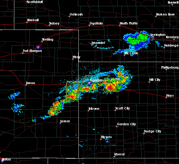 At 445 pm mdt/545 pm cdt/, severe thunderstorms were located along a line extending from 12 miles south of ruleton to 12 miles southeast of goodland, moving northeast at 35 mph (radar indicated). Hazards include 60 mph wind gusts and quarter size hail. Hail damage to vehicles is expected. Expect wind damage to roofs, siding, and trees. At 445 pm mdt/545 pm cdt/, severe thunderstorms were located along a line extending from 12 miles south of ruleton to 12 miles southeast of goodland, moving northeast at 35 mph (radar indicated). Hazards include 60 mph wind gusts and quarter size hail. Hail damage to vehicles is expected. Expect wind damage to roofs, siding, and trees.
|
| 5/10/2017 5:01 PM MDT | Quarter sized hail reported 5.2 miles NW of Goodland, KS |
| 5/10/2017 4:19 PM MDT |
 At 419 pm mdt, a severe thunderstorm was located near goodland, and is nearly stationary (radar indicated). Hazards include 60 mph wind gusts and quarter size hail. Hail damage to vehicles is expected. Expect wind damage to roofs, siding, and trees. At 419 pm mdt, a severe thunderstorm was located near goodland, and is nearly stationary (radar indicated). Hazards include 60 mph wind gusts and quarter size hail. Hail damage to vehicles is expected. Expect wind damage to roofs, siding, and trees.
|
| 5/10/2017 3:22 PM MDT |
 At 322 pm mdt, a severe thunderstorm capable of producing a tornado was located near goodland, moving northwest at 10 mph (a funnel cloud is visible south of goodland). Hazards include tornado. expect damage to mobile homes, roofs, and vehicles At 322 pm mdt, a severe thunderstorm capable of producing a tornado was located near goodland, moving northwest at 10 mph (a funnel cloud is visible south of goodland). Hazards include tornado. expect damage to mobile homes, roofs, and vehicles
|
| 4/27/2017 6:05 PM MDT |
 At 605 pm mdt/705 pm cdt/, severe thunderstorms were located along a line extending from 9 miles south of haigler to 6 miles south of st. francis to 6 miles north of goodland to 11 miles southeast of ruleton to 6 miles northeast of weskan, moving northeast at 40 mph (radar indicated). Hazards include 60 mph wind gusts and quarter size hail. Hail damage to vehicles is expected. expect wind damage to roofs, siding, and trees. locations impacted include, goodland, st. francis, sharon springs, ruleton, bird city, weskan and wallace. This includes interstate 70 in kansas between mile markers 9 and 33. At 605 pm mdt/705 pm cdt/, severe thunderstorms were located along a line extending from 9 miles south of haigler to 6 miles south of st. francis to 6 miles north of goodland to 11 miles southeast of ruleton to 6 miles northeast of weskan, moving northeast at 40 mph (radar indicated). Hazards include 60 mph wind gusts and quarter size hail. Hail damage to vehicles is expected. expect wind damage to roofs, siding, and trees. locations impacted include, goodland, st. francis, sharon springs, ruleton, bird city, weskan and wallace. This includes interstate 70 in kansas between mile markers 9 and 33.
|
| 4/27/2017 5:51 PM MDT |
 The severe thunderstorm warning for northeastern cheyenne county in east central colorado, southeastern yuma county in northeastern colorado, eastern kit carson county in east central colorado, northwestern wallace county in west central kansas, western cheyenne and sherman counties in northwestern kansas will expire at 600 pm mdt/700 pm cdt/, the storms which prompted the warning have moved out of the area. therefore the warning will be allowed to expire. The severe thunderstorm warning for northeastern cheyenne county in east central colorado, southeastern yuma county in northeastern colorado, eastern kit carson county in east central colorado, northwestern wallace county in west central kansas, western cheyenne and sherman counties in northwestern kansas will expire at 600 pm mdt/700 pm cdt/, the storms which prompted the warning have moved out of the area. therefore the warning will be allowed to expire.
|
| 4/27/2017 5:50 PM MDT |
 At 550 pm mdt/650 pm cdt/, severe thunderstorms were located along a line extending from 13 miles north of bonny reservoir to 13 miles southwest of st. francis to near ruleton to 13 miles southwest of goodland to 4 miles west of weskan, moving northeast at 40 mph (radar indicated). Hazards include 70 mph wind gusts and quarter size hail. Hail damage to vehicles is expected. expect considerable tree damage. Wind damage is also likely to mobile homes, roofs, and outbuildings. At 550 pm mdt/650 pm cdt/, severe thunderstorms were located along a line extending from 13 miles north of bonny reservoir to 13 miles southwest of st. francis to near ruleton to 13 miles southwest of goodland to 4 miles west of weskan, moving northeast at 40 mph (radar indicated). Hazards include 70 mph wind gusts and quarter size hail. Hail damage to vehicles is expected. expect considerable tree damage. Wind damage is also likely to mobile homes, roofs, and outbuildings.
|
| 4/27/2017 5:46 PM MDT |
 At 546 pm mdt/646 pm cdt/, severe thunderstorms were located along a line extending from 13 miles north of bonny reservoir to 13 miles southwest of st. francis to near ruleton to 13 miles southwest of goodland to 4 miles west of weskan, moving northeast at 40 mph (radar indicated). Hazards include 70 mph wind gusts and quarter size hail. Hail damage to vehicles is expected. expect considerable tree damage. wind damage is also likely to mobile homes, roofs, and outbuildings. locations impacted include, goodland, st. francis, kanorado, ruleton, bonny reservoir, weskan and hale. this includes the following highways, interstate 70 in kansas between mile markers 0 and 28. interstate 70 in colorado between mile markers 448 and 450. Highway 385 between mile markers 209 and 210, and between mile markers 212 and 234. At 546 pm mdt/646 pm cdt/, severe thunderstorms were located along a line extending from 13 miles north of bonny reservoir to 13 miles southwest of st. francis to near ruleton to 13 miles southwest of goodland to 4 miles west of weskan, moving northeast at 40 mph (radar indicated). Hazards include 70 mph wind gusts and quarter size hail. Hail damage to vehicles is expected. expect considerable tree damage. wind damage is also likely to mobile homes, roofs, and outbuildings. locations impacted include, goodland, st. francis, kanorado, ruleton, bonny reservoir, weskan and hale. this includes the following highways, interstate 70 in kansas between mile markers 0 and 28. interstate 70 in colorado between mile markers 448 and 450. Highway 385 between mile markers 209 and 210, and between mile markers 212 and 234.
|
| 4/27/2017 5:26 PM MDT |
 At 526 pm mdt/626 pm cdt/, severe thunderstorms were located along a line extending from 24 miles south of wray to 7 miles southeast of bonny reservoir to 3 miles south of kanorado to 17 miles north of weskan to 8 miles east of cheyenne wells, moving northeast at 40 mph (radar indicated). Hazards include 70 mph wind gusts and quarter size hail. Hail damage to vehicles is expected. expect considerable tree damage. Wind damage is also likely to mobile homes, roofs, and outbuildings. At 526 pm mdt/626 pm cdt/, severe thunderstorms were located along a line extending from 24 miles south of wray to 7 miles southeast of bonny reservoir to 3 miles south of kanorado to 17 miles north of weskan to 8 miles east of cheyenne wells, moving northeast at 40 mph (radar indicated). Hazards include 70 mph wind gusts and quarter size hail. Hail damage to vehicles is expected. expect considerable tree damage. Wind damage is also likely to mobile homes, roofs, and outbuildings.
|
| 3/24/2017 8:13 AM MDT | Storm damage reported in sherman county KS, 0.2 miles N of Goodland, KS |
| 9/22/2016 6:50 PM MDT |
 At 650 pm mdt, a severe thunderstorm was located 5 miles south of ruleton, moving northeast at 30 mph (radar indicated). Hazards include 60 mph wind gusts. Expect damage to roofs. siding. and trees. locations impacted include, goodland, kanorado, ruleton and edson. This includes interstate 70 in kansas between mile markers 0 and 32. At 650 pm mdt, a severe thunderstorm was located 5 miles south of ruleton, moving northeast at 30 mph (radar indicated). Hazards include 60 mph wind gusts. Expect damage to roofs. siding. and trees. locations impacted include, goodland, kanorado, ruleton and edson. This includes interstate 70 in kansas between mile markers 0 and 32.
|
| 9/22/2016 6:45 PM MDT |
 At 645 pm mdt, a severe thunderstorm was located 8 miles south of ruleton, moving northeast at 45 mph (radar indicated). Hazards include 60 mph wind gusts. Expect damage to roofs. siding. and trees. locations impacted include, goodland, kanorado, ruleton and edson. This includes interstate 70 in kansas between mile markers 0 and 32. At 645 pm mdt, a severe thunderstorm was located 8 miles south of ruleton, moving northeast at 45 mph (radar indicated). Hazards include 60 mph wind gusts. Expect damage to roofs. siding. and trees. locations impacted include, goodland, kanorado, ruleton and edson. This includes interstate 70 in kansas between mile markers 0 and 32.
|
| 9/22/2016 6:36 PM MDT |
 At 636 pm mdt, a severe thunderstorm was located 11 miles south of kanorado, moving northeast at 50 mph (radar indicated). Hazards include 60 mph wind gusts. Expect damage to roofs. siding. And trees. At 636 pm mdt, a severe thunderstorm was located 11 miles south of kanorado, moving northeast at 50 mph (radar indicated). Hazards include 60 mph wind gusts. Expect damage to roofs. siding. And trees.
|
| 9/17/2016 3:38 PM MDT | Quarter sized hail reported 13.8 miles SSW of Goodland, KS, between nickel and quarter size hail. just stopping at time of event. |
| 9/17/2016 3:38 PM MDT |
 At 337 pm mdt/437 pm cdt/, severe thunderstorms were located along a line extending from 5 miles west of bird city to 5 miles northeast of ruleton, moving east at 40 mph (radar indicated). Hazards include 60 mph wind gusts and half dollar size hail. Hail damage to vehicles is expected. expect wind damage to roofs, siding, and trees. visibility will be reduced to near zero in blowing dust. locations impacted include, goodland, st. francis, ruleton, bird city, edson and wheeler. This includes interstate 70 in kansas between mile markers 7 and 28. At 337 pm mdt/437 pm cdt/, severe thunderstorms were located along a line extending from 5 miles west of bird city to 5 miles northeast of ruleton, moving east at 40 mph (radar indicated). Hazards include 60 mph wind gusts and half dollar size hail. Hail damage to vehicles is expected. expect wind damage to roofs, siding, and trees. visibility will be reduced to near zero in blowing dust. locations impacted include, goodland, st. francis, ruleton, bird city, edson and wheeler. This includes interstate 70 in kansas between mile markers 7 and 28.
|
| 9/17/2016 4:29 PM CDT |
 At 329 pm mdt/429 pm cdt/, severe thunderstorms were located along a line extending from 5 miles south of st. francis to 3 miles west of ruleton, moving east at 30 mph (radar indicated). Hazards include golf ball size hail and 70 mph wind gusts. People and animals outdoors will be injured. expect hail damage to roofs, siding, windows, and vehicles. expect considerable tree damage. wind damage is also likely to mobile homes, roofs, and outbuildings. blowing dust will cause near zero visibility due to the strong winds. locations impacted include, goodland, st. francis, kanorado, ruleton, bird city, edson and wheeler. This includes interstate 70 in kansas between mile markers 0 and 28. At 329 pm mdt/429 pm cdt/, severe thunderstorms were located along a line extending from 5 miles south of st. francis to 3 miles west of ruleton, moving east at 30 mph (radar indicated). Hazards include golf ball size hail and 70 mph wind gusts. People and animals outdoors will be injured. expect hail damage to roofs, siding, windows, and vehicles. expect considerable tree damage. wind damage is also likely to mobile homes, roofs, and outbuildings. blowing dust will cause near zero visibility due to the strong winds. locations impacted include, goodland, st. francis, kanorado, ruleton, bird city, edson and wheeler. This includes interstate 70 in kansas between mile markers 0 and 28.
|
| 9/17/2016 3:28 PM MDT | Large dark wall of dirt blew at vehicle. about blew vehicle off highway 2 in sherman county KS, 8.1 miles S of Goodland, KS |
| 9/17/2016 4:23 PM CDT |
 At 323 pm mdt/423 pm cdt/, severe thunderstorms were located along a line extending from 5 miles south of st. francis to 3 miles east of kanorado, moving east at 30 mph (radar indicated). Hazards include golf ball size hail and 70 mph wind gusts. People and animals outdoors will be injured. expect hail damage to roofs, siding, windows, and vehicles. expect considerable tree damage. wind damage is also likely to mobile homes, roofs, and outbuildings. locations impacted include, goodland, st. francis, kanorado, ruleton, bird city, edson and wheeler. This includes interstate 70 in kansas between mile markers 0 and 28. At 323 pm mdt/423 pm cdt/, severe thunderstorms were located along a line extending from 5 miles south of st. francis to 3 miles east of kanorado, moving east at 30 mph (radar indicated). Hazards include golf ball size hail and 70 mph wind gusts. People and animals outdoors will be injured. expect hail damage to roofs, siding, windows, and vehicles. expect considerable tree damage. wind damage is also likely to mobile homes, roofs, and outbuildings. locations impacted include, goodland, st. francis, kanorado, ruleton, bird city, edson and wheeler. This includes interstate 70 in kansas between mile markers 0 and 28.
|
| 9/17/2016 3:20 PM MDT | Golf Ball sized hail reported 4 miles S of Goodland, KS, dime size hail with some golf ball mixed in. |
| 9/17/2016 4:15 PM CDT |
 At 314 pm mdt/414 pm cdt/, severe thunderstorms were located along a line extending from 3 miles northwest of st. francis to 5 miles south of kanorado, moving east at 25 mph (radar indicated). Hazards include 70 mph wind gusts and quarter size hail. Hail damage to vehicles is expected. expect considerable tree damage. wind damage is also likely to mobile homes, roofs, and outbuildings. locations impacted include, goodland, st. francis, kanorado, ruleton, bird city, edson and wheeler. this includes the following highways, interstate 70 in kansas between mile markers 0 and 28. Interstate 70 in colorado between mile markers 449 and 450. At 314 pm mdt/414 pm cdt/, severe thunderstorms were located along a line extending from 3 miles northwest of st. francis to 5 miles south of kanorado, moving east at 25 mph (radar indicated). Hazards include 70 mph wind gusts and quarter size hail. Hail damage to vehicles is expected. expect considerable tree damage. wind damage is also likely to mobile homes, roofs, and outbuildings. locations impacted include, goodland, st. francis, kanorado, ruleton, bird city, edson and wheeler. this includes the following highways, interstate 70 in kansas between mile markers 0 and 28. Interstate 70 in colorado between mile markers 449 and 450.
|
| 9/17/2016 3:06 PM MDT |
 At 305 pm mdt/405 pm cdt/, severe thunderstorms were located along a line extending from 7 miles northwest of st. francis to 8 miles south of burlington, moving east at 35 mph (radar indicated). Hazards include 60 mph wind gusts and quarter size hail. Hail damage to vehicles is expected. Expect wind damage to roofs, siding, and trees. At 305 pm mdt/405 pm cdt/, severe thunderstorms were located along a line extending from 7 miles northwest of st. francis to 8 miles south of burlington, moving east at 35 mph (radar indicated). Hazards include 60 mph wind gusts and quarter size hail. Hail damage to vehicles is expected. Expect wind damage to roofs, siding, and trees.
|
| 9/15/2016 6:00 PM MDT | Tennis Ball sized hail reported 9.1 miles W of Goodland, KS |
| 9/15/2016 5:47 PM MDT |
 At 547 pm mdt/647 pm cdt/, a severe thunderstorm was located 7 miles north of goodland, moving east at 35 mph. this is a very dangerous storm (radar indicated). Hazards include 80 mph wind gusts and two inch hail. Flying debris will be dangerous to those caught without shelter. mobile homes will be heavily damaged. expect considerable damage to roofs, windows, and vehicles. extensive tree damage and power outages are likely. locations impacted include, goodland, brewster and edson. This includes interstate 70 in kansas between mile markers 11 and 45. At 547 pm mdt/647 pm cdt/, a severe thunderstorm was located 7 miles north of goodland, moving east at 35 mph. this is a very dangerous storm (radar indicated). Hazards include 80 mph wind gusts and two inch hail. Flying debris will be dangerous to those caught without shelter. mobile homes will be heavily damaged. expect considerable damage to roofs, windows, and vehicles. extensive tree damage and power outages are likely. locations impacted include, goodland, brewster and edson. This includes interstate 70 in kansas between mile markers 11 and 45.
|
| 9/15/2016 5:45 PM MDT | Baseball sized hail reported 0.2 miles N of Goodland, KS, reports of significant hail damage in goodland... particularly on west facing windows and siding of homes and businesses. |
| 9/15/2016 5:45 PM MDT | Storm damage reported in sherman county KS, 4 miles S of Goodland, KS |
| 9/15/2016 5:45 PM MDT | Baseball sized hail reported 4 miles S of Goodland, KS, windows on house broken... trees damaged. |
| 9/15/2016 5:44 PM MDT | Storm damage reported in sherman county KS, 0.5 miles S of Goodland, KS |
| 9/15/2016 5:42 PM MDT | Hen Egg sized hail reported 0.2 miles N of Goodland, KS, 2 broken house windows and one window cracked. |
| 9/15/2016 5:40 PM MDT |
 At 540 pm mdt/640 pm cdt/, a severe thunderstorm was located 9 miles northwest of goodland, moving east at 35 mph (radar indicated). Hazards include two inch hail and 70 mph wind gusts. People and animals outdoors will be injured. expect hail damage to roofs, siding, windows, and vehicles. expect considerable tree damage. wind damage is also likely to mobile homes, roofs, and outbuildings. locations impacted include, goodland, brewster, ruleton and edson. This includes interstate 70 in kansas between mile markers 7 and 45. At 540 pm mdt/640 pm cdt/, a severe thunderstorm was located 9 miles northwest of goodland, moving east at 35 mph (radar indicated). Hazards include two inch hail and 70 mph wind gusts. People and animals outdoors will be injured. expect hail damage to roofs, siding, windows, and vehicles. expect considerable tree damage. wind damage is also likely to mobile homes, roofs, and outbuildings. locations impacted include, goodland, brewster, ruleton and edson. This includes interstate 70 in kansas between mile markers 7 and 45.
|
| 9/15/2016 5:39 PM MDT | Golf Ball sized hail reported 0.2 miles N of Goodland, KS |
| 9/15/2016 5:38 PM MDT | Hen Egg sized hail reported 0.2 miles N of Goodland, KS |
| 9/15/2016 5:37 PM MDT | Hen Egg sized hail reported 0.2 miles N of Goodland, KS, at nws goodland office |
| 9/15/2016 5:37 PM MDT | Tennis Ball sized hail reported 0.2 miles N of Goodland, KS, relayed via social media. |
| 9/15/2016 5:35 PM MDT |
 At 535 pm mdt/635 pm cdt/, a severe thunderstorm was located 8 miles north of ruleton, moving east at 30 mph (radar indicated). Hazards include two inch hail and 70 mph wind gusts. People and animals outdoors will be injured. expect hail damage to roofs, siding, windows, and vehicles. expect considerable tree damage. Wind damage is also likely to mobile homes, roofs, and outbuildings. At 535 pm mdt/635 pm cdt/, a severe thunderstorm was located 8 miles north of ruleton, moving east at 30 mph (radar indicated). Hazards include two inch hail and 70 mph wind gusts. People and animals outdoors will be injured. expect hail damage to roofs, siding, windows, and vehicles. expect considerable tree damage. Wind damage is also likely to mobile homes, roofs, and outbuildings.
|
| 9/15/2016 5:30 PM MDT |
 At 530 pm mdt, a severe thunderstorm was located 8 miles north of ruleton, moving east at 30 mph. this is a very dangerous storm (radar indicated). Hazards include 80 mph wind gusts and two inch hail. Flying debris will be dangerous to those caught without shelter. mobile homes will be heavily damaged. expect considerable damage to roofs, windows, and vehicles. extensive tree damage and power outages are likely. locations impacted include, goodland and ruleton. This includes interstate 70 in kansas between mile markers 10 and 20. At 530 pm mdt, a severe thunderstorm was located 8 miles north of ruleton, moving east at 30 mph. this is a very dangerous storm (radar indicated). Hazards include 80 mph wind gusts and two inch hail. Flying debris will be dangerous to those caught without shelter. mobile homes will be heavily damaged. expect considerable damage to roofs, windows, and vehicles. extensive tree damage and power outages are likely. locations impacted include, goodland and ruleton. This includes interstate 70 in kansas between mile markers 10 and 20.
|
| 9/15/2016 5:27 PM MDT | Storm damage reported in sherman county KS, 4.9 miles E of Goodland, KS |
| 9/15/2016 5:25 PM MDT |
 At 524 pm mdt, a severe thunderstorm was located 9 miles northeast of kanorado, moving east at 30 mph (radar indicated). Hazards include two inch hail and 70 mph wind gusts. People and animals outdoors will be injured. expect hail damage to roofs, siding, windows, and vehicles. expect considerable tree damage. wind damage is also likely to mobile homes, roofs, and outbuildings. locations impacted include, goodland and ruleton. This includes interstate 70 in kansas between mile markers 9 and 20. At 524 pm mdt, a severe thunderstorm was located 9 miles northeast of kanorado, moving east at 30 mph (radar indicated). Hazards include two inch hail and 70 mph wind gusts. People and animals outdoors will be injured. expect hail damage to roofs, siding, windows, and vehicles. expect considerable tree damage. wind damage is also likely to mobile homes, roofs, and outbuildings. locations impacted include, goodland and ruleton. This includes interstate 70 in kansas between mile markers 9 and 20.
|
| 9/15/2016 5:16 PM MDT |
 At 516 pm mdt, a severe thunderstorm was located 8 miles north of kanorado, moving east at 30 mph (radar indicated). Hazards include 70 mph wind gusts and ping pong ball size hail. People and animals outdoors will be injured. expect hail damage to roofs, siding, windows, and vehicles. expect considerable tree damage. wind damage is also likely to mobile homes, roofs, and outbuildings. locations impacted include, goodland and ruleton. This includes interstate 70 in kansas between mile markers 8 and 20. At 516 pm mdt, a severe thunderstorm was located 8 miles north of kanorado, moving east at 30 mph (radar indicated). Hazards include 70 mph wind gusts and ping pong ball size hail. People and animals outdoors will be injured. expect hail damage to roofs, siding, windows, and vehicles. expect considerable tree damage. wind damage is also likely to mobile homes, roofs, and outbuildings. locations impacted include, goodland and ruleton. This includes interstate 70 in kansas between mile markers 8 and 20.
|
| 9/15/2016 5:04 PM MDT |
 At 504 pm mdt, a severe thunderstorm was located 10 miles northwest of kanorado, moving east at 30 mph (radar indicated). Hazards include golf ball size hail and 70 mph wind gusts. People and animals outdoors will be injured. expect hail damage to roofs, siding, windows, and vehicles. expect considerable tree damage. wind damage is also likely to mobile homes, roofs, and outbuildings. locations impacted include, goodland, kanorado and ruleton. this includes the following highways, interstate 70 in kansas between mile markers 4 and 20. Highway 385 between mile markers 193 and 205, and near mile marker 211. At 504 pm mdt, a severe thunderstorm was located 10 miles northwest of kanorado, moving east at 30 mph (radar indicated). Hazards include golf ball size hail and 70 mph wind gusts. People and animals outdoors will be injured. expect hail damage to roofs, siding, windows, and vehicles. expect considerable tree damage. wind damage is also likely to mobile homes, roofs, and outbuildings. locations impacted include, goodland, kanorado and ruleton. this includes the following highways, interstate 70 in kansas between mile markers 4 and 20. Highway 385 between mile markers 193 and 205, and near mile marker 211.
|
| 9/15/2016 5:00 PM MDT |
 At 500 pm mdt, a severe thunderstorm was located 10 miles south of bonny reservoir, moving east at 30 mph (radar indicated). Hazards include golf ball size hail and 70 mph wind gusts. People and animals outdoors will be injured. expect hail damage to roofs, siding, windows, and vehicles. expect considerable tree damage. wind damage is also likely to mobile homes, roofs, and outbuildings. locations impacted include, goodland, kanorado and ruleton. this includes the following highways, interstate 70 in kansas between mile markers 4 and 20. Highway 385 between mile markers 193 and 205, and near mile marker 211. At 500 pm mdt, a severe thunderstorm was located 10 miles south of bonny reservoir, moving east at 30 mph (radar indicated). Hazards include golf ball size hail and 70 mph wind gusts. People and animals outdoors will be injured. expect hail damage to roofs, siding, windows, and vehicles. expect considerable tree damage. wind damage is also likely to mobile homes, roofs, and outbuildings. locations impacted include, goodland, kanorado and ruleton. this includes the following highways, interstate 70 in kansas between mile markers 4 and 20. Highway 385 between mile markers 193 and 205, and near mile marker 211.
|
| 9/15/2016 4:44 PM MDT |
 At 443 pm mdt, a severe thunderstorm was located 11 miles north of burlington, moving east at 30 mph (radar indicated). Hazards include golf ball size hail and 60 mph wind gusts. People and animals outdoors will be injured. expect hail damage to roofs, siding, windows, and vehicles. Expect wind damage to roofs, siding, and trees. At 443 pm mdt, a severe thunderstorm was located 11 miles north of burlington, moving east at 30 mph (radar indicated). Hazards include golf ball size hail and 60 mph wind gusts. People and animals outdoors will be injured. expect hail damage to roofs, siding, windows, and vehicles. Expect wind damage to roofs, siding, and trees.
|
| 9/4/2016 3:55 PM MDT | Storm damage reported in sherman county KS, 0.8 miles SW of Goodland, KS |
| 9/4/2016 3:54 PM MDT |
 At 354 pm mdt/454 pm cdt/, a severe thunderstorm was located near goodland, moving northeast at 35 mph (radar indicated). Hazards include 60 mph wind gusts and quarter size hail. Hail damage to vehicles is expected. Expect wind damage to roofs, siding, and trees. At 354 pm mdt/454 pm cdt/, a severe thunderstorm was located near goodland, moving northeast at 35 mph (radar indicated). Hazards include 60 mph wind gusts and quarter size hail. Hail damage to vehicles is expected. Expect wind damage to roofs, siding, and trees.
|
| 9/4/2016 3:18 PM MDT |
 At 317 pm mdt, severe thunderstorms were located along a line extending from 6 miles northeast of kanorado to 8 miles south of ruleton, moving northeast at 50 mph (radar indicated). Hazards include 70 mph wind gusts and quarter size hail. Hail damage to vehicles is expected. expect considerable tree damage. wind damage is also likely to mobile homes, roofs, and outbuildings. locations impacted include, goodland, kanorado and ruleton. this includes the following highways, interstate 70 in kansas between mile markers 0 and 18. interstate 70 in colorado between mile markers 444 and 450. Highway 385 near mile marker 206. At 317 pm mdt, severe thunderstorms were located along a line extending from 6 miles northeast of kanorado to 8 miles south of ruleton, moving northeast at 50 mph (radar indicated). Hazards include 70 mph wind gusts and quarter size hail. Hail damage to vehicles is expected. expect considerable tree damage. wind damage is also likely to mobile homes, roofs, and outbuildings. locations impacted include, goodland, kanorado and ruleton. this includes the following highways, interstate 70 in kansas between mile markers 0 and 18. interstate 70 in colorado between mile markers 444 and 450. Highway 385 near mile marker 206.
|
| 9/4/2016 3:00 PM MDT |
 At 259 pm mdt, severe thunderstorms were located along a line extending from 5 miles southeast of burlington to 15 miles northeast of cheyenne wells, moving northeast at 40 mph (radar indicated). Hazards include 70 mph wind gusts and quarter size hail. Hail damage to vehicles is expected. expect considerable tree damage. wind damage is also likely to mobile homes, roofs, and outbuildings. locations impacted include, goodland, burlington, kanorado and ruleton. this includes the following highways, interstate 70 in kansas between mile markers 0 and 18. interstate 70 in colorado between mile markers 436 and 450. Highway 385 between mile markers 165 and 206, and near mile marker 211. At 259 pm mdt, severe thunderstorms were located along a line extending from 5 miles southeast of burlington to 15 miles northeast of cheyenne wells, moving northeast at 40 mph (radar indicated). Hazards include 70 mph wind gusts and quarter size hail. Hail damage to vehicles is expected. expect considerable tree damage. wind damage is also likely to mobile homes, roofs, and outbuildings. locations impacted include, goodland, burlington, kanorado and ruleton. this includes the following highways, interstate 70 in kansas between mile markers 0 and 18. interstate 70 in colorado between mile markers 436 and 450. Highway 385 between mile markers 165 and 206, and near mile marker 211.
|
| 9/4/2016 2:45 PM MDT |
 At 244 pm mdt, a severe thunderstorm was located 15 miles north of cheyenne wells, moving northeast at 45 mph (radar indicated). Hazards include 70 mph wind gusts and half dollar size hail. Hail damage to vehicles is expected. expect considerable tree damage. Wind damage is also likely to mobile homes, roofs, and outbuildings. At 244 pm mdt, a severe thunderstorm was located 15 miles north of cheyenne wells, moving northeast at 45 mph (radar indicated). Hazards include 70 mph wind gusts and half dollar size hail. Hail damage to vehicles is expected. expect considerable tree damage. Wind damage is also likely to mobile homes, roofs, and outbuildings.
|
| 9/3/2016 7:02 PM MDT | Storm damage reported in sherman county KS, 0.2 miles N of Goodland, KS |
| 9/3/2016 6:58 PM MDT |
 At 607 pm mdt, a severe thunderstorm was located 4 miles southwest of kanorado, moving east at 30 mph (radar indicated). Hazards include 60 mph wind gusts and penny size hail. Expect damage to roofs. siding. And trees. At 607 pm mdt, a severe thunderstorm was located 4 miles southwest of kanorado, moving east at 30 mph (radar indicated). Hazards include 60 mph wind gusts and penny size hail. Expect damage to roofs. siding. And trees.
|
| 9/3/2016 6:08 PM MDT |
 At 607 pm mdt, a severe thunderstorm was located 4 miles southwest of kanorado, moving east at 30 mph (radar indicated). Hazards include 60 mph wind gusts and penny size hail. Expect damage to roofs. siding. And trees. At 607 pm mdt, a severe thunderstorm was located 4 miles southwest of kanorado, moving east at 30 mph (radar indicated). Hazards include 60 mph wind gusts and penny size hail. Expect damage to roofs. siding. And trees.
|
| 8/22/2016 8:11 PM MDT |
 The severe thunderstorm warning for central sherman county will expire at 815 pm mdt, the storm which prompted the warning has weakened below severe limits, and no longer pose an immediate threat to life or property. therefore the warning will be allowed to expire. however gusty winds and heavy rain are still possible with this thunderstorm. The severe thunderstorm warning for central sherman county will expire at 815 pm mdt, the storm which prompted the warning has weakened below severe limits, and no longer pose an immediate threat to life or property. therefore the warning will be allowed to expire. however gusty winds and heavy rain are still possible with this thunderstorm.
|
| 8/22/2016 8:04 PM MDT |
 At 802 pm mdt, a severe thunderstorm was located near ruleton, moving north at 15 mph (radar indicated. at 149 pm mdt...dime size hail was reported by the public four miles southeast of ruleton). Hazards include 60 mph wind gusts and quarter size hail. Hail damage to vehicles is expected. expect wind damage to roofs, siding, and trees. locations impacted include, goodland and ruleton. This includes interstate 70 in kansas between mile markers 8 and 18. At 802 pm mdt, a severe thunderstorm was located near ruleton, moving north at 15 mph (radar indicated. at 149 pm mdt...dime size hail was reported by the public four miles southeast of ruleton). Hazards include 60 mph wind gusts and quarter size hail. Hail damage to vehicles is expected. expect wind damage to roofs, siding, and trees. locations impacted include, goodland and ruleton. This includes interstate 70 in kansas between mile markers 8 and 18.
|
| 8/22/2016 8:01 PM MDT | Storm damage reported in sherman county KS, 7.2 miles WNW of Goodland, KS |
| 8/22/2016 7:53 PM MDT |
 At 752 pm mdt, a severe thunderstorm was located over ruleton, moving north at 15 mph (radar indicated). Hazards include 60 mph wind gusts and quarter size hail. Hail damage to vehicles is expected. expect wind damage to roofs, siding, and trees. locations impacted include, goodland and ruleton. This includes interstate 70 in kansas between mile markers 6 and 18. At 752 pm mdt, a severe thunderstorm was located over ruleton, moving north at 15 mph (radar indicated). Hazards include 60 mph wind gusts and quarter size hail. Hail damage to vehicles is expected. expect wind damage to roofs, siding, and trees. locations impacted include, goodland and ruleton. This includes interstate 70 in kansas between mile markers 6 and 18.
|
| 8/22/2016 7:32 PM MDT |
 At 731 pm mdt, a severe thunderstorm was located 8 miles southeast of goodland, moving northeast at 15 mph (radar indicated). Hazards include 60 mph wind gusts and half dollar size hail. Hail damage to vehicles is expected. expect wind damage to roofs, siding, and trees. locations impacted include, edson. This includes interstate 70 in kansas between mile markers 20 and 35. At 731 pm mdt, a severe thunderstorm was located 8 miles southeast of goodland, moving northeast at 15 mph (radar indicated). Hazards include 60 mph wind gusts and half dollar size hail. Hail damage to vehicles is expected. expect wind damage to roofs, siding, and trees. locations impacted include, edson. This includes interstate 70 in kansas between mile markers 20 and 35.
|
| 8/22/2016 7:27 PM MDT |
 At 726 pm mdt, a severe thunderstorm was located 7 miles south of ruleton, moving north at 15 mph (radar indicated). Hazards include 60 mph wind gusts and quarter size hail. Hail damage to vehicles is expected. Expect wind damage to roofs, siding, and trees. At 726 pm mdt, a severe thunderstorm was located 7 miles south of ruleton, moving north at 15 mph (radar indicated). Hazards include 60 mph wind gusts and quarter size hail. Hail damage to vehicles is expected. Expect wind damage to roofs, siding, and trees.
|
| 8/22/2016 7:07 PM MDT |
 At 707 pm mdt, a severe thunderstorm was located 11 miles south of goodland, moving north at 15 mph (radar indicated). Hazards include 60 mph wind gusts and half dollar size hail. Hail damage to vehicles is expected. Expect wind damage to roofs, siding, and trees. At 707 pm mdt, a severe thunderstorm was located 11 miles south of goodland, moving north at 15 mph (radar indicated). Hazards include 60 mph wind gusts and half dollar size hail. Hail damage to vehicles is expected. Expect wind damage to roofs, siding, and trees.
|
| 8/13/2016 5:06 PM MDT |
 The severe thunderstorm warning for central sherman county will expire at 515 pm mdt, the storm which prompted the warning has weakened below severe limits, and no longer pose an immediate threat to life or property. therefore the warning will be allowed to expire. however gusty winds and heavy rain are still possible with this thunderstorm. The severe thunderstorm warning for central sherman county will expire at 515 pm mdt, the storm which prompted the warning has weakened below severe limits, and no longer pose an immediate threat to life or property. therefore the warning will be allowed to expire. however gusty winds and heavy rain are still possible with this thunderstorm.
|
| 8/13/2016 4:51 PM MDT |
 At 451 pm mdt, a severe thunderstorm was located near goodland, moving southeast at 25 mph (radar indicated). Hazards include 60 mph wind gusts and penny size hail. Expect damage to roofs. siding. and trees. locations impacted include, goodland. This includes interstate 70 in kansas between mile markers 15 and 20. At 451 pm mdt, a severe thunderstorm was located near goodland, moving southeast at 25 mph (radar indicated). Hazards include 60 mph wind gusts and penny size hail. Expect damage to roofs. siding. and trees. locations impacted include, goodland. This includes interstate 70 in kansas between mile markers 15 and 20.
|
| 8/13/2016 4:41 PM MDT |
 At 440 pm mdt, a severe thunderstorm was located 7 miles northwest of goodland, moving southeast at 25 mph (radar indicated). Hazards include 60 mph wind gusts and penny size hail. Expect damage to roofs. siding. And trees. At 440 pm mdt, a severe thunderstorm was located 7 miles northwest of goodland, moving southeast at 25 mph (radar indicated). Hazards include 60 mph wind gusts and penny size hail. Expect damage to roofs. siding. And trees.
|
| 8/12/2016 12:23 AM MDT |
 The severe thunderstorm warning for southwestern cheyenne and northern sherman counties in northwestern kansas will expire at 1230 am mdt/130 am cdt/, the storm which prompted the warning has weakened below severe limits, and no longer pose an immediate threat to life or property. therefore the warning will be allowed to expire. however gusty winds are still possible with this thunderstorm. The severe thunderstorm warning for southwestern cheyenne and northern sherman counties in northwestern kansas will expire at 1230 am mdt/130 am cdt/, the storm which prompted the warning has weakened below severe limits, and no longer pose an immediate threat to life or property. therefore the warning will be allowed to expire. however gusty winds are still possible with this thunderstorm.
|
| 8/12/2016 12:16 AM MDT |
 At 1216 am mdt/116 am cdt/, a severe thunderstorm was located 7 miles south of goodland, moving southeast at 40 mph (radar indicated). Hazards include 60 mph wind gusts and penny size hail. Expect damage to roofs. siding. and trees. locations impacted include, goodland. This includes interstate 70 in kansas between mile markers 20 and 26. At 1216 am mdt/116 am cdt/, a severe thunderstorm was located 7 miles south of goodland, moving southeast at 40 mph (radar indicated). Hazards include 60 mph wind gusts and penny size hail. Expect damage to roofs. siding. and trees. locations impacted include, goodland. This includes interstate 70 in kansas between mile markers 20 and 26.
|
| 8/12/2016 12:06 AM MDT |
 At 1205 am mdt/105 am cdt/, a severe thunderstorm was located near goodland, moving southeast at 40 mph (radar indicated). Hazards include 60 mph wind gusts and penny size hail. Expect damage to roofs. siding. and trees. locations impacted include, goodland and ruleton. This includes interstate 70 in kansas between mile markers 8 and 26. At 1205 am mdt/105 am cdt/, a severe thunderstorm was located near goodland, moving southeast at 40 mph (radar indicated). Hazards include 60 mph wind gusts and penny size hail. Expect damage to roofs. siding. and trees. locations impacted include, goodland and ruleton. This includes interstate 70 in kansas between mile markers 8 and 26.
|
| 8/12/2016 12:58 AM CDT |
 At 1158 pm mdt/1258 am cdt/, a severe thunderstorm was located 6 miles northwest of goodland, moving southeast at 40 mph (radar indicated). Hazards include 60 mph wind gusts and quarter size hail. Hail damage to vehicles is expected. Expect wind damage to roofs, siding, and trees. At 1158 pm mdt/1258 am cdt/, a severe thunderstorm was located 6 miles northwest of goodland, moving southeast at 40 mph (radar indicated). Hazards include 60 mph wind gusts and quarter size hail. Hail damage to vehicles is expected. Expect wind damage to roofs, siding, and trees.
|
| 8/11/2016 11:49 PM MDT |
 At 1149 pm mdt/1249 am cdt/, a severe thunderstorm was located 13 miles north of goodland, moving east at 20 mph (radar indicated). Hazards include 60 mph wind gusts and penny size hail. Expect damage to roofs. siding. and trees. Locations impacted include, goodland. At 1149 pm mdt/1249 am cdt/, a severe thunderstorm was located 13 miles north of goodland, moving east at 20 mph (radar indicated). Hazards include 60 mph wind gusts and penny size hail. Expect damage to roofs. siding. and trees. Locations impacted include, goodland.
|
| 8/11/2016 11:31 PM MDT |
 At 1131 pm mdt/1231 am cdt/, a severe thunderstorm was located 13 miles north of ruleton, moving east at 20 mph (radar indicated). Hazards include 60 mph wind gusts and penny size hail. Expect damage to roofs. siding. and trees. Locations impacted include, goodland. At 1131 pm mdt/1231 am cdt/, a severe thunderstorm was located 13 miles north of ruleton, moving east at 20 mph (radar indicated). Hazards include 60 mph wind gusts and penny size hail. Expect damage to roofs. siding. and trees. Locations impacted include, goodland.
|
| 8/11/2016 11:23 PM MDT |
 At 1123 pm mdt/1223 am cdt/, a severe thunderstorm was located 11 miles southeast of bonny reservoir, moving east at 20 mph (radar indicated). Hazards include 60 mph wind gusts and penny size hail. Expect damage to roofs. siding. And trees. At 1123 pm mdt/1223 am cdt/, a severe thunderstorm was located 11 miles southeast of bonny reservoir, moving east at 20 mph (radar indicated). Hazards include 60 mph wind gusts and penny size hail. Expect damage to roofs. siding. And trees.
|
| 7/28/2016 4:10 AM MDT |
 The severe thunderstorm warning for northeastern wallace, western thomas, northwestern logan and sherman counties will expire at 415 am mdt/515 am cdt/, the storms which prompted the warning have weakened below severe limits, and no longer pose an immediate threat to life or property. therefore the warning will be allowed to expire. The severe thunderstorm warning for northeastern wallace, western thomas, northwestern logan and sherman counties will expire at 415 am mdt/515 am cdt/, the storms which prompted the warning have weakened below severe limits, and no longer pose an immediate threat to life or property. therefore the warning will be allowed to expire.
|
| 7/28/2016 3:23 AM MDT |
 At 323 am mdt/423 am cdt/, severe thunderstorms were located along a line extending from 13 miles north of brewster to 3 miles northwest of goodland, moving southeast at 50 mph (trained weather spotters). Hazards include 60 mph wind gusts. Expect damage to roofs. siding. And trees. At 323 am mdt/423 am cdt/, severe thunderstorms were located along a line extending from 13 miles north of brewster to 3 miles northwest of goodland, moving southeast at 50 mph (trained weather spotters). Hazards include 60 mph wind gusts. Expect damage to roofs. siding. And trees.
|
| 7/28/2016 3:19 AM MDT | Storm damage reported in sherman county KS, 14.7 miles SW of Goodland, KS |
| 7/28/2016 3:14 AM MDT |
 At 314 am mdt/414 am cdt/, severe thunderstorms were located along a line extending from 11 miles south of bird city to 7 miles north of goodland to 3 miles east of kanorado, moving southeast at 40 mph (radar indicated). Hazards include 60 mph wind gusts. Expect damage to roofs. siding. and trees. locations impacted include, goodland, st. francis, ruleton, edson and wheeler. This includes interstate 70 in kansas between mile markers 4 and 32. At 314 am mdt/414 am cdt/, severe thunderstorms were located along a line extending from 11 miles south of bird city to 7 miles north of goodland to 3 miles east of kanorado, moving southeast at 40 mph (radar indicated). Hazards include 60 mph wind gusts. Expect damage to roofs. siding. and trees. locations impacted include, goodland, st. francis, ruleton, edson and wheeler. This includes interstate 70 in kansas between mile markers 4 and 32.
|
| 7/28/2016 4:06 AM CDT |
 At 306 am mdt/406 am cdt/, severe thunderstorms were located along a line extending from 7 miles southwest of bird city to 12 miles north of goodland to 6 miles north of kanorado, moving southeast at 40 mph (radar indicated). Hazards include 60 mph wind gusts. Expect damage to roofs. siding. and trees. locations impacted include, goodland, st. francis, kanorado, ruleton, edson and wheeler. This includes interstate 70 in kansas between mile markers 0 and 32. At 306 am mdt/406 am cdt/, severe thunderstorms were located along a line extending from 7 miles southwest of bird city to 12 miles north of goodland to 6 miles north of kanorado, moving southeast at 40 mph (radar indicated). Hazards include 60 mph wind gusts. Expect damage to roofs. siding. and trees. locations impacted include, goodland, st. francis, kanorado, ruleton, edson and wheeler. This includes interstate 70 in kansas between mile markers 0 and 32.
|
| 7/28/2016 4:03 AM CDT |
 At 303 am mdt/403 am cdt/, severe thunderstorms were located along a line extending from 6 miles southwest of bird city to 14 miles south of st. francis to 8 miles north of kanorado, moving southeast at 35 mph (radar indicated). Hazards include 60 mph wind gusts. Expect damage to roofs. siding. and trees. locations impacted include, goodland, st. francis, kanorado, ruleton, edson and wheeler. This includes interstate 70 in kansas between mile markers 0 and 32. At 303 am mdt/403 am cdt/, severe thunderstorms were located along a line extending from 6 miles southwest of bird city to 14 miles south of st. francis to 8 miles north of kanorado, moving southeast at 35 mph (radar indicated). Hazards include 60 mph wind gusts. Expect damage to roofs. siding. and trees. locations impacted include, goodland, st. francis, kanorado, ruleton, edson and wheeler. This includes interstate 70 in kansas between mile markers 0 and 32.
|
| 7/28/2016 3:57 AM CDT |
 At 257 am mdt/357 am cdt/, severe thunderstorms were located along a line extending from 6 miles west of bird city to 10 miles southeast of bonny reservoir, moving southeast at 35 mph (radar indicated). Hazards include 60 mph wind gusts. Expect damage to roofs. siding. and trees. locations impacted include, goodland, st. francis, kanorado, ruleton, edson and wheeler. This includes interstate 70 in kansas between mile markers 0 and 32. At 257 am mdt/357 am cdt/, severe thunderstorms were located along a line extending from 6 miles west of bird city to 10 miles southeast of bonny reservoir, moving southeast at 35 mph (radar indicated). Hazards include 60 mph wind gusts. Expect damage to roofs. siding. and trees. locations impacted include, goodland, st. francis, kanorado, ruleton, edson and wheeler. This includes interstate 70 in kansas between mile markers 0 and 32.
|
| 7/28/2016 3:53 AM CDT |
 At 253 am mdt/353 am cdt/, severe thunderstorms were located along a line extending from 8 miles southeast of st. francis to 7 miles southeast of bonny reservoir, moving southeast at 45 mph (radar indicated). Hazards include 60 mph wind gusts. Expect damage to roofs. siding. and trees. locations impacted include, goodland, st. francis, kanorado, ruleton, bonny reservoir, edson and wheeler. this includes the following highways, interstate 70 in kansas between mile markers 0 and 32. Interstate 70 in colorado between mile markers 447 and 450. At 253 am mdt/353 am cdt/, severe thunderstorms were located along a line extending from 8 miles southeast of st. francis to 7 miles southeast of bonny reservoir, moving southeast at 45 mph (radar indicated). Hazards include 60 mph wind gusts. Expect damage to roofs. siding. and trees. locations impacted include, goodland, st. francis, kanorado, ruleton, bonny reservoir, edson and wheeler. this includes the following highways, interstate 70 in kansas between mile markers 0 and 32. Interstate 70 in colorado between mile markers 447 and 450.
|
| 7/28/2016 3:43 AM CDT |
 At 243 am mdt/343 am cdt/, severe thunderstorms were located along a line extending from near st. francis to 3 miles northwest of bonny reservoir, moving southeast at 55 mph (radar indicated). Hazards include 60 mph wind gusts and quarter size hail. Hail damage to vehicles is expected. Expect wind damage to roofs, siding, and trees. At 243 am mdt/343 am cdt/, severe thunderstorms were located along a line extending from near st. francis to 3 miles northwest of bonny reservoir, moving southeast at 55 mph (radar indicated). Hazards include 60 mph wind gusts and quarter size hail. Hail damage to vehicles is expected. Expect wind damage to roofs, siding, and trees.
|
| 7/27/2016 10:47 PM MDT |
 At 1047 pm mdt/1147 pm cdt/, severe thunderstorms were located along a line extending from 8 miles southeast of brewster to 7 miles south of goodland, moving south at 15 mph (radar indicated). Hazards include two inch hail and 70 mph wind gusts. People and animals outdoors will be injured. expect hail damage to roofs, siding, windows, and vehicles. expect considerable tree damage. wind damage is also likely to mobile homes, roofs, and outbuildings. locations impacted include, goodland. This includes interstate 70 in kansas between mile markers 11 and 18. At 1047 pm mdt/1147 pm cdt/, severe thunderstorms were located along a line extending from 8 miles southeast of brewster to 7 miles south of goodland, moving south at 15 mph (radar indicated). Hazards include two inch hail and 70 mph wind gusts. People and animals outdoors will be injured. expect hail damage to roofs, siding, windows, and vehicles. expect considerable tree damage. wind damage is also likely to mobile homes, roofs, and outbuildings. locations impacted include, goodland. This includes interstate 70 in kansas between mile markers 11 and 18.
|
| 7/27/2016 10:37 PM MDT |
 The severe thunderstorm warning for central sherman county will expire at 1045 pm mdt, the storm which prompted the warning has moved out of the area. therefore the warning will be allowed to expire. however small. The severe thunderstorm warning for central sherman county will expire at 1045 pm mdt, the storm which prompted the warning has moved out of the area. therefore the warning will be allowed to expire. however small.
|
| 7/27/2016 10:22 PM MDT | Quarter sized hail reported 0.2 miles N of Goodland, KS |
| 7/27/2016 10:21 PM MDT |
 At 1021 pm mdt/1121 pm cdt/, severe thunderstorms were located along a line extending from 5 miles southwest of levant to near goodland, moving south at 10 mph (radar indicated). Hazards include two inch hail and 60 mph wind gusts. People and animals outdoors will be injured. expect hail damage to roofs, siding, windows, and vehicles. Expect wind damage to roofs, siding, and trees. At 1021 pm mdt/1121 pm cdt/, severe thunderstorms were located along a line extending from 5 miles southwest of levant to near goodland, moving south at 10 mph (radar indicated). Hazards include two inch hail and 60 mph wind gusts. People and animals outdoors will be injured. expect hail damage to roofs, siding, windows, and vehicles. Expect wind damage to roofs, siding, and trees.
|
| 7/27/2016 10:20 PM MDT | Ping Pong Ball sized hail reported 0.2 miles N of Goodland, KS |
| 7/27/2016 11:14 PM CDT | Golf Ball sized hail reported 15 miles S of Goodland, KS |
| 7/27/2016 10:14 PM MDT |
 At 1014 pm mdt, a severe thunderstorm was located over goodland, moving south at 20 mph (trained weather spotters). Hazards include golf ball size hail and 60 mph wind gusts. People and animals outdoors will be injured. expect hail damage to roofs, siding, windows, and vehicles. expect wind damage to roofs, siding, and trees. locations impacted include, goodland. This includes interstate 70 in kansas between mile markers 13 and 25. At 1014 pm mdt, a severe thunderstorm was located over goodland, moving south at 20 mph (trained weather spotters). Hazards include golf ball size hail and 60 mph wind gusts. People and animals outdoors will be injured. expect hail damage to roofs, siding, windows, and vehicles. expect wind damage to roofs, siding, and trees. locations impacted include, goodland. This includes interstate 70 in kansas between mile markers 13 and 25.
|
| 7/27/2016 9:59 PM MDT |
 At 959 pm mdt, a severe thunderstorm was located 6 miles north of goodland, moving south at 20 mph (radar indicated). Hazards include 60 mph wind gusts and half dollar size hail. Hail damage to vehicles is expected. Expect wind damage to roofs, siding, and trees. At 959 pm mdt, a severe thunderstorm was located 6 miles north of goodland, moving south at 20 mph (radar indicated). Hazards include 60 mph wind gusts and half dollar size hail. Hail damage to vehicles is expected. Expect wind damage to roofs, siding, and trees.
|
| 7/26/2016 7:40 PM MDT |
 The severe thunderstorm warning for eastern sherman county will expire at 745 pm mdt, the storm which prompted the warning has weakened below severe limits, and no longer pose an immediate threat to life or property. therefore the warning will be allowed to expire. however gusty winds of 50-55 mph are still possible with this thunderstorm. The severe thunderstorm warning for eastern sherman county will expire at 745 pm mdt, the storm which prompted the warning has weakened below severe limits, and no longer pose an immediate threat to life or property. therefore the warning will be allowed to expire. however gusty winds of 50-55 mph are still possible with this thunderstorm.
|
| 7/26/2016 7:33 PM MDT |
 At 733 pm mdt, a severe thunderstorm was located 4 miles east of goodland, moving east at 20 mph (radar indicated). Hazards include 60 mph wind gusts. Expect damage to roofs. siding. and trees. locations impacted include, goodland and edson. This includes interstate 70 in kansas between mile markers 15 and 28. At 733 pm mdt, a severe thunderstorm was located 4 miles east of goodland, moving east at 20 mph (radar indicated). Hazards include 60 mph wind gusts. Expect damage to roofs. siding. and trees. locations impacted include, goodland and edson. This includes interstate 70 in kansas between mile markers 15 and 28.
|
| 7/26/2016 7:21 PM MDT |
 At 720 pm mdt, a severe thunderstorm was located over goodland, moving east at 25 mph (radar indicated). Hazards include 60 mph wind gusts and penny size hail. Expect damage to roofs. siding. and trees. locations impacted include, goodland, ruleton and edson. This includes interstate 70 in kansas between mile markers 9 and 28. At 720 pm mdt, a severe thunderstorm was located over goodland, moving east at 25 mph (radar indicated). Hazards include 60 mph wind gusts and penny size hail. Expect damage to roofs. siding. and trees. locations impacted include, goodland, ruleton and edson. This includes interstate 70 in kansas between mile markers 9 and 28.
|
| 7/26/2016 7:10 PM MDT |
 At 709 pm mdt, a severe thunderstorm was located 5 miles northwest of goodland, moving east at 25 mph (radar indicated). Hazards include 60 mph wind gusts and penny size hail. Expect damage to roofs. siding. and trees. locations impacted include, goodland, ruleton and edson. This includes interstate 70 in kansas between mile markers 8 and 28. At 709 pm mdt, a severe thunderstorm was located 5 miles northwest of goodland, moving east at 25 mph (radar indicated). Hazards include 60 mph wind gusts and penny size hail. Expect damage to roofs. siding. and trees. locations impacted include, goodland, ruleton and edson. This includes interstate 70 in kansas between mile markers 8 and 28.
|
| 7/26/2016 6:59 PM MDT |
 At 659 pm mdt, a severe thunderstorm was located 7 miles north of ruleton, moving east at 20 mph (radar indicated). Hazards include 60 mph wind gusts and penny size hail. Expect damage to roofs. siding. And trees. At 659 pm mdt, a severe thunderstorm was located 7 miles north of ruleton, moving east at 20 mph (radar indicated). Hazards include 60 mph wind gusts and penny size hail. Expect damage to roofs. siding. And trees.
|
| 7/22/2016 12:08 AM MDT |
 At 1207 am mdt, a severe thunderstorm was located near ruleton, moving east at 30 mph (radar indicated). Hazards include 60 mph wind gusts and quarter size hail. Hail damage to vehicles is expected. expect wind damage to roofs, siding, and trees. locations impacted include, goodland, kanorado and ruleton. This includes interstate 70 in kansas between mile markers 0 and 18. At 1207 am mdt, a severe thunderstorm was located near ruleton, moving east at 30 mph (radar indicated). Hazards include 60 mph wind gusts and quarter size hail. Hail damage to vehicles is expected. expect wind damage to roofs, siding, and trees. locations impacted include, goodland, kanorado and ruleton. This includes interstate 70 in kansas between mile markers 0 and 18.
|
| 7/21/2016 11:56 PM MDT |
 At 1155 pm mdt, a severe thunderstorm was located over kanorado, moving east at 35 mph (radar indicated). Hazards include 60 mph wind gusts and quarter size hail. Hail damage to vehicles is expected. Expect wind damage to roofs, siding, and trees. At 1155 pm mdt, a severe thunderstorm was located over kanorado, moving east at 35 mph (radar indicated). Hazards include 60 mph wind gusts and quarter size hail. Hail damage to vehicles is expected. Expect wind damage to roofs, siding, and trees.
|
| 7/14/2016 12:47 AM MDT |
 At 1246 am mdt, a severe thunderstorm was located 5 miles northeast of goodland, moving southeast at 35 mph (radar indicated). Hazards include tennis ball size hail and 70 mph wind gusts. People and animals outdoors will be injured. expect hail damage to roofs, siding, windows, and vehicles. expect considerable tree damage. wind damage is also likely to mobile homes, roofs, and outbuildings. locations impacted include, goodland and edson. This includes interstate 70 in kansas between mile markers 19 and 27. At 1246 am mdt, a severe thunderstorm was located 5 miles northeast of goodland, moving southeast at 35 mph (radar indicated). Hazards include tennis ball size hail and 70 mph wind gusts. People and animals outdoors will be injured. expect hail damage to roofs, siding, windows, and vehicles. expect considerable tree damage. wind damage is also likely to mobile homes, roofs, and outbuildings. locations impacted include, goodland and edson. This includes interstate 70 in kansas between mile markers 19 and 27.
|
| 7/14/2016 12:40 AM MDT |
 At 1240 am mdt/140 am cdt/, a severe thunderstorm was located 8 miles north of goodland, moving southeast at 35 mph (radar indicated). Hazards include tennis ball size hail and 70 mph wind gusts. People and animals outdoors will be injured. expect hail damage to roofs, siding, windows, and vehicles. expect considerable tree damage. wind damage is also likely to mobile homes, roofs, and outbuildings. locations impacted include, goodland and edson. This includes interstate 70 in kansas between mile markers 19 and 27. At 1240 am mdt/140 am cdt/, a severe thunderstorm was located 8 miles north of goodland, moving southeast at 35 mph (radar indicated). Hazards include tennis ball size hail and 70 mph wind gusts. People and animals outdoors will be injured. expect hail damage to roofs, siding, windows, and vehicles. expect considerable tree damage. wind damage is also likely to mobile homes, roofs, and outbuildings. locations impacted include, goodland and edson. This includes interstate 70 in kansas between mile markers 19 and 27.
|
| 7/14/2016 12:26 AM MDT |
 At 1226 am mdt/126 am cdt/, a severe thunderstorm was located 12 miles north of ruleton, moving southeast at 35 mph (radar indicated). Hazards include two inch hail and 60 mph wind gusts. People and animals outdoors will be injured. expect hail damage to roofs, siding, windows, and vehicles. Expect wind damage to roofs, siding, and trees. At 1226 am mdt/126 am cdt/, a severe thunderstorm was located 12 miles north of ruleton, moving southeast at 35 mph (radar indicated). Hazards include two inch hail and 60 mph wind gusts. People and animals outdoors will be injured. expect hail damage to roofs, siding, windows, and vehicles. Expect wind damage to roofs, siding, and trees.
|
| 7/13/2016 9:50 PM MDT |
 At 950 pm mdt, a severe thunderstorm was located 5 miles southeast of goodland, moving east at 35 mph (trained weather spotters). Hazards include quarter size hail. damage to vehicles is expected At 950 pm mdt, a severe thunderstorm was located 5 miles southeast of goodland, moving east at 35 mph (trained weather spotters). Hazards include quarter size hail. damage to vehicles is expected
|
| 7/13/2016 9:48 PM MDT | Quarter sized hail reported 1.5 miles N of Goodland, KS, lasted a minute. mostly pea size hail with some nickel size and a few quarter size hail. |
| 7/13/2016 3:33 AM CDT |
 At 232 am mdt/332 am cdt/, a severe thunderstorm was located near levant, moving east at 35 mph (radar indicated). Hazards include golf ball size hail and 70 mph wind gusts. People and animals outdoors will be injured. expect hail damage to roofs, siding, windows, and vehicles. expect considerable tree damage. wind damage is also likely to mobile homes, roofs, and outbuildings. locations impacted include, colby, goodland, brewster, levant, edson, mingo and halford. This includes interstate 70 in kansas between mile markers 20 and 73. At 232 am mdt/332 am cdt/, a severe thunderstorm was located near levant, moving east at 35 mph (radar indicated). Hazards include golf ball size hail and 70 mph wind gusts. People and animals outdoors will be injured. expect hail damage to roofs, siding, windows, and vehicles. expect considerable tree damage. wind damage is also likely to mobile homes, roofs, and outbuildings. locations impacted include, colby, goodland, brewster, levant, edson, mingo and halford. This includes interstate 70 in kansas between mile markers 20 and 73.
|
| 7/13/2016 3:04 AM CDT |
 At 203 am mdt/303 am cdt/, a severe thunderstorm was located 7 miles southwest of brewster, moving southeast at 50 mph (wind speeds measured at the goodland airport). Hazards include 65 mph wind gusts and quarter size hail. Hail damage to vehicles is expected. expect considerable tree damage. wind damage is also likely to mobile homes, roofs, and outbuildings. locations impacted include, colby, goodland, brewster, levant, edson, mingo and halford. This includes interstate 70 in kansas between mile markers 20 and 73. At 203 am mdt/303 am cdt/, a severe thunderstorm was located 7 miles southwest of brewster, moving southeast at 50 mph (wind speeds measured at the goodland airport). Hazards include 65 mph wind gusts and quarter size hail. Hail damage to vehicles is expected. expect considerable tree damage. wind damage is also likely to mobile homes, roofs, and outbuildings. locations impacted include, colby, goodland, brewster, levant, edson, mingo and halford. This includes interstate 70 in kansas between mile markers 20 and 73.
|
| 7/13/2016 2:02 AM MDT | Storm damage reported in sherman county KS, 0.2 miles N of Goodland, KS |
| 7/13/2016 2:57 AM CDT | Small living tree limbs down around 1/2 inch in diamete in cheyenne county KS, 15.1 miles S of Goodland, KS |
| 7/13/2016 2:55 AM CDT |
 At 155 am mdt/255 am cdt/, a severe thunderstorm was located 13 miles north of goodland, moving southeast at 50 mph (radar indicated). Hazards include 60 mph wind gusts and quarter size hail. Hail damage to vehicles is expected. Expect wind damage to roofs, siding, and trees. At 155 am mdt/255 am cdt/, a severe thunderstorm was located 13 miles north of goodland, moving southeast at 50 mph (radar indicated). Hazards include 60 mph wind gusts and quarter size hail. Hail damage to vehicles is expected. Expect wind damage to roofs, siding, and trees.
|
| 7/13/2016 1:54 AM MDT | Still gusting to 59 mp in sherman county KS, 0.2 miles N of Goodland, KS |
| 7/7/2016 9:21 PM CDT |
 At 819 pm mdt/919 pm cdt/, a line of severe thunderstorms was located 10 miles northeast of goodland to rexford, moving south at 20 mph (radar indicated). Hazards include tennis ball size hail and 70 mph wind gusts. People and animals outdoors will be injured. expect hail damage to roofs, siding, windows, and vehicles. expect considerable tree damage. wind damage is also likely to mobile homes, roofs, and outbuildings. locations impacted include, colby, goodland, hoxie, brewster, levant, rexford and selden. This includes interstate 70 in kansas between mile markers 10 and 68. At 819 pm mdt/919 pm cdt/, a line of severe thunderstorms was located 10 miles northeast of goodland to rexford, moving south at 20 mph (radar indicated). Hazards include tennis ball size hail and 70 mph wind gusts. People and animals outdoors will be injured. expect hail damage to roofs, siding, windows, and vehicles. expect considerable tree damage. wind damage is also likely to mobile homes, roofs, and outbuildings. locations impacted include, colby, goodland, hoxie, brewster, levant, rexford and selden. This includes interstate 70 in kansas between mile markers 10 and 68.
|
| 7/7/2016 8:20 PM MDT | Hen Egg sized hail reported 8.6 miles SW of Goodland, KS |
| 7/7/2016 9:05 PM CDT |
 At 804 pm mdt/904 pm cdt/, a line of severe thunderstorms was located 10 miles north of goodland to near selden, moving south at 20 mph (radar indicated). Hazards include tennis ball size hail and 70 mph wind gusts. People and animals outdoors will be injured. expect hail damage to roofs, siding, windows, and vehicles. expect considerable tree damage. Wind damage is also likely to mobile homes, roofs, and outbuildings. At 804 pm mdt/904 pm cdt/, a line of severe thunderstorms was located 10 miles north of goodland to near selden, moving south at 20 mph (radar indicated). Hazards include tennis ball size hail and 70 mph wind gusts. People and animals outdoors will be injured. expect hail damage to roofs, siding, windows, and vehicles. expect considerable tree damage. Wind damage is also likely to mobile homes, roofs, and outbuildings.
|
| 6/29/2016 9:20 PM MDT | Measured in northeast goodlan in sherman county KS, 0.2 miles N of Goodland, KS |
| 6/29/2016 8:37 PM MDT |
 The severe thunderstorm warning for southeastern kit carson, northwestern wallace and western sherman counties will expire at 845 pm mdt, the storm which prompted the warning has weakened below severe limits, and no longer pose an immediate threat to life or property. therefore the warning will be allowed to expire. however gusty winds and heavy rain are still possible with this thunderstorm. a severe thunderstorm watch remains in effect until midnight mdt for east central colorado, and west central and northwestern kansas. The severe thunderstorm warning for southeastern kit carson, northwestern wallace and western sherman counties will expire at 845 pm mdt, the storm which prompted the warning has weakened below severe limits, and no longer pose an immediate threat to life or property. therefore the warning will be allowed to expire. however gusty winds and heavy rain are still possible with this thunderstorm. a severe thunderstorm watch remains in effect until midnight mdt for east central colorado, and west central and northwestern kansas.
|
| 6/29/2016 8:24 PM MDT |
 At 824 pm mdt, a severe thunderstorm was located near goodland, moving east southeast at 45 mph (radar indicated). Hazards include 60 mph wind gusts and quarter size hail. Hail damage to vehicles is expected. expect wind damage to roofs, siding, and trees. locations impacted include, goodland, kanorado and ruleton. this includes the following highways, interstate 70 in kansas between mile markers 0 and 22. interstate 70 in colorado between mile markers 438 and 450. Highway 385 between mile markers 174 and 185. At 824 pm mdt, a severe thunderstorm was located near goodland, moving east southeast at 45 mph (radar indicated). Hazards include 60 mph wind gusts and quarter size hail. Hail damage to vehicles is expected. expect wind damage to roofs, siding, and trees. locations impacted include, goodland, kanorado and ruleton. this includes the following highways, interstate 70 in kansas between mile markers 0 and 22. interstate 70 in colorado between mile markers 438 and 450. Highway 385 between mile markers 174 and 185.
|
| 6/29/2016 8:02 PM MDT |
 At 802 pm mdt, a severe thunderstorm was located near ruleton, moving east at 45 mph (radar indicated). Hazards include 60 mph wind gusts and quarter size hail. Hail damage to vehicles is expected. Expect wind damage to roofs, siding, and trees. At 802 pm mdt, a severe thunderstorm was located near ruleton, moving east at 45 mph (radar indicated). Hazards include 60 mph wind gusts and quarter size hail. Hail damage to vehicles is expected. Expect wind damage to roofs, siding, and trees.
|
| 6/29/2016 12:24 AM CDT |
 The severe thunderstorm warning for southern thomas and southern sherman counties will expire at 1130 pm mdt/1230 am cdt/, the storms which prompted the warning have moved out of the area. therefore the warning will be allowed to expire. however gusty winds are still possible with these thunderstorms. a severe thunderstorm watch remains in effect until 300 am mdt/400 am cdt/ for west central and northwestern kansas. The severe thunderstorm warning for southern thomas and southern sherman counties will expire at 1130 pm mdt/1230 am cdt/, the storms which prompted the warning have moved out of the area. therefore the warning will be allowed to expire. however gusty winds are still possible with these thunderstorms. a severe thunderstorm watch remains in effect until 300 am mdt/400 am cdt/ for west central and northwestern kansas.
|
| 6/29/2016 12:19 AM CDT |
 At 1119 pm mdt/1219 am cdt/, severe thunderstorms were located along a line extending from 5 miles northeast of monument to 12 miles south of kanorado, moving south at 20 mph (radar indicated). Hazards include 60 mph wind gusts. Expect damage to roofs. siding. and trees. locations impacted include, colby, goodland, oakley, ruleton, menlo, mingo and halford. This includes interstate 70 in kansas between mile markers 1 and 17, and between mile markers 56 and 75. At 1119 pm mdt/1219 am cdt/, severe thunderstorms were located along a line extending from 5 miles northeast of monument to 12 miles south of kanorado, moving south at 20 mph (radar indicated). Hazards include 60 mph wind gusts. Expect damage to roofs. siding. and trees. locations impacted include, colby, goodland, oakley, ruleton, menlo, mingo and halford. This includes interstate 70 in kansas between mile markers 1 and 17, and between mile markers 56 and 75.
|
| 6/28/2016 11:08 PM MDT |
 At 1108 pm mdt/1208 am cdt/, severe thunderstorms were located along a line extending from 5 miles southeast of colby to 8 miles south of ruleton, moving south at 30 mph. these are very dangerous storms (radar indicated). Hazards include 80 mph wind gusts. Flying debris will be dangerous to those caught without shelter. mobile homes will be heavily damaged. expect considerable damage to roofs, windows, and vehicles. extensive tree damage and power outages are likely. locations impacted include, colby, goodland, oakley, brewster, levant, ruleton and rexford. This includes interstate 70 in kansas between mile markers 2 and 31, and between mile markers 34 and 75. At 1108 pm mdt/1208 am cdt/, severe thunderstorms were located along a line extending from 5 miles southeast of colby to 8 miles south of ruleton, moving south at 30 mph. these are very dangerous storms (radar indicated). Hazards include 80 mph wind gusts. Flying debris will be dangerous to those caught without shelter. mobile homes will be heavily damaged. expect considerable damage to roofs, windows, and vehicles. extensive tree damage and power outages are likely. locations impacted include, colby, goodland, oakley, brewster, levant, ruleton and rexford. This includes interstate 70 in kansas between mile markers 2 and 31, and between mile markers 34 and 75.
|
| 6/28/2016 11:49 PM CDT |
 At 1049 pm mdt/1149 pm cdt/, severe thunderstorms were located along a line extending from near colby to near kanorado, moving south at 25 mph. these are very dangerous storms (radar indicated). Hazards include 80 mph wind gusts. Flying debris will be dangerous to those caught without shelter. mobile homes will be heavily damaged. expect considerable damage to roofs, windows, and vehicles. extensive tree damage and power outages are likely. locations impacted include, colby, goodland, oakley, brewster, kanorado, levant and ruleton. This includes interstate 70 in kansas between mile markers 1 and 75. At 1049 pm mdt/1149 pm cdt/, severe thunderstorms were located along a line extending from near colby to near kanorado, moving south at 25 mph. these are very dangerous storms (radar indicated). Hazards include 80 mph wind gusts. Flying debris will be dangerous to those caught without shelter. mobile homes will be heavily damaged. expect considerable damage to roofs, windows, and vehicles. extensive tree damage and power outages are likely. locations impacted include, colby, goodland, oakley, brewster, kanorado, levant and ruleton. This includes interstate 70 in kansas between mile markers 1 and 75.
|
| 6/28/2016 11:28 PM CDT |
 At 1028 pm mdt/1128 pm cdt/, severe thunderstorms were located along a line extending from 13 miles south of atwood to 8 miles north of kanorado, moving south at 20 mph (radar indicated). Hazards include 70 mph wind gusts and nickel size hail. Expect considerable tree damage. Damage is likely to mobile homes, roofs, and outbuildings. At 1028 pm mdt/1128 pm cdt/, severe thunderstorms were located along a line extending from 13 miles south of atwood to 8 miles north of kanorado, moving south at 20 mph (radar indicated). Hazards include 70 mph wind gusts and nickel size hail. Expect considerable tree damage. Damage is likely to mobile homes, roofs, and outbuildings.
|
| 6/28/2016 10:18 PM MDT |
 At 1017 pm mdt/1117 pm cdt/, severe thunderstorms were located along a line extending from 10 miles north of brewster to 5 miles north of kanorado, moving south at 45 mph. these are very dangerous storms (trained weather spotters reported no power in bird city and large tree limbs blown down). Hazards include 80 mph wind gusts and nickel size hail. Flying debris will be dangerous to those caught without shelter. mobile homes will be heavily damaged. expect considerable damage to roofs, windows, and vehicles. extensive tree damage and power outages are likely. locations impacted include, goodland, brewster, kanorado, levant, ruleton and edson. This includes interstate 70 in kansas between mile markers 1 and 49. At 1017 pm mdt/1117 pm cdt/, severe thunderstorms were located along a line extending from 10 miles north of brewster to 5 miles north of kanorado, moving south at 45 mph. these are very dangerous storms (trained weather spotters reported no power in bird city and large tree limbs blown down). Hazards include 80 mph wind gusts and nickel size hail. Flying debris will be dangerous to those caught without shelter. mobile homes will be heavily damaged. expect considerable damage to roofs, windows, and vehicles. extensive tree damage and power outages are likely. locations impacted include, goodland, brewster, kanorado, levant, ruleton and edson. This includes interstate 70 in kansas between mile markers 1 and 49.
|
| 6/28/2016 9:58 PM MDT |
 At 957 pm mdt/1057 pm cdt/, severe thunderstorms were located along a line extending from near mcdonald to 7 miles east of bonny reservoir, moving south at 45 mph. these are very dangerous storms (trained weather spotters reported large tree limbs blown down in bird city). Hazards include 80 mph wind gusts. Flying debris will be dangerous to those caught without shelter. mobile homes will be heavily damaged. expect considerable damage to roofs, windows, and vehicles. extensive tree damage and power outages are likely. locations impacted include, goodland, brewster, kanorado, levant, ruleton and edson. This includes interstate 70 in kansas between mile markers 1 and 49. At 957 pm mdt/1057 pm cdt/, severe thunderstorms were located along a line extending from near mcdonald to 7 miles east of bonny reservoir, moving south at 45 mph. these are very dangerous storms (trained weather spotters reported large tree limbs blown down in bird city). Hazards include 80 mph wind gusts. Flying debris will be dangerous to those caught without shelter. mobile homes will be heavily damaged. expect considerable damage to roofs, windows, and vehicles. extensive tree damage and power outages are likely. locations impacted include, goodland, brewster, kanorado, levant, ruleton and edson. This includes interstate 70 in kansas between mile markers 1 and 49.
|
| 6/28/2016 9:51 PM MDT |
 At 951 pm mdt/1051 pm cdt/, severe thunderstorms were located along a line extending from near mcdonald to 9 miles northeast of bonny reservoir, moving south at 45 mph (trained weather spotters). Hazards include 70 mph wind gusts. Expect considerable tree damage. Damage is likely to mobile homes, roofs, and outbuildings. At 951 pm mdt/1051 pm cdt/, severe thunderstorms were located along a line extending from near mcdonald to 9 miles northeast of bonny reservoir, moving south at 45 mph (trained weather spotters). Hazards include 70 mph wind gusts. Expect considerable tree damage. Damage is likely to mobile homes, roofs, and outbuildings.
|
| 5/26/2016 7:14 PM MDT | Storm damage reported in sherman county KS, 16.5 miles SE of Goodland, KS |
| 5/26/2016 7:09 PM MDT |
 At 709 pm mdt, a severe thunderstorm was located over goodland, moving northeast at 35 mph (radar indicated). Hazards include 60 mph wind gusts. Expect damage to roofs. siding. And trees. At 709 pm mdt, a severe thunderstorm was located over goodland, moving northeast at 35 mph (radar indicated). Hazards include 60 mph wind gusts. Expect damage to roofs. siding. And trees.
|
| 5/26/2016 6:46 PM MDT | Storm damage reported in sherman county KS, 13.7 miles SW of Goodland, KS |
| 5/26/2016 6:41 PM MDT | Asos had 67 mph recorded. however...higher gusts likely but not recorded due to nearly steady period of communications being downn during height of the stor in sherman county KS, 0.2 miles N of Goodland, KS |
| 5/26/2016 6:33 PM MDT | Mesonet station 4 e ruleton /as470/ in sherman county KS, 4.9 miles E of Goodland, KS |
| 5/26/2016 6:28 PM MDT | Storm damage reported in sherman county KS, 4.8 miles E of Goodland, KS |
| 5/26/2016 6:23 PM MDT |
 At 623 pm mdt, severe thunderstorms were located along a line extending from 11 miles southeast of bonny reservoir to 9 miles south of ruleton, moving northeast at 55 mph. these are very dangerous storms (radar indicated). Hazards include 80 mph wind gusts. Flying debris will be dangerous to those caught without shelter. mobile homes will be heavily damaged. expect considerable damage to roofs, windows, and vehicles. Extensive tree damage and power outages are likely. At 623 pm mdt, severe thunderstorms were located along a line extending from 11 miles southeast of bonny reservoir to 9 miles south of ruleton, moving northeast at 55 mph. these are very dangerous storms (radar indicated). Hazards include 80 mph wind gusts. Flying debris will be dangerous to those caught without shelter. mobile homes will be heavily damaged. expect considerable damage to roofs, windows, and vehicles. Extensive tree damage and power outages are likely.
|
| 5/26/2016 5:40 PM MDT | Quarter sized hail reported 0.2 miles N of Goodland, KS |
| 5/26/2016 5:36 PM MDT | Half Dollar sized hail reported 0.2 miles N of Goodland, KS |
| 5/26/2016 5:20 PM MDT |
 At 520 pm mdt, a severe thunderstorm was located 7 miles south of goodland, moving north at 15 mph (radar indicated). Hazards include 60 mph wind gusts and quarter size hail. Hail damage to vehicles is expected. Expect wind damage to roofs, siding, and trees. At 520 pm mdt, a severe thunderstorm was located 7 miles south of goodland, moving north at 15 mph (radar indicated). Hazards include 60 mph wind gusts and quarter size hail. Hail damage to vehicles is expected. Expect wind damage to roofs, siding, and trees.
|
| 5/8/2016 4:58 PM MDT |
 At 458 pm mdt, a severe thunderstorm was located 6 miles east of goodland, moving northeast at 20 mph (public near goodland). Hazards include quarter size hail. Damage to vehicles is expected. locations impacted include, goodland and edson. this includes interstate 70 in kansas between mile markers 18 and 35. A tornado watch remains in effect until 900 pm mdt for northwestern kansas. At 458 pm mdt, a severe thunderstorm was located 6 miles east of goodland, moving northeast at 20 mph (public near goodland). Hazards include quarter size hail. Damage to vehicles is expected. locations impacted include, goodland and edson. this includes interstate 70 in kansas between mile markers 18 and 35. A tornado watch remains in effect until 900 pm mdt for northwestern kansas.
|
| 5/8/2016 4:46 PM MDT |
 At 446 pm mdt, a severe thunderstorm was located 4 miles southeast of goodland, moving northeast at 20 mph (public south side of goodland). Hazards include quarter size hail. Damage to vehicles is expected. locations impacted include, goodland and edson. this includes interstate 70 in kansas between mile markers 13 and 35. A tornado watch remains in effect until 900 pm mdt for northwestern kansas. At 446 pm mdt, a severe thunderstorm was located 4 miles southeast of goodland, moving northeast at 20 mph (public south side of goodland). Hazards include quarter size hail. Damage to vehicles is expected. locations impacted include, goodland and edson. this includes interstate 70 in kansas between mile markers 13 and 35. A tornado watch remains in effect until 900 pm mdt for northwestern kansas.
|
| 5/8/2016 4:39 PM MDT | Quarter sized hail reported 0.2 miles N of Goodland, KS, nickel to quarter size hail reported. |
| 5/8/2016 4:39 PM MDT |
 At 438 pm mdt, a severe thunderstorm was located 4 miles south of goodland, moving northeast at 15 mph (public south of goodland). Hazards include quarter size hail. Damage to vehicles is expected. locations impacted include, goodland and edson. this includes interstate 70 in kansas between mile markers 12 and 35. A tornado watch remains in effect until 900 pm mdt for northwestern kansas. At 438 pm mdt, a severe thunderstorm was located 4 miles south of goodland, moving northeast at 15 mph (public south of goodland). Hazards include quarter size hail. Damage to vehicles is expected. locations impacted include, goodland and edson. this includes interstate 70 in kansas between mile markers 12 and 35. A tornado watch remains in effect until 900 pm mdt for northwestern kansas.
|
| 5/8/2016 4:38 PM MDT | Quarter sized hail reported 1.5 miles N of Goodland, KS |
| 5/8/2016 4:27 PM MDT |
 At 427 pm mdt, a severe thunderstorm was located 6 miles southwest of goodland, moving northeast at 20 mph (radar indicated). Hazards include 60 mph wind gusts and quarter size hail. Hail damage to vehicles is expected. Expect wind damage to roofs, siding, and trees. At 427 pm mdt, a severe thunderstorm was located 6 miles southwest of goodland, moving northeast at 20 mph (radar indicated). Hazards include 60 mph wind gusts and quarter size hail. Hail damage to vehicles is expected. Expect wind damage to roofs, siding, and trees.
|
| 5/8/2016 4:11 PM MDT |
 At 411 pm mdt, a severe thunderstorm was located 7 miles southeast of ruleton, moving northeast at 20 mph (public). Hazards include ping pong ball size hail and 60 mph wind gusts. People and animals outdoors will be injured. expect hail damage to roofs, siding, windows, and vehicles. expect wind damage to roofs, siding, and trees. locations impacted include, goodland and ruleton. This includes interstate 70 in kansas between mile markers 6 and 21. At 411 pm mdt, a severe thunderstorm was located 7 miles southeast of ruleton, moving northeast at 20 mph (public). Hazards include ping pong ball size hail and 60 mph wind gusts. People and animals outdoors will be injured. expect hail damage to roofs, siding, windows, and vehicles. expect wind damage to roofs, siding, and trees. locations impacted include, goodland and ruleton. This includes interstate 70 in kansas between mile markers 6 and 21.
|
| 5/8/2016 4:01 PM MDT |
 At 400 pm mdt, a severe thunderstorm was located 8 miles south of ruleton, moving northeast at 20 mph (public. at 355 pm cdt...quarter size hail was reported 19 miles southwest of goodland). Hazards include ping pong ball size hail and 60 mph wind gusts. People and animals outdoors will be injured. expect hail damage to roofs, siding, windows, and vehicles. expect wind damage to roofs, siding, and trees. locations impacted include, goodland and ruleton. This includes interstate 70 in kansas between mile markers 4 and 21. At 400 pm mdt, a severe thunderstorm was located 8 miles south of ruleton, moving northeast at 20 mph (public. at 355 pm cdt...quarter size hail was reported 19 miles southwest of goodland). Hazards include ping pong ball size hail and 60 mph wind gusts. People and animals outdoors will be injured. expect hail damage to roofs, siding, windows, and vehicles. expect wind damage to roofs, siding, and trees. locations impacted include, goodland and ruleton. This includes interstate 70 in kansas between mile markers 4 and 21.
|
| 5/8/2016 3:55 PM MDT | Quarter sized hail reported 19.3 miles NE of Goodland, KS |
| 5/8/2016 3:52 PM MDT |
 At 352 pm mdt, a severe thunderstorm was located 10 miles south of ruleton, moving east at 15 mph (radar indicated). Hazards include ping pong ball size hail and 60 mph wind gusts. People and animals outdoors will be injured. expect hail damage to roofs, siding, windows, and vehicles. expect wind damage to roofs, siding, and trees. locations impacted include, goodland and ruleton. This includes interstate 70 in kansas between mile markers 4 and 21. At 352 pm mdt, a severe thunderstorm was located 10 miles south of ruleton, moving east at 15 mph (radar indicated). Hazards include ping pong ball size hail and 60 mph wind gusts. People and animals outdoors will be injured. expect hail damage to roofs, siding, windows, and vehicles. expect wind damage to roofs, siding, and trees. locations impacted include, goodland and ruleton. This includes interstate 70 in kansas between mile markers 4 and 21.
|
| 5/8/2016 3:50 PM MDT | Quarter sized hail reported 18.3 miles NE of Goodland, KS |
| 5/8/2016 3:44 PM MDT |
 At 343 pm mdt, a severe thunderstorm was located 9 miles southwest of ruleton, moving northeast at 20 mph (radar indicated). Hazards include 60 mph wind gusts and quarter size hail. Hail damage to vehicles is expected. Expect wind damage to roofs, siding, and trees. At 343 pm mdt, a severe thunderstorm was located 9 miles southwest of ruleton, moving northeast at 20 mph (radar indicated). Hazards include 60 mph wind gusts and quarter size hail. Hail damage to vehicles is expected. Expect wind damage to roofs, siding, and trees.
|
| 4/23/2016 9:54 PM MDT |
 At 954 pm mdt/1054 pm cdt/, severe thunderstorms were located along a line extending from 6 miles northwest of brewster to 9 miles southeast of weskan, moving northeast at 80 mph (radar indicated). Hazards include 60 mph wind gusts. Expect damage to roofs. siding. And trees. At 954 pm mdt/1054 pm cdt/, severe thunderstorms were located along a line extending from 6 miles northwest of brewster to 9 miles southeast of weskan, moving northeast at 80 mph (radar indicated). Hazards include 60 mph wind gusts. Expect damage to roofs. siding. And trees.
|
| 4/23/2016 9:50 PM MDT | Storm damage reported in sherman county KS, 0.2 miles N of Goodland, KS |
| 11/16/2015 3:52 PM MST |
 At 350 pm mst/450 pm cst/, severe thunderstorms were located along a line extending from 5 miles south of bonny reservoir to 9 miles south of goodland, moving north at 60 mph (weather observation. at 330 mst...a 62 mph wind gust was reported at the burlington airport). Hazards include 60 mph wind gusts. Expect damage to roofs. Siding and trees. At 350 pm mst/450 pm cst/, severe thunderstorms were located along a line extending from 5 miles south of bonny reservoir to 9 miles south of goodland, moving north at 60 mph (weather observation. at 330 mst...a 62 mph wind gust was reported at the burlington airport). Hazards include 60 mph wind gusts. Expect damage to roofs. Siding and trees.
|
| 7/26/2015 6:17 PM MDT | Storng winds... heavy rainfall along with zero mile visibility in sherman county KS, 15.4 miles N of Goodland, KS |
| 7/19/2015 12:13 AM CDT |
 At 1113 pm mdt /1213 am cdt/, a severe thunderstorm was located 10 miles south of brewster, moving northeast at 30 mph (radar indicated). Hazards include 60 mph wind gusts. Expect damage to roofs. siding and trees. locations impacted include, goodland, oakley, brewster, edson, levant, winona, monument, russell springs and mingo. This includes interstate 70 in kansas between mile markers 19 and 52, and between mile markers 64 and 75. At 1113 pm mdt /1213 am cdt/, a severe thunderstorm was located 10 miles south of brewster, moving northeast at 30 mph (radar indicated). Hazards include 60 mph wind gusts. Expect damage to roofs. siding and trees. locations impacted include, goodland, oakley, brewster, edson, levant, winona, monument, russell springs and mingo. This includes interstate 70 in kansas between mile markers 19 and 52, and between mile markers 64 and 75.
|
| 7/18/2015 11:54 PM CDT |
 At 1053 pm mdt /1153 pm cdt/, a severe thunderstorm was located 12 miles west of winona, or 15 miles south of edson, moving northeast at 30 mph (radar indicated). Hazards include 60 mph wind gusts and quarter size hail. Hail damage to vehicles is expected. Expect wind damage to roofs, siding and trees. At 1053 pm mdt /1153 pm cdt/, a severe thunderstorm was located 12 miles west of winona, or 15 miles south of edson, moving northeast at 30 mph (radar indicated). Hazards include 60 mph wind gusts and quarter size hail. Hail damage to vehicles is expected. Expect wind damage to roofs, siding and trees.
|
| 7/18/2015 9:32 PM MDT |
 At 932 pm mdt, a severe thunderstorm was located near kanorado, moving east at 20 mph (radar indicated). Hazards include 60 mph wind gusts. Expect damage to roofs. siding and trees. locations impacted include, goodland, burlington, kanorado, edson and ruleton. this includes the following highways, interstate 70 in kansas between mile markers 0 and 35. interstate 70 in colorado between mile markers 437 and 450. Highway 385 between mile markers 170 and 189. At 932 pm mdt, a severe thunderstorm was located near kanorado, moving east at 20 mph (radar indicated). Hazards include 60 mph wind gusts. Expect damage to roofs. siding and trees. locations impacted include, goodland, burlington, kanorado, edson and ruleton. this includes the following highways, interstate 70 in kansas between mile markers 0 and 35. interstate 70 in colorado between mile markers 437 and 450. Highway 385 between mile markers 170 and 189.
|
| 7/18/2015 9:16 PM MDT |
 At 916 pm mdt, a severe thunderstorm was located near kanorado, moving east at 35 mph (radar indicated). Hazards include 60 mph wind gusts and nickel size hail. Expect damage to roofs. siding and trees. locations impacted include, goodland, burlington, kanorado, edson and ruleton. this includes the following highways, interstate 70 in kansas between mile markers 0 and 35. interstate 70 in colorado between mile markers 431 and 450. Highway 385 between mile markers 170 and 206. At 916 pm mdt, a severe thunderstorm was located near kanorado, moving east at 35 mph (radar indicated). Hazards include 60 mph wind gusts and nickel size hail. Expect damage to roofs. siding and trees. locations impacted include, goodland, burlington, kanorado, edson and ruleton. this includes the following highways, interstate 70 in kansas between mile markers 0 and 35. interstate 70 in colorado between mile markers 431 and 450. Highway 385 between mile markers 170 and 206.
|
| 7/18/2015 9:01 PM MDT |
 At 901 pm mdt, a severe thunderstorm was located 5 miles southeast of burlington, moving east at 30 mph (radar indicated). Hazards include 60 mph wind gusts and nickel size hail. Expect damage to roofs. siding and trees. locations impacted include, goodland, burlington, kanorado, edson, ruleton and bethune. this includes the following highways, interstate 70 in kansas between mile markers 0 and 35. interstate 70 in colorado between mile markers 429 and 450. Highway 385 between mile markers 170 and 206. At 901 pm mdt, a severe thunderstorm was located 5 miles southeast of burlington, moving east at 30 mph (radar indicated). Hazards include 60 mph wind gusts and nickel size hail. Expect damage to roofs. siding and trees. locations impacted include, goodland, burlington, kanorado, edson, ruleton and bethune. this includes the following highways, interstate 70 in kansas between mile markers 0 and 35. interstate 70 in colorado between mile markers 429 and 450. Highway 385 between mile markers 170 and 206.
|
| 7/18/2015 8:45 PM MDT |
 At 845 pm mdt, a severe thunderstorm was located 4 miles southwest of burlington, moving east at 30 mph (radar indicated). Hazards include 60 mph wind gusts and nickel size hail. Expect damage to roofs. Siding and trees. At 845 pm mdt, a severe thunderstorm was located 4 miles southwest of burlington, moving east at 30 mph (radar indicated). Hazards include 60 mph wind gusts and nickel size hail. Expect damage to roofs. Siding and trees.
|
| 7/14/2015 8:53 PM MDT |
 At 852 pm mdt /952 pm cdt/, severe thunderstorms were located along a line extending from 5 miles east of haigler to 7 miles northwest of bird city to 5 miles north of edson to 12 miles north of wallace, moving northeast at 40 mph (radar indicated). Hazards include 60 mph wind gusts. Expect damage to roofs. siding and trees. locations impacted include, goodland, st. francis, edson, bird city and wheeler. This includes interstate 70 in kansas between mile markers 12 and 34. At 852 pm mdt /952 pm cdt/, severe thunderstorms were located along a line extending from 5 miles east of haigler to 7 miles northwest of bird city to 5 miles north of edson to 12 miles north of wallace, moving northeast at 40 mph (radar indicated). Hazards include 60 mph wind gusts. Expect damage to roofs. siding and trees. locations impacted include, goodland, st. francis, edson, bird city and wheeler. This includes interstate 70 in kansas between mile markers 12 and 34.
|
| 7/14/2015 8:11 PM MDT |
 At 811 pm mdt /911 pm cdt/, severe thunderstorms were located along a line extending from 18 miles south of wray to 16 miles southwest of st. francis to 10 miles south of ruleton to near weskan, moving northeast at 40 mph (radar indicated). Hazards include 60 mph wind gusts and penny size hail. Expect damage to roofs. Siding and trees. At 811 pm mdt /911 pm cdt/, severe thunderstorms were located along a line extending from 18 miles south of wray to 16 miles southwest of st. francis to 10 miles south of ruleton to near weskan, moving northeast at 40 mph (radar indicated). Hazards include 60 mph wind gusts and penny size hail. Expect damage to roofs. Siding and trees.
|
| 6/25/2015 10:28 PM MDT |
 At 1028 pm mdt /1128 pm cdt/, severe thunderstorms were located along a line extending from 5 miles southwest of goodland to near brewster, moving southeast at 40 mph (trained weather spotters. at 1025 pm mdt...a 58 mph wind gust was reported at goodland). Hazards include 60 mph wind gusts. Expect damage to roofs. siding and trees. locations impacted include, goodland, brewster, edson and winona. This includes interstate 70 in kansas between mile markers 11 and 41. At 1028 pm mdt /1128 pm cdt/, severe thunderstorms were located along a line extending from 5 miles southwest of goodland to near brewster, moving southeast at 40 mph (trained weather spotters. at 1025 pm mdt...a 58 mph wind gust was reported at goodland). Hazards include 60 mph wind gusts. Expect damage to roofs. siding and trees. locations impacted include, goodland, brewster, edson and winona. This includes interstate 70 in kansas between mile markers 11 and 41.
|
| 6/25/2015 10:25 PM MDT | At nws goodland in sherman county KS, 0.2 miles N of Goodland, KS |
| 6/25/2015 10:21 PM MDT |
 At 1018 pm mdt /1118 pm cdt/, severe thunderstorms were located along a line extending from 4 miles east of ruleton to 4 miles northwest of brewster, moving southeast at 40 mph (trained weather spotters. at 1018 pm mdt...a 56 mph wind gust was reported at goodland). Hazards include 60 mph wind gusts. Expect damage to roofs. Siding and trees. At 1018 pm mdt /1118 pm cdt/, severe thunderstorms were located along a line extending from 4 miles east of ruleton to 4 miles northwest of brewster, moving southeast at 40 mph (trained weather spotters. at 1018 pm mdt...a 56 mph wind gust was reported at goodland). Hazards include 60 mph wind gusts. Expect damage to roofs. Siding and trees.
|
| 6/6/2015 8:25 PM MDT | The severe thunderstorm warning for sherman county will expire at 830 pm mdt, the storms which prompted the warning have weakened below severe limits, and no longer pose an immediate threat to life or property. therefore the warning will be allowed to expire. however gusty winds and heavy rain are still possible with these thunderstorms. a severe thunderstorm watch remains in effect until midnight mdt for east central colorado and northwestern kansas. |
| 6/6/2015 8:13 PM MDT | At 812 pm mdt, severe thunderstorms were located along a line extending from near ruleton to 15 miles south of goodland, moving northeast at 45 mph (radar indicated). Hazards include 60 mph wind gusts and nickel size hail. Expect damage to roofs. siding and trees. locations impacted include, goodland, edson and ruleton. This includes interstate 70 in kansas between mile markers 2 and 30. |
| 6/6/2015 7:28 PM MDT | At 727 pm mdt, severe thunderstorms were located along a line extending from 6 miles south of burlington to 11 miles southeast of cheyenne wells, moving northeast at 45 mph (radar indicated). Hazards include 60 mph wind gusts and nickel size hail. Expect damage to roofs. Siding and trees. |
| 6/5/2015 8:09 PM MDT | The severe thunderstorm warning for northeastern sherman and southeastern cheyenne counties will expire at 815 pm mdt, the storm which prompted the warning has weakened below severe limits, and no longer pose an immediate threat to life or property. therefore the warning will be allowed to expire. however small. |
| 6/5/2015 7:33 PM MDT | At 732 pm mdt /832 pm cdt/, a severe thunderstorm was located 9 miles northeast of goodland, moving northeast at 35 mph (radar indicated. since 715 pm...numerous reports of quarter to golfball sized hail were reported in and near goodland). Hazards include golf ball size hail and 60 mph wind gusts. People and animals outdoors will be injured. expect hail damage to roofs, siding, windows and vehicles. expect wind damage to roofs, siding and trees. locations impacted include, goodland. this includes interstate 70 in kansas between mile markers 20 and 22. A tornado watch remains in effect until midnight mdt/100 am cdt/ for northwestern kansas. |
| 6/5/2015 7:31 PM MDT | At 731 pm mdt /831 pm cdt/, a severe thunderstorm was located 8 miles northeast of goodland, moving northeast at 35 mph (radar indicated). Hazards include golf ball size hail and 60 mph wind gusts. People and animals outdoors will be injured. expect hail damage to roofs, siding, windows and vehicles. expect wind damage to roofs, siding and trees. locations impacted include, goodland. this includes interstate 70 in kansas between mile markers 20 and 22. A tornado watch remains in effect until midnight mdt/100 am cdt/ for northwestern kansas. |
| 6/5/2015 7:22 PM MDT | Ping Pong Ball sized hail reported 0.2 miles N of Goodland, KS, 9th and kansas in goodland |
| 6/5/2015 7:15 PM MDT | Golf Ball sized hail reported 2.9 miles N of Goodland, KS |
| 6/5/2015 7:15 PM MDT | Quarter sized hail reported 0.2 miles N of Goodland, KS, nickel to quarter size hail |
| 6/5/2015 7:13 PM MDT | At 713 pm mdt /813 pm cdt/, a severe thunderstorm was located near goodland, moving northeast at 10 mph (radar indicated). Hazards include golf ball size hail and 70 mph wind gusts. People and animals outdoors will be injured. expect hail damage to roofs, siding, windows and vehicles. expect considerable tree damage. Wind damage is also likely to mobile homes, roofs and outbuildings. |
| 6/5/2015 6:18 PM MDT | At 617 pm mdt, a severe thunderstorm was located 17 miles northwest of weskan, or 18 miles south of burlington, moving northeast at 30 mph (radar indicated). Hazards include 60 mph wind gusts and half dollar size hail. Hail damage to vehicles is expected. Expect wind damage to roofs, siding and trees. |
| 6/5/2015 6:18 PM MDT | At 617 pm mdt, a severe thunderstorm was located 17 miles northwest of weskan, or 18 miles south of burlington, moving northeast at 30 mph (radar indicated). Hazards include 60 mph wind gusts and half dollar size hail. Hail damage to vehicles is expected. Expect wind damage to roofs, siding and trees. |
| 6/4/2015 2:28 AM MDT | At 228 am mdt /328 am cdt/, severe thunderstorms were located along a line extending from 11 miles southeast of bird city to brewster to 7 miles northwest of winona, moving east at 10 mph (radar indicated). Hazards include 60 mph wind gusts and half dollar size hail. Hail damage to vehicles is expected. expect wind damage to roofs, siding and trees. locations impacted include, goodland, brewster, edson and levant. This includes interstate 70 in kansas between mile markers 10 and 51. |
| 6/4/2015 2:22 AM MDT | At 220 am mdt /320 am cdt/, severe thunderstorms were located along a line extending from 10 miles south of bird city to brewster to 8 miles northwest of winona, moving east at 10 mph (radar indicated. at 218 mdt...a off duty weather service employee reported dime size hail 12 miles north northeast of edson). Hazards include 60 mph wind gusts and half dollar size hail. Hail damage to vehicles is expected. expect wind damage to roofs, siding and trees. locations impacted include, goodland, brewster, edson, levant and winona. This includes interstate 70 in kansas between mile markers 10 and 51. |
| 6/4/2015 2:05 AM MDT | At 204 am mdt /304 am cdt/, severe thunderstorms were located along a line extending from 11 miles north of ruleton to 8 miles north of sharon springs, and are nearly stationary (radar indicated). Hazards include ping pong ball size hail and 60 mph wind gusts. People and animals outdoors will be injured. expect hail damage to roofs, siding, windows and vehicles. expect wind damage to roofs, siding and trees. locations impacted include, goodland, brewster, edson, levant and winona. This includes interstate 70 in kansas between mile markers 10 and 51. |
| 6/4/2015 1:41 AM MDT | At 140 am mdt /240 am cdt/, severe thunderstorms were located along a line extending from 11 miles north of ruleton to 9 miles north of sharon springs, moving east at 35 mph (radar indicated). Hazards include tennis ball size hail and 70 mph wind gusts. People and animals outdoors will be injured. expect hail damage to roofs, siding, windows and vehicles. expect considerable tree damage. Wind damage is also likely to mobile homes, roofs and outbuildings. |
| 5/15/2015 10:39 PM CDT | At 938 pm mdt /1038 pm cdt/, strong winds behind an outflow boundary were located along a line extending from 3 miles northwest of st. francis to 6 miles southwest of atwood to near menlo, moving east at 55 mph (measured at goodland airport). Hazards include 60 mph wind gusts. Expect damage to roofs. siding and trees. locations impacted include, colby, goodland, st. francis, atwood, brewster, levant, bird city, rexford, selden and mcdonald. this includes interstate 70 in kansas between mile markers 29 and 72. 75in. |
| 5/15/2015 9:23 PM MDT | At 921 pm mdt /1021 pm cdt/, thunderstorms were located along a line extending from 4 miles northwest of ruleton to 7 miles northwest of oakley, moving northeast at 45 mph (measured at goodland airport). Hazards include 60 mph wind gusts. Expect damage to roofs. Siding and trees. |
| 5/15/2015 9:23 PM MDT | At 921 pm mdt /1021 pm cdt/, thunderstorms were located along a line extending from 4 miles northwest of ruleton to 7 miles northwest of oakley, moving northeast at 45 mph (measured at goodland airport). Hazards include 60 mph wind gusts. Expect damage to roofs. Siding and trees. |
| 5/15/2015 9:21 PM MDT | Storm damage reported in sherman county KS, 0.2 miles N of Goodland, KS |
| 5/15/2015 9:20 PM MDT | Carport blown over a building and onto main stree in sherman county KS, 0.2 miles N of Goodland, KS |
| 5/9/2015 8:21 PM MDT | At 820 pm mdt /920 pm cdt/, a severe thunderstorm was located 4 miles west of edson, moving north at 50 mph (radar indicated). Hazards include 60 mph wind gusts and quarter size hail. Hail damage to vehicles is expected. expect wind damage to roofs, siding and trees. locations impacted include, goodland and edson. this includes interstate 70 in kansas between mile markers 16 and 33. a tornado watch remains in effect until 900 pm mdt/1000 pm cdt/ for northwestern kansas. 1. 00in. |
| 5/9/2015 8:05 PM MDT | At 804 pm mdt /904 pm cdt/, a severe thunderstorm was located 14 miles north of wallace, or 16 miles north of sharon springs, moving north at 50 mph (radar indicated). Hazards include 60 mph wind gusts and quarter size hail. Hail damage to vehicles is expected. Expect wind damage to roofs, siding and trees. |
| 4/23/2015 4:19 PM MDT | At 419 pm mdt, a severe thunderstorm was located 12 miles north of kanorado, moving east at 15 mph (radar indicated). Hazards include 60 mph wind gusts and half dollar size hail. Hail damage to vehicles is expected. expect wind damage to roofs, siding and trees. locations impacted include, goodland. 1. 25in. |
| 4/23/2015 4:19 PM MDT | At 419 pm mdt, a severe thunderstorm was located 12 miles north of kanorado, moving east at 15 mph (radar indicated). Hazards include 60 mph wind gusts and half dollar size hail. Hail damage to vehicles is expected. expect wind damage to roofs, siding and trees. locations impacted include, goodland. 1. 25in. |
| 4/23/2015 4:11 PM MDT | At 411 pm mdt, a severe thunderstorm was located 8 miles north of goodland, moving east at 40 mph (radar indicated). Hazards include 60 mph wind gusts and half dollar size hail. Hail damage to vehicles is expected. expect wind damage to roofs, siding and trees. locations impacted include, goodland, kanorado and ruleton. this includes interstate 70 in kansas between mile markers 2 and 18. 1. 25in. |
| 4/23/2015 4:11 PM MDT | At 411 pm mdt, a severe thunderstorm was located 8 miles north of goodland, moving east at 40 mph (radar indicated). Hazards include 60 mph wind gusts and half dollar size hail. Hail damage to vehicles is expected. expect wind damage to roofs, siding and trees. locations impacted include, goodland, kanorado and ruleton. this includes interstate 70 in kansas between mile markers 2 and 18. 1. 25in. |
| 4/23/2015 4:08 PM MDT | At 407 pm mdt, a severe thunderstorm was located 9 miles northwest of goodland, moving east at 40 mph (radar indicated). Hazards include 60 mph wind gusts and quarter size hail. Hail damage to vehicles is expected. expect wind damage to roofs, siding and trees. locations impacted include, goodland, kanorado and ruleton. this includes interstate 70 in kansas between mile markers 2 and 18. 1. 00in. |
| 4/23/2015 4:08 PM MDT | At 407 pm mdt, a severe thunderstorm was located 9 miles northwest of goodland, moving east at 40 mph (radar indicated). Hazards include 60 mph wind gusts and quarter size hail. Hail damage to vehicles is expected. expect wind damage to roofs, siding and trees. locations impacted include, goodland, kanorado and ruleton. this includes interstate 70 in kansas between mile markers 2 and 18. 1. 00in. |
| 4/23/2015 3:45 PM MDT | At 344 pm mdt, a severe thunderstorm was located 13 miles north of kanorado, moving east at 50 mph (radar indicated). Hazards include 60 mph wind gusts and quarter size hail. Hail damage to vehicles is expected. expect wind damage to roofs, siding and trees. locations impacted include, goodland, kanorado and ruleton. this includes the following highways, interstate 70 in kansas between mile markers 2 and 18. highway 385 between mile markers 195 and 206. 1. 00in. |
| 4/23/2015 3:45 PM MDT | At 344 pm mdt, a severe thunderstorm was located 13 miles north of kanorado, moving east at 50 mph (radar indicated). Hazards include 60 mph wind gusts and quarter size hail. Hail damage to vehicles is expected. expect wind damage to roofs, siding and trees. locations impacted include, goodland, kanorado and ruleton. this includes the following highways, interstate 70 in kansas between mile markers 2 and 18. highway 385 between mile markers 195 and 206. 1. 00in. |
| 4/23/2015 3:40 PM MDT | At 340 pm mdt, a severe thunderstorm was located 12 miles northwest of kanorado, moving east at 40 mph (radar indicated). Hazards include 60 mph wind gusts and penny size hail. Expect damage to roofs. Siding and trees. |
| 4/23/2015 3:40 PM MDT | At 340 pm mdt, a severe thunderstorm was located 12 miles northwest of kanorado, moving east at 40 mph (radar indicated). Hazards include 60 mph wind gusts and penny size hail. Expect damage to roofs. Siding and trees. |
| 4/18/2015 3:04 PM MDT | At 303 pm mdt, a severe thunderstorm was located near goodland, moving north at 25 mph (radar indicated). Hazards include quarter size hail. Damage to vehicles is expected. locations impacted include, goodland. a tornado watch remains in effect until 800 pm mdt for northwestern kansas. 1. 00in. |
| 4/18/2015 2:44 PM MDT | At 244 pm mdt, a severe thunderstorm was located near goodland, moving north at 20 mph (radar indicated). Hazards include 60 mph wind gusts and quarter size hail. Hail damage to vehicles is expected. Expect wind damage to roofs, siding and trees. |
| 4/18/2015 2:37 PM MDT | At 237 pm mdt, a severe thunderstorm was located near goodland, moving northwest at 20 mph (radar indicated). Hazards include 60 mph wind gusts and quarter size hail. Hail damage to vehicles is expected. expect wind damage to roofs, siding and trees. locations impacted include, goodland and edson. this includes interstate 70 in kansas between mile markers 14 and 35. a tornado watch remains in effect until 800 pm mdt for east central colorado and northwestern kansas. 1. 00in. |
| 4/18/2015 2:15 PM MDT | At 214 pm mdt, a severe thunderstorm was located near edson, moving northwest at 25 mph (trained weather spotters). Hazards include 60 mph wind gusts and quarter size hail. Hail damage to vehicles is expected. expect wind damage to roofs, siding and trees. locations impacted include, goodland and edson. this includes interstate 70 in kansas between mile markers 14 and 35. a tornado watch remains in effect until 800 pm mdt for east central colorado and northwestern kansas. 1. 00in. |
| 4/18/2015 2:09 PM MDT | Quarter sized hail reported 8.2 miles W of Goodland, KS |
| 4/18/2015 1:57 PM MDT | At 156 pm mdt, a severe thunderstorm was located 5 miles southeast of edson, moving northwest at 35 mph (radar indicated). Hazards include 60 mph wind gusts and quarter size hail. Hail damage to vehicles is expected. Expect wind damage to roofs, siding and trees. |
| 4/18/2015 8:44 AM MDT | The national weather service in goodland has issued a * severe thunderstorm warning for. central sherman county in northwestern kansas. until 330 pm mdt * at 244 pm mdt. a severe thunderstorm was located near goodland. Moving north at 20 mph. |
| 4/15/2015 7:44 PM MDT | The national weather service in goodland has issued a * severe thunderstorm warning for. northeastern sherman county in northwestern kansas. northwestern thomas county in northwestern kansas. until 845 pm mdt/945 pm cdt/ * at 744 pm mdt /844 pm cdt/. A severe thunderstorm was located near. |
| 4/15/2015 7:43 PM MDT | Storm damage reported in sherman county KS, 8.1 miles W of Goodland, KS |
| 4/15/2015 7:36 PM MDT | A severe thunderstorm warning remains in effect until 745 pm mdt for central sherman county. at 735 pm mdt. a severe thunderstorm was located near goodland. moving northeast at 15 mph. hazard. half dollar size hail reported 5 miles east of goodland. source. Public. |
| 4/15/2015 7:35 PM MDT | Quarter sized hail reported 5.2 miles NW of Goodland, KS |
| 4/15/2015 7:35 PM MDT | Half Dollar sized hail reported 4.9 miles W of Goodland, KS |
| 4/15/2015 7:17 PM MDT | A severe thunderstorm warning remains in effect until 745 pm mdt for central sherman county. at 716 pm mdt. a severe thunderstorm was located near goodland. moving northeast at 20 mph. hazard. quarter size hail. source. Public reported hail southwest of goodland. |
| 4/15/2015 7:06 PM MDT | A severe thunderstorm warning remains in effect until 745 pm mdt for central sherman county. at 705 pm mdt. a severe thunderstorm was located near goodland. moving northeast at 20 mph. hazard. quarter size hail reported southwest of goodland. source. Public. |
| 4/15/2015 6:51 PM MDT | A severe thunderstorm warning remains in effect until 745 pm mdt for central sherman county. at 651 pm mdt. a severe thunderstorm was located near goodland. moving northeast at 20 mph. hazard. 60 mph wind gusts and quarter size hail. source. Radar indicated. |
| 4/15/2015 6:43 PM MDT | The national weather service in goodland has issued a * severe thunderstorm warning for. central sherman county in northwestern kansas. until 745 pm mdt * at 642 pm mdt. a severe thunderstorm was located near ruleton. Moving northeast at 25 mph. |
| 4/15/2015 6:29 PM MDT | Quarter sized hail reported 12.9 miles NE of Goodland, KS, average stone size was 1/2 inch. |
| 4/1/2015 7:09 PM MDT | A severe thunderstorm warning remains in effect until 800 pm mdt/900 pm cdt/ for northern sherman and northwestern thomas counties. at 708 pm mdt /808 pm cdt/. a severe thunderstorm was located near goodland. moving southeast at 25 mph. hazard. 70 mph wind gusts. |
| 4/1/2015 6:05 PM MST | Near zero visibility in blowing dus in sherman county KS, 14.7 miles SW of Goodland, KS |
| 4/1/2015 6:58 PM MDT | The national weather service in goodland has issued a * severe thunderstorm warning for. northern sherman county in northwestern kansas. northwestern thomas county in northwestern kansas. until 800 pm mdt/900 pm cdt/ * at 657 pm mdt /757 pm cdt/. A severe thunderstorm was located 9. |
| 4/1/2015 5:56 PM MST | Storm damage reported in sherman county KS, 0.2 miles N of Goodland, KS |
| 9/29/2014 7:43 PM MDT | Storm damage reported in sherman county KS, 10.6 miles SSE of Goodland, KS |
| 9/29/2014 7:42 PM MDT | Storm damage reported in sherman county KS, 4.8 miles E of Goodland, KS |
| 8/22/2014 5:17 PM MDT | Quarter sized hail reported 11.6 miles S of Goodland, KS |
| 8/22/2014 5:00 PM MDT | Half Dollar sized hail reported 11 miles SSE of Goodland, KS |
| 8/22/2014 4:41 PM MDT | Storm damage reported in sherman county KS, 10.6 miles SSE of Goodland, KS |
| 7/18/2014 8:35 PM MDT | Quarter sized hail reported 5.9 miles E of Goodland, KS |
| 7/18/2014 8:34 PM MDT | Golf Ball sized hail reported 3.2 miles E of Goodland, KS, most stones penny to quarter sized. |
| 7/18/2014 8:23 PM MDT | Half Dollar sized hail reported 5 miles ENE of Goodland, KS |
| 7/18/2014 8:23 PM MDT | Storm damage reported in sherman county KS, 4.8 miles E of Goodland, KS |
| 7/18/2014 8:14 PM MDT | Half Dollar sized hail reported 4.8 miles E of Goodland, KS |
| 7/18/2014 7:55 PM MDT | Storm damage reported in sherman county KS, 10.6 miles SSE of Goodland, KS |
| 6/29/2014 2:03 AM MDT | Ping Pong Ball sized hail reported 0.2 miles N of Goodland, KS, mostly quarter size. one stone measured 1 1/2 inch in diameter. |
| 6/29/2014 2:01 AM MDT | Half Dollar sized hail reported 0.2 miles N of Goodland, KS, at nws office. |
| 6/29/2014 2:00 AM MDT | Quarter sized hail reported 0.2 miles N of Goodland, KS, nickel to quarter size hail at 15th and caldwell. |
| 6/29/2014 1:59 AM MDT | Quarter sized hail reported 0.2 miles N of Goodland, KS |
| 6/29/2014 1:37 AM MDT | Half Dollar sized hail reported 13.9 miles NE of Goodland, KS, received via social media. |
| 6/29/2014 1:37 AM MDT | Tea Cup sized hail reported 13.9 miles NE of Goodland, KS, hail broke windows. received via social media. |
| 6/24/2014 12:25 PM MDT | Quarter sized hail reported 5.1 miles NNW of Goodland, KS, nickel to quarter size hail. |
| 6/21/2014 9:53 PM MDT | Peak wind from the stor in sherman county KS, 0.2 miles N of Goodland, KS |
| 6/21/2014 9:45 PM MDT | Storm damage reported in sherman county KS, 0.2 miles N of Goodland, KS |
| 6/21/2014 9:39 PM MDT | Storm damage reported in sherman county KS, 3.7 miles E of Goodland, KS |
| 6/14/2014 8:04 PM MDT | Storm damage reported in sherman county KS, 0.2 miles N of Goodland, KS |
| 6/14/2014 7:39 PM MDT | Visibility with rain and hail is winding down but still 1.00 inch to about half dollar siz in sherman county KS, 14.7 miles SW of Goodland, KS |
| 6/14/2014 7:35 PM MDT | Golf Ball sized hail reported 13.2 miles SW of Goodland, KS, also estimated 70 mph wind with one quarter to one half mile visibility from blowing dust. |
| 6/14/2014 7:24 PM MDT | 60 mph wind gust with visibility down to about 1 mile in blowing dus in sherman county KS, 14.7 miles SW of Goodland, KS |
| 6/14/2014 7:21 PM MDT | Baseball sized hail reported 0.2 miles N of Goodland, KS, baseball size hail at the nws office. |
| 6/14/2014 7:20 PM MDT | Golf Ball sized hail reported 2.1 miles E of Goodland, KS, golf ball size hail on 24 west of goodland. |
| 6/14/2014 8:20 PM CDT | Grapefruit sized hail reported 15 miles S of Goodland, KS, delayed report received from spotter network. |
| 6/14/2014 7:19 PM MDT | Golf Ball sized hail reported 4.8 miles E of Goodland, KS, mostly nickel size hail. some golf ball size. also measured 55 mph wind. |
| 6/11/2014 5:46 PM MDT | Half Dollar sized hail reported 14 miles N of Goodland, KS, mostly pea to nickel size over past 7 minutes. relayed via spotternetwork. |
| 6/11/2014 5:25 PM MDT | Storm damage reported in sherman county KS, 4.5 miles ENE of Goodland, KS |
| 6/6/2014 6:20 PM MDT | Large tree branches and several trees down in goodlan in sherman county KS, 0.2 miles N of Goodland, KS |
| 6/6/2014 6:15 PM MDT | Storm damage reported in sherman county KS, 3.7 miles E of Goodland, KS |
| 6/6/2014 6:14 PM MDT | Time estimated from radar. shop in south goodland completely destroye in sherman county KS, 0.2 miles N of Goodland, KS |
| 6/6/2014 6:13 PM MDT | Storm damage reported in sherman county KS, 0.2 miles N of Goodland, KS |
| 6/6/2014 5:29 PM MDT | Quarter sized hail reported 4 miles S of Goodland, KS |
| 10/10/2013 8:22 PM MDT | One or both of the glass doors were broken at cowboy corner either from being blown open by wind or something being blown into it/them. no idea yet as to when exactly t in sherman county KS, 0.2 miles N of Goodland, KS |
| 9/27/2013 6:23 PM MDT | Blowing dust reduced visibility to a quarter mile. this occurred as the outflow boundary passe in sherman county KS, 13.2 miles SW of Goodland, KS |
| 8/5/2013 2:11 PM MDT | Quarter sized hail reported 12 miles N of Goodland, KS |
| 8/1/2013 6:00 PM MDT | Quarter sized hail reported 10.1 miles WNW of Goodland, KS, nickel to quarter size hail. |
| 8/1/2013 6:00 PM MDT | Spotter estimated 60 mph wind in sherman county KS, 10.1 miles WNW of Goodland, KS |
| 6/16/2013 5:59 PM MDT | Time estimated from radar. winds blew shingles off and pieces off of a gazebo. some powerlines were downed. a tin shed roof was blown off toward the northwes in sherman county KS, 4.7 miles S of Goodland, KS |
| 6/16/2013 5:59 PM MDT | Time estimated from radar. winds blew shingles off and pieces off of a gazeb in sherman county KS, 4.7 miles S of Goodland, KS |
| 6/15/2013 8:49 PM MDT | 3/4 inch hail with 69 mph gust in sherman county KS, 0.2 miles N of Goodland, KS |
| 6/15/2013 8:42 PM MDT | Storm damage reported in sherman county KS, 0.2 miles N of Goodland, KS |
| 6/13/2013 6:43 PM MDT | Storm damage reported in sherman county KS, 2.9 miles N of Goodland, KS |
| 5/29/2013 4:30 PM MDT | Storm damage reported in sherman county KS, 3.7 miles E of Goodland, KS |
| 5/29/2013 4:30 PM MDT | Six power poles down near road 12 and road 72. time of event approximated by rada in sherman county KS, 9.7 miles SE of Goodland, KS |
| 5/29/2013 4:29 PM MDT | Storm damage reported in sherman county KS, 3.7 miles E of Goodland, KS |
| 5/29/2013 4:20 PM MDT | Ping Pong Ball sized hail reported 12.9 miles NE of Goodland, KS, nickel size hail with largest size being one and a half inch in diameter. |
| 5/25/2013 5:43 PM MDT | Ping Pong Ball sized hail reported 0.5 miles S of Goodland, KS |
| 5/25/2013 5:40 PM MDT | Half Dollar sized hail reported 0.2 miles N of Goodland, KS |
| 5/25/2013 5:18 PM MDT | Quarter sized hail reported 13 miles NE of Goodland, KS |
| 5/25/2013 4:35 PM MDT | Ping Pong Ball sized hail reported 0.2 miles N of Goodland, KS |
| 5/25/2013 4:35 PM MDT | Golf Ball sized hail reported 0.2 miles N of Goodland, KS |
| 5/25/2013 4:28 PM MDT | Half Dollar sized hail reported 2.2 miles N of Goodland, KS |
| 5/25/2013 4:27 PM MDT | Half Dollar sized hail reported 1.6 miles NNE of Goodland, KS, via spotternetwork |
| 5/25/2013 4:27 PM MDT | Ping Pong Ball sized hail reported 0.2 miles N of Goodland, KS |
| 5/25/2013 4:27 PM MDT | Quarter sized hail reported 0.2 miles N of Goodland, KS |
| 5/24/2013 8:49 PM CDT | Golf Ball sized hail reported 15.1 miles S of Goodland, KS |
| 5/24/2013 7:30 PM MDT | Golf Ball sized hail reported 11 miles SSE of Goodland, KS |
| 5/24/2013 7:30 PM MDT | Quarter sized hail reported 11.6 miles S of Goodland, KS |
| 5/24/2013 6:50 PM MDT | Golf Ball sized hail reported 10.9 miles SE of Goodland, KS |
| 5/24/2013 6:50 PM MDT | Ping Pong Ball sized hail reported 7.9 miles SE of Goodland, KS |
| 5/24/2013 6:37 PM MDT | Half Dollar sized hail reported 11.8 miles E of Goodland, KS |
| 5/24/2013 6:29 PM MDT | Visibility 3 miles with blowing dust in sherman county KS, 0.5 miles S of Goodland, KS |
| 6/28/2012 7:20 PM MDT | Winds were causing blowing dust and reducing visibility to less than a half mil in sherman county KS, 8.8 miles SW of Goodland, KS |
| 4/12/2012 9:01 PM CDT | Also quarter sized hai in cheyenne county KS, 15 miles S of Goodland, KS |
| 4/12/2012 5:39 PM MDT | Quarter sized hail reported 15.3 miles SW of Goodland, KS |
| 1/1/0001 12:00 AM | Quarter sized hail reported 9 miles NNE of Goodland, KS |
| 1/1/0001 12:00 AM | Golf Ball sized hail reported 0.2 miles N of Goodland, KS |
| 1/1/0001 12:00 AM | Golf Ball sized hail reported 9.9 miles NNE of Goodland, KS, corrected for location |
| 1/1/0001 12:00 AM | Pea-sized hai in sherman county KS, 10.2 miles SSW of Goodland, KS |
| 1/1/0001 12:00 AM | Ping Pong Ball sized hail reported 12.4 miles S of Goodland, KS, hail estimated to be between half dollar and ping pong ball in size. hail covering the ground. |
| 1/1/0001 12:00 AM | Storm damage reported in sherman county KS, 12.4 miles S of Goodland, KS |
| 1/1/0001 12:00 AM | Storm damage reported in sherman county KS, 11.6 miles S of Goodland, KS |
| 1/1/0001 12:00 AM | Estimated 80 to 90 mph wind. quarter sized hail also reporte in sherman county KS, 9.1 miles N of Goodland, KS |
| 1/1/0001 12:00 AM | Storm damage reported in sherman county KS, 11.2 miles N of Goodland, KS |
| 1/1/0001 12:00 AM | Storm damage reported in sherman county KS, 12.4 miles S of Goodland, KS |
| 1/1/0001 12:00 AM | Storm damage reported in sherman county KS, 12.4 miles S of Goodland, KS |
| 1/1/0001 12:00 AM | Storm damage reported in sherman county KS, 9.3 miles W of Goodland, KS |
| 1/1/0001 12:00 AM | Power pole down hwy 24 in sherman county KS, 9.3 miles W of Goodland, KS |
| 1/1/0001 12:00 AM | Sections of fence blown down as well as a tree. wind driven half inch hail persisted for 20 minutes causing hail damage to trees and propert in sherman county KS, 2.2 miles N of Goodland, KS |
| 1/1/0001 12:00 AM | Game warden reported two circle pivot irrigation systems damaged. time estimate in sherman county KS, 2.6 miles S of Goodland, KS |
| 1/1/0001 12:00 AM | 69 knot wind gust reported at goodland asos in sherman county KS, 0.2 miles N of Goodland, KS |
| 1/1/0001 12:00 AM | Quarter sized hail reported 0.2 miles N of Goodland, KS |
| 1/1/0001 12:00 AM | Storm damage reported in sherman county KS, 3.7 miles E of Goodland, KS |
| 1/1/0001 12:00 AM | Employee also reported nickel-sized hail...three broken windows and some roof damage to residenc in sherman county KS, 9.9 miles NE of Goodland, KS |
| 1/1/0001 12:00 AM | Employee also reports nickel-sized hail in sherman county KS, 9.9 miles NE of Goodland, KS |
| 1/1/0001 12:00 AM | Quarter sized hail reported 2.9 miles N of Goodland, KS |
| 1/1/0001 12:00 AM | Storm damage reported in sherman county KS, 3.7 miles E of Goodland, KS |
| 1/1/0001 12:00 AM | Storm damage reported in sherman county KS, 0.2 miles N of Goodland, KS |
| 1/1/0001 12:00 AM | Quarter sized hail reported 2.2 miles N of Goodland, KS |
Hail Maps for Goodland, KS


Connect with Interactive Hail Maps