

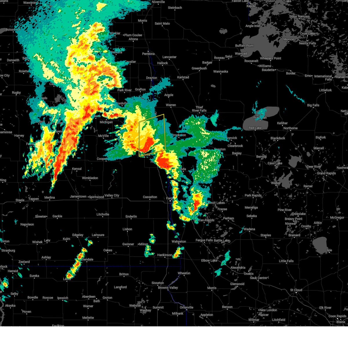
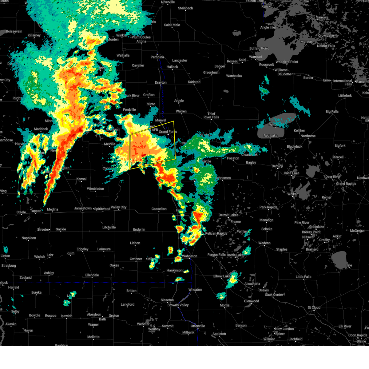
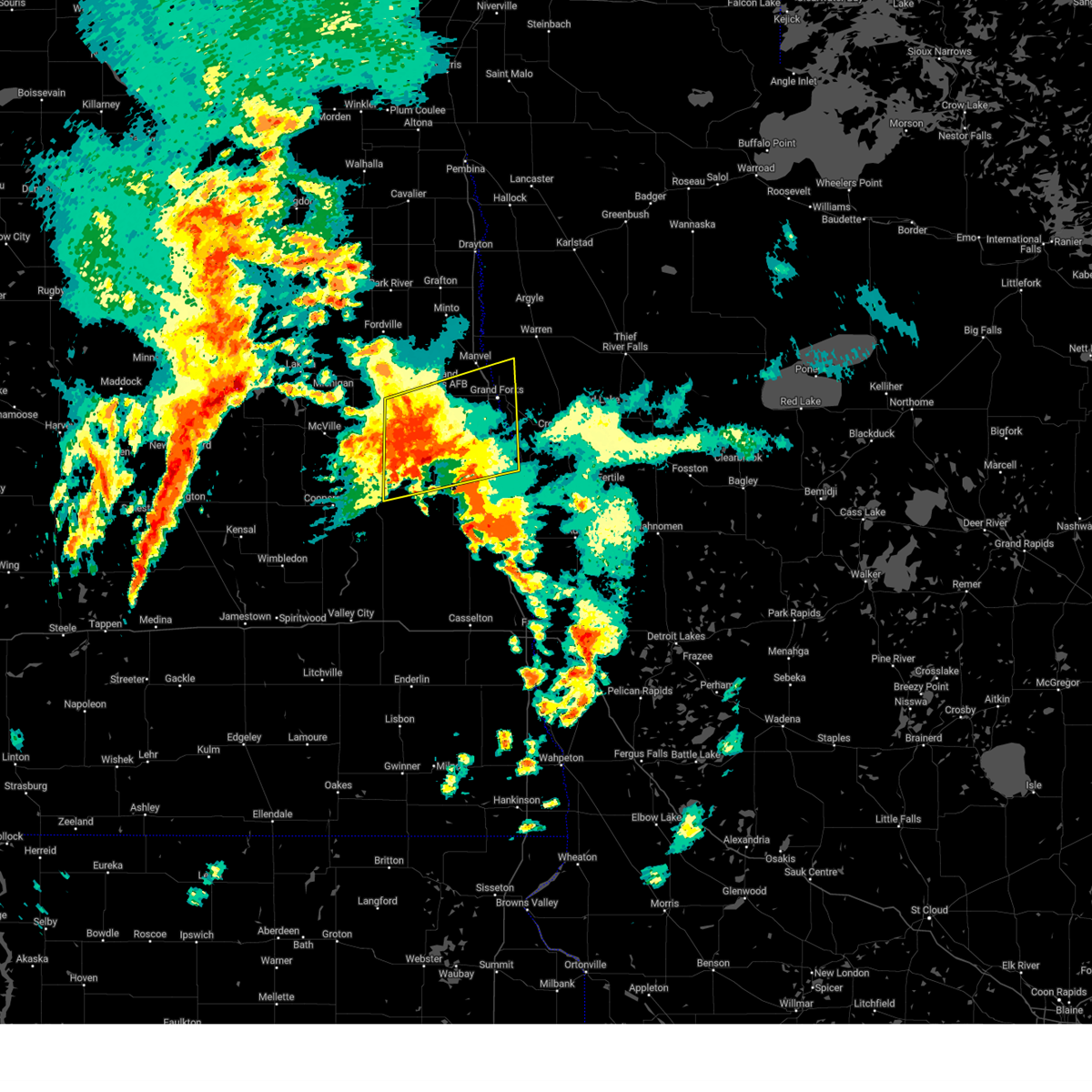
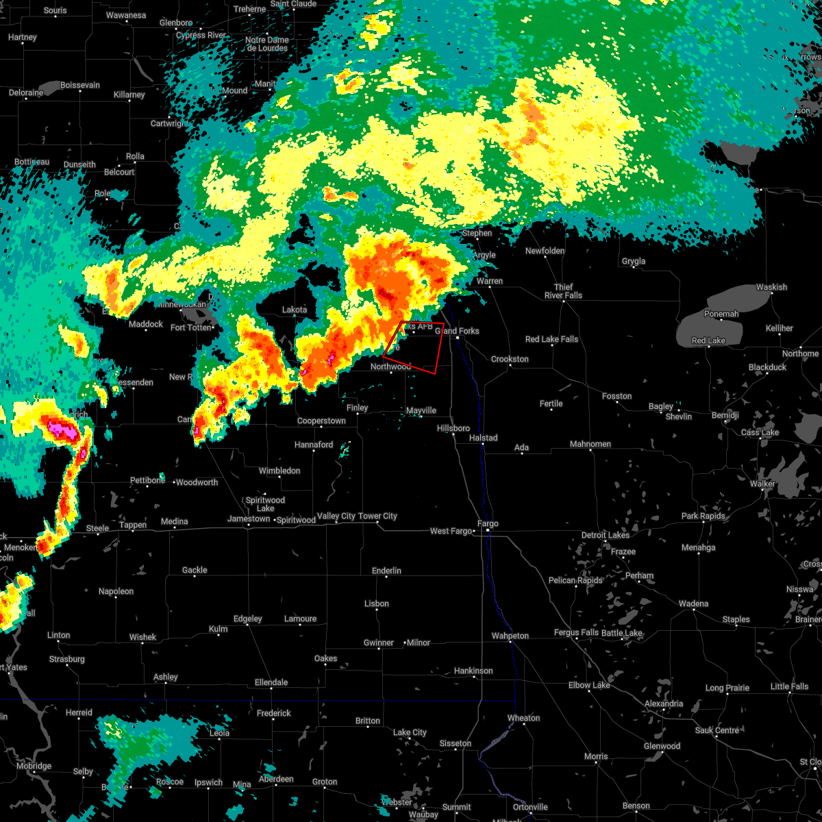
Hail Map for Grand Forks AFB, ND
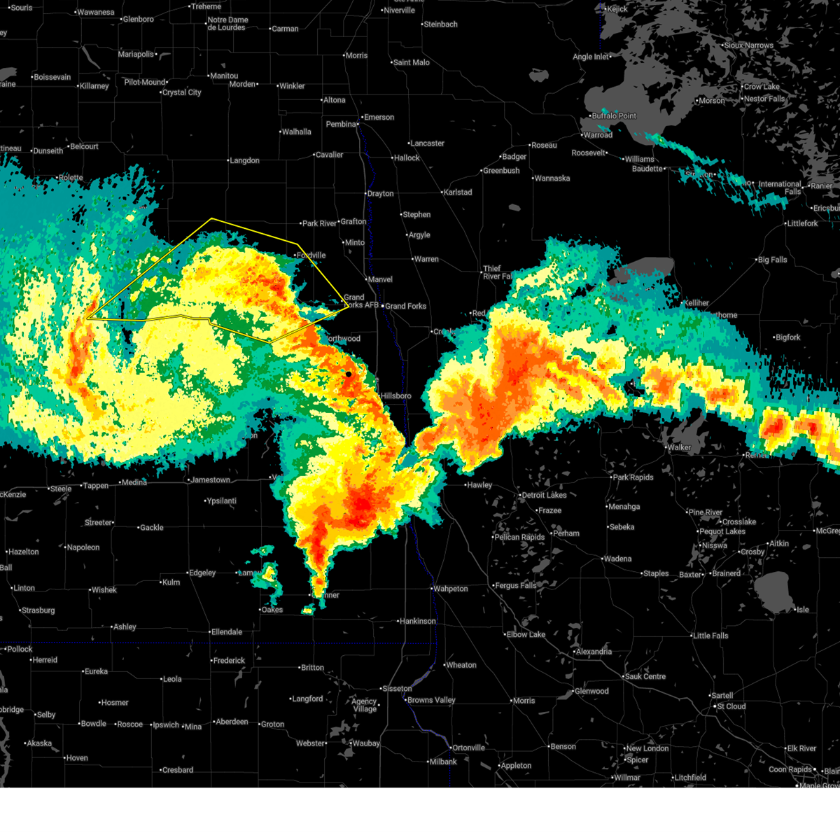
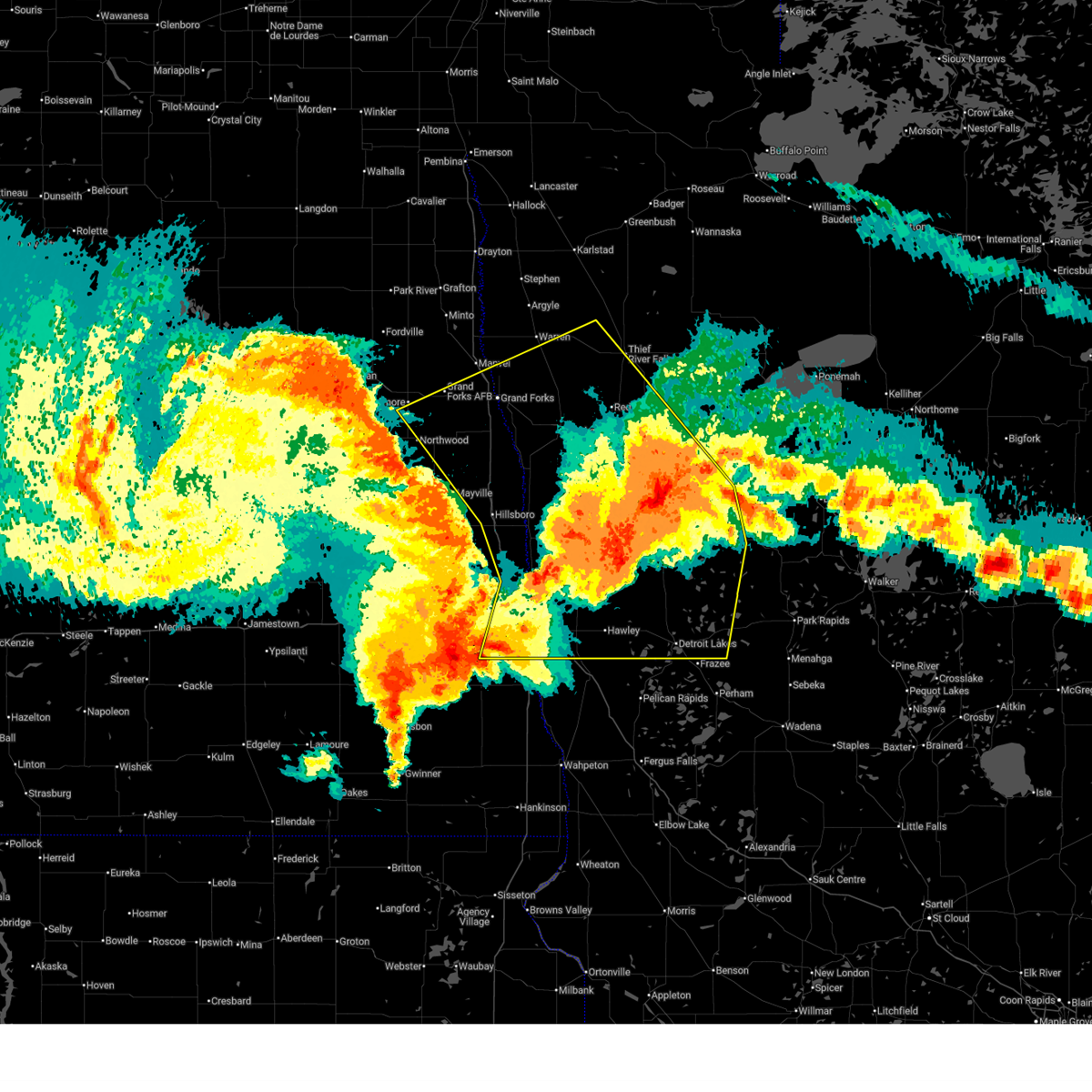
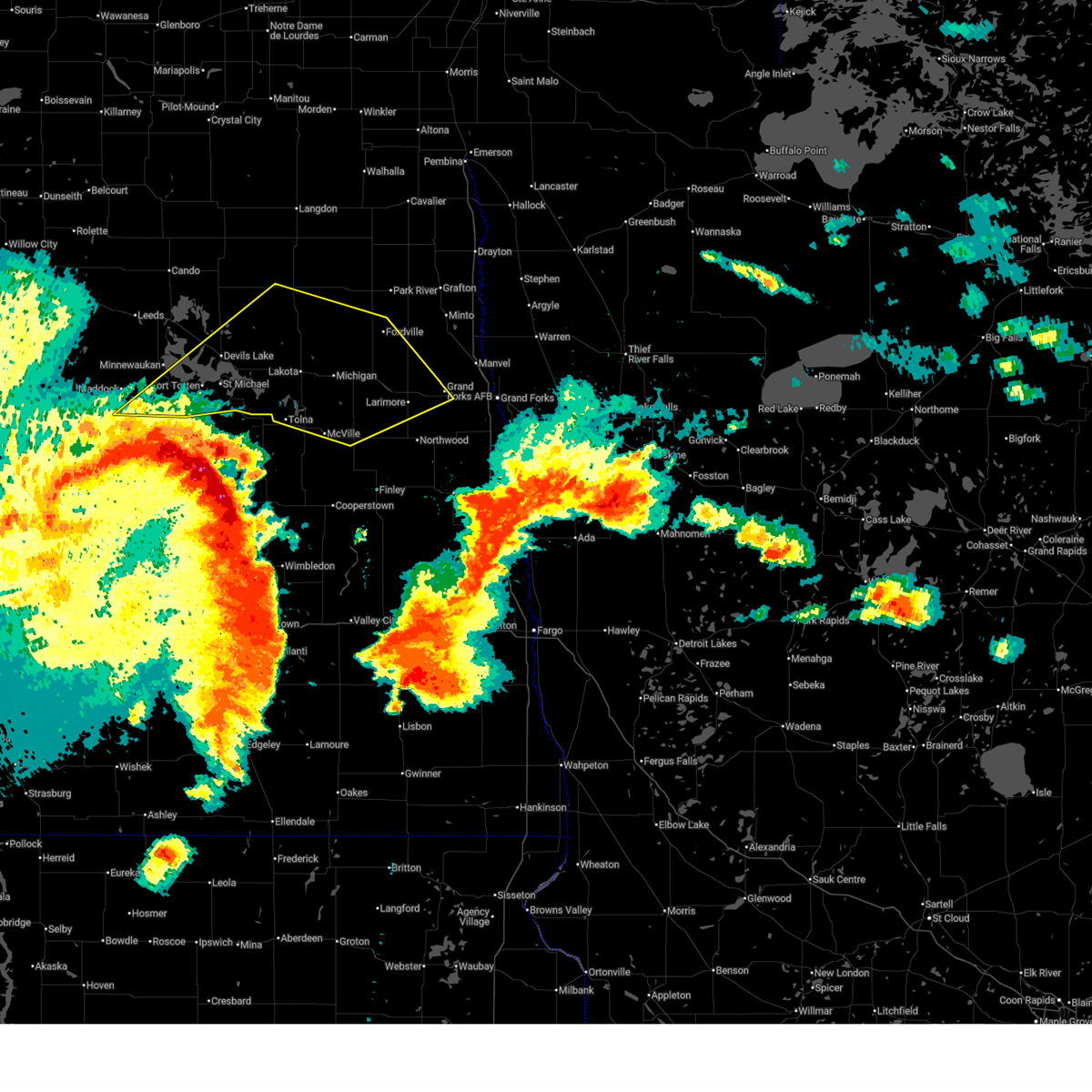
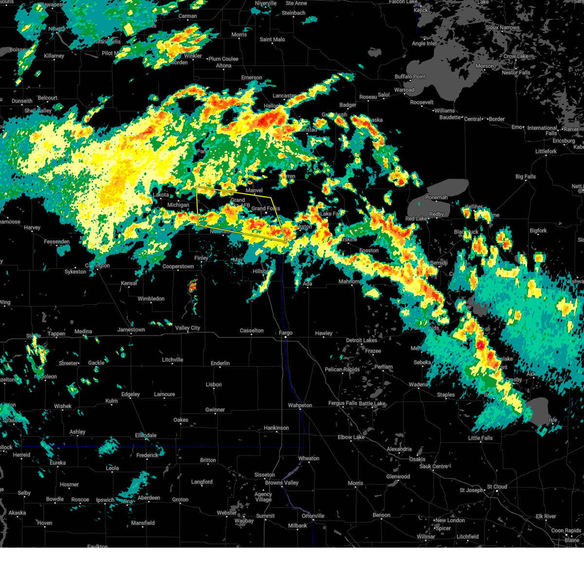
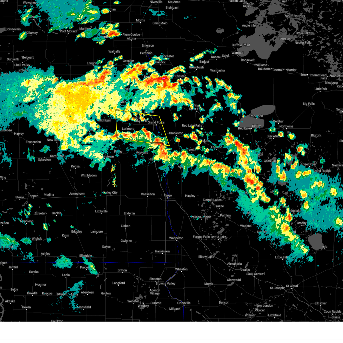
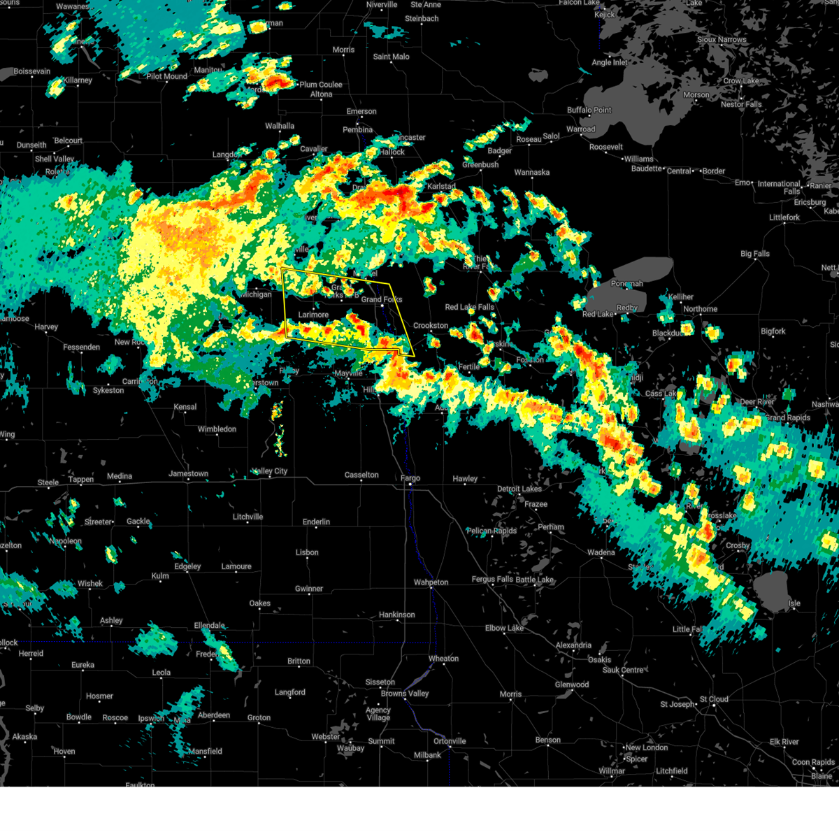
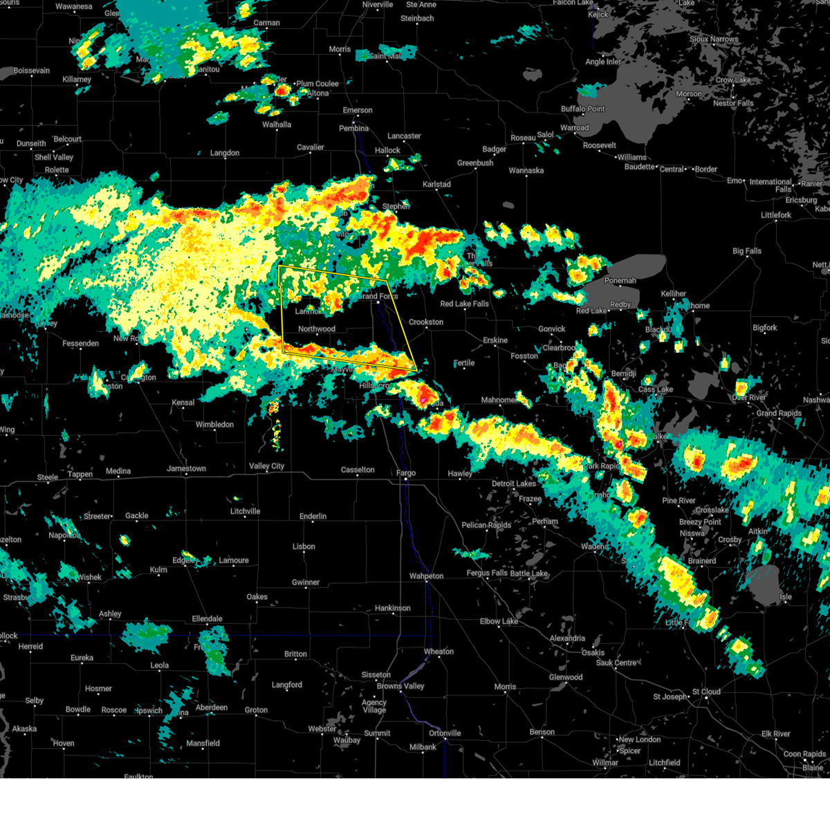
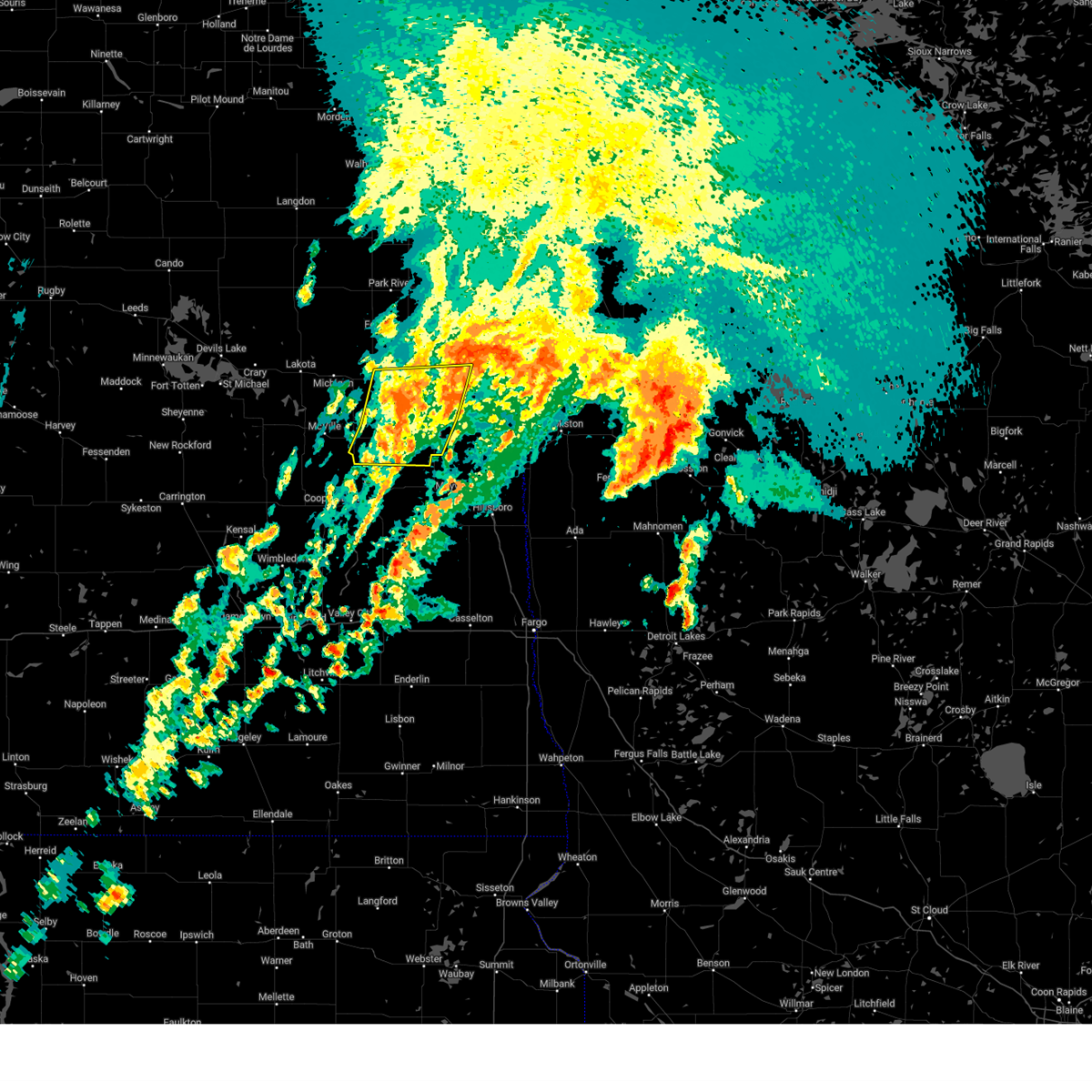
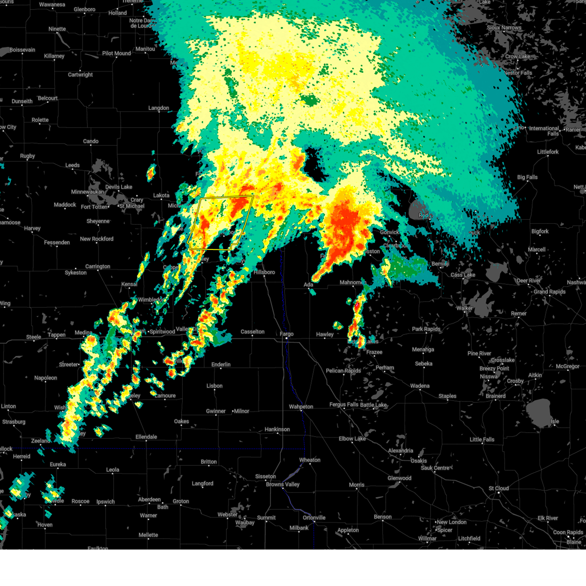
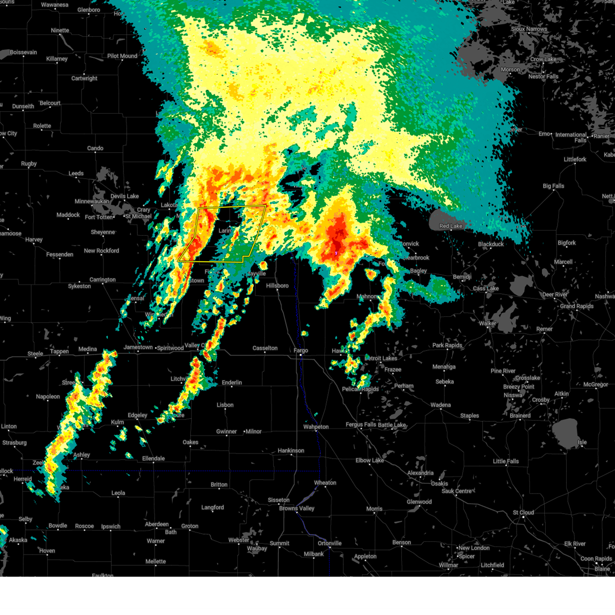
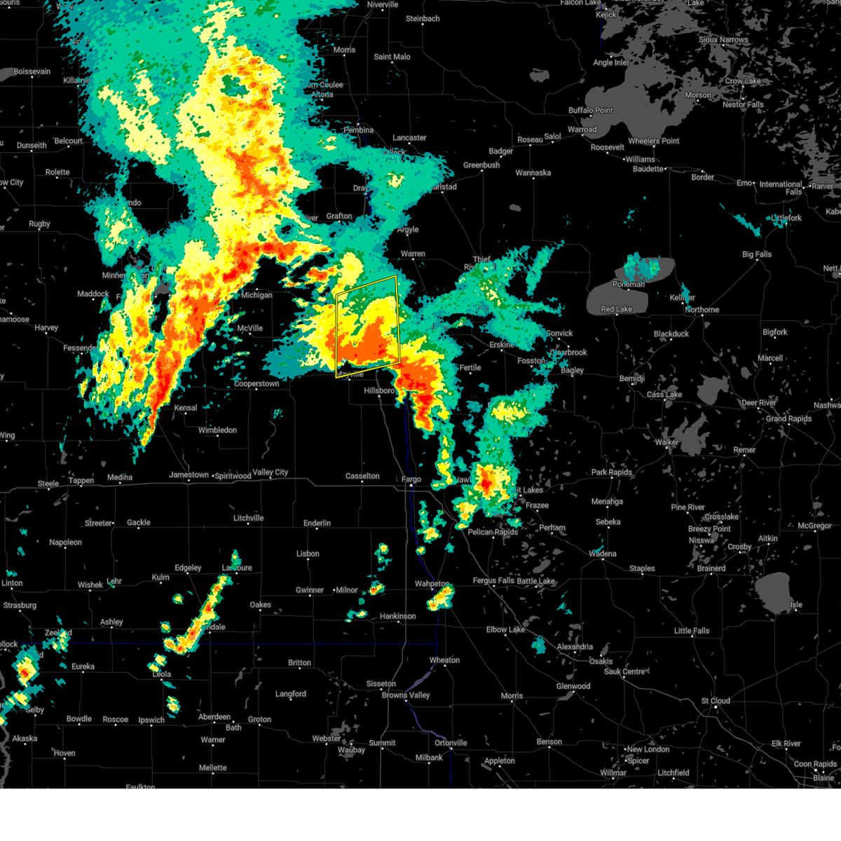
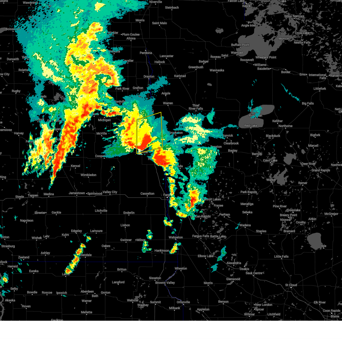
The Grand Forks AFB, ND area has had 9 reports of on-the-ground hail by trained spotters, and has been under severe weather warnings 24 times during the past 12 months. Doppler radar has detected hail at or near Grand Forks AFB, ND on 37 occasions, including 2 occasions during the past year.
| Name: | Grand Forks AFB, ND |
| Where Located: | 69.3 miles E of Devils Lake, ND |
| Map: | Google Map for Grand Forks AFB, ND |
| Population: | 2367 |
| Housing Units: | 807 |
| More Info: | Search Google for Grand Forks AFB, ND |
1
The Top Recent Hail Date for Grand Forks AFB, ND is Thursday, July 4, 2024 (13th out of 37)

Hail and Wind Damage Spotted near Grand Forks AFB, ND
| Date / Time | Report Details |
|---|---|
| 6/22/2025 9:56 AM CDT |
 Svrfgf the national weather service in grand forks has issued a * severe thunderstorm warning for, southwestern marshall county in northwestern minnesota, northwestern polk county in northwestern minnesota, grand forks county in northeastern north dakota, eastern walsh county in northeastern north dakota, * until 1100 am cdt. * at 956 am cdt, severe thunderstorms were located along a line extending from near mccanna to 7 miles west of merrifield, moving northeast at 40 mph (radar indicated). Hazards include 60 mph wind gusts. expect damage to roofs, siding, and trees Svrfgf the national weather service in grand forks has issued a * severe thunderstorm warning for, southwestern marshall county in northwestern minnesota, northwestern polk county in northwestern minnesota, grand forks county in northeastern north dakota, eastern walsh county in northeastern north dakota, * until 1100 am cdt. * at 956 am cdt, severe thunderstorms were located along a line extending from near mccanna to 7 miles west of merrifield, moving northeast at 40 mph (radar indicated). Hazards include 60 mph wind gusts. expect damage to roofs, siding, and trees
|
| 6/22/2025 9:33 AM CDT |
 the severe thunderstorm warning has been cancelled and is no longer in effect the severe thunderstorm warning has been cancelled and is no longer in effect
|
| 6/22/2025 9:33 AM CDT |
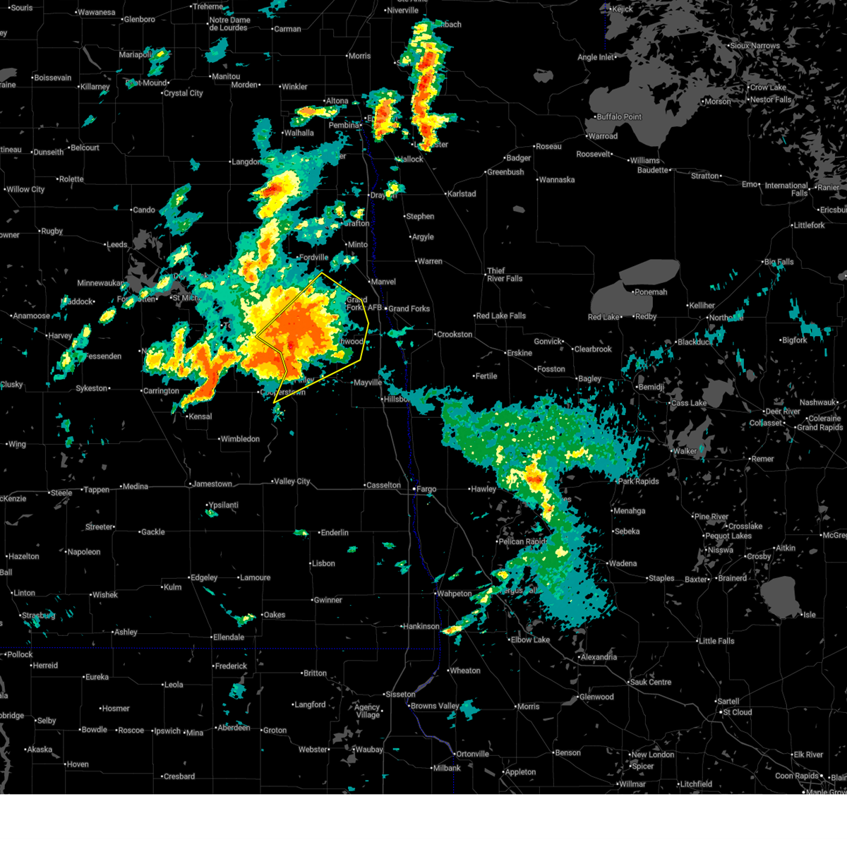
 At 933 am cdt, severe thunderstorms were located along a line extending from 6 miles west of larimore to kempton to near northwood to near hatton, moving northeast at 45 mph (radar indicated). Hazards include 70 mph wind gusts and penny size hail. Expect considerable tree damage. damage is likely to mobile homes, roofs, and outbuildings. Locations impacted include, grand forks afb, larimore, northwood, hatton, golden lake, emerado, and arvilla. At 933 am cdt, severe thunderstorms were located along a line extending from 6 miles west of larimore to kempton to near northwood to near hatton, moving northeast at 45 mph (radar indicated). Hazards include 70 mph wind gusts and penny size hail. Expect considerable tree damage. damage is likely to mobile homes, roofs, and outbuildings. Locations impacted include, grand forks afb, larimore, northwood, hatton, golden lake, emerado, and arvilla.
|
| 6/22/2025 9:13 AM CDT |
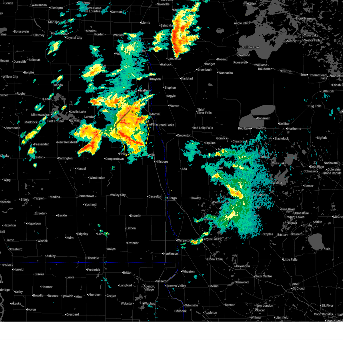
 Svrfgf the national weather service in grand forks has issued a * severe thunderstorm warning for, western grand forks county in northeastern north dakota, southeastern nelson county in northeastern north dakota, northwestern traill county in southeastern north dakota, northern steele county in southeastern north dakota, * until 1000 am cdt. * at 911 am cdt, severe thunderstorms were located along a line extending from 7 miles northeast of kloten to near logan center to near sharon to 6 miles southwest of finley, moving northeast at 45 mph (radar indicated). Hazards include 70 mph wind gusts and quarter size hail. Hail damage to vehicles is expected. expect considerable tree damage. Wind damage is also likely to mobile homes, roofs, and outbuildings. Svrfgf the national weather service in grand forks has issued a * severe thunderstorm warning for, western grand forks county in northeastern north dakota, southeastern nelson county in northeastern north dakota, northwestern traill county in southeastern north dakota, northern steele county in southeastern north dakota, * until 1000 am cdt. * at 911 am cdt, severe thunderstorms were located along a line extending from 7 miles northeast of kloten to near logan center to near sharon to 6 miles southwest of finley, moving northeast at 45 mph (radar indicated). Hazards include 70 mph wind gusts and quarter size hail. Hail damage to vehicles is expected. expect considerable tree damage. Wind damage is also likely to mobile homes, roofs, and outbuildings.
|
| 6/21/2025 12:48 AM CDT |
 The storms which prompted the warning have weakened below severe limits, and have exited the warned area. therefore, the warning has been allowed to expire. however, gusty winds are still possible with these thunderstorms. there is another area of extremely strong winds that will likely move into the central red river valley. be prepared to shelter and prepare for these winds in the next hour or two. a tornado watch remains in effect until 300 am cdt for northwestern minnesota, and southeastern and northeastern north dakota. a severe thunderstorm watch remains in effect until 700 am cdt for northwestern minnesota. The storms which prompted the warning have weakened below severe limits, and have exited the warned area. therefore, the warning has been allowed to expire. however, gusty winds are still possible with these thunderstorms. there is another area of extremely strong winds that will likely move into the central red river valley. be prepared to shelter and prepare for these winds in the next hour or two. a tornado watch remains in effect until 300 am cdt for northwestern minnesota, and southeastern and northeastern north dakota. a severe thunderstorm watch remains in effect until 700 am cdt for northwestern minnesota.
|
| 6/21/2025 12:45 AM CDT |
 The storms which prompted the warning have weakened below severe limits, and no longer pose an immediate threat to life or property. therefore, the warning has been allowed to expire. however, gusty winds are still possible with these thunderstorms. a tornado watch remains in effect until 300 am cdt for northwestern minnesota, and northeastern north dakota. The storms which prompted the warning have weakened below severe limits, and no longer pose an immediate threat to life or property. therefore, the warning has been allowed to expire. however, gusty winds are still possible with these thunderstorms. a tornado watch remains in effect until 300 am cdt for northwestern minnesota, and northeastern north dakota.
|
| 6/20/2025 11:56 PM CDT |
 The storms which prompted the warning have moved out of the area. therefore, the warning will be allowed to expire. however, gusty winds and heavy rain are still possible with these thunderstorms. a tornado watch remains in effect until 300 am cdt for northeastern north dakota. to report severe weather, contact your nearest law enforcement agency. they will relay your report to the national weather service grand forks. The storms which prompted the warning have moved out of the area. therefore, the warning will be allowed to expire. however, gusty winds and heavy rain are still possible with these thunderstorms. a tornado watch remains in effect until 300 am cdt for northeastern north dakota. to report severe weather, contact your nearest law enforcement agency. they will relay your report to the national weather service grand forks.
|
| 6/20/2025 11:49 PM CDT |
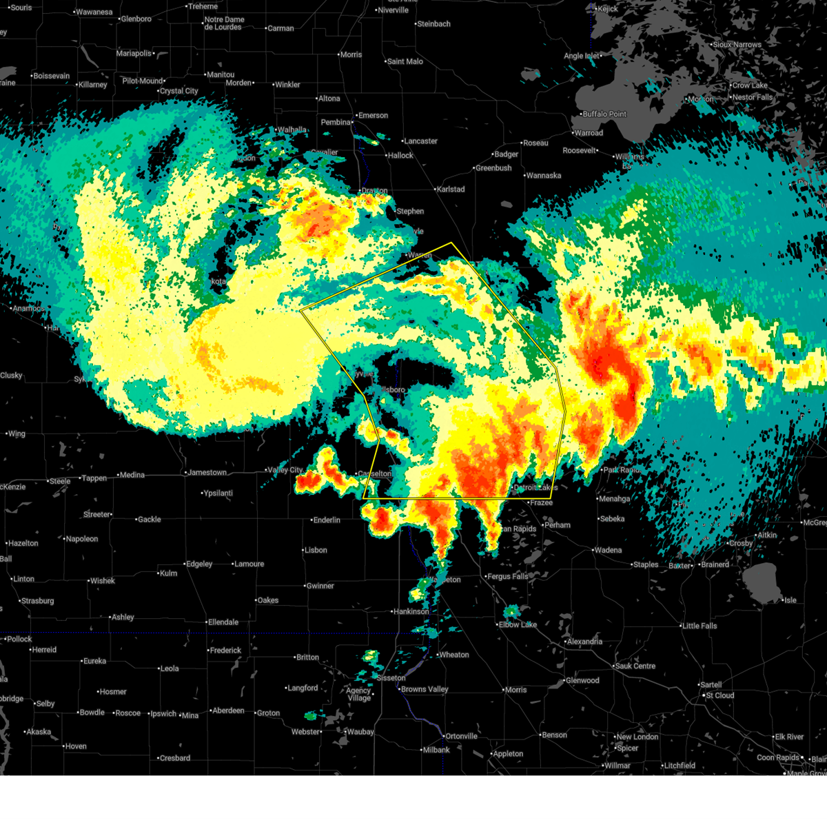
 Svrfgf the national weather service in grand forks has issued a * severe thunderstorm warning for, south central marshall county in northwestern minnesota, red lake county in northwestern minnesota, clay county in northwestern minnesota, norman county in northwestern minnesota, polk county in northwestern minnesota, mahnomen county in northwestern minnesota, becker county in northwestern minnesota, western pennington county in northwestern minnesota, southwestern clearwater county in northwestern minnesota, southern grand forks county in northeastern north dakota, eastern cass county in southeastern north dakota, traill county in southeastern north dakota, * until 1245 am cdt. * at 1149 pm cdt, severe thunderstorms were located along a line extending from near kempton to near hillsboro to near gardner to near mapleton, moving east at 80 mph. these are destructive storms for eastern north dakota and northwest minnesota (public). Hazards include 80 mph wind gusts. Flying debris will be dangerous to those caught without shelter. mobile homes will be heavily damaged. expect considerable damage to roofs, windows, and vehicles. extensive tree damage and power outages are likely. severe thunderstorms will be near, fargo, west fargo, and hillsboro around 1150 pm cdt. moorhead, dilworth, and halstad around 1155 pm cdt. glyndon, thompson, and climax around 1200 am cdt. grand forks, east grand forks, and ada around 1205 am cdt. hawley, twin valley, and ulen around 1210 am cdt. other locations impacted by these severe thunderstorms include thief river falls airport, american crystal sugar, grand forks airport, moorhead airport, and west argusville. this includes the following highways, interstate 29 between mile markers 57 and 149. interstate 94 in north dakota between mile markers 337 and 15. Interstate 94 in minnesota between mile markers 337 and 15. Svrfgf the national weather service in grand forks has issued a * severe thunderstorm warning for, south central marshall county in northwestern minnesota, red lake county in northwestern minnesota, clay county in northwestern minnesota, norman county in northwestern minnesota, polk county in northwestern minnesota, mahnomen county in northwestern minnesota, becker county in northwestern minnesota, western pennington county in northwestern minnesota, southwestern clearwater county in northwestern minnesota, southern grand forks county in northeastern north dakota, eastern cass county in southeastern north dakota, traill county in southeastern north dakota, * until 1245 am cdt. * at 1149 pm cdt, severe thunderstorms were located along a line extending from near kempton to near hillsboro to near gardner to near mapleton, moving east at 80 mph. these are destructive storms for eastern north dakota and northwest minnesota (public). Hazards include 80 mph wind gusts. Flying debris will be dangerous to those caught without shelter. mobile homes will be heavily damaged. expect considerable damage to roofs, windows, and vehicles. extensive tree damage and power outages are likely. severe thunderstorms will be near, fargo, west fargo, and hillsboro around 1150 pm cdt. moorhead, dilworth, and halstad around 1155 pm cdt. glyndon, thompson, and climax around 1200 am cdt. grand forks, east grand forks, and ada around 1205 am cdt. hawley, twin valley, and ulen around 1210 am cdt. other locations impacted by these severe thunderstorms include thief river falls airport, american crystal sugar, grand forks airport, moorhead airport, and west argusville. this includes the following highways, interstate 29 between mile markers 57 and 149. interstate 94 in north dakota between mile markers 337 and 15. Interstate 94 in minnesota between mile markers 337 and 15.
|
| 6/20/2025 11:48 PM CDT |
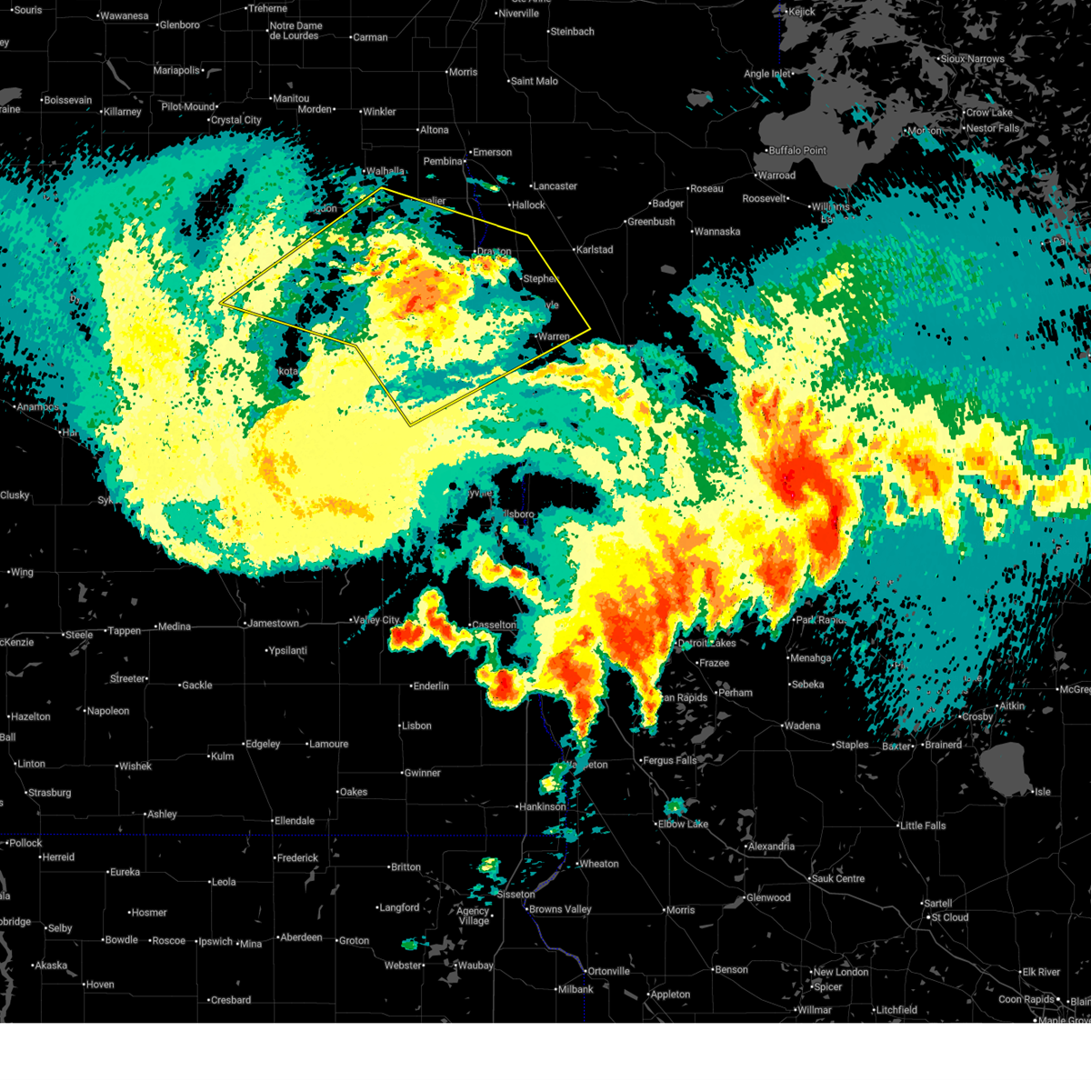
 Svrfgf the national weather service in grand forks has issued a * severe thunderstorm warning for, western marshall county in northwestern minnesota, northwestern polk county in northwestern minnesota, southwestern kittson county in northwestern minnesota, northern grand forks county in northeastern north dakota, southeastern cavalier county in northeastern north dakota, northeastern nelson county in northeastern north dakota, northeastern ramsey county in northeastern north dakota, walsh county in northeastern north dakota, southern pembina county in northeastern north dakota, * until 1245 am cdt. * at 1147 pm cdt, severe thunderstorms were located along a line extending from near webster to near whitman to near logan center, moving northeast at 55 mph (public). Hazards include 70 mph wind gusts. Expect considerable tree damage. damage is likely to mobile homes, roofs, and outbuildings. severe thunderstorms will be near, larimore, dahlen, and lawton around 1150 pm cdt. fordville, arvilla, and orr around 1155 pm cdt. grand forks afb, edmore, and lankin around 1200 am cdt. emerado, gilby, and mekinock around 1205 am cdt. park river, forest river, and adams around 1210 am cdt. other locations impacted by these severe thunderstorms include grand forks airport. This includes interstate 29 between mile markers 145 and 197. Svrfgf the national weather service in grand forks has issued a * severe thunderstorm warning for, western marshall county in northwestern minnesota, northwestern polk county in northwestern minnesota, southwestern kittson county in northwestern minnesota, northern grand forks county in northeastern north dakota, southeastern cavalier county in northeastern north dakota, northeastern nelson county in northeastern north dakota, northeastern ramsey county in northeastern north dakota, walsh county in northeastern north dakota, southern pembina county in northeastern north dakota, * until 1245 am cdt. * at 1147 pm cdt, severe thunderstorms were located along a line extending from near webster to near whitman to near logan center, moving northeast at 55 mph (public). Hazards include 70 mph wind gusts. Expect considerable tree damage. damage is likely to mobile homes, roofs, and outbuildings. severe thunderstorms will be near, larimore, dahlen, and lawton around 1150 pm cdt. fordville, arvilla, and orr around 1155 pm cdt. grand forks afb, edmore, and lankin around 1200 am cdt. emerado, gilby, and mekinock around 1205 am cdt. park river, forest river, and adams around 1210 am cdt. other locations impacted by these severe thunderstorms include grand forks airport. This includes interstate 29 between mile markers 145 and 197.
|
| 6/20/2025 11:04 PM CDT |
 Svrfgf the national weather service in grand forks has issued a * severe thunderstorm warning for, southeastern benson county in northeastern north dakota, northwestern grand forks county in northeastern north dakota, nelson county in northeastern north dakota, central ramsey county in northeastern north dakota, southwestern walsh county in northeastern north dakota, * until midnight cdt. * at 1102 pm cdt, severe thunderstorms were located along a line extending from near sheyenne to 8 miles southwest of warwick to near glenfield, moving northeast at 65 mph. these are destructive storms for benson, grand forks, nelson, ramsey, walsh counties (public). Hazards include 80 mph wind gusts and ping pong ball size hail. Flying debris will be dangerous to those caught without shelter. mobile homes will be heavily damaged. expect considerable damage to roofs, windows, and vehicles. extensive tree damage and power outages are likely. severe thunderstorms will be near, spirit lake nation around 1105 pm cdt. fort totten, warwick, and tokio around 1110 pm cdt. tolna, pekin, and st michael around 1115 pm cdt. mcville around 1120 pm cdt. Lakota, crary, and doyon around 1125 pm cdt. Svrfgf the national weather service in grand forks has issued a * severe thunderstorm warning for, southeastern benson county in northeastern north dakota, northwestern grand forks county in northeastern north dakota, nelson county in northeastern north dakota, central ramsey county in northeastern north dakota, southwestern walsh county in northeastern north dakota, * until midnight cdt. * at 1102 pm cdt, severe thunderstorms were located along a line extending from near sheyenne to 8 miles southwest of warwick to near glenfield, moving northeast at 65 mph. these are destructive storms for benson, grand forks, nelson, ramsey, walsh counties (public). Hazards include 80 mph wind gusts and ping pong ball size hail. Flying debris will be dangerous to those caught without shelter. mobile homes will be heavily damaged. expect considerable damage to roofs, windows, and vehicles. extensive tree damage and power outages are likely. severe thunderstorms will be near, spirit lake nation around 1105 pm cdt. fort totten, warwick, and tokio around 1110 pm cdt. tolna, pekin, and st michael around 1115 pm cdt. mcville around 1120 pm cdt. Lakota, crary, and doyon around 1125 pm cdt.
|
| 5/15/2025 5:06 PM CDT |
 The storms which prompted the warning have weakened below severe limits, and no longer pose an immediate threat to life or property. therefore, the warning will be allowed to expire. however, gusty winds and heavy rain are still possible with these thunderstorms. The storms which prompted the warning have weakened below severe limits, and no longer pose an immediate threat to life or property. therefore, the warning will be allowed to expire. however, gusty winds and heavy rain are still possible with these thunderstorms.
|
| 5/15/2025 5:05 PM CDT |
 At 504 pm cdt, severe thunderstorms were located along a line extending from petersburg to east grand forks, moving northwest at 45 mph (radar indicated). Hazards include 60 mph wind gusts and penny size hail. Expect damage to roofs, siding, and trees. Locations impacted include, grand forks, east grand forks, grand forks afb, larimore, thompson, emerado, and manvel. At 504 pm cdt, severe thunderstorms were located along a line extending from petersburg to east grand forks, moving northwest at 45 mph (radar indicated). Hazards include 60 mph wind gusts and penny size hail. Expect damage to roofs, siding, and trees. Locations impacted include, grand forks, east grand forks, grand forks afb, larimore, thompson, emerado, and manvel.
|
| 5/15/2025 4:49 PM CDT |
 At 449 pm cdt, severe thunderstorms were located along a line extending from near logan center to near bygland, moving northwest at 45 mph (radar indicated). Hazards include 60 mph wind gusts and penny size hail. Expect damage to roofs, siding, and trees. Locations impacted include, grand forks, east grand forks, grand forks afb, larimore, thompson, northwood, and emerado. At 449 pm cdt, severe thunderstorms were located along a line extending from near logan center to near bygland, moving northwest at 45 mph (radar indicated). Hazards include 60 mph wind gusts and penny size hail. Expect damage to roofs, siding, and trees. Locations impacted include, grand forks, east grand forks, grand forks afb, larimore, thompson, northwood, and emerado.
|
| 5/15/2025 4:49 PM CDT |
 the severe thunderstorm warning has been cancelled and is no longer in effect the severe thunderstorm warning has been cancelled and is no longer in effect
|
| 5/15/2025 4:33 PM CDT |
 Svrfgf the national weather service in grand forks has issued a * severe thunderstorm warning for, southwestern polk county in northwestern minnesota, grand forks county in northeastern north dakota, northern traill county in southeastern north dakota, northeastern steele county in southeastern north dakota, * until 515 pm cdt. * at 432 pm cdt, severe thunderstorms were located along a line extending from 6 miles south of logan center to climax, moving northwest at 45 mph (radar indicated). Hazards include 60 mph wind gusts and penny size hail. expect damage to roofs, siding, and trees Svrfgf the national weather service in grand forks has issued a * severe thunderstorm warning for, southwestern polk county in northwestern minnesota, grand forks county in northeastern north dakota, northern traill county in southeastern north dakota, northeastern steele county in southeastern north dakota, * until 515 pm cdt. * at 432 pm cdt, severe thunderstorms were located along a line extending from 6 miles south of logan center to climax, moving northwest at 45 mph (radar indicated). Hazards include 60 mph wind gusts and penny size hail. expect damage to roofs, siding, and trees
|
| 8/29/2024 5:50 AM CDT |
 The storms which prompted the warning have weakened below severe limits, and no longer pose an immediate threat to life or property. therefore, the warning will be allowed to expire. The storms which prompted the warning have weakened below severe limits, and no longer pose an immediate threat to life or property. therefore, the warning will be allowed to expire.
|
| 8/29/2024 5:39 AM CDT |
 the severe thunderstorm warning has been cancelled and is no longer in effect the severe thunderstorm warning has been cancelled and is no longer in effect
|
| 8/29/2024 5:39 AM CDT |
 At 538 am cdt, severe thunderstorms were located along a line extending from honeyford to near kempton to 6 miles southwest of northwood, moving east at 30 mph (radar indicated). Hazards include 60 mph wind gusts and quarter size hail. Hail damage to vehicles is expected. expect wind damage to roofs, siding, and trees. Locations impacted include, grand forks afb, larimore, northwood, emerado, aneta, arvilla, and mekinock. At 538 am cdt, severe thunderstorms were located along a line extending from honeyford to near kempton to 6 miles southwest of northwood, moving east at 30 mph (radar indicated). Hazards include 60 mph wind gusts and quarter size hail. Hail damage to vehicles is expected. expect wind damage to roofs, siding, and trees. Locations impacted include, grand forks afb, larimore, northwood, emerado, aneta, arvilla, and mekinock.
|
| 8/29/2024 5:09 AM CDT |
 Svrfgf the national weather service in grand forks has issued a * severe thunderstorm warning for, southwestern grand forks county in northeastern north dakota, southeastern nelson county in northeastern north dakota, northeastern griggs county in southeastern north dakota, northern steele county in southeastern north dakota, * until 600 am cdt. * at 508 am cdt, severe thunderstorms were located along a line extending from near niagara to near logan center to aneta, moving east at 30 mph (radar indicated). Hazards include 60 mph wind gusts and quarter size hail. Hail damage to vehicles is expected. Expect wind damage to roofs, siding, and trees. Svrfgf the national weather service in grand forks has issued a * severe thunderstorm warning for, southwestern grand forks county in northeastern north dakota, southeastern nelson county in northeastern north dakota, northeastern griggs county in southeastern north dakota, northern steele county in southeastern north dakota, * until 600 am cdt. * at 508 am cdt, severe thunderstorms were located along a line extending from near niagara to near logan center to aneta, moving east at 30 mph (radar indicated). Hazards include 60 mph wind gusts and quarter size hail. Hail damage to vehicles is expected. Expect wind damage to roofs, siding, and trees.
|
| 8/29/2024 3:54 AM CDT |
 The storm which prompted the warning has moved out of the area. therefore, the warning will be allowed to expire. remember, a severe thunderstorm warning still remains in effect for southern grand forks county, northern trail county, and western polk county till 430 am. The storm which prompted the warning has moved out of the area. therefore, the warning will be allowed to expire. remember, a severe thunderstorm warning still remains in effect for southern grand forks county, northern trail county, and western polk county till 430 am.
|
| 8/29/2024 3:37 AM CDT |
 At 336 am cdt, a severe thunderstorm was located near sutton, or 36 miles east of carrington, moving east at 40 mph (radar indicated). Hazards include 70 mph wind gusts and nickel size hail. Expect considerable tree damage. damage is likely to mobile homes, roofs, and outbuildings. locations impacted include, grand forks, east grand forks, grand forks afb, thompson, emerado, buxton, and reynolds. This includes interstate 29 between mile markers 116 and 150. At 336 am cdt, a severe thunderstorm was located near sutton, or 36 miles east of carrington, moving east at 40 mph (radar indicated). Hazards include 70 mph wind gusts and nickel size hail. Expect considerable tree damage. damage is likely to mobile homes, roofs, and outbuildings. locations impacted include, grand forks, east grand forks, grand forks afb, thompson, emerado, buxton, and reynolds. This includes interstate 29 between mile markers 116 and 150.
|
| 8/29/2024 3:37 AM CDT |
 the severe thunderstorm warning has been cancelled and is no longer in effect the severe thunderstorm warning has been cancelled and is no longer in effect
|
| 8/29/2024 3:18 AM CDT |
 At 317 am cdt, a severe thunderstorm was located near glenfield, or 24 miles east of carrington, moving east at 40 mph (radar indicated). Hazards include 70 mph wind gusts and nickel size hail. Expect considerable tree damage. damage is likely to mobile homes, roofs, and outbuildings. locations impacted include, grand forks, east grand forks, grand forks afb, larimore, thompson, northwood, and hatton. This includes interstate 29 between mile markers 116 and 150. At 317 am cdt, a severe thunderstorm was located near glenfield, or 24 miles east of carrington, moving east at 40 mph (radar indicated). Hazards include 70 mph wind gusts and nickel size hail. Expect considerable tree damage. damage is likely to mobile homes, roofs, and outbuildings. locations impacted include, grand forks, east grand forks, grand forks afb, larimore, thompson, northwood, and hatton. This includes interstate 29 between mile markers 116 and 150.
|
| 8/29/2024 3:13 AM CDT |
 Svrfgf the national weather service in grand forks has issued a * severe thunderstorm warning for, northwestern polk county in northwestern minnesota, southern grand forks county in northeastern north dakota, northern traill county in southeastern north dakota, northeastern steele county in southeastern north dakota, * until 400 am cdt. * at 313 am cdt, a severe thunderstorm was located near golden lake, or 31 miles southwest of grand forks, moving east at 40 mph (radar indicated). Hazards include 60 mph wind gusts and nickel size hail. expect damage to roofs, siding, and trees Svrfgf the national weather service in grand forks has issued a * severe thunderstorm warning for, northwestern polk county in northwestern minnesota, southern grand forks county in northeastern north dakota, northern traill county in southeastern north dakota, northeastern steele county in southeastern north dakota, * until 400 am cdt. * at 313 am cdt, a severe thunderstorm was located near golden lake, or 31 miles southwest of grand forks, moving east at 40 mph (radar indicated). Hazards include 60 mph wind gusts and nickel size hail. expect damage to roofs, siding, and trees
|
| 6/18/2024 2:26 AM CDT |
 At 226 am cdt, severe thunderstorms were located along a line extending from viking to near wylie to near eldred, moving east at 40 mph (radar indicated). Hazards include 60 mph wind gusts. Expect damage to roofs, siding, and trees. locations impacted include, grand forks, thief river falls, east grand forks, crookston, grand forks afb, warren, and red lake falls. This includes interstate 29 between mile markers 124 and 160. At 226 am cdt, severe thunderstorms were located along a line extending from viking to near wylie to near eldred, moving east at 40 mph (radar indicated). Hazards include 60 mph wind gusts. Expect damage to roofs, siding, and trees. locations impacted include, grand forks, thief river falls, east grand forks, crookston, grand forks afb, warren, and red lake falls. This includes interstate 29 between mile markers 124 and 160.
|
| 6/18/2024 1:54 AM CDT |
 Svrfgf the national weather service in grand forks has issued a * severe thunderstorm warning for, southwestern marshall county in northwestern minnesota, western red lake county in northwestern minnesota, northwestern polk county in northwestern minnesota, western pennington county in northwestern minnesota, grand forks county in northeastern north dakota, * until 245 am cdt. * at 154 am cdt, severe thunderstorms were located along a line extending from near march to near key west to reynolds, moving east at 40 mph (radar indicated). Hazards include 60 mph wind gusts. expect damage to roofs, siding, and trees Svrfgf the national weather service in grand forks has issued a * severe thunderstorm warning for, southwestern marshall county in northwestern minnesota, western red lake county in northwestern minnesota, northwestern polk county in northwestern minnesota, western pennington county in northwestern minnesota, grand forks county in northeastern north dakota, * until 245 am cdt. * at 154 am cdt, severe thunderstorms were located along a line extending from near march to near key west to reynolds, moving east at 40 mph (radar indicated). Hazards include 60 mph wind gusts. expect damage to roofs, siding, and trees
|
| 6/18/2024 1:33 AM CDT |
 At 133 am cdt, severe thunderstorms were located along a line extending from near poland to near east grand forks to near holmes, moving east at 60 mph (radar indicated). Hazards include 60 mph wind gusts. Expect damage to roofs, siding, and trees. locations impacted include, grand forks, east grand forks, grand forks afb, larimore, thompson, northwood, and fisher. This includes interstate 29 between mile markers 123 and 160. At 133 am cdt, severe thunderstorms were located along a line extending from near poland to near east grand forks to near holmes, moving east at 60 mph (radar indicated). Hazards include 60 mph wind gusts. Expect damage to roofs, siding, and trees. locations impacted include, grand forks, east grand forks, grand forks afb, larimore, thompson, northwood, and fisher. This includes interstate 29 between mile markers 123 and 160.
|
| 6/18/2024 1:10 AM CDT |
 Svrfgf the national weather service in grand forks has issued a * severe thunderstorm warning for, northwestern polk county in northwestern minnesota, grand forks county in northeastern north dakota, * until 200 am cdt. * at 110 am cdt, severe thunderstorms were located along a line extending from orr to arvilla to near northwood, moving east at 60 mph (radar indicated). Hazards include 60 mph wind gusts. expect damage to roofs, siding, and trees Svrfgf the national weather service in grand forks has issued a * severe thunderstorm warning for, northwestern polk county in northwestern minnesota, grand forks county in northeastern north dakota, * until 200 am cdt. * at 110 am cdt, severe thunderstorms were located along a line extending from orr to arvilla to near northwood, moving east at 60 mph (radar indicated). Hazards include 60 mph wind gusts. expect damage to roofs, siding, and trees
|
| 6/18/2024 12:54 AM CDT |
 the severe thunderstorm warning has been cancelled and is no longer in effect the severe thunderstorm warning has been cancelled and is no longer in effect
|
| 6/18/2024 12:54 AM CDT |
 At 1253 am cdt, severe thunderstorms were located along a line extending from lankin to near niagara to near aneta, moving east at 45 mph (radar indicated). Hazards include 60 mph wind gusts. Expect damage to roofs, siding, and trees. Locations impacted include, grand forks afb, park river, larimore, northwood, golden lake, mcville, and michigan. At 1253 am cdt, severe thunderstorms were located along a line extending from lankin to near niagara to near aneta, moving east at 45 mph (radar indicated). Hazards include 60 mph wind gusts. Expect damage to roofs, siding, and trees. Locations impacted include, grand forks afb, park river, larimore, northwood, golden lake, mcville, and michigan.
|
| 6/18/2024 12:30 AM CDT |
 Svrfgf the national weather service in grand forks has issued a * severe thunderstorm warning for, western grand forks county in northeastern north dakota, nelson county in northeastern north dakota, northern griggs county in southeastern north dakota, east central ramsey county in northeastern north dakota, southwestern walsh county in northeastern north dakota, northwestern steele county in southeastern north dakota, * until 115 am cdt. * at 1229 am cdt, severe thunderstorms were located along a line extending from near lawton to 7 miles south of mapes to near binford, moving east at 45 mph (radar indicated). Hazards include 60 mph wind gusts. expect damage to roofs, siding, and trees Svrfgf the national weather service in grand forks has issued a * severe thunderstorm warning for, western grand forks county in northeastern north dakota, nelson county in northeastern north dakota, northern griggs county in southeastern north dakota, east central ramsey county in northeastern north dakota, southwestern walsh county in northeastern north dakota, northwestern steele county in southeastern north dakota, * until 115 am cdt. * at 1229 am cdt, severe thunderstorms were located along a line extending from near lawton to 7 miles south of mapes to near binford, moving east at 45 mph (radar indicated). Hazards include 60 mph wind gusts. expect damage to roofs, siding, and trees
|
| 9/5/2023 12:34 AM CDT |
 At 1233 am cdt, severe thunderstorms were located along a line extending from near manvel to 7 miles north of east grand forks to near merrifield, moving northeast at 55 mph. these are destructive storms for the greater grand forks area (radar indicated). Hazards include 80 mph wind gusts. Flying debris will be dangerous to those caught without shelter. mobile homes will be heavily damaged. expect considerable damage to roofs, windows, and vehicles. Extensive tree damage and power outages are likely. At 1233 am cdt, severe thunderstorms were located along a line extending from near manvel to 7 miles north of east grand forks to near merrifield, moving northeast at 55 mph. these are destructive storms for the greater grand forks area (radar indicated). Hazards include 80 mph wind gusts. Flying debris will be dangerous to those caught without shelter. mobile homes will be heavily damaged. expect considerable damage to roofs, windows, and vehicles. Extensive tree damage and power outages are likely.
|
| 9/5/2023 12:24 AM CDT |
 At 1224 am cdt, severe thunderstorms were located along a line extending from near olga to near grafton to near thompson, moving northeast at 55 mph (radar indicated). Hazards include 60 mph wind gusts. expect damage to roofs, siding, and trees At 1224 am cdt, severe thunderstorms were located along a line extending from near olga to near grafton to near thompson, moving northeast at 55 mph (radar indicated). Hazards include 60 mph wind gusts. expect damage to roofs, siding, and trees
|
| 9/4/2023 11:39 PM CDT |
 At 1139 pm cdt, severe thunderstorms were located along a line extending from near derrick to near whitman to near finley, moving northeast at 45 mph (radar indicated). Hazards include 60 mph wind gusts. expect damage to roofs, siding, and trees At 1139 pm cdt, severe thunderstorms were located along a line extending from near derrick to near whitman to near finley, moving northeast at 45 mph (radar indicated). Hazards include 60 mph wind gusts. expect damage to roofs, siding, and trees
|
| 7/23/2022 1:18 AM CDT |
 At 117 am cdt, severe thunderstorms were located along a line extending from near hazel to maple bay to 7 miles southwest of hadler, moving east at 85 mph (radar indicated). Hazards include 70 mph wind gusts and quarter size hail. Hail damage to vehicles is expected. expect considerable tree damage. wind damage is also likely to mobile homes, roofs, and outbuildings. locations impacted include, mentor, maple bay, hazel, erskine, high landing, winger, mcintosh, twin valley, gary, red lake nation, olga, faith, weme, mahnomen and gonvick. This includes interstate 29 between mile markers 94 and 159. At 117 am cdt, severe thunderstorms were located along a line extending from near hazel to maple bay to 7 miles southwest of hadler, moving east at 85 mph (radar indicated). Hazards include 70 mph wind gusts and quarter size hail. Hail damage to vehicles is expected. expect considerable tree damage. wind damage is also likely to mobile homes, roofs, and outbuildings. locations impacted include, mentor, maple bay, hazel, erskine, high landing, winger, mcintosh, twin valley, gary, red lake nation, olga, faith, weme, mahnomen and gonvick. This includes interstate 29 between mile markers 94 and 159.
|
| 7/23/2022 12:43 AM CDT |
 At 1243 am cdt, severe thunderstorms were located along a line extending from 6 miles south of alvarado to near reynolds to 6 miles northeast of hope, moving east at 85 mph. these are destructive storms (radar indicated). Hazards include 80 mph wind gusts and quarter size hail. Flying debris will be dangerous to those caught without shelter. mobile homes will be heavily damaged. expect considerable damage to roofs, windows, and vehicles. extensive tree damage and power outages are likely. severe thunderstorms will be near, reynolds, buxton and thompson around 1245 am cdt. tabor, sherack and roseville around 1250 am cdt. eldred, angus and blanchard around 1255 am cdt. hillsboro around 100 am cdt. other locations in the path of these severe thunderstorms include harold, kelso and greenview. This includes interstate 29 between mile markers 94 and 159. At 1243 am cdt, severe thunderstorms were located along a line extending from 6 miles south of alvarado to near reynolds to 6 miles northeast of hope, moving east at 85 mph. these are destructive storms (radar indicated). Hazards include 80 mph wind gusts and quarter size hail. Flying debris will be dangerous to those caught without shelter. mobile homes will be heavily damaged. expect considerable damage to roofs, windows, and vehicles. extensive tree damage and power outages are likely. severe thunderstorms will be near, reynolds, buxton and thompson around 1245 am cdt. tabor, sherack and roseville around 1250 am cdt. eldred, angus and blanchard around 1255 am cdt. hillsboro around 100 am cdt. other locations in the path of these severe thunderstorms include harold, kelso and greenview. This includes interstate 29 between mile markers 94 and 159.
|
| 7/19/2022 1:41 AM CDT |
 At 140 am cdt, a severe thunderstorm was located near manvel, or 8 miles northwest of grand forks, moving northeast at 30 mph (radar indicated). Hazards include 60 mph wind gusts and half dollar size hail. Hail damage to vehicles is expected. expect wind damage to roofs, siding, and trees. locations impacted include, grand forks, manvel and east grand forks. this includes interstate 29 between mile markers 133 and 159. hail threat, radar indicated max hail size, 1. 25 in wind threat, radar indicated max wind gust, 60 mph. At 140 am cdt, a severe thunderstorm was located near manvel, or 8 miles northwest of grand forks, moving northeast at 30 mph (radar indicated). Hazards include 60 mph wind gusts and half dollar size hail. Hail damage to vehicles is expected. expect wind damage to roofs, siding, and trees. locations impacted include, grand forks, manvel and east grand forks. this includes interstate 29 between mile markers 133 and 159. hail threat, radar indicated max hail size, 1. 25 in wind threat, radar indicated max wind gust, 60 mph.
|
| 7/19/2022 1:19 AM CDT |
 At 118 am cdt, a severe thunderstorm was located over emerado, or 14 miles west of grand forks, moving northeast at 25 mph (radar indicated). Hazards include 60 mph wind gusts and half dollar size hail. Hail damage to vehicles is expected. expect wind damage to roofs, siding, and trees. this severe thunderstorm will be near, emerado and grand forks afb around 125 am cdt. mekinock around 130 am cdt. other locations in the path of this severe thunderstorm include grand forks, manvel and east grand forks. this includes interstate 29 between mile markers 133 and 159. hail threat, radar indicated max hail size, 1. 25 in wind threat, radar indicated max wind gust, 60 mph. At 118 am cdt, a severe thunderstorm was located over emerado, or 14 miles west of grand forks, moving northeast at 25 mph (radar indicated). Hazards include 60 mph wind gusts and half dollar size hail. Hail damage to vehicles is expected. expect wind damage to roofs, siding, and trees. this severe thunderstorm will be near, emerado and grand forks afb around 125 am cdt. mekinock around 130 am cdt. other locations in the path of this severe thunderstorm include grand forks, manvel and east grand forks. this includes interstate 29 between mile markers 133 and 159. hail threat, radar indicated max hail size, 1. 25 in wind threat, radar indicated max wind gust, 60 mph.
|
| 7/10/2022 8:07 AM CDT |
 At 806 am cdt, severe thunderstorms were located along a line extending from near donaldson to near key west to near nielsville, moving east at 55 mph (radar indicated). Hazards include 60 mph wind gusts and quarter size hail. Hail damage to vehicles is expected. expect wind damage to roofs, siding, and trees. locations impacted include, euclid, dorothy, englund, florian, wylie, beltrami, greenview, strandquist, st. hilaire, red lake falls, fertile and hazel. this includes interstate 29 between mile markers 114 and 181. hail threat, radar indicated max hail size, 1. 00 in wind threat, radar indicated max wind gust, 60 mph. At 806 am cdt, severe thunderstorms were located along a line extending from near donaldson to near key west to near nielsville, moving east at 55 mph (radar indicated). Hazards include 60 mph wind gusts and quarter size hail. Hail damage to vehicles is expected. expect wind damage to roofs, siding, and trees. locations impacted include, euclid, dorothy, englund, florian, wylie, beltrami, greenview, strandquist, st. hilaire, red lake falls, fertile and hazel. this includes interstate 29 between mile markers 114 and 181. hail threat, radar indicated max hail size, 1. 00 in wind threat, radar indicated max wind gust, 60 mph.
|
| 7/10/2022 7:35 AM CDT |
 At 734 am cdt, severe thunderstorms were located along a line extending from near mandt to near arvilla to near sherbrooke, moving east at 55 mph (radar indicated). Hazards include 60 mph wind gusts and quarter size hail. Hail damage to vehicles is expected. expect wind damage to roofs, siding, and trees. severe thunderstorms will be near, emerado, grand forks afb and mekinock around 740 am cdt. portland, mayville and grand forks around 750 am cdt. other locations in the path of these severe thunderstorms include cashel, mallory, east grand forks, bygland, davidson, cummings and hillsboro. this includes interstate 29 between mile markers 97 and 181. hail threat, radar indicated max hail size, 1. 00 in wind threat, radar indicated max wind gust, 60 mph. At 734 am cdt, severe thunderstorms were located along a line extending from near mandt to near arvilla to near sherbrooke, moving east at 55 mph (radar indicated). Hazards include 60 mph wind gusts and quarter size hail. Hail damage to vehicles is expected. expect wind damage to roofs, siding, and trees. severe thunderstorms will be near, emerado, grand forks afb and mekinock around 740 am cdt. portland, mayville and grand forks around 750 am cdt. other locations in the path of these severe thunderstorms include cashel, mallory, east grand forks, bygland, davidson, cummings and hillsboro. this includes interstate 29 between mile markers 97 and 181. hail threat, radar indicated max hail size, 1. 00 in wind threat, radar indicated max wind gust, 60 mph.
|
| 7/10/2022 7:20 AM CDT |
 At 720 am cdt, severe thunderstorms were located along a line extending from near edinburg to near larimore to near blabon, moving east at 55 mph (radar indicated). Hazards include 60 mph wind gusts and nickel size hail. Expect damage to roofs, siding, and trees. locations impacted include, larimore, kempton, arvilla, colgate, mandt, clifford, grand forks afb and galesburg. hail threat, radar indicated max hail size, 0. 88 in wind threat, radar indicated max wind gust, 60 mph. At 720 am cdt, severe thunderstorms were located along a line extending from near edinburg to near larimore to near blabon, moving east at 55 mph (radar indicated). Hazards include 60 mph wind gusts and nickel size hail. Expect damage to roofs, siding, and trees. locations impacted include, larimore, kempton, arvilla, colgate, mandt, clifford, grand forks afb and galesburg. hail threat, radar indicated max hail size, 0. 88 in wind threat, radar indicated max wind gust, 60 mph.
|
| 7/10/2022 6:55 AM CDT |
 At 655 am cdt, severe thunderstorms were located along a line extending from edmore to 6 miles north of pekin to revere, moving east at 45 mph (radar indicated). Hazards include 60 mph wind gusts and nickel size hail. Expect damage to roofs, siding, and trees. severe thunderstorms will be near, mcville around 700 am cdt. hannaford and walum around 705 am cdt. other locations in the path of these severe thunderstorms include adams, luverne, sibley, logan center, blabon, lankin and pillsbury. hail threat, radar indicated max hail size, 0. 88 in wind threat, radar indicated max wind gust, 60 mph. At 655 am cdt, severe thunderstorms were located along a line extending from edmore to 6 miles north of pekin to revere, moving east at 45 mph (radar indicated). Hazards include 60 mph wind gusts and nickel size hail. Expect damage to roofs, siding, and trees. severe thunderstorms will be near, mcville around 700 am cdt. hannaford and walum around 705 am cdt. other locations in the path of these severe thunderstorms include adams, luverne, sibley, logan center, blabon, lankin and pillsbury. hail threat, radar indicated max hail size, 0. 88 in wind threat, radar indicated max wind gust, 60 mph.
|
| 6/24/2022 8:12 PM CDT |
 The severe thunderstorm warning for northwestern grand forks, eastern nelson and south central walsh counties will expire at 815 pm cdt, the storm which prompted the warning has weakened below severe limits, and no longer poses an immediate threat to life or property. therefore, the warning will be allowed to expire. however gusty winds and heavy rain are still possible with this thunderstorm. a severe thunderstorm watch remains in effect until 900 pm cdt for northeastern north dakota. The severe thunderstorm warning for northwestern grand forks, eastern nelson and south central walsh counties will expire at 815 pm cdt, the storm which prompted the warning has weakened below severe limits, and no longer poses an immediate threat to life or property. therefore, the warning will be allowed to expire. however gusty winds and heavy rain are still possible with this thunderstorm. a severe thunderstorm watch remains in effect until 900 pm cdt for northeastern north dakota.
|
| 6/24/2022 7:52 PM CDT |
 At 751 pm cdt, a severe thunderstorm was located near petersburg, or 41 miles west of grand forks, moving northeast at 60 mph (radar indicated). Hazards include 60 mph wind gusts. Expect damage to roofs, siding, and trees. locations impacted include, niagara, mccanna, orr, honeyford, inkster, gilby, johnstown and mekinock. hail threat, radar indicated max hail size, <. 75 in wind threat, radar indicated max wind gust, 60 mph. At 751 pm cdt, a severe thunderstorm was located near petersburg, or 41 miles west of grand forks, moving northeast at 60 mph (radar indicated). Hazards include 60 mph wind gusts. Expect damage to roofs, siding, and trees. locations impacted include, niagara, mccanna, orr, honeyford, inkster, gilby, johnstown and mekinock. hail threat, radar indicated max hail size, <. 75 in wind threat, radar indicated max wind gust, 60 mph.
|
| 6/24/2022 7:33 PM CDT |
 At 732 pm cdt, a severe thunderstorm was located over pekin, or 33 miles southeast of devils lake, moving northeast at 60 mph (radar indicated). Hazards include 60 mph wind gusts. Expect damage to roofs, siding, and trees. this severe thunderstorm will be near, mcville around 740 pm cdt. other locations in the path of this severe thunderstorm include petersburg, niagara, mccanna and orr. hail threat, radar indicated max hail size, <. 75 in wind threat, radar indicated max wind gust, 60 mph. At 732 pm cdt, a severe thunderstorm was located over pekin, or 33 miles southeast of devils lake, moving northeast at 60 mph (radar indicated). Hazards include 60 mph wind gusts. Expect damage to roofs, siding, and trees. this severe thunderstorm will be near, mcville around 740 pm cdt. other locations in the path of this severe thunderstorm include petersburg, niagara, mccanna and orr. hail threat, radar indicated max hail size, <. 75 in wind threat, radar indicated max wind gust, 60 mph.
|
| 6/24/2022 6:30 PM CDT |
 At 629 pm cdt, severe thunderstorms were located along a line extending from near argyle to mallory, moving east at 40 mph. at 620 pm cdt, a 62 mph gust was reported 4 north-northwest of grand forks (radar indicated). Hazards include 70 mph wind gusts and quarter size hail. Hail damage to vehicles is expected. expect considerable tree damage. wind damage is also likely to mobile homes, roofs, and outbuildings. these severe storms will be near, key west around 635 pm cdt. euclid around 645 pm cdt. other locations in the path of these severe thunderstorms include old mill state park, crookston, dorothy, gentilly, huot and wylie. This includes interstate 29 between mile markers 138 and 174. At 629 pm cdt, severe thunderstorms were located along a line extending from near argyle to mallory, moving east at 40 mph. at 620 pm cdt, a 62 mph gust was reported 4 north-northwest of grand forks (radar indicated). Hazards include 70 mph wind gusts and quarter size hail. Hail damage to vehicles is expected. expect considerable tree damage. wind damage is also likely to mobile homes, roofs, and outbuildings. these severe storms will be near, key west around 635 pm cdt. euclid around 645 pm cdt. other locations in the path of these severe thunderstorms include old mill state park, crookston, dorothy, gentilly, huot and wylie. This includes interstate 29 between mile markers 138 and 174.
|
| 6/24/2022 6:27 PM CDT |
 At 627 pm cdt, severe thunderstorms were located along a line extending from near argyle to davidson, moving east at 40 mph (radar indicated). Hazards include 70 mph wind gusts and quarter size hail. Hail damage to vehicles is expected. expect considerable tree damage. wind damage is also likely to mobile homes, roofs, and outbuildings. severe thunderstorms will be near, key west around 635 pm cdt. old mill state park, crookston and euclid around 645 pm cdt. other locations in the path of these severe thunderstorms include huot, dorothy, gentilly, newfolden, wylie, red lake falls, perault and marcoux. This includes interstate 29 between mile markers 138 and 174. At 627 pm cdt, severe thunderstorms were located along a line extending from near argyle to davidson, moving east at 40 mph (radar indicated). Hazards include 70 mph wind gusts and quarter size hail. Hail damage to vehicles is expected. expect considerable tree damage. wind damage is also likely to mobile homes, roofs, and outbuildings. severe thunderstorms will be near, key west around 635 pm cdt. old mill state park, crookston and euclid around 645 pm cdt. other locations in the path of these severe thunderstorms include huot, dorothy, gentilly, newfolden, wylie, red lake falls, perault and marcoux. This includes interstate 29 between mile markers 138 and 174.
|
| 6/24/2022 6:06 PM CDT |
 At 606 pm cdt, a severe thunderstorm capable of producing a tornado was located over emerado, or 13 miles west of grand forks, moving east at 30 mph (radar indicated rotation). Hazards include tornado. Flying debris will be dangerous to those caught without shelter. mobile homes will be damaged or destroyed. damage to roofs, windows, and vehicles will occur. tree damage is likely. This tornadic thunderstorm will remain over mainly rural areas of central grand forks county, including the following locations, grand forks airport. At 606 pm cdt, a severe thunderstorm capable of producing a tornado was located over emerado, or 13 miles west of grand forks, moving east at 30 mph (radar indicated rotation). Hazards include tornado. Flying debris will be dangerous to those caught without shelter. mobile homes will be damaged or destroyed. damage to roofs, windows, and vehicles will occur. tree damage is likely. This tornadic thunderstorm will remain over mainly rural areas of central grand forks county, including the following locations, grand forks airport.
|
| 6/24/2022 5:40 PM CDT | At 540 pm cdt, a confirmed tornado was located over larimore, or 26 miles west of grand forks, moving east at 25 mph (weather spotters confirmed tornado). Hazards include damaging tornado. Flying debris will be dangerous to those caught without shelter. mobile homes will be damaged or destroyed. damage to roofs, windows, and vehicles will occur. tree damage is likely. the tornado will be near, arvilla around 550 pm cdt. Other locations in the path of this tornadic thunderstorm include emerado and grand forks afb. |
| 6/24/2022 5:36 PM CDT |
 At 535 pm cdt, severe thunderstorms were located along a line extending from near johnstown to near larimore, moving east at 40 mph. storms are also creating blowing dust causing significant drops in visibility in the vicinity of northwood. these are destructive storms for grand forks (radar indicated). Hazards include 80 mph wind gusts and ping pong ball size hail. Flying debris will be dangerous to those caught without shelter. mobile homes will be heavily damaged. expect considerable damage to roofs, windows, and vehicles. extensive tree damage and power outages are likely. severe thunderstorms will be near, johnstown, gilby and forest river around 540 pm cdt. ardoch around 545 pm cdt. mekinock around 550 pm cdt. poland around 555 pm cdt. other locations in the path of these severe thunderstorms include manvel, emerado and oslo. This includes interstate 29 between mile markers 138 and 172. At 535 pm cdt, severe thunderstorms were located along a line extending from near johnstown to near larimore, moving east at 40 mph. storms are also creating blowing dust causing significant drops in visibility in the vicinity of northwood. these are destructive storms for grand forks (radar indicated). Hazards include 80 mph wind gusts and ping pong ball size hail. Flying debris will be dangerous to those caught without shelter. mobile homes will be heavily damaged. expect considerable damage to roofs, windows, and vehicles. extensive tree damage and power outages are likely. severe thunderstorms will be near, johnstown, gilby and forest river around 540 pm cdt. ardoch around 545 pm cdt. mekinock around 550 pm cdt. poland around 555 pm cdt. other locations in the path of these severe thunderstorms include manvel, emerado and oslo. This includes interstate 29 between mile markers 138 and 172.
|
| 6/19/2022 11:52 PM CDT |
 At 1152 pm cdt, a severe thunderstorm was located 7 miles northeast of sharon, or 36 miles southwest of grand forks, moving north at 35 mph (radar indicated). Hazards include 70 mph wind gusts and ping pong ball size hail. People and animals outdoors will be injured. expect hail damage to roofs, siding, windows, and vehicles. expect considerable tree damage. wind damage is also likely to mobile homes, roofs, and outbuildings. this severe thunderstorm will be near, northwood and logan center around 1205 am cdt. other locations in the path of this severe thunderstorm include kempton, larimore, arvilla, mccanna, honeyford and mekinock. this includes interstate 29 between mile markers 128 and 158. thunderstorm damage threat, considerable hail threat, radar indicated max hail size, 1. 50 in wind threat, radar indicated max wind gust, 70 mph. At 1152 pm cdt, a severe thunderstorm was located 7 miles northeast of sharon, or 36 miles southwest of grand forks, moving north at 35 mph (radar indicated). Hazards include 70 mph wind gusts and ping pong ball size hail. People and animals outdoors will be injured. expect hail damage to roofs, siding, windows, and vehicles. expect considerable tree damage. wind damage is also likely to mobile homes, roofs, and outbuildings. this severe thunderstorm will be near, northwood and logan center around 1205 am cdt. other locations in the path of this severe thunderstorm include kempton, larimore, arvilla, mccanna, honeyford and mekinock. this includes interstate 29 between mile markers 128 and 158. thunderstorm damage threat, considerable hail threat, radar indicated max hail size, 1. 50 in wind threat, radar indicated max wind gust, 70 mph.
|
| 6/19/2022 11:41 PM CDT |
 At 1141 pm cdt, severe thunderstorms were located along a line extending from holmes to galesburg, moving east at 50 mph (radar indicated). Hazards include 70 mph wind gusts and ping pong ball size hail. People and animals outdoors will be injured. expect hail damage to roofs, siding, windows, and vehicles. expect considerable tree damage. wind damage is also likely to mobile homes, roofs, and outbuildings. locations impacted include, holmes, reynolds, thompson and hillsboro. this includes interstate 29 between mile markers 102 and 129. thunderstorm damage threat, considerable hail threat, radar indicated max hail size, 1. 50 in wind threat, radar indicated max wind gust, 70 mph. At 1141 pm cdt, severe thunderstorms were located along a line extending from holmes to galesburg, moving east at 50 mph (radar indicated). Hazards include 70 mph wind gusts and ping pong ball size hail. People and animals outdoors will be injured. expect hail damage to roofs, siding, windows, and vehicles. expect considerable tree damage. wind damage is also likely to mobile homes, roofs, and outbuildings. locations impacted include, holmes, reynolds, thompson and hillsboro. this includes interstate 29 between mile markers 102 and 129. thunderstorm damage threat, considerable hail threat, radar indicated max hail size, 1. 50 in wind threat, radar indicated max wind gust, 70 mph.
|
| 6/19/2022 11:30 PM CDT |
 At 1130 pm cdt, severe thunderstorms were located along a line extending from near michigan to larimore, moving east at 60 mph (radar indicated). Hazards include 70 mph wind gusts and quarter size hail. Hail damage to vehicles is expected. expect considerable tree damage. wind damage is also likely to mobile homes, roofs, and outbuildings. locations impacted include, arvilla, larimore, kempton, grand forks afb, orr, inkster, mccanna, gilby, honeyford, johnstown and mekinock. this includes interstate 29 between mile markers 154 and 158. thunderstorm damage threat, considerable hail threat, radar indicated max hail size, 1. 00 in wind threat, observed max wind gust, 70 mph. At 1130 pm cdt, severe thunderstorms were located along a line extending from near michigan to larimore, moving east at 60 mph (radar indicated). Hazards include 70 mph wind gusts and quarter size hail. Hail damage to vehicles is expected. expect considerable tree damage. wind damage is also likely to mobile homes, roofs, and outbuildings. locations impacted include, arvilla, larimore, kempton, grand forks afb, orr, inkster, mccanna, gilby, honeyford, johnstown and mekinock. this includes interstate 29 between mile markers 154 and 158. thunderstorm damage threat, considerable hail threat, radar indicated max hail size, 1. 00 in wind threat, observed max wind gust, 70 mph.
|
| 6/19/2022 11:19 PM CDT |
 At 1119 pm cdt, severe thunderstorms were located along a line extending from 6 miles north of golden lake to near colgate, moving east at 50 mph (radar indicated). Hazards include 70 mph wind gusts and quarter size hail. Hail damage to vehicles is expected. expect considerable tree damage. wind damage is also likely to mobile homes, roofs, and outbuildings. severe thunderstorms will be near, golden lake around 1120 pm cdt. northwood around 1125 pm cdt. hatton around 1130 pm cdt. galesburg around 1135 pm cdt. other locations in the path of these severe thunderstorms include holmes and clifford. this includes interstate 29 between mile markers 93 and 129. thunderstorm damage threat, considerable hail threat, radar indicated max hail size, 1. 00 in wind threat, radar indicated max wind gust, 70 mph. At 1119 pm cdt, severe thunderstorms were located along a line extending from 6 miles north of golden lake to near colgate, moving east at 50 mph (radar indicated). Hazards include 70 mph wind gusts and quarter size hail. Hail damage to vehicles is expected. expect considerable tree damage. wind damage is also likely to mobile homes, roofs, and outbuildings. severe thunderstorms will be near, golden lake around 1120 pm cdt. northwood around 1125 pm cdt. hatton around 1130 pm cdt. galesburg around 1135 pm cdt. other locations in the path of these severe thunderstorms include holmes and clifford. this includes interstate 29 between mile markers 93 and 129. thunderstorm damage threat, considerable hail threat, radar indicated max hail size, 1. 00 in wind threat, radar indicated max wind gust, 70 mph.
|
| 6/19/2022 11:05 PM CDT |
 At 1104 pm cdt, severe thunderstorms were located along a line extending from pekin to near sharon, moving northeast at 60 mph. at 1100 pm cdt, a 68 mph wind gust was reported near cooperstown (radar indicated). Hazards include 70 mph wind gusts and quarter size hail. Hail damage to vehicles is expected. expect considerable tree damage. wind damage is also likely to mobile homes, roofs, and outbuildings. severe thunderstorms will be near, mapes and logan center around 1120 pm cdt. other locations in the path of these severe thunderstorms include michigan, kempton, petersburg, larimore, whitman, dahlen, arvilla, emerado, honeyford, mekinock and grand forks afb. this includes interstate 29 between mile markers 153 and 158. thunderstorm damage threat, considerable hail threat, radar indicated max hail size, 1. 00 in wind threat, observed max wind gust, 70 mph. At 1104 pm cdt, severe thunderstorms were located along a line extending from pekin to near sharon, moving northeast at 60 mph. at 1100 pm cdt, a 68 mph wind gust was reported near cooperstown (radar indicated). Hazards include 70 mph wind gusts and quarter size hail. Hail damage to vehicles is expected. expect considerable tree damage. wind damage is also likely to mobile homes, roofs, and outbuildings. severe thunderstorms will be near, mapes and logan center around 1120 pm cdt. other locations in the path of these severe thunderstorms include michigan, kempton, petersburg, larimore, whitman, dahlen, arvilla, emerado, honeyford, mekinock and grand forks afb. this includes interstate 29 between mile markers 153 and 158. thunderstorm damage threat, considerable hail threat, radar indicated max hail size, 1. 00 in wind threat, observed max wind gust, 70 mph.
|
| 6/14/2022 8:07 AM CDT |
 At 806 am cdt, severe thunderstorms were located along a line extending from glasston to near donaldson to near old mill state park, moving northeast at 70 mph (radar indicated). Hazards include 60 mph wind gusts. Expect damage to roofs, siding, and trees. severe thunderstorms will be near, newfolden around 810 am cdt. lake bronson, halma and strandquist around 815 am cdt. middle river around 820 am cdt. strathcona, humboldt and noyes around 825 am cdt. other locations in the path of these severe thunderstorms include greenbush and caribou. this includes interstate 29 between mile markers 127 and 217. hail threat, radar indicated max hail size, <. 75 in wind threat, radar indicated max wind gust, 60 mph. At 806 am cdt, severe thunderstorms were located along a line extending from glasston to near donaldson to near old mill state park, moving northeast at 70 mph (radar indicated). Hazards include 60 mph wind gusts. Expect damage to roofs, siding, and trees. severe thunderstorms will be near, newfolden around 810 am cdt. lake bronson, halma and strandquist around 815 am cdt. middle river around 820 am cdt. strathcona, humboldt and noyes around 825 am cdt. other locations in the path of these severe thunderstorms include greenbush and caribou. this includes interstate 29 between mile markers 127 and 217. hail threat, radar indicated max hail size, <. 75 in wind threat, radar indicated max wind gust, 60 mph.
|
| 6/14/2022 7:31 AM CDT |
 At 730 am cdt, severe thunderstorms were located along a line extending from near mapes to near kempton to near portland, moving northeast at 65 mph (radar indicated). Hazards include 60 mph wind gusts. Expect damage to roofs, siding, and trees. severe thunderstorms will be near, larimore around 735 am cdt. arvilla and holmes around 740 am cdt. thompson, whitman and mekinock around 745 am cdt. merrifield, grand forks and bygland around 750 am cdt. other locations in the path of these severe thunderstorms include lankin, east grand forks and mallory. this includes interstate 29 between mile markers 127 and 207. hail threat, radar indicated max hail size, <. 75 in wind threat, radar indicated max wind gust, 60 mph. At 730 am cdt, severe thunderstorms were located along a line extending from near mapes to near kempton to near portland, moving northeast at 65 mph (radar indicated). Hazards include 60 mph wind gusts. Expect damage to roofs, siding, and trees. severe thunderstorms will be near, larimore around 735 am cdt. arvilla and holmes around 740 am cdt. thompson, whitman and mekinock around 745 am cdt. merrifield, grand forks and bygland around 750 am cdt. other locations in the path of these severe thunderstorms include lankin, east grand forks and mallory. this includes interstate 29 between mile markers 127 and 207. hail threat, radar indicated max hail size, <. 75 in wind threat, radar indicated max wind gust, 60 mph.
|
| 6/14/2022 7:15 AM CDT |
 At 715 am cdt, severe thunderstorms were located along a line extending from near tolna to 6 miles northwest of logan center to near holmes, moving north at 55 mph (radar indicated). Hazards include 60 mph wind gusts and penny size hail. Expect damage to roofs, siding, and trees. severe thunderstorms will be near, niagara, petersburg and mccanna around 725 am cdt. emerado and arvilla around 730 am cdt. bartlett, grand forks afb and lakota around 735 am cdt. other locations in the path of these severe thunderstorms include mekinock, fordville, honeyford, brocket, johnstown and conway. this includes interstate 29 between mile markers 154 and 157. hail threat, radar indicated max hail size, 0. 75 in wind threat, radar indicated max wind gust, 60 mph. At 715 am cdt, severe thunderstorms were located along a line extending from near tolna to 6 miles northwest of logan center to near holmes, moving north at 55 mph (radar indicated). Hazards include 60 mph wind gusts and penny size hail. Expect damage to roofs, siding, and trees. severe thunderstorms will be near, niagara, petersburg and mccanna around 725 am cdt. emerado and arvilla around 730 am cdt. bartlett, grand forks afb and lakota around 735 am cdt. other locations in the path of these severe thunderstorms include mekinock, fordville, honeyford, brocket, johnstown and conway. this includes interstate 29 between mile markers 154 and 157. hail threat, radar indicated max hail size, 0. 75 in wind threat, radar indicated max wind gust, 60 mph.
|
| 6/14/2022 6:32 AM CDT |
 At 631 am cdt, severe thunderstorms were located along a line extending from revere to 7 miles southeast of cooperstown to near colgate, moving north at 65 mph (radar indicated). Hazards include 70 mph wind gusts and nickel size hail. Expect considerable tree damage. damage is likely to mobile homes, roofs, and outbuildings. severe thunderstorms will be near, cooperstown around 635 am cdt. sherbrooke and finley around 640 am cdt. binford, sharon and golden lake around 645 am cdt. aneta, red willow lake and hatton around 650 am cdt. other locations in the path of these severe thunderstorms include pekin, logan center and mcville. thunderstorm damage threat, considerable hail threat, radar indicated max hail size, 0. 88 in wind threat, radar indicated max wind gust, 70 mph. At 631 am cdt, severe thunderstorms were located along a line extending from revere to 7 miles southeast of cooperstown to near colgate, moving north at 65 mph (radar indicated). Hazards include 70 mph wind gusts and nickel size hail. Expect considerable tree damage. damage is likely to mobile homes, roofs, and outbuildings. severe thunderstorms will be near, cooperstown around 635 am cdt. sherbrooke and finley around 640 am cdt. binford, sharon and golden lake around 645 am cdt. aneta, red willow lake and hatton around 650 am cdt. other locations in the path of these severe thunderstorms include pekin, logan center and mcville. thunderstorm damage threat, considerable hail threat, radar indicated max hail size, 0. 88 in wind threat, radar indicated max wind gust, 70 mph.
|
| 5/29/2022 10:46 PM CDT |
 At 1046 pm cdt, a severe thunderstorm was located over gilby, or 20 miles northwest of grand forks, moving east at 20 mph (radar indicated). Hazards include quarter size hail. Damage to vehicles is expected. this severe thunderstorm will be near, mekinock around 1050 pm cdt. other locations in the path of this severe thunderstorm include poland, manvel, oslo, alvarado, tabor and march. This includes interstate 29 between mile markers 145 and 160. At 1046 pm cdt, a severe thunderstorm was located over gilby, or 20 miles northwest of grand forks, moving east at 20 mph (radar indicated). Hazards include quarter size hail. Damage to vehicles is expected. this severe thunderstorm will be near, mekinock around 1050 pm cdt. other locations in the path of this severe thunderstorm include poland, manvel, oslo, alvarado, tabor and march. This includes interstate 29 between mile markers 145 and 160.
|
| 5/29/2022 10:19 PM CDT |
 At 1018 pm cdt, a severe thunderstorm was located near orr, or 27 miles south of grafton, moving east at 15 mph (radar indicated). Hazards include ping pong ball size hail. People and animals outdoors will be injured. expect damage to roofs, siding, windows, and vehicles. locations impacted include, honeyford, gilby, johnstown and mekinock. this includes interstate 29 between mile markers 151 and 166. hail threat, radar indicated max hail size, 1. 50 in wind threat, radar indicated max wind gust, <50 mph. At 1018 pm cdt, a severe thunderstorm was located near orr, or 27 miles south of grafton, moving east at 15 mph (radar indicated). Hazards include ping pong ball size hail. People and animals outdoors will be injured. expect damage to roofs, siding, windows, and vehicles. locations impacted include, honeyford, gilby, johnstown and mekinock. this includes interstate 29 between mile markers 151 and 166. hail threat, radar indicated max hail size, 1. 50 in wind threat, radar indicated max wind gust, <50 mph.
|
| 5/29/2022 10:01 PM CDT |
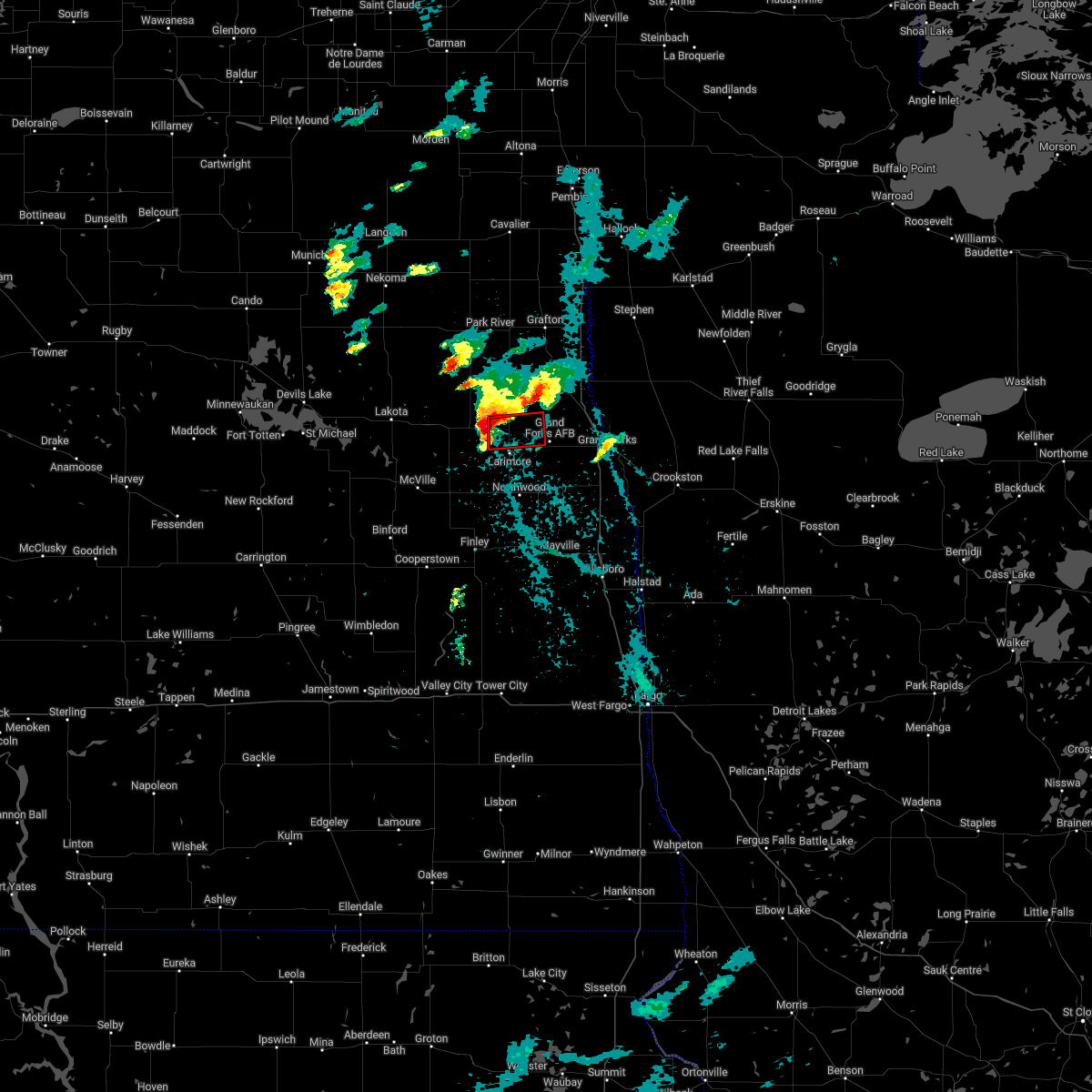 At 1001 pm cdt, a severe thunderstorm capable of producing a tornado was located over mccanna, or 30 miles west of grand forks, moving east at 15 mph (radar indicated rotation). Hazards include tornado and quarter size hail. Flying debris will be dangerous to those caught without shelter. mobile homes will be damaged or destroyed. damage to roofs, windows, and vehicles will occur. Tree damage is likely. At 1001 pm cdt, a severe thunderstorm capable of producing a tornado was located over mccanna, or 30 miles west of grand forks, moving east at 15 mph (radar indicated rotation). Hazards include tornado and quarter size hail. Flying debris will be dangerous to those caught without shelter. mobile homes will be damaged or destroyed. damage to roofs, windows, and vehicles will occur. Tree damage is likely.
|
| 5/29/2022 9:46 PM CDT |
 At 946 pm cdt, a severe thunderstorm was located near mccanna, or 31 miles southwest of grafton, moving east at 15 mph (radar indicated). Hazards include quarter size hail. Damage to vehicles is expected. this severe thunderstorm will be near, mccanna around 1000 pm cdt. other locations in the path of this severe thunderstorm include orr, inkster, gilby, honeyford and johnstown. this includes interstate 29 between mile markers 151 and 166. hail threat, radar indicated max hail size, 1. 00 in wind threat, radar indicated max wind gust, <50 mph. At 946 pm cdt, a severe thunderstorm was located near mccanna, or 31 miles southwest of grafton, moving east at 15 mph (radar indicated). Hazards include quarter size hail. Damage to vehicles is expected. this severe thunderstorm will be near, mccanna around 1000 pm cdt. other locations in the path of this severe thunderstorm include orr, inkster, gilby, honeyford and johnstown. this includes interstate 29 between mile markers 151 and 166. hail threat, radar indicated max hail size, 1. 00 in wind threat, radar indicated max wind gust, <50 mph.
|
| 5/29/2022 9:16 PM CDT |
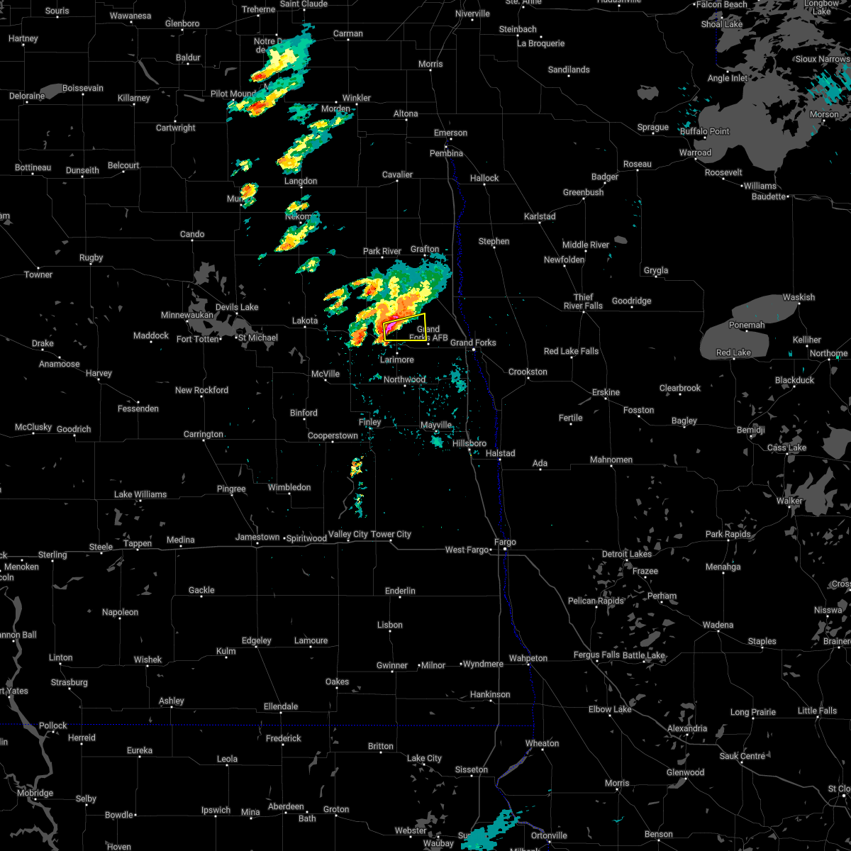 At 916 pm cdt, a severe thunderstorm was located over mccanna, or 28 miles west of grand forks, moving east at 20 mph (radar indicated). Hazards include ping pong ball size hail. People and animals outdoors will be injured. expect damage to roofs, siding, windows, and vehicles. locations impacted include, gilby, mccanna, honeyford and grand forks afb. hail threat, radar indicated max hail size, 1. 50 in wind threat, radar indicated max wind gust, <50 mph. At 916 pm cdt, a severe thunderstorm was located over mccanna, or 28 miles west of grand forks, moving east at 20 mph (radar indicated). Hazards include ping pong ball size hail. People and animals outdoors will be injured. expect damage to roofs, siding, windows, and vehicles. locations impacted include, gilby, mccanna, honeyford and grand forks afb. hail threat, radar indicated max hail size, 1. 50 in wind threat, radar indicated max wind gust, <50 mph.
|
| 5/29/2022 8:47 PM CDT |
 At 847 pm cdt, a severe thunderstorm was located over niagara, or 35 miles southwest of grafton, moving east at 15 mph (radar indicated). Hazards include ping pong ball size hail. People and animals outdoors will be injured. Expect damage to roofs, siding, windows, and vehicles. At 847 pm cdt, a severe thunderstorm was located over niagara, or 35 miles southwest of grafton, moving east at 15 mph (radar indicated). Hazards include ping pong ball size hail. People and animals outdoors will be injured. Expect damage to roofs, siding, windows, and vehicles.
|
| 4/23/2022 4:18 PM CDT |
 At 417 pm cdt, a severe thunderstorm was located over hillsboro, or 35 miles south of grand forks, moving north at 45 mph (radar indicated). Hazards include 60 mph wind gusts and quarter size hail. Hail damage to vehicles is expected. expect wind damage to roofs, siding, and trees. locations impacted include, cummings, buxton, reynolds, thompson, merrifield and grand forks. This includes interstate 29 between mile markers 99 and 141. At 417 pm cdt, a severe thunderstorm was located over hillsboro, or 35 miles south of grand forks, moving north at 45 mph (radar indicated). Hazards include 60 mph wind gusts and quarter size hail. Hail damage to vehicles is expected. expect wind damage to roofs, siding, and trees. locations impacted include, cummings, buxton, reynolds, thompson, merrifield and grand forks. This includes interstate 29 between mile markers 99 and 141.
|
| 4/23/2022 3:56 PM CDT |
 At 356 pm cdt, severe thunderstorms were located along a line extending from near sherbrooke to near cummings, moving north at 45 mph (radar indicated). Hazards include 60 mph wind gusts and penny size hail. Expect damage to roofs, siding, and trees. severe thunderstorms will be near, golden lake and buxton around 405 pm cdt. reynolds and hatton around 410 pm cdt. other locations in the path of these severe thunderstorms include northwood, thompson, kempton, grand forks and merrifield. This includes interstate 29 between mile markers 80 and 141. At 356 pm cdt, severe thunderstorms were located along a line extending from near sherbrooke to near cummings, moving north at 45 mph (radar indicated). Hazards include 60 mph wind gusts and penny size hail. Expect damage to roofs, siding, and trees. severe thunderstorms will be near, golden lake and buxton around 405 pm cdt. reynolds and hatton around 410 pm cdt. other locations in the path of these severe thunderstorms include northwood, thompson, kempton, grand forks and merrifield. This includes interstate 29 between mile markers 80 and 141.
|
| 8/9/2021 10:22 PM CDT |
 At 1021 pm cdt, severe thunderstorms were located along a line extending from near manvel to near holmes, moving east at 30 mph (radar indicated). Hazards include 70 mph wind gusts and ping pong ball size hail. People and animals outdoors will be injured. expect hail damage to roofs, siding, windows, and vehicles. expect considerable tree damage. wind damage is also likely to mobile homes, roofs, and outbuildings. locations impacted include, manvel and thompson. This includes interstate 29 between mile markers 125 and 155. At 1021 pm cdt, severe thunderstorms were located along a line extending from near manvel to near holmes, moving east at 30 mph (radar indicated). Hazards include 70 mph wind gusts and ping pong ball size hail. People and animals outdoors will be injured. expect hail damage to roofs, siding, windows, and vehicles. expect considerable tree damage. wind damage is also likely to mobile homes, roofs, and outbuildings. locations impacted include, manvel and thompson. This includes interstate 29 between mile markers 125 and 155.
|
| 8/9/2021 9:57 PM CDT |
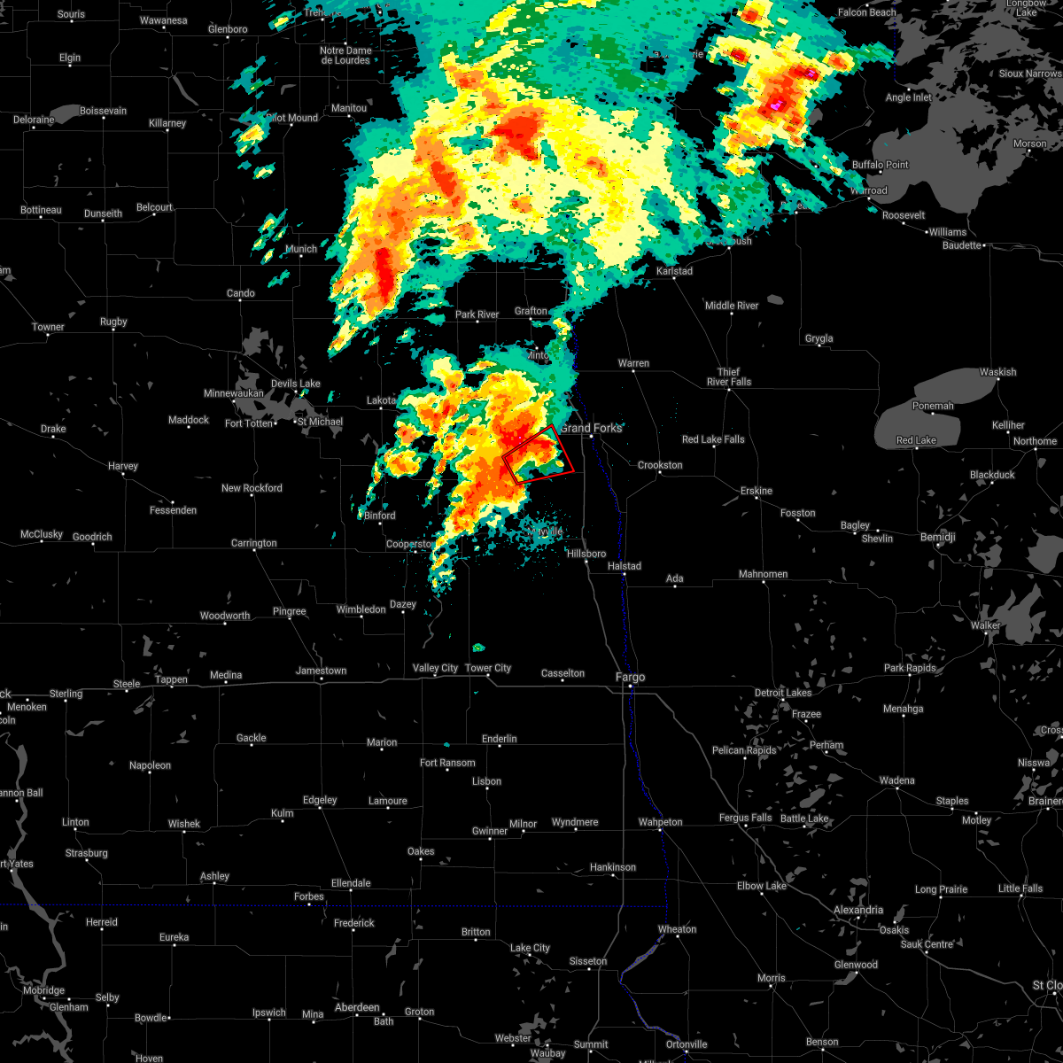 At 956 pm cdt, a severe thunderstorm capable of producing a tornado was located near northwood, or 21 miles west of grand forks, moving east at 30 mph (radar indicated rotation). Hazards include tornado and ping pong ball size hail. Flying debris will be dangerous to those caught without shelter. mobile homes will be damaged or destroyed. damage to roofs, windows, and vehicles will occur. tree damage is likely. Locations impacted include, emerado. At 956 pm cdt, a severe thunderstorm capable of producing a tornado was located near northwood, or 21 miles west of grand forks, moving east at 30 mph (radar indicated rotation). Hazards include tornado and ping pong ball size hail. Flying debris will be dangerous to those caught without shelter. mobile homes will be damaged or destroyed. damage to roofs, windows, and vehicles will occur. tree damage is likely. Locations impacted include, emerado.
|
| 8/9/2021 9:54 PM CDT |
 At 954 pm cdt, a severe thunderstorm was located near arvilla, or 22 miles west of grand forks, moving east at 25 mph (radar indicated). Hazards include 70 mph wind gusts and ping pong ball size hail. People and animals outdoors will be injured. expect hail damage to roofs, siding, windows, and vehicles. expect considerable tree damage. wind damage is also likely to mobile homes, roofs, and outbuildings. this severe thunderstorm will be near, arvilla around 1000 pm cdt. other locations in the path of this severe thunderstorm include emerado, grand forks afb, mekinock, merrifield and grand forks. This includes interstate 29 between mile markers 125 and 155. At 954 pm cdt, a severe thunderstorm was located near arvilla, or 22 miles west of grand forks, moving east at 25 mph (radar indicated). Hazards include 70 mph wind gusts and ping pong ball size hail. People and animals outdoors will be injured. expect hail damage to roofs, siding, windows, and vehicles. expect considerable tree damage. wind damage is also likely to mobile homes, roofs, and outbuildings. this severe thunderstorm will be near, arvilla around 1000 pm cdt. other locations in the path of this severe thunderstorm include emerado, grand forks afb, mekinock, merrifield and grand forks. This includes interstate 29 between mile markers 125 and 155.
|
| 8/9/2021 9:42 PM CDT |
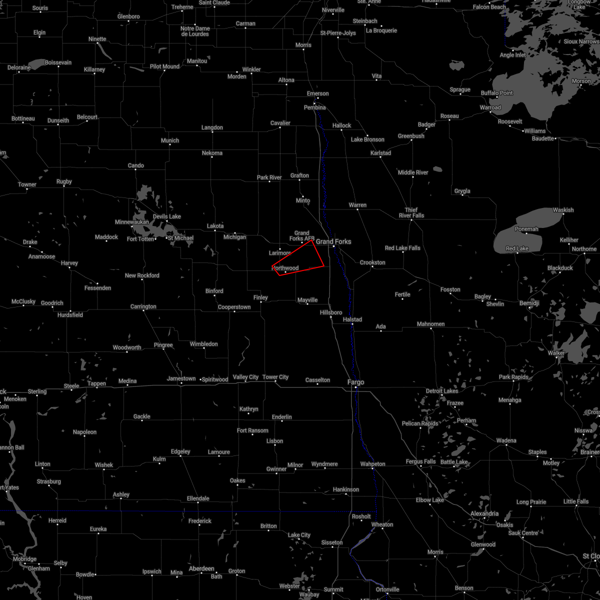 At 941 pm cdt, a severe thunderstorm capable of producing a tornado was located near northwood, or 29 miles west of grand forks, moving east at 30 mph (radar indicated rotation). Hazards include tornado and golf ball size hail. Flying debris will be dangerous to those caught without shelter. mobile homes will be damaged or destroyed. damage to roofs, windows, and vehicles will occur. tree damage is likely. this dangerous storm will be near, northwood and kempton around 950 pm cdt. Other locations in the path of this tornadic thunderstorm include emerado. At 941 pm cdt, a severe thunderstorm capable of producing a tornado was located near northwood, or 29 miles west of grand forks, moving east at 30 mph (radar indicated rotation). Hazards include tornado and golf ball size hail. Flying debris will be dangerous to those caught without shelter. mobile homes will be damaged or destroyed. damage to roofs, windows, and vehicles will occur. tree damage is likely. this dangerous storm will be near, northwood and kempton around 950 pm cdt. Other locations in the path of this tornadic thunderstorm include emerado.
|
| 6/11/2021 6:08 AM CDT |
 The severe thunderstorm warning for northern clay, norman, western pennington, western marshall, red lake, polk, western mahnomen, northwestern becker, grand forks, southeastern walsh, northeastern nelson, northeastern cass, traill and northeastern steele counties will expire at 615 am cdt, the storms which prompted the warning have weakened below severe limits, and no longer pose an immediate threat to life or property. therefore, the warning will be allowed to expire. however small hail and gusty winds are still possible with these thunderstorms. a severe thunderstorm watch remains in effect until 700 am cdt for northwestern minnesota, and southeastern and northeastern north dakota. The severe thunderstorm warning for northern clay, norman, western pennington, western marshall, red lake, polk, western mahnomen, northwestern becker, grand forks, southeastern walsh, northeastern nelson, northeastern cass, traill and northeastern steele counties will expire at 615 am cdt, the storms which prompted the warning have weakened below severe limits, and no longer pose an immediate threat to life or property. therefore, the warning will be allowed to expire. however small hail and gusty winds are still possible with these thunderstorms. a severe thunderstorm watch remains in effect until 700 am cdt for northwestern minnesota, and southeastern and northeastern north dakota.
|
| 6/11/2021 5:41 AM CDT |
 At 541 am cdt, severe thunderstorms were located along a line extending from near big woods to ada, moving east at 40 mph (radar indicated). Hazards include 60 mph wind gusts and quarter size hail. Hail damage to vehicles is expected. expect wind damage to roofs, siding, and trees. Locations impacted include, grand forks, east grand forks, crookston, grand forks afb, mayville, ada and hillsboro. At 541 am cdt, severe thunderstorms were located along a line extending from near big woods to ada, moving east at 40 mph (radar indicated). Hazards include 60 mph wind gusts and quarter size hail. Hail damage to vehicles is expected. expect wind damage to roofs, siding, and trees. Locations impacted include, grand forks, east grand forks, crookston, grand forks afb, mayville, ada and hillsboro.
|
| 6/11/2021 5:18 AM CDT |
 At 518 am cdt, severe thunderstorms were located along a line extending from near ardoch to near hendrum, moving east at 40 mph (radar indicated). Hazards include 70 mph wind gusts and quarter size hail. Hail damage to vehicles is expected. expect considerable tree damage. wind damage is also likely to mobile homes, roofs, and outbuildings. Locations impacted include, grand forks, east grand forks, crookston, grand forks afb, mayville, ada and hillsboro. At 518 am cdt, severe thunderstorms were located along a line extending from near ardoch to near hendrum, moving east at 40 mph (radar indicated). Hazards include 70 mph wind gusts and quarter size hail. Hail damage to vehicles is expected. expect considerable tree damage. wind damage is also likely to mobile homes, roofs, and outbuildings. Locations impacted include, grand forks, east grand forks, crookston, grand forks afb, mayville, ada and hillsboro.
|
| 6/11/2021 5:07 AM CDT |
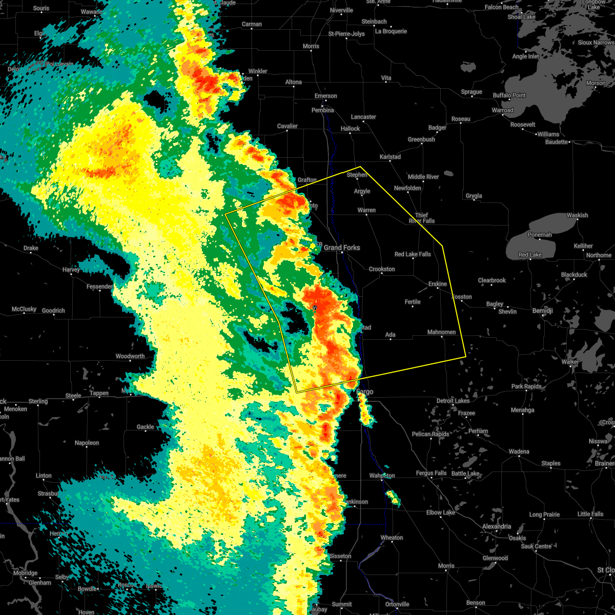 At 507 am cdt, severe thunderstorms were located along a line extending from forest river to near gardner, moving east at 40 mph (radar indicated). Hazards include 70 mph wind gusts. Expect considerable tree damage. damage is likely to mobile homes, roofs, and outbuildings. severe thunderstorms will be near, gardner and grandin around 510 am cdt. perley, poland and hendrum around 520 am cdt. warsaw around 525 am cdt. Other locations in the path of these severe thunderstorms include oslo, big woods and alvarado. At 507 am cdt, severe thunderstorms were located along a line extending from forest river to near gardner, moving east at 40 mph (radar indicated). Hazards include 70 mph wind gusts. Expect considerable tree damage. damage is likely to mobile homes, roofs, and outbuildings. severe thunderstorms will be near, gardner and grandin around 510 am cdt. perley, poland and hendrum around 520 am cdt. warsaw around 525 am cdt. Other locations in the path of these severe thunderstorms include oslo, big woods and alvarado.
|
| 6/11/2021 4:19 AM CDT |
 At 419 am cdt, severe thunderstorms were located along a line extending from mapes to 7 miles north of oriska, moving east at 70 mph. these are very dangerous storms (radar indicated). Hazards include 80 mph wind gusts. Flying debris will be dangerous to those caught without shelter. mobile homes will be heavily damaged. expect considerable damage to roofs, windows, and vehicles. Extensive tree damage and power outages are likely. At 419 am cdt, severe thunderstorms were located along a line extending from mapes to 7 miles north of oriska, moving east at 70 mph. these are very dangerous storms (radar indicated). Hazards include 80 mph wind gusts. Flying debris will be dangerous to those caught without shelter. mobile homes will be heavily damaged. expect considerable damage to roofs, windows, and vehicles. Extensive tree damage and power outages are likely.
|
| 9/2/2020 8:35 PM CDT |
 At 835 pm cdt, severe thunderstorms were located along a line extending from near alvarado to near pillsbury, moving east at 70 mph (radar indicated). Hazards include 60 mph wind gusts. expect damage to roofs, siding, and trees At 835 pm cdt, severe thunderstorms were located along a line extending from near alvarado to near pillsbury, moving east at 70 mph (radar indicated). Hazards include 60 mph wind gusts. expect damage to roofs, siding, and trees
|
| 9/2/2020 8:28 PM CDT |
 At 825 pm cdt, severe thunderstorms were located along a line extending from ardoch to near cooperstown, moving east at 60 mph (radar indicated). Hazards include 60 mph wind gusts. Expect damage to roofs, siding, and trees. locations impacted include, grand forks afb, larimore, cooperstown, northwood, golden lake, finley and emerado. This includes interstate 29 between mile markers 155 and 160. At 825 pm cdt, severe thunderstorms were located along a line extending from ardoch to near cooperstown, moving east at 60 mph (radar indicated). Hazards include 60 mph wind gusts. Expect damage to roofs, siding, and trees. locations impacted include, grand forks afb, larimore, cooperstown, northwood, golden lake, finley and emerado. This includes interstate 29 between mile markers 155 and 160.
|
| 9/2/2020 7:54 PM CDT |
 At 754 pm cdt, severe thunderstorms were located along a line extending from near dahlen to near bordulac, moving east at 60 mph (radar indicated). Hazards include 60 mph wind gusts. expect damage to roofs, siding, and trees At 754 pm cdt, severe thunderstorms were located along a line extending from near dahlen to near bordulac, moving east at 60 mph (radar indicated). Hazards include 60 mph wind gusts. expect damage to roofs, siding, and trees
|
| 8/9/2020 1:39 PM CDT |
 At 139 pm cdt, a severe thunderstorm was located over larimore, or 22 miles west of grand forks, moving east at 35 mph (radar indicated). Hazards include 60 mph wind gusts and quarter size hail. Hail damage to vehicles is expected. Expect wind damage to roofs, siding, and trees. At 139 pm cdt, a severe thunderstorm was located over larimore, or 22 miles west of grand forks, moving east at 35 mph (radar indicated). Hazards include 60 mph wind gusts and quarter size hail. Hail damage to vehicles is expected. Expect wind damage to roofs, siding, and trees.
|
| 7/25/2020 9:36 PM CDT |
 At 936 pm cdt, a severe thunderstorm was located near niagara, or 33 miles southwest of grafton, moving northeast at 20 mph (radar indicated). Hazards include 60 mph wind gusts and quarter size hail. Hail damage to vehicles is expected. expect wind damage to roofs, siding, and trees. this severe storm will be near, mccanna around 945 pm cdt. orr around 1000 pm cdt. Inkster, forest river colony and gilby around 1015 pm cdt. At 936 pm cdt, a severe thunderstorm was located near niagara, or 33 miles southwest of grafton, moving northeast at 20 mph (radar indicated). Hazards include 60 mph wind gusts and quarter size hail. Hail damage to vehicles is expected. expect wind damage to roofs, siding, and trees. this severe storm will be near, mccanna around 945 pm cdt. orr around 1000 pm cdt. Inkster, forest river colony and gilby around 1015 pm cdt.
|
| 7/25/2020 9:16 PM CDT |
 At 916 pm cdt, a severe thunderstorm was located over niagara, or 37 miles southwest of grafton, moving northeast at 20 mph (radar indicated). Hazards include 60 mph wind gusts and quarter size hail. Hail damage to vehicles is expected. expect wind damage to roofs, siding, and trees. this severe thunderstorm will be near, niagara around 920 pm cdt. mccanna around 935 pm cdt. orr around 950 pm cdt. Inkster, forest river colony and gilby around 1000 pm cdt. At 916 pm cdt, a severe thunderstorm was located over niagara, or 37 miles southwest of grafton, moving northeast at 20 mph (radar indicated). Hazards include 60 mph wind gusts and quarter size hail. Hail damage to vehicles is expected. expect wind damage to roofs, siding, and trees. this severe thunderstorm will be near, niagara around 920 pm cdt. mccanna around 935 pm cdt. orr around 950 pm cdt. Inkster, forest river colony and gilby around 1000 pm cdt.
|
| 7/24/2020 10:54 PM CDT |
 The severe thunderstorm warning for western marshall, northwestern red lake, northwestern polk, southwestern pennington and eastern grand forks counties will expire at 1100 pm cdt, the storms which prompted the warning have moved out of the area. therefore, the warning will be allowed to expire. a severe thunderstorm watch remains in effect until 1100 pm cdt for northeastern north dakota. The severe thunderstorm warning for western marshall, northwestern red lake, northwestern polk, southwestern pennington and eastern grand forks counties will expire at 1100 pm cdt, the storms which prompted the warning have moved out of the area. therefore, the warning will be allowed to expire. a severe thunderstorm watch remains in effect until 1100 pm cdt for northeastern north dakota.
|
| 7/24/2020 10:34 PM CDT |
 At 1033 pm cdt, severe thunderstorms were located along a line extending from near tabor to sherack to near key west, moving northeast at 60 mph (radar indicated). Hazards include 70 mph wind gusts and nickel size hail. Expect considerable tree damage. damage is likely to mobile homes, roofs, and outbuildings. locations impacted include, grand forks, east grand forks, grand forks afb, warren, thompson, argyle and fisher. This includes interstate 29 between mile markers 123 and 156. At 1033 pm cdt, severe thunderstorms were located along a line extending from near tabor to sherack to near key west, moving northeast at 60 mph (radar indicated). Hazards include 70 mph wind gusts and nickel size hail. Expect considerable tree damage. damage is likely to mobile homes, roofs, and outbuildings. locations impacted include, grand forks, east grand forks, grand forks afb, warren, thompson, argyle and fisher. This includes interstate 29 between mile markers 123 and 156.
|
| 7/24/2020 10:14 PM CDT |
 At 1013 pm cdt, severe thunderstorms were located along a line extending from johnstown to near thompson, moving northeast at 40 mph (radar indicated). Hazards include 60 mph wind gusts and quarter size hail. Hail damage to vehicles is expected. Expect wind damage to roofs, siding, and trees. At 1013 pm cdt, severe thunderstorms were located along a line extending from johnstown to near thompson, moving northeast at 40 mph (radar indicated). Hazards include 60 mph wind gusts and quarter size hail. Hail damage to vehicles is expected. Expect wind damage to roofs, siding, and trees.
|
| 7/17/2020 4:45 PM CDT | A tree snapped in half. photo and report posted via social medi in grand forks county ND, 5.8 miles ENE of Grand Forks AFB, ND |
| 7/17/2020 4:37 PM CDT |
 At 436 pm cdt, severe thunderstorms were located along a line extending from near herrick to near larimore, moving east at 65 mph (radar indicated). Hazards include 70 mph wind gusts and quarter size hail. Hail damage to vehicles is expected. expect considerable tree damage. wind damage is also likely to mobile homes, roofs, and outbuildings. these severe storms will be near, stephen, emerado and grand forks afb around 445 pm cdt. argyle around 450 pm cdt. florian around 455 pm cdt. old mill state park, thompson and merrifield around 500 pm cdt. bygland and mallory around 505 pm cdt. other locations impacted by these severe thunderstorms include grand forks airport. This includes interstate 29 between mile markers 125 and 181. At 436 pm cdt, severe thunderstorms were located along a line extending from near herrick to near larimore, moving east at 65 mph (radar indicated). Hazards include 70 mph wind gusts and quarter size hail. Hail damage to vehicles is expected. expect considerable tree damage. wind damage is also likely to mobile homes, roofs, and outbuildings. these severe storms will be near, stephen, emerado and grand forks afb around 445 pm cdt. argyle around 450 pm cdt. florian around 455 pm cdt. old mill state park, thompson and merrifield around 500 pm cdt. bygland and mallory around 505 pm cdt. other locations impacted by these severe thunderstorms include grand forks airport. This includes interstate 29 between mile markers 125 and 181.
|
| 7/17/2020 4:23 PM CDT |
 At 423 pm cdt, severe thunderstorms were located along a line extending from near auburn to niagara, moving southeast at 65 mph (radar indicated). Hazards include 70 mph wind gusts and quarter size hail. Hail damage to vehicles is expected. expect considerable tree damage. wind damage is also likely to mobile homes, roofs, and outbuildings. severe thunderstorms will be near, cashel and auburn around 425 pm cdt. herrick, drayton and robbin around 430 pm cdt. larimore around 435 pm cdt. arvilla and turtle river state park around 440 pm cdt. stephen, emerado and grand forks afb around 445 pm cdt. other locations impacted by these severe thunderstorms include grand forks airport. This includes interstate 29 between mile markers 125 and 187. At 423 pm cdt, severe thunderstorms were located along a line extending from near auburn to niagara, moving southeast at 65 mph (radar indicated). Hazards include 70 mph wind gusts and quarter size hail. Hail damage to vehicles is expected. expect considerable tree damage. wind damage is also likely to mobile homes, roofs, and outbuildings. severe thunderstorms will be near, cashel and auburn around 425 pm cdt. herrick, drayton and robbin around 430 pm cdt. larimore around 435 pm cdt. arvilla and turtle river state park around 440 pm cdt. stephen, emerado and grand forks afb around 445 pm cdt. other locations impacted by these severe thunderstorms include grand forks airport. This includes interstate 29 between mile markers 125 and 187.
|
| 7/8/2020 3:11 AM CDT |
 The severe thunderstorm warning for western marshall, northwestern polk, southwestern kittson, grand forks, southeastern cavalier, eastern nelson, walsh and southern pembina counties will expire at 315 am cdt, the storms which prompted the warning have weakened below severe limits, and no longer poses an immediate threat to life or property. therefore, the warning will be allowed to expire. a severe thunderstorm watch remains in effect until 600 am cdt for northwestern minnesota, and northeastern north dakota. The severe thunderstorm warning for western marshall, northwestern polk, southwestern kittson, grand forks, southeastern cavalier, eastern nelson, walsh and southern pembina counties will expire at 315 am cdt, the storms which prompted the warning have weakened below severe limits, and no longer poses an immediate threat to life or property. therefore, the warning will be allowed to expire. a severe thunderstorm watch remains in effect until 600 am cdt for northwestern minnesota, and northeastern north dakota.
|
| 7/8/2020 2:51 AM CDT |
 At 222 am cdt, severe thunderstorms were located along a line extending from near fairdale to near logan center, moving east at 50 mph (radar indicated). Hazards include 60 mph wind gusts. Expect damage to roofs, siding, and trees. severe thunderstorms will be near, logan center around 225 am cdt. union around 230 am cdt. northwood, gardar and edinburg around 235 am cdt. crystal, hoople and holmes around 245 am cdt. auburn around 250 am cdt. other locations impacted by these severe thunderstorms include grand forks airport and american crystal sugar. This includes interstate 29 between mile markers 125 and 196. At 222 am cdt, severe thunderstorms were located along a line extending from near fairdale to near logan center, moving east at 50 mph (radar indicated). Hazards include 60 mph wind gusts. Expect damage to roofs, siding, and trees. severe thunderstorms will be near, logan center around 225 am cdt. union around 230 am cdt. northwood, gardar and edinburg around 235 am cdt. crystal, hoople and holmes around 245 am cdt. auburn around 250 am cdt. other locations impacted by these severe thunderstorms include grand forks airport and american crystal sugar. This includes interstate 29 between mile markers 125 and 196.
|
| 7/8/2020 2:51 AM CDT |
 At 250 am cdt, severe thunderstorms were located along a line extending from near st. thomas to near merrifield, moving east at 50 mph (radar indicated). Hazards include 60 mph wind gusts. Expect damage to roofs, siding, and trees. these severe storms will be near, merrifield, grand forks and thompson around 255 am cdt. east grand forks and bygland around 300 am cdt. bowesmont, davidson and mallory around 305 am cdt. mattson and key west around 310 am cdt. other locations impacted by these severe thunderstorms include grand forks airport and american crystal sugar. This includes interstate 29 between mile markers 125 and 196. At 250 am cdt, severe thunderstorms were located along a line extending from near st. thomas to near merrifield, moving east at 50 mph (radar indicated). Hazards include 60 mph wind gusts. Expect damage to roofs, siding, and trees. these severe storms will be near, merrifield, grand forks and thompson around 255 am cdt. east grand forks and bygland around 300 am cdt. bowesmont, davidson and mallory around 305 am cdt. mattson and key west around 310 am cdt. other locations impacted by these severe thunderstorms include grand forks airport and american crystal sugar. This includes interstate 29 between mile markers 125 and 196.
|
| 7/8/2020 2:22 AM CDT |
 At 222 am cdt, severe thunderstorms were located along a line extending from near fairdale to near logan center, moving east at 50 mph (radar indicated). Hazards include 60 mph wind gusts. Expect damage to roofs, siding, and trees. severe thunderstorms will be near, logan center around 225 am cdt. union around 230 am cdt. northwood, gardar and edinburg around 235 am cdt. crystal, hoople and holmes around 245 am cdt. auburn around 250 am cdt. other locations impacted by these severe thunderstorms include grand forks airport and american crystal sugar. This includes interstate 29 between mile markers 125 and 196. At 222 am cdt, severe thunderstorms were located along a line extending from near fairdale to near logan center, moving east at 50 mph (radar indicated). Hazards include 60 mph wind gusts. Expect damage to roofs, siding, and trees. severe thunderstorms will be near, logan center around 225 am cdt. union around 230 am cdt. northwood, gardar and edinburg around 235 am cdt. crystal, hoople and holmes around 245 am cdt. auburn around 250 am cdt. other locations impacted by these severe thunderstorms include grand forks airport and american crystal sugar. This includes interstate 29 between mile markers 125 and 196.
|
| 6/17/2020 7:56 PM CDT | Storm damage reported in grand forks county ND, 0 miles SSW of Grand Forks AFB, ND |
| 6/17/2020 7:39 PM CDT |
 At 738 pm cdt, severe thunderstorms were located along a line extending from near manvel to near grand forks to clifford, moving northeast at 55 mph (trained weather spotters reported damage near golden lake). Hazards include 70 mph wind gusts and quarter size hail. Hail damage to vehicles is expected. expect considerable tree damage. wind damage is also likely to mobile homes, roofs, and outbuildings. severe thunderstorms will be near, manvel, east grand forks and grand forks around 740 pm cdt. poland around 745 pm cdt. oslo and mayville around 750 pm cdt. tabor, alvarado and big woods around 755 pm cdt. march around 800 pm cdt. other locations impacted by these severe thunderstorms include grand forks airport. This includes interstate 29 between mile markers 118 and 168. At 738 pm cdt, severe thunderstorms were located along a line extending from near manvel to near grand forks to clifford, moving northeast at 55 mph (trained weather spotters reported damage near golden lake). Hazards include 70 mph wind gusts and quarter size hail. Hail damage to vehicles is expected. expect considerable tree damage. wind damage is also likely to mobile homes, roofs, and outbuildings. severe thunderstorms will be near, manvel, east grand forks and grand forks around 740 pm cdt. poland around 745 pm cdt. oslo and mayville around 750 pm cdt. tabor, alvarado and big woods around 755 pm cdt. march around 800 pm cdt. other locations impacted by these severe thunderstorms include grand forks airport. This includes interstate 29 between mile markers 118 and 168.
|
| 6/8/2020 5:28 PM CDT |
 At 528 pm cdt, a severe thunderstorm was located over mekinock, or 12 miles northwest of grand forks, moving northeast at 40 mph (radar indicated). Hazards include 70 mph wind gusts and half dollar size hail. Hail damage to vehicles is expected. expect considerable tree damage. Wind damage is also likely to mobile homes, roofs, and outbuildings. At 528 pm cdt, a severe thunderstorm was located over mekinock, or 12 miles northwest of grand forks, moving northeast at 40 mph (radar indicated). Hazards include 70 mph wind gusts and half dollar size hail. Hail damage to vehicles is expected. expect considerable tree damage. Wind damage is also likely to mobile homes, roofs, and outbuildings.
|
| 6/8/2020 5:15 PM CDT | Half Dollar sized hail reported 5.8 miles ENE of Grand Forks AFB, ND |
| 6/8/2020 5:12 PM CDT |
 At 511 pm cdt, a severe thunderstorm capable of producing a tornado was located near emerado, or 16 miles west of grand forks, moving east at 35 mph (radar indicated rotation). Hazards include tornado and hail up to two inches in diameter. Expect damage to mobile homes, roofs, and vehicles. this dangerous storm will be near, emerado around 515 pm cdt. grand forks and merrifield around 535 pm cdt. east grand forks around 545 pm cdt. other locations impacted by this tornadic thunderstorm include grand forks airport. This includes interstate 29 between mile markers 133 and 145. At 511 pm cdt, a severe thunderstorm capable of producing a tornado was located near emerado, or 16 miles west of grand forks, moving east at 35 mph (radar indicated rotation). Hazards include tornado and hail up to two inches in diameter. Expect damage to mobile homes, roofs, and vehicles. this dangerous storm will be near, emerado around 515 pm cdt. grand forks and merrifield around 535 pm cdt. east grand forks around 545 pm cdt. other locations impacted by this tornadic thunderstorm include grand forks airport. This includes interstate 29 between mile markers 133 and 145.
|
| 6/8/2020 5:02 PM CDT |
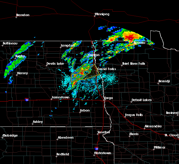 At 502 pm cdt, a severe thunderstorm capable of producing a tornado was located near kempton, or 21 miles west of grand forks, moving northeast at 35 mph (radar indicated rotation). Hazards include tornado and hail up to two inches in diameter. expect damage to mobile homes, roofs, and vehicles At 502 pm cdt, a severe thunderstorm capable of producing a tornado was located near kempton, or 21 miles west of grand forks, moving northeast at 35 mph (radar indicated rotation). Hazards include tornado and hail up to two inches in diameter. expect damage to mobile homes, roofs, and vehicles
|
| 6/8/2020 4:52 PM CDT |
 At 451 pm cdt, a severe thunderstorm was located over kempton, or 27 miles west of grand forks, moving northeast at 30 mph (radar indicated). Hazards include 70 mph wind gusts and half dollar size hail. Hail damage to vehicles is expected. expect considerable tree damage. Wind damage is also likely to mobile homes, roofs, and outbuildings. At 451 pm cdt, a severe thunderstorm was located over kempton, or 27 miles west of grand forks, moving northeast at 30 mph (radar indicated). Hazards include 70 mph wind gusts and half dollar size hail. Hail damage to vehicles is expected. expect considerable tree damage. Wind damage is also likely to mobile homes, roofs, and outbuildings.
|
| 6/8/2020 4:34 PM CDT |
 At 433 pm cdt, a severe thunderstorm was located near logan center, or 35 miles west of grand forks, moving northeast at 35 mph (radar indicated). Hazards include 70 mph wind gusts and half dollar size hail. Hail damage to vehicles is expected. expect considerable tree damage. wind damage is also likely to mobile homes, roofs, and outbuildings. Locations impacted include, grand forks afb, larimore, northwood, emerado, gilby, aneta and arvilla. At 433 pm cdt, a severe thunderstorm was located near logan center, or 35 miles west of grand forks, moving northeast at 35 mph (radar indicated). Hazards include 70 mph wind gusts and half dollar size hail. Hail damage to vehicles is expected. expect considerable tree damage. wind damage is also likely to mobile homes, roofs, and outbuildings. Locations impacted include, grand forks afb, larimore, northwood, emerado, gilby, aneta and arvilla.
|
| 6/8/2020 4:25 PM CDT |
 At 425 pm cdt, a severe thunderstorm was located near sharon, or 40 miles southwest of grand forks, moving northeast at 35 mph (radar indicated). Hazards include 70 mph wind gusts and half dollar size hail. Hail damage to vehicles is expected. expect considerable tree damage. Wind damage is also likely to mobile homes, roofs, and outbuildings. At 425 pm cdt, a severe thunderstorm was located near sharon, or 40 miles southwest of grand forks, moving northeast at 35 mph (radar indicated). Hazards include 70 mph wind gusts and half dollar size hail. Hail damage to vehicles is expected. expect considerable tree damage. Wind damage is also likely to mobile homes, roofs, and outbuildings.
|
| 6/7/2020 9:34 PM CDT |
 At 933 pm cdt, severe thunderstorms were located along a line extending from near fordville to near grand forks to near eldred, moving northeast at 45 mph (radar indicated). Hazards include 70 mph wind gusts and quarter size hail. a wind gust of 63 mph was reported at the grand forks international airport. Hail damage to vehicles is expected. expect considerable tree damage. wind damage is also likely to mobile homes, roofs, and outbuildings. these severe storms will be near, manvel around 935 pm cdt. veseleyville and fisher around 945 pm cdt. voss, tabor and forest river around 950 pm cdt. minto and march around 955 pm cdt. warren, grafton and angus around 1000 pm cdt. other locations impacted by these severe thunderstorms include grand forks airport. This includes interstate 29 between mile markers 119 and 185. At 933 pm cdt, severe thunderstorms were located along a line extending from near fordville to near grand forks to near eldred, moving northeast at 45 mph (radar indicated). Hazards include 70 mph wind gusts and quarter size hail. a wind gust of 63 mph was reported at the grand forks international airport. Hail damage to vehicles is expected. expect considerable tree damage. wind damage is also likely to mobile homes, roofs, and outbuildings. these severe storms will be near, manvel around 935 pm cdt. veseleyville and fisher around 945 pm cdt. voss, tabor and forest river around 950 pm cdt. minto and march around 955 pm cdt. warren, grafton and angus around 1000 pm cdt. other locations impacted by these severe thunderstorms include grand forks airport. This includes interstate 29 between mile markers 119 and 185.
|
| 6/7/2020 9:17 PM CDT |
 At 917 pm cdt, severe thunderstorms were located along a line extending from near whitman to honeyford to near reynolds, moving northeast at 45 mph (radar indicated). Hazards include 70 mph wind gusts and quarter size hail. Hail damage to vehicles is expected. expect considerable tree damage. wind damage is also likely to mobile homes, roofs, and outbuildings. severe thunderstorms will be near, gilby, honeyford and mekinock around 920 pm cdt. johnstown around 925 pm cdt. lankin and thompson around 930 pm cdt. ardoch, poland and merrifield around 935 pm cdt. mallory, park river and oslo around 940 pm cdt. other locations impacted by these severe thunderstorms include grand forks airport. This includes interstate 29 between mile markers 119 and 185. At 917 pm cdt, severe thunderstorms were located along a line extending from near whitman to honeyford to near reynolds, moving northeast at 45 mph (radar indicated). Hazards include 70 mph wind gusts and quarter size hail. Hail damage to vehicles is expected. expect considerable tree damage. wind damage is also likely to mobile homes, roofs, and outbuildings. severe thunderstorms will be near, gilby, honeyford and mekinock around 920 pm cdt. johnstown around 925 pm cdt. lankin and thompson around 930 pm cdt. ardoch, poland and merrifield around 935 pm cdt. mallory, park river and oslo around 940 pm cdt. other locations impacted by these severe thunderstorms include grand forks airport. This includes interstate 29 between mile markers 119 and 185.
|
| 6/7/2020 9:01 PM CDT |
 At 901 pm cdt, severe thunderstorms were located along a line extending from 6 miles south of petersburg to near larimore to near northwood, moving northeast at 60 mph (radar indicated). Hazards include 70 mph wind gusts and quarter size hail. Hail damage to vehicles is expected. expect considerable tree damage. wind damage is also likely to mobile homes, roofs, and outbuildings. these severe storms will be near, larimore around 905 pm cdt. niagara, mccanna and turtle river state park around 910 pm cdt. emerado, dahlen and honeyford around 915 pm cdt. grand forks afb, gilby and mekinock around 920 pm cdt. This includes interstate 29 near mile marker 151. At 901 pm cdt, severe thunderstorms were located along a line extending from 6 miles south of petersburg to near larimore to near northwood, moving northeast at 60 mph (radar indicated). Hazards include 70 mph wind gusts and quarter size hail. Hail damage to vehicles is expected. expect considerable tree damage. wind damage is also likely to mobile homes, roofs, and outbuildings. these severe storms will be near, larimore around 905 pm cdt. niagara, mccanna and turtle river state park around 910 pm cdt. emerado, dahlen and honeyford around 915 pm cdt. grand forks afb, gilby and mekinock around 920 pm cdt. This includes interstate 29 near mile marker 151.
|
| 6/7/2020 8:38 PM CDT |
 At 838 pm cdt, severe thunderstorms were located along a line extending from near jessie to sherbrooke, moving northeast at 45 mph (radar indicated). Hazards include 70 mph wind gusts and quarter size hail. Hail damage to vehicles is expected. expect considerable tree damage. wind damage is also likely to mobile homes, roofs, and outbuildings. severe thunderstorms will be near, sherbrooke and finley around 840 pm cdt. golden lake around 850 pm cdt. mcville, kloten and aneta around 900 pm cdt. northwood around 905 pm cdt. kempton around 910 pm cdt. This includes interstate 29 near mile marker 151. At 838 pm cdt, severe thunderstorms were located along a line extending from near jessie to sherbrooke, moving northeast at 45 mph (radar indicated). Hazards include 70 mph wind gusts and quarter size hail. Hail damage to vehicles is expected. expect considerable tree damage. wind damage is also likely to mobile homes, roofs, and outbuildings. severe thunderstorms will be near, sherbrooke and finley around 840 pm cdt. golden lake around 850 pm cdt. mcville, kloten and aneta around 900 pm cdt. northwood around 905 pm cdt. kempton around 910 pm cdt. This includes interstate 29 near mile marker 151.
|
| 6/7/2020 2:01 AM CDT |
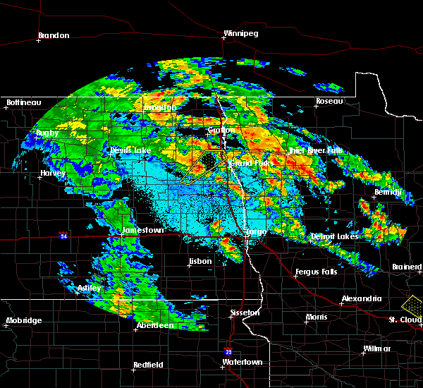 At 201 am cdt, a severe thunderstorm was located near arvilla, or 22 miles west of grand forks, moving northeast at 45 mph (radar indicated). Hazards include 60 mph wind gusts and quarter size hail. Hail damage to vehicles is expected. expect wind damage to roofs, siding, and trees. locations impacted include, grand forks afb, emerado, manvel, gilby, arvilla, mekinock and honeyford. This includes interstate 29 between mile markers 150 and 160. At 201 am cdt, a severe thunderstorm was located near arvilla, or 22 miles west of grand forks, moving northeast at 45 mph (radar indicated). Hazards include 60 mph wind gusts and quarter size hail. Hail damage to vehicles is expected. expect wind damage to roofs, siding, and trees. locations impacted include, grand forks afb, emerado, manvel, gilby, arvilla, mekinock and honeyford. This includes interstate 29 between mile markers 150 and 160.
|
| 6/7/2020 1:46 AM CDT |
 At 146 am cdt, a severe thunderstorm was located near northwood, or 31 miles west of grand forks, moving northeast at 45 mph (radar indicated). Hazards include ping pong ball size hail and 60 mph wind gusts. People and animals outdoors will be injured. expect hail damage to roofs, siding, windows, and vehicles. Expect wind damage to roofs, siding, and trees. At 146 am cdt, a severe thunderstorm was located near northwood, or 31 miles west of grand forks, moving northeast at 45 mph (radar indicated). Hazards include ping pong ball size hail and 60 mph wind gusts. People and animals outdoors will be injured. expect hail damage to roofs, siding, windows, and vehicles. Expect wind damage to roofs, siding, and trees.
|
| 9/20/2019 7:56 PM CDT | Storm damage reported in grand forks county ND, 0 miles SSW of Grand Forks AFB, ND |
| 9/20/2019 7:49 PM CDT |
 At 747 pm cdt, a severe thunderstorm was located over emerado, or 12 miles west of grand forks, moving north at 50 mph (trained weather spotters estimated 60 to 70 mph wind gusts approximately 10 miles south of grand forks). Hazards include 70 mph wind gusts and quarter size hail. Hail damage to vehicles is expected. expect considerable tree damage. wind damage is also likely to mobile homes, roofs, and outbuildings. locations impacted include, grand forks, east grand forks, grand forks afb, larimore, thompson, northwood and hatton. This includes interstate 29 between mile markers 109 and 153. At 747 pm cdt, a severe thunderstorm was located over emerado, or 12 miles west of grand forks, moving north at 50 mph (trained weather spotters estimated 60 to 70 mph wind gusts approximately 10 miles south of grand forks). Hazards include 70 mph wind gusts and quarter size hail. Hail damage to vehicles is expected. expect considerable tree damage. wind damage is also likely to mobile homes, roofs, and outbuildings. locations impacted include, grand forks, east grand forks, grand forks afb, larimore, thompson, northwood and hatton. This includes interstate 29 between mile markers 109 and 153.
|
| 9/20/2019 7:33 PM CDT |
 At 732 pm cdt, a severe thunderstorm was located near hatton, or 22 miles southwest of grand forks, moving north at 45 mph (radar indicated). Hazards include 70 mph wind gusts and quarter size hail. Hail damage to vehicles is expected. expect considerable tree damage. Wind damage is also likely to mobile homes, roofs, and outbuildings. At 732 pm cdt, a severe thunderstorm was located near hatton, or 22 miles southwest of grand forks, moving north at 45 mph (radar indicated). Hazards include 70 mph wind gusts and quarter size hail. Hail damage to vehicles is expected. expect considerable tree damage. Wind damage is also likely to mobile homes, roofs, and outbuildings.
|
| 7/13/2019 8:47 PM CDT |
 At 847 pm cdt, a severe thunderstorm was located over honeyford, or 20 miles northwest of grand forks, moving south at 15 mph (radar indicated). Hazards include 60 mph wind gusts and nickel size hail. Expect damage to roofs, siding, and trees. Locations impacted include, gilby, mekinock, johnstown, honeyford and grand forks afb. At 847 pm cdt, a severe thunderstorm was located over honeyford, or 20 miles northwest of grand forks, moving south at 15 mph (radar indicated). Hazards include 60 mph wind gusts and nickel size hail. Expect damage to roofs, siding, and trees. Locations impacted include, gilby, mekinock, johnstown, honeyford and grand forks afb.
|
| 7/13/2019 8:29 PM CDT |
 At 828 pm cdt, a severe thunderstorm was located over johnstown, or 20 miles south of grafton, moving south at 15 mph (radar indicated). Hazards include 60 mph wind gusts and quarter size hail. Hail damage to vehicles is expected. Expect wind damage to roofs, siding, and trees. At 828 pm cdt, a severe thunderstorm was located over johnstown, or 20 miles south of grafton, moving south at 15 mph (radar indicated). Hazards include 60 mph wind gusts and quarter size hail. Hail damage to vehicles is expected. Expect wind damage to roofs, siding, and trees.
|
| 7/8/2019 7:38 PM CDT |
 At 738 pm cdt, severe thunderstorms were located along a line extending from near manvel to merrifield to 6 miles northeast of mayville, moving east at 50 mph (radar indicated). Hazards include 70 mph wind gusts and penny size hail. Expect considerable tree damage. damage is likely to mobile homes, roofs, and outbuildings. locations impacted include, grand forks, east grand forks, crookston, grand forks afb, mayville, warren and red lake falls. This includes interstate 29 between mile markers 110 and 166. At 738 pm cdt, severe thunderstorms were located along a line extending from near manvel to merrifield to 6 miles northeast of mayville, moving east at 50 mph (radar indicated). Hazards include 70 mph wind gusts and penny size hail. Expect considerable tree damage. damage is likely to mobile homes, roofs, and outbuildings. locations impacted include, grand forks, east grand forks, crookston, grand forks afb, mayville, warren and red lake falls. This includes interstate 29 between mile markers 110 and 166.
|
| 7/8/2019 7:07 PM CDT |
 At 707 pm cdt, severe thunderstorms were located along a line extending from near orr to near kempton to near sherbrooke, moving east at 65 mph. these are very dangerous storms (radar indicated). Hazards include 80 mph wind gusts and nickel size hail. Flying debris will be dangerous to those caught without shelter. mobile homes will be heavily damaged. expect considerable damage to roofs, windows, and vehicles. Extensive tree damage and power outages are likely. At 707 pm cdt, severe thunderstorms were located along a line extending from near orr to near kempton to near sherbrooke, moving east at 65 mph. these are very dangerous storms (radar indicated). Hazards include 80 mph wind gusts and nickel size hail. Flying debris will be dangerous to those caught without shelter. mobile homes will be heavily damaged. expect considerable damage to roofs, windows, and vehicles. Extensive tree damage and power outages are likely.
|
| 7/8/2019 7:07 PM CDT |
 The national weather service in grand forks has issued a * severe thunderstorm warning for. southwestern marshall county in northwestern minnesota. western red lake county in northwestern minnesota. polk county in northwestern minnesota. Western pennington county in northwestern minnesota. The national weather service in grand forks has issued a * severe thunderstorm warning for. southwestern marshall county in northwestern minnesota. western red lake county in northwestern minnesota. polk county in northwestern minnesota. Western pennington county in northwestern minnesota.
|
| 6/29/2019 10:59 AM CDT |
 At 1058 am cdt, severe thunderstorms were located along a line extending from near forest river to northwood to 6 miles north of luverne, moving east at 35 mph (radar indicated). Hazards include 60 mph wind gusts and penny size hail. Expect damage to roofs, siding, and trees. these severe storms will be near, northwood, inkster and kempton around 1100 am cdt. forest river, johnstown and hatton around 1105 am cdt. ardoch, holmes and blabon around 1115 am cdt. poland, hope and sherbrooke around 1120 am cdt. thompson and reynolds around 1130 am cdt. other locations impacted by these severe thunderstorms include grand forks airport. This includes interstate 29 between mile markers 122 and 165. At 1058 am cdt, severe thunderstorms were located along a line extending from near forest river to northwood to 6 miles north of luverne, moving east at 35 mph (radar indicated). Hazards include 60 mph wind gusts and penny size hail. Expect damage to roofs, siding, and trees. these severe storms will be near, northwood, inkster and kempton around 1100 am cdt. forest river, johnstown and hatton around 1105 am cdt. ardoch, holmes and blabon around 1115 am cdt. poland, hope and sherbrooke around 1120 am cdt. thompson and reynolds around 1130 am cdt. other locations impacted by these severe thunderstorms include grand forks airport. This includes interstate 29 between mile markers 122 and 165.
|
| 6/29/2019 10:39 AM CDT |
 At 1039 am cdt, severe thunderstorms were located along a line extending from forest river colony to 6 miles southeast of logan center to hannaford, moving east at 35 mph (radar indicated). Hazards include 60 mph wind gusts and penny size hail. Expect damage to roofs, siding, and trees. severe thunderstorms will be near, forest river colony, fordville and logan center around 1040 am cdt. conway, inkster and orr around 1045 am cdt. northwood and kempton around 1050 am cdt. forest river, johnstown and hatton around 1100 am cdt. ardoch and blabon around 1110 am cdt. other locations impacted by these severe thunderstorms include grand forks airport. This includes interstate 29 between mile markers 122 and 165. At 1039 am cdt, severe thunderstorms were located along a line extending from forest river colony to 6 miles southeast of logan center to hannaford, moving east at 35 mph (radar indicated). Hazards include 60 mph wind gusts and penny size hail. Expect damage to roofs, siding, and trees. severe thunderstorms will be near, forest river colony, fordville and logan center around 1040 am cdt. conway, inkster and orr around 1045 am cdt. northwood and kempton around 1050 am cdt. forest river, johnstown and hatton around 1100 am cdt. ardoch and blabon around 1110 am cdt. other locations impacted by these severe thunderstorms include grand forks airport. This includes interstate 29 between mile markers 122 and 165.
|
| 5/15/2019 8:28 PM CDT | Ping Pong Ball sized hail reported 4 miles SSW of Grand Forks AFB, ND, report received via social media. |
| 5/15/2019 8:17 PM CDT |
 At 817 pm cdt, a severe thunderstorm was located over mekinock, or 15 miles northwest of grand forks, moving east at 50 mph (radar indicated). Hazards include 60 mph wind gusts and quarter size hail. Hail damage to vehicles is expected. Expect wind damage to roofs, siding, and trees. At 817 pm cdt, a severe thunderstorm was located over mekinock, or 15 miles northwest of grand forks, moving east at 50 mph (radar indicated). Hazards include 60 mph wind gusts and quarter size hail. Hail damage to vehicles is expected. Expect wind damage to roofs, siding, and trees.
|
| 8/26/2018 10:33 PM CDT |
 At 1016 pm cdt, severe thunderstorms were located along a line extending from bathgate to near logan center, moving east at 50 mph (radar indicated). Hazards include 70 mph wind gusts and quarter size hail. Expect considerable tree damage. wind damage is also likely to mobile homes, roofs, and outbuildings. locations impacted include, grand forks, grafton, east grand forks, grand forks afb, park river, larimore and cavalier. This includes interstate 29 between mile markers 128 and 217. At 1016 pm cdt, severe thunderstorms were located along a line extending from bathgate to near logan center, moving east at 50 mph (radar indicated). Hazards include 70 mph wind gusts and quarter size hail. Expect considerable tree damage. wind damage is also likely to mobile homes, roofs, and outbuildings. locations impacted include, grand forks, grafton, east grand forks, grand forks afb, park river, larimore and cavalier. This includes interstate 29 between mile markers 128 and 217.
|
| 8/26/2018 10:33 PM CDT |
 At 1032 pm cdt, severe thunderstorms were located along a line extending from near joliette to northwood, moving east at 50 mph (public). Hazards include 70 mph wind gusts and quarter size hail. Hail damage to vehicles is expected. expect considerable tree damage. wind damage is also likely to mobile homes, roofs, and outbuildings. locations impacted include, grand forks, grafton, east grand forks, grand forks afb, larimore, thompson and hallock. This includes interstate 29 between mile markers 128 and 217. At 1032 pm cdt, severe thunderstorms were located along a line extending from near joliette to northwood, moving east at 50 mph (public). Hazards include 70 mph wind gusts and quarter size hail. Hail damage to vehicles is expected. expect considerable tree damage. wind damage is also likely to mobile homes, roofs, and outbuildings. locations impacted include, grand forks, grafton, east grand forks, grand forks afb, larimore, thompson and hallock. This includes interstate 29 between mile markers 128 and 217.
|
| 8/26/2018 10:17 PM CDT |
 At 1016 pm cdt, severe thunderstorms were located along a line extending from bathgate to near logan center, moving east at 50 mph (radar indicated). Hazards include 70 mph wind gusts and quarter size hail. Expect considerable tree damage. wind damage is also likely to mobile homes, roofs, and outbuildings. locations impacted include, grand forks, grafton, east grand forks, grand forks afb, park river, larimore and cavalier. This includes interstate 29 between mile markers 128 and 217. At 1016 pm cdt, severe thunderstorms were located along a line extending from bathgate to near logan center, moving east at 50 mph (radar indicated). Hazards include 70 mph wind gusts and quarter size hail. Expect considerable tree damage. wind damage is also likely to mobile homes, roofs, and outbuildings. locations impacted include, grand forks, grafton, east grand forks, grand forks afb, park river, larimore and cavalier. This includes interstate 29 between mile markers 128 and 217.
|
| 8/26/2018 9:58 PM CDT |
 The national weather service in grand forks has issued a * severe thunderstorm warning for. western marshall county in northwestern minnesota. northwestern polk county in northwestern minnesota. western kittson county in northwestern minnesota. Grand forks county in northeastern north dakota. The national weather service in grand forks has issued a * severe thunderstorm warning for. western marshall county in northwestern minnesota. northwestern polk county in northwestern minnesota. western kittson county in northwestern minnesota. Grand forks county in northeastern north dakota.
|
| 7/22/2018 6:07 PM CDT | Storm damage reported in grand forks county ND, 0 miles SSW of Grand Forks AFB, ND |
| 7/8/2018 5:31 AM CDT |
 At 530 am cdt, a severe thunderstorm was located over grand forks and east grand forks, moving east at 50 mph (radar indicated). Hazards include 70 mph wind gusts and quarter size hail. Hail damage to vehicles is expected. expect considerable tree damage. wind damage is also likely to mobile homes, roofs, and outbuildings. this severe storm will be near, tabor around 535 am cdt. sherack and key west around 540 am cdt. euclid and angus around 545 am cdt. other locations impacted by this severe thunderstorm include grand forks airport. This includes interstate 29 between mile markers 124 and 160. At 530 am cdt, a severe thunderstorm was located over grand forks and east grand forks, moving east at 50 mph (radar indicated). Hazards include 70 mph wind gusts and quarter size hail. Hail damage to vehicles is expected. expect considerable tree damage. wind damage is also likely to mobile homes, roofs, and outbuildings. this severe storm will be near, tabor around 535 am cdt. sherack and key west around 540 am cdt. euclid and angus around 545 am cdt. other locations impacted by this severe thunderstorm include grand forks airport. This includes interstate 29 between mile markers 124 and 160.
|
| 7/8/2018 5:12 AM CDT |
 At 512 am cdt, a severe thunderstorm was located near emerado, or 8 miles west of grand forks, moving east at 50 mph. this is a very dangerous storm (trained weather spotters). Hazards include 80 mph wind gusts and nickel size hail. Flying debris will be dangerous to those caught without shelter. mobile homes will be heavily damaged. expect considerable damage to roofs, windows, and vehicles. extensive tree damage and power outages are likely. this severe storm will be near, grand forks and merrifield around 520 am cdt. east grand forks around 525 am cdt. mallory around 530 am cdt. davidson and tabor around 535 am cdt. sherack and key west around 540 am cdt. other locations impacted by this severe thunderstorm include grand forks airport. This includes interstate 29 between mile markers 124 and 160. At 512 am cdt, a severe thunderstorm was located near emerado, or 8 miles west of grand forks, moving east at 50 mph. this is a very dangerous storm (trained weather spotters). Hazards include 80 mph wind gusts and nickel size hail. Flying debris will be dangerous to those caught without shelter. mobile homes will be heavily damaged. expect considerable damage to roofs, windows, and vehicles. extensive tree damage and power outages are likely. this severe storm will be near, grand forks and merrifield around 520 am cdt. east grand forks around 525 am cdt. mallory around 530 am cdt. davidson and tabor around 535 am cdt. sherack and key west around 540 am cdt. other locations impacted by this severe thunderstorm include grand forks airport. This includes interstate 29 between mile markers 124 and 160.
|
| 7/8/2018 4:52 AM CDT |
 At 451 am cdt, a severe thunderstorm was located over kempton, or 24 miles west of grand forks, moving east at 55 mph. this is a very dangerous storm (trained weather spotters and radar). Hazards include 80 mph wind gusts and nickel size hail. Flying debris will be dangerous to those caught without shelter. mobile homes will be heavily damaged. expect considerable damage to roofs, windows, and vehicles. extensive tree damage and power outages are likely. this severe thunderstorm will be near, arvilla and turtle river state park around 500 am cdt. emerado around 505 am cdt. grand forks afb around 510 am cdt. grand forks and merrifield around 520 am cdt. east grand forks and mallory around 530 am cdt. other locations impacted by this severe thunderstorm include grand forks airport. This includes interstate 29 between mile markers 124 and 160. At 451 am cdt, a severe thunderstorm was located over kempton, or 24 miles west of grand forks, moving east at 55 mph. this is a very dangerous storm (trained weather spotters and radar). Hazards include 80 mph wind gusts and nickel size hail. Flying debris will be dangerous to those caught without shelter. mobile homes will be heavily damaged. expect considerable damage to roofs, windows, and vehicles. extensive tree damage and power outages are likely. this severe thunderstorm will be near, arvilla and turtle river state park around 500 am cdt. emerado around 505 am cdt. grand forks afb around 510 am cdt. grand forks and merrifield around 520 am cdt. east grand forks and mallory around 530 am cdt. other locations impacted by this severe thunderstorm include grand forks airport. This includes interstate 29 between mile markers 124 and 160.
|
| 7/4/2018 4:25 AM CDT |
 The severe thunderstorm warning for western red lake, clay, norman, southwestern polk, northeastern wilkin, southeastern grand forks, cass, traill and eastern steele counties will expire at 430 am cdt, the storms which prompted the warning have weakened. therefore, the warning will be allowed to expire. however gusty winds are still possible with these thunderstorms. a severe thunderstorm watch remains in effect until 900 am cdt for northwestern and west central minnesota, and southeastern and northeastern north dakota. The severe thunderstorm warning for western red lake, clay, norman, southwestern polk, northeastern wilkin, southeastern grand forks, cass, traill and eastern steele counties will expire at 430 am cdt, the storms which prompted the warning have weakened. therefore, the warning will be allowed to expire. however gusty winds are still possible with these thunderstorms. a severe thunderstorm watch remains in effect until 900 am cdt for northwestern and west central minnesota, and southeastern and northeastern north dakota.
|
| 7/4/2018 3:51 AM CDT |
 At 350 am cdt, severe thunderstorms were located along a line extending from near grand forks to near leonard, moving east at 50 mph (radar indicated). Hazards include 60 mph wind gusts and quarter size hail. Hail damage to vehicles is expected. expect wind damage to roofs, siding, and trees. these severe storms will be near, east grand forks and mallory around 355 am cdt. davidson around 400 am cdt. key west, west fargo, and horace around 405 am cdt. fargo, hickson, and wild rice around 410 am cdt. comstock and rustad around 415 am cdt. other locations impacted by these severe thunderstorms include casselton airport, american crystal sugar, moorhead airport, grand forks airport and west argusville. this includes the following highways, interstate 29 between mile markers 49 and 143. interstate 94 in north dakota between mile markers 318 and 352. Interstate 94 in minnesota between mile markers 1 and 27. At 350 am cdt, severe thunderstorms were located along a line extending from near grand forks to near leonard, moving east at 50 mph (radar indicated). Hazards include 60 mph wind gusts and quarter size hail. Hail damage to vehicles is expected. expect wind damage to roofs, siding, and trees. these severe storms will be near, east grand forks and mallory around 355 am cdt. davidson around 400 am cdt. key west, west fargo, and horace around 405 am cdt. fargo, hickson, and wild rice around 410 am cdt. comstock and rustad around 415 am cdt. other locations impacted by these severe thunderstorms include casselton airport, american crystal sugar, moorhead airport, grand forks airport and west argusville. this includes the following highways, interstate 29 between mile markers 49 and 143. interstate 94 in north dakota between mile markers 318 and 352. Interstate 94 in minnesota between mile markers 1 and 27.
|
| 7/4/2018 3:27 AM CDT |
 At 326 am cdt, severe thunderstorms were located along a line extending from near loma to near pisek to honeyford, moving northeast at 65 mph (radar indicated). Hazards include 60 mph wind gusts and nickel size hail. Expect damage to roofs, siding, and trees. severe thunderstorms will be near, pisek, gilby and honeyford around 330 am cdt. veseleyville, mandt and ardoch around 335 am cdt. manvel, poland and nash around 340 am cdt. grafton, olga and oslo around 345 am cdt. alvarado, oakwood and cashel around 350 am cdt. other locations impacted by these severe thunderstorms include american crystal sugar and grand forks airport. This includes interstate 29 between mile markers 144 and 216. At 326 am cdt, severe thunderstorms were located along a line extending from near loma to near pisek to honeyford, moving northeast at 65 mph (radar indicated). Hazards include 60 mph wind gusts and nickel size hail. Expect damage to roofs, siding, and trees. severe thunderstorms will be near, pisek, gilby and honeyford around 330 am cdt. veseleyville, mandt and ardoch around 335 am cdt. manvel, poland and nash around 340 am cdt. grafton, olga and oslo around 345 am cdt. alvarado, oakwood and cashel around 350 am cdt. other locations impacted by these severe thunderstorms include american crystal sugar and grand forks airport. This includes interstate 29 between mile markers 144 and 216.
|
| 7/4/2018 3:24 AM CDT |
 The national weather service in grand forks has issued a * severe thunderstorm warning for. western red lake county in northwestern minnesota. clay county in northwestern minnesota. norman county in northwestern minnesota. Southwestern polk county in northwestern minnesota. The national weather service in grand forks has issued a * severe thunderstorm warning for. western red lake county in northwestern minnesota. clay county in northwestern minnesota. norman county in northwestern minnesota. Southwestern polk county in northwestern minnesota.
|
| 7/4/2018 3:24 AM CDT |
 At 324 am cdt, severe thunderstorms were located along a line extending from near turtle river state park to near sheldon, moving east at 60 mph (radar indicated). Hazards include 60 mph wind gusts and quarter size hail. Hail damage to vehicles is expected. expect wind damage to roofs, siding, and trees. severe thunderstorms will be near, grand forks afb, leonard and emerado around 330 am cdt. davenport, grand forks and merrifield around 340 am cdt. east grand forks and kindred around 345 am cdt. hickson, mallory and davidson around 350 am cdt. comstock, key west and oxbow around 355 am cdt. other locations impacted by these severe thunderstorms include casselton airport, american crystal sugar, moorhead airport, grand forks airport and west argusville. this includes the following highways, interstate 29 between mile markers 49 and 143. interstate 94 in north dakota between mile markers 318 and 352. Interstate 94 in minnesota between mile markers 1 and 27. At 324 am cdt, severe thunderstorms were located along a line extending from near turtle river state park to near sheldon, moving east at 60 mph (radar indicated). Hazards include 60 mph wind gusts and quarter size hail. Hail damage to vehicles is expected. expect wind damage to roofs, siding, and trees. severe thunderstorms will be near, grand forks afb, leonard and emerado around 330 am cdt. davenport, grand forks and merrifield around 340 am cdt. east grand forks and kindred around 345 am cdt. hickson, mallory and davidson around 350 am cdt. comstock, key west and oxbow around 355 am cdt. other locations impacted by these severe thunderstorms include casselton airport, american crystal sugar, moorhead airport, grand forks airport and west argusville. this includes the following highways, interstate 29 between mile markers 49 and 143. interstate 94 in north dakota between mile markers 318 and 352. Interstate 94 in minnesota between mile markers 1 and 27.
|
| 7/4/2018 3:17 AM CDT |
 At 316 am cdt, severe thunderstorms were located along a line extending from near hampden to near whitman, moving northeast at 50 mph (radar indicated). Hazards include 60 mph wind gusts and nickel size hail. Expect damage to roofs, siding, and trees. these severe storms will be near, dahlen and whitman around 320 am cdt. Lankin and fordville around 330 am cdt. At 316 am cdt, severe thunderstorms were located along a line extending from near hampden to near whitman, moving northeast at 50 mph (radar indicated). Hazards include 60 mph wind gusts and nickel size hail. Expect damage to roofs, siding, and trees. these severe storms will be near, dahlen and whitman around 320 am cdt. Lankin and fordville around 330 am cdt.
|
| 7/4/2018 3:01 AM CDT |
 At 301 am cdt, severe thunderstorms were located along a line extending from near starkweather to near mapes, moving northeast at 50 mph (radar indicated). Hazards include 60 mph wind gusts and nickel size hail. Expect damage to roofs, siding, and trees. these severe storms will be near, mapes and michigan around 305 am cdt. whitman around 310 am cdt. hampden around 315 am cdt. alsen and dahlen around 320 am cdt. Loma, lankin and fordville around 325 am cdt. At 301 am cdt, severe thunderstorms were located along a line extending from near starkweather to near mapes, moving northeast at 50 mph (radar indicated). Hazards include 60 mph wind gusts and nickel size hail. Expect damage to roofs, siding, and trees. these severe storms will be near, mapes and michigan around 305 am cdt. whitman around 310 am cdt. hampden around 315 am cdt. alsen and dahlen around 320 am cdt. Loma, lankin and fordville around 325 am cdt.
|
| 7/4/2018 2:57 AM CDT |
 At 256 am cdt, severe thunderstorms were located along a line extending from near petersburg to nome, moving east at 70 mph (radar indicated). Hazards include 70 mph wind gusts and quarter size hail. Hail damage to vehicles is expected. expect considerable tree damage. wind damage is also likely to mobile homes, roofs, and outbuildings. these severe storms will be near, lucca around 300 am cdt. larimore and alice around 310 am cdt. turtle river state park, chaffee and arvilla around 315 am cdt. grand forks afb and leonard around 320 am cdt. This includes interstate 94 in north dakota between mile markers 287 and 327. At 256 am cdt, severe thunderstorms were located along a line extending from near petersburg to nome, moving east at 70 mph (radar indicated). Hazards include 70 mph wind gusts and quarter size hail. Hail damage to vehicles is expected. expect considerable tree damage. wind damage is also likely to mobile homes, roofs, and outbuildings. these severe storms will be near, lucca around 300 am cdt. larimore and alice around 310 am cdt. turtle river state park, chaffee and arvilla around 315 am cdt. grand forks afb and leonard around 320 am cdt. This includes interstate 94 in north dakota between mile markers 287 and 327.
|
| 7/4/2018 2:37 AM CDT |
 At 236 am cdt, severe thunderstorms were located along a line extending from near churchs ferry to near hamar, moving northeast at 50 mph (radar indicated). Hazards include 60 mph wind gusts and nickel size hail. Expect damage to roofs, siding, and trees. severe thunderstorms will be near, doyon around 245 am cdt. bartlett around 250 am cdt. lakota and garske around 255 am cdt. starkweather, mapes and michigan around 300 am cdt. Whitman around 310 am cdt. At 236 am cdt, severe thunderstorms were located along a line extending from near churchs ferry to near hamar, moving northeast at 50 mph (radar indicated). Hazards include 60 mph wind gusts and nickel size hail. Expect damage to roofs, siding, and trees. severe thunderstorms will be near, doyon around 245 am cdt. bartlett around 250 am cdt. lakota and garske around 255 am cdt. starkweather, mapes and michigan around 300 am cdt. Whitman around 310 am cdt.
|
| 7/4/2018 2:33 AM CDT |
 At 232 am cdt, severe thunderstorms were located along a line extending from near hamar to near marion, moving east at 60 mph (radar indicated). Hazards include 70 mph wind gusts and quarter size hail. Hail damage to vehicles is expected. expect considerable tree damage. wind damage is also likely to mobile homes, roofs, and outbuildings. severe thunderstorms will be near, tolna around 235 am cdt. litchville around 240 am cdt. hastings around 245 am cdt. kathryn around 250 am cdt. nome around 255 am cdt. This includes interstate 94 in north dakota between mile markers 272 and 327. At 232 am cdt, severe thunderstorms were located along a line extending from near hamar to near marion, moving east at 60 mph (radar indicated). Hazards include 70 mph wind gusts and quarter size hail. Hail damage to vehicles is expected. expect considerable tree damage. wind damage is also likely to mobile homes, roofs, and outbuildings. severe thunderstorms will be near, tolna around 235 am cdt. litchville around 240 am cdt. hastings around 245 am cdt. kathryn around 250 am cdt. nome around 255 am cdt. This includes interstate 94 in north dakota between mile markers 272 and 327.
|
| 6/29/2018 4:17 AM CDT |
 At 416 am cdt, severe thunderstorms were located along a line extending from near pisek to near poland to near key west, moving northeast at 60 mph. these are very dangerous storms (observed. at 412 am...80 mph winds were reported at the grand forks regional airport). Hazards include 80 mph wind gusts and quarter size hail. Flying debris will be dangerous to those caught without shelter. mobile homes will be heavily damaged. expect considerable damage to roofs, windows, and vehicles. extensive tree damage and power outages are likely. these severe storms will be near, key west, poland and davidson around 420 am cdt. oslo, euclid and sherack around 425 am cdt. nash, alvarado and angus around 430 am cdt. auburn and grafton around 435 am cdt. argyle and cashel around 440 am cdt. other locations impacted by these severe thunderstorms include grand forks airport. This includes interstate 29 between mile markers 131 and 184. At 416 am cdt, severe thunderstorms were located along a line extending from near pisek to near poland to near key west, moving northeast at 60 mph. these are very dangerous storms (observed. at 412 am...80 mph winds were reported at the grand forks regional airport). Hazards include 80 mph wind gusts and quarter size hail. Flying debris will be dangerous to those caught without shelter. mobile homes will be heavily damaged. expect considerable damage to roofs, windows, and vehicles. extensive tree damage and power outages are likely. these severe storms will be near, key west, poland and davidson around 420 am cdt. oslo, euclid and sherack around 425 am cdt. nash, alvarado and angus around 430 am cdt. auburn and grafton around 435 am cdt. argyle and cashel around 440 am cdt. other locations impacted by these severe thunderstorms include grand forks airport. This includes interstate 29 between mile markers 131 and 184.
|
| 6/29/2018 4:05 AM CDT |
 At 404 am cdt, severe thunderstorms were located along a line extending from near lankin to honeyford to near thompson, moving northeast at 60 mph (radar indicated. at 358 pm...70 mph winds were reported 5 miles west-northwest of larimore). Hazards include 70 mph wind gusts and quarter size hail. Hail damage to vehicles is expected. expect considerable tree damage. wind damage is also likely to mobile homes, roofs, and outbuildings. these severe storms will be near, honeyford, gilby and thompson around 405 am cdt. merrifield, grand forks and johnstown around 410 am cdt. east grand forks, park river and ardoch around 415 am cdt. poland, mandt and oslo around 420 am cdt. sherack, big woods and nash around 425 am cdt. other locations impacted by these severe thunderstorms include grand forks airport. This includes interstate 29 between mile markers 131 and 184. At 404 am cdt, severe thunderstorms were located along a line extending from near lankin to honeyford to near thompson, moving northeast at 60 mph (radar indicated. at 358 pm...70 mph winds were reported 5 miles west-northwest of larimore). Hazards include 70 mph wind gusts and quarter size hail. Hail damage to vehicles is expected. expect considerable tree damage. wind damage is also likely to mobile homes, roofs, and outbuildings. these severe storms will be near, honeyford, gilby and thompson around 405 am cdt. merrifield, grand forks and johnstown around 410 am cdt. east grand forks, park river and ardoch around 415 am cdt. poland, mandt and oslo around 420 am cdt. sherack, big woods and nash around 425 am cdt. other locations impacted by these severe thunderstorms include grand forks airport. This includes interstate 29 between mile markers 131 and 184.
|
| 6/29/2018 3:58 AM CDT |
 At 358 am cdt, severe thunderstorms were located along a line extending from 6 miles northeast of whitman to holmes, moving northeast at 50 mph (radar indicated). Hazards include 60 mph wind gusts and quarter size hail. Hail damage to vehicles is expected. expect wind damage to roofs, siding, and trees. severe thunderstorms will be near, fordville around 405 am cdt. thompson around 410 am cdt. merrifield, grand forks and park river around 415 am cdt. east grand forks and mallory around 420 am cdt. mandt and davidson around 425 am cdt. other locations impacted by these severe thunderstorms include grand forks airport. This includes interstate 29 between mile markers 131 and 184. At 358 am cdt, severe thunderstorms were located along a line extending from 6 miles northeast of whitman to holmes, moving northeast at 50 mph (radar indicated). Hazards include 60 mph wind gusts and quarter size hail. Hail damage to vehicles is expected. expect wind damage to roofs, siding, and trees. severe thunderstorms will be near, fordville around 405 am cdt. thompson around 410 am cdt. merrifield, grand forks and park river around 415 am cdt. east grand forks and mallory around 420 am cdt. mandt and davidson around 425 am cdt. other locations impacted by these severe thunderstorms include grand forks airport. This includes interstate 29 between mile markers 131 and 184.
|
| 6/28/2018 4:20 PM CDT |
 At 403 pm cdt, a severe thunderstorm was located over mekinock, or 16 miles west of grand forks, moving east at 25 mph (radar indicated). Hazards include 60 mph wind gusts and half dollar size hail. Hail damage to vehicles is expected. expect wind damage to roofs, siding, and trees. this severe storm will be near, emerado around 405 pm cdt. mekinock around 410 pm cdt. manvel around 430 pm cdt. other locations impacted by this severe thunderstorm include grand forks airport. This includes interstate 29 between mile markers 140 and 160. At 403 pm cdt, a severe thunderstorm was located over mekinock, or 16 miles west of grand forks, moving east at 25 mph (radar indicated). Hazards include 60 mph wind gusts and half dollar size hail. Hail damage to vehicles is expected. expect wind damage to roofs, siding, and trees. this severe storm will be near, emerado around 405 pm cdt. mekinock around 410 pm cdt. manvel around 430 pm cdt. other locations impacted by this severe thunderstorm include grand forks airport. This includes interstate 29 between mile markers 140 and 160.
|
| 6/28/2018 4:20 PM CDT |
 At 419 pm cdt, a severe thunderstorm was located near manvel, or 9 miles northwest of grand forks, moving east at 35 mph (radar indicated). Hazards include 60 mph wind gusts and quarter size hail. Hail damage to vehicles is expected. expect wind damage to roofs, siding, and trees. this severe thunderstorm will remain over mainly rural areas of northwestern polk and central grand forks counties, including the following locations, grand forks airport. This includes interstate 29 between mile markers 141 and 156. At 419 pm cdt, a severe thunderstorm was located near manvel, or 9 miles northwest of grand forks, moving east at 35 mph (radar indicated). Hazards include 60 mph wind gusts and quarter size hail. Hail damage to vehicles is expected. expect wind damage to roofs, siding, and trees. this severe thunderstorm will remain over mainly rural areas of northwestern polk and central grand forks counties, including the following locations, grand forks airport. This includes interstate 29 between mile markers 141 and 156.
|
| 6/28/2018 4:04 PM CDT |
 At 403 pm cdt, a severe thunderstorm was located over mekinock, or 16 miles west of grand forks, moving east at 25 mph (radar indicated). Hazards include 60 mph wind gusts and half dollar size hail. Hail damage to vehicles is expected. expect wind damage to roofs, siding, and trees. this severe storm will be near, emerado around 405 pm cdt. mekinock around 410 pm cdt. manvel around 430 pm cdt. other locations impacted by this severe thunderstorm include grand forks airport. This includes interstate 29 between mile markers 140 and 160. At 403 pm cdt, a severe thunderstorm was located over mekinock, or 16 miles west of grand forks, moving east at 25 mph (radar indicated). Hazards include 60 mph wind gusts and half dollar size hail. Hail damage to vehicles is expected. expect wind damage to roofs, siding, and trees. this severe storm will be near, emerado around 405 pm cdt. mekinock around 410 pm cdt. manvel around 430 pm cdt. other locations impacted by this severe thunderstorm include grand forks airport. This includes interstate 29 between mile markers 140 and 160.
|
| 6/28/2018 3:41 PM CDT |
 The severe thunderstorm warning for southwestern grand forks county will expire at 345 pm cdt, the storm which prompted the warning has moved out of the area. therefore, the warning will be allowed to expire. a severe thunderstorm watch remains in effect until 900 pm cdt for southeastern and northeastern north dakota. to report severe weather, contact your nearest law enforcement agency. they will relay your report to the national weather service grand forks. remember, a severe thunderstorm warning still remains in effect for portions of walsh, grand forks, and polk counties until 430 pm cdt. The severe thunderstorm warning for southwestern grand forks county will expire at 345 pm cdt, the storm which prompted the warning has moved out of the area. therefore, the warning will be allowed to expire. a severe thunderstorm watch remains in effect until 900 pm cdt for southeastern and northeastern north dakota. to report severe weather, contact your nearest law enforcement agency. they will relay your report to the national weather service grand forks. remember, a severe thunderstorm warning still remains in effect for portions of walsh, grand forks, and polk counties until 430 pm cdt.
|
| 6/28/2018 3:40 PM CDT |
 At 340 pm cdt, a severe thunderstorm was located over larimore, or 25 miles west of grand forks, moving northeast at 25 mph (law enforcement. law enforcement reported golf ball sized hail 3 miles east of larimore). Hazards include two inch hail and 60 mph wind gusts. People and animals outdoors will be injured. expect hail damage to roofs, siding, windows, and vehicles. expect wind damage to roofs, siding, and trees. this severe thunderstorm will be near, turtle river state park and arvilla around 350 pm cdt. honeyford and emerado around 400 pm cdt. mekinock, gilby and grand forks afb around 405 pm cdt. manvel and poland around 430 pm cdt. other locations impacted by this severe thunderstorm include grand forks airport. This includes interstate 29 between mile markers 140 and 160. At 340 pm cdt, a severe thunderstorm was located over larimore, or 25 miles west of grand forks, moving northeast at 25 mph (law enforcement. law enforcement reported golf ball sized hail 3 miles east of larimore). Hazards include two inch hail and 60 mph wind gusts. People and animals outdoors will be injured. expect hail damage to roofs, siding, windows, and vehicles. expect wind damage to roofs, siding, and trees. this severe thunderstorm will be near, turtle river state park and arvilla around 350 pm cdt. honeyford and emerado around 400 pm cdt. mekinock, gilby and grand forks afb around 405 pm cdt. manvel and poland around 430 pm cdt. other locations impacted by this severe thunderstorm include grand forks airport. This includes interstate 29 between mile markers 140 and 160.
|
| 6/28/2018 3:23 PM CDT |
 At 323 pm cdt, a severe thunderstorm was located over kempton, or 26 miles west of grand forks, moving northeast at 30 mph (radar indicated). Hazards include ping pong ball size hail and 60 mph wind gusts. People and animals outdoors will be injured. expect hail damage to roofs, siding, windows, and vehicles. expect wind damage to roofs, siding, and trees. this severe storm will be near, larimore around 330 pm cdt. arvilla and turtle river state park around 340 pm cdt. Emerado, grand forks afb and mekinock around 345 pm cdt. At 323 pm cdt, a severe thunderstorm was located over kempton, or 26 miles west of grand forks, moving northeast at 30 mph (radar indicated). Hazards include ping pong ball size hail and 60 mph wind gusts. People and animals outdoors will be injured. expect hail damage to roofs, siding, windows, and vehicles. expect wind damage to roofs, siding, and trees. this severe storm will be near, larimore around 330 pm cdt. arvilla and turtle river state park around 340 pm cdt. Emerado, grand forks afb and mekinock around 345 pm cdt.
|
| 6/28/2018 3:05 PM CDT |
 At 305 pm cdt, a severe thunderstorm was located over logan center, or 35 miles west of grand forks, moving east at 35 mph (radar indicated). Hazards include ping pong ball size hail and 60 mph wind gusts. People and animals outdoors will be injured. expect hail damage to roofs, siding, windows, and vehicles. expect wind damage to roofs, siding, and trees. this severe thunderstorm will be near, kempton and larimore around 320 pm cdt. northwood around 325 pm cdt. arvilla around 330 pm cdt. Emerado around 340 pm cdt. At 305 pm cdt, a severe thunderstorm was located over logan center, or 35 miles west of grand forks, moving east at 35 mph (radar indicated). Hazards include ping pong ball size hail and 60 mph wind gusts. People and animals outdoors will be injured. expect hail damage to roofs, siding, windows, and vehicles. expect wind damage to roofs, siding, and trees. this severe thunderstorm will be near, kempton and larimore around 320 pm cdt. northwood around 325 pm cdt. arvilla around 330 pm cdt. Emerado around 340 pm cdt.
|
| 6/8/2018 5:53 PM CDT |
 The tornado warning for east central grand forks county will expire at 600 pm cdt, the storm which prompted the warning has weakened below severe limits, and no longer appears capable of producing a tornado. therefore, the warning will be allowed to expire. The tornado warning for east central grand forks county will expire at 600 pm cdt, the storm which prompted the warning has weakened below severe limits, and no longer appears capable of producing a tornado. therefore, the warning will be allowed to expire.
|
| 6/8/2018 5:31 PM CDT |
 At 530 pm cdt, a severe thunderstorm capable of producing a tornado was located near emerado, or 8 miles west of grand forks, moving east at 20 mph (weather spotters reported a funnel cloud). Hazards include tornado and quarter size hail. Expect damage to mobile homes, roofs, and vehicles. this dangerous storm will be near, grand forks and merrifield around 550 pm cdt. other locations impacted by this tornadic thunderstorm include grand forks airport. This includes interstate 29 between mile markers 133 and 147. At 530 pm cdt, a severe thunderstorm capable of producing a tornado was located near emerado, or 8 miles west of grand forks, moving east at 20 mph (weather spotters reported a funnel cloud). Hazards include tornado and quarter size hail. Expect damage to mobile homes, roofs, and vehicles. this dangerous storm will be near, grand forks and merrifield around 550 pm cdt. other locations impacted by this tornadic thunderstorm include grand forks airport. This includes interstate 29 between mile markers 133 and 147.
|
| 6/8/2018 5:13 PM CDT |
 At 512 pm cdt, a confirmed tornado was located near emerado, or 14 miles west of grand forks, moving east at 20 mph (public confirmed tornado). Hazards include tornado and quarter size hail. Expect damage to mobile homes, roofs, and vehicles. the tornado will be near, emerado and the grand forks air force base around 515 pm cdt. grand forks and merrifield around 550 pm cdt. other locations impacted by this tornadic thunderstorm include grand forks airport. This includes interstate 29 between mile markers 133 and 147. At 512 pm cdt, a confirmed tornado was located near emerado, or 14 miles west of grand forks, moving east at 20 mph (public confirmed tornado). Hazards include tornado and quarter size hail. Expect damage to mobile homes, roofs, and vehicles. the tornado will be near, emerado and the grand forks air force base around 515 pm cdt. grand forks and merrifield around 550 pm cdt. other locations impacted by this tornadic thunderstorm include grand forks airport. This includes interstate 29 between mile markers 133 and 147.
|
| 7/11/2017 6:01 PM CDT |
 At 600 pm cdt, a severe thunderstorm capable of producing a tornado was located near larimore, or 31 miles west of grand forks, moving east at 25 mph (radar indicated rotation. a wall cloud was reported 6 miles west of larimore at 557 pm cdt). Hazards include tornado and quarter size hail. Expect damage to mobile homes, roofs, and vehicles. this dangerous storm will be near, larimore around 615 pm cdt. kempton around 620 pm cdt. turtle river state park around 625 pm cdt. arvilla around 630 pm cdt. Emerado around 640 pm cdt. At 600 pm cdt, a severe thunderstorm capable of producing a tornado was located near larimore, or 31 miles west of grand forks, moving east at 25 mph (radar indicated rotation. a wall cloud was reported 6 miles west of larimore at 557 pm cdt). Hazards include tornado and quarter size hail. Expect damage to mobile homes, roofs, and vehicles. this dangerous storm will be near, larimore around 615 pm cdt. kempton around 620 pm cdt. turtle river state park around 625 pm cdt. arvilla around 630 pm cdt. Emerado around 640 pm cdt.
|
| 7/11/2017 5:46 PM CDT |
 At 545 pm cdt, a severe thunderstorm was located near forest river colony, or 25 miles southwest of grafton, moving east at 30 mph (radar indicated). Hazards include 60 mph wind gusts and quarter size hail. Hail damage to vehicles is expected. expect wind damage to roofs, siding, and trees. this severe thunderstorm will be near, orr around 550 pm cdt. inkster around 555 pm cdt. other locations impacted by this severe thunderstorm include grand forks airport. this includes interstate 29 between mile markers 150 and 151. A tornado watch remains in effect until 1100 pm cdt for northeastern north dakota. At 545 pm cdt, a severe thunderstorm was located near forest river colony, or 25 miles southwest of grafton, moving east at 30 mph (radar indicated). Hazards include 60 mph wind gusts and quarter size hail. Hail damage to vehicles is expected. expect wind damage to roofs, siding, and trees. this severe thunderstorm will be near, orr around 550 pm cdt. inkster around 555 pm cdt. other locations impacted by this severe thunderstorm include grand forks airport. this includes interstate 29 between mile markers 150 and 151. A tornado watch remains in effect until 1100 pm cdt for northeastern north dakota.
|
| 6/13/2017 9:55 PM CDT |
 At 954 pm cdt, severe thunderstorms were located along a line extending from 6 miles northeast of northwood to melvin, moving north at 60 mph (radar indicated). Hazards include 60 mph wind gusts and penny size hail. Expect damage to roofs, siding, and trees. these severe storms will be near, kempton around 955 pm cdt. harold and dugdale around 1000 pm cdt. arvilla, emerado and grand forks afb around 1005 pm cdt. mekinock, honeyford and gentilly around 1010 pm cdt. gilby, red lake falls and huot around 1015 pm cdt. This includes interstate 29 between mile markers 106 and 153. At 954 pm cdt, severe thunderstorms were located along a line extending from 6 miles northeast of northwood to melvin, moving north at 60 mph (radar indicated). Hazards include 60 mph wind gusts and penny size hail. Expect damage to roofs, siding, and trees. these severe storms will be near, kempton around 955 pm cdt. harold and dugdale around 1000 pm cdt. arvilla, emerado and grand forks afb around 1005 pm cdt. mekinock, honeyford and gentilly around 1010 pm cdt. gilby, red lake falls and huot around 1015 pm cdt. This includes interstate 29 between mile markers 106 and 153.
|
| 6/13/2017 9:24 PM CDT |
 At 923 pm cdt, severe thunderstorms were located along a line extending from near clifford to near borup, moving north at 60 mph (radar indicated). Hazards include 60 mph wind gusts and penny size hail. Expect damage to roofs, siding, and trees. severe thunderstorms will be near, clifford around 925 pm cdt. twin valley and roseville around 930 pm cdt. ada, portland and golden lake around 935 pm cdt. gary, hadler and lockhart around 940 pm cdt. hatton and flaming around 945 pm cdt. This includes interstate 29 between mile markers 85 and 153. At 923 pm cdt, severe thunderstorms were located along a line extending from near clifford to near borup, moving north at 60 mph (radar indicated). Hazards include 60 mph wind gusts and penny size hail. Expect damage to roofs, siding, and trees. severe thunderstorms will be near, clifford around 925 pm cdt. twin valley and roseville around 930 pm cdt. ada, portland and golden lake around 935 pm cdt. gary, hadler and lockhart around 940 pm cdt. hatton and flaming around 945 pm cdt. This includes interstate 29 between mile markers 85 and 153.
|
| 6/10/2017 6:42 AM CDT |
 The severe thunderstorm warning for western marshall, northwestern polk, grand forks, southeastern cavalier, northeastern nelson, walsh and pembina counties will expire at 645 am cdt, the storms which prompted the warning have weakened below severe limits, and no longer poses an immediate threat to life or property. therefore the warning will be allowed to expire. however small hail and gusty winds are still possible with these thunderstorms. The severe thunderstorm warning for western marshall, northwestern polk, grand forks, southeastern cavalier, northeastern nelson, walsh and pembina counties will expire at 645 am cdt, the storms which prompted the warning have weakened below severe limits, and no longer poses an immediate threat to life or property. therefore the warning will be allowed to expire. however small hail and gusty winds are still possible with these thunderstorms.
|
| 6/10/2017 6:33 AM CDT |
 At 633 am cdt, severe thunderstorms were located along a line extending from near mountain to near northwood, moving northeast at 20 mph (radar indicated). Hazards include 60 mph wind gusts and penny size hail. Expect damage to roofs, siding, and trees. locations impacted include, grand forks, grafton, east grand forks, grand forks afb, park river, larimore and cavalier. This includes interstate 29 between mile markers 132 and 209. At 633 am cdt, severe thunderstorms were located along a line extending from near mountain to near northwood, moving northeast at 20 mph (radar indicated). Hazards include 60 mph wind gusts and penny size hail. Expect damage to roofs, siding, and trees. locations impacted include, grand forks, grafton, east grand forks, grand forks afb, park river, larimore and cavalier. This includes interstate 29 between mile markers 132 and 209.
|
| 6/10/2017 6:20 AM CDT |
 At 620 am cdt, severe thunderstorms were located along a line extending from near milton to near northwood, moving northeast at 45 mph (radar indicated). Hazards include 60 mph wind gusts and penny size hail. Expect damage to roofs, siding, and trees. locations impacted include, grand forks, grafton, east grand forks, grand forks afb, park river, larimore and cavalier. This includes interstate 29 between mile markers 124 and 209. At 620 am cdt, severe thunderstorms were located along a line extending from near milton to near northwood, moving northeast at 45 mph (radar indicated). Hazards include 60 mph wind gusts and penny size hail. Expect damage to roofs, siding, and trees. locations impacted include, grand forks, grafton, east grand forks, grand forks afb, park river, larimore and cavalier. This includes interstate 29 between mile markers 124 and 209.
|
| 6/10/2017 6:20 AM CDT |
 A severe thunderstorm warning remains in effect until 645 am cdt for western marshall. northwestern polk. grand forks. southeastern cavalier. northeastern nelson. walsh and pembina counties. At 620 am cdt, severe thunderstorms were located along a line extending from near milton to near northwood, moving northeast at 45 mph. A severe thunderstorm warning remains in effect until 645 am cdt for western marshall. northwestern polk. grand forks. southeastern cavalier. northeastern nelson. walsh and pembina counties. At 620 am cdt, severe thunderstorms were located along a line extending from near milton to near northwood, moving northeast at 45 mph.
|
| 6/10/2017 6:20 AM CDT |
 At 620 am cdt, severe thunderstorms were located along a line extending from near milton to near northwood, moving northeast at 45 mph (radar indicated). Hazards include 60 mph wind gusts and penny size hail. Expect damage to roofs, siding, and trees. locations impacted include, grand forks, grafton, east grand forks, grand forks afb, park river, larimore and cavalier. This includes interstate 29 between mile markers 124 and 209. At 620 am cdt, severe thunderstorms were located along a line extending from near milton to near northwood, moving northeast at 45 mph (radar indicated). Hazards include 60 mph wind gusts and penny size hail. Expect damage to roofs, siding, and trees. locations impacted include, grand forks, grafton, east grand forks, grand forks afb, park river, larimore and cavalier. This includes interstate 29 between mile markers 124 and 209.
|
| 6/10/2017 6:07 AM CDT |
 At 607 am cdt, severe thunderstorms were located along a line extending from near fairdale to near golden lake, moving northeast at 50 mph (radar indicated). Hazards include 60 mph wind gusts and penny size hail. expect damage to roofs, siding, and trees At 607 am cdt, severe thunderstorms were located along a line extending from near fairdale to near golden lake, moving northeast at 50 mph (radar indicated). Hazards include 60 mph wind gusts and penny size hail. expect damage to roofs, siding, and trees
|
| 6/10/2017 4:45 AM CDT |
 At 445 am cdt, severe thunderstorms were located along a line extending from near mccanna to 6 miles west of portland, moving northeast at 45 mph (radar indicated). Hazards include 60 mph wind gusts and quarter size hail. Hail damage to vehicles is expected. Expect wind damage to roofs, siding, and trees. At 445 am cdt, severe thunderstorms were located along a line extending from near mccanna to 6 miles west of portland, moving northeast at 45 mph (radar indicated). Hazards include 60 mph wind gusts and quarter size hail. Hail damage to vehicles is expected. Expect wind damage to roofs, siding, and trees.
|
| 6/10/2017 4:30 AM CDT |
 At 430 am cdt, severe thunderstorms were located along a line extending from near mccanna to golden lake, moving northeast at 45 mph (radar indicated). Hazards include 60 mph wind gusts and nickel size hail. Expect damage to roofs, siding, and trees. Locations impacted include, larimore, northwood, hatton, golden lake, gilby, arvilla and kempton. At 430 am cdt, severe thunderstorms were located along a line extending from near mccanna to golden lake, moving northeast at 45 mph (radar indicated). Hazards include 60 mph wind gusts and nickel size hail. Expect damage to roofs, siding, and trees. Locations impacted include, larimore, northwood, hatton, golden lake, gilby, arvilla and kempton.
|
| 6/10/2017 4:08 AM CDT |
 At 407 am cdt, severe thunderstorms were located along a line extending from 7 miles northeast of mcville to near finley, moving northeast at 45 mph (radar indicated). Hazards include 60 mph wind gusts and penny size hail. expect damage to roofs, siding, and trees At 407 am cdt, severe thunderstorms were located along a line extending from 7 miles northeast of mcville to near finley, moving northeast at 45 mph (radar indicated). Hazards include 60 mph wind gusts and penny size hail. expect damage to roofs, siding, and trees
|
| 6/7/2017 2:05 PM CDT |
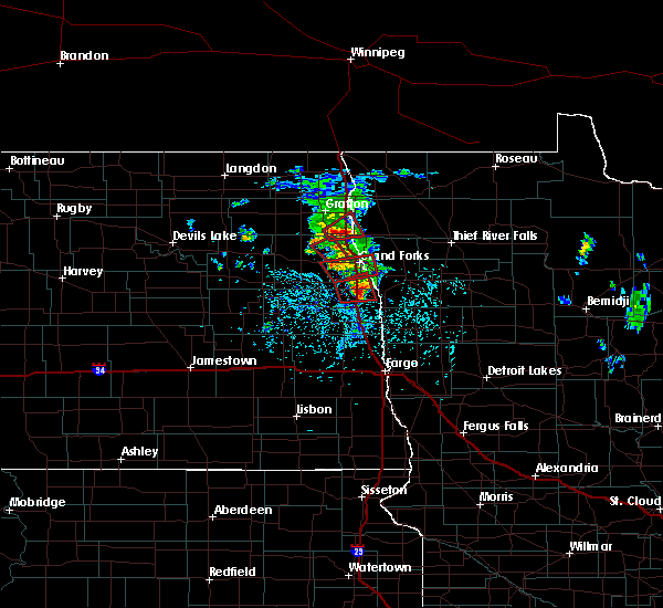 At 204 pm cdt, a severe thunderstorm capable of producing a tornado was located near mekinock, or 13 miles northwest of grand forks, moving northeast at 20 mph (radar indicated rotation). Hazards include tornado and half dollar size hail. Expect damage to mobile homes, roofs, and vehicles. This tornadic thunderstorm will remain over mainly rural areas of north central grand forks county. At 204 pm cdt, a severe thunderstorm capable of producing a tornado was located near mekinock, or 13 miles northwest of grand forks, moving northeast at 20 mph (radar indicated rotation). Hazards include tornado and half dollar size hail. Expect damage to mobile homes, roofs, and vehicles. This tornadic thunderstorm will remain over mainly rural areas of north central grand forks county.
|
| 6/7/2017 1:56 PM CDT |
 At 153 pm cdt, a severe thunderstorm capable of producing a tornado was located over emerado, or 12 miles west of grand forks, moving east at 15 mph. another severe thunderstorm capable of producing a tornado was located 10 miles northwest of thompson moving east at 15 mph (radar indicated rotation). Hazards include tornado. Expect damage to mobile homes, roofs, and vehicles. this dangerous storm will be near, grand forks, thompson and east grand forks around 245 pm cdt. This includes interstate 29 between mile markers 131 and 144. At 153 pm cdt, a severe thunderstorm capable of producing a tornado was located over emerado, or 12 miles west of grand forks, moving east at 15 mph. another severe thunderstorm capable of producing a tornado was located 10 miles northwest of thompson moving east at 15 mph (radar indicated rotation). Hazards include tornado. Expect damage to mobile homes, roofs, and vehicles. this dangerous storm will be near, grand forks, thompson and east grand forks around 245 pm cdt. This includes interstate 29 between mile markers 131 and 144.
|
| 6/7/2017 1:44 PM CDT |
 At 143 pm cdt, a two severe thunderstorms capable of producing tornadoes were located over grand forks afb, or 16 miles west of grand forks, moving northeast at 30 mph (radar indicated rotation). Hazards include tornado and half dollar size hail. Expect damage to mobile homes, roofs, and vehicles. this dangerous storm will be near, grand forks afb around 145 pm cdt. Mekinock and gilby around 150 pm cdt. At 143 pm cdt, a two severe thunderstorms capable of producing tornadoes were located over grand forks afb, or 16 miles west of grand forks, moving northeast at 30 mph (radar indicated rotation). Hazards include tornado and half dollar size hail. Expect damage to mobile homes, roofs, and vehicles. this dangerous storm will be near, grand forks afb around 145 pm cdt. Mekinock and gilby around 150 pm cdt.
|
| 6/7/2017 1:16 PM CDT |
 At 115 pm cdt, a severe thunderstorm capable of producing a tornado was located over arvilla, or 18 miles west of grand forks, and is nearly stationary (radar indicated rotation). Hazards include tornado. Expect damage to mobile homes, roofs, and vehicles. This dangerous storm will be near, grand forks afb around 145 pm cdt. At 115 pm cdt, a severe thunderstorm capable of producing a tornado was located over arvilla, or 18 miles west of grand forks, and is nearly stationary (radar indicated rotation). Hazards include tornado. Expect damage to mobile homes, roofs, and vehicles. This dangerous storm will be near, grand forks afb around 145 pm cdt.
|
| 6/7/2017 1:02 PM CDT |
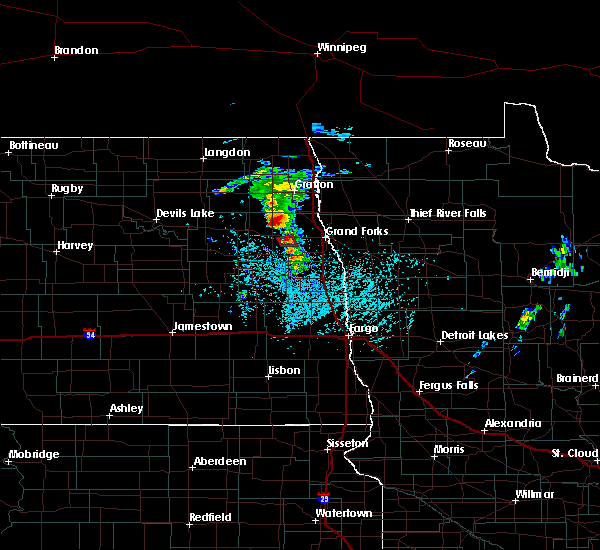 At 102 pm cdt, a confirmed tornado was located over arvilla, or 19 miles west of grand forks, and is nearly stationary (weather spotters confirmed tornado). Hazards include tornado. Expect damage to mobile homes, roofs, and vehicles. the tornado will be near, arvilla around 110 pm cdt. Grand forks afb around 145 pm cdt. At 102 pm cdt, a confirmed tornado was located over arvilla, or 19 miles west of grand forks, and is nearly stationary (weather spotters confirmed tornado). Hazards include tornado. Expect damage to mobile homes, roofs, and vehicles. the tornado will be near, arvilla around 110 pm cdt. Grand forks afb around 145 pm cdt.
|
| 6/2/2017 10:31 PM CDT |
 At 1030 pm cdt, a severe thunderstorm was located near tabor, or 10 miles north of grand forks, moving northeast at 45 mph. strongest of the winds likely passed near the grand forks airport to near manvel where wind gusts over 60 mph were likely. similar conditions nw polk county (radar indicated). Hazards include 60 mph wind gusts and quarter size hail. Hail damage to vehicles is expected. expect wind damage to roofs, siding, and trees. locations impacted include, grand forks, east grand forks, crookston, grand forks afb, warren, thompson and fisher. This includes interstate 29 between mile markers 125 and 164. At 1030 pm cdt, a severe thunderstorm was located near tabor, or 10 miles north of grand forks, moving northeast at 45 mph. strongest of the winds likely passed near the grand forks airport to near manvel where wind gusts over 60 mph were likely. similar conditions nw polk county (radar indicated). Hazards include 60 mph wind gusts and quarter size hail. Hail damage to vehicles is expected. expect wind damage to roofs, siding, and trees. locations impacted include, grand forks, east grand forks, crookston, grand forks afb, warren, thompson and fisher. This includes interstate 29 between mile markers 125 and 164.
|
| 6/2/2017 10:07 PM CDT |
 At 1006 pm cdt, a severe thunderstorm was located over emerado, or 12 miles west of grand forks, moving northeast at 50 mph. a second severe thunderstorm was 5 miles west of thompson moving north at 50 mph (radar indicated). Hazards include 60 mph wind gusts and quarter size hail. Hail damage to vehicles is expected. Expect wind damage to trees. At 1006 pm cdt, a severe thunderstorm was located over emerado, or 12 miles west of grand forks, moving northeast at 50 mph. a second severe thunderstorm was 5 miles west of thompson moving north at 50 mph (radar indicated). Hazards include 60 mph wind gusts and quarter size hail. Hail damage to vehicles is expected. Expect wind damage to trees.
|
| 8/27/2016 4:03 PM CDT |
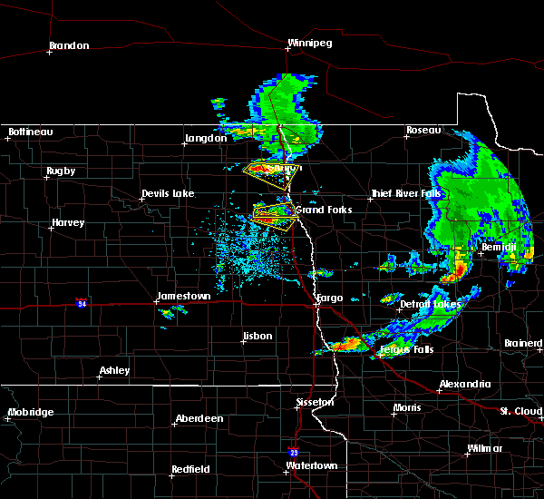 At 403 pm cdt, a severe thunderstorm was located near emerado, or 14 miles west of grand forks, moving southeast at 20 mph (radar indicated). Hazards include half dollar size hail. Damage to vehicles is expected. this severe storm will be near, grand forks and merrifield around 430 pm cdt. This includes interstate 29 between mile markers 136 and 137. At 403 pm cdt, a severe thunderstorm was located near emerado, or 14 miles west of grand forks, moving southeast at 20 mph (radar indicated). Hazards include half dollar size hail. Damage to vehicles is expected. this severe storm will be near, grand forks and merrifield around 430 pm cdt. This includes interstate 29 between mile markers 136 and 137.
|
| 8/27/2016 3:49 PM CDT |
 At 349 pm cdt, a severe thunderstorm was located over arvilla, or 16 miles west of grand forks, moving east at 15 mph (radar indicated). Hazards include ping pong ball size hail. People and animals outdoors will be injured. expect damage to roofs, siding, windows, and vehicles. this severe thunderstorm will be near, emerado and grand forks afb around 400 pm cdt. grand forks and merrifield around 430 pm cdt. This includes interstate 29 between mile markers 136 and 137. At 349 pm cdt, a severe thunderstorm was located over arvilla, or 16 miles west of grand forks, moving east at 15 mph (radar indicated). Hazards include ping pong ball size hail. People and animals outdoors will be injured. expect damage to roofs, siding, windows, and vehicles. this severe thunderstorm will be near, emerado and grand forks afb around 400 pm cdt. grand forks and merrifield around 430 pm cdt. This includes interstate 29 between mile markers 136 and 137.
|
| 8/27/2016 3:41 PM CDT | Golf Ball sized hail reported 5.8 miles ENE of Grand Forks AFB, ND, via social media. |
| 8/27/2016 3:41 PM CDT | Tennis Ball sized hail reported 5.8 miles ENE of Grand Forks AFB, ND, relayed via social media. size estimated from photo. |
| 8/27/2016 3:30 PM CDT |
 At 330 pm cdt, a severe thunderstorm was located over arvilla, or 20 miles west of grand forks, moving east at 10 mph (radar indicated). Hazards include quarter size hail. Damage to vehicles is expected. this severe thunderstorm will be near, grand forks afb, emerado and mekinock around 405 pm cdt. This includes interstate 29 between mile markers 140 and 152. At 330 pm cdt, a severe thunderstorm was located over arvilla, or 20 miles west of grand forks, moving east at 10 mph (radar indicated). Hazards include quarter size hail. Damage to vehicles is expected. this severe thunderstorm will be near, grand forks afb, emerado and mekinock around 405 pm cdt. This includes interstate 29 between mile markers 140 and 152.
|
| 8/3/2016 10:50 PM CDT |
 At 1048 pm cdt, severe thunderstorms were located along a line extending from near high landing to fisher, moving east at 40 mph (radar indicated. at 1042 pm...62 mph wind gusts were reported at the grand forks air force base). Hazards include 60 mph wind gusts and nickel size hail. Expect damage to roofs. siding. and trees. these severe storms will be near, goodridge, high landing and mavie around 1050 pm cdt. roland around 1055 pm cdt. crookston around 1100 pm cdt. harold, gentilly and greenview around 1110 pm cdt. melvin around 1120 pm cdt. also includes interstate 29 between mile markers 131 and 153. A tornado watch remains in effect until 1100 pm cdt for northwestern minnesota, and northeastern north dakota. At 1048 pm cdt, severe thunderstorms were located along a line extending from near high landing to fisher, moving east at 40 mph (radar indicated. at 1042 pm...62 mph wind gusts were reported at the grand forks air force base). Hazards include 60 mph wind gusts and nickel size hail. Expect damage to roofs. siding. and trees. these severe storms will be near, goodridge, high landing and mavie around 1050 pm cdt. roland around 1055 pm cdt. crookston around 1100 pm cdt. harold, gentilly and greenview around 1110 pm cdt. melvin around 1120 pm cdt. also includes interstate 29 between mile markers 131 and 153. A tornado watch remains in effect until 1100 pm cdt for northwestern minnesota, and northeastern north dakota.
|
| 8/3/2016 10:42 PM CDT | Peak wind measured at the gfaf in grand forks county ND, 0 miles SSW of Grand Forks AFB, ND |
| 8/3/2016 10:29 PM CDT |
 At 1029 pm cdt, severe thunderstorms were located along a line extending from near thief river falls to near thompson, moving east at 40 mph (radar indicated). Hazards include 60 mph wind gusts and nickel size hail. Expect damage to roofs. siding. and trees. severe thunderstorms will be near, hazel around 1035 pm cdt. mavie around 1040 pm cdt. goodridge around 1045 pm cdt. high landing and eldred around 1050 pm cdt. roland around 1055 pm cdt. also includes interstate 29 between mile markers 131 and 153. A tornado watch remains in effect until 1100 pm cdt for northwestern minnesota, and northeastern north dakota. At 1029 pm cdt, severe thunderstorms were located along a line extending from near thief river falls to near thompson, moving east at 40 mph (radar indicated). Hazards include 60 mph wind gusts and nickel size hail. Expect damage to roofs. siding. and trees. severe thunderstorms will be near, hazel around 1035 pm cdt. mavie around 1040 pm cdt. goodridge around 1045 pm cdt. high landing and eldred around 1050 pm cdt. roland around 1055 pm cdt. also includes interstate 29 between mile markers 131 and 153. A tornado watch remains in effect until 1100 pm cdt for northwestern minnesota, and northeastern north dakota.
|
| 7/20/2016 10:42 PM CDT |
 At 1041 pm cdt, a severe thunderstorm was located near emerado, or 8 miles west of grand forks, moving east at 50 mph (radar indicated). Hazards include 70 mph wind gusts and penny size hail. Expect considerable tree damage. damage is likely to mobile homes, roofs, and outbuildings. this severe thunderstorm will be near, grand forks and merrifield around 1050 pm cdt. east grand forks and thompson around 1055 pm cdt. bygland and mallory around 1100 pm cdt. davidson around 1105 pm cdt. fisher around 1110 pm cdt. Also includes interstate 29 between mile markers 121 and 152. At 1041 pm cdt, a severe thunderstorm was located near emerado, or 8 miles west of grand forks, moving east at 50 mph (radar indicated). Hazards include 70 mph wind gusts and penny size hail. Expect considerable tree damage. damage is likely to mobile homes, roofs, and outbuildings. this severe thunderstorm will be near, grand forks and merrifield around 1050 pm cdt. east grand forks and thompson around 1055 pm cdt. bygland and mallory around 1100 pm cdt. davidson around 1105 pm cdt. fisher around 1110 pm cdt. Also includes interstate 29 between mile markers 121 and 152.
|
| 7/20/2016 10:31 PM CDT |
 At 1030 pm cdt, severe thunderstorms were located along a line extending from near logan center to near kloten to near red willow lake to near mchenry, moving east at 45 mph (radar indicated). Hazards include 70 mph wind gusts and penny size hail. Expect considerable tree damage. damage is likely to mobile homes, roofs, and outbuildings. these severe storms will be near, aneta, logan center and kloten around 1035 pm cdt. kempton and sharon around 1045 pm cdt. northwood around 1050 pm cdt. golden lake and hatton around 1100 pm cdt. Cooperstown and finley around 1105 pm cdt. At 1030 pm cdt, severe thunderstorms were located along a line extending from near logan center to near kloten to near red willow lake to near mchenry, moving east at 45 mph (radar indicated). Hazards include 70 mph wind gusts and penny size hail. Expect considerable tree damage. damage is likely to mobile homes, roofs, and outbuildings. these severe storms will be near, aneta, logan center and kloten around 1035 pm cdt. kempton and sharon around 1045 pm cdt. northwood around 1050 pm cdt. golden lake and hatton around 1100 pm cdt. Cooperstown and finley around 1105 pm cdt.
|
| 7/20/2016 10:10 PM CDT |
 At 1010 pm cdt, a severe thunderstorm was located over pekin, or 35 miles southeast of devils lake, moving east at 40 mph (radar indicated). Hazards include 70 mph wind gusts and penny size hail. Expect considerable tree damage. damage is likely to mobile homes, roofs, and outbuildings. this severe thunderstorm will be near, mcville around 1020 pm cdt. kloten around 1030 pm cdt. aneta around 1035 pm cdt. sharon around 1045 pm cdt. golden lake around 1105 pm cdt. A tornado watch remains in effect until 1100 pm cdt for northeastern north dakota. At 1010 pm cdt, a severe thunderstorm was located over pekin, or 35 miles southeast of devils lake, moving east at 40 mph (radar indicated). Hazards include 70 mph wind gusts and penny size hail. Expect considerable tree damage. damage is likely to mobile homes, roofs, and outbuildings. this severe thunderstorm will be near, mcville around 1020 pm cdt. kloten around 1030 pm cdt. aneta around 1035 pm cdt. sharon around 1045 pm cdt. golden lake around 1105 pm cdt. A tornado watch remains in effect until 1100 pm cdt for northeastern north dakota.
|
| 7/19/2016 8:56 PM CDT |
 The severe thunderstorm warning for southwestern polk, southeastern grand forks and northeastern traill counties will expire at 900 pm cdt, the storm which prompted the warning has weakened below severe limits, and no longer pose an immediate threat to life or property. therefore, the warning will be allowed to expire. however small. The severe thunderstorm warning for southwestern polk, southeastern grand forks and northeastern traill counties will expire at 900 pm cdt, the storm which prompted the warning has weakened below severe limits, and no longer pose an immediate threat to life or property. therefore, the warning will be allowed to expire. however small.
|
| 7/19/2016 8:29 PM CDT |
 At 828 pm cdt, a severe thunderstorm was located over thompson, or 8 miles south of grand forks, moving south at 40 mph (public. winds of 58 mph were reported near east grand forks. hail of penny size reported over grand forks). Hazards include 60 mph wind gusts and nickel size hail. Expect damage to roofs. siding. and trees. this severe storm will be near, thompson and bygland around 830 pm cdt. reynolds around 840 pm cdt. buxton around 845 pm cdt. climax around 850 pm cdt. cummings around 855 pm cdt. Also includes interstate 29 between mile markers 112 and 143. At 828 pm cdt, a severe thunderstorm was located over thompson, or 8 miles south of grand forks, moving south at 40 mph (public. winds of 58 mph were reported near east grand forks. hail of penny size reported over grand forks). Hazards include 60 mph wind gusts and nickel size hail. Expect damage to roofs. siding. and trees. this severe storm will be near, thompson and bygland around 830 pm cdt. reynolds around 840 pm cdt. buxton around 845 pm cdt. climax around 850 pm cdt. cummings around 855 pm cdt. Also includes interstate 29 between mile markers 112 and 143.
|
| 7/19/2016 7:59 PM CDT |
 At 757 pm cdt, a severe thunderstorm was located over grand forks, moving south at 40 mph (public. this storm has a history of snapped trees and 70 mph winds). Hazards include 70 mph wind gusts and ping pong ball size hail. People and animals outdoors will be injured. expect hail damage to roofs, siding, windows, and vehicles. expect considerable tree damage. wind damage is also likely to mobile homes, roofs, and outbuildings. this severe thunderstorm will be near, east grand forks around 800 pm cdt. grand forks and merrifield around 805 pm cdt. thompson and bygland around 815 pm cdt. reynolds around 825 pm cdt. buxton around 835 pm cdt. Also includes interstate 29 between mile markers 112 and 152. At 757 pm cdt, a severe thunderstorm was located over grand forks, moving south at 40 mph (public. this storm has a history of snapped trees and 70 mph winds). Hazards include 70 mph wind gusts and ping pong ball size hail. People and animals outdoors will be injured. expect hail damage to roofs, siding, windows, and vehicles. expect considerable tree damage. wind damage is also likely to mobile homes, roofs, and outbuildings. this severe thunderstorm will be near, east grand forks around 800 pm cdt. grand forks and merrifield around 805 pm cdt. thompson and bygland around 815 pm cdt. reynolds around 825 pm cdt. buxton around 835 pm cdt. Also includes interstate 29 between mile markers 112 and 152.
|
| 7/19/2016 7:44 PM CDT |
 A severe thunderstorm warning remains in effect until 800 pm cdt for northwestern polk. southwestern marshall. southeastern walsh and grand forks counties. at 743 pm cdt. a severe thunderstorm was located near manvel. or 8 miles north of grand forks. moving south at 50 mph. hazard. Tennis ball size hail and 70 mph wind gusts. A severe thunderstorm warning remains in effect until 800 pm cdt for northwestern polk. southwestern marshall. southeastern walsh and grand forks counties. at 743 pm cdt. a severe thunderstorm was located near manvel. or 8 miles north of grand forks. moving south at 50 mph. hazard. Tennis ball size hail and 70 mph wind gusts.
|
| 7/19/2016 7:44 PM CDT |
 At 743 pm cdt, a severe thunderstorm was located near manvel, or 8 miles north of grand forks, moving south at 50 mph (public. numerous reports of snapped trees and winds up to 70 mph). Hazards include tennis ball size hail and 70 mph wind gusts. People and animals outdoors will be injured. expect hail damage to roofs, siding, windows, and vehicles. expect considerable tree damage. wind damage is also likely to mobile homes, roofs, and outbuildings. this severe storm will be near, grand forks and east grand forks around 755 pm cdt. thompson, merrifield and bygland around 800 pm cdt. Also includes interstate 29 between mile markers 124 and 169. At 743 pm cdt, a severe thunderstorm was located near manvel, or 8 miles north of grand forks, moving south at 50 mph (public. numerous reports of snapped trees and winds up to 70 mph). Hazards include tennis ball size hail and 70 mph wind gusts. People and animals outdoors will be injured. expect hail damage to roofs, siding, windows, and vehicles. expect considerable tree damage. wind damage is also likely to mobile homes, roofs, and outbuildings. this severe storm will be near, grand forks and east grand forks around 755 pm cdt. thompson, merrifield and bygland around 800 pm cdt. Also includes interstate 29 between mile markers 124 and 169.
|
| 7/19/2016 7:25 PM CDT |
 At 723 pm cdt, a severe thunderstorm was located near johnstown, or 19 miles northwest of grand forks, moving southeast at 60 mph (public. have received several reports of snapped trees and wind gusts up to 70 mph). Hazards include tennis ball size hail and 70 mph wind gusts. People and animals outdoors will be injured. expect hail damage to roofs, siding, windows, and vehicles. expect considerable tree damage. wind damage is also likely to mobile homes, roofs, and outbuildings. this severe storm will be near, mekinock, manvel and honeyford around 730 pm cdt. grand forks afb and emerado around 735 pm cdt. grand forks and merrifield around 745 pm cdt. thompson around 750 pm cdt. Also includes interstate 29 between mile markers 124 and 169. At 723 pm cdt, a severe thunderstorm was located near johnstown, or 19 miles northwest of grand forks, moving southeast at 60 mph (public. have received several reports of snapped trees and wind gusts up to 70 mph). Hazards include tennis ball size hail and 70 mph wind gusts. People and animals outdoors will be injured. expect hail damage to roofs, siding, windows, and vehicles. expect considerable tree damage. wind damage is also likely to mobile homes, roofs, and outbuildings. this severe storm will be near, mekinock, manvel and honeyford around 730 pm cdt. grand forks afb and emerado around 735 pm cdt. grand forks and merrifield around 745 pm cdt. thompson around 750 pm cdt. Also includes interstate 29 between mile markers 124 and 169.
|
| 7/19/2016 7:00 PM CDT |
 At 658 pm cdt, a severe thunderstorm was located over voss, or 8 miles south of grafton, moving southeast at 55 mph (public. multiple trees have been reported to have been snapped in the grafton area). Hazards include tennis ball size hail and 70 mph wind gusts. People and animals outdoors will be injured. expect hail damage to roofs, siding, windows, and vehicles. expect considerable tree damage. wind damage is also likely to mobile homes, roofs, and outbuildings. this severe thunderstorm will be near, minto around 700 pm cdt. forest river and ardoch around 705 pm cdt. johnstown and poland around 710 pm cdt. gilby around 715 pm cdt. manvel and mekinock around 720 pm cdt. Also includes interstate 29 between mile markers 124 and 175. At 658 pm cdt, a severe thunderstorm was located over voss, or 8 miles south of grafton, moving southeast at 55 mph (public. multiple trees have been reported to have been snapped in the grafton area). Hazards include tennis ball size hail and 70 mph wind gusts. People and animals outdoors will be injured. expect hail damage to roofs, siding, windows, and vehicles. expect considerable tree damage. wind damage is also likely to mobile homes, roofs, and outbuildings. this severe thunderstorm will be near, minto around 700 pm cdt. forest river and ardoch around 705 pm cdt. johnstown and poland around 710 pm cdt. gilby around 715 pm cdt. manvel and mekinock around 720 pm cdt. Also includes interstate 29 between mile markers 124 and 175.
|
| 7/9/2016 8:03 PM CDT |
 At 802 pm cdt, severe thunderstorms were located along a line extending from near manvel to holmes to near hatton, moving southeast at 40 mph (public. at 755 pm...egg size hail was reported in northwood). Hazards include two inch hail and 60 mph wind gusts. People and animals outdoors will be injured. expect hail damage to roofs, siding, windows, and vehicles. expect wind damage to roofs, siding, and trees. these severe storms will be near, portland around 810 pm cdt. mayville, reynolds and east grand forks around 815 pm cdt. buxton around 820 pm cdt. mallory, cummings and sherack around 825 pm cdt. hillsboro, fisher and key west around 830 pm cdt. Also includes interstate 29 between mile markers 99 and 158. At 802 pm cdt, severe thunderstorms were located along a line extending from near manvel to holmes to near hatton, moving southeast at 40 mph (public. at 755 pm...egg size hail was reported in northwood). Hazards include two inch hail and 60 mph wind gusts. People and animals outdoors will be injured. expect hail damage to roofs, siding, windows, and vehicles. expect wind damage to roofs, siding, and trees. these severe storms will be near, portland around 810 pm cdt. mayville, reynolds and east grand forks around 815 pm cdt. buxton around 820 pm cdt. mallory, cummings and sherack around 825 pm cdt. hillsboro, fisher and key west around 830 pm cdt. Also includes interstate 29 between mile markers 99 and 158.
|
| 7/9/2016 7:57 PM CDT |
 At 756 pm cdt, severe thunderstorms were located along a line extending from manvel to near holmes to near hatton, moving southeast at 35 mph (public. at 750 pm...golf ball size hail was reported in northwood). Hazards include golf ball size hail and 60 mph wind gusts. People and animals outdoors will be injured. expect hail damage to roofs, siding, windows, and vehicles. expect wind damage to roofs, siding, and trees. these severe storms will be near, holmes around 800 pm cdt. mayville, portland and roseville around 815 pm cdt. buxton, east grand forks and reynolds around 820 pm cdt. hillsboro, davidson and key west around 830 pm cdt. Also includes interstate 29 between mile markers 99 and 158. At 756 pm cdt, severe thunderstorms were located along a line extending from manvel to near holmes to near hatton, moving southeast at 35 mph (public. at 750 pm...golf ball size hail was reported in northwood). Hazards include golf ball size hail and 60 mph wind gusts. People and animals outdoors will be injured. expect hail damage to roofs, siding, windows, and vehicles. expect wind damage to roofs, siding, and trees. these severe storms will be near, holmes around 800 pm cdt. mayville, portland and roseville around 815 pm cdt. buxton, east grand forks and reynolds around 820 pm cdt. hillsboro, davidson and key west around 830 pm cdt. Also includes interstate 29 between mile markers 99 and 158.
|
| 7/9/2016 7:49 PM CDT |
 At 748 pm cdt, severe thunderstorms were located along a line extending from 6 miles southwest of poland to 6 miles east of northwood to near golden lake, moving southeast at 45 mph (public. at 740 pm...quarter size hail was reported 3 miles east of larimore). Hazards include golf ball size hail and 60 mph wind gusts. People and animals outdoors will be injured. expect hail damage to roofs, siding, windows, and vehicles. expect wind damage to roofs, siding, and trees. these severe storms will be near, manvel and hatton around 755 pm cdt. holmes around 800 pm cdt. grand forks, portland and mayville around 810 pm cdt. buxton and east grand forks around 815 pm cdt. mallory, cummings and key west around 820 pm cdt. Also includes interstate 29 between mile markers 99 and 158. At 748 pm cdt, severe thunderstorms were located along a line extending from 6 miles southwest of poland to 6 miles east of northwood to near golden lake, moving southeast at 45 mph (public. at 740 pm...quarter size hail was reported 3 miles east of larimore). Hazards include golf ball size hail and 60 mph wind gusts. People and animals outdoors will be injured. expect hail damage to roofs, siding, windows, and vehicles. expect wind damage to roofs, siding, and trees. these severe storms will be near, manvel and hatton around 755 pm cdt. holmes around 800 pm cdt. grand forks, portland and mayville around 810 pm cdt. buxton and east grand forks around 815 pm cdt. mallory, cummings and key west around 820 pm cdt. Also includes interstate 29 between mile markers 99 and 158.
|
| 7/9/2016 7:33 PM CDT |
 At 732 pm cdt, severe thunderstorms were located along a line extending from near forest river to 7 miles southeast of logan center, moving southeast at 35 mph (law enforcement. at 730 pm...golf ball size hail was reported in larimore). Hazards include golf ball size hail and 60 mph wind gusts. People and animals outdoors will be injured. expect hail damage to roofs, siding, windows, and vehicles. expect wind damage to roofs, siding, and trees. these severe storms will be near, ardoch around 735 pm cdt. gilby around 740 pm cdt. northwood and poland around 745 pm cdt. golden lake around 750 pm cdt. manvel and hatton around 755 pm cdt. Also includes interstate 29 between mile markers 99 and 166. At 732 pm cdt, severe thunderstorms were located along a line extending from near forest river to 7 miles southeast of logan center, moving southeast at 35 mph (law enforcement. at 730 pm...golf ball size hail was reported in larimore). Hazards include golf ball size hail and 60 mph wind gusts. People and animals outdoors will be injured. expect hail damage to roofs, siding, windows, and vehicles. expect wind damage to roofs, siding, and trees. these severe storms will be near, ardoch around 735 pm cdt. gilby around 740 pm cdt. northwood and poland around 745 pm cdt. golden lake around 750 pm cdt. manvel and hatton around 755 pm cdt. Also includes interstate 29 between mile markers 99 and 166.
|
| 7/9/2016 7:30 PM CDT |
 At 729 pm cdt, severe thunderstorms were located along a line extending from forest river to near logan center, moving southeast at 35 mph (radar indicated). Hazards include golf ball size hail and 60 mph wind gusts. People and animals outdoors will be injured. expect hail damage to roofs, siding, windows, and vehicles. expect wind damage to roofs, siding, and trees. severe thunderstorms will be near, ardoch around 735 pm cdt. northwood around 740 pm cdt. poland around 745 pm cdt. golden lake around 750 pm cdt. manvel and hatton around 755 pm cdt. Also includes interstate 29 between mile markers 99 and 166. At 729 pm cdt, severe thunderstorms were located along a line extending from forest river to near logan center, moving southeast at 35 mph (radar indicated). Hazards include golf ball size hail and 60 mph wind gusts. People and animals outdoors will be injured. expect hail damage to roofs, siding, windows, and vehicles. expect wind damage to roofs, siding, and trees. severe thunderstorms will be near, ardoch around 735 pm cdt. northwood around 740 pm cdt. poland around 745 pm cdt. golden lake around 750 pm cdt. manvel and hatton around 755 pm cdt. Also includes interstate 29 between mile markers 99 and 166.
|
| 7/9/2016 7:19 PM CDT |
 At 718 pm cdt, a severe thunderstorm was located near logan center, or 34 miles west of grand forks, moving southeast at 35 mph (public). Hazards include tennis ball size hail and 60 mph wind gusts. People and animals outdoors will be injured. expect hail damage to roofs, siding, windows, and vehicles. expect wind damage to roofs, siding, and trees. This severe storm will be near, northwood and kempton around 730 pm cdt. At 718 pm cdt, a severe thunderstorm was located near logan center, or 34 miles west of grand forks, moving southeast at 35 mph (public). Hazards include tennis ball size hail and 60 mph wind gusts. People and animals outdoors will be injured. expect hail damage to roofs, siding, windows, and vehicles. expect wind damage to roofs, siding, and trees. This severe storm will be near, northwood and kempton around 730 pm cdt.
|
| 7/9/2016 7:14 PM CDT |
 At 714 pm cdt, severe thunderstorms were located along a line extending from conway to near mccanna to near logan center, moving east at 40 mph (public). Hazards include tennis ball size hail and 60 mph wind gusts. People and animals outdoors will be injured. expect hail damage to roofs, siding, windows, and vehicles. expect wind damage to roofs, siding, and trees. these severe storms will be near, conway and orr around 715 pm cdt. mccanna, logan center and inkster around 720 pm cdt. larimore around 725 pm cdt. forest river, arvilla and northwood around 730 pm cdt. Also includes interstate 29 between mile markers 167 and 168. At 714 pm cdt, severe thunderstorms were located along a line extending from conway to near mccanna to near logan center, moving east at 40 mph (public). Hazards include tennis ball size hail and 60 mph wind gusts. People and animals outdoors will be injured. expect hail damage to roofs, siding, windows, and vehicles. expect wind damage to roofs, siding, and trees. these severe storms will be near, conway and orr around 715 pm cdt. mccanna, logan center and inkster around 720 pm cdt. larimore around 725 pm cdt. forest river, arvilla and northwood around 730 pm cdt. Also includes interstate 29 between mile markers 167 and 168.
|
| 7/9/2016 7:08 PM CDT |
 At 706 pm cdt, severe thunderstorms were located along a line extending from near pisek to near niagara to 7 miles northeast of kloten, moving east at 40 mph (public). Hazards include tennis ball size hail and 60 mph wind gusts. the greatest threat for tennis ball size hail is about 5 miles south of niagra. People and animals outdoors will be injured. expect hail damage to roofs, siding, windows, and vehicles. expect wind damage to roofs, siding, and trees. these severe storms will be near, mccanna, conway and forest river colony around 715 pm cdt. logan center, inkster and veseleyville around 720 pm cdt. forest river, larimore and voss around 725 pm cdt. arvilla, northwood and emerado around 730 pm cdt. Also includes interstate 29 between mile markers 168 and 171. At 706 pm cdt, severe thunderstorms were located along a line extending from near pisek to near niagara to 7 miles northeast of kloten, moving east at 40 mph (public). Hazards include tennis ball size hail and 60 mph wind gusts. the greatest threat for tennis ball size hail is about 5 miles south of niagra. People and animals outdoors will be injured. expect hail damage to roofs, siding, windows, and vehicles. expect wind damage to roofs, siding, and trees. these severe storms will be near, mccanna, conway and forest river colony around 715 pm cdt. logan center, inkster and veseleyville around 720 pm cdt. forest river, larimore and voss around 725 pm cdt. arvilla, northwood and emerado around 730 pm cdt. Also includes interstate 29 between mile markers 168 and 171.
|
| 7/9/2016 6:49 PM CDT |
 At 648 pm cdt, severe thunderstorms were located along a line extending from near lankin to near michigan to 7 miles northeast of pekin, moving east at 40 mph (public. at 646 pm...golf ball size was reported in michigan). Hazards include golf ball size hail. People and animals outdoors will be injured. expect damage to roofs, siding, windows, and vehicles. these severe storms will be near, petersburg, mcville and lankin around 655 pm cdt. fordville and niagara around 705 pm cdt. pisek around 710 pm cdt. mccanna, conway and forest river colony around 715 pm cdt. logan center, inkster and veseleyville around 720 pm cdt. Also includes interstate 29 between mile markers 166 and 171. At 648 pm cdt, severe thunderstorms were located along a line extending from near lankin to near michigan to 7 miles northeast of pekin, moving east at 40 mph (public. at 646 pm...golf ball size was reported in michigan). Hazards include golf ball size hail. People and animals outdoors will be injured. expect damage to roofs, siding, windows, and vehicles. these severe storms will be near, petersburg, mcville and lankin around 655 pm cdt. fordville and niagara around 705 pm cdt. pisek around 710 pm cdt. mccanna, conway and forest river colony around 715 pm cdt. logan center, inkster and veseleyville around 720 pm cdt. Also includes interstate 29 between mile markers 166 and 171.
|
| 7/9/2016 6:46 PM CDT |
 At 645 pm cdt, severe thunderstorms were located along a line extending from near lankin to near whitman to 6 miles northeast of pekin, moving east at 40 mph (radar indicated). Hazards include quarter size hail. Damage to vehicles is expected. severe thunderstorms will be near, petersburg, mcville and lankin around 655 pm cdt. pisek, fordville and niagara around 705 pm cdt. conway and orr around 710 pm cdt. mccanna, forest river colony and veseleyville around 715 pm cdt. logan center and inkster around 720 pm cdt. Also includes interstate 29 between mile markers 166 and 171. At 645 pm cdt, severe thunderstorms were located along a line extending from near lankin to near whitman to 6 miles northeast of pekin, moving east at 40 mph (radar indicated). Hazards include quarter size hail. Damage to vehicles is expected. severe thunderstorms will be near, petersburg, mcville and lankin around 655 pm cdt. pisek, fordville and niagara around 705 pm cdt. conway and orr around 710 pm cdt. mccanna, forest river colony and veseleyville around 715 pm cdt. logan center and inkster around 720 pm cdt. Also includes interstate 29 between mile markers 166 and 171.
|
| 7/9/2016 6:39 PM CDT |
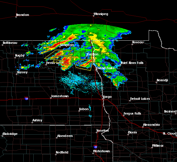 At 639 pm cdt, a severe thunderstorm was located over gilby, or 21 miles northwest of grand forks, moving east at 25 mph (radar indicated). Hazards include quarter size hail. Damage to vehicles is expected. this severe storm will be near, honeyford around 640 pm cdt. Mekinock around 645 pm cdt. At 639 pm cdt, a severe thunderstorm was located over gilby, or 21 miles northwest of grand forks, moving east at 25 mph (radar indicated). Hazards include quarter size hail. Damage to vehicles is expected. this severe storm will be near, honeyford around 640 pm cdt. Mekinock around 645 pm cdt.
|
| 7/9/2016 6:18 PM CDT |
 At 618 pm cdt, a severe thunderstorm was located over orr, or 24 miles southwest of grafton, moving east at 35 mph (radar indicated). Hazards include quarter size hail. Damage to vehicles is expected. this severe storm will be near, johnstown around 630 pm cdt. gilby and honeyford around 635 pm cdt. mekinock, grand forks afb and emerado around 645 pm cdt. Also includes interstate 29 between mile markers 162 and 169. At 618 pm cdt, a severe thunderstorm was located over orr, or 24 miles southwest of grafton, moving east at 35 mph (radar indicated). Hazards include quarter size hail. Damage to vehicles is expected. this severe storm will be near, johnstown around 630 pm cdt. gilby and honeyford around 635 pm cdt. mekinock, grand forks afb and emerado around 645 pm cdt. Also includes interstate 29 between mile markers 162 and 169.
|
| 7/9/2016 6:03 PM CDT |
 At 603 pm cdt, a severe thunderstorm was located near fordville, or 26 miles southwest of grafton, moving east at 35 mph (radar indicated). Hazards include quarter size hail. Damage to vehicles is expected. this severe thunderstorm will be near, forest river colony and conway around 610 pm cdt. inkster and orr around 615 pm cdt. gilby, forest river and johnstown around 630 pm cdt. mekinock and ardoch around 640 pm cdt. poland around 645 pm cdt. Also includes interstate 29 between mile markers 162 and 169. At 603 pm cdt, a severe thunderstorm was located near fordville, or 26 miles southwest of grafton, moving east at 35 mph (radar indicated). Hazards include quarter size hail. Damage to vehicles is expected. this severe thunderstorm will be near, forest river colony and conway around 610 pm cdt. inkster and orr around 615 pm cdt. gilby, forest river and johnstown around 630 pm cdt. mekinock and ardoch around 640 pm cdt. poland around 645 pm cdt. Also includes interstate 29 between mile markers 162 and 169.
|
| 6/17/2016 8:02 AM CDT | At 800 am cdt, severe thunderstorms were located along a line extending from near park river to near mekinock to near reynolds, moving east at 60 mph. these are very dangerous storms (radar indicated. this storm has a history of producing 70 to 80 mph winds). Hazards include 80 mph wind gusts and quarter size hail. Flying debris will be dangerous to those caught without shelter. mobile homes will be heavily damaged. expect considerable damage to roofs, windows, and vehicles. extensive tree damage and power outages are likely. these severe storms will be near, manvel and bygland around 805 am cdt. fisher, alvarado and voss around 815 am cdt. grafton, crookston and tabor around 820 am cdt. warren, oakwood and angus around 825 am cdt. Also includes interstate 29 between mile markers 125 and 181. |
| 6/17/2016 8:02 AM CDT | At 800 am cdt, severe thunderstorms were located along a line extending from near park river to near mekinock to near reynolds, moving east at 60 mph. these are very dangerous storms (radar indicated. this storm has a history of producing 70 to 80 mph winds). Hazards include 80 mph wind gusts and quarter size hail. Flying debris will be dangerous to those caught without shelter. mobile homes will be heavily damaged. expect considerable damage to roofs, windows, and vehicles. extensive tree damage and power outages are likely. these severe storms will be near, manvel and bygland around 805 am cdt. fisher, alvarado and voss around 815 am cdt. grafton, crookston and tabor around 820 am cdt. warren, oakwood and angus around 825 am cdt. Also includes interstate 29 between mile markers 125 and 181. |
| 6/17/2016 7:59 AM CDT | Peak wind of 52 knots at gfaf in grand forks county ND, 0 miles SSW of Grand Forks AFB, ND |
| 6/17/2016 7:33 AM CDT | At 731 am cdt, severe thunderstorms were located along a line extending from near lawton to near niagara to golden lake, moving east at 60 mph. these are very dangerous storms (radar indicated). Hazards include 80 mph wind gusts and quarter size hail. Flying debris will be dangerous to those caught without shelter. mobile homes will be heavily damaged. expect considerable damage to roofs, windows, and vehicles. extensive tree damage and power outages are likely. severe thunderstorms will be near, hatton, larimore and mccanna around 740 am cdt. arvilla, honeyford and lankin around 750 am cdt. mekinock, grand forks afb and gilby around 755 am cdt. thompson and pisek around 800 am cdt. grand forks, manvel and veseleyville around 805 am cdt. Also includes interstate 29 between mile markers 125 and 181. |
| 6/17/2016 7:33 AM CDT | At 731 am cdt, severe thunderstorms were located along a line extending from near lawton to near niagara to golden lake, moving east at 60 mph. these are very dangerous storms (radar indicated). Hazards include 80 mph wind gusts and quarter size hail. Flying debris will be dangerous to those caught without shelter. mobile homes will be heavily damaged. expect considerable damage to roofs, windows, and vehicles. extensive tree damage and power outages are likely. severe thunderstorms will be near, hatton, larimore and mccanna around 740 am cdt. arvilla, honeyford and lankin around 750 am cdt. mekinock, grand forks afb and gilby around 755 am cdt. thompson and pisek around 800 am cdt. grand forks, manvel and veseleyville around 805 am cdt. Also includes interstate 29 between mile markers 125 and 181. |
| 6/10/2016 3:24 AM CDT |
 At 324 am cdt, severe thunderstorms were located along a line extending from near voss to near emerado to near hope, moving east at 45 mph (radar indicated). Hazards include 60 mph wind gusts. Expect damage to roofs. siding. and trees. these severe storms will be near, forest river, emerado and grand forks afb around 325 am cdt. minto and ardoch around 330 am cdt. grand forks, warsaw and merrifield around 335 am cdt. poland around 340 am cdt. east grand forks, oslo and alvarado around 345 am cdt. Also includes interstate 29 between mile markers 102 and 168. At 324 am cdt, severe thunderstorms were located along a line extending from near voss to near emerado to near hope, moving east at 45 mph (radar indicated). Hazards include 60 mph wind gusts. Expect damage to roofs. siding. and trees. these severe storms will be near, forest river, emerado and grand forks afb around 325 am cdt. minto and ardoch around 330 am cdt. grand forks, warsaw and merrifield around 335 am cdt. poland around 340 am cdt. east grand forks, oslo and alvarado around 345 am cdt. Also includes interstate 29 between mile markers 102 and 168.
|
| 6/10/2016 2:56 AM CDT |
 At 254 am cdt, severe thunderstorms were located along a line extending from near whitman to near logan center to near dazey, moving east at 50 mph (radar indicated). Hazards include 60 mph wind gusts. Expect damage to roofs. siding. and trees. severe thunderstorms will be near, logan center and mccanna around 300 am cdt. larimore and kempton around 305 am cdt. fordville, arvilla and forest river colony around 310 am cdt. emerado, grand forks afb and conway around 315 am cdt. forest river, voss and johnstown around 320 am cdt. Also includes interstate 29 between mile markers 102 and 168. At 254 am cdt, severe thunderstorms were located along a line extending from near whitman to near logan center to near dazey, moving east at 50 mph (radar indicated). Hazards include 60 mph wind gusts. Expect damage to roofs. siding. and trees. severe thunderstorms will be near, logan center and mccanna around 300 am cdt. larimore and kempton around 305 am cdt. fordville, arvilla and forest river colony around 310 am cdt. emerado, grand forks afb and conway around 315 am cdt. forest river, voss and johnstown around 320 am cdt. Also includes interstate 29 between mile markers 102 and 168.
|
| 5/30/2016 4:14 PM CDT |
 At 413 pm cdt, a severe thunderstorm was located over grand forks afb, or 12 miles west of grand forks, moving east at 20 mph (radar indicated). Hazards include quarter size hail. Damage to vehicles is expected. this severe thunderstorm will be near, grand forks and manvel around 445 pm cdt. east grand forks around 500 pm cdt. Also includes interstate 29 between mile markers 141 and 153. At 413 pm cdt, a severe thunderstorm was located over grand forks afb, or 12 miles west of grand forks, moving east at 20 mph (radar indicated). Hazards include quarter size hail. Damage to vehicles is expected. this severe thunderstorm will be near, grand forks and manvel around 445 pm cdt. east grand forks around 500 pm cdt. Also includes interstate 29 between mile markers 141 and 153.
|
| 5/30/2016 3:47 PM CDT |
 At 346 pm cdt, a severe thunderstorm was located over arvilla, or 19 miles west of grand forks, moving east at 15 mph (radar indicated). Hazards include quarter size hail. Damage to vehicles is expected. This severe storm will be near, grand forks afb, emerado and mekinock around 400 pm cdt. At 346 pm cdt, a severe thunderstorm was located over arvilla, or 19 miles west of grand forks, moving east at 15 mph (radar indicated). Hazards include quarter size hail. Damage to vehicles is expected. This severe storm will be near, grand forks afb, emerado and mekinock around 400 pm cdt.
|
| 5/30/2016 3:33 PM CDT |
 At 332 pm cdt, a severe thunderstorm was located near arvilla, or 22 miles west of grand forks, moving east at 10 mph (radar indicated). Hazards include quarter size hail. Damage to vehicles is expected. this severe storm will be near, arvilla around 340 pm cdt. Emerado, grand forks afb and mekinock around 400 pm cdt. At 332 pm cdt, a severe thunderstorm was located near arvilla, or 22 miles west of grand forks, moving east at 10 mph (radar indicated). Hazards include quarter size hail. Damage to vehicles is expected. this severe storm will be near, arvilla around 340 pm cdt. Emerado, grand forks afb and mekinock around 400 pm cdt.
|
| 5/30/2016 3:17 PM CDT |
 At 316 pm cdt, a severe thunderstorm was located over larimore, or 26 miles west of grand forks, moving east at 10 mph (radar indicated). Hazards include quarter size hail. Damage to vehicles is expected. this severe thunderstorm will be near, larimore around 320 pm cdt. arvilla around 340 pm cdt. honeyford around 345 pm cdt. emerado around 355 pm cdt. Grand forks afb and mekinock around 400 pm cdt. At 316 pm cdt, a severe thunderstorm was located over larimore, or 26 miles west of grand forks, moving east at 10 mph (radar indicated). Hazards include quarter size hail. Damage to vehicles is expected. this severe thunderstorm will be near, larimore around 320 pm cdt. arvilla around 340 pm cdt. honeyford around 345 pm cdt. emerado around 355 pm cdt. Grand forks afb and mekinock around 400 pm cdt.
|
| 7/23/2015 11:48 PM CDT |
 At 1147 pm cdt, severe thunderstorms were located along a line extending from near mekinock to near clifford to kathryn, moving east at 50 mph. the radar indicates 80 mph winds or greater will pass near mayville by midnight (radar indicated). Hazards include 70 mph wind gusts and penny size hail. Expect considerable tree damage. damage is likely to mobile homes, roofs and outbuildings. these severe storms will be near, grand forks afb, mekinock, galesburg, emerado, clifford and roseville around 1150 pm cdt. grand forks, blanchard and fingal around 1200 am cdt. east grand forks and lucca around 1205 am cdt. hillsboro, kelso and mallory around 1210 am cdt. sherack, key west and alice around 1215 am cdt. Also includes interstate 29 between mile markers 49 and 150. At 1147 pm cdt, severe thunderstorms were located along a line extending from near mekinock to near clifford to kathryn, moving east at 50 mph. the radar indicates 80 mph winds or greater will pass near mayville by midnight (radar indicated). Hazards include 70 mph wind gusts and penny size hail. Expect considerable tree damage. damage is likely to mobile homes, roofs and outbuildings. these severe storms will be near, grand forks afb, mekinock, galesburg, emerado, clifford and roseville around 1150 pm cdt. grand forks, blanchard and fingal around 1200 am cdt. east grand forks and lucca around 1205 am cdt. hillsboro, kelso and mallory around 1210 am cdt. sherack, key west and alice around 1215 am cdt. Also includes interstate 29 between mile markers 49 and 150.
|
| 7/23/2015 11:40 PM CDT |
 At 1140 pm cdt, severe thunderstorms were located along a line extending from mekinock to 6 miles west of clifford to hastings, moving east at 50 mph (radar indicated). Hazards include 70 mph wind gusts and penny size hail. Expect considerable tree damage. damage is likely to mobile homes, roofs and outbuildings. severe thunderstorms will be near, mekinock, grand forks afb and emerado around 1145 pm cdt. galesburg, clifford and roseville around 1150 pm cdt. grand forks, nome and fingal around 1155 pm cdt. east grand forks, blanchard and lucca around 1200 am cdt. mallory around 1205 am cdt. Also includes interstate 29 between mile markers 49 and 150. At 1140 pm cdt, severe thunderstorms were located along a line extending from mekinock to 6 miles west of clifford to hastings, moving east at 50 mph (radar indicated). Hazards include 70 mph wind gusts and penny size hail. Expect considerable tree damage. damage is likely to mobile homes, roofs and outbuildings. severe thunderstorms will be near, mekinock, grand forks afb and emerado around 1145 pm cdt. galesburg, clifford and roseville around 1150 pm cdt. grand forks, nome and fingal around 1155 pm cdt. east grand forks, blanchard and lucca around 1200 am cdt. mallory around 1205 am cdt. Also includes interstate 29 between mile markers 49 and 150.
|
| 7/23/2015 11:17 PM CDT |
 At 1116 pm cdt, severe thunderstorms were located along a line extending from near logan center to blabon to near sanborn, moving east at 45 mph (radar indicated). Hazards include 70 mph wind gusts and nickel size hail. Expect considerable tree damage. damage is likely to mobile homes, roofs and outbuildings. these severe storms will be near, hope, blabon, sherbrooke and logan center around 1120 pm cdt. larimore and kempton around 1130 pm cdt. arvilla, roseville and clifford around 1140 pm cdt. Emerado, portland, grand forks afb and mayville around 1145 pm cdt. At 1116 pm cdt, severe thunderstorms were located along a line extending from near logan center to blabon to near sanborn, moving east at 45 mph (radar indicated). Hazards include 70 mph wind gusts and nickel size hail. Expect considerable tree damage. damage is likely to mobile homes, roofs and outbuildings. these severe storms will be near, hope, blabon, sherbrooke and logan center around 1120 pm cdt. larimore and kempton around 1130 pm cdt. arvilla, roseville and clifford around 1140 pm cdt. Emerado, portland, grand forks afb and mayville around 1145 pm cdt.
|
| 7/23/2015 10:40 PM CDT |
 At 1040 pm cdt, severe thunderstorms were located along a line extending from near tolna to near revere to spiritwood lake, moving east at 40 mph (radar indicated). Hazards include 70 mph wind gusts and nickel size hail. Expect considerable tree damage. damage is likely to mobile homes, roofs and outbuildings. severe thunderstorms will be near, mcville and hannaford around 1050 pm cdt. cooperstown and leal around 1055 pm cdt. rogers around 1105 pm cdt. bald hill dam around 1110 pm cdt. Finley, blabon and logan center around 1115 pm cdt. At 1040 pm cdt, severe thunderstorms were located along a line extending from near tolna to near revere to spiritwood lake, moving east at 40 mph (radar indicated). Hazards include 70 mph wind gusts and nickel size hail. Expect considerable tree damage. damage is likely to mobile homes, roofs and outbuildings. severe thunderstorms will be near, mcville and hannaford around 1050 pm cdt. cooperstown and leal around 1055 pm cdt. rogers around 1105 pm cdt. bald hill dam around 1110 pm cdt. Finley, blabon and logan center around 1115 pm cdt.
|
| 7/12/2015 4:43 PM CDT | The tornado warning for northwestern polk and northeastern grand forks counties will expire at 445 pm cdt, the storm which prompted the warning has weakened below severe limits and exited the warned area. therefore the warning will be allowed to expire. a severe thunderstorm watch remains in effect until 1000 pm cdt for northwestern minnesota and northeastern north dakota. |
| 7/12/2015 4:43 PM CDT | The tornado warning for northwestern polk and northeastern grand forks counties will expire at 445 pm cdt, the storm which prompted the warning has weakened below severe limits and exited the warned area. therefore the warning will be allowed to expire. a severe thunderstorm watch remains in effect until 1000 pm cdt for northwestern minnesota and northeastern north dakota. |
| 7/12/2015 4:37 PM CDT |
 At 436 pm cdt, a severe thunderstorm capable of producing a tornado was located near grand forks, moving northeast at 25 mph (radar indicated rotation). Hazards include tornado and golf ball size hail. Expect damage to mobile homes. roofs and vehicles. This tornadic thunderstorm will remain over mainly rural areas of northwestern polk and northeastern grand forks counties. At 436 pm cdt, a severe thunderstorm capable of producing a tornado was located near grand forks, moving northeast at 25 mph (radar indicated rotation). Hazards include tornado and golf ball size hail. Expect damage to mobile homes. roofs and vehicles. This tornadic thunderstorm will remain over mainly rural areas of northwestern polk and northeastern grand forks counties.
|
| 7/12/2015 4:03 PM CDT |
 At 403 pm cdt, a severe thunderstorm capable of producing a tornado was located near holmes, or 12 miles southwest of grand forks, moving northeast at 35 mph (radar indicated rotation). Hazards include tornado and golf ball size hail. Expect damage to mobile homes. roofs and vehicles. this dangerous storm will be near, merrifield around 415 pm cdt. grand forks around 420 pm cdt. east grand forks around 430 pm cdt. Sherack around 445 pm cdt. At 403 pm cdt, a severe thunderstorm capable of producing a tornado was located near holmes, or 12 miles southwest of grand forks, moving northeast at 35 mph (radar indicated rotation). Hazards include tornado and golf ball size hail. Expect damage to mobile homes. roofs and vehicles. this dangerous storm will be near, merrifield around 415 pm cdt. grand forks around 420 pm cdt. east grand forks around 430 pm cdt. Sherack around 445 pm cdt.
|
| 7/5/2015 11:33 AM CDT |
 At 1130 am cdt, severe thunderstorms were located along a line extending from manvel to near hope, moving east at 40 mph. these are very dangerous storms (radar indicated). Hazards include 80 mph wind gusts and quarter size hail. Flying debris will be dangerous to those caught without shelter. mobile homes will be heavily damaged. expect considerable damage to roofs, windows and vehicles. extensive tree damage and power outages are likely. severe thunderstorms will be near, manvel around 1135 am cdt. grand forks 1145 am cdt. galesburg, clifford and sherack around 1200 pm cdt. euclid and blanchard around 1210 pm cdt. Grandin and kelso around 1225 pm cdt. At 1130 am cdt, severe thunderstorms were located along a line extending from manvel to near hope, moving east at 40 mph. these are very dangerous storms (radar indicated). Hazards include 80 mph wind gusts and quarter size hail. Flying debris will be dangerous to those caught without shelter. mobile homes will be heavily damaged. expect considerable damage to roofs, windows and vehicles. extensive tree damage and power outages are likely. severe thunderstorms will be near, manvel around 1135 am cdt. grand forks 1145 am cdt. galesburg, clifford and sherack around 1200 pm cdt. euclid and blanchard around 1210 pm cdt. Grandin and kelso around 1225 pm cdt.
|
| 7/5/2015 10:58 AM CDT |
 At 1058 am cdt, severe thunderstorms were located along a line extending from near forest river colony to near cooperstown, moving east at 45 mph (radar indicated). Hazards include quarter size hail and 80 mph winds. Damage to vehicles is expected. severe thunderstorms will be near, forest river colony and conway around 1100 am cdt. inkster and orr around 1105 am cdt. johnstown and blabon around 1115 am cdt. gilby and honeyford around 1120 am cdt. Hope and mekinock around 1125 am cdt. At 1058 am cdt, severe thunderstorms were located along a line extending from near forest river colony to near cooperstown, moving east at 45 mph (radar indicated). Hazards include quarter size hail and 80 mph winds. Damage to vehicles is expected. severe thunderstorms will be near, forest river colony and conway around 1100 am cdt. inkster and orr around 1105 am cdt. johnstown and blabon around 1115 am cdt. gilby and honeyford around 1120 am cdt. Hope and mekinock around 1125 am cdt.
|
| 6/27/2015 5:47 PM CDT |
 At 546 pm cdt, a confirmed tornado was located near arvilla, or 20 miles west of grand forks, moving south at 10 mph (weather spotters confirmed tornado). Hazards include damaging tornado and half dollar size hail. Flying debris will be dangerous to those caught without shelter. mobile homes will be damaged or destroyed. damage to roofs, windows and vehicles will occur. tree damage is likely. this tornado will be near, emerado around 550 pm cdt. Northwood and kempton around 615 pm cdt. At 546 pm cdt, a confirmed tornado was located near arvilla, or 20 miles west of grand forks, moving south at 10 mph (weather spotters confirmed tornado). Hazards include damaging tornado and half dollar size hail. Flying debris will be dangerous to those caught without shelter. mobile homes will be damaged or destroyed. damage to roofs, windows and vehicles will occur. tree damage is likely. this tornado will be near, emerado around 550 pm cdt. Northwood and kempton around 615 pm cdt.
|
| 6/27/2015 5:35 PM CDT | Golf Ball sized hail reported 5.8 miles ENE of Grand Forks AFB, ND |
| 6/27/2015 5:31 PM CDT | Golf Ball sized hail reported 0 miles SSW of Grand Forks AFB, ND |
| 6/27/2015 5:27 PM CDT |
 At 526 pm cdt, a severe thunderstorm capable of producing a tornado was located near arvilla, or 22 miles west of grand forks, moving southeast at 30 mph (radar indicated rotation). Hazards include tornado and half dollar size hail. Flying debris will be dangerous to those caught without shelter. mobile homes will be damaged or destroyed. damage to roofs, windows and vehicles will occur. tree damage is likely. this dangerous storm will be near, arvilla and emerado around 535 pm cdt. kempton around 540 pm cdt. northwood around 555 pm cdt. Holmes around 610 pm cdt. At 526 pm cdt, a severe thunderstorm capable of producing a tornado was located near arvilla, or 22 miles west of grand forks, moving southeast at 30 mph (radar indicated rotation). Hazards include tornado and half dollar size hail. Flying debris will be dangerous to those caught without shelter. mobile homes will be damaged or destroyed. damage to roofs, windows and vehicles will occur. tree damage is likely. this dangerous storm will be near, arvilla and emerado around 535 pm cdt. kempton around 540 pm cdt. northwood around 555 pm cdt. Holmes around 610 pm cdt.
|
| 6/27/2015 5:26 PM CDT | Quarter sized hail reported 0 miles SSW of Grand Forks AFB, ND |
| 6/27/2015 5:13 PM CDT |
 At 512 pm cdt, a severe thunderstorm capable of producing a tornado was located near mccanna, or 24 miles west of grand forks, moving southeast at 25 mph. funnel cloud was observed near mccanna (weather spotters reported a funnel cloud). Hazards include tornado and golf ball size hail. Flying debris will be dangerous to those caught without shelter. mobile homes will be damaged or destroyed. damage to roofs, windows and vehicles will occur. tree damage is likely. this dangerous storm will be near, honeyford around 515 pm cdt. larimore around 520 pm cdt. Arvilla, emerado, grand forks afb and kempton around 530 pm cdt. At 512 pm cdt, a severe thunderstorm capable of producing a tornado was located near mccanna, or 24 miles west of grand forks, moving southeast at 25 mph. funnel cloud was observed near mccanna (weather spotters reported a funnel cloud). Hazards include tornado and golf ball size hail. Flying debris will be dangerous to those caught without shelter. mobile homes will be damaged or destroyed. damage to roofs, windows and vehicles will occur. tree damage is likely. this dangerous storm will be near, honeyford around 515 pm cdt. larimore around 520 pm cdt. Arvilla, emerado, grand forks afb and kempton around 530 pm cdt.
|
| 6/27/2015 4:40 PM CDT |
 At 439 pm cdt, a severe thunderstorm capable of producing a tornado was located over orr, or 24 miles southwest of grafton, moving southeast at 40 mph (radar indicated rotation). Hazards include tornado and golf ball size hail. Expect damage to mobile homes. roofs and vehicles. this dangerous storm will be near, gilby and mccanna around 450 pm cdt. honeyford around 455 pm cdt. larimore around 500 pm cdt. arvilla and grand forks afb around 505 pm cdt. Emerado around 510 pm cdt. At 439 pm cdt, a severe thunderstorm capable of producing a tornado was located over orr, or 24 miles southwest of grafton, moving southeast at 40 mph (radar indicated rotation). Hazards include tornado and golf ball size hail. Expect damage to mobile homes. roofs and vehicles. this dangerous storm will be near, gilby and mccanna around 450 pm cdt. honeyford around 455 pm cdt. larimore around 500 pm cdt. arvilla and grand forks afb around 505 pm cdt. Emerado around 510 pm cdt.
|
| 7/19/2012 6:10 PM CDT | Winds estimated near turtle river state par in grand forks county ND, 5.5 miles ENE of Grand Forks AFB, ND |
| 7/19/2012 6:00 PM CDT | Golf Ball sized hail reported 7 miles E of Grand Forks AFB, ND |
| 5/22/2012 10:47 PM CDT | Wind gust measured to 50 kt on observation in grand forks county ND, 0 miles SSW of Grand Forks AFB, ND |
| 5/22/2012 10:30 PM CDT | Turtle river state park. ash and oak trees up to 22 inch diameter snapped. time approximat in grand forks county ND, 5.1 miles E of Grand Forks AFB, ND |
| 1/1/0001 12:00 AM | Half Dollar sized hail reported 5.8 miles ENE of Grand Forks AFB, ND |
| 1/1/0001 12:00 AM | Viewer reported trees were uprooted and on a hous in grand forks county ND, 5.8 miles ENE of Grand Forks AFB, ND |
Hail Maps for Grand Forks AFB, ND


Connect with Interactive Hail Maps