

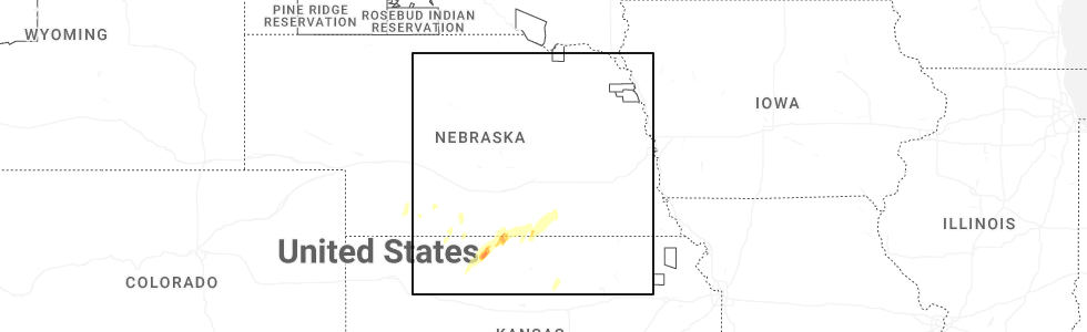
Hail Map for Guide Rock, NE
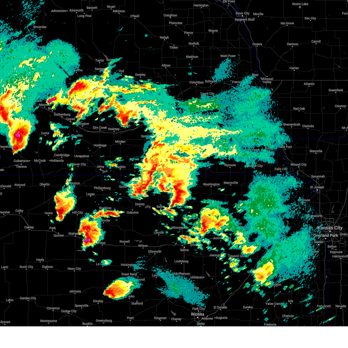
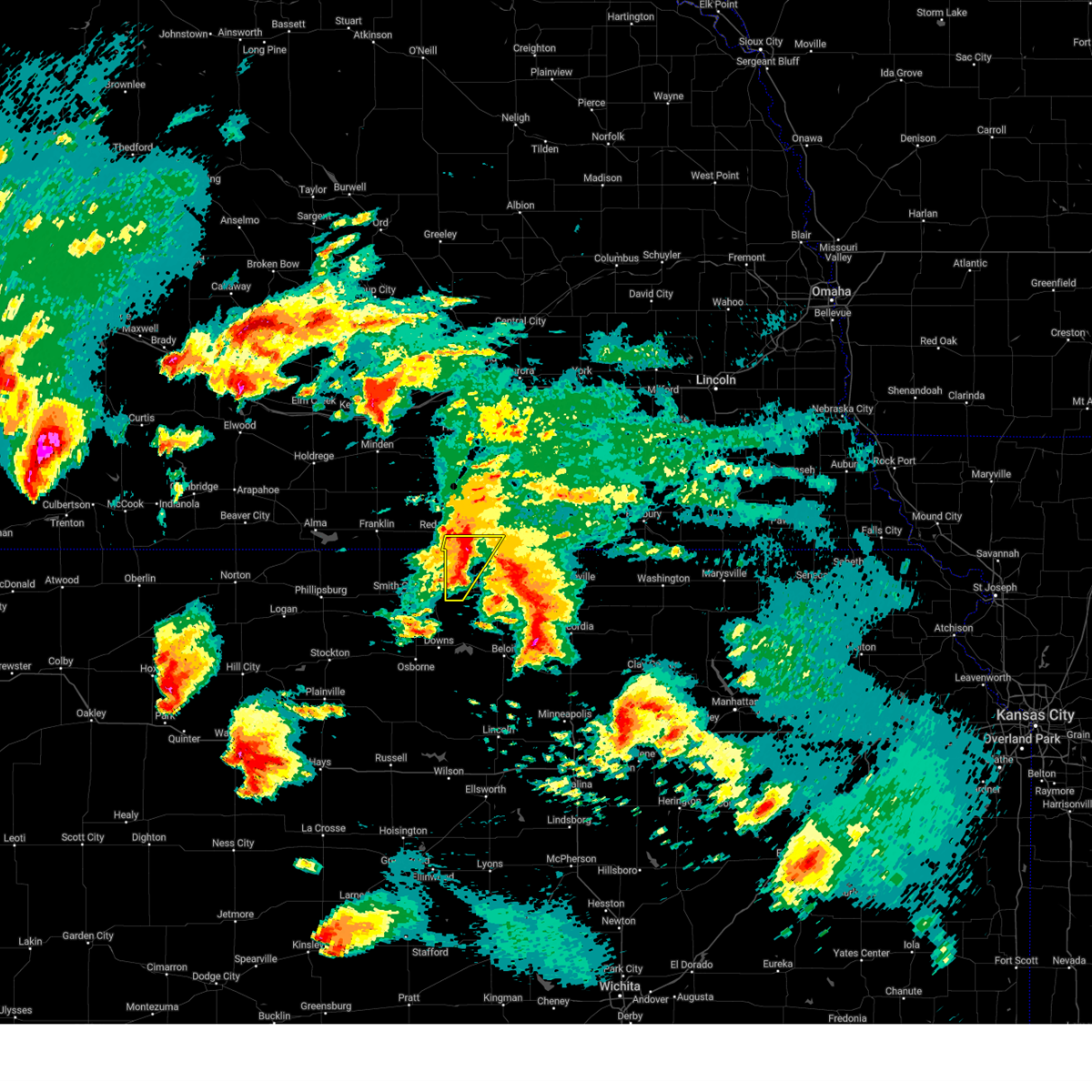
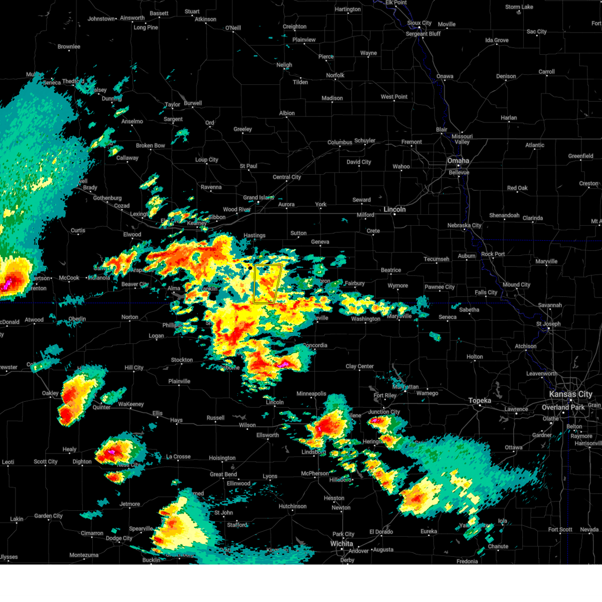
The Guide Rock, NE area has had 7 reports of on-the-ground hail by trained spotters, and has been under severe weather warnings 11 times during the past 12 months. Doppler radar has detected hail at or near Guide Rock, NE on 116 occasions, including 4 occasions during the past year.
| Name: | Guide Rock, NE |
| Where Located: | 58.9 miles S of Grand Island, NE |
| Map: | Google Map for Guide Rock, NE |
| Population: | 225 |
| Housing Units: | 150 |
| More Info: | Search Google for Guide Rock, NE |
2
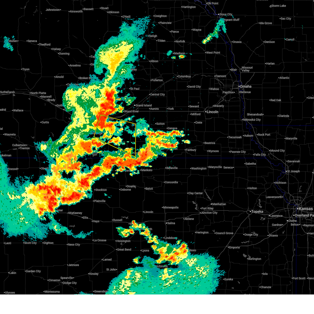
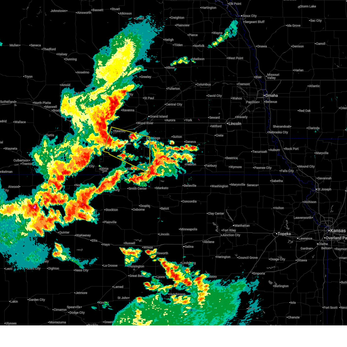
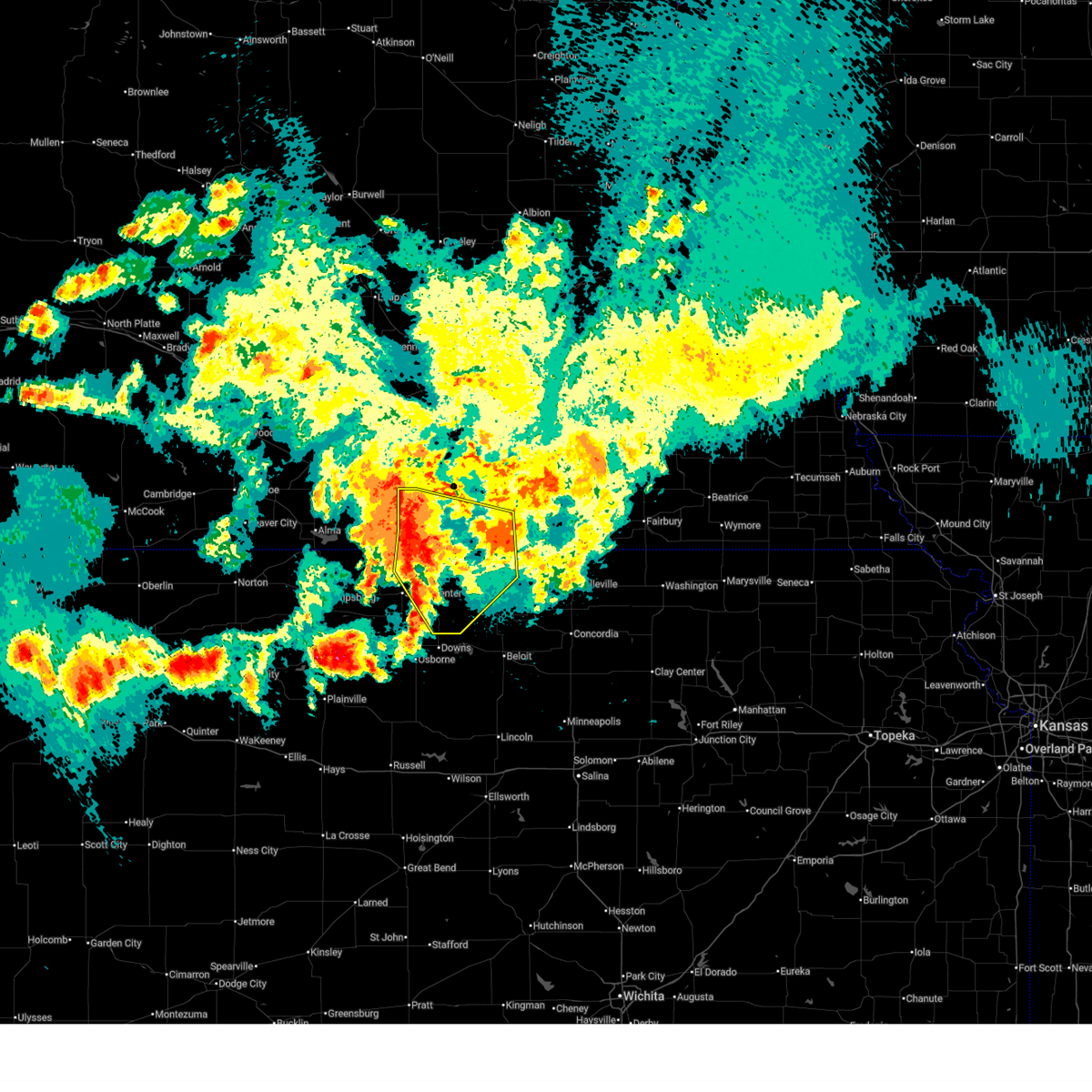
The Top Recent Hail Date for Guide Rock, NE is Monday, October 21, 2024 (14th out of 116)
Hail and Wind Damage Spotted near Guide Rock, NE
| Date / Time | Report Details |
|---|---|
| 6/30/2025 3:19 AM CDT |
 At 319 am cdt, a severe thunderstorm was located over norman, or 20 miles southeast of kearney, moving east at 35 mph (emergency management). Hazards include 60 mph wind gusts. Expect damage to roofs, siding, and trees. this severe storm will be near, norman around 325 am cdt. holstein around 330 am cdt. blue hill around 355 am cdt. This includes interstate 80 between mile markers 269 and 285. At 319 am cdt, a severe thunderstorm was located over norman, or 20 miles southeast of kearney, moving east at 35 mph (emergency management). Hazards include 60 mph wind gusts. Expect damage to roofs, siding, and trees. this severe storm will be near, norman around 325 am cdt. holstein around 330 am cdt. blue hill around 355 am cdt. This includes interstate 80 between mile markers 269 and 285.
|
| 6/30/2025 2:55 AM CDT |
 Svrgid the national weather service in hastings has issued a * severe thunderstorm warning for, webster county in south central nebraska, northern franklin county in south central nebraska, southeastern phelps county in south central nebraska, adams county in south central nebraska, kearney county in south central nebraska, southeastern buffalo county in south central nebraska, * until 345 am cdt. * at 255 am cdt, a severe thunderstorm was located near axtell, or 12 miles south of kearney, moving east at 35 mph (automated weather station). Hazards include 60 mph wind gusts. Expect damage to roofs, siding, and trees. this severe thunderstorm will be near, minden around 300 am cdt. norman around 315 am cdt. other locations in the path of this severe thunderstorm include holstein. This includes interstate 80 between mile markers 269 and 285. Svrgid the national weather service in hastings has issued a * severe thunderstorm warning for, webster county in south central nebraska, northern franklin county in south central nebraska, southeastern phelps county in south central nebraska, adams county in south central nebraska, kearney county in south central nebraska, southeastern buffalo county in south central nebraska, * until 345 am cdt. * at 255 am cdt, a severe thunderstorm was located near axtell, or 12 miles south of kearney, moving east at 35 mph (automated weather station). Hazards include 60 mph wind gusts. Expect damage to roofs, siding, and trees. this severe thunderstorm will be near, minden around 300 am cdt. norman around 315 am cdt. other locations in the path of this severe thunderstorm include holstein. This includes interstate 80 between mile markers 269 and 285.
|
| 6/16/2025 11:41 PM CDT |
 Svrgid the national weather service in hastings has issued a * severe thunderstorm warning for, jewell county in north central kansas, eastern smith county in north central kansas, webster county in south central nebraska, eastern franklin county in south central nebraska, southwestern nuckolls county in south central nebraska, * until 1230 am cdt. * at 1140 pm cdt, severe thunderstorms were located along a line extending from near campbell to riverton to 8 miles north of smith center, moving southeast at 30 mph (radar indicated). Hazards include 60 mph wind gusts and penny size hail. Expect damage to roofs, siding, and trees. severe thunderstorms will be near, campbell, riverton, and inavale around 1145 pm cdt. bellaire around 1155 pm cdt. red cloud and lebanon around 1200 am cdt. Other locations in the path of these severe thunderstorms include esbon and cowles. Svrgid the national weather service in hastings has issued a * severe thunderstorm warning for, jewell county in north central kansas, eastern smith county in north central kansas, webster county in south central nebraska, eastern franklin county in south central nebraska, southwestern nuckolls county in south central nebraska, * until 1230 am cdt. * at 1140 pm cdt, severe thunderstorms were located along a line extending from near campbell to riverton to 8 miles north of smith center, moving southeast at 30 mph (radar indicated). Hazards include 60 mph wind gusts and penny size hail. Expect damage to roofs, siding, and trees. severe thunderstorms will be near, campbell, riverton, and inavale around 1145 pm cdt. bellaire around 1155 pm cdt. red cloud and lebanon around 1200 am cdt. Other locations in the path of these severe thunderstorms include esbon and cowles.
|
| 5/18/2025 7:59 PM CDT |
 The storm which prompted the warning has weakened below severe limits, and no longer poses an immediate threat to life or property. therefore, the warning will be allowed to expire. however, small hail and gusty winds are still possible with this thunderstorm. a severe thunderstorm watch remains in effect until midnight cdt for north central kansas, and south central nebraska. The storm which prompted the warning has weakened below severe limits, and no longer poses an immediate threat to life or property. therefore, the warning will be allowed to expire. however, small hail and gusty winds are still possible with this thunderstorm. a severe thunderstorm watch remains in effect until midnight cdt for north central kansas, and south central nebraska.
|
| 5/18/2025 7:39 PM CDT |
 the severe thunderstorm warning has been cancelled and is no longer in effect the severe thunderstorm warning has been cancelled and is no longer in effect
|
| 5/18/2025 7:39 PM CDT |
 At 738 pm cdt, a severe thunderstorm was located near burr oak, or 33 miles northwest of beloit, moving northeast at 30 mph (radar indicated). Hazards include 60 mph wind gusts and half dollar size hail. Hail damage to vehicles is expected. expect wind damage to roofs, siding, and trees. this severe storm will be near, guide rock around 755 pm cdt. Bostwick around 805 pm cdt. At 738 pm cdt, a severe thunderstorm was located near burr oak, or 33 miles northwest of beloit, moving northeast at 30 mph (radar indicated). Hazards include 60 mph wind gusts and half dollar size hail. Hail damage to vehicles is expected. expect wind damage to roofs, siding, and trees. this severe storm will be near, guide rock around 755 pm cdt. Bostwick around 805 pm cdt.
|
| 5/18/2025 7:12 PM CDT | Svrgid the national weather service in hastings has issued a * severe thunderstorm warning for, northwestern jewell county in north central kansas, northeastern smith county in north central kansas, southeastern webster county in south central nebraska, southwestern nuckolls county in south central nebraska, * until 800 pm cdt. * at 712 pm cdt, a severe thunderstorm was located near esbon, or 27 miles northwest of beloit, moving northeast at 30 mph (radar indicated). Hazards include 60 mph wind gusts and half dollar size hail. Hail damage to vehicles is expected. expect wind damage to roofs, siding, and trees. this severe thunderstorm will be near, esbon around 715 pm cdt. Other locations in the path of this severe thunderstorm include burr oak. |
| 5/18/2025 6:52 PM CDT |
 The storm which prompted the warning has weakened below severe limits, and no longer poses an immediate threat to life or property. therefore, the warning will be allowed to expire. a severe thunderstorm watch remains in effect until midnight cdt for north central kansas, and south central nebraska. The storm which prompted the warning has weakened below severe limits, and no longer poses an immediate threat to life or property. therefore, the warning will be allowed to expire. a severe thunderstorm watch remains in effect until midnight cdt for north central kansas, and south central nebraska.
|
| 5/18/2025 6:44 PM CDT | At 644 pm cdt, a severe thunderstorm was located 7 miles south of lawrence, or 29 miles south of hastings, moving north at 50 mph (radar indicated). Hazards include quarter size hail. Damage to vehicles is expected. This severe storm will be near, lawrence around 650 pm cdt. |
| 5/18/2025 6:44 PM CDT | the severe thunderstorm warning has been cancelled and is no longer in effect |
| 5/18/2025 6:32 PM CDT | Svrgid the national weather service in hastings has issued a * severe thunderstorm warning for, north central jewell county in north central kansas, eastern webster county in south central nebraska, western nuckolls county in south central nebraska, * until 700 pm cdt. * at 632 pm cdt, a severe thunderstorm was located near guide rock, or 36 miles northwest of belleville, moving north at 50 mph (radar indicated). Hazards include quarter size hail. Damage to vehicles is expected. this severe thunderstorm will be near, guide rock around 635 pm cdt. Lawrence around 650 pm cdt. |
| 6/7/2024 9:42 PM CDT |
 The storm which prompted the warning has weakened below severe limits, and no longer poses an immediate threat to life or property. therefore, the warning will be allowed to expire. however, gusty winds are still possible with this thunderstorm. a severe thunderstorm watch remains in effect until 1100 pm cdt for north central kansas, and south central nebraska. The storm which prompted the warning has weakened below severe limits, and no longer poses an immediate threat to life or property. therefore, the warning will be allowed to expire. however, gusty winds are still possible with this thunderstorm. a severe thunderstorm watch remains in effect until 1100 pm cdt for north central kansas, and south central nebraska.
|
| 6/7/2024 9:26 PM CDT |
 At 925 pm cdt, a severe thunderstorm was located near cowles, or 30 miles south of hastings, moving southeast at 40 mph (automated weather station). Hazards include 70 mph wind gusts and ping pong ball size hail. People and animals outdoors will be injured. expect hail damage to roofs, siding, windows, and vehicles. expect considerable tree damage. wind damage is also likely to mobile homes, roofs, and outbuildings. This severe storm will be near, red cloud around 930 pm cdt. At 925 pm cdt, a severe thunderstorm was located near cowles, or 30 miles south of hastings, moving southeast at 40 mph (automated weather station). Hazards include 70 mph wind gusts and ping pong ball size hail. People and animals outdoors will be injured. expect hail damage to roofs, siding, windows, and vehicles. expect considerable tree damage. wind damage is also likely to mobile homes, roofs, and outbuildings. This severe storm will be near, red cloud around 930 pm cdt.
|
| 6/7/2024 9:26 PM CDT |
 the severe thunderstorm warning has been cancelled and is no longer in effect the severe thunderstorm warning has been cancelled and is no longer in effect
|
| 6/7/2024 9:05 PM CDT |
 Svrgid the national weather service in hastings has issued a * severe thunderstorm warning for, northeastern franklin county in south central nebraska, webster county in south central nebraska, southwestern adams county in south central nebraska, southeastern kearney county in south central nebraska, * until 945 pm cdt. * at 904 pm cdt, a severe thunderstorm was located near campbell, or 21 miles southwest of hastings, moving southeast at 40 mph (radar indicated). Hazards include ping pong ball size hail and 60 mph wind gusts. People and animals outdoors will be injured. expect hail damage to roofs, siding, windows, and vehicles. expect wind damage to roofs, siding, and trees. this severe thunderstorm will be near, campbell and bladen around 910 pm cdt. Other locations in the path of this severe thunderstorm include red cloud. Svrgid the national weather service in hastings has issued a * severe thunderstorm warning for, northeastern franklin county in south central nebraska, webster county in south central nebraska, southwestern adams county in south central nebraska, southeastern kearney county in south central nebraska, * until 945 pm cdt. * at 904 pm cdt, a severe thunderstorm was located near campbell, or 21 miles southwest of hastings, moving southeast at 40 mph (radar indicated). Hazards include ping pong ball size hail and 60 mph wind gusts. People and animals outdoors will be injured. expect hail damage to roofs, siding, windows, and vehicles. expect wind damage to roofs, siding, and trees. this severe thunderstorm will be near, campbell and bladen around 910 pm cdt. Other locations in the path of this severe thunderstorm include red cloud.
|
| 5/24/2024 1:54 AM CDT |
 The storms which prompted the warning have weakened below severe limits, and have exited the warned area. therefore, the warning will be allowed to expire. however, gusty winds are still possible with these thunderstorms. a severe thunderstorm watch remains in effect until 400 am cdt for south central, central and east central nebraska. The storms which prompted the warning have weakened below severe limits, and have exited the warned area. therefore, the warning will be allowed to expire. however, gusty winds are still possible with these thunderstorms. a severe thunderstorm watch remains in effect until 400 am cdt for south central, central and east central nebraska.
|
| 5/24/2024 1:25 AM CDT |
 the severe thunderstorm warning has been cancelled and is no longer in effect the severe thunderstorm warning has been cancelled and is no longer in effect
|
| 5/24/2024 1:25 AM CDT |
 At 125 am cdt, severe thunderstorms were located along a line extending from near staplehurst to hebron to near lovewell state park, moving east at 55 mph (radar indicated). Hazards include 70 mph wind gusts and quarter size hail. Hail damage to vehicles is expected. expect considerable tree damage. wind damage is also likely to mobile homes, roofs, and outbuildings. these severe storms will be near, hebron, milligan, alexandria, ohiowa, and gilead around 130 am cdt. other locations impacted by these severe thunderstorms include thayer. This includes interstate 80 between mile markers 341 and 364. At 125 am cdt, severe thunderstorms were located along a line extending from near staplehurst to hebron to near lovewell state park, moving east at 55 mph (radar indicated). Hazards include 70 mph wind gusts and quarter size hail. Hail damage to vehicles is expected. expect considerable tree damage. wind damage is also likely to mobile homes, roofs, and outbuildings. these severe storms will be near, hebron, milligan, alexandria, ohiowa, and gilead around 130 am cdt. other locations impacted by these severe thunderstorms include thayer. This includes interstate 80 between mile markers 341 and 364.
|
| 5/24/2024 1:12 AM CDT |
 Svrgid the national weather service in hastings has issued a * severe thunderstorm warning for, clay county in south central nebraska, nuckolls county in south central nebraska, southeastern webster county in south central nebraska, york county in east central nebraska, hamilton county in south central nebraska, fillmore county in south central nebraska, thayer county in south central nebraska, central merrick county in central nebraska, polk county in east central nebraska, * until 200 am cdt. * at 112 am cdt, severe thunderstorms were located along a line extending from near waco to near ruskin to near burr oak, moving east at 55 mph (radar indicated). Hazards include 70 mph wind gusts and quarter size hail. Hail damage to vehicles is expected. expect considerable tree damage. wind damage is also likely to mobile homes, roofs, and outbuildings. severe thunderstorms will be near, hebron, deshler, exeter, bruning, hardy, ohiowa, belvidere, and strang around 120 am cdt. milligan around 125 am cdt. alexandria and gilead around 130 am cdt. This includes interstate 80 between mile markers 325 and 364. Svrgid the national weather service in hastings has issued a * severe thunderstorm warning for, clay county in south central nebraska, nuckolls county in south central nebraska, southeastern webster county in south central nebraska, york county in east central nebraska, hamilton county in south central nebraska, fillmore county in south central nebraska, thayer county in south central nebraska, central merrick county in central nebraska, polk county in east central nebraska, * until 200 am cdt. * at 112 am cdt, severe thunderstorms were located along a line extending from near waco to near ruskin to near burr oak, moving east at 55 mph (radar indicated). Hazards include 70 mph wind gusts and quarter size hail. Hail damage to vehicles is expected. expect considerable tree damage. wind damage is also likely to mobile homes, roofs, and outbuildings. severe thunderstorms will be near, hebron, deshler, exeter, bruning, hardy, ohiowa, belvidere, and strang around 120 am cdt. milligan around 125 am cdt. alexandria and gilead around 130 am cdt. This includes interstate 80 between mile markers 325 and 364.
|
| 5/24/2024 1:06 AM CDT |
 At 105 am cdt, severe thunderstorms were located along a line extending from near osceola to near lushton to davenport to 8 miles south of red cloud, moving east at 60 mph (radar indicated). Hazards include 70 mph wind gusts and quarter size hail. Hail damage to vehicles is expected. expect considerable tree damage. wind damage is also likely to mobile homes, roofs, and outbuildings. these severe storms will be near, york, geneva, fairmont, mccool junction, shickley, davenport, waco, benedict, ruskin, and carleton around 110 am cdt. superior, exeter, bruning, gresham, and belvidere around 115 am cdt. deshler, milligan, hardy, and ohiowa around 120 am cdt. hebron and webber around 125 am cdt. other locations impacted by these severe thunderstorms include thayer. This includes interstate 80 between mile markers 325 and 365. At 105 am cdt, severe thunderstorms were located along a line extending from near osceola to near lushton to davenport to 8 miles south of red cloud, moving east at 60 mph (radar indicated). Hazards include 70 mph wind gusts and quarter size hail. Hail damage to vehicles is expected. expect considerable tree damage. wind damage is also likely to mobile homes, roofs, and outbuildings. these severe storms will be near, york, geneva, fairmont, mccool junction, shickley, davenport, waco, benedict, ruskin, and carleton around 110 am cdt. superior, exeter, bruning, gresham, and belvidere around 115 am cdt. deshler, milligan, hardy, and ohiowa around 120 am cdt. hebron and webber around 125 am cdt. other locations impacted by these severe thunderstorms include thayer. This includes interstate 80 between mile markers 325 and 365.
|
| 5/24/2024 1:06 AM CDT |
 the severe thunderstorm warning has been cancelled and is no longer in effect the severe thunderstorm warning has been cancelled and is no longer in effect
|
| 5/24/2024 12:52 AM CDT |
 At 1251 am cdt, severe thunderstorms were located along a line extending from near hordville to near stockham to near nelson to 8 miles north of bellaire, moving east at 60 mph (radar indicated). Hazards include 70 mph wind gusts and quarter size hail. Hail damage to vehicles is expected. expect considerable tree damage. wind damage is also likely to mobile homes, roofs, and outbuildings. these severe storms will be near, sutton, henderson, edgar, nelson, hampton, bradshaw, guide rock, oak, ong, and saronville around 1255 am cdt. davenport, grafton, and lushton around 100 am cdt. york, mccool junction, shickley, benedict, carleton, and nora around 105 am cdt. geneva, fairmont, strang, and bostwick around 110 am cdt. exeter, bruning, waco, gresham, and ruskin around 115 am cdt. superior, milligan, and ohiowa around 120 am cdt. belvidere around 125 am cdt. other locations impacted by these severe thunderstorms include thayer. This includes interstate 80 between mile markers 293 and 365. At 1251 am cdt, severe thunderstorms were located along a line extending from near hordville to near stockham to near nelson to 8 miles north of bellaire, moving east at 60 mph (radar indicated). Hazards include 70 mph wind gusts and quarter size hail. Hail damage to vehicles is expected. expect considerable tree damage. wind damage is also likely to mobile homes, roofs, and outbuildings. these severe storms will be near, sutton, henderson, edgar, nelson, hampton, bradshaw, guide rock, oak, ong, and saronville around 1255 am cdt. davenport, grafton, and lushton around 100 am cdt. york, mccool junction, shickley, benedict, carleton, and nora around 105 am cdt. geneva, fairmont, strang, and bostwick around 110 am cdt. exeter, bruning, waco, gresham, and ruskin around 115 am cdt. superior, milligan, and ohiowa around 120 am cdt. belvidere around 125 am cdt. other locations impacted by these severe thunderstorms include thayer. This includes interstate 80 between mile markers 293 and 365.
|
| 5/24/2024 12:52 AM CDT |
 the severe thunderstorm warning has been cancelled and is no longer in effect the severe thunderstorm warning has been cancelled and is no longer in effect
|
| 5/24/2024 12:41 AM CDT |
 Svrgid the national weather service in hastings has issued a * severe thunderstorm warning for, northern jewell county in north central kansas, northern smith county in north central kansas, northeastern phillips county in north central kansas, webster county in south central nebraska, adams county in south central nebraska, hamilton county in south central nebraska, eastern buffalo county in south central nebraska, southern polk county in east central nebraska, hall county in south central nebraska, clay county in south central nebraska, franklin county in south central nebraska, nuckolls county in south central nebraska, eastern kearney county in south central nebraska, york county in east central nebraska, fillmore county in south central nebraska, thayer county in south central nebraska, southwestern merrick county in central nebraska, southern howard county in central nebraska, * until 115 am cdt. * at 1237 am cdt, severe thunderstorms were located along a line extending from near chapman to near trumbull to near lawrence to 6 miles north of kensington, moving east at 60 mph (radar indicated). Hazards include 70 mph wind gusts and quarter size hail. Hail damage to vehicles is expected. expect considerable tree damage. wind damage is also likely to mobile homes, roofs, and outbuildings. severe thunderstorms will be near, aurora, red cloud, harvard, fairfield, giltner, glenvil, lawrence, marquette, inland, and deweese around 1240 am cdt. clay center, nelson, and guide rock around 1245 am cdt. sutton, edgar, hampton, saronville, and stockham around 1250 am cdt. henderson, bradshaw, oak, and ong around 1255 am cdt. other locations in the path of these severe thunderstorms include davenport, benedict, grafton, lushton, nora, york, fairmont, mccool junction, shickley, carleton, bostwick, geneva and strang. This includes interstate 80 between mile markers 286 and 365. Svrgid the national weather service in hastings has issued a * severe thunderstorm warning for, northern jewell county in north central kansas, northern smith county in north central kansas, northeastern phillips county in north central kansas, webster county in south central nebraska, adams county in south central nebraska, hamilton county in south central nebraska, eastern buffalo county in south central nebraska, southern polk county in east central nebraska, hall county in south central nebraska, clay county in south central nebraska, franklin county in south central nebraska, nuckolls county in south central nebraska, eastern kearney county in south central nebraska, york county in east central nebraska, fillmore county in south central nebraska, thayer county in south central nebraska, southwestern merrick county in central nebraska, southern howard county in central nebraska, * until 115 am cdt. * at 1237 am cdt, severe thunderstorms were located along a line extending from near chapman to near trumbull to near lawrence to 6 miles north of kensington, moving east at 60 mph (radar indicated). Hazards include 70 mph wind gusts and quarter size hail. Hail damage to vehicles is expected. expect considerable tree damage. wind damage is also likely to mobile homes, roofs, and outbuildings. severe thunderstorms will be near, aurora, red cloud, harvard, fairfield, giltner, glenvil, lawrence, marquette, inland, and deweese around 1240 am cdt. clay center, nelson, and guide rock around 1245 am cdt. sutton, edgar, hampton, saronville, and stockham around 1250 am cdt. henderson, bradshaw, oak, and ong around 1255 am cdt. other locations in the path of these severe thunderstorms include davenport, benedict, grafton, lushton, nora, york, fairmont, mccool junction, shickley, carleton, bostwick, geneva and strang. This includes interstate 80 between mile markers 286 and 365.
|
| 5/24/2024 12:38 AM CDT |
 the severe thunderstorm warning has been cancelled and is no longer in effect the severe thunderstorm warning has been cancelled and is no longer in effect
|
| 5/24/2024 12:38 AM CDT |
 At 1233 am cdt, severe thunderstorms were located along a line extending from near archer to near rosemont to 7 miles south of riverton, moving east at 55 mph (radar indicated). Hazards include 70 mph wind gusts and quarter size hail. Hail damage to vehicles is expected. expect considerable tree damage. wind damage is also likely to mobile homes, roofs, and outbuildings. these severe storms will be near, red cloud, harvard, giltner, glenvil, lawrence, chapman, marquette, inland, cowles, and rosemont around 1240 am cdt. guide rock around 1250 am cdt. This includes interstate 80 between mile markers 275 and 329. At 1233 am cdt, severe thunderstorms were located along a line extending from near archer to near rosemont to 7 miles south of riverton, moving east at 55 mph (radar indicated). Hazards include 70 mph wind gusts and quarter size hail. Hail damage to vehicles is expected. expect considerable tree damage. wind damage is also likely to mobile homes, roofs, and outbuildings. these severe storms will be near, red cloud, harvard, giltner, glenvil, lawrence, chapman, marquette, inland, cowles, and rosemont around 1240 am cdt. guide rock around 1250 am cdt. This includes interstate 80 between mile markers 275 and 329.
|
| 5/23/2024 11:55 PM CDT |
 Svrgid the national weather service in hastings has issued a * severe thunderstorm warning for, northern smith county in north central kansas, northern phillips county in north central kansas, webster county in south central nebraska, adams county in south central nebraska, western hamilton county in south central nebraska, buffalo county in south central nebraska, eastern harlan county in south central nebraska, hall county in south central nebraska, western clay county in south central nebraska, franklin county in south central nebraska, western nuckolls county in south central nebraska, eastern phelps county in south central nebraska, kearney county in south central nebraska, southern sherman county in central nebraska, southwestern merrick county in central nebraska, southern howard county in central nebraska, * until 1245 am cdt. * at 1155 pm cdt, severe thunderstorms were located along a line extending from 7 miles south of boelus to near franklin to near phillipsburg, moving east at 55 mph (radar indicated). Hazards include 70 mph wind gusts and quarter size hail. Hail damage to vehicles is expected. expect considerable tree damage. wind damage is also likely to mobile homes, roofs, and outbuildings. severe thunderstorms will be near, wood river, shelton, franklin, kenesaw, cairo, campbell, heartwell, and norman around 1200 am cdt. holstein, riverton, and prosser around 1205 am cdt. juniata, alda, bladen, and roseland around 1210 am cdt. grand island, hastings, doniphan, and ayr around 1215 am cdt. other locations in the path of these severe thunderstorms include blue hill, hansen, inavale, phillips, trumbull, cowles, rosemont, red cloud, giltner, glenvil, lawrence, chapman, inland and harvard. This includes interstate 80 between mile markers 260 and 329. Svrgid the national weather service in hastings has issued a * severe thunderstorm warning for, northern smith county in north central kansas, northern phillips county in north central kansas, webster county in south central nebraska, adams county in south central nebraska, western hamilton county in south central nebraska, buffalo county in south central nebraska, eastern harlan county in south central nebraska, hall county in south central nebraska, western clay county in south central nebraska, franklin county in south central nebraska, western nuckolls county in south central nebraska, eastern phelps county in south central nebraska, kearney county in south central nebraska, southern sherman county in central nebraska, southwestern merrick county in central nebraska, southern howard county in central nebraska, * until 1245 am cdt. * at 1155 pm cdt, severe thunderstorms were located along a line extending from 7 miles south of boelus to near franklin to near phillipsburg, moving east at 55 mph (radar indicated). Hazards include 70 mph wind gusts and quarter size hail. Hail damage to vehicles is expected. expect considerable tree damage. wind damage is also likely to mobile homes, roofs, and outbuildings. severe thunderstorms will be near, wood river, shelton, franklin, kenesaw, cairo, campbell, heartwell, and norman around 1200 am cdt. holstein, riverton, and prosser around 1205 am cdt. juniata, alda, bladen, and roseland around 1210 am cdt. grand island, hastings, doniphan, and ayr around 1215 am cdt. other locations in the path of these severe thunderstorms include blue hill, hansen, inavale, phillips, trumbull, cowles, rosemont, red cloud, giltner, glenvil, lawrence, chapman, inland and harvard. This includes interstate 80 between mile markers 260 and 329.
|
| 5/6/2024 4:48 PM CDT |
 The storms which prompted the warning have weakened below severe limits, and have exited the warned area. therefore, the warning has been allowed to expire. however, small hail and gusty winds are still possible with these thunderstorms. a tornado watch remains in effect until 700 pm cdt for north central kansas, and south central nebraska. The storms which prompted the warning have weakened below severe limits, and have exited the warned area. therefore, the warning has been allowed to expire. however, small hail and gusty winds are still possible with these thunderstorms. a tornado watch remains in effect until 700 pm cdt for north central kansas, and south central nebraska.
|
| 5/6/2024 4:25 PM CDT | Storm damage reported in webster county NE, 9.5 miles S of Guide Rock, NE |
| 5/6/2024 4:23 PM CDT | Deputy sent photos of a tipped camper and minor tree damage. time estimated from rada in webster county NE, 7.9 miles SSE of Guide Rock, NE |
| 5/6/2024 4:14 PM CDT |
 Svrgid the national weather service in hastings has issued a * severe thunderstorm warning for, northwestern jewell county in north central kansas, northeastern smith county in north central kansas, southwestern nuckolls county in south central nebraska, southeastern webster county in south central nebraska, * until 445 pm cdt. * at 413 pm cdt, severe thunderstorms were located along a line extending from 6 miles south of red cloud to near lebanon, moving northeast at 50 mph. this replaces the previous warning in effect for smith and jewell counties in kansas (radar indicated). Hazards include quarter size hail. Damage to vehicles is expected. severe thunderstorms will be near, guide rock and esbon around 420 pm cdt. Burr oak around 425 pm cdt. Svrgid the national weather service in hastings has issued a * severe thunderstorm warning for, northwestern jewell county in north central kansas, northeastern smith county in north central kansas, southwestern nuckolls county in south central nebraska, southeastern webster county in south central nebraska, * until 445 pm cdt. * at 413 pm cdt, severe thunderstorms were located along a line extending from 6 miles south of red cloud to near lebanon, moving northeast at 50 mph. this replaces the previous warning in effect for smith and jewell counties in kansas (radar indicated). Hazards include quarter size hail. Damage to vehicles is expected. severe thunderstorms will be near, guide rock and esbon around 420 pm cdt. Burr oak around 425 pm cdt.
|
| 5/3/2024 10:57 PM CDT |
 Svrgid the national weather service in hastings has issued a * severe thunderstorm warning for, northwestern jewell county in north central kansas, clay county in south central nebraska, nuckolls county in south central nebraska, eastern webster county in south central nebraska, eastern adams county in south central nebraska, southwestern hamilton county in south central nebraska, southwestern fillmore county in south central nebraska, northwestern thayer county in south central nebraska, southern hall county in south central nebraska, * until 1145 pm cdt. * at 1057 pm cdt, severe thunderstorms were located along a line extending from near prosser to near hastings to near cowles to near riverton, moving east at 30 mph (radar indicated). Hazards include 60 mph wind gusts and quarter size hail. Hail damage to vehicles is expected. expect wind damage to roofs, siding, and trees. severe thunderstorms will be near, hastings, glenvil, cowles, and rosemont around 1100 pm cdt. lawrence and hansen around 1105 pm cdt. doniphan, trumbull, and inland around 1110 pm cdt. guide rock and deweese around 1115 pm cdt. other locations in the path of these severe thunderstorms include fairfield, harvard, clay center, nelson, giltner and edgar. This includes interstate 80 between mile markers 296 and 333. Svrgid the national weather service in hastings has issued a * severe thunderstorm warning for, northwestern jewell county in north central kansas, clay county in south central nebraska, nuckolls county in south central nebraska, eastern webster county in south central nebraska, eastern adams county in south central nebraska, southwestern hamilton county in south central nebraska, southwestern fillmore county in south central nebraska, northwestern thayer county in south central nebraska, southern hall county in south central nebraska, * until 1145 pm cdt. * at 1057 pm cdt, severe thunderstorms were located along a line extending from near prosser to near hastings to near cowles to near riverton, moving east at 30 mph (radar indicated). Hazards include 60 mph wind gusts and quarter size hail. Hail damage to vehicles is expected. expect wind damage to roofs, siding, and trees. severe thunderstorms will be near, hastings, glenvil, cowles, and rosemont around 1100 pm cdt. lawrence and hansen around 1105 pm cdt. doniphan, trumbull, and inland around 1110 pm cdt. guide rock and deweese around 1115 pm cdt. other locations in the path of these severe thunderstorms include fairfield, harvard, clay center, nelson, giltner and edgar. This includes interstate 80 between mile markers 296 and 333.
|
| 5/2/2024 1:03 AM CDT |
 At 102 am cdt, severe thunderstorms were located along a line extending from near lawrence to near nora to near jewell, moving east at 55 mph (automated weather station). Hazards include 60 to 70 mph wind gusts and penny size hail. the most likely area for 70 mph gusts is along the nebraska, kansas state line. Expect considerable tree damage. damage is likely to mobile homes, roofs, and outbuildings. these severe storms will be near, hardy, ruskin, formoso, deweese, oak, randall, and nora around 110 am cdt. deshler, edgar, and byron around 115 am cdt. Davenport around 120 am cdt. At 102 am cdt, severe thunderstorms were located along a line extending from near lawrence to near nora to near jewell, moving east at 55 mph (automated weather station). Hazards include 60 to 70 mph wind gusts and penny size hail. the most likely area for 70 mph gusts is along the nebraska, kansas state line. Expect considerable tree damage. damage is likely to mobile homes, roofs, and outbuildings. these severe storms will be near, hardy, ruskin, formoso, deweese, oak, randall, and nora around 110 am cdt. deshler, edgar, and byron around 115 am cdt. Davenport around 120 am cdt.
|
| 5/2/2024 12:40 AM CDT |
 Svrgid the national weather service in hastings has issued a * severe thunderstorm warning for, jewell county in north central kansas, eastern smith county in north central kansas, southern clay county in south central nebraska, nuckolls county in south central nebraska, webster county in south central nebraska, southeastern adams county in south central nebraska, western thayer county in south central nebraska, * until 130 am cdt. * at 1240 am cdt, severe thunderstorms were located along a line extending from near bladen to near guide rock to 7 miles north of downs, moving east at 55 mph (automated weather station). Hazards include 70 mph wind gusts and penny size hail. Expect considerable tree damage. damage is likely to mobile homes, roofs, and outbuildings. severe thunderstorms will be near, blue hill, guide rock, burr oak, ionia, cowles, and bostwick around 1245 am cdt. superior, mankato, and rosemont around 1250 am cdt. lawrence around 1255 am cdt. nelson, jewell, deweese, webber, nora, lovewell state park, and montrose around 100 am cdt. Other locations in the path of these severe thunderstorms include hardy, ruskin, formoso, edgar, fairfield, oak, deshler, davenport and byron. Svrgid the national weather service in hastings has issued a * severe thunderstorm warning for, jewell county in north central kansas, eastern smith county in north central kansas, southern clay county in south central nebraska, nuckolls county in south central nebraska, webster county in south central nebraska, southeastern adams county in south central nebraska, western thayer county in south central nebraska, * until 130 am cdt. * at 1240 am cdt, severe thunderstorms were located along a line extending from near bladen to near guide rock to 7 miles north of downs, moving east at 55 mph (automated weather station). Hazards include 70 mph wind gusts and penny size hail. Expect considerable tree damage. damage is likely to mobile homes, roofs, and outbuildings. severe thunderstorms will be near, blue hill, guide rock, burr oak, ionia, cowles, and bostwick around 1245 am cdt. superior, mankato, and rosemont around 1250 am cdt. lawrence around 1255 am cdt. nelson, jewell, deweese, webber, nora, lovewell state park, and montrose around 100 am cdt. Other locations in the path of these severe thunderstorms include hardy, ruskin, formoso, edgar, fairfield, oak, deshler, davenport and byron.
|
| 4/16/2024 2:45 AM CDT | Storm damage reported in nuckolls county NE, 6.1 miles WSW of Guide Rock, NE |
| 4/16/2024 2:41 AM CDT |
 This warning has been replaced by a new severe thunderstorm warning in effect for parts of several additional counties until 315 am cdt. please refer to this newer warning for the latest information. a tornado watch remains in effect until 800 am cdt for south central nebraska. This warning has been replaced by a new severe thunderstorm warning in effect for parts of several additional counties until 315 am cdt. please refer to this newer warning for the latest information. a tornado watch remains in effect until 800 am cdt for south central nebraska.
|
| 4/16/2024 2:30 AM CDT |
 Svrgid the national weather service in hastings has issued a * severe thunderstorm warning for, jewell county in north central kansas, clay county in south central nebraska, northeastern franklin county in south central nebraska, nuckolls county in south central nebraska, webster county in south central nebraska, northeastern phelps county in south central nebraska, adams county in south central nebraska, kearney county in south central nebraska, southwestern hamilton county in south central nebraska, buffalo county in south central nebraska, western thayer county in south central nebraska, hall county in south central nebraska, * until 315 am cdt. * at 230 am cdt, severe thunderstorms were located along a line extending from near odessa to near bladen to mankato, moving northeast at 65 mph (radar indicated). Hazards include 60 mph wind gusts and penny size hail. Expect damage to roofs, siding, and trees. severe thunderstorms will be near, kearney, blue hill, roseland, guide rock, holstein, ayr, heartwell, norman, lovewell state park, and rosemont around 235 am cdt. superior, gibbon, kenesaw, juniata, lawrence, and webber around 240 am cdt. hastings, shelton, nelson, glenvil, hardy, deweese, prosser, and nora around 245 am cdt. wood river, edgar, fairfield, ruskin, inland, byron, oak, and hansen around 250 am cdt. other locations in the path of these severe thunderstorms include harvard, doniphan, clay center, deshler, trumbull, alda, giltner, davenport, ong and saronville. This includes interstate 80 between mile markers 257 and 317. Svrgid the national weather service in hastings has issued a * severe thunderstorm warning for, jewell county in north central kansas, clay county in south central nebraska, northeastern franklin county in south central nebraska, nuckolls county in south central nebraska, webster county in south central nebraska, northeastern phelps county in south central nebraska, adams county in south central nebraska, kearney county in south central nebraska, southwestern hamilton county in south central nebraska, buffalo county in south central nebraska, western thayer county in south central nebraska, hall county in south central nebraska, * until 315 am cdt. * at 230 am cdt, severe thunderstorms were located along a line extending from near odessa to near bladen to mankato, moving northeast at 65 mph (radar indicated). Hazards include 60 mph wind gusts and penny size hail. Expect damage to roofs, siding, and trees. severe thunderstorms will be near, kearney, blue hill, roseland, guide rock, holstein, ayr, heartwell, norman, lovewell state park, and rosemont around 235 am cdt. superior, gibbon, kenesaw, juniata, lawrence, and webber around 240 am cdt. hastings, shelton, nelson, glenvil, hardy, deweese, prosser, and nora around 245 am cdt. wood river, edgar, fairfield, ruskin, inland, byron, oak, and hansen around 250 am cdt. other locations in the path of these severe thunderstorms include harvard, doniphan, clay center, deshler, trumbull, alda, giltner, davenport, ong and saronville. This includes interstate 80 between mile markers 257 and 317.
|
| 4/16/2024 2:13 AM CDT |
 Svrgid the national weather service in hastings has issued a * severe thunderstorm warning for, western jewell county in north central kansas, eastern smith county in north central kansas, southwestern nuckolls county in south central nebraska, webster county in south central nebraska, southwestern adams county in south central nebraska, * until 245 am cdt. * at 213 am cdt, severe thunderstorms were located along a line extending from near franklin to near lebanon to 9 miles west of ionia, moving north at 50 mph (radar indicated). Hazards include 60 mph wind gusts and quarter size hail. Hail damage to vehicles is expected. expect wind damage to roofs, siding, and trees. severe thunderstorms will be near, red cloud, esbon, and inavale around 220 am cdt. cowles around 230 am cdt. Other locations in the path of these severe thunderstorms include bladen and guide rock. Svrgid the national weather service in hastings has issued a * severe thunderstorm warning for, western jewell county in north central kansas, eastern smith county in north central kansas, southwestern nuckolls county in south central nebraska, webster county in south central nebraska, southwestern adams county in south central nebraska, * until 245 am cdt. * at 213 am cdt, severe thunderstorms were located along a line extending from near franklin to near lebanon to 9 miles west of ionia, moving north at 50 mph (radar indicated). Hazards include 60 mph wind gusts and quarter size hail. Hail damage to vehicles is expected. expect wind damage to roofs, siding, and trees. severe thunderstorms will be near, red cloud, esbon, and inavale around 220 am cdt. cowles around 230 am cdt. Other locations in the path of these severe thunderstorms include bladen and guide rock.
|
| 4/6/2024 4:44 PM CDT |
 the severe thunderstorm warning has been cancelled and is no longer in effect the severe thunderstorm warning has been cancelled and is no longer in effect
|
| 4/6/2024 4:44 PM CDT |
 At 443 pm cdt, severe thunderstorms were located along a line extending from near dannebrog to near giltner to near byron, moving north at 45 mph (radar indicated). Hazards include 70 mph wind gusts. Expect considerable tree damage. damage is likely to mobile homes, roofs, and outbuildings. these severe storms will be near, grand island, deshler, giltner, dannebrog, davenport, phillips, ong, saronville, and st. libory around 450 pm cdt. aurora, st. paul, sutton, carleton, and stockham around 455 pm cdt. shickley and chapman around 500 pm cdt. palmer and marquette around 505 pm cdt. central city and archer around 510 pm cdt. This includes interstate 80 between mile markers 298 and 338. At 443 pm cdt, severe thunderstorms were located along a line extending from near dannebrog to near giltner to near byron, moving north at 45 mph (radar indicated). Hazards include 70 mph wind gusts. Expect considerable tree damage. damage is likely to mobile homes, roofs, and outbuildings. these severe storms will be near, grand island, deshler, giltner, dannebrog, davenport, phillips, ong, saronville, and st. libory around 450 pm cdt. aurora, st. paul, sutton, carleton, and stockham around 455 pm cdt. shickley and chapman around 500 pm cdt. palmer and marquette around 505 pm cdt. central city and archer around 510 pm cdt. This includes interstate 80 between mile markers 298 and 338.
|
| 4/6/2024 4:28 PM CDT |
 Svrgid the national weather service in hastings has issued a * severe thunderstorm warning for, northern jewell county in north central kansas, clay county in south central nebraska, nuckolls county in south central nebraska, webster county in south central nebraska, adams county in south central nebraska, hamilton county in south central nebraska, southwestern fillmore county in south central nebraska, western thayer county in south central nebraska, southwestern merrick county in central nebraska, southeastern howard county in central nebraska, hall county in south central nebraska, * until 515 pm cdt. * at 427 pm cdt, severe thunderstorms were located along a line extending from near wood river to near trumbull to hardy, moving north at 45 mph (radar indicated). Hazards include 70 mph wind gusts. Expect considerable tree damage. damage is likely to mobile homes, roofs, and outbuildings. severe thunderstorms will be near, grand island, doniphan, alda, edgar, fairfield, trumbull, ruskin, inland, oak, and nora around 435 pm cdt. harvard, clay center, and dannebrog around 440 pm cdt. giltner and phillips around 445 pm cdt. other locations in the path of these severe thunderstorms include st. paul, davenport, st. libory, ong, saronville, chapman, aurora, sutton and stockham. This includes interstate 80 between mile markers 298 and 338. Svrgid the national weather service in hastings has issued a * severe thunderstorm warning for, northern jewell county in north central kansas, clay county in south central nebraska, nuckolls county in south central nebraska, webster county in south central nebraska, adams county in south central nebraska, hamilton county in south central nebraska, southwestern fillmore county in south central nebraska, western thayer county in south central nebraska, southwestern merrick county in central nebraska, southeastern howard county in central nebraska, hall county in south central nebraska, * until 515 pm cdt. * at 427 pm cdt, severe thunderstorms were located along a line extending from near wood river to near trumbull to hardy, moving north at 45 mph (radar indicated). Hazards include 70 mph wind gusts. Expect considerable tree damage. damage is likely to mobile homes, roofs, and outbuildings. severe thunderstorms will be near, grand island, doniphan, alda, edgar, fairfield, trumbull, ruskin, inland, oak, and nora around 435 pm cdt. harvard, clay center, and dannebrog around 440 pm cdt. giltner and phillips around 445 pm cdt. other locations in the path of these severe thunderstorms include st. paul, davenport, st. libory, ong, saronville, chapman, aurora, sutton and stockham. This includes interstate 80 between mile markers 298 and 338.
|
| 4/6/2024 4:14 PM CDT |
 At 413 pm cdt, severe thunderstorms were located along a line extending from near kenesaw to near glenvil to near webber, moving north at 45 mph. the strongest portion of this line of storms is moving north along the nuckolls and webster county line (radar indicated). Hazards include 70 mph wind gusts. Expect considerable tree damage. damage is likely to mobile homes, roofs, and outbuildings. these severe storms will be near, hastings, superior, nelson, glenvil, deweese, and prosser around 420 pm cdt. fairfield, inland, and hansen around 425 pm cdt. trumbull and nora around 430 pm cdt. harvard and clay center around 435 pm cdt. Edgar and oak around 440 pm cdt. At 413 pm cdt, severe thunderstorms were located along a line extending from near kenesaw to near glenvil to near webber, moving north at 45 mph. the strongest portion of this line of storms is moving north along the nuckolls and webster county line (radar indicated). Hazards include 70 mph wind gusts. Expect considerable tree damage. damage is likely to mobile homes, roofs, and outbuildings. these severe storms will be near, hastings, superior, nelson, glenvil, deweese, and prosser around 420 pm cdt. fairfield, inland, and hansen around 425 pm cdt. trumbull and nora around 430 pm cdt. harvard and clay center around 435 pm cdt. Edgar and oak around 440 pm cdt.
|
| 4/6/2024 4:14 PM CDT |
 the severe thunderstorm warning has been cancelled and is no longer in effect the severe thunderstorm warning has been cancelled and is no longer in effect
|
| 4/6/2024 4:04 PM CDT |
 At 404 pm cdt, severe thunderstorms were located along a line extending from near kenesaw to near lawrence to near montrose, moving north at 45 mph (radar indicated). Hazards include 70 mph wind gusts. Expect considerable tree damage. damage is likely to mobile homes, roofs, and outbuildings. these severe storms will be near, hastings, superior, kenesaw, juniata, lawrence, prosser, webber, lovewell state park, and bostwick around 410 pm cdt. nelson, glenvil, and deweese around 415 pm cdt. fairfield, trumbull, inland, nora, and hansen around 425 pm cdt. Harvard and clay center around 435 pm cdt. At 404 pm cdt, severe thunderstorms were located along a line extending from near kenesaw to near lawrence to near montrose, moving north at 45 mph (radar indicated). Hazards include 70 mph wind gusts. Expect considerable tree damage. damage is likely to mobile homes, roofs, and outbuildings. these severe storms will be near, hastings, superior, kenesaw, juniata, lawrence, prosser, webber, lovewell state park, and bostwick around 410 pm cdt. nelson, glenvil, and deweese around 415 pm cdt. fairfield, trumbull, inland, nora, and hansen around 425 pm cdt. Harvard and clay center around 435 pm cdt.
|
| 4/6/2024 3:51 PM CDT |
 Svrgid the national weather service in hastings has issued a * severe thunderstorm warning for, mitchell county in north central kansas, jewell county in north central kansas, eastern smith county in north central kansas, clay county in south central nebraska, eastern franklin county in south central nebraska, nuckolls county in south central nebraska, webster county in south central nebraska, adams county in south central nebraska, southeastern kearney county in south central nebraska, * until 430 pm cdt. * at 351 pm cdt, severe thunderstorms were located along a line extending from near holstein to near rosemont to near jewell, moving north at 45 mph (radar indicated). Hazards include 70 mph wind gusts. Expect considerable tree damage. damage is likely to mobile homes, roofs, and outbuildings. severe thunderstorms will be near, blue hill, lawrence, roseland, holstein, montrose, rosemont, and bostwick around 355 pm cdt. ayr around 400 pm cdt. superior, kenesaw, juniata, webber, and lovewell state park around 405 pm cdt. hastings and prosser around 410 pm cdt. Other locations in the path of these severe thunderstorms include nelson, glenvil, deweese, fairfield, inland and hansen. Svrgid the national weather service in hastings has issued a * severe thunderstorm warning for, mitchell county in north central kansas, jewell county in north central kansas, eastern smith county in north central kansas, clay county in south central nebraska, eastern franklin county in south central nebraska, nuckolls county in south central nebraska, webster county in south central nebraska, adams county in south central nebraska, southeastern kearney county in south central nebraska, * until 430 pm cdt. * at 351 pm cdt, severe thunderstorms were located along a line extending from near holstein to near rosemont to near jewell, moving north at 45 mph (radar indicated). Hazards include 70 mph wind gusts. Expect considerable tree damage. damage is likely to mobile homes, roofs, and outbuildings. severe thunderstorms will be near, blue hill, lawrence, roseland, holstein, montrose, rosemont, and bostwick around 355 pm cdt. ayr around 400 pm cdt. superior, kenesaw, juniata, webber, and lovewell state park around 405 pm cdt. hastings and prosser around 410 pm cdt. Other locations in the path of these severe thunderstorms include nelson, glenvil, deweese, fairfield, inland and hansen.
|
| 4/6/2024 3:31 PM CDT |
 At 330 pm cdt, severe thunderstorms were located along a line extending from 7 miles northwest of riverton to near esbon to 6 miles west of beloit, moving north at 45 mph (radar indicated). Hazards include 70 mph wind gusts. Expect considerable tree damage. damage is likely to mobile homes, roofs, and outbuildings. these severe storms will be near, red cloud, burr oak, and inavale around 335 pm cdt. mankato, jewell, and campbell around 340 pm cdt. bladen, guide rock, and cowles around 345 pm cdt. montrose around 355 pm cdt. rosemont and bostwick around 400 pm cdt. Lawrence around 405 pm cdt. At 330 pm cdt, severe thunderstorms were located along a line extending from 7 miles northwest of riverton to near esbon to 6 miles west of beloit, moving north at 45 mph (radar indicated). Hazards include 70 mph wind gusts. Expect considerable tree damage. damage is likely to mobile homes, roofs, and outbuildings. these severe storms will be near, red cloud, burr oak, and inavale around 335 pm cdt. mankato, jewell, and campbell around 340 pm cdt. bladen, guide rock, and cowles around 345 pm cdt. montrose around 355 pm cdt. rosemont and bostwick around 400 pm cdt. Lawrence around 405 pm cdt.
|
| 4/6/2024 3:15 PM CDT |
 Svrgid the national weather service in hastings has issued a * severe thunderstorm warning for, mitchell county in north central kansas, jewell county in north central kansas, smith county in north central kansas, osborne county in north central kansas, eastern franklin county in south central nebraska, nuckolls county in south central nebraska, webster county in south central nebraska, * until 400 pm cdt. * at 315 pm cdt, severe thunderstorms were located along a line extending from 6 miles southeast of franklin to 6 miles west of ionia to victor, moving north at 45 mph (radar indicated). Hazards include 70 mph wind gusts. Expect considerable tree damage. damage is likely to mobile homes, roofs, and outbuildings. severe thunderstorms will be near, glen elder, lebanon, esbon, riverton, and ionia around 320 pm cdt. beloit, burr oak, and inavale around 330 pm cdt. red cloud and campbell around 335 pm cdt. Other locations in the path of these severe thunderstorms include mankato, jewell, bladen, guide rock and cowles. Svrgid the national weather service in hastings has issued a * severe thunderstorm warning for, mitchell county in north central kansas, jewell county in north central kansas, smith county in north central kansas, osborne county in north central kansas, eastern franklin county in south central nebraska, nuckolls county in south central nebraska, webster county in south central nebraska, * until 400 pm cdt. * at 315 pm cdt, severe thunderstorms were located along a line extending from 6 miles southeast of franklin to 6 miles west of ionia to victor, moving north at 45 mph (radar indicated). Hazards include 70 mph wind gusts. Expect considerable tree damage. damage is likely to mobile homes, roofs, and outbuildings. severe thunderstorms will be near, glen elder, lebanon, esbon, riverton, and ionia around 320 pm cdt. beloit, burr oak, and inavale around 330 pm cdt. red cloud and campbell around 335 pm cdt. Other locations in the path of these severe thunderstorms include mankato, jewell, bladen, guide rock and cowles.
|
| 10/3/2023 6:26 PM CDT |
 At 625 pm cdt, severe thunderstorms were located along a line extending from near phillips to near clay center to near bostwick, moving northeast at 55 mph (radar indicated). Hazards include 70 mph wind gusts and half dollar size hail. Hail damage to vehicles is expected. expect considerable tree damage. wind damage is also likely to mobile homes, roofs, and outbuildings. these severe storms will be near, aurora, sutton, clay center, edgar, nelson, saronville, and stockham around 630 pm cdt. hampton, marquette, and nora around 635 pm cdt. henderson, hordville, oak, and ong around 640 pm cdt. polk, davenport, bradshaw, grafton, and lushton around 645 pm cdt. york, mccool junction, and shickley around 650 pm cdt. geneva, fairmont, benedict, and carleton around 655 pm cdt. strang around 700 pm cdt. This includes interstate 80 between mile markers 318 and 356. At 625 pm cdt, severe thunderstorms were located along a line extending from near phillips to near clay center to near bostwick, moving northeast at 55 mph (radar indicated). Hazards include 70 mph wind gusts and half dollar size hail. Hail damage to vehicles is expected. expect considerable tree damage. wind damage is also likely to mobile homes, roofs, and outbuildings. these severe storms will be near, aurora, sutton, clay center, edgar, nelson, saronville, and stockham around 630 pm cdt. hampton, marquette, and nora around 635 pm cdt. henderson, hordville, oak, and ong around 640 pm cdt. polk, davenport, bradshaw, grafton, and lushton around 645 pm cdt. york, mccool junction, and shickley around 650 pm cdt. geneva, fairmont, benedict, and carleton around 655 pm cdt. strang around 700 pm cdt. This includes interstate 80 between mile markers 318 and 356.
|
| 10/3/2023 6:09 PM CDT |
 At 609 pm cdt, severe thunderstorms were located along a line extending from near doniphan to near glenvil to 7 miles southwest of guide rock, moving northeast at 55 mph (radar indicated). Hazards include 70 mph wind gusts and half dollar size hail. Hail damage to vehicles is expected. expect considerable tree damage. wind damage is also likely to mobile homes, roofs, and outbuildings. severe thunderstorms will be near, fairfield, glenvil, lawrence, guide rock, trumbull, inland, and deweese around 615 pm cdt. harvard, clay center, giltner, phillips, and bostwick around 620 pm cdt. nelson around 625 pm cdt. other locations in the path of these severe thunderstorms include aurora, edgar, saronville, stockham, sutton, hampton, marquette, nora, henderson, hordville, oak, ong, polk, davenport, bradshaw, grafton, lushton, york, mccool junction and shickley. This includes interstate 80 between mile markers 312 and 356. At 609 pm cdt, severe thunderstorms were located along a line extending from near doniphan to near glenvil to 7 miles southwest of guide rock, moving northeast at 55 mph (radar indicated). Hazards include 70 mph wind gusts and half dollar size hail. Hail damage to vehicles is expected. expect considerable tree damage. wind damage is also likely to mobile homes, roofs, and outbuildings. severe thunderstorms will be near, fairfield, glenvil, lawrence, guide rock, trumbull, inland, and deweese around 615 pm cdt. harvard, clay center, giltner, phillips, and bostwick around 620 pm cdt. nelson around 625 pm cdt. other locations in the path of these severe thunderstorms include aurora, edgar, saronville, stockham, sutton, hampton, marquette, nora, henderson, hordville, oak, ong, polk, davenport, bradshaw, grafton, lushton, york, mccool junction and shickley. This includes interstate 80 between mile markers 312 and 356.
|
| 10/3/2023 6:04 PM CDT |
 At 603 pm cdt, severe thunderstorms were located along a line extending from near cairo to near doniphan to near esbon, moving east at 55 mph (radar indicated). Hazards include 60 mph wind gusts and quarter size hail. Hail damage to vehicles is expected. expect wind damage to roofs, siding, and trees. these severe storms will be near, grand island, hastings, doniphan, guide rock, and burr oak around 610 pm cdt. This includes interstate 80 between mile markers 293 and 316. At 603 pm cdt, severe thunderstorms were located along a line extending from near cairo to near doniphan to near esbon, moving east at 55 mph (radar indicated). Hazards include 60 mph wind gusts and quarter size hail. Hail damage to vehicles is expected. expect wind damage to roofs, siding, and trees. these severe storms will be near, grand island, hastings, doniphan, guide rock, and burr oak around 610 pm cdt. This includes interstate 80 between mile markers 293 and 316.
|
| 10/3/2023 5:44 PM CDT |
 At 544 pm cdt, severe thunderstorms were located along a line extending from poole to near shelton to near bellaire, moving northeast at 50 mph (radar indicated). Hazards include ping pong ball size hail and 60 mph wind gusts. People and animals outdoors will be injured. expect hail damage to roofs, siding, windows, and vehicles. expect wind damage to roofs, siding, and trees. severe thunderstorms will be near, ravenna, wood river, shelton, kenesaw, bladen, holstein, and inavale around 550 pm cdt. red cloud, roseland, and prosser around 555 pm cdt. cairo and juniata around 600 pm cdt. other locations in the path of these severe thunderstorms include hastings, blue hill, alda, ayr and cowles. This includes interstate 80 between mile markers 275 and 316. At 544 pm cdt, severe thunderstorms were located along a line extending from poole to near shelton to near bellaire, moving northeast at 50 mph (radar indicated). Hazards include ping pong ball size hail and 60 mph wind gusts. People and animals outdoors will be injured. expect hail damage to roofs, siding, windows, and vehicles. expect wind damage to roofs, siding, and trees. severe thunderstorms will be near, ravenna, wood river, shelton, kenesaw, bladen, holstein, and inavale around 550 pm cdt. red cloud, roseland, and prosser around 555 pm cdt. cairo and juniata around 600 pm cdt. other locations in the path of these severe thunderstorms include hastings, blue hill, alda, ayr and cowles. This includes interstate 80 between mile markers 275 and 316.
|
| 9/21/2023 6:10 PM CDT |
 At 610 pm cdt, a severe thunderstorm was located near red cloud, or 32 miles south of hastings, moving northeast at 10 mph (law enforcement reported golf ball size hail in red cloud). Hazards include golf ball size hail and 60 mph wind gusts. People and animals outdoors will be injured. expect hail damage to roofs, siding, windows, and vehicles. expect wind damage to roofs, siding, and trees. locations impacted include, red cloud, bladen, guide rock, cowles, inavale, and rosemont. thunderstorm damage threat, considerable hail threat, radar indicated max hail size, 1. 75 in wind threat, radar indicated max wind gust, 60 mph. At 610 pm cdt, a severe thunderstorm was located near red cloud, or 32 miles south of hastings, moving northeast at 10 mph (law enforcement reported golf ball size hail in red cloud). Hazards include golf ball size hail and 60 mph wind gusts. People and animals outdoors will be injured. expect hail damage to roofs, siding, windows, and vehicles. expect wind damage to roofs, siding, and trees. locations impacted include, red cloud, bladen, guide rock, cowles, inavale, and rosemont. thunderstorm damage threat, considerable hail threat, radar indicated max hail size, 1. 75 in wind threat, radar indicated max wind gust, 60 mph.
|
| 9/21/2023 5:47 PM CDT |
 At 547 pm cdt, a severe thunderstorm was located over red cloud, or 35 miles south of hastings, moving northeast at 15 mph (radar indicated). Hazards include ping pong ball size hail and 60 mph wind gusts. People and animals outdoors will be injured. expect hail damage to roofs, siding, windows, and vehicles. expect wind damage to roofs, siding, and trees. this severe thunderstorm will be near, cowles around 600 pm cdt. hail threat, radar indicated max hail size, 1. 50 in wind threat, radar indicated max wind gust, 60 mph. At 547 pm cdt, a severe thunderstorm was located over red cloud, or 35 miles south of hastings, moving northeast at 15 mph (radar indicated). Hazards include ping pong ball size hail and 60 mph wind gusts. People and animals outdoors will be injured. expect hail damage to roofs, siding, windows, and vehicles. expect wind damage to roofs, siding, and trees. this severe thunderstorm will be near, cowles around 600 pm cdt. hail threat, radar indicated max hail size, 1. 50 in wind threat, radar indicated max wind gust, 60 mph.
|
| 8/5/2023 9:11 PM CDT |
 The severe thunderstorm warning for southern webster county will expire at 915 pm cdt, the storm which prompted the warning has weakened below severe limits, and no longer poses an immediate threat to life or property. therefore, the warning will be allowed to expire. however small hail and gusty winds are still possible with this thunderstorm. a severe thunderstorm watch remains in effect until 100 am cdt for north central kansas, and south central nebraska. The severe thunderstorm warning for southern webster county will expire at 915 pm cdt, the storm which prompted the warning has weakened below severe limits, and no longer poses an immediate threat to life or property. therefore, the warning will be allowed to expire. however small hail and gusty winds are still possible with this thunderstorm. a severe thunderstorm watch remains in effect until 100 am cdt for north central kansas, and south central nebraska.
|
| 8/5/2023 8:53 PM CDT |
 At 850 pm cdt, a severe thunderstorm was located near guide rock, or 31 miles south of hastings, moving east at 45 mph (radar indicated). Hazards include 60 mph wind gusts and quarter size hail. Hail damage to vehicles is expected. expect wind damage to roofs, siding, and trees. this severe thunderstorm will remain over mainly rural areas of southern webster county. hail threat, radar indicated max hail size, 1. 00 in wind threat, radar indicated max wind gust, 60 mph. At 850 pm cdt, a severe thunderstorm was located near guide rock, or 31 miles south of hastings, moving east at 45 mph (radar indicated). Hazards include 60 mph wind gusts and quarter size hail. Hail damage to vehicles is expected. expect wind damage to roofs, siding, and trees. this severe thunderstorm will remain over mainly rural areas of southern webster county. hail threat, radar indicated max hail size, 1. 00 in wind threat, radar indicated max wind gust, 60 mph.
|
| 8/5/2023 8:41 PM CDT |
 At 839 pm cdt, a severe thunderstorm was located over red cloud, or 35 miles south of hastings, moving east at 40 mph. a second severe thunderstorm was moving into southern fraklin county (radar indicated). Hazards include 60 mph wind gusts and quarter size hail. Hail damage to vehicles is expected. expect wind damage to roofs, siding, and trees. this severe storm will be near, guide rock around 855 pm cdt. hail threat, radar indicated max hail size, 1. 00 in wind threat, radar indicated max wind gust, 60 mph. At 839 pm cdt, a severe thunderstorm was located over red cloud, or 35 miles south of hastings, moving east at 40 mph. a second severe thunderstorm was moving into southern fraklin county (radar indicated). Hazards include 60 mph wind gusts and quarter size hail. Hail damage to vehicles is expected. expect wind damage to roofs, siding, and trees. this severe storm will be near, guide rock around 855 pm cdt. hail threat, radar indicated max hail size, 1. 00 in wind threat, radar indicated max wind gust, 60 mph.
|
| 8/5/2023 8:24 PM CDT |
 At 824 pm cdt, a severe thunderstorm was located over riverton, or 38 miles northeast of phillipsburg, moving east at 40 mph (radar indicated). Hazards include 60 mph wind gusts and quarter size hail. Hail damage to vehicles is expected. expect wind damage to roofs, siding, and trees. this severe thunderstorm will be near, inavale around 830 pm cdt. red cloud around 840 pm cdt. other locations in the path of this severe thunderstorm include cowles and guide rock. hail threat, radar indicated max hail size, 1. 00 in wind threat, radar indicated max wind gust, 60 mph. At 824 pm cdt, a severe thunderstorm was located over riverton, or 38 miles northeast of phillipsburg, moving east at 40 mph (radar indicated). Hazards include 60 mph wind gusts and quarter size hail. Hail damage to vehicles is expected. expect wind damage to roofs, siding, and trees. this severe thunderstorm will be near, inavale around 830 pm cdt. red cloud around 840 pm cdt. other locations in the path of this severe thunderstorm include cowles and guide rock. hail threat, radar indicated max hail size, 1. 00 in wind threat, radar indicated max wind gust, 60 mph.
|
| 8/5/2023 7:55 PM CDT | Quarter sized hail reported 1.7 miles SE of Guide Rock, NE, hail up to quarter size...most smaller. |
| 8/5/2023 7:53 PM CDT |
 At 752 pm cdt, a severe thunderstorm was located over guide rock, or 36 miles south of hastings, moving east at 30 mph (radar indicated). Hazards include 60 mph wind gusts and quarter size hail. Hail damage to vehicles is expected. expect wind damage to roofs, siding, and trees. locations impacted include, guide rock. hail threat, radar indicated max hail size, 1. 00 in wind threat, radar indicated max wind gust, 60 mph. At 752 pm cdt, a severe thunderstorm was located over guide rock, or 36 miles south of hastings, moving east at 30 mph (radar indicated). Hazards include 60 mph wind gusts and quarter size hail. Hail damage to vehicles is expected. expect wind damage to roofs, siding, and trees. locations impacted include, guide rock. hail threat, radar indicated max hail size, 1. 00 in wind threat, radar indicated max wind gust, 60 mph.
|
| 8/5/2023 7:44 PM CDT |
 At 742 pm cdt, a severe thunderstorm was located near cowles, or 31 miles south of hastings, moving east at 25 mph. a second severe thunderstorm was located just northwest of red cloud and was also tracking east across central webster county (radar indicated). Hazards include 60 mph wind gusts and quarter size hail. Hail damage to vehicles is expected. expect wind damage to roofs, siding, and trees. this severe thunderstorm will remain over mainly rural areas of central webster county. hail threat, radar indicated max hail size, 1. 00 in wind threat, radar indicated max wind gust, 60 mph. At 742 pm cdt, a severe thunderstorm was located near cowles, or 31 miles south of hastings, moving east at 25 mph. a second severe thunderstorm was located just northwest of red cloud and was also tracking east across central webster county (radar indicated). Hazards include 60 mph wind gusts and quarter size hail. Hail damage to vehicles is expected. expect wind damage to roofs, siding, and trees. this severe thunderstorm will remain over mainly rural areas of central webster county. hail threat, radar indicated max hail size, 1. 00 in wind threat, radar indicated max wind gust, 60 mph.
|
| 8/5/2023 7:22 PM CDT |
 At 720 pm cdt, a severe thunderstorm was located near red cloud, or 31 miles south of hastings, moving east at 25 mph (radar indicated). Hazards include 60 mph wind gusts and quarter size hail. Hail damage to vehicles is expected. expect wind damage to roofs, siding, and trees. this severe thunderstorm will be near, cowles around 735 pm cdt. hail threat, radar indicated max hail size, 1. 00 in wind threat, radar indicated max wind gust, 60 mph. At 720 pm cdt, a severe thunderstorm was located near red cloud, or 31 miles south of hastings, moving east at 25 mph (radar indicated). Hazards include 60 mph wind gusts and quarter size hail. Hail damage to vehicles is expected. expect wind damage to roofs, siding, and trees. this severe thunderstorm will be near, cowles around 735 pm cdt. hail threat, radar indicated max hail size, 1. 00 in wind threat, radar indicated max wind gust, 60 mph.
|
| 7/29/2023 6:53 AM CDT |
 At 652 am cdt, severe thunderstorms were located along a line extending from 6 miles south of sutton to nelson to near burr oak, moving east at 45 mph (trained weather spotters). Hazards include 60 mph wind gusts and nickel size hail. Expect damage to roofs, siding, and trees. these severe storms will be near, nora around 700 am cdt. shickley and oak around 705 am cdt. geneva and ruskin around 710 am cdt. webber around 715 am cdt. hail threat, radar indicated max hail size, 0. 88 in wind threat, observed max wind gust, 60 mph. At 652 am cdt, severe thunderstorms were located along a line extending from 6 miles south of sutton to nelson to near burr oak, moving east at 45 mph (trained weather spotters). Hazards include 60 mph wind gusts and nickel size hail. Expect damage to roofs, siding, and trees. these severe storms will be near, nora around 700 am cdt. shickley and oak around 705 am cdt. geneva and ruskin around 710 am cdt. webber around 715 am cdt. hail threat, radar indicated max hail size, 0. 88 in wind threat, observed max wind gust, 60 mph.
|
| 7/29/2023 6:30 AM CDT |
 At 629 am cdt, severe thunderstorms were located along a line extending from near harvard to rosemont to near inavale, moving east at 55 mph (automated weather stations have measured wind gusts of 55 to 60 mph along this line of thunderstorms). Hazards include 60 mph wind gusts and nickel size hail. Expect damage to roofs, siding, and trees. these severe storms will be near, harvard and lawrence around 635 am cdt. clay center and saronville around 640 am cdt. sutton around 645 am cdt. nelson and burr oak around 650 am cdt. oak, ong and nora around 655 am cdt. geneva, mankato, shickley and ruskin around 700 am cdt. webber around 705 am cdt. hail threat, radar indicated max hail size, 0. 88 in wind threat, observed max wind gust, 60 mph. At 629 am cdt, severe thunderstorms were located along a line extending from near harvard to rosemont to near inavale, moving east at 55 mph (automated weather stations have measured wind gusts of 55 to 60 mph along this line of thunderstorms). Hazards include 60 mph wind gusts and nickel size hail. Expect damage to roofs, siding, and trees. these severe storms will be near, harvard and lawrence around 635 am cdt. clay center and saronville around 640 am cdt. sutton around 645 am cdt. nelson and burr oak around 650 am cdt. oak, ong and nora around 655 am cdt. geneva, mankato, shickley and ruskin around 700 am cdt. webber around 705 am cdt. hail threat, radar indicated max hail size, 0. 88 in wind threat, observed max wind gust, 60 mph.
|
| 7/29/2023 6:13 AM CDT |
 At 613 am cdt, severe thunderstorms were located along a line extending from hansen to near franklin, moving southeast at 45 mph (radar indicated). Hazards include 60 mph wind gusts. Expect damage to roofs, siding, and trees. severe thunderstorms will be near, hastings and trumbull around 620 am cdt. inland around 625 am cdt. inavale around 630 am cdt. other locations in the path of these severe thunderstorms include harvard, clay center, saronville, sutton and esbon. hail threat, radar indicated max hail size, <. 75 in wind threat, radar indicated max wind gust, 60 mph. At 613 am cdt, severe thunderstorms were located along a line extending from hansen to near franklin, moving southeast at 45 mph (radar indicated). Hazards include 60 mph wind gusts. Expect damage to roofs, siding, and trees. severe thunderstorms will be near, hastings and trumbull around 620 am cdt. inland around 625 am cdt. inavale around 630 am cdt. other locations in the path of these severe thunderstorms include harvard, clay center, saronville, sutton and esbon. hail threat, radar indicated max hail size, <. 75 in wind threat, radar indicated max wind gust, 60 mph.
|
| 6/29/2023 5:06 AM CDT |
 At 505 am cdt, a severe thunderstorm was located near red cloud, or 41 miles northwest of beloit, moving east at 40 mph (radar indicated). Hazards include 60 mph wind gusts and quarter size hail. Hail damage to vehicles is expected. expect wind damage to roofs, siding, and trees. this severe storm will be near, guide rock around 520 am cdt. hail threat, radar indicated max hail size, 1. 00 in wind threat, radar indicated max wind gust, 60 mph. At 505 am cdt, a severe thunderstorm was located near red cloud, or 41 miles northwest of beloit, moving east at 40 mph (radar indicated). Hazards include 60 mph wind gusts and quarter size hail. Hail damage to vehicles is expected. expect wind damage to roofs, siding, and trees. this severe storm will be near, guide rock around 520 am cdt. hail threat, radar indicated max hail size, 1. 00 in wind threat, radar indicated max wind gust, 60 mph.
|
| 6/29/2023 4:38 AM CDT |
 At 438 am cdt, a severe thunderstorm was located near riverton, or 33 miles northeast of phillipsburg, moving east at 45 mph (radar indicated). Hazards include 60 mph wind gusts and half dollar size hail. Hail damage to vehicles is expected. expect wind damage to roofs, siding, and trees. this severe thunderstorm will be near, inavale around 450 am cdt. other locations in the path of this severe thunderstorm include red cloud and guide rock. hail threat, radar indicated max hail size, 1. 25 in wind threat, radar indicated max wind gust, 60 mph. At 438 am cdt, a severe thunderstorm was located near riverton, or 33 miles northeast of phillipsburg, moving east at 45 mph (radar indicated). Hazards include 60 mph wind gusts and half dollar size hail. Hail damage to vehicles is expected. expect wind damage to roofs, siding, and trees. this severe thunderstorm will be near, inavale around 450 am cdt. other locations in the path of this severe thunderstorm include red cloud and guide rock. hail threat, radar indicated max hail size, 1. 25 in wind threat, radar indicated max wind gust, 60 mph.
|
| 5/9/2023 10:47 AM CDT |
 At 1047 am cdt, severe thunderstorms were located along a line extending from near riverton to near athol to damar, moving southeast at 25 mph (radar indicated). Hazards include 60 mph wind gusts and quarter size hail. Hail damage to vehicles is expected. expect wind damage to roofs, siding, and trees. severe thunderstorms will be near, athol and cedar around 1050 am cdt. smith center and riverton around 1055 am cdt. gaylord around 1100 am cdt. inavale around 1105 am cdt. Other locations in the path of these severe thunderstorms include harlan, zurich, portis, plainville and downs. At 1047 am cdt, severe thunderstorms were located along a line extending from near riverton to near athol to damar, moving southeast at 25 mph (radar indicated). Hazards include 60 mph wind gusts and quarter size hail. Hail damage to vehicles is expected. expect wind damage to roofs, siding, and trees. severe thunderstorms will be near, athol and cedar around 1050 am cdt. smith center and riverton around 1055 am cdt. gaylord around 1100 am cdt. inavale around 1105 am cdt. Other locations in the path of these severe thunderstorms include harlan, zurich, portis, plainville and downs.
|
| 5/5/2023 7:26 PM CDT |
 At 726 pm cdt, a severe thunderstorm was located near red cloud, or 42 miles south of hastings, moving east at 15 mph (radar indicated). Hazards include 60 mph wind gusts and quarter size hail. Hail damage to vehicles is expected. expect wind damage to roofs, siding, and trees. this severe storm will be near, red cloud around 730 pm cdt. burr oak around 815 pm cdt. hail threat, radar indicated max hail size, 1. 00 in wind threat, radar indicated max wind gust, 60 mph. At 726 pm cdt, a severe thunderstorm was located near red cloud, or 42 miles south of hastings, moving east at 15 mph (radar indicated). Hazards include 60 mph wind gusts and quarter size hail. Hail damage to vehicles is expected. expect wind damage to roofs, siding, and trees. this severe storm will be near, red cloud around 730 pm cdt. burr oak around 815 pm cdt. hail threat, radar indicated max hail size, 1. 00 in wind threat, radar indicated max wind gust, 60 mph.
|
| 5/5/2023 7:16 PM CDT |
 At 716 pm cdt, a severe thunderstorm was located near inavale, or 40 miles northeast of phillipsburg, moving east at 20 mph (radar indicated). Hazards include two inch hail and 60 mph wind gusts. People and animals outdoors will be injured. expect hail damage to roofs, siding, windows, and vehicles. expect wind damage to roofs, siding, and trees. this severe thunderstorm will be near, red cloud around 725 pm cdt. other locations in the path of this severe thunderstorm include burr oak. thunderstorm damage threat, considerable hail threat, radar indicated max hail size, 2. 00 in wind threat, radar indicated max wind gust, 60 mph. At 716 pm cdt, a severe thunderstorm was located near inavale, or 40 miles northeast of phillipsburg, moving east at 20 mph (radar indicated). Hazards include two inch hail and 60 mph wind gusts. People and animals outdoors will be injured. expect hail damage to roofs, siding, windows, and vehicles. expect wind damage to roofs, siding, and trees. this severe thunderstorm will be near, red cloud around 725 pm cdt. other locations in the path of this severe thunderstorm include burr oak. thunderstorm damage threat, considerable hail threat, radar indicated max hail size, 2. 00 in wind threat, radar indicated max wind gust, 60 mph.
|
| 4/20/2023 12:56 AM CDT |
 At 1256 am cdt, severe thunderstorms were located along a line extending from 8 miles northwest of esbon to near glen elder, moving east at 25 mph (radar indicated). Hazards include ping pong ball size hail and 60 mph wind gusts. People and animals outdoors will be injured. expect hail damage to roofs, siding, windows, and vehicles. expect wind damage to roofs, siding, and trees. these severe storms will be near, ionia around 100 am cdt. burr oak around 115 am cdt. guide rock around 120 am cdt. jewell around 125 am cdt. randall around 135 am cdt. Bostwick around 140 am cdt. At 1256 am cdt, severe thunderstorms were located along a line extending from 8 miles northwest of esbon to near glen elder, moving east at 25 mph (radar indicated). Hazards include ping pong ball size hail and 60 mph wind gusts. People and animals outdoors will be injured. expect hail damage to roofs, siding, windows, and vehicles. expect wind damage to roofs, siding, and trees. these severe storms will be near, ionia around 100 am cdt. burr oak around 115 am cdt. guide rock around 120 am cdt. jewell around 125 am cdt. randall around 135 am cdt. Bostwick around 140 am cdt.
|
| 4/20/2023 12:46 AM CDT |
 At 1246 am cdt, severe thunderstorms were located along a line extending from 7 miles north of lebanon to near cawker city, moving east at 25 mph (radar indicated). Hazards include 60 mph wind gusts and half dollar size hail. Hail damage to vehicles is expected. expect wind damage to roofs, siding, and trees. severe thunderstorms will be near, esbon and ionia around 100 am cdt. other locations in the path of these severe thunderstorms include burr oak, guide rock, jewell, randall and bostwick. hail threat, radar indicated max hail size, 1. 25 in wind threat, radar indicated max wind gust, 60 mph. At 1246 am cdt, severe thunderstorms were located along a line extending from 7 miles north of lebanon to near cawker city, moving east at 25 mph (radar indicated). Hazards include 60 mph wind gusts and half dollar size hail. Hail damage to vehicles is expected. expect wind damage to roofs, siding, and trees. severe thunderstorms will be near, esbon and ionia around 100 am cdt. other locations in the path of these severe thunderstorms include burr oak, guide rock, jewell, randall and bostwick. hail threat, radar indicated max hail size, 1. 25 in wind threat, radar indicated max wind gust, 60 mph.
|
| 2/26/2023 6:29 PM CST |
 At 629 pm cst, a severe thunderstorm was located near esbon, or 25 miles northwest of beloit, moving northeast at 60 mph (radar indicated). Hazards include 60 mph wind gusts and quarter size hail. Hail damage to vehicles is expected. expect wind damage to roofs, siding, and trees. this severe thunderstorm will be near, burr oak around 635 pm cst. other locations in the path of this severe thunderstorm include superior, bostwick, nelson, nora, oak and davenport. hail threat, radar indicated max hail size, 1. 00 in wind threat, radar indicated max wind gust, 60 mph. At 629 pm cst, a severe thunderstorm was located near esbon, or 25 miles northwest of beloit, moving northeast at 60 mph (radar indicated). Hazards include 60 mph wind gusts and quarter size hail. Hail damage to vehicles is expected. expect wind damage to roofs, siding, and trees. this severe thunderstorm will be near, burr oak around 635 pm cst. other locations in the path of this severe thunderstorm include superior, bostwick, nelson, nora, oak and davenport. hail threat, radar indicated max hail size, 1. 00 in wind threat, radar indicated max wind gust, 60 mph.
|
| 7/16/2022 9:41 PM CDT |
 At 940 pm cdt, severe thunderstorms were located along a line extending from near harvard to near deweese to near blue hill, moving southeast at 50 mph (radar indicated). Hazards include 60 mph wind gusts and penny size hail. Expect damage to roofs, siding, and trees. severe thunderstorms will be near, fairfield, lawrence, deweese and rosemont around 945 pm cdt. red cloud and cowles around 950 pm cdt. nelson and guide rock around 1000 pm cdt. other locations in the path of these severe thunderstorms include edgar, nora, bostwick, superior, ruskin, ong, davenport, hardy and oak. hail threat, radar indicated max hail size, 0. 75 in wind threat, radar indicated max wind gust, 60 mph. At 940 pm cdt, severe thunderstorms were located along a line extending from near harvard to near deweese to near blue hill, moving southeast at 50 mph (radar indicated). Hazards include 60 mph wind gusts and penny size hail. Expect damage to roofs, siding, and trees. severe thunderstorms will be near, fairfield, lawrence, deweese and rosemont around 945 pm cdt. red cloud and cowles around 950 pm cdt. nelson and guide rock around 1000 pm cdt. other locations in the path of these severe thunderstorms include edgar, nora, bostwick, superior, ruskin, ong, davenport, hardy and oak. hail threat, radar indicated max hail size, 0. 75 in wind threat, radar indicated max wind gust, 60 mph.
|
| 6/30/2022 6:34 PM CDT |
 At 632 pm cdt, severe thunderstorms were located along a line extending from near ruskin to near bostwick to 6 miles north of lebanon, moving east at 25 mph (radar indicated). Hazards include golf ball size hail and 60 mph wind gusts. People and animals outdoors will be injured. expect hail damage to roofs, siding, windows, and vehicles. expect wind damage to roofs, siding, and trees. locations impacted include, superior and bostwick with the largest hail expected over rural areas located between red cloud and lebanon. thunderstorm damage threat, considerable hail threat, radar indicated max hail size, 1. 75 in wind threat, radar indicated max wind gust, 60 mph. At 632 pm cdt, severe thunderstorms were located along a line extending from near ruskin to near bostwick to 6 miles north of lebanon, moving east at 25 mph (radar indicated). Hazards include golf ball size hail and 60 mph wind gusts. People and animals outdoors will be injured. expect hail damage to roofs, siding, windows, and vehicles. expect wind damage to roofs, siding, and trees. locations impacted include, superior and bostwick with the largest hail expected over rural areas located between red cloud and lebanon. thunderstorm damage threat, considerable hail threat, radar indicated max hail size, 1. 75 in wind threat, radar indicated max wind gust, 60 mph.
|
| 6/30/2022 6:24 PM CDT |
 At 623 pm cdt, severe thunderstorms were located along a line extending from near ruskin to near guide rock to 6 miles north of lebanon, moving east at 25 mph (radar indicated). Hazards include 60 mph wind gusts and quarter size hail. Hail damage to vehicles is expected. expect wind damage to roofs, siding, and trees. severe thunderstorms will be near, nora around 630 pm cdt. ruskin around 635 pm cdt. bostwick around 640 pm cdt. other locations in the path of these severe thunderstorms include deshler, superior, webber, burr oak and hardy. hail threat, radar indicated max hail size, 1. 00 in wind threat, radar indicated max wind gust, 60 mph. At 623 pm cdt, severe thunderstorms were located along a line extending from near ruskin to near guide rock to 6 miles north of lebanon, moving east at 25 mph (radar indicated). Hazards include 60 mph wind gusts and quarter size hail. Hail damage to vehicles is expected. expect wind damage to roofs, siding, and trees. severe thunderstorms will be near, nora around 630 pm cdt. ruskin around 635 pm cdt. bostwick around 640 pm cdt. other locations in the path of these severe thunderstorms include deshler, superior, webber, burr oak and hardy. hail threat, radar indicated max hail size, 1. 00 in wind threat, radar indicated max wind gust, 60 mph.
|
| 6/12/2022 11:50 PM CDT |
 At 1149 pm cdt, severe thunderstorms were located along a line extending from 7 miles southwest of guide rock to burr oak to near ionia, moving east at 45 mph (radar indicated). Hazards include 60 mph wind gusts and quarter size hail. Hail damage to vehicles is expected. expect wind damage to roofs, siding, and trees. these severe storms will be near, mankato around 1155 pm cdt. jewell around 1200 am cdt. randall and bostwick around 1205 am cdt. montrose around 1210 am cdt. superior around 1215 am cdt. hail threat, radar indicated max hail size, 1. 00 in wind threat, radar indicated max wind gust, 60 mph. At 1149 pm cdt, severe thunderstorms were located along a line extending from 7 miles southwest of guide rock to burr oak to near ionia, moving east at 45 mph (radar indicated). Hazards include 60 mph wind gusts and quarter size hail. Hail damage to vehicles is expected. expect wind damage to roofs, siding, and trees. these severe storms will be near, mankato around 1155 pm cdt. jewell around 1200 am cdt. randall and bostwick around 1205 am cdt. montrose around 1210 am cdt. superior around 1215 am cdt. hail threat, radar indicated max hail size, 1. 00 in wind threat, radar indicated max wind gust, 60 mph.
|
| 6/12/2022 11:39 PM CDT |
 At 1139 pm cdt, severe thunderstorms were located along a line extending from 8 miles north of lebanon to esbon to near cawker city, moving east at 50 mph (radar indicated). Hazards include ping pong ball size hail and 60 mph wind gusts. People and animals outdoors will be injured. expect hail damage to roofs, siding, windows, and vehicles. expect wind damage to roofs, siding, and trees. these severe storms will be near, glen elder, burr oak and ionia around 1150 pm cdt. mankato and guide rock around 1155 pm cdt. jewell and montrose around 1200 am cdt. bostwick around 1205 am cdt. superior and randall around 1210 am cdt. hail threat, radar indicated max hail size, 1. 50 in wind threat, radar indicated max wind gust, 60 mph. At 1139 pm cdt, severe thunderstorms were located along a line extending from 8 miles north of lebanon to esbon to near cawker city, moving east at 50 mph (radar indicated). Hazards include ping pong ball size hail and 60 mph wind gusts. People and animals outdoors will be injured. expect hail damage to roofs, siding, windows, and vehicles. expect wind damage to roofs, siding, and trees. these severe storms will be near, glen elder, burr oak and ionia around 1150 pm cdt. mankato and guide rock around 1155 pm cdt. jewell and montrose around 1200 am cdt. bostwick around 1205 am cdt. superior and randall around 1210 am cdt. hail threat, radar indicated max hail size, 1. 50 in wind threat, radar indicated max wind gust, 60 mph.
|
| 6/12/2022 11:24 PM CDT |
 At 1124 pm cdt, severe thunderstorms were located along a line extending from 9 miles southeast of franklin to bellaire to osborne, moving east at 55 mph (radar indicated). Hazards include 60 mph wind gusts and quarter size hail. Hail damage to vehicles is expected. expect wind damage to roofs, siding, and trees. severe thunderstorms will be near, lebanon around 1130 pm cdt. downs around 1135 pm cdt. cawker city and esbon around 1140 pm cdt. other locations in the path of these severe thunderstorms include glen elder, burr oak, mankato, beloit, guide rock, randall, bostwick and montrose. hail threat, radar indicated max hail size, 1. 00 in wind threat, radar indicated max wind gust, 60 mph. At 1124 pm cdt, severe thunderstorms were located along a line extending from 9 miles southeast of franklin to bellaire to osborne, moving east at 55 mph (radar indicated). Hazards include 60 mph wind gusts and quarter size hail. Hail damage to vehicles is expected. expect wind damage to roofs, siding, and trees. severe thunderstorms will be near, lebanon around 1130 pm cdt. downs around 1135 pm cdt. cawker city and esbon around 1140 pm cdt. other locations in the path of these severe thunderstorms include glen elder, burr oak, mankato, beloit, guide rock, randall, bostwick and montrose. hail threat, radar indicated max hail size, 1. 00 in wind threat, radar indicated max wind gust, 60 mph.
|
| 6/7/2022 9:44 PM CDT |
 At 944 pm cdt, severe thunderstorms were located along a line extending from near guide rock to 11 miles south of franklin, moving southeast at 50 mph (radar indicated). Hazards include 60 mph wind gusts and quarter size hail. Hail damage to vehicles is expected. expect wind damage to roofs, siding, and trees. severe thunderstorms will be near, smith center around 1000 pm cdt. other locations in the path of these severe thunderstorms include mankato, bellaire, formoso and montrose. hail threat, radar indicated max hail size, 1. 00 in wind threat, radar indicated max wind gust, 60 mph. At 944 pm cdt, severe thunderstorms were located along a line extending from near guide rock to 11 miles south of franklin, moving southeast at 50 mph (radar indicated). Hazards include 60 mph wind gusts and quarter size hail. Hail damage to vehicles is expected. expect wind damage to roofs, siding, and trees. severe thunderstorms will be near, smith center around 1000 pm cdt. other locations in the path of these severe thunderstorms include mankato, bellaire, formoso and montrose. hail threat, radar indicated max hail size, 1. 00 in wind threat, radar indicated max wind gust, 60 mph.
|
| 6/7/2022 9:31 PM CDT | Storm damage reported in nuckolls county NE, 7.5 miles SW of Guide Rock, NE |
| 6/7/2022 9:29 PM CDT |
 At 929 pm cdt, a severe thunderstorm was located 7 miles west of cowles, or 28 miles south of hastings, moving southeast at 50 mph (radar indicated). Hazards include 60 mph wind gusts and quarter size hail. Hail damage to vehicles is expected. expect wind damage to roofs, siding, and trees. this severe storm will be near, red cloud around 935 pm cdt. cowles around 940 pm cdt. guide rock around 950 pm cdt. hail threat, radar indicated max hail size, 1. 00 in wind threat, radar indicated max wind gust, 60 mph. At 929 pm cdt, a severe thunderstorm was located 7 miles west of cowles, or 28 miles south of hastings, moving southeast at 50 mph (radar indicated). Hazards include 60 mph wind gusts and quarter size hail. Hail damage to vehicles is expected. expect wind damage to roofs, siding, and trees. this severe storm will be near, red cloud around 935 pm cdt. cowles around 940 pm cdt. guide rock around 950 pm cdt. hail threat, radar indicated max hail size, 1. 00 in wind threat, radar indicated max wind gust, 60 mph.
|
| 6/7/2022 9:19 PM CDT |
 At 918 pm cdt, a severe thunderstorm was located over campbell, or 28 miles southwest of hastings, moving southeast at 50 mph (radar indicated). Hazards include 60 mph wind gusts and quarter size hail. Hail damage to vehicles is expected. expect wind damage to roofs, siding, and trees. this severe storm will be near, bladen around 925 pm cdt. red cloud and cowles around 940 pm cdt. guide rock around 950 pm cdt. hail threat, radar indicated max hail size, 1. 00 in wind threat, radar indicated max wind gust, 60 mph. At 918 pm cdt, a severe thunderstorm was located over campbell, or 28 miles southwest of hastings, moving southeast at 50 mph (radar indicated). Hazards include 60 mph wind gusts and quarter size hail. Hail damage to vehicles is expected. expect wind damage to roofs, siding, and trees. this severe storm will be near, bladen around 925 pm cdt. red cloud and cowles around 940 pm cdt. guide rock around 950 pm cdt. hail threat, radar indicated max hail size, 1. 00 in wind threat, radar indicated max wind gust, 60 mph.
|
| 6/7/2022 9:06 PM CDT |
 At 905 pm cdt, a severe thunderstorm was located over upland, or 24 miles east of holdrege, moving southeast at 50 mph (radar indicated). Hazards include 60 mph wind gusts and half dollar size hail. Hail damage to vehicles is expected. expect wind damage to roofs, siding, and trees. this severe thunderstorm will be near, campbell around 920 pm cdt. bladen around 925 pm cdt. other locations in the path of this severe thunderstorm include red cloud, cowles and guide rock. hail threat, radar indicated max hail size, 1. 25 in wind threat, radar indicated max wind gust, 60 mph. At 905 pm cdt, a severe thunderstorm was located over upland, or 24 miles east of holdrege, moving southeast at 50 mph (radar indicated). Hazards include 60 mph wind gusts and half dollar size hail. Hail damage to vehicles is expected. expect wind damage to roofs, siding, and trees. this severe thunderstorm will be near, campbell around 920 pm cdt. bladen around 925 pm cdt. other locations in the path of this severe thunderstorm include red cloud, cowles and guide rock. hail threat, radar indicated max hail size, 1. 25 in wind threat, radar indicated max wind gust, 60 mph.
|
| 5/12/2022 4:34 PM CDT |
 At 433 pm cdt, severe thunderstorms were located along a line extending from near hastings to blue hill to near rosemont, moving northeast at 65 mph (emergency management reported powerlines down in red cloud). Hazards include 70 mph wind gusts and half dollar size hail. Hail damage to vehicles is expected. expect considerable tree damage. wind damage is also likely to mobile homes, roofs, and outbuildings. these severe storms will be near, hastings and juniata around 440 pm cdt. glenvil, trumbull, deweese and hansen around 445 pm cdt. fairfield and inland around 450 pm cdt. harvard and clay center around 500 pm cdt. thunderstorm damage threat, considerable hail threat, radar indicated max hail size, 1. 25 in wind threat, radar indicated max wind gust, 70 mph. At 433 pm cdt, severe thunderstorms were located along a line extending from near hastings to blue hill to near rosemont, moving northeast at 65 mph (emergency management reported powerlines down in red cloud). Hazards include 70 mph wind gusts and half dollar size hail. Hail damage to vehicles is expected. expect considerable tree damage. wind damage is also likely to mobile homes, roofs, and outbuildings. these severe storms will be near, hastings and juniata around 440 pm cdt. glenvil, trumbull, deweese and hansen around 445 pm cdt. fairfield and inland around 450 pm cdt. harvard and clay center around 500 pm cdt. thunderstorm damage threat, considerable hail threat, radar indicated max hail size, 1. 25 in wind threat, radar indicated max wind gust, 70 mph.
|
| 5/12/2022 4:26 PM CDT |
 At 426 pm cdt, severe thunderstorms were located along a line extending from near guide rock to near esbon to near downs, moving northeast at 45 mph (radar indicated). Hazards include 70 mph wind gusts and ping pong ball size hail. People and animals outdoors will be injured. expect hail damage to roofs, siding, windows, and vehicles. expect considerable tree damage. wind damage is also likely to mobile homes, roofs, and outbuildings. severe thunderstorms will be near, guide rock around 435 pm cdt. burr oak, ionia and bostwick around 440 pm cdt. mankato around 445 pm cdt. other locations in the path of these severe thunderstorms include nelson, jewell, randall, webber, lovewell state park, montrose, formoso and hardy. thunderstorm damage threat, considerable hail threat, radar indicated max hail size, 1. 50 in wind threat, radar indicated max wind gust, 70 mph. At 426 pm cdt, severe thunderstorms were located along a line extending from near guide rock to near esbon to near downs, moving northeast at 45 mph (radar indicated). Hazards include 70 mph wind gusts and ping pong ball size hail. People and animals outdoors will be injured. expect hail damage to roofs, siding, windows, and vehicles. expect considerable tree damage. wind damage is also likely to mobile homes, roofs, and outbuildings. severe thunderstorms will be near, guide rock around 435 pm cdt. burr oak, ionia and bostwick around 440 pm cdt. mankato around 445 pm cdt. other locations in the path of these severe thunderstorms include nelson, jewell, randall, webber, lovewell state park, montrose, formoso and hardy. thunderstorm damage threat, considerable hail threat, radar indicated max hail size, 1. 50 in wind threat, radar indicated max wind gust, 70 mph.
|
| 5/12/2022 4:19 PM CDT |
 At 419 pm cdt, severe thunderstorms were located along a line extending from near bladen to near cowles to near red cloud, moving northeast at 70 mph (radar indicated). Hazards include 70 mph wind gusts and half dollar size hail. Hail damage to vehicles is expected. expect considerable tree damage. wind damage is also likely to mobile homes, roofs, and outbuildings. severe thunderstorms will be near, roseland, holstein and ayr around 425 pm cdt. blue hill around 430 pm cdt. juniata and rosemont around 435 pm cdt. other locations in the path of these severe thunderstorms include hastings, lawrence, hansen, fairfield, glenvil, trumbull, inland and deweese. thunderstorm damage threat, considerable hail threat, radar indicated max hail size, 1. 25 in wind threat, radar indicated max wind gust, 70 mph. At 419 pm cdt, severe thunderstorms were located along a line extending from near bladen to near cowles to near red cloud, moving northeast at 70 mph (radar indicated). Hazards include 70 mph wind gusts and half dollar size hail. Hail damage to vehicles is expected. expect considerable tree damage. wind damage is also likely to mobile homes, roofs, and outbuildings. severe thunderstorms will be near, roseland, holstein and ayr around 425 pm cdt. blue hill around 430 pm cdt. juniata and rosemont around 435 pm cdt. other locations in the path of these severe thunderstorms include hastings, lawrence, hansen, fairfield, glenvil, trumbull, inland and deweese. thunderstorm damage threat, considerable hail threat, radar indicated max hail size, 1. 25 in wind threat, radar indicated max wind gust, 70 mph.
|
| 4/29/2022 7:00 PM CDT |
 At 700 pm cdt, severe thunderstorms were located along a line extending from blue hill to near burr oak, moving northeast at 35 mph (radar indicated). Hazards include ping pong ball size hail and 60 mph wind gusts. People and animals outdoors will be injured. expect hail damage to roofs, siding, windows, and vehicles. expect wind damage to roofs, siding, and trees. these severe storms will be near, rosemont around 705 pm cdt. lawrence around 710 pm cdt. bostwick around 715 pm cdt. superior around 725 pm cdt. hardy around 730 pm cdt. hail threat, radar indicated max hail size, 1. 50 in wind threat, radar indicated max wind gust, 60 mph. At 700 pm cdt, severe thunderstorms were located along a line extending from blue hill to near burr oak, moving northeast at 35 mph (radar indicated). Hazards include ping pong ball size hail and 60 mph wind gusts. People and animals outdoors will be injured. expect hail damage to roofs, siding, windows, and vehicles. expect wind damage to roofs, siding, and trees. these severe storms will be near, rosemont around 705 pm cdt. lawrence around 710 pm cdt. bostwick around 715 pm cdt. superior around 725 pm cdt. hardy around 730 pm cdt. hail threat, radar indicated max hail size, 1. 50 in wind threat, radar indicated max wind gust, 60 mph.
|
| 4/29/2022 6:49 PM CDT | Storm damage reported in nuckolls county NE, 6.1 miles WSW of Guide Rock, NE |
| 4/29/2022 6:43 PM CDT |
 At 642 pm cdt, severe thunderstorms were located along a line extending from near bladen to esbon, moving northeast at 35 mph. this warning replaces the previous warning for this location (radar indicated). Hazards include ping pong ball size hail and 60 mph wind gusts. People and animals outdoors will be injured. expect hail damage to roofs, siding, windows, and vehicles. expect wind damage to roofs, siding, and trees. severe thunderstorms will be near, bladen around 650 pm cdt. burr oak around 655 pm cdt. rosemont around 700 pm cdt. other locations in the path of these severe thunderstorms include lawrence, superior, webber, bostwick and lovewell state park. hail threat, radar indicated max hail size, 1. 50 in wind threat, radar indicated max wind gust, 60 mph. At 642 pm cdt, severe thunderstorms were located along a line extending from near bladen to esbon, moving northeast at 35 mph. this warning replaces the previous warning for this location (radar indicated). Hazards include ping pong ball size hail and 60 mph wind gusts. People and animals outdoors will be injured. expect hail damage to roofs, siding, windows, and vehicles. expect wind damage to roofs, siding, and trees. severe thunderstorms will be near, bladen around 650 pm cdt. burr oak around 655 pm cdt. rosemont around 700 pm cdt. other locations in the path of these severe thunderstorms include lawrence, superior, webber, bostwick and lovewell state park. hail threat, radar indicated max hail size, 1. 50 in wind threat, radar indicated max wind gust, 60 mph.
|
| 8/22/2021 10:26 PM CDT |
 At 1026 pm cdt, a severe thunderstorm was located 7 miles south of inavale, or 37 miles northeast of phillipsburg, moving east at 25 mph (radar indicated). Hazards include 60 mph wind gusts and quarter size hail. Hail damage to vehicles is expected. expect wind damage to roofs, siding, and trees. this severe thunderstorm will be near, inavale around 1030 pm cdt. red cloud around 1045 pm cdt. other locations in the path of this severe thunderstorm include guide rock and burr oak. hail threat, radar indicated max hail size, 1. 00 in wind threat, radar indicated max wind gust, 60 mph. At 1026 pm cdt, a severe thunderstorm was located 7 miles south of inavale, or 37 miles northeast of phillipsburg, moving east at 25 mph (radar indicated). Hazards include 60 mph wind gusts and quarter size hail. Hail damage to vehicles is expected. expect wind damage to roofs, siding, and trees. this severe thunderstorm will be near, inavale around 1030 pm cdt. red cloud around 1045 pm cdt. other locations in the path of this severe thunderstorm include guide rock and burr oak. hail threat, radar indicated max hail size, 1. 00 in wind threat, radar indicated max wind gust, 60 mph.
|
| 8/22/2021 9:08 PM CDT |
 The severe thunderstorm warning for northern jewell, northeastern smith, western nuckolls and webster counties will expire at 915 pm cdt, the storm which prompted the warning has weakened below severe limits, and no longer poses an immediate threat to life or property. therefore, the warning will be allowed to expire. a severe thunderstorm watch remains in effect until 1000 pm cdt for north central kansas, and south central nebraska. The severe thunderstorm warning for northern jewell, northeastern smith, western nuckolls and webster counties will expire at 915 pm cdt, the storm which prompted the warning has weakened below severe limits, and no longer poses an immediate threat to life or property. therefore, the warning will be allowed to expire. a severe thunderstorm watch remains in effect until 1000 pm cdt for north central kansas, and south central nebraska.
|
| 8/22/2021 8:42 PM CDT |
 At 842 pm cdt, a severe thunderstorm was located 7 miles south of inavale, or 42 miles northeast of phillipsburg, moving east at 35 mph (radar indicated). Hazards include 60 mph wind gusts and quarter size hail. Hail damage to vehicles is expected. expect wind damage to roofs, siding, and trees. this severe storm will be near, red cloud around 850 pm cdt. guide rock around 905 pm cdt. bostwick around 920 pm cdt. superior around 930 pm cdt. hail threat, radar indicated max hail size, 1. 00 in wind threat, radar indicated max wind gust, 60 mph. At 842 pm cdt, a severe thunderstorm was located 7 miles south of inavale, or 42 miles northeast of phillipsburg, moving east at 35 mph (radar indicated). Hazards include 60 mph wind gusts and quarter size hail. Hail damage to vehicles is expected. expect wind damage to roofs, siding, and trees. this severe storm will be near, red cloud around 850 pm cdt. guide rock around 905 pm cdt. bostwick around 920 pm cdt. superior around 930 pm cdt. hail threat, radar indicated max hail size, 1. 00 in wind threat, radar indicated max wind gust, 60 mph.
|
| 8/22/2021 8:31 PM CDT |
 At 831 pm cdt, a severe thunderstorm was located 7 miles south of inavale, or 38 miles northeast of phillipsburg, moving east at 35 mph (radar indicated). Hazards include 60 mph wind gusts and quarter size hail. Hail damage to vehicles is expected. expect wind damage to roofs, siding, and trees. this severe thunderstorm will be near, red cloud around 845 pm cdt. other locations in the path of this severe thunderstorm include guide rock, burr oak, superior and bostwick. hail threat, radar indicated max hail size, 1. 00 in wind threat, radar indicated max wind gust, 60 mph. At 831 pm cdt, a severe thunderstorm was located 7 miles south of inavale, or 38 miles northeast of phillipsburg, moving east at 35 mph (radar indicated). Hazards include 60 mph wind gusts and quarter size hail. Hail damage to vehicles is expected. expect wind damage to roofs, siding, and trees. this severe thunderstorm will be near, red cloud around 845 pm cdt. other locations in the path of this severe thunderstorm include guide rock, burr oak, superior and bostwick. hail threat, radar indicated max hail size, 1. 00 in wind threat, radar indicated max wind gust, 60 mph.
|
| 8/7/2021 7:23 PM CDT |
 At 722 pm cdt, a severe thunderstorm was located near rosemont, or 25 miles south of hastings, moving northeast at 30 mph (radar indicated). Hazards include ping pong ball size hail and 60 mph wind gusts. People and animals outdoors will be injured. expect hail damage to roofs, siding, windows, and vehicles. expect wind damage to roofs, siding, and trees. this severe storm will be near, blue hill and rosemont around 730 pm cdt. hail threat, radar indicated max hail size, 1. 50 in wind threat, radar indicated max wind gust, 60 mph. At 722 pm cdt, a severe thunderstorm was located near rosemont, or 25 miles south of hastings, moving northeast at 30 mph (radar indicated). Hazards include ping pong ball size hail and 60 mph wind gusts. People and animals outdoors will be injured. expect hail damage to roofs, siding, windows, and vehicles. expect wind damage to roofs, siding, and trees. this severe storm will be near, blue hill and rosemont around 730 pm cdt. hail threat, radar indicated max hail size, 1. 50 in wind threat, radar indicated max wind gust, 60 mph.
|
| 8/7/2021 7:15 PM CDT |
 At 714 pm cdt, a severe thunderstorm was located over cowles, or 28 miles south of hastings, moving northeast at 35 mph (radar indicated). Hazards include 60 mph wind gusts and quarter size hail. Hail damage to vehicles is expected. expect wind damage to roofs, siding, and trees. this severe storm will be near, blue hill and rosemont around 730 pm cdt. hail threat, radar indicated max hail size, 1. 00 in wind threat, radar indicated max wind gust, 60 mph. At 714 pm cdt, a severe thunderstorm was located over cowles, or 28 miles south of hastings, moving northeast at 35 mph (radar indicated). Hazards include 60 mph wind gusts and quarter size hail. Hail damage to vehicles is expected. expect wind damage to roofs, siding, and trees. this severe storm will be near, blue hill and rosemont around 730 pm cdt. hail threat, radar indicated max hail size, 1. 00 in wind threat, radar indicated max wind gust, 60 mph.
|
| 8/7/2021 6:53 PM CDT |
 At 652 pm cdt, a severe thunderstorm was located near red cloud, or 41 miles south of hastings, moving northeast at 30 mph (radar indicated). Hazards include ping pong ball size hail and 60 mph wind gusts. People and animals outdoors will be injured. expect hail damage to roofs, siding, windows, and vehicles. expect wind damage to roofs, siding, and trees. this severe thunderstorm will be near, red cloud around 705 pm cdt. other locations in the path of this severe thunderstorm include cowles, blue hill and rosemont. hail threat, radar indicated max hail size, 1. 50 in wind threat, radar indicated max wind gust, 60 mph. At 652 pm cdt, a severe thunderstorm was located near red cloud, or 41 miles south of hastings, moving northeast at 30 mph (radar indicated). Hazards include ping pong ball size hail and 60 mph wind gusts. People and animals outdoors will be injured. expect hail damage to roofs, siding, windows, and vehicles. expect wind damage to roofs, siding, and trees. this severe thunderstorm will be near, red cloud around 705 pm cdt. other locations in the path of this severe thunderstorm include cowles, blue hill and rosemont. hail threat, radar indicated max hail size, 1. 50 in wind threat, radar indicated max wind gust, 60 mph.
|
| 7/25/2021 5:21 AM CDT | Storm damage reported in nuckolls county NE, 7.5 miles SW of Guide Rock, NE |
| 7/9/2021 11:30 PM CDT |
 At 1129 pm cdt, severe thunderstorms were located along a line extending from near mccool junction to near carleton to near bostwick, moving east at 75 mph (radar indicated). Hazards include 70 mph wind gusts and nickel size hail. Expect considerable tree damage. damage is likely to mobile homes, roofs, and outbuildings. severe thunderstorms will be near, bruning, belvidere and strang around 1135 pm cdt. alexandria and ohiowa around 1140 pm cdt. byron around 1145 pm cdt. other locations in the path of these severe thunderstorms include chester and hubbell. This includes interstate 80 between mile markers 331 and 365. At 1129 pm cdt, severe thunderstorms were located along a line extending from near mccool junction to near carleton to near bostwick, moving east at 75 mph (radar indicated). Hazards include 70 mph wind gusts and nickel size hail. Expect considerable tree damage. damage is likely to mobile homes, roofs, and outbuildings. severe thunderstorms will be near, bruning, belvidere and strang around 1135 pm cdt. alexandria and ohiowa around 1140 pm cdt. byron around 1145 pm cdt. other locations in the path of these severe thunderstorms include chester and hubbell. This includes interstate 80 between mile markers 331 and 365.
|
| 7/9/2021 10:51 PM CDT |
 At 1051 pm cdt, severe thunderstorms were located along a line extending from near stockham to near naponee, moving southeast at 60 mph (radar indicated). Hazards include 70 mph wind gusts and quarter size hail. Hail damage to vehicles is expected. expect considerable tree damage. wind damage is also likely to mobile homes, roofs, and outbuildings. severe thunderstorms will be near, henderson and stockham around 1055 pm cdt. saronville around 1100 pm cdt. sutton and grafton around 1105 pm cdt. other locations in the path of these severe thunderstorms include geneva, shickley, ohiowa, strang, bruning and belvidere. This includes interstate 80 between mile markers 327 and 365. At 1051 pm cdt, severe thunderstorms were located along a line extending from near stockham to near naponee, moving southeast at 60 mph (radar indicated). Hazards include 70 mph wind gusts and quarter size hail. Hail damage to vehicles is expected. expect considerable tree damage. wind damage is also likely to mobile homes, roofs, and outbuildings. severe thunderstorms will be near, henderson and stockham around 1055 pm cdt. saronville around 1100 pm cdt. sutton and grafton around 1105 pm cdt. other locations in the path of these severe thunderstorms include geneva, shickley, ohiowa, strang, bruning and belvidere. This includes interstate 80 between mile markers 327 and 365.
|
| 6/19/2021 11:28 PM CDT |
 At 1127 pm cdt, severe thunderstorms were located along a line extending from kenesaw to near clay center to edgar to oak to near ruskin to near republic to near jamestown, moving east at 45 mph. this warning replaces the previous warning in effect for the warned counties (radar indicated). Hazards include 60 mph wind gusts. Expect damage to roofs, siding, and trees. severe thunderstorms will be near, edgar, davenport, ruskin, byron and oak around 1135 pm cdt. deshler, carleton and ong around 1140 pm cdt. hastings, hebron, shickley and saronville around 1145 pm cdt. Other locations in the path of these severe thunderstorms include sutton, bruning, chester, belvidere, hansen, trumbull, inland, hubbell, strang, alexandria, grafton, gilead, geneva, fairmont, ohiowa and milligan. At 1127 pm cdt, severe thunderstorms were located along a line extending from kenesaw to near clay center to edgar to oak to near ruskin to near republic to near jamestown, moving east at 45 mph. this warning replaces the previous warning in effect for the warned counties (radar indicated). Hazards include 60 mph wind gusts. Expect damage to roofs, siding, and trees. severe thunderstorms will be near, edgar, davenport, ruskin, byron and oak around 1135 pm cdt. deshler, carleton and ong around 1140 pm cdt. hastings, hebron, shickley and saronville around 1145 pm cdt. Other locations in the path of these severe thunderstorms include sutton, bruning, chester, belvidere, hansen, trumbull, inland, hubbell, strang, alexandria, grafton, gilead, geneva, fairmont, ohiowa and milligan.
|
| 6/19/2021 11:22 PM CDT |
 At 1121 pm cdt, severe thunderstorms were located along a line extending from near glenvil to near fairfield to near deweese to nora to near hardy, moving east at 50 mph (radar indicated). Hazards include 60 mph wind gusts. Expect damage to roofs, siding, and trees. these severe storms will be near, edgar, hardy, ruskin, oak and nora around 1125 pm cdt. Other locations in the path of these severe thunderstorms include hastings, clay center, davenport and ong. At 1121 pm cdt, severe thunderstorms were located along a line extending from near glenvil to near fairfield to near deweese to nora to near hardy, moving east at 50 mph (radar indicated). Hazards include 60 mph wind gusts. Expect damage to roofs, siding, and trees. these severe storms will be near, edgar, hardy, ruskin, oak and nora around 1125 pm cdt. Other locations in the path of these severe thunderstorms include hastings, clay center, davenport and ong.
|
| 6/19/2021 11:13 PM CDT |
 At 1112 pm cdt, severe thunderstorms were located along a line extending from near ayr to near lawrence to near nelson to near webber, moving east at 45 mph (radar indicated). Hazards include 70 mph wind gusts. Expect considerable tree damage. damage is likely to mobile homes, roofs, and outbuildings. these severe storms will be near, superior, nelson, webber and lovewell state park around 1120 pm cdt. Other locations in the path of these severe thunderstorms include hastings, fairfield, nora, edgar, hardy, ruskin, inland, oak, clay center, davenport and ong. At 1112 pm cdt, severe thunderstorms were located along a line extending from near ayr to near lawrence to near nelson to near webber, moving east at 45 mph (radar indicated). Hazards include 70 mph wind gusts. Expect considerable tree damage. damage is likely to mobile homes, roofs, and outbuildings. these severe storms will be near, superior, nelson, webber and lovewell state park around 1120 pm cdt. Other locations in the path of these severe thunderstorms include hastings, fairfield, nora, edgar, hardy, ruskin, inland, oak, clay center, davenport and ong.
|
| 6/19/2021 11:04 PM CDT |
 At 1103 pm cdt, severe thunderstorms were located along a line extending from near holstein to near blue hill to near rosemont to 6 miles northeast of guide rock to near burr oak, moving east at 45 mph (radar indicated). Hazards include 70 mph wind gusts. Expect considerable tree damage. damage is likely to mobile homes, roofs, and outbuildings. Locations impacted include, hastings, lawrence, bostwick, superior, nelson, deweese, lovewell state park, webber, nora, fairfield, edgar, hardy, ruskin, oak, glenvil, davenport, inland, clay center and ong. At 1103 pm cdt, severe thunderstorms were located along a line extending from near holstein to near blue hill to near rosemont to 6 miles northeast of guide rock to near burr oak, moving east at 45 mph (radar indicated). Hazards include 70 mph wind gusts. Expect considerable tree damage. damage is likely to mobile homes, roofs, and outbuildings. Locations impacted include, hastings, lawrence, bostwick, superior, nelson, deweese, lovewell state park, webber, nora, fairfield, edgar, hardy, ruskin, oak, glenvil, davenport, inland, clay center and ong.
|
| 6/19/2021 10:45 PM CDT |
 At 1044 pm cdt, severe thunderstorms were located along a line extending from near wilcox to near campbell to 6 miles northeast of inavale to 6 miles south of red cloud to 9 miles west of ionia, moving northeast at 55 mph. these are very dangerous storms (law enforcement. law enforcement reported widespread damage across phillips county. additionsly at 10:35pm 83 mph was reported at smith center, kansas airport). Hazards include 80 mph wind gusts. Flying debris will be dangerous to those caught without shelter. mobile homes will be heavily damaged. expect considerable damage to roofs, windows, and vehicles. extensive tree damage and power outages are likely. severe thunderstorms will be near, red cloud and cowles around 1050 pm cdt. bladen, guide rock and esbon around 1055 pm cdt. blue hill, upland and rosemont around 1100 pm cdt. Other locations in the path of these severe thunderstorms include mankato, lawrence, burr oak, ayr, bostwick, norman, montrose, nelson, holstein, formoso, heartwell, deweese, fairfield, glenvil, roseland, webber, nora, lovewell state park, kenesaw, edgar, inland and oak. At 1044 pm cdt, severe thunderstorms were located along a line extending from near wilcox to near campbell to 6 miles northeast of inavale to 6 miles south of red cloud to 9 miles west of ionia, moving northeast at 55 mph. these are very dangerous storms (law enforcement. law enforcement reported widespread damage across phillips county. additionsly at 10:35pm 83 mph was reported at smith center, kansas airport). Hazards include 80 mph wind gusts. Flying debris will be dangerous to those caught without shelter. mobile homes will be heavily damaged. expect considerable damage to roofs, windows, and vehicles. extensive tree damage and power outages are likely. severe thunderstorms will be near, red cloud and cowles around 1050 pm cdt. bladen, guide rock and esbon around 1055 pm cdt. blue hill, upland and rosemont around 1100 pm cdt. Other locations in the path of these severe thunderstorms include mankato, lawrence, burr oak, ayr, bostwick, norman, montrose, nelson, holstein, formoso, heartwell, deweese, fairfield, glenvil, roseland, webber, nora, lovewell state park, kenesaw, edgar, inland and oak.
|
| 6/19/2021 10:24 PM CDT |
 At 1023 pm cdt, severe thunderstorms were located along a line extending from bloomington to near franklin to 8 miles north of smith center, moving northeast at 65 mph. these are very dangerous storms (radar indicated). Hazards include 80 mph wind gusts. Flying debris will be dangerous to those caught without shelter. mobile homes will be heavily damaged. expect considerable damage to roofs, windows, and vehicles. extensive tree damage and power outages are likely. Locations impacted include, riverton, inavale, red cloud, campbell, cowles, bladen, guide rock and blue hill. At 1023 pm cdt, severe thunderstorms were located along a line extending from bloomington to near franklin to 8 miles north of smith center, moving northeast at 65 mph. these are very dangerous storms (radar indicated). Hazards include 80 mph wind gusts. Flying debris will be dangerous to those caught without shelter. mobile homes will be heavily damaged. expect considerable damage to roofs, windows, and vehicles. extensive tree damage and power outages are likely. Locations impacted include, riverton, inavale, red cloud, campbell, cowles, bladen, guide rock and blue hill.
|
| 6/19/2021 10:03 PM CDT |
 At 1003 pm cdt, severe thunderstorms were located along a line extending from near woodruff to 9 miles north of agra to kirwin, moving northeast at 65 mph. these are very dangerous storms (radar indicated). Hazards include 80 mph wind gusts and quarter size hail. Flying debris will be dangerous to those caught without shelter. mobile homes will be heavily damaged. expect considerable damage to roofs, windows, and vehicles. extensive tree damage and power outages are likely. severe thunderstorms will be near, cedar around 1010 pm cdt. naponee and athol around 1015 pm cdt. smith center and bloomington around 1020 pm cdt. Other locations in the path of these severe thunderstorms include franklin, riverton, bellaire, lebanon, inavale, red cloud, campbell, esbon, bladen, guide rock, burr oak and cowles. At 1003 pm cdt, severe thunderstorms were located along a line extending from near woodruff to 9 miles north of agra to kirwin, moving northeast at 65 mph. these are very dangerous storms (radar indicated). Hazards include 80 mph wind gusts and quarter size hail. Flying debris will be dangerous to those caught without shelter. mobile homes will be heavily damaged. expect considerable damage to roofs, windows, and vehicles. extensive tree damage and power outages are likely. severe thunderstorms will be near, cedar around 1010 pm cdt. naponee and athol around 1015 pm cdt. smith center and bloomington around 1020 pm cdt. Other locations in the path of these severe thunderstorms include franklin, riverton, bellaire, lebanon, inavale, red cloud, campbell, esbon, bladen, guide rock, burr oak and cowles.
|
| 5/8/2021 6:46 PM CDT |
 At 646 pm cdt, severe thunderstorms were located along a line extending from near deweese to 7 miles northeast of guide rock, moving east at 20 mph (radar indicated). Hazards include 60 mph wind gusts and quarter size hail. Hail damage to vehicles is expected. Expect wind damage to roofs, siding, and trees. At 646 pm cdt, severe thunderstorms were located along a line extending from near deweese to 7 miles northeast of guide rock, moving east at 20 mph (radar indicated). Hazards include 60 mph wind gusts and quarter size hail. Hail damage to vehicles is expected. Expect wind damage to roofs, siding, and trees.
|
| 5/2/2021 10:30 PM CDT |
 At 1030 pm cdt, severe thunderstorms were located along a line extending from near bladen to near lebanon to 8 miles south of natoma, moving east at 35 mph (radar indicated). Hazards include 60 mph wind gusts and penny size hail. expect damage to roofs, siding, and trees At 1030 pm cdt, severe thunderstorms were located along a line extending from near bladen to near lebanon to 8 miles south of natoma, moving east at 35 mph (radar indicated). Hazards include 60 mph wind gusts and penny size hail. expect damage to roofs, siding, and trees
|
| 8/14/2020 6:55 PM CDT |
 At 655 pm cdt, severe thunderstorms were located along a line extending from near oak to red cloud, moving south at 15 mph (radar indicated). Hazards include golf ball size hail and 60 mph wind gusts. People and animals outdoors will be injured. expect hail damage to roofs, siding, windows, and vehicles. Expect wind damage to roofs, siding, and trees. At 655 pm cdt, severe thunderstorms were located along a line extending from near oak to red cloud, moving south at 15 mph (radar indicated). Hazards include golf ball size hail and 60 mph wind gusts. People and animals outdoors will be injured. expect hail damage to roofs, siding, windows, and vehicles. Expect wind damage to roofs, siding, and trees.
|
| 7/11/2020 1:08 AM CDT |
 At 107 am cdt, a line of severe winds associated with outflow from thunderstorms to the north was located along a line extending from exeter to near roseland, moving southeast at 55 mph (radar indicated). Hazards include 60 mph wind gusts. expect damage to roofs, siding, and trees At 107 am cdt, a line of severe winds associated with outflow from thunderstorms to the north was located along a line extending from exeter to near roseland, moving southeast at 55 mph (radar indicated). Hazards include 60 mph wind gusts. expect damage to roofs, siding, and trees
|
| 7/10/2020 7:35 PM CDT |
 At 733 pm cdt, severe thunderstorms were located along a line extending from near cowles to near red cloud to near riverton, moving southeast at 45 mph (radar indicated). Hazards include 60 mph wind gusts and half dollar size hail. Hail damage to vehicles is expected. expect wind damage to roofs, siding, and trees. Locations impacted include, smith center, red cloud, guide rock, lebanon, burr oak, esbon, riverton, cowles, bostwick, bellaire, rosemont and inavale. At 733 pm cdt, severe thunderstorms were located along a line extending from near cowles to near red cloud to near riverton, moving southeast at 45 mph (radar indicated). Hazards include 60 mph wind gusts and half dollar size hail. Hail damage to vehicles is expected. expect wind damage to roofs, siding, and trees. Locations impacted include, smith center, red cloud, guide rock, lebanon, burr oak, esbon, riverton, cowles, bostwick, bellaire, rosemont and inavale.
|
| 7/10/2020 7:24 PM CDT |
 At 723 pm cdt, severe thunderstorms were located along a line extending from near blue hill to near red cloud to near riverton, moving southeast at 50 mph (radar indicated). Hazards include ping pong ball size hail and 60 mph wind gusts. People and animals outdoors will be injured. expect hail damage to roofs, siding, windows, and vehicles. expect wind damage to roofs, siding, and trees. Locations impacted include, smith center, red cloud, franklin, blue hill, campbell, lawrence, bladen, guide rock, lebanon, burr oak, esbon, riverton, cowles, rosemont, inavale, bostwick and bellaire. At 723 pm cdt, severe thunderstorms were located along a line extending from near blue hill to near red cloud to near riverton, moving southeast at 50 mph (radar indicated). Hazards include ping pong ball size hail and 60 mph wind gusts. People and animals outdoors will be injured. expect hail damage to roofs, siding, windows, and vehicles. expect wind damage to roofs, siding, and trees. Locations impacted include, smith center, red cloud, franklin, blue hill, campbell, lawrence, bladen, guide rock, lebanon, burr oak, esbon, riverton, cowles, rosemont, inavale, bostwick and bellaire.
|
| 7/10/2020 7:16 PM CDT |
 At 715 pm cdt, severe thunderstorms were located along a line extending from near bladen to near inavale to near franklin, moving southeast at 25 mph (radar indicated). Hazards include ping pong ball size hail and 60 mph wind gusts. People and animals outdoors will be injured. expect hail damage to roofs, siding, windows, and vehicles. expect wind damage to roofs, siding, and trees. Locations impacted include, smith center, red cloud, franklin, blue hill, campbell, lawrence, bladen, roseland, guide rock, lebanon, burr oak, upland, esbon, riverton, cowles, rosemont, inavale, bostwick and bellaire. At 715 pm cdt, severe thunderstorms were located along a line extending from near bladen to near inavale to near franklin, moving southeast at 25 mph (radar indicated). Hazards include ping pong ball size hail and 60 mph wind gusts. People and animals outdoors will be injured. expect hail damage to roofs, siding, windows, and vehicles. expect wind damage to roofs, siding, and trees. Locations impacted include, smith center, red cloud, franklin, blue hill, campbell, lawrence, bladen, roseland, guide rock, lebanon, burr oak, upland, esbon, riverton, cowles, rosemont, inavale, bostwick and bellaire.
|
| 7/10/2020 7:00 PM CDT |
 At 659 pm cdt, severe thunderstorms were located along a line extending from near roseland to 6 miles southeast of campbell to near franklin, moving southeast at 50 mph (radar indicated. in addition, at 646 pm cdt, quarter size hail was reported 5 miles east-northeast of minden). Hazards include ping pong ball size hail and 60 mph wind gusts. People and animals outdoors will be injured. expect hail damage to roofs, siding, windows, and vehicles. Expect wind damage to roofs, siding, and trees. At 659 pm cdt, severe thunderstorms were located along a line extending from near roseland to 6 miles southeast of campbell to near franklin, moving southeast at 50 mph (radar indicated. in addition, at 646 pm cdt, quarter size hail was reported 5 miles east-northeast of minden). Hazards include ping pong ball size hail and 60 mph wind gusts. People and animals outdoors will be injured. expect hail damage to roofs, siding, windows, and vehicles. Expect wind damage to roofs, siding, and trees.
|
| 7/8/2020 11:42 PM CDT |
 At 1141 pm cdt, severe thunderstorms were located along a line extending from near juniata to near guide rock to near lebanon to near athol, moving east at 40 mph (radar indicated). Hazards include 70 mph wind gusts and penny size hail. Expect considerable tree damage. damage is likely to mobile homes, roofs, and outbuildings. Locations impacted include, hastings, phillipsburg, smith center, red cloud, franklin, blue hill, kenesaw, juniata, logan, kensington, agra, bladen, roseland, guide rock, lebanon, holstein, burr oak, kirwin, prairie view and long island. At 1141 pm cdt, severe thunderstorms were located along a line extending from near juniata to near guide rock to near lebanon to near athol, moving east at 40 mph (radar indicated). Hazards include 70 mph wind gusts and penny size hail. Expect considerable tree damage. damage is likely to mobile homes, roofs, and outbuildings. Locations impacted include, hastings, phillipsburg, smith center, red cloud, franklin, blue hill, kenesaw, juniata, logan, kensington, agra, bladen, roseland, guide rock, lebanon, holstein, burr oak, kirwin, prairie view and long island.
|
| 7/8/2020 11:31 PM CDT |
 At 1130 pm cdt, severe thunderstorms were located along a line extending from near ayr to near guide rock to 7 miles northwest of lebanon, moving east at 55 mph (radar indicated). Hazards include 70 mph wind gusts and penny size hail. Expect considerable tree damage. Damage is likely to mobile homes, roofs, and outbuildings. At 1130 pm cdt, severe thunderstorms were located along a line extending from near ayr to near guide rock to 7 miles northwest of lebanon, moving east at 55 mph (radar indicated). Hazards include 70 mph wind gusts and penny size hail. Expect considerable tree damage. Damage is likely to mobile homes, roofs, and outbuildings.
|
| 7/8/2020 11:25 PM CDT |
 At 1124 pm cdt, severe thunderstorms were located along a line extending from near kenesaw to near red cloud to near bellaire to near agra, moving east at 60 mph (radar indicated). Hazards include 70 mph wind gusts and penny size hail. Expect considerable tree damage. damage is likely to mobile homes, roofs, and outbuildings. Locations impacted include, hastings, phillipsburg, minden, smith center, alma, red cloud, franklin, blue hill, kenesaw, juniata, logan, kensington, campbell, agra, bladen, roseland, guide rock, lebanon, holstein and burr oak. At 1124 pm cdt, severe thunderstorms were located along a line extending from near kenesaw to near red cloud to near bellaire to near agra, moving east at 60 mph (radar indicated). Hazards include 70 mph wind gusts and penny size hail. Expect considerable tree damage. damage is likely to mobile homes, roofs, and outbuildings. Locations impacted include, hastings, phillipsburg, minden, smith center, alma, red cloud, franklin, blue hill, kenesaw, juniata, logan, kensington, campbell, agra, bladen, roseland, guide rock, lebanon, holstein and burr oak.
|
| 7/8/2020 11:09 PM CDT |
 At 1109 pm cdt, severe thunderstorms were located along a line extending from 6 miles southeast of kearney to near riverton to 9 miles south of bloomington to near woodruff, moving east at 40 mph (radar indicated). Hazards include 70 mph wind gusts. Expect considerable tree damage. Damage is likely to mobile homes, roofs, and outbuildings. At 1109 pm cdt, severe thunderstorms were located along a line extending from 6 miles southeast of kearney to near riverton to 9 miles south of bloomington to near woodruff, moving east at 40 mph (radar indicated). Hazards include 70 mph wind gusts. Expect considerable tree damage. Damage is likely to mobile homes, roofs, and outbuildings.
|
| 7/2/2020 9:12 PM CDT |
 At 912 pm cdt, severe thunderstorms were located along a line extending from 8 miles north of bloomington to near athol to near codell, moving east at 50 mph (radar indicated). Hazards include 60 mph wind gusts. Expect damage to roofs, siding, and trees. locations impacted include, plainville, smith center, osborne, stockton, red cloud, franklin, blue hill, downs, mankato, kensington, cawker city, glen elder, jewell, campbell, natoma, agra, guide rock, lebanon, tipton and burr oak. People attending waconda lake, and downs should seek safe shelter immediately!. At 912 pm cdt, severe thunderstorms were located along a line extending from 8 miles north of bloomington to near athol to near codell, moving east at 50 mph (radar indicated). Hazards include 60 mph wind gusts. Expect damage to roofs, siding, and trees. locations impacted include, plainville, smith center, osborne, stockton, red cloud, franklin, blue hill, downs, mankato, kensington, cawker city, glen elder, jewell, campbell, natoma, agra, guide rock, lebanon, tipton and burr oak. People attending waconda lake, and downs should seek safe shelter immediately!.
|
| 7/2/2020 8:54 PM CDT |
 At 854 pm cdt, severe thunderstorms were located along a line extending from near funk to 6 miles north of athol to near natoma, moving east at 50 mph (radar indicated). Hazards include 60 mph wind gusts. expect damage to roofs, siding, and trees At 854 pm cdt, severe thunderstorms were located along a line extending from near funk to 6 miles north of athol to near natoma, moving east at 50 mph (radar indicated). Hazards include 60 mph wind gusts. expect damage to roofs, siding, and trees
|
| 5/24/2020 7:50 PM CDT |
 At 748 pm cdt, a severe thunderstorm was located near bostwick, or 35 miles northwest of belleville, moving north at 15 mph (radar indicated). Hazards include 60 mph wind gusts and quarter size hail. in addition, the environment is somewhat supportive of brief funnel clouds or even a landspout tornado, although this threat is considered fairly low. Hail damage to vehicles is expected. expect wind damage to roofs, siding, and trees. Locations impacted include, guide rock and bostwick. At 748 pm cdt, a severe thunderstorm was located near bostwick, or 35 miles northwest of belleville, moving north at 15 mph (radar indicated). Hazards include 60 mph wind gusts and quarter size hail. in addition, the environment is somewhat supportive of brief funnel clouds or even a landspout tornado, although this threat is considered fairly low. Hail damage to vehicles is expected. expect wind damage to roofs, siding, and trees. Locations impacted include, guide rock and bostwick.
|
| 5/24/2020 7:35 PM CDT |
 At 734 pm cdt, a severe thunderstorm was located near bostwick, or 34 miles west of belleville, moving northeast at 10 mph (radar indicated). Hazards include 60 mph wind gusts and quarter size hail. Hail damage to vehicles is expected. Expect wind damage to roofs, siding, and trees. At 734 pm cdt, a severe thunderstorm was located near bostwick, or 34 miles west of belleville, moving northeast at 10 mph (radar indicated). Hazards include 60 mph wind gusts and quarter size hail. Hail damage to vehicles is expected. Expect wind damage to roofs, siding, and trees.
|
| 8/29/2019 9:27 PM CDT |
 The severe thunderstorm warning for northern jewell, northeastern smith, southwestern nuckolls and southern webster counties will expire at 930 pm cdt, the storm which prompted the warning has moved out of the area. therefore, the warning will be allowed to expire. a severe thunderstorm warning remains in effect for mitchell, jewell, southeastern smith and northeastern osborne counties through 1000 pm cdt. a severe thunderstorm watch remains in effect until 1000 pm cdt for north central kansas, and south central nebraska. to report severe weather, contact your nearest law enforcement agency. they will relay your report to the national weather service hastings. The severe thunderstorm warning for northern jewell, northeastern smith, southwestern nuckolls and southern webster counties will expire at 930 pm cdt, the storm which prompted the warning has moved out of the area. therefore, the warning will be allowed to expire. a severe thunderstorm warning remains in effect for mitchell, jewell, southeastern smith and northeastern osborne counties through 1000 pm cdt. a severe thunderstorm watch remains in effect until 1000 pm cdt for north central kansas, and south central nebraska. to report severe weather, contact your nearest law enforcement agency. they will relay your report to the national weather service hastings.
|
| 8/29/2019 9:03 PM CDT |
 At 903 pm cdt, a severe thunderstorm was located near burr oak, or 32 miles northwest of beloit, moving southeast at 20 mph (radar indicated). Hazards include 60 mph wind gusts and quarter size hail. Hail damage to vehicles is expected. expect wind damage to roofs, siding, and trees. Locations impacted include, red cloud, mankato, guide rock, lebanon, burr oak, esbon, cowles, webber, bostwick, inavale and lovewell state park. At 903 pm cdt, a severe thunderstorm was located near burr oak, or 32 miles northwest of beloit, moving southeast at 20 mph (radar indicated). Hazards include 60 mph wind gusts and quarter size hail. Hail damage to vehicles is expected. expect wind damage to roofs, siding, and trees. Locations impacted include, red cloud, mankato, guide rock, lebanon, burr oak, esbon, cowles, webber, bostwick, inavale and lovewell state park.
|
| 8/29/2019 8:42 PM CDT |
 At 842 pm cdt, a severe thunderstorm was located 8 miles south of red cloud, or 39 miles northwest of beloit, moving southeast at 20 mph (radar indicated). Hazards include 60 mph wind gusts and quarter size hail. Hail damage to vehicles is expected. Expect wind damage to roofs, siding, and trees. At 842 pm cdt, a severe thunderstorm was located 8 miles south of red cloud, or 39 miles northwest of beloit, moving southeast at 20 mph (radar indicated). Hazards include 60 mph wind gusts and quarter size hail. Hail damage to vehicles is expected. Expect wind damage to roofs, siding, and trees.
|
| 8/29/2019 8:32 PM CDT |
 At 832 pm cdt, a severe thunderstorm was located over inavale, or 36 miles south of hastings, moving southeast at 20 mph (radar indicated). Hazards include 60 mph wind gusts and quarter size hail. Hail damage to vehicles is expected. expect wind damage to roofs, siding, and trees. Locations impacted include, red cloud, guide rock, riverton and inavale. At 832 pm cdt, a severe thunderstorm was located over inavale, or 36 miles south of hastings, moving southeast at 20 mph (radar indicated). Hazards include 60 mph wind gusts and quarter size hail. Hail damage to vehicles is expected. expect wind damage to roofs, siding, and trees. Locations impacted include, red cloud, guide rock, riverton and inavale.
|
| 8/29/2019 8:18 PM CDT |
 At 818 pm cdt, a severe thunderstorm was located near inavale, or 35 miles southwest of hastings, moving southeast at 20 mph (radar indicated). Hazards include 60 mph wind gusts and quarter size hail. Hail damage to vehicles is expected. Expect wind damage to roofs, siding, and trees. At 818 pm cdt, a severe thunderstorm was located near inavale, or 35 miles southwest of hastings, moving southeast at 20 mph (radar indicated). Hazards include 60 mph wind gusts and quarter size hail. Hail damage to vehicles is expected. Expect wind damage to roofs, siding, and trees.
|
| 8/12/2019 12:16 AM CDT |
 At 1216 am cdt, severe thunderstorms were located along a line extending from near campbell to near cowles to 7 miles southwest of guide rock to near portis, moving east at 45 mph (radar indicated). Hazards include 70 mph wind gusts. Expect considerable tree damage. damage is likely to mobile homes, roofs, and outbuildings. Locations impacted include, phillipsburg, plainville, smith center, osborne, stockton, red cloud, franklin, blue hill, downs, kensington, hildreth, wilcox, campbell, natoma, palco, agra, bladen, guide rock, lebanon and holstein. At 1216 am cdt, severe thunderstorms were located along a line extending from near campbell to near cowles to 7 miles southwest of guide rock to near portis, moving east at 45 mph (radar indicated). Hazards include 70 mph wind gusts. Expect considerable tree damage. damage is likely to mobile homes, roofs, and outbuildings. Locations impacted include, phillipsburg, plainville, smith center, osborne, stockton, red cloud, franklin, blue hill, downs, kensington, hildreth, wilcox, campbell, natoma, palco, agra, bladen, guide rock, lebanon and holstein.
|
| 8/12/2019 12:06 AM CDT |
 At 1206 am cdt, severe thunderstorms were located along a line extending from near upland to near inavale to 8 miles south of red cloud to near portis, moving east at 45 mph (radar indicated). Hazards include 70 mph wind gusts. Expect considerable tree damage. damage is likely to mobile homes, roofs, and outbuildings. Locations impacted include, phillipsburg, plainville, smith center, osborne, stockton, alma, red cloud, franklin, blue hill, downs, oxford, logan, kensington, orleans, hildreth, wilcox, campbell, natoma, palco and agra. At 1206 am cdt, severe thunderstorms were located along a line extending from near upland to near inavale to 8 miles south of red cloud to near portis, moving east at 45 mph (radar indicated). Hazards include 70 mph wind gusts. Expect considerable tree damage. damage is likely to mobile homes, roofs, and outbuildings. Locations impacted include, phillipsburg, plainville, smith center, osborne, stockton, alma, red cloud, franklin, blue hill, downs, oxford, logan, kensington, orleans, hildreth, wilcox, campbell, natoma, palco and agra.
|
| 8/11/2019 11:43 PM CDT |
 At 1142 pm cdt, severe thunderstorms were located along a line extending from near wilcox to franklin to 9 miles northwest of smith center to woodston, moving east at 45 mph. this warning replaces the previous warning in effect for harlan, franklin, phillips, smith, rooks and osborne counties (radar indicated). Hazards include 70 mph wind gusts. Expect considerable tree damage. Damage is likely to mobile homes, roofs, and outbuildings. At 1142 pm cdt, severe thunderstorms were located along a line extending from near wilcox to franklin to 9 miles northwest of smith center to woodston, moving east at 45 mph. this warning replaces the previous warning in effect for harlan, franklin, phillips, smith, rooks and osborne counties (radar indicated). Hazards include 70 mph wind gusts. Expect considerable tree damage. Damage is likely to mobile homes, roofs, and outbuildings.
|
| 8/7/2019 3:46 AM CDT |
 At 345 am cdt, severe thunderstorms were located along a line extending from near shickley to near oak to near nora, moving southeast at 45 mph (radar indicated. at 341 am cdt, a 71 mph wind gusts was recorded 1 mile north of nelson). Hazards include 70 mph wind gusts and ping pong ball size hail. People and animals outdoors will be injured. expect hail damage to roofs, siding, windows, and vehicles. expect considerable tree damage. wind damage is also likely to mobile homes, roofs, and outbuildings. Locations impacted include, geneva, superior, hebron, sutton, harvard, clay center, deshler, fairmont, edgar, nelson, fairfield, shickley, glenvil, lawrence, davenport, bruning, chester, guide rock, trumbull and hardy. At 345 am cdt, severe thunderstorms were located along a line extending from near shickley to near oak to near nora, moving southeast at 45 mph (radar indicated. at 341 am cdt, a 71 mph wind gusts was recorded 1 mile north of nelson). Hazards include 70 mph wind gusts and ping pong ball size hail. People and animals outdoors will be injured. expect hail damage to roofs, siding, windows, and vehicles. expect considerable tree damage. wind damage is also likely to mobile homes, roofs, and outbuildings. Locations impacted include, geneva, superior, hebron, sutton, harvard, clay center, deshler, fairmont, edgar, nelson, fairfield, shickley, glenvil, lawrence, davenport, bruning, chester, guide rock, trumbull and hardy.
|
| 8/7/2019 3:26 AM CDT |
 At 326 am cdt, severe thunderstorms were located along a line extending from near stockham to clay center to near deweese, moving southeast at 35 mph (radar indicated). Hazards include 70 mph wind gusts and ping pong ball size hail. People and animals outdoors will be injured. expect hail damage to roofs, siding, windows, and vehicles. expect considerable tree damage. Wind damage is also likely to mobile homes, roofs, and outbuildings. At 326 am cdt, severe thunderstorms were located along a line extending from near stockham to clay center to near deweese, moving southeast at 35 mph (radar indicated). Hazards include 70 mph wind gusts and ping pong ball size hail. People and animals outdoors will be injured. expect hail damage to roofs, siding, windows, and vehicles. expect considerable tree damage. Wind damage is also likely to mobile homes, roofs, and outbuildings.
|
| 7/10/2019 4:29 AM CDT |
 At 428 am cdt, a severe thunderstorm was located 7 miles north of guide rock, or 28 miles south of hastings, moving east at 45 mph (radar indicated). Hazards include 60 mph wind gusts and half dollar size hail. Hail damage to vehicles is expected. expect wind damage to roofs, siding, and trees. Locations impacted include, superior, red cloud, nelson, guide rock, cowles, bostwick and inavale. At 428 am cdt, a severe thunderstorm was located 7 miles north of guide rock, or 28 miles south of hastings, moving east at 45 mph (radar indicated). Hazards include 60 mph wind gusts and half dollar size hail. Hail damage to vehicles is expected. expect wind damage to roofs, siding, and trees. Locations impacted include, superior, red cloud, nelson, guide rock, cowles, bostwick and inavale.
|
| 7/10/2019 3:57 AM CDT |
 The national weather service in hastings has issued a * severe thunderstorm warning for. western nuckolls county in south central nebraska. east central franklin county in south central nebraska. webster county in south central nebraska. Until 445 am cdt. The national weather service in hastings has issued a * severe thunderstorm warning for. western nuckolls county in south central nebraska. east central franklin county in south central nebraska. webster county in south central nebraska. Until 445 am cdt.
|
| 7/8/2019 6:00 PM CDT | Multiple pictures of tree damage...large trees broken and power outage due to trees down. time estimated from rada in webster county NE, 0.1 miles N of Guide Rock, NE |
| 7/5/2019 5:56 PM CDT |
 At 556 pm cdt, a severe thunderstorm was located over guide rock, or 36 miles south of hastings, moving east at 30 mph. this warning replaces the previous warning in effect for webster county (radar indicated). Hazards include 60 mph wind gusts and quarter size hail. Hail damage to vehicles is expected. Expect wind damage to roofs, siding, and trees. At 556 pm cdt, a severe thunderstorm was located over guide rock, or 36 miles south of hastings, moving east at 30 mph. this warning replaces the previous warning in effect for webster county (radar indicated). Hazards include 60 mph wind gusts and quarter size hail. Hail damage to vehicles is expected. Expect wind damage to roofs, siding, and trees.
|
| 7/5/2019 5:46 PM CDT |
 At 545 pm cdt, a severe thunderstorm was located over red cloud, or 34 miles south of hastings, moving east at 25 mph (radar indicated). Hazards include 60 mph wind gusts and quarter size hail. Hail damage to vehicles is expected. expect wind damage to roofs, siding, and trees. Locations impacted include, red cloud, guide rock and cowles. At 545 pm cdt, a severe thunderstorm was located over red cloud, or 34 miles south of hastings, moving east at 25 mph (radar indicated). Hazards include 60 mph wind gusts and quarter size hail. Hail damage to vehicles is expected. expect wind damage to roofs, siding, and trees. Locations impacted include, red cloud, guide rock and cowles.
|
| 7/5/2019 5:33 PM CDT |
 At 532 pm cdt, a severe thunderstorm was located over red cloud, or 34 miles south of hastings, moving east at 25 mph (radar indicated). Hazards include 60 mph wind gusts and quarter size hail. Hail damage to vehicles is expected. expect wind damage to roofs, siding, and trees. Locations impacted include, red cloud, guide rock, cowles and inavale. At 532 pm cdt, a severe thunderstorm was located over red cloud, or 34 miles south of hastings, moving east at 25 mph (radar indicated). Hazards include 60 mph wind gusts and quarter size hail. Hail damage to vehicles is expected. expect wind damage to roofs, siding, and trees. Locations impacted include, red cloud, guide rock, cowles and inavale.
|
| 7/5/2019 5:20 PM CDT |
 At 520 pm cdt, a severe thunderstorm was located over inavale, or 35 miles southwest of hastings, moving east at 25 mph (radar indicated). Hazards include 60 mph wind gusts and quarter size hail. Hail damage to vehicles is expected. Expect wind damage to roofs, siding, and trees. At 520 pm cdt, a severe thunderstorm was located over inavale, or 35 miles southwest of hastings, moving east at 25 mph (radar indicated). Hazards include 60 mph wind gusts and quarter size hail. Hail damage to vehicles is expected. Expect wind damage to roofs, siding, and trees.
|
| 7/5/2019 2:18 AM CDT |
 At 218 am cdt, a severe thunderstorm was located near bladen, or 18 miles southwest of hastings, moving east at 25 mph (radar indicated). Hazards include 60 mph wind gusts. Expect damage to roofs, siding, and trees. Locations impacted include, blue hill, campbell, lawrence, bladen, roseland, guide rock, holstein, ayr, cowles and rosemont. At 218 am cdt, a severe thunderstorm was located near bladen, or 18 miles southwest of hastings, moving east at 25 mph (radar indicated). Hazards include 60 mph wind gusts. Expect damage to roofs, siding, and trees. Locations impacted include, blue hill, campbell, lawrence, bladen, roseland, guide rock, holstein, ayr, cowles and rosemont.
|
| 7/5/2019 2:08 AM CDT |
 At 208 am cdt, a severe thunderstorm was located over bladen, or 21 miles southwest of hastings, moving east at 30 mph (radar indicated). Hazards include 70 mph wind gusts and penny size hail. Expect considerable tree damage. Damage is likely to mobile homes, roofs, and outbuildings. At 208 am cdt, a severe thunderstorm was located over bladen, or 21 miles southwest of hastings, moving east at 30 mph (radar indicated). Hazards include 70 mph wind gusts and penny size hail. Expect considerable tree damage. Damage is likely to mobile homes, roofs, and outbuildings.
|
| 6/25/2019 6:51 PM CDT |
 At 638 pm cdt, a severe thunderstorm was located near cowles, or 32 miles south of hastings, moving southeast at 25 mph (radar indicated). Hazards include golf ball size hail and 60 mph wind gusts. People and animals outdoors will be injured. expect hail damage to roofs, siding, windows, and vehicles. Expect wind damage to roofs, siding, and trees. At 638 pm cdt, a severe thunderstorm was located near cowles, or 32 miles south of hastings, moving southeast at 25 mph (radar indicated). Hazards include golf ball size hail and 60 mph wind gusts. People and animals outdoors will be injured. expect hail damage to roofs, siding, windows, and vehicles. Expect wind damage to roofs, siding, and trees.
|
| 6/25/2019 6:38 PM CDT |
 At 638 pm cdt, a severe thunderstorm was located near cowles, or 32 miles south of hastings, moving southeast at 25 mph (radar indicated). Hazards include golf ball size hail and 60 mph wind gusts. People and animals outdoors will be injured. expect hail damage to roofs, siding, windows, and vehicles. Expect wind damage to roofs, siding, and trees. At 638 pm cdt, a severe thunderstorm was located near cowles, or 32 miles south of hastings, moving southeast at 25 mph (radar indicated). Hazards include golf ball size hail and 60 mph wind gusts. People and animals outdoors will be injured. expect hail damage to roofs, siding, windows, and vehicles. Expect wind damage to roofs, siding, and trees.
|
| 6/25/2019 6:25 PM CDT |
 At 625 pm cdt, a severe thunderstorm was located near nelson, or 28 miles southeast of hastings, moving east at 25 mph (radar indicated). Hazards include two inch hail and 60 mph wind gusts. People and animals outdoors will be injured. expect hail damage to roofs, siding, windows, and vehicles. expect wind damage to roofs, siding, and trees. Locations impacted include, nelson, lawrence, guide rock, cowles and bostwick. At 625 pm cdt, a severe thunderstorm was located near nelson, or 28 miles southeast of hastings, moving east at 25 mph (radar indicated). Hazards include two inch hail and 60 mph wind gusts. People and animals outdoors will be injured. expect hail damage to roofs, siding, windows, and vehicles. expect wind damage to roofs, siding, and trees. Locations impacted include, nelson, lawrence, guide rock, cowles and bostwick.
|
| 6/25/2019 6:13 PM CDT | Storm damage reported in webster county NE, 1.3 miles S of Guide Rock, NE |
| 6/25/2019 6:13 PM CDT |
 At 613 pm cdt, a severe thunderstorm was located near cowles, or 27 miles south of hastings, moving southeast at 20 mph (radar indicated). Hazards include two inch hail and 60 mph wind gusts. People and animals outdoors will be injured. expect hail damage to roofs, siding, windows, and vehicles. Expect wind damage to roofs, siding, and trees. At 613 pm cdt, a severe thunderstorm was located near cowles, or 27 miles south of hastings, moving southeast at 20 mph (radar indicated). Hazards include two inch hail and 60 mph wind gusts. People and animals outdoors will be injured. expect hail damage to roofs, siding, windows, and vehicles. Expect wind damage to roofs, siding, and trees.
|
| 6/25/2019 6:05 PM CDT | Time estimated from rada in webster county NE, 6.9 miles S of Guide Rock, NE |
| 6/21/2019 5:55 AM CDT |
 At 554 am cdt, severe thunderstorms were located along a line extending from near fairmont to near nora to near burr oak, moving east at 50 mph (trained weather spotter in burr oak kansas reported wind gusts up to 60 mph at 552 am cdt). Hazards include 60 mph wind gusts and penny size hail. Expect damage to roofs, siding, and trees. Locations impacted include, geneva, superior, hebron, sutton, mankato, deshler, exeter, fairmont, edgar, nelson, jewell, shickley, davenport, milligan, bruning, chester, guide rock, lebanon, alexandria and burr oak. At 554 am cdt, severe thunderstorms were located along a line extending from near fairmont to near nora to near burr oak, moving east at 50 mph (trained weather spotter in burr oak kansas reported wind gusts up to 60 mph at 552 am cdt). Hazards include 60 mph wind gusts and penny size hail. Expect damage to roofs, siding, and trees. Locations impacted include, geneva, superior, hebron, sutton, mankato, deshler, exeter, fairmont, edgar, nelson, jewell, shickley, davenport, milligan, bruning, chester, guide rock, lebanon, alexandria and burr oak.
|
| 6/21/2019 5:43 AM CDT |
 At 543 am cdt, severe thunderstorms were located along a line extending from near grafton to nelson to esbon, moving east at 50 mph (radar indicated). Hazards include 60 mph wind gusts. Expect damage to roofs, siding, and trees. Locations impacted include, geneva, superior, hebron, sutton, mankato, clay center, deshler, exeter, fairmont, edgar, nelson, jewell, fairfield, shickley, lawrence, davenport, milligan, bruning, chester and guide rock. At 543 am cdt, severe thunderstorms were located along a line extending from near grafton to nelson to esbon, moving east at 50 mph (radar indicated). Hazards include 60 mph wind gusts. Expect damage to roofs, siding, and trees. Locations impacted include, geneva, superior, hebron, sutton, mankato, clay center, deshler, exeter, fairmont, edgar, nelson, jewell, fairfield, shickley, lawrence, davenport, milligan, bruning, chester and guide rock.
|
| 6/21/2019 5:30 AM CDT |
 At 530 am cdt, severe thunderstorms were located along a line extending from near stockham to near lawrence to near lebanon, moving east at 50 mph (radar indicated). Hazards include 60 mph wind gusts. expect damage to roofs, siding, and trees At 530 am cdt, severe thunderstorms were located along a line extending from near stockham to near lawrence to near lebanon, moving east at 50 mph (radar indicated). Hazards include 60 mph wind gusts. expect damage to roofs, siding, and trees
|
| 6/15/2019 12:09 AM CDT |
 At 1150 pm cdt, a severe thunderstorm was located over bostwick, or 34 miles northwest of belleville, moving east at 5 mph (radar indicated). Hazards include 60 mph wind gusts and quarter size hail. Hail damage to vehicles is expected. expect wind damage to roofs, siding, and trees. Locations impacted include, superior, guide rock and bostwick. At 1150 pm cdt, a severe thunderstorm was located over bostwick, or 34 miles northwest of belleville, moving east at 5 mph (radar indicated). Hazards include 60 mph wind gusts and quarter size hail. Hail damage to vehicles is expected. expect wind damage to roofs, siding, and trees. Locations impacted include, superior, guide rock and bostwick.
|
| 6/14/2019 11:51 PM CDT |
 At 1150 pm cdt, a severe thunderstorm was located over bostwick, or 34 miles northwest of belleville, moving east at 5 mph (radar indicated). Hazards include 60 mph wind gusts and quarter size hail. Hail damage to vehicles is expected. expect wind damage to roofs, siding, and trees. Locations impacted include, superior, guide rock and bostwick. At 1150 pm cdt, a severe thunderstorm was located over bostwick, or 34 miles northwest of belleville, moving east at 5 mph (radar indicated). Hazards include 60 mph wind gusts and quarter size hail. Hail damage to vehicles is expected. expect wind damage to roofs, siding, and trees. Locations impacted include, superior, guide rock and bostwick.
|
| 6/14/2019 11:39 PM CDT |
 At 1126 pm cdt, a severe thunderstorm was located near guide rock, or 34 miles south of hastings, moving east at 5 mph (radar indicated). Hazards include 60 mph wind gusts and quarter size hail. Hail damage to vehicles is expected. Expect wind damage to roofs, siding, and trees. At 1126 pm cdt, a severe thunderstorm was located near guide rock, or 34 miles south of hastings, moving east at 5 mph (radar indicated). Hazards include 60 mph wind gusts and quarter size hail. Hail damage to vehicles is expected. Expect wind damage to roofs, siding, and trees.
|
| 6/14/2019 11:26 PM CDT |
 At 1126 pm cdt, a severe thunderstorm was located near guide rock, or 34 miles south of hastings, moving east at 5 mph (radar indicated). Hazards include 60 mph wind gusts and quarter size hail. Hail damage to vehicles is expected. Expect wind damage to roofs, siding, and trees. At 1126 pm cdt, a severe thunderstorm was located near guide rock, or 34 miles south of hastings, moving east at 5 mph (radar indicated). Hazards include 60 mph wind gusts and quarter size hail. Hail damage to vehicles is expected. Expect wind damage to roofs, siding, and trees.
|
| 6/14/2019 11:12 PM CDT |
 At 1111 pm cdt, a severe thunderstorm was located near bostwick, or 32 miles south of hastings, moving east at 10 mph (radar indicated). Hazards include 60 mph wind gusts and quarter size hail. Hail damage to vehicles is expected. expect wind damage to roofs, siding, and trees. Locations impacted include, nelson, guide rock, oak and nora. At 1111 pm cdt, a severe thunderstorm was located near bostwick, or 32 miles south of hastings, moving east at 10 mph (radar indicated). Hazards include 60 mph wind gusts and quarter size hail. Hail damage to vehicles is expected. expect wind damage to roofs, siding, and trees. Locations impacted include, nelson, guide rock, oak and nora.
|
| 6/14/2019 10:59 PM CDT |
 At 1059 pm cdt, a severe thunderstorm was located near guide rock, or 30 miles south of hastings, and is nearly stationary (radar indicated). Hazards include 60 mph wind gusts and quarter size hail. Hail damage to vehicles is expected. expect wind damage to roofs, siding, and trees. Locations impacted include, nelson, guide rock, oak and nora. At 1059 pm cdt, a severe thunderstorm was located near guide rock, or 30 miles south of hastings, and is nearly stationary (radar indicated). Hazards include 60 mph wind gusts and quarter size hail. Hail damage to vehicles is expected. expect wind damage to roofs, siding, and trees. Locations impacted include, nelson, guide rock, oak and nora.
|
| 6/14/2019 10:45 PM CDT |
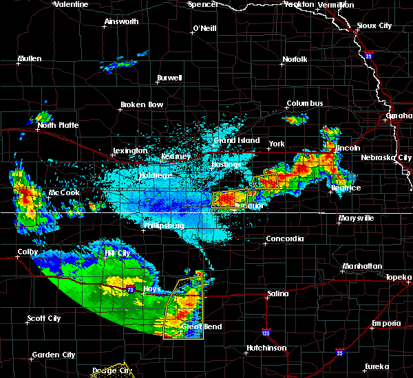 The national weather service in hastings has issued a * severe thunderstorm warning for. nuckolls county in south central nebraska. southeastern webster county in south central nebraska. until 1130 pm cdt. At 1044 pm cdt, severe thunderstorms were located along a line. The national weather service in hastings has issued a * severe thunderstorm warning for. nuckolls county in south central nebraska. southeastern webster county in south central nebraska. until 1130 pm cdt. At 1044 pm cdt, severe thunderstorms were located along a line.
|
| 6/14/2019 10:35 PM CDT |
 At 1034 pm cdt, a severe thunderstorm was located near nelson, or 29 miles southeast of hastings, moving east at 20 mph (radar indicated). Hazards include 60 mph wind gusts and quarter size hail. Hail damage to vehicles is expected. expect wind damage to roofs, siding, and trees. Locations impacted include, nelson, lawrence, guide rock, oak and nora. At 1034 pm cdt, a severe thunderstorm was located near nelson, or 29 miles southeast of hastings, moving east at 20 mph (radar indicated). Hazards include 60 mph wind gusts and quarter size hail. Hail damage to vehicles is expected. expect wind damage to roofs, siding, and trees. Locations impacted include, nelson, lawrence, guide rock, oak and nora.
|
| 6/14/2019 10:17 PM CDT |
 At 1017 pm cdt, a severe thunderstorm was located near lawrence, or 28 miles south of hastings, moving east at 20 mph (radar indicated). Hazards include 60 mph wind gusts and half dollar size hail. Hail damage to vehicles is expected. expect wind damage to roofs, siding, and trees. Locations impacted include, nelson, lawrence, guide rock, oak and nora. At 1017 pm cdt, a severe thunderstorm was located near lawrence, or 28 miles south of hastings, moving east at 20 mph (radar indicated). Hazards include 60 mph wind gusts and half dollar size hail. Hail damage to vehicles is expected. expect wind damage to roofs, siding, and trees. Locations impacted include, nelson, lawrence, guide rock, oak and nora.
|
| 6/14/2019 10:06 PM CDT |
 At 1006 pm cdt, a severe thunderstorm was located near cowles, or 27 miles south of hastings, moving east at 20 mph (radar indicated). Hazards include 60 mph wind gusts and quarter size hail. Hail damage to vehicles is expected. Expect wind damage to roofs, siding, and trees. At 1006 pm cdt, a severe thunderstorm was located near cowles, or 27 miles south of hastings, moving east at 20 mph (radar indicated). Hazards include 60 mph wind gusts and quarter size hail. Hail damage to vehicles is expected. Expect wind damage to roofs, siding, and trees.
|
| 6/14/2019 10:02 PM CDT | Half Dollar sized hail reported 6.9 miles S of Guide Rock, NE |
| 5/28/2019 6:39 PM CDT |
 At 638 pm cdt, a severe thunderstorm was located near red cloud, or 38 miles south of hastings, moving north at 50 mph (radar indicated). Hazards include 60 mph wind gusts and quarter size hail. Hail damage to vehicles is expected. expect wind damage to roofs, siding, and trees. locations impacted include, red cloud, blue hill, lawrence, guide rock, ayr, deweese, cowles and rosemont. A tornado watch remains in effect until 1000 pm cdt for north central kansas, and south central nebraska. At 638 pm cdt, a severe thunderstorm was located near red cloud, or 38 miles south of hastings, moving north at 50 mph (radar indicated). Hazards include 60 mph wind gusts and quarter size hail. Hail damage to vehicles is expected. expect wind damage to roofs, siding, and trees. locations impacted include, red cloud, blue hill, lawrence, guide rock, ayr, deweese, cowles and rosemont. A tornado watch remains in effect until 1000 pm cdt for north central kansas, and south central nebraska.
|
| 5/28/2019 6:28 PM CDT |
 At 628 pm cdt, a severe thunderstorm was located 8 miles north of lebanon, or 39 miles northwest of beloit, moving north at 50 mph (radar indicated). Hazards include 60 mph wind gusts and half dollar size hail. Hail damage to vehicles is expected. Expect wind damage to roofs, siding, and trees. At 628 pm cdt, a severe thunderstorm was located 8 miles north of lebanon, or 39 miles northwest of beloit, moving north at 50 mph (radar indicated). Hazards include 60 mph wind gusts and half dollar size hail. Hail damage to vehicles is expected. Expect wind damage to roofs, siding, and trees.
|
| 5/6/2019 12:55 PM CDT | Quarter sized hail reported 1.8 miles NE of Guide Rock, NE, hail started around 12:52 and lasted about 3-4 min. |
| 5/6/2019 12:55 PM CDT |
 At 1255 pm cdt, a severe thunderstorm was located near guide rock, or 35 miles south of hastings, moving east at 35 mph (radar indicated). Hazards include 60 mph wind gusts and half dollar size hail. Hail damage to vehicles is expected. Expect wind damage to roofs, siding, and trees. At 1255 pm cdt, a severe thunderstorm was located near guide rock, or 35 miles south of hastings, moving east at 35 mph (radar indicated). Hazards include 60 mph wind gusts and half dollar size hail. Hail damage to vehicles is expected. Expect wind damage to roofs, siding, and trees.
|
| 5/6/2019 12:39 PM CDT |
 At 1238 pm cdt, a severe thunderstorm was located near red cloud, or 39 miles south of hastings, moving east at 30 mph (radar indicated). Hazards include quarter size hail. Damage to vehicles is expected. Locations impacted include, guide rock and bostwick. At 1238 pm cdt, a severe thunderstorm was located near red cloud, or 39 miles south of hastings, moving east at 30 mph (radar indicated). Hazards include quarter size hail. Damage to vehicles is expected. Locations impacted include, guide rock and bostwick.
|
| 5/6/2019 12:29 PM CDT |
 At 1216 pm cdt, a severe thunderstorm was located 7 miles southwest of red cloud, or 42 miles south of hastings, moving east at 30 mph (radar indicated). Hazards include 60 mph wind gusts and quarter size hail. Hail damage to vehicles is expected. Expect wind damage to roofs, siding, and trees. At 1216 pm cdt, a severe thunderstorm was located 7 miles southwest of red cloud, or 42 miles south of hastings, moving east at 30 mph (radar indicated). Hazards include 60 mph wind gusts and quarter size hail. Hail damage to vehicles is expected. Expect wind damage to roofs, siding, and trees.
|
| 5/6/2019 12:29 PM CDT |
 At 1229 pm cdt, a severe thunderstorm was located near red cloud, or 40 miles south of hastings, moving east at 20 mph (radar indicated). Hazards include quarter size hail. Damage to vehicles is expected. Locations impacted include, guide rock and bostwick. At 1229 pm cdt, a severe thunderstorm was located near red cloud, or 40 miles south of hastings, moving east at 20 mph (radar indicated). Hazards include quarter size hail. Damage to vehicles is expected. Locations impacted include, guide rock and bostwick.
|
| 5/6/2019 12:16 PM CDT |
 At 1216 pm cdt, a severe thunderstorm was located 7 miles southwest of red cloud, or 42 miles south of hastings, moving east at 30 mph (radar indicated). Hazards include 60 mph wind gusts and quarter size hail. Hail damage to vehicles is expected. Expect wind damage to roofs, siding, and trees. At 1216 pm cdt, a severe thunderstorm was located 7 miles southwest of red cloud, or 42 miles south of hastings, moving east at 30 mph (radar indicated). Hazards include 60 mph wind gusts and quarter size hail. Hail damage to vehicles is expected. Expect wind damage to roofs, siding, and trees.
|
| 5/5/2019 7:43 PM CDT |
 At 743 pm cdt, a severe thunderstorm was located over rosemont, or 21 miles south of hastings, moving southeast at 25 mph (radar indicated). Hazards include ping pong ball size hail and 60 mph wind gusts. People and animals outdoors will be injured. expect hail damage to roofs, siding, windows, and vehicles. Expect wind damage to roofs, siding, and trees. At 743 pm cdt, a severe thunderstorm was located over rosemont, or 21 miles south of hastings, moving southeast at 25 mph (radar indicated). Hazards include ping pong ball size hail and 60 mph wind gusts. People and animals outdoors will be injured. expect hail damage to roofs, siding, windows, and vehicles. Expect wind damage to roofs, siding, and trees.
|
| 4/21/2019 8:51 PM CDT |
 At 851 pm cdt, severe thunderstorms were located along a line extending from near red cloud to hunter, moving northeast at 35 mph (radar indicated). Hazards include 70 mph wind gusts and quarter size hail. Hail damage to vehicles is expected. expect considerable tree damage. Wind damage is also likely to mobile homes, roofs, and outbuildings. At 851 pm cdt, severe thunderstorms were located along a line extending from near red cloud to hunter, moving northeast at 35 mph (radar indicated). Hazards include 70 mph wind gusts and quarter size hail. Hail damage to vehicles is expected. expect considerable tree damage. Wind damage is also likely to mobile homes, roofs, and outbuildings.
|
| 3/28/2019 9:38 AM CDT |
 At 937 am cdt, severe thunderstorms were located along a line extending from near nora to near bostwick to 7 miles southwest of guide rock, moving east at 25 mph (radar indicated). Hazards include ping pong ball size hail and 60 mph wind gusts. People and animals outdoors will be injured. expect hail damage to roofs, siding, windows, and vehicles. expect wind damage to roofs, siding, and trees. Locations impacted include, superior, guide rock, burr oak, webber, nora, bostwick and lovewell state park. At 937 am cdt, severe thunderstorms were located along a line extending from near nora to near bostwick to 7 miles southwest of guide rock, moving east at 25 mph (radar indicated). Hazards include ping pong ball size hail and 60 mph wind gusts. People and animals outdoors will be injured. expect hail damage to roofs, siding, windows, and vehicles. expect wind damage to roofs, siding, and trees. Locations impacted include, superior, guide rock, burr oak, webber, nora, bostwick and lovewell state park.
|
| 3/28/2019 9:24 AM CDT |
 At 924 am cdt, severe thunderstorms were located along a line extending from near nora to near bostwick to 8 miles north of esbon, moving east at 30 mph (radar indicated). Hazards include ping pong ball size hail and 60 mph wind gusts. People and animals outdoors will be injured. expect hail damage to roofs, siding, windows, and vehicles. expect wind damage to roofs, siding, and trees. Locations impacted include, superior, red cloud, nelson, guide rock, burr oak, webber, nora, bostwick and lovewell state park. At 924 am cdt, severe thunderstorms were located along a line extending from near nora to near bostwick to 8 miles north of esbon, moving east at 30 mph (radar indicated). Hazards include ping pong ball size hail and 60 mph wind gusts. People and animals outdoors will be injured. expect hail damage to roofs, siding, windows, and vehicles. expect wind damage to roofs, siding, and trees. Locations impacted include, superior, red cloud, nelson, guide rock, burr oak, webber, nora, bostwick and lovewell state park.
|
| 3/28/2019 9:13 AM CDT |
 At 912 am cdt, severe thunderstorms were located along a line extending from near nelson to near red cloud to 9 miles north of bellaire, moving east at 25 mph (radar indicated). Hazards include 60 mph wind gusts and quarter size hail. Hail damage to vehicles is expected. expect wind damage to roofs, siding, and trees. Locations impacted include, superior, red cloud, nelson, guide rock, burr oak, cowles, webber, nora, bostwick, inavale and lovewell state park. At 912 am cdt, severe thunderstorms were located along a line extending from near nelson to near red cloud to 9 miles north of bellaire, moving east at 25 mph (radar indicated). Hazards include 60 mph wind gusts and quarter size hail. Hail damage to vehicles is expected. expect wind damage to roofs, siding, and trees. Locations impacted include, superior, red cloud, nelson, guide rock, burr oak, cowles, webber, nora, bostwick, inavale and lovewell state park.
|
| 3/28/2019 9:00 AM CDT |
 At 859 am cdt, severe thunderstorms were located along a line extending from near lawrence to near red cloud to 9 miles south of riverton, moving east at 25 mph (radar indicated). Hazards include 60 mph wind gusts and quarter size hail. Hail damage to vehicles is expected. Expect wind damage to roofs, siding, and trees. At 859 am cdt, severe thunderstorms were located along a line extending from near lawrence to near red cloud to 9 miles south of riverton, moving east at 25 mph (radar indicated). Hazards include 60 mph wind gusts and quarter size hail. Hail damage to vehicles is expected. Expect wind damage to roofs, siding, and trees.
|
| 9/20/2018 6:26 PM CDT |
 The severe thunderstorm warning for southwestern nuckolls and webster counties will expire at 630 pm cdt, the storm which prompted the warning has weakened below severe limits, and no longer poses an immediate threat to life or property. therefore, the warning will be allowed to expire. however small hail, gusty winds and heavy rain are still possible with this thunderstorm. a severe thunderstorm watch remains in effect until 1100 pm cdt for north central kansas, and south central nebraska. to report severe weather, contact your nearest law enforcement agency. they will relay your report to the national weather service hastings. The severe thunderstorm warning for southwestern nuckolls and webster counties will expire at 630 pm cdt, the storm which prompted the warning has weakened below severe limits, and no longer poses an immediate threat to life or property. therefore, the warning will be allowed to expire. however small hail, gusty winds and heavy rain are still possible with this thunderstorm. a severe thunderstorm watch remains in effect until 1100 pm cdt for north central kansas, and south central nebraska. to report severe weather, contact your nearest law enforcement agency. they will relay your report to the national weather service hastings.
|
| 9/20/2018 6:18 PM CDT |
 At 618 pm cdt, a severe thunderstorm was located 7 miles north of guide rock, or 29 miles south of hastings, moving northeast at 35 mph (radar indicated). Hazards include golf ball size hail and 60 mph wind gusts. People and animals outdoors will be injured. expect hail damage to roofs, siding, windows, and vehicles. expect wind damage to roofs, siding, and trees. Locations impacted include, red cloud, lawrence, guide rock, cowles, bostwick, rosemont and inavale. At 618 pm cdt, a severe thunderstorm was located 7 miles north of guide rock, or 29 miles south of hastings, moving northeast at 35 mph (radar indicated). Hazards include golf ball size hail and 60 mph wind gusts. People and animals outdoors will be injured. expect hail damage to roofs, siding, windows, and vehicles. expect wind damage to roofs, siding, and trees. Locations impacted include, red cloud, lawrence, guide rock, cowles, bostwick, rosemont and inavale.
|
| 9/20/2018 6:02 PM CDT |
 At 601 pm cdt, a severe thunderstorm was located near red cloud, or 33 miles south of hastings, moving northeast at 30 mph (radar indicated. at 558 pm cdt, tennis ball size hail was reported in red cloud). Hazards include tennis ball size hail and 60 mph wind gusts. People and animals outdoors will be injured. expect hail damage to roofs, siding, windows, and vehicles. expect wind damage to roofs, siding, and trees. Locations impacted include, red cloud, lawrence, guide rock, cowles, bostwick, rosemont and inavale. At 601 pm cdt, a severe thunderstorm was located near red cloud, or 33 miles south of hastings, moving northeast at 30 mph (radar indicated. at 558 pm cdt, tennis ball size hail was reported in red cloud). Hazards include tennis ball size hail and 60 mph wind gusts. People and animals outdoors will be injured. expect hail damage to roofs, siding, windows, and vehicles. expect wind damage to roofs, siding, and trees. Locations impacted include, red cloud, lawrence, guide rock, cowles, bostwick, rosemont and inavale.
|
| 9/20/2018 5:52 PM CDT |
 At 552 pm cdt, a severe thunderstorm was located over red cloud, or 36 miles south of hastings, moving northeast at 30 mph (radar indicated). Hazards include 60 mph wind gusts and quarter size hail. Hail damage to vehicles is expected. Expect wind damage to roofs, siding, and trees. At 552 pm cdt, a severe thunderstorm was located over red cloud, or 36 miles south of hastings, moving northeast at 30 mph (radar indicated). Hazards include 60 mph wind gusts and quarter size hail. Hail damage to vehicles is expected. Expect wind damage to roofs, siding, and trees.
|
| 7/30/2018 2:54 PM CDT |
 At 254 pm cdt, severe thunderstorms were located along a line extending from near superior to near guide rock, moving south at 15 mph (radar indicated). Hazards include 60 mph wind gusts and half dollar size hail. Hail damage to vehicles is expected. expect wind damage to roofs, siding, and trees. Locations impacted include, superior, guide rock and bostwick. At 254 pm cdt, severe thunderstorms were located along a line extending from near superior to near guide rock, moving south at 15 mph (radar indicated). Hazards include 60 mph wind gusts and half dollar size hail. Hail damage to vehicles is expected. expect wind damage to roofs, siding, and trees. Locations impacted include, superior, guide rock and bostwick.
|
| 7/30/2018 2:44 PM CDT |
 At 244 pm cdt, a severe thunderstorm was located over bostwick, or 35 miles northwest of belleville, moving south at 15 mph (radar indicated). Hazards include 60 mph wind gusts and quarter size hail. Hail damage to vehicles is expected. Expect wind damage to roofs, siding, and trees. At 244 pm cdt, a severe thunderstorm was located over bostwick, or 35 miles northwest of belleville, moving south at 15 mph (radar indicated). Hazards include 60 mph wind gusts and quarter size hail. Hail damage to vehicles is expected. Expect wind damage to roofs, siding, and trees.
|
| 6/19/2018 6:51 PM CDT |
 The tornado warning for eastern webster county will expire at 700 pm cdt, the storm which prompted the warning has weakened below severe limits, and no longer appears capable of producing a tornado. therefore, the warning will be allowed to expire. however small hail, gusty winds and heavy rain are still possible with this thunderstorm. a severe thunderstorm watch remains in effect until 1100 pm cdt for south central nebraska. The tornado warning for eastern webster county will expire at 700 pm cdt, the storm which prompted the warning has weakened below severe limits, and no longer appears capable of producing a tornado. therefore, the warning will be allowed to expire. however small hail, gusty winds and heavy rain are still possible with this thunderstorm. a severe thunderstorm watch remains in effect until 1100 pm cdt for south central nebraska.
|
| 6/19/2018 6:47 PM CDT |
 At 647 pm cdt, a severe thunderstorm capable of producing a tornado was located near cowles, or 29 miles south of hastings, moving east at 10 mph (radar indicated rotation). Hazards include tornado and golf ball size hail. Flying debris will be dangerous to those caught without shelter. mobile homes will be damaged or destroyed. damage to roofs, windows, and vehicles will occur. tree damage is likely. This tornadic thunderstorm will remain over mainly rural areas of eastern webster county. At 647 pm cdt, a severe thunderstorm capable of producing a tornado was located near cowles, or 29 miles south of hastings, moving east at 10 mph (radar indicated rotation). Hazards include tornado and golf ball size hail. Flying debris will be dangerous to those caught without shelter. mobile homes will be damaged or destroyed. damage to roofs, windows, and vehicles will occur. tree damage is likely. This tornadic thunderstorm will remain over mainly rural areas of eastern webster county.
|
| 6/19/2018 6:36 PM CDT |
 At 636 pm cdt, a severe thunderstorm capable of producing a tornado was located near cowles, or 30 miles south of hastings, moving east at 10 mph (radar indicated rotation). Hazards include tornado and golf ball size hail. Flying debris will be dangerous to those caught without shelter. mobile homes will be damaged or destroyed. damage to roofs, windows, and vehicles will occur. tree damage is likely. This dangerous storm will be near, guide rock around 650 pm cdt. At 636 pm cdt, a severe thunderstorm capable of producing a tornado was located near cowles, or 30 miles south of hastings, moving east at 10 mph (radar indicated rotation). Hazards include tornado and golf ball size hail. Flying debris will be dangerous to those caught without shelter. mobile homes will be damaged or destroyed. damage to roofs, windows, and vehicles will occur. tree damage is likely. This dangerous storm will be near, guide rock around 650 pm cdt.
|
| 6/9/2018 3:23 AM CDT |
 At 323 am cdt, severe thunderstorm outflow winds were located along a line extending from near bostwick to 7 miles north of smith center to near phillipsburg, moving south at 35 mph (radar indicated). Hazards include 60 mph wind gusts. Expect damage to roofs, siding, and trees. Locations impacted include, phillipsburg, smith center, kensington, agra, guide rock, lebanon, burr oak, esbon, glade, athol and bellaire. At 323 am cdt, severe thunderstorm outflow winds were located along a line extending from near bostwick to 7 miles north of smith center to near phillipsburg, moving south at 35 mph (radar indicated). Hazards include 60 mph wind gusts. Expect damage to roofs, siding, and trees. Locations impacted include, phillipsburg, smith center, kensington, agra, guide rock, lebanon, burr oak, esbon, glade, athol and bellaire.
|
| 6/9/2018 3:03 AM CDT |
 At 302 am cdt, severe thunderstorm outflow was located along a line extending from near lawrence to riverton to near harlan county dam, moving southeast at 30 mph (radar indicated. in addition, at 242 am cdt, an off duty nws employee estimated 60 mph winds two miles north of pauline in adams county). Hazards include 60 mph wind gusts. expect damage to roofs, siding, and trees At 302 am cdt, severe thunderstorm outflow was located along a line extending from near lawrence to riverton to near harlan county dam, moving southeast at 30 mph (radar indicated. in addition, at 242 am cdt, an off duty nws employee estimated 60 mph winds two miles north of pauline in adams county). Hazards include 60 mph wind gusts. expect damage to roofs, siding, and trees
|
| 5/1/2018 4:53 PM CDT |
 At 452 pm cdt, severe thunderstorms were located along a line extending from near bostwick to near downs, moving east at 30 mph (radar indicated). Hazards include golf ball size hail and 70 mph wind gusts. People and animals outdoors will be injured. expect hail damage to roofs, siding, windows, and vehicles. expect considerable tree damage. Wind damage is also likely to mobile homes, roofs, and outbuildings. At 452 pm cdt, severe thunderstorms were located along a line extending from near bostwick to near downs, moving east at 30 mph (radar indicated). Hazards include golf ball size hail and 70 mph wind gusts. People and animals outdoors will be injured. expect hail damage to roofs, siding, windows, and vehicles. expect considerable tree damage. Wind damage is also likely to mobile homes, roofs, and outbuildings.
|
| 5/1/2018 4:23 PM CDT |
 At 422 pm cdt, severe thunderstorms were located along a line extending from 6 miles southeast of red cloud nebraska to near harlan kansas, moving east at 40 mph (radar indicated). Hazards include golf ball size hail and 60 mph wind gusts. People and animals outdoors will be injured. expect hail damage to roofs, siding, windows, and vehicles. Expect wind damage to roofs, siding, and trees. At 422 pm cdt, severe thunderstorms were located along a line extending from 6 miles southeast of red cloud nebraska to near harlan kansas, moving east at 40 mph (radar indicated). Hazards include golf ball size hail and 60 mph wind gusts. People and animals outdoors will be injured. expect hail damage to roofs, siding, windows, and vehicles. Expect wind damage to roofs, siding, and trees.
|
| 5/1/2018 4:18 PM CDT |
 At 417 pm cdt, a severe thunderstorm capable of producing a tornado was located near lebanon, or 38 miles northwest of beloit, moving northeast at 35 mph (radar indicated rotation). Hazards include tornado and golf ball size hail. Flying debris will be dangerous to those caught without shelter. mobile homes will be damaged or destroyed. damage to roofs, windows, and vehicles will occur. tree damage is likely. This dangerous storm will be near, esbon around 425 pm cdt. At 417 pm cdt, a severe thunderstorm capable of producing a tornado was located near lebanon, or 38 miles northwest of beloit, moving northeast at 35 mph (radar indicated rotation). Hazards include tornado and golf ball size hail. Flying debris will be dangerous to those caught without shelter. mobile homes will be damaged or destroyed. damage to roofs, windows, and vehicles will occur. tree damage is likely. This dangerous storm will be near, esbon around 425 pm cdt.
|
| 5/1/2018 4:05 PM CDT |
 At 405 pm cdt, a severe thunderstorm capable of producing a tornado was located near bellaire, or 32 miles east of phillipsburg, moving northeast at 35 mph (radar indicated rotation). Hazards include tornado and golf ball size hail. Flying debris will be dangerous to those caught without shelter. mobile homes will be damaged or destroyed. damage to roofs, windows, and vehicles will occur. tree damage is likely. this dangerous storm will be near, lebanon around 415 pm cdt. Esbon around 430 pm cdt. At 405 pm cdt, a severe thunderstorm capable of producing a tornado was located near bellaire, or 32 miles east of phillipsburg, moving northeast at 35 mph (radar indicated rotation). Hazards include tornado and golf ball size hail. Flying debris will be dangerous to those caught without shelter. mobile homes will be damaged or destroyed. damage to roofs, windows, and vehicles will occur. tree damage is likely. this dangerous storm will be near, lebanon around 415 pm cdt. Esbon around 430 pm cdt.
|
| 5/1/2018 4:05 PM CDT |
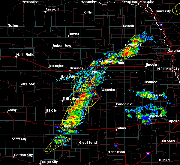 At 405 pm cdt, a severe thunderstorm capable of producing a tornado was located near bellaire, or 32 miles east of phillipsburg, moving northeast at 35 mph (radar indicated rotation). Hazards include tornado and golf ball size hail. Flying debris will be dangerous to those caught without shelter. mobile homes will be damaged or destroyed. damage to roofs, windows, and vehicles will occur. tree damage is likely. this dangerous storm will be near, lebanon around 415 pm cdt. Esbon around 430 pm cdt. At 405 pm cdt, a severe thunderstorm capable of producing a tornado was located near bellaire, or 32 miles east of phillipsburg, moving northeast at 35 mph (radar indicated rotation). Hazards include tornado and golf ball size hail. Flying debris will be dangerous to those caught without shelter. mobile homes will be damaged or destroyed. damage to roofs, windows, and vehicles will occur. tree damage is likely. this dangerous storm will be near, lebanon around 415 pm cdt. Esbon around 430 pm cdt.
|
| 10/6/2017 7:40 PM CDT |
 At 740 pm cdt, a severe thunderstorm was located over bostwick, or 31 miles northwest of belleville, moving northeast at 20 mph (radar indicated). Hazards include 60 mph wind gusts and quarter size hail. Hail damage to vehicles is expected. expect wind damage to roofs, siding, and trees. Locations impacted include, superior, nelson, guide rock, hardy, webber, nora and bostwick. At 740 pm cdt, a severe thunderstorm was located over bostwick, or 31 miles northwest of belleville, moving northeast at 20 mph (radar indicated). Hazards include 60 mph wind gusts and quarter size hail. Hail damage to vehicles is expected. expect wind damage to roofs, siding, and trees. Locations impacted include, superior, nelson, guide rock, hardy, webber, nora and bostwick.
|
| 10/6/2017 7:23 PM CDT |
 At 723 pm cdt, a severe thunderstorm was located near burr oak, or 32 miles west of belleville, moving northeast at 20 mph (radar indicated). Hazards include 60 mph wind gusts and quarter size hail. Hail damage to vehicles is expected. Expect wind damage to roofs, siding, and trees. At 723 pm cdt, a severe thunderstorm was located near burr oak, or 32 miles west of belleville, moving northeast at 20 mph (radar indicated). Hazards include 60 mph wind gusts and quarter size hail. Hail damage to vehicles is expected. Expect wind damage to roofs, siding, and trees.
|
| 10/1/2017 9:15 PM CDT | Quarter sized hail reported 1.8 miles NE of Guide Rock, NE |
| 10/1/2017 9:15 PM CDT |
 At 915 pm cdt, a severe thunderstorm was located over guide rock, or 37 miles south of hastings, moving northeast at 40 mph (radar indicated). Hazards include 60 mph wind gusts and quarter size hail. Hail damage to vehicles is expected. Expect wind damage to roofs, siding, and trees. At 915 pm cdt, a severe thunderstorm was located over guide rock, or 37 miles south of hastings, moving northeast at 40 mph (radar indicated). Hazards include 60 mph wind gusts and quarter size hail. Hail damage to vehicles is expected. Expect wind damage to roofs, siding, and trees.
|
| 10/1/2017 9:09 PM CDT |
 At 909 pm cdt, a severe thunderstorm was located near red cloud, or 40 miles south of hastings, moving northeast at 30 mph (radar indicated). Hazards include 60 mph wind gusts and quarter size hail. Hail damage to vehicles is expected. expect wind damage to roofs, siding, and trees. locations impacted include, guide rock. A tornado watch remains in effect until 1100 pm cdt for north central kansas. At 909 pm cdt, a severe thunderstorm was located near red cloud, or 40 miles south of hastings, moving northeast at 30 mph (radar indicated). Hazards include 60 mph wind gusts and quarter size hail. Hail damage to vehicles is expected. expect wind damage to roofs, siding, and trees. locations impacted include, guide rock. A tornado watch remains in effect until 1100 pm cdt for north central kansas.
|
| 10/1/2017 8:54 PM CDT |
 At 854 pm cdt, a severe thunderstorm was located 9 miles north of lebanon, or 40 miles east of phillipsburg, moving northeast at 35 mph (radar indicated). Hazards include 60 mph wind gusts and quarter size hail. Hail damage to vehicles is expected. expect wind damage to roofs, siding, and trees. locations impacted include, red cloud and guide rock. A tornado watch remains in effect until 1100 pm cdt for north central kansas. At 854 pm cdt, a severe thunderstorm was located 9 miles north of lebanon, or 40 miles east of phillipsburg, moving northeast at 35 mph (radar indicated). Hazards include 60 mph wind gusts and quarter size hail. Hail damage to vehicles is expected. expect wind damage to roofs, siding, and trees. locations impacted include, red cloud and guide rock. A tornado watch remains in effect until 1100 pm cdt for north central kansas.
|
| 10/1/2017 8:37 PM CDT |
 At 836 pm cdt, a severe thunderstorm was located just north of smith center, or 30 miles east of phillipsburg, moving northeast at 30 mph (radar indicated). Hazards include golf ball size hail and 60 mph wind gusts. People and animals outdoors will be injured. expect hail damage to roofs, siding, windows, and vehicles. Expect wind damage to roofs, siding, and trees. At 836 pm cdt, a severe thunderstorm was located just north of smith center, or 30 miles east of phillipsburg, moving northeast at 30 mph (radar indicated). Hazards include golf ball size hail and 60 mph wind gusts. People and animals outdoors will be injured. expect hail damage to roofs, siding, windows, and vehicles. Expect wind damage to roofs, siding, and trees.
|
| 8/27/2017 4:32 AM CDT |
 At 431 am cdt, severe thunderstorms were located along a line extending from near shelton to near minden to near holdrege, moving southeast at 65 mph (radar indicated). Hazards include 60 mph wind gusts. these storms have a history of producing high winds. at 419 am, winds of 58 mph were measured in kearney. Expect damage to roofs, siding, and trees. severe thunderstorms will be near, ragan around 445 am cdt. hildreth, campbell and bladen around 450 am cdt. bloomington around 500 am cdt. red cloud, franklin, lawrence, cowles and rosemont around 505 am cdt. riverton around 510 am cdt. Nelson, guide rock and bostwick around 515 am cdt. At 431 am cdt, severe thunderstorms were located along a line extending from near shelton to near minden to near holdrege, moving southeast at 65 mph (radar indicated). Hazards include 60 mph wind gusts. these storms have a history of producing high winds. at 419 am, winds of 58 mph were measured in kearney. Expect damage to roofs, siding, and trees. severe thunderstorms will be near, ragan around 445 am cdt. hildreth, campbell and bladen around 450 am cdt. bloomington around 500 am cdt. red cloud, franklin, lawrence, cowles and rosemont around 505 am cdt. riverton around 510 am cdt. Nelson, guide rock and bostwick around 515 am cdt.
|
| 8/16/2017 4:27 AM CDT |
 At 426 am cdt, severe thunderstorms were located along a line extending from near guide rock to near burr oak to near cawker city to near osborne, moving east at 35 mph (combination of radar and mesonet data). Hazards include 60 to 65 mph wind gusts. expect damage to roofs, siding, and trees At 426 am cdt, severe thunderstorms were located along a line extending from near guide rock to near burr oak to near cawker city to near osborne, moving east at 35 mph (combination of radar and mesonet data). Hazards include 60 to 65 mph wind gusts. expect damage to roofs, siding, and trees
|
| 8/16/2017 4:16 AM CDT |
 At 415 am cdt, severe thunderstorms were located along a line extending from cowles to near esbon to near osborne to near natoma, moving east at 40 mph (mesonet observation recorded a 62 mph wind gust near lebanon kansas). Hazards include 60 mph wind gusts. Expect damage to roofs, siding, and trees. Locations impacted include, osborne, red cloud, blue hill, downs, cawker city, glen elder, natoma, bladen, guide rock, lebanon, tipton, burr oak, portis, esbon, ionia, cowles, harlan, rosemont, inavale and codell. At 415 am cdt, severe thunderstorms were located along a line extending from cowles to near esbon to near osborne to near natoma, moving east at 40 mph (mesonet observation recorded a 62 mph wind gust near lebanon kansas). Hazards include 60 mph wind gusts. Expect damage to roofs, siding, and trees. Locations impacted include, osborne, red cloud, blue hill, downs, cawker city, glen elder, natoma, bladen, guide rock, lebanon, tipton, burr oak, portis, esbon, ionia, cowles, harlan, rosemont, inavale and codell.
|
| 8/16/2017 3:38 AM CDT |
 At 337 am cdt, severe thunderstorms were located along a line extending from near upland to 11 miles south of franklin to near woodston to near zurich, moving east at 40 mph (radar indicated). Hazards include 60 to 65 mph wind gusts. expect damage to roofs, siding, and trees At 337 am cdt, severe thunderstorms were located along a line extending from near upland to 11 miles south of franklin to near woodston to near zurich, moving east at 40 mph (radar indicated). Hazards include 60 to 65 mph wind gusts. expect damage to roofs, siding, and trees
|
| 7/17/2017 8:53 PM CDT |
 At 852 pm cdt, severe thunderstorms were located along a line extending from rosemont to near burr oak, moving east at 25 mph (public. at 839 pm 50 mph wind gusts were reported by a weather station 3 miles southwest of cowles). Hazards include 60 mph wind gusts. Expect damage to roofs, siding, and trees. Locations impacted include, superior, red cloud, mankato, nelson, lawrence, bladen, guide rock, burr oak, esbon, cowles, webber, rosemont, montrose and bostwick. At 852 pm cdt, severe thunderstorms were located along a line extending from rosemont to near burr oak, moving east at 25 mph (public. at 839 pm 50 mph wind gusts were reported by a weather station 3 miles southwest of cowles). Hazards include 60 mph wind gusts. Expect damage to roofs, siding, and trees. Locations impacted include, superior, red cloud, mankato, nelson, lawrence, bladen, guide rock, burr oak, esbon, cowles, webber, rosemont, montrose and bostwick.
|
| 7/17/2017 8:36 PM CDT |
 At 836 pm cdt, severe thunderstorms were located along a line extending from near blue hill to near esbon, moving east at 20 mph (radar indicated). Hazards include 60 mph wind gusts. expect damage to roofs, siding, and trees At 836 pm cdt, severe thunderstorms were located along a line extending from near blue hill to near esbon, moving east at 20 mph (radar indicated). Hazards include 60 mph wind gusts. expect damage to roofs, siding, and trees
|
| 6/29/2017 12:50 AM CDT | Golf Ball sized hail reported 2.9 miles ESE of Guide Rock, NE, golf ball sized hail 1 n and 2.5 w of guide rock. |
| 6/28/2017 9:22 PM CDT |
 At 221 am cdt, severe thunderstorms were located along a line extending from near byron to near hardy to near burr oak to near guide rock, moving southeast at 30 mph (radar indicated). Hazards include quarter size hail. Damage to vehicles is expected. Locations impacted include, superior, guide rock, burr oak, hardy, webber, bostwick and lovewell state park. At 221 am cdt, severe thunderstorms were located along a line extending from near byron to near hardy to near burr oak to near guide rock, moving southeast at 30 mph (radar indicated). Hazards include quarter size hail. Damage to vehicles is expected. Locations impacted include, superior, guide rock, burr oak, hardy, webber, bostwick and lovewell state park.
|
| 6/28/2017 8:55 PM CDT |
 At 155 am cdt, severe thunderstorms were located along a line extending from near hardy to bostwick to near guide rock to 7 miles south of inavale, moving east at 30 mph (radar indicated). Hazards include half dollar size hail. damage to vehicles is expected At 155 am cdt, severe thunderstorms were located along a line extending from near hardy to bostwick to near guide rock to 7 miles south of inavale, moving east at 30 mph (radar indicated). Hazards include half dollar size hail. damage to vehicles is expected
|
| 6/28/2017 8:32 PM CDT |
 At 130 am cdt, severe thunderstorms were located along a line extending from near superior to near guide rock, moving east at 30 mph (radar indicated). Hazards include golf ball size hail. People and animals outdoors will be injured. expect damage to roofs, siding, windows, and vehicles. Locations impacted include, superior, guide rock, hardy, ruskin, cowles, webber, nora and bostwick. At 130 am cdt, severe thunderstorms were located along a line extending from near superior to near guide rock, moving east at 30 mph (radar indicated). Hazards include golf ball size hail. People and animals outdoors will be injured. expect damage to roofs, siding, windows, and vehicles. Locations impacted include, superior, guide rock, hardy, ruskin, cowles, webber, nora and bostwick.
|
| 6/28/2017 8:13 PM CDT |
 At 113 am cdt, severe thunderstorms were located along a line extending from near bostwick to red cloud, moving east at 30 mph (radar indicated). Hazards include golf ball size hail. People and animals outdoors will be injured. Expect damage to roofs, siding, windows, and vehicles. At 113 am cdt, severe thunderstorms were located along a line extending from near bostwick to red cloud, moving east at 30 mph (radar indicated). Hazards include golf ball size hail. People and animals outdoors will be injured. Expect damage to roofs, siding, windows, and vehicles.
|
| 6/28/2017 7:34 PM CDT |
 At 1234 am cdt, a severe thunderstorm was located near red cloud, or 33 miles south of hastings, moving east at 20 mph (radar indicated). Hazards include golf ball size hail. People and animals outdoors will be injured. Expect damage to roofs, siding, windows, and vehicles. At 1234 am cdt, a severe thunderstorm was located near red cloud, or 33 miles south of hastings, moving east at 20 mph (radar indicated). Hazards include golf ball size hail. People and animals outdoors will be injured. Expect damage to roofs, siding, windows, and vehicles.
|
| 6/21/2017 9:48 PM CDT |
 At 948 pm cdt, severe thunderstorms were located along a line extending from near campbell to near riverton to bloomington, moving southeast at 20 mph (radar indicated). Hazards include 60 mph wind gusts and nickel size hail. expect damage to roofs, siding, and trees At 948 pm cdt, severe thunderstorms were located along a line extending from near campbell to near riverton to bloomington, moving southeast at 20 mph (radar indicated). Hazards include 60 mph wind gusts and nickel size hail. expect damage to roofs, siding, and trees
|
| 6/20/2017 9:57 PM CDT |
 The severe thunderstorm warning for northwestern jewell and southeastern webster counties will expire at 1000 pm cdt, the storm which prompted the warning has moved out of the area. therefore the warning will be allowed to expire. to report severe weather, contact your nearest law enforcement agency. they will relay your report to the national weather service hastings. The severe thunderstorm warning for northwestern jewell and southeastern webster counties will expire at 1000 pm cdt, the storm which prompted the warning has moved out of the area. therefore the warning will be allowed to expire. to report severe weather, contact your nearest law enforcement agency. they will relay your report to the national weather service hastings.
|
| 6/20/2017 9:37 PM CDT |
 At 937 pm cdt, a severe thunderstorm was located near guide rock, or 37 miles south of hastings, moving east at 25 mph (radar indicated). Hazards include ping pong ball size hail. People and animals outdoors will be injured. expect damage to roofs, siding, windows, and vehicles. Locations impacted include, guide rock. At 937 pm cdt, a severe thunderstorm was located near guide rock, or 37 miles south of hastings, moving east at 25 mph (radar indicated). Hazards include ping pong ball size hail. People and animals outdoors will be injured. expect damage to roofs, siding, windows, and vehicles. Locations impacted include, guide rock.
|
| 6/20/2017 9:26 PM CDT |
 At 926 pm cdt, a severe thunderstorm was located over red cloud, or 36 miles south of hastings, moving east at 30 mph (radar indicated). Hazards include half dollar size hail. Damage to vehicles is expected. Locations impacted include, red cloud, guide rock and inavale. At 926 pm cdt, a severe thunderstorm was located over red cloud, or 36 miles south of hastings, moving east at 30 mph (radar indicated). Hazards include half dollar size hail. Damage to vehicles is expected. Locations impacted include, red cloud, guide rock and inavale.
|
| 6/20/2017 9:09 PM CDT |
 At 909 pm cdt, a severe thunderstorm was located near inavale, or 36 miles southwest of hastings, moving east at 30 mph (radar indicated). Hazards include half dollar size hail. damage to vehicles is expected At 909 pm cdt, a severe thunderstorm was located near inavale, or 36 miles southwest of hastings, moving east at 30 mph (radar indicated). Hazards include half dollar size hail. damage to vehicles is expected
|
| 6/13/2017 10:17 PM CDT |
 At 1016 pm cdt, a severe thunderstorm was centered between nelson and guide rock, or 30 miles southeast of hastings, moving northeast at 40 mph (radar indicated. in addition, at 1005 pm cdt, a mesonet station measured a 59 mph wind gust 7 miles northeast of guide rock). Hazards include 60 mph wind gusts and half dollar size hail. Hail damage to vehicles is expected. expect wind damage to roofs, siding, and trees. Locations impacted include, superior, clay center, edgar, nelson, fairfield, lawrence, guide rock, hardy, ruskin, deweese, oak, nora, rosemont and bostwick. At 1016 pm cdt, a severe thunderstorm was centered between nelson and guide rock, or 30 miles southeast of hastings, moving northeast at 40 mph (radar indicated. in addition, at 1005 pm cdt, a mesonet station measured a 59 mph wind gust 7 miles northeast of guide rock). Hazards include 60 mph wind gusts and half dollar size hail. Hail damage to vehicles is expected. expect wind damage to roofs, siding, and trees. Locations impacted include, superior, clay center, edgar, nelson, fairfield, lawrence, guide rock, hardy, ruskin, deweese, oak, nora, rosemont and bostwick.
|
| 6/13/2017 10:00 PM CDT |
 At 959 pm cdt, a severe thunderstorm was located near guide rock, or 32 miles south of hastings, moving northeast at 40 mph (radar indicated). Hazards include golf ball size hail and 60 mph wind gusts. People and animals outdoors will be injured. expect hail damage to roofs, siding, windows, and vehicles. Expect wind damage to roofs, siding, and trees. At 959 pm cdt, a severe thunderstorm was located near guide rock, or 32 miles south of hastings, moving northeast at 40 mph (radar indicated). Hazards include golf ball size hail and 60 mph wind gusts. People and animals outdoors will be injured. expect hail damage to roofs, siding, windows, and vehicles. Expect wind damage to roofs, siding, and trees.
|
| 6/13/2017 9:57 PM CDT | Hail to the size of dimes as wel in webster county NE, 2.9 miles ESE of Guide Rock, NE |
| 6/13/2017 9:45 PM CDT |
 At 944 pm cdt, a severe thunderstorm was centered near red cloud, or 37 miles south of hastings, moving northeast at 35 mph (radar indicated. in addition, 940 pm cdt quarter size hail was reported 5 miles south-southwest of red cloud by a trained spotter). Hazards include golf ball size hail and 60 mph wind gusts. People and animals outdoors will be injured. expect hail damage to roofs, siding, windows, and vehicles. expect wind damage to roofs, siding, and trees. Locations impacted include, red cloud, guide rock, cowles and inavale. At 944 pm cdt, a severe thunderstorm was centered near red cloud, or 37 miles south of hastings, moving northeast at 35 mph (radar indicated. in addition, 940 pm cdt quarter size hail was reported 5 miles south-southwest of red cloud by a trained spotter). Hazards include golf ball size hail and 60 mph wind gusts. People and animals outdoors will be injured. expect hail damage to roofs, siding, windows, and vehicles. expect wind damage to roofs, siding, and trees. Locations impacted include, red cloud, guide rock, cowles and inavale.
|
| 6/13/2017 9:30 PM CDT |
 At 930 pm cdt, a severe thunderstorm was located near inavale, or 38 miles northeast of phillipsburg, moving northeast at 35 mph (radar indicated). Hazards include two inch hail and 60 mph wind gusts. People and animals outdoors will be injured. expect hail damage to roofs, siding, windows, and vehicles. Expect wind damage to roofs, siding, and trees. At 930 pm cdt, a severe thunderstorm was located near inavale, or 38 miles northeast of phillipsburg, moving northeast at 35 mph (radar indicated). Hazards include two inch hail and 60 mph wind gusts. People and animals outdoors will be injured. expect hail damage to roofs, siding, windows, and vehicles. Expect wind damage to roofs, siding, and trees.
|
| 6/13/2017 9:21 PM CDT |
 At 920 pm cdt, severe thunderstorms were located along a line extending from near rosemont to near riverton to 10 miles southeast of woodruff, moving northeast at 20 mph (radar indicated). Hazards include golf ball size hail and 60 mph wind gusts. at 913 pm cdt, quarter size hail was reported in riverton nebraska. People and animals outdoors will be injured. expect hail damage to roofs, siding, windows, and vehicles. expect wind damage to roofs, siding, and trees. Locations impacted include, red cloud, franklin, blue hill, bladen, guide rock, naponee, bloomington, riverton, cowles, rosemont and inavale. At 920 pm cdt, severe thunderstorms were located along a line extending from near rosemont to near riverton to 10 miles southeast of woodruff, moving northeast at 20 mph (radar indicated). Hazards include golf ball size hail and 60 mph wind gusts. at 913 pm cdt, quarter size hail was reported in riverton nebraska. People and animals outdoors will be injured. expect hail damage to roofs, siding, windows, and vehicles. expect wind damage to roofs, siding, and trees. Locations impacted include, red cloud, franklin, blue hill, bladen, guide rock, naponee, bloomington, riverton, cowles, rosemont and inavale.
|
| 6/13/2017 9:09 PM CDT |
 At 909 pm cdt, severe thunderstorms were located along a line extending from near rosemont to 6 miles southwest of riverton to 8 miles northeast of phillipsburg, moving northeast at 20 mph (radar indicated. in addition, at 9 pm cdt, ping pong ball size hail was reported 8 miles north-northeast of kensington kansas). Hazards include two inch hail and 60 mph wind gusts. People and animals outdoors will be injured. expect hail damage to roofs, siding, windows, and vehicles. expect wind damage to roofs, siding, and trees. Locations impacted include, red cloud, franklin, blue hill, kensington, agra, bladen, guide rock, naponee, bloomington, riverton, cowles, rosemont and inavale. At 909 pm cdt, severe thunderstorms were located along a line extending from near rosemont to 6 miles southwest of riverton to 8 miles northeast of phillipsburg, moving northeast at 20 mph (radar indicated. in addition, at 9 pm cdt, ping pong ball size hail was reported 8 miles north-northeast of kensington kansas). Hazards include two inch hail and 60 mph wind gusts. People and animals outdoors will be injured. expect hail damage to roofs, siding, windows, and vehicles. expect wind damage to roofs, siding, and trees. Locations impacted include, red cloud, franklin, blue hill, kensington, agra, bladen, guide rock, naponee, bloomington, riverton, cowles, rosemont and inavale.
|
| 6/13/2017 9:03 PM CDT |
 At 902 pm cdt, severe thunderstorms were located along a line extending from cowles to 8 miles southwest of riverton to 6 miles north of phillipsburg, moving northeast at 20 mph (radar indicated). Hazards include two inch hail and 60 mph wind gusts. People and animals outdoors will be injured. expect hail damage to roofs, siding, windows, and vehicles. expect wind damage to roofs, siding, and trees. Locations impacted include, red cloud, franklin, blue hill, kensington, agra, bladen, guide rock, naponee, bloomington, riverton, cowles, rosemont and inavale. At 902 pm cdt, severe thunderstorms were located along a line extending from cowles to 8 miles southwest of riverton to 6 miles north of phillipsburg, moving northeast at 20 mph (radar indicated). Hazards include two inch hail and 60 mph wind gusts. People and animals outdoors will be injured. expect hail damage to roofs, siding, windows, and vehicles. expect wind damage to roofs, siding, and trees. Locations impacted include, red cloud, franklin, blue hill, kensington, agra, bladen, guide rock, naponee, bloomington, riverton, cowles, rosemont and inavale.
|
| 6/13/2017 8:45 PM CDT |
 At 845 pm cdt, severe thunderstorms were located along a line extending from red cloud to 9 miles south of franklin to near phillipsburg, moving northeast at 20 mph (radar indicated). Hazards include two inch hail and 60 mph wind gusts. People and animals outdoors will be injured. expect hail damage to roofs, siding, windows, and vehicles. Expect wind damage to roofs, siding, and trees. At 845 pm cdt, severe thunderstorms were located along a line extending from red cloud to 9 miles south of franklin to near phillipsburg, moving northeast at 20 mph (radar indicated). Hazards include two inch hail and 60 mph wind gusts. People and animals outdoors will be injured. expect hail damage to roofs, siding, windows, and vehicles. Expect wind damage to roofs, siding, and trees.
|
| 5/17/2017 12:31 AM CDT |
 At 1231 am cdt, severe thunderstorms were located along a line extending from heartwell to 6 miles south of norman to near campbell to near riverton, moving east at 40 mph (radar indicated). Hazards include 60 mph wind gusts. expect damage to roofs, siding, and trees At 1231 am cdt, severe thunderstorms were located along a line extending from heartwell to 6 miles south of norman to near campbell to near riverton, moving east at 40 mph (radar indicated). Hazards include 60 mph wind gusts. expect damage to roofs, siding, and trees
|
| 5/16/2017 6:36 PM CDT |
 At 636 pm cdt, severe thunderstorms were located along a line extending from near cowles to near lawrence to near deweese, moving north at 40 mph (radar indicated). Hazards include 60 mph wind gusts and quarter size hail. Hail damage to vehicles is expected. expect wind damage to roofs, siding, and trees. Locations impacted include, nelson, lawrence, guide rock, oak, cowles, nora and rosemont. At 636 pm cdt, severe thunderstorms were located along a line extending from near cowles to near lawrence to near deweese, moving north at 40 mph (radar indicated). Hazards include 60 mph wind gusts and quarter size hail. Hail damage to vehicles is expected. expect wind damage to roofs, siding, and trees. Locations impacted include, nelson, lawrence, guide rock, oak, cowles, nora and rosemont.
|
| 5/16/2017 6:21 PM CDT |
 At 620 pm cdt, severe thunderstorms were located along a line extending from 7 miles southeast of red cloud to nelson, moving northeast at 25 mph (radar indicated). Hazards include 60 mph wind gusts and quarter size hail. Hail damage to vehicles is expected. expect wind damage to roofs, siding, and trees. Locations impacted include, superior, nelson, lawrence, guide rock, oak, cowles, nora, bostwick and rosemont. At 620 pm cdt, severe thunderstorms were located along a line extending from 7 miles southeast of red cloud to nelson, moving northeast at 25 mph (radar indicated). Hazards include 60 mph wind gusts and quarter size hail. Hail damage to vehicles is expected. expect wind damage to roofs, siding, and trees. Locations impacted include, superior, nelson, lawrence, guide rock, oak, cowles, nora, bostwick and rosemont.
|
| 5/16/2017 5:58 PM CDT |
 At 557 pm cdt, severe thunderstorms were located along a line extending from near red cloud to near bostwick, moving northeast at 40 mph (radar indicated). Hazards include 60 mph wind gusts and quarter size hail. Hail damage to vehicles is expected. Expect wind damage to roofs, siding, and trees. At 557 pm cdt, severe thunderstorms were located along a line extending from near red cloud to near bostwick, moving northeast at 40 mph (radar indicated). Hazards include 60 mph wind gusts and quarter size hail. Hail damage to vehicles is expected. Expect wind damage to roofs, siding, and trees.
|
| 5/16/2017 4:03 PM CDT |
 At 401 pm cdt, a severe thunderstorm was located near guide rock, or 37 miles north of beloit, moving north at 45 mph (radar indicated). Hazards include 60 mph wind gusts and quarter size hail. Hail damage to vehicles is expected. expect wind damage to roofs, siding, and trees. Locations impacted include, guide rock and esbon. At 401 pm cdt, a severe thunderstorm was located near guide rock, or 37 miles north of beloit, moving north at 45 mph (radar indicated). Hazards include 60 mph wind gusts and quarter size hail. Hail damage to vehicles is expected. expect wind damage to roofs, siding, and trees. Locations impacted include, guide rock and esbon.
|
| 5/16/2017 3:50 PM CDT |
 At 350 pm cdt, a severe thunderstorm was located over esbon, or 31 miles northwest of beloit, moving northeast at 45 mph (radar indicated). Hazards include golf ball size hail and 60 mph wind gusts. People and animals outdoors will be injured. expect hail damage to roofs, siding, windows, and vehicles. expect wind damage to roofs, siding, and trees. Locations impacted include, red cloud, guide rock, lebanon, esbon and cowles. At 350 pm cdt, a severe thunderstorm was located over esbon, or 31 miles northwest of beloit, moving northeast at 45 mph (radar indicated). Hazards include golf ball size hail and 60 mph wind gusts. People and animals outdoors will be injured. expect hail damage to roofs, siding, windows, and vehicles. expect wind damage to roofs, siding, and trees. Locations impacted include, red cloud, guide rock, lebanon, esbon and cowles.
|
| 5/16/2017 3:38 PM CDT |
 At 338 pm cdt, a severe thunderstorm was located near lebanon, or 30 miles northwest of beloit, moving north at 45 mph (radar indicated). Hazards include golf ball size hail and 60 mph wind gusts. People and animals outdoors will be injured. expect hail damage to roofs, siding, windows, and vehicles. Expect wind damage to roofs, siding, and trees. At 338 pm cdt, a severe thunderstorm was located near lebanon, or 30 miles northwest of beloit, moving north at 45 mph (radar indicated). Hazards include golf ball size hail and 60 mph wind gusts. People and animals outdoors will be injured. expect hail damage to roofs, siding, windows, and vehicles. Expect wind damage to roofs, siding, and trees.
|
| 4/18/2017 10:33 PM CDT |
 At 1033 pm cdt, a severe thunderstorm was located near burr oak, or 33 miles north of beloit, and is nearly stationary (radar indicated). Hazards include 60 mph wind gusts and half dollar size hail. Hail damage to vehicles is expected. Expect wind damage to roofs, siding, and trees. At 1033 pm cdt, a severe thunderstorm was located near burr oak, or 33 miles north of beloit, and is nearly stationary (radar indicated). Hazards include 60 mph wind gusts and half dollar size hail. Hail damage to vehicles is expected. Expect wind damage to roofs, siding, and trees.
|
| 3/23/2017 11:53 PM CDT |
 The severe thunderstorm warning for northern smith, northern phillips, webster, franklin, phelps, adams, kearney, gosper, furnas and harlan counties will expire at midnight cdt, the storms which prompted the warning have weakened below severe limits, and no longer pose an immediate threat to life or property. therefore, the warning will be allowed to expire. however gusty winds sustained at 25 to 35 mph with gusts to 45 to 55 mph are expected through 4 am. The severe thunderstorm warning for northern smith, northern phillips, webster, franklin, phelps, adams, kearney, gosper, furnas and harlan counties will expire at midnight cdt, the storms which prompted the warning have weakened below severe limits, and no longer pose an immediate threat to life or property. therefore, the warning will be allowed to expire. however gusty winds sustained at 25 to 35 mph with gusts to 45 to 55 mph are expected through 4 am.
|
| 3/23/2017 11:13 PM CDT |
 At 1113 pm cdt, severe thunderstorms were located along a line extending from indianola to near long island to naponee to 7 miles north of lebanon, moving northeast at 70 mph (radar indicated). Hazards include 70 mph wind gusts. Expect considerable tree damage. Damage is likely to mobile homes, roofs, and outbuildings. At 1113 pm cdt, severe thunderstorms were located along a line extending from indianola to near long island to naponee to 7 miles north of lebanon, moving northeast at 70 mph (radar indicated). Hazards include 70 mph wind gusts. Expect considerable tree damage. Damage is likely to mobile homes, roofs, and outbuildings.
|
| 3/23/2017 9:43 PM CDT |
 At 940 pm cdt, severe thunderstorms were located along a line extending from elm creek to near upland to near athol, moving east at 70 mph (emergency management). Hazards include 70 mph wind gusts. Expect considerable tree damage. damage is likely to mobile homes, roofs, and outbuildings. several locations outside of rainfall have reported blowing dust reducing visibility to less than a quarter mile. stop signs and trees have been blown over. power lines are down in arapahoe. locations impacted include, kearney, hastings, holdrege, phillipsburg, minden, gibbon, smith center, ravenna, wood river, alma, shelton, arapahoe, red cloud, franklin, blue hill, elm creek, kenesaw, oxford, juniata and bertrand. This includes interstate 80 between mile markers 240 and 306. At 940 pm cdt, severe thunderstorms were located along a line extending from elm creek to near upland to near athol, moving east at 70 mph (emergency management). Hazards include 70 mph wind gusts. Expect considerable tree damage. damage is likely to mobile homes, roofs, and outbuildings. several locations outside of rainfall have reported blowing dust reducing visibility to less than a quarter mile. stop signs and trees have been blown over. power lines are down in arapahoe. locations impacted include, kearney, hastings, holdrege, phillipsburg, minden, gibbon, smith center, ravenna, wood river, alma, shelton, arapahoe, red cloud, franklin, blue hill, elm creek, kenesaw, oxford, juniata and bertrand. This includes interstate 80 between mile markers 240 and 306.
|
| 3/23/2017 9:25 PM CDT |
 At 924 pm cdt, severe thunderstorms were located along a line extending from near smithfield to 7 miles southwest of hildreth to near kirwin, moving northeast at 70 mph (emergency management). Hazards include 70 mph wind gusts. Expect considerable tree damage. Damage is likely to mobile homes, roofs, and outbuildings. At 924 pm cdt, severe thunderstorms were located along a line extending from near smithfield to 7 miles southwest of hildreth to near kirwin, moving northeast at 70 mph (emergency management). Hazards include 70 mph wind gusts. Expect considerable tree damage. Damage is likely to mobile homes, roofs, and outbuildings.
|
| 12/25/2016 12:47 PM CST |
 At 1247 pm cst, severe thunderstorms were located along a line extending from near prosser to near guide rock, moving east at 40 mph (radar indicated). Hazards include 60 mph wind gusts and penny size hail. expect damage to roofs, siding, and trees At 1247 pm cst, severe thunderstorms were located along a line extending from near prosser to near guide rock, moving east at 40 mph (radar indicated). Hazards include 60 mph wind gusts and penny size hail. expect damage to roofs, siding, and trees
|
| 11/27/2016 4:34 PM CST |
 At 434 pm cst, a severe thunderstorm capable of producing a tornado was located near cowles, or 32 miles south of hastings, moving northeast at 45 mph (radar indicated rotation). Hazards include tornado and quarter size hail. Flying debris will be dangerous to those caught without shelter. mobile homes will be damaged or destroyed. damage to roofs, windows, and vehicles will occur. tree damage is likely. this dangerous storm will be near, rosemont around 450 pm cst. lawrence around 455 pm cst. Nelson around 500 pm cst. At 434 pm cst, a severe thunderstorm capable of producing a tornado was located near cowles, or 32 miles south of hastings, moving northeast at 45 mph (radar indicated rotation). Hazards include tornado and quarter size hail. Flying debris will be dangerous to those caught without shelter. mobile homes will be damaged or destroyed. damage to roofs, windows, and vehicles will occur. tree damage is likely. this dangerous storm will be near, rosemont around 450 pm cst. lawrence around 455 pm cst. Nelson around 500 pm cst.
|
| 8/11/2016 5:57 PM CDT |
 At 557 pm cdt, a severe thunderstorm was located near bellaire, or 37 miles east of phillipsburg, moving northeast at 30 mph (radar indicated). Hazards include 60 mph wind gusts and quarter size hail. Hail damage to vehicles is expected. Expect wind damage to roofs, siding, and trees. At 557 pm cdt, a severe thunderstorm was located near bellaire, or 37 miles east of phillipsburg, moving northeast at 30 mph (radar indicated). Hazards include 60 mph wind gusts and quarter size hail. Hail damage to vehicles is expected. Expect wind damage to roofs, siding, and trees.
|
| 7/7/2016 12:46 AM CDT |
 At 1246 am cdt, severe thunderstorms were located along a line extending from near grand island to near glenvil to lawrence to 6 miles south of guide rock, moving east at 45 mph (radar indicated). Hazards include 70 mph wind gusts and ping pong ball size hail. People and animals outdoors will be injured. expect hail damage to roofs, siding, windows, and vehicles. expect considerable tree damage. wind damage is also likely to mobile homes, roofs, and outbuildings. Locations impacted include, grand island, kearney, hastings, minden, gibbon, wood river, shelton, red cloud, franklin, blue hill, kenesaw, doniphan, juniata, alda, hildreth, campbell, bladen, roseland, guide rock and holstein. At 1246 am cdt, severe thunderstorms were located along a line extending from near grand island to near glenvil to lawrence to 6 miles south of guide rock, moving east at 45 mph (radar indicated). Hazards include 70 mph wind gusts and ping pong ball size hail. People and animals outdoors will be injured. expect hail damage to roofs, siding, windows, and vehicles. expect considerable tree damage. wind damage is also likely to mobile homes, roofs, and outbuildings. Locations impacted include, grand island, kearney, hastings, minden, gibbon, wood river, shelton, red cloud, franklin, blue hill, kenesaw, doniphan, juniata, alda, hildreth, campbell, bladen, roseland, guide rock and holstein.
|
| 7/7/2016 12:36 AM CDT |
 At 1236 am cdt, severe thunderstorms were located along a line extending from near alda to hastings to 6 miles southwest of glenvil to near cowles to near red cloud, moving east at 55 mph (radar indicated). Hazards include 60 mph wind gusts and half dollar size hail. Hail damage to vehicles is expected. Expect wind damage to roofs, siding, and trees. At 1236 am cdt, severe thunderstorms were located along a line extending from near alda to hastings to 6 miles southwest of glenvil to near cowles to near red cloud, moving east at 55 mph (radar indicated). Hazards include 60 mph wind gusts and half dollar size hail. Hail damage to vehicles is expected. Expect wind damage to roofs, siding, and trees.
|
| 7/7/2016 12:08 AM CDT |
 At 1207 am cdt, severe thunderstorms were located along a line extending from 8 miles north of gibbon to near heartwell to campbell to 7 miles southeast of franklin, moving east at 50 mph (radar indicated). Hazards include ping pong ball size hail and 60 mph wind gusts. People and animals outdoors will be injured. expect hail damage to roofs, siding, windows, and vehicles. Expect wind damage to roofs, siding, and trees. At 1207 am cdt, severe thunderstorms were located along a line extending from 8 miles north of gibbon to near heartwell to campbell to 7 miles southeast of franklin, moving east at 50 mph (radar indicated). Hazards include ping pong ball size hail and 60 mph wind gusts. People and animals outdoors will be injured. expect hail damage to roofs, siding, windows, and vehicles. Expect wind damage to roofs, siding, and trees.
|
| 6/28/2016 1:49 AM CDT |
 At 149 am cdt, a severe thunderstorm was located near bostwick, or 37 miles north of beloit, moving southeast at 45 mph (radar indicated). Hazards include ping pong ball size hail and 60 mph wind gusts. People and animals outdoors will be injured. expect hail damage to roofs, siding, windows, and vehicles. Expect wind damage to roofs, siding, and trees. At 149 am cdt, a severe thunderstorm was located near bostwick, or 37 miles north of beloit, moving southeast at 45 mph (radar indicated). Hazards include ping pong ball size hail and 60 mph wind gusts. People and animals outdoors will be injured. expect hail damage to roofs, siding, windows, and vehicles. Expect wind damage to roofs, siding, and trees.
|
| 5/29/2016 6:42 PM CDT | Quarter sized hail reported 2.2 miles NE of Guide Rock, NE |
| 5/29/2016 6:40 PM CDT |
 At 640 pm cdt, a severe thunderstorm was located over guide rock, or 37 miles south of hastings, moving north at 5 mph (radar indicated). Hazards include quarter size hail. Damage to vehicles is expected. Locations impacted include, guide rock and bostwick. At 640 pm cdt, a severe thunderstorm was located over guide rock, or 37 miles south of hastings, moving north at 5 mph (radar indicated). Hazards include quarter size hail. Damage to vehicles is expected. Locations impacted include, guide rock and bostwick.
|
| 5/29/2016 6:18 PM CDT |
 At 617 pm cdt, a severe thunderstorm was located near guide rock, or 39 miles north of beloit, moving northeast at 5 mph (radar indicated). Hazards include quarter size hail. damage to vehicles is expected At 617 pm cdt, a severe thunderstorm was located near guide rock, or 39 miles north of beloit, moving northeast at 5 mph (radar indicated). Hazards include quarter size hail. damage to vehicles is expected
|
| 5/26/2016 5:23 PM CDT |
 The severe thunderstorm warning for nuckolls, clay, southern hamilton, southern york, fillmore, thayer, webster and adams counties will expire at 530 pm cdt, the storms which prompted the warning have weakened below severe limits, and no longer pose an immediate threat to life or property. therefore the warning will be allowed to expire. however gusty winds are still possible with these thunderstorms. a tornado watch remains in effect until 1000 pm cdt for north central kansas, and southeastern nebraska. The severe thunderstorm warning for nuckolls, clay, southern hamilton, southern york, fillmore, thayer, webster and adams counties will expire at 530 pm cdt, the storms which prompted the warning have weakened below severe limits, and no longer pose an immediate threat to life or property. therefore the warning will be allowed to expire. however gusty winds are still possible with these thunderstorms. a tornado watch remains in effect until 1000 pm cdt for north central kansas, and southeastern nebraska.
|
| 5/26/2016 5:05 PM CDT |
 At 504 pm cdt, severe thunderstorms were located along a line extending from near inavale to near bruning, moving east at 60 mph (radar indicated). Hazards include 60 mph wind gusts and nickel size hail. Expect damage to roofs. siding. and trees. locations impacted include, hastings, york, geneva, superior, hebron, sutton, red cloud, harvard, henderson, blue hill, clay center, juniata, deshler, exeter, fairmont, edgar, nelson, mccool junction, fairfield and shickley. A tornado watch remains in effect until 1000 pm cdt for north central kansas, and southeastern nebraska. At 504 pm cdt, severe thunderstorms were located along a line extending from near inavale to near bruning, moving east at 60 mph (radar indicated). Hazards include 60 mph wind gusts and nickel size hail. Expect damage to roofs. siding. and trees. locations impacted include, hastings, york, geneva, superior, hebron, sutton, red cloud, harvard, henderson, blue hill, clay center, juniata, deshler, exeter, fairmont, edgar, nelson, mccool junction, fairfield and shickley. A tornado watch remains in effect until 1000 pm cdt for north central kansas, and southeastern nebraska.
|
| 5/26/2016 4:50 PM CDT |
 At 449 pm cdt, severe thunderstorms were located along a line extending from 9 miles south of riverton to hebron, moving northeast at 60 mph (radar indicated). Hazards include 60 mph wind gusts and quarter size hail. Hail damage to vehicles is expected. Expect wind damage to roofs, siding, and trees. At 449 pm cdt, severe thunderstorms were located along a line extending from 9 miles south of riverton to hebron, moving northeast at 60 mph (radar indicated). Hazards include 60 mph wind gusts and quarter size hail. Hail damage to vehicles is expected. Expect wind damage to roofs, siding, and trees.
|
| 5/26/2016 1:52 PM CDT |
 At 152 pm cdt, a severe thunderstorm was located near cowles, or 23 miles south of hastings, moving northeast at 15 mph (radar indicated). Hazards include golf ball size hail and 60 mph wind gusts. People and animals outdoors will be injured. expect hail damage to roofs, siding, windows, and vehicles. expect wind damage to roofs, siding, and trees. this severe storm will be near, rosemont around 210 pm cdt. Blue hill around 215 pm cdt. At 152 pm cdt, a severe thunderstorm was located near cowles, or 23 miles south of hastings, moving northeast at 15 mph (radar indicated). Hazards include golf ball size hail and 60 mph wind gusts. People and animals outdoors will be injured. expect hail damage to roofs, siding, windows, and vehicles. expect wind damage to roofs, siding, and trees. this severe storm will be near, rosemont around 210 pm cdt. Blue hill around 215 pm cdt.
|
| 5/26/2016 1:42 PM CDT |
 At 142 pm cdt, a severe thunderstorm was located over cowles, or 26 miles south of hastings, moving northeast at 25 mph (radar indicated). Hazards include golf ball size hail and 60 mph wind gusts. People and animals outdoors will be injured. expect hail damage to roofs, siding, windows, and vehicles. expect wind damage to roofs, siding, and trees. This severe storm will be near, blue hill and rosemont around 200 pm cdt. At 142 pm cdt, a severe thunderstorm was located over cowles, or 26 miles south of hastings, moving northeast at 25 mph (radar indicated). Hazards include golf ball size hail and 60 mph wind gusts. People and animals outdoors will be injured. expect hail damage to roofs, siding, windows, and vehicles. expect wind damage to roofs, siding, and trees. This severe storm will be near, blue hill and rosemont around 200 pm cdt.
|
| 5/26/2016 1:36 PM CDT |
 At 136 pm cdt, a severe thunderstorm was located near cowles, or 31 miles south of hastings, moving northeast at 15 mph (radar indicated). Hazards include 60 mph wind gusts and quarter size hail. Hail damage to vehicles is expected. expect wind damage to roofs, siding, and trees. this severe thunderstorm will be near, cowles around 150 pm cdt. Blue hill and rosemont around 215 pm cdt. At 136 pm cdt, a severe thunderstorm was located near cowles, or 31 miles south of hastings, moving northeast at 15 mph (radar indicated). Hazards include 60 mph wind gusts and quarter size hail. Hail damage to vehicles is expected. expect wind damage to roofs, siding, and trees. this severe thunderstorm will be near, cowles around 150 pm cdt. Blue hill and rosemont around 215 pm cdt.
|
| 5/23/2016 10:10 PM CDT |
 At 1010 pm cdt, a severe thunderstorm was located near guide rock, or 37 miles north of beloit, moving east at 20 mph. this is a very dangerous storm (radar indicated). Hazards include baseball size hail and 60 mph wind gusts. People and animals outdoors will be severely injured. expect shattered windows, extensive damage to roofs, siding, and vehicles. Locations impacted include, superior, red cloud, nelson, guide rock, bostwick and lovewell state park. At 1010 pm cdt, a severe thunderstorm was located near guide rock, or 37 miles north of beloit, moving east at 20 mph. this is a very dangerous storm (radar indicated). Hazards include baseball size hail and 60 mph wind gusts. People and animals outdoors will be severely injured. expect shattered windows, extensive damage to roofs, siding, and vehicles. Locations impacted include, superior, red cloud, nelson, guide rock, bostwick and lovewell state park.
|
| 5/23/2016 10:05 PM CDT | A severe thunderstorm warning remains in effect until 1030 pm cdt for northern jewell. southwestern nuckolls and southeastern webster counties. at 1005 pm cdt. a severe thunderstorm was located near guide rock. or 38 miles north of beloit. moving east at 20 mph. hazard. Two inch hail and 60 mph wind gusts. |
| 5/23/2016 10:05 PM CDT | A severe thunderstorm warning remains in effect until 1030 pm cdt for northern jewell. southwestern nuckolls and southeastern webster counties. at 1005 pm cdt. a severe thunderstorm was located near guide rock. or 38 miles north of beloit. moving east at 20 mph. hazard. Two inch hail and 60 mph wind gusts. |
| 5/8/2016 9:02 PM CDT |
 At 901 pm cdt, a severe thunderstorm was located near guide rock, or 32 miles south of hastings, moving northeast at 40 mph (radar indicated). Hazards include 60 mph wind gusts and quarter size hail. Hail damage to vehicles is expected. expect wind damage to roofs, siding, and trees. locations impacted include, red cloud and guide rock. A tornado watch remains in effect until 1000 pm cdt for north central kansas, and south central nebraska. At 901 pm cdt, a severe thunderstorm was located near guide rock, or 32 miles south of hastings, moving northeast at 40 mph (radar indicated). Hazards include 60 mph wind gusts and quarter size hail. Hail damage to vehicles is expected. expect wind damage to roofs, siding, and trees. locations impacted include, red cloud and guide rock. A tornado watch remains in effect until 1000 pm cdt for north central kansas, and south central nebraska.
|
| 5/8/2016 8:28 PM CDT |
 At 828 pm cdt, a severe thunderstorm was located 8 miles northwest of lebanon, or 38 miles east of phillipsburg, moving northeast at 35 mph (radar indicated). Hazards include 60 mph wind gusts and quarter size hail. Hail damage to vehicles is expected. Expect wind damage to roofs, siding, and trees. At 828 pm cdt, a severe thunderstorm was located 8 miles northwest of lebanon, or 38 miles east of phillipsburg, moving northeast at 35 mph (radar indicated). Hazards include 60 mph wind gusts and quarter size hail. Hail damage to vehicles is expected. Expect wind damage to roofs, siding, and trees.
|
| 4/26/2016 3:53 AM CDT |
 The severe thunderstorm warning for northeastern smith and webster counties will expire at 400 am cdt, the storm which prompted the warning has weakened below severe limits, and no longer pose an immediate threat to life or property. therefore the warning will be allowed to expire. however small hail is still possible with this thunderstorm. a severe thunderstorm watch remains in effect until 1000 am cdt for north central kansas, and south central nebraska. The severe thunderstorm warning for northeastern smith and webster counties will expire at 400 am cdt, the storm which prompted the warning has weakened below severe limits, and no longer pose an immediate threat to life or property. therefore the warning will be allowed to expire. however small hail is still possible with this thunderstorm. a severe thunderstorm watch remains in effect until 1000 am cdt for north central kansas, and south central nebraska.
|
| 4/26/2016 3:39 AM CDT |
 At 339 am cdt, a severe thunderstorm was located near inavale, or 32 miles south of hastings, moving northeast at 40 mph (radar indicated). Hazards include quarter size hail. Damage to vehicles is expected. Locations impacted include, red cloud, guide rock, cowles and inavale. At 339 am cdt, a severe thunderstorm was located near inavale, or 32 miles south of hastings, moving northeast at 40 mph (radar indicated). Hazards include quarter size hail. Damage to vehicles is expected. Locations impacted include, red cloud, guide rock, cowles and inavale.
|
| 4/26/2016 3:27 AM CDT |
 At 327 am cdt, a severe thunderstorm was located near inavale, or 40 miles south of hastings, moving northeast at 45 mph (radar indicated). Hazards include quarter size hail. damage to vehicles is expected At 327 am cdt, a severe thunderstorm was located near inavale, or 40 miles south of hastings, moving northeast at 45 mph (radar indicated). Hazards include quarter size hail. damage to vehicles is expected
|
| 9/10/2015 6:41 PM CDT |
 The severe thunderstorm warning for webster county will expire at 645 pm cdt, the severe thunderstorm which prompted the warning has moved out of the warned area. therefore the warning will be allowed to expire. a severe thunderstorm watch remains in effect until 1000 pm cdt for north central kansas and south central nebraska. The severe thunderstorm warning for webster county will expire at 645 pm cdt, the severe thunderstorm which prompted the warning has moved out of the warned area. therefore the warning will be allowed to expire. a severe thunderstorm watch remains in effect until 1000 pm cdt for north central kansas and south central nebraska.
|
| 9/10/2015 6:22 PM CDT |
 At 621 pm cdt, a severe thunderstorm was located near red cloud, or 36 miles south of hastings, moving southeast at 30 mph (public. at 603 pm cdt...a home weather station reported a 69 mph wind gust 9 miles northwest of red cloud). Hazards include 70 mph wind gusts and quarter size hail. Hail damage to vehicles is expected. expect considerable tree damage. wind damage is also likely to mobile homes, roofs and outbuildings. Locations impacted include, red cloud and guide rock. At 621 pm cdt, a severe thunderstorm was located near red cloud, or 36 miles south of hastings, moving southeast at 30 mph (public. at 603 pm cdt...a home weather station reported a 69 mph wind gust 9 miles northwest of red cloud). Hazards include 70 mph wind gusts and quarter size hail. Hail damage to vehicles is expected. expect considerable tree damage. wind damage is also likely to mobile homes, roofs and outbuildings. Locations impacted include, red cloud and guide rock.
|
| 9/10/2015 6:05 PM CDT |
 At 604 pm cdt, severe thunderstorms were located along a line extending from lawrence to 6 miles northwest of inavale, moving southeast at 35 mph (radar indicated). Hazards include 70 mph wind gusts and quarter size hail. Hail damage to vehicles is expected. expect considerable tree damage. wind damage is also likely to mobile homes, roofs and outbuildings. Locations impacted include, red cloud, guide rock, cowles, and inavale. At 604 pm cdt, severe thunderstorms were located along a line extending from lawrence to 6 miles northwest of inavale, moving southeast at 35 mph (radar indicated). Hazards include 70 mph wind gusts and quarter size hail. Hail damage to vehicles is expected. expect considerable tree damage. wind damage is also likely to mobile homes, roofs and outbuildings. Locations impacted include, red cloud, guide rock, cowles, and inavale.
|
| 9/10/2015 5:58 PM CDT |
 At 557 pm cdt, a severe thunderstorm was located 7 miles south of bladen, or 28 miles southwest of hastings, moving southeast at 25 mph (radar indicated). Hazards include 60 mph wind gusts and quarter size hail. Hail damage to vehicles is expected. Expect wind damage to roofs, siding and trees. At 557 pm cdt, a severe thunderstorm was located 7 miles south of bladen, or 28 miles southwest of hastings, moving southeast at 25 mph (radar indicated). Hazards include 60 mph wind gusts and quarter size hail. Hail damage to vehicles is expected. Expect wind damage to roofs, siding and trees.
|
| 7/15/2015 8:33 PM CDT |
 At 832 pm cdt, a severe thunderstorm was located over guide rock, or 36 miles south of hastings, moving east at 15 mph (radar indicated). Hazards include 60 mph wind gusts and quarter size hail. Hail damage to vehicles is expected. expect wind damage to roofs, siding and trees. Locations impacted include, guide rock. At 832 pm cdt, a severe thunderstorm was located over guide rock, or 36 miles south of hastings, moving east at 15 mph (radar indicated). Hazards include 60 mph wind gusts and quarter size hail. Hail damage to vehicles is expected. expect wind damage to roofs, siding and trees. Locations impacted include, guide rock.
|
| 7/15/2015 8:22 PM CDT |
 At 822 pm cdt, a severe thunderstorm was located between cowles and guide rock, or 29 miles south of hastings, moving east at 20 mph (radar indicated). Hazards include ping pong ball size hail and 60 mph wind gusts. People and animals outdoors will be injured. expect hail damage to roofs, siding, windows and vehicles. expect wind damage to roofs, siding and trees. Locations impacted include, red cloud, lawrence, guide rock and cowles. At 822 pm cdt, a severe thunderstorm was located between cowles and guide rock, or 29 miles south of hastings, moving east at 20 mph (radar indicated). Hazards include ping pong ball size hail and 60 mph wind gusts. People and animals outdoors will be injured. expect hail damage to roofs, siding, windows and vehicles. expect wind damage to roofs, siding and trees. Locations impacted include, red cloud, lawrence, guide rock and cowles.
|
| 7/15/2015 8:01 PM CDT |
 At 801 pm cdt, a severe thunderstorm was located near red cloud, or 32 miles south of hastings, moving east at 20 mph (trained weather spotters. at 758 pm cdt...a trained spotter reported quarter to ping pong ball size hail in red cloud). Hazards include ping pong ball size hail and 60 mph wind gusts. People and animals outdoors will be injured. expect hail damage to roofs, siding, windows and vehicles. Expect wind damage to roofs, siding and trees. At 801 pm cdt, a severe thunderstorm was located near red cloud, or 32 miles south of hastings, moving east at 20 mph (trained weather spotters. at 758 pm cdt...a trained spotter reported quarter to ping pong ball size hail in red cloud). Hazards include ping pong ball size hail and 60 mph wind gusts. People and animals outdoors will be injured. expect hail damage to roofs, siding, windows and vehicles. Expect wind damage to roofs, siding and trees.
|
| 6/10/2015 9:07 PM CDT |
 At 906 pm cdt, severe thunderstorms were located along a line extending from wilcox to near franklin to 10 miles north of smith center to near athol, moving east at 35 mph (radar indicated). Hazards include 60 mph wind gusts and quarter size hail. Hail damage to vehicles is expected. Expect wind damage to roofs, siding and trees. At 906 pm cdt, severe thunderstorms were located along a line extending from wilcox to near franklin to 10 miles north of smith center to near athol, moving east at 35 mph (radar indicated). Hazards include 60 mph wind gusts and quarter size hail. Hail damage to vehicles is expected. Expect wind damage to roofs, siding and trees.
|
| 6/10/2015 7:11 PM CDT |
 At 711 pm cdt, severe thunderstorms were located along a line extending from near upland to 6 miles south of red cloud, moving northeast at 40 mph (radar indicated). Hazards include 60 mph wind gusts and quarter size hail. Hail damage to vehicles is expected. expect wind damage to roofs, siding and trees. Locations impacted include, red cloud, blue hill, campbell, bladen, guide rock, upland, riverton, cowles, inavale and rosemont. At 711 pm cdt, severe thunderstorms were located along a line extending from near upland to 6 miles south of red cloud, moving northeast at 40 mph (radar indicated). Hazards include 60 mph wind gusts and quarter size hail. Hail damage to vehicles is expected. expect wind damage to roofs, siding and trees. Locations impacted include, red cloud, blue hill, campbell, bladen, guide rock, upland, riverton, cowles, inavale and rosemont.
|
| 6/10/2015 6:57 PM CDT |
 At 657 pm cdt, severe thunderstorms were located along a line extending from 7 miles south of hildreth to lebanon, moving northeast at 35 mph (radar indicated). Hazards include 60 mph wind gusts and quarter size hail. Hail damage to vehicles is expected. Expect wind damage to roofs, siding and trees. At 657 pm cdt, severe thunderstorms were located along a line extending from 7 miles south of hildreth to lebanon, moving northeast at 35 mph (radar indicated). Hazards include 60 mph wind gusts and quarter size hail. Hail damage to vehicles is expected. Expect wind damage to roofs, siding and trees.
|
| 5/6/2015 10:23 PM CDT | At 1022 pm cdt, a severe thunderstorm was located near guide rock, or 36 miles west of belleville, moving northeast at 30 mph (radar indicated). Hazards include 60 mph wind gusts and quarter size hail. Hail damage to vehicles is expected. expect wind damage to roofs, siding and trees. this severe storm will be near, bostwick around 1030 pm cdt. a tornado warning also remain in effect for northeastern jewell county and southeastern nuckolls county. a tornado watch remains in effect until 200 am cdt for north central kansas. 1. 00in. |
| 5/6/2015 10:23 PM CDT | At 1022 pm cdt, a severe thunderstorm was located near guide rock, or 36 miles west of belleville, moving northeast at 30 mph (radar indicated). Hazards include 60 mph wind gusts and quarter size hail. Hail damage to vehicles is expected. expect wind damage to roofs, siding and trees. this severe storm will be near, bostwick around 1030 pm cdt. a tornado warning also remain in effect for northeastern jewell county and southeastern nuckolls county. a tornado watch remains in effect until 200 am cdt for north central kansas. 1. 00in. |
| 5/6/2015 10:12 PM CDT | At 1011 pm cdt, a severe thunderstorm was located near burr oak, or 33 miles northwest of beloit, moving northeast at 25 mph (radar indicated). Hazards include 60 mph wind gusts and quarter size hail. Hail damage to vehicles is expected. expect wind damage to roofs, siding and trees. this severe thunderstorm will be near, guide rock around 1030 pm cdt. bostwick around 1040 pm cdt. a tornado warning also remains in effect for northeastern jewell county in kansas until 1045 am cdt. a tornado watch remains in effect until 200 am cdt for north central kansas. 1. 00in. |
| 5/6/2015 10:12 PM CDT | At 1011 pm cdt, a severe thunderstorm was located near burr oak, or 33 miles northwest of beloit, moving northeast at 25 mph (radar indicated). Hazards include 60 mph wind gusts and quarter size hail. Hail damage to vehicles is expected. expect wind damage to roofs, siding and trees. this severe thunderstorm will be near, guide rock around 1030 pm cdt. bostwick around 1040 pm cdt. a tornado warning also remains in effect for northeastern jewell county in kansas until 1045 am cdt. a tornado watch remains in effect until 200 am cdt for north central kansas. 1. 00in. |
| 5/6/2015 4:32 PM CDT | At 431 pm cdt, a severe thunderstorm capable of producing a tornado was located near guide rock, or 37 miles west of belleville, moving north at 25 mph (radar indicated rotation). Hazards include tornado and quarter size hail. Flying debris will be dangerous to those caught without shelter. mobile homes will be damaged or destroyed. damage to roofs, windows and vehicles will occur. tree damage is likely. this dangerous storm will be near, guide rock and bostwick around 445 pm cdt. Radar indicated. |
| 5/6/2015 4:32 PM CDT | At 431 pm cdt, a severe thunderstorm capable of producing a tornado was located near guide rock, or 37 miles west of belleville, moving north at 25 mph (radar indicated rotation). Hazards include tornado and quarter size hail. Flying debris will be dangerous to those caught without shelter. mobile homes will be damaged or destroyed. damage to roofs, windows and vehicles will occur. tree damage is likely. this dangerous storm will be near, guide rock and bostwick around 445 pm cdt. Radar indicated. |
| 5/6/2015 4:19 PM CDT | At 418 pm cdt, a severe thunderstorm capable of producing a tornado was located near esbon, or 27 miles northwest of beloit, moving northeast at 30 mph (radar indicated rotation). Hazards include tornado and quarter size hail. Flying debris will be dangerous to those caught without shelter. mobile homes will be damaged or destroyed. damage to roofs, windows and vehicles will occur. tree damage is likely. this dangerous storm will be near, burr oak around 430 pm cdt. guide rock and bostwick around 445 pm cdt. Radar indicated. |
| 5/6/2015 4:19 PM CDT | At 418 pm cdt, a severe thunderstorm capable of producing a tornado was located near esbon, or 27 miles northwest of beloit, moving northeast at 30 mph (radar indicated rotation). Hazards include tornado and quarter size hail. Flying debris will be dangerous to those caught without shelter. mobile homes will be damaged or destroyed. damage to roofs, windows and vehicles will occur. tree damage is likely. this dangerous storm will be near, burr oak around 430 pm cdt. guide rock and bostwick around 445 pm cdt. Radar indicated. |
| 4/18/2015 6:20 PM CDT | At 620 pm cdt, a severe thunderstorm was located near guide rock, or 36 miles south of hastings, moving north at 20 mph (radar indicated). Hazards include 60 mph wind gusts and quarter size hail. Hail damage to vehicles is expected. expect wind damage to roofs, siding and trees. locations impacted include, red cloud, guide rock and cowles. 1. 00in. |
| 4/18/2015 6:09 PM CDT | At 608 pm cdt, a severe thunderstorm was located near guide rock, or 39 miles north of beloit, moving north at 20 mph (radar indicated). Hazards include 60 mph wind gusts and quarter size hail. Hail damage to vehicles is expected. Expect wind damage to roofs, siding and trees. |
| 4/18/2015 6:09 PM CDT | At 608 pm cdt, a severe thunderstorm was located near guide rock, or 39 miles north of beloit, moving north at 20 mph (radar indicated). Hazards include 60 mph wind gusts and quarter size hail. Hail damage to vehicles is expected. Expect wind damage to roofs, siding and trees. |
| 4/12/2015 6:22 PM CDT | The national weather service in hastings has issued a * severe thunderstorm warning for. southern webster county in south central nebraska. until 645 pm cdt * at 622 pm cdt. a severe thunderstorm was located over red cloud. or 34 miles south of hastings. Moving east at 20 mph. |
| 4/1/2015 8:48 PM CDT | A severe thunderstorm warning remains in effect until 900 pm cdt for eastern webster. southeastern adams. nuckolls and clay counties. at 846 pm cdt. severe thunderstorms were located along a line extending from fairfield to near nelson to bostwick. Moving east at 40 mph. |
| 4/1/2015 8:41 PM CDT | The severe thunderstorm warning for eastern kearney. southeastern buffalo. southwestern hall. webster. adams and northeastern franklin counties will expire at 845 pm cdt. the storms which prompted the warning have moved out of the area. therefore the warning will be allowed to expire. a new severe thunderstorm warning is in effect for eastern webster. Southeastern. |
| 4/1/2015 8:38 PM CDT | The national weather service in hastings has issued a * severe thunderstorm warning for. eastern webster county in south central nebraska. southeastern adams county in south central nebraska. nuckolls county in south central nebraska. Clay county in south central nebraska. |
| 4/1/2015 8:38 PM CDT | The national weather service in hastings has issued a * severe thunderstorm warning for. eastern webster county in south central nebraska. southeastern adams county in south central nebraska. nuckolls county in south central nebraska. Clay county in south central nebraska. |
| 4/1/2015 8:38 PM CDT | The national weather service in hastings has issued a * severe thunderstorm warning for. eastern webster county in south central nebraska. southeastern adams county in south central nebraska. nuckolls county in south central nebraska. Clay county in south central nebraska. |
| 4/1/2015 8:25 PM CDT | A severe thunderstorm warning remains in effect until 845 pm cdt for eastern kearney. southeastern buffalo. southwestern hall. webster. adams and northeastern franklin counties. at 824 pm cdt. severe thunderstorms were located along a line extending from near gibbon to near holstein to near bladen to near red cloud. Moving northeast at 20 mph. |
| 4/1/2015 8:12 PM CDT | The national weather service in hastings has issued a * severe thunderstorm warning for. kearney county in south central nebraska. southeastern buffalo county in south central nebraska. southwestern hall county in south central nebraska. Webster county in south central nebraska. |
| 7/9/2014 8:18 PM CDT | Trained spotter reports wind gusts estimated up to 60 mp in webster county NE, 1 miles NNE of Guide Rock, NE |
| 11/10/2012 7:09 PM CST | Storm damage reported in jewell county KS, 6 miles NNW of Guide Rock, NE |
| 1/1/0001 12:00 AM | Storm damage reported in webster county NE, 2.2 miles N of Guide Rock, NE |
| 1/1/0001 12:00 AM | Quarter sized hail reported 2.2 miles N of Guide Rock, NE |
Hail Maps for Guide Rock, NE
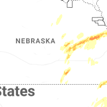

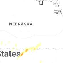


Connect with Interactive Hail Maps