

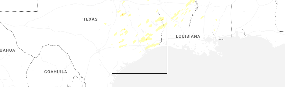
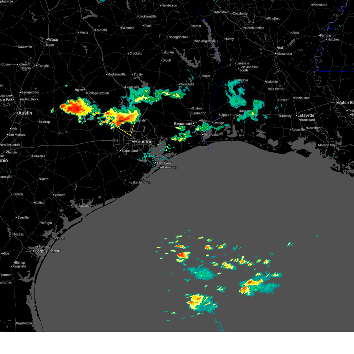
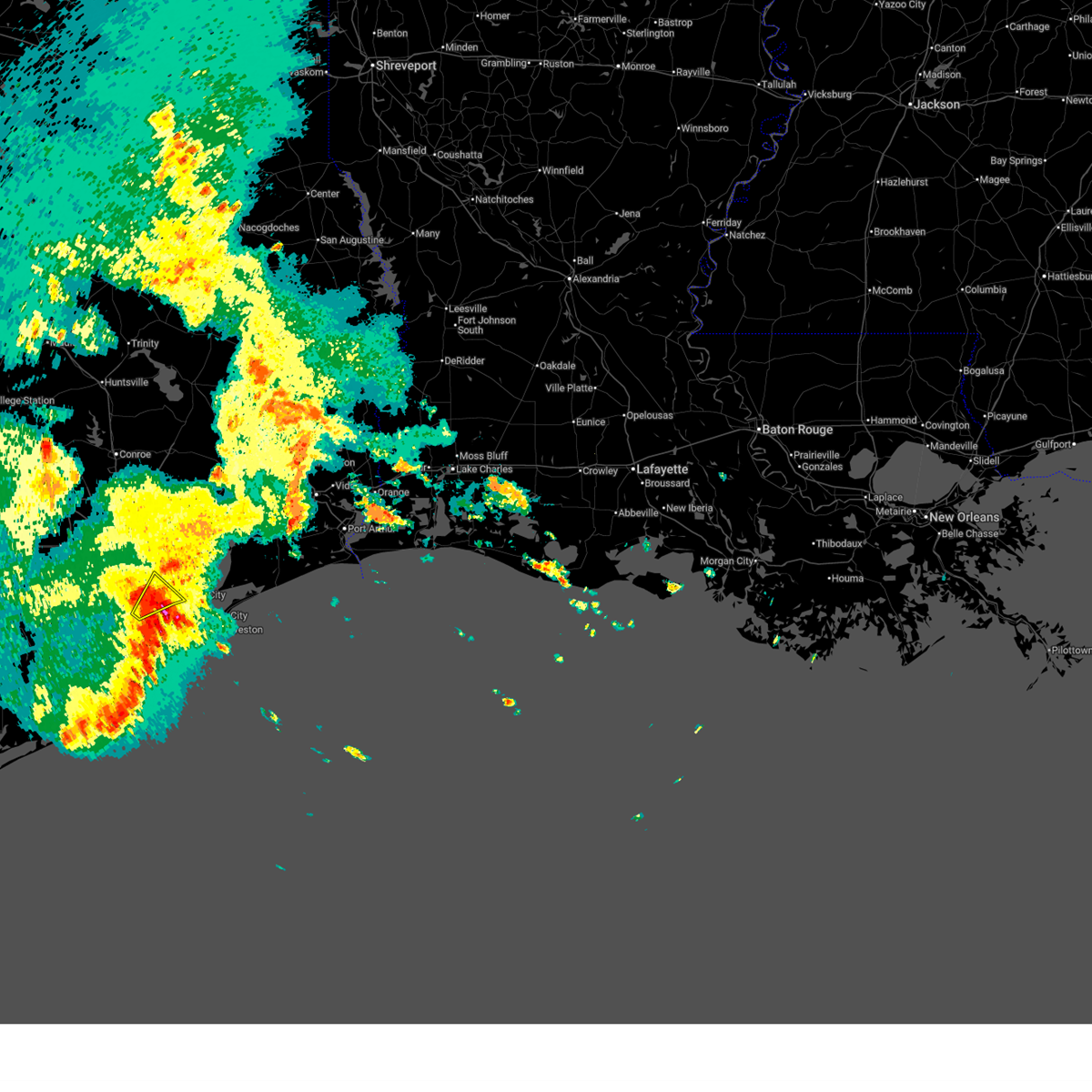
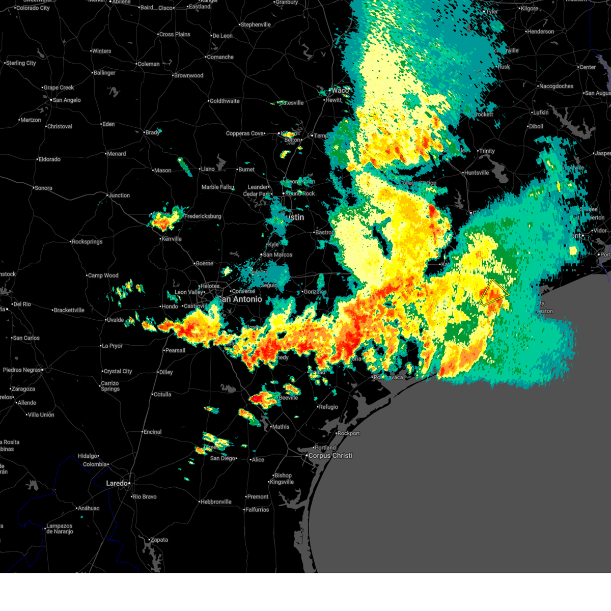
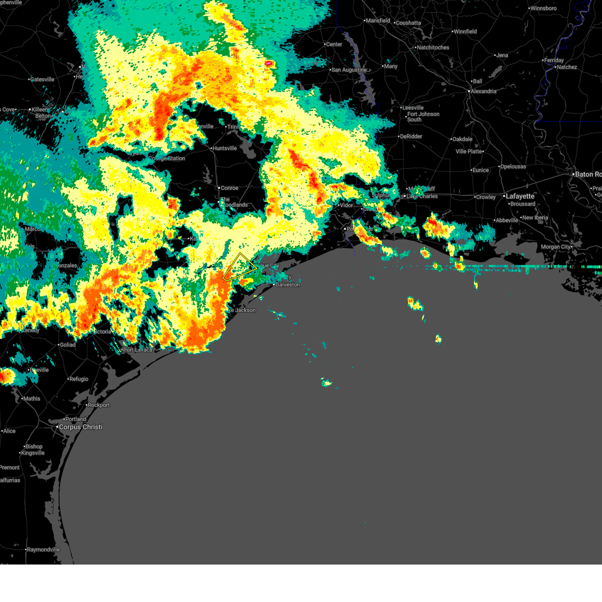
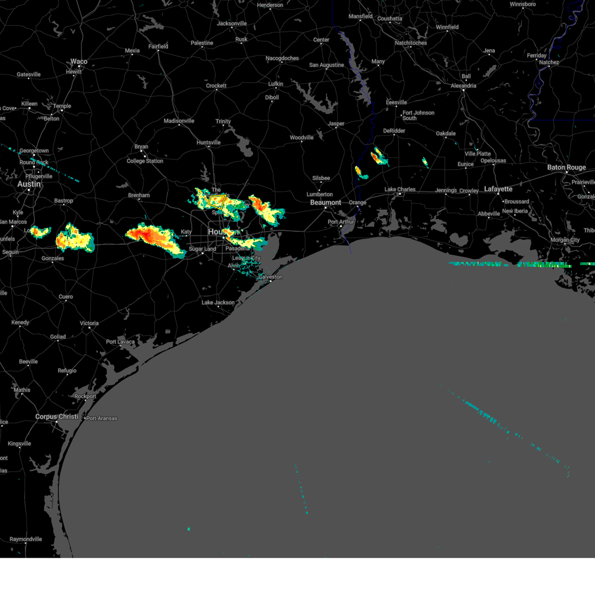
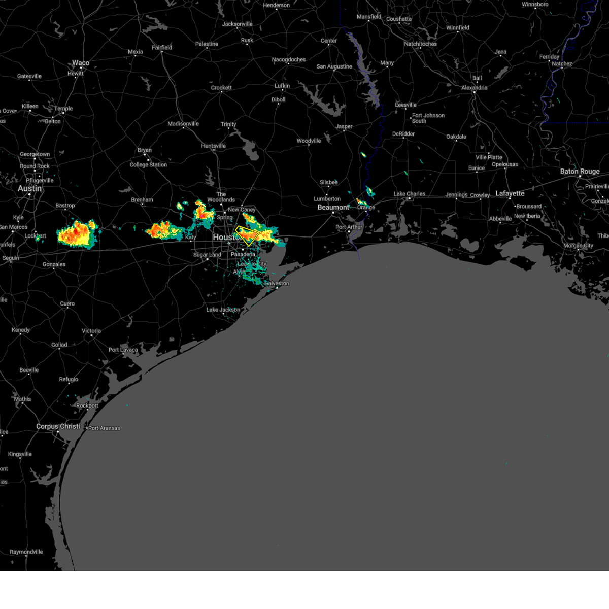
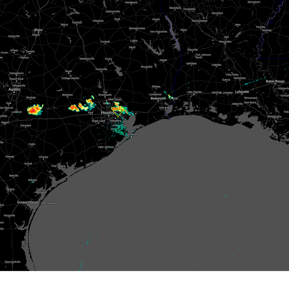
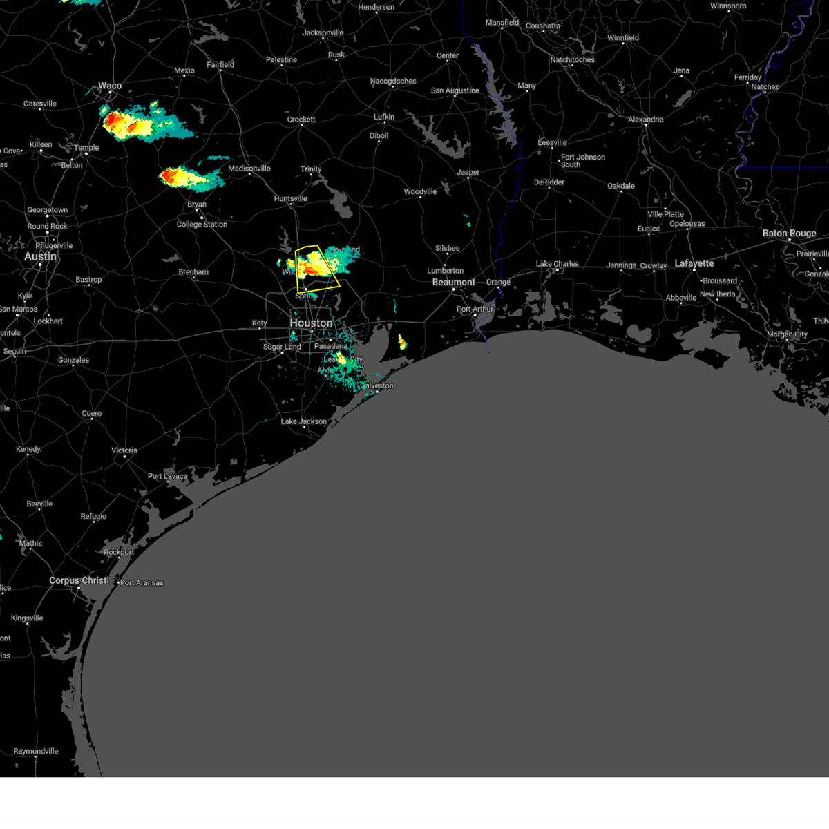
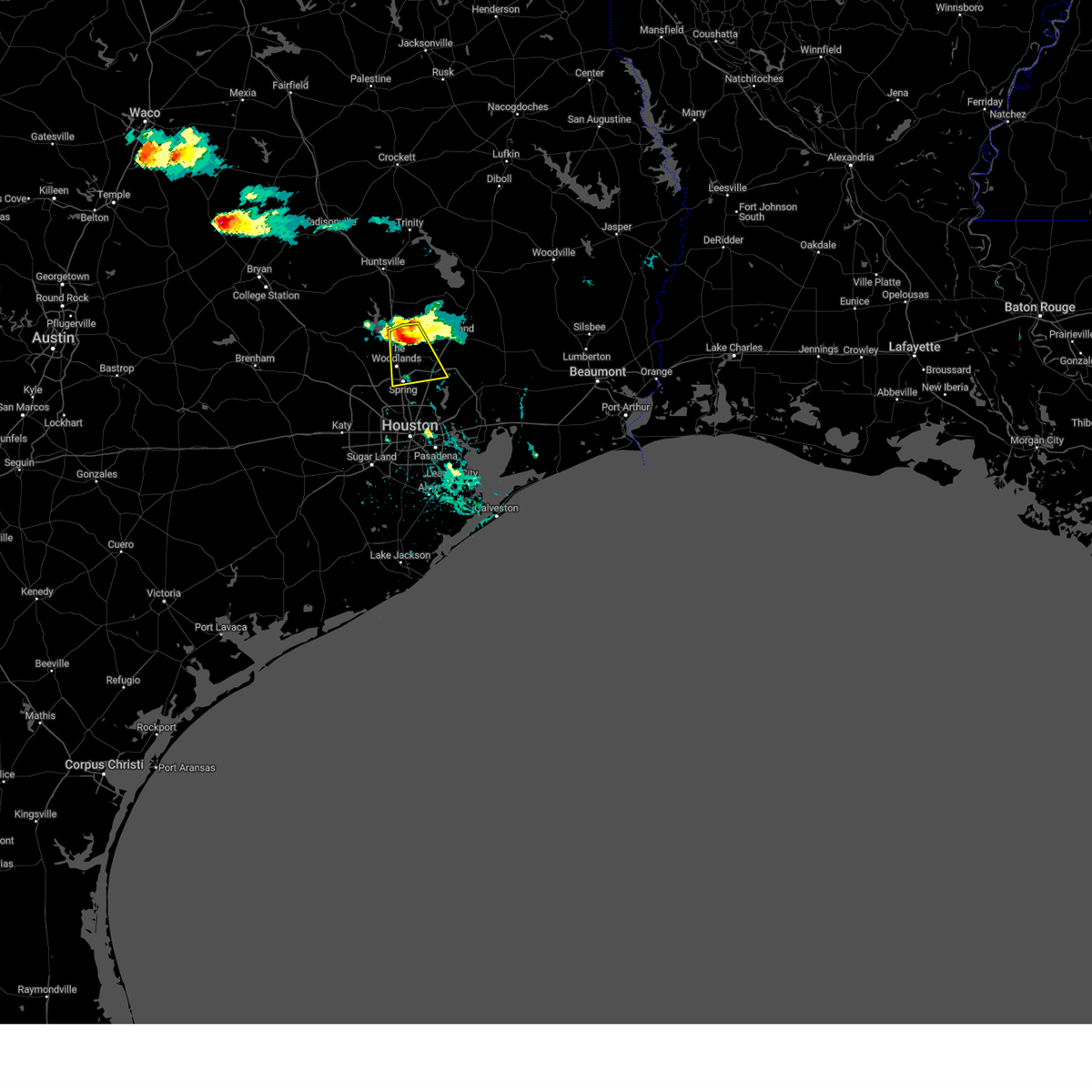
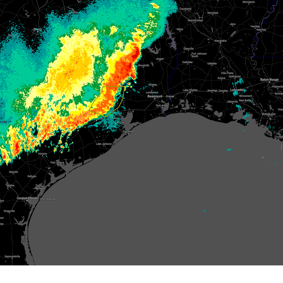
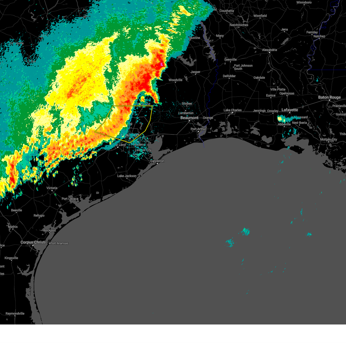
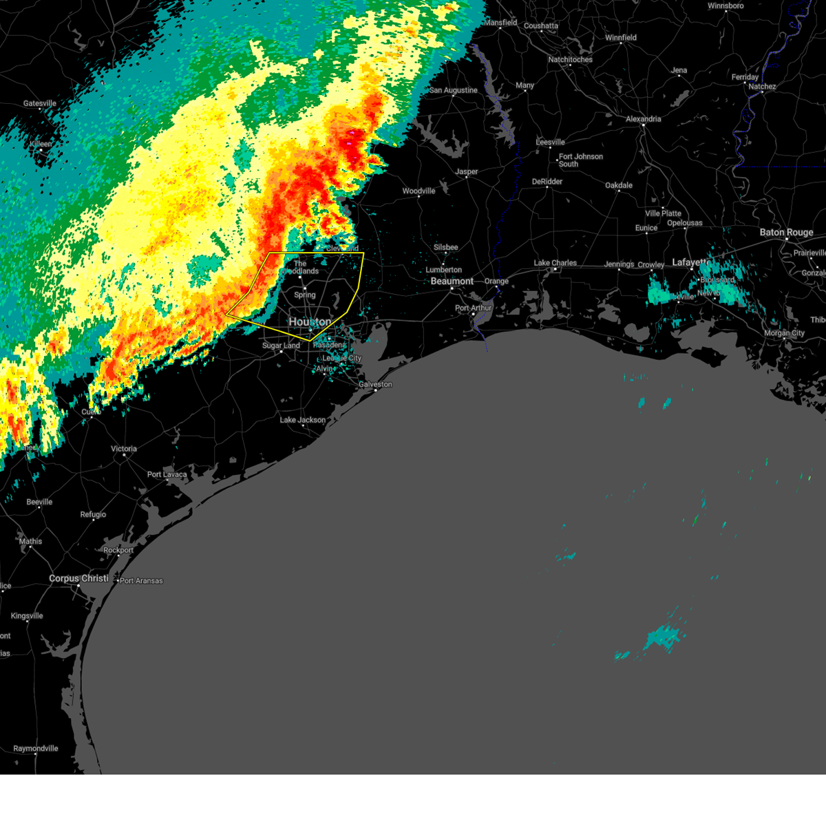
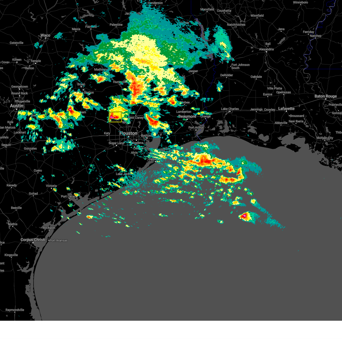
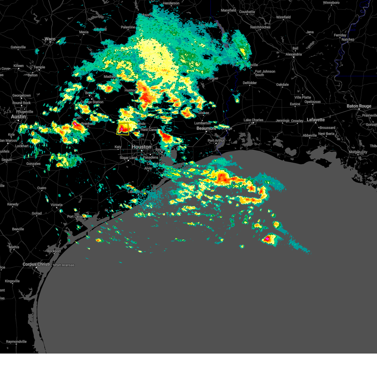
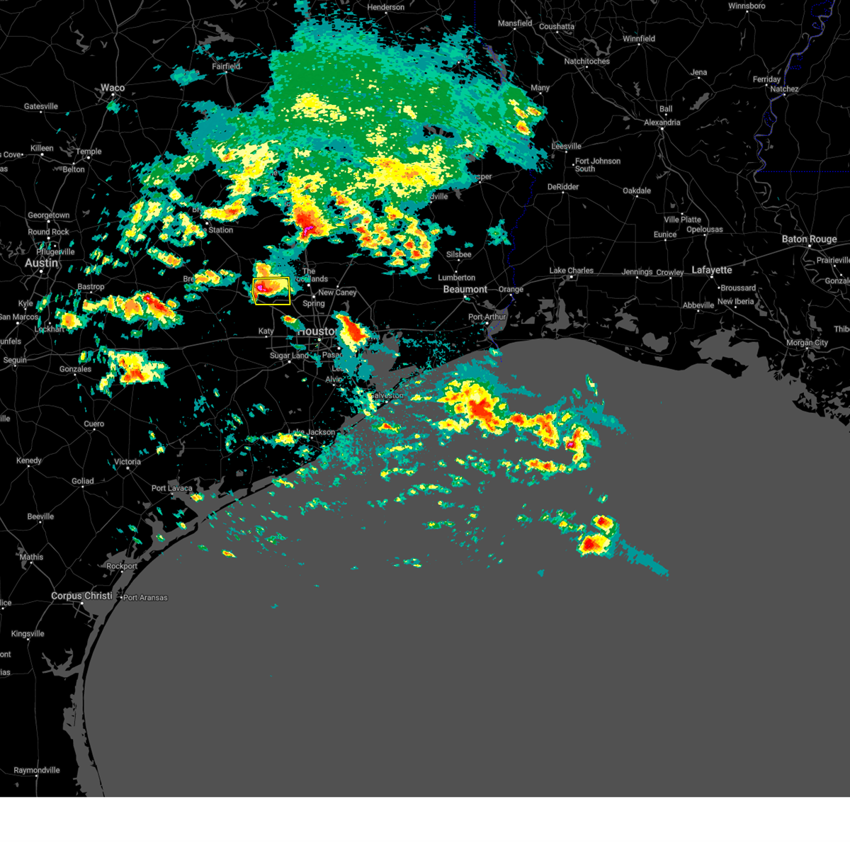
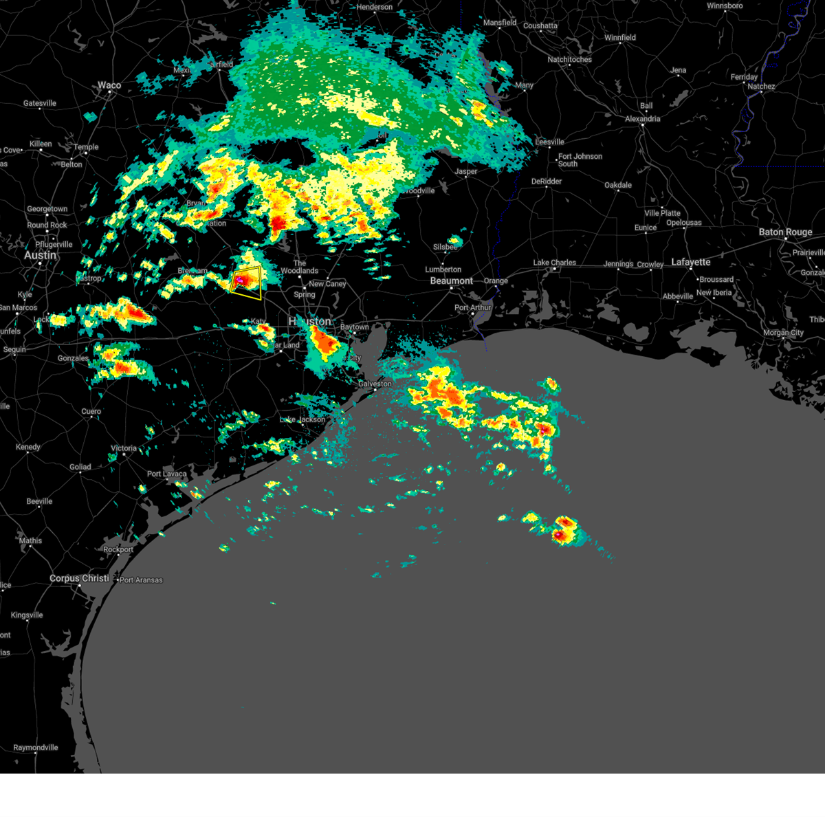
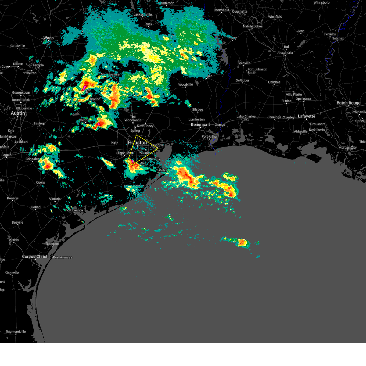
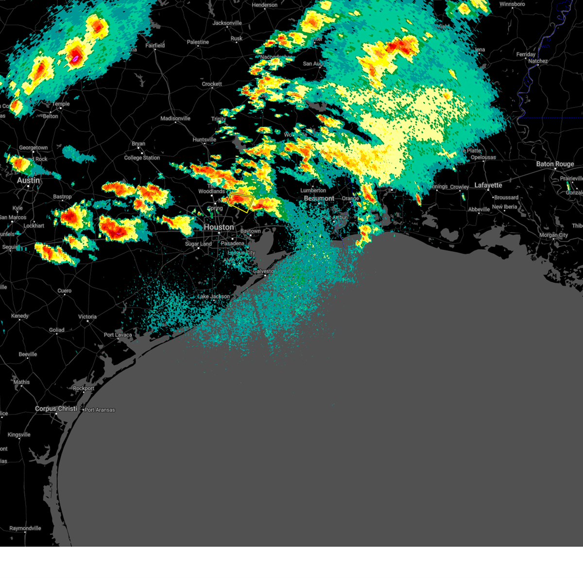
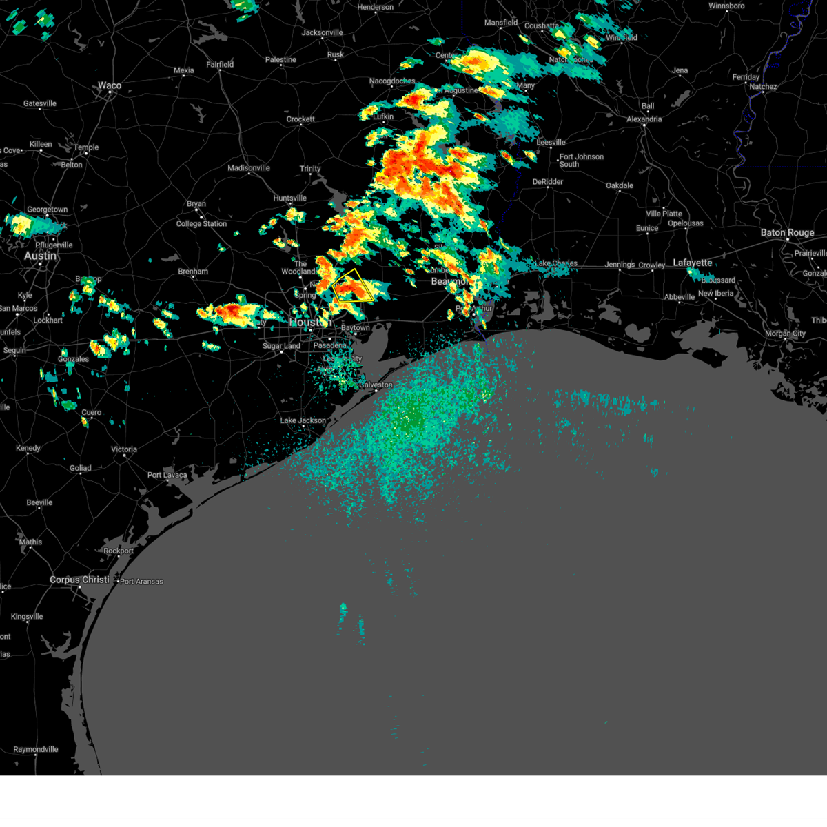
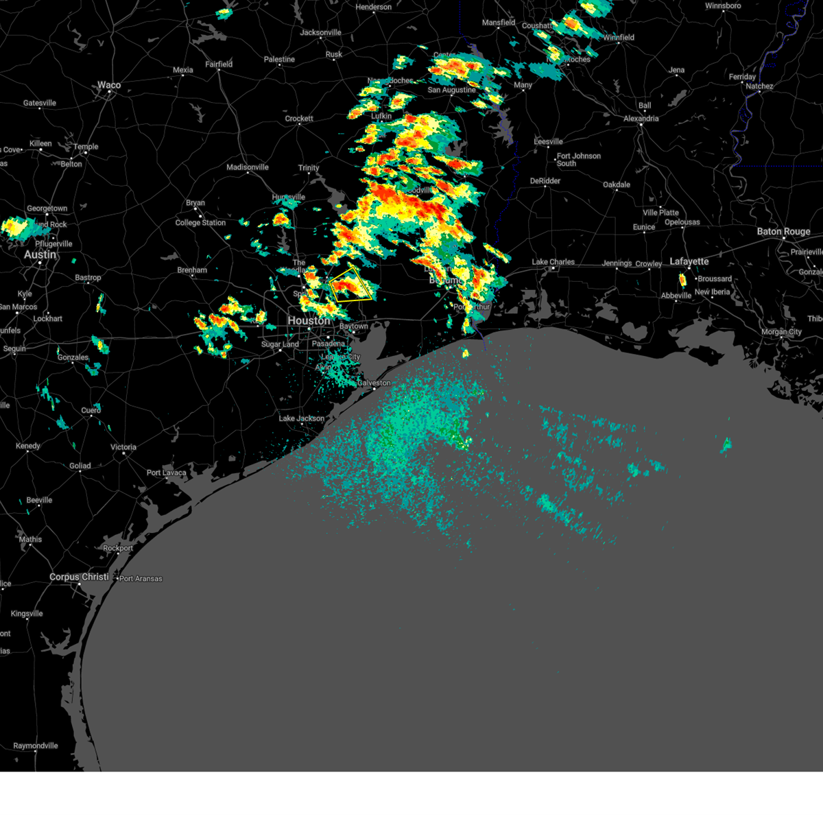
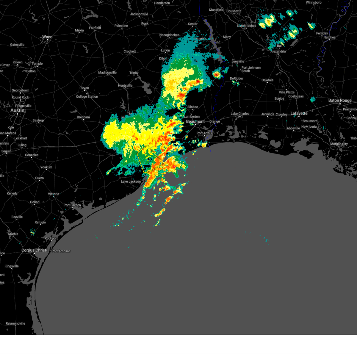
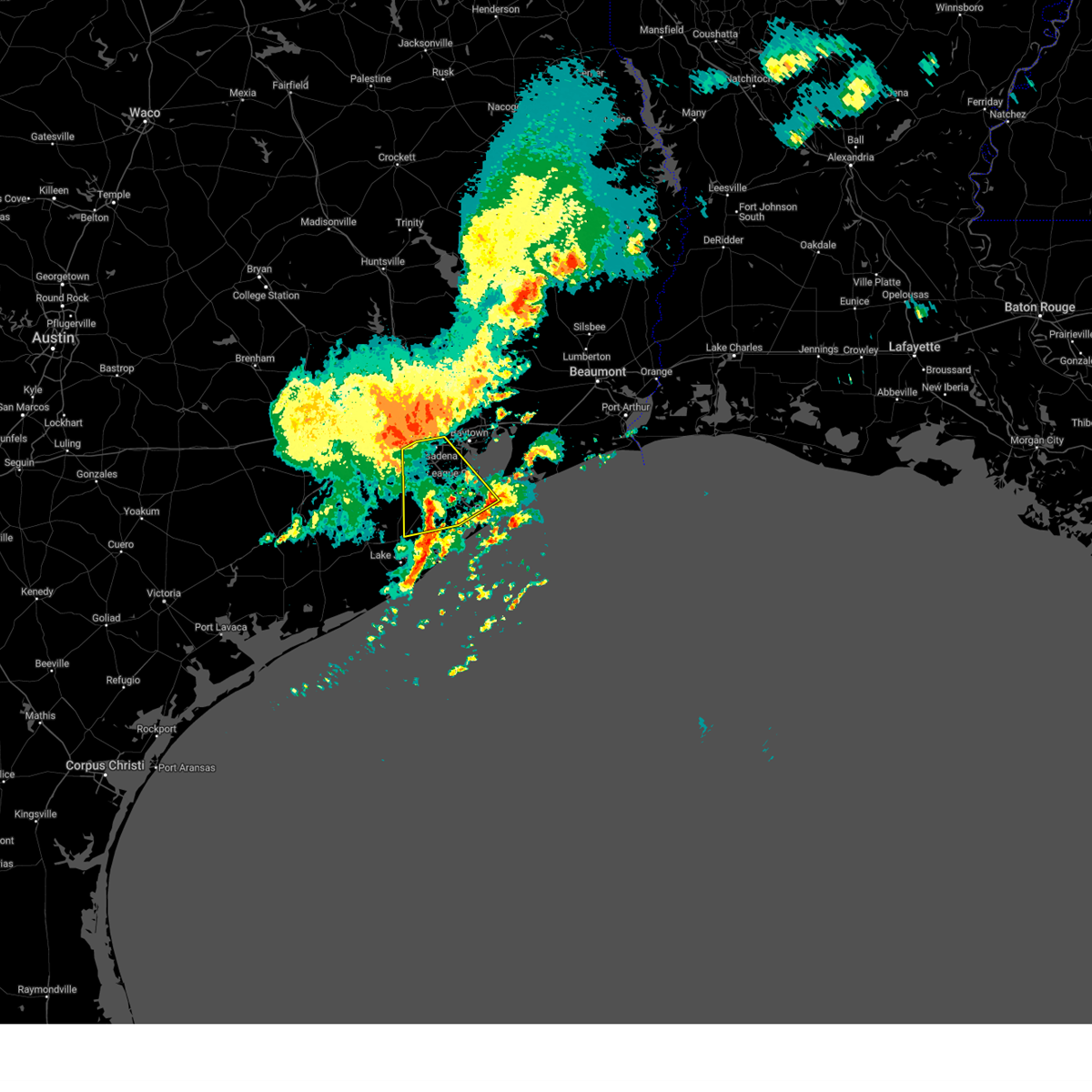
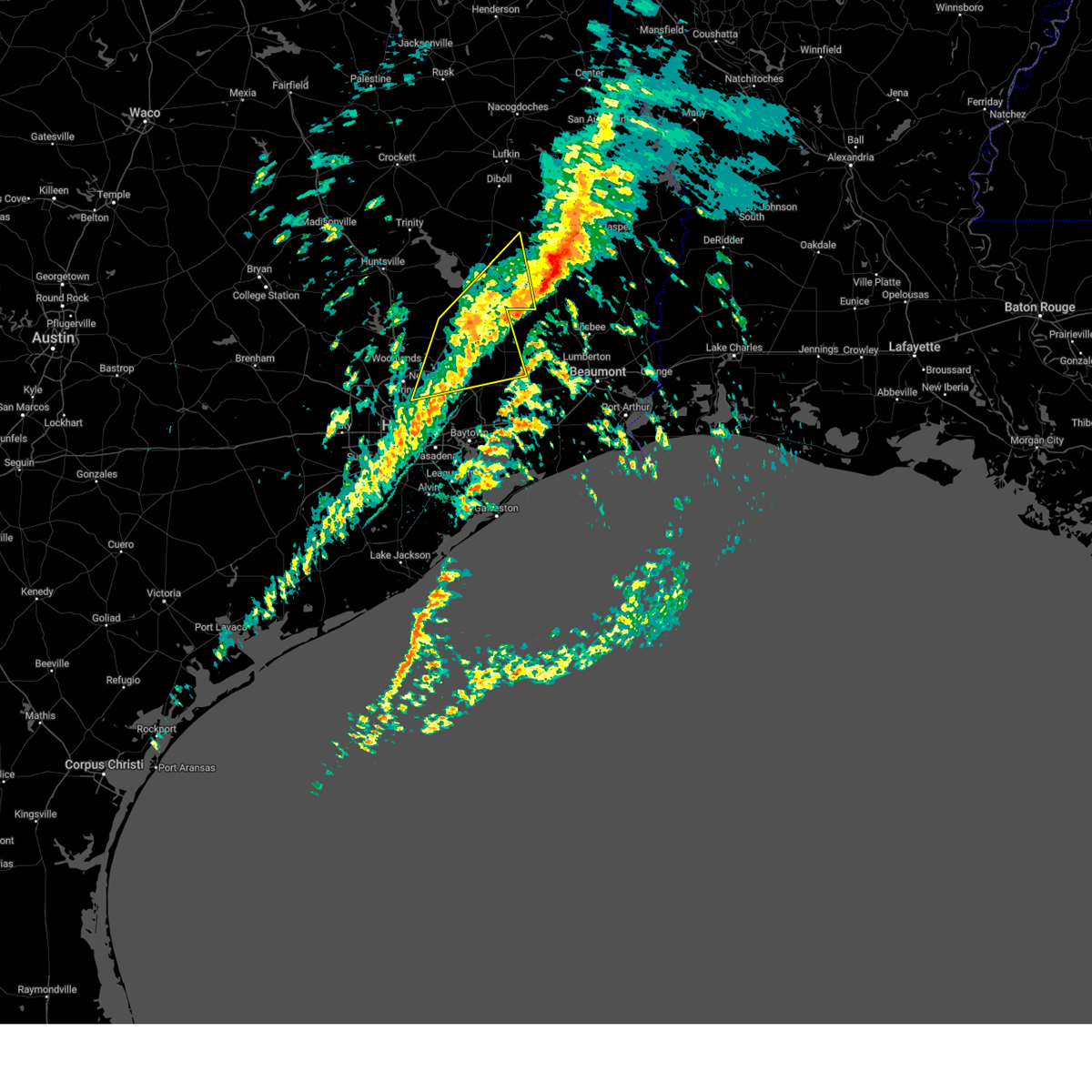
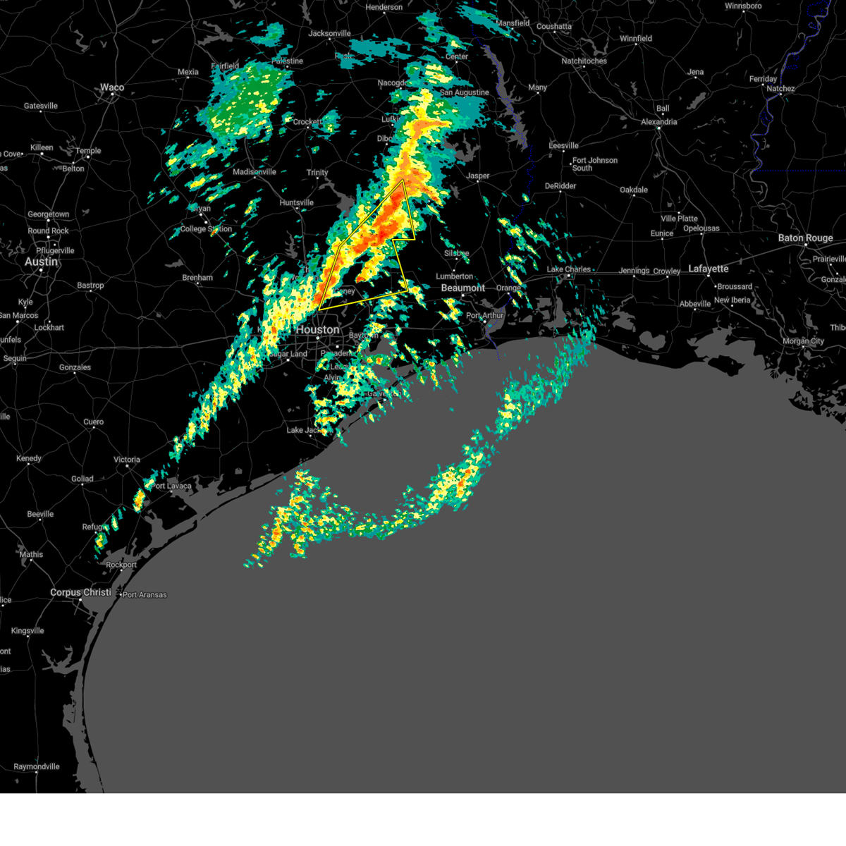
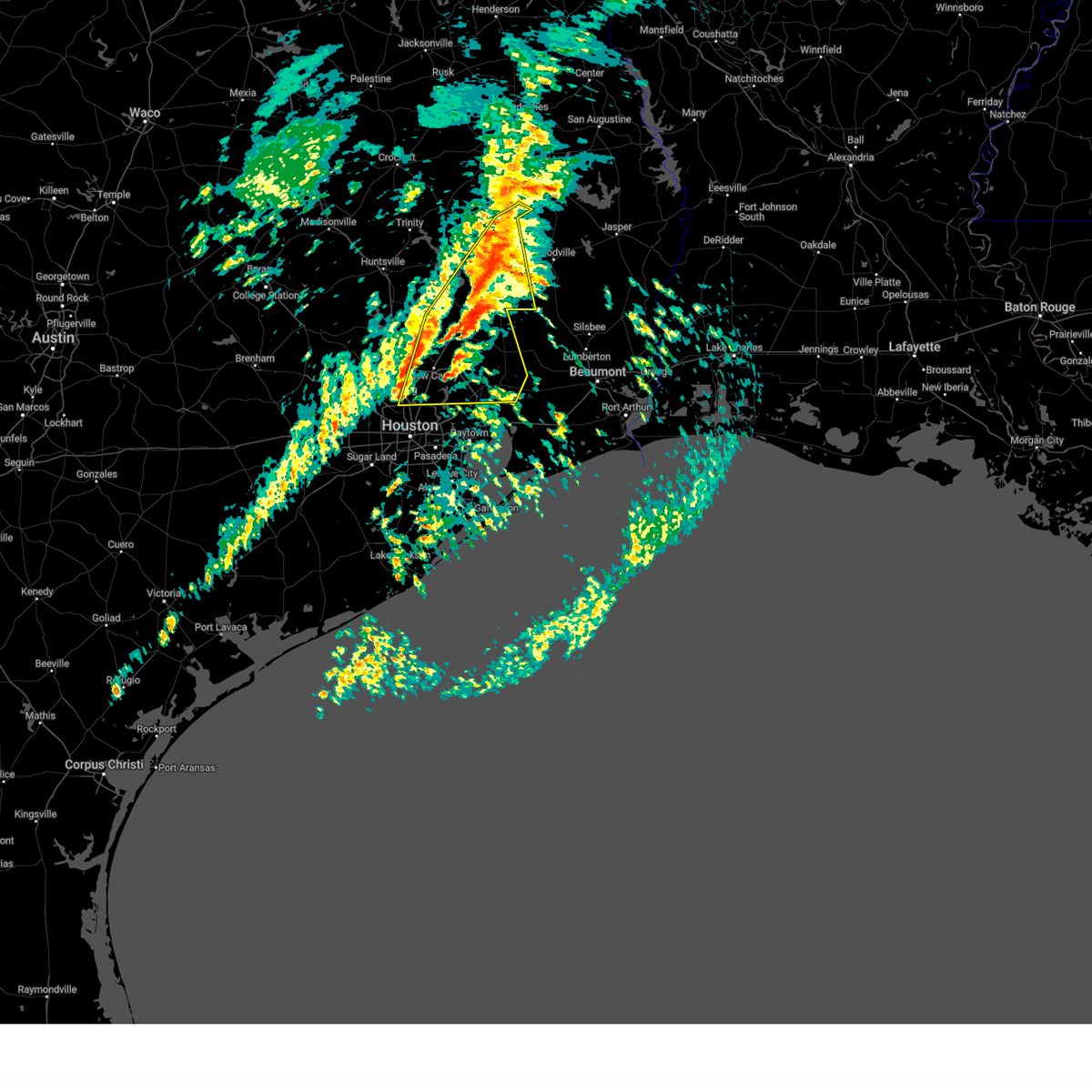
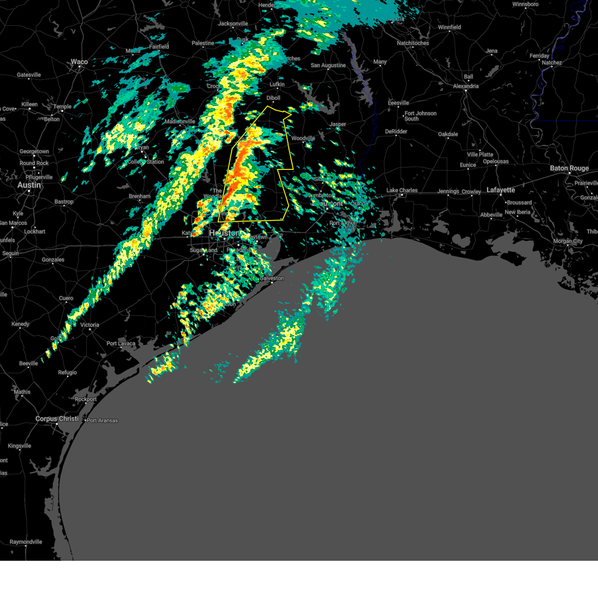
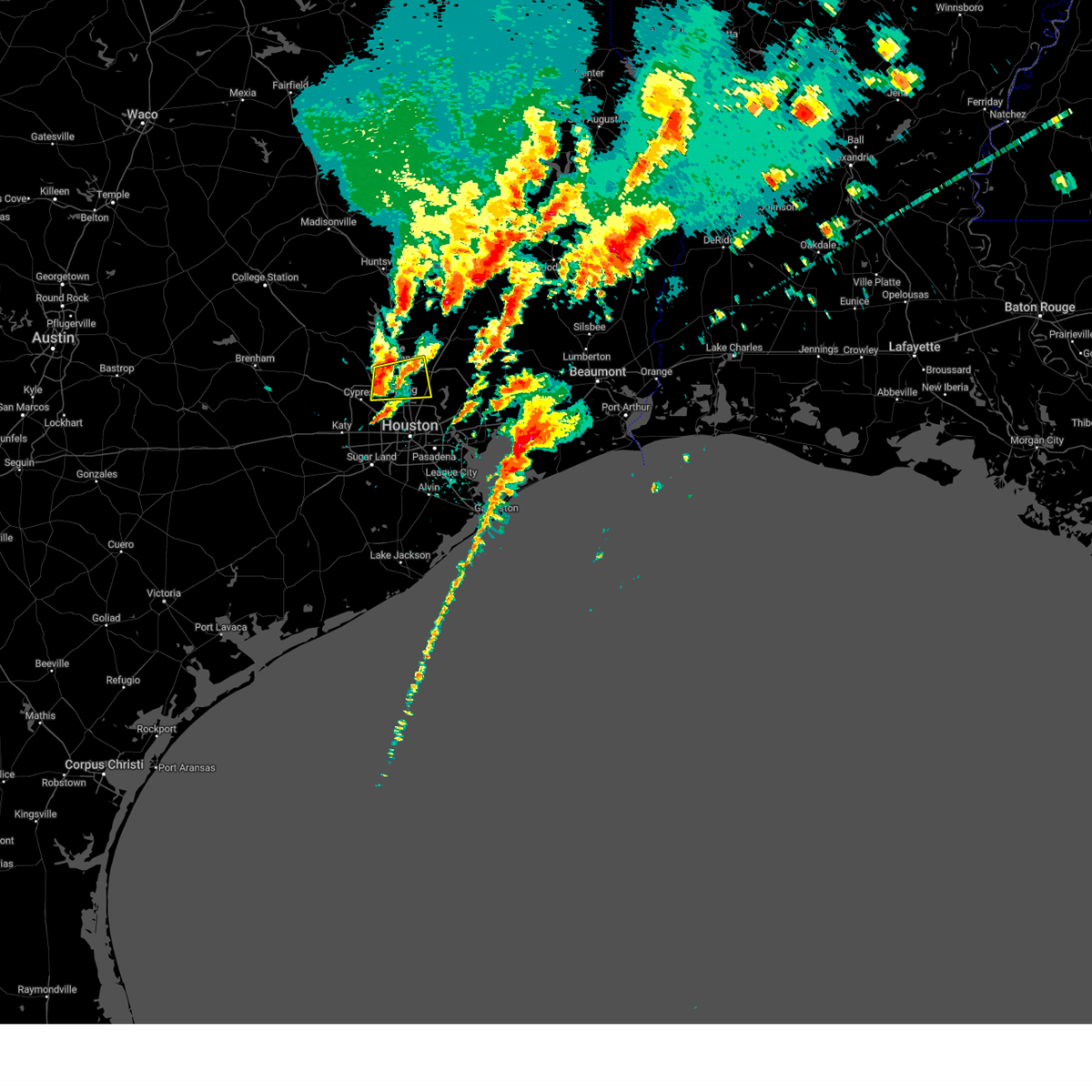
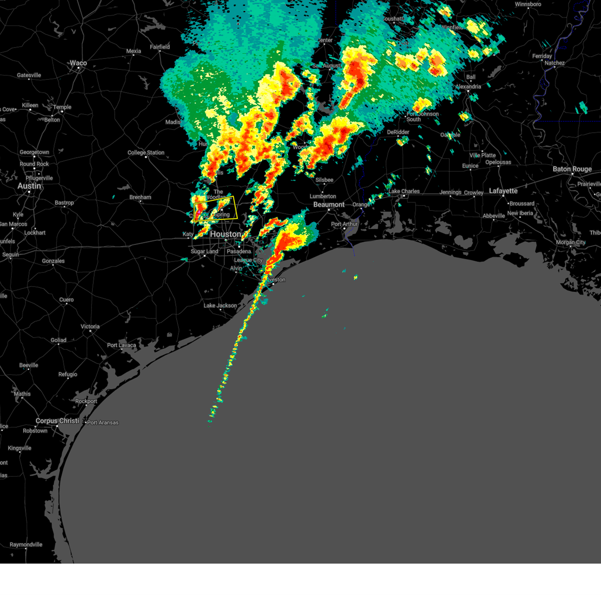
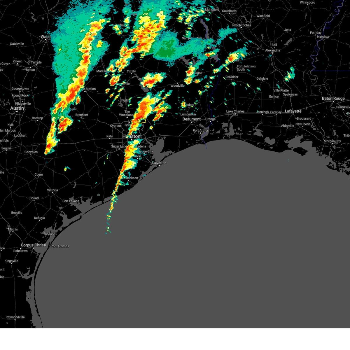
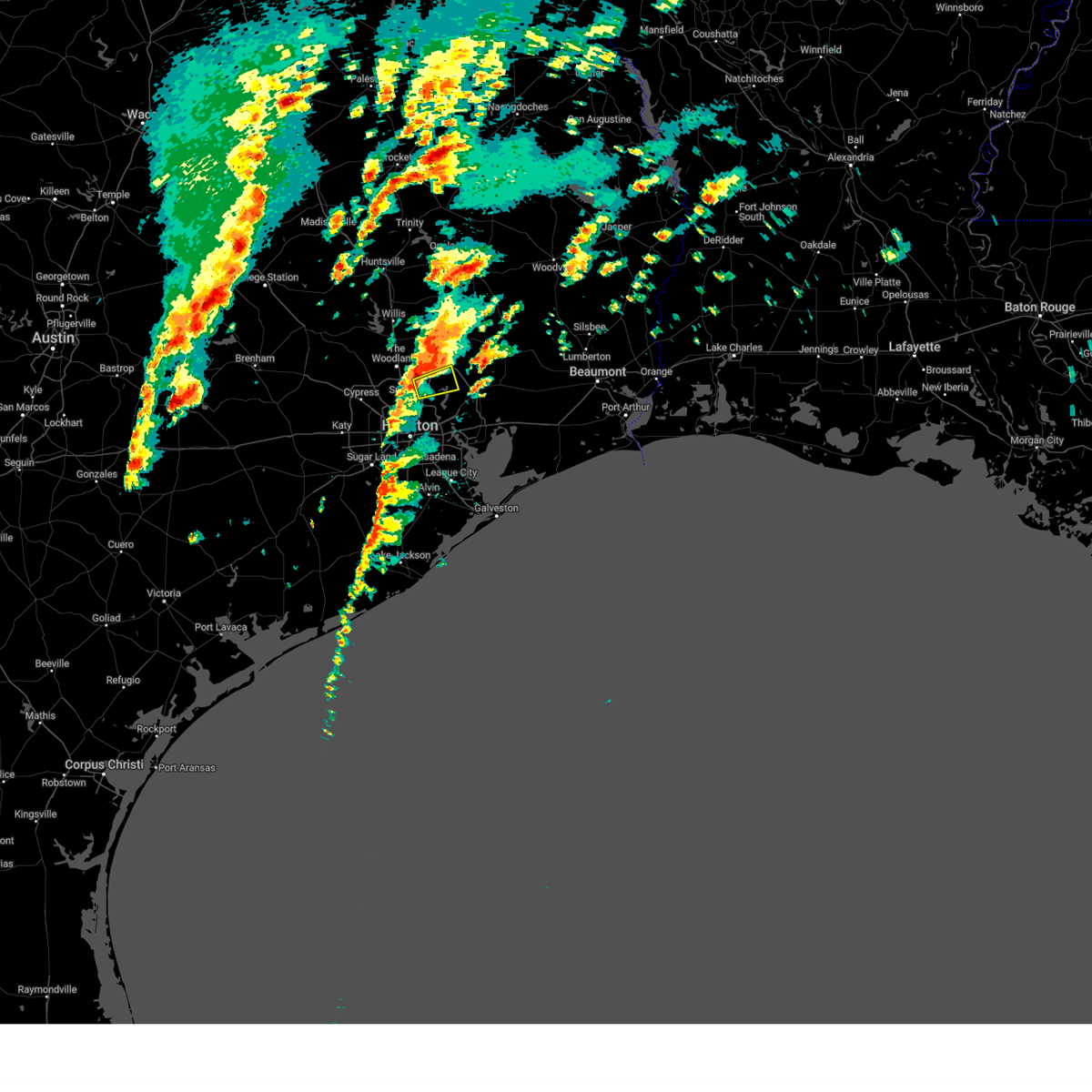
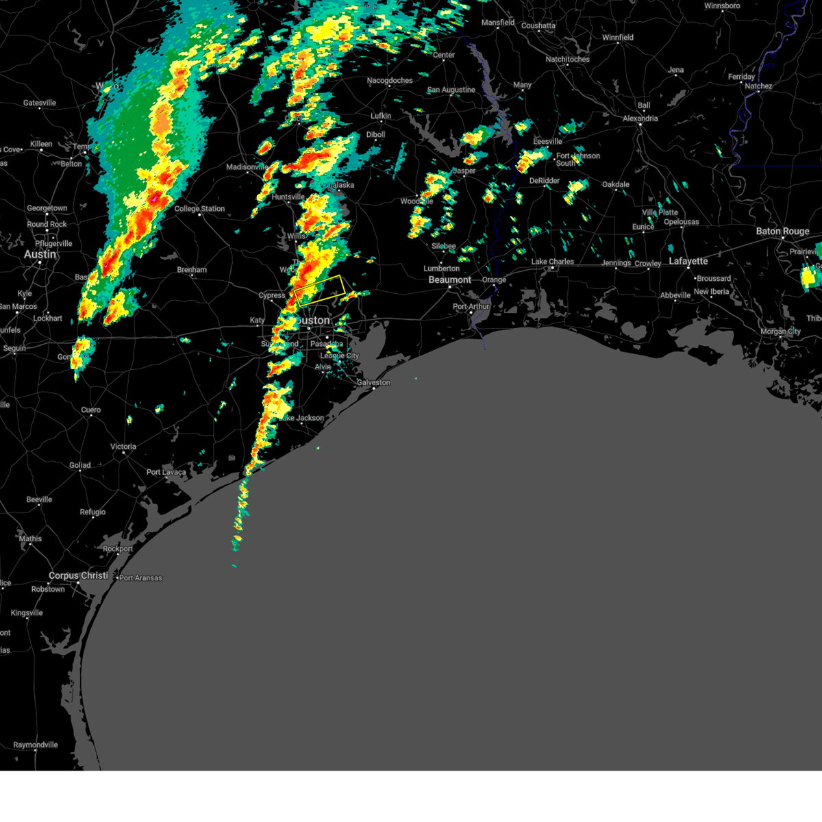
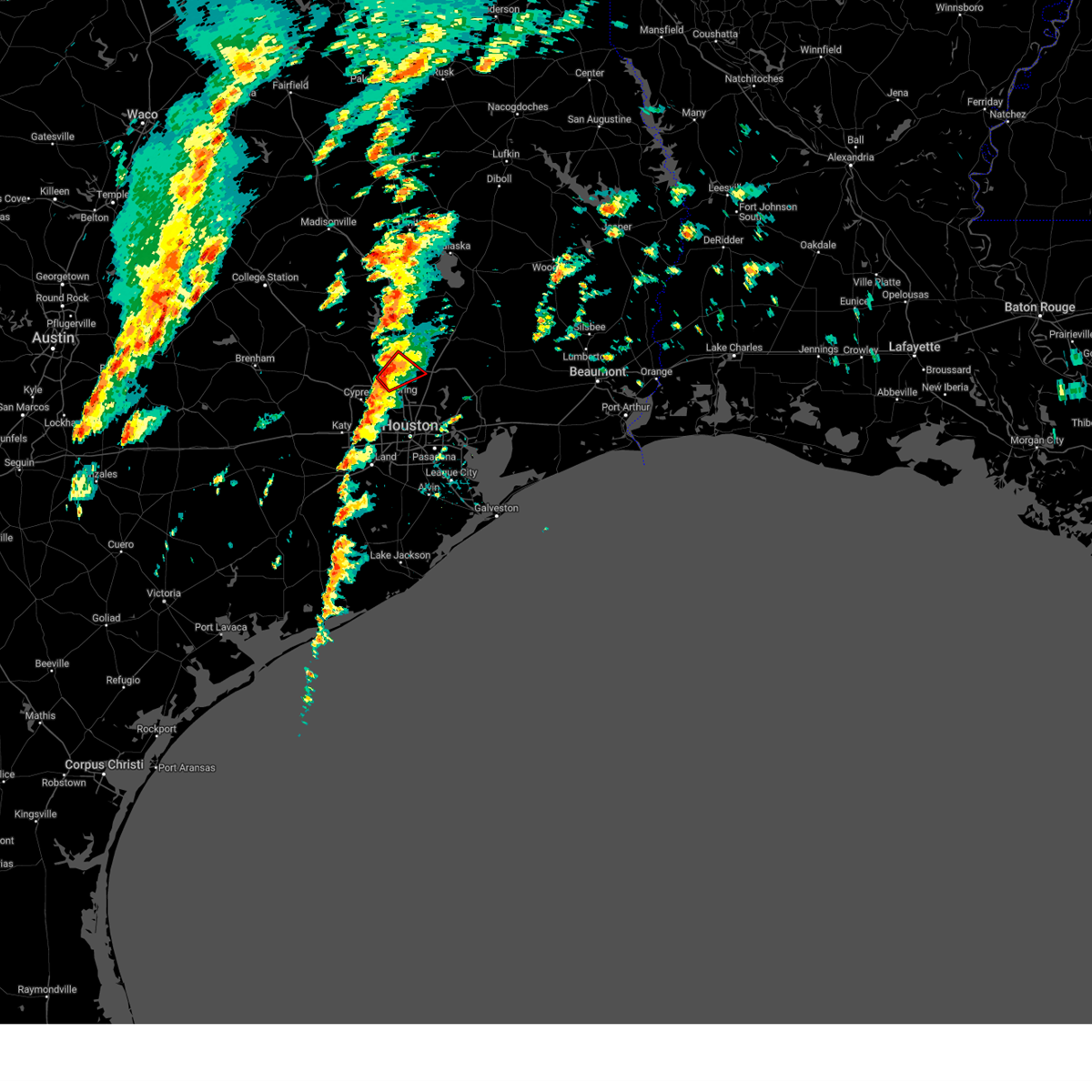
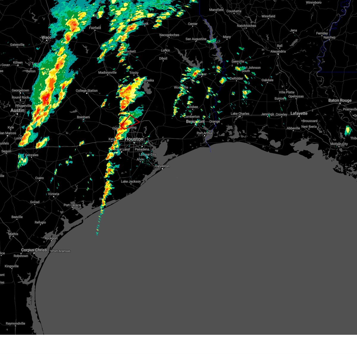
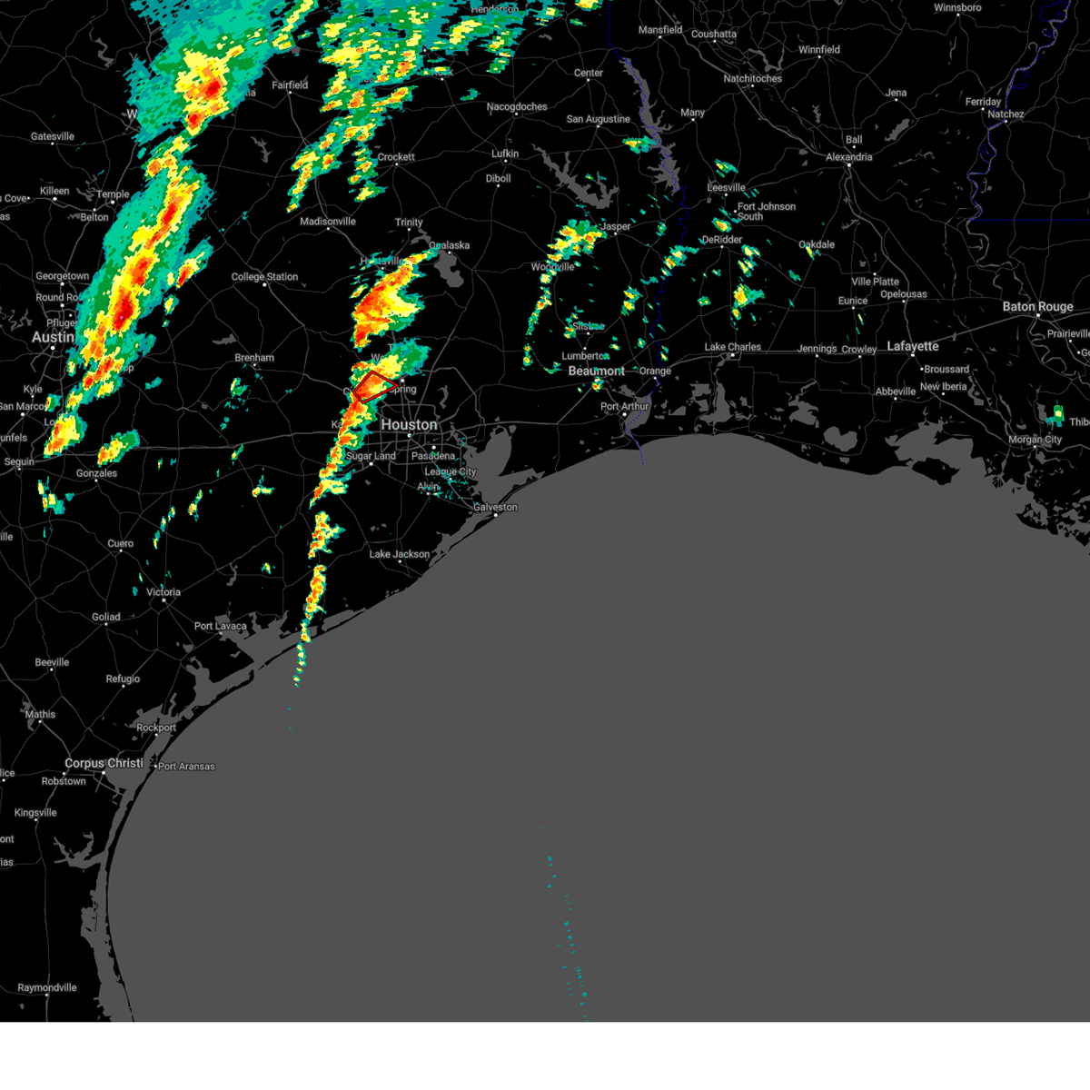
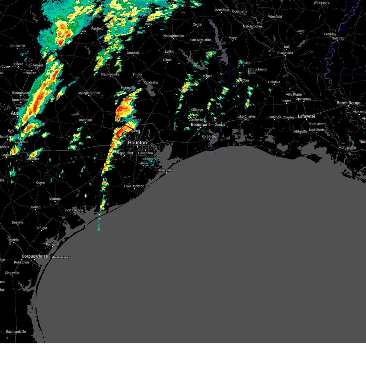
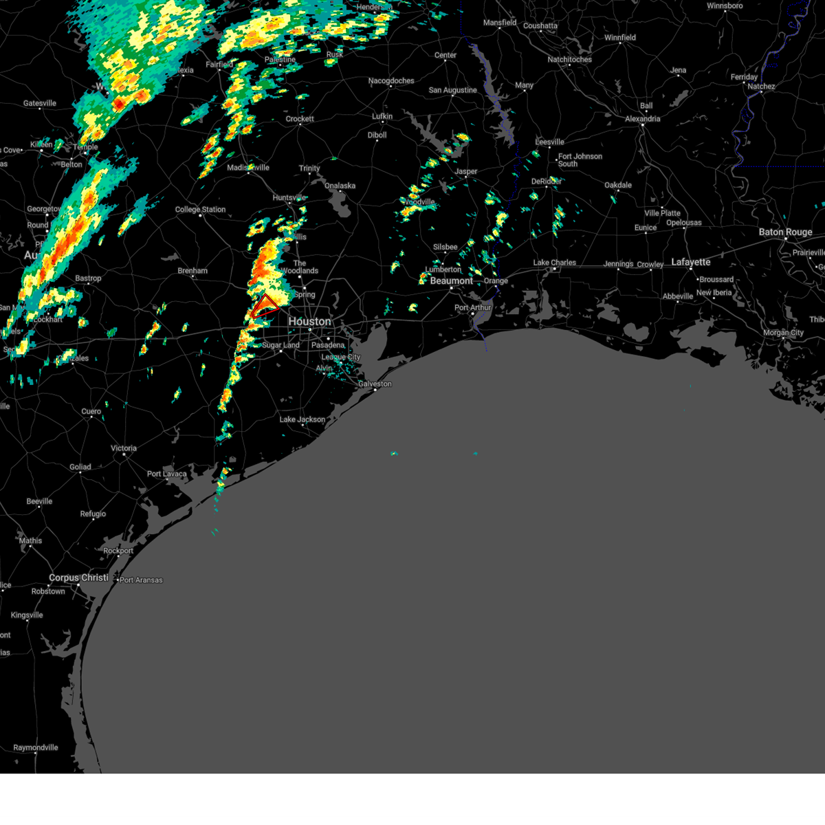
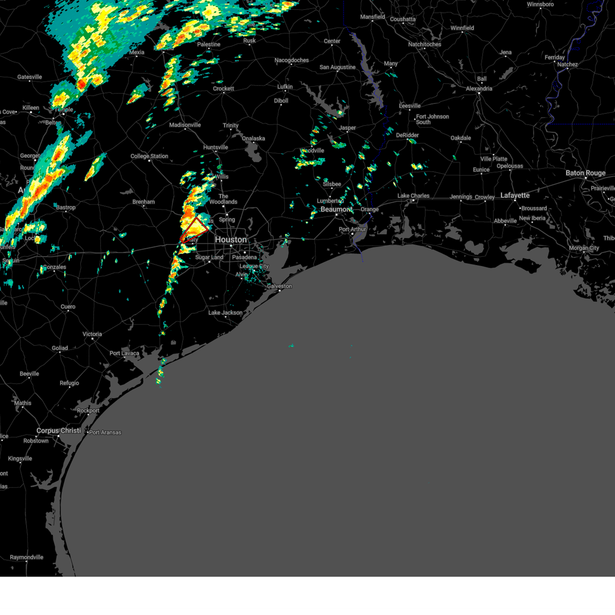
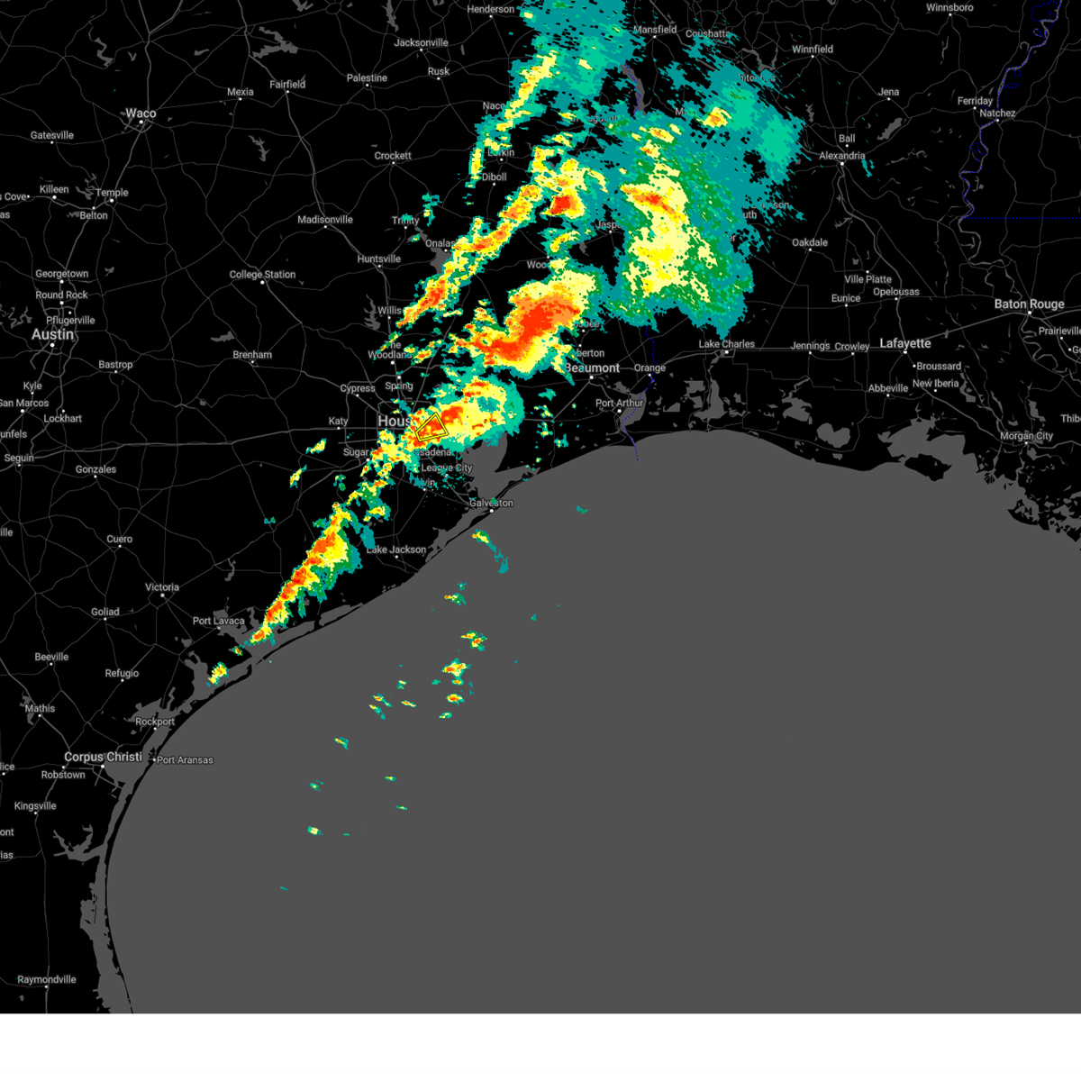
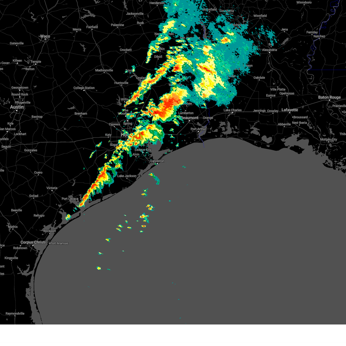
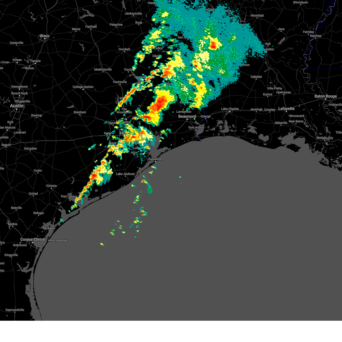
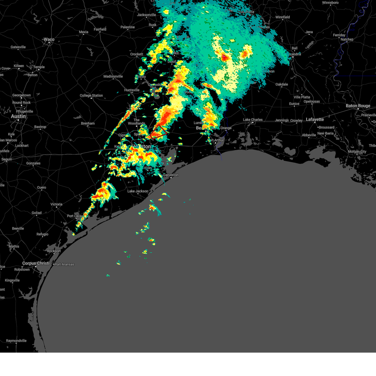
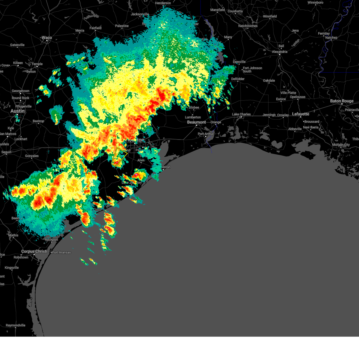
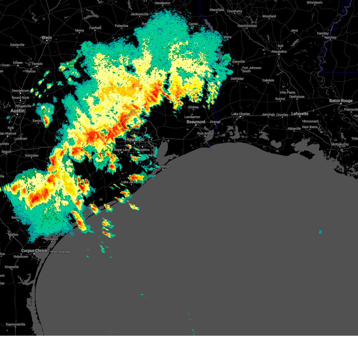
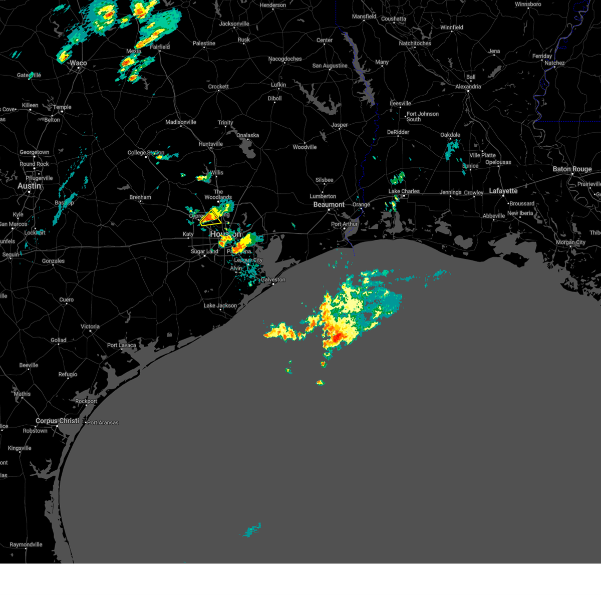
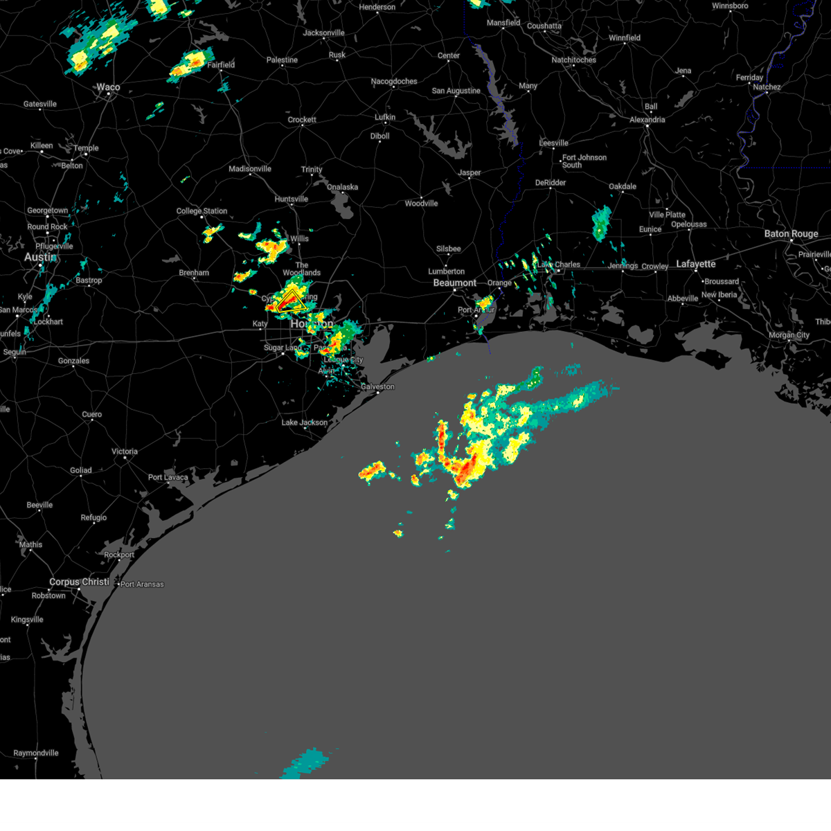
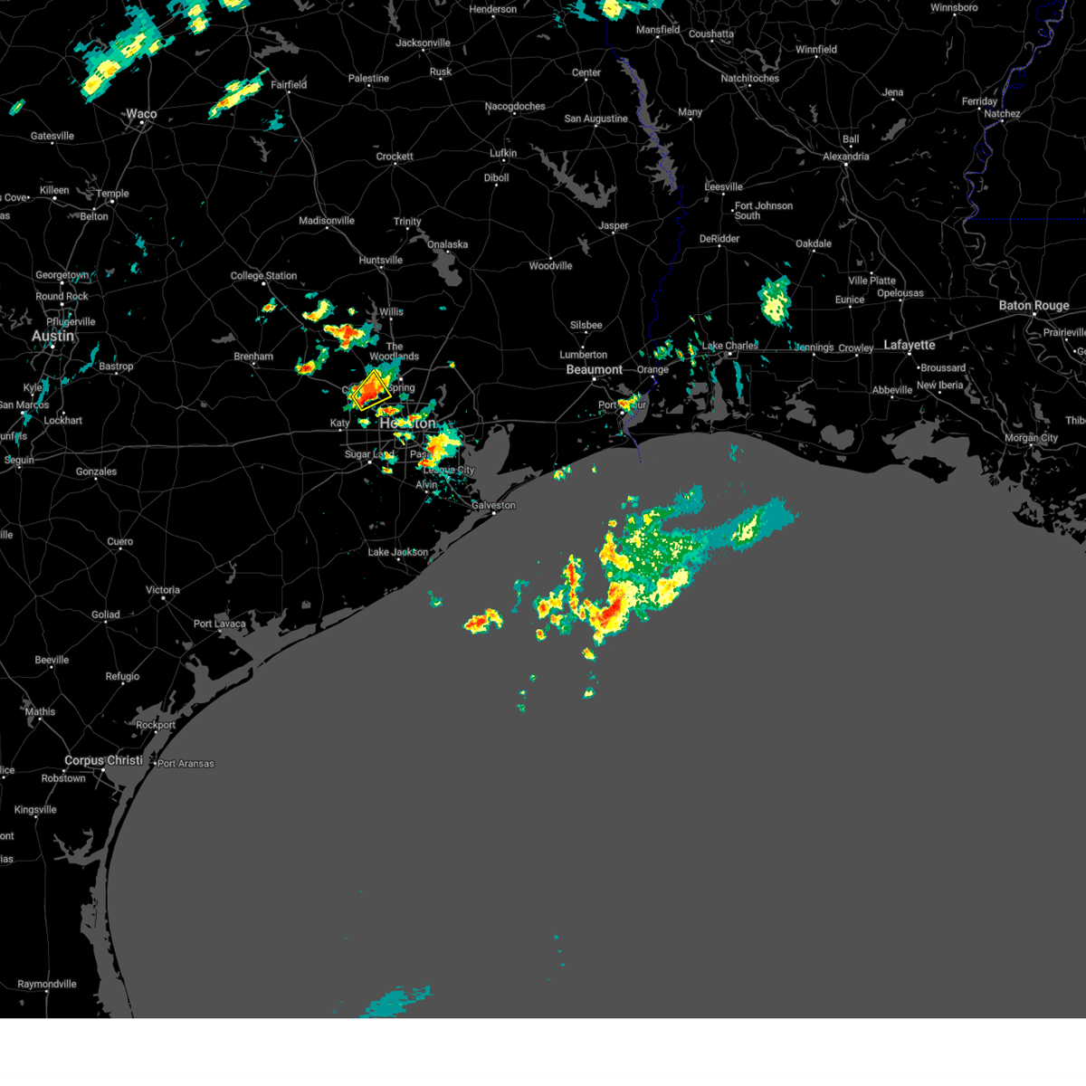
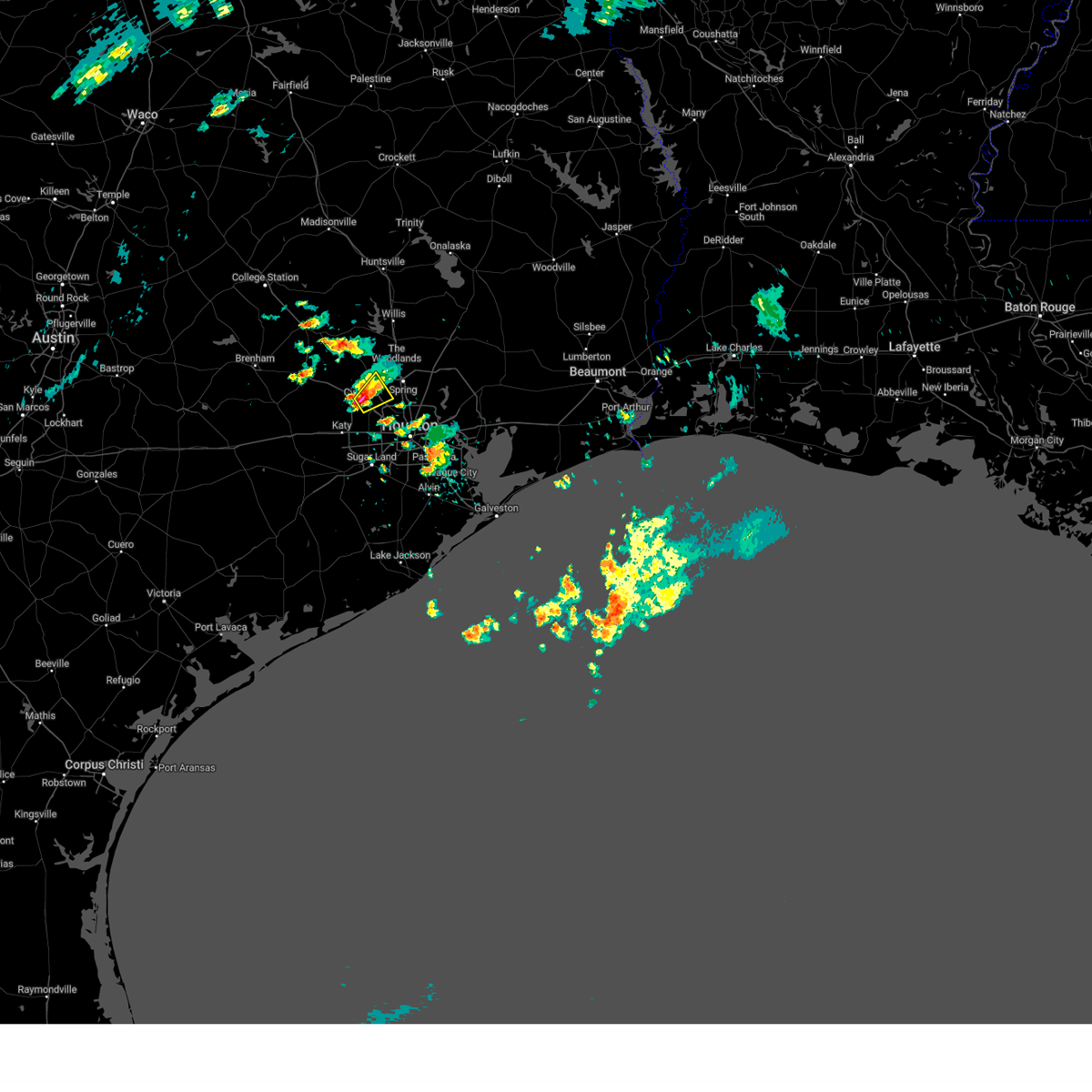
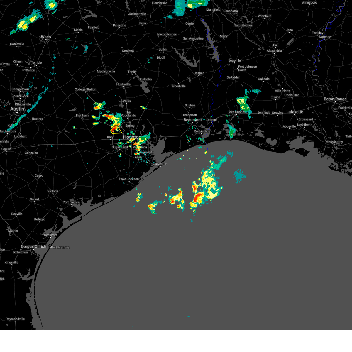
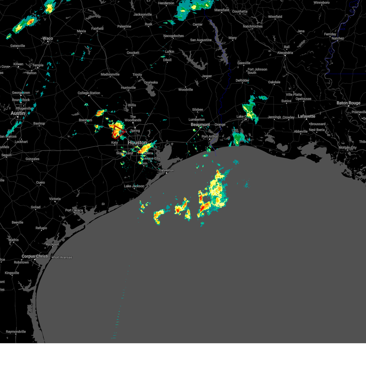
Hail Map for Houston, TX
The Houston, TX area has had 96 reports of on-the-ground hail by trained spotters, and has been under severe weather warnings 80 times during the past 12 months. Doppler radar has detected hail at or near Houston, TX on 254 occasions, including 19 occasions during the past year.
| Name: | Houston, TX |
| Where Located: | 6.6 miles NNW of Houston, TX |
| Map: | Google Map for Houston, TX |
| Population: | 2099451 |
| Housing Units: | 892646 |
| More Info: | Search Google for Houston, TX |
1
The Top Recent Hail Date for Houston, TX is Saturday, December 28, 2024 (62nd out of 254)
Hail and Wind Damage Spotted near Houston, TX
| Date / Time | Report Details |
|---|---|
| 6/24/2025 4:29 PM CDT |
 Svrhgx the national weather service in league city has issued a * severe thunderstorm warning for, southwestern montgomery county in southeastern texas, northeastern waller county in southeastern texas, northwestern harris county in southeastern texas, * until 515 pm cdt. * at 428 pm cdt, a severe thunderstorm was located near tomball, moving north at 20 mph (radar indicated). Hazards include 60 mph wind gusts and quarter size hail. Hail damage to vehicles is expected. Expect wind damage to roofs, siding, and trees. Svrhgx the national weather service in league city has issued a * severe thunderstorm warning for, southwestern montgomery county in southeastern texas, northeastern waller county in southeastern texas, northwestern harris county in southeastern texas, * until 515 pm cdt. * at 428 pm cdt, a severe thunderstorm was located near tomball, moving north at 20 mph (radar indicated). Hazards include 60 mph wind gusts and quarter size hail. Hail damage to vehicles is expected. Expect wind damage to roofs, siding, and trees.
|
| 6/24/2025 4:16 PM CDT |
 Svrhgx the national weather service in league city has issued a * severe thunderstorm warning for, southwestern montgomery county in southeastern texas, northwestern harris county in southeastern texas, * until 430 pm cdt. * at 416 pm cdt, a severe thunderstorm was located over cypress, or 9 miles southwest of tomball, moving northwest at 15 mph (radar indicated). Hazards include 60 mph wind gusts and quarter size hail. Hail damage to vehicles is expected. Expect wind damage to roofs, siding, and trees. Svrhgx the national weather service in league city has issued a * severe thunderstorm warning for, southwestern montgomery county in southeastern texas, northwestern harris county in southeastern texas, * until 430 pm cdt. * at 416 pm cdt, a severe thunderstorm was located over cypress, or 9 miles southwest of tomball, moving northwest at 15 mph (radar indicated). Hazards include 60 mph wind gusts and quarter size hail. Hail damage to vehicles is expected. Expect wind damage to roofs, siding, and trees.
|
| 6/13/2025 7:50 PM CDT |
 the severe thunderstorm warning has been cancelled and is no longer in effect the severe thunderstorm warning has been cancelled and is no longer in effect
|
| 6/13/2025 7:30 PM CDT |
 Svrhgx the national weather service in league city has issued a * severe thunderstorm warning for, south central montgomery county in southeastern texas, north central harris county in southeastern texas, * until 815 pm cdt. * at 730 pm cdt, a severe thunderstorm was located near tomball, moving east at 20 mph (radar indicated). Hazards include 60 mph wind gusts and penny size hail. expect damage to roofs, siding, and trees Svrhgx the national weather service in league city has issued a * severe thunderstorm warning for, south central montgomery county in southeastern texas, north central harris county in southeastern texas, * until 815 pm cdt. * at 730 pm cdt, a severe thunderstorm was located near tomball, moving east at 20 mph (radar indicated). Hazards include 60 mph wind gusts and penny size hail. expect damage to roofs, siding, and trees
|
| 6/12/2025 7:11 AM CDT |
 The storm which prompted the warning has weakened below severe limits, and has exited the warned area. therefore, the warning will be allowed to expire. however, gusty winds are still possible with this thunderstorm. The storm which prompted the warning has weakened below severe limits, and has exited the warned area. therefore, the warning will be allowed to expire. however, gusty winds are still possible with this thunderstorm.
|
| 6/12/2025 7:04 AM CDT |
 At 704 am cdt, a severe thunderstorm was located over southwestern friendswood, moving northeast at 30 mph (radar indicated). Hazards include 60 mph wind gusts and penny size hail. Expect damage to roofs, siding, and trees. Locations impacted include, southeastern pearland, league city, friendswood, alvin, dickinson, santa fe, webster, south belt / ellington, southern clear lake, nassau bay, hillcrest, and ellington field. At 704 am cdt, a severe thunderstorm was located over southwestern friendswood, moving northeast at 30 mph (radar indicated). Hazards include 60 mph wind gusts and penny size hail. Expect damage to roofs, siding, and trees. Locations impacted include, southeastern pearland, league city, friendswood, alvin, dickinson, santa fe, webster, south belt / ellington, southern clear lake, nassau bay, hillcrest, and ellington field.
|
| 6/12/2025 6:48 AM CDT |
 Svrhgx the national weather service in league city has issued a * severe thunderstorm warning for, northwestern galveston county in southeastern texas, northeastern brazoria county in southeastern texas, southeastern harris county in southeastern texas, * until 715 am cdt. * at 648 am cdt, a severe thunderstorm was located near alvin, moving northeast at 30 mph (radar indicated). Hazards include 60 mph wind gusts and penny size hail. expect damage to roofs, siding, and trees Svrhgx the national weather service in league city has issued a * severe thunderstorm warning for, northwestern galveston county in southeastern texas, northeastern brazoria county in southeastern texas, southeastern harris county in southeastern texas, * until 715 am cdt. * at 648 am cdt, a severe thunderstorm was located near alvin, moving northeast at 30 mph (radar indicated). Hazards include 60 mph wind gusts and penny size hail. expect damage to roofs, siding, and trees
|
| 6/9/2025 6:37 PM CDT |
 The storm which prompted the warning has weakened below severe limits, and no longer poses an immediate threat to life or property. therefore, the warning will be allowed to expire. however, small hail and gusty winds are still possible with this thunderstorm. The storm which prompted the warning has weakened below severe limits, and no longer poses an immediate threat to life or property. therefore, the warning will be allowed to expire. however, small hail and gusty winds are still possible with this thunderstorm.
|
| 6/9/2025 6:23 PM CDT | At 623 pm cdt, a severe thunderstorm was located over oak ridge north, or near spring, moving east at 10 mph (trained weather spotters). Hazards include 60 mph wind gusts and quarter size hail. Hail damage to vehicles is expected. expect wind damage to roofs, siding, and trees. Locations impacted include, the woodlands, spring, oak ridge north, shenandoah, the woodlands pavillion, and chateau woods. |
| 6/9/2025 6:15 PM CDT | At 615 pm cdt, a severe thunderstorm was located over oak ridge north, or near the woodlands, moving east at 10 mph (radar indicated). Hazards include golf ball size hail and 60 mph wind gusts. People and animals outdoors will be injured. expect hail damage to roofs, siding, windows, and vehicles. expect wind damage to roofs, siding, and trees. Locations impacted include, the woodlands, spring, oak ridge north, shenandoah, the woodlands pavillion, hurricane harbor splashtown, and chateau woods. |
| 6/9/2025 6:12 PM CDT | the severe thunderstorm warning has been cancelled and is no longer in effect |
| 6/9/2025 6:11 PM CDT | Svrhgx the national weather service in league city has issued a * severe thunderstorm warning for, south central montgomery county in southeastern texas, north central harris county in southeastern texas, * until 645 pm cdt. * at 611 pm cdt, a severe thunderstorm was located over the woodlands pavillion, or near the woodlands, moving east at 10 mph (radar indicated). Hazards include 60 mph wind gusts and quarter size hail. Hail damage to vehicles is expected. Expect wind damage to roofs, siding, and trees. |
| 6/9/2025 6:02 PM CDT | Svrhgx the national weather service in league city has issued a * severe thunderstorm warning for, east central harris county in southeastern texas, * until 630 pm cdt. * at 601 pm cdt, severe thunderstorms were located along a line extending from houston ship channel to denver harbor / port houston, moving south at 10 to 20 mph (radar indicated). Hazards include penny size hail. 60 mph wind gusts possible. expect damage to roofs, siding, and trees |
| 6/9/2025 5:31 PM CDT |
 the severe thunderstorm warning has been cancelled and is no longer in effect the severe thunderstorm warning has been cancelled and is no longer in effect
|
| 6/9/2025 5:17 PM CDT |
 Svrhgx the national weather service in league city has issued a * severe thunderstorm warning for, east central harris county in southeastern texas, * until 545 pm cdt. * at 516 pm cdt, a severe thunderstorm was located near east houston, or near cloverleaf, moving southeast at around 20 mph (radar indicated). Hazards include 60 mph wind gusts and penny size hail. expect damage to roofs, siding, and trees Svrhgx the national weather service in league city has issued a * severe thunderstorm warning for, east central harris county in southeastern texas, * until 545 pm cdt. * at 516 pm cdt, a severe thunderstorm was located near east houston, or near cloverleaf, moving southeast at around 20 mph (radar indicated). Hazards include 60 mph wind gusts and penny size hail. expect damage to roofs, siding, and trees
|
| 6/1/2025 4:48 PM CDT |
 the severe thunderstorm warning has been cancelled and is no longer in effect the severe thunderstorm warning has been cancelled and is no longer in effect
|
| 6/1/2025 4:30 PM CDT |
 Svrhgx the national weather service in league city has issued a * severe thunderstorm warning for, southeastern montgomery county in southeastern texas, north central harris county in southeastern texas, * until 500 pm cdt. * at 430 pm cdt, a severe thunderstorm was located near cut and shoot, or near conroe, moving south at 25 mph (radar indicated). Hazards include 60 mph wind gusts. expect damage to roofs, siding, and trees Svrhgx the national weather service in league city has issued a * severe thunderstorm warning for, southeastern montgomery county in southeastern texas, north central harris county in southeastern texas, * until 500 pm cdt. * at 430 pm cdt, a severe thunderstorm was located near cut and shoot, or near conroe, moving south at 25 mph (radar indicated). Hazards include 60 mph wind gusts. expect damage to roofs, siding, and trees
|
| 5/30/2025 10:59 AM CDT |
 Svrhgx the national weather service in league city has issued a * severe thunderstorm warning for, galveston county in southeastern texas, northeastern brazoria county in southeastern texas, southeastern harris county in southeastern texas, * until 1130 am cdt. * at 1059 am cdt, severe thunderstorms were located along a line extending from near alvin to near hillcrest to near liverpool, moving east at 30 mph (radar indicated). Hazards include 60 mph wind gusts. expect damage to roofs, siding, and trees Svrhgx the national weather service in league city has issued a * severe thunderstorm warning for, galveston county in southeastern texas, northeastern brazoria county in southeastern texas, southeastern harris county in southeastern texas, * until 1130 am cdt. * at 1059 am cdt, severe thunderstorms were located along a line extending from near alvin to near hillcrest to near liverpool, moving east at 30 mph (radar indicated). Hazards include 60 mph wind gusts. expect damage to roofs, siding, and trees
|
| 5/30/2025 10:37 AM CDT |
 Svrhgx the national weather service in league city has issued a * severe thunderstorm warning for, western galveston county in southeastern texas, southeastern fort bend county in southeastern texas, northeastern brazoria county in southeastern texas, south central harris county in southeastern texas, * until 1115 am cdt. * at 1037 am cdt, a severe thunderstorm was located near sienna, or 8 miles south of fresno, moving east at 20 mph (radar indicated). Hazards include 60 mph wind gusts. expect damage to roofs, siding, and trees Svrhgx the national weather service in league city has issued a * severe thunderstorm warning for, western galveston county in southeastern texas, southeastern fort bend county in southeastern texas, northeastern brazoria county in southeastern texas, south central harris county in southeastern texas, * until 1115 am cdt. * at 1037 am cdt, a severe thunderstorm was located near sienna, or 8 miles south of fresno, moving east at 20 mph (radar indicated). Hazards include 60 mph wind gusts. expect damage to roofs, siding, and trees
|
| 5/27/2025 12:48 AM CDT | Mesonet station lhft2 lake houston at fm 196 in harris county TX, 20.3 miles SW of Houston, TX |
| 5/27/2025 12:45 AM CDT |
 Svrhgx the national weather service in league city has issued a * severe thunderstorm warning for, northwestern galveston county in southeastern texas, eastern fort bend county in southeastern texas, southeastern montgomery county in southeastern texas, southeastern san jacinto county in southeastern texas, northwestern chambers county in southeastern texas, north central brazoria county in southeastern texas, liberty county in southeastern texas, southeastern polk county in southeastern texas, eastern harris county in southeastern texas, * until 145 am cdt. * at 1244 am cdt, severe thunderstorms were located along a line extending from near chester to near splendora to memorial park to east bernard, moving east at 25 mph. stronger segments within the line have a history of producing 45 to 67 mph wind gusts (radar indicated). Hazards include 60 mph wind gusts. expect damage to roofs, siding, and trees Svrhgx the national weather service in league city has issued a * severe thunderstorm warning for, northwestern galveston county in southeastern texas, eastern fort bend county in southeastern texas, southeastern montgomery county in southeastern texas, southeastern san jacinto county in southeastern texas, northwestern chambers county in southeastern texas, north central brazoria county in southeastern texas, liberty county in southeastern texas, southeastern polk county in southeastern texas, eastern harris county in southeastern texas, * until 145 am cdt. * at 1244 am cdt, severe thunderstorms were located along a line extending from near chester to near splendora to memorial park to east bernard, moving east at 25 mph. stronger segments within the line have a history of producing 45 to 67 mph wind gusts (radar indicated). Hazards include 60 mph wind gusts. expect damage to roofs, siding, and trees
|
| 5/27/2025 12:31 AM CDT |
 At 1231 am cdt, severe thunderstorms were located along a line extending from near cut and shoot to porter heights to near greater greenspoint to near westbranch, moving east at 45 mph (radar indicated). Hazards include 60 mph wind gusts. Expect damage to roofs, siding, and trees. Locations impacted include, conroe, bellaire, humble, west university place, katy, tomball, jacinto city, cleveland, jersey village, hunters creek village, bunker hill village, piney point village, downtown houston, greenway / upper kirby area, kingwood, spring branch north, second ward, the woodlands, greater greenspoint, and spring. At 1231 am cdt, severe thunderstorms were located along a line extending from near cut and shoot to porter heights to near greater greenspoint to near westbranch, moving east at 45 mph (radar indicated). Hazards include 60 mph wind gusts. Expect damage to roofs, siding, and trees. Locations impacted include, conroe, bellaire, humble, west university place, katy, tomball, jacinto city, cleveland, jersey village, hunters creek village, bunker hill village, piney point village, downtown houston, greenway / upper kirby area, kingwood, spring branch north, second ward, the woodlands, greater greenspoint, and spring.
|
| 5/27/2025 12:31 AM CDT |
 the severe thunderstorm warning has been cancelled and is no longer in effect the severe thunderstorm warning has been cancelled and is no longer in effect
|
| 5/27/2025 12:26 AM CDT | Asos station kiah houston intn in harris county TX, 10.3 miles S of Houston, TX |
| 5/27/2025 12:11 AM CDT |
 At 1210 am cdt, severe thunderstorms were located along a line extending from near lake conroe dam to 6 miles east of pinehurst to near cypress to 7 miles northeast of pattison, moving east at 40 mph. houston hooks airport received a gust to 67 mph at 1202 am (radar indicated). Hazards include 70 mph wind gusts. Expect considerable tree damage. damage is likely to mobile homes, roofs, and outbuildings. Locations impacted include, conroe, bellaire, humble, west university place, katy, tomball, jacinto city, cleveland, jersey village, hunters creek village, bunker hill village, piney point village, pinehurst, downtown houston, greenway / upper kirby area, kingwood, spring branch north, second ward, the woodlands, and greater greenspoint. At 1210 am cdt, severe thunderstorms were located along a line extending from near lake conroe dam to 6 miles east of pinehurst to near cypress to 7 miles northeast of pattison, moving east at 40 mph. houston hooks airport received a gust to 67 mph at 1202 am (radar indicated). Hazards include 70 mph wind gusts. Expect considerable tree damage. damage is likely to mobile homes, roofs, and outbuildings. Locations impacted include, conroe, bellaire, humble, west university place, katy, tomball, jacinto city, cleveland, jersey village, hunters creek village, bunker hill village, piney point village, pinehurst, downtown houston, greenway / upper kirby area, kingwood, spring branch north, second ward, the woodlands, and greater greenspoint.
|
| 5/26/2025 11:46 PM CDT |
 Svrhgx the national weather service in league city has issued a * severe thunderstorm warning for, eastern austin county in southeastern texas, montgomery county in southeastern texas, south central san jacinto county in southeastern texas, southwestern liberty county in southeastern texas, southern waller county in southeastern texas, harris county in southeastern texas, * until 1245 am cdt. * at 1146 pm cdt, severe thunderstorms were located along a line extending from near montgomery to magnolia to hockley to 7 miles northwest of pattison, moving east at 40 mph (radar indicated). Hazards include 60 mph wind gusts. expect damage to roofs, siding, and trees Svrhgx the national weather service in league city has issued a * severe thunderstorm warning for, eastern austin county in southeastern texas, montgomery county in southeastern texas, south central san jacinto county in southeastern texas, southwestern liberty county in southeastern texas, southern waller county in southeastern texas, harris county in southeastern texas, * until 1245 am cdt. * at 1146 pm cdt, severe thunderstorms were located along a line extending from near montgomery to magnolia to hockley to 7 miles northwest of pattison, moving east at 40 mph (radar indicated). Hazards include 60 mph wind gusts. expect damage to roofs, siding, and trees
|
| 5/5/2025 6:39 PM CDT |
 The storm which prompted the warning has weakened below severe limits, and has exited the warned area. therefore, the warning will be allowed to expire. a severe thunderstorm watch remains in effect until 800 pm cdt for southeastern texas. The storm which prompted the warning has weakened below severe limits, and has exited the warned area. therefore, the warning will be allowed to expire. a severe thunderstorm watch remains in effect until 800 pm cdt for southeastern texas.
|
| 5/5/2025 6:11 PM CDT |
 Svrhgx the national weather service in league city has issued a * severe thunderstorm warning for, southwestern montgomery county in southeastern texas, northwestern harris county in southeastern texas, * until 645 pm cdt. * at 611 pm cdt, a severe thunderstorm was located near stagecoach, or near tomball, moving east at 15 mph (public). Hazards include ping pong ball size hail and 60 mph wind gusts. People and animals outdoors will be injured. expect hail damage to roofs, siding, windows, and vehicles. Expect wind damage to roofs, siding, and trees. Svrhgx the national weather service in league city has issued a * severe thunderstorm warning for, southwestern montgomery county in southeastern texas, northwestern harris county in southeastern texas, * until 645 pm cdt. * at 611 pm cdt, a severe thunderstorm was located near stagecoach, or near tomball, moving east at 15 mph (public). Hazards include ping pong ball size hail and 60 mph wind gusts. People and animals outdoors will be injured. expect hail damage to roofs, siding, windows, and vehicles. Expect wind damage to roofs, siding, and trees.
|
| 5/5/2025 6:04 PM CDT |
 At 604 pm cdt, a severe thunderstorm was located near stagecoach, or near pinehurst, moving east at 15 mph (radar indicated). Hazards include 60 mph wind gusts and quarter size hail. Hail damage to vehicles is expected. expect wind damage to roofs, siding, and trees. Locations impacted include, tomball, pinehurst, magnolia, and stagecoach. At 604 pm cdt, a severe thunderstorm was located near stagecoach, or near pinehurst, moving east at 15 mph (radar indicated). Hazards include 60 mph wind gusts and quarter size hail. Hail damage to vehicles is expected. expect wind damage to roofs, siding, and trees. Locations impacted include, tomball, pinehurst, magnolia, and stagecoach.
|
| 5/5/2025 5:55 PM CDT | Ping Pong Ball sized hail reported 32.2 miles SE of Houston, TX, public reports ping-pong size hail near turlington elementary school. |
| 5/5/2025 5:44 PM CDT |
 Svrhgx the national weather service in league city has issued a * severe thunderstorm warning for, southwestern montgomery county in southeastern texas, northeastern waller county in southeastern texas, northwestern harris county in southeastern texas, * until 615 pm cdt. * at 544 pm cdt, a severe thunderstorm was located near waller, or 7 miles east of prairie view, moving east at 15 mph (radar indicated). Hazards include 60 mph wind gusts and quarter size hail. Hail damage to vehicles is expected. Expect wind damage to roofs, siding, and trees. Svrhgx the national weather service in league city has issued a * severe thunderstorm warning for, southwestern montgomery county in southeastern texas, northeastern waller county in southeastern texas, northwestern harris county in southeastern texas, * until 615 pm cdt. * at 544 pm cdt, a severe thunderstorm was located near waller, or 7 miles east of prairie view, moving east at 15 mph (radar indicated). Hazards include 60 mph wind gusts and quarter size hail. Hail damage to vehicles is expected. Expect wind damage to roofs, siding, and trees.
|
| 5/5/2025 5:32 PM CDT | At 532 pm cdt, a severe thunderstorm was located near prairie view, moving east at 25 mph (radar indicated). Hazards include 60 mph wind gusts and quarter size hail. Hail damage to vehicles is expected. expect wind damage to roofs, siding, and trees. Locations impacted include, prairie view, hockley, waller, and pine island. |
| 5/5/2025 5:24 PM CDT |
 Svrhgx the national weather service in league city has issued a * severe thunderstorm warning for, northeastern waller county in southeastern texas, northwestern harris county in southeastern texas, * until 600 pm cdt. * at 524 pm cdt, a severe thunderstorm was located near prairie view, moving east at 25 mph (radar indicated). Hazards include 60 mph wind gusts and quarter size hail. Hail damage to vehicles is expected. Expect wind damage to roofs, siding, and trees. Svrhgx the national weather service in league city has issued a * severe thunderstorm warning for, northeastern waller county in southeastern texas, northwestern harris county in southeastern texas, * until 600 pm cdt. * at 524 pm cdt, a severe thunderstorm was located near prairie view, moving east at 25 mph (radar indicated). Hazards include 60 mph wind gusts and quarter size hail. Hail damage to vehicles is expected. Expect wind damage to roofs, siding, and trees.
|
| 5/5/2025 5:19 PM CDT | the severe thunderstorm warning has been cancelled and is no longer in effect |
| 5/5/2025 4:56 PM CDT |
 Svrhgx the national weather service in league city has issued a * severe thunderstorm warning for, east central fort bend county in southeastern texas, northern brazoria county in southeastern texas, southeastern harris county in southeastern texas, * until 530 pm cdt. * at 455 pm cdt, a severe thunderstorm was located over fresno, moving northeast at 50 mph (radar indicated). Hazards include quarter size hail. damage to vehicles is expected Svrhgx the national weather service in league city has issued a * severe thunderstorm warning for, east central fort bend county in southeastern texas, northern brazoria county in southeastern texas, southeastern harris county in southeastern texas, * until 530 pm cdt. * at 455 pm cdt, a severe thunderstorm was located over fresno, moving northeast at 50 mph (radar indicated). Hazards include quarter size hail. damage to vehicles is expected
|
| 5/2/2025 3:48 PM CDT | Quarter sized hail reported 20.2 miles SW of Houston, TX, report from mping: quarter (1.00 in.). |
| 5/2/2025 3:40 PM CDT | The storm which prompted the warning has weakened below severe limits, and no longer poses an immediate threat to life or property. therefore, the warning will be allowed to expire. however, heavy rain is still possible with this thunderstorm. a severe thunderstorm watch remains in effect until 800 pm cdt for southeastern texas. to report severe weather, contact your nearest law enforcement agency. they will relay your report to the national weather service league city. |
| 5/2/2025 3:13 PM CDT | Svrhgx the national weather service in league city has issued a * severe thunderstorm warning for, southwestern liberty county in southeastern texas, northeastern harris county in southeastern texas, * until 345 pm cdt. * at 313 pm cdt, a severe thunderstorm was located 8 miles west of dayton, moving east at 25 mph (radar indicated). Hazards include 60 mph wind gusts and quarter size hail. Hail damage to vehicles is expected. Expect wind damage to roofs, siding, and trees. |
| 5/2/2025 2:58 PM CDT | Quarter sized hail reported 20.2 miles SW of Houston, TX, report from mping: quarter (1.00 in.). |
| 5/2/2025 2:42 PM CDT |
 Svrhgx the national weather service in league city has issued a * severe thunderstorm warning for, southeastern montgomery county in southeastern texas, southwestern liberty county in southeastern texas, northeastern harris county in southeastern texas, * until 315 pm cdt. * at 241 pm cdt, a severe thunderstorm was located near roman forest, or near kingwood, moving east at 15 mph (radar indicated). Hazards include 60 mph wind gusts and quarter size hail. Hail damage to vehicles is expected. Expect wind damage to roofs, siding, and trees. Svrhgx the national weather service in league city has issued a * severe thunderstorm warning for, southeastern montgomery county in southeastern texas, southwestern liberty county in southeastern texas, northeastern harris county in southeastern texas, * until 315 pm cdt. * at 241 pm cdt, a severe thunderstorm was located near roman forest, or near kingwood, moving east at 15 mph (radar indicated). Hazards include 60 mph wind gusts and quarter size hail. Hail damage to vehicles is expected. Expect wind damage to roofs, siding, and trees.
|
| 5/2/2025 2:34 PM CDT | At 233 pm cdt, a severe thunderstorm was located over woodbranch, or 7 miles north of kingwood, moving east at 15 mph (radar indicated). Hazards include 60 mph wind gusts and quarter size hail. Hail damage to vehicles is expected. expect wind damage to roofs, siding, and trees. Locations impacted include, kingwood, splendora, patton village, roman forest, woodbranch, plum grove, porter heights, lake houston, new caney, and porter. |
| 5/2/2025 2:20 PM CDT | Svrhgx the national weather service in league city has issued a * severe thunderstorm warning for, southeastern montgomery county in southeastern texas, west central liberty county in southeastern texas, northeastern harris county in southeastern texas, * until 245 pm cdt. * at 219 pm cdt, a severe thunderstorm was located near woodbranch, or 8 miles north of kingwood, moving east at 15 mph (radar indicated). Hazards include 60 mph wind gusts and quarter size hail. Hail damage to vehicles is expected. Expect wind damage to roofs, siding, and trees. |
| 5/2/2025 1:20 PM CDT | Svrhgx the national weather service in league city has issued a * severe thunderstorm warning for, southwestern liberty county in southeastern texas, east central harris county in southeastern texas, * until 200 pm cdt. * at 120 pm cdt, a severe thunderstorm was located near crosby, or 7 miles north of barrett, moving east at 15 mph (radar indicated). Hazards include 60 mph wind gusts and quarter size hail. Hail damage to vehicles is expected. Expect wind damage to roofs, siding, and trees. |
| 5/2/2025 1:03 PM CDT | The storm which prompted the warning has weakened below severe limits, and no longer poses an immediate threat to life or property. therefore, the warning has been allowed to expire. however, gusty winds to 40mph are still possible with this thunderstorm. a severe thunderstorm watch remains in effect until 800 pm cdt for southeastern texas. |
| 5/2/2025 12:48 PM CDT |
 At 1247 pm cdt, a severe thunderstorm was located near dayton, moving east at 25 mph (radar indicated). Hazards include 60 mph wind gusts and half dollar size hail. Hail damage to vehicles is expected. expect wind damage to roofs, siding, and trees. Locations impacted include, southwestern liberty, dayton, kingwood, plum grove, and lake houston. At 1247 pm cdt, a severe thunderstorm was located near dayton, moving east at 25 mph (radar indicated). Hazards include 60 mph wind gusts and half dollar size hail. Hail damage to vehicles is expected. expect wind damage to roofs, siding, and trees. Locations impacted include, southwestern liberty, dayton, kingwood, plum grove, and lake houston.
|
| 5/2/2025 12:30 PM CDT |
 Svrhgx the national weather service in league city has issued a * severe thunderstorm warning for, eastern montgomery county in southeastern texas, southwestern liberty county in southeastern texas, northeastern harris county in southeastern texas, * until 100 pm cdt. * at 1229 pm cdt, a severe thunderstorm was located near lake houston, or near kingwood, moving east at 25 mph (radar indicated). Hazards include quarter size hail. damage to vehicles is expected Svrhgx the national weather service in league city has issued a * severe thunderstorm warning for, eastern montgomery county in southeastern texas, southwestern liberty county in southeastern texas, northeastern harris county in southeastern texas, * until 100 pm cdt. * at 1229 pm cdt, a severe thunderstorm was located near lake houston, or near kingwood, moving east at 25 mph (radar indicated). Hazards include quarter size hail. damage to vehicles is expected
|
| 5/2/2025 12:26 PM CDT | Half Dollar sized hail reported 22.2 miles WSW of Houston, TX |
| 5/2/2025 12:22 PM CDT | At 1222 pm cdt, a severe thunderstorm was located near plum grove, or 11 miles northwest of dayton, moving northeast at 30 mph (trained weather spotters). Hazards include quarter size hail. Damage to vehicles is expected. Locations impacted include, northern liberty, dayton, kingwood, plum grove, kenefick, dayton lakes, lake houston, and northeastern atascocita. |
| 5/2/2025 12:07 PM CDT | Svrhgx the national weather service in league city has issued a * severe thunderstorm warning for, southeastern montgomery county in southeastern texas, southwestern liberty county in southeastern texas, northeastern harris county in southeastern texas, * until 1230 pm cdt. * at 1207 pm cdt, a severe thunderstorm was located near kingwood, moving northeast at 30 mph (trained weather spotters reported quarter-sized hail near kingwood.). Hazards include quarter size hail. damage to vehicles is expected |
| 3/24/2025 3:21 AM CDT | Khou asos recorded a 61 mph wind gus in harris county TX, 15.7 miles NNW of Houston, TX |
| 3/24/2025 3:21 AM CDT |
 At 320 am cdt, severe thunderstorms were located along a line extending from kemah to near friendswood to near iowa colony, moving southeast at 50 mph (radar indicated). Hazards include 60 mph wind gusts. Expect damage to roofs, siding, and trees. Locations impacted include, san leon, dickinson, clear lake shores, kemah, pasadena, texas city, ellington field, la porte, deer park, clear lake, hillcrest, seabrook, friendswood, the johnson space center, bacliff, league city, nassau bay, hitchcock, bayou vista, and webster. At 320 am cdt, severe thunderstorms were located along a line extending from kemah to near friendswood to near iowa colony, moving southeast at 50 mph (radar indicated). Hazards include 60 mph wind gusts. Expect damage to roofs, siding, and trees. Locations impacted include, san leon, dickinson, clear lake shores, kemah, pasadena, texas city, ellington field, la porte, deer park, clear lake, hillcrest, seabrook, friendswood, the johnson space center, bacliff, league city, nassau bay, hitchcock, bayou vista, and webster.
|
| 3/24/2025 3:05 AM CDT |
 Svrhgx the national weather service in league city has issued a * severe thunderstorm warning for, galveston county in southeastern texas, northeastern brazoria county in southeastern texas, southeastern harris county in southeastern texas, * until 330 am cdt. * at 304 am cdt, severe thunderstorms were located along a line extending from deer park to greater hobby area to fort bend houston, moving southeast at 40 mph (radar indicated). Hazards include 60 mph wind gusts. expect damage to roofs, siding, and trees Svrhgx the national weather service in league city has issued a * severe thunderstorm warning for, galveston county in southeastern texas, northeastern brazoria county in southeastern texas, southeastern harris county in southeastern texas, * until 330 am cdt. * at 304 am cdt, severe thunderstorms were located along a line extending from deer park to greater hobby area to fort bend houston, moving southeast at 40 mph (radar indicated). Hazards include 60 mph wind gusts. expect damage to roofs, siding, and trees
|
| 3/4/2025 10:09 AM CST |
 the severe thunderstorm warning has been cancelled and is no longer in effect the severe thunderstorm warning has been cancelled and is no longer in effect
|
| 3/4/2025 10:08 AM CST | Mesonet station hcft2 harris county flood control at in harris county TX, 4.2 miles NE of Houston, TX |
| 3/4/2025 9:39 AM CST |
 Svrhgx the national weather service in league city has issued a * severe thunderstorm warning for, southeastern montgomery county in southeastern texas, southeastern san jacinto county in southeastern texas, liberty county in southeastern texas, southeastern polk county in southeastern texas, northeastern harris county in southeastern texas, * until 1045 am cst. * at 938 am cst, a cluster of strong to severe thunderstorm was centered 8 miles east of shepherd, or 15 miles south of livingston, moving northeast at 40 mph (radar indicated). Hazards include 60 mph wind gusts. expect damage to roofs, siding, and trees Svrhgx the national weather service in league city has issued a * severe thunderstorm warning for, southeastern montgomery county in southeastern texas, southeastern san jacinto county in southeastern texas, liberty county in southeastern texas, southeastern polk county in southeastern texas, northeastern harris county in southeastern texas, * until 1045 am cst. * at 938 am cst, a cluster of strong to severe thunderstorm was centered 8 miles east of shepherd, or 15 miles south of livingston, moving northeast at 40 mph (radar indicated). Hazards include 60 mph wind gusts. expect damage to roofs, siding, and trees
|
| 3/4/2025 9:28 AM CST |
 At 927 am cst, clusters of strong to severe thunderstorm were located near shepherd, or 12 miles northeast of cleveland, moving northeast at 30 mph (radar indicated). Hazards include 60 mph wind gusts. Expect damage to roofs, siding, and trees. Locations impacted include, bush intercontinental airport, leggett, lake livingston state park, dayton lakes, west livingston, liberty, moscow, cleveland, woodbranch, dayton, north cleveland, moss hill, hardin, splendora, kingwood, porter, romayor, kenefick, daisetta, and goodrich. At 927 am cst, clusters of strong to severe thunderstorm were located near shepherd, or 12 miles northeast of cleveland, moving northeast at 30 mph (radar indicated). Hazards include 60 mph wind gusts. Expect damage to roofs, siding, and trees. Locations impacted include, bush intercontinental airport, leggett, lake livingston state park, dayton lakes, west livingston, liberty, moscow, cleveland, woodbranch, dayton, north cleveland, moss hill, hardin, splendora, kingwood, porter, romayor, kenefick, daisetta, and goodrich.
|
| 3/4/2025 9:28 AM CST |
 the severe thunderstorm warning has been cancelled and is no longer in effect the severe thunderstorm warning has been cancelled and is no longer in effect
|
| 3/4/2025 8:51 AM CST |
 Svrhgx the national weather service in league city has issued a * severe thunderstorm warning for, east central trinity county in southeastern texas, southeastern montgomery county in southeastern texas, san jacinto county in southeastern texas, liberty county in southeastern texas, polk county in southeastern texas, northeastern harris county in southeastern texas, * until 945 am cst. * at 850 am cst, a line of severe thunderstorms was centered near cut and shoot, or 10 miles west of cleveland, moving northeast at 45 mph (radar indicated). Hazards include 60 mph wind gusts. expect damage to roofs, siding, and trees Svrhgx the national weather service in league city has issued a * severe thunderstorm warning for, east central trinity county in southeastern texas, southeastern montgomery county in southeastern texas, san jacinto county in southeastern texas, liberty county in southeastern texas, polk county in southeastern texas, northeastern harris county in southeastern texas, * until 945 am cst. * at 850 am cst, a line of severe thunderstorms was centered near cut and shoot, or 10 miles west of cleveland, moving northeast at 45 mph (radar indicated). Hazards include 60 mph wind gusts. expect damage to roofs, siding, and trees
|
| 12/28/2024 2:55 PM CST | Quarter sized hail reported 16.9 miles SW of Houston, TX, quarter sized hail along mills creek court. |
| 12/28/2024 2:39 PM CST |
 At 238 pm cst, a severe thunderstorm was located over hooks airport, or near tomball, moving east at 45 mph (radar indicated). Hazards include 60 mph wind gusts and penny size hail. Expect damage to roofs, siding, and trees. Locations impacted include, humble, tomball, the woodlands, spring, kingwood, oak ridge north, shenandoah, the woodlands pavillion, hooks airport, chateau woods, hurricane harbor splashtown, porter heights, northern bush intercontinental airport, and lake houston. At 238 pm cst, a severe thunderstorm was located over hooks airport, or near tomball, moving east at 45 mph (radar indicated). Hazards include 60 mph wind gusts and penny size hail. Expect damage to roofs, siding, and trees. Locations impacted include, humble, tomball, the woodlands, spring, kingwood, oak ridge north, shenandoah, the woodlands pavillion, hooks airport, chateau woods, hurricane harbor splashtown, porter heights, northern bush intercontinental airport, and lake houston.
|
| 12/28/2024 2:38 PM CST | *** 10 inj *** state of texas soc initial assessments indicate 80 homes with major or destroyed damage in the porter area... with 10 patients transported to local hospi in montgomery county TX, 19.8 miles SSW of Houston, TX |
| 12/28/2024 2:26 PM CST |
 Svrhgx the national weather service in league city has issued a * severe thunderstorm warning for, southwestern montgomery county in southeastern texas, northwestern harris county in southeastern texas, * until 300 pm cst. * at 226 pm cst, a severe thunderstorm was located near cypress, or near tomball, moving east at 40 mph (radar indicated). Hazards include 60 mph wind gusts and quarter size hail. Hail damage to vehicles is expected. Expect wind damage to roofs, siding, and trees. Svrhgx the national weather service in league city has issued a * severe thunderstorm warning for, southwestern montgomery county in southeastern texas, northwestern harris county in southeastern texas, * until 300 pm cst. * at 226 pm cst, a severe thunderstorm was located near cypress, or near tomball, moving east at 40 mph (radar indicated). Hazards include 60 mph wind gusts and quarter size hail. Hail damage to vehicles is expected. Expect wind damage to roofs, siding, and trees.
|
| 12/28/2024 12:33 PM CST |
 At 1232 pm cst, a severe thunderstorm was located near roman forest, or near kingwood, moving east at 35 mph (radar indicated). Hazards include 60 mph wind gusts and quarter size hail. Hail damage to vehicles is expected. expect wind damage to roofs, siding, and trees. Locations impacted include, kingwood, lake houston, and porter. At 1232 pm cst, a severe thunderstorm was located near roman forest, or near kingwood, moving east at 35 mph (radar indicated). Hazards include 60 mph wind gusts and quarter size hail. Hail damage to vehicles is expected. expect wind damage to roofs, siding, and trees. Locations impacted include, kingwood, lake houston, and porter.
|
| 12/28/2024 12:17 PM CST |
 At 1217 pm cst, a severe thunderstorm was located near kingwood, moving east at 40 mph (radar indicated). Hazards include 60 mph wind gusts and quarter size hail. Hail damage to vehicles is expected. expect wind damage to roofs, siding, and trees. Locations impacted include, humble, kingwood, spring, northeastern bush intercontinental airport, northern atascocita, lake houston, and porter. At 1217 pm cst, a severe thunderstorm was located near kingwood, moving east at 40 mph (radar indicated). Hazards include 60 mph wind gusts and quarter size hail. Hail damage to vehicles is expected. expect wind damage to roofs, siding, and trees. Locations impacted include, humble, kingwood, spring, northeastern bush intercontinental airport, northern atascocita, lake houston, and porter.
|
| 12/28/2024 12:04 PM CST |
 Svrhgx the national weather service in league city has issued a * severe thunderstorm warning for, southeastern montgomery county in southeastern texas, northeastern harris county in southeastern texas, * until 1245 pm cst. * at 1203 pm cst, a severe thunderstorm was located near spring, moving east at 40 mph (radar indicated). Hazards include 60 mph wind gusts and quarter size hail. Hail damage to vehicles is expected. Expect wind damage to roofs, siding, and trees. Svrhgx the national weather service in league city has issued a * severe thunderstorm warning for, southeastern montgomery county in southeastern texas, northeastern harris county in southeastern texas, * until 1245 pm cst. * at 1203 pm cst, a severe thunderstorm was located near spring, moving east at 40 mph (radar indicated). Hazards include 60 mph wind gusts and quarter size hail. Hail damage to vehicles is expected. Expect wind damage to roofs, siding, and trees.
|
| 12/28/2024 11:42 AM CST |
 At 1141 am cst, a severe thunderstorm capable of producing a tornado was located near hurricane harbor splashtown, or near the woodlands, moving northeast at 30 mph (weather spotters reported a funnel cloud). Hazards include tornado. Flying debris will be dangerous to those caught without shelter. mobile homes will be damaged or destroyed. damage to roofs, windows, and vehicles will occur. tree damage is likely. This dangerous storm will be near, spring, the woodlands, oak ridge north, shenandoah, woodloch, hurricane harbor splashtown, chateau woods, the woodlands pavillion, and porter heights around 1145 am cst. At 1141 am cst, a severe thunderstorm capable of producing a tornado was located near hurricane harbor splashtown, or near the woodlands, moving northeast at 30 mph (weather spotters reported a funnel cloud). Hazards include tornado. Flying debris will be dangerous to those caught without shelter. mobile homes will be damaged or destroyed. damage to roofs, windows, and vehicles will occur. tree damage is likely. This dangerous storm will be near, spring, the woodlands, oak ridge north, shenandoah, woodloch, hurricane harbor splashtown, chateau woods, the woodlands pavillion, and porter heights around 1145 am cst.
|
| 12/28/2024 11:29 AM CST |
 Torhgx the national weather service in league city has issued a * tornado warning for, south central montgomery county in southeastern texas, north central harris county in southeastern texas, * until 1215 pm cst. * at 1128 am cst, a severe thunderstorm capable of producing a tornado was located near hooks airport, or near tomball, moving northeast at 25 mph. this storm has a history of producing a tornado (radar indicated rotation). Hazards include tornado. Flying debris will be dangerous to those caught without shelter. mobile homes will be damaged or destroyed. damage to roofs, windows, and vehicles will occur. tree damage is likely. this dangerous storm will be near, spring, the woodlands, oak ridge north, hurricane harbor splashtown, the woodlands pavillion, and hooks airport around 1135 am cst. shenandoah and chateau woods around 1140 am cst. Woodloch and porter heights around 1150 am cst. Torhgx the national weather service in league city has issued a * tornado warning for, south central montgomery county in southeastern texas, north central harris county in southeastern texas, * until 1215 pm cst. * at 1128 am cst, a severe thunderstorm capable of producing a tornado was located near hooks airport, or near tomball, moving northeast at 25 mph. this storm has a history of producing a tornado (radar indicated rotation). Hazards include tornado. Flying debris will be dangerous to those caught without shelter. mobile homes will be damaged or destroyed. damage to roofs, windows, and vehicles will occur. tree damage is likely. this dangerous storm will be near, spring, the woodlands, oak ridge north, hurricane harbor splashtown, the woodlands pavillion, and hooks airport around 1135 am cst. shenandoah and chateau woods around 1140 am cst. Woodloch and porter heights around 1150 am cst.
|
| 12/28/2024 11:16 AM CST |
 At 1114 am cst, a severe thunderstorm capable of producing a tornado was located over cypress, or 7 miles southwest of tomball, moving northeast at 25 mph. the storm has a history of producing a tornado. the radar is still showing significant broad rotation (radar indicated rotation). Hazards include tornado. Flying debris will be dangerous to those caught without shelter. mobile homes will be damaged or destroyed. damage to roofs, windows, and vehicles will occur. tree damage is likely. This dangerous storm will be near, tomball and hooks airport around 1120 am cst. At 1114 am cst, a severe thunderstorm capable of producing a tornado was located over cypress, or 7 miles southwest of tomball, moving northeast at 25 mph. the storm has a history of producing a tornado. the radar is still showing significant broad rotation (radar indicated rotation). Hazards include tornado. Flying debris will be dangerous to those caught without shelter. mobile homes will be damaged or destroyed. damage to roofs, windows, and vehicles will occur. tree damage is likely. This dangerous storm will be near, tomball and hooks airport around 1120 am cst.
|
| 12/28/2024 11:05 AM CST |
 At 1103 am cst, a confirmed tornado was located over cypress, or 10 miles northwest of jersey village, moving northeast at 30 mph. public public report of a touchdown near hwy 290 and spring cypress road at 1055 am (public confirmed tornado). Hazards include damaging tornado and quarter size hail. Flying debris will be dangerous to those caught without shelter. mobile homes will be damaged or destroyed. damage to roofs, windows, and vehicles will occur. tree damage is likely. This tornado will be near, tomball and cypress around 1110 am cst. At 1103 am cst, a confirmed tornado was located over cypress, or 10 miles northwest of jersey village, moving northeast at 30 mph. public public report of a touchdown near hwy 290 and spring cypress road at 1055 am (public confirmed tornado). Hazards include damaging tornado and quarter size hail. Flying debris will be dangerous to those caught without shelter. mobile homes will be damaged or destroyed. damage to roofs, windows, and vehicles will occur. tree damage is likely. This tornado will be near, tomball and cypress around 1110 am cst.
|
| 12/28/2024 10:59 AM CST |
 Torhgx the national weather service in league city has issued a * tornado warning for, northwestern harris county in southeastern texas, * until 1130 am cst. * at 1059 am cst, a severe thunderstorm capable of producing a tornado was located near cypress, or 11 miles north of katy, moving northeast at 30 mph (radar indicated rotation). Hazards include tornado. Flying debris will be dangerous to those caught without shelter. mobile homes will be damaged or destroyed. damage to roofs, windows, and vehicles will occur. tree damage is likely. this dangerous storm will be near, tomball and cypress around 1105 am cst. Hooks airport around 1115 am cst. Torhgx the national weather service in league city has issued a * tornado warning for, northwestern harris county in southeastern texas, * until 1130 am cst. * at 1059 am cst, a severe thunderstorm capable of producing a tornado was located near cypress, or 11 miles north of katy, moving northeast at 30 mph (radar indicated rotation). Hazards include tornado. Flying debris will be dangerous to those caught without shelter. mobile homes will be damaged or destroyed. damage to roofs, windows, and vehicles will occur. tree damage is likely. this dangerous storm will be near, tomball and cypress around 1105 am cst. Hooks airport around 1115 am cst.
|
| 12/28/2024 10:47 AM CST |
 At 1047 am cst, a severe thunderstorm capable of producing a tornado was located near katy, moving northeast at 25 mph (weather spotters reported a funnel cloud). Hazards include tornado and quarter size hail. Flying debris will be dangerous to those caught without shelter. mobile homes will be damaged or destroyed. damage to roofs, windows, and vehicles will occur. tree damage is likely. Locations impacted include, cypress. At 1047 am cst, a severe thunderstorm capable of producing a tornado was located near katy, moving northeast at 25 mph (weather spotters reported a funnel cloud). Hazards include tornado and quarter size hail. Flying debris will be dangerous to those caught without shelter. mobile homes will be damaged or destroyed. damage to roofs, windows, and vehicles will occur. tree damage is likely. Locations impacted include, cypress.
|
| 12/28/2024 10:34 AM CST |
 Torhgx the national weather service in league city has issued a * tornado warning for, southeastern waller county in southeastern texas, west central harris county in southeastern texas, * until 1100 am cst. * at 1033 am cst, a severe thunderstorm capable of producing a tornado was located near pattison, or near brookshire, moving northeast at 30 mph (radar indicated rotation). Hazards include tornado. Flying debris will be dangerous to those caught without shelter. mobile homes will be damaged or destroyed. damage to roofs, windows, and vehicles will occur. tree damage is likely. This tornadic thunderstorm will remain over mainly rural areas of southeastern waller and west central harris counties. Torhgx the national weather service in league city has issued a * tornado warning for, southeastern waller county in southeastern texas, west central harris county in southeastern texas, * until 1100 am cst. * at 1033 am cst, a severe thunderstorm capable of producing a tornado was located near pattison, or near brookshire, moving northeast at 30 mph (radar indicated rotation). Hazards include tornado. Flying debris will be dangerous to those caught without shelter. mobile homes will be damaged or destroyed. damage to roofs, windows, and vehicles will occur. tree damage is likely. This tornadic thunderstorm will remain over mainly rural areas of southeastern waller and west central harris counties.
|
| 12/26/2024 4:37 PM CST |
 The storm which prompted the warning has weakened below severe limits, and has exited the warned area. therefore, the warning will be allowed to expire. a tornado watch remains in effect until 700 pm cst for southeastern texas. The storm which prompted the warning has weakened below severe limits, and has exited the warned area. therefore, the warning will be allowed to expire. a tornado watch remains in effect until 700 pm cst for southeastern texas.
|
| 12/26/2024 4:26 PM CST |
 At 426 pm cst, a severe thunderstorm was located over channelview, moving northeast at 30 mph (radar indicated). Hazards include 60 mph wind gusts. Expect damage to roofs, siding, and trees. Locations impacted include, northwestern pasadena, galena park, jacinto city, cloverleaf, channelview, harrisburg / manchester, northshore, houston ship channel, pleasantville area, hunterwood, clinton park tri-community, el dorado / oates prairie, denver harbor / port houston, magnolia park, pecan park, and sheldon. At 426 pm cst, a severe thunderstorm was located over channelview, moving northeast at 30 mph (radar indicated). Hazards include 60 mph wind gusts. Expect damage to roofs, siding, and trees. Locations impacted include, northwestern pasadena, galena park, jacinto city, cloverleaf, channelview, harrisburg / manchester, northshore, houston ship channel, pleasantville area, hunterwood, clinton park tri-community, el dorado / oates prairie, denver harbor / port houston, magnolia park, pecan park, and sheldon.
|
| 12/26/2024 4:13 PM CST |
 Svrhgx the national weather service in league city has issued a * severe thunderstorm warning for, east central harris county in southeastern texas, * until 445 pm cst. * at 412 pm cst, a severe thunderstorm was located over astrodome area, moving east at 30 mph (radar indicated). Hazards include 60 mph wind gusts. expect damage to roofs, siding, and trees Svrhgx the national weather service in league city has issued a * severe thunderstorm warning for, east central harris county in southeastern texas, * until 445 pm cst. * at 412 pm cst, a severe thunderstorm was located over astrodome area, moving east at 30 mph (radar indicated). Hazards include 60 mph wind gusts. expect damage to roofs, siding, and trees
|
| 12/26/2024 4:03 PM CST |
 Svrhgx the national weather service in league city has issued a * severe thunderstorm warning for, southwestern liberty county in southeastern texas, east central harris county in southeastern texas, * until 430 pm cst. * at 403 pm cst, a severe thunderstorm was located over channelview, moving northeast at 40 mph (radar indicated). Hazards include 60 mph wind gusts. expect damage to roofs, siding, and trees Svrhgx the national weather service in league city has issued a * severe thunderstorm warning for, southwestern liberty county in southeastern texas, east central harris county in southeastern texas, * until 430 pm cst. * at 403 pm cst, a severe thunderstorm was located over channelview, moving northeast at 40 mph (radar indicated). Hazards include 60 mph wind gusts. expect damage to roofs, siding, and trees
|
| 12/26/2024 3:59 PM CST |
 At 359 pm cst, a severe thunderstorm capable of producing a tornado was located near lake houston, or 7 miles east of kingwood, moving northeast at 30 mph (radar indicated rotation). Hazards include tornado. Flying debris will be dangerous to those caught without shelter. mobile homes will be damaged or destroyed. damage to roofs, windows, and vehicles will occur. tree damage is likely. This dangerous storm will be near, dayton around 405 pm cst. At 359 pm cst, a severe thunderstorm capable of producing a tornado was located near lake houston, or 7 miles east of kingwood, moving northeast at 30 mph (radar indicated rotation). Hazards include tornado. Flying debris will be dangerous to those caught without shelter. mobile homes will be damaged or destroyed. damage to roofs, windows, and vehicles will occur. tree damage is likely. This dangerous storm will be near, dayton around 405 pm cst.
|
| 12/26/2024 3:50 PM CST |
 Torhgx the national weather service in league city has issued a * tornado warning for, southwestern liberty county in southeastern texas, northeastern harris county in southeastern texas, * until 415 pm cst. * at 350 pm cst, a severe thunderstorm capable of producing a tornado was located over lake houston, or near kingwood, moving northeast at 30 mph (radar indicated rotation). Hazards include tornado. Flying debris will be dangerous to those caught without shelter. mobile homes will be damaged or destroyed. damage to roofs, windows, and vehicles will occur. tree damage is likely. this dangerous storm will be near, kingwood and lake houston around 355 pm cst. Dayton around 405 pm cst. Torhgx the national weather service in league city has issued a * tornado warning for, southwestern liberty county in southeastern texas, northeastern harris county in southeastern texas, * until 415 pm cst. * at 350 pm cst, a severe thunderstorm capable of producing a tornado was located over lake houston, or near kingwood, moving northeast at 30 mph (radar indicated rotation). Hazards include tornado. Flying debris will be dangerous to those caught without shelter. mobile homes will be damaged or destroyed. damage to roofs, windows, and vehicles will occur. tree damage is likely. this dangerous storm will be near, kingwood and lake houston around 355 pm cst. Dayton around 405 pm cst.
|
| 12/25/2024 1:21 AM CST |
 At 121 am cst, a severe thunderstorm was located near pleak, or near rosenberg, moving northeast at 25 mph (radar indicated). Hazards include quarter size hail. Damage to vehicles is expected. Locations impacted include, sugar land, missouri city, eastern rosenberg, stafford, richmond, first colony, pecan grove, needville, pleak, fairchilds, thompsons, greatwood, new territory, fifth street, riverstone, and four corners. At 121 am cst, a severe thunderstorm was located near pleak, or near rosenberg, moving northeast at 25 mph (radar indicated). Hazards include quarter size hail. Damage to vehicles is expected. Locations impacted include, sugar land, missouri city, eastern rosenberg, stafford, richmond, first colony, pecan grove, needville, pleak, fairchilds, thompsons, greatwood, new territory, fifth street, riverstone, and four corners.
|
| 12/25/2024 1:01 AM CST |
 Svrhgx the national weather service in league city has issued a * severe thunderstorm warning for, southeastern montgomery county in southeastern texas, north central harris county in southeastern texas, * until 130 am cst. * at 101 am cst, a severe thunderstorm was located over hooks airport, or near tomball, moving northeast at 20 mph (radar indicated). Hazards include 60 mph wind gusts and quarter size hail. Hail damage to vehicles is expected. Expect wind damage to roofs, siding, and trees. Svrhgx the national weather service in league city has issued a * severe thunderstorm warning for, southeastern montgomery county in southeastern texas, north central harris county in southeastern texas, * until 130 am cst. * at 101 am cst, a severe thunderstorm was located over hooks airport, or near tomball, moving northeast at 20 mph (radar indicated). Hazards include 60 mph wind gusts and quarter size hail. Hail damage to vehicles is expected. Expect wind damage to roofs, siding, and trees.
|
| 12/25/2024 12:48 AM CST |
 Svrhgx the national weather service in league city has issued a * severe thunderstorm warning for, central fort bend county in southeastern texas, * until 130 am cst. * at 1248 am cst, a severe thunderstorm was located near needville, or 13 miles east of wharton, moving northeast at 25 mph (radar indicated). Hazards include half dollar size hail. damage to vehicles is expected Svrhgx the national weather service in league city has issued a * severe thunderstorm warning for, central fort bend county in southeastern texas, * until 130 am cst. * at 1248 am cst, a severe thunderstorm was located near needville, or 13 miles east of wharton, moving northeast at 25 mph (radar indicated). Hazards include half dollar size hail. damage to vehicles is expected
|
| 12/24/2024 4:31 PM CST |
 The storm which prompted the warning has weakened below severe limits, and no longer poses an immediate threat to life or property. therefore, the warning has been allowed to expire. however, small hail and heavy rain are still possible with this thunderstorm. The storm which prompted the warning has weakened below severe limits, and no longer poses an immediate threat to life or property. therefore, the warning has been allowed to expire. however, small hail and heavy rain are still possible with this thunderstorm.
|
| 12/24/2024 3:56 PM CST |
 Svrhgx the national weather service in league city has issued a * severe thunderstorm warning for, north central harris county in southeastern texas, * until 430 pm cst. * at 356 pm cst, a severe thunderstorm was located near cypress, or near jersey village, moving east at 10 mph (radar indicated). Hazards include 60 mph wind gusts and half dollar size hail. Hail damage to vehicles is expected. Expect wind damage to roofs, siding, and trees. Svrhgx the national weather service in league city has issued a * severe thunderstorm warning for, north central harris county in southeastern texas, * until 430 pm cst. * at 356 pm cst, a severe thunderstorm was located near cypress, or near jersey village, moving east at 10 mph (radar indicated). Hazards include 60 mph wind gusts and half dollar size hail. Hail damage to vehicles is expected. Expect wind damage to roofs, siding, and trees.
|
| 12/24/2024 3:42 PM CST |
 At 342 pm cst, a severe thunderstorm was located near cypress, or near tomball, moving northeast at 15 mph (radar indicated). Hazards include ping pong ball size hail and 60 mph wind gusts. People and animals outdoors will be injured. expect hail damage to roofs, siding, windows, and vehicles. expect wind damage to roofs, siding, and trees. Locations impacted include, tomball, cypress, hooks airport, and willowbrook. At 342 pm cst, a severe thunderstorm was located near cypress, or near tomball, moving northeast at 15 mph (radar indicated). Hazards include ping pong ball size hail and 60 mph wind gusts. People and animals outdoors will be injured. expect hail damage to roofs, siding, windows, and vehicles. expect wind damage to roofs, siding, and trees. Locations impacted include, tomball, cypress, hooks airport, and willowbrook.
|
| 12/24/2024 3:34 PM CST |
 Svrhgx the national weather service in league city has issued a * severe thunderstorm warning for, northwestern harris county in southeastern texas, * until 400 pm cst. * at 334 pm cst, a severe thunderstorm was located over cypress, or 8 miles south of tomball, moving northeast at 15 mph (radar indicated this storm has a history of prodicing a funnel cloud and quarter sized hail). Hazards include 60 mph wind gusts and quarter size hail. Hail damage to vehicles is expected. Expect wind damage to roofs, siding, and trees. Svrhgx the national weather service in league city has issued a * severe thunderstorm warning for, northwestern harris county in southeastern texas, * until 400 pm cst. * at 334 pm cst, a severe thunderstorm was located over cypress, or 8 miles south of tomball, moving northeast at 15 mph (radar indicated this storm has a history of prodicing a funnel cloud and quarter sized hail). Hazards include 60 mph wind gusts and quarter size hail. Hail damage to vehicles is expected. Expect wind damage to roofs, siding, and trees.
|
| 12/24/2024 3:30 PM CST | Half Dollar sized hail reported 27.2 miles ESE of Houston, TX, reports of 1 inch to 1.25 inches of hail near cypress... tx. reports received via social media. |
| 12/24/2024 3:30 PM CST | Ping Pong Ball sized hail reported 20.4 miles ESE of Houston, TX |
| 12/24/2024 3:25 PM CST |
 At 325 pm cst, a severe thunderstorm was located over cypress, or 9 miles northwest of jersey village, moving east at 10 mph (radar indicated). Hazards include 60 mph wind gusts and quarter size hail. Hail damage to vehicles is expected. expect wind damage to roofs, siding, and trees. Locations impacted include, jersey village and cypress. At 325 pm cst, a severe thunderstorm was located over cypress, or 9 miles northwest of jersey village, moving east at 10 mph (radar indicated). Hazards include 60 mph wind gusts and quarter size hail. Hail damage to vehicles is expected. expect wind damage to roofs, siding, and trees. Locations impacted include, jersey village and cypress.
|
| 12/24/2024 3:20 PM CST | Half Dollar sized hail reported 19.2 miles ESE of Houston, TX, reports of 1 inch to 1.25 inches of hail near cypress... tx. reports received via social media. |
| 12/24/2024 3:14 PM CST |
 Svrhgx the national weather service in league city has issued a * severe thunderstorm warning for, northwestern harris county in southeastern texas, * until 345 pm cst. * at 313 pm cst, a severe thunderstorm was located near cypress, or 11 miles west of jersey village, moving east at 10 mph (radar indicated this storm has a history of producing a funnel cloud and will need to be monitored for further tornado warnings if necesary). Hazards include 60 mph wind gusts and quarter size hail. Hail damage to vehicles is expected. Expect wind damage to roofs, siding, and trees. Svrhgx the national weather service in league city has issued a * severe thunderstorm warning for, northwestern harris county in southeastern texas, * until 345 pm cst. * at 313 pm cst, a severe thunderstorm was located near cypress, or 11 miles west of jersey village, moving east at 10 mph (radar indicated this storm has a history of producing a funnel cloud and will need to be monitored for further tornado warnings if necesary). Hazards include 60 mph wind gusts and quarter size hail. Hail damage to vehicles is expected. Expect wind damage to roofs, siding, and trees.
|
| 12/24/2024 3:07 PM CST |
 At 307 pm cst, a severe thunderstorm capable of producing a tornado was located near cypress, or 12 miles southwest of tomball, moving northeast at 15 mph (radar indicated rotation. trained spotters have indicated the presence of a funnel cloud). Hazards include tornado. Flying debris will be dangerous to those caught without shelter. mobile homes will be damaged or destroyed. damage to roofs, windows, and vehicles will occur. tree damage is likely. Locations impacted include, cypress. At 307 pm cst, a severe thunderstorm capable of producing a tornado was located near cypress, or 12 miles southwest of tomball, moving northeast at 15 mph (radar indicated rotation. trained spotters have indicated the presence of a funnel cloud). Hazards include tornado. Flying debris will be dangerous to those caught without shelter. mobile homes will be damaged or destroyed. damage to roofs, windows, and vehicles will occur. tree damage is likely. Locations impacted include, cypress.
|
| 12/24/2024 3:07 PM CST |
 the tornado warning has been cancelled and is no longer in effect the tornado warning has been cancelled and is no longer in effect
|
| 12/24/2024 2:59 PM CST |
 Torhgx the national weather service in league city has issued a * tornado warning for, southwestern montgomery county in southeastern texas, northeastern waller county in southeastern texas, northwestern harris county in southeastern texas, * until 315 pm cst. * at 259 pm cst, a severe thunderstorm capable of producing a tornado was located near hockley, or 11 miles north of katy, moving northeast at 15 mph (radar indicated rotation). Hazards include tornado. Flying debris will be dangerous to those caught without shelter. mobile homes will be damaged or destroyed. damage to roofs, windows, and vehicles will occur. tree damage is likely. This tornadic thunderstorm will remain over mainly rural areas of southwestern montgomery, northeastern waller and northwestern harris counties. Torhgx the national weather service in league city has issued a * tornado warning for, southwestern montgomery county in southeastern texas, northeastern waller county in southeastern texas, northwestern harris county in southeastern texas, * until 315 pm cst. * at 259 pm cst, a severe thunderstorm capable of producing a tornado was located near hockley, or 11 miles north of katy, moving northeast at 15 mph (radar indicated rotation). Hazards include tornado. Flying debris will be dangerous to those caught without shelter. mobile homes will be damaged or destroyed. damage to roofs, windows, and vehicles will occur. tree damage is likely. This tornadic thunderstorm will remain over mainly rural areas of southwestern montgomery, northeastern waller and northwestern harris counties.
|
| 7/8/2024 5:21 AM CDT |
 The storm which prompted the warning has weakened below severe limits, and has exited the warned area. therefore, the warning will be allowed to expire. however, conditions are still conducive for additional brief weak tornadoes as beryl continue to move inland. a tornado watch remains in effect until 1000 am cdt for southeastern texas. The storm which prompted the warning has weakened below severe limits, and has exited the warned area. therefore, the warning will be allowed to expire. however, conditions are still conducive for additional brief weak tornadoes as beryl continue to move inland. a tornado watch remains in effect until 1000 am cdt for southeastern texas.
|
| 7/8/2024 5:11 AM CDT |
 Torhgx the national weather service in league city has issued a * tornado warning for, central harris county in southeastern texas, * until 530 am cdt. * at 511 am cdt, a severe thunderstorm capable of producing a tornado was located over kashmere gardens, or over greater fifth ward, moving west at 45 mph (radar indicated rotation). Hazards include tornado. Flying debris will be dangerous to those caught without shelter. mobile homes will be damaged or destroyed. damage to roofs, windows, and vehicles will occur. tree damage is likely. This dangerous storm will be near, near northside houston, northern greater heights, greater fifth ward, northside / northline, central northwest, hidden valley, acres home, kashmere gardens, houston gardens, and independence heights around 515 am cdt. Torhgx the national weather service in league city has issued a * tornado warning for, central harris county in southeastern texas, * until 530 am cdt. * at 511 am cdt, a severe thunderstorm capable of producing a tornado was located over kashmere gardens, or over greater fifth ward, moving west at 45 mph (radar indicated rotation). Hazards include tornado. Flying debris will be dangerous to those caught without shelter. mobile homes will be damaged or destroyed. damage to roofs, windows, and vehicles will occur. tree damage is likely. This dangerous storm will be near, near northside houston, northern greater heights, greater fifth ward, northside / northline, central northwest, hidden valley, acres home, kashmere gardens, houston gardens, and independence heights around 515 am cdt.
|
| 6/1/2024 1:19 PM CDT |
 Svrhgx the national weather service in league city has issued a * severe thunderstorm warning for, east central montgomery county in southeastern texas, southeastern san jacinto county in southeastern texas, northwestern chambers county in southeastern texas, liberty county in southeastern texas, northeastern harris county in southeastern texas, * until 200 pm cdt. * at 119 pm cdt, severe thunderstorms were located along a line extending from near kingwood to near dayton to near old river-winfree, moving north at 35 mph (radar indicated). Hazards include 60 mph wind gusts. expect damage to roofs, siding, and trees Svrhgx the national weather service in league city has issued a * severe thunderstorm warning for, east central montgomery county in southeastern texas, southeastern san jacinto county in southeastern texas, northwestern chambers county in southeastern texas, liberty county in southeastern texas, northeastern harris county in southeastern texas, * until 200 pm cdt. * at 119 pm cdt, severe thunderstorms were located along a line extending from near kingwood to near dayton to near old river-winfree, moving north at 35 mph (radar indicated). Hazards include 60 mph wind gusts. expect damage to roofs, siding, and trees
|
| 5/31/2024 7:45 AM CDT |
 At 745 am cdt, a severe thunderstorm was located over western league city, moving southeast at 20 mph (radar indicated). Hazards include 60 mph wind gusts and quarter size hail. Hail damage to vehicles is expected. expect wind damage to roofs, siding, and trees. Locations impacted include, league city, texas city, southern friendswood, alvin, dickinson, la marque, santa fe, webster, hitchcock, kemah, eastern clear lake, nassau bay, hillcrest, the johnson space center, and chocolate bayou. At 745 am cdt, a severe thunderstorm was located over western league city, moving southeast at 20 mph (radar indicated). Hazards include 60 mph wind gusts and quarter size hail. Hail damage to vehicles is expected. expect wind damage to roofs, siding, and trees. Locations impacted include, league city, texas city, southern friendswood, alvin, dickinson, la marque, santa fe, webster, hitchcock, kemah, eastern clear lake, nassau bay, hillcrest, the johnson space center, and chocolate bayou.
|
| 5/31/2024 7:26 AM CDT |
 Svrhgx the national weather service in league city has issued a * severe thunderstorm warning for, northwestern galveston county in southeastern texas, northeastern brazoria county in southeastern texas, southeastern harris county in southeastern texas, * until 800 am cdt. * at 725 am cdt, a severe thunderstorm was located over eastern pearland, moving southeast at 20 mph (radar indicated). Hazards include 60 mph wind gusts and quarter size hail. Hail damage to vehicles is expected. Expect wind damage to roofs, siding, and trees. Svrhgx the national weather service in league city has issued a * severe thunderstorm warning for, northwestern galveston county in southeastern texas, northeastern brazoria county in southeastern texas, southeastern harris county in southeastern texas, * until 800 am cdt. * at 725 am cdt, a severe thunderstorm was located over eastern pearland, moving southeast at 20 mph (radar indicated). Hazards include 60 mph wind gusts and quarter size hail. Hail damage to vehicles is expected. Expect wind damage to roofs, siding, and trees.
|
| 5/31/2024 7:06 AM CDT |
 At 706 am cdt, a severe thunderstorm was located over southeastern league city, and is nearly stationary (trained weather spotters). Hazards include 60 mph wind gusts and quarter size hail. Hail damage to vehicles is expected. expect wind damage to roofs, siding, and trees. Locations impacted include, southern pasadena, league city, texas city, eastern friendswood, dickinson, southwestern seabrook, webster, kemah, clear lake, nassau bay, taylor lake village, el lago, clear lake shores, the johnson space center, bacliff, and san leon. At 706 am cdt, a severe thunderstorm was located over southeastern league city, and is nearly stationary (trained weather spotters). Hazards include 60 mph wind gusts and quarter size hail. Hail damage to vehicles is expected. expect wind damage to roofs, siding, and trees. Locations impacted include, southern pasadena, league city, texas city, eastern friendswood, dickinson, southwestern seabrook, webster, kemah, clear lake, nassau bay, taylor lake village, el lago, clear lake shores, the johnson space center, bacliff, and san leon.
|
| 5/31/2024 7:06 AM CDT |
 the severe thunderstorm warning has been cancelled and is no longer in effect the severe thunderstorm warning has been cancelled and is no longer in effect
|
| 5/31/2024 7:00 AM CDT | At 658 am cdt, severe thunderstorms were located along a line extending from near plum grove to near fairchilds, moving southeast at 45 mph (radar indicated). Hazards include 60 mph wind gusts and nickel size hail. Expect damage to roofs, siding, and trees. Locations impacted include, pasadena, pearland, sugar land, missouri city, eastern conroe, deer park, rosenberg, stafford, south houston, bellaire, humble, west university place, richmond, galena park, jacinto city, cleveland, northwestern manvel, hunters creek village, bunker hill village, and piney point village. |
| 5/31/2024 6:54 AM CDT |
 At 654 am cdt, a severe thunderstorm was located over southern league city, and is nearly stationary (trained weather spotters). Hazards include golf ball size hail and 60 mph wind gusts. People and animals outdoors will be injured. expect hail damage to roofs, siding, windows, and vehicles. expect wind damage to roofs, siding, and trees. Locations impacted include, southern pasadena, league city, texas city, friendswood, dickinson, la marque, santa fe, southwestern seabrook, webster, hitchcock, kemah, clear lake, nassau bay, taylor lake village, el lago, clear lake shores, the johnson space center, bacliff, and san leon. At 654 am cdt, a severe thunderstorm was located over southern league city, and is nearly stationary (trained weather spotters). Hazards include golf ball size hail and 60 mph wind gusts. People and animals outdoors will be injured. expect hail damage to roofs, siding, windows, and vehicles. expect wind damage to roofs, siding, and trees. Locations impacted include, southern pasadena, league city, texas city, friendswood, dickinson, la marque, santa fe, southwestern seabrook, webster, hitchcock, kemah, clear lake, nassau bay, taylor lake village, el lago, clear lake shores, the johnson space center, bacliff, and san leon.
|
| 5/31/2024 6:50 AM CDT |
 Svrhgx the national weather service in league city has issued a * severe thunderstorm warning for, northwestern galveston county in southeastern texas, northeastern brazoria county in southeastern texas, southern harris county in southeastern texas, * until 715 am cdt. * at 650 am cdt, a severe thunderstorm was located over southern league city, and is nearly stationary (radar indicated). Hazards include 60 mph wind gusts and quarter size hail. Hail damage to vehicles is expected. Expect wind damage to roofs, siding, and trees. Svrhgx the national weather service in league city has issued a * severe thunderstorm warning for, northwestern galveston county in southeastern texas, northeastern brazoria county in southeastern texas, southern harris county in southeastern texas, * until 715 am cdt. * at 650 am cdt, a severe thunderstorm was located over southern league city, and is nearly stationary (radar indicated). Hazards include 60 mph wind gusts and quarter size hail. Hail damage to vehicles is expected. Expect wind damage to roofs, siding, and trees.
|
| 5/31/2024 6:46 AM CDT |
 Svrhgx the national weather service in league city has issued a * severe thunderstorm warning for, fort bend county in southeastern texas, eastern montgomery county in southeastern texas, southwestern san jacinto county in southeastern texas, northwestern brazoria county in southeastern texas, northwestern liberty county in southeastern texas, southeastern walker county in southeastern texas, central harris county in southeastern texas, * until 715 am cdt. * at 645 am cdt, severe thunderstorms were located along a line extending from near splendora to near beasley, moving southeast at around 45 mph (radar indicated). Hazards include 60 mph wind gusts and penny size hail. expect damage to roofs, siding, and trees Svrhgx the national weather service in league city has issued a * severe thunderstorm warning for, fort bend county in southeastern texas, eastern montgomery county in southeastern texas, southwestern san jacinto county in southeastern texas, northwestern brazoria county in southeastern texas, northwestern liberty county in southeastern texas, southeastern walker county in southeastern texas, central harris county in southeastern texas, * until 715 am cdt. * at 645 am cdt, severe thunderstorms were located along a line extending from near splendora to near beasley, moving southeast at around 45 mph (radar indicated). Hazards include 60 mph wind gusts and penny size hail. expect damage to roofs, siding, and trees
|
| 5/31/2024 6:22 AM CDT |
 Svrhgx the national weather service in league city has issued a * severe thunderstorm warning for, central trinity county in southeastern texas, east central colorado county in southeastern texas, northeastern wharton county in southeastern texas, southeastern austin county in southeastern texas, northwestern fort bend county in southeastern texas, central montgomery county in southeastern texas, western san jacinto county in southeastern texas, east central houston county in southeastern texas, southeastern waller county in southeastern texas, west central polk county in southeastern texas, southeastern walker county in southeastern texas, central harris county in southeastern texas, * until 645 am cdt. * at 621 am cdt, severe thunderstorms were located along a line extending from near point blank to near eagle lake, moving southeast at around 50 mph (radar indicated). Hazards include 60 mph wind gusts and penny size hail. expect damage to roofs, siding, and trees Svrhgx the national weather service in league city has issued a * severe thunderstorm warning for, central trinity county in southeastern texas, east central colorado county in southeastern texas, northeastern wharton county in southeastern texas, southeastern austin county in southeastern texas, northwestern fort bend county in southeastern texas, central montgomery county in southeastern texas, western san jacinto county in southeastern texas, east central houston county in southeastern texas, southeastern waller county in southeastern texas, west central polk county in southeastern texas, southeastern walker county in southeastern texas, central harris county in southeastern texas, * until 645 am cdt. * at 621 am cdt, severe thunderstorms were located along a line extending from near point blank to near eagle lake, moving southeast at around 50 mph (radar indicated). Hazards include 60 mph wind gusts and penny size hail. expect damage to roofs, siding, and trees
|
| 5/31/2024 6:14 AM CDT |
 At 613 am cdt, severe thunderstorms were located along a line extending from 7 miles northeast of huntsville to 7 miles southeast of columbus, moving southeast at 40 mph (radar indicated). Hazards include 60 mph wind gusts and penny size hail. Expect damage to roofs, siding, and trees. Locations impacted include, huntsville, brenham, tomball, navasota, crockett, sealy, hempstead, prairie view, bellville, columbus, pinehurst, austonio, washington, shelby, hockley, trinity, waller, grapeland, magnolia, and new waverly. At 613 am cdt, severe thunderstorms were located along a line extending from 7 miles northeast of huntsville to 7 miles southeast of columbus, moving southeast at 40 mph (radar indicated). Hazards include 60 mph wind gusts and penny size hail. Expect damage to roofs, siding, and trees. Locations impacted include, huntsville, brenham, tomball, navasota, crockett, sealy, hempstead, prairie view, bellville, columbus, pinehurst, austonio, washington, shelby, hockley, trinity, waller, grapeland, magnolia, and new waverly.
|
| 5/31/2024 5:58 AM CDT |
 Svrhgx the national weather service in league city has issued a * severe thunderstorm warning for, southwestern trinity county in southeastern texas, northeastern colorado county in southeastern texas, austin county in southeastern texas, grimes county in southeastern texas, southeastern brazos county in southeastern texas, washington county in southeastern texas, western montgomery county in southeastern texas, houston county in southeastern texas, eastern madison county in southeastern texas, waller county in southeastern texas, walker county in southeastern texas, northwestern harris county in southeastern texas, * until 645 am cdt. * at 557 am cdt, severe thunderstorms were located along a line extending from 7 miles west of riverside to 6 miles north of columbus, moving southeast at around 40 mph (radar indicated). Hazards include 60 mph wind gusts and penny size hail. expect damage to roofs, siding, and trees Svrhgx the national weather service in league city has issued a * severe thunderstorm warning for, southwestern trinity county in southeastern texas, northeastern colorado county in southeastern texas, austin county in southeastern texas, grimes county in southeastern texas, southeastern brazos county in southeastern texas, washington county in southeastern texas, western montgomery county in southeastern texas, houston county in southeastern texas, eastern madison county in southeastern texas, waller county in southeastern texas, walker county in southeastern texas, northwestern harris county in southeastern texas, * until 645 am cdt. * at 557 am cdt, severe thunderstorms were located along a line extending from 7 miles west of riverside to 6 miles north of columbus, moving southeast at around 40 mph (radar indicated). Hazards include 60 mph wind gusts and penny size hail. expect damage to roofs, siding, and trees
|
| 5/30/2024 9:10 PM CDT | Weatherflow station near lakeside terrace dr reported wind gust to 60mp in harris county TX, 15.3 miles WSW of Houston, TX |
| 5/30/2024 8:57 PM CDT |
 Svrhgx the national weather service in league city has issued a * severe thunderstorm warning for, southeastern montgomery county in southeastern texas, northwestern chambers county in southeastern texas, southwestern liberty county in southeastern texas, northeastern harris county in southeastern texas, * until 930 pm cdt. * at 856 pm cdt, a severe thunderstorm was located over northern atascocita, or over kingwood, moving southeast at 45 mph (radar indicated). Hazards include 60 mph wind gusts. expect damage to roofs, siding, and trees Svrhgx the national weather service in league city has issued a * severe thunderstorm warning for, southeastern montgomery county in southeastern texas, northwestern chambers county in southeastern texas, southwestern liberty county in southeastern texas, northeastern harris county in southeastern texas, * until 930 pm cdt. * at 856 pm cdt, a severe thunderstorm was located over northern atascocita, or over kingwood, moving southeast at 45 mph (radar indicated). Hazards include 60 mph wind gusts. expect damage to roofs, siding, and trees
|
| 5/29/2024 5:26 PM CDT |
 The storm which prompted the warning has weakened below severe limits, and no longer poses an immediate threat to life or property. therefore, the warning will be allowed to expire. however, small hail and gusty winds are still possible with this thunderstorm. The storm which prompted the warning has weakened below severe limits, and no longer poses an immediate threat to life or property. therefore, the warning will be allowed to expire. however, small hail and gusty winds are still possible with this thunderstorm.
|
| 5/29/2024 5:16 PM CDT |
 At 515 pm cdt, a severe thunderstorm was located over greater greenspoint, moving northeast at 25 mph (broadcast media). Hazards include ping pong ball size hail and 60 mph wind gusts. People and animals outdoors will be injured. expect hail damage to roofs, siding, windows, and vehicles. expect wind damage to roofs, siding, and trees. Locations impacted include, humble, tomball, jersey village, aldine, northside / northline, kingwood, the woodlands, greater greenspoint, spring, oak ridge north, shenandoah, bush intercontinental airport, the woodlands pavillion, chateau woods, willowbrook, hidden valley, acres home, hooks airport, hurricane harbor splashtown, and porter heights. At 515 pm cdt, a severe thunderstorm was located over greater greenspoint, moving northeast at 25 mph (broadcast media). Hazards include ping pong ball size hail and 60 mph wind gusts. People and animals outdoors will be injured. expect hail damage to roofs, siding, windows, and vehicles. expect wind damage to roofs, siding, and trees. Locations impacted include, humble, tomball, jersey village, aldine, northside / northline, kingwood, the woodlands, greater greenspoint, spring, oak ridge north, shenandoah, bush intercontinental airport, the woodlands pavillion, chateau woods, willowbrook, hidden valley, acres home, hooks airport, hurricane harbor splashtown, and porter heights.
|
| 5/29/2024 5:10 PM CDT | Ping Pong Ball sized hail reported 4.9 miles E of Houston, TX, video provided by broadcast media indicated half dollar to ping pong ball sized hail in progress near hwy 290 in nw houston. |
| 5/29/2024 5:02 PM CDT |
 Svrhgx the national weather service in league city has issued a * severe thunderstorm warning for, south central montgomery county in southeastern texas, north central harris county in southeastern texas, * until 530 pm cdt. * at 501 pm cdt, a severe thunderstorm was located over hidden valley, or near greater greenspoint, moving northeast at 25 mph (radar indicated). Hazards include 60 mph wind gusts and quarter size hail. Hail damage to vehicles is expected. Expect wind damage to roofs, siding, and trees. Svrhgx the national weather service in league city has issued a * severe thunderstorm warning for, south central montgomery county in southeastern texas, north central harris county in southeastern texas, * until 530 pm cdt. * at 501 pm cdt, a severe thunderstorm was located over hidden valley, or near greater greenspoint, moving northeast at 25 mph (radar indicated). Hazards include 60 mph wind gusts and quarter size hail. Hail damage to vehicles is expected. Expect wind damage to roofs, siding, and trees.
|
| 5/28/2024 2:30 PM CDT | Quarter sized hail reported 27.6 miles NW of Houston, TX, report from mping: quarter (1.00 in.). |
| 5/28/2024 2:28 PM CDT | Golf Ball sized hail reported 25.2 miles NW of Houston, TX, golf ball-sized hail was observed in clear lake. additionally... strong thunderstorm winds resulted in damage to tree limbs. |
| 5/28/2024 1:55 PM CDT |
 Svrhgx the national weather service in league city has issued a * severe thunderstorm warning for, galveston county in southeastern texas, east central fort bend county in southeastern texas, northeastern brazoria county in southeastern texas, western chambers county in southeastern texas, south central liberty county in southeastern texas, southeastern harris county in southeastern texas, * until 245 pm cdt. * at 155 pm cdt, severe thunderstorms were located along a line extending from beach city to near shoreacres to pearland, moving southeast at 35 mph (radar indicated). Hazards include 70 mph wind gusts and quarter size hail. Hail damage to vehicles is expected. expect considerable tree damage. Wind damage is also likely to mobile homes, roofs, and outbuildings. Svrhgx the national weather service in league city has issued a * severe thunderstorm warning for, galveston county in southeastern texas, east central fort bend county in southeastern texas, northeastern brazoria county in southeastern texas, western chambers county in southeastern texas, south central liberty county in southeastern texas, southeastern harris county in southeastern texas, * until 245 pm cdt. * at 155 pm cdt, severe thunderstorms were located along a line extending from beach city to near shoreacres to pearland, moving southeast at 35 mph (radar indicated). Hazards include 70 mph wind gusts and quarter size hail. Hail damage to vehicles is expected. expect considerable tree damage. Wind damage is also likely to mobile homes, roofs, and outbuildings.
|
| 5/28/2024 1:45 PM CDT | Strong thunderstorm winds resulted in scattered window damage to several skyscrapers in downtown housto in harris county TX, 6.8 miles NNW of Houston, TX |
| 5/28/2024 1:44 PM CDT | Quarter sized hail reported 9.7 miles NNW of Houston, TX, report from mping: quarter (1.00 in.). |
| 5/28/2024 1:23 PM CDT | Ping Pong Ball sized hail reported 10.8 miles SE of Houston, TX, report from mping: ping pong ball (1.50 in.). |
| 5/28/2024 1:22 PM CDT |
 At 122 pm cdt, severe thunderstorms were located along a line extending from 7 miles north of hardin to east little york / homestead to westchase, moving southeast at 50 mph (radar indicated). Hazards include 70 mph wind gusts and quarter size hail. Hail damage to vehicles is expected. expect considerable tree damage. wind damage is also likely to mobile homes, roofs, and outbuildings. Locations impacted include, pasadena, pearland, league city, northeastern sugar land, baytown, missouri city, texas city, friendswood, la porte, deer park, alvin, dickinson, stafford, south houston, bellaire, humble, west university place, la marque, santa fe, and seabrook. At 122 pm cdt, severe thunderstorms were located along a line extending from 7 miles north of hardin to east little york / homestead to westchase, moving southeast at 50 mph (radar indicated). Hazards include 70 mph wind gusts and quarter size hail. Hail damage to vehicles is expected. expect considerable tree damage. wind damage is also likely to mobile homes, roofs, and outbuildings. Locations impacted include, pasadena, pearland, league city, northeastern sugar land, baytown, missouri city, texas city, friendswood, la porte, deer park, alvin, dickinson, stafford, south houston, bellaire, humble, west university place, la marque, santa fe, and seabrook.
|
| 5/28/2024 1:19 PM CDT | The kiah (houston bush intercontinental airport) asos recorded a gust of 65 knots (75 mph) as a line of strong thunderstorms moved through the are in harris county TX, 10.1 miles SSW of Houston, TX |
| 5/28/2024 1:14 PM CDT |
 Svrhgx the national weather service in league city has issued a * severe thunderstorm warning for, northwestern galveston county in southeastern texas, northeastern fort bend county in southeastern texas, northeastern brazoria county in southeastern texas, chambers county in southeastern texas, liberty county in southeastern texas, eastern harris county in southeastern texas, * until 200 pm cdt. * at 114 pm cdt, severe thunderstorms were located along a line extending from 11 miles north of dayton lakes to aldine to near addicks park ten, moving southeast at 50 mph (radar indicated). Hazards include 60 mph wind gusts and quarter size hail. Hail damage to vehicles is expected. Expect wind damage to roofs, siding, and trees. Svrhgx the national weather service in league city has issued a * severe thunderstorm warning for, northwestern galveston county in southeastern texas, northeastern fort bend county in southeastern texas, northeastern brazoria county in southeastern texas, chambers county in southeastern texas, liberty county in southeastern texas, eastern harris county in southeastern texas, * until 200 pm cdt. * at 114 pm cdt, severe thunderstorms were located along a line extending from 11 miles north of dayton lakes to aldine to near addicks park ten, moving southeast at 50 mph (radar indicated). Hazards include 60 mph wind gusts and quarter size hail. Hail damage to vehicles is expected. Expect wind damage to roofs, siding, and trees.
|
| 5/28/2024 12:39 PM CDT |
 Svrhgx the national weather service in league city has issued a * severe thunderstorm warning for, northeastern austin county in southeastern texas, southeastern grimes county in southeastern texas, southeastern washington county in southeastern texas, southwestern montgomery county in southeastern texas, waller county in southeastern texas, northwestern harris county in southeastern texas, * until 115 pm cdt. * at 1239 pm cdt, a severe thunderstorm was located near hempstead, moving southeast at 45 mph (radar indicated). Hazards include 60 mph wind gusts and quarter size hail. Hail damage to vehicles is expected. Expect wind damage to roofs, siding, and trees. Svrhgx the national weather service in league city has issued a * severe thunderstorm warning for, northeastern austin county in southeastern texas, southeastern grimes county in southeastern texas, southeastern washington county in southeastern texas, southwestern montgomery county in southeastern texas, waller county in southeastern texas, northwestern harris county in southeastern texas, * until 115 pm cdt. * at 1239 pm cdt, a severe thunderstorm was located near hempstead, moving southeast at 45 mph (radar indicated). Hazards include 60 mph wind gusts and quarter size hail. Hail damage to vehicles is expected. Expect wind damage to roofs, siding, and trees.
|
| 5/28/2024 12:35 PM CDT |
 Svrhgx the national weather service in league city has issued a * severe thunderstorm warning for, southern montgomery county in southeastern texas, southern san jacinto county in southeastern texas, northwestern liberty county in southeastern texas, south central polk county in southeastern texas, northern harris county in southeastern texas, * until 130 pm cdt. * at 1234 pm cdt, severe thunderstorms were located along a line extending from near west livingston to 8 miles east of new waverly to near montgomery, moving south at 25 mph (radar indicated). Hazards include 60 mph wind gusts and quarter size hail. Hail damage to vehicles is expected. Expect wind damage to roofs, siding, and trees. Svrhgx the national weather service in league city has issued a * severe thunderstorm warning for, southern montgomery county in southeastern texas, southern san jacinto county in southeastern texas, northwestern liberty county in southeastern texas, south central polk county in southeastern texas, northern harris county in southeastern texas, * until 130 pm cdt. * at 1234 pm cdt, severe thunderstorms were located along a line extending from near west livingston to 8 miles east of new waverly to near montgomery, moving south at 25 mph (radar indicated). Hazards include 60 mph wind gusts and quarter size hail. Hail damage to vehicles is expected. Expect wind damage to roofs, siding, and trees.
|
| 5/16/2024 7:09 PM CDT |
 Svrhgx the national weather service in league city has issued a * severe thunderstorm warning for, northwestern galveston county in southeastern texas, northeastern brazoria county in southeastern texas, southeastern harris county in southeastern texas, * until 745 pm cdt. * at 709 pm cdt, severe thunderstorms were located along a line extending from clear lake to near friendswood to near arcola, moving southeast at 40 mph (radar indicated). Hazards include 60 mph wind gusts. expect damage to roofs, siding, and trees Svrhgx the national weather service in league city has issued a * severe thunderstorm warning for, northwestern galveston county in southeastern texas, northeastern brazoria county in southeastern texas, southeastern harris county in southeastern texas, * until 745 pm cdt. * at 709 pm cdt, severe thunderstorms were located along a line extending from clear lake to near friendswood to near arcola, moving southeast at 40 mph (radar indicated). Hazards include 60 mph wind gusts. expect damage to roofs, siding, and trees
|
| 5/16/2024 7:00 PM CDT | Asos station khou houston hobb in harris county TX, 16.9 miles NNW of Houston, TX |
| 5/16/2024 6:58 PM CDT |
 At 658 pm cdt, severe thunderstorms were located along a line extending from lake houston to houston ship channel to south belt / ellington, and are nearly stationary (radar indicated). Hazards include 70 mph wind gusts and quarter size hail. Hail damage to vehicles is expected. expect considerable tree damage. wind damage is also likely to mobile homes, roofs, and outbuildings. Locations impacted include, pasadena, baytown, la porte, deer park, south houston, seabrook, southwestern liberty, beach city, channelview, highlands, barrett, northern south belt / ellington, cloverleaf, northern clear lake, crosby, mont belvieu, taylor lake village, el lago, shoreacres, and old river-winfree. At 658 pm cdt, severe thunderstorms were located along a line extending from lake houston to houston ship channel to south belt / ellington, and are nearly stationary (radar indicated). Hazards include 70 mph wind gusts and quarter size hail. Hail damage to vehicles is expected. expect considerable tree damage. wind damage is also likely to mobile homes, roofs, and outbuildings. Locations impacted include, pasadena, baytown, la porte, deer park, south houston, seabrook, southwestern liberty, beach city, channelview, highlands, barrett, northern south belt / ellington, cloverleaf, northern clear lake, crosby, mont belvieu, taylor lake village, el lago, shoreacres, and old river-winfree.
|
| 5/16/2024 6:55 PM CDT | Awos station kmcj houston uni in harris county TX, 9.2 miles N of Houston, TX |
| 5/16/2024 6:49 PM CDT |
 At 648 pm cdt, a severe thunderstorm capable of producing a tornado was located over san jacinto state park, or over channelview, moving east at 55 mph (radar indicated rotation). Hazards include tornado and quarter size hail. Flying debris will be dangerous to those caught without shelter. mobile homes will be damaged or destroyed. damage to roofs, windows, and vehicles will occur. tree damage is likely. This dangerous storm will be near, baytown and morgan's point around 655 pm cdt. At 648 pm cdt, a severe thunderstorm capable of producing a tornado was located over san jacinto state park, or over channelview, moving east at 55 mph (radar indicated rotation). Hazards include tornado and quarter size hail. Flying debris will be dangerous to those caught without shelter. mobile homes will be damaged or destroyed. damage to roofs, windows, and vehicles will occur. tree damage is likely. This dangerous storm will be near, baytown and morgan's point around 655 pm cdt.
|
| 5/16/2024 6:47 PM CDT |
 Svrhgx the national weather service in league city has issued a * severe thunderstorm warning for, northwestern chambers county in southeastern texas, south central liberty county in southeastern texas, southeastern harris county in southeastern texas, * until 715 pm cdt. * at 647 pm cdt, severe thunderstorms were located along a line extending from lake houston to houston ship channel to south belt / ellington, moving east at 50 mph. these are destructive storms (radar indicated). Hazards include 80 mph wind gusts and quarter size hail. Flying debris will be dangerous to those caught without shelter. mobile homes will be heavily damaged. expect considerable damage to roofs, windows, and vehicles. Extensive tree damage and power outages are likely. Svrhgx the national weather service in league city has issued a * severe thunderstorm warning for, northwestern chambers county in southeastern texas, south central liberty county in southeastern texas, southeastern harris county in southeastern texas, * until 715 pm cdt. * at 647 pm cdt, severe thunderstorms were located along a line extending from lake houston to houston ship channel to south belt / ellington, moving east at 50 mph. these are destructive storms (radar indicated). Hazards include 80 mph wind gusts and quarter size hail. Flying debris will be dangerous to those caught without shelter. mobile homes will be heavily damaged. expect considerable damage to roofs, windows, and vehicles. Extensive tree damage and power outages are likely.
|
| 5/16/2024 6:45 PM CDT | Asos station kiah houston intn in harris county TX, 10.3 miles S of Houston, TX |
| 5/16/2024 6:43 PM CDT | Numerous windows blown out downtown skyscraper in harris county TX, 6.6 miles NNW of Houston, TX |
| 5/16/2024 6:42 PM CDT |
 the tornado warning has been cancelled and is no longer in effect the tornado warning has been cancelled and is no longer in effect
|
| 5/16/2024 6:42 PM CDT |
 At 642 pm cdt, a severe thunderstorm capable of producing a tornado was located over northwestern pasadena, moving east at 45 mph (radar indicated rotation). Hazards include tornado and quarter size hail. Flying debris will be dangerous to those caught without shelter. mobile homes will be damaged or destroyed. damage to roofs, windows, and vehicles will occur. tree damage is likely. This dangerous storm will be near, northern pasadena, baytown, deer park, northern clear lake, channelview, morgan's point, san jacinto state park, ellington field, and eastern houston ship channel around 650 pm cdt. At 642 pm cdt, a severe thunderstorm capable of producing a tornado was located over northwestern pasadena, moving east at 45 mph (radar indicated rotation). Hazards include tornado and quarter size hail. Flying debris will be dangerous to those caught without shelter. mobile homes will be damaged or destroyed. damage to roofs, windows, and vehicles will occur. tree damage is likely. This dangerous storm will be near, northern pasadena, baytown, deer park, northern clear lake, channelview, morgan's point, san jacinto state park, ellington field, and eastern houston ship channel around 650 pm cdt.
|
| 5/16/2024 6:41 PM CDT | Widespread trees downed across the area. homes damaged throughout the neighborhoo in harris county TX, 11.9 miles WNW of Houston, TX |
| 5/16/2024 6:41 PM CDT |
 At 640 pm cdt, severe thunderstorms were located along a line extending from near porter heights to spring to east little york / homestead to independence heights to mid west, moving east at 45 mph. these are destructive storms (radar indicated). Hazards include 80 mph wind gusts. Flying debris will be dangerous to those caught without shelter. mobile homes will be heavily damaged. expect considerable damage to roofs, windows, and vehicles. extensive tree damage and power outages are likely. Locations impacted include, northwestern pasadena, south houston, bellaire, humble, west university place, galena park, jacinto city, hunters creek village, cloverleaf, downtown houston, greenway / upper kirby area, kingwood, second ward, greater greenspoint, spring, greater heights, neartown / montrose, barrett, memorial park, and fourth ward. At 640 pm cdt, severe thunderstorms were located along a line extending from near porter heights to spring to east little york / homestead to independence heights to mid west, moving east at 45 mph. these are destructive storms (radar indicated). Hazards include 80 mph wind gusts. Flying debris will be dangerous to those caught without shelter. mobile homes will be heavily damaged. expect considerable damage to roofs, windows, and vehicles. extensive tree damage and power outages are likely. Locations impacted include, northwestern pasadena, south houston, bellaire, humble, west university place, galena park, jacinto city, hunters creek village, cloverleaf, downtown houston, greenway / upper kirby area, kingwood, second ward, greater greenspoint, spring, greater heights, neartown / montrose, barrett, memorial park, and fourth ward.
|
| 5/16/2024 6:41 PM CDT |
 the severe thunderstorm warning has been cancelled and is no longer in effect the severe thunderstorm warning has been cancelled and is no longer in effect
|
| 5/16/2024 6:39 PM CDT | Multiple trees down. denver harbor are in harris county TX, 7.8 miles NW of Houston, TX |
| 5/16/2024 6:34 PM CDT |
 Torhgx the national weather service in league city has issued a * tornado warning for, northwestern galveston county in southeastern texas, northeastern brazoria county in southeastern texas, southeastern harris county in southeastern texas, * until 700 pm cdt. * at 634 pm cdt, a severe thunderstorm capable of producing a tornado was located over magnolia park, or over second ward, moving southeast at 45 mph (radar indicated rotation). Hazards include tornado and quarter size hail. Flying debris will be dangerous to those caught without shelter. mobile homes will be damaged or destroyed. damage to roofs, windows, and vehicles will occur. tree damage is likely. this dangerous storm will be near, pasadena, deer park, south houston, galena park, jacinto city, cloverleaf, clear lake, channelview, greater hobby area, and south belt / ellington around 640 pm cdt. western baytown and san jacinto state park around 645 pm cdt. webster, morgan's point, and the johnson space center around 650 pm cdt. Other locations impacted by this tornadic thunderstorm include minute maid park, discovery green, tdecu stadium, and shell energy stadium. Torhgx the national weather service in league city has issued a * tornado warning for, northwestern galveston county in southeastern texas, northeastern brazoria county in southeastern texas, southeastern harris county in southeastern texas, * until 700 pm cdt. * at 634 pm cdt, a severe thunderstorm capable of producing a tornado was located over magnolia park, or over second ward, moving southeast at 45 mph (radar indicated rotation). Hazards include tornado and quarter size hail. Flying debris will be dangerous to those caught without shelter. mobile homes will be damaged or destroyed. damage to roofs, windows, and vehicles will occur. tree damage is likely. this dangerous storm will be near, pasadena, deer park, south houston, galena park, jacinto city, cloverleaf, clear lake, channelview, greater hobby area, and south belt / ellington around 640 pm cdt. western baytown and san jacinto state park around 645 pm cdt. webster, morgan's point, and the johnson space center around 650 pm cdt. Other locations impacted by this tornadic thunderstorm include minute maid park, discovery green, tdecu stadium, and shell energy stadium.
|
| 5/16/2024 6:30 PM CDT | Large trees down i45 & parker r in harris county TX, 2.4 miles WSW of Houston, TX |
| 5/16/2024 6:30 PM CDT | *** 4 fatal *** 4 confirmed fatalities and 1 unconfirmed fatality across different locations across the houston metro area from fallen trees and a crane inciden in harris county TX, 3 miles N of Houston, TX |
| 5/16/2024 6:23 PM CDT |
 At 622 pm cdt, a severe thunderstorm capable of producing a tornado was located over spring branch north, moving southeast at 40 mph (radar indicated rotation). Hazards include tornado. Flying debris will be dangerous to those caught without shelter. mobile homes will be damaged or destroyed. damage to roofs, windows, and vehicles will occur. tree damage is likely. this dangerous storm will be near, bellaire, west university place, hunters creek village, bunker hill village, piney point village, afton oaks / river oaks area, astrodome area, neartown / montrose, macgregor, and near northside houston around 630 pm cdt. lawndale / wayside, sunnyside, south park, magnolia park, houston gardens, central southwest, gulfgate riverview / pine valley, and denver harbor / port houston around 635 pm cdt. settegast, clinton park tri-community, and pleasantville area around 640 pm cdt. jacinto city, northshore, and el dorado / oates prairie around 645 pm cdt. Other locations impacted by this tornadic thunderstorm include minute maid park, discovery green, tdecu stadium, rice stadium, shell energy stadium, and memorial. At 622 pm cdt, a severe thunderstorm capable of producing a tornado was located over spring branch north, moving southeast at 40 mph (radar indicated rotation). Hazards include tornado. Flying debris will be dangerous to those caught without shelter. mobile homes will be damaged or destroyed. damage to roofs, windows, and vehicles will occur. tree damage is likely. this dangerous storm will be near, bellaire, west university place, hunters creek village, bunker hill village, piney point village, afton oaks / river oaks area, astrodome area, neartown / montrose, macgregor, and near northside houston around 630 pm cdt. lawndale / wayside, sunnyside, south park, magnolia park, houston gardens, central southwest, gulfgate riverview / pine valley, and denver harbor / port houston around 635 pm cdt. settegast, clinton park tri-community, and pleasantville area around 640 pm cdt. jacinto city, northshore, and el dorado / oates prairie around 645 pm cdt. Other locations impacted by this tornadic thunderstorm include minute maid park, discovery green, tdecu stadium, rice stadium, shell energy stadium, and memorial.
|
| 5/16/2024 6:16 PM CDT |
 Svrhgx the national weather service in league city has issued a * severe thunderstorm warning for, northern fort bend county in southeastern texas, southeastern montgomery county in southeastern texas, harris county in southeastern texas, * until 700 pm cdt. * at 615 pm cdt, severe thunderstorms were located along a line extending from near pinehurst to near cypress to near addicks park ten to near eldridge / west oaks to near cinco ranch, moving east at 45 mph. these are destructive storms for the houston metro area (radar indicated). Hazards include 80 mph wind gusts. Flying debris will be dangerous to those caught without shelter. mobile homes will be heavily damaged. expect considerable damage to roofs, windows, and vehicles. Extensive tree damage and power outages are likely. Svrhgx the national weather service in league city has issued a * severe thunderstorm warning for, northern fort bend county in southeastern texas, southeastern montgomery county in southeastern texas, harris county in southeastern texas, * until 700 pm cdt. * at 615 pm cdt, severe thunderstorms were located along a line extending from near pinehurst to near cypress to near addicks park ten to near eldridge / west oaks to near cinco ranch, moving east at 45 mph. these are destructive storms for the houston metro area (radar indicated). Hazards include 80 mph wind gusts. Flying debris will be dangerous to those caught without shelter. mobile homes will be heavily damaged. expect considerable damage to roofs, windows, and vehicles. Extensive tree damage and power outages are likely.
|
| 5/16/2024 6:15 PM CDT | Mesonet station cw9236 cypres in harris county TX, 21.5 miles ESE of Houston, TX |
| 5/16/2024 6:13 PM CDT |
 Torhgx the national weather service in league city has issued a * tornado warning for, central harris county in southeastern texas, * until 645 pm cdt. * at 611 pm cdt, a severe thunderstorm capable of producing a tornado was located near addicks park ten, moving southeast at 40 mph (radar indicated rotation). Hazards include tornado. Flying debris will be dangerous to those caught without shelter. mobile homes will be damaged or destroyed. damage to roofs, windows, and vehicles will occur. tree damage is likely. this dangerous storm will be near, jersey village, hunters creek village, bunker hill village, piney point village, spring branch west, spring branch north, addicks park ten, spring valley, hedwig village, and hilshire village around 615 pm cdt. afton oaks / river oaks area, greater heights, memorial park, acres home, sharpstown, greater uptown, and lazybrook / timbergrove around 620 pm cdt. bellaire, west university place, neartown / montrose, greenway / upper kirby area, southern northside / northline, university place, southside place, the galleria, gulfton, and braeswood around 625 pm cdt. astrodome area, macgregor, near northside houston, downtown houston, midtown houston, fourth ward, greater fifth ward, greater eastwood, second ward, and greater third ward around 630 pm cdt. sunnyside, houston gardens, central southwest, gulfgate riverview / pine valley, denver harbor / port houston, and eastex / jensen area around 635 pm cdt. pleasantville area around 640 pm cdt. Other locations impacted by this tornadic thunderstorm include minute maid park, discovery green, tdecu stadium, rice stadium, memorial, and shell energy stadium. Torhgx the national weather service in league city has issued a * tornado warning for, central harris county in southeastern texas, * until 645 pm cdt. * at 611 pm cdt, a severe thunderstorm capable of producing a tornado was located near addicks park ten, moving southeast at 40 mph (radar indicated rotation). Hazards include tornado. Flying debris will be dangerous to those caught without shelter. mobile homes will be damaged or destroyed. damage to roofs, windows, and vehicles will occur. tree damage is likely. this dangerous storm will be near, jersey village, hunters creek village, bunker hill village, piney point village, spring branch west, spring branch north, addicks park ten, spring valley, hedwig village, and hilshire village around 615 pm cdt. afton oaks / river oaks area, greater heights, memorial park, acres home, sharpstown, greater uptown, and lazybrook / timbergrove around 620 pm cdt. bellaire, west university place, neartown / montrose, greenway / upper kirby area, southern northside / northline, university place, southside place, the galleria, gulfton, and braeswood around 625 pm cdt. astrodome area, macgregor, near northside houston, downtown houston, midtown houston, fourth ward, greater fifth ward, greater eastwood, second ward, and greater third ward around 630 pm cdt. sunnyside, houston gardens, central southwest, gulfgate riverview / pine valley, denver harbor / port houston, and eastex / jensen area around 635 pm cdt. pleasantville area around 640 pm cdt. Other locations impacted by this tornadic thunderstorm include minute maid park, discovery green, tdecu stadium, rice stadium, memorial, and shell energy stadium.
|
| 5/16/2024 6:10 PM CDT | Transmission lines dow in harris county TX, 21.9 miles E of Houston, TX |
| 5/16/2024 6:08 PM CDT |
 the tornado warning has been cancelled and is no longer in effect the tornado warning has been cancelled and is no longer in effect
|
| 5/16/2024 6:08 PM CDT |
 At 607 pm cdt, a severe thunderstorm capable of producing a tornado was located near cypress, or 8 miles west of jersey village, moving east at 45 mph (radar indicated rotation). Hazards include tornado. Flying debris will be dangerous to those caught without shelter. mobile homes will be damaged or destroyed. damage to roofs, windows, and vehicles will occur. tree damage is likely. This dangerous storm will be near, jersey village and addicks park ten around 615 pm cdt. At 607 pm cdt, a severe thunderstorm capable of producing a tornado was located near cypress, or 8 miles west of jersey village, moving east at 45 mph (radar indicated rotation). Hazards include tornado. Flying debris will be dangerous to those caught without shelter. mobile homes will be damaged or destroyed. damage to roofs, windows, and vehicles will occur. tree damage is likely. This dangerous storm will be near, jersey village and addicks park ten around 615 pm cdt.
|
| 5/16/2024 5:57 PM CDT |
 Torhgx the national weather service in league city has issued a * tornado warning for, east central waller county in southeastern texas, northwestern harris county in southeastern texas, * until 630 pm cdt. * at 555 pm cdt, a severe thunderstorm capable of producing a tornado was located near hockley, or 10 miles southeast of prairie view, moving east at 40 mph (radar indicated rotation). Hazards include tornado. Flying debris will be dangerous to those caught without shelter. mobile homes will be damaged or destroyed. damage to roofs, windows, and vehicles will occur. tree damage is likely. this dangerous storm will be near, cypress around 600 pm cdt. jersey village and addicks park ten around 610 pm cdt. spring branch west, northern eldridge / west oaks, and willowbrook around 615 pm cdt. Other locations impacted by this tornadic thunderstorm include addicks and memorial. Torhgx the national weather service in league city has issued a * tornado warning for, east central waller county in southeastern texas, northwestern harris county in southeastern texas, * until 630 pm cdt. * at 555 pm cdt, a severe thunderstorm capable of producing a tornado was located near hockley, or 10 miles southeast of prairie view, moving east at 40 mph (radar indicated rotation). Hazards include tornado. Flying debris will be dangerous to those caught without shelter. mobile homes will be damaged or destroyed. damage to roofs, windows, and vehicles will occur. tree damage is likely. this dangerous storm will be near, cypress around 600 pm cdt. jersey village and addicks park ten around 610 pm cdt. spring branch west, northern eldridge / west oaks, and willowbrook around 615 pm cdt. Other locations impacted by this tornadic thunderstorm include addicks and memorial.
|
| 5/16/2024 5:50 PM CDT |
 the tornado warning has been cancelled and is no longer in effect the tornado warning has been cancelled and is no longer in effect
|
| 5/16/2024 5:50 PM CDT |
 At 550 pm cdt, a severe thunderstorm capable of producing a tornado was located near waller, or 8 miles southeast of prairie view, moving east at 60 mph (radar indicated rotation). Hazards include tornado and ping pong ball size hail. Flying debris will be dangerous to those caught without shelter. mobile homes will be damaged or destroyed. damage to roofs, windows, and vehicles will occur. tree damage is likely. This dangerous storm will be near, hockley around 555 pm cdt. At 550 pm cdt, a severe thunderstorm capable of producing a tornado was located near waller, or 8 miles southeast of prairie view, moving east at 60 mph (radar indicated rotation). Hazards include tornado and ping pong ball size hail. Flying debris will be dangerous to those caught without shelter. mobile homes will be damaged or destroyed. damage to roofs, windows, and vehicles will occur. tree damage is likely. This dangerous storm will be near, hockley around 555 pm cdt.
|
| 5/16/2024 5:49 PM CDT |
 Svrhgx the national weather service in league city has issued a * severe thunderstorm warning for, southeastern austin county in southeastern texas, northwestern fort bend county in southeastern texas, southwestern montgomery county in southeastern texas, southeastern waller county in southeastern texas, northwestern harris county in southeastern texas, * until 615 pm cdt. * at 548 pm cdt, severe thunderstorms were located along a line extending from near todd mission to near pattison to near sealy, moving east at 70 mph (radar indicated). Hazards include 70 mph wind gusts. Expect considerable tree damage. Damage is likely to mobile homes, roofs, and outbuildings. Svrhgx the national weather service in league city has issued a * severe thunderstorm warning for, southeastern austin county in southeastern texas, northwestern fort bend county in southeastern texas, southwestern montgomery county in southeastern texas, southeastern waller county in southeastern texas, northwestern harris county in southeastern texas, * until 615 pm cdt. * at 548 pm cdt, severe thunderstorms were located along a line extending from near todd mission to near pattison to near sealy, moving east at 70 mph (radar indicated). Hazards include 70 mph wind gusts. Expect considerable tree damage. Damage is likely to mobile homes, roofs, and outbuildings.
|
| 5/16/2024 5:43 PM CDT |
 Torhgx the national weather service in league city has issued a * tornado warning for, northeastern austin county in southeastern texas, central waller county in southeastern texas, northwestern harris county in southeastern texas, * until 600 pm cdt. * at 543 pm cdt, a severe thunderstorm capable of producing a tornado was located near pine island, or 7 miles south of prairie view, moving east at 60 mph (radar indicated rotation). Hazards include tornado. Flying debris will be dangerous to those caught without shelter. mobile homes will be damaged or destroyed. damage to roofs, windows, and vehicles will occur. tree damage is likely. this dangerous storm will be near, hockley and waller around 550 pm cdt. Other locations impacted by this tornadic thunderstorm include monaville. Torhgx the national weather service in league city has issued a * tornado warning for, northeastern austin county in southeastern texas, central waller county in southeastern texas, northwestern harris county in southeastern texas, * until 600 pm cdt. * at 543 pm cdt, a severe thunderstorm capable of producing a tornado was located near pine island, or 7 miles south of prairie view, moving east at 60 mph (radar indicated rotation). Hazards include tornado. Flying debris will be dangerous to those caught without shelter. mobile homes will be damaged or destroyed. damage to roofs, windows, and vehicles will occur. tree damage is likely. this dangerous storm will be near, hockley and waller around 550 pm cdt. Other locations impacted by this tornadic thunderstorm include monaville.
|
| 5/16/2024 5:17 PM CDT |
 Svrhgx the national weather service in league city has issued a * severe thunderstorm warning for, northeastern colorado county in southeastern texas, austin county in southeastern texas, southeastern washington county in southeastern texas, northwestern fort bend county in southeastern texas, waller county in southeastern texas, northwestern harris county in southeastern texas, * until 600 pm cdt. * at 516 pm cdt, severe thunderstorms were located along a line extending from brenham to near industry to near fayetteville, moving east at 50 mph (radar indicated). Hazards include 70 mph wind gusts. Expect considerable tree damage. Damage is likely to mobile homes, roofs, and outbuildings. Svrhgx the national weather service in league city has issued a * severe thunderstorm warning for, northeastern colorado county in southeastern texas, austin county in southeastern texas, southeastern washington county in southeastern texas, northwestern fort bend county in southeastern texas, waller county in southeastern texas, northwestern harris county in southeastern texas, * until 600 pm cdt. * at 516 pm cdt, severe thunderstorms were located along a line extending from brenham to near industry to near fayetteville, moving east at 50 mph (radar indicated). Hazards include 70 mph wind gusts. Expect considerable tree damage. Damage is likely to mobile homes, roofs, and outbuildings.
|
| 5/13/2024 2:59 PM CDT |
 the severe thunderstorm warning has been cancelled and is no longer in effect the severe thunderstorm warning has been cancelled and is no longer in effect
|
| 5/13/2024 2:44 PM CDT |
 Svrhgx the national weather service in league city has issued a * severe thunderstorm warning for, northwestern chambers county in southeastern texas, southwestern liberty county in southeastern texas, northeastern harris county in southeastern texas, * until 315 pm cdt. * at 244 pm cdt, a severe thunderstorm was located over crosby, or near barrett, moving east at 35 mph (radar indicated). Hazards include 60 mph wind gusts. expect damage to roofs, siding, and trees Svrhgx the national weather service in league city has issued a * severe thunderstorm warning for, northwestern chambers county in southeastern texas, southwestern liberty county in southeastern texas, northeastern harris county in southeastern texas, * until 315 pm cdt. * at 244 pm cdt, a severe thunderstorm was located over crosby, or near barrett, moving east at 35 mph (radar indicated). Hazards include 60 mph wind gusts. expect damage to roofs, siding, and trees
|
| 5/13/2024 2:33 PM CDT |
 At 233 pm cdt, a severe thunderstorm was located over kingwood, moving northeast at 45 mph (radar indicated). Hazards include 60 mph wind gusts. Expect damage to roofs, siding, and trees. Locations impacted include, humble, kingwood, aldine, spring, crosby, roman forest, plum grove, bush intercontinental airport, atascocita, houston gardens, east houston, lake houston dam, lake houston, east little york / homestead, settegast, eastex / jensen area, and porter. At 233 pm cdt, a severe thunderstorm was located over kingwood, moving northeast at 45 mph (radar indicated). Hazards include 60 mph wind gusts. Expect damage to roofs, siding, and trees. Locations impacted include, humble, kingwood, aldine, spring, crosby, roman forest, plum grove, bush intercontinental airport, atascocita, houston gardens, east houston, lake houston dam, lake houston, east little york / homestead, settegast, eastex / jensen area, and porter.
|
| 5/13/2024 2:22 PM CDT |
 Svrhgx the national weather service in league city has issued a * severe thunderstorm warning for, southeastern montgomery county in southeastern texas, southwestern liberty county in southeastern texas, northeastern harris county in southeastern texas, * until 245 pm cdt. * at 221 pm cdt, a severe thunderstorm was located over southwestern bush intercontinental airport, or near aldine, moving northeast at 45 mph (radar indicated). Hazards include 60 mph wind gusts. expect damage to roofs, siding, and trees Svrhgx the national weather service in league city has issued a * severe thunderstorm warning for, southeastern montgomery county in southeastern texas, southwestern liberty county in southeastern texas, northeastern harris county in southeastern texas, * until 245 pm cdt. * at 221 pm cdt, a severe thunderstorm was located over southwestern bush intercontinental airport, or near aldine, moving northeast at 45 mph (radar indicated). Hazards include 60 mph wind gusts. expect damage to roofs, siding, and trees
|
| 5/5/2024 6:25 AM CDT |
 The storms which prompted the warning have weakened below severe limits, and no longer pose an immediate threat to life or property. therefore, the warning will be allowed to expire. however, gusty winds are still possible with these thunderstorms. to report severe weather, contact your nearest law enforcement agency. they will relay your report to the national weather service league city. The storms which prompted the warning have weakened below severe limits, and no longer pose an immediate threat to life or property. therefore, the warning will be allowed to expire. however, gusty winds are still possible with these thunderstorms. to report severe weather, contact your nearest law enforcement agency. they will relay your report to the national weather service league city.
|
| 5/5/2024 5:44 AM CDT |
 Svrhgx the national weather service in league city has issued a * severe thunderstorm warning for, southwestern trinity county in southeastern texas, southeastern grimes county in southeastern texas, montgomery county in southeastern texas, san jacinto county in southeastern texas, southern houston county in southeastern texas, eastern madison county in southeastern texas, west central liberty county in southeastern texas, northeastern waller county in southeastern texas, west central polk county in southeastern texas, walker county in southeastern texas, northwestern harris county in southeastern texas, * until 630 am cdt. * at 543 am cdt, severe thunderstorms were located along a line extending from 14 miles east of madisonville to near hockley, moving east at 35 mph (radar indicated). Hazards include 60 mph wind gusts. expect damage to roofs, siding, and trees Svrhgx the national weather service in league city has issued a * severe thunderstorm warning for, southwestern trinity county in southeastern texas, southeastern grimes county in southeastern texas, montgomery county in southeastern texas, san jacinto county in southeastern texas, southern houston county in southeastern texas, eastern madison county in southeastern texas, west central liberty county in southeastern texas, northeastern waller county in southeastern texas, west central polk county in southeastern texas, walker county in southeastern texas, northwestern harris county in southeastern texas, * until 630 am cdt. * at 543 am cdt, severe thunderstorms were located along a line extending from 14 miles east of madisonville to near hockley, moving east at 35 mph (radar indicated). Hazards include 60 mph wind gusts. expect damage to roofs, siding, and trees
|
| 5/5/2024 5:27 AM CDT |
 At 527 am cdt, severe thunderstorms were located along a line extending from 10 miles northwest of riverside to near waller, moving east at 30 mph (radar indicated). Hazards include 60 mph wind gusts. Expect damage to roofs, siding, and trees. Locations impacted include, huntsville, tomball, navasota, hempstead, prairie view, madisonville, pinehurst, washington, trinity, magnolia, new waverly, montgomery, stagecoach, riverside, bedias, anderson, todd mission, huntsville state park, lake conroe dam, and dobbin. At 527 am cdt, severe thunderstorms were located along a line extending from 10 miles northwest of riverside to near waller, moving east at 30 mph (radar indicated). Hazards include 60 mph wind gusts. Expect damage to roofs, siding, and trees. Locations impacted include, huntsville, tomball, navasota, hempstead, prairie view, madisonville, pinehurst, washington, trinity, magnolia, new waverly, montgomery, stagecoach, riverside, bedias, anderson, todd mission, huntsville state park, lake conroe dam, and dobbin.
|
| 5/5/2024 5:08 AM CDT |
 Svrhgx the national weather service in league city has issued a * severe thunderstorm warning for, southwestern trinity county in southeastern texas, grimes county in southeastern texas, southeastern brazos county in southeastern texas, eastern washington county in southeastern texas, western montgomery county in southeastern texas, southwestern houston county in southeastern texas, southeastern madison county in southeastern texas, northern waller county in southeastern texas, walker county in southeastern texas, northwestern harris county in southeastern texas, * until 545 am cdt. * at 507 am cdt, severe thunderstorms were located along a line extending from 6 miles east of madisonville to hempstead, moving east at 30 mph (radar indicated). Hazards include 60 mph wind gusts. expect damage to roofs, siding, and trees Svrhgx the national weather service in league city has issued a * severe thunderstorm warning for, southwestern trinity county in southeastern texas, grimes county in southeastern texas, southeastern brazos county in southeastern texas, eastern washington county in southeastern texas, western montgomery county in southeastern texas, southwestern houston county in southeastern texas, southeastern madison county in southeastern texas, northern waller county in southeastern texas, walker county in southeastern texas, northwestern harris county in southeastern texas, * until 545 am cdt. * at 507 am cdt, severe thunderstorms were located along a line extending from 6 miles east of madisonville to hempstead, moving east at 30 mph (radar indicated). Hazards include 60 mph wind gusts. expect damage to roofs, siding, and trees
|
| 5/3/2024 4:08 AM CDT |
 At 408 am cdt, a severe thunderstorm was located over hooks airport, or near tomball, moving northeast at 25 mph (radar indicated). Hazards include 60 mph wind gusts and quarter size hail. Hail damage to vehicles is expected. expect wind damage to roofs, siding, and trees. Locations impacted include, southeastern conroe, tomball, the woodlands, spring, oak ridge north, shenandoah, cut and shoot, woodloch, the woodlands pavillion, hooks airport, chateau woods, hurricane harbor splashtown, and porter heights. At 408 am cdt, a severe thunderstorm was located over hooks airport, or near tomball, moving northeast at 25 mph (radar indicated). Hazards include 60 mph wind gusts and quarter size hail. Hail damage to vehicles is expected. expect wind damage to roofs, siding, and trees. Locations impacted include, southeastern conroe, tomball, the woodlands, spring, oak ridge north, shenandoah, cut and shoot, woodloch, the woodlands pavillion, hooks airport, chateau woods, hurricane harbor splashtown, and porter heights.
|
| 5/3/2024 4:04 AM CDT |
 Svrhgx the national weather service in league city has issued a * severe thunderstorm warning for, southeastern montgomery county in southeastern texas, north central harris county in southeastern texas, * until 430 am cdt. * at 404 am cdt, a severe thunderstorm was located over tomball, moving northeast at 25 mph (radar indicated). Hazards include quarter size hail. damage to vehicles is expected Svrhgx the national weather service in league city has issued a * severe thunderstorm warning for, southeastern montgomery county in southeastern texas, north central harris county in southeastern texas, * until 430 am cdt. * at 404 am cdt, a severe thunderstorm was located over tomball, moving northeast at 25 mph (radar indicated). Hazards include quarter size hail. damage to vehicles is expected
|
| 5/3/2024 4:03 AM CDT |
 At 403 am cdt, a severe thunderstorm was located over cypress, or 8 miles southwest of tomball, moving northeast at 25 mph (radar indicated). Hazards include quarter size hail. Damage to vehicles is expected. Locations impacted include, tomball, stagecoach, and hooks airport. At 403 am cdt, a severe thunderstorm was located over cypress, or 8 miles southwest of tomball, moving northeast at 25 mph (radar indicated). Hazards include quarter size hail. Damage to vehicles is expected. Locations impacted include, tomball, stagecoach, and hooks airport.
|
| 5/3/2024 4:03 AM CDT |
 the severe thunderstorm warning has been cancelled and is no longer in effect the severe thunderstorm warning has been cancelled and is no longer in effect
|
| 5/3/2024 3:55 AM CDT | Quarter sized hail reported 19.4 miles SE of Houston, TX, between 0.75 to 1 inch hail. |
| 5/3/2024 3:43 AM CDT |
 Svrhgx the national weather service in league city has issued a * severe thunderstorm warning for, southwestern montgomery county in southeastern texas, east central waller county in southeastern texas, northwestern harris county in southeastern texas, * until 415 am cdt. * at 342 am cdt, a severe thunderstorm was located near hockley, or 9 miles north of katy, moving northeast at 25 mph (radar indicated). Hazards include quarter size hail. damage to vehicles is expected Svrhgx the national weather service in league city has issued a * severe thunderstorm warning for, southwestern montgomery county in southeastern texas, east central waller county in southeastern texas, northwestern harris county in southeastern texas, * until 415 am cdt. * at 342 am cdt, a severe thunderstorm was located near hockley, or 9 miles north of katy, moving northeast at 25 mph (radar indicated). Hazards include quarter size hail. damage to vehicles is expected
|
| 5/2/2024 11:37 AM CDT |
 The storms which prompted the warning have weakened below severe limits, and no longer pose an immediate threat to life or property. therefore, the warning will be allowed to expire. however, gusty winds of up to 40 mph are still possible with these thunderstorms. The storms which prompted the warning have weakened below severe limits, and no longer pose an immediate threat to life or property. therefore, the warning will be allowed to expire. however, gusty winds of up to 40 mph are still possible with these thunderstorms.
|
| 5/2/2024 11:05 AM CDT | Weatherflow station reported a 64 mph wind gus in harris county TX, 19.8 miles ESE of Houston, TX |
| 5/2/2024 11:00 AM CDT |
 Svrhgx the national weather service in league city has issued a * severe thunderstorm warning for, east central fort bend county in southeastern texas, northeastern brazoria county in southeastern texas, southeastern harris county in southeastern texas, * until 1145 am cdt. * at 1059 am cdt, severe thunderstorms were located along a line extending from hidden valley to hilshire village to briar forest, moving southeast at 35 mph (radar indicated). Hazards include 60 mph wind gusts. expect damage to roofs, siding, and trees Svrhgx the national weather service in league city has issued a * severe thunderstorm warning for, east central fort bend county in southeastern texas, northeastern brazoria county in southeastern texas, southeastern harris county in southeastern texas, * until 1145 am cdt. * at 1059 am cdt, severe thunderstorms were located along a line extending from hidden valley to hilshire village to briar forest, moving southeast at 35 mph (radar indicated). Hazards include 60 mph wind gusts. expect damage to roofs, siding, and trees
|
| 5/2/2024 10:45 AM CDT |
 Svrhgx the national weather service in league city has issued a * severe thunderstorm warning for, central harris county in southeastern texas, * until 1100 am cdt. * at 1045 am cdt, severe thunderstorms were located along a line extending from near willowbrook to jersey village to near addicks park ten, moving southeast at 35 mph (radar indicated). Hazards include 60 mph wind gusts. expect damage to roofs, siding, and trees Svrhgx the national weather service in league city has issued a * severe thunderstorm warning for, central harris county in southeastern texas, * until 1100 am cdt. * at 1045 am cdt, severe thunderstorms were located along a line extending from near willowbrook to jersey village to near addicks park ten, moving southeast at 35 mph (radar indicated). Hazards include 60 mph wind gusts. expect damage to roofs, siding, and trees
|
| 5/2/2024 10:23 AM CDT | Strong thunderstorm wind gusts downed a large tree in a residential neighborhood of kingwoo in harris county TX, 19.3 miles SW of Houston, TX |
| 5/2/2024 9:33 AM CDT |
 Svrhgx the national weather service in league city has issued a * severe thunderstorm warning for, southeastern montgomery county in southeastern texas, northwestern chambers county in southeastern texas, southwestern liberty county in southeastern texas, northeastern harris county in southeastern texas, * until 1000 am cdt. * at 932 am cdt, a severe thunderstorm was located over lake houston, or near kingwood, moving east at 35 mph (radar indicated). Hazards include quarter size hail. damage to vehicles is expected Svrhgx the national weather service in league city has issued a * severe thunderstorm warning for, southeastern montgomery county in southeastern texas, northwestern chambers county in southeastern texas, southwestern liberty county in southeastern texas, northeastern harris county in southeastern texas, * until 1000 am cdt. * at 932 am cdt, a severe thunderstorm was located over lake houston, or near kingwood, moving east at 35 mph (radar indicated). Hazards include quarter size hail. damage to vehicles is expected
|
| 5/2/2024 8:27 AM CDT |
 The storm which prompted the warning has weakened below severe limits, and has exited the warned area. therefore, the warning will be allowed to expire. The storm which prompted the warning has weakened below severe limits, and has exited the warned area. therefore, the warning will be allowed to expire.
|
| 5/2/2024 8:23 AM CDT | Corrects previous tstm wnd dmg report from 1 ese kingwood. strong thunderstorm wind gusts downed a large tree in a residential neighborhood of kingwoo in harris county TX, 19.3 miles SW of Houston, TX |
| 5/2/2024 8:00 AM CDT |
 At 800 am cdt, a severe thunderstorm was located over porter heights, or near spring, moving east at 30 mph (radar indicated). Hazards include 70 mph wind gusts and quarter size hail. Hail damage to vehicles is expected. expect considerable tree damage. wind damage is also likely to mobile homes, roofs, and outbuildings. Locations impacted include, humble, kingwood, spring, patton village, roman forest, woodbranch, plum grove, lake houston, porter heights, northern atascocita, porter, and new caney. At 800 am cdt, a severe thunderstorm was located over porter heights, or near spring, moving east at 30 mph (radar indicated). Hazards include 70 mph wind gusts and quarter size hail. Hail damage to vehicles is expected. expect considerable tree damage. wind damage is also likely to mobile homes, roofs, and outbuildings. Locations impacted include, humble, kingwood, spring, patton village, roman forest, woodbranch, plum grove, lake houston, porter heights, northern atascocita, porter, and new caney.
|
| 5/2/2024 7:57 AM CDT |
 Svrhgx the national weather service in league city has issued a * severe thunderstorm warning for, southeastern montgomery county in southeastern texas, western liberty county in southeastern texas, northeastern harris county in southeastern texas, * until 830 am cdt. * at 757 am cdt, a severe thunderstorm was located near chateau woods, or near spring, moving east at 30 mph (radar indicated). Hazards include 60 mph wind gusts and quarter size hail. Hail damage to vehicles is expected. Expect wind damage to roofs, siding, and trees. Svrhgx the national weather service in league city has issued a * severe thunderstorm warning for, southeastern montgomery county in southeastern texas, western liberty county in southeastern texas, northeastern harris county in southeastern texas, * until 830 am cdt. * at 757 am cdt, a severe thunderstorm was located near chateau woods, or near spring, moving east at 30 mph (radar indicated). Hazards include 60 mph wind gusts and quarter size hail. Hail damage to vehicles is expected. Expect wind damage to roofs, siding, and trees.
|
| 4/29/2024 4:34 AM CDT |
 Svrhgx the national weather service in league city has issued a * severe thunderstorm warning for, northwestern chambers county in southeastern texas, east central harris county in southeastern texas, * until 515 am cdt. * at 433 am cdt, a severe thunderstorm was located over morgan's point, or near baytown, moving northeast at 15 mph (radar indicated). Hazards include 60 mph wind gusts and nickel size hail. expect damage to roofs, siding, and trees Svrhgx the national weather service in league city has issued a * severe thunderstorm warning for, northwestern chambers county in southeastern texas, east central harris county in southeastern texas, * until 515 am cdt. * at 433 am cdt, a severe thunderstorm was located over morgan's point, or near baytown, moving northeast at 15 mph (radar indicated). Hazards include 60 mph wind gusts and nickel size hail. expect damage to roofs, siding, and trees
|
| 4/29/2024 4:20 AM CDT |
 At 419 am cdt, a severe thunderstorm capable of producing a tornado was located near shoreacres, or near la porte, moving northeast at 15 mph (radar indicated rotation). Hazards include tornado. Flying debris will be dangerous to those caught without shelter. mobile homes will be damaged or destroyed. damage to roofs, windows, and vehicles will occur. tree damage is likely. This dangerous storm will be near, baytown, deer park, and morgan's point around 425 am cdt. At 419 am cdt, a severe thunderstorm capable of producing a tornado was located near shoreacres, or near la porte, moving northeast at 15 mph (radar indicated rotation). Hazards include tornado. Flying debris will be dangerous to those caught without shelter. mobile homes will be damaged or destroyed. damage to roofs, windows, and vehicles will occur. tree damage is likely. This dangerous storm will be near, baytown, deer park, and morgan's point around 425 am cdt.
|
| 4/29/2024 4:13 AM CDT |
 At 411 am cdt, a severe thunderstorm capable of producing a tornado was located over southeastern pasadena, moving northeast at 15 mph (radar indicated rotation). Hazards include tornado. Flying debris will be dangerous to those caught without shelter. mobile homes will be damaged or destroyed. damage to roofs, windows, and vehicles will occur. tree damage is likely. This dangerous storm will be near, eastern pasadena, la porte, deer park, and shoreacres around 415 am cdt. At 411 am cdt, a severe thunderstorm capable of producing a tornado was located over southeastern pasadena, moving northeast at 15 mph (radar indicated rotation). Hazards include tornado. Flying debris will be dangerous to those caught without shelter. mobile homes will be damaged or destroyed. damage to roofs, windows, and vehicles will occur. tree damage is likely. This dangerous storm will be near, eastern pasadena, la porte, deer park, and shoreacres around 415 am cdt.
|
| 4/29/2024 4:13 AM CDT |
 the tornado warning has been cancelled and is no longer in effect the tornado warning has been cancelled and is no longer in effect
|
| 4/29/2024 4:07 AM CDT |
 Torhgx the national weather service in league city has issued a * tornado warning for, northwestern galveston county in southeastern texas, southeastern harris county in southeastern texas, * until 430 am cdt. * at 406 am cdt, a severe thunderstorm capable of producing a tornado was located over southeastern pasadena, moving northeast at 15 mph (radar indicated rotation). Hazards include tornado. Flying debris will be dangerous to those caught without shelter. mobile homes will be damaged or destroyed. damage to roofs, windows, and vehicles will occur. tree damage is likely. This dangerous storm will be near, southeastern pasadena, la porte, deer park, northwestern seabrook, northern clear lake, taylor lake village, el lago, and shoreacres around 410 am cdt. Torhgx the national weather service in league city has issued a * tornado warning for, northwestern galveston county in southeastern texas, southeastern harris county in southeastern texas, * until 430 am cdt. * at 406 am cdt, a severe thunderstorm capable of producing a tornado was located over southeastern pasadena, moving northeast at 15 mph (radar indicated rotation). Hazards include tornado. Flying debris will be dangerous to those caught without shelter. mobile homes will be damaged or destroyed. damage to roofs, windows, and vehicles will occur. tree damage is likely. This dangerous storm will be near, southeastern pasadena, la porte, deer park, northwestern seabrook, northern clear lake, taylor lake village, el lago, and shoreacres around 410 am cdt.
|
| 4/29/2024 4:02 AM CDT |
 Svrhgx the national weather service in league city has issued a * severe thunderstorm warning for, northern galveston county in southeastern texas, southeastern harris county in southeastern texas, * until 430 am cdt. * at 401 am cdt, a severe thunderstorm was located over eastern clear lake, moving northeast at 30 mph (radar indicated). Hazards include 60 mph wind gusts and penny size hail. expect damage to roofs, siding, and trees Svrhgx the national weather service in league city has issued a * severe thunderstorm warning for, northern galveston county in southeastern texas, southeastern harris county in southeastern texas, * until 430 am cdt. * at 401 am cdt, a severe thunderstorm was located over eastern clear lake, moving northeast at 30 mph (radar indicated). Hazards include 60 mph wind gusts and penny size hail. expect damage to roofs, siding, and trees
|
| 4/10/2024 4:02 AM CDT |
 the severe thunderstorm warning has been cancelled and is no longer in effect the severe thunderstorm warning has been cancelled and is no longer in effect
|
| 4/10/2024 3:59 AM CDT |
 the severe thunderstorm warning has been cancelled and is no longer in effect the severe thunderstorm warning has been cancelled and is no longer in effect
|
| 4/10/2024 3:41 AM CDT |
 Svrhgx the national weather service in league city has issued a * severe thunderstorm warning for, northeastern fort bend county in southeastern texas, montgomery county in southeastern texas, southern san jacinto county in southeastern texas, northwestern chambers county in southeastern texas, western liberty county in southeastern texas, south central polk county in southeastern texas, harris county in southeastern texas, * until 430 am cdt. * at 341 am cdt, severe thunderstorms were located along a line extending from near cut and shoot to humble to central southwest, moving northeast at 35 mph (radar indicated). Hazards include 60 mph wind gusts. expect damage to roofs, siding, and trees Svrhgx the national weather service in league city has issued a * severe thunderstorm warning for, northeastern fort bend county in southeastern texas, montgomery county in southeastern texas, southern san jacinto county in southeastern texas, northwestern chambers county in southeastern texas, western liberty county in southeastern texas, south central polk county in southeastern texas, harris county in southeastern texas, * until 430 am cdt. * at 341 am cdt, severe thunderstorms were located along a line extending from near cut and shoot to humble to central southwest, moving northeast at 35 mph (radar indicated). Hazards include 60 mph wind gusts. expect damage to roofs, siding, and trees
|
| 4/10/2024 3:38 AM CDT |
 At 338 am cdt, severe thunderstorms were located along a line extending from near fresno to bonney to near bailey's prairie, moving east at 50 mph (radar indicated). Hazards include 60 mph wind gusts. Expect damage to roofs, siding, and trees. Locations impacted include, pearland, sugar land, missouri city, rosenberg, lake jackson, alvin, angleton, stafford, richmond, clute, manvel, west columbia, sweeny, fresno, first colony, pecan grove, greater hobby area, richwood, brazoria, and needville. At 338 am cdt, severe thunderstorms were located along a line extending from near fresno to bonney to near bailey's prairie, moving east at 50 mph (radar indicated). Hazards include 60 mph wind gusts. Expect damage to roofs, siding, and trees. Locations impacted include, pearland, sugar land, missouri city, rosenberg, lake jackson, alvin, angleton, stafford, richmond, clute, manvel, west columbia, sweeny, fresno, first colony, pecan grove, greater hobby area, richwood, brazoria, and needville.
|
| 4/10/2024 3:23 AM CDT |
 Svrhgx the national weather service in league city has issued a * severe thunderstorm warning for, east central wharton county in southeastern texas, fort bend county in southeastern texas, brazoria county in southeastern texas, north central matagorda county in southeastern texas, south central harris county in southeastern texas, * until 415 am cdt. * at 323 am cdt, severe thunderstorms were located along a line extending from riverstone to near brazos bend state park to near west columbia, moving east at 35 mph (radar indicated). Hazards include 70 mph wind gusts. Expect considerable tree damage. Damage is likely to mobile homes, roofs, and outbuildings. Svrhgx the national weather service in league city has issued a * severe thunderstorm warning for, east central wharton county in southeastern texas, fort bend county in southeastern texas, brazoria county in southeastern texas, north central matagorda county in southeastern texas, south central harris county in southeastern texas, * until 415 am cdt. * at 323 am cdt, severe thunderstorms were located along a line extending from riverstone to near brazos bend state park to near west columbia, moving east at 35 mph (radar indicated). Hazards include 70 mph wind gusts. Expect considerable tree damage. Damage is likely to mobile homes, roofs, and outbuildings.
|
| 4/10/2024 3:06 AM CDT |
 The storm which prompted the warning has weakened below severe limits, and no longer poses an immediate threat to life or property. therefore, the warning will be allowed to expire. however, gusty winds are still possible with this thunderstorm. a severe thunderstorm watch remains in effect until 700 am cdt for southeastern texas. The storm which prompted the warning has weakened below severe limits, and no longer poses an immediate threat to life or property. therefore, the warning will be allowed to expire. however, gusty winds are still possible with this thunderstorm. a severe thunderstorm watch remains in effect until 700 am cdt for southeastern texas.
|
| 4/10/2024 2:44 AM CDT |
 Svrhgx the national weather service in league city has issued a * severe thunderstorm warning for, north central fort bend county in southeastern texas, southeastern waller county in southeastern texas, northwestern harris county in southeastern texas, * until 315 am cdt. * at 244 am cdt, a severe thunderstorm was located near katy, moving northeast at 35 mph (radar indicated). Hazards include 60 mph wind gusts and penny size hail. expect damage to roofs, siding, and trees Svrhgx the national weather service in league city has issued a * severe thunderstorm warning for, north central fort bend county in southeastern texas, southeastern waller county in southeastern texas, northwestern harris county in southeastern texas, * until 315 am cdt. * at 244 am cdt, a severe thunderstorm was located near katy, moving northeast at 35 mph (radar indicated). Hazards include 60 mph wind gusts and penny size hail. expect damage to roofs, siding, and trees
|
| 4/10/2024 2:14 AM CDT |
 the severe thunderstorm warning has been cancelled and is no longer in effect the severe thunderstorm warning has been cancelled and is no longer in effect
|
| 4/10/2024 1:58 AM CDT |
 At 158 am cdt, a severe thunderstorm was located over wallis, or 8 miles southeast of sealy, moving northeast at 30 mph (radar indicated). Hazards include quarter size hail. Damage to vehicles is expected. Locations impacted include, katy, sealy, brookshire, east bernard, wallis, fulshear, simonton, san felipe, pattison, orchard, weston lakes, and cinco ranch. At 158 am cdt, a severe thunderstorm was located over wallis, or 8 miles southeast of sealy, moving northeast at 30 mph (radar indicated). Hazards include quarter size hail. Damage to vehicles is expected. Locations impacted include, katy, sealy, brookshire, east bernard, wallis, fulshear, simonton, san felipe, pattison, orchard, weston lakes, and cinco ranch.
|
| 4/10/2024 1:41 AM CDT |
 Svrhgx the national weather service in league city has issued a * severe thunderstorm warning for, eastern colorado county in southeastern texas, north central wharton county in southeastern texas, southeastern austin county in southeastern texas, northwestern fort bend county in southeastern texas, southern waller county in southeastern texas, western harris county in southeastern texas, * until 230 am cdt. * at 141 am cdt, a severe thunderstorm was located over wallis, or 10 miles southeast of sealy, moving northeast at 20 mph (radar indicated). Hazards include quarter size hail. damage to vehicles is expected Svrhgx the national weather service in league city has issued a * severe thunderstorm warning for, eastern colorado county in southeastern texas, north central wharton county in southeastern texas, southeastern austin county in southeastern texas, northwestern fort bend county in southeastern texas, southern waller county in southeastern texas, western harris county in southeastern texas, * until 230 am cdt. * at 141 am cdt, a severe thunderstorm was located over wallis, or 10 miles southeast of sealy, moving northeast at 20 mph (radar indicated). Hazards include quarter size hail. damage to vehicles is expected
|
| 4/8/2024 2:40 PM CDT |
 The storm which prompted the warning has weakened below severe limits, and has exited the warned area. therefore, the warning will be allowed to expire. a tornado watch remains in effect until 800 pm cdt for southeastern texas. The storm which prompted the warning has weakened below severe limits, and has exited the warned area. therefore, the warning will be allowed to expire. a tornado watch remains in effect until 800 pm cdt for southeastern texas.
|
| 4/8/2024 2:33 PM CDT |
 the severe thunderstorm warning has been cancelled and is no longer in effect the severe thunderstorm warning has been cancelled and is no longer in effect
|
| 4/8/2024 2:33 PM CDT |
 At 233 pm cdt, a severe thunderstorm was located near prairie view, moving northeast at 30 mph (radar indicated). Hazards include quarter size hail. Damage to vehicles is expected. Locations impacted include, hempstead, prairie view, and pine island. At 233 pm cdt, a severe thunderstorm was located near prairie view, moving northeast at 30 mph (radar indicated). Hazards include quarter size hail. Damage to vehicles is expected. Locations impacted include, hempstead, prairie view, and pine island.
|
| 4/8/2024 2:08 PM CDT |
 Svrhgx the national weather service in league city has issued a * severe thunderstorm warning for, northeastern austin county in southeastern texas, south central grimes county in southeastern texas, southeastern washington county in southeastern texas, southwestern montgomery county in southeastern texas, northern waller county in southeastern texas, northwestern harris county in southeastern texas, * until 245 pm cdt. * at 208 pm cdt, a severe thunderstorm was located near hempstead, moving northeast at 30 mph (radar indicated). Hazards include quarter size hail. damage to vehicles is expected Svrhgx the national weather service in league city has issued a * severe thunderstorm warning for, northeastern austin county in southeastern texas, south central grimes county in southeastern texas, southeastern washington county in southeastern texas, southwestern montgomery county in southeastern texas, northern waller county in southeastern texas, northwestern harris county in southeastern texas, * until 245 pm cdt. * at 208 pm cdt, a severe thunderstorm was located near hempstead, moving northeast at 30 mph (radar indicated). Hazards include quarter size hail. damage to vehicles is expected
|
| 3/21/2024 7:21 PM CDT |
 Svrhgx the national weather service in league city has issued a * severe thunderstorm warning for, northwestern chambers county in southeastern texas, south central liberty county in southeastern texas, east central harris county in southeastern texas, * until 800 pm cdt. * at 721 pm cdt, a severe thunderstorm was located over barrett, moving east at 40 mph (radar indicated). Hazards include quarter size hail. damage to vehicles is expected Svrhgx the national weather service in league city has issued a * severe thunderstorm warning for, northwestern chambers county in southeastern texas, south central liberty county in southeastern texas, east central harris county in southeastern texas, * until 800 pm cdt. * at 721 pm cdt, a severe thunderstorm was located over barrett, moving east at 40 mph (radar indicated). Hazards include quarter size hail. damage to vehicles is expected
|
| 3/21/2024 7:12 PM CDT |
 At 710 pm cdt, a severe thunderstorm was located over sheldon, or near cloverleaf, moving east at 40 mph (radar indicated). Hazards include quarter size hail. Damage to vehicles is expected. Locations impacted include, cloverleaf, channelview, settegast, east houston, lake houston dam, hunterwood, sheldon, el dorado / oates prairie, houston gardens, northshore, kashmere gardens, east little york / homestead, southern atascocita, lake houston, and pleasantville area. At 710 pm cdt, a severe thunderstorm was located over sheldon, or near cloverleaf, moving east at 40 mph (radar indicated). Hazards include quarter size hail. Damage to vehicles is expected. Locations impacted include, cloverleaf, channelview, settegast, east houston, lake houston dam, hunterwood, sheldon, el dorado / oates prairie, houston gardens, northshore, kashmere gardens, east little york / homestead, southern atascocita, lake houston, and pleasantville area.
|
| 3/21/2024 7:00 PM CDT | Quarter sized hail reported 6.1 miles W of Houston, TX, quarter sized hail was reported via mping. |
| 3/21/2024 6:58 PM CDT |
 Svrhgx the national weather service in league city has issued a * severe thunderstorm warning for, east central harris county in southeastern texas, * until 730 pm cdt. * at 658 pm cdt, a severe thunderstorm was located over east little york / homestead, or near aldine, moving east at 25 mph (radar indicated). Hazards include quarter size hail. damage to vehicles is expected Svrhgx the national weather service in league city has issued a * severe thunderstorm warning for, east central harris county in southeastern texas, * until 730 pm cdt. * at 658 pm cdt, a severe thunderstorm was located over east little york / homestead, or near aldine, moving east at 25 mph (radar indicated). Hazards include quarter size hail. damage to vehicles is expected
|
| 3/21/2024 6:54 PM CDT | Quarter sized hail reported 4.4 miles SW of Houston, TX, quarter sized hail was observed. |
| 3/21/2024 6:44 PM CDT |
 At 643 pm cdt, a severe thunderstorm was located over aldine, moving east at 30 mph (radar indicated. at 6:30 pm cdt, half dollar size hail was reported near jersey village). Hazards include half dollar size hail. Damage to vehicles is expected. Locations impacted include, humble, aldine, northside / northline, greater greenspoint, northern greater heights, near northside houston, kingwood, spring, bush intercontinental airport, eastex / jensen area, central northwest, hunterwood, hidden valley, acres home, independence heights, settegast, houston gardens, east houston, east little york / homestead, and greater inwood. At 643 pm cdt, a severe thunderstorm was located over aldine, moving east at 30 mph (radar indicated. at 6:30 pm cdt, half dollar size hail was reported near jersey village). Hazards include half dollar size hail. Damage to vehicles is expected. Locations impacted include, humble, aldine, northside / northline, greater greenspoint, northern greater heights, near northside houston, kingwood, spring, bush intercontinental airport, eastex / jensen area, central northwest, hunterwood, hidden valley, acres home, independence heights, settegast, houston gardens, east houston, east little york / homestead, and greater inwood.
|
| 3/21/2024 6:38 PM CDT | Half Dollar sized hail reported 1.9 miles ESE of Houston, TX, half dollar sized hail was observed. |
| 3/21/2024 6:34 PM CDT | Quarter sized hail reported 7.7 miles ESE of Houston, TX, quarter sized hail was observed. |
| 3/21/2024 6:30 PM CDT | Half Dollar sized hail reported 9.8 miles E of Houston, TX, half dollar sized hail was observed. |
| 3/21/2024 6:25 PM CDT | Quarter sized hail reported 10.8 miles ESE of Houston, TX, nickel to quarter size hail was observed. |
| 3/21/2024 6:25 PM CDT |
 Svrhgx the national weather service in league city has issued a * severe thunderstorm warning for, southeastern montgomery county in southeastern texas, central harris county in southeastern texas, * until 700 pm cdt. * at 625 pm cdt, a severe thunderstorm was located over jersey village, moving east at 30 mph (radar indicated). Hazards include half dollar size hail. damage to vehicles is expected Svrhgx the national weather service in league city has issued a * severe thunderstorm warning for, southeastern montgomery county in southeastern texas, central harris county in southeastern texas, * until 700 pm cdt. * at 625 pm cdt, a severe thunderstorm was located over jersey village, moving east at 30 mph (radar indicated). Hazards include half dollar size hail. damage to vehicles is expected
|
| 3/21/2024 6:19 PM CDT | Quarter sized hail reported 15.2 miles E of Houston, TX, quarter sized hail was observed. |
| 3/21/2024 6:05 PM CDT | Half Dollar sized hail reported 17.5 miles ESE of Houston, TX, quarter to just under half dollar sized hail was observed. |
| 3/21/2024 6:00 PM CDT |
 Svrhgx the national weather service in league city has issued a * severe thunderstorm warning for, eastern waller county in southeastern texas, west central harris county in southeastern texas, * until 630 pm cdt. * at 559 pm cdt, a severe thunderstorm was located 7 miles northeast of katy, moving east at 30 mph (radar indicated). Hazards include 60 mph wind gusts and nickel to quarter size hail. Hail damage to vehicles is expected. Expect wind damage to roofs, siding, and trees. Svrhgx the national weather service in league city has issued a * severe thunderstorm warning for, eastern waller county in southeastern texas, west central harris county in southeastern texas, * until 630 pm cdt. * at 559 pm cdt, a severe thunderstorm was located 7 miles northeast of katy, moving east at 30 mph (radar indicated). Hazards include 60 mph wind gusts and nickel to quarter size hail. Hail damage to vehicles is expected. Expect wind damage to roofs, siding, and trees.
|
| 3/15/2024 6:45 PM CDT |
 The storm which prompted the warning has weakened below severe limits, and no longer poses an immediate threat to life or property. therefore, the warning has been allowed to expire. however, small hail and gusty winds are still possible with this thunderstorm. a severe thunderstorm watch remains in effect until 800 pm cdt for southeastern texas. The storm which prompted the warning has weakened below severe limits, and no longer poses an immediate threat to life or property. therefore, the warning has been allowed to expire. however, small hail and gusty winds are still possible with this thunderstorm. a severe thunderstorm watch remains in effect until 800 pm cdt for southeastern texas.
|
| 3/15/2024 5:54 PM CDT |
 Svrhgx the national weather service in league city has issued a * severe thunderstorm warning for, northwestern chambers county in southeastern texas, south central liberty county in southeastern texas, east central harris county in southeastern texas, * until 645 pm cdt. * at 553 pm cdt, a severe thunderstorm was located over highlands, moving northeast at 20 mph (radar indicated). Hazards include 60 mph wind gusts and quarter size hail. Hail damage to vehicles is expected. Expect wind damage to roofs, siding, and trees. Svrhgx the national weather service in league city has issued a * severe thunderstorm warning for, northwestern chambers county in southeastern texas, south central liberty county in southeastern texas, east central harris county in southeastern texas, * until 645 pm cdt. * at 553 pm cdt, a severe thunderstorm was located over highlands, moving northeast at 20 mph (radar indicated). Hazards include 60 mph wind gusts and quarter size hail. Hail damage to vehicles is expected. Expect wind damage to roofs, siding, and trees.
|
| 3/15/2024 5:06 PM CDT |
 At 505 pm cdt, a severe thunderstorm was located over southwestern houston ship channel, or near cloverleaf, moving northeast at 30 mph (radar indicated). Hazards include 60 mph wind gusts and quarter size hail. Hail damage to vehicles is expected. expect wind damage to roofs, siding, and trees. Locations impacted include, northwestern pasadena, baytown, deer park, galena park, jacinto city, cloverleaf, highlands, channelview, barrett, northshore, houston ship channel, san jacinto state park, clinton park tri-community, pleasantville area, meadowbrook / allendale, and harrisburg / manchester. At 505 pm cdt, a severe thunderstorm was located over southwestern houston ship channel, or near cloverleaf, moving northeast at 30 mph (radar indicated). Hazards include 60 mph wind gusts and quarter size hail. Hail damage to vehicles is expected. expect wind damage to roofs, siding, and trees. Locations impacted include, northwestern pasadena, baytown, deer park, galena park, jacinto city, cloverleaf, highlands, channelview, barrett, northshore, houston ship channel, san jacinto state park, clinton park tri-community, pleasantville area, meadowbrook / allendale, and harrisburg / manchester.
|
| 3/15/2024 4:55 PM CDT |
 Svrhgx the national weather service in league city has issued a * severe thunderstorm warning for, western chambers county in southeastern texas, east central harris county in southeastern texas, * until 530 pm cdt. * at 454 pm cdt, a severe thunderstorm was located over harrisburg / manchester, or over galena park, moving east at 30 mph (radar indicated). Hazards include 60 mph wind gusts and quarter size hail. Hail damage to vehicles is expected. Expect wind damage to roofs, siding, and trees. Svrhgx the national weather service in league city has issued a * severe thunderstorm warning for, western chambers county in southeastern texas, east central harris county in southeastern texas, * until 530 pm cdt. * at 454 pm cdt, a severe thunderstorm was located over harrisburg / manchester, or over galena park, moving east at 30 mph (radar indicated). Hazards include 60 mph wind gusts and quarter size hail. Hail damage to vehicles is expected. Expect wind damage to roofs, siding, and trees.
|
| 3/15/2024 4:45 PM CDT | Ping Pong Ball sized hail reported 14.2 miles NNW of Houston, TX |
| 3/15/2024 4:45 PM CDT | Weatherflow statio in harris county TX, 12.6 miles N of Houston, TX |
| 3/15/2024 4:43 PM CDT |
 the severe thunderstorm warning has been cancelled and is no longer in effect the severe thunderstorm warning has been cancelled and is no longer in effect
|
| 3/15/2024 4:43 PM CDT |
 At 442 pm cdt, a severe thunderstorm was located over greater ost / south union, just south of nrg park near macgregor, moving northeast at 25 mph (radar indicated). Hazards include ping pong ball size hail and 60 mph wind gusts. People and animals outdoors will be injured. expect hail damage to roofs, siding, windows, and vehicles. expect wind damage to roofs, siding, and trees. Locations impacted include, northwestern pasadena, south houston, bellaire, west university place, galena park, midtown houston, downtown houston, greenway / upper kirby area, second ward, neartown / montrose, greater eastwood, near northside houston, greater fifth ward, greater hobby area, greater third ward, fourth ward, university place, astrodome area, macgregor, and afton oaks / river oaks area. At 442 pm cdt, a severe thunderstorm was located over greater ost / south union, just south of nrg park near macgregor, moving northeast at 25 mph (radar indicated). Hazards include ping pong ball size hail and 60 mph wind gusts. People and animals outdoors will be injured. expect hail damage to roofs, siding, windows, and vehicles. expect wind damage to roofs, siding, and trees. Locations impacted include, northwestern pasadena, south houston, bellaire, west university place, galena park, midtown houston, downtown houston, greenway / upper kirby area, second ward, neartown / montrose, greater eastwood, near northside houston, greater fifth ward, greater hobby area, greater third ward, fourth ward, university place, astrodome area, macgregor, and afton oaks / river oaks area.
|
| 3/15/2024 4:34 PM CDT |
 At 434 pm cdt, a severe thunderstorm was located over willowbend, or near bellaire, moving northeast at 20 mph (radar indicated). Hazards include 60 mph wind gusts and quarter size hail. Hail damage to vehicles is expected. expect wind damage to roofs, siding, and trees. Locations impacted include, northwestern pasadena, south houston, bellaire, west university place, galena park, midtown houston, downtown houston, greenway / upper kirby area, second ward, neartown / montrose, greater eastwood, near northside houston, greater fifth ward, greater hobby area, greater third ward, fourth ward, university place, astrodome area, macgregor, and afton oaks / river oaks area. At 434 pm cdt, a severe thunderstorm was located over willowbend, or near bellaire, moving northeast at 20 mph (radar indicated). Hazards include 60 mph wind gusts and quarter size hail. Hail damage to vehicles is expected. expect wind damage to roofs, siding, and trees. Locations impacted include, northwestern pasadena, south houston, bellaire, west university place, galena park, midtown houston, downtown houston, greenway / upper kirby area, second ward, neartown / montrose, greater eastwood, near northside houston, greater fifth ward, greater hobby area, greater third ward, fourth ward, university place, astrodome area, macgregor, and afton oaks / river oaks area.
|
| 3/15/2024 4:30 PM CDT | Quarter sized hail reported 11.9 miles N of Houston, TX |
| 3/15/2024 4:18 PM CDT |
 Svrhgx the national weather service in league city has issued a * severe thunderstorm warning for, northeastern fort bend county in southeastern texas, south central harris county in southeastern texas, * until 500 pm cdt. * at 418 pm cdt, a severe thunderstorm was located over northern missouri city, moving northeast at 20 mph (radar indicated). Hazards include 60 mph wind gusts and quarter size hail. Hail damage to vehicles is expected. Expect wind damage to roofs, siding, and trees. Svrhgx the national weather service in league city has issued a * severe thunderstorm warning for, northeastern fort bend county in southeastern texas, south central harris county in southeastern texas, * until 500 pm cdt. * at 418 pm cdt, a severe thunderstorm was located over northern missouri city, moving northeast at 20 mph (radar indicated). Hazards include 60 mph wind gusts and quarter size hail. Hail damage to vehicles is expected. Expect wind damage to roofs, siding, and trees.
|
| 3/15/2024 4:12 PM CDT |
 At 411 pm cdt, a severe thunderstorm was located over southern sugar land, moving northeast at 20 mph (public). Hazards include 60 mph wind gusts and quarter size hail. Hail damage to vehicles is expected. expect wind damage to roofs, siding, and trees. Locations impacted include, northwestern pearland, sugar land, missouri city, stafford, town west, first colony, pecan grove, fresno, meadows place, westbury, new territory, westwood, four corners, alief, westchase, sharpstown, greatwood, fifth street, riverstone, and fort bend houston. At 411 pm cdt, a severe thunderstorm was located over southern sugar land, moving northeast at 20 mph (public). Hazards include 60 mph wind gusts and quarter size hail. Hail damage to vehicles is expected. expect wind damage to roofs, siding, and trees. Locations impacted include, northwestern pearland, sugar land, missouri city, stafford, town west, first colony, pecan grove, fresno, meadows place, westbury, new territory, westwood, four corners, alief, westchase, sharpstown, greatwood, fifth street, riverstone, and fort bend houston.
|
| 3/15/2024 3:59 PM CDT |
 Svrhgx the national weather service in league city has issued a * severe thunderstorm warning for, northeastern fort bend county in southeastern texas, northern brazoria county in southeastern texas, south central harris county in southeastern texas, * until 430 pm cdt. * at 358 pm cdt, a severe thunderstorm was located over greatwood, or near richmond, moving northeast at 20 mph (public). Hazards include golf ball size hail and 60 mph wind gusts. People and animals outdoors will be injured. expect hail damage to roofs, siding, windows, and vehicles. Expect wind damage to roofs, siding, and trees. Svrhgx the national weather service in league city has issued a * severe thunderstorm warning for, northeastern fort bend county in southeastern texas, northern brazoria county in southeastern texas, south central harris county in southeastern texas, * until 430 pm cdt. * at 358 pm cdt, a severe thunderstorm was located over greatwood, or near richmond, moving northeast at 20 mph (public). Hazards include golf ball size hail and 60 mph wind gusts. People and animals outdoors will be injured. expect hail damage to roofs, siding, windows, and vehicles. Expect wind damage to roofs, siding, and trees.
|
| 3/15/2024 3:44 PM CDT |
 the severe thunderstorm warning has been cancelled and is no longer in effect the severe thunderstorm warning has been cancelled and is no longer in effect
|
| 3/15/2024 3:44 PM CDT |
 At 343 pm cdt, a severe thunderstorm was located near pleak, or near rosenberg, moving northeast at 20 mph (radar indicated). Hazards include 60 mph wind gusts and quarter size hail. Hail damage to vehicles is expected. expect wind damage to roofs, siding, and trees. Locations impacted include, western pearland, sugar land, missouri city, rosenberg, stafford, richmond, town west, pecan grove, first colony, fresno, mission bend, meadows place, arcola, pleak, fairchilds, thompsons, sienna, new territory, four corners, and greatwood. At 343 pm cdt, a severe thunderstorm was located near pleak, or near rosenberg, moving northeast at 20 mph (radar indicated). Hazards include 60 mph wind gusts and quarter size hail. Hail damage to vehicles is expected. expect wind damage to roofs, siding, and trees. Locations impacted include, western pearland, sugar land, missouri city, rosenberg, stafford, richmond, town west, pecan grove, first colony, fresno, mission bend, meadows place, arcola, pleak, fairchilds, thompsons, sienna, new territory, four corners, and greatwood.
|
| 3/15/2024 3:33 PM CDT |
 the severe thunderstorm warning has been cancelled and is no longer in effect the severe thunderstorm warning has been cancelled and is no longer in effect
|
| 3/15/2024 3:33 PM CDT |
 At 332 pm cdt, a severe thunderstorm was located over thompsons, or near first colony, moving east at 40 mph (radar indicated). Hazards include 60 mph wind gusts and half dollar size hail. Hail damage to vehicles is expected. expect wind damage to roofs, siding, and trees. Locations impacted include, sugar land, missouri city, rosenberg, stafford, richmond, town west, pecan grove, first colony, fresno, mission bend, meadows place, arcola, pleak, fairchilds, beasley, thompsons, sienna, new territory, four corners, and greatwood. At 332 pm cdt, a severe thunderstorm was located over thompsons, or near first colony, moving east at 40 mph (radar indicated). Hazards include 60 mph wind gusts and half dollar size hail. Hail damage to vehicles is expected. expect wind damage to roofs, siding, and trees. Locations impacted include, sugar land, missouri city, rosenberg, stafford, richmond, town west, pecan grove, first colony, fresno, mission bend, meadows place, arcola, pleak, fairchilds, beasley, thompsons, sienna, new territory, four corners, and greatwood.
|
| 3/15/2024 3:23 PM CDT |
 Svrhgx the national weather service in league city has issued a * severe thunderstorm warning for, northeastern wharton county in southeastern texas, central fort bend county in southeastern texas, northern brazoria county in southeastern texas, south central harris county in southeastern texas, * until 400 pm cdt. * at 322 pm cdt, a severe thunderstorm was located near pleak, or near rosenberg, moving east at 40 mph (radar indicated). Hazards include 60 mph wind gusts and quarter size hail. Hail damage to vehicles is expected. Expect wind damage to roofs, siding, and trees. Svrhgx the national weather service in league city has issued a * severe thunderstorm warning for, northeastern wharton county in southeastern texas, central fort bend county in southeastern texas, northern brazoria county in southeastern texas, south central harris county in southeastern texas, * until 400 pm cdt. * at 322 pm cdt, a severe thunderstorm was located near pleak, or near rosenberg, moving east at 40 mph (radar indicated). Hazards include 60 mph wind gusts and quarter size hail. Hail damage to vehicles is expected. Expect wind damage to roofs, siding, and trees.
|
| 2/3/2024 2:06 AM CST |
 At 206 am cst, a severe thunderstorm was located over morgan`s point, or near la porte, moving east at 40 mph (radar indicated). Hazards include 60 mph wind gusts. expect damage to roofs, siding, and trees At 206 am cst, a severe thunderstorm was located over morgan`s point, or near la porte, moving east at 40 mph (radar indicated). Hazards include 60 mph wind gusts. expect damage to roofs, siding, and trees
|
| 1/8/2024 4:38 PM CST | Large tree downed near the intersection of mykawa road and bellfort avenu in harris county TX, 13.5 miles NNW of Houston, TX |
| 1/8/2024 4:32 PM CST |
 At 432 pm cst, a severe thunderstorm was located over northeastern central southwest, or over astrodome area, moving east at 50 mph (radar indicated). Hazards include 60 mph wind gusts. expect damage to roofs, siding, and trees At 432 pm cst, a severe thunderstorm was located over northeastern central southwest, or over astrodome area, moving east at 50 mph (radar indicated). Hazards include 60 mph wind gusts. expect damage to roofs, siding, and trees
|
| 1/8/2024 4:30 PM CST | Damage to street signs. street light downed and damage in harris county TX, 4.1 miles NNE of Houston, TX |
| 1/8/2024 4:18 PM CST |
 At 418 pm cst, a severe thunderstorm was located over southern addicks park ten, moving east at 50 mph (radar indicated). Hazards include 60 mph wind gusts. expect damage to roofs, siding, and trees At 418 pm cst, a severe thunderstorm was located over southern addicks park ten, moving east at 50 mph (radar indicated). Hazards include 60 mph wind gusts. expect damage to roofs, siding, and trees
|
| 12/9/2023 6:13 PM CST | Quarter sized hail reported 20.1 miles SW of Houston, TX, public report of quarter hail in kingwood from social media. |
| 12/9/2023 6:05 PM CST |
 At 605 pm cst, a severe thunderstorm was located 7 miles east of kingwood, moving east at 30 mph (radar indicated). Hazards include quarter size hail. Damage to vehicles is expected. locations impacted include, liberty, dayton, kenefick, dayton lakes, and lake houston. hail threat, radar indicated max hail size, 1. 00 in wind threat, radar indicated max wind gust, <50 mph. At 605 pm cst, a severe thunderstorm was located 7 miles east of kingwood, moving east at 30 mph (radar indicated). Hazards include quarter size hail. Damage to vehicles is expected. locations impacted include, liberty, dayton, kenefick, dayton lakes, and lake houston. hail threat, radar indicated max hail size, 1. 00 in wind threat, radar indicated max wind gust, <50 mph.
|
| 12/9/2023 5:51 PM CST |
 At 551 pm cst, a severe thunderstorm was located over kingwood, moving east at 25 mph (radar indicated). Hazards include quarter size hail. damage to vehicles is expected At 551 pm cst, a severe thunderstorm was located over kingwood, moving east at 25 mph (radar indicated). Hazards include quarter size hail. damage to vehicles is expected
|
| 9/26/2023 7:58 PM CDT |
 The severe thunderstorm warning for south central montgomery and northeastern harris counties will expire at 800 pm cdt, the storm which prompted the warning has weakened below severe limits, and no longer poses an immediate threat to life or property. therefore, the warning will be allowed to expire. however, gusty winds are still possible with this thunderstorm. The severe thunderstorm warning for south central montgomery and northeastern harris counties will expire at 800 pm cdt, the storm which prompted the warning has weakened below severe limits, and no longer poses an immediate threat to life or property. therefore, the warning will be allowed to expire. however, gusty winds are still possible with this thunderstorm.
|
| 9/26/2023 7:35 PM CDT |
 At 734 pm cdt, a severe thunderstorm was located over humble, moving west at 25 mph (radar indicated). Hazards include 60 mph wind gusts. expect damage to roofs, siding, and trees At 734 pm cdt, a severe thunderstorm was located over humble, moving west at 25 mph (radar indicated). Hazards include 60 mph wind gusts. expect damage to roofs, siding, and trees
|
| 9/25/2023 6:00 PM CDT |
 At 600 pm cdt, a severe thunderstorm was located near pearland, moving southeast at 25 mph (radar indicated). Hazards include 60 mph wind gusts. expect damage to roofs, siding, and trees At 600 pm cdt, a severe thunderstorm was located near pearland, moving southeast at 25 mph (radar indicated). Hazards include 60 mph wind gusts. expect damage to roofs, siding, and trees
|
| 9/25/2023 5:40 PM CDT |
 The severe thunderstorm warning for south central harris county will expire at 545 pm cdt, the storm which prompted the warning has weakened below severe limits. therefore, the warning will be allowed to expire. however, gusty winds are still possible with this thunderstorm. The severe thunderstorm warning for south central harris county will expire at 545 pm cdt, the storm which prompted the warning has weakened below severe limits. therefore, the warning will be allowed to expire. however, gusty winds are still possible with this thunderstorm.
|
| 9/25/2023 5:36 PM CDT | Large tree limb downed near the niles street and meridian street intersectio in harris county TX, 14.2 miles NNW of Houston, TX |
| 9/25/2023 5:32 PM CDT |
 At 532 pm cdt, a severe thunderstorm was located over sunnyside, or over astrodome area, moving southeast at 30 mph (radar indicated). Hazards include 60 mph wind gusts and nickel size hail. Expect damage to roofs, siding, and trees. locations impacted include, bellaire, west university place, galena park, jacinto city, hunters creek village, bunker hill village, piney point village, midtown houston, downtown houston, northside / northline, greenway / upper kirby area, second ward, greater heights, neartown / montrose, greater eastwood, near northside houston, greater fifth ward, memorial park, greater third ward, and fourth ward. hail threat, radar indicated max hail size, 0. 88 in wind threat, radar indicated max wind gust, 60 mph. At 532 pm cdt, a severe thunderstorm was located over sunnyside, or over astrodome area, moving southeast at 30 mph (radar indicated). Hazards include 60 mph wind gusts and nickel size hail. Expect damage to roofs, siding, and trees. locations impacted include, bellaire, west university place, galena park, jacinto city, hunters creek village, bunker hill village, piney point village, midtown houston, downtown houston, northside / northline, greenway / upper kirby area, second ward, greater heights, neartown / montrose, greater eastwood, near northside houston, greater fifth ward, memorial park, greater third ward, and fourth ward. hail threat, radar indicated max hail size, 0. 88 in wind threat, radar indicated max wind gust, 60 mph.
|
| 9/25/2023 5:05 PM CDT |
 At 504 pm cdt, a severe thunderstorm was located over spring branch north, moving southeast at 30 mph (radar indicated). Hazards include 60 mph wind gusts and nickel size hail. expect damage to roofs, siding, and trees At 504 pm cdt, a severe thunderstorm was located over spring branch north, moving southeast at 30 mph (radar indicated). Hazards include 60 mph wind gusts and nickel size hail. expect damage to roofs, siding, and trees
|
| 9/24/2023 5:26 PM CDT |
 The severe thunderstorm warning for southeastern montgomery, southwestern san jacinto, west central liberty and northeastern harris counties will expire at 530 pm cdt, the storm which prompted the warning has weakened below severe limits, and has exited the warned area. therefore, the warning will be allowed to expire. The severe thunderstorm warning for southeastern montgomery, southwestern san jacinto, west central liberty and northeastern harris counties will expire at 530 pm cdt, the storm which prompted the warning has weakened below severe limits, and has exited the warned area. therefore, the warning will be allowed to expire.
|
| 9/24/2023 5:22 PM CDT |
 At 522 pm cdt, a severe thunderstorm was located over splendora, or 10 miles southwest of cleveland, moving south at 25 mph (law enforcement). Hazards include 60 mph wind gusts. Expect damage to roofs, siding, and trees. locations impacted include, humble, cleveland, kingwood, spring, splendora, patton village, roman forest, woodbranch, cut and shoot, plum grove, north cleveland, atascocita, porter heights, lake houston, northeastern bush intercontinental airport, new caney, and porter. hail threat, radar indicated max hail size, <. 75 in wind threat, observed max wind gust, 60 mph. At 522 pm cdt, a severe thunderstorm was located over splendora, or 10 miles southwest of cleveland, moving south at 25 mph (law enforcement). Hazards include 60 mph wind gusts. Expect damage to roofs, siding, and trees. locations impacted include, humble, cleveland, kingwood, spring, splendora, patton village, roman forest, woodbranch, cut and shoot, plum grove, north cleveland, atascocita, porter heights, lake houston, northeastern bush intercontinental airport, new caney, and porter. hail threat, radar indicated max hail size, <. 75 in wind threat, observed max wind gust, 60 mph.
|
| 9/24/2023 5:13 PM CDT |
 At 513 pm cdt, a severe thunderstorm was located near splendora, or 8 miles southwest of cleveland, moving south at 25 mph (law enforcement). Hazards include 60 mph wind gusts and quarter size hail. Hail damage to vehicles is expected. expect wind damage to roofs, siding, and trees. locations impacted include, humble, cleveland, kingwood, spring, splendora, patton village, roman forest, woodbranch, cut and shoot, plum grove, north cleveland, atascocita, porter heights, lake houston, northeastern bush intercontinental airport, new caney, and porter. hail threat, radar indicated max hail size, 1. 00 in wind threat, observed max wind gust, 60 mph. At 513 pm cdt, a severe thunderstorm was located near splendora, or 8 miles southwest of cleveland, moving south at 25 mph (law enforcement). Hazards include 60 mph wind gusts and quarter size hail. Hail damage to vehicles is expected. expect wind damage to roofs, siding, and trees. locations impacted include, humble, cleveland, kingwood, spring, splendora, patton village, roman forest, woodbranch, cut and shoot, plum grove, north cleveland, atascocita, porter heights, lake houston, northeastern bush intercontinental airport, new caney, and porter. hail threat, radar indicated max hail size, 1. 00 in wind threat, observed max wind gust, 60 mph.
|
| 9/24/2023 4:51 PM CDT |
 At 451 pm cdt, a severe thunderstorm was located near north cleveland, or 8 miles west of cleveland, moving south at 25 mph (law enforcement). Hazards include 60 mph wind gusts and half dollar size hail. Hail damage to vehicles is expected. expect wind damage to roofs, siding, and trees. locations impacted include, humble, cleveland, kingwood, spring, splendora, patton village, roman forest, woodbranch, cut and shoot, plum grove, north cleveland, atascocita, porter heights, lake houston, northeastern bush intercontinental airport, new caney, and porter. hail threat, radar indicated max hail size, 1. 25 in wind threat, observed max wind gust, 60 mph. At 451 pm cdt, a severe thunderstorm was located near north cleveland, or 8 miles west of cleveland, moving south at 25 mph (law enforcement). Hazards include 60 mph wind gusts and half dollar size hail. Hail damage to vehicles is expected. expect wind damage to roofs, siding, and trees. locations impacted include, humble, cleveland, kingwood, spring, splendora, patton village, roman forest, woodbranch, cut and shoot, plum grove, north cleveland, atascocita, porter heights, lake houston, northeastern bush intercontinental airport, new caney, and porter. hail threat, radar indicated max hail size, 1. 25 in wind threat, observed max wind gust, 60 mph.
|
| 9/24/2023 4:47 PM CDT |
 At 447 pm cdt, a severe thunderstorm was located 8 miles northwest of north cleveland, or 10 miles northwest of cleveland, moving south at 25 mph (radar indicated). Hazards include half dollar size hail. damage to vehicles is expected At 447 pm cdt, a severe thunderstorm was located 8 miles northwest of north cleveland, or 10 miles northwest of cleveland, moving south at 25 mph (radar indicated). Hazards include half dollar size hail. damage to vehicles is expected
|
| 9/15/2023 4:06 PM CDT |
 At 406 pm cdt, a severe thunderstorm was located over channelview, moving southeast at 25 mph (radar indicated). Hazards include 60 mph wind gusts and penny size hail. expect damage to roofs, siding, and trees At 406 pm cdt, a severe thunderstorm was located over channelview, moving southeast at 25 mph (radar indicated). Hazards include 60 mph wind gusts and penny size hail. expect damage to roofs, siding, and trees
|
| 9/15/2023 3:59 PM CDT |
 At 359 pm cdt, a severe thunderstorm was located over channelview, moving southeast at 25 mph (radar indicated). Hazards include ping pong ball size hail and 60 mph wind gusts. People and animals outdoors will be injured. expect hail damage to roofs, siding, windows, and vehicles. expect wind damage to roofs, siding, and trees. Locations impacted include, cloverleaf, barrett, channelview, highlands, crosby, lake houston dam, hunterwood, sheldon, northshore, northwestern houston ship channel, east houston, el dorado / oates prairie, and lake houston. At 359 pm cdt, a severe thunderstorm was located over channelview, moving southeast at 25 mph (radar indicated). Hazards include ping pong ball size hail and 60 mph wind gusts. People and animals outdoors will be injured. expect hail damage to roofs, siding, windows, and vehicles. expect wind damage to roofs, siding, and trees. Locations impacted include, cloverleaf, barrett, channelview, highlands, crosby, lake houston dam, hunterwood, sheldon, northshore, northwestern houston ship channel, east houston, el dorado / oates prairie, and lake houston.
|
| 9/15/2023 3:55 PM CDT |
 At 355 pm cdt, a severe thunderstorm was located over lake houston dam, or 7 miles southeast of humble, moving southeast at 15 mph (radar indicated). Hazards include 60 mph wind gusts and penny size hail. Expect damage to roofs, siding, and trees. Locations impacted include, humble, cloverleaf, barrett, channelview, highlands, crosby, atascocita, northshore, east houston, lake houston dam, lake houston, hunterwood, sheldon, east little york / homestead, el dorado / oates prairie, and northwestern houston ship channel. At 355 pm cdt, a severe thunderstorm was located over lake houston dam, or 7 miles southeast of humble, moving southeast at 15 mph (radar indicated). Hazards include 60 mph wind gusts and penny size hail. Expect damage to roofs, siding, and trees. Locations impacted include, humble, cloverleaf, barrett, channelview, highlands, crosby, atascocita, northshore, east houston, lake houston dam, lake houston, hunterwood, sheldon, east little york / homestead, el dorado / oates prairie, and northwestern houston ship channel.
|
| 9/15/2023 3:48 PM CDT |
 At 348 pm cdt, a severe thunderstorm was located near atascocita, or near humble, moving southeast at 15 mph (radar indicated). Hazards include 60 mph wind gusts and penny size hail. expect damage to roofs, siding, and trees At 348 pm cdt, a severe thunderstorm was located near atascocita, or near humble, moving southeast at 15 mph (radar indicated). Hazards include 60 mph wind gusts and penny size hail. expect damage to roofs, siding, and trees
|
| 9/15/2023 3:40 PM CDT |
 At 340 pm cdt, a severe thunderstorm was located over humble, moving east at 20 mph (radar indicated). Hazards include 60 mph wind gusts and penny size hail. Expect damage to roofs, siding, and trees. locations impacted include, humble, kingwood, crosby, lake houston dam, lake houston, atascocita, and eastern bush intercontinental airport. hail threat, radar indicated max hail size, 0. 75 in wind threat, radar indicated max wind gust, 60 mph. At 340 pm cdt, a severe thunderstorm was located over humble, moving east at 20 mph (radar indicated). Hazards include 60 mph wind gusts and penny size hail. Expect damage to roofs, siding, and trees. locations impacted include, humble, kingwood, crosby, lake houston dam, lake houston, atascocita, and eastern bush intercontinental airport. hail threat, radar indicated max hail size, 0. 75 in wind threat, radar indicated max wind gust, 60 mph.
|
| 9/15/2023 3:29 PM CDT |
 At 329 pm cdt, a severe thunderstorm was located near humble, moving east at 20 mph (radar indicated). Hazards include 60 mph wind gusts and penny size hail. expect damage to roofs, siding, and trees At 329 pm cdt, a severe thunderstorm was located near humble, moving east at 20 mph (radar indicated). Hazards include 60 mph wind gusts and penny size hail. expect damage to roofs, siding, and trees
|
| 9/15/2023 3:18 PM CDT |
 At 318 pm cdt, a severe thunderstorm was located over spring, moving east at 20 mph (radar indicated). Hazards include 60 mph wind gusts and nickel size hail. Expect damage to roofs, siding, and trees. locations impacted include, humble, kingwood, spring, atascocita, hurricane harbor splashtown, porter heights, northern bush intercontinental airport, lake houston, porter, and new caney. hail threat, radar indicated max hail size, 0. 88 in wind threat, radar indicated max wind gust, 60 mph. At 318 pm cdt, a severe thunderstorm was located over spring, moving east at 20 mph (radar indicated). Hazards include 60 mph wind gusts and nickel size hail. Expect damage to roofs, siding, and trees. locations impacted include, humble, kingwood, spring, atascocita, hurricane harbor splashtown, porter heights, northern bush intercontinental airport, lake houston, porter, and new caney. hail threat, radar indicated max hail size, 0. 88 in wind threat, radar indicated max wind gust, 60 mph.
|
| 9/15/2023 3:07 PM CDT |
 At 307 pm cdt, a severe thunderstorm was located over hurricane harbor splashtown, or over spring, moving east at 20 mph (radar indicated). Hazards include 60 mph wind gusts and quarter size hail. Hail damage to vehicles is expected. Expect wind damage to roofs, siding, and trees. At 307 pm cdt, a severe thunderstorm was located over hurricane harbor splashtown, or over spring, moving east at 20 mph (radar indicated). Hazards include 60 mph wind gusts and quarter size hail. Hail damage to vehicles is expected. Expect wind damage to roofs, siding, and trees.
|
| 9/14/2023 3:14 PM CDT |
 At 313 pm cdt, a severe thunderstorm was located over sheldon, or near channelview, moving southeast at 15 mph (radar indicated). Hazards include 60 mph wind gusts and penny size hail. expect damage to roofs, siding, and trees At 313 pm cdt, a severe thunderstorm was located over sheldon, or near channelview, moving southeast at 15 mph (radar indicated). Hazards include 60 mph wind gusts and penny size hail. expect damage to roofs, siding, and trees
|
| 9/14/2023 3:03 PM CDT |
 At 303 pm cdt, a severe thunderstorm was located over sheldon, or near barrett, moving southeast at 15 mph (radar indicated). Hazards include 60 mph wind gusts and penny size hail. Expect damage to roofs, siding, and trees. Locations impacted include, cloverleaf, channelview, barrett, highlands, crosby, southern atascocita, east houston, lake houston dam, hunterwood, sheldon, northeastern houston ship channel, el dorado / oates prairie, lake houston, east little york / homestead, and northshore. At 303 pm cdt, a severe thunderstorm was located over sheldon, or near barrett, moving southeast at 15 mph (radar indicated). Hazards include 60 mph wind gusts and penny size hail. Expect damage to roofs, siding, and trees. Locations impacted include, cloverleaf, channelview, barrett, highlands, crosby, southern atascocita, east houston, lake houston dam, hunterwood, sheldon, northeastern houston ship channel, el dorado / oates prairie, lake houston, east little york / homestead, and northshore.
|
| 9/14/2023 2:46 PM CDT |
 At 246 pm cdt, a severe thunderstorm was located near lake houston dam, or near humble, moving southeast at 15 mph (radar indicated). Hazards include 60 mph wind gusts and quarter size hail. Hail damage to vehicles is expected. Expect wind damage to roofs, siding, and trees. At 246 pm cdt, a severe thunderstorm was located near lake houston dam, or near humble, moving southeast at 15 mph (radar indicated). Hazards include 60 mph wind gusts and quarter size hail. Hail damage to vehicles is expected. Expect wind damage to roofs, siding, and trees.
|
| 9/14/2023 2:31 PM CDT |
 At 230 pm cdt, a severe thunderstorm was located over southeastern bush intercontinental airport, or near humble, moving southeast at 15 mph (radar indicated). Hazards include 60 mph wind gusts and half dollar size hail or larger. Hail damage to vehicles is expected. expect wind damage to roofs, siding, and trees. Locations impacted include, humble, greater greenspoint, aldine, cloverleaf, kingwood, spring, channelview, bush intercontinental airport, settegast, atascocita, northshore, east houston, lake houston dam, lake houston, hunterwood, sheldon, el dorado / oates prairie, east little york / homestead, houston gardens, and northern houston ship channel. At 230 pm cdt, a severe thunderstorm was located over southeastern bush intercontinental airport, or near humble, moving southeast at 15 mph (radar indicated). Hazards include 60 mph wind gusts and half dollar size hail or larger. Hail damage to vehicles is expected. expect wind damage to roofs, siding, and trees. Locations impacted include, humble, greater greenspoint, aldine, cloverleaf, kingwood, spring, channelview, bush intercontinental airport, settegast, atascocita, northshore, east houston, lake houston dam, lake houston, hunterwood, sheldon, el dorado / oates prairie, east little york / homestead, houston gardens, and northern houston ship channel.
|
| 9/14/2023 2:20 PM CDT |
 At 219 pm cdt, a severe thunderstorm was located over southwestern bush intercontinental airport, or near aldine, moving southeast at 15 mph (radar indicated). Hazards include 60 mph wind gusts and quarter size hail. Hail damage to vehicles is expected. Expect wind damage to roofs, siding, and trees. At 219 pm cdt, a severe thunderstorm was located over southwestern bush intercontinental airport, or near aldine, moving southeast at 15 mph (radar indicated). Hazards include 60 mph wind gusts and quarter size hail. Hail damage to vehicles is expected. Expect wind damage to roofs, siding, and trees.
|
| 9/8/2023 6:40 PM CDT |
 The severe thunderstorm warning for southwestern montgomery and northwestern harris counties will expire at 645 pm cdt, the storm which prompted the warning has weakened below severe limits, and no longer poses an immediate threat to life or property. therefore, the warning will be allowed to expire. The severe thunderstorm warning for southwestern montgomery and northwestern harris counties will expire at 645 pm cdt, the storm which prompted the warning has weakened below severe limits, and no longer poses an immediate threat to life or property. therefore, the warning will be allowed to expire.
|
| 9/8/2023 6:10 PM CDT |
 At 609 pm cdt, a severe thunderstorm was located near cypress, or near tomball, moving south at 15 mph (public). Hazards include 60 mph wind gusts and penny size hail. expect damage to roofs, siding, and trees At 609 pm cdt, a severe thunderstorm was located near cypress, or near tomball, moving south at 15 mph (public). Hazards include 60 mph wind gusts and penny size hail. expect damage to roofs, siding, and trees
|
| 9/8/2023 5:02 PM CDT |
 At 502 pm cdt, a severe thunderstorm was located over lake houston, or near kingwood, moving south at 15 mph (radar indicated). Hazards include 60 mph wind gusts and quarter size hail. Hail damage to vehicles is expected. Expect wind damage to roofs, siding, and trees. At 502 pm cdt, a severe thunderstorm was located over lake houston, or near kingwood, moving south at 15 mph (radar indicated). Hazards include 60 mph wind gusts and quarter size hail. Hail damage to vehicles is expected. Expect wind damage to roofs, siding, and trees.
|
| 8/24/2023 6:45 PM CDT |
 At 645 pm cdt, a severe thunderstorm was located near greater greenspoint, moving northwest at 5 mph (radar indicated). Hazards include 60 mph wind gusts. Expect damage to roofs, siding, and trees. this severe thunderstorm will remain over mainly rural areas of northwestern harris county. hail threat, radar indicated max hail size, <. 75 in wind threat, radar indicated max wind gust, 60 mph. At 645 pm cdt, a severe thunderstorm was located near greater greenspoint, moving northwest at 5 mph (radar indicated). Hazards include 60 mph wind gusts. Expect damage to roofs, siding, and trees. this severe thunderstorm will remain over mainly rural areas of northwestern harris county. hail threat, radar indicated max hail size, <. 75 in wind threat, radar indicated max wind gust, 60 mph.
|
| 8/24/2023 6:28 PM CDT |
 At 628 pm cdt, a severe thunderstorm was located near aldine, and is nearly stationary (radar indicated). Hazards include 60 mph wind gusts. expect damage to roofs, siding, and trees At 628 pm cdt, a severe thunderstorm was located near aldine, and is nearly stationary (radar indicated). Hazards include 60 mph wind gusts. expect damage to roofs, siding, and trees
|
| 8/24/2023 5:57 PM CDT | Trees down at san jacinto college-north campu in harris county TX, 13.5 miles WNW of Houston, TX |
| 8/24/2023 5:49 PM CDT | Trees down and fence damage in harris county TX, 20.2 miles SW of Houston, TX |
| 7/24/2023 6:39 PM CDT |
 At 638 pm cdt, a severe thunderstorm was located 7 miles south of waller, or 9 miles south of prairie view, moving west at 15 mph (radar indicated). Hazards include 60 mph wind gusts and quarter size hail. Hail damage to vehicles is expected. Expect wind damage to roofs, siding, and trees. At 638 pm cdt, a severe thunderstorm was located 7 miles south of waller, or 9 miles south of prairie view, moving west at 15 mph (radar indicated). Hazards include 60 mph wind gusts and quarter size hail. Hail damage to vehicles is expected. Expect wind damage to roofs, siding, and trees.
|
| 7/24/2023 6:25 PM CDT |
 At 625 pm cdt, a severe thunderstorm was located over hockley, or 11 miles southeast of prairie view, moving west at 15 mph (radar indicated). Hazards include 60 mph wind gusts and quarter size hail. Hail damage to vehicles is expected. expect wind damage to roofs, siding, and trees. locations impacted include, hempstead, prairie view, brookshire, hockley, waller, pine island and pattison. hail threat, radar indicated max hail size, 1. 00 in wind threat, radar indicated max wind gust, 60 mph. At 625 pm cdt, a severe thunderstorm was located over hockley, or 11 miles southeast of prairie view, moving west at 15 mph (radar indicated). Hazards include 60 mph wind gusts and quarter size hail. Hail damage to vehicles is expected. expect wind damage to roofs, siding, and trees. locations impacted include, hempstead, prairie view, brookshire, hockley, waller, pine island and pattison. hail threat, radar indicated max hail size, 1. 00 in wind threat, radar indicated max wind gust, 60 mph.
|
| 7/24/2023 6:14 PM CDT |
 At 613 pm cdt, a severe thunderstorm was located near hockley, or 12 miles southwest of tomball, moving west at 15 mph (radar indicated). Hazards include 60 mph wind gusts and quarter size hail. Hail damage to vehicles is expected. Expect wind damage to roofs, siding, and trees. At 613 pm cdt, a severe thunderstorm was located near hockley, or 12 miles southwest of tomball, moving west at 15 mph (radar indicated). Hazards include 60 mph wind gusts and quarter size hail. Hail damage to vehicles is expected. Expect wind damage to roofs, siding, and trees.
|
| 7/24/2023 6:05 PM CDT |
 At 605 pm cdt, a severe thunderstorm was located near cypress, or 10 miles southwest of tomball, moving west at 15 mph (radar indicated). Hazards include 60 mph wind gusts and quarter size hail. Hail damage to vehicles is expected. expect wind damage to roofs, siding, and trees. locations impacted include, tomball, hockley, waller, cypress and willowbrook. hail threat, radar indicated max hail size, 1. 00 in wind threat, radar indicated max wind gust, 60 mph. At 605 pm cdt, a severe thunderstorm was located near cypress, or 10 miles southwest of tomball, moving west at 15 mph (radar indicated). Hazards include 60 mph wind gusts and quarter size hail. Hail damage to vehicles is expected. expect wind damage to roofs, siding, and trees. locations impacted include, tomball, hockley, waller, cypress and willowbrook. hail threat, radar indicated max hail size, 1. 00 in wind threat, radar indicated max wind gust, 60 mph.
|
| 7/24/2023 5:46 PM CDT |
 At 546 pm cdt, a severe thunderstorm was located near cypress, or near tomball, moving west at 15 mph (radar indicated). Hazards include 60 mph wind gusts and quarter size hail. Hail damage to vehicles is expected. Expect wind damage to roofs, siding, and trees. At 546 pm cdt, a severe thunderstorm was located near cypress, or near tomball, moving west at 15 mph (radar indicated). Hazards include 60 mph wind gusts and quarter size hail. Hail damage to vehicles is expected. Expect wind damage to roofs, siding, and trees.
|
| 7/23/2023 4:35 PM CDT |
 The severe thunderstorm warning for northwestern galveston, northeastern brazoria and southeastern harris counties will expire at 445 pm cdt, the storm which prompted the warning has weakened below severe limits, and no longer poses an immediate threat to life or property. therefore, the warning will be allowed to expire. however gusty winds are still possible with this thunderstorm. The severe thunderstorm warning for northwestern galveston, northeastern brazoria and southeastern harris counties will expire at 445 pm cdt, the storm which prompted the warning has weakened below severe limits, and no longer poses an immediate threat to life or property. therefore, the warning will be allowed to expire. however gusty winds are still possible with this thunderstorm.
|
| 7/23/2023 4:20 PM CDT |
 At 419 pm cdt, a severe thunderstorm was located over western league city, moving southeast at 10 mph (radar indicated). Hazards include 60 mph wind gusts and nickel size hail. expect damage to roofs, siding, and trees At 419 pm cdt, a severe thunderstorm was located over western league city, moving southeast at 10 mph (radar indicated). Hazards include 60 mph wind gusts and nickel size hail. expect damage to roofs, siding, and trees
|
| 6/23/2023 10:14 PM CDT |
 At 1014 pm cdt, a severe thunderstorm was located over hempstead, moving northwest at 15 mph (radar indicated). Hazards include ping pong ball size hail and 60 mph wind gusts. People and animals outdoors will be injured. expect hail damage to roofs, siding, windows, and vehicles. expect wind damage to roofs, siding, and trees. locations impacted include, brenham, hempstead, prairie view, washington, waller, pine island and independence. hail threat, radar indicated max hail size, 1. 50 in wind threat, radar indicated max wind gust, 60 mph. At 1014 pm cdt, a severe thunderstorm was located over hempstead, moving northwest at 15 mph (radar indicated). Hazards include ping pong ball size hail and 60 mph wind gusts. People and animals outdoors will be injured. expect hail damage to roofs, siding, windows, and vehicles. expect wind damage to roofs, siding, and trees. locations impacted include, brenham, hempstead, prairie view, washington, waller, pine island and independence. hail threat, radar indicated max hail size, 1. 50 in wind threat, radar indicated max wind gust, 60 mph.
|
| 6/23/2023 9:42 PM CDT |
 At 941 pm cdt, a severe thunderstorm was located near prairie view, moving northwest at 20 mph (radar indicated). Hazards include 60 mph wind gusts and quarter size hail. Hail damage to vehicles is expected. Expect wind damage to roofs, siding, and trees. At 941 pm cdt, a severe thunderstorm was located near prairie view, moving northwest at 20 mph (radar indicated). Hazards include 60 mph wind gusts and quarter size hail. Hail damage to vehicles is expected. Expect wind damage to roofs, siding, and trees.
|
| 6/23/2023 9:16 PM CDT |
 At 915 pm cdt, a severe thunderstorm was located near addicks park ten, moving west at 10 mph (trained weather spotters). Hazards include ping pong ball size hail and 60 mph wind gusts. People and animals outdoors will be injured. expect hail damage to roofs, siding, windows, and vehicles. expect wind damage to roofs, siding, and trees. locations impacted include, katy, jersey village, hempstead, prairie view, hunters creek village, pinehurst, spring branch west, addicks park ten, spring valley, spring branch north, northern eldridge / west oaks, hockley, hedwig village, waller, pine island, stagecoach, westbranch, cypress, carverdale and spring branch central. hail threat, observed max hail size, 1. 50 in wind threat, radar indicated max wind gust, 60 mph. At 915 pm cdt, a severe thunderstorm was located near addicks park ten, moving west at 10 mph (trained weather spotters). Hazards include ping pong ball size hail and 60 mph wind gusts. People and animals outdoors will be injured. expect hail damage to roofs, siding, windows, and vehicles. expect wind damage to roofs, siding, and trees. locations impacted include, katy, jersey village, hempstead, prairie view, hunters creek village, pinehurst, spring branch west, addicks park ten, spring valley, spring branch north, northern eldridge / west oaks, hockley, hedwig village, waller, pine island, stagecoach, westbranch, cypress, carverdale and spring branch central. hail threat, observed max hail size, 1. 50 in wind threat, radar indicated max wind gust, 60 mph.
|
| 6/23/2023 8:58 PM CDT |
 At 858 pm cdt, a severe thunderstorm was located near addicks park ten, moving west at 10 mph (trained weather spotters). Hazards include two inch hail and 60 mph wind gusts. People and animals outdoors will be injured. expect hail damage to roofs, siding, windows, and vehicles. Expect wind damage to roofs, siding, and trees. At 858 pm cdt, a severe thunderstorm was located near addicks park ten, moving west at 10 mph (trained weather spotters). Hazards include two inch hail and 60 mph wind gusts. People and animals outdoors will be injured. expect hail damage to roofs, siding, windows, and vehicles. Expect wind damage to roofs, siding, and trees.
|
| 6/23/2023 8:55 PM CDT | Quarter sized hail reported 15.2 miles E of Houston, TX, penny to quarter sized hail observed near the intersection of fm 529 and highway 6. |
| 6/23/2023 8:52 PM CDT |
 At 851 pm cdt, a severe thunderstorm was located over eldridge / west oaks, moving west at 15 mph (trained weather spotters). Hazards include two inch hail and 60 mph wind gusts. People and animals outdoors will be injured. expect hail damage to roofs, siding, windows, and vehicles. expect wind damage to roofs, siding, and trees. locations impacted include, bellaire, jersey village, hunters creek village, bunker hill village, piney point village, downtown houston, memorial park, greenway / upper kirby area, spring branch north, fourth ward, spring branch west, greater heights, addicks park ten, spring valley, neartown / montrose, afton oaks / river oaks area, midtown houston, northeastern eldridge / west oaks, hedwig village and hilshire village. thunderstorm damage threat, considerable hail threat, observed max hail size, 2. 00 in wind threat, radar indicated max wind gust, 60 mph. At 851 pm cdt, a severe thunderstorm was located over eldridge / west oaks, moving west at 15 mph (trained weather spotters). Hazards include two inch hail and 60 mph wind gusts. People and animals outdoors will be injured. expect hail damage to roofs, siding, windows, and vehicles. expect wind damage to roofs, siding, and trees. locations impacted include, bellaire, jersey village, hunters creek village, bunker hill village, piney point village, downtown houston, memorial park, greenway / upper kirby area, spring branch north, fourth ward, spring branch west, greater heights, addicks park ten, spring valley, neartown / montrose, afton oaks / river oaks area, midtown houston, northeastern eldridge / west oaks, hedwig village and hilshire village. thunderstorm damage threat, considerable hail threat, observed max hail size, 2. 00 in wind threat, radar indicated max wind gust, 60 mph.
|
| 6/23/2023 8:50 PM CDT | Hen Egg sized hail reported 15.3 miles E of Houston, TX, egg sized hail was observed to the west of jersey village. |
| 6/23/2023 8:46 PM CDT | Quarter sized hail reported 13.5 miles E of Houston, TX, numerous reports of quarter sized hail just west of jersey village. |
| 6/23/2023 8:46 PM CDT |
 At 845 pm cdt, a severe thunderstorm was located over northern eldridge / west oaks, moving west at 15 mph (radar indicated). Hazards include golf ball size hail and 60 mph wind gusts. People and animals outdoors will be injured. expect hail damage to roofs, siding, windows, and vehicles. expect wind damage to roofs, siding, and trees. locations impacted include, bellaire, jersey village, hunters creek village, bunker hill village, piney point village, downtown houston, memorial park, greenway / upper kirby area, spring branch north, fourth ward, spring branch west, greater heights, addicks park ten, spring valley, neartown / montrose, afton oaks / river oaks area, midtown houston, northeastern eldridge / west oaks, hedwig village and hilshire village. thunderstorm damage threat, considerable hail threat, radar indicated max hail size, 1. 75 in wind threat, radar indicated max wind gust, 60 mph. At 845 pm cdt, a severe thunderstorm was located over northern eldridge / west oaks, moving west at 15 mph (radar indicated). Hazards include golf ball size hail and 60 mph wind gusts. People and animals outdoors will be injured. expect hail damage to roofs, siding, windows, and vehicles. expect wind damage to roofs, siding, and trees. locations impacted include, bellaire, jersey village, hunters creek village, bunker hill village, piney point village, downtown houston, memorial park, greenway / upper kirby area, spring branch north, fourth ward, spring branch west, greater heights, addicks park ten, spring valley, neartown / montrose, afton oaks / river oaks area, midtown houston, northeastern eldridge / west oaks, hedwig village and hilshire village. thunderstorm damage threat, considerable hail threat, radar indicated max hail size, 1. 75 in wind threat, radar indicated max wind gust, 60 mph.
|
| 6/23/2023 8:45 PM CDT | Hen Egg sized hail reported 14.5 miles E of Houston, TX, hail up to egg sized observed near the west little york road and highway 6 intersection. |
| 6/23/2023 8:41 PM CDT |
 The severe thunderstorm warning for central harris county will expire at 845 pm cdt, the storm that warranted the warning is slowly moving out of the area. remember, a severe thunderstorm warning still remains in effect for harris county until 8 pm cdt. The severe thunderstorm warning for central harris county will expire at 845 pm cdt, the storm that warranted the warning is slowly moving out of the area. remember, a severe thunderstorm warning still remains in effect for harris county until 8 pm cdt.
|
| 6/23/2023 8:28 PM CDT |
 At 828 pm cdt, a severe thunderstorm was located over greater uptown, or over hunters creek village, moving west at 10 mph (radar indicated). Hazards include 60 mph wind gusts and quarter size hail. Hail damage to vehicles is expected. expect wind damage to roofs, siding, and trees. locations impacted include, bellaire, west university place, hunters creek village, bunker hill village, piney point village, midtown houston, downtown houston, greenway / upper kirby area, spring branch north, greater heights, neartown / montrose, greater eastwood, near northside houston, memorial park, greater third ward, fourth ward, spring branch west, university place, spring valley and macgregor. hail threat, observed max hail size, 1. 00 in wind threat, radar indicated max wind gust, 60 mph. At 828 pm cdt, a severe thunderstorm was located over greater uptown, or over hunters creek village, moving west at 10 mph (radar indicated). Hazards include 60 mph wind gusts and quarter size hail. Hail damage to vehicles is expected. expect wind damage to roofs, siding, and trees. locations impacted include, bellaire, west university place, hunters creek village, bunker hill village, piney point village, midtown houston, downtown houston, greenway / upper kirby area, spring branch north, greater heights, neartown / montrose, greater eastwood, near northside houston, memorial park, greater third ward, fourth ward, spring branch west, university place, spring valley and macgregor. hail threat, observed max hail size, 1. 00 in wind threat, radar indicated max wind gust, 60 mph.
|
| 6/23/2023 8:24 PM CDT |
 At 823 pm cdt, a severe thunderstorm was located over southeastern addicks park ten, moving west at 15 mph (radar indicated). Hazards include 60 mph wind gusts and quarter size hail. Hail damage to vehicles is expected. Expect wind damage to roofs, siding, and trees. At 823 pm cdt, a severe thunderstorm was located over southeastern addicks park ten, moving west at 15 mph (radar indicated). Hazards include 60 mph wind gusts and quarter size hail. Hail damage to vehicles is expected. Expect wind damage to roofs, siding, and trees.
|
| 6/23/2023 8:12 PM CDT | Hen Egg sized hail reported 3.6 miles N of Houston, TX, corrects previous hail report from 2 nnw houston. golf ball to egg sized hail was observed. |
| 6/23/2023 8:12 PM CDT | Golf Ball sized hail reported 3.6 miles N of Houston, TX, golf ball to egg sized hail was observed. |
| 6/23/2023 8:04 PM CDT | Quarter sized hail reported 7.9 miles N of Houston, TX, quarter sized hail was observed. |
| 6/23/2023 7:56 PM CDT |
 At 756 pm cdt, a severe thunderstorm was located over southeastern greater heights, moving west at 10 mph (radar indicated). Hazards include two inch hail and 60 mph wind gusts. People and animals outdoors will be injured. expect hail damage to roofs, siding, windows, and vehicles. Expect wind damage to roofs, siding, and trees. At 756 pm cdt, a severe thunderstorm was located over southeastern greater heights, moving west at 10 mph (radar indicated). Hazards include two inch hail and 60 mph wind gusts. People and animals outdoors will be injured. expect hail damage to roofs, siding, windows, and vehicles. Expect wind damage to roofs, siding, and trees.
|
| 6/23/2023 7:52 PM CDT | Quarter sized hail reported 6.2 miles NNW of Houston, TX, quarter sized hail was observed. |
| 6/23/2023 7:51 PM CDT | Hen Egg sized hail reported 9.4 miles NNW of Houston, TX, egg sized hail observed. |
| 6/23/2023 7:50 PM CDT | Ping Pong Ball sized hail reported 9.7 miles NNW of Houston, TX, ping pong ball sized hail was observed. |
| 6/23/2023 7:50 PM CDT | Hen Egg sized hail reported 8.8 miles NNW of Houston, TX, egg sized hail broke a window at a home. |
| 6/23/2023 7:49 PM CDT |
 At 748 pm cdt, a severe thunderstorm was located over gulfgate riverview / pine valley, or over greater eastwood, moving west at 10 mph (radar indicated). Hazards include 60 mph wind gusts and half dollar size hail. Hail damage to vehicles is expected. expect wind damage to roofs, siding, and trees. locations impacted include, northwestern pasadena, northern pearland, south houston, bellaire, west university place, galena park, jacinto city, midtown houston, downtown houston, northside / northline, greenway / upper kirby area, second ward, greater heights, neartown / montrose, greater eastwood, near northside houston, greater fifth ward, greater hobby area, memorial park and greater third ward. hail threat, observed max hail size, 1. 25 in wind threat, radar indicated max wind gust, 60 mph. At 748 pm cdt, a severe thunderstorm was located over gulfgate riverview / pine valley, or over greater eastwood, moving west at 10 mph (radar indicated). Hazards include 60 mph wind gusts and half dollar size hail. Hail damage to vehicles is expected. expect wind damage to roofs, siding, and trees. locations impacted include, northwestern pasadena, northern pearland, south houston, bellaire, west university place, galena park, jacinto city, midtown houston, downtown houston, northside / northline, greenway / upper kirby area, second ward, greater heights, neartown / montrose, greater eastwood, near northside houston, greater fifth ward, greater hobby area, memorial park and greater third ward. hail threat, observed max hail size, 1. 25 in wind threat, radar indicated max wind gust, 60 mph.
|
| 6/23/2023 7:46 PM CDT | Quarter sized hail reported 7.8 miles NW of Houston, TX, slightly larger than quarter sized hail observed. |
| 6/23/2023 7:46 PM CDT | Quarter sized hail reported 10.6 miles NNW of Houston, TX, quarter sized hail was observed. |
| 6/23/2023 7:45 PM CDT | Several trees reported down between cavalcade street and 610 nort in harris county TX, 3.8 miles NW of Houston, TX |
| 6/23/2023 7:32 PM CDT |
 At 732 pm cdt, a severe thunderstorm was located over harrisburg / manchester, or over galena park, moving west at 5 mph (radar indicated). Hazards include 60 mph wind gusts and quarter size hail. Hail damage to vehicles is expected. Expect wind damage to roofs, siding, and trees. At 732 pm cdt, a severe thunderstorm was located over harrisburg / manchester, or over galena park, moving west at 5 mph (radar indicated). Hazards include 60 mph wind gusts and quarter size hail. Hail damage to vehicles is expected. Expect wind damage to roofs, siding, and trees.
|
| 6/21/2023 9:57 PM CDT | Tree down in stree in harris county TX, 3.6 miles N of Houston, TX |
| 6/21/2023 9:53 PM CDT |
 At 953 pm cdt, severe thunderstorms were located along a line extending from baytown to central southwest to kendleton, moving south at 20 mph (radar indicated). Hazards include 60 mph wind gusts. Expect damage to roofs, siding, and trees. locations impacted include, southern pasadena, pearland, league city, baytown, southeastern missouri city, texas city, friendswood, la porte, deer park, alvin, dickinson, south houston, la marque, santa fe, seabrook, webster, hitchcock, manvel, west columbia and beach city. hail threat, radar indicated max hail size, <. 75 in wind threat, radar indicated max wind gust, 60 mph. At 953 pm cdt, severe thunderstorms were located along a line extending from baytown to central southwest to kendleton, moving south at 20 mph (radar indicated). Hazards include 60 mph wind gusts. Expect damage to roofs, siding, and trees. locations impacted include, southern pasadena, pearland, league city, baytown, southeastern missouri city, texas city, friendswood, la porte, deer park, alvin, dickinson, south houston, la marque, santa fe, seabrook, webster, hitchcock, manvel, west columbia and beach city. hail threat, radar indicated max hail size, <. 75 in wind threat, radar indicated max wind gust, 60 mph.
|
| 6/21/2023 9:27 PM CDT |
 At 927 pm cdt, severe thunderstorms were located along a line extending from near barrett to bellaire to near east bernard, moving south at 20 mph (radar indicated). Hazards include 70 mph wind gusts. Expect considerable tree damage. Damage is likely to mobile homes, roofs, and outbuildings. At 927 pm cdt, severe thunderstorms were located along a line extending from near barrett to bellaire to near east bernard, moving south at 20 mph (radar indicated). Hazards include 70 mph wind gusts. Expect considerable tree damage. Damage is likely to mobile homes, roofs, and outbuildings.
|
| 6/21/2023 9:06 PM CDT | Kiah recorded a wind gust of 97 mp in harris county TX, 9.1 miles SSW of Houston, TX |
| 6/21/2023 8:52 PM CDT |
 At 851 pm cdt, severe thunderstorms were located along a line extending from near kingwood to simonton, moving southeast at 50 mph. wind gusts of 60 to 70 mph are possible with these storms (radar indicated). Hazards include 70 mph wind gusts and nickel size hail. Expect considerable tree damage. damage is likely to mobile homes, roofs, and outbuildings. locations impacted include, bellaire, humble, katy, tomball, jersey village, sealy, hempstead, prairie view, brookshire, hunters creek village, bunker hill village, piney point village, pinehurst, downtown houston, greenway / upper kirby area, kingwood, spring branch north, the woodlands, greater greenspoint and spring. thunderstorm damage threat, considerable hail threat, radar indicated max hail size, 0. 88 in wind threat, radar indicated max wind gust, 70 mph. At 851 pm cdt, severe thunderstorms were located along a line extending from near kingwood to simonton, moving southeast at 50 mph. wind gusts of 60 to 70 mph are possible with these storms (radar indicated). Hazards include 70 mph wind gusts and nickel size hail. Expect considerable tree damage. damage is likely to mobile homes, roofs, and outbuildings. locations impacted include, bellaire, humble, katy, tomball, jersey village, sealy, hempstead, prairie view, brookshire, hunters creek village, bunker hill village, piney point village, pinehurst, downtown houston, greenway / upper kirby area, kingwood, spring branch north, the woodlands, greater greenspoint and spring. thunderstorm damage threat, considerable hail threat, radar indicated max hail size, 0. 88 in wind threat, radar indicated max wind gust, 70 mph.
|
| 6/21/2023 8:35 PM CDT |
 At 834 pm cdt, severe thunderstorms were located along a line extending from near splendora to san felipe, moving southeast at 55 mph (radar indicated). Hazards include 60 mph wind gusts and nickel size hail. expect damage to roofs, siding, and trees At 834 pm cdt, severe thunderstorms were located along a line extending from near splendora to san felipe, moving southeast at 55 mph (radar indicated). Hazards include 60 mph wind gusts and nickel size hail. expect damage to roofs, siding, and trees
|
| 6/10/2023 11:06 PM CDT |
 At 1106 pm cdt, severe thunderstorms were located along a line extending from near montgomery to 7 miles north of hempstead to 7 miles east of brenham, moving east at 50 mph (radar indicated). Hazards include 60 mph wind gusts and quarter size hail. Hail damage to vehicles is expected. Expect wind damage to roofs, siding, and trees. At 1106 pm cdt, severe thunderstorms were located along a line extending from near montgomery to 7 miles north of hempstead to 7 miles east of brenham, moving east at 50 mph (radar indicated). Hazards include 60 mph wind gusts and quarter size hail. Hail damage to vehicles is expected. Expect wind damage to roofs, siding, and trees.
|
| 6/10/2023 9:37 PM CDT |
 At 936 pm cdt, severe thunderstorms were located along a line extending from 6 miles northwest of hamshire to 9 miles east of old river-winfree to liberty to 6 miles southwest of dayton to kingwood, moving southeast at 35 mph (radar indicated). Hazards include 60 mph wind gusts. Expect damage to roofs, siding, and trees. locations impacted include, northern baytown, humble, liberty, dayton, beach city, aldine, northside / northline, kingwood, greater greenspoint, spring, highlands, barrett, channelview, crosby, mont belvieu, anahuac, old river-winfree, ames, daisetta and hardin. hail threat, radar indicated max hail size, <. 75 in wind threat, radar indicated max wind gust, 60 mph. At 936 pm cdt, severe thunderstorms were located along a line extending from 6 miles northwest of hamshire to 9 miles east of old river-winfree to liberty to 6 miles southwest of dayton to kingwood, moving southeast at 35 mph (radar indicated). Hazards include 60 mph wind gusts. Expect damage to roofs, siding, and trees. locations impacted include, northern baytown, humble, liberty, dayton, beach city, aldine, northside / northline, kingwood, greater greenspoint, spring, highlands, barrett, channelview, crosby, mont belvieu, anahuac, old river-winfree, ames, daisetta and hardin. hail threat, radar indicated max hail size, <. 75 in wind threat, radar indicated max wind gust, 60 mph.
|
| 6/10/2023 9:25 PM CDT | Wind gust observed at westward lake lan in harris county TX, 15.3 miles WSW of Houston, TX |
| 6/10/2023 9:09 PM CDT | Wind gust at kia in harris county TX, 9.1 miles SSW of Houston, TX |
| 6/10/2023 8:56 PM CDT |
 At 856 pm cdt, severe thunderstorms were located along a line extending from near batson to near dayton lakes to 8 miles southeast of cleveland to near splendora to cut and shoot, moving southeast at 35 mph (radar indicated). Hazards include 60 mph wind gusts. expect damage to roofs, siding, and trees At 856 pm cdt, severe thunderstorms were located along a line extending from near batson to near dayton lakes to 8 miles southeast of cleveland to near splendora to cut and shoot, moving southeast at 35 mph (radar indicated). Hazards include 60 mph wind gusts. expect damage to roofs, siding, and trees
|
| 6/8/2023 6:41 PM CDT |
 At 640 pm cdt, a severe thunderstorm was located over bacliff, or near dickinson, moving southeast at 35 mph (radar indicated). Hazards include ping pong ball size hail and 60 mph wind gusts. People and animals outdoors will be injured. expect hail damage to roofs, siding, windows, and vehicles. Expect wind damage to roofs, siding, and trees. At 640 pm cdt, a severe thunderstorm was located over bacliff, or near dickinson, moving southeast at 35 mph (radar indicated). Hazards include ping pong ball size hail and 60 mph wind gusts. People and animals outdoors will be injured. expect hail damage to roofs, siding, windows, and vehicles. Expect wind damage to roofs, siding, and trees.
|
| 6/8/2023 6:20 PM CDT |
 At 620 pm cdt, a severe thunderstorm was located over eastern south belt / ellington, moving southeast at 20 mph (radar indicated). Hazards include ping pong ball size hail and 60 mph wind gusts. People and animals outdoors will be injured. expect hail damage to roofs, siding, windows, and vehicles. Expect wind damage to roofs, siding, and trees. At 620 pm cdt, a severe thunderstorm was located over eastern south belt / ellington, moving southeast at 20 mph (radar indicated). Hazards include ping pong ball size hail and 60 mph wind gusts. People and animals outdoors will be injured. expect hail damage to roofs, siding, windows, and vehicles. Expect wind damage to roofs, siding, and trees.
|
| 6/8/2023 6:15 PM CDT |
 At 615 pm cdt, a severe thunderstorm was located over san jacinto state park, or over channelview, moving southeast at 45 mph (emergency management). Hazards include 70 mph wind gusts and quarter size hail. Hail damage to vehicles is expected. expect considerable tree damage. wind damage is also likely to mobile homes, roofs, and outbuildings. locations impacted include, pasadena, northeastern league city, northwestern baytown, la porte, deer park, south houston, bellaire, humble, west university place, seabrook, galena park, jacinto city, kemah, cloverleaf, downtown houston, greenway / upper kirby area, second ward, greater heights, south belt / ellington and neartown / montrose. thunderstorm damage threat, considerable hail threat, radar indicated max hail size, 1. 00 in wind threat, radar indicated max wind gust, 70 mph. At 615 pm cdt, a severe thunderstorm was located over san jacinto state park, or over channelview, moving southeast at 45 mph (emergency management). Hazards include 70 mph wind gusts and quarter size hail. Hail damage to vehicles is expected. expect considerable tree damage. wind damage is also likely to mobile homes, roofs, and outbuildings. locations impacted include, pasadena, northeastern league city, northwestern baytown, la porte, deer park, south houston, bellaire, humble, west university place, seabrook, galena park, jacinto city, kemah, cloverleaf, downtown houston, greenway / upper kirby area, second ward, greater heights, south belt / ellington and neartown / montrose. thunderstorm damage threat, considerable hail threat, radar indicated max hail size, 1. 00 in wind threat, radar indicated max wind gust, 70 mph.
|
| 6/8/2023 6:08 PM CDT |
 The severe thunderstorm warning for central harris county will expire at 615 pm cdt, the storm which prompted the warning has moved out of the area. therefore, the warning will be allowed to expire. a severe thunderstorm warning remains in effect for portions of southern and eastern harris county. The severe thunderstorm warning for central harris county will expire at 615 pm cdt, the storm which prompted the warning has moved out of the area. therefore, the warning will be allowed to expire. a severe thunderstorm warning remains in effect for portions of southern and eastern harris county.
|
| 6/8/2023 6:01 PM CDT | Twitter user shared video of a downed tree along allen parkwa in harris county TX, 6.4 miles N of Houston, TX |
| 6/8/2023 5:58 PM CDT |
 At 558 pm cdt, a severe thunderstorm was located over east little york / homestead, or near northside / northline, moving southeast at 45 mph (emergency management). Hazards include 70 mph wind gusts and penny size hail. Expect considerable tree damage. Damage is likely to mobile homes, roofs, and outbuildings. At 558 pm cdt, a severe thunderstorm was located over east little york / homestead, or near northside / northline, moving southeast at 45 mph (emergency management). Hazards include 70 mph wind gusts and penny size hail. Expect considerable tree damage. Damage is likely to mobile homes, roofs, and outbuildings.
|
| 6/8/2023 5:54 PM CDT |
 At 553 pm cdt, a severe thunderstorm was located over greater inwood, or near jersey village, moving southeast at 25 mph (radar indicated). Hazards include 70 mph wind gusts and quarter size hail. Hail damage to vehicles is expected. expect considerable tree damage. wind damage is also likely to mobile homes, roofs, and outbuildings. locations impacted include, bellaire, west university place, jersey village, hunters creek village, bunker hill village, piney point village, near northside houston, aldine, memorial park, northside / northline, greenway / upper kirby area, spring branch north, greater greenspoint, spring branch west, greater heights, spring valley, afton oaks / river oaks area, neartown / montrose, northeastern addicks park ten and hedwig village. thunderstorm damage threat, considerable hail threat, radar indicated max hail size, 1. 00 in wind threat, radar indicated max wind gust, 70 mph. At 553 pm cdt, a severe thunderstorm was located over greater inwood, or near jersey village, moving southeast at 25 mph (radar indicated). Hazards include 70 mph wind gusts and quarter size hail. Hail damage to vehicles is expected. expect considerable tree damage. wind damage is also likely to mobile homes, roofs, and outbuildings. locations impacted include, bellaire, west university place, jersey village, hunters creek village, bunker hill village, piney point village, near northside houston, aldine, memorial park, northside / northline, greenway / upper kirby area, spring branch north, greater greenspoint, spring branch west, greater heights, spring valley, afton oaks / river oaks area, neartown / montrose, northeastern addicks park ten and hedwig village. thunderstorm damage threat, considerable hail threat, radar indicated max hail size, 1. 00 in wind threat, radar indicated max wind gust, 70 mph.
|
| 6/8/2023 5:46 PM CDT | Social media video of large tree uprooted and fallen over near the intersection of interstate 45 and the north loop near fulton street. time is estimated based on radar in harris county TX, 2.9 miles NW of Houston, TX |
| 6/8/2023 5:43 PM CDT | Trained spotter reported a large tree down in jaycreek drive... nearly 4 to 6 inches in diamete in harris county TX, 14.9 miles SE of Houston, TX |
| 6/8/2023 5:34 PM CDT |
 At 533 pm cdt, a severe thunderstorm was located near cypress, or near jersey village, moving southeast at 25 mph (radar indicated). Hazards include 60 mph wind gusts and quarter size hail. Hail damage to vehicles is expected. Expect wind damage to roofs, siding, and trees. At 533 pm cdt, a severe thunderstorm was located near cypress, or near jersey village, moving southeast at 25 mph (radar indicated). Hazards include 60 mph wind gusts and quarter size hail. Hail damage to vehicles is expected. Expect wind damage to roofs, siding, and trees.
|
| 6/8/2023 5:31 PM CDT | Quarter sized hail reported 18.5 miles SE of Houston, TX, mping report of quarter sized hail just northeast of cypress. |
| 6/8/2023 5:29 PM CDT |
 At 529 pm cdt, a severe thunderstorm was located near cypress, or 10 miles southwest of tomball, moving southeast at 25 mph (radar indicated). Hazards include 60 mph wind gusts and quarter size hail. Hail damage to vehicles is expected. expect wind damage to roofs, siding, and trees. locations impacted include, hockley and cypress. hail threat, radar indicated max hail size, 1. 00 in wind threat, radar indicated max wind gust, 60 mph. At 529 pm cdt, a severe thunderstorm was located near cypress, or 10 miles southwest of tomball, moving southeast at 25 mph (radar indicated). Hazards include 60 mph wind gusts and quarter size hail. Hail damage to vehicles is expected. expect wind damage to roofs, siding, and trees. locations impacted include, hockley and cypress. hail threat, radar indicated max hail size, 1. 00 in wind threat, radar indicated max wind gust, 60 mph.
|
| 6/8/2023 5:21 PM CDT | Social media pictures of downed power lines... trees... and fences near the intersection of us 290 and barker cypress road. time is estimated based on rada in harris county TX, 17.6 miles ESE of Houston, TX |
| 6/8/2023 5:12 PM CDT |
 At 512 pm cdt, a severe thunderstorm was located over hockley, or 8 miles east of prairie view, moving southeast at 25 mph (radar indicated). Hazards include 60 mph wind gusts and quarter size hail. Hail damage to vehicles is expected. Expect wind damage to roofs, siding, and trees. At 512 pm cdt, a severe thunderstorm was located over hockley, or 8 miles east of prairie view, moving southeast at 25 mph (radar indicated). Hazards include 60 mph wind gusts and quarter size hail. Hail damage to vehicles is expected. Expect wind damage to roofs, siding, and trees.
|
| 6/8/2023 5:04 PM CDT |
 At 504 pm cdt, a severe thunderstorm was located over prairie view, and is nearly stationary (radar indicated). Hazards include 60 mph wind gusts and quarter size hail. Hail damage to vehicles is expected. expect wind damage to roofs, siding, and trees. locations impacted include, hempstead, prairie view, hockley, waller and pine island. hail threat, radar indicated max hail size, 1. 00 in wind threat, radar indicated max wind gust, 60 mph. At 504 pm cdt, a severe thunderstorm was located over prairie view, and is nearly stationary (radar indicated). Hazards include 60 mph wind gusts and quarter size hail. Hail damage to vehicles is expected. expect wind damage to roofs, siding, and trees. locations impacted include, hempstead, prairie view, hockley, waller and pine island. hail threat, radar indicated max hail size, 1. 00 in wind threat, radar indicated max wind gust, 60 mph.
|
| 6/8/2023 4:50 PM CDT |
 At 450 pm cdt, a severe thunderstorm was located near hempstead, moving southeast at 25 mph (radar indicated). Hazards include quarter size hail. damage to vehicles is expected At 450 pm cdt, a severe thunderstorm was located near hempstead, moving southeast at 25 mph (radar indicated). Hazards include quarter size hail. damage to vehicles is expected
|
| 6/4/2023 1:47 AM CDT |
 At 146 am cdt, severe thunderstorms were located along a line extending from bush intercontinental airport to downtown houston to near arcola, moving east at 25 mph (radar indicated). Hazards include 60 mph wind gusts and quarter size hail. Hail damage to vehicles is expected. expect wind damage to roofs, siding, and trees. Locations impacted include, pasadena, pearland, southeastern sugar land, northwestern baytown, missouri city, deer park, stafford, south houston, bellaire, humble, west university place, galena park, jacinto city, manvel, hunters creek village, piney point village, cloverleaf, downtown houston, greenway / upper kirby area and kingwood. At 146 am cdt, severe thunderstorms were located along a line extending from bush intercontinental airport to downtown houston to near arcola, moving east at 25 mph (radar indicated). Hazards include 60 mph wind gusts and quarter size hail. Hail damage to vehicles is expected. expect wind damage to roofs, siding, and trees. Locations impacted include, pasadena, pearland, southeastern sugar land, northwestern baytown, missouri city, deer park, stafford, south houston, bellaire, humble, west university place, galena park, jacinto city, manvel, hunters creek village, piney point village, cloverleaf, downtown houston, greenway / upper kirby area and kingwood.
|
| 6/4/2023 1:37 AM CDT | Asos station kiah houston intn in harris county TX, 10.3 miles S of Houston, TX |
| 6/4/2023 1:37 AM CDT | Bush intercontinental airport asos station measured 62 mph wind gus in harris county TX, 10.1 miles SSW of Houston, TX |
| 6/4/2023 1:35 AM CDT | Houston dunn asos station measured 59 mph wind gus in harris county TX, 6.6 miles NNW of Houston, TX |
| 6/4/2023 1:27 AM CDT |
 At 127 am cdt, severe thunderstorms were located along a line extending from 7 miles northeast of montgomery to near lake conroe dam to the woodlands to near cypress, moving east at 20 mph (radar indicated). Hazards include 60 mph wind gusts. Expect damage to roofs, siding, and trees. locations impacted include, southern conroe, tomball, the woodlands, spring, oak ridge north, shenandoah, woodloch, splashtown, the woodlands pavillion, hooks airport and chateau woods. hail threat, radar indicated max hail size, <. 75 in wind threat, radar indicated max wind gust, 60 mph. At 127 am cdt, severe thunderstorms were located along a line extending from 7 miles northeast of montgomery to near lake conroe dam to the woodlands to near cypress, moving east at 20 mph (radar indicated). Hazards include 60 mph wind gusts. Expect damage to roofs, siding, and trees. locations impacted include, southern conroe, tomball, the woodlands, spring, oak ridge north, shenandoah, woodloch, splashtown, the woodlands pavillion, hooks airport and chateau woods. hail threat, radar indicated max hail size, <. 75 in wind threat, radar indicated max wind gust, 60 mph.
|
| 6/4/2023 1:26 AM CDT |
 At 125 am cdt, severe thunderstorms were located along a line extending from near splashtown to memorial park to fairchilds, moving east at 25 mph (radar indicated). Hazards include 60 mph wind gusts and quarter size hail. Hail damage to vehicles is expected. expect wind damage to roofs, siding, and trees. Locations impacted include, pasadena, pearland, sugar land, northwestern baytown, missouri city, deer park, eastern rosenberg, stafford, south houston, bellaire, humble, west university place, richmond, galena park, tomball, jacinto city, jersey village, manvel, hunters creek village and bunker hill village. At 125 am cdt, severe thunderstorms were located along a line extending from near splashtown to memorial park to fairchilds, moving east at 25 mph (radar indicated). Hazards include 60 mph wind gusts and quarter size hail. Hail damage to vehicles is expected. expect wind damage to roofs, siding, and trees. Locations impacted include, pasadena, pearland, sugar land, northwestern baytown, missouri city, deer park, eastern rosenberg, stafford, south houston, bellaire, humble, west university place, richmond, galena park, tomball, jacinto city, jersey village, manvel, hunters creek village and bunker hill village.
|
| 6/4/2023 1:12 AM CDT |
 At 111 am cdt, severe thunderstorms were located along a line extending from near hooks airport to greater uptown to near needville, moving east at 25 mph (radar indicated). Hazards include 60 mph wind gusts and quarter size hail. Hail damage to vehicles is expected. Expect wind damage to roofs, siding, and trees. At 111 am cdt, severe thunderstorms were located along a line extending from near hooks airport to greater uptown to near needville, moving east at 25 mph (radar indicated). Hazards include 60 mph wind gusts and quarter size hail. Hail damage to vehicles is expected. Expect wind damage to roofs, siding, and trees.
|
| 6/4/2023 1:04 AM CDT |
 At 104 am cdt, severe thunderstorms were located along a line extending from 11 miles east of anderson to near montgomery to near pinehurst to hockley, moving southeast at 30 mph (radar indicated). Hazards include 60 mph wind gusts. Expect damage to roofs, siding, and trees. locations impacted include, conroe, tomball, willis, pinehurst, the woodlands, spring, oak ridge north, panorama village, shenandoah, magnolia, cut and shoot, new waverly, montgomery, stagecoach, woodloch, the woodlands pavillion, hooks airport, chateau woods, splashtown and lake conroe dam. hail threat, radar indicated max hail size, <. 75 in wind threat, radar indicated max wind gust, 60 mph. At 104 am cdt, severe thunderstorms were located along a line extending from 11 miles east of anderson to near montgomery to near pinehurst to hockley, moving southeast at 30 mph (radar indicated). Hazards include 60 mph wind gusts. Expect damage to roofs, siding, and trees. locations impacted include, conroe, tomball, willis, pinehurst, the woodlands, spring, oak ridge north, panorama village, shenandoah, magnolia, cut and shoot, new waverly, montgomery, stagecoach, woodloch, the woodlands pavillion, hooks airport, chateau woods, splashtown and lake conroe dam. hail threat, radar indicated max hail size, <. 75 in wind threat, radar indicated max wind gust, 60 mph.
|
| 6/4/2023 12:43 AM CDT |
 At 1243 am cdt, severe thunderstorms were located along a line extending from 12 miles northeast of anderson to 6 miles west of montgomery to near todd mission to hockley, moving east at 15 mph (radar indicated). Hazards include 60 mph wind gusts and penny size hail. expect damage to roofs, siding, and trees At 1243 am cdt, severe thunderstorms were located along a line extending from 12 miles northeast of anderson to 6 miles west of montgomery to near todd mission to hockley, moving east at 15 mph (radar indicated). Hazards include 60 mph wind gusts and penny size hail. expect damage to roofs, siding, and trees
|
| 6/4/2023 12:21 AM CDT |
 At 1220 am cdt, a severe thunderstorm was located near todd mission, or 12 miles southeast of navasota, moving southeast at 25 mph (radar indicated). Hazards include 70 mph wind gusts and quarter size hail. Hail damage to vehicles is expected. expect considerable tree damage. Wind damage is also likely to mobile homes, roofs, and outbuildings. At 1220 am cdt, a severe thunderstorm was located near todd mission, or 12 miles southeast of navasota, moving southeast at 25 mph (radar indicated). Hazards include 70 mph wind gusts and quarter size hail. Hail damage to vehicles is expected. expect considerable tree damage. Wind damage is also likely to mobile homes, roofs, and outbuildings.
|
| 5/23/2023 4:49 PM CDT |
 At 449 pm cdt, a severe thunderstorm was located over sheldon, or near barrett, moving southeast at 15 mph (radar indicated). Hazards include quarter size hail. Damage to vehicles is expected. locations impacted include, northern pasadena, northwestern baytown, deer park, cloverleaf, highlands, channelview, barrett, crosby, houston ship channel, san jacinto state park, sheldon and lake houston. hail threat, radar indicated max hail size, 1. 00 in wind threat, radar indicated max wind gust, <50 mph. At 449 pm cdt, a severe thunderstorm was located over sheldon, or near barrett, moving southeast at 15 mph (radar indicated). Hazards include quarter size hail. Damage to vehicles is expected. locations impacted include, northern pasadena, northwestern baytown, deer park, cloverleaf, highlands, channelview, barrett, crosby, houston ship channel, san jacinto state park, sheldon and lake houston. hail threat, radar indicated max hail size, 1. 00 in wind threat, radar indicated max wind gust, <50 mph.
|
| 5/23/2023 4:38 PM CDT |
 At 437 pm cdt, a severe thunderstorm was located over lake houston dam, or near barrett, moving southeast at 15 mph (radar indicated). Hazards include quarter size hail. damage to vehicles is expected At 437 pm cdt, a severe thunderstorm was located over lake houston dam, or near barrett, moving southeast at 15 mph (radar indicated). Hazards include quarter size hail. damage to vehicles is expected
|
| 5/23/2023 4:01 PM CDT |
 At 401 pm cdt, a severe thunderstorm was located near woodbranch, or 7 miles north of kingwood, moving southeast at 40 mph (radar indicated). Hazards include 60 mph wind gusts and quarter size hail. Hail damage to vehicles is expected. expect wind damage to roofs, siding, and trees. locations impacted include, humble, spring, kingwood, the woodlands, oak ridge north, shenandoah, splendora, patton village, roman forest, woodbranch, plum grove, woodloch, bush intercontinental airport, atascocita, chateau woods, porter heights, lake houston, new caney and porter. hail threat, observed max hail size, 1. 00 in wind threat, radar indicated max wind gust, 60 mph. At 401 pm cdt, a severe thunderstorm was located near woodbranch, or 7 miles north of kingwood, moving southeast at 40 mph (radar indicated). Hazards include 60 mph wind gusts and quarter size hail. Hail damage to vehicles is expected. expect wind damage to roofs, siding, and trees. locations impacted include, humble, spring, kingwood, the woodlands, oak ridge north, shenandoah, splendora, patton village, roman forest, woodbranch, plum grove, woodloch, bush intercontinental airport, atascocita, chateau woods, porter heights, lake houston, new caney and porter. hail threat, observed max hail size, 1. 00 in wind threat, radar indicated max wind gust, 60 mph.
|
| 5/23/2023 3:53 PM CDT |
 At 351 pm cdt, a severe thunderstorm was located near porter heights, or 10 miles east of the woodlands, moving southeast at 35 mph. at 3:45 pm trained spotter reported quarter size hail in conroe, tx (radar indicated). Hazards include 70 mph wind gusts and quarter size hail. Hail damage to vehicles is expected. expect considerable tree damage. wind damage is also likely to mobile homes, roofs, and outbuildings. Locations impacted include, conroe, humble, spring, kingwood, the woodlands, oak ridge north, shenandoah, splendora, patton village, roman forest, woodbranch, cut and shoot, plum grove, woodloch, bush intercontinental airport, atascocita, chateau woods, porter heights, lake houston and new caney. At 351 pm cdt, a severe thunderstorm was located near porter heights, or 10 miles east of the woodlands, moving southeast at 35 mph. at 3:45 pm trained spotter reported quarter size hail in conroe, tx (radar indicated). Hazards include 70 mph wind gusts and quarter size hail. Hail damage to vehicles is expected. expect considerable tree damage. wind damage is also likely to mobile homes, roofs, and outbuildings. Locations impacted include, conroe, humble, spring, kingwood, the woodlands, oak ridge north, shenandoah, splendora, patton village, roman forest, woodbranch, cut and shoot, plum grove, woodloch, bush intercontinental airport, atascocita, chateau woods, porter heights, lake houston and new caney.
|
| 5/23/2023 3:40 PM CDT |
 At 339 pm cdt, a severe thunderstorm was located near woodloch, or near conroe, moving southeast at 35 mph (radar indicated). Hazards include 70 mph wind gusts and quarter size hail. Hail damage to vehicles is expected. expect considerable tree damage. Wind damage is also likely to mobile homes, roofs, and outbuildings. At 339 pm cdt, a severe thunderstorm was located near woodloch, or near conroe, moving southeast at 35 mph (radar indicated). Hazards include 70 mph wind gusts and quarter size hail. Hail damage to vehicles is expected. expect considerable tree damage. Wind damage is also likely to mobile homes, roofs, and outbuildings.
|
| 5/16/2023 6:01 PM CDT | Bush intercontinental asos station reported 58 mph wind gus in harris county TX, 10.1 miles SSW of Houston, TX |
| 5/10/2023 6:29 AM CDT |
 At 628 am cdt, severe thunderstorms were located along a line extending from pearland to 16 miles southeast of surfside beach, moving east at 20 mph (radar indicated). Hazards include 60 mph wind gusts. expect damage to roofs, siding, and trees At 628 am cdt, severe thunderstorms were located along a line extending from pearland to 16 miles southeast of surfside beach, moving east at 20 mph (radar indicated). Hazards include 60 mph wind gusts. expect damage to roofs, siding, and trees
|
| 5/8/2023 7:36 PM CDT |
 The severe thunderstorm warning for east central harris county will expire at 745 pm cdt, the storm which prompted the warning has weakened below severe limits, and no longer poses an immediate threat to life or property. therefore, the warning will be allowed to expire. The severe thunderstorm warning for east central harris county will expire at 745 pm cdt, the storm which prompted the warning has weakened below severe limits, and no longer poses an immediate threat to life or property. therefore, the warning will be allowed to expire.
|
| 5/8/2023 7:15 PM CDT |
 At 714 pm cdt, a severe thunderstorm was located over sheldon, or near cloverleaf, moving southeast at 20 mph (radar indicated). Hazards include 60 mph wind gusts and quarter size hail. Hail damage to vehicles is expected. expect wind damage to roofs, siding, and trees. locations impacted include, northern pasadena, deer park, cloverleaf, highlands, channelview, barrett, crosby, east houston, lake houston dam, lake houston, houston ship channel, san jacinto state park, hunterwood, sheldon, northshore, el dorado / oates prairie, east little york / homestead and southeastern atascocita. hail threat, radar indicated max hail size, 1. 00 in wind threat, radar indicated max wind gust, 60 mph. At 714 pm cdt, a severe thunderstorm was located over sheldon, or near cloverleaf, moving southeast at 20 mph (radar indicated). Hazards include 60 mph wind gusts and quarter size hail. Hail damage to vehicles is expected. expect wind damage to roofs, siding, and trees. locations impacted include, northern pasadena, deer park, cloverleaf, highlands, channelview, barrett, crosby, east houston, lake houston dam, lake houston, houston ship channel, san jacinto state park, hunterwood, sheldon, northshore, el dorado / oates prairie, east little york / homestead and southeastern atascocita. hail threat, radar indicated max hail size, 1. 00 in wind threat, radar indicated max wind gust, 60 mph.
|
| 5/8/2023 6:55 PM CDT |
 At 655 pm cdt, a severe thunderstorm was located near humble, moving southeast at 20 mph (radar indicated). Hazards include 60 mph wind gusts and quarter size hail. Hail damage to vehicles is expected. Expect wind damage to roofs, siding, and trees. At 655 pm cdt, a severe thunderstorm was located near humble, moving southeast at 20 mph (radar indicated). Hazards include 60 mph wind gusts and quarter size hail. Hail damage to vehicles is expected. Expect wind damage to roofs, siding, and trees.
|
| 5/8/2023 6:40 PM CDT | Wind gust occurred at the kiah asos sit in harris county TX, 9.1 miles SSW of Houston, TX |
| 5/8/2023 6:28 PM CDT |
 The severe thunderstorm warning for southwestern montgomery and northwestern harris counties will expire at 630 pm cdt. the severe thunderstorm which prompted the warning has weakened to just below severe levels. therefore, the warning will be allowed to expire. However penny sized hail, gusty winds of 40 to 50 mph and very heavy rain are still possible with this thunderstorm. The severe thunderstorm warning for southwestern montgomery and northwestern harris counties will expire at 630 pm cdt. the severe thunderstorm which prompted the warning has weakened to just below severe levels. therefore, the warning will be allowed to expire. However penny sized hail, gusty winds of 40 to 50 mph and very heavy rain are still possible with this thunderstorm.
|
| 5/8/2023 5:52 PM CDT |
 At 552 pm cdt, a severe thunderstorm was located near hooks airport, or near tomball, and is nearly stationary or sagging to the south southwest. this storm may merge with a cell to its west and briefly intensify (radar indicated). Hazards include 60 mph wind gusts and quarter size hail. Hail damage to vehicles is expected. Expect wind damage to roofs, siding, and trees. At 552 pm cdt, a severe thunderstorm was located near hooks airport, or near tomball, and is nearly stationary or sagging to the south southwest. this storm may merge with a cell to its west and briefly intensify (radar indicated). Hazards include 60 mph wind gusts and quarter size hail. Hail damage to vehicles is expected. Expect wind damage to roofs, siding, and trees.
|
| 5/8/2023 3:53 PM CDT |
 The severe thunderstorm warning for southwestern montgomery, northeastern waller and northwestern harris counties will expire at 400 pm cdt, the storm which prompted the warning has weakened below severe limits, and no longer poses an immediate threat to life or property. therefore, the warning will be allowed to expire. however small hail and heavy rain are still possible with this thunderstorm. The severe thunderstorm warning for southwestern montgomery, northeastern waller and northwestern harris counties will expire at 400 pm cdt, the storm which prompted the warning has weakened below severe limits, and no longer poses an immediate threat to life or property. therefore, the warning will be allowed to expire. however small hail and heavy rain are still possible with this thunderstorm.
|
| 5/8/2023 3:44 PM CDT |
 At 344 pm cdt, a severe thunderstorm was located over waller, or over prairie view, moving north at 20 mph (radar indicated). Hazards include quarter size hail. Damage to vehicles is expected. locations impacted include, prairie view, waller and pine island. hail threat, radar indicated max hail size, 1. 00 in wind threat, radar indicated max wind gust, <50 mph. At 344 pm cdt, a severe thunderstorm was located over waller, or over prairie view, moving north at 20 mph (radar indicated). Hazards include quarter size hail. Damage to vehicles is expected. locations impacted include, prairie view, waller and pine island. hail threat, radar indicated max hail size, 1. 00 in wind threat, radar indicated max wind gust, <50 mph.
|
| 5/8/2023 3:30 PM CDT |
 At 330 pm cdt, a severe thunderstorm was located near pine island, or near prairie view, moving north at 20 mph (radar indicated). Hazards include quarter size hail. damage to vehicles is expected At 330 pm cdt, a severe thunderstorm was located near pine island, or near prairie view, moving north at 20 mph (radar indicated). Hazards include quarter size hail. damage to vehicles is expected
|
| 4/27/2023 5:00 AM CDT |
 At 459 am cdt, a severe thunderstorm was located near pasadena, moving east at 40 mph (radar indicated). Hazards include quarter size hail. Damage to vehicles is expected. locations impacted include, southwestern pasadena, deer park, clear lake, eastern south belt / ellington and ellington field. hail threat, radar indicated max hail size, 1. 00 in wind threat, radar indicated max wind gust, <50 mph. At 459 am cdt, a severe thunderstorm was located near pasadena, moving east at 40 mph (radar indicated). Hazards include quarter size hail. Damage to vehicles is expected. locations impacted include, southwestern pasadena, deer park, clear lake, eastern south belt / ellington and ellington field. hail threat, radar indicated max hail size, 1. 00 in wind threat, radar indicated max wind gust, <50 mph.
|
| 4/27/2023 4:51 AM CDT | Quarter sized hail reported 20.2 miles NNW of Houston, TX, quarter size hail at beamer and beltway 8. |
| 4/27/2023 4:51 AM CDT |
 At 451 am cdt, a severe thunderstorm was located over northeastern south belt / ellington, moving east at 40 mph (radar indicated). Hazards include quarter size hail. Damage to vehicles is expected. locations impacted include, southwestern pasadena, eastern pearland, northern friendswood, deer park, south houston, south belt / ellington, clear lake, greater hobby area, golfcrest / bellfort / reveille, edgebrook area, ellington field, hobby airport and meadowbrook / allendale. hail threat, radar indicated max hail size, 1. 00 in wind threat, radar indicated max wind gust, <50 mph. At 451 am cdt, a severe thunderstorm was located over northeastern south belt / ellington, moving east at 40 mph (radar indicated). Hazards include quarter size hail. Damage to vehicles is expected. locations impacted include, southwestern pasadena, eastern pearland, northern friendswood, deer park, south houston, south belt / ellington, clear lake, greater hobby area, golfcrest / bellfort / reveille, edgebrook area, ellington field, hobby airport and meadowbrook / allendale. hail threat, radar indicated max hail size, 1. 00 in wind threat, radar indicated max wind gust, <50 mph.
|
| 4/27/2023 4:41 AM CDT |
 At 440 am cdt, a severe thunderstorm was located over brookside village, or over pearland, moving east at 40 mph (radar indicated). Hazards include quarter size hail. damage to vehicles is expected At 440 am cdt, a severe thunderstorm was located over brookside village, or over pearland, moving east at 40 mph (radar indicated). Hazards include quarter size hail. damage to vehicles is expected
|
| 4/21/2023 4:58 AM CDT |
 The severe thunderstorm warning for northwestern galveston, northeastern brazoria and southeastern harris counties will expire at 500 am cdt, the storms which prompted the warning have weakened below severe limits, and no longer pose an immediate threat to life or property. therefore, the warning will be allowed to expire. however gusty winds are still possible with these thunderstorms. a severe thunderstorm watch remains in effect until 700 am cdt for southeastern texas. a severe thunderstorm watch also remains in effect until 700 am cdt for southeastern texas. The severe thunderstorm warning for northwestern galveston, northeastern brazoria and southeastern harris counties will expire at 500 am cdt, the storms which prompted the warning have weakened below severe limits, and no longer pose an immediate threat to life or property. therefore, the warning will be allowed to expire. however gusty winds are still possible with these thunderstorms. a severe thunderstorm watch remains in effect until 700 am cdt for southeastern texas. a severe thunderstorm watch also remains in effect until 700 am cdt for southeastern texas.
|
| 4/21/2023 4:47 AM CDT |
 At 447 am cdt, severe thunderstorms were located along a line extending from northshore to clear lake to league city, moving northeast at 50 mph (radar indicated). Hazards include 60 mph wind gusts. Expect damage to roofs, siding, and trees. locations impacted include, pasadena, eastern pearland, league city, western baytown, texas city, friendswood, la porte, deer park, alvin, dickinson, south houston, la marque, santa fe, seabrook, galena park, webster, hitchcock, kemah, south belt / ellington and greater hobby area. hail threat, radar indicated max hail size, <. 75 in wind threat, radar indicated max wind gust, 60 mph. At 447 am cdt, severe thunderstorms were located along a line extending from northshore to clear lake to league city, moving northeast at 50 mph (radar indicated). Hazards include 60 mph wind gusts. Expect damage to roofs, siding, and trees. locations impacted include, pasadena, eastern pearland, league city, western baytown, texas city, friendswood, la porte, deer park, alvin, dickinson, south houston, la marque, santa fe, seabrook, galena park, webster, hitchcock, kemah, south belt / ellington and greater hobby area. hail threat, radar indicated max hail size, <. 75 in wind threat, radar indicated max wind gust, 60 mph.
|
| 4/21/2023 4:28 AM CDT |
 At 428 am cdt, severe thunderstorms were located along a line extending from central southwest to manvel to near bonney, moving northeast at 50 mph (radar indicated). Hazards include 60 mph wind gusts. expect damage to roofs, siding, and trees At 428 am cdt, severe thunderstorms were located along a line extending from central southwest to manvel to near bonney, moving northeast at 50 mph (radar indicated). Hazards include 60 mph wind gusts. expect damage to roofs, siding, and trees
|
| 4/21/2023 4:18 AM CDT |
 At 417 am cdt, severe thunderstorms were located along a line extending from westwood to sienna to near brazos bend state park, moving east at 45 mph (radar indicated). Hazards include 60 mph wind gusts and penny size hail. Expect damage to roofs, siding, and trees. locations impacted include, pearland, sugar land, missouri city, alvin, stafford, bellaire, west university place, manvel, second ward, fresno, greater eastwood, greater third ward, university place, first colony, astrodome area, macgregor, greater hobby area, midtown houston, downtown houston and meadows place. hail threat, radar indicated max hail size, 0. 75 in wind threat, radar indicated max wind gust, 60 mph. At 417 am cdt, severe thunderstorms were located along a line extending from westwood to sienna to near brazos bend state park, moving east at 45 mph (radar indicated). Hazards include 60 mph wind gusts and penny size hail. Expect damage to roofs, siding, and trees. locations impacted include, pearland, sugar land, missouri city, alvin, stafford, bellaire, west university place, manvel, second ward, fresno, greater eastwood, greater third ward, university place, first colony, astrodome area, macgregor, greater hobby area, midtown houston, downtown houston and meadows place. hail threat, radar indicated max hail size, 0. 75 in wind threat, radar indicated max wind gust, 60 mph.
|
| 4/21/2023 4:06 AM CDT |
 At 405 am cdt, severe thunderstorms were located along a line extending from new territory to near thompsons to 6 miles southwest of brazos bend state park, moving east at 45 mph (radar indicated). Hazards include 60 mph wind gusts and penny size hail. expect damage to roofs, siding, and trees At 405 am cdt, severe thunderstorms were located along a line extending from new territory to near thompsons to 6 miles southwest of brazos bend state park, moving east at 45 mph (radar indicated). Hazards include 60 mph wind gusts and penny size hail. expect damage to roofs, siding, and trees
|
| 4/20/2023 11:21 PM CDT |
 At 1121 pm cdt, a severe thunderstorm was located over spring, moving east at 35 mph (radar indicated). Hazards include 60 mph wind gusts and quarter size hail. Hail damage to vehicles is expected. Expect wind damage to roofs, siding, and trees. At 1121 pm cdt, a severe thunderstorm was located over spring, moving east at 35 mph (radar indicated). Hazards include 60 mph wind gusts and quarter size hail. Hail damage to vehicles is expected. Expect wind damage to roofs, siding, and trees.
|
| 4/20/2023 8:14 PM CDT |
 At 813 pm cdt, severe thunderstorms were located along a line extending from 10 miles south of camp creek lake to 8 miles northeast of wixon valley to near kurten to 6 miles east of kyle field to near college station to near snook to 9 miles northeast of somerville, moving east at 30 mph (radar indicated). Hazards include 60 mph wind gusts and quarter size hail. Hail damage to vehicles is expected. Expect wind damage to roofs, siding, and trees. At 813 pm cdt, severe thunderstorms were located along a line extending from 10 miles south of camp creek lake to 8 miles northeast of wixon valley to near kurten to 6 miles east of kyle field to near college station to near snook to 9 miles northeast of somerville, moving east at 30 mph (radar indicated). Hazards include 60 mph wind gusts and quarter size hail. Hail damage to vehicles is expected. Expect wind damage to roofs, siding, and trees.
|
| 4/15/2023 10:29 PM CDT |
 At 1029 pm cdt, a severe thunderstorm was located over la porte, moving southeast at 15 mph (radar indicated). Hazards include 60 mph wind gusts and quarter size hail. Hail damage to vehicles is expected. expect wind damage to roofs, siding, and trees. locations impacted include, southeastern pasadena, eastern league city, texas city, la porte, dickinson, seabrook, webster, kemah, eastern clear lake, nassau bay, taylor lake village, el lago, shoreacres, clear lake shores, morgan`s point, san leon, the johnson space center, bacliff and kemah boardwalk. hail threat, radar indicated max hail size, 1. 00 in wind threat, radar indicated max wind gust, 60 mph. At 1029 pm cdt, a severe thunderstorm was located over la porte, moving southeast at 15 mph (radar indicated). Hazards include 60 mph wind gusts and quarter size hail. Hail damage to vehicles is expected. expect wind damage to roofs, siding, and trees. locations impacted include, southeastern pasadena, eastern league city, texas city, la porte, dickinson, seabrook, webster, kemah, eastern clear lake, nassau bay, taylor lake village, el lago, shoreacres, clear lake shores, morgan`s point, san leon, the johnson space center, bacliff and kemah boardwalk. hail threat, radar indicated max hail size, 1. 00 in wind threat, radar indicated max wind gust, 60 mph.
|
| 4/15/2023 10:11 PM CDT |
 At 1010 pm cdt, a severe thunderstorm was located near deer park, moving southeast at 15 mph (radar indicated). Hazards include 60 mph wind gusts and quarter size hail. Hail damage to vehicles is expected. Expect wind damage to roofs, siding, and trees. At 1010 pm cdt, a severe thunderstorm was located near deer park, moving southeast at 15 mph (radar indicated). Hazards include 60 mph wind gusts and quarter size hail. Hail damage to vehicles is expected. Expect wind damage to roofs, siding, and trees.
|
| 4/15/2023 9:51 PM CDT |
 The severe thunderstorm warning for north central chambers, southern liberty and northeastern harris counties will expire at 1000 pm cdt, the storm which prompted the warning has weakened below severe limits, and no longer poses an immediate threat to life or property. therefore, the warning will be allowed to expire. however small hail and gusty winds are still possible with this thunderstorm. a severe thunderstorm watch remains in effect until midnight cdt for southeastern texas. remember, a severe thunderstorm warning still remains in effect for southern liberty, eastern harris, and north central chambers counties. The severe thunderstorm warning for north central chambers, southern liberty and northeastern harris counties will expire at 1000 pm cdt, the storm which prompted the warning has weakened below severe limits, and no longer poses an immediate threat to life or property. therefore, the warning will be allowed to expire. however small hail and gusty winds are still possible with this thunderstorm. a severe thunderstorm watch remains in effect until midnight cdt for southeastern texas. remember, a severe thunderstorm warning still remains in effect for southern liberty, eastern harris, and north central chambers counties.
|
| 4/15/2023 9:27 PM CDT |
 At 925 pm cdt, a severe thunderstorm was located over dayton, moving east at 20 mph (public. at 9:15pm, quarter sized hail was reported near dayton). Hazards include 60 mph wind gusts and quarter size hail. Hail damage to vehicles is expected. Expect wind damage to roofs, siding, and trees. At 925 pm cdt, a severe thunderstorm was located over dayton, moving east at 20 mph (public. at 9:15pm, quarter sized hail was reported near dayton). Hazards include 60 mph wind gusts and quarter size hail. Hail damage to vehicles is expected. Expect wind damage to roofs, siding, and trees.
|
| 4/5/2023 6:50 PM CDT |
 The severe thunderstorm warning for south central montgomery and north central harris counties will expire at 700 pm cdt, the storm which prompted the warning has weakened below severe limits, and no longer poses an immediate threat to life or property. therefore, the warning will be allowed to expire. however small hail is still possible with this thunderstorm. The severe thunderstorm warning for south central montgomery and north central harris counties will expire at 700 pm cdt, the storm which prompted the warning has weakened below severe limits, and no longer poses an immediate threat to life or property. therefore, the warning will be allowed to expire. however small hail is still possible with this thunderstorm.
|
| 4/5/2023 6:37 PM CDT |
 The severe thunderstorm warning for central harris county will expire at 645 pm cdt, the storm which prompted the warning has moved out of the area. therefore, this warning will be allowed to expire. however, hail is still occuring with this thunderstorm. a severe thunderstorm warning is in effect for harris/montgomery counties. The severe thunderstorm warning for central harris county will expire at 645 pm cdt, the storm which prompted the warning has moved out of the area. therefore, this warning will be allowed to expire. however, hail is still occuring with this thunderstorm. a severe thunderstorm warning is in effect for harris/montgomery counties.
|
| 4/5/2023 6:35 PM CDT |
 At 635 pm cdt, a severe thunderstorm was located over greater inwood, or near jersey village, moving northeast at 40 mph (radar indicated). Hazards include half dollar size hail. damage to vehicles is expected At 635 pm cdt, a severe thunderstorm was located over greater inwood, or near jersey village, moving northeast at 40 mph (radar indicated). Hazards include half dollar size hail. damage to vehicles is expected
|
| 4/5/2023 6:30 PM CDT |
 At 629 pm cdt, a severe thunderstorm was located over carverdale, or over jersey village, moving northeast at 40 mph (trained weather spotters). Hazards include half dollar size hail. Damage to vehicles is expected. locations impacted include, jersey village, spring branch west, addicks park ten, spring branch north, spring valley, western northside / northline, hedwig village, spring branch central, westbranch, langwood, fairbanks / northwest crossing, acres home, greater inwood, carverdale, willowbrook, central northwest, spring branch east and memorial. hail threat, radar indicated max hail size, 1. 25 in wind threat, radar indicated max wind gust, <50 mph. At 629 pm cdt, a severe thunderstorm was located over carverdale, or over jersey village, moving northeast at 40 mph (trained weather spotters). Hazards include half dollar size hail. Damage to vehicles is expected. locations impacted include, jersey village, spring branch west, addicks park ten, spring branch north, spring valley, western northside / northline, hedwig village, spring branch central, westbranch, langwood, fairbanks / northwest crossing, acres home, greater inwood, carverdale, willowbrook, central northwest, spring branch east and memorial. hail threat, radar indicated max hail size, 1. 25 in wind threat, radar indicated max wind gust, <50 mph.
|
| 4/5/2023 6:23 PM CDT |
 The severe thunderstorm warning for northwestern harris county will expire at 630 pm cdt, the storm which prompted the warning has weakened below severe limits, and no longer poses an immediate threat to life or property. therefore, the warning will be allowed to expire. however small hail is still possible with this thunderstorm. The severe thunderstorm warning for northwestern harris county will expire at 630 pm cdt, the storm which prompted the warning has weakened below severe limits, and no longer poses an immediate threat to life or property. therefore, the warning will be allowed to expire. however small hail is still possible with this thunderstorm.
|
| 4/5/2023 6:19 PM CDT |
 At 618 pm cdt, a severe thunderstorm was located over southeastern addicks park ten, moving northeast at 40 mph (trained weather spotters. at 608 cdt, quarter size hail was reported in mission bend). Hazards include quarter size hail. Damage to vehicles is expected. locations impacted include, jersey village, hunters creek village, bunker hill village, piney point village, southern northside / northline, spring branch north, eldridge / west oaks, spring branch west, addicks park ten, spring valley, hedwig village, hilshire village, spring branch east, spring branch central, central northwest, langwood, fairbanks / northwest crossing, acres home, westbranch and briar forest. hail threat, radar indicated max hail size, 1. 00 in wind threat, radar indicated max wind gust, <50 mph. At 618 pm cdt, a severe thunderstorm was located over southeastern addicks park ten, moving northeast at 40 mph (trained weather spotters. at 608 cdt, quarter size hail was reported in mission bend). Hazards include quarter size hail. Damage to vehicles is expected. locations impacted include, jersey village, hunters creek village, bunker hill village, piney point village, southern northside / northline, spring branch north, eldridge / west oaks, spring branch west, addicks park ten, spring valley, hedwig village, hilshire village, spring branch east, spring branch central, central northwest, langwood, fairbanks / northwest crossing, acres home, westbranch and briar forest. hail threat, radar indicated max hail size, 1. 00 in wind threat, radar indicated max wind gust, <50 mph.
|
| 4/5/2023 6:16 PM CDT |
 At 615 pm cdt, a severe thunderstorm was located over willowbrook, or near jersey village, moving northeast at 50 mph (trained weather spotters). Hazards include quarter size hail. Damage to vehicles is expected. locations impacted include, tomball, jersey village, addicks park ten, willowbrook and hooks airport. hail threat, observed max hail size, 1. 00 in wind threat, radar indicated max wind gust, <50 mph. At 615 pm cdt, a severe thunderstorm was located over willowbrook, or near jersey village, moving northeast at 50 mph (trained weather spotters). Hazards include quarter size hail. Damage to vehicles is expected. locations impacted include, tomball, jersey village, addicks park ten, willowbrook and hooks airport. hail threat, observed max hail size, 1. 00 in wind threat, radar indicated max wind gust, <50 mph.
|
| 4/5/2023 6:12 PM CDT | Hen Egg sized hail reported 19.2 miles ENE of Houston, TX, egg sized hail near the greenhouse road and i-10 intersection. |
| 4/5/2023 6:09 PM CDT |
 At 608 pm cdt, a severe thunderstorm was located over southwestern eldridge / west oaks, moving northeast at 40 mph (trained weather spotters. at 608 cdt, quarter size hail was reported in mission bend). Hazards include quarter size hail. damage to vehicles is expected At 608 pm cdt, a severe thunderstorm was located over southwestern eldridge / west oaks, moving northeast at 40 mph (trained weather spotters. at 608 cdt, quarter size hail was reported in mission bend). Hazards include quarter size hail. damage to vehicles is expected
|
| 4/5/2023 6:07 PM CDT | Quarter sized hail reported 19.3 miles NE of Houston, TX, quarter sized hail in mission bend. |
| 4/5/2023 6:05 PM CDT | Ping Pong Ball sized hail reported 19.5 miles E of Houston, TX, ping pong ball sized hail near the north fry road and morton road intersection. |
| 4/5/2023 5:59 PM CDT |
 At 558 pm cdt, a severe thunderstorm was located near eldridge / west oaks, moving northeast at 50 mph (trained weather spotters. at 557pm cdt half dollar size hail was reported near cinco ranch). Hazards include half dollar size hail. damage to vehicles is expected At 558 pm cdt, a severe thunderstorm was located near eldridge / west oaks, moving northeast at 50 mph (trained weather spotters. at 557pm cdt half dollar size hail was reported near cinco ranch). Hazards include half dollar size hail. damage to vehicles is expected
|
| 3/28/2023 3:06 AM CDT |
 At 306 am cdt, a severe thunderstorm was located over weston lakes, or 8 miles south of brookshire, moving east at 25 mph (radar indicated). Hazards include quarter size hail. Damage to vehicles is expected. locations impacted include, northern rosenberg, richmond, fulshear, simonton, weston lakes, cumings and cinco ranch. hail threat, radar indicated max hail size, 1. 00 in wind threat, radar indicated max wind gust, <50 mph. At 306 am cdt, a severe thunderstorm was located over weston lakes, or 8 miles south of brookshire, moving east at 25 mph (radar indicated). Hazards include quarter size hail. Damage to vehicles is expected. locations impacted include, northern rosenberg, richmond, fulshear, simonton, weston lakes, cumings and cinco ranch. hail threat, radar indicated max hail size, 1. 00 in wind threat, radar indicated max wind gust, <50 mph.
|
| 3/28/2023 2:57 AM CDT |
 At 256 am cdt, a severe thunderstorm was located over simonton, or 8 miles southwest of brookshire, moving east at 25 mph (radar indicated). Hazards include quarter size hail. damage to vehicles is expected At 256 am cdt, a severe thunderstorm was located over simonton, or 8 miles southwest of brookshire, moving east at 25 mph (radar indicated). Hazards include quarter size hail. damage to vehicles is expected
|
| 3/28/2023 12:11 AM CDT |
 At 1209 am cdt, a severe thunderstorm was located near beach city, moving east at 25 mph (public. at 1203 am, quarter to half dollar size hail was reported near baytown). Hazards include half dollar size hail. Damage to vehicles is expected. Locations impacted include, baytown, la porte, beach city, shoreacres, cove and morgan`s point. At 1209 am cdt, a severe thunderstorm was located near beach city, moving east at 25 mph (public. at 1203 am, quarter to half dollar size hail was reported near baytown). Hazards include half dollar size hail. Damage to vehicles is expected. Locations impacted include, baytown, la porte, beach city, shoreacres, cove and morgan`s point.
|
| 3/27/2023 11:57 PM CDT |
 At 1156 pm cdt, a severe thunderstorm was located over morgan`s point, or near baytown, moving east at 25 mph (public. at 1153 pm, quarter to half dollar size hail was reported in baytown ). Hazards include half dollar size hail. damage to vehicles is expected At 1156 pm cdt, a severe thunderstorm was located over morgan`s point, or near baytown, moving east at 25 mph (public. at 1153 pm, quarter to half dollar size hail was reported in baytown ). Hazards include half dollar size hail. damage to vehicles is expected
|
| 3/27/2023 11:48 PM CDT |
 At 1146 pm cdt, a severe thunderstorm was located over san jacinto state park, or near deer park, moving east at 25 mph (public. at 11:40 pm, quarter to half dollar size hail was reported near beltway 8 and 225, or just west of deer park). Hazards include quarter size hail. Damage to vehicles is expected. locations impacted include, northwestern pasadena, baytown, deer park, beach city, highlands, channelview, morgan`s point, houston ship channel and san jacinto state park. hail threat, radar indicated max hail size, 1. 00 in wind threat, radar indicated max wind gust, <50 mph. At 1146 pm cdt, a severe thunderstorm was located over san jacinto state park, or near deer park, moving east at 25 mph (public. at 11:40 pm, quarter to half dollar size hail was reported near beltway 8 and 225, or just west of deer park). Hazards include quarter size hail. Damage to vehicles is expected. locations impacted include, northwestern pasadena, baytown, deer park, beach city, highlands, channelview, morgan`s point, houston ship channel and san jacinto state park. hail threat, radar indicated max hail size, 1. 00 in wind threat, radar indicated max wind gust, <50 mph.
|
| 3/27/2023 11:40 PM CDT |
 At 1138 pm cdt, a severe thunderstorm was located over san jacinto state park, or over deer park, moving east at 25 mph (radar indicated). Hazards include quarter size hail. Damage to vehicles is expected. locations impacted include, northwestern pasadena, baytown, deer park, galena park, beach city, highlands, channelview, cloverleaf, morgan`s point, houston ship channel, san jacinto state park and northshore. hail threat, radar indicated max hail size, 1. 00 in wind threat, radar indicated max wind gust, <50 mph. At 1138 pm cdt, a severe thunderstorm was located over san jacinto state park, or over deer park, moving east at 25 mph (radar indicated). Hazards include quarter size hail. Damage to vehicles is expected. locations impacted include, northwestern pasadena, baytown, deer park, galena park, beach city, highlands, channelview, cloverleaf, morgan`s point, houston ship channel, san jacinto state park and northshore. hail threat, radar indicated max hail size, 1. 00 in wind threat, radar indicated max wind gust, <50 mph.
|
| 3/27/2023 11:27 PM CDT |
 At 1127 pm cdt, a severe thunderstorm was located over northwestern pasadena, moving east at 25 mph (radar indicated). Hazards include quarter size hail. damage to vehicles is expected At 1127 pm cdt, a severe thunderstorm was located over northwestern pasadena, moving east at 25 mph (radar indicated). Hazards include quarter size hail. damage to vehicles is expected
|
| 1/24/2023 2:39 PM CST |
 At 238 pm cst, a confirmed large and extremely dangerous tornado was located over northwestern baytown, moving northeast at 35 mph. this is a particularly dangerous situation. take cover now! (radar confirmed tornado). Hazards include damaging tornado. You are in a life-threatening situation. flying debris may be deadly to those caught without shelter. mobile homes will be destroyed. considerable damage to homes, businesses, and vehicles is likely and complete destruction is possible. the tornado will be near, cove around 255 pm cst. mont belvieu around 300 pm cst. Old river-winfree around 305 pm cst. At 238 pm cst, a confirmed large and extremely dangerous tornado was located over northwestern baytown, moving northeast at 35 mph. this is a particularly dangerous situation. take cover now! (radar confirmed tornado). Hazards include damaging tornado. You are in a life-threatening situation. flying debris may be deadly to those caught without shelter. mobile homes will be destroyed. considerable damage to homes, businesses, and vehicles is likely and complete destruction is possible. the tornado will be near, cove around 255 pm cst. mont belvieu around 300 pm cst. Old river-winfree around 305 pm cst.
|
| 1/24/2023 2:34 PM CST |
 At 233 pm cst, a confirmed large and destructive tornado was located over houston ship channel near deer park, moving northeast at 45 mph. tornado emergency for se harris county and western chambers county. this is a particularly dangerous situation. take cover now! (radar confirmed tornado). Hazards include deadly tornado. You are in a life-threatening situation. flying debris may be deadly to those caught without shelter. mobile homes will be destroyed. considerable damage to homes, businesses, and vehicles is likely and complete destruction is possible. the tornado will be near, baytown around 240 pm cst. barrett around 245 pm cst. cove around 250 pm cst. mont belvieu around 255 pm cst. Old river-winfree around 300 pm cst. At 233 pm cst, a confirmed large and destructive tornado was located over houston ship channel near deer park, moving northeast at 45 mph. tornado emergency for se harris county and western chambers county. this is a particularly dangerous situation. take cover now! (radar confirmed tornado). Hazards include deadly tornado. You are in a life-threatening situation. flying debris may be deadly to those caught without shelter. mobile homes will be destroyed. considerable damage to homes, businesses, and vehicles is likely and complete destruction is possible. the tornado will be near, baytown around 240 pm cst. barrett around 245 pm cst. cove around 250 pm cst. mont belvieu around 255 pm cst. Old river-winfree around 300 pm cst.
|
| 1/24/2023 2:29 PM CST |
 At 228 pm cst, a confirmed large and destructive tornado was located over deer park, moving northeast at 40 mph. tornado emergency for se harris. this is a particularly dangerous situation. take cover now! (radar confirmed tornado). Hazards include deadly tornado. You are in a life-threatening situation. flying debris may be deadly to those caught without shelter. mobile homes will be destroyed. considerable damage to homes, businesses, and vehicles is likely and complete destruction is possible. the tornado will be near, baytown and highlands around 240 pm cst. barrett around 245 pm cst. mont belvieu and cove around 255 pm cst. Old river-winfree around 300 pm cst. At 228 pm cst, a confirmed large and destructive tornado was located over deer park, moving northeast at 40 mph. tornado emergency for se harris. this is a particularly dangerous situation. take cover now! (radar confirmed tornado). Hazards include deadly tornado. You are in a life-threatening situation. flying debris may be deadly to those caught without shelter. mobile homes will be destroyed. considerable damage to homes, businesses, and vehicles is likely and complete destruction is possible. the tornado will be near, baytown and highlands around 240 pm cst. barrett around 245 pm cst. mont belvieu and cove around 255 pm cst. Old river-winfree around 300 pm cst.
|
| 1/24/2023 2:24 PM CST |
 Tornado emergency for parts of south harris, the national weather service in league city has issued a * tornado warning for, northwestern chambers county in southeastern texas, south central liberty county in southeastern texas, southeastern harris county in southeastern texas, * until 300 pm cst. * at 223 pm cst, a confirmed large and destructive tornado was observed over northwestern pasadena, moving northeast at 60 mph. tornado emergency for parts of se texas. this is a particularly dangerous situation. take cover now! (radar confirmed tornado). Hazards include deadly tornado. You are in a life-threatening situation. flying debris may be deadly to those caught without shelter. mobile homes will be destroyed. considerable damage to homes, businesses, and vehicles is likely and complete destruction is possible. the tornado will be near, morgan`s point and san jacinto state park around 230 pm cst. baytown, highlands and channelview around 235 pm cst. barrett around 240 pm cst. mont belvieu and cove around 245 pm cst. Old river-winfree around 250 pm cst. Tornado emergency for parts of south harris, the national weather service in league city has issued a * tornado warning for, northwestern chambers county in southeastern texas, south central liberty county in southeastern texas, southeastern harris county in southeastern texas, * until 300 pm cst. * at 223 pm cst, a confirmed large and destructive tornado was observed over northwestern pasadena, moving northeast at 60 mph. tornado emergency for parts of se texas. this is a particularly dangerous situation. take cover now! (radar confirmed tornado). Hazards include deadly tornado. You are in a life-threatening situation. flying debris may be deadly to those caught without shelter. mobile homes will be destroyed. considerable damage to homes, businesses, and vehicles is likely and complete destruction is possible. the tornado will be near, morgan`s point and san jacinto state park around 230 pm cst. baytown, highlands and channelview around 235 pm cst. barrett around 240 pm cst. mont belvieu and cove around 245 pm cst. Old river-winfree around 250 pm cst.
|
| 1/24/2023 2:21 PM CST |
 At 220 pm cst, a confirmed large and extremely dangerous tornado was located over southeastern south belt / ellington, moving east at 45 mph. this is a particularly dangerous situation. take cover now! (radar confirmed tornado). Hazards include damaging tornado. You are in a life-threatening situation. flying debris may be deadly to those caught without shelter. mobile homes will be destroyed. considerable damage to homes, businesses, and vehicles is likely and complete destruction is possible. the tornado will be near, northern clear lake around 230 pm cst. Western pasadena around 235 pm cst. At 220 pm cst, a confirmed large and extremely dangerous tornado was located over southeastern south belt / ellington, moving east at 45 mph. this is a particularly dangerous situation. take cover now! (radar confirmed tornado). Hazards include damaging tornado. You are in a life-threatening situation. flying debris may be deadly to those caught without shelter. mobile homes will be destroyed. considerable damage to homes, businesses, and vehicles is likely and complete destruction is possible. the tornado will be near, northern clear lake around 230 pm cst. Western pasadena around 235 pm cst.
|
| 1/24/2023 2:18 PM CST |
 At 218 pm cst, a severe thunderstorm capable of producing a tornado was located over northeastern pearland, moving east at 45 mph (radar indicated rotation). Hazards include tornado. Flying debris will be dangerous to those caught without shelter. mobile homes will be damaged or destroyed. damage to roofs, windows, and vehicles will occur. tree damage is likely. this dangerous storm will be near, clear lake, taylor lake village, el lago and the johnson space center around 230 pm cst. Southwestern pasadena and western seabrook around 235 pm cst. At 218 pm cst, a severe thunderstorm capable of producing a tornado was located over northeastern pearland, moving east at 45 mph (radar indicated rotation). Hazards include tornado. Flying debris will be dangerous to those caught without shelter. mobile homes will be damaged or destroyed. damage to roofs, windows, and vehicles will occur. tree damage is likely. this dangerous storm will be near, clear lake, taylor lake village, el lago and the johnson space center around 230 pm cst. Southwestern pasadena and western seabrook around 235 pm cst.
|
| 1/24/2023 2:10 PM CST |
 At 210 pm cst, a confirmed tornado was located over southern pearland, moving east at 45 mph (emergency management confirmed tornado). Hazards include damaging tornado. Flying debris will be dangerous to those caught without shelter. mobile homes will be damaged or destroyed. damage to roofs, windows, and vehicles will occur. tree damage is likely. the tornado will be near, northern friendswood, greater hobby area and edgebrook area around 220 pm cst. webster, south belt / ellington and ellington field around 225 pm cst. Southwestern pasadena, western seabrook, clear lake, nassau bay, taylor lake village, el lago and the johnson space center around 230 pm cst. At 210 pm cst, a confirmed tornado was located over southern pearland, moving east at 45 mph (emergency management confirmed tornado). Hazards include damaging tornado. Flying debris will be dangerous to those caught without shelter. mobile homes will be damaged or destroyed. damage to roofs, windows, and vehicles will occur. tree damage is likely. the tornado will be near, northern friendswood, greater hobby area and edgebrook area around 220 pm cst. webster, south belt / ellington and ellington field around 225 pm cst. Southwestern pasadena, western seabrook, clear lake, nassau bay, taylor lake village, el lago and the johnson space center around 230 pm cst.
|
| 1/24/2023 2:00 PM CST |
 At 159 pm cst, a line of severe thunderstorms were located along a line extending from arcola to holiday lakes to near sweeny, moving east at 50 mph (radar indicated). Hazards include 60 mph wind gusts. expect damage to roofs, siding, and trees At 159 pm cst, a line of severe thunderstorms were located along a line extending from arcola to holiday lakes to near sweeny, moving east at 50 mph (radar indicated). Hazards include 60 mph wind gusts. expect damage to roofs, siding, and trees
|
| 1/24/2023 1:57 PM CST |
 The severe thunderstorm warning for central fort bend and southwestern harris counties will expire at 200 pm cst, the storm which prompted the warning has moved out of the area. therefore, the warning will be allowed to expire. however gusty winds are still possible. a tornado watch remains in effect until 600 pm cst for southeastern texas. The severe thunderstorm warning for central fort bend and southwestern harris counties will expire at 200 pm cst, the storm which prompted the warning has moved out of the area. therefore, the warning will be allowed to expire. however gusty winds are still possible. a tornado watch remains in effect until 600 pm cst for southeastern texas.
|
| 1/24/2023 1:53 PM CST |
 At 152 pm cst, a radar confirmed tornado was located near sienna plantation, or near fresno, moving northeast at 45 mph (radar confirmed tornado). Hazards include damaging tornado. Flying debris will be dangerous to those caught without shelter. mobile homes will be damaged or destroyed. damage to roofs, windows, and vehicles will occur. tree damage is likely. this tornado will be near, fresno and arcola around 200 pm cst. iowa colony and fort bend houston around 205 pm cst. western manvel around 210 pm cst. Other locations impacted by this tornadic thunderstorm include juliff. At 152 pm cst, a radar confirmed tornado was located near sienna plantation, or near fresno, moving northeast at 45 mph (radar confirmed tornado). Hazards include damaging tornado. Flying debris will be dangerous to those caught without shelter. mobile homes will be damaged or destroyed. damage to roofs, windows, and vehicles will occur. tree damage is likely. this tornado will be near, fresno and arcola around 200 pm cst. iowa colony and fort bend houston around 205 pm cst. western manvel around 210 pm cst. Other locations impacted by this tornadic thunderstorm include juliff.
|
| 1/24/2023 1:45 PM CST |
 At 144 pm cst, a severe thunderstorm capable of producing a tornado was located near thompsons, or 10 miles south of first colony, moving northeast at 45 mph (radar indicated rotation). Hazards include tornado. Flying debris will be dangerous to those caught without shelter. mobile homes will be damaged or destroyed. damage to roofs, windows, and vehicles will occur. tree damage is likely. this dangerous storm will be near, southeastern riverstone around 150 pm cst. sienna plantation around 155 pm cst. Fresno, arcola, iowa colony and fort bend houston around 200 pm cst. At 144 pm cst, a severe thunderstorm capable of producing a tornado was located near thompsons, or 10 miles south of first colony, moving northeast at 45 mph (radar indicated rotation). Hazards include tornado. Flying debris will be dangerous to those caught without shelter. mobile homes will be damaged or destroyed. damage to roofs, windows, and vehicles will occur. tree damage is likely. this dangerous storm will be near, southeastern riverstone around 150 pm cst. sienna plantation around 155 pm cst. Fresno, arcola, iowa colony and fort bend houston around 200 pm cst.
|
| 1/24/2023 1:36 PM CST |
 At 135 pm cst, a severe thunderstorm was located over northern rosenberg, moving northeast at 50 mph (radar indicated). Hazards include 60 mph wind gusts and quarter size hail. Hail damage to vehicles is expected. expect wind damage to roofs, siding, and trees. Locations impacted include, sugar land, missouri city, rosenberg, stafford, bellaire, west university place, richmond, hunters creek village, bunker hill village, piney point village, mission bend, town west, pecan grove, eldridge / west oaks, spring branch west, first colony, addicks park ten, spring branch north, spring valley and astrodome area. At 135 pm cst, a severe thunderstorm was located over northern rosenberg, moving northeast at 50 mph (radar indicated). Hazards include 60 mph wind gusts and quarter size hail. Hail damage to vehicles is expected. expect wind damage to roofs, siding, and trees. Locations impacted include, sugar land, missouri city, rosenberg, stafford, bellaire, west university place, richmond, hunters creek village, bunker hill village, piney point village, mission bend, town west, pecan grove, eldridge / west oaks, spring branch west, first colony, addicks park ten, spring branch north, spring valley and astrodome area.
|
| 1/24/2023 1:25 PM CST |
 The severe thunderstorm warning for southeastern montgomery and northeastern harris counties will expire at 130 pm cst, the storm which prompted the warning has weakened below severe limits, and has exited the warned area. therefore, the warning will be allowed to expire. however gusty winds are still possible with this thunderstorm. a tornado watch remains in effect until 600 pm cst for southeastern texas. The severe thunderstorm warning for southeastern montgomery and northeastern harris counties will expire at 130 pm cst, the storm which prompted the warning has weakened below severe limits, and has exited the warned area. therefore, the warning will be allowed to expire. however gusty winds are still possible with this thunderstorm. a tornado watch remains in effect until 600 pm cst for southeastern texas.
|
| 1/24/2023 1:24 PM CST |
 At 123 pm cst, a severe thunderstorm was located near kendleton, or 10 miles southwest of rosenberg, moving northeast at 50 mph (radar indicated). Hazards include 60 mph wind gusts and quarter size hail. Hail damage to vehicles is expected. Expect wind damage to roofs, siding, and trees. At 123 pm cst, a severe thunderstorm was located near kendleton, or 10 miles southwest of rosenberg, moving northeast at 50 mph (radar indicated). Hazards include 60 mph wind gusts and quarter size hail. Hail damage to vehicles is expected. Expect wind damage to roofs, siding, and trees.
|
| 1/24/2023 1:10 PM CST |
 At 110 pm cst, a severe thunderstorm was located over western atascocita, or near humble, moving northeast at 45 mph (radar indicated). Hazards include 60 mph wind gusts. Expect damage to roofs, siding, and trees. locations impacted include, humble, kingwood, spring, lake houston dam, bush intercontinental airport, lake houston, atascocita, east little york / homestead, east houston and porter. hail threat, radar indicated max hail size, <. 75 in wind threat, radar indicated max wind gust, 60 mph. At 110 pm cst, a severe thunderstorm was located over western atascocita, or near humble, moving northeast at 45 mph (radar indicated). Hazards include 60 mph wind gusts. Expect damage to roofs, siding, and trees. locations impacted include, humble, kingwood, spring, lake houston dam, bush intercontinental airport, lake houston, atascocita, east little york / homestead, east houston and porter. hail threat, radar indicated max hail size, <. 75 in wind threat, radar indicated max wind gust, 60 mph.
|
| 1/24/2023 12:54 PM CST |
 At 1253 pm cst, a severe thunderstorm was located near aldine, moving northeast at 45 mph (radar indicated). Hazards include 60 mph wind gusts. expect damage to roofs, siding, and trees At 1253 pm cst, a severe thunderstorm was located near aldine, moving northeast at 45 mph (radar indicated). Hazards include 60 mph wind gusts. expect damage to roofs, siding, and trees
|
| 1/24/2023 12:19 PM CST |
 At 1219 pm cst, a severe thunderstorm capable of producing a tornado was located near addicks park ten, moving northeast at 50 mph (radar indicated rotation). Hazards include tornado. Flying debris will be dangerous to those caught without shelter. mobile homes will be damaged or destroyed. damage to roofs, windows, and vehicles will occur. tree damage is likely. this dangerous storm will be near, jersey village, spring branch west, carverdale, fairbanks / northwest crossing and westbranch around 1230 pm cst. willowbrook, greater inwood and central northwest around 1235 pm cst. hidden valley and acres home around 1240 pm cst. Other locations impacted by this tornadic thunderstorm include addicks and memorial. At 1219 pm cst, a severe thunderstorm capable of producing a tornado was located near addicks park ten, moving northeast at 50 mph (radar indicated rotation). Hazards include tornado. Flying debris will be dangerous to those caught without shelter. mobile homes will be damaged or destroyed. damage to roofs, windows, and vehicles will occur. tree damage is likely. this dangerous storm will be near, jersey village, spring branch west, carverdale, fairbanks / northwest crossing and westbranch around 1230 pm cst. willowbrook, greater inwood and central northwest around 1235 pm cst. hidden valley and acres home around 1240 pm cst. Other locations impacted by this tornadic thunderstorm include addicks and memorial.
|
| 1/24/2023 12:11 PM CST |
 At 1210 pm cst, a severe thunderstorm capable of producing a tornado was located over katy, moving northeast at 50 mph (radar indicated rotation). Hazards include tornado. Flying debris will be dangerous to those caught without shelter. mobile homes will be damaged or destroyed. damage to roofs, windows, and vehicles will occur. tree damage is likely. this dangerous storm will be near, northwestern eldridge / west oaks around 1220 pm cst. addicks park ten and cypress around 1225 pm cst. jersey village, spring branch west, carverdale, fairbanks / northwest crossing and westbranch around 1230 pm cst. willowbrook, greater inwood, central northwest and langwood around 1235 pm cst. hidden valley and acres home around 1240 pm cst. Other locations impacted by this tornadic thunderstorm include addicks and memorial. At 1210 pm cst, a severe thunderstorm capable of producing a tornado was located over katy, moving northeast at 50 mph (radar indicated rotation). Hazards include tornado. Flying debris will be dangerous to those caught without shelter. mobile homes will be damaged or destroyed. damage to roofs, windows, and vehicles will occur. tree damage is likely. this dangerous storm will be near, northwestern eldridge / west oaks around 1220 pm cst. addicks park ten and cypress around 1225 pm cst. jersey village, spring branch west, carverdale, fairbanks / northwest crossing and westbranch around 1230 pm cst. willowbrook, greater inwood, central northwest and langwood around 1235 pm cst. hidden valley and acres home around 1240 pm cst. Other locations impacted by this tornadic thunderstorm include addicks and memorial.
|
| 1/24/2023 12:07 PM CST |
 At 1207 pm cst, a severe thunderstorm was located near katy, moving northeast at 40 mph (radar indicated). Hazards include 60 mph wind gusts and quarter size hail. Hail damage to vehicles is expected. Expect wind damage to roofs, siding, and trees. At 1207 pm cst, a severe thunderstorm was located near katy, moving northeast at 40 mph (radar indicated). Hazards include 60 mph wind gusts and quarter size hail. Hail damage to vehicles is expected. Expect wind damage to roofs, siding, and trees.
|
| 1/24/2023 11:55 AM CST |
 The tornado warning for southwestern montgomery and northwestern harris counties will expire at noon cst, the storm which prompted the warning has weakened below severe limits, and no longer appears capable of producing a tornado. therefore, the warning will be allowed to expire. however gusty winds are still possible with this thunderstorm. a tornado watch remains in effect until 600 pm cst for southeastern texas. The tornado warning for southwestern montgomery and northwestern harris counties will expire at noon cst, the storm which prompted the warning has weakened below severe limits, and no longer appears capable of producing a tornado. therefore, the warning will be allowed to expire. however gusty winds are still possible with this thunderstorm. a tornado watch remains in effect until 600 pm cst for southeastern texas.
|
| 1/24/2023 11:51 AM CST |
 At 1150 am cst, a severe thunderstorm was located near wallis, or 7 miles south of sealy, moving northeast at 45 mph (radar indicated). Hazards include 60 mph wind gusts and quarter size hail. Hail damage to vehicles is expected. Expect wind damage to roofs, siding, and trees. At 1150 am cst, a severe thunderstorm was located near wallis, or 7 miles south of sealy, moving northeast at 45 mph (radar indicated). Hazards include 60 mph wind gusts and quarter size hail. Hail damage to vehicles is expected. Expect wind damage to roofs, siding, and trees.
|
| 1/24/2023 11:44 AM CST |
 At 1143 am cst, a severe thunderstorm was located over tomball, moving northeast at 45 mph (radar indicated). Hazards include 60 mph wind gusts and quarter size hail. Hail damage to vehicles is expected. expect wind damage to roofs, siding, and trees. Locations impacted include, tomball, jersey village, pinehurst, the woodlands, spring, magnolia, stagecoach, willowbrook, cypress and hooks airport. At 1143 am cst, a severe thunderstorm was located over tomball, moving northeast at 45 mph (radar indicated). Hazards include 60 mph wind gusts and quarter size hail. Hail damage to vehicles is expected. expect wind damage to roofs, siding, and trees. Locations impacted include, tomball, jersey village, pinehurst, the woodlands, spring, magnolia, stagecoach, willowbrook, cypress and hooks airport.
|
| 1/24/2023 11:44 AM CST |
 At 1144 am cst, a severe thunderstorm capable of producing a tornado was located over hooks airport, or near tomball, moving northeast at 45 mph (radar indicated rotation). Hazards include tornado and quarter size hail. Flying debris will be dangerous to those caught without shelter. mobile homes will be damaged or destroyed. damage to roofs, windows, and vehicles will occur. tree damage is likely. This dangerous storm will be near, spring around 1155 am cst. At 1144 am cst, a severe thunderstorm capable of producing a tornado was located over hooks airport, or near tomball, moving northeast at 45 mph (radar indicated rotation). Hazards include tornado and quarter size hail. Flying debris will be dangerous to those caught without shelter. mobile homes will be damaged or destroyed. damage to roofs, windows, and vehicles will occur. tree damage is likely. This dangerous storm will be near, spring around 1155 am cst.
|
| 1/24/2023 11:35 AM CST |
 At 1135 am cst, a severe thunderstorm capable of producing a tornado was located over cypress, or 7 miles northwest of jersey village, moving northeast at 45 mph (radar indicated rotation). Hazards include tornado and quarter size hail. Flying debris will be dangerous to those caught without shelter. mobile homes will be damaged or destroyed. damage to roofs, windows, and vehicles will occur. tree damage is likely. this dangerous storm will be near, willowbrook around 1145 am cst. tomball and hooks airport around 1150 am cst. Spring around 1155 am cst. At 1135 am cst, a severe thunderstorm capable of producing a tornado was located over cypress, or 7 miles northwest of jersey village, moving northeast at 45 mph (radar indicated rotation). Hazards include tornado and quarter size hail. Flying debris will be dangerous to those caught without shelter. mobile homes will be damaged or destroyed. damage to roofs, windows, and vehicles will occur. tree damage is likely. this dangerous storm will be near, willowbrook around 1145 am cst. tomball and hooks airport around 1150 am cst. Spring around 1155 am cst.
|
| 1/24/2023 11:27 AM CST |
 The tornado warning for southeastern austin, north central fort bend, southeastern waller and west central harris counties will expire at 1130 am cst, the storm which prompted the warning has moved out of the area. therefore, the warning will be allowed to expire. a tornado watch remains in effect until 600 pm cst for southeastern texas. The tornado warning for southeastern austin, north central fort bend, southeastern waller and west central harris counties will expire at 1130 am cst, the storm which prompted the warning has moved out of the area. therefore, the warning will be allowed to expire. a tornado watch remains in effect until 600 pm cst for southeastern texas.
|
| 1/24/2023 11:27 AM CST |
 At 1130 am cst, a severe thunderstorm was located near cypress, or 10 miles north of katy, moving northeast at 45 mph (radar indicated). Hazards include 60 mph wind gusts and quarter size hail. Hail damage to vehicles is expected. Expect wind damage to roofs, siding, and trees. At 1130 am cst, a severe thunderstorm was located near cypress, or 10 miles north of katy, moving northeast at 45 mph (radar indicated). Hazards include 60 mph wind gusts and quarter size hail. Hail damage to vehicles is expected. Expect wind damage to roofs, siding, and trees.
|
| 1/24/2023 11:10 AM CST |
 At 1110 am cst, a severe thunderstorm capable of producing a tornado was located over brookshire, moving northeast at 40 mph (radar indicated rotation). Hazards include tornado. Flying debris will be dangerous to those caught without shelter. mobile homes will be damaged or destroyed. damage to roofs, windows, and vehicles will occur. tree damage is likely. This dangerous storm will be near, katy around 1120 am cst. At 1110 am cst, a severe thunderstorm capable of producing a tornado was located over brookshire, moving northeast at 40 mph (radar indicated rotation). Hazards include tornado. Flying debris will be dangerous to those caught without shelter. mobile homes will be damaged or destroyed. damage to roofs, windows, and vehicles will occur. tree damage is likely. This dangerous storm will be near, katy around 1120 am cst.
|
| 1/24/2023 11:02 AM CST |
 At 1102 am cst, a severe thunderstorm capable of producing a tornado was located near brookshire, moving northeast at 40 mph (radar indicated rotation). Hazards include tornado. Flying debris will be dangerous to those caught without shelter. mobile homes will be damaged or destroyed. damage to roofs, windows, and vehicles will occur. tree damage is likely. this dangerous storm will be near, brookshire, fulshear and pattison around 1110 am cst. Katy around 1120 am cst. At 1102 am cst, a severe thunderstorm capable of producing a tornado was located near brookshire, moving northeast at 40 mph (radar indicated rotation). Hazards include tornado. Flying debris will be dangerous to those caught without shelter. mobile homes will be damaged or destroyed. damage to roofs, windows, and vehicles will occur. tree damage is likely. this dangerous storm will be near, brookshire, fulshear and pattison around 1110 am cst. Katy around 1120 am cst.
|
| 1/24/2023 10:56 AM CST |
 At 1055 am cst, a severe thunderstorm was located near pattison, or near brookshire, moving northeast at 55 mph (radar indicated). Hazards include 60 mph wind gusts and quarter size hail. Hail damage to vehicles is expected. expect wind damage to roofs, siding, and trees. Locations impacted include, katy, sealy, brookshire, eldridge / west oaks, southwestern addicks park ten, wallis, fulshear, pine island, simonton, san felipe, pattison, cinco ranch, weston lakes and monaville. At 1055 am cst, a severe thunderstorm was located near pattison, or near brookshire, moving northeast at 55 mph (radar indicated). Hazards include 60 mph wind gusts and quarter size hail. Hail damage to vehicles is expected. expect wind damage to roofs, siding, and trees. Locations impacted include, katy, sealy, brookshire, eldridge / west oaks, southwestern addicks park ten, wallis, fulshear, pine island, simonton, san felipe, pattison, cinco ranch, weston lakes and monaville.
|
| 1/24/2023 10:44 AM CST |
 At 1044 am cst, a severe thunderstorm was located near wallis, or near sealy, moving northeast at 55 mph (radar indicated). Hazards include 60 mph wind gusts and quarter size hail. Hail damage to vehicles is expected. Expect wind damage to roofs, siding, and trees. At 1044 am cst, a severe thunderstorm was located near wallis, or near sealy, moving northeast at 55 mph (radar indicated). Hazards include 60 mph wind gusts and quarter size hail. Hail damage to vehicles is expected. Expect wind damage to roofs, siding, and trees.
|
| 1/7/2023 11:01 PM CST |
 At 1101 pm cst, severe thunderstorms were located along a line extending from near willowbrook to near jersey village to near katy, moving southeast at 10 mph (radar indicated). Hazards include quarter size hail. Damage to vehicles is expected. locations impacted include, katy, jersey village, bunker hill village, spring branch north, eldridge / west oaks, greater greenspoint, spring branch west, addicks park ten, spring valley, mission bend, hedwig village, hilshire village, spring branch east, spring branch central, fairbanks / northwest crossing, langwood, willowbrook, acres home, westbranch and greater inwood. hail threat, radar indicated max hail size, 1. 00 in wind threat, radar indicated max wind gust, <50 mph. At 1101 pm cst, severe thunderstorms were located along a line extending from near willowbrook to near jersey village to near katy, moving southeast at 10 mph (radar indicated). Hazards include quarter size hail. Damage to vehicles is expected. locations impacted include, katy, jersey village, bunker hill village, spring branch north, eldridge / west oaks, greater greenspoint, spring branch west, addicks park ten, spring valley, mission bend, hedwig village, hilshire village, spring branch east, spring branch central, fairbanks / northwest crossing, langwood, willowbrook, acres home, westbranch and greater inwood. hail threat, radar indicated max hail size, 1. 00 in wind threat, radar indicated max wind gust, <50 mph.
|
| 1/7/2023 10:42 PM CST |
 At 1042 pm cst, severe thunderstorms were located along a line extending from 6 miles southwest of hooks airport to near cypress to near katy, moving southeast at 10 mph (radar indicated). Hazards include quarter size hail. damage to vehicles is expected At 1042 pm cst, severe thunderstorms were located along a line extending from 6 miles southwest of hooks airport to near cypress to near katy, moving southeast at 10 mph (radar indicated). Hazards include quarter size hail. damage to vehicles is expected
|
| 1/7/2023 10:12 PM CST |
 The tornado warning for northwestern harris county will expire at 1015 pm cst, the storm which prompted the warning has weakened below severe limits, and no longer appears capable of producing a tornado. therefore, the warning will be allowed to expire. however small hail, gusty winds and heavy rain are still possible with this thunderstorm. The tornado warning for northwestern harris county will expire at 1015 pm cst, the storm which prompted the warning has weakened below severe limits, and no longer appears capable of producing a tornado. therefore, the warning will be allowed to expire. however small hail, gusty winds and heavy rain are still possible with this thunderstorm.
|
| 1/7/2023 9:54 PM CST |
 At 954 pm cst, a severe thunderstorm capable of producing a tornado was located near cypress, or 12 miles north of katy, moving east at 15 mph (radar indicated rotation). Hazards include tornado and quarter size hail. Flying debris will be dangerous to those caught without shelter. mobile homes will be damaged or destroyed. damage to roofs, windows, and vehicles will occur. tree damage is likely. this dangerous storm will be near, cypress around 1015 pm cst. Jersey village, addicks park ten and willowbrook around 1030 pm cst. At 954 pm cst, a severe thunderstorm capable of producing a tornado was located near cypress, or 12 miles north of katy, moving east at 15 mph (radar indicated rotation). Hazards include tornado and quarter size hail. Flying debris will be dangerous to those caught without shelter. mobile homes will be damaged or destroyed. damage to roofs, windows, and vehicles will occur. tree damage is likely. this dangerous storm will be near, cypress around 1015 pm cst. Jersey village, addicks park ten and willowbrook around 1030 pm cst.
|
| 1/7/2023 9:47 PM CST |
 At 947 pm cst, a severe thunderstorm capable of producing a tornado was located near hockley, or 12 miles north of katy, moving east at 15 mph (radar indicated rotation). Hazards include tornado. Flying debris will be dangerous to those caught without shelter. mobile homes will be damaged or destroyed. damage to roofs, windows, and vehicles will occur. tree damage is likely. this dangerous storm will be near, cypress around 1010 pm cst. Jersey village and northern addicks park ten around 1015 pm cst. At 947 pm cst, a severe thunderstorm capable of producing a tornado was located near hockley, or 12 miles north of katy, moving east at 15 mph (radar indicated rotation). Hazards include tornado. Flying debris will be dangerous to those caught without shelter. mobile homes will be damaged or destroyed. damage to roofs, windows, and vehicles will occur. tree damage is likely. this dangerous storm will be near, cypress around 1010 pm cst. Jersey village and northern addicks park ten around 1015 pm cst.
|
| 1/7/2023 9:44 PM CST |
 At 944 pm cst, a severe thunderstorm was located near hockley, or 12 miles north of katy, moving east at 20 mph (radar indicated). Hazards include 60 mph wind gusts and quarter size hail. Hail damage to vehicles is expected. Expect wind damage to roofs, siding, and trees. At 944 pm cst, a severe thunderstorm was located near hockley, or 12 miles north of katy, moving east at 20 mph (radar indicated). Hazards include 60 mph wind gusts and quarter size hail. Hail damage to vehicles is expected. Expect wind damage to roofs, siding, and trees.
|
| 11/24/2022 2:52 PM CST |
 At 249 pm cst, a severe thunderstorm capable of producing a tornado was located near pearland, moving northeast at 35 mph. the rotation is gradually weakening and has become broader since the original warning was issued (radar indicated rotation). Hazards include tornado. Flying debris will be dangerous to those caught without shelter. mobile homes will be damaged or destroyed. damage to roofs, windows, and vehicles will occur. tree damage is likely. this dangerous storm will be near, friendswood and greater hobby area around 300 pm cst. southwestern south belt / ellington around 305 pm cst. Western league city around 315 pm cst. At 249 pm cst, a severe thunderstorm capable of producing a tornado was located near pearland, moving northeast at 35 mph. the rotation is gradually weakening and has become broader since the original warning was issued (radar indicated rotation). Hazards include tornado. Flying debris will be dangerous to those caught without shelter. mobile homes will be damaged or destroyed. damage to roofs, windows, and vehicles will occur. tree damage is likely. this dangerous storm will be near, friendswood and greater hobby area around 300 pm cst. southwestern south belt / ellington around 305 pm cst. Western league city around 315 pm cst.
|
| 11/24/2022 2:39 PM CST |
 At 239 pm cst, a severe thunderstorm capable of producing a tornado was located over southwestern manvel, moving northeast at 35 mph (radar indicated rotation). Hazards include tornado. Flying debris will be dangerous to those caught without shelter. mobile homes will be damaged or destroyed. damage to roofs, windows, and vehicles will occur. tree damage is likely. this dangerous storm will be near, alvin and brookside village around 250 pm cst. Pearland, friendswood, southwestern south belt / ellington and greater hobby area around 300 pm cst. At 239 pm cst, a severe thunderstorm capable of producing a tornado was located over southwestern manvel, moving northeast at 35 mph (radar indicated rotation). Hazards include tornado. Flying debris will be dangerous to those caught without shelter. mobile homes will be damaged or destroyed. damage to roofs, windows, and vehicles will occur. tree damage is likely. this dangerous storm will be near, alvin and brookside village around 250 pm cst. Pearland, friendswood, southwestern south belt / ellington and greater hobby area around 300 pm cst.
|
| 9/1/2022 1:40 PM CDT | A member of the public reported a downed tree which damaged a fence and truck as downburst winds from a nearby thunderstorm moved through the are in harris county TX, 10.6 miles NNW of Houston, TX |
| 8/18/2022 5:35 PM CDT |
 At 535 pm cdt, a severe thunderstorm was located over northeastern central southwest, or over astrodome area, moving southeast at 25 mph (emergency management). Hazards include 60 mph wind gusts. Expect damage to roofs, siding, and trees. locations impacted include, pearland, eastern missouri city, northern friendswood, stafford, south houston, bellaire, west university place, northern manvel, hunters creek village, bunker hill village, piney point village, midtown houston, downtown houston, greenway / upper kirby area, greater heights, fresno, south belt / ellington, neartown / montrose, greater eastwood and greater hobby area. hail threat, radar indicated max hail size, <. 75 in wind threat, observed max wind gust, 60 mph. At 535 pm cdt, a severe thunderstorm was located over northeastern central southwest, or over astrodome area, moving southeast at 25 mph (emergency management). Hazards include 60 mph wind gusts. Expect damage to roofs, siding, and trees. locations impacted include, pearland, eastern missouri city, northern friendswood, stafford, south houston, bellaire, west university place, northern manvel, hunters creek village, bunker hill village, piney point village, midtown houston, downtown houston, greenway / upper kirby area, greater heights, fresno, south belt / ellington, neartown / montrose, greater eastwood and greater hobby area. hail threat, radar indicated max hail size, <. 75 in wind threat, observed max wind gust, 60 mph.
|
| 8/18/2022 5:29 PM CDT | Estimated 60mph gusts in video provided by county official near i-610 and i-10 in harris county TX, 5.9 miles NNE of Houston, TX |
| 8/18/2022 5:21 PM CDT |
 At 520 pm cdt, a severe thunderstorm was located over the galleria, or over greenway / upper kirby area, moving southeast at 25 mph (radar indicated). Hazards include 60 mph wind gusts. expect damage to roofs, siding, and trees At 520 pm cdt, a severe thunderstorm was located over the galleria, or over greenway / upper kirby area, moving southeast at 25 mph (radar indicated). Hazards include 60 mph wind gusts. expect damage to roofs, siding, and trees
|
| 8/18/2022 5:02 PM CDT |
 At 502 pm cdt, a severe thunderstorm was located over greater greenspoint, moving southeast at 25 mph (radar indicated). Hazards include 60 mph wind gusts. expect damage to roofs, siding, and trees At 502 pm cdt, a severe thunderstorm was located over greater greenspoint, moving southeast at 25 mph (radar indicated). Hazards include 60 mph wind gusts. expect damage to roofs, siding, and trees
|
| 8/18/2022 4:46 PM CDT |
 At 446 pm cdt, a severe thunderstorm was located over northeastern pearland, moving north at 10 mph (radar indicated). Hazards include 60 mph wind gusts and quarter size hail. Hail damage to vehicles is expected. Expect wind damage to roofs, siding, and trees. At 446 pm cdt, a severe thunderstorm was located over northeastern pearland, moving north at 10 mph (radar indicated). Hazards include 60 mph wind gusts and quarter size hail. Hail damage to vehicles is expected. Expect wind damage to roofs, siding, and trees.
|
| 8/10/2022 7:56 PM CDT |
 The severe thunderstorm warning for southeastern austin, northwestern fort bend, southern waller and west central harris counties will expire at 800 pm cdt, the storms which prompted the warning have weakened below severe limits, and no longer pose an immediate threat to life or property. therefore, the warning will be allowed to expire. however gusty winds are still possible with these thunderstorms. The severe thunderstorm warning for southeastern austin, northwestern fort bend, southern waller and west central harris counties will expire at 800 pm cdt, the storms which prompted the warning have weakened below severe limits, and no longer pose an immediate threat to life or property. therefore, the warning will be allowed to expire. however gusty winds are still possible with these thunderstorms.
|
| 8/10/2022 7:41 PM CDT |
 At 741 pm cdt, severe thunderstorms were located along a line extending from spring branch north to near katy to near san felipe, moving south at 10 mph. a 58 mph wind gust was recorded at houston executive airport at 715pm (radar indicated). Hazards include 60 mph wind gusts. Expect damage to roofs, siding, and trees. locations impacted include, katy, sealy, brookshire, addicks park ten, mission bend, eldridge / west oaks, spring branch west, wallis, fulshear, simonton, san felipe, pattison, westchase, sharpstown, cinco ranch, briar forest, weston lakes, alief, four corners and mid west. hail threat, radar indicated max hail size, <. 75 in wind threat, observed max wind gust, 60 mph. At 741 pm cdt, severe thunderstorms were located along a line extending from spring branch north to near katy to near san felipe, moving south at 10 mph. a 58 mph wind gust was recorded at houston executive airport at 715pm (radar indicated). Hazards include 60 mph wind gusts. Expect damage to roofs, siding, and trees. locations impacted include, katy, sealy, brookshire, addicks park ten, mission bend, eldridge / west oaks, spring branch west, wallis, fulshear, simonton, san felipe, pattison, westchase, sharpstown, cinco ranch, briar forest, weston lakes, alief, four corners and mid west. hail threat, radar indicated max hail size, <. 75 in wind threat, observed max wind gust, 60 mph.
|
| 8/10/2022 7:26 PM CDT |
 The tornado warning for north central fort bend, southeastern waller and western harris counties will expire at 730 pm cdt, the tornado threat has diminished and the tornado warning will be allowed to expire. however, large hail and damaging winds remain likely and a severe thunderstorm warning remains in effect for the area until 8pm!. The tornado warning for north central fort bend, southeastern waller and western harris counties will expire at 730 pm cdt, the tornado threat has diminished and the tornado warning will be allowed to expire. however, large hail and damaging winds remain likely and a severe thunderstorm warning remains in effect for the area until 8pm!.
|
| 8/10/2022 7:17 PM CDT |
 At 716 pm cdt, a severe thunderstorm capable of producing a tornado was located near katy, moving south at 15 mph (radar indicated rotation). Hazards include tornado. Flying debris will be dangerous to those caught without shelter. mobile homes will be damaged or destroyed. damage to roofs, windows, and vehicles will occur. tree damage is likely. This dangerous storm will be near, fulshear and cinco ranch around 730 pm cdt. At 716 pm cdt, a severe thunderstorm capable of producing a tornado was located near katy, moving south at 15 mph (radar indicated rotation). Hazards include tornado. Flying debris will be dangerous to those caught without shelter. mobile homes will be damaged or destroyed. damage to roofs, windows, and vehicles will occur. tree damage is likely. This dangerous storm will be near, fulshear and cinco ranch around 730 pm cdt.
|
| 8/10/2022 7:12 PM CDT |
 At 711 pm cdt, severe thunderstorms were located along a line extending from near willowbrook to 6 miles southwest of cypress to near san felipe, moving south at 10 mph (radar indicated). Hazards include 60 mph wind gusts. expect damage to roofs, siding, and trees At 711 pm cdt, severe thunderstorms were located along a line extending from near willowbrook to 6 miles southwest of cypress to near san felipe, moving south at 10 mph (radar indicated). Hazards include 60 mph wind gusts. expect damage to roofs, siding, and trees
|
| 8/10/2022 7:00 PM CDT |
 At 659 pm cdt, severe thunderstorms were located along a line extending from near cypress to near east little york / homestead, moving southwest at 30 mph (radar indicated). Hazards include 60 mph wind gusts. Expect damage to roofs, siding, and trees. locations impacted include, jersey village, aldine, northside / northline, greater greenspoint, cloverleaf, near northside houston, eastex / jensen area, central northwest, fairbanks / northwest crossing, willowbrook, hunterwood, el dorado / oates prairie, hidden valley, acres home, independence heights, settegast, houston gardens, east houston, cypress and greater inwood. hail threat, radar indicated max hail size, <. 75 in wind threat, radar indicated max wind gust, 60 mph. At 659 pm cdt, severe thunderstorms were located along a line extending from near cypress to near east little york / homestead, moving southwest at 30 mph (radar indicated). Hazards include 60 mph wind gusts. Expect damage to roofs, siding, and trees. locations impacted include, jersey village, aldine, northside / northline, greater greenspoint, cloverleaf, near northside houston, eastex / jensen area, central northwest, fairbanks / northwest crossing, willowbrook, hunterwood, el dorado / oates prairie, hidden valley, acres home, independence heights, settegast, houston gardens, east houston, cypress and greater inwood. hail threat, radar indicated max hail size, <. 75 in wind threat, radar indicated max wind gust, 60 mph.
|
| 8/10/2022 6:48 PM CDT | Tree snapped and covers roadway near north houston aldine mail route and hawkins av in harris county TX, 3.3 miles S of Houston, TX |
| 8/10/2022 6:40 PM CDT |
 At 639 pm cdt, severe thunderstorms were located along a line extending from near hooks airport to atascocita, moving southwest at 30 mph (radar indicated). Hazards include 60 mph wind gusts. expect damage to roofs, siding, and trees At 639 pm cdt, severe thunderstorms were located along a line extending from near hooks airport to atascocita, moving southwest at 30 mph (radar indicated). Hazards include 60 mph wind gusts. expect damage to roofs, siding, and trees
|
| 7/12/2022 5:20 PM CDT |
 The severe thunderstorm warning for central waller and western harris counties will expire at 530 pm cdt, the storm which prompted the warning has weakened below severe limits, and no longer poses an immediate threat to life or property. therefore, the warning will be allowed to expire. however gusty winds are still possible with this thunderstorm. The severe thunderstorm warning for central waller and western harris counties will expire at 530 pm cdt, the storm which prompted the warning has weakened below severe limits, and no longer poses an immediate threat to life or property. therefore, the warning will be allowed to expire. however gusty winds are still possible with this thunderstorm.
|
| 7/12/2022 5:03 PM CDT |
 At 503 pm cdt, a severe thunderstorm was located over hockley, or 7 miles east of prairie view, moving southwest at 15 mph (radar indicated). Hazards include 60 mph wind gusts. expect damage to roofs, siding, and trees At 503 pm cdt, a severe thunderstorm was located over hockley, or 7 miles east of prairie view, moving southwest at 15 mph (radar indicated). Hazards include 60 mph wind gusts. expect damage to roofs, siding, and trees
|
| 7/10/2022 9:06 PM CDT |
 At 905 pm cdt, a severe thunderstorm was located over spring, moving east at 15 mph (radar indicated). Hazards include 60 mph wind gusts. expect damage to roofs, siding, and trees At 905 pm cdt, a severe thunderstorm was located over spring, moving east at 15 mph (radar indicated). Hazards include 60 mph wind gusts. expect damage to roofs, siding, and trees
|
| 6/27/2022 9:40 PM CDT |
 At 940 pm cdt, a severe thunderstorm was located over bacliff, or over kemah, moving southwest at around 25 mph (radar indicated). Hazards include 60 mph wind gusts. expect damage to roofs, siding, and trees At 940 pm cdt, a severe thunderstorm was located over bacliff, or over kemah, moving southwest at around 25 mph (radar indicated). Hazards include 60 mph wind gusts. expect damage to roofs, siding, and trees
|
| 5/25/2022 2:08 AM CDT |
 At 207 am cdt, severe thunderstorms were located along a line extending from wallis to near east bernard to 7 miles northwest of wharton, moving east at 25 mph (radar indicated). Hazards include 60 mph wind gusts. expect damage to roofs, siding, and trees At 207 am cdt, severe thunderstorms were located along a line extending from wallis to near east bernard to 7 miles northwest of wharton, moving east at 25 mph (radar indicated). Hazards include 60 mph wind gusts. expect damage to roofs, siding, and trees
|
| 5/25/2022 1:29 AM CDT |
 At 127 am cdt, severe thunderstorms were located along a line extending from 10 miles southwest of centerville to near bedias to near navasota to 9 miles north of bellville to sublime, moving southeast at 50 mph (radar indicated). Hazards include 60 mph wind gusts. expect damage to roofs, siding, and trees At 127 am cdt, severe thunderstorms were located along a line extending from 10 miles southwest of centerville to near bedias to near navasota to 9 miles north of bellville to sublime, moving southeast at 50 mph (radar indicated). Hazards include 60 mph wind gusts. expect damage to roofs, siding, and trees
|
| 5/24/2022 10:40 AM CDT |
 At 1040 am cdt, severe thunderstorms were located along a line extending from baytown to near deer park to pasadena to pearland, moving north at 30 mph (radar indicated). Hazards include 60 mph wind gusts. expect damage to roofs, siding, and trees At 1040 am cdt, severe thunderstorms were located along a line extending from baytown to near deer park to pasadena to pearland, moving north at 30 mph (radar indicated). Hazards include 60 mph wind gusts. expect damage to roofs, siding, and trees
|
| 5/24/2022 10:35 AM CDT |
 At 1034 am cdt, a severe thunderstorm was located over northern pasadena, moving north at 45 mph (radar indicated). Hazards include 60 mph wind gusts. Expect damage to roofs, siding, and trees. locations impacted include, pasadena, pearland, league city, northwestern baytown, friendswood, la porte, deer park, alvin, south houston, seabrook, webster, manvel, kemah, greater hobby area, clear lake, south belt / ellington, astrodome area, channelview, nassau bay and taylor lake village. hail threat, radar indicated max hail size, <. 75 in wind threat, radar indicated max wind gust, 60 mph. At 1034 am cdt, a severe thunderstorm was located over northern pasadena, moving north at 45 mph (radar indicated). Hazards include 60 mph wind gusts. Expect damage to roofs, siding, and trees. locations impacted include, pasadena, pearland, league city, northwestern baytown, friendswood, la porte, deer park, alvin, south houston, seabrook, webster, manvel, kemah, greater hobby area, clear lake, south belt / ellington, astrodome area, channelview, nassau bay and taylor lake village. hail threat, radar indicated max hail size, <. 75 in wind threat, radar indicated max wind gust, 60 mph.
|
| 5/24/2022 10:10 AM CDT |
 At 1010 am cdt, severe thunderstorms was located near league city, moving north at 45 mph (radar indicated). Hazards include 60 mph wind gusts. expect damage to roofs, siding, and trees At 1010 am cdt, severe thunderstorms was located near league city, moving north at 45 mph (radar indicated). Hazards include 60 mph wind gusts. expect damage to roofs, siding, and trees
|
| 5/6/2022 5:43 PM CDT |
 At 543 pm cdt, a severe thunderstorm was located over northeastern pearland, moving northeast at 35 mph (radar indicated). Hazards include 60 mph wind gusts and nickel size hail. expect damage to roofs, siding, and trees At 543 pm cdt, a severe thunderstorm was located over northeastern pearland, moving northeast at 35 mph (radar indicated). Hazards include 60 mph wind gusts and nickel size hail. expect damage to roofs, siding, and trees
|
| 5/6/2022 5:39 PM CDT |
 At 538 pm cdt, a severe thunderstorm was located over western pearland, moving northeast at 30 mph (radar indicated). Hazards include 60 mph wind gusts and nickel size hail. Expect damage to roofs, siding, and trees. locations impacted include, pearland, southeastern missouri city, alvin, manvel, astrodome area, fresno, arcola, brookside village, iowa colony, nrg park, sienna plantation, fort bend houston, south acres / crestmont park, central southwest, south main, sunnyside, willowbend, medical center area, minnetex and juliff. hail threat, radar indicated max hail size, 0. 88 in wind threat, radar indicated max wind gust, 60 mph. At 538 pm cdt, a severe thunderstorm was located over western pearland, moving northeast at 30 mph (radar indicated). Hazards include 60 mph wind gusts and nickel size hail. Expect damage to roofs, siding, and trees. locations impacted include, pearland, southeastern missouri city, alvin, manvel, astrodome area, fresno, arcola, brookside village, iowa colony, nrg park, sienna plantation, fort bend houston, south acres / crestmont park, central southwest, south main, sunnyside, willowbend, medical center area, minnetex and juliff. hail threat, radar indicated max hail size, 0. 88 in wind threat, radar indicated max wind gust, 60 mph.
|
| 5/6/2022 5:21 PM CDT |
 At 521 pm cdt, a severe thunderstorm was located over eastern sienna plantation, or over fresno, moving northeast at 15 mph (radar indicated). Hazards include 60 mph wind gusts and nickel size hail. expect damage to roofs, siding, and trees At 521 pm cdt, a severe thunderstorm was located over eastern sienna plantation, or over fresno, moving northeast at 15 mph (radar indicated). Hazards include 60 mph wind gusts and nickel size hail. expect damage to roofs, siding, and trees
|
| 3/30/2022 10:21 AM CDT |
 At 1019 am cdt, strong to severe thunderstorms stretching from near downtown houston to just southwest of lake houston were moving southeast at 35 mph (radar indicated). Hazards include 60 mph wind gusts. Expect damage to roofs, siding, and trees. Locations impacted include, galena park, jacinto city, greater eastwood, near northside houston, midtown houston, greater fifth ward, cloverleaf, downtown houston, greater third ward, second ward, fourth ward, eastern greater heights, channelview, macgregor, neartown / montrose, eastern memorial park, southeastern northside / northline, golfcrest / bellfort / reveille, eastex / jensen area and harrisburg / manchester. At 1019 am cdt, strong to severe thunderstorms stretching from near downtown houston to just southwest of lake houston were moving southeast at 35 mph (radar indicated). Hazards include 60 mph wind gusts. Expect damage to roofs, siding, and trees. Locations impacted include, galena park, jacinto city, greater eastwood, near northside houston, midtown houston, greater fifth ward, cloverleaf, downtown houston, greater third ward, second ward, fourth ward, eastern greater heights, channelview, macgregor, neartown / montrose, eastern memorial park, southeastern northside / northline, golfcrest / bellfort / reveille, eastex / jensen area and harrisburg / manchester.
|
| 3/30/2022 9:53 AM CDT |
 At 952 am cdt, a severe thunderstorm was located over hidden valley, or over greater greenspoint, moving southeast at 35 mph (radar indicated). Hazards include 60 mph wind gusts. expect damage to roofs, siding, and trees At 952 am cdt, a severe thunderstorm was located over hidden valley, or over greater greenspoint, moving southeast at 35 mph (radar indicated). Hazards include 60 mph wind gusts. expect damage to roofs, siding, and trees
|
| 3/30/2022 9:21 AM CDT |
 The tornado warning for southwestern montgomery and northwestern harris counties will expire at 930 am cdt, the tornadic thunderstorm which prompted the warning has weakened. therefore, the warning will be allowed to expire. however gusty winds between 30 and 50 mph are still possible with this thunderstorm. The tornado warning for southwestern montgomery and northwestern harris counties will expire at 930 am cdt, the tornadic thunderstorm which prompted the warning has weakened. therefore, the warning will be allowed to expire. however gusty winds between 30 and 50 mph are still possible with this thunderstorm.
|
| 3/30/2022 9:04 AM CDT |
 At 904 am cdt, a severe thunderstorm capable of producing a tornado was located over pinehurst, moving east at 20 to 30 mph (radar indicated rotation). Hazards include tornado. Flying debris will be dangerous to those caught without shelter. mobile homes will be damaged or destroyed. damage to roofs, windows, and vehicles will occur. tree damage is likely. This dangerous storm will be near, the woodlands around 920 am cdt. At 904 am cdt, a severe thunderstorm capable of producing a tornado was located over pinehurst, moving east at 20 to 30 mph (radar indicated rotation). Hazards include tornado. Flying debris will be dangerous to those caught without shelter. mobile homes will be damaged or destroyed. damage to roofs, windows, and vehicles will occur. tree damage is likely. This dangerous storm will be near, the woodlands around 920 am cdt.
|
| 3/22/2022 6:53 AM CDT |
 The severe thunderstorm warning for central fort bend, south central montgomery, northern brazoria and central harris counties will expire at 700 am cdt, the storms which prompted the warning have moved out of the area. therefore, the warning will be allowed to expire. however heavy rain is still possible with these thunderstorms. a tornado watch remains in effect until 800 am cdt for southeastern texas. to report severe weather, contact your nearest law enforcement agency. they will relay your report to the national weather service league city. The severe thunderstorm warning for central fort bend, south central montgomery, northern brazoria and central harris counties will expire at 700 am cdt, the storms which prompted the warning have moved out of the area. therefore, the warning will be allowed to expire. however heavy rain is still possible with these thunderstorms. a tornado watch remains in effect until 800 am cdt for southeastern texas. to report severe weather, contact your nearest law enforcement agency. they will relay your report to the national weather service league city.
|
| 3/22/2022 6:52 AM CDT |
 At 652 am cdt, severe thunderstorms were located along a line extending from near north cleveland to near kingwood to jacinto city, moving northeast at 60 mph (radar indicated). Hazards include 60 mph wind gusts. expect damage to roofs, siding, and trees At 652 am cdt, severe thunderstorms were located along a line extending from near north cleveland to near kingwood to jacinto city, moving northeast at 60 mph (radar indicated). Hazards include 60 mph wind gusts. expect damage to roofs, siding, and trees
|
| 3/22/2022 6:25 AM CDT |
 At 624 am cdt, severe thunderstorms were located along a line extending from tomball to addicks park ten to rosenberg, moving northeast at 40 mph (radar indicated). Hazards include 70 mph wind gusts. Expect considerable tree damage. damage is likely to mobile homes, roofs, and outbuildings. locations impacted include, northwestern pearland, sugar land, missouri city, eastern rosenberg, stafford, south houston, bellaire, humble, west university place, katy, richmond, galena park, tomball, jacinto city, jersey village, hunters creek village, bunker hill village, piney point village, downtown houston and greenway / upper kirby area. thunderstorm damage threat, considerable hail threat, radar indicated max hail size, <. 75 in wind threat, radar indicated max wind gust, 70 mph. At 624 am cdt, severe thunderstorms were located along a line extending from tomball to addicks park ten to rosenberg, moving northeast at 40 mph (radar indicated). Hazards include 70 mph wind gusts. Expect considerable tree damage. damage is likely to mobile homes, roofs, and outbuildings. locations impacted include, northwestern pearland, sugar land, missouri city, eastern rosenberg, stafford, south houston, bellaire, humble, west university place, katy, richmond, galena park, tomball, jacinto city, jersey village, hunters creek village, bunker hill village, piney point village, downtown houston and greenway / upper kirby area. thunderstorm damage threat, considerable hail threat, radar indicated max hail size, <. 75 in wind threat, radar indicated max wind gust, 70 mph.
|
| 3/22/2022 5:57 AM CDT |
 At 556 am cdt, severe thunderstorms were located along a line extending from near hockley to near fulshear to near kendleton, moving northeast at 40 mph (radar indicated). Hazards include 60 mph wind gusts. expect damage to roofs, siding, and trees At 556 am cdt, severe thunderstorms were located along a line extending from near hockley to near fulshear to near kendleton, moving northeast at 40 mph (radar indicated). Hazards include 60 mph wind gusts. expect damage to roofs, siding, and trees
|
| 3/22/2022 5:28 AM CDT |
 At 527 am cdt, severe thunderstorms were located along a line extending from 7 miles east of brenham to near sealy to near pierce, moving northeast at 45 mph (radar indicated). Hazards include 60 mph wind gusts. expect damage to roofs, siding, and trees At 527 am cdt, severe thunderstorms were located along a line extending from 7 miles east of brenham to near sealy to near pierce, moving northeast at 45 mph (radar indicated). Hazards include 60 mph wind gusts. expect damage to roofs, siding, and trees
|
| 1/9/2022 1:53 AM CST |
 At 152 am cst, a severe thunderstorm was located over lake houston, east of humble, moving northeast at 35 mph (radar indicated). Hazards include 60 mph wind gusts. expect damage to roofs, siding, and trees At 152 am cst, a severe thunderstorm was located over lake houston, east of humble, moving northeast at 35 mph (radar indicated). Hazards include 60 mph wind gusts. expect damage to roofs, siding, and trees
|
| 1/9/2022 1:33 AM CST |
 At 131 am cst, a severe thunderstorm capable of producing a tornado was located just north of kingwood, moving northeast at 30 mph. another weak circulation was developing about 2 miles west of humble that is being monitored (radar indicated rotation). Hazards include tornado. Flying debris will be dangerous to those caught without shelter. mobile homes will be damaged or destroyed. damage to roofs, windows, and vehicles will occur. tree damage is likely. this dangerous storm will be near, woodbranch around 145 am cst. patton village and roman forest around 150 am cst. Other locations impacted by this tornadic thunderstorm include porter. At 131 am cst, a severe thunderstorm capable of producing a tornado was located just north of kingwood, moving northeast at 30 mph. another weak circulation was developing about 2 miles west of humble that is being monitored (radar indicated rotation). Hazards include tornado. Flying debris will be dangerous to those caught without shelter. mobile homes will be damaged or destroyed. damage to roofs, windows, and vehicles will occur. tree damage is likely. this dangerous storm will be near, woodbranch around 145 am cst. patton village and roman forest around 150 am cst. Other locations impacted by this tornadic thunderstorm include porter.
|
| 1/9/2022 1:30 AM CST | Trees downed on top of houses near foster elementary schoo in harris county TX, 16.8 miles SW of Houston, TX |
| 1/9/2022 1:29 AM CST | Numerous trees dow in harris county TX, 19 miles SW of Houston, TX |
| 1/9/2022 1:16 AM CST |
 At 116 am cst, a severe thunderstorm capable of producing a tornado was located over humble, moving northeast at 20 mph (radar indicated rotation). Hazards include tornado. Flying debris will be dangerous to those caught without shelter. mobile homes will be damaged or destroyed. damage to roofs, windows, and vehicles will occur. tree damage is likely. this dangerous storm will be near, atascocita around 135 am cst. kingwood around 145 am cst. lake houston around 150 am cst. woodbranch around 155 am cst. patton village and roman forest around 200 am cst. Other locations impacted by this tornadic thunderstorm include porter. At 116 am cst, a severe thunderstorm capable of producing a tornado was located over humble, moving northeast at 20 mph (radar indicated rotation). Hazards include tornado. Flying debris will be dangerous to those caught without shelter. mobile homes will be damaged or destroyed. damage to roofs, windows, and vehicles will occur. tree damage is likely. this dangerous storm will be near, atascocita around 135 am cst. kingwood around 145 am cst. lake houston around 150 am cst. woodbranch around 155 am cst. patton village and roman forest around 200 am cst. Other locations impacted by this tornadic thunderstorm include porter.
|
| 1/9/2022 12:16 AM CST |
 At 1215 am cst, severe thunderstorms were located along a line extending from greater greenspoint to west of bunker hill, moving northeast at 20 mph. there is still some rotation associated with these storms we are monitoring (radar indicated). Hazards include 60 mph wind gusts. expect damage to roofs, siding, and trees At 1215 am cst, severe thunderstorms were located along a line extending from greater greenspoint to west of bunker hill, moving northeast at 20 mph. there is still some rotation associated with these storms we are monitoring (radar indicated). Hazards include 60 mph wind gusts. expect damage to roofs, siding, and trees
|
| 1/8/2022 11:57 PM CST |
 At 1156 pm cst, a severe thunderstorm capable of producing a tornado was located just north of interstate 10 near hedwig village, moving northeast at 20 mph (radar indicated rotation). Hazards include tornado. Flying debris will be dangerous to those caught without shelter. mobile homes will be damaged or destroyed. damage to roofs, windows, and vehicles will occur. tree damage is likely. this dangerous storm will be near, spring valley around 1200 am cst. hilshire village, spring branch central, spring branch east, greater uptown, fairbanks / northwest crossing and carverdale around 1205 am cst. northwestern memorial park and langwood around 1210 am cst. central northwest and lazybrook / timbergrove around 1215 am cst. greater heights and greater inwood around 1220 am cst. northside / northline, acres home and independence heights around 1225 am cst. aldine, near northside houston, greater greenspoint, hidden valley, eastex / jensen area, east little york / homestead and houston gardens around 1230 am cst. Other locations impacted by this tornadic thunderstorm include memorial. At 1156 pm cst, a severe thunderstorm capable of producing a tornado was located just north of interstate 10 near hedwig village, moving northeast at 20 mph (radar indicated rotation). Hazards include tornado. Flying debris will be dangerous to those caught without shelter. mobile homes will be damaged or destroyed. damage to roofs, windows, and vehicles will occur. tree damage is likely. this dangerous storm will be near, spring valley around 1200 am cst. hilshire village, spring branch central, spring branch east, greater uptown, fairbanks / northwest crossing and carverdale around 1205 am cst. northwestern memorial park and langwood around 1210 am cst. central northwest and lazybrook / timbergrove around 1215 am cst. greater heights and greater inwood around 1220 am cst. northside / northline, acres home and independence heights around 1225 am cst. aldine, near northside houston, greater greenspoint, hidden valley, eastex / jensen area, east little york / homestead and houston gardens around 1230 am cst. Other locations impacted by this tornadic thunderstorm include memorial.
|
| 1/8/2022 11:44 PM CST |
 At 1143 pm cst, a severe thunderstorm capable of producing a tornado was located over spring branch west, moving northeast at 20 mph (radar indicated rotation). Hazards include tornado. Flying debris will be dangerous to those caught without shelter. mobile homes will be damaged or destroyed. damage to roofs, windows, and vehicles will occur. tree damage is likely. this dangerous storm will be near, spring branch north around 1150 pm cst. jersey village, hunters creek village, spring valley, hilshire village, spring branch central, westbranch, carverdale and greater uptown around 1155 pm cst. northwestern memorial park, langwood, spring branch east, fairbanks / northwest crossing and lazybrook / timbergrove around 1200 am cst. central northwest around 1205 am cst. greater heights, greater inwood and independence heights around 1210 am cst. northside / northline, aldine, greater greenspoint, near northside houston, hidden valley, acres home and eastex / jensen area around 1215 am cst. Other locations impacted by this tornadic thunderstorm include memorial and addicks. At 1143 pm cst, a severe thunderstorm capable of producing a tornado was located over spring branch west, moving northeast at 20 mph (radar indicated rotation). Hazards include tornado. Flying debris will be dangerous to those caught without shelter. mobile homes will be damaged or destroyed. damage to roofs, windows, and vehicles will occur. tree damage is likely. this dangerous storm will be near, spring branch north around 1150 pm cst. jersey village, hunters creek village, spring valley, hilshire village, spring branch central, westbranch, carverdale and greater uptown around 1155 pm cst. northwestern memorial park, langwood, spring branch east, fairbanks / northwest crossing and lazybrook / timbergrove around 1200 am cst. central northwest around 1205 am cst. greater heights, greater inwood and independence heights around 1210 am cst. northside / northline, aldine, greater greenspoint, near northside houston, hidden valley, acres home and eastex / jensen area around 1215 am cst. Other locations impacted by this tornadic thunderstorm include memorial and addicks.
|
| 1/8/2022 11:20 PM CST |
 At 1119 pm cst, two severe thunderstorms capable of producing a tornado were noted on radar. the first was near mission bend. the other was located about 4 miles south of hooks airport. both were moving northeast at 35 mph (radar indicated rotation). Hazards include tornado. Flying debris will be dangerous to those caught without shelter. mobile homes will be damaged or destroyed. damage to roofs, windows, and vehicles will occur. tree damage is likely. this dangerous storm will be near, eldridge / west oaks, westchase and alief around 1130 pm cst. piney point village, briar forest and mid west around 1135 pm cst. hunters creek village, bunker hill village, spring branch west, spring branch north, spring valley, addicks park ten, hedwig village and hilshire village around 1140 pm cst. jersey village, northwestern northside / northline, fairbanks / northwest crossing, westbranch, carverdale, langwood, spring branch east, spring branch central, central northwest and greater inwood around 1145 pm cst. Other locations impacted by this tornadic thunderstorm include memorial and addicks. At 1119 pm cst, two severe thunderstorms capable of producing a tornado were noted on radar. the first was near mission bend. the other was located about 4 miles south of hooks airport. both were moving northeast at 35 mph (radar indicated rotation). Hazards include tornado. Flying debris will be dangerous to those caught without shelter. mobile homes will be damaged or destroyed. damage to roofs, windows, and vehicles will occur. tree damage is likely. this dangerous storm will be near, eldridge / west oaks, westchase and alief around 1130 pm cst. piney point village, briar forest and mid west around 1135 pm cst. hunters creek village, bunker hill village, spring branch west, spring branch north, spring valley, addicks park ten, hedwig village and hilshire village around 1140 pm cst. jersey village, northwestern northside / northline, fairbanks / northwest crossing, westbranch, carverdale, langwood, spring branch east, spring branch central, central northwest and greater inwood around 1145 pm cst. Other locations impacted by this tornadic thunderstorm include memorial and addicks.
|
| 1/8/2022 4:24 PM CST |
 The tornado warning for southeastern montgomery and north central harris counties will expire at 430 pm cst, the storm which prompted the warning has moved out of the area. therefore, the warning will be allowed to expire. remember, a tornado warning still remains in effect for portions of ne harris county, sw montgomery county, and liberty county at this time. The tornado warning for southeastern montgomery and north central harris counties will expire at 430 pm cst, the storm which prompted the warning has moved out of the area. therefore, the warning will be allowed to expire. remember, a tornado warning still remains in effect for portions of ne harris county, sw montgomery county, and liberty county at this time.
|
| 1/8/2022 4:23 PM CST |
 At 422 pm cst, a severe thunderstorm capable of producing a tornado was located over kingwood, moving northeast at 25 mph (radar indicated rotation). Hazards include tornado. Flying debris will be dangerous to those caught without shelter. mobile homes will be damaged or destroyed. damage to roofs, windows, and vehicles will occur. tree damage is likely. this dangerous storm will be near, roman forest around 440 pm cst. patton village around 445 pm cst. Plum grove around 450 pm cst. At 422 pm cst, a severe thunderstorm capable of producing a tornado was located over kingwood, moving northeast at 25 mph (radar indicated rotation). Hazards include tornado. Flying debris will be dangerous to those caught without shelter. mobile homes will be damaged or destroyed. damage to roofs, windows, and vehicles will occur. tree damage is likely. this dangerous storm will be near, roman forest around 440 pm cst. patton village around 445 pm cst. Plum grove around 450 pm cst.
|
| 1/8/2022 4:14 PM CST |
 At 413 pm cst, a severe thunderstorm capable of producing a tornado was located near porter heights, or near kingwood, moving northeast at 30 mph (radar indicated rotation). Hazards include tornado. Flying debris will be dangerous to those caught without shelter. mobile homes will be damaged or destroyed. damage to roofs, windows, and vehicles will occur. tree damage is likely. This tornadic thunderstorm will remain over mainly rural areas of southeastern montgomery and north central harris counties. At 413 pm cst, a severe thunderstorm capable of producing a tornado was located near porter heights, or near kingwood, moving northeast at 30 mph (radar indicated rotation). Hazards include tornado. Flying debris will be dangerous to those caught without shelter. mobile homes will be damaged or destroyed. damage to roofs, windows, and vehicles will occur. tree damage is likely. This tornadic thunderstorm will remain over mainly rural areas of southeastern montgomery and north central harris counties.
|
| 1/8/2022 4:00 PM CST |
 At 400 pm cst, a severe thunderstorm capable of producing a tornado was located over bush intercontinental airport, or near humble, moving northeast at 30 mph (radar indicated rotation). Hazards include tornado. Flying debris will be dangerous to those caught without shelter. mobile homes will be damaged or destroyed. damage to roofs, windows, and vehicles will occur. tree damage is likely. this dangerous storm will be near, kingwood and porter heights around 415 pm cst. Other locations impacted by this tornadic thunderstorm include porter. At 400 pm cst, a severe thunderstorm capable of producing a tornado was located over bush intercontinental airport, or near humble, moving northeast at 30 mph (radar indicated rotation). Hazards include tornado. Flying debris will be dangerous to those caught without shelter. mobile homes will be damaged or destroyed. damage to roofs, windows, and vehicles will occur. tree damage is likely. this dangerous storm will be near, kingwood and porter heights around 415 pm cst. Other locations impacted by this tornadic thunderstorm include porter.
|
| 1/8/2022 3:50 PM CST |
 At 350 pm cst, a severe thunderstorm capable of producing a tornado was located over aldine, moving northeast at 30 mph (radar indicated rotation). Hazards include tornado. Flying debris will be dangerous to those caught without shelter. mobile homes will be damaged or destroyed. damage to roofs, windows, and vehicles will occur. tree damage is likely. this dangerous storm will be near, bush intercontinental airport around 400 pm cst. humble around 405 pm cst. kingwood and porter heights around 420 pm cst. Other locations impacted by this tornadic thunderstorm include porter. At 350 pm cst, a severe thunderstorm capable of producing a tornado was located over aldine, moving northeast at 30 mph (radar indicated rotation). Hazards include tornado. Flying debris will be dangerous to those caught without shelter. mobile homes will be damaged or destroyed. damage to roofs, windows, and vehicles will occur. tree damage is likely. this dangerous storm will be near, bush intercontinental airport around 400 pm cst. humble around 405 pm cst. kingwood and porter heights around 420 pm cst. Other locations impacted by this tornadic thunderstorm include porter.
|
| 1/8/2022 3:36 PM CST |
 At 336 pm cst, a severe thunderstorm was located near barrett, moving north at 25 to 35 mph (radar indicated). Hazards include 60 mph wind gusts and penny size hail. expect damage to roofs, siding, and trees At 336 pm cst, a severe thunderstorm was located near barrett, moving north at 25 to 35 mph (radar indicated). Hazards include 60 mph wind gusts and penny size hail. expect damage to roofs, siding, and trees
|
| 1/8/2022 3:34 PM CST |
 At 334 pm cst, a severe thunderstorm was located over southern acres home, or near northside / northline, moving northeast at 25.. mph (radar indicated). Hazards include 60 mph wind gusts. expect damage to roofs, siding, and trees At 334 pm cst, a severe thunderstorm was located over southern acres home, or near northside / northline, moving northeast at 25.. mph (radar indicated). Hazards include 60 mph wind gusts. expect damage to roofs, siding, and trees
|
| 1/8/2022 3:12 PM CST |
 At 312 pm cst, a severe thunderstorm capable of producing a tornado was located near deer park, moving north at 20 to 25 mph (radar indicated rotation). Hazards include tornado. Flying debris will be dangerous to those caught without shelter. mobile homes will be damaged or destroyed. damage to roofs, windows, and vehicles will occur. tree damage is likely. this dangerous storm will be near, morgan`s point around 325 pm cst. deer park around 330 pm cst. san jacinto state park around 335 pm cst. Western baytown around 345 pm cst. At 312 pm cst, a severe thunderstorm capable of producing a tornado was located near deer park, moving north at 20 to 25 mph (radar indicated rotation). Hazards include tornado. Flying debris will be dangerous to those caught without shelter. mobile homes will be damaged or destroyed. damage to roofs, windows, and vehicles will occur. tree damage is likely. this dangerous storm will be near, morgan`s point around 325 pm cst. deer park around 330 pm cst. san jacinto state park around 335 pm cst. Western baytown around 345 pm cst.
|
| 12/18/2021 12:10 PM CST |
 The severe thunderstorm warning for central harris county will expire at 1215 pm cst, the storm which prompted the warning has weakened below severe limits, and has exited the warned area. therefore, the warning will be allowed to expire. however gusty winds and heavy rain are still possible with this thunderstorm. to report severe weather, contact your nearest law enforcement agency. they will relay your report to the national weather service league city. The severe thunderstorm warning for central harris county will expire at 1215 pm cst, the storm which prompted the warning has weakened below severe limits, and has exited the warned area. therefore, the warning will be allowed to expire. however gusty winds and heavy rain are still possible with this thunderstorm. to report severe weather, contact your nearest law enforcement agency. they will relay your report to the national weather service league city.
|
| 12/18/2021 11:56 AM CST |
 At 1156 am cst, a severe thunderstorm was located over greater fifth ward, moving southeast at 25 mph (radar indicated). Hazards include 60 mph wind gusts. Expect damage to roofs, siding, and trees. Locations impacted include, west university place, galena park, jacinto city, hunters creek village, piney point village, midtown houston, downtown houston, northside / northline, greenway / upper kirby area, second ward, greater heights, neartown / montrose, greater eastwood, near northside houston, greater fifth ward, memorial park, greater third ward, fourth ward, university place and spring valley. At 1156 am cst, a severe thunderstorm was located over greater fifth ward, moving southeast at 25 mph (radar indicated). Hazards include 60 mph wind gusts. Expect damage to roofs, siding, and trees. Locations impacted include, west university place, galena park, jacinto city, hunters creek village, piney point village, midtown houston, downtown houston, northside / northline, greenway / upper kirby area, second ward, greater heights, neartown / montrose, greater eastwood, near northside houston, greater fifth ward, memorial park, greater third ward, fourth ward, university place and spring valley.
|
| 12/18/2021 11:49 AM CST |
 At 1149 am cst, a severe thunderstorm was located over northwestern greater heights, moving southeast at 30 mph (radar indicated). Hazards include 60 mph wind gusts. Expect damage to roofs, siding, and trees. Locations impacted include, west university place, galena park, jacinto city, hunters creek village, piney point village, midtown houston, downtown houston, northside / northline, greenway / upper kirby area, spring branch north, second ward, greater heights, neartown / montrose, greater eastwood, near northside houston, greater fifth ward, memorial park, greater third ward, fourth ward and university place. At 1149 am cst, a severe thunderstorm was located over northwestern greater heights, moving southeast at 30 mph (radar indicated). Hazards include 60 mph wind gusts. Expect damage to roofs, siding, and trees. Locations impacted include, west university place, galena park, jacinto city, hunters creek village, piney point village, midtown houston, downtown houston, northside / northline, greenway / upper kirby area, spring branch north, second ward, greater heights, neartown / montrose, greater eastwood, near northside houston, greater fifth ward, memorial park, greater third ward, fourth ward and university place.
|
| 12/18/2021 11:48 AM CST |
 At 1148 am cst, severe thunderstorms were located along a line extending from 8 miles east of plum grove to near lake houston, moving southeast at 25 mph (radar indicated). Hazards include 60 mph wind gusts. Expect damage to roofs, siding, and trees. locations impacted include, kingwood, plum grove, lake houston and northeastern atascocita. hail threat, radar indicated max hail size, <. 75 in wind threat, radar indicated max wind gust, 60 mph. At 1148 am cst, severe thunderstorms were located along a line extending from 8 miles east of plum grove to near lake houston, moving southeast at 25 mph (radar indicated). Hazards include 60 mph wind gusts. Expect damage to roofs, siding, and trees. locations impacted include, kingwood, plum grove, lake houston and northeastern atascocita. hail threat, radar indicated max hail size, <. 75 in wind threat, radar indicated max wind gust, 60 mph.
|
| 12/18/2021 11:41 AM CST |
 At 1140 am cst, a severe thunderstorm was located over langwood, or near spring branch north, moving southeast at 30 mph (radar indicated). Hazards include 60 mph wind gusts. expect damage to roofs, siding, and trees At 1140 am cst, a severe thunderstorm was located over langwood, or near spring branch north, moving southeast at 30 mph (radar indicated). Hazards include 60 mph wind gusts. expect damage to roofs, siding, and trees
|
| 12/18/2021 11:29 AM CST |
 At 1129 am cst, severe thunderstorms were located along a line extending from near cleveland to near kingwood, moving southeast at 25 mph (radar indicated). Hazards include 60 mph wind gusts. expect damage to roofs, siding, and trees At 1129 am cst, severe thunderstorms were located along a line extending from near cleveland to near kingwood, moving southeast at 25 mph (radar indicated). Hazards include 60 mph wind gusts. expect damage to roofs, siding, and trees
|
| 12/18/2021 11:19 AM CST |
 At 1119 am cst, severe thunderstorms were located along a line extending from near north cleveland to porter heights, moving southeast at 40 mph (radar indicated). Hazards include 60 mph wind gusts. Expect damage to roofs, siding, and trees. Locations impacted include, southeastern conroe, humble, cleveland, the woodlands, kingwood, spring, oak ridge north, shenandoah, splendora, patton village, roman forest, woodbranch, cut and shoot, plum grove, north cleveland, woodloch, the woodlands pavillion, chateau woods, porter heights and northern atascocita. At 1119 am cst, severe thunderstorms were located along a line extending from near north cleveland to porter heights, moving southeast at 40 mph (radar indicated). Hazards include 60 mph wind gusts. Expect damage to roofs, siding, and trees. Locations impacted include, southeastern conroe, humble, cleveland, the woodlands, kingwood, spring, oak ridge north, shenandoah, splendora, patton village, roman forest, woodbranch, cut and shoot, plum grove, north cleveland, woodloch, the woodlands pavillion, chateau woods, porter heights and northern atascocita.
|
| 12/18/2021 10:57 AM CST |
 At 1057 am cst, severe thunderstorms were located along a line extending from near cut and shoot to near shenandoah, moving southeast at 45 mph (radar indicated). Hazards include 60 mph wind gusts. expect damage to roofs, siding, and trees At 1057 am cst, severe thunderstorms were located along a line extending from near cut and shoot to near shenandoah, moving southeast at 45 mph (radar indicated). Hazards include 60 mph wind gusts. expect damage to roofs, siding, and trees
|
| 12/18/2021 10:39 AM CST |
 At 1038 am cst, severe thunderstorms were located along a line extending from 6 miles north of lake conroe dam to near montgomery, moving southeast at 30 mph (radar indicated). Hazards include 60 mph wind gusts. expect damage to roofs, siding, and trees At 1038 am cst, severe thunderstorms were located along a line extending from 6 miles north of lake conroe dam to near montgomery, moving southeast at 30 mph (radar indicated). Hazards include 60 mph wind gusts. expect damage to roofs, siding, and trees
|
| 10/27/2021 9:56 AM CDT |
 The severe thunderstorm warning for northwestern chambers, south central liberty and east central harris counties will expire at 1000 am cdt, the storm which prompted the warning has moved out of the area. therefore, the warning will be allowed to expire. a tornado watch remains in effect until 400 pm cdt for southeastern texas. to report severe weather, contact your nearest law enforcement agency. they will relay your report to the national weather service league city. The severe thunderstorm warning for northwestern chambers, south central liberty and east central harris counties will expire at 1000 am cdt, the storm which prompted the warning has moved out of the area. therefore, the warning will be allowed to expire. a tornado watch remains in effect until 400 pm cdt for southeastern texas. to report severe weather, contact your nearest law enforcement agency. they will relay your report to the national weather service league city.
|
| 10/27/2021 9:41 AM CDT |
 The severe thunderstorm warning for southeastern harris county will expire at 945 am cdt, the storm which prompted the warning has moved out of the area. therefore, the warning will be allowed to expire. a tornado watch remains in effect until 400 pm cdt for southeastern texas. to report severe weather, contact your nearest law enforcement agency. they will relay your report to the national weather service league city. The severe thunderstorm warning for southeastern harris county will expire at 945 am cdt, the storm which prompted the warning has moved out of the area. therefore, the warning will be allowed to expire. a tornado watch remains in effect until 400 pm cdt for southeastern texas. to report severe weather, contact your nearest law enforcement agency. they will relay your report to the national weather service league city.
|
| 10/27/2021 9:23 AM CDT |
 At 923 am cdt, a severe thunderstorm was located near highlands, moving east at 35 mph (radar indicated). Hazards include 60 mph wind gusts. expect damage to roofs, siding, and trees At 923 am cdt, a severe thunderstorm was located near highlands, moving east at 35 mph (radar indicated). Hazards include 60 mph wind gusts. expect damage to roofs, siding, and trees
|
| 10/27/2021 9:16 AM CDT |
 At 916 am cdt, a severe thunderstorm was located over edgebrook area, or over south houston, moving east at 30 mph (radar indicated). Hazards include 60 mph wind gusts. expect damage to roofs, siding, and trees At 916 am cdt, a severe thunderstorm was located over edgebrook area, or over south houston, moving east at 30 mph (radar indicated). Hazards include 60 mph wind gusts. expect damage to roofs, siding, and trees
|
| 10/27/2021 9:12 AM CDT |
 At 912 am cdt, a severe thunderstorm capable of producing a tornado was located over lake houston dam, or near barrett, moving east at 30 mph (radar indicated rotation). Hazards include tornado. Flying debris will be dangerous to those caught without shelter. mobile homes will be damaged or destroyed. damage to roofs, windows, and vehicles will occur. tree damage is likely. This dangerous storm will be near, barrett and crosby around 925 am cdt. At 912 am cdt, a severe thunderstorm capable of producing a tornado was located over lake houston dam, or near barrett, moving east at 30 mph (radar indicated rotation). Hazards include tornado. Flying debris will be dangerous to those caught without shelter. mobile homes will be damaged or destroyed. damage to roofs, windows, and vehicles will occur. tree damage is likely. This dangerous storm will be near, barrett and crosby around 925 am cdt.
|
| 10/27/2021 9:07 AM CDT |
 The tornado warning for southeastern montgomery, western liberty and northeastern harris counties will expire at 915 am cdt, the storm which prompted the warning has weakened below severe limits, and no longer appears capable of producing a tornado. therefore, the warning will be allowed to expire. however gusty winds and heavy rain are still possible with this thunderstorm. a tornado watch remains in effect until 400 pm cdt for southeastern texas. The tornado warning for southeastern montgomery, western liberty and northeastern harris counties will expire at 915 am cdt, the storm which prompted the warning has weakened below severe limits, and no longer appears capable of producing a tornado. therefore, the warning will be allowed to expire. however gusty winds and heavy rain are still possible with this thunderstorm. a tornado watch remains in effect until 400 pm cdt for southeastern texas.
|
| 10/27/2021 9:01 AM CDT |
 At 901 am cdt, a severe thunderstorm capable of producing a tornado was located over east little york / homestead, or near humble, moving east at 30 mph (radar indicated rotation). Hazards include tornado. Flying debris will be dangerous to those caught without shelter. mobile homes will be damaged or destroyed. damage to roofs, windows, and vehicles will occur. tree damage is likely. this dangerous storm will be near, lake houston dam, sheldon and southern atascocita around 920 am cdt. Barrett and crosby around 930 am cdt. At 901 am cdt, a severe thunderstorm capable of producing a tornado was located over east little york / homestead, or near humble, moving east at 30 mph (radar indicated rotation). Hazards include tornado. Flying debris will be dangerous to those caught without shelter. mobile homes will be damaged or destroyed. damage to roofs, windows, and vehicles will occur. tree damage is likely. this dangerous storm will be near, lake houston dam, sheldon and southern atascocita around 920 am cdt. Barrett and crosby around 930 am cdt.
|
| 10/27/2021 8:55 AM CDT |
 At 855 am cdt, a severe thunderstorm capable of producing a tornado was located over east little york / homestead, or near aldine, moving east at 30 mph (radar indicated rotation). Hazards include tornado. Flying debris will be dangerous to those caught without shelter. mobile homes will be damaged or destroyed. damage to roofs, windows, and vehicles will occur. tree damage is likely. this dangerous storm will be near, east houston around 905 am cdt. lake houston dam, sheldon and southern atascocita around 920 am cdt. Barrett and crosby around 930 am cdt. At 855 am cdt, a severe thunderstorm capable of producing a tornado was located over east little york / homestead, or near aldine, moving east at 30 mph (radar indicated rotation). Hazards include tornado. Flying debris will be dangerous to those caught without shelter. mobile homes will be damaged or destroyed. damage to roofs, windows, and vehicles will occur. tree damage is likely. this dangerous storm will be near, east houston around 905 am cdt. lake houston dam, sheldon and southern atascocita around 920 am cdt. Barrett and crosby around 930 am cdt.
|
| 10/27/2021 8:48 AM CDT |
 At 847 am cdt, a severe thunderstorm capable of producing a tornado was located over porter heights, or near spring, moving east at 35 mph (radar indicated rotation). Hazards include tornado. Flying debris will be dangerous to those caught without shelter. mobile homes will be damaged or destroyed. damage to roofs, windows, and vehicles will occur. tree damage is likely. this dangerous storm will be near, kingwood around 905 am cdt. lake houston around 910 am cdt. Other locations impacted by this tornadic thunderstorm include porter and new caney. At 847 am cdt, a severe thunderstorm capable of producing a tornado was located over porter heights, or near spring, moving east at 35 mph (radar indicated rotation). Hazards include tornado. Flying debris will be dangerous to those caught without shelter. mobile homes will be damaged or destroyed. damage to roofs, windows, and vehicles will occur. tree damage is likely. this dangerous storm will be near, kingwood around 905 am cdt. lake houston around 910 am cdt. Other locations impacted by this tornadic thunderstorm include porter and new caney.
|
| 10/27/2021 8:44 AM CDT | Structure and tree damage was observed near the intersection of airline rd and west gulf bank rd. possible tornado pending further investigatio in harris county TX, 2.6 miles SSW of Houston, TX |
| 10/27/2021 8:40 AM CDT |
 The tornado warning for central harris county will expire at 845 am cdt, the storm which prompted the warning has weakened below severe limits, and no longer appears capable of producing a tornado. therefore, the warning will be allowed to expire. however gusty winds are still possible with this thunderstorm. a tornado watch remains in effect until 400 pm cdt for southeastern texas. The tornado warning for central harris county will expire at 845 am cdt, the storm which prompted the warning has weakened below severe limits, and no longer appears capable of producing a tornado. therefore, the warning will be allowed to expire. however gusty winds are still possible with this thunderstorm. a tornado watch remains in effect until 400 pm cdt for southeastern texas.
|
| 10/27/2021 8:38 AM CDT |
 At 837 am cdt, a severe thunderstorm was located over greater inwood, or near spring branch north, moving east at 40 mph (radar indicated). Hazards include 60 mph wind gusts. expect damage to roofs, siding, and trees At 837 am cdt, a severe thunderstorm was located over greater inwood, or near spring branch north, moving east at 40 mph (radar indicated). Hazards include 60 mph wind gusts. expect damage to roofs, siding, and trees
|
| 10/27/2021 8:30 AM CDT |
 At 829 am cdt, a severe thunderstorm capable of producing a tornado was located over jersey village, moving east at 40 mph (radar indicated rotation). Hazards include tornado. Flying debris will be dangerous to those caught without shelter. mobile homes will be damaged or destroyed. damage to roofs, windows, and vehicles will occur. tree damage is likely. this dangerous storm will be near, greater inwood, langwood and spring branch east around 835 am cdt. greater greenspoint, central northwest and lazybrook / timbergrove around 840 am cdt. northside / northline, acres home, independence heights and hidden valley around 845 am cdt. near northside houston, aldine, northern greater heights and eastex / jensen area around 850 am cdt. greater fifth ward, houston gardens, settegast, east little york / homestead, kashmere gardens and denver harbor / port houston around 855 am cdt. East houston around 900 am cdt. At 829 am cdt, a severe thunderstorm capable of producing a tornado was located over jersey village, moving east at 40 mph (radar indicated rotation). Hazards include tornado. Flying debris will be dangerous to those caught without shelter. mobile homes will be damaged or destroyed. damage to roofs, windows, and vehicles will occur. tree damage is likely. this dangerous storm will be near, greater inwood, langwood and spring branch east around 835 am cdt. greater greenspoint, central northwest and lazybrook / timbergrove around 840 am cdt. northside / northline, acres home, independence heights and hidden valley around 845 am cdt. near northside houston, aldine, northern greater heights and eastex / jensen area around 850 am cdt. greater fifth ward, houston gardens, settegast, east little york / homestead, kashmere gardens and denver harbor / port houston around 855 am cdt. East houston around 900 am cdt.
|
| 10/27/2021 8:21 AM CDT |
 At 820 am cdt, a severe squall line capable of producing both tornadoes and extensive straight line wind damage was located near the woodlands, moving east at 35 mph (radar indicated rotation). Hazards include tornado. Flying debris will be dangerous to those caught without shelter. mobile homes will be damaged or destroyed. damage to roofs, windows, and vehicles will occur. tree damage is likely. these dangerous storms will be near, the woodlands around 825 am cdt. shenandoah and the woodlands pavillion around 830 am cdt. Spring, oak ridge north, chateau woods and splashtown around 835 am cdt. At 820 am cdt, a severe squall line capable of producing both tornadoes and extensive straight line wind damage was located near the woodlands, moving east at 35 mph (radar indicated rotation). Hazards include tornado. Flying debris will be dangerous to those caught without shelter. mobile homes will be damaged or destroyed. damage to roofs, windows, and vehicles will occur. tree damage is likely. these dangerous storms will be near, the woodlands around 825 am cdt. shenandoah and the woodlands pavillion around 830 am cdt. Spring, oak ridge north, chateau woods and splashtown around 835 am cdt.
|
| 10/27/2021 8:16 AM CDT |
 At 815 am cdt, a severe thunderstorm capable of producing a tornado was located near cypress, or 7 miles northwest of addicks park ten, moving east at 40 mph (radar indicated rotation). Hazards include tornado. Flying debris will be dangerous to those caught without shelter. mobile homes will be damaged or destroyed. damage to roofs, windows, and vehicles will occur. tree damage is likely. this dangerous storm will be near, jersey village and northeastern addicks park ten around 825 am cdt. spring branch west, carverdale, fairbanks / northwest crossing, westbranch and willowbrook around 830 am cdt. spring branch north, spring valley, greater inwood, spring branch east and spring branch central around 835 am cdt. hunters creek village, greater greenspoint, hilshire village, central northwest, langwood, lazybrook / timbergrove and greater uptown around 840 am cdt. northside / northline, aldine, near northside houston, greater heights, memorial park, downtown houston, neartown / montrose, afton oaks / river oaks area, fourth ward and greater fifth ward around 845 am cdt. Other locations impacted by this tornadic thunderstorm include discovery green, compass stadium and minute maid park. At 815 am cdt, a severe thunderstorm capable of producing a tornado was located near cypress, or 7 miles northwest of addicks park ten, moving east at 40 mph (radar indicated rotation). Hazards include tornado. Flying debris will be dangerous to those caught without shelter. mobile homes will be damaged or destroyed. damage to roofs, windows, and vehicles will occur. tree damage is likely. this dangerous storm will be near, jersey village and northeastern addicks park ten around 825 am cdt. spring branch west, carverdale, fairbanks / northwest crossing, westbranch and willowbrook around 830 am cdt. spring branch north, spring valley, greater inwood, spring branch east and spring branch central around 835 am cdt. hunters creek village, greater greenspoint, hilshire village, central northwest, langwood, lazybrook / timbergrove and greater uptown around 840 am cdt. northside / northline, aldine, near northside houston, greater heights, memorial park, downtown houston, neartown / montrose, afton oaks / river oaks area, fourth ward and greater fifth ward around 845 am cdt. Other locations impacted by this tornadic thunderstorm include discovery green, compass stadium and minute maid park.
|
| 10/27/2021 8:14 AM CDT |
 At 813 am cdt, a severe squall line capable of producing both tornadoes and extensive straight line wind damage was located near pinehurst, moving east at 35 mph (radar indicated rotation). Hazards include tornado. Flying debris will be dangerous to those caught without shelter. mobile homes will be damaged or destroyed. damage to roofs, windows, and vehicles will occur. tree damage is likely. these dangerous storms will be near, the woodlands around 820 am cdt. the woodlands pavillion around 830 am cdt. Spring, oak ridge north, shenandoah, woodloch, chateau woods and splashtown around 835 am cdt. At 813 am cdt, a severe squall line capable of producing both tornadoes and extensive straight line wind damage was located near pinehurst, moving east at 35 mph (radar indicated rotation). Hazards include tornado. Flying debris will be dangerous to those caught without shelter. mobile homes will be damaged or destroyed. damage to roofs, windows, and vehicles will occur. tree damage is likely. these dangerous storms will be near, the woodlands around 820 am cdt. the woodlands pavillion around 830 am cdt. Spring, oak ridge north, shenandoah, woodloch, chateau woods and splashtown around 835 am cdt.
|
| 10/27/2021 8:06 AM CDT |
 At 805 am cdt, a severe thunderstorm capable of producing a tornado was located over pinehurst, moving east at 35 mph (radar indicated rotation). Hazards include tornado. Flying debris will be dangerous to those caught without shelter. mobile homes will be damaged or destroyed. damage to roofs, windows, and vehicles will occur. tree damage is likely. this dangerous storm will be near, tomball around 815 am cdt. the woodlands around 820 am cdt. Spring, oak ridge north, shenandoah, woodloch, the woodlands pavillion, chateau woods and splashtown around 830 am cdt. At 805 am cdt, a severe thunderstorm capable of producing a tornado was located over pinehurst, moving east at 35 mph (radar indicated rotation). Hazards include tornado. Flying debris will be dangerous to those caught without shelter. mobile homes will be damaged or destroyed. damage to roofs, windows, and vehicles will occur. tree damage is likely. this dangerous storm will be near, tomball around 815 am cdt. the woodlands around 820 am cdt. Spring, oak ridge north, shenandoah, woodloch, the woodlands pavillion, chateau woods and splashtown around 830 am cdt.
|
| 9/29/2021 4:22 AM CDT |
 At 422 am cdt, severe thunderstorms were located along a line extending from bush intercontinental airport to south belt / ellington, moving east at 25 mph (radar indicated). Hazards include 60 mph wind gusts. expect damage to roofs, siding, and trees At 422 am cdt, severe thunderstorms were located along a line extending from bush intercontinental airport to south belt / ellington, moving east at 25 mph (radar indicated). Hazards include 60 mph wind gusts. expect damage to roofs, siding, and trees
|
| 8/15/2021 4:52 PM CDT |
 The severe thunderstorm warning for east central fort bend county will expire at 500 pm cdt, the storm which prompted the warning has weakened below severe limits, and no longer poses an immediate threat to life or property. therefore, the warning will be allowed to expire. thunderstorm activity will continue over the next few hours, with additional strong storms possible. remain weather aware during this time. The severe thunderstorm warning for east central fort bend county will expire at 500 pm cdt, the storm which prompted the warning has weakened below severe limits, and no longer poses an immediate threat to life or property. therefore, the warning will be allowed to expire. thunderstorm activity will continue over the next few hours, with additional strong storms possible. remain weather aware during this time.
|
| 8/15/2021 4:28 PM CDT |
 At 427 pm cdt, a severe thunderstorm was located over southeastern riverstone, or over first colony, moving southwest at 10 mph (radar indicated). Hazards include quarter size hail. damage to vehicles is expected At 427 pm cdt, a severe thunderstorm was located over southeastern riverstone, or over first colony, moving southwest at 10 mph (radar indicated). Hazards include quarter size hail. damage to vehicles is expected
|
| 8/12/2021 4:54 PM CDT |
 The tornado warning for west central harris county will expire at 500 pm cdt, the storm which prompted the warning has weakened below severe limits, and has exited the warned area. therefore, the warning will be allowed to expire. The tornado warning for west central harris county will expire at 500 pm cdt, the storm which prompted the warning has weakened below severe limits, and has exited the warned area. therefore, the warning will be allowed to expire.
|
| 8/12/2021 4:35 PM CDT |
 At 434 pm cdt, law enforcement and trained spotters reported a tornado located near cypress, or 10 miles west of jersey village, moving northwest at 15 mph (law enforcement confirmed tornado). Hazards include damaging tornado. Flying debris will be dangerous to those caught without shelter. mobile homes will be damaged or destroyed. damage to roofs, windows, and vehicles will occur. tree damage is likely. This tornadic thunderstorm will remain over mainly rural areas of west central harris county. At 434 pm cdt, law enforcement and trained spotters reported a tornado located near cypress, or 10 miles west of jersey village, moving northwest at 15 mph (law enforcement confirmed tornado). Hazards include damaging tornado. Flying debris will be dangerous to those caught without shelter. mobile homes will be damaged or destroyed. damage to roofs, windows, and vehicles will occur. tree damage is likely. This tornadic thunderstorm will remain over mainly rural areas of west central harris county.
|
| 8/11/2021 3:18 PM CDT |
 At 318 pm cdt, a severe thunderstorm was located over willowbrook, or near jersey village, moving northwest at 15 mph (radar indicated). Hazards include quarter size hail. damage to vehicles is expected At 318 pm cdt, a severe thunderstorm was located over willowbrook, or near jersey village, moving northwest at 15 mph (radar indicated). Hazards include quarter size hail. damage to vehicles is expected
|
| 7/21/2021 1:39 PM CDT |
 At 138 pm cdt, a severe thunderstorm was located over southwestern friendswood, moving west at 10 mph (radar indicated). Hazards include 60 mph wind gusts and nickel size hail. expect damage to roofs, siding, and trees At 138 pm cdt, a severe thunderstorm was located over southwestern friendswood, moving west at 10 mph (radar indicated). Hazards include 60 mph wind gusts and nickel size hail. expect damage to roofs, siding, and trees
|
| 7/13/2021 3:18 PM CDT |
 At 318 pm cdt, a severe thunderstorm was located over willowbrook, or near jersey village, moving northwest at 15 mph (radar indicated). Hazards include 60 mph wind gusts. expect damage to roofs, siding, and trees At 318 pm cdt, a severe thunderstorm was located over willowbrook, or near jersey village, moving northwest at 15 mph (radar indicated). Hazards include 60 mph wind gusts. expect damage to roofs, siding, and trees
|
| 6/15/2021 7:36 PM CDT |
 At 736 pm cdt, a severe thunderstorm was located over southeastern clear lake, moving southeast at 10 mph (radar indicated). Hazards include 60 mph wind gusts and quarter size hail. Hail damage to vehicles is expected. expect wind damage to roofs, siding, and trees. Locations impacted include, pasadena, northern league city, western baytown, la porte, deer park, south houston, northwestern seabrook, webster, clear lake, eastern south belt / ellington, nassau bay, taylor lake village, el lago, shoreacres, morgan`s point, the johnson space center, ellington field, san jacinto state park and edgebrook area. At 736 pm cdt, a severe thunderstorm was located over southeastern clear lake, moving southeast at 10 mph (radar indicated). Hazards include 60 mph wind gusts and quarter size hail. Hail damage to vehicles is expected. expect wind damage to roofs, siding, and trees. Locations impacted include, pasadena, northern league city, western baytown, la porte, deer park, south houston, northwestern seabrook, webster, clear lake, eastern south belt / ellington, nassau bay, taylor lake village, el lago, shoreacres, morgan`s point, the johnson space center, ellington field, san jacinto state park and edgebrook area.
|
| 6/15/2021 7:14 PM CDT |
 At 714 pm cdt, a severe thunderstorm was located over deer park, moving southeast at 10 mph (radar indicated). Hazards include 60 mph wind gusts and quarter size hail. Hail damage to vehicles is expected. Expect wind damage to roofs, siding, and trees. At 714 pm cdt, a severe thunderstorm was located over deer park, moving southeast at 10 mph (radar indicated). Hazards include 60 mph wind gusts and quarter size hail. Hail damage to vehicles is expected. Expect wind damage to roofs, siding, and trees.
|
| 6/15/2021 6:55 PM CDT |
 At 653 pm cdt, a severe thunderstorm was located near deer park, moving southeast at 20 mph. quarter size hail and strong winds were reported on the beltway 8 bridge over the ship channel at 640 pm (radar indicated). Hazards include 60 mph wind gusts and quarter size hail. Hail damage to vehicles is expected. expect wind damage to roofs, siding, and trees. Locations impacted include, pasadena, southern baytown, la porte, deer park, seabrook, galena park, beach city, kemah, cloverleaf, channelview, northern clear lake, taylor lake village, el lago, shoreacres, morgan`s point, houston ship channel, kemah boardwalk, san jacinto state park, san leon and meadowbrook / allendale. At 653 pm cdt, a severe thunderstorm was located near deer park, moving southeast at 20 mph. quarter size hail and strong winds were reported on the beltway 8 bridge over the ship channel at 640 pm (radar indicated). Hazards include 60 mph wind gusts and quarter size hail. Hail damage to vehicles is expected. expect wind damage to roofs, siding, and trees. Locations impacted include, pasadena, southern baytown, la porte, deer park, seabrook, galena park, beach city, kemah, cloverleaf, channelview, northern clear lake, taylor lake village, el lago, shoreacres, morgan`s point, houston ship channel, kemah boardwalk, san jacinto state park, san leon and meadowbrook / allendale.
|
| 6/15/2021 6:28 PM CDT |
 At 628 pm cdt, a severe thunderstorm was located over eastern houston ship channel, or near cloverleaf, moving southeast at 20 mph (radar indicated). Hazards include 60 mph wind gusts and quarter size hail. Hail damage to vehicles is expected. Expect wind damage to roofs, siding, and trees. At 628 pm cdt, a severe thunderstorm was located over eastern houston ship channel, or near cloverleaf, moving southeast at 20 mph (radar indicated). Hazards include 60 mph wind gusts and quarter size hail. Hail damage to vehicles is expected. Expect wind damage to roofs, siding, and trees.
|
| 6/15/2021 6:26 PM CDT | Quarter sized hail reported 3.4 miles ENE of Houston, TX, report from mping: quarter (1.00 in.). |
| 6/15/2021 6:07 PM CDT | Quarter sized hail reported 2.4 miles NNE of Houston, TX, pea to quarter sized hail reported in the garden oaks/oak forest neighborhood. |
| 6/15/2021 6:07 PM CDT |
 At 607 pm cdt, a severe thunderstorm was located over northwestern greater heights, moving southeast at 10 mph. a storm spotter reported dime size hail and 35 to 40 mph winds in the heights at 6 pm (radar indicated). Hazards include 60 mph wind gusts and penny size hail. Expect damage to roofs, siding, and trees. Locations impacted include, bellaire, west university place, galena park, jacinto city, hunters creek village, midtown houston, downtown houston, northside / northline, greenway / upper kirby area, second ward, greater heights, neartown / montrose, greater eastwood, near northside houston, greater fifth ward, memorial park, greater third ward, fourth ward, university place and astrodome area. At 607 pm cdt, a severe thunderstorm was located over northwestern greater heights, moving southeast at 10 mph. a storm spotter reported dime size hail and 35 to 40 mph winds in the heights at 6 pm (radar indicated). Hazards include 60 mph wind gusts and penny size hail. Expect damage to roofs, siding, and trees. Locations impacted include, bellaire, west university place, galena park, jacinto city, hunters creek village, midtown houston, downtown houston, northside / northline, greenway / upper kirby area, second ward, greater heights, neartown / montrose, greater eastwood, near northside houston, greater fifth ward, memorial park, greater third ward, fourth ward, university place and astrodome area.
|
| 6/15/2021 6:01 PM CDT | Quarter sized hail reported 3.2 miles NNW of Houston, TX, report from mping: quarter (1.00 in.). |
| 6/15/2021 6:00 PM CDT | Quarter sized hail reported 3.8 miles NNW of Houston, TX, quarter size hail. |
| 6/15/2021 6:00 PM CDT | Quarter sized hail reported 2.9 miles NE of Houston, TX |
| 6/15/2021 5:58 PM CDT | Quarter sized hail reported 2.4 miles NE of Houston, TX, report from mping: quarter (1.00 in.). |
| 6/15/2021 5:57 PM CDT |
 At 557 pm cdt, a severe thunderstorm was located over central northwest, or over greater heights, moving southeast at 10 mph (radar indicated). Hazards include 60 mph wind gusts and penny size hail. expect damage to roofs, siding, and trees At 557 pm cdt, a severe thunderstorm was located over central northwest, or over greater heights, moving southeast at 10 mph (radar indicated). Hazards include 60 mph wind gusts and penny size hail. expect damage to roofs, siding, and trees
|
| 6/2/2021 9:27 PM CDT |
 The severe thunderstorm warning for northwestern galveston, west central chambers and southeastern harris counties will expire at 930 pm cdt, the storm which prompted the warning has weakened below severe limits, and no longer poses an immediate threat to life or property. therefore, the warning will be allowed to expire. however gusty winds and heavy rain are still possible with this thunderstorm. to report severe weather, contact your nearest law enforcement agency. they will relay your report to the national weather service league city. The severe thunderstorm warning for northwestern galveston, west central chambers and southeastern harris counties will expire at 930 pm cdt, the storm which prompted the warning has weakened below severe limits, and no longer poses an immediate threat to life or property. therefore, the warning will be allowed to expire. however gusty winds and heavy rain are still possible with this thunderstorm. to report severe weather, contact your nearest law enforcement agency. they will relay your report to the national weather service league city.
|
| 6/2/2021 9:14 PM CDT |
 At 914 pm cdt, a severe thunderstorm was located near deer park, moving south at 20 mph (radar indicated). Hazards include 60 mph wind gusts and penny size hail. Expect damage to roofs, siding, and trees. Locations impacted include, eastern pasadena, league city, baytown, la porte, deer park, seabrook, webster, kemah, highlands, clear lake, channelview, eastern south belt / ellington, nassau bay, taylor lake village, el lago, shoreacres, clear lake shores, morgan`s point, the johnson space center and bacliff. At 914 pm cdt, a severe thunderstorm was located near deer park, moving south at 20 mph (radar indicated). Hazards include 60 mph wind gusts and penny size hail. Expect damage to roofs, siding, and trees. Locations impacted include, eastern pasadena, league city, baytown, la porte, deer park, seabrook, webster, kemah, highlands, clear lake, channelview, eastern south belt / ellington, nassau bay, taylor lake village, el lago, shoreacres, clear lake shores, morgan`s point, the johnson space center and bacliff.
|
| 6/2/2021 9:01 PM CDT |
 At 901 pm cdt, a severe thunderstorm was located over san jacinto state park, or near channelview, moving south at 20 mph (radar indicated). Hazards include 60 mph wind gusts. expect damage to roofs, siding, and trees At 901 pm cdt, a severe thunderstorm was located over san jacinto state park, or near channelview, moving south at 20 mph (radar indicated). Hazards include 60 mph wind gusts. expect damage to roofs, siding, and trees
|
| 6/2/2021 6:35 PM CDT |
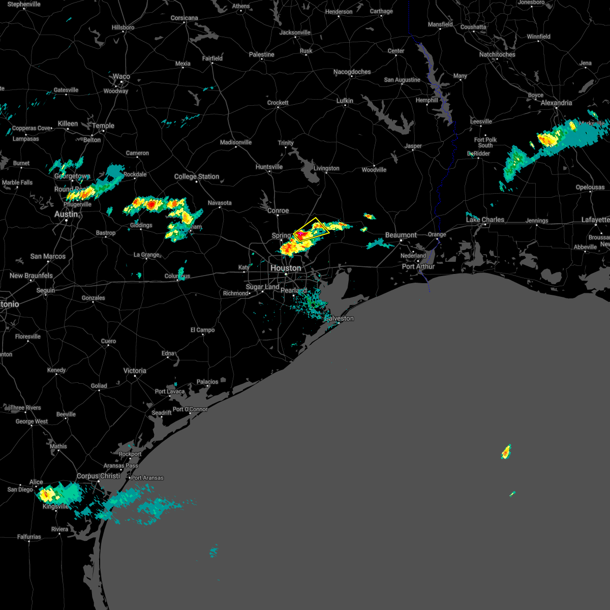 At 635 pm cdt, a severe thunderstorm was located over roman forest, or 8 miles northeast of kingwood, moving northeast at 25 mph (radar indicated). Hazards include quarter size hail. Damage to vehicles is expected. Locations impacted include, kingwood, splendora, patton village, roman forest, woodbranch, plum grove, lake houston, porter and new caney. At 635 pm cdt, a severe thunderstorm was located over roman forest, or 8 miles northeast of kingwood, moving northeast at 25 mph (radar indicated). Hazards include quarter size hail. Damage to vehicles is expected. Locations impacted include, kingwood, splendora, patton village, roman forest, woodbranch, plum grove, lake houston, porter and new caney.
|
| 6/2/2021 6:23 PM CDT |
 At 623 pm cdt, a severe thunderstorm was located near kingwood, moving northeast at 25 mph (radar indicated). Hazards include quarter size hail. damage to vehicles is expected At 623 pm cdt, a severe thunderstorm was located near kingwood, moving northeast at 25 mph (radar indicated). Hazards include quarter size hail. damage to vehicles is expected
|
| 5/28/2021 11:07 PM CDT |
 At 1107 pm cdt, a severe thunderstorm was located over sunnyside, or over astrodome area, moving east at 35 mph (radar indicated). Hazards include 60 mph wind gusts. expect damage to roofs, siding, and trees At 1107 pm cdt, a severe thunderstorm was located over sunnyside, or over astrodome area, moving east at 35 mph (radar indicated). Hazards include 60 mph wind gusts. expect damage to roofs, siding, and trees
|
| 5/28/2021 11:02 PM CDT |
 At 1056 pm cdt, a severe thunderstorm was located over gulfton, or over bellaire, moving east at 35 mph (radar indicated. at 10:55 pm cdt, trained spotter reported damaging winds causing power flashes 3 miles ene mission bend). Hazards include 60 mph wind gusts. Expect damage to roofs, siding, and trees. Locations impacted include, pearland, sugar land, missouri city, northern rosenberg, stafford, bellaire, west university place, katy, richmond, galena park, jacinto city, manvel, hunters creek village, bunker hill village, piney point village, downtown houston, greenway / upper kirby area, spring branch north, second ward and greater heights. At 1056 pm cdt, a severe thunderstorm was located over gulfton, or over bellaire, moving east at 35 mph (radar indicated. at 10:55 pm cdt, trained spotter reported damaging winds causing power flashes 3 miles ene mission bend). Hazards include 60 mph wind gusts. Expect damage to roofs, siding, and trees. Locations impacted include, pearland, sugar land, missouri city, northern rosenberg, stafford, bellaire, west university place, katy, richmond, galena park, jacinto city, manvel, hunters creek village, bunker hill village, piney point village, downtown houston, greenway / upper kirby area, spring branch north, second ward and greater heights.
|
| 5/28/2021 10:42 PM CDT |
 At 1041 pm cdt, a severe thunderstorm was located over southeastern eldridge / west oaks, moving east at 35 mph (radar indicated). Hazards include 60 mph wind gusts. expect damage to roofs, siding, and trees At 1041 pm cdt, a severe thunderstorm was located over southeastern eldridge / west oaks, moving east at 35 mph (radar indicated). Hazards include 60 mph wind gusts. expect damage to roofs, siding, and trees
|
| 5/18/2021 10:58 PM CDT |
 The tornado warning for northwestern chambers, southwestern liberty and east central harris counties will expire at 1100 pm cdt, the storm which prompted the warning has weakened below severe limits, and has exited the warned area. therefore, the warning will be allowed to expire. however gusty winds and heavy rain are still possible with this thunderstorm. a tornado watch remains in effect until 200 am cdt for southeastern texas. The tornado warning for northwestern chambers, southwestern liberty and east central harris counties will expire at 1100 pm cdt, the storm which prompted the warning has weakened below severe limits, and has exited the warned area. therefore, the warning will be allowed to expire. however gusty winds and heavy rain are still possible with this thunderstorm. a tornado watch remains in effect until 200 am cdt for southeastern texas.
|
| 5/18/2021 10:42 PM CDT |
 At 1041 pm cdt, a severe thunderstorm capable of producing a tornado was located over sheldon, or near barrett, moving east at 30 mph (radar indicated rotation). Hazards include tornado. Flying debris will be dangerous to those caught without shelter. mobile homes will be damaged or destroyed. damage to roofs, windows, and vehicles will occur. tree damage is likely. this dangerous storm will be near, northern baytown and highlands around 1050 pm cdt. barrett and crosby around 1055 pm cdt. Mont belvieu and old river-winfree around 1115 pm cdt. At 1041 pm cdt, a severe thunderstorm capable of producing a tornado was located over sheldon, or near barrett, moving east at 30 mph (radar indicated rotation). Hazards include tornado. Flying debris will be dangerous to those caught without shelter. mobile homes will be damaged or destroyed. damage to roofs, windows, and vehicles will occur. tree damage is likely. this dangerous storm will be near, northern baytown and highlands around 1050 pm cdt. barrett and crosby around 1055 pm cdt. Mont belvieu and old river-winfree around 1115 pm cdt.
|
| 5/18/2021 10:31 PM CDT |
 At 1030 pm cdt, a severe thunderstorm capable of producing a tornado was located over east houston, or near cloverleaf, moving east at 30 mph (radar indicated rotation). Hazards include tornado. Flying debris will be dangerous to those caught without shelter. mobile homes will be damaged or destroyed. damage to roofs, windows, and vehicles will occur. tree damage is likely. this dangerous storm will be near, cloverleaf around 1035 pm cdt. lake houston dam around 1040 pm cdt. channelview and sheldon around 1045 pm cdt. northwestern baytown and highlands around 1050 pm cdt. barrett and crosby around 1055 pm cdt. Mont belvieu around 1100 pm cdt. At 1030 pm cdt, a severe thunderstorm capable of producing a tornado was located over east houston, or near cloverleaf, moving east at 30 mph (radar indicated rotation). Hazards include tornado. Flying debris will be dangerous to those caught without shelter. mobile homes will be damaged or destroyed. damage to roofs, windows, and vehicles will occur. tree damage is likely. this dangerous storm will be near, cloverleaf around 1035 pm cdt. lake houston dam around 1040 pm cdt. channelview and sheldon around 1045 pm cdt. northwestern baytown and highlands around 1050 pm cdt. barrett and crosby around 1055 pm cdt. Mont belvieu around 1100 pm cdt.
|
| 5/18/2021 10:19 PM CDT |
 At 1017 pm cdt, severe thunderstorms were located along a line extending from near east houston to pearland, moving east at 40 mph (radar indicated). Hazards include 60 mph wind gusts. Expect damage to roofs, siding, and trees. Locations impacted include, pasadena, pearland, league city, sugar land, northwestern baytown, missouri city, texas city, friendswood, la porte, deer park, alvin, dickinson, stafford, south houston, bellaire, west university place, seabrook, galena park, jacinto city and webster. At 1017 pm cdt, severe thunderstorms were located along a line extending from near east houston to pearland, moving east at 40 mph (radar indicated). Hazards include 60 mph wind gusts. Expect damage to roofs, siding, and trees. Locations impacted include, pasadena, pearland, league city, sugar land, northwestern baytown, missouri city, texas city, friendswood, la porte, deer park, alvin, dickinson, stafford, south houston, bellaire, west university place, seabrook, galena park, jacinto city and webster.
|
| 5/18/2021 10:09 PM CDT |
 The severe thunderstorm warning for montgomery and north central harris counties will expire at 1015 pm cdt, the storms which prompted the warning have weakened below severe limits, and no longer pose an immediate threat to life or property. therefore, the warning will be allowed to expire. however gusty winds are still possible with these thunderstorms. a tornado watch remains in effect until 200 am cdt for southeastern texas. The severe thunderstorm warning for montgomery and north central harris counties will expire at 1015 pm cdt, the storms which prompted the warning have weakened below severe limits, and no longer pose an immediate threat to life or property. therefore, the warning will be allowed to expire. however gusty winds are still possible with these thunderstorms. a tornado watch remains in effect until 200 am cdt for southeastern texas.
|
| 5/18/2021 10:08 PM CDT |
 At 1008 pm cdt, a severe thunderstorm capable of producing a tornado was located over greater inwood, or near spring branch north, moving east at 30 mph (radar indicated rotation). Hazards include tornado and quarter size hail. Flying debris will be dangerous to those caught without shelter. mobile homes will be damaged or destroyed. damage to roofs, windows, and vehicles will occur. tree damage is likely. Locations impacted include, greater greenspoint, aldine, northern greater heights, northside / northline, near northside houston, spring branch east, eastex / jensen area, central northwest, langwood, willowbrook, hidden valley, acres home, independence heights, greater inwood, lazybrook / timbergrove, fairbanks / northwest crossing, kashmere gardens and southern bush intercontinental airport. At 1008 pm cdt, a severe thunderstorm capable of producing a tornado was located over greater inwood, or near spring branch north, moving east at 30 mph (radar indicated rotation). Hazards include tornado and quarter size hail. Flying debris will be dangerous to those caught without shelter. mobile homes will be damaged or destroyed. damage to roofs, windows, and vehicles will occur. tree damage is likely. Locations impacted include, greater greenspoint, aldine, northern greater heights, northside / northline, near northside houston, spring branch east, eastex / jensen area, central northwest, langwood, willowbrook, hidden valley, acres home, independence heights, greater inwood, lazybrook / timbergrove, fairbanks / northwest crossing, kashmere gardens and southern bush intercontinental airport.
|
| 5/18/2021 9:56 PM CDT |
 At 955 pm cdt, a severe thunderstorm capable of producing a tornado was located over westbranch, or near jersey village, moving east at 30 mph (radar indicated rotation). Hazards include tornado and quarter size hail. Flying debris will be dangerous to those caught without shelter. mobile homes will be damaged or destroyed. damage to roofs, windows, and vehicles will occur. tree damage is likely. Locations impacted include, jersey village, aldine, northside / northline, spring branch north, greater greenspoint, spring branch west, northern greater heights, addicks park ten, spring valley, near northside houston, hilshire village, spring branch east, eastex / jensen area, spring branch central, central northwest, fairbanks / northwest crossing, langwood, willowbrook, hidden valley and acres home. At 955 pm cdt, a severe thunderstorm capable of producing a tornado was located over westbranch, or near jersey village, moving east at 30 mph (radar indicated rotation). Hazards include tornado and quarter size hail. Flying debris will be dangerous to those caught without shelter. mobile homes will be damaged or destroyed. damage to roofs, windows, and vehicles will occur. tree damage is likely. Locations impacted include, jersey village, aldine, northside / northline, spring branch north, greater greenspoint, spring branch west, northern greater heights, addicks park ten, spring valley, near northside houston, hilshire village, spring branch east, eastex / jensen area, spring branch central, central northwest, fairbanks / northwest crossing, langwood, willowbrook, hidden valley and acres home.
|
| 5/18/2021 9:51 PM CDT |
 At 951 pm cdt, severe thunderstorms were located along a line extending from fairbanks / northwest crossing to near sienna plantation, moving east at 40 mph (radar indicated). Hazards include 60 mph wind gusts. expect damage to roofs, siding, and trees At 951 pm cdt, severe thunderstorms were located along a line extending from fairbanks / northwest crossing to near sienna plantation, moving east at 40 mph (radar indicated). Hazards include 60 mph wind gusts. expect damage to roofs, siding, and trees
|
| 5/18/2021 9:44 PM CDT |
 At 944 pm cdt, severe thunderstorms were located along a line extending from near montgomery to near the woodlands to near hooks airport, moving east at 30 mph (radar indicated). Hazards include 60 mph wind gusts. expect damage to roofs, siding, and trees At 944 pm cdt, severe thunderstorms were located along a line extending from near montgomery to near the woodlands to near hooks airport, moving east at 30 mph (radar indicated). Hazards include 60 mph wind gusts. expect damage to roofs, siding, and trees
|
| 5/18/2021 9:44 PM CDT |
 At 943 pm cdt, a severe thunderstorm capable of producing a tornado was located near addicks park ten, moving east at 30 mph (radar indicated rotation). Hazards include tornado and quarter size hail. Flying debris will be dangerous to those caught without shelter. mobile homes will be damaged or destroyed. damage to roofs, windows, and vehicles will occur. Tree damage is likely. At 943 pm cdt, a severe thunderstorm capable of producing a tornado was located near addicks park ten, moving east at 30 mph (radar indicated rotation). Hazards include tornado and quarter size hail. Flying debris will be dangerous to those caught without shelter. mobile homes will be damaged or destroyed. damage to roofs, windows, and vehicles will occur. Tree damage is likely.
|
| 5/18/2021 9:30 PM CDT |
 At 930 pm cdt, a severe thunderstorm capable of producing a tornado was located over katy, moving east at 30 mph (radar indicated rotation). Hazards include tornado and quarter size hail. Flying debris will be dangerous to those caught without shelter. mobile homes will be damaged or destroyed. damage to roofs, windows, and vehicles will occur. tree damage is likely. this dangerous storm will be near, eldridge / west oaks around 945 pm cdt. addicks park ten around 950 pm cdt. spring branch west around 955 pm cdt. Other locations impacted by this tornadic thunderstorm include addicks and memorial. At 930 pm cdt, a severe thunderstorm capable of producing a tornado was located over katy, moving east at 30 mph (radar indicated rotation). Hazards include tornado and quarter size hail. Flying debris will be dangerous to those caught without shelter. mobile homes will be damaged or destroyed. damage to roofs, windows, and vehicles will occur. tree damage is likely. this dangerous storm will be near, eldridge / west oaks around 945 pm cdt. addicks park ten around 950 pm cdt. spring branch west around 955 pm cdt. Other locations impacted by this tornadic thunderstorm include addicks and memorial.
|
| 5/18/2021 9:25 PM CDT |
 At 924 pm cdt, a severe thunderstorm was located over todd mission, or 8 miles west of pinehurst, moving northeast at 30 mph (radar indicated). Hazards include 60 mph wind gusts and quarter size hail. Hail damage to vehicles is expected. Expect wind damage to roofs, siding, and trees. At 924 pm cdt, a severe thunderstorm was located over todd mission, or 8 miles west of pinehurst, moving northeast at 30 mph (radar indicated). Hazards include 60 mph wind gusts and quarter size hail. Hail damage to vehicles is expected. Expect wind damage to roofs, siding, and trees.
|
| 5/18/2021 9:12 PM CDT |
 At 912 pm cdt, a severe thunderstorm capable of producing a tornado was located over brookshire, moving east at 30 mph (radar indicated rotation). Hazards include tornado and quarter size hail. Flying debris will be dangerous to those caught without shelter. mobile homes will be damaged or destroyed. damage to roofs, windows, and vehicles will occur. tree damage is likely. this dangerous storm will be near, fulshear around 915 pm cdt. katy around 925 pm cdt. cinco ranch around 935 pm cdt. eldridge / west oaks, addicks park ten and spring branch west around 945 pm cdt. Other locations impacted by this tornadic thunderstorm include addicks and memorial. At 912 pm cdt, a severe thunderstorm capable of producing a tornado was located over brookshire, moving east at 30 mph (radar indicated rotation). Hazards include tornado and quarter size hail. Flying debris will be dangerous to those caught without shelter. mobile homes will be damaged or destroyed. damage to roofs, windows, and vehicles will occur. tree damage is likely. this dangerous storm will be near, fulshear around 915 pm cdt. katy around 925 pm cdt. cinco ranch around 935 pm cdt. eldridge / west oaks, addicks park ten and spring branch west around 945 pm cdt. Other locations impacted by this tornadic thunderstorm include addicks and memorial.
|
| 5/18/2021 9:10 PM CDT |
 At 910 pm cdt, severe thunderstorms were located along a line extending from pine island to brookshire to near east bernard, moving east at 30 mph (radar indicated). Hazards include 60 mph wind gusts and quarter size hail. Hail damage to vehicles is expected. Expect wind damage to roofs, siding, and trees. At 910 pm cdt, severe thunderstorms were located along a line extending from pine island to brookshire to near east bernard, moving east at 30 mph (radar indicated). Hazards include 60 mph wind gusts and quarter size hail. Hail damage to vehicles is expected. Expect wind damage to roofs, siding, and trees.
|
| 3/17/2021 11:41 AM CDT |
 The severe thunderstorm warning for northeastern fort bend, southeastern montgomery, northwestern chambers, southwestern liberty and central harris counties will expire at 1145 am cdt, the storm which prompted the warning has weakened below severe limits, and no longer poses an immediate threat to life or property. therefore, the warning will be allowed to expire. however, small hail and gusty winds are still possible with this thunderstorm. The severe thunderstorm warning for northeastern fort bend, southeastern montgomery, northwestern chambers, southwestern liberty and central harris counties will expire at 1145 am cdt, the storm which prompted the warning has weakened below severe limits, and no longer poses an immediate threat to life or property. therefore, the warning will be allowed to expire. however, small hail and gusty winds are still possible with this thunderstorm.
|
| 3/17/2021 11:11 AM CDT |
 At 1110 am cdt, a severe thunderstorm was located over afton oaks / river oaks area, moving northeast at 50 mph (radar indicated). Hazards include quarter size hail. damage to vehicles is expected At 1110 am cdt, a severe thunderstorm was located over afton oaks / river oaks area, moving northeast at 50 mph (radar indicated). Hazards include quarter size hail. damage to vehicles is expected
|
| 3/17/2021 11:10 AM CDT | Quarter sized hail reported 5.7 miles NE of Houston, TX, social media photo post of 1 inch hail . |
| 1/6/2021 6:16 PM CST |
 At 616 pm cst, a severe thunderstorm was located over san leon, or 7 miles northeast of texas city, moving east at 50 mph (radar indicated). Hazards include 60 mph wind gusts and quarter size hail. Hail damage to vehicles is expected. Expect wind damage to roofs, siding, and trees. At 616 pm cst, a severe thunderstorm was located over san leon, or 7 miles northeast of texas city, moving east at 50 mph (radar indicated). Hazards include 60 mph wind gusts and quarter size hail. Hail damage to vehicles is expected. Expect wind damage to roofs, siding, and trees.
|
| 1/6/2021 5:23 PM CST |
 The national weather service in league city has issued a * severe thunderstorm warning for. southeastern fort bend county in southeastern texas. northeastern brazoria county in southeastern texas. south central harris county in southeastern texas. Until 545 pm cst. The national weather service in league city has issued a * severe thunderstorm warning for. southeastern fort bend county in southeastern texas. northeastern brazoria county in southeastern texas. south central harris county in southeastern texas. Until 545 pm cst.
|
| 1/6/2021 5:23 PM CST |
 The national weather service in league city has issued a * severe thunderstorm warning for. southeastern fort bend county in southeastern texas. northeastern brazoria county in southeastern texas. south central harris county in southeastern texas. Until 600 pm cst. The national weather service in league city has issued a * severe thunderstorm warning for. southeastern fort bend county in southeastern texas. northeastern brazoria county in southeastern texas. south central harris county in southeastern texas. Until 600 pm cst.
|
| 1/6/2021 3:18 PM CST |
 At 317 pm cst, severe thunderstorms were located along a line extending from near huntsville state park to near hempstead, moving east at 40 mph (radar indicated). Hazards include 60 mph wind gusts. expect damage to roofs, siding, and trees At 317 pm cst, severe thunderstorms were located along a line extending from near huntsville state park to near hempstead, moving east at 40 mph (radar indicated). Hazards include 60 mph wind gusts. expect damage to roofs, siding, and trees
|
| 12/30/2020 4:21 PM CST |
 The tornado warning for north central fort bend and west central harris counties will expire at 430 pm cst, the storm which prompted the warning has weakened, and no longer appears capable of producing a tornado. therefore, the warning will be allowed to expire. The tornado warning for north central fort bend and west central harris counties will expire at 430 pm cst, the storm which prompted the warning has weakened, and no longer appears capable of producing a tornado. therefore, the warning will be allowed to expire.
|
| 12/30/2020 4:02 PM CST |
 At 401 pm cst, a severe thunderstorm capable of producing a tornado was located over mission bend, moving north at 20 mph (radar indicated rotation). Hazards include tornado. Flying debris will be dangerous to those caught without shelter. mobile homes will be damaged or destroyed. damage to roofs, windows, and vehicles will occur. tree damage is likely. this dangerous storm will be near, eldridge / west oaks around 420 pm cst. addicks park ten and spring branch west around 430 pm cst. Other locations impacted by this tornadic thunderstorm include addicks and memorial. At 401 pm cst, a severe thunderstorm capable of producing a tornado was located over mission bend, moving north at 20 mph (radar indicated rotation). Hazards include tornado. Flying debris will be dangerous to those caught without shelter. mobile homes will be damaged or destroyed. damage to roofs, windows, and vehicles will occur. tree damage is likely. this dangerous storm will be near, eldridge / west oaks around 420 pm cst. addicks park ten and spring branch west around 430 pm cst. Other locations impacted by this tornadic thunderstorm include addicks and memorial.
|
| 10/23/2020 2:44 PM CDT | 1-inch tree limbs broken; shingles blown of in harris county TX, 5.7 miles N of Houston, TX |
| 10/23/2020 2:25 PM CDT |
 At 222 pm cdt, thunderstorms along a cold front have produced a outflow producing winds up to 60 mph. this boundary was located along a line extending from atascocita to hidden valley to near westbranch to katy, moving south at 30 mph (radar indicated). Hazards include 60 mph wind gusts. expect damage to roofs, siding, and trees At 222 pm cdt, thunderstorms along a cold front have produced a outflow producing winds up to 60 mph. this boundary was located along a line extending from atascocita to hidden valley to near westbranch to katy, moving south at 30 mph (radar indicated). Hazards include 60 mph wind gusts. expect damage to roofs, siding, and trees
|
| 8/28/2020 5:30 PM CDT |
 At 527 pm cdt, a severe thunderstorm was located near kingwood, moving east at 5 mph (radar indicated. rainfall rates of 2 to 4 inches/hour possible with this storm. in addition, a rotating wall cloud was possibly sighted close to oak ridge north). Hazards include 60 mph wind gusts and quarter size hail. Hail damage to vehicles is expected. expect wind damage to roofs, siding, and trees. Locations impacted include, humble, kingwood, spring, porter heights, northern atascocita, northeastern bush intercontinental airport, lake houston and porter. At 527 pm cdt, a severe thunderstorm was located near kingwood, moving east at 5 mph (radar indicated. rainfall rates of 2 to 4 inches/hour possible with this storm. in addition, a rotating wall cloud was possibly sighted close to oak ridge north). Hazards include 60 mph wind gusts and quarter size hail. Hail damage to vehicles is expected. expect wind damage to roofs, siding, and trees. Locations impacted include, humble, kingwood, spring, porter heights, northern atascocita, northeastern bush intercontinental airport, lake houston and porter.
|
| 8/28/2020 5:08 PM CDT |
 At 507 pm cdt, a severe thunderstorm was located near kingwood, moving east at 10 mph (radar indicated). Hazards include 60 mph wind gusts and quarter size hail. Hail damage to vehicles is expected. Expect wind damage to roofs, siding, and trees. At 507 pm cdt, a severe thunderstorm was located near kingwood, moving east at 10 mph (radar indicated). Hazards include 60 mph wind gusts and quarter size hail. Hail damage to vehicles is expected. Expect wind damage to roofs, siding, and trees.
|
| 5/27/2020 5:06 PM CDT |
 At 505 pm cdt, severe thunderstorms were located along a line extending from near nome to beach city to clear lake to pearland to near thompsons, moving east southeast at 50 mph (radar indicated). Hazards include 70 mph wind gusts. Expect considerable tree damage. Damage is likely to mobile homes, roofs, and outbuildings. At 505 pm cdt, severe thunderstorms were located along a line extending from near nome to beach city to clear lake to pearland to near thompsons, moving east southeast at 50 mph (radar indicated). Hazards include 70 mph wind gusts. Expect considerable tree damage. Damage is likely to mobile homes, roofs, and outbuildings.
|
| 5/27/2020 4:50 PM CDT |
 At 449 pm cdt, a severe thunderstorm capable of producing a tornado was located over northwestern pasadena, moving southeast at 30 mph (radar indicated rotation). Hazards include tornado. Flying debris will be dangerous to those caught without shelter. mobile homes will be damaged or destroyed. damage to roofs, windows, and vehicles will occur. tree damage is likely. this dangerous storm will be near, northeastern clear lake around 455 pm cdt. nassau bay, taylor lake village, shoreacres, morgan`s point and the johnson space center around 505 pm cdt. pasadena, northeastern league city, la porte, seabrook, kemah, el lago and clear lake shores around 510 pm cdt. Kemah boardwalk and bacliff around 515 pm cdt. At 449 pm cdt, a severe thunderstorm capable of producing a tornado was located over northwestern pasadena, moving southeast at 30 mph (radar indicated rotation). Hazards include tornado. Flying debris will be dangerous to those caught without shelter. mobile homes will be damaged or destroyed. damage to roofs, windows, and vehicles will occur. tree damage is likely. this dangerous storm will be near, northeastern clear lake around 455 pm cdt. nassau bay, taylor lake village, shoreacres, morgan`s point and the johnson space center around 505 pm cdt. pasadena, northeastern league city, la porte, seabrook, kemah, el lago and clear lake shores around 510 pm cdt. Kemah boardwalk and bacliff around 515 pm cdt.
|
| 5/27/2020 4:46 PM CDT | Wind gust was near downtown housto in harris county TX, 6.6 miles NNW of Houston, TX |
| 5/27/2020 4:36 PM CDT | Corrects previous tstm wnd gst report from 1 se houston. wind gust was near downtown houston. some trees were downe in harris county TX, 6.6 miles NNW of Houston, TX |
| 5/27/2020 4:28 PM CDT |
 At 428 pm cdt, severe thunderstorms were located along a line extending from near nome to liberty to 6 miles northwest of dayton to near woodbranch to near the woodlands to near tomball to near jersey village to near katy to near brookshire to 9 miles north of eagle lake, moving southeast at 20 mph (radar indicated). Hazards include 60 mph wind gusts. expect damage to roofs, siding, and trees At 428 pm cdt, severe thunderstorms were located along a line extending from near nome to liberty to 6 miles northwest of dayton to near woodbranch to near the woodlands to near tomball to near jersey village to near katy to near brookshire to 9 miles north of eagle lake, moving southeast at 20 mph (radar indicated). Hazards include 60 mph wind gusts. expect damage to roofs, siding, and trees
|
| 5/27/2020 4:21 PM CDT | Wind gust was measured at kiah aso in harris county TX, 10.1 miles SSW of Houston, TX |
| 5/27/2020 4:15 PM CDT | Wind gust was estimated in the jersey village are in harris county TX, 10.4 miles E of Houston, TX |
| 5/27/2020 4:06 PM CDT |
 At 406 pm cdt, severe thunderstorms were located along a line extending from splendora to woodloch to 6 miles northwest of the woodlands to stagecoach, moving southeast at 20 mph (radar indicated). Hazards include 60 mph wind gusts and quarter size hail. Hail damage to vehicles is expected. Expect wind damage to roofs, siding, and trees. At 406 pm cdt, severe thunderstorms were located along a line extending from splendora to woodloch to 6 miles northwest of the woodlands to stagecoach, moving southeast at 20 mph (radar indicated). Hazards include 60 mph wind gusts and quarter size hail. Hail damage to vehicles is expected. Expect wind damage to roofs, siding, and trees.
|
| 5/27/2020 3:54 PM CDT |
 At 354 pm cdt, severe thunderstorms were located along a line extending from near hockley to 8 miles northeast of pattison to near san felipe, moving southeast at 45 mph (radar indicated). Hazards include 60 mph wind gusts and half dollar size hail. Hail damage to vehicles is expected. Expect wind damage to roofs, siding, and trees. At 354 pm cdt, severe thunderstorms were located along a line extending from near hockley to 8 miles northeast of pattison to near san felipe, moving southeast at 45 mph (radar indicated). Hazards include 60 mph wind gusts and half dollar size hail. Hail damage to vehicles is expected. Expect wind damage to roofs, siding, and trees.
|
| 5/27/2020 3:40 PM CDT |
 At 340 pm cdt, severe thunderstorms were located along a line extending from 6 miles northeast of todd mission to near waller to near bellville, moving southeast at 60 mph (radar indicated). Hazards include 70 mph wind gusts and half dollar size hail. Hail damage to vehicles is expected. expect considerable tree damage. wind damage is also likely to mobile homes, roofs, and outbuildings. Locations impacted include, tomball, prairie view, brookshire, pinehurst, the woodlands, hockley, oak ridge north, waller, shenandoah, magnolia, pine island, montgomery, stagecoach, pattison, woodloch, todd mission, the woodlands pavillion, hooks airport, cypress and dobbin. At 340 pm cdt, severe thunderstorms were located along a line extending from 6 miles northeast of todd mission to near waller to near bellville, moving southeast at 60 mph (radar indicated). Hazards include 70 mph wind gusts and half dollar size hail. Hail damage to vehicles is expected. expect considerable tree damage. wind damage is also likely to mobile homes, roofs, and outbuildings. Locations impacted include, tomball, prairie view, brookshire, pinehurst, the woodlands, hockley, oak ridge north, waller, shenandoah, magnolia, pine island, montgomery, stagecoach, pattison, woodloch, todd mission, the woodlands pavillion, hooks airport, cypress and dobbin.
|
| 5/27/2020 3:36 PM CDT |
 At 336 pm cdt, severe thunderstorms were located along a line extending from 7 miles west of montgomery to near prairie view to near bellville, moving southeast at 40 mph (radar indicated). Hazards include 70 mph wind gusts and half dollar size hail. Hail damage to vehicles is expected. expect considerable tree damage. wind damage is also likely to mobile homes, roofs, and outbuildings. Locations impacted include, conroe, brenham, tomball, navasota, hempstead, prairie view, brookshire, pinehurst, the woodlands, washington, hockley, oak ridge north, waller, panorama village, shenandoah, magnolia, cut and shoot, pine island, montgomery and stagecoach. At 336 pm cdt, severe thunderstorms were located along a line extending from 7 miles west of montgomery to near prairie view to near bellville, moving southeast at 40 mph (radar indicated). Hazards include 70 mph wind gusts and half dollar size hail. Hail damage to vehicles is expected. expect considerable tree damage. wind damage is also likely to mobile homes, roofs, and outbuildings. Locations impacted include, conroe, brenham, tomball, navasota, hempstead, prairie view, brookshire, pinehurst, the woodlands, washington, hockley, oak ridge north, waller, panorama village, shenandoah, magnolia, cut and shoot, pine island, montgomery and stagecoach.
|
| 5/27/2020 3:21 PM CDT |
 At 318 pm cdt, a severe thunderstorm capable of producing a tornado was located near washington, or 9 miles south of navasota, moving southeast at 50 mph (radar indicated rotation). Hazards include tornado and ping pong ball size hail. Flying debris will be dangerous to those caught without shelter. mobile homes will be damaged or destroyed. damage to roofs, windows, and vehicles will occur. Tree damage is likely. At 318 pm cdt, a severe thunderstorm capable of producing a tornado was located near washington, or 9 miles south of navasota, moving southeast at 50 mph (radar indicated rotation). Hazards include tornado and ping pong ball size hail. Flying debris will be dangerous to those caught without shelter. mobile homes will be damaged or destroyed. damage to roofs, windows, and vehicles will occur. Tree damage is likely.
|
| 5/27/2020 3:08 PM CDT |
 At 308 pm cdt, severe thunderstorms were located along a line extending from 7 miles northeast of anderson to near navasota to near brenham, moving southeast at 60 mph (radar indicated). Hazards include ping pong ball size hail and 60 mph wind gusts. People and animals outdoors will be injured. expect hail damage to roofs, siding, windows, and vehicles. Expect wind damage to roofs, siding, and trees. At 308 pm cdt, severe thunderstorms were located along a line extending from 7 miles northeast of anderson to near navasota to near brenham, moving southeast at 60 mph (radar indicated). Hazards include ping pong ball size hail and 60 mph wind gusts. People and animals outdoors will be injured. expect hail damage to roofs, siding, windows, and vehicles. Expect wind damage to roofs, siding, and trees.
|
| 5/25/2020 4:16 AM CDT |
 At 416 am cdt, a severe thunderstorm was located over alvin, moving northeast at 30 mph (radar indicated). Hazards include 60 mph wind gusts. expect damage to roofs, siding, and trees At 416 am cdt, a severe thunderstorm was located over alvin, moving northeast at 30 mph (radar indicated). Hazards include 60 mph wind gusts. expect damage to roofs, siding, and trees
|
| 5/24/2020 4:55 PM CDT |
 The tornado warning for southwestern montgomery, eastern waller and northwestern harris counties will expire at 500 pm cdt, the storm which prompted the warning has weakened below severe limits, and no longer appears capable of producing a tornado. therefore, the warning will be allowed to expire. however gusty winds are still possible with this thunderstorm. The tornado warning for southwestern montgomery, eastern waller and northwestern harris counties will expire at 500 pm cdt, the storm which prompted the warning has weakened below severe limits, and no longer appears capable of producing a tornado. therefore, the warning will be allowed to expire. however gusty winds are still possible with this thunderstorm.
|
| 5/24/2020 4:41 PM CDT |
 At 440 pm cdt, a severe thunderstorm capable of producing a tornado was located near hockley, or 9 miles west of tomball, moving northeast at 15 mph (radar indicated rotation). Hazards include tornado. Flying debris will be dangerous to those caught without shelter. mobile homes will be damaged or destroyed. damage to roofs, windows, and vehicles will occur. tree damage is likely. this dangerous storm will be near, stagecoach around 510 pm cdt. Tomball and pinehurst around 515 pm cdt. At 440 pm cdt, a severe thunderstorm capable of producing a tornado was located near hockley, or 9 miles west of tomball, moving northeast at 15 mph (radar indicated rotation). Hazards include tornado. Flying debris will be dangerous to those caught without shelter. mobile homes will be damaged or destroyed. damage to roofs, windows, and vehicles will occur. tree damage is likely. this dangerous storm will be near, stagecoach around 510 pm cdt. Tomball and pinehurst around 515 pm cdt.
|
| 5/24/2020 4:30 PM CDT |
 At 430 pm cdt, a severe thunderstorm capable of producing a tornado was located over hockley, or 11 miles southwest of tomball, moving north at 5 mph (radar indicated rotation). Hazards include tornado. Flying debris will be dangerous to those caught without shelter. mobile homes will be damaged or destroyed. damage to roofs, windows, and vehicles will occur. tree damage is likely. This dangerous storm will be near, stagecoach around 500 pm cdt. At 430 pm cdt, a severe thunderstorm capable of producing a tornado was located over hockley, or 11 miles southwest of tomball, moving north at 5 mph (radar indicated rotation). Hazards include tornado. Flying debris will be dangerous to those caught without shelter. mobile homes will be damaged or destroyed. damage to roofs, windows, and vehicles will occur. tree damage is likely. This dangerous storm will be near, stagecoach around 500 pm cdt.
|
| 5/16/2020 3:25 AM CDT |
 The severe thunderstorm warning for northeastern fort bend and southwestern harris counties will expire at 330 am cdt, the storm which prompted the warning has weakened below severe limits, and no longer poses an immediate threat to life or property. therefore, the warning will be allowed to expire. however gusty winds and heavy rain are still possible with this thunderstorm. a severe thunderstorm watch remains in effect until 500 am cdt for southeastern texas. The severe thunderstorm warning for northeastern fort bend and southwestern harris counties will expire at 330 am cdt, the storm which prompted the warning has weakened below severe limits, and no longer poses an immediate threat to life or property. therefore, the warning will be allowed to expire. however gusty winds and heavy rain are still possible with this thunderstorm. a severe thunderstorm watch remains in effect until 500 am cdt for southeastern texas.
|
| 5/16/2020 3:12 AM CDT |
 At 312 am cdt, a severe thunderstorm was located over town west, moving east at 35 mph (radar indicated). Hazards include 60 mph wind gusts. Expect damage to roofs, siding, and trees. Locations impacted include, sugar land, missouri city, stafford, bellaire, town west, pecan grove, mission bend, meadows place, westbury, new territory, westwood, four corners, alief, sharpstown, meyerland area, gulfton, fifth street, fort bend houston, braeburn and fondren gardens. At 312 am cdt, a severe thunderstorm was located over town west, moving east at 35 mph (radar indicated). Hazards include 60 mph wind gusts. Expect damage to roofs, siding, and trees. Locations impacted include, sugar land, missouri city, stafford, bellaire, town west, pecan grove, mission bend, meadows place, westbury, new territory, westwood, four corners, alief, sharpstown, meyerland area, gulfton, fifth street, fort bend houston, braeburn and fondren gardens.
|
| 5/16/2020 3:11 AM CDT |
 The severe thunderstorm warning for central fort bend county will expire at 315 am cdt, the storm which prompted the warning has weakened below severe limits, and no longer poses an immediate threat to life or property. therefore, the warning will be allowed to expire. however gusty winds and heavy rain are still possible with this thunderstorm. a severe thunderstorm watch remains in effect until 500 am cdt for southeastern texas. to report severe weather, contact your nearest law enforcement agency. they will relay your report to the national weather service league city. The severe thunderstorm warning for central fort bend county will expire at 315 am cdt, the storm which prompted the warning has weakened below severe limits, and no longer poses an immediate threat to life or property. therefore, the warning will be allowed to expire. however gusty winds and heavy rain are still possible with this thunderstorm. a severe thunderstorm watch remains in effect until 500 am cdt for southeastern texas. to report severe weather, contact your nearest law enforcement agency. they will relay your report to the national weather service league city.
|
| 5/16/2020 3:02 AM CDT |
 At 302 am cdt, a severe thunderstorm was located over pecan grove, moving east at 35 mph (radar indicated). Hazards include 60 mph wind gusts. expect damage to roofs, siding, and trees At 302 am cdt, a severe thunderstorm was located over pecan grove, moving east at 35 mph (radar indicated). Hazards include 60 mph wind gusts. expect damage to roofs, siding, and trees
|
| 5/16/2020 2:52 AM CDT |
 At 252 am cdt, a severe thunderstorm was located near pleak, or near rosenberg, moving east at 40 mph (radar indicated). Hazards include 60 mph wind gusts. expect damage to roofs, siding, and trees At 252 am cdt, a severe thunderstorm was located near pleak, or near rosenberg, moving east at 40 mph (radar indicated). Hazards include 60 mph wind gusts. expect damage to roofs, siding, and trees
|
| 5/16/2020 2:50 AM CDT |
 At 250 am cdt, a severe thunderstorm was located near fulshear, or near pecan grove, moving east at 40 mph (radar indicated). Hazards include 60 mph wind gusts. Expect damage to roofs, siding, and trees. Locations impacted include, northwestern rosenberg, richmond, pecan grove, wallis, fulshear, simonton, orchard, weston lakes, cumings and cinco ranch. At 250 am cdt, a severe thunderstorm was located near fulshear, or near pecan grove, moving east at 40 mph (radar indicated). Hazards include 60 mph wind gusts. Expect damage to roofs, siding, and trees. Locations impacted include, northwestern rosenberg, richmond, pecan grove, wallis, fulshear, simonton, orchard, weston lakes, cumings and cinco ranch.
|
| 5/16/2020 2:45 AM CDT |
 At 245 am cdt, a severe thunderstorm was located over fulshear, or 9 miles northwest of richmond, moving east at 40 mph (radar indicated). Hazards include 60 mph wind gusts. Expect damage to roofs, siding, and trees. Locations impacted include, northwestern rosenberg, richmond, pecan grove, wallis, fulshear, simonton, orchard, weston lakes, cumings and cinco ranch. At 245 am cdt, a severe thunderstorm was located over fulshear, or 9 miles northwest of richmond, moving east at 40 mph (radar indicated). Hazards include 60 mph wind gusts. Expect damage to roofs, siding, and trees. Locations impacted include, northwestern rosenberg, richmond, pecan grove, wallis, fulshear, simonton, orchard, weston lakes, cumings and cinco ranch.
|
| 5/16/2020 2:27 AM CDT |
 At 227 am cdt, a severe thunderstorm was located over wallis, or 9 miles south of sealy, moving east at 40 mph (radar indicated). Hazards include 60 mph wind gusts. expect damage to roofs, siding, and trees At 227 am cdt, a severe thunderstorm was located over wallis, or 9 miles south of sealy, moving east at 40 mph (radar indicated). Hazards include 60 mph wind gusts. expect damage to roofs, siding, and trees
|
| 4/29/2020 5:41 AM CDT |
 At 540 am cdt, severe thunderstorms continnued with a gust front located along a line extending from near bolivar peninsula to near santa fe to near bonney to 8 miles south of needville, moving south at 45 mph (trained weather spotters have reported gusts to 60 mph in this line of storms. small hail was observed at the nws houston/galveston office). Hazards include 60 mph wind gusts and penny size hail. Expect damage to trees. Locations impacted include, southeastern pasadena, pearland, league city, southeastern baytown, galveston causeway, galveston island west end, texas city, friendswood, la porte, lake jackson, alvin, angleton, dickinson, la marque, santa fe, freeport, seabrook, clute, webster and hitchcock. At 540 am cdt, severe thunderstorms continnued with a gust front located along a line extending from near bolivar peninsula to near santa fe to near bonney to 8 miles south of needville, moving south at 45 mph (trained weather spotters have reported gusts to 60 mph in this line of storms. small hail was observed at the nws houston/galveston office). Hazards include 60 mph wind gusts and penny size hail. Expect damage to trees. Locations impacted include, southeastern pasadena, pearland, league city, southeastern baytown, galveston causeway, galveston island west end, texas city, friendswood, la porte, lake jackson, alvin, angleton, dickinson, la marque, santa fe, freeport, seabrook, clute, webster and hitchcock.
|
| 4/29/2020 5:29 AM CDT |
 At 528 am cdt, severe thunderstorms continued with a gust front located along a line extending from near stowell to near san leon to near alvin to near brazos bend state park to near east bernard, moving south at 45 mph (radar indicated. this line of storms has a history of producing measured gusts over 50 mph and small hail). Hazards include 60 mph wind gusts and penny size hail. Expect damage to roofs, siding, and trees. Locations impacted include, pasadena, pearland, league city, sugar land, baytown, missouri city, galveston causeway, galveston island west end, texas city, friendswood, la porte, deer park, rosenberg, lake jackson, alvin, angleton, dickinson, stafford, south houston and bellaire. At 528 am cdt, severe thunderstorms continued with a gust front located along a line extending from near stowell to near san leon to near alvin to near brazos bend state park to near east bernard, moving south at 45 mph (radar indicated. this line of storms has a history of producing measured gusts over 50 mph and small hail). Hazards include 60 mph wind gusts and penny size hail. Expect damage to roofs, siding, and trees. Locations impacted include, pasadena, pearland, league city, sugar land, baytown, missouri city, galveston causeway, galveston island west end, texas city, friendswood, la porte, deer park, rosenberg, lake jackson, alvin, angleton, dickinson, stafford, south houston and bellaire.
|
| 4/29/2020 5:18 AM CDT |
 At 516 am cdt, severe thunderstorms were located along a line extending from near winnie to near shoreacres to near pearland to thompsons to near wallis, moving south at 45 mph (radar indicated. this storm has produced a gust to 56 mph at hobby airport, along with reports of small hail). Hazards include 60 mph wind gusts and penny size hail. Expect damage to roofs, siding, and trees. Locations impacted include, pasadena, pearland, league city, sugar land, baytown, missouri city, galveston island west end, galveston causeway, texas city, friendswood, la porte, deer park, rosenberg, lake jackson, alvin, angleton, dickinson, stafford, south houston and bellaire. At 516 am cdt, severe thunderstorms were located along a line extending from near winnie to near shoreacres to near pearland to thompsons to near wallis, moving south at 45 mph (radar indicated. this storm has produced a gust to 56 mph at hobby airport, along with reports of small hail). Hazards include 60 mph wind gusts and penny size hail. Expect damage to roofs, siding, and trees. Locations impacted include, pasadena, pearland, league city, sugar land, baytown, missouri city, galveston island west end, galveston causeway, texas city, friendswood, la porte, deer park, rosenberg, lake jackson, alvin, angleton, dickinson, stafford, south houston and bellaire.
|
| 4/29/2020 5:03 AM CDT |
 At 502 am cdt, severe thunderstorms were located along a line extending from 6 miles southwest of nome to highlands to greater heights to 6 miles north of pattison to near lake somerville state park & trailway, moving south at 40 mph (radar indicated. this storm has produced several observations at airports of gusts over 45 mph and reports of small hail). Hazards include 60 mph wind gusts and penny size hail. Expect damage to trees. Locations impacted include, northwestern pasadena, northern baytown, deer park, bellaire, humble, west university place, katy, galena park, jacinto city, liberty, jersey village, dayton, hempstead, prairie view, hunters creek village, bunker hill village, piney point village, cloverleaf, downtown houston and greenway / upper kirby area. At 502 am cdt, severe thunderstorms were located along a line extending from 6 miles southwest of nome to highlands to greater heights to 6 miles north of pattison to near lake somerville state park & trailway, moving south at 40 mph (radar indicated. this storm has produced several observations at airports of gusts over 45 mph and reports of small hail). Hazards include 60 mph wind gusts and penny size hail. Expect damage to trees. Locations impacted include, northwestern pasadena, northern baytown, deer park, bellaire, humble, west university place, katy, galena park, jacinto city, liberty, jersey village, dayton, hempstead, prairie view, hunters creek village, bunker hill village, piney point village, cloverleaf, downtown houston and greenway / upper kirby area.
|
| 4/29/2020 4:59 AM CDT |
 The national weather service in league city has issued a * severe thunderstorm warning for. eastern austin county in southeastern texas. galveston county in southeastern texas. fort bend county in southeastern texas. Brazoria county in southeastern texas. The national weather service in league city has issued a * severe thunderstorm warning for. eastern austin county in southeastern texas. galveston county in southeastern texas. fort bend county in southeastern texas. Brazoria county in southeastern texas.
|
| 4/29/2020 4:55 AM CDT |
 At 455 am cdt, severe thunderstorms were located along a line extending from near nome to barrett to northside / northline to 7 miles south of waller to near lake somerville state park & trailway, moving south at 40 mph (radar indicated). Hazards include 60 mph wind gusts and penny size hail. Expect damage to roofs, siding, and trees. Locations impacted include, northwestern pasadena, northern baytown, deer park, bellaire, humble, west university place, katy, galena park, tomball, jacinto city, liberty, jersey village, dayton, hempstead, prairie view, hunters creek village, bunker hill village, piney point village, pinehurst and cloverleaf. At 455 am cdt, severe thunderstorms were located along a line extending from near nome to barrett to northside / northline to 7 miles south of waller to near lake somerville state park & trailway, moving south at 40 mph (radar indicated). Hazards include 60 mph wind gusts and penny size hail. Expect damage to roofs, siding, and trees. Locations impacted include, northwestern pasadena, northern baytown, deer park, bellaire, humble, west university place, katy, galena park, tomball, jacinto city, liberty, jersey village, dayton, hempstead, prairie view, hunters creek village, bunker hill village, piney point village, pinehurst and cloverleaf.
|
| 4/29/2020 4:11 AM CDT |
 At 410 am cdt, severe thunderstorms were located along a line extending from near honey island to near splendora to near woodloch to near navasota to 9 miles north of caldwell, moving south at 40 mph (radar indicated). Hazards include 60 mph wind gusts and quarter size hail. Hail damage to vehicles is expected. Expect wind damage to roofs, siding, and trees. At 410 am cdt, severe thunderstorms were located along a line extending from near honey island to near splendora to near woodloch to near navasota to 9 miles north of caldwell, moving south at 40 mph (radar indicated). Hazards include 60 mph wind gusts and quarter size hail. Hail damage to vehicles is expected. Expect wind damage to roofs, siding, and trees.
|
| 4/24/2020 10:16 PM CDT | Half Dollar sized hail reported 19.8 miles SE of Houston, TX, report from mping: half dollar (1.25 in.). |
| 4/24/2020 9:57 PM CDT |
 At 956 pm cdt, a severe thunderstorm was located over tomball, moving southeast at 40 mph (radar indicated). Hazards include 60 mph wind gusts and quarter size hail. Hail damage to vehicles is expected. Expect wind damage to roofs, siding, and trees. At 956 pm cdt, a severe thunderstorm was located over tomball, moving southeast at 40 mph (radar indicated). Hazards include 60 mph wind gusts and quarter size hail. Hail damage to vehicles is expected. Expect wind damage to roofs, siding, and trees.
|
| 4/24/2020 9:53 PM CDT |
 At 953 pm cdt, a severe thunderstorm was located over tomball, moving southeast at 40 mph (radar indicated). Hazards include 60 mph wind gusts and quarter size hail. Hail damage to vehicles is expected. expect wind damage to roofs, siding, and trees. Locations impacted include, tomball, pinehurst, the woodlands, oak ridge north, shenandoah, magnolia, stagecoach, the woodlands pavillion, cypress, hooks airport and chateau woods. At 953 pm cdt, a severe thunderstorm was located over tomball, moving southeast at 40 mph (radar indicated). Hazards include 60 mph wind gusts and quarter size hail. Hail damage to vehicles is expected. expect wind damage to roofs, siding, and trees. Locations impacted include, tomball, pinehurst, the woodlands, oak ridge north, shenandoah, magnolia, stagecoach, the woodlands pavillion, cypress, hooks airport and chateau woods.
|
| 4/24/2020 9:28 PM CDT |
 At 928 pm cdt, a severe thunderstorm was located over todd mission, or 8 miles northwest of pinehurst, moving southeast at 40 mph (radar indicated). Hazards include ping pong ball size hail and 60 mph wind gusts. People and animals outdoors will be injured. expect hail damage to roofs, siding, windows, and vehicles. Expect wind damage to roofs, siding, and trees. At 928 pm cdt, a severe thunderstorm was located over todd mission, or 8 miles northwest of pinehurst, moving southeast at 40 mph (radar indicated). Hazards include ping pong ball size hail and 60 mph wind gusts. People and animals outdoors will be injured. expect hail damage to roofs, siding, windows, and vehicles. Expect wind damage to roofs, siding, and trees.
|
| 4/19/2020 10:49 AM CDT |
 At 1048 am cdt, a severe thunderstorm was located over porter heights, or near spring, moving northeast at 50 mph (radar indicated). Hazards include quarter size hail. damage to vehicles is expected At 1048 am cdt, a severe thunderstorm was located over porter heights, or near spring, moving northeast at 50 mph (radar indicated). Hazards include quarter size hail. damage to vehicles is expected
|
| 4/19/2020 10:20 AM CDT |
 At 1019 am cdt, a severe thunderstorm was located over northeastern atascocita, or near kingwood, moving east at 35 mph (radar indicated). Hazards include ping pong ball size hail. People and animals outdoors will be injured. expect damage to roofs, siding, windows, and vehicles. Locations impacted include, humble, southwestern liberty, dayton, kingwood, roman forest, woodbranch, plum grove, kenefick, bush intercontinental airport, atascocita, lake houston dam, lake houston, new caney and porter. At 1019 am cdt, a severe thunderstorm was located over northeastern atascocita, or near kingwood, moving east at 35 mph (radar indicated). Hazards include ping pong ball size hail. People and animals outdoors will be injured. expect damage to roofs, siding, windows, and vehicles. Locations impacted include, humble, southwestern liberty, dayton, kingwood, roman forest, woodbranch, plum grove, kenefick, bush intercontinental airport, atascocita, lake houston dam, lake houston, new caney and porter.
|
| 4/19/2020 10:15 AM CDT |
 At 1014 am cdt, a severe thunderstorm was located over humble, moving northeast at 45 mph (radar indicated). Hazards include ping pong ball size hail. People and animals outdoors will be injured. expect damage to roofs, siding, windows, and vehicles. Locations impacted include, humble, southwestern liberty, dayton, greater greenspoint, aldine, kingwood, spring, roman forest, woodbranch, plum grove, kenefick, bush intercontinental airport, atascocita, lake houston dam, lake houston, porter heights, east little york / homestead, new caney and porter. At 1014 am cdt, a severe thunderstorm was located over humble, moving northeast at 45 mph (radar indicated). Hazards include ping pong ball size hail. People and animals outdoors will be injured. expect damage to roofs, siding, windows, and vehicles. Locations impacted include, humble, southwestern liberty, dayton, greater greenspoint, aldine, kingwood, spring, roman forest, woodbranch, plum grove, kenefick, bush intercontinental airport, atascocita, lake houston dam, lake houston, porter heights, east little york / homestead, new caney and porter.
|
| 4/19/2020 10:01 AM CDT |
 At 1000 am cdt, severe thunderstorms were located along a line extending from near crosby to willowbrook, moving east at 35 mph. the storms have had a history of producing golf ball sized hail (radar indicated). Hazards include ping pong ball size hail. People and animals outdoors will be injured. expect damage to roofs, siding, windows, and vehicles. Locations impacted include, humble, liberty, jersey village, dayton, northside / northline, kingwood, spring branch north, greater greenspoint, spring, barrett, aldine, addicks park ten, near northside houston, northern greater heights, spring branch west, cloverleaf, channelview, crosby, patton village and roman forest. At 1000 am cdt, severe thunderstorms were located along a line extending from near crosby to willowbrook, moving east at 35 mph. the storms have had a history of producing golf ball sized hail (radar indicated). Hazards include ping pong ball size hail. People and animals outdoors will be injured. expect damage to roofs, siding, windows, and vehicles. Locations impacted include, humble, liberty, jersey village, dayton, northside / northline, kingwood, spring branch north, greater greenspoint, spring, barrett, aldine, addicks park ten, near northside houston, northern greater heights, spring branch west, cloverleaf, channelview, crosby, patton village and roman forest.
|
| 4/19/2020 9:48 AM CDT | Ping Pong Ball sized hail reported 15.3 miles E of Houston, TX |
| 4/19/2020 9:44 AM CDT |
 At 943 am cdt, a cluster of severe thunderstorms were located along a line extending from sheldon to near cypress, moving east at 35 mph. these storms have had a history of producing golf ball sized hail (radar indicated). Hazards include ping pong ball size hail. People and animals outdoors will be injured. Expect damage to roofs, siding, windows, and vehicles. At 943 am cdt, a cluster of severe thunderstorms were located along a line extending from sheldon to near cypress, moving east at 35 mph. these storms have had a history of producing golf ball sized hail (radar indicated). Hazards include ping pong ball size hail. People and animals outdoors will be injured. Expect damage to roofs, siding, windows, and vehicles.
|
| 4/19/2020 9:42 AM CDT | Quarter sized hail reported 15.9 miles E of Houston, TX, report from mping: quarter (1.00 in.). |
| 4/19/2020 9:40 AM CDT | Quarter sized hail reported 15.2 miles E of Houston, TX, photos sent of quarter/shooter marble sized hail via social media. location near highway 6 and fm 529. time reported by observer and supported by radar and other report |
| 4/19/2020 9:35 AM CDT | Ping Pong Ball sized hail reported 18.1 miles E of Houston, TX, reported via social media. |
| 4/19/2020 9:27 AM CDT |
 At 927 am cdt, a severe thunderstorm was located near katy, moving northeast at 40 mph (radar indicated). Hazards include half dollar size hail. Damage to vehicles is expected. Locations impacted include, bellaire, katy, galena park, jacinto city, jersey village, hunters creek village, bunker hill village, piney point village, midtown houston, downtown houston, northside / northline, greenway / upper kirby area, spring branch north, second ward, greater greenspoint, greater heights, mission bend, neartown / montrose, near northside houston and greater fifth ward. At 927 am cdt, a severe thunderstorm was located near katy, moving northeast at 40 mph (radar indicated). Hazards include half dollar size hail. Damage to vehicles is expected. Locations impacted include, bellaire, katy, galena park, jacinto city, jersey village, hunters creek village, bunker hill village, piney point village, midtown houston, downtown houston, northside / northline, greenway / upper kirby area, spring branch north, second ward, greater greenspoint, greater heights, mission bend, neartown / montrose, near northside houston and greater fifth ward.
|
| 4/19/2020 9:26 AM CDT |
 At 924 am cdt, a cluster of severe thunderstorm was located over northside / northline, moving east at 45 mph (radar indicated). Hazards include quarter size hail. Damage to vehicles is expected. Locations impacted include, humble, galena park, jacinto city, jersey village, hunters creek village, bunker hill village, piney point village, midtown houston, cloverleaf, downtown houston, northside / northline, spring branch north, second ward, greater greenspoint, greater heights, highlands, neartown / montrose, barrett, near northside houston and greater fifth ward. At 924 am cdt, a cluster of severe thunderstorm was located over northside / northline, moving east at 45 mph (radar indicated). Hazards include quarter size hail. Damage to vehicles is expected. Locations impacted include, humble, galena park, jacinto city, jersey village, hunters creek village, bunker hill village, piney point village, midtown houston, cloverleaf, downtown houston, northside / northline, spring branch north, second ward, greater greenspoint, greater heights, highlands, neartown / montrose, barrett, near northside houston and greater fifth ward.
|
| 4/19/2020 9:22 AM CDT | Quarter sized hail reported 16.5 miles E of Houston, TX |
| 4/19/2020 9:08 AM CDT |
 At 908 am cdt, a severe thunderstorm was located over brookshire, moving east at 50 mph (radar indicated). Hazards include quarter size hail. damage to vehicles is expected At 908 am cdt, a severe thunderstorm was located over brookshire, moving east at 50 mph (radar indicated). Hazards include quarter size hail. damage to vehicles is expected
|
| 4/19/2020 9:02 AM CDT |
 At 901 am cdt, a severe thunderstorm was located over southeastern addicks park ten, moving east at 40 mph (radar indicated). Hazards include quarter size hail. damage to vehicles is expected At 901 am cdt, a severe thunderstorm was located over southeastern addicks park ten, moving east at 40 mph (radar indicated). Hazards include quarter size hail. damage to vehicles is expected
|
| 4/18/2020 5:40 PM CDT |
 At 539 pm cdt, a severe thunderstorm was located near dayton, moving northeast at 25 mph (radar indicated). Hazards include large hail. Hail damage to vehicles is expected. expect wind damage to roofs, siding, and trees. Locations impacted include, western liberty and dayton. At 539 pm cdt, a severe thunderstorm was located near dayton, moving northeast at 25 mph (radar indicated). Hazards include large hail. Hail damage to vehicles is expected. expect wind damage to roofs, siding, and trees. Locations impacted include, western liberty and dayton.
|
| 4/18/2020 5:27 PM CDT |
 At 527 pm cdt, a severe thunderstorm was located 7 miles southwest of dayton, moving east at 40 mph (radar indicated). Hazards include golf ball size hail and 60 mph wind gusts. People and animals outdoors will be injured. expect hail damage to roofs, siding, windows, and vehicles. Expect wind damage to roofs, siding, and trees. At 527 pm cdt, a severe thunderstorm was located 7 miles southwest of dayton, moving east at 40 mph (radar indicated). Hazards include golf ball size hail and 60 mph wind gusts. People and animals outdoors will be injured. expect hail damage to roofs, siding, windows, and vehicles. Expect wind damage to roofs, siding, and trees.
|
| 4/18/2020 5:19 PM CDT | Half Dollar sized hail reported 14.5 miles WSW of Houston, TX, hail fell for approximately 10 minutes with about 5 minutes of large stones. |
| 4/18/2020 5:18 PM CDT |
 At 517 pm cdt, a severe thunderstorm was located near lake houston, or near kingwood, moving northeast at 25 mph. storm is right on top of lake houston now. if on the lake, take immediate cover! (radar indicated). Hazards include golf ball size hail and 60 mph wind gusts. People and animals outdoors will be injured. expect hail damage to roofs, siding, windows, and vehicles. Expect wind damage to roofs, siding, and trees. At 517 pm cdt, a severe thunderstorm was located near lake houston, or near kingwood, moving northeast at 25 mph. storm is right on top of lake houston now. if on the lake, take immediate cover! (radar indicated). Hazards include golf ball size hail and 60 mph wind gusts. People and animals outdoors will be injured. expect hail damage to roofs, siding, windows, and vehicles. Expect wind damage to roofs, siding, and trees.
|
| 4/18/2020 3:54 PM CDT |
 At 354 pm cdt, a severe thunderstorm was located over jersey village, moving east at 35 mph (radar indicated). Hazards include 60 mph wind gusts and quarter size hail. Hail damage to vehicles is expected. Expect wind damage to roofs, siding, and trees. At 354 pm cdt, a severe thunderstorm was located over jersey village, moving east at 35 mph (radar indicated). Hazards include 60 mph wind gusts and quarter size hail. Hail damage to vehicles is expected. Expect wind damage to roofs, siding, and trees.
|
| 4/18/2020 3:35 PM CDT |
 At 335 pm cdt, a severe thunderstorm was located over katy, moving northeast at 20 mph (radar indicated). Hazards include 60 mph wind gusts and quarter size hail. Hail damage to vehicles is expected. Expect wind damage to roofs, siding, and trees. At 335 pm cdt, a severe thunderstorm was located over katy, moving northeast at 20 mph (radar indicated). Hazards include 60 mph wind gusts and quarter size hail. Hail damage to vehicles is expected. Expect wind damage to roofs, siding, and trees.
|
| 4/9/2020 6:52 PM CDT |
 The severe thunderstorm warning for northwestern chambers, southwestern liberty and east central harris counties will expire at 700 pm cdt, the storm which prompted the warning has weakened below severe limits, and has exited the warned area. therefore, the warning will be allowed to expire. however gusty winds and heavy rain are still possible with this thunderstorm. a severe thunderstorm watch remains in effect until 1000 pm cdt for southeastern texas. The severe thunderstorm warning for northwestern chambers, southwestern liberty and east central harris counties will expire at 700 pm cdt, the storm which prompted the warning has weakened below severe limits, and has exited the warned area. therefore, the warning will be allowed to expire. however gusty winds and heavy rain are still possible with this thunderstorm. a severe thunderstorm watch remains in effect until 1000 pm cdt for southeastern texas.
|
| 4/9/2020 6:44 PM CDT |
 At 643 pm cdt, a severe thunderstorm was located near crosby, or near barrett, moving east at 30 mph (radar indicated). Hazards include 60 mph wind gusts and nickel size hail. Expect damage to roofs, siding, and trees. Locations impacted include, southwestern liberty, dayton, barrett, channelview, highlands, cloverleaf, crosby, lake houston dam, hunterwood, sheldon, el dorado / oates prairie, northshore, east houston and lake houston. At 643 pm cdt, a severe thunderstorm was located near crosby, or near barrett, moving east at 30 mph (radar indicated). Hazards include 60 mph wind gusts and nickel size hail. Expect damage to roofs, siding, and trees. Locations impacted include, southwestern liberty, dayton, barrett, channelview, highlands, cloverleaf, crosby, lake houston dam, hunterwood, sheldon, el dorado / oates prairie, northshore, east houston and lake houston.
|
| 4/9/2020 6:35 PM CDT |
 At 634 pm cdt, severe thunderstorms were located along a line extending from near plum grove to 6 miles southwest of dayton to near cloverleaf, moving east at 25 mph (radar indicated). Hazards include 60 mph wind gusts and nickel size hail. Expect damage to roofs, siding, and trees. Locations impacted include, liberty, dayton, barrett, channelview, highlands, cloverleaf, kingwood, crosby, plum grove, kenefick, dayton lakes, lake houston dam, lake houston, hunterwood, sheldon, el dorado / oates prairie, east houston, northshore and eastern atascocita. At 634 pm cdt, severe thunderstorms were located along a line extending from near plum grove to 6 miles southwest of dayton to near cloverleaf, moving east at 25 mph (radar indicated). Hazards include 60 mph wind gusts and nickel size hail. Expect damage to roofs, siding, and trees. Locations impacted include, liberty, dayton, barrett, channelview, highlands, cloverleaf, kingwood, crosby, plum grove, kenefick, dayton lakes, lake houston dam, lake houston, hunterwood, sheldon, el dorado / oates prairie, east houston, northshore and eastern atascocita.
|
| 4/9/2020 6:23 PM CDT |
 At 622 pm cdt, severe thunderstorms were located along a line extending from 6 miles southeast of roman forest to near crosby to kashmere gardens, moving east at 25 mph (radar indicated). Hazards include 60 mph wind gusts and quarter size hail. Hail damage to vehicles is expected. Expect wind damage to roofs, siding, and trees. At 622 pm cdt, severe thunderstorms were located along a line extending from 6 miles southeast of roman forest to near crosby to kashmere gardens, moving east at 25 mph (radar indicated). Hazards include 60 mph wind gusts and quarter size hail. Hail damage to vehicles is expected. Expect wind damage to roofs, siding, and trees.
|
| 1/11/2020 12:48 AM CST |
 At 1247 am cst, severe thunderstorms were located along a line extending from 10 miles north of rockland to 8 miles southeast of alabama-coushatta reservation to near hardin to near dayton to near baytown to nassau bay, moving east at 35 mph (these storms have a history of numerous law enforcement and public reports of wind damage). Hazards include 60 mph wind gusts. Expect damage to roofs, siding, and trees. Locations impacted include, pasadena, pearland, league city, baytown, texas city, friendswood, la porte, deer park, alvin, dickinson, south houston, seabrook, webster, liberty, dayton, manvel, beach city, kemah, cloverleaf and south belt / ellington. At 1247 am cst, severe thunderstorms were located along a line extending from 10 miles north of rockland to 8 miles southeast of alabama-coushatta reservation to near hardin to near dayton to near baytown to nassau bay, moving east at 35 mph (these storms have a history of numerous law enforcement and public reports of wind damage). Hazards include 60 mph wind gusts. Expect damage to roofs, siding, and trees. Locations impacted include, pasadena, pearland, league city, baytown, texas city, friendswood, la porte, deer park, alvin, dickinson, south houston, seabrook, webster, liberty, dayton, manvel, beach city, kemah, cloverleaf and south belt / ellington.
|
| 1/11/2020 12:23 AM CST |
 At 1222 am cst, severe thunderstorms were located along a line extending from 8 miles southeast of diboll to 6 miles east of goodrich to 6 miles east of plum grove to near lake houston to houston ship channel to manvel, moving east at 35 mph (public). Hazards include a history of 60 mph wind gusts. expect damage to roofs, siding, and trees At 1222 am cst, severe thunderstorms were located along a line extending from 8 miles southeast of diboll to 6 miles east of goodrich to 6 miles east of plum grove to near lake houston to houston ship channel to manvel, moving east at 35 mph (public). Hazards include a history of 60 mph wind gusts. expect damage to roofs, siding, and trees
|
| 1/11/2020 12:17 AM CST |
 At 1217 am cst, a severe thunderstorm capable of producing a tornado was located over hobby airport, or over greater hobby area, moving east at 40 mph (radar indicated rotation). Hazards include tornado. Flying debris will be dangerous to those caught without shelter. mobile homes will be damaged or destroyed. damage to roofs, windows, and vehicles will occur. tree damage is likely. this dangerous storm will be near, edgebrook area around 1220 am cst. south houston, south belt / ellington, meadowbrook / allendale, park place and harrisburg / manchester around 1225 am cst. Deer park, northern clear lake, ellington field and southern houston ship channel around 1230 am cst. At 1217 am cst, a severe thunderstorm capable of producing a tornado was located over hobby airport, or over greater hobby area, moving east at 40 mph (radar indicated rotation). Hazards include tornado. Flying debris will be dangerous to those caught without shelter. mobile homes will be damaged or destroyed. damage to roofs, windows, and vehicles will occur. tree damage is likely. this dangerous storm will be near, edgebrook area around 1220 am cst. south houston, south belt / ellington, meadowbrook / allendale, park place and harrisburg / manchester around 1225 am cst. Deer park, northern clear lake, ellington field and southern houston ship channel around 1230 am cst.
|
| 1/11/2020 12:14 AM CST |
 At 1214 am cst, severe thunderstorms were located along a line extending from downtown houston to sienna plantation, moving east at 40 mph (radar indicated). Hazards include 60 mph wind gusts. Expect damage to roofs, siding, and trees. Locations impacted include, northwestern pasadena, pearland, southeastern sugar land, missouri city, northwestern friendswood, deer park, alvin, stafford, south houston, bellaire, west university place, galena park, jacinto city, manvel, hunters creek village, bunker hill village, piney point village, cloverleaf, downtown houston and greenway / upper kirby area. At 1214 am cst, severe thunderstorms were located along a line extending from downtown houston to sienna plantation, moving east at 40 mph (radar indicated). Hazards include 60 mph wind gusts. Expect damage to roofs, siding, and trees. Locations impacted include, northwestern pasadena, pearland, southeastern sugar land, missouri city, northwestern friendswood, deer park, alvin, stafford, south houston, bellaire, west university place, galena park, jacinto city, manvel, hunters creek village, bunker hill village, piney point village, cloverleaf, downtown houston and greenway / upper kirby area.
|
| 1/11/2020 12:13 AM CST |
 At 1213 am cst, severe thunderstorms were located along a line extending from near corrigan to goodrich to near cleveland to near roman forest to near east little york / homestead, moving east at 40 mph (multiple public reports of wind damage). Hazards include 60 mph wind gusts. Expect damage to roofs, siding, and trees. Locations impacted include, humble, cleveland, livingston, hunters creek village, bunker hill village, piney point village, northside / northline, kingwood, greater greenspoint, greater heights, barrett, near northside houston, aldine, memorial park, spring valley, greater fifth ward, spring, cloverleaf, channelview and spring branch west. At 1213 am cst, severe thunderstorms were located along a line extending from near corrigan to goodrich to near cleveland to near roman forest to near east little york / homestead, moving east at 40 mph (multiple public reports of wind damage). Hazards include 60 mph wind gusts. Expect damage to roofs, siding, and trees. Locations impacted include, humble, cleveland, livingston, hunters creek village, bunker hill village, piney point village, northside / northline, kingwood, greater greenspoint, greater heights, barrett, near northside houston, aldine, memorial park, spring valley, greater fifth ward, spring, cloverleaf, channelview and spring branch west.
|
| 1/11/2020 12:04 AM CST | Structural damage to gas station at buffalo speedway and w orem d in harris county TX, 15.5 miles N of Houston, TX |
| 1/10/2020 11:56 PM CST |
 At 1156 pm cst, severe thunderstorms were located along a line extending from piney point village to near thompsons, moving east at 35 mph (radar indicated). Hazards include 60 mph wind gusts. expect damage to roofs, siding, and trees At 1156 pm cst, severe thunderstorms were located along a line extending from piney point village to near thompsons, moving east at 35 mph (radar indicated). Hazards include 60 mph wind gusts. expect damage to roofs, siding, and trees
|
| 1/10/2020 11:52 PM CST |
 At 1152 pm cst, severe thunderstorms were located along a line extending from 8 miles northeast of onalaska to near coldspring to 7 miles east of cut and shoot to near spring to central northwest, moving east at 40 mph (radar indicated). Hazards include 60 mph wind gusts. expect damage to roofs, siding, and trees At 1152 pm cst, severe thunderstorms were located along a line extending from 8 miles northeast of onalaska to near coldspring to 7 miles east of cut and shoot to near spring to central northwest, moving east at 40 mph (radar indicated). Hazards include 60 mph wind gusts. expect damage to roofs, siding, and trees
|
| 1/10/2020 11:46 PM CST |
 At 1146 pm cst, a severe thunderstorm capable of producing a tornado was located over four corners, or over town west, moving northeast at 40 mph (radar indicated rotation). Hazards include tornado. Flying debris will be dangerous to those caught without shelter. mobile homes will be damaged or destroyed. damage to roofs, windows, and vehicles will occur. tree damage is likely. this dangerous storm will be near, stafford, meadows place and westchase around 1155 pm cst. northern missouri city, alief, westwood, braeburn, brays oaks, mid west and briar forest around 1200 am cst. bellaire, hunters creek village, bunker hill village, piney point village, spring valley, hedwig village, hilshire village, sharpstown, gulfton and the galleria around 1205 am cst. west university place, greenway / upper kirby area, afton oaks / river oaks area, southwestern memorial park, southside place, braeswood, greater uptown, south main and spring branch east around 1210 am cst. Other locations impacted by this tornadic thunderstorm include memorial. At 1146 pm cst, a severe thunderstorm capable of producing a tornado was located over four corners, or over town west, moving northeast at 40 mph (radar indicated rotation). Hazards include tornado. Flying debris will be dangerous to those caught without shelter. mobile homes will be damaged or destroyed. damage to roofs, windows, and vehicles will occur. tree damage is likely. this dangerous storm will be near, stafford, meadows place and westchase around 1155 pm cst. northern missouri city, alief, westwood, braeburn, brays oaks, mid west and briar forest around 1200 am cst. bellaire, hunters creek village, bunker hill village, piney point village, spring valley, hedwig village, hilshire village, sharpstown, gulfton and the galleria around 1205 am cst. west university place, greenway / upper kirby area, afton oaks / river oaks area, southwestern memorial park, southside place, braeswood, greater uptown, south main and spring branch east around 1210 am cst. Other locations impacted by this tornadic thunderstorm include memorial.
|
| 1/10/2020 11:38 PM CST |
 At 1138 pm cst, severe thunderstorms were located along a line extending from near point blank to 9 miles east of new waverly to near woodloch to near hooks airport to near jersey village, moving northeast at 40 mph (radar indicated). Hazards include 60 mph wind gusts. Expect damage to roofs, siding, and trees. Locations impacted include, conroe, southeastern huntsville, katy, tomball, jersey village, willis, pinehurst, the woodlands, greater greenspoint, spring, northern addicks park ten, oak ridge north, panorama village, shenandoah, cut and shoot, new waverly, coldspring, point blank, stagecoach and woodloch. At 1138 pm cst, severe thunderstorms were located along a line extending from near point blank to 9 miles east of new waverly to near woodloch to near hooks airport to near jersey village, moving northeast at 40 mph (radar indicated). Hazards include 60 mph wind gusts. Expect damage to roofs, siding, and trees. Locations impacted include, conroe, southeastern huntsville, katy, tomball, jersey village, willis, pinehurst, the woodlands, greater greenspoint, spring, northern addicks park ten, oak ridge north, panorama village, shenandoah, cut and shoot, new waverly, coldspring, point blank, stagecoach and woodloch.
|
| 1/10/2020 11:22 PM CST |
 At 1121 pm cst, severe thunderstorms were located along a line extending from 8 miles south of riverside to near new waverly to 6 miles east of pinehurst to near cypress to near katy, moving northeast at 35 mph (radar indicated). Hazards include 60 mph wind gusts. expect damage to roofs, siding, and trees At 1121 pm cst, severe thunderstorms were located along a line extending from 8 miles south of riverside to near new waverly to 6 miles east of pinehurst to near cypress to near katy, moving northeast at 35 mph (radar indicated). Hazards include 60 mph wind gusts. expect damage to roofs, siding, and trees
|
| 1/10/2020 10:55 PM CST |
 At 1055 pm cst, a severe thunderstorm capable of producing a tornado was located near waller, or near prairie view, moving east at 50 mph (radar indicated rotation). Hazards include tornado. Flying debris will be dangerous to those caught without shelter. mobile homes will be damaged or destroyed. damage to roofs, windows, and vehicles will occur. tree damage is likely. this dangerous storm will be near, pinehurst, magnolia and stagecoach around 1110 pm cst. The woodlands around 1125 pm cst. At 1055 pm cst, a severe thunderstorm capable of producing a tornado was located near waller, or near prairie view, moving east at 50 mph (radar indicated rotation). Hazards include tornado. Flying debris will be dangerous to those caught without shelter. mobile homes will be damaged or destroyed. damage to roofs, windows, and vehicles will occur. tree damage is likely. this dangerous storm will be near, pinehurst, magnolia and stagecoach around 1110 pm cst. The woodlands around 1125 pm cst.
|
| 9/19/2019 8:05 AM CDT |
 The severe thunderstorm warning for southeastern montgomery, southwestern liberty and northeastern harris counties will expire at 815 am cdt, the storm which prompted the warning has weakened below severe limits, and has exited the warned area. therefore, the warning will be allowed to expire. however gusty winds to around 40 mph are still possible with this thunderstorm. The severe thunderstorm warning for southeastern montgomery, southwestern liberty and northeastern harris counties will expire at 815 am cdt, the storm which prompted the warning has weakened below severe limits, and has exited the warned area. therefore, the warning will be allowed to expire. however gusty winds to around 40 mph are still possible with this thunderstorm.
|
| 9/19/2019 7:37 AM CDT |
 At 736 am cdt, a severe thunderstorm was located near kingwood, moving southeast at 25 mph (radar indicated). Hazards include 60 mph wind gusts. expect damage to roofs, siding, and trees At 736 am cdt, a severe thunderstorm was located near kingwood, moving southeast at 25 mph (radar indicated). Hazards include 60 mph wind gusts. expect damage to roofs, siding, and trees
|
| 8/30/2019 6:33 PM CDT |
 At 631 pm cdt, a severe thunderstorm was located over tomball, moving southwest at 10 mph (radar indicated). Hazards include 60 mph wind gusts and heavy rainfall. Expect damage to roofs, siding, and trees. Locations impacted include, tomball, stagecoach and hooks airport. At 631 pm cdt, a severe thunderstorm was located over tomball, moving southwest at 10 mph (radar indicated). Hazards include 60 mph wind gusts and heavy rainfall. Expect damage to roofs, siding, and trees. Locations impacted include, tomball, stagecoach and hooks airport.
|
| 8/30/2019 6:15 PM CDT |
 The national weather service in league city has issued a * severe thunderstorm warning for. southwestern montgomery county in southeastern texas. northeastern waller county in southeastern texas. northwestern harris county in southeastern texas. Until 645 pm cdt. The national weather service in league city has issued a * severe thunderstorm warning for. southwestern montgomery county in southeastern texas. northeastern waller county in southeastern texas. northwestern harris county in southeastern texas. Until 645 pm cdt.
|
| 8/28/2019 5:40 PM CDT | Large tree down and fence damaged in montrose. time estimated based on rada in harris county TX, 14.7 miles NW of Houston, TX |
| 8/28/2019 5:37 PM CDT |
 At 536 pm cdt, a severe thunderstorm was located over south park, or near macgregor, moving southeast at 20 mph (radar indicated). Hazards include 60 mph wind gusts and quarter size hail. Hail damage to vehicles is expected. expect wind damage to roofs, siding, and trees. Locations impacted include, pasadena, northwestern pearland, northern missouri city, deer park, south houston, bellaire, west university place, galena park, jacinto city, hunters creek village, bunker hill village, piney point village, cloverleaf, downtown houston, greenway / upper kirby area, spring branch north, second ward, greater heights, south belt / ellington and neartown / montrose. At 536 pm cdt, a severe thunderstorm was located over south park, or near macgregor, moving southeast at 20 mph (radar indicated). Hazards include 60 mph wind gusts and quarter size hail. Hail damage to vehicles is expected. expect wind damage to roofs, siding, and trees. Locations impacted include, pasadena, northwestern pearland, northern missouri city, deer park, south houston, bellaire, west university place, galena park, jacinto city, hunters creek village, bunker hill village, piney point village, cloverleaf, downtown houston, greenway / upper kirby area, spring branch north, second ward, greater heights, south belt / ellington and neartown / montrose.
|
| 8/28/2019 5:24 PM CDT | Revolving doors at one allen center 500 dallas street - blown in and shattered. time estimated by rada in harris county TX, 5.7 miles N of Houston, TX |
| 8/28/2019 5:19 PM CDT |
 At 518 pm cdt, a severe thunderstorm was located over southeastern memorial park, moving southeast at 20 mph (radar indicated). Hazards include 60 mph wind gusts and quarter size hail. Hail damage to vehicles is expected. Expect wind damage to roofs, siding, and trees. At 518 pm cdt, a severe thunderstorm was located over southeastern memorial park, moving southeast at 20 mph (radar indicated). Hazards include 60 mph wind gusts and quarter size hail. Hail damage to vehicles is expected. Expect wind damage to roofs, siding, and trees.
|
| 8/28/2019 4:34 PM CDT |
 At 434 pm cdt, a severe thunderstorm was located 8 miles northeast of pattison, or 8 miles northwest of katy, moving southwest at 10 mph (radar indicated). Hazards include 60 mph wind gusts and nickel size hail. expect damage to roofs, siding, and trees At 434 pm cdt, a severe thunderstorm was located 8 miles northeast of pattison, or 8 miles northwest of katy, moving southwest at 10 mph (radar indicated). Hazards include 60 mph wind gusts and nickel size hail. expect damage to roofs, siding, and trees
|
| 7/30/2019 5:40 PM CDT |
 At 512 pm cdt, severe thunderstorms were located along a line extending from near cleveland to hardin, moving southwest at 20 mph (emergency management). Hazards include 60 mph wind gusts. expect damage to roofs, siding, and trees At 512 pm cdt, severe thunderstorms were located along a line extending from near cleveland to hardin, moving southwest at 20 mph (emergency management). Hazards include 60 mph wind gusts. expect damage to roofs, siding, and trees
|
| 7/30/2019 5:13 PM CDT |
 At 512 pm cdt, severe thunderstorms were located along a line extending from near cleveland to hardin, moving southwest at 20 mph (emergency management). Hazards include 60 mph wind gusts. expect damage to roofs, siding, and trees At 512 pm cdt, severe thunderstorms were located along a line extending from near cleveland to hardin, moving southwest at 20 mph (emergency management). Hazards include 60 mph wind gusts. expect damage to roofs, siding, and trees
|
| 7/30/2019 4:58 PM CDT |
 The severe thunderstorm warning for northwestern galveston, northeastern brazoria and southeastern harris counties will expire at 500 pm cdt, the storm which prompted the warning has weakened below severe limits, and no longer poses an immediate threat to life or property. therefore, the warning will be allowed to expire. small hail up to dime size and 40 mph winds still possible with this storm. The severe thunderstorm warning for northwestern galveston, northeastern brazoria and southeastern harris counties will expire at 500 pm cdt, the storm which prompted the warning has weakened below severe limits, and no longer poses an immediate threat to life or property. therefore, the warning will be allowed to expire. small hail up to dime size and 40 mph winds still possible with this storm.
|
| 7/30/2019 4:45 PM CDT | 64mph wind gust measured at johnson space center in harris county TX, 27.4 miles NW of Houston, TX |
| 7/30/2019 4:25 PM CDT |
 At 424 pm cdt, a severe thunderstorm was located over southwestern seabrook, moving southwest at 10 mph (radar indicated). Hazards include 60 mph wind gusts. expect damage to roofs, siding, and trees At 424 pm cdt, a severe thunderstorm was located over southwestern seabrook, moving southwest at 10 mph (radar indicated). Hazards include 60 mph wind gusts. expect damage to roofs, siding, and trees
|
| 7/30/2019 4:13 PM CDT |
 At 413 pm cdt, a severe thunderstorm was located near old river-winfree, or 8 miles south of dayton, moving west at 20 mph (radar indicated). Hazards include 60 mph wind gusts and quarter size hail. Hail damage to vehicles is expected. Expect wind damage to roofs, siding, and trees. At 413 pm cdt, a severe thunderstorm was located near old river-winfree, or 8 miles south of dayton, moving west at 20 mph (radar indicated). Hazards include 60 mph wind gusts and quarter size hail. Hail damage to vehicles is expected. Expect wind damage to roofs, siding, and trees.
|
| 6/28/2019 5:42 PM CDT |
 At 540 pm cdt, a severe thunderstorm was located over hooks airport, or over tomball, moving northwest at 10 mph. hail of one inch has been reported with this storm (radar indicated). Hazards include quarter size hail. Damage to vehicles is expected. Locations impacted include, tomball, pinehurst, the woodlands, greater greenspoint, stagecoach, willowbrook and hooks airport. At 540 pm cdt, a severe thunderstorm was located over hooks airport, or over tomball, moving northwest at 10 mph. hail of one inch has been reported with this storm (radar indicated). Hazards include quarter size hail. Damage to vehicles is expected. Locations impacted include, tomball, pinehurst, the woodlands, greater greenspoint, stagecoach, willowbrook and hooks airport.
|
| 6/28/2019 5:18 PM CDT |
 At 518 pm cdt, a severe thunderstorm was located over hooks airport, or near tomball, moving northwest at 20 mph (radar indicated). Hazards include quarter size hail. damage to vehicles is expected At 518 pm cdt, a severe thunderstorm was located over hooks airport, or near tomball, moving northwest at 20 mph (radar indicated). Hazards include quarter size hail. damage to vehicles is expected
|
| 6/28/2019 5:10 PM CDT | Quarter sized hail reported 10.3 miles SSE of Houston, TX, image of approximately one inch size hail reported via social media at veterans and bammel. |
| 6/16/2019 10:31 PM CDT |
 The national weather service in league city has issued a * severe thunderstorm warning for. southwestern san jacinto county in southeastern texas. montgomery county in southeastern texas. northeastern waller county in southeastern texas. North central harris county in southeastern texas. The national weather service in league city has issued a * severe thunderstorm warning for. southwestern san jacinto county in southeastern texas. montgomery county in southeastern texas. northeastern waller county in southeastern texas. North central harris county in southeastern texas.
|
| 6/6/2019 6:28 PM CDT |
 At 626 pm cdt, a severe thunderstorm was located over southeastern rosenberg, moving east at 30 mph. this storm has had a history of damaging winds (radar indicated). Hazards include 60 mph wind gusts and quarter size hail. Hail damage to vehicles is expected. Expect wind damage to roofs, siding, and trees. At 626 pm cdt, a severe thunderstorm was located over southeastern rosenberg, moving east at 30 mph. this storm has had a history of damaging winds (radar indicated). Hazards include 60 mph wind gusts and quarter size hail. Hail damage to vehicles is expected. Expect wind damage to roofs, siding, and trees.
|
| 6/6/2019 6:09 PM CDT |
 At 609 pm cdt, a severe thunderstorm was located over simonton, or 9 miles south of brookshire, moving east at 40 mph (radar indicated). Hazards include 60 mph wind gusts and quarter size hail. this storm has had a history of producing damaging winds. Hail damage to vehicles is expected. expect wind damage to roofs, siding, and trees. Locations impacted include, western rosenberg, katy, sealy, brookshire, east bernard, wallis, fulshear, simonton, san felipe, beasley, pattison, kendleton, orchard, weston lakes, cinco ranch and hungerford. At 609 pm cdt, a severe thunderstorm was located over simonton, or 9 miles south of brookshire, moving east at 40 mph (radar indicated). Hazards include 60 mph wind gusts and quarter size hail. this storm has had a history of producing damaging winds. Hail damage to vehicles is expected. expect wind damage to roofs, siding, and trees. Locations impacted include, western rosenberg, katy, sealy, brookshire, east bernard, wallis, fulshear, simonton, san felipe, beasley, pattison, kendleton, orchard, weston lakes, cinco ranch and hungerford.
|
| 6/6/2019 5:45 PM CDT |
 At 542 pm cdt, a severe thunderstorm was located 8 miles northeast of eagle lake, moving east at 45 mph. law enforcement has reported trees down near columbus (radar indicated). Hazards include 60 mph wind gusts and quarter size hail. this storm has had a history of producing damaging winds. Hail damage to vehicles is expected. Expect wind damage to roofs, siding, and trees. At 542 pm cdt, a severe thunderstorm was located 8 miles northeast of eagle lake, moving east at 45 mph. law enforcement has reported trees down near columbus (radar indicated). Hazards include 60 mph wind gusts and quarter size hail. this storm has had a history of producing damaging winds. Hail damage to vehicles is expected. Expect wind damage to roofs, siding, and trees.
|
| 5/9/2019 11:10 PM CDT |
 At 1110 pm cdt, a line of severe thunderstorms was centered near smith point, or 10 miles south of beach city, moving east at 45 mph (radar indicated). Hazards include ping pong ball size hail and 60 mph wind gusts. People and animals outdoors will be injured. expect hail damage to roofs, siding, windows, and vehicles. Expect wind damage to roofs, siding, and trees. At 1110 pm cdt, a line of severe thunderstorms was centered near smith point, or 10 miles south of beach city, moving east at 45 mph (radar indicated). Hazards include ping pong ball size hail and 60 mph wind gusts. People and animals outdoors will be injured. expect hail damage to roofs, siding, windows, and vehicles. Expect wind damage to roofs, siding, and trees.
|
| 5/9/2019 10:54 PM CDT |
 At 1052 pm cdt, a line of severe thunderstorms was centered near cove, or near beach city, moving east at 35 mph. there are three areas where the largest is currently located, near clear lake, 5 to 10 miles southwest of alvin, and 5 miles northeast of baytown (radar indicated). Hazards include golf ball size hail and 60 mph wind gusts. People and animals outdoors will be injured. expect hail damage to roofs, siding, windows, and vehicles. expect wind damage to roofs, siding, and trees. Locations impacted include, pasadena, eastern pearland, league city, baytown, texas city, friendswood, la porte, deer park, alvin, dickinson, south houston, la marque, santa fe, seabrook, webster, liberty, dayton, hitchcock, southeastern manvel and beach city. At 1052 pm cdt, a line of severe thunderstorms was centered near cove, or near beach city, moving east at 35 mph. there are three areas where the largest is currently located, near clear lake, 5 to 10 miles southwest of alvin, and 5 miles northeast of baytown (radar indicated). Hazards include golf ball size hail and 60 mph wind gusts. People and animals outdoors will be injured. expect hail damage to roofs, siding, windows, and vehicles. expect wind damage to roofs, siding, and trees. Locations impacted include, pasadena, eastern pearland, league city, baytown, texas city, friendswood, la porte, deer park, alvin, dickinson, south houston, la marque, santa fe, seabrook, webster, liberty, dayton, hitchcock, southeastern manvel and beach city.
|
| 5/9/2019 10:43 PM CDT |
 At 1041 pm cdt, a line of severe thunderstorms was centered near baytown, moving east at 35 mph (radar indicated). Hazards include 60 mph wind gusts and quarter size hail. Hail damage to vehicles is possible. Expect wind damage to roofs, siding, and trees. At 1041 pm cdt, a line of severe thunderstorms was centered near baytown, moving east at 35 mph (radar indicated). Hazards include 60 mph wind gusts and quarter size hail. Hail damage to vehicles is possible. Expect wind damage to roofs, siding, and trees.
|
| 5/9/2019 10:33 PM CDT |
 At 1032 pm cdt, a line of severe thunderstorms was centered over northern baytown, moving east at 30 mph (radar indicated). Hazards include ping pong ball size hail and 60 mph wind gusts. People and animals outdoors will be injured. expect hail damage to roofs, siding, windows, and vehicles. expect wind damage to roofs, siding, and trees. Locations impacted include, pasadena, baytown, la porte, deer park, south houston, northern seabrook, galena park, southwestern liberty, dayton, beach city, cloverleaf, channelview, highlands, barrett, northern clear lake, northeastern south belt / ellington, greater hobby area, crosby, mont belvieu and taylor lake village. At 1032 pm cdt, a line of severe thunderstorms was centered over northern baytown, moving east at 30 mph (radar indicated). Hazards include ping pong ball size hail and 60 mph wind gusts. People and animals outdoors will be injured. expect hail damage to roofs, siding, windows, and vehicles. expect wind damage to roofs, siding, and trees. Locations impacted include, pasadena, baytown, la porte, deer park, south houston, northern seabrook, galena park, southwestern liberty, dayton, beach city, cloverleaf, channelview, highlands, barrett, northern clear lake, northeastern south belt / ellington, greater hobby area, crosby, mont belvieu and taylor lake village.
|
| 5/9/2019 10:12 PM CDT |
 At 1011 pm cdt, a cluster of severe thunderstorms was located over san jacinto state park, or near la porte, moving east at 25 mph (radar indicated). Hazards include ping pong ball size hail and 60 mph wind gusts. People and animals outdoors will be injured. expect hail damage to roofs, siding, windows, and vehicles. Expect wind damage to roofs, siding, and trees. At 1011 pm cdt, a cluster of severe thunderstorms was located over san jacinto state park, or near la porte, moving east at 25 mph (radar indicated). Hazards include ping pong ball size hail and 60 mph wind gusts. People and animals outdoors will be injured. expect hail damage to roofs, siding, windows, and vehicles. Expect wind damage to roofs, siding, and trees.
|
| 5/9/2019 9:56 PM CDT |
 At 955 pm cdt, a severe thunderstorm was located over cloverleaf, moving east at 20 mph. this is a very dangerous storm (radar indicated). Hazards include three inch hail and 60 mph wind gusts. People and animals outdoors will be severely injured. expect shattered windows, extensive damage to roofs, siding, and vehicles. Locations impacted include, northern pasadena, baytown, la porte, deer park, galena park, jacinto city, cloverleaf, channelview, highlands, barrett, greater eastwood, second ward, crosby, shoreacres, morgan`s point, harrisburg / manchester, magnolia park, northshore, houston ship channel and san jacinto state park. At 955 pm cdt, a severe thunderstorm was located over cloverleaf, moving east at 20 mph. this is a very dangerous storm (radar indicated). Hazards include three inch hail and 60 mph wind gusts. People and animals outdoors will be severely injured. expect shattered windows, extensive damage to roofs, siding, and vehicles. Locations impacted include, northern pasadena, baytown, la porte, deer park, galena park, jacinto city, cloverleaf, channelview, highlands, barrett, greater eastwood, second ward, crosby, shoreacres, morgan`s point, harrisburg / manchester, magnolia park, northshore, houston ship channel and san jacinto state park.
|
| 5/9/2019 9:44 PM CDT |
 At 944 pm cdt, a severe thunderstorm was located over hunterwood, or near cloverleaf, moving east at 10 mph. this is a very dangerous storm (radar indicated). Hazards include baseball size hail and 60 mph wind gusts. People and animals outdoors will be severely injured. expect shattered windows, extensive damage to roofs, siding, and vehicles. Locations impacted include, northern pasadena, baytown, la porte, deer park, galena park, jacinto city, cloverleaf, channelview, second ward, highlands, barrett, greater eastwood, greater fifth ward, crosby, shoreacres, morgan`s point, harrisburg / manchester, magnolia park, northshore and houston ship channel. At 944 pm cdt, a severe thunderstorm was located over hunterwood, or near cloverleaf, moving east at 10 mph. this is a very dangerous storm (radar indicated). Hazards include baseball size hail and 60 mph wind gusts. People and animals outdoors will be severely injured. expect shattered windows, extensive damage to roofs, siding, and vehicles. Locations impacted include, northern pasadena, baytown, la porte, deer park, galena park, jacinto city, cloverleaf, channelview, second ward, highlands, barrett, greater eastwood, greater fifth ward, crosby, shoreacres, morgan`s point, harrisburg / manchester, magnolia park, northshore and houston ship channel.
|
| 5/9/2019 9:43 PM CDT | Golf Ball sized hail reported 4.8 miles W of Houston, TX, mping report of golf-ball sized hail |
| 5/9/2019 9:33 PM CDT |
 At 933 pm cdt, a severe thunderstorm was located over el dorado / oates prairie, or near jacinto city, moving east at 25 mph (radar indicated). Hazards include tennis ball size hail. People and animals outdoors will be injured. Expect damage to roofs, siding, windows, and vehicles. At 933 pm cdt, a severe thunderstorm was located over el dorado / oates prairie, or near jacinto city, moving east at 25 mph (radar indicated). Hazards include tennis ball size hail. People and animals outdoors will be injured. Expect damage to roofs, siding, windows, and vehicles.
|
| 5/9/2019 9:09 PM CDT |
 At 908 pm cdt, a severe thunderstorm was located near east bernard, or 13 miles west of rosenberg, moving northeast at 30 mph (radar indicated). Hazards include two inch hail. People and animals outdoors will be injured. Expect damage to roofs, siding, windows, and vehicles. At 908 pm cdt, a severe thunderstorm was located near east bernard, or 13 miles west of rosenberg, moving northeast at 30 mph (radar indicated). Hazards include two inch hail. People and animals outdoors will be injured. Expect damage to roofs, siding, windows, and vehicles.
|
| 5/9/2019 8:56 PM CDT |
 At 856 pm cdt, a severe thunderstorm was located over northwestern northside / northline, moving northeast at 10 mph (radar indicated). Hazards include golf ball size hail and 60 mph wind gusts. People and animals outdoors will be injured. expect hail damage to roofs, siding, windows, and vehicles. Expect wind damage to roofs, siding, and trees. At 856 pm cdt, a severe thunderstorm was located over northwestern northside / northline, moving northeast at 10 mph (radar indicated). Hazards include golf ball size hail and 60 mph wind gusts. People and animals outdoors will be injured. expect hail damage to roofs, siding, windows, and vehicles. Expect wind damage to roofs, siding, and trees.
|
| 5/9/2019 8:31 PM CDT | Tennis Ball sized hail reported 10.1 miles ENE of Houston, TX |
| 5/9/2019 8:28 PM CDT |
 At 826 pm cdt, a severe thunderstorm was located 5 miles northeast of spring valley, moving northeast at 25 mph (radar indicated). Hazards include golf ball size hail. People and animals outdoors will be injured. Expect damage to roofs, siding, windows, and vehicles. At 826 pm cdt, a severe thunderstorm was located 5 miles northeast of spring valley, moving northeast at 25 mph (radar indicated). Hazards include golf ball size hail. People and animals outdoors will be injured. Expect damage to roofs, siding, windows, and vehicles.
|
| 5/9/2019 8:25 PM CDT | Half Dollar sized hail reported 19.8 miles ESE of Houston, TX |
| 5/9/2019 8:13 PM CDT |
 At 812 pm cdt, a severe thunderstorm was located over cinco ranch, or near pecan grove, moving northeast at 15 mph (radar indicated). Hazards include golf ball size hail. People and animals outdoors will be injured. Expect damage to roofs, siding, windows, and vehicles. At 812 pm cdt, a severe thunderstorm was located over cinco ranch, or near pecan grove, moving northeast at 15 mph (radar indicated). Hazards include golf ball size hail. People and animals outdoors will be injured. Expect damage to roofs, siding, windows, and vehicles.
|
| 5/9/2019 8:00 PM CDT | Hen Egg sized hail reported 12.7 miles E of Houston, TX, 2" hail estimated in twin lakes. picture on social media. |
| 5/9/2019 7:55 PM CDT | Hen Egg sized hail reported 10.9 miles ENE of Houston, TX, picture of 2" hail on social media near beltway 8 and katy freeway |
| 5/9/2019 7:54 PM CDT |
 At 753 pm cdt, a severe thunderstorm was located over eastern addicks park ten, moving northeast at 20 mph (radar indicated). Hazards include golf ball size hail. People and animals outdoors will be injured. Expect damage to roofs, siding, windows, and vehicles. At 753 pm cdt, a severe thunderstorm was located over eastern addicks park ten, moving northeast at 20 mph (radar indicated). Hazards include golf ball size hail. People and animals outdoors will be injured. Expect damage to roofs, siding, windows, and vehicles.
|
| 5/9/2019 7:50 PM CDT | Golf Ball sized hail reported 6.8 miles ENE of Houston, TX, numerous reports of quarter to golf ball size hail around west/northwest side of houston |
| 5/9/2019 7:44 PM CDT | Golf Ball sized hail reported 14.7 miles ENE of Houston, TX |
| 5/9/2019 7:44 PM CDT |
 At 742 pm cdt, a severe thunderstorm was located over prairie view, moving east at 20 mph. a second severe thunderstorms was located near bellville, also moving east. this second storm produced 1.25 inch hail northwest of bellville (radar indicated). Hazards include ping pong ball size hail. People and animals outdoors will be injured. Expect damage to roofs, siding, windows, and vehicles. At 742 pm cdt, a severe thunderstorm was located over prairie view, moving east at 20 mph. a second severe thunderstorms was located near bellville, also moving east. this second storm produced 1.25 inch hail northwest of bellville (radar indicated). Hazards include ping pong ball size hail. People and animals outdoors will be injured. Expect damage to roofs, siding, windows, and vehicles.
|
| 5/9/2019 7:42 PM CDT |
 At 741 pm cdt, severe thunderstorms were located along a line extending from near cut and shoot to tomball, moving west at 10 mph (radar indicated). Hazards include half dollar size hail. damage to vehicles is expected At 741 pm cdt, severe thunderstorms were located along a line extending from near cut and shoot to tomball, moving west at 10 mph (radar indicated). Hazards include half dollar size hail. damage to vehicles is expected
|
| 5/9/2019 7:35 PM CDT |
 At 734 pm cdt, a severe thunderstorm was located over pine island, or near hempstead, moving east at 10 mph. a second severe thunderstorm was located 5 miles north of bellville (radar indicated). Hazards include half dollar size hail. Damage to vehicles is expected. Locations impacted include, hempstead, prairie view, bellville, hockley, waller, pine island and monaville. At 734 pm cdt, a severe thunderstorm was located over pine island, or near hempstead, moving east at 10 mph. a second severe thunderstorm was located 5 miles north of bellville (radar indicated). Hazards include half dollar size hail. Damage to vehicles is expected. Locations impacted include, hempstead, prairie view, bellville, hockley, waller, pine island and monaville.
|
| 5/9/2019 7:16 PM CDT |
 At 715 pm cdt, a severe thunderstorm was located over cypress, or 9 miles northwest of jersey village, moving east at 15 mph (radar indicated). Hazards include ping pong ball size hail and 60 mph wind gusts. People and animals outdoors will be injured. expect hail damage to roofs, siding, windows, and vehicles. Expect wind damage to roofs, siding, and trees. At 715 pm cdt, a severe thunderstorm was located over cypress, or 9 miles northwest of jersey village, moving east at 15 mph (radar indicated). Hazards include ping pong ball size hail and 60 mph wind gusts. People and animals outdoors will be injured. expect hail damage to roofs, siding, windows, and vehicles. Expect wind damage to roofs, siding, and trees.
|
| 5/9/2019 7:09 PM CDT |
 At 707 pm cdt, a severe thunderstorm was located near hempstead, moving east at 20 mph. a second severe thunderstorm was located 5 miles northwest of bellville, also moving east at 20 mph (radar indicated). Hazards include half dollar size hail. damage to vehicles is expected At 707 pm cdt, a severe thunderstorm was located near hempstead, moving east at 20 mph. a second severe thunderstorm was located 5 miles northwest of bellville, also moving east at 20 mph (radar indicated). Hazards include half dollar size hail. damage to vehicles is expected
|
| 5/7/2019 3:42 PM CDT |
 The severe thunderstorm warning for southeastern montgomery, west central liberty and northern harris counties will expire at 345 pm cdt, the storm which prompted the warning has weakened below severe limits. therefore, the warning will be allowed to expire. however, gusty winds, small hail, and heavy rain are still possible with this thunderstorm. a flash flood warning remains in effect for portions of the area. The severe thunderstorm warning for southeastern montgomery, west central liberty and northern harris counties will expire at 345 pm cdt, the storm which prompted the warning has weakened below severe limits. therefore, the warning will be allowed to expire. however, gusty winds, small hail, and heavy rain are still possible with this thunderstorm. a flash flood warning remains in effect for portions of the area.
|
| 5/7/2019 3:22 PM CDT |
 At 321 pm cdt, a severe thunderstorm was located over plum grove, or 9 miles south of cleveland, moving northeast at 15 mph (radar indicated). Hazards include 60 mph wind gusts and nickel size hail. Expect damage to roofs, siding, and trees. Locations impacted include, kingwood, splendora, patton village, roman forest, woodbranch, plum grove, lake houston, porter and new caney. At 321 pm cdt, a severe thunderstorm was located over plum grove, or 9 miles south of cleveland, moving northeast at 15 mph (radar indicated). Hazards include 60 mph wind gusts and nickel size hail. Expect damage to roofs, siding, and trees. Locations impacted include, kingwood, splendora, patton village, roman forest, woodbranch, plum grove, lake houston, porter and new caney.
|
| 5/7/2019 3:01 PM CDT |
 At 300 pm cdt, a severe thunderstorm was located near woodbranch, or near kingwood, moving northeast at 20 mph (radar indicated). Hazards include 60 mph wind gusts and quarter size hail. Hail damage to vehicles is expected. Expect wind damage to roofs, siding, and trees. At 300 pm cdt, a severe thunderstorm was located near woodbranch, or near kingwood, moving northeast at 20 mph (radar indicated). Hazards include 60 mph wind gusts and quarter size hail. Hail damage to vehicles is expected. Expect wind damage to roofs, siding, and trees.
|
| 5/7/2019 2:37 PM CDT |
 At 234 pm cdt, severe thunderstorms have begun to move off to the northeast. this trend is expected to continue, and this severe thunderstorm warning will likely be allowed to expire at 245 pm cdt (radar indicated). Hazards include 60 mph wind gusts and quarter size hail possible. Hail damage to vehicles is possible. wind damage to roofs, siding, and trees is also possible. Locations impacted include, spring and porter heights. At 234 pm cdt, severe thunderstorms have begun to move off to the northeast. this trend is expected to continue, and this severe thunderstorm warning will likely be allowed to expire at 245 pm cdt (radar indicated). Hazards include 60 mph wind gusts and quarter size hail possible. Hail damage to vehicles is possible. wind damage to roofs, siding, and trees is also possible. Locations impacted include, spring and porter heights.
|
| 5/7/2019 2:28 PM CDT |
 At 227 pm cdt, a severe thunderstorm was located near kingwood, moving northeast at 25 mph (radar indicated). Hazards include 60 mph wind gusts and quarter size hail. Hail damage to vehicles is expected. Expect wind damage to roofs, siding, and trees. At 227 pm cdt, a severe thunderstorm was located near kingwood, moving northeast at 25 mph (radar indicated). Hazards include 60 mph wind gusts and quarter size hail. Hail damage to vehicles is expected. Expect wind damage to roofs, siding, and trees.
|
| 5/7/2019 2:12 PM CDT |
 At 211 pm cdt, a severe thunderstorm was located over porter heights, or between spring and porter heights, moving northeast at 15 mph (radar indicated). Hazards include 60 mph wind gusts, quarter size hail and a possible tornado. Hail damage to vehicles is expected. Expect wind damage to roofs, siding, and trees. At 211 pm cdt, a severe thunderstorm was located over porter heights, or between spring and porter heights, moving northeast at 15 mph (radar indicated). Hazards include 60 mph wind gusts, quarter size hail and a possible tornado. Hail damage to vehicles is expected. Expect wind damage to roofs, siding, and trees.
|
| 5/4/2019 2:41 AM CDT |
 A severe thunderstorm warning remains in effect until 300 am cdt for galveston. northeastern brazoria and southeastern harris counties. at 241 am cdt, a severe thunderstorm was located over southeastern clear lake, moving east at 25 mph. hazard. 60 mph wind gusts. A severe thunderstorm warning remains in effect until 300 am cdt for galveston. northeastern brazoria and southeastern harris counties. at 241 am cdt, a severe thunderstorm was located over southeastern clear lake, moving east at 25 mph. hazard. 60 mph wind gusts.
|
| 5/4/2019 2:18 AM CDT |
 At 217 am cdt, a severe thunderstorm was located over pearland, moving east at 25 mph (radar indicated). Hazards include 60 mph wind gusts. expect damage to roofs, siding, and trees At 217 am cdt, a severe thunderstorm was located over pearland, moving east at 25 mph (radar indicated). Hazards include 60 mph wind gusts. expect damage to roofs, siding, and trees
|
| 5/4/2019 2:03 AM CDT |
 At 202 am cdt, a severe thunderstorm capable of producing a tornado was located over manvel, moving east at 35 mph. the rotation with this storm appears to be weakening, but damaging wind will still be possible (radar indicated rotation). Hazards include tornado. Flying debris will be dangerous to those caught without shelter. mobile homes will be damaged or destroyed. damage to roofs, windows, and vehicles will occur. tree damage is likely. this dangerous storm will be near, manvel around 205 am cdt. brookside village around 210 am cdt. pearland, southwestern friendswood and alvin around 215 am cdt. Other locations impacted by this tornadic thunderstorm include juliff. At 202 am cdt, a severe thunderstorm capable of producing a tornado was located over manvel, moving east at 35 mph. the rotation with this storm appears to be weakening, but damaging wind will still be possible (radar indicated rotation). Hazards include tornado. Flying debris will be dangerous to those caught without shelter. mobile homes will be damaged or destroyed. damage to roofs, windows, and vehicles will occur. tree damage is likely. this dangerous storm will be near, manvel around 205 am cdt. brookside village around 210 am cdt. pearland, southwestern friendswood and alvin around 215 am cdt. Other locations impacted by this tornadic thunderstorm include juliff.
|
| 5/4/2019 1:43 AM CDT |
 At 143 am cdt, a severe thunderstorm capable of producing a tornado was located over thompsons, or near first colony, moving east at 35 mph (radar indicated rotation). Hazards include tornado. Flying debris will be dangerous to those caught without shelter. mobile homes will be damaged or destroyed. damage to roofs, windows, and vehicles will occur. tree damage is likely. this dangerous storm will be near, fresno around 150 am cdt. arcola around 155 am cdt. iowa colony around 200 am cdt. manvel and southeastern central southwest around 205 am cdt. brookside village around 210 am cdt. pearland, southwestern friendswood and alvin around 215 am cdt. Other locations impacted by this tornadic thunderstorm include juliff. At 143 am cdt, a severe thunderstorm capable of producing a tornado was located over thompsons, or near first colony, moving east at 35 mph (radar indicated rotation). Hazards include tornado. Flying debris will be dangerous to those caught without shelter. mobile homes will be damaged or destroyed. damage to roofs, windows, and vehicles will occur. tree damage is likely. this dangerous storm will be near, fresno around 150 am cdt. arcola around 155 am cdt. iowa colony around 200 am cdt. manvel and southeastern central southwest around 205 am cdt. brookside village around 210 am cdt. pearland, southwestern friendswood and alvin around 215 am cdt. Other locations impacted by this tornadic thunderstorm include juliff.
|
| 5/4/2019 1:35 AM CDT |
 At 134 am cdt, a severe thunderstorm capable of producing a tornado was located near thompsons, or 7 miles southwest of first colony, moving east at 30 mph (radar indicated rotation). Hazards include tornado. Flying debris will be dangerous to those caught without shelter. mobile homes will be damaged or destroyed. damage to roofs, windows, and vehicles will occur. tree damage is likely. this dangerous storm will be near, thompsons around 140 am cdt. First colony and sienna plantation around 145 am cdt. At 134 am cdt, a severe thunderstorm capable of producing a tornado was located near thompsons, or 7 miles southwest of first colony, moving east at 30 mph (radar indicated rotation). Hazards include tornado. Flying debris will be dangerous to those caught without shelter. mobile homes will be damaged or destroyed. damage to roofs, windows, and vehicles will occur. tree damage is likely. this dangerous storm will be near, thompsons around 140 am cdt. First colony and sienna plantation around 145 am cdt.
|
| 5/4/2019 1:27 AM CDT |
 At 127 am cdt, a severe thunderstorm was located near thompsons, or 9 miles southwest of first colony, moving east at 35 mph (radar indicated). Hazards include 70 mph wind gusts. Expect considerable tree damage. damage is likely to mobile homes, roofs, and outbuildings. Locations impacted include, sugar land, missouri city, rosenberg, stafford, richmond, first colony, fresno, needville, pleak, fairchilds, beasley, thompsons, greatwood, new territory, fifth street, sienna plantation, brazos bend state park, fort bend houston, cumings and damon. At 127 am cdt, a severe thunderstorm was located near thompsons, or 9 miles southwest of first colony, moving east at 35 mph (radar indicated). Hazards include 70 mph wind gusts. Expect considerable tree damage. damage is likely to mobile homes, roofs, and outbuildings. Locations impacted include, sugar land, missouri city, rosenberg, stafford, richmond, first colony, fresno, needville, pleak, fairchilds, beasley, thompsons, greatwood, new territory, fifth street, sienna plantation, brazos bend state park, fort bend houston, cumings and damon.
|
| 5/4/2019 1:25 AM CDT |
 At 124 am cdt, a severe thunderstorm capable of producing a tornado was located over fairchilds, or near rosenberg, moving east at 35 mph (radar indicated rotation). Hazards include tornado. Flying debris will be dangerous to those caught without shelter. mobile homes will be damaged or destroyed. damage to roofs, windows, and vehicles will occur. tree damage is likely. this dangerous storm will be near, greatwood around 135 am cdt. first colony and thompsons around 140 am cdt. Sienna plantation and fifth street around 145 am cdt. At 124 am cdt, a severe thunderstorm capable of producing a tornado was located over fairchilds, or near rosenberg, moving east at 35 mph (radar indicated rotation). Hazards include tornado. Flying debris will be dangerous to those caught without shelter. mobile homes will be damaged or destroyed. damage to roofs, windows, and vehicles will occur. tree damage is likely. this dangerous storm will be near, greatwood around 135 am cdt. first colony and thompsons around 140 am cdt. Sienna plantation and fifth street around 145 am cdt.
|
| 5/4/2019 1:13 AM CDT |
 At 113 am cdt, a severe thunderstorm was located near needville, or 7 miles south of rosenberg, moving east at 35 mph (radar indicated). Hazards include 70 mph wind gusts. Expect considerable tree damage. Damage is likely to mobile homes, roofs, and outbuildings. At 113 am cdt, a severe thunderstorm was located near needville, or 7 miles south of rosenberg, moving east at 35 mph (radar indicated). Hazards include 70 mph wind gusts. Expect considerable tree damage. Damage is likely to mobile homes, roofs, and outbuildings.
|
| 5/3/2019 4:25 PM CDT | Power lines blown down near kingwood high school in harris county TX, 19 miles SW of Houston, TX |
| 5/3/2019 4:12 PM CDT |
 At 412 pm cdt, a severe thunderstorm was located over kingwood, moving east at 15 mph (radar indicated). Hazards include 60 mph wind gusts and quarter size hail. Hail damage to vehicles is expected. expect wind damage to roofs, siding, and trees. Locations impacted include, humble, kingwood, lake houston, atascocita, northeastern bush intercontinental airport and porter. At 412 pm cdt, a severe thunderstorm was located over kingwood, moving east at 15 mph (radar indicated). Hazards include 60 mph wind gusts and quarter size hail. Hail damage to vehicles is expected. expect wind damage to roofs, siding, and trees. Locations impacted include, humble, kingwood, lake houston, atascocita, northeastern bush intercontinental airport and porter.
|
| 5/3/2019 4:04 PM CDT |
 At 403 pm cdt, a severe thunderstorm was located over kingwood, moving east at 15 mph (radar indicated). Hazards include quarter size hail. damage to vehicles is expected At 403 pm cdt, a severe thunderstorm was located over kingwood, moving east at 15 mph (radar indicated). Hazards include quarter size hail. damage to vehicles is expected
|
| 5/3/2019 3:58 PM CDT |
 The severe thunderstorm warning for southeastern montgomery and northeastern harris counties will expire at 400 pm cdt, the severe thunderstorm which prompted the warning has slowly weakened so therefore, the warning will be allowed to expire. however heavy rain is still possible with this thunderstorm. The severe thunderstorm warning for southeastern montgomery and northeastern harris counties will expire at 400 pm cdt, the severe thunderstorm which prompted the warning has slowly weakened so therefore, the warning will be allowed to expire. however heavy rain is still possible with this thunderstorm.
|
| 5/3/2019 3:51 PM CDT |
 At 329 pm cdt, a severe thunderstorm was located near humble, moving east at 15 mph (radar indicated). Hazards include 60 mph wind gusts and quarter size hail. Hail damage to vehicles is expected. Expect wind damage to roofs, siding, and trees. At 329 pm cdt, a severe thunderstorm was located near humble, moving east at 15 mph (radar indicated). Hazards include 60 mph wind gusts and quarter size hail. Hail damage to vehicles is expected. Expect wind damage to roofs, siding, and trees.
|
| 5/3/2019 3:29 PM CDT |
 At 329 pm cdt, a severe thunderstorm was located near humble, moving east at 15 mph (radar indicated). Hazards include 60 mph wind gusts and quarter size hail. Hail damage to vehicles is expected. Expect wind damage to roofs, siding, and trees. At 329 pm cdt, a severe thunderstorm was located near humble, moving east at 15 mph (radar indicated). Hazards include 60 mph wind gusts and quarter size hail. Hail damage to vehicles is expected. Expect wind damage to roofs, siding, and trees.
|
| 5/3/2019 2:53 PM CDT |
 At 253 pm cdt, a severe thunderstorm was located near splashtown, or near spring, moving east at 15 mph (radar indicated). Hazards include 60 mph wind gusts and quarter size hail. Hail damage to vehicles is expected. Expect wind damage to roofs, siding, and trees. At 253 pm cdt, a severe thunderstorm was located near splashtown, or near spring, moving east at 15 mph (radar indicated). Hazards include 60 mph wind gusts and quarter size hail. Hail damage to vehicles is expected. Expect wind damage to roofs, siding, and trees.
|
| 5/3/2019 2:08 PM CDT |
 At 207 pm cdt, a severe thunderstorm capable of producing a tornado was located over tomball, moving east at 10 mph (radar indicated rotation). Hazards include tornado. Flying debris will be dangerous to those caught without shelter. mobile homes will be damaged or destroyed. damage to roofs, windows, and vehicles will occur. tree damage is likely. this dangerous storm will be near, hooks airport around 230 pm cdt. Spring, oak ridge north, splashtown and the woodlands pavillion around 245 pm cdt. At 207 pm cdt, a severe thunderstorm capable of producing a tornado was located over tomball, moving east at 10 mph (radar indicated rotation). Hazards include tornado. Flying debris will be dangerous to those caught without shelter. mobile homes will be damaged or destroyed. damage to roofs, windows, and vehicles will occur. tree damage is likely. this dangerous storm will be near, hooks airport around 230 pm cdt. Spring, oak ridge north, splashtown and the woodlands pavillion around 245 pm cdt.
|
| 5/3/2019 1:12 PM CDT |
 The national weather service in league city has issued a * tornado warning for. southwestern montgomery county in southeastern texas. eastern waller county in southeastern texas. northwestern harris county in southeastern texas. Until 145 pm cdt. The national weather service in league city has issued a * tornado warning for. southwestern montgomery county in southeastern texas. eastern waller county in southeastern texas. northwestern harris county in southeastern texas. Until 145 pm cdt.
|
| 4/13/2019 3:25 PM CDT |
 The severe thunderstorm warning for northeastern fort bend and south central harris counties will expire at 330 pm cdt, the storm which prompted the warning has weakened below severe limits, and has exited the warned area. therefore, the warning will be allowed to expire. however small hail and gusty winds are still possible with this thunderstorm as it enters the 610 loop. The severe thunderstorm warning for northeastern fort bend and south central harris counties will expire at 330 pm cdt, the storm which prompted the warning has weakened below severe limits, and has exited the warned area. therefore, the warning will be allowed to expire. however small hail and gusty winds are still possible with this thunderstorm as it enters the 610 loop.
|
| 4/13/2019 3:19 PM CDT |
 At 318 pm cdt, a severe thunderstorm was located over northeastern sugar land, moving northeast at 45 mph (radar indicated). Hazards include 60 mph wind gusts and quarter size hail. Hail damage to vehicles is expected. expect wind damage to roofs, siding, and trees. Locations impacted include, sugar land, missouri city, stafford, town west, first colony, mission bend, fresno, southeastern eldridge / west oaks, meadows place, thompsons, greatwood, new territory, fifth street, westwood, fort bend houston, fondren gardens, four corners, alief, brays oaks and southwestern central southwest. At 318 pm cdt, a severe thunderstorm was located over northeastern sugar land, moving northeast at 45 mph (radar indicated). Hazards include 60 mph wind gusts and quarter size hail. Hail damage to vehicles is expected. expect wind damage to roofs, siding, and trees. Locations impacted include, sugar land, missouri city, stafford, town west, first colony, mission bend, fresno, southeastern eldridge / west oaks, meadows place, thompsons, greatwood, new territory, fifth street, westwood, fort bend houston, fondren gardens, four corners, alief, brays oaks and southwestern central southwest.
|
| 4/13/2019 3:13 PM CDT |
 At 312 pm cdt, a severe thunderstorm was located over greater inwood, or near greater greenspoint, moving northeast at 70 mph. this warning replaces severe thunderstorm warning 49 (public and trained spotters). Hazards include 60 mph wind gusts and quarter size hail. this storm has a history of producing large hail. Hail damage to vehicles is expected. Expect wind damage to roofs, siding, and trees. At 312 pm cdt, a severe thunderstorm was located over greater inwood, or near greater greenspoint, moving northeast at 70 mph. this warning replaces severe thunderstorm warning 49 (public and trained spotters). Hazards include 60 mph wind gusts and quarter size hail. this storm has a history of producing large hail. Hail damage to vehicles is expected. Expect wind damage to roofs, siding, and trees.
|
| 4/13/2019 3:03 PM CDT | Quarter sized hail reported 10.9 miles ENE of Houston, TX |
| 4/13/2019 2:58 PM CDT |
 At 258 pm cdt, a severe thunderstorm was located over fairchilds, or near rosenberg, moving northeast at 45 mph (radar indicated). Hazards include 60 mph wind gusts and half dollar size hail. Hail damage to vehicles is expected. Expect wind damage to roofs, siding, and trees. At 258 pm cdt, a severe thunderstorm was located over fairchilds, or near rosenberg, moving northeast at 45 mph (radar indicated). Hazards include 60 mph wind gusts and half dollar size hail. Hail damage to vehicles is expected. Expect wind damage to roofs, siding, and trees.
|
| 4/13/2019 2:57 PM CDT |
 At 256 pm cdt, a severe thunderstorm was located over northeastern eldridge / west oaks, moving northeast at 55 mph (public reported half-dollar size hail in mission bend). Hazards include ping pong ball size hail and 60 mph wind gusts. People and animals outdoors will be injured. expect hail damage to roofs, siding, windows, and vehicles. expect wind damage to roofs, siding, and trees. Locations impacted include, jersey village, spring branch west, addicks park ten, mission bend, spring branch north, eldridge / west oaks, spring branch central, westbranch, briar forest, langwood, fairbanks / northwest crossing, willowbrook, greater inwood, carverdale, four corners, cinco ranch, western acres home, westchase, spring branch east and central northwest. At 256 pm cdt, a severe thunderstorm was located over northeastern eldridge / west oaks, moving northeast at 55 mph (public reported half-dollar size hail in mission bend). Hazards include ping pong ball size hail and 60 mph wind gusts. People and animals outdoors will be injured. expect hail damage to roofs, siding, windows, and vehicles. expect wind damage to roofs, siding, and trees. Locations impacted include, jersey village, spring branch west, addicks park ten, mission bend, spring branch north, eldridge / west oaks, spring branch central, westbranch, briar forest, langwood, fairbanks / northwest crossing, willowbrook, greater inwood, carverdale, four corners, cinco ranch, western acres home, westchase, spring branch east and central northwest.
|
| 4/13/2019 2:56 PM CDT | Quarter sized hail reported 12 miles NE of Houston, TX, quarter hail in westchase area near beltway 8 and westpark tollway. |
| 4/13/2019 2:54 PM CDT | Half Dollar sized hail reported 19.3 miles NE of Houston, TX, skywarn spotter half dollar sized hail. |
| 4/13/2019 2:52 PM CDT | Quarter sized hail reported 19.3 miles NE of Houston, TX, skywarn spotter report. |
| 4/13/2019 2:46 PM CDT |
 At 246 pm cdt, a severe thunderstorm was located over pecan grove, moving northeast at 55 mph (radar indicated). Hazards include ping pong ball size hail and 60 mph wind gusts. People and animals outdoors will be injured. expect hail damage to roofs, siding, windows, and vehicles. expect wind damage to roofs, siding, and trees. Locations impacted include, northern rosenberg, richmond, jersey village, bunker hill village, pecan grove, spring branch north, eldridge / west oaks, spring branch west, addicks park ten, mission bend, hedwig village, spring branch central, cinco ranch, langwood, fairbanks / northwest crossing, willowbrook, westbranch, briar forest, greater inwood and carverdale. At 246 pm cdt, a severe thunderstorm was located over pecan grove, moving northeast at 55 mph (radar indicated). Hazards include ping pong ball size hail and 60 mph wind gusts. People and animals outdoors will be injured. expect hail damage to roofs, siding, windows, and vehicles. expect wind damage to roofs, siding, and trees. Locations impacted include, northern rosenberg, richmond, jersey village, bunker hill village, pecan grove, spring branch north, eldridge / west oaks, spring branch west, addicks park ten, mission bend, hedwig village, spring branch central, cinco ranch, langwood, fairbanks / northwest crossing, willowbrook, westbranch, briar forest, greater inwood and carverdale.
|
| 4/13/2019 2:43 PM CDT |
 At 243 pm cdt, a severe thunderstorm was located over cumings, or over richmond, moving northeast at 55 mph (radar indicated). Hazards include 60 mph wind gusts and quarter size hail. Hail damage to vehicles is expected. Expect wind damage to roofs, siding, and trees. At 243 pm cdt, a severe thunderstorm was located over cumings, or over richmond, moving northeast at 55 mph (radar indicated). Hazards include 60 mph wind gusts and quarter size hail. Hail damage to vehicles is expected. Expect wind damage to roofs, siding, and trees.
|
| 4/7/2019 1:35 PM CDT |
 At 134 pm cdt, severe thunderstorms were located along a line extending from near coldspring to near stowell, moving northeast at 45 mph. some of the storms show weak rotation and funnel clouds could be possible. weak tornadoes could form with little to no warning (radar indicated). Hazards include 60 mph wind gusts and pea size hail. expect damage to roofs, siding, and trees At 134 pm cdt, severe thunderstorms were located along a line extending from near coldspring to near stowell, moving northeast at 45 mph. some of the storms show weak rotation and funnel clouds could be possible. weak tornadoes could form with little to no warning (radar indicated). Hazards include 60 mph wind gusts and pea size hail. expect damage to roofs, siding, and trees
|
| 4/7/2019 1:27 PM CDT |
 At 126 pm cdt, severe thunderstorms were located along a line extending from near huntsville to anahuac, moving northeast at 55 mph. some of the storms show weak rotation and funnel clouds could be possible. weak tornadoes could form with little to no warning (radar indicated). Hazards include 60 mph wind gusts and pea size hail. Expect damage to roofs, siding, and trees. Locations impacted include, pasadena, northeastern league city, baytown, conroe, galveston causeway, galveston island west end, texas city, huntsville, la porte, deer park, dickinson, humble, la marque, seabrook, galena park, jacinto city, webster, liberty, cleveland and dayton. At 126 pm cdt, severe thunderstorms were located along a line extending from near huntsville to anahuac, moving northeast at 55 mph. some of the storms show weak rotation and funnel clouds could be possible. weak tornadoes could form with little to no warning (radar indicated). Hazards include 60 mph wind gusts and pea size hail. Expect damage to roofs, siding, and trees. Locations impacted include, pasadena, northeastern league city, baytown, conroe, galveston causeway, galveston island west end, texas city, huntsville, la porte, deer park, dickinson, humble, la marque, seabrook, galena park, jacinto city, webster, liberty, cleveland and dayton.
|
| 4/7/2019 12:58 PM CDT |
 At 1258 pm cdt, severe thunderstorms were located along a line extending from 6 miles northwest of montgomery to 6 miles east of texas city, moving north at 45 mph. pea size hail has been reported with these storms. some of the storms show weak rotation and funnel clouds could be possible. weak tornadoes could form with little to no warning (radar indicated). Hazards include 60 mph wind gusts and penny size hail. expect damage to roofs, siding, and trees At 1258 pm cdt, severe thunderstorms were located along a line extending from 6 miles northwest of montgomery to 6 miles east of texas city, moving north at 45 mph. pea size hail has been reported with these storms. some of the storms show weak rotation and funnel clouds could be possible. weak tornadoes could form with little to no warning (radar indicated). Hazards include 60 mph wind gusts and penny size hail. expect damage to roofs, siding, and trees
|
| 4/7/2019 12:51 PM CDT |
 At 1250 pm cdt, severe thunderstorms were located along a line extending from near lake conroe dam to near deer park, moving northeast at 50 mph. pea size hail has been reported with these storms. some of the storms show weak rotation and funnel clouds could be possible. weak tornadoes could form with little to no warning (radar indicated). Hazards include 60 mph wind gusts and penny size hail. Expect damage to roofs, siding, and trees. Locations impacted include, pasadena, pearland, league city, western baytown, missouri city, conroe, galveston island west end, galveston causeway, texas city, friendswood, la porte, deer park, alvin, dickinson, stafford, south houston, bellaire, humble, west university place and la marque. At 1250 pm cdt, severe thunderstorms were located along a line extending from near lake conroe dam to near deer park, moving northeast at 50 mph. pea size hail has been reported with these storms. some of the storms show weak rotation and funnel clouds could be possible. weak tornadoes could form with little to no warning (radar indicated). Hazards include 60 mph wind gusts and penny size hail. Expect damage to roofs, siding, and trees. Locations impacted include, pasadena, pearland, league city, western baytown, missouri city, conroe, galveston island west end, galveston causeway, texas city, friendswood, la porte, deer park, alvin, dickinson, stafford, south houston, bellaire, humble, west university place and la marque.
|
| 4/7/2019 12:44 PM CDT |
 At 1244 pm cdt, a severe thunderstorm capable of producing a tornado was located over northwestern pasadena, moving northeast at 50 mph (radar indicated rotation). Hazards include tornado. Flying debris will be dangerous to those caught without shelter. mobile homes will be damaged or destroyed. damage to roofs, windows, and vehicles will occur. tree damage is likely. this dangerous storm will be near, houston ship channel and el dorado / oates prairie around 1250 pm cdt. cloverleaf, san jacinto state park and hunterwood around 1255 pm cdt. Northwestern baytown, highlands, channelview, barrett, crosby, sheldon and lake houston dam around 100 pm cdt. At 1244 pm cdt, a severe thunderstorm capable of producing a tornado was located over northwestern pasadena, moving northeast at 50 mph (radar indicated rotation). Hazards include tornado. Flying debris will be dangerous to those caught without shelter. mobile homes will be damaged or destroyed. damage to roofs, windows, and vehicles will occur. tree damage is likely. this dangerous storm will be near, houston ship channel and el dorado / oates prairie around 1250 pm cdt. cloverleaf, san jacinto state park and hunterwood around 1255 pm cdt. Northwestern baytown, highlands, channelview, barrett, crosby, sheldon and lake houston dam around 100 pm cdt.
|
| 4/7/2019 12:35 PM CDT | Street and business sign damage... along with tree damage in and around rice villag in harris county TX, 9.2 miles N of Houston, TX |
| 4/7/2019 12:35 PM CDT |
 At 1235 pm cdt, severe thunderstorms were located along a line extending from pinehurst to friendswood, moving northeast at 50 mph. pea size hail has been reported with these storms. some of the storms show weak rotation and funnel clouds could be possible. weak tornadoes could form with little to no warning (radar indicated). Hazards include 60 mph wind gusts and penny size hail. expect damage to roofs, siding, and trees At 1235 pm cdt, severe thunderstorms were located along a line extending from pinehurst to friendswood, moving northeast at 50 mph. pea size hail has been reported with these storms. some of the storms show weak rotation and funnel clouds could be possible. weak tornadoes could form with little to no warning (radar indicated). Hazards include 60 mph wind gusts and penny size hail. expect damage to roofs, siding, and trees
|
| 4/7/2019 12:04 PM CDT |
 At 1204 pm cdt, severe thunderstorms were located along a line extending from 6 miles northwest of katy to near danbury, moving northeast at 55 mph (radar indicated). Hazards include 60 mph wind gusts. expect damage to roofs, siding, and trees At 1204 pm cdt, severe thunderstorms were located along a line extending from 6 miles northwest of katy to near danbury, moving northeast at 55 mph (radar indicated). Hazards include 60 mph wind gusts. expect damage to roofs, siding, and trees
|
| 4/7/2019 11:45 AM CDT |
 At 1144 am cdt, severe thunderstorms were located along a line extending from near brookshire to 6 miles southwest of brazos bend state park, moving northeast at 50 mph. in excess of 70 mph winds approaching southern fort bend county (radar indicated). Hazards include 60 mph wind gusts. Expect damage to roofs, siding, and trees. Locations impacted include, sugar land, southwestern missouri city, rosenberg, lake jackson, angleton, stafford, eastern bay city, katy, freeport, richmond, clute, wharton, sealy, prairie view, brookshire, west columbia, sweeny, surfside beach, mission bend and town west. At 1144 am cdt, severe thunderstorms were located along a line extending from near brookshire to 6 miles southwest of brazos bend state park, moving northeast at 50 mph. in excess of 70 mph winds approaching southern fort bend county (radar indicated). Hazards include 60 mph wind gusts. Expect damage to roofs, siding, and trees. Locations impacted include, sugar land, southwestern missouri city, rosenberg, lake jackson, angleton, stafford, eastern bay city, katy, freeport, richmond, clute, wharton, sealy, prairie view, brookshire, west columbia, sweeny, surfside beach, mission bend and town west.
|
| 4/7/2019 11:23 AM CDT |
 At 1122 am cdt, severe thunderstorms were located along a line extending from near east bernard to near van vleck, moving northeast at 50 mph (radar indicated). Hazards include 60 mph wind gusts. expect damage to roofs, siding, and trees At 1122 am cdt, severe thunderstorms were located along a line extending from near east bernard to near van vleck, moving northeast at 50 mph (radar indicated). Hazards include 60 mph wind gusts. expect damage to roofs, siding, and trees
|
| 4/4/2019 1:34 AM CDT |
 At 133 am cdt, a severe thunderstorm was located 7 miles northwest of dayton, moving northeast at 40 mph. a second strong to severe storm was located east of lake houston moving northeast (radar indicated). Hazards include 60 mph wind gusts and quarter size hail. Hail damage to vehicles is expected. expect wind damage to roofs, siding, and trees. Locations impacted include, kingwood, plum grove, kenefick, dayton lakes, lake houston dam, lake houston and atascocita. At 133 am cdt, a severe thunderstorm was located 7 miles northwest of dayton, moving northeast at 40 mph. a second strong to severe storm was located east of lake houston moving northeast (radar indicated). Hazards include 60 mph wind gusts and quarter size hail. Hail damage to vehicles is expected. expect wind damage to roofs, siding, and trees. Locations impacted include, kingwood, plum grove, kenefick, dayton lakes, lake houston dam, lake houston and atascocita.
|
| 4/4/2019 1:15 AM CDT |
 At 114 am cdt, a severe thunderstorm was located over lake houston, or near kingwood, moving northeast at 35 mph (radar indicated). Hazards include 60 mph wind gusts and quarter size hail. Hail damage to vehicles is expected. Expect wind damage to roofs, siding, and trees. At 114 am cdt, a severe thunderstorm was located over lake houston, or near kingwood, moving northeast at 35 mph (radar indicated). Hazards include 60 mph wind gusts and quarter size hail. Hail damage to vehicles is expected. Expect wind damage to roofs, siding, and trees.
|
| 2/26/2019 8:55 PM CST |
 The severe thunderstorm warning for northwestern galveston, northeastern brazoria and southeastern harris counties will expire at 900 pm cst, the storm which prompted the warning has weakened below severe limits, and no longer poses an immediate threat to life or property. therefore, the warning will be allowed to expire. however pea size hail and heavy rain is still possible with this thunderstorm. The severe thunderstorm warning for northwestern galveston, northeastern brazoria and southeastern harris counties will expire at 900 pm cst, the storm which prompted the warning has weakened below severe limits, and no longer poses an immediate threat to life or property. therefore, the warning will be allowed to expire. however pea size hail and heavy rain is still possible with this thunderstorm.
|
| 2/26/2019 8:21 PM CST |
 At 821 pm cst, a severe thunderstorm was located over southeastern manvel, moving east at 15 mph (radar indicated). Hazards include quarter size hail. damage to vehicles is expected At 821 pm cst, a severe thunderstorm was located over southeastern manvel, moving east at 15 mph (radar indicated). Hazards include quarter size hail. damage to vehicles is expected
|
| 2/26/2019 7:06 PM CST |
 At 706 pm cst, a severe thunderstorm was located over alvin, moving east at 30 mph (radar indicated). Hazards include quarter size hail. damage to vehicles is expected At 706 pm cst, a severe thunderstorm was located over alvin, moving east at 30 mph (radar indicated). Hazards include quarter size hail. damage to vehicles is expected
|
| 12/27/2018 4:39 AM CST |
 At 439 am cst, a severe thunderstorm was located over aldine, moving east at 40 mph (radar indicated). Hazards include 60 mph wind gusts. expect damage to roofs, siding, and trees At 439 am cst, a severe thunderstorm was located over aldine, moving east at 40 mph (radar indicated). Hazards include 60 mph wind gusts. expect damage to roofs, siding, and trees
|
| 12/27/2018 4:32 AM CST |
 At 431 am cst, a severe thunderstorm capable of producing a tornado was located over greater greenspoint, moving northeast at 55 mph (radar indicated rotation). Hazards include tornado. Flying debris will be dangerous to those caught without shelter. mobile homes will be damaged or destroyed. damage to roofs, windows, and vehicles will occur. tree damage is likely. this dangerous storm will be near, spring and bush intercontinental airport around 435 am cst. humble around 440 am cst. kingwood around 445 am cst. Other locations impacted by this tornadic thunderstorm include porter and new caney. At 431 am cst, a severe thunderstorm capable of producing a tornado was located over greater greenspoint, moving northeast at 55 mph (radar indicated rotation). Hazards include tornado. Flying debris will be dangerous to those caught without shelter. mobile homes will be damaged or destroyed. damage to roofs, windows, and vehicles will occur. tree damage is likely. this dangerous storm will be near, spring and bush intercontinental airport around 435 am cst. humble around 440 am cst. kingwood around 445 am cst. Other locations impacted by this tornadic thunderstorm include porter and new caney.
|
| 12/7/2018 10:23 PM CST |
 The severe thunderstorm warning for northwestern galveston and southeastern harris counties will expire at 1030 pm cst, the storm which prompted the warning has weakened below severe limits, and no longer poses an immediate threat to life or property. therefore, the warning will be allowed to expire. however heavy rain is still possible with this thunderstorm. The severe thunderstorm warning for northwestern galveston and southeastern harris counties will expire at 1030 pm cst, the storm which prompted the warning has weakened below severe limits, and no longer poses an immediate threat to life or property. therefore, the warning will be allowed to expire. however heavy rain is still possible with this thunderstorm.
|
| 12/7/2018 10:07 PM CST |
 The severe thunderstorm warning for southeastern harris county will expire at 1015 pm cst, the storm which prompted the warning has weakened below severe limits, and no longer poses an immediate threat to life or property. therefore, the warning will be allowed to expire. however heavy rain is still possible with this thunderstorm. The severe thunderstorm warning for southeastern harris county will expire at 1015 pm cst, the storm which prompted the warning has weakened below severe limits, and no longer poses an immediate threat to life or property. therefore, the warning will be allowed to expire. however heavy rain is still possible with this thunderstorm.
|
| 12/7/2018 10:05 PM CST |
 At 1004 pm cst, a severe thunderstorm was located over northwestern league city, moving east at 20 mph (radar indicated). Hazards include 60 mph wind gusts. expect damage to roofs, siding, and trees At 1004 pm cst, a severe thunderstorm was located over northwestern league city, moving east at 20 mph (radar indicated). Hazards include 60 mph wind gusts. expect damage to roofs, siding, and trees
|
| 12/7/2018 9:47 PM CST |
 At 947 pm cst, a severe thunderstorm was located over southwestern south belt / ellington, moving east at 30 mph (radar indicated). Hazards include 60 mph wind gusts. expect damage to roofs, siding, and trees At 947 pm cst, a severe thunderstorm was located over southwestern south belt / ellington, moving east at 30 mph (radar indicated). Hazards include 60 mph wind gusts. expect damage to roofs, siding, and trees
|
| 10/31/2018 8:54 PM CDT |
 The tornado warning for central harris county will expire at 900 pm cdt, the storm which prompted the warning has weakened below severe limits, and no longer appears capable of producing a tornado. therefore, the warning will be allowed to expire. however gusty winds and heavy rain are still possible with this thunderstorm. a tornado watch remains in effect until 1000 pm cdt for southeastern texas. The tornado warning for central harris county will expire at 900 pm cdt, the storm which prompted the warning has weakened below severe limits, and no longer appears capable of producing a tornado. therefore, the warning will be allowed to expire. however gusty winds and heavy rain are still possible with this thunderstorm. a tornado watch remains in effect until 1000 pm cdt for southeastern texas.
|
| 10/31/2018 8:43 PM CDT |
 At 843 pm cdt, a severe thunderstorm capable of producing a tornado was located over langwood, or near spring valley, moving northeast at 35 mph (radar indicated rotation). Hazards include tornado. Flying debris will be dangerous to those caught without shelter. mobile homes will be damaged or destroyed. damage to roofs, windows, and vehicles will occur. tree damage is likely. this dangerous storm will be near, northwestern northside / northline and hidden valley around 855 pm cdt. Aldine, greater greenspoint and southwestern bush intercontinental airport around 900 pm cdt. At 843 pm cdt, a severe thunderstorm capable of producing a tornado was located over langwood, or near spring valley, moving northeast at 35 mph (radar indicated rotation). Hazards include tornado. Flying debris will be dangerous to those caught without shelter. mobile homes will be damaged or destroyed. damage to roofs, windows, and vehicles will occur. tree damage is likely. this dangerous storm will be near, northwestern northside / northline and hidden valley around 855 pm cdt. Aldine, greater greenspoint and southwestern bush intercontinental airport around 900 pm cdt.
|
| 10/31/2018 5:04 PM CDT |
 At 504 pm cdt, a severe thunderstorm was located over highlands, moving northeast at 20 mph (radar indicated). Hazards include 60 mph wind gusts. Expect damage to roofs, siding, and trees. locations impacted include, northwestern baytown, highlands, channelview, barrett, crosby, northwestern mont belvieu, lake houston dam, sheldon, san jacinto state park, northeastern houston ship channel and lake houston. A tornado watch remains in effect until 1000 pm cdt for southeastern texas. At 504 pm cdt, a severe thunderstorm was located over highlands, moving northeast at 20 mph (radar indicated). Hazards include 60 mph wind gusts. Expect damage to roofs, siding, and trees. locations impacted include, northwestern baytown, highlands, channelview, barrett, crosby, northwestern mont belvieu, lake houston dam, sheldon, san jacinto state park, northeastern houston ship channel and lake houston. A tornado watch remains in effect until 1000 pm cdt for southeastern texas.
|
| 10/31/2018 4:52 PM CDT |
 At 452 pm cdt, a severe thunderstorm capable of producing a tornado was located near katy, moving northeast at 15 mph. the storm has a history of producing tornadoes (radar indicated rotation). Hazards include tornado. Flying debris will be dangerous to those caught without shelter. mobile homes will be damaged or destroyed. damage to roofs, windows, and vehicles will occur. tree damage is likely. This dangerous storm will be near, katy around 505 pm cdt. At 452 pm cdt, a severe thunderstorm capable of producing a tornado was located near katy, moving northeast at 15 mph. the storm has a history of producing tornadoes (radar indicated rotation). Hazards include tornado. Flying debris will be dangerous to those caught without shelter. mobile homes will be damaged or destroyed. damage to roofs, windows, and vehicles will occur. tree damage is likely. This dangerous storm will be near, katy around 505 pm cdt.
|
| 10/31/2018 4:50 PM CDT |
 At 449 pm cdt, a severe thunderstorm was located over channelview, moving northeast at 20 mph (radar indicated). Hazards include 60 mph wind gusts and nickel size hail. expect damage to roofs, siding, and trees At 449 pm cdt, a severe thunderstorm was located over channelview, moving northeast at 20 mph (radar indicated). Hazards include 60 mph wind gusts and nickel size hail. expect damage to roofs, siding, and trees
|
| 10/31/2018 4:43 PM CDT |
 At 443 pm cdt, a severe thunderstorm capable of producing a tornado was located over brookshire, moving northeast at 15 mph. this storm has a history of producing tornadoes (radar indicated rotation). Hazards include tornado. Flying debris will be dangerous to those caught without shelter. mobile homes will be damaged or destroyed. damage to roofs, windows, and vehicles will occur. tree damage is likely. This dangerous storm will be near, katy around 505 pm cdt. At 443 pm cdt, a severe thunderstorm capable of producing a tornado was located over brookshire, moving northeast at 15 mph. this storm has a history of producing tornadoes (radar indicated rotation). Hazards include tornado. Flying debris will be dangerous to those caught without shelter. mobile homes will be damaged or destroyed. damage to roofs, windows, and vehicles will occur. tree damage is likely. This dangerous storm will be near, katy around 505 pm cdt.
|
| 10/31/2018 4:02 PM CDT |
 At 402 pm cdt, a storm with a history of a confirmed tornado was located near sealy, moving northeast at 20 mph (emergency management confirmed tornado). Hazards include damaging tornado. Flying debris will be dangerous to those caught without shelter. mobile homes will be damaged or destroyed. damage to roofs, windows, and vehicles will occur. tree damage is likely. the tornado will be near, san felipe around 410 pm cdt. simonton around 415 pm cdt. northern weston lakes around 425 pm cdt. pattison around 430 pm cdt. brookshire and fulshear around 435 pm cdt. Katy around 445 pm cdt. At 402 pm cdt, a storm with a history of a confirmed tornado was located near sealy, moving northeast at 20 mph (emergency management confirmed tornado). Hazards include damaging tornado. Flying debris will be dangerous to those caught without shelter. mobile homes will be damaged or destroyed. damage to roofs, windows, and vehicles will occur. tree damage is likely. the tornado will be near, san felipe around 410 pm cdt. simonton around 415 pm cdt. northern weston lakes around 425 pm cdt. pattison around 430 pm cdt. brookshire and fulshear around 435 pm cdt. Katy around 445 pm cdt.
|
| 10/31/2018 3:36 PM CDT |
 At 336 pm cdt, a severe thunderstorm capable of producing a tornado was located over northern missouri city, moving northeast at 20 mph (radar indicated rotation). Hazards include tornado. Flying debris will be dangerous to those caught without shelter. mobile homes will be damaged or destroyed. damage to roofs, windows, and vehicles will occur. tree damage is likely. Locations impacted include, eastern sugar land, missouri city, stafford, bellaire, westbury, sharpstown, meyerland area, fifth street, westwood, braeburn, fondren gardens, central southwest, willowbend, brays oaks, fort bend houston, mid west, gulfton and south main. At 336 pm cdt, a severe thunderstorm capable of producing a tornado was located over northern missouri city, moving northeast at 20 mph (radar indicated rotation). Hazards include tornado. Flying debris will be dangerous to those caught without shelter. mobile homes will be damaged or destroyed. damage to roofs, windows, and vehicles will occur. tree damage is likely. Locations impacted include, eastern sugar land, missouri city, stafford, bellaire, westbury, sharpstown, meyerland area, fifth street, westwood, braeburn, fondren gardens, central southwest, willowbend, brays oaks, fort bend houston, mid west, gulfton and south main.
|
| 10/31/2018 3:23 PM CDT |
 At 322 pm cdt, a severe thunderstorm capable of producing a tornado was located over southeastern sugar land, moving northeast at 20 mph. a tornado was sighted at fm 2579 at agnes road just south of sugarland (radar indicated rotation). Hazards include tornado. Flying debris will be dangerous to those caught without shelter. mobile homes will be damaged or destroyed. damage to roofs, windows, and vehicles will occur. tree damage is likely. Locations impacted include, northwestern pearland, sugar land, missouri city, eastern rosenberg, stafford, bellaire, hunters creek village, bunker hill village, piney point village, town west, first colony, fresno, spring branch west, meadows place, hedwig village, arcola, thompsons, westbury, new territory and westwood. At 322 pm cdt, a severe thunderstorm capable of producing a tornado was located over southeastern sugar land, moving northeast at 20 mph. a tornado was sighted at fm 2579 at agnes road just south of sugarland (radar indicated rotation). Hazards include tornado. Flying debris will be dangerous to those caught without shelter. mobile homes will be damaged or destroyed. damage to roofs, windows, and vehicles will occur. tree damage is likely. Locations impacted include, northwestern pearland, sugar land, missouri city, eastern rosenberg, stafford, bellaire, hunters creek village, bunker hill village, piney point village, town west, first colony, fresno, spring branch west, meadows place, hedwig village, arcola, thompsons, westbury, new territory and westwood.
|
| 10/31/2018 3:17 PM CDT |
 At 317 pm cdt, a severe thunderstorm capable of producing a tornado was located over southwestern riverstone, or over first colony, moving northeast at 20 mph (radar indicated rotation). Hazards include tornado. Flying debris will be dangerous to those caught without shelter. mobile homes will be damaged or destroyed. damage to roofs, windows, and vehicles will occur. Tree damage is likely. At 317 pm cdt, a severe thunderstorm capable of producing a tornado was located over southwestern riverstone, or over first colony, moving northeast at 20 mph (radar indicated rotation). Hazards include tornado. Flying debris will be dangerous to those caught without shelter. mobile homes will be damaged or destroyed. damage to roofs, windows, and vehicles will occur. Tree damage is likely.
|
| 8/9/2018 5:52 PM CDT |
 At 537 pm cdt, a severe thunderstorm was located over hooks airport, or near tomball, moving northeast at 15 mph and weakening (radar indicated). Hazards include 60 mph wind gusts and nickel size hail. Expect damage to roofs, siding, and trees. Locations impacted include, tomball, jersey village, greater greenspoint, willowbrook, cypress and hooks airport. At 537 pm cdt, a severe thunderstorm was located over hooks airport, or near tomball, moving northeast at 15 mph and weakening (radar indicated). Hazards include 60 mph wind gusts and nickel size hail. Expect damage to roofs, siding, and trees. Locations impacted include, tomball, jersey village, greater greenspoint, willowbrook, cypress and hooks airport.
|
| 8/9/2018 5:38 PM CDT |
 At 537 pm cdt, a severe thunderstorm was located over hooks airport, or near tomball, moving northeast at 15 mph and weakening (radar indicated). Hazards include 60 mph wind gusts and nickel size hail. Expect damage to roofs, siding, and trees. Locations impacted include, tomball, jersey village, greater greenspoint, willowbrook, cypress and hooks airport. At 537 pm cdt, a severe thunderstorm was located over hooks airport, or near tomball, moving northeast at 15 mph and weakening (radar indicated). Hazards include 60 mph wind gusts and nickel size hail. Expect damage to roofs, siding, and trees. Locations impacted include, tomball, jersey village, greater greenspoint, willowbrook, cypress and hooks airport.
|
| 8/9/2018 5:23 PM CDT |
 At 522 pm cdt, a severe thunderstorm was located near willowbrook, or 7 miles north of jersey village, moving northeast at 15 mph (radar indicated). Hazards include 60 mph wind gusts and quarter size hail. Hail damage to vehicles is expected. Expect wind damage to roofs, siding, and trees. At 522 pm cdt, a severe thunderstorm was located near willowbrook, or 7 miles north of jersey village, moving northeast at 15 mph (radar indicated). Hazards include 60 mph wind gusts and quarter size hail. Hail damage to vehicles is expected. Expect wind damage to roofs, siding, and trees.
|
| 8/9/2018 5:19 PM CDT |
 At 518 pm cdt, a severe thunderstorm was located near cypress, or 7 miles northwest of jersey village, moving northeast at 15 mph (radar indicated). Hazards include 60 mph wind gusts and quarter size hail. Hail damage to vehicles is expected. expect wind damage to roofs, siding, and trees. Locations impacted include, tomball, jersey village, greater greenspoint, northern addicks park ten, willowbrook, cypress, hooks airport, carverdale and greater inwood. At 518 pm cdt, a severe thunderstorm was located near cypress, or 7 miles northwest of jersey village, moving northeast at 15 mph (radar indicated). Hazards include 60 mph wind gusts and quarter size hail. Hail damage to vehicles is expected. expect wind damage to roofs, siding, and trees. Locations impacted include, tomball, jersey village, greater greenspoint, northern addicks park ten, willowbrook, cypress, hooks airport, carverdale and greater inwood.
|
| 8/9/2018 5:01 PM CDT |
 At 500 pm cdt, a severe thunderstorm was located over cypress, or 8 miles northwest of jersey village, moving northeast at 20 mph (radar indicated). Hazards include 60 mph wind gusts and quarter size hail. Hail damage to vehicles is expected. Expect wind damage to roofs, siding, and trees. At 500 pm cdt, a severe thunderstorm was located over cypress, or 8 miles northwest of jersey village, moving northeast at 20 mph (radar indicated). Hazards include 60 mph wind gusts and quarter size hail. Hail damage to vehicles is expected. Expect wind damage to roofs, siding, and trees.
|
| 8/8/2018 3:25 PM CDT |
 At 324 pm cdt, a severe thunderstorm was located over jacinto city, moving north northeast at 10 to 15 mph (radar indicated). Hazards include 60 mph wind gusts and penny size hail. expect damage to roofs, siding, and trees At 324 pm cdt, a severe thunderstorm was located over jacinto city, moving north northeast at 10 to 15 mph (radar indicated). Hazards include 60 mph wind gusts and penny size hail. expect damage to roofs, siding, and trees
|
| 7/31/2018 12:43 PM CDT |
 The severe thunderstorm warning for northwestern galveston. northeastern brazoria and southeastern harris counties will expire at 1245 pm cdt. the storm which prompted the warning has weakened below severe limits, and no longer poses an immediate threat to life or property. therefore, the warning will be allowed to expire. However gusty. The severe thunderstorm warning for northwestern galveston. northeastern brazoria and southeastern harris counties will expire at 1245 pm cdt. the storm which prompted the warning has weakened below severe limits, and no longer poses an immediate threat to life or property. therefore, the warning will be allowed to expire. However gusty.
|
| 7/31/2018 12:39 PM CDT | Photo of large tree limb down on home in houston country club. time estimated by radar signatur in harris county TX, 9.7 miles NNW of Houston, TX |
| 7/31/2018 12:21 PM CDT |
 At 1221 pm cdt, a severe thunderstorm was located over northshore, or over jacinto city, moving southeast at 35 mph (radar indicated). Hazards include 60 mph wind gusts. expect damage to roofs, siding, and trees At 1221 pm cdt, a severe thunderstorm was located over northshore, or over jacinto city, moving southeast at 35 mph (radar indicated). Hazards include 60 mph wind gusts. expect damage to roofs, siding, and trees
|
| 6/14/2018 1:38 PM CDT |
 At 137 pm cdt, a severe thunderstorm was located over south belt / ellington, moving south at 10 mph (radar indicated). Hazards include 60 mph wind gusts. expect damage to roofs, siding, and trees At 137 pm cdt, a severe thunderstorm was located over south belt / ellington, moving south at 10 mph (radar indicated). Hazards include 60 mph wind gusts. expect damage to roofs, siding, and trees
|
| 6/13/2018 7:25 PM CDT |
 The national weather service in league city has issued a * severe thunderstorm warning for. southwestern montgomery county in southeastern texas. northeastern waller county in southeastern texas. northwestern harris county in southeastern texas. Until 800 pm cdt. The national weather service in league city has issued a * severe thunderstorm warning for. southwestern montgomery county in southeastern texas. northeastern waller county in southeastern texas. northwestern harris county in southeastern texas. Until 800 pm cdt.
|
| 6/13/2018 7:01 PM CDT |
 At 700 pm cdt, a severe thunderstorm was located near hockley, or 8 miles southwest of pinehurst, moving northwest at 15 mph (radar indicated). Hazards include 60 mph wind gusts and quarter size hail. Hail damage to vehicles is expected. Expect wind damage to roofs, siding, and trees. At 700 pm cdt, a severe thunderstorm was located near hockley, or 8 miles southwest of pinehurst, moving northwest at 15 mph (radar indicated). Hazards include 60 mph wind gusts and quarter size hail. Hail damage to vehicles is expected. Expect wind damage to roofs, siding, and trees.
|
| 5/26/2018 9:14 PM CDT |
 At 914 pm cdt, a severe thunderstorm was located over south acres / crestmont park, or near greater hobby area, moving southwest at 40 mph (radar indicated). Hazards include 60 mph wind gusts and quarter size hail. Hail damage to vehicles is expected. Expect wind damage to roofs, siding, and trees. At 914 pm cdt, a severe thunderstorm was located over south acres / crestmont park, or near greater hobby area, moving southwest at 40 mph (radar indicated). Hazards include 60 mph wind gusts and quarter size hail. Hail damage to vehicles is expected. Expect wind damage to roofs, siding, and trees.
|
| 5/26/2018 9:08 PM CDT |
 At 907 pm cdt, a severe thunderstorm was located near hobby airport moving southwest at 25 mph (radar indicated). Hazards include 60 mph wind gusts. expect damage to roofs, siding, and trees At 907 pm cdt, a severe thunderstorm was located near hobby airport moving southwest at 25 mph (radar indicated). Hazards include 60 mph wind gusts. expect damage to roofs, siding, and trees
|
| 5/26/2018 8:57 PM CDT |
 At 830 pm cdt, a severe thunderstorm was located over channelview, moving southwest at 35 mph (radar indicated). Hazards include quarter size hail and wind gusts around 45 mph. damage to vehicles is expected At 830 pm cdt, a severe thunderstorm was located over channelview, moving southwest at 35 mph (radar indicated). Hazards include quarter size hail and wind gusts around 45 mph. damage to vehicles is expected
|
| 5/26/2018 8:48 PM CDT | Tree down in harris county TX, 12.7 miles WNW of Houston, TX |
| 5/26/2018 8:35 PM CDT |
 At 834 pm cdt, a severe thunderstorm was located over greater greenspoint, moving southwest at 30 mph (radar indicated). Hazards include quarter size hail and wind gusts around 50 mph. Damage to vehicles is expected. Locations impacted include, humble, greater greenspoint, aldine, northside / northline, greater fifth ward, near northside houston, kingwood, spring, bush intercontinental airport, eastex / jensen area, atascocita, houston gardens, hidden valley, kashmere gardens, east little york / homestead, northeastern acres home, east houston and lake houston. At 834 pm cdt, a severe thunderstorm was located over greater greenspoint, moving southwest at 30 mph (radar indicated). Hazards include quarter size hail and wind gusts around 50 mph. Damage to vehicles is expected. Locations impacted include, humble, greater greenspoint, aldine, northside / northline, greater fifth ward, near northside houston, kingwood, spring, bush intercontinental airport, eastex / jensen area, atascocita, houston gardens, hidden valley, kashmere gardens, east little york / homestead, northeastern acres home, east houston and lake houston.
|
| 5/26/2018 8:30 PM CDT |
 At 830 pm cdt, a severe thunderstorm was located over channelview, moving southwest at 35 mph (radar indicated). Hazards include quarter size hail and wind gusts around 45 mph. damage to vehicles is expected At 830 pm cdt, a severe thunderstorm was located over channelview, moving southwest at 35 mph (radar indicated). Hazards include quarter size hail and wind gusts around 45 mph. damage to vehicles is expected
|
| 5/26/2018 8:13 PM CDT |
 The national weather service in league city has issued a * severe thunderstorm warning for. southeastern montgomery county in southeastern texas. northeastern harris county in southeastern texas. until 900 pm cdt. At 812 pm cdt, a severe thunderstorm was located over humble,. The national weather service in league city has issued a * severe thunderstorm warning for. southeastern montgomery county in southeastern texas. northeastern harris county in southeastern texas. until 900 pm cdt. At 812 pm cdt, a severe thunderstorm was located over humble,.
|
| 4/3/2018 11:56 PM CDT | Khou houston hobby airport asos measured 52 knot wind gus in harris county TX, 15.7 miles NNW of Houston, TX |
| 4/3/2018 11:53 PM CDT |
 At 1153 pm cdt, a severe thunderstorm was located over edgebrook area, or over south houston, moving east at 30 mph (radar indicated). Hazards include quarter size hail. damage to vehicles is expected At 1153 pm cdt, a severe thunderstorm was located over edgebrook area, or over south houston, moving east at 30 mph (radar indicated). Hazards include quarter size hail. damage to vehicles is expected
|
| 4/3/2018 10:44 PM CDT |
 At 1043 pm cdt, severe thunderstorms were located along a line extending from near katy to wallis, moving southeast at 25 mph (radar indicated). Hazards include quarter size hail. Damage to vehicles is expected. Locations impacted include, northern sugar land, rosenberg, katy, richmond, sealy, brookshire, hunters creek village, bunker hill village, piney point village, town west, pecan grove, spring branch north, eldridge / west oaks, spring branch west, addicks park ten, spring valley, mission bend, hedwig village, wallis and fulshear. At 1043 pm cdt, severe thunderstorms were located along a line extending from near katy to wallis, moving southeast at 25 mph (radar indicated). Hazards include quarter size hail. Damage to vehicles is expected. Locations impacted include, northern sugar land, rosenberg, katy, richmond, sealy, brookshire, hunters creek village, bunker hill village, piney point village, town west, pecan grove, spring branch north, eldridge / west oaks, spring branch west, addicks park ten, spring valley, mission bend, hedwig village, wallis and fulshear.
|
| 4/3/2018 10:29 PM CDT |
 At 1027 pm cdt, severe thunderstorms were located along a line extending from 7 miles northeast of pattison to 6 miles northwest of wallis, moving east at 30 mph (radar indicated). Hazards include quarter size hail. damage to vehicles is expected At 1027 pm cdt, severe thunderstorms were located along a line extending from 7 miles northeast of pattison to 6 miles northwest of wallis, moving east at 30 mph (radar indicated). Hazards include quarter size hail. damage to vehicles is expected
|
| 4/3/2018 10:15 PM CDT |
 At 1015 pm cdt, severe thunderstorms were located along a line extending from near pattison to 8 miles north of eagle lake, moving east at 30 mph (radar indicated). Hazards include quarter size hail. Damage to vehicles is expected. Locations impacted include, katy, sealy, brookshire, eagle lake, southwestern eldridge / west oaks, east bernard, wallis, fulshear, pine island, simonton, san felipe, pattison, orchard, cinco ranch, weston lakes, monaville and egypt. At 1015 pm cdt, severe thunderstorms were located along a line extending from near pattison to 8 miles north of eagle lake, moving east at 30 mph (radar indicated). Hazards include quarter size hail. Damage to vehicles is expected. Locations impacted include, katy, sealy, brookshire, eagle lake, southwestern eldridge / west oaks, east bernard, wallis, fulshear, pine island, simonton, san felipe, pattison, orchard, cinco ranch, weston lakes, monaville and egypt.
|
| 4/3/2018 10:01 PM CDT |
 At 1001 pm cdt, severe thunderstorms were located along a line extending from near san felipe to 9 miles east of columbus, moving east at 35 mph (radar indicated). Hazards include quarter size hail. damage to vehicles is expected At 1001 pm cdt, severe thunderstorms were located along a line extending from near san felipe to 9 miles east of columbus, moving east at 35 mph (radar indicated). Hazards include quarter size hail. damage to vehicles is expected
|
| 3/29/2018 3:00 AM CDT | Power line dow in harris county TX, 14.6 miles NNW of Houston, TX |
| 3/29/2018 2:53 AM CDT |
 At 253 am cdt, severe thunderstorms were located along a line extending from shoreacres to 6 miles east of sargent, moving east at 30 mph (radar indicated). Hazards include 60 mph wind gusts and possible brief tornadoes. expect damage to roofs, siding, and trees At 253 am cdt, severe thunderstorms were located along a line extending from shoreacres to 6 miles east of sargent, moving east at 30 mph (radar indicated). Hazards include 60 mph wind gusts and possible brief tornadoes. expect damage to roofs, siding, and trees
|
| 3/29/2018 2:51 AM CDT |
 At 251 am cdt, severe thunderstorms were located along a line extending from near daisetta to shoreacres, moving east at 40 mph (radar indicated). Hazards include 60 mph wind gusts and possible brief tornadoes. expect damage to roofs, siding, and trees At 251 am cdt, severe thunderstorms were located along a line extending from near daisetta to shoreacres, moving east at 40 mph (radar indicated). Hazards include 60 mph wind gusts and possible brief tornadoes. expect damage to roofs, siding, and trees
|
| 3/29/2018 2:28 AM CDT |
 At 227 am cdt, severe thunderstorms were located along a line extending from greater hobby area to near matagorda, moving east at 45 mph. brief tornadoes may be possible along the leading edge of this line (radar indicated). Hazards include 60 mph wind gusts and nickel size hail. expect damage to roofs, siding, and trees At 227 am cdt, severe thunderstorms were located along a line extending from greater hobby area to near matagorda, moving east at 45 mph. brief tornadoes may be possible along the leading edge of this line (radar indicated). Hazards include 60 mph wind gusts and nickel size hail. expect damage to roofs, siding, and trees
|
| 3/28/2018 5:30 PM CDT |
 At 530 pm cdt, a severe thunderstorm capable of producing a tornado was located over greater greenspoint, moving east at 30 mph (radar indicated rotation). Hazards include tornado. Flying debris will be dangerous to those caught without shelter. mobile homes will be damaged or destroyed. damage to roofs, windows, and vehicles will occur. tree damage is likely. This dangerous storm will be near, northwestern bush intercontinental airport around 540 pm cdt. At 530 pm cdt, a severe thunderstorm capable of producing a tornado was located over greater greenspoint, moving east at 30 mph (radar indicated rotation). Hazards include tornado. Flying debris will be dangerous to those caught without shelter. mobile homes will be damaged or destroyed. damage to roofs, windows, and vehicles will occur. tree damage is likely. This dangerous storm will be near, northwestern bush intercontinental airport around 540 pm cdt.
|
| 3/28/2018 4:54 PM CDT |
 At 437 pm cdt, a severe thunderstorm was located near katy, moving east at 45 mph (radar indicated). Hazards include 60 mph wind gusts and nickel size hail. expect damage to roofs, siding, and trees At 437 pm cdt, a severe thunderstorm was located near katy, moving east at 45 mph (radar indicated). Hazards include 60 mph wind gusts and nickel size hail. expect damage to roofs, siding, and trees
|
| 3/28/2018 4:37 PM CDT |
 At 437 pm cdt, a severe thunderstorm was located near katy, moving east at 45 mph (radar indicated). Hazards include 60 mph wind gusts and nickel size hail. expect damage to roofs, siding, and trees At 437 pm cdt, a severe thunderstorm was located near katy, moving east at 45 mph (radar indicated). Hazards include 60 mph wind gusts and nickel size hail. expect damage to roofs, siding, and trees
|
| 3/18/2018 8:08 PM CDT |
 At 808 pm cdt, a severe thunderstorm was located over lake conroe dam, or 7 miles west of conroe, moving southeast at 45 mph (radar indicated). Hazards include tennis ball size hail and 60 mph wind gusts. People and animals outdoors will be injured. expect hail damage to roofs, siding, windows, and vehicles. Expect wind damage to roofs, siding, and trees. At 808 pm cdt, a severe thunderstorm was located over lake conroe dam, or 7 miles west of conroe, moving southeast at 45 mph (radar indicated). Hazards include tennis ball size hail and 60 mph wind gusts. People and animals outdoors will be injured. expect hail damage to roofs, siding, windows, and vehicles. Expect wind damage to roofs, siding, and trees.
|
| 1/11/2018 3:57 PM CST | Quarter sized hail reported 15.6 miles ENE of Houston, TX |
| 1/7/2018 9:47 PM CST |
 At 947 pm cst, a severe thunderstorm was located 8 miles east of bellville, moving east at 25 mph (radar indicated). Hazards include 60 mph wind gusts and quarter size hail. Hail damage to vehicles is expected. Expect wind damage to roofs, siding, and trees. At 947 pm cst, a severe thunderstorm was located 8 miles east of bellville, moving east at 25 mph (radar indicated). Hazards include 60 mph wind gusts and quarter size hail. Hail damage to vehicles is expected. Expect wind damage to roofs, siding, and trees.
|
| 12/3/2017 3:55 PM CST |
 The tornado warning for north central fort bend and southwestern harris counties will expire at 400 pm cst, the storm which prompted the warning has weakened below severe limits, and no longer appears capable of producing a tornado. therefore the warning will be allowed to expire. The tornado warning for north central fort bend and southwestern harris counties will expire at 400 pm cst, the storm which prompted the warning has weakened below severe limits, and no longer appears capable of producing a tornado. therefore the warning will be allowed to expire.
|
| 12/3/2017 3:32 PM CST |
 At 332 pm cst, a severe thunderstorm capable of producing a tornado was located over richmond, moving northeast at 10 mph (radar indicated rotation). Hazards include tornado. Flying debris will be dangerous to those caught without shelter. mobile homes will be damaged or destroyed. damage to roofs, windows, and vehicles will occur. Tree damage is likely. At 332 pm cst, a severe thunderstorm capable of producing a tornado was located over richmond, moving northeast at 10 mph (radar indicated rotation). Hazards include tornado. Flying debris will be dangerous to those caught without shelter. mobile homes will be damaged or destroyed. damage to roofs, windows, and vehicles will occur. Tree damage is likely.
|
| 8/27/2017 11:12 PM CDT |
 At 1111 pm cdt, a severe thunderstorm capable of producing a tornado was located over la porte, moving north at 25 mph (radar indicated rotation). Hazards include tornado. Flying debris will be dangerous to those caught without shelter. mobile homes will be damaged or destroyed. damage to roofs, windows, and vehicles will occur. Tree damage is likely. At 1111 pm cdt, a severe thunderstorm capable of producing a tornado was located over la porte, moving north at 25 mph (radar indicated rotation). Hazards include tornado. Flying debris will be dangerous to those caught without shelter. mobile homes will be damaged or destroyed. damage to roofs, windows, and vehicles will occur. Tree damage is likely.
|
| 8/27/2017 9:59 PM CDT |
 At 959 pm cdt, a severe thunderstorm capable of producing a tornado was located over addicks park ten, moving northwest at 45 mph (radar indicated rotation). Hazards include tornado. Flying debris will be dangerous to those caught without shelter. mobile homes will be damaged or destroyed. damage to roofs, windows, and vehicles will occur. Tree damage is likely. At 959 pm cdt, a severe thunderstorm capable of producing a tornado was located over addicks park ten, moving northwest at 45 mph (radar indicated rotation). Hazards include tornado. Flying debris will be dangerous to those caught without shelter. mobile homes will be damaged or destroyed. damage to roofs, windows, and vehicles will occur. Tree damage is likely.
|
| 8/27/2017 9:37 PM CDT |
 At 936 pm cdt, a severe thunderstorm capable of producing a tornado was located over willowbend, or over bellaire, moving northwest at 25 mph (radar indicated rotation). Hazards include tornado. Flying debris will be dangerous to those caught without shelter. mobile homes will be damaged or destroyed. damage to roofs, windows, and vehicles will occur. Tree damage is likely. At 936 pm cdt, a severe thunderstorm capable of producing a tornado was located over willowbend, or over bellaire, moving northwest at 25 mph (radar indicated rotation). Hazards include tornado. Flying debris will be dangerous to those caught without shelter. mobile homes will be damaged or destroyed. damage to roofs, windows, and vehicles will occur. Tree damage is likely.
|
| 8/27/2017 8:29 PM CDT |
 At 829 pm cdt, a severe thunderstorm capable of producing a tornado was located over eastern sugar land, moving northwest at 15 mph (radar indicated rotation). Hazards include tornado. Flying debris will be dangerous to those caught without shelter. mobile homes will be damaged or destroyed. damage to roofs, windows, and vehicles will occur. Tree damage is likely. At 829 pm cdt, a severe thunderstorm capable of producing a tornado was located over eastern sugar land, moving northwest at 15 mph (radar indicated rotation). Hazards include tornado. Flying debris will be dangerous to those caught without shelter. mobile homes will be damaged or destroyed. damage to roofs, windows, and vehicles will occur. Tree damage is likely.
|
| 8/27/2017 7:44 PM CDT |
 At 743 pm cdt, a severe thunderstorm capable of producing a tornado was located over four corners, or over mission bend, moving northwest at 10 mph (radar indicated rotation). Hazards include tornado. Flying debris will be dangerous to those caught without shelter. mobile homes will be damaged or destroyed. damage to roofs, windows, and vehicles will occur. Tree damage is likely. At 743 pm cdt, a severe thunderstorm capable of producing a tornado was located over four corners, or over mission bend, moving northwest at 10 mph (radar indicated rotation). Hazards include tornado. Flying debris will be dangerous to those caught without shelter. mobile homes will be damaged or destroyed. damage to roofs, windows, and vehicles will occur. Tree damage is likely.
|
| 8/27/2017 7:14 PM CDT |
 At 714 pm cdt, a severe thunderstorm capable of producing a tornado was located over pecan grove, moving northwest at 15 mph (radar indicated rotation). Hazards include tornado. Flying debris will be dangerous to those caught without shelter. mobile homes will be damaged or destroyed. damage to roofs, windows, and vehicles will occur. Tree damage is likely. At 714 pm cdt, a severe thunderstorm capable of producing a tornado was located over pecan grove, moving northwest at 15 mph (radar indicated rotation). Hazards include tornado. Flying debris will be dangerous to those caught without shelter. mobile homes will be damaged or destroyed. damage to roofs, windows, and vehicles will occur. Tree damage is likely.
|
| 8/27/2017 7:05 PM CDT |
 At 705 pm cdt, a severe thunderstorm capable of producing a tornado was located over pecan grove, moving northwest at 25 mph (radar indicated rotation). Hazards include tornado. Flying debris will be dangerous to those caught without shelter. mobile homes will be damaged or destroyed. damage to roofs, windows, and vehicles will occur. tree damage is likely. Locations impacted include, sugar land, eastern rosenberg, richmond, town west, mission bend, pecan grove, eldridge / west oaks, fulshear, four corners, greatwood, new territory and cinco ranch. At 705 pm cdt, a severe thunderstorm capable of producing a tornado was located over pecan grove, moving northwest at 25 mph (radar indicated rotation). Hazards include tornado. Flying debris will be dangerous to those caught without shelter. mobile homes will be damaged or destroyed. damage to roofs, windows, and vehicles will occur. tree damage is likely. Locations impacted include, sugar land, eastern rosenberg, richmond, town west, mission bend, pecan grove, eldridge / west oaks, fulshear, four corners, greatwood, new territory and cinco ranch.
|
| 8/27/2017 6:44 PM CDT |
 At 644 pm cdt, a severe thunderstorm capable of producing a tornado was located over thompsons, or near first colony, moving north at 25 mph (radar indicated rotation). Hazards include tornado. Flying debris will be dangerous to those caught without shelter. mobile homes will be damaged or destroyed. damage to roofs, windows, and vehicles will occur. Tree damage is likely. At 644 pm cdt, a severe thunderstorm capable of producing a tornado was located over thompsons, or near first colony, moving north at 25 mph (radar indicated rotation). Hazards include tornado. Flying debris will be dangerous to those caught without shelter. mobile homes will be damaged or destroyed. damage to roofs, windows, and vehicles will occur. Tree damage is likely.
|
| 8/27/2017 6:19 PM CDT |
 At 619 pm cdt, a severe thunderstorm capable of producing a tornado was located over cinco ranch, or near mission bend, moving northwest at 20 mph (radar indicated rotation). Hazards include tornado. Flying debris will be dangerous to those caught without shelter. mobile homes will be damaged or destroyed. damage to roofs, windows, and vehicles will occur. Tree damage is likely. At 619 pm cdt, a severe thunderstorm capable of producing a tornado was located over cinco ranch, or near mission bend, moving northwest at 20 mph (radar indicated rotation). Hazards include tornado. Flying debris will be dangerous to those caught without shelter. mobile homes will be damaged or destroyed. damage to roofs, windows, and vehicles will occur. Tree damage is likely.
|
| 8/27/2017 3:41 PM CDT |
 At 341 pm cdt, a severe thunderstorm capable of producing a tornado was located over northern eldridge / west oaks, moving northwest at 20 mph (radar indicated rotation). Hazards include tornado. Flying debris will be dangerous to those caught without shelter. mobile homes will be damaged or destroyed. damage to roofs, windows, and vehicles will occur. tree damage is likely. Locations impacted include, katy, addicks park ten, mission bend, eldridge / west oaks, spring branch west, cinco ranch, briar forest, cypress, westchase, four corners, alief, addicks and memorial. At 341 pm cdt, a severe thunderstorm capable of producing a tornado was located over northern eldridge / west oaks, moving northwest at 20 mph (radar indicated rotation). Hazards include tornado. Flying debris will be dangerous to those caught without shelter. mobile homes will be damaged or destroyed. damage to roofs, windows, and vehicles will occur. tree damage is likely. Locations impacted include, katy, addicks park ten, mission bend, eldridge / west oaks, spring branch west, cinco ranch, briar forest, cypress, westchase, four corners, alief, addicks and memorial.
|
| 8/27/2017 3:28 PM CDT |
 At 328 pm cdt, a severe thunderstorm capable of producing a tornado was located over mission bend, moving northwest at 20 mph (radar indicated rotation). Hazards include tornado. Flying debris will be dangerous to those caught without shelter. mobile homes will be damaged or destroyed. damage to roofs, windows, and vehicles will occur. Tree damage is likely. At 328 pm cdt, a severe thunderstorm capable of producing a tornado was located over mission bend, moving northwest at 20 mph (radar indicated rotation). Hazards include tornado. Flying debris will be dangerous to those caught without shelter. mobile homes will be damaged or destroyed. damage to roofs, windows, and vehicles will occur. Tree damage is likely.
|
| 8/27/2017 2:21 PM CDT |
 The tornado warning for southeastern harris county will expire at 230 pm cdt, the storm which prompted the warning has weakened below severe limits, and no longer appears capable of producing a tornado. therefore the warning will be allowed to expire. a tornado watch remains in effect until 200 am cdt for southeastern texas. The tornado warning for southeastern harris county will expire at 230 pm cdt, the storm which prompted the warning has weakened below severe limits, and no longer appears capable of producing a tornado. therefore the warning will be allowed to expire. a tornado watch remains in effect until 200 am cdt for southeastern texas.
|
| 8/27/2017 2:14 PM CDT |
 At 214 pm cdt, a severe thunderstorm capable of producing a tornado was located over morgan`s point, or near la porte, moving northwest at 10 mph (radar indicated rotation). Hazards include tornado. Flying debris will be dangerous to those caught without shelter. mobile homes will be damaged or destroyed. damage to roofs, windows, and vehicles will occur. tree damage is likely. Locations impacted include, baytown and morgan`s point. At 214 pm cdt, a severe thunderstorm capable of producing a tornado was located over morgan`s point, or near la porte, moving northwest at 10 mph (radar indicated rotation). Hazards include tornado. Flying debris will be dangerous to those caught without shelter. mobile homes will be damaged or destroyed. damage to roofs, windows, and vehicles will occur. tree damage is likely. Locations impacted include, baytown and morgan`s point.
|
| 8/27/2017 1:54 PM CDT |
 At 154 pm cdt, a severe thunderstorm capable of producing a tornado was located near shoreacres, or near la porte, moving northwest at 10 mph (radar indicated rotation). Hazards include tornado. Flying debris will be dangerous to those caught without shelter. mobile homes will be damaged or destroyed. damage to roofs, windows, and vehicles will occur. Tree damage is likely. At 154 pm cdt, a severe thunderstorm capable of producing a tornado was located near shoreacres, or near la porte, moving northwest at 10 mph (radar indicated rotation). Hazards include tornado. Flying debris will be dangerous to those caught without shelter. mobile homes will be damaged or destroyed. damage to roofs, windows, and vehicles will occur. Tree damage is likely.
|
| 8/27/2017 12:58 PM CDT |
 At 1257 pm cdt, a severe thunderstorm capable of producing a tornado was located over humble, moving north at 15 mph (radar indicated rotation). Hazards include tornado. Flying debris will be dangerous to those caught without shelter. mobile homes will be damaged or destroyed. damage to roofs, windows, and vehicles will occur. Tree damage is likely. At 1257 pm cdt, a severe thunderstorm capable of producing a tornado was located over humble, moving north at 15 mph (radar indicated rotation). Hazards include tornado. Flying debris will be dangerous to those caught without shelter. mobile homes will be damaged or destroyed. damage to roofs, windows, and vehicles will occur. Tree damage is likely.
|
| 8/27/2017 12:54 PM CDT |
 The tornado warning for southwestern montgomery and north central harris counties will expire at 100 pm cdt, the storm which prompted the warning has weakened below severe limits, and no longer appears capable of producing a tornado. therefore the warning will be allowed to expire. however heavy rain is still possible with this thunderstorm. a tornado watch remains in effect until 200 am cdt for southeastern texas. The tornado warning for southwestern montgomery and north central harris counties will expire at 100 pm cdt, the storm which prompted the warning has weakened below severe limits, and no longer appears capable of producing a tornado. therefore the warning will be allowed to expire. however heavy rain is still possible with this thunderstorm. a tornado watch remains in effect until 200 am cdt for southeastern texas.
|
| 8/27/2017 12:51 PM CDT |
 At 1250 pm cdt, a severe thunderstorm capable of producing a tornado was located over humble, moving north at 30 mph (radar indicated rotation). Hazards include tornado. Flying debris will be dangerous to those caught without shelter. mobile homes will be damaged or destroyed. damage to roofs, windows, and vehicles will occur. tree damage is likely. Locations impacted include, humble, spring, kingwood, bush intercontinental airport, porter heights, western atascocita, lake houston and porter. At 1250 pm cdt, a severe thunderstorm capable of producing a tornado was located over humble, moving north at 30 mph (radar indicated rotation). Hazards include tornado. Flying debris will be dangerous to those caught without shelter. mobile homes will be damaged or destroyed. damage to roofs, windows, and vehicles will occur. tree damage is likely. Locations impacted include, humble, spring, kingwood, bush intercontinental airport, porter heights, western atascocita, lake houston and porter.
|
| 8/27/2017 12:43 PM CDT |
 At 1243 pm cdt, a severe thunderstorm capable of producing a tornado was located over humble, moving north at 30 mph (radar indicated rotation). Hazards include tornado. Flying debris will be dangerous to those caught without shelter. mobile homes will be damaged or destroyed. damage to roofs, windows, and vehicles will occur. tree damage is likely. Locations impacted include, humble, spring, kingwood, bush intercontinental airport, porter heights, western atascocita, lake houston and porter. At 1243 pm cdt, a severe thunderstorm capable of producing a tornado was located over humble, moving north at 30 mph (radar indicated rotation). Hazards include tornado. Flying debris will be dangerous to those caught without shelter. mobile homes will be damaged or destroyed. damage to roofs, windows, and vehicles will occur. tree damage is likely. Locations impacted include, humble, spring, kingwood, bush intercontinental airport, porter heights, western atascocita, lake houston and porter.
|
| 8/27/2017 12:37 PM CDT |
 At 1237 pm cdt, a severe thunderstorm capable of producing a tornado was located over western clear lake, moving north at 30 mph (radar indicated rotation). Hazards include tornado. Flying debris will be dangerous to those caught without shelter. mobile homes will be damaged or destroyed. damage to roofs, windows, and vehicles will occur. tree damage is likely. Locations impacted include, western pasadena, deer park, south houston, greater hobby area, south belt / ellington, clear lake, golfcrest / bellfort / reveille, edgebrook area, meadowbrook / allendale, ellington field, hobby airport, park place and south park. At 1237 pm cdt, a severe thunderstorm capable of producing a tornado was located over western clear lake, moving north at 30 mph (radar indicated rotation). Hazards include tornado. Flying debris will be dangerous to those caught without shelter. mobile homes will be damaged or destroyed. damage to roofs, windows, and vehicles will occur. tree damage is likely. Locations impacted include, western pasadena, deer park, south houston, greater hobby area, south belt / ellington, clear lake, golfcrest / bellfort / reveille, edgebrook area, meadowbrook / allendale, ellington field, hobby airport, park place and south park.
|
| 8/27/2017 12:37 PM CDT |
 At 1237 pm cdt, a severe thunderstorm capable of producing a tornado was located over hooks airport, or near tomball, moving north at 25 mph (radar indicated rotation). Hazards include tornado. Flying debris will be dangerous to those caught without shelter. mobile homes will be damaged or destroyed. damage to roofs, windows, and vehicles will occur. Tree damage is likely. At 1237 pm cdt, a severe thunderstorm capable of producing a tornado was located over hooks airport, or near tomball, moving north at 25 mph (radar indicated rotation). Hazards include tornado. Flying debris will be dangerous to those caught without shelter. mobile homes will be damaged or destroyed. damage to roofs, windows, and vehicles will occur. Tree damage is likely.
|
| 8/27/2017 12:36 PM CDT |
 The tornado warning for northwestern galveston, northeastern brazoria and southeastern harris counties will expire at 1245 pm cdt, the tornadic thunderstorm which prompted the warning has moved out of the warned area. therefore, the warning will be allowed to expire. a tornado watch remains in effect until 100 pm cdt for southeastern texas. The tornado warning for northwestern galveston, northeastern brazoria and southeastern harris counties will expire at 1245 pm cdt, the tornadic thunderstorm which prompted the warning has moved out of the warned area. therefore, the warning will be allowed to expire. a tornado watch remains in effect until 100 pm cdt for southeastern texas.
|
| 8/27/2017 12:33 PM CDT |
 At 1233 pm cdt, a severe thunderstorm capable of producing a tornado was located near east little york / homestead, or near humble, moving north at 30 mph (radar indicated rotation). Hazards include tornado. Flying debris will be dangerous to those caught without shelter. mobile homes will be damaged or destroyed. damage to roofs, windows, and vehicles will occur. Tree damage is likely. At 1233 pm cdt, a severe thunderstorm capable of producing a tornado was located near east little york / homestead, or near humble, moving north at 30 mph (radar indicated rotation). Hazards include tornado. Flying debris will be dangerous to those caught without shelter. mobile homes will be damaged or destroyed. damage to roofs, windows, and vehicles will occur. Tree damage is likely.
|
| 8/27/2017 12:27 PM CDT |
 At 1226 pm cdt, a severe thunderstorm capable of producing a tornado was located over western league city, moving north at 30 mph. another storm capable of a tornado was located near friendswood (radar indicated rotation). Hazards include tornado. Flying debris will be dangerous to those caught without shelter. mobile homes will be damaged or destroyed. damage to roofs, windows, and vehicles will occur. Tree damage is likely. At 1226 pm cdt, a severe thunderstorm capable of producing a tornado was located over western league city, moving north at 30 mph. another storm capable of a tornado was located near friendswood (radar indicated rotation). Hazards include tornado. Flying debris will be dangerous to those caught without shelter. mobile homes will be damaged or destroyed. damage to roofs, windows, and vehicles will occur. Tree damage is likely.
|
| 8/27/2017 12:19 PM CDT |
 At 1219 pm cdt, a severe thunderstorm capable of producing a tornado was located over southwestern friendswood, moving north at 30 mph (radar indicated rotation). Hazards include tornado. Flying debris will be dangerous to those caught without shelter. mobile homes will be damaged or destroyed. damage to roofs, windows, and vehicles will occur. Tree damage is likely. At 1219 pm cdt, a severe thunderstorm capable of producing a tornado was located over southwestern friendswood, moving north at 30 mph (radar indicated rotation). Hazards include tornado. Flying debris will be dangerous to those caught without shelter. mobile homes will be damaged or destroyed. damage to roofs, windows, and vehicles will occur. Tree damage is likely.
|
| 8/27/2017 12:15 PM CDT |
 At 1214 pm cdt, a confirmed tornado was located over needville, or 10 miles south of rosenberg, moving north at 25 mph. this was located near fm 442 and 360 (law enforcement confirmed tornado). Hazards include damaging tornado. Flying debris will be dangerous to those caught without shelter. mobile homes will be damaged or destroyed. damage to roofs, windows, and vehicles will occur. Tree damage is likely. At 1214 pm cdt, a confirmed tornado was located over needville, or 10 miles south of rosenberg, moving north at 25 mph. this was located near fm 442 and 360 (law enforcement confirmed tornado). Hazards include damaging tornado. Flying debris will be dangerous to those caught without shelter. mobile homes will be damaged or destroyed. damage to roofs, windows, and vehicles will occur. Tree damage is likely.
|
| 8/27/2017 11:27 AM CDT | Public reports tree down in eastwood near the meat market via twitter in harris county TX, 8.8 miles NNW of Houston, TX |
| 8/27/2017 11:20 AM CDT |
 At 1120 am cdt, a severe thunderstorm capable of producing a tornado was located over brookside village, or near pearland, moving north at 35 mph (radar indicated rotation). Hazards include tornado. Flying debris will be dangerous to those caught without shelter. mobile homes will be damaged or destroyed. damage to roofs, windows, and vehicles will occur. Tree damage is likely. At 1120 am cdt, a severe thunderstorm capable of producing a tornado was located over brookside village, or near pearland, moving north at 35 mph (radar indicated rotation). Hazards include tornado. Flying debris will be dangerous to those caught without shelter. mobile homes will be damaged or destroyed. damage to roofs, windows, and vehicles will occur. Tree damage is likely.
|
| 8/27/2017 10:55 AM CDT |
 The tornado warning for central harris county will expire at 1100 am cdt, the storm which prompted the warning has weakened below severe limits, and no longer appears capable of producing a tornado. therefore the warning will be allowed to expire. a tornado watch remains in effect until 100 pm cdt for southeastern texas. The tornado warning for central harris county will expire at 1100 am cdt, the storm which prompted the warning has weakened below severe limits, and no longer appears capable of producing a tornado. therefore the warning will be allowed to expire. a tornado watch remains in effect until 100 pm cdt for southeastern texas.
|
| 8/27/2017 10:48 AM CDT |
 At 1048 am cdt, a severe thunderstorm capable of producing a tornado was located over meyerland area, or over bellaire, moving north at 20 mph (radar indicated rotation). Hazards include tornado. Flying debris will be dangerous to those caught without shelter. mobile homes will be damaged or destroyed. damage to roofs, windows, and vehicles will occur. Tree damage is likely. At 1048 am cdt, a severe thunderstorm capable of producing a tornado was located over meyerland area, or over bellaire, moving north at 20 mph (radar indicated rotation). Hazards include tornado. Flying debris will be dangerous to those caught without shelter. mobile homes will be damaged or destroyed. damage to roofs, windows, and vehicles will occur. Tree damage is likely.
|
| 8/27/2017 10:40 AM CDT |
 At 1039 am cdt, a severe thunderstorm capable of producing a tornado was located over southeastern acres home, or over northside / northline, moving north at 25 mph (radar indicated rotation). Hazards include tornado. Flying debris will be dangerous to those caught without shelter. mobile homes will be damaged or destroyed. damage to roofs, windows, and vehicles will occur. Tree damage is likely. At 1039 am cdt, a severe thunderstorm capable of producing a tornado was located over southeastern acres home, or over northside / northline, moving north at 25 mph (radar indicated rotation). Hazards include tornado. Flying debris will be dangerous to those caught without shelter. mobile homes will be damaged or destroyed. damage to roofs, windows, and vehicles will occur. Tree damage is likely.
|
| 8/27/2017 10:12 AM CDT |
 At 1012 am cdt, a severe thunderstorm capable of producing a tornado was located over northeastern central southwest, or over astrodome area, moving north at 35 mph (radar indicated rotation). Hazards include tornado. Flying debris will be dangerous to those caught without shelter. mobile homes will be damaged or destroyed. damage to roofs, windows, and vehicles will occur. Tree damage is likely. At 1012 am cdt, a severe thunderstorm capable of producing a tornado was located over northeastern central southwest, or over astrodome area, moving north at 35 mph (radar indicated rotation). Hazards include tornado. Flying debris will be dangerous to those caught without shelter. mobile homes will be damaged or destroyed. damage to roofs, windows, and vehicles will occur. Tree damage is likely.
|
| 8/27/2017 7:27 AM CDT |
 At 727 am cdt, a severe thunderstorm capable of producing a tornado was located over new territory, or over pecan grove, moving north at 25 mph (radar indicated rotation). Hazards include tornado. Flying debris will be dangerous to those caught without shelter. mobile homes will be damaged or destroyed. damage to roofs, windows, and vehicles will occur. Tree damage is likely. At 727 am cdt, a severe thunderstorm capable of producing a tornado was located over new territory, or over pecan grove, moving north at 25 mph (radar indicated rotation). Hazards include tornado. Flying debris will be dangerous to those caught without shelter. mobile homes will be damaged or destroyed. damage to roofs, windows, and vehicles will occur. Tree damage is likely.
|
| 8/27/2017 4:00 AM CDT |
 At 400 am cdt, a severe thunderstorm capable of producing a tornado was located over eastern league city, moving north at 55 mph (radar indicated rotation). Hazards include tornado. Flying debris will be dangerous to those caught without shelter. mobile homes will be damaged or destroyed. damage to roofs, windows, and vehicles will occur. Tree damage is likely. At 400 am cdt, a severe thunderstorm capable of producing a tornado was located over eastern league city, moving north at 55 mph (radar indicated rotation). Hazards include tornado. Flying debris will be dangerous to those caught without shelter. mobile homes will be damaged or destroyed. damage to roofs, windows, and vehicles will occur. Tree damage is likely.
|
| 8/27/2017 3:44 AM CDT |
 At 344 am cdt, a severe thunderstorm capable of producing a tornado was located near dickinson, moving north at 30 mph (radar indicated rotation). Hazards include tornado. Flying debris will be dangerous to those caught without shelter. mobile homes will be damaged or destroyed. damage to roofs, windows, and vehicles will occur. Tree damage is likely. At 344 am cdt, a severe thunderstorm capable of producing a tornado was located near dickinson, moving north at 30 mph (radar indicated rotation). Hazards include tornado. Flying debris will be dangerous to those caught without shelter. mobile homes will be damaged or destroyed. damage to roofs, windows, and vehicles will occur. Tree damage is likely.
|
| 8/27/2017 3:40 AM CDT |
 At 340 am cdt, a severe thunderstorm capable of producing a tornado was located near hockley, or 11 miles north of katy, moving north at 30 mph (radar indicated rotation). Hazards include tornado. Flying debris will be dangerous to those caught without shelter. mobile homes will be damaged or destroyed. damage to roofs, windows, and vehicles will occur. Tree damage is likely. At 340 am cdt, a severe thunderstorm capable of producing a tornado was located near hockley, or 11 miles north of katy, moving north at 30 mph (radar indicated rotation). Hazards include tornado. Flying debris will be dangerous to those caught without shelter. mobile homes will be damaged or destroyed. damage to roofs, windows, and vehicles will occur. Tree damage is likely.
|
| 8/27/2017 3:28 AM CDT |
 At 327 am cdt, a severe thunderstorm capable of producing a tornado was located near fulshear, or near pecan grove, moving north at 30 mph (radar indicated rotation). Hazards include tornado. Flying debris will be dangerous to those caught without shelter. mobile homes will be damaged or destroyed. damage to roofs, windows, and vehicles will occur. Tree damage is likely. At 327 am cdt, a severe thunderstorm capable of producing a tornado was located near fulshear, or near pecan grove, moving north at 30 mph (radar indicated rotation). Hazards include tornado. Flying debris will be dangerous to those caught without shelter. mobile homes will be damaged or destroyed. damage to roofs, windows, and vehicles will occur. Tree damage is likely.
|
| 8/27/2017 3:16 AM CDT |
 At 316 am cdt, a severe thunderstorm capable of producing a tornado was located near hockley, or 7 miles southeast of prairie view, moving north at 35 mph (radar indicated rotation). Hazards include tornado. Flying debris will be dangerous to those caught without shelter. mobile homes will be damaged or destroyed. damage to roofs, windows, and vehicles will occur. Tree damage is likely. At 316 am cdt, a severe thunderstorm capable of producing a tornado was located near hockley, or 7 miles southeast of prairie view, moving north at 35 mph (radar indicated rotation). Hazards include tornado. Flying debris will be dangerous to those caught without shelter. mobile homes will be damaged or destroyed. damage to roofs, windows, and vehicles will occur. Tree damage is likely.
|
| 8/27/2017 3:15 AM CDT |
 At 315 am cdt, a severe thunderstorm capable of producing a tornado was located over cumings, or over rosenberg, moving north at 35 mph (radar indicated rotation). Hazards include tornado. Flying debris will be dangerous to those caught without shelter. mobile homes will be damaged or destroyed. damage to roofs, windows, and vehicles will occur. Tree damage is likely. At 315 am cdt, a severe thunderstorm capable of producing a tornado was located over cumings, or over rosenberg, moving north at 35 mph (radar indicated rotation). Hazards include tornado. Flying debris will be dangerous to those caught without shelter. mobile homes will be damaged or destroyed. damage to roofs, windows, and vehicles will occur. Tree damage is likely.
|
| 8/27/2017 2:53 AM CDT |
 At 253 am cdt, a severe thunderstorm capable of producing a tornado was located near pattison, or 7 miles north of brookshire, moving north at 30 mph (radar indicated rotation). Hazards include tornado. Flying debris will be dangerous to those caught without shelter. mobile homes will be damaged or destroyed. damage to roofs, windows, and vehicles will occur. Tree damage is likely. At 253 am cdt, a severe thunderstorm capable of producing a tornado was located near pattison, or 7 miles north of brookshire, moving north at 30 mph (radar indicated rotation). Hazards include tornado. Flying debris will be dangerous to those caught without shelter. mobile homes will be damaged or destroyed. damage to roofs, windows, and vehicles will occur. Tree damage is likely.
|
| 8/27/2017 2:27 AM CDT |
 At 226 am cdt, a severe thunderstorm capable of producing a tornado was located over fulshear, or near brookshire, moving north at 30 mph (radar indicated rotation). Hazards include tornado. Flying debris will be dangerous to those caught without shelter. mobile homes will be damaged or destroyed. damage to roofs, windows, and vehicles will occur. Tree damage is likely. At 226 am cdt, a severe thunderstorm capable of producing a tornado was located over fulshear, or near brookshire, moving north at 30 mph (radar indicated rotation). Hazards include tornado. Flying debris will be dangerous to those caught without shelter. mobile homes will be damaged or destroyed. damage to roofs, windows, and vehicles will occur. Tree damage is likely.
|
| 8/27/2017 1:25 AM CDT |
 At 125 am cdt, a severe thunderstorm capable of producing a tornado was located over houston ship channel, or over deer park, moving north at 20 mph (radar indicated rotation). Hazards include tornado. Flying debris will be dangerous to those caught without shelter. mobile homes will be damaged or destroyed. damage to roofs, windows, and vehicles will occur. Tree damage is likely. At 125 am cdt, a severe thunderstorm capable of producing a tornado was located over houston ship channel, or over deer park, moving north at 20 mph (radar indicated rotation). Hazards include tornado. Flying debris will be dangerous to those caught without shelter. mobile homes will be damaged or destroyed. damage to roofs, windows, and vehicles will occur. Tree damage is likely.
|
| 8/27/2017 12:00 AM CDT |
 At 1200 am cdt, a severe thunderstorm capable of producing a tornado was located over webster, moving north at 15 mph (radar indicated rotation). Hazards include tornado. Flying debris will be dangerous to those caught without shelter. mobile homes will be damaged or destroyed. damage to roofs, windows, and vehicles will occur. Tree damage is likely. At 1200 am cdt, a severe thunderstorm capable of producing a tornado was located over webster, moving north at 15 mph (radar indicated rotation). Hazards include tornado. Flying debris will be dangerous to those caught without shelter. mobile homes will be damaged or destroyed. damage to roofs, windows, and vehicles will occur. Tree damage is likely.
|
| 8/26/2017 11:58 PM CDT |
 At 1158 pm cdt, a severe thunderstorm capable of producing a tornado was located over cloverleaf, moving north at 20 mph (radar indicated rotation). Hazards include tornado. Flying debris will be dangerous to those caught without shelter. mobile homes will be damaged or destroyed. damage to roofs, windows, and vehicles will occur. Tree damage is likely. At 1158 pm cdt, a severe thunderstorm capable of producing a tornado was located over cloverleaf, moving north at 20 mph (radar indicated rotation). Hazards include tornado. Flying debris will be dangerous to those caught without shelter. mobile homes will be damaged or destroyed. damage to roofs, windows, and vehicles will occur. Tree damage is likely.
|
| 8/26/2017 11:38 PM CDT |
 At 1138 pm cdt, a severe thunderstorm capable of producing a tornado was located over northern pasadena, moving north at 15 mph (radar indicated rotation). Hazards include tornado. Flying debris will be dangerous to those caught without shelter. mobile homes will be damaged or destroyed. damage to roofs, windows, and vehicles will occur. Tree damage is likely. At 1138 pm cdt, a severe thunderstorm capable of producing a tornado was located over northern pasadena, moving north at 15 mph (radar indicated rotation). Hazards include tornado. Flying debris will be dangerous to those caught without shelter. mobile homes will be damaged or destroyed. damage to roofs, windows, and vehicles will occur. Tree damage is likely.
|
| 8/26/2017 11:20 PM CDT |
 At 1120 pm cdt, a severe thunderstorm capable of producing a tornado was located over southwestern pasadena, moving north at 15 mph (radar indicated rotation). Hazards include tornado. Flying debris will be dangerous to those caught without shelter. mobile homes will be damaged or destroyed. damage to roofs, windows, and vehicles will occur. Tree damage is likely. At 1120 pm cdt, a severe thunderstorm capable of producing a tornado was located over southwestern pasadena, moving north at 15 mph (radar indicated rotation). Hazards include tornado. Flying debris will be dangerous to those caught without shelter. mobile homes will be damaged or destroyed. damage to roofs, windows, and vehicles will occur. Tree damage is likely.
|
| 8/26/2017 8:31 PM CDT |
 At 830 pm cdt, a severe thunderstorm capable of producing a tornado was located over stafford, moving northwest at 20 mph (radar indicated rotation). Hazards include tornado. Flying debris will be dangerous to those caught without shelter. mobile homes will be damaged or destroyed. damage to roofs, windows, and vehicles will occur. Tree damage is likely. At 830 pm cdt, a severe thunderstorm capable of producing a tornado was located over stafford, moving northwest at 20 mph (radar indicated rotation). Hazards include tornado. Flying debris will be dangerous to those caught without shelter. mobile homes will be damaged or destroyed. damage to roofs, windows, and vehicles will occur. Tree damage is likely.
|
| 8/26/2017 8:13 PM CDT |
 At 813 pm cdt, a severe thunderstorm capable of producing a tornado was located near addicks park ten, moving north at 25 mph (radar indicated rotation). Hazards include tornado. Flying debris will be dangerous to those caught without shelter. mobile homes will be damaged or destroyed. damage to roofs, windows, and vehicles will occur. Tree damage is likely. At 813 pm cdt, a severe thunderstorm capable of producing a tornado was located near addicks park ten, moving north at 25 mph (radar indicated rotation). Hazards include tornado. Flying debris will be dangerous to those caught without shelter. mobile homes will be damaged or destroyed. damage to roofs, windows, and vehicles will occur. Tree damage is likely.
|
| 8/26/2017 7:56 PM CDT |
 The tornado warning for north central fort bend, southeastern waller and west central harris counties will expire at 800 pm cdt, the storm which prompted the warning has weakened below severe limits, and has exited the warned area. therefore, the warning will be allowed to expire. however heavy rain is still possible with this thunderstorm. a tornado watch remains in effect until 200 am cdt for southeastern texas. The tornado warning for north central fort bend, southeastern waller and west central harris counties will expire at 800 pm cdt, the storm which prompted the warning has weakened below severe limits, and has exited the warned area. therefore, the warning will be allowed to expire. however heavy rain is still possible with this thunderstorm. a tornado watch remains in effect until 200 am cdt for southeastern texas.
|
| 8/26/2017 7:40 PM CDT |
 At 740 pm cdt, a severe thunderstorm capable of producing a tornado was located near sienna plantation, or 10 miles southwest of fresno, moving north at 30 mph (radar indicated rotation). Hazards include tornado. Flying debris will be dangerous to those caught without shelter. mobile homes will be damaged or destroyed. damage to roofs, windows, and vehicles will occur. Tree damage is likely. At 740 pm cdt, a severe thunderstorm capable of producing a tornado was located near sienna plantation, or 10 miles southwest of fresno, moving north at 30 mph (radar indicated rotation). Hazards include tornado. Flying debris will be dangerous to those caught without shelter. mobile homes will be damaged or destroyed. damage to roofs, windows, and vehicles will occur. Tree damage is likely.
|
| 8/26/2017 7:34 PM CDT |
 At 734 pm cdt, a severe thunderstorm capable of producing a tornado was located over southwestern sugar land, moving north at 35 mph (radar indicated rotation). Hazards include tornado. Flying debris will be dangerous to those caught without shelter. mobile homes will be damaged or destroyed. damage to roofs, windows, and vehicles will occur. tree damage is likely. Locations impacted include, sugar land, katy, richmond, mission bend, pecan grove, eldridge / west oaks, southwestern addicks park ten, four corners, greatwood, new territory and cinco ranch. At 734 pm cdt, a severe thunderstorm capable of producing a tornado was located over southwestern sugar land, moving north at 35 mph (radar indicated rotation). Hazards include tornado. Flying debris will be dangerous to those caught without shelter. mobile homes will be damaged or destroyed. damage to roofs, windows, and vehicles will occur. tree damage is likely. Locations impacted include, sugar land, katy, richmond, mission bend, pecan grove, eldridge / west oaks, southwestern addicks park ten, four corners, greatwood, new territory and cinco ranch.
|
| 8/26/2017 7:21 PM CDT |
 At 721 pm cdt, a severe thunderstorm capable of producing a tornado was located over greatwood, or near richmond, moving north at 35 mph (radar indicated rotation). Hazards include tornado. Flying debris will be dangerous to those caught without shelter. mobile homes will be damaged or destroyed. damage to roofs, windows, and vehicles will occur. Tree damage is likely. At 721 pm cdt, a severe thunderstorm capable of producing a tornado was located over greatwood, or near richmond, moving north at 35 mph (radar indicated rotation). Hazards include tornado. Flying debris will be dangerous to those caught without shelter. mobile homes will be damaged or destroyed. damage to roofs, windows, and vehicles will occur. Tree damage is likely.
|
| 8/26/2017 6:44 PM CDT |
 At 644 pm cdt, a severe thunderstorm capable of producing a tornado was located near fairchilds, or near rosenberg, moving north at 30 mph (radar indicated rotation). Hazards include tornado. Flying debris will be dangerous to those caught without shelter. mobile homes will be damaged or destroyed. damage to roofs, windows, and vehicles will occur. Tree damage is likely. At 644 pm cdt, a severe thunderstorm capable of producing a tornado was located near fairchilds, or near rosenberg, moving north at 30 mph (radar indicated rotation). Hazards include tornado. Flying debris will be dangerous to those caught without shelter. mobile homes will be damaged or destroyed. damage to roofs, windows, and vehicles will occur. Tree damage is likely.
|
| 8/26/2017 6:37 PM CDT |
 At 636 pm cdt, a severe thunderstorm capable of producing a tornado was located near fairchilds, or 8 miles southeast of rosenberg, moving north at 35 mph. additional thunderstorms within this line may also be capable of brief tornadoes (radar indicated rotation). Hazards include tornado. Flying debris will be dangerous to those caught without shelter. mobile homes will be damaged or destroyed. damage to roofs, windows, and vehicles will occur. tree damage is likely. Locations impacted include, rosenberg, katy, richmond, brookshire, pecan grove, southwestern eldridge / west oaks, needville, fulshear, pleak, simonton, fairchilds, pattison, cinco ranch, weston lakes, cumings, new territory and greatwood. At 636 pm cdt, a severe thunderstorm capable of producing a tornado was located near fairchilds, or 8 miles southeast of rosenberg, moving north at 35 mph. additional thunderstorms within this line may also be capable of brief tornadoes (radar indicated rotation). Hazards include tornado. Flying debris will be dangerous to those caught without shelter. mobile homes will be damaged or destroyed. damage to roofs, windows, and vehicles will occur. tree damage is likely. Locations impacted include, rosenberg, katy, richmond, brookshire, pecan grove, southwestern eldridge / west oaks, needville, fulshear, pleak, simonton, fairchilds, pattison, cinco ranch, weston lakes, cumings, new territory and greatwood.
|
| 8/26/2017 6:18 PM CDT |
 At 617 pm cdt, a severe thunderstorm capable of producing tornadoes was moving north at 35 mph. thunderstorms capable of producing tornadoes were located 14 miles southeast of sugar land and 10 miles west of sugar land respectively (radar indicated rotation). Hazards include tornado. Flying debris will be dangerous to those caught without shelter. mobile homes will be damaged or destroyed. damage to roofs, windows, and vehicles will occur. Tree damage is likely. At 617 pm cdt, a severe thunderstorm capable of producing tornadoes was moving north at 35 mph. thunderstorms capable of producing tornadoes were located 14 miles southeast of sugar land and 10 miles west of sugar land respectively (radar indicated rotation). Hazards include tornado. Flying debris will be dangerous to those caught without shelter. mobile homes will be damaged or destroyed. damage to roofs, windows, and vehicles will occur. Tree damage is likely.
|
| 8/26/2017 6:16 PM CDT |
 At 613 pm cdt, a severe thunderstorm capable of producing tornadoes was moving northwest at 35 mph. thunderstorms capable of producing tornadoes were located 14 miles southeast of sugar land and 10 miles west of sugar land respectively (radar indicated rotation). Hazards include tornado. Flying debris will be dangerous to those caught without shelter. mobile homes will be damaged or destroyed. damage to roofs, windows, and vehicles will occur. Tree damage is likely. At 613 pm cdt, a severe thunderstorm capable of producing tornadoes was moving northwest at 35 mph. thunderstorms capable of producing tornadoes were located 14 miles southeast of sugar land and 10 miles west of sugar land respectively (radar indicated rotation). Hazards include tornado. Flying debris will be dangerous to those caught without shelter. mobile homes will be damaged or destroyed. damage to roofs, windows, and vehicles will occur. Tree damage is likely.
|
| 8/26/2017 5:28 PM CDT |
 At 524 pm cdt, a band of showers and thunderstorms, with embedded cells showing rotation capable of producing a tornado was located from about 6 miles west of pinehurst to about 7 miles west of tomball. movement of individual cells within the band is northwest at 35 mph (radar indicated rotation). Hazards include tornado. Flying debris will be dangerous to those caught without shelter. mobile homes will be damaged or destroyed. damage to roofs, windows, and vehicles will occur. tree damage is likely. Locations impacted include, tomball, pinehurst, magnolia, stagecoach, todd mission, cypress, plantersville, dobbin and dacus. At 524 pm cdt, a band of showers and thunderstorms, with embedded cells showing rotation capable of producing a tornado was located from about 6 miles west of pinehurst to about 7 miles west of tomball. movement of individual cells within the band is northwest at 35 mph (radar indicated rotation). Hazards include tornado. Flying debris will be dangerous to those caught without shelter. mobile homes will be damaged or destroyed. damage to roofs, windows, and vehicles will occur. tree damage is likely. Locations impacted include, tomball, pinehurst, magnolia, stagecoach, todd mission, cypress, plantersville, dobbin and dacus.
|
| 8/26/2017 4:59 PM CDT |
 At 457 pm cdt, 2 severe thunderstorms capable of producing a tornado were located in the warned area. one was located about 10 miles west of hooks airport. the second was about 4 miles southwest of todd mission. both were moving northwest at 35 mph (radar indicated rotation). Hazards include tornado. Flying debris will be dangerous to those caught without shelter. mobile homes will be damaged or destroyed. damage to roofs, windows, and vehicles will occur. Tree damage is likely. At 457 pm cdt, 2 severe thunderstorms capable of producing a tornado were located in the warned area. one was located about 10 miles west of hooks airport. the second was about 4 miles southwest of todd mission. both were moving northwest at 35 mph (radar indicated rotation). Hazards include tornado. Flying debris will be dangerous to those caught without shelter. mobile homes will be damaged or destroyed. damage to roofs, windows, and vehicles will occur. Tree damage is likely.
|
| 8/26/2017 4:52 PM CDT |
 At 450 pm cdt, 2 severe thunderstorm capable of producing a tornado were in the area. one was about 10 miles northwest of jersey village. the second was in extreme southeast waller county. both are moving northwest at 35 mph (radar indicated rotation). Hazards include tornado. Flying debris will be dangerous to those caught without shelter. mobile homes will be damaged or destroyed. damage to roofs, windows, and vehicles will occur. tree damage is likely. Locations impacted include, tomball, pinehurst, hockley, magnolia, stagecoach, todd mission, willowbrook, cypress, plantersville and dobbin. At 450 pm cdt, 2 severe thunderstorm capable of producing a tornado were in the area. one was about 10 miles northwest of jersey village. the second was in extreme southeast waller county. both are moving northwest at 35 mph (radar indicated rotation). Hazards include tornado. Flying debris will be dangerous to those caught without shelter. mobile homes will be damaged or destroyed. damage to roofs, windows, and vehicles will occur. tree damage is likely. Locations impacted include, tomball, pinehurst, hockley, magnolia, stagecoach, todd mission, willowbrook, cypress, plantersville and dobbin.
|
| 8/26/2017 4:24 PM CDT |
 At 421 pm cdt, three separate rotating severe thunderstorms are capable of producing a tornado in the warned area. one was located between addicks and jersey village. the second was over highway 290 near cypress. the third a couple miles east of waller on the harris and waller county line. all were moving northwest at 35 mph (radar indicated rotation). Hazards include tornado. Flying debris will be dangerous to those caught without shelter. mobile homes will be damaged or destroyed. damage to roofs, windows, and vehicles will occur. tree damage is likely. Locations impacted include, tomball, jersey village, pinehurst, spring branch north, addicks park ten, spring branch west, northern eldridge / west oaks, hockley, waller, magnolia, stagecoach, todd mission, fairbanks / northwest crossing, willowbrook, westbranch, cypress, greater inwood, carverdale, western acres home and spring branch central. At 421 pm cdt, three separate rotating severe thunderstorms are capable of producing a tornado in the warned area. one was located between addicks and jersey village. the second was over highway 290 near cypress. the third a couple miles east of waller on the harris and waller county line. all were moving northwest at 35 mph (radar indicated rotation). Hazards include tornado. Flying debris will be dangerous to those caught without shelter. mobile homes will be damaged or destroyed. damage to roofs, windows, and vehicles will occur. tree damage is likely. Locations impacted include, tomball, jersey village, pinehurst, spring branch north, addicks park ten, spring branch west, northern eldridge / west oaks, hockley, waller, magnolia, stagecoach, todd mission, fairbanks / northwest crossing, willowbrook, westbranch, cypress, greater inwood, carverdale, western acres home and spring branch central.
|
| 8/26/2017 4:17 PM CDT |
 At 416 pm cdt, a severe thunderstorm capable of producing a tornado was located near cypress, or near jersey village, moving northwest at 35 mph. additional rotating cells are situated within the warning and could also develop tornadoes (radar indicated rotation). Hazards include tornado. Flying debris will be dangerous to those caught without shelter. mobile homes will be damaged or destroyed. damage to roofs, windows, and vehicles will occur. Tree damage is likely. At 416 pm cdt, a severe thunderstorm capable of producing a tornado was located near cypress, or near jersey village, moving northwest at 35 mph. additional rotating cells are situated within the warning and could also develop tornadoes (radar indicated rotation). Hazards include tornado. Flying debris will be dangerous to those caught without shelter. mobile homes will be damaged or destroyed. damage to roofs, windows, and vehicles will occur. Tree damage is likely.
|
| 8/26/2017 4:03 PM CDT |
 At 401 pm cdt, a confirmed tornado was located near cypress, or 11 miles southwest of tomball, moving northwest at 35 mph. a harris county precinct 5 constable reported the tornado at barker cypress and west road (radar confirmed tornado). Hazards include damaging tornado. Flying debris will be dangerous to those caught without shelter. mobile homes will be damaged or destroyed. damage to roofs, windows, and vehicles will occur. tree damage is likely. Locations impacted include, prairie view, pinehurst, hockley, waller, magnolia, stagecoach and cypress. At 401 pm cdt, a confirmed tornado was located near cypress, or 11 miles southwest of tomball, moving northwest at 35 mph. a harris county precinct 5 constable reported the tornado at barker cypress and west road (radar confirmed tornado). Hazards include damaging tornado. Flying debris will be dangerous to those caught without shelter. mobile homes will be damaged or destroyed. damage to roofs, windows, and vehicles will occur. tree damage is likely. Locations impacted include, prairie view, pinehurst, hockley, waller, magnolia, stagecoach and cypress.
|
| 8/26/2017 3:57 PM CDT |
 At 356 pm cdt, a severe thunderstorm capable of producing a tornado was located near cypress, or 10 miles northwest of jersey village, moving northwest at 35 mph (radar indicated rotation). Hazards include tornado. Flying debris will be dangerous to those caught without shelter. mobile homes will be damaged or destroyed. damage to roofs, windows, and vehicles will occur. tree damage is likely. Locations impacted include, prairie view, pinehurst, hockley, waller, magnolia, stagecoach and cypress. At 356 pm cdt, a severe thunderstorm capable of producing a tornado was located near cypress, or 10 miles northwest of jersey village, moving northwest at 35 mph (radar indicated rotation). Hazards include tornado. Flying debris will be dangerous to those caught without shelter. mobile homes will be damaged or destroyed. damage to roofs, windows, and vehicles will occur. tree damage is likely. Locations impacted include, prairie view, pinehurst, hockley, waller, magnolia, stagecoach and cypress.
|
| 8/26/2017 3:40 PM CDT |
 At 340 pm cdt, a severe thunderstorm capable of producing a tornado was located over addicks park ten, moving northwest at 35 mph (radar indicated rotation). Hazards include tornado. Flying debris will be dangerous to those caught without shelter. mobile homes will be damaged or destroyed. damage to roofs, windows, and vehicles will occur. Tree damage is likely. At 340 pm cdt, a severe thunderstorm capable of producing a tornado was located over addicks park ten, moving northwest at 35 mph (radar indicated rotation). Hazards include tornado. Flying debris will be dangerous to those caught without shelter. mobile homes will be damaged or destroyed. damage to roofs, windows, and vehicles will occur. Tree damage is likely.
|
| 8/26/2017 4:57 AM CDT |
 At 457 am cdt, a severe thunderstorm capable of producing a tornado was located near katy, moving northwest at 25 mph (radar indicated rotation). Hazards include tornado. Flying debris will be dangerous to those caught without shelter. mobile homes will be damaged or destroyed. damage to roofs, windows, and vehicles will occur. Tree damage is likely. At 457 am cdt, a severe thunderstorm capable of producing a tornado was located near katy, moving northwest at 25 mph (radar indicated rotation). Hazards include tornado. Flying debris will be dangerous to those caught without shelter. mobile homes will be damaged or destroyed. damage to roofs, windows, and vehicles will occur. Tree damage is likely.
|
| 8/26/2017 4:47 AM CDT |
 At 447 am cdt, a severe thunderstorm capable of producing a tornado was located near cinco ranch, or near katy, moving northwest at 40 mph (radar indicated rotation). Hazards include tornado. Flying debris will be dangerous to those caught without shelter. mobile homes will be damaged or destroyed. damage to roofs, windows, and vehicles will occur. tree damage is likely. Locations impacted include, fulshear and cinco ranch. At 447 am cdt, a severe thunderstorm capable of producing a tornado was located near cinco ranch, or near katy, moving northwest at 40 mph (radar indicated rotation). Hazards include tornado. Flying debris will be dangerous to those caught without shelter. mobile homes will be damaged or destroyed. damage to roofs, windows, and vehicles will occur. tree damage is likely. Locations impacted include, fulshear and cinco ranch.
|
| 8/26/2017 4:28 AM CDT |
 At 428 am cdt, a severe thunderstorm capable of producing a tornado was located over thompsons, or near first colony, moving northwest at 50 mph (radar indicated rotation). Hazards include tornado. Flying debris will be dangerous to those caught without shelter. mobile homes will be damaged or destroyed. damage to roofs, windows, and vehicles will occur. Tree damage is likely. At 428 am cdt, a severe thunderstorm capable of producing a tornado was located over thompsons, or near first colony, moving northwest at 50 mph (radar indicated rotation). Hazards include tornado. Flying debris will be dangerous to those caught without shelter. mobile homes will be damaged or destroyed. damage to roofs, windows, and vehicles will occur. Tree damage is likely.
|
| 8/26/2017 2:10 AM CDT |
 At 210 am cdt, a severe thunderstorm capable of producing a tornado was located over greatwood, or over first colony, moving northwest at 55 mph (radar indicated rotation). Hazards include tornado. Flying debris will be dangerous to those caught without shelter. mobile homes will be damaged or destroyed. damage to roofs, windows, and vehicles will occur. Tree damage is likely. At 210 am cdt, a severe thunderstorm capable of producing a tornado was located over greatwood, or over first colony, moving northwest at 55 mph (radar indicated rotation). Hazards include tornado. Flying debris will be dangerous to those caught without shelter. mobile homes will be damaged or destroyed. damage to roofs, windows, and vehicles will occur. Tree damage is likely.
|
| 8/26/2017 1:16 AM CDT |
 At 115 am cdt, a severe thunderstorm capable of producing a tornado was located over arcola, or near fresno, moving northwest at 45 mph (radar indicated rotation). Hazards include tornado. Flying debris will be dangerous to those caught without shelter. mobile homes will be damaged or destroyed. damage to roofs, windows, and vehicles will occur. Tree damage is likely. At 115 am cdt, a severe thunderstorm capable of producing a tornado was located over arcola, or near fresno, moving northwest at 45 mph (radar indicated rotation). Hazards include tornado. Flying debris will be dangerous to those caught without shelter. mobile homes will be damaged or destroyed. damage to roofs, windows, and vehicles will occur. Tree damage is likely.
|
| 8/26/2017 1:07 AM CDT |
 At 107 am cdt, a severe thunderstorm capable of producing a tornado was located over greatwood, or over first colony, moving northwest at 45 mph (radar indicated rotation). Hazards include tornado. Flying debris will be dangerous to those caught without shelter. mobile homes will be damaged or destroyed. damage to roofs, windows, and vehicles will occur. Tree damage is likely. At 107 am cdt, a severe thunderstorm capable of producing a tornado was located over greatwood, or over first colony, moving northwest at 45 mph (radar indicated rotation). Hazards include tornado. Flying debris will be dangerous to those caught without shelter. mobile homes will be damaged or destroyed. damage to roofs, windows, and vehicles will occur. Tree damage is likely.
|
| 7/22/2017 6:10 PM CDT |
 The severe thunderstorm warning for central harris county will expire at 615 pm cdt, the storm which prompted the warning has weakened below severe limits, and no longer poses an immediate threat to life or property. therefore the warning will be allowed to expire. however gusty winds are still possible with this thunderstorm. The severe thunderstorm warning for central harris county will expire at 615 pm cdt, the storm which prompted the warning has weakened below severe limits, and no longer poses an immediate threat to life or property. therefore the warning will be allowed to expire. however gusty winds are still possible with this thunderstorm.
|
| 7/22/2017 5:44 PM CDT |
 At 543 pm cdt, a severe thunderstorm was located near willowbrook, or near greater greenspoint, moving southwest at 10 mph (radar indicated). Hazards include 60 mph wind gusts. expect damage to roofs, siding, and trees At 543 pm cdt, a severe thunderstorm was located near willowbrook, or near greater greenspoint, moving southwest at 10 mph (radar indicated). Hazards include 60 mph wind gusts. expect damage to roofs, siding, and trees
|
| 7/15/2017 3:57 PM CDT |
 The national weather service in league city has issued a * tornado warning for. south central grimes county in southeastern texas. northeastern waller county in southeastern texas. northwestern harris county in southeastern texas. Until 430 pm cdt. The national weather service in league city has issued a * tornado warning for. south central grimes county in southeastern texas. northeastern waller county in southeastern texas. northwestern harris county in southeastern texas. Until 430 pm cdt.
|
| 7/15/2017 2:29 PM CDT |
 At 229 pm cdt, a severe thunderstorm was located over pleasantville area, or over jacinto city, moving southwest at 25 mph (radar indicated). Hazards include 60 mph wind gusts. expect damage to roofs, siding, and trees At 229 pm cdt, a severe thunderstorm was located over pleasantville area, or over jacinto city, moving southwest at 25 mph (radar indicated). Hazards include 60 mph wind gusts. expect damage to roofs, siding, and trees
|
| 7/15/2017 2:05 PM CDT |
 At 205 pm cdt, a severe thunderstorm was located over cloverleaf, moving south at 25 mph (radar indicated). Hazards include 60 mph wind gusts and penny size hail. expect damage to roofs, siding, and trees At 205 pm cdt, a severe thunderstorm was located over cloverleaf, moving south at 25 mph (radar indicated). Hazards include 60 mph wind gusts and penny size hail. expect damage to roofs, siding, and trees
|
| 7/9/2017 8:25 PM CDT |
 At 824 pm cdt, a severe thunderstorm was located near cypress, or 7 miles northwest of addicks park ten, moving east at 5 mph (radar indicated). Hazards include 60 mph wind gusts. expect damage to roofs, siding, and trees At 824 pm cdt, a severe thunderstorm was located near cypress, or 7 miles northwest of addicks park ten, moving east at 5 mph (radar indicated). Hazards include 60 mph wind gusts. expect damage to roofs, siding, and trees
|
| 7/9/2017 8:16 PM CDT |
 At 815 pm cdt, a severe thunderstorm was located over willowbrook, or near greater greenspoint, moving east at 20 mph (radar indicated). Hazards include 60 mph wind gusts. expect damage to roofs, siding, and trees At 815 pm cdt, a severe thunderstorm was located over willowbrook, or near greater greenspoint, moving east at 20 mph (radar indicated). Hazards include 60 mph wind gusts. expect damage to roofs, siding, and trees
|
| 5/23/2017 8:43 PM CDT |
 At 842 pm cdt, a severe thunderstorm was located near smith point, or 8 miles northeast of texas city, moving east at 45 mph (radar indicated). Hazards include 60 mph wind gusts. Expect damage to roofs, siding, and trees. Locations impacted include, southeastern pasadena, league city, southern baytown, galveston causeway, galveston island west end, texas city, friendswood, la porte, deer park, alvin, dickinson, la marque, santa fe, eastern freeport, seabrook, webster, hitchcock, beach city, kemah and surfside beach. At 842 pm cdt, a severe thunderstorm was located near smith point, or 8 miles northeast of texas city, moving east at 45 mph (radar indicated). Hazards include 60 mph wind gusts. Expect damage to roofs, siding, and trees. Locations impacted include, southeastern pasadena, league city, southern baytown, galveston causeway, galveston island west end, texas city, friendswood, la porte, deer park, alvin, dickinson, la marque, santa fe, eastern freeport, seabrook, webster, hitchcock, beach city, kemah and surfside beach.
|
| 5/23/2017 8:24 PM CDT |
 At 823 pm cdt, a severe thunderstorm was located over dickinson, moving east at 45 mph (radar indicated). Hazards include 60 mph wind gusts and penny size hail. expect damage to roofs, siding, and trees At 823 pm cdt, a severe thunderstorm was located over dickinson, moving east at 45 mph (radar indicated). Hazards include 60 mph wind gusts and penny size hail. expect damage to roofs, siding, and trees
|
| 5/23/2017 8:07 PM CDT |
 At 807 pm cdt, a severe thunderstorm was located near friendswood, moving east at 45 mph. the core of the strongest winds is moving on a path towards friendswood, alvin, and league city (radar indicated). Hazards include 60 mph wind gusts and nickel size hail. expect damage to roofs, siding, and trees At 807 pm cdt, a severe thunderstorm was located near friendswood, moving east at 45 mph. the core of the strongest winds is moving on a path towards friendswood, alvin, and league city (radar indicated). Hazards include 60 mph wind gusts and nickel size hail. expect damage to roofs, siding, and trees
|
| 5/23/2017 8:01 PM CDT |
 At 752 pm cdt, a severe thunderstorm capable of producing a tornado was located over arcola, or near fresno, moving east at 50 mph. strong winds expected between fresno and arcola (radar indicated rotation). Hazards include tornado. Flying debris will be dangerous to those caught without shelter. mobile homes will be damaged or destroyed. damage to roofs, windows, and vehicles will occur. Tree damage is likely. At 752 pm cdt, a severe thunderstorm capable of producing a tornado was located over arcola, or near fresno, moving east at 50 mph. strong winds expected between fresno and arcola (radar indicated rotation). Hazards include tornado. Flying debris will be dangerous to those caught without shelter. mobile homes will be damaged or destroyed. damage to roofs, windows, and vehicles will occur. Tree damage is likely.
|
| 5/23/2017 7:55 PM CDT |
 At 754 pm cdt, a severe thunderstorm was located near west columbia, moving southeast at 65 mph. golf ball size has been reported near reading road and fm 762 (radar indicated). Hazards include 70 mph wind gusts and nickel size hail. Expect considerable tree damage. damage is likely to mobile homes, roofs, and outbuildings. Locations impacted include, southwestern pearland, southwestern league city, sugar land, missouri city, southwestern friendswood, southeastern rosenberg, lake jackson, alvin, angleton, stafford, santa fe, richmond, manvel, west columbia, sweeny, first colony, fresno, pecan grove, richwood and brazoria. At 754 pm cdt, a severe thunderstorm was located near west columbia, moving southeast at 65 mph. golf ball size has been reported near reading road and fm 762 (radar indicated). Hazards include 70 mph wind gusts and nickel size hail. Expect considerable tree damage. damage is likely to mobile homes, roofs, and outbuildings. Locations impacted include, southwestern pearland, southwestern league city, sugar land, missouri city, southwestern friendswood, southeastern rosenberg, lake jackson, alvin, angleton, stafford, santa fe, richmond, manvel, west columbia, sweeny, first colony, fresno, pecan grove, richwood and brazoria.
|
| 5/23/2017 7:53 PM CDT |
 At 752 pm cdt, a severe thunderstorm capable of producing a tornado was located over arcola, or near fresno, moving east at 50 mph. strong winds expected between fresno and arcola (radar indicated rotation). Hazards include tornado. Flying debris will be dangerous to those caught without shelter. mobile homes will be damaged or destroyed. damage to roofs, windows, and vehicles will occur. Tree damage is likely. At 752 pm cdt, a severe thunderstorm capable of producing a tornado was located over arcola, or near fresno, moving east at 50 mph. strong winds expected between fresno and arcola (radar indicated rotation). Hazards include tornado. Flying debris will be dangerous to those caught without shelter. mobile homes will be damaged or destroyed. damage to roofs, windows, and vehicles will occur. Tree damage is likely.
|
| 5/23/2017 7:49 PM CDT |
 At 748 pm cdt, a severe thunderstorm was located 8 miles southwest of brazos bend state park, or 12 miles northwest of west columbia, moving southeast at 65 mph. very strong winds will effect the communities of fresno and arcola (radar indicated). Hazards include 70 mph wind gusts and nickel size hail. Expect considerable tree damage. damage is likely to mobile homes, roofs, and outbuildings. Locations impacted include, southwestern pearland, southwestern league city, sugar land, missouri city, southwestern friendswood, southeastern rosenberg, lake jackson, alvin, angleton, stafford, santa fe, richmond, manvel, west columbia, sweeny, first colony, fresno, pecan grove, richwood and brazoria. At 748 pm cdt, a severe thunderstorm was located 8 miles southwest of brazos bend state park, or 12 miles northwest of west columbia, moving southeast at 65 mph. very strong winds will effect the communities of fresno and arcola (radar indicated). Hazards include 70 mph wind gusts and nickel size hail. Expect considerable tree damage. damage is likely to mobile homes, roofs, and outbuildings. Locations impacted include, southwestern pearland, southwestern league city, sugar land, missouri city, southwestern friendswood, southeastern rosenberg, lake jackson, alvin, angleton, stafford, santa fe, richmond, manvel, west columbia, sweeny, first colony, fresno, pecan grove, richwood and brazoria.
|
| 5/23/2017 7:42 PM CDT |
 At 742 pm cdt, a severe thunderstorm was located over needville, or 12 miles south of rosenberg, moving southeast at 65 mph (radar indicated). Hazards include 60 mph wind gusts and nickel size hail. expect damage to roofs, siding, and trees At 742 pm cdt, a severe thunderstorm was located over needville, or 12 miles south of rosenberg, moving southeast at 65 mph (radar indicated). Hazards include 60 mph wind gusts and nickel size hail. expect damage to roofs, siding, and trees
|
| 5/23/2017 7:39 PM CDT |
 At 738 pm cdt, a severe thunderstorm was located near fairchilds, or near rosenberg, moving southeast at 55 mph. a 61 mph wind gust was reported in rosenberg (radar indicated). Hazards include 60 mph wind gusts and quarter size hail. Hail damage to vehicles is expected. expect wind damage to roofs, siding, and trees. Locations impacted include, sugar land, missouri city, rosenberg, stafford, richmond, town west, pecan grove, first colony, mission bend, southwestern eldridge / west oaks, fresno, meadows place, needville, fulshear, pleak, fairchilds, beasley, kendleton, thompsons and westbury. At 738 pm cdt, a severe thunderstorm was located near fairchilds, or near rosenberg, moving southeast at 55 mph. a 61 mph wind gust was reported in rosenberg (radar indicated). Hazards include 60 mph wind gusts and quarter size hail. Hail damage to vehicles is expected. expect wind damage to roofs, siding, and trees. Locations impacted include, sugar land, missouri city, rosenberg, stafford, richmond, town west, pecan grove, first colony, mission bend, southwestern eldridge / west oaks, fresno, meadows place, needville, fulshear, pleak, fairchilds, beasley, kendleton, thompsons and westbury.
|
| 5/23/2017 7:27 PM CDT |
 At 725 pm cdt, a severe thunderstorm was located near orchard, or 7 miles west of rosenberg, moving southeast at 55 mph. an off duty nws meteorologist reported 60mph winds, tree limbs and fences down near sealy (radar indicated). Hazards include 60 mph wind gusts and quarter size hail. Hail damage to vehicles is expected. expect wind damage to roofs, siding, and trees. Locations impacted include, sugar land, missouri city, rosenberg, stafford, katy, richmond, brookshire, town west, pecan grove, first colony, mission bend, southwestern eldridge / west oaks, fresno, meadows place, needville, east bernard, wallis, fulshear, pleak and simonton. At 725 pm cdt, a severe thunderstorm was located near orchard, or 7 miles west of rosenberg, moving southeast at 55 mph. an off duty nws meteorologist reported 60mph winds, tree limbs and fences down near sealy (radar indicated). Hazards include 60 mph wind gusts and quarter size hail. Hail damage to vehicles is expected. expect wind damage to roofs, siding, and trees. Locations impacted include, sugar land, missouri city, rosenberg, stafford, katy, richmond, brookshire, town west, pecan grove, first colony, mission bend, southwestern eldridge / west oaks, fresno, meadows place, needville, east bernard, wallis, fulshear, pleak and simonton.
|
| 5/23/2017 7:14 PM CDT |
 At 714 pm cdt, a severe thunderstorm was located over wallis, or 9 miles southwest of brookshire, moving southeast at 50 mph (radar indicated). Hazards include 60 mph wind gusts and quarter size hail. Hail damage to vehicles is expected. Expect wind damage to roofs, siding, and trees. At 714 pm cdt, a severe thunderstorm was located over wallis, or 9 miles southwest of brookshire, moving southeast at 50 mph (radar indicated). Hazards include 60 mph wind gusts and quarter size hail. Hail damage to vehicles is expected. Expect wind damage to roofs, siding, and trees.
|
| 5/23/2017 7:03 PM CDT |
 At 701 pm cdt, a severe thunderstorm was located near sealy, moving southeast at 65 mph. large tree reported down in frelsburg on fm 109 (radar indicated). Hazards include 60 mph wind gusts and quarter size hail. Hail damage to vehicles is expected. expect wind damage to roofs, siding, and trees. Locations impacted include, northwestern rosenberg, katy, sealy, brookshire, bellville, eagle lake, southwestern addicks park ten, east bernard, wallis, fulshear, simonton, san felipe, pattison, orchard, cinco ranch, weston lakes, egypt, cat spring and hungerford. At 701 pm cdt, a severe thunderstorm was located near sealy, moving southeast at 65 mph. large tree reported down in frelsburg on fm 109 (radar indicated). Hazards include 60 mph wind gusts and quarter size hail. Hail damage to vehicles is expected. expect wind damage to roofs, siding, and trees. Locations impacted include, northwestern rosenberg, katy, sealy, brookshire, bellville, eagle lake, southwestern addicks park ten, east bernard, wallis, fulshear, simonton, san felipe, pattison, orchard, cinco ranch, weston lakes, egypt, cat spring and hungerford.
|
| 5/23/2017 6:55 PM CDT |
 At 654 pm cdt, a severe thunderstorm was located 7 miles west of sealy, moving southeast at 60 mph (radar indicated). Hazards include 60 mph wind gusts and quarter size hail. Hail damage to vehicles is expected. Expect wind damage to roofs, siding, and trees. At 654 pm cdt, a severe thunderstorm was located 7 miles west of sealy, moving southeast at 60 mph (radar indicated). Hazards include 60 mph wind gusts and quarter size hail. Hail damage to vehicles is expected. Expect wind damage to roofs, siding, and trees.
|
| 4/29/2017 7:07 AM CDT |
 At 707 am cdt, a severe thunderstorm was located over southwestern baytown, moving northeast at 35 mph (radar indicated). Hazards include ping pong ball size hail and 60 mph wind gusts. People and animals outdoors will be injured. expect hail damage to roofs, siding, windows, and vehicles. expect wind damage to roofs, siding, and trees. Locations impacted include, baytown, deer park, beach city, highlands, channelview, barrett, crosby, mont belvieu, old river-winfree, cove, morgan`s point, lake houston dam, lake houston, eastern houston ship channel, san jacinto state park, sheldon and eastern atascocita. At 707 am cdt, a severe thunderstorm was located over southwestern baytown, moving northeast at 35 mph (radar indicated). Hazards include ping pong ball size hail and 60 mph wind gusts. People and animals outdoors will be injured. expect hail damage to roofs, siding, windows, and vehicles. expect wind damage to roofs, siding, and trees. Locations impacted include, baytown, deer park, beach city, highlands, channelview, barrett, crosby, mont belvieu, old river-winfree, cove, morgan`s point, lake houston dam, lake houston, eastern houston ship channel, san jacinto state park, sheldon and eastern atascocita.
|
| 4/2/2017 1:36 PM CDT |
 At 135 pm cdt, a severe thunderstorm was located over oak ridge north, or near the woodlands, moving northeast at 25 mph (radar indicated). Hazards include 60 mph wind gusts and quarter size hail. Hail damage to vehicles is expected. Expect wind damage to roofs, siding, and trees. At 135 pm cdt, a severe thunderstorm was located over oak ridge north, or near the woodlands, moving northeast at 25 mph (radar indicated). Hazards include 60 mph wind gusts and quarter size hail. Hail damage to vehicles is expected. Expect wind damage to roofs, siding, and trees.
|
| 4/2/2017 1:01 PM CDT |
 At 100 pm cdt, a severe thunderstorm was located over waller, or near prairie view, moving northeast at 20 mph (radar indicated). Hazards include 60 mph wind gusts and quarter size hail. Hail damage to vehicles is expected. Expect wind damage to roofs, siding, and trees. At 100 pm cdt, a severe thunderstorm was located over waller, or near prairie view, moving northeast at 20 mph (radar indicated). Hazards include 60 mph wind gusts and quarter size hail. Hail damage to vehicles is expected. Expect wind damage to roofs, siding, and trees.
|
| 4/2/2017 12:24 PM CDT |
 At 1224 pm cdt, a severe thunderstorm was located over hempstead, moving northeast at 25 mph (radar indicated). Hazards include 60 mph wind gusts and quarter size hail. Hail damage to vehicles is expected. Expect wind damage to roofs, siding, and trees. At 1224 pm cdt, a severe thunderstorm was located over hempstead, moving northeast at 25 mph (radar indicated). Hazards include 60 mph wind gusts and quarter size hail. Hail damage to vehicles is expected. Expect wind damage to roofs, siding, and trees.
|
| 4/2/2017 6:28 AM CDT |
 At 627 am cdt, a severe thunderstorm capable of producing a tornado was located near waller, or 7 miles east of prairie view, moving northeast at 20 mph (radar indicated rotation). Hazards include tornado. Flying debris will be dangerous to those caught without shelter. mobile homes will be damaged or destroyed. damage to roofs, windows, and vehicles will occur. tree damage is likely. Locations impacted include, waller. At 627 am cdt, a severe thunderstorm capable of producing a tornado was located near waller, or 7 miles east of prairie view, moving northeast at 20 mph (radar indicated rotation). Hazards include tornado. Flying debris will be dangerous to those caught without shelter. mobile homes will be damaged or destroyed. damage to roofs, windows, and vehicles will occur. tree damage is likely. Locations impacted include, waller.
|
| 4/2/2017 6:16 AM CDT |
 At 615 am cdt, a severe thunderstorm capable of producing a tornado was located over waller, or near prairie view, moving northeast at 20 mph (radar indicated rotation). Hazards include tornado. Flying debris will be dangerous to those caught without shelter. mobile homes will be damaged or destroyed. damage to roofs, windows, and vehicles will occur. Tree damage is likely. At 615 am cdt, a severe thunderstorm capable of producing a tornado was located over waller, or near prairie view, moving northeast at 20 mph (radar indicated rotation). Hazards include tornado. Flying debris will be dangerous to those caught without shelter. mobile homes will be damaged or destroyed. damage to roofs, windows, and vehicles will occur. Tree damage is likely.
|
| 3/29/2017 3:06 PM CDT |
 At 305 pm cdt, a severe thunderstorm capable of producing a tornado was located over morgan`s point, or near la porte, moving northeast at 20 mph (radar indicated rotation). Hazards include tornado. Flying debris will be dangerous to those caught without shelter. mobile homes will be damaged or destroyed. damage to roofs, windows, and vehicles will occur. Tree damage is likely. At 305 pm cdt, a severe thunderstorm capable of producing a tornado was located over morgan`s point, or near la porte, moving northeast at 20 mph (radar indicated rotation). Hazards include tornado. Flying debris will be dangerous to those caught without shelter. mobile homes will be damaged or destroyed. damage to roofs, windows, and vehicles will occur. Tree damage is likely.
|
| 3/29/2017 2:37 PM CDT |
 At 236 pm cdt, a severe thunderstorm was located over northeastern clear lake, moving northeast at 25 mph (radar indicated). Hazards include 60 mph wind gusts and penny size hail. expect damage to roofs, siding, and trees At 236 pm cdt, a severe thunderstorm was located over northeastern clear lake, moving northeast at 25 mph (radar indicated). Hazards include 60 mph wind gusts and penny size hail. expect damage to roofs, siding, and trees
|
| 3/29/2017 10:56 AM CDT |
 The tornado warning for central harris county will expire at 1100 am cdt, the storm which prompted the warning has weakened below severe limits, and no longer appears capable of producing a tornado. therefore the warning will be allowed to expire. however gusty winds are still possible with this thunderstorm. no confirmation has been received that a tornado occurred. please relay any reports if storm damage or tornado sightings to local law enforcement and nws. The tornado warning for central harris county will expire at 1100 am cdt, the storm which prompted the warning has weakened below severe limits, and no longer appears capable of producing a tornado. therefore the warning will be allowed to expire. however gusty winds are still possible with this thunderstorm. no confirmation has been received that a tornado occurred. please relay any reports if storm damage or tornado sightings to local law enforcement and nws.
|
| 3/29/2017 10:45 AM CDT |
 At 1044 am cdt, a severe thunderstorm capable of producing a tornado was located over greenway / upper kirby area, moving northeast at 25 mph (radar indicated rotation). Hazards include tornado. Flying debris will be dangerous to those caught without shelter. mobile homes will be damaged or destroyed. damage to roofs, windows, and vehicles will occur. tree damage is likely. Locations impacted include, northwestern pasadena, bellaire, west university place, galena park, jacinto city, midtown houston, downtown houston, northside / northline, greenway / upper kirby area, second ward, greater heights, neartown / montrose, greater eastwood, near northside houston, greater fifth ward, memorial park, greater third ward, fourth ward, university place and astrodome area. At 1044 am cdt, a severe thunderstorm capable of producing a tornado was located over greenway / upper kirby area, moving northeast at 25 mph (radar indicated rotation). Hazards include tornado. Flying debris will be dangerous to those caught without shelter. mobile homes will be damaged or destroyed. damage to roofs, windows, and vehicles will occur. tree damage is likely. Locations impacted include, northwestern pasadena, bellaire, west university place, galena park, jacinto city, midtown houston, downtown houston, northside / northline, greenway / upper kirby area, second ward, greater heights, neartown / montrose, greater eastwood, near northside houston, greater fifth ward, memorial park, greater third ward, fourth ward, university place and astrodome area.
|
| 3/29/2017 10:35 AM CDT | Collapsed carport and window damage at the azalea place apartments. possible tornado damag in harris county TX, 11.9 miles NNE of Houston, TX |
| 3/29/2017 10:32 AM CDT | Trees down at braewick and braeswood in harris county TX, 13.4 miles NNE of Houston, TX |
| 3/29/2017 10:29 AM CDT |
 At 1029 am cdt, a severe thunderstorm capable of producing a tornado was located over braeburn, or near bellaire, moving northeast at 25 mph (radar indicated rotation). Hazards include tornado. Flying debris will be dangerous to those caught without shelter. mobile homes will be damaged or destroyed. damage to roofs, windows, and vehicles will occur. Tree damage is likely. At 1029 am cdt, a severe thunderstorm capable of producing a tornado was located over braeburn, or near bellaire, moving northeast at 25 mph (radar indicated rotation). Hazards include tornado. Flying debris will be dangerous to those caught without shelter. mobile homes will be damaged or destroyed. damage to roofs, windows, and vehicles will occur. Tree damage is likely.
|
| 3/29/2017 9:16 AM CDT |
 At 915 am cdt, a severe thunderstorm was located near katy, moving northeast at 25 mph (radar indicated). Hazards include 60 mph wind gusts. Expect damage to roofs, siding, and trees. Locations impacted include, katy, jersey village, addicks park ten, cypress, carverdale and westbranch. At 915 am cdt, a severe thunderstorm was located near katy, moving northeast at 25 mph (radar indicated). Hazards include 60 mph wind gusts. Expect damage to roofs, siding, and trees. Locations impacted include, katy, jersey village, addicks park ten, cypress, carverdale and westbranch.
|
| 3/29/2017 8:57 AM CDT |
 At 856 am cdt, a severe thunderstorm was located near katy, moving northeast at 25 mph (radar indicated). Hazards include 60 mph wind gusts and penny size hail. expect damage to roofs, siding, and trees At 856 am cdt, a severe thunderstorm was located near katy, moving northeast at 25 mph (radar indicated). Hazards include 60 mph wind gusts and penny size hail. expect damage to roofs, siding, and trees
|
| 3/25/2017 12:36 AM CDT |
 At 1235 am cdt, severe thunderstorms were located along a line extending from near old river-winfree to pearland, moving east southeast at 15 mph (radar indicated). Hazards include 60 mph wind gusts and penny size hail. expect damage to roofs, siding, and trees At 1235 am cdt, severe thunderstorms were located along a line extending from near old river-winfree to pearland, moving east southeast at 15 mph (radar indicated). Hazards include 60 mph wind gusts and penny size hail. expect damage to roofs, siding, and trees
|
| 3/24/2017 10:51 PM CDT |
 At 1050 pm cdt, a severe thunderstorm was located near orchard, or 7 miles west of rosenberg, moving east at 15 mph (radar indicated). Hazards include 60 mph wind gusts and quarter size hail. Hail damage to vehicles is expected. expect wind damage to roofs, siding, and trees. locations impacted include, rosenberg, richmond, pecan grove, fulshear, orchard, cumings and southern weston lakes. A tornado watch remains in effect until midnight cdt for southeastern texas. At 1050 pm cdt, a severe thunderstorm was located near orchard, or 7 miles west of rosenberg, moving east at 15 mph (radar indicated). Hazards include 60 mph wind gusts and quarter size hail. Hail damage to vehicles is expected. expect wind damage to roofs, siding, and trees. locations impacted include, rosenberg, richmond, pecan grove, fulshear, orchard, cumings and southern weston lakes. A tornado watch remains in effect until midnight cdt for southeastern texas.
|
| 3/24/2017 10:36 PM CDT |
 At 1036 pm cdt, a severe thunderstorm was located near splashtown, or near spring, moving northeast at 30 mph (radar indicated). Hazards include 60 mph wind gusts and quarter size hail. Hail damage to vehicles is expected. expect wind damage to roofs, siding, and trees. locations impacted include, humble, jersey village, aldine, greater greenspoint, spring, eastern addicks park ten, spring branch north, northern northside / northline, kingwood, spring branch west, bush intercontinental airport, fairbanks / northwest crossing, willowbrook, hidden valley, acres home, atascocita, westbranch, splashtown, greater inwood and carverdale. A tornado watch remains in effect until midnight cdt for southeastern texas. At 1036 pm cdt, a severe thunderstorm was located near splashtown, or near spring, moving northeast at 30 mph (radar indicated). Hazards include 60 mph wind gusts and quarter size hail. Hail damage to vehicles is expected. expect wind damage to roofs, siding, and trees. locations impacted include, humble, jersey village, aldine, greater greenspoint, spring, eastern addicks park ten, spring branch north, northern northside / northline, kingwood, spring branch west, bush intercontinental airport, fairbanks / northwest crossing, willowbrook, hidden valley, acres home, atascocita, westbranch, splashtown, greater inwood and carverdale. A tornado watch remains in effect until midnight cdt for southeastern texas.
|
| 3/24/2017 10:28 PM CDT |
 At 1027 pm cdt, a severe thunderstorm was located near orchard, or 13 miles west of rosenberg, moving east at 15 mph (radar indicated). Hazards include 60 mph wind gusts and quarter size hail. Hail damage to vehicles is expected. expect wind damage to roofs, siding, and trees. locations impacted include, rosenberg, richmond, pecan grove, east bernard, wallis, fulshear, orchard, weston lakes and cumings. A tornado watch remains in effect until midnight cdt for southeastern texas. At 1027 pm cdt, a severe thunderstorm was located near orchard, or 13 miles west of rosenberg, moving east at 15 mph (radar indicated). Hazards include 60 mph wind gusts and quarter size hail. Hail damage to vehicles is expected. expect wind damage to roofs, siding, and trees. locations impacted include, rosenberg, richmond, pecan grove, east bernard, wallis, fulshear, orchard, weston lakes and cumings. A tornado watch remains in effect until midnight cdt for southeastern texas.
|
| 3/24/2017 10:07 PM CDT |
 At 1006 pm cdt, a severe thunderstorm was located over east bernard, or 13 miles east of eagle lake, moving east at 15 mph (radar indicated). Hazards include 60 mph wind gusts and quarter size hail. Hail damage to vehicles is expected. Expect wind damage to roofs, siding, and trees. At 1006 pm cdt, a severe thunderstorm was located over east bernard, or 13 miles east of eagle lake, moving east at 15 mph (radar indicated). Hazards include 60 mph wind gusts and quarter size hail. Hail damage to vehicles is expected. Expect wind damage to roofs, siding, and trees.
|
| 3/24/2017 10:04 PM CDT |
 At 1003 pm cdt, a severe thunderstorm was located near jersey village, moving northeast at 30 mph (radar indicated). Hazards include 60 mph wind gusts and quarter size hail. Hail damage to vehicles is expected. Expect wind damage to roofs, siding, and trees. At 1003 pm cdt, a severe thunderstorm was located near jersey village, moving northeast at 30 mph (radar indicated). Hazards include 60 mph wind gusts and quarter size hail. Hail damage to vehicles is expected. Expect wind damage to roofs, siding, and trees.
|
| 2/20/2017 6:20 AM CST |
 At 619 am cst, severe thunderstorms were located along a line extending from conroe to aldine, moving northeast at 55 mph (radar indicated). Hazards include 60 mph wind gusts. Expect damage to roofs, siding, and trees. Locations impacted include, conroe, humble, tomball, jersey village, willis, hunters creek village, bunker hill village, piney point village, pinehurst, kingwood, spring branch north, the woodlands, greater greenspoint, spring, aldine, spring branch west, eastern addicks park ten, spring valley, northern northside / northline and oak ridge north. At 619 am cst, severe thunderstorms were located along a line extending from conroe to aldine, moving northeast at 55 mph (radar indicated). Hazards include 60 mph wind gusts. Expect damage to roofs, siding, and trees. Locations impacted include, conroe, humble, tomball, jersey village, willis, hunters creek village, bunker hill village, piney point village, pinehurst, kingwood, spring branch north, the woodlands, greater greenspoint, spring, aldine, spring branch west, eastern addicks park ten, spring valley, northern northside / northline and oak ridge north.
|
| 2/20/2017 5:48 AM CST |
 At 547 am cst, severe thunderstorms were located along a line extending from waller to pecan grove, moving northeast at 50 mph (radar indicated). Hazards include 60 mph wind gusts. expect damage to roofs, siding, and trees At 547 am cst, severe thunderstorms were located along a line extending from waller to pecan grove, moving northeast at 50 mph (radar indicated). Hazards include 60 mph wind gusts. expect damage to roofs, siding, and trees
|
| 2/20/2017 5:09 AM CST |
 At 509 am cst, severe thunderstorms were located along a line extending from 10 miles east of columbus to 7 miles east of eagle lake to 6 miles northwest of wharton, moving northeast at 45 mph (radar indicated). Hazards include 60 mph wind gusts. expect damage to roofs, siding, and trees At 509 am cst, severe thunderstorms were located along a line extending from 10 miles east of columbus to 7 miles east of eagle lake to 6 miles northwest of wharton, moving northeast at 45 mph (radar indicated). Hazards include 60 mph wind gusts. expect damage to roofs, siding, and trees
|
| 2/14/2017 9:57 AM CST |
 At 956 am cst, severe thunderstorms were located along a line extending from 10 miles southeast of shepherd to hitchcock, moving northeast at 35 mph (radar indicated). Hazards include 60 mph wind gusts. expect damage to roofs, siding, and trees At 956 am cst, severe thunderstorms were located along a line extending from 10 miles southeast of shepherd to hitchcock, moving northeast at 35 mph (radar indicated). Hazards include 60 mph wind gusts. expect damage to roofs, siding, and trees
|
| 2/14/2017 9:22 AM CST |
 At 922 am cst, a confirmed tornado was located over northeastern houston ship channel, or over cloverleaf, moving east at 45 mph (emergency management confirmed tornado). Hazards include damaging tornado. Flying debris will be dangerous to those caught without shelter. mobile homes will be damaged or destroyed. damage to roofs, windows, and vehicles will occur. tree damage is likely. Locations impacted include, northwestern pasadena, baytown, deer park, galena park, jacinto city, beach city, barrett, channelview, highlands, cloverleaf, crosby, mont belvieu, cove, morgan`s point, sheldon, meadowbrook / allendale, east houston, el dorado / oates prairie, clinton park tri-community and hunterwood. At 922 am cst, a confirmed tornado was located over northeastern houston ship channel, or over cloverleaf, moving east at 45 mph (emergency management confirmed tornado). Hazards include damaging tornado. Flying debris will be dangerous to those caught without shelter. mobile homes will be damaged or destroyed. damage to roofs, windows, and vehicles will occur. tree damage is likely. Locations impacted include, northwestern pasadena, baytown, deer park, galena park, jacinto city, beach city, barrett, channelview, highlands, cloverleaf, crosby, mont belvieu, cove, morgan`s point, sheldon, meadowbrook / allendale, east houston, el dorado / oates prairie, clinton park tri-community and hunterwood.
|
| 2/14/2017 9:13 AM CST |
 At 913 am cst, severe thunderstorms were located along a line extending from near brazos bend state park to bailey`s prairie, moving northeast at 50 mph. this warning replaces the tornado warning that was in effect (radar indicated). Hazards include 60 mph wind gusts. expect damage to roofs, siding, and trees At 913 am cst, severe thunderstorms were located along a line extending from near brazos bend state park to bailey`s prairie, moving northeast at 50 mph. this warning replaces the tornado warning that was in effect (radar indicated). Hazards include 60 mph wind gusts. expect damage to roofs, siding, and trees
|
| 2/14/2017 9:09 AM CST |
 At 907 am cst, a severe thunderstorm capable of producing a tornado was located near the medical center, moving east at 45 mph (radar indicated rotation). Hazards include tornado. Flying debris will be dangerous to those caught without shelter. mobile homes will be damaged or destroyed. damage to roofs, windows, and vehicles will occur. Tree damage is likely. At 907 am cst, a severe thunderstorm capable of producing a tornado was located near the medical center, moving east at 45 mph (radar indicated rotation). Hazards include tornado. Flying debris will be dangerous to those caught without shelter. mobile homes will be damaged or destroyed. damage to roofs, windows, and vehicles will occur. Tree damage is likely.
|
| 2/14/2017 9:02 AM CST |
 At 901 am cst, a severe thunderstorm capable of producing a tornado was located over university place, moving east at 40 mph (radar indicated rotation). Hazards include tornado. Flying debris will be dangerous to those caught without shelter. mobile homes will be damaged or destroyed. damage to roofs, windows, and vehicles will occur. tree damage is likely. Locations impacted include, northwestern pasadena, northern pearland, south houston, bellaire, west university place, galena park, jacinto city, astrodome area, greater fifth ward, fourth ward, neartown / montrose, second ward, greater eastwood, greater hobby area, downtown houston, greenway / upper kirby area, south belt / ellington, university place, afton oaks / river oaks area and greater third ward. At 901 am cst, a severe thunderstorm capable of producing a tornado was located over university place, moving east at 40 mph (radar indicated rotation). Hazards include tornado. Flying debris will be dangerous to those caught without shelter. mobile homes will be damaged or destroyed. damage to roofs, windows, and vehicles will occur. tree damage is likely. Locations impacted include, northwestern pasadena, northern pearland, south houston, bellaire, west university place, galena park, jacinto city, astrodome area, greater fifth ward, fourth ward, neartown / montrose, second ward, greater eastwood, greater hobby area, downtown houston, greenway / upper kirby area, south belt / ellington, university place, afton oaks / river oaks area and greater third ward.
|
| 2/14/2017 8:56 AM CST |
 At 856 am cst, severe thunderstorms were located along a line extending from near porter heights to golfcrest / bellfort / reveille to near iowa colony, moving east at 60 mph (radar indicated). Hazards include 60 mph wind gusts. expect damage to roofs, siding, and trees At 856 am cst, severe thunderstorms were located along a line extending from near porter heights to golfcrest / bellfort / reveille to near iowa colony, moving east at 60 mph (radar indicated). Hazards include 60 mph wind gusts. expect damage to roofs, siding, and trees
|
| 2/14/2017 8:55 AM CST | Fences blown down around 3700 bellare blvd in harris county TX, 10 miles N of Houston, TX |
| 2/14/2017 8:37 AM CST |
 At 837 am cst, a severe thunderstorm capable of producing a tornado was located over northeastern riverstone, or over first colony, moving east at 30 mph (radar indicated rotation). Hazards include tornado. Flying debris will be dangerous to those caught without shelter. mobile homes will be damaged or destroyed. damage to roofs, windows, and vehicles will occur. Tree damage is likely. At 837 am cst, a severe thunderstorm capable of producing a tornado was located over northeastern riverstone, or over first colony, moving east at 30 mph (radar indicated rotation). Hazards include tornado. Flying debris will be dangerous to those caught without shelter. mobile homes will be damaged or destroyed. damage to roofs, windows, and vehicles will occur. Tree damage is likely.
|
| 2/14/2017 8:26 AM CST |
 At 825 am cst, a confirmed tornado was located over greatwood, or near first colony, moving northeast at 45 mph (weather spotters confirmed tornado earlier). Hazards include damaging tornado. Flying debris will be dangerous to those caught without shelter. mobile homes will be damaged or destroyed. damage to roofs, windows, and vehicles will occur. tree damage is likely. Locations impacted include, sugar land, missouri city, rosenberg, stafford, richmond, southwestern manvel, fresno, first colony, pecan grove, meadows place, needville, arcola, iowa colony, pleak, fairchilds, beasley, thompsons, brazos bend state park, brays oaks and new territory. At 825 am cst, a confirmed tornado was located over greatwood, or near first colony, moving northeast at 45 mph (weather spotters confirmed tornado earlier). Hazards include damaging tornado. Flying debris will be dangerous to those caught without shelter. mobile homes will be damaged or destroyed. damage to roofs, windows, and vehicles will occur. tree damage is likely. Locations impacted include, sugar land, missouri city, rosenberg, stafford, richmond, southwestern manvel, fresno, first colony, pecan grove, meadows place, needville, arcola, iowa colony, pleak, fairchilds, beasley, thompsons, brazos bend state park, brays oaks and new territory.
|
| 2/14/2017 8:16 AM CST |
 At 816 am cst, severe thunderstorms were located along a line extending from 8 miles southwest of huntsville state park to 7 miles southwest of lake conroe dam to 6 miles southwest of cypress to near cumings, moving east at 25 mph (radar indicated). Hazards include 60 mph wind gusts. expect damage to roofs, siding, and trees At 816 am cst, severe thunderstorms were located along a line extending from 8 miles southwest of huntsville state park to 7 miles southwest of lake conroe dam to 6 miles southwest of cypress to near cumings, moving east at 25 mph (radar indicated). Hazards include 60 mph wind gusts. expect damage to roofs, siding, and trees
|
| 2/14/2017 8:14 AM CST |
 At 813 am cst, a confirmed tornado was located over fairchilds, or 7 miles south of rosenberg, moving east at 50 mph (weather spotters confirmed tornado). Hazards include damaging tornado. large area of damaging winds in excess of 50 knots as well. Flying debris will be dangerous to those caught without shelter. mobile homes will be damaged or destroyed. damage to roofs, windows, and vehicles will occur. tree damage is likely. Locations impacted include, sugar land, missouri city, rosenberg, stafford, richmond, southwestern manvel, fresno, first colony, pecan grove, meadows place, needville, arcola, iowa colony, pleak, fairchilds, beasley, thompsons, brazos bend state park, brays oaks and new territory. At 813 am cst, a confirmed tornado was located over fairchilds, or 7 miles south of rosenberg, moving east at 50 mph (weather spotters confirmed tornado). Hazards include damaging tornado. large area of damaging winds in excess of 50 knots as well. Flying debris will be dangerous to those caught without shelter. mobile homes will be damaged or destroyed. damage to roofs, windows, and vehicles will occur. tree damage is likely. Locations impacted include, sugar land, missouri city, rosenberg, stafford, richmond, southwestern manvel, fresno, first colony, pecan grove, meadows place, needville, arcola, iowa colony, pleak, fairchilds, beasley, thompsons, brazos bend state park, brays oaks and new territory.
|
| 2/14/2017 7:55 AM CST |
 At 754 am cst, a severe thunderstorm capable of producing a tornado was located near kendleton, or near wharton, moving east at 30 mph (radar indicated rotation). Hazards include tornado. Flying debris will be dangerous to those caught without shelter. mobile homes will be damaged or destroyed. damage to roofs, windows, and vehicles will occur. tree damage is likely. Valentines day tents may be upended. At 754 am cst, a severe thunderstorm capable of producing a tornado was located near kendleton, or near wharton, moving east at 30 mph (radar indicated rotation). Hazards include tornado. Flying debris will be dangerous to those caught without shelter. mobile homes will be damaged or destroyed. damage to roofs, windows, and vehicles will occur. tree damage is likely. Valentines day tents may be upended.
|
| 1/20/2017 6:15 PM CST |
 At 615 pm cst, a severe thunderstorm was located over hobby airport, or over greater hobby area, moving northeast at 35 mph (radar indicated). Hazards include 60 mph wind gusts and quarter size hail. Hail damage to vehicles is expected. expect wind damage to roofs, siding, and trees. Locations impacted include, pearland, southeastern missouri city, manvel, fresno, arcola, brookside village, iowa colony, sienna plantation, south acres / crestmont park, southeastern central southwest, fort bend houston, sunnyside, minnetex and juliff. At 615 pm cst, a severe thunderstorm was located over hobby airport, or over greater hobby area, moving northeast at 35 mph (radar indicated). Hazards include 60 mph wind gusts and quarter size hail. Hail damage to vehicles is expected. expect wind damage to roofs, siding, and trees. Locations impacted include, pearland, southeastern missouri city, manvel, fresno, arcola, brookside village, iowa colony, sienna plantation, south acres / crestmont park, southeastern central southwest, fort bend houston, sunnyside, minnetex and juliff.
|
| 1/20/2017 6:10 PM CST | Golf Ball sized hail reported 17.4 miles N of Houston, TX, public reports golf ball sized hail near hwy 288 at beltway 8 via twitter |
| 1/20/2017 6:05 PM CST | Quarter sized hail reported 14.8 miles N of Houston, TX, public reports quarter sized hail off scott st near airport blvd via twitter |
| 1/20/2017 5:57 PM CST |
 At 556 pm cst, a severe thunderstorm was located over fresno, moving northeast at 35 mph (radar indicated). Hazards include 60 mph wind gusts and quarter size hail. Hail damage to vehicles is expected. Expect wind damage to roofs, siding, and trees. At 556 pm cst, a severe thunderstorm was located over fresno, moving northeast at 35 mph (radar indicated). Hazards include 60 mph wind gusts and quarter size hail. Hail damage to vehicles is expected. Expect wind damage to roofs, siding, and trees.
|
| 1/18/2017 5:24 AM CST |
 The tornado warning for east central harris county will expire at 530 am cst, the tornadic thunderstorm which prompted the warning has weakened. therefore, the warning will be allowed to expire. The tornado warning for east central harris county will expire at 530 am cst, the tornadic thunderstorm which prompted the warning has weakened. therefore, the warning will be allowed to expire.
|
| 1/18/2017 5:10 AM CST |
 At 510 am cst, a severe thunderstorm capable of producing a tornado was located over el dorado / oates prairie, or over jacinto city, moving northeast at 20 mph (radar indicated rotation). Hazards include tornado. Expect damage to mobile homes, roofs, and vehicles. Locations impacted include, galena park, jacinto city, cloverleaf, greater fifth ward, el dorado / oates prairie, sheldon, settegast, hunterwood, northshore, east houston, pleasantville area, clinton park tri-community, houston gardens, denver harbor / port houston, kashmere gardens and east little york / homestead. At 510 am cst, a severe thunderstorm capable of producing a tornado was located over el dorado / oates prairie, or over jacinto city, moving northeast at 20 mph (radar indicated rotation). Hazards include tornado. Expect damage to mobile homes, roofs, and vehicles. Locations impacted include, galena park, jacinto city, cloverleaf, greater fifth ward, el dorado / oates prairie, sheldon, settegast, hunterwood, northshore, east houston, pleasantville area, clinton park tri-community, houston gardens, denver harbor / port houston, kashmere gardens and east little york / homestead.
|
| 1/18/2017 5:03 AM CST |
 At 502 am cst, a severe thunderstorm capable of producing a tornado was located over denver harbor / port houston, or over jacinto city, moving northeast at 15 mph (radar indicated rotation). Hazards include tornado. expect damage to mobile homes, roofs, and vehicles At 502 am cst, a severe thunderstorm capable of producing a tornado was located over denver harbor / port houston, or over jacinto city, moving northeast at 15 mph (radar indicated rotation). Hazards include tornado. expect damage to mobile homes, roofs, and vehicles
|
| 1/18/2017 4:06 AM CST |
 At 406 am cst, a severe thunderstorm capable of producing a tornado was located over east houston, or near greater fifth ward, moving northeast at 20 mph (radar indicated rotation). Hazards include tornado. Flying debris will be dangerous to those caught without shelter. mobile homes will be damaged or destroyed. damage to roofs, windows, and vehicles will occur. tree damage is likely. Locations impacted include, el dorado / oates prairie, houston gardens, eastex / jensen area, east houston, settegast, east little york / homestead, hunterwood, kashmere gardens, pleasantville area and denver harbor / port houston. At 406 am cst, a severe thunderstorm capable of producing a tornado was located over east houston, or near greater fifth ward, moving northeast at 20 mph (radar indicated rotation). Hazards include tornado. Flying debris will be dangerous to those caught without shelter. mobile homes will be damaged or destroyed. damage to roofs, windows, and vehicles will occur. tree damage is likely. Locations impacted include, el dorado / oates prairie, houston gardens, eastex / jensen area, east houston, settegast, east little york / homestead, hunterwood, kashmere gardens, pleasantville area and denver harbor / port houston.
|
| 1/18/2017 3:51 AM CST |
 At 351 am cst, a severe thunderstorm capable of producing a tornado was located over near northside houston, moving northeast at 20 mph (radar indicated rotation). Hazards include tornado. Flying debris will be dangerous to those caught without shelter. mobile homes will be damaged or destroyed. damage to roofs, windows, and vehicles will occur. Tree damage is likely. At 351 am cst, a severe thunderstorm capable of producing a tornado was located over near northside houston, moving northeast at 20 mph (radar indicated rotation). Hazards include tornado. Flying debris will be dangerous to those caught without shelter. mobile homes will be damaged or destroyed. damage to roofs, windows, and vehicles will occur. Tree damage is likely.
|
| 1/16/2017 8:56 AM CST |
 The tornado warning for southeastern waller, west central harris and north central fort bend counties will expire at 900 am cst, the storm which prompted the warning has weakened below severe limits, and no longer appears capable of producing a tornado. therefore the warning will be allowed to expire. to report severe weather, contact your nearest law enforcement agency. they will relay your report to the national weather service league city. The tornado warning for southeastern waller, west central harris and north central fort bend counties will expire at 900 am cst, the storm which prompted the warning has weakened below severe limits, and no longer appears capable of producing a tornado. therefore the warning will be allowed to expire. to report severe weather, contact your nearest law enforcement agency. they will relay your report to the national weather service league city.
|
| 1/16/2017 8:44 AM CST |
 At 843 am cst, a severe thunderstorm capable of producing a tornado was located over brookshire, moving northeast at 25 mph (radar indicated rotation). Hazards include tornado. Expect damage to mobile homes, roofs, and vehicles. Locations impacted include, katy, brookshire and pattison. At 843 am cst, a severe thunderstorm capable of producing a tornado was located over brookshire, moving northeast at 25 mph (radar indicated rotation). Hazards include tornado. Expect damage to mobile homes, roofs, and vehicles. Locations impacted include, katy, brookshire and pattison.
|
| 1/16/2017 8:25 AM CST |
 At 825 am cst, a severe thunderstorm capable of producing a tornado was located over simonton, or 8 miles south of brookshire, moving northeast at 30 mph (radar indicated rotation). Hazards include tornado. expect damage to mobile homes, roofs, and vehicles At 825 am cst, a severe thunderstorm capable of producing a tornado was located over simonton, or 8 miles south of brookshire, moving northeast at 30 mph (radar indicated rotation). Hazards include tornado. expect damage to mobile homes, roofs, and vehicles
|
| 1/16/2017 8:10 AM CST |
 At 810 am cst, a severe thunderstorm capable of producing a tornado was located over splashtown, or over spring, moving northeast at 20 mph (radar indicated rotation). Hazards include tornado. expect damage to mobile homes, roofs, and vehicles At 810 am cst, a severe thunderstorm capable of producing a tornado was located over splashtown, or over spring, moving northeast at 20 mph (radar indicated rotation). Hazards include tornado. expect damage to mobile homes, roofs, and vehicles
|
| 1/16/2017 7:51 AM CST |
 At 745 am cst, a trained weather spotter reported a funnel cloud near the intersection of cypresswood and champion forest drive, moving northeast at 30 mph. this storm has had a history of producing damage (weather spotters confirmed tornado). Hazards include tornado. Expect damage to mobile homes, roofs, and vehicles. Locations impacted include, spring, greater greenspoint, the woodlands, kingwood, oak ridge north, porter heights, splashtown, chateau woods, northwestern bush intercontinental airport, porter and new caney. At 745 am cst, a trained weather spotter reported a funnel cloud near the intersection of cypresswood and champion forest drive, moving northeast at 30 mph. this storm has had a history of producing damage (weather spotters confirmed tornado). Hazards include tornado. Expect damage to mobile homes, roofs, and vehicles. Locations impacted include, spring, greater greenspoint, the woodlands, kingwood, oak ridge north, porter heights, splashtown, chateau woods, northwestern bush intercontinental airport, porter and new caney.
|
| 1/16/2017 7:40 AM CST |
 At 739 am cst, a severe thunderstorm capable of producing a tornado was located over willowbrook, or near greater greenspoint, moving northeast at 35 mph (radar indicated rotation). Hazards include tornado. expect damage to mobile homes, roofs, and vehicles At 739 am cst, a severe thunderstorm capable of producing a tornado was located over willowbrook, or near greater greenspoint, moving northeast at 35 mph (radar indicated rotation). Hazards include tornado. expect damage to mobile homes, roofs, and vehicles
|
| 1/16/2017 7:35 AM CST | Brick facade damage on building near windfern and gessner. large tree limbs dow in harris county TX, 10.5 miles ESE of Houston, TX |
| 1/16/2017 7:27 AM CST |
 At 727 am cst, a severe thunderstorm capable of producing a tornado was located over jersey village, moving northeast at 20 mph (radar indicated rotation). Hazards include tornado. Expect damage to mobile homes, roofs, and vehicles. Locations impacted include, jersey village, greater greenspoint, spring, willowbrook, hooks airport, carverdale, western bush intercontinental airport and greater inwood. At 727 am cst, a severe thunderstorm capable of producing a tornado was located over jersey village, moving northeast at 20 mph (radar indicated rotation). Hazards include tornado. Expect damage to mobile homes, roofs, and vehicles. Locations impacted include, jersey village, greater greenspoint, spring, willowbrook, hooks airport, carverdale, western bush intercontinental airport and greater inwood.
|
| 1/16/2017 7:14 AM CST |
 At 713 am cst, a severe thunderstorm capable of producing a tornado was located near jersey village, moving northeast at 25 mph (radar indicated rotation). Hazards include tornado. expect damage to mobile homes, roofs, and vehicles At 713 am cst, a severe thunderstorm capable of producing a tornado was located near jersey village, moving northeast at 25 mph (radar indicated rotation). Hazards include tornado. expect damage to mobile homes, roofs, and vehicles
|
| 1/16/2017 7:05 AM CST |
 At 704 am cst, a severe thunderstorm capable of producing a tornado was located over addicks park ten, moving northeast at 20 mph (radar indicated rotation). Hazards include tornado. Expect damage to mobile homes, roofs, and vehicles. Locations impacted include, jersey village, addicks park ten, willowbrook, carverdale, westbranch, greater inwood and fairbanks / northwest crossing. At 704 am cst, a severe thunderstorm capable of producing a tornado was located over addicks park ten, moving northeast at 20 mph (radar indicated rotation). Hazards include tornado. Expect damage to mobile homes, roofs, and vehicles. Locations impacted include, jersey village, addicks park ten, willowbrook, carverdale, westbranch, greater inwood and fairbanks / northwest crossing.
|
| 1/16/2017 6:46 AM CST |
 At 646 am cst, a severe thunderstorm capable of producing a tornado was located over cinco ranch, or near katy, moving northeast at 20 mph (radar indicated rotation). Hazards include tornado. expect damage to mobile homes, roofs, and vehicles At 646 am cst, a severe thunderstorm capable of producing a tornado was located over cinco ranch, or near katy, moving northeast at 20 mph (radar indicated rotation). Hazards include tornado. expect damage to mobile homes, roofs, and vehicles
|
| 1/16/2017 6:27 AM CST |
 At 626 am cst, a severe thunderstorm capable of producing a tornado was located near katy, moving northeast at 25 mph (radar indicated rotation). Hazards include tornado. Flying debris will be dangerous to those caught without shelter. mobile homes will be damaged or destroyed. damage to roofs, windows, and vehicles will occur. tree damage is likely. Locations impacted include, katy, southwestern addicks park ten, northwestern eldridge / west oaks, fulshear, cinco ranch and memorial. At 626 am cst, a severe thunderstorm capable of producing a tornado was located near katy, moving northeast at 25 mph (radar indicated rotation). Hazards include tornado. Flying debris will be dangerous to those caught without shelter. mobile homes will be damaged or destroyed. damage to roofs, windows, and vehicles will occur. tree damage is likely. Locations impacted include, katy, southwestern addicks park ten, northwestern eldridge / west oaks, fulshear, cinco ranch and memorial.
|
| 1/16/2017 6:12 AM CST |
 At 612 am cst, a severe thunderstorm capable of producing a tornado was located over fulshear, or near brookshire, moving northeast at 20 mph (radar indicated rotation). Hazards include tornado. Flying debris will be dangerous to those caught without shelter. mobile homes will be damaged or destroyed. damage to roofs, windows, and vehicles will occur. Tree damage is likely. At 612 am cst, a severe thunderstorm capable of producing a tornado was located over fulshear, or near brookshire, moving northeast at 20 mph (radar indicated rotation). Hazards include tornado. Flying debris will be dangerous to those caught without shelter. mobile homes will be damaged or destroyed. damage to roofs, windows, and vehicles will occur. Tree damage is likely.
|
| 1/16/2017 6:07 AM CST |
 At 607 am cst, a severe thunderstorm capable of producing a tornado was located over weston lakes, or east of simonton near brookshire, moving northeast at 25 mph (radar indicated rotation). Hazards include tornado. Flying debris will be dangerous to those caught without shelter. mobile homes will be damaged or destroyed. damage to roofs, windows, and vehicles will occur. tree damage is likely. Locations impacted include, katy, brookshire, fulshear, simonton, orchard, weston lakes and cinco ranch. At 607 am cst, a severe thunderstorm capable of producing a tornado was located over weston lakes, or east of simonton near brookshire, moving northeast at 25 mph (radar indicated rotation). Hazards include tornado. Flying debris will be dangerous to those caught without shelter. mobile homes will be damaged or destroyed. damage to roofs, windows, and vehicles will occur. tree damage is likely. Locations impacted include, katy, brookshire, fulshear, simonton, orchard, weston lakes and cinco ranch.
|
| 1/16/2017 5:47 AM CST |
 At 546 am cst, a severe thunderstorm capable of producing a tornado was located over wallis, or 11 miles southwest of brookshire, moving northeast at 25 mph (radar indicated rotation). Hazards include tornado. Flying debris will be dangerous to those caught without shelter. mobile homes will be damaged or destroyed. damage to roofs, windows, and vehicles will occur. Tree damage is likely. At 546 am cst, a severe thunderstorm capable of producing a tornado was located over wallis, or 11 miles southwest of brookshire, moving northeast at 25 mph (radar indicated rotation). Hazards include tornado. Flying debris will be dangerous to those caught without shelter. mobile homes will be damaged or destroyed. damage to roofs, windows, and vehicles will occur. Tree damage is likely.
|
| 1/2/2017 9:10 AM CST | Houston fd reports light wire down on century dr in houston via social media in harris county TX, 13.6 miles WNW of Houston, TX |
| 1/2/2017 8:47 AM CST | Houston fd reports light wire down at e echo glen dr and werner st relayed via social media in harris county TX, 0.7 miles SW of Houston, TX |
| 1/2/2017 8:44 AM CST |
 At 844 am cst, severe thunderstorms were located along a line extending from 7 miles west of warren to near roman forest to thompsons, moving east at 40 mph (radar indicated). Hazards include 60 mph wind gusts and up to penny size hail. expect damage to roofs, siding, and trees At 844 am cst, severe thunderstorms were located along a line extending from 7 miles west of warren to near roman forest to thompsons, moving east at 40 mph (radar indicated). Hazards include 60 mph wind gusts and up to penny size hail. expect damage to roofs, siding, and trees
|
| 1/2/2017 8:38 AM CST | Public reports trees/wires down near kashmere gardens relayed by houston oem social media in harris county TX, 5.6 miles WNW of Houston, TX |
| 1/2/2017 8:38 AM CST | Public reports wire down on the 1700 block of maryland st in river oaks area relayed by houston oem social media in harris county TX, 7.1 miles N of Houston, TX |
| 1/2/2017 8:35 AM CST | Public reports a downed tree at 12th street and n durham in the houston heights relayed by houston oem social media in harris county TX, 4.4 miles N of Houston, TX |
| 1/2/2017 8:35 AM CST | Public report of a tree down near briar forest and gessner in w houson relayed by houston oem social media in harris county TX, 11 miles NE of Houston, TX |
| 1/2/2017 7:45 AM CST |
 At 745 am cst, severe thunderstorms were located along a line extending from near apple springs to 6 miles north of hockley to weston lakes, moving east at 35 mph (radar indicated). Hazards include 60 mph wind gusts and penny size hail. expect damage to roofs, siding, and trees At 745 am cst, severe thunderstorms were located along a line extending from near apple springs to 6 miles north of hockley to weston lakes, moving east at 35 mph (radar indicated). Hazards include 60 mph wind gusts and penny size hail. expect damage to roofs, siding, and trees
|
| 1/2/2017 7:34 AM CST |
 At 732 am cst, severe thunderstorms were located along a line extending from huntsville to lake conroe dam to hempstead, moving east at 45 mph (radar indicated). Hazards include 60 mph wind gusts. Expect damage to roofs, siding, and trees. Locations impacted include, conroe, huntsville, tomball, navasota, hempstead, willis, prairie view, pinehurst, spring, the woodlands, hockley, oak ridge north, waller, panorama village, shenandoah, magnolia, new waverly, pine island, montgomery and stagecoach. At 732 am cst, severe thunderstorms were located along a line extending from huntsville to lake conroe dam to hempstead, moving east at 45 mph (radar indicated). Hazards include 60 mph wind gusts. Expect damage to roofs, siding, and trees. Locations impacted include, conroe, huntsville, tomball, navasota, hempstead, willis, prairie view, pinehurst, spring, the woodlands, hockley, oak ridge north, waller, panorama village, shenandoah, magnolia, new waverly, pine island, montgomery and stagecoach.
|
| 1/2/2017 6:50 AM CST |
 At 646 am cst, severe thunderstorms were located along a line extending from 9 miles east of kyle field to near college station to 6 miles southeast of snook to 10 miles east of somerville to near brenham to 9 miles northeast of industry, moving east at 35 mph (radar indicated). Hazards include 60 mph wind gusts. expect damage to roofs, siding, and trees At 646 am cst, severe thunderstorms were located along a line extending from 9 miles east of kyle field to near college station to 6 miles southeast of snook to 10 miles east of somerville to near brenham to 9 miles northeast of industry, moving east at 35 mph (radar indicated). Hazards include 60 mph wind gusts. expect damage to roofs, siding, and trees
|
| 1/2/2017 5:55 AM CST |
 At 554 am cst, a severe thunderstorm was located near splashtown, or near spring, moving northeast at 40 mph (radar indicated). Hazards include 60 mph wind gusts and quarter size hail. Hail damage to vehicles is expected. Expect wind damage to roofs, siding, and trees. At 554 am cst, a severe thunderstorm was located near splashtown, or near spring, moving northeast at 40 mph (radar indicated). Hazards include 60 mph wind gusts and quarter size hail. Hail damage to vehicles is expected. Expect wind damage to roofs, siding, and trees.
|
| 1/2/2017 5:25 AM CST |
 At 524 am cst, a severe thunderstorm was located near addicks park ten, moving northeast at 55 mph (radar indicated). Hazards include 60 mph wind gusts and quarter size hail. Hail damage to vehicles is expected. Expect wind damage to roofs, siding, and trees. At 524 am cst, a severe thunderstorm was located near addicks park ten, moving northeast at 55 mph (radar indicated). Hazards include 60 mph wind gusts and quarter size hail. Hail damage to vehicles is expected. Expect wind damage to roofs, siding, and trees.
|
| 9/9/2016 2:34 PM CDT |
 The national weather service in league city has issued a * severe thunderstorm warning for. southwestern montgomery county in southeastern texas. north central harris county in southeastern texas. until 300 pm cdt. at 234 pm cdt. A severe thunderstorm was located over. The national weather service in league city has issued a * severe thunderstorm warning for. southwestern montgomery county in southeastern texas. north central harris county in southeastern texas. until 300 pm cdt. at 234 pm cdt. A severe thunderstorm was located over.
|
| 9/9/2016 2:00 PM CDT |
 At 200 pm cdt, a severe thunderstorm was located over north houston, or near greenspoint, moving northwest at 25 mph (radar indicated). Hazards include 60 mph wind gusts. Expect damage to roofs. siding. and trees. Locations impacted include, bellaire, jersey village, hunters creek village, piney point village, spring valley, spring, northside / northline, afton oaks / river oaks area, aldine, greater greenspoint, spring branch north, memorial park, greater heights, near northside houston, greenway / upper kirby area, fourth ward, neartown / montrose, greater fifth ward, downtown houston and spring branch west. At 200 pm cdt, a severe thunderstorm was located over north houston, or near greenspoint, moving northwest at 25 mph (radar indicated). Hazards include 60 mph wind gusts. Expect damage to roofs. siding. and trees. Locations impacted include, bellaire, jersey village, hunters creek village, piney point village, spring valley, spring, northside / northline, afton oaks / river oaks area, aldine, greater greenspoint, spring branch north, memorial park, greater heights, near northside houston, greenway / upper kirby area, fourth ward, neartown / montrose, greater fifth ward, downtown houston and spring branch west.
|
| 9/9/2016 1:50 PM CDT | Power lines down on fulton stree in harris county TX, 2.9 miles NW of Houston, TX |
| 9/9/2016 1:44 PM CDT |
 The national weather service in league city has issued a * severe thunderstorm warning for. west central harris county in southeastern texas. until 215 pm cdt. at 143 pm cdt. a severe thunderstorm was located over downtown houston. Moving northwest at 25 mph. The national weather service in league city has issued a * severe thunderstorm warning for. west central harris county in southeastern texas. until 215 pm cdt. at 143 pm cdt. a severe thunderstorm was located over downtown houston. Moving northwest at 25 mph.
|
| 6/28/2016 2:38 PM CDT |
 At 236 pm cdt, severe thunderstorms were located along a line extending from near cypress to westbranch to near northside houston to jacinto city to channelview, moving south at 15 mph. radar estimates 65 mph wind just above the ground and this may mix to the surface to produce wind damage (radar indicated). Hazards include 60 mph wind gusts. Expect damage to roofs. siding. And trees. At 236 pm cdt, severe thunderstorms were located along a line extending from near cypress to westbranch to near northside houston to jacinto city to channelview, moving south at 15 mph. radar estimates 65 mph wind just above the ground and this may mix to the surface to produce wind damage (radar indicated). Hazards include 60 mph wind gusts. Expect damage to roofs. siding. And trees.
|
| 6/18/2016 7:08 PM CDT |
 At 706 pm cdt, severe thunderstorms were located along a line extending from near oak ridge north to near anahuac, moving southwest at 10 mph (radar indicated). Hazards include 60 mph wind gusts and quarter size hail. Hail damage to vehicles is expected. expect wind damage to roofs, siding, and trees. Locations impacted include, pasadena, northeastern league city, baytown, texas city, la porte, deer park, dickinson, south houston, seabrook, galena park, jacinto city, webster, beach city, kemah, clear lake, greater fifth ward, second ward, greater eastwood, downtown houston and greater heights. At 706 pm cdt, severe thunderstorms were located along a line extending from near oak ridge north to near anahuac, moving southwest at 10 mph (radar indicated). Hazards include 60 mph wind gusts and quarter size hail. Hail damage to vehicles is expected. expect wind damage to roofs, siding, and trees. Locations impacted include, pasadena, northeastern league city, baytown, texas city, la porte, deer park, dickinson, south houston, seabrook, galena park, jacinto city, webster, beach city, kemah, clear lake, greater fifth ward, second ward, greater eastwood, downtown houston and greater heights.
|
| 6/18/2016 6:46 PM CDT |
 At 643 pm cdt, numerous strong to severe thunderstorms were located along a line extending from chateau woods to anahuac, including the ship channel and surrounding eastern harris county communities, moving southwest at 5 to 10 mph (radar indicated). Hazards include 60 mph wind gusts and quarter size hail. Hail damage to vehicles is expected. expect wind damage to roofs, siding, and trees. Locations impacted include, pasadena, northeastern league city, baytown, texas city, la porte, deer park, dickinson, south houston, humble, seabrook, galena park, jacinto city, webster, beach city, kemah, clear lake, barrett, greater fifth ward, second ward and near northside houston. At 643 pm cdt, numerous strong to severe thunderstorms were located along a line extending from chateau woods to anahuac, including the ship channel and surrounding eastern harris county communities, moving southwest at 5 to 10 mph (radar indicated). Hazards include 60 mph wind gusts and quarter size hail. Hail damage to vehicles is expected. expect wind damage to roofs, siding, and trees. Locations impacted include, pasadena, northeastern league city, baytown, texas city, la porte, deer park, dickinson, south houston, humble, seabrook, galena park, jacinto city, webster, beach city, kemah, clear lake, barrett, greater fifth ward, second ward and near northside houston.
|
| 6/18/2016 6:21 PM CDT |
 At 619 pm cdt, severe thunderstorms were located along a line extending from near woodloch to anahuac, moving southwest at 15 mph. northeastern storm outflow boundaries will collide with sea breeze gust fronts, allowing strong to severe thunderstorms to develop within the warned area (radar indicated). Hazards include 60 mph wind gusts and half dollar size hail. Hail damage to vehicles is expected. Expect wind damage to roofs, siding, and trees. At 619 pm cdt, severe thunderstorms were located along a line extending from near woodloch to anahuac, moving southwest at 15 mph. northeastern storm outflow boundaries will collide with sea breeze gust fronts, allowing strong to severe thunderstorms to develop within the warned area (radar indicated). Hazards include 60 mph wind gusts and half dollar size hail. Hail damage to vehicles is expected. Expect wind damage to roofs, siding, and trees.
|
| 6/18/2016 5:27 PM CDT |
 At 527 pm cdt, a severe thunderstorm was located over eastern missouri city, and is nearly stationary (radar indicated). Hazards include 60 mph wind gusts and quarter size hail. Hail damage to vehicles is expected. expect wind damage to roofs, siding, and trees. Locations impacted include, missouri city, stafford, fresno, fifth street, fondren gardens, fort bend houston, southwestern central southwest and northeastern sienna plantation. At 527 pm cdt, a severe thunderstorm was located over eastern missouri city, and is nearly stationary (radar indicated). Hazards include 60 mph wind gusts and quarter size hail. Hail damage to vehicles is expected. expect wind damage to roofs, siding, and trees. Locations impacted include, missouri city, stafford, fresno, fifth street, fondren gardens, fort bend houston, southwestern central southwest and northeastern sienna plantation.
|
| 6/18/2016 5:09 PM CDT |
 At 508 pm cdt, a severe thunderstorm was located over fort bend houston, or over missouri city, near sugarland, and is nearly stationary (radar indicated). Hazards include 60 mph wind gusts and quarter size hail. Hail damage to vehicles is expected. Expect wind damage to roofs, siding, and trees. At 508 pm cdt, a severe thunderstorm was located over fort bend houston, or over missouri city, near sugarland, and is nearly stationary (radar indicated). Hazards include 60 mph wind gusts and quarter size hail. Hail damage to vehicles is expected. Expect wind damage to roofs, siding, and trees.
|
| 5/27/2016 5:09 AM CDT | The severe thunderstorm warning for west central liberty, southeastern montgomery and northern harris counties will expire at 515 am cdt, the storms which prompted the warning have weakened below severe limits, and no longer pose an immediate threat to life or property. therefore the warning will be allowed to expire. however gusty winds of 30 to 40 mph are still possible with these thunderstorms. a severe thunderstorm watch remains in effect until 1000 am cdt for southeastern texas. |
| 5/27/2016 4:54 AM CDT |
 At 453 am cdt, severe thunderstorms were located along a line extending from near splendora to kingwood to near addicks park ten, moving east at 45 mph (radar indicated). Hazards include 60 mph wind gusts. Expect damage to roofs. siding. and trees. Locations impacted include, humble, tomball, jersey village, spring, kingwood, the woodlands, aldine, greater greenspoint, northern northside / northline, northern addicks park ten, oak ridge north, shenandoah, splendora, patton village, roman forest, woodbranch, plum grove, stagecoach, woodloch and cypress. At 453 am cdt, severe thunderstorms were located along a line extending from near splendora to kingwood to near addicks park ten, moving east at 45 mph (radar indicated). Hazards include 60 mph wind gusts. Expect damage to roofs. siding. and trees. Locations impacted include, humble, tomball, jersey village, spring, kingwood, the woodlands, aldine, greater greenspoint, northern northside / northline, northern addicks park ten, oak ridge north, shenandoah, splendora, patton village, roman forest, woodbranch, plum grove, stagecoach, woodloch and cypress.
|
| 5/27/2016 4:42 AM CDT |
 At 441 am cdt, severe thunderstorms were located along a line extending from willis to near chateau woods to near katy, moving east at 50 mph (radar indicated). Hazards include 60 mph wind gusts. Expect damage to roofs. siding. and trees. Locations impacted include, conroe, humble, katy, tomball, cleveland, jersey village, willis, pinehurst, greater greenspoint, spring, kingwood, northside / northline, the woodlands, aldine, northern addicks park ten, hockley, oak ridge north, panorama village, shenandoah and splendora. At 441 am cdt, severe thunderstorms were located along a line extending from willis to near chateau woods to near katy, moving east at 50 mph (radar indicated). Hazards include 60 mph wind gusts. Expect damage to roofs. siding. and trees. Locations impacted include, conroe, humble, katy, tomball, cleveland, jersey village, willis, pinehurst, greater greenspoint, spring, kingwood, northside / northline, the woodlands, aldine, northern addicks park ten, hockley, oak ridge north, panorama village, shenandoah and splendora.
|
| 5/27/2016 4:24 AM CDT |
 At 423 am cdt, severe thunderstorms were located along a line extending from near montgomery to near tomball to near brookshire, moving east at 40 mph (radar indicated). Hazards include 60 mph wind gusts. Expect damage to roofs. siding. and trees. Locations impacted include, conroe, humble, katy, tomball, cleveland, jersey village, willis, prairie view, pinehurst, greater greenspoint, addicks park ten, spring, kingwood, northside / northline, the woodlands, aldine, spring branch north, spring branch west, northern greater heights and near northside houston. At 423 am cdt, severe thunderstorms were located along a line extending from near montgomery to near tomball to near brookshire, moving east at 40 mph (radar indicated). Hazards include 60 mph wind gusts. Expect damage to roofs. siding. and trees. Locations impacted include, conroe, humble, katy, tomball, cleveland, jersey village, willis, prairie view, pinehurst, greater greenspoint, addicks park ten, spring, kingwood, northside / northline, the woodlands, aldine, spring branch north, spring branch west, northern greater heights and near northside houston.
|
| 5/27/2016 4:08 AM CDT |
 At 408 am cdt, severe thunderstorms were located along a line extending from 8 miles north of todd mission to 6 miles west of stagecoach to pattison, moving east at 40 mph (radar indicated). Hazards include 60 mph wind gusts and penny size hail. Expect damage to roofs. siding. And trees. At 408 am cdt, severe thunderstorms were located along a line extending from 8 miles north of todd mission to 6 miles west of stagecoach to pattison, moving east at 40 mph (radar indicated). Hazards include 60 mph wind gusts and penny size hail. Expect damage to roofs. siding. And trees.
|
| 5/27/2016 3:55 AM CDT |
 At 355 am cdt, severe thunderstorms were located along a line extending from near navasota to prairie view to sealy, moving east at 40 mph (radar indicated). Hazards include 70 mph wind gusts and quarter size hail. Hail damage to vehicles is expected. expect considerable tree damage. wind damage is also likely to mobile homes, roofs, and outbuildings. Locations impacted include, katy, navasota, sealy, hempstead, prairie view, brookshire, bellville, pinehurst, washington, hockley, waller, magnolia, pine island, san felipe, stagecoach, pattison, todd mission, dobbin, monaville and cat spring. At 355 am cdt, severe thunderstorms were located along a line extending from near navasota to prairie view to sealy, moving east at 40 mph (radar indicated). Hazards include 70 mph wind gusts and quarter size hail. Hail damage to vehicles is expected. expect considerable tree damage. wind damage is also likely to mobile homes, roofs, and outbuildings. Locations impacted include, katy, navasota, sealy, hempstead, prairie view, brookshire, bellville, pinehurst, washington, hockley, waller, magnolia, pine island, san felipe, stagecoach, pattison, todd mission, dobbin, monaville and cat spring.
|
| 5/27/2016 3:34 AM CDT |
 At 333 am cdt, severe thunderstorms were located along a line extending from near washington to 7 miles west of hempstead to 12 miles northeast of columbus, moving east at 40 mph. the storm has intensified recently (radar indicated). Hazards include 70 mph wind gusts and quarter size hail. Hail damage to vehicles is expected. expect considerable tree damage. wind damage is also likely to mobile homes, roofs, and outbuildings. Locations impacted include, brenham, katy, navasota, sealy, hempstead, prairie view, brookshire, bellville, pinehurst, washington, hockley, waller, magnolia, pine island, san felipe, stagecoach, pattison, todd mission, dobbin and monaville. At 333 am cdt, severe thunderstorms were located along a line extending from near washington to 7 miles west of hempstead to 12 miles northeast of columbus, moving east at 40 mph. the storm has intensified recently (radar indicated). Hazards include 70 mph wind gusts and quarter size hail. Hail damage to vehicles is expected. expect considerable tree damage. wind damage is also likely to mobile homes, roofs, and outbuildings. Locations impacted include, brenham, katy, navasota, sealy, hempstead, prairie view, brookshire, bellville, pinehurst, washington, hockley, waller, magnolia, pine island, san felipe, stagecoach, pattison, todd mission, dobbin and monaville.
|
| 5/27/2016 3:28 AM CDT |
 At 328 am cdt, severe thunderstorms were located along a line extending from 8 miles west of washington to 9 miles southeast of brenham to 9 miles northeast of columbus, moving east at 40 mph (radar indicated). Hazards include 60 mph wind gusts and nickel size hail. Expect damage to roofs. siding. And trees. At 328 am cdt, severe thunderstorms were located along a line extending from 8 miles west of washington to 9 miles southeast of brenham to 9 miles northeast of columbus, moving east at 40 mph (radar indicated). Hazards include 60 mph wind gusts and nickel size hail. Expect damage to roofs. siding. And trees.
|
| 5/26/2016 5:48 PM CDT |
 At 547 pm cdt, severe thunderstorms were located along a line extending from near cut and shoot to near the woodlands to near stagecoach, moving east at 20 mph (radar indicated). Hazards include 60 mph wind gusts and nickel size hail. Expect damage to roofs. siding. And trees. At 547 pm cdt, severe thunderstorms were located along a line extending from near cut and shoot to near the woodlands to near stagecoach, moving east at 20 mph (radar indicated). Hazards include 60 mph wind gusts and nickel size hail. Expect damage to roofs. siding. And trees.
|
| 5/26/2016 4:38 PM CDT |
 At 436 pm cdt, severe thunderstorms were located along a line extending from near lake conroe dam to 6 miles northeast of pinehurst to near stagecoach, moving east at 25 mph. one strong core of the storm likely producing large hail is 4 to 8 miles northeast of pinehurst (radar indicated). Hazards include ping pong ball size hail and 60 mph wind gusts. People and animals outdoors will be injured. expect hail damage to roofs, siding, windows, and vehicles. expect wind damage to roofs, siding, and trees. Locations impacted include, conroe, tomball, willis, pinehurst, the woodlands, spring, oak ridge north, panorama village, shenandoah, magnolia, cut and shoot, new waverly, montgomery, stagecoach, woodloch, todd mission, lake conroe dam, porter heights, splashtown and hooks airport. At 436 pm cdt, severe thunderstorms were located along a line extending from near lake conroe dam to 6 miles northeast of pinehurst to near stagecoach, moving east at 25 mph. one strong core of the storm likely producing large hail is 4 to 8 miles northeast of pinehurst (radar indicated). Hazards include ping pong ball size hail and 60 mph wind gusts. People and animals outdoors will be injured. expect hail damage to roofs, siding, windows, and vehicles. expect wind damage to roofs, siding, and trees. Locations impacted include, conroe, tomball, willis, pinehurst, the woodlands, spring, oak ridge north, panorama village, shenandoah, magnolia, cut and shoot, new waverly, montgomery, stagecoach, woodloch, todd mission, lake conroe dam, porter heights, splashtown and hooks airport.
|
| 5/26/2016 4:29 PM CDT |
 At 428 pm cdt, severe thunderstorms were located along a line extending from near montgomery to near pinehurst to near stagecoach, moving east at 25 mph (radar indicated). Hazards include 60 mph wind gusts and penny size hail. Expect damage to roofs. siding. And trees. At 428 pm cdt, severe thunderstorms were located along a line extending from near montgomery to near pinehurst to near stagecoach, moving east at 25 mph (radar indicated). Hazards include 60 mph wind gusts and penny size hail. Expect damage to roofs. siding. And trees.
|
| 5/26/2016 4:19 PM CDT |
 At 418 pm cdt, a severe thunderstorm was located over stagecoach, or near tomball, moving east at 30 mph. the storm has weakened slightly but ist still capable of damaging winds (radar indicated). Hazards include 60 mph wind gusts and quarter size hail. Hail damage to vehicles is expected. expect wind damage to roofs, siding, and trees. Locations impacted include, conroe, tomball, pinehurst, the woodlands, magnolia, stagecoach, todd mission, hooks airport and plantersville. At 418 pm cdt, a severe thunderstorm was located over stagecoach, or near tomball, moving east at 30 mph. the storm has weakened slightly but ist still capable of damaging winds (radar indicated). Hazards include 60 mph wind gusts and quarter size hail. Hail damage to vehicles is expected. expect wind damage to roofs, siding, and trees. Locations impacted include, conroe, tomball, pinehurst, the woodlands, magnolia, stagecoach, todd mission, hooks airport and plantersville.
|
| 5/26/2016 3:57 PM CDT |
 At 356 pm cdt, a severe thunderstorm was located near todd mission, or 9 miles west of pinehurst, moving east at 30 mph (radar indicated). Hazards include 75 mph wind gusts. Expect considerable tree damage. Damage is likely to mobile homes, roofs, and outbuildings. At 356 pm cdt, a severe thunderstorm was located near todd mission, or 9 miles west of pinehurst, moving east at 30 mph (radar indicated). Hazards include 75 mph wind gusts. Expect considerable tree damage. Damage is likely to mobile homes, roofs, and outbuildings.
|
| 5/26/2016 3:37 PM CDT |
 At 337 pm cdt, a severe thunderstorm was located 8 miles southeast of washington, or 10 miles south of navasota, moving east at 15 mph (radar indicated). Hazards include 70 mph wind gusts and quarter size hail. Hail damage to vehicles is expected. expect considerable tree damage. wind damage is also likely to mobile homes, roofs, and outbuildings. Locations impacted include, navasota, pinehurst, washington, magnolia, montgomery, todd mission, dobbin and plantersville. At 337 pm cdt, a severe thunderstorm was located 8 miles southeast of washington, or 10 miles south of navasota, moving east at 15 mph (radar indicated). Hazards include 70 mph wind gusts and quarter size hail. Hail damage to vehicles is expected. expect considerable tree damage. wind damage is also likely to mobile homes, roofs, and outbuildings. Locations impacted include, navasota, pinehurst, washington, magnolia, montgomery, todd mission, dobbin and plantersville.
|
| 5/26/2016 3:26 PM CDT |
 At 326 pm cdt, a severe thunderstorm was located 7 miles southeast of washington, or 10 miles south of navasota, moving east at 35 mph (radar indicated). Hazards include 60 mph wind gusts and quarter size hail. Hail damage to vehicles is expected. Expect wind damage to roofs, siding, and trees. At 326 pm cdt, a severe thunderstorm was located 7 miles southeast of washington, or 10 miles south of navasota, moving east at 35 mph (radar indicated). Hazards include 60 mph wind gusts and quarter size hail. Hail damage to vehicles is expected. Expect wind damage to roofs, siding, and trees.
|
| 5/21/2016 5:45 PM CDT | Quarter sized hail reported 14.2 miles WNW of Houston, TX, dime to quarter sized hail at beltway 8 and interstate 10. |
| 5/13/2016 4:55 PM CDT |
 At 454 pm cdt, a severe thunderstorm was located over eastern pearland, moving northeast at 5 mph (radar indicated). Hazards include quarter to near golf ball size hail. Damage to vehicles is expected. Locations impacted include, eastern pearland, northern friendswood, greater hobby area, western south belt / ellington, brookside village, minnetex and hobby airport. At 454 pm cdt, a severe thunderstorm was located over eastern pearland, moving northeast at 5 mph (radar indicated). Hazards include quarter to near golf ball size hail. Damage to vehicles is expected. Locations impacted include, eastern pearland, northern friendswood, greater hobby area, western south belt / ellington, brookside village, minnetex and hobby airport.
|
| 5/13/2016 4:41 PM CDT |
 At 441 pm cdt, a severe thunderstorm was located over eastern pearland, moving northeast at 5 mph (radar indicated). Hazards include quarter size hail. damage to vehicles is expected At 441 pm cdt, a severe thunderstorm was located over eastern pearland, moving northeast at 5 mph (radar indicated). Hazards include quarter size hail. damage to vehicles is expected
|
| 5/12/2016 8:13 PM CDT | Quarter sized hail reported 8.5 miles E of Houston, TX, quarter size hail |
| 5/12/2016 8:13 PM CDT | Golf Ball sized hail reported 9.8 miles E of Houston, TX, quarter to golf ball size hail in lakeview drive area of jersey village that fell for around 20 minutes |
| 5/12/2016 7:59 PM CDT |
 At 759 pm cdt, a severe thunderstorm was located over greater inwood, or near jersey village, moving northeast at 25 mph (radar indicated). Hazards include 60 mph wind gusts and quarter size hail. Hail damage to vehicles is expected. Expect wind damage to roofs, siding, and trees. At 759 pm cdt, a severe thunderstorm was located over greater inwood, or near jersey village, moving northeast at 25 mph (radar indicated). Hazards include 60 mph wind gusts and quarter size hail. Hail damage to vehicles is expected. Expect wind damage to roofs, siding, and trees.
|
| 4/30/2016 8:31 AM CDT |
 At 830 am cdt, severe thunderstorms were located along a line extending from near goodrich to 6 miles east of lake houston, moving northeast at 30 mph (radar indicated). Hazards include 60 mph wind gusts. Expect damage to roofs. siding. and trees. Trees will topple under lesser wind speeds due to recently saturated grounds. At 830 am cdt, severe thunderstorms were located along a line extending from near goodrich to 6 miles east of lake houston, moving northeast at 30 mph (radar indicated). Hazards include 60 mph wind gusts. Expect damage to roofs. siding. and trees. Trees will topple under lesser wind speeds due to recently saturated grounds.
|
| 4/30/2016 8:23 AM CDT |
 At 822 am cdt, severe thunderstorms were located along a line extending from near north cleveland to atascocita, moving east at 40 mph (radar indicated). Hazards include 60 mph wind gusts. Expect damage to roofs. siding. and trees. trees can topple in lesser winds due to recently saturated grounds. Locations impacted include, humble, cleveland, kingwood, aldine, spring, shepherd, splendora, patton village, roman forest, woodbranch, plum grove, goodrich, north cleveland, bush intercontinental airport, atascocita, lake houston, porter heights, porter and new caney. At 822 am cdt, severe thunderstorms were located along a line extending from near north cleveland to atascocita, moving east at 40 mph (radar indicated). Hazards include 60 mph wind gusts. Expect damage to roofs. siding. and trees. trees can topple in lesser winds due to recently saturated grounds. Locations impacted include, humble, cleveland, kingwood, aldine, spring, shepherd, splendora, patton village, roman forest, woodbranch, plum grove, goodrich, north cleveland, bush intercontinental airport, atascocita, lake houston, porter heights, porter and new caney.
|
| 4/30/2016 8:00 AM CDT |
 At 759 am cdt, severe thunderstorms were located along a line extending from near cut and shoot to near greater greenspoint, moving east at 40 mph (radar indicated). Hazards include 60 mph wind gusts. Expect damage to roofs. siding. and trees. Trees can topple under lesser winds due to saturated grounds. At 759 am cdt, severe thunderstorms were located along a line extending from near cut and shoot to near greater greenspoint, moving east at 40 mph (radar indicated). Hazards include 60 mph wind gusts. Expect damage to roofs. siding. and trees. Trees can topple under lesser winds due to saturated grounds.
|
| 4/30/2016 7:44 AM CDT |
 At 742 am cdt, severe thunderstorms were located along a line extending from 12 miles west of trinity to near new waverly to lake conroe dam, moving northeast at 40 mph (radar indicated). Hazards include 60 mph wind gusts and penny size hail. Expect damage to roofs. siding. and trees. trees will topple under lower wind speeds due to the recently saturated grounds. Locations impacted include, conroe, huntsville, humble, tomball, jersey village, willis, pinehurst, greater greenspoint, spring, kingwood, the woodlands, aldine, northwestern northside / northline, oak ridge north, panorama village, shenandoah, splendora, patton village, roman forest and magnolia. At 742 am cdt, severe thunderstorms were located along a line extending from 12 miles west of trinity to near new waverly to lake conroe dam, moving northeast at 40 mph (radar indicated). Hazards include 60 mph wind gusts and penny size hail. Expect damage to roofs. siding. and trees. trees will topple under lower wind speeds due to the recently saturated grounds. Locations impacted include, conroe, huntsville, humble, tomball, jersey village, willis, pinehurst, greater greenspoint, spring, kingwood, the woodlands, aldine, northwestern northside / northline, oak ridge north, panorama village, shenandoah, splendora, patton village, roman forest and magnolia.
|
| 4/30/2016 7:13 AM CDT |
 At 711 am cdt, severe thunderstorms were located along a line extending from 6 miles south of bedias to 7 miles west of todd mission to waller, moving northeast at 40 mph (radar indicated winds in excess of 55 knots just off the surface with these storms). Hazards include 60 mph wind gusts and penny size hail. Expect damage to roofs. siding. and trees. Toppled trees. At 711 am cdt, severe thunderstorms were located along a line extending from 6 miles south of bedias to 7 miles west of todd mission to waller, moving northeast at 40 mph (radar indicated winds in excess of 55 knots just off the surface with these storms). Hazards include 60 mph wind gusts and penny size hail. Expect damage to roofs. siding. and trees. Toppled trees.
|
| 4/27/2016 5:18 AM CDT |
 At 518 am cdt, severe thunderstorms were located along a line extending from lake houston dam to south park to near first colony, moving southeast at 40 mph (radar indicated). Hazards include 60 mph wind gusts. Expect damage to roofs. siding. And trees. At 518 am cdt, severe thunderstorms were located along a line extending from lake houston dam to south park to near first colony, moving southeast at 40 mph (radar indicated). Hazards include 60 mph wind gusts. Expect damage to roofs. siding. And trees.
|
| 4/27/2016 5:12 AM CDT |
 At 512 am cdt, severe thunderstorms were located along a line extending from 6 miles northeast of onalaska to 6 miles east of cleveland to near lake houston dam, moving east at 45 mph (radar indicated). Hazards include 60 mph wind gusts. Expect damage to roofs. siding. And trees. At 512 am cdt, severe thunderstorms were located along a line extending from 6 miles northeast of onalaska to 6 miles east of cleveland to near lake houston dam, moving east at 45 mph (radar indicated). Hazards include 60 mph wind gusts. Expect damage to roofs. siding. And trees.
|
| 4/27/2016 4:46 AM CDT |
 At 446 am cdt, a severe thunderstorm capable of producing a tornado was located over splashtown, or near spring, moving east at 60 mph (radar indicated rotation). Hazards include tornado. Flying debris will be dangerous to those caught without shelter. mobile homes will be damaged or destroyed. damage to roofs, windows, and vehicles will occur. tree damage is likely. Locations impacted include, humble, tomball, aldine, spring, greater greenspoint, kingwood, the woodlands, oak ridge north, bush intercontinental airport, east little york / homestead, splashtown, hooks airport, the woodlands pavillion, east houston, northwestern atascocita and lake houston. At 446 am cdt, a severe thunderstorm capable of producing a tornado was located over splashtown, or near spring, moving east at 60 mph (radar indicated rotation). Hazards include tornado. Flying debris will be dangerous to those caught without shelter. mobile homes will be damaged or destroyed. damage to roofs, windows, and vehicles will occur. tree damage is likely. Locations impacted include, humble, tomball, aldine, spring, greater greenspoint, kingwood, the woodlands, oak ridge north, bush intercontinental airport, east little york / homestead, splashtown, hooks airport, the woodlands pavillion, east houston, northwestern atascocita and lake houston.
|
| 4/27/2016 4:36 AM CDT |
 At 435 am cdt, a severe thunderstorm capable of producing a tornado was located over tomball, moving southeast at 60 mph (radar indicated rotation). Hazards include tornado. Flying debris will be dangerous to those caught without shelter. mobile homes will be damaged or destroyed. damage to roofs, windows, and vehicles will occur. Tree damage is likely. At 435 am cdt, a severe thunderstorm capable of producing a tornado was located over tomball, moving southeast at 60 mph (radar indicated rotation). Hazards include tornado. Flying debris will be dangerous to those caught without shelter. mobile homes will be damaged or destroyed. damage to roofs, windows, and vehicles will occur. Tree damage is likely.
|
| 4/27/2016 4:25 AM CDT |
 At 425 am cdt, severe thunderstorms were located along a line extending from near huntsville state park to near todd mission to 8 miles east of columbus, moving northeast at 145 mph (radar indicated). Hazards include 60 mph wind gusts and nickel size hail. Expect damage to roofs. siding. And trees. At 425 am cdt, severe thunderstorms were located along a line extending from near huntsville state park to near todd mission to 8 miles east of columbus, moving northeast at 145 mph (radar indicated). Hazards include 60 mph wind gusts and nickel size hail. Expect damage to roofs. siding. And trees.
|
| 4/24/2016 7:42 PM CDT |
 At 741 pm cdt, a severe thunderstorm capable of producing a tornado was located over southeastern clear lake, moving northeast at 5 mph (weather spotters reported a funnel cloud. these storms have a history of producing damage in league city). Hazards include tornado. Expect damage to mobile homes. roofs. and vehicles. Locations impacted include, southeastern pasadena, northern league city, la porte, seabrook, webster, clear lake, nassau bay, taylor lake village, el lago, shoreacres, clear lake shores and the johnson space center. At 741 pm cdt, a severe thunderstorm capable of producing a tornado was located over southeastern clear lake, moving northeast at 5 mph (weather spotters reported a funnel cloud. these storms have a history of producing damage in league city). Hazards include tornado. Expect damage to mobile homes. roofs. and vehicles. Locations impacted include, southeastern pasadena, northern league city, la porte, seabrook, webster, clear lake, nassau bay, taylor lake village, el lago, shoreacres, clear lake shores and the johnson space center.
|
| 4/24/2016 7:30 PM CDT |
 At 729 pm cdt, a severe thunderstorm capable of producing a tornado was located over webster, moving northeast at 10 mph (multiple spotter and law enforcement reports of funnel clouds along the galveston/harris county line). Hazards include tornado. Expect damage to mobile homes. roofs. And vehicles. At 729 pm cdt, a severe thunderstorm capable of producing a tornado was located over webster, moving northeast at 10 mph (multiple spotter and law enforcement reports of funnel clouds along the galveston/harris county line). Hazards include tornado. Expect damage to mobile homes. roofs. And vehicles.
|
| 4/24/2016 7:21 PM CDT |
 At 720 pm cdt, a severe thunderstorm capable of producing a tornado was located over webster, moving northeast at 10 mph (texas dps relayed multiple reports of funnel clouds along the harris/galveston county line). Hazards include tornado. Expect damage to mobile homes. roofs. and vehicles. Locations impacted include, southeastern pasadena, league city, northeastern friendswood, la porte, seabrook, webster, kemah, clear lake, nassau bay, taylor lake village, el lago, shoreacres, clear lake shores, kemah boardwalk, the johnson space center, ellington field and bacliff. At 720 pm cdt, a severe thunderstorm capable of producing a tornado was located over webster, moving northeast at 10 mph (texas dps relayed multiple reports of funnel clouds along the harris/galveston county line). Hazards include tornado. Expect damage to mobile homes. roofs. and vehicles. Locations impacted include, southeastern pasadena, league city, northeastern friendswood, la porte, seabrook, webster, kemah, clear lake, nassau bay, taylor lake village, el lago, shoreacres, clear lake shores, kemah boardwalk, the johnson space center, ellington field and bacliff.
|
| 4/24/2016 6:58 PM CDT |
 At 657 pm cdt, a severe thunderstorm capable of producing a tornado was located over northwestern league city, moving northeast at 10 mph (weather spotters reported funnel cloud). Hazards include tornado. Expect damage to mobile homes. roofs. And vehicles. At 657 pm cdt, a severe thunderstorm capable of producing a tornado was located over northwestern league city, moving northeast at 10 mph (weather spotters reported funnel cloud). Hazards include tornado. Expect damage to mobile homes. roofs. And vehicles.
|
| 4/24/2016 6:49 PM CDT |
 At 649 pm cdt, a severe thunderstorm capable of producing a tornado was located over northeastern league city, moving northeast at 10 mph (weather spotters reported a funnel cloud). Hazards include tornado. Expect damage to mobile homes. roofs. and vehicles. Locations impacted include, southeastern pasadena, northeastern league city, la porte, seabrook, webster, kemah, southeastern clear lake, nassau bay, taylor lake village, el lago, shoreacres, clear lake shores, morgan`s point, kemah boardwalk and the johnson space center. At 649 pm cdt, a severe thunderstorm capable of producing a tornado was located over northeastern league city, moving northeast at 10 mph (weather spotters reported a funnel cloud). Hazards include tornado. Expect damage to mobile homes. roofs. and vehicles. Locations impacted include, southeastern pasadena, northeastern league city, la porte, seabrook, webster, kemah, southeastern clear lake, nassau bay, taylor lake village, el lago, shoreacres, clear lake shores, morgan`s point, kemah boardwalk and the johnson space center.
|
| 4/24/2016 6:29 PM CDT |
 At 628 pm cdt, a severe thunderstorm capable of producing a tornado was located over southeastern league city, moving northeast at 10 mph (weather spotters reported a funnel cloud along highway 646 east of interstate 45). Hazards include tornado. Expect damage to mobile homes. roofs. And vehicles. At 628 pm cdt, a severe thunderstorm capable of producing a tornado was located over southeastern league city, moving northeast at 10 mph (weather spotters reported a funnel cloud along highway 646 east of interstate 45). Hazards include tornado. Expect damage to mobile homes. roofs. And vehicles.
|
| 4/18/2016 5:17 AM CDT |
 At 517 am cdt, a severe thunderstorm was located over lake houston dam, or near barrett, moving east at 25 mph (radar indicated). Hazards include 60 mph wind gusts. Expect damage to roofs. siding. And trees. At 517 am cdt, a severe thunderstorm was located over lake houston dam, or near barrett, moving east at 25 mph (radar indicated). Hazards include 60 mph wind gusts. Expect damage to roofs. siding. And trees.
|
| 4/18/2016 4:52 AM CDT |
 At 451 am cdt, a severe thunderstorm capable of producing a tornado was located over east little york / homestead, or near northside / northline, moving east at 20 mph (radar indicated rotation). Hazards include tornado. Flying debris will be dangerous to those caught without shelter. mobile homes will be damaged or destroyed. damage to roofs, windows, and vehicles will occur. Tree damage is likely. At 451 am cdt, a severe thunderstorm capable of producing a tornado was located over east little york / homestead, or near northside / northline, moving east at 20 mph (radar indicated rotation). Hazards include tornado. Flying debris will be dangerous to those caught without shelter. mobile homes will be damaged or destroyed. damage to roofs, windows, and vehicles will occur. Tree damage is likely.
|
| 4/18/2016 3:38 AM CDT |
 At 338 am cdt, severe thunderstorms capable of producing both tornadoes and extensive straight line wind damage were located near willowbrook, or near greater greenspoint, moving east at 20 mph (radar indicated rotation). Hazards include tornado. Flying debris will be dangerous to those caught without shelter. mobile homes will be damaged or destroyed. damage to roofs, windows, and vehicles will occur. Tree damage is likely. At 338 am cdt, severe thunderstorms capable of producing both tornadoes and extensive straight line wind damage were located near willowbrook, or near greater greenspoint, moving east at 20 mph (radar indicated rotation). Hazards include tornado. Flying debris will be dangerous to those caught without shelter. mobile homes will be damaged or destroyed. damage to roofs, windows, and vehicles will occur. Tree damage is likely.
|
| 4/18/2016 3:13 AM CDT |
 At 313 am cdt, a severe thunderstorm capable of producing a tornado was located near willowbrook, or near jersey village, moving east at 20 mph (radar indicated rotation). Hazards include tornado. Flying debris will be dangerous to those caught without shelter. mobile homes will be damaged or destroyed. damage to roofs, windows, and vehicles will occur. Tree damage is likely. At 313 am cdt, a severe thunderstorm capable of producing a tornado was located near willowbrook, or near jersey village, moving east at 20 mph (radar indicated rotation). Hazards include tornado. Flying debris will be dangerous to those caught without shelter. mobile homes will be damaged or destroyed. damage to roofs, windows, and vehicles will occur. Tree damage is likely.
|
| 4/18/2016 3:03 AM CDT |
 At 303 am cdt, a severe thunderstorm was located near jersey village, moving east at 20 mph (radar indicated). Hazards include 60 mph wind gusts. Expect damage to roofs. siding. And trees. At 303 am cdt, a severe thunderstorm was located near jersey village, moving east at 20 mph (radar indicated). Hazards include 60 mph wind gusts. Expect damage to roofs. siding. And trees.
|
| 4/18/2016 12:07 AM CDT |
 At 1207 am cdt, a severe thunderstorm capable of producing a tornado was located near splashtown, or near spring, moving east at 20 mph (radar indicated rotation). Hazards include tornado. Flying debris will be dangerous to those caught without shelter. mobile homes will be damaged or destroyed. damage to roofs, windows, and vehicles will occur. Tree damage is likely. At 1207 am cdt, a severe thunderstorm capable of producing a tornado was located near splashtown, or near spring, moving east at 20 mph (radar indicated rotation). Hazards include tornado. Flying debris will be dangerous to those caught without shelter. mobile homes will be damaged or destroyed. damage to roofs, windows, and vehicles will occur. Tree damage is likely.
|
| 4/17/2016 11:57 PM CDT |
 At 1157 pm cdt, a severe thunderstorm was located near addicks park ten, moving north at 25 mph (radar indicated). Hazards include 60 mph wind gusts and quarter size hail. Hail damage to vehicles is expected. Expect wind damage to roofs, siding, and trees. At 1157 pm cdt, a severe thunderstorm was located near addicks park ten, moving north at 25 mph (radar indicated). Hazards include 60 mph wind gusts and quarter size hail. Hail damage to vehicles is expected. Expect wind damage to roofs, siding, and trees.
|
| 4/17/2016 11:29 PM CDT |
 At 1128 pm cdt, a severe thunderstorm was located near jersey village, moving north at 30 mph (radar indicated). Hazards include 60 mph wind gusts and quarter size hail. Hail damage to vehicles is expected. Expect wind damage to roofs, siding, and trees. At 1128 pm cdt, a severe thunderstorm was located near jersey village, moving north at 30 mph (radar indicated). Hazards include 60 mph wind gusts and quarter size hail. Hail damage to vehicles is expected. Expect wind damage to roofs, siding, and trees.
|
| 4/13/2016 1:41 AM CDT |
 At 141 am cdt, severe thunderstorms were located along a line extending from spring branch central to fairchilds to near needville to near boling-iago, moving east at 45 mph (radar indicated). Hazards include 60 mph wind gusts and quarter size hail. Hail damage to vehicles is expected. Expect wind damage to roofs, siding, and trees. At 141 am cdt, severe thunderstorms were located along a line extending from spring branch central to fairchilds to near needville to near boling-iago, moving east at 45 mph (radar indicated). Hazards include 60 mph wind gusts and quarter size hail. Hail damage to vehicles is expected. Expect wind damage to roofs, siding, and trees.
|
| 4/13/2016 1:33 AM CDT |
 At 133 am cdt, severe thunderstorms were located along a line extending from 7 miles east of hockley to near cypress to westbranch to sugar land to pleak, moving east at 60 mph (radar indicated). Hazards include 60 mph wind gusts and quarter size hail. Hail damage to vehicles is expected. expect wind damage to roofs, siding, and trees. Locations impacted include, sugar land, missouri city, rosenberg, stafford, bellaire, west university place, richmond, tomball, jersey village, hunters creek village, bunker hill village, piney point village, astrodome area, spring valley, fourth ward, town west, pecan grove, first colony, spring branch west and neartown / montrose. At 133 am cdt, severe thunderstorms were located along a line extending from 7 miles east of hockley to near cypress to westbranch to sugar land to pleak, moving east at 60 mph (radar indicated). Hazards include 60 mph wind gusts and quarter size hail. Hail damage to vehicles is expected. expect wind damage to roofs, siding, and trees. Locations impacted include, sugar land, missouri city, rosenberg, stafford, bellaire, west university place, richmond, tomball, jersey village, hunters creek village, bunker hill village, piney point village, astrodome area, spring valley, fourth ward, town west, pecan grove, first colony, spring branch west and neartown / montrose.
|
| 4/13/2016 12:59 AM CDT |
 At 1259 am cdt, severe thunderstorms were located along a line extending from 8 miles southwest of pine island to 7 miles northwest of pattison to brookshire to near orchard to 10 miles northwest of wharton, moving east at 60 mph (radar indicated). Hazards include 60 mph wind gusts and quarter size hail. Hail damage to vehicles is expected. Expect wind damage to roofs, siding, and trees. At 1259 am cdt, severe thunderstorms were located along a line extending from 8 miles southwest of pine island to 7 miles northwest of pattison to brookshire to near orchard to 10 miles northwest of wharton, moving east at 60 mph (radar indicated). Hazards include 60 mph wind gusts and quarter size hail. Hail damage to vehicles is expected. Expect wind damage to roofs, siding, and trees.
|
| 3/18/2016 7:20 PM CDT |
 At 717 pm cdt, a severe thunderstorm was located over south park, or over greater hobby area, and is nearly stationary (radar indicated). Hazards include 60 mph wind gusts and quarter size hail. Hail damage to vehicles is expected. expect wind damage to roofs, siding, and trees. Locations impacted include, northwestern pasadena, pearland, northern friendswood, south houston, bellaire, west university place, galena park, northwestern manvel, astrodome area, greater hobby area, greater eastwood, south belt / ellington, greater third ward, macgregor, second ward, university place, northwestern clear lake, brookside village, golfcrest / bellfort / reveille and ellington field. At 717 pm cdt, a severe thunderstorm was located over south park, or over greater hobby area, and is nearly stationary (radar indicated). Hazards include 60 mph wind gusts and quarter size hail. Hail damage to vehicles is expected. expect wind damage to roofs, siding, and trees. Locations impacted include, northwestern pasadena, pearland, northern friendswood, south houston, bellaire, west university place, galena park, northwestern manvel, astrodome area, greater hobby area, greater eastwood, south belt / ellington, greater third ward, macgregor, second ward, university place, northwestern clear lake, brookside village, golfcrest / bellfort / reveille and ellington field.
|
| 3/18/2016 6:44 PM CDT |
 At 643 pm cdt, a severe thunderstorm was located over south park, or near macgregor, moving southeast at 5 mph (radar indicated). Hazards include 60 mph wind gusts and quarter size hail. Hail damage to vehicles is expected. Expect wind damage to roofs, siding, and trees. At 643 pm cdt, a severe thunderstorm was located over south park, or near macgregor, moving southeast at 5 mph (radar indicated). Hazards include 60 mph wind gusts and quarter size hail. Hail damage to vehicles is expected. Expect wind damage to roofs, siding, and trees.
|
| 3/18/2016 6:32 PM CDT |
 At 631 pm cdt, severe thunderstorms were located along a line extending from near highlands to westbury, moving southeast at 10 mph (radar indicated). Hazards include 60 mph wind gusts and quarter size hail. Hail damage to vehicles is expected. expect wind damage to roofs, siding, and trees. Locations impacted include, pasadena, northwestern pearland, baytown, eastern missouri city, deer park, stafford, south houston, bellaire, west university place, galena park, jacinto city, hunters creek village, piney point village, astrodome area, greater fifth ward, neartown / montrose, greater hobby area, second ward, near northside houston and greenway / upper kirby area. At 631 pm cdt, severe thunderstorms were located along a line extending from near highlands to westbury, moving southeast at 10 mph (radar indicated). Hazards include 60 mph wind gusts and quarter size hail. Hail damage to vehicles is expected. expect wind damage to roofs, siding, and trees. Locations impacted include, pasadena, northwestern pearland, baytown, eastern missouri city, deer park, stafford, south houston, bellaire, west university place, galena park, jacinto city, hunters creek village, piney point village, astrodome area, greater fifth ward, neartown / montrose, greater hobby area, second ward, near northside houston and greenway / upper kirby area.
|
| 3/18/2016 6:04 PM CDT |
 At 603 pm cdt, severe thunderstorms were located along a line extending from barrett to westwood, moving south at 5 mph (radar indicated). Hazards include 60 mph wind gusts and quarter size hail. Hail damage to vehicles is expected. Expect wind damage to roofs, siding, and trees. At 603 pm cdt, severe thunderstorms were located along a line extending from barrett to westwood, moving south at 5 mph (radar indicated). Hazards include 60 mph wind gusts and quarter size hail. Hail damage to vehicles is expected. Expect wind damage to roofs, siding, and trees.
|
| 3/18/2016 5:55 PM CDT |
 At 555 pm cdt, a severe thunderstorm was located over hunterwood, or over cloverleaf, moving east at 10 mph (radar indicated). Hazards include 60 mph wind gusts and quarter size hail. Hail damage to vehicles is expected. expect wind damage to roofs, siding, and trees. Locations impacted include, northwestern pasadena, northwestern baytown, deer park, bellaire, west university place, galena park, jacinto city, hunters creek village, bunker hill village, piney point village, astrodome area, spring valley, barrett, greater fifth ward, fourth ward, neartown / montrose, second ward, greater eastwood, downtown houston and greater heights. At 555 pm cdt, a severe thunderstorm was located over hunterwood, or over cloverleaf, moving east at 10 mph (radar indicated). Hazards include 60 mph wind gusts and quarter size hail. Hail damage to vehicles is expected. expect wind damage to roofs, siding, and trees. Locations impacted include, northwestern pasadena, northwestern baytown, deer park, bellaire, west university place, galena park, jacinto city, hunters creek village, bunker hill village, piney point village, astrodome area, spring valley, barrett, greater fifth ward, fourth ward, neartown / montrose, second ward, greater eastwood, downtown houston and greater heights.
|
| 3/18/2016 5:45 PM CDT | Ping Pong Ball sized hail reported 9.8 miles N of Houston, TX, quarter to ping pong sized hail at the medical center in houston. |
| 3/18/2016 5:36 PM CDT |
 At 535 pm cdt, severe thunderstorms were located over east houston, or near jacinto city, and over downtown houston moving northeast at 10 mph (radar indicated). Hazards include 60 mph wind gusts and quarter size hail. Hail damage to vehicles is expected. Expect wind damage to roofs, siding, and trees. At 535 pm cdt, severe thunderstorms were located over east houston, or near jacinto city, and over downtown houston moving northeast at 10 mph (radar indicated). Hazards include 60 mph wind gusts and quarter size hail. Hail damage to vehicles is expected. Expect wind damage to roofs, siding, and trees.
|
| 3/9/2016 12:37 PM CST |
 The severe thunderstorm warning for southeastern waller and northwestern fort bend counties will expire at 1245 pm cst, the storm which prompted the warning has weakened below severe limits, and no longer pose an immediate threat to life or property. therefore the warning will be allowed to expire. however heavy rain is still possible with this thunderstorm. The severe thunderstorm warning for southeastern waller and northwestern fort bend counties will expire at 1245 pm cst, the storm which prompted the warning has weakened below severe limits, and no longer pose an immediate threat to life or property. therefore the warning will be allowed to expire. however heavy rain is still possible with this thunderstorm.
|
| 3/9/2016 12:17 PM CST |
 At 1217 pm cst, a severe thunderstorm was located over orchard, or 11 miles south of brookshire, moving northeast at 30 mph (radar indicated). Hazards include 60 mph wind gusts. Expect damage to roofs. siding. And trees. At 1217 pm cst, a severe thunderstorm was located over orchard, or 11 miles south of brookshire, moving northeast at 30 mph (radar indicated). Hazards include 60 mph wind gusts. Expect damage to roofs. siding. And trees.
|
| 3/9/2016 7:09 AM CST |
 The severe thunderstorm warning for southwestern montgomery and northwestern harris counties will expire at 715 am cst, the storm which prompted the warning has weakened below severe limits, and no longer poses an immediate threat to life or property. therefore the warning will be allowed to expire. however gusty winds and heavy rain are likely with this thunderstorm. The severe thunderstorm warning for southwestern montgomery and northwestern harris counties will expire at 715 am cst, the storm which prompted the warning has weakened below severe limits, and no longer poses an immediate threat to life or property. therefore the warning will be allowed to expire. however gusty winds and heavy rain are likely with this thunderstorm.
|
| 3/9/2016 6:47 AM CST |
 At 646 am cst, a severe thunderstorm was located near tomball, moving northeast at 40 mph (radar indicated). Hazards include 60 mph wind gusts. Possible damage to roofs. siding. and trees. Locations impacted include, southwestern conroe, tomball, pinehurst, the woodlands, oak ridge north, shenandoah, stagecoach, woodloch, the woodlands pavillion, chateau woods and hooks airport. At 646 am cst, a severe thunderstorm was located near tomball, moving northeast at 40 mph (radar indicated). Hazards include 60 mph wind gusts. Possible damage to roofs. siding. and trees. Locations impacted include, southwestern conroe, tomball, pinehurst, the woodlands, oak ridge north, shenandoah, stagecoach, woodloch, the woodlands pavillion, chateau woods and hooks airport.
|
| 3/9/2016 6:29 AM CST |
 At 628 am cst, a severe thunderstorm was located near cypress, or 8 miles southwest of tomball, moving northeast at 40 mph (radar indicated). Hazards include 60 mph wind gusts. Damage to roofs. siding. And trees is possible. At 628 am cst, a severe thunderstorm was located near cypress, or 8 miles southwest of tomball, moving northeast at 40 mph (radar indicated). Hazards include 60 mph wind gusts. Damage to roofs. siding. And trees is possible.
|
| 1/8/2016 7:36 PM CST |
 At 734 pm cst, the strongest core of a severe thunderstorm was located directly over downtown houston, moving northeast at 30 mph. quarter size hail is currently falling in this storm (radar indicated). Hazards include quarter size hail. Damage to vehicles is expected. Locations impacted include, pasadena, northern pearland, deer park, south houston, bellaire, humble, west university place, galena park, jacinto city, hunters creek village, bunker hill village, piney point village, astrodome area, spring valley, greater fifth ward, spring branch west, neartown / montrose, second ward, greater hobby area and near northside houston. At 734 pm cst, the strongest core of a severe thunderstorm was located directly over downtown houston, moving northeast at 30 mph. quarter size hail is currently falling in this storm (radar indicated). Hazards include quarter size hail. Damage to vehicles is expected. Locations impacted include, pasadena, northern pearland, deer park, south houston, bellaire, humble, west university place, galena park, jacinto city, hunters creek village, bunker hill village, piney point village, astrodome area, spring valley, greater fifth ward, spring branch west, neartown / montrose, second ward, greater hobby area and near northside houston.
|
| 1/8/2016 7:31 PM CST | Quarter sized hail reported 5.7 miles N of Houston, TX, quarter size hail and larger covering the ground 2 miles north of downtown houston. |
| 1/8/2016 7:19 PM CST | Golf Ball sized hail reported 15.7 miles ENE of Houston, TX, pea to golfball size hail reported on gulfton street |
| 1/8/2016 7:10 PM CST |
 At 710 pm cst, a severe thunderstorm was located over sharpstown, or near bellaire, moving northeast at 35 mph (radar indicated). Hazards include quarter size hail. damage to vehicles is expected At 710 pm cst, a severe thunderstorm was located over sharpstown, or near bellaire, moving northeast at 35 mph (radar indicated). Hazards include quarter size hail. damage to vehicles is expected
|
| 1/8/2016 5:06 PM CST |
 At 506 pm cst, a severe thunderstorm was located near central near fresno, moving northeast at 40 mph (radar indicated). Hazards include quarter size hail. damage to vehicles is expected At 506 pm cst, a severe thunderstorm was located near central near fresno, moving northeast at 40 mph (radar indicated). Hazards include quarter size hail. damage to vehicles is expected
|
| 12/12/2015 6:00 PM CST |
 At 559 pm cst, a severe thunderstorm was located near cypress, or 9 miles southwest of tomball, moving north at 35 mph (radar indicated). Hazards include 60 mph wind gusts. Expect damage to roofs. Siding and trees. At 559 pm cst, a severe thunderstorm was located near cypress, or 9 miles southwest of tomball, moving north at 35 mph (radar indicated). Hazards include 60 mph wind gusts. Expect damage to roofs. Siding and trees.
|
| 12/12/2015 5:08 PM CST |
 The tornado warning for northwestern harris county will expire at 515 pm cst, the storm which prompted the warning has weakened below severe limits, and no longer appears capable of producing a tornado. therefore the warning will be allowed to expire. however gusty winds are still possible with this thunderstorm. The tornado warning for northwestern harris county will expire at 515 pm cst, the storm which prompted the warning has weakened below severe limits, and no longer appears capable of producing a tornado. therefore the warning will be allowed to expire. however gusty winds are still possible with this thunderstorm.
|
| 12/12/2015 4:49 PM CST |
 At 449 pm cst, a severe thunderstorm capable of producing a tornado was located near cypress, or 10 miles north of katy, moving north at 40 mph (radar indicated rotation). Hazards include tornado. Flying debris will be dangerous to those caught without shelter. mobile homes will be damaged or destroyed. damage to roofs, windows and vehicles will occur. Tree damage is likely. At 449 pm cst, a severe thunderstorm capable of producing a tornado was located near cypress, or 10 miles north of katy, moving north at 40 mph (radar indicated rotation). Hazards include tornado. Flying debris will be dangerous to those caught without shelter. mobile homes will be damaged or destroyed. damage to roofs, windows and vehicles will occur. Tree damage is likely.
|
| 12/12/2015 4:37 PM CST |
 At 437 pm cst, a severe thunderstorm capable of producing a tornado was located near stagecoach, or 7 miles southwest of pinehurst, moving north at 40 mph (radar indicated rotation). Hazards include tornado. Expect damage to mobile homes. Roofs and vehicles. At 437 pm cst, a severe thunderstorm capable of producing a tornado was located near stagecoach, or 7 miles southwest of pinehurst, moving north at 40 mph (radar indicated rotation). Hazards include tornado. Expect damage to mobile homes. Roofs and vehicles.
|
| 10/31/2015 8:16 AM CDT |
 At 816 am cdt, a severe thunderstorm capable of producing a tornado was located near plum grove, or 10 miles northeast of kingwood, moving northeast at 40 mph (radar indicated rotation). Hazards include tornado. Flying debris will be dangerous to those caught without shelter. mobile homes will be damaged or destroyed. damage to roofs, windows and vehicles will occur. Tree damage is likely. At 816 am cdt, a severe thunderstorm capable of producing a tornado was located near plum grove, or 10 miles northeast of kingwood, moving northeast at 40 mph (radar indicated rotation). Hazards include tornado. Flying debris will be dangerous to those caught without shelter. mobile homes will be damaged or destroyed. damage to roofs, windows and vehicles will occur. Tree damage is likely.
|
| 10/31/2015 6:55 AM CDT |
 At 654 am cdt, a severe thunderstorm capable of producing a tornado was located over houston ship channel, or over deer park, moving northeast at 35 mph (radar indicated rotation). Hazards include tornado. Flying debris will be dangerous to those caught without shelter. mobile homes will be damaged or destroyed. damage to roofs, windows and vehicles will occur. Tree damage is likely. At 654 am cdt, a severe thunderstorm capable of producing a tornado was located over houston ship channel, or over deer park, moving northeast at 35 mph (radar indicated rotation). Hazards include tornado. Flying debris will be dangerous to those caught without shelter. mobile homes will be damaged or destroyed. damage to roofs, windows and vehicles will occur. Tree damage is likely.
|
| 10/31/2015 6:01 AM CDT |
 At 600 am cdt, a confirmed tornado was located over san jacinto state park, or over la porte, moving northeast at 35 mph. at 550 am pasadena fire department reported a tornado at genoa and red bluff roads in pasadena (radar confirmed tornado). Hazards include damaging tornado. Flying debris will be dangerous to those caught without shelter. mobile homes will be damaged or destroyed. damage to roofs, windows and vehicles will occur. tree damage is likely. this tornado will be near, baytown and highlands around 610 am cdt. Barrett around 615 am cdt. At 600 am cdt, a confirmed tornado was located over san jacinto state park, or over la porte, moving northeast at 35 mph. at 550 am pasadena fire department reported a tornado at genoa and red bluff roads in pasadena (radar confirmed tornado). Hazards include damaging tornado. Flying debris will be dangerous to those caught without shelter. mobile homes will be damaged or destroyed. damage to roofs, windows and vehicles will occur. tree damage is likely. this tornado will be near, baytown and highlands around 610 am cdt. Barrett around 615 am cdt.
|
| 10/31/2015 5:35 AM CDT |
 At 535 am cdt, a severe thunderstorm capable of producing a tornado was located over pearland, moving northeast at 30 mph (radar indicated rotation). Hazards include tornado. Flying debris will be dangerous to those caught without shelter. mobile homes will be damaged or destroyed. damage to roofs, windows and vehicles will occur. tree damage is likely. this dangerous storm will be near, south houston, south belt / ellington, ellington field and edgebrook area around 545 am cdt. clear lake around 550 am cdt. Deer park, morgan`s point and houston ship channel around 600 am cdt. At 535 am cdt, a severe thunderstorm capable of producing a tornado was located over pearland, moving northeast at 30 mph (radar indicated rotation). Hazards include tornado. Flying debris will be dangerous to those caught without shelter. mobile homes will be damaged or destroyed. damage to roofs, windows and vehicles will occur. tree damage is likely. this dangerous storm will be near, south houston, south belt / ellington, ellington field and edgebrook area around 545 am cdt. clear lake around 550 am cdt. Deer park, morgan`s point and houston ship channel around 600 am cdt.
|
| 10/31/2015 5:29 AM CDT |
 At 529 am cdt, a severe thunderstorm capable of producing a tornado was located over deer park, moving northeast at 30 mph (radar indicated rotation). Hazards include tornado. Flying debris will be dangerous to those caught without shelter. mobile homes will be damaged or destroyed. damage to roofs, windows and vehicles will occur. tree damage is likely. this dangerous storm will be near, morgan`s point around 540 am cdt. san jacinto state park and eastern houston ship channel around 545 am cdt. baytown, highlands and channelview around 555 am cdt. barrett around 605 am cdt. crosby around 610 am cdt. Mont belvieu around 615 am cdt. At 529 am cdt, a severe thunderstorm capable of producing a tornado was located over deer park, moving northeast at 30 mph (radar indicated rotation). Hazards include tornado. Flying debris will be dangerous to those caught without shelter. mobile homes will be damaged or destroyed. damage to roofs, windows and vehicles will occur. tree damage is likely. this dangerous storm will be near, morgan`s point around 540 am cdt. san jacinto state park and eastern houston ship channel around 545 am cdt. baytown, highlands and channelview around 555 am cdt. barrett around 605 am cdt. crosby around 610 am cdt. Mont belvieu around 615 am cdt.
|
| 10/31/2015 5:18 AM CDT |
 At 517 am cdt, a severe thunderstorm capable of producing a tornado was located west of alvin, moving northeast at 30 mph (radar indicated rotation). Hazards include tornado. Flying debris will be dangerous to those caught without shelter. mobile homes will be damaged or destroyed. damage to roofs, windows and vehicles will occur. tree damage is likely. this dangerous storm will be near, pearland, northwestern friendswood and brookside village around 535 am cdt. minnetex around 540 am cdt. Western south belt / ellington and greater hobby area around 545 am cdt. At 517 am cdt, a severe thunderstorm capable of producing a tornado was located west of alvin, moving northeast at 30 mph (radar indicated rotation). Hazards include tornado. Flying debris will be dangerous to those caught without shelter. mobile homes will be damaged or destroyed. damage to roofs, windows and vehicles will occur. tree damage is likely. this dangerous storm will be near, pearland, northwestern friendswood and brookside village around 535 am cdt. minnetex around 540 am cdt. Western south belt / ellington and greater hobby area around 545 am cdt.
|
| 10/31/2015 5:07 AM CDT |
 At 507 am cdt, a severe thunderstorm capable of producing a tornado was located near friendswood, moving northeast at 35 mph (radar indicated rotation). Hazards include tornado. Flying debris will be dangerous to those caught without shelter. mobile homes will be damaged or destroyed. damage to roofs, windows and vehicles will occur. tree damage is likely. this dangerous storm will be near, southeastern pearland and webster around 515 am cdt. western league city, nassau bay and the johnson space center around 520 am cdt. south houston, clear lake, south belt / ellington, taylor lake village, el lago, ellington field and edgebrook area around 525 am cdt. La porte, deer park and shoreacres around 530 am cdt. At 507 am cdt, a severe thunderstorm capable of producing a tornado was located near friendswood, moving northeast at 35 mph (radar indicated rotation). Hazards include tornado. Flying debris will be dangerous to those caught without shelter. mobile homes will be damaged or destroyed. damage to roofs, windows and vehicles will occur. tree damage is likely. this dangerous storm will be near, southeastern pearland and webster around 515 am cdt. western league city, nassau bay and the johnson space center around 520 am cdt. south houston, clear lake, south belt / ellington, taylor lake village, el lago, ellington field and edgebrook area around 525 am cdt. La porte, deer park and shoreacres around 530 am cdt.
|
| 10/31/2015 3:38 AM CDT |
 The tornado warning for northeastern brazoria, northwestern galveston, east central fort bend and southeastern harris counties will expire at 345 am cdt, the storm which prompted the warning has weakened below severe limits, and no longer appears capable of producing a tornado. therefore the warning will be allowed to expire. however heavy rain is still possible with this thunderstorm. a tornado watch remains in effect until 1000 am cdt for southeastern texas. The tornado warning for northeastern brazoria, northwestern galveston, east central fort bend and southeastern harris counties will expire at 345 am cdt, the storm which prompted the warning has weakened below severe limits, and no longer appears capable of producing a tornado. therefore the warning will be allowed to expire. however heavy rain is still possible with this thunderstorm. a tornado watch remains in effect until 1000 am cdt for southeastern texas.
|
| 10/31/2015 3:01 AM CDT |
 At 300 am cdt, a severe thunderstorm capable of producing a tornado was located over fresno, moving northeast at 35 mph (radar indicated rotation). Hazards include tornado. Flying debris will be dangerous to those caught without shelter. mobile homes will be damaged or destroyed. damage to roofs, windows and vehicles will occur. Tree damage is likely. At 300 am cdt, a severe thunderstorm capable of producing a tornado was located over fresno, moving northeast at 35 mph (radar indicated rotation). Hazards include tornado. Flying debris will be dangerous to those caught without shelter. mobile homes will be damaged or destroyed. damage to roofs, windows and vehicles will occur. Tree damage is likely.
|
| 8/25/2015 2:27 PM CDT | The severe thunderstorm warning for northeastern brazoria, northwestern galveston and southeastern harris counties will expire at 230 pm cdt, the line of storms which prompted the warning weakened some, just below severe limits and exited the warned area. therefore the warning will be allowed to expire. however gusty winds to 50 mph, heavy rain..and small hail are likely with this line of thunderstorms. |
| 8/25/2015 2:10 PM CDT |
 At 209 pm cdt, doppler radar indicated a severe thunderstorm capable of producing damaging winds in excess of 60 mph. this storm was centered over league city, moving south at 20 mph. penny size hail may also accompany the damaging winds. locations impacted include, southeastern pasadena, pearland, league city, texas city, friendswood, alvin, dickinson, la marque, santa fe, seabrook, webster, manvel, kemah, clear lake, south belt / ellington, greater hobby area, nassau bay, taylor lake village, el lago and brookside village. At 209 pm cdt, doppler radar indicated a severe thunderstorm capable of producing damaging winds in excess of 60 mph. this storm was centered over league city, moving south at 20 mph. penny size hail may also accompany the damaging winds. locations impacted include, southeastern pasadena, pearland, league city, texas city, friendswood, alvin, dickinson, la marque, santa fe, seabrook, webster, manvel, kemah, clear lake, south belt / ellington, greater hobby area, nassau bay, taylor lake village, el lago and brookside village.
|
| 8/25/2015 1:47 PM CDT |
 At 146 pm cdt, doppler radar indicated a severe thunderstorm capable of producing damaging winds in excess of 60 mph. this storm was located over pasadena and south houston, and moving south at 20 mph. At 146 pm cdt, doppler radar indicated a severe thunderstorm capable of producing damaging winds in excess of 60 mph. this storm was located over pasadena and south houston, and moving south at 20 mph.
|
| 8/25/2015 12:48 PM CDT |
 At 1248 pm cdt, doppler radar indicated a line of severe thunderstorms capable of producing damaging winds in excess of 60 mph. these storms were located along a line extending from near dayton to near splashtown, and moving south at 35 mph. At 1248 pm cdt, doppler radar indicated a line of severe thunderstorms capable of producing damaging winds in excess of 60 mph. these storms were located along a line extending from near dayton to near splashtown, and moving south at 35 mph.
|
| 8/11/2015 6:42 PM CDT | Large tree was downed in a backyard near the intersection of monroe road and interstate 4 in harris county TX, 15.1 miles NNW of Houston, TX |
| 8/11/2015 6:19 PM CDT |
 At 618 pm cdt, doppler radar indicated a line of severe thunderstorms capable of producing damaging winds in excess of 60 mph. these storms were located along a line extending from deer park to mission bend to simonton, and moving southwest at 15 mph. At 618 pm cdt, doppler radar indicated a line of severe thunderstorms capable of producing damaging winds in excess of 60 mph. these storms were located along a line extending from deer park to mission bend to simonton, and moving southwest at 15 mph.
|
| 8/11/2015 6:05 PM CDT |
 At 601 pm cdt, doppler radar indicated a cluster of severe thunderstorms still capable of producing quarter size hail and damaging winds in excess of 60 mph. these storms were located from north of meadows to the south interstate 610 loop in houston to the galena park area to the channelview and highlands area, and were moving to the south and southwest at 15 to 20 mph. no reports of severe weather have been reported with these storms. locations impacted include, pasadena, northwestern pearland, northeastern sugar land, northwestern baytown, missouri city, deer park, stafford, south houston, bellaire, west university place, galena park, jacinto city, astrodome area, barrett, greater fifth ward, neartown / montrose, second ward, greater hobby area, greenway / upper kirby area and south belt / ellington. At 601 pm cdt, doppler radar indicated a cluster of severe thunderstorms still capable of producing quarter size hail and damaging winds in excess of 60 mph. these storms were located from north of meadows to the south interstate 610 loop in houston to the galena park area to the channelview and highlands area, and were moving to the south and southwest at 15 to 20 mph. no reports of severe weather have been reported with these storms. locations impacted include, pasadena, northwestern pearland, northeastern sugar land, northwestern baytown, missouri city, deer park, stafford, south houston, bellaire, west university place, galena park, jacinto city, astrodome area, barrett, greater fifth ward, neartown / montrose, second ward, greater hobby area, greenway / upper kirby area and south belt / ellington.
|
| 8/11/2015 6:00 PM CDT | Freeway sign wind damage at scott street and loop 610 in harris county TX, 5.7 miles N of Houston, TX |
| 8/11/2015 5:49 PM CDT |
 At 548 pm cdt, doppler radar indicated a cluster of severe thunderstorms capable of producing damaging winds in excess of 60 mph and hail up to quarter size. this storm was located over san jacinto state park, or near highlands, and moving south to southwest at 10 to 15 mph. At 548 pm cdt, doppler radar indicated a cluster of severe thunderstorms capable of producing damaging winds in excess of 60 mph and hail up to quarter size. this storm was located over san jacinto state park, or near highlands, and moving south to southwest at 10 to 15 mph.
|
| 8/11/2015 5:18 PM CDT |
 At 516 pm cdt, doppler radar indicated a cluster of severe thunderstorms capable of producing damaging winds in excess of 60 mph. these storms were stretched across southern liberty and northern chambers counties and drifting into eastern harris county. movement was west at 5 to 10 mph. At 516 pm cdt, doppler radar indicated a cluster of severe thunderstorms capable of producing damaging winds in excess of 60 mph. these storms were stretched across southern liberty and northern chambers counties and drifting into eastern harris county. movement was west at 5 to 10 mph.
|
| 8/11/2015 4:54 PM CDT | Thunderstorm wind gust was measured at dwh asos sit in harris county TX, 16.7 miles SE of Houston, TX |
| 6/20/2015 3:00 PM CDT | Numerous trees down... at least one building damage and possible damage to home in harris county TX, 19.9 miles SSE of Houston, TX |
| 5/30/2015 5:55 PM CDT | At 554 pm cdt, doppler radar indicated a severe thunderstorm capable of producing penny size hail and damaging winds in excess of 60 mph. this storm was located over sienna plantation, or near missouri city, and moving east at 25 mph. |
| 5/27/2015 5:28 AM CDT | At 527 am cdt, doppler radar indicated a line of severe thunderstorms capable of producing damaging winds in excess of 60 mph. these storms were located along a line extending from near sour lake to near waller. these storms were nearly stationary. locations impacted include, northwestern pasadena, baytown, deer park, bellaire, humble, west university place, katy, galena park, tomball, jacinto city, liberty, jersey village, dayton, sealy, brookshire, hunters creek village, bunker hill village, piney point village, beach city and astrodome area. |
| 5/27/2015 5:21 AM CDT | At 520 am cdt, doppler radar indicated a line of severe thunderstorms capable of producing damaging winds in excess of 60 mph. these storms were located along a line extending from sour lake to near waller, and moving south at 25 mph. frequent lightning and torrential rainfall is also occurring with this line. |
| 5/26/2015 4:38 AM CDT | The severe thunderstorm warning for north central brazoria, southeastern harris and northwestern galveston counties will expire at 445 am cdt, the storm which prompted the warning has weakened below severe limits and exited the warned area. therefore the warning will be allowed to expire. however gusty winds and heavy rain are still possible with this thunderstorm. |
| 5/26/2015 3:58 AM CDT | At 357 am cdt, doppler radar indicated a severe thunderstorm capable of producing quarter size hail and damaging winds in excess of 60 mph. this storm was located over eastern pearland, and moving east at 30 mph. |
| 5/26/2015 1:41 AM CDT | At 141 am cdt, doppler radar indicated a severe thunderstorm capable of producing damaging winds in excess of 60 mph. this storm was located near brazos bend state park, or 11 miles southwest of fresno, and moving northeast at 35 mph. |
| 5/25/2015 10:18 PM CDT | At 1017 pm cdt, doppler radar indicated a severe thunderstorm capable of producing damaging winds in excess of 60 mph. this storm was located over cloverleaf, moving east at 25 mph. locations impacted include, pasadena, pearland, sugar land, missouri city, northern friendswood, deer park, stafford, south houston, bellaire, humble, west university place, katy, northwestern seabrook, galena park, jacinto city, jersey village, hunters creek village, bunker hill village, piney point village and astrodome area. a tornado watch remains in effect until 1100 pm cdt for southeastern texas. a tornado watch also remains in effect until 200 am cdt for southeastern texas. |
| 5/25/2015 9:41 PM CDT | At 941 pm cdt, doppler radar indicated a severe thunderstorm capable of producing quarter size hail and damaging winds in excess of 60 mph. this storm was located over lazybrook / timbergrove, or over memorial park, and moving east at 25 mph. |
| 5/25/2015 9:23 PM CDT | Trees down in the roadway at eldridge and briar fores in harris county TX, 16.4 miles ENE of Houston, TX |
| 5/25/2015 9:13 PM CDT | At 913 pm cdt, doppler radar indicated a severe thunderstorm capable of producing half dollar size hail and damaging winds in excess of 60 mph. this storm was located over sharpstown, or near bellaire, and moving northeast at 25 mph. |
| 5/25/2015 9:09 PM CDT | Small trees down and dime size hail at wilcrest and westheime in harris county TX, 10.7 miles ENE of Houston, TX |
| 5/25/2015 8:45 PM CDT | At 845 pm cdt, doppler radar indicated a severe thunderstorm capable of producing half dollar size hail and damaging winds in excess of 60 mph. this storm was located over southern sugar land, and moving northeast at 35 mph. |
| 5/25/2015 8:41 PM CDT | At 840 pm cdt, doppler radar indicated a severe thunderstorm capable of producing quarter size hail and damaging winds in excess of 60 mph. this storm was located near waller, or near prairie view, and moving east at 40 mph. |
| 5/25/2015 7:43 PM CDT | At 742 pm cdt, doppler radar indicated a severe thunderstorm capable of producing quarter size hail and damaging winds in excess of 60 mph. this storm was located near todd mission, or 11 miles northeast of prairie view, and moving east at 40 mph. |
| 5/24/2015 6:39 AM CDT | At 637 am cdt, doppler radar indicated a severe thunderstorm capable of producing a tornado. this dangerous storm was located near cypress, or near addicks park ten, moving north at 20 mph. locations impacted include, tomball, jersey village, addicks park ten, northern eldridge / west oaks, hockley, cypress, hooks airport and memorial. |
| 5/24/2015 6:31 AM CDT | At 631 am cdt, doppler radar indicated a severe thunderstorm capable of producing a tornado. this dangerous storm was located over sharpstown, or near piney point village, and moving north at 40 mph. |
| 5/24/2015 6:14 AM CDT | At 612 am cdt, doppler radar indicated 2 severe thunderstorms capable of producing a tornado. one dangerous storm was located just west of mission bend. the other was near highway 6 west of jersey village. both are moving north at 40 mph. locations impacted include, northern sugar land, katy, tomball, jersey village, eldridge / west oaks, addicks park ten, mission bend, town west, pecan grove, spring branch west, hockley, cypress, four corners, hooks airport, cinco ranch, willowbrook, addicks and memorial. |
| 5/24/2015 6:08 AM CDT | At 608 am cdt, doppler radar indicated a line of severe thunderstorms capable of producing damaging winds in excess of 60 mph. these storms were located along a line extending from near thompsons to near bonney to 6 miles south of danbury to near quintana to 20 miles south of surfside beach, and moving northeast at 50 mph. |
| 5/24/2015 6:02 AM CDT | At 600 am cdt, doppler radar indicated 2 severe thunderstorms capable of producing a tornado. one storm was located over pecan grove, and the second one was just north of interstate 10 and north of addicks. both were moving north at 40 mph. |
| 5/24/2015 5:39 AM CDT | At 535 am cdt, doppler radar indicated a line of severe thunderstorms capable of producing damaging winds in excess of 60 mph. these storms were located along a line extending from near bellville to near san felipe to kendleton to 7 miles west of sargent to 25 miles southeast of matagorda, moving east northeast at 20 mph. the segment of the line between bellville to simonton to wallis appears to be bowing out which signals potentially damaging winds as the line pushes through austin, waller, northern fort bend and western harris counties. locations impacted include, sugar land, missouri city, rosenberg, lake jackson, angleton, stafford, eastern bay city, katy, freeport, richmond, clute, sealy, hempstead, prairie view, brookshire, bellville, west columbia, sweeny, surfside beach and town west. |
| 5/24/2015 5:16 AM CDT | At 516 am cdt, doppler radar indicated a line of severe thunderstorms capable of producing damaging winds in excess of 60 mph. these storms were located along a line extending from near bellville to near sealy to near kendleton to 11 miles west of sargent to 23 miles southeast of matagorda, and moving northeast at 20 mph. |
| 5/24/2015 4:20 AM CDT | At 419 am cdt, doppler radar indicated a line of severe thunderstorms capable of producing damaging winds in excess of 60 mph. these storms were located along a line extending from near weimar to 7 miles west of eagle lake to 13 miles northwest of wharton to 8 miles southwest of el campo to 17 miles east of port oconnor, and moving east northeast at 40 mph. |
| 4/27/2015 6:15 AM CDT | At 614 am cdt, doppler radar indicated a severe thunderstorm capable of producing quarter size hail and damaging winds in excess of 60 mph. this storm was located over old river-winfree, or 9 miles south of liberty, moving east at 35 mph. locations impacted include, northern pasadena, northern baytown, deer park, jacinto city, liberty, dayton, barrett, channelview, highlands, cloverleaf, crosby, mont belvieu, old river-winfree, ames, daisetta, hardin, kenefick, cove, devers and dayton lakes. a tornado watch remains in effect until 900 am cdt for southeastern texas. |
| 4/27/2015 5:57 AM CDT | At 557 am cdt, doppler radar indicated a severe thunderstorm capable of producing quarter size hail and damaging winds in excess of 60 mph. this storm was located near barrett, moving east at 40 mph. locations impacted include, northwestern pasadena, northern baytown, deer park, galena park, jacinto city, liberty, dayton, barrett, greater fifth ward, fourth ward, neartown / montrose, second ward, greater eastwood, downtown houston, greater heights, near northside houston, channelview, afton oaks / river oaks area, highlands and midtown houston. a tornado watch remains in effect until 900 am cdt for southeastern texas. |
| 4/27/2015 5:42 AM CDT | At 541 am cdt, doppler radar indicated a severe thunderstorm capable of producing quarter size hail and damaging winds in excess of 60 mph. this storm was located over barrett, and moving east at 50 mph. |
| 4/27/2015 5:22 AM CDT | At 520 am cdt, doppler radar indicated a line of severe thunderstorms capable of producing destructive winds in excess of 80 mph. these storms were located along a line extending from near seven oaks to near alabama-coushatta reservation to near votaw to near dayton lakes, moving east at 60 mph. nickel size hail may also accompany the damaging winds. in addition, numerous reports of trees down in northern liberty county. locations impacted include, liberty, cleveland, dayton, livingston, kingwood, shepherd, patton village, roman forest, ames, daisetta, hardin, plum grove, kenefick, goodrich, north cleveland, dayton lakes, alabama-coushatta reservation, west livingston, lake houston and moss hill. a tornado watch remains in effect until 900 am cdt for southeastern texas. |
| 4/27/2015 5:03 AM CDT | At 501 am cdt, doppler radar indicated a line of severe thunderstorms capable of producing destructive winds in excess of 80 mph. these storms were located along a line extending from near onalaska to west livingston to near shepherd to near plum grove, moving east at 65 mph. locations impacted include, conroe, huntsville, humble, tomball, liberty, cleveland, dayton, willis, livingston, spring, kingwood, the woodlands, oak ridge north, shepherd, panorama village, shenandoah, onalaska, splendora, patton village and roman forest. a tornado watch remains in effect until 900 am cdt for southeastern texas. |
| 4/27/2015 4:27 AM CDT | At 426 am cdt, doppler radar indicated a line of severe thunderstorms capable of producing destructive winds in excess of 80 mph. these storms were located along a line extending from 12 miles southeast of bedias to 7 miles southwest of huntsville state park to lake conroe dam to near cypress, and moving east at 65 mph. |
| 4/27/2015 4:16 AM CDT | At 415 am cdt, doppler radar indicated a line of severe thunderstorms capable of producing damaging winds in excess of 60 mph. these storms were located along a line extending from 9 miles northeast of anderson to near magnolia to near pattison, moving east at 50 mph. locations impacted include, conroe, katy, tomball, jersey village, navasota, sealy, hempstead, willis, prairie view, brookshire, hunters creek village, bunker hill village, piney point village, pinehurst, spring valley, spring branch west, greater greenspoint, addicks park ten, spring and the woodlands. a tornado watch remains in effect until 900 am cdt for southeastern texas. |
| 4/27/2015 3:52 AM CDT | At 352 am cdt, doppler radar indicated a line of severe thunderstorms capable of producing damaging winds in excess of 60 mph. these storms were located along a line extending from near snook to 9 miles east of brenham to 7 miles east of columbus, and moving east at 55 mph. they have a history of producing wind damage. |
| 4/26/2015 7:24 PM CDT | At 724 pm cdt, doppler radar indicated a severe thunderstorm capable of producing quarter size hail and damaging winds in excess of 60 mph. this storm was located over hillcrest, or over alvin, and moving east at 30 mph. |
| 4/26/2015 5:51 PM CDT | At 551 pm cdt, doppler radar indicated a severe thunderstorm capable of producing half dollar size hail and destructive winds in excess of 70 mph. this storm was located near kendleton, or 8 miles northeast of wharton, and moving east at 40 mph. |
| 4/25/2015 10:18 AM CDT | At 1017 am cdt, doppler radar indicated a severe thunderstorm capable of producing damaging winds in excess of 60 mph. this storm was located near fairchilds, or 8 miles southeast of rosenberg, and moving east at 55 mph. penny size hail may also accompany the damaging winds. |
| 4/25/2015 8:23 AM CDT | At 823 am cdt, doppler radar indicated a line of severe thunderstorms capable of producing quarter size hail and damaging winds in excess of 60 mph. these storms were located along a line extending from webster to 7 miles northwest of san luis pass to near jones creek, and moving east at 50 mph. |
| 4/25/2015 7:50 AM CDT | At 749 am cdt, doppler radar indicated a line of severe thunderstorms capable of producing damaging winds in excess of 60 mph. these storms were located along a line extending from rosenberg to near brazos bend state park to 8 miles southeast of fairchilds, moving east at 50 mph. locations impacted include, pearland, southwestern league city, sugar land, missouri city, friendswood, rosenberg, alvin, stafford, south houston, richmond, manvel, astrodome area, meadows, fresno, pecan grove, first colony, greater hobby area, western south belt / ellington, meadows place and needville. |
| 4/25/2015 7:41 AM CDT | The severe thunderstorm warning for southwestern liberty, northeastern harris, southeastern montgomery and northwestern chambers counties will expire at 745 am cdt, the storms which prompted the warning have weakened below severe limits, and no longer poses an immediate threat to life or property. therefore the warning will be allowed to expire. however gusty winds are still possible with these thunderstorms. |
| 4/25/2015 7:36 AM CDT | At 735 am cdt, doppler radar indicated a line of severe thunderstorms capable of producing damaging winds in excess of 60 mph. these storms were located along a line extending from richmond to needville to near wharton, and moving east at 50 mph. |
| 4/25/2015 7:30 AM CDT | At 729 am cdt, doppler radar indicated a line of severe thunderstorms capable of producing destructive winds in excess of 70 mph. these storms were located along a line extending from oak ridge north to near aldine, moving east at 60 mph. locations impacted include, humble, tomball, southwestern liberty, jersey village, dayton, barrett, spring branch west, greater greenspoint, greater heights, near northside houston, spring, channelview, kingwood, northside / northline, the woodlands, aldine, highlands, spring branch north, cloverleaf and spring valley. |
| 4/25/2015 7:11 AM CDT | At 710 am cdt, a trained weather spotters reported destructive wind gusts of 69 mph in katy at franz road and highway 99. these storms were located along a line extending from near stagecoach to near addicks park ten, moving east at 55 mph. locations impacted include, southeastern conroe, humble, katy, tomball, jacinto city, southwestern liberty, jersey village, dayton, hunters creek village, piney point village, pinehurst, spring valley, barrett, greater fifth ward, spring branch west, greater greenspoint, addicks park ten, greater heights, near northside houston and spring. |
| 4/25/2015 7:06 AM CDT | Numerous reports of trees down in the cypress area of northwest harris county...706am-710a in harris county TX, 19.5 miles ESE of Houston, TX |
| 4/25/2015 7:05 AM CDT | At 705 am cdt, doppler radar indicated a line of severe thunderstorms capable of producing destructive winds in excess of 70 mph. these storms were located along a line extending from near hockley to near addicks park ten, and moving east at 55 mph. |
| 4/25/2015 6:59 AM CDT | At 658 am cdt, doppler radar indicated a severe thunderstorm capable of producing destructive winds in excess of 70 mph. this storm was located near pattison, or near brookshire, moving east at 55 mph. locations impacted include, katy, jersey village, brookshire, bunker hill village, piney point village, spring branch west, spring branch north, addicks park ten, northern eldridge / west oaks, hedwig village, pattison, cypress, willowbrook, carverdale, westbranch, briar forest, fairbanks / northwest crossing, cinco ranch, addicks and memorial. |
| 4/25/2015 6:42 AM CDT | At 641 am cdt, doppler radar indicated a severe thunderstorm capable of producing damaging winds in excess of 60 mph. this storm was located near san felipe, or near sealy, and moving east at 55 mph. |
| 4/19/2015 7:47 PM CDT | Quarter sized hail reported 3.6 miles N of Houston, TX, quarter size hail houston heights |
| 4/19/2015 7:44 PM CDT | The national weather service in league city has issued a * severe thunderstorm warning for. southern harris county in southeastern texas. until 815 pm cdt * at 742 pm cdt. Doppler radar indicated a line of severe thunderstorms capable of producing quarter size hail and damaging. |
| 4/19/2015 7:35 PM CDT | At 732 pm cdt, doppler radar indicated a line of severe thunderstorms capable of producing quarter size hail along the interstate 10 corridor moving southeast 25 mph. these storms have a history of producing penny to golfball size hail. locations impacted include, northwestern pasadena, northern missouri city, south houston, bellaire, humble, west university place, katy, galena park, jacinto city, jersey village, hunters creek village, bunker hill village, piney point village, astrodome area, spring valley, barrett, greater fifth ward, spring branch west, neartown / montrose and second ward. |
| 4/19/2015 7:29 PM CDT | Golf Ball sized hail reported 12.7 miles E of Houston, TX, golf ball size hail at west little york and north eldridge. |
| 4/19/2015 7:29 PM CDT | At 729 pm cdt, doppler radar indicated a severe thunderstorm capable of producing quarter size hail. this storm was located over fulshear, or near brookshire, and moving southeast at 25 mph. |
| 4/19/2015 7:16 PM CDT | At 715 pm cdt, doppler radar indicated a severe thunderstorm capable of producing quarter size hail. this storm was located over brookshire, moving east at 45 mph. locations impacted include, katy, brookshire, fulshear, simonton and pattison. |
| 4/19/2015 7:11 PM CDT | Quarter sized hail reported 14.4 miles ESE of Houston, TX |
| 4/19/2015 7:05 PM CDT | Golf Ball sized hail reported 13.5 miles SE of Houston, TX, reported at cypresswood and hwy 249 |
| 4/19/2015 6:59 PM CDT | The national weather service in league city has issued a * severe thunderstorm warning for. west central harris county in southeastern texas. southeastern austin county in southeastern texas. southern waller county in southeastern texas. Northwestern fort bend county in southeastern texas. |
| 4/19/2015 6:58 PM CDT | The national weather service in league city has issued a * severe thunderstorm warning for. harris county in southeastern texas. until 745 pm cdt * at 654 pm cdt. Doppler radar indicated several clusters of strong to severe thunderstorms across northern and western harris county. |
| 4/19/2015 6:41 PM CDT | The national weather service in league city has issued a * tornado warning for. southern liberty county in southeastern texas. northeastern harris county in southeastern texas. until 715 pm cdt * at 641 pm cdt. Doppler radar indicated a severe thunderstorm. |
| 4/19/2015 6:39 PM CDT | Golf Ball sized hail reported 5.7 miles N of Houston, TX, 1.75 inch hail hwy 249 and louetta rd |
| 4/19/2015 6:39 PM CDT | Golf Ball sized hail reported 14.8 miles SE of Houston, TX, 1.75 inch hail hwy 249 and louetta rd |
| 4/19/2015 6:38 PM CDT | At 638 pm cdt, doppler radar indicated a severe thunderstorm capable of producing large hail up to ping pong ball size. this storm was located 8 miles south of plum grove, or 8 miles east of kingwood, and moving east at 35 mph. |
| 4/19/2015 6:37 PM CDT | At 635 pm cdt, doppler radar indicated a cluster of severe thunderstorms capable of producing large hail up to ping pong ball size and damaging winds in excess of 60 mph. these storms were located near tomball and another near kingwood, moving east southeast at 20 mph. locations impacted include, humble, tomball, spring, kingwood, the woodlands, oak ridge north, shenandoah, splendora, patton village, roman forest, woodbranch, plum grove, stagecoach, woodloch, porter heights, splashtown, hooks airport, the woodlands pavillion, atascocita and chateau woods. |
| 4/19/2015 6:36 PM CDT | Baseball sized hail reported 18.5 miles SE of Houston, TX, twitter report of baseball size hail at hwy 249 and boudreaux road south of tomball. |
| 4/19/2015 6:14 PM CDT | At 614 pm cdt, doppler radar indicated a severe thunderstorm capable of producing large damaging hail up to golf ball size. this storm was located near waller, or 9 miles east of prairie view, moving southeast at 25 mph. locations impacted include, tomball, pinehurst, hockley, waller, magnolia, stagecoach and cypress. |
| 4/19/2015 6:05 PM CDT | A severe thunderstorm warning remains in effect until 630 pm cdt for northwestern harris. northeastern waller. southwestern montgomery and south central grimes counties. at 604 pm cdt. doppler radar indicated a severe thunderstorm capable of producing quarter size hail and damaging winds in excess of 60 mph. this storm was located near waller. Or near prairie view. |
| 4/19/2015 5:59 PM CDT | The national weather service in league city has issued a * severe thunderstorm warning for. northwestern harris county in southeastern texas. northeastern waller county in southeastern texas. southwestern montgomery county in southeastern texas. South central grimes county in southeastern texas. |
| 4/19/2015 5:55 PM CDT | At 553 pm cdt, doppler radar indicated a cluster of severe thunderstorms capable of producing quarter size hail and damaging winds in excess of 60 mph. these storms stretched across southern montgomery county from pinehurst to the woodlands, and moving east southeast at 30 mph. this storm has a history of producing quarter size hail. |
| 4/19/2015 4:46 PM CDT | At 446 pm cdt, doppler radar indicated a severe thunderstorm capable of producing quarter size hail and damaging winds in excess of 60 mph. this storm was located near washington, or 11 miles northwest of hempstead, and moving southeast at 20 mph. |
| 4/17/2015 8:43 PM CDT | At 840 pm cdt, doppler radar indicated a line of severe thunderstorms capable of producing destructive winds in excess of 70 mph. these storms were located along a line extending from near sheldon to near smith point to 14 miles south of galveston pleasure pier, and moving east at 45 mph. houston hobby airport reported a wind gust of 61 mph at 829 pm. |
| 4/17/2015 8:29 PM CDT | 61 mph 53 knot thunderstorm wind gust at houston hobby airpor in harris county TX, 5.7 miles N of Houston, TX |
| 4/17/2015 8:29 PM CDT | Wind gust of 53 knots measured at houston hobby airport aso in harris county TX, 15.7 miles NNW of Houston, TX |
| 4/17/2015 8:01 PM CDT | At 800 pm cdt, doppler radar indicated a line of severe thunderstorms capable of producing large damaging hail up to two inches in diameter and destructive winds in excess of 75 mph. these storms were located along a line extending from gulfton to san luis pass to near jones creek, and moving east at 55 mph. |
| 4/17/2015 7:53 PM CDT | At 752 pm cdt, doppler radar indicated a line of severe thunderstorms capable of producing destructive winds in excess of 75 mph. these storms were located along a line extending from near four corners to near liverpool to near freeport, moving east at 45 mph. locations impacted include, pasadena, pearland, league city, sugar land, missouri city, galveston island west end, texas city, friendswood, la porte, deer park, lake jackson, alvin, angleton, dickinson, stafford, south houston, bellaire, west university place, la marque and santa fe. a tornado watch remains in effect until 200 am cdt for southeastern texas. |
| 4/17/2015 7:37 PM CDT | At 735 pm cdt, doppler radar indicated a line of severe thunderstorms capable of producing damaging winds in excess of 60 mph. these storms were located along a line extending from mission bend to bonney to near brazoria, and moving east at 40 mph. |
| 4/17/2015 6:56 PM CDT | At 655 pm cdt, doppler radar indicated a line of severe thunderstorms capable of producing damaging winds in excess of 60 mph. these storms were located along a line extending from near east bernard to near brazoria, and moving northeast at 35 mph. |
| 4/16/2015 10:36 PM CDT | At 1034 pm cdt, doppler radar indicated a severe thunderstorm capable of producing quarter size hail and damaging winds in excess of 60 mph. this storm was located over thompsons, or near first colony, moving east at 20 mph. 60 mph wind and nickel size hail has been reported with this storm in the richmond area. locations impacted include, southwestern pearland, sugar land, missouri city, rosenberg, richmond, northwestern manvel, first colony, fresno, pecan grove, arcola, iowa colony, pleak, fairchilds, thompsons, brazos bend state park, sienna plantation, new territory, greatwood, cumings and fifth street. a tornado watch remains in effect until midnight cdt for southeastern texas. |
| 4/16/2015 10:14 PM CDT | At 1012 pm cdt, doppler radar indicated a severe thunderstorm capable of producing quarter size hail and damaging winds in excess of 60 mph. this storm was located near rosenberg, and moving east at 20 mph. |
| 4/16/2015 9:45 PM CDT | At 944 pm cdt, doppler radar indicated a severe thunderstorm capable of producing quarter size hail and damaging winds in excess of 60 mph. this storm was located near orchard, or 7 miles northwest of rosenberg, and moving east at 35 mph. |
| 4/16/2015 12:48 PM CDT | A severe thunderstorm warning remains in effect until 100 pm cdt for north central harris and south central montgomery counties. at 1248 pm cdt. doppler radar indicated a severe thunderstorm capable of producing quarter size hail. this storm was located near splashtown. or near greater greenspoint. moving northeast at 30 mph. This storm has a history of producing gofl ball to one inch. |
| 4/16/2015 12:26 PM CDT | The national weather service in league city has issued a * severe thunderstorm warning for. north central harris county in southeastern texas. south central montgomery county in southeastern texas. until 100 pm cdt * at 1226 pm cdt. Doppler radar indicated a severe thunderstorm. |
| 10/6/2014 12:25 PM CDT | 3 trees and a fence blown down in the heights area of housto in harris county TX, 3.7 miles N of Houston, TX |
| 10/6/2014 12:20 PM CDT | Two 3 inch diameter trees down near the intersection of west park tollway and south gessne in harris county TX, 12.5 miles NE of Houston, TX |
| 10/6/2014 11:18 AM CDT | Tree snapped on to miles driv in harris county TX, 13.8 miles ESE of Houston, TX |
| 9/2/2013 5:20 PM CDT | Metal shed tossed across parking lot into roadway at beechnut and 610w. minor awning damage to nearby buildin in harris county TX, 5.7 miles N of Houston, TX |
| 8/16/2013 6:09 PM CDT | 63 mph at the medical center airport just west of downtown housto in harris county TX, 5.8 miles NNE of Houston, TX |
| 8/16/2013 6:00 PM CDT | Young cedar tree snapped off about 15 feet above ground. another tree about 15 feet tall and sheltered knocked down at ground level. also few shingles off roof missin in harris county TX, 13.3 miles NNW of Houston, TX |
| 6/6/2013 7:12 PM CDT | Quarter sized hail reported 16 miles WNW of Houston, TX, quarter size hail at the corner of interstate 10 and west loop of beltway 8 in channelview. |
| 5/10/2013 10:14 AM CDT | Quarter sized hail reported 5.7 miles N of Houston, TX, quarter sized hail in atascosita...northeast harris county. |
| 5/10/2013 9:58 AM CDT | Quarter sized hail reported 5.7 miles N of Houston, TX, quarter sized hail at beltway 8 and old humble road. |
| 5/10/2013 9:56 AM CDT | Quarter sized hail reported 5.7 miles N of Houston, TX, quarter sized hail at beltway 8 and lee road. |
| 4/27/2013 4:55 PM CDT | Quarter sized hail reported 8.5 miles N of Houston, TX, quater size hail reported |
| 4/27/2013 4:50 PM CDT | Multiple trees down in harris county TX, 10.7 miles N of Houston, TX |
| 12/25/2012 10:20 AM CST | Tree limbs and powerlines down in kings mill subdivision in harris county TX, 21.2 miles SW of Houston, TX |
| 8/10/2012 7:10 PM CDT | One and a half inch diameter tree limbs down near the intersection of katy hockley and longenbaugh road in harris county TX, 21.1 miles E of Houston, TX |
| 6/26/2012 3:45 PM CDT | 4 hangers damaged at the west houston airpor in harris county TX, 16.4 miles E of Houston, TX |
| 6/12/2012 5:10 PM CDT | Quarter sized hail reported 5.7 miles N of Houston, TX, at iah |
| 6/12/2012 5:08 PM CDT | At fm 1960 and aldine westfield in harris county TX, 5.7 miles N of Houston, TX |
| 6/12/2012 4:54 PM CDT | Street sign damage at richey rd and i-45 in harris county TX, 5.7 miles N of Houston, TX |
| 6/7/2012 5:15 PM CDT | Window damage to 30 cars around the harris county appraisal distric in harris county TX, 6.1 miles E of Houston, TX |
| 6/7/2012 5:00 PM CDT | Trees down and brick wall damaged near the tidwell/bingle/lumberdale area on the northwest side of the houston are in harris county TX, 5.7 miles N of Houston, TX |
| 6/7/2012 5:00 PM CDT | Trees down and brick wall damaged near the tidwell/bingle/lumberdale area on the northwest side of the houston are in harris county TX, 4.9 miles E of Houston, TX |
| 5/11/2012 8:36 PM CDT | Quarter sized hail reported 15.6 miles NE of Houston, TX, quarter sized hail at beechnut and state highway 6 in southwest harris county. |
| 5/11/2012 8:30 PM CDT | Quarter sized hail reported 10.7 miles ENE of Houston, TX, quarter sized hail on interstate 10 from wilcrest to kirkwood along with torrential rain and strong winds. |
| 4/20/2012 3:45 PM CDT | Quarter sized hail reported 8.3 miles NW of Houston, TX, quarter sized hail in houston heights. |
| 4/20/2012 3:40 PM CDT | Strong winds gusting to 58 mph last 10 minute in harris county TX, 8.3 miles NW of Houston, TX |
| 4/20/2012 3:35 PM CDT | Large limbs down east of the galleri in harris county TX, 8.6 miles NNE of Houston, TX |
| 4/2/2012 3:20 PM CDT | Quarter sized hail reported 9.4 miles SSW of Houston, TX |
| 3/20/2012 8:40 AM CDT | Trees down on the 4600 block of gibson stree in harris county TX, 5.8 miles N of Houston, TX |
| 3/20/2012 8:32 AM CDT | Tree snapped. limbs off other trees. truck moved by win in harris county TX, 9.6 miles NNW of Houston, TX |
| 3/20/2012 8:00 AM CDT | Trees down and fences blown down. time esimated based on rada in harris county TX, 12.4 miles NE of Houston, TX |
| 1/9/2012 9:40 AM CST | 60 mph wind gust at hcfcd at hwy 290 and loop 61 in harris county TX, 3.8 miles NE of Houston, TX |
| 1/9/2012 8:55 AM CST | Quarter sized hail reported 19.3 miles NE of Houston, TX |
| 1/1/0001 12:00 AM | Trees down in kingwood including at two schools. power outages. possible tornad in harris county TX, 19 miles SW of Houston, TX |
| 6/5/2011 6:50 PM CDT | Roof damage to businesses and trees down in atascocita off will clayton pkwy/west lake houston pkw in harris county TX, 16.1 miles WSW of Houston, TX |
| 6/5/2011 5:36 PM CDT | Windows blown out at the verizon call center on corporate and town par in harris county TX, 16.5 miles NE of Houston, TX |
| 1/1/0001 12:00 AM | Roof damage to an apartment complex near ranchester and harwin. bricks and windows blown ou in harris county TX, 16 miles NE of Houston, TX |
| 1/1/0001 12:00 AM | Trees down at westpark and gessne in harris county TX, 15.6 miles NE of Houston, TX |
| 1/1/0001 12:00 AM | Trees down across chimney rock...fountain view...and north post oak roads in housto in harris county TX, 5.7 miles N of Houston, TX |
Hail Maps for Houston, TX
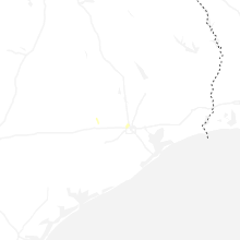
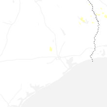
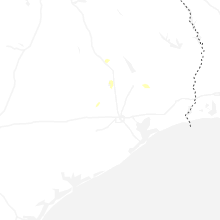
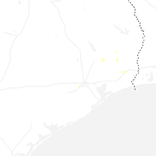
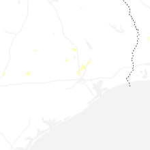
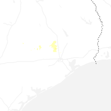
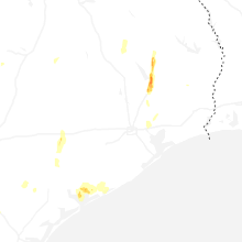
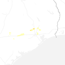
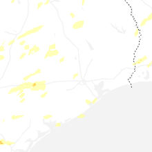


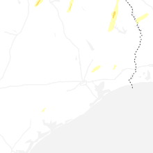


Connect with Interactive Hail Maps