

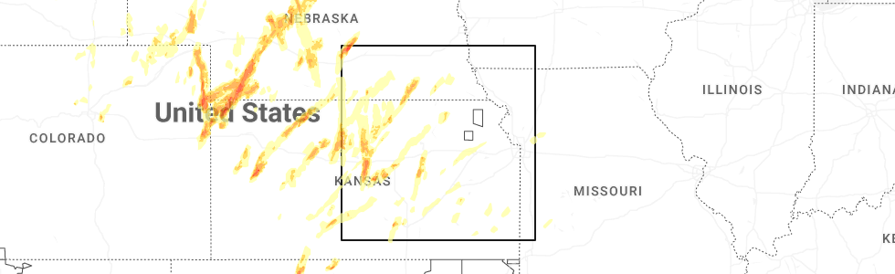
Hail Map for Hubbell, NE
The Hubbell, NE area has had 2 reports of on-the-ground hail by trained spotters, and has been under severe weather warnings 8 times during the past 12 months. Doppler radar has detected hail at or near Hubbell, NE on 108 occasions, including 3 occasions during the past year.
| Name: | Hubbell, NE |
| Where Located: | 76 miles NW of Manhattan, KS |
| Map: | Google Map for Hubbell, NE |
| Population: | 68 |
| Housing Units: | 44 |
| More Info: | Search Google for Hubbell, NE |
0
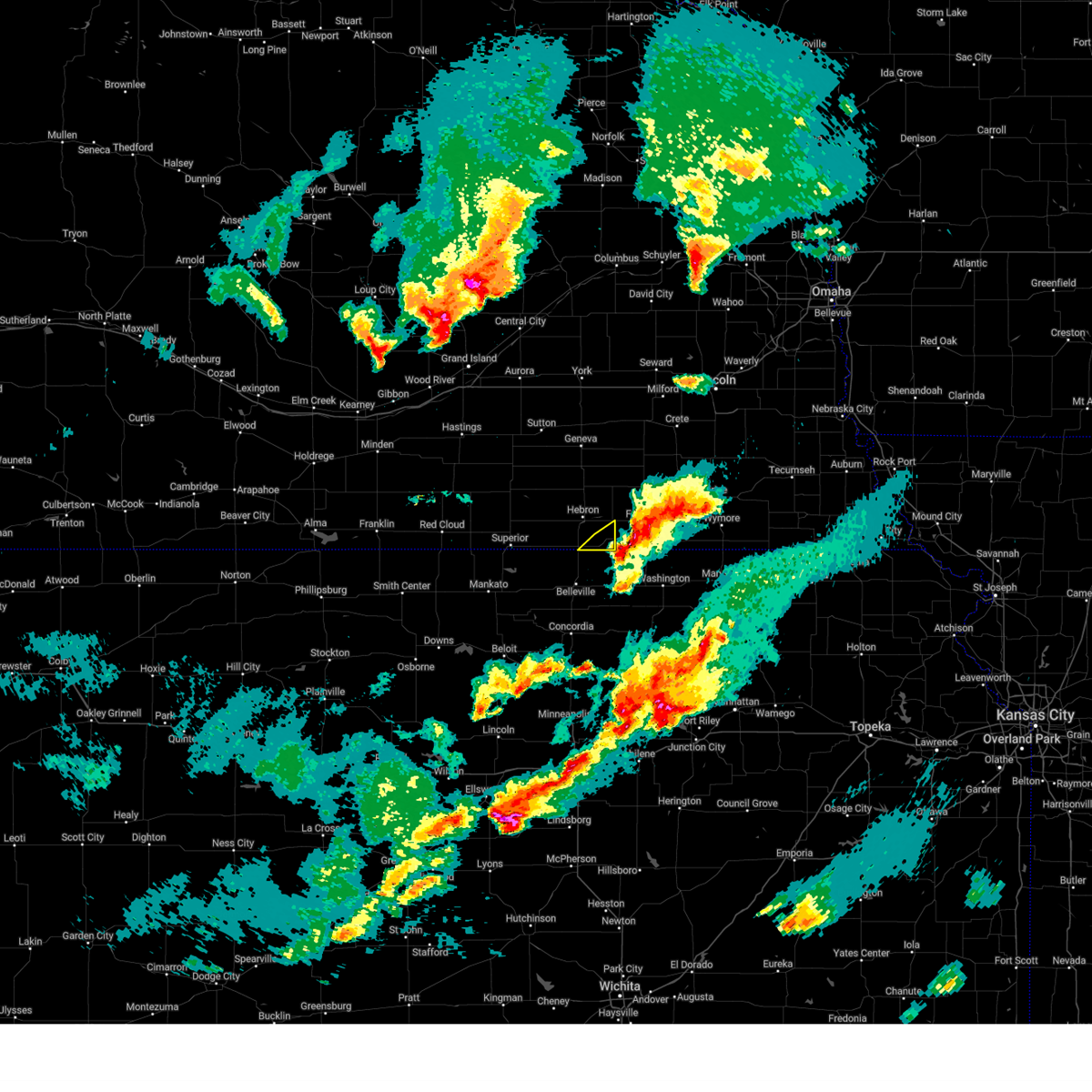
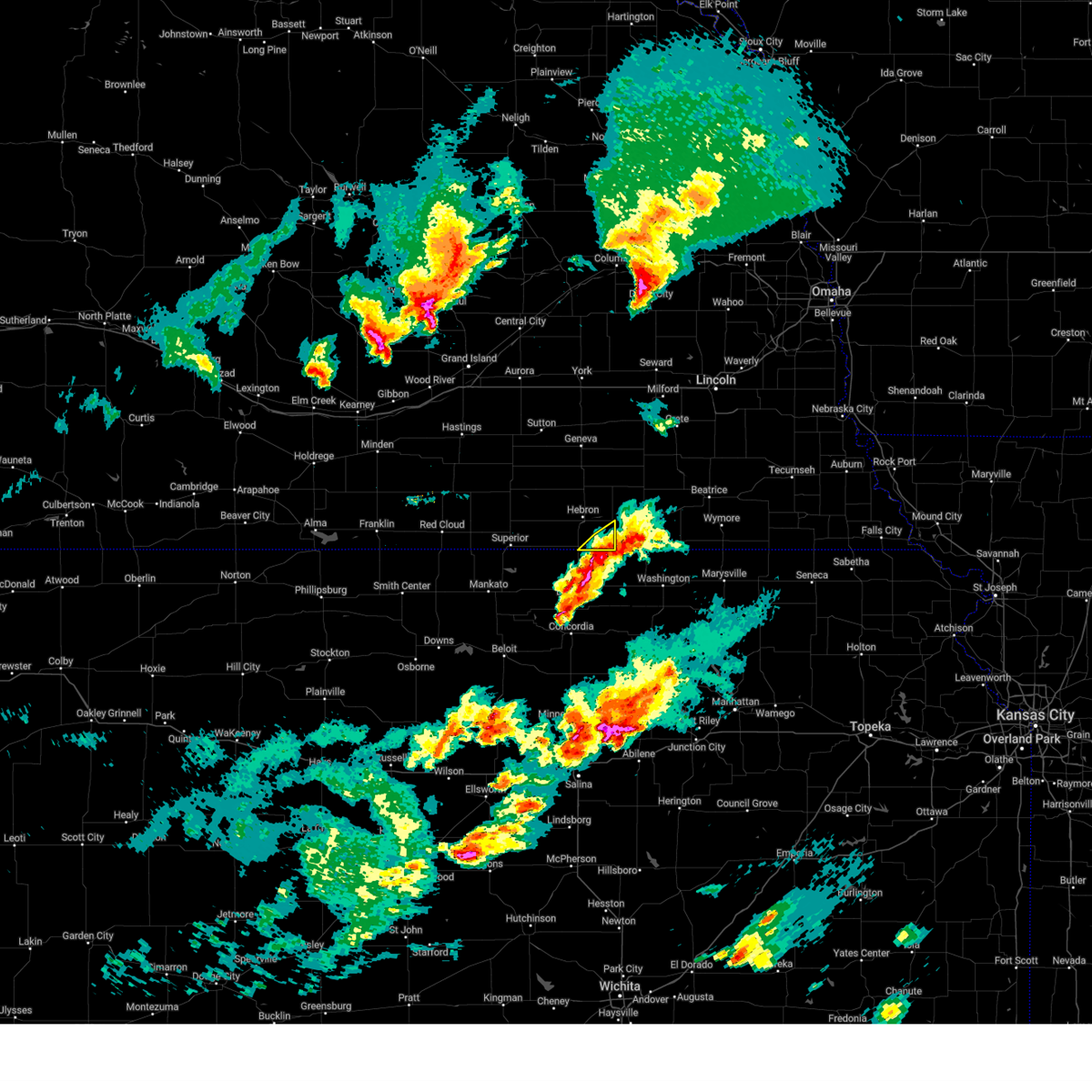
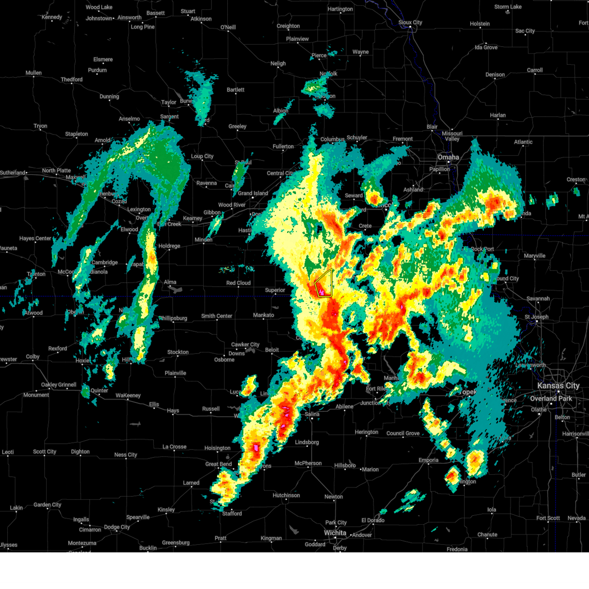
The Top Recent Hail Date for Hubbell, NE is Sunday, May 18, 2025 (108th out of 108)
Hail and Wind Damage Spotted near Hubbell, NE
| Date / Time | Report Details |
|---|---|
| 4/1/2025 9:41 PM CDT |
 The storms which prompted the warning have moved out of the area. therefore, the warning will be allowed to expire. a severe thunderstorm watch remains in effect until 300 am cdt for south central nebraska. The storms which prompted the warning have moved out of the area. therefore, the warning will be allowed to expire. a severe thunderstorm watch remains in effect until 300 am cdt for south central nebraska.
|
| 4/1/2025 9:24 PM CDT |
 At 924 pm cdt, severe thunderstorms were located along a line extending from reynolds to near munden, moving northeast at 40 mph (radar indicated). Hazards include 60 mph wind gusts and half dollar size hail. Hail damage to vehicles is expected. expect wind damage to roofs, siding, and trees. These severe thunderstorms will remain over mainly rural areas of southeastern thayer county. At 924 pm cdt, severe thunderstorms were located along a line extending from reynolds to near munden, moving northeast at 40 mph (radar indicated). Hazards include 60 mph wind gusts and half dollar size hail. Hail damage to vehicles is expected. expect wind damage to roofs, siding, and trees. These severe thunderstorms will remain over mainly rural areas of southeastern thayer county.
|
| 4/1/2025 9:15 PM CDT |
 Svrgid the national weather service in hastings has issued a * severe thunderstorm warning for, southeastern thayer county in south central nebraska, * until 945 pm cdt. * at 915 pm cdt, severe thunderstorms were located along a line extending from near reynolds to munden, moving northeast at 40 mph (radar indicated). Hazards include 60 mph wind gusts and quarter size hail. Hail damage to vehicles is expected. expect wind damage to roofs, siding, and trees. Severe thunderstorms will be near, hubbell around 920 pm cdt. Svrgid the national weather service in hastings has issued a * severe thunderstorm warning for, southeastern thayer county in south central nebraska, * until 945 pm cdt. * at 915 pm cdt, severe thunderstorms were located along a line extending from near reynolds to munden, moving northeast at 40 mph (radar indicated). Hazards include 60 mph wind gusts and quarter size hail. Hail damage to vehicles is expected. expect wind damage to roofs, siding, and trees. Severe thunderstorms will be near, hubbell around 920 pm cdt.
|
| 7/6/2024 6:23 PM CDT |
 The storms which prompted the warning have moved out of the area. therefore, the warning will be allowed to expire. however, gusty winds are still possible with these thunderstorms. a severe thunderstorm watch remains in effect until 800 pm cdt for south central nebraska. The storms which prompted the warning have moved out of the area. therefore, the warning will be allowed to expire. however, gusty winds are still possible with these thunderstorms. a severe thunderstorm watch remains in effect until 800 pm cdt for south central nebraska.
|
| 7/6/2024 5:59 PM CDT |
 Svrgid the national weather service in hastings has issued a * severe thunderstorm warning for, southeastern fillmore county in south central nebraska, eastern thayer county in south central nebraska, * until 630 pm cdt. * at 559 pm cdt, severe thunderstorms were located along a line extending from near milligan to near gilead, moving east at 30 mph (radar indicated). Hazards include 70 mph wind gusts. Expect considerable tree damage. damage is likely to mobile homes, roofs, and outbuildings. Severe thunderstorms will be near, alexandria and gilead around 605 pm cdt. Svrgid the national weather service in hastings has issued a * severe thunderstorm warning for, southeastern fillmore county in south central nebraska, eastern thayer county in south central nebraska, * until 630 pm cdt. * at 559 pm cdt, severe thunderstorms were located along a line extending from near milligan to near gilead, moving east at 30 mph (radar indicated). Hazards include 70 mph wind gusts. Expect considerable tree damage. damage is likely to mobile homes, roofs, and outbuildings. Severe thunderstorms will be near, alexandria and gilead around 605 pm cdt.
|
| 7/6/2024 5:47 PM CDT |
 the severe thunderstorm warning has been cancelled and is no longer in effect the severe thunderstorm warning has been cancelled and is no longer in effect
|
| 7/6/2024 5:47 PM CDT |
 At 546 pm cdt, severe thunderstorms were located along a line extending from near ohiowa to near hubbell, moving east at 45 mph (radar indicated). Hazards include 70 mph wind gusts and half dollar size hail. Hail damage to vehicles is expected. expect considerable tree damage. wind damage is also likely to mobile homes, roofs, and outbuildings. These severe storms will be near, milligan, alexandria, ohiowa, hubbell, and gilead around 550 pm cdt. At 546 pm cdt, severe thunderstorms were located along a line extending from near ohiowa to near hubbell, moving east at 45 mph (radar indicated). Hazards include 70 mph wind gusts and half dollar size hail. Hail damage to vehicles is expected. expect considerable tree damage. wind damage is also likely to mobile homes, roofs, and outbuildings. These severe storms will be near, milligan, alexandria, ohiowa, hubbell, and gilead around 550 pm cdt.
|
| 7/6/2024 5:14 PM CDT | Svrgid the national weather service in hastings has issued a * severe thunderstorm warning for, southern clay county in south central nebraska, nuckolls county in south central nebraska, southern fillmore county in south central nebraska, thayer county in south central nebraska, * until 600 pm cdt. * at 514 pm cdt, severe thunderstorms were located along a line extending from 6 miles northwest of ong to near hardy, moving east at 40 mph (radar indicated). Hazards include 60 mph wind gusts and quarter size hail. Hail damage to vehicles is expected. expect wind damage to roofs, siding, and trees. severe thunderstorms will be near, davenport, ruskin, oak, and ong around 520 pm cdt. deshler and shickley around 525 pm cdt. carleton and byron around 530 pm cdt. Other locations in the path of these severe thunderstorms include strang, hebron, bruning, chester, belvidere, ohiowa and hubbell. |
| 6/26/2024 1:50 AM CDT |
 At 150 am cdt, severe thunderstorms were located along a line extending from near swanton to near republic, moving southeast at 50 mph (radar indicated). Hazards include 60 mph wind gusts and nickel size hail. Expect damage to roofs, siding, and trees. These severe storms will be near, hubbell around 155 am cdt. At 150 am cdt, severe thunderstorms were located along a line extending from near swanton to near republic, moving southeast at 50 mph (radar indicated). Hazards include 60 mph wind gusts and nickel size hail. Expect damage to roofs, siding, and trees. These severe storms will be near, hubbell around 155 am cdt.
|
| 6/26/2024 1:50 AM CDT |
 the severe thunderstorm warning has been cancelled and is no longer in effect the severe thunderstorm warning has been cancelled and is no longer in effect
|
| 6/26/2024 1:48 AM CDT |
 Svrtop the national weather service in topeka has issued a * severe thunderstorm warning for, republic county in north central kansas, washington county in north central kansas, northern cloud county in north central kansas, marshall county in northeastern kansas, * until 230 am cdt. * at 148 am cdt, severe thunderstorms were located along a line extending from near johnson to near courtland, moving southeast at 35 mph (radar indicated). Hazards include 60 mph wind gusts and nickel size hail. expect damage to roofs, siding, and trees Svrtop the national weather service in topeka has issued a * severe thunderstorm warning for, republic county in north central kansas, washington county in north central kansas, northern cloud county in north central kansas, marshall county in northeastern kansas, * until 230 am cdt. * at 148 am cdt, severe thunderstorms were located along a line extending from near johnson to near courtland, moving southeast at 35 mph (radar indicated). Hazards include 60 mph wind gusts and nickel size hail. expect damage to roofs, siding, and trees
|
| 6/26/2024 1:43 AM CDT |
 At 142 am cdt, severe thunderstorms were located along a line extending from near swanton to republic, moving southeast at 50 mph (radar indicated). Hazards include 60 mph wind gusts and nickel size hail. Expect damage to roofs, siding, and trees. These severe storms will be near, hubbell around 150 am cdt. At 142 am cdt, severe thunderstorms were located along a line extending from near swanton to republic, moving southeast at 50 mph (radar indicated). Hazards include 60 mph wind gusts and nickel size hail. Expect damage to roofs, siding, and trees. These severe storms will be near, hubbell around 150 am cdt.
|
| 6/26/2024 1:20 AM CDT |
 Svrgid the national weather service in hastings has issued a * severe thunderstorm warning for, northeastern jewell county in north central kansas, southeastern nuckolls county in south central nebraska, southeastern fillmore county in south central nebraska, thayer county in south central nebraska, * until 200 am cdt. * at 120 am cdt, severe thunderstorms were located along a line extending from near milligan to near superior, moving southeast at 50 mph (radar indicated). Hazards include 60 mph wind gusts and penny size hail. Expect damage to roofs, siding, and trees. severe thunderstorms will be near, superior, milligan, bruning, hardy, ruskin, ohiowa, and carleton around 125 am cdt. hebron, deshler, and belvidere around 130 am cdt. alexandria and byron around 135 am cdt. chester and gilead around 140 am cdt. Other locations in the path of these severe thunderstorms include hubbell. Svrgid the national weather service in hastings has issued a * severe thunderstorm warning for, northeastern jewell county in north central kansas, southeastern nuckolls county in south central nebraska, southeastern fillmore county in south central nebraska, thayer county in south central nebraska, * until 200 am cdt. * at 120 am cdt, severe thunderstorms were located along a line extending from near milligan to near superior, moving southeast at 50 mph (radar indicated). Hazards include 60 mph wind gusts and penny size hail. Expect damage to roofs, siding, and trees. severe thunderstorms will be near, superior, milligan, bruning, hardy, ruskin, ohiowa, and carleton around 125 am cdt. hebron, deshler, and belvidere around 130 am cdt. alexandria and byron around 135 am cdt. chester and gilead around 140 am cdt. Other locations in the path of these severe thunderstorms include hubbell.
|
| 6/15/2024 5:08 PM CDT |
 The storms which prompted the warning have moved out of the area. therefore, the warning will be allowed to expire. a tornado watch remains in effect until 1000 pm cdt for south central nebraska. to report severe weather, contact your nearest law enforcement agency. they will relay your report to the national weather service hastings. The storms which prompted the warning have moved out of the area. therefore, the warning will be allowed to expire. a tornado watch remains in effect until 1000 pm cdt for south central nebraska. to report severe weather, contact your nearest law enforcement agency. they will relay your report to the national weather service hastings.
|
| 6/15/2024 5:00 PM CDT |
 At 500 pm cdt, severe thunderstorms were located along a line extending from tobias to near reynolds, moving east at 25 mph (radar indicated). Hazards include 60 mph wind gusts and quarter size hail. Hail damage to vehicles is expected. expect wind damage to roofs, siding, and trees. These severe thunderstorms will remain over mainly rural areas of southeastern fillmore and eastern thayer counties. At 500 pm cdt, severe thunderstorms were located along a line extending from tobias to near reynolds, moving east at 25 mph (radar indicated). Hazards include 60 mph wind gusts and quarter size hail. Hail damage to vehicles is expected. expect wind damage to roofs, siding, and trees. These severe thunderstorms will remain over mainly rural areas of southeastern fillmore and eastern thayer counties.
|
| 6/15/2024 4:44 PM CDT |
 Svrgid the national weather service in hastings has issued a * severe thunderstorm warning for, southeastern fillmore county in south central nebraska, eastern thayer county in south central nebraska, * until 515 pm cdt. * at 443 pm cdt, severe thunderstorms were located along a line extending from near ohiowa to near reynolds, moving northeast at 20 mph (radar indicated). Hazards include 60 mph wind gusts and quarter size hail. Hail damage to vehicles is expected. expect wind damage to roofs, siding, and trees. Severe thunderstorms will be near, alexandria around 450 pm cdt. Svrgid the national weather service in hastings has issued a * severe thunderstorm warning for, southeastern fillmore county in south central nebraska, eastern thayer county in south central nebraska, * until 515 pm cdt. * at 443 pm cdt, severe thunderstorms were located along a line extending from near ohiowa to near reynolds, moving northeast at 20 mph (radar indicated). Hazards include 60 mph wind gusts and quarter size hail. Hail damage to vehicles is expected. expect wind damage to roofs, siding, and trees. Severe thunderstorms will be near, alexandria around 450 pm cdt.
|
| 5/24/2024 1:54 AM CDT |
 The storms which prompted the warning have weakened below severe limits, and have exited the warned area. therefore, the warning will be allowed to expire. however, gusty winds are still possible with these thunderstorms. a severe thunderstorm watch remains in effect until 400 am cdt for south central, central and east central nebraska. The storms which prompted the warning have weakened below severe limits, and have exited the warned area. therefore, the warning will be allowed to expire. however, gusty winds are still possible with these thunderstorms. a severe thunderstorm watch remains in effect until 400 am cdt for south central, central and east central nebraska.
|
| 5/24/2024 1:25 AM CDT |
 At 125 am cdt, severe thunderstorms were located along a line extending from near staplehurst to hebron to near lovewell state park, moving east at 55 mph (radar indicated). Hazards include 70 mph wind gusts and quarter size hail. Hail damage to vehicles is expected. expect considerable tree damage. wind damage is also likely to mobile homes, roofs, and outbuildings. these severe storms will be near, hebron, milligan, alexandria, ohiowa, and gilead around 130 am cdt. other locations impacted by these severe thunderstorms include thayer. This includes interstate 80 between mile markers 341 and 364. At 125 am cdt, severe thunderstorms were located along a line extending from near staplehurst to hebron to near lovewell state park, moving east at 55 mph (radar indicated). Hazards include 70 mph wind gusts and quarter size hail. Hail damage to vehicles is expected. expect considerable tree damage. wind damage is also likely to mobile homes, roofs, and outbuildings. these severe storms will be near, hebron, milligan, alexandria, ohiowa, and gilead around 130 am cdt. other locations impacted by these severe thunderstorms include thayer. This includes interstate 80 between mile markers 341 and 364.
|
| 5/24/2024 1:25 AM CDT |
 the severe thunderstorm warning has been cancelled and is no longer in effect the severe thunderstorm warning has been cancelled and is no longer in effect
|
| 5/24/2024 1:12 AM CDT |
 Svrgid the national weather service in hastings has issued a * severe thunderstorm warning for, clay county in south central nebraska, nuckolls county in south central nebraska, southeastern webster county in south central nebraska, york county in east central nebraska, hamilton county in south central nebraska, fillmore county in south central nebraska, thayer county in south central nebraska, central merrick county in central nebraska, polk county in east central nebraska, * until 200 am cdt. * at 112 am cdt, severe thunderstorms were located along a line extending from near waco to near ruskin to near burr oak, moving east at 55 mph (radar indicated). Hazards include 70 mph wind gusts and quarter size hail. Hail damage to vehicles is expected. expect considerable tree damage. wind damage is also likely to mobile homes, roofs, and outbuildings. severe thunderstorms will be near, hebron, deshler, exeter, bruning, hardy, ohiowa, belvidere, and strang around 120 am cdt. milligan around 125 am cdt. alexandria and gilead around 130 am cdt. This includes interstate 80 between mile markers 325 and 364. Svrgid the national weather service in hastings has issued a * severe thunderstorm warning for, clay county in south central nebraska, nuckolls county in south central nebraska, southeastern webster county in south central nebraska, york county in east central nebraska, hamilton county in south central nebraska, fillmore county in south central nebraska, thayer county in south central nebraska, central merrick county in central nebraska, polk county in east central nebraska, * until 200 am cdt. * at 112 am cdt, severe thunderstorms were located along a line extending from near waco to near ruskin to near burr oak, moving east at 55 mph (radar indicated). Hazards include 70 mph wind gusts and quarter size hail. Hail damage to vehicles is expected. expect considerable tree damage. wind damage is also likely to mobile homes, roofs, and outbuildings. severe thunderstorms will be near, hebron, deshler, exeter, bruning, hardy, ohiowa, belvidere, and strang around 120 am cdt. milligan around 125 am cdt. alexandria and gilead around 130 am cdt. This includes interstate 80 between mile markers 325 and 364.
|
| 5/4/2024 12:12 AM CDT |
 The storms which prompted the warning have weakened below severe limits, and no longer pose an immediate threat to life or property. therefore, the warning will be allowed to expire. however, small hail and gusty winds are still possible with these thunderstorms. a severe thunderstorm watch remains in effect until 100 am cdt for north central kansas, and south central, central and east central nebraska. The storms which prompted the warning have weakened below severe limits, and no longer pose an immediate threat to life or property. therefore, the warning will be allowed to expire. however, small hail and gusty winds are still possible with these thunderstorms. a severe thunderstorm watch remains in effect until 100 am cdt for north central kansas, and south central, central and east central nebraska.
|
| 5/3/2024 11:31 PM CDT |
 Svrgid the national weather service in hastings has issued a * severe thunderstorm warning for, eastern clay county in south central nebraska, eastern nuckolls county in south central nebraska, york county in east central nebraska, hamilton county in south central nebraska, fillmore county in south central nebraska, thayer county in south central nebraska, southern merrick county in central nebraska, polk county in east central nebraska, * until 1215 am cdt. * at 1131 pm cdt, severe thunderstorms were located along a line extending from near phillips to near saronville to davenport to near bostwick, moving east at 60 mph (radar indicated). Hazards include 60 mph wind gusts and nickel size hail. Expect damage to roofs, siding, and trees. severe thunderstorms will be near, aurora, superior, sutton, henderson, shickley, davenport, ruskin, carleton, oak, and stockham around 1135 pm cdt. geneva, hampton, bruning, grafton, lushton, and strang around 1140 pm cdt. deshler, fairmont, mccool junction, bradshaw, and belvidere around 1145 pm cdt. york, hebron, exeter, and ohiowa around 1150 pm cdt. other locations in the path of these severe thunderstorms include milligan, benedict, waco, alexandria, gresham and gilead. This includes interstate 80 between mile markers 326 and 365. Svrgid the national weather service in hastings has issued a * severe thunderstorm warning for, eastern clay county in south central nebraska, eastern nuckolls county in south central nebraska, york county in east central nebraska, hamilton county in south central nebraska, fillmore county in south central nebraska, thayer county in south central nebraska, southern merrick county in central nebraska, polk county in east central nebraska, * until 1215 am cdt. * at 1131 pm cdt, severe thunderstorms were located along a line extending from near phillips to near saronville to davenport to near bostwick, moving east at 60 mph (radar indicated). Hazards include 60 mph wind gusts and nickel size hail. Expect damage to roofs, siding, and trees. severe thunderstorms will be near, aurora, superior, sutton, henderson, shickley, davenport, ruskin, carleton, oak, and stockham around 1135 pm cdt. geneva, hampton, bruning, grafton, lushton, and strang around 1140 pm cdt. deshler, fairmont, mccool junction, bradshaw, and belvidere around 1145 pm cdt. york, hebron, exeter, and ohiowa around 1150 pm cdt. other locations in the path of these severe thunderstorms include milligan, benedict, waco, alexandria, gresham and gilead. This includes interstate 80 between mile markers 326 and 365.
|
| 5/2/2024 2:12 AM CDT |
 The storms which prompted the warning have moved out of the area. therefore, the warning will be allowed to expire. however, gusty winds and heavy downpours are still possible with these thunderstorms. to report severe weather, contact your nearest law enforcement agency. they will relay your report to the national weather service hastings. The storms which prompted the warning have moved out of the area. therefore, the warning will be allowed to expire. however, gusty winds and heavy downpours are still possible with these thunderstorms. to report severe weather, contact your nearest law enforcement agency. they will relay your report to the national weather service hastings.
|
| 5/2/2024 2:02 AM CDT |
 At 202 am cdt, severe thunderstorms were located along a line extending from exeter to near daykin to hubbell, moving east at 50 mph (automated weather station). Hazards include 60 mph wind gusts. Expect damage to roofs, siding, and trees. These severe storms will be near, milligan, alexandria, and gilead around 205 am cdt. At 202 am cdt, severe thunderstorms were located along a line extending from exeter to near daykin to hubbell, moving east at 50 mph (automated weather station). Hazards include 60 mph wind gusts. Expect damage to roofs, siding, and trees. These severe storms will be near, milligan, alexandria, and gilead around 205 am cdt.
|
| 5/2/2024 1:51 AM CDT |
 At 150 am cdt, severe thunderstorms were located along a line extending from fairmont to near ohiowa to hubbell, moving northeast at 50 mph (automated weather station). Hazards include 60 mph wind gusts. Expect damage to roofs, siding, and trees. These severe storms will be near, exeter, milligan, alexandria, and gilead around 155 am cdt. At 150 am cdt, severe thunderstorms were located along a line extending from fairmont to near ohiowa to hubbell, moving northeast at 50 mph (automated weather station). Hazards include 60 mph wind gusts. Expect damage to roofs, siding, and trees. These severe storms will be near, exeter, milligan, alexandria, and gilead around 155 am cdt.
|
| 5/2/2024 1:51 AM CDT |
 the severe thunderstorm warning has been cancelled and is no longer in effect the severe thunderstorm warning has been cancelled and is no longer in effect
|
| 5/2/2024 1:19 AM CDT |
 Svrgid the national weather service in hastings has issued a * severe thunderstorm warning for, southeastern clay county in south central nebraska, eastern nuckolls county in south central nebraska, fillmore county in south central nebraska, thayer county in south central nebraska, * until 215 am cdt. * at 118 am cdt, severe thunderstorms were located along a line extending from near fairfield to near ruskin to near republic, moving northeast at 50 mph (automated weather station). Hazards include 60 mph wind gusts. Expect damage to roofs, siding, and trees. severe thunderstorms will be near, deshler, davenport, byron, and ong around 125 am cdt. shickley and carleton around 130 am cdt. hebron, bruning, chester, and belvidere around 135 am cdt. Other locations in the path of these severe thunderstorms include geneva, strang, ohiowa, alexandria, gilead, exeter and milligan. Svrgid the national weather service in hastings has issued a * severe thunderstorm warning for, southeastern clay county in south central nebraska, eastern nuckolls county in south central nebraska, fillmore county in south central nebraska, thayer county in south central nebraska, * until 215 am cdt. * at 118 am cdt, severe thunderstorms were located along a line extending from near fairfield to near ruskin to near republic, moving northeast at 50 mph (automated weather station). Hazards include 60 mph wind gusts. Expect damage to roofs, siding, and trees. severe thunderstorms will be near, deshler, davenport, byron, and ong around 125 am cdt. shickley and carleton around 130 am cdt. hebron, bruning, chester, and belvidere around 135 am cdt. Other locations in the path of these severe thunderstorms include geneva, strang, ohiowa, alexandria, gilead, exeter and milligan.
|
| 4/6/2024 5:23 PM CDT |
 At 523 pm cdt, severe thunderstorms were located along a line extending from near palmer to near grafton to near gilead, moving north at 50 mph (radar indicated). Hazards include 70 mph wind gusts. Expect considerable tree damage. damage is likely to mobile homes, roofs, and outbuildings. these severe storms will be near, central city, geneva, fairmont, hampton, mccool junction, bradshaw, alexandria, hordville, ohiowa, and lushton around 530 pm cdt. york around 535 pm cdt. fullerton, exeter, polk, and milligan around 540 pm cdt. clarks and belgrade around 545 pm cdt. benedict around 550 pm cdt. This includes interstate 80 between mile markers 321 and 360. At 523 pm cdt, severe thunderstorms were located along a line extending from near palmer to near grafton to near gilead, moving north at 50 mph (radar indicated). Hazards include 70 mph wind gusts. Expect considerable tree damage. damage is likely to mobile homes, roofs, and outbuildings. these severe storms will be near, central city, geneva, fairmont, hampton, mccool junction, bradshaw, alexandria, hordville, ohiowa, and lushton around 530 pm cdt. york around 535 pm cdt. fullerton, exeter, polk, and milligan around 540 pm cdt. clarks and belgrade around 545 pm cdt. benedict around 550 pm cdt. This includes interstate 80 between mile markers 321 and 360.
|
| 4/6/2024 5:09 PM CDT |
 At 508 pm cdt, severe thunderstorms were located along a line extending from near st. libory to near shickley to near hubbell, moving north at 45 mph (radar indicated). Hazards include 70 mph wind gusts. Expect considerable tree damage. damage is likely to mobile homes, roofs, and outbuildings. these severe storms will be near, aurora, geneva, henderson, palmer, hampton, chapman, bruning, marquette, grafton, and belvidere around 515 pm cdt. central city, fairmont, alexandria, and lushton around 520 pm cdt. bradshaw and ohiowa around 525 pm cdt. mccool junction and hordville around 530 pm cdt. york around 535 pm cdt. fullerton, exeter, polk, and milligan around 540 pm cdt. clarks and belgrade around 545 pm cdt. benedict around 550 pm cdt. This includes interstate 80 between mile markers 318 and 360. At 508 pm cdt, severe thunderstorms were located along a line extending from near st. libory to near shickley to near hubbell, moving north at 45 mph (radar indicated). Hazards include 70 mph wind gusts. Expect considerable tree damage. damage is likely to mobile homes, roofs, and outbuildings. these severe storms will be near, aurora, geneva, henderson, palmer, hampton, chapman, bruning, marquette, grafton, and belvidere around 515 pm cdt. central city, fairmont, alexandria, and lushton around 520 pm cdt. bradshaw and ohiowa around 525 pm cdt. mccool junction and hordville around 530 pm cdt. york around 535 pm cdt. fullerton, exeter, polk, and milligan around 540 pm cdt. clarks and belgrade around 545 pm cdt. benedict around 550 pm cdt. This includes interstate 80 between mile markers 318 and 360.
|
| 4/6/2024 5:04 PM CDT |
 the severe thunderstorm warning has been cancelled and is no longer in effect the severe thunderstorm warning has been cancelled and is no longer in effect
|
| 4/6/2024 5:04 PM CDT |
 At 504 pm cdt, severe thunderstorms were located along a line extending from near elba to 6 miles northwest of aurora to near carleton, moving north at 45 mph (radar indicated). Hazards include 70 mph wind gusts. Expect considerable tree damage. damage is likely to mobile homes, roofs, and outbuildings. these severe storms will be near, aurora, sutton, palmer, shickley, chapman, marquette, and stockham around 510 pm cdt. central city and archer around 515 pm cdt. This includes interstate 80 between mile markers 306 and 338. At 504 pm cdt, severe thunderstorms were located along a line extending from near elba to 6 miles northwest of aurora to near carleton, moving north at 45 mph (radar indicated). Hazards include 70 mph wind gusts. Expect considerable tree damage. damage is likely to mobile homes, roofs, and outbuildings. these severe storms will be near, aurora, sutton, palmer, shickley, chapman, marquette, and stockham around 510 pm cdt. central city and archer around 515 pm cdt. This includes interstate 80 between mile markers 306 and 338.
|
| 4/6/2024 4:59 PM CDT |
 Svrgid the national weather service in hastings has issued a * severe thunderstorm warning for, northeastern clay county in south central nebraska, nance county in central nebraska, york county in east central nebraska, hamilton county in south central nebraska, fillmore county in south central nebraska, thayer county in south central nebraska, merrick county in central nebraska, southwestern polk county in east central nebraska, * until 545 pm cdt. * at 458 pm cdt, severe thunderstorms were located along a line extending from near st. libory to near deshler, moving north at 50 mph (radar indicated). Hazards include 70 mph wind gusts. Expect considerable tree damage. damage is likely to mobile homes, roofs, and outbuildings. severe thunderstorms will be near, aurora, sutton, shickley, chapman, carleton, saronville, and stockham around 505 pm cdt. palmer around 510 pm cdt. marquette, grafton, and archer around 515 pm cdt. other locations in the path of these severe thunderstorms include central city, geneva, henderson, hampton, lushton, fairmont, bradshaw, hordville and mccool junction. This includes interstate 80 between mile markers 318 and 360. Svrgid the national weather service in hastings has issued a * severe thunderstorm warning for, northeastern clay county in south central nebraska, nance county in central nebraska, york county in east central nebraska, hamilton county in south central nebraska, fillmore county in south central nebraska, thayer county in south central nebraska, merrick county in central nebraska, southwestern polk county in east central nebraska, * until 545 pm cdt. * at 458 pm cdt, severe thunderstorms were located along a line extending from near st. libory to near deshler, moving north at 50 mph (radar indicated). Hazards include 70 mph wind gusts. Expect considerable tree damage. damage is likely to mobile homes, roofs, and outbuildings. severe thunderstorms will be near, aurora, sutton, shickley, chapman, carleton, saronville, and stockham around 505 pm cdt. palmer around 510 pm cdt. marquette, grafton, and archer around 515 pm cdt. other locations in the path of these severe thunderstorms include central city, geneva, henderson, hampton, lushton, fairmont, bradshaw, hordville and mccool junction. This includes interstate 80 between mile markers 318 and 360.
|
| 4/6/2024 4:44 PM CDT |
 At 443 pm cdt, severe thunderstorms were located along a line extending from near dannebrog to near giltner to near byron, moving north at 45 mph (radar indicated). Hazards include 70 mph wind gusts. Expect considerable tree damage. damage is likely to mobile homes, roofs, and outbuildings. these severe storms will be near, grand island, deshler, giltner, dannebrog, davenport, phillips, ong, saronville, and st. libory around 450 pm cdt. aurora, st. paul, sutton, carleton, and stockham around 455 pm cdt. shickley and chapman around 500 pm cdt. palmer and marquette around 505 pm cdt. central city and archer around 510 pm cdt. This includes interstate 80 between mile markers 298 and 338. At 443 pm cdt, severe thunderstorms were located along a line extending from near dannebrog to near giltner to near byron, moving north at 45 mph (radar indicated). Hazards include 70 mph wind gusts. Expect considerable tree damage. damage is likely to mobile homes, roofs, and outbuildings. these severe storms will be near, grand island, deshler, giltner, dannebrog, davenport, phillips, ong, saronville, and st. libory around 450 pm cdt. aurora, st. paul, sutton, carleton, and stockham around 455 pm cdt. shickley and chapman around 500 pm cdt. palmer and marquette around 505 pm cdt. central city and archer around 510 pm cdt. This includes interstate 80 between mile markers 298 and 338.
|
| 4/6/2024 4:44 PM CDT |
 the severe thunderstorm warning has been cancelled and is no longer in effect the severe thunderstorm warning has been cancelled and is no longer in effect
|
| 4/6/2024 4:28 PM CDT |
 Svrgid the national weather service in hastings has issued a * severe thunderstorm warning for, northern jewell county in north central kansas, clay county in south central nebraska, nuckolls county in south central nebraska, webster county in south central nebraska, adams county in south central nebraska, hamilton county in south central nebraska, southwestern fillmore county in south central nebraska, western thayer county in south central nebraska, southwestern merrick county in central nebraska, southeastern howard county in central nebraska, hall county in south central nebraska, * until 515 pm cdt. * at 427 pm cdt, severe thunderstorms were located along a line extending from near wood river to near trumbull to hardy, moving north at 45 mph (radar indicated). Hazards include 70 mph wind gusts. Expect considerable tree damage. damage is likely to mobile homes, roofs, and outbuildings. severe thunderstorms will be near, grand island, doniphan, alda, edgar, fairfield, trumbull, ruskin, inland, oak, and nora around 435 pm cdt. harvard, clay center, and dannebrog around 440 pm cdt. giltner and phillips around 445 pm cdt. other locations in the path of these severe thunderstorms include st. paul, davenport, st. libory, ong, saronville, chapman, aurora, sutton and stockham. This includes interstate 80 between mile markers 298 and 338. Svrgid the national weather service in hastings has issued a * severe thunderstorm warning for, northern jewell county in north central kansas, clay county in south central nebraska, nuckolls county in south central nebraska, webster county in south central nebraska, adams county in south central nebraska, hamilton county in south central nebraska, southwestern fillmore county in south central nebraska, western thayer county in south central nebraska, southwestern merrick county in central nebraska, southeastern howard county in central nebraska, hall county in south central nebraska, * until 515 pm cdt. * at 427 pm cdt, severe thunderstorms were located along a line extending from near wood river to near trumbull to hardy, moving north at 45 mph (radar indicated). Hazards include 70 mph wind gusts. Expect considerable tree damage. damage is likely to mobile homes, roofs, and outbuildings. severe thunderstorms will be near, grand island, doniphan, alda, edgar, fairfield, trumbull, ruskin, inland, oak, and nora around 435 pm cdt. harvard, clay center, and dannebrog around 440 pm cdt. giltner and phillips around 445 pm cdt. other locations in the path of these severe thunderstorms include st. paul, davenport, st. libory, ong, saronville, chapman, aurora, sutton and stockham. This includes interstate 80 between mile markers 298 and 338.
|
| 10/3/2023 7:56 PM CDT |
 The severe thunderstorm warning for southeastern nuckolls, fillmore and thayer counties will expire at 800 pm cdt, the storms which prompted the warning have moved out of the area. therefore, the warning will be allowed to expire. however, gusty winds are still possible with these thunderstorms. a severe thunderstorm watch remains in effect until 1100 pm cdt for south central and east central nebraska. The severe thunderstorm warning for southeastern nuckolls, fillmore and thayer counties will expire at 800 pm cdt, the storms which prompted the warning have moved out of the area. therefore, the warning will be allowed to expire. however, gusty winds are still possible with these thunderstorms. a severe thunderstorm watch remains in effect until 1100 pm cdt for south central and east central nebraska.
|
| 10/3/2023 7:42 PM CDT |
 At 742 pm cdt, severe thunderstorms were located along a line extending from near friend to near chester, moving northeast at 40 mph (radar indicated). Hazards include 60 mph wind gusts and quarter size hail. Hail damage to vehicles is expected. expect wind damage to roofs, siding, and trees. these severe storms will be near, hebron, chester, and alexandria around 745 pm cdt. gilead around 755 pm cdt. hail threat, radar indicated max hail size, 1. 00 in wind threat, radar indicated max wind gust, 60 mph. At 742 pm cdt, severe thunderstorms were located along a line extending from near friend to near chester, moving northeast at 40 mph (radar indicated). Hazards include 60 mph wind gusts and quarter size hail. Hail damage to vehicles is expected. expect wind damage to roofs, siding, and trees. these severe storms will be near, hebron, chester, and alexandria around 745 pm cdt. gilead around 755 pm cdt. hail threat, radar indicated max hail size, 1. 00 in wind threat, radar indicated max wind gust, 60 mph.
|
| 10/3/2023 7:26 PM CDT |
 At 726 pm cdt, severe thunderstorms were located along a line extending from near beaver crossing to near byron, moving northeast at 50 mph (radar indicated). Hazards include 60 mph wind gusts and quarter size hail. Hail damage to vehicles is expected. expect wind damage to roofs, siding, and trees. severe thunderstorms will be near, deshler, exeter, milligan, bruning, ohiowa, carleton, belvidere, and strang around 730 pm cdt. hebron around 735 pm cdt. hail threat, radar indicated max hail size, 1. 00 in wind threat, radar indicated max wind gust, 60 mph. At 726 pm cdt, severe thunderstorms were located along a line extending from near beaver crossing to near byron, moving northeast at 50 mph (radar indicated). Hazards include 60 mph wind gusts and quarter size hail. Hail damage to vehicles is expected. expect wind damage to roofs, siding, and trees. severe thunderstorms will be near, deshler, exeter, milligan, bruning, ohiowa, carleton, belvidere, and strang around 730 pm cdt. hebron around 735 pm cdt. hail threat, radar indicated max hail size, 1. 00 in wind threat, radar indicated max wind gust, 60 mph.
|
| 10/3/2023 7:11 PM CDT |
 At 711 pm cdt, severe thunderstorms were located along a line extending from 6 miles southeast of gresham to near deshler, moving east at 45 mph (radar indicated). Hazards include 70 mph wind gusts and quarter size hail. Hail damage to vehicles is expected. expect considerable tree damage. wind damage is also likely to mobile homes, roofs, and outbuildings. these severe storms will be near, hebron, exeter, milligan, bruning, ohiowa, and belvidere around 715 pm cdt. alexandria around 725 pm cdt. gilead around 730 pm cdt. This includes interstate 80 between mile markers 343 and 365. At 711 pm cdt, severe thunderstorms were located along a line extending from 6 miles southeast of gresham to near deshler, moving east at 45 mph (radar indicated). Hazards include 70 mph wind gusts and quarter size hail. Hail damage to vehicles is expected. expect considerable tree damage. wind damage is also likely to mobile homes, roofs, and outbuildings. these severe storms will be near, hebron, exeter, milligan, bruning, ohiowa, and belvidere around 715 pm cdt. alexandria around 725 pm cdt. gilead around 730 pm cdt. This includes interstate 80 between mile markers 343 and 365.
|
| 10/3/2023 6:56 PM CDT |
 At 655 pm cdt, severe thunderstorms were located along a line extending from near waco to near hardy, moving east at 45 mph (radar indicated). Hazards include 70 mph wind gusts and quarter size hail. Hail damage to vehicles is expected. expect considerable tree damage. wind damage is also likely to mobile homes, roofs, and outbuildings. severe thunderstorms will be near, geneva, deshler, exeter, fairmont, waco, carleton, and strang around 700 pm cdt. bruning around 705 pm cdt. hebron, ohiowa, and belvidere around 710 pm cdt. milligan around 715 pm cdt. This includes interstate 80 between mile markers 343 and 365. At 655 pm cdt, severe thunderstorms were located along a line extending from near waco to near hardy, moving east at 45 mph (radar indicated). Hazards include 70 mph wind gusts and quarter size hail. Hail damage to vehicles is expected. expect considerable tree damage. wind damage is also likely to mobile homes, roofs, and outbuildings. severe thunderstorms will be near, geneva, deshler, exeter, fairmont, waco, carleton, and strang around 700 pm cdt. bruning around 705 pm cdt. hebron, ohiowa, and belvidere around 710 pm cdt. milligan around 715 pm cdt. This includes interstate 80 between mile markers 343 and 365.
|
| 9/22/2023 12:53 AM CDT |
 The severe thunderstorm warning for southern thayer county will expire at 100 am cdt, the storm which prompted the warning has weakened below severe limits, and no longer poses an immediate threat to life or property. therefore, the warning will be allowed to expire. however, gusty winds and heavy rain are still possible with this thunderstorm. to report severe weather, contact your nearest law enforcement agency. they will relay your report to the national weather service hastings. The severe thunderstorm warning for southern thayer county will expire at 100 am cdt, the storm which prompted the warning has weakened below severe limits, and no longer poses an immediate threat to life or property. therefore, the warning will be allowed to expire. however, gusty winds and heavy rain are still possible with this thunderstorm. to report severe weather, contact your nearest law enforcement agency. they will relay your report to the national weather service hastings.
|
| 9/22/2023 12:42 AM CDT |
 At 1241 am cdt, a severe thunderstorm was located near hebron, or 19 miles north of belleville, moving east at 40 mph (automated weather station). Hazards include 60 mph wind gusts. Expect damage to roofs, siding, and trees. this severe storm will be near, gilead around 1250 am cdt. hail threat, radar indicated max hail size, <. 75 in wind threat, observed max wind gust, 60 mph. At 1241 am cdt, a severe thunderstorm was located near hebron, or 19 miles north of belleville, moving east at 40 mph (automated weather station). Hazards include 60 mph wind gusts. Expect damage to roofs, siding, and trees. this severe storm will be near, gilead around 1250 am cdt. hail threat, radar indicated max hail size, <. 75 in wind threat, observed max wind gust, 60 mph.
|
| 9/22/2023 12:14 AM CDT |
 At 1213 am cdt, a severe thunderstorm was located near ruskin, or 21 miles northwest of belleville, moving east at 45 mph (radar indicated). Hazards include 60 mph wind gusts. Expect damage to roofs, siding, and trees. This severe thunderstorm will be near, deshler around 1225 am cdt. At 1213 am cdt, a severe thunderstorm was located near ruskin, or 21 miles northwest of belleville, moving east at 45 mph (radar indicated). Hazards include 60 mph wind gusts. Expect damage to roofs, siding, and trees. This severe thunderstorm will be near, deshler around 1225 am cdt.
|
| 7/30/2023 6:59 PM CDT |
 At 658 pm cdt, a severe thunderstorm was located near chester, or 11 miles north of belleville, moving southeast at 25 mph (radar indicated). Hazards include quarter size hail. Damage to vehicles is expected. this severe thunderstorm will remain over mainly rural areas of southwestern thayer county. hail threat, radar indicated max hail size, 1. 00 in wind threat, radar indicated max wind gust, <50 mph. At 658 pm cdt, a severe thunderstorm was located near chester, or 11 miles north of belleville, moving southeast at 25 mph (radar indicated). Hazards include quarter size hail. Damage to vehicles is expected. this severe thunderstorm will remain over mainly rural areas of southwestern thayer county. hail threat, radar indicated max hail size, 1. 00 in wind threat, radar indicated max wind gust, <50 mph.
|
| 7/4/2023 7:13 PM CDT |
 At 712 pm cdt, a severe thunderstorm was located near york, moving southeast at 30 mph (radar indicated). Hazards include 60 mph wind gusts and half dollar size hail. Hail damage to vehicles is expected. expect wind damage to roofs, siding, and trees. this severe thunderstorm will remain over mainly rural areas of eastern clay, northeastern nuckolls, york, southeastern hamilton, fillmore and thayer counties, including the following locations, thayer. this includes interstate 80 between mile markers 337 and 365. hail threat, radar indicated max hail size, 1. 25 in wind threat, radar indicated max wind gust, 60 mph. At 712 pm cdt, a severe thunderstorm was located near york, moving southeast at 30 mph (radar indicated). Hazards include 60 mph wind gusts and half dollar size hail. Hail damage to vehicles is expected. expect wind damage to roofs, siding, and trees. this severe thunderstorm will remain over mainly rural areas of eastern clay, northeastern nuckolls, york, southeastern hamilton, fillmore and thayer counties, including the following locations, thayer. this includes interstate 80 between mile markers 337 and 365. hail threat, radar indicated max hail size, 1. 25 in wind threat, radar indicated max wind gust, 60 mph.
|
| 5/7/2023 10:07 PM CDT |
 At 1007 pm cdt, a severe thunderstorm was located near chester, or 16 miles north of belleville, moving east at 30 mph (automated weather station). Hazards include 60 mph wind gusts and nickel size hail. Expect damage to roofs, siding, and trees. this severe storm will be near, hebron around 1010 pm cdt. hubbell around 1015 pm cdt. hail threat, radar indicated max hail size, 0. 88 in wind threat, observed max wind gust, 60 mph. At 1007 pm cdt, a severe thunderstorm was located near chester, or 16 miles north of belleville, moving east at 30 mph (automated weather station). Hazards include 60 mph wind gusts and nickel size hail. Expect damage to roofs, siding, and trees. this severe storm will be near, hebron around 1010 pm cdt. hubbell around 1015 pm cdt. hail threat, radar indicated max hail size, 0. 88 in wind threat, observed max wind gust, 60 mph.
|
| 5/7/2023 10:02 PM CDT |
 At 1001 pm cdt, a severe thunderstorm was located near hubbell, or 17 miles north of belleville, moving east at 40 mph. this warning replaces the previous warning in effect for southern thayer county (automated weather station. at 9:40 pm 60 to 70 mph winds were reported in western and southern thayer county). Hazards include 60 mph wind gusts and nickel size hail. Expect damage to roofs, siding, and trees. this severe thunderstorm will be near, gilead around 1015 pm cdt. hail threat, radar indicated max hail size, 0. 88 in wind threat, observed max wind gust, 60 mph. At 1001 pm cdt, a severe thunderstorm was located near hubbell, or 17 miles north of belleville, moving east at 40 mph. this warning replaces the previous warning in effect for southern thayer county (automated weather station. at 9:40 pm 60 to 70 mph winds were reported in western and southern thayer county). Hazards include 60 mph wind gusts and nickel size hail. Expect damage to roofs, siding, and trees. this severe thunderstorm will be near, gilead around 1015 pm cdt. hail threat, radar indicated max hail size, 0. 88 in wind threat, observed max wind gust, 60 mph.
|
| 5/7/2023 9:54 PM CDT |
 At 953 pm cdt, a severe thunderstorm was located over byron, or 14 miles north of belleville, moving east at 35 mph (automated weather station. a couple of reports between 55 and 60 mph were observed near ruskin and chester with this thunderstorm). Hazards include 60 mph wind gusts and quarter size hail. Hail damage to vehicles is expected. expect wind damage to roofs, siding, and trees. this severe storm will be near, chester around 1000 pm cdt. hubbell around 1010 pm cdt. hail threat, radar indicated max hail size, 1. 00 in wind threat, observed max wind gust, 60 mph. At 953 pm cdt, a severe thunderstorm was located over byron, or 14 miles north of belleville, moving east at 35 mph (automated weather station. a couple of reports between 55 and 60 mph were observed near ruskin and chester with this thunderstorm). Hazards include 60 mph wind gusts and quarter size hail. Hail damage to vehicles is expected. expect wind damage to roofs, siding, and trees. this severe storm will be near, chester around 1000 pm cdt. hubbell around 1010 pm cdt. hail threat, radar indicated max hail size, 1. 00 in wind threat, observed max wind gust, 60 mph.
|
| 5/7/2023 9:36 PM CDT |
 At 935 pm cdt, a severe thunderstorm was located near hardy, or 20 miles northwest of belleville, moving east at 25 mph. this warning replaces the previous warning in effect for northeastern jewell county (radar indicated). Hazards include 60 mph wind gusts and quarter size hail. Hail damage to vehicles is expected. expect wind damage to roofs, siding, and trees. this severe thunderstorm will be near, hardy around 945 pm cdt. other locations in the path of this severe thunderstorm include byron, chester and hubbell. hail threat, radar indicated max hail size, 1. 00 in wind threat, radar indicated max wind gust, 60 mph. At 935 pm cdt, a severe thunderstorm was located near hardy, or 20 miles northwest of belleville, moving east at 25 mph. this warning replaces the previous warning in effect for northeastern jewell county (radar indicated). Hazards include 60 mph wind gusts and quarter size hail. Hail damage to vehicles is expected. expect wind damage to roofs, siding, and trees. this severe thunderstorm will be near, hardy around 945 pm cdt. other locations in the path of this severe thunderstorm include byron, chester and hubbell. hail threat, radar indicated max hail size, 1. 00 in wind threat, radar indicated max wind gust, 60 mph.
|
| 5/7/2023 7:05 PM CDT |
 At 705 pm cdt, a severe thunderstorm was located over alexandria, or 30 miles northeast of belleville, moving northeast at 30 mph (radar indicated). Hazards include 60 mph wind gusts and half dollar size hail. Hail damage to vehicles is expected. expect wind damage to roofs, siding, and trees. this severe thunderstorm will remain over mainly rural areas of eastern thayer county. hail threat, radar indicated max hail size, 1. 25 in wind threat, radar indicated max wind gust, 60 mph. At 705 pm cdt, a severe thunderstorm was located over alexandria, or 30 miles northeast of belleville, moving northeast at 30 mph (radar indicated). Hazards include 60 mph wind gusts and half dollar size hail. Hail damage to vehicles is expected. expect wind damage to roofs, siding, and trees. this severe thunderstorm will remain over mainly rural areas of eastern thayer county. hail threat, radar indicated max hail size, 1. 25 in wind threat, radar indicated max wind gust, 60 mph.
|
| 5/7/2023 6:54 PM CDT |
 At 654 pm cdt, a severe thunderstorm was located over gilead, or 25 miles north of belleville, moving northeast at 30 mph (radar indicated). Hazards include 60 mph wind gusts and half dollar size hail. Hail damage to vehicles is expected. expect wind damage to roofs, siding, and trees. this severe storm will be near, alexandria around 705 pm cdt. hail threat, radar indicated max hail size, 1. 25 in wind threat, radar indicated max wind gust, 60 mph. At 654 pm cdt, a severe thunderstorm was located over gilead, or 25 miles north of belleville, moving northeast at 30 mph (radar indicated). Hazards include 60 mph wind gusts and half dollar size hail. Hail damage to vehicles is expected. expect wind damage to roofs, siding, and trees. this severe storm will be near, alexandria around 705 pm cdt. hail threat, radar indicated max hail size, 1. 25 in wind threat, radar indicated max wind gust, 60 mph.
|
| 5/7/2023 6:41 PM CDT |
 At 640 pm cdt, a severe thunderstorm was located near hebron, or 21 miles north of belleville, moving northeast at 30 mph (radar indicated). Hazards include 60 mph wind gusts and quarter size hail. Hail damage to vehicles is expected. expect wind damage to roofs, siding, and trees. this severe thunderstorm will be near, gilead around 655 pm cdt. other locations in the path of this severe thunderstorm include alexandria. hail threat, radar indicated max hail size, 1. 00 in wind threat, radar indicated max wind gust, 60 mph. At 640 pm cdt, a severe thunderstorm was located near hebron, or 21 miles north of belleville, moving northeast at 30 mph (radar indicated). Hazards include 60 mph wind gusts and quarter size hail. Hail damage to vehicles is expected. expect wind damage to roofs, siding, and trees. this severe thunderstorm will be near, gilead around 655 pm cdt. other locations in the path of this severe thunderstorm include alexandria. hail threat, radar indicated max hail size, 1. 00 in wind threat, radar indicated max wind gust, 60 mph.
|
| 4/20/2023 2:28 AM CDT |
 The severe thunderstorm warning for southeastern thayer county will expire at 230 am cdt, the storm which prompted the warning has weakened below severe limits, and has exited the warned area. therefore, the warning will be allowed to expire. a severe thunderstorm watch remains in effect until 700 am cdt for south central nebraska. The severe thunderstorm warning for southeastern thayer county will expire at 230 am cdt, the storm which prompted the warning has weakened below severe limits, and has exited the warned area. therefore, the warning will be allowed to expire. a severe thunderstorm watch remains in effect until 700 am cdt for south central nebraska.
|
| 4/20/2023 2:17 AM CDT |
 At 217 am cdt, a severe thunderstorm was located near gilead, or 21 miles northeast of belleville, moving northeast at 40 mph (radar indicated). Hazards include 60 mph wind gusts and penny size hail. Expect damage to roofs, siding, and trees. this severe storm will be near, gilead around 220 am cdt. alexandria around 230 am cdt. hail threat, radar indicated max hail size, 0. 75 in wind threat, radar indicated max wind gust, 60 mph. At 217 am cdt, a severe thunderstorm was located near gilead, or 21 miles northeast of belleville, moving northeast at 40 mph (radar indicated). Hazards include 60 mph wind gusts and penny size hail. Expect damage to roofs, siding, and trees. this severe storm will be near, gilead around 220 am cdt. alexandria around 230 am cdt. hail threat, radar indicated max hail size, 0. 75 in wind threat, radar indicated max wind gust, 60 mph.
|
| 4/20/2023 2:02 AM CDT |
 At 202 am cdt, a severe thunderstorm was located over chester, or 15 miles north of belleville, moving northeast at 40 mph (radar indicated). Hazards include 60 mph wind gusts and quarter size hail. Hail damage to vehicles is expected. expect wind damage to roofs, siding, and trees. this severe storm will be near, gilead around 220 am cdt. alexandria around 230 am cdt. hail threat, radar indicated max hail size, 1. 00 in wind threat, radar indicated max wind gust, 60 mph. At 202 am cdt, a severe thunderstorm was located over chester, or 15 miles north of belleville, moving northeast at 40 mph (radar indicated). Hazards include 60 mph wind gusts and quarter size hail. Hail damage to vehicles is expected. expect wind damage to roofs, siding, and trees. this severe storm will be near, gilead around 220 am cdt. alexandria around 230 am cdt. hail threat, radar indicated max hail size, 1. 00 in wind threat, radar indicated max wind gust, 60 mph.
|
| 4/20/2023 1:46 AM CDT |
 At 146 am cdt, a severe thunderstorm was located over byron, or 13 miles northwest of belleville, moving northeast at 40 mph (radar indicated). Hazards include 60 mph wind gusts and quarter size hail. Hail damage to vehicles is expected. expect wind damage to roofs, siding, and trees. this severe thunderstorm will be near, chester around 200 am cdt. other locations in the path of this severe thunderstorm include hebron, hubbell, gilead and alexandria. hail threat, radar indicated max hail size, 1. 00 in wind threat, radar indicated max wind gust, 60 mph. At 146 am cdt, a severe thunderstorm was located over byron, or 13 miles northwest of belleville, moving northeast at 40 mph (radar indicated). Hazards include 60 mph wind gusts and quarter size hail. Hail damage to vehicles is expected. expect wind damage to roofs, siding, and trees. this severe thunderstorm will be near, chester around 200 am cdt. other locations in the path of this severe thunderstorm include hebron, hubbell, gilead and alexandria. hail threat, radar indicated max hail size, 1. 00 in wind threat, radar indicated max wind gust, 60 mph.
|
| 6/7/2022 10:24 PM CDT |
 At 1023 pm cdt, severe thunderstorms were located along a line extending from 7 miles east of alexandria to near gilead to munden, moving east at 35 mph (radar indicated. also, a 61 mph wind gust was measured by a mesonet station two miles north of chester at 1001 pm cdt). Hazards include 70 mph wind gusts and quarter size hail. Hail damage to vehicles is expected. expect considerable tree damage. wind damage is also likely to mobile homes, roofs, and outbuildings. Locations impacted include, hebron, chester, hubbell and gilead. At 1023 pm cdt, severe thunderstorms were located along a line extending from 7 miles east of alexandria to near gilead to munden, moving east at 35 mph (radar indicated. also, a 61 mph wind gust was measured by a mesonet station two miles north of chester at 1001 pm cdt). Hazards include 70 mph wind gusts and quarter size hail. Hail damage to vehicles is expected. expect considerable tree damage. wind damage is also likely to mobile homes, roofs, and outbuildings. Locations impacted include, hebron, chester, hubbell and gilead.
|
| 6/7/2022 10:12 PM CDT |
 The tornado warning for southeastern thayer county will expire at 1015 pm cdt, the tornado threat has diminished and the tornado warning has been allowed to expire. however, large hail and damaging winds remain likely and a severe thunderstorm warning remains in effect for the area. a severe thunderstorm watch remains in effect until 100 am cdt for south central nebraska. The tornado warning for southeastern thayer county will expire at 1015 pm cdt, the tornado threat has diminished and the tornado warning has been allowed to expire. however, large hail and damaging winds remain likely and a severe thunderstorm warning remains in effect for the area. a severe thunderstorm watch remains in effect until 100 am cdt for south central nebraska.
|
| 6/7/2022 10:10 PM CDT |
 At 1010 pm cdt, severe thunderstorms were located along a line extending from near alexandria to near gilead to near munden, moving east at 35 mph (radar indicated). Hazards include 70 mph wind gusts and quarter size hail. Hail damage to vehicles is expected. expect considerable tree damage. Wind damage is also likely to mobile homes, roofs, and outbuildings. At 1010 pm cdt, severe thunderstorms were located along a line extending from near alexandria to near gilead to near munden, moving east at 35 mph (radar indicated). Hazards include 70 mph wind gusts and quarter size hail. Hail damage to vehicles is expected. expect considerable tree damage. Wind damage is also likely to mobile homes, roofs, and outbuildings.
|
| 6/7/2022 9:57 PM CDT |
 At 957 pm cdt, a severe thunderstorm capable of producing a tornado was located over chester, or 13 miles north of belleville, moving southeast at 25 mph (radar indicated rotation). Hazards include tornado and quarter size hail. Flying debris will be dangerous to those caught without shelter. mobile homes will be damaged or destroyed. damage to roofs, windows, and vehicles will occur. tree damage is likely. this dangerous storm will be near, chester around 1000 pm cdt. Hubbell around 1015 pm cdt. At 957 pm cdt, a severe thunderstorm capable of producing a tornado was located over chester, or 13 miles north of belleville, moving southeast at 25 mph (radar indicated rotation). Hazards include tornado and quarter size hail. Flying debris will be dangerous to those caught without shelter. mobile homes will be damaged or destroyed. damage to roofs, windows, and vehicles will occur. tree damage is likely. this dangerous storm will be near, chester around 1000 pm cdt. Hubbell around 1015 pm cdt.
|
| 6/7/2022 9:48 PM CDT |
 At 947 pm cdt, a severe thunderstorm capable of producing a tornado was located near ruskin, or 21 miles northwest of belleville, moving southeast at 25 mph (radar indicated rotation). Hazards include tornado and quarter size hail. Flying debris will be dangerous to those caught without shelter. mobile homes will be damaged or destroyed. damage to roofs, windows, and vehicles will occur. tree damage is likely. this dangerous storm will be near, byron around 1000 pm cdt. Other locations in the path of this tornadic thunderstorm include chester and hubbell. At 947 pm cdt, a severe thunderstorm capable of producing a tornado was located near ruskin, or 21 miles northwest of belleville, moving southeast at 25 mph (radar indicated rotation). Hazards include tornado and quarter size hail. Flying debris will be dangerous to those caught without shelter. mobile homes will be damaged or destroyed. damage to roofs, windows, and vehicles will occur. tree damage is likely. this dangerous storm will be near, byron around 1000 pm cdt. Other locations in the path of this tornadic thunderstorm include chester and hubbell.
|
| 5/12/2022 6:29 PM CDT |
 At 628 pm cdt, severe thunderstorms were located along a line extending from near staplehurst to near beaver crossing to near exeter to hebron, moving east at 35 mph (radar indicated). Hazards include two inch hail and 70 mph wind gusts. People and animals outdoors will be injured. expect hail damage to roofs, siding, windows, and vehicles. expect considerable tree damage. wind damage is also likely to mobile homes, roofs, and outbuildings. these severe storms will be near, alexandria around 650 pm cdt. thunderstorm damage threat, considerable hail threat, radar indicated max hail size, 2. 00 in wind threat, radar indicated max wind gust, 70 mph. At 628 pm cdt, severe thunderstorms were located along a line extending from near staplehurst to near beaver crossing to near exeter to hebron, moving east at 35 mph (radar indicated). Hazards include two inch hail and 70 mph wind gusts. People and animals outdoors will be injured. expect hail damage to roofs, siding, windows, and vehicles. expect considerable tree damage. wind damage is also likely to mobile homes, roofs, and outbuildings. these severe storms will be near, alexandria around 650 pm cdt. thunderstorm damage threat, considerable hail threat, radar indicated max hail size, 2. 00 in wind threat, radar indicated max wind gust, 70 mph.
|
| 5/12/2022 6:03 PM CDT |
 At 603 pm cdt, severe thunderstorms were located along a line extending from near waco to near exeter to near geneva to near shickley to byron, moving east at 35 mph (radar indicated). Hazards include two inch hail and 70 mph wind gusts. People and animals outdoors will be injured. expect hail damage to roofs, siding, windows, and vehicles. expect considerable tree damage. wind damage is also likely to mobile homes, roofs, and outbuildings. these severe storms will be near, exeter around 610 pm cdt. ohiowa around 620 pm cdt. milligan around 625 pm cdt. hubbell around 630 pm cdt. thunderstorm damage threat, considerable hail threat, radar indicated max hail size, 2. 00 in wind threat, radar indicated max wind gust, 70 mph. At 603 pm cdt, severe thunderstorms were located along a line extending from near waco to near exeter to near geneva to near shickley to byron, moving east at 35 mph (radar indicated). Hazards include two inch hail and 70 mph wind gusts. People and animals outdoors will be injured. expect hail damage to roofs, siding, windows, and vehicles. expect considerable tree damage. wind damage is also likely to mobile homes, roofs, and outbuildings. these severe storms will be near, exeter around 610 pm cdt. ohiowa around 620 pm cdt. milligan around 625 pm cdt. hubbell around 630 pm cdt. thunderstorm damage threat, considerable hail threat, radar indicated max hail size, 2. 00 in wind threat, radar indicated max wind gust, 70 mph.
|
| 5/12/2022 5:58 PM CDT |
 At 558 pm cdt, severe thunderstorms were located along a line extending from near waco to near exeter to near geneva to near shickley to near byron, moving northeast at 35 mph (radar indicated). Hazards include two inch hail and 70 mph wind gusts. People and animals outdoors will be injured. expect hail damage to roofs, siding, windows, and vehicles. expect considerable tree damage. wind damage is also likely to mobile homes, roofs, and outbuildings. severe thunderstorms will be near, exeter and fairmont around 605 pm cdt. geneva around 615 pm cdt. other locations in the path of these severe thunderstorms include hebron, milligan, belvidere, gilead, bruning and alexandria. thunderstorm damage threat, considerable hail threat, radar indicated max hail size, 2. 00 in wind threat, radar indicated max wind gust, 70 mph. At 558 pm cdt, severe thunderstorms were located along a line extending from near waco to near exeter to near geneva to near shickley to near byron, moving northeast at 35 mph (radar indicated). Hazards include two inch hail and 70 mph wind gusts. People and animals outdoors will be injured. expect hail damage to roofs, siding, windows, and vehicles. expect considerable tree damage. wind damage is also likely to mobile homes, roofs, and outbuildings. severe thunderstorms will be near, exeter and fairmont around 605 pm cdt. geneva around 615 pm cdt. other locations in the path of these severe thunderstorms include hebron, milligan, belvidere, gilead, bruning and alexandria. thunderstorm damage threat, considerable hail threat, radar indicated max hail size, 2. 00 in wind threat, radar indicated max wind gust, 70 mph.
|
| 5/12/2022 5:08 PM CDT |
 At 507 pm cdt, severe thunderstorms were located along a line extending from aurora to saronville to near edgar to near bostwick, moving northeast at 65 mph (radar indicated). Hazards include 60 mph wind gusts and half dollar size hail. Hail damage to vehicles is expected. expect wind damage to roofs, siding, and trees. severe thunderstorms will be near, sutton around 515 pm cdt. henderson, lushton and nora around 520 pm cdt. ruskin around 525 pm cdt. other locations in the path of these severe thunderstorms include york, fairmont, grafton, oak, mccool junction, davenport, shickley, carleton, strang and geneva. hail threat, radar indicated max hail size, 1. 25 in wind threat, radar indicated max wind gust, 60 mph. At 507 pm cdt, severe thunderstorms were located along a line extending from aurora to saronville to near edgar to near bostwick, moving northeast at 65 mph (radar indicated). Hazards include 60 mph wind gusts and half dollar size hail. Hail damage to vehicles is expected. expect wind damage to roofs, siding, and trees. severe thunderstorms will be near, sutton around 515 pm cdt. henderson, lushton and nora around 520 pm cdt. ruskin around 525 pm cdt. other locations in the path of these severe thunderstorms include york, fairmont, grafton, oak, mccool junction, davenport, shickley, carleton, strang and geneva. hail threat, radar indicated max hail size, 1. 25 in wind threat, radar indicated max wind gust, 60 mph.
|
| 4/29/2022 7:09 PM CDT |
 At 708 pm cdt, severe thunderstorms were located along a line extending from near edgar to near byron, moving northeast at 45 mph (radar indicated). Hazards include ping pong ball size hail and 60 mph wind gusts. People and animals outdoors will be injured. expect hail damage to roofs, siding, windows, and vehicles. expect wind damage to roofs, siding, and trees. severe thunderstorms will be near, chester around 715 pm cdt. shickley around 720 pm cdt. hebron around 725 pm cdt. Other locations in the path of these severe thunderstorms include grafton, geneva, gilead, fairmont, alexandria and exeter. At 708 pm cdt, severe thunderstorms were located along a line extending from near edgar to near byron, moving northeast at 45 mph (radar indicated). Hazards include ping pong ball size hail and 60 mph wind gusts. People and animals outdoors will be injured. expect hail damage to roofs, siding, windows, and vehicles. expect wind damage to roofs, siding, and trees. severe thunderstorms will be near, chester around 715 pm cdt. shickley around 720 pm cdt. hebron around 725 pm cdt. Other locations in the path of these severe thunderstorms include grafton, geneva, gilead, fairmont, alexandria and exeter.
|
| 4/12/2022 7:26 PM CDT |
 At 726 pm cdt, severe thunderstorms were located along a line extending from near alexandria to near narka, moving southeast at 30 mph (radar indicated). Hazards include 60 mph wind gusts and quarter size hail. Hail damage to vehicles is expected. expect wind damage to roofs, siding, and trees. these severe thunderstorms will remain over mainly rural areas of eastern thayer county. hail threat, radar indicated max hail size, 1. 00 in wind threat, radar indicated max wind gust, 60 mph. At 726 pm cdt, severe thunderstorms were located along a line extending from near alexandria to near narka, moving southeast at 30 mph (radar indicated). Hazards include 60 mph wind gusts and quarter size hail. Hail damage to vehicles is expected. expect wind damage to roofs, siding, and trees. these severe thunderstorms will remain over mainly rural areas of eastern thayer county. hail threat, radar indicated max hail size, 1. 00 in wind threat, radar indicated max wind gust, 60 mph.
|
| 4/12/2022 7:16 PM CDT |
 At 716 pm cdt, severe thunderstorms were located along a line extending from 6 miles northeast of alexandria to near hubbell, moving southeast at 35 mph (radar indicated). Hazards include 60 mph wind gusts and quarter size hail. Hail damage to vehicles is expected. expect wind damage to roofs, siding, and trees. these severe thunderstorms will remain over mainly rural areas of southeastern fillmore and eastern thayer counties. hail threat, radar indicated max hail size, 1. 00 in wind threat, radar indicated max wind gust, 60 mph. At 716 pm cdt, severe thunderstorms were located along a line extending from 6 miles northeast of alexandria to near hubbell, moving southeast at 35 mph (radar indicated). Hazards include 60 mph wind gusts and quarter size hail. Hail damage to vehicles is expected. expect wind damage to roofs, siding, and trees. these severe thunderstorms will remain over mainly rural areas of southeastern fillmore and eastern thayer counties. hail threat, radar indicated max hail size, 1. 00 in wind threat, radar indicated max wind gust, 60 mph.
|
| 4/12/2022 7:02 PM CDT |
 At 701 pm cdt, severe thunderstorms were located along a line extending from 6 miles west of western to near hebron, moving southeast at 45 mph (radar indicated). Hazards include 60 mph wind gusts and quarter size hail. Hail damage to vehicles is expected. expect wind damage to roofs, siding, and trees. severe thunderstorms will be near, gilead around 705 pm cdt. hubbell around 710 pm cdt. hail threat, radar indicated max hail size, 1. 00 in wind threat, radar indicated max wind gust, 60 mph. At 701 pm cdt, severe thunderstorms were located along a line extending from 6 miles west of western to near hebron, moving southeast at 45 mph (radar indicated). Hazards include 60 mph wind gusts and quarter size hail. Hail damage to vehicles is expected. expect wind damage to roofs, siding, and trees. severe thunderstorms will be near, gilead around 705 pm cdt. hubbell around 710 pm cdt. hail threat, radar indicated max hail size, 1. 00 in wind threat, radar indicated max wind gust, 60 mph.
|
| 8/20/2021 5:48 PM CDT |
 At 547 pm cdt, a severe thunderstorm was located near gilead, or 27 miles northeast of belleville, moving east at 25 mph (emergency management. at 540 pm cdt, 70 mph winds were reported 3 miles west of gilead). Hazards include golf ball size hail and 70 mph wind gusts. People and animals outdoors will be injured. expect hail damage to roofs, siding, windows, and vehicles. expect considerable tree damage. wind damage is also likely to mobile homes, roofs, and outbuildings. This severe thunderstorm will remain over mainly rural areas of eastern thayer county. At 547 pm cdt, a severe thunderstorm was located near gilead, or 27 miles northeast of belleville, moving east at 25 mph (emergency management. at 540 pm cdt, 70 mph winds were reported 3 miles west of gilead). Hazards include golf ball size hail and 70 mph wind gusts. People and animals outdoors will be injured. expect hail damage to roofs, siding, windows, and vehicles. expect considerable tree damage. wind damage is also likely to mobile homes, roofs, and outbuildings. This severe thunderstorm will remain over mainly rural areas of eastern thayer county.
|
| 8/20/2021 5:41 PM CDT |
 At 541 pm cdt, a severe thunderstorm was located near gilead, or 28 miles northeast of belleville, moving east at 30 mph (radar indicated). Hazards include golf ball size hail and 60 mph wind gusts. People and animals outdoors will be injured. expect hail damage to roofs, siding, windows, and vehicles. expect wind damage to roofs, siding, and trees. This severe thunderstorm will remain over mainly rural areas of eastern thayer county. At 541 pm cdt, a severe thunderstorm was located near gilead, or 28 miles northeast of belleville, moving east at 30 mph (radar indicated). Hazards include golf ball size hail and 60 mph wind gusts. People and animals outdoors will be injured. expect hail damage to roofs, siding, windows, and vehicles. expect wind damage to roofs, siding, and trees. This severe thunderstorm will remain over mainly rural areas of eastern thayer county.
|
| 8/20/2021 5:32 PM CDT |
 At 530 pm cdt, a severe thunderstorm was located near gilead, or 22 miles north of belleville, moving east at 30 mph (radar indicated). Hazards include 60 mph wind gusts and half dollar size hail. Hail damage to vehicles is expected. expect wind damage to roofs, siding, and trees. this severe storm will be near, gilead around 540 pm cdt. alexandria around 550 pm cdt. hail threat, radar indicated max hail size, 1. 25 in wind threat, radar indicated max wind gust, 60 mph. At 530 pm cdt, a severe thunderstorm was located near gilead, or 22 miles north of belleville, moving east at 30 mph (radar indicated). Hazards include 60 mph wind gusts and half dollar size hail. Hail damage to vehicles is expected. expect wind damage to roofs, siding, and trees. this severe storm will be near, gilead around 540 pm cdt. alexandria around 550 pm cdt. hail threat, radar indicated max hail size, 1. 25 in wind threat, radar indicated max wind gust, 60 mph.
|
| 8/20/2021 5:20 PM CDT |
 At 520 pm cdt, a severe thunderstorm was located near belvidere, or 27 miles north of belleville, moving east at 30 mph (radar indicated). Hazards include golf ball size hail and 60 mph wind gusts. People and animals outdoors will be injured. expect hail damage to roofs, siding, windows, and vehicles. expect wind damage to roofs, siding, and trees. this severe thunderstorm will be near, gilead around 525 pm cdt. Alexandria around 530 pm cdt. At 520 pm cdt, a severe thunderstorm was located near belvidere, or 27 miles north of belleville, moving east at 30 mph (radar indicated). Hazards include golf ball size hail and 60 mph wind gusts. People and animals outdoors will be injured. expect hail damage to roofs, siding, windows, and vehicles. expect wind damage to roofs, siding, and trees. this severe thunderstorm will be near, gilead around 525 pm cdt. Alexandria around 530 pm cdt.
|
| 8/7/2021 9:03 PM CDT |
 At 903 pm cdt, severe thunderstorms were located along a line extending from near deshler to near chester to narka, moving northeast at 25 mph (radar indicated). Hazards include 60 mph wind gusts and nickel size hail. Expect damage to roofs, siding, and trees. severe thunderstorms will be near, hebron around 920 pm cdt. other locations in the path of these severe thunderstorms include gilead, davenport, carleton, belvidere, bruning and alexandria. hail threat, radar indicated max hail size, 0. 88 in wind threat, radar indicated max wind gust, 60 mph. At 903 pm cdt, severe thunderstorms were located along a line extending from near deshler to near chester to narka, moving northeast at 25 mph (radar indicated). Hazards include 60 mph wind gusts and nickel size hail. Expect damage to roofs, siding, and trees. severe thunderstorms will be near, hebron around 920 pm cdt. other locations in the path of these severe thunderstorms include gilead, davenport, carleton, belvidere, bruning and alexandria. hail threat, radar indicated max hail size, 0. 88 in wind threat, radar indicated max wind gust, 60 mph.
|
| 7/10/2021 12:01 AM CDT |
 At 1201 am cdt, severe thunderstorms were located along a line extending from lincoln to de witt to near mahaska, moving east at 75 mph (radar indicated). Hazards include 70 mph wind gusts and nickel size hail. Expect considerable tree damage. damage is likely to mobile homes, roofs, and outbuildings. these severe thunderstorms will remain over mainly rural areas of eastern nuckolls, southeastern york, southeastern fillmore and thayer counties. This includes interstate 80 between mile markers 362 and 365. At 1201 am cdt, severe thunderstorms were located along a line extending from lincoln to de witt to near mahaska, moving east at 75 mph (radar indicated). Hazards include 70 mph wind gusts and nickel size hail. Expect considerable tree damage. damage is likely to mobile homes, roofs, and outbuildings. these severe thunderstorms will remain over mainly rural areas of eastern nuckolls, southeastern york, southeastern fillmore and thayer counties. This includes interstate 80 between mile markers 362 and 365.
|
| 7/9/2021 11:30 PM CDT |
 At 1129 pm cdt, severe thunderstorms were located along a line extending from near mccool junction to near carleton to near bostwick, moving east at 75 mph (radar indicated). Hazards include 70 mph wind gusts and nickel size hail. Expect considerable tree damage. damage is likely to mobile homes, roofs, and outbuildings. severe thunderstorms will be near, bruning, belvidere and strang around 1135 pm cdt. alexandria and ohiowa around 1140 pm cdt. byron around 1145 pm cdt. other locations in the path of these severe thunderstorms include chester and hubbell. This includes interstate 80 between mile markers 331 and 365. At 1129 pm cdt, severe thunderstorms were located along a line extending from near mccool junction to near carleton to near bostwick, moving east at 75 mph (radar indicated). Hazards include 70 mph wind gusts and nickel size hail. Expect considerable tree damage. damage is likely to mobile homes, roofs, and outbuildings. severe thunderstorms will be near, bruning, belvidere and strang around 1135 pm cdt. alexandria and ohiowa around 1140 pm cdt. byron around 1145 pm cdt. other locations in the path of these severe thunderstorms include chester and hubbell. This includes interstate 80 between mile markers 331 and 365.
|
| 6/20/2021 12:04 AM CDT |
 At 1203 am cdt, severe thunderstorms were located along a line extending from grafton to near geneva to near ohiowa to near alexandria to near hubbell, moving east at 45 mph (radar indicated). Hazards include 60 mph wind gusts. Expect damage to roofs, siding, and trees. these severe storms will be near, milligan and alexandria around 1210 am cdt. Other locations in the path of these severe thunderstorms include exeter. At 1203 am cdt, severe thunderstorms were located along a line extending from grafton to near geneva to near ohiowa to near alexandria to near hubbell, moving east at 45 mph (radar indicated). Hazards include 60 mph wind gusts. Expect damage to roofs, siding, and trees. these severe storms will be near, milligan and alexandria around 1210 am cdt. Other locations in the path of these severe thunderstorms include exeter.
|
| 6/19/2021 11:52 PM CDT |
 At 1151 pm cdt, severe thunderstorms were located along a line extending from sutton to near shickley to bruning to near hebron to chester, moving east at 45 mph (radar indicated. at 11:40 pm a wind gust of 60 mph was reported 6 ese of clay center). Hazards include 60 mph wind gusts. Expect damage to roofs, siding, and trees. these severe storms will be near, hebron, bruning and belvidere around 1155 pm cdt. Other locations in the path of these severe thunderstorms include geneva, hubbell, gilead, strang, alexandria, fairmont, ohiowa, milligan and exeter. At 1151 pm cdt, severe thunderstorms were located along a line extending from sutton to near shickley to bruning to near hebron to chester, moving east at 45 mph (radar indicated. at 11:40 pm a wind gust of 60 mph was reported 6 ese of clay center). Hazards include 60 mph wind gusts. Expect damage to roofs, siding, and trees. these severe storms will be near, hebron, bruning and belvidere around 1155 pm cdt. Other locations in the path of these severe thunderstorms include geneva, hubbell, gilead, strang, alexandria, fairmont, ohiowa, milligan and exeter.
|
| 6/19/2021 11:38 PM CDT |
 At 1136 pm cdt, severe thunderstorms were located along a line extending from near inland to near ong to davenport to deshler to near republic, moving east at 45 mph (radar indicated). Hazards include 60 mph wind gusts. Expect damage to roofs, siding, and trees. these severe storms will be near, deshler, davenport and byron around 1140 pm cdt. hebron and carleton around 1145 pm cdt. Other locations in the path of these severe thunderstorms include shickley, bruning, chester, belvidere, saronville, hubbell, sutton, gilead, strang, alexandria, milligan, grafton, ohiowa, geneva and fairmont. At 1136 pm cdt, severe thunderstorms were located along a line extending from near inland to near ong to davenport to deshler to near republic, moving east at 45 mph (radar indicated). Hazards include 60 mph wind gusts. Expect damage to roofs, siding, and trees. these severe storms will be near, deshler, davenport and byron around 1140 pm cdt. hebron and carleton around 1145 pm cdt. Other locations in the path of these severe thunderstorms include shickley, bruning, chester, belvidere, saronville, hubbell, sutton, gilead, strang, alexandria, milligan, grafton, ohiowa, geneva and fairmont.
|
| 6/19/2021 11:28 PM CDT |
 At 1127 pm cdt, severe thunderstorms were located along a line extending from kenesaw to near clay center to edgar to oak to near ruskin to near republic to near jamestown, moving east at 45 mph. this warning replaces the previous warning in effect for the warned counties (radar indicated). Hazards include 60 mph wind gusts. Expect damage to roofs, siding, and trees. severe thunderstorms will be near, edgar, davenport, ruskin, byron and oak around 1135 pm cdt. deshler, carleton and ong around 1140 pm cdt. hastings, hebron, shickley and saronville around 1145 pm cdt. Other locations in the path of these severe thunderstorms include sutton, bruning, chester, belvidere, hansen, trumbull, inland, hubbell, strang, alexandria, grafton, gilead, geneva, fairmont, ohiowa and milligan. At 1127 pm cdt, severe thunderstorms were located along a line extending from kenesaw to near clay center to edgar to oak to near ruskin to near republic to near jamestown, moving east at 45 mph. this warning replaces the previous warning in effect for the warned counties (radar indicated). Hazards include 60 mph wind gusts. Expect damage to roofs, siding, and trees. severe thunderstorms will be near, edgar, davenport, ruskin, byron and oak around 1135 pm cdt. deshler, carleton and ong around 1140 pm cdt. hastings, hebron, shickley and saronville around 1145 pm cdt. Other locations in the path of these severe thunderstorms include sutton, bruning, chester, belvidere, hansen, trumbull, inland, hubbell, strang, alexandria, grafton, gilead, geneva, fairmont, ohiowa and milligan.
|
| 5/8/2021 8:21 PM CDT |
 At 744 pm cdt, a severe thunderstorm was located near chester, or 16 miles north of belleville, moving east at 40 mph (radar indicated). Hazards include golf ball size hail and 60 mph wind gusts. People and animals outdoors will be injured. expect hail damage to roofs, siding, windows, and vehicles. Expect wind damage to roofs, siding, and trees. At 744 pm cdt, a severe thunderstorm was located near chester, or 16 miles north of belleville, moving east at 40 mph (radar indicated). Hazards include golf ball size hail and 60 mph wind gusts. People and animals outdoors will be injured. expect hail damage to roofs, siding, windows, and vehicles. Expect wind damage to roofs, siding, and trees.
|
| 5/8/2021 8:20 PM CDT |
 The severe thunderstorm warning for southeastern thayer county will expire at 830 pm cdt, the storm which prompted the warning has moved out of the area. therefore, the warning will be allowed to expire. a severe thunderstorm watch remains in effect until 900 pm cdt for south central nebraska. The severe thunderstorm warning for southeastern thayer county will expire at 830 pm cdt, the storm which prompted the warning has moved out of the area. therefore, the warning will be allowed to expire. a severe thunderstorm watch remains in effect until 900 pm cdt for south central nebraska.
|
| 5/8/2021 8:11 PM CDT |
 At 810 pm cdt, a severe thunderstorm was located near gilead, or 22 miles northeast of belleville, moving east at 45 mph (radar indicated). Hazards include golf ball size hail and 70 mph wind gusts. People and animals outdoors will be injured. expect hail damage to roofs, siding, windows, and vehicles. expect considerable tree damage. wind damage is also likely to mobile homes, roofs, and outbuildings. Locations impacted include, hebron, chester, hubbell and gilead. At 810 pm cdt, a severe thunderstorm was located near gilead, or 22 miles northeast of belleville, moving east at 45 mph (radar indicated). Hazards include golf ball size hail and 70 mph wind gusts. People and animals outdoors will be injured. expect hail damage to roofs, siding, windows, and vehicles. expect considerable tree damage. wind damage is also likely to mobile homes, roofs, and outbuildings. Locations impacted include, hebron, chester, hubbell and gilead.
|
| 5/8/2021 7:56 PM CDT |
 At 756 pm cdt, a severe thunderstorm was located near deshler, or 18 miles north of belleville, moving east at 35 mph (radar indicated). Hazards include golf ball size hail and 60 mph wind gusts. People and animals outdoors will be injured. expect hail damage to roofs, siding, windows, and vehicles. Expect wind damage to roofs, siding, and trees. At 756 pm cdt, a severe thunderstorm was located near deshler, or 18 miles north of belleville, moving east at 35 mph (radar indicated). Hazards include golf ball size hail and 60 mph wind gusts. People and animals outdoors will be injured. expect hail damage to roofs, siding, windows, and vehicles. Expect wind damage to roofs, siding, and trees.
|
| 5/8/2021 7:44 PM CDT |
 At 744 pm cdt, a severe thunderstorm was located near chester, or 16 miles north of belleville, moving east at 40 mph (radar indicated). Hazards include golf ball size hail and 60 mph wind gusts. People and animals outdoors will be injured. expect hail damage to roofs, siding, windows, and vehicles. Expect wind damage to roofs, siding, and trees. At 744 pm cdt, a severe thunderstorm was located near chester, or 16 miles north of belleville, moving east at 40 mph (radar indicated). Hazards include golf ball size hail and 60 mph wind gusts. People and animals outdoors will be injured. expect hail damage to roofs, siding, windows, and vehicles. Expect wind damage to roofs, siding, and trees.
|
| 5/8/2021 7:20 PM CDT |
 At 719 pm cdt, a severe thunderstorm was located over nora, or 28 miles northwest of belleville, moving east at 35 mph (radar indicated). Hazards include 60 mph wind gusts and quarter size hail. Hail damage to vehicles is expected. Expect wind damage to roofs, siding, and trees. At 719 pm cdt, a severe thunderstorm was located over nora, or 28 miles northwest of belleville, moving east at 35 mph (radar indicated). Hazards include 60 mph wind gusts and quarter size hail. Hail damage to vehicles is expected. Expect wind damage to roofs, siding, and trees.
|
| 10/11/2020 9:49 PM CDT |
 At 948 pm cdt, severe thunderstorms were located along a line extending from near alexandria to near chester, moving east at 20 mph (radar indicated). Hazards include 60 mph wind gusts. Expect damage to roofs, siding, and trees. Locations impacted include, hebron, milligan, bruning, chester, alexandria, ohiowa, belvidere and gilead. At 948 pm cdt, severe thunderstorms were located along a line extending from near alexandria to near chester, moving east at 20 mph (radar indicated). Hazards include 60 mph wind gusts. Expect damage to roofs, siding, and trees. Locations impacted include, hebron, milligan, bruning, chester, alexandria, ohiowa, belvidere and gilead.
|
| 10/11/2020 9:30 PM CDT |
 At 929 pm cdt, severe thunderstorms were located along a line extending from near milligan to bruning to near byron, moving east at 20 mph (radar indicated). Hazards include 60 mph wind gusts. Expect damage to roofs, siding, and trees. Locations impacted include, geneva, hebron, deshler, exeter, fairmont, shickley, milligan, bruning, chester, alexandria, ohiowa, carleton, belvidere, gilead and strang. At 929 pm cdt, severe thunderstorms were located along a line extending from near milligan to bruning to near byron, moving east at 20 mph (radar indicated). Hazards include 60 mph wind gusts. Expect damage to roofs, siding, and trees. Locations impacted include, geneva, hebron, deshler, exeter, fairmont, shickley, milligan, bruning, chester, alexandria, ohiowa, carleton, belvidere, gilead and strang.
|
| 10/11/2020 9:13 PM CDT |
 At 913 pm cdt, severe thunderstorms were located along a line extending from near beaver crossing to near carleton to hardy, moving east at 25 mph (radar indicated). Hazards include 60 mph wind gusts. expect damage to roofs, siding, and trees At 913 pm cdt, severe thunderstorms were located along a line extending from near beaver crossing to near carleton to hardy, moving east at 25 mph (radar indicated). Hazards include 60 mph wind gusts. expect damage to roofs, siding, and trees
|
| 8/16/2020 8:10 PM CDT |
 The severe thunderstorm warning for eastern thayer county will expire at 815 pm cdt, the storm which prompted the warning has weakened below severe limits, and no longer poses an immediate threat to life or property. therefore, the warning will be allowed to expire. a severe thunderstorm watch remains in effect until 900 pm cdt for south central nebraska. The severe thunderstorm warning for eastern thayer county will expire at 815 pm cdt, the storm which prompted the warning has weakened below severe limits, and no longer poses an immediate threat to life or property. therefore, the warning will be allowed to expire. a severe thunderstorm watch remains in effect until 900 pm cdt for south central nebraska.
|
| 8/16/2020 7:44 PM CDT |
 At 744 pm cdt, a severe thunderstorm was located near belvidere, or 30 miles north of belleville, moving south at 55 mph (radar indicated). Hazards include 60 mph wind gusts and half dollar size hail. Hail damage to vehicles is expected. Expect wind damage to roofs, siding, and trees. At 744 pm cdt, a severe thunderstorm was located near belvidere, or 30 miles north of belleville, moving south at 55 mph (radar indicated). Hazards include 60 mph wind gusts and half dollar size hail. Hail damage to vehicles is expected. Expect wind damage to roofs, siding, and trees.
|
| 7/26/2020 4:54 PM CDT |
 The severe thunderstorm warning for southern thayer county will expire at 500 pm cdt, the storm which prompted the warning has weakened below severe limits, and no longer poses an immediate threat to life or property. therefore, the warning will be allowed to expire. however heavy rain is still expected with this thunderstorm. The severe thunderstorm warning for southern thayer county will expire at 500 pm cdt, the storm which prompted the warning has weakened below severe limits, and no longer poses an immediate threat to life or property. therefore, the warning will be allowed to expire. however heavy rain is still expected with this thunderstorm.
|
| 7/26/2020 4:28 PM CDT |
 At 428 pm cdt, a severe thunderstorm was located over deshler, or 22 miles north of belleville, moving east at 5 mph (radar indicated). Hazards include 60 mph wind gusts and quarter size hail. Hail damage to vehicles is expected. expect wind damage to roofs, siding, and trees. Locations impacted include, hebron, deshler, chester, hubbell and gilead. At 428 pm cdt, a severe thunderstorm was located over deshler, or 22 miles north of belleville, moving east at 5 mph (radar indicated). Hazards include 60 mph wind gusts and quarter size hail. Hail damage to vehicles is expected. expect wind damage to roofs, siding, and trees. Locations impacted include, hebron, deshler, chester, hubbell and gilead.
|
| 7/26/2020 4:09 PM CDT |
 At 409 pm cdt, a severe thunderstorm was located over deshler, or 23 miles north of belleville, moving east at 10 mph (radar indicated). Hazards include 60 mph wind gusts and quarter size hail. Hail damage to vehicles is expected. Expect wind damage to roofs, siding, and trees. At 409 pm cdt, a severe thunderstorm was located over deshler, or 23 miles north of belleville, moving east at 10 mph (radar indicated). Hazards include 60 mph wind gusts and quarter size hail. Hail damage to vehicles is expected. Expect wind damage to roofs, siding, and trees.
|
| 7/9/2020 12:55 AM CDT |
 The severe thunderstorm warning for southeastern york, eastern fillmore and thayer counties will expire at 100 am cdt, the storms which prompted the warning have moved out of the area. therefore, the warning will be allowed to expire. however gusty winds up to 45 mph are still possible with these thunderstorms. a severe thunderstorm watch remains in effect until 500 am cdt for south central and east central nebraska. to report severe weather, contact your nearest law enforcement agency. they will relay your report to the national weather service hastings. The severe thunderstorm warning for southeastern york, eastern fillmore and thayer counties will expire at 100 am cdt, the storms which prompted the warning have moved out of the area. therefore, the warning will be allowed to expire. however gusty winds up to 45 mph are still possible with these thunderstorms. a severe thunderstorm watch remains in effect until 500 am cdt for south central and east central nebraska. to report severe weather, contact your nearest law enforcement agency. they will relay your report to the national weather service hastings.
|
| 7/9/2020 12:42 AM CDT |
 At 1242 am cdt, severe thunderstorms were located along a line extending from beaver crossing to ohiowa to hubbell, moving east at 55 mph (trained weather spotters). Hazards include 70 mph wind gusts and quarter size hail. Hail damage to vehicles is expected. expect considerable tree damage. wind damage is also likely to mobile homes, roofs, and outbuildings. locations impacted include, geneva, hebron, exeter, fairmont, milligan, bruning, chester, alexandria, ohiowa, hubbell, belvidere, gilead and strang. People attending fillmore county fairgrounds should seek safe shelter immediately! this includes interstate 80 between mile markers 360 and 365. At 1242 am cdt, severe thunderstorms were located along a line extending from beaver crossing to ohiowa to hubbell, moving east at 55 mph (trained weather spotters). Hazards include 70 mph wind gusts and quarter size hail. Hail damage to vehicles is expected. expect considerable tree damage. wind damage is also likely to mobile homes, roofs, and outbuildings. locations impacted include, geneva, hebron, exeter, fairmont, milligan, bruning, chester, alexandria, ohiowa, hubbell, belvidere, gilead and strang. People attending fillmore county fairgrounds should seek safe shelter immediately! this includes interstate 80 between mile markers 360 and 365.
|
| 7/9/2020 12:29 AM CDT |
 At 1227 am cdt, severe thunderstorms were located along a line extending from near waco to near shickley to near byron, moving east at 50 mph (trained weather spotters. there has been multiple reports of wind gusts of 60 to 70 mph with this line of storms as it passed through clay, hamilton and york counties). Hazards include 70 mph wind gusts. Expect considerable tree damage. damage is likely to mobile homes, roofs, and outbuildings. locations impacted include, york, geneva, hebron, deshler, exeter, fairmont, mccool junction, shickley, davenport, milligan, bruning, waco, chester, alexandria, grafton, ohiowa, carleton, byron, hubbell and belvidere. People attending fillmore county fairgrounds should seek safe shelter immediately! this includes interstate 80 between mile markers 346 and 365. At 1227 am cdt, severe thunderstorms were located along a line extending from near waco to near shickley to near byron, moving east at 50 mph (trained weather spotters. there has been multiple reports of wind gusts of 60 to 70 mph with this line of storms as it passed through clay, hamilton and york counties). Hazards include 70 mph wind gusts. Expect considerable tree damage. damage is likely to mobile homes, roofs, and outbuildings. locations impacted include, york, geneva, hebron, deshler, exeter, fairmont, mccool junction, shickley, davenport, milligan, bruning, waco, chester, alexandria, grafton, ohiowa, carleton, byron, hubbell and belvidere. People attending fillmore county fairgrounds should seek safe shelter immediately! this includes interstate 80 between mile markers 346 and 365.
|
| 7/9/2020 12:17 AM CDT |
 At 1216 am cdt, severe thunderstorms were located along a line extending from near york to near sutton to near hardy, moving east at 50 mph (trained weather spotters). Hazards include 70 mph wind gusts. Expect considerable tree damage. damage is likely to mobile homes, roofs, and outbuildings. locations impacted include, york, geneva, hebron, sutton, henderson, clay center, deshler, exeter, fairmont, edgar, hampton, mccool junction, shickley, davenport, milligan, bruning, bradshaw, waco, chester and alexandria. People attending fillmore county fairgrounds should seek safe shelter immediately! this includes interstate 80 between mile markers 335 and 365. At 1216 am cdt, severe thunderstorms were located along a line extending from near york to near sutton to near hardy, moving east at 50 mph (trained weather spotters). Hazards include 70 mph wind gusts. Expect considerable tree damage. damage is likely to mobile homes, roofs, and outbuildings. locations impacted include, york, geneva, hebron, sutton, henderson, clay center, deshler, exeter, fairmont, edgar, hampton, mccool junction, shickley, davenport, milligan, bruning, bradshaw, waco, chester and alexandria. People attending fillmore county fairgrounds should seek safe shelter immediately! this includes interstate 80 between mile markers 335 and 365.
|
| 7/8/2020 11:58 PM CDT |
 The national weather service in hastings has issued a * severe thunderstorm warning for. clay county in south central nebraska. nuckolls county in south central nebraska. york county in east central nebraska. Southeastern hamilton county in south central nebraska. The national weather service in hastings has issued a * severe thunderstorm warning for. clay county in south central nebraska. nuckolls county in south central nebraska. york county in east central nebraska. Southeastern hamilton county in south central nebraska.
|
| 6/28/2020 2:36 AM CDT |
 The severe thunderstorm warning for fillmore and thayer counties will expire at 245 am cdt, the storms which prompted the warning have moved out of the area. therefore, the warning will be allowed to expire. however gusty winds are still possible with these thunderstorms. a severe thunderstorm watch remains in effect until 300 am cdt for south central nebraska. The severe thunderstorm warning for fillmore and thayer counties will expire at 245 am cdt, the storms which prompted the warning have moved out of the area. therefore, the warning will be allowed to expire. however gusty winds are still possible with these thunderstorms. a severe thunderstorm watch remains in effect until 300 am cdt for south central nebraska.
|
| 6/28/2020 2:15 AM CDT |
 At 214 am cdt, severe thunderstorms were located along a line extending from geneva to near chester to hubbell, moving east at 40 mph. this warning replaces the previous warning in effect for fillmore and thayer counties (radar indicated). Hazards include 60 mph wind gusts. expect damage to roofs, siding, and trees At 214 am cdt, severe thunderstorms were located along a line extending from geneva to near chester to hubbell, moving east at 40 mph. this warning replaces the previous warning in effect for fillmore and thayer counties (radar indicated). Hazards include 60 mph wind gusts. expect damage to roofs, siding, and trees
|
| 6/28/2020 2:02 AM CDT |
 At 202 am cdt, a severe thunderstorm was located near deshler, or 19 miles north of belleville, moving east at 50 mph (radar indicated). Hazards include 60 mph wind gusts. Expect damage to roofs, siding, and trees. Locations impacted include, hebron, deshler, chester, alexandria, byron, hubbell and gilead. At 202 am cdt, a severe thunderstorm was located near deshler, or 19 miles north of belleville, moving east at 50 mph (radar indicated). Hazards include 60 mph wind gusts. Expect damage to roofs, siding, and trees. Locations impacted include, hebron, deshler, chester, alexandria, byron, hubbell and gilead.
|
| 6/28/2020 1:49 AM CDT |
 At 149 am cdt, a severe thunderstorm was located over hardy, or 20 miles northwest of belleville, moving east at 30 mph (radar indicated). Hazards include 60 mph wind gusts and quarter size hail. Hail damage to vehicles is expected. Expect wind damage to roofs, siding, and trees. At 149 am cdt, a severe thunderstorm was located over hardy, or 20 miles northwest of belleville, moving east at 30 mph (radar indicated). Hazards include 60 mph wind gusts and quarter size hail. Hail damage to vehicles is expected. Expect wind damage to roofs, siding, and trees.
|
| 6/28/2020 12:46 AM CDT |
 At 1245 am cdt, a cluster of severe thunderstorms was located over bruning, or 35 miles north of belleville, moving northeast at 30 mph (radar indicated). Hazards include 60 mph wind gusts and quarter size hail. Hail damage to vehicles is expected. expect wind damage to roofs, siding, and trees. Locations impacted include, geneva, hebron, deshler, shickley, davenport, milligan, bruning, chester, alexandria, hardy, ruskin, ohiowa, carleton, hubbell, oak, belvidere, gilead and strang. At 1245 am cdt, a cluster of severe thunderstorms was located over bruning, or 35 miles north of belleville, moving northeast at 30 mph (radar indicated). Hazards include 60 mph wind gusts and quarter size hail. Hail damage to vehicles is expected. expect wind damage to roofs, siding, and trees. Locations impacted include, geneva, hebron, deshler, shickley, davenport, milligan, bruning, chester, alexandria, hardy, ruskin, ohiowa, carleton, hubbell, oak, belvidere, gilead and strang.
|
| 6/28/2020 12:21 AM CDT |
 At 1221 am cdt, a cluster of severe thunderstorms were located near deshler, or 28 miles north of belleville, moving northeast at 30 mph (radar indicated). Hazards include 60 mph wind gusts and quarter size hail. Hail damage to vehicles is expected. Expect wind damage to roofs, siding, and trees. At 1221 am cdt, a cluster of severe thunderstorms were located near deshler, or 28 miles north of belleville, moving northeast at 30 mph (radar indicated). Hazards include 60 mph wind gusts and quarter size hail. Hail damage to vehicles is expected. Expect wind damage to roofs, siding, and trees.
|
| 6/27/2020 12:21 AM CDT |
 At 1221 am cdt, a severe thunderstorm was located over chester, or 13 miles north of belleville, moving east at 15 mph (radar indicated). Hazards include 60 mph wind gusts and quarter size hail. Hail damage to vehicles is expected. expect wind damage to roofs, siding, and trees. Locations impacted include, chester and hubbell. At 1221 am cdt, a severe thunderstorm was located over chester, or 13 miles north of belleville, moving east at 15 mph (radar indicated). Hazards include 60 mph wind gusts and quarter size hail. Hail damage to vehicles is expected. expect wind damage to roofs, siding, and trees. Locations impacted include, chester and hubbell.
|
| 6/27/2020 12:11 AM CDT |
 At 1211 am cdt, a severe thunderstorm was located near byron, or 15 miles north of belleville, moving east at 15 mph (radar indicated). Hazards include 60 mph wind gusts and half dollar size hail. Hail damage to vehicles is expected. Expect wind damage to roofs, siding, and trees. At 1211 am cdt, a severe thunderstorm was located near byron, or 15 miles north of belleville, moving east at 15 mph (radar indicated). Hazards include 60 mph wind gusts and half dollar size hail. Hail damage to vehicles is expected. Expect wind damage to roofs, siding, and trees.
|
| 6/9/2020 5:22 PM CDT |
 At 521 pm cdt, a severe thunderstorm was located over chester, or 12 miles north of belleville, moving north at 30 mph (radar indicated). Hazards include 60 mph wind gusts and quarter size hail. Hail damage to vehicles is expected. Expect wind damage to roofs, siding, and trees. At 521 pm cdt, a severe thunderstorm was located over chester, or 12 miles north of belleville, moving north at 30 mph (radar indicated). Hazards include 60 mph wind gusts and quarter size hail. Hail damage to vehicles is expected. Expect wind damage to roofs, siding, and trees.
|
| 6/5/2020 12:02 AM CDT |
 At 1201 am cdt, severe thunderstorms were located along a line extending from near ohiowa to near gilead, moving southeast at 20 mph (radar indicated). Hazards include 60 mph wind gusts and quarter size hail. Hail damage to vehicles is expected. expect wind damage to roofs, siding, and trees. Locations impacted include, bruning, alexandria, ohiowa, hubbell, gilead and strang. At 1201 am cdt, severe thunderstorms were located along a line extending from near ohiowa to near gilead, moving southeast at 20 mph (radar indicated). Hazards include 60 mph wind gusts and quarter size hail. Hail damage to vehicles is expected. expect wind damage to roofs, siding, and trees. Locations impacted include, bruning, alexandria, ohiowa, hubbell, gilead and strang.
|
| 6/4/2020 11:57 PM CDT |
 The severe thunderstorm warning for southeastern nuckolls and southern thayer counties will expire at midnight cdt, the storm which prompted the warning has weakened below severe limits, and no longer poses an immediate threat to life or property. therefore, the warning will be allowed to expire. however gusty winds are still possible with this thunderstorm. a severe thunderstorm watch remains in effect until 200 am cdt for north central kansas, and south central nebraska. The severe thunderstorm warning for southeastern nuckolls and southern thayer counties will expire at midnight cdt, the storm which prompted the warning has weakened below severe limits, and no longer poses an immediate threat to life or property. therefore, the warning will be allowed to expire. however gusty winds are still possible with this thunderstorm. a severe thunderstorm watch remains in effect until 200 am cdt for north central kansas, and south central nebraska.
|
| 6/4/2020 11:44 PM CDT |
 At 1144 pm cdt, severe thunderstorms were located along a line extending from near strang to near gilead, moving southeast at 20 mph (radar indicated). Hazards include 60 mph wind gusts and quarter size hail. Hail damage to vehicles is expected. expect wind damage to roofs, siding, and trees. Locations impacted include, bruning, alexandria, ohiowa, hubbell, gilead and strang. At 1144 pm cdt, severe thunderstorms were located along a line extending from near strang to near gilead, moving southeast at 20 mph (radar indicated). Hazards include 60 mph wind gusts and quarter size hail. Hail damage to vehicles is expected. expect wind damage to roofs, siding, and trees. Locations impacted include, bruning, alexandria, ohiowa, hubbell, gilead and strang.
|
| 6/4/2020 11:38 PM CDT |
 At 1138 pm cdt, severe thunderstorms were located along a line extending from near strang to near gilead, moving southeast at 20 mph (radar indicated). Hazards include 60 mph wind gusts and quarter size hail. Hail damage to vehicles is expected. Expect wind damage to roofs, siding, and trees. At 1138 pm cdt, severe thunderstorms were located along a line extending from near strang to near gilead, moving southeast at 20 mph (radar indicated). Hazards include 60 mph wind gusts and quarter size hail. Hail damage to vehicles is expected. Expect wind damage to roofs, siding, and trees.
|
| 6/4/2020 11:15 PM CDT |
 At 1114 pm cdt, a severe thunderstorm was located near ruskin, or 21 miles northwest of belleville, moving east at 25 mph (radar indicated). Hazards include 60 mph wind gusts and quarter size hail. Hail damage to vehicles is expected. Expect wind damage to roofs, siding, and trees. At 1114 pm cdt, a severe thunderstorm was located near ruskin, or 21 miles northwest of belleville, moving east at 25 mph (radar indicated). Hazards include 60 mph wind gusts and quarter size hail. Hail damage to vehicles is expected. Expect wind damage to roofs, siding, and trees.
|
| 6/3/2020 11:37 PM CDT |
 The severe thunderstorm warning for southeastern thayer county will expire at 1145 pm cdt, the storms which prompted the warning have weakened below severe limits, and have exited the warned area. therefore, the warning will be allowed to expire. a severe thunderstorm watch remains in effect until 100 am cdt for south central nebraska. The severe thunderstorm warning for southeastern thayer county will expire at 1145 pm cdt, the storms which prompted the warning have weakened below severe limits, and have exited the warned area. therefore, the warning will be allowed to expire. a severe thunderstorm watch remains in effect until 100 am cdt for south central nebraska.
|
| 6/3/2020 11:29 PM CDT |
 At 1128 pm cdt, severe thunderstorms were located along a line extending from hebron to near scandia to scottsville, moving southeast at 35 mph (radar indicated). Hazards include 60 mph wind gusts. Expect damage to roofs, siding, and trees. Locations impacted include, chester, hubbell and gilead. At 1128 pm cdt, severe thunderstorms were located along a line extending from hebron to near scandia to scottsville, moving southeast at 35 mph (radar indicated). Hazards include 60 mph wind gusts. Expect damage to roofs, siding, and trees. Locations impacted include, chester, hubbell and gilead.
|
| 6/3/2020 11:11 PM CDT |
 At 1111 pm cdt, severe thunderstorms were located along a line extending from near deshler to near republic to near randall, moving southeast at 35 mph (radar indicated). Hazards include 60 mph wind gusts and penny size hail. Expect damage to roofs, siding, and trees. Locations impacted include, hebron, deshler, chester, hardy, formoso, carleton, byron, hubbell, randall, belvidere, gilead and scottsville. At 1111 pm cdt, severe thunderstorms were located along a line extending from near deshler to near republic to near randall, moving southeast at 35 mph (radar indicated). Hazards include 60 mph wind gusts and penny size hail. Expect damage to roofs, siding, and trees. Locations impacted include, hebron, deshler, chester, hardy, formoso, carleton, byron, hubbell, randall, belvidere, gilead and scottsville.
|
| 6/3/2020 10:56 PM CDT |
 At 1055 pm cdt, severe thunderstorms were located along a line extending from near davenport to near lovewell state park to near jewell, moving southeast at 35 mph (radar indicated). Hazards include 60 mph wind gusts and penny size hail. expect damage to roofs, siding, and trees At 1055 pm cdt, severe thunderstorms were located along a line extending from near davenport to near lovewell state park to near jewell, moving southeast at 35 mph (radar indicated). Hazards include 60 mph wind gusts and penny size hail. expect damage to roofs, siding, and trees
|
| 9/21/2019 8:40 PM CDT | Estimated 2 foot diameter tree snapped in the center of town. time estimated from rada in thayer county NE, 0.2 miles ENE of Hubbell, NE |
| 8/7/2019 4:12 AM CDT |
 At 412 am cdt, severe thunderstorms were located along a line extending from near strang to byron, moving southeast at 40 mph (radar indicated). Hazards include 60 mph wind gusts and quarter size hail. Hail damage to vehicles is expected. Expect wind damage to roofs, siding, and trees. At 412 am cdt, severe thunderstorms were located along a line extending from near strang to byron, moving southeast at 40 mph (radar indicated). Hazards include 60 mph wind gusts and quarter size hail. Hail damage to vehicles is expected. Expect wind damage to roofs, siding, and trees.
|
| 7/10/2019 6:11 AM CDT |
 The severe thunderstorm warning for southeastern thayer county will expire at 615 am cdt, the storm which prompted the warning has moved out of the area. therefore, the warning will be allowed to expire. The severe thunderstorm warning for southeastern thayer county will expire at 615 am cdt, the storm which prompted the warning has moved out of the area. therefore, the warning will be allowed to expire.
|
| 7/10/2019 5:44 AM CDT |
 At 543 am cdt, a severe thunderstorm was located near mahaska, or 20 miles northeast of belleville, moving southeast at 15 mph (radar indicated). Hazards include ping pong ball size hail and 60 mph wind gusts. People and animals outdoors will be injured. expect hail damage to roofs, siding, windows, and vehicles. Expect wind damage to roofs, siding, and trees. At 543 am cdt, a severe thunderstorm was located near mahaska, or 20 miles northeast of belleville, moving southeast at 15 mph (radar indicated). Hazards include ping pong ball size hail and 60 mph wind gusts. People and animals outdoors will be injured. expect hail damage to roofs, siding, windows, and vehicles. Expect wind damage to roofs, siding, and trees.
|
| 7/10/2019 5:23 AM CDT |
 At 523 am cdt, severe thunderstorms were located along a line extending from near gilead to near chester to near hardy to near courtland, moving east at 35 mph (radar indicated). Hazards include 60 mph wind gusts and half dollar size hail. Hail damage to vehicles is expected. expect wind damage to roofs, siding, and trees. Locations impacted include, hebron, deshler, chester, alexandria, hardy, ruskin, formoso, byron, hubbell, belvidere and gilead. At 523 am cdt, severe thunderstorms were located along a line extending from near gilead to near chester to near hardy to near courtland, moving east at 35 mph (radar indicated). Hazards include 60 mph wind gusts and half dollar size hail. Hail damage to vehicles is expected. expect wind damage to roofs, siding, and trees. Locations impacted include, hebron, deshler, chester, alexandria, hardy, ruskin, formoso, byron, hubbell, belvidere and gilead.
|
| 7/10/2019 5:06 AM CDT |
 At 505 am cdt, severe thunderstorms were located along a line extending from 7 miles southwest of fairbury to near chester to near hardy to near mankato, moving east at 55 mph (radar indicated). Hazards include 60 mph wind gusts and half dollar size hail. Hail damage to vehicles is expected. expect wind damage to roofs, siding, and trees. Locations impacted include, superior, hebron, mankato, deshler, nelson, davenport, chester, alexandria, burr oak, hardy, ruskin, formoso, carleton, byron, hubbell, oak, belvidere, gilead, webber and nora. At 505 am cdt, severe thunderstorms were located along a line extending from 7 miles southwest of fairbury to near chester to near hardy to near mankato, moving east at 55 mph (radar indicated). Hazards include 60 mph wind gusts and half dollar size hail. Hail damage to vehicles is expected. expect wind damage to roofs, siding, and trees. Locations impacted include, superior, hebron, mankato, deshler, nelson, davenport, chester, alexandria, burr oak, hardy, ruskin, formoso, carleton, byron, hubbell, oak, belvidere, gilead, webber and nora.
|
| 7/10/2019 4:58 AM CDT |
 At 457 am cdt, severe thunderstorms were located along a line extending from near gilead to near superior to near burr oak, moving east at 85 mph (radar indicated). Hazards include 60 mph wind gusts and half dollar size hail. Hail damage to vehicles is expected. Expect wind damage to roofs, siding, and trees. At 457 am cdt, severe thunderstorms were located along a line extending from near gilead to near superior to near burr oak, moving east at 85 mph (radar indicated). Hazards include 60 mph wind gusts and half dollar size hail. Hail damage to vehicles is expected. Expect wind damage to roofs, siding, and trees.
|
| 7/5/2019 4:46 AM CDT |
 At 445 am cdt, severe thunderstorms were located along a line extending from near byron to near courtland, moving southeast at 25 mph (radar indicated). Hazards include 60 mph wind gusts. Expect damage to roofs, siding, and trees. Locations impacted include, hebron, deshler, chester, hardy, ruskin, formoso, byron, hubbell, webber and lovewell state park. At 445 am cdt, severe thunderstorms were located along a line extending from near byron to near courtland, moving southeast at 25 mph (radar indicated). Hazards include 60 mph wind gusts. Expect damage to roofs, siding, and trees. Locations impacted include, hebron, deshler, chester, hardy, ruskin, formoso, byron, hubbell, webber and lovewell state park.
|
| 7/5/2019 4:25 AM CDT |
 At 425 am cdt, severe thunderstorms were located along a line extending from ruskin to lovewell state park, moving southeast at 30 mph (radar indicated). Hazards include 60 mph wind gusts and penny size hail. expect damage to roofs, siding, and trees At 425 am cdt, severe thunderstorms were located along a line extending from ruskin to lovewell state park, moving southeast at 30 mph (radar indicated). Hazards include 60 mph wind gusts and penny size hail. expect damage to roofs, siding, and trees
|
| 6/21/2019 6:28 AM CDT |
 The severe thunderstorm warning for eastern jewell, southeastern nuckolls, southeastern fillmore and thayer counties will expire at 630 am cdt, a new severe thunderstorm warning was just reissued for fillmore and thayer counties that runs until 645 am cdt. the severe thunderstorm warning in effect for jewell and nuckolls counties will be allowed to expire, as thunderstorms have weakened in these areas. a severe thunderstorm watch remains in effect until 700 am cdt for north central kansas, and south central nebraska. The severe thunderstorm warning for eastern jewell, southeastern nuckolls, southeastern fillmore and thayer counties will expire at 630 am cdt, a new severe thunderstorm warning was just reissued for fillmore and thayer counties that runs until 645 am cdt. the severe thunderstorm warning in effect for jewell and nuckolls counties will be allowed to expire, as thunderstorms have weakened in these areas. a severe thunderstorm watch remains in effect until 700 am cdt for north central kansas, and south central nebraska.
|
| 6/21/2019 6:26 AM CDT |
 At 625 am cdt, severe thunderstorms were located along a line extending from 6 miles east of ohiowa to near belleville, moving east at 60 mph (trained weather spotters). Hazards include 60 mph wind gusts. expect damage to roofs, siding, and trees At 625 am cdt, severe thunderstorms were located along a line extending from 6 miles east of ohiowa to near belleville, moving east at 60 mph (trained weather spotters). Hazards include 60 mph wind gusts. expect damage to roofs, siding, and trees
|
| 6/21/2019 6:19 AM CDT |
 At 618 am cdt, severe thunderstorms were located along a line extending from near milligan to near hebron to near randall, moving east at 50 mph (trained weather spotters). Hazards include 60 mph wind gusts. Expect damage to roofs, siding, and trees. Locations impacted include, geneva, hebron, mankato, deshler, jewell, milligan, bruning, chester, alexandria, hardy, ruskin, ohiowa, formoso, carleton, byron, hubbell, belvidere, gilead, strang and webber. At 618 am cdt, severe thunderstorms were located along a line extending from near milligan to near hebron to near randall, moving east at 50 mph (trained weather spotters). Hazards include 60 mph wind gusts. Expect damage to roofs, siding, and trees. Locations impacted include, geneva, hebron, mankato, deshler, jewell, milligan, bruning, chester, alexandria, hardy, ruskin, ohiowa, formoso, carleton, byron, hubbell, belvidere, gilead, strang and webber.
|
| 6/21/2019 6:07 AM CDT |
 At 606 am cdt, severe thunderstorms were located along a line extending from near geneva to near deshler to near jewell, moving east at 50 mph (trained weather spotters). Hazards include 60 mph wind gusts and penny size hail. Expect damage to roofs, siding, and trees. Locations impacted include, geneva, superior, hebron, mankato, deshler, jewell, shickley, davenport, milligan, bruning, chester, alexandria, burr oak, hardy, ruskin, ohiowa, formoso, carleton, byron and hubbell. At 606 am cdt, severe thunderstorms were located along a line extending from near geneva to near deshler to near jewell, moving east at 50 mph (trained weather spotters). Hazards include 60 mph wind gusts and penny size hail. Expect damage to roofs, siding, and trees. Locations impacted include, geneva, superior, hebron, mankato, deshler, jewell, shickley, davenport, milligan, bruning, chester, alexandria, burr oak, hardy, ruskin, ohiowa, formoso, carleton, byron and hubbell.
|
| 6/21/2019 5:55 AM CDT |
 At 554 am cdt, severe thunderstorms were located along a line extending from near fairmont to near nora to near burr oak, moving east at 50 mph (trained weather spotter in burr oak kansas reported wind gusts up to 60 mph at 552 am cdt). Hazards include 60 mph wind gusts and penny size hail. Expect damage to roofs, siding, and trees. Locations impacted include, geneva, superior, hebron, sutton, mankato, deshler, exeter, fairmont, edgar, nelson, jewell, shickley, davenport, milligan, bruning, chester, guide rock, lebanon, alexandria and burr oak. At 554 am cdt, severe thunderstorms were located along a line extending from near fairmont to near nora to near burr oak, moving east at 50 mph (trained weather spotter in burr oak kansas reported wind gusts up to 60 mph at 552 am cdt). Hazards include 60 mph wind gusts and penny size hail. Expect damage to roofs, siding, and trees. Locations impacted include, geneva, superior, hebron, sutton, mankato, deshler, exeter, fairmont, edgar, nelson, jewell, shickley, davenport, milligan, bruning, chester, guide rock, lebanon, alexandria and burr oak.
|
| 6/21/2019 5:43 AM CDT |
 At 543 am cdt, severe thunderstorms were located along a line extending from near grafton to nelson to esbon, moving east at 50 mph (radar indicated). Hazards include 60 mph wind gusts. Expect damage to roofs, siding, and trees. Locations impacted include, geneva, superior, hebron, sutton, mankato, clay center, deshler, exeter, fairmont, edgar, nelson, jewell, fairfield, shickley, lawrence, davenport, milligan, bruning, chester and guide rock. At 543 am cdt, severe thunderstorms were located along a line extending from near grafton to nelson to esbon, moving east at 50 mph (radar indicated). Hazards include 60 mph wind gusts. Expect damage to roofs, siding, and trees. Locations impacted include, geneva, superior, hebron, sutton, mankato, clay center, deshler, exeter, fairmont, edgar, nelson, jewell, fairfield, shickley, lawrence, davenport, milligan, bruning, chester and guide rock.
|
| 6/21/2019 5:30 AM CDT |
 At 530 am cdt, severe thunderstorms were located along a line extending from near stockham to near lawrence to near lebanon, moving east at 50 mph (radar indicated). Hazards include 60 mph wind gusts. expect damage to roofs, siding, and trees At 530 am cdt, severe thunderstorms were located along a line extending from near stockham to near lawrence to near lebanon, moving east at 50 mph (radar indicated). Hazards include 60 mph wind gusts. expect damage to roofs, siding, and trees
|
| 5/28/2019 12:08 AM CDT |
 The severe thunderstorm warning for southeastern thayer county will expire at 1215 am cdt, the storm which prompted the warning has moved out of the area. therefore, the warning will be allowed to expire. a severe thunderstorm watch remains in effect until 200 am cdt for south central nebraska. The severe thunderstorm warning for southeastern thayer county will expire at 1215 am cdt, the storm which prompted the warning has moved out of the area. therefore, the warning will be allowed to expire. a severe thunderstorm watch remains in effect until 200 am cdt for south central nebraska.
|
| 5/27/2019 11:58 PM CDT |
 At 1158 pm cdt, a severe thunderstorm was located near gilead, or 23 miles northeast of belleville, moving east at 35 mph (radar indicated). Hazards include 60 mph wind gusts and nickel size hail. expect damage to roofs, siding, and trees At 1158 pm cdt, a severe thunderstorm was located near gilead, or 23 miles northeast of belleville, moving east at 35 mph (radar indicated). Hazards include 60 mph wind gusts and nickel size hail. expect damage to roofs, siding, and trees
|
| 5/27/2019 11:52 PM CDT |
 At 1152 pm cdt, a severe thunderstorm capable of producing a tornado was located near gilead, or 23 miles north of belleville, moving northeast at 30 mph (radar indicated rotation). Hazards include tornado and half dollar size hail. Flying debris will be dangerous to those caught without shelter. mobile homes will be damaged or destroyed. damage to roofs, windows, and vehicles will occur. tree damage is likely. This tornadic thunderstorm will remain over mainly rural areas of southeastern thayer county. At 1152 pm cdt, a severe thunderstorm capable of producing a tornado was located near gilead, or 23 miles north of belleville, moving northeast at 30 mph (radar indicated rotation). Hazards include tornado and half dollar size hail. Flying debris will be dangerous to those caught without shelter. mobile homes will be damaged or destroyed. damage to roofs, windows, and vehicles will occur. tree damage is likely. This tornadic thunderstorm will remain over mainly rural areas of southeastern thayer county.
|
| 5/27/2019 11:32 PM CDT |
 At 1132 pm cdt, a severe thunderstorm capable of producing a tornado was located near chester, or 16 miles north of belleville, moving northeast at 30 mph (radar indicated rotation). Hazards include tornado and half dollar size hail. Flying debris will be dangerous to those caught without shelter. mobile homes will be damaged or destroyed. damage to roofs, windows, and vehicles will occur. tree damage is likely. this dangerous storm will be near, hubbell around 1140 pm cdt. hebron around 1145 pm cdt. Alexandria and gilead around 1200 am cdt. At 1132 pm cdt, a severe thunderstorm capable of producing a tornado was located near chester, or 16 miles north of belleville, moving northeast at 30 mph (radar indicated rotation). Hazards include tornado and half dollar size hail. Flying debris will be dangerous to those caught without shelter. mobile homes will be damaged or destroyed. damage to roofs, windows, and vehicles will occur. tree damage is likely. this dangerous storm will be near, hubbell around 1140 pm cdt. hebron around 1145 pm cdt. Alexandria and gilead around 1200 am cdt.
|
| 5/6/2019 2:06 PM CDT |
 At 204 pm cdt, a severe thunderstorm was located near hebron, or 18 miles north of belleville, moving east at 35 mph (radar indicated). Hazards include quarter size hail. Damage to vehicles is expected. Locations impacted include, hebron, deshler, chester, alexandria, byron, hubbell and gilead. At 204 pm cdt, a severe thunderstorm was located near hebron, or 18 miles north of belleville, moving east at 35 mph (radar indicated). Hazards include quarter size hail. Damage to vehicles is expected. Locations impacted include, hebron, deshler, chester, alexandria, byron, hubbell and gilead.
|
| 5/6/2019 1:39 PM CDT |
 The national weather service in hastings has issued a * severe thunderstorm warning for. southeastern nuckolls county in south central nebraska. thayer county in south central nebraska. until 230 pm cdt. At 139 pm cdt, a severe thunderstorm was located near ruskin, or 22. The national weather service in hastings has issued a * severe thunderstorm warning for. southeastern nuckolls county in south central nebraska. thayer county in south central nebraska. until 230 pm cdt. At 139 pm cdt, a severe thunderstorm was located near ruskin, or 22.
|
| 5/5/2019 6:29 PM CDT |
 The national weather service in hastings has issued a * severe thunderstorm warning for. southern clay county in south central nebraska. nuckolls county in south central nebraska. southwestern fillmore county in south central nebraska. Thayer county in south central nebraska. The national weather service in hastings has issued a * severe thunderstorm warning for. southern clay county in south central nebraska. nuckolls county in south central nebraska. southwestern fillmore county in south central nebraska. Thayer county in south central nebraska.
|
| 9/20/2018 6:58 PM CDT |
 At 657 pm cdt, severe thunderstorms were located along a line extending from shickley to near belvidere to chester, moving northeast at 45 mph (radar indicated). Hazards include 70 mph wind gusts. Expect considerable tree damage. Damage is likely to mobile homes, roofs, and outbuildings. At 657 pm cdt, severe thunderstorms were located along a line extending from shickley to near belvidere to chester, moving northeast at 45 mph (radar indicated). Hazards include 70 mph wind gusts. Expect considerable tree damage. Damage is likely to mobile homes, roofs, and outbuildings.
|
| 9/20/2018 6:52 PM CDT |
 At 652 pm cdt, severe thunderstorms were located along a line extending from davenport to near deshler to near byron, moving east at 40 mph (radar indicated). Hazards include 70 mph wind gusts. Expect considerable tree damage. damage is likely to mobile homes, roofs, and outbuildings. Locations impacted include, hebron, deshler, davenport, bruning, chester, carleton, byron, hubbell and belvidere. At 652 pm cdt, severe thunderstorms were located along a line extending from davenport to near deshler to near byron, moving east at 40 mph (radar indicated). Hazards include 70 mph wind gusts. Expect considerable tree damage. damage is likely to mobile homes, roofs, and outbuildings. Locations impacted include, hebron, deshler, davenport, bruning, chester, carleton, byron, hubbell and belvidere.
|
| 9/20/2018 6:29 PM CDT |
 At 628 pm cdt, severe thunderstorms were located along a line extending from lawrence to near nelson to superior, moving east at 35 mph (radar indicated). Hazards include 70 mph wind gusts. Expect considerable tree damage. Damage is likely to mobile homes, roofs, and outbuildings. At 628 pm cdt, severe thunderstorms were located along a line extending from lawrence to near nelson to superior, moving east at 35 mph (radar indicated). Hazards include 70 mph wind gusts. Expect considerable tree damage. Damage is likely to mobile homes, roofs, and outbuildings.
|
| 9/1/2018 8:27 PM CDT |
 The severe thunderstorm warning for eastern thayer county will expire at 830 pm cdt, the storm which prompted the warning has moved out of the area. therefore, the warning will be allowed to expire. however gusty winds are still possible behind this thunderstorm. a severe thunderstorm watch remains in effect until 1100 pm cdt for south central nebraska. The severe thunderstorm warning for eastern thayer county will expire at 830 pm cdt, the storm which prompted the warning has moved out of the area. therefore, the warning will be allowed to expire. however gusty winds are still possible behind this thunderstorm. a severe thunderstorm watch remains in effect until 1100 pm cdt for south central nebraska.
|
| 9/1/2018 8:04 PM CDT |
 At 804 pm cdt, a severe thunderstorm was located near gilead, or 21 miles northeast of belleville, moving northeast at 35 mph (radar indicated). Hazards include 60 mph wind gusts and quarter size hail. Hail damage to vehicles is expected. expect wind damage to roofs, siding, and trees. This severe storm will be near, alexandria around 820 pm cdt. At 804 pm cdt, a severe thunderstorm was located near gilead, or 21 miles northeast of belleville, moving northeast at 35 mph (radar indicated). Hazards include 60 mph wind gusts and quarter size hail. Hail damage to vehicles is expected. expect wind damage to roofs, siding, and trees. This severe storm will be near, alexandria around 820 pm cdt.
|
| 9/1/2018 7:50 PM CDT |
 The national weather service in hastings has issued a * severe thunderstorm warning for. thayer county in south central nebraska. until 830 pm cdt. At 750 pm cdt, a severe thunderstorm was located near chester, or 17 miles north of belleville, moving northeast at 30 mph. The national weather service in hastings has issued a * severe thunderstorm warning for. thayer county in south central nebraska. until 830 pm cdt. At 750 pm cdt, a severe thunderstorm was located near chester, or 17 miles north of belleville, moving northeast at 30 mph.
|
| 7/1/2018 12:36 AM CDT |
 The severe thunderstorm warning for york, fillmore, thayer, northeastern merrick and polk counties will expire at 1245 am cdt, the storms which prompted the warning have moved out of the area. therefore, the warning will be allowed to expire. The severe thunderstorm warning for york, fillmore, thayer, northeastern merrick and polk counties will expire at 1245 am cdt, the storms which prompted the warning have moved out of the area. therefore, the warning will be allowed to expire.
|
| 7/1/2018 12:06 AM CDT |
 At 1205 am cdt, severe thunderstorms were located along a line extending from near benedict to near waco to bruning to near byron, moving east at 25 mph (radar indicated). Hazards include 70 mph wind gusts. Expect considerable tree damage. Damage is likely to mobile homes, roofs, and outbuildings. At 1205 am cdt, severe thunderstorms were located along a line extending from near benedict to near waco to bruning to near byron, moving east at 25 mph (radar indicated). Hazards include 70 mph wind gusts. Expect considerable tree damage. Damage is likely to mobile homes, roofs, and outbuildings.
|
| 6/19/2018 6:41 PM CDT |
 The severe thunderstorm warning for southern thayer county will expire at 645 pm cdt, the storm which prompted the warning has weakened below severe limits, and no longer poses an immediate threat to life or property. therefore, the warning will be allowed to expire. however gusty winds and heavy rain are still possible with this thunderstorm. a severe thunderstorm watch remains in effect until 1100 pm cdt for south central nebraska. The severe thunderstorm warning for southern thayer county will expire at 645 pm cdt, the storm which prompted the warning has weakened below severe limits, and no longer poses an immediate threat to life or property. therefore, the warning will be allowed to expire. however gusty winds and heavy rain are still possible with this thunderstorm. a severe thunderstorm watch remains in effect until 1100 pm cdt for south central nebraska.
|
| 6/19/2018 6:34 PM CDT |
 At 634 pm cdt, a severe thunderstorm was located near chester, or 13 miles north of belleville, moving northeast at 5 mph (radar indicated). Hazards include 60 mph wind gusts and half dollar size hail. Hail damage to vehicles is expected. expect wind damage to roofs, siding, and trees. Locations impacted include, hebron, deshler, chester, alexandria, hubbell and gilead. At 634 pm cdt, a severe thunderstorm was located near chester, or 13 miles north of belleville, moving northeast at 5 mph (radar indicated). Hazards include 60 mph wind gusts and half dollar size hail. Hail damage to vehicles is expected. expect wind damage to roofs, siding, and trees. Locations impacted include, hebron, deshler, chester, alexandria, hubbell and gilead.
|
| 6/19/2018 6:16 PM CDT |
 At 616 pm cdt, severe thunderstorms were located along a line extending from near hubbell to near deshler, moving north at 15 mph (radar indicated). Hazards include ping pong ball size hail and 60 mph wind gusts. People and animals outdoors will be injured. expect hail damage to roofs, siding, windows, and vehicles. expect wind damage to roofs, siding, and trees. Locations impacted include, hebron, deshler, bruning, chester, alexandria, carleton, hubbell, belvidere and gilead. At 616 pm cdt, severe thunderstorms were located along a line extending from near hubbell to near deshler, moving north at 15 mph (radar indicated). Hazards include ping pong ball size hail and 60 mph wind gusts. People and animals outdoors will be injured. expect hail damage to roofs, siding, windows, and vehicles. expect wind damage to roofs, siding, and trees. Locations impacted include, hebron, deshler, bruning, chester, alexandria, carleton, hubbell, belvidere and gilead.
|
| 6/19/2018 5:57 PM CDT |
 At 557 pm cdt, severe thunderstorms were located along a line extending from gilead to near deshler, moving north at 35 mph (radar indicated). Hazards include 60 mph wind gusts and half dollar size hail. Hail damage to vehicles is expected. Expect wind damage to roofs, siding, and trees. At 557 pm cdt, severe thunderstorms were located along a line extending from gilead to near deshler, moving north at 35 mph (radar indicated). Hazards include 60 mph wind gusts and half dollar size hail. Hail damage to vehicles is expected. Expect wind damage to roofs, siding, and trees.
|
| 6/19/2018 4:20 PM CDT |
 At 419 pm cdt, a severe thunderstorm was located near alexandria, or 28 miles north of belleville, moving northeast at 25 mph. given the persistence of severe thunderstorms. this warning may need to be reissued (radar indicated). Hazards include golf ball size hail and 60 mph wind gusts. People and animals outdoors will be injured. expect hail damage to roofs, siding, windows, and vehicles. expect wind damage to roofs, siding, and trees. This severe storm will be near, alexandria around 430 pm cdt. At 419 pm cdt, a severe thunderstorm was located near alexandria, or 28 miles north of belleville, moving northeast at 25 mph. given the persistence of severe thunderstorms. this warning may need to be reissued (radar indicated). Hazards include golf ball size hail and 60 mph wind gusts. People and animals outdoors will be injured. expect hail damage to roofs, siding, windows, and vehicles. expect wind damage to roofs, siding, and trees. This severe storm will be near, alexandria around 430 pm cdt.
|
| 6/19/2018 4:09 PM CDT |
 A severe thunderstorm warning remains in effect until 430 pm cdt for eastern thayer county. at 408 pm cdt, a severe thunderstorm was located over alexandria, or 30 miles northeast of belleville, moving northeast at 15 mph. hazard. ping pong ball size hail and 60 mph wind gusts. source. Radar indicated. A severe thunderstorm warning remains in effect until 430 pm cdt for eastern thayer county. at 408 pm cdt, a severe thunderstorm was located over alexandria, or 30 miles northeast of belleville, moving northeast at 15 mph. hazard. ping pong ball size hail and 60 mph wind gusts. source. Radar indicated.
|
| 6/19/2018 3:55 PM CDT |
 At 354 pm cdt, a severe thunderstorm was located near alexandria, or 33 miles north of belleville, moving northeast at 15 mph (radar indicated). Hazards include two inch hail and 60 mph wind gusts. People and animals outdoors will be injured. expect hail damage to roofs, siding, windows, and vehicles. expect wind damage to roofs, siding, and trees. This severe storm will be near, ohiowa around 430 pm cdt. At 354 pm cdt, a severe thunderstorm was located near alexandria, or 33 miles north of belleville, moving northeast at 15 mph (radar indicated). Hazards include two inch hail and 60 mph wind gusts. People and animals outdoors will be injured. expect hail damage to roofs, siding, windows, and vehicles. expect wind damage to roofs, siding, and trees. This severe storm will be near, ohiowa around 430 pm cdt.
|
| 6/19/2018 3:41 PM CDT |
 At 340 pm cdt, a severe thunderstorm was located near alexandria, or 31 miles north of belleville, moving north at 10 mph (radar indicated). Hazards include golf ball size hail and 60 mph wind gusts. People and animals outdoors will be injured. expect hail damage to roofs, siding, windows, and vehicles. expect wind damage to roofs, siding, and trees. this severe thunderstorm will be near, bruning around 405 pm cdt. Ohiowa around 430 pm cdt. At 340 pm cdt, a severe thunderstorm was located near alexandria, or 31 miles north of belleville, moving north at 10 mph (radar indicated). Hazards include golf ball size hail and 60 mph wind gusts. People and animals outdoors will be injured. expect hail damage to roofs, siding, windows, and vehicles. expect wind damage to roofs, siding, and trees. this severe thunderstorm will be near, bruning around 405 pm cdt. Ohiowa around 430 pm cdt.
|
| 5/29/2018 9:08 PM CDT |
 The severe thunderstorm warning for southeastern thayer county will expire at 915 pm cdt, the storms which prompted the warning have weakened below severe limits, and have exited the warned area. therefore the warning will be allowed to expire. however gusty winds are still possible with these thunderstorms. The severe thunderstorm warning for southeastern thayer county will expire at 915 pm cdt, the storms which prompted the warning have weakened below severe limits, and have exited the warned area. therefore the warning will be allowed to expire. however gusty winds are still possible with these thunderstorms.
|
| 5/29/2018 8:56 PM CDT |
 At 856 pm cdt, severe thunderstorms were located along a line extending from near alexandria to 6 miles north of gilead to near hebron, moving north at 40 mph (radar indicated). Hazards include 60 mph wind gusts. Expect damage to roofs, siding, and trees. Locations impacted include, hebron, chester, alexandria, hubbell, belvidere and gilead. At 856 pm cdt, severe thunderstorms were located along a line extending from near alexandria to 6 miles north of gilead to near hebron, moving north at 40 mph (radar indicated). Hazards include 60 mph wind gusts. Expect damage to roofs, siding, and trees. Locations impacted include, hebron, chester, alexandria, hubbell, belvidere and gilead.
|
| 5/29/2018 8:47 PM CDT |
 At 847 pm cdt, severe thunderstorms were located along a line extending from 8 miles north of mahaska to near gilead to near hebron, moving northeast at 40 mph (radar indicated). Hazards include 70 mph wind gusts. Expect considerable tree damage. damage is likely to mobile homes, roofs, and outbuildings. Locations impacted include, hebron, deshler, chester, alexandria, byron, hubbell, belvidere and gilead. At 847 pm cdt, severe thunderstorms were located along a line extending from 8 miles north of mahaska to near gilead to near hebron, moving northeast at 40 mph (radar indicated). Hazards include 70 mph wind gusts. Expect considerable tree damage. damage is likely to mobile homes, roofs, and outbuildings. Locations impacted include, hebron, deshler, chester, alexandria, byron, hubbell, belvidere and gilead.
|
| 5/29/2018 8:41 PM CDT |
 At 841 pm cdt, severe thunderstorms were located along a line extending from near mahaska to near hubbell to near chester, moving northeast at 40 mph (radar indicated). Hazards include 70 mph wind gusts. Expect considerable tree damage. damage is likely to mobile homes, roofs, and outbuildings. Locations impacted include, hebron, deshler, chester, alexandria, byron, hubbell, belvidere and gilead. At 841 pm cdt, severe thunderstorms were located along a line extending from near mahaska to near hubbell to near chester, moving northeast at 40 mph (radar indicated). Hazards include 70 mph wind gusts. Expect considerable tree damage. damage is likely to mobile homes, roofs, and outbuildings. Locations impacted include, hebron, deshler, chester, alexandria, byron, hubbell, belvidere and gilead.
|
| 5/29/2018 8:37 PM CDT | Storm damage reported in thayer county NE, 0.7 miles SSE of Hubbell, NE |
| 5/29/2018 8:34 PM CDT |
 At 834 pm cdt, severe thunderstorms were located along a line extending from near mahaska to near hubbell to near chester, moving east at 55 mph (radar indicated). Hazards include 60 mph wind gusts. expect damage to roofs, siding, and trees At 834 pm cdt, severe thunderstorms were located along a line extending from near mahaska to near hubbell to near chester, moving east at 55 mph (radar indicated). Hazards include 60 mph wind gusts. expect damage to roofs, siding, and trees
|
| 5/1/2018 6:36 PM CDT |
 At 619 pm cdt, a severe thunderstorm was located over hubbell, or 14 miles northeast of belleville, moving east at 55 mph (radar indicated). Hazards include 60 mph wind gusts and quarter size hail. Hail damage to vehicles is expected. Expect wind damage to roofs, siding, and trees. At 619 pm cdt, a severe thunderstorm was located over hubbell, or 14 miles northeast of belleville, moving east at 55 mph (radar indicated). Hazards include 60 mph wind gusts and quarter size hail. Hail damage to vehicles is expected. Expect wind damage to roofs, siding, and trees.
|
| 5/1/2018 6:22 PM CDT |
 The tornado warning for southeastern thayer county will expire at 630 pm cdt, the storm which prompted the warning has weakened and no longer appears capable of producing a tornado. therefore the warning will be allowed to expire. a tornado watch remains in effect until 1000 pm cdt for south central nebraska. remember, a severe thunderstorm warning still remains in effect for thayer county until 645 pm cdt. The tornado warning for southeastern thayer county will expire at 630 pm cdt, the storm which prompted the warning has weakened and no longer appears capable of producing a tornado. therefore the warning will be allowed to expire. a tornado watch remains in effect until 1000 pm cdt for south central nebraska. remember, a severe thunderstorm warning still remains in effect for thayer county until 645 pm cdt.
|
| 5/1/2018 6:20 PM CDT |
 At 619 pm cdt, a severe thunderstorm was located over hubbell, or 14 miles northeast of belleville, moving east at 55 mph (radar indicated). Hazards include 60 mph wind gusts and quarter size hail. Hail damage to vehicles is expected. Expect wind damage to roofs, siding, and trees. At 619 pm cdt, a severe thunderstorm was located over hubbell, or 14 miles northeast of belleville, moving east at 55 mph (radar indicated). Hazards include 60 mph wind gusts and quarter size hail. Hail damage to vehicles is expected. Expect wind damage to roofs, siding, and trees.
|
| 5/1/2018 5:59 PM CDT |
 At 559 pm cdt, a severe thunderstorm was located near hubbell, or 19 miles north of belleville, moving east at 45 mph (radar indicated). Hazards include 70 mph wind gusts and half dollar size hail. Hail damage to vehicles is expected. expect considerable tree damage. wind damage is also likely to mobile homes, roofs, and outbuildings. locations impacted include, hebron, deshler, chester, alexandria, byron, hubbell, belvidere and gilead. A tornado watch remains in effect until 1000 pm cdt for south central nebraska. At 559 pm cdt, a severe thunderstorm was located near hubbell, or 19 miles north of belleville, moving east at 45 mph (radar indicated). Hazards include 70 mph wind gusts and half dollar size hail. Hail damage to vehicles is expected. expect considerable tree damage. wind damage is also likely to mobile homes, roofs, and outbuildings. locations impacted include, hebron, deshler, chester, alexandria, byron, hubbell, belvidere and gilead. A tornado watch remains in effect until 1000 pm cdt for south central nebraska.
|
| 5/1/2018 5:57 PM CDT |
 At 556 pm cdt, a confirmed tornado was located near chester, along the kansas and nebraska state line, or 14 miles north of belleville, moving east at 35 mph (weather spotters confirmed tornado). Hazards include damaging tornado and ping pong ball size hail. Flying debris will be dangerous to those caught without shelter. mobile homes will be damaged or destroyed. damage to roofs, windows, and vehicles will occur. tree damage is likely. the tornado will be near, hubbell around 605 pm cdt. Gilead around 610 pm cdt. At 556 pm cdt, a confirmed tornado was located near chester, along the kansas and nebraska state line, or 14 miles north of belleville, moving east at 35 mph (weather spotters confirmed tornado). Hazards include damaging tornado and ping pong ball size hail. Flying debris will be dangerous to those caught without shelter. mobile homes will be damaged or destroyed. damage to roofs, windows, and vehicles will occur. tree damage is likely. the tornado will be near, hubbell around 605 pm cdt. Gilead around 610 pm cdt.
|
| 5/1/2018 5:33 PM CDT |
 At 533 pm cdt, a severe thunderstorm was located near byron, or 19 miles northwest of belleville, moving east at 40 mph. weak rotation is also noted on radar near hardy (radar indicated). Hazards include 70 mph wind gusts and half dollar size hail. Hail damage to vehicles is expected. expect considerable tree damage. wind damage is also likely to mobile homes, roofs, and outbuildings. locations impacted include, superior, hebron, deshler, chester, alexandria, hardy, ruskin, byron, hubbell, oak, belvidere, gilead and nora. A tornado watch remains in effect until 1000 pm cdt for north central kansas, and south central nebraska. At 533 pm cdt, a severe thunderstorm was located near byron, or 19 miles northwest of belleville, moving east at 40 mph. weak rotation is also noted on radar near hardy (radar indicated). Hazards include 70 mph wind gusts and half dollar size hail. Hail damage to vehicles is expected. expect considerable tree damage. wind damage is also likely to mobile homes, roofs, and outbuildings. locations impacted include, superior, hebron, deshler, chester, alexandria, hardy, ruskin, byron, hubbell, oak, belvidere, gilead and nora. A tornado watch remains in effect until 1000 pm cdt for north central kansas, and south central nebraska.
|
| 5/1/2018 5:25 PM CDT |
 At 525 pm cdt, a severe thunderstorm was located near ruskin, or 20 miles northwest of belleville, moving east at 55 mph (radar indicated). Hazards include 70 mph wind gusts and half dollar size hail. Hail damage to vehicles is expected. expect considerable tree damage. Wind damage is also likely to mobile homes, roofs, and outbuildings. At 525 pm cdt, a severe thunderstorm was located near ruskin, or 20 miles northwest of belleville, moving east at 55 mph (radar indicated). Hazards include 70 mph wind gusts and half dollar size hail. Hail damage to vehicles is expected. expect considerable tree damage. Wind damage is also likely to mobile homes, roofs, and outbuildings.
|
| 6/29/2017 6:49 PM CDT |
 At 1149 pm cdt, a severe thunderstorm was located near hardy, or 18 miles northwest of belleville, moving east at 35 mph (radar indicated). Hazards include ping pong ball size hail and 60 mph wind gusts. People and animals outdoors will be injured. expect hail damage to roofs, siding, windows, and vehicles. Expect wind damage to roofs, siding, and trees. At 1149 pm cdt, a severe thunderstorm was located near hardy, or 18 miles northwest of belleville, moving east at 35 mph (radar indicated). Hazards include ping pong ball size hail and 60 mph wind gusts. People and animals outdoors will be injured. expect hail damage to roofs, siding, windows, and vehicles. Expect wind damage to roofs, siding, and trees.
|
| 5/16/2017 7:46 PM CDT |
 At 746 pm cdt, severe thunderstorms were located along a line extending from carleton to near gilead, moving northeast at 35 mph (radar indicated). Hazards include 60 mph wind gusts and penny size hail. expect damage to roofs, siding, and trees At 746 pm cdt, severe thunderstorms were located along a line extending from carleton to near gilead, moving northeast at 35 mph (radar indicated). Hazards include 60 mph wind gusts and penny size hail. expect damage to roofs, siding, and trees
|
| 4/19/2017 5:41 PM CDT |
 At 541 pm cdt, a severe thunderstorm was located near hubbell, or 18 miles northeast of belleville, moving east at 30 mph (radar indicated). Hazards include quarter size hail. damage to vehicles is expected At 541 pm cdt, a severe thunderstorm was located near hubbell, or 18 miles northeast of belleville, moving east at 30 mph (radar indicated). Hazards include quarter size hail. damage to vehicles is expected
|
| 10/6/2016 4:10 PM CDT |
 At 409 pm cdt, a severe thunderstorm was located near cuba, or 10 miles east of belleville, moving north at 45 mph (radar indicated). Hazards include golf ball size hail and 60 mph wind gusts. People and animals outdoors will be injured. expect hail damage to roofs, siding, windows, and vehicles. Expect wind damage to roofs, siding, and trees. At 409 pm cdt, a severe thunderstorm was located near cuba, or 10 miles east of belleville, moving north at 45 mph (radar indicated). Hazards include golf ball size hail and 60 mph wind gusts. People and animals outdoors will be injured. expect hail damage to roofs, siding, windows, and vehicles. Expect wind damage to roofs, siding, and trees.
|
| 7/7/2016 1:04 AM CDT |
 At 104 am cdt, severe thunderstorms were located along a line extending from near aurora to saronville to near edgar to near nora to near bostwick, moving east at 45 mph (radar indicated). Hazards include 70 mph wind gusts and quarter size hail. Hail damage to vehicles is expected. expect considerable tree damage. Wind damage is also likely to mobile homes, roofs, and outbuildings. At 104 am cdt, severe thunderstorms were located along a line extending from near aurora to saronville to near edgar to near nora to near bostwick, moving east at 45 mph (radar indicated). Hazards include 70 mph wind gusts and quarter size hail. Hail damage to vehicles is expected. expect considerable tree damage. Wind damage is also likely to mobile homes, roofs, and outbuildings.
|
| 5/9/2016 7:27 PM CDT |
 At 727 pm cdt, a severe thunderstorm was located over hubbell, or 48 miles northeast of beloit, moving east at 10 mph (radar indicated). Hazards include 60 mph wind gusts and quarter size hail. Hail damage to vehicles is expected. expect wind damage to roofs, siding, and trees. Locations impacted include, chester and hubbell. At 727 pm cdt, a severe thunderstorm was located over hubbell, or 48 miles northeast of beloit, moving east at 10 mph (radar indicated). Hazards include 60 mph wind gusts and quarter size hail. Hail damage to vehicles is expected. expect wind damage to roofs, siding, and trees. Locations impacted include, chester and hubbell.
|
| 5/9/2016 7:06 PM CDT |
 At 706 pm cdt, a severe thunderstorm was located near chester, or 42 miles northeast of beloit, moving north at 15 mph (radar indicated). Hazards include ping pong ball size hail and 60 mph wind gusts. People and animals outdoors will be injured. expect hail damage to roofs, siding, windows, and vehicles. Expect wind damage to roofs, siding, and trees. At 706 pm cdt, a severe thunderstorm was located near chester, or 42 miles northeast of beloit, moving north at 15 mph (radar indicated). Hazards include ping pong ball size hail and 60 mph wind gusts. People and animals outdoors will be injured. expect hail damage to roofs, siding, windows, and vehicles. Expect wind damage to roofs, siding, and trees.
|
| 4/26/2016 4:53 AM CDT |
 At 453 am cdt, a severe thunderstorm was located near byron, or 45 miles northeast of beloit, moving northeast at 30 mph (radar indicated). Hazards include quarter size hail. Damage to vehicles is expected. Locations impacted include, hebron, deshler, chester, byron, hubbell and gilead. At 453 am cdt, a severe thunderstorm was located near byron, or 45 miles northeast of beloit, moving northeast at 30 mph (radar indicated). Hazards include quarter size hail. Damage to vehicles is expected. Locations impacted include, hebron, deshler, chester, byron, hubbell and gilead.
|
| 4/26/2016 4:42 AM CDT |
 At 442 am cdt, a severe thunderstorm was located over byron, or 42 miles northeast of beloit, moving northeast at 25 mph (radar indicated). Hazards include quarter size hail. damage to vehicles is expected At 442 am cdt, a severe thunderstorm was located over byron, or 42 miles northeast of beloit, moving northeast at 25 mph (radar indicated). Hazards include quarter size hail. damage to vehicles is expected
|
| 4/26/2016 3:49 AM CDT |
 At 348 am cdt, a severe thunderstorm was located near ruskin, or 45 miles southeast of hastings, moving northeast at 15 mph (radar indicated). Hazards include quarter size hail. Damage to vehicles is expected. Locations impacted include, hebron, deshler, chester, hardy, ruskin, byron, hubbell, belvidere and gilead. At 348 am cdt, a severe thunderstorm was located near ruskin, or 45 miles southeast of hastings, moving northeast at 15 mph (radar indicated). Hazards include quarter size hail. Damage to vehicles is expected. Locations impacted include, hebron, deshler, chester, hardy, ruskin, byron, hubbell, belvidere and gilead.
|
| 4/26/2016 3:30 AM CDT |
 At 329 am cdt, a severe thunderstorm was located near hardy, or 43 miles north of beloit, moving northeast at 15 mph. this warning replaces the previous warning in effect for these counties (radar indicated). Hazards include 60 mph wind gusts and quarter size hail. Hail damage to vehicles is expected. Expect wind damage to roofs, siding, and trees. At 329 am cdt, a severe thunderstorm was located near hardy, or 43 miles north of beloit, moving northeast at 15 mph. this warning replaces the previous warning in effect for these counties (radar indicated). Hazards include 60 mph wind gusts and quarter size hail. Hail damage to vehicles is expected. Expect wind damage to roofs, siding, and trees.
|
| 4/24/2016 7:07 PM CDT |
 At 706 pm cdt, a severe thunderstorm was located over hubbell, or 49 miles northeast of beloit, moving northeast at 35 mph (radar indicated). Hazards include 60 mph wind gusts and half dollar size hail. Hail damage to vehicles is expected. Expect wind damage to roofs, siding, and trees. At 706 pm cdt, a severe thunderstorm was located over hubbell, or 49 miles northeast of beloit, moving northeast at 35 mph (radar indicated). Hazards include 60 mph wind gusts and half dollar size hail. Hail damage to vehicles is expected. Expect wind damage to roofs, siding, and trees.
|
| 9/10/2015 5:55 PM CDT |
 At 554 pm cdt, a severe thunderstorm was located over chester, or 46 miles northeast of beloit, moving east at 25 mph (law enforcement. at 552 pm cdt...law enforcement reported golf ball size hail in chester). Hazards include golf ball size hail and 60 mph wind gusts. People and animals outdoors will be injured. expect hail damage to roofs, siding, windows and vehicles. expect wind damage to roofs, siding and trees. Locations impacted include, chester and hubbell. At 554 pm cdt, a severe thunderstorm was located over chester, or 46 miles northeast of beloit, moving east at 25 mph (law enforcement. at 552 pm cdt...law enforcement reported golf ball size hail in chester). Hazards include golf ball size hail and 60 mph wind gusts. People and animals outdoors will be injured. expect hail damage to roofs, siding, windows and vehicles. expect wind damage to roofs, siding and trees. Locations impacted include, chester and hubbell.
|
| 9/10/2015 5:51 PM CDT |
 At 549 pm cdt, a severe thunderstorm was located over chester, or 46 miles northeast of beloit, moving east at 25 mph (law enforcement. at 547 pm cdt law enforcement reported quarter size hail in chester). Hazards include 60 mph wind gusts and half dollar size hail. Hail damage to vehicles is expected. expect wind damage to roofs, siding and trees. Locations impacted include, chester, and hubbell. At 549 pm cdt, a severe thunderstorm was located over chester, or 46 miles northeast of beloit, moving east at 25 mph (law enforcement. at 547 pm cdt law enforcement reported quarter size hail in chester). Hazards include 60 mph wind gusts and half dollar size hail. Hail damage to vehicles is expected. expect wind damage to roofs, siding and trees. Locations impacted include, chester, and hubbell.
|
| 9/10/2015 5:43 PM CDT |
 At 542 pm cdt, a severe thunderstorm was located near chester, or 45 miles northeast of beloit, moving southeast at 25 mph (radar indicated). Hazards include 60 mph wind gusts and half dollar size hail. Hail damage to vehicles is expected. expect wind damage to roofs, siding and trees. Locations impacted include, chester, and hubbell. At 542 pm cdt, a severe thunderstorm was located near chester, or 45 miles northeast of beloit, moving southeast at 25 mph (radar indicated). Hazards include 60 mph wind gusts and half dollar size hail. Hail damage to vehicles is expected. expect wind damage to roofs, siding and trees. Locations impacted include, chester, and hubbell.
|
| 9/10/2015 5:24 PM CDT |
 At 523 pm cdt, a severe thunderstorm was located near deshler, or 45 miles southeast of hastings, moving east at 25 mph (radar indicated). Hazards include 60 mph wind gusts and quarter size hail. Hail damage to vehicles is expected. Expect wind damage to roofs, siding and trees. At 523 pm cdt, a severe thunderstorm was located near deshler, or 45 miles southeast of hastings, moving east at 25 mph (radar indicated). Hazards include 60 mph wind gusts and quarter size hail. Hail damage to vehicles is expected. Expect wind damage to roofs, siding and trees.
|
| 9/10/2015 12:56 AM CDT |
 At 1256 am cdt, a severe thunderstorm was located near gilead, or 54 miles south of york, moving southeast at 35 mph (radar indicated). Hazards include quarter size hail. Damage to vehicles is expected. Locations impacted include, hebron, alexandria, hubbell and gilead. At 1256 am cdt, a severe thunderstorm was located near gilead, or 54 miles south of york, moving southeast at 35 mph (radar indicated). Hazards include quarter size hail. Damage to vehicles is expected. Locations impacted include, hebron, alexandria, hubbell and gilead.
|
| 9/10/2015 12:41 AM CDT |
 At 1240 am cdt, a severe thunderstorm was located over belvidere, or 45 miles south of york, moving southeast at 35 mph (radar indicated). Hazards include quarter size hail. Damage to vehicles is expected. Locations impacted include, hebron, bruning, alexandria, carleton, hubbell, belvidere and gilead. At 1240 am cdt, a severe thunderstorm was located over belvidere, or 45 miles south of york, moving southeast at 35 mph (radar indicated). Hazards include quarter size hail. Damage to vehicles is expected. Locations impacted include, hebron, bruning, alexandria, carleton, hubbell, belvidere and gilead.
|
| 9/10/2015 12:28 AM CDT |
 At 1227 am cdt, a severe thunderstorm was located near bruning, or 38 miles south of york, moving southeast at 35 mph (radar indicated. at 1215 am cdt...quarter size hail was reported in shickley in southern fillmore county). Hazards include quarter size hail. damage to vehicles is expected At 1227 am cdt, a severe thunderstorm was located near bruning, or 38 miles south of york, moving southeast at 35 mph (radar indicated. at 1215 am cdt...quarter size hail was reported in shickley in southern fillmore county). Hazards include quarter size hail. damage to vehicles is expected
|
| 8/8/2015 12:43 AM CDT |
 At 1242 am cdt, severe thunderstorms were located along a line extending from near sutton to near carleton to near byron, moving east at 35 mph (trained weather spotters). Hazards include 60 mph wind gusts and penny size hail. Expect damage to roofs. siding and trees. these severe storms will be near, chester and carleton around 1250 am cdt. hebron, bruning and belvidere around 1255 am cdt. Geneva, fairmont, alexandria and hubbell around 100 am cdt. At 1242 am cdt, severe thunderstorms were located along a line extending from near sutton to near carleton to near byron, moving east at 35 mph (trained weather spotters). Hazards include 60 mph wind gusts and penny size hail. Expect damage to roofs. siding and trees. these severe storms will be near, chester and carleton around 1250 am cdt. hebron, bruning and belvidere around 1255 am cdt. Geneva, fairmont, alexandria and hubbell around 100 am cdt.
|
| 8/8/2015 12:29 AM CDT |
 At 1229 am cdt, severe thunderstorms were located along a line extending from near clay center to near oak to near byron, moving east at 45 mph (trained weather spotters). Hazards include 60 mph wind gusts and penny size hail. Expect damage to roofs. siding and trees. these severe storms will be near, deshler and byron around 1235 am cdt. carleton around 1240 am cdt. hebron and chester around 1245 am cdt. bruning, grafton and belvidere around 1250 am cdt. hubbell around 1255 am cdt. Geneva, fairmont, alexandria and gilead around 100 am cdt. At 1229 am cdt, severe thunderstorms were located along a line extending from near clay center to near oak to near byron, moving east at 45 mph (trained weather spotters). Hazards include 60 mph wind gusts and penny size hail. Expect damage to roofs. siding and trees. these severe storms will be near, deshler and byron around 1235 am cdt. carleton around 1240 am cdt. hebron and chester around 1245 am cdt. bruning, grafton and belvidere around 1250 am cdt. hubbell around 1255 am cdt. Geneva, fairmont, alexandria and gilead around 100 am cdt.
|
| 8/8/2015 12:18 AM CDT |
 At 1217 am cdt, severe thunderstorms were located along a line extending from near inland to near nelson to near superior, moving east at 35 mph (trained weather spotters). Hazards include 60 mph wind gusts and penny size hail. Expect damage to roofs. siding and trees. severe thunderstorms will be near, nora around 1225 am cdt. hardy and oak around 1230 am cdt. davenport and ruskin around 1235 am cdt. byron and saronville around 1240 am cdt. sutton and deshler around 1245 am cdt. carleton around 1250 am cdt. hebron and chester around 1255 am cdt. Geneva, bruning, grafton, hubbell and belvidere around 100 am cdt. At 1217 am cdt, severe thunderstorms were located along a line extending from near inland to near nelson to near superior, moving east at 35 mph (trained weather spotters). Hazards include 60 mph wind gusts and penny size hail. Expect damage to roofs. siding and trees. severe thunderstorms will be near, nora around 1225 am cdt. hardy and oak around 1230 am cdt. davenport and ruskin around 1235 am cdt. byron and saronville around 1240 am cdt. sutton and deshler around 1245 am cdt. carleton around 1250 am cdt. hebron and chester around 1255 am cdt. Geneva, bruning, grafton, hubbell and belvidere around 100 am cdt.
|
| 6/23/2015 12:23 PM CDT |
 At 1223 pm cdt, severe thunderstorms were located along a line extending from alexandria to gilead to 7 miles north of mahaska, moving east at 25 mph (radar indicated). Hazards include half dollar size hail. Damage to vehicles is expected. Locations impacted include, bruning, alexandria, hubbell and gilead. At 1223 pm cdt, severe thunderstorms were located along a line extending from alexandria to gilead to 7 miles north of mahaska, moving east at 25 mph (radar indicated). Hazards include half dollar size hail. Damage to vehicles is expected. Locations impacted include, bruning, alexandria, hubbell and gilead.
|
| 6/23/2015 12:10 PM CDT |
 At 1210 pm cdt, severe thunderstorms were located along a line extending from near belvidere to near hebron to gilead, moving east at 40 mph (radar indicated). Hazards include golf ball size hail. golf ball size hail was reported in hebron at 1208 pm. People and animals outdoors will be injured. expect damage to roofs, siding, windows and vehicles. Locations impacted include, hebron, bruning, chester, alexandria, carleton, hubbell, belvidere and gilead. At 1210 pm cdt, severe thunderstorms were located along a line extending from near belvidere to near hebron to gilead, moving east at 40 mph (radar indicated). Hazards include golf ball size hail. golf ball size hail was reported in hebron at 1208 pm. People and animals outdoors will be injured. expect damage to roofs, siding, windows and vehicles. Locations impacted include, hebron, bruning, chester, alexandria, carleton, hubbell, belvidere and gilead.
|
| 6/23/2015 12:06 PM CDT |
 At 1205 pm cdt, a severe thunderstorm was located near hebron, or 23 miles north of belleville, moving east at 25 mph (radar indicated). Hazards include quarter size hail. damage to vehicles is expected At 1205 pm cdt, a severe thunderstorm was located near hebron, or 23 miles north of belleville, moving east at 25 mph (radar indicated). Hazards include quarter size hail. damage to vehicles is expected
|
| 6/23/2015 10:50 AM CDT |
 At 1048 am cdt, severe thunderstorms were located along a line extending from near belvidere to near gilead, moving northeast at 20 mph (radar indicated. at 1048 am quarter size hail was reported 2 miles west of reynolds). Hazards include quarter size hail. Damage to vehicles is expected. Locations impacted include, hebron, deshler, bruning, alexandria, carleton, hubbell, belvidere and gilead. At 1048 am cdt, severe thunderstorms were located along a line extending from near belvidere to near gilead, moving northeast at 20 mph (radar indicated. at 1048 am quarter size hail was reported 2 miles west of reynolds). Hazards include quarter size hail. Damage to vehicles is expected. Locations impacted include, hebron, deshler, bruning, alexandria, carleton, hubbell, belvidere and gilead.
|
| 6/23/2015 10:39 AM CDT |
 At 1038 am cdt, severe thunderstorms were located along a line extending from near hebron to near gilead, moving northeast at 20 mph (radar indicated). Hazards include quarter size hail. Damage to vehicles is expected. Locations impacted include, hebron, deshler, bruning, alexandria, carleton, hubbell, belvidere and gilead. At 1038 am cdt, severe thunderstorms were located along a line extending from near hebron to near gilead, moving northeast at 20 mph (radar indicated). Hazards include quarter size hail. Damage to vehicles is expected. Locations impacted include, hebron, deshler, bruning, alexandria, carleton, hubbell, belvidere and gilead.
|
| 6/23/2015 10:34 AM CDT | Half Dollar sized hail reported 2.7 miles S of Hubbell, NE, report via social media |
| 6/23/2015 10:29 AM CDT |
 At 1028 am cdt, severe thunderstorms were located along a line extending from hebron to near hubbell, moving northeast at 20 mph (radar indicated). Hazards include half dollar size hail. damage to vehicles is expected At 1028 am cdt, severe thunderstorms were located along a line extending from hebron to near hubbell, moving northeast at 20 mph (radar indicated). Hazards include half dollar size hail. damage to vehicles is expected
|
| 5/6/2015 7:36 PM CDT | At 736 pm cdt, a severe thunderstorm capable of producing a tornado was located near hubbell, or 20 miles northeast of belleville, moving northeast at 40 mph (radar indicated rotation). Hazards include tornado and quarter size hail. Flying debris will be dangerous to those caught without shelter. mobile homes will be damaged or destroyed. damage to roofs, windows and vehicles will occur. tree damage is likely. this dangerous storm will be near, gilead around 745 pm cdt. alexandria around 755 pm cdt. Radar indicated. |
| 5/6/2015 7:20 PM CDT | At 720 pm cdt, a severe thunderstorm capable of producing a tornado was located over munden, or 9 miles northeast of belleville, moving northeast at 40 mph (radar indicated rotation). Hazards include tornado and quarter size hail. Flying debris will be dangerous to those caught without shelter. mobile homes will be damaged or destroyed. damage to roofs, windows and vehicles will occur. tree damage is likely. this dangerous storm will be near, hubbell around 730 pm cdt. gilead around 745 pm cdt. alexandria around 755 pm cdt. Radar indicated. |
| 5/6/2015 7:20 PM CDT | At 717 pm cdt, a confirmed tornado was located near munden, and moving northeast at 45 mph (weather spotters confirmed tornado 2 miles southeast of munden). Hazards include damaging tornado and quarter size hail. Flying debris will be dangerous to those caught without shelter. mobile homes will be damaged or destroyed. damage to roofs, windows and vehicles will occur. tree damage is likely. this tornadic storm will be near, narka around 725 pm cdt. Observed. |
| 5/6/2015 7:15 PM CDT | At 714 pm cdt, a severe thunderstorm capable of producing a tornado was located near munden, and moving northeast at 45 mph (radar indicated rotation). Hazards include tornado and quarter size hail. Flying debris will be dangerous to those caught without shelter. mobile homes will be damaged or destroyed. damage to roofs, windows and vehicles will occur. tree damage is likely. this dangerous storm will be near, narka around 725 pm cdt. Radar indicated. |
| 5/6/2015 6:49 PM CDT | At 647 pm cdt, a severe thunderstorm was located near belleville, and moving north at 50 mph (radar indicated). Hazards include 60 mph wind gusts and quarter size hail. Hail damage to vehicles is expected. expect wind damage to roofs, siding and trees. locations impacted include, munden and narka. 1. 00in. |
| 5/6/2015 6:38 PM CDT | At 635 pm cdt, a severe thunderstorm was located 5 miles southeast of norway, and moving north at 50 mph (radar indicated). Hazards include 60 mph wind gusts and quarter size hail. Hail damage to vehicles is expected. Expect wind damage to roofs, siding and trees. |
| 4/12/2015 8:19 PM CDT | The national weather service in hastings has issued a * severe thunderstorm warning for. southeastern thayer county in south central nebraska. until 830 pm cdt * at 819 pm cdt. a severe thunderstorm was located near chester. or 17 miles north of belleville. Moving east at 40 mph. |
| 9/9/2014 5:33 PM CDT | Quarter sized hail reported 7.9 miles WSW of Hubbell, NE, hail up to the size of quarters. |
Hail Maps for Hubbell, NE
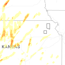


Connect with Interactive Hail Maps