

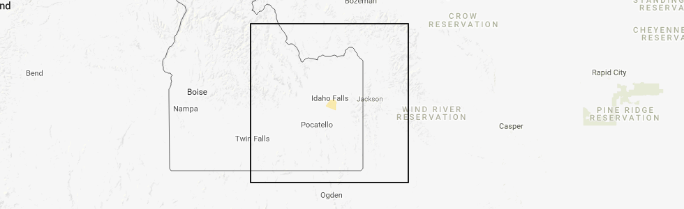
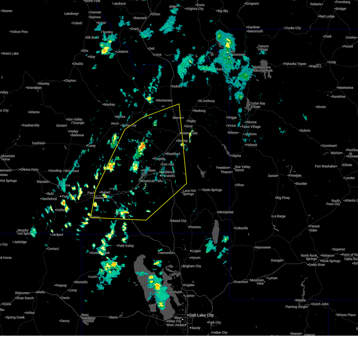
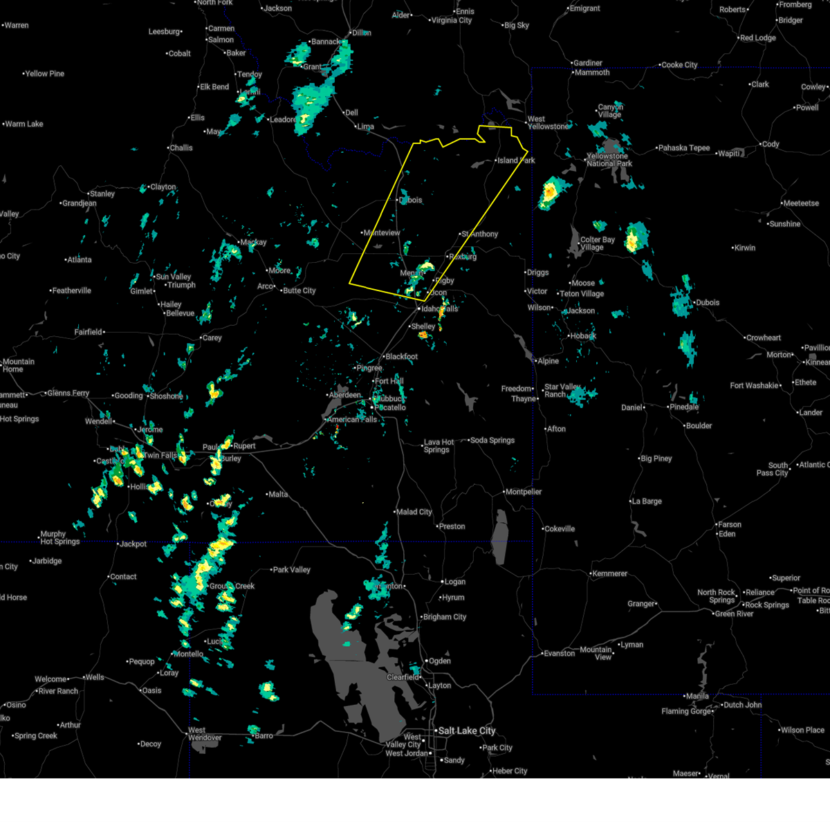
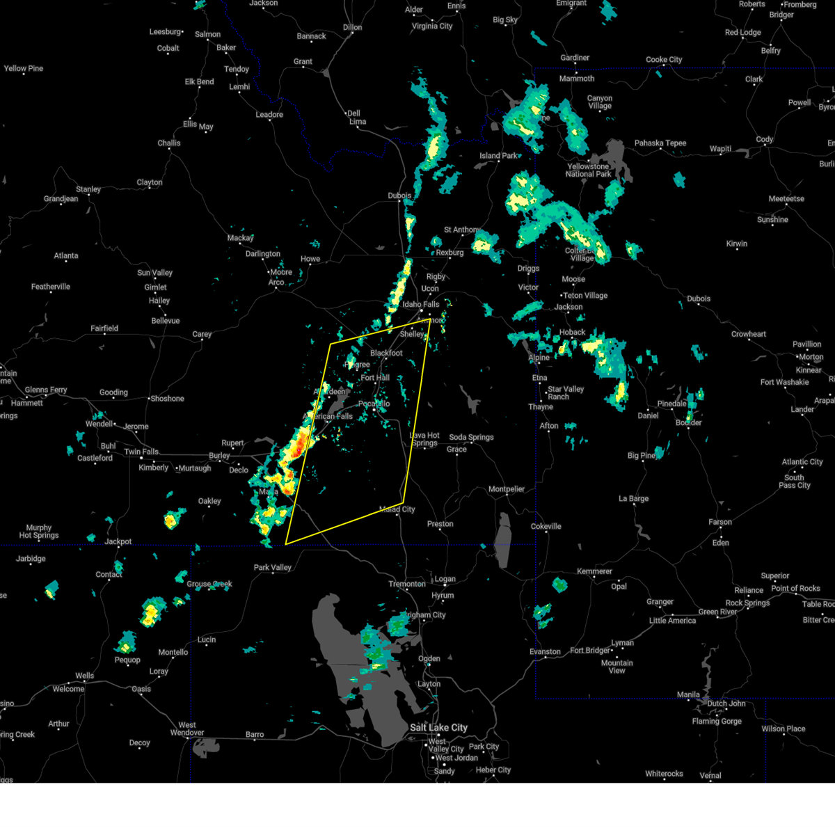
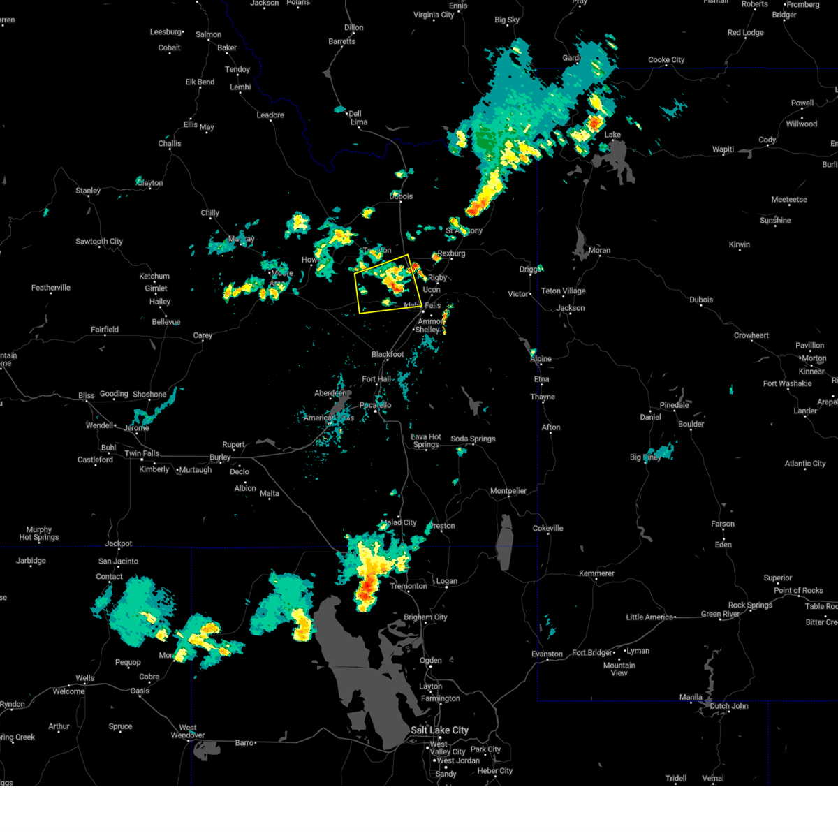
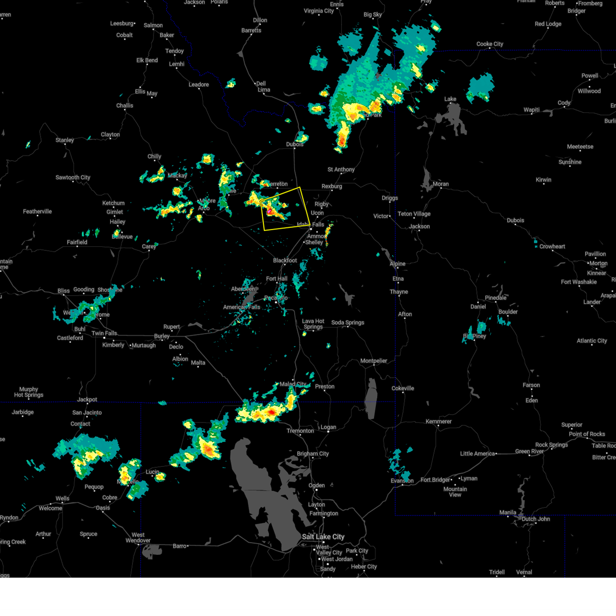
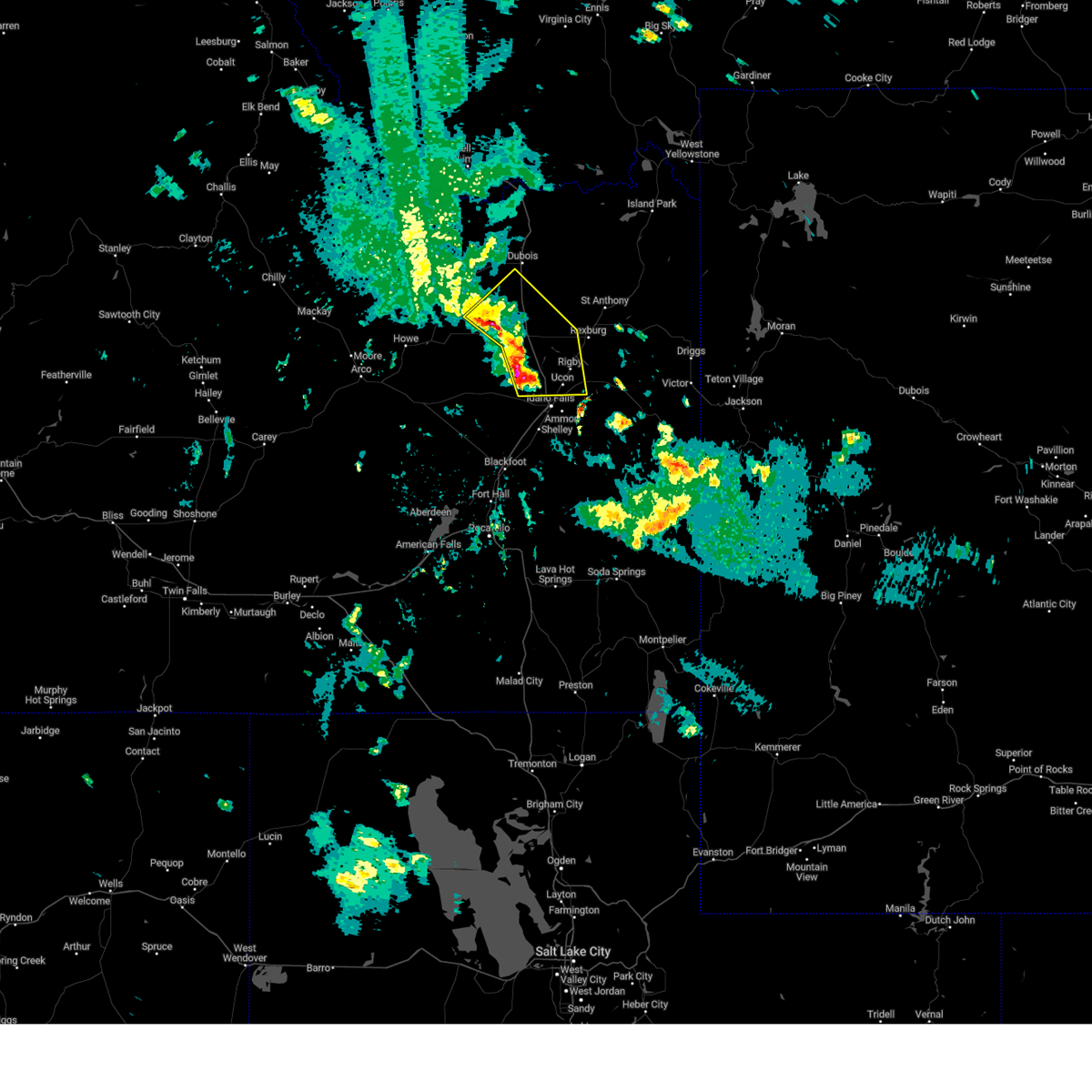
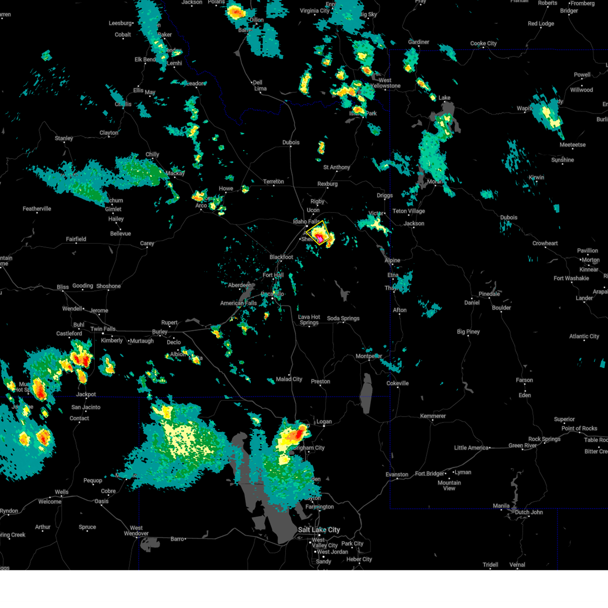
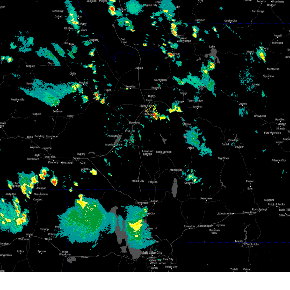
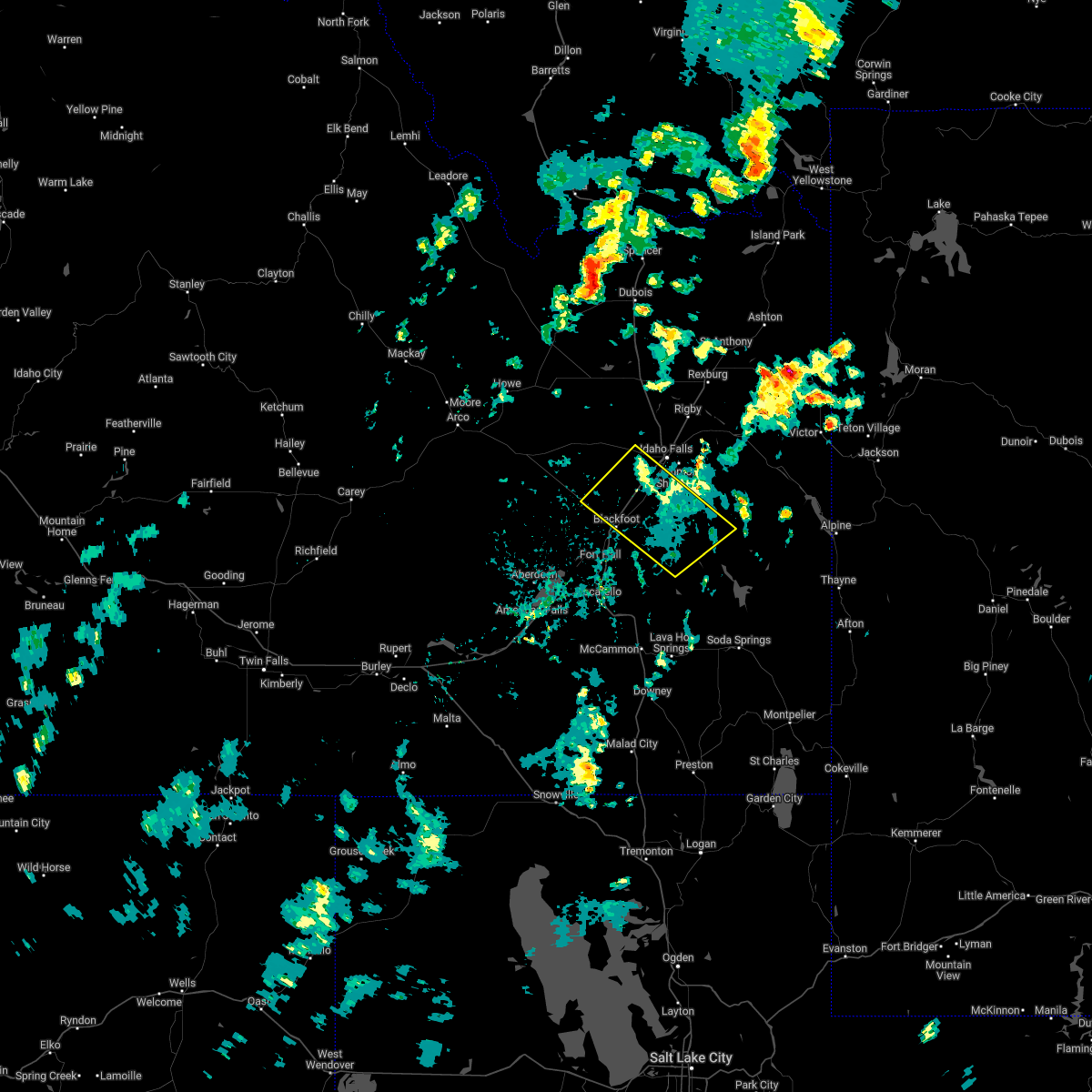
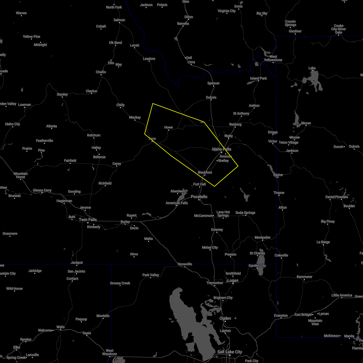
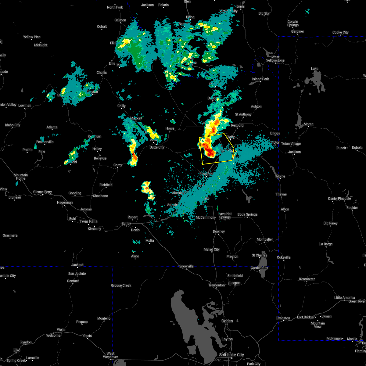
Hail Map for Idaho Falls, ID
The Idaho Falls, ID area has had 28 reports of on-the-ground hail by trained spotters, and has been under severe weather warnings 6 times during the past 12 months. Doppler radar has detected hail at or near Idaho Falls, ID on 15 occasions.
| Name: | Idaho Falls, ID |
| Where Located: | 0.5 miles S of Idaho Falls, ID |
| Map: | Google Map for Idaho Falls, ID |
| Population: | 56813 |
| Housing Units: | 22977 |
| More Info: | Search Google for Idaho Falls, ID |
5
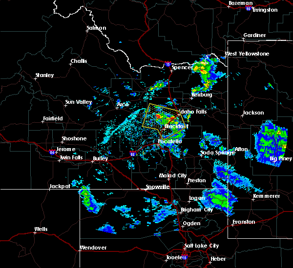
The Top Recent Hail Date for Idaho Falls, ID is Saturday, April 7, 2018 (1st out of 15)
Hail and Wind Damage Spotted near Idaho Falls, ID
| Date / Time | Report Details |
|---|---|
| 5/29/2026 7:25 PM MDT | 3 inch diameter tree branch dow in bonneville county ID, 4.9 miles SW of Idaho Falls, ID |
| 5/13/2026 4:30 PM MDT | Mesonet station pc219 galbrait in bonneville county ID, 9.8 miles WNW of Idaho Falls, ID |
| 5/13/2026 4:08 PM MDT | Power outage in bonneville county ID, 10.4 miles SSE of Idaho Falls, ID |
| 5/13/2026 3:59 PM MDT |
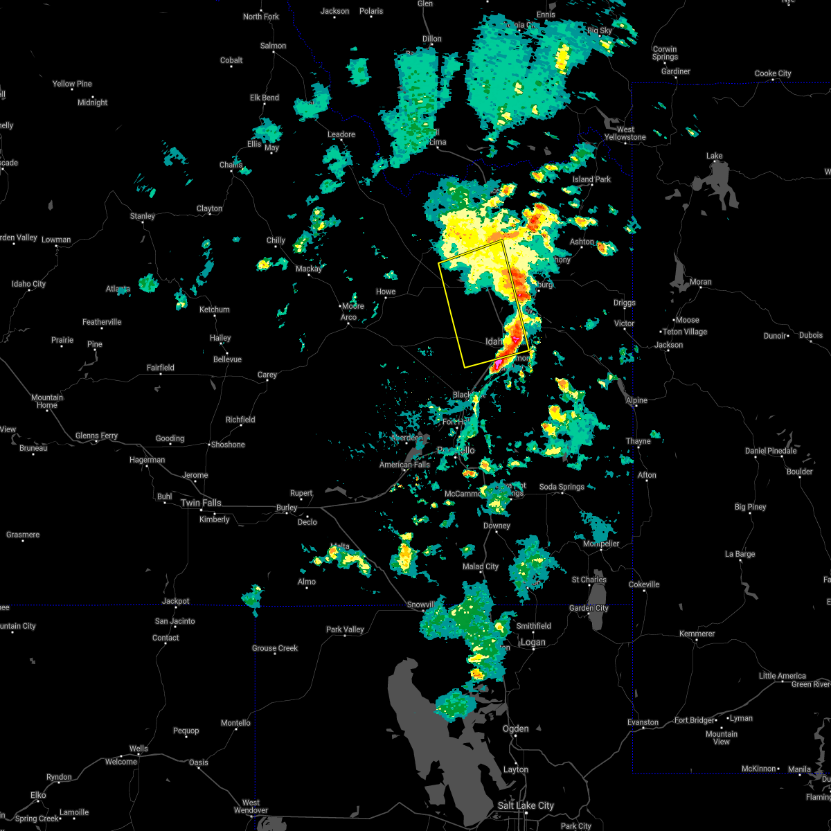
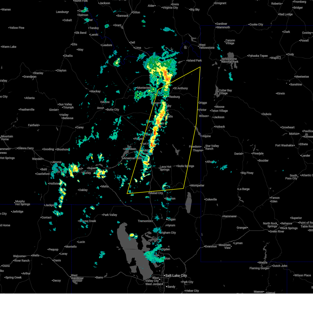 At 357 pm mdt, a line of severe thunderstorms and associated outflow extends from near saint anthony to bone to near holbrook, moving northeast at 55 mph (radar indicated and mesonet observations. multiple reports of gusts over 60 mph have been reported at times along this line). Hazards include 70 mph wind gusts. Expect considerable tree damage. damage is likely to mobile homes, roofs, and outbuildings. Locations impacted include, idaho falls, pocatello, rexburg, blackfoot, rigby, soda springs, ashton, mccammon, lava hot springs, swan valley, felt, swanlake, ririe reservoir, chesterfield reservoir, goshen, blackfoot reservoir, wayan, marysville, lorenzo, and northern palisades reservoir. At 357 pm mdt, a line of severe thunderstorms and associated outflow extends from near saint anthony to bone to near holbrook, moving northeast at 55 mph (radar indicated and mesonet observations. multiple reports of gusts over 60 mph have been reported at times along this line). Hazards include 70 mph wind gusts. Expect considerable tree damage. damage is likely to mobile homes, roofs, and outbuildings. Locations impacted include, idaho falls, pocatello, rexburg, blackfoot, rigby, soda springs, ashton, mccammon, lava hot springs, swan valley, felt, swanlake, ririe reservoir, chesterfield reservoir, goshen, blackfoot reservoir, wayan, marysville, lorenzo, and northern palisades reservoir.
|
| 5/13/2026 3:45 PM MDT | Mesonet station 3306 d6 osgood i-1 in jefferson county ID, 11.8 miles SSE of Idaho Falls, ID |
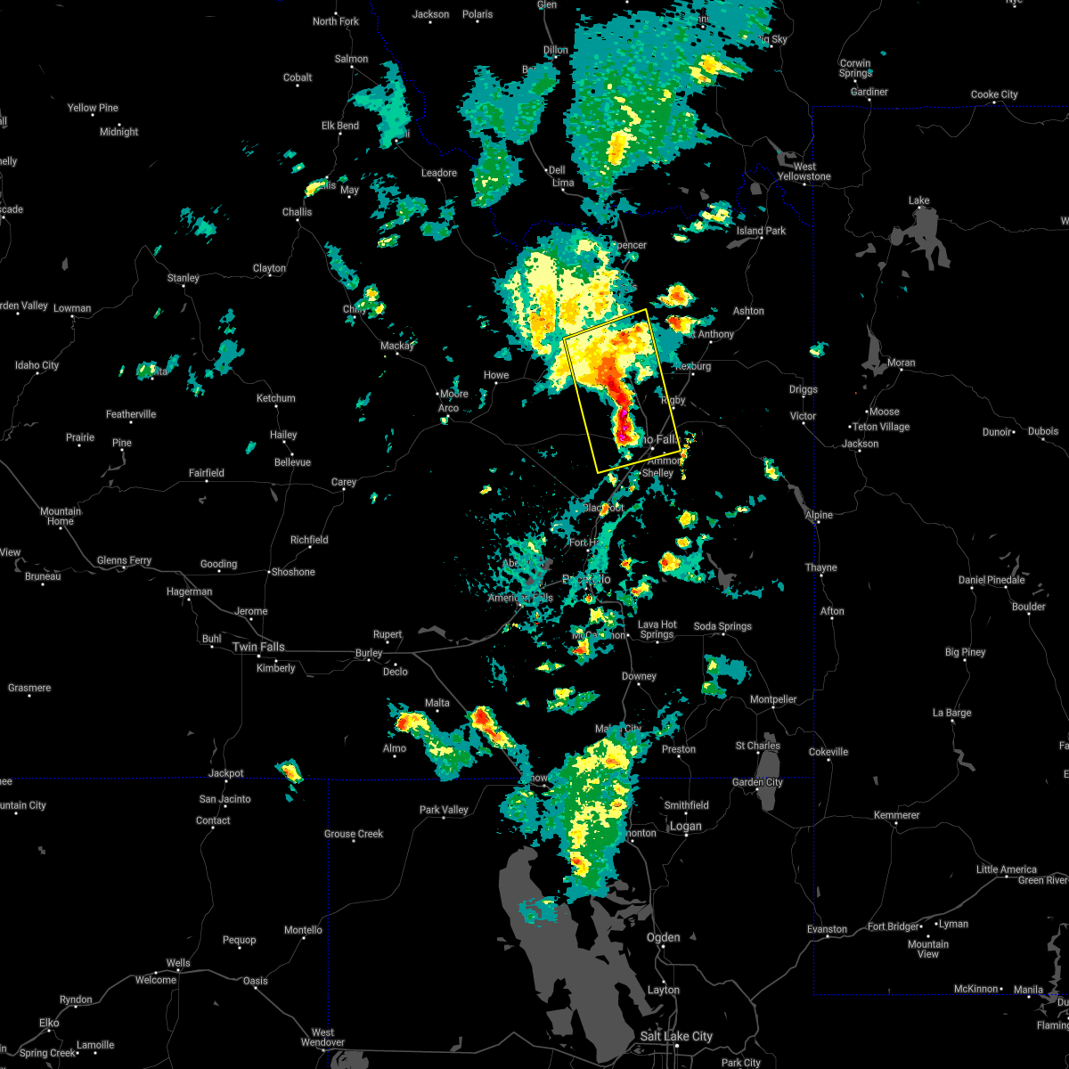
| 5/13/2026 3:30 PM MDT |
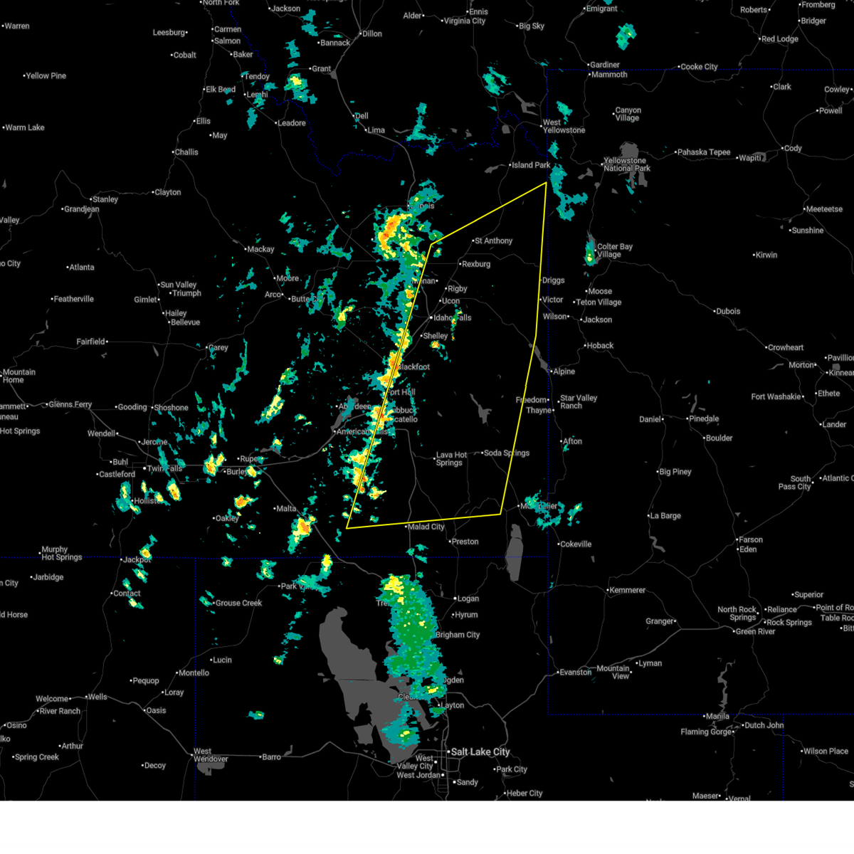 Svrpih the national weather service in pocatello has issued a * severe thunderstorm warning for, teton county in eastern idaho, caribou county in southeastern idaho, southeastern fremont county in southeastern idaho, central oneida county in southeastern idaho, eastern jefferson county in southeastern idaho, bannock county in southeastern idaho, southeastern power county in southeastern idaho, bonneville county in southeastern idaho, madison county in southeastern idaho, northern franklin county in southeastern idaho, northwestern bear lake county in southeastern idaho, southeastern bingham county in southeastern idaho, * until 415 pm mdt. * at 328 pm mdt, a line of severe thunderstorms and associated outflow extends from hamer to near holbrook, moving east northeast at 50 mph (radar indicated and mesonet observations. multiple reports of gusts over 60 mph have been reported, along with blowing dust). Hazards include 70 mph wind gusts. Expect considerable tree damage. Damage is likely to mobile homes, roofs, and outbuildings. Svrpih the national weather service in pocatello has issued a * severe thunderstorm warning for, teton county in eastern idaho, caribou county in southeastern idaho, southeastern fremont county in southeastern idaho, central oneida county in southeastern idaho, eastern jefferson county in southeastern idaho, bannock county in southeastern idaho, southeastern power county in southeastern idaho, bonneville county in southeastern idaho, madison county in southeastern idaho, northern franklin county in southeastern idaho, northwestern bear lake county in southeastern idaho, southeastern bingham county in southeastern idaho, * until 415 pm mdt. * at 328 pm mdt, a line of severe thunderstorms and associated outflow extends from hamer to near holbrook, moving east northeast at 50 mph (radar indicated and mesonet observations. multiple reports of gusts over 60 mph have been reported, along with blowing dust). Hazards include 70 mph wind gusts. Expect considerable tree damage. Damage is likely to mobile homes, roofs, and outbuildings.
|
| 5/13/2026 3:20 PM MDT | Mesonet station ket kettle butt in bonneville county ID, 15.2 miles ESE of Idaho Falls, ID |
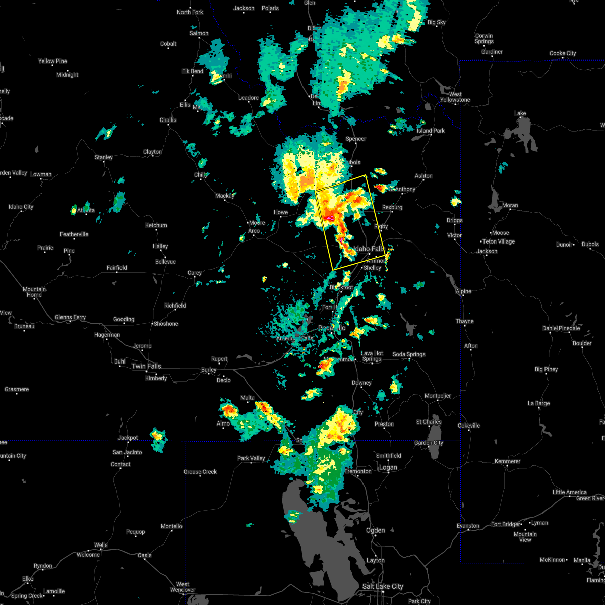
| 5/13/2026 3:15 PM MDT |
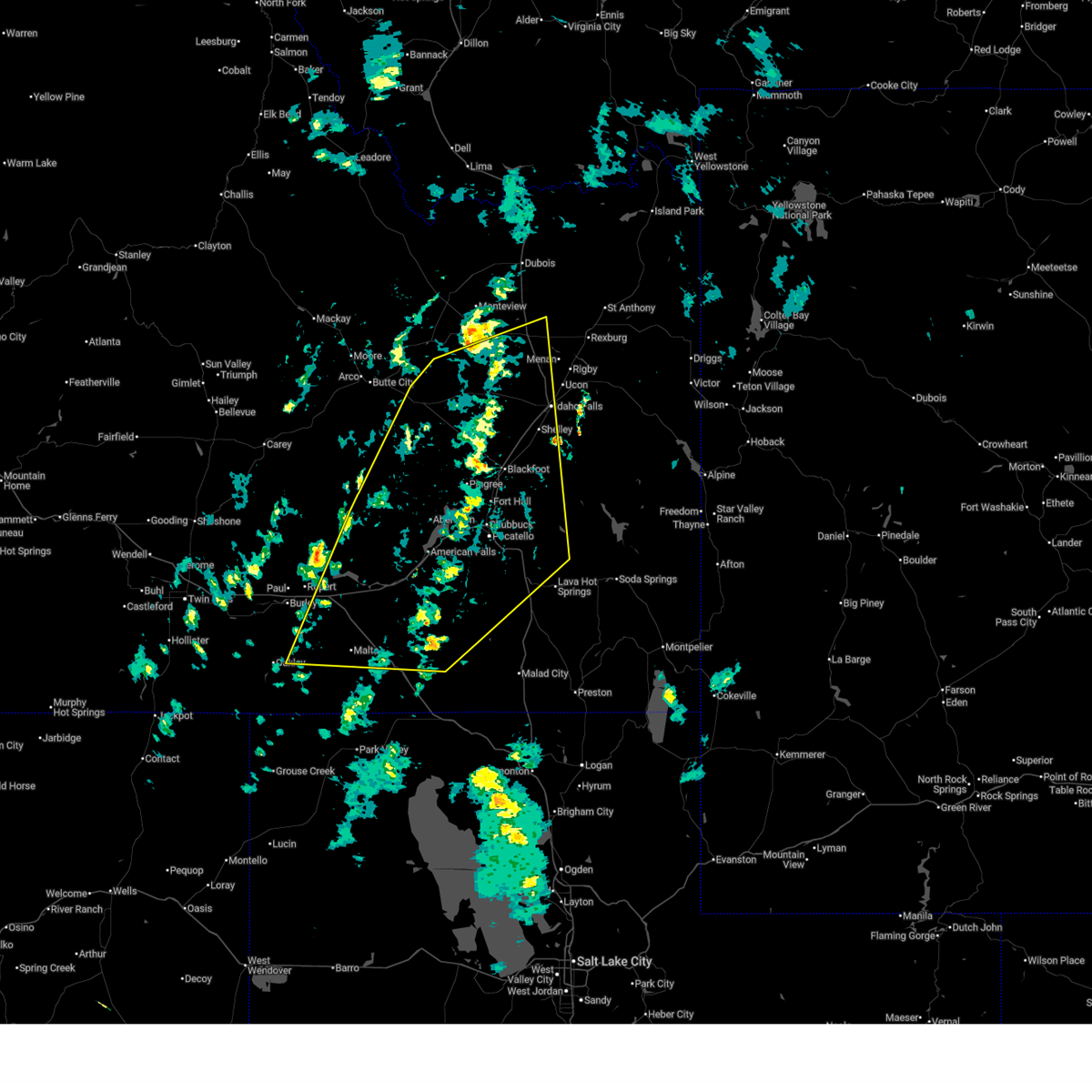 At 312 pm mdt, the leading edge of severe thunderstorms and associated outflow was located from near mud lake to hear juniper, moving northeast at 55 mph. another line of severe thunderstorms and associated outflow extended the south of end craters of the moon to near elba, also moving northeast at 55 mph (radar indicated and mesonet observations. multiple observations over 60 mph have been reported). Hazards include 70 mph wind gusts. Expect considerable tree damage. damage is likely to mobile homes, roofs, and outbuildings. Locations impacted include, idaho falls, pocatello, blackfoot, american falls, mccammon, malta, lake walcott, neeley, chesterfield reservoir, goshen, american falls reservoir, chubbuck, shelley, aberdeen, inkom, roberts, firth, declo, rockland, and albion. At 312 pm mdt, the leading edge of severe thunderstorms and associated outflow was located from near mud lake to hear juniper, moving northeast at 55 mph. another line of severe thunderstorms and associated outflow extended the south of end craters of the moon to near elba, also moving northeast at 55 mph (radar indicated and mesonet observations. multiple observations over 60 mph have been reported). Hazards include 70 mph wind gusts. Expect considerable tree damage. damage is likely to mobile homes, roofs, and outbuildings. Locations impacted include, idaho falls, pocatello, blackfoot, american falls, mccammon, malta, lake walcott, neeley, chesterfield reservoir, goshen, american falls reservoir, chubbuck, shelley, aberdeen, inkom, roberts, firth, declo, rockland, and albion.
|
| 5/13/2026 3:00 PM MDT | Mesonet station 8419 d6 kettle butte us-2 in bonneville county ID, 19.6 miles ESE of Idaho Falls, ID |
| 5/13/2026 2:43 PM MDT |
 Svrpih the national weather service in pocatello has issued a * severe thunderstorm warning for, southeastern blaine county in central idaho, northwestern caribou county in southeastern idaho, northwestern oneida county in southeastern idaho, southwestern jefferson county in southeastern idaho, bannock county in southeastern idaho, southeastern butte county in southeastern idaho, power county in southeastern idaho, northwestern bonneville county in southeastern idaho, bingham county in southeastern idaho, northeastern cassia county in southeastern idaho, southeastern minidoka county in south central idaho, * until 345 pm mdt. * at 240 pm mdt, a line of severe thunderstorms and associated outflow extends from near atomic city to sublett. another line of severe thunderstorms and associated outflow extends from near arco to near oakley , moving northeast at 50 mph (radar indicated and mesonet observations. multiple reports of gusts over 60 mph have been reported). Hazards include 70 mph wind gusts. Expect considerable tree damage. Damage is likely to mobile homes, roofs, and outbuildings. Svrpih the national weather service in pocatello has issued a * severe thunderstorm warning for, southeastern blaine county in central idaho, northwestern caribou county in southeastern idaho, northwestern oneida county in southeastern idaho, southwestern jefferson county in southeastern idaho, bannock county in southeastern idaho, southeastern butte county in southeastern idaho, power county in southeastern idaho, northwestern bonneville county in southeastern idaho, bingham county in southeastern idaho, northeastern cassia county in southeastern idaho, southeastern minidoka county in south central idaho, * until 345 pm mdt. * at 240 pm mdt, a line of severe thunderstorms and associated outflow extends from near atomic city to sublett. another line of severe thunderstorms and associated outflow extends from near arco to near oakley , moving northeast at 50 mph (radar indicated and mesonet observations. multiple reports of gusts over 60 mph have been reported). Hazards include 70 mph wind gusts. Expect considerable tree damage. Damage is likely to mobile homes, roofs, and outbuildings.
|
| 5/13/2026 1:28 PM MDT |
 Svrpih the national weather service in pocatello has issued a * severe thunderstorm warning for, fremont county in southeastern idaho, jefferson county in southeastern idaho, northwestern bonneville county in southeastern idaho, northwestern madison county in southeastern idaho, eastern clark county in southeastern idaho, * until 230 pm mdt. * at 125 pm mdt, severe thunderstorms extend from near osgood to mud lake, moving northeast at 50 mph (radar indicated and mesonet observations). Hazards include 70 mph wind gusts. Expect considerable tree damage. Damage is likely to mobile homes, roofs, and outbuildings. Svrpih the national weather service in pocatello has issued a * severe thunderstorm warning for, fremont county in southeastern idaho, jefferson county in southeastern idaho, northwestern bonneville county in southeastern idaho, northwestern madison county in southeastern idaho, eastern clark county in southeastern idaho, * until 230 pm mdt. * at 125 pm mdt, severe thunderstorms extend from near osgood to mud lake, moving northeast at 50 mph (radar indicated and mesonet observations). Hazards include 70 mph wind gusts. Expect considerable tree damage. Damage is likely to mobile homes, roofs, and outbuildings.
|
| 5/13/2026 1:20 PM MDT | Mesonet station soket kettle butt in bonneville county ID, 15.2 miles ESE of Idaho Falls, ID |
| 4/12/2026 2:57 PM MDT |
 Svrpih the national weather service in pocatello has issued a * severe thunderstorm warning for, southwestern jefferson county in southeastern idaho, northwestern bannock county in southeastern idaho, east central butte county in southeastern idaho, northwestern bonneville county in southeastern idaho, southwestern clark county in southeastern idaho, central bingham county in southeastern idaho, * until 330 pm mdt. * at 256 pm mdt, severe thunderstorm outflow was located along a line extending from near central inl to 8 miles northeast of taber to near fort hall putnam lodge, moving northeast at 55 mph (radar indicated). Hazards include 60 mph wind gusts. expect damage to roofs, siding, and trees Svrpih the national weather service in pocatello has issued a * severe thunderstorm warning for, southwestern jefferson county in southeastern idaho, northwestern bannock county in southeastern idaho, east central butte county in southeastern idaho, northwestern bonneville county in southeastern idaho, southwestern clark county in southeastern idaho, central bingham county in southeastern idaho, * until 330 pm mdt. * at 256 pm mdt, severe thunderstorm outflow was located along a line extending from near central inl to 8 miles northeast of taber to near fort hall putnam lodge, moving northeast at 55 mph (radar indicated). Hazards include 60 mph wind gusts. expect damage to roofs, siding, and trees
|
| 6/19/2025 5:40 PM MDT | Mesonet station ket kettle butt in bonneville county ID, 15.2 miles ESE of Idaho Falls, ID |
| 5/11/2025 12:27 PM MDT |
 Svrpih the national weather service in pocatello has issued a * severe thunderstorm warning for, northwestern caribou county in southeastern idaho, central oneida county in southeastern idaho, bannock county in southeastern idaho, power county in southeastern idaho, central bonneville county in southeastern idaho, central bingham county in southeastern idaho, southeastern cassia county in southeastern idaho, * until 115 pm mdt. * at 1225 pm mdt, a line of severe thunderstorms extended from near city of rocks to near aberdeen, moving northeast at 45 mph (radar indicated and mesonet observations. a gust to 59 mph was reported at connor summit). Hazards include 60 mph wind gusts. expect damage to roofs, siding, and trees Svrpih the national weather service in pocatello has issued a * severe thunderstorm warning for, northwestern caribou county in southeastern idaho, central oneida county in southeastern idaho, bannock county in southeastern idaho, power county in southeastern idaho, central bonneville county in southeastern idaho, central bingham county in southeastern idaho, southeastern cassia county in southeastern idaho, * until 115 pm mdt. * at 1225 pm mdt, a line of severe thunderstorms extended from near city of rocks to near aberdeen, moving northeast at 45 mph (radar indicated and mesonet observations. a gust to 59 mph was reported at connor summit). Hazards include 60 mph wind gusts. expect damage to roofs, siding, and trees
|
| 5/4/2025 5:45 PM MDT | Mesonet station 8419 d6 kettle butte us-2 in bonneville county ID, 19.6 miles ESE of Idaho Falls, ID |
| 8/23/2024 3:45 PM MDT | Rwis itd99 kettle butte us-2 in bonneville county ID, 19.6 miles ESE of Idaho Falls, ID |
| 8/15/2024 6:58 PM MDT | 2600 idaho falls power customers without power due to downed power line. time estimated based on rada in bonneville county ID, 0.6 miles SW of Idaho Falls, ID |
| 8/15/2024 5:44 PM MDT | Private weather station along e lincoln rd near wood river r in bonneville county ID, 5.3 miles WSW of Idaho Falls, ID |
| 8/15/2024 5:30 PM MDT | Tree down across sunnyside road in ammon per local news 8 and was blocking traffi in bonneville county ID, 3.2 miles WNW of Idaho Falls, ID |
| 8/15/2024 5:30 PM MDT | Large tree blown over onto road. time approximated via nearby wind gust reports and radar. image from media partner via twitte in bonneville county ID, 5.7 miles W of Idaho Falls, ID |
| 9/13/2023 3:12 PM MDT |
 The severe thunderstorm warning for southwestern jefferson, northwestern bonneville and northwestern bingham counties will expire at 315 pm mdt, the storm which prompted the warning has weakened below severe limits, and no longer poses an immediate threat to life or property. therefore, the warning will be allowed to expire. however, gusty winds are still possible with this thunderstorm. The severe thunderstorm warning for southwestern jefferson, northwestern bonneville and northwestern bingham counties will expire at 315 pm mdt, the storm which prompted the warning has weakened below severe limits, and no longer poses an immediate threat to life or property. therefore, the warning will be allowed to expire. however, gusty winds are still possible with this thunderstorm.
|
| 9/13/2023 3:03 PM MDT |
 At 303 pm mdt, a severe thunderstorm was located 11 miles south of terreton, moving east at 15 mph (radar indicated). Hazards include 60 mph wind gusts and nickel size hail. Expect damage to roofs, siding, and trees. locations impacted include, roberts, osgood, kettle butte, and sage junction. hail threat, radar indicated max hail size, 0. 88 in wind threat, radar indicated max wind gust, 60 mph. At 303 pm mdt, a severe thunderstorm was located 11 miles south of terreton, moving east at 15 mph (radar indicated). Hazards include 60 mph wind gusts and nickel size hail. Expect damage to roofs, siding, and trees. locations impacted include, roberts, osgood, kettle butte, and sage junction. hail threat, radar indicated max hail size, 0. 88 in wind threat, radar indicated max wind gust, 60 mph.
|
| 9/13/2023 2:44 PM MDT |
 At 243 pm mdt, a severe thunderstorm was located 8 miles northeast of southeast inl, or 12 miles south of terreton, moving east at 15 mph (radar indicated). Hazards include 60 mph wind gusts and nickel size hail. expect damage to roofs, siding, and trees At 243 pm mdt, a severe thunderstorm was located 8 miles northeast of southeast inl, or 12 miles south of terreton, moving east at 15 mph (radar indicated). Hazards include 60 mph wind gusts and nickel size hail. expect damage to roofs, siding, and trees
|
| 9/3/2023 1:42 PM MDT |
 At 141 pm mdt, a severe thunderstorm was located near goshen, moving northeast at 30 mph (radar indicated). Hazards include 60 mph wind gusts and half dollar size hail. Hail damage to vehicles is expected. expect wind damage to roofs, siding, and trees. locations impacted include, idaho falls, ririe reservoir, goshen, ammon, shelley, iona, ucon, ririe, archer, basalt, and heise. hail threat, radar indicated max hail size, 1. 25 in wind threat, radar indicated max wind gust, 60 mph. At 141 pm mdt, a severe thunderstorm was located near goshen, moving northeast at 30 mph (radar indicated). Hazards include 60 mph wind gusts and half dollar size hail. Hail damage to vehicles is expected. expect wind damage to roofs, siding, and trees. locations impacted include, idaho falls, ririe reservoir, goshen, ammon, shelley, iona, ucon, ririe, archer, basalt, and heise. hail threat, radar indicated max hail size, 1. 25 in wind threat, radar indicated max wind gust, 60 mph.
|
| 9/3/2023 1:25 PM MDT |
 At 124 pm mdt, a severe thunderstorm was located near goshen, moving northeast at 30 mph (radar indicated). Hazards include 60 mph wind gusts and half dollar size hail. Hail damage to vehicles is expected. Expect wind damage to roofs, siding, and trees. At 124 pm mdt, a severe thunderstorm was located near goshen, moving northeast at 30 mph (radar indicated). Hazards include 60 mph wind gusts and half dollar size hail. Hail damage to vehicles is expected. Expect wind damage to roofs, siding, and trees.
|
| 8/29/2023 7:45 PM MDT | Mesonet station osgi 2 ne osgoo in bonneville county ID, 7.5 miles SSE of Idaho Falls, ID |
| 8/29/2023 7:30 PM MDT | Kettle butte ar in bonneville county ID, 16.4 miles E of Idaho Falls, ID |
| 8/29/2023 7:30 PM MDT | Mesonet station ket kettle butt in bonneville county ID, 15.2 miles ESE of Idaho Falls, ID |
| 8/5/2023 9:25 PM MDT | Quarter sized hail reported 8.5 miles NNW of Idaho Falls, ID, quarter-sized hail...some were larger. |
| 7/23/2023 6:43 PM MDT |
 At 642 pm mdt, strong outflow winds from thunderstorms were located along a line extending from near taber to 10 miles south of goshen, moving north at 40 mph (radar indicated). Hazards include 60 mph wind gusts. expect damage to roofs, siding, and trees At 642 pm mdt, strong outflow winds from thunderstorms were located along a line extending from near taber to 10 miles south of goshen, moving north at 40 mph (radar indicated). Hazards include 60 mph wind gusts. expect damage to roofs, siding, and trees
|
| 7/20/2023 5:45 PM MDT | Itd rwis itd15 idaho fall in bonneville county ID, 1.4 miles SE of Idaho Falls, ID |
| 6/23/2023 2:54 PM MDT |
 At 253 pm mdt, severe thunderstorms were located along a line extending from near monteview to 9 miles east of terreton to 8 miles south of roberts, moving east at 25 mph (radar indicated). Hazards include 60 mph wind gusts and half dollar size hail. Hail damage to vehicles is expected. Expect wind damage to roofs, siding, and trees. At 253 pm mdt, severe thunderstorms were located along a line extending from near monteview to 9 miles east of terreton to 8 miles south of roberts, moving east at 25 mph (radar indicated). Hazards include 60 mph wind gusts and half dollar size hail. Hail damage to vehicles is expected. Expect wind damage to roofs, siding, and trees.
|
| 6/6/2023 5:40 PM MDT |
 At 539 pm mdt, a severe thunderstorm was located near ammon, or 8 miles southeast of idaho falls, moving northwest at 10 mph (radar indicated). Hazards include 60 mph wind gusts and half dollar size hail. Hail damage to vehicles is expected. expect wind damage to roofs, siding, and trees. locations impacted include, ammon. hail threat, radar indicated max hail size, 1. 25 in wind threat, radar indicated max wind gust, 60 mph. At 539 pm mdt, a severe thunderstorm was located near ammon, or 8 miles southeast of idaho falls, moving northwest at 10 mph (radar indicated). Hazards include 60 mph wind gusts and half dollar size hail. Hail damage to vehicles is expected. expect wind damage to roofs, siding, and trees. locations impacted include, ammon. hail threat, radar indicated max hail size, 1. 25 in wind threat, radar indicated max wind gust, 60 mph.
|
| 6/6/2023 5:17 PM MDT |
 At 517 pm mdt, a severe thunderstorm was located near bone, or 11 miles southwest of ririe reservoir, moving northwest at 10 mph (radar indicated). Hazards include 60 mph wind gusts and half dollar size hail. Hail damage to vehicles is expected. Expect wind damage to roofs, siding, and trees. At 517 pm mdt, a severe thunderstorm was located near bone, or 11 miles southwest of ririe reservoir, moving northwest at 10 mph (radar indicated). Hazards include 60 mph wind gusts and half dollar size hail. Hail damage to vehicles is expected. Expect wind damage to roofs, siding, and trees.
|
| 5/23/2023 6:50 PM MDT | Roof collapse from rain and hai in bonneville county ID, 3.1 miles N of Idaho Falls, ID |
| 5/23/2023 6:40 PM MDT | Combination of wind and hail destroyed traile in bonneville county ID, 0.6 miles SW of Idaho Falls, ID |
| 5/23/2023 6:23 PM MDT |
 At 622 pm mdt, a severe thunderstorm was located over goshen, moving northeast at 20 mph (radar indicated). Hazards include 60 mph wind gusts and quarter size hail. Hail damage to vehicles is expected. Expect wind damage to roofs, siding, and trees. At 622 pm mdt, a severe thunderstorm was located over goshen, moving northeast at 20 mph (radar indicated). Hazards include 60 mph wind gusts and quarter size hail. Hail damage to vehicles is expected. Expect wind damage to roofs, siding, and trees.
|
| 8/26/2022 5:43 PM MDT | The severe thunderstorm warning for north central bonneville and northeastern bingham counties will expire at 545 pm mdt, the storm which prompted the warning has weakened below severe limits, and has exited the warned area. therefore, the warning will be allowed to expire. however small hail, gusty winds and heavy rain are still possible with this thunderstorm. |
| 8/26/2022 5:31 PM MDT | At 531 pm mdt, a severe thunderstorm was located over southern idaho falls, moving east at 30 mph (radar indicated). Hazards include 60 mph wind gusts. Expect damage to roofs, siding, and trees. locations impacted include, idaho falls, ammon and iona. hail threat, radar indicated max hail size, <. 75 in wind threat, radar indicated max wind gust, 60 mph. |
| 8/26/2022 5:08 PM MDT | At 508 pm mdt, a severe thunderstorm was located 11 miles northwest of shelley, or 11 miles west of idaho falls, moving east at 30 mph (radar indicated). Hazards include 60 mph wind gusts. expect damage to roofs, siding, and trees |
| 8/26/2022 5:00 PM MDT | Kettle butte us-20 it in bonneville county ID, 19.6 miles ESE of Idaho Falls, ID |
| 7/13/2022 5:25 PM MDT | Large tree limbs down around south boulevar in bonneville county ID, 0.6 miles WNW of Idaho Falls, ID |
| 7/13/2022 5:25 PM MDT |
 The severe thunderstorm warning for northwestern caribou, northern bannock, northwestern bonneville and central bingham counties will expire at 530 pm mdt, the severe thunderstorm which prompted the warning has moved out of the warned area. therefore, the warning will be allowed to expire. The severe thunderstorm warning for northwestern caribou, northern bannock, northwestern bonneville and central bingham counties will expire at 530 pm mdt, the severe thunderstorm which prompted the warning has moved out of the warned area. therefore, the warning will be allowed to expire.
|
| 7/13/2022 5:02 PM MDT |
 At 501 pm mdt, a severe thunderstorm was located over firth, or 7 miles west of goshen, moving northeast at 30 mph (radar indicated). Hazards include 60 mph wind gusts. Expect damage to roofs, siding, and trees. locations impacted include, blackfoot, goshen, shelley, firth, rose, fort hall lincoln creek lodge, groveland, basalt, trail creek campground and wapello. hail threat, radar indicated max hail size, <. 75 in wind threat, radar indicated max wind gust, 60 mph. At 501 pm mdt, a severe thunderstorm was located over firth, or 7 miles west of goshen, moving northeast at 30 mph (radar indicated). Hazards include 60 mph wind gusts. Expect damage to roofs, siding, and trees. locations impacted include, blackfoot, goshen, shelley, firth, rose, fort hall lincoln creek lodge, groveland, basalt, trail creek campground and wapello. hail threat, radar indicated max hail size, <. 75 in wind threat, radar indicated max wind gust, 60 mph.
|
| 7/13/2022 4:56 PM MDT | Kettle butte it in bonneville county ID, 18.1 miles ESE of Idaho Falls, ID |
| 7/13/2022 4:45 PM MDT |
 At 444 pm mdt, a severe thunderstorm was located over rose, or near blackfoot, moving northeast at 35 mph (radar indicated). Hazards include 60 mph wind gusts. expect damage to roofs, siding, and trees At 444 pm mdt, a severe thunderstorm was located over rose, or near blackfoot, moving northeast at 35 mph (radar indicated). Hazards include 60 mph wind gusts. expect damage to roofs, siding, and trees
|
| 7/2/2022 6:05 PM MDT |
 At 604 pm mdt, severe thunderstorms were located along a line extending from 14 miles northeast of mackay to 13 miles northwest of dubois to near chester, moving north at 50 mph (radar indicated). Hazards include 70 mph wind gusts and penny size hail. Expect considerable tree damage. damage is likely to mobile homes, roofs, and outbuildings. locations impacted include, northern idaho falls, rexburg, rigby, ashton, dubois, ririe reservoir, terreton, marysville, lorenzo, ammon, iona, sugar city, ucon, menan, teton, ririe, roberts, lewisville, mud lake and parker. thunderstorm damage threat, considerable hail threat, observed max hail size, 0. 75 in wind threat, observed max wind gust, 70 mph. At 604 pm mdt, severe thunderstorms were located along a line extending from 14 miles northeast of mackay to 13 miles northwest of dubois to near chester, moving north at 50 mph (radar indicated). Hazards include 70 mph wind gusts and penny size hail. Expect considerable tree damage. damage is likely to mobile homes, roofs, and outbuildings. locations impacted include, northern idaho falls, rexburg, rigby, ashton, dubois, ririe reservoir, terreton, marysville, lorenzo, ammon, iona, sugar city, ucon, menan, teton, ririe, roberts, lewisville, mud lake and parker. thunderstorm damage threat, considerable hail threat, observed max hail size, 0. 75 in wind threat, observed max wind gust, 70 mph.
|
| 7/2/2022 5:29 PM MDT |
 At 529 pm mdt, severe thunderstorms were located along a line extending from near arco to mud lake to 8 miles east of ririe, moving north at 50 mph (radar indicated). Hazards include 70 mph wind gusts and penny size hail. Expect considerable tree damage. Damage is likely to mobile homes, roofs, and outbuildings. At 529 pm mdt, severe thunderstorms were located along a line extending from near arco to mud lake to 8 miles east of ririe, moving north at 50 mph (radar indicated). Hazards include 70 mph wind gusts and penny size hail. Expect considerable tree damage. Damage is likely to mobile homes, roofs, and outbuildings.
|
| 7/2/2022 5:19 PM MDT |
 At 519 pm mdt, severe thunderstorms were located along a line extending from 7 miles southeast of southeast inl to 7 miles west of shelley to near fort hall lincoln creek lodge, moving northeast at 30 mph (radar indicated). Hazards include 60 mph wind gusts and penny size hail. Expect damage to roofs, siding, and trees. locations impacted include, idaho falls, blackfoot, rigby, ririe reservoir, lorenzo, goshen, ammon, shelley, iona, ucon, menan, ririe, roberts, firth, lewisville, atomic city, rose, fort hall eagle lodge, fort hall lincoln creek lodge and taber. hail threat, radar indicated max hail size, 0. 75 in wind threat, radar indicated max wind gust, 60 mph. At 519 pm mdt, severe thunderstorms were located along a line extending from 7 miles southeast of southeast inl to 7 miles west of shelley to near fort hall lincoln creek lodge, moving northeast at 30 mph (radar indicated). Hazards include 60 mph wind gusts and penny size hail. Expect damage to roofs, siding, and trees. locations impacted include, idaho falls, blackfoot, rigby, ririe reservoir, lorenzo, goshen, ammon, shelley, iona, ucon, menan, ririe, roberts, firth, lewisville, atomic city, rose, fort hall eagle lodge, fort hall lincoln creek lodge and taber. hail threat, radar indicated max hail size, 0. 75 in wind threat, radar indicated max wind gust, 60 mph.
|
| 7/2/2022 5:10 PM MDT | Quarter sized hail reported 5.2 miles WSW of Idaho Falls, ID |
| 7/2/2022 5:10 PM MDT | Storm damage reported in bonneville county ID, 3.3 miles SSE of Idaho Falls, ID |
| 7/2/2022 4:54 PM MDT |
 At 453 pm mdt, severe thunderstorms were located along a line extending from near atomic city to 6 miles north of moreland to fort hall eagle lodge, moving northeast at 30 mph (radar indicated). Hazards include 60 mph wind gusts and penny size hail. expect damage to roofs, siding, and trees At 453 pm mdt, severe thunderstorms were located along a line extending from near atomic city to 6 miles north of moreland to fort hall eagle lodge, moving northeast at 30 mph (radar indicated). Hazards include 60 mph wind gusts and penny size hail. expect damage to roofs, siding, and trees
|
| 7/2/2022 4:27 PM MDT |
 At 427 pm mdt, severe thunderstorms were located along a line extending from near rose to 21 miles northwest of aberdeen, moving east at 30 mph (radar indicated). Hazards include 60 mph wind gusts. expect damage to roofs, siding, and trees At 427 pm mdt, severe thunderstorms were located along a line extending from near rose to 21 miles northwest of aberdeen, moving east at 30 mph (radar indicated). Hazards include 60 mph wind gusts. expect damage to roofs, siding, and trees
|
| 7/2/2022 4:16 PM MDT |
 At 416 pm mdt, severe thunderstorms were located along a line extending from near moreland to 21 miles northwest of aberdeen, moving northeast at 30 mph (radar indicated). Hazards include 60 mph wind gusts. Expect damage to roofs, siding, and trees. locations impacted include, blackfoot, springfield, rockford, moreland, rose, pingree, taber, groveland, coxs well airport and bear trap airport. hail threat, radar indicated max hail size, <. 75 in wind threat, radar indicated max wind gust, 60 mph. At 416 pm mdt, severe thunderstorms were located along a line extending from near moreland to 21 miles northwest of aberdeen, moving northeast at 30 mph (radar indicated). Hazards include 60 mph wind gusts. Expect damage to roofs, siding, and trees. locations impacted include, blackfoot, springfield, rockford, moreland, rose, pingree, taber, groveland, coxs well airport and bear trap airport. hail threat, radar indicated max hail size, <. 75 in wind threat, radar indicated max wind gust, 60 mph.
|
| 7/2/2022 4:00 PM MDT |
 At 400 pm mdt, severe thunderstorms were located along a line extending from near rockford to 21 miles west of aberdeen, moving northeast at 30 mph (radar indicated). Hazards include 60 mph wind gusts. expect damage to roofs, siding, and trees At 400 pm mdt, severe thunderstorms were located along a line extending from near rockford to 21 miles west of aberdeen, moving northeast at 30 mph (radar indicated). Hazards include 60 mph wind gusts. expect damage to roofs, siding, and trees
|
| 5/26/2022 6:05 PM MDT | Mesonet station ket kettle butt in bonneville county ID, 15.2 miles ESE of Idaho Falls, ID |
| 5/2/2022 6:18 PM MDT |
 At 617 pm mdt, severe thunderstorms were located along a line extending from 7 miles southwest of northwest inl to near rockford to near fort hall bannock peak, moving northeast at 40 mph (radar indicated). Hazards include 60 mph wind gusts. Expect damage to roofs, siding, and trees. locations impacted include, idaho falls, pocatello, blackfoot, american falls, arco, american falls reservoir, terreton, goshen, chubbuck, shelley, aberdeen, roberts, firth, mud lake, atomic city, rose, southeast inl, southwest inl, fort hall bannock creek lodge and pingree. hail threat, radar indicated max hail size, <. 75 in wind threat, radar indicated max wind gust, 60 mph. At 617 pm mdt, severe thunderstorms were located along a line extending from 7 miles southwest of northwest inl to near rockford to near fort hall bannock peak, moving northeast at 40 mph (radar indicated). Hazards include 60 mph wind gusts. Expect damage to roofs, siding, and trees. locations impacted include, idaho falls, pocatello, blackfoot, american falls, arco, american falls reservoir, terreton, goshen, chubbuck, shelley, aberdeen, roberts, firth, mud lake, atomic city, rose, southeast inl, southwest inl, fort hall bannock creek lodge and pingree. hail threat, radar indicated max hail size, <. 75 in wind threat, radar indicated max wind gust, 60 mph.
|
| 5/2/2022 5:59 PM MDT |
 At 559 pm mdt, severe thunderstorms were located along a line extending from 12 miles southwest of northwest inl to near pingree to near fort hall bannock peak, moving east at 40 mph (radar indicated). Hazards include 70 mph wind gusts and penny size hail. Expect considerable tree damage. Damage is likely to mobile homes, roofs, and outbuildings. At 559 pm mdt, severe thunderstorms were located along a line extending from 12 miles southwest of northwest inl to near pingree to near fort hall bannock peak, moving east at 40 mph (radar indicated). Hazards include 70 mph wind gusts and penny size hail. Expect considerable tree damage. Damage is likely to mobile homes, roofs, and outbuildings.
|
| 9/10/2021 4:00 PM MDT | Itd99 kettle butte hwy-2 in bonneville county ID, 21.2 miles ESE of Idaho Falls, ID |
| 8/5/2021 6:56 PM MDT |
 At 653 pm mdt, severe thunderstorms were located along a line extending from 7 miles northeast of darlington to near southeast idaho national laboratory to 6 miles southeast of fort hall lincoln creek lodge, moving northeast at 40 mph (surface weather stations). Hazards include 55 to 65 mph wind gusts. multiple wind gusts of 55 to 65 mph have been recorded from arco across the idaho national laboratory. Expect damage to roofs, siding, and trees. Locations impacted include, idaho falls, blackfoot, terreton, goshen, ammon, shelley, firth, mud lake, atomic city, rose, southeast inl, southwest inl, fort hall lincoln creek lodge, central inl, taber, northwest inl, moreland, bone, groveland and basalt. At 653 pm mdt, severe thunderstorms were located along a line extending from 7 miles northeast of darlington to near southeast idaho national laboratory to 6 miles southeast of fort hall lincoln creek lodge, moving northeast at 40 mph (surface weather stations). Hazards include 55 to 65 mph wind gusts. multiple wind gusts of 55 to 65 mph have been recorded from arco across the idaho national laboratory. Expect damage to roofs, siding, and trees. Locations impacted include, idaho falls, blackfoot, terreton, goshen, ammon, shelley, firth, mud lake, atomic city, rose, southeast inl, southwest inl, fort hall lincoln creek lodge, central inl, taber, northwest inl, moreland, bone, groveland and basalt.
|
| 8/5/2021 6:38 PM MDT |
 At 637 pm mdt, severe thunderstorms were located along a line extending from near darlington to near southeast inl to fort hall putnam lodge, moving northeast at 30 mph (radar indicated). Hazards include 60 mph wind gusts. multiple wind gusts of 55 to 65 mph have been recorded along this line. expect damage to roofs, siding, and trees At 637 pm mdt, severe thunderstorms were located along a line extending from near darlington to near southeast inl to fort hall putnam lodge, moving northeast at 30 mph (radar indicated). Hazards include 60 mph wind gusts. multiple wind gusts of 55 to 65 mph have been recorded along this line. expect damage to roofs, siding, and trees
|
| 6/29/2021 8:03 PM MDT |
 At 800 pm mdt, a severe thunderstorm was located over ozone, moving west-southwest at 20 mph toward the idaho falls country club and shelley (radar indicated). Hazards include 60 mph wind gusts and quarter size hail. Hail damage to vehicles is expected. expect wind damage to roofs, siding, and trees. Locations impacted include, ozone, rural properties south of ammon and idaho falls, goshen, shelley. At 800 pm mdt, a severe thunderstorm was located over ozone, moving west-southwest at 20 mph toward the idaho falls country club and shelley (radar indicated). Hazards include 60 mph wind gusts and quarter size hail. Hail damage to vehicles is expected. expect wind damage to roofs, siding, and trees. Locations impacted include, ozone, rural properties south of ammon and idaho falls, goshen, shelley.
|
| 6/29/2021 7:43 PM MDT |
 At 742 pm mdt, a severe thunderstorm was located 7 miles southwest of ririe reservoir, moving west at 20 mph (radar indicated). Hazards include 60 mph wind gusts and quarter size hail. Hail damage to vehicles is possible. Expect wind damage to roofs, siding, and trees. At 742 pm mdt, a severe thunderstorm was located 7 miles southwest of ririe reservoir, moving west at 20 mph (radar indicated). Hazards include 60 mph wind gusts and quarter size hail. Hail damage to vehicles is possible. Expect wind damage to roofs, siding, and trees.
|
| 9/19/2020 5:21 PM MDT |
 At 503 pm mdt, severe thunderstorms were located along a line extending from hamer to near rose, moving northeast at 20 mph (radar indicated). Hazards include 70 mph wind gusts and quarter size hail. Hail damage to vehicles is expected. expect considerable tree damage. Wind damage is also likely to mobile homes, roofs, and outbuildings. At 503 pm mdt, severe thunderstorms were located along a line extending from hamer to near rose, moving northeast at 20 mph (radar indicated). Hazards include 70 mph wind gusts and quarter size hail. Hail damage to vehicles is expected. expect considerable tree damage. Wind damage is also likely to mobile homes, roofs, and outbuildings.
|
| 9/19/2020 5:11 PM MDT |
 The severe thunderstorm warning for southwestern fremont, jefferson, northwestern bonneville, west central madison, south central clark and central bingham counties will expire at 515 pm mdt, the storms which prompted the warning have moved out of the area. therefore, the warning will be allowed to expire. remember, a severe thunderstorm warning still remains in effect for eastern jefferson and western bonneville counties. The severe thunderstorm warning for southwestern fremont, jefferson, northwestern bonneville, west central madison, south central clark and central bingham counties will expire at 515 pm mdt, the storms which prompted the warning have moved out of the area. therefore, the warning will be allowed to expire. remember, a severe thunderstorm warning still remains in effect for eastern jefferson and western bonneville counties.
|
| 1/1/0001 12:00 AM | Quarter sized hail reported 1 miles ESE of Idaho Falls, ID, hail damage to roof - hole size estimated a quarter or larger. picture on social media. |
| 9/19/2020 5:04 PM MDT |
 At 503 pm mdt, severe thunderstorms were located along a line extending from hamer to near rose, moving northeast at 20 mph (radar indicated). Hazards include 70 mph wind gusts and quarter size hail. Hail damage to vehicles is expected. expect considerable tree damage. Wind damage is also likely to mobile homes, roofs, and outbuildings. At 503 pm mdt, severe thunderstorms were located along a line extending from hamer to near rose, moving northeast at 20 mph (radar indicated). Hazards include 70 mph wind gusts and quarter size hail. Hail damage to vehicles is expected. expect considerable tree damage. Wind damage is also likely to mobile homes, roofs, and outbuildings.
|
| 9/19/2020 4:41 PM MDT |
 At 440 pm mdt, severe thunderstorms were located along a line extending from 6 miles east of monteview to 9 miles west of shelley, moving east at 30 mph. wind gusts of 66 mph have been observed at the itd site kettle butte (radar indicated). Hazards include 70 mph wind gusts and quarter size hail. Hail damage to vehicles is expected. expect considerable tree damage. wind damage is also likely to mobile homes, roofs, and outbuildings. Locations impacted include, idaho falls, terreton, ammon, iona, ucon, menan, roberts, lewisville, mud lake, hamer, monteview, sage junction, osgood and kettle butte. At 440 pm mdt, severe thunderstorms were located along a line extending from 6 miles east of monteview to 9 miles west of shelley, moving east at 30 mph. wind gusts of 66 mph have been observed at the itd site kettle butte (radar indicated). Hazards include 70 mph wind gusts and quarter size hail. Hail damage to vehicles is expected. expect considerable tree damage. wind damage is also likely to mobile homes, roofs, and outbuildings. Locations impacted include, idaho falls, terreton, ammon, iona, ucon, menan, roberts, lewisville, mud lake, hamer, monteview, sage junction, osgood and kettle butte.
|
| 1/1/0001 12:00 AM | Itd kettle butte statio in bonneville county ID, 15.2 miles ESE of Idaho Falls, ID |
| 1/1/0001 12:00 AM | Highway 20 at kettle butt in bonneville county ID, 19.6 miles ESE of Idaho Falls, ID |
| 1/1/0001 12:00 AM | Highway 20. kettle butt in bonneville county ID, 19.6 miles ESE of Idaho Falls, ID |
| 9/19/2020 4:29 PM MDT |
 The national weather service in pocatello has issued a * severe thunderstorm warning for. southwestern fremont county in southeastern idaho. jefferson county in southeastern idaho. northwestern bonneville county in southeastern idaho. West central madison county in southeastern idaho. The national weather service in pocatello has issued a * severe thunderstorm warning for. southwestern fremont county in southeastern idaho. jefferson county in southeastern idaho. northwestern bonneville county in southeastern idaho. West central madison county in southeastern idaho.
|
| 8/26/2020 10:06 PM MDT |
 The severe thunderstorm warning for south central jefferson, northwestern bonneville and central bingham counties will expire at 1015 pm mdt, the storm which prompted the warning has weakened below severe limits, and no longer poses an immediate threat to life or property. therefore, the warning will be allowed to expire. however gusty winds, heavy rain, frequent lightning and small hail are still likely with this thunderstorm. The severe thunderstorm warning for south central jefferson, northwestern bonneville and central bingham counties will expire at 1015 pm mdt, the storm which prompted the warning has weakened below severe limits, and no longer poses an immediate threat to life or property. therefore, the warning will be allowed to expire. however gusty winds, heavy rain, frequent lightning and small hail are still likely with this thunderstorm.
|
| 8/26/2020 9:43 PM MDT |
 At 943 pm mdt, a severe thunderstorm was located 7 miles west of idaho falls, moving east at 35 mph (radar indicated). Hazards include 60 mph wind gusts and quarter size hail. Hail damage to vehicles is expected. expect wind damage to roofs, siding, and trees. Locations impacted include, idaho falls, ammon, shelley, iona, ucon, menan, roberts, lewisville, osgood and kettle butte. At 943 pm mdt, a severe thunderstorm was located 7 miles west of idaho falls, moving east at 35 mph (radar indicated). Hazards include 60 mph wind gusts and quarter size hail. Hail damage to vehicles is expected. expect wind damage to roofs, siding, and trees. Locations impacted include, idaho falls, ammon, shelley, iona, ucon, menan, roberts, lewisville, osgood and kettle butte.
|
| 8/26/2020 9:26 PM MDT |
 At 925 pm mdt, a severe thunderstorm was located 14 miles northwest of shelley, or 17 miles west of idaho falls, moving east at 35 mph (radar indicated and confirmed by surface observations. a 64 mph wind gust was recorded at telegraph hill itd site at 915 pm mdt). Hazards include 60 mph wind gusts and quarter size hail. Hail damage to vehicles is expected. Expect wind damage to roofs, siding, and trees. At 925 pm mdt, a severe thunderstorm was located 14 miles northwest of shelley, or 17 miles west of idaho falls, moving east at 35 mph (radar indicated and confirmed by surface observations. a 64 mph wind gust was recorded at telegraph hill itd site at 915 pm mdt). Hazards include 60 mph wind gusts and quarter size hail. Hail damage to vehicles is expected. Expect wind damage to roofs, siding, and trees.
|
| 8/25/2020 5:54 PM MDT |
 At 552 pm mdt, severe thunderstorms were located along a line extending from 7 miles west of hamer to 12 miles northwest of shelley to near rose, moving east at 50 mph (mesonet observations and radar indicated. these storms have a history of producing wind gusts up to 70 mph!). Hazards include 60 to 70 mph wind gusts. Expect considerable tree damage. Damage is likely to mobile homes, roofs, and outbuildings. At 552 pm mdt, severe thunderstorms were located along a line extending from 7 miles west of hamer to 12 miles northwest of shelley to near rose, moving east at 50 mph (mesonet observations and radar indicated. these storms have a history of producing wind gusts up to 70 mph!). Hazards include 60 to 70 mph wind gusts. Expect considerable tree damage. Damage is likely to mobile homes, roofs, and outbuildings.
|
| 8/25/2020 5:45 PM MDT | Itd - telegraph hill in bonneville county ID, 0.4 miles S of Idaho Falls, ID |
| 8/25/2020 5:44 PM MDT |
 At 543 pm mdt, severe thunderstorms are located along a line extending from near monteview to 14 miles southeast of southeast inl to near rockford, moving east at 35 mph (mesonet observations. these storms have a history of producing winds up to 70 mph!). Hazards include 70 mph wind gusts. Expect considerable tree damage. damage is likely to mobile homes, roofs, and outbuildings. Locations impacted include, idaho falls, blackfoot, terreton, goshen, shelley, roberts, firth, mud lake, hamer, atomic city, rose, inl complex, taber, moreland, groveland, basalt, east butte and sage junction. At 543 pm mdt, severe thunderstorms are located along a line extending from near monteview to 14 miles southeast of southeast inl to near rockford, moving east at 35 mph (mesonet observations. these storms have a history of producing winds up to 70 mph!). Hazards include 70 mph wind gusts. Expect considerable tree damage. damage is likely to mobile homes, roofs, and outbuildings. Locations impacted include, idaho falls, blackfoot, terreton, goshen, shelley, roberts, firth, mud lake, hamer, atomic city, rose, inl complex, taber, moreland, groveland, basalt, east butte and sage junction.
|
| 8/25/2020 5:33 PM MDT |
 At 532 pm mdt, severe thunderstorms were located along a line extending from near northwest inl to 10 miles southeast of southeast inl to near pingree, moving east at 50 mph (mesonet observations. these storms have a history of producing wind gusts up to 70 mph!). Hazards include 70 mph wind gusts. Expect considerable tree damage. damage is likely to mobile homes, roofs, and outbuildings. Locations impacted include, idaho falls, blackfoot, terreton, goshen, shelley, roberts, firth, mud lake, hamer, atomic city, rose, southeast inl, southwest inl, fort hall lincoln creek lodge, central inl, taber, northwest inl, moreland, rockford and groveland. At 532 pm mdt, severe thunderstorms were located along a line extending from near northwest inl to 10 miles southeast of southeast inl to near pingree, moving east at 50 mph (mesonet observations. these storms have a history of producing wind gusts up to 70 mph!). Hazards include 70 mph wind gusts. Expect considerable tree damage. damage is likely to mobile homes, roofs, and outbuildings. Locations impacted include, idaho falls, blackfoot, terreton, goshen, shelley, roberts, firth, mud lake, hamer, atomic city, rose, southeast inl, southwest inl, fort hall lincoln creek lodge, central inl, taber, northwest inl, moreland, rockford and groveland.
|
| 8/25/2020 5:22 PM MDT |
 At 521 pm mdt, severe thunderstorms were located along a line extending from near northwest inl to 6 miles east of atomic city to 6 miles west of springfield, moving east at 45 mph (mesonet observations and radar. these storms have a history of producing winds near 60 mph). Hazards include 60 mph wind gusts. Expect damage to roofs, siding, and trees. Locations impacted include, idaho falls, blackfoot, arco, terreton, goshen, shelley, roberts, firth, mud lake, hamer, atomic city, rose, inl complex, pingree, fort hall eagle lodge, fort hall lincoln creek lodge, and taber. At 521 pm mdt, severe thunderstorms were located along a line extending from near northwest inl to 6 miles east of atomic city to 6 miles west of springfield, moving east at 45 mph (mesonet observations and radar. these storms have a history of producing winds near 60 mph). Hazards include 60 mph wind gusts. Expect damage to roofs, siding, and trees. Locations impacted include, idaho falls, blackfoot, arco, terreton, goshen, shelley, roberts, firth, mud lake, hamer, atomic city, rose, inl complex, pingree, fort hall eagle lodge, fort hall lincoln creek lodge, and taber.
|
| 8/25/2020 5:09 PM MDT |
 At 508 pm mdt, severe thunderstorms were located along a line extending from 10 miles west of northwest inl to near atomic city to 14 miles northwest of aberdeen, moving east at 45 mph (radar indicated). Hazards include 60 mph wind gusts. expect damage to roofs, siding, and trees At 508 pm mdt, severe thunderstorms were located along a line extending from 10 miles west of northwest inl to near atomic city to 14 miles northwest of aberdeen, moving east at 45 mph (radar indicated). Hazards include 60 mph wind gusts. expect damage to roofs, siding, and trees
|
| 7/3/2020 5:00 PM MDT | Mesonet station 8419 - kettle butte. thunderstorm outflow wind in bonneville county ID, 19.6 miles ESE of Idaho Falls, ID |
| 6/6/2020 6:30 PM MDT | Mesonet station 8419 d6 - kettle butt in bonneville county ID, 19.6 miles ESE of Idaho Falls, ID |
| 5/30/2020 8:50 PM MDT | Mesonet station ket kettle butt in bonneville county ID, 15.2 miles ESE of Idaho Falls, ID |
| 9/16/2019 4:14 PM MDT | Osgood itd sit in bonneville county ID, 6.2 miles SSE of Idaho Falls, ID |
| 7/27/2019 7:45 PM MDT | About 200 people reported without power in the area of holmes and cleveland. time based on rada in bonneville county ID, 1.5 miles SW of Idaho Falls, ID |
| 7/12/2019 7:35 PM MDT | Thunderstorm wind gust partially broke 1 power pole near the base along n holmes ave. pole leaning over the road. photo submitted by the public to kifi local news 8 fac in bonneville county ID, 2.6 miles SSW of Idaho Falls, ID |
| 6/13/2019 2:16 PM MDT |
 At 215 pm mdt, a severe thunderstorm was located near ammon or 7 miles southeast of idaho falls, moving south southeast at 15 to 20 mph (radar indicated). Hazards include 60 mph wind gusts and quarter size hail. Hail damage to vehicles is expected. Expect wind damage to roofs, siding, and trees. At 215 pm mdt, a severe thunderstorm was located near ammon or 7 miles southeast of idaho falls, moving south southeast at 15 to 20 mph (radar indicated). Hazards include 60 mph wind gusts and quarter size hail. Hail damage to vehicles is expected. Expect wind damage to roofs, siding, and trees.
|
| 6/13/2019 2:13 PM MDT | Quarter sized hail reported 4.7 miles NNE of Idaho Falls, ID, hail picture submitted to east idaho news.com with a few stones 1 inch or slightly larger in diameter. time estimated using radar. |
| 6/6/2019 8:41 PM MDT |
 At 841 pm mdt, severe thunderstorms were located along a line extending from 6 miles east of terreton to archer to near ririe reservoir, moving northeast at 50 mph (radar indicated. 57 mph winds were reported at the idaho falls airport). Hazards include 60 mph wind gusts. Expect damage to roofs, siding, and trees. Locations impacted include, northern idaho falls, rexburg, rigby, ririe reservoir, lorenzo, ammon, iona, sugar city, ucon, menan, teton, ririe, roberts, lewisville, parker, hamer, drummond, archer, egin and st anthony. At 841 pm mdt, severe thunderstorms were located along a line extending from 6 miles east of terreton to archer to near ririe reservoir, moving northeast at 50 mph (radar indicated. 57 mph winds were reported at the idaho falls airport). Hazards include 60 mph wind gusts. Expect damage to roofs, siding, and trees. Locations impacted include, northern idaho falls, rexburg, rigby, ririe reservoir, lorenzo, ammon, iona, sugar city, ucon, menan, teton, ririe, roberts, lewisville, parker, hamer, drummond, archer, egin and st anthony.
|
| 6/6/2019 8:27 PM MDT |
 The severe thunderstorm warning for southwestern jefferson, northwestern bonneville and northeastern bingham counties will expire at 830 pm mdt, the storms which prompted the warning have moved out of the area. therefore, the warning will be allowed to expire. a severe thunderstorm watch remains in effect until 1100 pm mdt for southeastern idaho. remember, a new severe thunderstorm warning has been issued to replace it as storms move off to the northeast. The severe thunderstorm warning for southwestern jefferson, northwestern bonneville and northeastern bingham counties will expire at 830 pm mdt, the storms which prompted the warning have moved out of the area. therefore, the warning will be allowed to expire. a severe thunderstorm watch remains in effect until 1100 pm mdt for southeastern idaho. remember, a new severe thunderstorm warning has been issued to replace it as storms move off to the northeast.
|
| 6/6/2019 8:26 PM MDT |
 At 825 pm mdt, severe thunderstorms and associated outflow winds were located along a line extending from 7 miles south of terreton to near ucon to 7 miles southeast of ammon, moving northeast at 50 mph (radar indicated). Hazards include 60 mph wind gusts. expect damage to roofs, siding, and trees At 825 pm mdt, severe thunderstorms and associated outflow winds were located along a line extending from 7 miles south of terreton to near ucon to 7 miles southeast of ammon, moving northeast at 50 mph (radar indicated). Hazards include 60 mph wind gusts. expect damage to roofs, siding, and trees
|
| 6/6/2019 8:12 PM MDT |
 At 812 pm mdt, severe thunderstorms were located along a line extending from 8 miles east of southeast inl to near idaho falls to near goshen, moving northeast at 50 mph (radar indicated). Hazards include 60 mph wind gusts. hail up to dime size. Expect damage to roofs, siding, and trees. Locations impacted include, idaho falls, goshen, shelley, firth, basalt, osgood, kettle butte and wapello. At 812 pm mdt, severe thunderstorms were located along a line extending from 8 miles east of southeast inl to near idaho falls to near goshen, moving northeast at 50 mph (radar indicated). Hazards include 60 mph wind gusts. hail up to dime size. Expect damage to roofs, siding, and trees. Locations impacted include, idaho falls, goshen, shelley, firth, basalt, osgood, kettle butte and wapello.
|
| 6/6/2019 7:53 PM MDT |
 At 752 pm mdt, severe thunderstorms were located along a line extending from taber to near rose to fort hall putnam lodge, moving northeast at 35 mph (winds were radar indicated. dime size hail was reported in moreland). Hazards include 60 mph wind gusts. hail up to dime size. expect damage to roofs, siding, and trees At 752 pm mdt, severe thunderstorms were located along a line extending from taber to near rose to fort hall putnam lodge, moving northeast at 35 mph (winds were radar indicated. dime size hail was reported in moreland). Hazards include 60 mph wind gusts. hail up to dime size. expect damage to roofs, siding, and trees
|
| 6/6/2019 4:55 PM MDT | Trained spotter reported about 30 downed power lines in the vicinity of w65n and n115w roads in the kettle butte area. nearby mesonet site located roughly 3 miles wsw r in bonneville county ID, 11.9 miles ESE of Idaho Falls, ID |
| 4/8/2019 7:05 PM MDT | Mesonet station ket kettle butt in bonneville county ID, 15.2 miles ESE of Idaho Falls, ID |
| 4/8/2019 7:00 PM MDT | Mesonet station itd99 16 w osgoo in bonneville county ID, 19.6 miles ESE of Idaho Falls, ID |
| 8/1/2018 6:06 PM MDT |
 At 606 pm mdt, a severe thunderstorm was located over iona or near idaho falls, moving east at 30 mph (radar indicated). Hazards include 60 mph wind gusts. expect damage to roofs, siding, and trees At 606 pm mdt, a severe thunderstorm was located over iona or near idaho falls, moving east at 30 mph (radar indicated). Hazards include 60 mph wind gusts. expect damage to roofs, siding, and trees
|
| 7/26/2018 5:09 PM MDT |
 The severe thunderstorm warning for north central bonneville county will expire at 515 pm mdt, the storm which prompted the warning has weakened below severe limits, and no longer poses an immediate threat to life or property. therefore, the warning will be allowed to expire. this storm produced some locally heavy rain up to 0.75 inches, ponding of water on road surfaces is possible. use caution driving through low water crossings. The severe thunderstorm warning for north central bonneville county will expire at 515 pm mdt, the storm which prompted the warning has weakened below severe limits, and no longer poses an immediate threat to life or property. therefore, the warning will be allowed to expire. this storm produced some locally heavy rain up to 0.75 inches, ponding of water on road surfaces is possible. use caution driving through low water crossings.
|
| 7/26/2018 4:43 PM MDT |
 At 439 pm mdt, a severe thunderstorm was located near idaho falls, and is nearly stationary. heavy rain over one half inch and dime size hail were reported in the idaho falls area (radar indicated). Hazards include 60 mph wind gusts and penny size hail. Expect damage to roofs, siding, and trees. Locations impacted include, idaho falls, ammon, iona and osgood. At 439 pm mdt, a severe thunderstorm was located near idaho falls, and is nearly stationary. heavy rain over one half inch and dime size hail were reported in the idaho falls area (radar indicated). Hazards include 60 mph wind gusts and penny size hail. Expect damage to roofs, siding, and trees. Locations impacted include, idaho falls, ammon, iona and osgood.
|
| 7/26/2018 4:23 PM MDT |
 At 422 pm mdt, a severe thunderstorm was located near idaho falls, and is nearly stationary (radar indicated). Hazards include 60 mph wind gusts. expect damage to roofs, siding, and trees At 422 pm mdt, a severe thunderstorm was located near idaho falls, and is nearly stationary (radar indicated). Hazards include 60 mph wind gusts. expect damage to roofs, siding, and trees
|
| 7/25/2018 4:08 PM MDT |
 The severe thunderstorm warning for west central teton, southeastern jefferson, northwestern bonneville, southern madison and northeastern bingham counties will expire at 415 pm mdt, the storm which prompted the warning has weakened below severe limits, and has exited the warned area. therefore, the warning will be allowed to expire. The severe thunderstorm warning for west central teton, southeastern jefferson, northwestern bonneville, southern madison and northeastern bingham counties will expire at 415 pm mdt, the storm which prompted the warning has weakened below severe limits, and has exited the warned area. therefore, the warning will be allowed to expire.
|
| 7/25/2018 3:50 PM MDT | Power outages reported throughout idaho falls due to storm. power lines have been reported down as wel in bonneville county ID, 0.6 miles SW of Idaho Falls, ID |
| 7/25/2018 3:48 PM MDT | Multiple reports of trees and power lines down. approximately 2000 without power so far across the cit in bonneville county ID, 1.2 miles SSE of Idaho Falls, ID |
| 7/25/2018 3:44 PM MDT |
 At 343 pm mdt, a severe thunderstorm was located near ucon or 7 miles north of idaho falls, moving east at 15 mph (measured wind speed at idaho falls airport). Hazards include 60 mph wind gusts. Expect damage to roofs, siding, and trees. Locations impacted include, idaho falls, rigby, ririe reservoir, lorenzo, ammon, iona, ucon, menan, ririe, roberts, lewisville, archer, osgood and heise. At 343 pm mdt, a severe thunderstorm was located near ucon or 7 miles north of idaho falls, moving east at 15 mph (measured wind speed at idaho falls airport). Hazards include 60 mph wind gusts. Expect damage to roofs, siding, and trees. Locations impacted include, idaho falls, rigby, ririe reservoir, lorenzo, ammon, iona, ucon, menan, ririe, roberts, lewisville, archer, osgood and heise.
|
| 7/25/2018 3:35 PM MDT | Tree down at rose hill cemetery. time estimated based on rada in bonneville county ID, 0.3 miles N of Idaho Falls, ID |
| 7/25/2018 3:33 PM MDT | Multiple large trees down at pinecrest municipal golf course. idaho falls power also reports power pole down further south near 7th s in bonneville county ID, 2 miles SSW of Idaho Falls, ID |
| 7/25/2018 3:32 PM MDT | Row of partially constructed storage units collapsed on e iona rd near n 15th e due to thunderstorm winds. reported by east idaho news. time estimated based on rada in bonneville county ID, 3.7 miles SSW of Idaho Falls, ID |
| 7/25/2018 3:31 PM MDT | 2 trees down on university place campus. time estimated based on rada in bonneville county ID, 2.5 miles S of Idaho Falls, ID |
| 7/25/2018 3:30 PM MDT | Power pole down near utah ave. power out in the area. time of damage estimated based on rada in bonneville county ID, 0.6 miles SE of Idaho Falls, ID |
| 7/25/2018 3:30 PM MDT | Viewer to local media reported a huge tree down on top of car. exact location unknown. time estimated from rada in bonneville county ID, 0.6 miles SW of Idaho Falls, ID |
| 7/25/2018 3:30 PM MDT | Corrected report: idaho falls itd site at i-15 and us-2 in bonneville county ID, 1.4 miles SE of Idaho Falls, ID |
| 7/25/2018 3:30 PM MDT | Corrected report: idaho falls itd site at i-15 and us-2 in bonneville county ID, 1.4 miles SE of Idaho Falls, ID |
| 7/25/2018 3:27 PM MDT |
 At 326 pm mdt, a severe thunderstorm was located 7 miles south of roberts or 9 miles northwest of idaho falls, moving east at 15 mph (radar indicated). Hazards include 60 mph wind gusts. expect damage to roofs, siding, and trees At 326 pm mdt, a severe thunderstorm was located 7 miles south of roberts or 9 miles northwest of idaho falls, moving east at 15 mph (radar indicated). Hazards include 60 mph wind gusts. expect damage to roofs, siding, and trees
|
| 7/25/2018 3:25 PM MDT | Tree down destroying a fence along e 97th n southwest of ucon. time estimated based on rada in bonneville county ID, 7 miles SSW of Idaho Falls, ID |
| 7/25/2018 3:20 PM MDT | Public reports several large trees snapped off near the base near idaho falls airport... including on singletree circle. tree also reported down at the old butte soccer in bonneville county ID, 1.8 miles SE of Idaho Falls, ID |
| 7/25/2018 3:19 PM MDT | Asos station ida... idaho falls airpor in bonneville county ID, 2.3 miles SE of Idaho Falls, ID |
| 6/23/2018 1:15 PM MDT | Quarter sized hail reported 4.2 miles NE of Idaho Falls, ID, reported via social media - along i-15 5 miles south of idaho falls. |
| 5/31/2018 5:15 PM MDT |
 At 514 pm mdt, a line of severe thunderstorms was located from north of roberts to just south of idaho falls, moving east at 35 mph (trained weather spotters. this storm has a history of producing large hail and winds to 50 mph or higher). Hazards include ping pong ball size hail and 60 mph wind gusts. People and animals outdoors will be injured. expect hail damage to roofs, siding, windows, and vehicles. Expect wind damage to roofs, siding, and trees. At 514 pm mdt, a line of severe thunderstorms was located from north of roberts to just south of idaho falls, moving east at 35 mph (trained weather spotters. this storm has a history of producing large hail and winds to 50 mph or higher). Hazards include ping pong ball size hail and 60 mph wind gusts. People and animals outdoors will be injured. expect hail damage to roofs, siding, windows, and vehicles. Expect wind damage to roofs, siding, and trees.
|
| 5/31/2018 5:01 PM MDT |
 At 500 pm mdt, a severe thunderstorm capable of producing a tornado was located near roberts or 10 miles west of rigby, moving east at 45 mph (radar indicated rotation. this storm has a history of producing one or more tornadoes). Hazards include tornado and quarter size hail. Flying debris will be dangerous to those caught without shelter. mobile homes will be damaged or destroyed. damage to roofs, windows, and vehicles will occur. tree damage is likely. this dangerous storm will be near, ucon, menan and lewisville around 510 pm mdt. rigby and lorenzo around 515 pm mdt. Other locations impacted by this tornadic thunderstorm include osgood and thornton. At 500 pm mdt, a severe thunderstorm capable of producing a tornado was located near roberts or 10 miles west of rigby, moving east at 45 mph (radar indicated rotation. this storm has a history of producing one or more tornadoes). Hazards include tornado and quarter size hail. Flying debris will be dangerous to those caught without shelter. mobile homes will be damaged or destroyed. damage to roofs, windows, and vehicles will occur. tree damage is likely. this dangerous storm will be near, ucon, menan and lewisville around 510 pm mdt. rigby and lorenzo around 515 pm mdt. Other locations impacted by this tornadic thunderstorm include osgood and thornton.
|
| 5/31/2018 4:46 PM MDT |
 At 444 pm mdt, a confirmed tornado was located 12 miles southwest of roberts or 14 miles northwest of idaho falls, moving northeast at 40 mph (weather spotters confirmed tornado). Hazards include damaging tornado and quarter size hail. Flying debris will be dangerous to those caught without shelter. mobile homes will be damaged or destroyed. damage to roofs, windows, and vehicles will occur. tree damage is likely. the tornado will be near, roberts around 505 pm mdt. ucon and lewisville around 510 pm mdt. rigby, lorenzo and menan around 515 pm mdt. Other locations impacted by this tornadic thunderstorm include osgood, thornton and kettle butte. At 444 pm mdt, a confirmed tornado was located 12 miles southwest of roberts or 14 miles northwest of idaho falls, moving northeast at 40 mph (weather spotters confirmed tornado). Hazards include damaging tornado and quarter size hail. Flying debris will be dangerous to those caught without shelter. mobile homes will be damaged or destroyed. damage to roofs, windows, and vehicles will occur. tree damage is likely. the tornado will be near, roberts around 505 pm mdt. ucon and lewisville around 510 pm mdt. rigby, lorenzo and menan around 515 pm mdt. Other locations impacted by this tornadic thunderstorm include osgood, thornton and kettle butte.
|
| 5/31/2018 1:45 PM MDT | Half Dollar sized hail reported 15.3 miles SW of Idaho Falls, ID, reported from east idaho news.com social media. |
| 5/31/2018 1:44 PM MDT |
 At 143 pm mdt, a severe thunderstorm was located near idaho falls, moving northeast at 60 mph (radar indicated). Hazards include 60 mph wind gusts and half dollar size hail. Hail damage to vehicles is expected. Expect wind damage to roofs, siding, and trees. At 143 pm mdt, a severe thunderstorm was located near idaho falls, moving northeast at 60 mph (radar indicated). Hazards include 60 mph wind gusts and half dollar size hail. Hail damage to vehicles is expected. Expect wind damage to roofs, siding, and trees.
|
| 5/31/2018 1:10 PM MDT | Quarter sized hail reported 0.6 miles SW of Idaho Falls, ID |
| 5/31/2018 1:00 PM MDT |
 At 1259 pm mdt, a severe thunderstorm was located over ririe or near rigby, moving northeast at 45 mph (trained weather spotters and public. multiple reports of nickel up to quarter size hail). Hazards include 60 mph wind gusts and quarter size hail. Hail damage to vehicles is expected. expect wind damage to roofs, siding, and trees. Locations impacted include, rexburg, rigby, ririe reservoir, lorenzo, ammon, iona, ucon, menan, ririe, lewisville, archer, plano, thornton and heise. At 1259 pm mdt, a severe thunderstorm was located over ririe or near rigby, moving northeast at 45 mph (trained weather spotters and public. multiple reports of nickel up to quarter size hail). Hazards include 60 mph wind gusts and quarter size hail. Hail damage to vehicles is expected. expect wind damage to roofs, siding, and trees. Locations impacted include, rexburg, rigby, ririe reservoir, lorenzo, ammon, iona, ucon, menan, ririe, lewisville, archer, plano, thornton and heise.
|
| 5/31/2018 12:55 PM MDT |
 A severe thunderstorm warning remains in effect until 115 pm mdt for southeastern jefferson. north central bonneville and central madison counties. at 1253 pm mdt, a severe thunderstorm was located near ririe or near rigby, moving northeast at 25 mph. hazard. 60 mph wind gusts and quarter size hail. A severe thunderstorm warning remains in effect until 115 pm mdt for southeastern jefferson. north central bonneville and central madison counties. at 1253 pm mdt, a severe thunderstorm was located near ririe or near rigby, moving northeast at 25 mph. hazard. 60 mph wind gusts and quarter size hail.
|
| 5/31/2018 12:46 PM MDT | Quarter sized hail reported 3.2 miles WNW of Idaho Falls, ID, some ponding on roadways as well. |
| 5/31/2018 12:40 PM MDT |
 At 1239 pm mdt, a severe thunderstorm was located over iona or near idaho falls, moving northeast at 45 mph (radar indicated). Hazards include 60 mph wind gusts and quarter size hail. Hail damage to vehicles is expected. Expect wind damage to roofs, siding, and trees. At 1239 pm mdt, a severe thunderstorm was located over iona or near idaho falls, moving northeast at 45 mph (radar indicated). Hazards include 60 mph wind gusts and quarter size hail. Hail damage to vehicles is expected. Expect wind damage to roofs, siding, and trees.
|
| 4/7/2018 7:28 PM MDT |
 The severe thunderstorm warning for southeastern jefferson, northwestern bonneville, south central madison and northeastern bingham counties will expire at 730 pm mdt, the storm which prompted the warning has moved out of the area. therefore the warning will be allowed to expire. gusty winds and heavy rain remain a threat. remain indoors until the storms have passed. The severe thunderstorm warning for southeastern jefferson, northwestern bonneville, south central madison and northeastern bingham counties will expire at 730 pm mdt, the storm which prompted the warning has moved out of the area. therefore the warning will be allowed to expire. gusty winds and heavy rain remain a threat. remain indoors until the storms have passed.
|
| 4/7/2018 7:25 PM MDT | Golf Ball sized hail reported 0.6 miles SE of Idaho Falls, ID, multiple reports of broken windows / vehicle damage / siding damage via social media due to large hail through the ammon/idaho falls area. |
| 4/7/2018 7:10 PM MDT | Ping Pong Ball sized hail reported 5.2 miles WSW of Idaho Falls, ID, hail slightly smaller than golf ball size reported near the intersection of 1st st and n 45th e. time estimated based on radar. |
| 4/7/2018 7:10 PM MDT | Ping Pong Ball sized hail reported 4.6 miles W of Idaho Falls, ID, near the intersection of high desert dr and frontier dr. siding damage reported. |
| 4/7/2018 7:10 PM MDT | Quarter sized hail reported 3.7 miles WNW of Idaho Falls, ID, one inch hail. |
| 4/7/2018 7:09 PM MDT | Quarter sized hail reported 5.2 miles WSW of Idaho Falls, ID, hail covered the ground. |
| 4/7/2018 7:09 PM MDT |
 At 708 pm mdt, a severe thunderstorm was located over ammon or near idaho falls, moving east at 50 mph (at 705 pm mdt trained spotters reported one inch hail in idaho falls). Hazards include 60 mph wind gusts and quarter size hail. Hail damage to vehicles is expected. expect wind damage to roofs, siding, and trees. Locations impacted include, idaho falls, rigby, ririe reservoir, ammon, shelley, iona, ucon, ririe, archer, osgood and heise. At 708 pm mdt, a severe thunderstorm was located over ammon or near idaho falls, moving east at 50 mph (at 705 pm mdt trained spotters reported one inch hail in idaho falls). Hazards include 60 mph wind gusts and quarter size hail. Hail damage to vehicles is expected. expect wind damage to roofs, siding, and trees. Locations impacted include, idaho falls, rigby, ririe reservoir, ammon, shelley, iona, ucon, ririe, archer, osgood and heise.
|
| 4/7/2018 7:08 PM MDT | Half Dollar sized hail reported 3.7 miles WNW of Idaho Falls, ID, reported near the intersection of e sunnyside rd and carolyn lane in ammon. |
| 4/7/2018 7:08 PM MDT | Half Dollar sized hail reported 4.1 miles W of Idaho Falls, ID, quarter and half dollar size hail in ammon. |
| 4/7/2018 7:07 PM MDT | Quarter sized hail reported 1.1 miles WSW of Idaho Falls, ID, reported at idaho falls high school. time estimated based on radar. photo posted on kifi local news 8 facebook page. |
| 4/7/2018 7:06 PM MDT | Golf Ball sized hail reported 0.6 miles SW of Idaho Falls, ID, reported via twitter. |
| 4/7/2018 7:05 PM MDT | Quarter sized hail reported 0.4 miles S of Idaho Falls, ID, quarter size hail reported in idaho falls. |
| 4/7/2018 6:50 PM MDT | Half Dollar sized hail reported 2 miles E of Idaho Falls, ID |
| 4/7/2018 6:50 PM MDT |
 At 650 pm mdt, a severe thunderstorm was located 7 miles northwest of shelley or 11 miles northwest of goshen, moving east northeast at 45 mph (radar indicated). Hazards include 60 mph wind gusts and quarter size hail. Hail damage to vehicles is expected. Expect wind damage to roofs, siding, and trees. At 650 pm mdt, a severe thunderstorm was located 7 miles northwest of shelley or 11 miles northwest of goshen, moving east northeast at 45 mph (radar indicated). Hazards include 60 mph wind gusts and quarter size hail. Hail damage to vehicles is expected. Expect wind damage to roofs, siding, and trees.
|
| 6/12/2017 11:05 AM MDT | Quarter sized hail reported 0.4 miles S of Idaho Falls, ID, reported at the arl frd office in idaho falls. time estimated based on radar. |
| 6/12/2017 11:04 AM MDT |
 At 1103 am mdt, a severe thunderstorm was located near shelley, or near idaho falls, moving north at 30 mph (trained weather spotters. at 1100 am quarter size hail was reported in idaho falls). Hazards include quarter size hail. Damage to vehicles is expected. Locations impacted include, idaho falls, shelley, ucon and osgood. At 1103 am mdt, a severe thunderstorm was located near shelley, or near idaho falls, moving north at 30 mph (trained weather spotters. at 1100 am quarter size hail was reported in idaho falls). Hazards include quarter size hail. Damage to vehicles is expected. Locations impacted include, idaho falls, shelley, ucon and osgood.
|
| 6/12/2017 11:01 AM MDT | Ping Pong Ball sized hail reported 1 miles ESE of Idaho Falls, ID, ping pong ball size hail reported on the west side of idaho falls. time estimated based on radar. |
| 6/12/2017 11:01 AM MDT | Quarter sized hail reported 1.2 miles SSW of Idaho Falls, ID |
| 6/12/2017 11:01 AM MDT | Half Dollar sized hail reported 0.4 miles S of Idaho Falls, ID, numerous public reports of nickel... quarter... and half dollar size hail in idaho falls... especially across the western half of the city. hail lightly covered the gro |
| 6/12/2017 11:00 AM MDT | Half Dollar sized hail reported 1.2 miles SSE of Idaho Falls, ID, reported on landbank street. time estimated based on radar. photo shared by the public on the east idaho news facebook page. |
| 6/12/2017 10:58 AM MDT | Quarter sized hail reported 1.4 miles NE of Idaho Falls, ID, reported at smith honda. shared via social media with kifi local news 8. time estimated based on radar. |
| 6/12/2017 10:40 AM MDT |
 At 1040 am mdt, a severe thunderstorm was located near goshen, moving north at 30 mph (radar indicated). Hazards include quarter size hail. damage to vehicles is expected At 1040 am mdt, a severe thunderstorm was located near goshen, moving north at 30 mph (radar indicated). Hazards include quarter size hail. damage to vehicles is expected
|
| 10/30/2016 9:41 PM MDT |
 The severe thunderstorm warning for northwestern bonneville, south central fremont, southeastern bingham, western madison, southeastern jefferson, north central bannock and northwestern caribou counties will expire at 945 pm mdt, the storms which prompted the warning have weakened below severe limits and exited the warned area. therefore the warning will be allowed to expire. The severe thunderstorm warning for northwestern bonneville, south central fremont, southeastern bingham, western madison, southeastern jefferson, north central bannock and northwestern caribou counties will expire at 945 pm mdt, the storms which prompted the warning have weakened below severe limits and exited the warned area. therefore the warning will be allowed to expire.
|
| 10/30/2016 9:27 PM MDT | Idaho falls pd reporting trees down in the 2000 block of west broadway. power is out als in bonneville county ID, 1.8 miles SE of Idaho Falls, ID |
| 10/30/2016 9:20 PM MDT |
 At 919 pm mdt, doppler radar indicated severe thunderstorms capable of producing damaging winds in excess of 60 mph. these storms were located along a line extending from lorenzo to 11 miles southwest of bone, moving northeast at 35 mph. locations impacted include, idaho falls, rexburg, rigby, ririe reservoir, goshen, lorenzo, ammon, shelley, iona, sugar city, ucon, menan, teton, ririe, roberts, firth, lewisville, parker, egin and fort hall lincoln creek lodge. At 919 pm mdt, doppler radar indicated severe thunderstorms capable of producing damaging winds in excess of 60 mph. these storms were located along a line extending from lorenzo to 11 miles southwest of bone, moving northeast at 35 mph. locations impacted include, idaho falls, rexburg, rigby, ririe reservoir, goshen, lorenzo, ammon, shelley, iona, sugar city, ucon, menan, teton, ririe, roberts, firth, lewisville, parker, egin and fort hall lincoln creek lodge.
|
| 10/30/2016 8:58 PM MDT |
 At 858 pm mdt, doppler radar indicated a line of severe thunderstorms capable of producing damaging winds in excess of 60 mph. these storms were located along a line extending from 8 miles south of roberts to near fort hall putnam lodge, and moving northeast at 25 mph. At 858 pm mdt, doppler radar indicated a line of severe thunderstorms capable of producing damaging winds in excess of 60 mph. these storms were located along a line extending from 8 miles south of roberts to near fort hall putnam lodge, and moving northeast at 25 mph.
|
| 10/30/2016 8:53 PM MDT | Official observation - idaho falls airpor in bonneville county ID, 2.3 miles SE of Idaho Falls, ID |
| 10/30/2016 8:35 PM MDT |
 At 835 pm mdt, doppler radar indicated severe thunderstorms capable of producing damaging winds in excess of 60 mph. these storms were located along a line extending from 6 miles southeast of southeast inl to 6 miles north of pocatello airport, moving northeast at 40 mph. locations impacted include, idaho falls, pocatello, blackfoot, american falls, american falls reservoir, neeley, chubbuck, shelley, aberdeen, roberts, firth, atomic city, fort hall buffalo lodge, springfield, fort hall lincoln creek lodge, taber, rockford, pingree, fort hall putnam lodge and rose. At 835 pm mdt, doppler radar indicated severe thunderstorms capable of producing damaging winds in excess of 60 mph. these storms were located along a line extending from 6 miles southeast of southeast inl to 6 miles north of pocatello airport, moving northeast at 40 mph. locations impacted include, idaho falls, pocatello, blackfoot, american falls, american falls reservoir, neeley, chubbuck, shelley, aberdeen, roberts, firth, atomic city, fort hall buffalo lodge, springfield, fort hall lincoln creek lodge, taber, rockford, pingree, fort hall putnam lodge and rose.
|
| 10/30/2016 8:12 PM MDT |
 At 812 pm mdt, doppler radar indicated a line of severe thunderstorms capable of producing damaging winds in excess of 60 mph. these storms were located along a line extending from near atomic city to near aberdeen, and moving northeast at 40 mph. At 812 pm mdt, doppler radar indicated a line of severe thunderstorms capable of producing damaging winds in excess of 60 mph. these storms were located along a line extending from near atomic city to near aberdeen, and moving northeast at 40 mph.
|
| 10/2/2016 5:28 PM MDT |
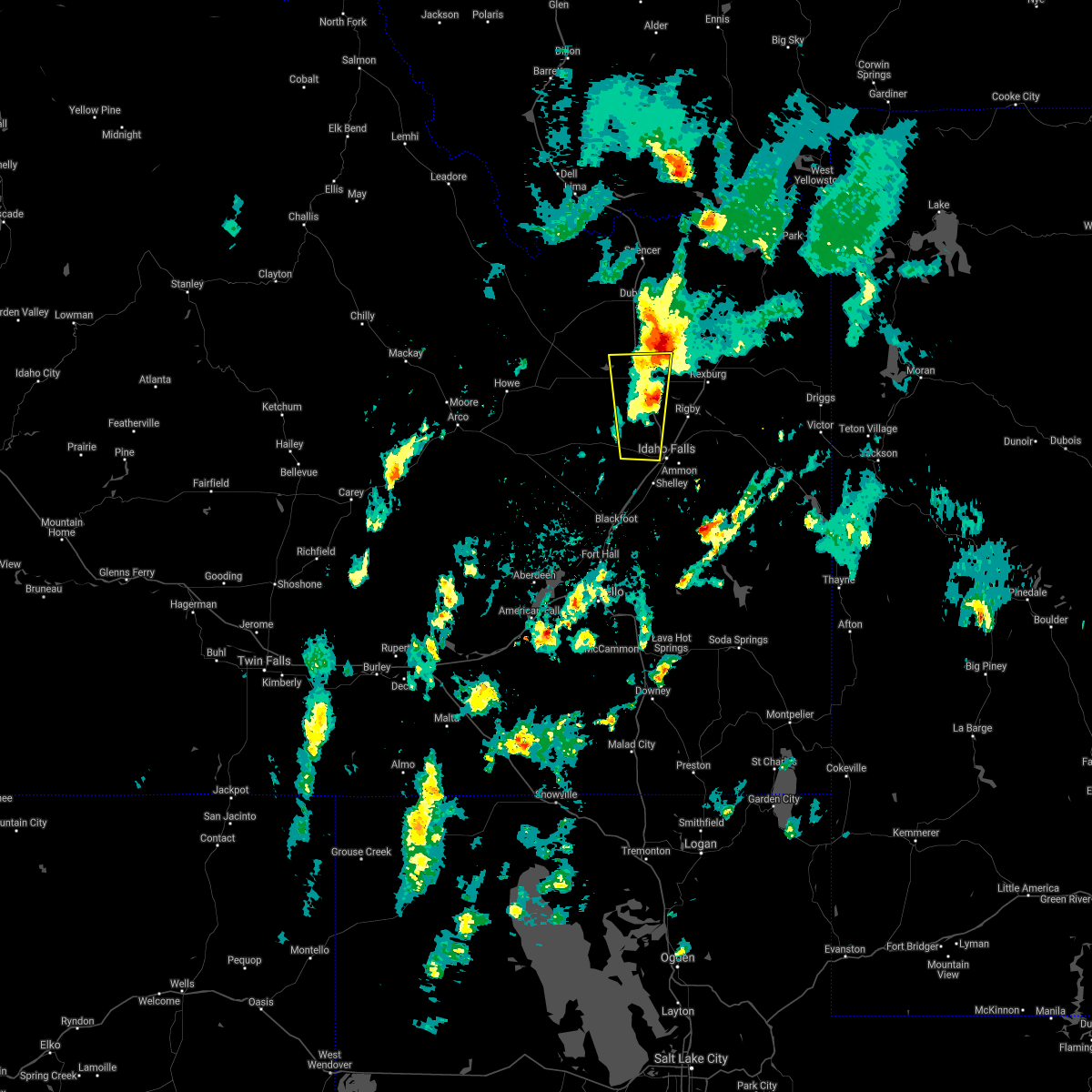 The severe thunderstorm warning for northwestern bonneville and central jefferson counties will expire at 530 pm mdt, the storm which prompted the warning has moved out of the warning area. therefore the warning will be allowed to expire. to report severe weather, contact your nearest law enforcement agency. they will relay your report to the national weather service pocatello. remember, a tornado warning still remains in effect for northern jefferson county, southwest fremont county, and southeast clark county through 600 pm mdt. The severe thunderstorm warning for northwestern bonneville and central jefferson counties will expire at 530 pm mdt, the storm which prompted the warning has moved out of the warning area. therefore the warning will be allowed to expire. to report severe weather, contact your nearest law enforcement agency. they will relay your report to the national weather service pocatello. remember, a tornado warning still remains in effect for northern jefferson county, southwest fremont county, and southeast clark county through 600 pm mdt.
|
| 10/2/2016 5:00 PM MDT |
 At 458 pm mdt, doppler radar indicated a severe thunderstorm capable of producing quarter size hail and damaging winds in excess of 60 mph. this storm was located near roberts, or 13 miles northwest of idaho falls, moving north at 35 mph. locations impacted include, idaho falls, roberts, hamer, osgood and sage junction. At 458 pm mdt, doppler radar indicated a severe thunderstorm capable of producing quarter size hail and damaging winds in excess of 60 mph. this storm was located near roberts, or 13 miles northwest of idaho falls, moving north at 35 mph. locations impacted include, idaho falls, roberts, hamer, osgood and sage junction.
|
| 10/2/2016 4:39 PM MDT |
 At 438 pm mdt, doppler radar indicated a severe thunderstorm capable of producing quarter size hail and damaging winds in excess of 60 mph. this storm was located 7 miles northwest of shelley, or 8 miles west of idaho falls, and moving north at 35 mph. At 438 pm mdt, doppler radar indicated a severe thunderstorm capable of producing quarter size hail and damaging winds in excess of 60 mph. this storm was located 7 miles northwest of shelley, or 8 miles west of idaho falls, and moving north at 35 mph.
|
| 7/10/2016 4:27 PM MDT |
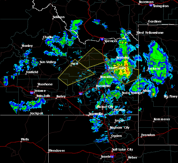 At 427 pm mdt, doppler radar indicated a severe thunderstorm capable of producing quarter size hail and damaging winds in excess of 60 mph. this storm was located 11 miles southeast of bone, or 20 miles northwest of wayan, moving northeast at 45 mph. locations impacted include, swan valley, ririe reservoir, palisades reservoir, ammon, irwin, bone and grays lake. At 427 pm mdt, doppler radar indicated a severe thunderstorm capable of producing quarter size hail and damaging winds in excess of 60 mph. this storm was located 11 miles southeast of bone, or 20 miles northwest of wayan, moving northeast at 45 mph. locations impacted include, swan valley, ririe reservoir, palisades reservoir, ammon, irwin, bone and grays lake.
|
| 7/10/2016 4:15 PM MDT | Storm damage reported in bonneville county ID, 15.2 miles ESE of Idaho Falls, ID |
| 7/10/2016 4:04 PM MDT |
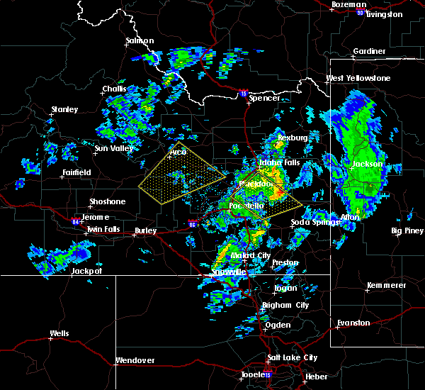 At 404 pm mdt, doppler radar indicated a severe thunderstorm capable of producing quarter size hail and damaging winds in excess of 60 mph. this storm was located 12 miles north of chesterfield reservoir, and moving northeast at 45 mph. At 404 pm mdt, doppler radar indicated a severe thunderstorm capable of producing quarter size hail and damaging winds in excess of 60 mph. this storm was located 12 miles north of chesterfield reservoir, and moving northeast at 45 mph.
|
| 7/9/2016 10:50 PM MDT | Kettle butte arl sit in bonneville county ID, 15.2 miles ESE of Idaho Falls, ID |
| 7/9/2016 10:40 PM MDT |
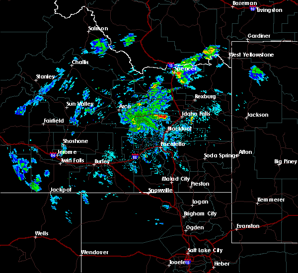 At 1039 pm mdt, doppler radar indicated a severe thunderstorm capable of producing quarter size hail and damaging winds in excess of 60 mph. this storm was located 14 miles northwest of shelley, or 15 miles west of idaho falls, and moving northeast at 40 mph. At 1039 pm mdt, doppler radar indicated a severe thunderstorm capable of producing quarter size hail and damaging winds in excess of 60 mph. this storm was located 14 miles northwest of shelley, or 15 miles west of idaho falls, and moving northeast at 40 mph.
|
| 6/30/2016 3:52 PM MDT |
 At 350 pm mdt, doppler radar indicated severe thunderstorms capable of producing damaging winds in excess of 60 mph. the leading edge of these winds was located along a line extending from mud lake to 10 miles south of terreton to near southeast inl, moving southeast at 35 mph. locations impacted include, idaho falls, terreton, menan, roberts, lewisville, mud lake, northwest inl, southeast inl, howe, osgood, kettle butte and sage junction. At 350 pm mdt, doppler radar indicated severe thunderstorms capable of producing damaging winds in excess of 60 mph. the leading edge of these winds was located along a line extending from mud lake to 10 miles south of terreton to near southeast inl, moving southeast at 35 mph. locations impacted include, idaho falls, terreton, menan, roberts, lewisville, mud lake, northwest inl, southeast inl, howe, osgood, kettle butte and sage junction.
|
| 6/30/2016 3:24 PM MDT |
 At 323 pm mdt, doppler radar indicated a line of severe thunderstorms capable of producing damaging winds in excess of 60 mph. the leading edge of these winds was located along a line extending from northwest inl to 11 miles northwest of southeast inl to 15 miles northeast of arco, and moving southeast at 55 mph. At 323 pm mdt, doppler radar indicated a line of severe thunderstorms capable of producing damaging winds in excess of 60 mph. the leading edge of these winds was located along a line extending from northwest inl to 11 miles northwest of southeast inl to 15 miles northeast of arco, and moving southeast at 55 mph.
|
| 6/9/2016 3:03 AM MDT | The severe thunderstorm warning for east central bingham and north central bonneville counties has expired. the storm which prompted the warning has moved out of the area. Therefore the warning has been allowed to expire. |
| 6/9/2016 2:40 AM MDT |
 At 239 am mdt, doppler radar indicated a severe thunderstorm capable of producing damaging winds in excess of 60 mph. this storm was located near ammon, or 9 miles southwest of ririe reservoir, moving northeast at 45 mph. in addition, at 220 am 55 mph winds were reported near blackfoot. locations impacted include, idaho falls, goshen, ririe reservoir, ammon, shelley, iona, ucon, firth, bone and basalt. At 239 am mdt, doppler radar indicated a severe thunderstorm capable of producing damaging winds in excess of 60 mph. this storm was located near ammon, or 9 miles southwest of ririe reservoir, moving northeast at 45 mph. in addition, at 220 am 55 mph winds were reported near blackfoot. locations impacted include, idaho falls, goshen, ririe reservoir, ammon, shelley, iona, ucon, firth, bone and basalt.
|
| 6/9/2016 2:19 AM MDT |
 At 218 am mdt, doppler radar indicated a severe thunderstorm capable of producing damaging winds in excess of 60 mph. this storm was located over goshen, and moving northeast at 45 mph. At 218 am mdt, doppler radar indicated a severe thunderstorm capable of producing damaging winds in excess of 60 mph. this storm was located over goshen, and moving northeast at 45 mph.
|
| 5/14/2016 6:10 PM MDT | Storm damage reported in bonneville county ID, 0.4 miles S of Idaho Falls, ID |
| 5/14/2016 5:53 PM MDT | Storm damage reported in bonneville county ID, 1.1 miles S of Idaho Falls, ID |
| 8/27/2015 5:26 PM MDT |
 At 525 pm mdt, doppler radar indicated a severe thunderstorm capable of producing large damaging hail up to two inches in diameter and damaging winds in excess of 60 mph. this storm was located near ririe reservoir, moving east at 30 mph. locations impacted include, idaho falls, ririe reservoir, ammon, iona, ucon, ririe and heise. we have received multiple reports of quarter size hail in the idaho falls areas as the storm moves through town. At 525 pm mdt, doppler radar indicated a severe thunderstorm capable of producing large damaging hail up to two inches in diameter and damaging winds in excess of 60 mph. this storm was located near ririe reservoir, moving east at 30 mph. locations impacted include, idaho falls, ririe reservoir, ammon, iona, ucon, ririe and heise. we have received multiple reports of quarter size hail in the idaho falls areas as the storm moves through town.
|
| 8/27/2015 5:15 PM MDT |
 At 514 pm mdt, doppler radar indicated a severe thunderstorm capable of producing half dollar size hail and damaging winds in excess of 60 mph. this storm was located over iona, or 7 miles west of ririe reservoir, moving east at 35 mph. locations impacted include, idaho falls, ririe reservoir, ammon, iona, ucon, ririe, osgood and heise. we have received several reports of small hail and heavy rain as the storm passed through the osgood and idaho falls areas. At 514 pm mdt, doppler radar indicated a severe thunderstorm capable of producing half dollar size hail and damaging winds in excess of 60 mph. this storm was located over iona, or 7 miles west of ririe reservoir, moving east at 35 mph. locations impacted include, idaho falls, ririe reservoir, ammon, iona, ucon, ririe, osgood and heise. we have received several reports of small hail and heavy rain as the storm passed through the osgood and idaho falls areas.
|
| 8/27/2015 5:10 PM MDT | Quarter sized hail reported 0.4 miles S of Idaho Falls, ID, multiple photos and video of one inch and some larger hail via social media in idaho falls. hail fell between 500 and 515 pm across the city. |
| 8/27/2015 5:10 PM MDT | Quarter sized hail reported 3.1 miles SW of Idaho Falls, ID, very heavy rain also reported. |
| 8/27/2015 4:58 PM MDT |
 At 457 pm mdt, doppler radar indicated a severe thunderstorm capable of producing half dollar size hail and damaging winds in excess of 60 mph. this storm was located near idaho falls, and moving east at 30 mph. At 457 pm mdt, doppler radar indicated a severe thunderstorm capable of producing half dollar size hail and damaging winds in excess of 60 mph. this storm was located near idaho falls, and moving east at 30 mph.
|
| 8/14/2015 10:25 PM MDT |
 The severe thunderstorm warning for central bingham, north central bannock, northwestern caribou and west central bonneville counties will expire at 1030 pm mdt, the storms which prompted the warning have weakened below severe limits, and no longer poses an immediate threat to life or property. therefore the warning will be allowed to expire. however gusty winds and locally heavy rain are still possible with these thunderstorms. The severe thunderstorm warning for central bingham, north central bannock, northwestern caribou and west central bonneville counties will expire at 1030 pm mdt, the storms which prompted the warning have weakened below severe limits, and no longer poses an immediate threat to life or property. therefore the warning will be allowed to expire. however gusty winds and locally heavy rain are still possible with these thunderstorms.
|
| 8/14/2015 10:17 PM MDT |
 At 1016 pm mdt, doppler radar indicated a line of dying thunderstorms capable of producing damaging winds in excess of 60 mph. these storms were located along a line extending from near moreland to near fort hall lincoln creek lodge to fort hall mount putnam, moving northeast at 40 mph. locations impacted include, blackfoot, goshen, shelley, firth, fort hall buffalo lodge, fort hall lincoln creek lodge, fort hall townsite, fort hall mount putnam, bone, rockford, moreland, pingree, fort hall putnam lodge, rose, fort hall eagle lodge, groveland, basalt, trail creek campground and wapello. At 1016 pm mdt, doppler radar indicated a line of dying thunderstorms capable of producing damaging winds in excess of 60 mph. these storms were located along a line extending from near moreland to near fort hall lincoln creek lodge to fort hall mount putnam, moving northeast at 40 mph. locations impacted include, blackfoot, goshen, shelley, firth, fort hall buffalo lodge, fort hall lincoln creek lodge, fort hall townsite, fort hall mount putnam, bone, rockford, moreland, pingree, fort hall putnam lodge, rose, fort hall eagle lodge, groveland, basalt, trail creek campground and wapello.
|
| 8/14/2015 10:02 PM MDT |
 At 1001 pm mdt, doppler radar indicated a line of dying thunderstorms capable of producing damaging winds in excess of 60 mph. these storms were located along a line extending from rockford to fort hall eagle lodge to near portneuf gap, moving northeast at 40 mph. locations impacted include, southern idaho falls, pocatello, blackfoot, american falls reservoir, goshen, chubbuck, shelley, firth, fort hall buffalo lodge, springfield, fort hall lincoln creek lodge, rockford, pingree, fort hall putnam lodge, rose, pocatello airport, fort hall townsite, fort hall mount putnam, bone and moreland. At 1001 pm mdt, doppler radar indicated a line of dying thunderstorms capable of producing damaging winds in excess of 60 mph. these storms were located along a line extending from rockford to fort hall eagle lodge to near portneuf gap, moving northeast at 40 mph. locations impacted include, southern idaho falls, pocatello, blackfoot, american falls reservoir, goshen, chubbuck, shelley, firth, fort hall buffalo lodge, springfield, fort hall lincoln creek lodge, rockford, pingree, fort hall putnam lodge, rose, pocatello airport, fort hall townsite, fort hall mount putnam, bone and moreland.
|
| 8/14/2015 9:48 PM MDT |
 At 947 pm mdt, doppler radar indicated a line of dying thunderstorms capable of producing damaging winds in excess of 60 mph. these storms were located along a line extending from near springfield to near fort hall buffalo lodge to near pocatello, and moving northeast at 45 mph. 57 mph winds were just reported at the pocatello airport. At 947 pm mdt, doppler radar indicated a line of dying thunderstorms capable of producing damaging winds in excess of 60 mph. these storms were located along a line extending from near springfield to near fort hall buffalo lodge to near pocatello, and moving northeast at 45 mph. 57 mph winds were just reported at the pocatello airport.
|
| 8/14/2015 7:28 PM MDT |
 At 727 pm mdt, doppler radar indicated a line of severe thunderstorms capable of producing damaging winds in excess of 60 mph. these storms were located along a line extending from 6 miles northwest of kilgore to 11 miles southeast of idmon to 12 miles southeast of teton to near wayan, moving northeast at 55 mph. in addition, multiple reports of 55 to 60 mph winds reported earlier near interstate 15. also, tree limbs were reported down along the salem highway a few minutes ago. locations impacted include, rexburg, rigby, driggs, ashton, dubois, swan valley, felt, marysville, lorenzo, henrys lake, ririe reservoir, wayan, idmon, palisades reservoir, blackfoot reservoir, ammon, victor, iona, sugar city and ucon. At 727 pm mdt, doppler radar indicated a line of severe thunderstorms capable of producing damaging winds in excess of 60 mph. these storms were located along a line extending from 6 miles northwest of kilgore to 11 miles southeast of idmon to 12 miles southeast of teton to near wayan, moving northeast at 55 mph. in addition, multiple reports of 55 to 60 mph winds reported earlier near interstate 15. also, tree limbs were reported down along the salem highway a few minutes ago. locations impacted include, rexburg, rigby, driggs, ashton, dubois, swan valley, felt, marysville, lorenzo, henrys lake, ririe reservoir, wayan, idmon, palisades reservoir, blackfoot reservoir, ammon, victor, iona, sugar city and ucon.
|
| 8/14/2015 7:11 PM MDT |
 At 711 pm mdt, doppler radar indicated a line of severe thunderstorms capable of producing damaging winds in excess of 60 mph. these storms were located along a line extending from spencer to 12 miles east of dubois to near archer to near blackfoot reservoir, and moving northeast at 55 mph. 60 mph winds were recently reported at sage junction. At 711 pm mdt, doppler radar indicated a line of severe thunderstorms capable of producing damaging winds in excess of 60 mph. these storms were located along a line extending from spencer to 12 miles east of dubois to near archer to near blackfoot reservoir, and moving northeast at 55 mph. 60 mph winds were recently reported at sage junction.
|
| 8/5/2015 3:24 PM MDT |
 At 324 pm mdt, doppler radar indicated a line of severe thunderstorms capable of producing quarter size hail and damaging winds in excess of 60 mph. these storms were located along a line extending from 6 miles southwest of hamer to archer to 12 miles west of swan valley, and moving northeast at 45 mph. At 324 pm mdt, doppler radar indicated a line of severe thunderstorms capable of producing quarter size hail and damaging winds in excess of 60 mph. these storms were located along a line extending from 6 miles southwest of hamer to archer to 12 miles west of swan valley, and moving northeast at 45 mph.
|
| 8/5/2015 3:12 PM MDT |
 At 310 pm mdt, doppler radar indicated a line of severe thunderstorms capable of producing damaging winds in excess of 60 mph. these storms were located along a line extending from near menan to 11 miles northeast of bone to 15 miles northwest of blackfoot reservoir, moving northeast at 55 mph. in addition, 70 to 73 mph winds were reported on top of kettle butte. winds on the valley floor have been reported up to 65 mph recently. locations impacted include, idaho falls, rexburg, rigby, swan valley, ririe reservoir, wayan, goshen, lorenzo, northern palisades reservoir, northern blackfoot reservoir, ammon, shelley, iona, sugar city, ucon, menan, ririe, roberts, firth and lewisville. At 310 pm mdt, doppler radar indicated a line of severe thunderstorms capable of producing damaging winds in excess of 60 mph. these storms were located along a line extending from near menan to 11 miles northeast of bone to 15 miles northwest of blackfoot reservoir, moving northeast at 55 mph. in addition, 70 to 73 mph winds were reported on top of kettle butte. winds on the valley floor have been reported up to 65 mph recently. locations impacted include, idaho falls, rexburg, rigby, swan valley, ririe reservoir, wayan, goshen, lorenzo, northern palisades reservoir, northern blackfoot reservoir, ammon, shelley, iona, sugar city, ucon, menan, ririe, roberts, firth and lewisville.
|
| 8/5/2015 2:55 PM MDT | Measured at the kettle butte inl site at 255pm mdt this afternoo in bonneville county ID, 15.2 miles ESE of Idaho Falls, ID |
| 8/5/2015 2:55 PM MDT |
 At 254 pm mdt, doppler radar indicated a line of severe thunderstorms capable of producing damaging winds in excess of 60 mph. these storms were located along a line extending from 9 miles southwest of roberts to bone to 9 miles north of chesterfield reservoir, moving northeast at 55 mph. locations impacted include, idaho falls, rexburg, blackfoot, rigby, swan valley, terreton, goshen, lorenzo, ririe reservoir, wayan, northern palisades reservoir, northern blackfoot reservoir, ammon, shelley, iona, sugar city, ucon, menan, ririe and roberts. At 254 pm mdt, doppler radar indicated a line of severe thunderstorms capable of producing damaging winds in excess of 60 mph. these storms were located along a line extending from 9 miles southwest of roberts to bone to 9 miles north of chesterfield reservoir, moving northeast at 55 mph. locations impacted include, idaho falls, rexburg, blackfoot, rigby, swan valley, terreton, goshen, lorenzo, ririe reservoir, wayan, northern palisades reservoir, northern blackfoot reservoir, ammon, shelley, iona, sugar city, ucon, menan, ririe and roberts.
|
| 8/5/2015 2:42 PM MDT |
 At 240 pm mdt, doppler radar and area observations indicated a line of severe thunderstorms capable of producing damaging winds in excess of 60 mph. these storms were located along a line extending from 8 miles east of southeast inl to near goshen to near fort hall mount putnam, and moving east at 55 mph. At 240 pm mdt, doppler radar and area observations indicated a line of severe thunderstorms capable of producing damaging winds in excess of 60 mph. these storms were located along a line extending from 8 miles east of southeast inl to near goshen to near fort hall mount putnam, and moving east at 55 mph.
|
| 8/5/2015 2:26 PM MDT |
 At 225 pm mdt, doppler radar indicated a line of severe thunderstorms capable of producing damaging winds in excess of 60 mph. these storms were located along a line extending from 6 miles south of southeast inl to near rose to near fort hall townsite, moving northeast at 55 mph. in addition, at 310pm, 64 mph winds were reported at the taber inl site. . locations impacted include, idaho falls, western pocatello, blackfoot, american falls reservoir, goshen, chubbuck, ammon, shelley, aberdeen, firth, atomic city, fort hall buffalo lodge, springfield, fort hall lincoln creek lodge, taber, rockford, pingree, fort hall putnam lodge, rose and pocatello airport. At 225 pm mdt, doppler radar indicated a line of severe thunderstorms capable of producing damaging winds in excess of 60 mph. these storms were located along a line extending from 6 miles south of southeast inl to near rose to near fort hall townsite, moving northeast at 55 mph. in addition, at 310pm, 64 mph winds were reported at the taber inl site. . locations impacted include, idaho falls, western pocatello, blackfoot, american falls reservoir, goshen, chubbuck, ammon, shelley, aberdeen, firth, atomic city, fort hall buffalo lodge, springfield, fort hall lincoln creek lodge, taber, rockford, pingree, fort hall putnam lodge, rose and pocatello airport.
|
| 8/5/2015 2:18 PM MDT |
 At 216 pm mdt, doppler radar indicated a line of severe thunderstorms capable of producing damaging winds in excess up to 70 mph. these storms were located along a line extending from near atomic city to near moreland to near pocatello airport, moving northeast at 55 mph. in addition, at 3pm, 63 mph winds were reported on top of big southern butte. winds across the valley floor are ranging 45 to 55mph. locations impacted include, idaho falls, western pocatello, blackfoot, american falls reservoir, goshen, chubbuck, ammon, shelley, aberdeen, firth, atomic city, fort hall buffalo lodge, springfield, fort hall lincoln creek lodge, taber, rockford, pingree, fort hall putnam lodge, rose and pocatello airport. At 216 pm mdt, doppler radar indicated a line of severe thunderstorms capable of producing damaging winds in excess up to 70 mph. these storms were located along a line extending from near atomic city to near moreland to near pocatello airport, moving northeast at 55 mph. in addition, at 3pm, 63 mph winds were reported on top of big southern butte. winds across the valley floor are ranging 45 to 55mph. locations impacted include, idaho falls, western pocatello, blackfoot, american falls reservoir, goshen, chubbuck, ammon, shelley, aberdeen, firth, atomic city, fort hall buffalo lodge, springfield, fort hall lincoln creek lodge, taber, rockford, pingree, fort hall putnam lodge, rose and pocatello airport.
|
| 8/5/2015 1:57 PM MDT |
 At 156 pm mdt, doppler radar indicated a line of severe thunderstorms capable of producing winds in excess of 70 mph. these storms were located along a line extending from 8 miles south of southwest inl to near springfield to near american falls, and moving east at 55 mph. At 156 pm mdt, doppler radar indicated a line of severe thunderstorms capable of producing winds in excess of 70 mph. these storms were located along a line extending from 8 miles south of southwest inl to near springfield to near american falls, and moving east at 55 mph.
|
| 6/15/2015 4:01 PM MDT | Quarter sized hail reported 14.1 miles WSW of Idaho Falls, ID, report via facebook. time estimated from radar. |
| 6/1/2015 4:59 PM MDT | At 458 pm mdt, doppler radar indicated a severe thunderstorm capable of producing quarter size hail and damaging winds in excess of 60 mph. this storm was located 8 miles northeast of bone, or 9 miles south of ririe reservoir, moving northeast at 35 mph. locations impacted include, ririe reservoir, lorenzo, northern palisades reservoir, ammon, iona, ririe, bone, archer, cutthroat trout campground, trail creek campground, heise and thornton. |
| 6/1/2015 4:39 PM MDT | At 439 pm mdt, doppler radar indicated a severe thunderstorm capable of producing quarter size hail and damaging winds in excess of 60 mph. this storm was located near bone, or 16 miles east of goshen, and moving northeast at 35 mph. |
| 6/1/2015 4:33 PM MDT | At 433 pm mdt, doppler radar indicated a line of severe thunderstorms capable of producing quarter size hail and damaging winds in excess of 60 mph. these storms were located along a line extending from near shelley to 6 miles northeast of goshen, moving northeast at 40 mph. locations impacted include, idaho falls, ammon, shelley, iona and osgood. |
| 6/1/2015 4:23 PM MDT | At 421 pm mdt, doppler radar indicated a severe thunderstorm capable of producing quarter size hail and damaging winds in excess of 60 mph. this storm was located 13 miles south of bone, or 17 miles north of chesterfield reservoir, moving northeast at 35 mph. locations impacted include, goshen, chesterfield reservoir, northern blackfoot reservoir, bone, chesterfield, cutthroat trout campground and trail creek campground. |
| 6/1/2015 4:20 PM MDT | At 420 pm mdt, doppler radar indicated a line of severe thunderstorms capable of producing half dollar size hail and damaging winds in excess of 60 mph. these storms were located along a line extending from near moreland to near rose to near fort hall lincoln creek lodge, moving north at 50 mph. locations impacted include, idaho falls, blackfoot, goshen, ammon, shelley, iona, firth, fort hall lincoln creek lodge, rose, groveland, basalt, wapello and osgood. |
| 6/1/2015 4:10 PM MDT | At 409 pm mdt, doppler radar indicated a line of severe thunderstorms capable of producing half dollar size hail and damaging winds in excess of 60 mph. these storms were located along a line extending from near moreland to near rose to near fort hall lincoln creek lodge, and moving northeast at 40 mph. |
| 6/1/2015 3:58 PM MDT | At 358 pm mdt, doppler radar indicated a severe thunderstorm capable of producing quarter size hail and damaging winds in excess of 60 mph. this storm was located near chesterfield reservoir, and moving northeast at 35 mph. |
| 5/31/2015 9:42 PM MDT | The severe thunderstorm warning for northeastern bingham, jefferson, south central fremont, northwestern bonneville, madison and west central teton counties will expire at 945 pm mdt, this warning has been replaced with a new severe thunderstorm warning in effect until 1015 pm. |
| 5/31/2015 9:26 PM MDT | At 923 pm mdt, radar and local observations show the leading edge of outflow winds from thunderstorms producing winds of 60 to 70 mph. these storms were located along a line extending from 11 miles south of terreton to lewisville to near ririe reservoir, moving northeast at 30 mph. in addition, at 922 pm, 66 mph winds were reported at idaho falls airport! locations impacted include, idaho falls, rexburg, rigby, terreton, ririe reservoir, lorenzo, mud lake, ammon, iona, sugar city, ucon, menan, teton, ririe, roberts, lewisville, parker, hamer, egin and plano. |
| 5/31/2015 9:04 PM MDT | At 903 pm mdt, doppler radar indicated the leading edge of outflow winds from thunderstorms, capable of producing damaging winds in excess of 60 mph. these storms were located along a line extending from 10 miles east of southeast inl to 6 miles south of roberts to near ammon, and moving northeast at 25 mph. |
| 9/17/2013 1:35 AM MDT | Highest wind gust at the kettle butte arl sit in bonneville county ID, 15.2 miles ESE of Idaho Falls, ID |
| 1/1/0001 12:00 AM | Kettle butte arl sit in bonneville county ID, 15.2 miles ESE of Idaho Falls, ID |
Hail Maps for Idaho Falls, ID


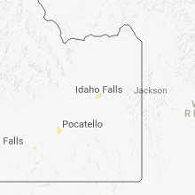
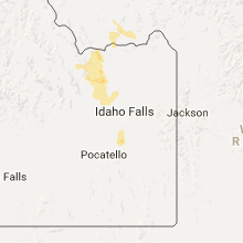

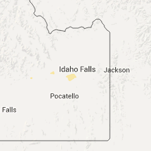


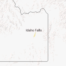
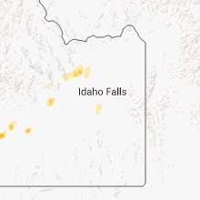
Connect with Interactive Hail Maps