

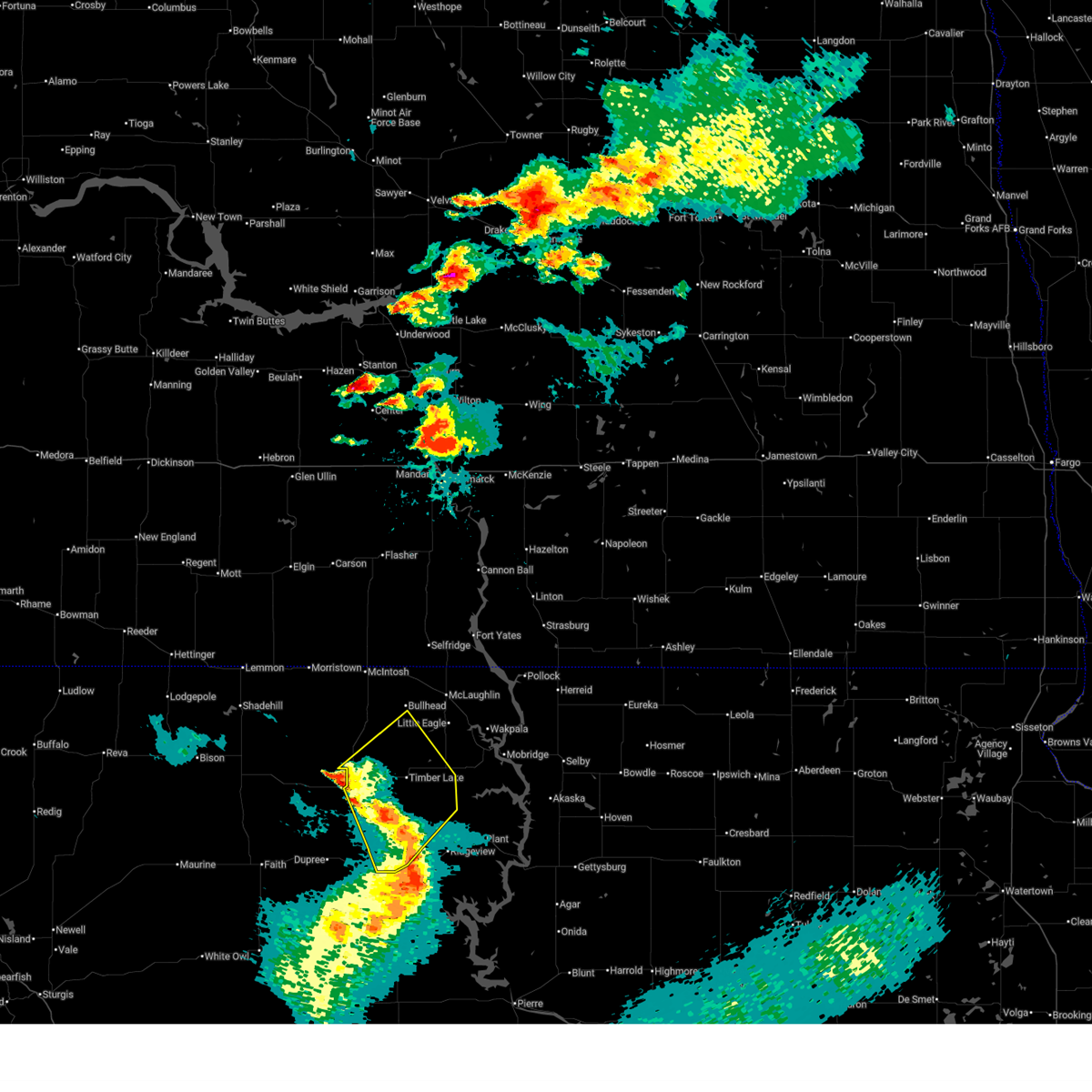
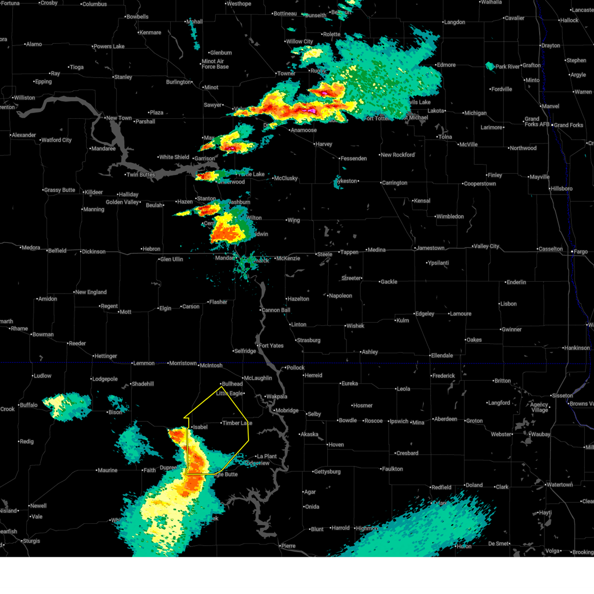
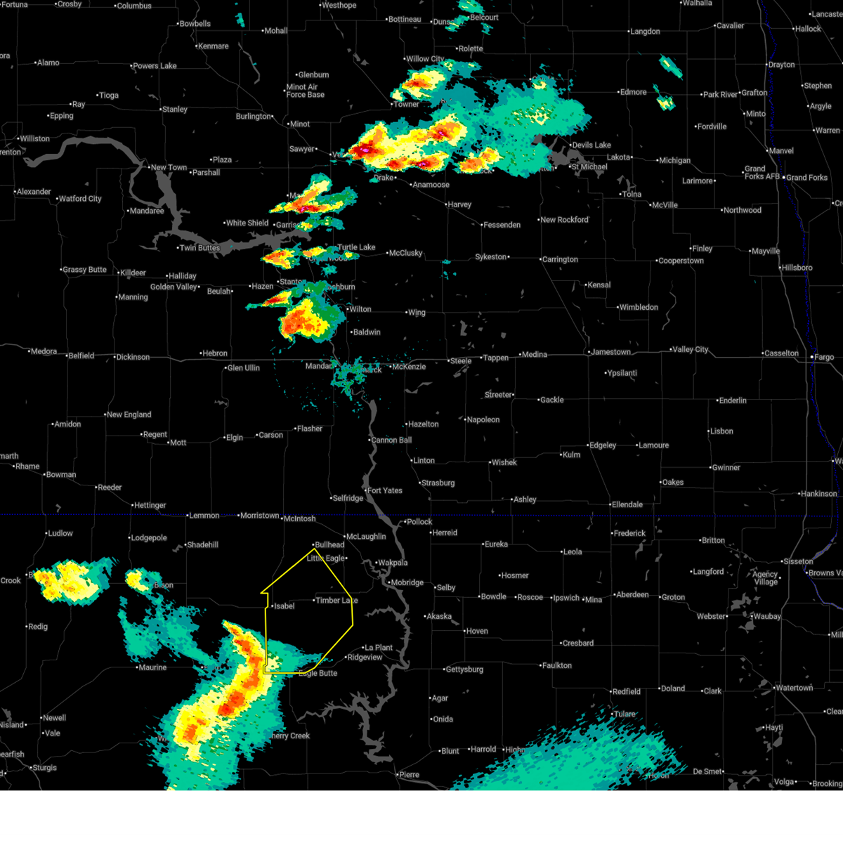
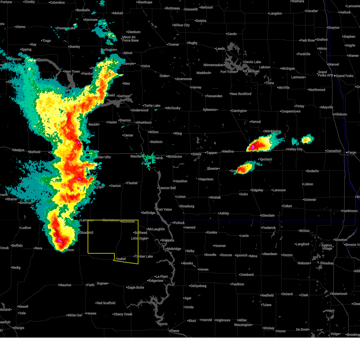
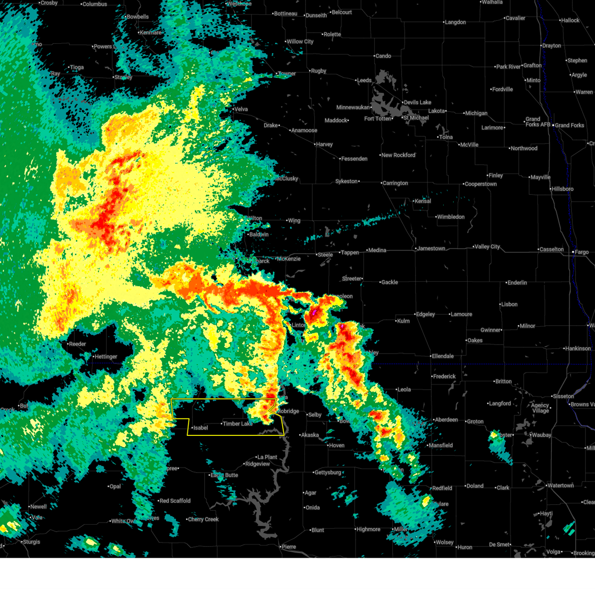
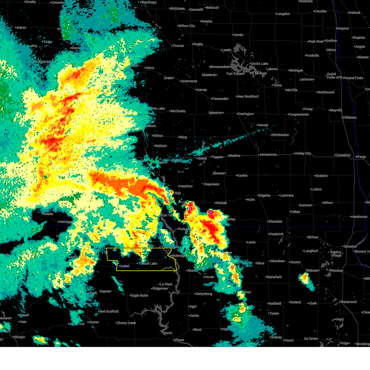
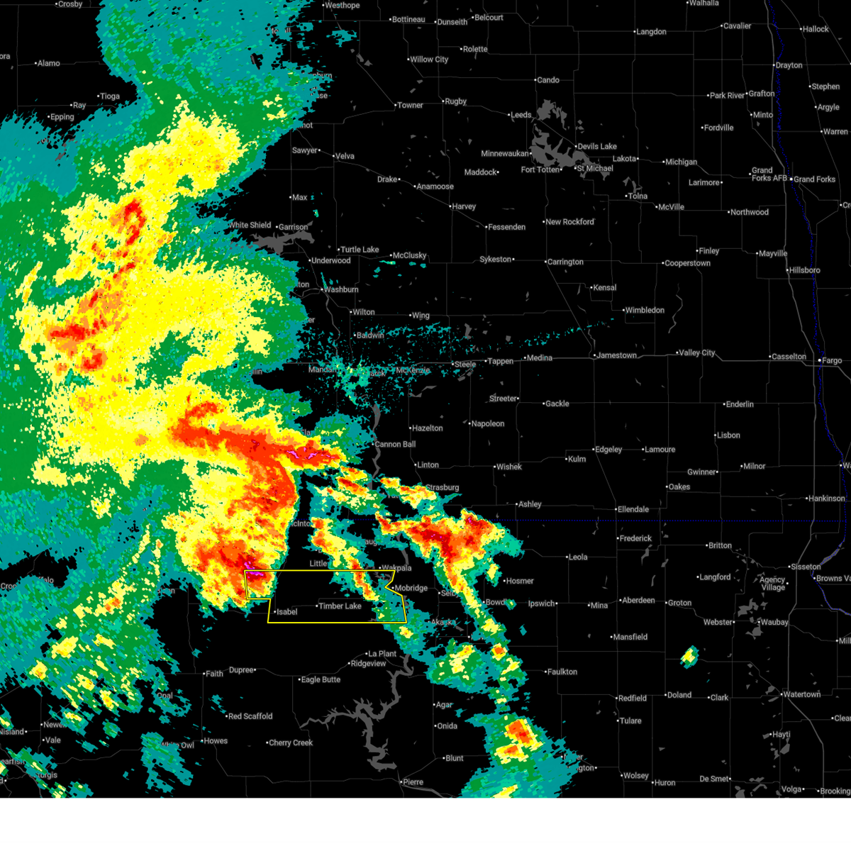
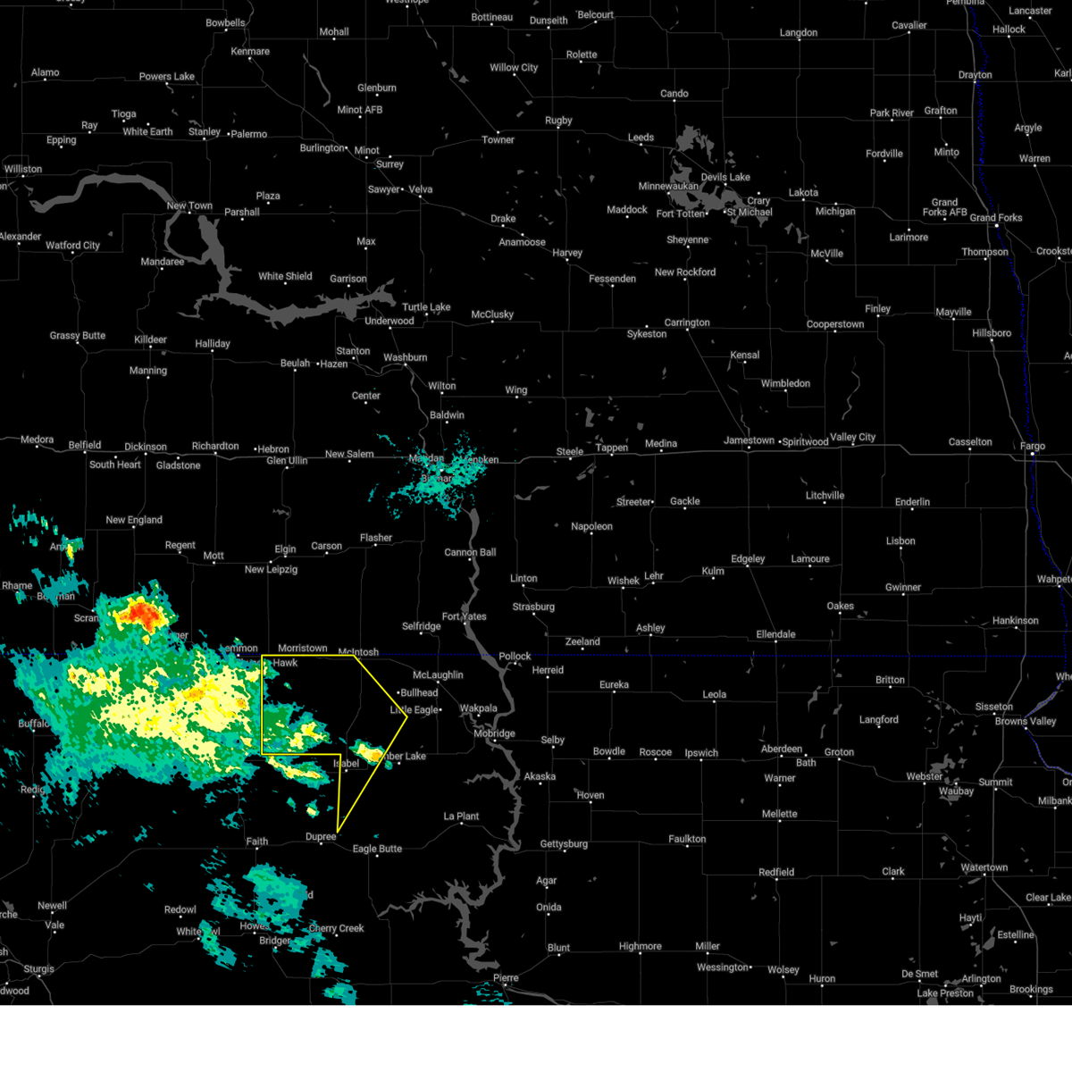
Hail Map for Isabel, SD
The Isabel, SD area has had 16 reports of on-the-ground hail by trained spotters, and has been under severe weather warnings 11 times during the past 12 months. Doppler radar has detected hail at or near Isabel, SD on 49 occasions, including 2 occasions during the past year.
| Name: | Isabel, SD |
| Where Located: | 88.6 miles NW of Pierre, SD |
| Map: | Google Map for Isabel, SD |
| Population: | 135 |
| Housing Units: | 69 |
| More Info: | Search Google for Isabel, SD |
1
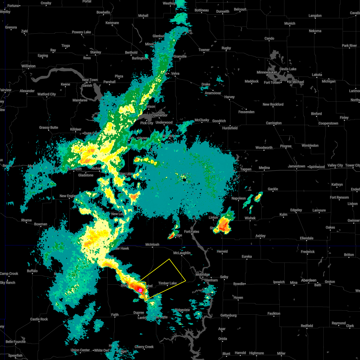
The Top Recent Hail Date for Isabel, SD is Sunday, September 15, 2024 (16th out of 49)

Hail and Wind Damage Spotted near Isabel, SD
| Date / Time | Report Details |
|---|---|
| 6/27/2025 7:58 PM MDT |
 At 758 pm mdt, severe thunderstorms were located along a line extending from 6 miles northwest of timber lake to near white horse to 9 miles northwest of ridgeview to near parade, moving east at 50 mph (radar indicated). Hazards include 60 mph wind gusts and quarter size hail. Hail damage to vehicles is expected. expect wind damage to roofs, siding, and trees. Locations impacted include, white horse, spring lake and glencross. At 758 pm mdt, severe thunderstorms were located along a line extending from 6 miles northwest of timber lake to near white horse to 9 miles northwest of ridgeview to near parade, moving east at 50 mph (radar indicated). Hazards include 60 mph wind gusts and quarter size hail. Hail damage to vehicles is expected. expect wind damage to roofs, siding, and trees. Locations impacted include, white horse, spring lake and glencross.
|
| 6/27/2025 7:32 PM MDT |
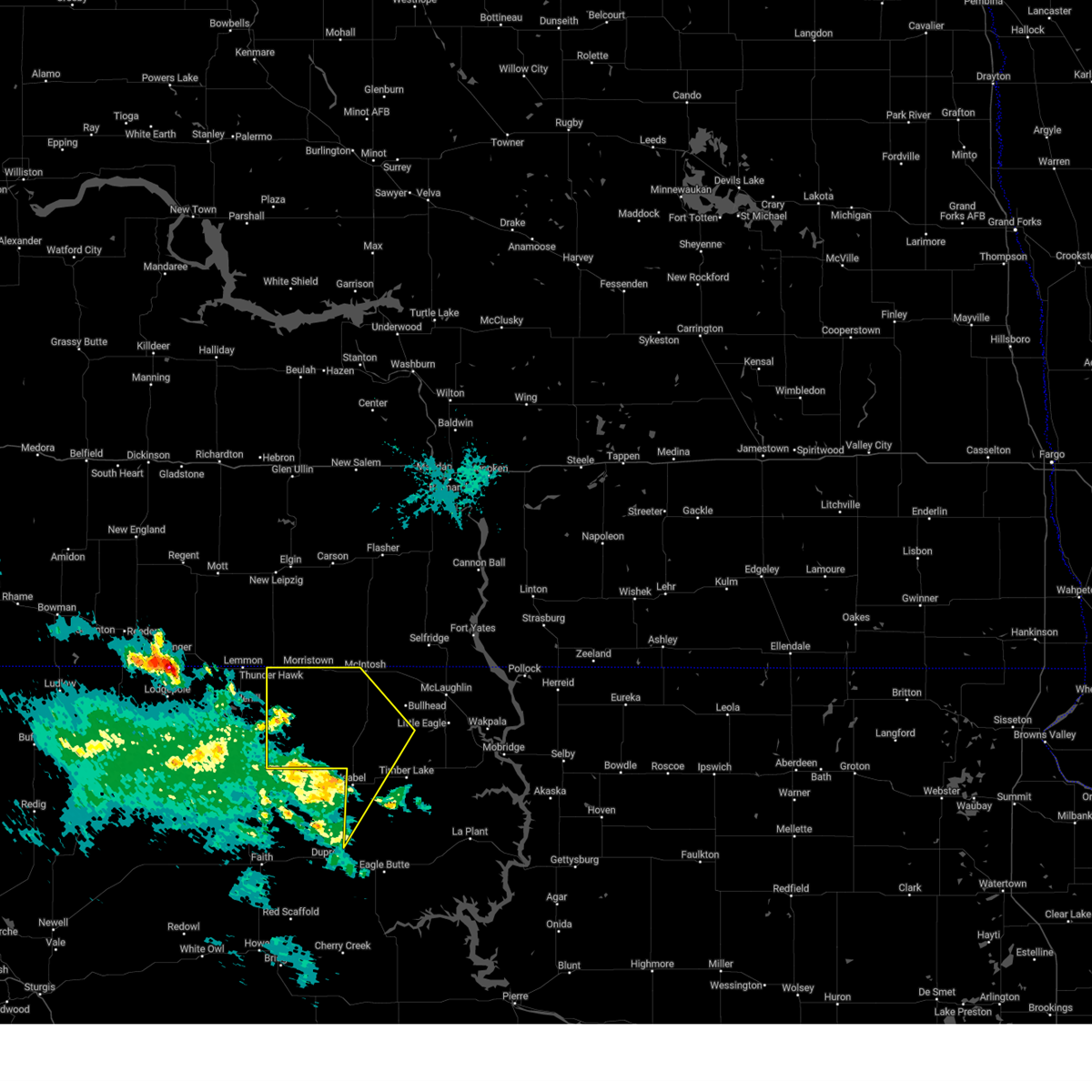
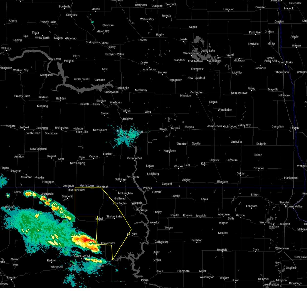
 At 731 pm mdt, severe thunderstorms were located along a line extending from near isabel to near green grass to near eagle butte to 7 miles east of intersection of cherry creek and sunnybrook roads, moving northeast at 45 mph (radar indicated). Hazards include 60 mph wind gusts and quarter size hail. Hail damage to vehicles is expected. expect wind damage to roofs, siding, and trees. these severe storms will be near, eagle butte, lantry, isabel, green grass, and south eagle butte around 735 pm mdt. Other locations in the path of these severe thunderstorms include firesteel, parade, little moreau rec area, timber lake, white horse, spring lake and glencross. At 731 pm mdt, severe thunderstorms were located along a line extending from near isabel to near green grass to near eagle butte to 7 miles east of intersection of cherry creek and sunnybrook roads, moving northeast at 45 mph (radar indicated). Hazards include 60 mph wind gusts and quarter size hail. Hail damage to vehicles is expected. expect wind damage to roofs, siding, and trees. these severe storms will be near, eagle butte, lantry, isabel, green grass, and south eagle butte around 735 pm mdt. Other locations in the path of these severe thunderstorms include firesteel, parade, little moreau rec area, timber lake, white horse, spring lake and glencross.
|
| 6/27/2025 7:15 PM MDT |
 Svrabr the national weather service in aberdeen has issued a * severe thunderstorm warning for, south central corson county in north central south dakota, northwestern dewey county in north central south dakota, * until 815 pm mdt. * at 714 pm mdt, severe thunderstorms were located along a line extending from near thunder butte to near bear creek to 7 miles southwest of lantry to near intersection of cherry creek and sunnybrook roads, moving northeast at 45 mph (radar indicated). Hazards include 60 mph wind gusts and quarter size hail. Hail damage to vehicles is expected. expect wind damage to roofs, siding, and trees. severe thunderstorms will be near, lantry and bear creek around 720 pm mdt. eagle butte, isabel, green grass, and south eagle butte around 725 pm mdt. Other locations in the path of these severe thunderstorms include firesteel, parade, timber lake, little moreau rec area, white horse, glencross and spring lake. Svrabr the national weather service in aberdeen has issued a * severe thunderstorm warning for, south central corson county in north central south dakota, northwestern dewey county in north central south dakota, * until 815 pm mdt. * at 714 pm mdt, severe thunderstorms were located along a line extending from near thunder butte to near bear creek to 7 miles southwest of lantry to near intersection of cherry creek and sunnybrook roads, moving northeast at 45 mph (radar indicated). Hazards include 60 mph wind gusts and quarter size hail. Hail damage to vehicles is expected. expect wind damage to roofs, siding, and trees. severe thunderstorms will be near, lantry and bear creek around 720 pm mdt. eagle butte, isabel, green grass, and south eagle butte around 725 pm mdt. Other locations in the path of these severe thunderstorms include firesteel, parade, timber lake, little moreau rec area, white horse, glencross and spring lake.
|
| 6/20/2025 7:17 PM MDT |
 Svrabr the national weather service in aberdeen has issued a * severe thunderstorm warning for, corson county in north central south dakota, northwestern dewey county in north central south dakota, * until 830 pm mdt. * at 716 pm mdt, a severe thunderstorm was located near shadehill reservoir, or 20 miles south of lemmon, moving east at 50 mph (radar indicated). Hazards include tennis ball size hail and 70 mph wind gusts. People and animals outdoors will be injured. expect hail damage to roofs, siding, windows, and vehicles. expect considerable tree damage. wind damage is also likely to mobile homes, roofs, and outbuildings. this severe thunderstorm will be near, shambo ranch around 735 pm mdt. Other locations in the path of this severe thunderstorm include timber lake. Svrabr the national weather service in aberdeen has issued a * severe thunderstorm warning for, corson county in north central south dakota, northwestern dewey county in north central south dakota, * until 830 pm mdt. * at 716 pm mdt, a severe thunderstorm was located near shadehill reservoir, or 20 miles south of lemmon, moving east at 50 mph (radar indicated). Hazards include tennis ball size hail and 70 mph wind gusts. People and animals outdoors will be injured. expect hail damage to roofs, siding, windows, and vehicles. expect considerable tree damage. wind damage is also likely to mobile homes, roofs, and outbuildings. this severe thunderstorm will be near, shambo ranch around 735 pm mdt. Other locations in the path of this severe thunderstorm include timber lake.
|
| 6/16/2025 2:16 AM MDT |
 Svrabr the national weather service in aberdeen has issued a * severe thunderstorm warning for, southern corson county in north central south dakota, northern dewey county in north central south dakota, * until 300 am mdt. * at 214 am mdt, a severe thunderstorm was located near little eagle, moving east at 40 mph (radar indicated. at 150 am mdt a wind gust of 69 mph was reported at trail city). Hazards include 60 mph wind gusts and penny size hail. Expect damage to roofs, siding, and trees. This severe thunderstorm will be near, indian memorial rec area and grand river casino around 225 am mdt. Svrabr the national weather service in aberdeen has issued a * severe thunderstorm warning for, southern corson county in north central south dakota, northern dewey county in north central south dakota, * until 300 am mdt. * at 214 am mdt, a severe thunderstorm was located near little eagle, moving east at 40 mph (radar indicated. at 150 am mdt a wind gust of 69 mph was reported at trail city). Hazards include 60 mph wind gusts and penny size hail. Expect damage to roofs, siding, and trees. This severe thunderstorm will be near, indian memorial rec area and grand river casino around 225 am mdt.
|
| 6/16/2025 1:56 AM MDT |
 At 154 am mdt, a severe thunderstorm was located 7 miles northwest of spring lake, or 11 miles southwest of little eagle, moving east at 40 mph (radar indicated. at 125 mdt a 58 mph wind gust was reported in isabel, sd and at 140 mdt a 61 mph wind gust was reported in timber lake, sd). Hazards include 60 mph wind gusts and penny size hail. Expect damage to roofs, siding, and trees. Locations impacted include, timber lake, isabel, firesteel, little moreau rec area, trail city, blackfoot, indian memorial rec area, spring lake, grand river casino, glencross, and promise. At 154 am mdt, a severe thunderstorm was located 7 miles northwest of spring lake, or 11 miles southwest of little eagle, moving east at 40 mph (radar indicated. at 125 mdt a 58 mph wind gust was reported in isabel, sd and at 140 mdt a 61 mph wind gust was reported in timber lake, sd). Hazards include 60 mph wind gusts and penny size hail. Expect damage to roofs, siding, and trees. Locations impacted include, timber lake, isabel, firesteel, little moreau rec area, trail city, blackfoot, indian memorial rec area, spring lake, grand river casino, glencross, and promise.
|
| 6/16/2025 1:26 AM MDT |
 Svrabr the national weather service in aberdeen has issued a * severe thunderstorm warning for, southern corson county in north central south dakota, northern dewey county in north central south dakota, * until 230 am mdt. * at 125 am mdt, a severe thunderstorm was located near klein ranch, or 18 miles southwest of bullhead, moving east at 40 mph (radar indicated). Hazards include 70 mph wind gusts and penny size hail. Expect considerable tree damage. Damage is likely to mobile homes, roofs, and outbuildings. Svrabr the national weather service in aberdeen has issued a * severe thunderstorm warning for, southern corson county in north central south dakota, northern dewey county in north central south dakota, * until 230 am mdt. * at 125 am mdt, a severe thunderstorm was located near klein ranch, or 18 miles southwest of bullhead, moving east at 40 mph (radar indicated). Hazards include 70 mph wind gusts and penny size hail. Expect considerable tree damage. Damage is likely to mobile homes, roofs, and outbuildings.
|
| 6/16/2025 1:25 AM MDT | Storm damage reported in ziebach county SD, 2.8 miles E of Isabel, SD |
| 9/17/2024 10:47 PM MDT |
 the severe thunderstorm warning has been cancelled and is no longer in effect the severe thunderstorm warning has been cancelled and is no longer in effect
|
| 9/17/2024 10:31 PM MDT |
 At 1030 pm mdt, severe thunderstorms were located along a line extending from near thunder hawk to near firesteel to 7 miles southwest of ridgeview, moving northeast at 40 mph (radar indicated). Hazards include 60 mph wind gusts. Expect damage to roofs, siding, and trees. Locations impacted include, morristown, firesteel, keldron, klein ranch, black horse, watauga and mcintosh. At 1030 pm mdt, severe thunderstorms were located along a line extending from near thunder hawk to near firesteel to 7 miles southwest of ridgeview, moving northeast at 40 mph (radar indicated). Hazards include 60 mph wind gusts. Expect damage to roofs, siding, and trees. Locations impacted include, morristown, firesteel, keldron, klein ranch, black horse, watauga and mcintosh.
|
| 9/17/2024 10:04 PM MDT |
 Svrabr the national weather service in aberdeen has issued a * severe thunderstorm warning for, western corson county in north central south dakota, western dewey county in north central south dakota, * until 1100 pm mdt. * at 1003 pm mdt, severe thunderstorms were located along a line extending from 9 miles southeast of shadehill to near bear creek to 13 miles southeast of intersection of highway 63 and bia road 8, moving northeast at 40 mph (radar indicated). Hazards include 60 mph wind gusts and penny size hail. Expect damage to roofs, siding, and trees. severe thunderstorms will be near, eagle butte, isabel, green grass, shambo ranch, and parade around 1010 pm mdt. firesteel around 1020 pm mdt. Other locations in the path of these severe thunderstorms include thunder hawk, little moreau rec area, keldron, timber lake, morristown, klein ranch, white horse, black horse and watauga. Svrabr the national weather service in aberdeen has issued a * severe thunderstorm warning for, western corson county in north central south dakota, western dewey county in north central south dakota, * until 1100 pm mdt. * at 1003 pm mdt, severe thunderstorms were located along a line extending from 9 miles southeast of shadehill to near bear creek to 13 miles southeast of intersection of highway 63 and bia road 8, moving northeast at 40 mph (radar indicated). Hazards include 60 mph wind gusts and penny size hail. Expect damage to roofs, siding, and trees. severe thunderstorms will be near, eagle butte, isabel, green grass, shambo ranch, and parade around 1010 pm mdt. firesteel around 1020 pm mdt. Other locations in the path of these severe thunderstorms include thunder hawk, little moreau rec area, keldron, timber lake, morristown, klein ranch, white horse, black horse and watauga.
|
| 7/13/2024 10:30 PM MDT |
 Svrabr the national weather service in aberdeen has issued a * severe thunderstorm warning for, corson county in north central south dakota, northwestern dewey county in north central south dakota, * until 1130 pm mdt. * at 1029 pm mdt, severe thunderstorms were located along a line extending from thunder hawk to near maurine, moving east at 70 mph (radar indicated). Hazards include 60 mph wind gusts. Expect damage to roofs, siding, and trees. severe thunderstorms will be near, morristown and keldron around 1035 pm mdt. watauga and shambo ranch around 1040 pm mdt. Other locations in the path of these severe thunderstorms include mcintosh, klein ranch, black horse, isabel, walker, bullhead, firesteel, bear creek, lantry, green grass, eagle butte, mclaughlin, timber lake, little eagle, spring lake and little moreau rec area. Svrabr the national weather service in aberdeen has issued a * severe thunderstorm warning for, corson county in north central south dakota, northwestern dewey county in north central south dakota, * until 1130 pm mdt. * at 1029 pm mdt, severe thunderstorms were located along a line extending from thunder hawk to near maurine, moving east at 70 mph (radar indicated). Hazards include 60 mph wind gusts. Expect damage to roofs, siding, and trees. severe thunderstorms will be near, morristown and keldron around 1035 pm mdt. watauga and shambo ranch around 1040 pm mdt. Other locations in the path of these severe thunderstorms include mcintosh, klein ranch, black horse, isabel, walker, bullhead, firesteel, bear creek, lantry, green grass, eagle butte, mclaughlin, timber lake, little eagle, spring lake and little moreau rec area.
|
| 6/27/2024 8:27 PM MDT |
 The storms which prompted the warning have weakened below severe limits, and no longer pose an immediate threat to life or property. therefore, the warning will be allowed to expire. a severe thunderstorm watch remains in effect until 100 am mdt for north central south dakota. The storms which prompted the warning have weakened below severe limits, and no longer pose an immediate threat to life or property. therefore, the warning will be allowed to expire. a severe thunderstorm watch remains in effect until 100 am mdt for north central south dakota.
|
| 6/27/2024 7:50 PM MDT |
 At 749 pm mdt, severe thunderstorms were located along a line extending from near thunder hawk to 10 miles northwest of shambo ranch to near opal, moving east at 45 mph (radar indicated). Hazards include 60 mph wind gusts and quarter size hail. Hail damage to vehicles is expected. expect wind damage to roofs, siding, and trees. Locations impacted include, morristown, shambo ranch, keldron, watauga, mcintosh, black horse, isabel, klein ranch and bear creek. At 749 pm mdt, severe thunderstorms were located along a line extending from near thunder hawk to 10 miles northwest of shambo ranch to near opal, moving east at 45 mph (radar indicated). Hazards include 60 mph wind gusts and quarter size hail. Hail damage to vehicles is expected. expect wind damage to roofs, siding, and trees. Locations impacted include, morristown, shambo ranch, keldron, watauga, mcintosh, black horse, isabel, klein ranch and bear creek.
|
| 6/27/2024 7:28 PM MDT |
 Svrabr the national weather service in aberdeen has issued a * severe thunderstorm warning for, western corson county in north central south dakota, northwestern dewey county in north central south dakota, * until 830 pm mdt. * at 727 pm mdt, severe thunderstorms were located along a line extending from 6 miles northwest of north lemmon to near shadehill reservoir to 8 miles southeast of mud butte, moving east at 45 mph (radar indicated). Hazards include 70 mph wind gusts and quarter size hail. Hail damage to vehicles is expected. expect considerable tree damage. wind damage is also likely to mobile homes, roofs, and outbuildings. severe thunderstorms will be near, thunder hawk around 735 pm mdt. keldron around 745 pm mdt. Other locations in the path of these severe thunderstorms include morristown, shambo ranch, watauga, mcintosh, klein ranch, black horse and isabel. Svrabr the national weather service in aberdeen has issued a * severe thunderstorm warning for, western corson county in north central south dakota, northwestern dewey county in north central south dakota, * until 830 pm mdt. * at 727 pm mdt, severe thunderstorms were located along a line extending from 6 miles northwest of north lemmon to near shadehill reservoir to 8 miles southeast of mud butte, moving east at 45 mph (radar indicated). Hazards include 70 mph wind gusts and quarter size hail. Hail damage to vehicles is expected. expect considerable tree damage. wind damage is also likely to mobile homes, roofs, and outbuildings. severe thunderstorms will be near, thunder hawk around 735 pm mdt. keldron around 745 pm mdt. Other locations in the path of these severe thunderstorms include morristown, shambo ranch, watauga, mcintosh, klein ranch, black horse and isabel.
|
| 6/22/2024 8:24 PM MDT |
 Svrabr the national weather service in aberdeen has issued a * severe thunderstorm warning for, western dewey county in north central south dakota, * until 930 pm mdt. * at 824 pm mdt, a severe thunderstorm was located near isabel, or 22 miles north of dupree, moving southeast at 45 mph (radar indicated). Hazards include ping pong ball size hail and 60 mph wind gusts. People and animals outdoors will be injured. expect hail damage to roofs, siding, windows, and vehicles. expect wind damage to roofs, siding, and trees. this severe thunderstorm will be near, isabel around 830 pm mdt. Other locations in the path of this severe thunderstorm include green grass, parade and eagle butte. Svrabr the national weather service in aberdeen has issued a * severe thunderstorm warning for, western dewey county in north central south dakota, * until 930 pm mdt. * at 824 pm mdt, a severe thunderstorm was located near isabel, or 22 miles north of dupree, moving southeast at 45 mph (radar indicated). Hazards include ping pong ball size hail and 60 mph wind gusts. People and animals outdoors will be injured. expect hail damage to roofs, siding, windows, and vehicles. expect wind damage to roofs, siding, and trees. this severe thunderstorm will be near, isabel around 830 pm mdt. Other locations in the path of this severe thunderstorm include green grass, parade and eagle butte.
|
| 6/10/2024 3:55 PM MDT |
 The storms which prompted the warning have weakened below severe limits, and no longer pose an immediate threat to life or property. therefore, the warning will be allowed to expire. however, gusty winds and heavy rain are still possible with these thunderstorms. to report severe weather, contact your nearest law enforcement agency. they will relay your report to the national weather service aberdeen. The storms which prompted the warning have weakened below severe limits, and no longer pose an immediate threat to life or property. therefore, the warning will be allowed to expire. however, gusty winds and heavy rain are still possible with these thunderstorms. to report severe weather, contact your nearest law enforcement agency. they will relay your report to the national weather service aberdeen.
|
| 6/10/2024 3:35 PM MDT |
 At 334 pm mdt, severe thunderstorms were located along a line extending from near keldron to 8 miles east of shambo ranch to near iron lightning, moving east at 45 mph (radar indicated). Hazards include 60 mph wind gusts. Expect damage to roofs, siding, and trees. Locations impacted include, morristown, watauga, isabel, klein ranch, black horse, mcintosh, firesteel and bear creek. At 334 pm mdt, severe thunderstorms were located along a line extending from near keldron to 8 miles east of shambo ranch to near iron lightning, moving east at 45 mph (radar indicated). Hazards include 60 mph wind gusts. Expect damage to roofs, siding, and trees. Locations impacted include, morristown, watauga, isabel, klein ranch, black horse, mcintosh, firesteel and bear creek.
|
| 6/10/2024 3:03 PM MDT |
 Svrabr the national weather service in aberdeen has issued a * severe thunderstorm warning for, western corson county in north central south dakota, northwestern dewey county in north central south dakota, * until 400 pm mdt. * at 302 pm mdt, severe thunderstorms were located along a line extending from near lemmon to near meadow to 9 miles southwest of usta, moving east at 45 mph (radar indicated). Hazards include 60 mph wind gusts. Expect damage to roofs, siding, and trees. severe thunderstorms will be near, shambo ranch and thunder hawk around 310 pm mdt. keldron around 320 pm mdt. Other locations in the path of these severe thunderstorms include morristown, watauga, isabel, klein ranch and black horse. Svrabr the national weather service in aberdeen has issued a * severe thunderstorm warning for, western corson county in north central south dakota, northwestern dewey county in north central south dakota, * until 400 pm mdt. * at 302 pm mdt, severe thunderstorms were located along a line extending from near lemmon to near meadow to 9 miles southwest of usta, moving east at 45 mph (radar indicated). Hazards include 60 mph wind gusts. Expect damage to roofs, siding, and trees. severe thunderstorms will be near, shambo ranch and thunder hawk around 310 pm mdt. keldron around 320 pm mdt. Other locations in the path of these severe thunderstorms include morristown, watauga, isabel, klein ranch and black horse.
|
| 6/3/2024 7:36 PM MDT | Quarter sized hail reported 20.4 miles E of Isabel, SD |
| 7/5/2022 8:15 AM MDT | Extensive damage north of isabel. damage to trees... trees uprooted... broken house and vehicle windows... machine shed destroyed... grain bins destroyed... complete lo in dewey county SD, 3.7 miles S of Isabel, SD |
| 7/5/2022 8:14 AM MDT |
 At 814 am mdt, a severe thunderstorm was located 8 miles northwest of firesteel, or 32 miles southwest of mclaughlin, moving east at 30 mph (radar indicated). Hazards include tennis ball size hail and 60 mph wind gusts. People and animals outdoors will be injured. expect hail damage to roofs, siding, windows, and vehicles. expect wind damage to roofs, siding, and trees. this severe thunderstorm will be near, firesteel around 825 am mdt. other locations in the path of this severe thunderstorm include timber lake, spring lake and glencross. thunderstorm damage threat, considerable hail threat, radar indicated max hail size, 2. 50 in wind threat, radar indicated max wind gust, 60 mph. At 814 am mdt, a severe thunderstorm was located 8 miles northwest of firesteel, or 32 miles southwest of mclaughlin, moving east at 30 mph (radar indicated). Hazards include tennis ball size hail and 60 mph wind gusts. People and animals outdoors will be injured. expect hail damage to roofs, siding, windows, and vehicles. expect wind damage to roofs, siding, and trees. this severe thunderstorm will be near, firesteel around 825 am mdt. other locations in the path of this severe thunderstorm include timber lake, spring lake and glencross. thunderstorm damage threat, considerable hail threat, radar indicated max hail size, 2. 50 in wind threat, radar indicated max wind gust, 60 mph.
|
| 7/5/2022 8:10 AM MDT | Damage picture relayed via social media. extensive damage to large outdoor storage building. time approximated by rada in corson county SD, 5.8 miles S of Isabel, SD |
| 7/5/2022 8:05 AM MDT | Many trees uproote in corson county SD, 6.2 miles SSE of Isabel, SD |
| 6/13/2022 12:30 AM MDT |
 At 1229 am mdt, a severe thunderstorm was located near bear creek, or 9 miles north of lantry, moving east at 55 mph (radar indicated). Hazards include 60 mph wind gusts and penny size hail. Expect damage to roofs, siding, and trees. this severe thunderstorm will be near, green grass around 1240 am mdt. other locations in the path of this severe thunderstorm include white horse. hail threat, radar indicated max hail size, 0. 75 in wind threat, radar indicated max wind gust, 60 mph. At 1229 am mdt, a severe thunderstorm was located near bear creek, or 9 miles north of lantry, moving east at 55 mph (radar indicated). Hazards include 60 mph wind gusts and penny size hail. Expect damage to roofs, siding, and trees. this severe thunderstorm will be near, green grass around 1240 am mdt. other locations in the path of this severe thunderstorm include white horse. hail threat, radar indicated max hail size, 0. 75 in wind threat, radar indicated max wind gust, 60 mph.
|
| 5/12/2022 3:06 AM MDT |
 At 306 am mdt, a severe thunderstorm was located near bear creek, or near lantry, moving northeast at 65 mph (radar indicated). Hazards include 70 mph wind gusts and half dollar size hail. Hail damage to vehicles is expected. expect considerable tree damage. wind damage is also likely to mobile homes, roofs, and outbuildings. this severe thunderstorm will be near, green grass around 315 am mdt. little moreau rec area around 325 am mdt. other locations in the path of this severe thunderstorm include white horse, glencross and spring lake. thunderstorm damage threat, considerable hail threat, radar indicated max hail size, 1. 25 in wind threat, radar indicated max wind gust, 70 mph. At 306 am mdt, a severe thunderstorm was located near bear creek, or near lantry, moving northeast at 65 mph (radar indicated). Hazards include 70 mph wind gusts and half dollar size hail. Hail damage to vehicles is expected. expect considerable tree damage. wind damage is also likely to mobile homes, roofs, and outbuildings. this severe thunderstorm will be near, green grass around 315 am mdt. little moreau rec area around 325 am mdt. other locations in the path of this severe thunderstorm include white horse, glencross and spring lake. thunderstorm damage threat, considerable hail threat, radar indicated max hail size, 1. 25 in wind threat, radar indicated max wind gust, 70 mph.
|
| 5/12/2022 2:04 AM MDT |
 At 204 am mdt, a severe thunderstorm was located near bear creek, or near lantry, moving northeast at 35 mph (radar indicated). Hazards include two inch hail and 70 mph wind gusts. People and animals outdoors will be injured. expect hail damage to roofs, siding, windows, and vehicles. expect considerable tree damage. Wind damage is also likely to mobile homes, roofs, and outbuildings. At 204 am mdt, a severe thunderstorm was located near bear creek, or near lantry, moving northeast at 35 mph (radar indicated). Hazards include two inch hail and 70 mph wind gusts. People and animals outdoors will be injured. expect hail damage to roofs, siding, windows, and vehicles. expect considerable tree damage. Wind damage is also likely to mobile homes, roofs, and outbuildings.
|
| 9/19/2021 9:09 PM MDT |
 At 908 pm mdt, a severe thunderstorm was located near isabel, or 22 miles north of dupree, moving northeast at 50 mph (radar indicated). Hazards include 60 mph wind gusts and quarter size hail. Hail damage to vehicles is expected. expect wind damage to roofs, siding, and trees. this severe thunderstorm will be near, firesteel around 925 pm mdt. other locations in the path of this severe thunderstorm include timber lake and spring lake. hail threat, radar indicated max hail size, 1. 00 in wind threat, radar indicated max wind gust, 60 mph. At 908 pm mdt, a severe thunderstorm was located near isabel, or 22 miles north of dupree, moving northeast at 50 mph (radar indicated). Hazards include 60 mph wind gusts and quarter size hail. Hail damage to vehicles is expected. expect wind damage to roofs, siding, and trees. this severe thunderstorm will be near, firesteel around 925 pm mdt. other locations in the path of this severe thunderstorm include timber lake and spring lake. hail threat, radar indicated max hail size, 1. 00 in wind threat, radar indicated max wind gust, 60 mph.
|
| 8/23/2021 8:35 PM MDT |
 At 834 pm mdt, a severe thunderstorm was located near little eagle, or 12 miles southwest of mclaughlin, moving east at 55 mph (radar indicated). Hazards include 70 mph wind gusts and quarter size hail. Hail damage to vehicles is expected. expect considerable tree damage. wind damage is also likely to mobile homes, roofs, and outbuildings. Locations impacted include, mclaughlin, timber lake, isabel, firesteel, trail city, mahto, little eagle, bullhead, black horse, spring lake, klein ranch, glencross and southeastern standing rock nation. At 834 pm mdt, a severe thunderstorm was located near little eagle, or 12 miles southwest of mclaughlin, moving east at 55 mph (radar indicated). Hazards include 70 mph wind gusts and quarter size hail. Hail damage to vehicles is expected. expect considerable tree damage. wind damage is also likely to mobile homes, roofs, and outbuildings. Locations impacted include, mclaughlin, timber lake, isabel, firesteel, trail city, mahto, little eagle, bullhead, black horse, spring lake, klein ranch, glencross and southeastern standing rock nation.
|
| 8/23/2021 8:13 PM MDT |
 At 813 pm mdt, a severe thunderstorm was located 8 miles southeast of klein ranch, or 26 miles southwest of mclaughlin, moving east at 45 mph (radar indicated). Hazards include 60 mph wind gusts and quarter size hail. Hail damage to vehicles is expected. Expect wind damage to roofs, siding, and trees. At 813 pm mdt, a severe thunderstorm was located 8 miles southeast of klein ranch, or 26 miles southwest of mclaughlin, moving east at 45 mph (radar indicated). Hazards include 60 mph wind gusts and quarter size hail. Hail damage to vehicles is expected. Expect wind damage to roofs, siding, and trees.
|
| 7/22/2021 7:35 PM MDT |
 The severe thunderstorm warning for northwestern dewey county will expire at 745 pm mdt, the storm which prompted the warning has weakened below severe limits, and no longer poses an immediate threat to life or property. therefore, the warning will be allowed to expire. however gusty winds are still possible with this thunderstorm. to report severe weather, contact your nearest law enforcement agency. they will relay your report to the national weather service aberdeen. The severe thunderstorm warning for northwestern dewey county will expire at 745 pm mdt, the storm which prompted the warning has weakened below severe limits, and no longer poses an immediate threat to life or property. therefore, the warning will be allowed to expire. however gusty winds are still possible with this thunderstorm. to report severe weather, contact your nearest law enforcement agency. they will relay your report to the national weather service aberdeen.
|
| 7/22/2021 6:45 PM MDT |
 At 644 pm mdt, a severe thunderstorm was located 8 miles east of thunder butte, or 13 miles north of dupree, moving east at 30 mph (radar indicated). Hazards include 70 mph wind gusts. Expect considerable tree damage. Damage is likely to mobile homes, roofs, and outbuildings. At 644 pm mdt, a severe thunderstorm was located 8 miles east of thunder butte, or 13 miles north of dupree, moving east at 30 mph (radar indicated). Hazards include 70 mph wind gusts. Expect considerable tree damage. Damage is likely to mobile homes, roofs, and outbuildings.
|
| 7/22/2021 5:44 PM MDT |
 At 543 pm mdt, severe thunderstorms were located along a line extending from near thunder hawk to faith, moving east at 30 mph (radar indicated). Hazards include 60 mph wind gusts and penny size hail. Expect damage to roofs, siding, and trees. severe thunderstorms will be near, thunder hawk around 550 pm mdt. Other locations in the path of these severe thunderstorms include keldron, morristown, watauga, bear creek, lantry, eagle butte and mcintosh. At 543 pm mdt, severe thunderstorms were located along a line extending from near thunder hawk to faith, moving east at 30 mph (radar indicated). Hazards include 60 mph wind gusts and penny size hail. Expect damage to roofs, siding, and trees. severe thunderstorms will be near, thunder hawk around 550 pm mdt. Other locations in the path of these severe thunderstorms include keldron, morristown, watauga, bear creek, lantry, eagle butte and mcintosh.
|
| 7/8/2021 10:39 PM MDT |
 At 1039 pm mdt, a severe thunderstorm was located near isabel, or 28 miles north of lantry, moving southeast at 40 mph (radar indicated). Hazards include two inch hail and 60 mph wind gusts. People and animals outdoors will be injured. expect hail damage to roofs, siding, windows, and vehicles. expect wind damage to roofs, siding, and trees. This severe thunderstorm will remain over mainly rural areas of southwestern corson and northwestern dewey counties, including the following locations, northern cheyenne river reservation. At 1039 pm mdt, a severe thunderstorm was located near isabel, or 28 miles north of lantry, moving southeast at 40 mph (radar indicated). Hazards include two inch hail and 60 mph wind gusts. People and animals outdoors will be injured. expect hail damage to roofs, siding, windows, and vehicles. expect wind damage to roofs, siding, and trees. This severe thunderstorm will remain over mainly rural areas of southwestern corson and northwestern dewey counties, including the following locations, northern cheyenne river reservation.
|
| 7/8/2021 10:22 PM MDT |
 At 1021 pm mdt, a severe thunderstorm was located 9 miles southwest of klein ranch, or 35 miles north of dupree, moving southeast at 40 mph (radar indicated). Hazards include two inch hail and 60 mph wind gusts. People and animals outdoors will be injured. expect hail damage to roofs, siding, windows, and vehicles. expect wind damage to roofs, siding, and trees. this severe thunderstorm will be near, isabel around 1040 pm mdt. Other locations in the path of this severe thunderstorm include firesteel. At 1021 pm mdt, a severe thunderstorm was located 9 miles southwest of klein ranch, or 35 miles north of dupree, moving southeast at 40 mph (radar indicated). Hazards include two inch hail and 60 mph wind gusts. People and animals outdoors will be injured. expect hail damage to roofs, siding, windows, and vehicles. expect wind damage to roofs, siding, and trees. this severe thunderstorm will be near, isabel around 1040 pm mdt. Other locations in the path of this severe thunderstorm include firesteel.
|
| 6/11/2021 12:31 AM MDT |
 At 1231 am mdt, severe thunderstorms were located along a line extending from 8 miles north of mclaughlin to near parade, moving east at 30 mph (radar indicated). Hazards include 60 mph wind gusts and penny size hail. Expect damage to roofs, siding, and trees. Locations impacted include, ridgeview. At 1231 am mdt, severe thunderstorms were located along a line extending from 8 miles north of mclaughlin to near parade, moving east at 30 mph (radar indicated). Hazards include 60 mph wind gusts and penny size hail. Expect damage to roofs, siding, and trees. Locations impacted include, ridgeview.
|
| 6/11/2021 12:02 AM MDT |
 At 1201 am mdt, severe thunderstorms were located along a line extending from walker to bear creek, moving east at 30 mph (radar indicated). Hazards include 60 mph wind gusts and penny size hail. Expect damage to roofs, siding, and trees. severe thunderstorms will be near, walker around 1205 am mdt. eagle butte and south eagle butte around 1220 am mdt. Other locations in the path of these severe thunderstorms include mclaughlin and parade. At 1201 am mdt, severe thunderstorms were located along a line extending from walker to bear creek, moving east at 30 mph (radar indicated). Hazards include 60 mph wind gusts and penny size hail. Expect damage to roofs, siding, and trees. severe thunderstorms will be near, walker around 1205 am mdt. eagle butte and south eagle butte around 1220 am mdt. Other locations in the path of these severe thunderstorms include mclaughlin and parade.
|
| 6/8/2021 11:34 PM MDT |
 At 1134 pm mdt, severe thunderstorms were located along a line extending from 9 miles north of keldron to 9 miles southwest of klein ranch to near green grass to 9 miles southeast of intersection of cherry creek and sunnybrook roads, moving northeast at 40 mph (radar indicated). Hazards include 60 mph wind gusts and penny size hail. Expect damage to roofs, siding, and trees. Locations impacted include, klein ranch, black horse, little moreau rec area, eagle butte, timber lake and parade. At 1134 pm mdt, severe thunderstorms were located along a line extending from 9 miles north of keldron to 9 miles southwest of klein ranch to near green grass to 9 miles southeast of intersection of cherry creek and sunnybrook roads, moving northeast at 40 mph (radar indicated). Hazards include 60 mph wind gusts and penny size hail. Expect damage to roofs, siding, and trees. Locations impacted include, klein ranch, black horse, little moreau rec area, eagle butte, timber lake and parade.
|
| 6/8/2021 10:54 PM MDT |
 At 1054 pm mdt, severe thunderstorms were located along a line extending from near shadehill to 7 miles north of iron lightning to near intersection of cherry creek and sunnybrook roads to near bridger, moving northeast at 40 mph (radar indicated). Hazards include 60 mph wind gusts and penny size hail. Expect damage to roofs, siding, and trees. severe thunderstorms will be near, thunder hawk around 1110 pm mdt. Other locations in the path of these severe thunderstorms include lantry, bear creek, keldron, green grass, klein ranch, black horse, eagle butte, timber lake, little moreau rec area and parade. At 1054 pm mdt, severe thunderstorms were located along a line extending from near shadehill to 7 miles north of iron lightning to near intersection of cherry creek and sunnybrook roads to near bridger, moving northeast at 40 mph (radar indicated). Hazards include 60 mph wind gusts and penny size hail. Expect damage to roofs, siding, and trees. severe thunderstorms will be near, thunder hawk around 1110 pm mdt. Other locations in the path of these severe thunderstorms include lantry, bear creek, keldron, green grass, klein ranch, black horse, eagle butte, timber lake, little moreau rec area and parade.
|
| 6/8/2021 6:20 PM MDT | Small tree limbs dow in corson county SD, 16.1 miles SW of Isabel, SD |
| 6/8/2021 6:00 PM MDT | Quarter sized hail reported 7.9 miles WSW of Isabel, SD |
| 6/8/2021 5:18 PM MDT | Golf Ball sized hail reported 7.9 miles WSW of Isabel, SD |
| 6/8/2021 4:59 PM MDT |
 At 459 pm mdt, a severe thunderstorm was located 7 miles south of firesteel, or 21 miles north of eagle butte, moving north at 15 mph (radar indicated). Hazards include 70 mph wind gusts and ping pong ball size hail. People and animals outdoors will be injured. expect hail damage to roofs, siding, windows, and vehicles. expect considerable tree damage. wind damage is also likely to mobile homes, roofs, and outbuildings. Locations impacted include, isabel, firesteel and northern cheyenne river reservation. At 459 pm mdt, a severe thunderstorm was located 7 miles south of firesteel, or 21 miles north of eagle butte, moving north at 15 mph (radar indicated). Hazards include 70 mph wind gusts and ping pong ball size hail. People and animals outdoors will be injured. expect hail damage to roofs, siding, windows, and vehicles. expect considerable tree damage. wind damage is also likely to mobile homes, roofs, and outbuildings. Locations impacted include, isabel, firesteel and northern cheyenne river reservation.
|
| 6/8/2021 4:46 PM MDT |
 At 446 pm mdt, a severe thunderstorm was located near green grass, or 18 miles north of eagle butte, moving north at 15 mph (radar indicated). Hazards include 60 mph wind gusts and quarter size hail. Hail damage to vehicles is expected. Expect wind damage to roofs, siding, and trees. At 446 pm mdt, a severe thunderstorm was located near green grass, or 18 miles north of eagle butte, moving north at 15 mph (radar indicated). Hazards include 60 mph wind gusts and quarter size hail. Hail damage to vehicles is expected. Expect wind damage to roofs, siding, and trees.
|
| 5/23/2021 7:40 PM MDT |
 The severe thunderstorm warning for northwestern dewey county will expire at 745 pm mdt, the storms which prompted the warning have weakened below severe limits, and no longer pose an immediate threat to life or property. therefore, the warning will be allowed to expire. however gusty winds are still possible with these thunderstorms. a tornado watch remains in effect until 900 pm mdt for north central south dakota. The severe thunderstorm warning for northwestern dewey county will expire at 745 pm mdt, the storms which prompted the warning have weakened below severe limits, and no longer pose an immediate threat to life or property. therefore, the warning will be allowed to expire. however gusty winds are still possible with these thunderstorms. a tornado watch remains in effect until 900 pm mdt for north central south dakota.
|
| 5/23/2021 7:32 PM MDT |
 At 731 pm mdt, severe thunderstorms were located along a line extending from 8 miles east of shambo ranch to 7 miles southeast of isabel to 13 miles northwest of mission ridge, moving north at 45 mph (radar indicated). Hazards include 60 mph wind gusts. Expect damage to roofs, siding, and trees. Locations impacted include, eagle butte, lantry, isabel, firesteel, green grass, bear creek and cheyenne river reservation. At 731 pm mdt, severe thunderstorms were located along a line extending from 8 miles east of shambo ranch to 7 miles southeast of isabel to 13 miles northwest of mission ridge, moving north at 45 mph (radar indicated). Hazards include 60 mph wind gusts. Expect damage to roofs, siding, and trees. Locations impacted include, eagle butte, lantry, isabel, firesteel, green grass, bear creek and cheyenne river reservation.
|
| 5/23/2021 6:59 PM MDT |
 The national weather service in aberdeen has issued a * severe thunderstorm warning for. northwestern dewey county in north central south dakota. until 745 pm mdt. At 658 pm mdt, severe thunderstorms were located along a line extending from 8 miles northwest of iron lightning to near red elm. The national weather service in aberdeen has issued a * severe thunderstorm warning for. northwestern dewey county in north central south dakota. until 745 pm mdt. At 658 pm mdt, severe thunderstorms were located along a line extending from 8 miles northwest of iron lightning to near red elm.
|
| 8/27/2020 8:38 PM MDT |
 At 838 pm mdt, a severe thunderstorm was located over isabel, or 22 miles north of dupree, moving east at 25 mph (radar indicated). Hazards include 60 mph wind gusts and half dollar size hail. Hail damage to vehicles is expected. Expect wind damage to roofs, siding, and trees. At 838 pm mdt, a severe thunderstorm was located over isabel, or 22 miles north of dupree, moving east at 25 mph (radar indicated). Hazards include 60 mph wind gusts and half dollar size hail. Hail damage to vehicles is expected. Expect wind damage to roofs, siding, and trees.
|
| 7/31/2020 4:08 PM MDT |
 The severe thunderstorm warning for south central corson and northwestern dewey counties will expire at 415 pm mdt, the storm which prompted the warning has weakened below severe limits, and has exited the warned area. therefore, the warning will be allowed to expire. however gusty winds are still possible with this thunderstorm. The severe thunderstorm warning for south central corson and northwestern dewey counties will expire at 415 pm mdt, the storm which prompted the warning has weakened below severe limits, and has exited the warned area. therefore, the warning will be allowed to expire. however gusty winds are still possible with this thunderstorm.
|
| 7/31/2020 4:01 PM MDT |
 At 401 pm mdt, a severe thunderstorm was located 8 miles northwest of firesteel, or 32 miles southwest of mclaughlin, moving south at 30 mph (radar indicated). Hazards include 60 mph wind gusts and quarter size hail. Hail damage to vehicles is expected. expect wind damage to roofs, siding, and trees. Locations impacted include, isabel and firesteel. At 401 pm mdt, a severe thunderstorm was located 8 miles northwest of firesteel, or 32 miles southwest of mclaughlin, moving south at 30 mph (radar indicated). Hazards include 60 mph wind gusts and quarter size hail. Hail damage to vehicles is expected. expect wind damage to roofs, siding, and trees. Locations impacted include, isabel and firesteel.
|
| 7/31/2020 3:52 PM MDT | Golf Ball sized hail reported 15.7 miles S of Isabel, SD |
| 7/31/2020 3:48 PM MDT |
 At 347 pm mdt, a severe thunderstorm was located near klein ranch, or 33 miles southwest of mclaughlin, moving south at 30 mph (radar indicated). Hazards include 60 mph wind gusts and quarter size hail. Hail damage to vehicles is expected. Expect wind damage to roofs, siding, and trees. At 347 pm mdt, a severe thunderstorm was located near klein ranch, or 33 miles southwest of mclaughlin, moving south at 30 mph (radar indicated). Hazards include 60 mph wind gusts and quarter size hail. Hail damage to vehicles is expected. Expect wind damage to roofs, siding, and trees.
|
| 6/28/2020 8:09 PM MDT |
 At 808 pm mdt, severe thunderstorms were located along a line extending from 8 miles southeast of meadow to near dupree, moving northeast at 35 mph (radar indicated). Hazards include 60 mph wind gusts and penny size hail. expect damage to roofs, siding, and trees At 808 pm mdt, severe thunderstorms were located along a line extending from 8 miles southeast of meadow to near dupree, moving northeast at 35 mph (radar indicated). Hazards include 60 mph wind gusts and penny size hail. expect damage to roofs, siding, and trees
|
| 6/21/2020 1:10 PM MDT | 6 inch diameter tree branches broken off. estimate 50 mph wind in ziebach county SD, 18.4 miles E of Isabel, SD |
| 6/16/2020 9:09 PM MDT |
 At 908 pm mdt, a severe thunderstorm was located near glad valley, or 20 miles north of dupree, moving northeast at 50 mph (radar indicated). Hazards include 70 mph wind gusts and penny size hail. Expect considerable tree damage. Damage is likely to mobile homes, roofs, and outbuildings. At 908 pm mdt, a severe thunderstorm was located near glad valley, or 20 miles north of dupree, moving northeast at 50 mph (radar indicated). Hazards include 70 mph wind gusts and penny size hail. Expect considerable tree damage. Damage is likely to mobile homes, roofs, and outbuildings.
|
| 6/6/2020 9:20 PM MDT | Time estimated from rada in dewey county SD, 7.6 miles WSW of Isabel, SD |
| 6/6/2020 9:12 PM MDT |
 At 912 pm mdt, severe thunderstorms were located along a line extending from 7 miles east of glad valley to near green grass to lake oahe, moving north at 70 mph (radar indicated). Hazards include 70 mph wind gusts and nickel size hail. Expect considerable tree damage. Damage is likely to mobile homes, roofs, and outbuildings. At 912 pm mdt, severe thunderstorms were located along a line extending from 7 miles east of glad valley to near green grass to lake oahe, moving north at 70 mph (radar indicated). Hazards include 70 mph wind gusts and nickel size hail. Expect considerable tree damage. Damage is likely to mobile homes, roofs, and outbuildings.
|
| 6/6/2020 8:24 PM MDT |
 At 823 pm mdt, severe thunderstorms were located along a line extending from near lodgepole to near red scaffold, moving northeast at 60 mph (trained weather spotters). Hazards include 70 mph wind gusts and nickel size hail. Expect considerable tree damage. Damage is likely to mobile homes, roofs, and outbuildings. At 823 pm mdt, severe thunderstorms were located along a line extending from near lodgepole to near red scaffold, moving northeast at 60 mph (trained weather spotters). Hazards include 70 mph wind gusts and nickel size hail. Expect considerable tree damage. Damage is likely to mobile homes, roofs, and outbuildings.
|
| 9/29/2019 11:05 PM MDT |
 At 1105 pm mdt, a severe thunderstorm was located near isabel, or 24 miles north of dupree, moving northeast at 45 mph (radar indicated). Hazards include 60 mph wind gusts and quarter size hail. Hail damage to vehicles is expected. Expect wind damage to roofs, siding, and trees. At 1105 pm mdt, a severe thunderstorm was located near isabel, or 24 miles north of dupree, moving northeast at 45 mph (radar indicated). Hazards include 60 mph wind gusts and quarter size hail. Hail damage to vehicles is expected. Expect wind damage to roofs, siding, and trees.
|
| 9/20/2019 11:13 PM MDT |
 At 1040 pm mdt, severe thunderstorms were located along a line extending from near usta to bear creek to 6 miles southwest of intersection of highway 63 and bia road 8, moving northeast at 30 mph (trained weather spotters). Hazards include 60 mph wind gusts and penny size hail. expect damage to roofs, siding, and trees At 1040 pm mdt, severe thunderstorms were located along a line extending from near usta to bear creek to 6 miles southwest of intersection of highway 63 and bia road 8, moving northeast at 30 mph (trained weather spotters). Hazards include 60 mph wind gusts and penny size hail. expect damage to roofs, siding, and trees
|
| 9/20/2019 10:40 PM MDT |
 At 1040 pm mdt, severe thunderstorms were located along a line extending from near usta to bear creek to 6 miles southwest of intersection of highway 63 and bia road 8, moving northeast at 30 mph (trained weather spotters). Hazards include 60 mph wind gusts and penny size hail. expect damage to roofs, siding, and trees At 1040 pm mdt, severe thunderstorms were located along a line extending from near usta to bear creek to 6 miles southwest of intersection of highway 63 and bia road 8, moving northeast at 30 mph (trained weather spotters). Hazards include 60 mph wind gusts and penny size hail. expect damage to roofs, siding, and trees
|
| 7/20/2019 12:59 AM MDT |
 The national weather service in aberdeen has issued a * severe thunderstorm warning for. northern dewey county in north central south dakota. until 145 am mdt. At 1258 am mdt, a severe thunderstorm was located 9 miles south of isabel, or 16 miles north of lantry, moving east at 60 mph. The national weather service in aberdeen has issued a * severe thunderstorm warning for. northern dewey county in north central south dakota. until 145 am mdt. At 1258 am mdt, a severe thunderstorm was located 9 miles south of isabel, or 16 miles north of lantry, moving east at 60 mph.
|
| 6/27/2019 12:56 AM MDT |
 The severe thunderstorm warning for western corson and northwestern dewey counties will expire at 100 am mdt, the storms which prompted the warning have weakened below severe limits, and have exited the warned area. therefore, the warning will be allowed to expire. however gusty winds are still possible with these thunderstorms. a severe thunderstorm watch remains in effect until 600 am mdt for north central south dakota. The severe thunderstorm warning for western corson and northwestern dewey counties will expire at 100 am mdt, the storms which prompted the warning have weakened below severe limits, and have exited the warned area. therefore, the warning will be allowed to expire. however gusty winds are still possible with these thunderstorms. a severe thunderstorm watch remains in effect until 600 am mdt for north central south dakota.
|
| 6/27/2019 12:40 AM MDT |
 At 1240 am mdt, severe thunderstorms were located along a line extending from near shadehill to 10 miles northeast of shambo ranch to near isabel, moving northeast at 45 mph (radar indicated). Hazards include 60 mph wind gusts and penny size hail. Expect damage to roofs, siding, and trees. Locations impacted include, isabel, morristown, black horse, shambo ranch and klein ranch. At 1240 am mdt, severe thunderstorms were located along a line extending from near shadehill to 10 miles northeast of shambo ranch to near isabel, moving northeast at 45 mph (radar indicated). Hazards include 60 mph wind gusts and penny size hail. Expect damage to roofs, siding, and trees. Locations impacted include, isabel, morristown, black horse, shambo ranch and klein ranch.
|
| 6/27/2019 12:14 AM MDT |
 At 1213 am mdt, severe thunderstorms were located along a line extending from 7 miles west of shadehill reservoir to near shambo ranch to near iron lightning, moving northeast at 50 mph (radar indicated). Hazards include 60 mph wind gusts and nickel size hail. expect damage to roofs, siding, and trees At 1213 am mdt, severe thunderstorms were located along a line extending from 7 miles west of shadehill reservoir to near shambo ranch to near iron lightning, moving northeast at 50 mph (radar indicated). Hazards include 60 mph wind gusts and nickel size hail. expect damage to roofs, siding, and trees
|
| 8/26/2018 4:50 AM MDT |
 At 450 am mdt, severe thunderstorms were located along a line extending from 8 miles west of black horse to near firesteel, moving east at 50 mph (radar indicated). Hazards include 60 mph wind gusts and quarter size hail. Hail damage to vehicles is expected. expect wind damage to roofs, siding, and trees. Locations impacted include, timber lake, isabel, firesteel, little moreau rec area, trail city, white horse, bullhead, black horse, laplant, tiospaye topa school, spring lake, klein ranch and glencross. At 450 am mdt, severe thunderstorms were located along a line extending from 8 miles west of black horse to near firesteel, moving east at 50 mph (radar indicated). Hazards include 60 mph wind gusts and quarter size hail. Hail damage to vehicles is expected. expect wind damage to roofs, siding, and trees. Locations impacted include, timber lake, isabel, firesteel, little moreau rec area, trail city, white horse, bullhead, black horse, laplant, tiospaye topa school, spring lake, klein ranch and glencross.
|
| 8/26/2018 4:19 AM MDT |
 At 418 am mdt, severe thunderstorms were located along a line extending from 10 miles northeast of meadow to 7 miles northwest of thunder butte, moving east at 55 mph (radar indicated). Hazards include 60 mph wind gusts and half dollar size hail. Hail damage to vehicles is expected. Expect wind damage to roofs, siding, and trees. At 418 am mdt, severe thunderstorms were located along a line extending from 10 miles northeast of meadow to 7 miles northwest of thunder butte, moving east at 55 mph (radar indicated). Hazards include 60 mph wind gusts and half dollar size hail. Hail damage to vehicles is expected. Expect wind damage to roofs, siding, and trees.
|
| 8/3/2018 11:06 PM MDT |
 At 1105 pm mdt, a severe thunderstorm was located near red elm, or near dupree, moving northeast at 45 mph (radar indicated). Hazards include 60 mph wind gusts. expect damage to roofs, siding, and trees At 1105 pm mdt, a severe thunderstorm was located near red elm, or near dupree, moving northeast at 45 mph (radar indicated). Hazards include 60 mph wind gusts. expect damage to roofs, siding, and trees
|
| 7/4/2018 12:31 AM MDT |
 At 1230 am mdt, a severe thunderstorm was located near green grass, or 13 miles northeast of lantry, moving northeast at 60 mph (radar indicated). Hazards include 70 mph wind gusts and quarter size hail. Hail damage to vehicles is expected. expect considerable tree damage. Wind damage is also likely to mobile homes, roofs, and outbuildings. At 1230 am mdt, a severe thunderstorm was located near green grass, or 13 miles northeast of lantry, moving northeast at 60 mph (radar indicated). Hazards include 70 mph wind gusts and quarter size hail. Hail damage to vehicles is expected. expect considerable tree damage. Wind damage is also likely to mobile homes, roofs, and outbuildings.
|
| 6/27/2018 12:38 AM MDT |
 At 1238 am mdt, a severe thunderstorm was located near isabel, or 23 miles north of dupree, moving southeast at 50 mph (radar indicated). Hazards include 60 mph wind gusts and quarter size hail. Hail damage to vehicles is expected. expect wind damage to roofs, siding, and trees. Locations impacted include, isabel and firesteel. At 1238 am mdt, a severe thunderstorm was located near isabel, or 23 miles north of dupree, moving southeast at 50 mph (radar indicated). Hazards include 60 mph wind gusts and quarter size hail. Hail damage to vehicles is expected. expect wind damage to roofs, siding, and trees. Locations impacted include, isabel and firesteel.
|
| 6/27/2018 12:18 AM MDT |
 At 1218 am mdt, a severe thunderstorm was located over shambo ranch, or 32 miles southeast of lemmon, moving east at 45 mph (radar indicated). Hazards include 60 mph wind gusts and penny size hail. expect damage to roofs, siding, and trees At 1218 am mdt, a severe thunderstorm was located over shambo ranch, or 32 miles southeast of lemmon, moving east at 45 mph (radar indicated). Hazards include 60 mph wind gusts and penny size hail. expect damage to roofs, siding, and trees
|
| 6/16/2018 7:39 AM MDT |
 At 738 am mdt, a severe thunderstorm was located near isabel, or 25 miles northeast of dupree, moving northeast at 25 mph (radar indicated). Hazards include 60 mph wind gusts and half dollar size hail. Hail damage to vehicles is expected. expect wind damage to roofs, siding, and trees. Locations impacted include, isabel and firesteel. At 738 am mdt, a severe thunderstorm was located near isabel, or 25 miles northeast of dupree, moving northeast at 25 mph (radar indicated). Hazards include 60 mph wind gusts and half dollar size hail. Hail damage to vehicles is expected. expect wind damage to roofs, siding, and trees. Locations impacted include, isabel and firesteel.
|
| 6/16/2018 7:31 AM MDT | Quarter sized hail reported 4.3 miles E of Isabel, SD |
| 6/16/2018 7:30 AM MDT | Quarter sized hail reported 1.8 miles NE of Isabel, SD, quarter size hail was reported around 8:30. hail lasted for 15 minutes. hail covered the ground. estimated 2 to 2.5 inches of rainfall. |
| 6/16/2018 7:30 AM MDT |
 At 730 am mdt, a severe thunderstorm was located over isabel, or 23 miles north of dupree, moving northeast at 25 mph (radar indicated). Hazards include two inch hail and 60 mph wind gusts. People and animals outdoors will be injured. expect hail damage to roofs, siding, windows, and vehicles. expect wind damage to roofs, siding, and trees. Locations impacted include, isabel and firesteel. At 730 am mdt, a severe thunderstorm was located over isabel, or 23 miles north of dupree, moving northeast at 25 mph (radar indicated). Hazards include two inch hail and 60 mph wind gusts. People and animals outdoors will be injured. expect hail damage to roofs, siding, windows, and vehicles. expect wind damage to roofs, siding, and trees. Locations impacted include, isabel and firesteel.
|
| 6/16/2018 7:24 AM MDT |
 At 724 am mdt, a severe thunderstorm was located near isabel, or 21 miles north of dupree, moving northeast at 25 mph (radar indicated). Hazards include ping pong ball size hail and 60 mph wind gusts. People and animals outdoors will be injured. expect hail damage to roofs, siding, windows, and vehicles. Expect wind damage to roofs, siding, and trees. At 724 am mdt, a severe thunderstorm was located near isabel, or 21 miles north of dupree, moving northeast at 25 mph (radar indicated). Hazards include ping pong ball size hail and 60 mph wind gusts. People and animals outdoors will be injured. expect hail damage to roofs, siding, windows, and vehicles. Expect wind damage to roofs, siding, and trees.
|
| 5/17/2018 5:30 PM MDT | Storm damage reported in ziebach county SD, 5.2 miles E of Isabel, SD |
| 5/17/2018 5:24 PM MDT |
 At 524 pm mdt, severe thunderstorms were located along a line extending from near shambo ranch to near thunder butte to 6 miles south of dupree, moving northeast at 30 mph (radar indicated). Hazards include 60 mph wind gusts and nickel size hail. expect damage to roofs, siding, and trees At 524 pm mdt, severe thunderstorms were located along a line extending from near shambo ranch to near thunder butte to 6 miles south of dupree, moving northeast at 30 mph (radar indicated). Hazards include 60 mph wind gusts and nickel size hail. expect damage to roofs, siding, and trees
|
| 7/20/2017 8:13 PM MDT |
 At 813 pm mdt, severe thunderstorms were located along a line extending from near bullhead to near isabel, moving east at 30 mph (radar indicated. at 805 pm mdt, a 60 to 70 mph wind was reported 4 miles northwest of isabel). Hazards include 70 mph wind gusts and nickel size hail. Expect considerable tree damage. Damage is likely to mobile homes, roofs, and outbuildings. At 813 pm mdt, severe thunderstorms were located along a line extending from near bullhead to near isabel, moving east at 30 mph (radar indicated. at 805 pm mdt, a 60 to 70 mph wind was reported 4 miles northwest of isabel). Hazards include 70 mph wind gusts and nickel size hail. Expect considerable tree damage. Damage is likely to mobile homes, roofs, and outbuildings.
|
| 7/20/2017 8:03 PM MDT |
 At 802 pm mdt, severe thunderstorms were located along a line extending from 7 miles southwest of walker to 6 miles west of isabel, moving southeast at 30 mph (radar indicated). Hazards include 60 mph wind gusts and nickel size hail. Expect damage to roofs, siding, and trees. Locations impacted include, isabel, black horse, walker, klein ranch and bullhead. At 802 pm mdt, severe thunderstorms were located along a line extending from 7 miles southwest of walker to 6 miles west of isabel, moving southeast at 30 mph (radar indicated). Hazards include 60 mph wind gusts and nickel size hail. Expect damage to roofs, siding, and trees. Locations impacted include, isabel, black horse, walker, klein ranch and bullhead.
|
| 7/20/2017 8:00 PM MDT | Winds 60 to 70 mph. a few branches down. pea hail. winds lasted from 9 to 910 p in dewey county SD, 5.1 miles S of Isabel, SD |
| 7/20/2017 7:48 PM MDT |
 At 748 pm mdt, severe thunderstorms were located along a line extending from near mcintosh to near glad valley, moving southeast at 30 mph (radar indicated). Hazards include 60 mph wind gusts and nickel size hail. Expect damage to roofs, siding, and trees. Locations impacted include, mcintosh, isabel, black horse, walker, klein ranch and bullhead. At 748 pm mdt, severe thunderstorms were located along a line extending from near mcintosh to near glad valley, moving southeast at 30 mph (radar indicated). Hazards include 60 mph wind gusts and nickel size hail. Expect damage to roofs, siding, and trees. Locations impacted include, mcintosh, isabel, black horse, walker, klein ranch and bullhead.
|
| 7/20/2017 7:32 PM MDT |
 At 730 pm mdt, severe thunderstorms were located along a line extending from watauga to near shambo ranch, moving southeast at 35 mph (trained weather spotters. at 715 pm mdt, a 60 mph wind gust was reported 17 miles south of keldron). Hazards include 60 mph wind gusts and quarter size hail. Hail damage to vehicles is expected. Expect wind damage to roofs, siding, and trees. At 730 pm mdt, severe thunderstorms were located along a line extending from watauga to near shambo ranch, moving southeast at 35 mph (trained weather spotters. at 715 pm mdt, a 60 mph wind gust was reported 17 miles south of keldron). Hazards include 60 mph wind gusts and quarter size hail. Hail damage to vehicles is expected. Expect wind damage to roofs, siding, and trees.
|
| 7/5/2017 5:54 PM MDT |
 The severe thunderstorm warning for south central corson and northwestern dewey counties will expire at 600 pm mdt, the storm which prompted the warning has weakened below severe limits, and no longer poses an immediate threat to life or property. therefore the warning will be allowed to expire. however gusty winds are still possible with this thunderstorm. The severe thunderstorm warning for south central corson and northwestern dewey counties will expire at 600 pm mdt, the storm which prompted the warning has weakened below severe limits, and no longer poses an immediate threat to life or property. therefore the warning will be allowed to expire. however gusty winds are still possible with this thunderstorm.
|
| 7/5/2017 5:47 PM MDT |
 At 547 pm mdt, a severe thunderstorm was located near firesteel, or 22 miles north of lantry, moving southeast at 25 mph (radar indicated). Hazards include 60 mph wind gusts and penny size hail. Expect damage to roofs, siding, and trees. Locations impacted include, timber lake, isabel and firesteel. At 547 pm mdt, a severe thunderstorm was located near firesteel, or 22 miles north of lantry, moving southeast at 25 mph (radar indicated). Hazards include 60 mph wind gusts and penny size hail. Expect damage to roofs, siding, and trees. Locations impacted include, timber lake, isabel and firesteel.
|
| 7/5/2017 5:29 PM MDT |
 At 529 pm mdt, a severe thunderstorm was located over firesteel, or 31 miles north of lantry, moving southeast at 45 mph (radar indicated). Hazards include 60 mph wind gusts and quarter size hail. Hail damage to vehicles is expected. expect wind damage to roofs, siding, and trees. Locations impacted include, timber lake, isabel and firesteel. At 529 pm mdt, a severe thunderstorm was located over firesteel, or 31 miles north of lantry, moving southeast at 45 mph (radar indicated). Hazards include 60 mph wind gusts and quarter size hail. Hail damage to vehicles is expected. expect wind damage to roofs, siding, and trees. Locations impacted include, timber lake, isabel and firesteel.
|
| 7/5/2017 5:16 PM MDT |
 At 516 pm mdt, a severe thunderstorm was located 10 miles southwest of klein ranch, or 34 miles north of dupree, moving southeast at 35 mph (radar indicated). Hazards include 60 mph wind gusts and quarter size hail. Hail damage to vehicles is expected. expect wind damage to roofs, siding, and trees. this severe thunderstorm will be near, isabel around 530 pm mdt. firesteel around 540 pm mdt. Timber lake around 555 pm mdt. At 516 pm mdt, a severe thunderstorm was located 10 miles southwest of klein ranch, or 34 miles north of dupree, moving southeast at 35 mph (radar indicated). Hazards include 60 mph wind gusts and quarter size hail. Hail damage to vehicles is expected. expect wind damage to roofs, siding, and trees. this severe thunderstorm will be near, isabel around 530 pm mdt. firesteel around 540 pm mdt. Timber lake around 555 pm mdt.
|
| 10/3/2016 6:05 PM MDT |
 At 605 pm mdt, a severe thunderstorm was located over bear creek, or near lantry, moving north at 25 mph (radar indicated). Hazards include 60 mph wind gusts and penny size hail. Expect damage to roofs. siding. and trees. this severe storm will be near, green grass around 630 pm mdt. Isabel and firesteel around 700 pm mdt. At 605 pm mdt, a severe thunderstorm was located over bear creek, or near lantry, moving north at 25 mph (radar indicated). Hazards include 60 mph wind gusts and penny size hail. Expect damage to roofs. siding. and trees. this severe storm will be near, green grass around 630 pm mdt. Isabel and firesteel around 700 pm mdt.
|
| 10/3/2016 5:37 PM MDT |
 At 537 pm mdt, a severe thunderstorm was located 8 miles south of lantry, moving north at 30 mph (radar indicated). Hazards include 60 mph wind gusts and quarter size hail. Hail damage to vehicles is expected. expect wind damage to roofs, siding, and trees. this severe thunderstorm will be near, eagle butte and lantry around 555 pm mdt. bear creek around 600 pm mdt. green grass around 620 pm mdt. isabel around 650 pm mdt. Firesteel around 655 pm mdt. At 537 pm mdt, a severe thunderstorm was located 8 miles south of lantry, moving north at 30 mph (radar indicated). Hazards include 60 mph wind gusts and quarter size hail. Hail damage to vehicles is expected. expect wind damage to roofs, siding, and trees. this severe thunderstorm will be near, eagle butte and lantry around 555 pm mdt. bear creek around 600 pm mdt. green grass around 620 pm mdt. isabel around 650 pm mdt. Firesteel around 655 pm mdt.
|
| 8/14/2016 6:13 PM MDT | . in dewey county SD, 14.2 miles NNW of Isabel, SD |
| 8/14/2016 5:51 PM MDT |
 At 551 pm mdt, a severe thunderstorm was located near thunder butte, or 13 miles north of dupree, moving southeast at 20 mph (radar indicated). Hazards include 60 mph wind gusts and quarter size hail. Hail damage to vehicles is expected. expect wind damage to roofs, siding, and trees. This severe thunderstorm will be near, green grass around 640 pm mdt. At 551 pm mdt, a severe thunderstorm was located near thunder butte, or 13 miles north of dupree, moving southeast at 20 mph (radar indicated). Hazards include 60 mph wind gusts and quarter size hail. Hail damage to vehicles is expected. expect wind damage to roofs, siding, and trees. This severe thunderstorm will be near, green grass around 640 pm mdt.
|
| 8/9/2016 10:30 PM MDT |
 At 1030 pm mdt, a severe thunderstorm was located 7 miles west of little eagle, or 9 miles southwest of mclaughlin, moving east at 40 mph (radar indicated). Hazards include golf ball size hail and 70 mph wind gusts. People and animals outdoors will be injured. expect hail damage to roofs, siding, windows, and vehicles. expect considerable tree damage. wind damage is also likely to mobile homes, roofs, and outbuildings. this severe storm will be near, little eagle around 1040 pm mdt. Mahto around 1045 pm mdt. At 1030 pm mdt, a severe thunderstorm was located 7 miles west of little eagle, or 9 miles southwest of mclaughlin, moving east at 40 mph (radar indicated). Hazards include golf ball size hail and 70 mph wind gusts. People and animals outdoors will be injured. expect hail damage to roofs, siding, windows, and vehicles. expect considerable tree damage. wind damage is also likely to mobile homes, roofs, and outbuildings. this severe storm will be near, little eagle around 1040 pm mdt. Mahto around 1045 pm mdt.
|
| 8/9/2016 9:45 PM MDT |
 At 945 pm mdt, a severe thunderstorm was located near watauga, or 31 miles east of lemmon, moving east at 45 mph (radar indicated). Hazards include golf ball size hail and 70 mph wind gusts. People and animals outdoors will be injured. expect hail damage to roofs, siding, windows, and vehicles. expect considerable tree damage. wind damage is also likely to mobile homes, roofs, and outbuildings. this severe thunderstorm will be near, mcintosh and black horse around 955 pm mdt. walker around 1010 pm mdt. bullhead around 1015 pm mdt. mclaughlin around 1030 pm mdt. Mahto around 1040 pm mdt. At 945 pm mdt, a severe thunderstorm was located near watauga, or 31 miles east of lemmon, moving east at 45 mph (radar indicated). Hazards include golf ball size hail and 70 mph wind gusts. People and animals outdoors will be injured. expect hail damage to roofs, siding, windows, and vehicles. expect considerable tree damage. wind damage is also likely to mobile homes, roofs, and outbuildings. this severe thunderstorm will be near, mcintosh and black horse around 955 pm mdt. walker around 1010 pm mdt. bullhead around 1015 pm mdt. mclaughlin around 1030 pm mdt. Mahto around 1040 pm mdt.
|
| 7/23/2016 4:00 AM MDT |
 At 400 am mdt, a severe thunderstorm was located 7 miles east of green grass, or 14 miles northeast of eagle butte, moving north at 40 mph (radar indicated). Hazards include 60 mph wind gusts and quarter size hail. Hail damage to vehicles is expected. expect wind damage to roofs, siding, and trees. this severe thunderstorm will be near, little moreau rec area around 415 am mdt. timber lake around 425 am mdt. glencross around 430 am mdt. Spring lake around 435 am mdt. At 400 am mdt, a severe thunderstorm was located 7 miles east of green grass, or 14 miles northeast of eagle butte, moving north at 40 mph (radar indicated). Hazards include 60 mph wind gusts and quarter size hail. Hail damage to vehicles is expected. expect wind damage to roofs, siding, and trees. this severe thunderstorm will be near, little moreau rec area around 415 am mdt. timber lake around 425 am mdt. glencross around 430 am mdt. Spring lake around 435 am mdt.
|
| 7/22/2016 6:13 PM MDT |
 At 613 pm mdt, a severe thunderstorm was located over isabel, or 25 miles northeast of dupree, moving east at 35 mph (radar indicated). Hazards include two inch hail and 60 mph wind gusts. People and animals outdoors will be injured. expect hail damage to roofs, siding, windows, and vehicles. expect wind damage to roofs, siding, and trees. this severe thunderstorm will be near, firesteel around 620 pm mdt. little moreau rec area around 635 pm mdt. timber lake around 640 pm mdt. Glencross and spring lake around 650 pm mdt. At 613 pm mdt, a severe thunderstorm was located over isabel, or 25 miles northeast of dupree, moving east at 35 mph (radar indicated). Hazards include two inch hail and 60 mph wind gusts. People and animals outdoors will be injured. expect hail damage to roofs, siding, windows, and vehicles. expect wind damage to roofs, siding, and trees. this severe thunderstorm will be near, firesteel around 620 pm mdt. little moreau rec area around 635 pm mdt. timber lake around 640 pm mdt. Glencross and spring lake around 650 pm mdt.
|
| 7/22/2016 6:00 PM MDT | Storm damage reported in ziebach county SD, 10.4 miles ENE of Isabel, SD |
| 7/22/2016 6:00 PM MDT | Ping Pong Ball sized hail reported 7.2 miles S of Isabel, SD, radar estimated time. |
| 7/22/2016 5:56 PM MDT |
 At 556 pm mdt, a severe thunderstorm was located 8 miles northwest of isabel, or 31 miles north of dupree, moving east at 25 mph (radar indicated). Hazards include two inch hail and 70 mph wind gusts. People and animals outdoors will be injured. expect hail damage to roofs, siding, windows, and vehicles. expect considerable tree damage. wind damage is also likely to mobile homes, roofs, and outbuildings. this severe storm will be near, isabel around 600 pm mdt. Firesteel around 615 pm mdt. At 556 pm mdt, a severe thunderstorm was located 8 miles northwest of isabel, or 31 miles north of dupree, moving east at 25 mph (radar indicated). Hazards include two inch hail and 70 mph wind gusts. People and animals outdoors will be injured. expect hail damage to roofs, siding, windows, and vehicles. expect considerable tree damage. wind damage is also likely to mobile homes, roofs, and outbuildings. this severe storm will be near, isabel around 600 pm mdt. Firesteel around 615 pm mdt.
|
| 7/22/2016 5:55 PM MDT | Storm damage reported in ziebach county SD, 10.2 miles E of Isabel, SD |
| 7/22/2016 5:40 PM MDT | Storm damage reported in ziebach county SD, 12.6 miles ESE of Isabel, SD |
| 7/22/2016 5:30 PM MDT | Storm damage reported in ziebach county SD, 18.7 miles ESE of Isabel, SD |
| 7/22/2016 5:28 PM MDT |
 At 527 pm mdt, a severe thunderstorm was located near shambo ranch, or 33 miles north of dupree, moving east at 30 mph (radar indicated). Hazards include golf ball size hail and 70 mph wind gusts. People and animals outdoors will be injured. expect hail damage to roofs, siding, windows, and vehicles. expect considerable tree damage. wind damage is also likely to mobile homes, roofs, and outbuildings. This severe thunderstorm will be near, klein ranch around 600 pm mdt. At 527 pm mdt, a severe thunderstorm was located near shambo ranch, or 33 miles north of dupree, moving east at 30 mph (radar indicated). Hazards include golf ball size hail and 70 mph wind gusts. People and animals outdoors will be injured. expect hail damage to roofs, siding, windows, and vehicles. expect considerable tree damage. wind damage is also likely to mobile homes, roofs, and outbuildings. This severe thunderstorm will be near, klein ranch around 600 pm mdt.
|
| 7/22/2016 4:20 PM MDT |
 At 413 pm mdt, a severe thunderstorm was located near isabel, or 28 miles north of dupree, moving northeast at 15 mph (trained weather spotters). Hazards include ping pong ball size hail. People and animals outdoors will be injured. expect damage to roofs, siding, windows, and vehicles. This severe thunderstorm will remain over mainly rural areas of northwestern dewey and south central corson counties. At 413 pm mdt, a severe thunderstorm was located near isabel, or 28 miles north of dupree, moving northeast at 15 mph (trained weather spotters). Hazards include ping pong ball size hail. People and animals outdoors will be injured. expect damage to roofs, siding, windows, and vehicles. This severe thunderstorm will remain over mainly rural areas of northwestern dewey and south central corson counties.
|
| 7/22/2016 4:10 PM MDT | Ping Pong Ball sized hail reported 0.3 miles SSW of Isabel, SD, . |
| 7/22/2016 3:48 PM MDT |
 At 348 pm mdt, a severe thunderstorm was located near isabel, or 27 miles north of dupree, moving northeast at 25 mph (radar indicated). Hazards include quarter size hail. Damage to vehicles is expected. this severe thunderstorm will be near, klein ranch around 425 pm mdt. Black horse around 430 pm mdt. At 348 pm mdt, a severe thunderstorm was located near isabel, or 27 miles north of dupree, moving northeast at 25 mph (radar indicated). Hazards include quarter size hail. Damage to vehicles is expected. this severe thunderstorm will be near, klein ranch around 425 pm mdt. Black horse around 430 pm mdt.
|
| 7/16/2016 7:50 PM MDT |
 At 750 pm mdt, a severe thunderstorm was located 7 miles northwest of isabel, or 29 miles north of dupree, moving east at 50 mph (radar indicated). Hazards include 70 mph wind gusts. Expect considerable tree damage. damage is likely to mobile homes, roofs, and outbuildings. this severe thunderstorm will be near, firesteel around 800 pm mdt. timber lake around 805 pm mdt. spring lake and glencross around 815 pm mdt. Trail city around 820 pm mdt. At 750 pm mdt, a severe thunderstorm was located 7 miles northwest of isabel, or 29 miles north of dupree, moving east at 50 mph (radar indicated). Hazards include 70 mph wind gusts. Expect considerable tree damage. damage is likely to mobile homes, roofs, and outbuildings. this severe thunderstorm will be near, firesteel around 800 pm mdt. timber lake around 805 pm mdt. spring lake and glencross around 815 pm mdt. Trail city around 820 pm mdt.
|
| 7/9/2016 7:38 PM MDT | 6 foot long...3 inch diameter...tree branch broke off tree when outflow winds hit in ziebach county SD, 10.4 miles ENE of Isabel, SD |
| 5/30/2016 4:13 PM MDT |
 At 412 pm mdt, a severe thunderstorm was located near green grass, or 17 miles north of lantry, moving northeast at 25 mph. two other strong storms were located near firesteel and timber lake (radar indicated). Hazards include 60 mph wind gusts and penny size hail. Expect damage to roofs. siding. and trees. this severe storm will be near, little moreau rec area around 440 pm mdt. Timber lake around 445 pm mdt. At 412 pm mdt, a severe thunderstorm was located near green grass, or 17 miles north of lantry, moving northeast at 25 mph. two other strong storms were located near firesteel and timber lake (radar indicated). Hazards include 60 mph wind gusts and penny size hail. Expect damage to roofs. siding. and trees. this severe storm will be near, little moreau rec area around 440 pm mdt. Timber lake around 445 pm mdt.
|
| 5/30/2016 3:43 PM MDT |
 At 343 pm mdt, a severe thunderstorm was located near bear creek, or 7 miles northeast of dupree, moving northeast at 30 mph (radar indicated). Hazards include ping pong ball size hail and 60 mph wind gusts. People and animals outdoors will be injured. expect hail damage to roofs, siding, windows, and vehicles. expect wind damage to roofs, siding, and trees. this severe thunderstorm will be near, isabel around 415 pm mdt. firesteel and little moreau rec area around 425 pm mdt. Timber lake around 435 pm mdt. At 343 pm mdt, a severe thunderstorm was located near bear creek, or 7 miles northeast of dupree, moving northeast at 30 mph (radar indicated). Hazards include ping pong ball size hail and 60 mph wind gusts. People and animals outdoors will be injured. expect hail damage to roofs, siding, windows, and vehicles. expect wind damage to roofs, siding, and trees. this severe thunderstorm will be near, isabel around 415 pm mdt. firesteel and little moreau rec area around 425 pm mdt. Timber lake around 435 pm mdt.
|
| 7/27/2015 7:45 PM MDT |
 At 745 pm mdt, severe thunderstorms were located along a line extending from lemmon to 9 miles southwest of shambo ranch to near thunder butte to 8 miles northwest of cherry creek, moving northeast at 55 mph (radar indicated). Hazards include 60 mph wind gusts and nickel size hail. Expect damage to roofs. siding and trees. severe thunderstorms will be near, shambo ranch and thunder hawk around 755 pm mdt. keldron around 800 pm mdt. morristown around 805 pm mdt. firesteel around 810 pm mdt. little moreau rec area around 815 pm mdt. timber lake, klein ranch and black horse around 820 pm mdt. glencross around 825 pm mdt. Spring lake around 830 pm mdt. At 745 pm mdt, severe thunderstorms were located along a line extending from lemmon to 9 miles southwest of shambo ranch to near thunder butte to 8 miles northwest of cherry creek, moving northeast at 55 mph (radar indicated). Hazards include 60 mph wind gusts and nickel size hail. Expect damage to roofs. siding and trees. severe thunderstorms will be near, shambo ranch and thunder hawk around 755 pm mdt. keldron around 800 pm mdt. morristown around 805 pm mdt. firesteel around 810 pm mdt. little moreau rec area around 815 pm mdt. timber lake, klein ranch and black horse around 820 pm mdt. glencross around 825 pm mdt. Spring lake around 830 pm mdt.
|
| 6/21/2015 9:27 PM MDT |
 At 927 pm mdt, a severe thunderstorm was located near thunder butte, or 12 miles north of dupree, moving east at 35 mph (radar indicated). Hazards include 70 mph wind gusts and half dollar size hail. Hail damage to vehicles is expected. expect considerable tree damage. wind damage is also likely to mobile homes, roofs and outbuildings. this severe thunderstorm will be near, green grass around 1000 pm mdt. A tornado watch remains in effect until 1000 pm mdt for north central south dakota. At 927 pm mdt, a severe thunderstorm was located near thunder butte, or 12 miles north of dupree, moving east at 35 mph (radar indicated). Hazards include 70 mph wind gusts and half dollar size hail. Hail damage to vehicles is expected. expect considerable tree damage. wind damage is also likely to mobile homes, roofs and outbuildings. this severe thunderstorm will be near, green grass around 1000 pm mdt. A tornado watch remains in effect until 1000 pm mdt for north central south dakota.
|
| 5/28/2015 4:52 PM MDT | The severe thunderstorm warning for northwestern dewey county will expire at 500 pm mdt, the storm which prompted the warning has weakened below severe limits, and no longer pose an immediate threat to life or property. therefore the warning will be allowed to expire. |
| 5/28/2015 4:22 PM MDT | At 422 pm mdt, a severe thunderstorm was located 8 miles south of isabel, or 18 miles north of lantry, moving northeast at 20 mph (radar indicated). Hazards include 60 mph wind gusts and quarter size hail. Hail damage to vehicles is expected. expect wind damage to roofs, siding and trees. this severe thunderstorm will be near, firesteel around 455 pm mdt. Little moreau rec area around 500 pm mdt. |
| 6/18/2014 1:47 PM MDT | Quarter sized hail reported 19 miles S of Isabel, SD, some quarter size hail but mostly smaller. 1.90 rain. |
| 9/18/2013 6:13 PM MDT | 60 to 65 mph thunderstorm wind gusts and heavy rainfall in dewey county SD, 7.4 miles W of Isabel, SD |
| 8/27/2013 10:40 PM MDT | Worthless creek out of its banks in ziebach county SD, 12.7 miles ENE of Isabel, SD |
| 6/22/2013 7:20 PM MDT | Storm damage reported in dewey county SD, 0.3 miles SSW of Isabel, SD |
| 6/17/2013 7:00 PM MDT | Half Dollar sized hail reported 19.3 miles SSW of Isabel, SD, hail was between quarter and half dollar size that lasted about 2 to 5 minutes with some broken windows in the ranch house |
| 5/18/2013 5:22 PM MDT | Quarter sized hail reported 5.5 miles WSW of Isabel, SD, many quarter sized hail stones with hail covering the ground |
| 8/24/2012 7:05 PM MDT | Public reported 60 plus mph winds at residence with damage to crops and nickel sized hail in corson county SD, 13.8 miles SSW of Isabel, SD |
| 8/24/2012 6:05 PM MDT | Public reported 60 plus mph winds at residence with damage to crops and nickel sized hail in corson county SD, 13.8 miles SSW of Isabel, SD |
| 7/16/2012 6:45 PM MDT | 50 to 60 mph winds. power outage at residenc in dewey county SD, 1.8 miles NE of Isabel, SD |
| 1/1/0001 12:00 AM | Storm damage reported in ziebach county SD, 16.9 miles E of Isabel, SD |
| 1/1/0001 12:00 AM | 12 inch diameter trees b in ziebach county SD, 16.9 miles E of Isabel, SD |
| 1/1/0001 12:00 AM | Roof blown off of structur in dewey county SD, 9.2 miles WSW of Isabel, SD |
| 1/1/0001 12:00 AM | Quarter sized hail reported 21.1 miles N of Isabel, SD |
| 1/1/0001 12:00 AM | Quarter sized hail reported 23.3 miles N of Isabel, SD, 60 plus mph winds..crops damage |
| 1/1/0001 12:00 AM | Half Dollar sized hail reported 23.2 miles N of Isabel, SD |
| 1/1/0001 12:00 AM | Quarter sized hail reported 0.3 miles SSW of Isabel, SD, estimated 50-70 mph winds that layed corn down and bent over mature trees |
| 1/1/0001 12:00 AM | Quarter sized hail reported 3.9 miles N of Isabel, SD |
Hail Maps for Isabel, SD
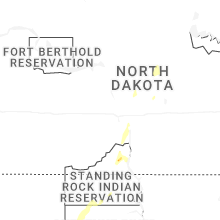


Connect with Interactive Hail Maps