

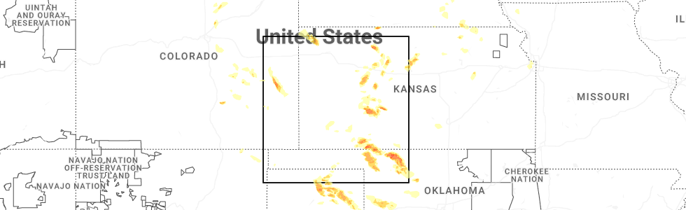
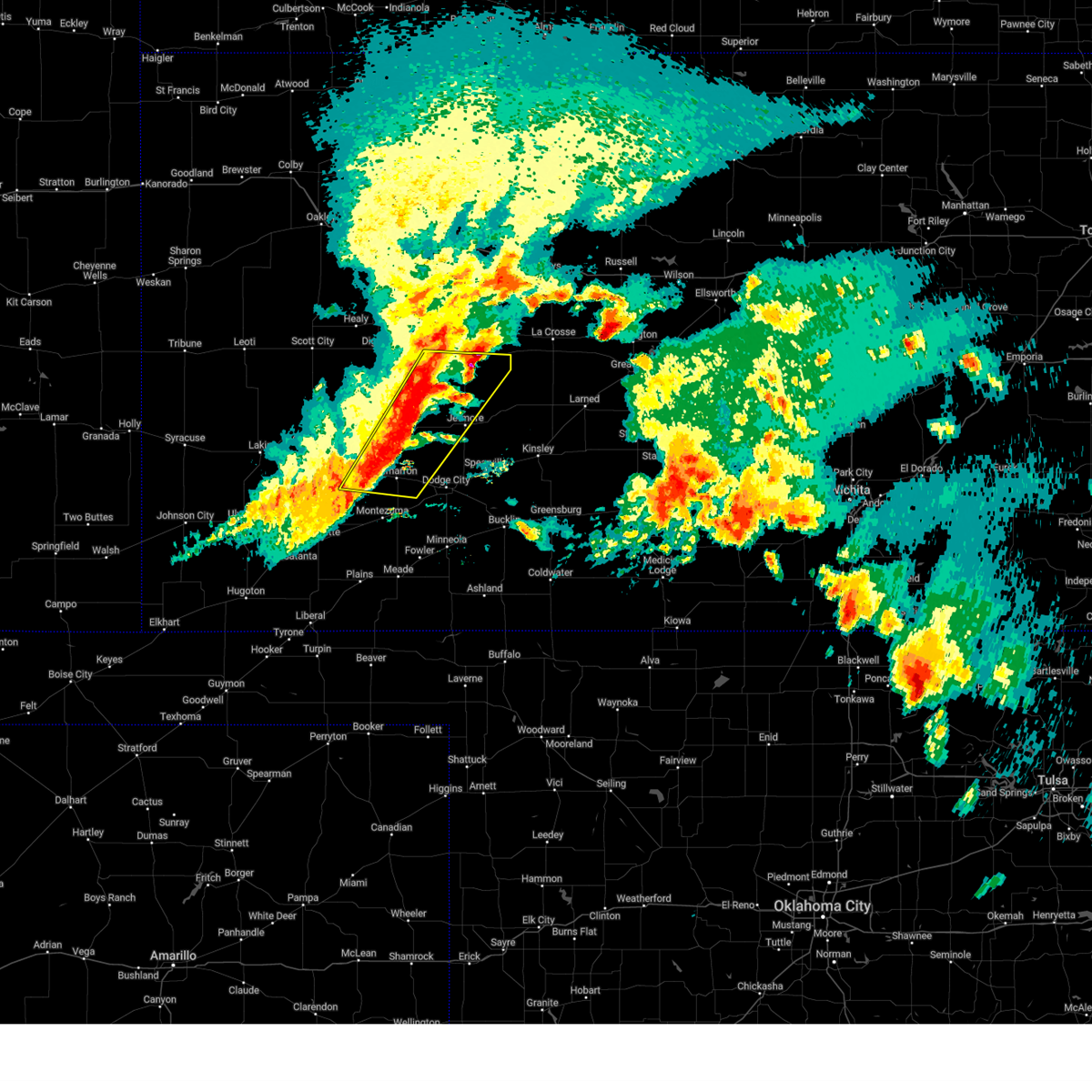
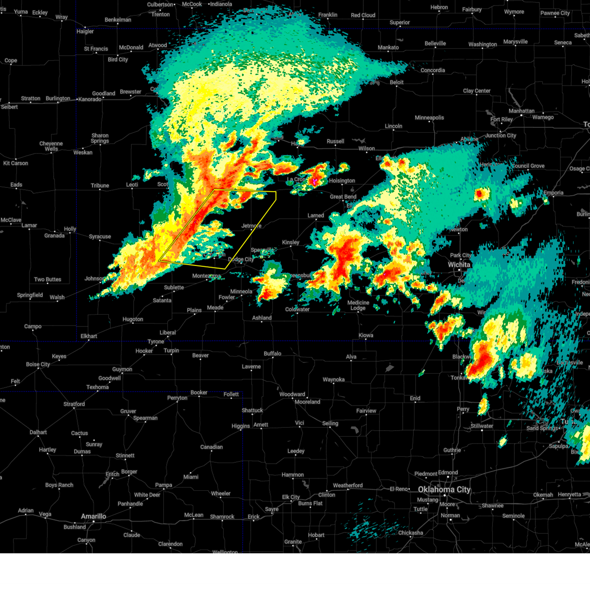
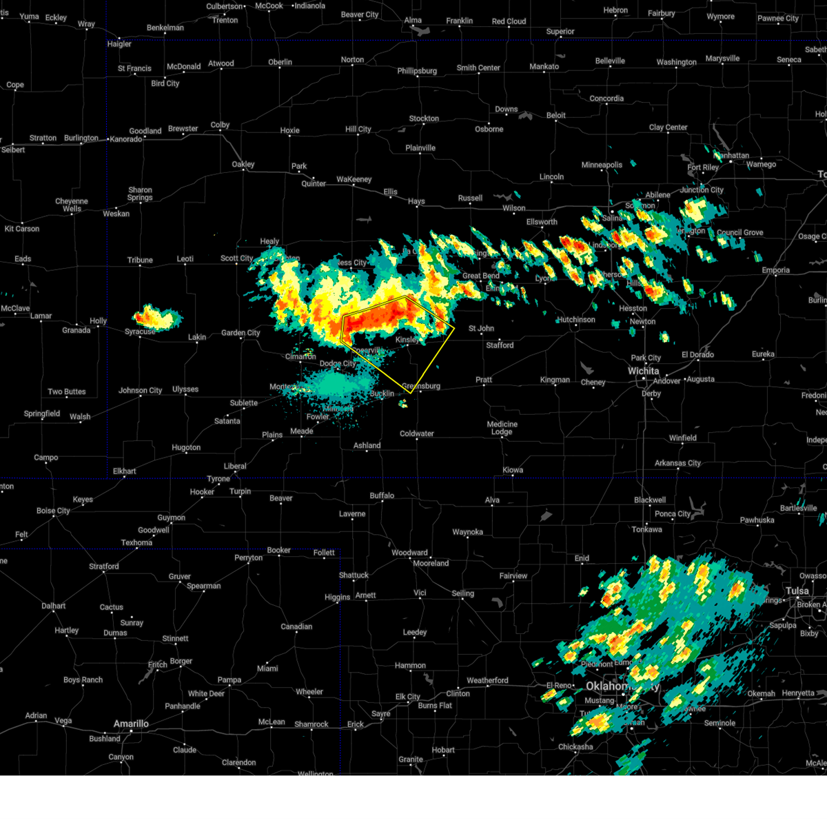
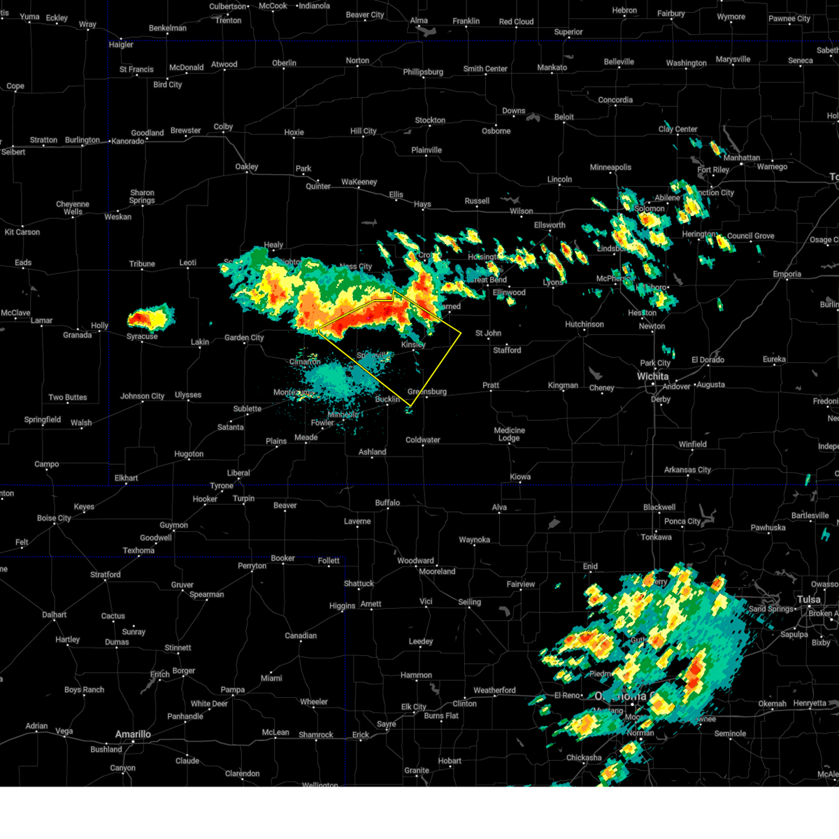
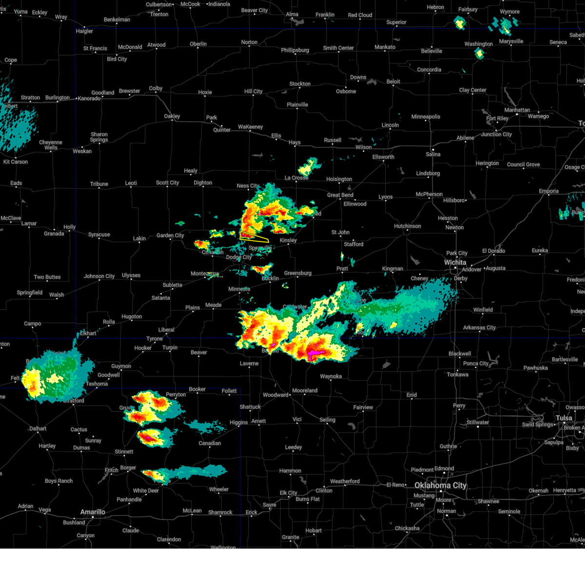
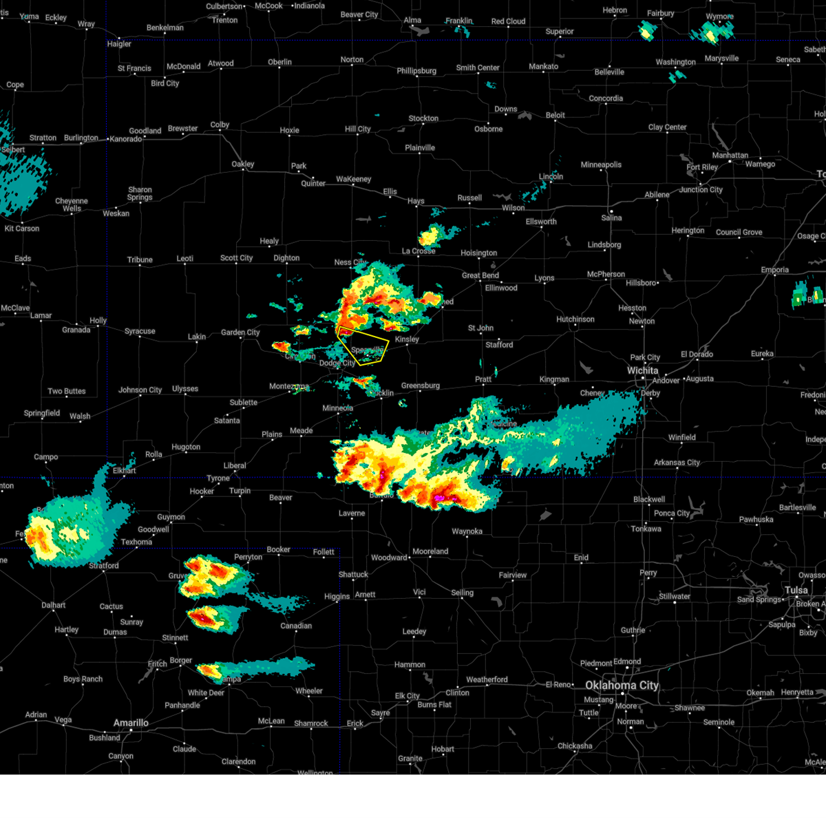
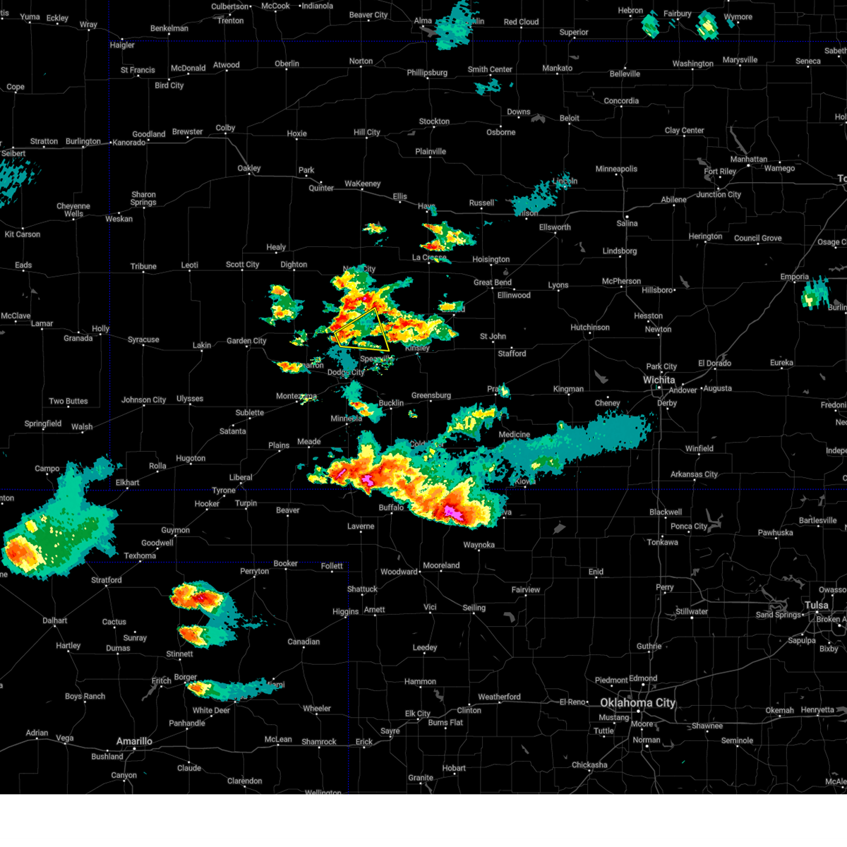
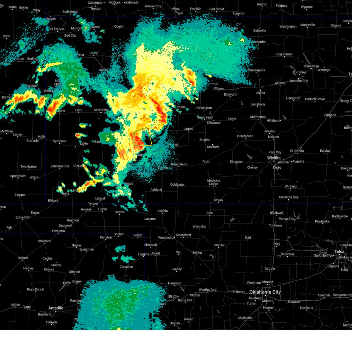
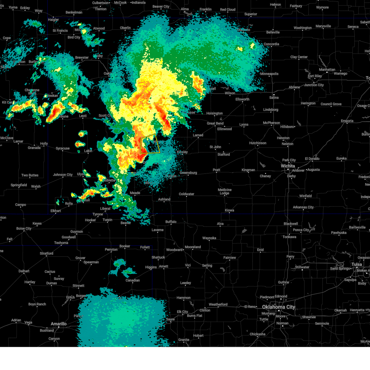
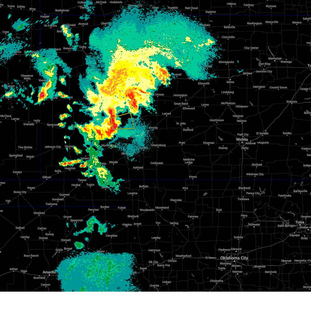
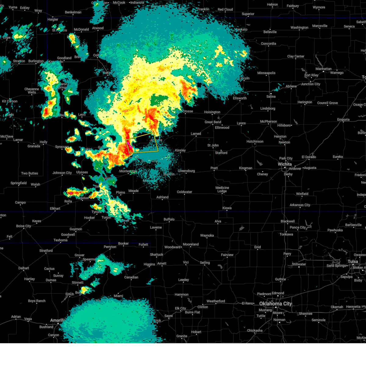
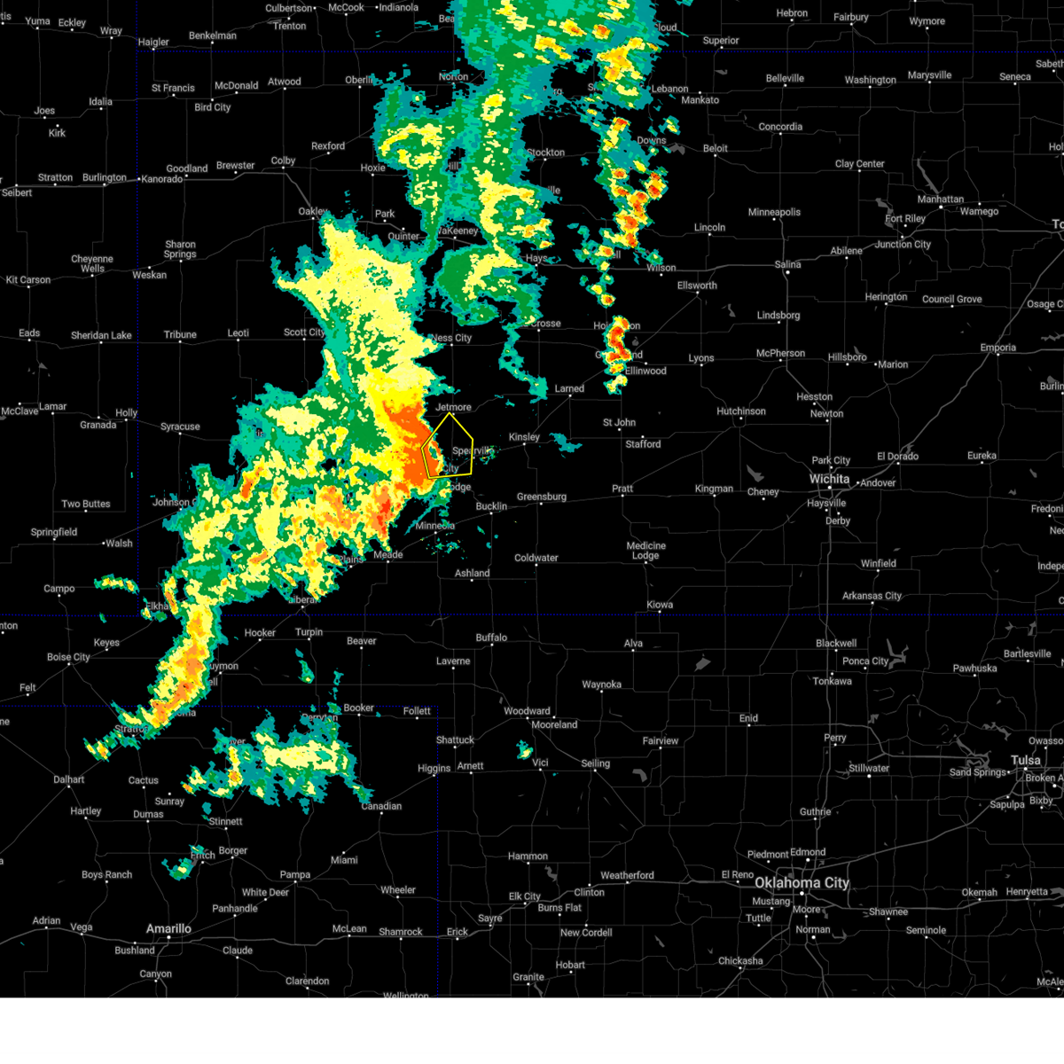
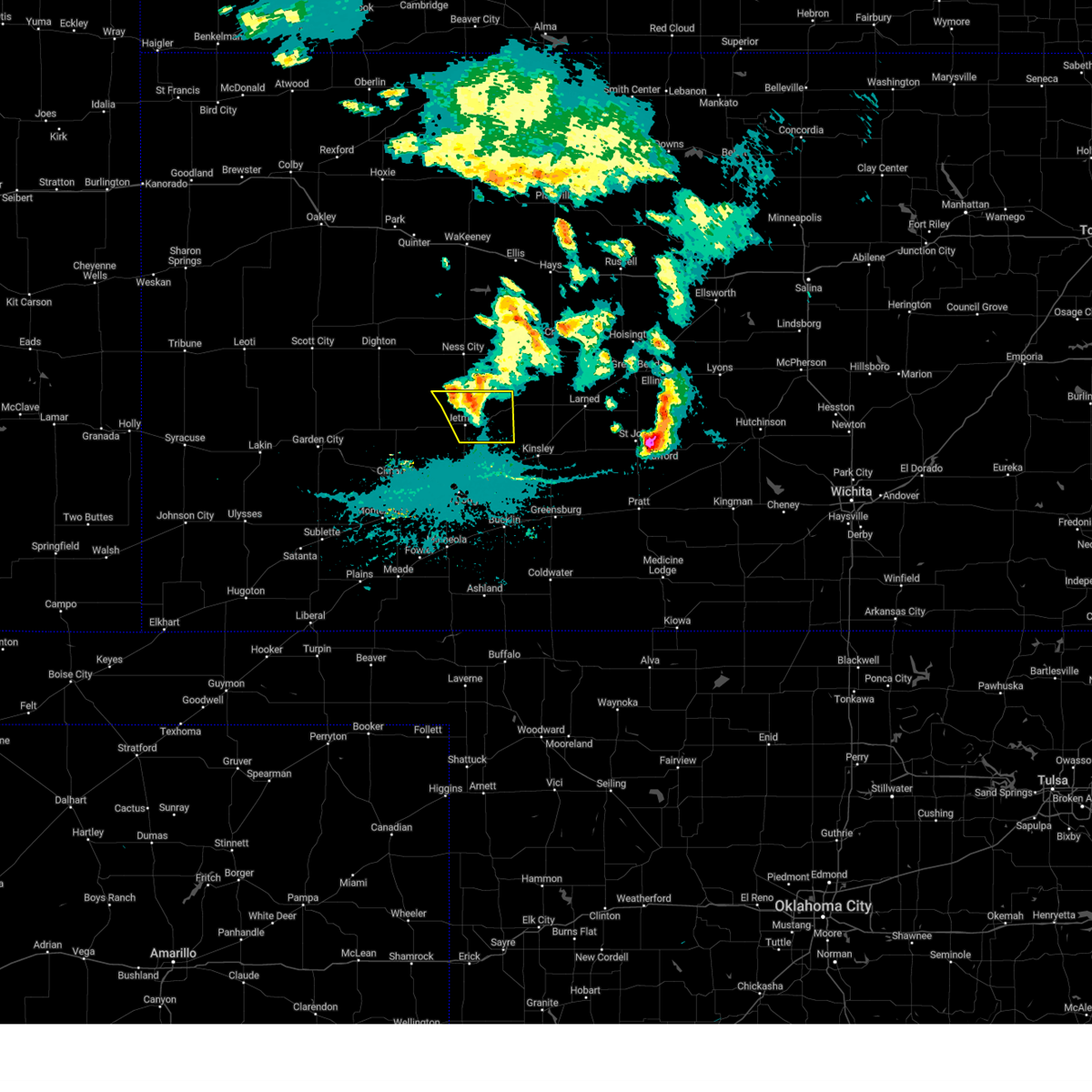
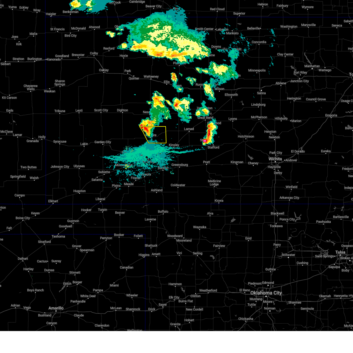
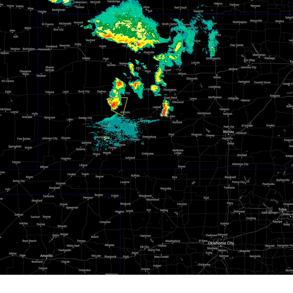
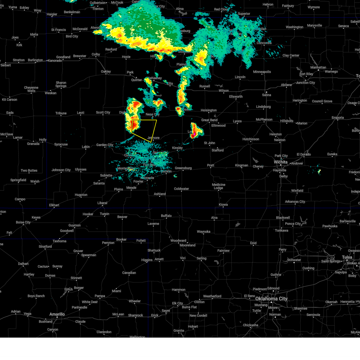
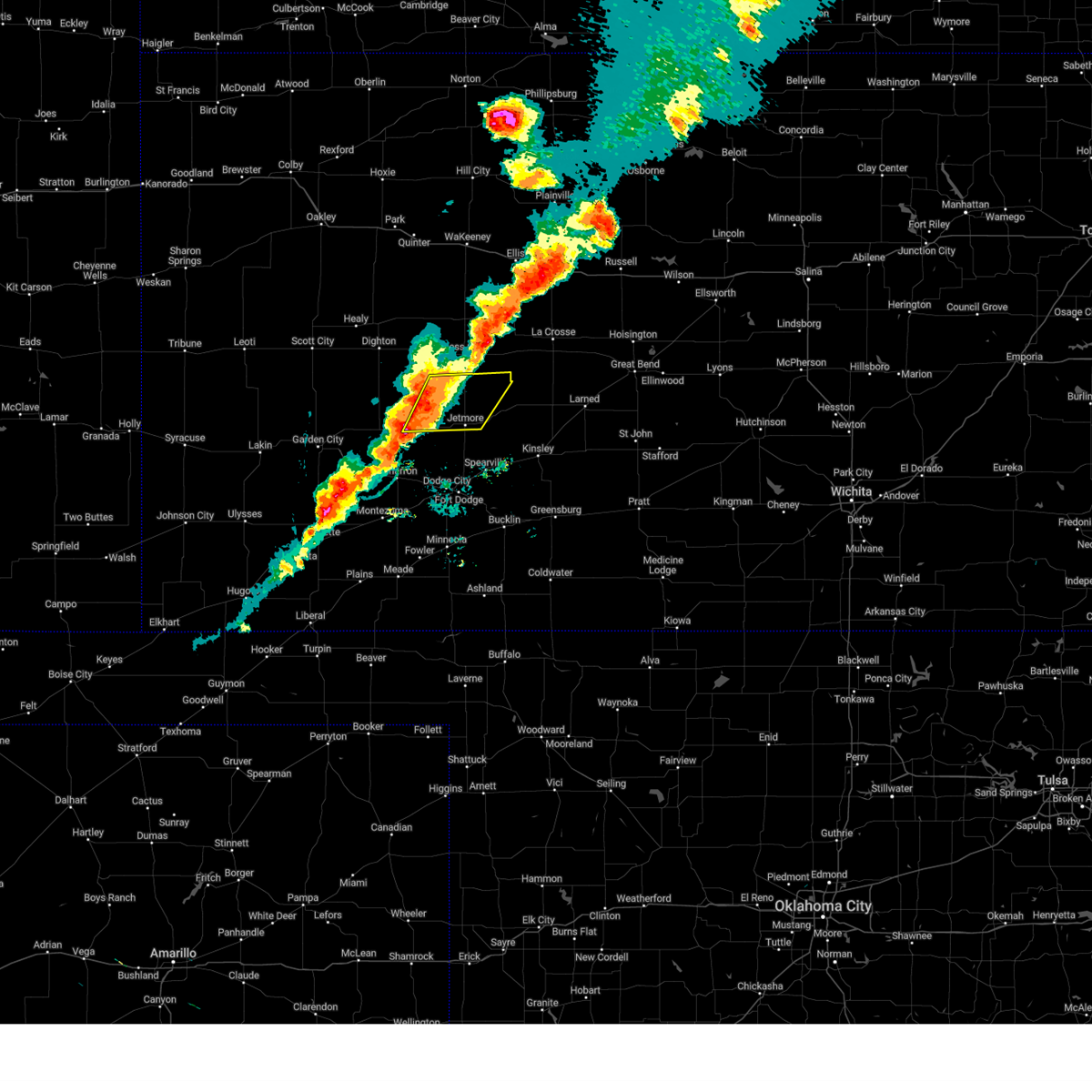
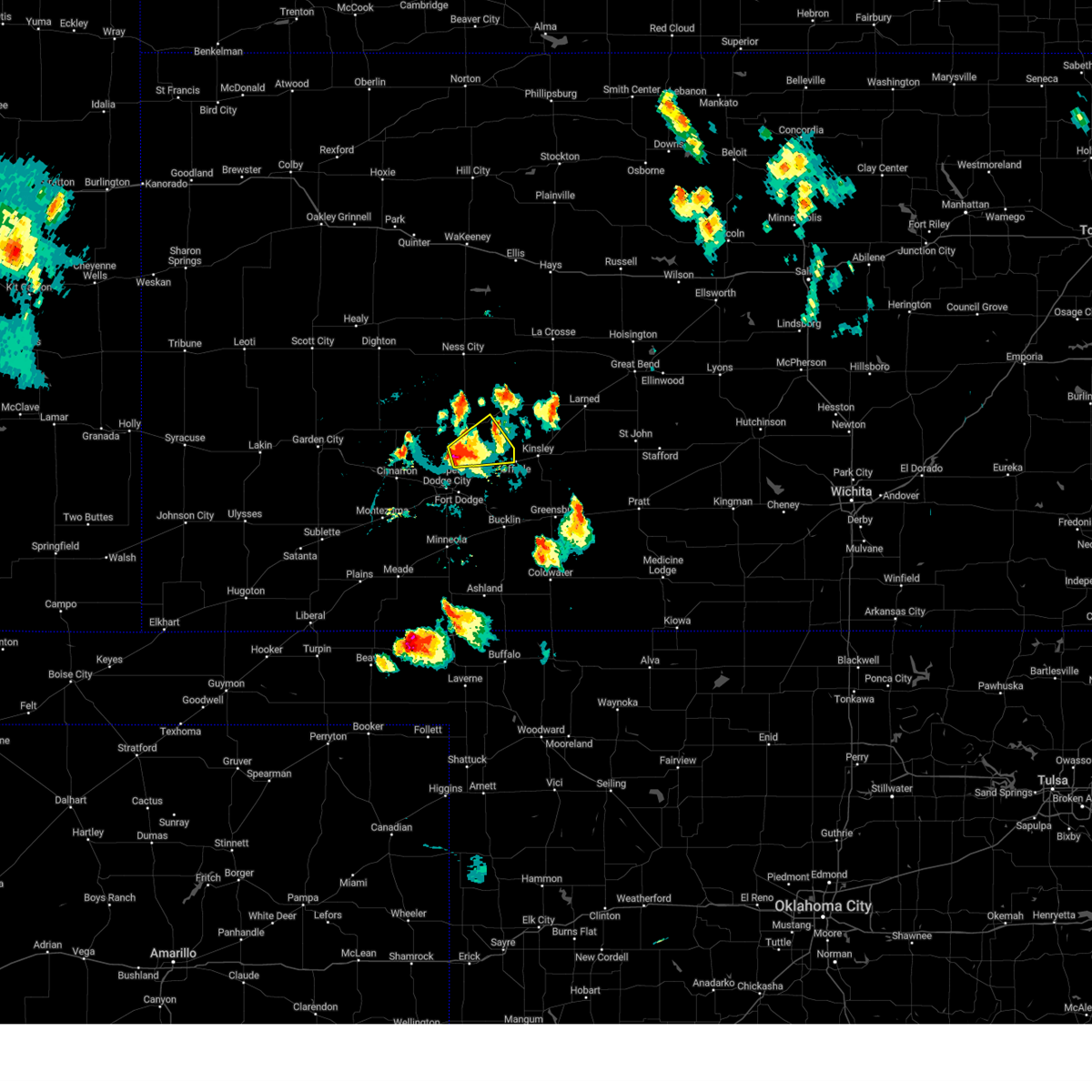
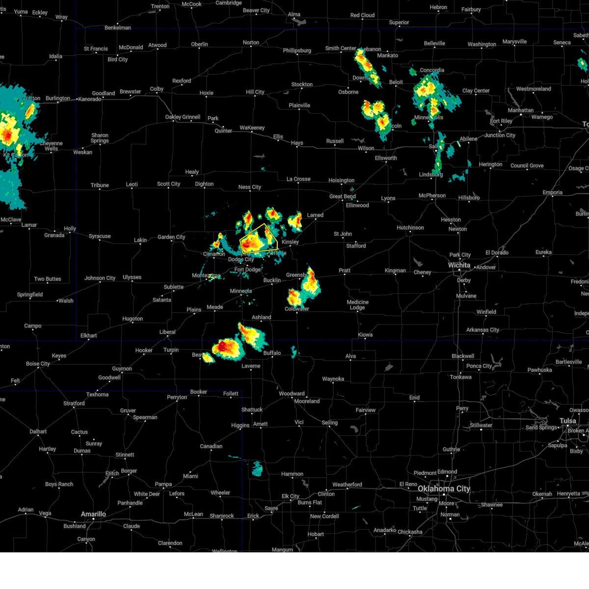
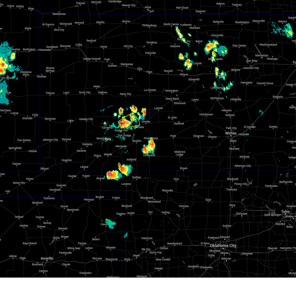
Hail Map for Jetmore, KS
The Jetmore, KS area has had 50 reports of on-the-ground hail by trained spotters, and has been under severe weather warnings 29 times during the past 12 months. Doppler radar has detected hail at or near Jetmore, KS on 120 occasions, including 9 occasions during the past year.
| Name: | Jetmore, KS |
| Where Located: | 53.3 miles E of Garden City, KS |
| Map: | Google Map for Jetmore, KS |
| Population: | 867 |
| Housing Units: | 439 |
| More Info: | Search Google for Jetmore, KS |
3
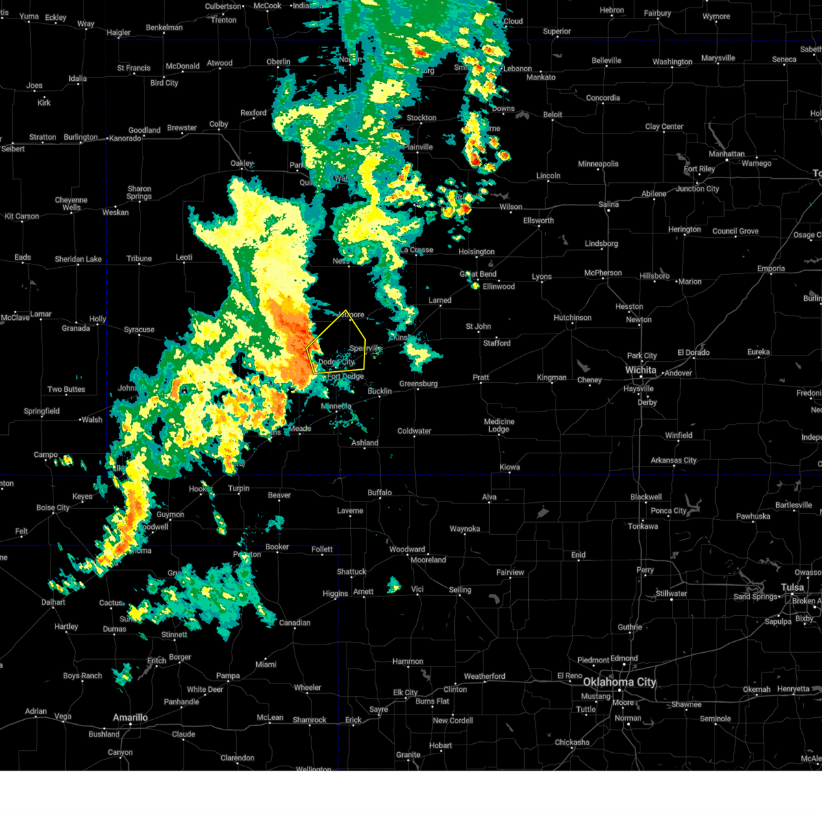
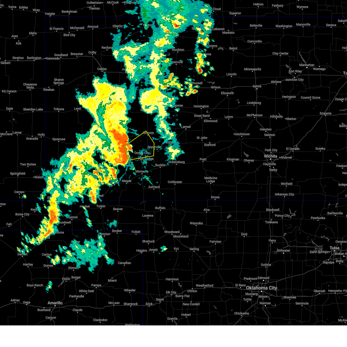
The Top Recent Hail Date for Jetmore, KS is Thursday, April 24, 2025 (5th out of 120)
Hail and Wind Damage Spotted near Jetmore, KS
| Date / Time | Report Details |
|---|---|
| 7/10/2025 8:30 PM CDT |
 Svrddc the national weather service in dodge city has issued a * severe thunderstorm warning for, northwestern ford county in southwestern kansas, southeastern kearny county in southwestern kansas, finney county in southwestern kansas, grant county in southwestern kansas, western hodgeman county in southwestern kansas, gray county in southwestern kansas, haskell county in southwestern kansas, * until 915 pm cdt. * at 830 pm cdt, severe thunderstorms were located along a line extending from near friend to 12 miles south of ulysses, moving east at 40 mph (radar indicated). Hazards include 60 mph wind gusts. Expect damage to roofs, siding, and trees. severe thunderstorms will be near, garden city and hickok around 835 pm cdt. ryus around 840 pm cdt. plymell around 845 pm cdt. Other locations in the path of these severe thunderstorms include satanta, pierceville, sublette and charleston. Svrddc the national weather service in dodge city has issued a * severe thunderstorm warning for, northwestern ford county in southwestern kansas, southeastern kearny county in southwestern kansas, finney county in southwestern kansas, grant county in southwestern kansas, western hodgeman county in southwestern kansas, gray county in southwestern kansas, haskell county in southwestern kansas, * until 915 pm cdt. * at 830 pm cdt, severe thunderstorms were located along a line extending from near friend to 12 miles south of ulysses, moving east at 40 mph (radar indicated). Hazards include 60 mph wind gusts. Expect damage to roofs, siding, and trees. severe thunderstorms will be near, garden city and hickok around 835 pm cdt. ryus around 840 pm cdt. plymell around 845 pm cdt. Other locations in the path of these severe thunderstorms include satanta, pierceville, sublette and charleston.
|
| 5/25/2025 5:06 AM CDT |
 At 506 am cdt, severe thunderstorms were located along a line extending from 8 miles south of nekoma to 7 miles north of minneola, moving east at 50 mph (radar indicated). Hazards include 70 mph wind gusts and penny size hail. Expect considerable tree damage. damage is likely to mobile homes, roofs, and outbuildings. Locations impacted include, spearville, burdett, rozel, bellefont, ford, offerle, windhorst, kinsley, ash valley, kingsdown, sanford, bucklin, garfield and frizell. At 506 am cdt, severe thunderstorms were located along a line extending from 8 miles south of nekoma to 7 miles north of minneola, moving east at 50 mph (radar indicated). Hazards include 70 mph wind gusts and penny size hail. Expect considerable tree damage. damage is likely to mobile homes, roofs, and outbuildings. Locations impacted include, spearville, burdett, rozel, bellefont, ford, offerle, windhorst, kinsley, ash valley, kingsdown, sanford, bucklin, garfield and frizell.
|
| 5/25/2025 4:45 AM CDT | Kansas state mesonet site hodgeman count in hodgeman county KS, 3 miles S of Jetmore, KS |
| 5/25/2025 4:39 AM CDT |
 Svrddc the national weather service in dodge city has issued a * severe thunderstorm warning for, ford county in southwestern kansas, northwestern kiowa county in south central kansas, southeastern ness county in west central kansas, hodgeman county in southwestern kansas, pawnee county in south central kansas, gray county in southwestern kansas, western edwards county in south central kansas, * until 530 am cdt. * at 439 am cdt, severe thunderstorms were located along a line extending from near ness city to near montezuma, moving east at 50 mph (radar indicated). Hazards include 60 mph wind gusts and penny size hail. Expect damage to roofs, siding, and trees. severe thunderstorms will be near, jetmore, ensign, howell, and the haggard elev around 445 am cdt. dodge city around 450 am cdt. hanston around 455 am cdt. other locations in the path of these severe thunderstorms include gray, burdett, wright, ft. Dodge, spearville, ford, rozel, bellefont, offerle, bloom, ash valley, windhorst, sanford, kinsley and kingsdown. Svrddc the national weather service in dodge city has issued a * severe thunderstorm warning for, ford county in southwestern kansas, northwestern kiowa county in south central kansas, southeastern ness county in west central kansas, hodgeman county in southwestern kansas, pawnee county in south central kansas, gray county in southwestern kansas, western edwards county in south central kansas, * until 530 am cdt. * at 439 am cdt, severe thunderstorms were located along a line extending from near ness city to near montezuma, moving east at 50 mph (radar indicated). Hazards include 60 mph wind gusts and penny size hail. Expect damage to roofs, siding, and trees. severe thunderstorms will be near, jetmore, ensign, howell, and the haggard elev around 445 am cdt. dodge city around 450 am cdt. hanston around 455 am cdt. other locations in the path of these severe thunderstorms include gray, burdett, wright, ft. Dodge, spearville, ford, rozel, bellefont, offerle, bloom, ash valley, windhorst, sanford, kinsley and kingsdown.
|
| 5/25/2025 4:34 AM CDT |
 the severe thunderstorm warning has been cancelled and is no longer in effect the severe thunderstorm warning has been cancelled and is no longer in effect
|
| 5/25/2025 4:34 AM CDT |
 At 433 am cdt, severe thunderstorms were located along a line extending from 6 miles southeast of ness city to near cimarron, moving east at 40 mph (radar indicated). Hazards include 60 mph wind gusts and penny size hail. Expect damage to roofs, siding, and trees. Locations impacted include, cimarron, ness city, jetmore, bazine, ingalls, howell, and kalvesta. At 433 am cdt, severe thunderstorms were located along a line extending from 6 miles southeast of ness city to near cimarron, moving east at 40 mph (radar indicated). Hazards include 60 mph wind gusts and penny size hail. Expect damage to roofs, siding, and trees. Locations impacted include, cimarron, ness city, jetmore, bazine, ingalls, howell, and kalvesta.
|
| 5/25/2025 4:22 AM CDT |
 At 421 am cdt, severe thunderstorms were located along a line extending from 7 miles southwest of ness city to near charleston, moving east at 40 mph (radar indicated). Hazards include 60 mph wind gusts and penny size hail. Expect damage to roofs, siding, and trees. Locations impacted include, ingalls, kalvesta, cimarron, jetmore and howell. At 421 am cdt, severe thunderstorms were located along a line extending from 7 miles southwest of ness city to near charleston, moving east at 40 mph (radar indicated). Hazards include 60 mph wind gusts and penny size hail. Expect damage to roofs, siding, and trees. Locations impacted include, ingalls, kalvesta, cimarron, jetmore and howell.
|
| 5/25/2025 4:00 AM CDT |
 Svrddc the national weather service in dodge city has issued a * severe thunderstorm warning for, northwestern ford county in southwestern kansas, central finney county in southwestern kansas, southern ness county in west central kansas, western hodgeman county in southwestern kansas, southeastern lane county in west central kansas, northern gray county in southwestern kansas, * until 445 am cdt. * at 359 am cdt, severe thunderstorms were located along a line extending from near alamota to near plymell, moving east at 40 mph (radar indicated). Hazards include 60 mph wind gusts and penny size hail. Expect damage to roofs, siding, and trees. severe thunderstorms will be near, pierceville and beeler around 405 am cdt. charleston around 410 am cdt. kalvesta around 415 am cdt. Other locations in the path of these severe thunderstorms include ingalls and cimarron. Svrddc the national weather service in dodge city has issued a * severe thunderstorm warning for, northwestern ford county in southwestern kansas, central finney county in southwestern kansas, southern ness county in west central kansas, western hodgeman county in southwestern kansas, southeastern lane county in west central kansas, northern gray county in southwestern kansas, * until 445 am cdt. * at 359 am cdt, severe thunderstorms were located along a line extending from near alamota to near plymell, moving east at 40 mph (radar indicated). Hazards include 60 mph wind gusts and penny size hail. Expect damage to roofs, siding, and trees. severe thunderstorms will be near, pierceville and beeler around 405 am cdt. charleston around 410 am cdt. kalvesta around 415 am cdt. Other locations in the path of these severe thunderstorms include ingalls and cimarron.
|
| 5/24/2025 12:43 AM CDT |
 At 1243 am cdt, a severe thunderstorm was located near spearville, moving southeast at 30 mph (radar indicated). Hazards include 60 mph wind gusts and quarter size hail. Hail damage to vehicles is expected. expect wind damage to roofs, siding, and trees. Locations impacted include, gray, kinsley, jetmore, spearville, lewis, burdett, hanston, offerle, garfield, rozel, belpre, sanford, bellefont, windhorst, centerview, and zook. At 1243 am cdt, a severe thunderstorm was located near spearville, moving southeast at 30 mph (radar indicated). Hazards include 60 mph wind gusts and quarter size hail. Hail damage to vehicles is expected. expect wind damage to roofs, siding, and trees. Locations impacted include, gray, kinsley, jetmore, spearville, lewis, burdett, hanston, offerle, garfield, rozel, belpre, sanford, bellefont, windhorst, centerview, and zook.
|
| 5/24/2025 12:21 AM CDT |
 Svrddc the national weather service in dodge city has issued a * severe thunderstorm warning for, northeastern ford county in southwestern kansas, northwestern kiowa county in south central kansas, hodgeman county in southwestern kansas, southwestern pawnee county in south central kansas, edwards county in south central kansas, * until 100 am cdt. * at 1221 am cdt, a severe thunderstorm was located near jetmore, moving southeast at 35 mph (radar indicated). Hazards include 60 mph wind gusts and quarter size hail. Hail damage to vehicles is expected. Expect wind damage to roofs, siding, and trees. Svrddc the national weather service in dodge city has issued a * severe thunderstorm warning for, northeastern ford county in southwestern kansas, northwestern kiowa county in south central kansas, hodgeman county in southwestern kansas, southwestern pawnee county in south central kansas, edwards county in south central kansas, * until 100 am cdt. * at 1221 am cdt, a severe thunderstorm was located near jetmore, moving southeast at 35 mph (radar indicated). Hazards include 60 mph wind gusts and quarter size hail. Hail damage to vehicles is expected. Expect wind damage to roofs, siding, and trees.
|
| 4/24/2025 7:44 PM CDT | At 743 pm cdt, a severe thunderstorm was located 7 miles north of spearville, moving southeast at 20 mph (public and radar. at 732 pm cdt, quarter size hail was reported 7 miles south southwest of jetmore). Hazards include two inch hail and 60 mph wind gusts. People and animals outdoors will be injured. expect hail damage to roofs, siding, windows, and vehicles. expect wind damage to roofs, siding, and trees. Locations impacted include, spearville and bellefont. |
| 4/24/2025 7:32 PM CDT | Quarter sized hail reported 4.7 miles NNE of Jetmore, KS |
| 4/24/2025 7:23 PM CDT |
 At 723 pm cdt, a severe thunderstorm was located near jetmore, moving southeast at 20 mph (radar indicated). Hazards include two inch hail and 60 mph wind gusts. People and animals outdoors will be injured. expect hail damage to roofs, siding, windows, and vehicles. expect wind damage to roofs, siding, and trees. This severe thunderstorm will remain over mainly rural areas of southeastern hodgeman county. At 723 pm cdt, a severe thunderstorm was located near jetmore, moving southeast at 20 mph (radar indicated). Hazards include two inch hail and 60 mph wind gusts. People and animals outdoors will be injured. expect hail damage to roofs, siding, windows, and vehicles. expect wind damage to roofs, siding, and trees. This severe thunderstorm will remain over mainly rural areas of southeastern hodgeman county.
|
| 4/24/2025 7:21 PM CDT |
 Svrddc the national weather service in dodge city has issued a * severe thunderstorm warning for, northeastern ford county in southwestern kansas, southeastern hodgeman county in southwestern kansas, * until 800 pm cdt. * at 721 pm cdt, a severe thunderstorm was located 7 miles southwest of jetmore, moving southeast at 20 mph (radar indicated). Hazards include two inch hail and 60 mph wind gusts. People and animals outdoors will be injured. expect hail damage to roofs, siding, windows, and vehicles. expect wind damage to roofs, siding, and trees. This severe thunderstorm will remain over mainly rural areas of northeastern ford and southeastern hodgeman counties. Svrddc the national weather service in dodge city has issued a * severe thunderstorm warning for, northeastern ford county in southwestern kansas, southeastern hodgeman county in southwestern kansas, * until 800 pm cdt. * at 721 pm cdt, a severe thunderstorm was located 7 miles southwest of jetmore, moving southeast at 20 mph (radar indicated). Hazards include two inch hail and 60 mph wind gusts. People and animals outdoors will be injured. expect hail damage to roofs, siding, windows, and vehicles. expect wind damage to roofs, siding, and trees. This severe thunderstorm will remain over mainly rural areas of northeastern ford and southeastern hodgeman counties.
|
| 4/24/2025 7:06 PM CDT |
 Svrddc the national weather service in dodge city has issued a * severe thunderstorm warning for, central hodgeman county in southwestern kansas, * until 745 pm cdt. * at 706 pm cdt, a severe thunderstorm was located near jetmore, moving northeast at 20 mph (radar indicated). Hazards include 60 mph wind gusts and half dollar size hail. Hail damage to vehicles is expected. expect wind damage to roofs, siding, and trees. This severe thunderstorm will be near, jetmore around 715 pm cdt. Svrddc the national weather service in dodge city has issued a * severe thunderstorm warning for, central hodgeman county in southwestern kansas, * until 745 pm cdt. * at 706 pm cdt, a severe thunderstorm was located near jetmore, moving northeast at 20 mph (radar indicated). Hazards include 60 mph wind gusts and half dollar size hail. Hail damage to vehicles is expected. expect wind damage to roofs, siding, and trees. This severe thunderstorm will be near, jetmore around 715 pm cdt.
|
| 4/23/2025 11:05 PM CDT |
 The storm which prompted the warning has weakened below severe limits, and no longer poses an immediate threat to life or property. therefore, the warning will be allowed to expire. however, small hail, gusty winds and heavy rain are still possible with this thunderstorm. The storm which prompted the warning has weakened below severe limits, and no longer poses an immediate threat to life or property. therefore, the warning will be allowed to expire. however, small hail, gusty winds and heavy rain are still possible with this thunderstorm.
|
| 4/23/2025 10:54 PM CDT |
 At 1054 pm cdt, a severe thunderstorm was located 8 miles east of kalvesta, moving east at 25 mph (radar indicated). Hazards include 60 mph wind gusts and nickel size hail. Expect damage to roofs, siding, and trees. Locations impacted include, jetmore. At 1054 pm cdt, a severe thunderstorm was located 8 miles east of kalvesta, moving east at 25 mph (radar indicated). Hazards include 60 mph wind gusts and nickel size hail. Expect damage to roofs, siding, and trees. Locations impacted include, jetmore.
|
| 4/23/2025 10:54 PM CDT |
 the severe thunderstorm warning has been cancelled and is no longer in effect the severe thunderstorm warning has been cancelled and is no longer in effect
|
| 4/23/2025 10:51 PM CDT |
 At 1051 pm cdt, a severe thunderstorm was located 7 miles east of kalvesta, moving east at 15 mph (radar indicated). Hazards include 60 mph wind gusts and nickel size hail. Expect damage to roofs, siding, and trees. Locations impacted include, kalvesta and jetmore. At 1051 pm cdt, a severe thunderstorm was located 7 miles east of kalvesta, moving east at 15 mph (radar indicated). Hazards include 60 mph wind gusts and nickel size hail. Expect damage to roofs, siding, and trees. Locations impacted include, kalvesta and jetmore.
|
| 4/23/2025 10:37 PM CDT |
 At 1036 pm cdt, a severe thunderstorm was located near kalvesta, moving east at 25 mph (radar indicated). Hazards include 60 mph wind gusts and quarter size hail. Hail damage to vehicles is expected. expect wind damage to roofs, siding, and trees. Locations impacted include, jetmore. At 1036 pm cdt, a severe thunderstorm was located near kalvesta, moving east at 25 mph (radar indicated). Hazards include 60 mph wind gusts and quarter size hail. Hail damage to vehicles is expected. expect wind damage to roofs, siding, and trees. Locations impacted include, jetmore.
|
| 4/23/2025 10:21 PM CDT |
 Svrddc the national weather service in dodge city has issued a * severe thunderstorm warning for, east central finney county in southwestern kansas, western hodgeman county in southwestern kansas, northeastern gray county in southwestern kansas, * until 1115 pm cdt. * at 1021 pm cdt, a severe thunderstorm was located near kalvesta, moving east at 25 mph (radar indicated). Hazards include 60 mph wind gusts and quarter size hail. Hail damage to vehicles is expected. expect wind damage to roofs, siding, and trees. This severe thunderstorm will be near, kalvesta around 1025 pm cdt. Svrddc the national weather service in dodge city has issued a * severe thunderstorm warning for, east central finney county in southwestern kansas, western hodgeman county in southwestern kansas, northeastern gray county in southwestern kansas, * until 1115 pm cdt. * at 1021 pm cdt, a severe thunderstorm was located near kalvesta, moving east at 25 mph (radar indicated). Hazards include 60 mph wind gusts and quarter size hail. Hail damage to vehicles is expected. expect wind damage to roofs, siding, and trees. This severe thunderstorm will be near, kalvesta around 1025 pm cdt.
|
| 9/18/2024 1:10 AM CDT |
 the severe thunderstorm warning has been cancelled and is no longer in effect the severe thunderstorm warning has been cancelled and is no longer in effect
|
| 9/18/2024 1:10 AM CDT |
 At 109 am cdt, a severe thunderstorm was located near wright, moving northeast at 50 mph (radar indicated). Hazards include 60 mph wind gusts. Expect damage to roofs, siding, and trees. This severe thunderstorm will remain over mainly rural areas of northwestern ford and south central hodgeman counties. At 109 am cdt, a severe thunderstorm was located near wright, moving northeast at 50 mph (radar indicated). Hazards include 60 mph wind gusts. Expect damage to roofs, siding, and trees. This severe thunderstorm will remain over mainly rural areas of northwestern ford and south central hodgeman counties.
|
| 9/18/2024 1:02 AM CDT |
 At 101 am cdt, a severe thunderstorm was located 4 miles west of dodge city, moving east at 45 mph (radar indicated). Hazards include 60 mph wind gusts. Expect damage to roofs, siding, and trees. This severe storm will be near, dodge city around 105 am cdt. At 101 am cdt, a severe thunderstorm was located 4 miles west of dodge city, moving east at 45 mph (radar indicated). Hazards include 60 mph wind gusts. Expect damage to roofs, siding, and trees. This severe storm will be near, dodge city around 105 am cdt.
|
| 9/18/2024 12:51 AM CDT |
 Svrddc the national weather service in dodge city has issued a * severe thunderstorm warning for, northwestern ford county in southwestern kansas, southwestern hodgeman county in southwestern kansas, northeastern gray county in southwestern kansas, * until 130 am cdt. * at 1250 am cdt, a severe thunderstorm was located near howell, moving northeast at 50 mph (radar indicated). Hazards include 60 mph wind gusts. Expect damage to roofs, siding, and trees. This severe thunderstorm will be near, howell around 1255 am cdt. Svrddc the national weather service in dodge city has issued a * severe thunderstorm warning for, northwestern ford county in southwestern kansas, southwestern hodgeman county in southwestern kansas, northeastern gray county in southwestern kansas, * until 130 am cdt. * at 1250 am cdt, a severe thunderstorm was located near howell, moving northeast at 50 mph (radar indicated). Hazards include 60 mph wind gusts. Expect damage to roofs, siding, and trees. This severe thunderstorm will be near, howell around 1255 am cdt.
|
| 8/16/2024 11:21 AM CDT |
 the severe thunderstorm warning has been cancelled and is no longer in effect the severe thunderstorm warning has been cancelled and is no longer in effect
|
| 8/16/2024 11:07 AM CDT |
 Svrddc the national weather service in dodge city has issued a * severe thunderstorm warning for, eastern hodgeman county in southwestern kansas, * until 1145 am cdt. * at 1107 am cdt, a severe thunderstorm was located 11 miles northwest of jetmore, moving east at 25 mph (radar indicated). Hazards include 70 mph wind gusts and quarter size hail. Hail damage to vehicles is expected. expect considerable tree damage. wind damage is also likely to mobile homes, roofs, and outbuildings. This severe thunderstorm will remain over mainly rural areas of eastern hodgeman county. Svrddc the national weather service in dodge city has issued a * severe thunderstorm warning for, eastern hodgeman county in southwestern kansas, * until 1145 am cdt. * at 1107 am cdt, a severe thunderstorm was located 11 miles northwest of jetmore, moving east at 25 mph (radar indicated). Hazards include 70 mph wind gusts and quarter size hail. Hail damage to vehicles is expected. expect considerable tree damage. wind damage is also likely to mobile homes, roofs, and outbuildings. This severe thunderstorm will remain over mainly rural areas of eastern hodgeman county.
|
| 8/16/2024 10:46 AM CDT |
 the severe thunderstorm warning has been cancelled and is no longer in effect the severe thunderstorm warning has been cancelled and is no longer in effect
|
| 8/16/2024 10:46 AM CDT |
 At 1045 am cdt, a severe thunderstorm was located 11 miles south of beeler, moving east at 25 mph (radar indicated). Hazards include ping pong ball size hail and 60 mph wind gusts. People and animals outdoors will be injured. expect hail damage to roofs, siding, windows, and vehicles. expect wind damage to roofs, siding, and trees. This severe thunderstorm will remain over mainly rural areas of southwestern ness and northwestern hodgeman counties. At 1045 am cdt, a severe thunderstorm was located 11 miles south of beeler, moving east at 25 mph (radar indicated). Hazards include ping pong ball size hail and 60 mph wind gusts. People and animals outdoors will be injured. expect hail damage to roofs, siding, windows, and vehicles. expect wind damage to roofs, siding, and trees. This severe thunderstorm will remain over mainly rural areas of southwestern ness and northwestern hodgeman counties.
|
| 8/16/2024 10:26 AM CDT |
 Svrddc the national weather service in dodge city has issued a * severe thunderstorm warning for, northeastern finney county in southwestern kansas, southwestern ness county in west central kansas, northwestern hodgeman county in southwestern kansas, southeastern lane county in west central kansas, * until 1115 am cdt. * at 1026 am cdt, a severe thunderstorm was located 8 miles south of alamota, moving east at 30 mph (radar indicated). Hazards include golf ball size hail and 60 mph wind gusts. People and animals outdoors will be injured. expect hail damage to roofs, siding, windows, and vehicles. expect wind damage to roofs, siding, and trees. This severe thunderstorm will remain over mainly rural areas of northeastern finney, southwestern ness, northwestern hodgeman and southeastern lane counties. Svrddc the national weather service in dodge city has issued a * severe thunderstorm warning for, northeastern finney county in southwestern kansas, southwestern ness county in west central kansas, northwestern hodgeman county in southwestern kansas, southeastern lane county in west central kansas, * until 1115 am cdt. * at 1026 am cdt, a severe thunderstorm was located 8 miles south of alamota, moving east at 30 mph (radar indicated). Hazards include golf ball size hail and 60 mph wind gusts. People and animals outdoors will be injured. expect hail damage to roofs, siding, windows, and vehicles. expect wind damage to roofs, siding, and trees. This severe thunderstorm will remain over mainly rural areas of northeastern finney, southwestern ness, northwestern hodgeman and southeastern lane counties.
|
| 7/16/2024 8:28 PM CDT |
 Svrddc the national weather service in dodge city has issued a * severe thunderstorm warning for, northeastern ford county in southwestern kansas, southeastern hodgeman county in southwestern kansas, southwestern edwards county in south central kansas, * until 915 pm cdt. * at 828 pm cdt, a severe thunderstorm was located 7 miles north of spearville, moving southeast at 25 mph (radar indicated). Hazards include golf ball size hail. People and animals outdoors will be injured. expect damage to roofs, siding, windows, and vehicles. this severe thunderstorm will be near, spearville and bellefont around 840 pm cdt. Other locations in the path of this severe thunderstorm include windhorst. Svrddc the national weather service in dodge city has issued a * severe thunderstorm warning for, northeastern ford county in southwestern kansas, southeastern hodgeman county in southwestern kansas, southwestern edwards county in south central kansas, * until 915 pm cdt. * at 828 pm cdt, a severe thunderstorm was located 7 miles north of spearville, moving southeast at 25 mph (radar indicated). Hazards include golf ball size hail. People and animals outdoors will be injured. expect damage to roofs, siding, windows, and vehicles. this severe thunderstorm will be near, spearville and bellefont around 840 pm cdt. Other locations in the path of this severe thunderstorm include windhorst.
|
| 7/6/2024 6:15 PM CDT |
 Svrddc the national weather service in dodge city has issued a * severe thunderstorm warning for, northeastern finney county in southwestern kansas, southeastern scott county in west central kansas, hodgeman county in southwestern kansas, western pawnee county in south central kansas, western rush county in central kansas, northwestern edwards county in south central kansas, * until 715 pm cdt. * at 614 pm cdt, severe thunderstorms were located along a line extending from near bazine to 10 miles south of beeler to 6 miles east of shallow water, moving southeast at 40 mph (radar indicated). Hazards include 60 mph wind gusts and quarter size hail. Hail damage to vehicles is expected. Expect wind damage to roofs, siding, and trees. Svrddc the national weather service in dodge city has issued a * severe thunderstorm warning for, northeastern finney county in southwestern kansas, southeastern scott county in west central kansas, hodgeman county in southwestern kansas, western pawnee county in south central kansas, western rush county in central kansas, northwestern edwards county in south central kansas, * until 715 pm cdt. * at 614 pm cdt, severe thunderstorms were located along a line extending from near bazine to 10 miles south of beeler to 6 miles east of shallow water, moving southeast at 40 mph (radar indicated). Hazards include 60 mph wind gusts and quarter size hail. Hail damage to vehicles is expected. Expect wind damage to roofs, siding, and trees.
|
| 6/18/2024 6:38 PM CDT |
 Svrddc the national weather service in dodge city has issued a * severe thunderstorm warning for, ford county in southwestern kansas, northwestern kiowa county in south central kansas, southeastern ness county in west central kansas, hodgeman county in southwestern kansas, pawnee county in south central kansas, northeastern gray county in southwestern kansas, edwards county in south central kansas, * until 730 pm cdt. * at 638 pm cdt, severe thunderstorms were located along a line extending from 8 miles south of alexander to near offerle to near ensign, moving east at 20 mph (radar indicated). Hazards include 60 mph wind gusts and nickel size hail. Expect damage to roofs, siding, and trees. severe thunderstorms will be near, dodge city, spearville, offerle, rozel, wright, ft. dodge, and bellefont around 645 pm cdt. kinsley around 650 pm cdt. Other locations in the path of these severe thunderstorms include windhorst, sanford, garfield, ash valley and lewis. Svrddc the national weather service in dodge city has issued a * severe thunderstorm warning for, ford county in southwestern kansas, northwestern kiowa county in south central kansas, southeastern ness county in west central kansas, hodgeman county in southwestern kansas, pawnee county in south central kansas, northeastern gray county in southwestern kansas, edwards county in south central kansas, * until 730 pm cdt. * at 638 pm cdt, severe thunderstorms were located along a line extending from 8 miles south of alexander to near offerle to near ensign, moving east at 20 mph (radar indicated). Hazards include 60 mph wind gusts and nickel size hail. Expect damage to roofs, siding, and trees. severe thunderstorms will be near, dodge city, spearville, offerle, rozel, wright, ft. dodge, and bellefont around 645 pm cdt. kinsley around 650 pm cdt. Other locations in the path of these severe thunderstorms include windhorst, sanford, garfield, ash valley and lewis.
|
| 6/18/2024 5:49 PM CDT |
 Svrddc the national weather service in dodge city has issued a * severe thunderstorm warning for, northern ford county in southwestern kansas, eastern finney county in southwestern kansas, southeastern ness county in west central kansas, hodgeman county in southwestern kansas, northwestern pawnee county in south central kansas, northern gray county in southwestern kansas, northwestern edwards county in south central kansas, * until 645 pm cdt. * at 549 pm cdt, severe thunderstorms were located along a line extending from 7 miles south of bazine to near howell, moving east at 15 mph (radar indicated). Hazards include 60 mph wind gusts and penny size hail. Expect damage to roofs, siding, and trees. severe thunderstorms will be near, jetmore and howell around 555 pm cdt. Other locations in the path of these severe thunderstorms include dodge city and hanston. Svrddc the national weather service in dodge city has issued a * severe thunderstorm warning for, northern ford county in southwestern kansas, eastern finney county in southwestern kansas, southeastern ness county in west central kansas, hodgeman county in southwestern kansas, northwestern pawnee county in south central kansas, northern gray county in southwestern kansas, northwestern edwards county in south central kansas, * until 645 pm cdt. * at 549 pm cdt, severe thunderstorms were located along a line extending from 7 miles south of bazine to near howell, moving east at 15 mph (radar indicated). Hazards include 60 mph wind gusts and penny size hail. Expect damage to roofs, siding, and trees. severe thunderstorms will be near, jetmore and howell around 555 pm cdt. Other locations in the path of these severe thunderstorms include dodge city and hanston.
|
| 6/18/2024 5:40 PM CDT |
 At 540 pm cdt, severe thunderstorms were located along a line extending from 7 miles east of kalvesta to 7 miles north of montezuma, moving east at 15 mph (radar indicated). Hazards include 70 mph wind gusts and penny size hail. Expect considerable tree damage. damage is likely to mobile homes, roofs, and outbuildings. Locations impacted include, cimarron and howell. At 540 pm cdt, severe thunderstorms were located along a line extending from 7 miles east of kalvesta to 7 miles north of montezuma, moving east at 15 mph (radar indicated). Hazards include 70 mph wind gusts and penny size hail. Expect considerable tree damage. damage is likely to mobile homes, roofs, and outbuildings. Locations impacted include, cimarron and howell.
|
| 6/18/2024 5:15 PM CDT |
 Svrddc the national weather service in dodge city has issued a * severe thunderstorm warning for, east central finney county in southwestern kansas, southern ness county in west central kansas, northern hodgeman county in southwestern kansas, * until 600 pm cdt. * at 515 pm cdt, severe thunderstorms were located along a line extending from 8 miles southwest of ness city to 6 miles east of kalvesta, moving east at 15 mph (radar indicated). Hazards include 70 mph wind gusts and penny size hail. Expect considerable tree damage. damage is likely to mobile homes, roofs, and outbuildings. These severe thunderstorms will remain over mainly rural areas of east central finney, southern ness and northern hodgeman counties. Svrddc the national weather service in dodge city has issued a * severe thunderstorm warning for, east central finney county in southwestern kansas, southern ness county in west central kansas, northern hodgeman county in southwestern kansas, * until 600 pm cdt. * at 515 pm cdt, severe thunderstorms were located along a line extending from 8 miles southwest of ness city to 6 miles east of kalvesta, moving east at 15 mph (radar indicated). Hazards include 70 mph wind gusts and penny size hail. Expect considerable tree damage. damage is likely to mobile homes, roofs, and outbuildings. These severe thunderstorms will remain over mainly rural areas of east central finney, southern ness and northern hodgeman counties.
|
| 6/18/2024 5:12 PM CDT |
 Svrddc the national weather service in dodge city has issued a * severe thunderstorm warning for, northwestern ford county in southwestern kansas, southeastern finney county in southwestern kansas, southwestern hodgeman county in southwestern kansas, gray county in southwestern kansas, northeastern haskell county in southwestern kansas, * until 600 pm cdt. * at 511 pm cdt, severe thunderstorms were located along a line extending from near kalvesta to 9 miles southwest of ingalls, moving east at 15 mph (radar indicated). Hazards include 70 mph wind gusts and penny size hail. Expect considerable tree damage. damage is likely to mobile homes, roofs, and outbuildings. severe thunderstorms will be near, ingalls around 515 pm cdt. Cimarron around 520 pm cdt. Svrddc the national weather service in dodge city has issued a * severe thunderstorm warning for, northwestern ford county in southwestern kansas, southeastern finney county in southwestern kansas, southwestern hodgeman county in southwestern kansas, gray county in southwestern kansas, northeastern haskell county in southwestern kansas, * until 600 pm cdt. * at 511 pm cdt, severe thunderstorms were located along a line extending from near kalvesta to 9 miles southwest of ingalls, moving east at 15 mph (radar indicated). Hazards include 70 mph wind gusts and penny size hail. Expect considerable tree damage. damage is likely to mobile homes, roofs, and outbuildings. severe thunderstorms will be near, ingalls around 515 pm cdt. Cimarron around 520 pm cdt.
|
| 6/15/2024 8:19 PM CDT |
 At 819 pm cdt, a severe thunderstorm was located near spearville, moving east at 20 mph (radar indicated). Hazards include golf ball size hail and 60 mph wind gusts. People and animals outdoors will be injured. expect hail damage to roofs, siding, windows, and vehicles. expect wind damage to roofs, siding, and trees. Locations impacted include, spearville, offerle, windhorst, and bellefont. At 819 pm cdt, a severe thunderstorm was located near spearville, moving east at 20 mph (radar indicated). Hazards include golf ball size hail and 60 mph wind gusts. People and animals outdoors will be injured. expect hail damage to roofs, siding, windows, and vehicles. expect wind damage to roofs, siding, and trees. Locations impacted include, spearville, offerle, windhorst, and bellefont.
|
| 6/15/2024 8:05 PM CDT |
 Svrddc the national weather service in dodge city has issued a * severe thunderstorm warning for, northeastern ford county in southwestern kansas, southeastern hodgeman county in southwestern kansas, southwestern edwards county in south central kansas, * until 900 pm cdt. * at 805 pm cdt, a severe thunderstorm was located 8 miles north of wright, moving east at 20 mph (radar indicated). Hazards include golf ball size hail and 60 mph wind gusts. People and animals outdoors will be injured. expect hail damage to roofs, siding, windows, and vehicles. Expect wind damage to roofs, siding, and trees. Svrddc the national weather service in dodge city has issued a * severe thunderstorm warning for, northeastern ford county in southwestern kansas, southeastern hodgeman county in southwestern kansas, southwestern edwards county in south central kansas, * until 900 pm cdt. * at 805 pm cdt, a severe thunderstorm was located 8 miles north of wright, moving east at 20 mph (radar indicated). Hazards include golf ball size hail and 60 mph wind gusts. People and animals outdoors will be injured. expect hail damage to roofs, siding, windows, and vehicles. Expect wind damage to roofs, siding, and trees.
|
| 6/15/2024 7:53 PM CDT |
 At 753 pm cdt, a severe thunderstorm was located 10 miles north of wright, moving northeast at 25 mph (radar indicated). Hazards include golf ball size hail and 60 mph wind gusts. People and animals outdoors will be injured. expect hail damage to roofs, siding, windows, and vehicles. expect wind damage to roofs, siding, and trees. Locations impacted include, hanston. At 753 pm cdt, a severe thunderstorm was located 10 miles north of wright, moving northeast at 25 mph (radar indicated). Hazards include golf ball size hail and 60 mph wind gusts. People and animals outdoors will be injured. expect hail damage to roofs, siding, windows, and vehicles. expect wind damage to roofs, siding, and trees. Locations impacted include, hanston.
|
| 6/15/2024 7:50 PM CDT |
 At 750 pm cdt, a severe thunderstorm was located 10 miles south of jetmore, moving east at 20 mph (radar indicated). Hazards include 60 mph wind gusts and half dollar size hail. Hail damage to vehicles is expected. expect wind damage to roofs, siding, and trees. Locations impacted include, hanston. At 750 pm cdt, a severe thunderstorm was located 10 miles south of jetmore, moving east at 20 mph (radar indicated). Hazards include 60 mph wind gusts and half dollar size hail. Hail damage to vehicles is expected. expect wind damage to roofs, siding, and trees. Locations impacted include, hanston.
|
| 6/15/2024 7:37 PM CDT |
 At 737 pm cdt, a severe thunderstorm was located 10 miles south of jetmore, moving northeast at 25 mph (radar indicated). Hazards include 60 mph wind gusts and quarter size hail. Hail damage to vehicles is expected. expect wind damage to roofs, siding, and trees. Locations impacted include, hanston and bellefont. At 737 pm cdt, a severe thunderstorm was located 10 miles south of jetmore, moving northeast at 25 mph (radar indicated). Hazards include 60 mph wind gusts and quarter size hail. Hail damage to vehicles is expected. expect wind damage to roofs, siding, and trees. Locations impacted include, hanston and bellefont.
|
| 6/15/2024 7:35 PM CDT | Hen Egg sized hail reported 11 miles NE of Jetmore, KS, report received via social media at the boothill feeders. photos and video taken. |
| 6/15/2024 7:25 PM CDT |
 Svrddc the national weather service in dodge city has issued a * severe thunderstorm warning for, northeastern ford county in southwestern kansas, southeastern hodgeman county in southwestern kansas, * until 815 pm cdt. * at 725 pm cdt, a severe thunderstorm was located 10 miles north of dodge city, moving northeast at 35 mph (radar indicated). Hazards include 60 mph wind gusts and quarter size hail. Hail damage to vehicles is expected. expect wind damage to roofs, siding, and trees. This severe thunderstorm will remain over mainly rural areas of northeastern ford and southeastern hodgeman counties. Svrddc the national weather service in dodge city has issued a * severe thunderstorm warning for, northeastern ford county in southwestern kansas, southeastern hodgeman county in southwestern kansas, * until 815 pm cdt. * at 725 pm cdt, a severe thunderstorm was located 10 miles north of dodge city, moving northeast at 35 mph (radar indicated). Hazards include 60 mph wind gusts and quarter size hail. Hail damage to vehicles is expected. expect wind damage to roofs, siding, and trees. This severe thunderstorm will remain over mainly rural areas of northeastern ford and southeastern hodgeman counties.
|
| 6/13/2024 6:50 PM CDT |
 The storms which prompted the warning have moved out of the area. therefore, the warning will be allowed to expire. however, small hail and gusty winds are still possible with these thunderstorms. a severe thunderstorm watch remains in effect until 1100 pm cdt for southwestern kansas. The storms which prompted the warning have moved out of the area. therefore, the warning will be allowed to expire. however, small hail and gusty winds are still possible with these thunderstorms. a severe thunderstorm watch remains in effect until 1100 pm cdt for southwestern kansas.
|
| 6/13/2024 6:46 PM CDT |
 At 646 pm cdt, severe thunderstorms were located along a line extending from near sanford to 11 miles northwest of hanston, moving southeast at 20 mph (radar indicated). Hazards include 60 mph wind gusts and quarter size hail. Hail damage to vehicles is expected. expect wind damage to roofs, siding, and trees. Locations impacted include, gray, larned, kinsley, jetmore, lewis, burdett, hanston, garfield, rozel, belpre, ash valley, sanford, frizell, and zook. At 646 pm cdt, severe thunderstorms were located along a line extending from near sanford to 11 miles northwest of hanston, moving southeast at 20 mph (radar indicated). Hazards include 60 mph wind gusts and quarter size hail. Hail damage to vehicles is expected. expect wind damage to roofs, siding, and trees. Locations impacted include, gray, larned, kinsley, jetmore, lewis, burdett, hanston, garfield, rozel, belpre, ash valley, sanford, frizell, and zook.
|
| 6/13/2024 6:46 PM CDT |
 the severe thunderstorm warning has been cancelled and is no longer in effect the severe thunderstorm warning has been cancelled and is no longer in effect
|
| 6/13/2024 6:23 PM CDT |
 Svrddc the national weather service in dodge city has issued a * severe thunderstorm warning for, southeastern ness county in west central kansas, hodgeman county in southwestern kansas, pawnee county in south central kansas, southern rush county in central kansas, central edwards county in south central kansas, * until 730 pm cdt. * at 623 pm cdt, severe thunderstorms were located along a line extending from 7 miles west of ash valley to 6 miles south of ness city, moving south at 25 mph (radar indicated). Hazards include 60 mph wind gusts and quarter size hail. Hail damage to vehicles is expected. Expect wind damage to roofs, siding, and trees. Svrddc the national weather service in dodge city has issued a * severe thunderstorm warning for, southeastern ness county in west central kansas, hodgeman county in southwestern kansas, pawnee county in south central kansas, southern rush county in central kansas, central edwards county in south central kansas, * until 730 pm cdt. * at 623 pm cdt, severe thunderstorms were located along a line extending from 7 miles west of ash valley to 6 miles south of ness city, moving south at 25 mph (radar indicated). Hazards include 60 mph wind gusts and quarter size hail. Hail damage to vehicles is expected. Expect wind damage to roofs, siding, and trees.
|
| 6/13/2024 6:20 PM CDT |
 At 619 pm cdt, severe thunderstorms were located along a line extending from near jetmore to near montezuma, moving southeast at 30 mph (radar indicated). Hazards include 60 mph wind gusts. Expect damage to roofs, siding, and trees. locations impacted include, dodge city, cimarron, montezuma, jetmore, spearville, ford, ensign, howell, wright, bellefont, windhorst, the haggard elev, and ft. Dodge. At 619 pm cdt, severe thunderstorms were located along a line extending from near jetmore to near montezuma, moving southeast at 30 mph (radar indicated). Hazards include 60 mph wind gusts. Expect damage to roofs, siding, and trees. locations impacted include, dodge city, cimarron, montezuma, jetmore, spearville, ford, ensign, howell, wright, bellefont, windhorst, the haggard elev, and ft. Dodge.
|
| 6/13/2024 6:20 PM CDT |
 the severe thunderstorm warning has been cancelled and is no longer in effect the severe thunderstorm warning has been cancelled and is no longer in effect
|
| 6/13/2024 6:05 PM CDT |
 the severe thunderstorm warning has been cancelled and is no longer in effect the severe thunderstorm warning has been cancelled and is no longer in effect
|
| 6/13/2024 6:05 PM CDT |
 At 605 pm cdt, severe thunderstorms were located along a line extending from 11 miles northeast of kalvesta to 7 miles northwest of montezuma, moving southeast at 30 mph (radar indicated). Hazards include 60 mph wind gusts. Expect damage to roofs, siding, and trees. locations impacted include, dodge city, cimarron, montezuma, jetmore, spearville, ingalls, ford, ensign, howell, wright, kalvesta, bellefont, windhorst, the haggard elev, and ft. Dodge. At 605 pm cdt, severe thunderstorms were located along a line extending from 11 miles northeast of kalvesta to 7 miles northwest of montezuma, moving southeast at 30 mph (radar indicated). Hazards include 60 mph wind gusts. Expect damage to roofs, siding, and trees. locations impacted include, dodge city, cimarron, montezuma, jetmore, spearville, ingalls, ford, ensign, howell, wright, kalvesta, bellefont, windhorst, the haggard elev, and ft. Dodge.
|
| 6/13/2024 5:57 PM CDT |
 the severe thunderstorm warning has been cancelled and is no longer in effect the severe thunderstorm warning has been cancelled and is no longer in effect
|
| 6/13/2024 5:47 PM CDT |
 Svrddc the national weather service in dodge city has issued a * severe thunderstorm warning for, ford county in southwestern kansas, eastern finney county in southwestern kansas, hodgeman county in southwestern kansas, gray county in southwestern kansas, northeastern haskell county in southwestern kansas, * until 700 pm cdt. * at 547 pm cdt, severe thunderstorms were located along a line extending from 10 miles north of kalvesta to 8 miles south of pierceville, moving southeast at 35 mph (radar indicated). Hazards include 60 mph wind gusts. expect damage to roofs, siding, and trees Svrddc the national weather service in dodge city has issued a * severe thunderstorm warning for, ford county in southwestern kansas, eastern finney county in southwestern kansas, hodgeman county in southwestern kansas, gray county in southwestern kansas, northeastern haskell county in southwestern kansas, * until 700 pm cdt. * at 547 pm cdt, severe thunderstorms were located along a line extending from 10 miles north of kalvesta to 8 miles south of pierceville, moving southeast at 35 mph (radar indicated). Hazards include 60 mph wind gusts. expect damage to roofs, siding, and trees
|
| 6/13/2024 5:28 PM CDT |
 the severe thunderstorm warning has been cancelled and is no longer in effect the severe thunderstorm warning has been cancelled and is no longer in effect
|
| 6/13/2024 5:28 PM CDT |
 At 528 pm cdt, a severe thunderstorm was located 10 miles northwest of kalvesta, moving southeast at 25 mph (radar indicated). Hazards include 70 mph wind gusts. Expect considerable tree damage. damage is likely to mobile homes, roofs, and outbuildings. Locations impacted include, ingalls, charleston, and kalvesta. At 528 pm cdt, a severe thunderstorm was located 10 miles northwest of kalvesta, moving southeast at 25 mph (radar indicated). Hazards include 70 mph wind gusts. Expect considerable tree damage. damage is likely to mobile homes, roofs, and outbuildings. Locations impacted include, ingalls, charleston, and kalvesta.
|
| 6/13/2024 5:14 PM CDT |
 At 514 pm cdt, a severe thunderstorm was located 16 miles northwest of kalvesta, moving southeast at 25 mph (radar indicated). Hazards include 70 mph wind gusts. Expect considerable tree damage. damage is likely to mobile homes, roofs, and outbuildings. Locations impacted include, ingalls, charleston, and kalvesta. At 514 pm cdt, a severe thunderstorm was located 16 miles northwest of kalvesta, moving southeast at 25 mph (radar indicated). Hazards include 70 mph wind gusts. Expect considerable tree damage. damage is likely to mobile homes, roofs, and outbuildings. Locations impacted include, ingalls, charleston, and kalvesta.
|
| 6/13/2024 5:08 PM CDT |
 Svrddc the national weather service in dodge city has issued a * severe thunderstorm warning for, northwestern ford county in southwestern kansas, northeastern finney county in southwestern kansas, western hodgeman county in southwestern kansas, southern lane county in west central kansas, northern gray county in southwestern kansas, * until 615 pm cdt. * at 508 pm cdt, a severe thunderstorm was located 14 miles south of amy, moving southeast at 25 mph (radar indicated). Hazards include 60 mph wind gusts. expect damage to roofs, siding, and trees Svrddc the national weather service in dodge city has issued a * severe thunderstorm warning for, northwestern ford county in southwestern kansas, northeastern finney county in southwestern kansas, western hodgeman county in southwestern kansas, southern lane county in west central kansas, northern gray county in southwestern kansas, * until 615 pm cdt. * at 508 pm cdt, a severe thunderstorm was located 14 miles south of amy, moving southeast at 25 mph (radar indicated). Hazards include 60 mph wind gusts. expect damage to roofs, siding, and trees
|
| 6/8/2024 11:40 PM CDT |
 the severe thunderstorm warning has been cancelled and is no longer in effect the severe thunderstorm warning has been cancelled and is no longer in effect
|
| 6/8/2024 11:40 PM CDT |
 At 1139 pm cdt, severe thunderstorms were located along a line extending from 9 miles north of jetmore to wright to near bloom, moving east at 35 mph (70 mph winds at the dodge city airport at 1135 pm cdt). Hazards include 70 mph wind gusts and nickel size hail. Expect considerable tree damage. damage is likely to mobile homes, roofs, and outbuildings. Locations impacted include, jetmore, spearville, ford, kingsdown, hanston, bucklin, bellefont, windhorst and gray. At 1139 pm cdt, severe thunderstorms were located along a line extending from 9 miles north of jetmore to wright to near bloom, moving east at 35 mph (70 mph winds at the dodge city airport at 1135 pm cdt). Hazards include 70 mph wind gusts and nickel size hail. Expect considerable tree damage. damage is likely to mobile homes, roofs, and outbuildings. Locations impacted include, jetmore, spearville, ford, kingsdown, hanston, bucklin, bellefont, windhorst and gray.
|
| 6/8/2024 11:16 PM CDT |
 At 1116 pm cdt, severe thunderstorms were located along a line extending from 13 miles southeast of beeler to 8 miles northeast of cimarron to near plains, moving east at 30 mph (doppler radar). Hazards include 80 mph wind gusts and quarter size hail. Flying debris will be dangerous to those caught without shelter. mobile homes will be heavily damaged. expect considerable damage to roofs, windows, and vehicles. extensive tree damage and power outages are likely. Locations impacted include, montezuma, the haggard elev, ensign, howell, missler and dodge city. At 1116 pm cdt, severe thunderstorms were located along a line extending from 13 miles southeast of beeler to 8 miles northeast of cimarron to near plains, moving east at 30 mph (doppler radar). Hazards include 80 mph wind gusts and quarter size hail. Flying debris will be dangerous to those caught without shelter. mobile homes will be heavily damaged. expect considerable damage to roofs, windows, and vehicles. extensive tree damage and power outages are likely. Locations impacted include, montezuma, the haggard elev, ensign, howell, missler and dodge city.
|
| 6/8/2024 11:10 PM CDT |
 Svrddc the national weather service in dodge city has issued a * severe thunderstorm warning for, ford county in southwestern kansas, northeastern finney county in southwestern kansas, hodgeman county in southwestern kansas, eastern gray county in southwestern kansas, * until midnight cdt. * at 1107 pm cdt, severe thunderstorms were located along a line extending from 12 miles south of beeler to 8 miles south of kalvesta to near the haggard elev, moving east at 35 mph. these are destructive storms for rural areas in northeast gray, northeast finney, northern ford, and southern hodgeman counties (radar indicated). Hazards include 80 mph wind gusts and quarter size hail. Flying debris will be dangerous to those caught without shelter. mobile homes will be heavily damaged. expect considerable damage to roofs, windows, and vehicles. extensive tree damage and power outages are likely. severe thunderstorms will be near, ensign and howell around 1115 pm cdt. dodge city around 1125 pm cdt. other locations in the path of these severe thunderstorms include jetmore, ft. Dodge and wright. Svrddc the national weather service in dodge city has issued a * severe thunderstorm warning for, ford county in southwestern kansas, northeastern finney county in southwestern kansas, hodgeman county in southwestern kansas, eastern gray county in southwestern kansas, * until midnight cdt. * at 1107 pm cdt, severe thunderstorms were located along a line extending from 12 miles south of beeler to 8 miles south of kalvesta to near the haggard elev, moving east at 35 mph. these are destructive storms for rural areas in northeast gray, northeast finney, northern ford, and southern hodgeman counties (radar indicated). Hazards include 80 mph wind gusts and quarter size hail. Flying debris will be dangerous to those caught without shelter. mobile homes will be heavily damaged. expect considerable damage to roofs, windows, and vehicles. extensive tree damage and power outages are likely. severe thunderstorms will be near, ensign and howell around 1115 pm cdt. dodge city around 1125 pm cdt. other locations in the path of these severe thunderstorms include jetmore, ft. Dodge and wright.
|
| 6/8/2024 10:50 PM CDT |
 At 1049 pm cdt, severe thunderstorms were located along a line extending from 13 miles north of kalvesta to near ingalls to satanta, moving east at 30 mph. these are destructive storms for ingalls and cimarron (public report of 93 mph wind gust at 1040 pm cdt 10 miles northwest of kalvesta). Hazards include 90 mph wind gusts and golf ball size hail. You are in a life-threatening situation. flying debris may be deadly to those caught without shelter. mobile homes will be heavily damaged or destroyed. homes and businesses will have substantial roof and window damage. expect extensive tree damage and power outages. these severe storms will be near, sublette, ingalls, and kalvesta around 1055 pm cdt. Other locations in the path of these severe thunderstorms include cimarron, copeland, tice, montezuma, howell, the haggard elev, dodge city and ensign. At 1049 pm cdt, severe thunderstorms were located along a line extending from 13 miles north of kalvesta to near ingalls to satanta, moving east at 30 mph. these are destructive storms for ingalls and cimarron (public report of 93 mph wind gust at 1040 pm cdt 10 miles northwest of kalvesta). Hazards include 90 mph wind gusts and golf ball size hail. You are in a life-threatening situation. flying debris may be deadly to those caught without shelter. mobile homes will be heavily damaged or destroyed. homes and businesses will have substantial roof and window damage. expect extensive tree damage and power outages. these severe storms will be near, sublette, ingalls, and kalvesta around 1055 pm cdt. Other locations in the path of these severe thunderstorms include cimarron, copeland, tice, montezuma, howell, the haggard elev, dodge city and ensign.
|
| 6/8/2024 10:39 PM CDT |
 Svrddc the national weather service in dodge city has issued a * severe thunderstorm warning for, eastern ness county in west central kansas, northeastern hodgeman county in southwestern kansas, northern pawnee county in south central kansas, rush county in central kansas, * until 1145 pm cdt. * at 1039 pm cdt, severe thunderstorms were located along a line extending from near hanston to near ash valley, moving north at 20 mph (radar indicated). Hazards include 60 mph wind gusts and quarter size hail. Hail damage to vehicles is expected. expect wind damage to roofs, siding, and trees. severe thunderstorms will be near, burdett and ash valley around 1045 pm cdt. Other locations in the path of these severe thunderstorms include rush center, timken, shaffer, bazine, bison, alexander, nekoma, la crosse and otis. Svrddc the national weather service in dodge city has issued a * severe thunderstorm warning for, eastern ness county in west central kansas, northeastern hodgeman county in southwestern kansas, northern pawnee county in south central kansas, rush county in central kansas, * until 1145 pm cdt. * at 1039 pm cdt, severe thunderstorms were located along a line extending from near hanston to near ash valley, moving north at 20 mph (radar indicated). Hazards include 60 mph wind gusts and quarter size hail. Hail damage to vehicles is expected. expect wind damage to roofs, siding, and trees. severe thunderstorms will be near, burdett and ash valley around 1045 pm cdt. Other locations in the path of these severe thunderstorms include rush center, timken, shaffer, bazine, bison, alexander, nekoma, la crosse and otis.
|
| 6/8/2024 10:39 PM CDT |
 Svrddc the national weather service in dodge city has issued a * severe thunderstorm warning for, western ford county in southwestern kansas, northern seward county in southwestern kansas, eastern finney county in southwestern kansas, western hodgeman county in southwestern kansas, northern meade county in southwestern kansas, gray county in southwestern kansas, haskell county in southwestern kansas, * until 1130 pm cdt. * at 1038 pm cdt, severe thunderstorms were located along a line extending from 12 miles south of alamota to near charleston to near hickok, moving east at 35 mph. these are destructive storms for charleston, ingalls, kalvesta and cimarron (trained weather spotters reported 83 mph winds in garden city at 1034 cdt). Hazards include 80 mph wind gusts and golf ball size hail. Flying debris will be dangerous to those caught without shelter. mobile homes will be heavily damaged. expect considerable damage to roofs, windows, and vehicles. extensive tree damage and power outages are likely. severe thunderstorms will be near, charleston around 1045 pm cdt. ingalls and kalvesta around 1050 pm cdt. Other locations in the path of these severe thunderstorms include cimarron and sublette. Svrddc the national weather service in dodge city has issued a * severe thunderstorm warning for, western ford county in southwestern kansas, northern seward county in southwestern kansas, eastern finney county in southwestern kansas, western hodgeman county in southwestern kansas, northern meade county in southwestern kansas, gray county in southwestern kansas, haskell county in southwestern kansas, * until 1130 pm cdt. * at 1038 pm cdt, severe thunderstorms were located along a line extending from 12 miles south of alamota to near charleston to near hickok, moving east at 35 mph. these are destructive storms for charleston, ingalls, kalvesta and cimarron (trained weather spotters reported 83 mph winds in garden city at 1034 cdt). Hazards include 80 mph wind gusts and golf ball size hail. Flying debris will be dangerous to those caught without shelter. mobile homes will be heavily damaged. expect considerable damage to roofs, windows, and vehicles. extensive tree damage and power outages are likely. severe thunderstorms will be near, charleston around 1045 pm cdt. ingalls and kalvesta around 1050 pm cdt. Other locations in the path of these severe thunderstorms include cimarron and sublette.
|
| 6/3/2024 4:25 AM CDT |
 At 424 am cdt, severe thunderstorms were located along a line extending from near gray to 9 miles south of minneola, moving east at 45 mph (automated equipment. the dodge city airport measured a wind gust of 67 mph at 420 am cdt. this storm has a history of damaging winds, and damaging winds are expected). Hazards include 70 mph wind gusts and nickel size hail. Expect considerable tree damage. damage is likely to mobile homes, roofs, and outbuildings. these severe storms will be near, burdett, ford, bloom, kingsdown, bellefont, clark state lake, and windhorst around 430 am cdt. offerle and rozel around 435 am cdt. Other locations in the path of these severe thunderstorms include bucklin, kinsley, sanford and mullinville. At 424 am cdt, severe thunderstorms were located along a line extending from near gray to 9 miles south of minneola, moving east at 45 mph (automated equipment. the dodge city airport measured a wind gust of 67 mph at 420 am cdt. this storm has a history of damaging winds, and damaging winds are expected). Hazards include 70 mph wind gusts and nickel size hail. Expect considerable tree damage. damage is likely to mobile homes, roofs, and outbuildings. these severe storms will be near, burdett, ford, bloom, kingsdown, bellefont, clark state lake, and windhorst around 430 am cdt. offerle and rozel around 435 am cdt. Other locations in the path of these severe thunderstorms include bucklin, kinsley, sanford and mullinville.
|
| 6/3/2024 4:17 AM CDT |
 Svrddc the national weather service in dodge city has issued a * severe thunderstorm warning for, ford county in southwestern kansas, western kiowa county in south central kansas, eastern hodgeman county in southwestern kansas, northeastern meade county in southwestern kansas, northwestern comanche county in south central kansas, central pawnee county in south central kansas, edwards county in south central kansas, northern clark county in southwestern kansas, * until 500 am cdt. * at 416 am cdt, severe thunderstorms were located along a line extending from near gray to 9 miles south of minneola, moving east at 45 mph (radar indicated). Hazards include 70 mph wind gusts and nickel size hail. Expect considerable tree damage. damage is likely to mobile homes, roofs, and outbuildings. severe thunderstorms will be near, gray, spearville, hanston, and bloom around 420 am cdt. burdett, ford, kingsdown, and bellefont around 425 am cdt. offerle, clark state lake, and windhorst around 430 am cdt. bucklin and rozel around 435 am cdt. Other locations in the path of these severe thunderstorms include kinsley, sanford, mullinville, lewis, garfield and frizell. Svrddc the national weather service in dodge city has issued a * severe thunderstorm warning for, ford county in southwestern kansas, western kiowa county in south central kansas, eastern hodgeman county in southwestern kansas, northeastern meade county in southwestern kansas, northwestern comanche county in south central kansas, central pawnee county in south central kansas, edwards county in south central kansas, northern clark county in southwestern kansas, * until 500 am cdt. * at 416 am cdt, severe thunderstorms were located along a line extending from near gray to 9 miles south of minneola, moving east at 45 mph (radar indicated). Hazards include 70 mph wind gusts and nickel size hail. Expect considerable tree damage. damage is likely to mobile homes, roofs, and outbuildings. severe thunderstorms will be near, gray, spearville, hanston, and bloom around 420 am cdt. burdett, ford, kingsdown, and bellefont around 425 am cdt. offerle, clark state lake, and windhorst around 430 am cdt. bucklin and rozel around 435 am cdt. Other locations in the path of these severe thunderstorms include kinsley, sanford, mullinville, lewis, garfield and frizell.
|
| 6/3/2024 4:10 AM CDT |
 At 409 am cdt, severe thunderstorms were located along a line extending from 9 miles northwest of gray to near fowler, moving east at 30 mph (radar indicated). Hazards include 70 mph wind gusts. Expect considerable tree damage. damage is likely to mobile homes, roofs, and outbuildings. locations impacted include, dodge city, gray, jetmore, spearville, minneola, fowler, burdett, ford, hanston, ensign, rozel, bloom, howell, wright, bellefont, the haggard elev, and ft. Dodge. At 409 am cdt, severe thunderstorms were located along a line extending from 9 miles northwest of gray to near fowler, moving east at 30 mph (radar indicated). Hazards include 70 mph wind gusts. Expect considerable tree damage. damage is likely to mobile homes, roofs, and outbuildings. locations impacted include, dodge city, gray, jetmore, spearville, minneola, fowler, burdett, ford, hanston, ensign, rozel, bloom, howell, wright, bellefont, the haggard elev, and ft. Dodge.
|
| 6/3/2024 4:00 AM CDT |
 At 359 am cdt, severe thunderstorms were located along a line extending from near hanston to near meade, moving east at 35 mph (law enforcement, emergency management. these storms have a history of producing wind damage around garden city and ingalls). Hazards include 60 mph wind gusts and nickel size hail. Expect damage to roofs, siding, and trees. locations impacted include, gray, spearville, minneola, hanston, wright, ft. Dodge, burdett, ford, bloom, bellefont and rozel. At 359 am cdt, severe thunderstorms were located along a line extending from near hanston to near meade, moving east at 35 mph (law enforcement, emergency management. these storms have a history of producing wind damage around garden city and ingalls). Hazards include 60 mph wind gusts and nickel size hail. Expect damage to roofs, siding, and trees. locations impacted include, gray, spearville, minneola, hanston, wright, ft. Dodge, burdett, ford, bloom, bellefont and rozel.
|
| 6/3/2024 3:40 AM CDT |
 Svrddc the national weather service in dodge city has issued a * severe thunderstorm warning for, ford county in southwestern kansas, hodgeman county in southwestern kansas, northeastern meade county in southwestern kansas, west central pawnee county in south central kansas, southeastern gray county in southwestern kansas, northwestern edwards county in south central kansas, northwestern clark county in southwestern kansas, * until 430 am cdt. * at 339 am cdt, severe thunderstorms were located along a line extending from 10 miles northwest of jetmore to near plains, moving southeast at 25 mph (law enforcement, emergency management. these storms have a history of producing wind damage). Hazards include 70 mph wind gusts and nickel size hail. Expect considerable tree damage. damage is likely to mobile homes, roofs, and outbuildings. severe thunderstorms will be near, ensign, howell, and the haggard elev around 345 am cdt. jetmore around 350 am cdt. dodge city around 355 am cdt. other locations in the path of these severe thunderstorms include fowler, wright and ft. Dodge. Svrddc the national weather service in dodge city has issued a * severe thunderstorm warning for, ford county in southwestern kansas, hodgeman county in southwestern kansas, northeastern meade county in southwestern kansas, west central pawnee county in south central kansas, southeastern gray county in southwestern kansas, northwestern edwards county in south central kansas, northwestern clark county in southwestern kansas, * until 430 am cdt. * at 339 am cdt, severe thunderstorms were located along a line extending from 10 miles northwest of jetmore to near plains, moving southeast at 25 mph (law enforcement, emergency management. these storms have a history of producing wind damage). Hazards include 70 mph wind gusts and nickel size hail. Expect considerable tree damage. damage is likely to mobile homes, roofs, and outbuildings. severe thunderstorms will be near, ensign, howell, and the haggard elev around 345 am cdt. jetmore around 350 am cdt. dodge city around 355 am cdt. other locations in the path of these severe thunderstorms include fowler, wright and ft. Dodge.
|
| 6/3/2024 3:34 AM CDT |
 At 333 am cdt, severe thunderstorms located along a line extending from near kalvesta to near plains, moving southeast at 40 mph (law enforcement/automated equipment. wind gusts of 60-75 mph have been measured at garden city airport. tree and powerline damage has been reported in garden city). Hazards include 70 mph wind gusts and nickel size hail. Expect considerable tree damage. damage is likely to mobile homes, roofs, and outbuildings. Locations impacted include, cimarron, montezuma, missler, the haggard elev, ensign and howell. At 333 am cdt, severe thunderstorms located along a line extending from near kalvesta to near plains, moving southeast at 40 mph (law enforcement/automated equipment. wind gusts of 60-75 mph have been measured at garden city airport. tree and powerline damage has been reported in garden city). Hazards include 70 mph wind gusts and nickel size hail. Expect considerable tree damage. damage is likely to mobile homes, roofs, and outbuildings. Locations impacted include, cimarron, montezuma, missler, the haggard elev, ensign and howell.
|
| 6/3/2024 3:19 AM CDT |
 Svrddc the national weather service in dodge city has issued a * severe thunderstorm warning for, northwestern ford county in southwestern kansas, northern seward county in southwestern kansas, eastern finney county in southwestern kansas, western hodgeman county in southwestern kansas, northwestern meade county in southwestern kansas, northeastern stevens county in southwestern kansas, gray county in southwestern kansas, haskell county in southwestern kansas, * until 400 am cdt. * at 318 am cdt, severe thunderstorms were located along a line extending from 10 miles northwest of kalvesta to 8 miles northwest of kismet, moving southeast at 40 mph (automated equipment. garden city airport reported a wind gust of 74 mph at 312 am. damaging winds are expected). Hazards include 70 mph wind gusts and nickel size hail. Expect considerable tree damage. damage is likely to mobile homes, roofs, and outbuildings. severe thunderstorms will be near, copeland, ingalls, and kalvesta around 325 am cdt. cimarron and montezuma around 330 am cdt. Other locations in the path of these severe thunderstorms include missler, the haggard elev, ensign and howell. Svrddc the national weather service in dodge city has issued a * severe thunderstorm warning for, northwestern ford county in southwestern kansas, northern seward county in southwestern kansas, eastern finney county in southwestern kansas, western hodgeman county in southwestern kansas, northwestern meade county in southwestern kansas, northeastern stevens county in southwestern kansas, gray county in southwestern kansas, haskell county in southwestern kansas, * until 400 am cdt. * at 318 am cdt, severe thunderstorms were located along a line extending from 10 miles northwest of kalvesta to 8 miles northwest of kismet, moving southeast at 40 mph (automated equipment. garden city airport reported a wind gust of 74 mph at 312 am. damaging winds are expected). Hazards include 70 mph wind gusts and nickel size hail. Expect considerable tree damage. damage is likely to mobile homes, roofs, and outbuildings. severe thunderstorms will be near, copeland, ingalls, and kalvesta around 325 am cdt. cimarron and montezuma around 330 am cdt. Other locations in the path of these severe thunderstorms include missler, the haggard elev, ensign and howell.
|
| 5/28/2024 3:38 PM CDT |
 At 338 pm cdt, severe thunderstorms were located along a line extending from 8 miles north of offerle to near spearville to 6 miles north of wright, moving south at 40 mph (radar indicated). Hazards include 60 mph wind gusts and nickel size hail. Expect damage to roofs, siding, and trees. these severe storms will be near, spearville, wright, and bellefont around 345 pm cdt. ft. Dodge around 350 pm cdt. At 338 pm cdt, severe thunderstorms were located along a line extending from 8 miles north of offerle to near spearville to 6 miles north of wright, moving south at 40 mph (radar indicated). Hazards include 60 mph wind gusts and nickel size hail. Expect damage to roofs, siding, and trees. these severe storms will be near, spearville, wright, and bellefont around 345 pm cdt. ft. Dodge around 350 pm cdt.
|
| 5/28/2024 3:30 PM CDT |
 At 330 pm cdt, severe thunderstorms were located along a line extending from near hanston to 8 miles northwest of spearville to 11 miles north of dodge city, moving southeast at 35 mph (radar indicated). Hazards include 60 mph wind gusts and nickel size hail. Expect damage to roofs, siding, and trees. these severe storms will be near, spearville around 335 pm cdt. dodge city, wright, and bellefont around 340 pm cdt. other locations in the path of these severe thunderstorms include ft. Dodge. At 330 pm cdt, severe thunderstorms were located along a line extending from near hanston to 8 miles northwest of spearville to 11 miles north of dodge city, moving southeast at 35 mph (radar indicated). Hazards include 60 mph wind gusts and nickel size hail. Expect damage to roofs, siding, and trees. these severe storms will be near, spearville around 335 pm cdt. dodge city, wright, and bellefont around 340 pm cdt. other locations in the path of these severe thunderstorms include ft. Dodge.
|
| 5/28/2024 3:21 PM CDT |
 At 320 pm cdt, severe thunderstorms were located along a line extending from near hanston to near jetmore to 9 miles southeast of kalvesta, moving south at 40 mph (law enforcement). Hazards include 60 mph wind gusts and nickel size hail. Expect damage to roofs, siding, and trees. these severe storms will be near, hanston around 325 pm cdt. dodge city around 335 pm cdt. other locations in the path of these severe thunderstorms include spearville, wright, ft. Dodge and bellefont. At 320 pm cdt, severe thunderstorms were located along a line extending from near hanston to near jetmore to 9 miles southeast of kalvesta, moving south at 40 mph (law enforcement). Hazards include 60 mph wind gusts and nickel size hail. Expect damage to roofs, siding, and trees. these severe storms will be near, hanston around 325 pm cdt. dodge city around 335 pm cdt. other locations in the path of these severe thunderstorms include spearville, wright, ft. Dodge and bellefont.
|
| 5/28/2024 3:17 PM CDT |
 At 316 pm cdt, severe thunderstorms were located along a line extending from 7 miles northwest of hanston to near jetmore to 7 miles east of kalvesta, moving south at 40 mph (radar indicated). Hazards include 60 mph wind gusts and nickel size hail. Expect damage to roofs, siding, and trees. these severe storms will be near, jetmore around 320 pm cdt. hanston around 325 pm cdt. other locations in the path of these severe thunderstorms include dodge city, spearville, wright, ft. Dodge and bellefont. At 316 pm cdt, severe thunderstorms were located along a line extending from 7 miles northwest of hanston to near jetmore to 7 miles east of kalvesta, moving south at 40 mph (radar indicated). Hazards include 60 mph wind gusts and nickel size hail. Expect damage to roofs, siding, and trees. these severe storms will be near, jetmore around 320 pm cdt. hanston around 325 pm cdt. other locations in the path of these severe thunderstorms include dodge city, spearville, wright, ft. Dodge and bellefont.
|
| 5/28/2024 3:17 PM CDT |
 the severe thunderstorm warning has been cancelled and is no longer in effect the severe thunderstorm warning has been cancelled and is no longer in effect
|
| 5/28/2024 3:14 PM CDT | Storm damage reported in hodgeman county KS, 2.3 miles S of Jetmore, KS |
| 5/28/2024 3:05 PM CDT |
 Svrddc the national weather service in dodge city has issued a * severe thunderstorm warning for, northern ford county in southwestern kansas, southeastern ness county in west central kansas, hodgeman county in southwestern kansas, west central edwards county in south central kansas, * until 400 pm cdt. * at 305 pm cdt, severe thunderstorms were located along a line extending from 11 miles south of ness city to near jetmore to 7 miles northeast of kalvesta, moving south at 40 mph (radar indicated). Hazards include 60 mph wind gusts and nickel size hail. Expect damage to roofs, siding, and trees. severe thunderstorms will be near, jetmore around 310 pm cdt. hanston around 320 pm cdt. other locations in the path of these severe thunderstorms include dodge city, spearville, wright, ft. Dodge and bellefont. Svrddc the national weather service in dodge city has issued a * severe thunderstorm warning for, northern ford county in southwestern kansas, southeastern ness county in west central kansas, hodgeman county in southwestern kansas, west central edwards county in south central kansas, * until 400 pm cdt. * at 305 pm cdt, severe thunderstorms were located along a line extending from 11 miles south of ness city to near jetmore to 7 miles northeast of kalvesta, moving south at 40 mph (radar indicated). Hazards include 60 mph wind gusts and nickel size hail. Expect damage to roofs, siding, and trees. severe thunderstorms will be near, jetmore around 310 pm cdt. hanston around 320 pm cdt. other locations in the path of these severe thunderstorms include dodge city, spearville, wright, ft. Dodge and bellefont.
|
| 5/19/2024 5:52 PM CDT |
 Svrddc the national weather service in dodge city has issued a * severe thunderstorm warning for, ness county in west central kansas, hodgeman county in southwestern kansas, southern trego county in west central kansas, pawnee county in south central kansas, southeastern lane county in west central kansas, northern stafford county in south central kansas, rush county in central kansas, northwestern edwards county in south central kansas, southern ellis county in central kansas, * until 645 pm cdt. * at 552 pm cdt, severe thunderstorms were located along a line extending from 7 miles south of alamota to 8 miles southwest of bazine to 9 miles southeast of gray, moving east at 55 mph (radar indicated). Hazards include 70 mph wind gusts and penny size hail. Expect considerable tree damage. damage is likely to mobile homes, roofs, and outbuildings. severe thunderstorms will be near, burdett around 555 pm cdt. ness city, bazine, rozel, and beeler around 600 pm cdt. garfield, alexander, and sanford around 605 pm cdt. frizell and nekoma around 610 pm cdt. Other locations in the path of these severe thunderstorms include larned, rush center, ash valley, la crosse, bison, timken, radium, shaffer, hargrave, otis and mccracken. Svrddc the national weather service in dodge city has issued a * severe thunderstorm warning for, ness county in west central kansas, hodgeman county in southwestern kansas, southern trego county in west central kansas, pawnee county in south central kansas, southeastern lane county in west central kansas, northern stafford county in south central kansas, rush county in central kansas, northwestern edwards county in south central kansas, southern ellis county in central kansas, * until 645 pm cdt. * at 552 pm cdt, severe thunderstorms were located along a line extending from 7 miles south of alamota to 8 miles southwest of bazine to 9 miles southeast of gray, moving east at 55 mph (radar indicated). Hazards include 70 mph wind gusts and penny size hail. Expect considerable tree damage. damage is likely to mobile homes, roofs, and outbuildings. severe thunderstorms will be near, burdett around 555 pm cdt. ness city, bazine, rozel, and beeler around 600 pm cdt. garfield, alexander, and sanford around 605 pm cdt. frizell and nekoma around 610 pm cdt. Other locations in the path of these severe thunderstorms include larned, rush center, ash valley, la crosse, bison, timken, radium, shaffer, hargrave, otis and mccracken.
|
| 5/19/2024 5:49 PM CDT |
 Svrddc the national weather service in dodge city has issued a * severe thunderstorm warning for, eastern ford county in southwestern kansas, kiowa county in south central kansas, southeastern hodgeman county in southwestern kansas, southeastern pawnee county in south central kansas, stafford county in south central kansas, pratt county in south central kansas, edwards county in south central kansas, * until 645 pm cdt. * at 548 pm cdt, severe thunderstorms were located along a line extending from near offerle to 8 miles southwest of centerview to near bucklin, moving east at 65 mph. these are destructive storms for all towns along us-50 and us-400 east of bucklin and spearville (radar indicated). Hazards include 80 mph wind gusts and quarter size hail. Flying debris will be dangerous to those caught without shelter. mobile homes will be heavily damaged. expect considerable damage to roofs, windows, and vehicles. extensive tree damage and power outages are likely. severe thunderstorms will be near, kinsley, greensburg, mullinville, fellsburg, and centerview around 555 pm cdt. lewis and trousdale around 600 pm cdt. garfield, belpre, and hopewell around 605 pm cdt. other locations in the path of these severe thunderstorms include haviland, macksville, zook, byers, dillwyn, wellsford, pratt, cullison, st. John, iuka, stafford, preston, hudson and neola. Svrddc the national weather service in dodge city has issued a * severe thunderstorm warning for, eastern ford county in southwestern kansas, kiowa county in south central kansas, southeastern hodgeman county in southwestern kansas, southeastern pawnee county in south central kansas, stafford county in south central kansas, pratt county in south central kansas, edwards county in south central kansas, * until 645 pm cdt. * at 548 pm cdt, severe thunderstorms were located along a line extending from near offerle to 8 miles southwest of centerview to near bucklin, moving east at 65 mph. these are destructive storms for all towns along us-50 and us-400 east of bucklin and spearville (radar indicated). Hazards include 80 mph wind gusts and quarter size hail. Flying debris will be dangerous to those caught without shelter. mobile homes will be heavily damaged. expect considerable damage to roofs, windows, and vehicles. extensive tree damage and power outages are likely. severe thunderstorms will be near, kinsley, greensburg, mullinville, fellsburg, and centerview around 555 pm cdt. lewis and trousdale around 600 pm cdt. garfield, belpre, and hopewell around 605 pm cdt. other locations in the path of these severe thunderstorms include haviland, macksville, zook, byers, dillwyn, wellsford, pratt, cullison, st. John, iuka, stafford, preston, hudson and neola.
|
| 5/19/2024 5:17 PM CDT |
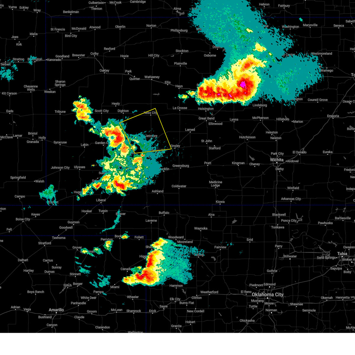 Svrddc the national weather service in dodge city has issued a * severe thunderstorm warning for, northern ford county in southwestern kansas, northeastern finney county in southwestern kansas, southern ness county in west central kansas, hodgeman county in southwestern kansas, southeastern lane county in west central kansas, northeastern gray county in southwestern kansas, west central edwards county in south central kansas, * until 600 pm cdt. * at 517 pm cdt, severe thunderstorms were located along a line extending from 12 miles southwest of alamota to near dodge city, moving northeast at 35 mph (radar indicated). Hazards include 70 mph wind gusts and penny size hail. Expect considerable tree damage. damage is likely to mobile homes, roofs, and outbuildings. severe thunderstorms will be near, jetmore around 535 pm cdt. Other locations in the path of these severe thunderstorms include beeler and hanston. Svrddc the national weather service in dodge city has issued a * severe thunderstorm warning for, northern ford county in southwestern kansas, northeastern finney county in southwestern kansas, southern ness county in west central kansas, hodgeman county in southwestern kansas, southeastern lane county in west central kansas, northeastern gray county in southwestern kansas, west central edwards county in south central kansas, * until 600 pm cdt. * at 517 pm cdt, severe thunderstorms were located along a line extending from 12 miles southwest of alamota to near dodge city, moving northeast at 35 mph (radar indicated). Hazards include 70 mph wind gusts and penny size hail. Expect considerable tree damage. damage is likely to mobile homes, roofs, and outbuildings. severe thunderstorms will be near, jetmore around 535 pm cdt. Other locations in the path of these severe thunderstorms include beeler and hanston.
|
| 5/3/2024 9:50 PM CDT |
 The storms which prompted the warning have weakened below severe limits, and no longer pose an immediate threat to life or property. therefore, the warning will be allowed to expire. however, gusty winds are still possible with these thunderstorms. a severe thunderstorm watch remains in effect until 1100 pm cdt for southwestern kansas. The storms which prompted the warning have weakened below severe limits, and no longer pose an immediate threat to life or property. therefore, the warning will be allowed to expire. however, gusty winds are still possible with these thunderstorms. a severe thunderstorm watch remains in effect until 1100 pm cdt for southwestern kansas.
|
| 5/3/2024 9:31 PM CDT |
 Svrddc the national weather service in dodge city has issued a * severe thunderstorm warning for, northern ford county in southwestern kansas, east central finney county in southwestern kansas, hodgeman county in southwestern kansas, northeastern gray county in southwestern kansas, * until 1000 pm cdt. * at 931 pm cdt, severe thunderstorms were located along a line extending from 13 miles south of beeler to 7 miles south of ft. dodge, moving east at 15 mph (radar indicated). Hazards include 60 mph wind gusts and penny size hail. Expect damage to roofs, siding, and trees. severe thunderstorms will be near, dodge city and ft. dodge around 935 pm cdt. Wright around 940 pm cdt. Svrddc the national weather service in dodge city has issued a * severe thunderstorm warning for, northern ford county in southwestern kansas, east central finney county in southwestern kansas, hodgeman county in southwestern kansas, northeastern gray county in southwestern kansas, * until 1000 pm cdt. * at 931 pm cdt, severe thunderstorms were located along a line extending from 13 miles south of beeler to 7 miles south of ft. dodge, moving east at 15 mph (radar indicated). Hazards include 60 mph wind gusts and penny size hail. Expect damage to roofs, siding, and trees. severe thunderstorms will be near, dodge city and ft. dodge around 935 pm cdt. Wright around 940 pm cdt.
|
| 4/16/2024 12:02 AM CDT |
 Svrddc the national weather service in dodge city has issued a * severe thunderstorm warning for, northeastern finney county in southwestern kansas, ness county in west central kansas, northern hodgeman county in southwestern kansas, southern trego county in west central kansas, eastern lane county in west central kansas, northern gray county in southwestern kansas, * until 1245 am cdt. * at 1202 am cdt, severe thunderstorms were located along a line extending from near utica to near kalvesta, moving east at 25 mph (radar indicated). Hazards include 60 mph wind gusts and penny size hail. Expect damage to roofs, siding, and trees. severe thunderstorms will be near, utica and beeler around 1205 am cdt. arnold around 1215 am cdt. Ness city and ransom around 1230 am cdt. Svrddc the national weather service in dodge city has issued a * severe thunderstorm warning for, northeastern finney county in southwestern kansas, ness county in west central kansas, northern hodgeman county in southwestern kansas, southern trego county in west central kansas, eastern lane county in west central kansas, northern gray county in southwestern kansas, * until 1245 am cdt. * at 1202 am cdt, severe thunderstorms were located along a line extending from near utica to near kalvesta, moving east at 25 mph (radar indicated). Hazards include 60 mph wind gusts and penny size hail. Expect damage to roofs, siding, and trees. severe thunderstorms will be near, utica and beeler around 1205 am cdt. arnold around 1215 am cdt. Ness city and ransom around 1230 am cdt.
|
| 4/15/2024 10:35 PM CDT |
 Svrddc the national weather service in dodge city has issued a * severe thunderstorm warning for, southeastern ness county in west central kansas, eastern hodgeman county in southwestern kansas, northwestern pawnee county in south central kansas, southwestern rush county in central kansas, * until 1115 pm cdt. * at 1035 pm cdt, a severe thunderstorm was located near jetmore, moving northeast at 50 mph (radar indicated). Hazards include half dollar size hail. Damage to vehicles is expected. This severe thunderstorm will be near, hanston around 1040 pm cdt. Svrddc the national weather service in dodge city has issued a * severe thunderstorm warning for, southeastern ness county in west central kansas, eastern hodgeman county in southwestern kansas, northwestern pawnee county in south central kansas, southwestern rush county in central kansas, * until 1115 pm cdt. * at 1035 pm cdt, a severe thunderstorm was located near jetmore, moving northeast at 50 mph (radar indicated). Hazards include half dollar size hail. Damage to vehicles is expected. This severe thunderstorm will be near, hanston around 1040 pm cdt.
|
| 8/12/2023 9:08 PM CDT |
 At 907 pm cdt, a severe thunderstorm was located 7 miles south of alamota, moving northeast at 30 mph (radar indicated). Hazards include 60 mph wind gusts. Expect damage to roofs, siding, and trees. locations impacted include, alamota, beeler and utica. hail threat, radar indicated max hail size, <. 75 in wind threat, radar indicated max wind gust, 60 mph. At 907 pm cdt, a severe thunderstorm was located 7 miles south of alamota, moving northeast at 30 mph (radar indicated). Hazards include 60 mph wind gusts. Expect damage to roofs, siding, and trees. locations impacted include, alamota, beeler and utica. hail threat, radar indicated max hail size, <. 75 in wind threat, radar indicated max wind gust, 60 mph.
|
| 8/12/2023 8:42 PM CDT |
 At 841 pm cdt, a severe thunderstorm was located near kalvesta, moving northeast at 30 mph (radar indicated). Hazards include 60 mph wind gusts and penny size hail. Expect damage to roofs, siding, and trees. this severe thunderstorm will be near, kalvesta around 845 pm cdt. hail threat, radar indicated max hail size, 0. 75 in wind threat, radar indicated max wind gust, 60 mph. At 841 pm cdt, a severe thunderstorm was located near kalvesta, moving northeast at 30 mph (radar indicated). Hazards include 60 mph wind gusts and penny size hail. Expect damage to roofs, siding, and trees. this severe thunderstorm will be near, kalvesta around 845 pm cdt. hail threat, radar indicated max hail size, 0. 75 in wind threat, radar indicated max wind gust, 60 mph.
|
| 7/20/2023 6:14 PM CDT |
 At 614 pm cdt, severe thunderstorms were located along a line extending from near gray to 6 miles southwest of dodge city, moving east at 30 mph (radar indicated). Hazards include 70 mph wind gusts and quarter size hail. Hail damage to vehicles is expected. expect considerable tree damage. wind damage is also likely to mobile homes, roofs, and outbuildings. these severe thunderstorms will remain over mainly rural areas of northern ford, southeastern hodgeman and west central edwards counties. thunderstorm damage threat, considerable hail threat, radar indicated max hail size, 1. 00 in wind threat, radar indicated max wind gust, 70 mph. At 614 pm cdt, severe thunderstorms were located along a line extending from near gray to 6 miles southwest of dodge city, moving east at 30 mph (radar indicated). Hazards include 70 mph wind gusts and quarter size hail. Hail damage to vehicles is expected. expect considerable tree damage. wind damage is also likely to mobile homes, roofs, and outbuildings. these severe thunderstorms will remain over mainly rural areas of northern ford, southeastern hodgeman and west central edwards counties. thunderstorm damage threat, considerable hail threat, radar indicated max hail size, 1. 00 in wind threat, radar indicated max wind gust, 70 mph.
|
| 7/20/2023 5:58 PM CDT |
 At 557 pm cdt, severe thunderstorms were located along a line extending from near hanston to near ensign, moving east at 30 mph (radar indicated). Hazards include 70 mph wind gusts and quarter size hail. Hail damage to vehicles is expected. expect considerable tree damage. wind damage is also likely to mobile homes, roofs, and outbuildings. these severe storms will be near, hanston around 605 pm cdt. other locations in the path of these severe thunderstorms include ft. dodge and kinsley. thunderstorm damage threat, considerable hail threat, radar indicated max hail size, 1. 00 in wind threat, radar indicated max wind gust, 70 mph. At 557 pm cdt, severe thunderstorms were located along a line extending from near hanston to near ensign, moving east at 30 mph (radar indicated). Hazards include 70 mph wind gusts and quarter size hail. Hail damage to vehicles is expected. expect considerable tree damage. wind damage is also likely to mobile homes, roofs, and outbuildings. these severe storms will be near, hanston around 605 pm cdt. other locations in the path of these severe thunderstorms include ft. dodge and kinsley. thunderstorm damage threat, considerable hail threat, radar indicated max hail size, 1. 00 in wind threat, radar indicated max wind gust, 70 mph.
|
| 7/20/2023 5:51 PM CDT |
 At 551 pm cdt, severe thunderstorms were located along a line extending from near hanston to near ensign, moving east at 30 mph (radar indicated). Hazards include 70 mph wind gusts and quarter size hail. Hail damage to vehicles is expected. expect considerable tree damage. wind damage is also likely to mobile homes, roofs, and outbuildings. these severe storms will be near, jetmore around 555 pm cdt. hanston around 600 pm cdt. other locations in the path of these severe thunderstorms include ft. dodge and kinsley. thunderstorm damage threat, considerable hail threat, radar indicated max hail size, 1. 00 in wind threat, radar indicated max wind gust, 70 mph. At 551 pm cdt, severe thunderstorms were located along a line extending from near hanston to near ensign, moving east at 30 mph (radar indicated). Hazards include 70 mph wind gusts and quarter size hail. Hail damage to vehicles is expected. expect considerable tree damage. wind damage is also likely to mobile homes, roofs, and outbuildings. these severe storms will be near, jetmore around 555 pm cdt. hanston around 600 pm cdt. other locations in the path of these severe thunderstorms include ft. dodge and kinsley. thunderstorm damage threat, considerable hail threat, radar indicated max hail size, 1. 00 in wind threat, radar indicated max wind gust, 70 mph.
|
| 7/20/2023 5:45 PM CDT |
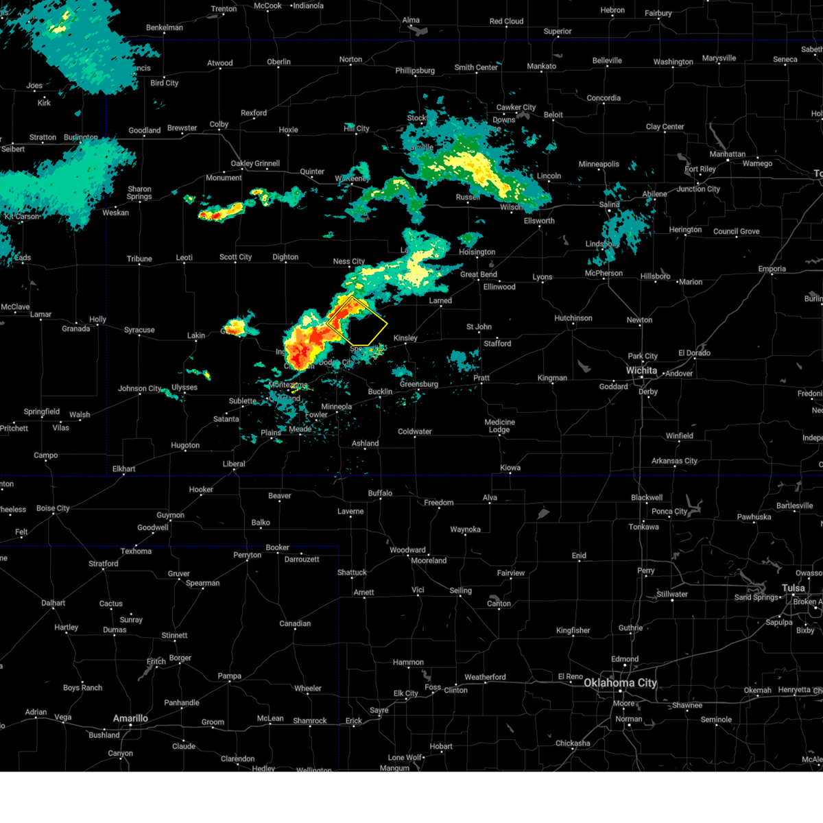 At 545 pm cdt, a severe thunderstorm was located very near jetmore, moving southeast at 25 mph (radar indicated). Hazards include golf ball size hail and 60 mph wind gusts. People and animals outdoors will be injured. expect hail damage to roofs, siding, windows, and vehicles. expect wind damage to roofs, siding, and trees. locations impacted include, jetmore and hanston. thunderstorm damage threat, considerable hail threat, radar indicated max hail size, 1. 75 in wind threat, radar indicated max wind gust, 60 mph. At 545 pm cdt, a severe thunderstorm was located very near jetmore, moving southeast at 25 mph (radar indicated). Hazards include golf ball size hail and 60 mph wind gusts. People and animals outdoors will be injured. expect hail damage to roofs, siding, windows, and vehicles. expect wind damage to roofs, siding, and trees. locations impacted include, jetmore and hanston. thunderstorm damage threat, considerable hail threat, radar indicated max hail size, 1. 75 in wind threat, radar indicated max wind gust, 60 mph.
|
| 7/20/2023 5:42 PM CDT |
 At 542 pm cdt, severe thunderstorms were located along a line extending from near jetmore to near cimarron, moving east at 30 mph (radar indicated). Hazards include two inch hail and 70 mph wind gusts. People and animals outdoors will be injured. expect hail damage to roofs, siding, windows, and vehicles. expect considerable tree damage. wind damage is also likely to mobile homes, roofs, and outbuildings. severe thunderstorms will be near, jetmore around 545 pm cdt. hanston around 555 pm cdt. other locations in the path of these severe thunderstorms include ft. dodge and kinsley. thunderstorm damage threat, considerable hail threat, radar indicated max hail size, 2. 00 in wind threat, radar indicated max wind gust, 70 mph. At 542 pm cdt, severe thunderstorms were located along a line extending from near jetmore to near cimarron, moving east at 30 mph (radar indicated). Hazards include two inch hail and 70 mph wind gusts. People and animals outdoors will be injured. expect hail damage to roofs, siding, windows, and vehicles. expect considerable tree damage. wind damage is also likely to mobile homes, roofs, and outbuildings. severe thunderstorms will be near, jetmore around 545 pm cdt. hanston around 555 pm cdt. other locations in the path of these severe thunderstorms include ft. dodge and kinsley. thunderstorm damage threat, considerable hail threat, radar indicated max hail size, 2. 00 in wind threat, radar indicated max wind gust, 70 mph.
|
| 7/20/2023 5:19 PM CDT |
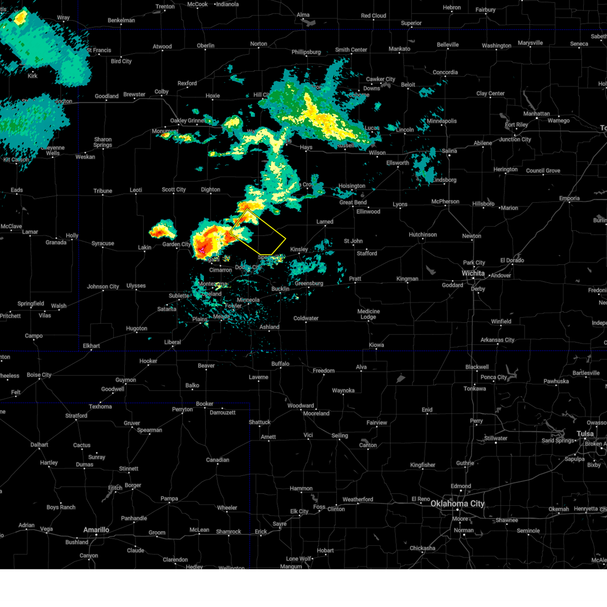 At 518 pm cdt, a severe thunderstorm was located 11 miles northwest of jetmore, moving southeast at 25 mph (radar indicated). Hazards include golf ball size hail and 60 mph wind gusts. People and animals outdoors will be injured. expect hail damage to roofs, siding, windows, and vehicles. Expect wind damage to roofs, siding, and trees. At 518 pm cdt, a severe thunderstorm was located 11 miles northwest of jetmore, moving southeast at 25 mph (radar indicated). Hazards include golf ball size hail and 60 mph wind gusts. People and animals outdoors will be injured. expect hail damage to roofs, siding, windows, and vehicles. Expect wind damage to roofs, siding, and trees.
|
| 6/30/2023 5:28 PM CDT |
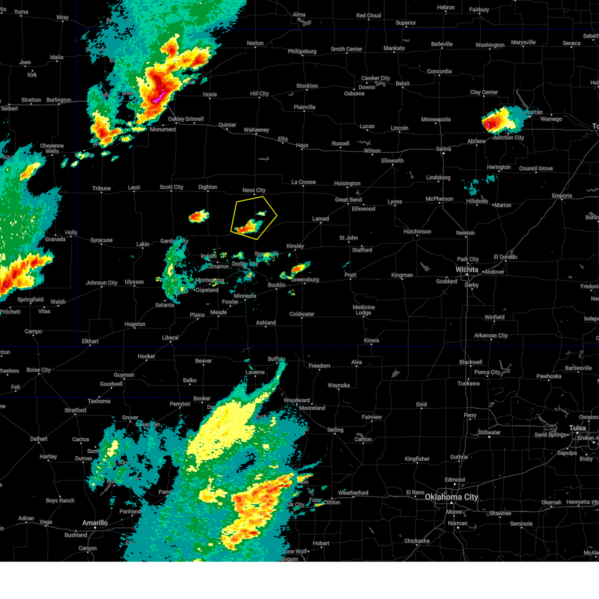 At 528 pm cdt, a severe thunderstorm was located 7 miles west of jetmore, moving northeast at 25 mph (radar indicated). Hazards include 60 mph wind gusts and quarter size hail. Hail damage to vehicles is expected. Expect wind damage to roofs, siding, and trees. At 528 pm cdt, a severe thunderstorm was located 7 miles west of jetmore, moving northeast at 25 mph (radar indicated). Hazards include 60 mph wind gusts and quarter size hail. Hail damage to vehicles is expected. Expect wind damage to roofs, siding, and trees.
|
| 6/27/2023 9:11 PM CDT |
 At 910 pm cdt, severe thunderstorms were located along a line extending from 13 miles northwest of jetmore to near bucklin, moving northeast at 50 mph (radar indicated). Hazards include 70 mph wind gusts. Expect considerable tree damage. damage is likely to mobile homes, roofs, and outbuildings. thunderstorm damage threat, considerable hail threat, radar indicated max hail size, <. 75 in wind threat, radar indicated max wind gust, 70 mph. At 910 pm cdt, severe thunderstorms were located along a line extending from 13 miles northwest of jetmore to near bucklin, moving northeast at 50 mph (radar indicated). Hazards include 70 mph wind gusts. Expect considerable tree damage. damage is likely to mobile homes, roofs, and outbuildings. thunderstorm damage threat, considerable hail threat, radar indicated max hail size, <. 75 in wind threat, radar indicated max wind gust, 70 mph.
|
| 6/17/2023 8:37 PM CDT |
 At 837 pm cdt, severe thunderstorms were located along a line extending from 9 miles northwest of hanston to near offerle to near bucklin, moving east at 40 mph (radar indicated). Hazards include 70 mph wind gusts. Expect considerable tree damage. damage is likely to mobile homes, roofs, and outbuildings. Locations impacted include, gray, kinsley, jetmore, bucklin, spearville, mullinville, burdett, ford, hanston, offerle, rozel, bloom, kingsdown, bellefont and windhorst. At 837 pm cdt, severe thunderstorms were located along a line extending from 9 miles northwest of hanston to near offerle to near bucklin, moving east at 40 mph (radar indicated). Hazards include 70 mph wind gusts. Expect considerable tree damage. damage is likely to mobile homes, roofs, and outbuildings. Locations impacted include, gray, kinsley, jetmore, bucklin, spearville, mullinville, burdett, ford, hanston, offerle, rozel, bloom, kingsdown, bellefont and windhorst.
|
| 6/17/2023 8:30 PM CDT | Mesonet station kjtk in hodgeman county KS, 3 miles S of Jetmore, KS |
| 6/15/2023 5:42 PM CDT |
 At 541 pm cdt, severe thunderstorms were located along a line extending from 10 miles west of jetmore to near dodge city, moving northeast at 30 mph (automated weather observation. at 539 pm, a 69 mph wind gust was recorded at the dodge city airport). Hazards include 70 mph wind gusts and penny size hail. Expect considerable tree damage. damage is likely to mobile homes, roofs, and outbuildings. locations impacted include, dodge city, spearville, wright, howell and ft. dodge. thunderstorm damage threat, considerable hail threat, radar indicated max hail size, 0. 75 in wind threat, observed max wind gust, 70 mph. At 541 pm cdt, severe thunderstorms were located along a line extending from 10 miles west of jetmore to near dodge city, moving northeast at 30 mph (automated weather observation. at 539 pm, a 69 mph wind gust was recorded at the dodge city airport). Hazards include 70 mph wind gusts and penny size hail. Expect considerable tree damage. damage is likely to mobile homes, roofs, and outbuildings. locations impacted include, dodge city, spearville, wright, howell and ft. dodge. thunderstorm damage threat, considerable hail threat, radar indicated max hail size, 0. 75 in wind threat, observed max wind gust, 70 mph.
|
| 6/15/2023 5:14 PM CDT |
 At 514 pm cdt, severe thunderstorms were located along a line extending from near kalvesta to near ensign, moving northeast at 25 mph (radar indicated). Hazards include 60 mph wind gusts and penny size hail. expect damage to roofs, siding, and trees At 514 pm cdt, severe thunderstorms were located along a line extending from near kalvesta to near ensign, moving northeast at 25 mph (radar indicated). Hazards include 60 mph wind gusts and penny size hail. expect damage to roofs, siding, and trees
|
| 5/30/2023 10:21 PM CDT |
 The severe thunderstorm warning for northeastern ford, southeastern ness, hodgeman, western pawnee and western edwards counties will expire at 1030 pm cdt, the storms which prompted the warning have weakened below severe limits, and no longer pose an immediate threat to life or property. therefore, the warning will be allowed to expire. however gusty winds are still possible with these thunderstorms. a severe thunderstorm watch remains in effect until 1100 pm cdt for south central, southwestern and west central kansas. The severe thunderstorm warning for northeastern ford, southeastern ness, hodgeman, western pawnee and western edwards counties will expire at 1030 pm cdt, the storms which prompted the warning have weakened below severe limits, and no longer pose an immediate threat to life or property. therefore, the warning will be allowed to expire. however gusty winds are still possible with these thunderstorms. a severe thunderstorm watch remains in effect until 1100 pm cdt for south central, southwestern and west central kansas.
|
| 5/30/2023 10:05 PM CDT |
 At 1004 pm cdt, severe thunderstorms were located along a line extending from 6 miles north of gray to 6 miles southeast of jetmore to near dodge city, moving southeast at 40 mph (radar indicated). Hazards include 60 mph wind gusts and penny size hail. Expect damage to roofs, siding, and trees. locations impacted include, gray, spearville, burdett, rozel, bellefont, offerle, ford, sanford, kinsley, windhorst, garfield and frizell. hail threat, radar indicated max hail size, 0. 75 in wind threat, radar indicated max wind gust, 60 mph. At 1004 pm cdt, severe thunderstorms were located along a line extending from 6 miles north of gray to 6 miles southeast of jetmore to near dodge city, moving southeast at 40 mph (radar indicated). Hazards include 60 mph wind gusts and penny size hail. Expect damage to roofs, siding, and trees. locations impacted include, gray, spearville, burdett, rozel, bellefont, offerle, ford, sanford, kinsley, windhorst, garfield and frizell. hail threat, radar indicated max hail size, 0. 75 in wind threat, radar indicated max wind gust, 60 mph.
|
| 5/30/2023 9:46 PM CDT |
 At 945 pm cdt, severe thunderstorms were located along a line extending from 10 miles south of ness city to 8 miles west of jetmore to 8 miles northeast of cimarron, moving southeast at 40 mph (radar indicated). Hazards include 60 mph wind gusts and penny size hail. Expect damage to roofs, siding, and trees. severe thunderstorms will be near, jetmore around 1000 pm cdt. other locations in the path of these severe thunderstorms include gray, dodge city, spearville, burdett, wright, ft. dodge, rozel, bellefont, kinsley, ford, offerle and sanford. hail threat, radar indicated max hail size, 0. 75 in wind threat, radar indicated max wind gust, 60 mph. At 945 pm cdt, severe thunderstorms were located along a line extending from 10 miles south of ness city to 8 miles west of jetmore to 8 miles northeast of cimarron, moving southeast at 40 mph (radar indicated). Hazards include 60 mph wind gusts and penny size hail. Expect damage to roofs, siding, and trees. severe thunderstorms will be near, jetmore around 1000 pm cdt. other locations in the path of these severe thunderstorms include gray, dodge city, spearville, burdett, wright, ft. dodge, rozel, bellefont, kinsley, ford, offerle and sanford. hail threat, radar indicated max hail size, 0. 75 in wind threat, radar indicated max wind gust, 60 mph.
|
| 5/30/2023 9:20 PM CDT |
 At 919 pm cdt, severe thunderstorms were located along a line extending from 13 miles north of kalvesta to 6 miles north of charleston to 8 miles west of plymell, moving southeast at 40 mph (radar indicated). Hazards include 70 mph wind gusts and penny size hail. Expect considerable tree damage. damage is likely to mobile homes, roofs, and outbuildings. severe thunderstorms will be near, pierceville around 925 pm cdt. plymell around 930 pm cdt. charleston around 935 pm cdt. other locations in the path of these severe thunderstorms include cimarron, ingalls and kalvesta. thunderstorm damage threat, considerable hail threat, radar indicated max hail size, 0. 75 in wind threat, radar indicated max wind gust, 70 mph. At 919 pm cdt, severe thunderstorms were located along a line extending from 13 miles north of kalvesta to 6 miles north of charleston to 8 miles west of plymell, moving southeast at 40 mph (radar indicated). Hazards include 70 mph wind gusts and penny size hail. Expect considerable tree damage. damage is likely to mobile homes, roofs, and outbuildings. severe thunderstorms will be near, pierceville around 925 pm cdt. plymell around 930 pm cdt. charleston around 935 pm cdt. other locations in the path of these severe thunderstorms include cimarron, ingalls and kalvesta. thunderstorm damage threat, considerable hail threat, radar indicated max hail size, 0. 75 in wind threat, radar indicated max wind gust, 70 mph.
|
| 2/26/2023 6:19 PM CST |
 At 618 pm cst, severe thunderstorms were located along a line extending from near hanston to 8 miles west of ashland, moving east at 45 mph (radar indicated). Hazards include 70 mph wind gusts and half dollar size hail. Hail damage to vehicles is expected. expect considerable tree damage. wind damage is also likely to mobile homes, roofs, and outbuildings. Locations impacted include, gray, hanston, rozel, sanford, coldwater, frizell and lake coldwater. At 618 pm cst, severe thunderstorms were located along a line extending from near hanston to 8 miles west of ashland, moving east at 45 mph (radar indicated). Hazards include 70 mph wind gusts and half dollar size hail. Hail damage to vehicles is expected. expect considerable tree damage. wind damage is also likely to mobile homes, roofs, and outbuildings. Locations impacted include, gray, hanston, rozel, sanford, coldwater, frizell and lake coldwater.
|
| 2/26/2023 6:04 PM CST |
 At 603 pm cst, a severe thunderstorm capable of producing a tornado was located 9 miles northwest of spearville, moving northeast at 60 mph (radar indicated rotation). Hazards include tornado and ping pong ball size hail. Flying debris will be dangerous to those caught without shelter. mobile homes will be damaged or destroyed. damage to roofs, windows, and vehicles will occur. tree damage is likely. This tornadic thunderstorm will remain over mainly rural areas of north central ford and southeastern hodgeman counties. At 603 pm cst, a severe thunderstorm capable of producing a tornado was located 9 miles northwest of spearville, moving northeast at 60 mph (radar indicated rotation). Hazards include tornado and ping pong ball size hail. Flying debris will be dangerous to those caught without shelter. mobile homes will be damaged or destroyed. damage to roofs, windows, and vehicles will occur. tree damage is likely. This tornadic thunderstorm will remain over mainly rural areas of north central ford and southeastern hodgeman counties.
|
| 2/26/2023 5:57 PM CST |
 At 555 pm cst, severe thunderstorms were located along a line extending from 6 miles west of jetmore to 12 miles southeast of meade, moving east at 45 mph (radar indicated). Hazards include 70 mph wind gusts and half dollar size hail. Hail damage to vehicles is expected. expect considerable tree damage. wind damage is also likely to mobile homes, roofs, and outbuildings. severe thunderstorms will be near, jetmore around 605 pm cst. Other locations in the path of these severe thunderstorms include hanston, gray, ashland, sitka, rozel, protection and sanford. At 555 pm cst, severe thunderstorms were located along a line extending from 6 miles west of jetmore to 12 miles southeast of meade, moving east at 45 mph (radar indicated). Hazards include 70 mph wind gusts and half dollar size hail. Hail damage to vehicles is expected. expect considerable tree damage. wind damage is also likely to mobile homes, roofs, and outbuildings. severe thunderstorms will be near, jetmore around 605 pm cst. Other locations in the path of these severe thunderstorms include hanston, gray, ashland, sitka, rozel, protection and sanford.
|
| 2/26/2023 5:51 PM CST |
 At 551 pm cst, a severe thunderstorm capable of producing a tornado was located 8 miles east of kalvesta, moving northeast at 60 mph (radar indicated rotation). Hazards include tornado and ping pong ball size hail. Flying debris will be dangerous to those caught without shelter. mobile homes will be damaged or destroyed. damage to roofs, windows, and vehicles will occur. tree damage is likely. This dangerous storm will be near, jetmore around 600 pm cst. At 551 pm cst, a severe thunderstorm capable of producing a tornado was located 8 miles east of kalvesta, moving northeast at 60 mph (radar indicated rotation). Hazards include tornado and ping pong ball size hail. Flying debris will be dangerous to those caught without shelter. mobile homes will be damaged or destroyed. damage to roofs, windows, and vehicles will occur. tree damage is likely. This dangerous storm will be near, jetmore around 600 pm cst.
|
| 2/26/2023 5:50 PM CST |
 At 550 pm cst, a severe thunderstorm capable of producing a tornado was located 11 miles southeast of kalvesta, moving northeast at 60 mph (radar indicated rotation). Hazards include tornado and ping pong ball size hail. Flying debris will be dangerous to those caught without shelter. mobile homes will be damaged or destroyed. damage to roofs, windows, and vehicles will occur. tree damage is likely. This dangerous storm will be near, jetmore around 600 pm cst. At 550 pm cst, a severe thunderstorm capable of producing a tornado was located 11 miles southeast of kalvesta, moving northeast at 60 mph (radar indicated rotation). Hazards include tornado and ping pong ball size hail. Flying debris will be dangerous to those caught without shelter. mobile homes will be damaged or destroyed. damage to roofs, windows, and vehicles will occur. tree damage is likely. This dangerous storm will be near, jetmore around 600 pm cst.
|
| 2/26/2023 5:44 PM CST |
 At 544 pm cst, severe thunderstorms were located along a line extending from near kalvesta to 7 miles southeast of meade state park, moving northeast at 45 mph (radar indicated). Hazards include 70 mph wind gusts and quarter size hail. Hail damage to vehicles is expected. expect considerable tree damage. wind damage is also likely to mobile homes, roofs, and outbuildings. These severe thunderstorms will remain over mainly rural areas of western ford, southwestern hodgeman, meade, eastern gray and western clark counties. At 544 pm cst, severe thunderstorms were located along a line extending from near kalvesta to 7 miles southeast of meade state park, moving northeast at 45 mph (radar indicated). Hazards include 70 mph wind gusts and quarter size hail. Hail damage to vehicles is expected. expect considerable tree damage. wind damage is also likely to mobile homes, roofs, and outbuildings. These severe thunderstorms will remain over mainly rural areas of western ford, southwestern hodgeman, meade, eastern gray and western clark counties.
|
| 2/26/2023 5:41 PM CST |
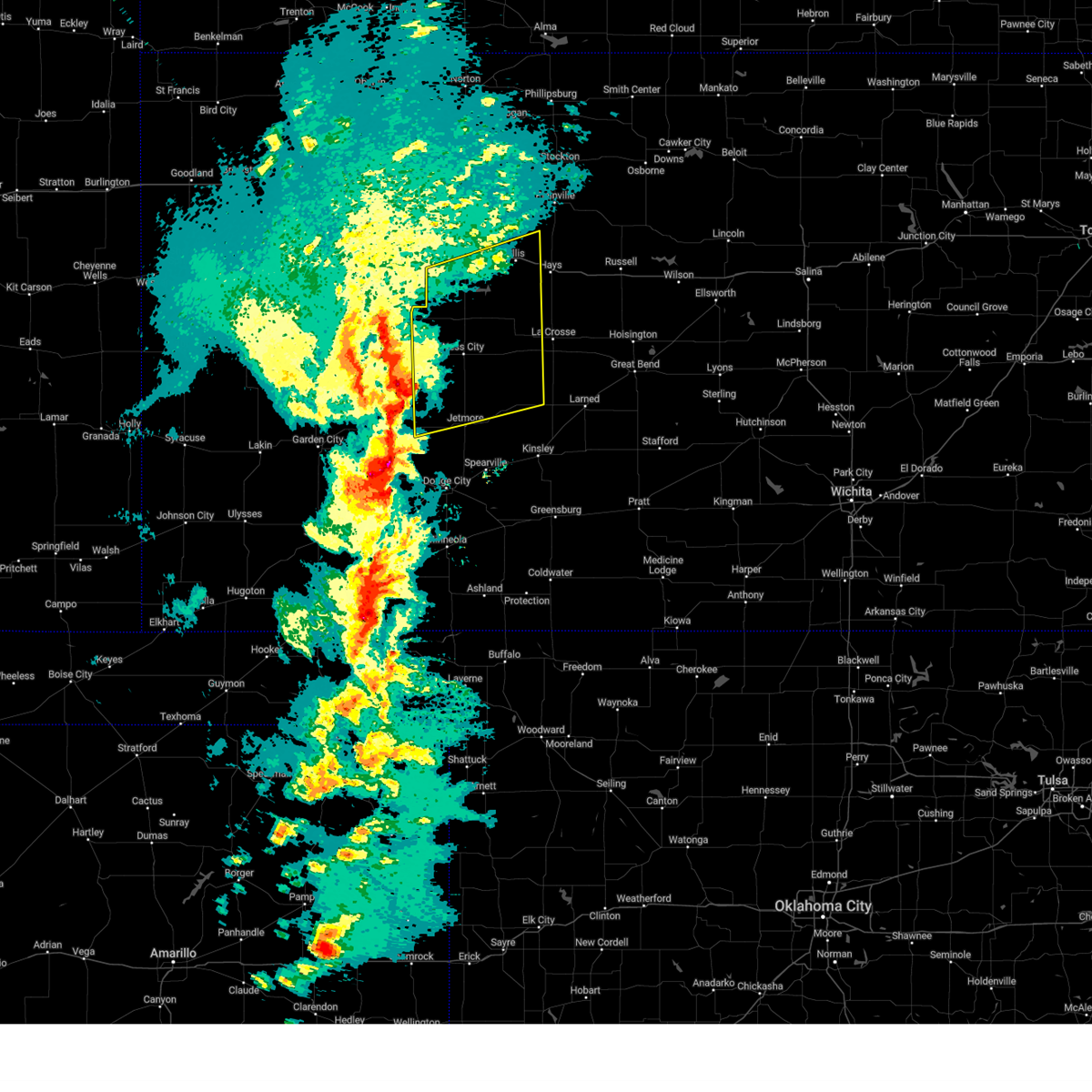 At 540 pm cst, severe thunderstorms were located along a line extending from near pendennis to kalvesta, moving northeast at 50 mph (radar indicated). Hazards include 70 mph wind gusts and ping pong ball size hail. People and animals outdoors will be injured. expect hail damage to roofs, siding, windows, and vehicles. expect considerable tree damage. wind damage is also likely to mobile homes, roofs, and outbuildings. severe thunderstorms will be near, utica around 545 pm cst. Other locations in the path of these severe thunderstorms include trego center, bazine, ogallah and riga. At 540 pm cst, severe thunderstorms were located along a line extending from near pendennis to kalvesta, moving northeast at 50 mph (radar indicated). Hazards include 70 mph wind gusts and ping pong ball size hail. People and animals outdoors will be injured. expect hail damage to roofs, siding, windows, and vehicles. expect considerable tree damage. wind damage is also likely to mobile homes, roofs, and outbuildings. severe thunderstorms will be near, utica around 545 pm cst. Other locations in the path of these severe thunderstorms include trego center, bazine, ogallah and riga.
|
| 2/26/2023 5:08 PM CST |
 At 508 pm cst, severe thunderstorms were located along a line extending from near pierceville to near floris, moving northeast at 60 mph (radar indicated). Hazards include 70 mph wind gusts and quarter size hail. Hail damage to vehicles is expected. expect considerable tree damage. wind damage is also likely to mobile homes, roofs, and outbuildings. severe thunderstorms will be near, charleston around 515 pm cst. Other locations in the path of these severe thunderstorms include meade state park and minneola. At 508 pm cst, severe thunderstorms were located along a line extending from near pierceville to near floris, moving northeast at 60 mph (radar indicated). Hazards include 70 mph wind gusts and quarter size hail. Hail damage to vehicles is expected. expect considerable tree damage. wind damage is also likely to mobile homes, roofs, and outbuildings. severe thunderstorms will be near, charleston around 515 pm cst. Other locations in the path of these severe thunderstorms include meade state park and minneola.
|
| 7/6/2022 5:43 PM CDT |
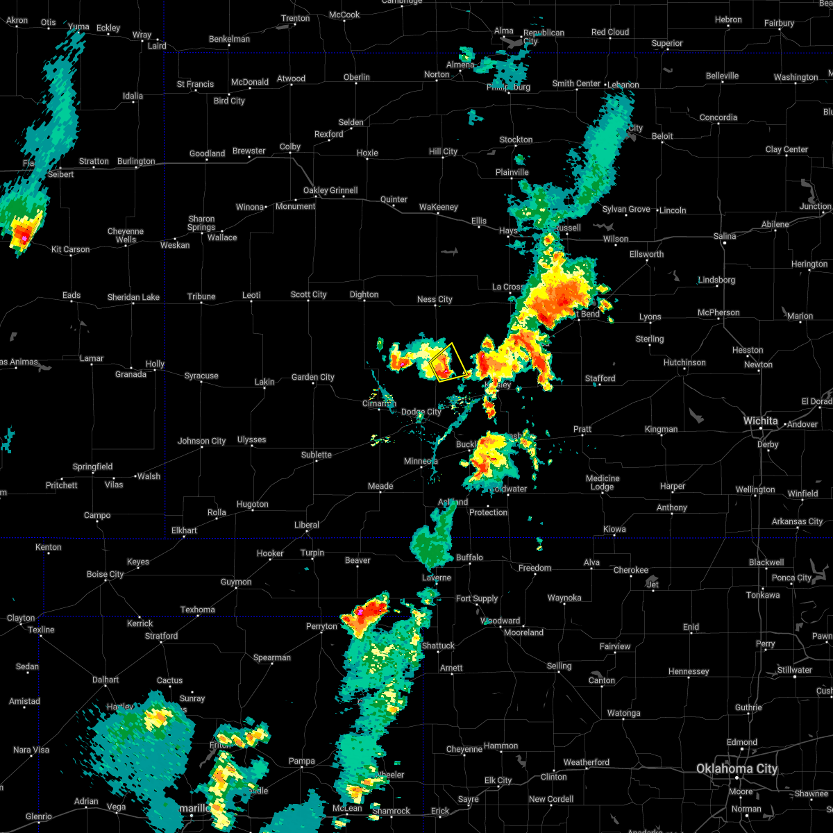 At 542 pm cdt, a severe thunderstorm was located near jetmore, moving northeast at 25 mph (law enforcement). Hazards include half dollar size hail. Damage to vehicles is expected. locations impacted include, hanston. hail threat, observed max hail size, 1. 25 in wind threat, radar indicated max wind gust, <50 mph. At 542 pm cdt, a severe thunderstorm was located near jetmore, moving northeast at 25 mph (law enforcement). Hazards include half dollar size hail. Damage to vehicles is expected. locations impacted include, hanston. hail threat, observed max hail size, 1. 25 in wind threat, radar indicated max wind gust, <50 mph.
|
| 7/6/2022 5:26 PM CDT |
 At 526 pm cdt, a severe thunderstorm was located very near jetmore, moving northeast at 25 mph (law enforcement). Hazards include golf ball size hail. People and animals outdoors will be injured. expect damage to roofs, siding, windows, and vehicles. this severe storm will be near, jetmore around 530 pm cdt. other locations in the path of this severe thunderstorm include hanston and gray. thunderstorm damage threat, considerable hail threat, observed max hail size, 1. 75 in wind threat, radar indicated max wind gust, <50 mph. At 526 pm cdt, a severe thunderstorm was located very near jetmore, moving northeast at 25 mph (law enforcement). Hazards include golf ball size hail. People and animals outdoors will be injured. expect damage to roofs, siding, windows, and vehicles. this severe storm will be near, jetmore around 530 pm cdt. other locations in the path of this severe thunderstorm include hanston and gray. thunderstorm damage threat, considerable hail threat, observed max hail size, 1. 75 in wind threat, radar indicated max wind gust, <50 mph.
|
| 7/6/2022 5:24 PM CDT | Golf Ball sized hail reported 4.6 miles N of Jetmore, KS, report made via nwschat. |
| 7/6/2022 5:15 PM CDT |
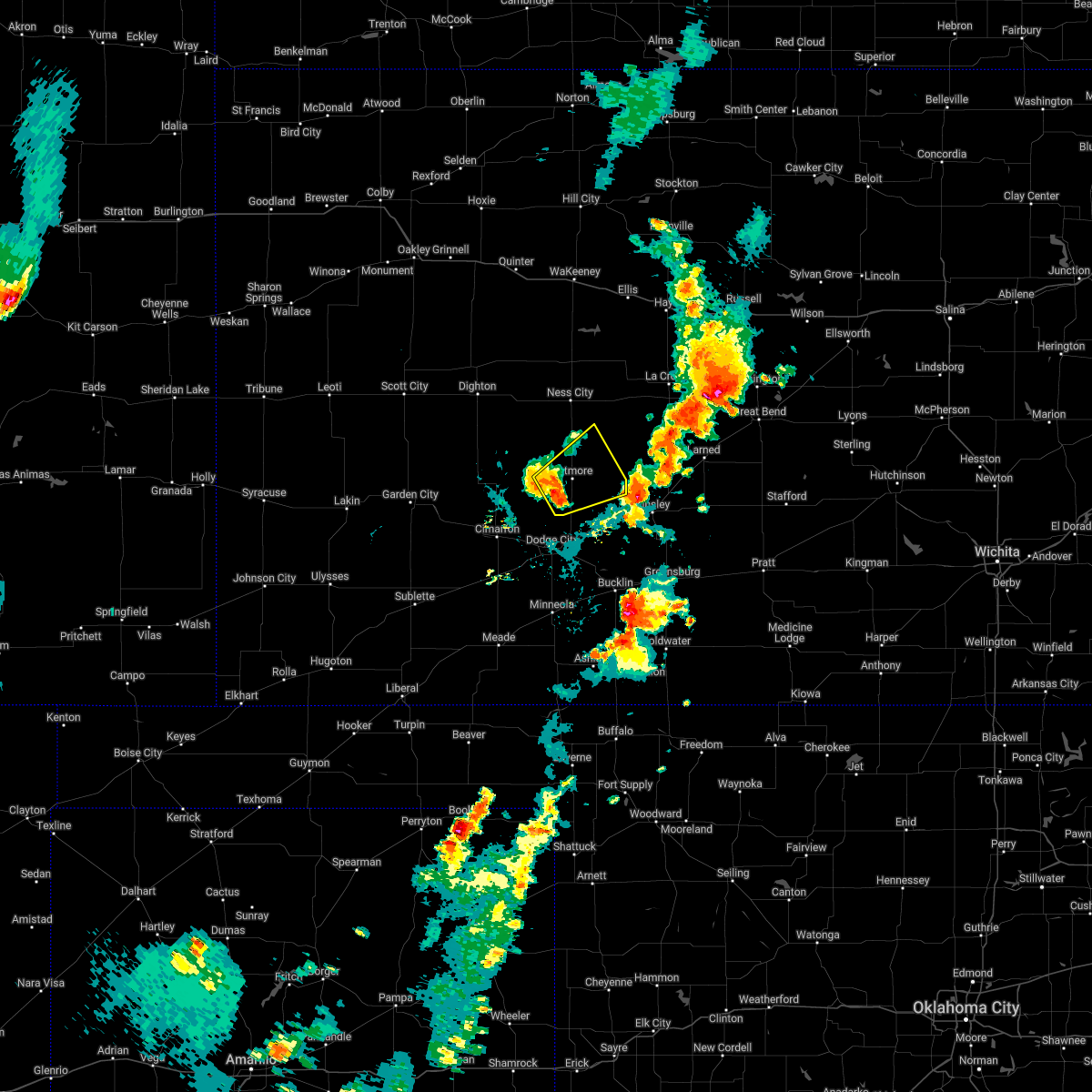 At 515 pm cdt, a severe thunderstorm was located near jetmore, moving northeast at 20 mph (radar indicated). Hazards include half dollar size hail. Damage to vehicles is expected. this severe thunderstorm will be near, jetmore around 535 pm cdt. other locations in the path of this severe thunderstorm include gray and hanston. hail threat, radar indicated max hail size, 1. 25 in wind threat, radar indicated max wind gust, <50 mph. At 515 pm cdt, a severe thunderstorm was located near jetmore, moving northeast at 20 mph (radar indicated). Hazards include half dollar size hail. Damage to vehicles is expected. this severe thunderstorm will be near, jetmore around 535 pm cdt. other locations in the path of this severe thunderstorm include gray and hanston. hail threat, radar indicated max hail size, 1. 25 in wind threat, radar indicated max wind gust, <50 mph.
|
| 6/12/2022 9:11 PM CDT |
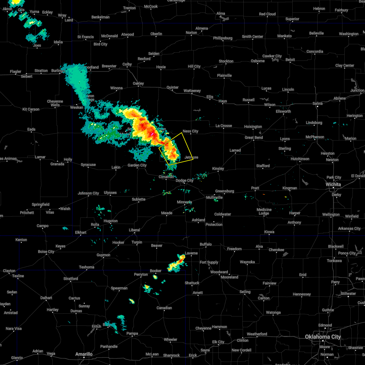 The severe thunderstorm warning for northeastern finney, southwestern ness, northwestern hodgeman and southeastern lane counties will expire at 915 pm cdt, the storms which prompted the warning are weakening below severe limits. therefore, the warning will be allowed to expire at 9:15 pm cdt. a severe thunderstorm watch remains in effect until midnight cdt for southwestern and west central kansas. The severe thunderstorm warning for northeastern finney, southwestern ness, northwestern hodgeman and southeastern lane counties will expire at 915 pm cdt, the storms which prompted the warning are weakening below severe limits. therefore, the warning will be allowed to expire at 9:15 pm cdt. a severe thunderstorm watch remains in effect until midnight cdt for southwestern and west central kansas.
|
| 6/12/2022 9:06 PM CDT |
 At 905 pm cdt, severe thunderstorms were located along a line extending from near beeler to near kalvesta, moving northeast at 30 mph (radar indicated). Hazards include 60 mph wind gusts. Expect damage to roofs, siding, and trees. locations impacted include, jetmore and kalvesta. hail threat, radar indicated max hail size, <. 75 in wind threat, radar indicated max wind gust, 60 mph. At 905 pm cdt, severe thunderstorms were located along a line extending from near beeler to near kalvesta, moving northeast at 30 mph (radar indicated). Hazards include 60 mph wind gusts. Expect damage to roofs, siding, and trees. locations impacted include, jetmore and kalvesta. hail threat, radar indicated max hail size, <. 75 in wind threat, radar indicated max wind gust, 60 mph.
|
| 6/12/2022 8:36 PM CDT |
 At 836 pm cdt, severe thunderstorms were located along a line extending from 15 miles northwest of kalvesta to near howell, moving northeast at 20 mph (radar indicated). Hazards include 60 mph wind gusts and quarter size hail. Hail damage to vehicles is expected. expect wind damage to roofs, siding, and trees. these severe thunderstorms will remain over mainly rural areas of northwestern ford, northeastern finney, southwestern ness, western hodgeman, southeastern lane and northeastern gray counties. hail threat, radar indicated max hail size, 1. 00 in wind threat, radar indicated max wind gust, 60 mph. At 836 pm cdt, severe thunderstorms were located along a line extending from 15 miles northwest of kalvesta to near howell, moving northeast at 20 mph (radar indicated). Hazards include 60 mph wind gusts and quarter size hail. Hail damage to vehicles is expected. expect wind damage to roofs, siding, and trees. these severe thunderstorms will remain over mainly rural areas of northwestern ford, northeastern finney, southwestern ness, western hodgeman, southeastern lane and northeastern gray counties. hail threat, radar indicated max hail size, 1. 00 in wind threat, radar indicated max wind gust, 60 mph.
|
| 5/18/2022 11:15 PM CDT |
 At 1115 pm cdt, severe thunderstorms were located along a line extending from 7 miles north of wright to near bloom to near knowles, moving east at 30 mph (radar indicated). Hazards include 70 mph wind gusts. Expect considerable tree damage. damage is likely to mobile homes, roofs, and outbuildings. locations impacted include, clark state lake, kingsdown, spearville, bellefont and windhorst. thunderstorm damage threat, considerable hail threat, radar indicated max hail size, <. 75 in wind threat, radar indicated max wind gust, 70 mph. At 1115 pm cdt, severe thunderstorms were located along a line extending from 7 miles north of wright to near bloom to near knowles, moving east at 30 mph (radar indicated). Hazards include 70 mph wind gusts. Expect considerable tree damage. damage is likely to mobile homes, roofs, and outbuildings. locations impacted include, clark state lake, kingsdown, spearville, bellefont and windhorst. thunderstorm damage threat, considerable hail threat, radar indicated max hail size, <. 75 in wind threat, radar indicated max wind gust, 70 mph.
|
| 5/18/2022 10:42 PM CDT |
 At 1041 pm cdt, severe thunderstorms were located along a line extending from 9 miles southeast of kalvesta to 7 miles north of fowler to 7 miles northeast of forgan, moving east at 30 mph (radar indicated). Hazards include 70 mph wind gusts. Expect considerable tree damage. damage is likely to mobile homes, roofs, and outbuildings. severe thunderstorms will be near, fowler around 1045 pm cdt. minneola around 1100 pm cdt. other locations in the path of these severe thunderstorms include dodge city, bloom, kingsdown, wright, clark state lake, spearville and bellefont. thunderstorm damage threat, considerable hail threat, radar indicated max hail size, <. 75 in wind threat, radar indicated max wind gust, 70 mph. At 1041 pm cdt, severe thunderstorms were located along a line extending from 9 miles southeast of kalvesta to 7 miles north of fowler to 7 miles northeast of forgan, moving east at 30 mph (radar indicated). Hazards include 70 mph wind gusts. Expect considerable tree damage. damage is likely to mobile homes, roofs, and outbuildings. severe thunderstorms will be near, fowler around 1045 pm cdt. minneola around 1100 pm cdt. other locations in the path of these severe thunderstorms include dodge city, bloom, kingsdown, wright, clark state lake, spearville and bellefont. thunderstorm damage threat, considerable hail threat, radar indicated max hail size, <. 75 in wind threat, radar indicated max wind gust, 70 mph.
|
| 5/18/2022 10:30 PM CDT |
 At 1030 pm cdt, severe thunderstorms were located along a line extending from near kalvesta to 8 miles southeast of montezuma, moving east at 35 mph (radar indicated). Hazards include 70 mph wind gusts. Expect considerable tree damage. damage is likely to mobile homes, roofs, and outbuildings. locations impacted include, dodge city, cimarron, montezuma, copeland, ingalls, ensign, charleston, tice, howell, wright, the haggard elev and ft. dodge. thunderstorm damage threat, considerable hail threat, radar indicated max hail size, <. 75 in wind threat, radar indicated max wind gust, 70 mph. At 1030 pm cdt, severe thunderstorms were located along a line extending from near kalvesta to 8 miles southeast of montezuma, moving east at 35 mph (radar indicated). Hazards include 70 mph wind gusts. Expect considerable tree damage. damage is likely to mobile homes, roofs, and outbuildings. locations impacted include, dodge city, cimarron, montezuma, copeland, ingalls, ensign, charleston, tice, howell, wright, the haggard elev and ft. dodge. thunderstorm damage threat, considerable hail threat, radar indicated max hail size, <. 75 in wind threat, radar indicated max wind gust, 70 mph.
|
| 5/18/2022 10:02 PM CDT |
 At 1002 pm cdt, severe thunderstorms were located along a line extending from 9 miles northeast of charleston to near copeland, moving east at 30 mph (radar indicated). Hazards include 70 mph wind gusts. Expect considerable tree damage. damage is likely to mobile homes, roofs, and outbuildings. these severe thunderstorms will remain over mainly rural areas of western ford, south central finney, southwestern hodgeman, northwestern meade, gray and northern haskell counties. thunderstorm damage threat, considerable hail threat, radar indicated max hail size, <. 75 in wind threat, radar indicated max wind gust, 70 mph. At 1002 pm cdt, severe thunderstorms were located along a line extending from 9 miles northeast of charleston to near copeland, moving east at 30 mph (radar indicated). Hazards include 70 mph wind gusts. Expect considerable tree damage. damage is likely to mobile homes, roofs, and outbuildings. these severe thunderstorms will remain over mainly rural areas of western ford, south central finney, southwestern hodgeman, northwestern meade, gray and northern haskell counties. thunderstorm damage threat, considerable hail threat, radar indicated max hail size, <. 75 in wind threat, radar indicated max wind gust, 70 mph.
|
| 5/17/2022 11:20 PM CDT | Quarter sized hail reported 3.5 miles SE of Jetmore, KS, at 156 hwy and 215 rd... quarter hail was observed. |
| 5/17/2022 10:28 PM CDT |
 At 1027 pm cdt, severe thunderstorms were located along a line extending from near radium to near jetmore, moving east at 5 mph (radar indicated). Hazards include 60 mph wind gusts and quarter size hail. Hail damage to vehicles is expected. Expect wind damage to roofs, siding, and trees. At 1027 pm cdt, severe thunderstorms were located along a line extending from near radium to near jetmore, moving east at 5 mph (radar indicated). Hazards include 60 mph wind gusts and quarter size hail. Hail damage to vehicles is expected. Expect wind damage to roofs, siding, and trees.
|
| 4/23/2022 3:33 AM CDT |
 At 333 am cdt, severe thunderstorms were located along a line extending from 8 miles north of rozel to wright, moving east at 35 mph (radar indicated). Hazards include 60 mph wind gusts. Expect damage to roofs, siding, and trees. locations impacted include, dodge city, gray, larned, kinsley, jetmore, spearville, lewis, burdett, hanston, offerle, garfield, rozel, belpre, ash valley, fellsburg, wright, sanford, frizell, bellefont and windhorst. hail threat, radar indicated max hail size, <. 75 in wind threat, radar indicated max wind gust, 60 mph. At 333 am cdt, severe thunderstorms were located along a line extending from 8 miles north of rozel to wright, moving east at 35 mph (radar indicated). Hazards include 60 mph wind gusts. Expect damage to roofs, siding, and trees. locations impacted include, dodge city, gray, larned, kinsley, jetmore, spearville, lewis, burdett, hanston, offerle, garfield, rozel, belpre, ash valley, fellsburg, wright, sanford, frizell, bellefont and windhorst. hail threat, radar indicated max hail size, <. 75 in wind threat, radar indicated max wind gust, 60 mph.
|
| 4/23/2022 2:44 AM CDT |
 At 244 am cdt, severe thunderstorms were located along a line extending from 12 miles south of ness city to 6 miles southwest of cimarron, moving east at 35 mph (radar indicated). Hazards include 60 mph wind gusts. expect damage to roofs, siding, and trees At 244 am cdt, severe thunderstorms were located along a line extending from 12 miles south of ness city to 6 miles southwest of cimarron, moving east at 35 mph (radar indicated). Hazards include 60 mph wind gusts. expect damage to roofs, siding, and trees
|
| 4/23/2022 1:55 AM CDT |
 At 155 am cdt, severe thunderstorms were located along a line extending from 11 miles south of amy to near plymell, moving east at 40 mph (radar indicated). Hazards include 60 mph wind gusts. expect damage to roofs, siding, and trees At 155 am cdt, severe thunderstorms were located along a line extending from 11 miles south of amy to near plymell, moving east at 40 mph (radar indicated). Hazards include 60 mph wind gusts. expect damage to roofs, siding, and trees
|
| 10/26/2021 8:18 PM CDT |
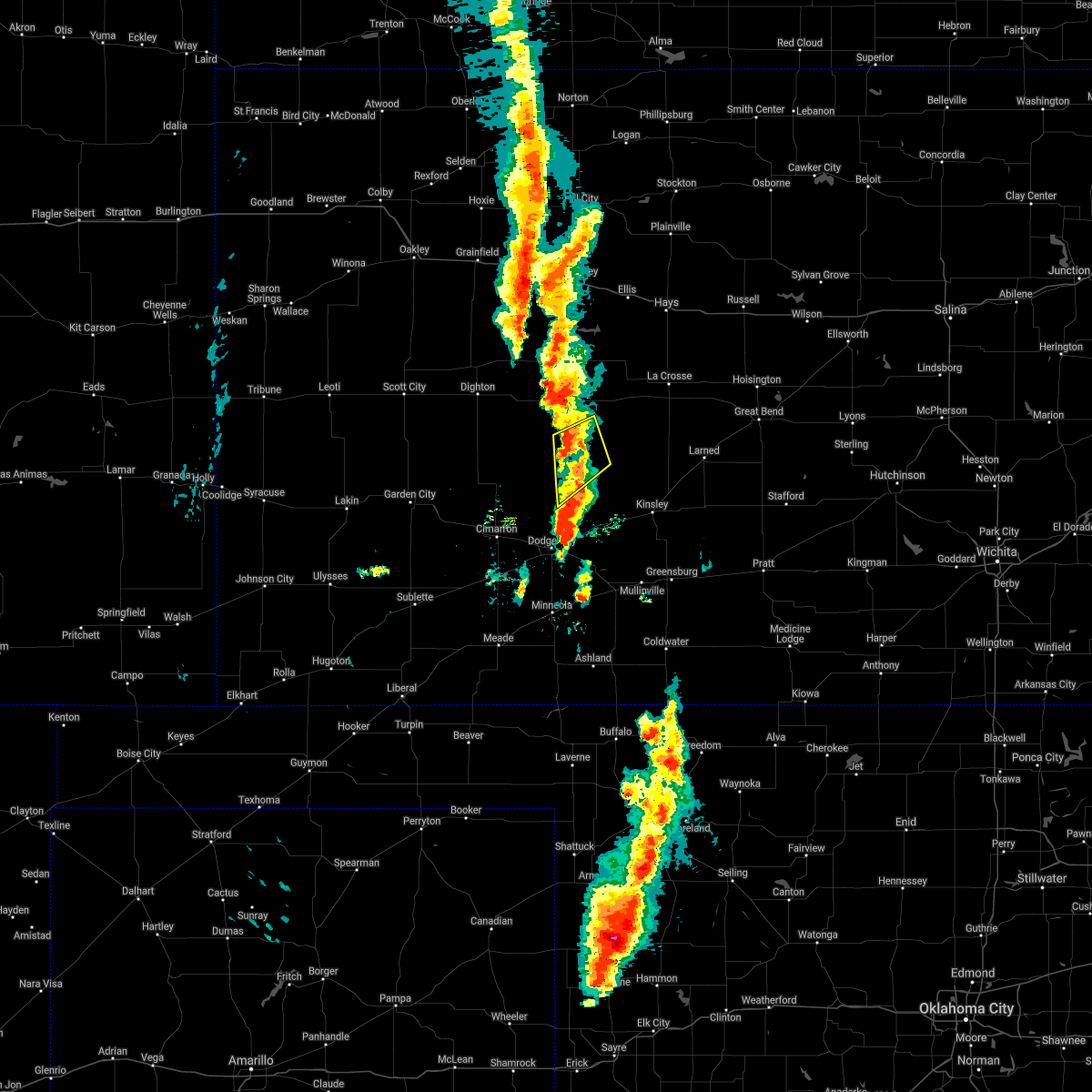 At 818 pm cdt, a severe thunderstorm was located near jetmore, moving northeast at 30 mph (radar indicated). Hazards include 60 mph wind gusts and quarter size hail. Hail damage to vehicles is expected. expect wind damage to roofs, siding, and trees. locations impacted include, jetmore and hanston. hail threat, radar indicated max hail size, 1. 00 in wind threat, radar indicated max wind gust, 60 mph. At 818 pm cdt, a severe thunderstorm was located near jetmore, moving northeast at 30 mph (radar indicated). Hazards include 60 mph wind gusts and quarter size hail. Hail damage to vehicles is expected. expect wind damage to roofs, siding, and trees. locations impacted include, jetmore and hanston. hail threat, radar indicated max hail size, 1. 00 in wind threat, radar indicated max wind gust, 60 mph.
|
| 10/26/2021 7:59 PM CDT |
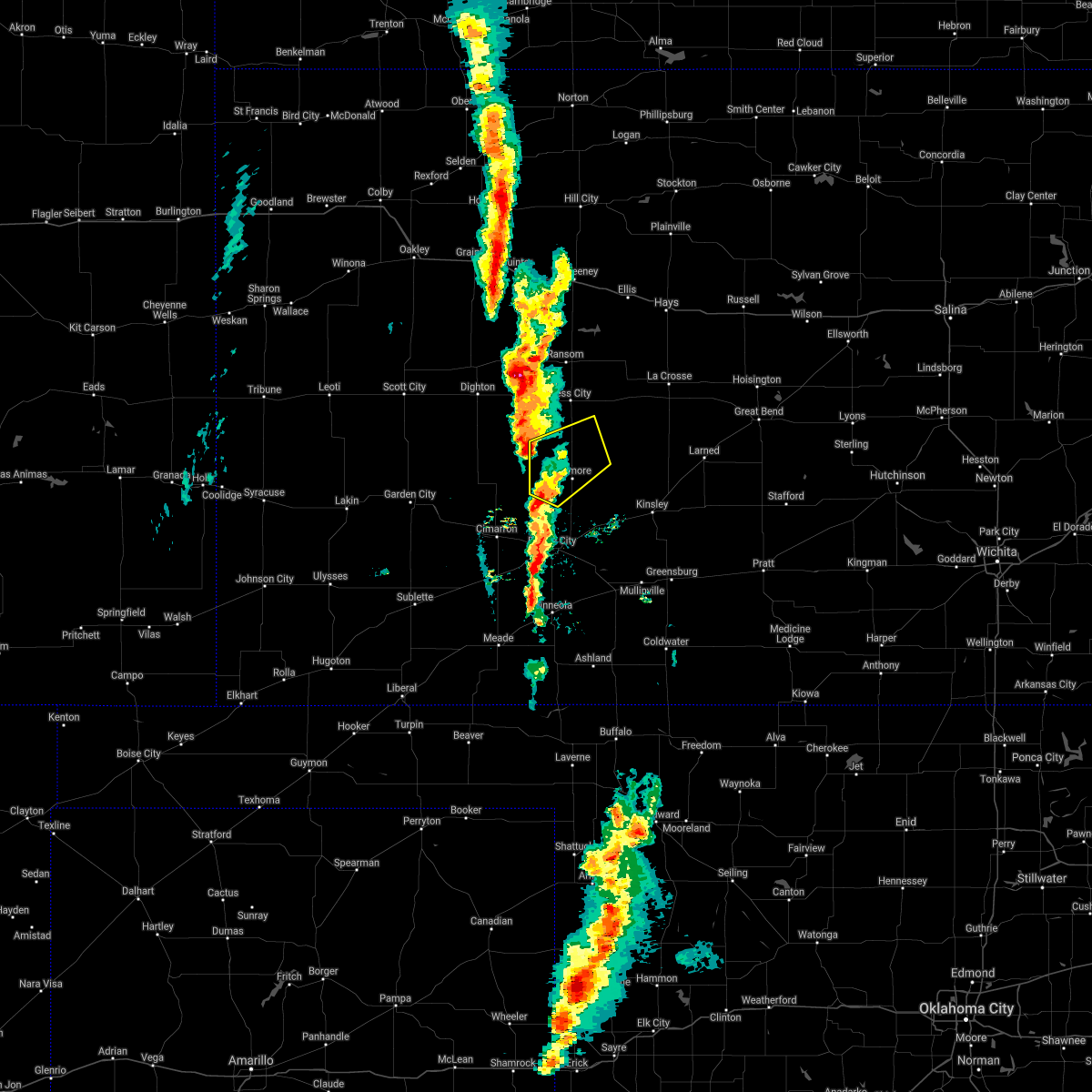 At 759 pm cdt, a severe thunderstorm was located 9 miles southwest of jetmore, moving northeast at 30 mph (radar indicated). Hazards include 60 mph wind gusts and quarter size hail. Hail damage to vehicles is expected. Expect wind damage to roofs, siding, and trees. At 759 pm cdt, a severe thunderstorm was located 9 miles southwest of jetmore, moving northeast at 30 mph (radar indicated). Hazards include 60 mph wind gusts and quarter size hail. Hail damage to vehicles is expected. Expect wind damage to roofs, siding, and trees.
|
| 10/12/2021 10:22 PM CDT |
 The severe thunderstorm warning for western ford, eastern seward, eastern finney, western hodgeman, meade, gray and eastern haskell counties will expire at 1030 pm cdt, the storms which prompted the warning have moved out of the area. therefore, the warning will be allowed to expire. a tornado watch remains in effect until 1100 pm cdt for southwestern kansas. a tornado watch also remains in effect until 500 am cdt for southwestern kansas. The severe thunderstorm warning for western ford, eastern seward, eastern finney, western hodgeman, meade, gray and eastern haskell counties will expire at 1030 pm cdt, the storms which prompted the warning have moved out of the area. therefore, the warning will be allowed to expire. a tornado watch remains in effect until 1100 pm cdt for southwestern kansas. a tornado watch also remains in effect until 500 am cdt for southwestern kansas.
|
| 10/12/2021 10:20 PM CDT |
 At 1019 pm cdt, severe thunderstorms were located along a line extending from 13 miles north of jetmore to 8 miles east of ensign to 7 miles northeast of forgan, moving northeast at 60 mph (radar indicated). Hazards include 70 mph wind gusts and quarter size hail. Hail damage to vehicles is expected. expect considerable tree damage. wind damage is also likely to mobile homes, roofs, and outbuildings. severe thunderstorms will be near, dodge city and ft. dodge around 1030 pm cdt. wright around 1035 pm cdt. Other locations in the path of these severe thunderstorms include ford, spearville, windhorst, bellefont and ashland. At 1019 pm cdt, severe thunderstorms were located along a line extending from 13 miles north of jetmore to 8 miles east of ensign to 7 miles northeast of forgan, moving northeast at 60 mph (radar indicated). Hazards include 70 mph wind gusts and quarter size hail. Hail damage to vehicles is expected. expect considerable tree damage. wind damage is also likely to mobile homes, roofs, and outbuildings. severe thunderstorms will be near, dodge city and ft. dodge around 1030 pm cdt. wright around 1035 pm cdt. Other locations in the path of these severe thunderstorms include ford, spearville, windhorst, bellefont and ashland.
|
| 10/12/2021 10:08 PM CDT |
 At 1008 pm cdt, severe thunderstorms were located along a line extending from 12 miles south of beeler to near howell to near meade state park, moving northeast at 55 mph (radar indicated). Hazards include 70 mph wind gusts and nickel size hail. Expect considerable tree damage. damage is likely to mobile homes, roofs, and outbuildings. Locations impacted include, howell, dodge city and meade. At 1008 pm cdt, severe thunderstorms were located along a line extending from 12 miles south of beeler to near howell to near meade state park, moving northeast at 55 mph (radar indicated). Hazards include 70 mph wind gusts and nickel size hail. Expect considerable tree damage. damage is likely to mobile homes, roofs, and outbuildings. Locations impacted include, howell, dodge city and meade.
|
| 10/12/2021 9:46 PM CDT |
 At 946 pm cdt, severe thunderstorms were located along a line extending from 9 miles northwest of kalvesta to near montezuma to 6 miles southeast of hayne, moving northeast at 55 mph (radar indicated). Hazards include 70 mph wind gusts and nickel size hail. Expect considerable tree damage. damage is likely to mobile homes, roofs, and outbuildings. severe thunderstorms will be near, montezuma around 950 pm cdt. the haggard elev around 955 pm cdt. ensign around 1000 pm cdt. Other locations in the path of these severe thunderstorms include meade state park, howell, dodge city and meade. At 946 pm cdt, severe thunderstorms were located along a line extending from 9 miles northwest of kalvesta to near montezuma to 6 miles southeast of hayne, moving northeast at 55 mph (radar indicated). Hazards include 70 mph wind gusts and nickel size hail. Expect considerable tree damage. damage is likely to mobile homes, roofs, and outbuildings. severe thunderstorms will be near, montezuma around 950 pm cdt. the haggard elev around 955 pm cdt. ensign around 1000 pm cdt. Other locations in the path of these severe thunderstorms include meade state park, howell, dodge city and meade.
|
| 8/7/2021 7:07 PM CDT |
 At 706 pm cdt, severe thunderstorms were located along a line extending from 9 miles north of gray to near jetmore to near howell, moving east at 45 mph (radar indicated). Hazards include 60 mph wind gusts and half dollar size hail. Hail damage to vehicles is expected. expect wind damage to roofs, siding, and trees. severe thunderstorms will be near, burdett around 715 pm cdt. hanston around 720 pm cdt. dodge city, gray and rozel around 725 pm cdt. other locations in the path of these severe thunderstorms include wright, spearville, ash valley, larned, garfield, windhorst and bellefont. hail threat, radar indicated max hail size, 1. 25 in wind threat, radar indicated max wind gust, 60 mph. At 706 pm cdt, severe thunderstorms were located along a line extending from 9 miles north of gray to near jetmore to near howell, moving east at 45 mph (radar indicated). Hazards include 60 mph wind gusts and half dollar size hail. Hail damage to vehicles is expected. expect wind damage to roofs, siding, and trees. severe thunderstorms will be near, burdett around 715 pm cdt. hanston around 720 pm cdt. dodge city, gray and rozel around 725 pm cdt. other locations in the path of these severe thunderstorms include wright, spearville, ash valley, larned, garfield, windhorst and bellefont. hail threat, radar indicated max hail size, 1. 25 in wind threat, radar indicated max wind gust, 60 mph.
|
| 8/7/2021 6:50 PM CDT | Mesonet station k5nes us-283 @ pawnee r. nes in hodgeman county KS, 13.3 miles S of Jetmore, KS |
| 7/25/2021 12:31 PM CDT |
 At 1231 pm cdt, a severe thunderstorm with strong winds was located near wright, moving southeast at 15 mph. another area of strong winds is located 10 miles south of jetmore moving southeast at 15 mph (radar indicated). Hazards include 60 mph wind gusts. Expect damage to roofs, siding, and trees. this severe thunderstorm will be near, dodge city around 1245 pm cdt. other locations in the path of this severe thunderstorm include wright and ft. Dodge. At 1231 pm cdt, a severe thunderstorm with strong winds was located near wright, moving southeast at 15 mph. another area of strong winds is located 10 miles south of jetmore moving southeast at 15 mph (radar indicated). Hazards include 60 mph wind gusts. Expect damage to roofs, siding, and trees. this severe thunderstorm will be near, dodge city around 1245 pm cdt. other locations in the path of this severe thunderstorm include wright and ft. Dodge.
|
| 6/25/2021 7:59 PM CDT |
 At 759 pm cdt, severe thunderstorms were located along a line extending from 8 miles southeast of jetmore to near radium, moving northwest at 25 mph (radar indicated). Hazards include 60 mph wind gusts and penny size hail. expect damage to roofs, siding, and trees At 759 pm cdt, severe thunderstorms were located along a line extending from 8 miles southeast of jetmore to near radium, moving northwest at 25 mph (radar indicated). Hazards include 60 mph wind gusts and penny size hail. expect damage to roofs, siding, and trees
|
| 5/14/2021 11:20 PM CDT |
 At 1120 pm cdt, severe thunderstorms were located along a line extending from near olmitz to 6 miles southwest of jetmore, moving southeast at 35 mph (radar indicated). Hazards include 60 mph wind gusts and quarter size hail. Hail damage to vehicles is expected. expect wind damage to roofs, siding, and trees. These severe thunderstorms will remain over mainly rural areas of northwestern ford, hodgeman, pawnee, southeastern rush and northwestern edwards counties. At 1120 pm cdt, severe thunderstorms were located along a line extending from near olmitz to 6 miles southwest of jetmore, moving southeast at 35 mph (radar indicated). Hazards include 60 mph wind gusts and quarter size hail. Hail damage to vehicles is expected. expect wind damage to roofs, siding, and trees. These severe thunderstorms will remain over mainly rural areas of northwestern ford, hodgeman, pawnee, southeastern rush and northwestern edwards counties.
|
| 5/14/2021 11:06 PM CDT |
 The severe thunderstorm warning for northeastern finney, southern ness, hodgeman and northeastern gray counties will expire at 1115 pm cdt, the storms which prompted the warning have moved out of the area. therefore, the warning will be allowed to expire. however small hail, gusty winds and heavy rain are still possible with these thunderstorms. a severe thunderstorm watch remains in effect until 100 am cdt for south central, central, southwestern and west central kansas. The severe thunderstorm warning for northeastern finney, southern ness, hodgeman and northeastern gray counties will expire at 1115 pm cdt, the storms which prompted the warning have moved out of the area. therefore, the warning will be allowed to expire. however small hail, gusty winds and heavy rain are still possible with these thunderstorms. a severe thunderstorm watch remains in effect until 100 am cdt for south central, central, southwestern and west central kansas.
|
| 5/14/2021 11:05 PM CDT |
 At 1104 pm cdt, severe thunderstorms were located along a line extending from near otis to 7 miles east of kalvesta, moving southeast at 35 mph (radar indicated). Hazards include 60 mph wind gusts and quarter size hail. Hail damage to vehicles is expected. expect wind damage to roofs, siding, and trees. severe thunderstorms will be near, otis, bison, timken and shaffer around 1110 pm cdt. Other locations in the path of these severe thunderstorms include jetmore. At 1104 pm cdt, severe thunderstorms were located along a line extending from near otis to 7 miles east of kalvesta, moving southeast at 35 mph (radar indicated). Hazards include 60 mph wind gusts and quarter size hail. Hail damage to vehicles is expected. expect wind damage to roofs, siding, and trees. severe thunderstorms will be near, otis, bison, timken and shaffer around 1110 pm cdt. Other locations in the path of these severe thunderstorms include jetmore.
|
| 5/14/2021 10:45 PM CDT |
 At 1045 pm cdt, severe thunderstorms were located along a line extending from near alexander to 15 miles west of kalvesta, moving south at 20 mph (radar indicated). Hazards include 70 mph wind gusts and quarter size hail. Hail damage to vehicles is expected. expect considerable tree damage. wind damage is also likely to mobile homes, roofs, and outbuildings. These severe thunderstorms will remain over mainly rural areas of northeastern finney, southern ness, hodgeman and northeastern gray counties. At 1045 pm cdt, severe thunderstorms were located along a line extending from near alexander to 15 miles west of kalvesta, moving south at 20 mph (radar indicated). Hazards include 70 mph wind gusts and quarter size hail. Hail damage to vehicles is expected. expect considerable tree damage. wind damage is also likely to mobile homes, roofs, and outbuildings. These severe thunderstorms will remain over mainly rural areas of northeastern finney, southern ness, hodgeman and northeastern gray counties.
|
| 5/14/2021 10:24 PM CDT |
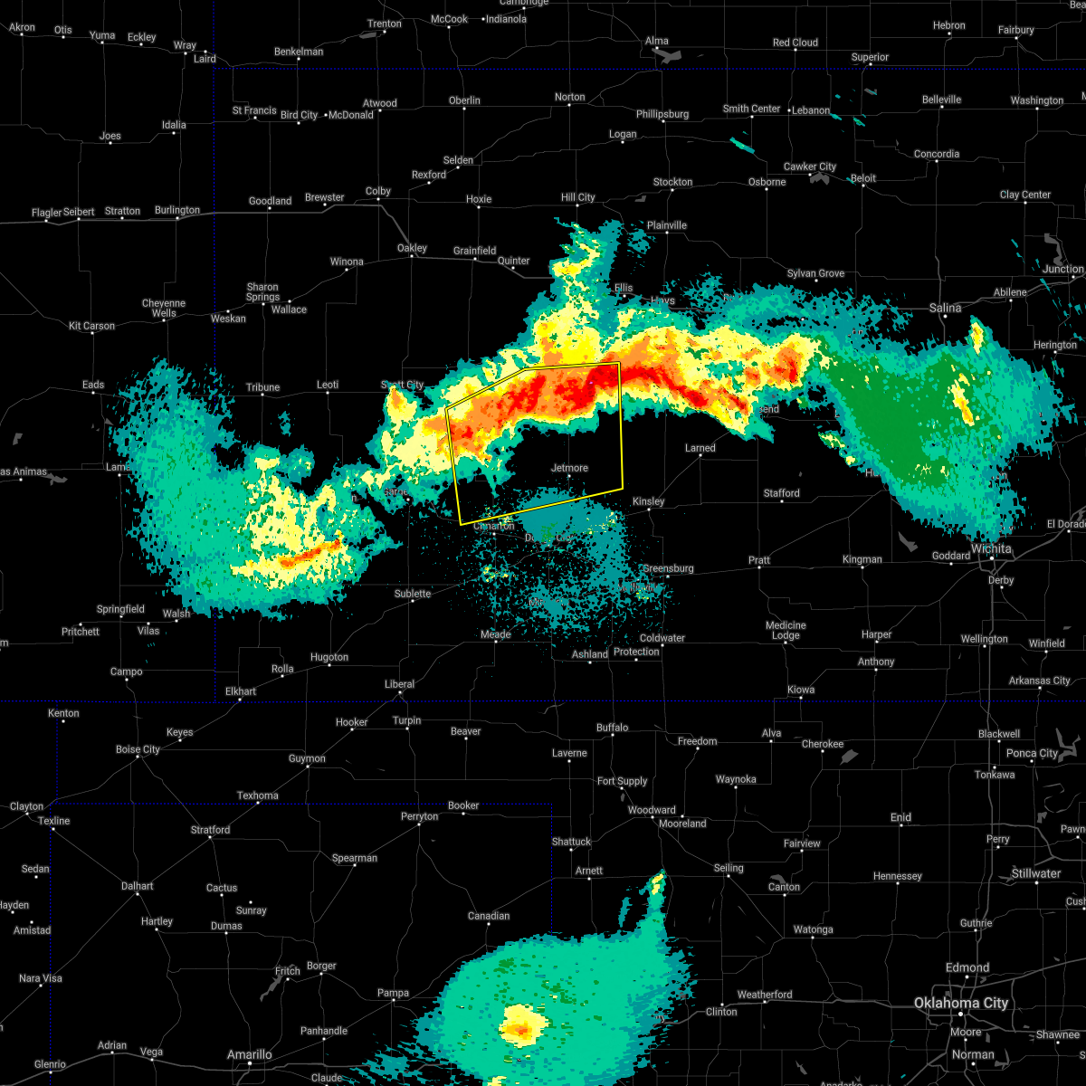 At 1024 pm cdt, severe thunderstorms were located along a line extending from near mccracken to 15 miles south of amy, moving south at 40 mph (radar indicated). Hazards include 70 mph wind gusts and quarter size hail. Hail damage to vehicles is expected. expect considerable tree damage. wind damage is also likely to mobile homes, roofs, and outbuildings. Severe thunderstorms will be near, bazine around 1030 pm cdt. At 1024 pm cdt, severe thunderstorms were located along a line extending from near mccracken to 15 miles south of amy, moving south at 40 mph (radar indicated). Hazards include 70 mph wind gusts and quarter size hail. Hail damage to vehicles is expected. expect considerable tree damage. wind damage is also likely to mobile homes, roofs, and outbuildings. Severe thunderstorms will be near, bazine around 1030 pm cdt.
|
| 5/8/2021 5:36 PM CDT |
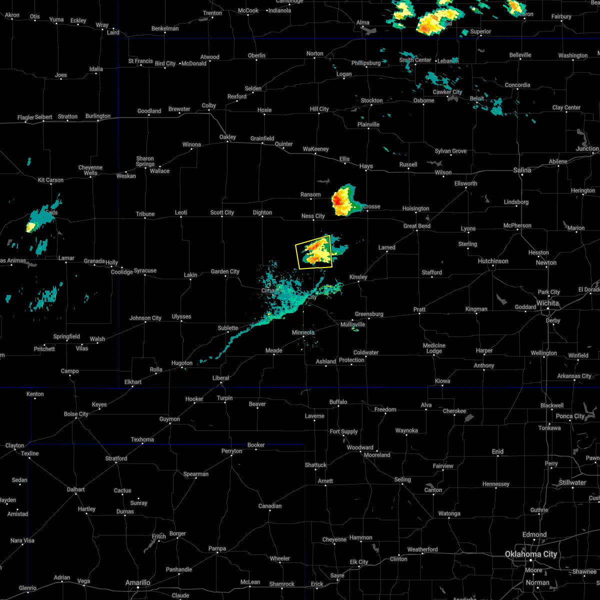 The severe thunderstorm warning for south central ness and northern hodgeman counties will expire at 545 pm cdt, the storm which prompted the warning has weakened below severe limits, and no longer poses an immediate threat to life or property. therefore, the warning will be allowed to expire. a severe thunderstorm watch remains in effect until 900 pm cdt for southwestern and west central kansas. The severe thunderstorm warning for south central ness and northern hodgeman counties will expire at 545 pm cdt, the storm which prompted the warning has weakened below severe limits, and no longer poses an immediate threat to life or property. therefore, the warning will be allowed to expire. a severe thunderstorm watch remains in effect until 900 pm cdt for southwestern and west central kansas.
|
| 5/8/2021 5:24 PM CDT |
 At 524 pm cdt, a severe thunderstorm was located near jetmore, moving northeast at 30 mph (radar indicated). Hazards include quarter size hail. Damage to vehicles is expected. Locations impacted include, jetmore and hanston. At 524 pm cdt, a severe thunderstorm was located near jetmore, moving northeast at 30 mph (radar indicated). Hazards include quarter size hail. Damage to vehicles is expected. Locations impacted include, jetmore and hanston.
|
| 5/8/2021 5:15 PM CDT |
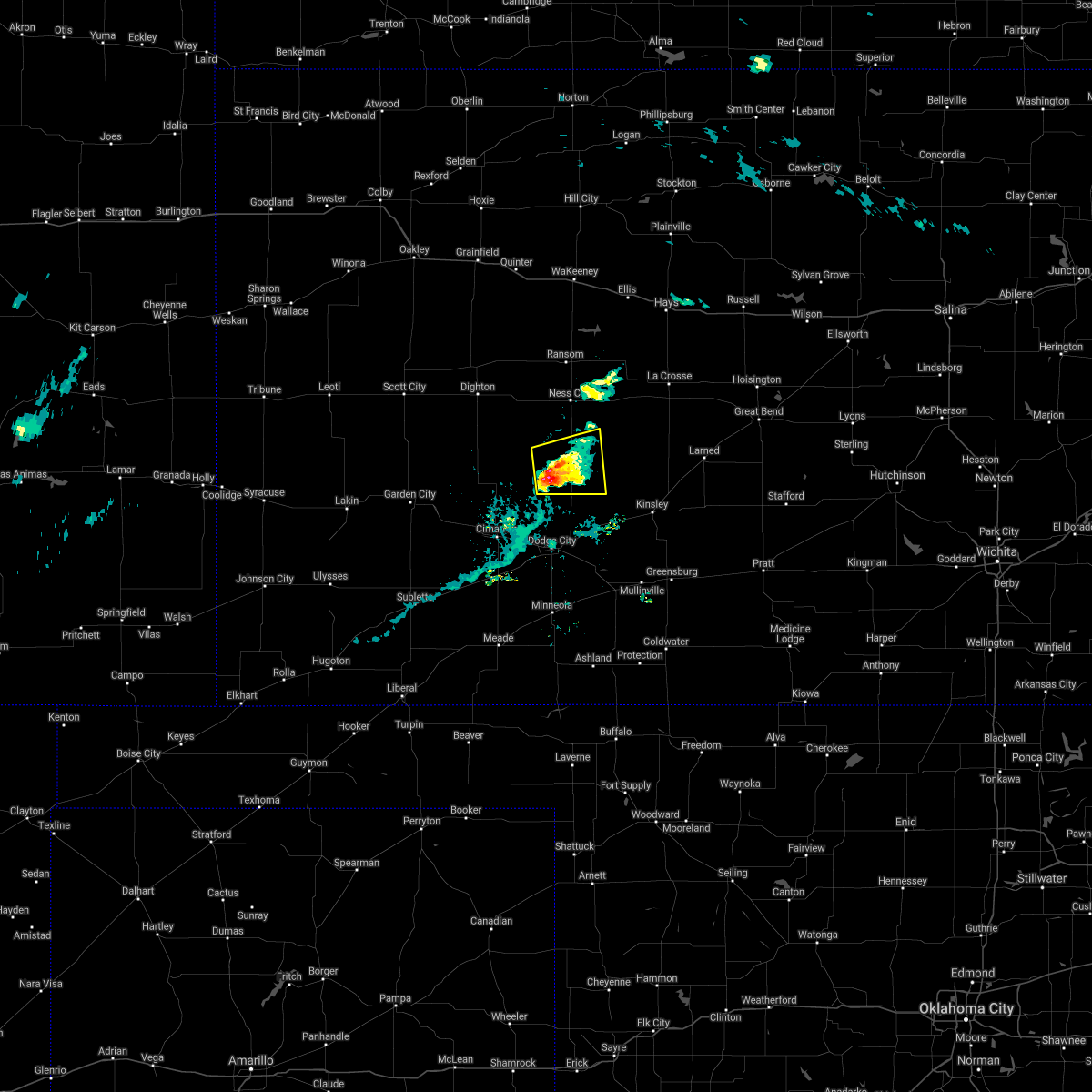 At 515 pm cdt, a severe thunderstorm was located near jetmore, moving east at 30 mph (radar indicated). Hazards include golf ball size hail. People and animals outdoors will be injured. expect damage to roofs, siding, windows, and vehicles. Locations impacted include, jetmore and hanston. At 515 pm cdt, a severe thunderstorm was located near jetmore, moving east at 30 mph (radar indicated). Hazards include golf ball size hail. People and animals outdoors will be injured. expect damage to roofs, siding, windows, and vehicles. Locations impacted include, jetmore and hanston.
|
| 5/8/2021 5:00 PM CDT |
 At 500 pm cdt, a severe thunderstorm was located 9 miles east of kalvesta, moving northeast at 30 mph (radar indicated). Hazards include golf ball size hail. People and animals outdoors will be injured. Expect damage to roofs, siding, windows, and vehicles. At 500 pm cdt, a severe thunderstorm was located 9 miles east of kalvesta, moving northeast at 30 mph (radar indicated). Hazards include golf ball size hail. People and animals outdoors will be injured. Expect damage to roofs, siding, windows, and vehicles.
|
| 5/2/2021 10:09 PM CDT |
 The severe thunderstorm warning for ford, southern hodgeman, eastern meade and clark counties will expire at 1015 pm cdt, the storms which prompted the warning have weakened below severe limits, and no longer pose an immediate threat to life or property. therefore, the warning will be allowed to expire. however gusty winds are still possible with these thunderstorms. a severe thunderstorm watch remains in effect until midnight cdt for southwestern kansas. The severe thunderstorm warning for ford, southern hodgeman, eastern meade and clark counties will expire at 1015 pm cdt, the storms which prompted the warning have weakened below severe limits, and no longer pose an immediate threat to life or property. therefore, the warning will be allowed to expire. however gusty winds are still possible with these thunderstorms. a severe thunderstorm watch remains in effect until midnight cdt for southwestern kansas.
|
| 5/2/2021 9:57 PM CDT |
 At 956 pm cdt, severe thunderstorms were located along a line extending from 9 miles south of jetmore to near englewood, moving east at 35 mph (radar indicated). Hazards include 60 mph wind gusts and quarter size hail. Hail damage to vehicles is expected. expect wind damage to roofs, siding, and trees. locations impacted include, dodge city, ashland, bucklin, spearville, minneola, fowler, ford, bloom, englewood, sitka, clark state lake, kingsdown, wright, bellefont, windhorst, acres and ft. Dodge. At 956 pm cdt, severe thunderstorms were located along a line extending from 9 miles south of jetmore to near englewood, moving east at 35 mph (radar indicated). Hazards include 60 mph wind gusts and quarter size hail. Hail damage to vehicles is expected. expect wind damage to roofs, siding, and trees. locations impacted include, dodge city, ashland, bucklin, spearville, minneola, fowler, ford, bloom, englewood, sitka, clark state lake, kingsdown, wright, bellefont, windhorst, acres and ft. Dodge.
|
| 5/2/2021 9:36 PM CDT |
 At 936 pm cdt, severe thunderstorms were located along a line extending from 10 miles southeast of kalvesta to 11 miles west of englewood, moving east at 35 mph (radar indicated). Hazards include 60 mph wind gusts and penny size hail. expect damage to roofs, siding, and trees At 936 pm cdt, severe thunderstorms were located along a line extending from 10 miles southeast of kalvesta to 11 miles west of englewood, moving east at 35 mph (radar indicated). Hazards include 60 mph wind gusts and penny size hail. expect damage to roofs, siding, and trees
|
| 8/29/2020 1:40 AM CDT |
 At 140 am cdt, a severe thunderstorm was located 11 miles northeast of howell, moving east at 30 mph (radar indicated). Hazards include 60 mph wind gusts and quarter size hail. Hail damage to vehicles is expected. expect wind damage to roofs, siding, and trees. locations impacted include, dodge city, jetmore, spearville, ford, howell, bellefont, wright, windhorst and ft. Dodge. At 140 am cdt, a severe thunderstorm was located 11 miles northeast of howell, moving east at 30 mph (radar indicated). Hazards include 60 mph wind gusts and quarter size hail. Hail damage to vehicles is expected. expect wind damage to roofs, siding, and trees. locations impacted include, dodge city, jetmore, spearville, ford, howell, bellefont, wright, windhorst and ft. Dodge.
|
| 8/10/2020 5:06 PM CDT |
 The severe thunderstorm warning for northeastern ford and south central hodgeman counties will expire at 515 pm cdt, the storm which prompted the warning has weakened below severe limits, and no longer poses an immediate threat to life or property. therefore, the warning will be allowed to expire. The severe thunderstorm warning for northeastern ford and south central hodgeman counties will expire at 515 pm cdt, the storm which prompted the warning has weakened below severe limits, and no longer poses an immediate threat to life or property. therefore, the warning will be allowed to expire.
|
| 8/10/2020 4:45 PM CDT |
 At 444 pm cdt, a severe thunderstorm was located near wright, moving northeast at 20 mph (radar indicated). Hazards include 60 mph wind gusts and half dollar size hail. Hail damage to vehicles is expected. expect wind damage to roofs, siding, and trees. Locations impacted include, dodge city, spearville and wright. At 444 pm cdt, a severe thunderstorm was located near wright, moving northeast at 20 mph (radar indicated). Hazards include 60 mph wind gusts and half dollar size hail. Hail damage to vehicles is expected. expect wind damage to roofs, siding, and trees. Locations impacted include, dodge city, spearville and wright.
|
| 8/10/2020 4:34 PM CDT |
 At 434 pm cdt, a severe thunderstorm was located near dodge city, moving northeast at 15 mph (trained weather spotters). Hazards include ping pong ball size hail. People and animals outdoors will be injured. expect damage to roofs, siding, windows, and vehicles. Locations impacted include, dodge city, spearville and wright. At 434 pm cdt, a severe thunderstorm was located near dodge city, moving northeast at 15 mph (trained weather spotters). Hazards include ping pong ball size hail. People and animals outdoors will be injured. expect damage to roofs, siding, windows, and vehicles. Locations impacted include, dodge city, spearville and wright.
|
| 8/10/2020 4:28 PM CDT |
 At 427 pm cdt, a severe thunderstorm was located near dodge city, moving northeast at 15 mph. quarter sized hail was reported in dodge city at 4:26 pm (trained weather spotters). Hazards include quarter size hail. damage to vehicles is expected At 427 pm cdt, a severe thunderstorm was located near dodge city, moving northeast at 15 mph. quarter sized hail was reported in dodge city at 4:26 pm (trained weather spotters). Hazards include quarter size hail. damage to vehicles is expected
|
| 7/30/2020 1:27 AM CDT |
 The severe thunderstorm warning for northeastern finney, ness, hodgeman, northwestern pawnee, southeastern lane and southwestern rush counties will expire at 130 am cdt, the storms which prompted the warning have weakened below severe limits, and no longer pose an immediate threat to life or property. therefore, the warning will be allowed to expire. however gusty winds and heavy rain are still possible with these thunderstorms. The severe thunderstorm warning for northeastern finney, ness, hodgeman, northwestern pawnee, southeastern lane and southwestern rush counties will expire at 130 am cdt, the storms which prompted the warning have weakened below severe limits, and no longer pose an immediate threat to life or property. therefore, the warning will be allowed to expire. however gusty winds and heavy rain are still possible with these thunderstorms.
|
| 7/30/2020 1:00 AM CDT |
 At 100 am cdt, severe thunderstorms were located along a line extending from near ness city to 14 miles south of beeler, moving southeast at 40 mph (radar indicated). Hazards include 60 mph wind gusts and nickel size hail. Expect damage to roofs, siding, and trees. Locations impacted include, ness city, jetmore, bazine, hanston, rush center, alexander and nekoma. At 100 am cdt, severe thunderstorms were located along a line extending from near ness city to 14 miles south of beeler, moving southeast at 40 mph (radar indicated). Hazards include 60 mph wind gusts and nickel size hail. Expect damage to roofs, siding, and trees. Locations impacted include, ness city, jetmore, bazine, hanston, rush center, alexander and nekoma.
|
| 7/30/2020 12:41 AM CDT |
 The national weather service in dodge city has issued a * severe thunderstorm warning for. northeastern finney county in southwestern kansas. ness county in west central kansas. hodgeman county in southwestern kansas. Northwestern pawnee county in south central kansas. The national weather service in dodge city has issued a * severe thunderstorm warning for. northeastern finney county in southwestern kansas. ness county in west central kansas. hodgeman county in southwestern kansas. Northwestern pawnee county in south central kansas.
|
| 7/12/2020 11:39 PM CDT |
 At 1139 pm cdt, a severe thunderstorm was located 9 miles north of ingalls, moving southeast at 15 mph (radar indicated). Hazards include 60 mph wind gusts and quarter size hail. Hail damage to vehicles is expected. Expect wind damage to roofs, siding, and trees. At 1139 pm cdt, a severe thunderstorm was located 9 miles north of ingalls, moving southeast at 15 mph (radar indicated). Hazards include 60 mph wind gusts and quarter size hail. Hail damage to vehicles is expected. Expect wind damage to roofs, siding, and trees.
|
| 6/27/2020 11:38 PM CDT |
 At 1138 pm cdt, a severe thunderstorm was located 8 miles northeast of ingalls, moving east at 35 mph (radar indicated). Hazards include 60 mph wind gusts and quarter size hail. Hail damage to vehicles is expected. Expect wind damage to roofs, siding, and trees. At 1138 pm cdt, a severe thunderstorm was located 8 miles northeast of ingalls, moving east at 35 mph (radar indicated). Hazards include 60 mph wind gusts and quarter size hail. Hail damage to vehicles is expected. Expect wind damage to roofs, siding, and trees.
|
| 6/27/2020 1:39 AM CDT |
 The severe thunderstorm warning for northwestern ford, central finney, southwestern hodgeman and northern gray counties will expire at 145 am cdt, northwest outflow winds of 58 mph or higher are no longer expected. therefore, the warning will be allowed to expire. however gusty winds 45 to 55 mph are still possible through 2 am. a severe thunderstorm watch remains in effect until 400 am cdt for southwestern kansas. The severe thunderstorm warning for northwestern ford, central finney, southwestern hodgeman and northern gray counties will expire at 145 am cdt, northwest outflow winds of 58 mph or higher are no longer expected. therefore, the warning will be allowed to expire. however gusty winds 45 to 55 mph are still possible through 2 am. a severe thunderstorm watch remains in effect until 400 am cdt for southwestern kansas.
|
| 6/27/2020 1:25 AM CDT |
 The severe thunderstorm warning for northeastern finney, western ness, eastern scott, northwestern hodgeman, southwestern trego and lane counties will expire at 130 am cdt, the storms which prompted the warning have weakened below severe limits, and no longer pose an immediate threat to life or property. therefore, the warning will be allowed to expire. however gusty winds are still possible with these thunderstorms. a severe thunderstorm watch remains in effect until 400 am cdt for southwestern and west central kansas. The severe thunderstorm warning for northeastern finney, western ness, eastern scott, northwestern hodgeman, southwestern trego and lane counties will expire at 130 am cdt, the storms which prompted the warning have weakened below severe limits, and no longer pose an immediate threat to life or property. therefore, the warning will be allowed to expire. however gusty winds are still possible with these thunderstorms. a severe thunderstorm watch remains in effect until 400 am cdt for southwestern and west central kansas.
|
| 6/27/2020 1:05 AM CDT |
 At 104 am cdt, severe thunderstorms were located along a line extending from near shields to near beeler to near kalvesta, moving east at 60 mph (radar indicated. at 1249 am cdt, a 63 mph thunderstorm wind gust was recorded by a weather station 2 miles southwest of shields). Hazards include 70 mph wind gusts. Expect considerable tree damage. damage is likely to mobile homes, roofs, and outbuildings. Locations impacted include, ness city, dighton, jetmore, utica, alamota, grigston, manning, beeler, pendennis, amy, arnold, healy and shields. At 104 am cdt, severe thunderstorms were located along a line extending from near shields to near beeler to near kalvesta, moving east at 60 mph (radar indicated. at 1249 am cdt, a 63 mph thunderstorm wind gust was recorded by a weather station 2 miles southwest of shields). Hazards include 70 mph wind gusts. Expect considerable tree damage. damage is likely to mobile homes, roofs, and outbuildings. Locations impacted include, ness city, dighton, jetmore, utica, alamota, grigston, manning, beeler, pendennis, amy, arnold, healy and shields.
|
| 6/27/2020 1:01 AM CDT |
 At 1259 am cdt, severe winds from nearby thunderstorms were located along a line extending from 8 miles northwest of kalvesta to 6 miles east of plymell, moving southeast at 35 mph (automated weather station). Hazards include 65 mph wind gusts. expect damage to roofs, siding, and trees At 1259 am cdt, severe winds from nearby thunderstorms were located along a line extending from 8 miles northwest of kalvesta to 6 miles east of plymell, moving southeast at 35 mph (automated weather station). Hazards include 65 mph wind gusts. expect damage to roofs, siding, and trees
|
| 6/27/2020 12:41 AM CDT |
 At 1241 am cdt, severe thunderstorms were located along a line extending from near manning to 7 miles south of amy to 16 miles northeast of garden city, moving east at 55 mph (radar indicated). Hazards include 60 mph wind gusts and nickel size hail. expect damage to roofs, siding, and trees At 1241 am cdt, severe thunderstorms were located along a line extending from near manning to 7 miles south of amy to 16 miles northeast of garden city, moving east at 55 mph (radar indicated). Hazards include 60 mph wind gusts and nickel size hail. expect damage to roofs, siding, and trees
|
| 6/21/2020 5:51 PM CDT |
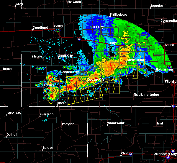 At 551 pm cdt, severe thunderstorms were located along a line extending from near burdett to near bellefont, moving east at 20 mph (radar indicated). Hazards include 70 mph wind gusts and nickel size hail. Expect considerable tree damage. damage is likely to mobile homes, roofs, and outbuildings. Locations impacted include, gray, jetmore and hanston. At 551 pm cdt, severe thunderstorms were located along a line extending from near burdett to near bellefont, moving east at 20 mph (radar indicated). Hazards include 70 mph wind gusts and nickel size hail. Expect considerable tree damage. damage is likely to mobile homes, roofs, and outbuildings. Locations impacted include, gray, jetmore and hanston.
|
| 6/21/2020 5:16 PM CDT |
 At 516 pm cdt, severe thunderstorms were located along a line extending from 8 miles northwest of gray to 7 miles northwest of spearville, moving east at 20 mph (radar indicated). Hazards include 70 mph wind gusts and ping pong ball size hail. People and animals outdoors will be injured. expect hail damage to roofs, siding, windows, and vehicles. expect considerable tree damage. Wind damage is also likely to mobile homes, roofs, and outbuildings. At 516 pm cdt, severe thunderstorms were located along a line extending from 8 miles northwest of gray to 7 miles northwest of spearville, moving east at 20 mph (radar indicated). Hazards include 70 mph wind gusts and ping pong ball size hail. People and animals outdoors will be injured. expect hail damage to roofs, siding, windows, and vehicles. expect considerable tree damage. Wind damage is also likely to mobile homes, roofs, and outbuildings.
|
| 6/21/2020 5:11 PM CDT | Law enforcement reported two barns were blown dow in hodgeman county KS, 3.7 miles S of Jetmore, KS |
| 6/21/2020 4:55 PM CDT | Mesonet station k5nes us-283 @ pawnee r. nes in hodgeman county KS, 13.3 miles S of Jetmore, KS |
| 6/21/2020 4:42 PM CDT |
 At 442 pm cdt, a severe thunderstorm was located 7 miles northeast of howell, moving east at 20 mph (radar indicated). Hazards include two inch hail. People and animals outdoors will be injured. expect damage to roofs, siding, windows, and vehicles. This severe thunderstorm will remain over mainly rural areas of northwestern ford and southwestern hodgeman counties. At 442 pm cdt, a severe thunderstorm was located 7 miles northeast of howell, moving east at 20 mph (radar indicated). Hazards include two inch hail. People and animals outdoors will be injured. expect damage to roofs, siding, windows, and vehicles. This severe thunderstorm will remain over mainly rural areas of northwestern ford and southwestern hodgeman counties.
|
| 6/21/2020 4:31 PM CDT |
 At 431 pm cdt, severe thunderstorms were located along a line extending from 12 miles south of ness city to 6 miles north of charleston, moving southeast at 45 mph (radar indicated). Hazards include tennis ball size hail and 70 mph wind gusts. People and animals outdoors will be injured. expect hail damage to roofs, siding, windows, and vehicles. expect considerable tree damage. wind damage is also likely to mobile homes, roofs, and outbuildings. Locations impacted include, garden city, scott city, holcomb, ness city, dighton, jetmore, ransom, hanston, utica, alamota, grigston, shallow water, manning, beeler, pendennis, amy, arnold, healy, friend and kalvesta. At 431 pm cdt, severe thunderstorms were located along a line extending from 12 miles south of ness city to 6 miles north of charleston, moving southeast at 45 mph (radar indicated). Hazards include tennis ball size hail and 70 mph wind gusts. People and animals outdoors will be injured. expect hail damage to roofs, siding, windows, and vehicles. expect considerable tree damage. wind damage is also likely to mobile homes, roofs, and outbuildings. Locations impacted include, garden city, scott city, holcomb, ness city, dighton, jetmore, ransom, hanston, utica, alamota, grigston, shallow water, manning, beeler, pendennis, amy, arnold, healy, friend and kalvesta.
|
| 6/21/2020 4:14 PM CDT |
 At 414 pm cdt, severe thunderstorms were located along a line extending from 7 miles west of ness city to 16 miles east of friend, moving southeast at 40 mph (radar indicated). Hazards include tennis ball size hail and 70 mph wind gusts. People and animals outdoors will be injured. expect hail damage to roofs, siding, windows, and vehicles. expect considerable tree damage. Wind damage is also likely to mobile homes, roofs, and outbuildings. At 414 pm cdt, severe thunderstorms were located along a line extending from 7 miles west of ness city to 16 miles east of friend, moving southeast at 40 mph (radar indicated). Hazards include tennis ball size hail and 70 mph wind gusts. People and animals outdoors will be injured. expect hail damage to roofs, siding, windows, and vehicles. expect considerable tree damage. Wind damage is also likely to mobile homes, roofs, and outbuildings.
|
| 6/20/2020 11:53 PM CDT |
 The severe thunderstorm warning for northwestern ford and southwestern hodgeman counties will expire at midnight cdt, the storm which prompted the warning has moved out of the area. therefore, the warning will be allowed to expire. The severe thunderstorm warning for northwestern ford and southwestern hodgeman counties will expire at midnight cdt, the storm which prompted the warning has moved out of the area. therefore, the warning will be allowed to expire.
|
| 6/20/2020 11:14 PM CDT |
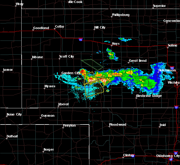 At 1114 pm cdt, a severe thunderstorm was located near kalvesta, moving southeast at 25 mph (radar indicated). Hazards include quarter size hail. Damage to vehicles is expected. This severe thunderstorm will remain over mainly rural areas of northwestern ford and southwestern hodgeman counties. At 1114 pm cdt, a severe thunderstorm was located near kalvesta, moving southeast at 25 mph (radar indicated). Hazards include quarter size hail. Damage to vehicles is expected. This severe thunderstorm will remain over mainly rural areas of northwestern ford and southwestern hodgeman counties.
|
| 6/20/2020 10:48 PM CDT |
 At 1048 pm cdt, a severe thunderstorm was located 10 miles north of dodge city, moving south at 15 mph (radar indicated). Hazards include two inch hail and 60 mph wind gusts. People and animals outdoors will be injured. expect hail damage to roofs, siding, windows, and vehicles. Expect wind damage to roofs, siding, and trees. At 1048 pm cdt, a severe thunderstorm was located 10 miles north of dodge city, moving south at 15 mph (radar indicated). Hazards include two inch hail and 60 mph wind gusts. People and animals outdoors will be injured. expect hail damage to roofs, siding, windows, and vehicles. Expect wind damage to roofs, siding, and trees.
|
| 6/20/2020 10:08 PM CDT |
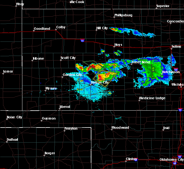 At 1008 pm cdt, a severe thunderstorm was located 12 miles south of ness city, moving southeast at 20 mph (radar indicated). Hazards include quarter size hail. damage to vehicles is expected At 1008 pm cdt, a severe thunderstorm was located 12 miles south of ness city, moving southeast at 20 mph (radar indicated). Hazards include quarter size hail. damage to vehicles is expected
|
| 6/20/2020 9:51 PM CDT |
 At 950 pm cdt, a severe thunderstorm was located 7 miles north of bellefont, moving southeast at 30 mph (radar indicated). Hazards include tennis ball size hail. People and animals outdoors will be injured. Expect damage to roofs, siding, windows, and vehicles. At 950 pm cdt, a severe thunderstorm was located 7 miles north of bellefont, moving southeast at 30 mph (radar indicated). Hazards include tennis ball size hail. People and animals outdoors will be injured. Expect damage to roofs, siding, windows, and vehicles.
|
| 6/20/2020 9:33 PM CDT |
 At 932 pm cdt, a severe thunderstorm was located near hanston, moving southeast at 30 mph (radar indicated). Hazards include tennis ball size hail and 60 mph wind gusts. People and animals outdoors will be injured. expect hail damage to roofs, siding, windows, and vehicles. expect wind damage to roofs, siding, and trees. Locations impacted include, gray, jetmore, burdett and hanston. At 932 pm cdt, a severe thunderstorm was located near hanston, moving southeast at 30 mph (radar indicated). Hazards include tennis ball size hail and 60 mph wind gusts. People and animals outdoors will be injured. expect hail damage to roofs, siding, windows, and vehicles. expect wind damage to roofs, siding, and trees. Locations impacted include, gray, jetmore, burdett and hanston.
|
| 6/20/2020 9:27 PM CDT | Ping Pong Ball sized hail reported 6.4 miles S of Jetmore, KS |
| 6/20/2020 9:21 PM CDT | Quarter sized hail reported 8.5 miles S of Jetmore, KS |
| 6/20/2020 9:14 PM CDT | Quarter sized hail reported 9.9 miles S of Jetmore, KS |
| 6/20/2020 9:08 PM CDT | Quarter sized hail reported 12.6 miles S of Jetmore, KS |
| 6/20/2020 9:04 PM CDT |
 At 903 pm cdt, a severe thunderstorm was located 7 miles northwest of hanston, moving southeast at 25 mph (radar indicated). Hazards include two inch hail and 60 mph wind gusts. People and animals outdoors will be injured. expect hail damage to roofs, siding, windows, and vehicles. Expect wind damage to roofs, siding, and trees. At 903 pm cdt, a severe thunderstorm was located 7 miles northwest of hanston, moving southeast at 25 mph (radar indicated). Hazards include two inch hail and 60 mph wind gusts. People and animals outdoors will be injured. expect hail damage to roofs, siding, windows, and vehicles. Expect wind damage to roofs, siding, and trees.
|
| 6/4/2020 9:14 PM CDT |
 At 914 pm cdt, a severe thunderstorm was located 10 miles east of kalvesta, moving east at 25 mph (radar indicated). Hazards include 70 mph wind gusts and half dollar size hail. Hail damage to vehicles is expected. expect considerable tree damage. Wind damage is also likely to mobile homes, roofs, and outbuildings. At 914 pm cdt, a severe thunderstorm was located 10 miles east of kalvesta, moving east at 25 mph (radar indicated). Hazards include 70 mph wind gusts and half dollar size hail. Hail damage to vehicles is expected. expect considerable tree damage. Wind damage is also likely to mobile homes, roofs, and outbuildings.
|
| 5/24/2020 10:12 PM CDT |
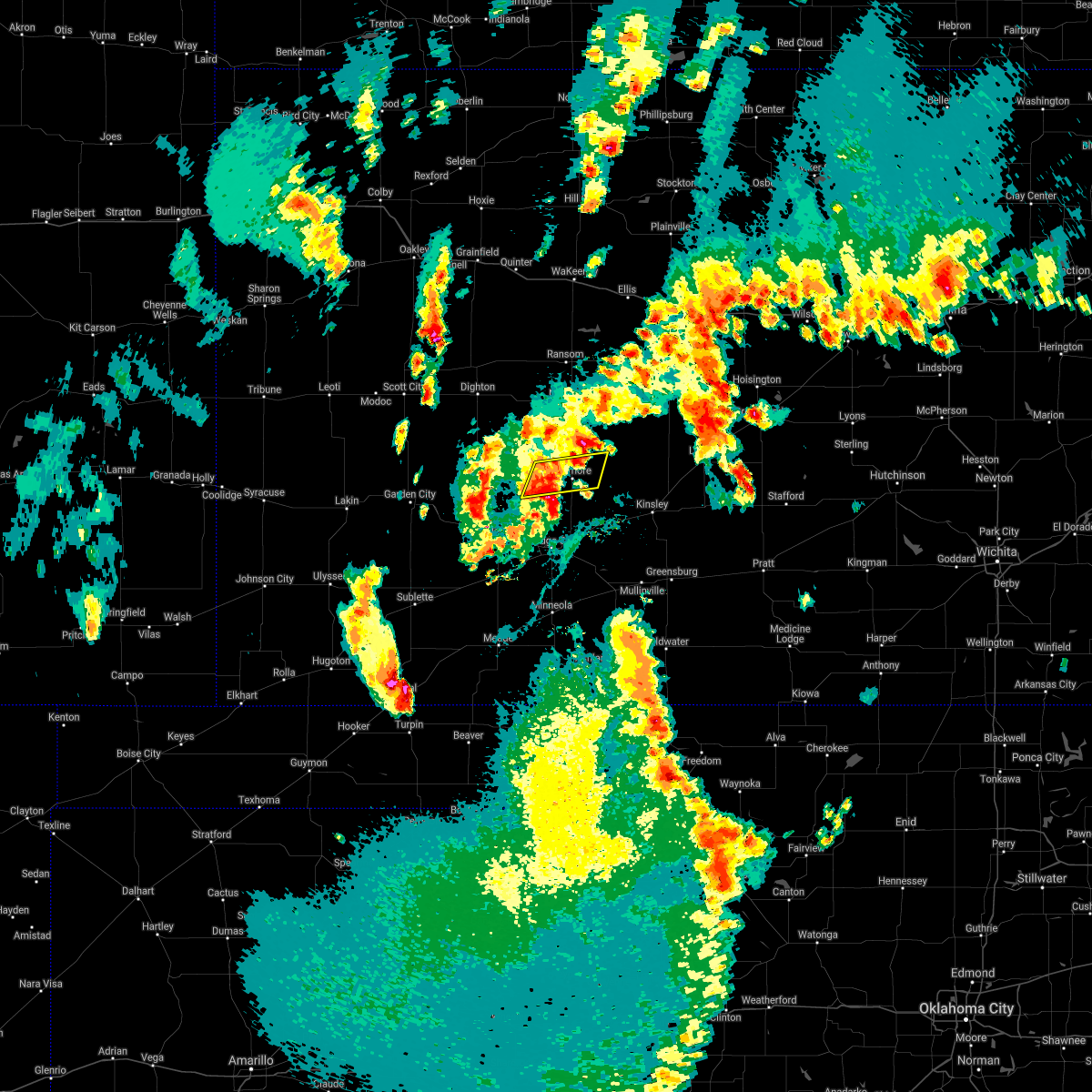 The severe thunderstorm warning for central hodgeman county will expire at 1015 pm cdt, the storms which prompted the warning have weakened below severe limits, and no longer pose an immediate threat to life or property. therefore, the warning will be allowed to expire. however gusty winds and heavy rain are still possible with these thunderstorms. a severe thunderstorm watch remains in effect until midnight cdt for southwestern kansas. The severe thunderstorm warning for central hodgeman county will expire at 1015 pm cdt, the storms which prompted the warning have weakened below severe limits, and no longer pose an immediate threat to life or property. therefore, the warning will be allowed to expire. however gusty winds and heavy rain are still possible with these thunderstorms. a severe thunderstorm watch remains in effect until midnight cdt for southwestern kansas.
|
| 5/24/2020 10:12 PM CDT |
 The severe thunderstorm warning for northwestern ford, southwestern hodgeman and southeastern gray counties will expire at 1015 pm cdt, the storms which prompted the warning have weakened below severe limits, and no longer pose an immediate threat to life or property. therefore, the warning will be allowed to expire. however gusty winds and heavy rain are still possible with these thunderstorms. a severe thunderstorm watch remains in effect until midnight cdt for southwestern kansas. The severe thunderstorm warning for northwestern ford, southwestern hodgeman and southeastern gray counties will expire at 1015 pm cdt, the storms which prompted the warning have weakened below severe limits, and no longer pose an immediate threat to life or property. therefore, the warning will be allowed to expire. however gusty winds and heavy rain are still possible with these thunderstorms. a severe thunderstorm watch remains in effect until midnight cdt for southwestern kansas.
|
| 5/24/2020 10:04 PM CDT |
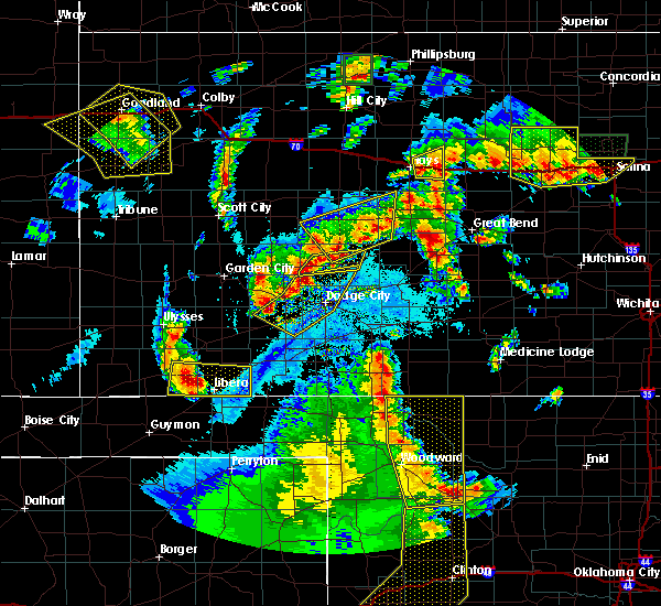 At 1003 pm cdt, severe thunderstorms were located along a line extending from near jetmore to 12 miles southeast of kalvesta, moving east at 20 mph (radar indicated). Hazards include 60 mph wind gusts and penny size hail. Expect damage to roofs, siding, and trees. Locations impacted include, jetmore and hanston. At 1003 pm cdt, severe thunderstorms were located along a line extending from near jetmore to 12 miles southeast of kalvesta, moving east at 20 mph (radar indicated). Hazards include 60 mph wind gusts and penny size hail. Expect damage to roofs, siding, and trees. Locations impacted include, jetmore and hanston.
|
| 5/24/2020 10:02 PM CDT |
 At 1002 pm cdt, severe thunderstorms were located along a line extending from 7 miles southwest of jetmore to near dodge city to near the haggard elev, moving east at 20 mph (radar indicated). Hazards include 60 mph wind gusts and nickel size hail. Expect damage to roofs, siding, and trees. locations impacted include, dodge city, montezuma, ensign, the haggard elev, ft. Dodge and howell. At 1002 pm cdt, severe thunderstorms were located along a line extending from 7 miles southwest of jetmore to near dodge city to near the haggard elev, moving east at 20 mph (radar indicated). Hazards include 60 mph wind gusts and nickel size hail. Expect damage to roofs, siding, and trees. locations impacted include, dodge city, montezuma, ensign, the haggard elev, ft. Dodge and howell.
|
| 5/24/2020 9:47 PM CDT |
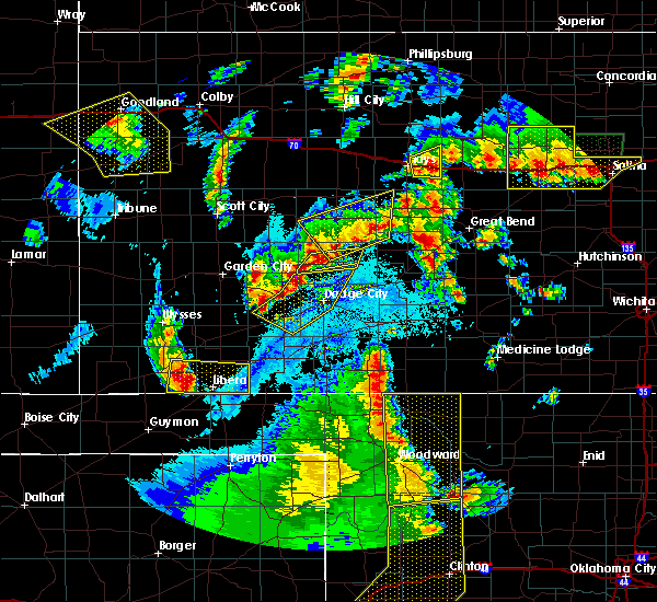 At 947 pm cdt, severe thunderstorms were located along a line extending from near jetmore to 9 miles southeast of kalvesta, moving east at 20 mph (radar indicated). Hazards include golf ball size hail and 60 mph wind gusts. People and animals outdoors will be injured. expect hail damage to roofs, siding, windows, and vehicles. Expect wind damage to roofs, siding, and trees. At 947 pm cdt, severe thunderstorms were located along a line extending from near jetmore to 9 miles southeast of kalvesta, moving east at 20 mph (radar indicated). Hazards include golf ball size hail and 60 mph wind gusts. People and animals outdoors will be injured. expect hail damage to roofs, siding, windows, and vehicles. Expect wind damage to roofs, siding, and trees.
|
| 5/24/2020 9:44 PM CDT | Quarter sized hail reported 9.9 miles S of Jetmore, KS |
| 5/24/2020 9:36 PM CDT |
 At 936 pm cdt, severe thunderstorms were located along a line extending from 8 miles southeast of kalvesta to near howell to 6 miles north of montezuma, moving southeast at 15 mph (radar indicated). Hazards include golf ball size hail and 60 mph wind gusts. People and animals outdoors will be injured. expect hail damage to roofs, siding, windows, and vehicles. Expect wind damage to roofs, siding, and trees. At 936 pm cdt, severe thunderstorms were located along a line extending from 8 miles southeast of kalvesta to near howell to 6 miles north of montezuma, moving southeast at 15 mph (radar indicated). Hazards include golf ball size hail and 60 mph wind gusts. People and animals outdoors will be injured. expect hail damage to roofs, siding, windows, and vehicles. Expect wind damage to roofs, siding, and trees.
|
| 5/24/2020 9:31 PM CDT |
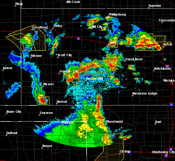 At 931 pm cdt, a severe thunderstorm was located 10 miles west of jetmore, moving north at 10 mph (radar indicated). Hazards include golf ball size hail and 60 mph wind gusts. People and animals outdoors will be injured. expect hail damage to roofs, siding, windows, and vehicles. expect wind damage to roofs, siding, and trees. This severe thunderstorm will remain over mainly rural areas of western hodgeman county. At 931 pm cdt, a severe thunderstorm was located 10 miles west of jetmore, moving north at 10 mph (radar indicated). Hazards include golf ball size hail and 60 mph wind gusts. People and animals outdoors will be injured. expect hail damage to roofs, siding, windows, and vehicles. expect wind damage to roofs, siding, and trees. This severe thunderstorm will remain over mainly rural areas of western hodgeman county.
|
| 5/24/2020 9:17 PM CDT | Quarter sized hail reported 12.4 miles E of Jetmore, KS |
| 5/24/2020 9:15 PM CDT |
 At 914 pm cdt, severe thunderstorms were located along a line extending from near frizell to near hanston to 9 miles west of jetmore, moving north northwest at 25 mph (radar indicated). Hazards include two inch hail and 60 mph wind gusts. People and animals outdoors will be injured. expect hail damage to roofs, siding, windows, and vehicles. expect wind damage to roofs, siding, and trees. Locations impacted include, gray, larned, jetmore, burdett, hanston, garfield, rozel, ash valley, sanford, frizell and shaffer. At 914 pm cdt, severe thunderstorms were located along a line extending from near frizell to near hanston to 9 miles west of jetmore, moving north northwest at 25 mph (radar indicated). Hazards include two inch hail and 60 mph wind gusts. People and animals outdoors will be injured. expect hail damage to roofs, siding, windows, and vehicles. expect wind damage to roofs, siding, and trees. Locations impacted include, gray, larned, jetmore, burdett, hanston, garfield, rozel, ash valley, sanford, frizell and shaffer.
|
| 5/24/2020 9:02 PM CDT |
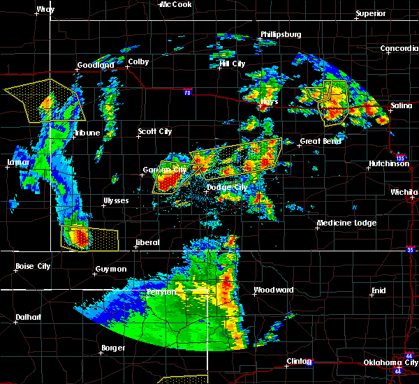 At 902 pm cdt, a severe thunderstorm was located 11 miles east of kalvesta, and is nearly stationary (radar indicated). Hazards include two inch hail. People and animals outdoors will be injured. expect damage to roofs, siding, windows, and vehicles. This severe thunderstorm will remain over mainly rural areas of western hodgeman county. At 902 pm cdt, a severe thunderstorm was located 11 miles east of kalvesta, and is nearly stationary (radar indicated). Hazards include two inch hail. People and animals outdoors will be injured. expect damage to roofs, siding, windows, and vehicles. This severe thunderstorm will remain over mainly rural areas of western hodgeman county.
|
| 5/24/2020 8:47 PM CDT |
 At 846 pm cdt, several developing severe thunderstorms were located along a line extending from near frizell to 9 miles south of jetmore, moving north at 15 mph (radar indicated). Hazards include ping pong ball size hail. People and animals outdoors will be injured. Expect damage to roofs, siding, windows, and vehicles. At 846 pm cdt, several developing severe thunderstorms were located along a line extending from near frizell to 9 miles south of jetmore, moving north at 15 mph (radar indicated). Hazards include ping pong ball size hail. People and animals outdoors will be injured. Expect damage to roofs, siding, windows, and vehicles.
|
| 8/29/2019 9:09 PM CDT |
 At 855 pm cdt, a severe thunderstorm was located 9 miles northwest of spearville, moving southeast at 15 mph (radar indicated). Hazards include 60 mph wind gusts and quarter size hail. Hail damage to vehicles is expected. Expect wind damage to roofs, siding, and trees. At 855 pm cdt, a severe thunderstorm was located 9 miles northwest of spearville, moving southeast at 15 mph (radar indicated). Hazards include 60 mph wind gusts and quarter size hail. Hail damage to vehicles is expected. Expect wind damage to roofs, siding, and trees.
|
| 8/29/2019 8:55 PM CDT |
 At 855 pm cdt, a severe thunderstorm was located 9 miles northwest of spearville, moving southeast at 15 mph (radar indicated). Hazards include 60 mph wind gusts and quarter size hail. Hail damage to vehicles is expected. Expect wind damage to roofs, siding, and trees. At 855 pm cdt, a severe thunderstorm was located 9 miles northwest of spearville, moving southeast at 15 mph (radar indicated). Hazards include 60 mph wind gusts and quarter size hail. Hail damage to vehicles is expected. Expect wind damage to roofs, siding, and trees.
|
| 8/13/2019 8:16 PM CDT |
 At 815 pm cdt, severe thunderstorms were located along a line extending from near kinsley to near ford to near ensign, moving southeast at 50 mph (radar indicated). Hazards include 70 mph wind gusts and half dollar size hail. Hail damage to vehicles is expected. expect considerable tree damage. Wind damage is also likely to mobile homes, roofs, and outbuildings. At 815 pm cdt, severe thunderstorms were located along a line extending from near kinsley to near ford to near ensign, moving southeast at 50 mph (radar indicated). Hazards include 70 mph wind gusts and half dollar size hail. Hail damage to vehicles is expected. expect considerable tree damage. Wind damage is also likely to mobile homes, roofs, and outbuildings.
|
| 8/13/2019 8:09 PM CDT |
 At 808 pm cdt, severe thunderstorms were located along a line extending from near burdett to near spearville to near ensign, moving south at 50 mph. these are very dangerous storms (radar indicated). Hazards include 80 mph wind gusts and half dollar size hail. Flying debris will be dangerous to those caught without shelter. mobile homes will be heavily damaged. expect considerable damage to roofs, windows, and vehicles. extensive tree damage and power outages are likely. Locations impacted include, dodge city, gray, cimarron, kinsley, jetmore, spearville, lewis, bazine, burdett, ford, hanston, offerle, garfield, mccracken, ensign, rozel, alexander, howell, wright and sanford. At 808 pm cdt, severe thunderstorms were located along a line extending from near burdett to near spearville to near ensign, moving south at 50 mph. these are very dangerous storms (radar indicated). Hazards include 80 mph wind gusts and half dollar size hail. Flying debris will be dangerous to those caught without shelter. mobile homes will be heavily damaged. expect considerable damage to roofs, windows, and vehicles. extensive tree damage and power outages are likely. Locations impacted include, dodge city, gray, cimarron, kinsley, jetmore, spearville, lewis, bazine, burdett, ford, hanston, offerle, garfield, mccracken, ensign, rozel, alexander, howell, wright and sanford.
|
| 8/13/2019 7:50 PM CDT | Storm damage reported in hodgeman county KS, 2.4 miles SSW of Jetmore, KS |
| 8/13/2019 7:31 PM CDT |
 At 731 pm cdt, severe thunderstorms were located along a line extending from 12 miles north of jetmore to 7 miles west of kalvesta to 10 miles southwest of friend, moving south at 50 mph. these are very dangerous storms (radar indicated). Hazards include 80 mph wind gusts and golf ball size hail. Flying debris will be dangerous to those caught without shelter. mobile homes will be heavily damaged. expect considerable damage to roofs, windows, and vehicles. extensive tree damage and power outages are likely. Locations impacted include, garden city, scott city, holcomb, dighton, jetmore, pierceville, ingalls, alamota, charleston, grigston, shallow water, beeler, amy, friend, kalvesta and modoc. At 731 pm cdt, severe thunderstorms were located along a line extending from 12 miles north of jetmore to 7 miles west of kalvesta to 10 miles southwest of friend, moving south at 50 mph. these are very dangerous storms (radar indicated). Hazards include 80 mph wind gusts and golf ball size hail. Flying debris will be dangerous to those caught without shelter. mobile homes will be heavily damaged. expect considerable damage to roofs, windows, and vehicles. extensive tree damage and power outages are likely. Locations impacted include, garden city, scott city, holcomb, dighton, jetmore, pierceville, ingalls, alamota, charleston, grigston, shallow water, beeler, amy, friend, kalvesta and modoc.
|
| 8/13/2019 7:29 PM CDT |
 At 728 pm cdt, severe thunderstorms were located along a line extending from near mccracken to 8 miles south of ness city to 8 miles northwest of kalvesta, moving south at 50 mph. these are very dangerous storms (radar indicated). Hazards include 80 mph wind gusts and ping pong ball size hail. Flying debris will be dangerous to those caught without shelter. mobile homes will be heavily damaged. expect considerable damage to roofs, windows, and vehicles. Extensive tree damage and power outages are likely. At 728 pm cdt, severe thunderstorms were located along a line extending from near mccracken to 8 miles south of ness city to 8 miles northwest of kalvesta, moving south at 50 mph. these are very dangerous storms (radar indicated). Hazards include 80 mph wind gusts and ping pong ball size hail. Flying debris will be dangerous to those caught without shelter. mobile homes will be heavily damaged. expect considerable damage to roofs, windows, and vehicles. Extensive tree damage and power outages are likely.
|
| 8/13/2019 7:04 PM CDT |
 The national weather service in dodge city has issued a * severe thunderstorm warning for. finney county in southwestern kansas. western ness county in west central kansas. southern scott county in west central kansas. Western hodgeman county in southwestern kansas. The national weather service in dodge city has issued a * severe thunderstorm warning for. finney county in southwestern kansas. western ness county in west central kansas. southern scott county in west central kansas. Western hodgeman county in southwestern kansas.
|
| 7/5/2019 8:27 PM CDT |
 At 826 pm cdt, severe thunderstorms were located along a line extending from near mccracken to 10 miles south of bazine to 12 miles northwest of jetmore, moving south at 35 mph (radar indicated). Hazards include 60 mph wind gusts and nickel size hail. expect damage to roofs, siding, and trees At 826 pm cdt, severe thunderstorms were located along a line extending from near mccracken to 10 miles south of bazine to 12 miles northwest of jetmore, moving south at 35 mph (radar indicated). Hazards include 60 mph wind gusts and nickel size hail. expect damage to roofs, siding, and trees
|
| 7/5/2019 7:40 PM CDT |
 At 739 pm cdt, a severe thunderstorm was located very near hanston, moving southeast at 20 mph (radar indicated). Hazards include 60 mph wind gusts and penny size hail. expect damage to roofs, siding, and trees At 739 pm cdt, a severe thunderstorm was located very near hanston, moving southeast at 20 mph (radar indicated). Hazards include 60 mph wind gusts and penny size hail. expect damage to roofs, siding, and trees
|
| 6/19/2019 4:54 PM CDT |
 At 453 pm cdt, a severe thunderstorm was located 7 miles northwest of bellefont, moving southeast at 20 mph (public. the public has reported quarter size hail and wind gusts to 60 mph from this storm). Hazards include 60 mph wind gusts and quarter size hail. Hail damage to vehicles is expected. expect wind damage to roofs, siding, and trees. Locations impacted include, jetmore, spearville, hanston, offerle, windhorst and bellefont. At 453 pm cdt, a severe thunderstorm was located 7 miles northwest of bellefont, moving southeast at 20 mph (public. the public has reported quarter size hail and wind gusts to 60 mph from this storm). Hazards include 60 mph wind gusts and quarter size hail. Hail damage to vehicles is expected. expect wind damage to roofs, siding, and trees. Locations impacted include, jetmore, spearville, hanston, offerle, windhorst and bellefont.
|
| 6/19/2019 4:35 PM CDT | Quarter sized hail reported 3.9 miles W of Jetmore, KS |
| 6/19/2019 4:35 PM CDT |
 At 435 pm cdt, a severe thunderstorm was located near jetmore, moving southeast at 30 mph (trained spotters. trained spotters have reported quarter size hail and winds near 60 mph at jetmore). Hazards include 60 mph wind gusts and quarter size hail. Hail damage to vehicles is expected. Expect wind damage to roofs, siding, and trees. At 435 pm cdt, a severe thunderstorm was located near jetmore, moving southeast at 30 mph (trained spotters. trained spotters have reported quarter size hail and winds near 60 mph at jetmore). Hazards include 60 mph wind gusts and quarter size hail. Hail damage to vehicles is expected. Expect wind damage to roofs, siding, and trees.
|
| 6/19/2019 4:34 PM CDT | Quarter sized hail reported 1.7 miles SSW of Jetmore, KS |
| 6/19/2019 4:24 PM CDT |
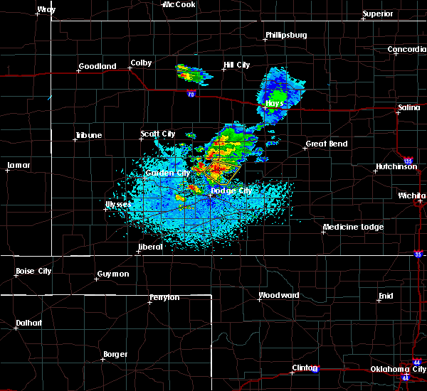 At 413 pm cdt, a severe thunderstorm was located near jetmore, moving southeast at 30 mph (radar indicated). Hazards include 60 mph wind gusts and nickel size hail. expect damage to roofs, siding, and trees At 413 pm cdt, a severe thunderstorm was located near jetmore, moving southeast at 30 mph (radar indicated). Hazards include 60 mph wind gusts and nickel size hail. expect damage to roofs, siding, and trees
|
| 6/19/2019 4:20 PM CDT | Storm damage reported in hodgeman county KS, 3.3 miles ESE of Jetmore, KS |
| 6/19/2019 4:14 PM CDT |
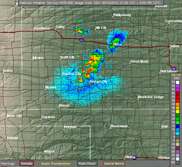 At 413 pm cdt, a severe thunderstorm was located near jetmore, moving southeast at 30 mph (radar indicated). Hazards include 60 mph wind gusts and nickel size hail. expect damage to roofs, siding, and trees At 413 pm cdt, a severe thunderstorm was located near jetmore, moving southeast at 30 mph (radar indicated). Hazards include 60 mph wind gusts and nickel size hail. expect damage to roofs, siding, and trees
|
| 6/18/2019 4:45 PM CDT | Storm damage reported in hodgeman county KS, 6.4 miles NW of Jetmore, KS |
| 6/18/2019 4:40 PM CDT |
 At 440 pm cdt, a severe thunderstorm was located near jetmore, moving east at 15 mph (radar indicated). Hazards include 60 mph wind gusts and quarter size hail. Hail damage to vehicles is expected. Expect wind damage to roofs, siding, and trees. At 440 pm cdt, a severe thunderstorm was located near jetmore, moving east at 15 mph (radar indicated). Hazards include 60 mph wind gusts and quarter size hail. Hail damage to vehicles is expected. Expect wind damage to roofs, siding, and trees.
|
| 6/18/2019 4:21 PM CDT |
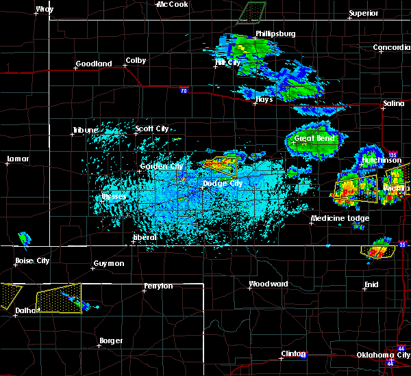 The severe thunderstorm warning for southeastern hodgeman county will expire at 430 pm cdt, the storm which prompted the warning has weakened below severe limits, and no longer poses an immediate threat to life or property. therefore, the warning will be allowed to expire. a tornado watch remains in effect until 1000 pm cdt for southwestern kansas. The severe thunderstorm warning for southeastern hodgeman county will expire at 430 pm cdt, the storm which prompted the warning has weakened below severe limits, and no longer poses an immediate threat to life or property. therefore, the warning will be allowed to expire. a tornado watch remains in effect until 1000 pm cdt for southwestern kansas.
|
| 6/18/2019 4:09 PM CDT |
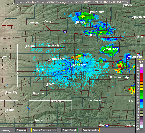 At 350 pm cdt, a severe thunderstorm was located near jetmore, moving east at 20 mph (radar indicated). Hazards include 60 mph wind gusts and nickel size hail. expect damage to roofs, siding, and trees At 350 pm cdt, a severe thunderstorm was located near jetmore, moving east at 20 mph (radar indicated). Hazards include 60 mph wind gusts and nickel size hail. expect damage to roofs, siding, and trees
|
| 6/18/2019 3:50 PM CDT |
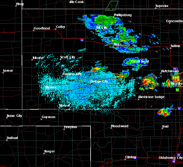 At 350 pm cdt, a severe thunderstorm was located near jetmore, moving east at 20 mph (radar indicated). Hazards include 60 mph wind gusts and nickel size hail. expect damage to roofs, siding, and trees At 350 pm cdt, a severe thunderstorm was located near jetmore, moving east at 20 mph (radar indicated). Hazards include 60 mph wind gusts and nickel size hail. expect damage to roofs, siding, and trees
|
| 6/14/2019 10:12 PM CDT |
 The severe thunderstorm warning for northern ford, southern hodgeman and northeastern gray counties will expire at 1015 pm cdt, the storm which prompted the warning has weakened below severe limits, and has exited the warned area. therefore, the warning will be allowed to expire. however gusty winds are still possible with this thunderstorm. The severe thunderstorm warning for northern ford, southern hodgeman and northeastern gray counties will expire at 1015 pm cdt, the storm which prompted the warning has weakened below severe limits, and has exited the warned area. therefore, the warning will be allowed to expire. however gusty winds are still possible with this thunderstorm.
|
| 6/14/2019 9:31 PM CDT |
 At 930 pm cdt, a severe thunderstorm was located 8 miles west of jetmore, moving east at 45 mph (radar indicated). Hazards include 60 mph wind gusts and penny size hail. Expect damage to roofs, siding, and trees. Locations impacted include, jetmore. At 930 pm cdt, a severe thunderstorm was located 8 miles west of jetmore, moving east at 45 mph (radar indicated). Hazards include 60 mph wind gusts and penny size hail. Expect damage to roofs, siding, and trees. Locations impacted include, jetmore.
|
| 6/14/2019 9:21 PM CDT |
 The national weather service in dodge city has issued a * severe thunderstorm warning for. northern ford county in southwestern kansas. southern hodgeman county in southwestern kansas. northeastern gray county in southwestern kansas. Until 1015 pm cdt. The national weather service in dodge city has issued a * severe thunderstorm warning for. northern ford county in southwestern kansas. southern hodgeman county in southwestern kansas. northeastern gray county in southwestern kansas. Until 1015 pm cdt.
|
| 6/14/2019 9:03 PM CDT |
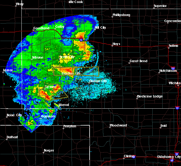 The national weather service in dodge city has issued a * severe thunderstorm warning for. northeastern finney county in southwestern kansas. central hodgeman county in southwestern kansas. until 1000 pm cdt. At 903 pm cdt, a severe thunderstorm was located near kalvesta,. The national weather service in dodge city has issued a * severe thunderstorm warning for. northeastern finney county in southwestern kansas. central hodgeman county in southwestern kansas. until 1000 pm cdt. At 903 pm cdt, a severe thunderstorm was located near kalvesta,.
|
| 5/26/2019 11:24 PM CDT |
 The severe thunderstorm warning for northwestern ford, northeastern finney, western ness, hodgeman and lane counties will expire at 1130 pm cdt, the storms which prompted the warning have moved out of the warned area. therefore, the warning will be allowed to expire. however gusty winds are still possible with these thunderstorms. a severe thunderstorm watch remains in effect until midnight cdt for west central kansas. a severe thunderstorm watch also remains in effect until 200 am cdt for southwestern kansas. remember, a severe thunderstorm warning still remains in effect for eastern ness, northeast hodgeman, and northeast lane counties until 1215 am. The severe thunderstorm warning for northwestern ford, northeastern finney, western ness, hodgeman and lane counties will expire at 1130 pm cdt, the storms which prompted the warning have moved out of the warned area. therefore, the warning will be allowed to expire. however gusty winds are still possible with these thunderstorms. a severe thunderstorm watch remains in effect until midnight cdt for west central kansas. a severe thunderstorm watch also remains in effect until 200 am cdt for southwestern kansas. remember, a severe thunderstorm warning still remains in effect for eastern ness, northeast hodgeman, and northeast lane counties until 1215 am.
|
| 5/26/2019 11:13 PM CDT |
 At 1113 pm cdt, severe thunderstorms were located along a line extending from near pendennis to 13 miles southeast of beeler to 7 miles north of wright, moving northeast at 40 mph (radar indicated). Hazards include 70 mph wind gusts and nickel size hail. Expect considerable tree damage. damage is likely to mobile homes, roofs, and outbuildings. Locations impacted include, dighton, jetmore, utica, alamota, healy, beeler, pendennis, amy and shields. At 1113 pm cdt, severe thunderstorms were located along a line extending from near pendennis to 13 miles southeast of beeler to 7 miles north of wright, moving northeast at 40 mph (radar indicated). Hazards include 70 mph wind gusts and nickel size hail. Expect considerable tree damage. damage is likely to mobile homes, roofs, and outbuildings. Locations impacted include, dighton, jetmore, utica, alamota, healy, beeler, pendennis, amy and shields.
|
| 5/26/2019 11:07 PM CDT |
 At 1106 pm cdt, severe thunderstorms were located along a line extending from 6 miles northwest of spearville to 9 miles east of clark state lake to 7 miles north of buffalo, moving northeast at 70 mph (radar indicated). Hazards include 70 mph wind gusts and penny size hail. Expect considerable tree damage. Damage is likely to mobile homes, roofs, and outbuildings. At 1106 pm cdt, severe thunderstorms were located along a line extending from 6 miles northwest of spearville to 9 miles east of clark state lake to 7 miles north of buffalo, moving northeast at 70 mph (radar indicated). Hazards include 70 mph wind gusts and penny size hail. Expect considerable tree damage. Damage is likely to mobile homes, roofs, and outbuildings.
|
| 5/26/2019 10:43 PM CDT |
 At 1042 pm cdt, severe thunderstorms were located along a line extending from near manning to 12 miles northwest of kalvesta to near cimarron, moving east at 50 mph (radar indicated). Hazards include 70 mph wind gusts and nickel size hail. the garden city airport reported a 65 mph wind gust at 1037 pm. Expect considerable tree damage. Damage is likely to mobile homes, roofs, and outbuildings. At 1042 pm cdt, severe thunderstorms were located along a line extending from near manning to 12 miles northwest of kalvesta to near cimarron, moving east at 50 mph (radar indicated). Hazards include 70 mph wind gusts and nickel size hail. the garden city airport reported a 65 mph wind gust at 1037 pm. Expect considerable tree damage. Damage is likely to mobile homes, roofs, and outbuildings.
|
| 5/26/2019 6:22 PM CDT |
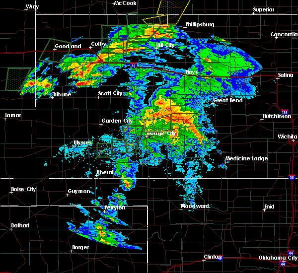 The severe thunderstorm warning for northeastern ford and southeastern hodgeman counties will expire at 630 pm cdt, the storm which prompted the warning has weakened below severe limits, and no longer poses an immediate threat to life or property. therefore, the warning will be allowed to expire. however gusty winds up to 50 mph are still possible with this thunderstorm. a severe thunderstorm watch remains in effect until midnight cdt for south central and southwestern kansas. The severe thunderstorm warning for northeastern ford and southeastern hodgeman counties will expire at 630 pm cdt, the storm which prompted the warning has weakened below severe limits, and no longer poses an immediate threat to life or property. therefore, the warning will be allowed to expire. however gusty winds up to 50 mph are still possible with this thunderstorm. a severe thunderstorm watch remains in effect until midnight cdt for south central and southwestern kansas.
|
| 5/26/2019 6:10 PM CDT |
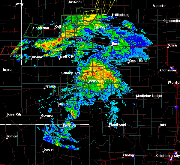 At 609 pm cdt, a severe thunderstorm with strong winds was located near jetmore, moving northeast at 20 mph. another severe thunderstorm with strong winds was located 6 miles southeast of hanston moving northeast at 25 mph (radar indicated). Hazards include 60 mph wind gusts and nickel size hail. Expect damage to roofs, siding, and trees. Locations impacted include, jetmore, hanston and bellefont. At 609 pm cdt, a severe thunderstorm with strong winds was located near jetmore, moving northeast at 20 mph. another severe thunderstorm with strong winds was located 6 miles southeast of hanston moving northeast at 25 mph (radar indicated). Hazards include 60 mph wind gusts and nickel size hail. Expect damage to roofs, siding, and trees. Locations impacted include, jetmore, hanston and bellefont.
|
| 5/26/2019 5:50 PM CDT |
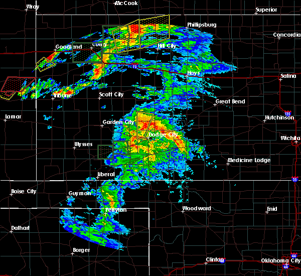 At 550 pm cdt, a severe thunderstorm was located 9 miles southwest of jetmore, moving east at 35 mph (radar indicated). Hazards include 60 mph wind gusts and nickel size hail. expect damage to roofs, siding, and trees At 550 pm cdt, a severe thunderstorm was located 9 miles southwest of jetmore, moving east at 35 mph (radar indicated). Hazards include 60 mph wind gusts and nickel size hail. expect damage to roofs, siding, and trees
|
| 5/23/2019 7:25 PM CDT |
 At 724 pm cdt, a severe thunderstorm was located near hanston, moving northeast at 45 mph (radar indicated). Hazards include 60 mph wind gusts and quarter size hail. Hail damage to vehicles is expected. Expect wind damage to roofs, siding, and trees. At 724 pm cdt, a severe thunderstorm was located near hanston, moving northeast at 45 mph (radar indicated). Hazards include 60 mph wind gusts and quarter size hail. Hail damage to vehicles is expected. Expect wind damage to roofs, siding, and trees.
|
| 5/23/2019 7:04 PM CDT |
 At 704 pm cdt, a severe thunderstorm was located 9 miles north of wright, moving northeast at 35 mph (radar indicated). Hazards include 70 mph wind gusts and quarter size hail. Hail damage to vehicles is expected. expect considerable tree damage. wind damage is also likely to mobile homes, roofs, and outbuildings. Locations impacted include, dodge city, jetmore, hanston and wright. At 704 pm cdt, a severe thunderstorm was located 9 miles north of wright, moving northeast at 35 mph (radar indicated). Hazards include 70 mph wind gusts and quarter size hail. Hail damage to vehicles is expected. expect considerable tree damage. wind damage is also likely to mobile homes, roofs, and outbuildings. Locations impacted include, dodge city, jetmore, hanston and wright.
|
| 5/23/2019 6:47 PM CDT |
 At 646 pm cdt, a severe thunderstorm was located near dodge city, moving north at 30 mph (radar indicated). Hazards include 60 mph wind gusts and half dollar size hail. Hail damage to vehicles is expected. Expect wind damage to roofs, siding, and trees. At 646 pm cdt, a severe thunderstorm was located near dodge city, moving north at 30 mph (radar indicated). Hazards include 60 mph wind gusts and half dollar size hail. Hail damage to vehicles is expected. Expect wind damage to roofs, siding, and trees.
|
| 5/23/2019 4:21 PM CDT |
 The severe thunderstorm warning for northeastern ford, northwestern kiowa, southeastern hodgeman, southwestern pawnee and western edwards counties will expire at 430 pm cdt, the storm which prompted the warning has weakened below severe limits, and no longer poses an immediate threat to life or property. therefore, the warning will be allowed to expire. however small hail and heavy rain are still possible with this thunderstorm. a tornado watch remains in effect until 1000 pm cdt for south central kansas. a severe thunderstorm watch remains in effect until 1000 pm cdt for south central and southwestern kansas. The severe thunderstorm warning for northeastern ford, northwestern kiowa, southeastern hodgeman, southwestern pawnee and western edwards counties will expire at 430 pm cdt, the storm which prompted the warning has weakened below severe limits, and no longer poses an immediate threat to life or property. therefore, the warning will be allowed to expire. however small hail and heavy rain are still possible with this thunderstorm. a tornado watch remains in effect until 1000 pm cdt for south central kansas. a severe thunderstorm watch remains in effect until 1000 pm cdt for south central and southwestern kansas.
|
| 5/23/2019 4:11 PM CDT |
 At 411 pm cdt, a severe thunderstorm was located near ford, moving north at 50 mph (radar indicated). Hazards include 60 mph wind gusts and half dollar size hail. Hail damage to vehicles is expected. expect wind damage to roofs, siding, and trees. Locations impacted include, gray, kinsley, jetmore, spearville, ford, hanston, offerle, bellefont and windhorst. At 411 pm cdt, a severe thunderstorm was located near ford, moving north at 50 mph (radar indicated). Hazards include 60 mph wind gusts and half dollar size hail. Hail damage to vehicles is expected. expect wind damage to roofs, siding, and trees. Locations impacted include, gray, kinsley, jetmore, spearville, ford, hanston, offerle, bellefont and windhorst.
|
| 5/23/2019 4:03 PM CDT |
 At 402 pm cdt, a severe thunderstorm was located near wright, moving north at 60 mph (radar indicated. at 356 pm, half dollar size hail was reported at the dodge city airport). Hazards include ping pong ball size hail and 60 mph wind gusts. People and animals outdoors will be injured. expect hail damage to roofs, siding, windows, and vehicles. expect wind damage to roofs, siding, and trees. locations impacted include, dodge city, gray, kinsley, jetmore, bucklin, spearville, ford, hanston, offerle, howell, wright, bellefont, windhorst and ft. Dodge. At 402 pm cdt, a severe thunderstorm was located near wright, moving north at 60 mph (radar indicated. at 356 pm, half dollar size hail was reported at the dodge city airport). Hazards include ping pong ball size hail and 60 mph wind gusts. People and animals outdoors will be injured. expect hail damage to roofs, siding, windows, and vehicles. expect wind damage to roofs, siding, and trees. locations impacted include, dodge city, gray, kinsley, jetmore, bucklin, spearville, ford, hanston, offerle, howell, wright, bellefont, windhorst and ft. Dodge.
|
| 5/23/2019 3:45 PM CDT |
 At 344 pm cdt, a severe thunderstorm was located 8 miles northwest of bloom, moving north at 50 mph. this replaces the previous warning for ford county (radar indicated). Hazards include ping pong ball size hail and 60 mph wind gusts. People and animals outdoors will be injured. expect hail damage to roofs, siding, windows, and vehicles. Expect wind damage to roofs, siding, and trees. At 344 pm cdt, a severe thunderstorm was located 8 miles northwest of bloom, moving north at 50 mph. this replaces the previous warning for ford county (radar indicated). Hazards include ping pong ball size hail and 60 mph wind gusts. People and animals outdoors will be injured. expect hail damage to roofs, siding, windows, and vehicles. Expect wind damage to roofs, siding, and trees.
|
| 5/17/2019 9:07 PM CDT |
 The tornado warning for south central ness and northwestern hodgeman counties will expire at 915 pm cdt, the tornado threat has diminished and the tornado warning has been cancelled. however, large hail and damaging winds remain likely and a severe thunderstorm warning remains in effect for the area. a tornado watch remains in effect until midnight cdt for southwestern and west central kansas. The tornado warning for south central ness and northwestern hodgeman counties will expire at 915 pm cdt, the tornado threat has diminished and the tornado warning has been cancelled. however, large hail and damaging winds remain likely and a severe thunderstorm warning remains in effect for the area. a tornado watch remains in effect until midnight cdt for southwestern and west central kansas.
|
| 5/17/2019 8:52 PM CDT |
 At 852 pm cdt, a severe thunderstorm capable of producing a tornado was located 8 miles west of jetmore, moving northeast at 25 mph (radar indicated rotation). Hazards include tornado and tennis ball size hail. Flying debris will be dangerous to those caught without shelter. mobile homes will be damaged or destroyed. damage to roofs, windows, and vehicles will occur. tree damage is likely. This tornadic thunderstorm will remain over mainly rural areas of south central ness and northwestern hodgeman counties. At 852 pm cdt, a severe thunderstorm capable of producing a tornado was located 8 miles west of jetmore, moving northeast at 25 mph (radar indicated rotation). Hazards include tornado and tennis ball size hail. Flying debris will be dangerous to those caught without shelter. mobile homes will be damaged or destroyed. damage to roofs, windows, and vehicles will occur. tree damage is likely. This tornadic thunderstorm will remain over mainly rural areas of south central ness and northwestern hodgeman counties.
|
| 5/17/2019 8:51 PM CDT | Quarter sized hail reported 9.9 miles S of Jetmore, KS |
| 5/17/2019 8:45 PM CDT |
 At 844 pm cdt, a severe thunderstorm capable of producing a tornado was located 9 miles west of jetmore, moving northeast at 20 mph (radar indicated rotation). Hazards include tornado and baseball size hail. Flying debris will be dangerous to those caught without shelter. mobile homes will be damaged or destroyed. damage to roofs, windows, and vehicles will occur. tree damage is likely. This tornadic thunderstorm will remain over mainly rural areas of western hodgeman county. At 844 pm cdt, a severe thunderstorm capable of producing a tornado was located 9 miles west of jetmore, moving northeast at 20 mph (radar indicated rotation). Hazards include tornado and baseball size hail. Flying debris will be dangerous to those caught without shelter. mobile homes will be damaged or destroyed. damage to roofs, windows, and vehicles will occur. tree damage is likely. This tornadic thunderstorm will remain over mainly rural areas of western hodgeman county.
|
| 5/17/2019 8:28 PM CDT |
 At 828 pm cdt, a severe thunderstorm capable of producing a tornado was located 9 miles east of kalvesta, moving northeast at 40 mph (radar indicated rotation). Hazards include tornado and tennis ball size hail. Flying debris will be dangerous to those caught without shelter. mobile homes will be damaged or destroyed. damage to roofs, windows, and vehicles will occur. tree damage is likely. This dangerous storm will be near, jetmore around 845 pm cdt. At 828 pm cdt, a severe thunderstorm capable of producing a tornado was located 9 miles east of kalvesta, moving northeast at 40 mph (radar indicated rotation). Hazards include tornado and tennis ball size hail. Flying debris will be dangerous to those caught without shelter. mobile homes will be damaged or destroyed. damage to roofs, windows, and vehicles will occur. tree damage is likely. This dangerous storm will be near, jetmore around 845 pm cdt.
|
| 5/6/2019 10:41 PM CDT |
 At 1041 pm cdt, severe thunderstorms were located along a line extending from near hanston to near mullinville to near bucklin, moving east at 50 mph (radar indicated). Hazards include 70 mph wind gusts and quarter size hail. Hail damage to vehicles is expected. expect considerable tree damage. wind damage is also likely to mobile homes, roofs, and outbuildings. locations impacted include, dodge city, gray, kinsley, jetmore, bucklin, greensburg, spearville, mullinville, burdett, ford, hanston, offerle, bloom, clark state lake, kingsdown, wright, bellefont, windhorst and ft. Dodge. At 1041 pm cdt, severe thunderstorms were located along a line extending from near hanston to near mullinville to near bucklin, moving east at 50 mph (radar indicated). Hazards include 70 mph wind gusts and quarter size hail. Hail damage to vehicles is expected. expect considerable tree damage. wind damage is also likely to mobile homes, roofs, and outbuildings. locations impacted include, dodge city, gray, kinsley, jetmore, bucklin, greensburg, spearville, mullinville, burdett, ford, hanston, offerle, bloom, clark state lake, kingsdown, wright, bellefont, windhorst and ft. Dodge.
|
| 5/6/2019 10:13 PM CDT |
 At 1013 pm cdt, severe thunderstorms were located along a line extending from 11 miles northeast of kalvesta to near wright to near bloom, moving east at 70 mph (radar indicated). Hazards include 60 mph wind gusts and quarter size hail. Hail damage to vehicles is expected. Expect wind damage to roofs, siding, and trees. At 1013 pm cdt, severe thunderstorms were located along a line extending from 11 miles northeast of kalvesta to near wright to near bloom, moving east at 70 mph (radar indicated). Hazards include 60 mph wind gusts and quarter size hail. Hail damage to vehicles is expected. Expect wind damage to roofs, siding, and trees.
|
| 5/6/2019 9:32 PM CDT |
 The national weather service in dodge city has issued a * severe thunderstorm warning for. ford county in southwestern kansas. northeastern finney county in southwestern kansas. hodgeman county in southwestern kansas. Northern meade county in southwestern kansas. The national weather service in dodge city has issued a * severe thunderstorm warning for. ford county in southwestern kansas. northeastern finney county in southwestern kansas. hodgeman county in southwestern kansas. Northern meade county in southwestern kansas.
|
| 5/6/2019 8:35 PM CDT |
 At 833 pm cdt, a severe thunderstorm was located near burdett. another severe thunderstorm was located 4 miles northwest of hanston, and yet a third severe thunderstorm was located near frizell. all storms were moving slowly east at 10 mph (radar indicated). Hazards include two inch hail and 60 mph wind gusts. People and animals outdoors will be injured. expect hail damage to roofs, siding, windows, and vehicles. expect wind damage to roofs, siding, and trees. Locations impacted include, gray, jetmore, burdett, hanston, garfield, rozel, sanford and frizell. At 833 pm cdt, a severe thunderstorm was located near burdett. another severe thunderstorm was located 4 miles northwest of hanston, and yet a third severe thunderstorm was located near frizell. all storms were moving slowly east at 10 mph (radar indicated). Hazards include two inch hail and 60 mph wind gusts. People and animals outdoors will be injured. expect hail damage to roofs, siding, windows, and vehicles. expect wind damage to roofs, siding, and trees. Locations impacted include, gray, jetmore, burdett, hanston, garfield, rozel, sanford and frizell.
|
| 5/6/2019 8:21 PM CDT |
 At 820 pm cdt, a severe thunderstorm was located near jetmore, moving east at 15 mph (radar indicated). Hazards include two inch hail and 60 mph wind gusts. People and animals outdoors will be injured. expect hail damage to roofs, siding, windows, and vehicles. expect wind damage to roofs, siding, and trees. Locations impacted include, gray, jetmore, burdett, hanston, garfield, rozel, sanford and frizell. At 820 pm cdt, a severe thunderstorm was located near jetmore, moving east at 15 mph (radar indicated). Hazards include two inch hail and 60 mph wind gusts. People and animals outdoors will be injured. expect hail damage to roofs, siding, windows, and vehicles. expect wind damage to roofs, siding, and trees. Locations impacted include, gray, jetmore, burdett, hanston, garfield, rozel, sanford and frizell.
|
| 5/6/2019 7:51 PM CDT |
 At 751 pm cdt, a severe thunderstorm was located near gray, moving east at 20 mph (radar indicated). Hazards include ping pong ball size hail and 60 mph wind gusts. People and animals outdoors will be injured. expect hail damage to roofs, siding, windows, and vehicles. Expect wind damage to roofs, siding, and trees. At 751 pm cdt, a severe thunderstorm was located near gray, moving east at 20 mph (radar indicated). Hazards include ping pong ball size hail and 60 mph wind gusts. People and animals outdoors will be injured. expect hail damage to roofs, siding, windows, and vehicles. Expect wind damage to roofs, siding, and trees.
|
| 5/5/2019 5:56 PM CDT |
 At 556 pm cdt, severe thunderstorms were located along a line extending from near bellefont to near cimarron, moving southeast at 15 mph (radar indicated). Hazards include ping pong ball size hail and 60 mph wind gusts. People and animals outdoors will be injured. expect hail damage to roofs, siding, windows, and vehicles. expect wind damage to roofs, siding, and trees. locations impacted include, dodge city, spearville, offerle, howell, bellefont, wright, windhorst and ft. Dodge. At 556 pm cdt, severe thunderstorms were located along a line extending from near bellefont to near cimarron, moving southeast at 15 mph (radar indicated). Hazards include ping pong ball size hail and 60 mph wind gusts. People and animals outdoors will be injured. expect hail damage to roofs, siding, windows, and vehicles. expect wind damage to roofs, siding, and trees. locations impacted include, dodge city, spearville, offerle, howell, bellefont, wright, windhorst and ft. Dodge.
|
| 5/5/2019 5:32 PM CDT |
 At 532 pm cdt, severe thunderstorms were located along a line extending from 7 miles southeast of jetmore to 7 miles northwest of howell, moving east at 20 mph (radar indicated). Hazards include ping pong ball size hail and 60 mph wind gusts. People and animals outdoors will be injured. expect hail damage to roofs, siding, windows, and vehicles. Expect wind damage to roofs, siding, and trees. At 532 pm cdt, severe thunderstorms were located along a line extending from 7 miles southeast of jetmore to 7 miles northwest of howell, moving east at 20 mph (radar indicated). Hazards include ping pong ball size hail and 60 mph wind gusts. People and animals outdoors will be injured. expect hail damage to roofs, siding, windows, and vehicles. Expect wind damage to roofs, siding, and trees.
|
| 5/5/2019 5:06 PM CDT | Quarter sized hail reported 9.9 miles S of Jetmore, KS |
| 5/5/2019 5:00 PM CDT | Quarter sized hail reported 9.9 miles S of Jetmore, KS, mostly pea to dime... but a few quarters. |
| 4/28/2019 9:26 PM CDT |
 At 926 pm cdt, a severe thunderstorm was located 8 miles southeast of ness city, moving southeast at 45 mph. this is a very dangerous storm (radar indicated). Hazards include 80 mph wind gusts and two inch hail. Flying debris will be dangerous to those caught without shelter. mobile homes will be heavily damaged. expect considerable damage to roofs, windows, and vehicles. Extensive tree damage and power outages are likely. At 926 pm cdt, a severe thunderstorm was located 8 miles southeast of ness city, moving southeast at 45 mph. this is a very dangerous storm (radar indicated). Hazards include 80 mph wind gusts and two inch hail. Flying debris will be dangerous to those caught without shelter. mobile homes will be heavily damaged. expect considerable damage to roofs, windows, and vehicles. Extensive tree damage and power outages are likely.
|
| 9/1/2018 2:34 AM CDT |
 At 234 am cdt, a severe thunderstorm was located very near dodge city, moving northeast at 35 mph (radar indicated). Hazards include 60 mph wind gusts. Expect damage to roofs, siding, and trees. locations impacted include, dodge city, jetmore, spearville, ensign, howell, wright, windhorst and ft. Dodge. At 234 am cdt, a severe thunderstorm was located very near dodge city, moving northeast at 35 mph (radar indicated). Hazards include 60 mph wind gusts. Expect damage to roofs, siding, and trees. locations impacted include, dodge city, jetmore, spearville, ensign, howell, wright, windhorst and ft. Dodge.
|
| 9/1/2018 2:22 AM CDT |
 At 220 am cdt, a severe thunderstorm was located 4 miles northeast of ensign, moving northeast at 35 mph (radar indicated). Hazards include 60 mph wind gusts. expect damage to roofs, siding, and trees At 220 am cdt, a severe thunderstorm was located 4 miles northeast of ensign, moving northeast at 35 mph (radar indicated). Hazards include 60 mph wind gusts. expect damage to roofs, siding, and trees
|
| 7/29/2018 1:37 AM CDT |
 At 137 am cdt, a severe thunderstorm was located 12 miles northwest of kalvesta. a second severe thunderstorm was located 2 miles southeast of jetmore. both storms were moving east at 25 mph (radar indicated). Hazards include 60 mph wind gusts and quarter size hail. Hail damage to vehicles is expected. expect wind damage to roofs, siding, and trees. Locations impacted include, gray, cimarron, jetmore, spearville, hanston, kalvesta and bellefont. At 137 am cdt, a severe thunderstorm was located 12 miles northwest of kalvesta. a second severe thunderstorm was located 2 miles southeast of jetmore. both storms were moving east at 25 mph (radar indicated). Hazards include 60 mph wind gusts and quarter size hail. Hail damage to vehicles is expected. expect wind damage to roofs, siding, and trees. Locations impacted include, gray, cimarron, jetmore, spearville, hanston, kalvesta and bellefont.
|
| 7/29/2018 1:09 AM CDT |
 At 108 am cdt, a severe thunderstorm was located 15 miles southeast of friend, moving east at 25 mph. several other strong to severe thunderstorms extended from near horsethief reservoir to 5 miles south of kalvesta (radar indicated). Hazards include 60 mph wind gusts and quarter size hail. Hail damage to vehicles is expected. Expect wind damage to roofs, siding, and trees. At 108 am cdt, a severe thunderstorm was located 15 miles southeast of friend, moving east at 25 mph. several other strong to severe thunderstorms extended from near horsethief reservoir to 5 miles south of kalvesta (radar indicated). Hazards include 60 mph wind gusts and quarter size hail. Hail damage to vehicles is expected. Expect wind damage to roofs, siding, and trees.
|
| 7/27/2018 8:05 PM CDT |
 At 804 pm cdt, a severe thunderstorm was located 6 miles southeast of gray, moving southeast at 20 mph (radar indicated). Hazards include 70 mph wind gusts and half dollar size hail. Hail damage to vehicles is expected. expect considerable tree damage. Wind damage is also likely to mobile homes, roofs, and outbuildings. At 804 pm cdt, a severe thunderstorm was located 6 miles southeast of gray, moving southeast at 20 mph (radar indicated). Hazards include 70 mph wind gusts and half dollar size hail. Hail damage to vehicles is expected. expect considerable tree damage. Wind damage is also likely to mobile homes, roofs, and outbuildings.
|
| 7/27/2018 7:20 PM CDT |
 At 720 pm cdt, a severe thunderstorm was located 11 miles north of jetmore, moving southeast at 15 mph (radar indicated). Hazards include ping pong ball size hail and 60 mph wind gusts. People and animals outdoors will be injured. expect hail damage to roofs, siding, windows, and vehicles. Expect wind damage to roofs, siding, and trees. At 720 pm cdt, a severe thunderstorm was located 11 miles north of jetmore, moving southeast at 15 mph (radar indicated). Hazards include ping pong ball size hail and 60 mph wind gusts. People and animals outdoors will be injured. expect hail damage to roofs, siding, windows, and vehicles. Expect wind damage to roofs, siding, and trees.
|
| 7/25/2018 9:01 PM CDT |
 At 852 pm cdt, severe thunderstorms were located along a line extending from 6 miles southeast of burdett to 7 miles southeast of jetmore to 6 miles east of kalvesta, moving south at 40 mph. these are very dangerous storms (radar indicated). Hazards include 80 mph wind gusts and nickel size hail. Flying debris will be dangerous to those caught without shelter. mobile homes will be heavily damaged. expect considerable damage to roofs, windows, and vehicles. extensive tree damage and power outages are likely. Locations impacted include, dodge city, gray, kinsley, jetmore, spearville, burdett, hanston, offerle, howell, bellefont, wright and windhorst. At 852 pm cdt, severe thunderstorms were located along a line extending from 6 miles southeast of burdett to 7 miles southeast of jetmore to 6 miles east of kalvesta, moving south at 40 mph. these are very dangerous storms (radar indicated). Hazards include 80 mph wind gusts and nickel size hail. Flying debris will be dangerous to those caught without shelter. mobile homes will be heavily damaged. expect considerable damage to roofs, windows, and vehicles. extensive tree damage and power outages are likely. Locations impacted include, dodge city, gray, kinsley, jetmore, spearville, burdett, hanston, offerle, howell, bellefont, wright and windhorst.
|
| 7/25/2018 8:56 PM CDT | Up to 2 in diameter tree branches broke and power out in jetmor in hodgeman county KS, 2.4 miles SSW of Jetmore, KS |
| 7/25/2018 8:53 PM CDT |
 At 852 pm cdt, severe thunderstorms were located along a line extending from 6 miles southeast of burdett to 7 miles southeast of jetmore to 6 miles east of kalvesta, moving south at 40 mph. these are very dangerous storms (radar indicated). Hazards include 80 mph wind gusts and nickel size hail. Flying debris will be dangerous to those caught without shelter. mobile homes will be heavily damaged. expect considerable damage to roofs, windows, and vehicles. extensive tree damage and power outages are likely. Locations impacted include, dodge city, gray, kinsley, jetmore, spearville, burdett, hanston, offerle, howell, bellefont, wright and windhorst. At 852 pm cdt, severe thunderstorms were located along a line extending from 6 miles southeast of burdett to 7 miles southeast of jetmore to 6 miles east of kalvesta, moving south at 40 mph. these are very dangerous storms (radar indicated). Hazards include 80 mph wind gusts and nickel size hail. Flying debris will be dangerous to those caught without shelter. mobile homes will be heavily damaged. expect considerable damage to roofs, windows, and vehicles. extensive tree damage and power outages are likely. Locations impacted include, dodge city, gray, kinsley, jetmore, spearville, burdett, hanston, offerle, howell, bellefont, wright and windhorst.
|
| 7/25/2018 8:44 PM CDT | Storm damage reported in hodgeman county KS, 8.3 miles ENE of Jetmore, KS |
| 7/25/2018 8:41 PM CDT |
 At 840 pm cdt, severe thunderstorms were located along a line extending from 3 miles east of burdett to 4 miles northeast of jetmore to 9 miles northeast of kalvesta, moving south at 40 mph (radar indicated). Hazards include 70 mph wind gusts and nickel size hail. Expect considerable tree damage. damage is likely to mobile homes, roofs, and outbuildings. Locations impacted include, dodge city, gray, kinsley, jetmore, spearville, burdett, hanston, offerle, howell, bellefont, wright and windhorst. At 840 pm cdt, severe thunderstorms were located along a line extending from 3 miles east of burdett to 4 miles northeast of jetmore to 9 miles northeast of kalvesta, moving south at 40 mph (radar indicated). Hazards include 70 mph wind gusts and nickel size hail. Expect considerable tree damage. damage is likely to mobile homes, roofs, and outbuildings. Locations impacted include, dodge city, gray, kinsley, jetmore, spearville, burdett, hanston, offerle, howell, bellefont, wright and windhorst.
|
| 7/25/2018 8:30 PM CDT | Mesonet station k5nes... 11 n jetmor in hodgeman county KS, 13.3 miles S of Jetmore, KS |
| 7/25/2018 8:27 PM CDT |
 At 826 pm cdt, severe thunderstorms were located along a line extending from 9 miles south of alexander to 11 miles north of jetmore to 11 miles north of kalvesta, moving south at 30 mph (radar indicated). Hazards include 60 mph wind gusts. expect damage to roofs, siding, and trees At 826 pm cdt, severe thunderstorms were located along a line extending from 9 miles south of alexander to 11 miles north of jetmore to 11 miles north of kalvesta, moving south at 30 mph (radar indicated). Hazards include 60 mph wind gusts. expect damage to roofs, siding, and trees
|
| 7/20/2018 11:04 PM CDT |
 At 1103 pm cdt, a severe thunderstorm was located 6 miles southeast of ness city, moving east at 25 mph (radar indicated). Hazards include tennis ball size hail and 60 mph wind gusts. People and animals outdoors will be injured. expect hail damage to roofs, siding, windows, and vehicles. expect wind damage to roofs, siding, and trees. Locations impacted include, gray, ness city, jetmore, bazine, ransom, hanston, utica, brownell, beeler and arnold. At 1103 pm cdt, a severe thunderstorm was located 6 miles southeast of ness city, moving east at 25 mph (radar indicated). Hazards include tennis ball size hail and 60 mph wind gusts. People and animals outdoors will be injured. expect hail damage to roofs, siding, windows, and vehicles. expect wind damage to roofs, siding, and trees. Locations impacted include, gray, ness city, jetmore, bazine, ransom, hanston, utica, brownell, beeler and arnold.
|
| 7/20/2018 10:36 PM CDT |
 At 1035 pm cdt, a severe thunderstorm was located 7 miles southeast of beeler, moving east at 35 mph. this is a very dangerous storm (radar indicated). Hazards include three inch hail and 60 mph wind gusts. People and animals outdoors will be severely injured. expect shattered windows, extensive damage to roofs, siding, and vehicles. Locations impacted include, gray, ness city, jetmore, bazine, ransom, hanston, utica, brownell, beeler and arnold. At 1035 pm cdt, a severe thunderstorm was located 7 miles southeast of beeler, moving east at 35 mph. this is a very dangerous storm (radar indicated). Hazards include three inch hail and 60 mph wind gusts. People and animals outdoors will be severely injured. expect shattered windows, extensive damage to roofs, siding, and vehicles. Locations impacted include, gray, ness city, jetmore, bazine, ransom, hanston, utica, brownell, beeler and arnold.
|
| 7/20/2018 10:28 PM CDT |
 At 1028 pm cdt, a severe thunderstorm was located 10 miles south of beeler, moving east at 35 mph (radar indicated). Hazards include two inch hail and 60 mph wind gusts. People and animals outdoors will be injured. expect hail damage to roofs, siding, windows, and vehicles. Expect wind damage to roofs, siding, and trees. At 1028 pm cdt, a severe thunderstorm was located 10 miles south of beeler, moving east at 35 mph (radar indicated). Hazards include two inch hail and 60 mph wind gusts. People and animals outdoors will be injured. expect hail damage to roofs, siding, windows, and vehicles. Expect wind damage to roofs, siding, and trees.
|
| 7/19/2018 9:56 PM CDT |
 At 955 pm cdt, a severe thunderstorm was located 5 miles southeast of jetmore, moving east at 15 mph (radar indicated). Hazards include two inch hail and 60 mph wind gusts. People and animals outdoors will be injured. expect hail damage to roofs, siding, windows, and vehicles. expect wind damage to roofs, siding, and trees. Locations impacted include, gray, jetmore, spearville, hanston and bellefont. At 955 pm cdt, a severe thunderstorm was located 5 miles southeast of jetmore, moving east at 15 mph (radar indicated). Hazards include two inch hail and 60 mph wind gusts. People and animals outdoors will be injured. expect hail damage to roofs, siding, windows, and vehicles. expect wind damage to roofs, siding, and trees. Locations impacted include, gray, jetmore, spearville, hanston and bellefont.
|
| 7/19/2018 9:55 PM CDT | Ping Pong Ball sized hail reported 0.5 miles NNW of Jetmore, KS, law enforcement report ping pong size hail. |
| 7/19/2018 9:32 PM CDT |
 At 932 pm cdt, a severe thunderstorm was located 7 miles southwest of jetmore, moving southeast at 15 mph (radar indicated). Hazards include golf ball size hail and 60 mph wind gusts. People and animals outdoors will be injured. expect hail damage to roofs, siding, windows, and vehicles. Expect wind damage to roofs, siding, and trees. At 932 pm cdt, a severe thunderstorm was located 7 miles southwest of jetmore, moving southeast at 15 mph (radar indicated). Hazards include golf ball size hail and 60 mph wind gusts. People and animals outdoors will be injured. expect hail damage to roofs, siding, windows, and vehicles. Expect wind damage to roofs, siding, and trees.
|
| 7/19/2018 9:19 PM CDT | Quarter sized hail reported 7.1 miles NE of Jetmore, KS |
| 7/19/2018 9:15 PM CDT |
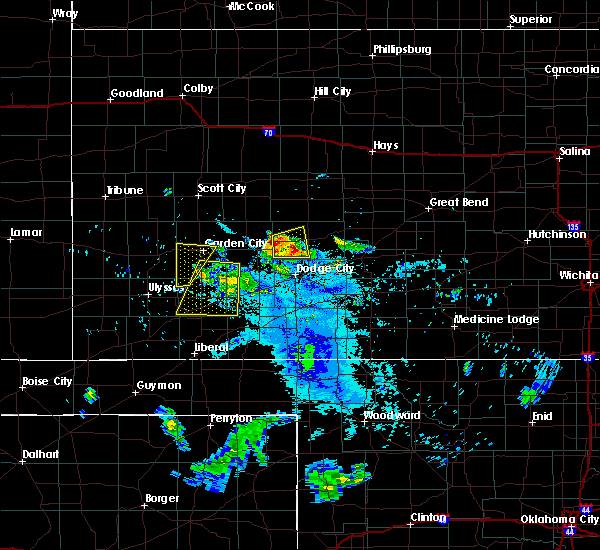 At 914 pm cdt, a severe thunderstorm was located 10 miles southwest of jetmore, moving east at 25 mph (radar indicated). Hazards include two inch hail and 60 mph wind gusts. People and animals outdoors will be injured. expect hail damage to roofs, siding, windows, and vehicles. expect wind damage to roofs, siding, and trees. This severe thunderstorm will remain over mainly rural areas of western hodgeman county. At 914 pm cdt, a severe thunderstorm was located 10 miles southwest of jetmore, moving east at 25 mph (radar indicated). Hazards include two inch hail and 60 mph wind gusts. People and animals outdoors will be injured. expect hail damage to roofs, siding, windows, and vehicles. expect wind damage to roofs, siding, and trees. This severe thunderstorm will remain over mainly rural areas of western hodgeman county.
|
| 7/19/2018 8:59 PM CDT |
 At 859 pm cdt, a severe thunderstorm was located 3 miles southwest of kalvesta, moving east at 20 mph (radar indicated). Hazards include two inch hail. People and animals outdoors will be injured. Expect damage to roofs, siding, windows, and vehicles. At 859 pm cdt, a severe thunderstorm was located 3 miles southwest of kalvesta, moving east at 20 mph (radar indicated). Hazards include two inch hail. People and animals outdoors will be injured. Expect damage to roofs, siding, windows, and vehicles.
|
| 6/24/2018 9:37 PM CDT |
 At 937 pm cdt, severe thunderstorms were located along a line extending from 5 miles north of jetmore to 4 miles south of dodge city, moving east at 70 mph (radar indicated). Hazards include 70 mph wind gusts and ping pong ball size hail. People and animals outdoors will be injured. expect hail damage to roofs, siding, windows, and vehicles. expect considerable tree damage. Wind damage is also likely to mobile homes, roofs, and outbuildings. At 937 pm cdt, severe thunderstorms were located along a line extending from 5 miles north of jetmore to 4 miles south of dodge city, moving east at 70 mph (radar indicated). Hazards include 70 mph wind gusts and ping pong ball size hail. People and animals outdoors will be injured. expect hail damage to roofs, siding, windows, and vehicles. expect considerable tree damage. Wind damage is also likely to mobile homes, roofs, and outbuildings.
|
| 6/24/2018 9:13 PM CDT |
 At 913 pm cdt, severe thunderstorms were located along a line extending from 13 miles north of kalvesta to 5 miles north of howell to near montezuma, moving east at 40 mph (radar indicated). Hazards include 70 mph wind gusts and penny size hail. Expect considerable tree damage. damage is likely to mobile homes, roofs, and outbuildings. Locations impacted include, dodge city, gray, cimarron, montezuma, jetmore, spearville, copeland, ingalls, ford, hanston, ensign, bloom, kingsdown, howell, wright, tice, kalvesta, bellefont, windhorst and the haggard elev. At 913 pm cdt, severe thunderstorms were located along a line extending from 13 miles north of kalvesta to 5 miles north of howell to near montezuma, moving east at 40 mph (radar indicated). Hazards include 70 mph wind gusts and penny size hail. Expect considerable tree damage. damage is likely to mobile homes, roofs, and outbuildings. Locations impacted include, dodge city, gray, cimarron, montezuma, jetmore, spearville, copeland, ingalls, ford, hanston, ensign, bloom, kingsdown, howell, wright, tice, kalvesta, bellefont, windhorst and the haggard elev.
|
| 6/24/2018 8:47 PM CDT |
 At 847 pm cdt, severe thunderstorms were located along a line extending from 14 miles south of dighton to 4 miles northeast of charleston to 6 miles north of tice, moving east at 45 mph (radar indicated). Hazards include 70 mph wind gusts and penny size hail. Expect considerable tree damage. Damage is likely to mobile homes, roofs, and outbuildings. At 847 pm cdt, severe thunderstorms were located along a line extending from 14 miles south of dighton to 4 miles northeast of charleston to 6 miles north of tice, moving east at 45 mph (radar indicated). Hazards include 70 mph wind gusts and penny size hail. Expect considerable tree damage. Damage is likely to mobile homes, roofs, and outbuildings.
|
| 6/23/2018 11:16 PM CDT |
 At 1116 pm cdt, severe thunderstorms were located along a line extending from near hanston to 2 miles southeast of ford to near minneola, moving east at 40 mph (radar indicated). Hazards include 70 mph wind gusts and penny size hail. Expect considerable tree damage. Damage is likely to mobile homes, roofs, and outbuildings. At 1116 pm cdt, severe thunderstorms were located along a line extending from near hanston to 2 miles southeast of ford to near minneola, moving east at 40 mph (radar indicated). Hazards include 70 mph wind gusts and penny size hail. Expect considerable tree damage. Damage is likely to mobile homes, roofs, and outbuildings.
|
| 6/23/2018 11:02 PM CDT |
 At 1102 pm cdt, severe thunderstorms were located along a line extending from 10 miles north of jetmore to 4 miles west of spearville to 7 miles east of ensign, moving east at 45 mph (radar indicated). Hazards include 70 mph wind gusts and penny size hail. Expect considerable tree damage. damage is likely to mobile homes, roofs, and outbuildings. locations impacted include, dodge city, gray, kinsley, jetmore, bucklin, spearville, mullinville, burdett, ford, hanston, offerle, ensign, rozel, bloom, kingsdown, howell, wright, bellefont, windhorst and ft. Dodge. At 1102 pm cdt, severe thunderstorms were located along a line extending from 10 miles north of jetmore to 4 miles west of spearville to 7 miles east of ensign, moving east at 45 mph (radar indicated). Hazards include 70 mph wind gusts and penny size hail. Expect considerable tree damage. damage is likely to mobile homes, roofs, and outbuildings. locations impacted include, dodge city, gray, kinsley, jetmore, bucklin, spearville, mullinville, burdett, ford, hanston, offerle, ensign, rozel, bloom, kingsdown, howell, wright, bellefont, windhorst and ft. Dodge.
|
| 6/23/2018 10:42 PM CDT |
 At 1042 pm cdt, severe thunderstorms were located along a line extending from near ness city to 8 miles north of dodge city to 3 miles north of the haggard elev, moving east at 40 mph (radar indicated). Hazards include 70 mph wind gusts and nickel size hail. Expect considerable tree damage. Damage is likely to mobile homes, roofs, and outbuildings. At 1042 pm cdt, severe thunderstorms were located along a line extending from near ness city to 8 miles north of dodge city to 3 miles north of the haggard elev, moving east at 40 mph (radar indicated). Hazards include 70 mph wind gusts and nickel size hail. Expect considerable tree damage. Damage is likely to mobile homes, roofs, and outbuildings.
|
| 6/23/2018 10:20 PM CDT |
 At 1017 pm cdt, severe thunderstorms were located along a line extending from 6 miles southeast of beeler to 6 miles northeast of cimarron to 10 miles south of plymell, moving southeast at 40 mph (radar indicated. at 940 pm, a 62 mph wind gust was reported 3 miles south-southeast of dighton). Hazards include 60 mph wind gusts and quarter size hail. Hail damage to vehicles is expected. expect wind damage to roofs, siding, and trees. Locations impacted include, dodge city, cimarron, sublette, satanta, montezuma, jetmore, pierceville, copeland, ingalls, ensign, alamota, charleston, howell, beeler, pendennis, plymell, tice, kalvesta and the haggard elev. At 1017 pm cdt, severe thunderstorms were located along a line extending from 6 miles southeast of beeler to 6 miles northeast of cimarron to 10 miles south of plymell, moving southeast at 40 mph (radar indicated. at 940 pm, a 62 mph wind gust was reported 3 miles south-southeast of dighton). Hazards include 60 mph wind gusts and quarter size hail. Hail damage to vehicles is expected. expect wind damage to roofs, siding, and trees. Locations impacted include, dodge city, cimarron, sublette, satanta, montezuma, jetmore, pierceville, copeland, ingalls, ensign, alamota, charleston, howell, beeler, pendennis, plymell, tice, kalvesta and the haggard elev.
|
| 6/23/2018 9:55 PM CDT |
 The national weather service in dodge city has issued a * severe thunderstorm warning for. northwestern ford county in southwestern kansas. central finney county in southwestern kansas. southwestern ness county in west central kansas. Western hodgeman county in southwestern kansas. The national weather service in dodge city has issued a * severe thunderstorm warning for. northwestern ford county in southwestern kansas. central finney county in southwestern kansas. southwestern ness county in west central kansas. Western hodgeman county in southwestern kansas.
|
| 6/22/2018 6:43 PM CDT |
 At 643 pm cdt, severe thunderstorms were located along a line extending from near rozel to 4 miles northwest of ensign, moving southeast at 50 mph (radar indicated). Hazards include 70 mph wind gusts and nickel size hail. Expect considerable tree damage. damage is likely to mobile homes, roofs, and outbuildings. Locations impacted include, dodge city, gray, cimarron, kinsley, jetmore, bucklin, greensburg, spearville, minneola, lewis, mullinville, burdett, ford, hanston, offerle, garfield, ensign, rozel, bloom and belpre. At 643 pm cdt, severe thunderstorms were located along a line extending from near rozel to 4 miles northwest of ensign, moving southeast at 50 mph (radar indicated). Hazards include 70 mph wind gusts and nickel size hail. Expect considerable tree damage. damage is likely to mobile homes, roofs, and outbuildings. Locations impacted include, dodge city, gray, cimarron, kinsley, jetmore, bucklin, greensburg, spearville, minneola, lewis, mullinville, burdett, ford, hanston, offerle, garfield, ensign, rozel, bloom and belpre.
|
| 6/22/2018 6:31 PM CDT |
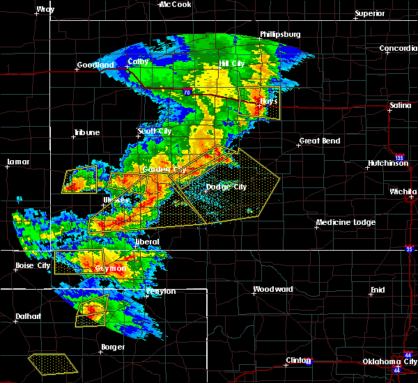 At 631 pm cdt, severe thunderstorms were located along a line extending from 6 miles south of bazine to 6 miles north of cimarron, moving southeast at 30 mph (radar indicated). Hazards include 70 mph wind gusts and penny size hail. Expect considerable tree damage. damage is likely to mobile homes, roofs, and outbuildings. Locations impacted include, cimarron, jetmore and kalvesta. At 631 pm cdt, severe thunderstorms were located along a line extending from 6 miles south of bazine to 6 miles north of cimarron, moving southeast at 30 mph (radar indicated). Hazards include 70 mph wind gusts and penny size hail. Expect considerable tree damage. damage is likely to mobile homes, roofs, and outbuildings. Locations impacted include, cimarron, jetmore and kalvesta.
|
| 6/22/2018 6:19 PM CDT |
 At 618 pm cdt, severe thunderstorms were located along a line extending from 6 miles south of bazine to 5 miles north of ingalls, moving southeast at 45 mph (radar indicated). Hazards include 70 mph wind gusts and quarter size hail. Hail damage to vehicles is expected. expect considerable tree damage. Wind damage is also likely to mobile homes, roofs, and outbuildings. At 618 pm cdt, severe thunderstorms were located along a line extending from 6 miles south of bazine to 5 miles north of ingalls, moving southeast at 45 mph (radar indicated). Hazards include 70 mph wind gusts and quarter size hail. Hail damage to vehicles is expected. expect considerable tree damage. Wind damage is also likely to mobile homes, roofs, and outbuildings.
|
| 6/22/2018 6:09 PM CDT |
 At 608 pm cdt, severe thunderstorms were located along a line extending from 3 miles east of ness city to 9 miles north of charleston, moving southeast at 45 mph (radar indicated). Hazards include 70 mph wind gusts and quarter size hail. Hail damage to vehicles is expected. expect considerable tree damage. wind damage is also likely to mobile homes, roofs, and outbuildings. Locations impacted include, cimarron, ness city, jetmore, kalvesta and beeler. At 608 pm cdt, severe thunderstorms were located along a line extending from 3 miles east of ness city to 9 miles north of charleston, moving southeast at 45 mph (radar indicated). Hazards include 70 mph wind gusts and quarter size hail. Hail damage to vehicles is expected. expect considerable tree damage. wind damage is also likely to mobile homes, roofs, and outbuildings. Locations impacted include, cimarron, ness city, jetmore, kalvesta and beeler.
|
| 6/22/2018 5:44 PM CDT |
 At 543 pm cdt, severe thunderstorms were located along a line extending from 2 miles southwest of utica to 7 miles east of friend, moving southeast at 50 mph (radar indicated). Hazards include 70 mph wind gusts and half dollar size hail. Hail damage to vehicles is expected. expect considerable tree damage. wind damage is also likely to mobile homes, roofs, and outbuildings. This warning extends the previous warning which was in effect for portions of scott, lane, and ness county. At 543 pm cdt, severe thunderstorms were located along a line extending from 2 miles southwest of utica to 7 miles east of friend, moving southeast at 50 mph (radar indicated). Hazards include 70 mph wind gusts and half dollar size hail. Hail damage to vehicles is expected. expect considerable tree damage. wind damage is also likely to mobile homes, roofs, and outbuildings. This warning extends the previous warning which was in effect for portions of scott, lane, and ness county.
|
| 6/19/2018 10:39 PM CDT |
 At 1038 pm cdt, the leading edge of severe thunderstorm high winds were located along a line extending from 2 miles southeast of nekoma to 8 miles northwest of offerle to 5 miles south of ensign, moving east at 60 mph (radar indicated). Hazards include 70 mph wind gusts. Expect considerable tree damage. damage is likely to mobile homes, roofs, and outbuildings. Locations impacted include, gray, larned, kinsley, ashland, jetmore, coldwater, bucklin, greensburg, spearville, minneola, haviland, protection, lewis, bazine, mullinville, burdett, ford, hanston, offerle and garfield. At 1038 pm cdt, the leading edge of severe thunderstorm high winds were located along a line extending from 2 miles southeast of nekoma to 8 miles northwest of offerle to 5 miles south of ensign, moving east at 60 mph (radar indicated). Hazards include 70 mph wind gusts. Expect considerable tree damage. damage is likely to mobile homes, roofs, and outbuildings. Locations impacted include, gray, larned, kinsley, ashland, jetmore, coldwater, bucklin, greensburg, spearville, minneola, haviland, protection, lewis, bazine, mullinville, burdett, ford, hanston, offerle and garfield.
|
| 6/19/2018 10:31 PM CDT |
 At 1030 pm cdt, severe thunderstorms were located along a line extending from 2 miles northwest of ransom to 7 miles west of jetmore to near ensign, moving east at 50 mph (radar indicated). Hazards include 70 mph wind gusts and penny size hail. Expect considerable tree damage. Damage is likely to mobile homes, roofs, and outbuildings. At 1030 pm cdt, severe thunderstorms were located along a line extending from 2 miles northwest of ransom to 7 miles west of jetmore to near ensign, moving east at 50 mph (radar indicated). Hazards include 70 mph wind gusts and penny size hail. Expect considerable tree damage. Damage is likely to mobile homes, roofs, and outbuildings.
|
| 6/19/2018 10:26 PM CDT | Storm damage reported in hodgeman county KS, 3 miles S of Jetmore, KS |
| 6/19/2018 10:20 PM CDT | Two campers blown over at horsethief reservoi in hodgeman county KS, 10.3 miles E of Jetmore, KS |
| 6/19/2018 10:17 PM CDT |
 At 1016 pm cdt, the leading edge of severe thunderstorms were located along a line extending from 4 miles north of jetmore to 3 miles west of howell to 3 miles north of satanta, moving south at 55 mph (radar indicated). Hazards include 70 mph wind gusts and penny size hail. Expect considerable tree damage. damage is likely to mobile homes, roofs, and outbuildings. Locations impacted include, dodge city, cimarron, sublette, ness city, montezuma, jetmore, pierceville, copeland, ingalls, ransom, ensign, charleston, howell, beeler, plymell, arnold and kalvesta. At 1016 pm cdt, the leading edge of severe thunderstorms were located along a line extending from 4 miles north of jetmore to 3 miles west of howell to 3 miles north of satanta, moving south at 55 mph (radar indicated). Hazards include 70 mph wind gusts and penny size hail. Expect considerable tree damage. damage is likely to mobile homes, roofs, and outbuildings. Locations impacted include, dodge city, cimarron, sublette, ness city, montezuma, jetmore, pierceville, copeland, ingalls, ransom, ensign, charleston, howell, beeler, plymell, arnold and kalvesta.
|
| 6/19/2018 10:03 PM CDT |
 At 1002 pm cdt, severe thunderstorms were located along a line extending from 5 miles northeast of ransom to 5 miles southeast of kalvesta to 9 miles northwest of tice, moving southeast at 60 mph (radar indicated). Hazards include 70 mph wind gusts and penny size hail. Expect considerable tree damage. Damage is likely to mobile homes, roofs, and outbuildings. At 1002 pm cdt, severe thunderstorms were located along a line extending from 5 miles northeast of ransom to 5 miles southeast of kalvesta to 9 miles northwest of tice, moving southeast at 60 mph (radar indicated). Hazards include 70 mph wind gusts and penny size hail. Expect considerable tree damage. Damage is likely to mobile homes, roofs, and outbuildings.
|
| 6/19/2018 9:51 PM CDT |
 At 949 pm cdt, severe thunderstorms were located along a line extending from 2 miles northeast of arnold to 4 miles northwest of kalvesta to 11 miles southwest of plymell, moving southeast at 40 mph (radar indicated and winds measured by automated weather stations). Hazards include 70 mph wind gusts and penny size hail. Expect considerable tree damage. damage is likely to mobile homes, roofs, and outbuildings. locations impacted include, dodge city, garden city, cimarron, holcomb, sublette, ness city, dighton, montezuma, jetmore, pierceville, copeland, ingalls, ransom, ensign, utica, alamota, charleston, howell, shields and beeler. At 935 pm cdt, a 65 mph wind gust was measured by a mesonet station in garden city. At 949 pm cdt, severe thunderstorms were located along a line extending from 2 miles northeast of arnold to 4 miles northwest of kalvesta to 11 miles southwest of plymell, moving southeast at 40 mph (radar indicated and winds measured by automated weather stations). Hazards include 70 mph wind gusts and penny size hail. Expect considerable tree damage. damage is likely to mobile homes, roofs, and outbuildings. locations impacted include, dodge city, garden city, cimarron, holcomb, sublette, ness city, dighton, montezuma, jetmore, pierceville, copeland, ingalls, ransom, ensign, utica, alamota, charleston, howell, shields and beeler. At 935 pm cdt, a 65 mph wind gust was measured by a mesonet station in garden city.
|
| 6/19/2018 9:25 PM CDT |
 At 924 pm cdt, the leading edge of severe thunderstorms were located along a line extending from 5 miles north of shields to 15 miles southeast of friend to 2 miles southeast of lakin, moving southeast at 55 mph (radar indicated and measured winds from automated weather stations). Hazards include 70 mph wind gusts and penny size hail. Expect considerable tree damage. Damage is likely to mobile homes, roofs, and outbuildings. At 924 pm cdt, the leading edge of severe thunderstorms were located along a line extending from 5 miles north of shields to 15 miles southeast of friend to 2 miles southeast of lakin, moving southeast at 55 mph (radar indicated and measured winds from automated weather stations). Hazards include 70 mph wind gusts and penny size hail. Expect considerable tree damage. Damage is likely to mobile homes, roofs, and outbuildings.
|
| 6/7/2018 1:54 AM CDT |
 At 153 am cdt, severe thunderstorms were located along a line extending from 11 miles southeast of ness city to 5 miles north of ford, moving east at 10 mph (radar indicated). Hazards include 70 mph wind gusts and quarter size hail. Hail damage to vehicles is expected. expect considerable tree damage. wind damage is also likely to mobile homes, roofs, and outbuildings. Locations impacted include, gray, kinsley, jetmore, spearville, burdett, hanston, offerle, rozel, bellefont and windhorst. At 153 am cdt, severe thunderstorms were located along a line extending from 11 miles southeast of ness city to 5 miles north of ford, moving east at 10 mph (radar indicated). Hazards include 70 mph wind gusts and quarter size hail. Hail damage to vehicles is expected. expect considerable tree damage. wind damage is also likely to mobile homes, roofs, and outbuildings. Locations impacted include, gray, kinsley, jetmore, spearville, burdett, hanston, offerle, rozel, bellefont and windhorst.
|
| 6/7/2018 1:36 AM CDT |
 At 136 am cdt, severe thunderstorms were located along a line extending from 11 miles south of ness city to 4 miles north of ford, moving east at 10 mph (radar indicated). Hazards include two inch hail and 60 mph wind gusts. People and animals outdoors will be injured. expect hail damage to roofs, siding, windows, and vehicles. Expect wind damage to roofs, siding, and trees. At 136 am cdt, severe thunderstorms were located along a line extending from 11 miles south of ness city to 4 miles north of ford, moving east at 10 mph (radar indicated). Hazards include two inch hail and 60 mph wind gusts. People and animals outdoors will be injured. expect hail damage to roofs, siding, windows, and vehicles. Expect wind damage to roofs, siding, and trees.
|
| 5/29/2018 5:12 PM CDT |
 At 512 pm cdt, a severe thunderstorm was located 8 miles south of hanston, moving northeast at 30 mph (radar indicated). Hazards include two inch hail and 60 mph wind gusts. People and animals outdoors will be injured. expect hail damage to roofs, siding, windows, and vehicles. Expect wind damage to roofs, siding, and trees. At 512 pm cdt, a severe thunderstorm was located 8 miles south of hanston, moving northeast at 30 mph (radar indicated). Hazards include two inch hail and 60 mph wind gusts. People and animals outdoors will be injured. expect hail damage to roofs, siding, windows, and vehicles. Expect wind damage to roofs, siding, and trees.
|
| 5/29/2018 5:04 PM CDT |
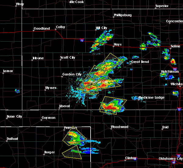 At 504 pm cdt, a severe thunderstorm was located 4 miles west of hanston, moving northeast at 25 mph (radar indicated). Hazards include two inch hail and 60 mph wind gusts. People and animals outdoors will be injured. expect hail damage to roofs, siding, windows, and vehicles. expect wind damage to roofs, siding, and trees. Locations impacted include, gray, jetmore and hanston. At 504 pm cdt, a severe thunderstorm was located 4 miles west of hanston, moving northeast at 25 mph (radar indicated). Hazards include two inch hail and 60 mph wind gusts. People and animals outdoors will be injured. expect hail damage to roofs, siding, windows, and vehicles. expect wind damage to roofs, siding, and trees. Locations impacted include, gray, jetmore and hanston.
|
| 5/29/2018 4:56 PM CDT |
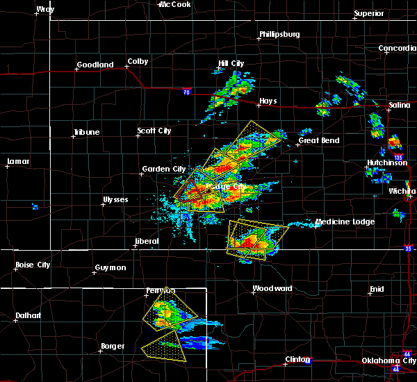 At 455 pm cdt, a severe thunderstorm was located near jetmore, moving northeast at 25 mph (radar indicated). Hazards include two inch hail and 60 mph wind gusts. People and animals outdoors will be injured. expect hail damage to roofs, siding, windows, and vehicles. expect wind damage to roofs, siding, and trees. Locations impacted include, gray, jetmore and hanston. At 455 pm cdt, a severe thunderstorm was located near jetmore, moving northeast at 25 mph (radar indicated). Hazards include two inch hail and 60 mph wind gusts. People and animals outdoors will be injured. expect hail damage to roofs, siding, windows, and vehicles. expect wind damage to roofs, siding, and trees. Locations impacted include, gray, jetmore and hanston.
|
| 5/29/2018 4:28 PM CDT |
 At 428 pm cdt, a severe thunderstorm was located 9 miles southwest of jetmore, moving northeast at 25 mph (radar indicated). Hazards include two inch hail and 60 mph wind gusts. People and animals outdoors will be injured. expect hail damage to roofs, siding, windows, and vehicles. Expect wind damage to roofs, siding, and trees. At 428 pm cdt, a severe thunderstorm was located 9 miles southwest of jetmore, moving northeast at 25 mph (radar indicated). Hazards include two inch hail and 60 mph wind gusts. People and animals outdoors will be injured. expect hail damage to roofs, siding, windows, and vehicles. Expect wind damage to roofs, siding, and trees.
|
| 5/29/2018 4:24 PM CDT | Hen Egg sized hail reported 17.9 miles ENE of Jetmore, KS, 2 inch hail phone call. |
| 5/29/2018 4:20 PM CDT |
 At 419 pm cdt, a severe thunderstorm was located 9 miles west of jetmore, moving northeast at 20 mph (radar indicated). Hazards include two inch hail and 60 mph wind gusts. People and animals outdoors will be injured. expect hail damage to roofs, siding, windows, and vehicles. expect wind damage to roofs, siding, and trees. Locations impacted include, jetmore. At 419 pm cdt, a severe thunderstorm was located 9 miles west of jetmore, moving northeast at 20 mph (radar indicated). Hazards include two inch hail and 60 mph wind gusts. People and animals outdoors will be injured. expect hail damage to roofs, siding, windows, and vehicles. expect wind damage to roofs, siding, and trees. Locations impacted include, jetmore.
|
| 5/29/2018 4:15 PM CDT |
 At 400 pm cdt, a severe thunderstorm was located 8 miles east of kalvesta, moving northeast at 20 mph (radar indicated). Hazards include ping pong ball size hail and 60 mph wind gusts. People and animals outdoors will be injured. expect hail damage to roofs, siding, windows, and vehicles. expect wind damage to roofs, siding, and trees. Locations impacted include, jetmore and kalvesta. At 400 pm cdt, a severe thunderstorm was located 8 miles east of kalvesta, moving northeast at 20 mph (radar indicated). Hazards include ping pong ball size hail and 60 mph wind gusts. People and animals outdoors will be injured. expect hail damage to roofs, siding, windows, and vehicles. expect wind damage to roofs, siding, and trees. Locations impacted include, jetmore and kalvesta.
|
| 5/29/2018 4:00 PM CDT |
 At 400 pm cdt, a severe thunderstorm was located 8 miles east of kalvesta, moving northeast at 20 mph (radar indicated). Hazards include ping pong ball size hail and 60 mph wind gusts. People and animals outdoors will be injured. expect hail damage to roofs, siding, windows, and vehicles. expect wind damage to roofs, siding, and trees. Locations impacted include, jetmore and kalvesta. At 400 pm cdt, a severe thunderstorm was located 8 miles east of kalvesta, moving northeast at 20 mph (radar indicated). Hazards include ping pong ball size hail and 60 mph wind gusts. People and animals outdoors will be injured. expect hail damage to roofs, siding, windows, and vehicles. expect wind damage to roofs, siding, and trees. Locations impacted include, jetmore and kalvesta.
|
| 5/29/2018 3:43 PM CDT |
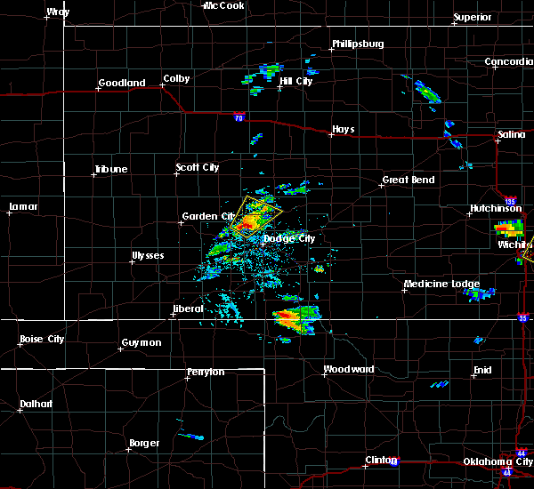 At 342 pm cdt, a severe thunderstorm was located 8 miles southeast of kalvesta, moving northeast at 20 mph (radar indicated). Hazards include ping pong ball size hail and 60 mph wind gusts. People and animals outdoors will be injured. expect hail damage to roofs, siding, windows, and vehicles. Expect wind damage to roofs, siding, and trees. At 342 pm cdt, a severe thunderstorm was located 8 miles southeast of kalvesta, moving northeast at 20 mph (radar indicated). Hazards include ping pong ball size hail and 60 mph wind gusts. People and animals outdoors will be injured. expect hail damage to roofs, siding, windows, and vehicles. Expect wind damage to roofs, siding, and trees.
|
| 5/28/2018 9:10 PM CDT |
 At 909 pm cdt, a line of severe thunderstorm was located from 8 miles north of howell to near larned, moving east at 45 mph (radar indicated). Hazards include 60 mph wind gusts and quarter size hail. Hail damage to vehicles is expected. expect wind damage to roofs, siding, and trees. locations impacted include, dodge city, gray, larned, kinsley, jetmore, spearville, lewis, burdett, hanston, offerle, garfield, rozel, belpre, ash valley, howell, wright, sanford, frizell, bellefont and windhorst. A tornado watch remains in effect until 1000 pm cdt for central kansas. At 909 pm cdt, a line of severe thunderstorm was located from 8 miles north of howell to near larned, moving east at 45 mph (radar indicated). Hazards include 60 mph wind gusts and quarter size hail. Hail damage to vehicles is expected. expect wind damage to roofs, siding, and trees. locations impacted include, dodge city, gray, larned, kinsley, jetmore, spearville, lewis, burdett, hanston, offerle, garfield, rozel, belpre, ash valley, howell, wright, sanford, frizell, bellefont and windhorst. A tornado watch remains in effect until 1000 pm cdt for central kansas.
|
| 5/28/2018 8:55 PM CDT |
 At 854 pm cdt, a line of severe thunderstorms was located from very near cimarron to near jetmore to near burdett , moving northeast at 40 mph (radar indicated). Hazards include 70 mph wind gusts and quarter size hail. Hail damage to vehicles is expected. expect considerable tree damage. wind damage is also likely to mobile homes, roofs, and outbuildings. locations impacted include, dodge city, gray, larned, cimarron, kinsley, montezuma, jetmore, spearville, lewis, ingalls, burdett, hanston, offerle, garfield, ensign, rozel, belpre, charleston, ash valley and howell. A tornado watch remains in effect until 1000 pm cdt for central kansas. At 854 pm cdt, a line of severe thunderstorms was located from very near cimarron to near jetmore to near burdett , moving northeast at 40 mph (radar indicated). Hazards include 70 mph wind gusts and quarter size hail. Hail damage to vehicles is expected. expect considerable tree damage. wind damage is also likely to mobile homes, roofs, and outbuildings. locations impacted include, dodge city, gray, larned, cimarron, kinsley, montezuma, jetmore, spearville, lewis, ingalls, burdett, hanston, offerle, garfield, ensign, rozel, belpre, charleston, ash valley and howell. A tornado watch remains in effect until 1000 pm cdt for central kansas.
|
| 5/28/2018 8:40 PM CDT |
 The severe thunderstorm warning for northwestern ford, finney, southern ness, hodgeman, western pawnee, southeastern lane, northern gray, northwestern edwards and northeastern haskell counties will expire at 845 pm cdt, a tornado watch remains in effect until 1000 pm cdt for west central kansas. a severe thunderstorm watch remains in effect until 1000 pm cdt for south central and southwestern kansas. a severe thunderstorm warning has replaced this warning and is in effect for finney, gray, hodgeman, pawnee, ford, and edwards counties until 9:45 pm. The severe thunderstorm warning for northwestern ford, finney, southern ness, hodgeman, western pawnee, southeastern lane, northern gray, northwestern edwards and northeastern haskell counties will expire at 845 pm cdt, a tornado watch remains in effect until 1000 pm cdt for west central kansas. a severe thunderstorm watch remains in effect until 1000 pm cdt for south central and southwestern kansas. a severe thunderstorm warning has replaced this warning and is in effect for finney, gray, hodgeman, pawnee, ford, and edwards counties until 9:45 pm.
|
| 5/28/2018 8:38 PM CDT |
 At 837 pm cdt, a line of severe thunderstorms was located 5 miles southwest of ingalls, moving east at 35 mph. another line of severe thunderstorms was located from cimarron to jetmore, moving east at 35 mph (radar indicated). Hazards include 70 mph wind gusts and half dollar size hail. Hail damage to vehicles is expected. expect considerable tree damage. Wind damage is also likely to mobile homes, roofs, and outbuildings. At 837 pm cdt, a line of severe thunderstorms was located 5 miles southwest of ingalls, moving east at 35 mph. another line of severe thunderstorms was located from cimarron to jetmore, moving east at 35 mph (radar indicated). Hazards include 70 mph wind gusts and half dollar size hail. Hail damage to vehicles is expected. expect considerable tree damage. Wind damage is also likely to mobile homes, roofs, and outbuildings.
|
| 5/28/2018 8:17 PM CDT |
 At 817 pm cdt, severe thunderstorms were located along a line extending from 12 miles northwest of hanston to 4 miles west of howell, moving east at 55 mph (radar indicated). Hazards include 70 mph wind gusts and half dollar size hail. Hail damage to vehicles is expected. expect considerable tree damage. wind damage is also likely to mobile homes, roofs, and outbuildings. locations impacted include, garden city, gray, cimarron, jetmore, pierceville, ingalls, burdett, hanston, rozel, charleston, howell, plymell and kalvesta. A tornado watch remains in effect until 1000 pm cdt for west central kansas. At 817 pm cdt, severe thunderstorms were located along a line extending from 12 miles northwest of hanston to 4 miles west of howell, moving east at 55 mph (radar indicated). Hazards include 70 mph wind gusts and half dollar size hail. Hail damage to vehicles is expected. expect considerable tree damage. wind damage is also likely to mobile homes, roofs, and outbuildings. locations impacted include, garden city, gray, cimarron, jetmore, pierceville, ingalls, burdett, hanston, rozel, charleston, howell, plymell and kalvesta. A tornado watch remains in effect until 1000 pm cdt for west central kansas.
|
| 5/28/2018 8:13 PM CDT | Semi blow over on highway 283 near the ness and hodgeman county lin in ness county KS, 14 miles S of Jetmore, KS |
| 5/28/2018 7:51 PM CDT |
 At 751 pm cdt, severe thunderstorms were located along a line extending from 13 miles south of beeler to 7 miles north of copeland, moving east at 30 mph (radar indicated). Hazards include 70 mph wind gusts and quarter size hail. Hail damage to vehicles is expected. expect considerable tree damage. Wind damage is also likely to mobile homes, roofs, and outbuildings. At 751 pm cdt, severe thunderstorms were located along a line extending from 13 miles south of beeler to 7 miles north of copeland, moving east at 30 mph (radar indicated). Hazards include 70 mph wind gusts and quarter size hail. Hail damage to vehicles is expected. expect considerable tree damage. Wind damage is also likely to mobile homes, roofs, and outbuildings.
|
| 5/18/2018 7:35 PM CDT |
 At 734 pm cdt, a severe thunderstorm was located 4 miles southwest of ford, moving north at 35 mph (radar indicated). Hazards include golf ball size hail and 70 mph wind gusts. People and animals outdoors will be injured. expect hail damage to roofs, siding, windows, and vehicles. expect considerable tree damage. wind damage is also likely to mobile homes, roofs, and outbuildings. At 730 pm, a suspected microburst caused roof damage 3 miles east of dodge city. At 734 pm cdt, a severe thunderstorm was located 4 miles southwest of ford, moving north at 35 mph (radar indicated). Hazards include golf ball size hail and 70 mph wind gusts. People and animals outdoors will be injured. expect hail damage to roofs, siding, windows, and vehicles. expect considerable tree damage. wind damage is also likely to mobile homes, roofs, and outbuildings. At 730 pm, a suspected microburst caused roof damage 3 miles east of dodge city.
|
| 5/14/2018 10:28 PM CDT |
 The severe thunderstorm warning for southern ness, hodgeman, northwestern pawnee and southwestern rush counties will expire at 1030 pm cdt, the storm which prompted the warning has moved out of the area. therefore the warning will be allowed to expire. however small hail, gusty winds and heavy rain are still possible with this thunderstorm. The severe thunderstorm warning for southern ness, hodgeman, northwestern pawnee and southwestern rush counties will expire at 1030 pm cdt, the storm which prompted the warning has moved out of the area. therefore the warning will be allowed to expire. however small hail, gusty winds and heavy rain are still possible with this thunderstorm.
|
| 5/14/2018 10:27 PM CDT |
 At 1027 pm cdt, a severe thunderstorm was located 7 miles northwest of bellefont, moving east at 45 mph (radar indicated). Hazards include ping pong ball size hail and 60 mph wind gusts. People and animals outdoors will be injured. expect hail damage to roofs, siding, windows, and vehicles. Expect wind damage to roofs, siding, and trees. At 1027 pm cdt, a severe thunderstorm was located 7 miles northwest of bellefont, moving east at 45 mph (radar indicated). Hazards include ping pong ball size hail and 60 mph wind gusts. People and animals outdoors will be injured. expect hail damage to roofs, siding, windows, and vehicles. Expect wind damage to roofs, siding, and trees.
|
| 5/14/2018 10:02 PM CDT |
 At 959 pm cdt, one severe thunderstorm was located 11 miles northwest of gray and a second severe thunderstorm was located 5 miles east of kalvesta. both storms were moving east at 40 mph. this is a very dangerous storm (radar indicated). Hazards include 80 mph wind gusts and tennis ball size hail. Flying debris will be dangerous to those caught without shelter. mobile homes will be heavily damaged. expect considerable damage to roofs, windows, and vehicles. extensive tree damage and power outages are likely. Locations impacted include, gray, ness city, jetmore, bazine, burdett, hanston, rush center, alexander and nekoma. At 959 pm cdt, one severe thunderstorm was located 11 miles northwest of gray and a second severe thunderstorm was located 5 miles east of kalvesta. both storms were moving east at 40 mph. this is a very dangerous storm (radar indicated). Hazards include 80 mph wind gusts and tennis ball size hail. Flying debris will be dangerous to those caught without shelter. mobile homes will be heavily damaged. expect considerable damage to roofs, windows, and vehicles. extensive tree damage and power outages are likely. Locations impacted include, gray, ness city, jetmore, bazine, burdett, hanston, rush center, alexander and nekoma.
|
| 5/14/2018 9:53 PM CDT | Hen Egg sized hail reported 14 miles S of Jetmore, KS, 2 inch hail. |
| 5/14/2018 9:30 PM CDT |
 At 929 pm cdt, one severe thunderstorm was located 6 miles southeast of beeler. a second severe thunderstorm was located 5 miles west of friend. both storms were moving east at 45 mph. this is a very dangerous storm (radar indicated). Hazards include 80 mph wind gusts and baseball size hail. Flying debris will be dangerous to those caught without shelter. mobile homes will be heavily damaged. expect considerable damage to roofs, windows, and vehicles. Extensive tree damage and power outages are likely. At 929 pm cdt, one severe thunderstorm was located 6 miles southeast of beeler. a second severe thunderstorm was located 5 miles west of friend. both storms were moving east at 45 mph. this is a very dangerous storm (radar indicated). Hazards include 80 mph wind gusts and baseball size hail. Flying debris will be dangerous to those caught without shelter. mobile homes will be heavily damaged. expect considerable damage to roofs, windows, and vehicles. Extensive tree damage and power outages are likely.
|
| 5/9/2018 11:26 PM CDT |
 The severe thunderstorm warning for northeastern ford, southeastern hodgeman, southwestern pawnee and northwestern edwards counties will expire at 1130 pm cdt, the storms which prompted the warning have weakened below severe limits, and no longer pose an immediate threat to life or property. therefore the warning will be allowed to expire. however gusty winds are still possible with these thunderstorms. The severe thunderstorm warning for northeastern ford, southeastern hodgeman, southwestern pawnee and northwestern edwards counties will expire at 1130 pm cdt, the storms which prompted the warning have weakened below severe limits, and no longer pose an immediate threat to life or property. therefore the warning will be allowed to expire. however gusty winds are still possible with these thunderstorms.
|
| 5/9/2018 11:10 PM CDT |
 At 1109 pm cdt, severe thunderstorms were located along a line extending from 5 miles south of sanford to 6 miles north of spearville, moving southeast at 30 mph (radar indicated). Hazards include 60 mph wind gusts and nickel size hail. Expect damage to roofs, siding, and trees. Locations impacted include, spearville, offerle, garfield, wright, bellefont and zook. At 1109 pm cdt, severe thunderstorms were located along a line extending from 5 miles south of sanford to 6 miles north of spearville, moving southeast at 30 mph (radar indicated). Hazards include 60 mph wind gusts and nickel size hail. Expect damage to roofs, siding, and trees. Locations impacted include, spearville, offerle, garfield, wright, bellefont and zook.
|
| 5/9/2018 10:53 PM CDT |
 At 1053 pm cdt, severe thunderstorms were located along a line extending from 5 miles south of burdett to 10 miles southwest of jetmore, moving southeast at 25 mph (radar indicated). Hazards include 60 mph wind gusts and nickel size hail. Expect damage to roofs, siding, and trees. Locations impacted include, dodge city, gray, kinsley, jetmore, spearville, burdett, hanston, offerle, garfield, rozel, howell, wright, bellefont and zook. At 1053 pm cdt, severe thunderstorms were located along a line extending from 5 miles south of burdett to 10 miles southwest of jetmore, moving southeast at 25 mph (radar indicated). Hazards include 60 mph wind gusts and nickel size hail. Expect damage to roofs, siding, and trees. Locations impacted include, dodge city, gray, kinsley, jetmore, spearville, burdett, hanston, offerle, garfield, rozel, howell, wright, bellefont and zook.
|
| 5/9/2018 10:36 PM CDT |
 At 1035 pm cdt, severe thunderstorms were located along a line extending from near gray to 11 miles east of kalvesta, moving southeast at 25 mph (radar indicated). Hazards include 60 mph wind gusts and penny size hail. expect damage to roofs, siding, and trees At 1035 pm cdt, severe thunderstorms were located along a line extending from near gray to 11 miles east of kalvesta, moving southeast at 25 mph (radar indicated). Hazards include 60 mph wind gusts and penny size hail. expect damage to roofs, siding, and trees
|
| 10/6/2017 7:12 PM CDT |
 The severe thunderstorm warning for northern ford, hodgeman, northwestern pawnee and northwestern edwards counties will expire at 715 pm cdt, the storms which prompted the warning have moved out of the area. therefore the warning will be allowed to expire. however small hail, gusty winds and heavy rain are still possible with these thunderstorms. a severe thunderstorm watch remains in effect until 1100 pm cdt for south central, central, southwestern and west central kansas. The severe thunderstorm warning for northern ford, hodgeman, northwestern pawnee and northwestern edwards counties will expire at 715 pm cdt, the storms which prompted the warning have moved out of the area. therefore the warning will be allowed to expire. however small hail, gusty winds and heavy rain are still possible with these thunderstorms. a severe thunderstorm watch remains in effect until 1100 pm cdt for south central, central, southwestern and west central kansas.
|
| 10/6/2017 7:03 PM CDT |
 At 703 pm cdt, severe thunderstorms were located along a line extending from 4 miles northwest of burdett to 2 miles south of wright, moving east at 50 mph (radar indicated). Hazards include 70 mph wind gusts and quarter size hail. Hail damage to vehicles is expected. expect considerable tree damage. wind damage is also likely to mobile homes, roofs, and outbuildings. locations impacted include, dodge city, jetmore, spearville, burdett, hanston, offerle, fort dodge, wright, rozel, bellefont, gray, sanford, windhorst, willroads garden, rolling hill estates, dodge city regional airport, boot hill casino, hodgeman state lake, ford state lake and jetmore city lake. A weak, brief tornado is possible along the leading edge of this line of storms. At 703 pm cdt, severe thunderstorms were located along a line extending from 4 miles northwest of burdett to 2 miles south of wright, moving east at 50 mph (radar indicated). Hazards include 70 mph wind gusts and quarter size hail. Hail damage to vehicles is expected. expect considerable tree damage. wind damage is also likely to mobile homes, roofs, and outbuildings. locations impacted include, dodge city, jetmore, spearville, burdett, hanston, offerle, fort dodge, wright, rozel, bellefont, gray, sanford, windhorst, willroads garden, rolling hill estates, dodge city regional airport, boot hill casino, hodgeman state lake, ford state lake and jetmore city lake. A weak, brief tornado is possible along the leading edge of this line of storms.
|
| 10/6/2017 6:52 PM CDT |
 At 651 pm cdt, severe thunderstorms were located along a line extending from 8 miles northwest of hanston to 3 miles southwest of dodge city, moving east at 40 mph (radar indicated). Hazards include 60 mph wind gusts and quarter size hail. Hail damage to vehicles is expected. expect wind damage to roofs, siding, and trees. Locations impacted include, dodge city, jetmore, spearville, burdett, hanston, offerle, fort dodge, wright, rozel, bellefont, gray, sanford, windhorst, willroads garden, rolling hill estates, dodge city regional airport, boot hill casino, hodgeman state lake, ford state lake and jetmore city lake. At 651 pm cdt, severe thunderstorms were located along a line extending from 8 miles northwest of hanston to 3 miles southwest of dodge city, moving east at 40 mph (radar indicated). Hazards include 60 mph wind gusts and quarter size hail. Hail damage to vehicles is expected. expect wind damage to roofs, siding, and trees. Locations impacted include, dodge city, jetmore, spearville, burdett, hanston, offerle, fort dodge, wright, rozel, bellefont, gray, sanford, windhorst, willroads garden, rolling hill estates, dodge city regional airport, boot hill casino, hodgeman state lake, ford state lake and jetmore city lake.
|
| 10/6/2017 6:22 PM CDT |
 At 622 pm cdt, severe thunderstorms were located along a line extending from 8 miles northeast of kalvesta to near ingalls, moving east at 50 mph (radar indicated). Hazards include ping pong ball size hail and 60 mph wind gusts. People and animals outdoors will be injured. expect hail damage to roofs, siding, windows, and vehicles. Expect wind damage to roofs, siding, and trees. At 622 pm cdt, severe thunderstorms were located along a line extending from 8 miles northeast of kalvesta to near ingalls, moving east at 50 mph (radar indicated). Hazards include ping pong ball size hail and 60 mph wind gusts. People and animals outdoors will be injured. expect hail damage to roofs, siding, windows, and vehicles. Expect wind damage to roofs, siding, and trees.
|
| 10/6/2017 5:47 PM CDT | Ping Pong Ball sized hail reported 6.6 miles SSE of Jetmore, KS |
| 10/6/2017 5:07 PM CDT |
 The severe thunderstorm warning for eastern hodgeman county will expire at 515 pm cdt, the storm which prompted the warning has moved out of the area. therefore the warning will be allowed to expire. a severe thunderstorm watch remains in effect until 1100 pm cdt for southwestern kansas. The severe thunderstorm warning for eastern hodgeman county will expire at 515 pm cdt, the storm which prompted the warning has moved out of the area. therefore the warning will be allowed to expire. a severe thunderstorm watch remains in effect until 1100 pm cdt for southwestern kansas.
|
| 10/6/2017 5:00 PM CDT | Half Dollar sized hail reported 2.4 miles SSW of Jetmore, KS, mostly quarter size... but many half dollar size hail. |
| 10/6/2017 4:54 PM CDT |
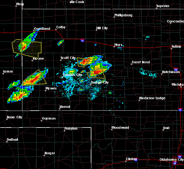 At 454 pm cdt, a severe thunderstorm was located 3 miles east of jetmore, moving east at 35 mph (radar indicated). Hazards include two inch hail and 60 mph wind gusts. People and animals outdoors will be injured. expect hail damage to roofs, siding, windows, and vehicles. expect wind damage to roofs, siding, and trees. Locations impacted include, jetmore, hanston, hodgeman state lake and jetmore city lake. At 454 pm cdt, a severe thunderstorm was located 3 miles east of jetmore, moving east at 35 mph (radar indicated). Hazards include two inch hail and 60 mph wind gusts. People and animals outdoors will be injured. expect hail damage to roofs, siding, windows, and vehicles. expect wind damage to roofs, siding, and trees. Locations impacted include, jetmore, hanston, hodgeman state lake and jetmore city lake.
|
| 10/6/2017 4:50 PM CDT | Golf Ball sized hail reported 2.4 miles SSW of Jetmore, KS, heavy rain with nickel to golf ball size hail. |
| 10/6/2017 4:46 PM CDT |
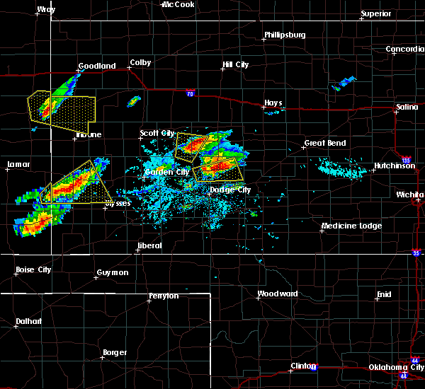 At 446 pm cdt, a severe thunderstorm was located very near jetmore, moving northeast at 40 mph (radar indicated). Hazards include two inch hail and 60 mph wind gusts. People and animals outdoors will be injured. expect hail damage to roofs, siding, windows, and vehicles. expect wind damage to roofs, siding, and trees. Locations impacted include, jetmore, hanston, horsethief reservoir, hodgeman state lake and jetmore city lake. At 446 pm cdt, a severe thunderstorm was located very near jetmore, moving northeast at 40 mph (radar indicated). Hazards include two inch hail and 60 mph wind gusts. People and animals outdoors will be injured. expect hail damage to roofs, siding, windows, and vehicles. expect wind damage to roofs, siding, and trees. Locations impacted include, jetmore, hanston, horsethief reservoir, hodgeman state lake and jetmore city lake.
|
| 10/6/2017 4:29 PM CDT |
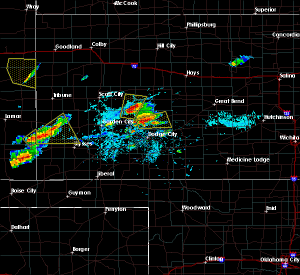 At 429 pm cdt, a severe thunderstorm was located 3 miles southwest of horsethief reservoir, or 12 miles west of jetmore, moving east at 35 mph (radar indicated). Hazards include two inch hail and 60 mph wind gusts. People and animals outdoors will be injured. expect hail damage to roofs, siding, windows, and vehicles. Expect wind damage to roofs, siding, and trees. At 429 pm cdt, a severe thunderstorm was located 3 miles southwest of horsethief reservoir, or 12 miles west of jetmore, moving east at 35 mph (radar indicated). Hazards include two inch hail and 60 mph wind gusts. People and animals outdoors will be injured. expect hail damage to roofs, siding, windows, and vehicles. Expect wind damage to roofs, siding, and trees.
|
| 8/10/2017 5:30 PM CDT |
 At 530 pm cdt, a severe thunderstorm was located 7 miles southeast of jetmore, moving southeast at 25 mph (radar indicated). Hazards include half dollar size hail. damage to vehicles is expected At 530 pm cdt, a severe thunderstorm was located 7 miles southeast of jetmore, moving southeast at 25 mph (radar indicated). Hazards include half dollar size hail. damage to vehicles is expected
|
| 6/22/2017 8:31 PM CDT |
 At 829 pm cdt, a severe thunderstorm was located 3 miles southwest of windhorst, or 17 miles east of dodge city, moving east at 20 mph (radar indicated). Hazards include 60 mph wind gusts and penny size hail. Expect damage to roofs, siding, and trees. Locations impacted include, dodge city, kinsley, greensburg, spearville, bucklin, haviland, lewis, mullinville, ford, offerle, fort dodge, wright, belpre, wellsford, trousdale, belvidere, bellefont, kingsdown, centerview and fellsburg. At 829 pm cdt, a severe thunderstorm was located 3 miles southwest of windhorst, or 17 miles east of dodge city, moving east at 20 mph (radar indicated). Hazards include 60 mph wind gusts and penny size hail. Expect damage to roofs, siding, and trees. Locations impacted include, dodge city, kinsley, greensburg, spearville, bucklin, haviland, lewis, mullinville, ford, offerle, fort dodge, wright, belpre, wellsford, trousdale, belvidere, bellefont, kingsdown, centerview and fellsburg.
|
| 6/22/2017 8:13 PM CDT |
 At 812 pm cdt, a severe thunderstorm was located 4 miles east of wright, or 11 miles east of dodge city, moving east at 30 mph (radar indicated). Hazards include 70 mph wind gusts and penny size hail. Expect considerable tree damage. Damage is likely to mobile homes, roofs, and outbuildings. At 812 pm cdt, a severe thunderstorm was located 4 miles east of wright, or 11 miles east of dodge city, moving east at 30 mph (radar indicated). Hazards include 70 mph wind gusts and penny size hail. Expect considerable tree damage. Damage is likely to mobile homes, roofs, and outbuildings.
|
| 6/22/2017 8:07 PM CDT |
 At 805 pm cdt, a severe thunderstorm was located 3 miles northwest of wright, or 5 miles northeast of dodge city, moving east at 35 mph (radar indicated. at 8 pm the asos at the dodge city airport reported winds gusting to 62 mph). Hazards include 60 mph wind gusts and penny size hail. Expect damage to roofs, siding, and trees. Locations impacted include, dodge city, spearville, ford, fort dodge, wright, bellefont, windhorst, willroads garden, rolling hill estates, dodge city regional airport, boot hill casino, ford state lake and hain state lake. At 805 pm cdt, a severe thunderstorm was located 3 miles northwest of wright, or 5 miles northeast of dodge city, moving east at 35 mph (radar indicated. at 8 pm the asos at the dodge city airport reported winds gusting to 62 mph). Hazards include 60 mph wind gusts and penny size hail. Expect damage to roofs, siding, and trees. Locations impacted include, dodge city, spearville, ford, fort dodge, wright, bellefont, windhorst, willroads garden, rolling hill estates, dodge city regional airport, boot hill casino, ford state lake and hain state lake.
|
| 6/22/2017 7:31 PM CDT |
 The national weather service in dodge city has issued a * severe thunderstorm warning for. ford county in southwestern kansas. southern hodgeman county in southwestern kansas. Until 815 pm cdt * at 730 pm cdt, a severe thunderstorm was located 4 miles northwest. The national weather service in dodge city has issued a * severe thunderstorm warning for. ford county in southwestern kansas. southern hodgeman county in southwestern kansas. Until 815 pm cdt * at 730 pm cdt, a severe thunderstorm was located 4 miles northwest.
|
| 6/21/2017 6:26 PM CDT |
 At 625 pm cdt, severe thunderstorms were located along a line extending from 7 miles north of kalvesta to 11 miles south of charleston, moving east at 20 mph (radar indicated). Hazards include ping pong ball size hail and 60 mph wind gusts. People and animals outdoors will be injured. expect hail damage to roofs, siding, windows, and vehicles. Expect wind damage to roofs, siding, and trees. At 625 pm cdt, severe thunderstorms were located along a line extending from 7 miles north of kalvesta to 11 miles south of charleston, moving east at 20 mph (radar indicated). Hazards include ping pong ball size hail and 60 mph wind gusts. People and animals outdoors will be injured. expect hail damage to roofs, siding, windows, and vehicles. Expect wind damage to roofs, siding, and trees.
|
| 6/13/2017 8:12 PM CDT |
 At 811 pm cdt, severe thunderstorms were located along a line extending from 7 miles south of alexander to 2 miles northwest of garfield, moving northeast at 60 mph (radar indicated). Hazards include 70 mph wind gusts and up to ping pong ball size hail. People and animals outdoors will be injured. expect hail damage to roofs, siding, windows, and vehicles. expect considerable tree damage. wind damage is also likely to mobile homes, roofs, and outbuildings. Locations impacted include, larned, la crosse, jetmore, bison, burdett, hanston, garfield, rush center, rozel, timken, ash valley, nekoma, gray, sanford, shaffer, frizell, hodgeman state lake, fort larned historic site and hain state lake. At 811 pm cdt, severe thunderstorms were located along a line extending from 7 miles south of alexander to 2 miles northwest of garfield, moving northeast at 60 mph (radar indicated). Hazards include 70 mph wind gusts and up to ping pong ball size hail. People and animals outdoors will be injured. expect hail damage to roofs, siding, windows, and vehicles. expect considerable tree damage. wind damage is also likely to mobile homes, roofs, and outbuildings. Locations impacted include, larned, la crosse, jetmore, bison, burdett, hanston, garfield, rush center, rozel, timken, ash valley, nekoma, gray, sanford, shaffer, frizell, hodgeman state lake, fort larned historic site and hain state lake.
|
| 6/13/2017 8:05 PM CDT | Hen Egg sized hail reported 2.4 miles SSW of Jetmore, KS, this was a social media report with photo of the hail stone. |
| 6/13/2017 8:04 PM CDT |
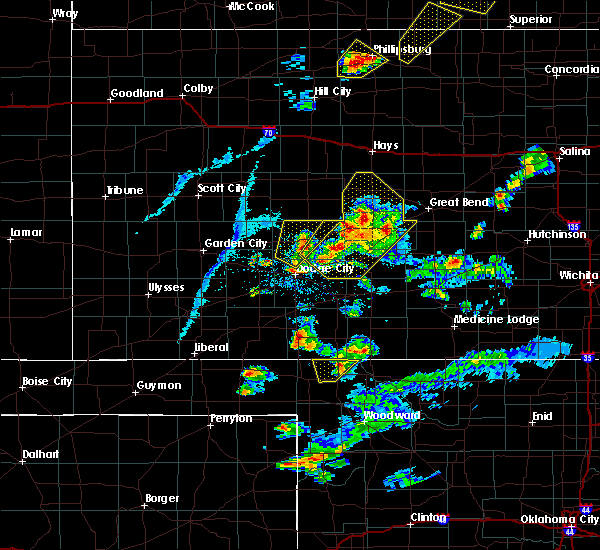 At 803 pm cdt, a severe thunderstorm was located 4 miles southwest of jetmore, moving northeast at 60 mph (radar indicated). Hazards include up to ping pong ball size hail and 60 mph wind gusts. People and animals outdoors will be injured. expect hail damage to roofs, siding, windows, and vehicles. expect wind damage to roofs, siding, and trees. Locations impacted include, jetmore, rolling hill estates, hodgeman state lake and jetmore city lake. At 803 pm cdt, a severe thunderstorm was located 4 miles southwest of jetmore, moving northeast at 60 mph (radar indicated). Hazards include up to ping pong ball size hail and 60 mph wind gusts. People and animals outdoors will be injured. expect hail damage to roofs, siding, windows, and vehicles. expect wind damage to roofs, siding, and trees. Locations impacted include, jetmore, rolling hill estates, hodgeman state lake and jetmore city lake.
|
| 6/13/2017 8:03 PM CDT |
 At 802 pm cdt, severe thunderstorms were located along a line extending from 6 miles north of gray to 6 miles northwest of lewis, moving northeast at 60 mph (radar indicated). Hazards include 70 mph wind gusts and up to ping pong ball size hail. People and animals outdoors will be injured. expect hail damage to roofs, siding, windows, and vehicles. expect considerable tree damage. wind damage is also likely to mobile homes, roofs, and outbuildings. Locations impacted include, larned, kinsley, la crosse, jetmore, spearville, lewis, bison, burdett, hanston, offerle, garfield, rush center, rozel, liebenthal, timken, alexander, ash valley, nekoma, bellefont and gray. At 802 pm cdt, severe thunderstorms were located along a line extending from 6 miles north of gray to 6 miles northwest of lewis, moving northeast at 60 mph (radar indicated). Hazards include 70 mph wind gusts and up to ping pong ball size hail. People and animals outdoors will be injured. expect hail damage to roofs, siding, windows, and vehicles. expect considerable tree damage. wind damage is also likely to mobile homes, roofs, and outbuildings. Locations impacted include, larned, kinsley, la crosse, jetmore, spearville, lewis, bison, burdett, hanston, offerle, garfield, rush center, rozel, liebenthal, timken, alexander, ash valley, nekoma, bellefont and gray.
|
| 6/13/2017 8:00 PM CDT | Quarter sized hail reported 10.1 miles NE of Jetmore, KS |
| 6/13/2017 7:55 PM CDT |
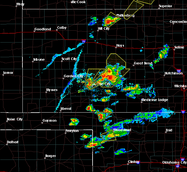 At 755 pm cdt, a severe thunderstorm was located 7 miles south of horsethief reservoir, or 12 miles north of dodge city, moving northeast at 60 mph (radar indicated). Hazards include up to ping pong ball size hail and 60 mph wind gusts. People and animals outdoors will be injured. expect hail damage to roofs, siding, windows, and vehicles. Expect wind damage to roofs, siding, and trees. At 755 pm cdt, a severe thunderstorm was located 7 miles south of horsethief reservoir, or 12 miles north of dodge city, moving northeast at 60 mph (radar indicated). Hazards include up to ping pong ball size hail and 60 mph wind gusts. People and animals outdoors will be injured. expect hail damage to roofs, siding, windows, and vehicles. Expect wind damage to roofs, siding, and trees.
|
| 6/13/2017 7:54 PM CDT |
 At 754 pm cdt, severe thunderstorms were located along a line extending from 3 miles northwest of gray to near kinsley, moving northeast at 60 mph (radar indicated). Hazards include 70 mph wind gusts and ping pong ball size hail. People and animals outdoors will be injured. expect hail damage to roofs, siding, windows, and vehicles. expect considerable tree damage. wind damage is also likely to mobile homes, roofs, and outbuildings. Locations impacted include, larned, kinsley, la crosse, jetmore, spearville, lewis, bison, burdett, hanston, offerle, garfield, rush center, rozel, liebenthal, timken, alexander, ash valley, nekoma, bellefont and gray. At 754 pm cdt, severe thunderstorms were located along a line extending from 3 miles northwest of gray to near kinsley, moving northeast at 60 mph (radar indicated). Hazards include 70 mph wind gusts and ping pong ball size hail. People and animals outdoors will be injured. expect hail damage to roofs, siding, windows, and vehicles. expect considerable tree damage. wind damage is also likely to mobile homes, roofs, and outbuildings. Locations impacted include, larned, kinsley, la crosse, jetmore, spearville, lewis, bison, burdett, hanston, offerle, garfield, rush center, rozel, liebenthal, timken, alexander, ash valley, nekoma, bellefont and gray.
|
| 6/13/2017 7:41 PM CDT |
 At 740 pm cdt, severe thunderstorms were located along a line extending from 5 miles southeast of jetmore to 6 miles east of windhorst, moving northeast at 60 mph (radar indicated). Hazards include 70 mph wind gusts and up to ping pong ball size hail. People and animals outdoors will be injured. expect hail damage to roofs, siding, windows, and vehicles. expect considerable tree damage. Wind damage is also likely to mobile homes, roofs, and outbuildings. At 740 pm cdt, severe thunderstorms were located along a line extending from 5 miles southeast of jetmore to 6 miles east of windhorst, moving northeast at 60 mph (radar indicated). Hazards include 70 mph wind gusts and up to ping pong ball size hail. People and animals outdoors will be injured. expect hail damage to roofs, siding, windows, and vehicles. expect considerable tree damage. Wind damage is also likely to mobile homes, roofs, and outbuildings.
|
| 6/13/2017 7:17 PM CDT |
 At 717 pm cdt, a severe thunderstorm was located 7 miles south of hanston, or 12 miles east of jetmore, moving northeast at 50 mph (radar indicated). Hazards include ping pong ball size hail and 60 mph wind gusts. People and animals outdoors will be injured. expect hail damage to roofs, siding, windows, and vehicles. expect wind damage to roofs, siding, and trees. Locations impacted include, jetmore, spearville, burdett, hanston, offerle, garfield, fort dodge, wright, rozel, bellefont, gray, sanford, rolling hill estates, dodge city regional airport, hodgeman state lake, ford state lake and hain state lake. At 717 pm cdt, a severe thunderstorm was located 7 miles south of hanston, or 12 miles east of jetmore, moving northeast at 50 mph (radar indicated). Hazards include ping pong ball size hail and 60 mph wind gusts. People and animals outdoors will be injured. expect hail damage to roofs, siding, windows, and vehicles. expect wind damage to roofs, siding, and trees. Locations impacted include, jetmore, spearville, burdett, hanston, offerle, garfield, fort dodge, wright, rozel, bellefont, gray, sanford, rolling hill estates, dodge city regional airport, hodgeman state lake, ford state lake and hain state lake.
|
| 6/13/2017 6:56 PM CDT |
 At 656 pm cdt, a severe thunderstorm was located 5 miles northwest of wright, or 8 miles northeast of dodge city, moving northeast at 50 mph (radar indicated). Hazards include up to ping pong ball size hail and 60 mph wind gusts. People and animals outdoors will be injured. expect hail damage to roofs, siding, windows, and vehicles. Expect wind damage to roofs, siding, and trees. At 656 pm cdt, a severe thunderstorm was located 5 miles northwest of wright, or 8 miles northeast of dodge city, moving northeast at 50 mph (radar indicated). Hazards include up to ping pong ball size hail and 60 mph wind gusts. People and animals outdoors will be injured. expect hail damage to roofs, siding, windows, and vehicles. Expect wind damage to roofs, siding, and trees.
|
| 6/13/2017 4:25 PM CDT |
 At 424 pm cdt, a severe thunderstorm was located 4 miles west of spearville, or 12 miles northeast of dodge city, moving northeast at 55 mph (radar indicated). Hazards include ping pong ball size hail and 60 mph wind gusts. People and animals outdoors will be injured. expect hail damage to roofs, siding, windows, and vehicles. expect wind damage to roofs, siding, and trees. Locations impacted include, dodge city, kinsley, spearville, offerle, fort dodge, wright, bellefont, windhorst, willroads garden, rolling hill estates, dodge city regional airport, hodgeman state lake, ford state lake and hain state lake. At 424 pm cdt, a severe thunderstorm was located 4 miles west of spearville, or 12 miles northeast of dodge city, moving northeast at 55 mph (radar indicated). Hazards include ping pong ball size hail and 60 mph wind gusts. People and animals outdoors will be injured. expect hail damage to roofs, siding, windows, and vehicles. expect wind damage to roofs, siding, and trees. Locations impacted include, dodge city, kinsley, spearville, offerle, fort dodge, wright, bellefont, windhorst, willroads garden, rolling hill estates, dodge city regional airport, hodgeman state lake, ford state lake and hain state lake.
|
| 6/13/2017 4:09 PM CDT |
 At 409 pm cdt, a severe thunderstorm was located 3 miles southwest of fort dodge, or 5 miles southeast of dodge city, moving northeast at 55 mph (radar indicated). Hazards include ping pong ball size hail and 60 mph wind gusts. People and animals outdoors will be injured. expect hail damage to roofs, siding, windows, and vehicles. Expect wind damage to roofs, siding, and trees. At 409 pm cdt, a severe thunderstorm was located 3 miles southwest of fort dodge, or 5 miles southeast of dodge city, moving northeast at 55 mph (radar indicated). Hazards include ping pong ball size hail and 60 mph wind gusts. People and animals outdoors will be injured. expect hail damage to roofs, siding, windows, and vehicles. Expect wind damage to roofs, siding, and trees.
|
| 5/18/2017 6:02 PM CDT |
 At 602 pm cdt, a severe thunderstorm was located near dodge city, moving north at 35 mph (radar indicated). Hazards include 60 mph wind gusts and quarter size hail. Hail damage to vehicles is expected. expect wind damage to roofs, siding, and trees. locations impacted include, dodge city, fort dodge, wright, willroads garden, rolling hill estates, boot hill casino, dodge city regional airport, ford state lake and hain state lake. A tornado watch remains in effect until 1100 pm cdt for southwestern kansas. At 602 pm cdt, a severe thunderstorm was located near dodge city, moving north at 35 mph (radar indicated). Hazards include 60 mph wind gusts and quarter size hail. Hail damage to vehicles is expected. expect wind damage to roofs, siding, and trees. locations impacted include, dodge city, fort dodge, wright, willroads garden, rolling hill estates, boot hill casino, dodge city regional airport, ford state lake and hain state lake. A tornado watch remains in effect until 1100 pm cdt for southwestern kansas.
|
| 5/18/2017 5:54 PM CDT |
 At 554 pm cdt, a severe thunderstorm was located 4 miles south of dodge city, moving north at 30 mph (radar indicated). Hazards include 60 mph wind gusts and quarter size hail. Hail damage to vehicles is expected. Expect wind damage to roofs, siding, and trees. At 554 pm cdt, a severe thunderstorm was located 4 miles south of dodge city, moving north at 30 mph (radar indicated). Hazards include 60 mph wind gusts and quarter size hail. Hail damage to vehicles is expected. Expect wind damage to roofs, siding, and trees.
|
| 5/16/2017 8:16 PM CDT | Quarter sized hail reported 11.2 miles S of Jetmore, KS |
| 5/16/2017 8:13 PM CDT | Quarter sized hail reported 9.9 miles S of Jetmore, KS |
| 5/16/2017 5:05 PM CDT |
 At 505 pm cdt, a severe thunderstorm was located 8 miles north of offerle, or 10 miles northwest of kinsley, moving northeast at 45 mph (radar indicated). Hazards include two inch hail and 60 mph wind gusts. People and animals outdoors will be injured. expect hail damage to roofs, siding, windows, and vehicles. expect wind damage to roofs, siding, and trees. locations impacted include, kinsley, jetmore, spearville, lewis, hanston, offerle, bellefont, windhorst, hodgeman state lake and hain state lake. A tornado watch remains in effect until 1000 pm cdt for south central and southwestern kansas. At 505 pm cdt, a severe thunderstorm was located 8 miles north of offerle, or 10 miles northwest of kinsley, moving northeast at 45 mph (radar indicated). Hazards include two inch hail and 60 mph wind gusts. People and animals outdoors will be injured. expect hail damage to roofs, siding, windows, and vehicles. expect wind damage to roofs, siding, and trees. locations impacted include, kinsley, jetmore, spearville, lewis, hanston, offerle, bellefont, windhorst, hodgeman state lake and hain state lake. A tornado watch remains in effect until 1000 pm cdt for south central and southwestern kansas.
|
| 5/16/2017 4:48 PM CDT |
 At 448 pm cdt, a severe thunderstorm was located very near spearville, or 17 miles northeast of dodge city, moving northeast at 25 mph (radar indicated). Hazards include 60 mph wind gusts and quarter size hail. Hail damage to vehicles is expected. Expect wind damage to roofs, siding, and trees. At 448 pm cdt, a severe thunderstorm was located very near spearville, or 17 miles northeast of dodge city, moving northeast at 25 mph (radar indicated). Hazards include 60 mph wind gusts and quarter size hail. Hail damage to vehicles is expected. Expect wind damage to roofs, siding, and trees.
|
| 5/16/2017 4:41 PM CDT |
 At 441 pm cdt, a severe thunderstorm was located very near wright, or 8 miles east of dodge city, moving northeast at 25 mph (radar indicated). Hazards include 70 mph wind gusts and quarter size hail. Hail damage to vehicles is expected. expect considerable tree damage. wind damage is also likely to mobile homes, roofs, and outbuildings. locations impacted include, spearville, bucklin, ford, offerle, fort dodge, wright, bellefont, windhorst, willroads garden, dodge city regional airport, ford state lake and hain state lake. A tornado watch remains in effect until 1000 pm cdt for south central and southwestern kansas. At 441 pm cdt, a severe thunderstorm was located very near wright, or 8 miles east of dodge city, moving northeast at 25 mph (radar indicated). Hazards include 70 mph wind gusts and quarter size hail. Hail damage to vehicles is expected. expect considerable tree damage. wind damage is also likely to mobile homes, roofs, and outbuildings. locations impacted include, spearville, bucklin, ford, offerle, fort dodge, wright, bellefont, windhorst, willroads garden, dodge city regional airport, ford state lake and hain state lake. A tornado watch remains in effect until 1000 pm cdt for south central and southwestern kansas.
|
| 5/16/2017 4:24 PM CDT |
 The national weather service in dodge city has issued a * severe thunderstorm warning for. ford county in southwestern kansas. northwestern kiowa county in south central kansas. southeastern hodgeman county in southwestern kansas. Southwestern edwards county in south central kansas. The national weather service in dodge city has issued a * severe thunderstorm warning for. ford county in southwestern kansas. northwestern kiowa county in south central kansas. southeastern hodgeman county in southwestern kansas. Southwestern edwards county in south central kansas.
|
| 5/16/2017 3:57 PM CDT |
 At 356 pm cdt, a severe thunderstorm was located 7 miles south of kalvesta, or 11 miles northeast of cimarron, moving north at 30 mph (radar indicated). Hazards include two inch hail and 60 mph wind gusts. People and animals outdoors will be injured. expect hail damage to roofs, siding, windows, and vehicles. expect wind damage to roofs, siding, and trees. locations impacted include, kalvesta, horsethief reservoir and finney state lake. A tornado watch remains in effect until 1000 pm cdt for southwestern kansas. At 356 pm cdt, a severe thunderstorm was located 7 miles south of kalvesta, or 11 miles northeast of cimarron, moving north at 30 mph (radar indicated). Hazards include two inch hail and 60 mph wind gusts. People and animals outdoors will be injured. expect hail damage to roofs, siding, windows, and vehicles. expect wind damage to roofs, siding, and trees. locations impacted include, kalvesta, horsethief reservoir and finney state lake. A tornado watch remains in effect until 1000 pm cdt for southwestern kansas.
|
| 5/16/2017 3:42 PM CDT |
 At 341 pm cdt, a severe thunderstorm was located 4 miles northeast of cimarron, moving north at 30 mph (radar indicated). Hazards include two inch hail and 60 mph wind gusts. People and animals outdoors will be injured. expect hail damage to roofs, siding, windows, and vehicles. Expect wind damage to roofs, siding, and trees. At 341 pm cdt, a severe thunderstorm was located 4 miles northeast of cimarron, moving north at 30 mph (radar indicated). Hazards include two inch hail and 60 mph wind gusts. People and animals outdoors will be injured. expect hail damage to roofs, siding, windows, and vehicles. Expect wind damage to roofs, siding, and trees.
|
| 5/10/2017 10:20 PM CDT | Quarter sized hail reported 8.1 miles E of Jetmore, KS |
| 3/24/2017 1:13 AM CDT |
 At 112 am cdt, a severe thunderstorm was located 8 miles northwest of spearville, or 9 miles south of jetmore, moving northeast at 45 mph (radar indicated). Hazards include 60 mph wind gusts. expect damage to roofs, siding, and trees At 112 am cdt, a severe thunderstorm was located 8 miles northwest of spearville, or 9 miles south of jetmore, moving northeast at 45 mph (radar indicated). Hazards include 60 mph wind gusts. expect damage to roofs, siding, and trees
|
| 3/24/2017 1:04 AM CDT |
 At 101 am cdt, a severe thunderstorm was located 3 miles southeast of wright, or 10 miles east of dodge city, moving east at 40 mph (radar indicated. at 12:49 am a wind gust of 67 mph was reported at the dodge city airport). Hazards include 60 mph wind gusts. Expect damage to roofs, siding, and trees. Locations impacted include, dodge city, jetmore, spearville, bucklin, mullinville, ford, fort dodge, wright, windhorst, willroads garden, rolling hill estates, dodge city regional airport, boot hill casino, ford state lake, jetmore city lake and hain state lake. At 101 am cdt, a severe thunderstorm was located 3 miles southeast of wright, or 10 miles east of dodge city, moving east at 40 mph (radar indicated. at 12:49 am a wind gust of 67 mph was reported at the dodge city airport). Hazards include 60 mph wind gusts. Expect damage to roofs, siding, and trees. Locations impacted include, dodge city, jetmore, spearville, bucklin, mullinville, ford, fort dodge, wright, windhorst, willroads garden, rolling hill estates, dodge city regional airport, boot hill casino, ford state lake, jetmore city lake and hain state lake.
|
| 3/24/2017 12:53 AM CDT |
 At 1253 am cdt, a severe thunderstorm was located 3 miles southeast of fort dodge, or 8 miles southeast of dodge city, moving northeast at 40 mph (radar indicated). Hazards include 70 mph wind gusts. Expect considerable tree damage. Damage is likely to mobile homes, roofs, and outbuildings. At 1253 am cdt, a severe thunderstorm was located 3 miles southeast of fort dodge, or 8 miles southeast of dodge city, moving northeast at 40 mph (radar indicated). Hazards include 70 mph wind gusts. Expect considerable tree damage. Damage is likely to mobile homes, roofs, and outbuildings.
|
| 12/25/2016 10:22 AM CST |
 At 1021 am cst, a severe thunderstorm was located 8 miles southwest of hanston, or 8 miles southeast of jetmore, moving northeast at 50 mph (radar indicated). Hazards include 60 mph wind gusts. Expect damage to roofs, siding, and trees. Locations impacted include, jetmore, spearville, hanston, bellefont, gray, windhorst, hain state lake and hodgeman state lake. At 1021 am cst, a severe thunderstorm was located 8 miles southwest of hanston, or 8 miles southeast of jetmore, moving northeast at 50 mph (radar indicated). Hazards include 60 mph wind gusts. Expect damage to roofs, siding, and trees. Locations impacted include, jetmore, spearville, hanston, bellefont, gray, windhorst, hain state lake and hodgeman state lake.
|
| 12/25/2016 10:05 AM CST |
 At 1005 am cst, a severe thunderstorm was located 5 miles northwest of wright, or 7 miles northeast of dodge city, moving northeast at 50 mph (radar indicated). Hazards include 70 mph wind gusts and penny size hail. Expect considerable tree damage. Damage is likely to mobile homes, roofs, and outbuildings. At 1005 am cst, a severe thunderstorm was located 5 miles northwest of wright, or 7 miles northeast of dodge city, moving northeast at 50 mph (radar indicated). Hazards include 70 mph wind gusts and penny size hail. Expect considerable tree damage. Damage is likely to mobile homes, roofs, and outbuildings.
|
| 8/24/2016 5:47 PM CDT | . in hodgeman county KS, 9.9 miles S of Jetmore, KS |
| 8/24/2016 5:30 PM CDT |
 At 530 pm cdt, a severe thunderstorm was located 7 miles north of horsethief reservoir, or 10 miles northwest of jetmore, moving east at 15 mph (radar indicated). Hazards include 60 mph wind gusts and quarter size hail. Hail damage to vehicles is expected. expect wind damage to roofs, siding, and trees. Locations impacted include, jetmore, hanston and hodgeman state lake. At 530 pm cdt, a severe thunderstorm was located 7 miles north of horsethief reservoir, or 10 miles northwest of jetmore, moving east at 15 mph (radar indicated). Hazards include 60 mph wind gusts and quarter size hail. Hail damage to vehicles is expected. expect wind damage to roofs, siding, and trees. Locations impacted include, jetmore, hanston and hodgeman state lake.
|
| 8/24/2016 5:16 PM CDT |
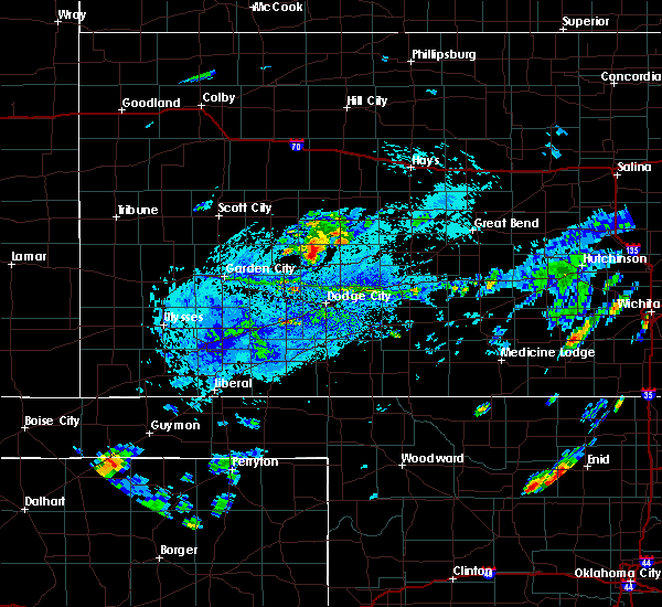 At 516 pm cdt, a severe thunderstorm was located 7 miles northwest of horsethief reservoir, or 12 miles west of jetmore, moving east at 15 mph (radar indicated). Hazards include 60 mph wind gusts and half dollar size hail. Hail damage to vehicles is expected. Expect wind damage to roofs, siding, and trees. At 516 pm cdt, a severe thunderstorm was located 7 miles northwest of horsethief reservoir, or 12 miles west of jetmore, moving east at 15 mph (radar indicated). Hazards include 60 mph wind gusts and half dollar size hail. Hail damage to vehicles is expected. Expect wind damage to roofs, siding, and trees.
|
| 8/11/2016 6:36 PM CDT |
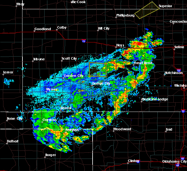 The severe thunderstorm warning for southern ness and northern hodgeman counties will expire at 645 pm cdt, the storm which prompted the warning has weakened below severe limits, and no longer pose an immediate threat to life or property. therefore, the warning will be allowed to expire. however gusty winds and heavy rain are still possible with this thunderstorm. The severe thunderstorm warning for southern ness and northern hodgeman counties will expire at 645 pm cdt, the storm which prompted the warning has weakened below severe limits, and no longer pose an immediate threat to life or property. therefore, the warning will be allowed to expire. however gusty winds and heavy rain are still possible with this thunderstorm.
|
| 8/11/2016 6:12 PM CDT |
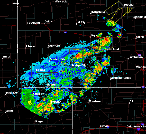 At 612 pm cdt, a severe thunderstorm was located 4 miles northeast of jetmore, moving northeast at 20 mph (radar indicated). Hazards include 60 mph wind gusts and penny size hail. Expect damage to roofs. siding. and trees. Locations impacted include, gray, jetmore, hanston and horsethief reservoir. At 612 pm cdt, a severe thunderstorm was located 4 miles northeast of jetmore, moving northeast at 20 mph (radar indicated). Hazards include 60 mph wind gusts and penny size hail. Expect damage to roofs. siding. and trees. Locations impacted include, gray, jetmore, hanston and horsethief reservoir.
|
| 8/11/2016 5:57 PM CDT | . in hodgeman county KS, 7.1 miles NE of Jetmore, KS |
| 8/11/2016 5:53 PM CDT |
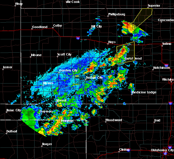 At 553 pm cdt, a severe thunderstorm was located 4 miles south of jetmore, moving northeast at 15 mph (radar indicated). Hazards include 60 mph wind gusts and quarter size hail. Hail damage to vehicles is expected. Expect wind damage to roofs, siding, and trees. At 553 pm cdt, a severe thunderstorm was located 4 miles south of jetmore, moving northeast at 15 mph (radar indicated). Hazards include 60 mph wind gusts and quarter size hail. Hail damage to vehicles is expected. Expect wind damage to roofs, siding, and trees.
|
| 7/15/2016 6:00 PM CDT |
 At 559 pm cdt, a severe thunderstorm was located 8 miles northeast of howell, moving south at 25 mph. this is a very dangerous storm (radar indicated). Hazards include 80 mph wind gusts and tennis ball size hail. Flying debris will be dangerous to those caught without shelter. mobile homes will be heavily damaged. expect considerable damage to roofs, windows, and vehicles. extensive tree damage and power outages are likely. locations impacted include, dodge city, ford, howell, ft. dodge, wright and kingsdown. Dodge city is in the path of this significant severe thunderstorm!. At 559 pm cdt, a severe thunderstorm was located 8 miles northeast of howell, moving south at 25 mph. this is a very dangerous storm (radar indicated). Hazards include 80 mph wind gusts and tennis ball size hail. Flying debris will be dangerous to those caught without shelter. mobile homes will be heavily damaged. expect considerable damage to roofs, windows, and vehicles. extensive tree damage and power outages are likely. locations impacted include, dodge city, ford, howell, ft. dodge, wright and kingsdown. Dodge city is in the path of this significant severe thunderstorm!.
|
| 7/15/2016 5:45 PM CDT |
 At 544 pm cdt, a severe thunderstorm was located 12 miles southeast of kalvesta, moving south at 25 mph (radar indicated). Hazards include tennis ball size hail and 70 mph wind gusts. People and animals outdoors will be injured. expect hail damage to roofs, siding, windows, and vehicles. expect considerable tree damage. Wind damage is also likely to mobile homes, roofs, and outbuildings. At 544 pm cdt, a severe thunderstorm was located 12 miles southeast of kalvesta, moving south at 25 mph (radar indicated). Hazards include tennis ball size hail and 70 mph wind gusts. People and animals outdoors will be injured. expect hail damage to roofs, siding, windows, and vehicles. expect considerable tree damage. Wind damage is also likely to mobile homes, roofs, and outbuildings.
|
| 7/15/2016 5:25 PM CDT |
 At 524 pm cdt, a severe thunderstorm was located 8 miles west of jetmore, moving south at 15 mph. another severe thunderstorm was located 5 miles east southeast of jetmore, also moving south at 15 mph (radar indicated). Hazards include tennis ball size hail and 70 mph wind gusts. People and animals outdoors will be injured. expect hail damage to roofs, siding, windows, and vehicles. expect considerable tree damage. Wind damage is also likely to mobile homes, roofs, and outbuildings. At 524 pm cdt, a severe thunderstorm was located 8 miles west of jetmore, moving south at 15 mph. another severe thunderstorm was located 5 miles east southeast of jetmore, also moving south at 15 mph (radar indicated). Hazards include tennis ball size hail and 70 mph wind gusts. People and animals outdoors will be injured. expect hail damage to roofs, siding, windows, and vehicles. expect considerable tree damage. Wind damage is also likely to mobile homes, roofs, and outbuildings.
|
| 7/15/2016 5:21 PM CDT | Half Dollar sized hail reported 8.7 miles E of Jetmore, KS |
| 7/15/2016 5:02 PM CDT | Half Dollar sized hail reported 4.8 miles WSW of Jetmore, KS, some stones larger |
| 7/15/2016 4:52 PM CDT |
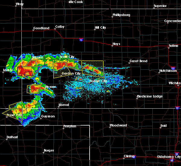 At 451 pm cdt, a severe thunderstorm was located 13 miles northeast of kalvesta, moving south at 20 mph. this is a very dangerous storm (radar indicated). Hazards include baseball size hail and 70 mph wind gusts. People and animals outdoors will be severely injured. expect shattered windows, extensive damage to roofs, siding, and vehicles. Locations impacted include, gray, jetmore and hanston. At 451 pm cdt, a severe thunderstorm was located 13 miles northeast of kalvesta, moving south at 20 mph. this is a very dangerous storm (radar indicated). Hazards include baseball size hail and 70 mph wind gusts. People and animals outdoors will be severely injured. expect shattered windows, extensive damage to roofs, siding, and vehicles. Locations impacted include, gray, jetmore and hanston.
|
| 7/15/2016 4:33 PM CDT |
 At 431 pm cdt, a severe thunderstorm was located 17 miles northwest of jetmore, and a second severe storm was located 5 miles northeast of jetmore. both were moving east-southeast at 15 mph (radar indicated). Hazards include ping pong ball size hail and 60 mph wind gusts. People and animals outdoors will be injured. expect hail damage to roofs, siding, windows, and vehicles. Expect wind damage to roofs, siding, and trees. At 431 pm cdt, a severe thunderstorm was located 17 miles northwest of jetmore, and a second severe storm was located 5 miles northeast of jetmore. both were moving east-southeast at 15 mph (radar indicated). Hazards include ping pong ball size hail and 60 mph wind gusts. People and animals outdoors will be injured. expect hail damage to roofs, siding, windows, and vehicles. Expect wind damage to roofs, siding, and trees.
|
| 7/5/2016 11:50 PM CDT | The gust was outflow from nearby thunderstorm in hodgeman county KS, 2 miles SW of Jetmore, KS |
| 7/5/2016 11:42 PM CDT |
 At 1141 pm cdt, severe thunderstorms were located along a line extending from 2 miles north of rush center to near burdett to 9 miles southeast of kalvesta, moving southeast at 55 mph. these are very dangerous storms (radar indicated). Hazards include 80 mph wind gusts and half dollar size hail. Flying debris will be dangerous to those caught without shelter. mobile homes will be heavily damaged. expect considerable damage to roofs, windows and vehicles. extensive tree damage and power outages are likely. Locations impacted include, gray, kinsley, ness city, la crosse, jetmore, spearville, bazine, bison, burdett, hanston, offerle, mccracken, garfield, rush center, rozel, timken, alexander, ash valley, brownell and bellefont. At 1141 pm cdt, severe thunderstorms were located along a line extending from 2 miles north of rush center to near burdett to 9 miles southeast of kalvesta, moving southeast at 55 mph. these are very dangerous storms (radar indicated). Hazards include 80 mph wind gusts and half dollar size hail. Flying debris will be dangerous to those caught without shelter. mobile homes will be heavily damaged. expect considerable damage to roofs, windows and vehicles. extensive tree damage and power outages are likely. Locations impacted include, gray, kinsley, ness city, la crosse, jetmore, spearville, bazine, bison, burdett, hanston, offerle, mccracken, garfield, rush center, rozel, timken, alexander, ash valley, brownell and bellefont.
|
| 7/5/2016 11:20 PM CDT |
 At 1118 pm cdt, severe thunderstorms were located along a line extending from 6 miles south of brownell to 4 miles northwest of kalvesta, moving southeast at 60 mph. these are very dangerous storms (radar indicated). Hazards include 80 mph wind gusts and half dollar size hail. Flying debris will be dangerous to those caught without shelter. mobile homes will be heavily damaged. expect considerable damage to roofs, windows and vehicles. Extensive tree damage and power outages are likely. At 1118 pm cdt, severe thunderstorms were located along a line extending from 6 miles south of brownell to 4 miles northwest of kalvesta, moving southeast at 60 mph. these are very dangerous storms (radar indicated). Hazards include 80 mph wind gusts and half dollar size hail. Flying debris will be dangerous to those caught without shelter. mobile homes will be heavily damaged. expect considerable damage to roofs, windows and vehicles. Extensive tree damage and power outages are likely.
|
| 7/2/2016 5:05 PM CDT | Golf Ball sized hail reported 15.6 miles SE of Jetmore, KS, . |
| 5/26/2016 6:40 PM CDT |
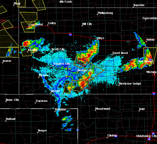 At 639 pm cdt, a severe thunderstorm capable of producing a tornado was located 4 miles southeast of jetmore, moving northeast at 25 mph (radar indicated rotation). Hazards include tornado and tennis ball size hail. Flying debris will be dangerous to those caught without shelter. mobile homes will be damaged or destroyed. damage to roofs, windows and vehicles will occur. tree damage is likely. trained spotters have reported a large rotating wall cloud. This dangerous storm will be near, hanston around 700 pm cdt. At 639 pm cdt, a severe thunderstorm capable of producing a tornado was located 4 miles southeast of jetmore, moving northeast at 25 mph (radar indicated rotation). Hazards include tornado and tennis ball size hail. Flying debris will be dangerous to those caught without shelter. mobile homes will be damaged or destroyed. damage to roofs, windows and vehicles will occur. tree damage is likely. trained spotters have reported a large rotating wall cloud. This dangerous storm will be near, hanston around 700 pm cdt.
|
| 5/26/2016 6:31 PM CDT |
 At 630 pm cdt, a severe thunderstorm capable of producing a tornado was located 5 miles south of jetmore, moving northeast at 30 mph (radar indicated rotation). Hazards include tornado and tennis ball size hail. Flying debris will be dangerous to those caught without shelter. mobile homes will be damaged or destroyed. damage to roofs, windows and vehicles will occur. tree damage is likely. trained spotters have reported a large wall cloud. this dangerous storm will be near, jetmore around 640 pm cdt. Hanston around 655 pm cdt. At 630 pm cdt, a severe thunderstorm capable of producing a tornado was located 5 miles south of jetmore, moving northeast at 30 mph (radar indicated rotation). Hazards include tornado and tennis ball size hail. Flying debris will be dangerous to those caught without shelter. mobile homes will be damaged or destroyed. damage to roofs, windows and vehicles will occur. tree damage is likely. trained spotters have reported a large wall cloud. this dangerous storm will be near, jetmore around 640 pm cdt. Hanston around 655 pm cdt.
|
| 5/26/2016 6:30 PM CDT | Quarter sized hail reported 2 miles SW of Jetmore, KS |
| 5/26/2016 6:24 PM CDT |
 At 624 pm cdt, a severe thunderstorm was located near jetmore, moving northeast at 25 mph (radar indicated). Hazards include ping pong ball size hail and 60 mph wind gusts. People and animals outdoors will be injured. expect hail damage to roofs, siding, windows and vehicles. expect wind damage to roofs, siding and trees. locations impacted include, jetmore. A tornado watch remains in effect until 1000 pm cdt for southwestern kansas. At 624 pm cdt, a severe thunderstorm was located near jetmore, moving northeast at 25 mph (radar indicated). Hazards include ping pong ball size hail and 60 mph wind gusts. People and animals outdoors will be injured. expect hail damage to roofs, siding, windows and vehicles. expect wind damage to roofs, siding and trees. locations impacted include, jetmore. A tornado watch remains in effect until 1000 pm cdt for southwestern kansas.
|
| 5/26/2016 6:21 PM CDT |
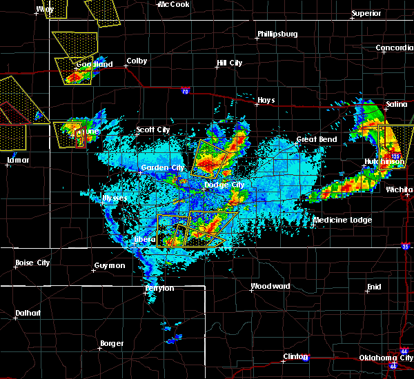 At 620 pm cdt, a severe thunderstorm was located west of jetmore, moving northeast at 25 mph (radar indicated). Hazards include ping pong ball size hail and 60 mph wind gusts. People and animals outdoors will be injured. expect hail damage to roofs, siding, windows and vehicles. expect wind damage to roofs, siding and trees. locations impacted include, jetmore. A tornado watch remains in effect until 1000 pm cdt for southwestern kansas. At 620 pm cdt, a severe thunderstorm was located west of jetmore, moving northeast at 25 mph (radar indicated). Hazards include ping pong ball size hail and 60 mph wind gusts. People and animals outdoors will be injured. expect hail damage to roofs, siding, windows and vehicles. expect wind damage to roofs, siding and trees. locations impacted include, jetmore. A tornado watch remains in effect until 1000 pm cdt for southwestern kansas.
|
| 5/26/2016 6:17 PM CDT |
 At 617 pm cdt, a severe thunderstorm was located 3 miles west of jetmore, moving northeast at 25 mph (radar indicated). Hazards include 60 mph wind gusts and quarter size hail. Hail damage to vehicles is expected. expect wind damage to roofs, siding and trees. locations impacted include, jetmore. A tornado watch remains in effect until 1000 pm cdt for southwestern kansas. At 617 pm cdt, a severe thunderstorm was located 3 miles west of jetmore, moving northeast at 25 mph (radar indicated). Hazards include 60 mph wind gusts and quarter size hail. Hail damage to vehicles is expected. expect wind damage to roofs, siding and trees. locations impacted include, jetmore. A tornado watch remains in effect until 1000 pm cdt for southwestern kansas.
|
| 5/26/2016 6:12 PM CDT |
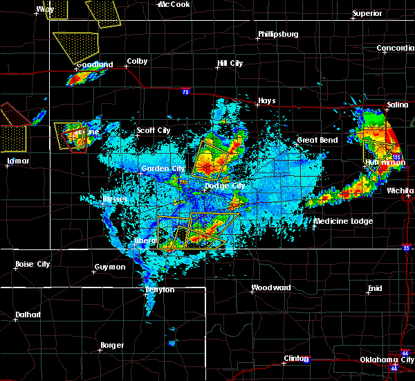 At 612 pm cdt, a severe thunderstorm was located 4 miles west of jetmore, moving northeast at 25 mph (radar indicated). Hazards include 60 mph wind gusts and quarter size hail. Hail damage to vehicles is expected. Expect wind damage to roofs, siding and trees. At 612 pm cdt, a severe thunderstorm was located 4 miles west of jetmore, moving northeast at 25 mph (radar indicated). Hazards include 60 mph wind gusts and quarter size hail. Hail damage to vehicles is expected. Expect wind damage to roofs, siding and trees.
|
| 5/26/2016 6:03 PM CDT |
 At 602 pm cdt, a severe thunderstorm was located 5 miles west of jetmore, moving northeast at 25 mph (radar indicated). Hazards include 60 mph wind gusts and quarter size hail. Hail damage to vehicles is expected. expect wind damage to roofs, siding and trees. this severe thunderstorm will remain over mainly rural areas of north central ford and southwestern hodgeman counties. A tornado watch remains in effect until 1000 pm cdt for southwestern kansas. At 602 pm cdt, a severe thunderstorm was located 5 miles west of jetmore, moving northeast at 25 mph (radar indicated). Hazards include 60 mph wind gusts and quarter size hail. Hail damage to vehicles is expected. expect wind damage to roofs, siding and trees. this severe thunderstorm will remain over mainly rural areas of north central ford and southwestern hodgeman counties. A tornado watch remains in effect until 1000 pm cdt for southwestern kansas.
|
| 5/26/2016 5:51 PM CDT |
 At 550 pm cdt, a severe thunderstorm was located 7 miles southwest of jetmore, moving northeast at 25 mph (radar indicated). Hazards include 60 mph wind gusts and quarter size hail. Hail damage to vehicles is expected. expect wind damage to roofs, siding and trees. this severe thunderstorm will remain over mainly rural areas of north central ford and southwestern hodgeman counties. A tornado watch remains in effect until 1000 pm cdt for southwestern kansas. At 550 pm cdt, a severe thunderstorm was located 7 miles southwest of jetmore, moving northeast at 25 mph (radar indicated). Hazards include 60 mph wind gusts and quarter size hail. Hail damage to vehicles is expected. expect wind damage to roofs, siding and trees. this severe thunderstorm will remain over mainly rural areas of north central ford and southwestern hodgeman counties. A tornado watch remains in effect until 1000 pm cdt for southwestern kansas.
|
| 5/26/2016 5:39 PM CDT |
 At 539 pm cdt, a severe thunderstorm was located 11 miles southwest of jetmore, moving northeast at 25 mph (radar indicated). Hazards include 60 mph wind gusts and quarter size hail. Hail damage to vehicles is expected. expect wind damage to roofs, siding and trees. this severe thunderstorm will remain over mainly rural areas of north central ford and southwestern hodgeman counties. A tornado watch remains in effect until 1000 pm cdt for southwestern kansas. At 539 pm cdt, a severe thunderstorm was located 11 miles southwest of jetmore, moving northeast at 25 mph (radar indicated). Hazards include 60 mph wind gusts and quarter size hail. Hail damage to vehicles is expected. expect wind damage to roofs, siding and trees. this severe thunderstorm will remain over mainly rural areas of north central ford and southwestern hodgeman counties. A tornado watch remains in effect until 1000 pm cdt for southwestern kansas.
|
| 5/26/2016 5:26 PM CDT |
 At 526 pm cdt, a severe thunderstorm was located 9 miles northeast of howell, moving northeast at 25 mph (radar indicated). Hazards include quarter size hail. Damage to vehicles is expected. this severe thunderstorm will remain over mainly rural areas of northwestern ford and southwestern hodgeman counties. A tornado watch remains in effect until 1000 pm cdt for southwestern kansas. At 526 pm cdt, a severe thunderstorm was located 9 miles northeast of howell, moving northeast at 25 mph (radar indicated). Hazards include quarter size hail. Damage to vehicles is expected. this severe thunderstorm will remain over mainly rural areas of northwestern ford and southwestern hodgeman counties. A tornado watch remains in effect until 1000 pm cdt for southwestern kansas.
|
| 5/24/2016 8:04 PM CDT |
 A severe thunderstorm warning remains in effect until 830 pm cdt for northwestern hodgeman county. at 804 pm cdt. a severe thunderstorm was located 5 miles west of jetmore. moving north at 20 mph. this is a very dangerous storm. hazard. 80 mph wind gusts and golf ball size hail. A severe thunderstorm warning remains in effect until 830 pm cdt for northwestern hodgeman county. at 804 pm cdt. a severe thunderstorm was located 5 miles west of jetmore. moving north at 20 mph. this is a very dangerous storm. hazard. 80 mph wind gusts and golf ball size hail.
|
| 5/24/2016 7:19 PM CDT | The national weather service in dodge city has issued a * tornado warning for. north central ford county in southwestern kansas. southwestern hodgeman county in southwestern kansas. until 745 pm cdt * at 719 pm cdt. A severe thunderstorm capable of producing a. |
| 5/24/2016 6:09 PM CDT | Golf Ball sized hail reported 14.1 miles ENE of Jetmore, KS |
| 5/24/2016 6:05 PM CDT |
 At 604 pm cdt, a severe thunderstorm capable of producing a tornado was located 6 miles southeast of kalvesta, moving northeast at 20 mph (radar indicated rotation). Hazards include tornado and hail up to two inches in diameter. Flying debris will be dangerous to those caught without shelter. mobile homes will be damaged or destroyed. damage to roofs, windows and vehicles will occur. tree damage is likely. This tornadic thunderstorm will remain over mainly rural areas of eastern finney, south central ness and hodgeman counties. At 604 pm cdt, a severe thunderstorm capable of producing a tornado was located 6 miles southeast of kalvesta, moving northeast at 20 mph (radar indicated rotation). Hazards include tornado and hail up to two inches in diameter. Flying debris will be dangerous to those caught without shelter. mobile homes will be damaged or destroyed. damage to roofs, windows and vehicles will occur. tree damage is likely. This tornadic thunderstorm will remain over mainly rural areas of eastern finney, south central ness and hodgeman counties.
|
| 11/16/2015 10:06 PM CST |
 At 1006 pm cst, a severe thunderstorm was located 8 miles north of burdett, moving northeast at 65 mph (radar indicated). Hazards include 70 mph wind gusts and quarter size hail. Hail damage to vehicles is expected. expect considerable tree damage. wind damage is also likely to mobile homes, roofs and outbuildings. locations impacted include, gray, la crosse, jetmore, spearville, bazine, burdett, hanston, mccracken, garfield, rush center, rozel, alexander, ash valley, sanford, frizell, nekoma, hargrave and bellefont. A tornado watch remains in effect until 300 am cst for southwestern kansas. At 1006 pm cst, a severe thunderstorm was located 8 miles north of burdett, moving northeast at 65 mph (radar indicated). Hazards include 70 mph wind gusts and quarter size hail. Hail damage to vehicles is expected. expect considerable tree damage. wind damage is also likely to mobile homes, roofs and outbuildings. locations impacted include, gray, la crosse, jetmore, spearville, bazine, burdett, hanston, mccracken, garfield, rush center, rozel, alexander, ash valley, sanford, frizell, nekoma, hargrave and bellefont. A tornado watch remains in effect until 300 am cst for southwestern kansas.
|
| 11/16/2015 9:50 PM CST |
 At 949 pm cst, a severe thunderstorm was located 4 miles east of jetmore, moving northeast at 60 mph (radar indicated). Hazards include 70 mph wind gusts and quarter size hail. Hail damage to vehicles is expected. expect considerable tree damage. Wind damage is also likely to mobile homes, roofs and outbuildings. At 949 pm cst, a severe thunderstorm was located 4 miles east of jetmore, moving northeast at 60 mph (radar indicated). Hazards include 70 mph wind gusts and quarter size hail. Hail damage to vehicles is expected. expect considerable tree damage. Wind damage is also likely to mobile homes, roofs and outbuildings.
|
| 11/16/2015 9:45 PM CST |
 At 945 pm cst, a severe thunderstorm was located 8 miles southeast of jetmore, moving northeast at 60 mph (radar indicated). Hazards include 60 mph wind gusts and penny size hail. Expect damage to roofs. siding and trees. locations impacted include, jetmore, spearville and hanston. A tornado watch remains in effect until 300 am cst for southwestern kansas. At 945 pm cst, a severe thunderstorm was located 8 miles southeast of jetmore, moving northeast at 60 mph (radar indicated). Hazards include 60 mph wind gusts and penny size hail. Expect damage to roofs. siding and trees. locations impacted include, jetmore, spearville and hanston. A tornado watch remains in effect until 300 am cst for southwestern kansas.
|
| 11/16/2015 9:36 PM CST |
 At 934 pm cst, severe thunderstorms were located along a line extending from 7 miles west of jetmore to 6 miles north of bloom, moving northeast at 60 mph (radar indicated. at 930 pm, a wind gusts at 62 mph was recorded at the national weather service office on the eastern extremity of dodge city). Hazards include 60 mph wind gusts and penny size hail. Expect damage to roofs. siding and trees. locations impacted include, dodge city, jetmore, spearville, ford, hanston, bellefont, wright, ft. dodge and windhorst. A tornado watch remains in effect until 300 am cst for southwestern kansas. At 934 pm cst, severe thunderstorms were located along a line extending from 7 miles west of jetmore to 6 miles north of bloom, moving northeast at 60 mph (radar indicated. at 930 pm, a wind gusts at 62 mph was recorded at the national weather service office on the eastern extremity of dodge city). Hazards include 60 mph wind gusts and penny size hail. Expect damage to roofs. siding and trees. locations impacted include, dodge city, jetmore, spearville, ford, hanston, bellefont, wright, ft. dodge and windhorst. A tornado watch remains in effect until 300 am cst for southwestern kansas.
|
| 11/16/2015 9:24 PM CST |
 At 924 pm cst, severe thunderstorms were located along a line extending from 9 miles southeast of kalvesta to 5 miles northwest of minneola, moving northeast at 45 mph (radar indicated). Hazards include 60 mph wind gusts and penny size hail. Expect damage to roofs. Siding and trees. At 924 pm cst, severe thunderstorms were located along a line extending from 9 miles southeast of kalvesta to 5 miles northwest of minneola, moving northeast at 45 mph (radar indicated). Hazards include 60 mph wind gusts and penny size hail. Expect damage to roofs. Siding and trees.
|
| 11/16/2015 7:54 PM CST |
 At 754 pm cst, a severe thunderstorm capable of producing a tornado was located 4 miles northwest of jetmore, moving north at 40 mph (radar indicated rotation). Hazards include tornado. Flying debris will be dangerous to those caught without shelter. mobile homes will be damaged or destroyed. damage to roofs, windows and vehicles will occur. tree damage is likely. This tornadic thunderstorm will remain over mainly rural areas of southeastern ness and northwestern hodgeman counties. At 754 pm cst, a severe thunderstorm capable of producing a tornado was located 4 miles northwest of jetmore, moving north at 40 mph (radar indicated rotation). Hazards include tornado. Flying debris will be dangerous to those caught without shelter. mobile homes will be damaged or destroyed. damage to roofs, windows and vehicles will occur. tree damage is likely. This tornadic thunderstorm will remain over mainly rural areas of southeastern ness and northwestern hodgeman counties.
|
| 11/16/2015 7:44 PM CST |
 At 744 pm cst, a severe thunderstorm capable of producing a tornado was located 6 miles southwest of jetmore, moving north at 30 mph (radar indicated rotation). Hazards include tornado and quarter size hail. Flying debris will be dangerous to those caught without shelter. mobile homes will be damaged or destroyed. damage to roofs, windows and vehicles will occur. tree damage is likely. This tornadic thunderstorm will remain over mainly rural areas of southwestern hodgeman county. At 744 pm cst, a severe thunderstorm capable of producing a tornado was located 6 miles southwest of jetmore, moving north at 30 mph (radar indicated rotation). Hazards include tornado and quarter size hail. Flying debris will be dangerous to those caught without shelter. mobile homes will be damaged or destroyed. damage to roofs, windows and vehicles will occur. tree damage is likely. This tornadic thunderstorm will remain over mainly rural areas of southwestern hodgeman county.
|
| 11/16/2015 7:37 PM CST |
 At 736 pm cst, a severe thunderstorm capable of producing a tornado was located 9 miles southwest of jetmore, moving northeast at 40 mph (radar indicated rotation). Hazards include tornado and quarter size hail. Flying debris will be dangerous to those caught without shelter. mobile homes will be damaged or destroyed. damage to roofs, windows and vehicles will occur. tree damage is likely. This tornadic thunderstorm will remain over mainly rural areas of southwestern hodgeman county. At 736 pm cst, a severe thunderstorm capable of producing a tornado was located 9 miles southwest of jetmore, moving northeast at 40 mph (radar indicated rotation). Hazards include tornado and quarter size hail. Flying debris will be dangerous to those caught without shelter. mobile homes will be damaged or destroyed. damage to roofs, windows and vehicles will occur. tree damage is likely. This tornadic thunderstorm will remain over mainly rural areas of southwestern hodgeman county.
|
| 11/16/2015 7:15 PM CST |
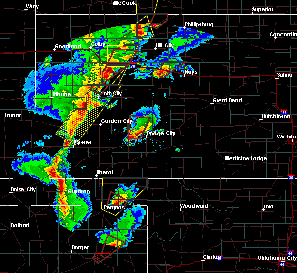 At 714 pm cst, a large and extremely dangerous tornado was located very near howell, moving north at 35 mph. this is a particularly dangerous situation (radar indicated rotation). Hazards include damaging tornado. Flying debris will be dangerous to those caught without shelter. mobile homes will be damaged or destroyed. damage to roofs, windows and vehicles will occur. tree damage is likely. The tornado will be near, kalvesta around 740 pm cst. At 714 pm cst, a large and extremely dangerous tornado was located very near howell, moving north at 35 mph. this is a particularly dangerous situation (radar indicated rotation). Hazards include damaging tornado. Flying debris will be dangerous to those caught without shelter. mobile homes will be damaged or destroyed. damage to roofs, windows and vehicles will occur. tree damage is likely. The tornado will be near, kalvesta around 740 pm cst.
|
| 10/20/2015 5:02 PM CDT |
 At 500 pm cdt, severe thunderstorms were located along a line extending from 3 miles northeast of garden city to 6 miles south of kalvesta to 6 miles northwest of dodge city, moving northeast at 35 mph. strong outflow winds in excess of 60 mph have been observed ahead of this storm (radar indicated). Hazards include 60 mph wind gusts. Expect damage to roofs. Siding and trees. At 500 pm cdt, severe thunderstorms were located along a line extending from 3 miles northeast of garden city to 6 miles south of kalvesta to 6 miles northwest of dodge city, moving northeast at 35 mph. strong outflow winds in excess of 60 mph have been observed ahead of this storm (radar indicated). Hazards include 60 mph wind gusts. Expect damage to roofs. Siding and trees.
|
| 9/10/2015 9:07 PM CDT |
 At 907 pm cdt, a severe thunderstorm was located very near spearville, moving south at 20 mph (radar indicated). Hazards include 60 mph wind gusts and quarter size hail. Hail damage to vehicles is expected. expect wind damage to roofs, siding and trees. Locations impacted include, gray, jetmore, spearville, hanston, offerle and bellefont. At 907 pm cdt, a severe thunderstorm was located very near spearville, moving south at 20 mph (radar indicated). Hazards include 60 mph wind gusts and quarter size hail. Hail damage to vehicles is expected. expect wind damage to roofs, siding and trees. Locations impacted include, gray, jetmore, spearville, hanston, offerle and bellefont.
|
| 9/10/2015 8:27 PM CDT |
 At 827 pm cdt, a severe thunderstorm was located 5 miles southeast of jetmore, moving southeast at 20 mph (radar indicated). Hazards include 60 mph wind gusts and quarter size hail. Hail damage to vehicles is expected. expect wind damage to roofs, siding and trees. Locations impacted include, gray, jetmore, spearville, hanston, offerle and bellefont. At 827 pm cdt, a severe thunderstorm was located 5 miles southeast of jetmore, moving southeast at 20 mph (radar indicated). Hazards include 60 mph wind gusts and quarter size hail. Hail damage to vehicles is expected. expect wind damage to roofs, siding and trees. Locations impacted include, gray, jetmore, spearville, hanston, offerle and bellefont.
|
| 9/10/2015 8:15 PM CDT | Quarter sized hail reported 5.4 miles SSE of Jetmore, KS |
| 9/10/2015 8:15 PM CDT |
 At 815 pm cdt, a severe thunderstorm was located near jetmore, moving southeast at 20 mph (radar indicated). Hazards include 60 mph wind gusts and quarter size hail. Hail damage to vehicles is expected. Expect wind damage to roofs, siding and trees. At 815 pm cdt, a severe thunderstorm was located near jetmore, moving southeast at 20 mph (radar indicated). Hazards include 60 mph wind gusts and quarter size hail. Hail damage to vehicles is expected. Expect wind damage to roofs, siding and trees.
|
| 9/10/2015 7:30 PM CDT |
 At 730 pm cdt, a severe thunderstorm was located 12 miles north of jetmore, moving southeast at 30 mph (radar indicated). Hazards include 70 mph wind gusts and quarter size hail. Hail damage to vehicles is expected. expect considerable tree damage. Wind damage is also likely to mobile homes, roofs and outbuildings. At 730 pm cdt, a severe thunderstorm was located 12 miles north of jetmore, moving southeast at 30 mph (radar indicated). Hazards include 70 mph wind gusts and quarter size hail. Hail damage to vehicles is expected. expect considerable tree damage. Wind damage is also likely to mobile homes, roofs and outbuildings.
|
| 7/26/2015 11:24 PM CDT |
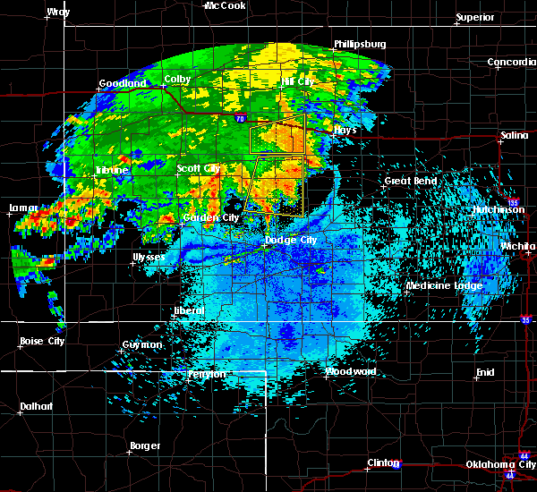 The severe thunderstorm warning for northern hodgeman and ness counties will expire at 1130 pm cdt, the storm which prompted the warning has weakened below severe limits, and no longer pose an immediate threat to life or property. therefore the warning will be allowed to expire. however gusty winds and heavy rain are still possible with this thunderstorm. The severe thunderstorm warning for northern hodgeman and ness counties will expire at 1130 pm cdt, the storm which prompted the warning has weakened below severe limits, and no longer pose an immediate threat to life or property. therefore the warning will be allowed to expire. however gusty winds and heavy rain are still possible with this thunderstorm.
|
| 7/26/2015 11:08 PM CDT |
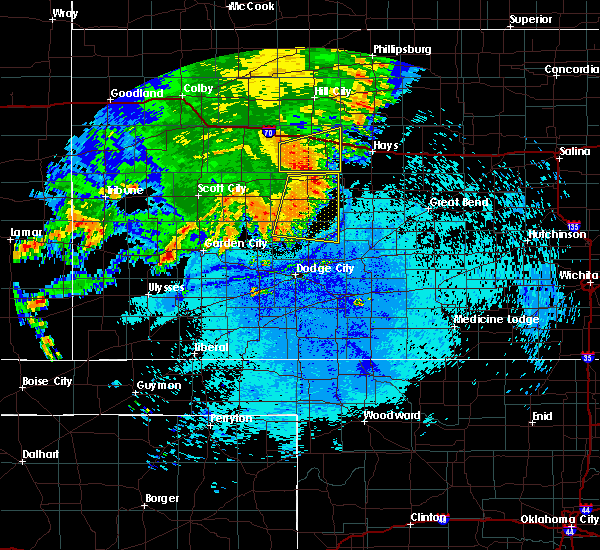 At 1107 pm cdt, a severe thunderstorm was located 3 miles northeast of brownell, moving northeast at 75 mph (radar indicated). Hazards include 60 mph wind gusts and nickel size hail. Expect damage to roofs. siding and trees. Locations impacted include, gray, ness city, jetmore, bazine, ransom, hanston, brownell and arnold. At 1107 pm cdt, a severe thunderstorm was located 3 miles northeast of brownell, moving northeast at 75 mph (radar indicated). Hazards include 60 mph wind gusts and nickel size hail. Expect damage to roofs. siding and trees. Locations impacted include, gray, ness city, jetmore, bazine, ransom, hanston, brownell and arnold.
|
| 7/26/2015 10:41 PM CDT |
 At 1041 pm cdt, severe thunderstorms were located along a line extending from 2 miles west of ransom to 10 miles northeast of kalvesta, moving east at 30 mph (radar indicated). Hazards include 70 mph wind gusts and penny size hail. Expect considerable tree damage. damage is likely to mobile homes, roofs and outbuildings. Locations impacted include, gray, ness city, dighton, jetmore, bazine, ransom, hanston, utica, alamota, brownell, arnold, beeler, shields and pendennis. At 1041 pm cdt, severe thunderstorms were located along a line extending from 2 miles west of ransom to 10 miles northeast of kalvesta, moving east at 30 mph (radar indicated). Hazards include 70 mph wind gusts and penny size hail. Expect considerable tree damage. damage is likely to mobile homes, roofs and outbuildings. Locations impacted include, gray, ness city, dighton, jetmore, bazine, ransom, hanston, utica, alamota, brownell, arnold, beeler, shields and pendennis.
|
| 7/26/2015 10:16 PM CDT |
 At 1015 pm cdt, a severe thunderstorm was located 5 miles southwest of alamota, moving east at 40 mph (radar indicated). Hazards include 70 mph wind gusts and nickel size hail. Expect considerable tree damage. Damage is likely to mobile homes, roofs and outbuildings. At 1015 pm cdt, a severe thunderstorm was located 5 miles southwest of alamota, moving east at 40 mph (radar indicated). Hazards include 70 mph wind gusts and nickel size hail. Expect considerable tree damage. Damage is likely to mobile homes, roofs and outbuildings.
|
| 7/19/2015 11:06 PM CDT |
 The severe thunderstorm warning for hodgeman and ford counties will expire at 1115 pm cdt, the line of storms which prompted the warning have weakened below severe limits, and no longer pose an immediate threat to life or property. therefore the warning will be allowed to expire. The severe thunderstorm warning for hodgeman and ford counties will expire at 1115 pm cdt, the line of storms which prompted the warning have weakened below severe limits, and no longer pose an immediate threat to life or property. therefore the warning will be allowed to expire.
|
| 7/19/2015 10:14 PM CDT |
 At 1013 pm cdt, the leading front of severe thunderstorms was located along a line extending from 11 miles north of jetmore to near fowler, moving east at 45 mph (radar indicated). Hazards include 60 mph wind gusts. Expect damage to roofs. Siding and trees. At 1013 pm cdt, the leading front of severe thunderstorms was located along a line extending from 11 miles north of jetmore to near fowler, moving east at 45 mph (radar indicated). Hazards include 60 mph wind gusts. Expect damage to roofs. Siding and trees.
|
| 7/17/2015 5:06 PM CDT |
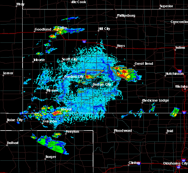 At 505 pm cdt, a severe thunderstorm was located 10 miles east of kalvesta, moving northeast at 30 mph (radar indicated). Hazards include 70 mph wind gusts and quarter size hail. Hail damage to vehicles is expected. expect considerable tree damage. wind damage is also likely to mobile homes, roofs and outbuildings. Locations impacted include, jetmore. At 505 pm cdt, a severe thunderstorm was located 10 miles east of kalvesta, moving northeast at 30 mph (radar indicated). Hazards include 70 mph wind gusts and quarter size hail. Hail damage to vehicles is expected. expect considerable tree damage. wind damage is also likely to mobile homes, roofs and outbuildings. Locations impacted include, jetmore.
|
| 7/17/2015 4:56 PM CDT |
 At 455 pm cdt, a severe thunderstorm was located 6 miles southeast of kalvesta, moving northeast at 30 mph (radar indicated). Hazards include 70 mph wind gusts and half dollar size hail. Hail damage to vehicles is expected. expect considerable tree damage. Wind damage is also likely to mobile homes, roofs and outbuildings. At 455 pm cdt, a severe thunderstorm was located 6 miles southeast of kalvesta, moving northeast at 30 mph (radar indicated). Hazards include 70 mph wind gusts and half dollar size hail. Hail damage to vehicles is expected. expect considerable tree damage. Wind damage is also likely to mobile homes, roofs and outbuildings.
|
| 7/15/2015 9:07 PM CDT |
 At 907 pm cdt, severe thunderstorms were located along a line extending from 7 miles northeast of charleston to 10 miles northeast of cimarron to 5 miles southeast of howell, moving northeast at 35 mph (radar indicated). Hazards include 60 mph wind gusts and nickel size hail. Expect damage to roofs. Siding and trees. At 907 pm cdt, severe thunderstorms were located along a line extending from 7 miles northeast of charleston to 10 miles northeast of cimarron to 5 miles southeast of howell, moving northeast at 35 mph (radar indicated). Hazards include 60 mph wind gusts and nickel size hail. Expect damage to roofs. Siding and trees.
|
| 7/14/2015 1:34 AM CDT |
 At 134 am cdt, a severe thunderstorm was located 9 miles south of jetmore, moving east at 30 mph (radar indicated). Hazards include 60 mph wind gusts. Expect damage to roofs. siding and trees. Locations impacted include, dodge city, jetmore, spearville, bellefont and wright. At 134 am cdt, a severe thunderstorm was located 9 miles south of jetmore, moving east at 30 mph (radar indicated). Hazards include 60 mph wind gusts. Expect damage to roofs. siding and trees. Locations impacted include, dodge city, jetmore, spearville, bellefont and wright.
|
| 7/14/2015 1:16 AM CDT |
 At 116 am cdt, a severe thunderstorm was located 11 miles southeast of kalvesta, moving east at 25 mph (radar indicated). Hazards include 70 mph wind gusts. Expect considerable tree damage. Damage is likely to mobile homes, roofs and outbuildings. At 116 am cdt, a severe thunderstorm was located 11 miles southeast of kalvesta, moving east at 25 mph (radar indicated). Hazards include 70 mph wind gusts. Expect considerable tree damage. Damage is likely to mobile homes, roofs and outbuildings.
|
| 7/13/2015 11:58 PM CDT |
 At 1156 pm cdt, a severe thunderstorm was located 7 miles south of jetmore, moving east at 30 mph (trained weather spotters. at 1148 pm cdt a 60 mph thunderstorm wind gust was reported in jetmore). Hazards include 60 mph wind gusts. Expect damage to roofs. siding and trees. Locations impacted include, gray, jetmore, spearville, hanston and wright. At 1156 pm cdt, a severe thunderstorm was located 7 miles south of jetmore, moving east at 30 mph (trained weather spotters. at 1148 pm cdt a 60 mph thunderstorm wind gust was reported in jetmore). Hazards include 60 mph wind gusts. Expect damage to roofs. siding and trees. Locations impacted include, gray, jetmore, spearville, hanston and wright.
|
| 7/13/2015 11:48 PM CDT | Storm damage reported in hodgeman county KS, 1.7 miles SSW of Jetmore, KS |
| 7/13/2015 11:40 PM CDT |
 At 1140 pm cdt, a severe thunderstorm was located 10 miles south of jetmore, moving east at 30 mph (radar indicated). Hazards include 70 mph wind gusts and quarter size hail. Hail damage to vehicles is expected. expect considerable tree damage. wind damage is also likely to mobile homes, roofs and outbuildings. Locations impacted include, dodge city, gray, jetmore, spearville, hanston and wright. At 1140 pm cdt, a severe thunderstorm was located 10 miles south of jetmore, moving east at 30 mph (radar indicated). Hazards include 70 mph wind gusts and quarter size hail. Hail damage to vehicles is expected. expect considerable tree damage. wind damage is also likely to mobile homes, roofs and outbuildings. Locations impacted include, dodge city, gray, jetmore, spearville, hanston and wright.
|
| 7/13/2015 11:18 PM CDT |
 At 1117 pm cdt, a severe thunderstorm was located 11 miles southeast of kalvesta, moving east at 30 mph (radar indicated). Hazards include 70 mph wind gusts and quarter size hail. Hail damage to vehicles is expected. expect considerable tree damage. Wind damage is also likely to mobile homes, roofs and outbuildings. At 1117 pm cdt, a severe thunderstorm was located 11 miles southeast of kalvesta, moving east at 30 mph (radar indicated). Hazards include 70 mph wind gusts and quarter size hail. Hail damage to vehicles is expected. expect considerable tree damage. Wind damage is also likely to mobile homes, roofs and outbuildings.
|
| 7/13/2015 8:00 PM CDT |
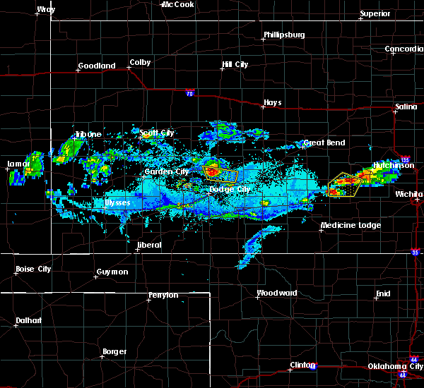 At 759 pm cdt, a severe thunderstorm was located 4 miles south of jetmore, moving east at 10 mph (radar indicated). Hazards include 60 mph wind gusts and penny size hail. Expect damage to roofs. siding and trees. Locations impacted include, jetmore. At 759 pm cdt, a severe thunderstorm was located 4 miles south of jetmore, moving east at 10 mph (radar indicated). Hazards include 60 mph wind gusts and penny size hail. Expect damage to roofs. siding and trees. Locations impacted include, jetmore.
|
| 7/13/2015 7:49 PM CDT |
 At 748 pm cdt, a severe thunderstorm was located 7 miles south of jetmore, moving east at 35 mph (radar indicated). Hazards include golf ball size hail and 70 mph wind gusts. People and animals outdoors will be injured. expect hail damage to roofs, siding, windows and vehicles. expect considerable tree damage. wind damage is also likely to mobile homes, roofs and outbuildings. Locations impacted include, jetmore. At 748 pm cdt, a severe thunderstorm was located 7 miles south of jetmore, moving east at 35 mph (radar indicated). Hazards include golf ball size hail and 70 mph wind gusts. People and animals outdoors will be injured. expect hail damage to roofs, siding, windows and vehicles. expect considerable tree damage. wind damage is also likely to mobile homes, roofs and outbuildings. Locations impacted include, jetmore.
|
| 7/13/2015 7:37 PM CDT | Report is from kwch storm chase in hodgeman county KS, 8.1 miles E of Jetmore, KS |
| 7/13/2015 7:25 PM CDT | Half Dollar sized hail reported 15.3 miles E of Jetmore, KS |
| 7/13/2015 7:25 PM CDT | Wind gusts were estimated at 60-70 mp in hodgeman county KS, 15.3 miles E of Jetmore, KS |
| 7/13/2015 7:22 PM CDT |
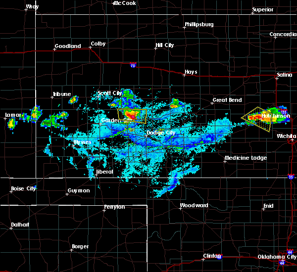 At 721 pm cdt, a severe thunderstorm was located 8 miles southwest of jetmore, moving southeast at 35 mph. this is a very dangerous storm (radar indicated). Hazards include 80 mph wind gusts and baseball size hail. Flying debris will be dangerous to those caught without shelter. mobile homes will be heavily damaged. expect considerable damage to roofs, windows and vehicles. Extensive tree damage and power outages are likely. At 721 pm cdt, a severe thunderstorm was located 8 miles southwest of jetmore, moving southeast at 35 mph. this is a very dangerous storm (radar indicated). Hazards include 80 mph wind gusts and baseball size hail. Flying debris will be dangerous to those caught without shelter. mobile homes will be heavily damaged. expect considerable damage to roofs, windows and vehicles. Extensive tree damage and power outages are likely.
|
| 6/25/2015 6:04 PM CDT |
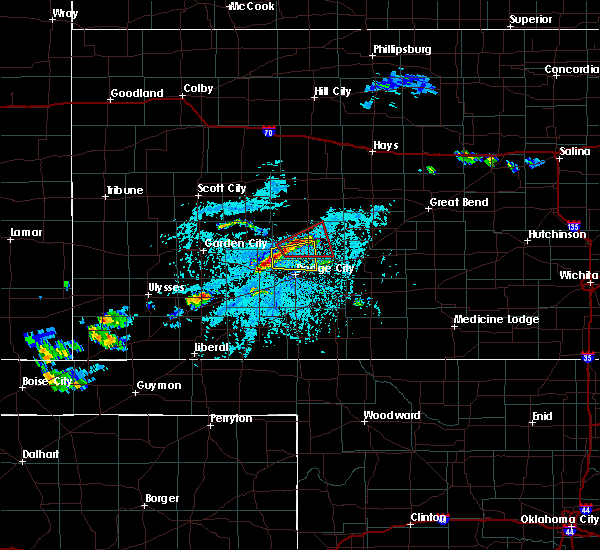 At 604 pm cdt, a severe thunderstorm was located 9 miles north of howell, moving east at 10 mph (radar indicated). Hazards include 60 mph wind gusts and quarter size hail. Hail damage to vehicles is expected. expect wind damage to roofs, siding and trees. This severe thunderstorm will remain over mainly rural areas of southwestern hodgeman and northwestern ford counties. At 604 pm cdt, a severe thunderstorm was located 9 miles north of howell, moving east at 10 mph (radar indicated). Hazards include 60 mph wind gusts and quarter size hail. Hail damage to vehicles is expected. expect wind damage to roofs, siding and trees. This severe thunderstorm will remain over mainly rural areas of southwestern hodgeman and northwestern ford counties.
|
| 6/25/2015 6:01 PM CDT |
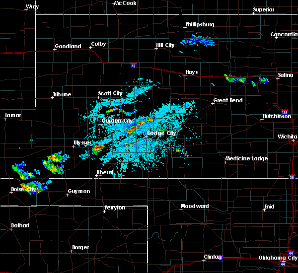 At 600 pm cdt, a confirmed landspout tornado was located 12 miles southwest of jetmore, moving east at 25 mph (public confirmed tornado). Hazards include tornado. Expect damage to mobile homes. roofs and vehicles. The tornado will be near, jetmore around 615 pm cdt. At 600 pm cdt, a confirmed landspout tornado was located 12 miles southwest of jetmore, moving east at 25 mph (public confirmed tornado). Hazards include tornado. Expect damage to mobile homes. roofs and vehicles. The tornado will be near, jetmore around 615 pm cdt.
|
| 6/3/2015 9:13 PM CDT | At 913 pm cdt, a severe thunderstorm was located 6 miles northwest of bellefont, moving south at 10 mph (radar indicated). Hazards include golf ball size hail and 60 mph wind gusts. People and animals outdoors will be injured. expect hail damage to roofs, siding, windows and vehicles. Expect wind damage to roofs, siding and trees. |
| 6/3/2015 8:11 PM CDT | At 809 pm cdt, a severe thunderstorm was located near hanston, moving southwest at 10 mph. this is a very dangerous storm (radar indicated). Hazards include baseball size hail and 60 mph wind gusts. People and animals outdoors will be severely injured. Expect shattered windows, extensive damage to roofs, siding and vehicles. |
| 5/28/2015 6:52 PM CDT | The severe thunderstorm warning for hodgeman, ness, northeastern finney and eastern lane counties will expire at 700 pm cdt, the storm which prompted the warning has weakened below severe limits, and no longer pose an immediate threat to life or property. therefore the warning will be allowed to expire. however gusty winds and heavy rain are still possible with this thunderstorm. |
| 5/28/2015 6:24 PM CDT | At 624 pm cdt, a severe thunderstorm was located 9 miles southwest of ness city, moving east at 45 mph (radar indicated). Hazards include 60 mph wind gusts and quarter size hail. Hail damage to vehicles is expected. expect wind damage to roofs, siding and trees. Locations impacted include, gray, ness city, dighton, jetmore, bazine, ransom, hanston, utica, alamota, brownell, arnold, beeler and pendennis. |
| 5/28/2015 5:59 PM CDT | At 559 pm cdt, a severe thunderstorm was located 4 miles southwest of alamota, moving east at 50 mph (radar indicated). Hazards include 60 mph wind gusts and quarter size hail. Hail damage to vehicles is expected. Expect wind damage to roofs, siding and trees. |
| 5/27/2015 8:24 PM CDT | At 823 pm cdt, a severe thunderstorm was located 7 miles southeast of kalvesta, moving east at 15 mph (radar indicated). Hazards include 60 mph wind gusts and quarter size hail. Hail damage to vehicles is expected. expect wind damage to roofs, siding and trees. this severe thunderstorm will remain over mainly rural areas of western hodgeman county. A tornado watch remains in effect until 1000 pm cdt for southwestern kansas. |
| 5/27/2015 7:51 PM CDT | At 751 pm cdt, a severe thunderstorm was located 4 miles south of kalvesta, moving east at 10 mph (radar indicated). Hazards include 60 mph wind gusts and quarter size hail. Hail damage to vehicles is expected. Expect wind damage to roofs, siding and trees. |
| 5/27/2015 7:37 PM CDT | At 737 pm cdt, a severe thunderstorm was located 10 miles east of kalvesta, moving southeast at 10 mph (radar indicated). Hazards include 60 mph wind gusts and quarter size hail. Hail damage to vehicles is expected. expect wind damage to roofs, siding and trees. locations impacted include, jetmore. A tornado watch remains in effect until 1000 pm cdt for southwestern kansas. |
| 5/27/2015 7:01 PM CDT | At 700 pm cdt, a severe thunderstorm was located 9 miles east of kalvesta, moving southeast at 10 mph (radar indicated). Hazards include 60 mph wind gusts and quarter size hail. Hail damage to vehicles is expected. Expect wind damage to roofs, siding and trees. |
| 5/27/2015 6:31 PM CDT | At 631 pm cdt, a severe thunderstorm capable of producing a tornado was located 9 miles northeast of kalvesta, moving southeast at 20 mph (radar indicated rotation). Hazards include tornado and hail up to two inches in diameter. Flying debris will be dangerous to those caught without shelter. mobile homes will be damaged or destroyed. damage to roofs, windows and vehicles will occur. tree damage is likely. This dangerous storm will be near, jetmore around 700 pm cdt. |
| 5/25/2015 2:00 AM CDT | At 200 am cdt, a severe thunderstorm was located 6 miles south of ensign, moving northeast at 35 mph (radar indicated). Hazards include 60 mph wind gusts and quarter size hail. Hail damage to vehicles is expected. expect wind damage to roofs, siding and trees. locations impacted include, dodge city, ensign, wright, howell, ft. dodge and the haggard elev. A tornado watch remains in effect until 300 am cdt for southwestern kansas. |
| 5/25/2015 1:40 AM CDT | At 139 am cdt, a severe thunderstorm was located 8 miles south of montezuma, moving northeast at 35 mph (radar indicated). Hazards include 60 mph wind gusts and quarter size hail. Hail damage to vehicles is expected. Expect wind damage to roofs, siding and trees. |
| 5/7/2015 4:52 PM CDT | At 452 pm cdt, severe thunderstorms were located along a line extending from 9 miles south of jetmore to 7 miles west of garfield, moving northeast at 20 mph (radar indicated). Hazards include quarter size hail. Damage to vehicles is expected. locations impacted include, jetmore and hanston. 1. 00in. |
| 5/7/2015 4:24 PM CDT | At 423 pm cdt, a line of severe thunderstorms was located 7 miles northwest of wright, moving northeast at 30 mph (radar indicated). Hazards include half dollar size hail. damage to vehicles is expected |
| 4/2/2015 10:17 PM CDT | A severe thunderstorm warning remains in effect until 1045 pm cdt for pawnee. southern rush. hodgeman. southeastern ness. northeastern ford and northwestern edwards counties. at 1015 pm cdt. severe thunderstorms were located along a line extending from near alexander to near gray to 9 miles north of dodge city. Moving east at 50 mph. |
| 4/2/2015 8:58 PM CST | Quarter sized hail reported 9.2 miles S of Jetmore, KS |
| 4/2/2015 9:55 PM CDT | The national weather service in dodge city has issued a * severe thunderstorm warning for. pawnee county in south central kansas. southern rush county in central kansas. hodgeman county in southwestern kansas. Southeastern ness county in west central kansas. |
| 8/22/2014 5:09 PM CDT | Storm damage reported in hodgeman county KS, 8.1 miles NNW of Jetmore, KS |
| 6/24/2014 2:55 PM CDT | Golf Ball sized hail reported 10.7 miles ENE of Jetmore, KS, the report was marble to golf ball size with 30 to 40 mph winds. |
| 6/18/2014 7:25 PM CDT | Quarter sized hail reported 12.6 miles S of Jetmore, KS |
| 6/18/2014 7:22 PM CDT | Quarter sized hail reported 5.1 miles S of Jetmore, KS |
| 6/18/2014 7:10 PM CDT | Storm damage reported in hodgeman county KS, 9.9 miles S of Jetmore, KS |
| 6/18/2014 6:53 PM CDT | Storm damage reported in hodgeman county KS, 11.8 miles ENE of Jetmore, KS |
| 6/14/2014 11:03 PM CDT | Hen Egg sized hail reported 10.5 miles NE of Jetmore, KS |
| 6/14/2014 11:03 PM CDT | Storm damage reported in hodgeman county KS, 10.5 miles NE of Jetmore, KS |
| 6/11/2014 9:25 PM CDT | Winds estimated gusting up to 60 mph on east side of jetmor in hodgeman county KS, 1.7 miles SSW of Jetmore, KS |
| 6/5/2014 4:35 AM CDT | Storm damage reported in hodgeman county KS, 1.7 miles SSW of Jetmore, KS |
| 6/3/2014 9:40 PM CDT | Visibility was near zero in heavy rain. lightning had struck an oil rig nearb in hodgeman county KS, 14 miles S of Jetmore, KS |
| 5/11/2014 6:43 PM CDT | Quarter sized hail reported 11.8 miles NE of Jetmore, KS |
| 10/14/2013 4:35 PM CDT | Storm damage reported in hodgeman county KS, 9.9 miles S of Jetmore, KS |
| 10/14/2013 3:15 PM CDT | Ping Pong Ball sized hail reported 14.6 miles E of Jetmore, KS |
| 8/5/2013 7:10 PM CDT | Storm damage reported in hodgeman county KS, 3.9 miles W of Jetmore, KS |
| 6/15/2013 10:21 PM CDT | Quarter sized hail reported 9.9 miles S of Jetmore, KS |
| 6/15/2013 8:29 PM CDT | Quarter sized hail reported 11.3 miles S of Jetmore, KS |
| 6/15/2013 8:07 PM CDT | Quarter sized hail reported 9.9 miles S of Jetmore, KS |
| 9/6/2012 8:15 PM CDT | Storm damage reported in hodgeman county KS, 9.8 miles E of Jetmore, KS |
| 6/14/2012 8:20 PM CDT | Visibility was reduced to near zero in blowing dus in hodgeman county KS, 7.4 miles N of Jetmore, KS |
| 5/30/2012 7:35 PM CDT | Power lines and trees were downed and roofs were damage in hodgeman county KS, 1.7 miles SSW of Jetmore, KS |
| 5/30/2012 7:24 PM CDT | Storm damage reported in hodgeman county KS, 12.6 miles S of Jetmore, KS |
| 5/30/2012 7:24 PM CDT | Quarter sized hail reported 12.6 miles S of Jetmore, KS |
| 5/30/2012 6:47 PM CDT | Quarter sized hail reported 9.9 miles S of Jetmore, KS |
| 5/30/2012 6:38 PM CDT | Quarter sized hail reported 10.6 miles S of Jetmore, KS |
| 5/21/2012 7:50 PM CDT | Quarter sized hail reported 1.7 miles SSW of Jetmore, KS |
| 1/1/0001 12:00 AM | Half Dollar sized hail reported 3.5 miles NNW of Jetmore, KS |
| 1/1/0001 12:00 AM | Storm damage reported in hodgeman county KS, 3.5 miles NNW of Jetmore, KS |
| 1/1/0001 12:00 AM | Damage to metal outbuilding and estimated wind gusts of at least 60 mp in hodgeman county KS, 11.4 miles E of Jetmore, KS |
| 1/1/0001 12:00 AM | Winds were estimated at 70 to 80 mph. numerous tree limbs down and some roof damag in hodgeman county KS, 1.7 miles SSW of Jetmore, KS |
| 1/1/0001 12:00 AM | Powerlines were blown dow in hodgeman county KS, 2.3 miles S of Jetmore, KS |
| 1/1/0001 12:00 AM | Storm damage reported in hodgeman county KS, 3.3 miles ESE of Jetmore, KS |
| 1/1/0001 12:00 AM | Significant wind damage including trees blown in hodgeman county KS, 10.1 miles ESE of Jetmore, KS |
| 1/1/0001 12:00 AM | Half Dollar sized hail reported 19 miles ESE of Jetmore, KS |
Hail Maps for Jetmore, KS
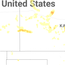
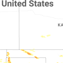
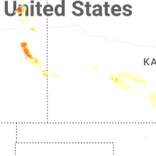
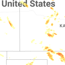
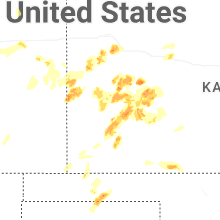


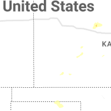
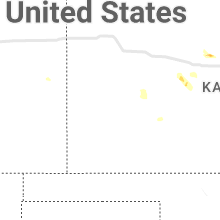


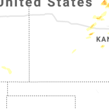


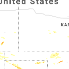


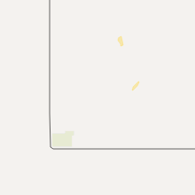


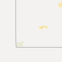
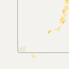


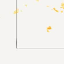


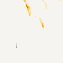


Connect with Interactive Hail Maps