

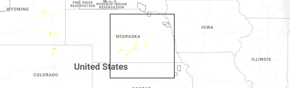
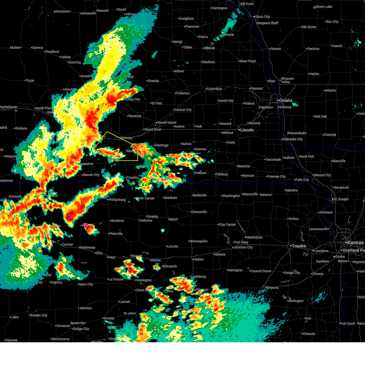
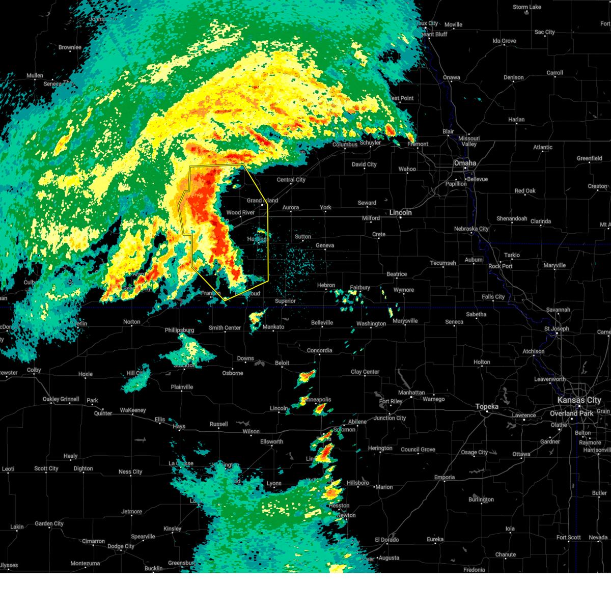
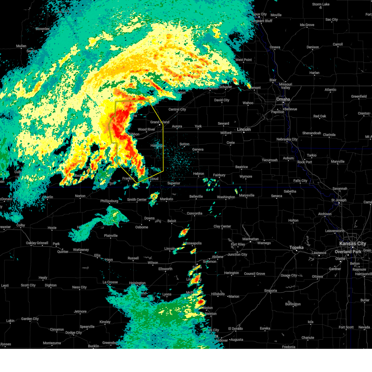
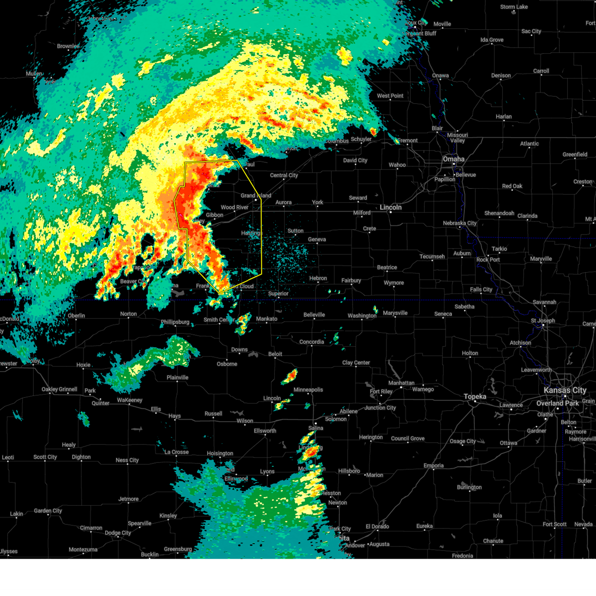
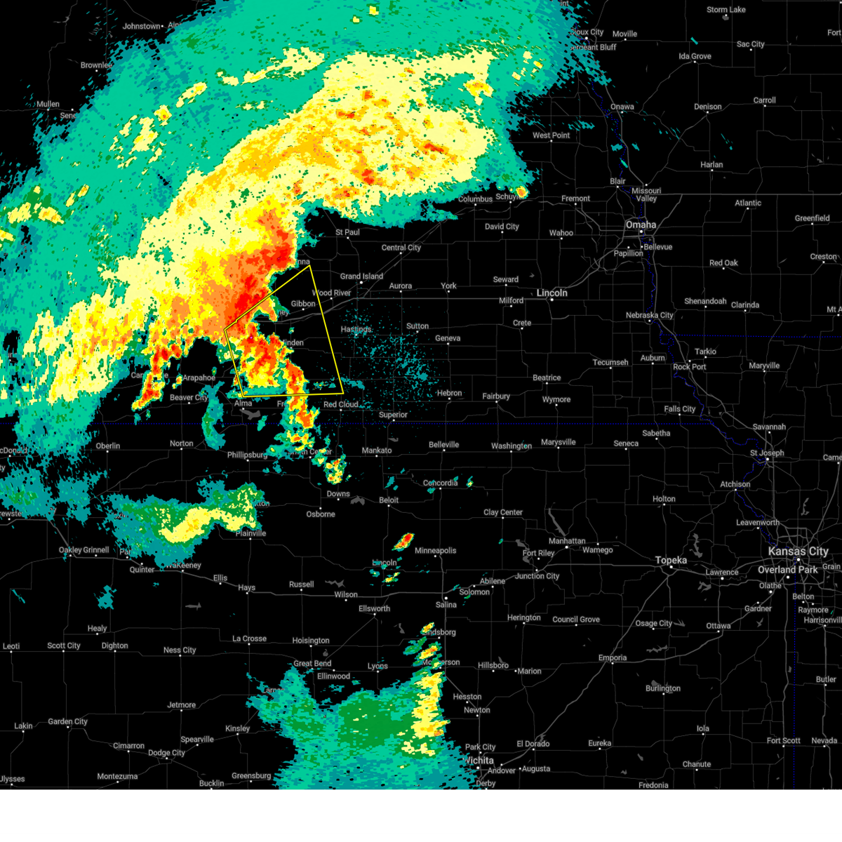
Hail Map for Kearney, NE
The Kearney, NE area has had 70 reports of on-the-ground hail by trained spotters, and has been under severe weather warnings 29 times during the past 12 months. Doppler radar has detected hail at or near Kearney, NE on 122 occasions, including 4 occasions during the past year.
| Name: | Kearney, NE |
| Where Located: | 41.8 miles WSW of Grand Island, NE |
| Map: | Google Map for Kearney, NE |
| Population: | 30787 |
| Housing Units: | 12738 |
| More Info: | Search Google for Kearney, NE |
1
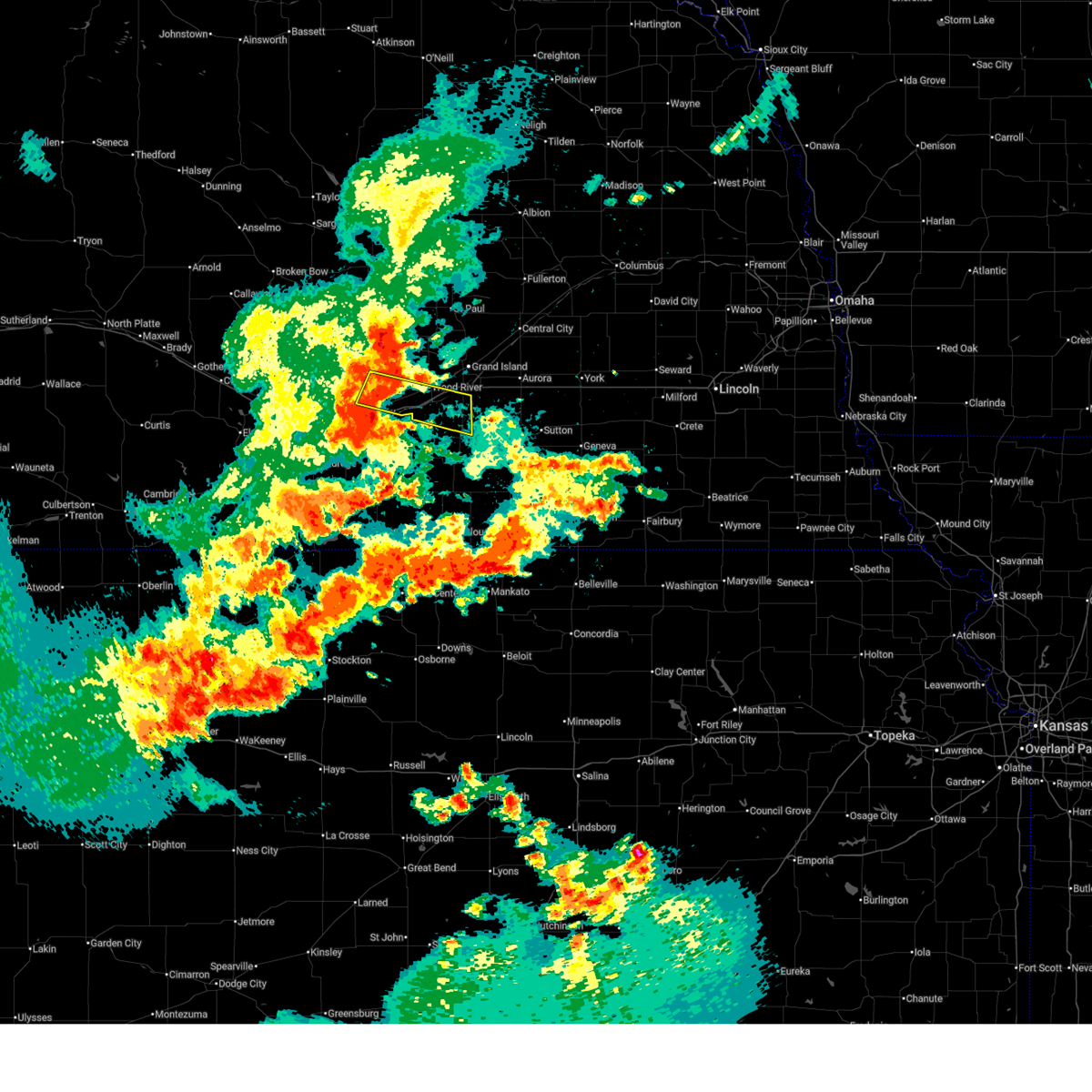
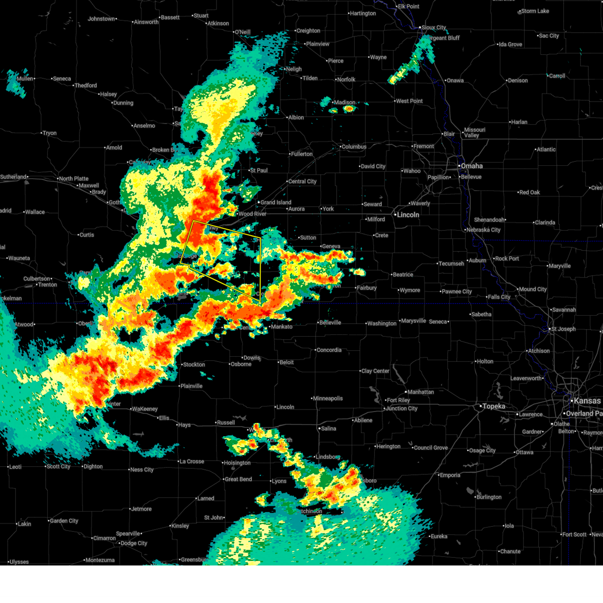
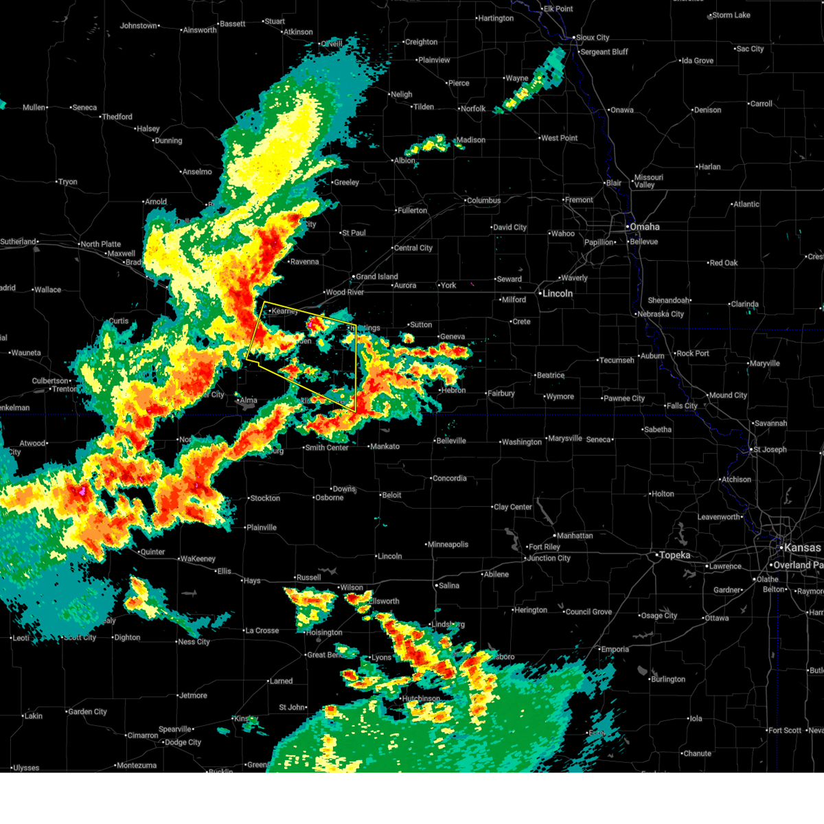
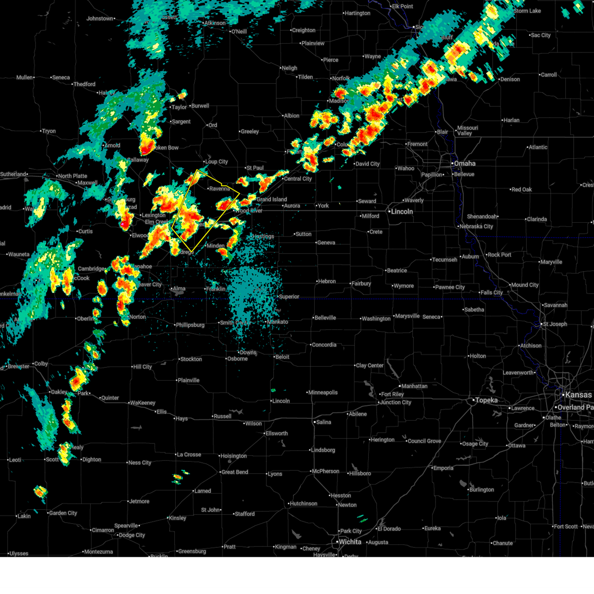
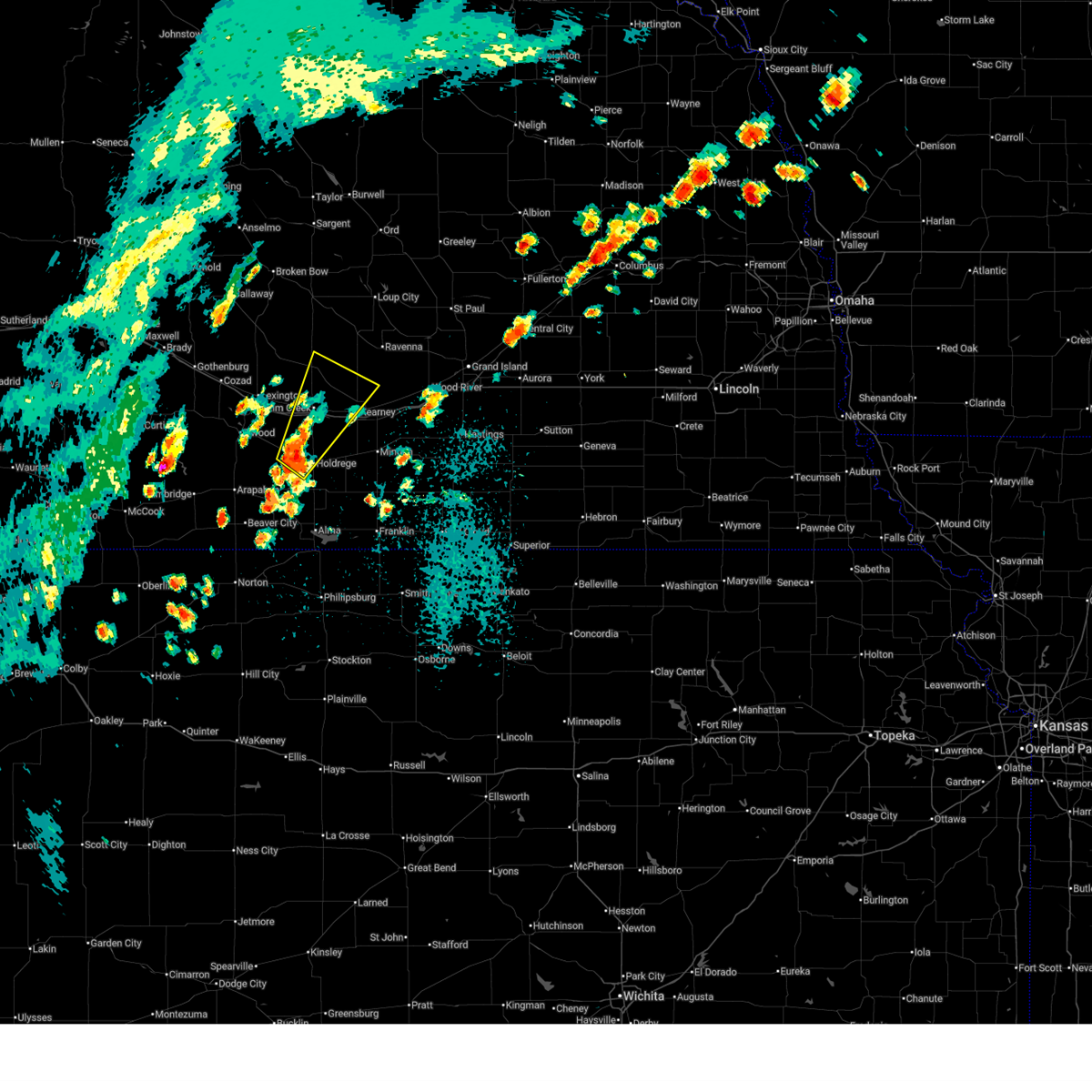
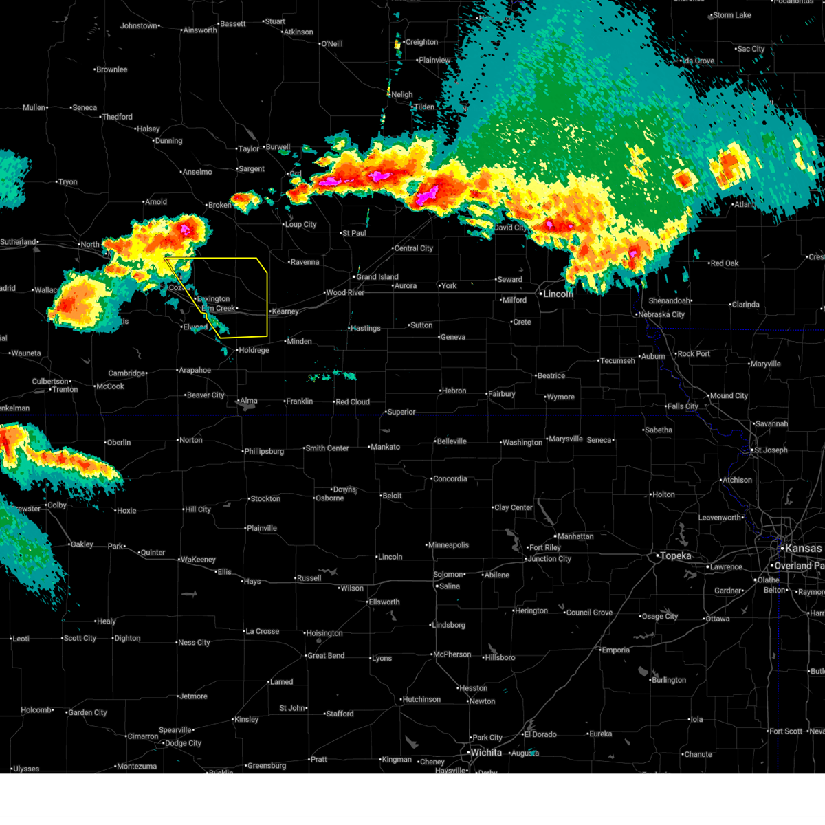
The Top Recent Hail Date for Kearney, NE is Wednesday, June 25, 2025 (52nd out of 122)
Hail and Wind Damage Spotted near Kearney, NE
| Date / Time | Report Details |
|---|---|
| 6/30/2025 3:26 AM CDT |
 Svrgid the national weather service in hastings has issued a * severe thunderstorm warning for, northern adams county in south central nebraska, southeastern buffalo county in south central nebraska, southern hall county in south central nebraska, * until 345 am cdt. * at 326 am cdt, a severe thunderstorm was located near gibbon, or 13 miles northeast of kearney, moving east at 35 mph (radar indicated). Hazards include 60 mph wind gusts. Expect damage to roofs, siding, and trees. this severe thunderstorm will be near, gibbon and shelton around 330 am cdt. This includes interstate 80 between mile markers 285 and 307. Svrgid the national weather service in hastings has issued a * severe thunderstorm warning for, northern adams county in south central nebraska, southeastern buffalo county in south central nebraska, southern hall county in south central nebraska, * until 345 am cdt. * at 326 am cdt, a severe thunderstorm was located near gibbon, or 13 miles northeast of kearney, moving east at 35 mph (radar indicated). Hazards include 60 mph wind gusts. Expect damage to roofs, siding, and trees. this severe thunderstorm will be near, gibbon and shelton around 330 am cdt. This includes interstate 80 between mile markers 285 and 307.
|
| 6/30/2025 3:19 AM CDT |
 At 319 am cdt, a severe thunderstorm was located over norman, or 20 miles southeast of kearney, moving east at 35 mph (emergency management). Hazards include 60 mph wind gusts. Expect damage to roofs, siding, and trees. this severe storm will be near, norman around 325 am cdt. holstein around 330 am cdt. blue hill around 355 am cdt. This includes interstate 80 between mile markers 269 and 285. At 319 am cdt, a severe thunderstorm was located over norman, or 20 miles southeast of kearney, moving east at 35 mph (emergency management). Hazards include 60 mph wind gusts. Expect damage to roofs, siding, and trees. this severe storm will be near, norman around 325 am cdt. holstein around 330 am cdt. blue hill around 355 am cdt. This includes interstate 80 between mile markers 269 and 285.
|
| 6/30/2025 3:16 AM CDT | Storm damage reported in buffalo county NE, 0.8 miles S of Kearney, NE |
| 6/30/2025 2:55 AM CDT |
 Svrgid the national weather service in hastings has issued a * severe thunderstorm warning for, webster county in south central nebraska, northern franklin county in south central nebraska, southeastern phelps county in south central nebraska, adams county in south central nebraska, kearney county in south central nebraska, southeastern buffalo county in south central nebraska, * until 345 am cdt. * at 255 am cdt, a severe thunderstorm was located near axtell, or 12 miles south of kearney, moving east at 35 mph (automated weather station). Hazards include 60 mph wind gusts. Expect damage to roofs, siding, and trees. this severe thunderstorm will be near, minden around 300 am cdt. norman around 315 am cdt. other locations in the path of this severe thunderstorm include holstein. This includes interstate 80 between mile markers 269 and 285. Svrgid the national weather service in hastings has issued a * severe thunderstorm warning for, webster county in south central nebraska, northern franklin county in south central nebraska, southeastern phelps county in south central nebraska, adams county in south central nebraska, kearney county in south central nebraska, southeastern buffalo county in south central nebraska, * until 345 am cdt. * at 255 am cdt, a severe thunderstorm was located near axtell, or 12 miles south of kearney, moving east at 35 mph (automated weather station). Hazards include 60 mph wind gusts. Expect damage to roofs, siding, and trees. this severe thunderstorm will be near, minden around 300 am cdt. norman around 315 am cdt. other locations in the path of this severe thunderstorm include holstein. This includes interstate 80 between mile markers 269 and 285.
|
| 6/30/2025 2:51 AM CDT | Unofficial personal weather statio in buffalo county NE, 7.1 miles ESE of Kearney, NE |
| 6/30/2025 2:30 AM CDT |
 Svrgid the national weather service in hastings has issued a * severe thunderstorm warning for, phelps county in south central nebraska, kearney county in south central nebraska, southwestern buffalo county in south central nebraska, * until 300 am cdt. * at 230 am cdt, a severe thunderstorm was located 7 miles southwest of odessa, or 11 miles north of holdrege, moving southeast at 45 mph (radar indicated). Hazards include 70 mph wind gusts. Expect considerable tree damage. damage is likely to mobile homes, roofs, and outbuildings. this severe thunderstorm will be near, axtell around 245 am cdt. other locations in the path of this severe thunderstorm include minden. This includes interstate 80 between mile markers 255 and 276. Svrgid the national weather service in hastings has issued a * severe thunderstorm warning for, phelps county in south central nebraska, kearney county in south central nebraska, southwestern buffalo county in south central nebraska, * until 300 am cdt. * at 230 am cdt, a severe thunderstorm was located 7 miles southwest of odessa, or 11 miles north of holdrege, moving southeast at 45 mph (radar indicated). Hazards include 70 mph wind gusts. Expect considerable tree damage. damage is likely to mobile homes, roofs, and outbuildings. this severe thunderstorm will be near, axtell around 245 am cdt. other locations in the path of this severe thunderstorm include minden. This includes interstate 80 between mile markers 255 and 276.
|
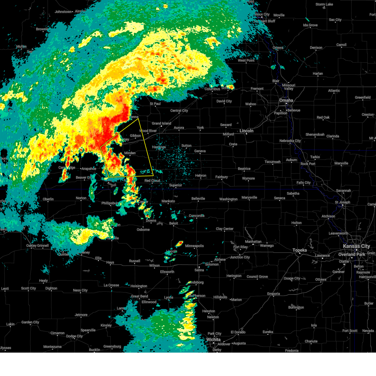
| 6/25/2025 3:40 PM CDT |
 At 339 pm cdt, a severe thunderstorm was located near riverdale, or 7 miles north of kearney, moving northeast at 45 mph (automated weather station. a mesonet in kearney reported a wind gust of 58 mph). Hazards include 60 mph wind gusts and nickel size hail. Expect damage to roofs, siding, and trees. this severe storm will be near, poole around 355 pm cdt. ravenna around 400 pm cdt. This includes interstate 80 between mile markers 259 and 286. At 339 pm cdt, a severe thunderstorm was located near riverdale, or 7 miles north of kearney, moving northeast at 45 mph (automated weather station. a mesonet in kearney reported a wind gust of 58 mph). Hazards include 60 mph wind gusts and nickel size hail. Expect damage to roofs, siding, and trees. this severe storm will be near, poole around 355 pm cdt. ravenna around 400 pm cdt. This includes interstate 80 between mile markers 259 and 286.
|
| 6/25/2025 3:35 PM CDT | Storm damage reported in buffalo county NE, 2.9 miles S of Kearney, NE |
| 6/25/2025 3:35 PM CDT | Storm damage reported in buffalo county NE, 4.3 miles S of Kearney, NE |
| 6/25/2025 3:30 PM CDT | Tree damag in buffalo county NE, 0.5 miles E of Kearney, NE |
| 6/25/2025 3:28 PM CDT | 6 inch tree branch dow in buffalo county NE, 0.8 miles NE of Kearney, NE |
| 6/25/2025 3:24 PM CDT | Svrgid the national weather service in hastings has issued a * severe thunderstorm warning for, northeastern phelps county in south central nebraska, northwestern kearney county in south central nebraska, buffalo county in south central nebraska, southeastern sherman county in central nebraska, northwestern hall county in south central nebraska, * until 415 pm cdt. * at 324 pm cdt, a severe thunderstorm was located near odessa, or near kearney, moving northeast at 40 mph (radar indicated). Hazards include 60 mph wind gusts and nickel size hail. Expect damage to roofs, siding, and trees. this severe thunderstorm will be near, kearney and riverdale around 330 pm cdt. other locations in the path of this severe thunderstorm include poole and ravenna. This includes interstate 80 between mile markers 259 and 286. |
| 6/25/2025 3:13 PM CDT | the severe thunderstorm warning has been cancelled and is no longer in effect |
| 6/25/2025 3:13 PM CDT | At 311 pm cdt, a severe thunderstorm was located near odessa, or 12 miles west of kearney, moving northeast at 40 mph (automated weather station. a mesonet site in loomis reported a wind gust of 57 mph). Hazards include 60 mph wind gusts and quarter size hail. Hail damage to vehicles is expected. expect wind damage to roofs, siding, and trees. this severe storm will be near, odessa around 315 pm cdt. amherst around 320 pm cdt. riverdale around 325 pm cdt. This includes interstate 80 between mile markers 255 and 271. |
| 6/25/2025 2:46 PM CDT |
 Svrgid the national weather service in hastings has issued a * severe thunderstorm warning for, central phelps county in south central nebraska, northwestern kearney county in south central nebraska, western buffalo county in south central nebraska, southeastern dawson county in south central nebraska, * until 330 pm cdt. * at 246 pm cdt, a severe thunderstorm was located over loomis, or near holdrege, moving northeast at 40 mph (radar indicated). Hazards include 60 mph wind gusts and quarter size hail. Hail damage to vehicles is expected. expect wind damage to roofs, siding, and trees. this severe thunderstorm will be near, elm creek around 305 pm cdt. other locations in the path of this severe thunderstorm include odessa and amherst. This includes interstate 80 between mile markers 251 and 271. Svrgid the national weather service in hastings has issued a * severe thunderstorm warning for, central phelps county in south central nebraska, northwestern kearney county in south central nebraska, western buffalo county in south central nebraska, southeastern dawson county in south central nebraska, * until 330 pm cdt. * at 246 pm cdt, a severe thunderstorm was located over loomis, or near holdrege, moving northeast at 40 mph (radar indicated). Hazards include 60 mph wind gusts and quarter size hail. Hail damage to vehicles is expected. expect wind damage to roofs, siding, and trees. this severe thunderstorm will be near, elm creek around 305 pm cdt. other locations in the path of this severe thunderstorm include odessa and amherst. This includes interstate 80 between mile markers 251 and 271.
|
| 6/16/2025 8:47 PM CDT | the severe thunderstorm warning has been cancelled and is no longer in effect |
| 6/16/2025 8:23 PM CDT |
 Svrgid the national weather service in hastings has issued a * severe thunderstorm warning for, northern phelps county in south central nebraska, northwestern kearney county in south central nebraska, western buffalo county in south central nebraska, eastern dawson county in south central nebraska, * until 915 pm cdt. * at 822 pm cdt, severe winds were located along a line of showers extending from 10 miles southwest of oconto to near lexington to 8 miles northeast of bertrand, moving east at 30 mph (law enforcement). Hazards include 70 mph wind gusts. Expect considerable tree damage. damage is likely to mobile homes, roofs, and outbuildings. severe thunderstorms will be near, overton around 830 pm cdt. elm creek around 835 pm cdt. eddyville around 840 pm cdt. other locations in the path of these severe thunderstorms include odessa, sumner, amherst, miller and kearney. This includes interstate 80 between mile markers 238 and 271. Svrgid the national weather service in hastings has issued a * severe thunderstorm warning for, northern phelps county in south central nebraska, northwestern kearney county in south central nebraska, western buffalo county in south central nebraska, eastern dawson county in south central nebraska, * until 915 pm cdt. * at 822 pm cdt, severe winds were located along a line of showers extending from 10 miles southwest of oconto to near lexington to 8 miles northeast of bertrand, moving east at 30 mph (law enforcement). Hazards include 70 mph wind gusts. Expect considerable tree damage. damage is likely to mobile homes, roofs, and outbuildings. severe thunderstorms will be near, overton around 830 pm cdt. elm creek around 835 pm cdt. eddyville around 840 pm cdt. other locations in the path of these severe thunderstorms include odessa, sumner, amherst, miller and kearney. This includes interstate 80 between mile markers 238 and 271.
|
| 6/2/2025 10:39 PM CDT |
 At 1038 pm cdt, severe thunderstorms were located along a line extending from pleasanton to near kenesaw to near bladen, moving northeast at 40 mph (automated weather station. several personal weather stations in the kearney area have reported wind gusts of 60 to 65 mph). Hazards include 60 to 65 mph wind gusts and quarter size hail. Hail damage to vehicles is expected. expect wind damage to roofs, siding, and trees. these severe storms will be near, hastings, ravenna, wood river, shelton, blue hill, juniata, roseland, ayr, prosser, and poole around 1045 pm cdt. alda, rockville, and hansen around 1055 pm cdt. grand island, doniphan, cairo, howard city, and boelus around 1100 pm cdt. trumbull around 1105 pm cdt. dannebrog around 1110 pm cdt. farwell around 1115 pm cdt. This includes interstate 80 between mile markers 263 and 317. At 1038 pm cdt, severe thunderstorms were located along a line extending from pleasanton to near kenesaw to near bladen, moving northeast at 40 mph (automated weather station. several personal weather stations in the kearney area have reported wind gusts of 60 to 65 mph). Hazards include 60 to 65 mph wind gusts and quarter size hail. Hail damage to vehicles is expected. expect wind damage to roofs, siding, and trees. these severe storms will be near, hastings, ravenna, wood river, shelton, blue hill, juniata, roseland, ayr, prosser, and poole around 1045 pm cdt. alda, rockville, and hansen around 1055 pm cdt. grand island, doniphan, cairo, howard city, and boelus around 1100 pm cdt. trumbull around 1105 pm cdt. dannebrog around 1110 pm cdt. farwell around 1115 pm cdt. This includes interstate 80 between mile markers 263 and 317.
|
| 6/2/2025 10:35 PM CDT | Personal weather station reports gust to 63mp in buffalo county NE, 3.1 miles SSW of Kearney, NE |
| 6/2/2025 10:33 PM CDT | Personal weather station gust to 66mp in buffalo county NE, 4.4 miles SSE of Kearney, NE |
| 6/2/2025 10:30 PM CDT |
 At 1030 pm cdt, severe thunderstorms were located along a line extending from near riverdale to heartwell to 6 miles north of inavale, moving northeast at 35 mph (radar indicated). Hazards include 60 mph wind gusts and quarter size hail. Hail damage to vehicles is expected. expect wind damage to roofs, siding, and trees. these severe storms will be near, gibbon, kenesaw, bladen, and holstein around 1035 pm cdt. roseland around 1040 pm cdt. shelton, blue hill, and prosser around 1045 pm cdt. juniata, ayr, rosemont, and poole around 1050 pm cdt. hastings, ravenna, and wood river around 1055 pm cdt. hansen around 1105 pm cdt. This includes interstate 80 between mile markers 263 and 317. At 1030 pm cdt, severe thunderstorms were located along a line extending from near riverdale to heartwell to 6 miles north of inavale, moving northeast at 35 mph (radar indicated). Hazards include 60 mph wind gusts and quarter size hail. Hail damage to vehicles is expected. expect wind damage to roofs, siding, and trees. these severe storms will be near, gibbon, kenesaw, bladen, and holstein around 1035 pm cdt. roseland around 1040 pm cdt. shelton, blue hill, and prosser around 1045 pm cdt. juniata, ayr, rosemont, and poole around 1050 pm cdt. hastings, ravenna, and wood river around 1055 pm cdt. hansen around 1105 pm cdt. This includes interstate 80 between mile markers 263 and 317.
|
| 6/2/2025 10:29 PM CDT | Personal weather station gust to 65mp in buffalo county NE, 3.3 miles WSW of Kearney, NE |
| 6/2/2025 10:28 PM CDT | Personal weather station gust to 62mp in buffalo county NE, 2.2 miles SSW of Kearney, NE |
| 6/2/2025 10:27 PM CDT | Corrects previous tstm wnd gst report from 3 nne kearney. personal weather station reports gust to 63mp in buffalo county NE, 3.1 miles SSW of Kearney, NE |
| 6/2/2025 10:27 PM CDT | Photo on social media of tree damage in kearne in buffalo county NE, 0.8 miles S of Kearney, NE |
| 6/2/2025 10:27 PM CDT | Photo on social media of tree damage in kearne in buffalo county NE, 0.6 miles N of Kearney, NE |
| 6/2/2025 10:27 PM CDT | Photo on social media of tree damage in kearne in buffalo county NE, 0.6 miles N of Kearney, NE |
| 6/2/2025 10:25 PM CDT |
 Svrgid the national weather service in hastings has issued a * severe thunderstorm warning for, northern webster county in south central nebraska, northeastern franklin county in south central nebraska, adams county in south central nebraska, kearney county in south central nebraska, buffalo county in south central nebraska, sherman county in central nebraska, southwestern howard county in central nebraska, hall county in south central nebraska, * until 1115 pm cdt. * at 1025 pm cdt, severe thunderstorms were located along a line extending from near riverdale to near heartwell to near inavale, moving northeast at 35 mph (radar indicated). Hazards include 60 mph wind gusts and quarter size hail. Hail damage to vehicles is expected. expect wind damage to roofs, siding, and trees. severe thunderstorms will be near, bladen, holstein, and heartwell around 1030 pm cdt. gibbon and kenesaw around 1035 pm cdt. roseland around 1040 pm cdt. shelton, blue hill, and prosser around 1045 pm cdt. other locations in the path of these severe thunderstorms include juniata, ayr, rosemont, poole, hastings, ravenna, wood river and hansen. This includes interstate 80 between mile markers 263 and 317. Svrgid the national weather service in hastings has issued a * severe thunderstorm warning for, northern webster county in south central nebraska, northeastern franklin county in south central nebraska, adams county in south central nebraska, kearney county in south central nebraska, buffalo county in south central nebraska, sherman county in central nebraska, southwestern howard county in central nebraska, hall county in south central nebraska, * until 1115 pm cdt. * at 1025 pm cdt, severe thunderstorms were located along a line extending from near riverdale to near heartwell to near inavale, moving northeast at 35 mph (radar indicated). Hazards include 60 mph wind gusts and quarter size hail. Hail damage to vehicles is expected. expect wind damage to roofs, siding, and trees. severe thunderstorms will be near, bladen, holstein, and heartwell around 1030 pm cdt. gibbon and kenesaw around 1035 pm cdt. roseland around 1040 pm cdt. shelton, blue hill, and prosser around 1045 pm cdt. other locations in the path of these severe thunderstorms include juniata, ayr, rosemont, poole, hastings, ravenna, wood river and hansen. This includes interstate 80 between mile markers 263 and 317.
|
| 6/2/2025 10:13 PM CDT |
 At 1013 pm cdt, severe thunderstorms were located along a line extending from near odessa to near upland, moving northeast at 45 mph (radar indicated). Hazards include 60 to 65 mph wind gusts and quarter size hail. Hail damage to vehicles is expected. expect wind damage to roofs, siding, and trees. locations impacted include, kearney, holdrege, minden, gibbon, shelton, kenesaw, axtell, odessa, hildreth, wilcox, campbell, bladen, holstein, funk, riverdale, upland, heartwell, huntley, norman, and ragan. This includes interstate 80 between mile markers 256 and 294. At 1013 pm cdt, severe thunderstorms were located along a line extending from near odessa to near upland, moving northeast at 45 mph (radar indicated). Hazards include 60 to 65 mph wind gusts and quarter size hail. Hail damage to vehicles is expected. expect wind damage to roofs, siding, and trees. locations impacted include, kearney, holdrege, minden, gibbon, shelton, kenesaw, axtell, odessa, hildreth, wilcox, campbell, bladen, holstein, funk, riverdale, upland, heartwell, huntley, norman, and ragan. This includes interstate 80 between mile markers 256 and 294.
|
| 6/2/2025 10:07 PM CDT |
 Svrgid the national weather service in hastings has issued a * severe thunderstorm warning for, northwestern webster county in south central nebraska, northern franklin county in south central nebraska, phelps county in south central nebraska, western adams county in south central nebraska, kearney county in south central nebraska, southeastern buffalo county in south central nebraska, northeastern harlan county in south central nebraska, southwestern hall county in south central nebraska, * until 1030 pm cdt. * at 1007 pm cdt, severe thunderstorms were located along a line extending from 8 miles northeast of loomis to near hildreth, moving northeast at 40 mph (radar indicated). Hazards include 60 to 65 mph wind gusts and quarter size hail. Hail damage to vehicles is expected. expect wind damage to roofs, siding, and trees. severe thunderstorms will be near, axtell, hildreth, and upland around 1010 pm cdt. minden around 1015 pm cdt. odessa around 1020 pm cdt. This includes interstate 80 between mile markers 256 and 294. Svrgid the national weather service in hastings has issued a * severe thunderstorm warning for, northwestern webster county in south central nebraska, northern franklin county in south central nebraska, phelps county in south central nebraska, western adams county in south central nebraska, kearney county in south central nebraska, southeastern buffalo county in south central nebraska, northeastern harlan county in south central nebraska, southwestern hall county in south central nebraska, * until 1030 pm cdt. * at 1007 pm cdt, severe thunderstorms were located along a line extending from 8 miles northeast of loomis to near hildreth, moving northeast at 40 mph (radar indicated). Hazards include 60 to 65 mph wind gusts and quarter size hail. Hail damage to vehicles is expected. expect wind damage to roofs, siding, and trees. severe thunderstorms will be near, axtell, hildreth, and upland around 1010 pm cdt. minden around 1015 pm cdt. odessa around 1020 pm cdt. This includes interstate 80 between mile markers 256 and 294.
|
| 5/18/2025 7:17 PM CDT | Svrgid the national weather service in hastings has issued a * severe thunderstorm warning for, northwestern kearney county in south central nebraska, central buffalo county in south central nebraska, * until 745 pm cdt. * at 717 pm cdt, a severe thunderstorm was located near minden, or 9 miles southeast of kearney, moving north at 40 mph (radar indicated). Hazards include quarter size hail. Damage to vehicles is expected. this severe thunderstorm will be near, kearney around 720 pm cdt. This includes interstate 80 between mile markers 272 and 284. |
| 8/26/2024 9:49 PM CDT | Storm damage reported in buffalo county NE, 12.6 miles SSW of Kearney, NE |
| 8/14/2024 12:48 AM CDT |
 the severe thunderstorm warning has been cancelled and is no longer in effect the severe thunderstorm warning has been cancelled and is no longer in effect
|
| 8/14/2024 12:48 AM CDT |
 At 1248 am cdt, severe thunderstorms were located along a line extending from riverdale to near kearney to 6 miles southwest of hildreth, moving east at 55 mph (radar indicated). Hazards include 60 mph wind gusts. Expect damage to roofs, siding, and trees. these severe storms will be near, minden and upland around 1255 am cdt. gibbon, heartwell, and norman around 100 am cdt. shelton and campbell around 105 am cdt. kenesaw and holstein around 110 am cdt. wood river, bladen, roseland, and prosser around 115 am cdt. juniata around 120 am cdt. This includes interstate 80 between mile markers 266 and 301. At 1248 am cdt, severe thunderstorms were located along a line extending from riverdale to near kearney to 6 miles southwest of hildreth, moving east at 55 mph (radar indicated). Hazards include 60 mph wind gusts. Expect damage to roofs, siding, and trees. these severe storms will be near, minden and upland around 1255 am cdt. gibbon, heartwell, and norman around 100 am cdt. shelton and campbell around 105 am cdt. kenesaw and holstein around 110 am cdt. wood river, bladen, roseland, and prosser around 115 am cdt. juniata around 120 am cdt. This includes interstate 80 between mile markers 266 and 301.
|
| 8/14/2024 12:34 AM CDT |
 Svrgid the national weather service in hastings has issued a * severe thunderstorm warning for, northern franklin county in south central nebraska, northwestern webster county in south central nebraska, eastern phelps county in south central nebraska, western adams county in south central nebraska, kearney county in south central nebraska, buffalo county in south central nebraska, northeastern harlan county in south central nebraska, western hall county in south central nebraska, * until 115 am cdt. * at 1234 am cdt, severe thunderstorms were located along a line extending from near elm creek to 8 miles south of odessa to near huntley, moving east at 50 mph (radar indicated). Hazards include 60 mph wind gusts. Expect damage to roofs, siding, and trees. severe thunderstorms will be near, kearney, axtell, odessa, wilcox, and riverdale around 1240 am cdt. minden and hildreth around 1245 am cdt. upland around 1250 am cdt. other locations in the path of these severe thunderstorms include heartwell, gibbon, norman, shelton, kenesaw, campbell and holstein. This includes interstate 80 between mile markers 257 and 301. Svrgid the national weather service in hastings has issued a * severe thunderstorm warning for, northern franklin county in south central nebraska, northwestern webster county in south central nebraska, eastern phelps county in south central nebraska, western adams county in south central nebraska, kearney county in south central nebraska, buffalo county in south central nebraska, northeastern harlan county in south central nebraska, western hall county in south central nebraska, * until 115 am cdt. * at 1234 am cdt, severe thunderstorms were located along a line extending from near elm creek to 8 miles south of odessa to near huntley, moving east at 50 mph (radar indicated). Hazards include 60 mph wind gusts. Expect damage to roofs, siding, and trees. severe thunderstorms will be near, kearney, axtell, odessa, wilcox, and riverdale around 1240 am cdt. minden and hildreth around 1245 am cdt. upland around 1250 am cdt. other locations in the path of these severe thunderstorms include heartwell, gibbon, norman, shelton, kenesaw, campbell and holstein. This includes interstate 80 between mile markers 257 and 301.
|
| 7/16/2024 7:43 PM CDT |
 At 743 pm cdt, a severe thunderstorm was located near eddyville, or 22 miles northeast of lexington, moving south at 35 mph (public). Hazards include ping pong ball size hail and 60 mph wind gusts. People and animals outdoors will be injured. expect hail damage to roofs, siding, windows, and vehicles. expect wind damage to roofs, siding, and trees. this severe storm will be near, sumner around 750 pm cdt. miller around 755 pm cdt. elm creek around 815 pm cdt. This includes interstate 80 between mile markers 240 and 271. At 743 pm cdt, a severe thunderstorm was located near eddyville, or 22 miles northeast of lexington, moving south at 35 mph (public). Hazards include ping pong ball size hail and 60 mph wind gusts. People and animals outdoors will be injured. expect hail damage to roofs, siding, windows, and vehicles. expect wind damage to roofs, siding, and trees. this severe storm will be near, sumner around 750 pm cdt. miller around 755 pm cdt. elm creek around 815 pm cdt. This includes interstate 80 between mile markers 240 and 271.
|
| 7/16/2024 7:35 PM CDT |
 Svrgid the national weather service in hastings has issued a * severe thunderstorm warning for, western buffalo county in south central nebraska, eastern dawson county in south central nebraska, * until 815 pm cdt. * at 735 pm cdt, a severe thunderstorm was located 8 miles northeast of eddyville, or 20 miles south of broken bow, moving south at 40 mph (radar indicated). Hazards include ping pong ball size hail and 60 mph wind gusts. People and animals outdoors will be injured. expect hail damage to roofs, siding, windows, and vehicles. expect wind damage to roofs, siding, and trees. this severe thunderstorm will be near, sumner around 750 pm cdt. miller around 755 pm cdt. This includes interstate 80 between mile markers 240 and 271. Svrgid the national weather service in hastings has issued a * severe thunderstorm warning for, western buffalo county in south central nebraska, eastern dawson county in south central nebraska, * until 815 pm cdt. * at 735 pm cdt, a severe thunderstorm was located 8 miles northeast of eddyville, or 20 miles south of broken bow, moving south at 40 mph (radar indicated). Hazards include ping pong ball size hail and 60 mph wind gusts. People and animals outdoors will be injured. expect hail damage to roofs, siding, windows, and vehicles. expect wind damage to roofs, siding, and trees. this severe thunderstorm will be near, sumner around 750 pm cdt. miller around 755 pm cdt. This includes interstate 80 between mile markers 240 and 271.
|
| 7/6/2024 3:42 PM CDT |
 At 342 pm cdt, severe thunderstorms were located along a line extending from 7 miles north of axtell to near funk to 7 miles northeast of loomis, moving east at 40 mph (automated weather station). Hazards include golf ball size hail and 60 mph wind gusts. People and animals outdoors will be injured. expect hail damage to roofs, siding, windows, and vehicles. expect wind damage to roofs, siding, and trees. these severe thunderstorms will remain over mainly rural areas of eastern phelps, western kearney and south central buffalo counties. This includes interstate 80 between mile markers 260 and 275. At 342 pm cdt, severe thunderstorms were located along a line extending from 7 miles north of axtell to near funk to 7 miles northeast of loomis, moving east at 40 mph (automated weather station). Hazards include golf ball size hail and 60 mph wind gusts. People and animals outdoors will be injured. expect hail damage to roofs, siding, windows, and vehicles. expect wind damage to roofs, siding, and trees. these severe thunderstorms will remain over mainly rural areas of eastern phelps, western kearney and south central buffalo counties. This includes interstate 80 between mile markers 260 and 275.
|
| 7/6/2024 3:28 PM CDT |
 the severe thunderstorm warning has been cancelled and is no longer in effect the severe thunderstorm warning has been cancelled and is no longer in effect
|
| 7/6/2024 3:28 PM CDT |
 At 328 pm cdt, severe thunderstorms were located along a line extending from 8 miles southwest of odessa to loomis to near smithfield, moving east at 25 mph (automated weather station). Hazards include golf ball size hail and 60 mph wind gusts. People and animals outdoors will be injured. expect hail damage to roofs, siding, windows, and vehicles. expect wind damage to roofs, siding, and trees. these severe storms will be near, loomis around 335 pm cdt. holdrege around 340 pm cdt. This includes interstate 80 between mile markers 255 and 275. At 328 pm cdt, severe thunderstorms were located along a line extending from 8 miles southwest of odessa to loomis to near smithfield, moving east at 25 mph (automated weather station). Hazards include golf ball size hail and 60 mph wind gusts. People and animals outdoors will be injured. expect hail damage to roofs, siding, windows, and vehicles. expect wind damage to roofs, siding, and trees. these severe storms will be near, loomis around 335 pm cdt. holdrege around 340 pm cdt. This includes interstate 80 between mile markers 255 and 275.
|
| 7/6/2024 3:19 PM CDT |
 Svrgid the national weather service in hastings has issued a * severe thunderstorm warning for, phelps county in south central nebraska, western kearney county in south central nebraska, east central gosper county in south central nebraska, southwestern buffalo county in south central nebraska, * until 400 pm cdt. * at 319 pm cdt, severe thunderstorms were located along a line extending from 9 miles south of elm creek to near bertrand to smithfield, moving east at 25 mph (radar indicated). Hazards include golf ball size hail and 60 mph wind gusts. People and animals outdoors will be injured. expect hail damage to roofs, siding, windows, and vehicles. expect wind damage to roofs, siding, and trees. severe thunderstorms will be near, bertrand and loomis around 325 pm cdt. This includes interstate 80 between mile markers 255 and 275. Svrgid the national weather service in hastings has issued a * severe thunderstorm warning for, phelps county in south central nebraska, western kearney county in south central nebraska, east central gosper county in south central nebraska, southwestern buffalo county in south central nebraska, * until 400 pm cdt. * at 319 pm cdt, severe thunderstorms were located along a line extending from 9 miles south of elm creek to near bertrand to smithfield, moving east at 25 mph (radar indicated). Hazards include golf ball size hail and 60 mph wind gusts. People and animals outdoors will be injured. expect hail damage to roofs, siding, windows, and vehicles. expect wind damage to roofs, siding, and trees. severe thunderstorms will be near, bertrand and loomis around 325 pm cdt. This includes interstate 80 between mile markers 255 and 275.
|
| 7/6/2024 2:12 PM CDT |
 At 211 pm cdt, a severe thunderstorm was located 7 miles northwest of axtell, or 10 miles southwest of kearney, moving east at 30 mph. this is a destructive storm for areas north of funk in phelps county (trained weather spotters). Hazards include baseball size hail. People and animals outdoors will be severely injured. expect shattered windows, extensive damage to roofs, siding, and vehicles. locations impacted include, kearney, minden, and axtell. This includes interstate 80 between mile markers 265 and 276. At 211 pm cdt, a severe thunderstorm was located 7 miles northwest of axtell, or 10 miles southwest of kearney, moving east at 30 mph. this is a destructive storm for areas north of funk in phelps county (trained weather spotters). Hazards include baseball size hail. People and animals outdoors will be severely injured. expect shattered windows, extensive damage to roofs, siding, and vehicles. locations impacted include, kearney, minden, and axtell. This includes interstate 80 between mile markers 265 and 276.
|
| 7/6/2024 2:02 PM CDT |
 At 202 pm cdt, a severe thunderstorm was located 7 miles south of odessa, or 11 miles northeast of holdrege, moving east at 30 mph (emergency management). Hazards include golf ball size hail. People and animals outdoors will be injured. expect damage to roofs, siding, windows, and vehicles. locations impacted include, kearney, minden, and axtell. This includes interstate 80 between mile markers 261 and 276. At 202 pm cdt, a severe thunderstorm was located 7 miles south of odessa, or 11 miles northeast of holdrege, moving east at 30 mph (emergency management). Hazards include golf ball size hail. People and animals outdoors will be injured. expect damage to roofs, siding, windows, and vehicles. locations impacted include, kearney, minden, and axtell. This includes interstate 80 between mile markers 261 and 276.
|
| 7/6/2024 1:47 PM CDT |
 Svrgid the national weather service in hastings has issued a * severe thunderstorm warning for, northeastern phelps county in south central nebraska, western kearney county in south central nebraska, southwestern buffalo county in south central nebraska, * until 230 pm cdt. * at 147 pm cdt, a severe thunderstorm was located near elm creek, or 13 miles north of holdrege, moving east at 30 mph (emergency management). Hazards include golf ball size hail. People and animals outdoors will be injured. expect damage to roofs, siding, windows, and vehicles. this severe thunderstorm will remain over mainly rural areas of northeastern phelps, western kearney and southwestern buffalo counties. This includes interstate 80 between mile markers 255 and 276. Svrgid the national weather service in hastings has issued a * severe thunderstorm warning for, northeastern phelps county in south central nebraska, western kearney county in south central nebraska, southwestern buffalo county in south central nebraska, * until 230 pm cdt. * at 147 pm cdt, a severe thunderstorm was located near elm creek, or 13 miles north of holdrege, moving east at 30 mph (emergency management). Hazards include golf ball size hail. People and animals outdoors will be injured. expect damage to roofs, siding, windows, and vehicles. this severe thunderstorm will remain over mainly rural areas of northeastern phelps, western kearney and southwestern buffalo counties. This includes interstate 80 between mile markers 255 and 276.
|
| 7/1/2024 7:23 PM CDT |
 Svrgid the national weather service in hastings has issued a * severe thunderstorm warning for, adams county in south central nebraska, kearney county in south central nebraska, southeastern buffalo county in south central nebraska, southern hall county in south central nebraska, * until 815 pm cdt. * at 723 pm cdt, severe thunderstorms were located along a line extending from near gibbon to near heartwell to near upland, moving east at 35 mph (radar indicated). Hazards include 60 mph wind gusts. Expect damage to roofs, siding, and trees. severe thunderstorms will be near, gibbon, heartwell, and norman around 730 pm cdt. shelton and kenesaw around 735 pm cdt. holstein around 740 pm cdt. other locations in the path of these severe thunderstorms include roseland, prosser, wood river, juniata, hastings, ayr and hansen. This includes interstate 80 between mile markers 274 and 314. Svrgid the national weather service in hastings has issued a * severe thunderstorm warning for, adams county in south central nebraska, kearney county in south central nebraska, southeastern buffalo county in south central nebraska, southern hall county in south central nebraska, * until 815 pm cdt. * at 723 pm cdt, severe thunderstorms were located along a line extending from near gibbon to near heartwell to near upland, moving east at 35 mph (radar indicated). Hazards include 60 mph wind gusts. Expect damage to roofs, siding, and trees. severe thunderstorms will be near, gibbon, heartwell, and norman around 730 pm cdt. shelton and kenesaw around 735 pm cdt. holstein around 740 pm cdt. other locations in the path of these severe thunderstorms include roseland, prosser, wood river, juniata, hastings, ayr and hansen. This includes interstate 80 between mile markers 274 and 314.
|
| 7/1/2024 7:12 PM CDT |
 At 712 pm cdt, a severe thunderstorm was located near axtell, or 10 miles south of kearney, moving northeast at 30 mph (radar indicated). Hazards include 60 mph wind gusts. Expect damage to roofs, siding, and trees. this severe thunderstorm will remain over mainly rural areas of northeastern phelps, kearney and south central buffalo counties. This includes interstate 80 between mile markers 262 and 280. At 712 pm cdt, a severe thunderstorm was located near axtell, or 10 miles south of kearney, moving northeast at 30 mph (radar indicated). Hazards include 60 mph wind gusts. Expect damage to roofs, siding, and trees. this severe thunderstorm will remain over mainly rural areas of northeastern phelps, kearney and south central buffalo counties. This includes interstate 80 between mile markers 262 and 280.
|
| 7/1/2024 7:03 PM CDT |
 the severe thunderstorm warning has been cancelled and is no longer in effect the severe thunderstorm warning has been cancelled and is no longer in effect
|
| 7/1/2024 7:03 PM CDT |
 At 703 pm cdt, a severe thunderstorm was located near axtell, or 11 miles northeast of holdrege, moving northeast at 30 mph (radar indicated). Hazards include 60 mph wind gusts and penny size hail. Expect damage to roofs, siding, and trees. this severe storm will be near, axtell around 710 pm cdt. This includes interstate 80 between mile markers 260 and 280. At 703 pm cdt, a severe thunderstorm was located near axtell, or 11 miles northeast of holdrege, moving northeast at 30 mph (radar indicated). Hazards include 60 mph wind gusts and penny size hail. Expect damage to roofs, siding, and trees. this severe storm will be near, axtell around 710 pm cdt. This includes interstate 80 between mile markers 260 and 280.
|
| 7/1/2024 6:58 PM CDT |
 Torgid the national weather service in hastings has issued a * tornado warning for, kearney county in south central nebraska, south central buffalo county in south central nebraska, * until 730 pm cdt. * at 658 pm cdt, a severe thunderstorm capable of producing a tornado was located over axtell, or 12 miles east of holdrege, moving northeast at 40 mph (radar indicated rotation). Hazards include tornado. Flying debris will be dangerous to those caught without shelter. mobile homes will be damaged or destroyed. damage to roofs, windows, and vehicles will occur. tree damage is likely. this dangerous storm will be near, minden around 710 pm cdt. This includes interstate 80 between mile markers 276 and 284. Torgid the national weather service in hastings has issued a * tornado warning for, kearney county in south central nebraska, south central buffalo county in south central nebraska, * until 730 pm cdt. * at 658 pm cdt, a severe thunderstorm capable of producing a tornado was located over axtell, or 12 miles east of holdrege, moving northeast at 40 mph (radar indicated rotation). Hazards include tornado. Flying debris will be dangerous to those caught without shelter. mobile homes will be damaged or destroyed. damage to roofs, windows, and vehicles will occur. tree damage is likely. this dangerous storm will be near, minden around 710 pm cdt. This includes interstate 80 between mile markers 276 and 284.
|
| 7/1/2024 6:50 PM CDT |
 Svrgid the national weather service in hastings has issued a * severe thunderstorm warning for, northwestern franklin county in south central nebraska, eastern phelps county in south central nebraska, kearney county in south central nebraska, southwestern buffalo county in south central nebraska, northeastern harlan county in south central nebraska, * until 730 pm cdt. * at 650 pm cdt, a severe thunderstorm was located over funk, or near holdrege, moving northeast at 30 mph (radar indicated). Hazards include 60 mph wind gusts and quarter size hail. Hail damage to vehicles is expected. expect wind damage to roofs, siding, and trees. this severe thunderstorm will be near, funk around 655 pm cdt. axtell around 700 pm cdt. This includes interstate 80 between mile markers 255 and 280. Svrgid the national weather service in hastings has issued a * severe thunderstorm warning for, northwestern franklin county in south central nebraska, eastern phelps county in south central nebraska, kearney county in south central nebraska, southwestern buffalo county in south central nebraska, northeastern harlan county in south central nebraska, * until 730 pm cdt. * at 650 pm cdt, a severe thunderstorm was located over funk, or near holdrege, moving northeast at 30 mph (radar indicated). Hazards include 60 mph wind gusts and quarter size hail. Hail damage to vehicles is expected. expect wind damage to roofs, siding, and trees. this severe thunderstorm will be near, funk around 655 pm cdt. axtell around 700 pm cdt. This includes interstate 80 between mile markers 255 and 280.
|
| 6/7/2024 9:39 PM CDT | Report from mping: 3-inch tree limbs broken; power poles broke in buffalo county NE, 0.6 miles N of Kearney, NE |
| 6/7/2024 8:24 PM CDT |
 Svrgid the national weather service in hastings has issued a * severe thunderstorm warning for, phelps county in south central nebraska, western kearney county in south central nebraska, southwestern buffalo county in south central nebraska, southeastern dawson county in south central nebraska, * until 900 pm cdt. * at 824 pm cdt, severe thunderstorms were located along a line extending from near odessa to 7 miles south of overton, moving south at 35 mph (radar indicated). Hazards include 60 mph wind gusts and half dollar size hail. Hail damage to vehicles is expected. expect wind damage to roofs, siding, and trees. severe thunderstorms will be near, odessa around 830 pm cdt. loomis around 840 pm cdt. other locations in the path of these severe thunderstorms include holdrege. This includes interstate 80 between mile markers 245 and 272. Svrgid the national weather service in hastings has issued a * severe thunderstorm warning for, phelps county in south central nebraska, western kearney county in south central nebraska, southwestern buffalo county in south central nebraska, southeastern dawson county in south central nebraska, * until 900 pm cdt. * at 824 pm cdt, severe thunderstorms were located along a line extending from near odessa to 7 miles south of overton, moving south at 35 mph (radar indicated). Hazards include 60 mph wind gusts and half dollar size hail. Hail damage to vehicles is expected. expect wind damage to roofs, siding, and trees. severe thunderstorms will be near, odessa around 830 pm cdt. loomis around 840 pm cdt. other locations in the path of these severe thunderstorms include holdrege. This includes interstate 80 between mile markers 245 and 272.
|
| 6/7/2024 8:17 PM CDT | Quarter sized hail reported 8.4 miles S of Kearney, NE |
| 6/7/2024 8:12 PM CDT |
 At 812 pm cdt, a severe thunderstorm was located near kearney, moving southeast at 30 mph (radar indicated). Hazards include golf ball size hail and 60 mph wind gusts. People and animals outdoors will be injured. expect hail damage to roofs, siding, windows, and vehicles. expect wind damage to roofs, siding, and trees. this severe storm will be near, kearney around 815 pm cdt. This includes interstate 80 between mile markers 267 and 285. At 812 pm cdt, a severe thunderstorm was located near kearney, moving southeast at 30 mph (radar indicated). Hazards include golf ball size hail and 60 mph wind gusts. People and animals outdoors will be injured. expect hail damage to roofs, siding, windows, and vehicles. expect wind damage to roofs, siding, and trees. this severe storm will be near, kearney around 815 pm cdt. This includes interstate 80 between mile markers 267 and 285.
|
| 6/7/2024 8:11 PM CDT | Quarter sized hail reported 5.8 miles SSW of Kearney, NE |
| 6/7/2024 8:10 PM CDT | Several 6-7 inch tree limbs dow in buffalo county NE, 0.6 miles N of Kearney, NE |
| 6/7/2024 8:10 PM CDT | A large tree at least 2 feet in diameter split in two based on public imag in buffalo county NE, 0.8 miles NE of Kearney, NE |
| 6/7/2024 8:10 PM CDT |
 Svrgid the national weather service in hastings has issued a * severe thunderstorm warning for, northwestern adams county in south central nebraska, northern kearney county in south central nebraska, southeastern buffalo county in south central nebraska, southwestern hall county in south central nebraska, * until 900 pm cdt. * at 810 pm cdt, severe thunderstorms were located along a line extending from near shelton to near kearney, moving southeast at 30 mph (radar indicated). Hazards include golf ball size hail and 60 mph wind gusts. People and animals outdoors will be injured. expect hail damage to roofs, siding, windows, and vehicles. expect wind damage to roofs, siding, and trees. severe thunderstorms will be near, kearney and gibbon around 815 pm cdt. prosser around 820 pm cdt. kenesaw around 825 pm cdt. heartwell around 830 pm cdt. other locations in the path of these severe thunderstorms include juniata, minden, hastings and norman. This includes interstate 80 between mile markers 272 and 302. Svrgid the national weather service in hastings has issued a * severe thunderstorm warning for, northwestern adams county in south central nebraska, northern kearney county in south central nebraska, southeastern buffalo county in south central nebraska, southwestern hall county in south central nebraska, * until 900 pm cdt. * at 810 pm cdt, severe thunderstorms were located along a line extending from near shelton to near kearney, moving southeast at 30 mph (radar indicated). Hazards include golf ball size hail and 60 mph wind gusts. People and animals outdoors will be injured. expect hail damage to roofs, siding, windows, and vehicles. expect wind damage to roofs, siding, and trees. severe thunderstorms will be near, kearney and gibbon around 815 pm cdt. prosser around 820 pm cdt. kenesaw around 825 pm cdt. heartwell around 830 pm cdt. other locations in the path of these severe thunderstorms include juniata, minden, hastings and norman. This includes interstate 80 between mile markers 272 and 302.
|
| 6/7/2024 8:01 PM CDT | Storm damage reported in buffalo county NE, 5.7 miles S of Kearney, NE |
| 6/7/2024 8:01 PM CDT | Storm damage reported in buffalo county NE, 3.8 miles SW of Kearney, NE |
| 6/7/2024 8:00 PM CDT | Quarter sized hail reported 5.8 miles SSW of Kearney, NE, report from mping: quarter (1.00 in.) time estimated from radar. |
| 6/7/2024 7:48 PM CDT |
 Svrgid the national weather service in hastings has issued a * severe thunderstorm warning for, northwestern kearney county in south central nebraska, south central buffalo county in south central nebraska, * until 830 pm cdt. * at 747 pm cdt, a severe thunderstorm was located near riverdale, or 11 miles north of kearney, moving southeast at 30 mph (radar indicated). Hazards include golf ball size hail and 60 mph wind gusts. People and animals outdoors will be injured. expect hail damage to roofs, siding, windows, and vehicles. expect wind damage to roofs, siding, and trees. this severe thunderstorm will be near, riverdale around 755 pm cdt. kearney around 800 pm cdt. This includes interstate 80 between mile markers 267 and 284. Svrgid the national weather service in hastings has issued a * severe thunderstorm warning for, northwestern kearney county in south central nebraska, south central buffalo county in south central nebraska, * until 830 pm cdt. * at 747 pm cdt, a severe thunderstorm was located near riverdale, or 11 miles north of kearney, moving southeast at 30 mph (radar indicated). Hazards include golf ball size hail and 60 mph wind gusts. People and animals outdoors will be injured. expect hail damage to roofs, siding, windows, and vehicles. expect wind damage to roofs, siding, and trees. this severe thunderstorm will be near, riverdale around 755 pm cdt. kearney around 800 pm cdt. This includes interstate 80 between mile markers 267 and 284.
|
| 6/2/2024 9:38 PM CDT |
 At 938 pm cdt, severe thunderstorms were located along a line extending from near cairo to near kenesaw, moving east at 60 mph (radar indicated). Hazards include 60 mph wind gusts. Expect damage to roofs, siding, and trees. these severe storms will be near, wood river and alda around 945 pm cdt. grand island and doniphan around 950 pm cdt. This includes interstate 80 between mile markers 275 and 318. At 938 pm cdt, severe thunderstorms were located along a line extending from near cairo to near kenesaw, moving east at 60 mph (radar indicated). Hazards include 60 mph wind gusts. Expect damage to roofs, siding, and trees. these severe storms will be near, wood river and alda around 945 pm cdt. grand island and doniphan around 950 pm cdt. This includes interstate 80 between mile markers 275 and 318.
|
| 6/2/2024 9:38 PM CDT |
 the severe thunderstorm warning has been cancelled and is no longer in effect the severe thunderstorm warning has been cancelled and is no longer in effect
|
| 6/2/2024 9:21 PM CDT |
 At 921 pm cdt, severe thunderstorms were located along a line extending from near loup city to near hildreth, moving east at 45 mph (radar indicated). Hazards include 60 mph wind gusts. Expect damage to roofs, siding, and trees. these severe storms will be near, gibbon, ravenna, and poole around 925 pm cdt. shelton around 935 pm cdt. wood river and cairo around 945 pm cdt. This includes interstate 80 between mile markers 264 and 318. At 921 pm cdt, severe thunderstorms were located along a line extending from near loup city to near hildreth, moving east at 45 mph (radar indicated). Hazards include 60 mph wind gusts. Expect damage to roofs, siding, and trees. these severe storms will be near, gibbon, ravenna, and poole around 925 pm cdt. shelton around 935 pm cdt. wood river and cairo around 945 pm cdt. This includes interstate 80 between mile markers 264 and 318.
|
| 6/2/2024 9:21 PM CDT |
 the severe thunderstorm warning has been cancelled and is no longer in effect the severe thunderstorm warning has been cancelled and is no longer in effect
|
| 6/2/2024 9:18 PM CDT | Time is estimated from radar. a power line was down to a home in kearney possibly related to the storm and it started a house fir in buffalo county NE, 0.1 miles SSW of Kearney, NE |
| 6/2/2024 9:10 PM CDT |
 the severe thunderstorm warning has been cancelled and is no longer in effect the severe thunderstorm warning has been cancelled and is no longer in effect
|
| 6/2/2024 9:10 PM CDT |
 At 910 pm cdt, severe thunderstorms were located along a line extending from near litchfield to near wilcox, moving east at 45 mph (radar indicated). Hazards include 60 mph wind gusts. Expect damage to roofs, siding, and trees. these severe storms will be near, kearney, pleasanton, and poole around 915 pm cdt. ravenna around 920 pm cdt. gibbon around 925 pm cdt. shelton around 935 pm cdt. This includes interstate 80 between mile markers 255 and 318. At 910 pm cdt, severe thunderstorms were located along a line extending from near litchfield to near wilcox, moving east at 45 mph (radar indicated). Hazards include 60 mph wind gusts. Expect damage to roofs, siding, and trees. these severe storms will be near, kearney, pleasanton, and poole around 915 pm cdt. ravenna around 920 pm cdt. gibbon around 925 pm cdt. shelton around 935 pm cdt. This includes interstate 80 between mile markers 255 and 318.
|
| 6/2/2024 9:08 PM CDT |
 Svrgid the national weather service in hastings has issued a * severe thunderstorm warning for, western clay county in south central nebraska, northwestern nuckolls county in south central nebraska, adams county in south central nebraska, southwestern hamilton county in south central nebraska, buffalo county in south central nebraska, southern sherman county in central nebraska, southern howard county in central nebraska, hall county in south central nebraska, * until 945 pm cdt. * at 907 pm cdt, severe thunderstorms were located along a line extending from near litchfield to near wilcox, moving east at 45 mph (radar indicated). Hazards include 60 mph wind gusts. Expect damage to roofs, siding, and trees. severe thunderstorms will be near, kearney, ravenna, and poole around 915 pm cdt. gibbon around 920 pm cdt. other locations in the path of these severe thunderstorms include shelton. This includes interstate 80 between mile markers 255 and 318. Svrgid the national weather service in hastings has issued a * severe thunderstorm warning for, western clay county in south central nebraska, northwestern nuckolls county in south central nebraska, adams county in south central nebraska, southwestern hamilton county in south central nebraska, buffalo county in south central nebraska, southern sherman county in central nebraska, southern howard county in central nebraska, hall county in south central nebraska, * until 945 pm cdt. * at 907 pm cdt, severe thunderstorms were located along a line extending from near litchfield to near wilcox, moving east at 45 mph (radar indicated). Hazards include 60 mph wind gusts. Expect damage to roofs, siding, and trees. severe thunderstorms will be near, kearney, ravenna, and poole around 915 pm cdt. gibbon around 920 pm cdt. other locations in the path of these severe thunderstorms include shelton. This includes interstate 80 between mile markers 255 and 318.
|
| 5/24/2024 12:38 AM CDT |
 the severe thunderstorm warning has been cancelled and is no longer in effect the severe thunderstorm warning has been cancelled and is no longer in effect
|
| 5/24/2024 12:38 AM CDT |
 At 1233 am cdt, severe thunderstorms were located along a line extending from near archer to near rosemont to 7 miles south of riverton, moving east at 55 mph (radar indicated). Hazards include 70 mph wind gusts and quarter size hail. Hail damage to vehicles is expected. expect considerable tree damage. wind damage is also likely to mobile homes, roofs, and outbuildings. these severe storms will be near, red cloud, harvard, giltner, glenvil, lawrence, chapman, marquette, inland, cowles, and rosemont around 1240 am cdt. guide rock around 1250 am cdt. This includes interstate 80 between mile markers 275 and 329. At 1233 am cdt, severe thunderstorms were located along a line extending from near archer to near rosemont to 7 miles south of riverton, moving east at 55 mph (radar indicated). Hazards include 70 mph wind gusts and quarter size hail. Hail damage to vehicles is expected. expect considerable tree damage. wind damage is also likely to mobile homes, roofs, and outbuildings. these severe storms will be near, red cloud, harvard, giltner, glenvil, lawrence, chapman, marquette, inland, cowles, and rosemont around 1240 am cdt. guide rock around 1250 am cdt. This includes interstate 80 between mile markers 275 and 329.
|
| 5/23/2024 11:55 PM CDT |
 Svrgid the national weather service in hastings has issued a * severe thunderstorm warning for, northern smith county in north central kansas, northern phillips county in north central kansas, webster county in south central nebraska, adams county in south central nebraska, western hamilton county in south central nebraska, buffalo county in south central nebraska, eastern harlan county in south central nebraska, hall county in south central nebraska, western clay county in south central nebraska, franklin county in south central nebraska, western nuckolls county in south central nebraska, eastern phelps county in south central nebraska, kearney county in south central nebraska, southern sherman county in central nebraska, southwestern merrick county in central nebraska, southern howard county in central nebraska, * until 1245 am cdt. * at 1155 pm cdt, severe thunderstorms were located along a line extending from 7 miles south of boelus to near franklin to near phillipsburg, moving east at 55 mph (radar indicated). Hazards include 70 mph wind gusts and quarter size hail. Hail damage to vehicles is expected. expect considerable tree damage. wind damage is also likely to mobile homes, roofs, and outbuildings. severe thunderstorms will be near, wood river, shelton, franklin, kenesaw, cairo, campbell, heartwell, and norman around 1200 am cdt. holstein, riverton, and prosser around 1205 am cdt. juniata, alda, bladen, and roseland around 1210 am cdt. grand island, hastings, doniphan, and ayr around 1215 am cdt. other locations in the path of these severe thunderstorms include blue hill, hansen, inavale, phillips, trumbull, cowles, rosemont, red cloud, giltner, glenvil, lawrence, chapman, inland and harvard. This includes interstate 80 between mile markers 260 and 329. Svrgid the national weather service in hastings has issued a * severe thunderstorm warning for, northern smith county in north central kansas, northern phillips county in north central kansas, webster county in south central nebraska, adams county in south central nebraska, western hamilton county in south central nebraska, buffalo county in south central nebraska, eastern harlan county in south central nebraska, hall county in south central nebraska, western clay county in south central nebraska, franklin county in south central nebraska, western nuckolls county in south central nebraska, eastern phelps county in south central nebraska, kearney county in south central nebraska, southern sherman county in central nebraska, southwestern merrick county in central nebraska, southern howard county in central nebraska, * until 1245 am cdt. * at 1155 pm cdt, severe thunderstorms were located along a line extending from 7 miles south of boelus to near franklin to near phillipsburg, moving east at 55 mph (radar indicated). Hazards include 70 mph wind gusts and quarter size hail. Hail damage to vehicles is expected. expect considerable tree damage. wind damage is also likely to mobile homes, roofs, and outbuildings. severe thunderstorms will be near, wood river, shelton, franklin, kenesaw, cairo, campbell, heartwell, and norman around 1200 am cdt. holstein, riverton, and prosser around 1205 am cdt. juniata, alda, bladen, and roseland around 1210 am cdt. grand island, hastings, doniphan, and ayr around 1215 am cdt. other locations in the path of these severe thunderstorms include blue hill, hansen, inavale, phillips, trumbull, cowles, rosemont, red cloud, giltner, glenvil, lawrence, chapman, inland and harvard. This includes interstate 80 between mile markers 260 and 329.
|
| 5/23/2024 11:40 PM CDT |
 the severe thunderstorm warning has been cancelled and is no longer in effect the severe thunderstorm warning has been cancelled and is no longer in effect
|
| 5/23/2024 11:40 PM CDT |
 At 1139 pm cdt, severe thunderstorms were located along a line extending from near hazard to near odessa to near alma, moving northeast at 45 mph (radar indicated). Hazards include 70 mph wind gusts and quarter size hail. Hail damage to vehicles is expected. expect considerable tree damage. wind damage is also likely to mobile homes, roofs, and outbuildings. these severe storms will be near, kearney, odessa, wilcox, pleasanton, funk, riverdale, republican city, hazard, huntley, and ragan around 1145 pm cdt. axtell and harlan county dam around 1150 pm cdt. ravenna, hildreth, and poole around 1200 am cdt. This includes interstate 80 between mile markers 238 and 290. At 1139 pm cdt, severe thunderstorms were located along a line extending from near hazard to near odessa to near alma, moving northeast at 45 mph (radar indicated). Hazards include 70 mph wind gusts and quarter size hail. Hail damage to vehicles is expected. expect considerable tree damage. wind damage is also likely to mobile homes, roofs, and outbuildings. these severe storms will be near, kearney, odessa, wilcox, pleasanton, funk, riverdale, republican city, hazard, huntley, and ragan around 1145 pm cdt. axtell and harlan county dam around 1150 pm cdt. ravenna, hildreth, and poole around 1200 am cdt. This includes interstate 80 between mile markers 238 and 290.
|
| 5/23/2024 11:20 PM CDT |
 Svrgid the national weather service in hastings has issued a * severe thunderstorm warning for, northwestern smith county in north central kansas, northern phillips county in north central kansas, franklin county in south central nebraska, phelps county in south central nebraska, kearney county in south central nebraska, gosper county in south central nebraska, buffalo county in south central nebraska, southern sherman county in central nebraska, eastern dawson county in south central nebraska, eastern furnas county in south central nebraska, harlan county in south central nebraska, * until midnight cdt. * at 1120 pm cdt, severe thunderstorms were located along a line extending from near miller to loomis to near long island, moving northeast at 45 mph (radar indicated). Hazards include 70 mph wind gusts and quarter size hail. Hail damage to vehicles is expected. expect considerable tree damage. wind damage is also likely to mobile homes, roofs, and outbuildings. severe thunderstorms will be near, holdrege, elm creek, orleans, loomis, amherst, long island, atlanta, and woodruff around 1125 pm cdt. alma and odessa around 1130 pm cdt. hazard, huntley, and ragan around 1135 pm cdt. pleasanton, funk, and riverdale around 1140 pm cdt. other locations in the path of these severe thunderstorms include kearney, wilcox, republican city and axtell. This includes interstate 80 between mile markers 233 and 290. Svrgid the national weather service in hastings has issued a * severe thunderstorm warning for, northwestern smith county in north central kansas, northern phillips county in north central kansas, franklin county in south central nebraska, phelps county in south central nebraska, kearney county in south central nebraska, gosper county in south central nebraska, buffalo county in south central nebraska, southern sherman county in central nebraska, eastern dawson county in south central nebraska, eastern furnas county in south central nebraska, harlan county in south central nebraska, * until midnight cdt. * at 1120 pm cdt, severe thunderstorms were located along a line extending from near miller to loomis to near long island, moving northeast at 45 mph (radar indicated). Hazards include 70 mph wind gusts and quarter size hail. Hail damage to vehicles is expected. expect considerable tree damage. wind damage is also likely to mobile homes, roofs, and outbuildings. severe thunderstorms will be near, holdrege, elm creek, orleans, loomis, amherst, long island, atlanta, and woodruff around 1125 pm cdt. alma and odessa around 1130 pm cdt. hazard, huntley, and ragan around 1135 pm cdt. pleasanton, funk, and riverdale around 1140 pm cdt. other locations in the path of these severe thunderstorms include kearney, wilcox, republican city and axtell. This includes interstate 80 between mile markers 233 and 290.
|
| 5/20/2024 8:15 PM CDT |
 the severe thunderstorm warning has been cancelled and is no longer in effect the severe thunderstorm warning has been cancelled and is no longer in effect
|
| 5/20/2024 7:57 PM CDT |
 Svrgid the national weather service in hastings has issued a * severe thunderstorm warning for, southwestern buffalo county in south central nebraska, southeastern dawson county in south central nebraska, * until 845 pm cdt. * at 757 pm cdt, a severe thunderstorm was located over elm creek, or 14 miles west of kearney, moving northeast at 15 mph (radar indicated). Hazards include 60 mph wind gusts and half dollar size hail. Hail damage to vehicles is expected. Expect wind damage to roofs, siding, and trees. Svrgid the national weather service in hastings has issued a * severe thunderstorm warning for, southwestern buffalo county in south central nebraska, southeastern dawson county in south central nebraska, * until 845 pm cdt. * at 757 pm cdt, a severe thunderstorm was located over elm creek, or 14 miles west of kearney, moving northeast at 15 mph (radar indicated). Hazards include 60 mph wind gusts and half dollar size hail. Hail damage to vehicles is expected. Expect wind damage to roofs, siding, and trees.
|
| 5/3/2024 10:19 PM CDT | Storm damage reported in buffalo county NE, 4.4 miles SSE of Kearney, NE |
| 5/3/2024 10:14 PM CDT | Storm damage reported in buffalo county NE, 3.1 miles SSW of Kearney, NE |
| 5/3/2024 9:59 PM CDT | Storm damage reported in buffalo county NE, 5.7 miles S of Kearney, NE |
| 4/26/2024 1:55 PM CDT |
 the severe thunderstorm warning has been cancelled and is no longer in effect the severe thunderstorm warning has been cancelled and is no longer in effect
|
| 4/26/2024 1:40 PM CDT |
 At 140 pm cdt, a severe thunderstorm was located near shelton, or 16 miles east of kearney, moving northeast at 30 mph (radar indicated). Hazards include 60 mph wind gusts and quarter size hail. Hail damage to vehicles is expected. expect wind damage to roofs, siding, and trees. this severe storm will be near, shelton around 145 pm cdt. cairo around 210 pm cdt. This includes interstate 80 between mile markers 277 and 297. At 140 pm cdt, a severe thunderstorm was located near shelton, or 16 miles east of kearney, moving northeast at 30 mph (radar indicated). Hazards include 60 mph wind gusts and quarter size hail. Hail damage to vehicles is expected. expect wind damage to roofs, siding, and trees. this severe storm will be near, shelton around 145 pm cdt. cairo around 210 pm cdt. This includes interstate 80 between mile markers 277 and 297.
|
| 4/26/2024 1:40 PM CDT |
 the severe thunderstorm warning has been cancelled and is no longer in effect the severe thunderstorm warning has been cancelled and is no longer in effect
|
| 4/26/2024 1:25 PM CDT |
 Svrgid the national weather service in hastings has issued a * severe thunderstorm warning for, northwestern adams county in south central nebraska, northeastern kearney county in south central nebraska, eastern buffalo county in south central nebraska, western hall county in south central nebraska, * until 215 pm cdt. * at 124 pm cdt, a severe thunderstorm was located near gibbon, or 10 miles east of kearney, moving northeast at 30 mph (radar indicated). Hazards include 60 mph wind gusts and quarter size hail. Hail damage to vehicles is expected. expect wind damage to roofs, siding, and trees. this severe thunderstorm will be near, gibbon around 130 pm cdt. shelton around 135 pm cdt. This includes interstate 80 between mile markers 277 and 307. Svrgid the national weather service in hastings has issued a * severe thunderstorm warning for, northwestern adams county in south central nebraska, northeastern kearney county in south central nebraska, eastern buffalo county in south central nebraska, western hall county in south central nebraska, * until 215 pm cdt. * at 124 pm cdt, a severe thunderstorm was located near gibbon, or 10 miles east of kearney, moving northeast at 30 mph (radar indicated). Hazards include 60 mph wind gusts and quarter size hail. Hail damage to vehicles is expected. expect wind damage to roofs, siding, and trees. this severe thunderstorm will be near, gibbon around 130 pm cdt. shelton around 135 pm cdt. This includes interstate 80 between mile markers 277 and 307.
|
| 4/26/2024 12:55 PM CDT |
 At 1254 pm cdt, a severe thunderstorm was located near kearney, moving northeast at 15 mph (radar indicated). Hazards include ping pong ball size hail and 60 mph wind gusts. People and animals outdoors will be injured. expect hail damage to roofs, siding, windows, and vehicles. expect wind damage to roofs, siding, and trees. this severe storm will be near, kearney around 100 pm cdt. This includes interstate 80 between mile markers 270 and 280. At 1254 pm cdt, a severe thunderstorm was located near kearney, moving northeast at 15 mph (radar indicated). Hazards include ping pong ball size hail and 60 mph wind gusts. People and animals outdoors will be injured. expect hail damage to roofs, siding, windows, and vehicles. expect wind damage to roofs, siding, and trees. this severe storm will be near, kearney around 100 pm cdt. This includes interstate 80 between mile markers 270 and 280.
|
| 4/26/2024 12:42 PM CDT |
 Svrgid the national weather service in hastings has issued a * severe thunderstorm warning for, northwestern kearney county in south central nebraska, central buffalo county in south central nebraska, * until 130 pm cdt. * at 1241 pm cdt, a severe thunderstorm was located near kearney, moving north at 20 mph (radar indicated). Hazards include 60 mph wind gusts and quarter size hail. Hail damage to vehicles is expected. expect wind damage to roofs, siding, and trees. this severe thunderstorm will be near, kearney around 1255 pm cdt. This includes interstate 80 between mile markers 269 and 280. Svrgid the national weather service in hastings has issued a * severe thunderstorm warning for, northwestern kearney county in south central nebraska, central buffalo county in south central nebraska, * until 130 pm cdt. * at 1241 pm cdt, a severe thunderstorm was located near kearney, moving north at 20 mph (radar indicated). Hazards include 60 mph wind gusts and quarter size hail. Hail damage to vehicles is expected. expect wind damage to roofs, siding, and trees. this severe thunderstorm will be near, kearney around 1255 pm cdt. This includes interstate 80 between mile markers 269 and 280.
|
| 4/16/2024 3:03 AM CDT |
 the severe thunderstorm warning has been cancelled and is no longer in effect the severe thunderstorm warning has been cancelled and is no longer in effect
|
| 4/16/2024 3:03 AM CDT |
 At 302 am cdt, severe thunderstorms were located along a line extending from 6 miles southwest of cairo to near harvard to near deshler, moving northeast at 65 mph (radar indicated). Hazards include 60 mph wind gusts and penny size hail. Expect damage to roofs, siding, and trees. locations impacted include, kearney, hastings, superior, gibbon, ravenna, wood river, shelton, harvard, kenesaw, doniphan, clay center, juniata, deshler, alda, edgar, nelson, fairfield, giltner, pleasanton, and glenvil. this includes interstate 80 between mile markers 277 and 317. Please note that smaller tornado warnings are in effect and embedded within this much larger severe thunderstorm warning. At 302 am cdt, severe thunderstorms were located along a line extending from 6 miles southwest of cairo to near harvard to near deshler, moving northeast at 65 mph (radar indicated). Hazards include 60 mph wind gusts and penny size hail. Expect damage to roofs, siding, and trees. locations impacted include, kearney, hastings, superior, gibbon, ravenna, wood river, shelton, harvard, kenesaw, doniphan, clay center, juniata, deshler, alda, edgar, nelson, fairfield, giltner, pleasanton, and glenvil. this includes interstate 80 between mile markers 277 and 317. Please note that smaller tornado warnings are in effect and embedded within this much larger severe thunderstorm warning.
|
| 4/16/2024 3:02 AM CDT | Delayed report via personal weather statio in buffalo county NE, 12.6 miles SSW of Kearney, NE |
| 4/16/2024 2:30 AM CDT |
 Svrgid the national weather service in hastings has issued a * severe thunderstorm warning for, jewell county in north central kansas, clay county in south central nebraska, northeastern franklin county in south central nebraska, nuckolls county in south central nebraska, webster county in south central nebraska, northeastern phelps county in south central nebraska, adams county in south central nebraska, kearney county in south central nebraska, southwestern hamilton county in south central nebraska, buffalo county in south central nebraska, western thayer county in south central nebraska, hall county in south central nebraska, * until 315 am cdt. * at 230 am cdt, severe thunderstorms were located along a line extending from near odessa to near bladen to mankato, moving northeast at 65 mph (radar indicated). Hazards include 60 mph wind gusts and penny size hail. Expect damage to roofs, siding, and trees. severe thunderstorms will be near, kearney, blue hill, roseland, guide rock, holstein, ayr, heartwell, norman, lovewell state park, and rosemont around 235 am cdt. superior, gibbon, kenesaw, juniata, lawrence, and webber around 240 am cdt. hastings, shelton, nelson, glenvil, hardy, deweese, prosser, and nora around 245 am cdt. wood river, edgar, fairfield, ruskin, inland, byron, oak, and hansen around 250 am cdt. other locations in the path of these severe thunderstorms include harvard, doniphan, clay center, deshler, trumbull, alda, giltner, davenport, ong and saronville. This includes interstate 80 between mile markers 257 and 317. Svrgid the national weather service in hastings has issued a * severe thunderstorm warning for, jewell county in north central kansas, clay county in south central nebraska, northeastern franklin county in south central nebraska, nuckolls county in south central nebraska, webster county in south central nebraska, northeastern phelps county in south central nebraska, adams county in south central nebraska, kearney county in south central nebraska, southwestern hamilton county in south central nebraska, buffalo county in south central nebraska, western thayer county in south central nebraska, hall county in south central nebraska, * until 315 am cdt. * at 230 am cdt, severe thunderstorms were located along a line extending from near odessa to near bladen to mankato, moving northeast at 65 mph (radar indicated). Hazards include 60 mph wind gusts and penny size hail. Expect damage to roofs, siding, and trees. severe thunderstorms will be near, kearney, blue hill, roseland, guide rock, holstein, ayr, heartwell, norman, lovewell state park, and rosemont around 235 am cdt. superior, gibbon, kenesaw, juniata, lawrence, and webber around 240 am cdt. hastings, shelton, nelson, glenvil, hardy, deweese, prosser, and nora around 245 am cdt. wood river, edgar, fairfield, ruskin, inland, byron, oak, and hansen around 250 am cdt. other locations in the path of these severe thunderstorms include harvard, doniphan, clay center, deshler, trumbull, alda, giltner, davenport, ong and saronville. This includes interstate 80 between mile markers 257 and 317.
|
| 4/6/2024 4:14 PM CDT |
 Svrgid the national weather service in hastings has issued a * severe thunderstorm warning for, northeastern franklin county in south central nebraska, kearney county in south central nebraska, valley county in central nebraska, buffalo county in south central nebraska, sherman county in central nebraska, southwestern howard county in central nebraska, western hall county in south central nebraska, * until 500 pm cdt. * at 413 pm cdt, severe thunderstorms were located along a line extending from near ansley to pleasanton to norman, moving north at 55 mph (automated weather station. this line of thunderstorms has a history of producing 60 to 70 mph wind gusts). Hazards include 70 mph wind gusts. Expect considerable tree damage. damage is likely to mobile homes, roofs, and outbuildings. severe thunderstorms will be near, gibbon, pleasanton, litchfield, heartwell, hazard, and poole around 420 pm cdt. ravenna around 425 pm cdt. shelton around 430 pm cdt. other locations in the path of these severe thunderstorms include loup city, arcadia, rockville, howard city, sherman reservoir dam, ashton and boelus. This includes interstate 80 between mile markers 267 and 298. Svrgid the national weather service in hastings has issued a * severe thunderstorm warning for, northeastern franklin county in south central nebraska, kearney county in south central nebraska, valley county in central nebraska, buffalo county in south central nebraska, sherman county in central nebraska, southwestern howard county in central nebraska, western hall county in south central nebraska, * until 500 pm cdt. * at 413 pm cdt, severe thunderstorms were located along a line extending from near ansley to pleasanton to norman, moving north at 55 mph (automated weather station. this line of thunderstorms has a history of producing 60 to 70 mph wind gusts). Hazards include 70 mph wind gusts. Expect considerable tree damage. damage is likely to mobile homes, roofs, and outbuildings. severe thunderstorms will be near, gibbon, pleasanton, litchfield, heartwell, hazard, and poole around 420 pm cdt. ravenna around 425 pm cdt. shelton around 430 pm cdt. other locations in the path of these severe thunderstorms include loup city, arcadia, rockville, howard city, sherman reservoir dam, ashton and boelus. This includes interstate 80 between mile markers 267 and 298.
|
| 4/6/2024 4:07 PM CDT |
 At 407 pm cdt, severe thunderstorms were located along a line extending from 7 miles southwest of berwyn to near riverdale to near campbell, moving north at 60 mph (automated weather station). Hazards include 70 mph wind gusts. Expect considerable tree damage. damage is likely to mobile homes, roofs, and outbuildings. these severe storms will be near, pleasanton, heartwell, and norman around 410 pm cdt. gibbon, litchfield, hazard, and poole around 415 pm cdt. shelton around 425 pm cdt. This includes interstate 80 between mile markers 259 and 292. At 407 pm cdt, severe thunderstorms were located along a line extending from 7 miles southwest of berwyn to near riverdale to near campbell, moving north at 60 mph (automated weather station). Hazards include 70 mph wind gusts. Expect considerable tree damage. damage is likely to mobile homes, roofs, and outbuildings. these severe storms will be near, pleasanton, heartwell, and norman around 410 pm cdt. gibbon, litchfield, hazard, and poole around 415 pm cdt. shelton around 425 pm cdt. This includes interstate 80 between mile markers 259 and 292.
|
| 4/6/2024 3:59 PM CDT | Storm damage reported in buffalo county NE, 4.4 miles SSE of Kearney, NE |
| 4/6/2024 3:59 PM CDT | Storm damage reported in buffalo county NE, 5.4 miles SSW of Kearney, NE |
| 4/6/2024 3:53 PM CDT |
 At 352 pm cdt, severe thunderstorms were located along a line extending from 7 miles north of callaway to near sumner to near norman, moving northeast at 55 mph (automated weather station). Hazards include 70 mph wind gusts. Expect considerable tree damage. damage is likely to mobile homes, roofs, and outbuildings. these severe storms will be near, heartwell around 400 pm cdt. gibbon and pleasanton around 405 pm cdt. shelton, litchfield, hazard, and poole around 410 pm cdt. This includes interstate 80 between mile markers 254 and 292. At 352 pm cdt, severe thunderstorms were located along a line extending from 7 miles north of callaway to near sumner to near norman, moving northeast at 55 mph (automated weather station). Hazards include 70 mph wind gusts. Expect considerable tree damage. damage is likely to mobile homes, roofs, and outbuildings. these severe storms will be near, heartwell around 400 pm cdt. gibbon and pleasanton around 405 pm cdt. shelton, litchfield, hazard, and poole around 410 pm cdt. This includes interstate 80 between mile markers 254 and 292.
|
| 4/6/2024 3:53 PM CDT |
 the severe thunderstorm warning has been cancelled and is no longer in effect the severe thunderstorm warning has been cancelled and is no longer in effect
|
| 4/6/2024 3:29 PM CDT |
 Svrgid the national weather service in hastings has issued a * severe thunderstorm warning for, franklin county in south central nebraska, phelps county in south central nebraska, kearney county in south central nebraska, northeastern gosper county in south central nebraska, buffalo county in south central nebraska, southwestern sherman county in central nebraska, dawson county in south central nebraska, northeastern harlan county in south central nebraska, * until 415 pm cdt. * at 329 pm cdt, severe thunderstorms were located along a line extending from 13 miles northeast of gothenburg to overton to near franklin, moving north at 65 mph (automated weather station). Hazards include 70 mph wind gusts. Expect considerable tree damage. damage is likely to mobile homes, roofs, and outbuildings. severe thunderstorms will be near, elm creek, axtell, odessa, hildreth, sumner, upland, and eddyville around 335 pm cdt. kearney, minden, amherst, and miller around 340 pm cdt. riverdale around 345 pm cdt. other locations in the path of these severe thunderstorms include gibbon, pleasanton, litchfield, hazard and poole. This includes interstate 80 between mile markers 224 and 292. Svrgid the national weather service in hastings has issued a * severe thunderstorm warning for, franklin county in south central nebraska, phelps county in south central nebraska, kearney county in south central nebraska, northeastern gosper county in south central nebraska, buffalo county in south central nebraska, southwestern sherman county in central nebraska, dawson county in south central nebraska, northeastern harlan county in south central nebraska, * until 415 pm cdt. * at 329 pm cdt, severe thunderstorms were located along a line extending from 13 miles northeast of gothenburg to overton to near franklin, moving north at 65 mph (automated weather station). Hazards include 70 mph wind gusts. Expect considerable tree damage. damage is likely to mobile homes, roofs, and outbuildings. severe thunderstorms will be near, elm creek, axtell, odessa, hildreth, sumner, upland, and eddyville around 335 pm cdt. kearney, minden, amherst, and miller around 340 pm cdt. riverdale around 345 pm cdt. other locations in the path of these severe thunderstorms include gibbon, pleasanton, litchfield, hazard and poole. This includes interstate 80 between mile markers 224 and 292.
|
| 4/6/2024 3:19 PM CDT |
 At 319 pm cdt, severe thunderstorms were located along a line extending from 9 miles east of brady to 7 miles south of overton to near bloomington, moving north at 55 mph (radar indicated). Hazards include 70 mph wind gusts. Expect considerable tree damage. damage is likely to mobile homes, roofs, and outbuildings. these severe storms will be near, overton, hildreth, wilcox, and funk around 325 pm cdt. elm creek and axtell around 330 pm cdt. odessa, sumner, and eddyville around 335 pm cdt. minden and miller around 340 pm cdt. kearney and amherst around 345 pm cdt. This includes interstate 80 between mile markers 209 and 274. At 319 pm cdt, severe thunderstorms were located along a line extending from 9 miles east of brady to 7 miles south of overton to near bloomington, moving north at 55 mph (radar indicated). Hazards include 70 mph wind gusts. Expect considerable tree damage. damage is likely to mobile homes, roofs, and outbuildings. these severe storms will be near, overton, hildreth, wilcox, and funk around 325 pm cdt. elm creek and axtell around 330 pm cdt. odessa, sumner, and eddyville around 335 pm cdt. minden and miller around 340 pm cdt. kearney and amherst around 345 pm cdt. This includes interstate 80 between mile markers 209 and 274.
|
| 4/6/2024 3:19 PM CDT |
 the severe thunderstorm warning has been cancelled and is no longer in effect the severe thunderstorm warning has been cancelled and is no longer in effect
|
| 4/6/2024 3:07 PM CDT |
 At 307 pm cdt, severe thunderstorms were located along a line extending from near gothenburg to near bertrand to near bloomington, moving north at 60 mph (radar indicated). Hazards include 70 mph wind gusts. Expect considerable tree damage. damage is likely to mobile homes, roofs, and outbuildings. these severe storms will be near, lexington, holdrege, cozad, overton, wilcox, funk, and ragan around 315 pm cdt. elm creek, axtell, and hildreth around 325 pm cdt. eddyville around 330 pm cdt. odessa and sumner around 335 pm cdt. other locations impacted by these severe thunderstorms include farnam. This includes interstate 80 between mile markers 209 and 274. At 307 pm cdt, severe thunderstorms were located along a line extending from near gothenburg to near bertrand to near bloomington, moving north at 60 mph (radar indicated). Hazards include 70 mph wind gusts. Expect considerable tree damage. damage is likely to mobile homes, roofs, and outbuildings. these severe storms will be near, lexington, holdrege, cozad, overton, wilcox, funk, and ragan around 315 pm cdt. elm creek, axtell, and hildreth around 325 pm cdt. eddyville around 330 pm cdt. odessa and sumner around 335 pm cdt. other locations impacted by these severe thunderstorms include farnam. This includes interstate 80 between mile markers 209 and 274.
|
| 4/6/2024 2:53 PM CDT |
 Svrgid the national weather service in hastings has issued a * severe thunderstorm warning for, northwestern smith county in north central kansas, northeastern phillips county in north central kansas, franklin county in south central nebraska, phelps county in south central nebraska, kearney county in south central nebraska, gosper county in south central nebraska, southwestern buffalo county in south central nebraska, dawson county in south central nebraska, northeastern furnas county in south central nebraska, harlan county in south central nebraska, * until 330 pm cdt. * at 252 pm cdt, severe thunderstorms were located along a line extending from 9 miles northwest of eustis to near kensington, moving north at 55 mph (radar indicated). Hazards include 70 mph wind gusts. Expect considerable tree damage. damage is likely to mobile homes, roofs, and outbuildings. severe thunderstorms will be near, alma, elwood, orleans, republican city, and harlan county dam around 255 pm cdt. gothenburg, bertrand, atlanta, naponee, smithfield, huntley, willow island, and johnson lake around 300 pm cdt. cozad, loomis, bloomington, and ragan around 305 pm cdt. lexington, holdrege, and franklin around 310 pm cdt. other locations in the path of these severe thunderstorms include wilcox, funk, overton, hildreth and axtell. This includes interstate 80 between mile markers 209 and 274. Svrgid the national weather service in hastings has issued a * severe thunderstorm warning for, northwestern smith county in north central kansas, northeastern phillips county in north central kansas, franklin county in south central nebraska, phelps county in south central nebraska, kearney county in south central nebraska, gosper county in south central nebraska, southwestern buffalo county in south central nebraska, dawson county in south central nebraska, northeastern furnas county in south central nebraska, harlan county in south central nebraska, * until 330 pm cdt. * at 252 pm cdt, severe thunderstorms were located along a line extending from 9 miles northwest of eustis to near kensington, moving north at 55 mph (radar indicated). Hazards include 70 mph wind gusts. Expect considerable tree damage. damage is likely to mobile homes, roofs, and outbuildings. severe thunderstorms will be near, alma, elwood, orleans, republican city, and harlan county dam around 255 pm cdt. gothenburg, bertrand, atlanta, naponee, smithfield, huntley, willow island, and johnson lake around 300 pm cdt. cozad, loomis, bloomington, and ragan around 305 pm cdt. lexington, holdrege, and franklin around 310 pm cdt. other locations in the path of these severe thunderstorms include wilcox, funk, overton, hildreth and axtell. This includes interstate 80 between mile markers 209 and 274.
|
| 10/12/2023 4:13 PM CDT |
 The severe thunderstorm warning for northwestern kearney and central buffalo counties will expire at 415 pm cdt. the storms which prompted the warning have weakened below severe limits, and no longer pose an immediate threat to life or property. therefore, the warning will be allowed to expire. A tornado watch remains in effect until 700 pm cdt for south central. The severe thunderstorm warning for northwestern kearney and central buffalo counties will expire at 415 pm cdt. the storms which prompted the warning have weakened below severe limits, and no longer pose an immediate threat to life or property. therefore, the warning will be allowed to expire. A tornado watch remains in effect until 700 pm cdt for south central.
|
| 10/12/2023 3:51 PM CDT |
 At 351 pm cdt, severe thunderstorms were located along a line extending from near pleasanton to near kearney, moving northeast at 25 mph (radar indicated). Hazards include 60 mph wind gusts and quarter size hail. Hail damage to vehicles is expected. expect wind damage to roofs, siding, and trees. these severe storms will be near, kearney and pleasanton around 355 pm cdt. poole around 405 pm cdt. ravenna around 415 pm cdt. this includes interstate 80 between mile markers 269 and 287. hail threat, radar indicated max hail size, 1. 00 in wind threat, radar indicated max wind gust, 60 mph. At 351 pm cdt, severe thunderstorms were located along a line extending from near pleasanton to near kearney, moving northeast at 25 mph (radar indicated). Hazards include 60 mph wind gusts and quarter size hail. Hail damage to vehicles is expected. expect wind damage to roofs, siding, and trees. these severe storms will be near, kearney and pleasanton around 355 pm cdt. poole around 405 pm cdt. ravenna around 415 pm cdt. this includes interstate 80 between mile markers 269 and 287. hail threat, radar indicated max hail size, 1. 00 in wind threat, radar indicated max wind gust, 60 mph.
|
| 10/12/2023 3:40 PM CDT |
 At 339 pm cdt, severe thunderstorms were located along a line extending from near amherst to near odessa, moving east at 30 mph (emergency management reported severe hail south of odessa). Hazards include ping pong ball size hail and 60 mph wind gusts. People and animals outdoors will be injured. expect hail damage to roofs, siding, windows, and vehicles. expect wind damage to roofs, siding, and trees. severe thunderstorms will be near, kearney, pleasanton, and riverdale around 345 pm cdt. other locations in the path of these severe thunderstorms include poole. this includes interstate 80 between mile markers 264 and 287. hail threat, observed max hail size, 1. 50 in wind threat, radar indicated max wind gust, 60 mph. At 339 pm cdt, severe thunderstorms were located along a line extending from near amherst to near odessa, moving east at 30 mph (emergency management reported severe hail south of odessa). Hazards include ping pong ball size hail and 60 mph wind gusts. People and animals outdoors will be injured. expect hail damage to roofs, siding, windows, and vehicles. expect wind damage to roofs, siding, and trees. severe thunderstorms will be near, kearney, pleasanton, and riverdale around 345 pm cdt. other locations in the path of these severe thunderstorms include poole. this includes interstate 80 between mile markers 264 and 287. hail threat, observed max hail size, 1. 50 in wind threat, radar indicated max wind gust, 60 mph.
|
| 10/3/2023 5:44 PM CDT |
 At 544 pm cdt, severe thunderstorms were located along a line extending from poole to near shelton to near bellaire, moving northeast at 50 mph (radar indicated). Hazards include ping pong ball size hail and 60 mph wind gusts. People and animals outdoors will be injured. expect hail damage to roofs, siding, windows, and vehicles. expect wind damage to roofs, siding, and trees. severe thunderstorms will be near, ravenna, wood river, shelton, kenesaw, bladen, holstein, and inavale around 550 pm cdt. red cloud, roseland, and prosser around 555 pm cdt. cairo and juniata around 600 pm cdt. other locations in the path of these severe thunderstorms include hastings, blue hill, alda, ayr and cowles. This includes interstate 80 between mile markers 275 and 316. At 544 pm cdt, severe thunderstorms were located along a line extending from poole to near shelton to near bellaire, moving northeast at 50 mph (radar indicated). Hazards include ping pong ball size hail and 60 mph wind gusts. People and animals outdoors will be injured. expect hail damage to roofs, siding, windows, and vehicles. expect wind damage to roofs, siding, and trees. severe thunderstorms will be near, ravenna, wood river, shelton, kenesaw, bladen, holstein, and inavale around 550 pm cdt. red cloud, roseland, and prosser around 555 pm cdt. cairo and juniata around 600 pm cdt. other locations in the path of these severe thunderstorms include hastings, blue hill, alda, ayr and cowles. This includes interstate 80 between mile markers 275 and 316.
|
| 10/3/2023 5:31 PM CDT |
 At 531 pm cdt, severe thunderstorms were located along a line extending from near riverdale to near minden to agra, moving northeast at 45 mph (radar indicated). Hazards include ping pong ball size hail and 60 mph wind gusts. People and animals outdoors will be injured. expect hail damage to roofs, siding, windows, and vehicles. expect wind damage to roofs, siding, and trees. these severe storms will be near, kearney, minden, franklin, kensington, agra, upland, bloomington, and norman around 535 pm cdt. gibbon and heartwell around 540 pm cdt. campbell around 550 pm cdt. This includes interstate 80 between mile markers 268 and 291. At 531 pm cdt, severe thunderstorms were located along a line extending from near riverdale to near minden to agra, moving northeast at 45 mph (radar indicated). Hazards include ping pong ball size hail and 60 mph wind gusts. People and animals outdoors will be injured. expect hail damage to roofs, siding, windows, and vehicles. expect wind damage to roofs, siding, and trees. these severe storms will be near, kearney, minden, franklin, kensington, agra, upland, bloomington, and norman around 535 pm cdt. gibbon and heartwell around 540 pm cdt. campbell around 550 pm cdt. This includes interstate 80 between mile markers 268 and 291.
|
| 10/3/2023 5:15 PM CDT |
 At 515 pm cdt, severe thunderstorms were located along a line extending from near elm creek to hildreth to near glade, moving northeast at 45 mph (radar indicated). Hazards include 70 mph wind gusts and ping pong ball size hail. People and animals outdoors will be injured. expect hail damage to roofs, siding, windows, and vehicles. expect considerable tree damage. wind damage is also likely to mobile homes, roofs, and outbuildings. severe thunderstorms will be near, elm creek, axtell, odessa, hildreth, agra, naponee, and bloomington around 520 pm cdt. minden and upland around 525 pm cdt. kearney, franklin, kensington, amherst, and riverdale around 530 pm cdt. norman around 535 pm cdt. This includes interstate 80 between mile markers 255 and 291. At 515 pm cdt, severe thunderstorms were located along a line extending from near elm creek to hildreth to near glade, moving northeast at 45 mph (radar indicated). Hazards include 70 mph wind gusts and ping pong ball size hail. People and animals outdoors will be injured. expect hail damage to roofs, siding, windows, and vehicles. expect considerable tree damage. wind damage is also likely to mobile homes, roofs, and outbuildings. severe thunderstorms will be near, elm creek, axtell, odessa, hildreth, agra, naponee, and bloomington around 520 pm cdt. minden and upland around 525 pm cdt. kearney, franklin, kensington, amherst, and riverdale around 530 pm cdt. norman around 535 pm cdt. This includes interstate 80 between mile markers 255 and 291.
|
| 10/3/2023 4:59 PM CDT |
 At 459 pm cdt, a severe thunderstorm was located near riverdale, or 8 miles north of kearney, moving north at 50 mph (radar indicated). Hazards include 60 mph wind gusts and half dollar size hail. Hail damage to vehicles is expected. expect wind damage to roofs, siding, and trees. this severe thunderstorm will remain over mainly rural areas of northeastern phelps, northwestern kearney and southern buffalo counties. this includes interstate 80 between mile markers 260 and 277. hail threat, radar indicated max hail size, 1. 25 in wind threat, radar indicated max wind gust, 60 mph. At 459 pm cdt, a severe thunderstorm was located near riverdale, or 8 miles north of kearney, moving north at 50 mph (radar indicated). Hazards include 60 mph wind gusts and half dollar size hail. Hail damage to vehicles is expected. expect wind damage to roofs, siding, and trees. this severe thunderstorm will remain over mainly rural areas of northeastern phelps, northwestern kearney and southern buffalo counties. this includes interstate 80 between mile markers 260 and 277. hail threat, radar indicated max hail size, 1. 25 in wind threat, radar indicated max wind gust, 60 mph.
|
| 10/3/2023 4:45 PM CDT |
 At 445 pm cdt, a severe thunderstorm was located near odessa, or 7 miles southwest of kearney, moving north at 45 mph (radar indicated). Hazards include ping pong ball size hail and 60 mph wind gusts. People and animals outdoors will be injured. expect hail damage to roofs, siding, windows, and vehicles. expect wind damage to roofs, siding, and trees. this severe thunderstorm will be near, kearney around 450 pm cdt. riverdale around 455 pm cdt. this includes interstate 80 between mile markers 260 and 277. hail threat, radar indicated max hail size, 1. 50 in wind threat, radar indicated max wind gust, 60 mph. At 445 pm cdt, a severe thunderstorm was located near odessa, or 7 miles southwest of kearney, moving north at 45 mph (radar indicated). Hazards include ping pong ball size hail and 60 mph wind gusts. People and animals outdoors will be injured. expect hail damage to roofs, siding, windows, and vehicles. expect wind damage to roofs, siding, and trees. this severe thunderstorm will be near, kearney around 450 pm cdt. riverdale around 455 pm cdt. this includes interstate 80 between mile markers 260 and 277. hail threat, radar indicated max hail size, 1. 50 in wind threat, radar indicated max wind gust, 60 mph.
|
| 8/10/2023 5:40 PM CDT | Quarter sized hail reported 6.2 miles WSW of Kearney, NE, nickel size hail with some quarters mixed in. |
| 8/10/2023 5:40 PM CDT |
 At 540 pm cdt, a severe thunderstorm was located near gibbon, or 9 miles east of kearney, moving east at 25 mph. at 520 pm cdt, the public reported half dollar size hail 3 miles south southeast of riverdale. at 525 pm cdt, an off duty nws employee reported quarter size hail 2 miles north northeast of kearney (trained weather spotters). Hazards include quarter size hail. Damage to vehicles is expected. locations impacted include, kearney, gibbon and shelton. this includes interstate 80 between mile markers 278 and 291. hail threat, observed max hail size, 1. 00 in wind threat, radar indicated max wind gust, <50 mph. At 540 pm cdt, a severe thunderstorm was located near gibbon, or 9 miles east of kearney, moving east at 25 mph. at 520 pm cdt, the public reported half dollar size hail 3 miles south southeast of riverdale. at 525 pm cdt, an off duty nws employee reported quarter size hail 2 miles north northeast of kearney (trained weather spotters). Hazards include quarter size hail. Damage to vehicles is expected. locations impacted include, kearney, gibbon and shelton. this includes interstate 80 between mile markers 278 and 291. hail threat, observed max hail size, 1. 00 in wind threat, radar indicated max wind gust, <50 mph.
|
| 8/10/2023 5:25 PM CDT | Half Dollar sized hail reported 1.3 miles SW of Kearney, NE, report with photo from social media. time estimated from radar. |
| 8/10/2023 5:25 PM CDT | Quarter sized hail reported 1.6 miles SSW of Kearney, NE, em report of quarter size hail in parts of kearney. |
| 8/10/2023 5:25 PM CDT | Quarter sized hail reported 2.2 miles SSW of Kearney, NE, mostly dime to nickel size hail with a few quarters. |
| 8/10/2023 5:20 PM CDT | Half Dollar sized hail reported 4.7 miles SE of Kearney, NE, half dollar (1.25 in.). time estimated/verified from radar. |
| 8/10/2023 5:18 PM CDT | Hen Egg sized hail reported 3 miles SE of Kearney, NE, social media report with photo of hail northwest of kearney relayed from emergency manager. location is approximated from radar. |
| 8/10/2023 5:17 PM CDT |
 At 516 pm cdt, a severe thunderstorm was located over kearney, moving east at 30 mph (radar indicated). Hazards include half dollar size hail. damage to vehicles is expected At 516 pm cdt, a severe thunderstorm was located over kearney, moving east at 30 mph (radar indicated). Hazards include half dollar size hail. damage to vehicles is expected
|
| 8/8/2023 11:43 PM CDT |
 At 1142 pm cdt, severe thunderstorms were located along a line extending from cairo to near shelton to near heartwell to near axtell, moving east at 45 mph (radar indicated). Hazards include 60 mph wind gusts. Expect damage to roofs, siding, and trees. these severe storms will be near, kenesaw, cairo and prosser around 1150 pm cdt. alda around 1155 pm cdt. grand island around 1200 am cdt. hastings and hansen around 1205 am cdt. juniata around 1210 am cdt. holstein around 1215 am cdt. roseland around 1220 am cdt. this includes interstate 80 between mile markers 268 and 317. hail threat, radar indicated max hail size, <. 75 in wind threat, radar indicated max wind gust, 60 mph. At 1142 pm cdt, severe thunderstorms were located along a line extending from cairo to near shelton to near heartwell to near axtell, moving east at 45 mph (radar indicated). Hazards include 60 mph wind gusts. Expect damage to roofs, siding, and trees. these severe storms will be near, kenesaw, cairo and prosser around 1150 pm cdt. alda around 1155 pm cdt. grand island around 1200 am cdt. hastings and hansen around 1205 am cdt. juniata around 1210 am cdt. holstein around 1215 am cdt. roseland around 1220 am cdt. this includes interstate 80 between mile markers 268 and 317. hail threat, radar indicated max hail size, <. 75 in wind threat, radar indicated max wind gust, 60 mph.
|
| 8/8/2023 11:29 PM CDT |
 At 1129 pm cdt, severe thunderstorms were located along a line extending from 8 miles southwest of cairo to near gibbon to 8 miles southwest of odessa, moving east at 50 mph (radar indicated). Hazards include 60 mph wind gusts. Expect damage to roofs, siding, and trees. severe thunderstorms will be near, gibbon, shelton and cairo around 1135 pm cdt. wood river around 1140 pm cdt. kenesaw and prosser around 1145 pm cdt. other locations in the path of these severe thunderstorms include alda, minden, doniphan, juniata, grand island, hastings, hansen, heartwell, norman and holstein. this includes interstate 80 between mile markers 255 and 317. hail threat, radar indicated max hail size, <. 75 in wind threat, radar indicated max wind gust, 60 mph. At 1129 pm cdt, severe thunderstorms were located along a line extending from 8 miles southwest of cairo to near gibbon to 8 miles southwest of odessa, moving east at 50 mph (radar indicated). Hazards include 60 mph wind gusts. Expect damage to roofs, siding, and trees. severe thunderstorms will be near, gibbon, shelton and cairo around 1135 pm cdt. wood river around 1140 pm cdt. kenesaw and prosser around 1145 pm cdt. other locations in the path of these severe thunderstorms include alda, minden, doniphan, juniata, grand island, hastings, hansen, heartwell, norman and holstein. this includes interstate 80 between mile markers 255 and 317. hail threat, radar indicated max hail size, <. 75 in wind threat, radar indicated max wind gust, 60 mph.
|
| 8/8/2023 11:15 PM CDT |
 At 1114 pm cdt, severe thunderstorms were located along a line extending from poole to near kearney to 8 miles south of elm creek, moving east at 55 mph (radar indicated). Hazards include 60 mph wind gusts and penny size hail. Expect damage to roofs, siding, and trees. these severe storms will be near, gibbon and funk around 1125 pm cdt. axtell and heartwell around 1130 pm cdt. minden around 1140 pm cdt. norman around 1145 pm cdt. this includes interstate 80 between mile markers 244 and 292. hail threat, radar indicated max hail size, 0. 75 in wind threat, radar indicated max wind gust, 60 mph. At 1114 pm cdt, severe thunderstorms were located along a line extending from poole to near kearney to 8 miles south of elm creek, moving east at 55 mph (radar indicated). Hazards include 60 mph wind gusts and penny size hail. Expect damage to roofs, siding, and trees. these severe storms will be near, gibbon and funk around 1125 pm cdt. axtell and heartwell around 1130 pm cdt. minden around 1140 pm cdt. norman around 1145 pm cdt. this includes interstate 80 between mile markers 244 and 292. hail threat, radar indicated max hail size, 0. 75 in wind threat, radar indicated max wind gust, 60 mph.
|
| 8/8/2023 10:51 PM CDT |
 At 1050 pm cdt, severe thunderstorms were located along a line extending from near miller to elm creek to 7 miles northeast of smithfield, moving southeast at 45 mph (radar indicated). Hazards include 60 mph wind gusts and nickel size hail. Expect damage to roofs, siding, and trees. severe thunderstorms will be near, elm creek around 1055 pm cdt. odessa around 1100 pm cdt. pleasanton and amherst around 1105 pm cdt. kearney and riverdale around 1110 pm cdt. other locations in the path of these severe thunderstorms include funk, minden, gibbon, shelton, axtell, heartwell and norman. this includes interstate 80 between mile markers 236 and 292. hail threat, radar indicated max hail size, 0. 88 in wind threat, radar indicated max wind gust, 60 mph. At 1050 pm cdt, severe thunderstorms were located along a line extending from near miller to elm creek to 7 miles northeast of smithfield, moving southeast at 45 mph (radar indicated). Hazards include 60 mph wind gusts and nickel size hail. Expect damage to roofs, siding, and trees. severe thunderstorms will be near, elm creek around 1055 pm cdt. odessa around 1100 pm cdt. pleasanton and amherst around 1105 pm cdt. kearney and riverdale around 1110 pm cdt. other locations in the path of these severe thunderstorms include funk, minden, gibbon, shelton, axtell, heartwell and norman. this includes interstate 80 between mile markers 236 and 292. hail threat, radar indicated max hail size, 0. 88 in wind threat, radar indicated max wind gust, 60 mph.
|
| 7/29/2023 5:54 AM CDT |
 At 553 am cdt, severe thunderstorms were located along a line extending from near alda to near minden to wilcox, moving southeast at 50 mph (automated weather station. this storm has a history of producing measured wind gusts of 60 to 70 mph). Hazards include 70 mph wind gusts and penny size hail. Expect considerable tree damage. damage is likely to mobile homes, roofs, and outbuildings. these severe storms will be near, norman around 600 am cdt. holstein and hansen around 610 am cdt. hastings, franklin, campbell, trumbull and bloomington around 615 am cdt. bladen around 620 am cdt. blue hill, glenvil and inland around 625 am cdt. this includes interstate 80 between mile markers 257 and 308. thunderstorm damage threat, considerable hail threat, radar indicated max hail size, 0. 75 in wind threat, observed max wind gust, 70 mph. At 553 am cdt, severe thunderstorms were located along a line extending from near alda to near minden to wilcox, moving southeast at 50 mph (automated weather station. this storm has a history of producing measured wind gusts of 60 to 70 mph). Hazards include 70 mph wind gusts and penny size hail. Expect considerable tree damage. damage is likely to mobile homes, roofs, and outbuildings. these severe storms will be near, norman around 600 am cdt. holstein and hansen around 610 am cdt. hastings, franklin, campbell, trumbull and bloomington around 615 am cdt. bladen around 620 am cdt. blue hill, glenvil and inland around 625 am cdt. this includes interstate 80 between mile markers 257 and 308. thunderstorm damage threat, considerable hail threat, radar indicated max hail size, 0. 75 in wind threat, observed max wind gust, 70 mph.
|
| 7/29/2023 5:43 AM CDT |
 At 541 am cdt, severe thunderstorms were located along a line extending from near cairo to near kearney to funk, moving southeast at 50 mph (automated weather station. this line has a history of producing measured wind gusts of 60 to 70 mph). Hazards include 70 mph wind gusts and penny size hail. Expect considerable tree damage. damage is likely to mobile homes, roofs, and outbuildings. these severe storms will be near, axtell around 545 am cdt. minden and wilcox around 550 am cdt. wood river and heartwell around 555 am cdt. hildreth and norman around 600 am cdt. hansen around 610 am cdt. hastings, franklin, campbell, trumbull and bloomington around 615 am cdt. bladen around 620 am cdt. glenvil and inland around 625 am cdt. this includes interstate 80 between mile markers 255 and 308. thunderstorm damage threat, considerable hail threat, radar indicated max hail size, 0. 75 in wind threat, observed max wind gust, 70 mph. At 541 am cdt, severe thunderstorms were located along a line extending from near cairo to near kearney to funk, moving southeast at 50 mph (automated weather station. this line has a history of producing measured wind gusts of 60 to 70 mph). Hazards include 70 mph wind gusts and penny size hail. Expect considerable tree damage. damage is likely to mobile homes, roofs, and outbuildings. these severe storms will be near, axtell around 545 am cdt. minden and wilcox around 550 am cdt. wood river and heartwell around 555 am cdt. hildreth and norman around 600 am cdt. hansen around 610 am cdt. hastings, franklin, campbell, trumbull and bloomington around 615 am cdt. bladen around 620 am cdt. glenvil and inland around 625 am cdt. this includes interstate 80 between mile markers 255 and 308. thunderstorm damage threat, considerable hail threat, radar indicated max hail size, 0. 75 in wind threat, observed max wind gust, 70 mph.
|
| 7/29/2023 5:20 AM CDT |
 At 518 am cdt, severe thunderstorms were located along a line extending from near ravenna to near riverdale to 7 miles southwest of overton, moving southeast at 50 mph (automated weather station. this line of thunderstorms has a history of producing measured wind gusts of 60 to 70 mph). Hazards include 70 mph wind gusts and penny size hail. Expect considerable tree damage. damage is likely to mobile homes, roofs, and outbuildings. severe thunderstorms will be near, kearney around 530 am cdt. other locations in the path of these severe thunderstorms include holdrege, shelton, minden, wood river, funk, heartwell, ragan, wilcox, prosser, norman, juniata, holstein, hansen, hastings, trumbull, campbell, bladen and inland. this includes interstate 80 between mile markers 240 and 308. thunderstorm damage threat, considerable hail threat, radar indicated max hail size, 0. 75 in wind threat, observed max wind gust, 70 mph. At 518 am cdt, severe thunderstorms were located along a line extending from near ravenna to near riverdale to 7 miles southwest of overton, moving southeast at 50 mph (automated weather station. this line of thunderstorms has a history of producing measured wind gusts of 60 to 70 mph). Hazards include 70 mph wind gusts and penny size hail. Expect considerable tree damage. damage is likely to mobile homes, roofs, and outbuildings. severe thunderstorms will be near, kearney around 530 am cdt. other locations in the path of these severe thunderstorms include holdrege, shelton, minden, wood river, funk, heartwell, ragan, wilcox, prosser, norman, juniata, holstein, hansen, hastings, trumbull, campbell, bladen and inland. this includes interstate 80 between mile markers 240 and 308. thunderstorm damage threat, considerable hail threat, radar indicated max hail size, 0. 75 in wind threat, observed max wind gust, 70 mph.
|
| 7/22/2023 4:28 PM CDT | Ping Pong Ball sized hail reported 4.6 miles ENE of Kearney, NE |
| 7/22/2023 4:26 PM CDT |
 At 424 pm cdt, a severe thunderstorm was located near odessa, or 11 miles southwest of kearney. another severe thunderstorm was located just south-southwest of kearney, both storms are moving south at about 15 mph (radar indicated). Hazards include golf ball size hail. People and animals outdoors will be injured. Expect damage to roofs, siding, windows, and vehicles. At 424 pm cdt, a severe thunderstorm was located near odessa, or 11 miles southwest of kearney. another severe thunderstorm was located just south-southwest of kearney, both storms are moving south at about 15 mph (radar indicated). Hazards include golf ball size hail. People and animals outdoors will be injured. Expect damage to roofs, siding, windows, and vehicles.
|
| 7/22/2023 4:22 PM CDT |
 At 421 pm cdt, a severe thunderstorm was located 7 miles southeast of odessa, or 8 miles southwest of kearney, moving south at 15 mph (trained weather spotters). Hazards include golf ball size hail and 60 mph wind gusts. People and animals outdoors will be injured. expect hail damage to roofs, siding, windows, and vehicles. expect wind damage to roofs, siding, and trees. locations impacted include, minden, axtell, odessa and funk. this includes interstate 80 between mile markers 262 and 271. thunderstorm damage threat, considerable hail threat, observed max hail size, 1. 75 in wind threat, radar indicated max wind gust, 60 mph. At 421 pm cdt, a severe thunderstorm was located 7 miles southeast of odessa, or 8 miles southwest of kearney, moving south at 15 mph (trained weather spotters). Hazards include golf ball size hail and 60 mph wind gusts. People and animals outdoors will be injured. expect hail damage to roofs, siding, windows, and vehicles. expect wind damage to roofs, siding, and trees. locations impacted include, minden, axtell, odessa and funk. this includes interstate 80 between mile markers 262 and 271. thunderstorm damage threat, considerable hail threat, observed max hail size, 1. 75 in wind threat, radar indicated max wind gust, 60 mph.
|
| 7/22/2023 4:06 PM CDT |
 At 405 pm cdt, a severe thunderstorm was located near odessa, or 7 miles southwest of kearney, moving south at 15 mph (trained weather spotters. at 400 pm cdt, tennis ball hail was reported 2 miles southeast of odessa). Hazards include tennis ball size hail and 60 mph wind gusts. People and animals outdoors will be injured. expect hail damage to roofs, siding, windows, and vehicles. expect wind damage to roofs, siding, and trees. locations impacted include, kearney, minden, axtell, odessa and funk. this includes interstate 80 between mile markers 262 and 271. thunderstorm damage threat, considerable hail threat, observed max hail size, 2. 50 in wind threat, radar indicated max wind gust, 60 mph. At 405 pm cdt, a severe thunderstorm was located near odessa, or 7 miles southwest of kearney, moving south at 15 mph (trained weather spotters. at 400 pm cdt, tennis ball hail was reported 2 miles southeast of odessa). Hazards include tennis ball size hail and 60 mph wind gusts. People and animals outdoors will be injured. expect hail damage to roofs, siding, windows, and vehicles. expect wind damage to roofs, siding, and trees. locations impacted include, kearney, minden, axtell, odessa and funk. this includes interstate 80 between mile markers 262 and 271. thunderstorm damage threat, considerable hail threat, observed max hail size, 2. 50 in wind threat, radar indicated max wind gust, 60 mph.
|
| 7/22/2023 4:01 PM CDT |
 At 401 pm cdt, a severe thunderstorm was located near odessa, or near kearney, moving south at 20 mph (radar indicated). Hazards include golf ball size hail and 60 mph wind gusts. People and animals outdoors will be injured. expect hail damage to roofs, siding, windows, and vehicles. expect wind damage to roofs, siding, and trees. locations impacted include, kearney, minden, axtell, odessa and funk. this includes interstate 80 between mile markers 262 and 271. thunderstorm damage threat, considerable hail threat, radar indicated max hail size, 1. 75 in wind threat, radar indicated max wind gust, 60 mph. At 401 pm cdt, a severe thunderstorm was located near odessa, or near kearney, moving south at 20 mph (radar indicated). Hazards include golf ball size hail and 60 mph wind gusts. People and animals outdoors will be injured. expect hail damage to roofs, siding, windows, and vehicles. expect wind damage to roofs, siding, and trees. locations impacted include, kearney, minden, axtell, odessa and funk. this includes interstate 80 between mile markers 262 and 271. thunderstorm damage threat, considerable hail threat, radar indicated max hail size, 1. 75 in wind threat, radar indicated max wind gust, 60 mph.
|
| 7/22/2023 4:00 PM CDT | Tennis Ball sized hail reported 7.4 miles E of Kearney, NE, started off as nickels then went to golf balls and a few tennis ball sized hail were mixed in. |
| 7/22/2023 3:51 PM CDT |
 At 350 pm cdt, a severe thunderstorm was located near odessa, or near kearney, moving south at 20 mph (radar indicated). Hazards include quarter size hail. damage to vehicles is expected At 350 pm cdt, a severe thunderstorm was located near odessa, or near kearney, moving south at 20 mph (radar indicated). Hazards include quarter size hail. damage to vehicles is expected
|
| 7/10/2023 8:19 PM CDT |
 At 819 pm cdt, severe thunderstorms were located along a line extending from near gibbon to 6 miles southeast of kearney to near axtell, moving southeast at 30 mph (automated weather station. at 811 pm cdt, an unofficial weather station in kearney reported a 62 mph gust in kearney). Hazards include 60 mph wind gusts and quarter size hail. Hail damage to vehicles is expected. expect wind damage to roofs, siding, and trees. severe thunderstorms will be near, gibbon around 825 pm cdt. minden around 835 pm cdt. other locations in the path of these severe thunderstorms include kenesaw, heartwell and norman. this includes interstate 80 between mile markers 269 and 289. hail threat, radar indicated max hail size, 1. 00 in wind threat, observed max wind gust, 60 mph. At 819 pm cdt, severe thunderstorms were located along a line extending from near gibbon to 6 miles southeast of kearney to near axtell, moving southeast at 30 mph (automated weather station. at 811 pm cdt, an unofficial weather station in kearney reported a 62 mph gust in kearney). Hazards include 60 mph wind gusts and quarter size hail. Hail damage to vehicles is expected. expect wind damage to roofs, siding, and trees. severe thunderstorms will be near, gibbon around 825 pm cdt. minden around 835 pm cdt. other locations in the path of these severe thunderstorms include kenesaw, heartwell and norman. this includes interstate 80 between mile markers 269 and 289. hail threat, radar indicated max hail size, 1. 00 in wind threat, observed max wind gust, 60 mph.
|
| 7/10/2023 8:11 PM CDT | Storm damage reported in buffalo county NE, 2.9 miles ENE of Kearney, NE |
| 7/10/2023 8:11 PM CDT | Measured on home weather station. the wind gust bent his flag pol in buffalo county NE, 1 miles E of Kearney, NE |
| 7/10/2023 8:11 PM CDT | Report of a downed tree limb approximately 6 inches in diameter in southwest kearne in buffalo county NE, 0.5 miles E of Kearney, NE |
| 7/10/2023 8:06 PM CDT | Storm damage reported in buffalo county NE, 1 miles E of Kearney, NE |
| 5/10/2023 10:19 PM CDT | Half Dollar sized hail reported 10.1 miles ESE of Kearney, NE, report from mping: half dollar (1.25 in.). |
| 5/6/2023 12:28 AM CDT | Quarter sized hail reported 3.5 miles S of Kearney, NE |
| 5/6/2023 12:14 AM CDT |
 At 1214 am cdt, severe thunderstorms were located along a line extending from 6 miles west of cotesfield to near boelus to near gibbon to near kearney, moving east at 50 mph (radar indicated). Hazards include 60 mph wind gusts and quarter size hail. Hail damage to vehicles is expected. expect wind damage to roofs, siding, and trees. severe thunderstorms will be near, cairo, dannebrog and boelus around 1220 am cdt. elba and cotesfield around 1225 am cdt. st. paul around 1230 am cdt. other locations in the path of these severe thunderstorms include wood river, st. libory, palmer, wolbach, cushing, alda, chapman, doniphan, archer and grand island. this includes interstate 80 between mile markers 268 and 325. hail threat, radar indicated max hail size, 1. 00 in wind threat, radar indicated max wind gust, 60 mph. At 1214 am cdt, severe thunderstorms were located along a line extending from 6 miles west of cotesfield to near boelus to near gibbon to near kearney, moving east at 50 mph (radar indicated). Hazards include 60 mph wind gusts and quarter size hail. Hail damage to vehicles is expected. expect wind damage to roofs, siding, and trees. severe thunderstorms will be near, cairo, dannebrog and boelus around 1220 am cdt. elba and cotesfield around 1225 am cdt. st. paul around 1230 am cdt. other locations in the path of these severe thunderstorms include wood river, st. libory, palmer, wolbach, cushing, alda, chapman, doniphan, archer and grand island. this includes interstate 80 between mile markers 268 and 325. hail threat, radar indicated max hail size, 1. 00 in wind threat, radar indicated max wind gust, 60 mph.
|
| 5/6/2023 12:11 AM CDT |
 At 1210 am cdt, severe thunderstorms were located along a line extending from near sherman reservoir dam to boelus to near gibbon to 6 miles southeast of odessa, moving east at 50 mph (emergency management reported quarter size hail in elm creek and minor wind damage in loup city). Hazards include 60 mph wind gusts and quarter size hail. Hail damage to vehicles is expected. expect wind damage to roofs, siding, and trees. these severe storms will be near, ashton and boelus around 1215 am cdt. shelton around 1225 am cdt. this includes interstate 80 between mile markers 256 and 293. hail threat, observed max hail size, 1. 00 in wind threat, observed max wind gust, 60 mph. At 1210 am cdt, severe thunderstorms were located along a line extending from near sherman reservoir dam to boelus to near gibbon to 6 miles southeast of odessa, moving east at 50 mph (emergency management reported quarter size hail in elm creek and minor wind damage in loup city). Hazards include 60 mph wind gusts and quarter size hail. Hail damage to vehicles is expected. expect wind damage to roofs, siding, and trees. these severe storms will be near, ashton and boelus around 1215 am cdt. shelton around 1225 am cdt. this includes interstate 80 between mile markers 256 and 293. hail threat, observed max hail size, 1. 00 in wind threat, observed max wind gust, 60 mph.
|
| 5/6/2023 12:07 AM CDT |
 At 1203 am cdt, severe thunderstorms were located along a line extending from near loup city to near rockville to near kearney to 6 miles south of odessa, moving east at 50 mph (radar indicated). Hazards include 60 mph wind gusts and quarter size hail. Hail damage to vehicles is expected. expect wind damage to roofs, siding, and trees. these severe storms will be near, ashton, rockville, boelus and sherman reservoir dam around 1210 am cdt. gibbon around 1220 am cdt. shelton around 1225 am cdt. this includes interstate 80 between mile markers 256 and 293. hail threat, radar indicated max hail size, 1. 00 in wind threat, observed max wind gust, 60 mph. At 1203 am cdt, severe thunderstorms were located along a line extending from near loup city to near rockville to near kearney to 6 miles south of odessa, moving east at 50 mph (radar indicated). Hazards include 60 mph wind gusts and quarter size hail. Hail damage to vehicles is expected. expect wind damage to roofs, siding, and trees. these severe storms will be near, ashton, rockville, boelus and sherman reservoir dam around 1210 am cdt. gibbon around 1220 am cdt. shelton around 1225 am cdt. this includes interstate 80 between mile markers 256 and 293. hail threat, radar indicated max hail size, 1. 00 in wind threat, observed max wind gust, 60 mph.
|
| 5/5/2023 11:42 PM CDT |
 At 1142 pm cdt, severe thunderstorms were located along a line extending from near mason city to 7 miles northwest of pleasanton to near elm creek to 8 miles north of loomis, moving east at 45 mph (automated weather station). Hazards include 60 mph wind gusts and quarter size hail. Hail damage to vehicles is expected. expect wind damage to roofs, siding, and trees. severe thunderstorms will be near, pleasanton, litchfield and hazard around 1150 pm cdt. riverdale around 1155 pm cdt. kearney and poole around 1200 am cdt. other locations in the path of these severe thunderstorms include ravenna, loup city, rockville, sherman reservoir dam, gibbon, ashton, boelus and shelton. this includes interstate 80 between mile markers 256 and 293. hail threat, radar indicated max hail size, 1. 00 in wind threat, observed max wind gust, 60 mph. At 1142 pm cdt, severe thunderstorms were located along a line extending from near mason city to 7 miles northwest of pleasanton to near elm creek to 8 miles north of loomis, moving east at 45 mph (automated weather station). Hazards include 60 mph wind gusts and quarter size hail. Hail damage to vehicles is expected. expect wind damage to roofs, siding, and trees. severe thunderstorms will be near, pleasanton, litchfield and hazard around 1150 pm cdt. riverdale around 1155 pm cdt. kearney and poole around 1200 am cdt. other locations in the path of these severe thunderstorms include ravenna, loup city, rockville, sherman reservoir dam, gibbon, ashton, boelus and shelton. this includes interstate 80 between mile markers 256 and 293. hail threat, radar indicated max hail size, 1. 00 in wind threat, observed max wind gust, 60 mph.
|
| 5/5/2023 11:36 PM CDT |
 At 1136 pm cdt, severe thunderstorms were located along a line extending from 8 miles southwest of mason city to near miller to 6 miles northeast of bertrand, moving east at 40 mph (radar indicated). Hazards include 60 mph wind gusts and quarter size hail. Hail damage to vehicles is expected. expect wind damage to roofs, siding, and trees. these severe storms will be near, miller around 1140 pm cdt. amherst around 1150 pm cdt. riverdale around 1155 pm cdt. odessa around 1200 am cdt. This includes interstate 80 between mile markers 246 and 269. At 1136 pm cdt, severe thunderstorms were located along a line extending from 8 miles southwest of mason city to near miller to 6 miles northeast of bertrand, moving east at 40 mph (radar indicated). Hazards include 60 mph wind gusts and quarter size hail. Hail damage to vehicles is expected. expect wind damage to roofs, siding, and trees. these severe storms will be near, miller around 1140 pm cdt. amherst around 1150 pm cdt. riverdale around 1155 pm cdt. odessa around 1200 am cdt. This includes interstate 80 between mile markers 246 and 269.
|
| 5/5/2023 11:31 PM CDT |
 At 1131 pm cdt, severe thunderstorms were located along a line extending from 11 miles northeast of eddyville to 7 miles southwest of miller to near bertrand, moving east at 40 mph (radar indicated). Hazards include 60 mph wind gusts and quarter size hail. Hail damage to vehicles is expected. expect wind damage to roofs, siding, and trees. these severe storms will be near, miller around 1140 pm cdt. amherst around 1145 pm cdt. riverdale around 1155 pm cdt. odessa around 1200 am cdt. This includes interstate 80 between mile markers 245 and 269. At 1131 pm cdt, severe thunderstorms were located along a line extending from 11 miles northeast of eddyville to 7 miles southwest of miller to near bertrand, moving east at 40 mph (radar indicated). Hazards include 60 mph wind gusts and quarter size hail. Hail damage to vehicles is expected. expect wind damage to roofs, siding, and trees. these severe storms will be near, miller around 1140 pm cdt. amherst around 1145 pm cdt. riverdale around 1155 pm cdt. odessa around 1200 am cdt. This includes interstate 80 between mile markers 245 and 269.
|
| 5/5/2023 11:15 PM CDT |
 At 1115 pm cdt, severe thunderstorms were located along a line extending from near oconto to near smithfield to 10 miles north of holbrook, moving east at 45 mph (radar indicated). Hazards include 60 mph wind gusts and quarter size hail. Hail damage to vehicles is expected. expect wind damage to roofs, siding, and trees. these severe storms will be near, eddyville around 1120 pm cdt. overton around 1130 pm cdt. elm creek around 1140 pm cdt. bertrand around 1145 pm cdt. odessa around 1150 pm cdt. riverdale around 1200 am cdt. This includes interstate 80 between mile markers 237 and 269. At 1115 pm cdt, severe thunderstorms were located along a line extending from near oconto to near smithfield to 10 miles north of holbrook, moving east at 45 mph (radar indicated). Hazards include 60 mph wind gusts and quarter size hail. Hail damage to vehicles is expected. expect wind damage to roofs, siding, and trees. these severe storms will be near, eddyville around 1120 pm cdt. overton around 1130 pm cdt. elm creek around 1140 pm cdt. bertrand around 1145 pm cdt. odessa around 1150 pm cdt. riverdale around 1200 am cdt. This includes interstate 80 between mile markers 237 and 269.
|
| 5/5/2023 11:10 PM CDT |
 At 1110 pm cdt, severe thunderstorms were located along a line extending from near oconto to near johnson lake to 9 miles northeast of medicine creek reservoir state recreation area, moving east at 40 mph (radar indicated). Hazards include 60 mph wind gusts and quarter size hail. Hail damage to vehicles is expected. expect wind damage to roofs, siding, and trees. severe thunderstorms will be near, eddyville and smithfield around 1115 pm cdt. overton around 1130 pm cdt. other locations in the path of these severe thunderstorms include elm creek, bertrand, odessa, loomis, atlanta and holdrege. This includes interstate 80 between mile markers 237 and 269. At 1110 pm cdt, severe thunderstorms were located along a line extending from near oconto to near johnson lake to 9 miles northeast of medicine creek reservoir state recreation area, moving east at 40 mph (radar indicated). Hazards include 60 mph wind gusts and quarter size hail. Hail damage to vehicles is expected. expect wind damage to roofs, siding, and trees. severe thunderstorms will be near, eddyville and smithfield around 1115 pm cdt. overton around 1130 pm cdt. other locations in the path of these severe thunderstorms include elm creek, bertrand, odessa, loomis, atlanta and holdrege. This includes interstate 80 between mile markers 237 and 269.
|
| 5/5/2023 10:28 PM CDT |
 The severe thunderstorm warning for north central kearney and south central buffalo counties will expire at 1030 pm cdt, the storm which prompted the warning has moved out of the area. therefore, the warning will be allowed to expire. however small hail is still possible with this thunderstorm. a severe thunderstorm watch remains in effect until midnight cdt for south central nebraska. remember, a severe thunderstorm warning still remains in effect for central and eastern buffalo county until 1100 pm cdt. The severe thunderstorm warning for north central kearney and south central buffalo counties will expire at 1030 pm cdt, the storm which prompted the warning has moved out of the area. therefore, the warning will be allowed to expire. however small hail is still possible with this thunderstorm. a severe thunderstorm watch remains in effect until midnight cdt for south central nebraska. remember, a severe thunderstorm warning still remains in effect for central and eastern buffalo county until 1100 pm cdt.
|
| 5/5/2023 10:23 PM CDT | Half Dollar sized hail reported 0.6 miles W of Kearney, NE |
| 5/5/2023 10:22 PM CDT |
 At 1021 pm cdt, a severe thunderstorm was located near kearney, moving northeast at 20 mph. at 1014 pm cdt, trained spotters reported quarter size hail 1 mile west-southwest of kearney (trained weather spotters). Hazards include 60 mph wind gusts and quarter size hail. Hail damage to vehicles is expected. expect wind damage to roofs, siding, and trees. locations impacted include, kearney, gibbon and poole. this includes interstate 80 between mile markers 270 and 283. hail threat, observed max hail size, 1. 00 in wind threat, radar indicated max wind gust, 60 mph. At 1021 pm cdt, a severe thunderstorm was located near kearney, moving northeast at 20 mph. at 1014 pm cdt, trained spotters reported quarter size hail 1 mile west-southwest of kearney (trained weather spotters). Hazards include 60 mph wind gusts and quarter size hail. Hail damage to vehicles is expected. expect wind damage to roofs, siding, and trees. locations impacted include, kearney, gibbon and poole. this includes interstate 80 between mile markers 270 and 283. hail threat, observed max hail size, 1. 00 in wind threat, radar indicated max wind gust, 60 mph.
|
| 5/5/2023 10:19 PM CDT | Quarter sized hail reported 0.6 miles W of Kearney, NE |
| 5/5/2023 10:15 PM CDT |
 At 1015 pm cdt, a severe thunderstorm was located near kearney, moving northeast at 25 mph (radar indicated). Hazards include 60 mph wind gusts and quarter size hail. Hail damage to vehicles is expected. expect wind damage to roofs, siding, and trees. locations impacted include, kearney. this includes interstate 80 between mile markers 272 and 282. hail threat, radar indicated max hail size, 1. 00 in wind threat, radar indicated max wind gust, 60 mph. At 1015 pm cdt, a severe thunderstorm was located near kearney, moving northeast at 25 mph (radar indicated). Hazards include 60 mph wind gusts and quarter size hail. Hail damage to vehicles is expected. expect wind damage to roofs, siding, and trees. locations impacted include, kearney. this includes interstate 80 between mile markers 272 and 282. hail threat, radar indicated max hail size, 1. 00 in wind threat, radar indicated max wind gust, 60 mph.
|
| 5/5/2023 10:14 PM CDT | Quarter sized hail reported 0.5 miles E of Kearney, NE, from spotter network. |
| 5/5/2023 10:13 PM CDT |
 At 1013 pm cdt, a severe thunderstorm was located over kearney, moving northeast at 20 mph (radar indicated). Hazards include 60 mph wind gusts and quarter size hail. Hail damage to vehicles is expected. Expect wind damage to roofs, siding, and trees. At 1013 pm cdt, a severe thunderstorm was located over kearney, moving northeast at 20 mph (radar indicated). Hazards include 60 mph wind gusts and quarter size hail. Hail damage to vehicles is expected. Expect wind damage to roofs, siding, and trees.
|
| 5/5/2023 10:12 PM CDT | Quarter sized hail reported 1.2 miles ENE of Kearney, NE, report from mping: quarter (1.00 in.). |
| 5/5/2023 10:04 PM CDT |
 At 1004 pm cdt, a severe thunderstorm was located near kearney, moving northeast at 20 mph (radar indicated). Hazards include 60 mph wind gusts and quarter size hail. Hail damage to vehicles is expected. expect wind damage to roofs, siding, and trees. locations impacted include, kearney. this includes interstate 80 between mile markers 272 and 282. hail threat, radar indicated max hail size, 1. 00 in wind threat, radar indicated max wind gust, 60 mph. At 1004 pm cdt, a severe thunderstorm was located near kearney, moving northeast at 20 mph (radar indicated). Hazards include 60 mph wind gusts and quarter size hail. Hail damage to vehicles is expected. expect wind damage to roofs, siding, and trees. locations impacted include, kearney. this includes interstate 80 between mile markers 272 and 282. hail threat, radar indicated max hail size, 1. 00 in wind threat, radar indicated max wind gust, 60 mph.
|
| 5/5/2023 9:54 PM CDT |
 At 953 pm cdt, a severe thunderstorm was located 7 miles north of axtell, or 7 miles south of kearney, moving east at 20 mph (radar indicated). Hazards include 60 mph wind gusts and quarter size hail. Hail damage to vehicles is expected. expect wind damage to roofs, siding, and trees. locations impacted include, kearney. this includes interstate 80 between mile markers 272 and 282. hail threat, radar indicated max hail size, 1. 00 in wind threat, radar indicated max wind gust, 60 mph. At 953 pm cdt, a severe thunderstorm was located 7 miles north of axtell, or 7 miles south of kearney, moving east at 20 mph (radar indicated). Hazards include 60 mph wind gusts and quarter size hail. Hail damage to vehicles is expected. expect wind damage to roofs, siding, and trees. locations impacted include, kearney. this includes interstate 80 between mile markers 272 and 282. hail threat, radar indicated max hail size, 1. 00 in wind threat, radar indicated max wind gust, 60 mph.
|
| 5/5/2023 9:40 PM CDT |
 At 940 pm cdt, a severe thunderstorm was located near axtell, or 12 miles northeast of holdrege, moving east at 20 mph (radar indicated). Hazards include 60 mph wind gusts and quarter size hail. Hail damage to vehicles is expected. Expect wind damage to roofs, siding, and trees. At 940 pm cdt, a severe thunderstorm was located near axtell, or 12 miles northeast of holdrege, moving east at 20 mph (radar indicated). Hazards include 60 mph wind gusts and quarter size hail. Hail damage to vehicles is expected. Expect wind damage to roofs, siding, and trees.
|
| 8/18/2022 6:01 PM CDT |
 At 601 pm cdt, a severe thunderstorm was located near gibbon, or 8 miles east of kearney, moving south at 25 mph (radar indicated). Hazards include golf ball size hail and 60 mph wind gusts. People and animals outdoors will be injured. expect hail damage to roofs, siding, windows, and vehicles. expect wind damage to roofs, siding, and trees. this severe thunderstorm will remain over mainly rural areas of northeastern kearney and southeastern buffalo counties. this includes interstate 80 between mile markers 276 and 288. thunderstorm damage threat, considerable hail threat, radar indicated max hail size, 1. 75 in wind threat, radar indicated max wind gust, 60 mph. At 601 pm cdt, a severe thunderstorm was located near gibbon, or 8 miles east of kearney, moving south at 25 mph (radar indicated). Hazards include golf ball size hail and 60 mph wind gusts. People and animals outdoors will be injured. expect hail damage to roofs, siding, windows, and vehicles. expect wind damage to roofs, siding, and trees. this severe thunderstorm will remain over mainly rural areas of northeastern kearney and southeastern buffalo counties. this includes interstate 80 between mile markers 276 and 288. thunderstorm damage threat, considerable hail threat, radar indicated max hail size, 1. 75 in wind threat, radar indicated max wind gust, 60 mph.
|
| 8/18/2022 5:46 PM CDT |
 At 546 pm cdt, a severe thunderstorm was located 8 miles northwest of gibbon, or 11 miles northeast of kearney, moving south at 20 mph (radar indicated). Hazards include 60 mph wind gusts and quarter size hail. Hail damage to vehicles is expected. expect wind damage to roofs, siding, and trees. this severe thunderstorm will be near, gibbon around 605 pm cdt. this includes interstate 80 between mile markers 276 and 288. hail threat, radar indicated max hail size, 1. 00 in wind threat, radar indicated max wind gust, 60 mph. At 546 pm cdt, a severe thunderstorm was located 8 miles northwest of gibbon, or 11 miles northeast of kearney, moving south at 20 mph (radar indicated). Hazards include 60 mph wind gusts and quarter size hail. Hail damage to vehicles is expected. expect wind damage to roofs, siding, and trees. this severe thunderstorm will be near, gibbon around 605 pm cdt. this includes interstate 80 between mile markers 276 and 288. hail threat, radar indicated max hail size, 1. 00 in wind threat, radar indicated max wind gust, 60 mph.
|
| 7/23/2022 5:03 PM CDT |
 At 503 pm cdt, a severe thunderstorm was located near elm creek, or 15 miles northwest of kearney, moving northeast at 40 mph (radar indicated). Hazards include 60 mph wind gusts and quarter size hail. Hail damage to vehicles is expected. expect wind damage to roofs, siding, and trees. this severe storm will be near, amherst around 515 pm cdt. riverdale around 520 pm cdt. hail threat, radar indicated max hail size, 1. 00 in wind threat, radar indicated max wind gust, 60 mph. At 503 pm cdt, a severe thunderstorm was located near elm creek, or 15 miles northwest of kearney, moving northeast at 40 mph (radar indicated). Hazards include 60 mph wind gusts and quarter size hail. Hail damage to vehicles is expected. expect wind damage to roofs, siding, and trees. this severe storm will be near, amherst around 515 pm cdt. riverdale around 520 pm cdt. hail threat, radar indicated max hail size, 1. 00 in wind threat, radar indicated max wind gust, 60 mph.
|
| 7/23/2022 4:52 PM CDT |
 At 451 pm cdt, a severe thunderstorm was located near odessa, or 9 miles west of kearney, moving east at 35 mph (radar indicated). Hazards include 60 mph wind gusts and quarter size hail. Hail damage to vehicles is expected. expect wind damage to roofs, siding, and trees. this severe storm will be near, riverdale around 500 pm cdt. kearney around 510 pm cdt. hail threat, radar indicated max hail size, 1. 00 in wind threat, radar indicated max wind gust, 60 mph. At 451 pm cdt, a severe thunderstorm was located near odessa, or 9 miles west of kearney, moving east at 35 mph (radar indicated). Hazards include 60 mph wind gusts and quarter size hail. Hail damage to vehicles is expected. expect wind damage to roofs, siding, and trees. this severe storm will be near, riverdale around 500 pm cdt. kearney around 510 pm cdt. hail threat, radar indicated max hail size, 1. 00 in wind threat, radar indicated max wind gust, 60 mph.
|
| 7/23/2022 4:50 PM CDT |
 At 450 pm cdt, a severe thunderstorm was located over overton, or 12 miles east of lexington, moving northeast at 40 mph (radar indicated). Hazards include 60 mph wind gusts and quarter size hail. Hail damage to vehicles is expected. expect wind damage to roofs, siding, and trees. this severe thunderstorm will be near, elm creek around 500 pm cdt. odessa around 505 pm cdt. amherst around 510 pm cdt. other locations in the path of this severe thunderstorm include riverdale. this includes interstate 80 between mile markers 249 and 264. hail threat, radar indicated max hail size, 1. 00 in wind threat, radar indicated max wind gust, 60 mph. At 450 pm cdt, a severe thunderstorm was located over overton, or 12 miles east of lexington, moving northeast at 40 mph (radar indicated). Hazards include 60 mph wind gusts and quarter size hail. Hail damage to vehicles is expected. expect wind damage to roofs, siding, and trees. this severe thunderstorm will be near, elm creek around 500 pm cdt. odessa around 505 pm cdt. amherst around 510 pm cdt. other locations in the path of this severe thunderstorm include riverdale. this includes interstate 80 between mile markers 249 and 264. hail threat, radar indicated max hail size, 1. 00 in wind threat, radar indicated max wind gust, 60 mph.
|
| 7/23/2022 4:42 PM CDT |
 At 442 pm cdt, a severe thunderstorm was located over odessa, or 11 miles west of kearney, moving east at 30 mph (radar indicated). Hazards include 60 mph wind gusts and quarter size hail. Hail damage to vehicles is expected. expect wind damage to roofs, siding, and trees. this severe storm will be near, odessa around 450 pm cdt. this includes interstate 80 between mile markers 252 and 269. hail threat, radar indicated max hail size, 1. 00 in wind threat, radar indicated max wind gust, 60 mph. At 442 pm cdt, a severe thunderstorm was located over odessa, or 11 miles west of kearney, moving east at 30 mph (radar indicated). Hazards include 60 mph wind gusts and quarter size hail. Hail damage to vehicles is expected. expect wind damage to roofs, siding, and trees. this severe storm will be near, odessa around 450 pm cdt. this includes interstate 80 between mile markers 252 and 269. hail threat, radar indicated max hail size, 1. 00 in wind threat, radar indicated max wind gust, 60 mph.
|
| 7/23/2022 4:26 PM CDT |
 At 425 pm cdt, a severe thunderstorm was located near overton, or 14 miles east of lexington, moving east at 30 mph (public reported quarter size hail on facebook near overton). Hazards include 60 mph wind gusts and quarter size hail. Hail damage to vehicles is expected. expect wind damage to roofs, siding, and trees. this severe thunderstorm will be near, elm creek around 435 pm cdt. other locations in the path of this severe thunderstorm include odessa and riverdale. this includes interstate 80 between mile markers 251 and 269. hail threat, observed max hail size, 1. 00 in wind threat, radar indicated max wind gust, 60 mph. At 425 pm cdt, a severe thunderstorm was located near overton, or 14 miles east of lexington, moving east at 30 mph (public reported quarter size hail on facebook near overton). Hazards include 60 mph wind gusts and quarter size hail. Hail damage to vehicles is expected. expect wind damage to roofs, siding, and trees. this severe thunderstorm will be near, elm creek around 435 pm cdt. other locations in the path of this severe thunderstorm include odessa and riverdale. this includes interstate 80 between mile markers 251 and 269. hail threat, observed max hail size, 1. 00 in wind threat, radar indicated max wind gust, 60 mph.
|
| 7/16/2022 8:51 PM CDT | Storm damage reported in buffalo county NE, 2.9 miles ENE of Kearney, NE |
| 7/16/2022 8:46 PM CDT |
 At 845 pm cdt, severe thunderstorms were located along a line extending from 8 miles west of cairo to near gibbon to kearney to near amherst, moving southeast at 40 mph (radar indicated). Hazards include 60 mph wind gusts and quarter size hail. Hail damage to vehicles is expected. expect wind damage to roofs, siding, and trees. these severe storms will be near, gibbon around 850 pm cdt. shelton around 900 pm cdt. this includes interstate 80 between mile markers 255 and 292. hail threat, radar indicated max hail size, 1. 00 in wind threat, radar indicated max wind gust, 60 mph. At 845 pm cdt, severe thunderstorms were located along a line extending from 8 miles west of cairo to near gibbon to kearney to near amherst, moving southeast at 40 mph (radar indicated). Hazards include 60 mph wind gusts and quarter size hail. Hail damage to vehicles is expected. expect wind damage to roofs, siding, and trees. these severe storms will be near, gibbon around 850 pm cdt. shelton around 900 pm cdt. this includes interstate 80 between mile markers 255 and 292. hail threat, radar indicated max hail size, 1. 00 in wind threat, radar indicated max wind gust, 60 mph.
|
| 7/16/2022 8:33 PM CDT |
 At 833 pm cdt, severe thunderstorms were located along a line extending from ravenna to 8 miles southeast of pleasanton to near riverdale to near miller, moving southeast at 45 mph (radar indicated). Hazards include 70 mph wind gusts and quarter size hail. Hail damage to vehicles is expected. expect considerable tree damage. wind damage is also likely to mobile homes, roofs, and outbuildings. severe thunderstorms will be near, ravenna and poole around 840 pm cdt. elm creek around 845 pm cdt. gibbon around 850 pm cdt. other locations in the path of these severe thunderstorms include shelton, odessa and kearney. this includes interstate 80 between mile markers 255 and 292. thunderstorm damage threat, considerable hail threat, radar indicated max hail size, 1. 00 in wind threat, radar indicated max wind gust, 70 mph. At 833 pm cdt, severe thunderstorms were located along a line extending from ravenna to 8 miles southeast of pleasanton to near riverdale to near miller, moving southeast at 45 mph (radar indicated). Hazards include 70 mph wind gusts and quarter size hail. Hail damage to vehicles is expected. expect considerable tree damage. wind damage is also likely to mobile homes, roofs, and outbuildings. severe thunderstorms will be near, ravenna and poole around 840 pm cdt. elm creek around 845 pm cdt. gibbon around 850 pm cdt. other locations in the path of these severe thunderstorms include shelton, odessa and kearney. this includes interstate 80 between mile markers 255 and 292. thunderstorm damage threat, considerable hail threat, radar indicated max hail size, 1. 00 in wind threat, radar indicated max wind gust, 70 mph.
|
| 6/24/2022 11:56 PM CDT |
 The severe thunderstorm warning for northern franklin, eastern phelps, kearney and southeastern buffalo counties will expire at midnight cdt, the storms which prompted the warning have weakened below severe limits, and no longer pose an immediate threat to life or property. therefore, the warning will be allowed to expire. however gusty winds are still possible with these thunderstorms. The severe thunderstorm warning for northern franklin, eastern phelps, kearney and southeastern buffalo counties will expire at midnight cdt, the storms which prompted the warning have weakened below severe limits, and no longer pose an immediate threat to life or property. therefore, the warning will be allowed to expire. however gusty winds are still possible with these thunderstorms.
|
| 6/24/2022 11:48 PM CDT |
 At 1147 pm cdt, severe thunderstorms were located along a line extending from near odessa to near axtell to 6 miles southwest of hildreth, moving east at 45 mph (radar indicated). Hazards include 60 mph wind gusts. Expect damage to roofs, siding, and trees. these severe storms will be near, minden around 1155 pm cdt. upland around 1200 am cdt. heartwell and norman around 1205 am cdt. gibbon around 1215 am cdt. this includes interstate 80 between mile markers 263 and 289. hail threat, radar indicated max hail size, <. 75 in wind threat, radar indicated max wind gust, 60 mph. At 1147 pm cdt, severe thunderstorms were located along a line extending from near odessa to near axtell to 6 miles southwest of hildreth, moving east at 45 mph (radar indicated). Hazards include 60 mph wind gusts. Expect damage to roofs, siding, and trees. these severe storms will be near, minden around 1155 pm cdt. upland around 1200 am cdt. heartwell and norman around 1205 am cdt. gibbon around 1215 am cdt. this includes interstate 80 between mile markers 263 and 289. hail threat, radar indicated max hail size, <. 75 in wind threat, radar indicated max wind gust, 60 mph.
|
| 6/24/2022 11:35 PM CDT |
 At 1134 pm cdt, severe thunderstorms were located along a line extending from near elm creek to near funk to near ragan, moving east at 40 mph (radar indicated). Hazards include 60 mph wind gusts. Expect damage to roofs, siding, and trees. severe thunderstorms will be near, axtell around 1145 pm cdt. wilcox around 1150 pm cdt. other locations in the path of these severe thunderstorms include kearney, minden, hildreth and upland. this includes interstate 80 between mile markers 260 and 289. hail threat, radar indicated max hail size, <. 75 in wind threat, radar indicated max wind gust, 60 mph. At 1134 pm cdt, severe thunderstorms were located along a line extending from near elm creek to near funk to near ragan, moving east at 40 mph (radar indicated). Hazards include 60 mph wind gusts. Expect damage to roofs, siding, and trees. severe thunderstorms will be near, axtell around 1145 pm cdt. wilcox around 1150 pm cdt. other locations in the path of these severe thunderstorms include kearney, minden, hildreth and upland. this includes interstate 80 between mile markers 260 and 289. hail threat, radar indicated max hail size, <. 75 in wind threat, radar indicated max wind gust, 60 mph.
|
| 6/20/2022 6:53 PM CDT |
 The severe thunderstorm warning for southeastern buffalo county will expire at 700 pm cdt, the storm which prompted the warning has weakened below severe limits, and no longer poses an immediate threat to life or property. therefore, the warning will be allowed to expire. however gusty winds are still possible with this thunderstorm. The severe thunderstorm warning for southeastern buffalo county will expire at 700 pm cdt, the storm which prompted the warning has weakened below severe limits, and no longer poses an immediate threat to life or property. therefore, the warning will be allowed to expire. however gusty winds are still possible with this thunderstorm.
|
| 6/20/2022 6:36 PM CDT |
 At 636 pm cdt, a severe thunderstorm was located near kearney, moving northeast at 35 mph (radar indicated). Hazards include 60 mph wind gusts. Expect damage to roofs, siding, and trees. this severe thunderstorm will remain over mainly rural areas of southeastern buffalo county. this includes interstate 80 between mile markers 266 and 270. hail threat, radar indicated max hail size, <. 75 in wind threat, radar indicated max wind gust, 60 mph. At 636 pm cdt, a severe thunderstorm was located near kearney, moving northeast at 35 mph (radar indicated). Hazards include 60 mph wind gusts. Expect damage to roofs, siding, and trees. this severe thunderstorm will remain over mainly rural areas of southeastern buffalo county. this includes interstate 80 between mile markers 266 and 270. hail threat, radar indicated max hail size, <. 75 in wind threat, radar indicated max wind gust, 60 mph.
|
| 6/15/2022 1:16 AM CDT |
 At 116 am cdt, a severe thunderstorm was located near kearney, moving east at 40 mph (radar indicated). Hazards include 60 mph wind gusts and quarter size hail. Hail damage to vehicles is expected. expect wind damage to roofs, siding, and trees. this severe storm will be near, gibbon around 135 am cdt. shelton around 140 am cdt. this includes interstate 80 between mile markers 269 and 292. hail threat, radar indicated max hail size, 1. 00 in wind threat, radar indicated max wind gust, 60 mph. At 116 am cdt, a severe thunderstorm was located near kearney, moving east at 40 mph (radar indicated). Hazards include 60 mph wind gusts and quarter size hail. Hail damage to vehicles is expected. expect wind damage to roofs, siding, and trees. this severe storm will be near, gibbon around 135 am cdt. shelton around 140 am cdt. this includes interstate 80 between mile markers 269 and 292. hail threat, radar indicated max hail size, 1. 00 in wind threat, radar indicated max wind gust, 60 mph.
|
| 6/15/2022 12:55 AM CDT |
 At 1254 am cdt, a severe thunderstorm was located near odessa, or 12 miles southwest of kearney, moving east at 45 mph (radar indicated). Hazards include ping pong ball size hail and 60 mph wind gusts. People and animals outdoors will be injured. expect hail damage to roofs, siding, windows, and vehicles. expect wind damage to roofs, siding, and trees. this severe thunderstorm will be near, kearney around 110 am cdt. other locations in the path of this severe thunderstorm include gibbon and shelton. this includes interstate 80 between mile markers 255 and 292. hail threat, radar indicated max hail size, 1. 50 in wind threat, radar indicated max wind gust, 60 mph. At 1254 am cdt, a severe thunderstorm was located near odessa, or 12 miles southwest of kearney, moving east at 45 mph (radar indicated). Hazards include ping pong ball size hail and 60 mph wind gusts. People and animals outdoors will be injured. expect hail damage to roofs, siding, windows, and vehicles. expect wind damage to roofs, siding, and trees. this severe thunderstorm will be near, kearney around 110 am cdt. other locations in the path of this severe thunderstorm include gibbon and shelton. this includes interstate 80 between mile markers 255 and 292. hail threat, radar indicated max hail size, 1. 50 in wind threat, radar indicated max wind gust, 60 mph.
|
| 6/15/2022 12:24 AM CDT |
 At 1222 am cdt, a severe thunderstorm was located near minden, or 10 miles southeast of kearney, moving east at 45 mph (radar indicated). Hazards include ping pong ball size hail and 60 mph wind gusts. People and animals outdoors will be injured. expect hail damage to roofs, siding, windows, and vehicles. expect wind damage to roofs, siding, and trees. this severe thunderstorm will be near, heartwell around 1235 am cdt hastings around 110 am cdt. other locations in the path of this severe thunderstorm include kenesaw, prosser, juniata, and hansen. this includes interstate 80 between mile markers 274 and 316. hail threat, radar indicated max hail size, 1. 50 in wind threat, radar indicated max wind gust, 60 mph. At 1222 am cdt, a severe thunderstorm was located near minden, or 10 miles southeast of kearney, moving east at 45 mph (radar indicated). Hazards include ping pong ball size hail and 60 mph wind gusts. People and animals outdoors will be injured. expect hail damage to roofs, siding, windows, and vehicles. expect wind damage to roofs, siding, and trees. this severe thunderstorm will be near, heartwell around 1235 am cdt hastings around 110 am cdt. other locations in the path of this severe thunderstorm include kenesaw, prosser, juniata, and hansen. this includes interstate 80 between mile markers 274 and 316. hail threat, radar indicated max hail size, 1. 50 in wind threat, radar indicated max wind gust, 60 mph.
|
| 6/15/2022 12:04 AM CDT |
 At 1202 am cdt, a severe thunderstorm was located near odessa, or 9 miles southwest of kearney, moving east at 40 mph (radar indicated). Hazards include 60 mph wind gusts and half dollar size hail. Hail damage to vehicles is expected. expect wind damage to roofs, siding, and trees. locations impacted include, kearney, minden, , axtell, odessa, and funk. this includes interstate 80 between mile markers 255 and 283. hail threat, radar indicated max hail size, 1. 25 in wind threat, radar indicated max wind gust, 60 mph. At 1202 am cdt, a severe thunderstorm was located near odessa, or 9 miles southwest of kearney, moving east at 40 mph (radar indicated). Hazards include 60 mph wind gusts and half dollar size hail. Hail damage to vehicles is expected. expect wind damage to roofs, siding, and trees. locations impacted include, kearney, minden, , axtell, odessa, and funk. this includes interstate 80 between mile markers 255 and 283. hail threat, radar indicated max hail size, 1. 25 in wind threat, radar indicated max wind gust, 60 mph.
|
| 6/14/2022 11:51 PM CDT |
 At 1149 pm cdt, a severe thunderstorm was located 9 miles south of elm creek, or 10 miles north of holdrege, moving east at 40 mph (public. at 1132 pm cdt...ping pong ball sized hail was reported in bertrand). Hazards include golf ball size hail. People and animals outdoors will be injured. expect damage to roofs, siding, windows, and vehicles. locations impacted include, kearney, holdrege, minden, elm creek, axtell, odessa, loomis, funk and riverdale. this includes interstate 80 between mile markers 255 and 283. thunderstorm damage threat, considerable hail threat, observed max hail size, 1. 75 in wind threat, radar indicated max wind gust, <50 mph. At 1149 pm cdt, a severe thunderstorm was located 9 miles south of elm creek, or 10 miles north of holdrege, moving east at 40 mph (public. at 1132 pm cdt...ping pong ball sized hail was reported in bertrand). Hazards include golf ball size hail. People and animals outdoors will be injured. expect damage to roofs, siding, windows, and vehicles. locations impacted include, kearney, holdrege, minden, elm creek, axtell, odessa, loomis, funk and riverdale. this includes interstate 80 between mile markers 255 and 283. thunderstorm damage threat, considerable hail threat, observed max hail size, 1. 75 in wind threat, radar indicated max wind gust, <50 mph.
|
| 6/14/2022 11:42 PM CDT |
 At 1142 pm cdt, a severe thunderstorm was located near bertrand, or 12 miles northwest of holdrege, moving east at 40 mph (radar indicated). Hazards include golf ball size hail. People and animals outdoors will be injured. Expect damage to roofs, siding, windows, and vehicles. At 1142 pm cdt, a severe thunderstorm was located near bertrand, or 12 miles northwest of holdrege, moving east at 40 mph (radar indicated). Hazards include golf ball size hail. People and animals outdoors will be injured. Expect damage to roofs, siding, windows, and vehicles.
|
| 6/14/2022 11:41 PM CDT | Ping Pong Ball sized hail reported 1.4 miles NNW of Kearney, NE, mostly dimes. short lived ping pong balls. |
| 6/14/2022 11:40 PM CDT |
 At 1140 pm cdt, a severe thunderstorm was located 7 miles northwest of heartwell, or 10 miles southeast of kearney, moving east at 50 mph (radar indicated). Hazards include golf ball size hail. People and animals outdoors will be injured. expect damage to roofs, siding, windows, and vehicles. this severe thunderstorm will be near, heartwell around 1145 pm cdt. kenesaw around 1155 pm cdt. prosser around 1200 am cdt. other locations in the path of this severe thunderstorm include juniata, hastings, doniphan and hansen. this includes interstate 80 between mile markers 270 and 317. thunderstorm damage threat, considerable hail threat, radar indicated max hail size, 1. 75 in wind threat, radar indicated max wind gust, <50 mph. At 1140 pm cdt, a severe thunderstorm was located 7 miles northwest of heartwell, or 10 miles southeast of kearney, moving east at 50 mph (radar indicated). Hazards include golf ball size hail. People and animals outdoors will be injured. expect damage to roofs, siding, windows, and vehicles. this severe thunderstorm will be near, heartwell around 1145 pm cdt. kenesaw around 1155 pm cdt. prosser around 1200 am cdt. other locations in the path of this severe thunderstorm include juniata, hastings, doniphan and hansen. this includes interstate 80 between mile markers 270 and 317. thunderstorm damage threat, considerable hail threat, radar indicated max hail size, 1. 75 in wind threat, radar indicated max wind gust, <50 mph.
|
| 6/14/2022 11:34 PM CDT | Quarter sized hail reported 1.2 miles ENE of Kearney, NE |
| 6/14/2022 11:27 PM CDT | Half Dollar sized hail reported 0.1 miles SSW of Kearney, NE, report via twitter. |
| 6/14/2022 11:20 PM CDT |
 At 1119 pm cdt, a severe thunderstorm was located 7 miles northwest of axtell, or 10 miles southwest of kearney, moving east at 45 mph (radar indicated). Hazards include ping pong ball size hail. People and animals outdoors will be injured. expect damage to roofs, siding, windows, and vehicles. this severe storm will be near, minden around 1135 pm cdt. this includes interstate 80 between mile markers 260 and 283. hail threat, radar indicated max hail size, 1. 50 in wind threat, radar indicated max wind gust, <50 mph. At 1119 pm cdt, a severe thunderstorm was located 7 miles northwest of axtell, or 10 miles southwest of kearney, moving east at 45 mph (radar indicated). Hazards include ping pong ball size hail. People and animals outdoors will be injured. expect damage to roofs, siding, windows, and vehicles. this severe storm will be near, minden around 1135 pm cdt. this includes interstate 80 between mile markers 260 and 283. hail threat, radar indicated max hail size, 1. 50 in wind threat, radar indicated max wind gust, <50 mph.
|
| 6/14/2022 11:12 PM CDT |
 At 1112 pm cdt, a severe thunderstorm was located 7 miles northwest of funk, or 9 miles north of holdrege, moving east at 45 mph (radar indicated). Hazards include ping pong ball size hail. People and animals outdoors will be injured. expect damage to roofs, siding, windows, and vehicles. this severe thunderstorm will be near, axtell around 1125 pm cdt. other locations in the path of this severe thunderstorm include minden. this includes interstate 80 between mile markers 260 and 283. hail threat, radar indicated max hail size, 1. 50 in wind threat, radar indicated max wind gust, <50 mph. At 1112 pm cdt, a severe thunderstorm was located 7 miles northwest of funk, or 9 miles north of holdrege, moving east at 45 mph (radar indicated). Hazards include ping pong ball size hail. People and animals outdoors will be injured. expect damage to roofs, siding, windows, and vehicles. this severe thunderstorm will be near, axtell around 1125 pm cdt. other locations in the path of this severe thunderstorm include minden. this includes interstate 80 between mile markers 260 and 283. hail threat, radar indicated max hail size, 1. 50 in wind threat, radar indicated max wind gust, <50 mph.
|
| 6/14/2022 10:51 PM CDT | Quarter sized hail reported 11.8 miles S of Kearney, NE |
| 6/14/2022 10:49 PM CDT | Quarter sized hail reported 6.3 miles S of Kearney, NE |
| 6/14/2022 10:49 PM CDT | Golf Ball sized hail reported 10.4 miles S of Kearney, NE, report received via facebook. |
| 6/14/2022 10:46 PM CDT | Quarter sized hail reported 7.2 miles SE of Kearney, NE, photo received via facebook. |
| 6/14/2022 10:41 PM CDT | Quarter sized hail reported 5.9 miles SE of Kearney, NE, report received via facebook. |
| 6/14/2022 10:41 PM CDT |
 At 1040 pm cdt, severe thunderstorms were located along a line extending from 6 miles southwest of kearney to near smithfield, moving northeast at 45 mph (radar indicated). Hazards include quarter size hail. Damage to vehicles is expected. these severe storms will be near, odessa around 1045 pm cdt. kearney and riverdale around 1050 pm cdt. elm creek around 1115 pm cdt. this includes interstate 80 between mile markers 255 and 281. hail threat, radar indicated max hail size, 1. 00 in wind threat, radar indicated max wind gust, <50 mph. At 1040 pm cdt, severe thunderstorms were located along a line extending from 6 miles southwest of kearney to near smithfield, moving northeast at 45 mph (radar indicated). Hazards include quarter size hail. Damage to vehicles is expected. these severe storms will be near, odessa around 1045 pm cdt. kearney and riverdale around 1050 pm cdt. elm creek around 1115 pm cdt. this includes interstate 80 between mile markers 255 and 281. hail threat, radar indicated max hail size, 1. 00 in wind threat, radar indicated max wind gust, <50 mph.
|
| 6/14/2022 10:31 PM CDT |
 At 1030 pm cdt, severe thunderstorms were located along a line extending from 7 miles north of funk to 9 miles north of arapahoe, moving northeast at 40 mph (radar indicated). Hazards include quarter size hail. Damage to vehicles is expected. severe thunderstorms will be near, odessa around 1040 pm cdt. bertrand around 1045 pm cdt. kearney and riverdale around 1050 pm cdt. other locations in the path of these severe thunderstorms include elm creek. this includes interstate 80 between mile markers 255 and 281. hail threat, radar indicated max hail size, 1. 00 in wind threat, radar indicated max wind gust, <50 mph. At 1030 pm cdt, severe thunderstorms were located along a line extending from 7 miles north of funk to 9 miles north of arapahoe, moving northeast at 40 mph (radar indicated). Hazards include quarter size hail. Damage to vehicles is expected. severe thunderstorms will be near, odessa around 1040 pm cdt. bertrand around 1045 pm cdt. kearney and riverdale around 1050 pm cdt. other locations in the path of these severe thunderstorms include elm creek. this includes interstate 80 between mile markers 255 and 281. hail threat, radar indicated max hail size, 1. 00 in wind threat, radar indicated max wind gust, <50 mph.
|
| 6/12/2022 5:21 AM CDT |
 At 521 am cdt, severe thunderstorms were located along a line extending from near kearney to near gibbon to near prosser, moving east at 50 mph (radar indicated). Hazards include half dollar size hail. Damage to vehicles is expected. these severe storms will be near, shelton around 525 am cdt. wood river around 535 am cdt. alda around 545 am cdt. doniphan around 550 am cdt. this includes interstate 80 between mile markers 268 and 317. hail threat, radar indicated max hail size, 1. 25 in wind threat, radar indicated max wind gust, <50 mph. At 521 am cdt, severe thunderstorms were located along a line extending from near kearney to near gibbon to near prosser, moving east at 50 mph (radar indicated). Hazards include half dollar size hail. Damage to vehicles is expected. these severe storms will be near, shelton around 525 am cdt. wood river around 535 am cdt. alda around 545 am cdt. doniphan around 550 am cdt. this includes interstate 80 between mile markers 268 and 317. hail threat, radar indicated max hail size, 1. 25 in wind threat, radar indicated max wind gust, <50 mph.
|
| 6/12/2022 5:09 AM CDT |
 At 509 am cdt, severe thunderstorms were located along a line extending from near odessa to 8 miles northwest of gibbon to near shelton, moving east at 50 mph (radar indicated). Hazards include half dollar size hail. Damage to vehicles is expected. severe thunderstorms will be near, shelton around 525 am cdt. other locations in the path of these severe thunderstorms include gibbon, wood river, alda and doniphan. this includes interstate 80 between mile markers 266 and 317. hail threat, radar indicated max hail size, 1. 25 in wind threat, radar indicated max wind gust, <50 mph. At 509 am cdt, severe thunderstorms were located along a line extending from near odessa to 8 miles northwest of gibbon to near shelton, moving east at 50 mph (radar indicated). Hazards include half dollar size hail. Damage to vehicles is expected. severe thunderstorms will be near, shelton around 525 am cdt. other locations in the path of these severe thunderstorms include gibbon, wood river, alda and doniphan. this includes interstate 80 between mile markers 266 and 317. hail threat, radar indicated max hail size, 1. 25 in wind threat, radar indicated max wind gust, <50 mph.
|
| 6/6/2022 11:24 PM CDT |
 At 1124 pm cdt, a severe thunderstorm was located near kearney, moving southeast at 40 mph (radar indicated). Hazards include 60 mph wind gusts and nickel size hail. Expect damage to roofs, siding, and trees. this severe thunderstorm will be near, minden around 1140 pm cdt. other locations in the path of this severe thunderstorm include heartwell and norman. this includes interstate 80 between mile markers 267 and 287. hail threat, radar indicated max hail size, 0. 88 in wind threat, radar indicated max wind gust, 60 mph. At 1124 pm cdt, a severe thunderstorm was located near kearney, moving southeast at 40 mph (radar indicated). Hazards include 60 mph wind gusts and nickel size hail. Expect damage to roofs, siding, and trees. this severe thunderstorm will be near, minden around 1140 pm cdt. other locations in the path of this severe thunderstorm include heartwell and norman. this includes interstate 80 between mile markers 267 and 287. hail threat, radar indicated max hail size, 0. 88 in wind threat, radar indicated max wind gust, 60 mph.
|
| 6/6/2022 11:15 PM CDT |
 At 1115 pm cdt, a severe thunderstorm was located over kearney, moving southeast at 40 mph (public). Hazards include golf ball size hail and 60 mph wind gusts. People and animals outdoors will be injured. expect hail damage to roofs, siding, windows, and vehicles. expect wind damage to roofs, siding, and trees. this severe thunderstorm will remain over mainly rural areas of northeastern phelps, northwestern kearney, buffalo and southeastern dawson counties. This includes interstate 80 between mile markers 251 and 291. At 1115 pm cdt, a severe thunderstorm was located over kearney, moving southeast at 40 mph (public). Hazards include golf ball size hail and 60 mph wind gusts. People and animals outdoors will be injured. expect hail damage to roofs, siding, windows, and vehicles. expect wind damage to roofs, siding, and trees. this severe thunderstorm will remain over mainly rural areas of northeastern phelps, northwestern kearney, buffalo and southeastern dawson counties. This includes interstate 80 between mile markers 251 and 291.
|
| 6/6/2022 11:04 PM CDT |
 At 1104 pm cdt, a severe thunderstorm was located near odessa, or 9 miles northwest of kearney, moving southeast at 50 mph (radar indicated). Hazards include 60 mph wind gusts and quarter size hail. Hail damage to vehicles is expected. expect wind damage to roofs, siding, and trees. this severe storm will be near, kearney around 1115 pm cdt. this includes interstate 80 between mile markers 251 and 291. hail threat, radar indicated max hail size, 1. 00 in wind threat, radar indicated max wind gust, 60 mph. At 1104 pm cdt, a severe thunderstorm was located near odessa, or 9 miles northwest of kearney, moving southeast at 50 mph (radar indicated). Hazards include 60 mph wind gusts and quarter size hail. Hail damage to vehicles is expected. expect wind damage to roofs, siding, and trees. this severe storm will be near, kearney around 1115 pm cdt. this includes interstate 80 between mile markers 251 and 291. hail threat, radar indicated max hail size, 1. 00 in wind threat, radar indicated max wind gust, 60 mph.
|
| 6/6/2022 10:42 PM CDT |
 At 1042 pm cdt, a severe thunderstorm was located over sumner, or 15 miles northeast of lexington, moving southeast at 50 mph (radar indicated). Hazards include 60 mph wind gusts and quarter size hail. Hail damage to vehicles is expected. expect wind damage to roofs, siding, and trees. this severe thunderstorm will be near, miller around 1045 pm cdt. amherst around 1055 pm cdt. elm creek around 1100 pm cdt. other locations in the path of this severe thunderstorm include odessa, riverdale and kearney. this includes interstate 80 between mile markers 251 and 291. hail threat, radar indicated max hail size, 1. 00 in wind threat, radar indicated max wind gust, 60 mph. At 1042 pm cdt, a severe thunderstorm was located over sumner, or 15 miles northeast of lexington, moving southeast at 50 mph (radar indicated). Hazards include 60 mph wind gusts and quarter size hail. Hail damage to vehicles is expected. expect wind damage to roofs, siding, and trees. this severe thunderstorm will be near, miller around 1045 pm cdt. amherst around 1055 pm cdt. elm creek around 1100 pm cdt. other locations in the path of this severe thunderstorm include odessa, riverdale and kearney. this includes interstate 80 between mile markers 251 and 291. hail threat, radar indicated max hail size, 1. 00 in wind threat, radar indicated max wind gust, 60 mph.
|
| 6/6/2022 8:04 PM CDT |
 At 804 pm cdt, severe thunderstorms were located along a line extending from near gibbon to 7 miles southeast of kearney to 6 miles northwest of axtell, moving southeast at 35 mph (radar indicated). Hazards include 60 mph wind gusts and quarter size hail. Hail damage to vehicles is expected. expect wind damage to roofs, siding, and trees. severe thunderstorms will be near, axtell and heartwell around 815 pm cdt. minden and kenesaw around 820 pm cdt. other locations in the path of these severe thunderstorms include wilcox, hildreth, roseland, holstein and norman. this includes interstate 80 between mile markers 275 and 287. hail threat, radar indicated max hail size, 1. 00 in wind threat, radar indicated max wind gust, 60 mph. At 804 pm cdt, severe thunderstorms were located along a line extending from near gibbon to 7 miles southeast of kearney to 6 miles northwest of axtell, moving southeast at 35 mph (radar indicated). Hazards include 60 mph wind gusts and quarter size hail. Hail damage to vehicles is expected. expect wind damage to roofs, siding, and trees. severe thunderstorms will be near, axtell and heartwell around 815 pm cdt. minden and kenesaw around 820 pm cdt. other locations in the path of these severe thunderstorms include wilcox, hildreth, roseland, holstein and norman. this includes interstate 80 between mile markers 275 and 287. hail threat, radar indicated max hail size, 1. 00 in wind threat, radar indicated max wind gust, 60 mph.
|
| 6/6/2022 7:59 PM CDT | Storm damage reported in buffalo county NE, 2.5 miles WNW of Kearney, NE |
| 6/6/2022 7:50 PM CDT | Storm damage reported in buffalo county NE, 3.8 miles SW of Kearney, NE |
| 6/6/2022 7:50 PM CDT |
 At 750 pm cdt, severe thunderstorms were located along a line extending from near gibbon to odessa, moving southeast at 45 mph (trained weather spotters). Hazards include 60 mph wind gusts and quarter size hail. Hail damage to vehicles is expected. expect wind damage to roofs, siding, and trees. these severe storms will be near, gibbon around 755 pm cdt. heartwell around 810 pm cdt. This includes interstate 80 between mile markers 255 and 292. At 750 pm cdt, severe thunderstorms were located along a line extending from near gibbon to odessa, moving southeast at 45 mph (trained weather spotters). Hazards include 60 mph wind gusts and quarter size hail. Hail damage to vehicles is expected. expect wind damage to roofs, siding, and trees. these severe storms will be near, gibbon around 755 pm cdt. heartwell around 810 pm cdt. This includes interstate 80 between mile markers 255 and 292.
|
| 6/6/2022 7:43 PM CDT | 3 pivots turned over... time estimated from rada in buffalo county NE, 3.7 miles SSW of Kearney, NE |
| 6/6/2022 7:42 PM CDT |
 At 742 pm cdt, severe thunderstorms were located along a line extending from 7 miles northwest of gibbon to near odessa, moving southeast at 40 mph (radar indicated). Hazards include 60 mph wind gusts and quarter size hail. Hail damage to vehicles is expected. expect wind damage to roofs, siding, and trees. these severe storms will be near, gibbon around 750 pm cdt. kearney around 755 pm cdt. heartwell around 810 pm cdt. kenesaw around 815 pm cdt. this includes interstate 80 between mile markers 255 and 292. hail threat, radar indicated max hail size, 1. 00 in wind threat, radar indicated max wind gust, 60 mph. At 742 pm cdt, severe thunderstorms were located along a line extending from 7 miles northwest of gibbon to near odessa, moving southeast at 40 mph (radar indicated). Hazards include 60 mph wind gusts and quarter size hail. Hail damage to vehicles is expected. expect wind damage to roofs, siding, and trees. these severe storms will be near, gibbon around 750 pm cdt. kearney around 755 pm cdt. heartwell around 810 pm cdt. kenesaw around 815 pm cdt. this includes interstate 80 between mile markers 255 and 292. hail threat, radar indicated max hail size, 1. 00 in wind threat, radar indicated max wind gust, 60 mph.
|
| 6/6/2022 7:23 PM CDT |
 At 723 pm cdt, severe thunderstorms were located along a line extending from near pleasanton to near miller, moving southeast at 40 mph (radar indicated). Hazards include 60 mph wind gusts and quarter size hail. Hail damage to vehicles is expected. expect wind damage to roofs, siding, and trees. severe thunderstorms will be near, kearney and elm creek around 740 pm cdt. other locations in the path of these severe thunderstorms include odessa, riverdale, gibbon, kenesaw and heartwell. this includes interstate 80 between mile markers 252 and 292. hail threat, radar indicated max hail size, 1. 00 in wind threat, radar indicated max wind gust, 60 mph. At 723 pm cdt, severe thunderstorms were located along a line extending from near pleasanton to near miller, moving southeast at 40 mph (radar indicated). Hazards include 60 mph wind gusts and quarter size hail. Hail damage to vehicles is expected. expect wind damage to roofs, siding, and trees. severe thunderstorms will be near, kearney and elm creek around 740 pm cdt. other locations in the path of these severe thunderstorms include odessa, riverdale, gibbon, kenesaw and heartwell. this includes interstate 80 between mile markers 252 and 292. hail threat, radar indicated max hail size, 1. 00 in wind threat, radar indicated max wind gust, 60 mph.
|
| 5/15/2022 4:43 AM CDT |
 At 442 am cdt, severe thunderstorms were located along a line extending from near kearney to 7 miles southeast of odessa to funk, moving east at 40 mph (radar indicated). Hazards include 60 mph wind gusts and quarter size hail. Hail damage to vehicles is expected. expect wind damage to roofs, siding, and trees. these severe storms will be near, minden around 500 am cdt. heartwell and norman around 515 am cdt. this includes interstate 80 between mile markers 263 and 292. hail threat, radar indicated max hail size, 1. 00 in wind threat, radar indicated max wind gust, 60 mph. At 442 am cdt, severe thunderstorms were located along a line extending from near kearney to 7 miles southeast of odessa to funk, moving east at 40 mph (radar indicated). Hazards include 60 mph wind gusts and quarter size hail. Hail damage to vehicles is expected. expect wind damage to roofs, siding, and trees. these severe storms will be near, minden around 500 am cdt. heartwell and norman around 515 am cdt. this includes interstate 80 between mile markers 263 and 292. hail threat, radar indicated max hail size, 1. 00 in wind threat, radar indicated max wind gust, 60 mph.
|
| 5/15/2022 4:27 AM CDT |
 At 426 am cdt, severe thunderstorms were located along a line extending from near elm creek to near odessa to near loomis, moving east at 40 mph (radar indicated). Hazards include 60 mph wind gusts and quarter size hail. Hail damage to vehicles is expected. expect wind damage to roofs, siding, and trees. severe thunderstorms will be near, odessa around 435 am cdt. kearney and funk around 445 am cdt. other locations in the path of these severe thunderstorms include axtell, wilcox, minden, gibbon, heartwell and norman. this includes interstate 80 between mile markers 255 and 292. hail threat, radar indicated max hail size, 1. 00 in wind threat, radar indicated max wind gust, 60 mph. At 426 am cdt, severe thunderstorms were located along a line extending from near elm creek to near odessa to near loomis, moving east at 40 mph (radar indicated). Hazards include 60 mph wind gusts and quarter size hail. Hail damage to vehicles is expected. expect wind damage to roofs, siding, and trees. severe thunderstorms will be near, odessa around 435 am cdt. kearney and funk around 445 am cdt. other locations in the path of these severe thunderstorms include axtell, wilcox, minden, gibbon, heartwell and norman. this includes interstate 80 between mile markers 255 and 292. hail threat, radar indicated max hail size, 1. 00 in wind threat, radar indicated max wind gust, 60 mph.
|
| 5/12/2022 2:26 PM CDT | Davis weatherlin in buffalo county NE, 2.5 miles WNW of Kearney, NE |
| 5/12/2022 2:25 PM CDT |
 At 224 pm cdt, severe thunderstorms were located along a line extending from 6 miles north of mason city to 8 miles northeast of riverdale to upland, moving northeast at 55 mph (radar indicated). Hazards include 70 mph wind gusts and half dollar size hail. Hail damage to vehicles is expected. expect considerable tree damage. wind damage is also likely to mobile homes, roofs, and outbuildings. these severe storms will be near, pleasanton around 230 pm cdt. arcadia and poole around 235 pm cdt. ravenna, holstein and norman around 240 pm cdt. heartwell around 245 pm cdt. kenesaw, rockville and boelus around 250 pm cdt. ord, ashton and elyria around 255 pm cdt. wood river, farwell, prosser and fort hartsuff state park around 300 pm cdt. this includes interstate 80 between mile markers 255 and 302. thunderstorm damage threat, considerable hail threat, radar indicated max hail size, 1. 25 in wind threat, radar indicated max wind gust, 70 mph. At 224 pm cdt, severe thunderstorms were located along a line extending from 6 miles north of mason city to 8 miles northeast of riverdale to upland, moving northeast at 55 mph (radar indicated). Hazards include 70 mph wind gusts and half dollar size hail. Hail damage to vehicles is expected. expect considerable tree damage. wind damage is also likely to mobile homes, roofs, and outbuildings. these severe storms will be near, pleasanton around 230 pm cdt. arcadia and poole around 235 pm cdt. ravenna, holstein and norman around 240 pm cdt. heartwell around 245 pm cdt. kenesaw, rockville and boelus around 250 pm cdt. ord, ashton and elyria around 255 pm cdt. wood river, farwell, prosser and fort hartsuff state park around 300 pm cdt. this includes interstate 80 between mile markers 255 and 302. thunderstorm damage threat, considerable hail threat, radar indicated max hail size, 1. 25 in wind threat, radar indicated max wind gust, 70 mph.
|
| 5/12/2022 2:11 PM CDT |
 At 211 pm cdt, severe thunderstorms were located along a line extending from near mason city to near kearney to 8 miles north of franklin, moving northeast at 55 mph (radar indicated). Hazards include 70 mph wind gusts and half dollar size hail. Hail damage to vehicles is expected. expect considerable tree damage. wind damage is also likely to mobile homes, roofs, and outbuildings. severe thunderstorms will be near, pleasanton around 225 pm cdt. arcadia and poole around 230 pm cdt. other locations in the path of these severe thunderstorms include ravenna, norman, holstein, heartwell, ord, kenesaw, rockville, elyria and boelus. this includes interstate 80 between mile markers 249 and 302. thunderstorm damage threat, considerable hail threat, radar indicated max hail size, 1. 25 in wind threat, radar indicated max wind gust, 70 mph. At 211 pm cdt, severe thunderstorms were located along a line extending from near mason city to near kearney to 8 miles north of franklin, moving northeast at 55 mph (radar indicated). Hazards include 70 mph wind gusts and half dollar size hail. Hail damage to vehicles is expected. expect considerable tree damage. wind damage is also likely to mobile homes, roofs, and outbuildings. severe thunderstorms will be near, pleasanton around 225 pm cdt. arcadia and poole around 230 pm cdt. other locations in the path of these severe thunderstorms include ravenna, norman, holstein, heartwell, ord, kenesaw, rockville, elyria and boelus. this includes interstate 80 between mile markers 249 and 302. thunderstorm damage threat, considerable hail threat, radar indicated max hail size, 1. 25 in wind threat, radar indicated max wind gust, 70 mph.
|
| 5/12/2022 2:04 PM CDT |
 At 204 pm cdt, severe thunderstorms were located along a line extending from near eddyville to near sumner to near elm creek, moving north at 65 mph (radar indicated). Hazards include 60 mph wind gusts and half dollar size hail. Hail damage to vehicles is expected. expect wind damage to roofs, siding, and trees. these severe storms will be near, amherst around 215 pm cdt. this includes interstate 80 between mile markers 244 and 276. hail threat, radar indicated max hail size, 1. 25 in wind threat, radar indicated max wind gust, 60 mph. At 204 pm cdt, severe thunderstorms were located along a line extending from near eddyville to near sumner to near elm creek, moving north at 65 mph (radar indicated). Hazards include 60 mph wind gusts and half dollar size hail. Hail damage to vehicles is expected. expect wind damage to roofs, siding, and trees. these severe storms will be near, amherst around 215 pm cdt. this includes interstate 80 between mile markers 244 and 276. hail threat, radar indicated max hail size, 1. 25 in wind threat, radar indicated max wind gust, 60 mph.
|
| 5/12/2022 1:57 PM CDT |
 At 157 pm cdt, severe thunderstorms were located along a line extending from near eddyville to 6 miles south of sumner to 8 miles south of overton, moving north at 65 mph (radar indicated). Hazards include 60 mph wind gusts and half dollar size hail. Hail damage to vehicles is expected. expect wind damage to roofs, siding, and trees. these severe storms will be near, eddyville around 200 pm cdt. sumner around 205 pm cdt. amherst and miller around 215 pm cdt. this includes interstate 80 between mile markers 235 and 276. hail threat, radar indicated max hail size, 1. 25 in wind threat, radar indicated max wind gust, 60 mph. At 157 pm cdt, severe thunderstorms were located along a line extending from near eddyville to 6 miles south of sumner to 8 miles south of overton, moving north at 65 mph (radar indicated). Hazards include 60 mph wind gusts and half dollar size hail. Hail damage to vehicles is expected. expect wind damage to roofs, siding, and trees. these severe storms will be near, eddyville around 200 pm cdt. sumner around 205 pm cdt. amherst and miller around 215 pm cdt. this includes interstate 80 between mile markers 235 and 276. hail threat, radar indicated max hail size, 1. 25 in wind threat, radar indicated max wind gust, 60 mph.
|
| 5/12/2022 1:49 PM CDT |
 At 148 pm cdt, severe thunderstorms were located along a line extending from 7 miles north of lexington to near overton to near loomis, moving north at 65 mph (radar indicated). Hazards include 60 mph wind gusts and half dollar size hail. Hail damage to vehicles is expected. expect wind damage to roofs, siding, and trees. severe thunderstorms will be near, eddyville around 200 pm cdt. elm creek and sumner around 205 pm cdt. other locations in the path of these severe thunderstorms include amherst and miller. this includes interstate 80 between mile markers 228 and 276. hail threat, radar indicated max hail size, 1. 25 in wind threat, radar indicated max wind gust, 60 mph. At 148 pm cdt, severe thunderstorms were located along a line extending from 7 miles north of lexington to near overton to near loomis, moving north at 65 mph (radar indicated). Hazards include 60 mph wind gusts and half dollar size hail. Hail damage to vehicles is expected. expect wind damage to roofs, siding, and trees. severe thunderstorms will be near, eddyville around 200 pm cdt. elm creek and sumner around 205 pm cdt. other locations in the path of these severe thunderstorms include amherst and miller. this includes interstate 80 between mile markers 228 and 276. hail threat, radar indicated max hail size, 1. 25 in wind threat, radar indicated max wind gust, 60 mph.
|
| 4/29/2022 5:37 PM CDT | Storm damage reported in buffalo county NE, 6 miles WSW of Kearney, NE |
| 4/29/2022 5:11 PM CDT | Golf Ball sized hail reported 0.1 miles SSW of Kearney, NE, social media report of golfball size hail. |
| 4/29/2022 5:10 PM CDT | Quarter sized hail reported 0.8 miles NE of Kearney, NE, social media report and photo of quarter size hail. |
| 4/29/2022 5:10 PM CDT |
 At 509 pm cdt, a severe thunderstorm was located over kearney, moving northeast at 25 mph (radar indicated). Hazards include ping pong ball size hail and 60 mph wind gusts. People and animals outdoors will be injured. expect hail damage to roofs, siding, windows, and vehicles. Expect wind damage to roofs, siding, and trees. At 509 pm cdt, a severe thunderstorm was located over kearney, moving northeast at 25 mph (radar indicated). Hazards include ping pong ball size hail and 60 mph wind gusts. People and animals outdoors will be injured. expect hail damage to roofs, siding, windows, and vehicles. Expect wind damage to roofs, siding, and trees.
|
| 4/23/2022 3:17 AM CDT |
 At 315 am cdt, severe thunderstorms were located along a line extending from near odessa to wilcox to near bloomington to near glade, moving northeast at 45 mph (radar indicated). Hazards include 60 mph wind gusts. Expect damage to roofs, siding, and trees. locations impacted include, kearney, holdrege, phillipsburg, alma, franklin, axtell, odessa, kensington, hildreth, wilcox, agra, funk, riverdale, kirwin, republican city, naponee, bloomington, glade, huntley and ragan. this includes interstate 80 between mile markers 259 and 279. please note that a high wind warning for non-thunderstorm winds remains in effect across the area until 5 am cdt, and damaging wind gusts could still occur behind the line of thunderstorms. precautionary/preparedness actions, for your protection move to an interior room on the lowest floor of a building. hail threat, radar indicated max hail size, <. 75 in wind threat, radar indicated max wind gust, 60 mph. At 315 am cdt, severe thunderstorms were located along a line extending from near odessa to wilcox to near bloomington to near glade, moving northeast at 45 mph (radar indicated). Hazards include 60 mph wind gusts. Expect damage to roofs, siding, and trees. locations impacted include, kearney, holdrege, phillipsburg, alma, franklin, axtell, odessa, kensington, hildreth, wilcox, agra, funk, riverdale, kirwin, republican city, naponee, bloomington, glade, huntley and ragan. this includes interstate 80 between mile markers 259 and 279. please note that a high wind warning for non-thunderstorm winds remains in effect across the area until 5 am cdt, and damaging wind gusts could still occur behind the line of thunderstorms. precautionary/preparedness actions, for your protection move to an interior room on the lowest floor of a building. hail threat, radar indicated max hail size, <. 75 in wind threat, radar indicated max wind gust, 60 mph.
|
| 4/23/2022 2:57 AM CDT |
 At 256 am cdt, severe thunderstorms were located along a line extending from near loomis to orleans to 9 miles north of phillipsburg to near speed, moving northeast at 40 mph (radar indicated). Hazards include 70 mph wind gusts. Expect considerable tree damage. damage is likely to mobile homes, roofs, and outbuildings. severe thunderstorms will be near, holdrege, alma and loomis around 300 am cdt. funk around 305 am cdt. phillipsburg, republican city and huntley around 310 am cdt. odessa around 315 am cdt. other locations in the path of these severe thunderstorms include kirwin, naponee, ragan, agra, bloomington, kearney, franklin, kensington, hildreth and wilcox. this includes interstate 80 between mile markers 255 and 279. thunderstorm damage threat, considerable hail threat, radar indicated max hail size, <. 75 in wind threat, radar indicated max wind gust, 70 mph. At 256 am cdt, severe thunderstorms were located along a line extending from near loomis to orleans to 9 miles north of phillipsburg to near speed, moving northeast at 40 mph (radar indicated). Hazards include 70 mph wind gusts. Expect considerable tree damage. damage is likely to mobile homes, roofs, and outbuildings. severe thunderstorms will be near, holdrege, alma and loomis around 300 am cdt. funk around 305 am cdt. phillipsburg, republican city and huntley around 310 am cdt. odessa around 315 am cdt. other locations in the path of these severe thunderstorms include kirwin, naponee, ragan, agra, bloomington, kearney, franklin, kensington, hildreth and wilcox. this includes interstate 80 between mile markers 255 and 279. thunderstorm damage threat, considerable hail threat, radar indicated max hail size, <. 75 in wind threat, radar indicated max wind gust, 70 mph.
|
| 4/21/2022 11:17 PM CDT | Davis weatherlink statio in buffalo county NE, 2.5 miles WNW of Kearney, NE |
| 12/15/2021 1:31 PM CST | Ntv video of powerlines down near 11th st. and m ave. time estimated from rada in buffalo county NE, 0.8 miles NW of Kearney, NE |
| 11/13/2021 8:06 PM CST | Corrects previous non-tstm wnd gst report from 5 ene kearney. awos station kear kearney airpor in buffalo county NE, 4.5 miles WSW of Kearney, NE |
| 9/2/2021 6:14 PM CDT |
 At 613 pm cdt, a severe thunderstorm was located near odessa, or 10 miles southwest of kearney, moving east at 25 mph (radar indicated). Hazards include 60 mph wind gusts. expect damage to roofs, siding, and trees At 613 pm cdt, a severe thunderstorm was located near odessa, or 10 miles southwest of kearney, moving east at 25 mph (radar indicated). Hazards include 60 mph wind gusts. expect damage to roofs, siding, and trees
|
| 7/9/2021 10:50 PM CDT | East side of kearney hwy 30 blocked by fallen tree. power lines down and several transformers blown in town. several fires due to power lines dow in buffalo county NE, 1.6 miles W of Kearney, NE |
| 7/9/2021 10:43 PM CDT | Power outages reported ne part of kearney... twigs to 3-4 inch tree branches down also. 5th and 25th tree branch blocking west bound lane in buffalo county NE, 0.5 miles E of Kearney, NE |
| 7/9/2021 10:38 PM CDT | Storm damage reported in buffalo county NE, 2.5 miles WNW of Kearney, NE |
| 7/9/2021 10:30 PM CDT | Part of tree blocking road on 18th and c s in buffalo county NE, 0.6 miles N of Kearney, NE |
| 7/9/2021 10:26 PM CDT | Storm damage reported in buffalo county NE, 3.8 miles SW of Kearney, NE |
| 7/9/2021 10:25 PM CDT | Downed tree limbs and power outages in kearney... several trees snapped off at base. a tree fell onto a home and vehicle... and some damage to siding and fences was rep in buffalo county NE, 0.9 miles SSE of Kearney, NE |
| 7/9/2021 10:24 PM CDT | Storm damage reported in buffalo county NE, 2.2 miles SSW of Kearney, NE |
| 7/9/2021 10:22 PM CDT | Est 60mph plus from e in buffalo county NE, 1.5 miles S of Kearney, NE |
| 7/9/2021 10:17 PM CDT |
 At 1017 pm cdt, severe thunderstorms were located along a line extending from 6 miles southwest of pleasanton to near loomis to near atlanta to 6 miles north of edison, moving southeast at 60 mph (radar indicated). Hazards include 70 mph wind gusts and half dollar size hail. Hail damage to vehicles is expected. expect considerable tree damage. wind damage is also likely to mobile homes, roofs, and outbuildings. severe thunderstorms will be near, holdrege and atlanta around 1020 pm cdt. oxford, funk and riverdale around 1025 pm cdt. kearney and ragan around 1030 pm cdt. gibbon, wilcox and huntley around 1035 pm cdt. other locations in the path of these severe thunderstorms include orleans, hildreth, republican city, alma, naponee, heartwell, bloomington and harlan county dam. This includes interstate 80 between mile markers 242 and 292. At 1017 pm cdt, severe thunderstorms were located along a line extending from 6 miles southwest of pleasanton to near loomis to near atlanta to 6 miles north of edison, moving southeast at 60 mph (radar indicated). Hazards include 70 mph wind gusts and half dollar size hail. Hail damage to vehicles is expected. expect considerable tree damage. wind damage is also likely to mobile homes, roofs, and outbuildings. severe thunderstorms will be near, holdrege and atlanta around 1020 pm cdt. oxford, funk and riverdale around 1025 pm cdt. kearney and ragan around 1030 pm cdt. gibbon, wilcox and huntley around 1035 pm cdt. other locations in the path of these severe thunderstorms include orleans, hildreth, republican city, alma, naponee, heartwell, bloomington and harlan county dam. This includes interstate 80 between mile markers 242 and 292.
|
| 7/9/2021 10:16 PM CDT | Storm damage reported in buffalo county NE, 5.9 miles SE of Kearney, NE |
| 7/9/2021 10:14 PM CDT | Storm damage reported in buffalo county NE, 8.1 miles SSE of Kearney, NE |
| 7/9/2021 9:54 PM CDT |
 At 953 pm cdt, severe thunderstorms were located along a line extending from 6 miles north of miller to near lexington to near elwood to near eustis, moving east at 70 mph (radar indicated). Hazards include 70 mph wind gusts and half dollar size hail. Hail damage to vehicles is expected. expect considerable tree damage. wind damage is also likely to mobile homes, roofs, and outbuildings. severe thunderstorms will be near, overton around 1005 pm cdt. elm creek and bertrand around 1010 pm cdt. other locations in the path of these severe thunderstorms include odessa, amherst, loomis, riverdale and kearney. This includes interstate 80 between mile markers 218 and 271. At 953 pm cdt, severe thunderstorms were located along a line extending from 6 miles north of miller to near lexington to near elwood to near eustis, moving east at 70 mph (radar indicated). Hazards include 70 mph wind gusts and half dollar size hail. Hail damage to vehicles is expected. expect considerable tree damage. wind damage is also likely to mobile homes, roofs, and outbuildings. severe thunderstorms will be near, overton around 1005 pm cdt. elm creek and bertrand around 1010 pm cdt. other locations in the path of these severe thunderstorms include odessa, amherst, loomis, riverdale and kearney. This includes interstate 80 between mile markers 218 and 271.
|
| 7/9/2021 9:46 PM CDT |
 At 945 pm cdt, severe thunderstorms were located along a line extending from near cedar rapids to near farwell to near poole, moving southeast at 50 mph (radar indicated). Hazards include 60 mph wind gusts and half dollar size hail. Hail damage to vehicles is expected. expect wind damage to roofs, siding, and trees. severe thunderstorms will be near, st. paul, dannebrog and belgrade around 950 pm cdt. gibbon and fullerton around 1000 pm cdt. shelton and st. libory around 1005 pm cdt. other locations in the path of these severe thunderstorms include wood river, clarks, chapman, silver creek and doniphan. This includes interstate 80 between mile markers 273 and 317. At 945 pm cdt, severe thunderstorms were located along a line extending from near cedar rapids to near farwell to near poole, moving southeast at 50 mph (radar indicated). Hazards include 60 mph wind gusts and half dollar size hail. Hail damage to vehicles is expected. expect wind damage to roofs, siding, and trees. severe thunderstorms will be near, st. paul, dannebrog and belgrade around 950 pm cdt. gibbon and fullerton around 1000 pm cdt. shelton and st. libory around 1005 pm cdt. other locations in the path of these severe thunderstorms include wood river, clarks, chapman, silver creek and doniphan. This includes interstate 80 between mile markers 273 and 317.
|
| 4/28/2021 2:27 AM CDT |
 The severe thunderstorm warning for southeastern buffalo and western hall counties will expire at 230 am cdt, the storm which prompted the warning has weakened below severe limits, and no longer poses an immediate threat to life or property. therefore, the warning will be allowed to expire. The severe thunderstorm warning for southeastern buffalo and western hall counties will expire at 230 am cdt, the storm which prompted the warning has weakened below severe limits, and no longer poses an immediate threat to life or property. therefore, the warning will be allowed to expire.
|
| 4/28/2021 1:47 AM CDT |
 At 147 am cdt, a severe thunderstorm was located near gibbon, or 7 miles east of kearney, moving northeast at 30 mph (radar indicated). Hazards include 60 mph wind gusts and quarter size hail. Hail damage to vehicles is expected. Expect wind damage to roofs, siding, and trees. At 147 am cdt, a severe thunderstorm was located near gibbon, or 7 miles east of kearney, moving northeast at 30 mph (radar indicated). Hazards include 60 mph wind gusts and quarter size hail. Hail damage to vehicles is expected. Expect wind damage to roofs, siding, and trees.
|
| 4/6/2021 7:58 PM CDT | Strong winds along the cold front enhanced by the convection upstream. estmated a swath of winds a half mile west to east with the northern edge near glenwood corner in buffalo county NE, 3.5 miles S of Kearney, NE |
| 8/16/2020 5:59 PM CDT |
 The national weather service in hastings has issued a * severe thunderstorm warning for. western buffalo county in south central nebraska. until 630 pm cdt. At 559 pm cdt, a severe thunderstorm was located over amherst, or 12 miles northwest of kearney, moving south at 20 mph. The national weather service in hastings has issued a * severe thunderstorm warning for. western buffalo county in south central nebraska. until 630 pm cdt. At 559 pm cdt, a severe thunderstorm was located over amherst, or 12 miles northwest of kearney, moving south at 20 mph.
|
| 8/16/2020 5:42 PM CDT |
 At 542 pm cdt, a severe thunderstorm was located near amherst, or 17 miles northwest of kearney, moving southeast at 15 mph (radar indicated). Hazards include tennis ball size hail and 60 mph wind gusts. People and animals outdoors will be injured. expect hail damage to roofs, siding, windows, and vehicles. expect wind damage to roofs, siding, and trees. locations impacted include, amherst and riverdale. This includes interstate 80 between mile markers 262 and 282. At 542 pm cdt, a severe thunderstorm was located near amherst, or 17 miles northwest of kearney, moving southeast at 15 mph (radar indicated). Hazards include tennis ball size hail and 60 mph wind gusts. People and animals outdoors will be injured. expect hail damage to roofs, siding, windows, and vehicles. expect wind damage to roofs, siding, and trees. locations impacted include, amherst and riverdale. This includes interstate 80 between mile markers 262 and 282.
|
| 8/16/2020 5:12 PM CDT |
 At 511 pm cdt, a severe thunderstorm was located near amherst, or 18 miles northwest of kearney, moving southeast at 10 mph (radar indicated). Hazards include tennis ball size hail and 60 mph wind gusts. People and animals outdoors will be injured. expect hail damage to roofs, siding, windows, and vehicles. expect wind damage to roofs, siding, and trees. locations impacted include, amherst and riverdale. This includes interstate 80 between mile markers 262 and 282. At 511 pm cdt, a severe thunderstorm was located near amherst, or 18 miles northwest of kearney, moving southeast at 10 mph (radar indicated). Hazards include tennis ball size hail and 60 mph wind gusts. People and animals outdoors will be injured. expect hail damage to roofs, siding, windows, and vehicles. expect wind damage to roofs, siding, and trees. locations impacted include, amherst and riverdale. This includes interstate 80 between mile markers 262 and 282.
|
| 8/16/2020 4:59 PM CDT |
 At 458 pm cdt, a severe thunderstorm was located near amherst, or 17 miles northwest of kearney, moving southeast at 25 mph (radar indicated). Hazards include 60 mph wind gusts and half dollar size hail. Hail damage to vehicles is expected. Expect wind damage to roofs, siding, and trees. At 458 pm cdt, a severe thunderstorm was located near amherst, or 17 miles northwest of kearney, moving southeast at 25 mph (radar indicated). Hazards include 60 mph wind gusts and half dollar size hail. Hail damage to vehicles is expected. Expect wind damage to roofs, siding, and trees.
|
| 7/29/2020 8:13 PM CDT |
 At 813 pm cdt, a severe thunderstorm was located over odessa, or 11 miles west of kearney, and is nearly stationary (radar indicated). Hazards include 60 mph wind gusts and quarter size hail. Hail damage to vehicles is expected. Expect wind damage to roofs, siding, and trees. At 813 pm cdt, a severe thunderstorm was located over odessa, or 11 miles west of kearney, and is nearly stationary (radar indicated). Hazards include 60 mph wind gusts and quarter size hail. Hail damage to vehicles is expected. Expect wind damage to roofs, siding, and trees.
|
| 7/13/2020 10:53 PM CDT |
 The severe thunderstorm warning for phelps, northwestern kearney, western buffalo, gosper and eastern dawson counties will expire at 1100 pm cdt, the storms which prompted the warning have weakened below severe limits, and no longer pose an immediate threat to life or property. therefore, the warning will be allowed to expire. however gusty winds are still possible with these thunderstorms. a severe thunderstorm watch remains in effect until 300 am cdt for south central nebraska. The severe thunderstorm warning for phelps, northwestern kearney, western buffalo, gosper and eastern dawson counties will expire at 1100 pm cdt, the storms which prompted the warning have weakened below severe limits, and no longer pose an immediate threat to life or property. therefore, the warning will be allowed to expire. however gusty winds are still possible with these thunderstorms. a severe thunderstorm watch remains in effect until 300 am cdt for south central nebraska.
|
| 7/13/2020 10:20 PM CDT |
 At 955 pm cdt, severe thunderstorms were located along a line extending from near oconto to near lexington to near elwood to 11 miles north of arapahoe, moving east at 50 mph (radar indicated). Hazards include 60 mph wind gusts and penny size hail. expect damage to roofs, siding, and trees At 955 pm cdt, severe thunderstorms were located along a line extending from near oconto to near lexington to near elwood to 11 miles north of arapahoe, moving east at 50 mph (radar indicated). Hazards include 60 mph wind gusts and penny size hail. expect damage to roofs, siding, and trees
|
| 7/13/2020 9:56 PM CDT |
 At 955 pm cdt, severe thunderstorms were located along a line extending from near oconto to near lexington to near elwood to 11 miles north of arapahoe, moving east at 50 mph (radar indicated). Hazards include 60 mph wind gusts and penny size hail. expect damage to roofs, siding, and trees At 955 pm cdt, severe thunderstorms were located along a line extending from near oconto to near lexington to near elwood to 11 miles north of arapahoe, moving east at 50 mph (radar indicated). Hazards include 60 mph wind gusts and penny size hail. expect damage to roofs, siding, and trees
|
| 7/10/2020 6:36 PM CDT |
 At 634 pm cdt, severe thunderstorms were located along a line extending from near kenesaw to near minden to near funk, moving south at 45 mph (radar indicated. in addition, the kearney airport reported a 61 mph wind gust at 620 pm cdt). Hazards include 70 mph wind gusts and ping pong ball size hail. People and animals outdoors will be injured. expect hail damage to roofs, siding, windows, and vehicles. expect considerable tree damage. wind damage is also likely to mobile homes, roofs, and outbuildings. locations impacted include, kearney, minden, gibbon, shelton, kenesaw, axtell, hildreth, wilcox, campbell, bladen, roseland, holstein, funk, upland, heartwell, huntley, norman and ragan. This includes interstate 80 between mile markers 269 and 292. At 634 pm cdt, severe thunderstorms were located along a line extending from near kenesaw to near minden to near funk, moving south at 45 mph (radar indicated. in addition, the kearney airport reported a 61 mph wind gust at 620 pm cdt). Hazards include 70 mph wind gusts and ping pong ball size hail. People and animals outdoors will be injured. expect hail damage to roofs, siding, windows, and vehicles. expect considerable tree damage. wind damage is also likely to mobile homes, roofs, and outbuildings. locations impacted include, kearney, minden, gibbon, shelton, kenesaw, axtell, hildreth, wilcox, campbell, bladen, roseland, holstein, funk, upland, heartwell, huntley, norman and ragan. This includes interstate 80 between mile markers 269 and 292.
|
| 7/10/2020 6:25 PM CDT |
 At 622 pm cdt, severe thunderstorms were located along a line extending from near shelton to 6 miles northwest of minden to 8 miles south of overton, moving southeast at 35 mph (radar indicated). Hazards include 70 mph wind gusts. Expect considerable tree damage. damage is likely to mobile homes, roofs, and outbuildings. locations impacted include, kearney, gibbon, shelton, elm creek, odessa, amherst and riverdale. this includes interstate 80 between mile markers 255 and 288. Please note that a new severe thunderstorm warning has been issued for portions of buffalo, phelps and kearney counties valid until 700 pm cdt. At 622 pm cdt, severe thunderstorms were located along a line extending from near shelton to 6 miles northwest of minden to 8 miles south of overton, moving southeast at 35 mph (radar indicated). Hazards include 70 mph wind gusts. Expect considerable tree damage. damage is likely to mobile homes, roofs, and outbuildings. locations impacted include, kearney, gibbon, shelton, elm creek, odessa, amherst and riverdale. this includes interstate 80 between mile markers 255 and 288. Please note that a new severe thunderstorm warning has been issued for portions of buffalo, phelps and kearney counties valid until 700 pm cdt.
|
| 7/10/2020 6:24 PM CDT | Est 60 to 70 mph wind gusts with small branches down and shingles off neighbors hous in buffalo county NE, 2.5 miles SE of Kearney, NE |
| 7/10/2020 6:20 PM CDT | 61mph wind gusts recorded at the airpor in buffalo county NE, 3.8 miles SW of Kearney, NE |
| 7/10/2020 6:20 PM CDT | Large tree limb took down power lines and snapped a power pole at the buffalo county fair grounds. report and pictures from twitte in buffalo county NE, 1.3 miles SW of Kearney, NE |
| 7/10/2020 6:20 PM CDT |
 At 619 pm cdt, severe thunderstorms were located along a line extending from near shelton to 7 miles southeast of kearney to near holdrege, moving south at 40 mph (radar indicated. in addition, at 613 pm cdt, a mesonet station recorded a 60 mph wind gust on the northeast side of kearney). Hazards include 70 mph wind gusts and ping pong ball size hail. People and animals outdoors will be injured. expect hail damage to roofs, siding, windows, and vehicles. expect considerable tree damage. Wind damage is also likely to mobile homes, roofs, and outbuildings. At 619 pm cdt, severe thunderstorms were located along a line extending from near shelton to 7 miles southeast of kearney to near holdrege, moving south at 40 mph (radar indicated. in addition, at 613 pm cdt, a mesonet station recorded a 60 mph wind gust on the northeast side of kearney). Hazards include 70 mph wind gusts and ping pong ball size hail. People and animals outdoors will be injured. expect hail damage to roofs, siding, windows, and vehicles. expect considerable tree damage. Wind damage is also likely to mobile homes, roofs, and outbuildings.
|
| 7/10/2020 6:13 PM CDT | Storm damage reported in buffalo county NE, 2.2 miles SSW of Kearney, NE |
| 7/10/2020 6:13 PM CDT | Est 60 to 70mph wind gust in buffalo county NE, 5.6 miles S of Kearney, NE |
| 7/10/2020 6:11 PM CDT |
 At 609 pm cdt, severe thunderstorms were located along a line extending from 9 miles southeast of poole to near kearney to near overton, moving southeast at 35 mph (radar indicated). Hazards include 70 mph wind gusts and quarter size hail. Hail damage to vehicles is expected. expect considerable tree damage. wind damage is also likely to mobile homes, roofs, and outbuildings. locations impacted include, kearney, gibbon, ravenna, shelton, elm creek, overton, odessa, pleasanton, amherst, riverdale, miller, rockville and poole. this includes interstate 80 between mile markers 245 and 288. please note that the main threat for large hail will focus between kearney and gibbon. Damaging winds are the main threat within most of the warning area. At 609 pm cdt, severe thunderstorms were located along a line extending from 9 miles southeast of poole to near kearney to near overton, moving southeast at 35 mph (radar indicated). Hazards include 70 mph wind gusts and quarter size hail. Hail damage to vehicles is expected. expect considerable tree damage. wind damage is also likely to mobile homes, roofs, and outbuildings. locations impacted include, kearney, gibbon, ravenna, shelton, elm creek, overton, odessa, pleasanton, amherst, riverdale, miller, rockville and poole. this includes interstate 80 between mile markers 245 and 288. please note that the main threat for large hail will focus between kearney and gibbon. Damaging winds are the main threat within most of the warning area.
|
| 7/10/2020 5:58 PM CDT |
 At 556 pm cdt, severe thunderstorms were located along a line extending from near ravenna to riverdale to near lexington, moving southeast at 45 mph (radar indicated. in addition, a trained spotter reported estimated 60 mph winds north of riverdale at 552 pm cdt). Hazards include 70 mph wind gusts and ping pong ball size hail. People and animals outdoors will be injured. expect hail damage to roofs, siding, windows, and vehicles. expect considerable tree damage. wind damage is also likely to mobile homes, roofs, and outbuildings. locations impacted include, kearney, gibbon, ravenna, shelton, elm creek, overton, odessa, pleasanton, amherst, sumner, riverdale, miller, rockville, eddyville, hazard and poole. this includes interstate 80 between mile markers 240 and 288. please note that the main threat for large hail will focus over central buffalo county. damaging winds are the main threat within most of the warning area. precautionary/preparedness actions, for your protection move to an interior room on the lowest floor of a building. torrential rainfall is occurring with these storms, and may lead to flash flooding. do not drive your vehicle through flooded roadways. At 556 pm cdt, severe thunderstorms were located along a line extending from near ravenna to riverdale to near lexington, moving southeast at 45 mph (radar indicated. in addition, a trained spotter reported estimated 60 mph winds north of riverdale at 552 pm cdt). Hazards include 70 mph wind gusts and ping pong ball size hail. People and animals outdoors will be injured. expect hail damage to roofs, siding, windows, and vehicles. expect considerable tree damage. wind damage is also likely to mobile homes, roofs, and outbuildings. locations impacted include, kearney, gibbon, ravenna, shelton, elm creek, overton, odessa, pleasanton, amherst, sumner, riverdale, miller, rockville, eddyville, hazard and poole. this includes interstate 80 between mile markers 240 and 288. please note that the main threat for large hail will focus over central buffalo county. damaging winds are the main threat within most of the warning area. precautionary/preparedness actions, for your protection move to an interior room on the lowest floor of a building. torrential rainfall is occurring with these storms, and may lead to flash flooding. do not drive your vehicle through flooded roadways.
|
| 7/10/2020 5:44 PM CDT |
 At 544 pm cdt, severe thunderstorms were located along a line extending from near rockville to near amherst to 7 miles southwest of eddyville, moving southeast at 35 mph (radar indicated). Hazards include 70 mph wind gusts and ping pong ball size hail. People and animals outdoors will be injured. expect hail damage to roofs, siding, windows, and vehicles. expect considerable tree damage. Wind damage is also likely to mobile homes, roofs, and outbuildings. At 544 pm cdt, severe thunderstorms were located along a line extending from near rockville to near amherst to 7 miles southwest of eddyville, moving southeast at 35 mph (radar indicated). Hazards include 70 mph wind gusts and ping pong ball size hail. People and animals outdoors will be injured. expect hail damage to roofs, siding, windows, and vehicles. expect considerable tree damage. Wind damage is also likely to mobile homes, roofs, and outbuildings.
|
| 7/10/2020 2:27 AM CDT |
 At 227 am cdt, a severe thunderstorm was located over kearney, moving east at 40 mph (radar indicated). Hazards include 60 mph wind gusts. Expect damage to roofs, siding, and trees. locations impacted include, kearney, minden, odessa, riverdale, heartwell and norman. This includes interstate 80 between mile markers 264 and 288. At 227 am cdt, a severe thunderstorm was located over kearney, moving east at 40 mph (radar indicated). Hazards include 60 mph wind gusts. Expect damage to roofs, siding, and trees. locations impacted include, kearney, minden, odessa, riverdale, heartwell and norman. This includes interstate 80 between mile markers 264 and 288.
|
| 7/10/2020 2:06 AM CDT |
 At 206 am cdt, a severe thunderstorm was located over elm creek, or 13 miles west of kearney, moving east at 45 mph (radar indicated). Hazards include 60 mph wind gusts. expect damage to roofs, siding, and trees At 206 am cdt, a severe thunderstorm was located over elm creek, or 13 miles west of kearney, moving east at 45 mph (radar indicated). Hazards include 60 mph wind gusts. expect damage to roofs, siding, and trees
|
| 7/8/2020 11:10 PM CDT | Davis weatherlink statio in buffalo county NE, 3.5 miles WSW of Kearney, NE |
| 6/28/2020 1:17 AM CDT |
 At 116 am cdt, severe thunderstorms were located along a line extending from near elm creek to near gibbon, moving northeast at 35 mph (radar indicated). Hazards include ping pong ball size hail and 60 mph wind gusts. People and animals outdoors will be injured. expect hail damage to roofs, siding, windows, and vehicles. Expect wind damage to roofs, siding, and trees. At 116 am cdt, severe thunderstorms were located along a line extending from near elm creek to near gibbon, moving northeast at 35 mph (radar indicated). Hazards include ping pong ball size hail and 60 mph wind gusts. People and animals outdoors will be injured. expect hail damage to roofs, siding, windows, and vehicles. Expect wind damage to roofs, siding, and trees.
|
| 6/28/2020 1:17 AM CDT |
 At 117 am cdt, a severe thunderstorm was located near gibbon, or 7 miles east of kearney, moving northeast at 25 mph (radar indicated). Hazards include ping pong ball size hail and 60 mph wind gusts. People and animals outdoors will be injured. expect hail damage to roofs, siding, windows, and vehicles. expect wind damage to roofs, siding, and trees. locations impacted include, kearney, gibbon, odessa, amherst and riverdale. This includes interstate 80 between mile markers 259 and 291. At 117 am cdt, a severe thunderstorm was located near gibbon, or 7 miles east of kearney, moving northeast at 25 mph (radar indicated). Hazards include ping pong ball size hail and 60 mph wind gusts. People and animals outdoors will be injured. expect hail damage to roofs, siding, windows, and vehicles. expect wind damage to roofs, siding, and trees. locations impacted include, kearney, gibbon, odessa, amherst and riverdale. This includes interstate 80 between mile markers 259 and 291.
|
| 6/28/2020 1:09 AM CDT |
 At 109 am cdt, a severe thunderstorm was located near kearney, moving northeast at 30 mph (radar indicated). Hazards include ping pong ball size hail and 60 mph wind gusts. People and animals outdoors will be injured. expect hail damage to roofs, siding, windows, and vehicles. expect wind damage to roofs, siding, and trees. locations impacted include, kearney, gibbon, odessa, amherst and riverdale. This includes interstate 80 between mile markers 259 and 291. At 109 am cdt, a severe thunderstorm was located near kearney, moving northeast at 30 mph (radar indicated). Hazards include ping pong ball size hail and 60 mph wind gusts. People and animals outdoors will be injured. expect hail damage to roofs, siding, windows, and vehicles. expect wind damage to roofs, siding, and trees. locations impacted include, kearney, gibbon, odessa, amherst and riverdale. This includes interstate 80 between mile markers 259 and 291.
|
| 6/28/2020 12:49 AM CDT |
 At 1248 am cdt, a severe thunderstorm was located near funk, or 11 miles northeast of holdrege, moving northeast at 25 mph (radar indicated). Hazards include 60 mph wind gusts and quarter size hail. Hail damage to vehicles is expected. Expect wind damage to roofs, siding, and trees. At 1248 am cdt, a severe thunderstorm was located near funk, or 11 miles northeast of holdrege, moving northeast at 25 mph (radar indicated). Hazards include 60 mph wind gusts and quarter size hail. Hail damage to vehicles is expected. Expect wind damage to roofs, siding, and trees.
|
| 6/21/2020 6:53 PM CDT |
 The severe thunderstorm warning for central buffalo county will expire at 700 pm cdt, the storm which prompted the warning has weakened below severe limits, and no longer poses an immediate threat to life or property. therefore, the warning will be allowed to expire. however small hail and gusty winds are still possible with this thunderstorm. a severe thunderstorm watch remains in effect until 1000 pm cdt for south central nebraska. The severe thunderstorm warning for central buffalo county will expire at 700 pm cdt, the storm which prompted the warning has weakened below severe limits, and no longer poses an immediate threat to life or property. therefore, the warning will be allowed to expire. however small hail and gusty winds are still possible with this thunderstorm. a severe thunderstorm watch remains in effect until 1000 pm cdt for south central nebraska.
|
| 6/21/2020 6:40 PM CDT |
 At 640 pm cdt, a severe thunderstorm was located over riverdale, or 9 miles northwest of kearney, moving southeast at 10 mph (radar indicated). Hazards include 60 mph wind gusts and quarter size hail. Hail damage to vehicles is expected. expect wind damage to roofs, siding, and trees. Locations impacted include, amherst and riverdale. At 640 pm cdt, a severe thunderstorm was located over riverdale, or 9 miles northwest of kearney, moving southeast at 10 mph (radar indicated). Hazards include 60 mph wind gusts and quarter size hail. Hail damage to vehicles is expected. expect wind damage to roofs, siding, and trees. Locations impacted include, amherst and riverdale.
|
| 6/21/2020 6:28 PM CDT |
 At 628 pm cdt, a severe thunderstorm was located near amherst, or 11 miles northwest of kearney, moving southeast at 15 mph (radar indicated). Hazards include 60 mph wind gusts and quarter size hail. Hail damage to vehicles is expected. expect wind damage to roofs, siding, and trees. Locations impacted include, pleasanton, amherst, riverdale and poole. At 628 pm cdt, a severe thunderstorm was located near amherst, or 11 miles northwest of kearney, moving southeast at 15 mph (radar indicated). Hazards include 60 mph wind gusts and quarter size hail. Hail damage to vehicles is expected. expect wind damage to roofs, siding, and trees. Locations impacted include, pleasanton, amherst, riverdale and poole.
|
| 6/21/2020 6:14 PM CDT |
 At 614 pm cdt, a severe thunderstorm was located near amherst, or 15 miles northwest of kearney, moving east at 10 mph (radar indicated). Hazards include 60 mph wind gusts and half dollar size hail. Hail damage to vehicles is expected. Expect wind damage to roofs, siding, and trees. At 614 pm cdt, a severe thunderstorm was located near amherst, or 15 miles northwest of kearney, moving east at 10 mph (radar indicated). Hazards include 60 mph wind gusts and half dollar size hail. Hail damage to vehicles is expected. Expect wind damage to roofs, siding, and trees.
|
| 6/9/2020 8:37 PM CDT | Several two inch diameter branches down in the city of kearne in buffalo county NE, 0.5 miles E of Kearney, NE |
| 6/9/2020 4:32 PM CDT | Report from mping: 1-inch tree limbs broken; shingles blown of in buffalo county NE, 0.6 miles W of Kearney, NE |
| 3/19/2020 3:19 PM CDT |
 At 318 pm cdt, a severe thunderstorm was located near kearney, moving northeast at 25 mph (public. at 304 pm cdt, half dollar size hail was reported in kearney). Hazards include quarter size hail. Damage to vehicles is expected. Locations impacted include, kearney. At 318 pm cdt, a severe thunderstorm was located near kearney, moving northeast at 25 mph (public. at 304 pm cdt, half dollar size hail was reported in kearney). Hazards include quarter size hail. Damage to vehicles is expected. Locations impacted include, kearney.
|
| 3/19/2020 3:12 PM CDT | Quarter sized hail reported 1.3 miles SW of Kearney, NE, mostly 1/2 to 3/4 inch but there was one stone slightly bigger than 1 inch. |
| 3/19/2020 3:09 PM CDT |
 At 308 pm cdt, a severe thunderstorm was located over kearney, moving northeast at 25 mph (public. at 304 pm cdt, half dollar size hail was reported in kearney). Hazards include ping pong ball size hail. People and animals outdoors will be injured. expect damage to roofs, siding, windows, and vehicles. locations impacted include, kearney and riverdale. This includes interstate 80 between mile markers 268 and 280. At 308 pm cdt, a severe thunderstorm was located over kearney, moving northeast at 25 mph (public. at 304 pm cdt, half dollar size hail was reported in kearney). Hazards include ping pong ball size hail. People and animals outdoors will be injured. expect damage to roofs, siding, windows, and vehicles. locations impacted include, kearney and riverdale. This includes interstate 80 between mile markers 268 and 280.
|
| 3/19/2020 3:04 PM CDT | Half Dollar sized hail reported 1 miles SW of Kearney, NE |
| 3/19/2020 3:04 PM CDT | Half Dollar sized hail reported 2 miles NE of Kearney, NE |
| 3/19/2020 2:58 PM CDT |
 At 256 pm cdt, a severe thunderstorm was located near kearney, moving northeast at 25 mph (trained weather spotters. at 246 pm cdt, quarter size hail was reported 8 miles southwest of kearney). Hazards include ping pong ball size hail. People and animals outdoors will be injured. expect damage to roofs, siding, windows, and vehicles. locations impacted include, kearney and riverdale. This includes interstate 80 between mile markers 266 and 281. At 256 pm cdt, a severe thunderstorm was located near kearney, moving northeast at 25 mph (trained weather spotters. at 246 pm cdt, quarter size hail was reported 8 miles southwest of kearney). Hazards include ping pong ball size hail. People and animals outdoors will be injured. expect damage to roofs, siding, windows, and vehicles. locations impacted include, kearney and riverdale. This includes interstate 80 between mile markers 266 and 281.
|
| 3/19/2020 2:46 PM CDT | Quarter sized hail reported 7.4 miles NE of Kearney, NE, mostly pea to nickel with a few quarters. hail 2 inches deep in yard. |
| 3/19/2020 2:43 PM CDT |
 At 243 pm cdt, a severe thunderstorm was located near axtell, or 11 miles southwest of kearney, moving northeast at 25 mph (radar indicated). Hazards include quarter size hail. damage to vehicles is expected At 243 pm cdt, a severe thunderstorm was located near axtell, or 11 miles southwest of kearney, moving northeast at 25 mph (radar indicated). Hazards include quarter size hail. damage to vehicles is expected
|
| 9/30/2019 7:32 PM CDT |
 At 732 pm cdt, a severe thunderstorm was located over kearney, moving northeast at 25 mph (radar indicated). Hazards include quarter size hail. damage to vehicles is expected At 732 pm cdt, a severe thunderstorm was located over kearney, moving northeast at 25 mph (radar indicated). Hazards include quarter size hail. damage to vehicles is expected
|
| 9/30/2019 6:50 PM CDT | Half Dollar sized hail reported 5.8 miles SSE of Kearney, NE, report from facebook. |
| 9/30/2019 6:34 PM CDT | Quarter sized hail reported 7.7 miles S of Kearney, NE, report from mping: quarter (1.00 in.). |
| 9/30/2019 6:31 PM CDT | Half Dollar sized hail reported 4.7 miles E of Kearney, NE |
| 9/30/2019 6:28 PM CDT | Quarter sized hail reported 2.2 miles S of Kearney, NE |
| 9/30/2019 6:22 PM CDT | Quarter sized hail reported 1.2 miles ENE of Kearney, NE, report from mping: quarter (1.00 in.). |
| 9/30/2019 6:22 PM CDT | Half Dollar sized hail reported 2.5 miles SE of Kearney, NE, report from mping: half dollar (1.25 in.). |
| 9/30/2019 6:21 PM CDT | Quarter sized hail reported 1.2 miles ENE of Kearney, NE, report from mping: quarter (1.00 in.). |
| 9/30/2019 6:21 PM CDT | Ping Pong Ball sized hail reported 2.1 miles E of Kearney, NE, via mping. |
| 9/30/2019 6:19 PM CDT | Half Dollar sized hail reported 5.8 miles SSE of Kearney, NE, corrects previous hail report from 2 ese riverdale. report from facebook. time estimated from radar. |
| 9/30/2019 6:13 PM CDT |
 At 613 pm cdt, a severe thunderstorm was located near kearney, moving north at 45 mph (radar indicated). Hazards include two inch hail and 60 mph wind gusts. People and animals outdoors will be injured. expect hail damage to roofs, siding, windows, and vehicles. expect wind damage to roofs, siding, and trees. locations impacted include, kearney, ravenna, odessa, pleasanton, amherst, riverdale, hazard and poole. This includes interstate 80 between mile markers 262 and 280. At 613 pm cdt, a severe thunderstorm was located near kearney, moving north at 45 mph (radar indicated). Hazards include two inch hail and 60 mph wind gusts. People and animals outdoors will be injured. expect hail damage to roofs, siding, windows, and vehicles. expect wind damage to roofs, siding, and trees. locations impacted include, kearney, ravenna, odessa, pleasanton, amherst, riverdale, hazard and poole. This includes interstate 80 between mile markers 262 and 280.
|
| 9/30/2019 6:05 PM CDT |
 At 605 pm cdt, a severe thunderstorm was located near axtell, or 10 miles southwest of kearney, moving north at 45 mph (radar indicated). Hazards include 60 mph wind gusts and half dollar size hail. Hail damage to vehicles is expected. Expect wind damage to roofs, siding, and trees. At 605 pm cdt, a severe thunderstorm was located near axtell, or 10 miles southwest of kearney, moving north at 45 mph (radar indicated). Hazards include 60 mph wind gusts and half dollar size hail. Hail damage to vehicles is expected. Expect wind damage to roofs, siding, and trees.
|
| 8/26/2019 5:52 AM CDT |
 At 551 am cdt, severe thunderstorms were located along a line extending from near cotesfield to near farwell to near rockville to poole to near miller, moving southeast at 50 mph (radar indicated). Hazards include 60 mph wind gusts and half dollar size hail. Hail damage to vehicles is expected. Expect wind damage to roofs, siding, and trees. At 551 am cdt, severe thunderstorms were located along a line extending from near cotesfield to near farwell to near rockville to poole to near miller, moving southeast at 50 mph (radar indicated). Hazards include 60 mph wind gusts and half dollar size hail. Hail damage to vehicles is expected. Expect wind damage to roofs, siding, and trees.
|
| 8/12/2019 1:02 AM CDT |
 A severe thunderstorm warning remains in effect until 130 am cdt for buffalo and sherman counties. at 102 am cdt, a severe thunderstorm was located over hazard, or 26 miles north of kearney, moving northeast at 45 mph. hazard. 60 mph wind gusts. source. Radar indicated. A severe thunderstorm warning remains in effect until 130 am cdt for buffalo and sherman counties. at 102 am cdt, a severe thunderstorm was located over hazard, or 26 miles north of kearney, moving northeast at 45 mph. hazard. 60 mph wind gusts. source. Radar indicated.
|
| 8/12/2019 12:43 AM CDT |
 At 1242 am cdt, a severe thunderstorm was located 9 miles northeast of miller, or 23 miles northwest of kearney, moving northeast at 50 mph. this warning replaces the previous warning in effect for dawson and buffalo counties (radar indicated). Hazards include 60 mph wind gusts. expect damage to roofs, siding, and trees At 1242 am cdt, a severe thunderstorm was located 9 miles northeast of miller, or 23 miles northwest of kearney, moving northeast at 50 mph. this warning replaces the previous warning in effect for dawson and buffalo counties (radar indicated). Hazards include 60 mph wind gusts. expect damage to roofs, siding, and trees
|
| 8/12/2019 12:34 AM CDT |
 At 1234 am cdt, a severe thunderstorm was located over miller, or 22 miles northwest of kearney, moving east at 55 mph (radar indicated). Hazards include 70 mph wind gusts. Expect considerable tree damage. damage is likely to mobile homes, roofs, and outbuildings. locations impacted include, kearney, lexington, elm creek, overton, odessa, pleasanton, amherst, sumner, funk, riverdale, miller and eddyville. This includes interstate 80 between mile markers 227 and 274. At 1234 am cdt, a severe thunderstorm was located over miller, or 22 miles northwest of kearney, moving east at 55 mph (radar indicated). Hazards include 70 mph wind gusts. Expect considerable tree damage. damage is likely to mobile homes, roofs, and outbuildings. locations impacted include, kearney, lexington, elm creek, overton, odessa, pleasanton, amherst, sumner, funk, riverdale, miller and eddyville. This includes interstate 80 between mile markers 227 and 274.
|
| 8/12/2019 12:18 AM CDT |
 At 1218 am cdt, a severe thunderstorm was located 8 miles southwest of sumner, or 9 miles northeast of lexington, moving east at 45 mph (radar indicated). Hazards include 70 mph wind gusts. Expect considerable tree damage. damage is likely to mobile homes, roofs, and outbuildings. locations impacted include, kearney, lexington, cozad, elm creek, axtell, overton, odessa, pleasanton, amherst, sumner, funk, riverdale, miller, eddyville, willow island and johnson lake. This includes interstate 80 between mile markers 217 and 274. At 1218 am cdt, a severe thunderstorm was located 8 miles southwest of sumner, or 9 miles northeast of lexington, moving east at 45 mph (radar indicated). Hazards include 70 mph wind gusts. Expect considerable tree damage. damage is likely to mobile homes, roofs, and outbuildings. locations impacted include, kearney, lexington, cozad, elm creek, axtell, overton, odessa, pleasanton, amherst, sumner, funk, riverdale, miller, eddyville, willow island and johnson lake. This includes interstate 80 between mile markers 217 and 274.
|
| 8/12/2019 12:05 AM CDT |
 At 1205 am cdt, a severe thunderstorm was located near lexington, moving east at 45 mph (radar indicated). Hazards include 70 mph wind gusts. Expect considerable tree damage. Damage is likely to mobile homes, roofs, and outbuildings. At 1205 am cdt, a severe thunderstorm was located near lexington, moving east at 45 mph (radar indicated). Hazards include 70 mph wind gusts. Expect considerable tree damage. Damage is likely to mobile homes, roofs, and outbuildings.
|
| 7/8/2019 11:55 PM CDT |
 The severe thunderstorm warning for eastern phelps, kearney, eastern buffalo and western hall counties will expire at midnight cdt, the storms which prompted the warning have weakened below severe limits, and no longer pose an immediate threat to life or property. therefore, the warning will be allowed to expire. however gusty winds are still possible with these thunderstorms. The severe thunderstorm warning for eastern phelps, kearney, eastern buffalo and western hall counties will expire at midnight cdt, the storms which prompted the warning have weakened below severe limits, and no longer pose an immediate threat to life or property. therefore, the warning will be allowed to expire. however gusty winds are still possible with these thunderstorms.
|
| 7/8/2019 11:14 PM CDT |
 At 1114 pm cdt, severe thunderstorms were located along a line extending from ravenna to near rockville to 9 miles northwest of shelton to near gibbon to near kearney to 6 miles northwest of minden to axtell to near wilcox, moving east at 20 mph (radar indicated). Hazards include 60 mph wind gusts and half dollar size hail. Hail damage to vehicles is expected. Expect wind damage to roofs, siding, and trees. At 1114 pm cdt, severe thunderstorms were located along a line extending from ravenna to near rockville to 9 miles northwest of shelton to near gibbon to near kearney to 6 miles northwest of minden to axtell to near wilcox, moving east at 20 mph (radar indicated). Hazards include 60 mph wind gusts and half dollar size hail. Hail damage to vehicles is expected. Expect wind damage to roofs, siding, and trees.
|
| 7/8/2019 10:34 PM CDT |
 At 1034 pm cdt, severe thunderstorms were located along a line extending from near boelus to near odessa, moving northeast at 5 mph (radar indicated). Hazards include 60 mph wind gusts. expect damage to roofs, siding, and trees At 1034 pm cdt, severe thunderstorms were located along a line extending from near boelus to near odessa, moving northeast at 5 mph (radar indicated). Hazards include 60 mph wind gusts. expect damage to roofs, siding, and trees
|
| 7/8/2019 10:28 PM CDT | Power line down due to tree limb on west 26th street in kearney. cross street unknow in buffalo county NE, 0.5 miles E of Kearney, NE |
| 7/8/2019 10:20 PM CDT | Storm damage reported in buffalo county NE, 3.8 miles SW of Kearney, NE |
| 7/5/2019 12:28 AM CDT |
 The severe thunderstorm warning for phelps, northwestern kearney, southwestern buffalo and gosper counties will expire at 1230 am cdt, the storms which prompted the warning have weakened below severe limits, and no longer pose an immediate threat to life or property. therefore, the warning will be allowed to expire. a severe thunderstorm watch remains in effect until 500 am cdt for south central nebraska. remember, a severe thunderstorm warning still remains in effect for portions of gosper county until 115 am cdt. The severe thunderstorm warning for phelps, northwestern kearney, southwestern buffalo and gosper counties will expire at 1230 am cdt, the storms which prompted the warning have weakened below severe limits, and no longer pose an immediate threat to life or property. therefore, the warning will be allowed to expire. a severe thunderstorm watch remains in effect until 500 am cdt for south central nebraska. remember, a severe thunderstorm warning still remains in effect for portions of gosper county until 115 am cdt.
|
| 7/5/2019 12:03 AM CDT |
 At 1202 am cdt, severe thunderstorms were located along a line extending from 7 miles southwest of smithfield to 7 miles south of kearney, and are nearly stationary (radar indicated). Hazards include 60 mph wind gusts and quarter size hail. Hail damage to vehicles is expected. expect wind damage to roofs, siding, and trees. locations impacted include, kearney, holdrege, bertrand, axtell, elwood, odessa, loomis, funk and smithfield. This includes interstate 80 between mile markers 256 and 279. At 1202 am cdt, severe thunderstorms were located along a line extending from 7 miles southwest of smithfield to 7 miles south of kearney, and are nearly stationary (radar indicated). Hazards include 60 mph wind gusts and quarter size hail. Hail damage to vehicles is expected. expect wind damage to roofs, siding, and trees. locations impacted include, kearney, holdrege, bertrand, axtell, elwood, odessa, loomis, funk and smithfield. This includes interstate 80 between mile markers 256 and 279.
|
| 7/4/2019 11:39 PM CDT |
 The national weather service in hastings has issued a * severe thunderstorm warning for. phelps county in south central nebraska. northwestern kearney county in south central nebraska. southwestern buffalo county in south central nebraska. Gosper county in south central nebraska. The national weather service in hastings has issued a * severe thunderstorm warning for. phelps county in south central nebraska. northwestern kearney county in south central nebraska. southwestern buffalo county in south central nebraska. Gosper county in south central nebraska.
|
| 7/4/2019 10:56 PM CDT |
 At 1056 pm cdt, a severe thunderstorm was located near odessa, or 9 miles southwest of kearney, moving northeast at 15 mph (radar indicated). Hazards include 60 mph wind gusts and quarter size hail. Hail damage to vehicles is expected. Expect wind damage to roofs, siding, and trees. At 1056 pm cdt, a severe thunderstorm was located near odessa, or 9 miles southwest of kearney, moving northeast at 15 mph (radar indicated). Hazards include 60 mph wind gusts and quarter size hail. Hail damage to vehicles is expected. Expect wind damage to roofs, siding, and trees.
|
| 6/21/2019 12:50 AM CDT |
 At 1249 am cdt, severe thunderstorms were located along a line extending from near kearney to near norman to cowles, moving northeast at 40 mph (radar indicated). Hazards include 70 mph wind gusts. Expect considerable tree damage. Damage is likely to mobile homes, roofs, and outbuildings. At 1249 am cdt, severe thunderstorms were located along a line extending from near kearney to near norman to cowles, moving northeast at 40 mph (radar indicated). Hazards include 70 mph wind gusts. Expect considerable tree damage. Damage is likely to mobile homes, roofs, and outbuildings.
|
| 6/21/2019 12:49 AM CDT | Estimated 70 mph with 3/4 inch hai in buffalo county NE, 2.7 miles N of Kearney, NE |
| 6/21/2019 12:35 AM CDT |
 At 1232 am cdt, severe thunderstorms were located along a line extending from near odessa to 6 miles north of upland to inavale to near athol, moving east at 55 mph (radar indicated. in addition, a 70 mph wind gust was measured by a mesonet station 5 miles south-southwest of wilcox at 1229 am cdt). Hazards include 70 mph wind gusts and penny size hail. Expect considerable tree damage. damage is likely to mobile homes, roofs, and outbuildings. locations impacted include, kearney, holdrege, phillipsburg, minden, smith center, alma, red cloud, franklin, bertrand, axtell, logan, kensington, orleans, loomis, hildreth, wilcox, campbell, agra, bladen and holstein. This includes interstate 80 between mile markers 266 and 282. At 1232 am cdt, severe thunderstorms were located along a line extending from near odessa to 6 miles north of upland to inavale to near athol, moving east at 55 mph (radar indicated. in addition, a 70 mph wind gust was measured by a mesonet station 5 miles south-southwest of wilcox at 1229 am cdt). Hazards include 70 mph wind gusts and penny size hail. Expect considerable tree damage. damage is likely to mobile homes, roofs, and outbuildings. locations impacted include, kearney, holdrege, phillipsburg, minden, smith center, alma, red cloud, franklin, bertrand, axtell, logan, kensington, orleans, loomis, hildreth, wilcox, campbell, agra, bladen and holstein. This includes interstate 80 between mile markers 266 and 282.
|
| 6/21/2019 12:09 AM CDT |
 At 1208 am cdt, severe thunderstorms were located along a line extending from near bertrand to near ragan to near naponee to near phillipsburg, moving east at 40 mph. these are very dangerous storms (radar indicated). Hazards include 80 mph wind gusts and quarter size hail. Flying debris will be dangerous to those caught without shelter. mobile homes will be heavily damaged. expect considerable damage to roofs, windows, and vehicles. Extensive tree damage and power outages are likely. At 1208 am cdt, severe thunderstorms were located along a line extending from near bertrand to near ragan to near naponee to near phillipsburg, moving east at 40 mph. these are very dangerous storms (radar indicated). Hazards include 80 mph wind gusts and quarter size hail. Flying debris will be dangerous to those caught without shelter. mobile homes will be heavily damaged. expect considerable damage to roofs, windows, and vehicles. Extensive tree damage and power outages are likely.
|
| 6/21/2019 12:09 AM CDT |
 The national weather service in hastings has issued a * severe thunderstorm warning for. northern smith county in north central kansas. phillips county in north central kansas. franklin county in south central nebraska. Western webster county in south central nebraska. The national weather service in hastings has issued a * severe thunderstorm warning for. northern smith county in north central kansas. phillips county in north central kansas. franklin county in south central nebraska. Western webster county in south central nebraska.
|
| 6/21/2019 12:00 AM CDT |
 At 1200 am cdt, severe thunderstorms were located along a line extending from 8 miles northwest of gibbon to near elm creek to near smithfield, moving north at 20 mph (radar indicated). Hazards include 60 mph wind gusts and half dollar size hail. Hail damage to vehicles is expected. Expect wind damage to roofs, siding, and trees. At 1200 am cdt, severe thunderstorms were located along a line extending from 8 miles northwest of gibbon to near elm creek to near smithfield, moving north at 20 mph (radar indicated). Hazards include 60 mph wind gusts and half dollar size hail. Hail damage to vehicles is expected. Expect wind damage to roofs, siding, and trees.
|
| 5/27/2019 10:05 PM CDT | Quarter sized hail reported 0.8 miles S of Kearney, NE |
| 5/27/2019 10:02 PM CDT | Quarter sized hail reported 0.5 miles E of Kearney, NE |
| 5/27/2019 10:02 PM CDT |
 At 1002 pm cdt, a severe thunderstorm was located near kearney, moving north at 45 mph (radar indicated). Hazards include 60 mph wind gusts and half dollar size hail. Hail damage to vehicles is expected. Expect wind damage to roofs, siding, and trees. At 1002 pm cdt, a severe thunderstorm was located near kearney, moving north at 45 mph (radar indicated). Hazards include 60 mph wind gusts and half dollar size hail. Hail damage to vehicles is expected. Expect wind damage to roofs, siding, and trees.
|
| 5/27/2019 10:00 PM CDT | Hen Egg sized hail reported 2.2 miles SSW of Kearney, NE, via facebook photo. |
| 5/27/2019 9:59 PM CDT | Half Dollar sized hail reported 1.3 miles SW of Kearney, NE |
| 5/27/2019 10:04 AM CDT | Ping Pong Ball sized hail reported 2.2 miles SSW of Kearney, NE, a few to ping pong ball size... but most smaller. |
| 4/10/2019 10:03 PM CDT |
 At 1002 pm cdt, severe thunderstorms were located along a line extending from near pleasanton to 8 miles northwest of gibbon to 6 miles east of kearney, moving north at 40 mph (radar indicated. at 945 pm quarter size hail was reported three miles east of kearney). Hazards include 60 mph wind gusts and quarter size hail. Hail damage to vehicles is expected. expect wind damage to roofs, siding, and trees. locations impacted include, kearney, gibbon, ravenna, pleasanton and poole. This includes interstate 80 between mile markers 278 and 289. At 1002 pm cdt, severe thunderstorms were located along a line extending from near pleasanton to 8 miles northwest of gibbon to 6 miles east of kearney, moving north at 40 mph (radar indicated. at 945 pm quarter size hail was reported three miles east of kearney). Hazards include 60 mph wind gusts and quarter size hail. Hail damage to vehicles is expected. expect wind damage to roofs, siding, and trees. locations impacted include, kearney, gibbon, ravenna, pleasanton and poole. This includes interstate 80 between mile markers 278 and 289.
|
| 4/10/2019 9:56 PM CDT |
 At 955 pm cdt, severe thunderstorms were located along a line extending from 6 miles southeast of pleasanton to 6 miles northwest of gibbon to near kearney, moving north at 40 mph (radar indicated). Hazards include 60 mph wind gusts and quarter size hail. Hail damage to vehicles is expected. expect wind damage to roofs, siding, and trees. locations impacted include, kearney, gibbon, ravenna, pleasanton, riverdale and poole. This includes interstate 80 between mile markers 268 and 289. At 955 pm cdt, severe thunderstorms were located along a line extending from 6 miles southeast of pleasanton to 6 miles northwest of gibbon to near kearney, moving north at 40 mph (radar indicated). Hazards include 60 mph wind gusts and quarter size hail. Hail damage to vehicles is expected. expect wind damage to roofs, siding, and trees. locations impacted include, kearney, gibbon, ravenna, pleasanton, riverdale and poole. This includes interstate 80 between mile markers 268 and 289.
|
| 4/10/2019 9:49 PM CDT | Quarter sized hail reported 4.8 miles W of Kearney, NE, delayed report. report via facebook. |
| 4/10/2019 9:47 PM CDT |
 At 947 pm cdt, severe thunderstorms were located along a line extending from 6 miles east of riverdale to near kearney to 7 miles northwest of minden, moving north at 40 mph (radar indicated). Hazards include 60 mph wind gusts and quarter size hail. Hail damage to vehicles is expected. expect wind damage to roofs, siding, and trees. locations impacted include, kearney, gibbon, ravenna, pleasanton, riverdale, heartwell and poole. This includes interstate 80 between mile markers 268 and 289. At 947 pm cdt, severe thunderstorms were located along a line extending from 6 miles east of riverdale to near kearney to 7 miles northwest of minden, moving north at 40 mph (radar indicated). Hazards include 60 mph wind gusts and quarter size hail. Hail damage to vehicles is expected. expect wind damage to roofs, siding, and trees. locations impacted include, kearney, gibbon, ravenna, pleasanton, riverdale, heartwell and poole. This includes interstate 80 between mile markers 268 and 289.
|
| 4/10/2019 9:45 PM CDT | Quarter sized hail reported 2.8 miles WSW of Kearney, NE, from facebook post. |
| 4/10/2019 9:31 PM CDT |
 At 931 pm cdt, a severe thunderstorm was located near kearney, moving north at 40 mph (radar indicated). Hazards include 60 mph wind gusts and quarter size hail. Hail damage to vehicles is expected. Expect wind damage to roofs, siding, and trees. At 931 pm cdt, a severe thunderstorm was located near kearney, moving north at 40 mph (radar indicated). Hazards include 60 mph wind gusts and quarter size hail. Hail damage to vehicles is expected. Expect wind damage to roofs, siding, and trees.
|
| 7/18/2018 10:49 PM CDT |
 At 1049 pm cdt, a severe thunderstorm was located near gibbon, or 8 miles east of kearney, moving southeast at 30 mph (radar indicated). Hazards include two inch hail and 60 mph wind gusts. People and animals outdoors will be injured. expect hail damage to roofs, siding, windows, and vehicles. this severe thunderstorm will remain over mainly rural areas of southeastern buffalo county. This includes interstate 80 between mile markers 274 and 292. At 1049 pm cdt, a severe thunderstorm was located near gibbon, or 8 miles east of kearney, moving southeast at 30 mph (radar indicated). Hazards include two inch hail and 60 mph wind gusts. People and animals outdoors will be injured. expect hail damage to roofs, siding, windows, and vehicles. this severe thunderstorm will remain over mainly rural areas of southeastern buffalo county. This includes interstate 80 between mile markers 274 and 292.
|
| 7/18/2018 10:38 PM CDT |
 At 1037 pm cdt, a severe thunderstorm was located 8 miles northwest of gibbon, or 10 miles northeast of kearney, moving south at 40 mph (radar indicated). Hazards include golf ball size hail and 60 mph wind gusts. People and animals outdoors will be injured. expect hail damage to roofs, siding, windows, and vehicles. expect wind damage to roofs, siding, and trees. this severe storm will be near, kearney and gibbon around 1045 pm cdt. This includes interstate 80 between mile markers 274 and 292. At 1037 pm cdt, a severe thunderstorm was located 8 miles northwest of gibbon, or 10 miles northeast of kearney, moving south at 40 mph (radar indicated). Hazards include golf ball size hail and 60 mph wind gusts. People and animals outdoors will be injured. expect hail damage to roofs, siding, windows, and vehicles. expect wind damage to roofs, siding, and trees. this severe storm will be near, kearney and gibbon around 1045 pm cdt. This includes interstate 80 between mile markers 274 and 292.
|
| 7/18/2018 10:20 PM CDT |
 At 1020 pm cdt, a severe thunderstorm was located over poole, or 20 miles north of kearney, moving south at 30 mph (radar indicated). Hazards include golf ball size hail and 60 mph wind gusts. People and animals outdoors will be injured. expect hail damage to roofs, siding, windows, and vehicles. expect wind damage to roofs, siding, and trees. this severe thunderstorm will be near, gibbon and shelton around 1055 pm cdt. This includes interstate 80 between mile markers 274 and 292. At 1020 pm cdt, a severe thunderstorm was located over poole, or 20 miles north of kearney, moving south at 30 mph (radar indicated). Hazards include golf ball size hail and 60 mph wind gusts. People and animals outdoors will be injured. expect hail damage to roofs, siding, windows, and vehicles. expect wind damage to roofs, siding, and trees. this severe thunderstorm will be near, gibbon and shelton around 1055 pm cdt. This includes interstate 80 between mile markers 274 and 292.
|
| 7/18/2018 9:56 PM CDT |
 The tornado warning for southeastern buffalo county will expire at 1000 pm cdt, the storm which prompted the warning has weakened and no longer appears capable of producing a tornado. therefore, the warning will be allowed to expire. however gusty winds and small hail will still be possible with this thunderstorm until 1000 pm. a severe thunderstorm watch remains in effect until 100 am cdt for south central nebraska. The tornado warning for southeastern buffalo county will expire at 1000 pm cdt, the storm which prompted the warning has weakened and no longer appears capable of producing a tornado. therefore, the warning will be allowed to expire. however gusty winds and small hail will still be possible with this thunderstorm until 1000 pm. a severe thunderstorm watch remains in effect until 100 am cdt for south central nebraska.
|
| 7/18/2018 9:40 PM CDT |
 At 940 pm cdt, a severe thunderstorm capable of producing a tornado was located near riverdale, or 9 miles north of kearney, moving southeast at 15 mph (radar indicated rotation). Hazards include tornado and tennis ball size hail. Flying debris will be dangerous to those caught without shelter. mobile homes will be damaged or destroyed. damage to roofs, windows, and vehicles will occur. tree damage is likely. this dangerous storm will be near, kearney around 1000 pm cdt. This includes interstate 80 between mile markers 269 and 291. At 940 pm cdt, a severe thunderstorm capable of producing a tornado was located near riverdale, or 9 miles north of kearney, moving southeast at 15 mph (radar indicated rotation). Hazards include tornado and tennis ball size hail. Flying debris will be dangerous to those caught without shelter. mobile homes will be damaged or destroyed. damage to roofs, windows, and vehicles will occur. tree damage is likely. this dangerous storm will be near, kearney around 1000 pm cdt. This includes interstate 80 between mile markers 269 and 291.
|
| 7/18/2018 9:28 PM CDT |
 At 927 pm cdt, a severe thunderstorm capable of producing a tornado was located near pleasanton, or 12 miles north of kearney, moving south at 25 mph (radar indicated rotation). Hazards include tornado and tennis ball size hail. Flying debris will be dangerous to those caught without shelter. mobile homes will be damaged or destroyed. damage to roofs, windows, and vehicles will occur. tree damage is likely. this dangerous storm will be near, riverdale around 940 pm cdt. kearney around 950 pm cdt. This includes interstate 80 between mile markers 269 and 291. At 927 pm cdt, a severe thunderstorm capable of producing a tornado was located near pleasanton, or 12 miles north of kearney, moving south at 25 mph (radar indicated rotation). Hazards include tornado and tennis ball size hail. Flying debris will be dangerous to those caught without shelter. mobile homes will be damaged or destroyed. damage to roofs, windows, and vehicles will occur. tree damage is likely. this dangerous storm will be near, riverdale around 940 pm cdt. kearney around 950 pm cdt. This includes interstate 80 between mile markers 269 and 291.
|
| 6/30/2018 9:40 PM CDT |
 At 940 pm cdt, severe thunderstorms were located along a line extending from 6 miles southwest of arcadia to 9 miles southwest of litchfield to 6 miles south of miller to near overton, moving east at 40 mph (radar indicated). Hazards include 60 mph wind gusts. expect damage to roofs, siding, and trees At 940 pm cdt, severe thunderstorms were located along a line extending from 6 miles southwest of arcadia to 9 miles southwest of litchfield to 6 miles south of miller to near overton, moving east at 40 mph (radar indicated). Hazards include 60 mph wind gusts. expect damage to roofs, siding, and trees
|
| 6/9/2018 11:02 PM CDT |
 At 1049 pm cdt, a severe thunderstorm was located just southwest of kearney, moving east at 15 mph (radar indicated). Hazards include 60 mph wind gusts and quarter size hail. Hail damage to vehicles is expected. Expect wind damage to roofs, siding, and trees. At 1049 pm cdt, a severe thunderstorm was located just southwest of kearney, moving east at 15 mph (radar indicated). Hazards include 60 mph wind gusts and quarter size hail. Hail damage to vehicles is expected. Expect wind damage to roofs, siding, and trees.
|
| 6/9/2018 10:50 PM CDT |
 At 1049 pm cdt, a severe thunderstorm was located just southwest of kearney, moving east at 15 mph (radar indicated). Hazards include 60 mph wind gusts and quarter size hail. Hail damage to vehicles is expected. Expect wind damage to roofs, siding, and trees. At 1049 pm cdt, a severe thunderstorm was located just southwest of kearney, moving east at 15 mph (radar indicated). Hazards include 60 mph wind gusts and quarter size hail. Hail damage to vehicles is expected. Expect wind damage to roofs, siding, and trees.
|
| 6/9/2018 2:06 AM CDT |
 The national weather service in hastings has issued a * severe thunderstorm warning for. northern franklin county in south central nebraska. phelps county in south central nebraska. southwestern adams county in south central nebraska. Kearney county in south central nebraska. The national weather service in hastings has issued a * severe thunderstorm warning for. northern franklin county in south central nebraska. phelps county in south central nebraska. southwestern adams county in south central nebraska. Kearney county in south central nebraska.
|
| 6/9/2018 1:59 AM CDT | Storm damage reported in buffalo county NE, 3.8 miles SW of Kearney, NE |
| 6/1/2018 11:41 PM CDT |
 The severe thunderstorm warning for northeastern phelps, northwestern kearney, southeastern buffalo and west central hall counties will expire at 1145 pm cdt, the storms which prompted the warning have weakened below severe limits, and no longer pose an immediate threat to life or property. therefore the warning will be allowed to expire. however gusty winds are still possible with these thunderstorms. a severe thunderstorm watch remains in effect until 400 am cdt for south central nebraska. The severe thunderstorm warning for northeastern phelps, northwestern kearney, southeastern buffalo and west central hall counties will expire at 1145 pm cdt, the storms which prompted the warning have weakened below severe limits, and no longer pose an immediate threat to life or property. therefore the warning will be allowed to expire. however gusty winds are still possible with these thunderstorms. a severe thunderstorm watch remains in effect until 400 am cdt for south central nebraska.
|
| 6/1/2018 11:33 PM CDT |
 At 1133 pm cdt, severe thunderstorms were located along a line extending from 8 miles south of poole to near odessa to 6 miles south of elm creek, moving east at 20 mph (radar indicated). Hazards include 60 mph wind gusts and quarter size hail. Hail damage to vehicles is expected. expect wind damage to roofs, siding, and trees. locations impacted include, kearney, gibbon, shelton, odessa and riverdale. This includes interstate 80 between mile markers 261 and 286. At 1133 pm cdt, severe thunderstorms were located along a line extending from 8 miles south of poole to near odessa to 6 miles south of elm creek, moving east at 20 mph (radar indicated). Hazards include 60 mph wind gusts and quarter size hail. Hail damage to vehicles is expected. expect wind damage to roofs, siding, and trees. locations impacted include, kearney, gibbon, shelton, odessa and riverdale. This includes interstate 80 between mile markers 261 and 286.
|
| 6/1/2018 11:10 PM CDT |
 At 1110 pm cdt, severe thunderstorms were located along a line extending from 6 miles south of poole to odessa to near bertrand, moving southeast at 25 mph (radar indicated). Hazards include ping pong ball size hail and 60 mph wind gusts. People and animals outdoors will be injured. expect hail damage to roofs, siding, windows, and vehicles. Expect wind damage to roofs, siding, and trees. At 1110 pm cdt, severe thunderstorms were located along a line extending from 6 miles south of poole to odessa to near bertrand, moving southeast at 25 mph (radar indicated). Hazards include ping pong ball size hail and 60 mph wind gusts. People and animals outdoors will be injured. expect hail damage to roofs, siding, windows, and vehicles. Expect wind damage to roofs, siding, and trees.
|
| 6/1/2018 10:34 PM CDT |
 At 1032 pm cdt, severe thunderstorms were located along a line extending from 6 miles west of rockville to 6 miles south of miller, moving southeast at 20 mph (trained weather spotters reported ping pong ball size hail at 1030 pm cdt). Hazards include ping pong ball size hail and 60 mph wind gusts. People and animals outdoors will be injured. expect hail damage to roofs, siding, windows, and vehicles. expect wind damage to roofs, siding, and trees. locations impacted include, kearney, ravenna, elm creek, odessa, pleasanton, litchfield, amherst, sumner, riverdale, miller, rockville, hazard and poole. This includes interstate 80 between mile markers 258 and 269. At 1032 pm cdt, severe thunderstorms were located along a line extending from 6 miles west of rockville to 6 miles south of miller, moving southeast at 20 mph (trained weather spotters reported ping pong ball size hail at 1030 pm cdt). Hazards include ping pong ball size hail and 60 mph wind gusts. People and animals outdoors will be injured. expect hail damage to roofs, siding, windows, and vehicles. expect wind damage to roofs, siding, and trees. locations impacted include, kearney, ravenna, elm creek, odessa, pleasanton, litchfield, amherst, sumner, riverdale, miller, rockville, hazard and poole. This includes interstate 80 between mile markers 258 and 269.
|
| 6/1/2018 10:27 PM CDT |
 At 1027 pm cdt, severe thunderstorms were located along a line extending from 6 miles northeast of hazard to 6 miles southwest of miller, moving southeast at 20 mph (radar indicated). Hazards include ping pong ball size hail and 60 mph wind gusts. People and animals outdoors will be injured. expect hail damage to roofs, siding, windows, and vehicles. expect wind damage to roofs, siding, and trees. locations impacted include, kearney, ravenna, elm creek, odessa, pleasanton, litchfield, amherst, sumner, riverdale, miller, rockville, hazard and poole. This includes interstate 80 between mile markers 258 and 269. At 1027 pm cdt, severe thunderstorms were located along a line extending from 6 miles northeast of hazard to 6 miles southwest of miller, moving southeast at 20 mph (radar indicated). Hazards include ping pong ball size hail and 60 mph wind gusts. People and animals outdoors will be injured. expect hail damage to roofs, siding, windows, and vehicles. expect wind damage to roofs, siding, and trees. locations impacted include, kearney, ravenna, elm creek, odessa, pleasanton, litchfield, amherst, sumner, riverdale, miller, rockville, hazard and poole. This includes interstate 80 between mile markers 258 and 269.
|
| 6/1/2018 10:14 PM CDT |
 At 1013 pm cdt, severe thunderstorms were located along a line extending from near litchfield to near sumner, moving southeast at 20 mph (radar indicated). Hazards include 60 mph wind gusts and quarter size hail. Hail damage to vehicles is expected. Expect wind damage to roofs, siding, and trees. At 1013 pm cdt, severe thunderstorms were located along a line extending from near litchfield to near sumner, moving southeast at 20 mph (radar indicated). Hazards include 60 mph wind gusts and quarter size hail. Hail damage to vehicles is expected. Expect wind damage to roofs, siding, and trees.
|
| 5/28/2018 12:47 PM CDT | Penny size hail also reporte in buffalo county NE, 8.8 miles SSW of Kearney, NE |
| 5/28/2018 12:42 PM CDT |
 At 1241 pm cdt, a severe thunderstorm was located 7 miles northeast of riverdale, or 9 miles north of kearney, moving northeast at 10 mph (radar indicated). Hazards include 60 mph wind gusts and quarter size hail. Hail damage to vehicles is expected. expect wind damage to roofs, siding, and trees. Locations impacted include, kearney and riverdale. At 1241 pm cdt, a severe thunderstorm was located 7 miles northeast of riverdale, or 9 miles north of kearney, moving northeast at 10 mph (radar indicated). Hazards include 60 mph wind gusts and quarter size hail. Hail damage to vehicles is expected. expect wind damage to roofs, siding, and trees. Locations impacted include, kearney and riverdale.
|
| 5/28/2018 12:31 PM CDT |
 At 1231 pm cdt, a severe thunderstorm was located near riverdale, or 7 miles north of kearney, moving northeast at 10 mph (radar indicated). Hazards include 60 mph wind gusts and quarter size hail. Hail damage to vehicles is expected. Expect wind damage to roofs, siding, and trees. At 1231 pm cdt, a severe thunderstorm was located near riverdale, or 7 miles north of kearney, moving northeast at 10 mph (radar indicated). Hazards include 60 mph wind gusts and quarter size hail. Hail damage to vehicles is expected. Expect wind damage to roofs, siding, and trees.
|
| 5/11/2018 3:00 AM CDT | Quarter sized hail reported 0.6 miles N of Kearney, NE |
| 5/11/2018 2:28 AM CDT |
 At 228 am cdt, a severe thunderstorm was located near minden, or 10 miles southeast of kearney, moving northeast at 35 mph (radar indicated). Hazards include 60 mph wind gusts and quarter size hail. Hail damage to vehicles is expected. Expect wind damage to roofs, siding, and trees. At 228 am cdt, a severe thunderstorm was located near minden, or 10 miles southeast of kearney, moving northeast at 35 mph (radar indicated). Hazards include 60 mph wind gusts and quarter size hail. Hail damage to vehicles is expected. Expect wind damage to roofs, siding, and trees.
|
| 5/11/2018 1:27 AM CDT |
 The severe thunderstorm warning for phelps, kearney, buffalo, southeastern dawson and southwestern hall counties will expire at 130 am cdt, the storm which prompted the warning has weakened below severe limits, and no longer poses an immediate threat to life or property. therefore the warning will be allowed to expire. however small hail and gusty winds are still possible with this thunderstorm. a severe thunderstorm watch remains in effect until 300 am cdt for south central nebraska. The severe thunderstorm warning for phelps, kearney, buffalo, southeastern dawson and southwestern hall counties will expire at 130 am cdt, the storm which prompted the warning has weakened below severe limits, and no longer poses an immediate threat to life or property. therefore the warning will be allowed to expire. however small hail and gusty winds are still possible with this thunderstorm. a severe thunderstorm watch remains in effect until 300 am cdt for south central nebraska.
|
| 5/11/2018 12:44 AM CDT |
 At 1243 am cdt, a severe thunderstorm was located near elm creek, or 16 miles east of lexington, moving east at 40 mph (radar indicated). Hazards include 60 mph wind gusts and penny size hail. expect damage to roofs, siding, and trees At 1243 am cdt, a severe thunderstorm was located near elm creek, or 16 miles east of lexington, moving east at 40 mph (radar indicated). Hazards include 60 mph wind gusts and penny size hail. expect damage to roofs, siding, and trees
|
| 5/11/2018 12:30 AM CDT |
 At 1227 am cdt, severe thunderstorms were located along a line extending from near dannebrog to heartwell to near hildreth to near huntley, moving southeast at 40 mph (trained weather spotters. numerous reports continue to come in from trained spotters and automated observing equipment indicating fairly widespread 60 to 70 mph winds associated with the leading gust front and then with the thunderstorms back behind the gust front. gustnadoes have also been reported along the gust front, which are comparable to very strong dust devils). Hazards include 70 mph wind gusts and penny size hail. Expect considerable tree damage. damage is likely to mobile homes, roofs, and outbuildings. locations impacted include, kearney, holdrege, minden, st. paul, gibbon, ravenna, wood river, shelton, loup city, kenesaw, cairo, bertrand, axtell, loomis, hildreth, wilcox, pleasanton, dannebrog, wolbach and elba. This includes interstate 80 between mile markers 264 and 304. At 1227 am cdt, severe thunderstorms were located along a line extending from near dannebrog to heartwell to near hildreth to near huntley, moving southeast at 40 mph (trained weather spotters. numerous reports continue to come in from trained spotters and automated observing equipment indicating fairly widespread 60 to 70 mph winds associated with the leading gust front and then with the thunderstorms back behind the gust front. gustnadoes have also been reported along the gust front, which are comparable to very strong dust devils). Hazards include 70 mph wind gusts and penny size hail. Expect considerable tree damage. damage is likely to mobile homes, roofs, and outbuildings. locations impacted include, kearney, holdrege, minden, st. paul, gibbon, ravenna, wood river, shelton, loup city, kenesaw, cairo, bertrand, axtell, loomis, hildreth, wilcox, pleasanton, dannebrog, wolbach and elba. This includes interstate 80 between mile markers 264 and 304.
|
| 5/11/2018 12:24 AM CDT |
 At 1219 am cdt, severe thunderstorms were located along a line extending from near sherman reservoir dam to near ravenna to near riverdale to lexington, moving east at 40 mph (trained weather spotters. numerous reports continue to come in from trained spotters and automated observing equipment indicating fairly widespread 60 to 70 mph winds associated with the leading gust front and then with the thunderstorms back behind the gust front. gustnadoes have also been reported along the gust front, which are comparable to very strong dust devils). Hazards include 70 mph wind gusts and penny size hail. Expect considerable tree damage. damage is likely to mobile homes, roofs, and outbuildings. locations impacted include, kearney, lexington, ravenna, loup city, elm creek, bertrand, elwood, overton, odessa, pleasanton, litchfield, amherst, sumner, ashton, riverdale, miller, rockville, eddyville, hazard and smithfield. This includes interstate 80 between mile markers 225 and 281. At 1219 am cdt, severe thunderstorms were located along a line extending from near sherman reservoir dam to near ravenna to near riverdale to lexington, moving east at 40 mph (trained weather spotters. numerous reports continue to come in from trained spotters and automated observing equipment indicating fairly widespread 60 to 70 mph winds associated with the leading gust front and then with the thunderstorms back behind the gust front. gustnadoes have also been reported along the gust front, which are comparable to very strong dust devils). Hazards include 70 mph wind gusts and penny size hail. Expect considerable tree damage. damage is likely to mobile homes, roofs, and outbuildings. locations impacted include, kearney, lexington, ravenna, loup city, elm creek, bertrand, elwood, overton, odessa, pleasanton, litchfield, amherst, sumner, ashton, riverdale, miller, rockville, eddyville, hazard and smithfield. This includes interstate 80 between mile markers 225 and 281.
|
| 5/11/2018 12:21 AM CDT | Quarter sized hail reported 2.1 miles E of Kearney, NE |
| 5/11/2018 12:09 AM CDT | Kearney awo in buffalo county NE, 3.8 miles SW of Kearney, NE |
| 5/11/2018 12:06 AM CDT |
 At 1204 am cdt, severe thunderstorms were located along a line extending from near rockville to near kearney to near oxford, moving southeast at 30 mph (trained weather spotters reported damaging wind gusts along the outflow ahead of the thunderstorms). Hazards include 70 mph wind gusts. Expect considerable tree damage. Damage is likely to mobile homes, roofs, and outbuildings. At 1204 am cdt, severe thunderstorms were located along a line extending from near rockville to near kearney to near oxford, moving southeast at 30 mph (trained weather spotters reported damaging wind gusts along the outflow ahead of the thunderstorms). Hazards include 70 mph wind gusts. Expect considerable tree damage. Damage is likely to mobile homes, roofs, and outbuildings.
|
| 5/10/2018 11:44 PM CDT |
 At 1143 pm cdt, severe thunderstorms were located along a line extending from litchfield to near overton to 7 miles southwest of eustis, moving east at 20 mph (trained weather spotters and automated weather observing equipment ). Hazards include 70 mph wind gusts. Expect considerable tree damage. Damage is likely to mobile homes, roofs, and outbuildings. At 1143 pm cdt, severe thunderstorms were located along a line extending from litchfield to near overton to 7 miles southwest of eustis, moving east at 20 mph (trained weather spotters and automated weather observing equipment ). Hazards include 70 mph wind gusts. Expect considerable tree damage. Damage is likely to mobile homes, roofs, and outbuildings.
|
| 10/1/2017 10:07 PM CDT |
 The severe thunderstorm warning for northeastern phelps, northern kearney and buffalo counties will expire at 1015 pm cdt, the storm which prompted the warning has weakened below severe limits, and no longer poses an immediate threat to life or property. therefore the warning will be allowed to expire. however small hail, gusty winds and heavy rain are still possible with this thunderstorm. a tornado watch remains in effect until 1100 pm cdt for south central nebraska. a severe thunderstorm watch remains in effect until 100 am cdt for south central nebraska. The severe thunderstorm warning for northeastern phelps, northern kearney and buffalo counties will expire at 1015 pm cdt, the storm which prompted the warning has weakened below severe limits, and no longer poses an immediate threat to life or property. therefore the warning will be allowed to expire. however small hail, gusty winds and heavy rain are still possible with this thunderstorm. a tornado watch remains in effect until 1100 pm cdt for south central nebraska. a severe thunderstorm watch remains in effect until 100 am cdt for south central nebraska.
|
| 10/1/2017 9:51 PM CDT |
 At 951 pm cdt, a severe thunderstorm was located near kearney, moving east at 55 mph (radar indicated). Hazards include 60 mph wind gusts and quarter size hail. Hail damage to vehicles is expected. expect wind damage to roofs, siding, and trees. locations impacted include, kearney, minden, gibbon, shelton, elm creek, axtell, odessa, amherst, riverdale, heartwell and norman. this includes interstate 80 between mile markers 255 and 292. A tornado watch remains in effect until 1100 pm cdt for south central nebraska. At 951 pm cdt, a severe thunderstorm was located near kearney, moving east at 55 mph (radar indicated). Hazards include 60 mph wind gusts and quarter size hail. Hail damage to vehicles is expected. expect wind damage to roofs, siding, and trees. locations impacted include, kearney, minden, gibbon, shelton, elm creek, axtell, odessa, amherst, riverdale, heartwell and norman. this includes interstate 80 between mile markers 255 and 292. A tornado watch remains in effect until 1100 pm cdt for south central nebraska.
|
| 10/1/2017 9:31 PM CDT |
 At 930 pm cdt, a severe thunderstorm was located near elm creek, or 12 miles west of kearney, moving east at 60 mph. this warning replaces the previous warning in effect for buffalo and phelps county (radar indicated). Hazards include 70 mph wind gusts and quarter size hail. Hail damage to vehicles is expected. expect considerable tree damage. Wind damage is also likely to mobile homes, roofs, and outbuildings. At 930 pm cdt, a severe thunderstorm was located near elm creek, or 12 miles west of kearney, moving east at 60 mph. this warning replaces the previous warning in effect for buffalo and phelps county (radar indicated). Hazards include 70 mph wind gusts and quarter size hail. Hail damage to vehicles is expected. expect considerable tree damage. Wind damage is also likely to mobile homes, roofs, and outbuildings.
|
| 8/27/2017 4:48 AM CDT |
 At 446 am cdt, severe thunderstorms were located along a line extending from near kenesaw to near minden to near axtell, moving southeast at 40 mph (radar indicated). Hazards include 60 mph wind gusts. Expect damage to roofs, siding, and trees. locations impacted include, grand island, kearney, gibbon, wood river, shelton, elm creek, doniphan, cairo, alda, odessa, amherst and riverdale. This includes interstate 80 between mile markers 255 and 316. At 446 am cdt, severe thunderstorms were located along a line extending from near kenesaw to near minden to near axtell, moving southeast at 40 mph (radar indicated). Hazards include 60 mph wind gusts. Expect damage to roofs, siding, and trees. locations impacted include, grand island, kearney, gibbon, wood river, shelton, elm creek, doniphan, cairo, alda, odessa, amherst and riverdale. This includes interstate 80 between mile markers 255 and 316.
|
| 8/27/2017 4:30 AM CDT |
 At 429 am cdt, severe thunderstorms were located along a line extending from gibbon to near kearney to 6 miles southwest of odessa, moving southeast at 40 mph (radar indicated. at kearney 58 mph wind gust was measured). Hazards include 70 mph wind gusts. Expect considerable tree damage. Damage is likely to mobile homes, roofs, and outbuildings. At 429 am cdt, severe thunderstorms were located along a line extending from gibbon to near kearney to 6 miles southwest of odessa, moving southeast at 40 mph (radar indicated. at kearney 58 mph wind gust was measured). Hazards include 70 mph wind gusts. Expect considerable tree damage. Damage is likely to mobile homes, roofs, and outbuildings.
|
| 8/27/2017 4:19 AM CDT | Storm damage reported in buffalo county NE, 1.8 miles WSW of Kearney, NE |
| 8/27/2017 4:15 AM CDT | Report of at least part of a tree impacted a trailer home. time estimate in buffalo county NE, 1.2 miles ENE of Kearney, NE |
| 8/27/2017 4:10 AM CDT |
 At 408 am cdt, severe thunderstorms were located along a line extending from near wood river to near prosser to near kearney, moving southeast at 55 mph (emergency management. at 405am power lines were down near pleasanton). Hazards include 70 mph wind gusts and quarter size hail. Hail damage to vehicles is expected. expect considerable tree damage. wind damage is also likely to mobile homes, roofs, and outbuildings. locations impacted include, grand island, kearney, lexington, cozad, gibbon, ravenna, wood river, shelton, elm creek, doniphan, cairo, alda, overton, odessa, pleasanton, amherst, sumner, riverdale, miller and eddyville. This includes interstate 80 between mile markers 218 and 317. At 408 am cdt, severe thunderstorms were located along a line extending from near wood river to near prosser to near kearney, moving southeast at 55 mph (emergency management. at 405am power lines were down near pleasanton). Hazards include 70 mph wind gusts and quarter size hail. Hail damage to vehicles is expected. expect considerable tree damage. wind damage is also likely to mobile homes, roofs, and outbuildings. locations impacted include, grand island, kearney, lexington, cozad, gibbon, ravenna, wood river, shelton, elm creek, doniphan, cairo, alda, overton, odessa, pleasanton, amherst, sumner, riverdale, miller and eddyville. This includes interstate 80 between mile markers 218 and 317.
|
| 8/27/2017 3:43 AM CDT |
 At 343 am cdt, severe thunderstorms were located along a line extending from near boelus to 6 miles east of poole to 7 miles west of pleasanton, moving southeast at 55 mph (radar indicated). Hazards include 60 mph wind gusts and quarter size hail. Hail damage to vehicles is expected. Expect wind damage to roofs, siding, and trees. At 343 am cdt, severe thunderstorms were located along a line extending from near boelus to 6 miles east of poole to 7 miles west of pleasanton, moving southeast at 55 mph (radar indicated). Hazards include 60 mph wind gusts and quarter size hail. Hail damage to vehicles is expected. Expect wind damage to roofs, siding, and trees.
|
| 8/19/2017 11:22 PM CDT |
 At 1122 pm cdt, a severe thunderstorm was located near gibbon, or near kearney, moving east at 15 mph (radar indicated). Hazards include 60 mph wind gusts and quarter size hail. Hail damage to vehicles is expected. expect wind damage to roofs, siding, and trees. locations impacted include, kearney, gibbon, shelton and heartwell. This includes interstate 80 between mile markers 276 and 292. At 1122 pm cdt, a severe thunderstorm was located near gibbon, or near kearney, moving east at 15 mph (radar indicated). Hazards include 60 mph wind gusts and quarter size hail. Hail damage to vehicles is expected. expect wind damage to roofs, siding, and trees. locations impacted include, kearney, gibbon, shelton and heartwell. This includes interstate 80 between mile markers 276 and 292.
|
| 8/19/2017 11:13 PM CDT | Quarter sized hail reported 1.6 miles SSW of Kearney, NE |
| 8/19/2017 10:57 PM CDT |
 At 1057 pm cdt, a severe thunderstorm was located over kearney, moving east at 20 mph (radar indicated). Hazards include 60 mph wind gusts and penny size hail. expect damage to roofs, siding, and trees At 1057 pm cdt, a severe thunderstorm was located over kearney, moving east at 20 mph (radar indicated). Hazards include 60 mph wind gusts and penny size hail. expect damage to roofs, siding, and trees
|
| 8/19/2017 10:45 PM CDT | Several estimates of 50 to 60 mph gusts in kearne in buffalo county NE, 0.1 miles SSW of Kearney, NE |
| 8/16/2017 1:46 AM CDT |
 At 146 am cdt, severe thunderstorms were located along a line extending from 6 miles northeast of sumner to near elm creek to 6 miles southwest of overton, moving east at 30 mph (trained weather spotters). Hazards include 60 mph wind gusts and dime size hail. expect damage to roofs, siding, and trees At 146 am cdt, severe thunderstorms were located along a line extending from 6 miles northeast of sumner to near elm creek to 6 miles southwest of overton, moving east at 30 mph (trained weather spotters). Hazards include 60 mph wind gusts and dime size hail. expect damage to roofs, siding, and trees
|
| 8/13/2017 10:36 PM CDT |
 The severe thunderstorm warning for southwestern buffalo county will expire at 1045 pm cdt, the storm which prompted the warning has weakened below severe limits, and no longer poses an immediate threat to life or property. therefore the warning will be allowed to expire. a severe thunderstorm watch remains in effect until midnight cdt for south central nebraska. The severe thunderstorm warning for southwestern buffalo county will expire at 1045 pm cdt, the storm which prompted the warning has weakened below severe limits, and no longer poses an immediate threat to life or property. therefore the warning will be allowed to expire. a severe thunderstorm watch remains in effect until midnight cdt for south central nebraska.
|
| 8/13/2017 10:24 PM CDT |
 At 1023 pm cdt, a severe thunderstorm was located near amherst, or 13 miles northwest of kearney, moving southeast at 15 mph (radar indicated). Hazards include 60 mph wind gusts and quarter size hail. Hail damage to vehicles is expected. expect wind damage to roofs, siding, and trees. locations impacted include, kearney, elm creek, odessa, amherst and riverdale. This includes interstate 80 between mile markers 256 and 273. At 1023 pm cdt, a severe thunderstorm was located near amherst, or 13 miles northwest of kearney, moving southeast at 15 mph (radar indicated). Hazards include 60 mph wind gusts and quarter size hail. Hail damage to vehicles is expected. expect wind damage to roofs, siding, and trees. locations impacted include, kearney, elm creek, odessa, amherst and riverdale. This includes interstate 80 between mile markers 256 and 273.
|
| 8/13/2017 9:59 PM CDT |
 At 959 pm cdt, a severe thunderstorm was located near miller, or 18 miles northwest of kearney, moving southeast at 15 mph (radar indicated). Hazards include 60 mph wind gusts and half dollar size hail. Hail damage to vehicles is expected. Expect wind damage to roofs, siding, and trees. At 959 pm cdt, a severe thunderstorm was located near miller, or 18 miles northwest of kearney, moving southeast at 15 mph (radar indicated). Hazards include 60 mph wind gusts and half dollar size hail. Hail damage to vehicles is expected. Expect wind damage to roofs, siding, and trees.
|
| 6/27/2017 5:54 PM CDT |
 At 1054 pm cdt, severe thunderstorms were located along a line extending from near ravenna to 7 miles northeast of riverdale to 9 miles south of elm creek to 7 miles southwest of loomis, moving east at 60 mph (radar indicated). Hazards include 70 mph wind gusts and nickel size hail. Expect considerable tree damage. damage is likely to mobile homes, roofs, and outbuildings. locations impacted include, grand island, kearney, hastings, holdrege, minden, gibbon, ravenna, wood river, shelton, elm creek, kenesaw, doniphan, cairo, juniata, axtell, alda, odessa, loomis, wilcox and pleasanton. This includes interstate 80 between mile markers 256 and 316. At 1054 pm cdt, severe thunderstorms were located along a line extending from near ravenna to 7 miles northeast of riverdale to 9 miles south of elm creek to 7 miles southwest of loomis, moving east at 60 mph (radar indicated). Hazards include 70 mph wind gusts and nickel size hail. Expect considerable tree damage. damage is likely to mobile homes, roofs, and outbuildings. locations impacted include, grand island, kearney, hastings, holdrege, minden, gibbon, ravenna, wood river, shelton, elm creek, kenesaw, doniphan, cairo, juniata, axtell, alda, odessa, loomis, wilcox and pleasanton. This includes interstate 80 between mile markers 256 and 316.
|
| 6/27/2017 5:42 PM CDT |
 At 1041 pm cdt, severe thunderstorms were located along a line extending from near pleasanton to amherst to near bertrand to 7 miles northeast of arapahoe, moving east at 60 mph (radar indicated). Hazards include 70 mph wind gusts and nickel size hail. Expect considerable tree damage. Damage is likely to mobile homes, roofs, and outbuildings. At 1041 pm cdt, severe thunderstorms were located along a line extending from near pleasanton to amherst to near bertrand to 7 miles northeast of arapahoe, moving east at 60 mph (radar indicated). Hazards include 70 mph wind gusts and nickel size hail. Expect considerable tree damage. Damage is likely to mobile homes, roofs, and outbuildings.
|
| 6/27/2017 5:30 PM CDT |
 At 1030 pm cdt, severe thunderstorms were located along a line extending from near pleasanton to near elm creek to near bertrand to 8 miles southwest of loomis, moving east at 55 mph (radar indicated). Hazards include 70 mph wind gusts and nickel size hail. Expect considerable tree damage. damage is likely to mobile homes, roofs, and outbuildings. locations impacted include, kearney, lexington, holdrege, elm creek, bertrand, axtell, elwood, overton, odessa, loomis, wilcox, amherst, sumner, funk, riverdale, miller, atlanta and smithfield. This includes interstate 80 between mile markers 236 and 281. At 1030 pm cdt, severe thunderstorms were located along a line extending from near pleasanton to near elm creek to near bertrand to 8 miles southwest of loomis, moving east at 55 mph (radar indicated). Hazards include 70 mph wind gusts and nickel size hail. Expect considerable tree damage. damage is likely to mobile homes, roofs, and outbuildings. locations impacted include, kearney, lexington, holdrege, elm creek, bertrand, axtell, elwood, overton, odessa, loomis, wilcox, amherst, sumner, funk, riverdale, miller, atlanta and smithfield. This includes interstate 80 between mile markers 236 and 281.
|
| 6/27/2017 5:06 PM CDT |
 At 1005 pm cdt, severe thunderstorms were located along a line extending from near sumner to near johnson lake to 6 miles southwest of elwood to near holbrook, moving east at 55 mph (radar indicated). Hazards include 60 mph wind gusts and nickel size hail. expect damage to roofs, siding, and trees At 1005 pm cdt, severe thunderstorms were located along a line extending from near sumner to near johnson lake to 6 miles southwest of elwood to near holbrook, moving east at 55 mph (radar indicated). Hazards include 60 mph wind gusts and nickel size hail. expect damage to roofs, siding, and trees
|
| 5/16/2017 7:42 PM CDT |
 The severe thunderstorm warning for buffalo county will expire at 745 pm cdt, the storms which prompted the warning have weakened below severe limits, and have exited the warned area. therefore, the warning will be allowed to expire. however gusty winds are still possible with these thunderstorms. a severe thunderstorm watch remains in effect until midnight cdt for south central nebraska. a severe thunderstorm watch also remains in effect until midnight cdt for south central and central nebraska. The severe thunderstorm warning for buffalo county will expire at 745 pm cdt, the storms which prompted the warning have weakened below severe limits, and have exited the warned area. therefore, the warning will be allowed to expire. however gusty winds are still possible with these thunderstorms. a severe thunderstorm watch remains in effect until midnight cdt for south central nebraska. a severe thunderstorm watch also remains in effect until midnight cdt for south central and central nebraska.
|
| 5/16/2017 7:24 PM CDT |
 At 723 pm cdt, severe thunderstorms were located along a line extending from 6 miles northeast of overton to near pleasanton to near wood river, moving north at 45 mph (radar indicated). Hazards include 60 mph wind gusts. Expect damage to roofs, siding, and trees. locations impacted include, kearney, gibbon, ravenna, shelton, elm creek, odessa, pleasanton, amherst, riverdale, miller and poole. This includes interstate 80 between mile markers 255 and 292. At 723 pm cdt, severe thunderstorms were located along a line extending from 6 miles northeast of overton to near pleasanton to near wood river, moving north at 45 mph (radar indicated). Hazards include 60 mph wind gusts. Expect damage to roofs, siding, and trees. locations impacted include, kearney, gibbon, ravenna, shelton, elm creek, odessa, pleasanton, amherst, riverdale, miller and poole. This includes interstate 80 between mile markers 255 and 292.
|
| 5/16/2017 7:03 PM CDT |
 At 703 pm cdt, severe thunderstorms were located along a line extending from 7 miles northeast of bertrand to near kearney to near kenesaw, moving north at 45 mph (radar indicated). Hazards include 70 mph wind gusts. Expect considerable tree damage. Damage is likely to mobile homes, roofs, and outbuildings. At 703 pm cdt, severe thunderstorms were located along a line extending from 7 miles northeast of bertrand to near kearney to near kenesaw, moving north at 45 mph (radar indicated). Hazards include 70 mph wind gusts. Expect considerable tree damage. Damage is likely to mobile homes, roofs, and outbuildings.
|
| 4/9/2017 6:27 PM CDT |
 At 625 pm cdt, severe thunderstorms were located along a line extending from near riverdale to near minden to near upland, moving east at 55 mph (trained weather spotters. this storm has a history of producing large hail with the largest hail located across southern kearney county). Hazards include ping pong ball size hail and 60 mph wind gusts. People and animals outdoors will be injured. expect hail damage to roofs, siding, windows, and vehicles. expect wind damage to roofs, siding, and trees. locations impacted include, kearney, minden, gibbon, shelton, axtell, wilcox, riverdale, heartwell and norman. This includes interstate 80 between mile markers 266 and 292. At 625 pm cdt, severe thunderstorms were located along a line extending from near riverdale to near minden to near upland, moving east at 55 mph (trained weather spotters. this storm has a history of producing large hail with the largest hail located across southern kearney county). Hazards include ping pong ball size hail and 60 mph wind gusts. People and animals outdoors will be injured. expect hail damage to roofs, siding, windows, and vehicles. expect wind damage to roofs, siding, and trees. locations impacted include, kearney, minden, gibbon, shelton, axtell, wilcox, riverdale, heartwell and norman. This includes interstate 80 between mile markers 266 and 292.
|
| 4/9/2017 6:19 PM CDT | Quarter sized hail reported 9.8 miles ESE of Kearney, NE |
| 4/9/2017 6:04 PM CDT |
 At 604 pm cdt, severe thunderstorms were located along a line extending from elm creek to 9 miles south of odessa to near funk to wilcox, moving east at 45 mph (radar indicated). Hazards include 70 mph wind gusts and nickel size hail. Expect considerable tree damage. Damage is likely to mobile homes, roofs, and outbuildings. At 604 pm cdt, severe thunderstorms were located along a line extending from elm creek to 9 miles south of odessa to near funk to wilcox, moving east at 45 mph (radar indicated). Hazards include 70 mph wind gusts and nickel size hail. Expect considerable tree damage. Damage is likely to mobile homes, roofs, and outbuildings.
|
| 3/23/2017 10:17 PM CDT |
 At 1016 pm cdt, severe thunderstorms were producing severe outflow wind extending from near eddyville to near giltner, moving northeast at 35 mph (radar indicated). Hazards include 70 mph wind gusts. Expect considerable tree damage. Damage is likely to mobile homes, roofs, and outbuildings. At 1016 pm cdt, severe thunderstorms were producing severe outflow wind extending from near eddyville to near giltner, moving northeast at 35 mph (radar indicated). Hazards include 70 mph wind gusts. Expect considerable tree damage. Damage is likely to mobile homes, roofs, and outbuildings.
|
| 3/23/2017 9:55 PM CDT | A pole barn was damaged along 115th road north of kearney. a portion of the road remains blocked. used kearney awos peak gust tim in buffalo county NE, 6.4 miles S of Kearney, NE |
| 3/23/2017 9:55 PM CDT | Storm damage reported in buffalo county NE, 4 miles WSW of Kearney, NE |
| 3/23/2017 9:43 PM CDT |
 At 940 pm cdt, severe thunderstorms were located along a line extending from elm creek to near upland to near athol, moving east at 70 mph (emergency management). Hazards include 70 mph wind gusts. Expect considerable tree damage. damage is likely to mobile homes, roofs, and outbuildings. several locations outside of rainfall have reported blowing dust reducing visibility to less than a quarter mile. stop signs and trees have been blown over. power lines are down in arapahoe. locations impacted include, kearney, hastings, holdrege, phillipsburg, minden, gibbon, smith center, ravenna, wood river, alma, shelton, arapahoe, red cloud, franklin, blue hill, elm creek, kenesaw, oxford, juniata and bertrand. This includes interstate 80 between mile markers 240 and 306. At 940 pm cdt, severe thunderstorms were located along a line extending from elm creek to near upland to near athol, moving east at 70 mph (emergency management). Hazards include 70 mph wind gusts. Expect considerable tree damage. damage is likely to mobile homes, roofs, and outbuildings. several locations outside of rainfall have reported blowing dust reducing visibility to less than a quarter mile. stop signs and trees have been blown over. power lines are down in arapahoe. locations impacted include, kearney, hastings, holdrege, phillipsburg, minden, gibbon, smith center, ravenna, wood river, alma, shelton, arapahoe, red cloud, franklin, blue hill, elm creek, kenesaw, oxford, juniata and bertrand. This includes interstate 80 between mile markers 240 and 306.
|
| 3/23/2017 9:30 PM CDT | Storm damage reported in buffalo county NE, 6.9 miles WSW of Kearney, NE |
| 3/23/2017 9:25 PM CDT |
 At 924 pm cdt, severe thunderstorms were located along a line extending from near smithfield to 7 miles southwest of hildreth to near kirwin, moving northeast at 70 mph (emergency management). Hazards include 70 mph wind gusts. Expect considerable tree damage. Damage is likely to mobile homes, roofs, and outbuildings. At 924 pm cdt, severe thunderstorms were located along a line extending from near smithfield to 7 miles southwest of hildreth to near kirwin, moving northeast at 70 mph (emergency management). Hazards include 70 mph wind gusts. Expect considerable tree damage. Damage is likely to mobile homes, roofs, and outbuildings.
|
| 9/15/2016 9:15 PM CDT |
 At 915 pm cdt, severe thunderstorms were located along a line extending from near pleasanton to near kearney, moving east at 30 mph (radar indicated). Hazards include 60 mph wind gusts and quarter size hail. Hail damage to vehicles is expected. expect wind damage to roofs, siding, and trees. locations impacted include, kearney, gibbon, odessa, pleasanton, amherst, riverdale and poole. This includes interstate 80 between mile markers 262 and 264, and between mile markers 281 and 290. At 915 pm cdt, severe thunderstorms were located along a line extending from near pleasanton to near kearney, moving east at 30 mph (radar indicated). Hazards include 60 mph wind gusts and quarter size hail. Hail damage to vehicles is expected. expect wind damage to roofs, siding, and trees. locations impacted include, kearney, gibbon, odessa, pleasanton, amherst, riverdale and poole. This includes interstate 80 between mile markers 262 and 264, and between mile markers 281 and 290.
|
| 9/15/2016 8:56 PM CDT |
 At 856 pm cdt, severe thunderstorms were located along a line extending from near miller to odessa, moving east at 30 mph (radar indicated). Hazards include ping pong ball size hail and 60 mph wind gusts. People and animals outdoors will be injured. expect hail damage to roofs, siding, windows, and vehicles. Expect wind damage to roofs, siding, and trees. At 856 pm cdt, severe thunderstorms were located along a line extending from near miller to odessa, moving east at 30 mph (radar indicated). Hazards include ping pong ball size hail and 60 mph wind gusts. People and animals outdoors will be injured. expect hail damage to roofs, siding, windows, and vehicles. Expect wind damage to roofs, siding, and trees.
|
| 7/27/2016 1:29 AM CDT |
 At 129 am cdt, severe thunderstorms were located along a line extending from near farwell to near shelton to near oxford, moving southeast at 45 mph (radar indicated). Hazards include 70 mph wind gusts. Expect considerable tree damage. Damage is likely to mobile homes, roofs, and outbuildings. At 129 am cdt, severe thunderstorms were located along a line extending from near farwell to near shelton to near oxford, moving southeast at 45 mph (radar indicated). Hazards include 70 mph wind gusts. Expect considerable tree damage. Damage is likely to mobile homes, roofs, and outbuildings.
|
| 7/7/2016 12:46 AM CDT |
 At 1246 am cdt, severe thunderstorms were located along a line extending from near grand island to near glenvil to lawrence to 6 miles south of guide rock, moving east at 45 mph (radar indicated). Hazards include 70 mph wind gusts and ping pong ball size hail. People and animals outdoors will be injured. expect hail damage to roofs, siding, windows, and vehicles. expect considerable tree damage. wind damage is also likely to mobile homes, roofs, and outbuildings. Locations impacted include, grand island, kearney, hastings, minden, gibbon, wood river, shelton, red cloud, franklin, blue hill, kenesaw, doniphan, juniata, alda, hildreth, campbell, bladen, roseland, guide rock and holstein. At 1246 am cdt, severe thunderstorms were located along a line extending from near grand island to near glenvil to lawrence to 6 miles south of guide rock, moving east at 45 mph (radar indicated). Hazards include 70 mph wind gusts and ping pong ball size hail. People and animals outdoors will be injured. expect hail damage to roofs, siding, windows, and vehicles. expect considerable tree damage. wind damage is also likely to mobile homes, roofs, and outbuildings. Locations impacted include, grand island, kearney, hastings, minden, gibbon, wood river, shelton, red cloud, franklin, blue hill, kenesaw, doniphan, juniata, alda, hildreth, campbell, bladen, roseland, guide rock and holstein.
|
| 7/7/2016 12:08 AM CDT |
 At 1207 am cdt, severe thunderstorms were located along a line extending from 8 miles north of gibbon to near heartwell to campbell to 7 miles southeast of franklin, moving east at 50 mph (radar indicated). Hazards include ping pong ball size hail and 60 mph wind gusts. People and animals outdoors will be injured. expect hail damage to roofs, siding, windows, and vehicles. Expect wind damage to roofs, siding, and trees. At 1207 am cdt, severe thunderstorms were located along a line extending from 8 miles north of gibbon to near heartwell to campbell to 7 miles southeast of franklin, moving east at 50 mph (radar indicated). Hazards include ping pong ball size hail and 60 mph wind gusts. People and animals outdoors will be injured. expect hail damage to roofs, siding, windows, and vehicles. Expect wind damage to roofs, siding, and trees.
|
| 7/6/2016 11:54 PM CDT |
 At 1153 pm cdt, a severe thunderstorm was located over riverdale, or 7 miles northwest of kearney, moving east at 40 mph (radar indicated). Hazards include 60 mph wind gusts and quarter size hail. Hail damage to vehicles is expected. expect wind damage to roofs, siding, and trees. Locations impacted include, kearney, gibbon, ravenna, shelton, elm creek, odessa, amherst and riverdale. At 1153 pm cdt, a severe thunderstorm was located over riverdale, or 7 miles northwest of kearney, moving east at 40 mph (radar indicated). Hazards include 60 mph wind gusts and quarter size hail. Hail damage to vehicles is expected. expect wind damage to roofs, siding, and trees. Locations impacted include, kearney, gibbon, ravenna, shelton, elm creek, odessa, amherst and riverdale.
|
| 7/6/2016 11:38 PM CDT |
 At 1138 pm cdt, a severe thunderstorm was located near elm creek, or 15 miles west of kearney, moving east at 35 mph (radar indicated). Hazards include 60 mph wind gusts and half dollar size hail. Hail damage to vehicles is expected. expect wind damage to roofs, siding, and trees. Locations impacted include, kearney, gibbon, ravenna, shelton, elm creek, overton, odessa, pleasanton, amherst and riverdale. At 1138 pm cdt, a severe thunderstorm was located near elm creek, or 15 miles west of kearney, moving east at 35 mph (radar indicated). Hazards include 60 mph wind gusts and half dollar size hail. Hail damage to vehicles is expected. expect wind damage to roofs, siding, and trees. Locations impacted include, kearney, gibbon, ravenna, shelton, elm creek, overton, odessa, pleasanton, amherst and riverdale.
|
| 7/6/2016 11:35 PM CDT |
 At 1135 pm cdt, a severe thunderstorm was located near elm creek, or 15 miles west of kearney, moving east at 40 mph (radar indicated). Hazards include 60 mph wind gusts and nickel size hail. Expect damage to roofs. siding. And trees. At 1135 pm cdt, a severe thunderstorm was located near elm creek, or 15 miles west of kearney, moving east at 40 mph (radar indicated). Hazards include 60 mph wind gusts and nickel size hail. Expect damage to roofs. siding. And trees.
|
| 7/5/2016 6:16 PM CDT |
 At 616 pm cdt, a severe thunderstorm was located near odessa, or near kearney, moving northeast at 25 mph (radar indicated). Hazards include ping pong ball size hail and 60 mph wind gusts. People and animals outdoors will be injured. expect hail damage to roofs, siding, windows, and vehicles. expect wind damage to roofs, siding, and trees. this severe storm will be near, riverdale around 630 pm cdt. Kearney around 635 pm cdt. At 616 pm cdt, a severe thunderstorm was located near odessa, or near kearney, moving northeast at 25 mph (radar indicated). Hazards include ping pong ball size hail and 60 mph wind gusts. People and animals outdoors will be injured. expect hail damage to roofs, siding, windows, and vehicles. expect wind damage to roofs, siding, and trees. this severe storm will be near, riverdale around 630 pm cdt. Kearney around 635 pm cdt.
|
| 7/5/2016 5:59 PM CDT |
 At 559 pm cdt, a severe thunderstorm was located over odessa, or 11 miles west of kearney, moving northeast at 25 mph (radar indicated). Hazards include ping pong ball size hail and 60 mph wind gusts. People and animals outdoors will be injured. expect hail damage to roofs, siding, windows, and vehicles. expect wind damage to roofs, siding, and trees. this severe thunderstorm will be near, odessa around 605 pm cdt. kearney and riverdale around 625 pm cdt. This includes interstate 80 between mile markers 255 and 269. At 559 pm cdt, a severe thunderstorm was located over odessa, or 11 miles west of kearney, moving northeast at 25 mph (radar indicated). Hazards include ping pong ball size hail and 60 mph wind gusts. People and animals outdoors will be injured. expect hail damage to roofs, siding, windows, and vehicles. expect wind damage to roofs, siding, and trees. this severe thunderstorm will be near, odessa around 605 pm cdt. kearney and riverdale around 625 pm cdt. This includes interstate 80 between mile markers 255 and 269.
|
| 6/17/2016 7:54 PM CDT |
 At 754 pm cdt, a severe thunderstorm was located near riverdale, or 9 miles northwest of kearney, moving west at 15 mph (trained weather spotters). Hazards include golf ball size hail and 70 mph wind gusts. People and animals outdoors will be injured. expect hail damage to roofs, siding, windows, and vehicles. expect considerable tree damage. wind damage is also likely to mobile homes, roofs, and outbuildings. Locations impacted include, kearney, odessa and riverdale. At 754 pm cdt, a severe thunderstorm was located near riverdale, or 9 miles northwest of kearney, moving west at 15 mph (trained weather spotters). Hazards include golf ball size hail and 70 mph wind gusts. People and animals outdoors will be injured. expect hail damage to roofs, siding, windows, and vehicles. expect considerable tree damage. wind damage is also likely to mobile homes, roofs, and outbuildings. Locations impacted include, kearney, odessa and riverdale.
|
| 6/17/2016 7:49 PM CDT |
 At 749 pm cdt, a severe thunderstorm was located near riverdale, or 8 miles northwest of kearney, moving west at 15 mph (trained weather spotters). Hazards include golf ball size hail and 70 mph wind gusts. People and animals outdoors will be injured. expect hail damage to roofs, siding, windows, and vehicles. expect considerable tree damage. wind damage is also likely to mobile homes, roofs, and outbuildings. Locations impacted include, kearney, odessa and riverdale. At 749 pm cdt, a severe thunderstorm was located near riverdale, or 8 miles northwest of kearney, moving west at 15 mph (trained weather spotters). Hazards include golf ball size hail and 70 mph wind gusts. People and animals outdoors will be injured. expect hail damage to roofs, siding, windows, and vehicles. expect considerable tree damage. wind damage is also likely to mobile homes, roofs, and outbuildings. Locations impacted include, kearney, odessa and riverdale.
|
| 6/17/2016 7:45 PM CDT |
 At 745 pm cdt, a severe thunderstorm was located over riverdale, or 8 miles northwest of kearney, moving west at 15 mph (trained weather spotters). Hazards include ping pong ball size hail and 60 mph wind gusts. People and animals outdoors will be injured. expect hail damage to roofs, siding, windows, and vehicles. expect wind damage to roofs, siding, and trees. Locations impacted include, kearney, odessa and riverdale. At 745 pm cdt, a severe thunderstorm was located over riverdale, or 8 miles northwest of kearney, moving west at 15 mph (trained weather spotters). Hazards include ping pong ball size hail and 60 mph wind gusts. People and animals outdoors will be injured. expect hail damage to roofs, siding, windows, and vehicles. expect wind damage to roofs, siding, and trees. Locations impacted include, kearney, odessa and riverdale.
|
| 6/17/2016 7:37 PM CDT |
 At 736 pm cdt, a severe thunderstorm was located over riverdale, or near kearney, and is nearly stationary (trained weather spotters). Hazards include 60 mph wind gusts and quarter size hail. Hail damage to vehicles is expected. Expect wind damage to roofs, siding, and trees. At 736 pm cdt, a severe thunderstorm was located over riverdale, or near kearney, and is nearly stationary (trained weather spotters). Hazards include 60 mph wind gusts and quarter size hail. Hail damage to vehicles is expected. Expect wind damage to roofs, siding, and trees.
|
| 5/30/2016 9:26 PM CDT | The severe thunderstorm warning for dawson and buffalo counties will expire at 930 pm cdt, the storms which prompted the warning have weakened below severe limits, and no longer pose an immediate threat to life or property. therefore the warning will be allowed to expire. however gusty winds to 50 mph are still possible with these thunderstorms. a severe thunderstorm watch remains in effect until 1000 pm cdt for south central nebraska. |
| 5/30/2016 9:03 PM CDT |
 At 903 pm cdt, severe thunderstorms were located along a line extending from 10 miles northeast of eddyville to near sumner to near overton to 8 miles northeast of bertrand, moving east at 35 mph (radar indicated). Hazards include 60 mph wind gusts. Expect damage to roofs. siding. and trees. Locations impacted include, kearney, lexington, cozad, elm creek, overton, odessa, pleasanton, amherst, sumner, riverdale, miller and eddyville. At 903 pm cdt, severe thunderstorms were located along a line extending from 10 miles northeast of eddyville to near sumner to near overton to 8 miles northeast of bertrand, moving east at 35 mph (radar indicated). Hazards include 60 mph wind gusts. Expect damage to roofs. siding. and trees. Locations impacted include, kearney, lexington, cozad, elm creek, overton, odessa, pleasanton, amherst, sumner, riverdale, miller and eddyville.
|
| 5/30/2016 8:39 PM CDT |
 At 837 pm cdt, severe thunderstorms were located along a line extending from 9 miles northwest of eddyville to near lexington to near elwood, moving east at 40 mph (radar indicated). Hazards include 60 mph wind gusts. Expect damage to roofs. siding. And trees. At 837 pm cdt, severe thunderstorms were located along a line extending from 9 miles northwest of eddyville to near lexington to near elwood, moving east at 40 mph (radar indicated). Hazards include 60 mph wind gusts. Expect damage to roofs. siding. And trees.
|
| 5/10/2016 7:48 PM CDT |
 At 747 pm cdt, a severe thunderstorm was located near heartwell, or 15 miles southeast of kearney, moving northeast at 35 mph (radar indicated). Hazards include 60 mph wind gusts and quarter size hail. Hail damage to vehicles is expected. expect wind damage to roofs, siding, and trees. Locations impacted include, kearney, minden, gibbon, wood river, shelton, kenesaw, juniata, heartwell and prosser. At 747 pm cdt, a severe thunderstorm was located near heartwell, or 15 miles southeast of kearney, moving northeast at 35 mph (radar indicated). Hazards include 60 mph wind gusts and quarter size hail. Hail damage to vehicles is expected. expect wind damage to roofs, siding, and trees. Locations impacted include, kearney, minden, gibbon, wood river, shelton, kenesaw, juniata, heartwell and prosser.
|
| 5/10/2016 7:28 PM CDT |
 At 728 pm cdt, a severe thunderstorm was located near minden, or 10 miles southeast of kearney, moving northeast at 30 mph (radar indicated). Hazards include 60 mph wind gusts and quarter size hail. Hail damage to vehicles is expected. Expect wind damage to roofs, siding, and trees. At 728 pm cdt, a severe thunderstorm was located near minden, or 10 miles southeast of kearney, moving northeast at 30 mph (radar indicated). Hazards include 60 mph wind gusts and quarter size hail. Hail damage to vehicles is expected. Expect wind damage to roofs, siding, and trees.
|
| 9/10/2015 4:59 PM CDT |
 At 458 pm cdt, a severe thunderstorm was located near gibbon, or 7 miles east of kearney, moving southeast at 40 mph (radar indicated). Hazards include quarter size hail. Damage to vehicles is expected. Locations impacted include, gibbon this includes interstate 80 between mile markers 255 and 292. At 458 pm cdt, a severe thunderstorm was located near gibbon, or 7 miles east of kearney, moving southeast at 40 mph (radar indicated). Hazards include quarter size hail. Damage to vehicles is expected. Locations impacted include, gibbon this includes interstate 80 between mile markers 255 and 292.
|
| 9/10/2015 4:38 PM CDT |
 At 438 pm cdt, severe thunderstorms were located along a line extending from 6 miles northwest of shelton to near riverdale to near amherst, moving east at 35 mph (radar indicated). Hazards include quarter size hail. damage to vehicles is expected At 438 pm cdt, severe thunderstorms were located along a line extending from 6 miles northwest of shelton to near riverdale to near amherst, moving east at 35 mph (radar indicated). Hazards include quarter size hail. damage to vehicles is expected
|
| 9/9/2015 6:52 PM CDT |
 The severe thunderstorm warning for southeastern buffalo and northeastern kearney counties will expire at 700 pm cdt, the storm which prompted the warning has weakened below severe limits, and no longer poses an immediate threat to life or property. therefore the warning will be allowed to expire. however small hail and gusty winds are still possible with this thunderstorm. The severe thunderstorm warning for southeastern buffalo and northeastern kearney counties will expire at 700 pm cdt, the storm which prompted the warning has weakened below severe limits, and no longer poses an immediate threat to life or property. therefore the warning will be allowed to expire. however small hail and gusty winds are still possible with this thunderstorm.
|
| 9/9/2015 6:28 PM CDT |
 At 628 pm cdt, a severe thunderstorm was located near gibbon, or 9 miles east of kearney, moving southeast at 25 mph (radar indicated). Hazards include 60 mph wind gusts and half dollar size hail. Hail damage to vehicles is expected. Expect wind damage to roofs, siding and trees. At 628 pm cdt, a severe thunderstorm was located near gibbon, or 9 miles east of kearney, moving southeast at 25 mph (radar indicated). Hazards include 60 mph wind gusts and half dollar size hail. Hail damage to vehicles is expected. Expect wind damage to roofs, siding and trees.
|
| 9/9/2015 6:08 PM CDT | Golf Ball sized hail reported 0.1 miles SSW of Kearney, NE, golf ball size hail continues on the north side of kearney. |
| 9/9/2015 6:07 PM CDT | Half Dollar sized hail reported 0.1 miles SSW of Kearney, NE, hail ranged from quarter to half dollar size. |
| 9/9/2015 6:03 PM CDT | Half Dollar sized hail reported 1.5 miles S of Kearney, NE, hail...mostly so the size of quarters but a few to around half dollar size...falling the past 2-3 minutes. |
| 9/9/2015 5:51 PM CDT |
 At 550 pm cdt, severe thunderstorms were located along a line extending from near amherst to near riverdale, moving east at 25 mph (radar indicated). Hazards include 60 mph wind gusts and half dollar size hail. Hail damage to vehicles is expected. Expect wind damage to roofs, siding and trees. At 550 pm cdt, severe thunderstorms were located along a line extending from near amherst to near riverdale, moving east at 25 mph (radar indicated). Hazards include 60 mph wind gusts and half dollar size hail. Hail damage to vehicles is expected. Expect wind damage to roofs, siding and trees.
|
| 6/6/2015 5:07 PM CDT | The severe thunderstorm warning for eastern buffalo county will expire at 515 pm cdt, the storm which prompted the warning has weakened below severe limits, and no longer poses an immediate threat to life or property. therefore the warning will be allowed to expire. a tornado watch remains in effect until 900 pm cdt for south central nebraska. |
| 6/6/2015 4:52 PM CDT | At 452 pm cdt, a severe thunderstorm was located near riverdale, or near kearney, moving northeast at 45 mph (radar indicated). Hazards include 60 mph wind gusts and quarter size hail. Hail damage to vehicles is expected. expect wind damage to roofs, siding and trees. this severe storm will be near, poole around 510 pm cdt. ravenna around 515 pm cdt. A tornado watch remains in effect until 900 pm cdt for south central nebraska. |
| 6/6/2015 4:45 PM CDT | At 444 pm cdt, a severe thunderstorm was located over kearney, moving northeast at 40 mph. this statement is a correction to the current location (radar indicated). Hazards include 60 mph wind gusts and quarter size hail. Hail damage to vehicles is expected. expect wind damage to roofs, siding and trees. this severe storm will be near, gibbon around 505 pm cdt. this includes interstate 80 between mile markers 258 and 287. A tornado watch remains in effect until 900 pm cdt for south central nebraska. |
| 6/6/2015 4:43 PM CDT | At 443 pm cdt, a severe thunderstorm was located near poole, or 18 miles northeast of kearney, moving northeast at 45 mph (radar indicated). Hazards include 60 mph wind gusts and quarter size hail. Hail damage to vehicles is expected. expect wind damage to roofs, siding and trees. this severe thunderstorm will remain over mainly rural areas of buffalo county. this includes interstate 80 between mile markers 258 and 287. A tornado watch remains in effect until 900 pm cdt for south central nebraska. |
| 6/6/2015 4:33 PM CDT | At 433 pm cdt, a severe thunderstorm was located near odessa, or 8 miles southwest of kearney, moving northeast at 45 mph (radar indicated). Hazards include ping pong ball size hail and 60 mph wind gusts. People and animals outdoors will be injured. expect hail damage to roofs, siding, windows and vehicles. Expect wind damage to roofs, siding and trees. |
| 6/4/2015 1:58 AM CDT | The severe thunderstorm warning for northwestern kearney and south central buffalo counties will expire at 200 am cdt, the storm which prompted the warning has weakened below severe limits, and no longer poses an immediate threat to life or property. therefore the warning will be allowed to expire. however small hail and gusty winds are still possible with this thunderstorm. a tornado watch remains in effect until 200 am cdt for south central nebraska. |
| 6/4/2015 1:42 AM CDT | Quarter sized hail reported 2.7 miles N of Kearney, NE |
| 6/4/2015 1:30 AM CDT | At 130 am cdt, a severe thunderstorm was located near kearney, moving northeast at 20 mph (radar indicated). Hazards include quarter size hail. damage to vehicles is expected |
| 6/4/2015 1:04 AM CDT | At 104 am cdt, a severe thunderstorm was located over riverdale, or 7 miles northwest of kearney, moving northeast at 30 mph (radar indicated). Hazards include quarter size hail. damage to vehicles is expected |
| 6/4/2015 1:00 AM CDT | Quarter sized hail reported 4.2 miles E of Kearney, NE, dime to quarter size at dove hill avenue and highway 30. facebook report. |
| 5/10/2015 12:27 AM CDT | The severe thunderstorm warning for central buffalo county will expire at 1230 am cdt, the storm which prompted the warning has weakened below severe limits, and no longer poses an immediate threat to life or property. therefore the warning will be allowed to expire. |
| 5/10/2015 12:08 AM CDT | At 1208 am cdt, a severe thunderstorm was located near riverdale, or 8 miles north of kearney, moving north at 30 mph (radar indicated). Hazards include 60 mph wind gusts and quarter size hail. Hail damage to vehicles is expected. expect wind damage to roofs, siding and trees. the city of kearney is no longer in the warning. this severe thunderstorm will remain over mainly rural areas of central buffalo county. 1. 00in. |
| 5/9/2015 11:54 PM CDT | At 1153 pm cdt, a severe thunderstorm was located over kearney, moving north at 30 mph (radar indicated). Hazards include 60 mph wind gusts and quarter size hail. Hail damage to vehicles is expected. Expect wind damage to roofs, siding and trees. |
| 5/9/2015 11:50 PM CDT | Quarter sized hail reported 0.1 miles SSW of Kearney, NE, mostly nickel size hail with just a couple quarters. |
| 4/18/2015 6:58 PM CDT | The severe thunderstorm warning for northeastern kearney and southeastern buffalo counties will expire at 700 pm cdt, the storm which prompted the warning has weakened below severe limits, and no longer pose an immediate threat to life or property. therefore the warning will be allowed to expire. however small. |
| 4/18/2015 6:52 PM CDT | At 652 pm cdt, a severe thunderstorm was located near gibbon, or 10 miles east of kearney, moving north at 15 mph (radar indicated). Hazards include 60 mph wind gusts and quarter size hail. Hail damage to vehicles is expected. expect wind damage to roofs, siding and trees. locations impacted include, kearney, minden, gibbon and heartwell. this includes interstate 80 between mile markers 273 and 288. 1. 00in. |
| 4/18/2015 6:29 PM CDT | At 629 pm cdt, a severe thunderstorm was located near heartwell, or 13 miles southeast of kearney, moving north at 15 mph (radar indicated). Hazards include 60 mph wind gusts and quarter size hail. Hail damage to vehicles is expected. Expect wind damage to roofs, siding and trees. |
| 4/18/2015 6:16 PM CDT | At 616 pm cdt, a severe thunderstorm was located 7 miles southwest of gibbon, or 9 miles east of kearney, moving north at 15 mph (radar indicated). Hazards include 60 mph wind gusts and quarter size hail. Hail damage to vehicles is expected. expect wind damage to roofs, siding and trees. locations impacted include, kearney, minden, gibbon and heartwell. this includes interstate 80 between mile markers 273 and 288. 1. 00in. |
| 4/18/2015 6:03 PM CDT | At 602 pm cdt, a severe thunderstorm was located near heartwell, or 12 miles southeast of kearney, moving north at 15 mph (radar indicated). Hazards include 60 mph wind gusts and quarter size hail. Hail damage to vehicles is expected. Expect wind damage to roofs, siding and trees. |
| 4/18/2015 5:35 PM CDT | At 534 pm cdt, a severe thunderstorm was located near riverdale, or 8 miles north of kearney, moving north at 15 mph (radar indicated. at 534 pm cdt quarter size hail was reported 3 miles north of kearney). Hazards include 60 mph wind gusts and quarter size hail. Hail damage to vehicles is expected. expect wind damage to roofs, siding and trees. locations impacted include, kearney and riverdale. 1. 00in. |
| 4/18/2015 5:24 PM CDT | this alert has expired |
| 8/8/2014 11:15 PM CDT | Quarter sized hail reported 1.8 miles SW of Kearney, NE, est wind gusts to around 30 mph. hail the size of quarters currently falling. |
| 7/9/2014 6:59 PM CDT | Interstate 80 exit 279... semi truck blown on its sid in buffalo county NE, 7 miles WSW of Kearney, NE |
| 7/9/2014 6:55 PM CDT | Rcvd photo via facebook of an extremely large tree snapped at the base with most of the tree falling onto the first and second stories of a home. another large portion in buffalo county NE, 7 miles WSW of Kearney, NE |
| 7/9/2014 6:55 PM CDT | The top of a grain bin blown off. vinyl siding partially blown off one outside wall of a home. large tree branch snapped off mid-way up the tree. used time from nearby in buffalo county NE, 5.8 miles W of Kearney, NE |
| 7/9/2014 6:51 PM CDT | Large tree limb down in driveway. at least 12 inches in diameter. time est fm radar. this damage was associated from strong outflow from the tstm that did not directly in buffalo county NE, 6.9 miles W of Kearney, NE |
| 6/14/2014 8:59 PM CDT | Quarter sized hail reported 4.8 miles W of Kearney, NE, quarter sized hail reported 5 e of kearney near the new interchange. |
| 5/29/2013 2:35 PM CDT | Quarter sized hail reported 0.1 miles SSW of Kearney, NE, by hilltop mall |
| 5/27/2013 5:55 PM CDT | Quarter sized hail reported 5.2 miles ESE of Kearney, NE, ongoing. |
| 5/19/2013 3:20 PM CDT | Quarter sized hail reported 5.7 miles WSW of Kearney, NE |
| 4/9/2013 1:40 AM CDT | Quarter sized hail reported 0.1 miles SSW of Kearney, NE |
| 4/9/2013 1:19 AM CDT | Golf Ball sized hail reported 0.1 miles SSW of Kearney, NE |
| 4/9/2013 1:02 AM CDT | Lost power in part of town in buffalo county NE, 0.1 miles SSW of Kearney, NE |
| 4/9/2013 12:56 AM CDT | A lot of tree damage including trees blocking roadways. one outbuilding blown over and a moblie home completely destroyed. damage at the dorms on the unk campus. portio in buffalo county NE, 0.1 miles SSW of Kearney, NE |
| 4/9/2013 12:56 AM CDT | Power outages...destroyed home...damage to unk dorms with hail and winds in buffalo county NE, 0.1 miles SSW of Kearney, NE |
| 4/9/2013 12:54 AM CDT | From home weather station in buffalo county NE, 0.1 miles SSW of Kearney, NE |
| 5/24/2012 12:00 AM CDT | Ping Pong Ball sized hail reported 0.1 miles SSW of Kearney, NE, ping pong ball size hail ongoing one mile west of kearney. |
| 5/23/2012 11:57 PM CDT | Ping Pong Ball sized hail reported 0.1 miles SSW of Kearney, NE, 50 mph wind gust also estimated. |
| 5/23/2012 11:45 PM CDT | 65-70 mph wind gust estimated 3 miles west of kearne in buffalo county NE, 3.1 miles E of Kearney, NE |
| 1/1/0001 12:00 AM | Storm damage reported in buffalo county NE, 4.3 miles WSW of Kearney, NE |
| 10/7/2011 5:35 PM CDT | Quarter sized hail reported 0.1 miles SSW of Kearney, NE, emergency manger relayed a report from a dispatcher that quarter size hail was falling on the northwest side of kearney. |
| 1/1/0001 12:00 AM | A utility pole was knocked down near 8th and 3rd streets and a large tree was blown over at 31st and e street. power was knocked out in ravenn in buffalo county NE, 0.1 miles SSW of Kearney, NE |
| 1/1/0001 12:00 AM | Storm damage reported in buffalo county NE, 0.1 miles SSW of Kearney, NE |
| 1/1/0001 12:00 AM | Storm damage reported in buffalo county NE, 0.1 miles SSW of Kearney, NE |
| 1/1/0001 12:00 AM | Hen Egg sized hail reported 11.7 miles SSW of Kearney, NE |
| 1/1/0001 12:00 AM | Quarter sized hail reported 3.1 miles E of Kearney, NE |
| 1/1/0001 12:00 AM | Estimated 50-60 mph winds and nickel size hail in kearney county NE, 8.6 miles NNE of Kearney, NE |
| 1/1/0001 12:00 AM | Quarter sized hail reported 2.4 miles SSE of Kearney, NE |
| 1/1/0001 12:00 AM | Power flashes in buffalo county NE, 1.5 miles S of Kearney, NE |
Hail Maps for Kearney, NE


Connect with Interactive Hail Maps