

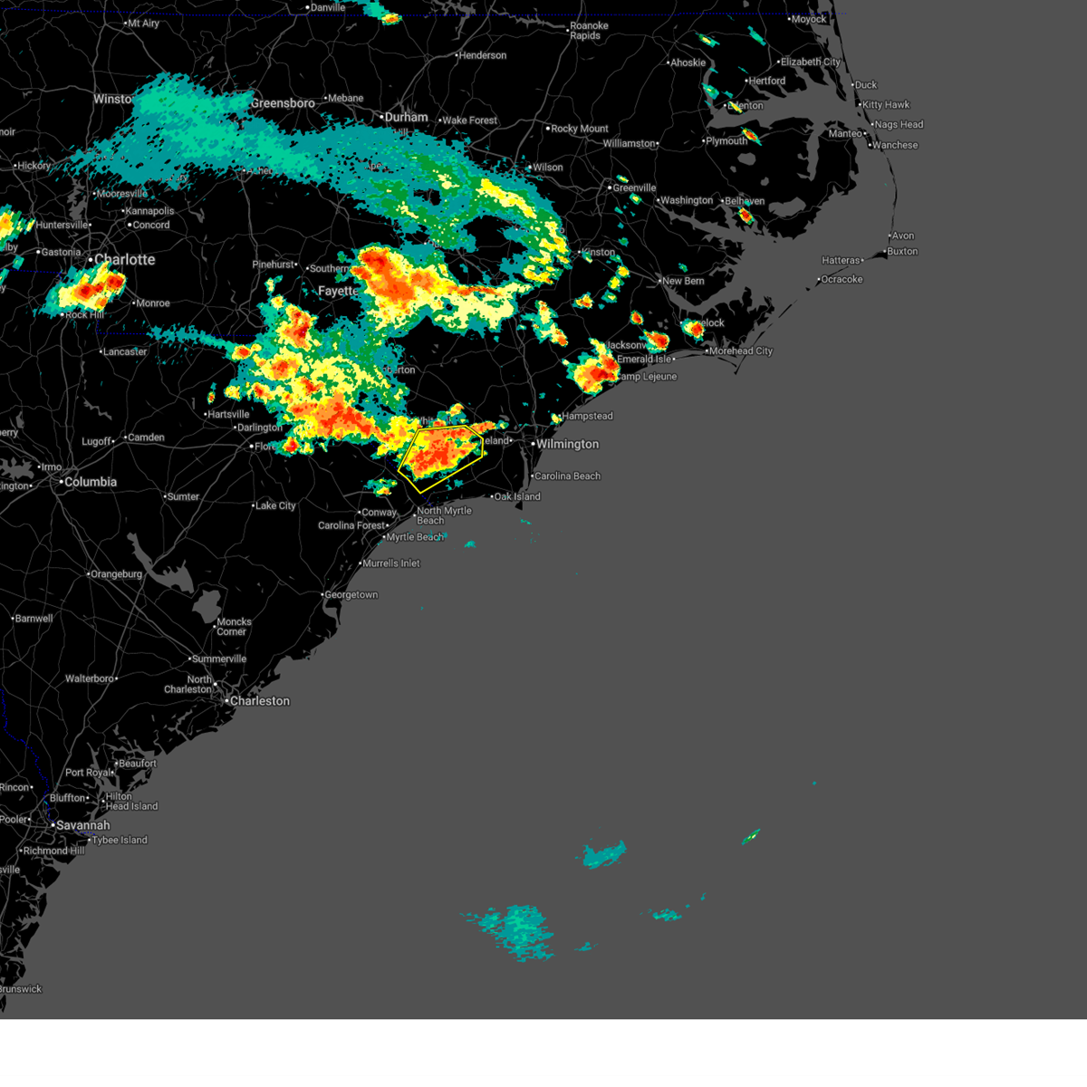
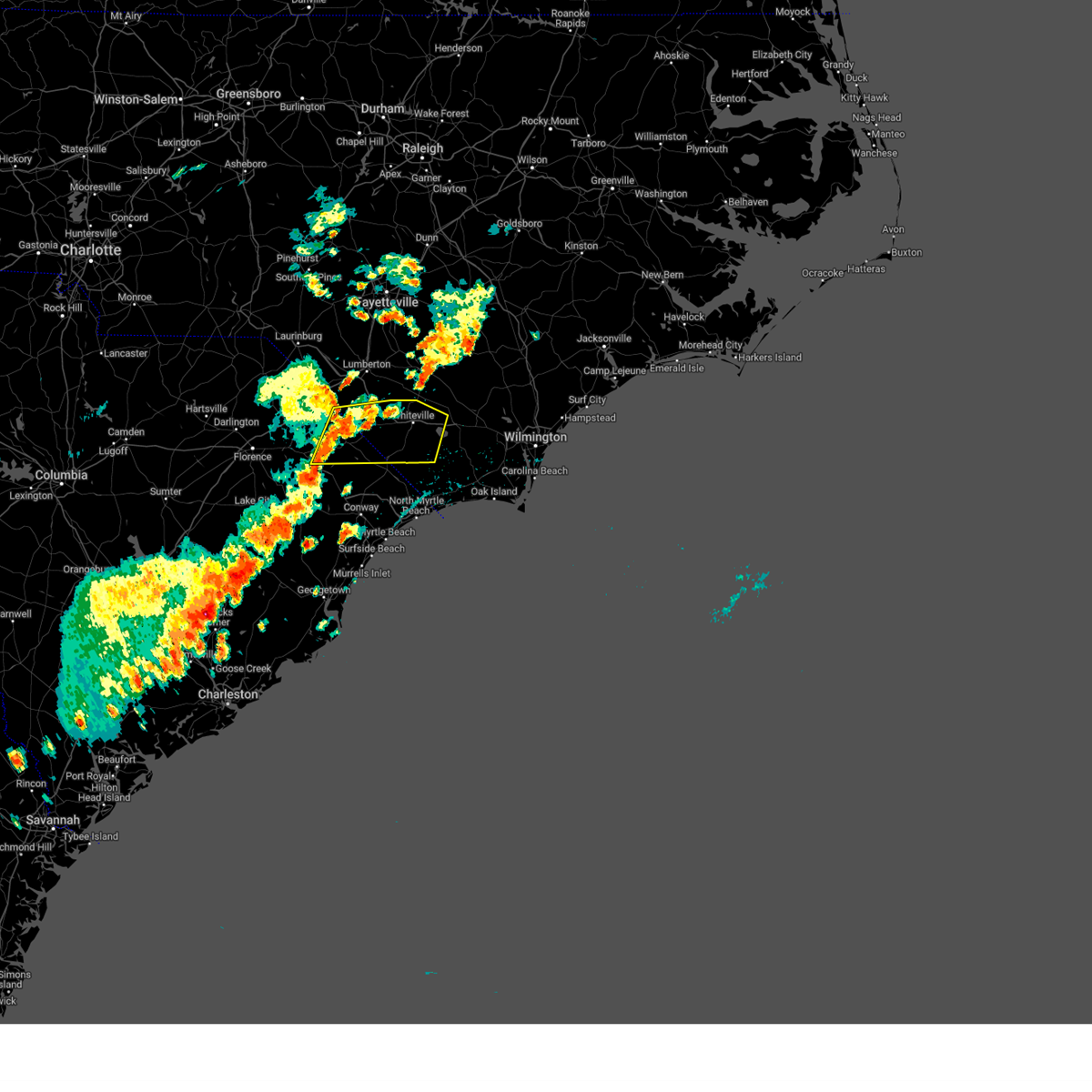
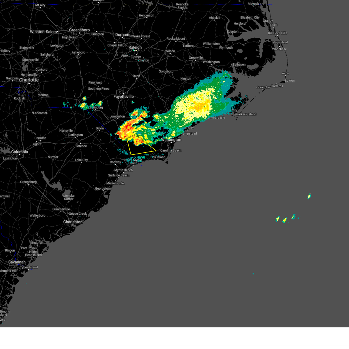
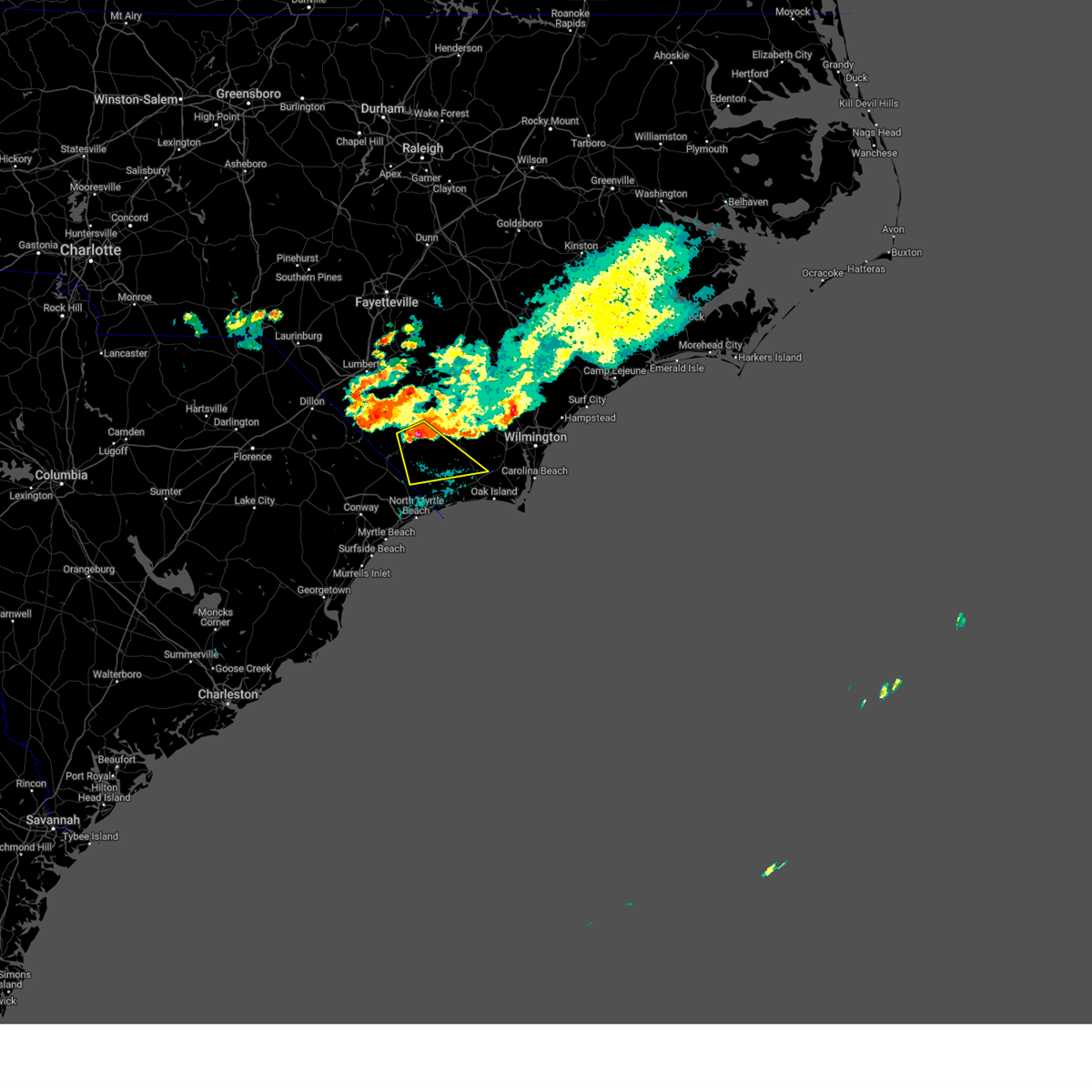
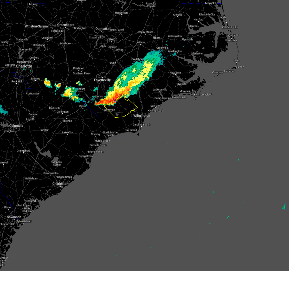
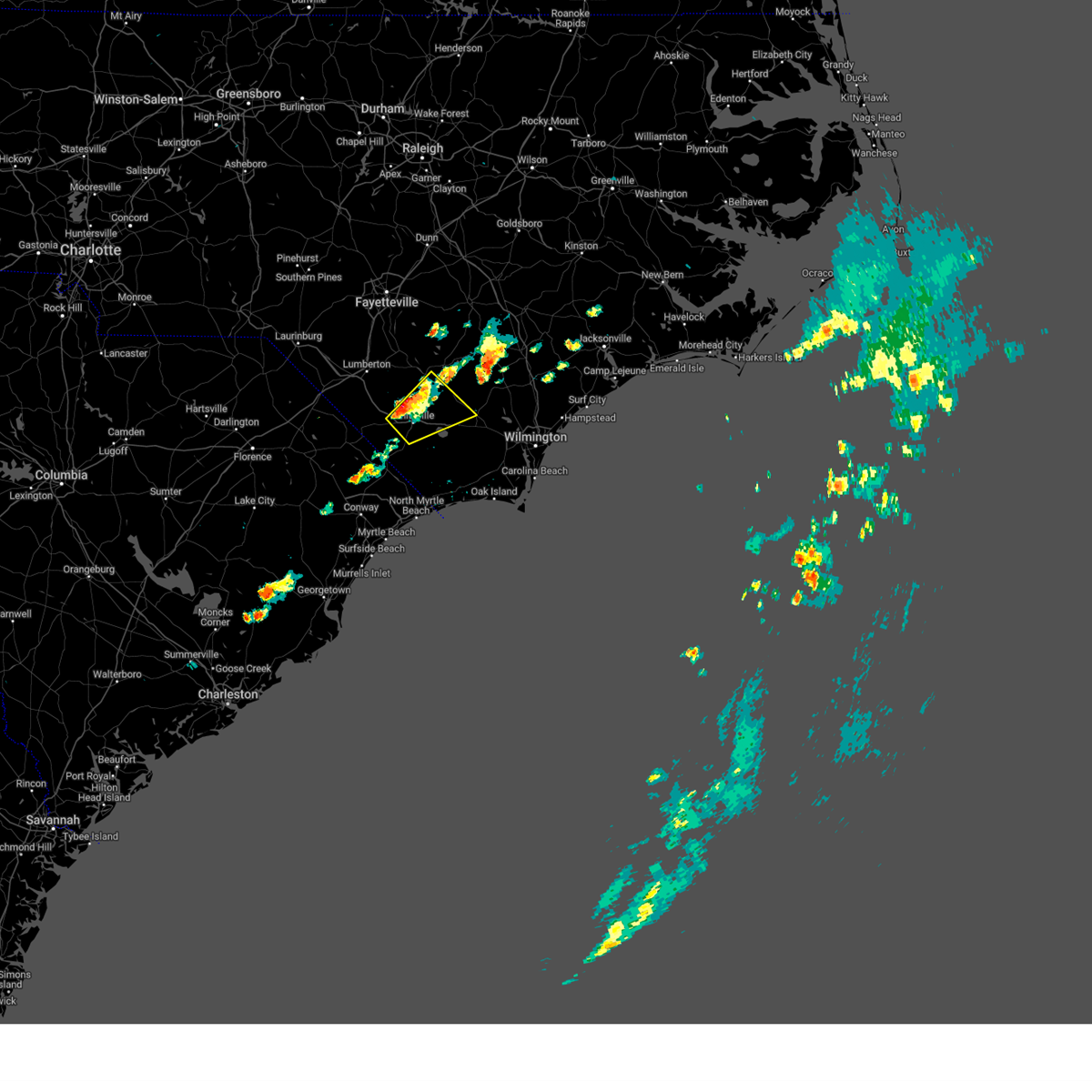
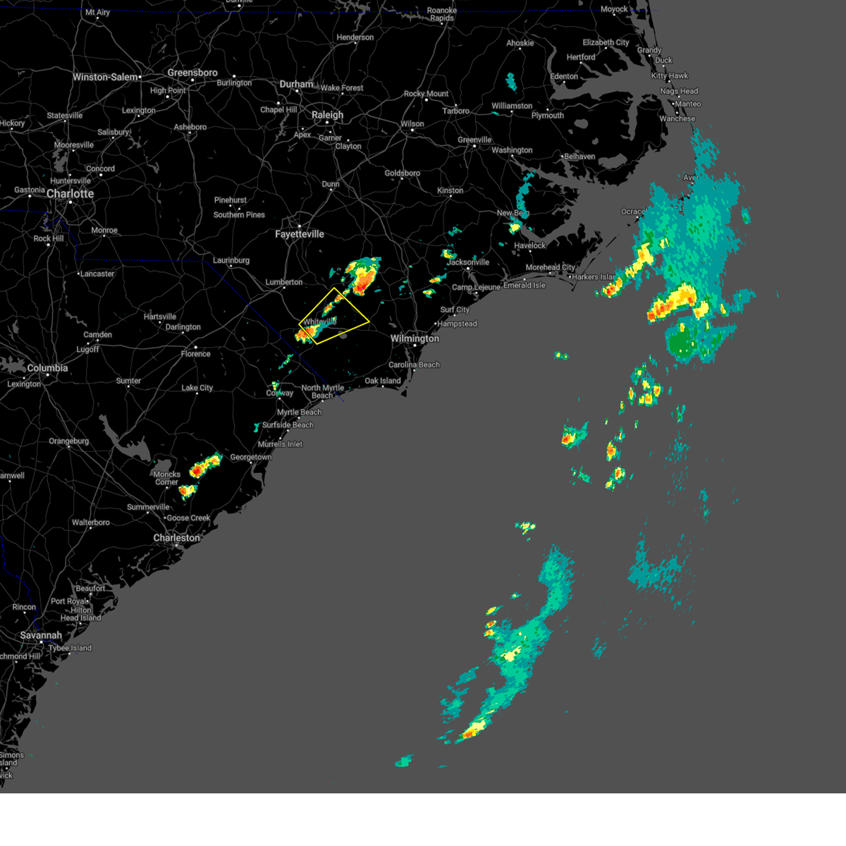
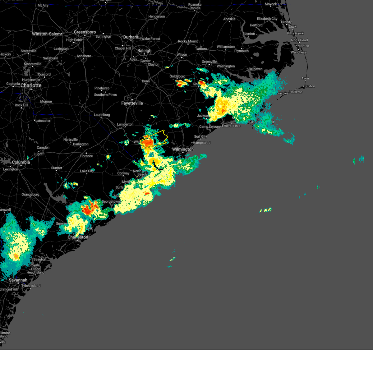
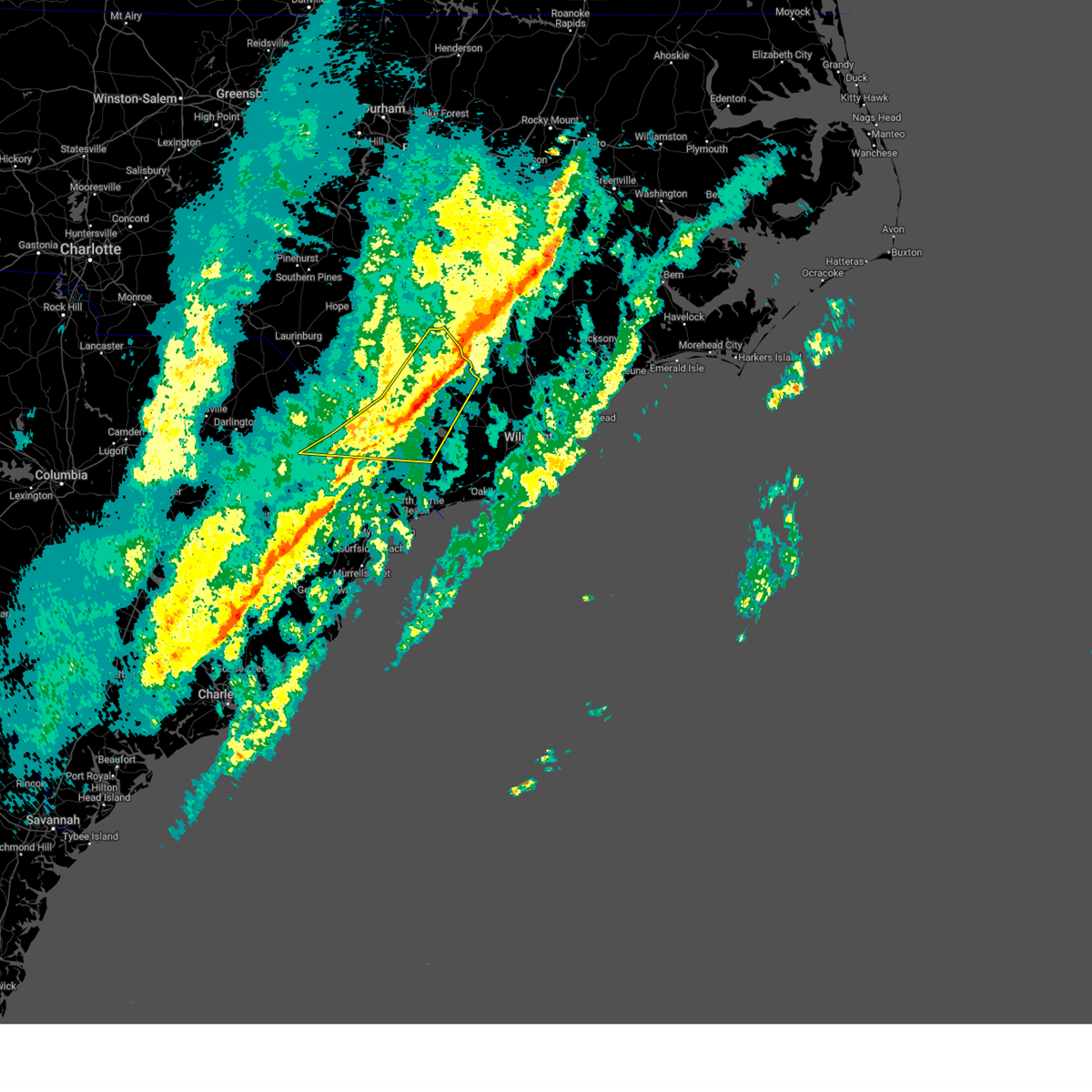
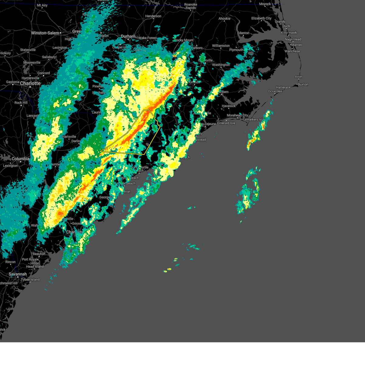
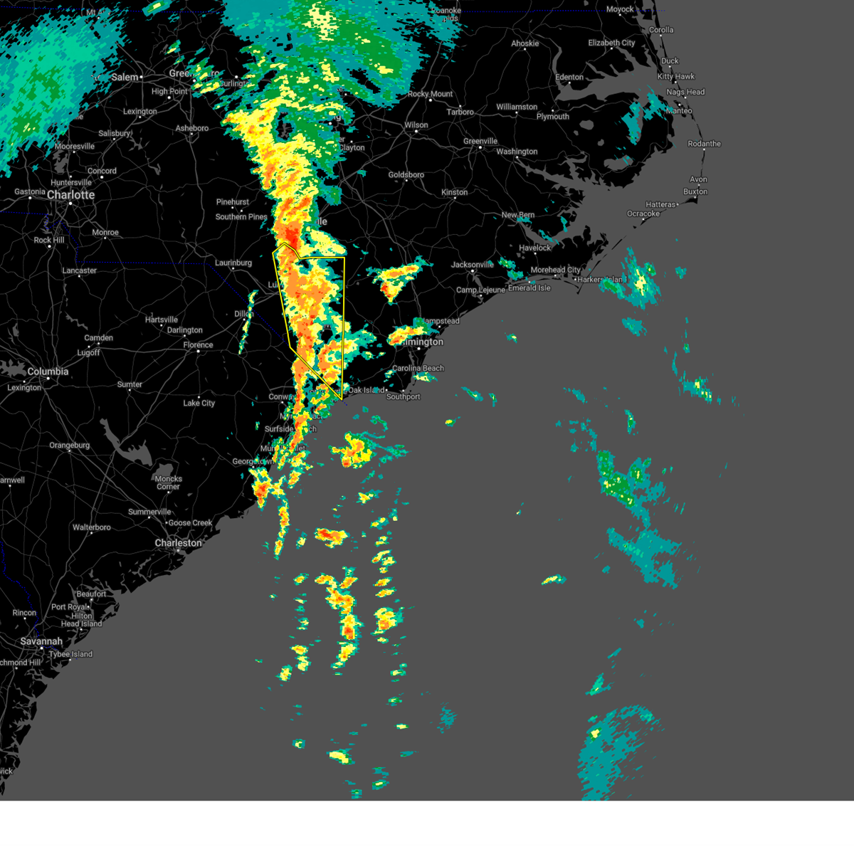
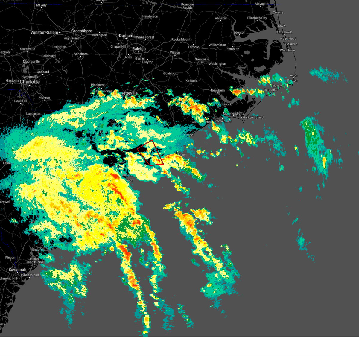
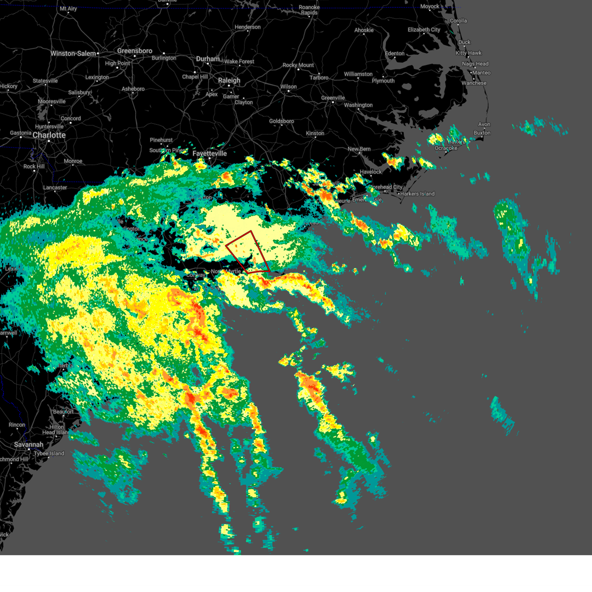
Hail Map for Lake Waccamaw, NC
The Lake Waccamaw, NC area has had 4 reports of on-the-ground hail by trained spotters, and has been under severe weather warnings 27 times during the past 12 months. Doppler radar has detected hail at or near Lake Waccamaw, NC on 61 occasions, including 6 occasions during the past year.
| Name: | Lake Waccamaw, NC |
| Where Located: | 32.9 miles W of Wilmington, NC |
| Map: | Google Map for Lake Waccamaw, NC |
| Population: | 1480 |
| Housing Units: | 968 |
| More Info: | Search Google for Lake Waccamaw, NC |
1
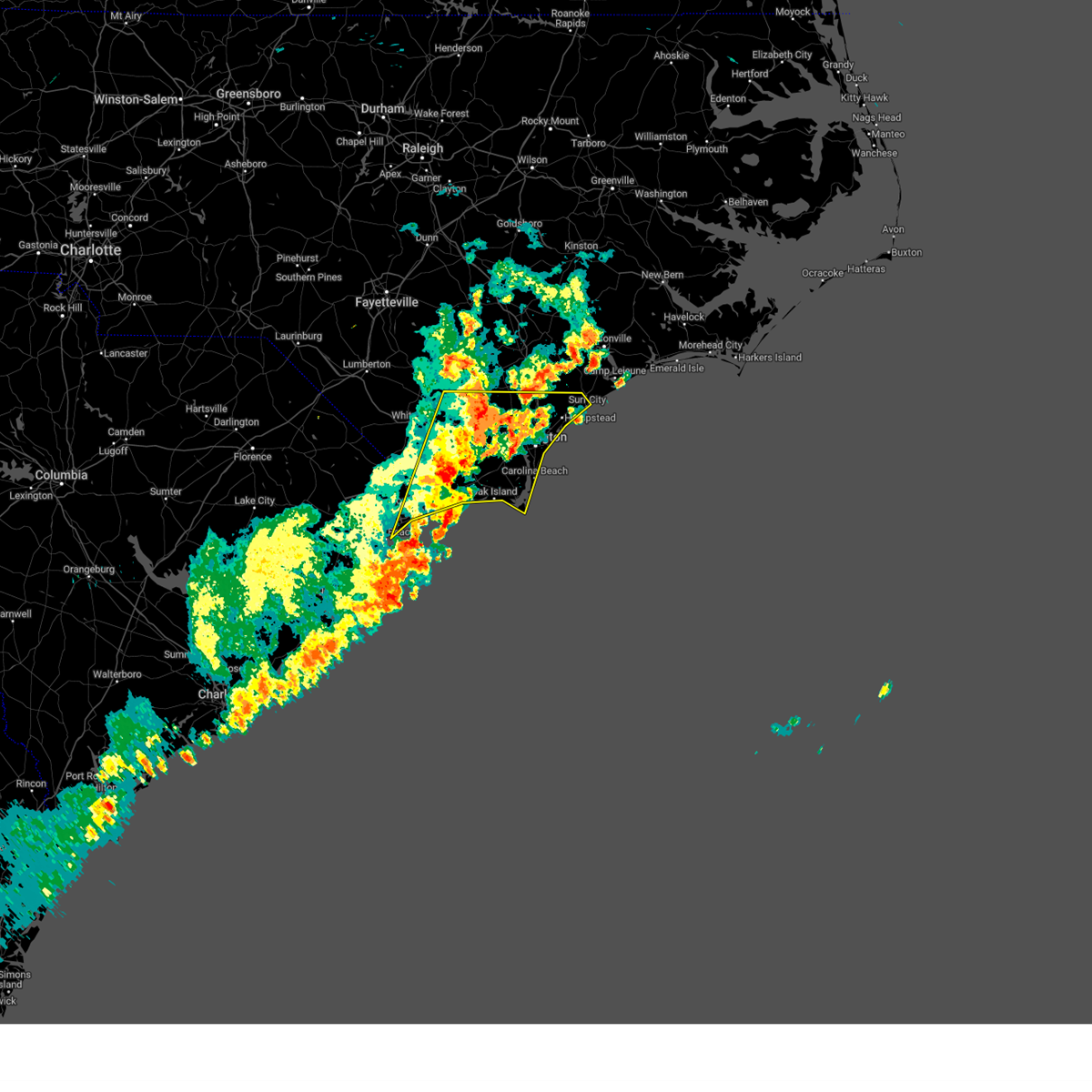
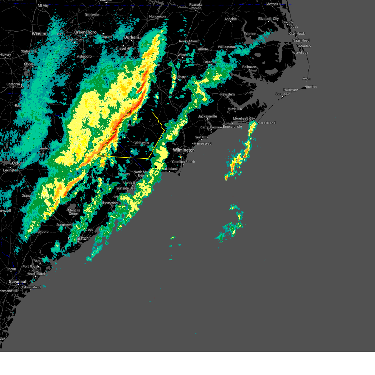
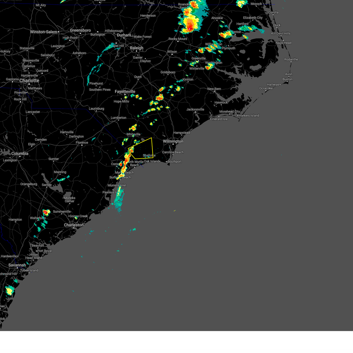
The Top Recent Hail Date for Lake Waccamaw, NC is Wednesday, June 25, 2025 (17th out of 61)

Hail and Wind Damage Spotted near Lake Waccamaw, NC
| Date / Time | Report Details |
|---|---|
| 6/25/2025 6:31 PM EDT | the severe thunderstorm warning has been cancelled and is no longer in effect |
| 6/25/2025 6:05 PM EDT |
 At 605 pm edt, a severe thunderstorm was located near bughill, or 16 miles south of whiteville, moving southwest at 20 mph (radar indicated). Hazards include 60 mph wind gusts and quarter size hail. Minor hail damage to vehicles is possible. expect wind damage to trees and power lines. Locations impacted include, bethel, lake waccamaw, makatoka, freeland, honey island, nakina, old dock, exum, bughill, longwood, pireway, dulah, ash, and crusoe island. At 605 pm edt, a severe thunderstorm was located near bughill, or 16 miles south of whiteville, moving southwest at 20 mph (radar indicated). Hazards include 60 mph wind gusts and quarter size hail. Minor hail damage to vehicles is possible. expect wind damage to trees and power lines. Locations impacted include, bethel, lake waccamaw, makatoka, freeland, honey island, nakina, old dock, exum, bughill, longwood, pireway, dulah, ash, and crusoe island.
|
| 6/25/2025 5:38 PM EDT | Svrilm the national weather service in wilmington has issued a * severe thunderstorm warning for, west central brunswick county in southeastern north carolina, central columbus county in southeastern north carolina, * until 645 pm edt. * at 537 pm edt, a severe thunderstorm was located over lake waccamaw, or 12 miles southeast of whiteville, moving southwest at 25 mph (radar indicated). Hazards include 60 mph wind gusts and quarter size hail. Minor hail damage to vehicles is possible. Expect wind damage to trees and power lines. |
| 6/8/2025 2:09 PM EDT |
 At 207 pm edt, severe thunderstorms were located along a line extending from near the borough to near honey island to near little river entrance, moving east at 50 mph (radar indicated). Hazards include 60 mph wind gusts and quarter size hail. Minor hail damage to vehicles is possible. expect wind damage to trees and power lines. Locations impacted include, wilmington, myrtle beach, north myrtle beach, leland, oak island, carolina beach, shallotte, sunset beach, wrightsville beach, kure beach, surf city, holden beach, ocean isle beach, caswell beach, bald head island, snows cut, little river entrance, south masonboro island, ocean crest pier, and figure eight island. At 207 pm edt, severe thunderstorms were located along a line extending from near the borough to near honey island to near little river entrance, moving east at 50 mph (radar indicated). Hazards include 60 mph wind gusts and quarter size hail. Minor hail damage to vehicles is possible. expect wind damage to trees and power lines. Locations impacted include, wilmington, myrtle beach, north myrtle beach, leland, oak island, carolina beach, shallotte, sunset beach, wrightsville beach, kure beach, surf city, holden beach, ocean isle beach, caswell beach, bald head island, snows cut, little river entrance, south masonboro island, ocean crest pier, and figure eight island.
|
| 6/8/2025 1:43 PM EDT |
 The storms which prompted the warning have moved out of the area. therefore, the warning will be allowed to expire. a severe thunderstorm watch remains in effect until 500 pm edt for southeastern north carolina, and northeastern south carolina. please send your reports of hail and/or wind damage, including trees or large limbs downed, by calling the national weather service office in wilmington at 1-800-697-3901. The storms which prompted the warning have moved out of the area. therefore, the warning will be allowed to expire. a severe thunderstorm watch remains in effect until 500 pm edt for southeastern north carolina, and northeastern south carolina. please send your reports of hail and/or wind damage, including trees or large limbs downed, by calling the national weather service office in wilmington at 1-800-697-3901.
|
| 6/8/2025 1:43 PM EDT |
 Svrilm the national weather service in wilmington has issued a * severe thunderstorm warning for, new hanover county in southeastern north carolina, southern pender county in southeastern north carolina, southern bladen county in southeastern north carolina, brunswick county in southeastern north carolina, columbus county in southeastern north carolina, central horry county in northeastern south carolina, * until 300 pm edt. * at 142 pm edt, severe thunderstorms were located along a line extending from near council to near williams to forestbrook, moving east at 45 mph (radar indicated). Hazards include 60 mph wind gusts and quarter size hail. Minor hail damage to vehicles is possible. Expect wind damage to trees and power lines. Svrilm the national weather service in wilmington has issued a * severe thunderstorm warning for, new hanover county in southeastern north carolina, southern pender county in southeastern north carolina, southern bladen county in southeastern north carolina, brunswick county in southeastern north carolina, columbus county in southeastern north carolina, central horry county in northeastern south carolina, * until 300 pm edt. * at 142 pm edt, severe thunderstorms were located along a line extending from near council to near williams to forestbrook, moving east at 45 mph (radar indicated). Hazards include 60 mph wind gusts and quarter size hail. Minor hail damage to vehicles is possible. Expect wind damage to trees and power lines.
|
| 6/8/2025 1:28 PM EDT |
 At 127 pm edt, severe thunderstorms were located along a line extending from near elkton to near chadbourn to green sea, moving east at 40 mph (radar indicated). Hazards include 60 mph wind gusts and quarter size hail. Minor hail damage to vehicles is possible. expect wind damage to trees and power lines. Locations impacted include, whiteville, tabor city, chadbourn, bethel, lake waccamaw, fair bluff, boardman, hallsboro, nakina, cherry grove, redbug, old dock, mollie, sidney, southeastern community college, clarendon, williams, evergreen, crusoe island, and green sea. At 127 pm edt, severe thunderstorms were located along a line extending from near elkton to near chadbourn to green sea, moving east at 40 mph (radar indicated). Hazards include 60 mph wind gusts and quarter size hail. Minor hail damage to vehicles is possible. expect wind damage to trees and power lines. Locations impacted include, whiteville, tabor city, chadbourn, bethel, lake waccamaw, fair bluff, boardman, hallsboro, nakina, cherry grove, redbug, old dock, mollie, sidney, southeastern community college, clarendon, williams, evergreen, crusoe island, and green sea.
|
| 6/8/2025 1:28 PM EDT |
 the severe thunderstorm warning has been cancelled and is no longer in effect the severe thunderstorm warning has been cancelled and is no longer in effect
|
| 6/8/2025 12:58 PM EDT |
 Svrilm the national weather service in wilmington has issued a * severe thunderstorm warning for, southeastern robeson county in southeastern north carolina, columbus county in southeastern north carolina, southeastern dillon county in northeastern south carolina, northwestern horry county in northeastern south carolina, northeastern marion county in northeastern south carolina, * until 145 pm edt. * at 1257 pm edt, a severe thunderstorm was located near fair bluff, or 8 miles northeast of mullins, moving east at 40 mph (radar indicated). Hazards include 60 mph wind gusts and quarter size hail. Minor hail damage to vehicles is possible. Expect wind damage to trees and power lines. Svrilm the national weather service in wilmington has issued a * severe thunderstorm warning for, southeastern robeson county in southeastern north carolina, columbus county in southeastern north carolina, southeastern dillon county in northeastern south carolina, northwestern horry county in northeastern south carolina, northeastern marion county in northeastern south carolina, * until 145 pm edt. * at 1257 pm edt, a severe thunderstorm was located near fair bluff, or 8 miles northeast of mullins, moving east at 40 mph (radar indicated). Hazards include 60 mph wind gusts and quarter size hail. Minor hail damage to vehicles is possible. Expect wind damage to trees and power lines.
|
| 6/1/2025 9:28 PM EDT |
 the severe thunderstorm warning has been cancelled and is no longer in effect the severe thunderstorm warning has been cancelled and is no longer in effect
|
| 6/1/2025 8:58 PM EDT |
 Svrilm the national weather service in wilmington has issued a * severe thunderstorm warning for, westerb brunswick county in southeastern north carolina, southern columbus county in southeastern north carolina, * until 945 pm edt. * at 857 pm edt, a severe thunderstorm was located near redbug, or near whiteville, moving southeast at 20 mph (radar indicated). Hazards include 60 mph wind gusts and quarter size hail. Minor hail damage to vehicles is possible. Expect wind damage to trees and power lines. Svrilm the national weather service in wilmington has issued a * severe thunderstorm warning for, westerb brunswick county in southeastern north carolina, southern columbus county in southeastern north carolina, * until 945 pm edt. * at 857 pm edt, a severe thunderstorm was located near redbug, or near whiteville, moving southeast at 20 mph (radar indicated). Hazards include 60 mph wind gusts and quarter size hail. Minor hail damage to vehicles is possible. Expect wind damage to trees and power lines.
|
| 6/1/2025 7:46 PM EDT |
 Svrilm the national weather service in wilmington has issued a * severe thunderstorm warning for, southwestern pender county in southeastern north carolina, southern bladen county in southeastern north carolina, northeastern columbus county in southeastern north carolina, * until 845 pm edt. * at 745 pm edt, severe thunderstorms were located along a line extending from 7 miles northeast of lagoon to near elkton to near bladenboro, moving southeast at 30 mph (radar indicated). Hazards include 60 mph wind gusts and penny size hail. expect wind damage to trees and power lines Svrilm the national weather service in wilmington has issued a * severe thunderstorm warning for, southwestern pender county in southeastern north carolina, southern bladen county in southeastern north carolina, northeastern columbus county in southeastern north carolina, * until 845 pm edt. * at 745 pm edt, severe thunderstorms were located along a line extending from 7 miles northeast of lagoon to near elkton to near bladenboro, moving southeast at 30 mph (radar indicated). Hazards include 60 mph wind gusts and penny size hail. expect wind damage to trees and power lines
|
| 5/4/2025 6:13 PM EDT |
 The storm which prompted the warning has moved out of the area. therefore, the warning will be allowed to expire. however, small hail is still possible with this thunderstorm. please send your reports of hail and/or wind damage, including trees or large limbs downed, by calling the national weather service office in wilmington at 1-800-697-3901. The storm which prompted the warning has moved out of the area. therefore, the warning will be allowed to expire. however, small hail is still possible with this thunderstorm. please send your reports of hail and/or wind damage, including trees or large limbs downed, by calling the national weather service office in wilmington at 1-800-697-3901.
|
| 5/4/2025 5:46 PM EDT |
 Svrilm the national weather service in wilmington has issued a * severe thunderstorm warning for, southwestern bladen county in southeastern north carolina, northern columbus county in southeastern north carolina, * until 615 pm edt. * at 545 pm edt, a severe thunderstorm was located over southeastern community college, or near whiteville, moving northeast at 30 mph (radar indicated). Hazards include 60 mph wind gusts and quarter size hail. Minor hail damage to vehicles is possible. Expect wind damage to trees and power lines. Svrilm the national weather service in wilmington has issued a * severe thunderstorm warning for, southwestern bladen county in southeastern north carolina, northern columbus county in southeastern north carolina, * until 615 pm edt. * at 545 pm edt, a severe thunderstorm was located over southeastern community college, or near whiteville, moving northeast at 30 mph (radar indicated). Hazards include 60 mph wind gusts and quarter size hail. Minor hail damage to vehicles is possible. Expect wind damage to trees and power lines.
|
| 4/23/2025 6:37 PM EDT |
 At 637 pm edt, a severe thunderstorm was located near council, or 16 miles east of whiteville, moving east at 15 mph (radar indicated). Hazards include 60 mph wind gusts and quarter size hail. Minor hail damage to vehicles is possible. expect wind damage to trees and powerlines. Locations impacted include: rowan, carvers, sandyfield, east arcadia, bolton, council, emerson, kelly, and lake waccamaw. At 637 pm edt, a severe thunderstorm was located near council, or 16 miles east of whiteville, moving east at 15 mph (radar indicated). Hazards include 60 mph wind gusts and quarter size hail. Minor hail damage to vehicles is possible. expect wind damage to trees and powerlines. Locations impacted include: rowan, carvers, sandyfield, east arcadia, bolton, council, emerson, kelly, and lake waccamaw.
|
| 4/23/2025 6:21 PM EDT |
 Svrilm the national weather service in wilmington has issued a * severe thunderstorm warning for portions of, southeastern bladen county in southeastern north carolina, northeastern columbus county in southeastern north carolina, * until 715 pm edt. * at 621 pm edt, a severe thunderstorm was located near council, or 12 miles east of whiteville, moving northeast at 20 mph (radar indicated). Hazards include 60 mph wind gusts and quarter size hail. Minor hail damage to vehicles is possible. expect wind damage to trees and powerlines. Locations impacted include: rowan, carvers, sandyfield, hallsboro, east arcadia, redbug, council, emerson, kelly, bolton, and lake waccamaw. Svrilm the national weather service in wilmington has issued a * severe thunderstorm warning for portions of, southeastern bladen county in southeastern north carolina, northeastern columbus county in southeastern north carolina, * until 715 pm edt. * at 621 pm edt, a severe thunderstorm was located near council, or 12 miles east of whiteville, moving northeast at 20 mph (radar indicated). Hazards include 60 mph wind gusts and quarter size hail. Minor hail damage to vehicles is possible. expect wind damage to trees and powerlines. Locations impacted include: rowan, carvers, sandyfield, hallsboro, east arcadia, redbug, council, emerson, kelly, bolton, and lake waccamaw.
|
| 2/16/2025 10:30 AM EST |
 The storms which prompted the warning have weakened below severe limits, and no longer pose an immediate threat to life or property. therefore, the warning has been allowed to expire. a severe thunderstorm watch remains in effect until 300 pm est for southeastern north carolina. please send your reports of hail and/or wind damage, including trees or large limbs downed, by calling the national weather service office in wilmington at 1-800-697-3901. The storms which prompted the warning have weakened below severe limits, and no longer pose an immediate threat to life or property. therefore, the warning has been allowed to expire. a severe thunderstorm watch remains in effect until 300 pm est for southeastern north carolina. please send your reports of hail and/or wind damage, including trees or large limbs downed, by calling the national weather service office in wilmington at 1-800-697-3901.
|
| 2/16/2025 10:12 AM EST |
 At 1011 am est, severe thunderstorms were located along a line extending from 6 miles northeast of ammon to abbottsburg to near cherry grove, moving east at 45 mph (radar indicated). Hazards include 60 mph wind gusts. Expect wind damage to trees and power lines. Locations impacted include, marion, whiteville, mullins, elizabethtown, tabor city, chadbourn, bladenboro, lake waccamaw, fair bluff, boardman, hallsboro, bladen community college, ammon, nakina, redbug, council, southeastern community college, williams, carvers, and abbottsburg. At 1011 am est, severe thunderstorms were located along a line extending from 6 miles northeast of ammon to abbottsburg to near cherry grove, moving east at 45 mph (radar indicated). Hazards include 60 mph wind gusts. Expect wind damage to trees and power lines. Locations impacted include, marion, whiteville, mullins, elizabethtown, tabor city, chadbourn, bladenboro, lake waccamaw, fair bluff, boardman, hallsboro, bladen community college, ammon, nakina, redbug, council, southeastern community college, williams, carvers, and abbottsburg.
|
| 2/16/2025 9:35 AM EST |
 Svrilm the national weather service in wilmington has issued a * severe thunderstorm warning for, eastern robeson county in southeastern north carolina, bladen county in southeastern north carolina, columbus county in southeastern north carolina, southeastern dillon county in northeastern south carolina, northwestern horry county in northeastern south carolina, northern marion county in northeastern south carolina, * until 1030 am est. * at 935 am est, severe thunderstorms were located along a line extending from near tobermory to fairmont to near marion, moving east at 45 mph (radar indicated). Hazards include 60 mph wind gusts. expect wind damage to trees and power lines Svrilm the national weather service in wilmington has issued a * severe thunderstorm warning for, eastern robeson county in southeastern north carolina, bladen county in southeastern north carolina, columbus county in southeastern north carolina, southeastern dillon county in northeastern south carolina, northwestern horry county in northeastern south carolina, northern marion county in northeastern south carolina, * until 1030 am est. * at 935 am est, severe thunderstorms were located along a line extending from near tobermory to fairmont to near marion, moving east at 45 mph (radar indicated). Hazards include 60 mph wind gusts. expect wind damage to trees and power lines
|
| 9/27/2024 11:16 AM EDT |
 The storms which prompted the warning have moved out of the area. therefore, the warning has been allowed to expire. a tornado watch remains in effect until 600 pm edt for southeastern north carolina, and northeastern south carolina. please send your reports of hail and/or wind damage, including trees or large limbs downed, by calling the national weather service office in wilmington at 1-800-697-3901. The storms which prompted the warning have moved out of the area. therefore, the warning has been allowed to expire. a tornado watch remains in effect until 600 pm edt for southeastern north carolina, and northeastern south carolina. please send your reports of hail and/or wind damage, including trees or large limbs downed, by calling the national weather service office in wilmington at 1-800-697-3901.
|
| 9/27/2024 10:50 AM EDT |
 At 1049 am edt, severe thunderstorms were located along a line extending from jerome to near emerson to near pireway, moving north at 55 mph (radar indicated). Hazards include 60 mph wind gusts. Expect wind damage to trees and power lines. Locations impacted include, whiteville, elizabethtown, iredell, carolina shores, chadbourn, calabash, bladenboro, bethel, lake waccamaw, hallsboro, bladen community college, ammon, nakina, butters, redbug, bughill, longwood, southeastern community college, williams, and white oak. At 1049 am edt, severe thunderstorms were located along a line extending from jerome to near emerson to near pireway, moving north at 55 mph (radar indicated). Hazards include 60 mph wind gusts. Expect wind damage to trees and power lines. Locations impacted include, whiteville, elizabethtown, iredell, carolina shores, chadbourn, calabash, bladenboro, bethel, lake waccamaw, hallsboro, bladen community college, ammon, nakina, butters, redbug, bughill, longwood, southeastern community college, williams, and white oak.
|
| 9/27/2024 10:18 AM EDT |
 Svrilm the national weather service in wilmington has issued a * severe thunderstorm warning for, eastern robeson county in southeastern north carolina, western bladen county in southeastern north carolina, southwestern brunswick county in southeastern north carolina, columbus county in southeastern north carolina, * until 1115 am edt. * at 1015 am edt, severe thunderstorms were located along a line extending from 7 miles south of fayetteville to near bladen community college to sidney, moving north at 65 mph (radar indicated). Hazards include 60 mph wind gusts. expect wind damage to trees and power lines Svrilm the national weather service in wilmington has issued a * severe thunderstorm warning for, eastern robeson county in southeastern north carolina, western bladen county in southeastern north carolina, southwestern brunswick county in southeastern north carolina, columbus county in southeastern north carolina, * until 1115 am edt. * at 1015 am edt, severe thunderstorms were located along a line extending from 7 miles south of fayetteville to near bladen community college to sidney, moving north at 65 mph (radar indicated). Hazards include 60 mph wind gusts. expect wind damage to trees and power lines
|
| 9/16/2024 2:54 PM EDT |
 The storm which prompted the warning has weakened below severe limits, and no longer appears capable of producing a tornado. therefore, the warning will be allowed to expire. please send your reports of hail and/or wind damage, including trees or large limbs downed, by calling the national weather service office in wilmington at 1-800-697-3901. The storm which prompted the warning has weakened below severe limits, and no longer appears capable of producing a tornado. therefore, the warning will be allowed to expire. please send your reports of hail and/or wind damage, including trees or large limbs downed, by calling the national weather service office in wilmington at 1-800-697-3901.
|
| 9/16/2024 2:35 PM EDT |
 Torilm the national weather service in wilmington has issued a * tornado warning for, central brunswick county in southeastern north carolina, northeastern columbus county in southeastern north carolina, * until 300 pm edt. * at 234 pm edt, a severe thunderstorm capable of producing a tornado was located near batarora, or 11 miles west of leland, moving northwest at 20 mph (radar indicated rotation). Hazards include tornado. Flying debris will be dangerous to those caught without shelter. mobile homes will be damaged or destroyed. damage to roofs, windows, and vehicles will occur. tree damage is likely. this dangerous storm will be near, freeman around 250 pm edt. Other locations impacted by this tornadic thunderstorm include sandy creek, bolivia, and bolton. Torilm the national weather service in wilmington has issued a * tornado warning for, central brunswick county in southeastern north carolina, northeastern columbus county in southeastern north carolina, * until 300 pm edt. * at 234 pm edt, a severe thunderstorm capable of producing a tornado was located near batarora, or 11 miles west of leland, moving northwest at 20 mph (radar indicated rotation). Hazards include tornado. Flying debris will be dangerous to those caught without shelter. mobile homes will be damaged or destroyed. damage to roofs, windows, and vehicles will occur. tree damage is likely. this dangerous storm will be near, freeman around 250 pm edt. Other locations impacted by this tornadic thunderstorm include sandy creek, bolivia, and bolton.
|
| 8/20/2024 6:51 PM EDT |
 Svrilm the national weather service in wilmington has issued a * severe thunderstorm warning for, west central brunswick county in southeastern north carolina, central columbus county in southeastern north carolina, * until 745 pm edt. * at 651 pm edt, a severe thunderstorm was located over freeland, or 12 miles northwest of shallotte, moving northeast at 15 mph (radar indicated). Hazards include 60 mph wind gusts and quarter size hail. Minor hail damage to vehicles is possible. Expect wind damage to trees and power lines. Svrilm the national weather service in wilmington has issued a * severe thunderstorm warning for, west central brunswick county in southeastern north carolina, central columbus county in southeastern north carolina, * until 745 pm edt. * at 651 pm edt, a severe thunderstorm was located over freeland, or 12 miles northwest of shallotte, moving northeast at 15 mph (radar indicated). Hazards include 60 mph wind gusts and quarter size hail. Minor hail damage to vehicles is possible. Expect wind damage to trees and power lines.
|
| 8/6/2024 9:23 AM EDT |
 The storm which prompted the warning has weakened below severe limits, and no longer appears capable of producing a tornado. therefore, the warning will be allowed to expire. a tornado watch remains in effect until 500 pm edt for southeastern north carolina. please send your reports of hail and/or wind damage, including trees or large limbs downed, by calling the national weather service office in wilmington at 1-800-697-3901. The storm which prompted the warning has weakened below severe limits, and no longer appears capable of producing a tornado. therefore, the warning will be allowed to expire. a tornado watch remains in effect until 500 pm edt for southeastern north carolina. please send your reports of hail and/or wind damage, including trees or large limbs downed, by calling the national weather service office in wilmington at 1-800-697-3901.
|
| 8/6/2024 9:04 AM EDT |
 Torilm the national weather service in wilmington has issued a * tornado warning for, southwestern brunswick county in southeastern north carolina, central columbus county in southeastern north carolina, * until 930 am edt. * at 903 am edt, a cluster of thunderstorms associated with debby's rains bands capable of producing waterspouts offshore near holden beach, moving northwest at 35 mph. these possible waterspouts may move onshore as tornadoes (radar indicated rotation). Hazards include tornado. Flying debris will be dangerous to those caught without shelter. mobile homes will be damaged or destroyed. damage to roofs, windows, and vehicles will occur. tree damage is likely. this dangerous storm will be near, shallotte, supply, and civie town around 910 am edt. makatoka around 915 am edt. exum around 920 am edt. Other locations impacted by this tornadic thunderstorm include varnamtown and brunswick novant medical center. Torilm the national weather service in wilmington has issued a * tornado warning for, southwestern brunswick county in southeastern north carolina, central columbus county in southeastern north carolina, * until 930 am edt. * at 903 am edt, a cluster of thunderstorms associated with debby's rains bands capable of producing waterspouts offshore near holden beach, moving northwest at 35 mph. these possible waterspouts may move onshore as tornadoes (radar indicated rotation). Hazards include tornado. Flying debris will be dangerous to those caught without shelter. mobile homes will be damaged or destroyed. damage to roofs, windows, and vehicles will occur. tree damage is likely. this dangerous storm will be near, shallotte, supply, and civie town around 910 am edt. makatoka around 915 am edt. exum around 920 am edt. Other locations impacted by this tornadic thunderstorm include varnamtown and brunswick novant medical center.
|
| 6/24/2024 7:06 PM EDT |
 Svrilm the national weather service in wilmington has issued a * severe thunderstorm warning for, southwestern bladen county in southeastern north carolina, western columbus county in southeastern north carolina, * until 745 pm edt. * at 705 pm edt, a severe thunderstorm was located over southeastern community college, or near whiteville, moving southeast at 25 mph (radar indicated). Hazards include 60 mph wind gusts and quarter size hail. Minor hail damage to vehicles is possible. Expect wind damage to trees and power lines. Svrilm the national weather service in wilmington has issued a * severe thunderstorm warning for, southwestern bladen county in southeastern north carolina, western columbus county in southeastern north carolina, * until 745 pm edt. * at 705 pm edt, a severe thunderstorm was located over southeastern community college, or near whiteville, moving southeast at 25 mph (radar indicated). Hazards include 60 mph wind gusts and quarter size hail. Minor hail damage to vehicles is possible. Expect wind damage to trees and power lines.
|
| 5/15/2024 5:43 PM EDT |
 the severe thunderstorm warning has been cancelled and is no longer in effect the severe thunderstorm warning has been cancelled and is no longer in effect
|
| 5/15/2024 4:57 PM EDT |
 Svrilm the national weather service in wilmington has issued a * severe thunderstorm warning for, northeastern columbus county in southeastern north carolina, * until 600 pm edt. * at 457 pm edt, a severe thunderstorm was located over redbug, or near whiteville, moving east at 20 mph (radar indicated). Hazards include 60 mph wind gusts and quarter size hail. Minor hail damage to vehicles is possible. Expect wind damage to trees and power lines. Svrilm the national weather service in wilmington has issued a * severe thunderstorm warning for, northeastern columbus county in southeastern north carolina, * until 600 pm edt. * at 457 pm edt, a severe thunderstorm was located over redbug, or near whiteville, moving east at 20 mph (radar indicated). Hazards include 60 mph wind gusts and quarter size hail. Minor hail damage to vehicles is possible. Expect wind damage to trees and power lines.
|
| 5/10/2024 6:36 PM EDT |
 The storms which prompted the warning have weakened and the warning will be allowed to expire. however, gusty winds are still possible with these thunderstorms. a severe thunderstorm watch remains in effect until 900 pm edt for southeastern north carolina, and northeastern south carolina. please send your reports of hail and/or wind damage, including trees or large limbs downed, by calling the national weather service office in wilmington at 1-800-697-3901. The storms which prompted the warning have weakened and the warning will be allowed to expire. however, gusty winds are still possible with these thunderstorms. a severe thunderstorm watch remains in effect until 900 pm edt for southeastern north carolina, and northeastern south carolina. please send your reports of hail and/or wind damage, including trees or large limbs downed, by calling the national weather service office in wilmington at 1-800-697-3901.
|
| 5/10/2024 6:12 PM EDT |
 At 611 pm edt, severe thunderstorms were located along a line extending from 6 miles north of honey island to near green sea, moving southeast at 35 mph (radar indicated). Hazards include 60 mph wind gusts and penny size hail. Expect wind damage to trees and power lines. these severe storms will be near, tabor city, bethel, lake waccamaw, old dock, green sea, sidney, crusoe island, mollie, clarendon, and nakina around 615 pm edt. loris around 620 pm edt. freeland, bughill, makatoka, and exum around 625 pm edt. dulah around 630 pm edt. pireway and ash around 635 pm edt. Other locations impacted by these severe thunderstorms include sandy creek and bolton. At 611 pm edt, severe thunderstorms were located along a line extending from 6 miles north of honey island to near green sea, moving southeast at 35 mph (radar indicated). Hazards include 60 mph wind gusts and penny size hail. Expect wind damage to trees and power lines. these severe storms will be near, tabor city, bethel, lake waccamaw, old dock, green sea, sidney, crusoe island, mollie, clarendon, and nakina around 615 pm edt. loris around 620 pm edt. freeland, bughill, makatoka, and exum around 625 pm edt. dulah around 630 pm edt. pireway and ash around 635 pm edt. Other locations impacted by these severe thunderstorms include sandy creek and bolton.
|
| 5/10/2024 6:03 PM EDT |
 the severe thunderstorm warning has been cancelled and is no longer in effect the severe thunderstorm warning has been cancelled and is no longer in effect
|
| 5/10/2024 6:03 PM EDT |
 At 602 pm edt, severe thunderstorms were located along a line extending from 6 miles west of freeman to 6 miles east of mullins, moving southeast at 25 mph (radar indicated). Hazards include 60 mph wind gusts and penny size hail. Expect wind damage to trees and power lines. these severe storms will be near, tabor city, lake waccamaw, green sea, sidney, crusoe island, clarendon, freeman, and williams around 610 pm edt. old dock and mollie around 615 pm edt. bethel, nakina, and honey island around 625 pm edt. loris and batarora around 630 pm edt. freeland, bughill, makatoka, and exum around 640 pm edt. dulah around 645 pm edt. Other locations impacted by these severe thunderstorms include sandy creek, brunswick, bolton, and columbus regional healthcare system. At 602 pm edt, severe thunderstorms were located along a line extending from 6 miles west of freeman to 6 miles east of mullins, moving southeast at 25 mph (radar indicated). Hazards include 60 mph wind gusts and penny size hail. Expect wind damage to trees and power lines. these severe storms will be near, tabor city, lake waccamaw, green sea, sidney, crusoe island, clarendon, freeman, and williams around 610 pm edt. old dock and mollie around 615 pm edt. bethel, nakina, and honey island around 625 pm edt. loris and batarora around 630 pm edt. freeland, bughill, makatoka, and exum around 640 pm edt. dulah around 645 pm edt. Other locations impacted by these severe thunderstorms include sandy creek, brunswick, bolton, and columbus regional healthcare system.
|
| 5/10/2024 5:48 PM EDT |
 At 547 pm edt, severe thunderstorms were located along a line extending from near sandyfield to chadbourn, moving east at 45 mph (radar indicated). Hazards include 60 mph wind gusts and quarter size hail. Minor hail damage to vehicles is possible. expect wind damage to trees and power lines. locations impacted include, whiteville, lake waccamaw, boardman, hallsboro, redbug, evergreen, and columbus regional healthcare system. A larger severe thunderstorm warning covers other sections of columbus county through 645 pm. At 547 pm edt, severe thunderstorms were located along a line extending from near sandyfield to chadbourn, moving east at 45 mph (radar indicated). Hazards include 60 mph wind gusts and quarter size hail. Minor hail damage to vehicles is possible. expect wind damage to trees and power lines. locations impacted include, whiteville, lake waccamaw, boardman, hallsboro, redbug, evergreen, and columbus regional healthcare system. A larger severe thunderstorm warning covers other sections of columbus county through 645 pm.
|
| 5/10/2024 5:48 PM EDT |
 the severe thunderstorm warning has been cancelled and is no longer in effect the severe thunderstorm warning has been cancelled and is no longer in effect
|
| 5/10/2024 5:41 PM EDT |
 Svrilm the national weather service in wilmington has issued a * severe thunderstorm warning for, western brunswick county in southeastern north carolina, columbus county in southeastern north carolina, eastern dillon county in northeastern south carolina, northeastern northern horry county in northeastern south carolina, * until 645 pm edt. * at 540 pm edt, severe thunderstorms were located along a line extending from near evergreen to near kemper, moving east at 40 mph (radar indicated). Hazards include 60 mph wind gusts and penny size hail. expect wind damage to trees and power lines Svrilm the national weather service in wilmington has issued a * severe thunderstorm warning for, western brunswick county in southeastern north carolina, columbus county in southeastern north carolina, eastern dillon county in northeastern south carolina, northeastern northern horry county in northeastern south carolina, * until 645 pm edt. * at 540 pm edt, severe thunderstorms were located along a line extending from near evergreen to near kemper, moving east at 40 mph (radar indicated). Hazards include 60 mph wind gusts and penny size hail. expect wind damage to trees and power lines
|
| 5/10/2024 5:37 PM EDT |
 At 536 pm edt, severe thunderstorms were located along a line extending from near emerson to near boardman, moving east at 30 mph (radar indicated). Hazards include 60 mph wind gusts and quarter size hail. Minor hail damage to vehicles is possible. expect wind damage to trees and power lines. Locations impacted include, whiteville, bladenboro, lake waccamaw, boardman, carvers, hallsboro, abbottsburg, redbug, elkton, emerson, council, evergreen, lisbon, clarkton, and columbus regional healthcare system. At 536 pm edt, severe thunderstorms were located along a line extending from near emerson to near boardman, moving east at 30 mph (radar indicated). Hazards include 60 mph wind gusts and quarter size hail. Minor hail damage to vehicles is possible. expect wind damage to trees and power lines. Locations impacted include, whiteville, bladenboro, lake waccamaw, boardman, carvers, hallsboro, abbottsburg, redbug, elkton, emerson, council, evergreen, lisbon, clarkton, and columbus regional healthcare system.
|
| 5/10/2024 5:37 PM EDT |
 the severe thunderstorm warning has been cancelled and is no longer in effect the severe thunderstorm warning has been cancelled and is no longer in effect
|
| 5/10/2024 5:15 PM EDT |
 At 514 pm edt, severe thunderstorms were located along a line extending from near abbottsburg to near fairmont, moving east at 25 mph (radar indicated). Hazards include 60 mph wind gusts and quarter size hail. Minor hail damage to vehicles is possible. expect wind damage to trees and power lines. these severe storms will be near, boardman, elkton, and evergreen around 520 pm edt. emerson around 525 pm edt. council around 540 pm edt. carvers around 545 pm edt. whiteville around 555 pm edt. lake waccamaw around 610 pm edt. hallsboro around 615 pm edt. Other locations impacted by these severe thunderstorms include orrum, clarkton, proctorville, and columbus regional healthcare system. At 514 pm edt, severe thunderstorms were located along a line extending from near abbottsburg to near fairmont, moving east at 25 mph (radar indicated). Hazards include 60 mph wind gusts and quarter size hail. Minor hail damage to vehicles is possible. expect wind damage to trees and power lines. these severe storms will be near, boardman, elkton, and evergreen around 520 pm edt. emerson around 525 pm edt. council around 540 pm edt. carvers around 545 pm edt. whiteville around 555 pm edt. lake waccamaw around 610 pm edt. hallsboro around 615 pm edt. Other locations impacted by these severe thunderstorms include orrum, clarkton, proctorville, and columbus regional healthcare system.
|
| 5/10/2024 4:39 PM EDT |
 Svrilm the national weather service in wilmington has issued a * severe thunderstorm warning for, southeastern robeson county in southeastern north carolina, southwestern bladen county in southeastern north carolina, northwestern columbus county in southeastern north carolina, * until 600 pm edt. * at 439 pm edt, a severe thunderstorm was located over fairmont, or 9 miles southwest of lumberton, moving east at 35 mph (radar indicated). Hazards include 60 mph wind gusts and quarter size hail. Minor hail damage to vehicles is possible. expect wind damage to trees and power lines. this severe thunderstorm will be near, boardman around 445 pm edt. elkton around 520 pm edt. emerson around 525 pm edt. council around 535 pm edt. Other locations impacted by this severe thunderstorm include orrum, clarkton, and proctorville. Svrilm the national weather service in wilmington has issued a * severe thunderstorm warning for, southeastern robeson county in southeastern north carolina, southwestern bladen county in southeastern north carolina, northwestern columbus county in southeastern north carolina, * until 600 pm edt. * at 439 pm edt, a severe thunderstorm was located over fairmont, or 9 miles southwest of lumberton, moving east at 35 mph (radar indicated). Hazards include 60 mph wind gusts and quarter size hail. Minor hail damage to vehicles is possible. expect wind damage to trees and power lines. this severe thunderstorm will be near, boardman around 445 pm edt. elkton around 520 pm edt. emerson around 525 pm edt. council around 535 pm edt. Other locations impacted by this severe thunderstorm include orrum, clarkton, and proctorville.
|
| 5/8/2024 6:58 PM EDT |
 Svrilm the national weather service in wilmington has issued a * severe thunderstorm warning for, southwestern pender county in southeastern north carolina, southeastern bladen county in southeastern north carolina, northeastern brunswick county in southeastern north carolina, northeastern columbus county in southeastern north carolina, * until 745 pm edt. * at 657 pm edt, a severe thunderstorm was located near sandyfield, or 21 miles east of whiteville, moving east at 20 to 25 mph (radar indicated). Hazards include 60 mph wind gusts and quarter size hail. Minor hail damage to vehicles is possible. Expect wind damage to trees and power lines. Svrilm the national weather service in wilmington has issued a * severe thunderstorm warning for, southwestern pender county in southeastern north carolina, southeastern bladen county in southeastern north carolina, northeastern brunswick county in southeastern north carolina, northeastern columbus county in southeastern north carolina, * until 745 pm edt. * at 657 pm edt, a severe thunderstorm was located near sandyfield, or 21 miles east of whiteville, moving east at 20 to 25 mph (radar indicated). Hazards include 60 mph wind gusts and quarter size hail. Minor hail damage to vehicles is possible. Expect wind damage to trees and power lines.
|
| 4/20/2024 6:09 PM EDT |
 Svrilm the national weather service in wilmington has issued a * severe thunderstorm warning for, new hanover county in southeastern north carolina, southwestern pender county in southeastern north carolina, southeastern bladen county in southeastern north carolina, northern brunswick county in southeastern north carolina, central columbus county in southeastern north carolina, * until 715 pm edt. * at 609 pm edt, severe thunderstorms were located along a line extending from near redbug to near silver lake, moving east at 15 mph (radar indicated). Hazards include 60 mph wind gusts and quarter size hail. Minor hail damage to vehicles is possible. Expect wind damage to trees and power lines. Svrilm the national weather service in wilmington has issued a * severe thunderstorm warning for, new hanover county in southeastern north carolina, southwestern pender county in southeastern north carolina, southeastern bladen county in southeastern north carolina, northern brunswick county in southeastern north carolina, central columbus county in southeastern north carolina, * until 715 pm edt. * at 609 pm edt, severe thunderstorms were located along a line extending from near redbug to near silver lake, moving east at 15 mph (radar indicated). Hazards include 60 mph wind gusts and quarter size hail. Minor hail damage to vehicles is possible. Expect wind damage to trees and power lines.
|
| 1/9/2024 7:01 PM EST |
 At 701 pm est, severe thunderstorms were located along a line extending from 7 miles southwest of warsaw to 9 miles south of cherry grove beach, moving east at 45 mph (radar indicated). Hazards include 70 mph wind gusts. Expect considerable tree damage. damage is likely to mobile homes, roofs, and outbuildings. Locations impacted include, wilmington, north myrtle beach, leland, oak island, carolina beach, burgaw, shallotte, sunset beach, wrightsville beach, kure beach, surf city, holden beach, ocean isle beach, caswell beach, bald head island, snows cut, little river entrance, south masonboro island, ocean crest pier, and figure eight island. At 701 pm est, severe thunderstorms were located along a line extending from 7 miles southwest of warsaw to 9 miles south of cherry grove beach, moving east at 45 mph (radar indicated). Hazards include 70 mph wind gusts. Expect considerable tree damage. damage is likely to mobile homes, roofs, and outbuildings. Locations impacted include, wilmington, north myrtle beach, leland, oak island, carolina beach, burgaw, shallotte, sunset beach, wrightsville beach, kure beach, surf city, holden beach, ocean isle beach, caswell beach, bald head island, snows cut, little river entrance, south masonboro island, ocean crest pier, and figure eight island.
|
| 1/9/2024 6:23 PM EST |
 At 623 pm est, a severe thunderstorm was located near lagoon, or 15 miles east of elizabethtown, moving northeast at 65 mph (radar indicated). Hazards include 60 mph wind gusts. expect wind damage to trees and power lines At 623 pm est, a severe thunderstorm was located near lagoon, or 15 miles east of elizabethtown, moving northeast at 65 mph (radar indicated). Hazards include 60 mph wind gusts. expect wind damage to trees and power lines
|
| 1/9/2024 6:21 PM EST |
 At 618 pm est, severe thunderstorms were located along a line extending from 6 miles northeast of jerome to near winyah bay entrance, moving east at 65 mph (radar indicated). Hazards include 60 mph wind gusts. Expect wind damage to trees and power lines. Locations impacted include, myrtle beach, conway, north myrtle beach, georgetown, whiteville, debordieu colony, surfside beach, elizabethtown, pawleys island, myrtle beach airport, yawkey south island, murrells inlet, winyah bay entrance, socastee, red hill, springmaid pier, garden city, north myrtle beach airport, little river, and tabor city. At 618 pm est, severe thunderstorms were located along a line extending from 6 miles northeast of jerome to near winyah bay entrance, moving east at 65 mph (radar indicated). Hazards include 60 mph wind gusts. Expect wind damage to trees and power lines. Locations impacted include, myrtle beach, conway, north myrtle beach, georgetown, whiteville, debordieu colony, surfside beach, elizabethtown, pawleys island, myrtle beach airport, yawkey south island, murrells inlet, winyah bay entrance, socastee, red hill, springmaid pier, garden city, north myrtle beach airport, little river, and tabor city.
|
| 1/9/2024 5:45 PM EST |
 At 544 pm est, severe thunderstorms were located along a line extending from 9 miles north of rex to near hampton plantation state park, moving east at 45 mph (radar indicated). Hazards include 60 mph wind gusts. expect wind damage to trees and power lines At 544 pm est, severe thunderstorms were located along a line extending from 9 miles north of rex to near hampton plantation state park, moving east at 45 mph (radar indicated). Hazards include 60 mph wind gusts. expect wind damage to trees and power lines
|
| 1/9/2024 5:30 PM EST |
 At 530 pm est, a severe thunderstorm was located over forestbrook, or over myrtle beach airport, moving northeast at 90 mph (radar indicated). Hazards include 60 mph wind gusts. expect wind damage to trees and power lines At 530 pm est, a severe thunderstorm was located over forestbrook, or over myrtle beach airport, moving northeast at 90 mph (radar indicated). Hazards include 60 mph wind gusts. expect wind damage to trees and power lines
|
| 1/9/2024 3:52 PM EST |
 At 352 pm est, a severe thunderstorm was located over sandyfield, or 19 miles northwest of leland, moving northeast at 60 mph (radar indicated). Hazards include 60 mph wind gusts. Expect wind damage to trees and power lines. locations impacted include, rowan, lake waccamaw, northwest, sandyfield, penderlea, makatoka, point caswell, freeland, exum, currie, wards corner, ash, the borough, riegelwood, carvers, honey island, montague, rooks, malpass corner, and willard. hail threat, radar indicated max hail size, <. 75 in wind threat, radar indicated max wind gust, 60 mph. At 352 pm est, a severe thunderstorm was located over sandyfield, or 19 miles northwest of leland, moving northeast at 60 mph (radar indicated). Hazards include 60 mph wind gusts. Expect wind damage to trees and power lines. locations impacted include, rowan, lake waccamaw, northwest, sandyfield, penderlea, makatoka, point caswell, freeland, exum, currie, wards corner, ash, the borough, riegelwood, carvers, honey island, montague, rooks, malpass corner, and willard. hail threat, radar indicated max hail size, <. 75 in wind threat, radar indicated max wind gust, 60 mph.
|
| 1/9/2024 3:34 PM EST |
 At 333 pm est, a severe thunderstorm was located over exum, or 12 miles north of shallotte, moving northeast at 60 mph (radar indicated). Hazards include 60 mph wind gusts. expect wind damage to trees and power lines At 333 pm est, a severe thunderstorm was located over exum, or 12 miles north of shallotte, moving northeast at 60 mph (radar indicated). Hazards include 60 mph wind gusts. expect wind damage to trees and power lines
|
| 12/17/2023 2:39 PM EST |
 At 239 pm est, severe thunderstorms were located along a line extending from elizabethtown to near council, moving north at 80 mph (radar indicated). Hazards include 60 mph wind gusts. expect wind damage to trees and power lines At 239 pm est, severe thunderstorms were located along a line extending from elizabethtown to near council, moving north at 80 mph (radar indicated). Hazards include 60 mph wind gusts. expect wind damage to trees and power lines
|
| 12/17/2023 2:02 PM EST |
 At 202 pm est, a severe thunderstorm was located over nakina, or 15 miles south of whiteville, moving northeast at 55 mph (radar indicated). Hazards include 60 mph wind gusts. expect wind damage to trees and power lines At 202 pm est, a severe thunderstorm was located over nakina, or 15 miles south of whiteville, moving northeast at 55 mph (radar indicated). Hazards include 60 mph wind gusts. expect wind damage to trees and power lines
|
| 10/20/2023 8:09 PM EDT |
 At 808 pm edt, a severe thunderstorm was located over clarendon, or 10 miles southwest of whiteville, moving east at 45 mph (radar indicated). Hazards include 60 mph wind gusts. Expect wind damage to trees and power lines. locations impacted include, whiteville, tabor city, loris, chadbourn, bethel, lake waccamaw, hallsboro, nakina, redbug, old dock, mollie, bughill, sidney, southeastern community college, clarendon, williams, pireway, dulah, goretown, and green sea. hail threat, radar indicated max hail size, <. 75 in wind threat, radar indicated max wind gust, 60 mph. At 808 pm edt, a severe thunderstorm was located over clarendon, or 10 miles southwest of whiteville, moving east at 45 mph (radar indicated). Hazards include 60 mph wind gusts. Expect wind damage to trees and power lines. locations impacted include, whiteville, tabor city, loris, chadbourn, bethel, lake waccamaw, hallsboro, nakina, redbug, old dock, mollie, bughill, sidney, southeastern community college, clarendon, williams, pireway, dulah, goretown, and green sea. hail threat, radar indicated max hail size, <. 75 in wind threat, radar indicated max wind gust, 60 mph.
|
| 10/20/2023 7:44 PM EDT |
 At 744 pm edt, a severe thunderstorm was located near fair bluff, or 9 miles northeast of mullins, moving east at 45 mph (radar indicated). Hazards include 60 mph wind gusts. expect wind damage to trees and power lines At 744 pm edt, a severe thunderstorm was located near fair bluff, or 9 miles northeast of mullins, moving east at 45 mph (radar indicated). Hazards include 60 mph wind gusts. expect wind damage to trees and power lines
|
| 8/27/2023 6:40 PM EDT |
 The severe thunderstorm warning for central columbus county will expire at 645 pm edt, the storms which prompted the warning have weakened and the warning will be allowed to expire. heavy rain is still occurring, and a flood advisory remains in effect. to report severe weather, contact your nearest law enforcement agency. they will relay your report to the national weather service wilmington. The severe thunderstorm warning for central columbus county will expire at 645 pm edt, the storms which prompted the warning have weakened and the warning will be allowed to expire. heavy rain is still occurring, and a flood advisory remains in effect. to report severe weather, contact your nearest law enforcement agency. they will relay your report to the national weather service wilmington.
|
| 8/27/2023 6:18 PM EDT |
 At 617 pm edt, severe thunderstorms were located along a line extending from cherry grove to hallsboro, moving northeast at 10 mph (radar indicated). Hazards include 60 mph wind gusts and penny size hail. Expect wind damage to trees and power lines. locations impacted include, whiteville, tabor city, chadbourn, bethel, lake waccamaw, hallsboro, cherry grove, nakina, redbug, old dock, mollie, sidney, southeastern community college, clarendon, williams, crusoe island, brunswick, bolton, and columbus regional healthcare system. hail threat, radar indicated max hail size, 0. 75 in wind threat, radar indicated max wind gust, 60 mph. At 617 pm edt, severe thunderstorms were located along a line extending from cherry grove to hallsboro, moving northeast at 10 mph (radar indicated). Hazards include 60 mph wind gusts and penny size hail. Expect wind damage to trees and power lines. locations impacted include, whiteville, tabor city, chadbourn, bethel, lake waccamaw, hallsboro, cherry grove, nakina, redbug, old dock, mollie, sidney, southeastern community college, clarendon, williams, crusoe island, brunswick, bolton, and columbus regional healthcare system. hail threat, radar indicated max hail size, 0. 75 in wind threat, radar indicated max wind gust, 60 mph.
|
| 8/27/2023 6:10 PM EDT |
 At 609 pm edt, severe thunderstorms were located along a line extending from near green sea to hallsboro, moving northeast at 15 mph (radar indicated). Hazards include 60 mph wind gusts and quarter size hail. Minor hail damage to vehicles is possible. expect wind damage to trees and power lines. locations impacted include, whiteville, tabor city, loris, chadbourn, bethel, lake waccamaw, hallsboro, cherry grove, nakina, redbug, old dock, mollie, sidney, southeastern community college, clarendon, williams, bayboro, allsbrook, crusoe island, and green sea. hail threat, radar indicated max hail size, 1. 00 in wind threat, radar indicated max wind gust, 60 mph. At 609 pm edt, severe thunderstorms were located along a line extending from near green sea to hallsboro, moving northeast at 15 mph (radar indicated). Hazards include 60 mph wind gusts and quarter size hail. Minor hail damage to vehicles is possible. expect wind damage to trees and power lines. locations impacted include, whiteville, tabor city, loris, chadbourn, bethel, lake waccamaw, hallsboro, cherry grove, nakina, redbug, old dock, mollie, sidney, southeastern community college, clarendon, williams, bayboro, allsbrook, crusoe island, and green sea. hail threat, radar indicated max hail size, 1. 00 in wind threat, radar indicated max wind gust, 60 mph.
|
| 8/27/2023 5:59 PM EDT |
 At 558 pm edt, a severe thunderstorm was located near whiteville, and is nearly stationary. another severe thunderstorm was located in northern horry county, moving northward at 10 mph (radar indicated). Hazards include 60 mph wind gusts and quarter size hail. Minor hail damage to vehicles is possible. Expect wind damage to trees and power lines. At 558 pm edt, a severe thunderstorm was located near whiteville, and is nearly stationary. another severe thunderstorm was located in northern horry county, moving northward at 10 mph (radar indicated). Hazards include 60 mph wind gusts and quarter size hail. Minor hail damage to vehicles is possible. Expect wind damage to trees and power lines.
|
| 8/7/2023 9:03 PM EDT |
 At 903 pm edt, a severe thunderstorm was located over longwood, or 10 miles north of sunset beach, moving east at 55 mph (radar indicated). Hazards include 60 mph wind gusts and penny size hail. expect wind damage to trees and power lines At 903 pm edt, a severe thunderstorm was located over longwood, or 10 miles north of sunset beach, moving east at 55 mph (radar indicated). Hazards include 60 mph wind gusts and penny size hail. expect wind damage to trees and power lines
|
| 8/7/2023 8:40 PM EDT |
 The severe thunderstorm warning for bladen, southeastern robeson, northwestern columbus, southern dillon, northwestern horry and northern marion counties will expire at 845 pm edt, the storm which prompted the warning has weakened below severe limits, and has exited the warned area. therefore, the warning will be allowed to expire. however, gusty winds are still possible with this thunderstorm. a severe thunderstorm watch remains in effect until midnight edt for southeastern north carolina, and northeastern south carolina. remember, a severe thunderstorm warning still remains in effect for northern and central horry county until 9:15 pm edt. The severe thunderstorm warning for bladen, southeastern robeson, northwestern columbus, southern dillon, northwestern horry and northern marion counties will expire at 845 pm edt, the storm which prompted the warning has weakened below severe limits, and has exited the warned area. therefore, the warning will be allowed to expire. however, gusty winds are still possible with this thunderstorm. a severe thunderstorm watch remains in effect until midnight edt for southeastern north carolina, and northeastern south carolina. remember, a severe thunderstorm warning still remains in effect for northern and central horry county until 9:15 pm edt.
|
| 8/7/2023 8:22 PM EDT |
 At 820 pm edt, a severe thunderstorm was located near evergreen, or 8 miles northwest of whiteville, moving southeast at 45 mph. a tornado warning remains in effect for central marion and central horry county until 8:45 pm edt (radar indicated). Hazards include 60 mph wind gusts and penny size hail. Expect wind damage to trees and power lines. locations impacted include, marion, dillon, whiteville, mullins, elizabethtown, fairmont, tabor city, chadbourn, bladenboro, latta, fair bluff, lake view, sellers, boardman, blue brick, hallsboro, ammon, hestertown, rains, and southeastern community college. hail threat, radar indicated max hail size, 0. 75 in wind threat, radar indicated max wind gust, 60 mph. At 820 pm edt, a severe thunderstorm was located near evergreen, or 8 miles northwest of whiteville, moving southeast at 45 mph. a tornado warning remains in effect for central marion and central horry county until 8:45 pm edt (radar indicated). Hazards include 60 mph wind gusts and penny size hail. Expect wind damage to trees and power lines. locations impacted include, marion, dillon, whiteville, mullins, elizabethtown, fairmont, tabor city, chadbourn, bladenboro, latta, fair bluff, lake view, sellers, boardman, blue brick, hallsboro, ammon, hestertown, rains, and southeastern community college. hail threat, radar indicated max hail size, 0. 75 in wind threat, radar indicated max wind gust, 60 mph.
|
| 8/7/2023 7:41 PM EDT |
 At 741 pm edt, a severe thunderstorm was located over elrod, or 13 miles southwest of red springs, moving southeast at 45 mph (radar indicated). Hazards include 60 mph wind gusts and penny size hail. expect wind damage to trees and power lines At 741 pm edt, a severe thunderstorm was located over elrod, or 13 miles southwest of red springs, moving southeast at 45 mph (radar indicated). Hazards include 60 mph wind gusts and penny size hail. expect wind damage to trees and power lines
|
| 7/9/2023 3:56 PM EDT |
 The severe thunderstorm warning for northwestern pender, eastern bladen and northeastern columbus counties will expire at 400 pm edt, the storms which prompted the warning are likely below severe limits. therefore, the warning will be allowed to expire. however gusty winds and heavy rain are still possible and the storms could still re-strengthen. a severe thunderstorm watch remains in effect until 800 pm edt for southeastern north carolina. to report severe weather, contact your nearest law enforcement agency. they will relay your report to the national weather service wilmington. The severe thunderstorm warning for northwestern pender, eastern bladen and northeastern columbus counties will expire at 400 pm edt, the storms which prompted the warning are likely below severe limits. therefore, the warning will be allowed to expire. however gusty winds and heavy rain are still possible and the storms could still re-strengthen. a severe thunderstorm watch remains in effect until 800 pm edt for southeastern north carolina. to report severe weather, contact your nearest law enforcement agency. they will relay your report to the national weather service wilmington.
|
| 7/9/2023 3:41 PM EDT |
 At 340 pm edt, severe thunderstorms were located along a line extending from near rose hill to near hallsboro, moving east at 40 mph (radar indicated). Hazards include 60 mph wind gusts. Expect wind damage to trees and power lines. locations impacted include, rowan, sandyfield, penderlea, carvers, point caswell, lisbon, lagoon, elkton, rooks, emerson, council, willard, kelly, currie, freeman, wards corner, delco, riegelwood, white lake and bolton. hail threat, radar indicated max hail size, <. 75 in wind threat, radar indicated max wind gust, 60 mph. At 340 pm edt, severe thunderstorms were located along a line extending from near rose hill to near hallsboro, moving east at 40 mph (radar indicated). Hazards include 60 mph wind gusts. Expect wind damage to trees and power lines. locations impacted include, rowan, sandyfield, penderlea, carvers, point caswell, lisbon, lagoon, elkton, rooks, emerson, council, willard, kelly, currie, freeman, wards corner, delco, riegelwood, white lake and bolton. hail threat, radar indicated max hail size, <. 75 in wind threat, radar indicated max wind gust, 60 mph.
|
| 7/9/2023 3:08 PM EDT |
 At 307 pm edt, severe thunderstorms were located along a line extending from near ammon to near bladenboro, moving east at 45 mph (radar indicated). Hazards include 60 mph wind gusts. expect wind damage to trees and power lines At 307 pm edt, severe thunderstorms were located along a line extending from near ammon to near bladenboro, moving east at 45 mph (radar indicated). Hazards include 60 mph wind gusts. expect wind damage to trees and power lines
|
| 7/3/2023 2:42 PM EDT |
 At 241 pm edt, a severe thunderstorm was located over dulah, or 14 miles north of little river, moving east at 25 mph (radar indicated). Hazards include 60 mph wind gusts. expect wind damage to trees and power lines At 241 pm edt, a severe thunderstorm was located over dulah, or 14 miles north of little river, moving east at 25 mph (radar indicated). Hazards include 60 mph wind gusts. expect wind damage to trees and power lines
|
| 4/30/2023 2:49 PM EDT |
 At 249 pm edt, severe thunderstorms were located along a line extending from near rowan to near barefoot landing area of north myrtle beach, moving east at 40 mph (radar indicated). Hazards include 60 mph wind gusts and quarter size hail. Minor hail damage to vehicles is possible. Expect wind damage to trees and power lines. At 249 pm edt, severe thunderstorms were located along a line extending from near rowan to near barefoot landing area of north myrtle beach, moving east at 40 mph (radar indicated). Hazards include 60 mph wind gusts and quarter size hail. Minor hail damage to vehicles is possible. Expect wind damage to trees and power lines.
|
| 6/17/2022 9:06 PM EDT |
 At 905 pm edt, severe thunderstorms were located along a line extending from murray town to near exum to near pee dee crossroads, moving southeast at 45 mph (radar indicated). Hazards include 60 mph wind gusts. Expect wind damage to trees and power lines. locations impacted include, conway, leland, whiteville, burgaw, red hill, horry, iredell, rowan, tabor city, loris, chadbourn, bethel, johnsonville, lake waccamaw, northwest, sandyfield, hickory grove, penderlea, makatoka and maple hill. hail threat, radar indicated max hail size, <. 75 in wind threat, radar indicated max wind gust, 60 mph. At 905 pm edt, severe thunderstorms were located along a line extending from murray town to near exum to near pee dee crossroads, moving southeast at 45 mph (radar indicated). Hazards include 60 mph wind gusts. Expect wind damage to trees and power lines. locations impacted include, conway, leland, whiteville, burgaw, red hill, horry, iredell, rowan, tabor city, loris, chadbourn, bethel, johnsonville, lake waccamaw, northwest, sandyfield, hickory grove, penderlea, makatoka and maple hill. hail threat, radar indicated max hail size, <. 75 in wind threat, radar indicated max wind gust, 60 mph.
|
| 6/17/2022 8:46 PM EDT |
 At 845 pm edt, severe thunderstorms were located along a line extending from near penderlea to near redbug to near gresham, moving southeast at 45 mph (radar indicated). Hazards include 60 mph wind gusts. expect wind damage to trees and power lines At 845 pm edt, severe thunderstorms were located along a line extending from near penderlea to near redbug to near gresham, moving southeast at 45 mph (radar indicated). Hazards include 60 mph wind gusts. expect wind damage to trees and power lines
|
| 6/17/2022 8:15 PM EDT |
 At 814 pm edt, severe thunderstorms were located along a line extending from 9 miles northwest of harrells to near claussen, moving southeast at 35 mph (radar indicated). Hazards include 60 mph wind gusts. expect wind damage to trees and power lines At 814 pm edt, severe thunderstorms were located along a line extending from 9 miles northwest of harrells to near claussen, moving southeast at 35 mph (radar indicated). Hazards include 60 mph wind gusts. expect wind damage to trees and power lines
|
| 6/16/2022 3:41 PM EDT |
 The severe thunderstorm warning for southern bladen and northeastern columbus counties will expire at 345 pm edt, the storms which prompted the warning have weakened below severe limits, and no longer pose an immediate threat to life or property. therefore, the warning will be allowed to expire. The severe thunderstorm warning for southern bladen and northeastern columbus counties will expire at 345 pm edt, the storms which prompted the warning have weakened below severe limits, and no longer pose an immediate threat to life or property. therefore, the warning will be allowed to expire.
|
| 6/16/2022 3:22 PM EDT |
 At 322 pm edt, severe thunderstorms were located along a line extending from near southeastern community college to near whiteville to near council, moving south at 20 mph (radar indicated). Hazards include 60 mph wind gusts and quarter size hail. Minor hail damage to vehicles is possible. expect wind damage to trees and power lines. locations impacted include, whiteville, lake waccamaw, carvers, hallsboro, lisbon, redbug, elkton, emerson, council, kelly, brunswick, clarkton, bolton, east arcadia and columbus regional healthcare system. hail threat, radar indicated max hail size, 1. 00 in wind threat, radar indicated max wind gust, 60 mph. At 322 pm edt, severe thunderstorms were located along a line extending from near southeastern community college to near whiteville to near council, moving south at 20 mph (radar indicated). Hazards include 60 mph wind gusts and quarter size hail. Minor hail damage to vehicles is possible. expect wind damage to trees and power lines. locations impacted include, whiteville, lake waccamaw, carvers, hallsboro, lisbon, redbug, elkton, emerson, council, kelly, brunswick, clarkton, bolton, east arcadia and columbus regional healthcare system. hail threat, radar indicated max hail size, 1. 00 in wind threat, radar indicated max wind gust, 60 mph.
|
| 6/16/2022 3:09 PM EDT |
 At 309 pm edt, severe thunderstorms were located along a line extending from near whiteville to council to near rowan, moving south at 25 mph (radar indicated). Hazards include 60 mph wind gusts and quarter size hail. Minor hail damage to vehicles is possible. expect wind damage to trees and power lines. locations impacted include, whiteville, rowan, lake waccamaw, sandyfield, carvers, hallsboro, abbottsburg, lisbon, redbug, lagoon, elkton, emerson, council, kelly, freeman, delco, riegelwood, brunswick, clarkton and bolton. hail threat, radar indicated max hail size, 1. 00 in wind threat, radar indicated max wind gust, 60 mph. At 309 pm edt, severe thunderstorms were located along a line extending from near whiteville to council to near rowan, moving south at 25 mph (radar indicated). Hazards include 60 mph wind gusts and quarter size hail. Minor hail damage to vehicles is possible. expect wind damage to trees and power lines. locations impacted include, whiteville, rowan, lake waccamaw, sandyfield, carvers, hallsboro, abbottsburg, lisbon, redbug, lagoon, elkton, emerson, council, kelly, freeman, delco, riegelwood, brunswick, clarkton and bolton. hail threat, radar indicated max hail size, 1. 00 in wind threat, radar indicated max wind gust, 60 mph.
|
| 6/16/2022 2:59 PM EDT |
 At 259 pm edt, severe thunderstorms were located along a line extending from near abbottsburg to near rowan, moving south at 25 mph (radar indicated). Hazards include quarter size hail. minor damage to vehicles is possible At 259 pm edt, severe thunderstorms were located along a line extending from near abbottsburg to near rowan, moving south at 25 mph (radar indicated). Hazards include quarter size hail. minor damage to vehicles is possible
|
| 5/16/2022 9:35 PM EDT |
 At 934 pm edt, severe thunderstorms were located along a line extending from near lake waccamaw to near dulah, moving east at 25 mph (radar indicated). Hazards include 60 mph wind gusts and penny size hail. Expect wind damage to trees and power lines. locations impacted include, loris, bethel, lake waccamaw, freeland, honey island, nakina, old dock, mollie, exum, bughill, freeman, pireway, dulah, ash, goretown, delco, crusoe island, bolton and loris community hospital. hail threat, radar indicated max hail size, 0. 75 in wind threat, radar indicated max wind gust, 60 mph. At 934 pm edt, severe thunderstorms were located along a line extending from near lake waccamaw to near dulah, moving east at 25 mph (radar indicated). Hazards include 60 mph wind gusts and penny size hail. Expect wind damage to trees and power lines. locations impacted include, loris, bethel, lake waccamaw, freeland, honey island, nakina, old dock, mollie, exum, bughill, freeman, pireway, dulah, ash, goretown, delco, crusoe island, bolton and loris community hospital. hail threat, radar indicated max hail size, 0. 75 in wind threat, radar indicated max wind gust, 60 mph.
|
| 5/16/2022 9:13 PM EDT |
 At 913 pm edt, severe thunderstorms were located along a line extending from near redbug to near loris, moving east at 25 mph (radar indicated). Hazards include 60 mph wind gusts and quarter size hail. Minor hail damage to vehicles is possible. Expect wind damage to trees and power lines. At 913 pm edt, severe thunderstorms were located along a line extending from near redbug to near loris, moving east at 25 mph (radar indicated). Hazards include 60 mph wind gusts and quarter size hail. Minor hail damage to vehicles is possible. Expect wind damage to trees and power lines.
|
| 4/26/2022 6:04 PM EDT |
 At 604 pm edt, a severe thunderstorm was located near council, or 12 miles southeast of elizabethtown, moving northeast at 35 mph (radar indicated). Hazards include 60 mph wind gusts and quarter size hail. Minor hail damage to vehicles is possible. expect wind damage to trees and power lines. locations impacted include, whiteville, lake waccamaw, carvers, hallsboro, lisbon, redbug, elkton, emerson, council, brunswick, east arcadia and columbus regional healthcare system. hail threat, radar indicated max hail size, 1. 00 in wind threat, radar indicated max wind gust, 60 mph. At 604 pm edt, a severe thunderstorm was located near council, or 12 miles southeast of elizabethtown, moving northeast at 35 mph (radar indicated). Hazards include 60 mph wind gusts and quarter size hail. Minor hail damage to vehicles is possible. expect wind damage to trees and power lines. locations impacted include, whiteville, lake waccamaw, carvers, hallsboro, lisbon, redbug, elkton, emerson, council, brunswick, east arcadia and columbus regional healthcare system. hail threat, radar indicated max hail size, 1. 00 in wind threat, radar indicated max wind gust, 60 mph.
|
| 4/26/2022 5:40 PM EDT |
 At 540 pm edt, a severe thunderstorm was located over whiteville, moving northeast at 35 mph (radar indicated). Hazards include 60 mph wind gusts and quarter size hail. Minor hail damage to vehicles is possible. Expect wind damage to trees and power lines. At 540 pm edt, a severe thunderstorm was located over whiteville, moving northeast at 35 mph (radar indicated). Hazards include 60 mph wind gusts and quarter size hail. Minor hail damage to vehicles is possible. Expect wind damage to trees and power lines.
|
| 4/7/2022 5:39 PM EDT |
 The severe thunderstorm warning for southwestern pender, southeastern bladen and northeastern columbus counties will expire at 545 pm edt, the storm which prompted the warning has weakened below severe limits, and no longer poses an immediate threat to life or property. therefore, the warning will be allowed to expire. a severe thunderstorm watch remains in effect until 700 pm edt for southeastern north carolina. The severe thunderstorm warning for southwestern pender, southeastern bladen and northeastern columbus counties will expire at 545 pm edt, the storm which prompted the warning has weakened below severe limits, and no longer poses an immediate threat to life or property. therefore, the warning will be allowed to expire. a severe thunderstorm watch remains in effect until 700 pm edt for southeastern north carolina.
|
| 4/7/2022 5:30 PM EDT |
 At 528 pm edt, a severe thunderstorm was located over the borough, or 15 miles southwest of burgaw, moving northeast at 45 mph (radar indicated). Hazards include quarter size hail. Minor damage to vehicles is possible. locations impacted include, rowan, lake waccamaw, sandyfield, carvers, point caswell, hallsboro, long creek, montague, rooks, malpass corner, council, kelly, currie, freeman, wards corner, the borough, riegelwood, bolton, east arcadia and atkinson. hail threat, radar indicated max hail size, 1. 00 in wind threat, radar indicated max wind gust, <50 mph. At 528 pm edt, a severe thunderstorm was located over the borough, or 15 miles southwest of burgaw, moving northeast at 45 mph (radar indicated). Hazards include quarter size hail. Minor damage to vehicles is possible. locations impacted include, rowan, lake waccamaw, sandyfield, carvers, point caswell, hallsboro, long creek, montague, rooks, malpass corner, council, kelly, currie, freeman, wards corner, the borough, riegelwood, bolton, east arcadia and atkinson. hail threat, radar indicated max hail size, 1. 00 in wind threat, radar indicated max wind gust, <50 mph.
|
| 4/7/2022 5:03 PM EDT |
 At 502 pm edt, a severe thunderstorm was located near lake waccamaw, or 15 miles east of whiteville, moving northeast at 45 mph (radar indicated). Hazards include quarter size hail. minor damage to vehicles is possible At 502 pm edt, a severe thunderstorm was located near lake waccamaw, or 15 miles east of whiteville, moving northeast at 45 mph (radar indicated). Hazards include quarter size hail. minor damage to vehicles is possible
|
| 4/7/2022 4:43 PM EDT |
 At 442 pm edt, a severe thunderstorm was located near nakina, or 9 miles south of whiteville, moving east at 45 mph (radar indicated). Hazards include ping pong ball size hail. People and animals outdoors will be injured. expect damage to roofs, siding, windows, and vehicles. locations impacted include, bethel, lake waccamaw, hallsboro, honey island, nakina, redbug, old dock, mollie, sidney, clarendon, williams, crusoe island, brunswick and bolton. hail threat, radar indicated max hail size, 1. 50 in wind threat, radar indicated max wind gust, <50 mph. At 442 pm edt, a severe thunderstorm was located near nakina, or 9 miles south of whiteville, moving east at 45 mph (radar indicated). Hazards include ping pong ball size hail. People and animals outdoors will be injured. expect damage to roofs, siding, windows, and vehicles. locations impacted include, bethel, lake waccamaw, hallsboro, honey island, nakina, redbug, old dock, mollie, sidney, clarendon, williams, crusoe island, brunswick and bolton. hail threat, radar indicated max hail size, 1. 50 in wind threat, radar indicated max wind gust, <50 mph.
|
| 4/7/2022 4:22 PM EDT |
 At 422 pm edt, a severe thunderstorm was located over tabor city, or 18 miles southwest of whiteville, moving east at 45 mph (radar indicated). Hazards include two inch hail and 60 mph wind gusts. People and animals outdoors will be injured. expect hail damage to roofs, siding, windows, and vehicles. Expect wind damage to trees and power lines. At 422 pm edt, a severe thunderstorm was located over tabor city, or 18 miles southwest of whiteville, moving east at 45 mph (radar indicated). Hazards include two inch hail and 60 mph wind gusts. People and animals outdoors will be injured. expect hail damage to roofs, siding, windows, and vehicles. Expect wind damage to trees and power lines.
|
| 3/12/2022 9:55 AM EST |
 The severe thunderstorm warning for northwestern new hanover, pender, southeastern bladen, central brunswick, eastern columbus and east central horry counties will expire at 1000 am est, the storms which prompted the warning have moved out of the area. therefore, the warning will be allowed to expire. however gusty winds are still possible behind these thunderstorms. The severe thunderstorm warning for northwestern new hanover, pender, southeastern bladen, central brunswick, eastern columbus and east central horry counties will expire at 1000 am est, the storms which prompted the warning have moved out of the area. therefore, the warning will be allowed to expire. however gusty winds are still possible behind these thunderstorms.
|
| 3/12/2022 9:15 AM EST |
 At 914 am est, severe thunderstorms were located along a line extending from penderlea to near longs, moving east at 60 mph (radar indicated). Hazards include 70 mph wind gusts. Expect considerable tree damage. Damage is likely to mobile homes, roofs, and outbuildings. At 914 am est, severe thunderstorms were located along a line extending from penderlea to near longs, moving east at 60 mph (radar indicated). Hazards include 70 mph wind gusts. Expect considerable tree damage. Damage is likely to mobile homes, roofs, and outbuildings.
|
| 1/3/2022 6:50 AM EST |
 At 649 am est, severe thunderstorms were located along a line extending from rex to nixonville, moving east at 50 mph (radar indicated). Hazards include 60 mph wind gusts. expect wind damage to trees and power lines At 649 am est, severe thunderstorms were located along a line extending from rex to nixonville, moving east at 50 mph (radar indicated). Hazards include 60 mph wind gusts. expect wind damage to trees and power lines
|
| 8/1/2021 5:41 PM EDT |
 The severe thunderstorm warning for columbus and northern horry counties will expire at 545 pm edt, the storms which prompted the warning have moved out of the area. therefore, the warning will be allowed to expire. however gusty winds and heavy rain are still possible with these thunderstorms. a severe thunderstorm watch remains in effect until 800 pm edt for southeastern north carolina, and northeastern south carolina. The severe thunderstorm warning for columbus and northern horry counties will expire at 545 pm edt, the storms which prompted the warning have moved out of the area. therefore, the warning will be allowed to expire. however gusty winds and heavy rain are still possible with these thunderstorms. a severe thunderstorm watch remains in effect until 800 pm edt for southeastern north carolina, and northeastern south carolina.
|
| 8/1/2021 4:59 PM EDT |
 At 459 pm edt, severe thunderstorms were located along a line extending from evergreen to near gapway, moving east at 55 mph (radar indicated). Hazards include 60 mph wind gusts. expect wind damage to trees and power lines At 459 pm edt, severe thunderstorms were located along a line extending from evergreen to near gapway, moving east at 55 mph (radar indicated). Hazards include 60 mph wind gusts. expect wind damage to trees and power lines
|
| 8/1/2021 4:51 PM EDT |
 At 451 pm edt, a severe thunderstorm was located near bladenboro, or 11 miles northwest of whiteville, moving east at 55 mph (radar indicated). Hazards include 60 mph wind gusts and penny size hail. expect wind damage to trees and power lines At 451 pm edt, a severe thunderstorm was located near bladenboro, or 11 miles northwest of whiteville, moving east at 55 mph (radar indicated). Hazards include 60 mph wind gusts and penny size hail. expect wind damage to trees and power lines
|
| 6/15/2021 4:36 PM EDT |
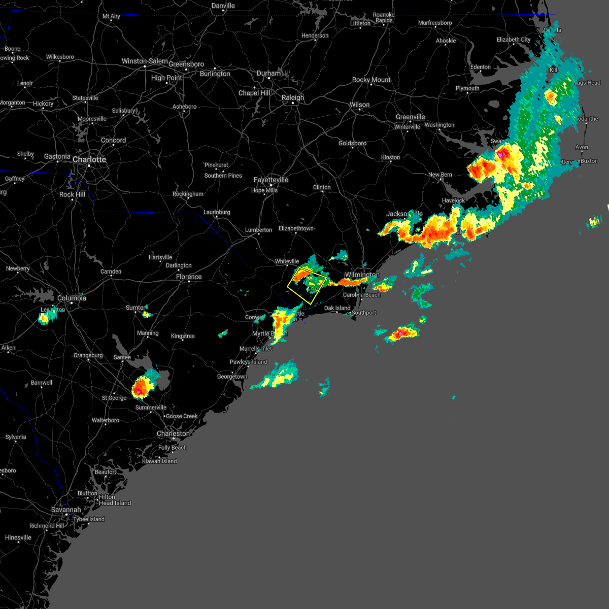 At 436 pm edt, a severe thunderstorm was located over crusoe island, or 11 miles southeast of whiteville, moving southeast at 30 mph (radar indicated). Hazards include 60 mph wind gusts and quarter size hail. Minor hail damage to vehicles is possible. expect wind damage to trees and power lines. Locations impacted include, lake waccamaw, makatoka, freeland, honey island, ash, nakina, old dock, exum and crusoe island. At 436 pm edt, a severe thunderstorm was located over crusoe island, or 11 miles southeast of whiteville, moving southeast at 30 mph (radar indicated). Hazards include 60 mph wind gusts and quarter size hail. Minor hail damage to vehicles is possible. expect wind damage to trees and power lines. Locations impacted include, lake waccamaw, makatoka, freeland, honey island, ash, nakina, old dock, exum and crusoe island.
|
| 6/15/2021 4:12 PM EDT |
 At 411 pm edt, a severe thunderstorm was located near southeastern community college, or near whiteville, moving southeast at 30 mph (radar indicated). Hazards include 60 mph wind gusts and quarter size hail. Minor hail damage to vehicles is possible. Expect wind damage to trees and power lines. At 411 pm edt, a severe thunderstorm was located near southeastern community college, or near whiteville, moving southeast at 30 mph (radar indicated). Hazards include 60 mph wind gusts and quarter size hail. Minor hail damage to vehicles is possible. Expect wind damage to trees and power lines.
|
| 6/10/2021 8:29 PM EDT |
 At 828 pm edt, a severe thunderstorm was located near clarendon, or 8 miles southwest of whiteville, moving east at 35 mph (radar indicated). Hazards include 60 mph wind gusts and penny size hail. expect wind damage to trees and power lines At 828 pm edt, a severe thunderstorm was located near clarendon, or 8 miles southwest of whiteville, moving east at 35 mph (radar indicated). Hazards include 60 mph wind gusts and penny size hail. expect wind damage to trees and power lines
|
| 10/11/2020 6:48 PM EDT |
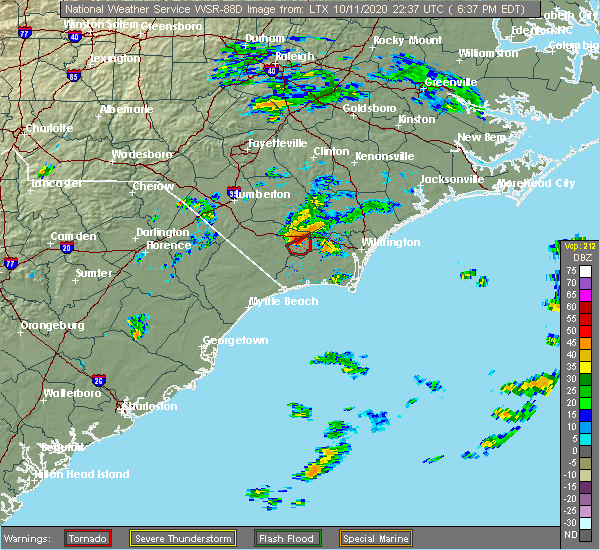 At 648 pm edt, a severe thunderstorm capable of producing a tornado was located near lake waccamaw, or 17 miles east of whiteville, moving northeast at 20 mph (radar indicated rotation). Hazards include tornado. Expect damage to mobile homes, roofs, and vehicles. Locations impacted include, lake waccamaw and bolton. At 648 pm edt, a severe thunderstorm capable of producing a tornado was located near lake waccamaw, or 17 miles east of whiteville, moving northeast at 20 mph (radar indicated rotation). Hazards include tornado. Expect damage to mobile homes, roofs, and vehicles. Locations impacted include, lake waccamaw and bolton.
|
| 10/11/2020 6:39 PM EDT |
 The tornado warning for east central columbus county will expire at 645 pm edt, the storm which prompted the warning has moved out of the area. therefore, the warning will be allowed to expire. remember, a tornado warning still remains in effect for northeastern columbus county to cover the previously expiring warning. The tornado warning for east central columbus county will expire at 645 pm edt, the storm which prompted the warning has moved out of the area. therefore, the warning will be allowed to expire. remember, a tornado warning still remains in effect for northeastern columbus county to cover the previously expiring warning.
|
| 10/11/2020 6:37 PM EDT |
 At 636 pm edt, a severe thunderstorm capable of producing a tornado was located near lake waccamaw, or 15 miles east of whiteville, moving northeast at 20 mph (radar indicated rotation). Hazards include tornado. Expect damage to mobile homes, roofs, and vehicles. this tornadic thunderstorm will remain over mainly rural areas of northeastern columbus county, including the following locations, bolton. This includes us route 74 between mile markers 405 and 416. At 636 pm edt, a severe thunderstorm capable of producing a tornado was located near lake waccamaw, or 15 miles east of whiteville, moving northeast at 20 mph (radar indicated rotation). Hazards include tornado. Expect damage to mobile homes, roofs, and vehicles. this tornadic thunderstorm will remain over mainly rural areas of northeastern columbus county, including the following locations, bolton. This includes us route 74 between mile markers 405 and 416.
|
| 10/11/2020 6:26 PM EDT |
 At 626 pm edt, a confirmed tornado was located near lake waccamaw, or 14 miles southeast of whiteville, moving northeast at 30 mph (radar confirmed tornado). Hazards include tornado. Expect damage to mobile homes, roofs, and vehicles. This tornadic thunderstorm will remain over mainly rural areas of east central columbus county, including the following locations, bolton. At 626 pm edt, a confirmed tornado was located near lake waccamaw, or 14 miles southeast of whiteville, moving northeast at 30 mph (radar confirmed tornado). Hazards include tornado. Expect damage to mobile homes, roofs, and vehicles. This tornadic thunderstorm will remain over mainly rural areas of east central columbus county, including the following locations, bolton.
|
| 10/11/2020 6:19 PM EDT |
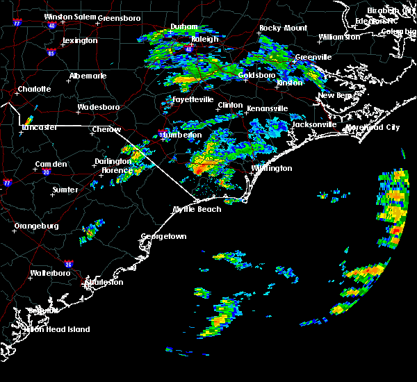 At 619 pm edt, a severe thunderstorm capable of producing a tornado was located over crusoe island, or 13 miles southeast of whiteville, moving northeast at 25 mph (radar indicated rotation). Hazards include tornado. Expect damage to mobile homes, roofs, and vehicles. this dangerous storm will be near, lake waccamaw around 625 pm edt. other locations impacted by this tornadic thunderstorm include bolton. This includes us route 74 between mile markers 411 and 413. At 619 pm edt, a severe thunderstorm capable of producing a tornado was located over crusoe island, or 13 miles southeast of whiteville, moving northeast at 25 mph (radar indicated rotation). Hazards include tornado. Expect damage to mobile homes, roofs, and vehicles. this dangerous storm will be near, lake waccamaw around 625 pm edt. other locations impacted by this tornadic thunderstorm include bolton. This includes us route 74 between mile markers 411 and 413.
|
| 10/11/2020 5:14 PM EDT |
 At 514 pm edt, a severe thunderstorm capable of producing a tornado was located near williams, or near whiteville, moving northeast at 15 mph (radar indicated rotation). Hazards include tornado. Expect damage to mobile homes, roofs, and vehicles. this dangerous storm will be near, whiteville and redbug around 535 pm edt. hallsboro around 540 pm edt. Other locations impacted by this tornadic thunderstorm include brunswick and columbus regional healthcare system. At 514 pm edt, a severe thunderstorm capable of producing a tornado was located near williams, or near whiteville, moving northeast at 15 mph (radar indicated rotation). Hazards include tornado. Expect damage to mobile homes, roofs, and vehicles. this dangerous storm will be near, whiteville and redbug around 535 pm edt. hallsboro around 540 pm edt. Other locations impacted by this tornadic thunderstorm include brunswick and columbus regional healthcare system.
|
| 10/11/2020 5:06 PM EDT |
 At 506 pm edt, a severe thunderstorm capable of producing a tornado was located near williams, or 8 miles south of whiteville, moving northeast at 15 mph (radar indicated rotation). Hazards include tornado. Expect damage to mobile homes, roofs, and vehicles. this dangerous storm will be near, whiteville and redbug around 535 pm edt. hallsboro around 540 pm edt. other locations impacted by this tornadic thunderstorm include brunswick and columbus regional healthcare system. This includes us route 74 between mile markers 392 and 402. At 506 pm edt, a severe thunderstorm capable of producing a tornado was located near williams, or 8 miles south of whiteville, moving northeast at 15 mph (radar indicated rotation). Hazards include tornado. Expect damage to mobile homes, roofs, and vehicles. this dangerous storm will be near, whiteville and redbug around 535 pm edt. hallsboro around 540 pm edt. other locations impacted by this tornadic thunderstorm include brunswick and columbus regional healthcare system. This includes us route 74 between mile markers 392 and 402.
|
| 9/29/2020 8:41 PM EDT |
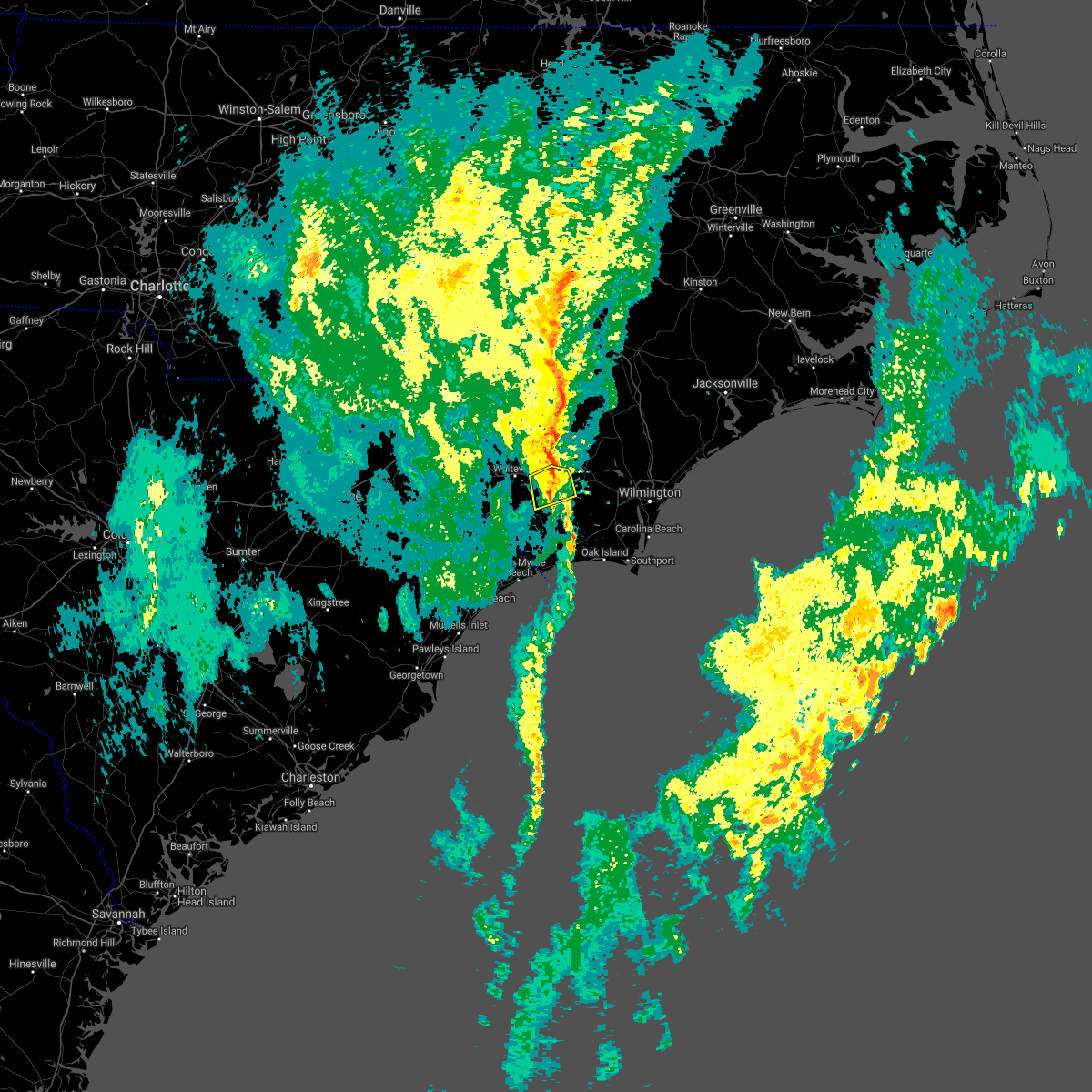 The severe thunderstorm warning for northeastern columbus county will expire at 845 pm edt, the storm which prompted the warning has weakened below severe limits, and no longer poses an immediate threat to life or property. therefore, the warning will be allowed to expire. however gusty winds are still possible with this thunderstorm. The severe thunderstorm warning for northeastern columbus county will expire at 845 pm edt, the storm which prompted the warning has weakened below severe limits, and no longer poses an immediate threat to life or property. therefore, the warning will be allowed to expire. however gusty winds are still possible with this thunderstorm.
|
| 9/29/2020 8:32 PM EDT |
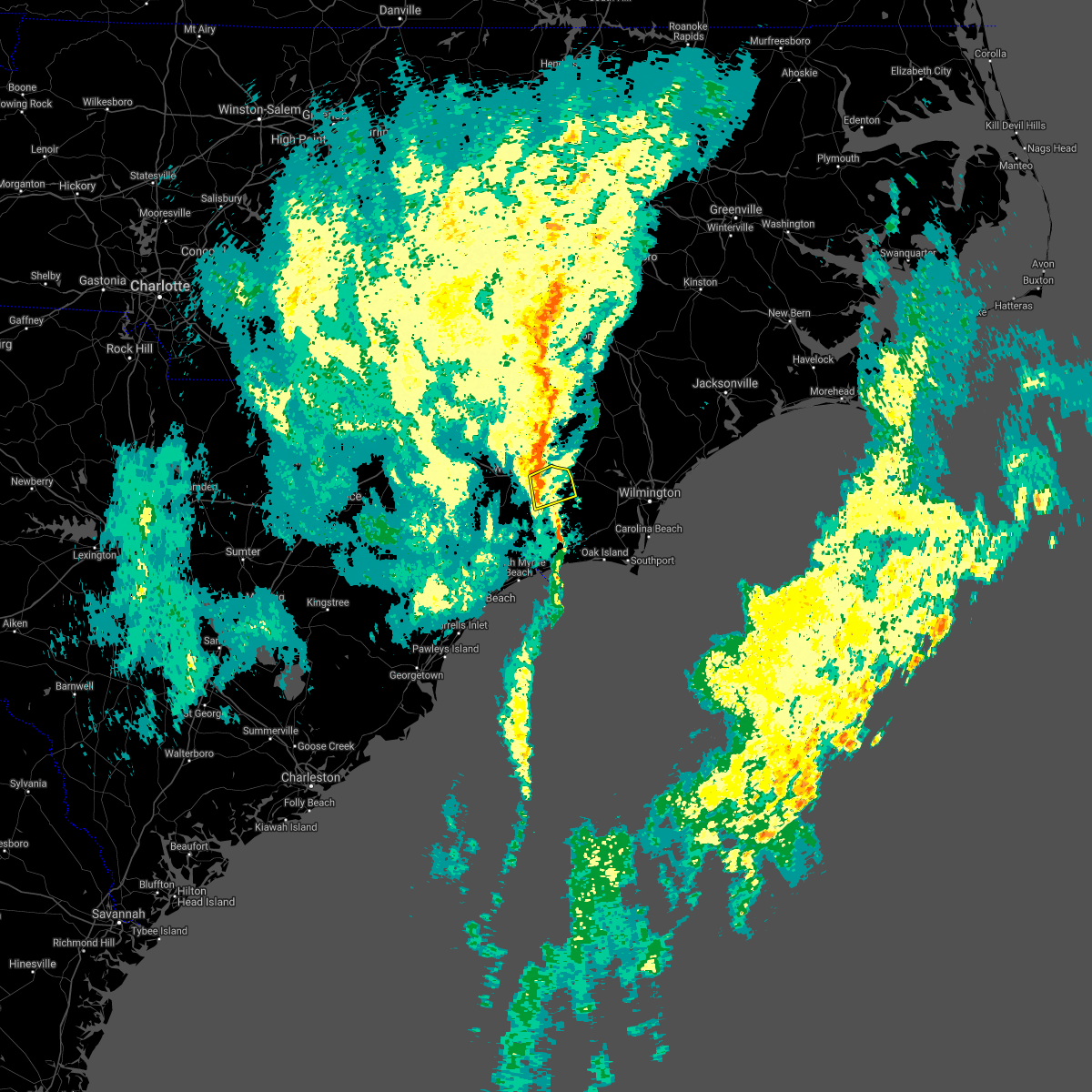 At 832 pm edt, a severe thunderstorm was located over lake waccamaw, or 10 miles east of whiteville, moving northeast at 40 mph (radar indicated). Hazards include 60 mph wind gusts. Expect wind damage to trees and power lines. Locations impacted include, lake waccamaw, hallsboro, crusoe island and bolton. At 832 pm edt, a severe thunderstorm was located over lake waccamaw, or 10 miles east of whiteville, moving northeast at 40 mph (radar indicated). Hazards include 60 mph wind gusts. Expect wind damage to trees and power lines. Locations impacted include, lake waccamaw, hallsboro, crusoe island and bolton.
|
| 9/29/2020 8:24 PM EDT |
 At 823 pm edt, a severe thunderstorm was located near old dock, or 9 miles southeast of whiteville, moving east at 40 mph (radar indicated). Hazards include 60 mph wind gusts. Expect wind damage to trees and power lines. Locations impacted include, lake waccamaw, hallsboro, redbug, old dock, crusoe island, brunswick and bolton. At 823 pm edt, a severe thunderstorm was located near old dock, or 9 miles southeast of whiteville, moving east at 40 mph (radar indicated). Hazards include 60 mph wind gusts. Expect wind damage to trees and power lines. Locations impacted include, lake waccamaw, hallsboro, redbug, old dock, crusoe island, brunswick and bolton.
|
| 9/29/2020 8:08 PM EDT |
 At 808 pm edt, a severe thunderstorm was located over sidney, or 11 miles south of whiteville, moving east at 40 mph (radar indicated). Hazards include 60 mph wind gusts. expect wind damage to trees and power lines At 808 pm edt, a severe thunderstorm was located over sidney, or 11 miles south of whiteville, moving east at 40 mph (radar indicated). Hazards include 60 mph wind gusts. expect wind damage to trees and power lines
|
| 7/29/2020 5:41 PM EDT |
 The severe thunderstorm warning for north central columbus county will expire at 545 pm edt, the storm which prompted the warning has weakened below severe limits, and no longer poses an immediate threat to life or property. therefore, the warning will be allowed to expire. The severe thunderstorm warning for north central columbus county will expire at 545 pm edt, the storm which prompted the warning has weakened below severe limits, and no longer poses an immediate threat to life or property. therefore, the warning will be allowed to expire.
|
| 7/29/2020 5:18 PM EDT |
 At 518 pm edt, a severe thunderstorm was located over hallsboro, or near whiteville, moving north at 15 mph (radar indicated). Hazards include 60 mph wind gusts. expect wind damage to trees and power lines At 518 pm edt, a severe thunderstorm was located over hallsboro, or near whiteville, moving north at 15 mph (radar indicated). Hazards include 60 mph wind gusts. expect wind damage to trees and power lines
|
| 7/28/2020 4:24 PM EDT |
 The severe thunderstorm warning for southeastern bladen and northeastern columbus counties will expire at 430 pm edt, the storm which prompted the warning has moved out of the area. therefore, the warning will be allowed to expire. The severe thunderstorm warning for southeastern bladen and northeastern columbus counties will expire at 430 pm edt, the storm which prompted the warning has moved out of the area. therefore, the warning will be allowed to expire.
|
| 7/28/2020 4:04 PM EDT |
 At 404 pm edt, a severe thunderstorm was located near lake waccamaw, or 11 miles east of whiteville, moving north at 20 mph (radar indicated). Hazards include 60 mph wind gusts. expect wind damage to trees and power lines At 404 pm edt, a severe thunderstorm was located near lake waccamaw, or 11 miles east of whiteville, moving north at 20 mph (radar indicated). Hazards include 60 mph wind gusts. expect wind damage to trees and power lines
|
| 4/13/2020 8:50 AM EDT |
 At 850 am edt, a severe thunderstorm capable of producing a tornado was located near freeman, or 19 miles east of whiteville, moving northeast at 70 mph (radar indicated rotation). Hazards include tornado. Flying debris will be dangerous to those caught without shelter. mobile homes will be damaged or destroyed. damage to roofs, windows, and vehicles will occur. tree damage is likely. this dangerous storm will be near, sandyfield, riegelwood and delco around 855 am edt. northwest around 900 am edt. the borough, currie, montague, point caswell and rooks around 905 am edt. malpass corner, long creek and wards corner around 910 am edt. ashton around 915 am edt. other locations impacted by this tornadic thunderstorm include bolton, atkinson, east arcadia and st. helena. this includes the following highways, interstate 40 between mile markers 406 and 409. Us route 74 between mile markers 407 and 424. At 850 am edt, a severe thunderstorm capable of producing a tornado was located near freeman, or 19 miles east of whiteville, moving northeast at 70 mph (radar indicated rotation). Hazards include tornado. Flying debris will be dangerous to those caught without shelter. mobile homes will be damaged or destroyed. damage to roofs, windows, and vehicles will occur. tree damage is likely. this dangerous storm will be near, sandyfield, riegelwood and delco around 855 am edt. northwest around 900 am edt. the borough, currie, montague, point caswell and rooks around 905 am edt. malpass corner, long creek and wards corner around 910 am edt. ashton around 915 am edt. other locations impacted by this tornadic thunderstorm include bolton, atkinson, east arcadia and st. helena. this includes the following highways, interstate 40 between mile markers 406 and 409. Us route 74 between mile markers 407 and 424.
|
| 4/13/2020 8:43 AM EDT |
 The tornado warning for west central pender, southeastern bladen and northeastern columbus counties will expire at 845 am edt, the storm which prompted the warning has weakened below severe limits, and has exited the warned area. therefore, the warning will be allowed to expire. a tornado watch remains in effect until noon edt for southeastern north carolina. remember, a severe thunderstorm warning still remains in effect for southeast bladen and columbus county until 9:30 am edt. The tornado warning for west central pender, southeastern bladen and northeastern columbus counties will expire at 845 am edt, the storm which prompted the warning has weakened below severe limits, and has exited the warned area. therefore, the warning will be allowed to expire. a tornado watch remains in effect until noon edt for southeastern north carolina. remember, a severe thunderstorm warning still remains in effect for southeast bladen and columbus county until 9:30 am edt.
|
| 4/13/2020 8:42 AM EDT |
 At 842 am edt, a severe thunderstorm was located over crusoe island, or 12 miles southeast of whiteville, moving northeast at 65 mph (radar indicated). Hazards include 60 mph wind gusts. expect wind damage to trees and power lines At 842 am edt, a severe thunderstorm was located over crusoe island, or 12 miles southeast of whiteville, moving northeast at 65 mph (radar indicated). Hazards include 60 mph wind gusts. expect wind damage to trees and power lines
|
| 4/13/2020 8:35 AM EDT | Em reports damage in lake waccamaw. tree down on home at 404 canal cove. trees down on church rd. trees down and possible structure damage at tanglewood acres housing n in columbus county NC, 1.9 miles SSE of Lake Waccamaw, NC |
| 4/13/2020 8:28 AM EDT |
 At 828 am edt, a confirmed tornado was located over carvers, or 15 miles southeast of elizabethtown, moving northeast at 55 mph (law enforcement confirmed tornado). Hazards include damaging tornado. Flying debris will be dangerous to those caught without shelter. mobile homes will be damaged or destroyed. damage to roofs, windows, and vehicles will occur. tree damage is likely. this tornado will be near, rowan around 840 am edt. Other locations impacted by this tornadic thunderstorm include atkinson. At 828 am edt, a confirmed tornado was located over carvers, or 15 miles southeast of elizabethtown, moving northeast at 55 mph (law enforcement confirmed tornado). Hazards include damaging tornado. Flying debris will be dangerous to those caught without shelter. mobile homes will be damaged or destroyed. damage to roofs, windows, and vehicles will occur. tree damage is likely. this tornado will be near, rowan around 840 am edt. Other locations impacted by this tornadic thunderstorm include atkinson.
|
| 4/13/2020 8:19 AM EDT |
 At 818 am edt, a severe thunderstorm was located over clarendon, or 14 miles southwest of whiteville, moving northeast at 65 mph (radar indicated). Hazards include 60 mph wind gusts. expect wind damage to trees and power lines At 818 am edt, a severe thunderstorm was located over clarendon, or 14 miles southwest of whiteville, moving northeast at 65 mph (radar indicated). Hazards include 60 mph wind gusts. expect wind damage to trees and power lines
|
| 4/13/2020 8:16 AM EDT |
 At 816 am edt, a severe thunderstorm capable of producing a tornado was located over hallsboro, or 8 miles east of whiteville, moving northeast at 55 mph (radar indicated rotation). Hazards include tornado. Flying debris will be dangerous to those caught without shelter. mobile homes will be damaged or destroyed. damage to roofs, windows, and vehicles will occur. tree damage is likely. this dangerous storm will be near, council around 825 am edt. carvers around 830 am edt. lagoon and kelly around 835 am edt. rowan around 840 am edt. Other locations impacted by this tornadic thunderstorm include atkinson. At 816 am edt, a severe thunderstorm capable of producing a tornado was located over hallsboro, or 8 miles east of whiteville, moving northeast at 55 mph (radar indicated rotation). Hazards include tornado. Flying debris will be dangerous to those caught without shelter. mobile homes will be damaged or destroyed. damage to roofs, windows, and vehicles will occur. tree damage is likely. this dangerous storm will be near, council around 825 am edt. carvers around 830 am edt. lagoon and kelly around 835 am edt. rowan around 840 am edt. Other locations impacted by this tornadic thunderstorm include atkinson.
|
| 4/13/2020 8:10 AM EDT |
 At 809 am edt, a severe thunderstorm capable of producing a tornado was located near redbug, or 7 miles southeast of whiteville, moving northeast at 55 mph (radar indicated rotation). Hazards include tornado. Flying debris will be dangerous to those caught without shelter. mobile homes will be damaged or destroyed. damage to roofs, windows, and vehicles will occur. tree damage is likely. this dangerous storm will be near, hallsboro around 815 am edt. lake waccamaw around 820 am edt. council and emerson around 825 am edt. carvers and lisbon around 830 am edt. kelly and lagoon around 835 am edt. rowan around 840 am edt. other locations impacted by this tornadic thunderstorm include brunswick, bolton, atkinson and east arcadia. This includes us route 74 between mile markers 394 and 411. At 809 am edt, a severe thunderstorm capable of producing a tornado was located near redbug, or 7 miles southeast of whiteville, moving northeast at 55 mph (radar indicated rotation). Hazards include tornado. Flying debris will be dangerous to those caught without shelter. mobile homes will be damaged or destroyed. damage to roofs, windows, and vehicles will occur. tree damage is likely. this dangerous storm will be near, hallsboro around 815 am edt. lake waccamaw around 820 am edt. council and emerson around 825 am edt. carvers and lisbon around 830 am edt. kelly and lagoon around 835 am edt. rowan around 840 am edt. other locations impacted by this tornadic thunderstorm include brunswick, bolton, atkinson and east arcadia. This includes us route 74 between mile markers 394 and 411.
|
| 9/9/2019 8:19 PM EDT |
 At 818 pm edt, a severe thunderstorm was located near elkton, or near whiteville, moving west at 20 mph (radar indicated). Hazards include 60 mph wind gusts and quarter size hail. Minor hail damage to vehicles is possible. Expect wind damage to trees and power lines. At 818 pm edt, a severe thunderstorm was located near elkton, or near whiteville, moving west at 20 mph (radar indicated). Hazards include 60 mph wind gusts and quarter size hail. Minor hail damage to vehicles is possible. Expect wind damage to trees and power lines.
|
| 9/5/2019 6:53 AM EDT |
 At 652 am edt, a severe thunderstorm capable of producing a tornado was located near honey island, or 18 miles east of whiteville, moving west at 30 mph (radar indicated rotation). Hazards include tornado. Flying debris will be dangerous to those caught without shelter. mobile homes will be damaged or destroyed. damage to roofs, windows, and vehicles will occur. tree damage is likely. this dangerous storm will be near, lake waccamaw around 705 am edt. redbug, hallsboro, old dock and crusoe island around 715 am edt. nakina around 725 am edt. bethel around 730 am edt. williams and mollie around 735 am edt. other locations impacted by this tornadic thunderstorm include brunswick and bolton. This includes us route 74 between mile markers 401 and 412. At 652 am edt, a severe thunderstorm capable of producing a tornado was located near honey island, or 18 miles east of whiteville, moving west at 30 mph (radar indicated rotation). Hazards include tornado. Flying debris will be dangerous to those caught without shelter. mobile homes will be damaged or destroyed. damage to roofs, windows, and vehicles will occur. tree damage is likely. this dangerous storm will be near, lake waccamaw around 705 am edt. redbug, hallsboro, old dock and crusoe island around 715 am edt. nakina around 725 am edt. bethel around 730 am edt. williams and mollie around 735 am edt. other locations impacted by this tornadic thunderstorm include brunswick and bolton. This includes us route 74 between mile markers 401 and 412.
|
| 9/5/2019 6:12 AM EDT |
 At 612 am edt, a severe thunderstorm capable of producing a tornado was located near makatoka, or 13 miles north of shallotte, moving west at 25 mph (radar indicated rotation). Hazards include tornado. Flying debris will be dangerous to those caught without shelter. mobile homes will be damaged or destroyed. damage to roofs, windows, and vehicles will occur. tree damage is likely. this dangerous storm will be near, crusoe island around 630 am edt. old dock around 635 am edt. Redbug and hallsboro around 645 am edt. At 612 am edt, a severe thunderstorm capable of producing a tornado was located near makatoka, or 13 miles north of shallotte, moving west at 25 mph (radar indicated rotation). Hazards include tornado. Flying debris will be dangerous to those caught without shelter. mobile homes will be damaged or destroyed. damage to roofs, windows, and vehicles will occur. tree damage is likely. this dangerous storm will be near, crusoe island around 630 am edt. old dock around 635 am edt. Redbug and hallsboro around 645 am edt.
|
| 9/5/2019 6:04 AM EDT |
 At 604 am edt, a severe thunderstorm capable of producing a tornado was located over honey island, or 12 miles north of shallotte, moving west at 25 mph (radar indicated rotation). Hazards include tornado. Flying debris will be dangerous to those caught without shelter. mobile homes will be damaged or destroyed. damage to roofs, windows, and vehicles will occur. tree damage is likely. this dangerous storm will be near, makatoka around 610 am edt. exum around 615 am edt. freeland around 625 am edt. crusoe island and old dock around 635 am edt. redbug, hallsboro and nakina around 645 am edt. This includes us route 74 between mile markers 398 and 401. At 604 am edt, a severe thunderstorm capable of producing a tornado was located over honey island, or 12 miles north of shallotte, moving west at 25 mph (radar indicated rotation). Hazards include tornado. Flying debris will be dangerous to those caught without shelter. mobile homes will be damaged or destroyed. damage to roofs, windows, and vehicles will occur. tree damage is likely. this dangerous storm will be near, makatoka around 610 am edt. exum around 615 am edt. freeland around 625 am edt. crusoe island and old dock around 635 am edt. redbug, hallsboro and nakina around 645 am edt. This includes us route 74 between mile markers 398 and 401.
|
| 7/8/2019 6:09 PM EDT |
 The severe thunderstorm warning for north central columbus county will expire at 615 pm edt, the storm which prompted the warning has moved out of the area. therefore, the warning will be allowed to expire. however gusty winds are still possible with this thunderstorm. The severe thunderstorm warning for north central columbus county will expire at 615 pm edt, the storm which prompted the warning has moved out of the area. therefore, the warning will be allowed to expire. however gusty winds are still possible with this thunderstorm.
|
| 7/8/2019 5:56 PM EDT |
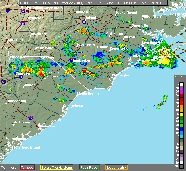 At 556 pm edt, a severe thunderstorm was located over hallsboro, or 7 miles east of whiteville, moving west at 5 mph (radar indicated). Hazards include 60 mph wind gusts and quarter size hail. Minor hail damage to vehicles is possible. expect wind damage to trees and power lines. Locations impacted include, lake waccamaw, hallsboro and redbug. At 556 pm edt, a severe thunderstorm was located over hallsboro, or 7 miles east of whiteville, moving west at 5 mph (radar indicated). Hazards include 60 mph wind gusts and quarter size hail. Minor hail damage to vehicles is possible. expect wind damage to trees and power lines. Locations impacted include, lake waccamaw, hallsboro and redbug.
|
| 7/8/2019 5:38 PM EDT |
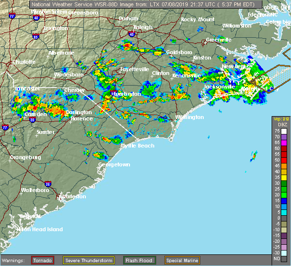 At 538 pm edt, a severe thunderstorm was located over lake waccamaw, or 9 miles east of whiteville, moving west at 5 mph (radar indicated). Hazards include 60 mph wind gusts and quarter size hail. Minor hail damage to vehicles is possible. Expect wind damage to trees and power lines. At 538 pm edt, a severe thunderstorm was located over lake waccamaw, or 9 miles east of whiteville, moving west at 5 mph (radar indicated). Hazards include 60 mph wind gusts and quarter size hail. Minor hail damage to vehicles is possible. Expect wind damage to trees and power lines.
|
| 6/22/2019 7:00 PM EDT |
 At 659 pm edt, severe thunderstorms were located along a line extending from evergreen to near galivants ferry, moving southeast at 50 mph (radar indicated). Hazards include 60 mph wind gusts and quarter size hail. Minor hail damage to vehicles is possible. Expect wind damage to trees and power lines. At 659 pm edt, severe thunderstorms were located along a line extending from evergreen to near galivants ferry, moving southeast at 50 mph (radar indicated). Hazards include 60 mph wind gusts and quarter size hail. Minor hail damage to vehicles is possible. Expect wind damage to trees and power lines.
|
| 6/20/2019 5:32 PM EDT |
 At 531 pm edt, a severe thunderstorm was located near bughill, or 16 miles south of whiteville, moving east at 40 mph (radar indicated). Hazards include 60 mph wind gusts. Expect wind damage to trees and power lines. Locations impacted include, bethel, lake waccamaw, makatoka, freeland, nakina, old dock, exum, bughill, longwood, russtown, pireway, ash, dulah and crusoe island. At 531 pm edt, a severe thunderstorm was located near bughill, or 16 miles south of whiteville, moving east at 40 mph (radar indicated). Hazards include 60 mph wind gusts. Expect wind damage to trees and power lines. Locations impacted include, bethel, lake waccamaw, makatoka, freeland, nakina, old dock, exum, bughill, longwood, russtown, pireway, ash, dulah and crusoe island.
|
| 6/20/2019 5:00 PM EDT |
 At 500 pm edt, a severe thunderstorm was located over green sea, or 16 miles east of mullins, moving east at 40 mph (radar indicated). Hazards include 60 mph wind gusts. expect wind damage to trees and power lines At 500 pm edt, a severe thunderstorm was located over green sea, or 16 miles east of mullins, moving east at 40 mph (radar indicated). Hazards include 60 mph wind gusts. expect wind damage to trees and power lines
|
| 4/19/2019 5:12 PM EDT |
 At 512 pm edt, severe thunderstorms were located along a line extending from near ammon to supply, moving east at 50 mph (radar indicated). Hazards include 60 mph wind gusts. Expect wind damage to trees and power lines. locations impacted include, oak island, whiteville, shallotte, elizabethtown, holden beach, yaupon beach, rowan, st. James, bladenboro, lake waccamaw, northwest, sandyfield, makatoka, hallsboro, ammon, exum, white oak, carvers, lisbon and honey island. At 512 pm edt, severe thunderstorms were located along a line extending from near ammon to supply, moving east at 50 mph (radar indicated). Hazards include 60 mph wind gusts. Expect wind damage to trees and power lines. locations impacted include, oak island, whiteville, shallotte, elizabethtown, holden beach, yaupon beach, rowan, st. James, bladenboro, lake waccamaw, northwest, sandyfield, makatoka, hallsboro, ammon, exum, white oak, carvers, lisbon and honey island.
|
| 4/19/2019 5:05 PM EDT | Media reports trees and power lines down on canal cove rd near wooded acres in columbus county NC, 2 miles ESE of Lake Waccamaw, NC |
| 4/19/2019 4:57 PM EDT |
 At 457 pm edt, severe thunderstorms were located along a line extending from 6 miles northeast of jerome to near sunset beach, moving east at 45 mph (radar indicated). Hazards include 60 mph wind gusts. expect wind damage to trees and power lines At 457 pm edt, severe thunderstorms were located along a line extending from 6 miles northeast of jerome to near sunset beach, moving east at 45 mph (radar indicated). Hazards include 60 mph wind gusts. expect wind damage to trees and power lines
|
| 4/19/2019 4:48 PM EDT |
 At 448 pm edt, severe thunderstorms were located along a line extending from near abbottsburg to north myrtle beach, moving east at 50 mph (radar indicated). Hazards include 60 mph wind gusts. Expect wind damage to trees and power lines. Locations impacted include, north myrtle beach, whiteville, sunset beach, ocean isle beach, little river, north myrtle beach airport, cherry grove inlet, iredell, carolina shores, tabor city, loris, chadbourn, calabash, bethel, lake waccamaw, fair bluff, boardman, hallsboro, exum and longwood. At 448 pm edt, severe thunderstorms were located along a line extending from near abbottsburg to north myrtle beach, moving east at 50 mph (radar indicated). Hazards include 60 mph wind gusts. Expect wind damage to trees and power lines. Locations impacted include, north myrtle beach, whiteville, sunset beach, ocean isle beach, little river, north myrtle beach airport, cherry grove inlet, iredell, carolina shores, tabor city, loris, chadbourn, calabash, bethel, lake waccamaw, fair bluff, boardman, hallsboro, exum and longwood.
|
| 4/19/2019 4:27 PM EDT |
 At 427 pm edt, severe thunderstorms were located along a line extending from near boardman to near nixonville, moving northeast at 80 mph (radar indicated). Hazards include 60 mph wind gusts. expect wind damage to trees and power lines At 427 pm edt, severe thunderstorms were located along a line extending from near boardman to near nixonville, moving northeast at 80 mph (radar indicated). Hazards include 60 mph wind gusts. expect wind damage to trees and power lines
|
| 4/19/2019 11:36 AM EDT |
 The severe thunderstorm warning for southeastern bladen, central brunswick and northeastern columbus counties will expire at 1145 am edt, the storm which prompted the warning has weakened below severe limits, and has exited the warned area. therefore, the warning will be allowed to expire. however gusty winds are still possible with this thunderstorm. The severe thunderstorm warning for southeastern bladen, central brunswick and northeastern columbus counties will expire at 1145 am edt, the storm which prompted the warning has weakened below severe limits, and has exited the warned area. therefore, the warning will be allowed to expire. however gusty winds are still possible with this thunderstorm.
|
| 4/19/2019 11:08 AM EDT |
 At 1108 am edt, a severe thunderstorm was located over honey island, or 11 miles north of shallotte, moving northeast at 45 mph (radar indicated). Hazards include 70 mph wind gusts. Expect considerable tree damage. damage is likely to mobile homes, roofs, and outbuildings. Locations impacted include, shallotte, elizabethtown, lake waccamaw, northwest, sandyfield, makatoka, hallsboro, redbug, exum, council, phoenix, riegelwood, carvers, lisbon, honey island, lagoon, elkton, emerson, kelly and batarora. At 1108 am edt, a severe thunderstorm was located over honey island, or 11 miles north of shallotte, moving northeast at 45 mph (radar indicated). Hazards include 70 mph wind gusts. Expect considerable tree damage. damage is likely to mobile homes, roofs, and outbuildings. Locations impacted include, shallotte, elizabethtown, lake waccamaw, northwest, sandyfield, makatoka, hallsboro, redbug, exum, council, phoenix, riegelwood, carvers, lisbon, honey island, lagoon, elkton, emerson, kelly and batarora.
|
| 4/19/2019 10:55 AM EDT |
 At 1054 am edt, a severe thunderstorm was located near longwood, or near shallotte, moving northeast at 45 mph (radar indicated). Hazards include 60 mph wind gusts. expect wind damage to trees and power lines At 1054 am edt, a severe thunderstorm was located near longwood, or near shallotte, moving northeast at 45 mph (radar indicated). Hazards include 60 mph wind gusts. expect wind damage to trees and power lines
|
| 6/25/2018 7:40 PM EDT |
 The severe thunderstorm warning for west central brunswick and central columbus counties will expire at 745 pm edt, the storm which prompted the warning has weakened below severe limits, and no longer poses an immediate threat to life or property. therefore, the warning will be allowed to expire. a severe thunderstorm watch remains in effect until 1000 pm edt for southeastern north carolina. The severe thunderstorm warning for west central brunswick and central columbus counties will expire at 745 pm edt, the storm which prompted the warning has weakened below severe limits, and no longer poses an immediate threat to life or property. therefore, the warning will be allowed to expire. a severe thunderstorm watch remains in effect until 1000 pm edt for southeastern north carolina.
|
| 6/25/2018 7:11 PM EDT |
 The severe thunderstorm warning for south central bladen and northeastern columbus counties will expire at 715 pm edt, the storm which prompted the warning has moved out of the area. therefore, the warning will be allowed to expire. a severe thunderstorm watch remains in effect until 1000 pm edt for southeastern north carolina. The severe thunderstorm warning for south central bladen and northeastern columbus counties will expire at 715 pm edt, the storm which prompted the warning has moved out of the area. therefore, the warning will be allowed to expire. a severe thunderstorm watch remains in effect until 1000 pm edt for southeastern north carolina.
|
| 6/25/2018 7:06 PM EDT |
 At 706 pm edt, a severe thunderstorm was located over old dock, or 11 miles southeast of whiteville, moving east at 25 mph (radar indicated). Hazards include 60 mph wind gusts and quarter size hail. Minor hail damage to vehicles is possible. expect wind damage to trees and power lines. Locations impacted include, bethel, lake waccamaw, makatoka, freeland, honey island, nakina, old dock, exum, mollie, crusoe island and brunswick. At 706 pm edt, a severe thunderstorm was located over old dock, or 11 miles southeast of whiteville, moving east at 25 mph (radar indicated). Hazards include 60 mph wind gusts and quarter size hail. Minor hail damage to vehicles is possible. expect wind damage to trees and power lines. Locations impacted include, bethel, lake waccamaw, makatoka, freeland, honey island, nakina, old dock, exum, mollie, crusoe island and brunswick.
|
| 6/25/2018 6:48 PM EDT |
 At 648 pm edt, a severe thunderstorm was located over elkton, or 10 miles south of elizabethtown, moving south at 10 mph (radar indicated). Hazards include 60 mph wind gusts and quarter size hail. Minor hail damage to vehicles is possible. expect wind damage to trees and power lines. locations impacted include, whiteville, lake waccamaw, hallsboro, lisbon, redbug, elkton, emerson, council, clarkton, bolton and columbus regional healthcare system. This includes us route 74 between mile markers 391 and 412. At 648 pm edt, a severe thunderstorm was located over elkton, or 10 miles south of elizabethtown, moving south at 10 mph (radar indicated). Hazards include 60 mph wind gusts and quarter size hail. Minor hail damage to vehicles is possible. expect wind damage to trees and power lines. locations impacted include, whiteville, lake waccamaw, hallsboro, lisbon, redbug, elkton, emerson, council, clarkton, bolton and columbus regional healthcare system. This includes us route 74 between mile markers 391 and 412.
|
| 6/25/2018 6:38 PM EDT |
 At 638 pm edt, a severe thunderstorm was located over sidney, or 10 miles southwest of whiteville, moving east at 25 mph (radar indicated). Hazards include 60 mph wind gusts and quarter size hail. Minor hail damage to vehicles is possible. Expect wind damage to trees and power lines. At 638 pm edt, a severe thunderstorm was located over sidney, or 10 miles southwest of whiteville, moving east at 25 mph (radar indicated). Hazards include 60 mph wind gusts and quarter size hail. Minor hail damage to vehicles is possible. Expect wind damage to trees and power lines.
|
| 6/25/2018 6:13 PM EDT |
 At 613 pm edt, a severe thunderstorm was located near elizabethtown, moving south at 10 mph (radar indicated). Hazards include 60 mph wind gusts and quarter size hail. Minor hail damage to vehicles is possible. Expect wind damage to trees and power lines. At 613 pm edt, a severe thunderstorm was located near elizabethtown, moving south at 10 mph (radar indicated). Hazards include 60 mph wind gusts and quarter size hail. Minor hail damage to vehicles is possible. Expect wind damage to trees and power lines.
|
| 6/24/2018 10:29 PM EDT |
 At 1028 pm edt, severe thunderstorms extending from 7 miles northeast of rowan to near kelly to elkton, moving southeast at 30 mph (radar indicated). Hazards include 60 mph wind gusts. Expect damage to trees and power lines. locations impacted include, rowan, lake waccamaw, carvers, lisbon, lagoon, elkton, emerson, council, kelly, clarkton, white lake, bolton, east arcadia and atkinson. This includes us route 74 between mile markers 403 and 410. At 1028 pm edt, severe thunderstorms extending from 7 miles northeast of rowan to near kelly to elkton, moving southeast at 30 mph (radar indicated). Hazards include 60 mph wind gusts. Expect damage to trees and power lines. locations impacted include, rowan, lake waccamaw, carvers, lisbon, lagoon, elkton, emerson, council, kelly, clarkton, white lake, bolton, east arcadia and atkinson. This includes us route 74 between mile markers 403 and 410.
|
| 6/24/2018 9:57 PM EDT |
 At 957 pm edt, a severe thunderstorm was located over elizabethtown, moving southeast at 20 mph (radar indicated). Hazards include 60 mph wind gusts. expect damage to trees and power lines At 957 pm edt, a severe thunderstorm was located over elizabethtown, moving southeast at 20 mph (radar indicated). Hazards include 60 mph wind gusts. expect damage to trees and power lines
|
| 6/24/2018 9:13 PM EDT |
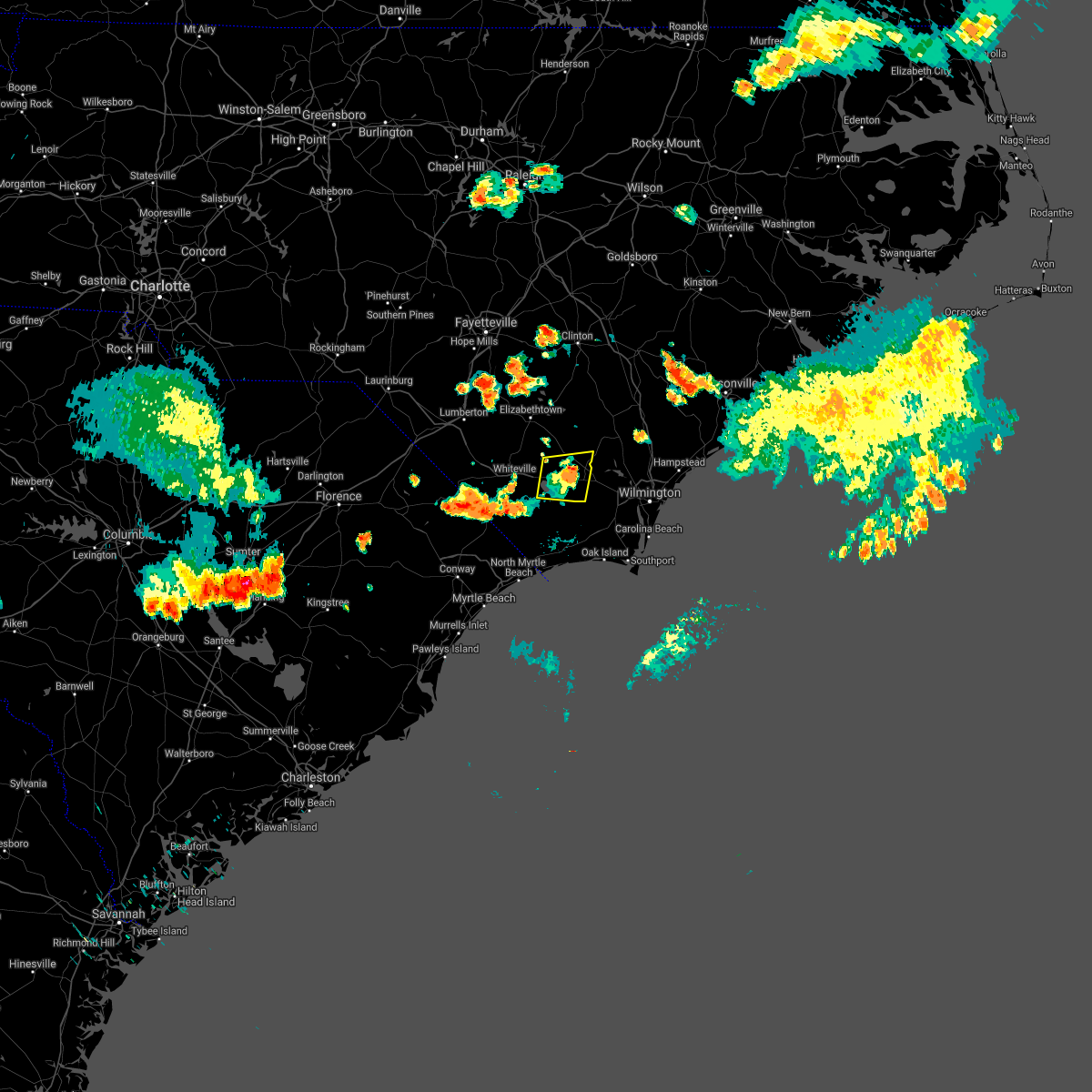 The severe thunderstorm warning for southeastern bladen and northeastern columbus counties will expire at 915 pm edt. the storm which prompted the warning has weakened below severe limits, and no longer poses an immediate threat to life or property. therefore, the warning will be allowed to expire. However gusty winds and heavy rain are still possible with this thunderstorm. The severe thunderstorm warning for southeastern bladen and northeastern columbus counties will expire at 915 pm edt. the storm which prompted the warning has weakened below severe limits, and no longer poses an immediate threat to life or property. therefore, the warning will be allowed to expire. However gusty winds and heavy rain are still possible with this thunderstorm.
|
| 6/24/2018 9:03 PM EDT |
 At 902 pm edt, a severe thunderstorm was located near freeman, or 19 miles east of whiteville, moving east at 30 mph (radar indicated). Hazards include 60 mph wind gusts. Expect damage trees and power lines. locations impacted include, lake waccamaw, sandyfield, freeman, council, bolton and east arcadia. This includes us route 74 between mile markers 402 and 418. At 902 pm edt, a severe thunderstorm was located near freeman, or 19 miles east of whiteville, moving east at 30 mph (radar indicated). Hazards include 60 mph wind gusts. Expect damage trees and power lines. locations impacted include, lake waccamaw, sandyfield, freeman, council, bolton and east arcadia. This includes us route 74 between mile markers 402 and 418.
|
| 6/24/2018 8:34 PM EDT |
 At 834 pm edt, a severe thunderstorm was located over redbug, or near whiteville, moving east at 30 mph (radar indicated). Hazards include 60 mph wind gusts. expect damage trees and power lines At 834 pm edt, a severe thunderstorm was located over redbug, or near whiteville, moving east at 30 mph (radar indicated). Hazards include 60 mph wind gusts. expect damage trees and power lines
|
| 3/1/2018 6:12 PM EST |
 At 612 pm est, strong to severe thunderstorms were located along a line extending from near atkinson, delco, and pireway, moving east at 50 55 mph. although this line has shown some weakening, a few locations in the warned area may still receive a wind gust to 60 mph (radar indicated). Hazards include 60 mph wind gusts. Some downed trees and power lines possible. Locations impacted include, burgaw, shallotte, lake waccamaw, penderlea, makatoka, long creek, exum, longwood, currie, winnabow, and rooks. At 612 pm est, strong to severe thunderstorms were located along a line extending from near atkinson, delco, and pireway, moving east at 50 55 mph. although this line has shown some weakening, a few locations in the warned area may still receive a wind gust to 60 mph (radar indicated). Hazards include 60 mph wind gusts. Some downed trees and power lines possible. Locations impacted include, burgaw, shallotte, lake waccamaw, penderlea, makatoka, long creek, exum, longwood, currie, winnabow, and rooks.
|
| 3/1/2018 5:44 PM EST |
 At 543 pm est, severe thunderstorms were located along a line extending from 7 miles east of ammon to near elizabethtown, clarkton, whiteville and green sea, moving east at 50 to 55 mph. this line of storms has a history of producing wind damage (radar indicated). Hazards include 60 mph wind gusts. expect downed trees and power lines in those areas that receive the highest winds At 543 pm est, severe thunderstorms were located along a line extending from 7 miles east of ammon to near elizabethtown, clarkton, whiteville and green sea, moving east at 50 to 55 mph. this line of storms has a history of producing wind damage (radar indicated). Hazards include 60 mph wind gusts. expect downed trees and power lines in those areas that receive the highest winds
|
| 8/23/2017 8:41 PM EDT |
 The severe thunderstorm warning for southeastern bladen and central columbus counties will expire at 845 pm edt, the storms which prompted the warning have weakened below severe limits, and no longer pose an immediate threat to life or property. therefore the warning will be allowed to expire. however gusty winds are still possible with these thunderstorms. The severe thunderstorm warning for southeastern bladen and central columbus counties will expire at 845 pm edt, the storms which prompted the warning have weakened below severe limits, and no longer pose an immediate threat to life or property. therefore the warning will be allowed to expire. however gusty winds are still possible with these thunderstorms.
|
| 8/23/2017 8:29 PM EDT |
 At 829 pm edt, severe thunderstorms were located along a line extending from bethel to adrian, moving southeast at 20 mph (radar indicated). Hazards include 60 mph wind gusts and quarter size hail. Minor hail damage to vehicles is possible. expect wind damage to trees and power lines. locations impacted include, whiteville, rowan, tabor city, chadbourn, lake waccamaw, sandyfield, hallsboro, redbug, council, southeastern community college, williams, riegelwood, carvers, lisbon, cherry grove, mollie, lagoon, sidney, elkton and emerson. This includes us route 74 between mile markers 387 and 416. At 829 pm edt, severe thunderstorms were located along a line extending from bethel to adrian, moving southeast at 20 mph (radar indicated). Hazards include 60 mph wind gusts and quarter size hail. Minor hail damage to vehicles is possible. expect wind damage to trees and power lines. locations impacted include, whiteville, rowan, tabor city, chadbourn, lake waccamaw, sandyfield, hallsboro, redbug, council, southeastern community college, williams, riegelwood, carvers, lisbon, cherry grove, mollie, lagoon, sidney, elkton and emerson. This includes us route 74 between mile markers 387 and 416.
|
| 8/23/2017 8:03 PM EDT |
 At 802 pm edt, severe thunderstorms were located along a line extending from sidney to near bayboro, moving southeast at 20 mph (radar indicated). Hazards include 60 mph wind gusts and quarter size hail. Minor hail damage to vehicles is possible. expect wind damage to trees and power lines. locations impacted include, marion, whiteville, mullins, elizabethtown, rowan, tabor city, chadbourn, bladenboro, lake waccamaw, fair bluff, sandyfield, boardman, hallsboro, rains, southeastern community college, carvers, galivants ferry, lisbon, sidney and elkton. This includes us route 74 between mile markers 375 and 417. At 802 pm edt, severe thunderstorms were located along a line extending from sidney to near bayboro, moving southeast at 20 mph (radar indicated). Hazards include 60 mph wind gusts and quarter size hail. Minor hail damage to vehicles is possible. expect wind damage to trees and power lines. locations impacted include, marion, whiteville, mullins, elizabethtown, rowan, tabor city, chadbourn, bladenboro, lake waccamaw, fair bluff, sandyfield, boardman, hallsboro, rains, southeastern community college, carvers, galivants ferry, lisbon, sidney and elkton. This includes us route 74 between mile markers 375 and 417.
|
| 8/23/2017 7:10 PM EDT |
 At 710 pm edt, severe thunderstorms were located along a line extending from near barnesville to near zion, moving southeast at 20 mph (radar indicated). Hazards include 60 mph wind gusts and quarter size hail. Minor hail damage to vehicles is possible. Expect wind damage to trees and power lines. At 710 pm edt, severe thunderstorms were located along a line extending from near barnesville to near zion, moving southeast at 20 mph (radar indicated). Hazards include 60 mph wind gusts and quarter size hail. Minor hail damage to vehicles is possible. Expect wind damage to trees and power lines.
|
| 7/15/2017 7:49 PM EDT |
 At 749 pm edt, a severe thunderstorm was located near sandyfield, or 17 miles east of whiteville, moving east at 30 mph (radar indicated). Hazards include 60 mph wind gusts and nickel size hail. Expect damage trees and power lines. locations impacted include, whiteville, rowan, lake waccamaw, sandyfield, point caswell, hallsboro, redbug, council, riegelwood, carvers, lisbon, lagoon, elkton, rooks, emerson, kelly, freeman, delco, crusoe island and brunswick. This includes us route 74 between mile markers 392 and 422. At 749 pm edt, a severe thunderstorm was located near sandyfield, or 17 miles east of whiteville, moving east at 30 mph (radar indicated). Hazards include 60 mph wind gusts and nickel size hail. Expect damage trees and power lines. locations impacted include, whiteville, rowan, lake waccamaw, sandyfield, point caswell, hallsboro, redbug, council, riegelwood, carvers, lisbon, lagoon, elkton, rooks, emerson, kelly, freeman, delco, crusoe island and brunswick. This includes us route 74 between mile markers 392 and 422.
|
| 7/15/2017 7:24 PM EDT |
 At 724 pm edt, a severe thunderstorm was located over hallsboro, or near whiteville, moving east at 30 mph (radar indicated). Hazards include 60 mph wind gusts and nickel size hail. expect damage trees and power lines At 724 pm edt, a severe thunderstorm was located over hallsboro, or near whiteville, moving east at 30 mph (radar indicated). Hazards include 60 mph wind gusts and nickel size hail. expect damage trees and power lines
|
| 7/9/2017 5:54 PM EDT |
 At 554 pm edt, a severe thunderstorm was located near lake waccamaw, or 14 miles east of whiteville, moving east at 15 mph (radar indicated). Hazards include 60 mph wind gusts and quarter size hail. Minor hail damage to vehicles is possible. Expect wind damage to trees and power lines. At 554 pm edt, a severe thunderstorm was located near lake waccamaw, or 14 miles east of whiteville, moving east at 15 mph (radar indicated). Hazards include 60 mph wind gusts and quarter size hail. Minor hail damage to vehicles is possible. Expect wind damage to trees and power lines.
|
| 7/8/2017 12:13 AM EDT |
 At 1213 am edt, a severe thunderstorm was located over whiteville, moving east at 30 mph (radar indicated). Hazards include 60 mph wind gusts. Expect damage trees and power lines. locations impacted include, whiteville, lake waccamaw, hallsboro, redbug, emerson, council, carvers, brunswick, bolton and columbus regional healthcare system. This includes us route 74 between mile markers 388 and 410. At 1213 am edt, a severe thunderstorm was located over whiteville, moving east at 30 mph (radar indicated). Hazards include 60 mph wind gusts. Expect damage trees and power lines. locations impacted include, whiteville, lake waccamaw, hallsboro, redbug, emerson, council, carvers, brunswick, bolton and columbus regional healthcare system. This includes us route 74 between mile markers 388 and 410.
|
| 7/8/2017 12:04 AM EDT |
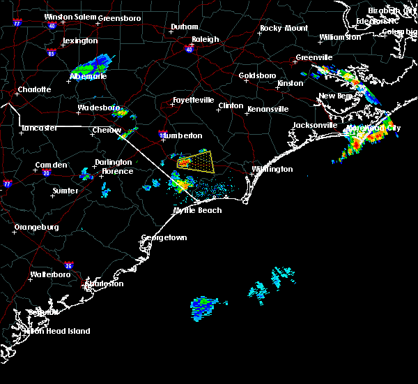 At 1204 am edt, a severe thunderstorm was located over southeastern community college, or near whiteville, moving east at 30 mph (radar indicated). Hazards include 60 mph wind gusts and penny size hail. expect damage trees and power lines At 1204 am edt, a severe thunderstorm was located over southeastern community college, or near whiteville, moving east at 30 mph (radar indicated). Hazards include 60 mph wind gusts and penny size hail. expect damage trees and power lines
|
| 6/15/2017 4:58 PM EDT |
 At 458 pm edt, a severe thunderstorm was located over nakina, or 11 miles south of whiteville, moving southeast at 20 mph (radar indicated). Hazards include 70 mph wind gusts and quarter size hail. Expect considerable tree damage. wind damage is also likely to mobile homes, roofs, and outbuildings. minor hail damage to vehicles is possible. locations impacted include, whiteville, tabor city, bethel, lake waccamaw, sandyfield, hallsboro, nakina, redbug, old dock, mollie, bughill, sidney, council, clarendon, williams, freeman, pireway, dulah, delco and riegelwood. This includes us route 74 between mile markers 395 and 422. At 458 pm edt, a severe thunderstorm was located over nakina, or 11 miles south of whiteville, moving southeast at 20 mph (radar indicated). Hazards include 70 mph wind gusts and quarter size hail. Expect considerable tree damage. wind damage is also likely to mobile homes, roofs, and outbuildings. minor hail damage to vehicles is possible. locations impacted include, whiteville, tabor city, bethel, lake waccamaw, sandyfield, hallsboro, nakina, redbug, old dock, mollie, bughill, sidney, council, clarendon, williams, freeman, pireway, dulah, delco and riegelwood. This includes us route 74 between mile markers 395 and 422.
|
| 6/15/2017 4:43 PM EDT |
 At 442 pm edt, a severe thunderstorm was located over clarendon, or 10 miles southwest of whiteville, moving southeast at 15 mph. another cluster of severe storms was located north of lake waccamaw (radar indicated). Hazards include golf ball size hail and 60 mph wind gusts. People and animals outdoors will be injured. expect hail damage to roofs, siding, windows, and vehicles. expect wind damage to trees and power lines. locations impacted include, whiteville, tabor city, chadbourn, bethel, lake waccamaw, sandyfield, hallsboro, nakina, redbug, bughill, council, southeastern community college, williams, riegelwood, old dock, mollie, sidney, elkton, emerson and clarendon. This includes us route 74 between mile markers 383 and 422. At 442 pm edt, a severe thunderstorm was located over clarendon, or 10 miles southwest of whiteville, moving southeast at 15 mph. another cluster of severe storms was located north of lake waccamaw (radar indicated). Hazards include golf ball size hail and 60 mph wind gusts. People and animals outdoors will be injured. expect hail damage to roofs, siding, windows, and vehicles. expect wind damage to trees and power lines. locations impacted include, whiteville, tabor city, chadbourn, bethel, lake waccamaw, sandyfield, hallsboro, nakina, redbug, bughill, council, southeastern community college, williams, riegelwood, old dock, mollie, sidney, elkton, emerson and clarendon. This includes us route 74 between mile markers 383 and 422.
|
| 6/15/2017 4:27 PM EDT |
 At 427 pm edt, a severe thunderstorm was located near southeastern community college, or near whiteville, moving southeast at 10 mph (radar indicated). Hazards include 60 mph wind gusts and quarter size hail. Minor hail damage to vehicles is possible. Expect wind damage to trees and power lines. At 427 pm edt, a severe thunderstorm was located near southeastern community college, or near whiteville, moving southeast at 10 mph (radar indicated). Hazards include 60 mph wind gusts and quarter size hail. Minor hail damage to vehicles is possible. Expect wind damage to trees and power lines.
|
| 5/28/2017 7:30 PM EDT |
 At 730 pm edt, a severe thunderstorm was located over williams, or 8 miles south of whiteville, moving east at 30 mph (radar indicated). Hazards include 60 mph wind gusts and quarter size hail. Minor hail damage to vehicles is possible. Expect wind damage to trees and power lines. At 730 pm edt, a severe thunderstorm was located over williams, or 8 miles south of whiteville, moving east at 30 mph (radar indicated). Hazards include 60 mph wind gusts and quarter size hail. Minor hail damage to vehicles is possible. Expect wind damage to trees and power lines.
|
| 10/8/2016 9:22 AM EDT |
 The tornado warning for bladen, northeastern columbus, eastern brunswick, western pender and east central robeson counties will expire at 930 am edt, the storm which prompted the warning has weakened below severe limits, and no longer appears capable of producing a tornado. therefore the warning will be allowed to expire. a tornado watch remains in effect until 400 pm edt for southeastern north carolina. The tornado warning for bladen, northeastern columbus, eastern brunswick, western pender and east central robeson counties will expire at 930 am edt, the storm which prompted the warning has weakened below severe limits, and no longer appears capable of producing a tornado. therefore the warning will be allowed to expire. a tornado watch remains in effect until 400 pm edt for southeastern north carolina.
|
| 10/8/2016 8:36 AM EDT |
 At 836 am edt, a severe thunderstorm capable of producing a tornado was located over boiling spring lakes, or 8 miles north of oak island, moving northwest at 45 mph (radar indicated rotation). Hazards include tornado...quarter size hail...and 60 mph wind gusts. Expect damage to mobile homes. roofs. and vehicles. this dangerous storm will be near, mill creek and brunswick county community college main campus around 840 am edt. winnabow, town creek and bishop around 845 am edt. batarora around 850 am edt. honey island around 855 am edt. freeman, delco and riegelwood around 900 am edt. sandyfield around 905 am edt. kelly around 910 am edt. carvers and council around 915 am edt. Other locations impacted by this tornadic thunderstorm include white lake, east arcadia, dublin, atkinson, clarkton, sandy creek, bolton, bolivia, bladen county hospital and navassa. At 836 am edt, a severe thunderstorm capable of producing a tornado was located over boiling spring lakes, or 8 miles north of oak island, moving northwest at 45 mph (radar indicated rotation). Hazards include tornado...quarter size hail...and 60 mph wind gusts. Expect damage to mobile homes. roofs. and vehicles. this dangerous storm will be near, mill creek and brunswick county community college main campus around 840 am edt. winnabow, town creek and bishop around 845 am edt. batarora around 850 am edt. honey island around 855 am edt. freeman, delco and riegelwood around 900 am edt. sandyfield around 905 am edt. kelly around 910 am edt. carvers and council around 915 am edt. Other locations impacted by this tornadic thunderstorm include white lake, east arcadia, dublin, atkinson, clarkton, sandy creek, bolton, bolivia, bladen county hospital and navassa.
|
| 10/8/2016 6:12 AM EDT |
 At 612 am edt, a severe thunderstorm capable of producing a tornado was located over winnabow, or 7 miles southwest of leland, moving northwest at 50 mph (radar indicated rotation). Hazards include tornado. Flying debris will be dangerous to those caught without shelter. mobile homes will be damaged or destroyed. damage to roofs, windows, and vehicles will occur. tree damage is likely. this dangerous storm will be near, freeman, delco and riegelwood around 630 am edt. sandyfield around 635 am edt. kelly around 640 am edt. lake waccamaw around 645 am edt. Other locations impacted by this tornadic thunderstorm include bolton, east arcadia and sandy creek. At 612 am edt, a severe thunderstorm capable of producing a tornado was located over winnabow, or 7 miles southwest of leland, moving northwest at 50 mph (radar indicated rotation). Hazards include tornado. Flying debris will be dangerous to those caught without shelter. mobile homes will be damaged or destroyed. damage to roofs, windows, and vehicles will occur. tree damage is likely. this dangerous storm will be near, freeman, delco and riegelwood around 630 am edt. sandyfield around 635 am edt. kelly around 640 am edt. lake waccamaw around 645 am edt. Other locations impacted by this tornadic thunderstorm include bolton, east arcadia and sandy creek.
|
| 7/31/2016 5:40 PM EDT |
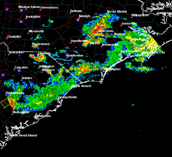 The severe thunderstorm warning for south central bladen and northeastern columbus counties will expire at 545 pm edt, the storm which prompted the warning has weakened below severe limits, and no longer poses an immediate threat to life or property. therefore the warning will be allowed to expire. however heavy rain is still possible with this thunderstorm. The severe thunderstorm warning for south central bladen and northeastern columbus counties will expire at 545 pm edt, the storm which prompted the warning has weakened below severe limits, and no longer poses an immediate threat to life or property. therefore the warning will be allowed to expire. however heavy rain is still possible with this thunderstorm.
|
| 7/31/2016 5:28 PM EDT |
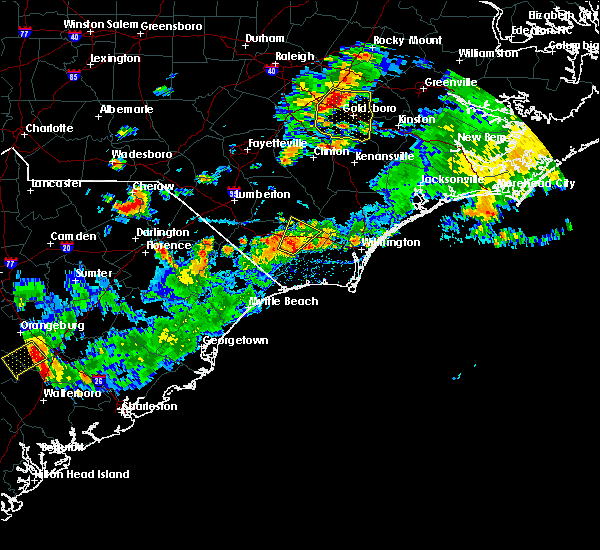 At 528 pm edt, a severe thunderstorm was located near council, or 12 miles east of whiteville, moving northeast at 20 mph (radar indicated). Hazards include 60 mph wind gusts and nickel size hail. Expect damage to roofs. siding. and trees. Locations impacted include, lake waccamaw, sandyfield, council, crusoe island, bolton and east arcadia. At 528 pm edt, a severe thunderstorm was located near council, or 12 miles east of whiteville, moving northeast at 20 mph (radar indicated). Hazards include 60 mph wind gusts and nickel size hail. Expect damage to roofs. siding. and trees. Locations impacted include, lake waccamaw, sandyfield, council, crusoe island, bolton and east arcadia.
|
| 7/31/2016 5:11 PM EDT |
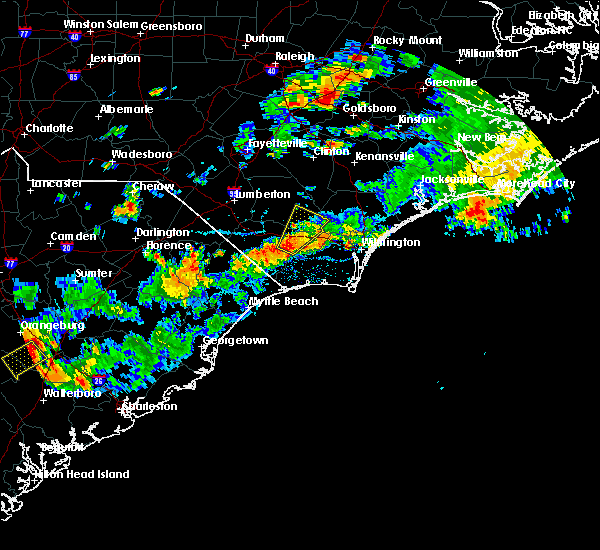 At 511 pm edt, a severe thunderstorm was located over council, or 14 miles east of whiteville, moving northeast at 25 mph (radar indicated). Hazards include 60 mph wind gusts and nickel size hail. Expect damage to roofs. siding. and trees. Locations impacted include, lake waccamaw, sandyfield, lagoon, carvers, council, kelly, crusoe island, bolton and east arcadia. At 511 pm edt, a severe thunderstorm was located over council, or 14 miles east of whiteville, moving northeast at 25 mph (radar indicated). Hazards include 60 mph wind gusts and nickel size hail. Expect damage to roofs. siding. and trees. Locations impacted include, lake waccamaw, sandyfield, lagoon, carvers, council, kelly, crusoe island, bolton and east arcadia.
|
| 7/31/2016 4:53 PM EDT |
 At 453 pm edt, a severe thunderstorm was located over lake waccamaw, or 9 miles east of whiteville, moving northeast at 25 mph (radar indicated). Hazards include 60 mph wind gusts and nickel size hail. Expect damage to roofs. siding. And trees. At 453 pm edt, a severe thunderstorm was located over lake waccamaw, or 9 miles east of whiteville, moving northeast at 25 mph (radar indicated). Hazards include 60 mph wind gusts and nickel size hail. Expect damage to roofs. siding. And trees.
|
| 7/17/2016 12:14 AM EDT |
 At 1214 am edt, a severe thunderstorm was located over williams, or 9 miles south of whiteville, moving northeast at 30 mph (radar indicated). Hazards include 60 mph wind gusts. Expect damage to roofs. siding. and trees. Locations impacted include, whiteville, tabor city, chadbourn, bethel, lake waccamaw, williams, hallsboro, old dock, freeland, mollie, dulah, bughill, clarendon, redbug, southeastern community college, ash, crusoe island, exum, nakina and honey island. At 1214 am edt, a severe thunderstorm was located over williams, or 9 miles south of whiteville, moving northeast at 30 mph (radar indicated). Hazards include 60 mph wind gusts. Expect damage to roofs. siding. and trees. Locations impacted include, whiteville, tabor city, chadbourn, bethel, lake waccamaw, williams, hallsboro, old dock, freeland, mollie, dulah, bughill, clarendon, redbug, southeastern community college, ash, crusoe island, exum, nakina and honey island.
|
| 7/17/2016 12:04 AM EDT |
 At 1204 am edt, a severe thunderstorm was located over tabor city, or 14 miles southwest of whiteville, moving northeast at 30 mph (radar indicated). Hazards include 60 mph wind gusts. Expect damage to roofs. siding. And trees. At 1204 am edt, a severe thunderstorm was located over tabor city, or 14 miles southwest of whiteville, moving northeast at 30 mph (radar indicated). Hazards include 60 mph wind gusts. Expect damage to roofs. siding. And trees.
|
| 7/11/2016 8:15 PM EDT |
 At 815 pm edt, a severe thunderstorm was located over cherry grove, or 13 miles east of mullins, moving east at 45 mph (radar indicated). Hazards include 60 mph wind gusts and quarter size hail. Hail damage to vehicles is expected. Expect wind damage to roofs, siding, and trees. At 815 pm edt, a severe thunderstorm was located over cherry grove, or 13 miles east of mullins, moving east at 45 mph (radar indicated). Hazards include 60 mph wind gusts and quarter size hail. Hail damage to vehicles is expected. Expect wind damage to roofs, siding, and trees.
|
| 7/11/2016 5:26 PM EDT | The severe thunderstorm warning for north central columbus county will expire at 530 pm edt, the storm which prompted the warning has weakened below severe limits, and no longer pose an immediate threat to life or property. therefore the warning will be allowed to expire. to report severe weather, contact your nearest law enforcement agency. they will relay your report to the national weather service wilmington. |
| 7/11/2016 5:10 PM EDT |
 At 510 pm edt, a severe thunderstorm was located near redbug, or 7 miles south of whiteville, moving east at 15 mph (radar indicated). Hazards include 60 mph wind gusts and quarter size hail. Hail damage to vehicles is expected. expect wind damage to roofs, siding, and trees. Locations impacted include, whiteville, lake waccamaw, redbug, southeastern community college, williams, hallsboro, brunswick and columbus regional healthcare system. At 510 pm edt, a severe thunderstorm was located near redbug, or 7 miles south of whiteville, moving east at 15 mph (radar indicated). Hazards include 60 mph wind gusts and quarter size hail. Hail damage to vehicles is expected. expect wind damage to roofs, siding, and trees. Locations impacted include, whiteville, lake waccamaw, redbug, southeastern community college, williams, hallsboro, brunswick and columbus regional healthcare system.
|
| 7/11/2016 4:56 PM EDT |
 At 456 pm edt, a severe thunderstorm was located near williams, or near whiteville, moving southeast at 30 mph (radar indicated). Hazards include 60 mph wind gusts and quarter size hail. Hail damage to vehicles is expected. expect wind damage to roofs, siding, and trees. Locations impacted include, whiteville, tabor city, chadbourn, lake waccamaw, fair bluff, sandyfield, council, redbug, southeastern community college, williams, hallsboro, elkton, emerson, sidney, clarendon, cherry grove, brunswick, bolton, east arcadia and cerro gordo. At 456 pm edt, a severe thunderstorm was located near williams, or near whiteville, moving southeast at 30 mph (radar indicated). Hazards include 60 mph wind gusts and quarter size hail. Hail damage to vehicles is expected. expect wind damage to roofs, siding, and trees. Locations impacted include, whiteville, tabor city, chadbourn, lake waccamaw, fair bluff, sandyfield, council, redbug, southeastern community college, williams, hallsboro, elkton, emerson, sidney, clarendon, cherry grove, brunswick, bolton, east arcadia and cerro gordo.
|
| 7/11/2016 4:41 PM EDT |
 At 441 pm edt, severe thunderstorms were located along a line extending from near council to near redbug to near cherry grove, and are nearly stationary (radar indicated). Hazards include 60 mph wind gusts and quarter size hail. Hail damage to vehicles is expected. expect wind damage to roofs, siding, and trees. Locations impacted include, whiteville, tabor city, chadbourn, lake waccamaw, fair bluff, sandyfield, council, redbug, southeastern community college, williams, hallsboro, elkton, carvers, emerson, sidney, clarendon, cherry grove, brunswick, bolton and east arcadia. At 441 pm edt, severe thunderstorms were located along a line extending from near council to near redbug to near cherry grove, and are nearly stationary (radar indicated). Hazards include 60 mph wind gusts and quarter size hail. Hail damage to vehicles is expected. expect wind damage to roofs, siding, and trees. Locations impacted include, whiteville, tabor city, chadbourn, lake waccamaw, fair bluff, sandyfield, council, redbug, southeastern community college, williams, hallsboro, elkton, carvers, emerson, sidney, clarendon, cherry grove, brunswick, bolton and east arcadia.
|
| 7/11/2016 4:23 PM EDT |
 At 423 pm edt, a severe thunderstorm was located near hallsboro, or near whiteville, moving east at 15 mph (radar indicated). Hazards include 60 mph wind gusts and quarter size hail. Hail damage to vehicles is expected. Expect wind damage to roofs, siding, and trees. At 423 pm edt, a severe thunderstorm was located near hallsboro, or near whiteville, moving east at 15 mph (radar indicated). Hazards include 60 mph wind gusts and quarter size hail. Hail damage to vehicles is expected. Expect wind damage to roofs, siding, and trees.
|
| 7/9/2016 12:24 AM EDT |
 At 1223 am edt, a severe thunderstorm was located over brooksville, or near little river, moving southeast at 60 mph (radar indicated). Hazards include 60 mph wind gusts and penny size hail. Expect damage to roofs. siding. and trees. Locations impacted include, whiteville, mullins, horry, tabor city, loris, chadbourn, fair bluff, lake view, boardman, allsbrook, williams, hallsboro, kemper, smithboro, mollie, galivants ferry, fork, rains, gapway and clarendon. At 1223 am edt, a severe thunderstorm was located over brooksville, or near little river, moving southeast at 60 mph (radar indicated). Hazards include 60 mph wind gusts and penny size hail. Expect damage to roofs. siding. and trees. Locations impacted include, whiteville, mullins, horry, tabor city, loris, chadbourn, fair bluff, lake view, boardman, allsbrook, williams, hallsboro, kemper, smithboro, mollie, galivants ferry, fork, rains, gapway and clarendon.
|
| 7/9/2016 12:19 AM EDT |
 At 1218 am edt, a severe thunderstorm was located over longs, or 9 miles northwest of little river, moving southeast at 40 mph (radar indicated). Hazards include 60 mph wind gusts and penny size hail. Expect damage to roofs. siding. and trees. Locations impacted include, whiteville, mullins, horry, tabor city, loris, chadbourn, fair bluff, lake view, boardman, allsbrook, williams, hallsboro, kemper, smithboro, mollie, galivants ferry, fork, rains, gapway and clarendon. At 1218 am edt, a severe thunderstorm was located over longs, or 9 miles northwest of little river, moving southeast at 40 mph (radar indicated). Hazards include 60 mph wind gusts and penny size hail. Expect damage to roofs. siding. and trees. Locations impacted include, whiteville, mullins, horry, tabor city, loris, chadbourn, fair bluff, lake view, boardman, allsbrook, williams, hallsboro, kemper, smithboro, mollie, galivants ferry, fork, rains, gapway and clarendon.
|
| 7/9/2016 12:05 AM EDT |
 At 1204 am edt, a severe thunderstorm was located near lake waccamaw, or 12 miles southeast of whiteville, moving east, southeast at 40 mph (radar indicated). Hazards include 60 mph wind gusts and quarter size hail. Hail damage to vehicles is expected. Expect wind damage to roofs, siding, and trees. At 1204 am edt, a severe thunderstorm was located near lake waccamaw, or 12 miles southeast of whiteville, moving east, southeast at 40 mph (radar indicated). Hazards include 60 mph wind gusts and quarter size hail. Hail damage to vehicles is expected. Expect wind damage to roofs, siding, and trees.
|
| 7/8/2016 11:57 PM EDT |
 At 1156 pm edt, a severe thunderstorm was located near cherry grove, or 12 miles east of mullins, moving southeast at 60 mph (radar indicated). Hazards include 60 mph wind gusts and penny size hail. Expect damage to roofs. siding. and trees. Locations impacted include, lumberton, marion, dillon, whiteville, mullins, horry, fairmont, tabor city, loris, chadbourn, latta, fair bluff, lake view, sellers, boardman, allsbrook, williams, hallsboro, smithboro and mollie. At 1156 pm edt, a severe thunderstorm was located near cherry grove, or 12 miles east of mullins, moving southeast at 60 mph (radar indicated). Hazards include 60 mph wind gusts and penny size hail. Expect damage to roofs. siding. and trees. Locations impacted include, lumberton, marion, dillon, whiteville, mullins, horry, fairmont, tabor city, loris, chadbourn, latta, fair bluff, lake view, sellers, boardman, allsbrook, williams, hallsboro, smithboro and mollie.
|
| 7/8/2016 11:29 PM EDT |
 At 1128 pm edt, a severe thunderstorm was located over little rock, or near dillon, moving southeast at 60 mph (radar indicated). Hazards include 60 mph wind gusts and penny size hail. Expect damage to roofs. siding. And trees. At 1128 pm edt, a severe thunderstorm was located over little rock, or near dillon, moving southeast at 60 mph (radar indicated). Hazards include 60 mph wind gusts and penny size hail. Expect damage to roofs. siding. And trees.
|
| 7/7/2016 9:56 PM EDT |
 At 956 pm edt, severe thunderstorms were located along a line extending from 6 miles west of green sea to near horry to near brittons neck to near hannah to near hebron to 7 miles north of manning, moving east at 55 mph (radar indicated). Hazards include 60 mph wind gusts. Expect damage to roofs. siding. and trees. Locations impacted include, myrtle beach, conway, north myrtle beach, georgetown, marion, lake city, debordieu colony, mullins, surfside beach, sunset beach, kingstree, pawleys island, north myrtle beach airport, springmaid pier, socastee, little river, yawkey south island, myrtle beach airport, red hill and murrells inlet. At 956 pm edt, severe thunderstorms were located along a line extending from 6 miles west of green sea to near horry to near brittons neck to near hannah to near hebron to 7 miles north of manning, moving east at 55 mph (radar indicated). Hazards include 60 mph wind gusts. Expect damage to roofs. siding. and trees. Locations impacted include, myrtle beach, conway, north myrtle beach, georgetown, marion, lake city, debordieu colony, mullins, surfside beach, sunset beach, kingstree, pawleys island, north myrtle beach airport, springmaid pier, socastee, little river, yawkey south island, myrtle beach airport, red hill and murrells inlet.
|
| 7/7/2016 9:37 PM EDT |
 At 937 pm edt, severe thunderstorms were located along a line extending from near marion to 6 miles west of rains to near hyman to near sardis, moving east at 45 mph (radar indicated). Hazards include 60 mph wind gusts and penny size hail. Expect damage to roofs. siding. And trees. At 937 pm edt, severe thunderstorms were located along a line extending from near marion to 6 miles west of rains to near hyman to near sardis, moving east at 45 mph (radar indicated). Hazards include 60 mph wind gusts and penny size hail. Expect damage to roofs. siding. And trees.
|
| 7/7/2016 7:02 PM EDT | At 701 pm edt, severe thunderstorms were located along a line extending from near lake waccamaw to pireway and longs, moving east at 50 mph. this line of storms has a history of producing wind damage (radar indicated). Hazards include 60 mph wind gusts. Expect damage to roofs. siding. and trees. Locations impacted include, shallotte, sunset beach, holden beach, ocean isle beach, little river, calabash, lake waccamaw, supply, freeland, old dock, pireway, batarora, civie town, bughill, russtown and longwood. |
| 7/7/2016 7:02 PM EDT | At 701 pm edt, severe thunderstorms were located along a line extending from near lake waccamaw to pireway and longs, moving east at 50 mph. this line of storms has a history of producing wind damage (radar indicated). Hazards include 60 mph wind gusts. Expect damage to roofs. siding. and trees. Locations impacted include, shallotte, sunset beach, holden beach, ocean isle beach, little river, calabash, lake waccamaw, supply, freeland, old dock, pireway, batarora, civie town, bughill, russtown and longwood. |
| 7/7/2016 6:41 PM EDT |
 At 640 pm edt, severe thunderstorms were located along a line extending from just south of whiteville to nakina to adrian , moving east at 50 mph. this line of storms has a history of producing damaging wind gusts (radar indicated). Hazards include 60 mph wind gusts and frequent cloud to ground lightning. Expect damage to roofs. siding. And trees. At 640 pm edt, severe thunderstorms were located along a line extending from just south of whiteville to nakina to adrian , moving east at 50 mph. this line of storms has a history of producing damaging wind gusts (radar indicated). Hazards include 60 mph wind gusts and frequent cloud to ground lightning. Expect damage to roofs. siding. And trees.
|
| 6/24/2016 4:58 PM EDT |
 At 457 pm edt, a severe thunderstorm was located near tabor city, or 15 miles southwest of whiteville, moving east at 30 mph (radar indicated). Hazards include 60 mph wind gusts and quarter size hail. Hail damage to vehicles is expected. expect wind damage to roofs, siding, and trees. Locations impacted include, marion, whiteville, mullins, horry, fairmont, tabor city, loris, chadbourn, bethel, lake waccamaw, fair bluff, lake view, hickory grove, sellers, boardman, allsbrook, williams, hallsboro, smithboro and mollie. At 457 pm edt, a severe thunderstorm was located near tabor city, or 15 miles southwest of whiteville, moving east at 30 mph (radar indicated). Hazards include 60 mph wind gusts and quarter size hail. Hail damage to vehicles is expected. expect wind damage to roofs, siding, and trees. Locations impacted include, marion, whiteville, mullins, horry, fairmont, tabor city, loris, chadbourn, bethel, lake waccamaw, fair bluff, lake view, hickory grove, sellers, boardman, allsbrook, williams, hallsboro, smithboro and mollie.
|
| 6/24/2016 4:35 PM EDT |
 At 434 pm edt, severe thunderstorms were located across dillon, marion, and robeson counties, moving east at 30 mph (radar indicated). Hazards include 60 mph wind gusts and quarter size hail. Hail damage to vehicles is expected. Expect wind damage to roofs, siding, and trees. At 434 pm edt, severe thunderstorms were located across dillon, marion, and robeson counties, moving east at 30 mph (radar indicated). Hazards include 60 mph wind gusts and quarter size hail. Hail damage to vehicles is expected. Expect wind damage to roofs, siding, and trees.
|
| 6/14/2016 6:25 PM EDT |
 At 625 pm edt, a severe thunderstorm was located over council, or 16 miles northeast of whiteville, moving east at 30 mph (radar indicated). Hazards include 60 mph wind gusts and quarter size hail. Hail damage to vehicles is expected. Expect wind damage to roofs, siding, and trees. At 625 pm edt, a severe thunderstorm was located over council, or 16 miles northeast of whiteville, moving east at 30 mph (radar indicated). Hazards include 60 mph wind gusts and quarter size hail. Hail damage to vehicles is expected. Expect wind damage to roofs, siding, and trees.
|
| 6/5/2016 5:04 PM EDT |
 At 503 pm edt, a severe thunderstorm was located near lake waccamaw, or 10 miles east of whiteville, moving northeast at 25 mph (radar indicated). Hazards include 60 mph wind gusts and quarter size hail. Hail damage to vehicles is expected. expect wind damage to roofs, siding, and trees. Locations impacted include, whiteville, rowan, lake waccamaw, sandyfield, carvers, redbug, council, hallsboro, riegelwood, kelly, bolton and east arcadia. At 503 pm edt, a severe thunderstorm was located near lake waccamaw, or 10 miles east of whiteville, moving northeast at 25 mph (radar indicated). Hazards include 60 mph wind gusts and quarter size hail. Hail damage to vehicles is expected. expect wind damage to roofs, siding, and trees. Locations impacted include, whiteville, rowan, lake waccamaw, sandyfield, carvers, redbug, council, hallsboro, riegelwood, kelly, bolton and east arcadia.
|
| 6/5/2016 4:44 PM EDT |
 At 444 pm edt, a severe thunderstorm was located over hallsboro, or 7 miles east of whiteville, moving northeast at 35 mph (radar indicated). Hazards include 60 mph wind gusts and quarter size hail. Hail damage to vehicles is expected. Expect wind damage to roofs, siding, and trees. At 444 pm edt, a severe thunderstorm was located over hallsboro, or 7 miles east of whiteville, moving northeast at 35 mph (radar indicated). Hazards include 60 mph wind gusts and quarter size hail. Hail damage to vehicles is expected. Expect wind damage to roofs, siding, and trees.
|
| 6/5/2016 4:00 PM EDT | Power lines down. initial report from amateur radio operator...confirmed by 911 cente in columbus county NC, 1.8 miles S of Lake Waccamaw, NC |
| 5/3/2016 6:18 PM EDT |
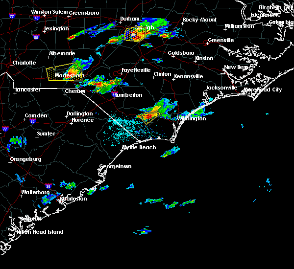 At 618 pm edt, a severe thunderstorm was located near lake waccamaw, or 17 miles east of whiteville, moving east at 30 mph (radar indicated). Hazards include 60 mph wind gusts and quarter size hail. Hail damage to vehicles is expected. expect wind damage to roofs, siding, and trees. Locations impacted include, lake waccamaw, sandyfield, freeman, riegelwood and bolton. At 618 pm edt, a severe thunderstorm was located near lake waccamaw, or 17 miles east of whiteville, moving east at 30 mph (radar indicated). Hazards include 60 mph wind gusts and quarter size hail. Hail damage to vehicles is expected. expect wind damage to roofs, siding, and trees. Locations impacted include, lake waccamaw, sandyfield, freeman, riegelwood and bolton.
|
| 5/3/2016 6:07 PM EDT |
 At 606 pm edt, a severe thunderstorm was located over lake waccamaw, or 11 miles east of whiteville, moving east at 15 mph (radar indicated). Hazards include 60 mph wind gusts and quarter size hail. Hail damage to vehicles is expected. expect wind damage to roofs, siding, and trees. Locations impacted include, lake waccamaw, sandyfield, carvers, redbug, council, freeman, hallsboro, riegelwood, bolton and east arcadia. At 606 pm edt, a severe thunderstorm was located over lake waccamaw, or 11 miles east of whiteville, moving east at 15 mph (radar indicated). Hazards include 60 mph wind gusts and quarter size hail. Hail damage to vehicles is expected. expect wind damage to roofs, siding, and trees. Locations impacted include, lake waccamaw, sandyfield, carvers, redbug, council, freeman, hallsboro, riegelwood, bolton and east arcadia.
|
| 5/3/2016 5:49 PM EDT |
 At 548 pm edt, a severe thunderstorm was located over hallsboro, or 7 miles east of whiteville, moving east at 30 mph (radar indicated). Hazards include 60 mph wind gusts and quarter size hail. Hail damage to vehicles is expected. expect wind damage to roofs, siding, and trees. Locations impacted include, lake waccamaw, northwest, sandyfield, redbug, council, freeman, hallsboro, delco, honey island, carvers, emerson, makatoka, riegelwood, kelly, bolton, east arcadia and sandy creek. At 548 pm edt, a severe thunderstorm was located over hallsboro, or 7 miles east of whiteville, moving east at 30 mph (radar indicated). Hazards include 60 mph wind gusts and quarter size hail. Hail damage to vehicles is expected. expect wind damage to roofs, siding, and trees. Locations impacted include, lake waccamaw, northwest, sandyfield, redbug, council, freeman, hallsboro, delco, honey island, carvers, emerson, makatoka, riegelwood, kelly, bolton, east arcadia and sandy creek.
|
| 5/3/2016 5:29 PM EDT |
 At 529 pm edt, a severe thunderstorm was located over whiteville, moving east at 30 mph (radar indicated). Hazards include 60 mph wind gusts and quarter size hail. Hail damage to vehicles is expected. Expect wind damage to roofs, siding, and trees. At 529 pm edt, a severe thunderstorm was located over whiteville, moving east at 30 mph (radar indicated). Hazards include 60 mph wind gusts and quarter size hail. Hail damage to vehicles is expected. Expect wind damage to roofs, siding, and trees.
|
| 5/3/2016 4:29 PM EDT |
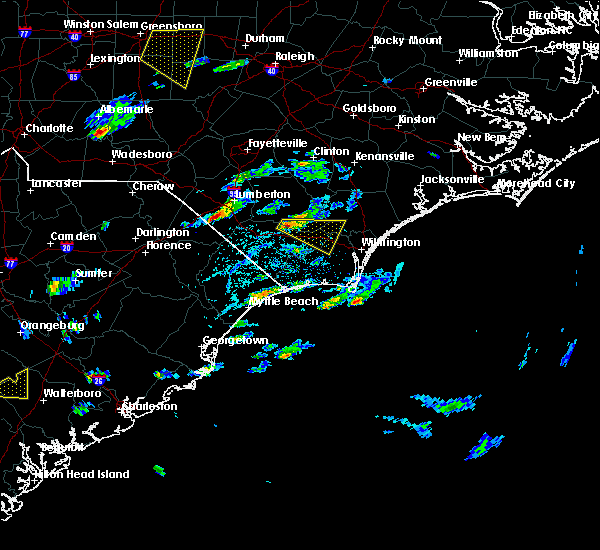 At 429 pm edt, a severe thunderstorm was located near council, or 11 miles northeast of whiteville, moving east at 25 mph (radar indicated). Hazards include 60 mph wind gusts and quarter size hail. Hail damage to vehicles is expected. Expect wind damage to roofs, siding, and trees. At 429 pm edt, a severe thunderstorm was located near council, or 11 miles northeast of whiteville, moving east at 25 mph (radar indicated). Hazards include 60 mph wind gusts and quarter size hail. Hail damage to vehicles is expected. Expect wind damage to roofs, siding, and trees.
|
| 2/24/2016 11:58 AM EST |
 At 1158 am est, doppler radar indicated a severe thunderstorm capable of producing quarter size hail and damaging winds in excess of 60 mph. this storm was located near whiteville, and moving northeast at 80 mph. At 1158 am est, doppler radar indicated a severe thunderstorm capable of producing quarter size hail and damaging winds in excess of 60 mph. this storm was located near whiteville, and moving northeast at 80 mph.
|
| 8/5/2015 4:39 PM EDT |
 The severe thunderstorm warning for southwestern bladen and north central columbus counties will expire at 445 pm edt, the storm which prompted the warning has moved out of the area. therefore the warning will be allowed to expire. The severe thunderstorm warning for southwestern bladen and north central columbus counties will expire at 445 pm edt, the storm which prompted the warning has moved out of the area. therefore the warning will be allowed to expire.
|
| 8/5/2015 3:57 PM EDT |
 At 357 pm edt, doppler radar indicated a severe thunderstorm capable of producing quarter size hail and damaging winds in excess of 60 mph. this storm was located near elkton, or 7 miles north of whiteville, and moving southeast at 15 mph. At 357 pm edt, doppler radar indicated a severe thunderstorm capable of producing quarter size hail and damaging winds in excess of 60 mph. this storm was located near elkton, or 7 miles north of whiteville, and moving southeast at 15 mph.
|
| 7/23/2015 4:21 PM EDT |
 At 421 pm edt, doppler radar indicated a severe thunderstorm capable of producing quarter size hail and damaging winds in excess of 60 mph. this storm was located over hallsboro, or near whiteville, and moving southeast at 30 mph. At 421 pm edt, doppler radar indicated a severe thunderstorm capable of producing quarter size hail and damaging winds in excess of 60 mph. this storm was located over hallsboro, or near whiteville, and moving southeast at 30 mph.
|
| 7/13/2015 1:31 PM EDT |
 At 131 pm edt, doppler radar indicated a severe thunderstorm capable of producing quarter size hail and damaging winds in excess of 60 mph. this storm was located near bladen community college, or 10 miles west of elizabethtown, and moving southeast at 35 mph. At 131 pm edt, doppler radar indicated a severe thunderstorm capable of producing quarter size hail and damaging winds in excess of 60 mph. this storm was located near bladen community college, or 10 miles west of elizabethtown, and moving southeast at 35 mph.
|
| 7/2/2015 7:42 PM EDT |
 At 742 pm edt, doppler radar indicated a line of severe thunderstorms capable of producing damaging winds in excess of 60 mph. these storms were located along a line extending from near honey island to near dulah to allsbrook to pee dee crossroads, and moving southeast at 40 mph. At 742 pm edt, doppler radar indicated a line of severe thunderstorms capable of producing damaging winds in excess of 60 mph. these storms were located along a line extending from near honey island to near dulah to allsbrook to pee dee crossroads, and moving southeast at 40 mph.
|
| 6/27/2015 9:27 PM EDT | The severe thunderstorm warning for southern bladen, southwestern brunswick, southeastern robeson, columbus and central horry counties will expire at 930 pm edt, the storm which prompted the warning has weakened below severe limits, and no longer poses an immediate threat to life or property. therefore the warning will be allowed to expire. however gusty winds are still possible with this thunderstorm. |
| 6/27/2015 9:27 PM EDT | The severe thunderstorm warning for southern bladen, southwestern brunswick, southeastern robeson, columbus and central horry counties will expire at 930 pm edt, the storm which prompted the warning has weakened below severe limits, and no longer poses an immediate threat to life or property. therefore the warning will be allowed to expire. however gusty winds are still possible with this thunderstorm. |
| 6/27/2015 9:07 PM EDT |
 At 906 pm edt, doppler radar indicated a severe thunderstorm capable of producing quarter size hail and damaging winds in excess of 60 mph. this storm was located over chadbourn, or near whiteville. this storm was nearly stationary. locations impacted include, whiteville, shallotte, sunset beach, ocean isle beach, little river, iredell, carolina shores, tabor city, loris, chadbourn, calabash, bladenboro, bethel, lake waccamaw, fair bluff, boardman, lagoon, allsbrook, williams and hallsboro. this includes the following highways, us route 74 between mile markers 366 and 413. us route 17 in brunswick county between mile markers 1 and 15. At 906 pm edt, doppler radar indicated a severe thunderstorm capable of producing quarter size hail and damaging winds in excess of 60 mph. this storm was located over chadbourn, or near whiteville. this storm was nearly stationary. locations impacted include, whiteville, shallotte, sunset beach, ocean isle beach, little river, iredell, carolina shores, tabor city, loris, chadbourn, calabash, bladenboro, bethel, lake waccamaw, fair bluff, boardman, lagoon, allsbrook, williams and hallsboro. this includes the following highways, us route 74 between mile markers 366 and 413. us route 17 in brunswick county between mile markers 1 and 15.
|
| 6/27/2015 8:44 PM EDT |
 At 843 pm edt, doppler radar indicated a severe thunderstorm capable of producing quarter size hail and damaging winds in excess of 60 mph. this storm was located near lake view, or 8 miles northeast of mullins, and moving east at 50 mph. At 843 pm edt, doppler radar indicated a severe thunderstorm capable of producing quarter size hail and damaging winds in excess of 60 mph. this storm was located near lake view, or 8 miles northeast of mullins, and moving east at 50 mph.
|
| 6/24/2015 9:11 PM EDT |
 At 911 pm edt, doppler radar indicated a line of severe thunderstorms capable of producing quarter size hail and damaging winds in excess of 60 mph. these storms were located along a line extending from near chadbourn to near lake waccamaw, and moving south at 15 mph. At 911 pm edt, doppler radar indicated a line of severe thunderstorms capable of producing quarter size hail and damaging winds in excess of 60 mph. these storms were located along a line extending from near chadbourn to near lake waccamaw, and moving south at 15 mph.
|
| 6/18/2015 6:54 PM EDT | The severe thunderstorm warning for central brunswick and central columbus counties will expire at 700 pm edt, the storm which prompted the warning has weakened below severe limits, and no longer poses an immediate threat to life or property. therefore the warning will be allowed to expire. however gusty winds and heavy rain are still possible with this thunderstorm. |
| 6/18/2015 6:35 PM EDT | At 634 pm edt, doppler radar indicated a severe thunderstorm capable of producing quarter size hail and damaging winds in excess of 60 mph. this storm was located over ash, or 9 miles northwest of shallotte, moving southeast at 30 mph. locations impacted include, shallotte, boiling spring lakes, bethel, lake waccamaw, supply, freeman, ash, crusoe island, freeland, old dock, pireway, nakina, exum, honey island, mollie, dulah, brunswick county community college main campus, makatoka, bughill and longwood. this includes the following highways, us route 74 between mile markers 411 and 419. us route 17 in brunswick county between mile markers 13 and 33. |
| 6/18/2015 6:24 PM EDT | The severe thunderstorm warning for south central bladen, northwestern brunswick and central columbus counties will expire at 630 pm edt, the storm which prompted the warning has moved out of the area. therefore the warning will be allowed to expire. however gusty winds are still possible with this thunderstorm. remember, a severe thunderstorm warning still remains in effect for portions of the same area of columbus and brunswick counties. |
| 6/18/2015 6:15 PM EDT | At 615 pm edt, doppler radar indicated a severe thunderstorm capable of producing quarter size hail and damaging winds in excess of 60 mph. this storm was located over crusoe island, or 12 miles southeast of whiteville, and moving south at 30 mph. |
| 6/18/2015 6:00 PM EDT | At 600 pm edt, doppler radar indicated a severe thunderstorm capable of producing quarter size hail and damaging winds in excess of 60 mph. this storm was located over lake waccamaw, or 10 miles east of whiteville, moving south at 10 mph. locations impacted include, lake waccamaw, carvers, redbug, council, emerson, hallsboro, honey island, crusoe island and bolton. this includes us route 74 between mile markers 397 and 412. |
| 6/18/2015 5:41 PM EDT | At 541 pm edt, doppler radar indicated a severe thunderstorm capable of producing quarter size hail and damaging winds in excess of 60 mph. this storm was located near council, or 10 miles east of whiteville, and moving south at 10 mph. |
| 6/9/2015 9:33 PM EDT |
 At 933 pm edt, doppler radar indicated a severe thunderstorm capable of producing quarter size hail and damaging winds in excess of 60 mph. this storm was located near phoenix, or 8 miles northwest of leland, moving southeast at 30 mph. locations impacted include, burgaw, rowan, northwest, sandyfield, montague, currie, the borough, malpass corner, phoenix, batarora, kelly, riegelwood, point caswell, freeman, delco, wards corner, carvers, rooks, long creek and council. this includes the following highways, interstate 40 near mile marker 400. us route 74 between mile markers 404 and 429. At 933 pm edt, doppler radar indicated a severe thunderstorm capable of producing quarter size hail and damaging winds in excess of 60 mph. this storm was located near phoenix, or 8 miles northwest of leland, moving southeast at 30 mph. locations impacted include, burgaw, rowan, northwest, sandyfield, montague, currie, the borough, malpass corner, phoenix, batarora, kelly, riegelwood, point caswell, freeman, delco, wards corner, carvers, rooks, long creek and council. this includes the following highways, interstate 40 near mile marker 400. us route 74 between mile markers 404 and 429.
|
| 6/9/2015 9:14 PM EDT |
 At 914 pm edt, doppler radar indicated a severe thunderstorm capable of producing quarter size hail and damaging winds in excess of 60 mph. this storm was located over lagoon, or 13 miles southeast of elizabethtown, and moving southeast at 30 mph. At 914 pm edt, doppler radar indicated a severe thunderstorm capable of producing quarter size hail and damaging winds in excess of 60 mph. this storm was located over lagoon, or 13 miles southeast of elizabethtown, and moving southeast at 30 mph.
|
| 4/19/2015 8:25 PM EDT | At 757 pm edt, doppler radar indicated a line of severe thunderstorms capable of producing damaging winds in excess of 60 mph. these storms were located along a line extending from near wakulla to kemper to near brittons neck, moving northeast at 30 mph. locations impacted include, lumberton, whiteville, mullins, red springs, pembroke, fairmont, tabor city, st. pauls, chadbourn, johnsonville, lake waccamaw, rowland, fair bluff, lake view, boardman, williams, hallsboro, howellsville, tolarsville and galivants ferry. # this includes the following highways, interstate 74 between mile markers 212 and 214. interstate 95 in north carolina between mile markers 1 and 38. us route 74 between mile markers 365 and 404. |
| 4/19/2015 8:25 PM EDT | At 825 pm edt, doppler radar indicated a line of severe thunderstorms capable of producing damaging winds in excess of 60 mph. these storms were located along a line extending from 6 miles west of fayetteville to near boardman to near green sea, moving northeast at 50 mph. locations impacted include, lumberton, whiteville, red springs, fairmont, tabor city, st. pauls, chadbourn, lake waccamaw, fair bluff, boardman, williams, hallsboro, howellsville, tolarsville, rex, clarendon, cherry grove, smiths, redbug and southeastern community college. # this includes the following highways, interstate 74 between mile markers 212 and 207, and between mile markers 209 and 210, and near mile marker 214. interstate 95 in north carolina between mile markers 11 and 38. us route 74 between mile markers 365 and 404. |
| 4/19/2015 7:59 PM EDT | At 718 pm edt, doppler radar indicated a line of severe thunderstorms capable of producing damaging winds in excess of 60 mph. these storms were located along a line extending from near bennettsville to kingsburg, and moving northeast at 50 mph. |
| 4/19/2015 7:59 PM EDT | A severe thunderstorm warning remains in effect until 845 pm edt for robeson. northwestern columbus. northeastern marion. southeastern dillon. southeastern florence and northwestern horry counties. at 757 pm edt. Doppler radar indicated a line of severe thunderstorms capable of producing damaging winds in excess of 60. |
| 4/19/2015 7:19 PM EDT | The national weather service in wilmington nc has issued a * severe thunderstorm warning for. robeson county in southeastern north carolina. northwestern columbus county in southeastern north carolina. marion county in northeastern south carolina. Dillon county in northeastern south carolina. |
| 4/19/2015 7:19 PM EDT | At 718 pm edt, doppler radar indicated a line of severe thunderstorms capable of producing damaging winds in excess of 60 mph. these storms were located along a line extending from near bennettsville to kingsburg, and moving northeast at 50 mph. |
| 6/27/2013 10:26 PM EDT | Power lines down on pecan lan in columbus county NC, 2 miles SSW of Lake Waccamaw, NC |
| 5/16/2012 9:35 AM EDT | Dime to quarter size hail fell for approximately 2 minutes in columbus county NC, 1.9 miles E of Lake Waccamaw, NC |
| 5/16/2012 9:35 AM EDT | Quarter sized hail reported 1.9 miles E of Lake Waccamaw, NC, dime to quarter size hail fell for approximately 2 minutes |
| 5/15/2012 1:30 PM EDT | Quarter sized hail reported 1.9 miles E of Lake Waccamaw, NC, dime to quarter size hail fell for approximately 2 minutes |
| 1/1/0001 12:00 AM | Several trees and power lines reported down. time estimated based on radar dat in columbus county NC, 1.2 miles SSW of Lake Waccamaw, NC |
| 1/1/0001 12:00 AM | Quarter sized hail reported 7.5 miles SSE of Lake Waccamaw, NC |
Hail Maps for Lake Waccamaw, NC

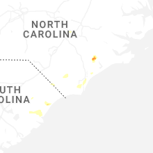


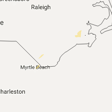


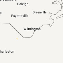


Connect with Interactive Hail Maps