

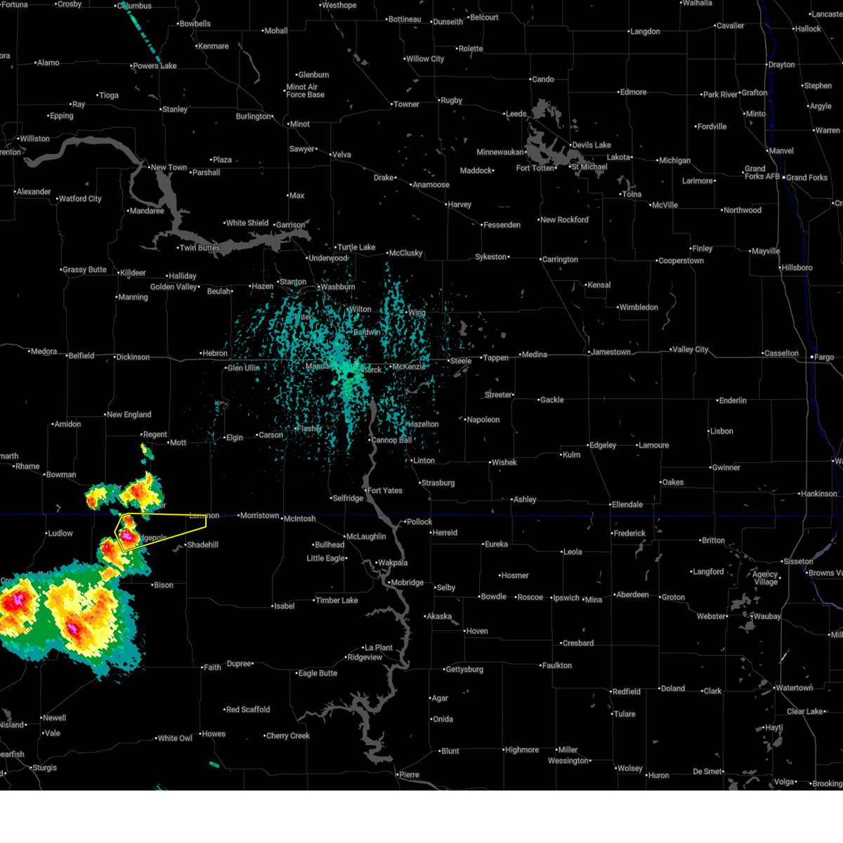
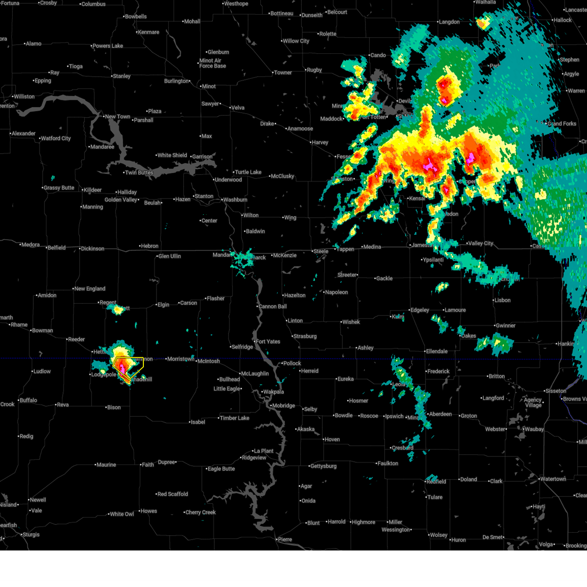
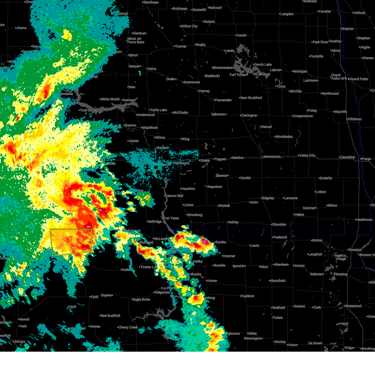
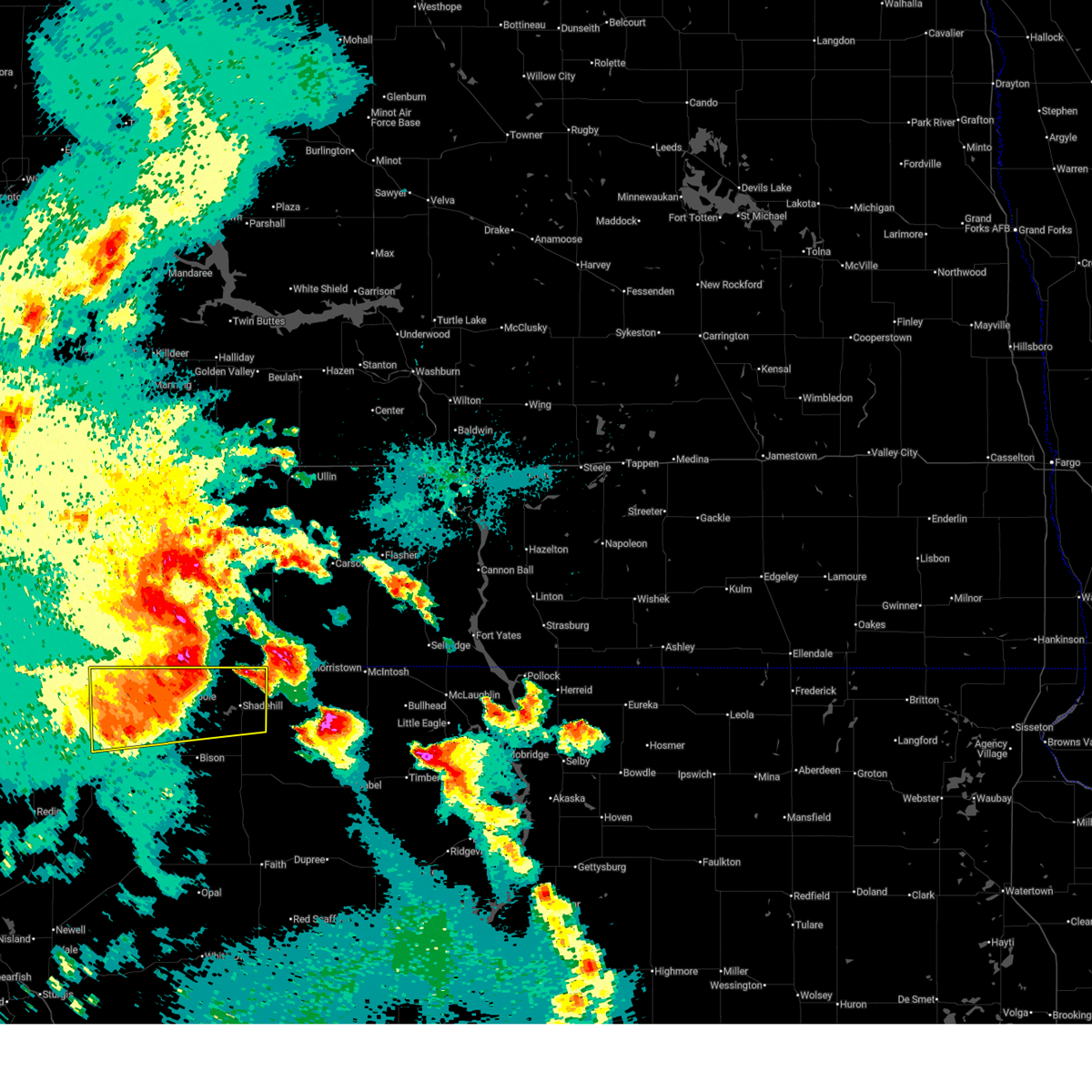
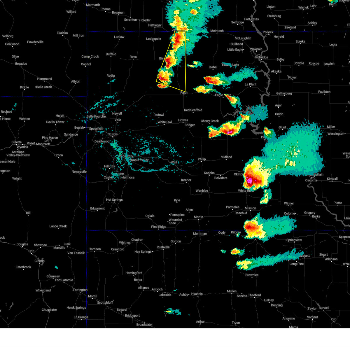
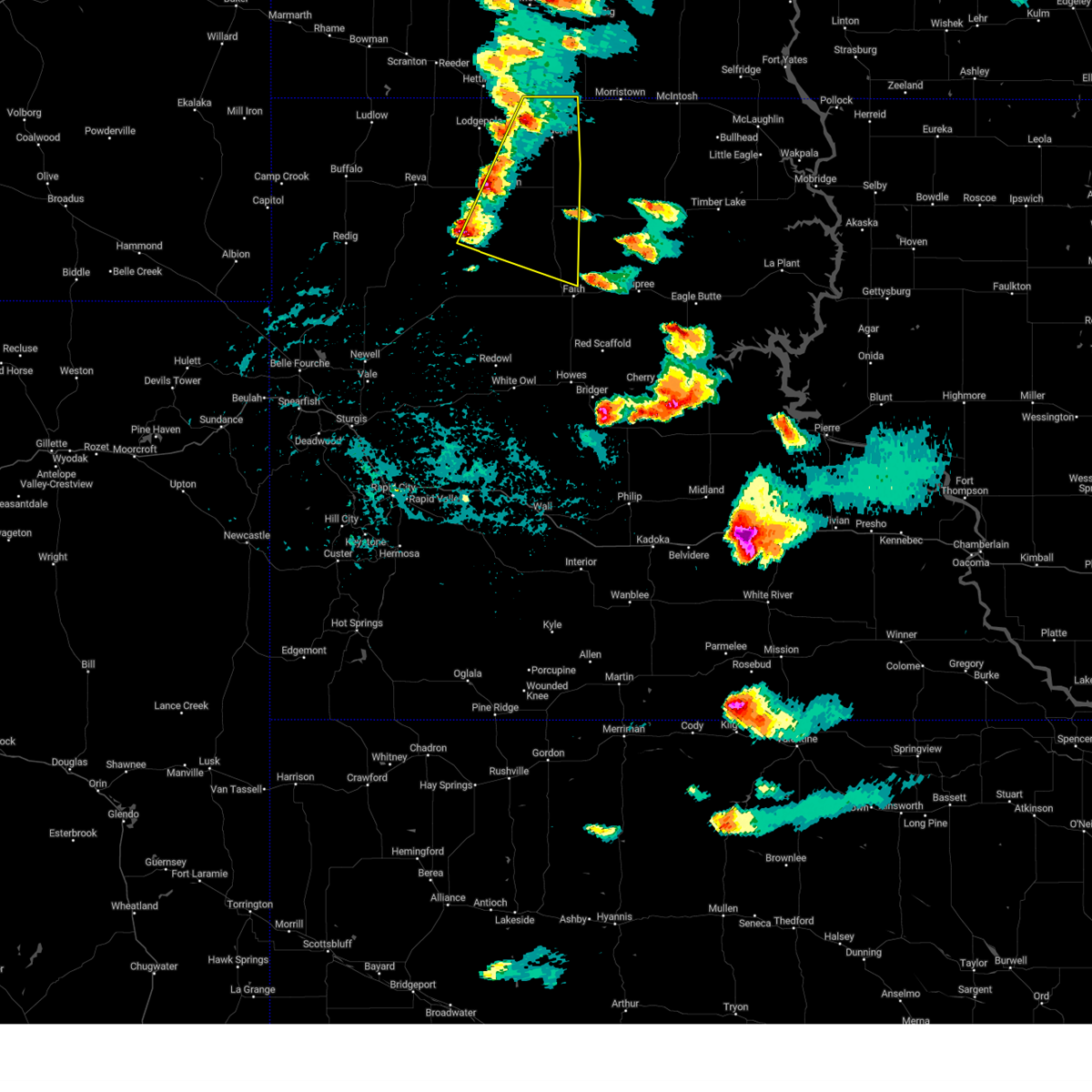
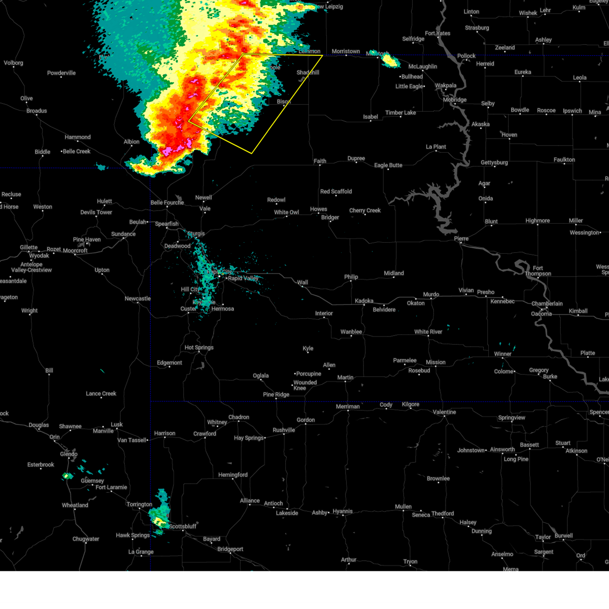
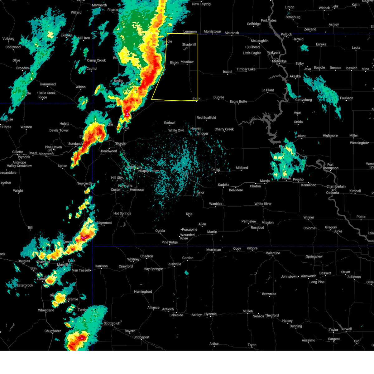
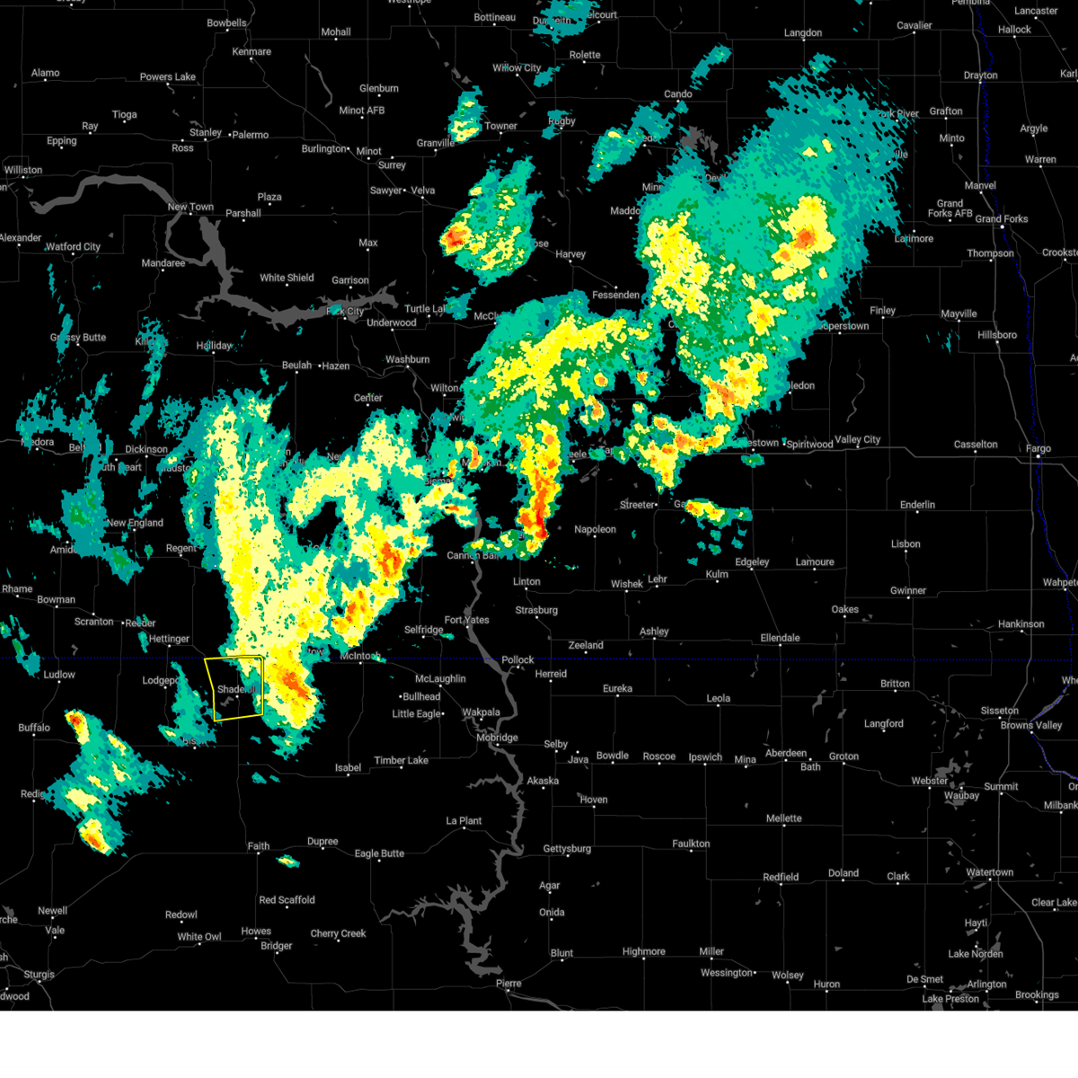
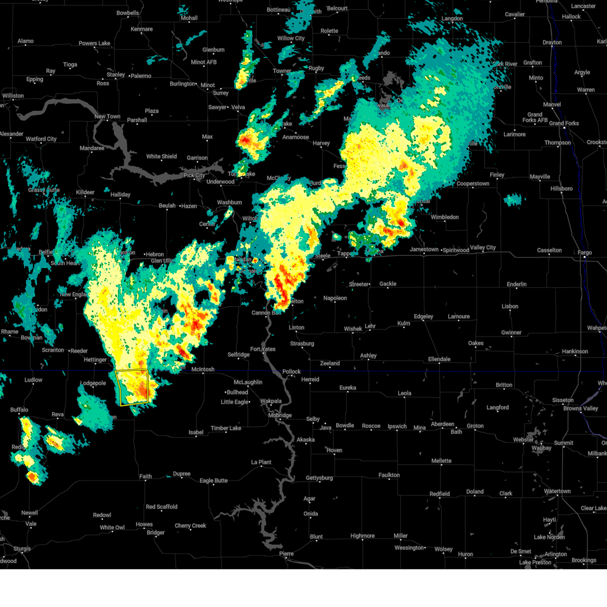
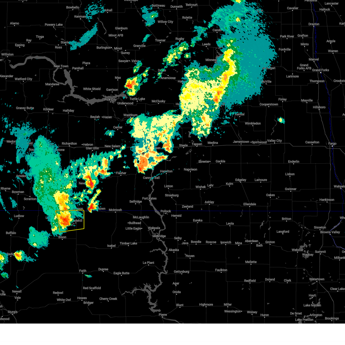
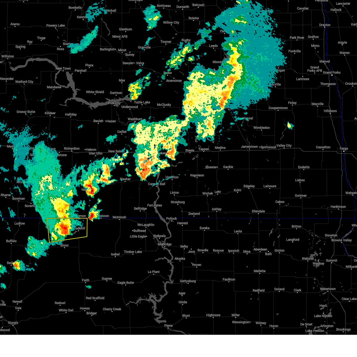
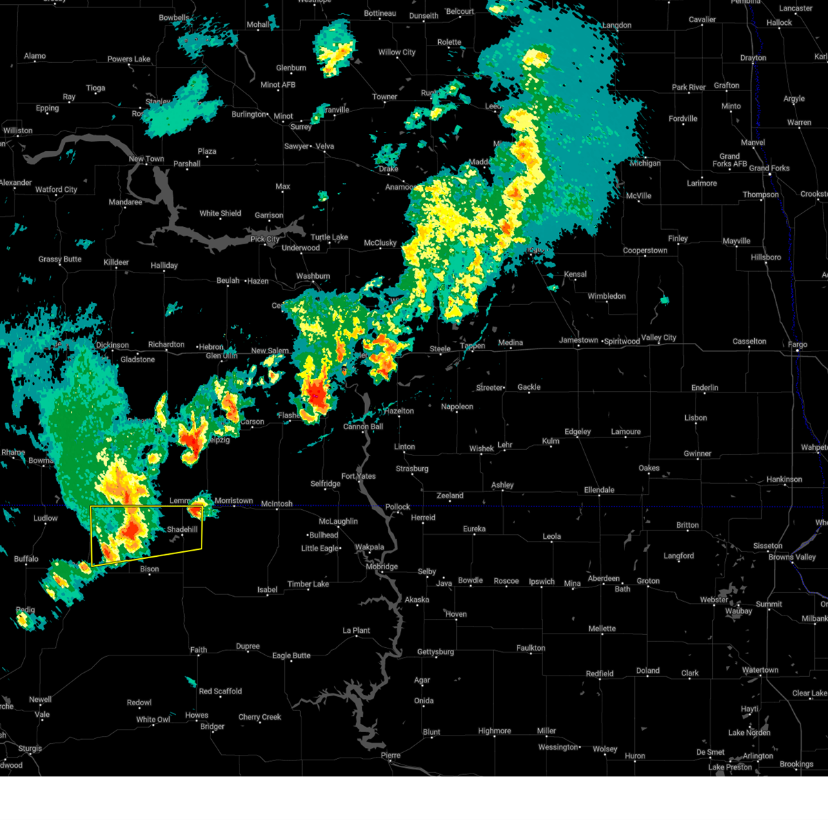
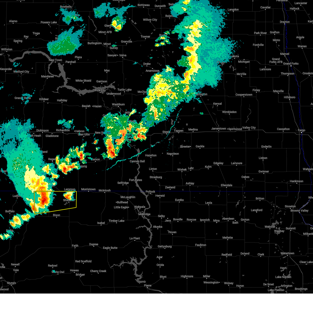
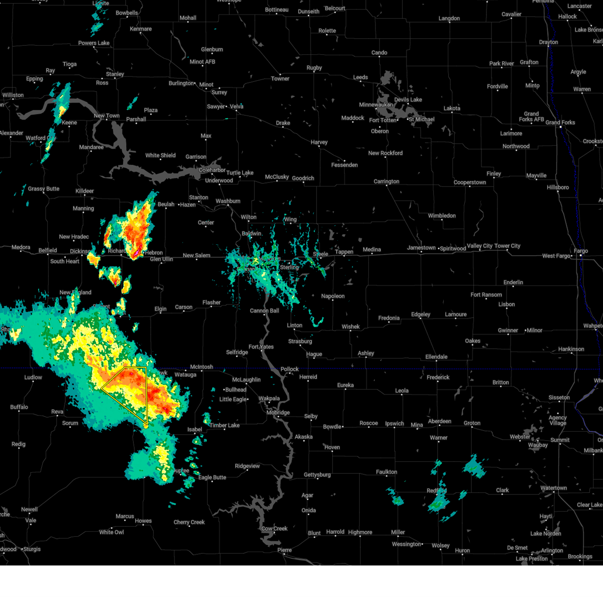
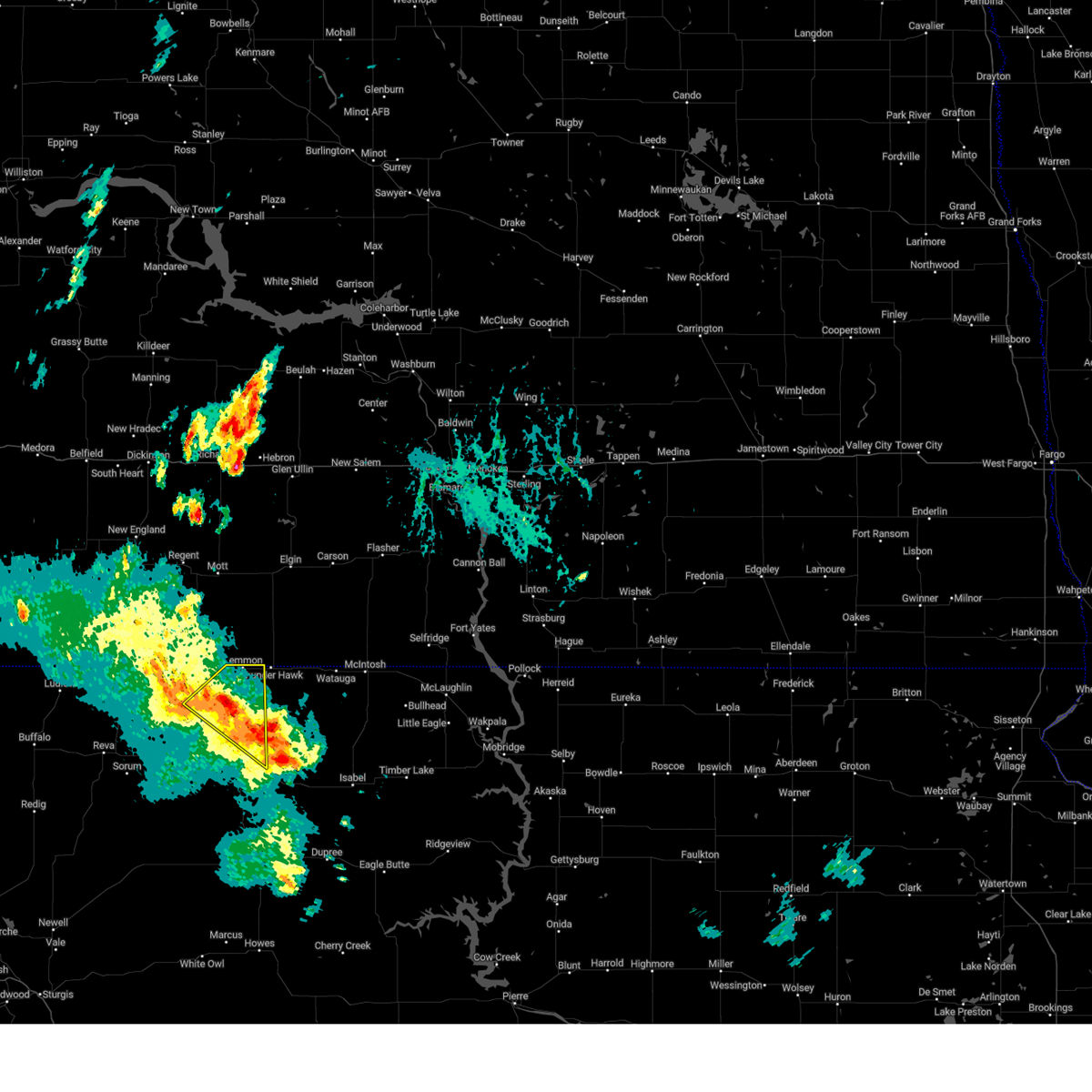
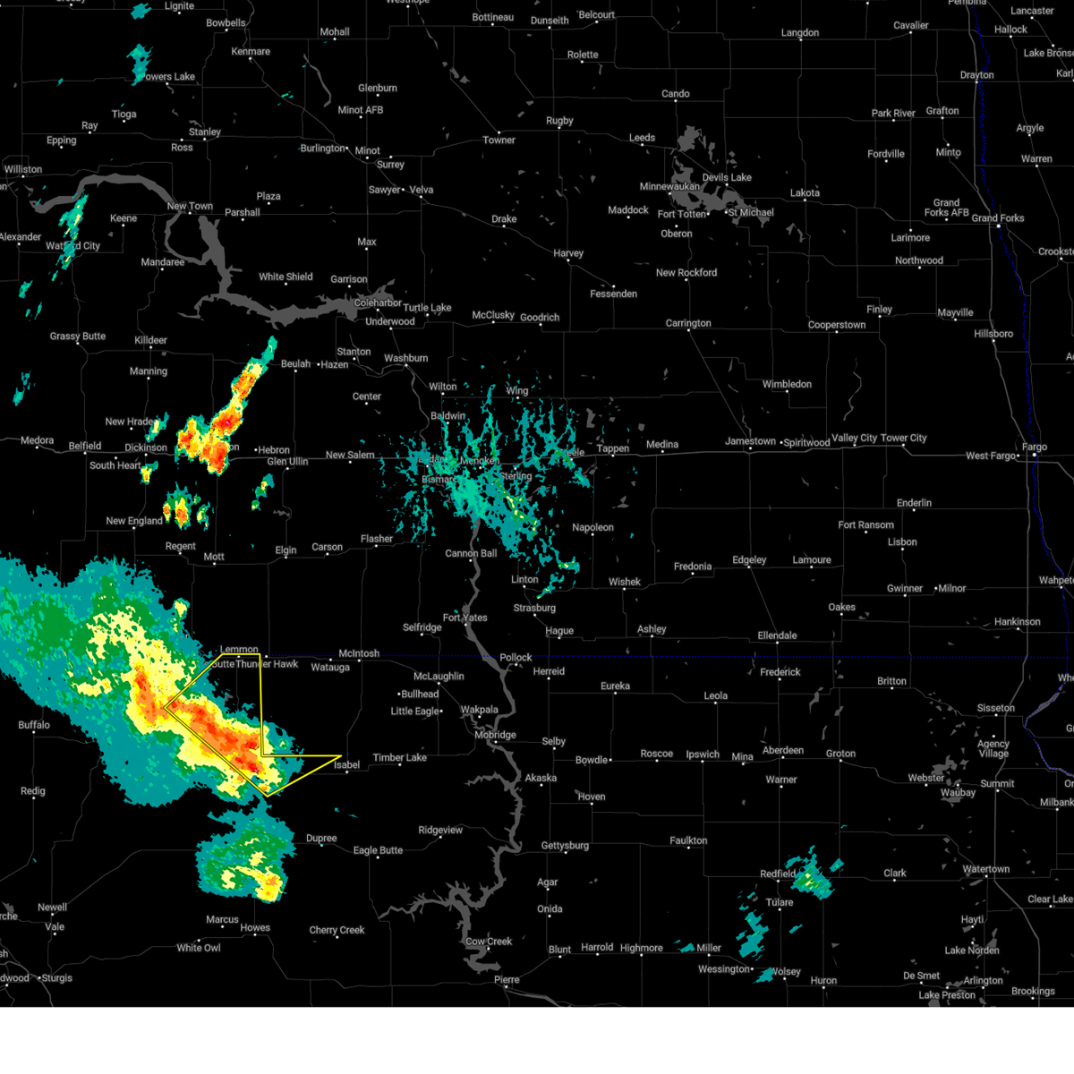
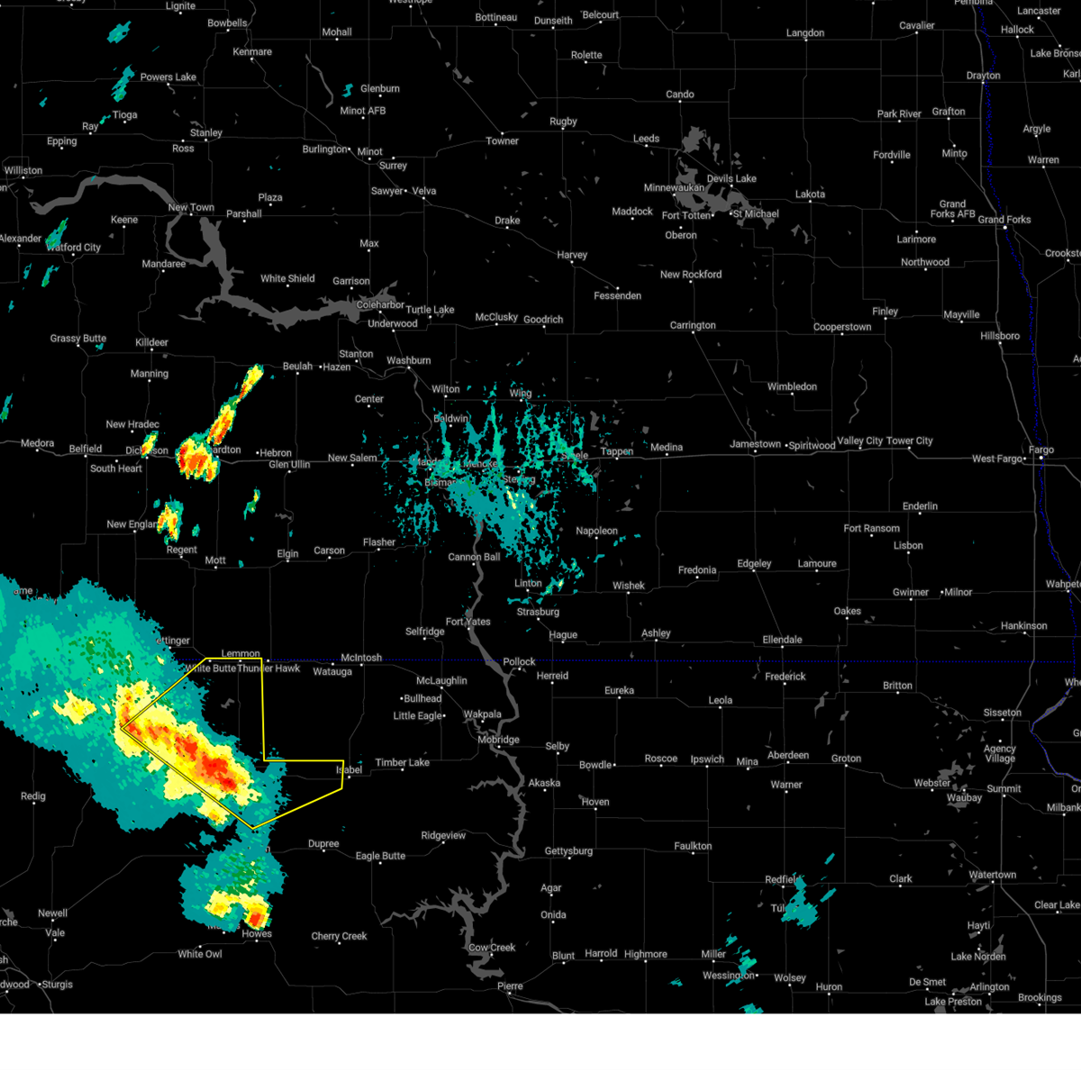
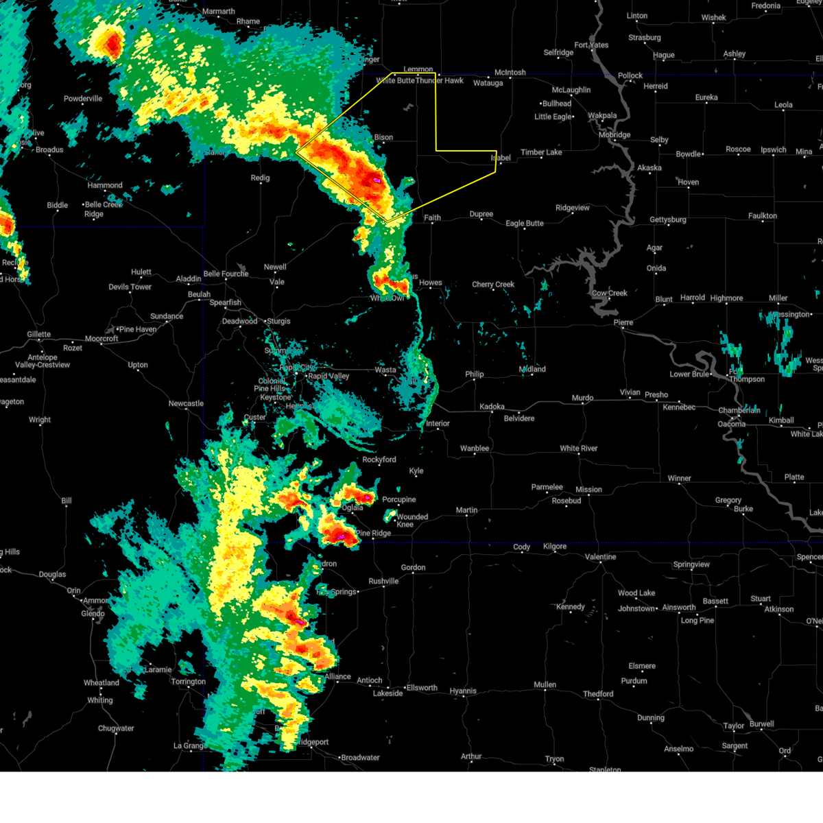
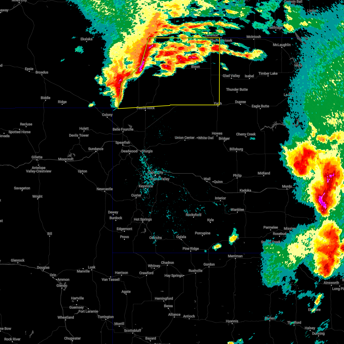
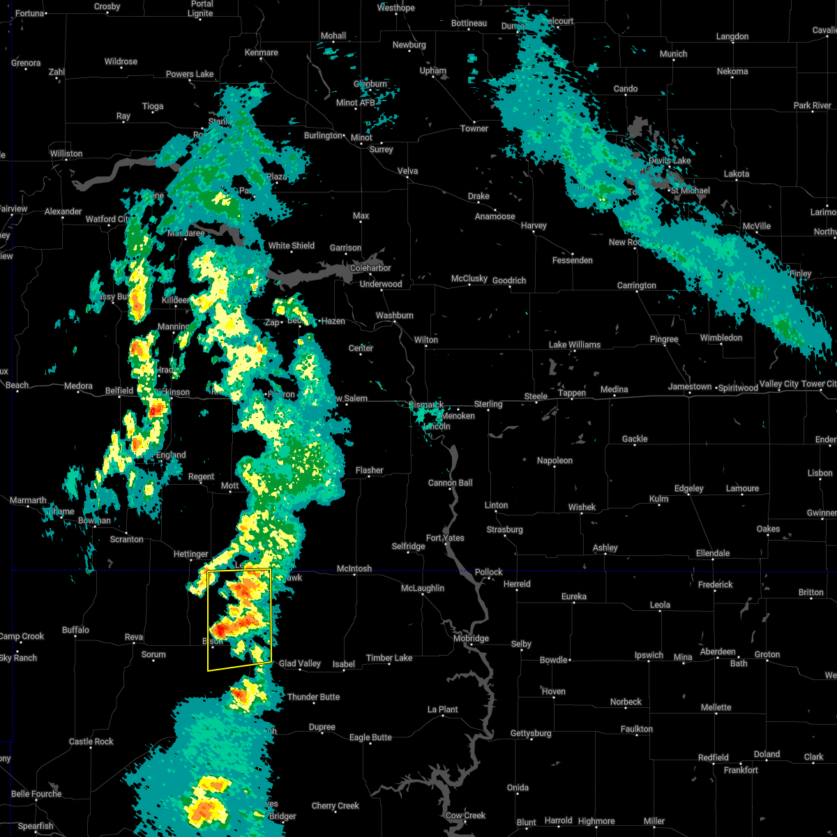
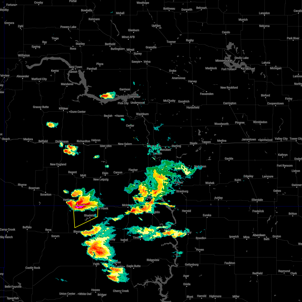
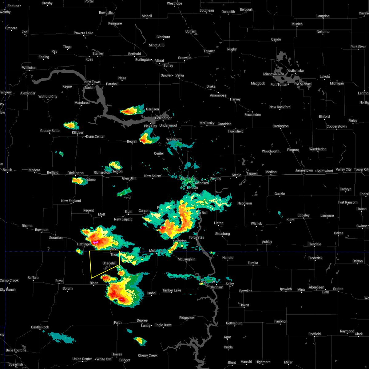
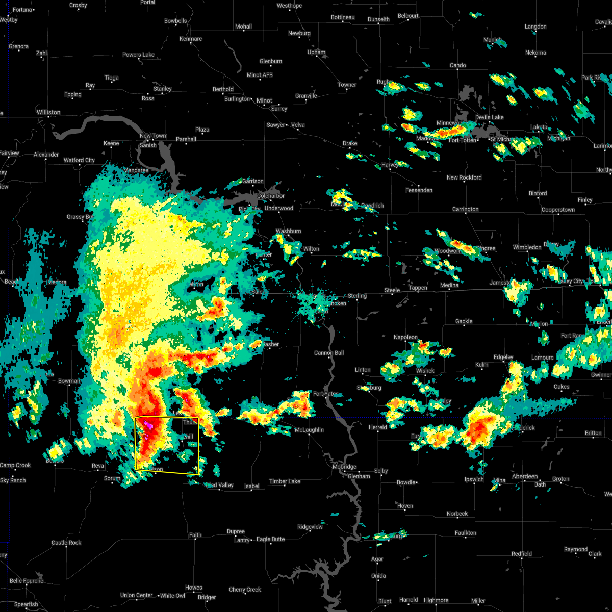
Hail Map for Lemmon, SD
The Lemmon, SD area has had 47 reports of on-the-ground hail by trained spotters, and has been under severe weather warnings 25 times during the past 12 months. Doppler radar has detected hail at or near Lemmon, SD on 47 occasions, including 4 occasions during the past year.
| Name: | Lemmon, SD |
| Where Located: | 89.2 miles SW of Bismarck, ND |
| Map: | Google Map for Lemmon, SD |
| Population: | 1227 |
| Housing Units: | 732 |
| More Info: | Search Google for Lemmon, SD |
1
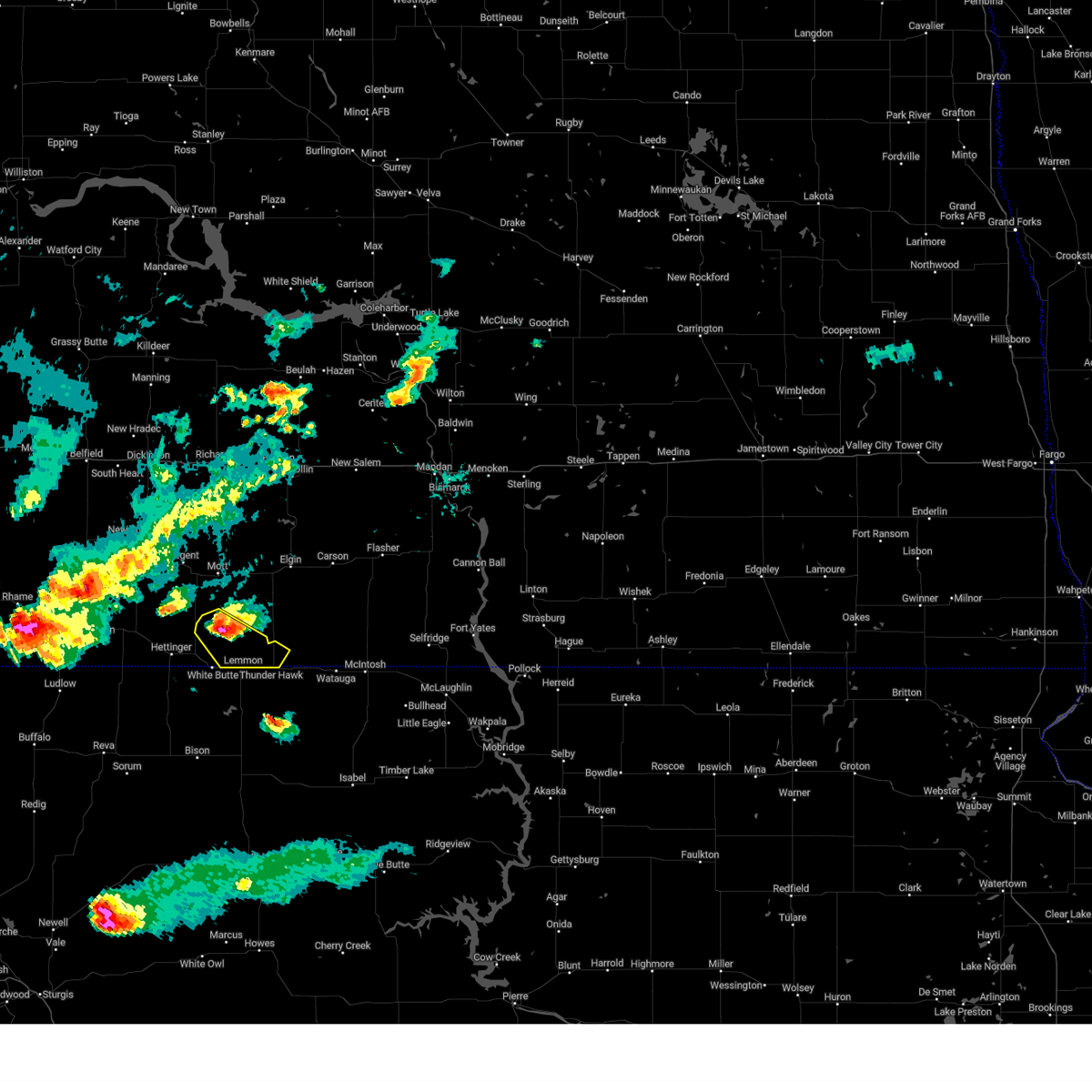
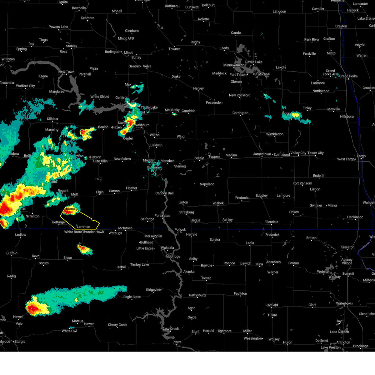
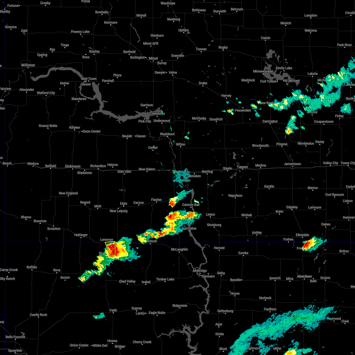
The Top Recent Hail Date for Lemmon, SD is Sunday, June 22, 2025 (2nd out of 47)
Hail and Wind Damage Spotted near Lemmon, SD
| Date / Time | Report Details |
|---|---|
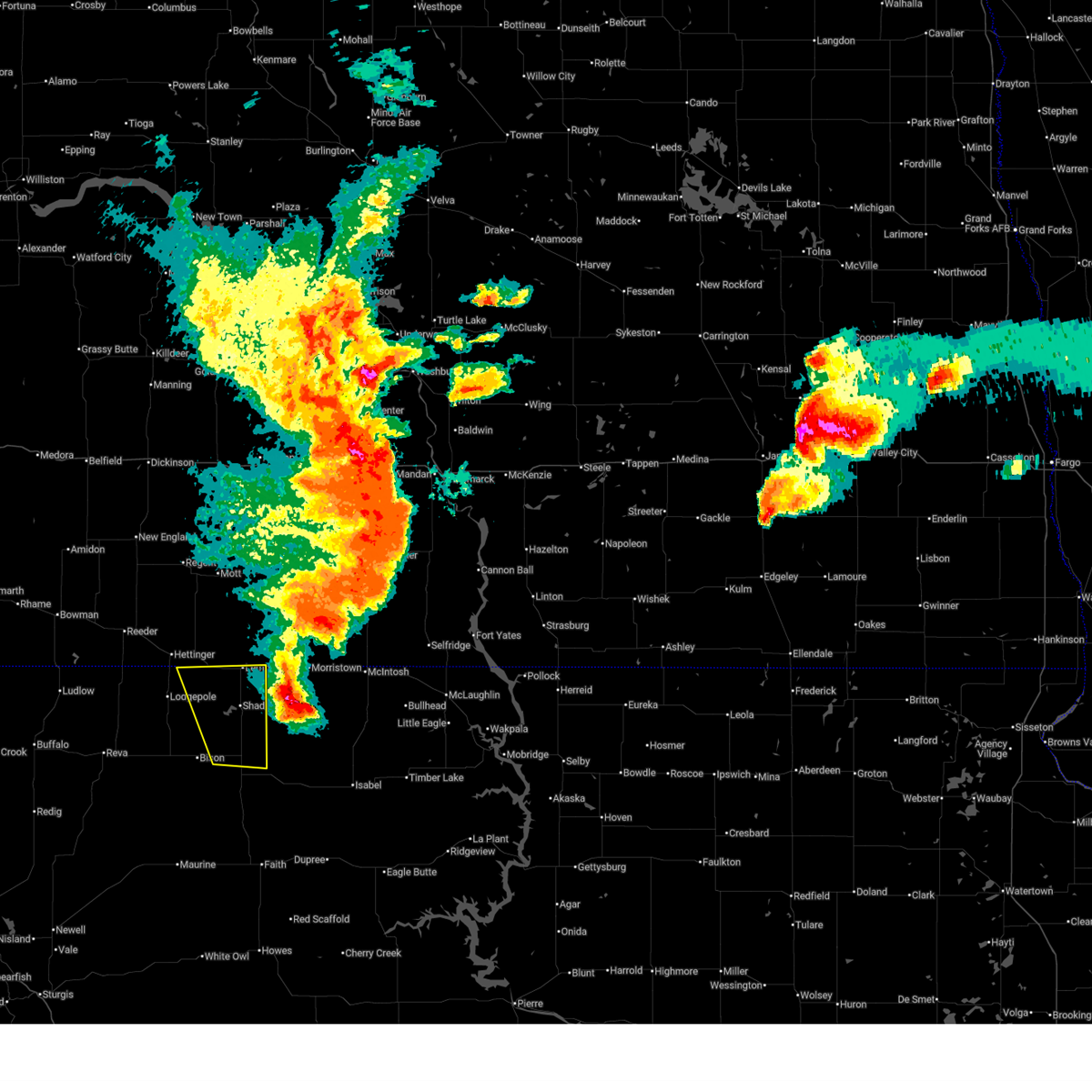
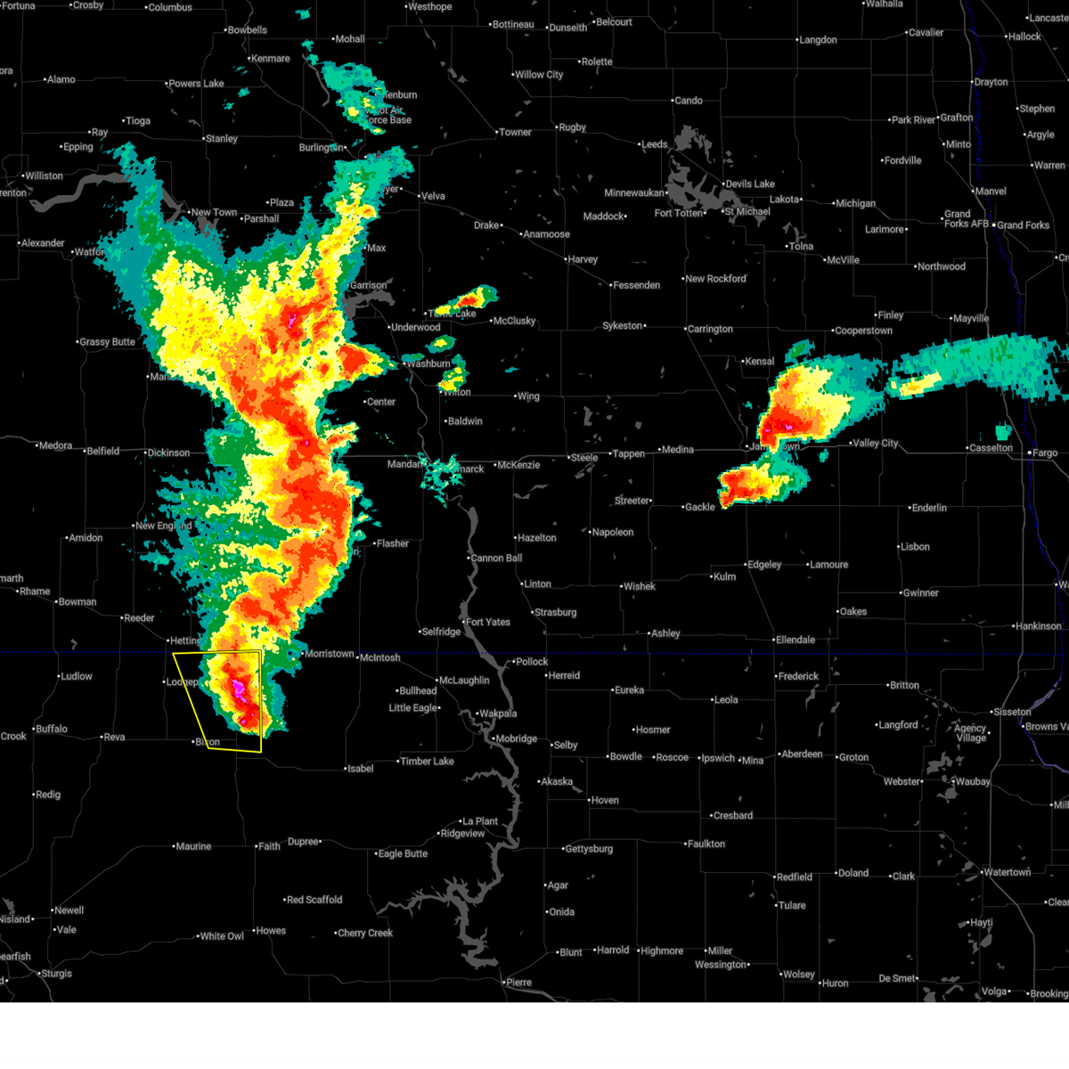
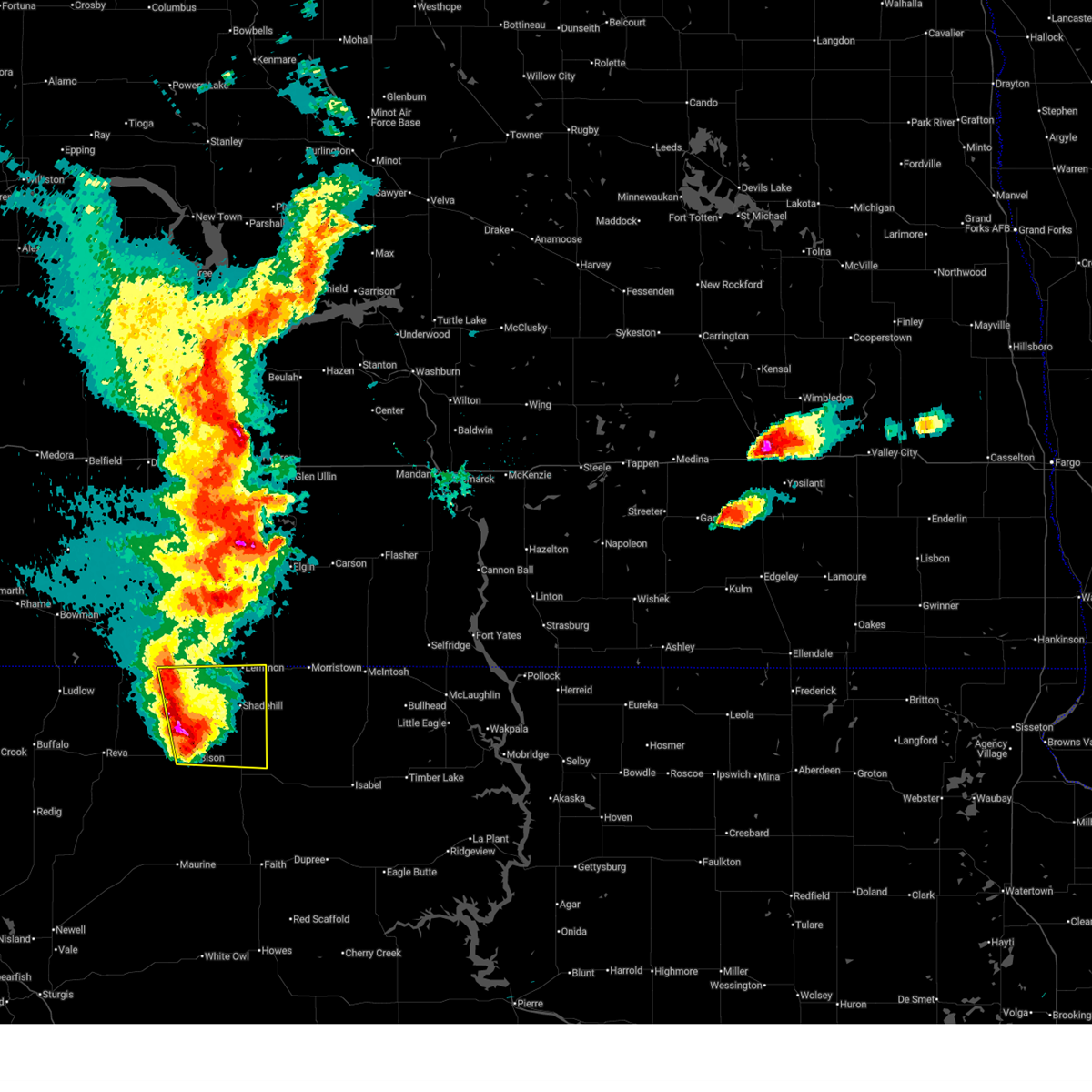
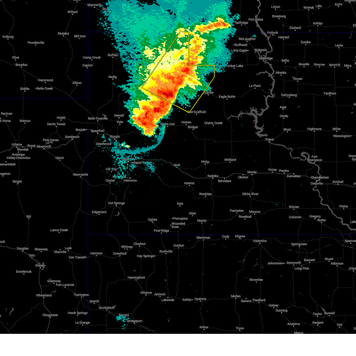
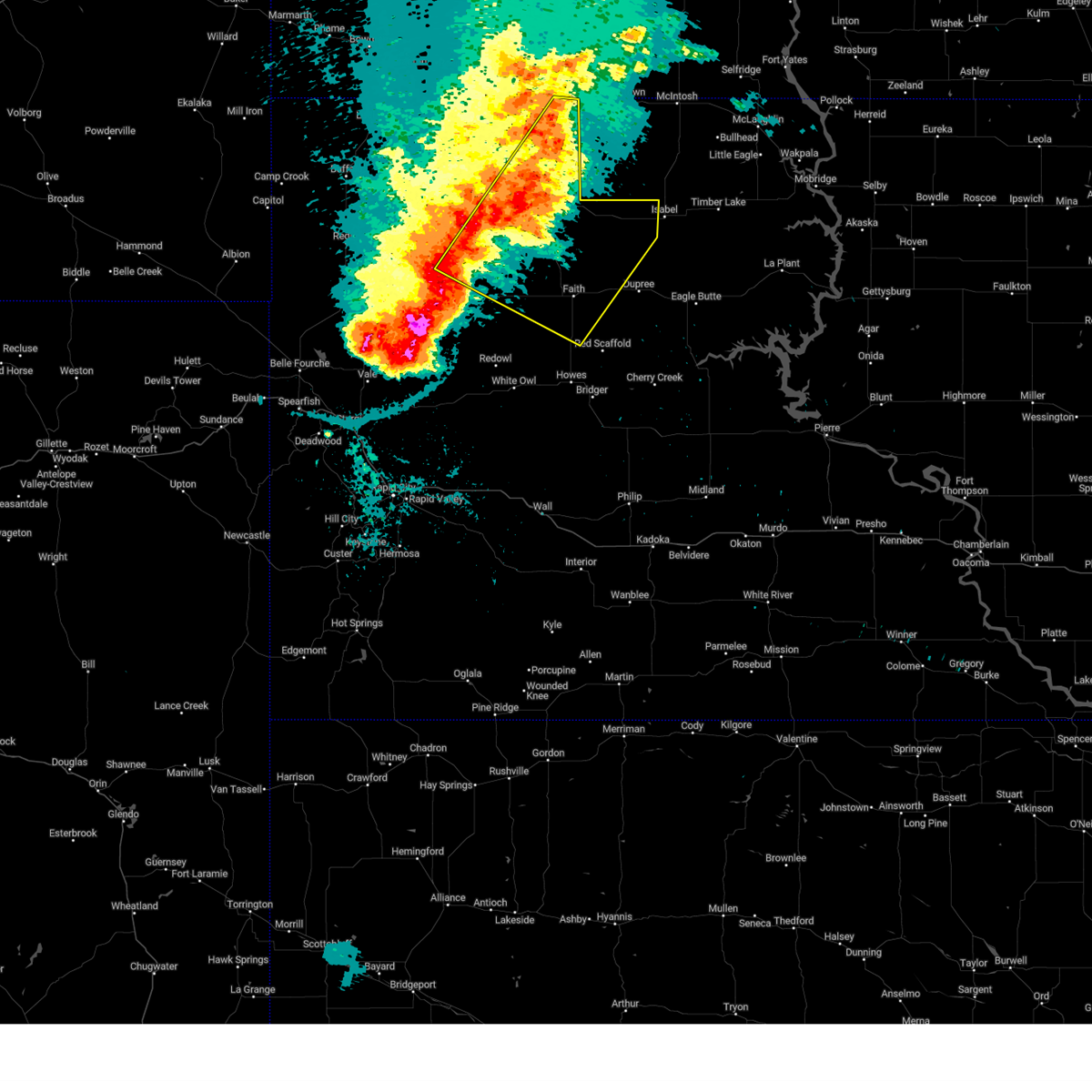
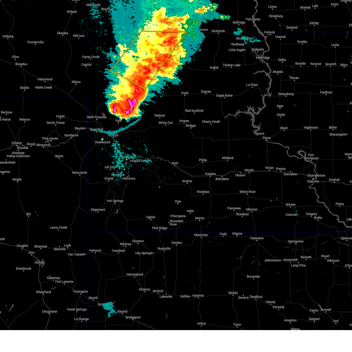
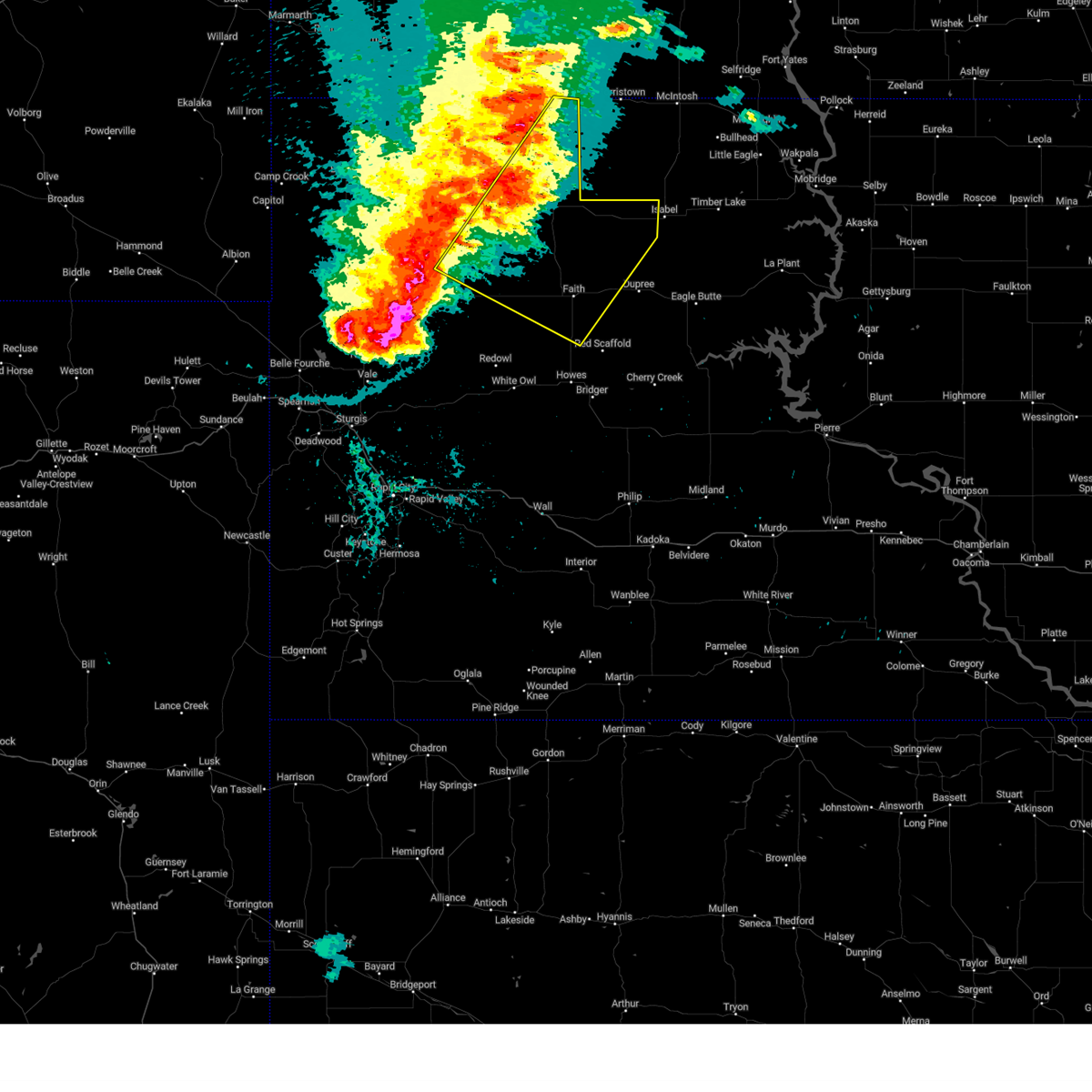
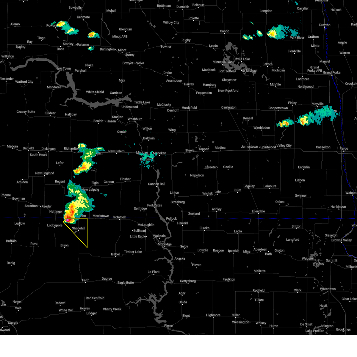
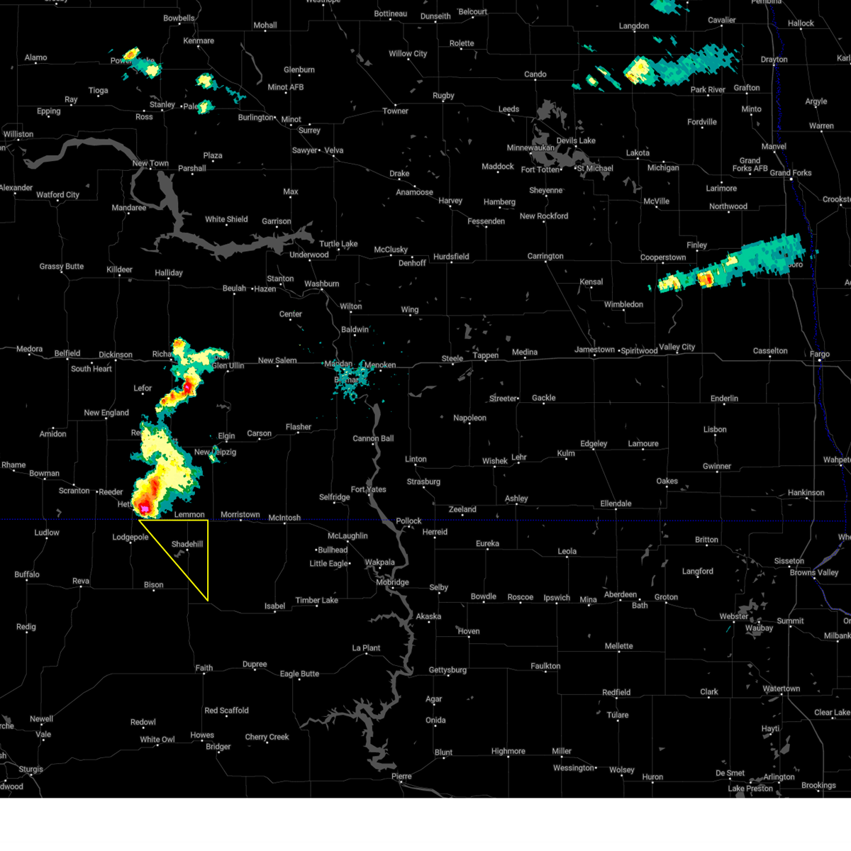
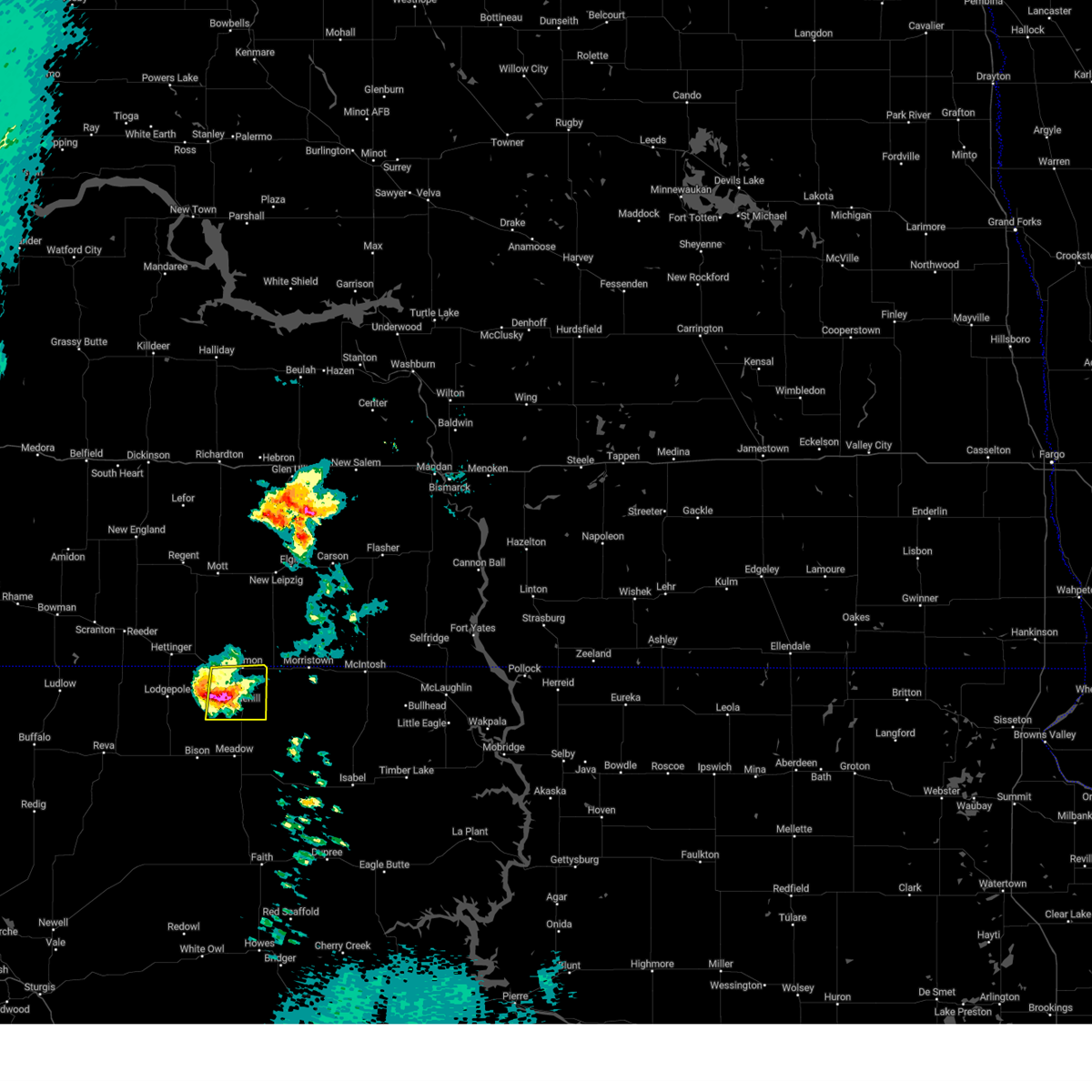
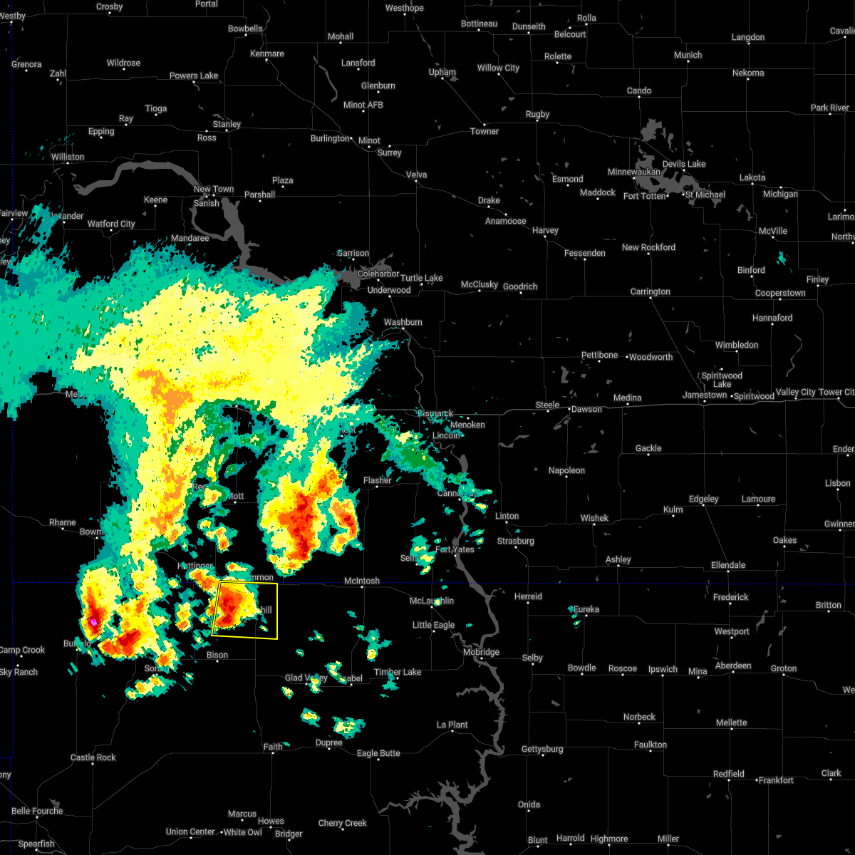
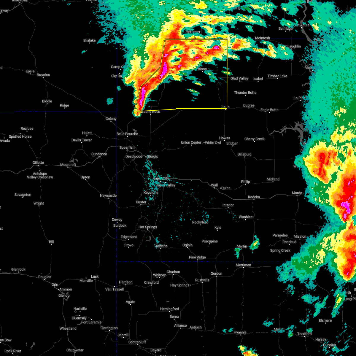
| 7/9/2025 3:49 PM MDT | At 348 pm mdt, severe thunderstorms were located along a line extending from 4 miles north of shadehill to 9 miles east of meadow to 4 miles south of opal, moving east at 50 mph (radar indicated). Hazards include 60 mph wind gusts and penny size hail. Expect damage to roofs, siding, and trees. Locations impacted include, lemmon, dupree, faith, bison, plainview, meadow, chance, usta, maurine, shadehill, stoneville, opal, red scaffold, red owl, iron lightning, glad valley, date, south eagle butte, marcus, and howes. |
| 7/9/2025 3:40 PM MDT |
 Svrunr the national weather service in rapid city has issued a * severe thunderstorm warning for, ziebach county in west central south dakota, northeastern meade county in west central south dakota, perkins county in northwestern south dakota, * until 445 pm mdt. * at 340 pm mdt, severe thunderstorms were located along a line extending from 6 miles south of white butte to 10 miles southeast of meadow to 7 miles north of stoneville, moving east at 60 mph (radar indicated). Hazards include 60 mph wind gusts and quarter size hail. Hail damage to vehicles is expected. Expect wind damage to roofs, siding, and trees. Svrunr the national weather service in rapid city has issued a * severe thunderstorm warning for, ziebach county in west central south dakota, northeastern meade county in west central south dakota, perkins county in northwestern south dakota, * until 445 pm mdt. * at 340 pm mdt, severe thunderstorms were located along a line extending from 6 miles south of white butte to 10 miles southeast of meadow to 7 miles north of stoneville, moving east at 60 mph (radar indicated). Hazards include 60 mph wind gusts and quarter size hail. Hail damage to vehicles is expected. Expect wind damage to roofs, siding, and trees.
|
| 7/9/2025 3:20 PM MDT | At 320 pm mdt, a severe thunderstorm was located 6 miles southwest of haynes, or 7 miles southeast of hettinger, moving southeast at 15 mph (radar indicated). Hazards include golf ball size hail and 60 mph wind gusts. People and animals outdoors will be injured. expect hail damage to roofs, siding, windows, and vehicles. expect wind damage to roofs, siding, and trees. Locations impacted include, lemmon, white butte, shadehill, and shadehill reservoir. |
| 7/9/2025 3:14 PM MDT |
 Svrunr the national weather service in rapid city has issued a * severe thunderstorm warning for, northeastern perkins county in northwestern south dakota, * until 345 pm mdt. * at 314 pm mdt, a severe thunderstorm was located 5 miles southwest of haynes, or 9 miles southeast of hettinger, moving east at 15 mph (radar indicated). Hazards include 60 mph wind gusts and half dollar size hail. Hail damage to vehicles is expected. Expect wind damage to roofs, siding, and trees. Svrunr the national weather service in rapid city has issued a * severe thunderstorm warning for, northeastern perkins county in northwestern south dakota, * until 345 pm mdt. * at 314 pm mdt, a severe thunderstorm was located 5 miles southwest of haynes, or 9 miles southeast of hettinger, moving east at 15 mph (radar indicated). Hazards include 60 mph wind gusts and half dollar size hail. Hail damage to vehicles is expected. Expect wind damage to roofs, siding, and trees.
|
| 7/9/2025 2:50 PM MDT |
 At 249 pm mdt, a severe thunderstorm was located 5 miles northeast of lodgepole, or 10 miles south of hettinger, moving northeast at 20 mph (radar indicated). Hazards include 60 mph wind gusts and quarter size hail. Hail damage to vehicles is expected. expect wind damage to roofs, siding, and trees. Locations impacted include, lemmon and white butte. At 249 pm mdt, a severe thunderstorm was located 5 miles northeast of lodgepole, or 10 miles south of hettinger, moving northeast at 20 mph (radar indicated). Hazards include 60 mph wind gusts and quarter size hail. Hail damage to vehicles is expected. expect wind damage to roofs, siding, and trees. Locations impacted include, lemmon and white butte.
|
| 7/9/2025 2:34 PM MDT |
 Svrunr the national weather service in rapid city has issued a * severe thunderstorm warning for, northeastern perkins county in northwestern south dakota, * until 315 pm mdt. * at 234 pm mdt, a severe thunderstorm was located over lodgepole, or 12 miles south of hettinger, moving northeast at 35 mph (radar indicated). Hazards include ping pong ball size hail. People and animals outdoors will be injured. Expect damage to roofs, siding, windows, and vehicles. Svrunr the national weather service in rapid city has issued a * severe thunderstorm warning for, northeastern perkins county in northwestern south dakota, * until 315 pm mdt. * at 234 pm mdt, a severe thunderstorm was located over lodgepole, or 12 miles south of hettinger, moving northeast at 35 mph (radar indicated). Hazards include ping pong ball size hail. People and animals outdoors will be injured. Expect damage to roofs, siding, windows, and vehicles.
|
| 6/22/2025 7:59 AM MDT |
 the severe thunderstorm warning has been cancelled and is no longer in effect the severe thunderstorm warning has been cancelled and is no longer in effect
|
| 6/22/2025 7:54 AM MDT | Quarter sized hail reported 3.3 miles SW of Lemmon, SD, reports thumb size hail. |
| 6/22/2025 7:48 AM MDT | Golf Ball sized hail reported 4 miles NW of Lemmon, SD |
| 6/22/2025 7:45 AM MDT |
 At 743 am mdt, a severe thunderstorm was located over lemmon, moving northeast at 20 mph (radar indicated). Hazards include 60 mph wind gusts and quarter size hail. Hail damage to vehicles is expected. expect wind damage to roofs, siding, and trees. This severe thunderstorm will impact highway 12 from lemmon to west of thunder hawk in northeastern perkins county. At 743 am mdt, a severe thunderstorm was located over lemmon, moving northeast at 20 mph (radar indicated). Hazards include 60 mph wind gusts and quarter size hail. Hail damage to vehicles is expected. expect wind damage to roofs, siding, and trees. This severe thunderstorm will impact highway 12 from lemmon to west of thunder hawk in northeastern perkins county.
|
| 6/22/2025 7:41 AM MDT |
 Svrbis the national weather service in bismarck has issued a * severe thunderstorm warning for, southwestern sioux county in south central north dakota, southwestern grant county in south central north dakota, southeastern adams county in southwestern north dakota, * until 845 am mdt. * at 740 am mdt, a severe thunderstorm was located near lemmon, moving northeast at 35 mph (radar indicated). Hazards include golf ball size hail and 60 mph wind gusts. People and animals outdoors will be injured. expect hail damage to roofs, siding, windows, and vehicles. Expect wind damage to roofs, siding, and trees. Svrbis the national weather service in bismarck has issued a * severe thunderstorm warning for, southwestern sioux county in south central north dakota, southwestern grant county in south central north dakota, southeastern adams county in southwestern north dakota, * until 845 am mdt. * at 740 am mdt, a severe thunderstorm was located near lemmon, moving northeast at 35 mph (radar indicated). Hazards include golf ball size hail and 60 mph wind gusts. People and animals outdoors will be injured. expect hail damage to roofs, siding, windows, and vehicles. Expect wind damage to roofs, siding, and trees.
|
| 6/22/2025 7:33 AM MDT |
 Svrunr the national weather service in rapid city has issued a * severe thunderstorm warning for, northeastern perkins county in northwestern south dakota, * until 830 am mdt. * at 732 am mdt, a severe thunderstorm was located 3 miles southwest of lemmon, moving northeast at 35 mph (radar indicated). Hazards include 60 mph wind gusts and quarter size hail. Hail damage to vehicles is expected. expect wind damage to roofs, siding, and trees. This severe thunderstorm will be near, lemmon around 740 am mdt. Svrunr the national weather service in rapid city has issued a * severe thunderstorm warning for, northeastern perkins county in northwestern south dakota, * until 830 am mdt. * at 732 am mdt, a severe thunderstorm was located 3 miles southwest of lemmon, moving northeast at 35 mph (radar indicated). Hazards include 60 mph wind gusts and quarter size hail. Hail damage to vehicles is expected. expect wind damage to roofs, siding, and trees. This severe thunderstorm will be near, lemmon around 740 am mdt.
|
| 6/20/2025 7:55 PM MDT |
 the severe thunderstorm warning has been cancelled and is no longer in effect the severe thunderstorm warning has been cancelled and is no longer in effect
|
| 6/20/2025 7:39 PM MDT |
 At 739 pm mdt, a severe thunderstorm was located 3 miles southeast of shadehill, or 14 miles south of lemmon, moving east at 40 mph (radar indicated). Hazards include two inch hail and 70 mph wind gusts. People and animals outdoors will be injured. expect hail damage to roofs, siding, windows, and vehicles. expect considerable tree damage. wind damage is also likely to mobile homes, roofs, and outbuildings. Locations impacted include, lemmon, meadow, white butte, shadehill, and shadehill reservoir. At 739 pm mdt, a severe thunderstorm was located 3 miles southeast of shadehill, or 14 miles south of lemmon, moving east at 40 mph (radar indicated). Hazards include two inch hail and 70 mph wind gusts. People and animals outdoors will be injured. expect hail damage to roofs, siding, windows, and vehicles. expect considerable tree damage. wind damage is also likely to mobile homes, roofs, and outbuildings. Locations impacted include, lemmon, meadow, white butte, shadehill, and shadehill reservoir.
|
| 6/20/2025 7:33 PM MDT | Storm damage reported in perkins county SD, 18.6 miles N of Lemmon, SD |
| 6/20/2025 7:25 PM MDT | Half Dollar sized hail reported 22.2 miles NE of Lemmon, SD |
| 6/20/2025 7:20 PM MDT | Storm damage reported in perkins county SD, 2.9 miles ENE of Lemmon, SD |
| 6/20/2025 7:13 PM MDT |
 Svrunr the national weather service in rapid city has issued a * severe thunderstorm warning for, northeastern perkins county in northwestern south dakota, * until 815 pm mdt. * at 712 pm mdt, a severe thunderstorm was located 6 miles southeast of lodgepole, or 20 miles south of hettinger, moving east at 40 mph (radar indicated). Hazards include two inch hail and 70 mph wind gusts. People and animals outdoors will be injured. expect hail damage to roofs, siding, windows, and vehicles. expect considerable tree damage. Wind damage is also likely to mobile homes, roofs, and outbuildings. Svrunr the national weather service in rapid city has issued a * severe thunderstorm warning for, northeastern perkins county in northwestern south dakota, * until 815 pm mdt. * at 712 pm mdt, a severe thunderstorm was located 6 miles southeast of lodgepole, or 20 miles south of hettinger, moving east at 40 mph (radar indicated). Hazards include two inch hail and 70 mph wind gusts. People and animals outdoors will be injured. expect hail damage to roofs, siding, windows, and vehicles. expect considerable tree damage. Wind damage is also likely to mobile homes, roofs, and outbuildings.
|
| 6/16/2025 1:08 AM MDT | Storm damage reported in perkins county SD, 18.6 miles N of Lemmon, SD |
| 6/16/2025 12:54 AM MDT |
 the severe thunderstorm warning has been cancelled and is no longer in effect the severe thunderstorm warning has been cancelled and is no longer in effect
|
| 6/16/2025 12:54 AM MDT |
 At 1253 am mdt, a severe thunderstorm was located near shadehill, or 9 miles south of lemmon, moving east at 45 mph (radar indicated). Hazards include 70 mph wind gusts and penny size hail. Expect considerable tree damage. damage is likely to mobile homes, roofs, and outbuildings. Locations impacted include, lemmon, lodgepole, white butte, shadehill, and shadehill reservoir. At 1253 am mdt, a severe thunderstorm was located near shadehill, or 9 miles south of lemmon, moving east at 45 mph (radar indicated). Hazards include 70 mph wind gusts and penny size hail. Expect considerable tree damage. damage is likely to mobile homes, roofs, and outbuildings. Locations impacted include, lemmon, lodgepole, white butte, shadehill, and shadehill reservoir.
|
| 6/16/2025 12:42 AM MDT |
 At 1242 am mdt, a severe thunderstorm was located 6 miles northwest of shadehill reservoir, or 13 miles southwest of lemmon, moving east at 45 mph. this is a destructive storm for northern perkins county (radar indicated). Hazards include 80 mph wind gusts and penny size hail. Flying debris will be dangerous to those caught without shelter. mobile homes will be heavily damaged. expect considerable damage to roofs, windows, and vehicles. extensive tree damage and power outages are likely. Locations impacted include, lemmon, shadehill and shadehill reservoir. At 1242 am mdt, a severe thunderstorm was located 6 miles northwest of shadehill reservoir, or 13 miles southwest of lemmon, moving east at 45 mph. this is a destructive storm for northern perkins county (radar indicated). Hazards include 80 mph wind gusts and penny size hail. Flying debris will be dangerous to those caught without shelter. mobile homes will be heavily damaged. expect considerable damage to roofs, windows, and vehicles. extensive tree damage and power outages are likely. Locations impacted include, lemmon, shadehill and shadehill reservoir.
|
| 6/16/2025 12:26 AM MDT |
 Svrunr the national weather service in rapid city has issued a * severe thunderstorm warning for, northeastern harding county in northwestern south dakota, northern perkins county in northwestern south dakota, * until 115 am mdt. * at 1225 am mdt, a severe thunderstorm was located over lodgepole, or 14 miles south of hettinger, moving east at 50 mph. this is a destructive storm for norhteastern harding and northern perkins county (radar indicated). Hazards include 80 mph wind gusts. Flying debris will be dangerous to those caught without shelter. mobile homes will be heavily damaged. expect considerable damage to roofs, windows, and vehicles. extensive tree damage and power outages are likely. this severe thunderstorm will be near, shadehill reservoir around 1230 am mdt. white butte around 1235 am mdt. shadehill around 1240 am mdt. Lemmon around 1245 am mdt. Svrunr the national weather service in rapid city has issued a * severe thunderstorm warning for, northeastern harding county in northwestern south dakota, northern perkins county in northwestern south dakota, * until 115 am mdt. * at 1225 am mdt, a severe thunderstorm was located over lodgepole, or 14 miles south of hettinger, moving east at 50 mph. this is a destructive storm for norhteastern harding and northern perkins county (radar indicated). Hazards include 80 mph wind gusts. Flying debris will be dangerous to those caught without shelter. mobile homes will be heavily damaged. expect considerable damage to roofs, windows, and vehicles. extensive tree damage and power outages are likely. this severe thunderstorm will be near, shadehill reservoir around 1230 am mdt. white butte around 1235 am mdt. shadehill around 1240 am mdt. Lemmon around 1245 am mdt.
|
| 7/29/2024 5:23 PM MDT |
 At 523 pm mdt, severe thunderstorms were located along a line extending from 6 miles southwest of thunder hawk to 12 miles southwest of chance, moving east at 30 mph (radar indicated). Hazards include 60 mph wind gusts and quarter size hail. Hail damage to vehicles is expected. expect wind damage to roofs, siding, and trees. Locations impacted include, lemmon, meadow, chance, usta, shadehill, owen lake, arrow head buttes, and shadehill reservoir. At 523 pm mdt, severe thunderstorms were located along a line extending from 6 miles southwest of thunder hawk to 12 miles southwest of chance, moving east at 30 mph (radar indicated). Hazards include 60 mph wind gusts and quarter size hail. Hail damage to vehicles is expected. expect wind damage to roofs, siding, and trees. Locations impacted include, lemmon, meadow, chance, usta, shadehill, owen lake, arrow head buttes, and shadehill reservoir.
|
| 7/29/2024 5:01 PM MDT |
 Svrunr the national weather service in rapid city has issued a * severe thunderstorm warning for, southeastern perkins county in northwestern south dakota, * until 600 pm mdt. * at 501 pm mdt, severe thunderstorms were located along a line extending from 4 miles southeast of white butte to 4 miles south of date, moving east at 35 mph (radar indicated). Hazards include 60 mph wind gusts and quarter size hail. Hail damage to vehicles is expected. Expect wind damage to roofs, siding, and trees. Svrunr the national weather service in rapid city has issued a * severe thunderstorm warning for, southeastern perkins county in northwestern south dakota, * until 600 pm mdt. * at 501 pm mdt, severe thunderstorms were located along a line extending from 4 miles southeast of white butte to 4 miles south of date, moving east at 35 mph (radar indicated). Hazards include 60 mph wind gusts and quarter size hail. Hail damage to vehicles is expected. Expect wind damage to roofs, siding, and trees.
|
| 7/13/2024 10:47 PM MDT |
 At 1047 pm mdt, severe thunderstorms were located along a line extending from 10 miles west of black horse to 6 miles northeast of opal, moving southeast at 55 mph (radar indicated). Hazards include 70 mph wind gusts and quarter size hail. Hail damage to vehicles is expected. expect considerable tree damage. wind damage is also likely to mobile homes, roofs, and outbuildings. Locations impacted include, faith, iron lightning, thunder butte, red elm and durkee lake. At 1047 pm mdt, severe thunderstorms were located along a line extending from 10 miles west of black horse to 6 miles northeast of opal, moving southeast at 55 mph (radar indicated). Hazards include 70 mph wind gusts and quarter size hail. Hail damage to vehicles is expected. expect considerable tree damage. wind damage is also likely to mobile homes, roofs, and outbuildings. Locations impacted include, faith, iron lightning, thunder butte, red elm and durkee lake.
|
| 7/13/2024 10:25 PM MDT | Time estimated based on radar in perkins county SD, 18.6 miles N of Lemmon, SD |
| 7/13/2024 10:24 PM MDT |
 At 1022 pm mdt, severe thunderstorms were located along a line extending from 6 miles southwest of thunder hawk to 6 miles southeast of zeona, moving southeast at 50 mph. these are destructive storms for bison (radar indicated). Hazards include 80 mph wind gusts and quarter size hail. Flying debris will be dangerous to those caught without shelter. mobile homes will be heavily damaged. expect considerable damage to roofs, windows, and vehicles. extensive tree damage and power outages are likely. these severe storms will be near, meadow, chance, and maurine around 1030 pm mdt. usta around 1035 pm mdt. Other locations in the path of these severe thunderstorms include glad valley, arrow head buttes, faith, iron lightning and durkee lake. At 1022 pm mdt, severe thunderstorms were located along a line extending from 6 miles southwest of thunder hawk to 6 miles southeast of zeona, moving southeast at 50 mph. these are destructive storms for bison (radar indicated). Hazards include 80 mph wind gusts and quarter size hail. Flying debris will be dangerous to those caught without shelter. mobile homes will be heavily damaged. expect considerable damage to roofs, windows, and vehicles. extensive tree damage and power outages are likely. these severe storms will be near, meadow, chance, and maurine around 1030 pm mdt. usta around 1035 pm mdt. Other locations in the path of these severe thunderstorms include glad valley, arrow head buttes, faith, iron lightning and durkee lake.
|
| 7/13/2024 10:21 PM MDT |
 At 1019 pm mdt, severe thunderstorms were located along a line extending from 6 miles northwest of shadehill reservoir to 5 miles north of zeona, moving east at 45 mph. these are destructive storms for zeona, sorum, and prairie city (radar indicated). Hazards include 80 mph wind gusts and nickel size hail. Flying debris will be dangerous to those caught without shelter. mobile homes will be heavily damaged. expect considerable damage to roofs, windows, and vehicles. extensive tree damage and power outages are likely. Locations impacted include, lemmon, bison, reva, ralph, lodgepole, sorum, white butte, shadehill, date, zeona, prairie city, slim buttes, sheep buttes, and shadehill reservoir. At 1019 pm mdt, severe thunderstorms were located along a line extending from 6 miles northwest of shadehill reservoir to 5 miles north of zeona, moving east at 45 mph. these are destructive storms for zeona, sorum, and prairie city (radar indicated). Hazards include 80 mph wind gusts and nickel size hail. Flying debris will be dangerous to those caught without shelter. mobile homes will be heavily damaged. expect considerable damage to roofs, windows, and vehicles. extensive tree damage and power outages are likely. Locations impacted include, lemmon, bison, reva, ralph, lodgepole, sorum, white butte, shadehill, date, zeona, prairie city, slim buttes, sheep buttes, and shadehill reservoir.
|
| 7/13/2024 10:17 PM MDT |
 Svrunr the national weather service in rapid city has issued a * severe thunderstorm warning for, northwestern ziebach county in west central south dakota, northeastern meade county in west central south dakota, perkins county in northwestern south dakota, * until 1115 pm mdt. * at 1017 pm mdt, severe thunderstorms were located along a line extending from 4 miles southeast of lemmon to 3 miles southeast of zeona, moving southeast at 50 mph (radar indicated). Hazards include 70 mph wind gusts and quarter size hail. Hail damage to vehicles is expected. expect considerable tree damage. wind damage is also likely to mobile homes, roofs, and outbuildings. severe thunderstorms will be near, meadow, chance, maurine, and owen lake around 1025 pm mdt. usta around 1035 pm mdt. arrow head buttes around 1040 pm mdt. glad valley around 1045 pm mdt. Faith, iron lightning, and durkee lake around 1050 pm mdt. Svrunr the national weather service in rapid city has issued a * severe thunderstorm warning for, northwestern ziebach county in west central south dakota, northeastern meade county in west central south dakota, perkins county in northwestern south dakota, * until 1115 pm mdt. * at 1017 pm mdt, severe thunderstorms were located along a line extending from 4 miles southeast of lemmon to 3 miles southeast of zeona, moving southeast at 50 mph (radar indicated). Hazards include 70 mph wind gusts and quarter size hail. Hail damage to vehicles is expected. expect considerable tree damage. wind damage is also likely to mobile homes, roofs, and outbuildings. severe thunderstorms will be near, meadow, chance, maurine, and owen lake around 1025 pm mdt. usta around 1035 pm mdt. arrow head buttes around 1040 pm mdt. glad valley around 1045 pm mdt. Faith, iron lightning, and durkee lake around 1050 pm mdt.
|
| 7/13/2024 10:14 PM MDT |
 At 1013 pm mdt, severe thunderstorms were located along a line extending from 7 miles northwest of shadehill reservoir to 4 miles east of sheep buttes, moving east at 45 mph (radar indicated). Hazards include 70 mph wind gusts and penny size hail. Expect considerable tree damage. damage is likely to mobile homes, roofs, and outbuildings. Locations impacted include, bison, date, shadehill and shadehill reservoir. At 1013 pm mdt, severe thunderstorms were located along a line extending from 7 miles northwest of shadehill reservoir to 4 miles east of sheep buttes, moving east at 45 mph (radar indicated). Hazards include 70 mph wind gusts and penny size hail. Expect considerable tree damage. damage is likely to mobile homes, roofs, and outbuildings. Locations impacted include, bison, date, shadehill and shadehill reservoir.
|
| 7/13/2024 9:41 PM MDT |
 Svrunr the national weather service in rapid city has issued a * severe thunderstorm warning for, southeastern harding county in northwestern south dakota, northeastern butte county in northwestern south dakota, northwestern perkins county in northwestern south dakota, * until 1030 pm mdt. * at 941 pm mdt, severe thunderstorms were located along a line extending from 12 miles southwest of hettinger to 7 miles northeast of redig, moving east at 45 mph (radar indicated). Hazards include 60 mph wind gusts and penny size hail. Expect damage to roofs, siding, and trees. severe thunderstorms will be near, reva, lodgepole, and slim buttes around 945 pm mdt. sorum, prairie city, and sheep buttes around 950 pm mdt. white butte and shadehill reservoir around 1000 pm mdt. zeona around 1005 pm mdt. bison, date, and shadehill around 1010 pm mdt. Lemmon around 1015 pm mdt. Svrunr the national weather service in rapid city has issued a * severe thunderstorm warning for, southeastern harding county in northwestern south dakota, northeastern butte county in northwestern south dakota, northwestern perkins county in northwestern south dakota, * until 1030 pm mdt. * at 941 pm mdt, severe thunderstorms were located along a line extending from 12 miles southwest of hettinger to 7 miles northeast of redig, moving east at 45 mph (radar indicated). Hazards include 60 mph wind gusts and penny size hail. Expect damage to roofs, siding, and trees. severe thunderstorms will be near, reva, lodgepole, and slim buttes around 945 pm mdt. sorum, prairie city, and sheep buttes around 950 pm mdt. white butte and shadehill reservoir around 1000 pm mdt. zeona around 1005 pm mdt. bison, date, and shadehill around 1010 pm mdt. Lemmon around 1015 pm mdt.
|
| 6/27/2024 8:13 PM MDT |
 The storms which prompted the warning have weakened below severe limits, and no longer pose an immediate threat to life or property. therefore, the warning will be allowed to expire. however, gusty winds are still possible with these thunderstorms. a severe thunderstorm watch remains in effect until 900 pm mdt for northwestern and west central south dakota. The storms which prompted the warning have weakened below severe limits, and no longer pose an immediate threat to life or property. therefore, the warning will be allowed to expire. however, gusty winds are still possible with these thunderstorms. a severe thunderstorm watch remains in effect until 900 pm mdt for northwestern and west central south dakota.
|
| 6/27/2024 7:50 PM MDT |
 At 750 pm mdt, severe thunderstorms were located along a line extending from 3 miles west of keldron to 8 miles southwest of shambo ranch to 11 miles east of maurine, moving east at 55 mph (radar indicated). Hazards include 70 mph wind gusts and half dollar size hail. Hail damage to vehicles is expected. expect considerable tree damage. wind damage is also likely to mobile homes, roofs, and outbuildings. these severe storms will be near, faith, glad valley, usta, iron lightning, and arrow head buttes around 755 pm mdt. thunder butte and red elm around 805 pm mdt. Dupree around 815 pm mdt. At 750 pm mdt, severe thunderstorms were located along a line extending from 3 miles west of keldron to 8 miles southwest of shambo ranch to 11 miles east of maurine, moving east at 55 mph (radar indicated). Hazards include 70 mph wind gusts and half dollar size hail. Hail damage to vehicles is expected. expect considerable tree damage. wind damage is also likely to mobile homes, roofs, and outbuildings. these severe storms will be near, faith, glad valley, usta, iron lightning, and arrow head buttes around 755 pm mdt. thunder butte and red elm around 805 pm mdt. Dupree around 815 pm mdt.
|
| 6/27/2024 7:50 PM MDT |
 the severe thunderstorm warning has been cancelled and is no longer in effect the severe thunderstorm warning has been cancelled and is no longer in effect
|
| 6/27/2024 7:03 PM MDT |
 Svrunr the national weather service in rapid city has issued a * severe thunderstorm warning for, southeastern harding county in northwestern south dakota, northeastern butte county in northwestern south dakota, northwestern ziebach county in west central south dakota, northeastern meade county in west central south dakota, perkins county in northwestern south dakota, * until 815 pm mdt. * at 702 pm mdt, severe thunderstorms were located along a line extending from 4 miles southeast of hettinger to 6 miles north of date to 6 miles northeast of dears ears butte, moving east at 55 mph (radar indicated). Hazards include 70 mph wind gusts and ping pong ball size hail. People and animals outdoors will be injured. expect hail damage to roofs, siding, windows, and vehicles. expect considerable tree damage. Wind damage is also likely to mobile homes, roofs, and outbuildings. Svrunr the national weather service in rapid city has issued a * severe thunderstorm warning for, southeastern harding county in northwestern south dakota, northeastern butte county in northwestern south dakota, northwestern ziebach county in west central south dakota, northeastern meade county in west central south dakota, perkins county in northwestern south dakota, * until 815 pm mdt. * at 702 pm mdt, severe thunderstorms were located along a line extending from 4 miles southeast of hettinger to 6 miles north of date to 6 miles northeast of dears ears butte, moving east at 55 mph (radar indicated). Hazards include 70 mph wind gusts and ping pong ball size hail. People and animals outdoors will be injured. expect hail damage to roofs, siding, windows, and vehicles. expect considerable tree damage. Wind damage is also likely to mobile homes, roofs, and outbuildings.
|
| 6/22/2024 7:35 PM MDT | Half Dollar sized hail reported 11 miles N of Lemmon, SD, mping report |
| 6/22/2024 7:31 PM MDT | Half Dollar sized hail reported 9.6 miles N of Lemmon, SD, mping report |
| 6/22/2024 7:15 PM MDT |
 At 714 pm mdt, a severe thunderstorm was located 5 miles south of white butte, or 9 miles southwest of lemmon, moving southeast at 40 mph (radar indicated). Hazards include ping pong ball size hail and 60 mph wind gusts. People and animals outdoors will be injured. expect hail damage to roofs, siding, windows, and vehicles. expect wind damage to roofs, siding, and trees. This severe storm will be near, lemmon, shadehill, and shadehill reservoir around 720 pm mdt. At 714 pm mdt, a severe thunderstorm was located 5 miles south of white butte, or 9 miles southwest of lemmon, moving southeast at 40 mph (radar indicated). Hazards include ping pong ball size hail and 60 mph wind gusts. People and animals outdoors will be injured. expect hail damage to roofs, siding, windows, and vehicles. expect wind damage to roofs, siding, and trees. This severe storm will be near, lemmon, shadehill, and shadehill reservoir around 720 pm mdt.
|
| 6/22/2024 7:03 PM MDT |
 Svrunr the national weather service in rapid city has issued a * severe thunderstorm warning for, northeastern perkins county in northwestern south dakota, * until 800 pm mdt. * at 703 pm mdt, a severe thunderstorm was located 3 miles west of white butte, or 11 miles southeast of hettinger, moving southeast at 40 mph (radar indicated). Hazards include 60 mph wind gusts and half dollar size hail. Hail damage to vehicles is expected. expect wind damage to roofs, siding, and trees. This severe thunderstorm will be near, lemmon, shadehill, and shadehill reservoir around 710 pm mdt. Svrunr the national weather service in rapid city has issued a * severe thunderstorm warning for, northeastern perkins county in northwestern south dakota, * until 800 pm mdt. * at 703 pm mdt, a severe thunderstorm was located 3 miles west of white butte, or 11 miles southeast of hettinger, moving southeast at 40 mph (radar indicated). Hazards include 60 mph wind gusts and half dollar size hail. Hail damage to vehicles is expected. expect wind damage to roofs, siding, and trees. This severe thunderstorm will be near, lemmon, shadehill, and shadehill reservoir around 710 pm mdt.
|
| 6/15/2024 8:48 PM MDT |
 Svrunr the national weather service in rapid city has issued a * severe thunderstorm warning for, northeastern perkins county in northwestern south dakota, * until 930 pm mdt. * at 848 pm mdt, a severe thunderstorm was located 5 miles northwest of shadehill reservoir, or 11 miles southwest of lemmon, moving east at 30 mph (radar indicated). Hazards include ping pong ball size hail and 60 mph wind gusts. People and animals outdoors will be injured. expect hail damage to roofs, siding, windows, and vehicles. expect wind damage to roofs, siding, and trees. This severe thunderstorm will be near, lemmon, shadehill, and shadehill reservoir around 855 pm mdt. Svrunr the national weather service in rapid city has issued a * severe thunderstorm warning for, northeastern perkins county in northwestern south dakota, * until 930 pm mdt. * at 848 pm mdt, a severe thunderstorm was located 5 miles northwest of shadehill reservoir, or 11 miles southwest of lemmon, moving east at 30 mph (radar indicated). Hazards include ping pong ball size hail and 60 mph wind gusts. People and animals outdoors will be injured. expect hail damage to roofs, siding, windows, and vehicles. expect wind damage to roofs, siding, and trees. This severe thunderstorm will be near, lemmon, shadehill, and shadehill reservoir around 855 pm mdt.
|
| 6/10/2024 3:08 PM MDT |
 Svrunr the national weather service in rapid city has issued a * severe thunderstorm warning for, ziebach county in west central south dakota, northeastern meade county in west central south dakota, eastern perkins county in northwestern south dakota, * until 415 pm mdt. * at 307 pm mdt, severe thunderstorms were located along a line extending from 4 miles southwest of lemmon to 11 miles west of glad valley to 4 miles northeast of stoneville, moving east at 40 mph (radar indicated). Hazards include 60 mph wind gusts and penny size hail. Expect damage to roofs, siding, and trees. severe thunderstorms will be near, faith, glad valley, opal, iron lightning, durkee lake, and arrow head buttes around 315 pm mdt. thunder butte around 320 pm mdt. red elm around 325 pm mdt. dupree around 335 pm mdt. red scaffold around 340 pm mdt. Takini and intersection of cherry creek and sunnybrook roads around 350 pm mdt. Svrunr the national weather service in rapid city has issued a * severe thunderstorm warning for, ziebach county in west central south dakota, northeastern meade county in west central south dakota, eastern perkins county in northwestern south dakota, * until 415 pm mdt. * at 307 pm mdt, severe thunderstorms were located along a line extending from 4 miles southwest of lemmon to 11 miles west of glad valley to 4 miles northeast of stoneville, moving east at 40 mph (radar indicated). Hazards include 60 mph wind gusts and penny size hail. Expect damage to roofs, siding, and trees. severe thunderstorms will be near, faith, glad valley, opal, iron lightning, durkee lake, and arrow head buttes around 315 pm mdt. thunder butte around 320 pm mdt. red elm around 325 pm mdt. dupree around 335 pm mdt. red scaffold around 340 pm mdt. Takini and intersection of cherry creek and sunnybrook roads around 350 pm mdt.
|
| 6/10/2024 2:20 PM MDT |
 Svrunr the national weather service in rapid city has issued a * severe thunderstorm warning for, perkins county in northwestern south dakota, * until 315 pm mdt. * at 220 pm mdt, severe thunderstorms were located along a line extending from 8 miles northwest of lodgepole to 6 miles northwest of date to 5 miles northwest of mud butte, moving east at 40 mph (radar indicated). Hazards include 70 mph wind gusts and nickel size hail. Expect considerable tree damage. damage is likely to mobile homes, roofs, and outbuildings. severe thunderstorms will be near, bison, date, and owen lake around 225 pm mdt. white butte around 230 pm mdt. chance and shadehill reservoir around 235 pm mdt. meadow around 240 pm mdt. lemmon and shadehill around 245 pm mdt. Usta around 250 pm mdt. Svrunr the national weather service in rapid city has issued a * severe thunderstorm warning for, perkins county in northwestern south dakota, * until 315 pm mdt. * at 220 pm mdt, severe thunderstorms were located along a line extending from 8 miles northwest of lodgepole to 6 miles northwest of date to 5 miles northwest of mud butte, moving east at 40 mph (radar indicated). Hazards include 70 mph wind gusts and nickel size hail. Expect considerable tree damage. damage is likely to mobile homes, roofs, and outbuildings. severe thunderstorms will be near, bison, date, and owen lake around 225 pm mdt. white butte around 230 pm mdt. chance and shadehill reservoir around 235 pm mdt. meadow around 240 pm mdt. lemmon and shadehill around 245 pm mdt. Usta around 250 pm mdt.
|
| 6/3/2024 7:10 PM MDT | Thunderstorm wind gusts were accompanied by pea to dime size hail and heavy rai in sioux county ND, 9.9 miles WSW of Lemmon, SD |
| 6/3/2024 6:49 PM MDT | Quarter sized hail reported 8 miles NW of Lemmon, SD |
| 6/3/2024 6:18 PM MDT | Golf Ball sized hail reported 13.2 miles N of Lemmon, SD, very hard hail... broken windshield in truck. |
| 6/3/2024 6:06 PM MDT | Ping Pong Ball sized hail reported 13.2 miles N of Lemmon, SD, nws employee at shadehill reservoir |
| 6/3/2024 5:37 PM MDT | Quarter sized hail reported 22.2 miles NE of Lemmon, SD |
| 6/2/2024 4:01 PM MDT | Quarter sized hail reported 12.5 miles S of Lemmon, SD, relayed through social media. noted lots of hail... mainly marble sized... and that it came down very heavy. |
| 6/2/2024 4:00 PM MDT | Wind combined with small hail to shread leaves on trees. was a pause in hail... now second storm is currently producing small hai in adams county ND, 12.6 miles S of Lemmon, SD |
| 5/23/2024 6:31 PM MDT |
 At 731 pm cdt/631 pm mdt/, severe thunderstorms were located along a line extending from 12 miles northeast of mott to 9 miles south of new leipzig to 8 miles northeast of morristown to 4 miles southwest of watauga to 12 miles west of black horse, moving northeast at 45 mph (radar indicated). Hazards include 60 mph wind gusts. Expect damage to roofs, siding, and trees. locations impacted include, lemmon, mott, elgin, carson, new leipzig, morristown, north lemmon, heart butte dam, thunder hawk, burt, raleigh, leith, heil, bentley, st. Gertrude, standing rock, and standing rock nation. At 731 pm cdt/631 pm mdt/, severe thunderstorms were located along a line extending from 12 miles northeast of mott to 9 miles south of new leipzig to 8 miles northeast of morristown to 4 miles southwest of watauga to 12 miles west of black horse, moving northeast at 45 mph (radar indicated). Hazards include 60 mph wind gusts. Expect damage to roofs, siding, and trees. locations impacted include, lemmon, mott, elgin, carson, new leipzig, morristown, north lemmon, heart butte dam, thunder hawk, burt, raleigh, leith, heil, bentley, st. Gertrude, standing rock, and standing rock nation.
|
| 5/23/2024 6:15 PM MDT |
 Svrbis the national weather service in bismarck has issued a * severe thunderstorm warning for, southwestern sioux county in south central north dakota, southeastern hettinger county in southwestern north dakota, grant county in south central north dakota, eastern adams county in southwestern north dakota, * until 815 pm cdt/715 pm mdt/. * at 715 pm cdt/615 pm mdt/, severe thunderstorms were located along a line extending from 5 miles east of mott to 12 miles north of north lemmon to near keldron to 14 miles south of morristown to near shambo ranch, moving northeast at 40 mph (radar indicated). Hazards include 60 mph wind gusts and quarter size hail. Hail damage to vehicles is expected. Expect wind damage to roofs, siding, and trees. Svrbis the national weather service in bismarck has issued a * severe thunderstorm warning for, southwestern sioux county in south central north dakota, southeastern hettinger county in southwestern north dakota, grant county in south central north dakota, eastern adams county in southwestern north dakota, * until 815 pm cdt/715 pm mdt/. * at 715 pm cdt/615 pm mdt/, severe thunderstorms were located along a line extending from 5 miles east of mott to 12 miles north of north lemmon to near keldron to 14 miles south of morristown to near shambo ranch, moving northeast at 40 mph (radar indicated). Hazards include 60 mph wind gusts and quarter size hail. Hail damage to vehicles is expected. Expect wind damage to roofs, siding, and trees.
|
| 5/17/2024 5:49 PM MDT |
 the severe thunderstorm warning has been cancelled and is no longer in effect the severe thunderstorm warning has been cancelled and is no longer in effect
|
| 5/17/2024 5:49 PM MDT |
 At 648 pm cdt/548 pm mdt/, severe thunderstorms were located along a line extending from 5 miles southeast of flasher to 12 miles north of mcintosh to 4 miles west of keldron, south dakota, moving east at 40 mph (radar indicated). Hazards include 60 mph wind gusts and quarter size hail. Hail damage to vehicles is expected. expect wind damage to roofs, siding, and trees. locations impacted include, lemmon, flasher, morristown, north lemmon, shields, thunder hawk, raleigh, leith, st. Gertrude, porcupine, standing rock, and northwestern standing rock nation. At 648 pm cdt/548 pm mdt/, severe thunderstorms were located along a line extending from 5 miles southeast of flasher to 12 miles north of mcintosh to 4 miles west of keldron, south dakota, moving east at 40 mph (radar indicated). Hazards include 60 mph wind gusts and quarter size hail. Hail damage to vehicles is expected. expect wind damage to roofs, siding, and trees. locations impacted include, lemmon, flasher, morristown, north lemmon, shields, thunder hawk, raleigh, leith, st. Gertrude, porcupine, standing rock, and northwestern standing rock nation.
|
| 5/17/2024 5:34 PM MDT |
 At 534 pm mdt, a severe thunderstorm was located 9 miles south of thunder hawk, or 13 miles southeast of lemmon, moving east at 50 mph (radar indicated). Hazards include 70 mph wind gusts and quarter size hail. Hail damage to vehicles is expected. expect considerable tree damage. wind damage is also likely to mobile homes, roofs, and outbuildings. Locations impacted include, lemmon, white butte, shadehill, and shadehill reservoir. At 534 pm mdt, a severe thunderstorm was located 9 miles south of thunder hawk, or 13 miles southeast of lemmon, moving east at 50 mph (radar indicated). Hazards include 70 mph wind gusts and quarter size hail. Hail damage to vehicles is expected. expect considerable tree damage. wind damage is also likely to mobile homes, roofs, and outbuildings. Locations impacted include, lemmon, white butte, shadehill, and shadehill reservoir.
|
| 5/17/2024 5:26 PM MDT |
 Svrbis the national weather service in bismarck has issued a * severe thunderstorm warning for, western sioux county in south central north dakota, south central morton county in south central north dakota, southern grant county in south central north dakota, eastern adams county in southwestern north dakota, * until 730 pm cdt/630 pm mdt/. * at 625 pm cdt/525 pm mdt/, severe thunderstorms were located along a line extending from 7 miles southeast of carson to 8 miles north of morristown to lemmon, moving northeast at 40 mph (radar indicated). Hazards include 60 mph wind gusts and quarter size hail. Hail damage to vehicles is expected. Expect wind damage to roofs, siding, and trees. Svrbis the national weather service in bismarck has issued a * severe thunderstorm warning for, western sioux county in south central north dakota, south central morton county in south central north dakota, southern grant county in south central north dakota, eastern adams county in southwestern north dakota, * until 730 pm cdt/630 pm mdt/. * at 625 pm cdt/525 pm mdt/, severe thunderstorms were located along a line extending from 7 miles southeast of carson to 8 miles north of morristown to lemmon, moving northeast at 40 mph (radar indicated). Hazards include 60 mph wind gusts and quarter size hail. Hail damage to vehicles is expected. Expect wind damage to roofs, siding, and trees.
|
| 5/17/2024 5:20 PM MDT | Storm damage reported in perkins county SD, 18.6 miles N of Lemmon, SD |
| 5/17/2024 5:18 PM MDT | Storm damage reported in perkins county SD, 12.4 miles N of Lemmon, SD |
| 5/17/2024 5:12 PM MDT |
 Svrunr the national weather service in rapid city has issued a * severe thunderstorm warning for, northeastern perkins county in northwestern south dakota, * until 615 pm mdt. * at 511 pm mdt, a severe thunderstorm was located 4 miles north of shadehill reservoir, or 10 miles southwest of lemmon, moving east at 50 mph. this is a destructive storm for shadehill to lemmon (radar indicated). Hazards include 80 mph wind gusts and quarter size hail. Flying debris will be dangerous to those caught without shelter. mobile homes will be heavily damaged. expect considerable damage to roofs, windows, and vehicles. Extensive tree damage and power outages are likely. Svrunr the national weather service in rapid city has issued a * severe thunderstorm warning for, northeastern perkins county in northwestern south dakota, * until 615 pm mdt. * at 511 pm mdt, a severe thunderstorm was located 4 miles north of shadehill reservoir, or 10 miles southwest of lemmon, moving east at 50 mph. this is a destructive storm for shadehill to lemmon (radar indicated). Hazards include 80 mph wind gusts and quarter size hail. Flying debris will be dangerous to those caught without shelter. mobile homes will be heavily damaged. expect considerable damage to roofs, windows, and vehicles. Extensive tree damage and power outages are likely.
|
| 5/17/2024 5:06 PM MDT |
 At 505 pm mdt, a severe thunderstorm was located 6 miles northwest of shadehill reservoir, or 14 miles southwest of lemmon, moving east at 50 mph. this is a destructive storm for shadehill to lemmon (radar indicated). Hazards include 80 mph wind gusts and quarter size hail. Flying debris will be dangerous to those caught without shelter. mobile homes will be heavily damaged. expect considerable damage to roofs, windows, and vehicles. extensive tree damage and power outages are likely. Locations impacted include, lemmon, lodgepole, white butte, shadehill, and shadehill reservoir. At 505 pm mdt, a severe thunderstorm was located 6 miles northwest of shadehill reservoir, or 14 miles southwest of lemmon, moving east at 50 mph. this is a destructive storm for shadehill to lemmon (radar indicated). Hazards include 80 mph wind gusts and quarter size hail. Flying debris will be dangerous to those caught without shelter. mobile homes will be heavily damaged. expect considerable damage to roofs, windows, and vehicles. extensive tree damage and power outages are likely. Locations impacted include, lemmon, lodgepole, white butte, shadehill, and shadehill reservoir.
|
| 5/17/2024 5:06 PM MDT |
 the severe thunderstorm warning has been cancelled and is no longer in effect the severe thunderstorm warning has been cancelled and is no longer in effect
|
| 5/17/2024 4:50 PM MDT |
 At 449 pm mdt, a severe thunderstorm was located 3 miles east of lodgepole, or 13 miles south of hettinger, moving east at 40 mph. this is a destructive storm for lodgepole (radar indicated). Hazards include 80 mph wind gusts and quarter size hail. Flying debris will be dangerous to those caught without shelter. mobile homes will be heavily damaged. expect considerable damage to roofs, windows, and vehicles. extensive tree damage and power outages are likely. Locations impacted include, lemmon, lodgepole, white butte, shadehill, and shadehill reservoir. At 449 pm mdt, a severe thunderstorm was located 3 miles east of lodgepole, or 13 miles south of hettinger, moving east at 40 mph. this is a destructive storm for lodgepole (radar indicated). Hazards include 80 mph wind gusts and quarter size hail. Flying debris will be dangerous to those caught without shelter. mobile homes will be heavily damaged. expect considerable damage to roofs, windows, and vehicles. extensive tree damage and power outages are likely. Locations impacted include, lemmon, lodgepole, white butte, shadehill, and shadehill reservoir.
|
| 5/17/2024 4:36 PM MDT |
 At 436 pm mdt, a severe thunderstorm was located over lodgepole, or 13 miles south of hettinger, moving east at 55 mph. this is a destructive storm for lodgepole (radar indicated). Hazards include 80 mph wind gusts and quarter size hail. Flying debris will be dangerous to those caught without shelter. mobile homes will be heavily damaged. expect considerable damage to roofs, windows, and vehicles. extensive tree damage and power outages are likely. Locations impacted include, lemmon, lodgepole, white butte, shadehill, and shadehill reservoir. At 436 pm mdt, a severe thunderstorm was located over lodgepole, or 13 miles south of hettinger, moving east at 55 mph. this is a destructive storm for lodgepole (radar indicated). Hazards include 80 mph wind gusts and quarter size hail. Flying debris will be dangerous to those caught without shelter. mobile homes will be heavily damaged. expect considerable damage to roofs, windows, and vehicles. extensive tree damage and power outages are likely. Locations impacted include, lemmon, lodgepole, white butte, shadehill, and shadehill reservoir.
|
| 5/17/2024 4:27 PM MDT |
 Svrunr the national weather service in rapid city has issued a * severe thunderstorm warning for, northeastern harding county in northwestern south dakota, northern perkins county in northwestern south dakota, * until 515 pm mdt. * at 427 pm mdt, a severe thunderstorm was located 7 miles west of lodgepole, or 14 miles southwest of hettinger, moving east at 55 mph (radar indicated). Hazards include 60 mph wind gusts and quarter size hail. Hail damage to vehicles is expected. Expect wind damage to roofs, siding, and trees. Svrunr the national weather service in rapid city has issued a * severe thunderstorm warning for, northeastern harding county in northwestern south dakota, northern perkins county in northwestern south dakota, * until 515 pm mdt. * at 427 pm mdt, a severe thunderstorm was located 7 miles west of lodgepole, or 14 miles southwest of hettinger, moving east at 55 mph (radar indicated). Hazards include 60 mph wind gusts and quarter size hail. Hail damage to vehicles is expected. Expect wind damage to roofs, siding, and trees.
|
| 9/4/2023 5:55 PM MDT | Storm damage reported in adams county ND, 10.5 miles S of Lemmon, SD |
| 9/4/2023 5:43 PM MDT | Storm damage reported in perkins county SD, 2.9 miles ENE of Lemmon, SD |
| 9/4/2023 5:41 PM MDT |
 The severe thunderstorm warning for northeastern perkins county will expire at 545 pm mdt, the storms which prompted the warning have moved out of the area. therefore, the warning will be allowed to expire. however, gusty winds and heavy rain are still possible with these thunderstorms. a severe thunderstorm watch remains in effect until 800 pm mdt for northwestern and west central south dakota. The severe thunderstorm warning for northeastern perkins county will expire at 545 pm mdt, the storms which prompted the warning have moved out of the area. therefore, the warning will be allowed to expire. however, gusty winds and heavy rain are still possible with these thunderstorms. a severe thunderstorm watch remains in effect until 800 pm mdt for northwestern and west central south dakota.
|
| 9/4/2023 5:28 PM MDT |
 At 528 pm mdt, severe thunderstorms were located along a line extending from 5 miles southeast of white butte to 15 miles south of keldron to 5 miles southeast of shambo ranch, moving northeast at 45 mph (radar indicated). Hazards include 70 mph wind gusts. Expect considerable tree damage. damage is likely to mobile homes, roofs, and outbuildings. locations impacted include, lemmon, shadehill, and shadehill reservoir. thunderstorm damage threat, considerable hail threat, radar indicated max hail size, <. 75 in wind threat, observed max wind gust, 70 mph. At 528 pm mdt, severe thunderstorms were located along a line extending from 5 miles southeast of white butte to 15 miles south of keldron to 5 miles southeast of shambo ranch, moving northeast at 45 mph (radar indicated). Hazards include 70 mph wind gusts. Expect considerable tree damage. damage is likely to mobile homes, roofs, and outbuildings. locations impacted include, lemmon, shadehill, and shadehill reservoir. thunderstorm damage threat, considerable hail threat, radar indicated max hail size, <. 75 in wind threat, observed max wind gust, 70 mph.
|
| 9/4/2023 5:20 PM MDT | Time estimated via radar in perkins county SD, 18.6 miles N of Lemmon, SD |
| 9/4/2023 5:10 PM MDT |
 At 510 pm mdt, severe thunderstorms were located along a line extending from 9 miles southeast of lodgepole to 9 miles northeast of meadow to 7 miles west of glad valley, moving northeast at 45 mph (radar indicated). Hazards include 60 mph wind gusts. Expect damage to roofs, siding, and trees. locations impacted include, lemmon, meadow, glad valley, shadehill, and shadehill reservoir. hail threat, radar indicated max hail size, <. 75 in wind threat, radar indicated max wind gust, 60 mph. At 510 pm mdt, severe thunderstorms were located along a line extending from 9 miles southeast of lodgepole to 9 miles northeast of meadow to 7 miles west of glad valley, moving northeast at 45 mph (radar indicated). Hazards include 60 mph wind gusts. Expect damage to roofs, siding, and trees. locations impacted include, lemmon, meadow, glad valley, shadehill, and shadehill reservoir. hail threat, radar indicated max hail size, <. 75 in wind threat, radar indicated max wind gust, 60 mph.
|
| 9/4/2023 4:57 PM MDT |
 At 457 pm mdt, severe thunderstorms were located along a line extending from 10 miles south of lodgepole to 2 miles southeast of meadow to 6 miles northeast of usta, moving east at 45 mph (radar indicated). Hazards include 60 mph wind gusts. Expect damage to roofs, siding, and trees. locations impacted include, meadow, southwestern shadehill reservoir and glad valley. hail threat, radar indicated max hail size, <. 75 in wind threat, radar indicated max wind gust, 60 mph. At 457 pm mdt, severe thunderstorms were located along a line extending from 10 miles south of lodgepole to 2 miles southeast of meadow to 6 miles northeast of usta, moving east at 45 mph (radar indicated). Hazards include 60 mph wind gusts. Expect damage to roofs, siding, and trees. locations impacted include, meadow, southwestern shadehill reservoir and glad valley. hail threat, radar indicated max hail size, <. 75 in wind threat, radar indicated max wind gust, 60 mph.
|
| 9/4/2023 4:36 PM MDT |
 At 435 pm mdt, severe thunderstorms were located along a line extending from 6 miles north of sorum to 6 miles southwest of owen lake to 10 miles west of usta, moving northeast at 45 mph (radar indicated). Hazards include 60 mph wind gusts and penny size hail. Expect damage to roofs, siding, and trees. severe thunderstorms will be near, prairie city and owen lake around 440 pm mdt. bison, chance, and usta around 445 pm mdt. meadow around 450 pm mdt. other locations in the path of these severe thunderstorms include shadehill reservoir, glad valley, shadehill and lemmon. hail threat, radar indicated max hail size, 0. 75 in wind threat, radar indicated max wind gust, 60 mph. At 435 pm mdt, severe thunderstorms were located along a line extending from 6 miles north of sorum to 6 miles southwest of owen lake to 10 miles west of usta, moving northeast at 45 mph (radar indicated). Hazards include 60 mph wind gusts and penny size hail. Expect damage to roofs, siding, and trees. severe thunderstorms will be near, prairie city and owen lake around 440 pm mdt. bison, chance, and usta around 445 pm mdt. meadow around 450 pm mdt. other locations in the path of these severe thunderstorms include shadehill reservoir, glad valley, shadehill and lemmon. hail threat, radar indicated max hail size, 0. 75 in wind threat, radar indicated max wind gust, 60 mph.
|
| 7/11/2023 7:15 PM MDT | Ping Pong Ball sized hail reported 11.2 miles S of Lemmon, SD, hail lasted about 15 minutes 815 to 830 pm. |
| 7/11/2023 7:11 PM MDT |
 At 711 pm mdt, a severe thunderstorm was located 10 miles northwest of north lemmon, or 11 miles northwest of lemmon, moving southeast at 30 mph (radar indicated). Hazards include golf ball size hail and 60 mph wind gusts. People and animals outdoors will be injured. expect hail damage to roofs, siding, windows, and vehicles. expect wind damage to roofs, siding, and trees. locations impacted include, lemmon, north lemmon and thunder hawk. thunderstorm damage threat, considerable hail threat, radar indicated max hail size, 1. 75 in wind threat, radar indicated max wind gust, 60 mph. At 711 pm mdt, a severe thunderstorm was located 10 miles northwest of north lemmon, or 11 miles northwest of lemmon, moving southeast at 30 mph (radar indicated). Hazards include golf ball size hail and 60 mph wind gusts. People and animals outdoors will be injured. expect hail damage to roofs, siding, windows, and vehicles. expect wind damage to roofs, siding, and trees. locations impacted include, lemmon, north lemmon and thunder hawk. thunderstorm damage threat, considerable hail threat, radar indicated max hail size, 1. 75 in wind threat, radar indicated max wind gust, 60 mph.
|
| 7/11/2023 6:54 PM MDT |
 At 653 pm mdt, a severe thunderstorm was located 12 miles north of haynes, or 13 miles northeast of hettinger, moving southeast at 30 mph (radar indicated). Hazards include golf ball size hail and 60 mph wind gusts. People and animals outdoors will be injured. expect hail damage to roofs, siding, windows, and vehicles. expect wind damage to roofs, siding, and trees. this severe thunderstorm will be near, lemmon and north lemmon around 735 pm mdt. thunder hawk around 750 pm mdt. thunderstorm damage threat, considerable hail threat, radar indicated max hail size, 1. 75 in wind threat, radar indicated max wind gust, 60 mph. At 653 pm mdt, a severe thunderstorm was located 12 miles north of haynes, or 13 miles northeast of hettinger, moving southeast at 30 mph (radar indicated). Hazards include golf ball size hail and 60 mph wind gusts. People and animals outdoors will be injured. expect hail damage to roofs, siding, windows, and vehicles. expect wind damage to roofs, siding, and trees. this severe thunderstorm will be near, lemmon and north lemmon around 735 pm mdt. thunder hawk around 750 pm mdt. thunderstorm damage threat, considerable hail threat, radar indicated max hail size, 1. 75 in wind threat, radar indicated max wind gust, 60 mph.
|
| 7/5/2022 6:30 AM MDT | Golf Ball sized hail reported 13.2 miles N of Lemmon, SD |
| 7/5/2022 6:26 AM MDT |
 At 626 am mdt, a severe thunderstorm was located over shadehill reservoir, or 14 miles southwest of lemmon, moving east at 10 mph (radar indicated). Hazards include 60 mph wind gusts and half dollar size hail. Hail damage to vehicles is expected. Expect wind damage to roofs, siding, and trees. At 626 am mdt, a severe thunderstorm was located over shadehill reservoir, or 14 miles southwest of lemmon, moving east at 10 mph (radar indicated). Hazards include 60 mph wind gusts and half dollar size hail. Hail damage to vehicles is expected. Expect wind damage to roofs, siding, and trees.
|
| 7/3/2022 11:39 PM MDT |
 At 1238 am cdt/1138 pm mdt/, severe thunderstorms were located along a line extending from 5 miles northwest of taylor to 4 miles southwest of mott to 7 miles southwest of hettinger, moving east at 40 mph (radar indicated). Hazards include 70 mph wind gusts. Expect considerable tree damage. damage is likely to mobile homes, roofs, and outbuildings. severe thunderstorms will be near, mott around 1145 pm mdt. richardton around 1150 pm mdt. other locations in the path of these severe thunderstorms include haynes, hebron, new leipzig, elgin, north lemmon and carson. thunderstorm damage threat, considerable hail threat, radar indicated max hail size, <. 75 in wind threat, radar indicated max wind gust, 70 mph. At 1238 am cdt/1138 pm mdt/, severe thunderstorms were located along a line extending from 5 miles northwest of taylor to 4 miles southwest of mott to 7 miles southwest of hettinger, moving east at 40 mph (radar indicated). Hazards include 70 mph wind gusts. Expect considerable tree damage. damage is likely to mobile homes, roofs, and outbuildings. severe thunderstorms will be near, mott around 1145 pm mdt. richardton around 1150 pm mdt. other locations in the path of these severe thunderstorms include haynes, hebron, new leipzig, elgin, north lemmon and carson. thunderstorm damage threat, considerable hail threat, radar indicated max hail size, <. 75 in wind threat, radar indicated max wind gust, 70 mph.
|
| 6/29/2022 6:40 PM MDT | Time estimated from rada in perkins county SD, 18.6 miles N of Lemmon, SD |
| 6/12/2022 11:52 PM MDT |
 The severe thunderstorm warning for perkins county will expire at midnight mdt, the storms which prompted the warning have weakened below severe limits, and no longer pose an immediate threat to life or property. therefore, the warning will be allowed to expire. however gusty winds and heavy rain are still possible with these thunderstorms. The severe thunderstorm warning for perkins county will expire at midnight mdt, the storms which prompted the warning have weakened below severe limits, and no longer pose an immediate threat to life or property. therefore, the warning will be allowed to expire. however gusty winds and heavy rain are still possible with these thunderstorms.
|
| 6/12/2022 11:38 PM MDT |
 At 1137 pm mdt, severe thunderstorms were located along a line extending from near shadehill to 3 miles north of chance to 6 miles south of date to 3 miles west of maurine, moving east at 60 mph (radar indicated). Hazards include 60 mph wind gusts and penny size hail. Expect damage to roofs, siding, and trees. locations impacted include, lemmon, bison, meadow, chance, usta, shadehill, date, owen lake, arrow head buttes and shadehill reservoir. hail threat, radar indicated max hail size, 0. 75 in wind threat, radar indicated max wind gust, 60 mph. At 1137 pm mdt, severe thunderstorms were located along a line extending from near shadehill to 3 miles north of chance to 6 miles south of date to 3 miles west of maurine, moving east at 60 mph (radar indicated). Hazards include 60 mph wind gusts and penny size hail. Expect damage to roofs, siding, and trees. locations impacted include, lemmon, bison, meadow, chance, usta, shadehill, date, owen lake, arrow head buttes and shadehill reservoir. hail threat, radar indicated max hail size, 0. 75 in wind threat, radar indicated max wind gust, 60 mph.
|
| 6/12/2022 11:17 PM MDT |
 At 1116 pm mdt, severe thunderstorms were located along a line extending from 9 miles west of shadehill reservoir to 7 miles north of date to 4 miles east of sheep buttes to 7 miles west of mud butte, moving east at 65 mph (radar indicated). Hazards include 70 mph wind gusts and penny size hail. Expect considerable tree damage. damage is likely to mobile homes, roofs, and outbuildings. locations impacted include, lemmon, bison, meadow, chance, lodgepole, white butte, usta, shadehill, date, zeona, prairie city, owen lake, sheep buttes, arrow head buttes, shadehill reservoir and southeastern slim buttes. thunderstorm damage threat, considerable hail threat, radar indicated max hail size, 0. 75 in wind threat, observed max wind gust, 70 mph. At 1116 pm mdt, severe thunderstorms were located along a line extending from 9 miles west of shadehill reservoir to 7 miles north of date to 4 miles east of sheep buttes to 7 miles west of mud butte, moving east at 65 mph (radar indicated). Hazards include 70 mph wind gusts and penny size hail. Expect considerable tree damage. damage is likely to mobile homes, roofs, and outbuildings. locations impacted include, lemmon, bison, meadow, chance, lodgepole, white butte, usta, shadehill, date, zeona, prairie city, owen lake, sheep buttes, arrow head buttes, shadehill reservoir and southeastern slim buttes. thunderstorm damage threat, considerable hail threat, radar indicated max hail size, 0. 75 in wind threat, observed max wind gust, 70 mph.
|
| 6/12/2022 10:54 PM MDT |
 At 1053 pm mdt, severe thunderstorms were located along a line extending from 7 miles east of ralph to 3 miles southeast of reva to 5 miles northeast of redig to 3 miles southwest of haystack buttes, moving east at 65 mph (radar indicated). Hazards include 70 mph wind gusts and quarter size hail. Hail damage to vehicles is expected. expect considerable tree damage. wind damage is also likely to mobile homes, roofs, and outbuildings. locations impacted include, sorum, lodgepole, prairie city, sheep buttes, bison, shadehill reservoir, owen lake, chance, shadehill, meadow, date, usta and arrow head buttes. thunderstorm damage threat, considerable hail threat, radar indicated max hail size, 1. 00 in wind threat, observed max wind gust, 70 mph. At 1053 pm mdt, severe thunderstorms were located along a line extending from 7 miles east of ralph to 3 miles southeast of reva to 5 miles northeast of redig to 3 miles southwest of haystack buttes, moving east at 65 mph (radar indicated). Hazards include 70 mph wind gusts and quarter size hail. Hail damage to vehicles is expected. expect considerable tree damage. wind damage is also likely to mobile homes, roofs, and outbuildings. locations impacted include, sorum, lodgepole, prairie city, sheep buttes, bison, shadehill reservoir, owen lake, chance, shadehill, meadow, date, usta and arrow head buttes. thunderstorm damage threat, considerable hail threat, radar indicated max hail size, 1. 00 in wind threat, observed max wind gust, 70 mph.
|
| 6/12/2022 10:38 PM MDT |
 At 1038 pm mdt, severe thunderstorms were located along a line extending from 6 miles east of ludlow to 9 miles east of buffalo to 4 miles southwest of east short pines to 4 miles northwest of antelope butte, moving east at 65 mph (radar indicated). Hazards include 60 mph wind gusts and quarter size hail. Hail damage to vehicles is expected. expect wind damage to roofs, siding, and trees. severe thunderstorms will be near, ralph around 1045 pm mdt. reva and slim buttes around 1050 pm mdt. sorum and haystack buttes around 1055 pm mdt. other locations in the path of these severe thunderstorms include prairie city, lodgepole, hoover, sheep buttes, bison, zeona, shadehill reservoir and owen lake. hail threat, radar indicated max hail size, 1. 00 in wind threat, radar indicated max wind gust, 60 mph. At 1038 pm mdt, severe thunderstorms were located along a line extending from 6 miles east of ludlow to 9 miles east of buffalo to 4 miles southwest of east short pines to 4 miles northwest of antelope butte, moving east at 65 mph (radar indicated). Hazards include 60 mph wind gusts and quarter size hail. Hail damage to vehicles is expected. expect wind damage to roofs, siding, and trees. severe thunderstorms will be near, ralph around 1045 pm mdt. reva and slim buttes around 1050 pm mdt. sorum and haystack buttes around 1055 pm mdt. other locations in the path of these severe thunderstorms include prairie city, lodgepole, hoover, sheep buttes, bison, zeona, shadehill reservoir and owen lake. hail threat, radar indicated max hail size, 1. 00 in wind threat, radar indicated max wind gust, 60 mph.
|
| 5/27/2022 6:07 PM MDT |
 The severe thunderstorm warning for northeastern perkins county will expire at 615 pm mdt, the storms which prompted the warning have weakened below severe limits, and no longer pose an immediate threat to life or property. therefore, the warning will be allowed to expire. however small hail and gusty winds are still possible with these thunderstorms. a severe thunderstorm watch remains in effect until 900 pm mdt for northwestern and west central south dakota. The severe thunderstorm warning for northeastern perkins county will expire at 615 pm mdt, the storms which prompted the warning have weakened below severe limits, and no longer pose an immediate threat to life or property. therefore, the warning will be allowed to expire. however small hail and gusty winds are still possible with these thunderstorms. a severe thunderstorm watch remains in effect until 900 pm mdt for northwestern and west central south dakota.
|
| 5/27/2022 5:50 PM MDT |
 At 550 pm mdt, severe thunderstorms were located along a line extending from 3 miles east of white butte to 2 miles north of chance, moving east at 40 mph (radar indicated). Hazards include 60 mph wind gusts and quarter size hail. Hail damage to vehicles is expected. expect wind damage to roofs, siding, and trees. locations impacted include, lemmon. hail threat, radar indicated max hail size, 1. 00 in wind threat, radar indicated max wind gust, 60 mph. At 550 pm mdt, severe thunderstorms were located along a line extending from 3 miles east of white butte to 2 miles north of chance, moving east at 40 mph (radar indicated). Hazards include 60 mph wind gusts and quarter size hail. Hail damage to vehicles is expected. expect wind damage to roofs, siding, and trees. locations impacted include, lemmon. hail threat, radar indicated max hail size, 1. 00 in wind threat, radar indicated max wind gust, 60 mph.
|
| 5/27/2022 5:19 PM MDT |
 At 519 pm mdt, severe thunderstorms were located along a line extending from 4 miles southeast of hettinger to 6 miles northeast of date, moving east at 35 mph (radar indicated). Hazards include 60 mph wind gusts and quarter size hail. Hail damage to vehicles is expected. expect wind damage to roofs, siding, and trees. severe thunderstorms will be near, bison around 530 pm mdt. white butte and owen lake around 535 pm mdt. other locations in the path of these severe thunderstorms include chance, lemmon and meadow. hail threat, radar indicated max hail size, 1. 00 in wind threat, radar indicated max wind gust, 60 mph. At 519 pm mdt, severe thunderstorms were located along a line extending from 4 miles southeast of hettinger to 6 miles northeast of date, moving east at 35 mph (radar indicated). Hazards include 60 mph wind gusts and quarter size hail. Hail damage to vehicles is expected. expect wind damage to roofs, siding, and trees. severe thunderstorms will be near, bison around 530 pm mdt. white butte and owen lake around 535 pm mdt. other locations in the path of these severe thunderstorms include chance, lemmon and meadow. hail threat, radar indicated max hail size, 1. 00 in wind threat, radar indicated max wind gust, 60 mph.
|
| 8/30/2021 6:35 PM MDT | Quarter sized hail reported 14.1 miles ENE of Lemmon, SD |
| 8/30/2021 6:35 PM MDT | Golf Ball sized hail reported 14.1 miles ENE of Lemmon, SD |
| 8/30/2021 6:21 PM MDT |
 At 620 pm mdt, a severe thunderstorm was located near white butte, or 9 miles west of lemmon, moving south at 15 mph. this is a destructive storm for white butte and shadehill reservoir (radar indicated). Hazards include baseball size hail and 60 mph wind gusts. People and animals outdoors will be severely injured. expect shattered windows, extensive damage to roofs, siding, and vehicles. locations impacted include, shadehill reservoir and shadehill. thunderstorm damage threat, destructive hail threat, radar indicated max hail size, 2. 75 in wind threat, radar indicated max wind gust, 60 mph. At 620 pm mdt, a severe thunderstorm was located near white butte, or 9 miles west of lemmon, moving south at 15 mph. this is a destructive storm for white butte and shadehill reservoir (radar indicated). Hazards include baseball size hail and 60 mph wind gusts. People and animals outdoors will be severely injured. expect shattered windows, extensive damage to roofs, siding, and vehicles. locations impacted include, shadehill reservoir and shadehill. thunderstorm damage threat, destructive hail threat, radar indicated max hail size, 2. 75 in wind threat, radar indicated max wind gust, 60 mph.
|
| 8/30/2021 5:53 PM MDT |
 At 553 pm mdt, a severe thunderstorm was located 4 miles northeast of haynes, or 11 miles east of hettinger, moving southeast at 20 mph (radar indicated). Hazards include tennis ball size hail and 60 mph wind gusts. People and animals outdoors will be injured. expect hail damage to roofs, siding, windows, and vehicles. expect wind damage to roofs, siding, and trees. this severe thunderstorm will be near, white butte around 610 pm mdt. other locations in the path of this severe thunderstorm include lemmon, shadehill reservoir and shadehill. thunderstorm damage threat, considerable hail threat, radar indicated max hail size, 2. 50 in wind threat, radar indicated max wind gust, 60 mph. At 553 pm mdt, a severe thunderstorm was located 4 miles northeast of haynes, or 11 miles east of hettinger, moving southeast at 20 mph (radar indicated). Hazards include tennis ball size hail and 60 mph wind gusts. People and animals outdoors will be injured. expect hail damage to roofs, siding, windows, and vehicles. expect wind damage to roofs, siding, and trees. this severe thunderstorm will be near, white butte around 610 pm mdt. other locations in the path of this severe thunderstorm include lemmon, shadehill reservoir and shadehill. thunderstorm damage threat, considerable hail threat, radar indicated max hail size, 2. 50 in wind threat, radar indicated max wind gust, 60 mph.
|
| 8/30/2021 4:40 PM MDT | Hen Egg sized hail reported 21.3 miles N of Lemmon, SD, lasted about 10 minutes |
| 8/26/2021 2:38 AM MDT |
 At 236 am mdt, a severe thunderstorm was located near shadehill, or 9 miles south of lemmon, moving east at 40 mph (radar indicated). Hazards include 60 mph wind gusts and half dollar size hail. Hail damage to vehicles is expected. expect wind damage to roofs, siding, and trees. locations impacted include, lemmon and shadehill. hail threat, radar indicated max hail size, 1. 25 in wind threat, radar indicated max wind gust, 60 mph. At 236 am mdt, a severe thunderstorm was located near shadehill, or 9 miles south of lemmon, moving east at 40 mph (radar indicated). Hazards include 60 mph wind gusts and half dollar size hail. Hail damage to vehicles is expected. expect wind damage to roofs, siding, and trees. locations impacted include, lemmon and shadehill. hail threat, radar indicated max hail size, 1. 25 in wind threat, radar indicated max wind gust, 60 mph.
|
| 8/26/2021 2:18 AM MDT |
 At 218 am mdt, a severe thunderstorm was located 8 miles southwest of white butte, or 14 miles southwest of lemmon, moving east at 40 mph (radar indicated). Hazards include 60 mph wind gusts and half dollar size hail. Hail damage to vehicles is expected. expect wind damage to roofs, siding, and trees. this severe thunderstorm will be near, shadehill reservoir around 225 am mdt. shadehill around 235 am mdt. other locations in the path of this severe thunderstorm include lemmon. hail threat, radar indicated max hail size, 1. 25 in wind threat, radar indicated max wind gust, 60 mph. At 218 am mdt, a severe thunderstorm was located 8 miles southwest of white butte, or 14 miles southwest of lemmon, moving east at 40 mph (radar indicated). Hazards include 60 mph wind gusts and half dollar size hail. Hail damage to vehicles is expected. expect wind damage to roofs, siding, and trees. this severe thunderstorm will be near, shadehill reservoir around 225 am mdt. shadehill around 235 am mdt. other locations in the path of this severe thunderstorm include lemmon. hail threat, radar indicated max hail size, 1. 25 in wind threat, radar indicated max wind gust, 60 mph.
|
| 7/23/2021 7:25 PM MDT | Quarter sized hail reported 8.4 miles WNW of Lemmon, SD |
| 7/23/2021 7:25 PM MDT | Storm damage reported in perkins county SD, 8.4 miles WNW of Lemmon, SD |
| 7/23/2021 7:20 PM MDT | Quarter sized hail reported 7.3 miles W of Lemmon, SD |
| 7/23/2021 7:20 PM MDT | Storm damage reported in perkins county SD, 6.3 miles W of Lemmon, SD |
| 7/23/2021 7:15 PM MDT |
 At 715 pm mdt, a severe thunderstorm was located 3 miles southwest of thunder hawk, or 6 miles east of lemmon, moving east at 25 mph (radar indicated). Hazards include ping pong ball size hail and 60 mph wind gusts. People and animals outdoors will be injured. expect hail damage to roofs, siding, windows, and vehicles. Expect wind damage to roofs, siding, and trees. At 715 pm mdt, a severe thunderstorm was located 3 miles southwest of thunder hawk, or 6 miles east of lemmon, moving east at 25 mph (radar indicated). Hazards include ping pong ball size hail and 60 mph wind gusts. People and animals outdoors will be injured. expect hail damage to roofs, siding, windows, and vehicles. Expect wind damage to roofs, siding, and trees.
|
| 7/23/2021 6:30 PM MDT | Quarter sized hail reported 17.6 miles NNE of Lemmon, SD, mostly pea to dime size... a few pieces the size of a quarter. |
| 7/22/2021 5:29 PM MDT |
 At 528 pm mdt, severe thunderstorms were located along a line extending from 4 miles north of thunder hawk to 6 miles northeast of fairpoint, moving east at 45 mph (radar indicated. at 515 pm mdt, a 58 mph wind gusts was reported by the mesonet 1 mile east northeast of mud butte). Hazards include 60 mph wind gusts. Expect damage to roofs, siding, and trees. These severe storms will be near, opal around 545 pm mdt. At 528 pm mdt, severe thunderstorms were located along a line extending from 4 miles north of thunder hawk to 6 miles northeast of fairpoint, moving east at 45 mph (radar indicated. at 515 pm mdt, a 58 mph wind gusts was reported by the mesonet 1 mile east northeast of mud butte). Hazards include 60 mph wind gusts. Expect damage to roofs, siding, and trees. These severe storms will be near, opal around 545 pm mdt.
|
| 7/22/2021 5:08 PM MDT |
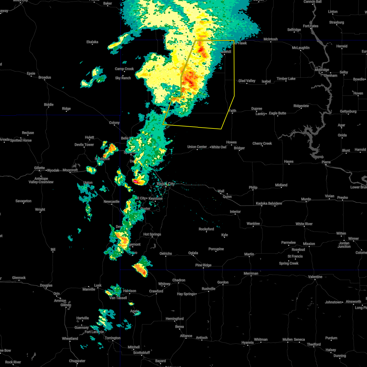 At 507 pm mdt, severe thunderstorms were located along a line extending from 6 miles northeast of white butte to 11 miles northwest of fairpoint, moving east at 40 mph (radar indicated). Hazards include 70 mph wind gusts. Expect considerable tree damage. damage is likely to mobile homes, roofs, and outbuildings. these severe storms will be near, lemmon around 515 pm mdt. bison around 520 pm mdt. Opal around 545 pm mdt. At 507 pm mdt, severe thunderstorms were located along a line extending from 6 miles northeast of white butte to 11 miles northwest of fairpoint, moving east at 40 mph (radar indicated). Hazards include 70 mph wind gusts. Expect considerable tree damage. damage is likely to mobile homes, roofs, and outbuildings. these severe storms will be near, lemmon around 515 pm mdt. bison around 520 pm mdt. Opal around 545 pm mdt.
|
| 7/22/2021 4:48 PM MDT |
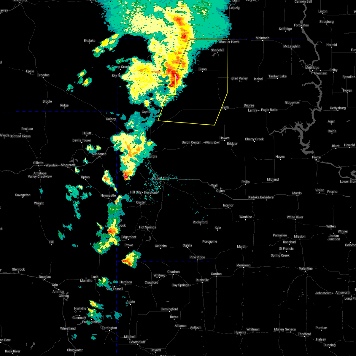 At 447 pm mdt, severe thunderstorms were located along a line extending from 3 miles southeast of hettinger to 3 miles south of dears ears butte, moving east at 45 mph (radar indicated). Hazards include 70 mph wind gusts and penny size hail. Expect considerable tree damage. damage is likely to mobile homes, roofs, and outbuildings. severe thunderstorms will be near, white butte around 505 pm mdt. mud butte around 510 pm mdt. lemmon around 515 pm mdt. maurine around 525 pm mdt. Opal around 535 pm mdt. At 447 pm mdt, severe thunderstorms were located along a line extending from 3 miles southeast of hettinger to 3 miles south of dears ears butte, moving east at 45 mph (radar indicated). Hazards include 70 mph wind gusts and penny size hail. Expect considerable tree damage. damage is likely to mobile homes, roofs, and outbuildings. severe thunderstorms will be near, white butte around 505 pm mdt. mud butte around 510 pm mdt. lemmon around 515 pm mdt. maurine around 525 pm mdt. Opal around 535 pm mdt.
|
| 6/10/2021 10:51 PM MDT |
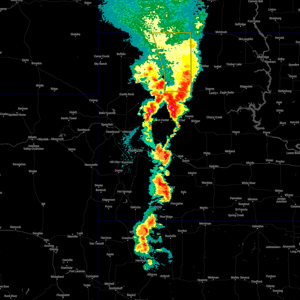 The severe thunderstorm warning for perkins county will expire at 1100 pm mdt, the storms which prompted the warning have moved out of the area. therefore, the warning will be allowed to expire. however gusty winds are still possible with these thunderstorms. a severe thunderstorm watch remains in effect until 200 am mdt for northwestern south dakota. remember, a severe thunderstorm warning still remains in effect for southeastern perkins county. The severe thunderstorm warning for perkins county will expire at 1100 pm mdt, the storms which prompted the warning have moved out of the area. therefore, the warning will be allowed to expire. however gusty winds are still possible with these thunderstorms. a severe thunderstorm watch remains in effect until 200 am mdt for northwestern south dakota. remember, a severe thunderstorm warning still remains in effect for southeastern perkins county.
|
| 6/10/2021 10:45 PM MDT | Storm damage reported in perkins county SD, 18.6 miles N of Lemmon, SD |
| 6/10/2021 10:14 PM MDT |
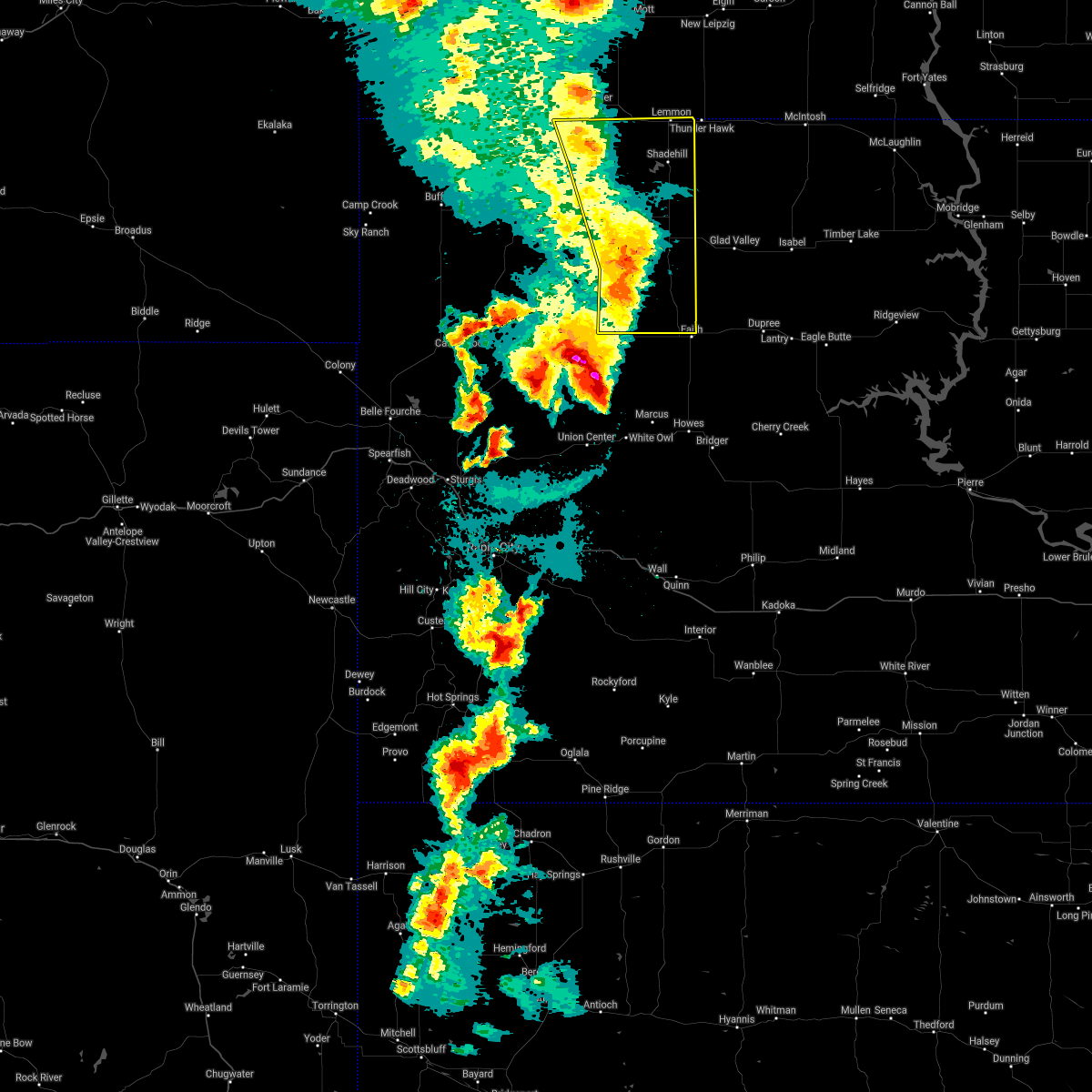 At 1014 pm mdt, severe thunderstorms were located along a line extending from 5 miles southeast of hettinger to 2 miles northeast of chance to 7 miles northwest of faith, moving northeast at 35 mph (radar indicated). Hazards include 70 mph wind gusts. Expect considerable tree damage. damage is likely to mobile homes, roofs, and outbuildings. Locations impacted include, meadow and white butte. At 1014 pm mdt, severe thunderstorms were located along a line extending from 5 miles southeast of hettinger to 2 miles northeast of chance to 7 miles northwest of faith, moving northeast at 35 mph (radar indicated). Hazards include 70 mph wind gusts. Expect considerable tree damage. damage is likely to mobile homes, roofs, and outbuildings. Locations impacted include, meadow and white butte.
|
| 6/10/2021 9:42 PM MDT |
 At 942 pm mdt, severe thunderstorms were located along a line extending from 12 miles northeast of ralph to 5 miles northeast of date to 6 miles northeast of maurine, moving northeast at 40 mph (radar indicated). Hazards include 60 mph wind gusts and quarter size hail. Hail damage to vehicles is expected. expect wind damage to roofs, siding, and trees. severe thunderstorms will be near, bison and owen lake around 955 pm mdt. Other locations in the path of these severe thunderstorms include meadow, usta and shadehill. At 942 pm mdt, severe thunderstorms were located along a line extending from 12 miles northeast of ralph to 5 miles northeast of date to 6 miles northeast of maurine, moving northeast at 40 mph (radar indicated). Hazards include 60 mph wind gusts and quarter size hail. Hail damage to vehicles is expected. expect wind damage to roofs, siding, and trees. severe thunderstorms will be near, bison and owen lake around 955 pm mdt. Other locations in the path of these severe thunderstorms include meadow, usta and shadehill.
|
| 6/8/2021 5:55 PM MDT |
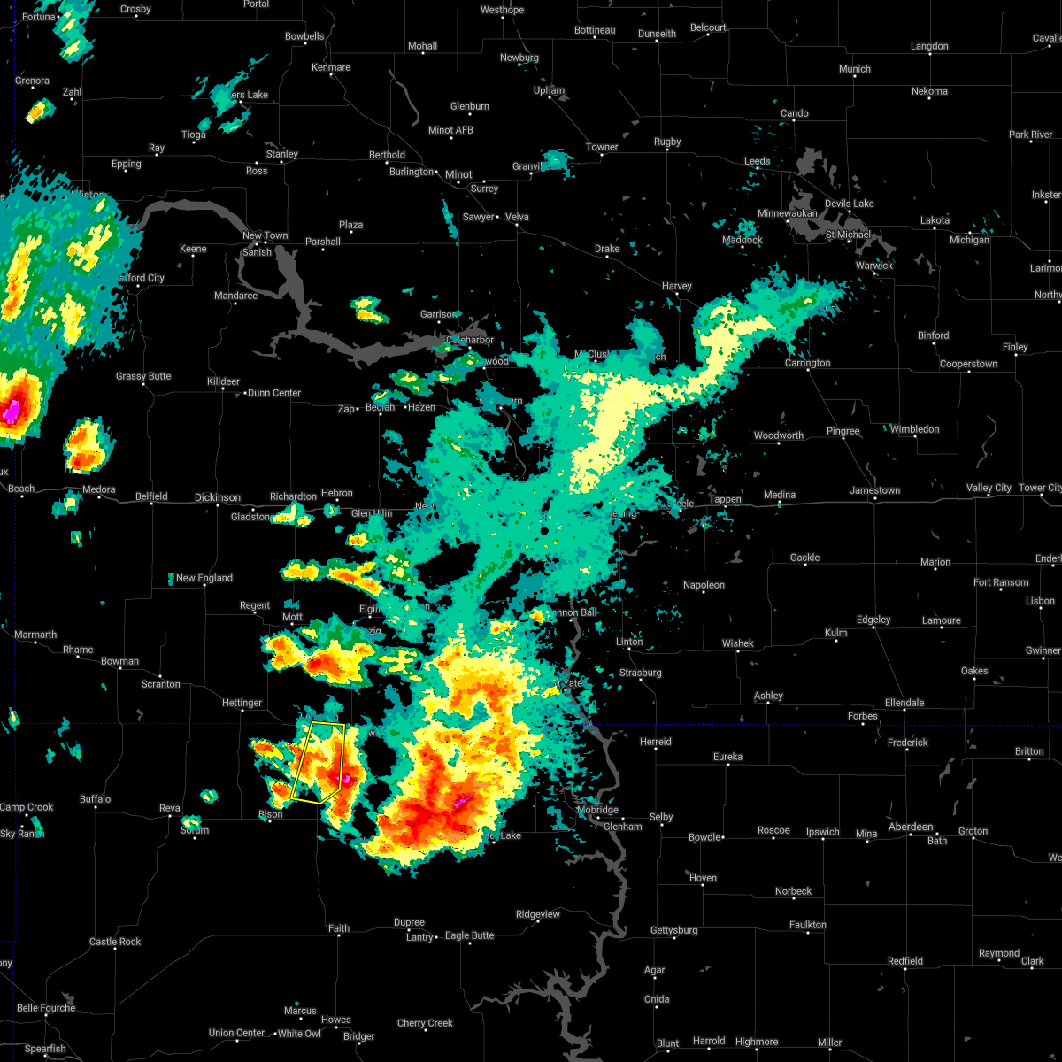 The severe thunderstorm warning for northeastern perkins county will expire at 600 pm mdt, the storm which prompted the warning has weakened below severe limits, and no longer poses an immediate threat to life or property. therefore, the warning will be allowed to expire. however small hail, gusty winds, and heavy rain are still possible with this thunderstorm. The severe thunderstorm warning for northeastern perkins county will expire at 600 pm mdt, the storm which prompted the warning has weakened below severe limits, and no longer poses an immediate threat to life or property. therefore, the warning will be allowed to expire. however small hail, gusty winds, and heavy rain are still possible with this thunderstorm.
|
| 6/8/2021 5:38 PM MDT |
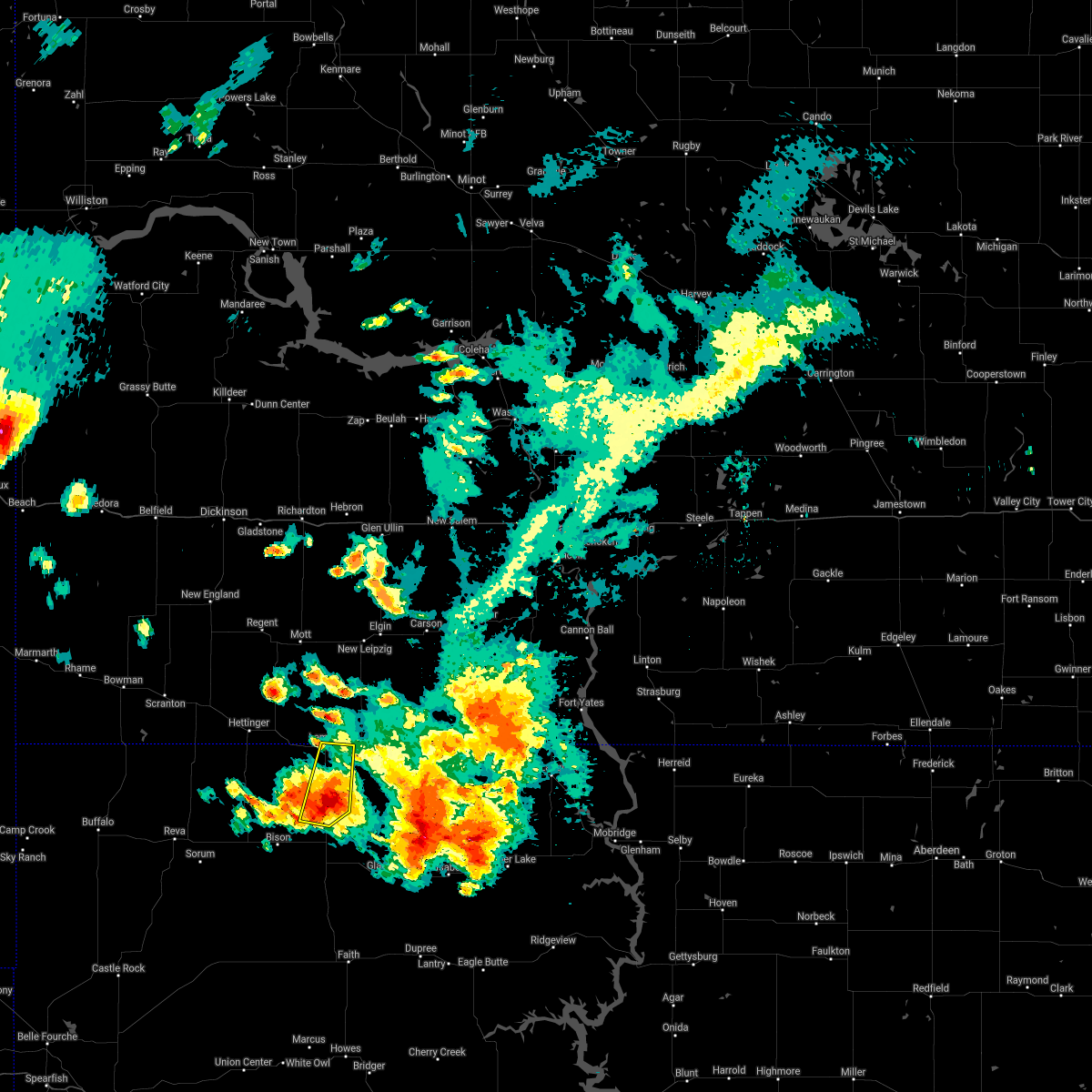 At 537 pm mdt, a severe thunderstorm was located 3 miles south of shadehill, or 15 miles south of lemmon, moving northeast at 10 mph (radar indicated). Hazards include 60 mph wind gusts and half dollar size hail. Hail damage to vehicles is expected. expect wind damage to roofs, siding, and trees. Locations impacted include, lemmon, shadehill, and shadehill reservoir. At 537 pm mdt, a severe thunderstorm was located 3 miles south of shadehill, or 15 miles south of lemmon, moving northeast at 10 mph (radar indicated). Hazards include 60 mph wind gusts and half dollar size hail. Hail damage to vehicles is expected. expect wind damage to roofs, siding, and trees. Locations impacted include, lemmon, shadehill, and shadehill reservoir.
|
| 6/8/2021 5:18 PM MDT |
 At 518 pm mdt, a severe thunderstorm was located 4 miles southeast of shadehill reservoir, or 17 miles south of lemmon, moving north at 25 mph (radar indicated). Hazards include ping pong ball size hail and 60 mph wind gusts. People and animals outdoors will be injured. expect hail damage to roofs, siding, windows, and vehicles. expect wind damage to roofs, siding, and trees. Locations impacted include, lemmon, shadehill, and shadehill reservoir. At 518 pm mdt, a severe thunderstorm was located 4 miles southeast of shadehill reservoir, or 17 miles south of lemmon, moving north at 25 mph (radar indicated). Hazards include ping pong ball size hail and 60 mph wind gusts. People and animals outdoors will be injured. expect hail damage to roofs, siding, windows, and vehicles. expect wind damage to roofs, siding, and trees. Locations impacted include, lemmon, shadehill, and shadehill reservoir.
|
| 6/8/2021 5:10 PM MDT |
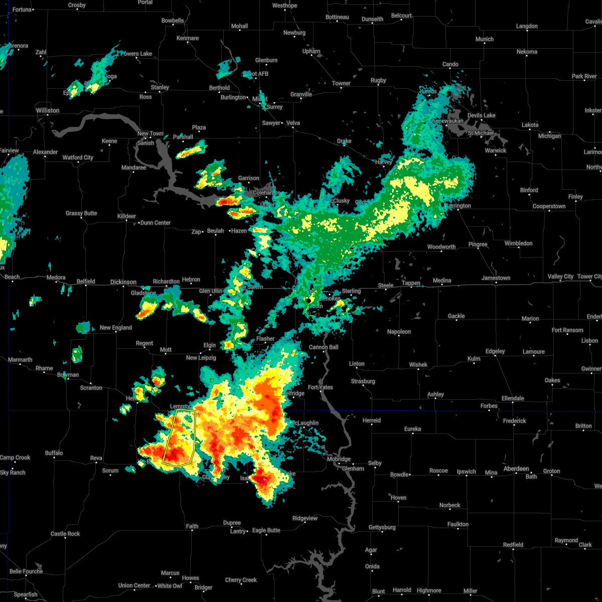 At 509 pm mdt, a severe thunderstorm was located 7 miles north of meadow, or 21 miles south of lemmon, moving north at 25 mph. at 456 pm mdt, ping pong ball size hail was reported in meadow (radar indicated). Hazards include 60 mph wind gusts and quarter size hail. Hail damage to vehicles is expected. expect wind damage to roofs, siding, and trees. Locations impacted include, lemmon, meadow, shadehill, and shadehill reservoir. At 509 pm mdt, a severe thunderstorm was located 7 miles north of meadow, or 21 miles south of lemmon, moving north at 25 mph. at 456 pm mdt, ping pong ball size hail was reported in meadow (radar indicated). Hazards include 60 mph wind gusts and quarter size hail. Hail damage to vehicles is expected. expect wind damage to roofs, siding, and trees. Locations impacted include, lemmon, meadow, shadehill, and shadehill reservoir.
|
| 6/8/2021 5:06 PM MDT | Storm damage reported in perkins county SD, 18.6 miles N of Lemmon, SD |
| 6/8/2021 4:54 PM MDT |
 At 454 pm mdt, a severe thunderstorm was located over meadow, or 27 miles south of lemmon, moving northeast at 30 mph (radar indicated). Hazards include 60 mph wind gusts and quarter size hail. Hail damage to vehicles is expected. Expect wind damage to roofs, siding, and trees. At 454 pm mdt, a severe thunderstorm was located over meadow, or 27 miles south of lemmon, moving northeast at 30 mph (radar indicated). Hazards include 60 mph wind gusts and quarter size hail. Hail damage to vehicles is expected. Expect wind damage to roofs, siding, and trees.
|
| 8/27/2020 6:30 PM MDT | Storm damage reported in perkins county SD, 26.8 miles NE of Lemmon, SD |
| 8/27/2020 6:30 PM MDT | Quarter sized hail reported 26.8 miles NE of Lemmon, SD |
| 8/27/2020 6:06 PM MDT |
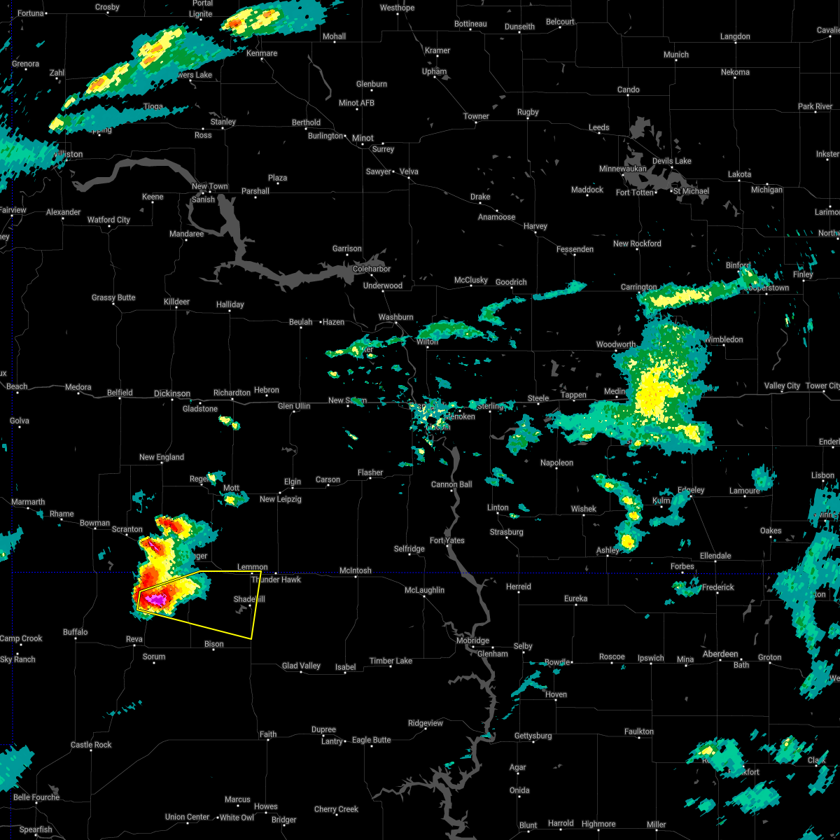 At 606 pm mdt, a severe thunderstorm was located 8 miles west of lodgepole, or 18 miles southwest of hettinger, moving east at 30 mph. this is a very dangerous storm (radar indicated). Hazards include three inch hail and 60 mph wind gusts. People and animals outdoors will be severely injured. expect shattered windows, extensive damage to roofs, siding, and vehicles. this severe storm will be near, lodgepole around 620 pm mdt. shadehill reservoir around 650 pm mdt. Shadehill around 700 pm mdt. At 606 pm mdt, a severe thunderstorm was located 8 miles west of lodgepole, or 18 miles southwest of hettinger, moving east at 30 mph. this is a very dangerous storm (radar indicated). Hazards include three inch hail and 60 mph wind gusts. People and animals outdoors will be severely injured. expect shattered windows, extensive damage to roofs, siding, and vehicles. this severe storm will be near, lodgepole around 620 pm mdt. shadehill reservoir around 650 pm mdt. Shadehill around 700 pm mdt.
|
| 8/27/2020 5:55 PM MDT |
 At 555 pm mdt, a severe thunderstorm was located 5 miles east of ralph, or 21 miles southwest of hettinger, moving east at 35 mph (radar indicated). Hazards include tennis ball size hail and 60 mph wind gusts. People and animals outdoors will be injured. expect hail damage to roofs, siding, windows, and vehicles. expect wind damage to roofs, siding, and trees. this severe storm will be near, lodgepole around 620 pm mdt. Shadehill reservoir around 645 pm mdt. At 555 pm mdt, a severe thunderstorm was located 5 miles east of ralph, or 21 miles southwest of hettinger, moving east at 35 mph (radar indicated). Hazards include tennis ball size hail and 60 mph wind gusts. People and animals outdoors will be injured. expect hail damage to roofs, siding, windows, and vehicles. expect wind damage to roofs, siding, and trees. this severe storm will be near, lodgepole around 620 pm mdt. Shadehill reservoir around 645 pm mdt.
|
| 8/27/2020 5:49 PM MDT |
 At 549 pm mdt, a severe thunderstorm was located 4 miles northeast of ralph, or 21 miles southwest of hettinger, moving east at 35 mph (radar indicated). Hazards include tennis ball size hail and 60 mph wind gusts. People and animals outdoors will be injured. expect hail damage to roofs, siding, windows, and vehicles. expect wind damage to roofs, siding, and trees. this severe thunderstorm will be near, lodgepole around 615 pm mdt. Shadehill and shadehill reservoir around 645 pm mdt. At 549 pm mdt, a severe thunderstorm was located 4 miles northeast of ralph, or 21 miles southwest of hettinger, moving east at 35 mph (radar indicated). Hazards include tennis ball size hail and 60 mph wind gusts. People and animals outdoors will be injured. expect hail damage to roofs, siding, windows, and vehicles. expect wind damage to roofs, siding, and trees. this severe thunderstorm will be near, lodgepole around 615 pm mdt. Shadehill and shadehill reservoir around 645 pm mdt.
|
| 8/14/2020 3:24 AM MDT | Storm damage reported in perkins county SD, 2.9 miles ENE of Lemmon, SD |
| 8/14/2020 1:21 AM MDT |
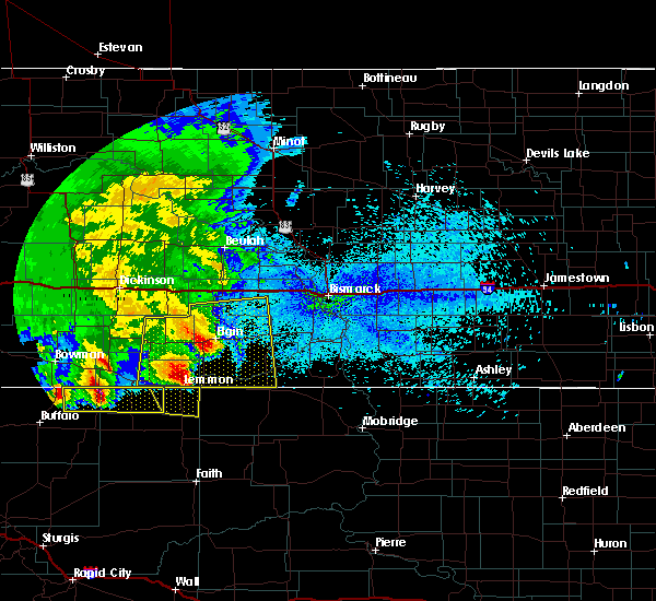 The severe thunderstorm warning for northeastern perkins county will expire at 130 am mdt, the storm which prompted the warning has moved out of the area. therefore, the warning will be allowed to expire. however gusty winds are still possible with this thunderstorm. remember, a severe thunderstorm warning still remains in effect for northeast harding and northwest perkins county until 200 am mdt. The severe thunderstorm warning for northeastern perkins county will expire at 130 am mdt, the storm which prompted the warning has moved out of the area. therefore, the warning will be allowed to expire. however gusty winds are still possible with this thunderstorm. remember, a severe thunderstorm warning still remains in effect for northeast harding and northwest perkins county until 200 am mdt.
|
| 8/14/2020 1:09 AM MDT | Storm damage reported in perkins county SD, 2.9 miles ENE of Lemmon, SD |
| 8/14/2020 1:06 AM MDT |
 At 106 am mdt, a severe thunderstorm was located near lemmon, moving east at 45 mph (radar indicated). Hazards include 60 mph wind gusts and quarter size hail. Hail damage to vehicles is expected. expect wind damage to roofs, siding, and trees. This severe thunderstorm will remain over mainly rural areas of northeastern perkins county from lemmon to shadehill reservoir. At 106 am mdt, a severe thunderstorm was located near lemmon, moving east at 45 mph (radar indicated). Hazards include 60 mph wind gusts and quarter size hail. Hail damage to vehicles is expected. expect wind damage to roofs, siding, and trees. This severe thunderstorm will remain over mainly rural areas of northeastern perkins county from lemmon to shadehill reservoir.
|
| 8/14/2020 12:54 AM MDT |
 At 1254 am mdt, a severe thunderstorm was located near white butte, or 11 miles west of lemmon, moving east at 35 mph (radar indicated). Hazards include ping pong ball size hail and 60 mph wind gusts. People and animals outdoors will be injured. expect hail damage to roofs, siding, windows, and vehicles. expect wind damage to roofs, siding, and trees. This severe storm will be near, lemmon around 110 am mdt. At 1254 am mdt, a severe thunderstorm was located near white butte, or 11 miles west of lemmon, moving east at 35 mph (radar indicated). Hazards include ping pong ball size hail and 60 mph wind gusts. People and animals outdoors will be injured. expect hail damage to roofs, siding, windows, and vehicles. expect wind damage to roofs, siding, and trees. This severe storm will be near, lemmon around 110 am mdt.
|
| 8/14/2020 12:43 AM MDT |
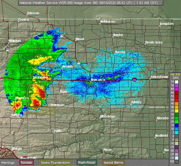 At 1242 am mdt, a severe thunderstorm was located 5 miles southwest of haynes, or 8 miles southeast of hettinger, moving east at 35 mph (radar indicated). Hazards include ping pong ball size hail and 60 mph wind gusts. People and animals outdoors will be injured. expect hail damage to roofs, siding, windows, and vehicles. expect wind damage to roofs, siding, and trees. this severe storm will be near, white butte around 1255 am mdt. northwestern shadehill reservoir around 100 am mdt. Lemmon around 110 am mdt. At 1242 am mdt, a severe thunderstorm was located 5 miles southwest of haynes, or 8 miles southeast of hettinger, moving east at 35 mph (radar indicated). Hazards include ping pong ball size hail and 60 mph wind gusts. People and animals outdoors will be injured. expect hail damage to roofs, siding, windows, and vehicles. expect wind damage to roofs, siding, and trees. this severe storm will be near, white butte around 1255 am mdt. northwestern shadehill reservoir around 100 am mdt. Lemmon around 110 am mdt.
|
| 8/14/2020 12:26 AM MDT |
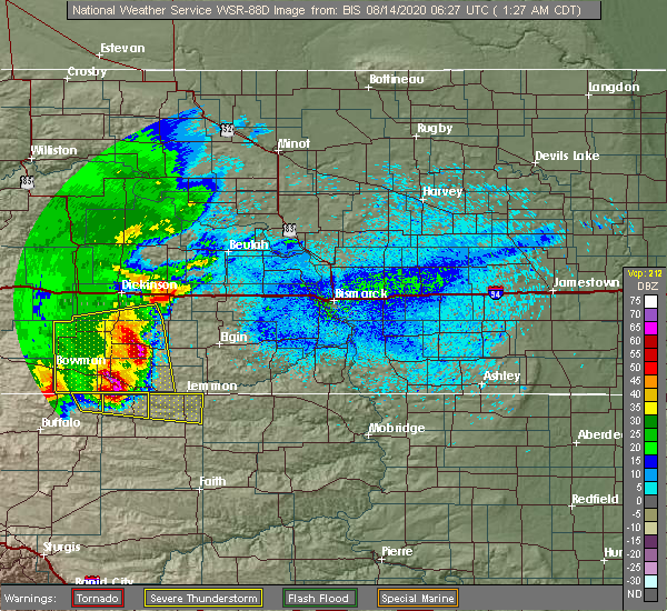 At 1225 am mdt, a severe thunderstorm was located 8 miles southwest of hettinger, moving east at 45 mph (radar indicated). Hazards include 60 mph wind gusts and quarter size hail. Hail damage to vehicles is expected. expect wind damage to roofs, siding, and trees. this severe thunderstorm will be near, lodgepole around 1230 am mdt. white butte around 1250 am mdt. Lemmon around 105 am mdt. At 1225 am mdt, a severe thunderstorm was located 8 miles southwest of hettinger, moving east at 45 mph (radar indicated). Hazards include 60 mph wind gusts and quarter size hail. Hail damage to vehicles is expected. expect wind damage to roofs, siding, and trees. this severe thunderstorm will be near, lodgepole around 1230 am mdt. white butte around 1250 am mdt. Lemmon around 105 am mdt.
|
| 8/11/2020 9:27 PM MDT |
 At 927 pm mdt, severe thunderstorms were located along a line extending from 4 miles southeast of lemmon to 3 miles south of shadehill reservoir to 3 miles southeast of prairie city, moving east at 30 mph (radar indicated). Hazards include 60 mph wind gusts and penny size hail. Expect damage to roofs, siding, and trees. severe thunderstorms will be near, lemmon and shadehill around 930 pm mdt. bison around 955 pm mdt. owen lake around 1000 pm mdt. Meadow and chance around 1015 pm mdt. At 927 pm mdt, severe thunderstorms were located along a line extending from 4 miles southeast of lemmon to 3 miles south of shadehill reservoir to 3 miles southeast of prairie city, moving east at 30 mph (radar indicated). Hazards include 60 mph wind gusts and penny size hail. Expect damage to roofs, siding, and trees. severe thunderstorms will be near, lemmon and shadehill around 930 pm mdt. bison around 955 pm mdt. owen lake around 1000 pm mdt. Meadow and chance around 1015 pm mdt.
|
| 8/11/2020 9:16 PM MDT |
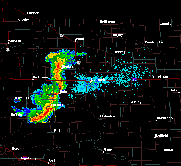 At 915 pm mdt, severe thunderstorms were located along a line extending from 3 miles southeast of lemmon to 3 miles south of shadehill reservoir to 5 miles southeast of prairie city, moving east at 30 mph (radar indicated). Hazards include 60 mph wind gusts and penny size hail. Expect damage to roofs, siding, and trees. these severe storms will be near, lemmon and shadehill around 920 pm mdt. bison around 940 pm mdt. owen lake around 945 pm mdt. Chance around 1000 pm mdt. At 915 pm mdt, severe thunderstorms were located along a line extending from 3 miles southeast of lemmon to 3 miles south of shadehill reservoir to 5 miles southeast of prairie city, moving east at 30 mph (radar indicated). Hazards include 60 mph wind gusts and penny size hail. Expect damage to roofs, siding, and trees. these severe storms will be near, lemmon and shadehill around 920 pm mdt. bison around 940 pm mdt. owen lake around 945 pm mdt. Chance around 1000 pm mdt.
|
| 8/11/2020 9:03 PM MDT |
 At 903 pm mdt, severe thunderstorms were located along a line extending from 5 miles southwest of lemmon to 5 miles west of shadehill reservoir to 3 miles southwest of prairie city, moving east at 30 mph (radar indicated). Hazards include 60 mph wind gusts and penny size hail. Expect damage to roofs, siding, and trees. these severe storms will be near, lemmon and shadehill reservoir around 910 pm mdt. shadehill around 920 pm mdt. bison around 940 pm mdt. owen lake around 945 pm mdt. Meadow and chance around 1000 pm mdt. At 903 pm mdt, severe thunderstorms were located along a line extending from 5 miles southwest of lemmon to 5 miles west of shadehill reservoir to 3 miles southwest of prairie city, moving east at 30 mph (radar indicated). Hazards include 60 mph wind gusts and penny size hail. Expect damage to roofs, siding, and trees. these severe storms will be near, lemmon and shadehill reservoir around 910 pm mdt. shadehill around 920 pm mdt. bison around 940 pm mdt. owen lake around 945 pm mdt. Meadow and chance around 1000 pm mdt.
|
| 8/11/2020 8:54 PM MDT |
 At 853 pm mdt, severe thunderstorms were located along a line extending from near white butte to 10 miles west of shadehill reservoir to near prairie city, moving east at 30 mph. 60 mph wind gusts were recently reported near lodgepole (trained weather spotters). Hazards include 60 mph wind gusts. Expect damage to roofs, siding, and trees. these severe storms will be near, white butte around 900 pm mdt. shadehill reservoir around 905 pm mdt. lemmon around 910 pm mdt. shadehill around 920 pm mdt. bison around 925 pm mdt. owen lake around 935 pm mdt. chance around 945 pm mdt. Meadow around 950 pm mdt. At 853 pm mdt, severe thunderstorms were located along a line extending from near white butte to 10 miles west of shadehill reservoir to near prairie city, moving east at 30 mph. 60 mph wind gusts were recently reported near lodgepole (trained weather spotters). Hazards include 60 mph wind gusts. Expect damage to roofs, siding, and trees. these severe storms will be near, white butte around 900 pm mdt. shadehill reservoir around 905 pm mdt. lemmon around 910 pm mdt. shadehill around 920 pm mdt. bison around 925 pm mdt. owen lake around 935 pm mdt. chance around 945 pm mdt. Meadow around 950 pm mdt.
|
| 8/11/2020 8:48 PM MDT |
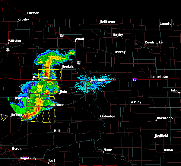 At 848 pm mdt, severe thunderstorms were located along a line extending from 3 miles west of white butte to 7 miles southeast of lodgepole to 5 miles west of prairie city, moving east at 30 mph (radar indicated). Hazards include 60 mph wind gusts and quarter size hail. Hail damage to vehicles is expected. expect wind damage to roofs, siding, and trees. these severe storms will be near, white butte around 855 pm mdt. shadehill reservoir around 910 pm mdt. lemmon around 915 pm mdt. shadehill around 925 pm mdt. bison around 930 pm mdt. owen lake around 940 pm mdt. Meadow around 955 pm mdt. At 848 pm mdt, severe thunderstorms were located along a line extending from 3 miles west of white butte to 7 miles southeast of lodgepole to 5 miles west of prairie city, moving east at 30 mph (radar indicated). Hazards include 60 mph wind gusts and quarter size hail. Hail damage to vehicles is expected. expect wind damage to roofs, siding, and trees. these severe storms will be near, white butte around 855 pm mdt. shadehill reservoir around 910 pm mdt. lemmon around 915 pm mdt. shadehill around 925 pm mdt. bison around 930 pm mdt. owen lake around 940 pm mdt. Meadow around 955 pm mdt.
|
| 8/11/2020 8:33 PM MDT |
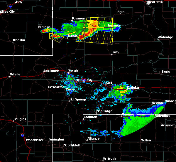 At 833 pm mdt, severe thunderstorms were located along a line extending from 4 miles southwest of haynes to 3 miles south of lodgepole to 3 miles east of reva, moving east at 30 mph (radar indicated). Hazards include 60 mph wind gusts and quarter size hail. Hail damage to vehicles is expected. expect wind damage to roofs, siding, and trees. these severe storms will be near, lodgepole around 840 pm mdt. white butte around 850 pm mdt. shadehill reservoir around 905 pm mdt. lemmon around 910 pm mdt. shadehill around 920 pm mdt. bison around 925 pm mdt. owen lake around 935 pm mdt. Meadow and chance around 945 pm mdt. At 833 pm mdt, severe thunderstorms were located along a line extending from 4 miles southwest of haynes to 3 miles south of lodgepole to 3 miles east of reva, moving east at 30 mph (radar indicated). Hazards include 60 mph wind gusts and quarter size hail. Hail damage to vehicles is expected. expect wind damage to roofs, siding, and trees. these severe storms will be near, lodgepole around 840 pm mdt. white butte around 850 pm mdt. shadehill reservoir around 905 pm mdt. lemmon around 910 pm mdt. shadehill around 920 pm mdt. bison around 925 pm mdt. owen lake around 935 pm mdt. Meadow and chance around 945 pm mdt.
|
| 8/11/2020 8:22 PM MDT |
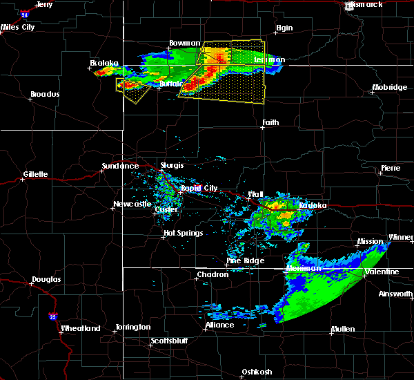 At 821 pm mdt, severe thunderstorms were located along a line extending from 4 miles south of hettinger to 5 miles southwest of lodgepole to reva, moving east at 30 mph (radar indicated). Hazards include 60 mph wind gusts. Expect damage to roofs, siding, and trees. severe thunderstorms will be near, lodgepole around 830 pm mdt. white butte and prairie city around 850 pm mdt. lemmon and shadehill reservoir around 905 pm mdt. shadehill around 915 pm mdt. bison around 920 pm mdt. Chance and owen lake around 930 pm mdt. At 821 pm mdt, severe thunderstorms were located along a line extending from 4 miles south of hettinger to 5 miles southwest of lodgepole to reva, moving east at 30 mph (radar indicated). Hazards include 60 mph wind gusts. Expect damage to roofs, siding, and trees. severe thunderstorms will be near, lodgepole around 830 pm mdt. white butte and prairie city around 850 pm mdt. lemmon and shadehill reservoir around 905 pm mdt. shadehill around 915 pm mdt. bison around 920 pm mdt. Chance and owen lake around 930 pm mdt.
|
| 7/31/2020 2:50 PM MDT | Storm damage reported in perkins county SD, 2.9 miles ENE of Lemmon, SD |
| 7/25/2020 4:16 PM MDT |
 At 415 pm mdt, a severe thunderstorm was located 9 miles north of thunder hawk, or 13 miles northeast of lemmon, moving east at 30 mph (radar indicated). Hazards include golf ball size hail and 60 mph wind gusts. People and animals outdoors will be injured. expect hail damage to roofs, siding, windows, and vehicles. expect wind damage to roofs, siding, and trees. Locations impacted include, north lemmon and thunder hawk. At 415 pm mdt, a severe thunderstorm was located 9 miles north of thunder hawk, or 13 miles northeast of lemmon, moving east at 30 mph (radar indicated). Hazards include golf ball size hail and 60 mph wind gusts. People and animals outdoors will be injured. expect hail damage to roofs, siding, windows, and vehicles. expect wind damage to roofs, siding, and trees. Locations impacted include, north lemmon and thunder hawk.
|
| 7/25/2020 4:07 PM MDT |
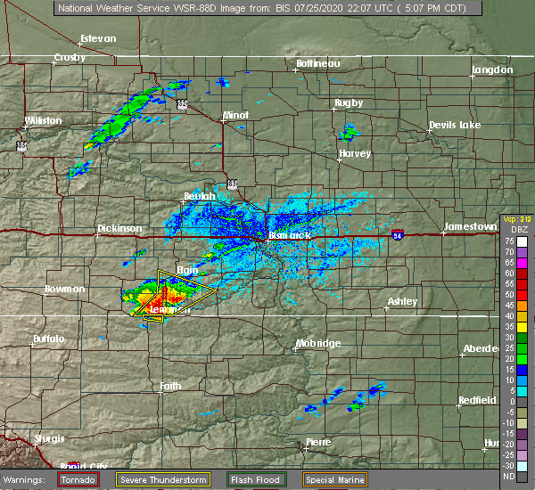 At 406 pm mdt, a severe thunderstorm was located near lemmon, moving northeast at 15 mph. a 62 mph wind gust was recently recorded approximately 3 miles west of lemmon (automated observations). Hazards include 60 mph wind gusts and quarter size hail. Hail damage to vehicles is expected. expect wind damage to roofs, siding, and trees. Locations impacted include, lemmon. At 406 pm mdt, a severe thunderstorm was located near lemmon, moving northeast at 15 mph. a 62 mph wind gust was recently recorded approximately 3 miles west of lemmon (automated observations). Hazards include 60 mph wind gusts and quarter size hail. Hail damage to vehicles is expected. expect wind damage to roofs, siding, and trees. Locations impacted include, lemmon.
|
| 7/25/2020 4:03 PM MDT |
 At 403 pm mdt, a severe thunderstorm was located 14 miles north of keldron, or 18 miles south of elgin, moving northeast at 15 mph (radar indicated). Hazards include golf ball size hail and 60 mph wind gusts. People and animals outdoors will be injured. expect hail damage to roofs, siding, windows, and vehicles. expect wind damage to roofs, siding, and trees. This severe thunderstorm will remain over mainly rural areas of southwestern sioux, southeastern hettinger, southwestern grant and southeastern adams counties. At 403 pm mdt, a severe thunderstorm was located 14 miles north of keldron, or 18 miles south of elgin, moving northeast at 15 mph (radar indicated). Hazards include golf ball size hail and 60 mph wind gusts. People and animals outdoors will be injured. expect hail damage to roofs, siding, windows, and vehicles. expect wind damage to roofs, siding, and trees. This severe thunderstorm will remain over mainly rural areas of southwestern sioux, southeastern hettinger, southwestern grant and southeastern adams counties.
|
| 7/25/2020 4:02 PM MDT |
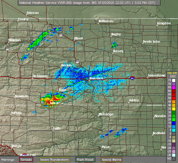 At 402 pm mdt, a severe thunderstorm was located near lemmon, moving east at 20 mph (radar indicated). Hazards include 60 mph wind gusts and quarter size hail. Hail damage to vehicles is expected. expect wind damage to roofs, siding, and trees. Locations impacted include, lemmon. At 402 pm mdt, a severe thunderstorm was located near lemmon, moving east at 20 mph (radar indicated). Hazards include 60 mph wind gusts and quarter size hail. Hail damage to vehicles is expected. expect wind damage to roofs, siding, and trees. Locations impacted include, lemmon.
|
| 7/25/2020 3:59 PM MDT | Storm damage reported in perkins county SD, 2.9 miles E of Lemmon, SD |
| 7/25/2020 3:53 PM MDT |
 At 353 pm mdt, a severe thunderstorm was located near white butte, or 6 miles west of lemmon, moving east at 30 mph (radar indicated). Hazards include 60 mph wind gusts and quarter size hail. Hail damage to vehicles is expected. expect wind damage to roofs, siding, and trees. This severe storm will be near, lemmon around 405 pm mdt. At 353 pm mdt, a severe thunderstorm was located near white butte, or 6 miles west of lemmon, moving east at 30 mph (radar indicated). Hazards include 60 mph wind gusts and quarter size hail. Hail damage to vehicles is expected. expect wind damage to roofs, siding, and trees. This severe storm will be near, lemmon around 405 pm mdt.
|
| 7/25/2020 3:43 PM MDT |
 At 343 pm mdt, a severe thunderstorm was located near white butte, or 11 miles southeast of hettinger, moving east at 30 mph (radar indicated). Hazards include ping pong ball size hail and 60 mph wind gusts. People and animals outdoors will be injured. expect hail damage to roofs, siding, windows, and vehicles. expect wind damage to roofs, siding, and trees. This severe thunderstorm will be near, lemmon around 405 pm mdt. At 343 pm mdt, a severe thunderstorm was located near white butte, or 11 miles southeast of hettinger, moving east at 30 mph (radar indicated). Hazards include ping pong ball size hail and 60 mph wind gusts. People and animals outdoors will be injured. expect hail damage to roofs, siding, windows, and vehicles. expect wind damage to roofs, siding, and trees. This severe thunderstorm will be near, lemmon around 405 pm mdt.
|
| 7/25/2020 3:26 PM MDT |
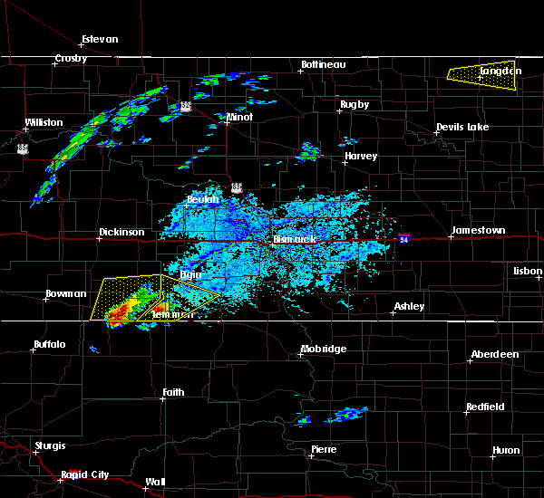 At 325 pm mdt, a severe thunderstorm was located 9 miles northeast of north lemmon, or 10 miles northeast of lemmon, moving northeast at 25 mph (radar indicated). Hazards include ping pong ball size hail and 60 mph wind gusts. People and animals outdoors will be injured. expect hail damage to roofs, siding, windows, and vehicles. expect wind damage to roofs, siding, and trees. This severe thunderstorm will be near, elgin around 425 pm mdt. At 325 pm mdt, a severe thunderstorm was located 9 miles northeast of north lemmon, or 10 miles northeast of lemmon, moving northeast at 25 mph (radar indicated). Hazards include ping pong ball size hail and 60 mph wind gusts. People and animals outdoors will be injured. expect hail damage to roofs, siding, windows, and vehicles. expect wind damage to roofs, siding, and trees. This severe thunderstorm will be near, elgin around 425 pm mdt.
|
| 7/6/2020 2:50 PM MDT | Quarter sized hail reported 12.4 miles NNE of Lemmon, SD |
| 7/5/2020 12:09 AM MDT |
 At 1143 pm mdt, a severe thunderstorm was located 6 miles northwest of shadehill reservoir, or 14 miles southwest of lemmon, moving east at 30 mph (radar indicated). Hazards include 60 mph wind gusts and penny size hail. Expect damage to roofs, siding, and trees. this severe storm will be near, shadehill reservoir around 1150 pm mdt. Shadehill around 1200 am mdt. At 1143 pm mdt, a severe thunderstorm was located 6 miles northwest of shadehill reservoir, or 14 miles southwest of lemmon, moving east at 30 mph (radar indicated). Hazards include 60 mph wind gusts and penny size hail. Expect damage to roofs, siding, and trees. this severe storm will be near, shadehill reservoir around 1150 pm mdt. Shadehill around 1200 am mdt.
|
| 7/4/2020 11:43 PM MDT |
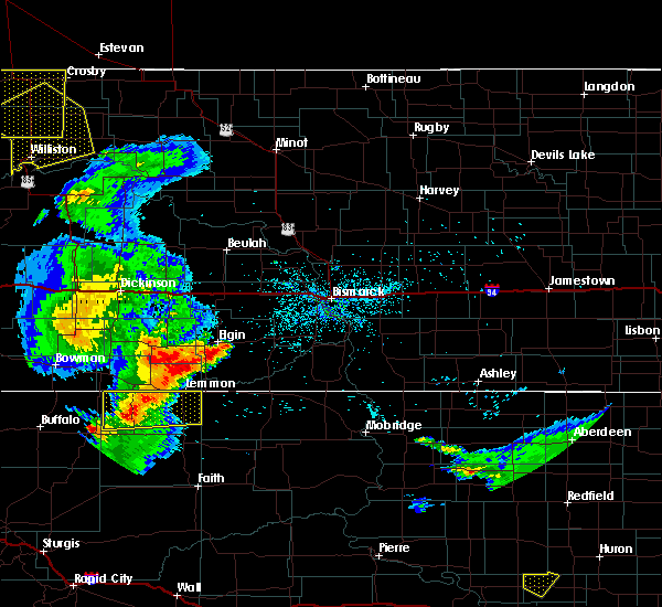 At 1143 pm mdt, a severe thunderstorm was located 6 miles northwest of shadehill reservoir, or 14 miles southwest of lemmon, moving east at 30 mph (radar indicated). Hazards include 60 mph wind gusts and penny size hail. Expect damage to roofs, siding, and trees. this severe storm will be near, shadehill reservoir around 1150 pm mdt. Shadehill around 1200 am mdt. At 1143 pm mdt, a severe thunderstorm was located 6 miles northwest of shadehill reservoir, or 14 miles southwest of lemmon, moving east at 30 mph (radar indicated). Hazards include 60 mph wind gusts and penny size hail. Expect damage to roofs, siding, and trees. this severe storm will be near, shadehill reservoir around 1150 pm mdt. Shadehill around 1200 am mdt.
|
| 7/4/2020 11:12 PM MDT |
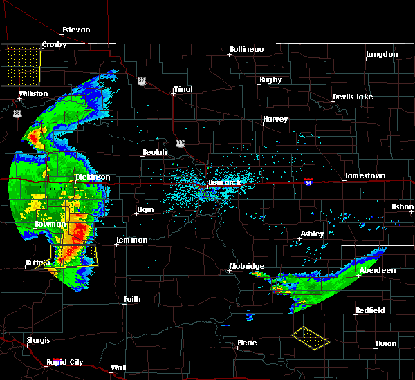 At 1111 pm mdt, a severe thunderstorm was located 3 miles west of lodgepole, or 15 miles south of hettinger, moving east at 30 mph (radar indicated). Hazards include 60 mph wind gusts and penny size hail. Expect damage to roofs, siding, and trees. this severe thunderstorm will be near, lodgepole around 1115 pm mdt. shadehill reservoir around 1150 pm mdt. Shadehill around 1200 am mdt. At 1111 pm mdt, a severe thunderstorm was located 3 miles west of lodgepole, or 15 miles south of hettinger, moving east at 30 mph (radar indicated). Hazards include 60 mph wind gusts and penny size hail. Expect damage to roofs, siding, and trees. this severe thunderstorm will be near, lodgepole around 1115 pm mdt. shadehill reservoir around 1150 pm mdt. Shadehill around 1200 am mdt.
|
| 7/3/2020 10:11 PM MDT |
 At 1011 pm mdt, a severe thunderstorm was located 7 miles northwest of north lemmon, or 8 miles northwest of lemmon, moving northeast at 45 mph (radar indicated). Hazards include 60 mph wind gusts and quarter size hail. Hail damage to vehicles is expected. expect wind damage to roofs, siding, and trees. Locations impacted include, haynes and north lemmon. At 1011 pm mdt, a severe thunderstorm was located 7 miles northwest of north lemmon, or 8 miles northwest of lemmon, moving northeast at 45 mph (radar indicated). Hazards include 60 mph wind gusts and quarter size hail. Hail damage to vehicles is expected. expect wind damage to roofs, siding, and trees. Locations impacted include, haynes and north lemmon.
|
| 7/3/2020 9:56 PM MDT |
 At 956 pm mdt, a severe thunderstorm was located over haynes, or 10 miles east of hettinger, moving northeast at 55 mph (radar indicated). Hazards include 60 mph wind gusts and quarter size hail. Hail damage to vehicles is expected. Expect wind damage to roofs, siding, and trees. At 956 pm mdt, a severe thunderstorm was located over haynes, or 10 miles east of hettinger, moving northeast at 55 mph (radar indicated). Hazards include 60 mph wind gusts and quarter size hail. Hail damage to vehicles is expected. Expect wind damage to roofs, siding, and trees.
|
| 6/30/2020 2:37 AM MDT |
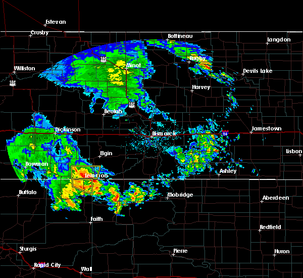 The severe thunderstorm warning for northeastern perkins county will expire at 245 am mdt, the storm which prompted the warning has moved out of the area. therefore, the warning will be allowed to expire. however small hail is still possible with this thunderstorm. The severe thunderstorm warning for northeastern perkins county will expire at 245 am mdt, the storm which prompted the warning has moved out of the area. therefore, the warning will be allowed to expire. however small hail is still possible with this thunderstorm.
|
| 6/30/2020 2:10 AM MDT |
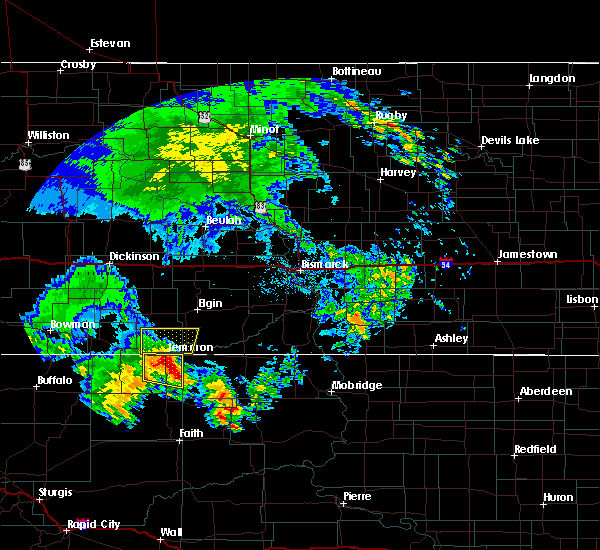 At 210 am mdt, a severe thunderstorm was located 6 miles northeast of shadehill, or 7 miles southeast of lemmon, moving north at 20 mph (radar indicated). Hazards include 60 mph wind gusts and half dollar size hail. Hail damage to vehicles is expected. expect wind damage to roofs, siding, and trees. This severe storm will be near, lemmon around 230 am mdt. At 210 am mdt, a severe thunderstorm was located 6 miles northeast of shadehill, or 7 miles southeast of lemmon, moving north at 20 mph (radar indicated). Hazards include 60 mph wind gusts and half dollar size hail. Hail damage to vehicles is expected. expect wind damage to roofs, siding, and trees. This severe storm will be near, lemmon around 230 am mdt.
|
| 6/30/2020 1:50 AM MDT |
 At 149 am mdt, a severe thunderstorm was located 3 miles east of shadehill, or 13 miles south of lemmon, moving northeast at 20 mph (radar indicated). Hazards include 60 mph wind gusts and half dollar size hail. Hail damage to vehicles is expected. expect wind damage to roofs, siding, and trees. This severe thunderstorm will be near, lemmon around 220 am mdt. At 149 am mdt, a severe thunderstorm was located 3 miles east of shadehill, or 13 miles south of lemmon, moving northeast at 20 mph (radar indicated). Hazards include 60 mph wind gusts and half dollar size hail. Hail damage to vehicles is expected. expect wind damage to roofs, siding, and trees. This severe thunderstorm will be near, lemmon around 220 am mdt.
|
| 6/29/2020 10:43 PM MDT |
 At 1028 pm mdt, a severe thunderstorm was located 3 miles northeast of owen lake, or 31 miles south of lemmon, moving northeast at 35 mph (radar indicated). Hazards include 60 mph wind gusts and half dollar size hail. Hail damage to vehicles is expected. Expect wind damage to roofs, siding, and trees. At 1028 pm mdt, a severe thunderstorm was located 3 miles northeast of owen lake, or 31 miles south of lemmon, moving northeast at 35 mph (radar indicated). Hazards include 60 mph wind gusts and half dollar size hail. Hail damage to vehicles is expected. Expect wind damage to roofs, siding, and trees.
|
| 6/29/2020 10:29 PM MDT |
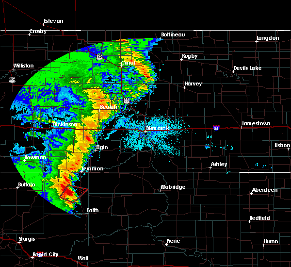 At 1028 pm mdt, a severe thunderstorm was located 3 miles northeast of owen lake, or 31 miles south of lemmon, moving northeast at 35 mph (radar indicated). Hazards include 60 mph wind gusts and half dollar size hail. Hail damage to vehicles is expected. Expect wind damage to roofs, siding, and trees. At 1028 pm mdt, a severe thunderstorm was located 3 miles northeast of owen lake, or 31 miles south of lemmon, moving northeast at 35 mph (radar indicated). Hazards include 60 mph wind gusts and half dollar size hail. Hail damage to vehicles is expected. Expect wind damage to roofs, siding, and trees.
|
| 6/6/2020 8:45 PM MDT | Storm damage reported in perkins county SD, 12.4 miles N of Lemmon, SD |
| 6/6/2020 8:43 PM MDT |
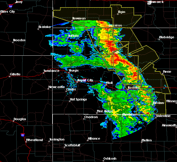 At 843 pm mdt, severe thunderstorms were located along a line extending from north lemmon to 7 miles west of shambo ranch to 2 miles southeast of iron lightning, moving northeast at 45 mph (radar indicated). Hazards include 70 mph wind gusts. Expect considerable tree damage. damage is likely to mobile homes, roofs, and outbuildings. These severe thunderstorms will remain over mainly rural areas of northwestern ziebach and eastern perkins counties. At 843 pm mdt, severe thunderstorms were located along a line extending from north lemmon to 7 miles west of shambo ranch to 2 miles southeast of iron lightning, moving northeast at 45 mph (radar indicated). Hazards include 70 mph wind gusts. Expect considerable tree damage. damage is likely to mobile homes, roofs, and outbuildings. These severe thunderstorms will remain over mainly rural areas of northwestern ziebach and eastern perkins counties.
|
| 6/6/2020 8:34 PM MDT | Storm damage reported in perkins county SD, 2.9 miles ENE of Lemmon, SD |
| 6/6/2020 8:23 PM MDT |
 At 823 pm mdt, severe thunderstorms were located along a line extending from 3 miles northwest of hettinger to 6 miles south of shadehill reservoir to near arrow head buttes, moving northeast at 40 mph (radar indicated). Hazards include 70 mph wind gusts and nickel size hail. Expect considerable tree damage. damage is likely to mobile homes, roofs, and outbuildings. these severe storms will be near, shadehill around 835 pm mdt. Glad valley around 855 pm mdt. At 823 pm mdt, severe thunderstorms were located along a line extending from 3 miles northwest of hettinger to 6 miles south of shadehill reservoir to near arrow head buttes, moving northeast at 40 mph (radar indicated). Hazards include 70 mph wind gusts and nickel size hail. Expect considerable tree damage. damage is likely to mobile homes, roofs, and outbuildings. these severe storms will be near, shadehill around 835 pm mdt. Glad valley around 855 pm mdt.
|
| 6/6/2020 8:09 PM MDT |
 At 808 pm mdt, severe thunderstorms were located along a line extending from 8 miles north of table mountain to 5 miles south of lodgepole to 11 miles southwest of chance, moving northeast at 50 mph (radar indicated). Hazards include 70 mph wind gusts and nickel size hail. Expect considerable tree damage. damage is likely to mobile homes, roofs, and outbuildings. these severe storms will be near, lodgepole around 815 pm mdt. chance around 820 pm mdt. meadow around 830 pm mdt. white butte around 835 pm mdt. Lemmon around 840 pm mdt. At 808 pm mdt, severe thunderstorms were located along a line extending from 8 miles north of table mountain to 5 miles south of lodgepole to 11 miles southwest of chance, moving northeast at 50 mph (radar indicated). Hazards include 70 mph wind gusts and nickel size hail. Expect considerable tree damage. damage is likely to mobile homes, roofs, and outbuildings. these severe storms will be near, lodgepole around 815 pm mdt. chance around 820 pm mdt. meadow around 830 pm mdt. white butte around 835 pm mdt. Lemmon around 840 pm mdt.
|
| 6/6/2020 8:07 PM MDT |
 At 807 pm mdt, severe thunderstorms were located along a line extending from 8 miles north of table mountain to 5 miles south of lodgepole to 11 miles southwest of chance, moving northeast at 50 mph (radar indicated). Hazards include 70 mph wind gusts and nickel size hail. Expect considerable tree damage. damage is likely to mobile homes, roofs, and outbuildings. these severe storms will be near, lodgepole around 815 pm mdt. chance around 820 pm mdt. meadow and white butte around 830 pm mdt. Lemmon around 840 pm mdt. At 807 pm mdt, severe thunderstorms were located along a line extending from 8 miles north of table mountain to 5 miles south of lodgepole to 11 miles southwest of chance, moving northeast at 50 mph (radar indicated). Hazards include 70 mph wind gusts and nickel size hail. Expect considerable tree damage. damage is likely to mobile homes, roofs, and outbuildings. these severe storms will be near, lodgepole around 815 pm mdt. chance around 820 pm mdt. meadow and white butte around 830 pm mdt. Lemmon around 840 pm mdt.
|
| 6/6/2020 7:57 PM MDT |
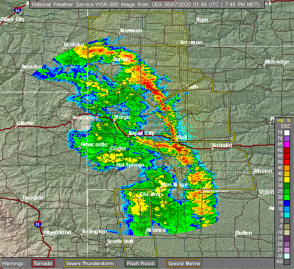 At 757 pm mdt, severe thunderstorms were located along a line extending from 3 miles northwest of table mountain to 7 miles north of prairie city to 13 miles northeast of maurine, moving northeast at 50 mph (radar indicated). Hazards include 70 mph wind gusts and nickel size hail. Expect considerable tree damage. damage is likely to mobile homes, roofs, and outbuildings. these severe storms will be near, lodgepole around 810 pm mdt. shadehill reservoir around 825 pm mdt. white butte around 830 pm mdt. Lemmon around 840 pm mdt. At 757 pm mdt, severe thunderstorms were located along a line extending from 3 miles northwest of table mountain to 7 miles north of prairie city to 13 miles northeast of maurine, moving northeast at 50 mph (radar indicated). Hazards include 70 mph wind gusts and nickel size hail. Expect considerable tree damage. damage is likely to mobile homes, roofs, and outbuildings. these severe storms will be near, lodgepole around 810 pm mdt. shadehill reservoir around 825 pm mdt. white butte around 830 pm mdt. Lemmon around 840 pm mdt.
|
| 6/6/2020 7:43 PM MDT |
 At 741 pm mdt, severe thunderstorms were located along a line extending from 7 miles northwest of ladner to 8 miles southeast of sorum to 3 miles west of opal, moving northeast at 50 mph (radar indicated). Hazards include 70 mph wind gusts and nickel size hail. Expect considerable tree damage. damage is likely to mobile homes, roofs, and outbuildings. severe thunderstorms will be near, opal around 745 pm mdt. bison around 805 pm mdt. usta around 815 pm mdt. shadehill and shadehill reservoir around 830 pm mdt. Lemmon and glad valley around 840 pm mdt. At 741 pm mdt, severe thunderstorms were located along a line extending from 7 miles northwest of ladner to 8 miles southeast of sorum to 3 miles west of opal, moving northeast at 50 mph (radar indicated). Hazards include 70 mph wind gusts and nickel size hail. Expect considerable tree damage. damage is likely to mobile homes, roofs, and outbuildings. severe thunderstorms will be near, opal around 745 pm mdt. bison around 805 pm mdt. usta around 815 pm mdt. shadehill and shadehill reservoir around 830 pm mdt. Lemmon and glad valley around 840 pm mdt.
|
| 6/2/2020 5:34 AM MDT |
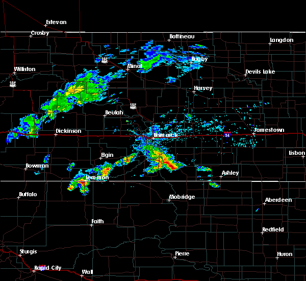 At 534 am mdt, a severe thunderstorm was located near lemmon, moving east at 35 mph (radar indicated). Hazards include half dollar size hail. damage to vehicles is expected At 534 am mdt, a severe thunderstorm was located near lemmon, moving east at 35 mph (radar indicated). Hazards include half dollar size hail. damage to vehicles is expected
|
| 5/31/2020 9:34 PM MDT |
 At 933 pm mdt, a severe thunderstorm was located near shadehill, or 9 miles south of lemmon, moving east at 50 mph (radar indicated). Hazards include 60 mph wind gusts and quarter size hail. Hail damage to vehicles is expected. expect wind damage to roofs, siding, and trees. This severe thunderstorm will remain over mainly rural areas of northeastern perkins county. At 933 pm mdt, a severe thunderstorm was located near shadehill, or 9 miles south of lemmon, moving east at 50 mph (radar indicated). Hazards include 60 mph wind gusts and quarter size hail. Hail damage to vehicles is expected. expect wind damage to roofs, siding, and trees. This severe thunderstorm will remain over mainly rural areas of northeastern perkins county.
|
| 5/31/2020 9:20 PM MDT |
 At 920 pm mdt, a severe thunderstorm was located 8 miles west of shadehill reservoir, or 16 miles southwest of lemmon, moving east at 35 mph (radar indicated). Hazards include 60 mph wind gusts and quarter size hail. Hail damage to vehicles is expected. expect wind damage to roofs, siding, and trees. this severe storm will be near, shadehill reservoir around 930 pm mdt. shadehill around 940 pm mdt. Lemmon around 945 pm mdt. At 920 pm mdt, a severe thunderstorm was located 8 miles west of shadehill reservoir, or 16 miles southwest of lemmon, moving east at 35 mph (radar indicated). Hazards include 60 mph wind gusts and quarter size hail. Hail damage to vehicles is expected. expect wind damage to roofs, siding, and trees. this severe storm will be near, shadehill reservoir around 930 pm mdt. shadehill around 940 pm mdt. Lemmon around 945 pm mdt.
|
| 5/31/2020 9:02 PM MDT |
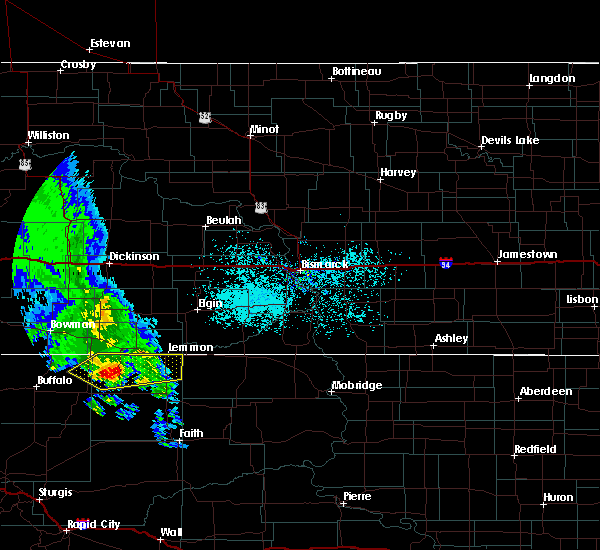 At 902 pm mdt, a severe thunderstorm was located 3 miles southeast of lodgepole, or 17 miles south of hettinger, moving east at 35 mph (radar indicated). Hazards include 60 mph wind gusts and quarter size hail. Hail damage to vehicles is expected. expect wind damage to roofs, siding, and trees. this severe storm will be near, shadehill reservoir around 930 pm mdt. shadehill around 940 pm mdt. Lemmon around 945 pm mdt. At 902 pm mdt, a severe thunderstorm was located 3 miles southeast of lodgepole, or 17 miles south of hettinger, moving east at 35 mph (radar indicated). Hazards include 60 mph wind gusts and quarter size hail. Hail damage to vehicles is expected. expect wind damage to roofs, siding, and trees. this severe storm will be near, shadehill reservoir around 930 pm mdt. shadehill around 940 pm mdt. Lemmon around 945 pm mdt.
|
| 5/31/2020 8:55 PM MDT |
 At 855 pm mdt, a severe thunderstorm was located 5 miles southwest of lodgepole, or 18 miles south of hettinger, moving east at 35 mph (radar indicated). Hazards include 60 mph wind gusts and quarter size hail. Hail damage to vehicles is expected. expect wind damage to roofs, siding, and trees. this severe thunderstorm will be near, lodgepole around 900 pm mdt. shadehill reservoir around 930 pm mdt. shadehill around 940 pm mdt. Lemmon around 945 pm mdt. At 855 pm mdt, a severe thunderstorm was located 5 miles southwest of lodgepole, or 18 miles south of hettinger, moving east at 35 mph (radar indicated). Hazards include 60 mph wind gusts and quarter size hail. Hail damage to vehicles is expected. expect wind damage to roofs, siding, and trees. this severe thunderstorm will be near, lodgepole around 900 pm mdt. shadehill reservoir around 930 pm mdt. shadehill around 940 pm mdt. Lemmon around 945 pm mdt.
|
| 8/10/2019 1:30 PM MDT |
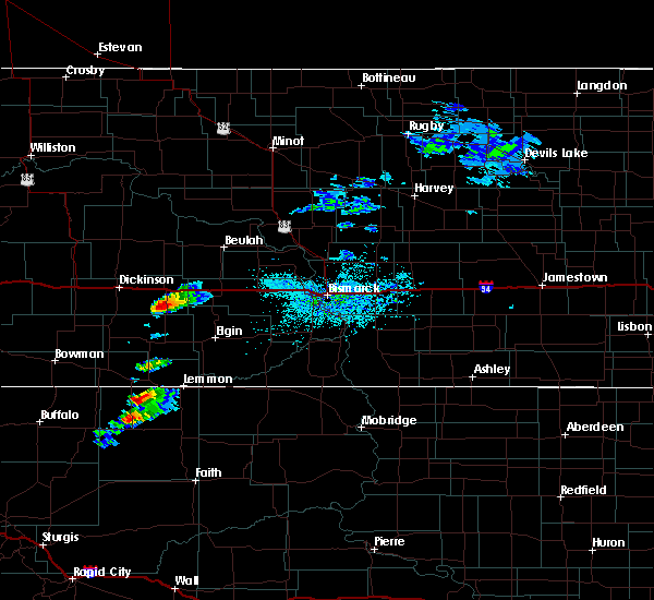 At 129 pm mdt, a severe thunderstorm was located 7 miles east of lodgepole, or 14 miles southeast of hettinger, moving east at 25 mph (radar indicated). Hazards include quarter size hail. damage to vehicles is expected At 129 pm mdt, a severe thunderstorm was located 7 miles east of lodgepole, or 14 miles southeast of hettinger, moving east at 25 mph (radar indicated). Hazards include quarter size hail. damage to vehicles is expected
|
| 7/19/2019 2:27 AM MDT |
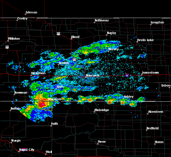 At 226 am mdt, a severe thunderstorm was located over shadehill, or 11 miles south of lemmon, moving east at 40 mph (radar indicated). Hazards include golf ball size hail and 60 mph wind gusts. People and animals outdoors will be injured. expect hail damage to roofs, siding, windows, and vehicles. expect wind damage to roofs, siding, and trees. Locations impacted include, lemmon, white butte, shadehill and shadehill reservoir. At 226 am mdt, a severe thunderstorm was located over shadehill, or 11 miles south of lemmon, moving east at 40 mph (radar indicated). Hazards include golf ball size hail and 60 mph wind gusts. People and animals outdoors will be injured. expect hail damage to roofs, siding, windows, and vehicles. expect wind damage to roofs, siding, and trees. Locations impacted include, lemmon, white butte, shadehill and shadehill reservoir.
|
| 7/19/2019 2:14 AM MDT |
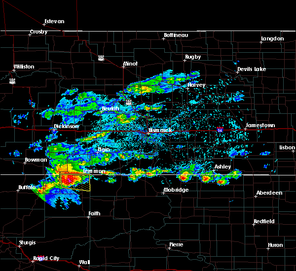 At 214 am mdt, a severe thunderstorm was located 7 miles west of shadehill reservoir, or 15 miles southwest of lemmon, moving east at 40 mph (radar indicated). Hazards include ping pong ball size hail and 60 mph wind gusts. People and animals outdoors will be injured. expect hail damage to roofs, siding, windows, and vehicles. Expect wind damage to roofs, siding, and trees. At 214 am mdt, a severe thunderstorm was located 7 miles west of shadehill reservoir, or 15 miles southwest of lemmon, moving east at 40 mph (radar indicated). Hazards include ping pong ball size hail and 60 mph wind gusts. People and animals outdoors will be injured. expect hail damage to roofs, siding, windows, and vehicles. Expect wind damage to roofs, siding, and trees.
|
| 7/19/2019 1:41 AM MDT |
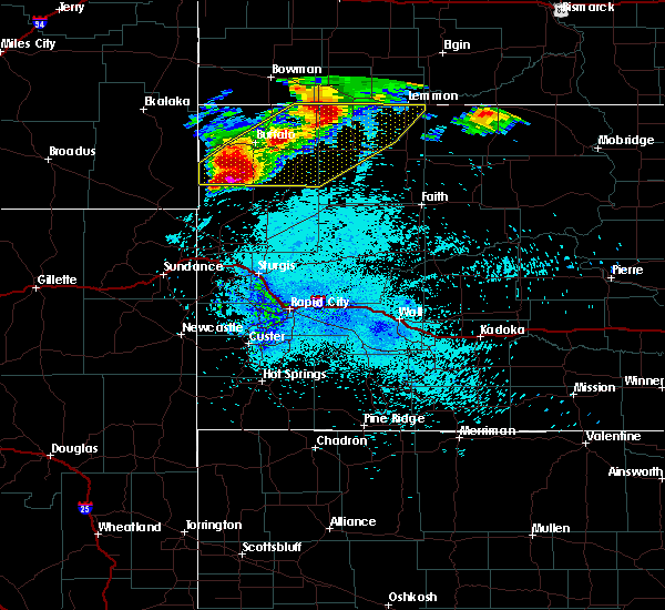 At 139 am mdt, severe thunderstorms were located along a line extending from 3 miles southwest of hettinger to slim buttes to 8 miles south of east short pines, moving east at 45 mph (radar indicated). Hazards include 70 mph wind gusts and ping pong ball size hail. the most damaging winds be along highway 85 near redig. People and animals outdoors will be injured. expect hail damage to roofs, siding, windows, and vehicles. expect considerable tree damage. wind damage is also likely to mobile homes, roofs, and outbuildings. Locations impacted include, lemmon, buffalo, harding, bison, reva, ralph, lodgepole, sorum, white butte, shadehill, gustave, prairie city, redig, east short pines, west short pines, slim buttes, sheep buttes, lake gardner, shadehill reservoir and crow buttes. At 139 am mdt, severe thunderstorms were located along a line extending from 3 miles southwest of hettinger to slim buttes to 8 miles south of east short pines, moving east at 45 mph (radar indicated). Hazards include 70 mph wind gusts and ping pong ball size hail. the most damaging winds be along highway 85 near redig. People and animals outdoors will be injured. expect hail damage to roofs, siding, windows, and vehicles. expect considerable tree damage. wind damage is also likely to mobile homes, roofs, and outbuildings. Locations impacted include, lemmon, buffalo, harding, bison, reva, ralph, lodgepole, sorum, white butte, shadehill, gustave, prairie city, redig, east short pines, west short pines, slim buttes, sheep buttes, lake gardner, shadehill reservoir and crow buttes.
|
| 7/19/2019 1:25 AM MDT |
 At 122 am mdt, severe thunderstorms were located along a line extending from 10 miles south of reeder to 7 miles east of buffalo to 5 miles southwest of gustave, moving east at 45 mph (radar indicated). Hazards include 70 mph wind gusts and ping pong ball size hail. the most damaging winds will be across southern harding county. People and animals outdoors will be injured. expect hail damage to roofs, siding, windows, and vehicles. expect considerable tree damage. wind damage is also likely to mobile homes, roofs, and outbuildings. Locations impacted include, lemmon, buffalo, harding, bison, ludlow, reva, ralph, lodgepole, sorum, white butte, shadehill, gustave, prairie city, redig, east short pines, west short pines, slim buttes, south cave hills, sheep buttes and lake gardner. At 122 am mdt, severe thunderstorms were located along a line extending from 10 miles south of reeder to 7 miles east of buffalo to 5 miles southwest of gustave, moving east at 45 mph (radar indicated). Hazards include 70 mph wind gusts and ping pong ball size hail. the most damaging winds will be across southern harding county. People and animals outdoors will be injured. expect hail damage to roofs, siding, windows, and vehicles. expect considerable tree damage. wind damage is also likely to mobile homes, roofs, and outbuildings. Locations impacted include, lemmon, buffalo, harding, bison, ludlow, reva, ralph, lodgepole, sorum, white butte, shadehill, gustave, prairie city, redig, east short pines, west short pines, slim buttes, south cave hills, sheep buttes and lake gardner.
|
| 7/19/2019 1:13 AM MDT |
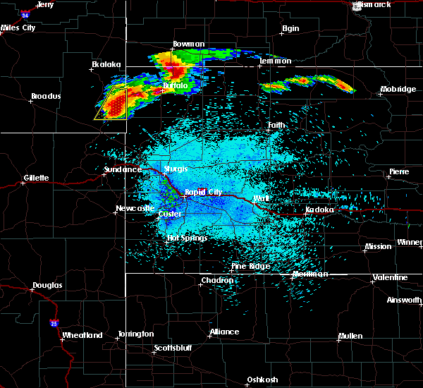 At 113 am mdt, severe thunderstorms were located along a line extending from 11 miles north of ralph to near buffalo to 11 miles west of gustave, moving east at 45 mph (radar indicated). Hazards include ping pong ball size hail and 60 mph wind gusts. People and animals outdoors will be injured. expect hail damage to roofs, siding, windows, and vehicles. Expect wind damage to roofs, siding, and trees. At 113 am mdt, severe thunderstorms were located along a line extending from 11 miles north of ralph to near buffalo to 11 miles west of gustave, moving east at 45 mph (radar indicated). Hazards include ping pong ball size hail and 60 mph wind gusts. People and animals outdoors will be injured. expect hail damage to roofs, siding, windows, and vehicles. Expect wind damage to roofs, siding, and trees.
|
| 7/14/2019 1:23 AM MDT |
 At 122 am mdt, severe thunderstorms were located along a line extending from 4 miles east of white butte to 9 miles south of dears ears butte, moving east at 45 mph (radar indicated). Hazards include 60 mph wind gusts and penny size hail. expect damage to roofs, siding, and trees At 122 am mdt, severe thunderstorms were located along a line extending from 4 miles east of white butte to 9 miles south of dears ears butte, moving east at 45 mph (radar indicated). Hazards include 60 mph wind gusts and penny size hail. expect damage to roofs, siding, and trees
|
| 7/14/2019 1:13 AM MDT |
 At 112 am mdt, severe thunderstorms were located along a line extending from 2 miles southeast of haynes to 8 miles northeast of zeona, moving east at 45 mph (radar indicated). Hazards include 60 mph wind gusts and nickel size hail. Expect damage to roofs, siding, and trees. Locations impacted include, lemmon, bison, reva, ralph, lodgepole, sorum, white butte, prairie city, date, slim buttes, sheep buttes and shadehill reservoir. At 112 am mdt, severe thunderstorms were located along a line extending from 2 miles southeast of haynes to 8 miles northeast of zeona, moving east at 45 mph (radar indicated). Hazards include 60 mph wind gusts and nickel size hail. Expect damage to roofs, siding, and trees. Locations impacted include, lemmon, bison, reva, ralph, lodgepole, sorum, white butte, prairie city, date, slim buttes, sheep buttes and shadehill reservoir.
|
| 7/14/2019 12:53 AM MDT |
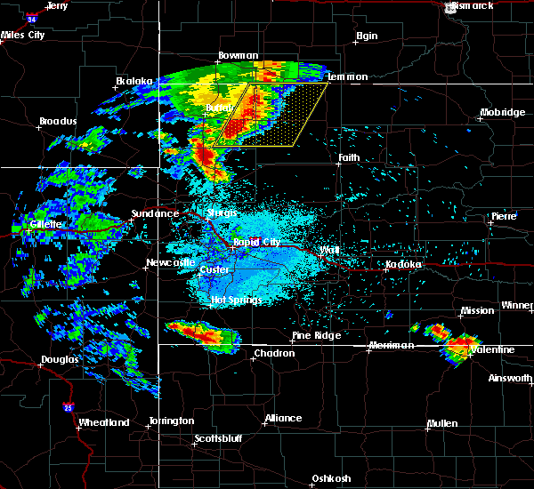 The national weather service in rapid city has issued a * severe thunderstorm warning for. eastern harding county in northwestern south dakota. western perkins county in northwestern south dakota. until 200 am mdt. At 1252 am mdt, severe thunderstorms were located along a line. The national weather service in rapid city has issued a * severe thunderstorm warning for. eastern harding county in northwestern south dakota. western perkins county in northwestern south dakota. until 200 am mdt. At 1252 am mdt, severe thunderstorms were located along a line.
|
| 7/12/2019 11:05 PM MDT |
 At 1104 pm mdt, a severe thunderstorm was located 3 miles north of north lemmon, or 4 miles north of lemmon, moving southeast at 20 mph (radar indicated). Hazards include 60 mph wind gusts and quarter size hail. Hail damage to vehicles is expected. expect wind damage to roofs, siding, and trees. Locations impacted include, lemmon. At 1104 pm mdt, a severe thunderstorm was located 3 miles north of north lemmon, or 4 miles north of lemmon, moving southeast at 20 mph (radar indicated). Hazards include 60 mph wind gusts and quarter size hail. Hail damage to vehicles is expected. expect wind damage to roofs, siding, and trees. Locations impacted include, lemmon.
|
| 7/12/2019 10:41 PM MDT |
 At 1041 pm mdt, a severe thunderstorm was located 7 miles northwest of north lemmon, or 7 miles northwest of lemmon, moving southeast at 30 mph (radar indicated). Hazards include golf ball size hail and 70 mph wind gusts. People and animals outdoors will be injured. expect hail damage to roofs, siding, windows, and vehicles. expect considerable tree damage. Wind damage is also likely to mobile homes, roofs, and outbuildings. At 1041 pm mdt, a severe thunderstorm was located 7 miles northwest of north lemmon, or 7 miles northwest of lemmon, moving southeast at 30 mph (radar indicated). Hazards include golf ball size hail and 70 mph wind gusts. People and animals outdoors will be injured. expect hail damage to roofs, siding, windows, and vehicles. expect considerable tree damage. Wind damage is also likely to mobile homes, roofs, and outbuildings.
|
| 7/2/2019 7:12 PM MDT |
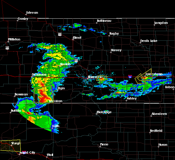 At 712 pm mdt, a severe thunderstorm was located over white butte, or 8 miles west of lemmon, moving east at 35 mph (radar indicated). Hazards include 60 mph wind gusts and half dollar size hail. Hail damage to vehicles is expected. Expect wind damage to roofs, siding, and trees. At 712 pm mdt, a severe thunderstorm was located over white butte, or 8 miles west of lemmon, moving east at 35 mph (radar indicated). Hazards include 60 mph wind gusts and half dollar size hail. Hail damage to vehicles is expected. Expect wind damage to roofs, siding, and trees.
|
| 6/27/2019 1:35 AM MDT |
 At 135 am mdt, severe thunderstorms were located along a line extending from 13 miles north of north lemmon to 13 miles north of keldron to 10 miles north of mcintosh, moving north at 35 mph (radar indicated). Hazards include 60 mph wind gusts and nickel size hail. Expect damage to roofs, siding, and trees. locations impacted include, mott, new leipzig, morristown, north lemmon, thunder hawk, burt, st. Gertrude and bentley. At 135 am mdt, severe thunderstorms were located along a line extending from 13 miles north of north lemmon to 13 miles north of keldron to 10 miles north of mcintosh, moving north at 35 mph (radar indicated). Hazards include 60 mph wind gusts and nickel size hail. Expect damage to roofs, siding, and trees. locations impacted include, mott, new leipzig, morristown, north lemmon, thunder hawk, burt, st. Gertrude and bentley.
|
| 6/27/2019 1:19 AM MDT |
 At 118 am mdt, severe thunderstorms were located along a line extending from 9 miles northwest of north lemmon to 9 miles north of keldron to 7 miles north of mcintosh, moving north at 30 mph (radar indicated). Hazards include 60 mph wind gusts and nickel size hail. Expect damage to roofs, siding, and trees. these severe thunderstorms will remain over mainly rural areas of southwestern sioux, southeastern hettinger, southern grant and southeastern adams counties, including the following locations, st. Gertrude, burt and bentley. At 118 am mdt, severe thunderstorms were located along a line extending from 9 miles northwest of north lemmon to 9 miles north of keldron to 7 miles north of mcintosh, moving north at 30 mph (radar indicated). Hazards include 60 mph wind gusts and nickel size hail. Expect damage to roofs, siding, and trees. these severe thunderstorms will remain over mainly rural areas of southwestern sioux, southeastern hettinger, southern grant and southeastern adams counties, including the following locations, st. Gertrude, burt and bentley.
|
| 6/27/2019 1:02 AM MDT |
 At 102 am mdt, severe thunderstorms were located along a line extending from 4 miles east of white butte to 4 miles east of thunder hawk to near watauga, moving north at 35 mph (radar indicated). Hazards include 60 mph wind gusts and nickel size hail. Expect damage to roofs, siding, and trees. severe thunderstorms will be near, mott around 145 am mdt. other locations impacted by these severe thunderstorms include st. Gertrude, burt and bentley. At 102 am mdt, severe thunderstorms were located along a line extending from 4 miles east of white butte to 4 miles east of thunder hawk to near watauga, moving north at 35 mph (radar indicated). Hazards include 60 mph wind gusts and nickel size hail. Expect damage to roofs, siding, and trees. severe thunderstorms will be near, mott around 145 am mdt. other locations impacted by these severe thunderstorms include st. Gertrude, burt and bentley.
|
| 6/7/2019 8:32 PM MDT |
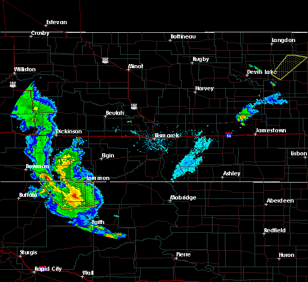 At 832 pm mdt, a severe thunderstorm was located 7 miles southwest of shadehill reservoir, or 20 miles southwest of lemmon, moving east at 25 mph (radar indicated). Hazards include 60 mph wind gusts and quarter size hail. Hail damage to vehicles is expected. expect wind damage to roofs, siding, and trees. Locations impacted include, lemmon, bison, meadow, lodgepole, white butte, shadehill, owen lake and shadehill reservoir. At 832 pm mdt, a severe thunderstorm was located 7 miles southwest of shadehill reservoir, or 20 miles southwest of lemmon, moving east at 25 mph (radar indicated). Hazards include 60 mph wind gusts and quarter size hail. Hail damage to vehicles is expected. expect wind damage to roofs, siding, and trees. Locations impacted include, lemmon, bison, meadow, lodgepole, white butte, shadehill, owen lake and shadehill reservoir.
|
| 6/7/2019 8:22 PM MDT |
 At 822 pm mdt, a severe thunderstorm was located 9 miles southwest of shadehill reservoir, or 22 miles southwest of lemmon, moving northeast at 40 mph (radar indicated). Hazards include ping pong ball size hail and 60 mph wind gusts. People and animals outdoors will be injured. expect hail damage to roofs, siding, windows, and vehicles. expect wind damage to roofs, siding, and trees. Locations impacted include, lemmon, bison, ralph, meadow, lodgepole, sorum, white butte, shadehill, prairie city, owen lake and shadehill reservoir. At 822 pm mdt, a severe thunderstorm was located 9 miles southwest of shadehill reservoir, or 22 miles southwest of lemmon, moving northeast at 40 mph (radar indicated). Hazards include ping pong ball size hail and 60 mph wind gusts. People and animals outdoors will be injured. expect hail damage to roofs, siding, windows, and vehicles. expect wind damage to roofs, siding, and trees. Locations impacted include, lemmon, bison, ralph, meadow, lodgepole, sorum, white butte, shadehill, prairie city, owen lake and shadehill reservoir.
|
| 6/7/2019 7:55 PM MDT |
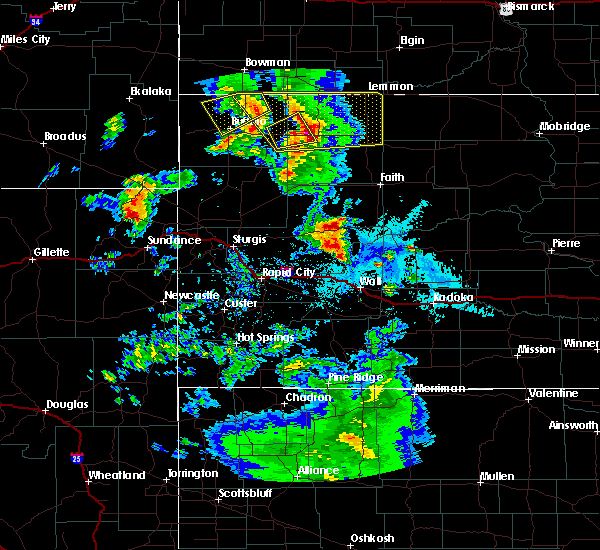 At 755 pm mdt, severe thunderstorms were located along a line extending from 5 miles north of ludlow to 10 miles southwest of lodgepole to 4 miles northeast of date, moving northeast at 40 mph (radar indicated). Hazards include golf ball size hail and 70 mph wind gusts. People and animals outdoors will be injured. expect hail damage to roofs, siding, windows, and vehicles. expect considerable tree damage. Wind damage is also likely to mobile homes, roofs, and outbuildings. At 755 pm mdt, severe thunderstorms were located along a line extending from 5 miles north of ludlow to 10 miles southwest of lodgepole to 4 miles northeast of date, moving northeast at 40 mph (radar indicated). Hazards include golf ball size hail and 70 mph wind gusts. People and animals outdoors will be injured. expect hail damage to roofs, siding, windows, and vehicles. expect considerable tree damage. Wind damage is also likely to mobile homes, roofs, and outbuildings.
|
| 8/3/2018 9:54 PM MDT |
 The severe thunderstorm warning for southeastern adams county will expire at 1000 pm mdt, the storm which prompted the warning has weakened below severe limits. therefore, the warning will be allowed to expire. however gusty winds are still possible with this thunderstorm, and additional thunderstorms are still expected tonight. The severe thunderstorm warning for southeastern adams county will expire at 1000 pm mdt, the storm which prompted the warning has weakened below severe limits. therefore, the warning will be allowed to expire. however gusty winds are still possible with this thunderstorm, and additional thunderstorms are still expected tonight.
|
| 8/3/2018 9:36 PM MDT |
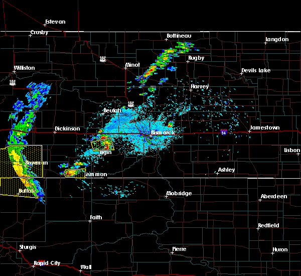 At 936 pm mdt, a severe thunderstorm was located over haynes, or 9 miles east of hettinger, moving east at 15 mph (trained weather spotters). Hazards include half dollar size hail. Damage to vehicles is expected. Locations impacted include, haynes and north lemmon. At 936 pm mdt, a severe thunderstorm was located over haynes, or 9 miles east of hettinger, moving east at 15 mph (trained weather spotters). Hazards include half dollar size hail. Damage to vehicles is expected. Locations impacted include, haynes and north lemmon.
|
| 8/3/2018 9:24 PM MDT |
 At 924 pm mdt, a severe thunderstorm was located over haynes, or 6 miles east of hettinger, moving east at 15 mph (trained weather spotters). Hazards include half dollar size hail. Damage to vehicles is expected. Locations impacted include, hettinger, haynes, white butte and north lemmon. At 924 pm mdt, a severe thunderstorm was located over haynes, or 6 miles east of hettinger, moving east at 15 mph (trained weather spotters). Hazards include half dollar size hail. Damage to vehicles is expected. Locations impacted include, hettinger, haynes, white butte and north lemmon.
|
| 8/3/2018 9:07 PM MDT |
 At 906 pm mdt, a severe thunderstorm was located over hettinger, moving east at 15 mph (trained weather spotters). Hazards include 60 mph wind gusts and half dollar size hail. Hail damage to vehicles is expected. Expect wind damage to roofs, siding, and trees. At 906 pm mdt, a severe thunderstorm was located over hettinger, moving east at 15 mph (trained weather spotters). Hazards include 60 mph wind gusts and half dollar size hail. Hail damage to vehicles is expected. Expect wind damage to roofs, siding, and trees.
|
| 7/7/2018 11:11 PM MDT |
 The severe thunderstorm warning for northern perkins county will expire at 1115 pm mdt, the storms which prompted the warning have moved out of the area. therefore, the warning will be allowed to expire. however gusty winds and heavy rain are still possible with thunderstorms in the area. a severe thunderstorm watch remains in effect until 500 am mdt for northwestern south dakota. The severe thunderstorm warning for northern perkins county will expire at 1115 pm mdt, the storms which prompted the warning have moved out of the area. therefore, the warning will be allowed to expire. however gusty winds and heavy rain are still possible with thunderstorms in the area. a severe thunderstorm watch remains in effect until 500 am mdt for northwestern south dakota.
|
| 7/7/2018 11:08 PM MDT |
 At 1208 am cdt/1108 pm mdt/, severe thunderstorms were located along a line extending from 8 miles southwest of new leipzig to near keldron, moving northeast at 45 mph (radar indicated). Hazards include 60 mph wind gusts and quarter size hail. Hail damage to vehicles is expected. expect wind damage to roofs, siding, and trees. severe thunderstorms will be near, morristown around 1115 pm mdt. new leipzig around 1120 pm mdt. elgin around 1125 pm mdt. carson around 1140 pm mdt. shields around 100 am cdt. other locations impacted by these severe thunderstorms include heil, st. Gertrude, raleigh, porcupine, burt, leith, lark and bentley. At 1208 am cdt/1108 pm mdt/, severe thunderstorms were located along a line extending from 8 miles southwest of new leipzig to near keldron, moving northeast at 45 mph (radar indicated). Hazards include 60 mph wind gusts and quarter size hail. Hail damage to vehicles is expected. expect wind damage to roofs, siding, and trees. severe thunderstorms will be near, morristown around 1115 pm mdt. new leipzig around 1120 pm mdt. elgin around 1125 pm mdt. carson around 1140 pm mdt. shields around 100 am cdt. other locations impacted by these severe thunderstorms include heil, st. Gertrude, raleigh, porcupine, burt, leith, lark and bentley.
|
| 7/7/2018 10:48 PM MDT |
 At 1048 pm mdt, severe thunderstorms were located along a line extending from 3 miles northwest of lemmon to 5 miles north of shadehill to 6 miles northeast of bison, moving east at 50 mph (radar indicated). Hazards include 60 mph wind gusts and nickel size hail. Expect damage to roofs, siding, and trees. Locations impacted include, lemmon, white butte, shadehill and shadehill reservoir. At 1048 pm mdt, severe thunderstorms were located along a line extending from 3 miles northwest of lemmon to 5 miles north of shadehill to 6 miles northeast of bison, moving east at 50 mph (radar indicated). Hazards include 60 mph wind gusts and nickel size hail. Expect damage to roofs, siding, and trees. Locations impacted include, lemmon, white butte, shadehill and shadehill reservoir.
|
| 7/7/2018 10:44 PM MDT | Time estimated from radar in perkins county SD, 18.6 miles N of Lemmon, SD |
| 7/7/2018 10:18 PM MDT |
 At 1017 pm mdt, severe thunderstorms were located along a line extending from 12 miles north of lodgepole to 6 miles northeast of prairie city, moving east at 45 mph (radar indicated). Hazards include 60 mph wind gusts and nickel size hail. Expect damage to roofs, siding, and trees. Locations impacted include, lemmon, lodgepole, white butte, shadehill and shadehill reservoir. At 1017 pm mdt, severe thunderstorms were located along a line extending from 12 miles north of lodgepole to 6 miles northeast of prairie city, moving east at 45 mph (radar indicated). Hazards include 60 mph wind gusts and nickel size hail. Expect damage to roofs, siding, and trees. Locations impacted include, lemmon, lodgepole, white butte, shadehill and shadehill reservoir.
|
| 7/7/2018 9:58 PM MDT |
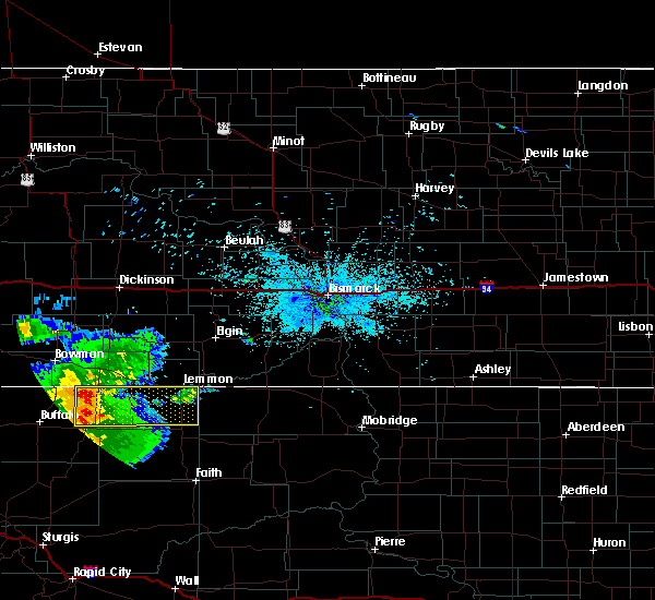 At 957 pm mdt, severe thunderstorms were located along a line extending from 12 miles north of ralph to 3 miles east of reva, moving east at 45 mph (radar indicated). Hazards include 60 mph wind gusts and nickel size hail. expect damage to roofs, siding, and trees At 957 pm mdt, severe thunderstorms were located along a line extending from 12 miles north of ralph to 3 miles east of reva, moving east at 45 mph (radar indicated). Hazards include 60 mph wind gusts and nickel size hail. expect damage to roofs, siding, and trees
|
| 7/3/2018 3:03 AM MDT |
 At 303 am mdt, a severe thunderstorm was located near white butte, or 7 miles west of lemmon, moving east at 35 mph (radar indicated). Hazards include golf ball size hail and 70 mph wind gusts. People and animals outdoors will be injured. expect hail damage to roofs, siding, windows, and vehicles. expect considerable tree damage. wind damage is also likely to mobile homes, roofs, and outbuildings. Locations impacted include, lemmon and white butte. At 303 am mdt, a severe thunderstorm was located near white butte, or 7 miles west of lemmon, moving east at 35 mph (radar indicated). Hazards include golf ball size hail and 70 mph wind gusts. People and animals outdoors will be injured. expect hail damage to roofs, siding, windows, and vehicles. expect considerable tree damage. wind damage is also likely to mobile homes, roofs, and outbuildings. Locations impacted include, lemmon and white butte.
|
| 7/3/2018 2:56 AM MDT |
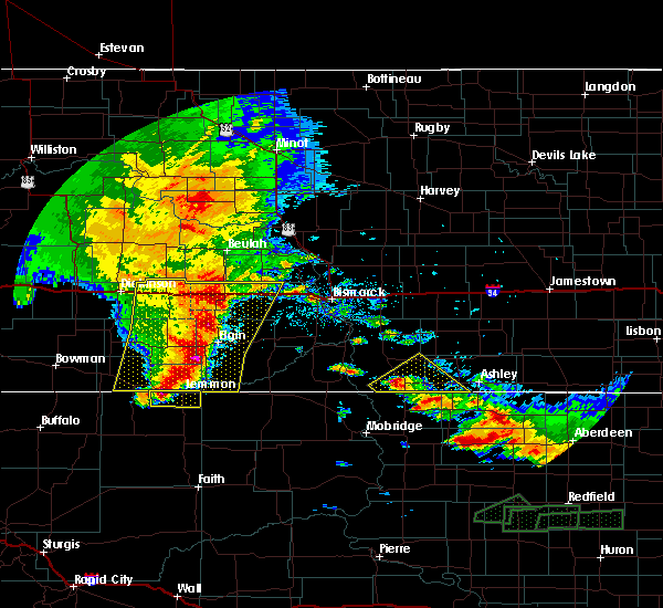 At 256 am mdt, a severe thunderstorm was located 7 miles southwest of white butte, or 16 miles west of lemmon, moving east at 45 mph (radar indicated). Hazards include golf ball size hail and 70 mph wind gusts. People and animals outdoors will be injured. expect hail damage to roofs, siding, windows, and vehicles. expect considerable tree damage. Wind damage is also likely to mobile homes, roofs, and outbuildings. At 256 am mdt, a severe thunderstorm was located 7 miles southwest of white butte, or 16 miles west of lemmon, moving east at 45 mph (radar indicated). Hazards include golf ball size hail and 70 mph wind gusts. People and animals outdoors will be injured. expect hail damage to roofs, siding, windows, and vehicles. expect considerable tree damage. Wind damage is also likely to mobile homes, roofs, and outbuildings.
|
| 7/3/2018 2:39 AM MDT |
 The severe thunderstorm warning for northern perkins county will expire at 245 am mdt, the storm which prompted the warning has weakened below severe limits, and no longer poses an immediate threat to life or property. therefore, the warning will be allowed to expire. however gusty winds are still possible with this thunderstorm. a severe thunderstorm watch remains in effect until 800 am mdt for northwestern south dakota. The severe thunderstorm warning for northern perkins county will expire at 245 am mdt, the storm which prompted the warning has weakened below severe limits, and no longer poses an immediate threat to life or property. therefore, the warning will be allowed to expire. however gusty winds are still possible with this thunderstorm. a severe thunderstorm watch remains in effect until 800 am mdt for northwestern south dakota.
|
| 7/3/2018 2:27 AM MDT |
 At 227 am mdt, a severe thunderstorm was located 6 miles northeast of lodgepole, or 21 miles west of lemmon, moving east at 45 mph (radar indicated). Hazards include 60 mph wind gusts and quarter size hail. Hail damage to vehicles is expected. expect wind damage to roofs, siding, and trees. Locations impacted include, lemmon, lodgepole, white butte, shadehill and shadehill reservoir. At 227 am mdt, a severe thunderstorm was located 6 miles northeast of lodgepole, or 21 miles west of lemmon, moving east at 45 mph (radar indicated). Hazards include 60 mph wind gusts and quarter size hail. Hail damage to vehicles is expected. expect wind damage to roofs, siding, and trees. Locations impacted include, lemmon, lodgepole, white butte, shadehill and shadehill reservoir.
|
| 7/3/2018 2:12 AM MDT |
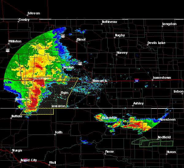 At 211 am mdt, a severe thunderstorm was located 12 miles northwest of lodgepole, or 32 miles west of lemmon, moving east at 55 mph (radar indicated). Hazards include 60 mph wind gusts and quarter size hail. Hail damage to vehicles is expected. expect wind damage to roofs, siding, and trees. Locations impacted include, lemmon, ralph, lodgepole, white butte, shadehill and shadehill reservoir. At 211 am mdt, a severe thunderstorm was located 12 miles northwest of lodgepole, or 32 miles west of lemmon, moving east at 55 mph (radar indicated). Hazards include 60 mph wind gusts and quarter size hail. Hail damage to vehicles is expected. expect wind damage to roofs, siding, and trees. Locations impacted include, lemmon, ralph, lodgepole, white butte, shadehill and shadehill reservoir.
|
| 7/3/2018 1:46 AM MDT |
 At 145 am mdt, a severe thunderstorm was located 3 miles northeast of ludlow, or 22 miles northeast of buffalo, moving east at 55 mph (radar indicated). Hazards include 70 mph wind gusts and quarter size hail. Hail damage to vehicles is expected. expect considerable tree damage. Wind damage is also likely to mobile homes, roofs, and outbuildings. At 145 am mdt, a severe thunderstorm was located 3 miles northeast of ludlow, or 22 miles northeast of buffalo, moving east at 55 mph (radar indicated). Hazards include 70 mph wind gusts and quarter size hail. Hail damage to vehicles is expected. expect considerable tree damage. Wind damage is also likely to mobile homes, roofs, and outbuildings.
|
| 6/26/2018 11:17 PM MDT |
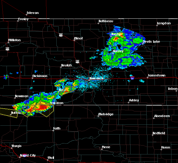 At 1117 pm mdt, a severe thunderstorm was located 4 miles north of shadehill reservoir, or 10 miles southwest of lemmon, moving southeast at 35 mph (radar indicated). Hazards include tennis ball size hail and 60 mph wind gusts. People and animals outdoors will be injured. expect hail damage to roofs, siding, windows, and vehicles. expect wind damage to roofs, siding, and trees. Locations impacted include, lemmon, lodgepole, white butte, shadehill and shadehill reservoir. At 1117 pm mdt, a severe thunderstorm was located 4 miles north of shadehill reservoir, or 10 miles southwest of lemmon, moving southeast at 35 mph (radar indicated). Hazards include tennis ball size hail and 60 mph wind gusts. People and animals outdoors will be injured. expect hail damage to roofs, siding, windows, and vehicles. expect wind damage to roofs, siding, and trees. Locations impacted include, lemmon, lodgepole, white butte, shadehill and shadehill reservoir.
|
| 6/26/2018 10:44 PM MDT |
 At 1044 pm mdt, a severe thunderstorm was located 10 miles north of lodgepole, or 23 miles west of lemmon, moving southeast at 35 mph (radar indicated). Hazards include tennis ball size hail and 60 mph wind gusts. People and animals outdoors will be injured. expect hail damage to roofs, siding, windows, and vehicles. Expect wind damage to roofs, siding, and trees. At 1044 pm mdt, a severe thunderstorm was located 10 miles north of lodgepole, or 23 miles west of lemmon, moving southeast at 35 mph (radar indicated). Hazards include tennis ball size hail and 60 mph wind gusts. People and animals outdoors will be injured. expect hail damage to roofs, siding, windows, and vehicles. Expect wind damage to roofs, siding, and trees.
|
| 6/26/2018 8:01 PM MDT |
 At 800 pm mdt, a severe thunderstorm was located 9 miles north of lodgepole, or 21 miles west of lemmon, moving east at 40 mph (radar indicated). Hazards include golf ball size hail and 60 mph wind gusts. People and animals outdoors will be injured. expect hail damage to roofs, siding, windows, and vehicles. expect wind damage to roofs, siding, and trees. Locations impacted include, lemmon, white butte, shadehill and northern shadehill reservoir. At 800 pm mdt, a severe thunderstorm was located 9 miles north of lodgepole, or 21 miles west of lemmon, moving east at 40 mph (radar indicated). Hazards include golf ball size hail and 60 mph wind gusts. People and animals outdoors will be injured. expect hail damage to roofs, siding, windows, and vehicles. expect wind damage to roofs, siding, and trees. Locations impacted include, lemmon, white butte, shadehill and northern shadehill reservoir.
|
| 6/26/2018 7:39 PM MDT |
 At 738 pm mdt, a severe thunderstorm was located 16 miles northwest of lodgepole, or 34 miles west of lemmon, moving southeast at 30 mph. this is a very dangerous storm (radar indicated). Hazards include baseball size hail and 60 mph wind gusts. People and animals outdoors will be severely injured. Expect shattered windows, extensive damage to roofs, siding, and vehicles. At 738 pm mdt, a severe thunderstorm was located 16 miles northwest of lodgepole, or 34 miles west of lemmon, moving southeast at 30 mph. this is a very dangerous storm (radar indicated). Hazards include baseball size hail and 60 mph wind gusts. People and animals outdoors will be severely injured. Expect shattered windows, extensive damage to roofs, siding, and vehicles.
|
| 6/10/2018 6:57 PM MDT |
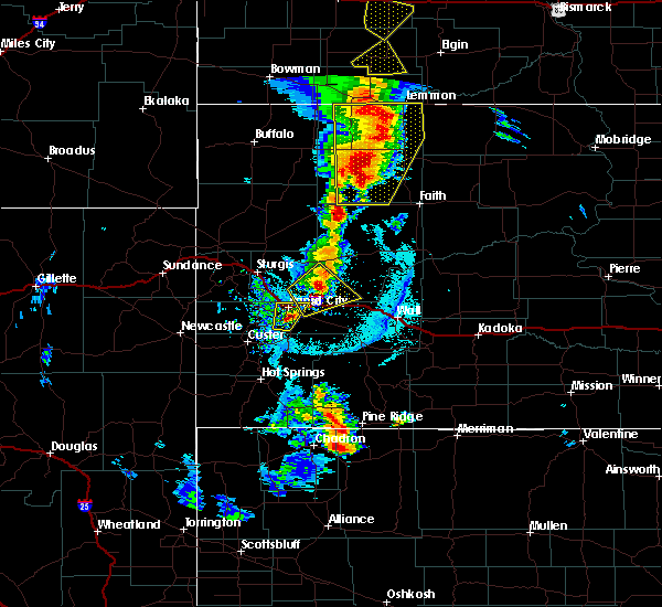 At 657 pm mdt, severe thunderstorms were located along a line extending from haynes to 6 miles south of shadehill reservoir to 13 miles northeast of maurine, moving northeast at 25 mph (radar indicated). Hazards include ping pong ball size hail and 60 mph wind gusts. People and animals outdoors will be injured. expect hail damage to roofs, siding, windows, and vehicles. expect wind damage to roofs, siding, and trees. locations impacted include, lemmon, bison, meadow, chance, lodgepole, white butte, shadehill, date, owen lake and shadehill reservoir. A tornado watch remains in effect until 1000 pm mdt for northwestern and west central south dakota. At 657 pm mdt, severe thunderstorms were located along a line extending from haynes to 6 miles south of shadehill reservoir to 13 miles northeast of maurine, moving northeast at 25 mph (radar indicated). Hazards include ping pong ball size hail and 60 mph wind gusts. People and animals outdoors will be injured. expect hail damage to roofs, siding, windows, and vehicles. expect wind damage to roofs, siding, and trees. locations impacted include, lemmon, bison, meadow, chance, lodgepole, white butte, shadehill, date, owen lake and shadehill reservoir. A tornado watch remains in effect until 1000 pm mdt for northwestern and west central south dakota.
|
| 6/10/2018 6:36 PM MDT |
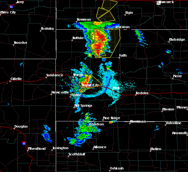 At 636 pm mdt, severe thunderstorms were located along a line extending from 6 miles north of lodgepole to 6 miles northeast of bison to 7 miles north of maurine, moving northeast at 25 mph (radar indicated). Hazards include golf ball size hail and 60 mph wind gusts. People and animals outdoors will be injured. expect hail damage to roofs, siding, windows, and vehicles. Expect wind damage to roofs, siding, and trees. At 636 pm mdt, severe thunderstorms were located along a line extending from 6 miles north of lodgepole to 6 miles northeast of bison to 7 miles north of maurine, moving northeast at 25 mph (radar indicated). Hazards include golf ball size hail and 60 mph wind gusts. People and animals outdoors will be injured. expect hail damage to roofs, siding, windows, and vehicles. Expect wind damage to roofs, siding, and trees.
|
| 6/7/2018 11:23 PM MDT |
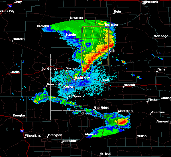 The severe thunderstorm warning for northeastern meade and perkins counties will expire at 1130 pm mdt, the storms which prompted the warning have weakened below severe limits, so the warning will be allowed to expire. however, nickel sized hail and wind gusts to 45 mph are still possible with these thunderstorms. a severe thunderstorm watch remains in effect until 100 am mdt for northwestern and west central south dakota. The severe thunderstorm warning for northeastern meade and perkins counties will expire at 1130 pm mdt, the storms which prompted the warning have weakened below severe limits, so the warning will be allowed to expire. however, nickel sized hail and wind gusts to 45 mph are still possible with these thunderstorms. a severe thunderstorm watch remains in effect until 100 am mdt for northwestern and west central south dakota.
|
| 6/7/2018 10:28 PM MDT |
 At 1027 pm mdt, severe thunderstorms were located along a line extending from near hettinger to near bison to near mud butte, moving east at 50 mph (radar indicated). Hazards include 60 mph wind gusts. expect damage to roofs, siding, and trees At 1027 pm mdt, severe thunderstorms were located along a line extending from near hettinger to near bison to near mud butte, moving east at 50 mph (radar indicated). Hazards include 60 mph wind gusts. expect damage to roofs, siding, and trees
|
| 6/5/2018 8:23 PM MDT | Time estimated from radar in perkins county SD, 18.6 miles N of Lemmon, SD |
| 8/12/2017 7:26 PM MDT |
 The severe thunderstorm warning for northeastern perkins county will expire at 730 pm mdt, the storm which prompted the warning has weakened below severe limits, and no longer poses an immediate threat to life or property. therefore the warning will be allowed to expire. to report severe weather, contact your nearest law enforcement agency. they will relay your report to the national weather service rapid city. The severe thunderstorm warning for northeastern perkins county will expire at 730 pm mdt, the storm which prompted the warning has weakened below severe limits, and no longer poses an immediate threat to life or property. therefore the warning will be allowed to expire. to report severe weather, contact your nearest law enforcement agency. they will relay your report to the national weather service rapid city.
|
| 8/12/2017 7:03 PM MDT |
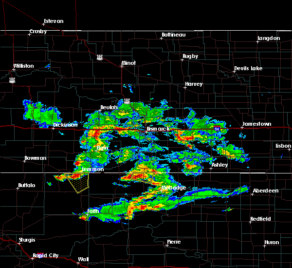 At 702 pm mdt, a severe thunderstorm was located near shadehill, or 8 miles south of lemmon, moving southeast at 30 mph (radar indicated). Hazards include 60 mph wind gusts and quarter size hail. Hail damage to vehicles is expected. expect wind damage to roofs, siding, and trees. Locations impacted include, lemmon, meadow, shadehill and shadehill reservoir. At 702 pm mdt, a severe thunderstorm was located near shadehill, or 8 miles south of lemmon, moving southeast at 30 mph (radar indicated). Hazards include 60 mph wind gusts and quarter size hail. Hail damage to vehicles is expected. expect wind damage to roofs, siding, and trees. Locations impacted include, lemmon, meadow, shadehill and shadehill reservoir.
|
| 8/12/2017 7:00 PM MDT | Quarter sized hail reported 10.4 miles ENE of Lemmon, SD |
| 8/12/2017 6:45 PM MDT |
 At 645 pm mdt, a severe thunderstorm was located over white butte, or 8 miles west of lemmon, moving southeast at 25 mph (radar indicated. this storm has a history of producing golf ball size hail). Hazards include golf ball size hail and 60 mph wind gusts. People and animals outdoors will be injured. expect hail damage to roofs, siding, windows, and vehicles. expect wind damage to roofs, siding, and trees. Locations impacted include, lemmon, meadow, white butte, shadehill and shadehill reservoir. At 645 pm mdt, a severe thunderstorm was located over white butte, or 8 miles west of lemmon, moving southeast at 25 mph (radar indicated. this storm has a history of producing golf ball size hail). Hazards include golf ball size hail and 60 mph wind gusts. People and animals outdoors will be injured. expect hail damage to roofs, siding, windows, and vehicles. expect wind damage to roofs, siding, and trees. Locations impacted include, lemmon, meadow, white butte, shadehill and shadehill reservoir.
|
| 8/12/2017 6:35 PM MDT | Golf Ball sized hail reported 11.1 miles SE of Lemmon, SD |
| 8/12/2017 6:31 PM MDT |
 At 631 pm mdt, a severe thunderstorm was located near north lemmon, or near lemmon, moving southeast at 30 mph (radar indicated). Hazards include 60 mph wind gusts and quarter size hail. Hail damage to vehicles is expected. Expect wind damage to roofs, siding, and trees. At 631 pm mdt, a severe thunderstorm was located near north lemmon, or near lemmon, moving southeast at 30 mph (radar indicated). Hazards include 60 mph wind gusts and quarter size hail. Hail damage to vehicles is expected. Expect wind damage to roofs, siding, and trees.
|
| 8/5/2017 6:15 PM MDT |
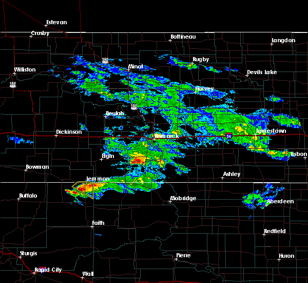 At 613 pm mdt, a severe thunderstorm was located over shadehill, or 11 miles south of lemmon, moving southeast at 30 mph (public. at 6:00 pm quarter sized hail was reported 2 miles south of white butte). Hazards include quarter size hail. Damage to vehicles is expected. Locations impacted include, lemmon, shadehill, northern shadehill reservoir and north lemmon. At 613 pm mdt, a severe thunderstorm was located over shadehill, or 11 miles south of lemmon, moving southeast at 30 mph (public. at 6:00 pm quarter sized hail was reported 2 miles south of white butte). Hazards include quarter size hail. Damage to vehicles is expected. Locations impacted include, lemmon, shadehill, northern shadehill reservoir and north lemmon.
|
| 8/5/2017 6:09 PM MDT |
 At 608 pm mdt, a severe thunderstorm was located near shadehill, or 9 miles south of lemmon, moving southeast at 35 mph (radar indicated). Hazards include quarter size hail. Damage to vehicles is expected. Locations impacted include, lemmon, shadehill, northern shadehill reservoir and north lemmon. At 608 pm mdt, a severe thunderstorm was located near shadehill, or 9 miles south of lemmon, moving southeast at 35 mph (radar indicated). Hazards include quarter size hail. Damage to vehicles is expected. Locations impacted include, lemmon, shadehill, northern shadehill reservoir and north lemmon.
|
| 8/5/2017 6:00 PM MDT | Quarter sized hail reported 9.8 miles ENE of Lemmon, SD |
| 8/5/2017 5:34 PM MDT |
 At 533 pm mdt, a severe thunderstorm was located over haynes, or 10 miles east of hettinger, moving southeast at 30 mph (radar indicated). Hazards include half dollar size hail. damage to vehicles is expected At 533 pm mdt, a severe thunderstorm was located over haynes, or 10 miles east of hettinger, moving southeast at 30 mph (radar indicated). Hazards include half dollar size hail. damage to vehicles is expected
|
| 7/31/2017 3:40 PM MDT | Half Dollar sized hail reported 20.6 miles NE of Lemmon, SD |
| 7/20/2017 7:03 PM MDT | Time estimated from radar in perkins county SD, 18.6 miles N of Lemmon, SD |
| 7/20/2017 6:24 PM MDT |
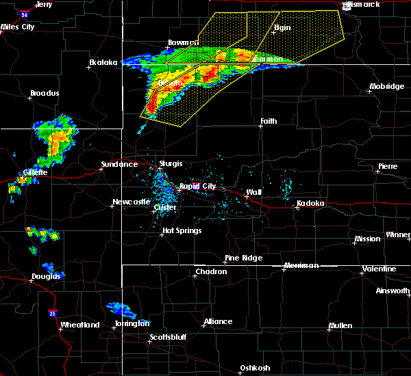 At 624 pm mdt, severe thunderstorms were located along a line extending from near lodgepole to 6 miles northwest of slim buttes to near crow buttes, moving southeast at 30 mph (radar indicated). Hazards include 60 mph wind gusts and penny size hail. Expect damage to roofs, siding, and trees. Locations impacted include, lemmon, reva, ralph, lodgepole, sorum, white butte, hoover, prairie city, redig, slim buttes, sheep buttes, crow buttes, east short pines and northwestern shadehill reservoir. At 624 pm mdt, severe thunderstorms were located along a line extending from near lodgepole to 6 miles northwest of slim buttes to near crow buttes, moving southeast at 30 mph (radar indicated). Hazards include 60 mph wind gusts and penny size hail. Expect damage to roofs, siding, and trees. Locations impacted include, lemmon, reva, ralph, lodgepole, sorum, white butte, hoover, prairie city, redig, slim buttes, sheep buttes, crow buttes, east short pines and northwestern shadehill reservoir.
|
| 7/20/2017 6:08 PM MDT |
 At 608 pm mdt, severe thunderstorms were located along a line extending from 6 miles northwest of hettinger to 11 miles southeast of ludlow to 7 miles southwest of east short pines, moving east at 30 mph (radar indicated). Hazards include 70 mph wind gusts. Expect considerable tree damage. damage is likely to mobile homes, roofs, and outbuildings. Locations impacted include, lemmon, buffalo, harding, reva, ralph, lodgepole, sorum, white butte, hoover, prairie city, redig, east short pines, slim buttes, sheep buttes, lake gardner, crow buttes and northwestern shadehill reservoir. At 608 pm mdt, severe thunderstorms were located along a line extending from 6 miles northwest of hettinger to 11 miles southeast of ludlow to 7 miles southwest of east short pines, moving east at 30 mph (radar indicated). Hazards include 70 mph wind gusts. Expect considerable tree damage. damage is likely to mobile homes, roofs, and outbuildings. Locations impacted include, lemmon, buffalo, harding, reva, ralph, lodgepole, sorum, white butte, hoover, prairie city, redig, east short pines, slim buttes, sheep buttes, lake gardner, crow buttes and northwestern shadehill reservoir.
|
| 7/20/2017 5:48 PM MDT |
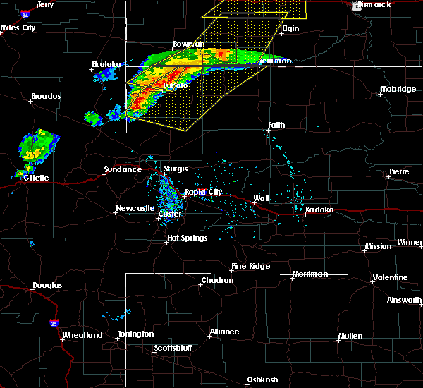 At 548 pm mdt, severe thunderstorms were located along a line extending from reeder to near south cave hills to gustave, moving east at 35 mph (radar indicated). Hazards include 70 mph wind gusts. Expect considerable tree damage. Damage is likely to mobile homes, roofs, and outbuildings. At 548 pm mdt, severe thunderstorms were located along a line extending from reeder to near south cave hills to gustave, moving east at 35 mph (radar indicated). Hazards include 70 mph wind gusts. Expect considerable tree damage. Damage is likely to mobile homes, roofs, and outbuildings.
|
| 7/4/2017 3:01 PM MDT | Time estimated from radar in perkins county SD, 18.6 miles N of Lemmon, SD |
| 8/9/2016 9:35 PM MDT |
 At 935 pm mdt, severe thunderstorms were located along a line extending from near bison to 8 miles southeast of shadehill to near thunder hawk, moving east at 35 mph (radar indicated). Hazards include ping pong ball size hail and 60 mph wind gusts. People and animals outdoors will be injured. expect hail damage to roofs, siding, windows, and vehicles. expect wind damage to roofs, siding, and trees. Locations impacted include, lemmon, bison, meadow, white butte, shadehill and shadehill reservoir. At 935 pm mdt, severe thunderstorms were located along a line extending from near bison to 8 miles southeast of shadehill to near thunder hawk, moving east at 35 mph (radar indicated). Hazards include ping pong ball size hail and 60 mph wind gusts. People and animals outdoors will be injured. expect hail damage to roofs, siding, windows, and vehicles. expect wind damage to roofs, siding, and trees. Locations impacted include, lemmon, bison, meadow, white butte, shadehill and shadehill reservoir.
|
| 8/9/2016 9:20 PM MDT | Time estimated in perkins county SD, 18.6 miles N of Lemmon, SD |
| 8/9/2016 9:18 PM MDT |
 At 918 pm mdt, severe thunderstorms were located along a line extending from 11 miles south of lodgepole to near thunder hawk, moving east at 35 mph (radar indicated). Hazards include tennis ball size hail and 60 mph wind gusts. People and animals outdoors will be injured. expect hail damage to roofs, siding, windows, and vehicles. expect wind damage to roofs, siding, and trees. Locations impacted include, lemmon, bison, meadow, lodgepole, white butte, shadehill and shadehill reservoir. At 918 pm mdt, severe thunderstorms were located along a line extending from 11 miles south of lodgepole to near thunder hawk, moving east at 35 mph (radar indicated). Hazards include tennis ball size hail and 60 mph wind gusts. People and animals outdoors will be injured. expect hail damage to roofs, siding, windows, and vehicles. expect wind damage to roofs, siding, and trees. Locations impacted include, lemmon, bison, meadow, lodgepole, white butte, shadehill and shadehill reservoir.
|
| 8/9/2016 9:09 PM MDT | Ping Pong Ball sized hail reported 0.1 miles SSW of Lemmon, SD |
| 8/9/2016 9:05 PM MDT |
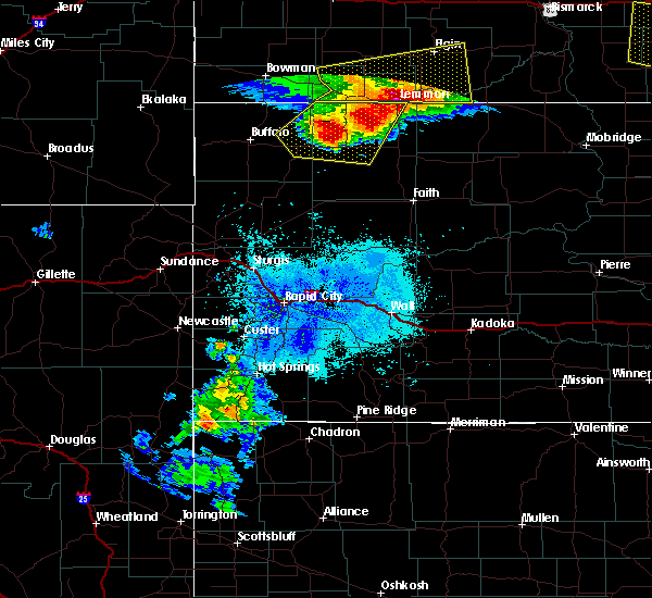 At 905 pm mdt, severe thunderstorms were located along a line extending from near prairie city to near lemmon, moving east at 35 mph (radar indicated). Hazards include tennis ball size hail and 60 mph wind gusts. People and animals outdoors will be injured. expect hail damage to roofs, siding, windows, and vehicles. Expect wind damage to roofs, siding, and trees. At 905 pm mdt, severe thunderstorms were located along a line extending from near prairie city to near lemmon, moving east at 35 mph (radar indicated). Hazards include tennis ball size hail and 60 mph wind gusts. People and animals outdoors will be injured. expect hail damage to roofs, siding, windows, and vehicles. Expect wind damage to roofs, siding, and trees.
|
| 8/9/2016 9:02 PM MDT | Quarter sized hail reported 2.9 miles WSW of Lemmon, SD, ongoing at the time of the call. |
| 8/9/2016 9:00 PM MDT | Storm damage reported in perkins county SD, 2.8 miles WNW of Lemmon, SD |
| 8/9/2016 8:49 PM MDT |
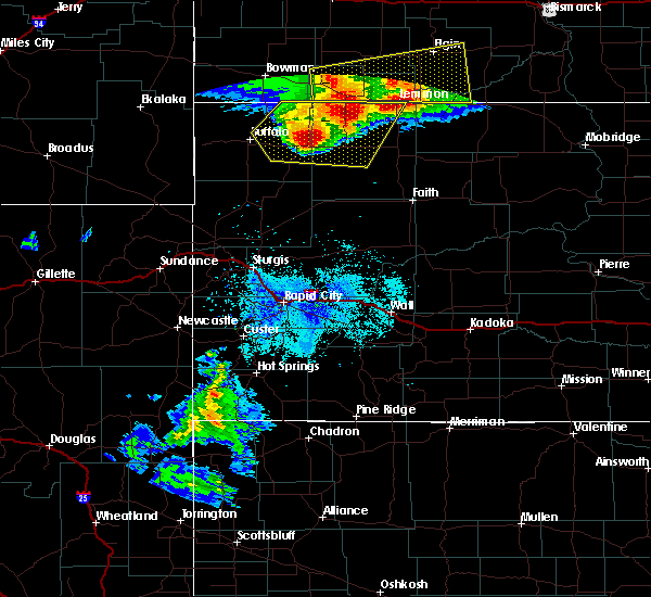 At 849 pm mdt, severe thunderstorms were located along a line extending from near lodgepole to near reva, moving east at 35 mph. these are very dangerous storms (radar indicated). Hazards include baseball size hail and 60 mph wind gusts. People and animals outdoors will be severely injured. expect shattered windows, extensive damage to roofs, siding, and vehicles. Locations impacted include, lemmon, bison, reva, ralph, lodgepole, sorum, white butte, prairie city, shadehill reservoir and northwestern slim buttes. At 849 pm mdt, severe thunderstorms were located along a line extending from near lodgepole to near reva, moving east at 35 mph. these are very dangerous storms (radar indicated). Hazards include baseball size hail and 60 mph wind gusts. People and animals outdoors will be severely injured. expect shattered windows, extensive damage to roofs, siding, and vehicles. Locations impacted include, lemmon, bison, reva, ralph, lodgepole, sorum, white butte, prairie city, shadehill reservoir and northwestern slim buttes.
|
| 8/9/2016 8:33 PM MDT |
 At 833 pm mdt, severe thunderstorms were located along a line extending from 8 miles northwest of lodgepole to near slim buttes, moving east at 35 mph (radar indicated). Hazards include two inch hail and 60 mph wind gusts. People and animals outdoors will be injured. expect hail damage to roofs, siding, windows, and vehicles. expect wind damage to roofs, siding, and trees. Locations impacted include, lemmon, bison, reva, ralph, lodgepole, sorum, white butte, date, prairie city, slim buttes and shadehill reservoir. At 833 pm mdt, severe thunderstorms were located along a line extending from 8 miles northwest of lodgepole to near slim buttes, moving east at 35 mph (radar indicated). Hazards include two inch hail and 60 mph wind gusts. People and animals outdoors will be injured. expect hail damage to roofs, siding, windows, and vehicles. expect wind damage to roofs, siding, and trees. Locations impacted include, lemmon, bison, reva, ralph, lodgepole, sorum, white butte, date, prairie city, slim buttes and shadehill reservoir.
|
| 8/9/2016 8:17 PM MDT |
 At 817 pm mdt, severe thunderstorms were located along a line extending from 7 miles northeast of ralph to 11 miles west of slim buttes, moving east at 25 mph (radar indicated). Hazards include tennis ball size hail and 60 mph wind gusts. People and animals outdoors will be injured. expect hail damage to roofs, siding, windows, and vehicles. Expect wind damage to roofs, siding, and trees. At 817 pm mdt, severe thunderstorms were located along a line extending from 7 miles northeast of ralph to 11 miles west of slim buttes, moving east at 25 mph (radar indicated). Hazards include tennis ball size hail and 60 mph wind gusts. People and animals outdoors will be injured. expect hail damage to roofs, siding, windows, and vehicles. Expect wind damage to roofs, siding, and trees.
|
| 7/22/2016 4:37 PM MDT |
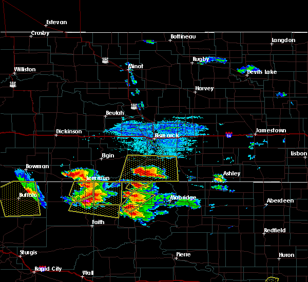 The severe thunderstorm warning for northeastern perkins county will expire at 445 pm mdt, the storm which prompted the warning has moved out of the area. therefore the warning will be allowed to expire. however gusty winds and heavy rain are still possible with thunderstorms in the area. a severe thunderstorm watch remains in effect until 1000 pm mdt for northwestern south dakota. remember, a severe thunderstorm warning still remains in effect for for east central perkins county. The severe thunderstorm warning for northeastern perkins county will expire at 445 pm mdt, the storm which prompted the warning has moved out of the area. therefore the warning will be allowed to expire. however gusty winds and heavy rain are still possible with thunderstorms in the area. a severe thunderstorm watch remains in effect until 1000 pm mdt for northwestern south dakota. remember, a severe thunderstorm warning still remains in effect for for east central perkins county.
|
| 7/22/2016 4:10 PM MDT | Storm damage reported in perkins county SD, 20.2 miles NNE of Lemmon, SD |
| 7/22/2016 4:03 PM MDT |
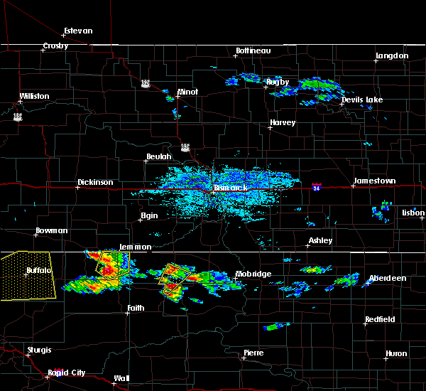 At 403 pm mdt, a severe thunderstorm was located near shadehill reservoir, or 18 miles south of lemmon, moving northeast at 35 mph (radar indicated). Hazards include 60 mph wind gusts and quarter size hail. Hail damage to vehicles is expected. Expect wind damage to roofs, siding, and trees. At 403 pm mdt, a severe thunderstorm was located near shadehill reservoir, or 18 miles south of lemmon, moving northeast at 35 mph (radar indicated). Hazards include 60 mph wind gusts and quarter size hail. Hail damage to vehicles is expected. Expect wind damage to roofs, siding, and trees.
|
| 7/20/2016 4:40 PM MDT | Quarter sized hail reported 17.9 miles E of Lemmon, SD |
| 7/20/2016 4:35 PM MDT |
 At 435 pm mdt, a severe thunderstorm was located near haynes, or 9 miles southeast of hettinger, moving east at 20 mph (radar indicated). Hazards include ping pong ball size hail and 60 mph wind gusts. People and animals outdoors will be injured. expect hail damage to roofs, siding, windows, and vehicles. Expect wind damage to roofs, siding, and trees. At 435 pm mdt, a severe thunderstorm was located near haynes, or 9 miles southeast of hettinger, moving east at 20 mph (radar indicated). Hazards include ping pong ball size hail and 60 mph wind gusts. People and animals outdoors will be injured. expect hail damage to roofs, siding, windows, and vehicles. Expect wind damage to roofs, siding, and trees.
|
| 7/11/2016 12:00 AM MDT |
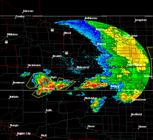 At 1159 pm mdt, a severe thunderstorm was located near lemmon, moving northeast at 25 mph (radar indicated). Hazards include ping pong ball size hail and 60 mph wind gusts. People and animals outdoors will be injured. expect hail damage to roofs, siding, windows, and vehicles. expect wind damage to roofs, siding, and trees. Locations impacted include, lemmon, white butte, shadehill and shadehill reservoir. At 1159 pm mdt, a severe thunderstorm was located near lemmon, moving northeast at 25 mph (radar indicated). Hazards include ping pong ball size hail and 60 mph wind gusts. People and animals outdoors will be injured. expect hail damage to roofs, siding, windows, and vehicles. expect wind damage to roofs, siding, and trees. Locations impacted include, lemmon, white butte, shadehill and shadehill reservoir.
|
| 7/10/2016 11:46 PM MDT |
 At 1146 pm mdt, a severe thunderstorm was located near shadehill reservoir, or 10 miles southwest of lemmon, moving northeast at 35 mph (radar indicated). Hazards include golf ball size hail and 60 mph wind gusts. People and animals outdoors will be injured. expect hail damage to roofs, siding, windows, and vehicles. Expect wind damage to roofs, siding, and trees. At 1146 pm mdt, a severe thunderstorm was located near shadehill reservoir, or 10 miles southwest of lemmon, moving northeast at 35 mph (radar indicated). Hazards include golf ball size hail and 60 mph wind gusts. People and animals outdoors will be injured. expect hail damage to roofs, siding, windows, and vehicles. Expect wind damage to roofs, siding, and trees.
|
| 7/10/2016 7:01 PM MDT |
 At 700 pm mdt, a severe thunderstorm was located near bison, or 30 miles south of lemmon, moving east at 30 mph (radar indicated. this storm has a history of producing very large hail). Hazards include tennis ball size hail and 70 mph wind gusts. People and animals outdoors will be injured. expect hail damage to roofs, siding, windows, and vehicles. expect considerable tree damage. wind damage is also likely to mobile homes, roofs, and outbuildings. This severe storm will be near, meadow around 715 pm mdt. At 700 pm mdt, a severe thunderstorm was located near bison, or 30 miles south of lemmon, moving east at 30 mph (radar indicated. this storm has a history of producing very large hail). Hazards include tennis ball size hail and 70 mph wind gusts. People and animals outdoors will be injured. expect hail damage to roofs, siding, windows, and vehicles. expect considerable tree damage. wind damage is also likely to mobile homes, roofs, and outbuildings. This severe storm will be near, meadow around 715 pm mdt.
|
| 7/10/2016 6:44 PM MDT |
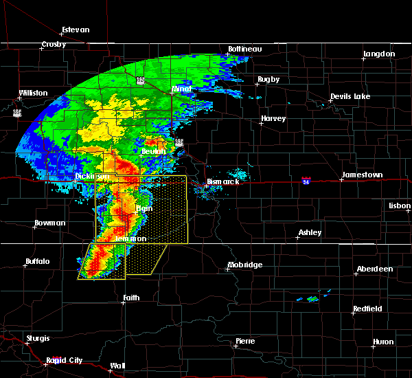 At 644 pm mdt, a severe thunderstorm was located over bison, or 34 miles southwest of lemmon, moving east at 30 mph (radar indicated). Hazards include tennis ball size hail and 70 mph wind gusts. People and animals outdoors will be injured. expect hail damage to roofs, siding, windows, and vehicles. expect considerable tree damage. wind damage is also likely to mobile homes, roofs, and outbuildings. this severe storm will be near, chance around 705 pm mdt. Meadow around 710 pm mdt. At 644 pm mdt, a severe thunderstorm was located over bison, or 34 miles southwest of lemmon, moving east at 30 mph (radar indicated). Hazards include tennis ball size hail and 70 mph wind gusts. People and animals outdoors will be injured. expect hail damage to roofs, siding, windows, and vehicles. expect considerable tree damage. wind damage is also likely to mobile homes, roofs, and outbuildings. this severe storm will be near, chance around 705 pm mdt. Meadow around 710 pm mdt.
|
| 7/10/2016 6:20 PM MDT |
 At 620 pm mdt, severe thunderstorms were located along a line extending from near haynes to 7 miles west of date, moving east at 30 mph (radar indicated). Hazards include 60 mph wind gusts and half dollar size hail. Hail damage to vehicles is expected. Expect wind damage to roofs, siding, and trees. At 620 pm mdt, severe thunderstorms were located along a line extending from near haynes to 7 miles west of date, moving east at 30 mph (radar indicated). Hazards include 60 mph wind gusts and half dollar size hail. Hail damage to vehicles is expected. Expect wind damage to roofs, siding, and trees.
|
| 7/10/2016 5:36 PM MDT |
 At 635 pm cdt/535 pm mdt/, severe thunderstorms were located along a line extending from 5 miles east of south fairfield to 13 miles north of regent to 6 miles east of reeder, moving east at 70 mph (radar indicated). Hazards include two inch hail and 70 mph wind gusts. People and animals outdoors will be injured. expect hail damage to roofs, siding, windows, and vehicles. expect considerable tree damage. Wind damage is also likely to mobile homes, roofs, and outbuildings. At 635 pm cdt/535 pm mdt/, severe thunderstorms were located along a line extending from 5 miles east of south fairfield to 13 miles north of regent to 6 miles east of reeder, moving east at 70 mph (radar indicated). Hazards include two inch hail and 70 mph wind gusts. People and animals outdoors will be injured. expect hail damage to roofs, siding, windows, and vehicles. expect considerable tree damage. Wind damage is also likely to mobile homes, roofs, and outbuildings.
|
| 7/9/2016 6:55 PM MDT | Storm damage reported in perkins county SD, 2.8 miles WNW of Lemmon, SD |
| 7/9/2016 6:53 PM MDT |
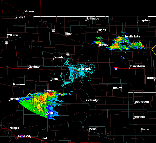 At 652 pm mdt, a severe thunderstorm was located over shadehill, or 11 miles south of lemmon, moving northeast at 45 mph (radar indicated). Hazards include 60 mph wind gusts and penny size hail. Expect damage to roofs. siding. and trees. Locations impacted include, lemmon, meadow, white butte, shadehill and shadehill reservoir. At 652 pm mdt, a severe thunderstorm was located over shadehill, or 11 miles south of lemmon, moving northeast at 45 mph (radar indicated). Hazards include 60 mph wind gusts and penny size hail. Expect damage to roofs. siding. and trees. Locations impacted include, lemmon, meadow, white butte, shadehill and shadehill reservoir.
|
| 7/9/2016 6:48 PM MDT | Time estimated from radar in perkins county SD, 18.6 miles N of Lemmon, SD |
| 7/9/2016 6:35 PM MDT | Storm damage reported in perkins county SD, 19.1 miles NNE of Lemmon, SD |
| 7/9/2016 6:25 PM MDT |
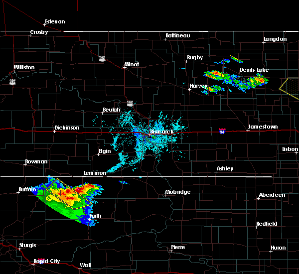 At 625 pm mdt, a severe thunderstorm was located near shadehill reservoir, or 17 miles south of lemmon, moving northeast at 15 mph (radar indicated). Hazards include 60 mph wind gusts and half dollar size hail. Hail damage to vehicles is expected. Expect wind damage to roofs, siding, and trees. At 625 pm mdt, a severe thunderstorm was located near shadehill reservoir, or 17 miles south of lemmon, moving northeast at 15 mph (radar indicated). Hazards include 60 mph wind gusts and half dollar size hail. Hail damage to vehicles is expected. Expect wind damage to roofs, siding, and trees.
|
| 7/6/2016 7:25 PM MDT |
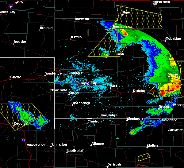 The severe thunderstorm warning for northwestern ziebach and perkins counties will expire at 730 pm mdt, the storms which prompted the warning have moved out of the area. therefore the warning will be allowed to expire. however gusty winds are still possible with these thunderstorms. a tornado watch remains in effect until 900 pm mdt for west central south dakota. a severe thunderstorm watch remains in effect until 900 pm mdt for northwestern south dakota. The severe thunderstorm warning for northwestern ziebach and perkins counties will expire at 730 pm mdt, the storms which prompted the warning have moved out of the area. therefore the warning will be allowed to expire. however gusty winds are still possible with these thunderstorms. a tornado watch remains in effect until 900 pm mdt for west central south dakota. a severe thunderstorm watch remains in effect until 900 pm mdt for northwestern south dakota.
|
| 7/6/2016 7:08 PM MDT |
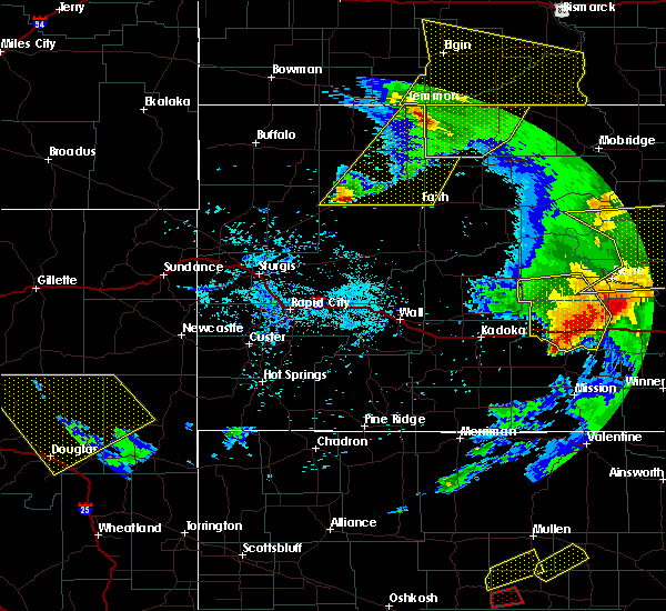 At 704 pm mdt, severe thunderstorms were located near lemmon and shadehill reservoir, as well as southeast of zeona, moving east at 50 mph (radar indicated). Hazards include 60 mph wind gusts and penny size hail. Expect damage to roofs. siding. and trees. locations impacted include, lemmon, meadow, chance, , shadehill, glad valley, usta, shadehill reservoir and north lemmon. A tornado watch remains in effect until 900 pm mdt for west central south dakota. At 704 pm mdt, severe thunderstorms were located near lemmon and shadehill reservoir, as well as southeast of zeona, moving east at 50 mph (radar indicated). Hazards include 60 mph wind gusts and penny size hail. Expect damage to roofs. siding. and trees. locations impacted include, lemmon, meadow, chance, , shadehill, glad valley, usta, shadehill reservoir and north lemmon. A tornado watch remains in effect until 900 pm mdt for west central south dakota.
|
| 7/6/2016 6:59 PM MDT |
 At 756 pm cdt/656 pm mdt/, severe thunderstorms were located along a line extending from 10 miles north of carson to 19 miles north of watauga to 5 miles south of keldron, moving southeast at 45 mph (trained weather spotters). Hazards include 60 mph wind gusts. Expect damage to roofs. siding. and trees. Locations impacted include, elgin, fort yates, selfridge, carson, flasher, new leipzig, solen, morristown and cannon ball. At 756 pm cdt/656 pm mdt/, severe thunderstorms were located along a line extending from 10 miles north of carson to 19 miles north of watauga to 5 miles south of keldron, moving southeast at 45 mph (trained weather spotters). Hazards include 60 mph wind gusts. Expect damage to roofs. siding. and trees. Locations impacted include, elgin, fort yates, selfridge, carson, flasher, new leipzig, solen, morristown and cannon ball.
|
| 7/6/2016 6:39 PM MDT |
 At 739 pm cdt/639 pm mdt/, severe thunderstorms were located along a line extending from heart butte dam to 10 miles southeast of elgin to near thunder hawk, moving southeast at 45 mph (radar indicated). Hazards include 70 mph wind gusts and penny size hail. Expect considerable tree damage. damage is likely to mobile homes, roofs, and outbuildings. these severe storms will be near, morristown around 655 pm mdt. carson around 700 pm mdt. flasher around 820 pm cdt. selfridge around 830 pm cdt. other locations impacted by these severe thunderstorms include porcupine, raleigh, breien, heil, leith, lark and st. Gertrude. At 739 pm cdt/639 pm mdt/, severe thunderstorms were located along a line extending from heart butte dam to 10 miles southeast of elgin to near thunder hawk, moving southeast at 45 mph (radar indicated). Hazards include 70 mph wind gusts and penny size hail. Expect considerable tree damage. damage is likely to mobile homes, roofs, and outbuildings. these severe storms will be near, morristown around 655 pm mdt. carson around 700 pm mdt. flasher around 820 pm cdt. selfridge around 830 pm cdt. other locations impacted by these severe thunderstorms include porcupine, raleigh, breien, heil, leith, lark and st. Gertrude.
|
| 7/6/2016 6:32 PM MDT |
 At 632 pm mdt, severe thunderstorms were located along a line extending from near lemmon to 10 miles east of hoover, moving east at 45 mph (radar indicated). Hazards include 60 mph wind gusts and penny size hail. Expect damage to roofs. siding. And trees. At 632 pm mdt, severe thunderstorms were located along a line extending from near lemmon to 10 miles east of hoover, moving east at 45 mph (radar indicated). Hazards include 60 mph wind gusts and penny size hail. Expect damage to roofs. siding. And trees.
|
| 7/6/2016 6:26 PM MDT |
 At 726 pm cdt/626 pm mdt/, severe thunderstorms were located along a line extending from 8 miles northwest of heart butte dam to 5 miles southeast of new leipzig to north lemmon, moving southeast at 45 mph (radar indicated). Hazards include 70 mph wind gusts and penny size hail. Expect considerable tree damage. damage is likely to mobile homes, roofs, and outbuildings. severe thunderstorms will be near, thunder hawk around 640 pm mdt. carson and morristown around 655 pm mdt. flasher around 820 pm cdt. selfridge around 830 pm cdt. other locations impacted by these severe thunderstorms include porcupine, raleigh, breien, heil, leith, lark and st. Gertrude. At 726 pm cdt/626 pm mdt/, severe thunderstorms were located along a line extending from 8 miles northwest of heart butte dam to 5 miles southeast of new leipzig to north lemmon, moving southeast at 45 mph (radar indicated). Hazards include 70 mph wind gusts and penny size hail. Expect considerable tree damage. damage is likely to mobile homes, roofs, and outbuildings. severe thunderstorms will be near, thunder hawk around 640 pm mdt. carson and morristown around 655 pm mdt. flasher around 820 pm cdt. selfridge around 830 pm cdt. other locations impacted by these severe thunderstorms include porcupine, raleigh, breien, heil, leith, lark and st. Gertrude.
|
| 7/6/2016 6:10 PM MDT |
 At 610 pm mdt, severe thunderstorms were located along a line extending from near hettinger to 7 miles west of hoover, moving east at 35 mph (radar indicated). Hazards include 70 mph wind gusts and nickel size hail. Expect considerable tree damage. damage is likely to mobile homes, roofs, and outbuildings. Locations impacted include, reva, lodgepole, sorum, white butte, hoover, prairie city, zeona, slim buttes and northwestern shadehill reservoir. At 610 pm mdt, severe thunderstorms were located along a line extending from near hettinger to 7 miles west of hoover, moving east at 35 mph (radar indicated). Hazards include 70 mph wind gusts and nickel size hail. Expect considerable tree damage. damage is likely to mobile homes, roofs, and outbuildings. Locations impacted include, reva, lodgepole, sorum, white butte, hoover, prairie city, zeona, slim buttes and northwestern shadehill reservoir.
|
| 7/6/2016 5:47 PM MDT |
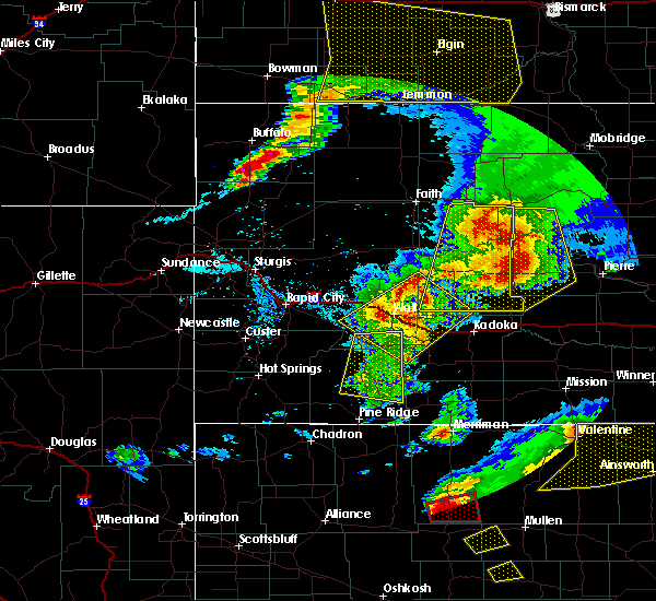 At 547 pm mdt, severe thunderstorms were located along a line extending from 9 miles south of reeder to near redig, moving east at 40 mph (radar indicated). Hazards include 60 mph wind gusts and nickel size hail. Expect damage to roofs. siding. And trees. At 547 pm mdt, severe thunderstorms were located along a line extending from 9 miles south of reeder to near redig, moving east at 40 mph (radar indicated). Hazards include 60 mph wind gusts and nickel size hail. Expect damage to roofs. siding. And trees.
|
| 6/29/2016 2:56 PM MDT | Storm damage reported in perkins county SD, 18.6 miles N of Lemmon, SD |
| 5/30/2016 2:37 PM MDT |
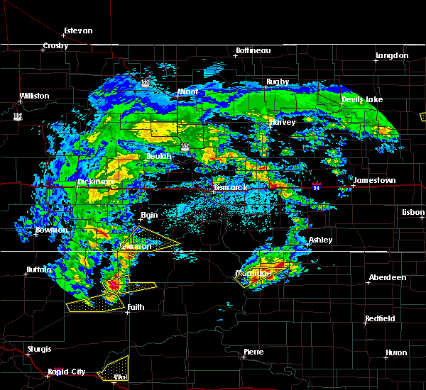 At 337 pm cdt/237 pm mdt/, a severe thunderstorm was located near thunder hawk, or 11 miles east of lemmon, moving northeast at 25 mph (radar indicated). Hazards include 60 mph wind gusts and quarter size hail. Hail damage to vehicles is expected. expect wind damage to roofs, siding, and trees. This severe thunderstorm will remain over mainly rural areas of southwestern grant, southwestern sioux and southeastern adams counties. At 337 pm cdt/237 pm mdt/, a severe thunderstorm was located near thunder hawk, or 11 miles east of lemmon, moving northeast at 25 mph (radar indicated). Hazards include 60 mph wind gusts and quarter size hail. Hail damage to vehicles is expected. expect wind damage to roofs, siding, and trees. This severe thunderstorm will remain over mainly rural areas of southwestern grant, southwestern sioux and southeastern adams counties.
|
| 7/27/2015 7:44 PM MDT |
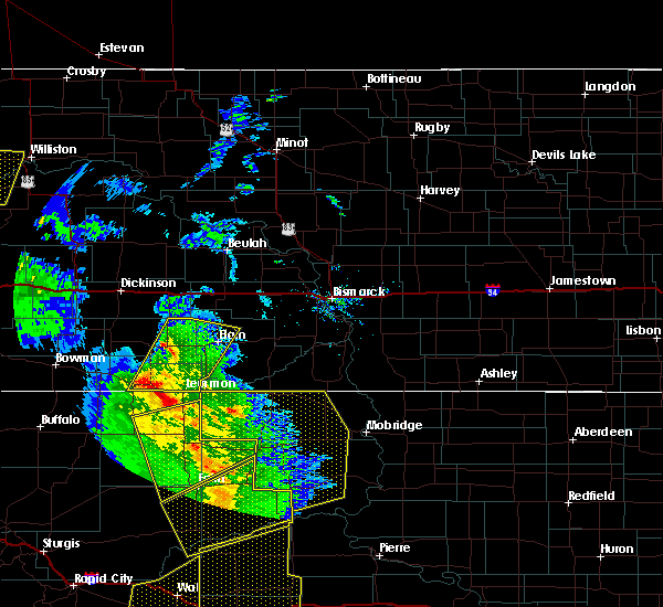 At 743 pm mdt, a severe thunderstorm was located over haynes, or 8 miles east of hettinger, moving north at 45 mph (radar indicated). Hazards include 60 mph wind gusts and quarter size hail. Hail damage to vehicles is expected. expect wind damage to roofs, siding and trees. this severe thunderstorm will be near, mott around 820 pm mdt. Other locations impacted by this severe thunderstorm include burt and bentley. At 743 pm mdt, a severe thunderstorm was located over haynes, or 8 miles east of hettinger, moving north at 45 mph (radar indicated). Hazards include 60 mph wind gusts and quarter size hail. Hail damage to vehicles is expected. expect wind damage to roofs, siding and trees. this severe thunderstorm will be near, mott around 820 pm mdt. Other locations impacted by this severe thunderstorm include burt and bentley.
|
| 7/15/2015 4:50 PM MDT |
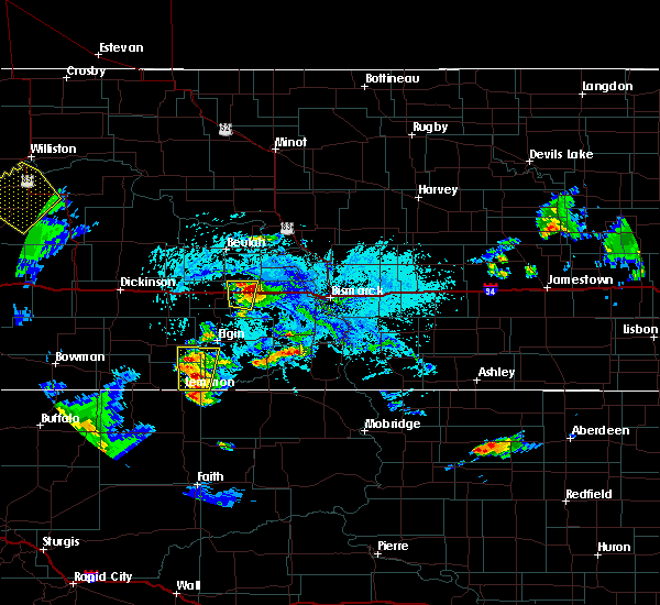 At 449 pm mdt, a severe thunderstorm was located 10 miles north of thunder hawk, or 11 miles northeast of lemmon, moving north at 10 mph. another severe thunderstorm was near lemmon, also moving north at 10 mph (radar indicated). Hazards include 60 mph wind gusts and quarter size hail. Hail damage to vehicles is expected. expect wind damage to roofs, siding and trees. This severe thunderstorm will remain over mainly rural areas of southwestern grant, southeastern adams, southeastern hettinger and southwestern sioux counties, including the following locations, bentley and north of lemmon south dakota. At 449 pm mdt, a severe thunderstorm was located 10 miles north of thunder hawk, or 11 miles northeast of lemmon, moving north at 10 mph. another severe thunderstorm was near lemmon, also moving north at 10 mph (radar indicated). Hazards include 60 mph wind gusts and quarter size hail. Hail damage to vehicles is expected. expect wind damage to roofs, siding and trees. This severe thunderstorm will remain over mainly rural areas of southwestern grant, southeastern adams, southeastern hettinger and southwestern sioux counties, including the following locations, bentley and north of lemmon south dakota.
|
| 6/21/2015 11:15 PM MDT |
 At 1114 pm mdt, severe thunderstorms were located along a line extending from lemmon to near meadow to 7 miles north of zeona, moving east at 25 mph (radar indicated). Hazards include golf ball size hail and 60 mph wind gusts. People and animals outdoors will be injured. expect hail damage to roofs, siding, windows and vehicles. expect wind damage to roofs, siding and trees. Locations impacted include, lemmon, bison, meadow, chance, lodgepole, sorum, white butte, date, shadehill, prairie city, usta and shadehill reservoir. At 1114 pm mdt, severe thunderstorms were located along a line extending from lemmon to near meadow to 7 miles north of zeona, moving east at 25 mph (radar indicated). Hazards include golf ball size hail and 60 mph wind gusts. People and animals outdoors will be injured. expect hail damage to roofs, siding, windows and vehicles. expect wind damage to roofs, siding and trees. Locations impacted include, lemmon, bison, meadow, chance, lodgepole, sorum, white butte, date, shadehill, prairie city, usta and shadehill reservoir.
|
| 6/21/2015 11:03 PM MDT |
 At 1102 pm mdt, severe thunderstorms were located along a line extending from near lemmon to near bison to near zeona, moving east at 80 mph (radar indicated). Hazards include golf ball size hail and 60 mph wind gusts. People and animals outdoors will be injured. expect hail damage to roofs, siding, windows and vehicles. expect wind damage to roofs, siding and trees. Locations impacted include, lemmon, bison, meadow, chance, lodgepole, sorum, white butte, shadehill, prairie city, date, usta, shadehill reservoir and southern slim buttes. At 1102 pm mdt, severe thunderstorms were located along a line extending from near lemmon to near bison to near zeona, moving east at 80 mph (radar indicated). Hazards include golf ball size hail and 60 mph wind gusts. People and animals outdoors will be injured. expect hail damage to roofs, siding, windows and vehicles. expect wind damage to roofs, siding and trees. Locations impacted include, lemmon, bison, meadow, chance, lodgepole, sorum, white butte, shadehill, prairie city, date, usta, shadehill reservoir and southern slim buttes.
|
| 6/21/2015 10:41 PM MDT |
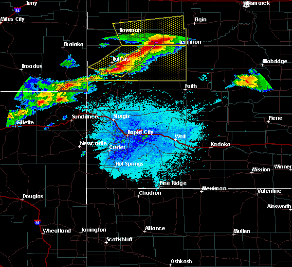 At 1041 pm mdt, severe thunderstorms were located along a line extending from near north lemmon to near reva to 6 miles southwest of redig, moving northeast at 35 mph (radar indicated). Hazards include tennis ball size hail and 60 mph wind gusts. People and animals outdoors will be injured. expect hail damage to roofs, siding, windows and vehicles. Expect wind damage to roofs, siding and trees. At 1041 pm mdt, severe thunderstorms were located along a line extending from near north lemmon to near reva to 6 miles southwest of redig, moving northeast at 35 mph (radar indicated). Hazards include tennis ball size hail and 60 mph wind gusts. People and animals outdoors will be injured. expect hail damage to roofs, siding, windows and vehicles. Expect wind damage to roofs, siding and trees.
|
| 6/21/2015 7:03 PM MDT |
 At 702 pm mdt, a severe thunderstorm was located 9 miles west of shadehill reservoir, or 15 miles southwest of lemmon, moving east at 45 mph (radar indicated). Hazards include tennis ball size hail and 60 mph wind gusts. People and animals outdoors will be injured. expect hail damage to roofs, siding, windows and vehicles. expect wind damage to roofs, siding and trees. locations impacted include, lemmon, bison, meadow, chance, lodgepole, white butte, shadehill and shadehill reservoir. A tornado watch remains in effect until 1000 pm mdt for northwestern south dakota. At 702 pm mdt, a severe thunderstorm was located 9 miles west of shadehill reservoir, or 15 miles southwest of lemmon, moving east at 45 mph (radar indicated). Hazards include tennis ball size hail and 60 mph wind gusts. People and animals outdoors will be injured. expect hail damage to roofs, siding, windows and vehicles. expect wind damage to roofs, siding and trees. locations impacted include, lemmon, bison, meadow, chance, lodgepole, white butte, shadehill and shadehill reservoir. A tornado watch remains in effect until 1000 pm mdt for northwestern south dakota.
|
| 6/21/2015 6:41 PM MDT |
 At 641 pm mdt, a severe thunderstorm was located near lodgepole, or 12 miles southwest of hettinger, moving east at 45 mph (radar indicated). Hazards include tennis ball size hail and 60 mph wind gusts. People and animals outdoors will be injured. expect hail damage to roofs, siding, windows and vehicles. Expect wind damage to roofs, siding and trees. At 641 pm mdt, a severe thunderstorm was located near lodgepole, or 12 miles southwest of hettinger, moving east at 45 mph (radar indicated). Hazards include tennis ball size hail and 60 mph wind gusts. People and animals outdoors will be injured. expect hail damage to roofs, siding, windows and vehicles. Expect wind damage to roofs, siding and trees.
|
| 3/28/2015 6:47 PM MDT | A severe thunderstorm warning remains in effect for southwestern sioux. southeastern hettinger. grant and southeastern adams counties until 715 pm mdt. at 645 pm mdt. severe thunderstorms were located along a line extending from 6 miles southeast of almont to 5 miles west of morristown. Moving east at 50 mph. |
| 3/28/2015 6:27 PM MDT | The national weather service in bismarck has issued a * severe thunderstorm warning for. eastern adams county in southwest north dakota. grant county in south central north dakota. eastern hettinger county in southwest north dakota. Southwestern sioux county in south central north dakota. |
| 8/20/2014 5:00 PM MDT | Quarter sized hail reported 12.4 miles N of Lemmon, SD, nickel to quarter size hail |
| 8/20/2014 4:55 PM MDT | Golf Ball sized hail reported 11.7 miles N of Lemmon, SD |
| 8/20/2014 4:55 PM MDT | Golf Ball sized hail reported 13.7 miles NNE of Lemmon, SD |
| 8/20/2014 4:30 PM MDT | Quarter sized hail reported 0.7 miles NE of Lemmon, SD |
| 8/20/2014 4:22 PM MDT | Quarter sized hail reported 4.7 miles NE of Lemmon, SD |
| 8/20/2014 3:38 PM MDT | Golf Ball sized hail reported 14.5 miles ENE of Lemmon, SD |
| 7/21/2014 3:00 PM MDT | Baseball sized hail reported 10.5 miles S of Lemmon, SD, a lot of quarter size hail with a few baseballs |
| 8/27/2013 3:50 PM MDT | No hai in adams county ND, 10.5 miles S of Lemmon, SD |
| 8/25/2013 6:15 PM MDT | Recorded at the lemmon awos in perkins county SD, 2.8 miles WNW of Lemmon, SD |
| 7/23/2013 6:45 PM MDT | Half Dollar sized hail reported 6.8 miles N of Lemmon, SD, 1.5 inches of hail on the ground. hail lasted 10 minutes 1845-1855 mdt |
| 7/23/2013 6:35 PM MDT | Ping Pong Ball sized hail reported 2.9 miles E of Lemmon, SD |
| 7/8/2013 10:00 PM MDT | Relayed from nws abr in perkins county SD, 13.7 miles NNE of Lemmon, SD |
| 6/22/2013 8:00 PM MDT | Storm damage reported in perkins county SD, 2.9 miles E of Lemmon, SD |
| 5/25/2013 7:40 PM MDT | Tea Cup sized hail reported 11.8 miles N of Lemmon, SD |
| 5/25/2013 6:05 PM MDT | Golf Ball sized hail reported 9.6 miles E of Lemmon, SD |
| 5/25/2013 6:00 PM MDT | Half Dollar sized hail reported 0.1 miles SSW of Lemmon, SD |
| 5/25/2013 5:55 PM MDT | Golf Ball sized hail reported 0.1 miles SSW of Lemmon, SD |
| 5/25/2013 5:50 PM MDT | Quarter sized hail reported 3.3 miles SW of Lemmon, SD, hail lasted from 550 pm mdt to 630 pm mdt.. heavy rain also fell and accumulated 1.25 inches in less than 1 hour. |
| 5/25/2013 5:35 PM MDT | Golf Ball sized hail reported 18.6 miles E of Lemmon, SD, 1.72 inches rainfall |
| 5/25/2013 4:35 PM MDT | Quarter sized hail reported 0.1 miles SSW of Lemmon, SD |
| 5/17/2013 8:29 PM MDT | Winds estimated 50 mph with gusts to 60 mph just started at the time of call. patio table flipped over with large pine trees bendin in adams county ND, 10.5 miles S of Lemmon, SD |
| 1/1/0001 12:00 AM | Wind gust tore a small deck off of a hous in sioux county ND, 11.6 miles SW of Lemmon, SD |
| 1/1/0001 12:00 AM | Storm damage reported in corson county SD, 8.7 miles W of Lemmon, SD |
| 1/1/0001 12:00 AM | Sddot rwis in perkins county SD, 2.9 miles E of Lemmon, SD |
| 1/1/0001 12:00 AM | Storm damage reported in perkins county SD, 0.1 miles SSW of Lemmon, SD |
| 1/1/0001 12:00 AM | Half Dollar sized hail reported 0.9 miles E of Lemmon, SD |
| 1/1/0001 12:00 AM | Storm damage reported in perkins county SD, 3.1 miles NW of Lemmon, SD |
| 1/1/0001 12:00 AM | 6-8 inch diameter tree branches broken in perkins county SD, 0.1 miles SSW of Lemmon, SD |
| 1/1/0001 12:00 AM | Quarter sized hail reported 9.6 miles N of Lemmon, SD |
| 1/1/0001 12:00 AM | Storm damage reported in perkins county SD, 9.6 miles N of Lemmon, SD |
| 1/1/0001 12:00 AM | 10 inch diameter trees broken and uprooted in perkins county SD, 9.6 miles N of Lemmon, SD |
| 1/1/0001 12:00 AM | Quarter sized hail reported 21.4 miles NE of Lemmon, SD |
| 1/1/0001 12:00 AM | Storm damage reported in perkins county SD, 0.1 miles SSW of Lemmon, SD |
| 1/1/0001 12:00 AM | Golf Ball sized hail reported 2.9 miles SW of Lemmon, SD, golfball sized hail lasted for about 2-3 minutes. |
Hail Maps for Lemmon, SD
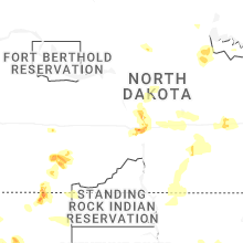
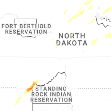
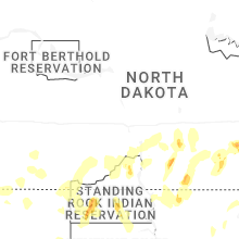


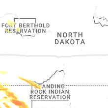


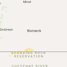


Connect with Interactive Hail Maps