

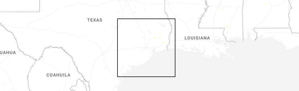
Hail Map for Meadows Place, TX
The Meadows Place, TX area has had 0 reports of on-the-ground hail by trained spotters, and has been under severe weather warnings 0 times during the past 12 months. Doppler radar has detected hail at or near Meadows Place, TX on 41 occasions, including 1 occasion during the past year.
| Name: | Meadows Place, TX |
| Where Located: | 15 miles WSW of Houston, TX |
| Map: | Google Map for Meadows Place, TX |
| Population: | 4660 |
| Housing Units: | 1764 |
| More Info: | Search Google for Meadows Place, TX |
0
The Top Recent Hail Date for Meadows Place, TX is Monday, June 16, 2025 (41st out of 41)
Hail and Wind Damage Spotted near Meadows Place, TX
| Date / Time | Report Details |
|---|---|
| 5/31/2024 7:00 AM CDT | At 658 am cdt, severe thunderstorms were located along a line extending from near plum grove to near fairchilds, moving southeast at 45 mph (radar indicated). Hazards include 60 mph wind gusts and nickel size hail. Expect damage to roofs, siding, and trees. Locations impacted include, pasadena, pearland, sugar land, missouri city, eastern conroe, deer park, rosenberg, stafford, south houston, bellaire, humble, west university place, richmond, galena park, jacinto city, cleveland, northwestern manvel, hunters creek village, bunker hill village, and piney point village. |
| 5/31/2024 6:46 AM CDT |
 Svrhgx the national weather service in league city has issued a * severe thunderstorm warning for, fort bend county in southeastern texas, eastern montgomery county in southeastern texas, southwestern san jacinto county in southeastern texas, northwestern brazoria county in southeastern texas, northwestern liberty county in southeastern texas, southeastern walker county in southeastern texas, central harris county in southeastern texas, * until 715 am cdt. * at 645 am cdt, severe thunderstorms were located along a line extending from near splendora to near beasley, moving southeast at around 45 mph (radar indicated). Hazards include 60 mph wind gusts and penny size hail. expect damage to roofs, siding, and trees Svrhgx the national weather service in league city has issued a * severe thunderstorm warning for, fort bend county in southeastern texas, eastern montgomery county in southeastern texas, southwestern san jacinto county in southeastern texas, northwestern brazoria county in southeastern texas, northwestern liberty county in southeastern texas, southeastern walker county in southeastern texas, central harris county in southeastern texas, * until 715 am cdt. * at 645 am cdt, severe thunderstorms were located along a line extending from near splendora to near beasley, moving southeast at around 45 mph (radar indicated). Hazards include 60 mph wind gusts and penny size hail. expect damage to roofs, siding, and trees
|
| 5/31/2024 6:22 AM CDT |
 Svrhgx the national weather service in league city has issued a * severe thunderstorm warning for, central trinity county in southeastern texas, east central colorado county in southeastern texas, northeastern wharton county in southeastern texas, southeastern austin county in southeastern texas, northwestern fort bend county in southeastern texas, central montgomery county in southeastern texas, western san jacinto county in southeastern texas, east central houston county in southeastern texas, southeastern waller county in southeastern texas, west central polk county in southeastern texas, southeastern walker county in southeastern texas, central harris county in southeastern texas, * until 645 am cdt. * at 621 am cdt, severe thunderstorms were located along a line extending from near point blank to near eagle lake, moving southeast at around 50 mph (radar indicated). Hazards include 60 mph wind gusts and penny size hail. expect damage to roofs, siding, and trees Svrhgx the national weather service in league city has issued a * severe thunderstorm warning for, central trinity county in southeastern texas, east central colorado county in southeastern texas, northeastern wharton county in southeastern texas, southeastern austin county in southeastern texas, northwestern fort bend county in southeastern texas, central montgomery county in southeastern texas, western san jacinto county in southeastern texas, east central houston county in southeastern texas, southeastern waller county in southeastern texas, west central polk county in southeastern texas, southeastern walker county in southeastern texas, central harris county in southeastern texas, * until 645 am cdt. * at 621 am cdt, severe thunderstorms were located along a line extending from near point blank to near eagle lake, moving southeast at around 50 mph (radar indicated). Hazards include 60 mph wind gusts and penny size hail. expect damage to roofs, siding, and trees
|
| 5/28/2024 1:55 PM CDT |
 Svrhgx the national weather service in league city has issued a * severe thunderstorm warning for, galveston county in southeastern texas, east central fort bend county in southeastern texas, northeastern brazoria county in southeastern texas, western chambers county in southeastern texas, south central liberty county in southeastern texas, southeastern harris county in southeastern texas, * until 245 pm cdt. * at 155 pm cdt, severe thunderstorms were located along a line extending from beach city to near shoreacres to pearland, moving southeast at 35 mph (radar indicated). Hazards include 70 mph wind gusts and quarter size hail. Hail damage to vehicles is expected. expect considerable tree damage. Wind damage is also likely to mobile homes, roofs, and outbuildings. Svrhgx the national weather service in league city has issued a * severe thunderstorm warning for, galveston county in southeastern texas, east central fort bend county in southeastern texas, northeastern brazoria county in southeastern texas, western chambers county in southeastern texas, south central liberty county in southeastern texas, southeastern harris county in southeastern texas, * until 245 pm cdt. * at 155 pm cdt, severe thunderstorms were located along a line extending from beach city to near shoreacres to pearland, moving southeast at 35 mph (radar indicated). Hazards include 70 mph wind gusts and quarter size hail. Hail damage to vehicles is expected. expect considerable tree damage. Wind damage is also likely to mobile homes, roofs, and outbuildings.
|
| 5/28/2024 1:22 PM CDT |
 At 122 pm cdt, severe thunderstorms were located along a line extending from 7 miles north of hardin to east little york / homestead to westchase, moving southeast at 50 mph (radar indicated). Hazards include 70 mph wind gusts and quarter size hail. Hail damage to vehicles is expected. expect considerable tree damage. wind damage is also likely to mobile homes, roofs, and outbuildings. Locations impacted include, pasadena, pearland, league city, northeastern sugar land, baytown, missouri city, texas city, friendswood, la porte, deer park, alvin, dickinson, stafford, south houston, bellaire, humble, west university place, la marque, santa fe, and seabrook. At 122 pm cdt, severe thunderstorms were located along a line extending from 7 miles north of hardin to east little york / homestead to westchase, moving southeast at 50 mph (radar indicated). Hazards include 70 mph wind gusts and quarter size hail. Hail damage to vehicles is expected. expect considerable tree damage. wind damage is also likely to mobile homes, roofs, and outbuildings. Locations impacted include, pasadena, pearland, league city, northeastern sugar land, baytown, missouri city, texas city, friendswood, la porte, deer park, alvin, dickinson, stafford, south houston, bellaire, humble, west university place, la marque, santa fe, and seabrook.
|
| 5/28/2024 1:14 PM CDT |
 Svrhgx the national weather service in league city has issued a * severe thunderstorm warning for, northwestern galveston county in southeastern texas, northeastern fort bend county in southeastern texas, northeastern brazoria county in southeastern texas, chambers county in southeastern texas, liberty county in southeastern texas, eastern harris county in southeastern texas, * until 200 pm cdt. * at 114 pm cdt, severe thunderstorms were located along a line extending from 11 miles north of dayton lakes to aldine to near addicks park ten, moving southeast at 50 mph (radar indicated). Hazards include 60 mph wind gusts and quarter size hail. Hail damage to vehicles is expected. Expect wind damage to roofs, siding, and trees. Svrhgx the national weather service in league city has issued a * severe thunderstorm warning for, northwestern galveston county in southeastern texas, northeastern fort bend county in southeastern texas, northeastern brazoria county in southeastern texas, chambers county in southeastern texas, liberty county in southeastern texas, eastern harris county in southeastern texas, * until 200 pm cdt. * at 114 pm cdt, severe thunderstorms were located along a line extending from 11 miles north of dayton lakes to aldine to near addicks park ten, moving southeast at 50 mph (radar indicated). Hazards include 60 mph wind gusts and quarter size hail. Hail damage to vehicles is expected. Expect wind damage to roofs, siding, and trees.
|
| 5/16/2024 6:16 PM CDT |
 Svrhgx the national weather service in league city has issued a * severe thunderstorm warning for, northern fort bend county in southeastern texas, southeastern montgomery county in southeastern texas, harris county in southeastern texas, * until 700 pm cdt. * at 615 pm cdt, severe thunderstorms were located along a line extending from near pinehurst to near cypress to near addicks park ten to near eldridge / west oaks to near cinco ranch, moving east at 45 mph. these are destructive storms for the houston metro area (radar indicated). Hazards include 80 mph wind gusts. Flying debris will be dangerous to those caught without shelter. mobile homes will be heavily damaged. expect considerable damage to roofs, windows, and vehicles. Extensive tree damage and power outages are likely. Svrhgx the national weather service in league city has issued a * severe thunderstorm warning for, northern fort bend county in southeastern texas, southeastern montgomery county in southeastern texas, harris county in southeastern texas, * until 700 pm cdt. * at 615 pm cdt, severe thunderstorms were located along a line extending from near pinehurst to near cypress to near addicks park ten to near eldridge / west oaks to near cinco ranch, moving east at 45 mph. these are destructive storms for the houston metro area (radar indicated). Hazards include 80 mph wind gusts. Flying debris will be dangerous to those caught without shelter. mobile homes will be heavily damaged. expect considerable damage to roofs, windows, and vehicles. Extensive tree damage and power outages are likely.
|
| 4/10/2024 4:02 AM CDT |
 the severe thunderstorm warning has been cancelled and is no longer in effect the severe thunderstorm warning has been cancelled and is no longer in effect
|
| 4/10/2024 3:41 AM CDT |
 Svrhgx the national weather service in league city has issued a * severe thunderstorm warning for, northeastern fort bend county in southeastern texas, montgomery county in southeastern texas, southern san jacinto county in southeastern texas, northwestern chambers county in southeastern texas, western liberty county in southeastern texas, south central polk county in southeastern texas, harris county in southeastern texas, * until 430 am cdt. * at 341 am cdt, severe thunderstorms were located along a line extending from near cut and shoot to humble to central southwest, moving northeast at 35 mph (radar indicated). Hazards include 60 mph wind gusts. expect damage to roofs, siding, and trees Svrhgx the national weather service in league city has issued a * severe thunderstorm warning for, northeastern fort bend county in southeastern texas, montgomery county in southeastern texas, southern san jacinto county in southeastern texas, northwestern chambers county in southeastern texas, western liberty county in southeastern texas, south central polk county in southeastern texas, harris county in southeastern texas, * until 430 am cdt. * at 341 am cdt, severe thunderstorms were located along a line extending from near cut and shoot to humble to central southwest, moving northeast at 35 mph (radar indicated). Hazards include 60 mph wind gusts. expect damage to roofs, siding, and trees
|
| 3/15/2024 4:18 PM CDT |
 Svrhgx the national weather service in league city has issued a * severe thunderstorm warning for, northeastern fort bend county in southeastern texas, south central harris county in southeastern texas, * until 500 pm cdt. * at 418 pm cdt, a severe thunderstorm was located over northern missouri city, moving northeast at 20 mph (radar indicated). Hazards include 60 mph wind gusts and quarter size hail. Hail damage to vehicles is expected. Expect wind damage to roofs, siding, and trees. Svrhgx the national weather service in league city has issued a * severe thunderstorm warning for, northeastern fort bend county in southeastern texas, south central harris county in southeastern texas, * until 500 pm cdt. * at 418 pm cdt, a severe thunderstorm was located over northern missouri city, moving northeast at 20 mph (radar indicated). Hazards include 60 mph wind gusts and quarter size hail. Hail damage to vehicles is expected. Expect wind damage to roofs, siding, and trees.
|
| 3/15/2024 4:12 PM CDT |
 At 411 pm cdt, a severe thunderstorm was located over southern sugar land, moving northeast at 20 mph (public). Hazards include 60 mph wind gusts and quarter size hail. Hail damage to vehicles is expected. expect wind damage to roofs, siding, and trees. Locations impacted include, northwestern pearland, sugar land, missouri city, stafford, town west, first colony, pecan grove, fresno, meadows place, westbury, new territory, westwood, four corners, alief, westchase, sharpstown, greatwood, fifth street, riverstone, and fort bend houston. At 411 pm cdt, a severe thunderstorm was located over southern sugar land, moving northeast at 20 mph (public). Hazards include 60 mph wind gusts and quarter size hail. Hail damage to vehicles is expected. expect wind damage to roofs, siding, and trees. Locations impacted include, northwestern pearland, sugar land, missouri city, stafford, town west, first colony, pecan grove, fresno, meadows place, westbury, new territory, westwood, four corners, alief, westchase, sharpstown, greatwood, fifth street, riverstone, and fort bend houston.
|
| 3/15/2024 3:59 PM CDT |
 Svrhgx the national weather service in league city has issued a * severe thunderstorm warning for, northeastern fort bend county in southeastern texas, northern brazoria county in southeastern texas, south central harris county in southeastern texas, * until 430 pm cdt. * at 358 pm cdt, a severe thunderstorm was located over greatwood, or near richmond, moving northeast at 20 mph (public). Hazards include golf ball size hail and 60 mph wind gusts. People and animals outdoors will be injured. expect hail damage to roofs, siding, windows, and vehicles. Expect wind damage to roofs, siding, and trees. Svrhgx the national weather service in league city has issued a * severe thunderstorm warning for, northeastern fort bend county in southeastern texas, northern brazoria county in southeastern texas, south central harris county in southeastern texas, * until 430 pm cdt. * at 358 pm cdt, a severe thunderstorm was located over greatwood, or near richmond, moving northeast at 20 mph (public). Hazards include golf ball size hail and 60 mph wind gusts. People and animals outdoors will be injured. expect hail damage to roofs, siding, windows, and vehicles. Expect wind damage to roofs, siding, and trees.
|
| 3/15/2024 3:44 PM CDT |
 At 343 pm cdt, a severe thunderstorm was located near pleak, or near rosenberg, moving northeast at 20 mph (radar indicated). Hazards include 60 mph wind gusts and quarter size hail. Hail damage to vehicles is expected. expect wind damage to roofs, siding, and trees. Locations impacted include, western pearland, sugar land, missouri city, rosenberg, stafford, richmond, town west, pecan grove, first colony, fresno, mission bend, meadows place, arcola, pleak, fairchilds, thompsons, sienna, new territory, four corners, and greatwood. At 343 pm cdt, a severe thunderstorm was located near pleak, or near rosenberg, moving northeast at 20 mph (radar indicated). Hazards include 60 mph wind gusts and quarter size hail. Hail damage to vehicles is expected. expect wind damage to roofs, siding, and trees. Locations impacted include, western pearland, sugar land, missouri city, rosenberg, stafford, richmond, town west, pecan grove, first colony, fresno, mission bend, meadows place, arcola, pleak, fairchilds, thompsons, sienna, new territory, four corners, and greatwood.
|
| 3/15/2024 3:44 PM CDT |
 the severe thunderstorm warning has been cancelled and is no longer in effect the severe thunderstorm warning has been cancelled and is no longer in effect
|
| 3/15/2024 3:33 PM CDT |
 At 332 pm cdt, a severe thunderstorm was located over thompsons, or near first colony, moving east at 40 mph (radar indicated). Hazards include 60 mph wind gusts and half dollar size hail. Hail damage to vehicles is expected. expect wind damage to roofs, siding, and trees. Locations impacted include, sugar land, missouri city, rosenberg, stafford, richmond, town west, pecan grove, first colony, fresno, mission bend, meadows place, arcola, pleak, fairchilds, beasley, thompsons, sienna, new territory, four corners, and greatwood. At 332 pm cdt, a severe thunderstorm was located over thompsons, or near first colony, moving east at 40 mph (radar indicated). Hazards include 60 mph wind gusts and half dollar size hail. Hail damage to vehicles is expected. expect wind damage to roofs, siding, and trees. Locations impacted include, sugar land, missouri city, rosenberg, stafford, richmond, town west, pecan grove, first colony, fresno, mission bend, meadows place, arcola, pleak, fairchilds, beasley, thompsons, sienna, new territory, four corners, and greatwood.
|
| 3/15/2024 3:33 PM CDT |
 the severe thunderstorm warning has been cancelled and is no longer in effect the severe thunderstorm warning has been cancelled and is no longer in effect
|
| 3/15/2024 3:23 PM CDT |
 Svrhgx the national weather service in league city has issued a * severe thunderstorm warning for, northeastern wharton county in southeastern texas, central fort bend county in southeastern texas, northern brazoria county in southeastern texas, south central harris county in southeastern texas, * until 400 pm cdt. * at 322 pm cdt, a severe thunderstorm was located near pleak, or near rosenberg, moving east at 40 mph (radar indicated). Hazards include 60 mph wind gusts and quarter size hail. Hail damage to vehicles is expected. Expect wind damage to roofs, siding, and trees. Svrhgx the national weather service in league city has issued a * severe thunderstorm warning for, northeastern wharton county in southeastern texas, central fort bend county in southeastern texas, northern brazoria county in southeastern texas, south central harris county in southeastern texas, * until 400 pm cdt. * at 322 pm cdt, a severe thunderstorm was located near pleak, or near rosenberg, moving east at 40 mph (radar indicated). Hazards include 60 mph wind gusts and quarter size hail. Hail damage to vehicles is expected. Expect wind damage to roofs, siding, and trees.
|
| 1/8/2024 4:18 PM CST |
 At 418 pm cst, a severe thunderstorm was located over southern addicks park ten, moving east at 50 mph (radar indicated). Hazards include 60 mph wind gusts. expect damage to roofs, siding, and trees At 418 pm cst, a severe thunderstorm was located over southern addicks park ten, moving east at 50 mph (radar indicated). Hazards include 60 mph wind gusts. expect damage to roofs, siding, and trees
|
| 6/21/2023 9:27 PM CDT |
 At 927 pm cdt, severe thunderstorms were located along a line extending from near barrett to bellaire to near east bernard, moving south at 20 mph (radar indicated). Hazards include 70 mph wind gusts. Expect considerable tree damage. Damage is likely to mobile homes, roofs, and outbuildings. At 927 pm cdt, severe thunderstorms were located along a line extending from near barrett to bellaire to near east bernard, moving south at 20 mph (radar indicated). Hazards include 70 mph wind gusts. Expect considerable tree damage. Damage is likely to mobile homes, roofs, and outbuildings.
|
| 6/4/2023 1:26 AM CDT |
 At 125 am cdt, severe thunderstorms were located along a line extending from near splashtown to memorial park to fairchilds, moving east at 25 mph (radar indicated). Hazards include 60 mph wind gusts and quarter size hail. Hail damage to vehicles is expected. expect wind damage to roofs, siding, and trees. Locations impacted include, pasadena, pearland, sugar land, northwestern baytown, missouri city, deer park, eastern rosenberg, stafford, south houston, bellaire, humble, west university place, richmond, galena park, tomball, jacinto city, jersey village, manvel, hunters creek village and bunker hill village. At 125 am cdt, severe thunderstorms were located along a line extending from near splashtown to memorial park to fairchilds, moving east at 25 mph (radar indicated). Hazards include 60 mph wind gusts and quarter size hail. Hail damage to vehicles is expected. expect wind damage to roofs, siding, and trees. Locations impacted include, pasadena, pearland, sugar land, northwestern baytown, missouri city, deer park, eastern rosenberg, stafford, south houston, bellaire, humble, west university place, richmond, galena park, tomball, jacinto city, jersey village, manvel, hunters creek village and bunker hill village.
|
| 6/4/2023 1:12 AM CDT |
 At 111 am cdt, severe thunderstorms were located along a line extending from near hooks airport to greater uptown to near needville, moving east at 25 mph (radar indicated). Hazards include 60 mph wind gusts and quarter size hail. Hail damage to vehicles is expected. Expect wind damage to roofs, siding, and trees. At 111 am cdt, severe thunderstorms were located along a line extending from near hooks airport to greater uptown to near needville, moving east at 25 mph (radar indicated). Hazards include 60 mph wind gusts and quarter size hail. Hail damage to vehicles is expected. Expect wind damage to roofs, siding, and trees.
|
| 4/21/2023 4:18 AM CDT |
 At 417 am cdt, severe thunderstorms were located along a line extending from westwood to sienna to near brazos bend state park, moving east at 45 mph (radar indicated). Hazards include 60 mph wind gusts and penny size hail. Expect damage to roofs, siding, and trees. locations impacted include, pearland, sugar land, missouri city, alvin, stafford, bellaire, west university place, manvel, second ward, fresno, greater eastwood, greater third ward, university place, first colony, astrodome area, macgregor, greater hobby area, midtown houston, downtown houston and meadows place. hail threat, radar indicated max hail size, 0. 75 in wind threat, radar indicated max wind gust, 60 mph. At 417 am cdt, severe thunderstorms were located along a line extending from westwood to sienna to near brazos bend state park, moving east at 45 mph (radar indicated). Hazards include 60 mph wind gusts and penny size hail. Expect damage to roofs, siding, and trees. locations impacted include, pearland, sugar land, missouri city, alvin, stafford, bellaire, west university place, manvel, second ward, fresno, greater eastwood, greater third ward, university place, first colony, astrodome area, macgregor, greater hobby area, midtown houston, downtown houston and meadows place. hail threat, radar indicated max hail size, 0. 75 in wind threat, radar indicated max wind gust, 60 mph.
|
| 4/21/2023 4:06 AM CDT |
 At 405 am cdt, severe thunderstorms were located along a line extending from new territory to near thompsons to 6 miles southwest of brazos bend state park, moving east at 45 mph (radar indicated). Hazards include 60 mph wind gusts and penny size hail. expect damage to roofs, siding, and trees At 405 am cdt, severe thunderstorms were located along a line extending from new territory to near thompsons to 6 miles southwest of brazos bend state park, moving east at 45 mph (radar indicated). Hazards include 60 mph wind gusts and penny size hail. expect damage to roofs, siding, and trees
|
| 1/24/2023 1:57 PM CST |
 The severe thunderstorm warning for central fort bend and southwestern harris counties will expire at 200 pm cst, the storm which prompted the warning has moved out of the area. therefore, the warning will be allowed to expire. however gusty winds are still possible. a tornado watch remains in effect until 600 pm cst for southeastern texas. The severe thunderstorm warning for central fort bend and southwestern harris counties will expire at 200 pm cst, the storm which prompted the warning has moved out of the area. therefore, the warning will be allowed to expire. however gusty winds are still possible. a tornado watch remains in effect until 600 pm cst for southeastern texas.
|
| 1/24/2023 1:36 PM CST |
 At 135 pm cst, a severe thunderstorm was located over northern rosenberg, moving northeast at 50 mph (radar indicated). Hazards include 60 mph wind gusts and quarter size hail. Hail damage to vehicles is expected. expect wind damage to roofs, siding, and trees. Locations impacted include, sugar land, missouri city, rosenberg, stafford, bellaire, west university place, richmond, hunters creek village, bunker hill village, piney point village, mission bend, town west, pecan grove, eldridge / west oaks, spring branch west, first colony, addicks park ten, spring branch north, spring valley and astrodome area. At 135 pm cst, a severe thunderstorm was located over northern rosenberg, moving northeast at 50 mph (radar indicated). Hazards include 60 mph wind gusts and quarter size hail. Hail damage to vehicles is expected. expect wind damage to roofs, siding, and trees. Locations impacted include, sugar land, missouri city, rosenberg, stafford, bellaire, west university place, richmond, hunters creek village, bunker hill village, piney point village, mission bend, town west, pecan grove, eldridge / west oaks, spring branch west, first colony, addicks park ten, spring branch north, spring valley and astrodome area.
|
| 1/24/2023 1:24 PM CST |
 At 123 pm cst, a severe thunderstorm was located near kendleton, or 10 miles southwest of rosenberg, moving northeast at 50 mph (radar indicated). Hazards include 60 mph wind gusts and quarter size hail. Hail damage to vehicles is expected. Expect wind damage to roofs, siding, and trees. At 123 pm cst, a severe thunderstorm was located near kendleton, or 10 miles southwest of rosenberg, moving northeast at 50 mph (radar indicated). Hazards include 60 mph wind gusts and quarter size hail. Hail damage to vehicles is expected. Expect wind damage to roofs, siding, and trees.
|
| 3/22/2022 6:53 AM CDT |
 The severe thunderstorm warning for central fort bend, south central montgomery, northern brazoria and central harris counties will expire at 700 am cdt, the storms which prompted the warning have moved out of the area. therefore, the warning will be allowed to expire. however heavy rain is still possible with these thunderstorms. a tornado watch remains in effect until 800 am cdt for southeastern texas. to report severe weather, contact your nearest law enforcement agency. they will relay your report to the national weather service league city. The severe thunderstorm warning for central fort bend, south central montgomery, northern brazoria and central harris counties will expire at 700 am cdt, the storms which prompted the warning have moved out of the area. therefore, the warning will be allowed to expire. however heavy rain is still possible with these thunderstorms. a tornado watch remains in effect until 800 am cdt for southeastern texas. to report severe weather, contact your nearest law enforcement agency. they will relay your report to the national weather service league city.
|
| 3/22/2022 6:25 AM CDT |
 At 624 am cdt, severe thunderstorms were located along a line extending from tomball to addicks park ten to rosenberg, moving northeast at 40 mph (radar indicated). Hazards include 70 mph wind gusts. Expect considerable tree damage. damage is likely to mobile homes, roofs, and outbuildings. locations impacted include, northwestern pearland, sugar land, missouri city, eastern rosenberg, stafford, south houston, bellaire, humble, west university place, katy, richmond, galena park, tomball, jacinto city, jersey village, hunters creek village, bunker hill village, piney point village, downtown houston and greenway / upper kirby area. thunderstorm damage threat, considerable hail threat, radar indicated max hail size, <. 75 in wind threat, radar indicated max wind gust, 70 mph. At 624 am cdt, severe thunderstorms were located along a line extending from tomball to addicks park ten to rosenberg, moving northeast at 40 mph (radar indicated). Hazards include 70 mph wind gusts. Expect considerable tree damage. damage is likely to mobile homes, roofs, and outbuildings. locations impacted include, northwestern pearland, sugar land, missouri city, eastern rosenberg, stafford, south houston, bellaire, humble, west university place, katy, richmond, galena park, tomball, jacinto city, jersey village, hunters creek village, bunker hill village, piney point village, downtown houston and greenway / upper kirby area. thunderstorm damage threat, considerable hail threat, radar indicated max hail size, <. 75 in wind threat, radar indicated max wind gust, 70 mph.
|
| 3/22/2022 5:57 AM CDT |
 At 556 am cdt, severe thunderstorms were located along a line extending from near hockley to near fulshear to near kendleton, moving northeast at 40 mph (radar indicated). Hazards include 60 mph wind gusts. expect damage to roofs, siding, and trees At 556 am cdt, severe thunderstorms were located along a line extending from near hockley to near fulshear to near kendleton, moving northeast at 40 mph (radar indicated). Hazards include 60 mph wind gusts. expect damage to roofs, siding, and trees
|
| 5/28/2021 11:02 PM CDT |
 At 1056 pm cdt, a severe thunderstorm was located over gulfton, or over bellaire, moving east at 35 mph (radar indicated. at 10:55 pm cdt, trained spotter reported damaging winds causing power flashes 3 miles ene mission bend). Hazards include 60 mph wind gusts. Expect damage to roofs, siding, and trees. Locations impacted include, pearland, sugar land, missouri city, northern rosenberg, stafford, bellaire, west university place, katy, richmond, galena park, jacinto city, manvel, hunters creek village, bunker hill village, piney point village, downtown houston, greenway / upper kirby area, spring branch north, second ward and greater heights. At 1056 pm cdt, a severe thunderstorm was located over gulfton, or over bellaire, moving east at 35 mph (radar indicated. at 10:55 pm cdt, trained spotter reported damaging winds causing power flashes 3 miles ene mission bend). Hazards include 60 mph wind gusts. Expect damage to roofs, siding, and trees. Locations impacted include, pearland, sugar land, missouri city, northern rosenberg, stafford, bellaire, west university place, katy, richmond, galena park, jacinto city, manvel, hunters creek village, bunker hill village, piney point village, downtown houston, greenway / upper kirby area, spring branch north, second ward and greater heights.
|
| 5/28/2021 10:42 PM CDT |
 At 1041 pm cdt, a severe thunderstorm was located over southeastern eldridge / west oaks, moving east at 35 mph (radar indicated). Hazards include 60 mph wind gusts. expect damage to roofs, siding, and trees At 1041 pm cdt, a severe thunderstorm was located over southeastern eldridge / west oaks, moving east at 35 mph (radar indicated). Hazards include 60 mph wind gusts. expect damage to roofs, siding, and trees
|
| 5/18/2021 10:19 PM CDT |
 At 1017 pm cdt, severe thunderstorms were located along a line extending from near east houston to pearland, moving east at 40 mph (radar indicated). Hazards include 60 mph wind gusts. Expect damage to roofs, siding, and trees. Locations impacted include, pasadena, pearland, league city, sugar land, northwestern baytown, missouri city, texas city, friendswood, la porte, deer park, alvin, dickinson, stafford, south houston, bellaire, west university place, seabrook, galena park, jacinto city and webster. At 1017 pm cdt, severe thunderstorms were located along a line extending from near east houston to pearland, moving east at 40 mph (radar indicated). Hazards include 60 mph wind gusts. Expect damage to roofs, siding, and trees. Locations impacted include, pasadena, pearland, league city, sugar land, northwestern baytown, missouri city, texas city, friendswood, la porte, deer park, alvin, dickinson, stafford, south houston, bellaire, west university place, seabrook, galena park, jacinto city and webster.
|
| 5/18/2021 9:51 PM CDT |
 At 951 pm cdt, severe thunderstorms were located along a line extending from fairbanks / northwest crossing to near sienna plantation, moving east at 40 mph (radar indicated). Hazards include 60 mph wind gusts. expect damage to roofs, siding, and trees At 951 pm cdt, severe thunderstorms were located along a line extending from fairbanks / northwest crossing to near sienna plantation, moving east at 40 mph (radar indicated). Hazards include 60 mph wind gusts. expect damage to roofs, siding, and trees
|
| 5/18/2021 9:10 PM CDT |
 At 910 pm cdt, severe thunderstorms were located along a line extending from pine island to brookshire to near east bernard, moving east at 30 mph (radar indicated). Hazards include 60 mph wind gusts and quarter size hail. Hail damage to vehicles is expected. Expect wind damage to roofs, siding, and trees. At 910 pm cdt, severe thunderstorms were located along a line extending from pine island to brookshire to near east bernard, moving east at 30 mph (radar indicated). Hazards include 60 mph wind gusts and quarter size hail. Hail damage to vehicles is expected. Expect wind damage to roofs, siding, and trees.
|
| 10/23/2020 2:25 PM CDT |
 At 222 pm cdt, thunderstorms along a cold front have produced a outflow producing winds up to 60 mph. this boundary was located along a line extending from atascocita to hidden valley to near westbranch to katy, moving south at 30 mph (radar indicated). Hazards include 60 mph wind gusts. expect damage to roofs, siding, and trees At 222 pm cdt, thunderstorms along a cold front have produced a outflow producing winds up to 60 mph. this boundary was located along a line extending from atascocita to hidden valley to near westbranch to katy, moving south at 30 mph (radar indicated). Hazards include 60 mph wind gusts. expect damage to roofs, siding, and trees
|
| 5/27/2020 4:28 PM CDT |
 At 428 pm cdt, severe thunderstorms were located along a line extending from near nome to liberty to 6 miles northwest of dayton to near woodbranch to near the woodlands to near tomball to near jersey village to near katy to near brookshire to 9 miles north of eagle lake, moving southeast at 20 mph (radar indicated). Hazards include 60 mph wind gusts. expect damage to roofs, siding, and trees At 428 pm cdt, severe thunderstorms were located along a line extending from near nome to liberty to 6 miles northwest of dayton to near woodbranch to near the woodlands to near tomball to near jersey village to near katy to near brookshire to 9 miles north of eagle lake, moving southeast at 20 mph (radar indicated). Hazards include 60 mph wind gusts. expect damage to roofs, siding, and trees
|
| 5/27/2020 3:54 PM CDT |
 At 354 pm cdt, severe thunderstorms were located along a line extending from near hockley to 8 miles northeast of pattison to near san felipe, moving southeast at 45 mph (radar indicated). Hazards include 60 mph wind gusts and half dollar size hail. Hail damage to vehicles is expected. Expect wind damage to roofs, siding, and trees. At 354 pm cdt, severe thunderstorms were located along a line extending from near hockley to 8 miles northeast of pattison to near san felipe, moving southeast at 45 mph (radar indicated). Hazards include 60 mph wind gusts and half dollar size hail. Hail damage to vehicles is expected. Expect wind damage to roofs, siding, and trees.
|
| 5/16/2020 3:25 AM CDT |
 The severe thunderstorm warning for northeastern fort bend and southwestern harris counties will expire at 330 am cdt, the storm which prompted the warning has weakened below severe limits, and no longer poses an immediate threat to life or property. therefore, the warning will be allowed to expire. however gusty winds and heavy rain are still possible with this thunderstorm. a severe thunderstorm watch remains in effect until 500 am cdt for southeastern texas. The severe thunderstorm warning for northeastern fort bend and southwestern harris counties will expire at 330 am cdt, the storm which prompted the warning has weakened below severe limits, and no longer poses an immediate threat to life or property. therefore, the warning will be allowed to expire. however gusty winds and heavy rain are still possible with this thunderstorm. a severe thunderstorm watch remains in effect until 500 am cdt for southeastern texas.
|
| 5/16/2020 3:12 AM CDT |
 At 312 am cdt, a severe thunderstorm was located over town west, moving east at 35 mph (radar indicated). Hazards include 60 mph wind gusts. Expect damage to roofs, siding, and trees. Locations impacted include, sugar land, missouri city, stafford, bellaire, town west, pecan grove, mission bend, meadows place, westbury, new territory, westwood, four corners, alief, sharpstown, meyerland area, gulfton, fifth street, fort bend houston, braeburn and fondren gardens. At 312 am cdt, a severe thunderstorm was located over town west, moving east at 35 mph (radar indicated). Hazards include 60 mph wind gusts. Expect damage to roofs, siding, and trees. Locations impacted include, sugar land, missouri city, stafford, bellaire, town west, pecan grove, mission bend, meadows place, westbury, new territory, westwood, four corners, alief, sharpstown, meyerland area, gulfton, fifth street, fort bend houston, braeburn and fondren gardens.
|
| 5/16/2020 3:02 AM CDT |
 At 302 am cdt, a severe thunderstorm was located over pecan grove, moving east at 35 mph (radar indicated). Hazards include 60 mph wind gusts. expect damage to roofs, siding, and trees At 302 am cdt, a severe thunderstorm was located over pecan grove, moving east at 35 mph (radar indicated). Hazards include 60 mph wind gusts. expect damage to roofs, siding, and trees
|
| 4/29/2020 5:29 AM CDT |
 At 528 am cdt, severe thunderstorms continued with a gust front located along a line extending from near stowell to near san leon to near alvin to near brazos bend state park to near east bernard, moving south at 45 mph (radar indicated. this line of storms has a history of producing measured gusts over 50 mph and small hail). Hazards include 60 mph wind gusts and penny size hail. Expect damage to roofs, siding, and trees. Locations impacted include, pasadena, pearland, league city, sugar land, baytown, missouri city, galveston causeway, galveston island west end, texas city, friendswood, la porte, deer park, rosenberg, lake jackson, alvin, angleton, dickinson, stafford, south houston and bellaire. At 528 am cdt, severe thunderstorms continued with a gust front located along a line extending from near stowell to near san leon to near alvin to near brazos bend state park to near east bernard, moving south at 45 mph (radar indicated. this line of storms has a history of producing measured gusts over 50 mph and small hail). Hazards include 60 mph wind gusts and penny size hail. Expect damage to roofs, siding, and trees. Locations impacted include, pasadena, pearland, league city, sugar land, baytown, missouri city, galveston causeway, galveston island west end, texas city, friendswood, la porte, deer park, rosenberg, lake jackson, alvin, angleton, dickinson, stafford, south houston and bellaire.
|
| 4/29/2020 5:18 AM CDT |
 At 516 am cdt, severe thunderstorms were located along a line extending from near winnie to near shoreacres to near pearland to thompsons to near wallis, moving south at 45 mph (radar indicated. this storm has produced a gust to 56 mph at hobby airport, along with reports of small hail). Hazards include 60 mph wind gusts and penny size hail. Expect damage to roofs, siding, and trees. Locations impacted include, pasadena, pearland, league city, sugar land, baytown, missouri city, galveston island west end, galveston causeway, texas city, friendswood, la porte, deer park, rosenberg, lake jackson, alvin, angleton, dickinson, stafford, south houston and bellaire. At 516 am cdt, severe thunderstorms were located along a line extending from near winnie to near shoreacres to near pearland to thompsons to near wallis, moving south at 45 mph (radar indicated. this storm has produced a gust to 56 mph at hobby airport, along with reports of small hail). Hazards include 60 mph wind gusts and penny size hail. Expect damage to roofs, siding, and trees. Locations impacted include, pasadena, pearland, league city, sugar land, baytown, missouri city, galveston island west end, galveston causeway, texas city, friendswood, la porte, deer park, rosenberg, lake jackson, alvin, angleton, dickinson, stafford, south houston and bellaire.
|
| 4/29/2020 4:59 AM CDT |
 The national weather service in league city has issued a * severe thunderstorm warning for. eastern austin county in southeastern texas. galveston county in southeastern texas. fort bend county in southeastern texas. Brazoria county in southeastern texas. The national weather service in league city has issued a * severe thunderstorm warning for. eastern austin county in southeastern texas. galveston county in southeastern texas. fort bend county in southeastern texas. Brazoria county in southeastern texas.
|
| 1/10/2020 11:56 PM CST |
 At 1156 pm cst, severe thunderstorms were located along a line extending from piney point village to near thompsons, moving east at 35 mph (radar indicated). Hazards include 60 mph wind gusts. expect damage to roofs, siding, and trees At 1156 pm cst, severe thunderstorms were located along a line extending from piney point village to near thompsons, moving east at 35 mph (radar indicated). Hazards include 60 mph wind gusts. expect damage to roofs, siding, and trees
|
| 1/10/2020 11:46 PM CST |
 At 1146 pm cst, a severe thunderstorm capable of producing a tornado was located over four corners, or over town west, moving northeast at 40 mph (radar indicated rotation). Hazards include tornado. Flying debris will be dangerous to those caught without shelter. mobile homes will be damaged or destroyed. damage to roofs, windows, and vehicles will occur. tree damage is likely. this dangerous storm will be near, stafford, meadows place and westchase around 1155 pm cst. northern missouri city, alief, westwood, braeburn, brays oaks, mid west and briar forest around 1200 am cst. bellaire, hunters creek village, bunker hill village, piney point village, spring valley, hedwig village, hilshire village, sharpstown, gulfton and the galleria around 1205 am cst. west university place, greenway / upper kirby area, afton oaks / river oaks area, southwestern memorial park, southside place, braeswood, greater uptown, south main and spring branch east around 1210 am cst. Other locations impacted by this tornadic thunderstorm include memorial. At 1146 pm cst, a severe thunderstorm capable of producing a tornado was located over four corners, or over town west, moving northeast at 40 mph (radar indicated rotation). Hazards include tornado. Flying debris will be dangerous to those caught without shelter. mobile homes will be damaged or destroyed. damage to roofs, windows, and vehicles will occur. tree damage is likely. this dangerous storm will be near, stafford, meadows place and westchase around 1155 pm cst. northern missouri city, alief, westwood, braeburn, brays oaks, mid west and briar forest around 1200 am cst. bellaire, hunters creek village, bunker hill village, piney point village, spring valley, hedwig village, hilshire village, sharpstown, gulfton and the galleria around 1205 am cst. west university place, greenway / upper kirby area, afton oaks / river oaks area, southwestern memorial park, southside place, braeswood, greater uptown, south main and spring branch east around 1210 am cst. Other locations impacted by this tornadic thunderstorm include memorial.
|
| 4/13/2019 3:25 PM CDT |
 The severe thunderstorm warning for northeastern fort bend and south central harris counties will expire at 330 pm cdt, the storm which prompted the warning has weakened below severe limits, and has exited the warned area. therefore, the warning will be allowed to expire. however small hail and gusty winds are still possible with this thunderstorm as it enters the 610 loop. The severe thunderstorm warning for northeastern fort bend and south central harris counties will expire at 330 pm cdt, the storm which prompted the warning has weakened below severe limits, and has exited the warned area. therefore, the warning will be allowed to expire. however small hail and gusty winds are still possible with this thunderstorm as it enters the 610 loop.
|
| 4/13/2019 3:19 PM CDT |
 At 318 pm cdt, a severe thunderstorm was located over northeastern sugar land, moving northeast at 45 mph (radar indicated). Hazards include 60 mph wind gusts and quarter size hail. Hail damage to vehicles is expected. expect wind damage to roofs, siding, and trees. Locations impacted include, sugar land, missouri city, stafford, town west, first colony, mission bend, fresno, southeastern eldridge / west oaks, meadows place, thompsons, greatwood, new territory, fifth street, westwood, fort bend houston, fondren gardens, four corners, alief, brays oaks and southwestern central southwest. At 318 pm cdt, a severe thunderstorm was located over northeastern sugar land, moving northeast at 45 mph (radar indicated). Hazards include 60 mph wind gusts and quarter size hail. Hail damage to vehicles is expected. expect wind damage to roofs, siding, and trees. Locations impacted include, sugar land, missouri city, stafford, town west, first colony, mission bend, fresno, southeastern eldridge / west oaks, meadows place, thompsons, greatwood, new territory, fifth street, westwood, fort bend houston, fondren gardens, four corners, alief, brays oaks and southwestern central southwest.
|
| 4/13/2019 2:58 PM CDT |
 At 258 pm cdt, a severe thunderstorm was located over fairchilds, or near rosenberg, moving northeast at 45 mph (radar indicated). Hazards include 60 mph wind gusts and half dollar size hail. Hail damage to vehicles is expected. Expect wind damage to roofs, siding, and trees. At 258 pm cdt, a severe thunderstorm was located over fairchilds, or near rosenberg, moving northeast at 45 mph (radar indicated). Hazards include 60 mph wind gusts and half dollar size hail. Hail damage to vehicles is expected. Expect wind damage to roofs, siding, and trees.
|
| 4/7/2019 12:51 PM CDT |
 At 1250 pm cdt, severe thunderstorms were located along a line extending from near lake conroe dam to near deer park, moving northeast at 50 mph. pea size hail has been reported with these storms. some of the storms show weak rotation and funnel clouds could be possible. weak tornadoes could form with little to no warning (radar indicated). Hazards include 60 mph wind gusts and penny size hail. Expect damage to roofs, siding, and trees. Locations impacted include, pasadena, pearland, league city, western baytown, missouri city, conroe, galveston island west end, galveston causeway, texas city, friendswood, la porte, deer park, alvin, dickinson, stafford, south houston, bellaire, humble, west university place and la marque. At 1250 pm cdt, severe thunderstorms were located along a line extending from near lake conroe dam to near deer park, moving northeast at 50 mph. pea size hail has been reported with these storms. some of the storms show weak rotation and funnel clouds could be possible. weak tornadoes could form with little to no warning (radar indicated). Hazards include 60 mph wind gusts and penny size hail. Expect damage to roofs, siding, and trees. Locations impacted include, pasadena, pearland, league city, western baytown, missouri city, conroe, galveston island west end, galveston causeway, texas city, friendswood, la porte, deer park, alvin, dickinson, stafford, south houston, bellaire, humble, west university place and la marque.
|
| 4/7/2019 12:35 PM CDT |
 At 1235 pm cdt, severe thunderstorms were located along a line extending from pinehurst to friendswood, moving northeast at 50 mph. pea size hail has been reported with these storms. some of the storms show weak rotation and funnel clouds could be possible. weak tornadoes could form with little to no warning (radar indicated). Hazards include 60 mph wind gusts and penny size hail. expect damage to roofs, siding, and trees At 1235 pm cdt, severe thunderstorms were located along a line extending from pinehurst to friendswood, moving northeast at 50 mph. pea size hail has been reported with these storms. some of the storms show weak rotation and funnel clouds could be possible. weak tornadoes could form with little to no warning (radar indicated). Hazards include 60 mph wind gusts and penny size hail. expect damage to roofs, siding, and trees
|
| 4/7/2019 12:04 PM CDT |
 At 1204 pm cdt, severe thunderstorms were located along a line extending from 6 miles northwest of katy to near danbury, moving northeast at 55 mph (radar indicated). Hazards include 60 mph wind gusts. expect damage to roofs, siding, and trees At 1204 pm cdt, severe thunderstorms were located along a line extending from 6 miles northwest of katy to near danbury, moving northeast at 55 mph (radar indicated). Hazards include 60 mph wind gusts. expect damage to roofs, siding, and trees
|
| 10/31/2018 3:23 PM CDT |
 At 322 pm cdt, a severe thunderstorm capable of producing a tornado was located over southeastern sugar land, moving northeast at 20 mph. a tornado was sighted at fm 2579 at agnes road just south of sugarland (radar indicated rotation). Hazards include tornado. Flying debris will be dangerous to those caught without shelter. mobile homes will be damaged or destroyed. damage to roofs, windows, and vehicles will occur. tree damage is likely. Locations impacted include, northwestern pearland, sugar land, missouri city, eastern rosenberg, stafford, bellaire, hunters creek village, bunker hill village, piney point village, town west, first colony, fresno, spring branch west, meadows place, hedwig village, arcola, thompsons, westbury, new territory and westwood. At 322 pm cdt, a severe thunderstorm capable of producing a tornado was located over southeastern sugar land, moving northeast at 20 mph. a tornado was sighted at fm 2579 at agnes road just south of sugarland (radar indicated rotation). Hazards include tornado. Flying debris will be dangerous to those caught without shelter. mobile homes will be damaged or destroyed. damage to roofs, windows, and vehicles will occur. tree damage is likely. Locations impacted include, northwestern pearland, sugar land, missouri city, eastern rosenberg, stafford, bellaire, hunters creek village, bunker hill village, piney point village, town west, first colony, fresno, spring branch west, meadows place, hedwig village, arcola, thompsons, westbury, new territory and westwood.
|
| 10/31/2018 3:17 PM CDT |
 At 317 pm cdt, a severe thunderstorm capable of producing a tornado was located over southwestern riverstone, or over first colony, moving northeast at 20 mph (radar indicated rotation). Hazards include tornado. Flying debris will be dangerous to those caught without shelter. mobile homes will be damaged or destroyed. damage to roofs, windows, and vehicles will occur. Tree damage is likely. At 317 pm cdt, a severe thunderstorm capable of producing a tornado was located over southwestern riverstone, or over first colony, moving northeast at 20 mph (radar indicated rotation). Hazards include tornado. Flying debris will be dangerous to those caught without shelter. mobile homes will be damaged or destroyed. damage to roofs, windows, and vehicles will occur. Tree damage is likely.
|
| 8/27/2017 8:29 PM CDT |
 At 829 pm cdt, a severe thunderstorm capable of producing a tornado was located over eastern sugar land, moving northwest at 15 mph (radar indicated rotation). Hazards include tornado. Flying debris will be dangerous to those caught without shelter. mobile homes will be damaged or destroyed. damage to roofs, windows, and vehicles will occur. Tree damage is likely. At 829 pm cdt, a severe thunderstorm capable of producing a tornado was located over eastern sugar land, moving northwest at 15 mph (radar indicated rotation). Hazards include tornado. Flying debris will be dangerous to those caught without shelter. mobile homes will be damaged or destroyed. damage to roofs, windows, and vehicles will occur. Tree damage is likely.
|
| 8/27/2017 6:44 PM CDT |
 At 644 pm cdt, a severe thunderstorm capable of producing a tornado was located over thompsons, or near first colony, moving north at 25 mph (radar indicated rotation). Hazards include tornado. Flying debris will be dangerous to those caught without shelter. mobile homes will be damaged or destroyed. damage to roofs, windows, and vehicles will occur. Tree damage is likely. At 644 pm cdt, a severe thunderstorm capable of producing a tornado was located over thompsons, or near first colony, moving north at 25 mph (radar indicated rotation). Hazards include tornado. Flying debris will be dangerous to those caught without shelter. mobile homes will be damaged or destroyed. damage to roofs, windows, and vehicles will occur. Tree damage is likely.
|
| 8/27/2017 3:28 PM CDT |
 At 328 pm cdt, a severe thunderstorm capable of producing a tornado was located over mission bend, moving northwest at 20 mph (radar indicated rotation). Hazards include tornado. Flying debris will be dangerous to those caught without shelter. mobile homes will be damaged or destroyed. damage to roofs, windows, and vehicles will occur. Tree damage is likely. At 328 pm cdt, a severe thunderstorm capable of producing a tornado was located over mission bend, moving northwest at 20 mph (radar indicated rotation). Hazards include tornado. Flying debris will be dangerous to those caught without shelter. mobile homes will be damaged or destroyed. damage to roofs, windows, and vehicles will occur. Tree damage is likely.
|
| 8/26/2017 8:31 PM CDT |
 At 830 pm cdt, a severe thunderstorm capable of producing a tornado was located over stafford, moving northwest at 20 mph (radar indicated rotation). Hazards include tornado. Flying debris will be dangerous to those caught without shelter. mobile homes will be damaged or destroyed. damage to roofs, windows, and vehicles will occur. Tree damage is likely. At 830 pm cdt, a severe thunderstorm capable of producing a tornado was located over stafford, moving northwest at 20 mph (radar indicated rotation). Hazards include tornado. Flying debris will be dangerous to those caught without shelter. mobile homes will be damaged or destroyed. damage to roofs, windows, and vehicles will occur. Tree damage is likely.
|
| 8/26/2017 7:40 PM CDT |
 At 740 pm cdt, a severe thunderstorm capable of producing a tornado was located near sienna plantation, or 10 miles southwest of fresno, moving north at 30 mph (radar indicated rotation). Hazards include tornado. Flying debris will be dangerous to those caught without shelter. mobile homes will be damaged or destroyed. damage to roofs, windows, and vehicles will occur. Tree damage is likely. At 740 pm cdt, a severe thunderstorm capable of producing a tornado was located near sienna plantation, or 10 miles southwest of fresno, moving north at 30 mph (radar indicated rotation). Hazards include tornado. Flying debris will be dangerous to those caught without shelter. mobile homes will be damaged or destroyed. damage to roofs, windows, and vehicles will occur. Tree damage is likely.
|
| 8/26/2017 1:07 AM CDT |
 At 107 am cdt, a severe thunderstorm capable of producing a tornado was located over greatwood, or over first colony, moving northwest at 45 mph (radar indicated rotation). Hazards include tornado. Flying debris will be dangerous to those caught without shelter. mobile homes will be damaged or destroyed. damage to roofs, windows, and vehicles will occur. Tree damage is likely. At 107 am cdt, a severe thunderstorm capable of producing a tornado was located over greatwood, or over first colony, moving northwest at 45 mph (radar indicated rotation). Hazards include tornado. Flying debris will be dangerous to those caught without shelter. mobile homes will be damaged or destroyed. damage to roofs, windows, and vehicles will occur. Tree damage is likely.
|
| 5/23/2017 7:39 PM CDT |
 At 738 pm cdt, a severe thunderstorm was located near fairchilds, or near rosenberg, moving southeast at 55 mph. a 61 mph wind gust was reported in rosenberg (radar indicated). Hazards include 60 mph wind gusts and quarter size hail. Hail damage to vehicles is expected. expect wind damage to roofs, siding, and trees. Locations impacted include, sugar land, missouri city, rosenberg, stafford, richmond, town west, pecan grove, first colony, mission bend, southwestern eldridge / west oaks, fresno, meadows place, needville, fulshear, pleak, fairchilds, beasley, kendleton, thompsons and westbury. At 738 pm cdt, a severe thunderstorm was located near fairchilds, or near rosenberg, moving southeast at 55 mph. a 61 mph wind gust was reported in rosenberg (radar indicated). Hazards include 60 mph wind gusts and quarter size hail. Hail damage to vehicles is expected. expect wind damage to roofs, siding, and trees. Locations impacted include, sugar land, missouri city, rosenberg, stafford, richmond, town west, pecan grove, first colony, mission bend, southwestern eldridge / west oaks, fresno, meadows place, needville, fulshear, pleak, fairchilds, beasley, kendleton, thompsons and westbury.
|
| 5/23/2017 7:27 PM CDT |
 At 725 pm cdt, a severe thunderstorm was located near orchard, or 7 miles west of rosenberg, moving southeast at 55 mph. an off duty nws meteorologist reported 60mph winds, tree limbs and fences down near sealy (radar indicated). Hazards include 60 mph wind gusts and quarter size hail. Hail damage to vehicles is expected. expect wind damage to roofs, siding, and trees. Locations impacted include, sugar land, missouri city, rosenberg, stafford, katy, richmond, brookshire, town west, pecan grove, first colony, mission bend, southwestern eldridge / west oaks, fresno, meadows place, needville, east bernard, wallis, fulshear, pleak and simonton. At 725 pm cdt, a severe thunderstorm was located near orchard, or 7 miles west of rosenberg, moving southeast at 55 mph. an off duty nws meteorologist reported 60mph winds, tree limbs and fences down near sealy (radar indicated). Hazards include 60 mph wind gusts and quarter size hail. Hail damage to vehicles is expected. expect wind damage to roofs, siding, and trees. Locations impacted include, sugar land, missouri city, rosenberg, stafford, katy, richmond, brookshire, town west, pecan grove, first colony, mission bend, southwestern eldridge / west oaks, fresno, meadows place, needville, east bernard, wallis, fulshear, pleak and simonton.
|
| 5/23/2017 7:14 PM CDT |
 At 714 pm cdt, a severe thunderstorm was located over wallis, or 9 miles southwest of brookshire, moving southeast at 50 mph (radar indicated). Hazards include 60 mph wind gusts and quarter size hail. Hail damage to vehicles is expected. Expect wind damage to roofs, siding, and trees. At 714 pm cdt, a severe thunderstorm was located over wallis, or 9 miles southwest of brookshire, moving southeast at 50 mph (radar indicated). Hazards include 60 mph wind gusts and quarter size hail. Hail damage to vehicles is expected. Expect wind damage to roofs, siding, and trees.
|
| 2/20/2017 5:48 AM CST |
 At 547 am cst, severe thunderstorms were located along a line extending from waller to pecan grove, moving northeast at 50 mph (radar indicated). Hazards include 60 mph wind gusts. expect damage to roofs, siding, and trees At 547 am cst, severe thunderstorms were located along a line extending from waller to pecan grove, moving northeast at 50 mph (radar indicated). Hazards include 60 mph wind gusts. expect damage to roofs, siding, and trees
|
| 2/20/2017 5:09 AM CST |
 At 509 am cst, severe thunderstorms were located along a line extending from 10 miles east of columbus to 7 miles east of eagle lake to 6 miles northwest of wharton, moving northeast at 45 mph (radar indicated). Hazards include 60 mph wind gusts. expect damage to roofs, siding, and trees At 509 am cst, severe thunderstorms were located along a line extending from 10 miles east of columbus to 7 miles east of eagle lake to 6 miles northwest of wharton, moving northeast at 45 mph (radar indicated). Hazards include 60 mph wind gusts. expect damage to roofs, siding, and trees
|
| 2/14/2017 8:37 AM CST |
 At 837 am cst, a severe thunderstorm capable of producing a tornado was located over northeastern riverstone, or over first colony, moving east at 30 mph (radar indicated rotation). Hazards include tornado. Flying debris will be dangerous to those caught without shelter. mobile homes will be damaged or destroyed. damage to roofs, windows, and vehicles will occur. Tree damage is likely. At 837 am cst, a severe thunderstorm capable of producing a tornado was located over northeastern riverstone, or over first colony, moving east at 30 mph (radar indicated rotation). Hazards include tornado. Flying debris will be dangerous to those caught without shelter. mobile homes will be damaged or destroyed. damage to roofs, windows, and vehicles will occur. Tree damage is likely.
|
| 2/14/2017 8:26 AM CST |
 At 825 am cst, a confirmed tornado was located over greatwood, or near first colony, moving northeast at 45 mph (weather spotters confirmed tornado earlier). Hazards include damaging tornado. Flying debris will be dangerous to those caught without shelter. mobile homes will be damaged or destroyed. damage to roofs, windows, and vehicles will occur. tree damage is likely. Locations impacted include, sugar land, missouri city, rosenberg, stafford, richmond, southwestern manvel, fresno, first colony, pecan grove, meadows place, needville, arcola, iowa colony, pleak, fairchilds, beasley, thompsons, brazos bend state park, brays oaks and new territory. At 825 am cst, a confirmed tornado was located over greatwood, or near first colony, moving northeast at 45 mph (weather spotters confirmed tornado earlier). Hazards include damaging tornado. Flying debris will be dangerous to those caught without shelter. mobile homes will be damaged or destroyed. damage to roofs, windows, and vehicles will occur. tree damage is likely. Locations impacted include, sugar land, missouri city, rosenberg, stafford, richmond, southwestern manvel, fresno, first colony, pecan grove, meadows place, needville, arcola, iowa colony, pleak, fairchilds, beasley, thompsons, brazos bend state park, brays oaks and new territory.
|
| 2/14/2017 8:16 AM CST |
 At 816 am cst, severe thunderstorms were located along a line extending from 8 miles southwest of huntsville state park to 7 miles southwest of lake conroe dam to 6 miles southwest of cypress to near cumings, moving east at 25 mph (radar indicated). Hazards include 60 mph wind gusts. expect damage to roofs, siding, and trees At 816 am cst, severe thunderstorms were located along a line extending from 8 miles southwest of huntsville state park to 7 miles southwest of lake conroe dam to 6 miles southwest of cypress to near cumings, moving east at 25 mph (radar indicated). Hazards include 60 mph wind gusts. expect damage to roofs, siding, and trees
|
| 2/14/2017 8:14 AM CST |
 At 813 am cst, a confirmed tornado was located over fairchilds, or 7 miles south of rosenberg, moving east at 50 mph (weather spotters confirmed tornado). Hazards include damaging tornado. large area of damaging winds in excess of 50 knots as well. Flying debris will be dangerous to those caught without shelter. mobile homes will be damaged or destroyed. damage to roofs, windows, and vehicles will occur. tree damage is likely. Locations impacted include, sugar land, missouri city, rosenberg, stafford, richmond, southwestern manvel, fresno, first colony, pecan grove, meadows place, needville, arcola, iowa colony, pleak, fairchilds, beasley, thompsons, brazos bend state park, brays oaks and new territory. At 813 am cst, a confirmed tornado was located over fairchilds, or 7 miles south of rosenberg, moving east at 50 mph (weather spotters confirmed tornado). Hazards include damaging tornado. large area of damaging winds in excess of 50 knots as well. Flying debris will be dangerous to those caught without shelter. mobile homes will be damaged or destroyed. damage to roofs, windows, and vehicles will occur. tree damage is likely. Locations impacted include, sugar land, missouri city, rosenberg, stafford, richmond, southwestern manvel, fresno, first colony, pecan grove, meadows place, needville, arcola, iowa colony, pleak, fairchilds, beasley, thompsons, brazos bend state park, brays oaks and new territory.
|
| 2/14/2017 7:55 AM CST |
 At 754 am cst, a severe thunderstorm capable of producing a tornado was located near kendleton, or near wharton, moving east at 30 mph (radar indicated rotation). Hazards include tornado. Flying debris will be dangerous to those caught without shelter. mobile homes will be damaged or destroyed. damage to roofs, windows, and vehicles will occur. tree damage is likely. Valentines day tents may be upended. At 754 am cst, a severe thunderstorm capable of producing a tornado was located near kendleton, or near wharton, moving east at 30 mph (radar indicated rotation). Hazards include tornado. Flying debris will be dangerous to those caught without shelter. mobile homes will be damaged or destroyed. damage to roofs, windows, and vehicles will occur. tree damage is likely. Valentines day tents may be upended.
|
| 1/2/2017 7:45 AM CST |
 At 745 am cst, severe thunderstorms were located along a line extending from near apple springs to 6 miles north of hockley to weston lakes, moving east at 35 mph (radar indicated). Hazards include 60 mph wind gusts and penny size hail. expect damage to roofs, siding, and trees At 745 am cst, severe thunderstorms were located along a line extending from near apple springs to 6 miles north of hockley to weston lakes, moving east at 35 mph (radar indicated). Hazards include 60 mph wind gusts and penny size hail. expect damage to roofs, siding, and trees
|
| 6/28/2016 2:38 PM CDT |
 At 236 pm cdt, severe thunderstorms were located along a line extending from near cypress to westbranch to near northside houston to jacinto city to channelview, moving south at 15 mph. radar estimates 65 mph wind just above the ground and this may mix to the surface to produce wind damage (radar indicated). Hazards include 60 mph wind gusts. Expect damage to roofs. siding. And trees. At 236 pm cdt, severe thunderstorms were located along a line extending from near cypress to westbranch to near northside houston to jacinto city to channelview, moving south at 15 mph. radar estimates 65 mph wind just above the ground and this may mix to the surface to produce wind damage (radar indicated). Hazards include 60 mph wind gusts. Expect damage to roofs. siding. And trees.
|
| 4/27/2016 4:25 AM CDT |
 At 425 am cdt, severe thunderstorms were located along a line extending from near huntsville state park to near todd mission to 8 miles east of columbus, moving northeast at 145 mph (radar indicated). Hazards include 60 mph wind gusts and nickel size hail. Expect damage to roofs. siding. And trees. At 425 am cdt, severe thunderstorms were located along a line extending from near huntsville state park to near todd mission to 8 miles east of columbus, moving northeast at 145 mph (radar indicated). Hazards include 60 mph wind gusts and nickel size hail. Expect damage to roofs. siding. And trees.
|
| 4/13/2016 1:41 AM CDT |
 At 141 am cdt, severe thunderstorms were located along a line extending from spring branch central to fairchilds to near needville to near boling-iago, moving east at 45 mph (radar indicated). Hazards include 60 mph wind gusts and quarter size hail. Hail damage to vehicles is expected. Expect wind damage to roofs, siding, and trees. At 141 am cdt, severe thunderstorms were located along a line extending from spring branch central to fairchilds to near needville to near boling-iago, moving east at 45 mph (radar indicated). Hazards include 60 mph wind gusts and quarter size hail. Hail damage to vehicles is expected. Expect wind damage to roofs, siding, and trees.
|
| 4/13/2016 1:33 AM CDT |
 At 133 am cdt, severe thunderstorms were located along a line extending from 7 miles east of hockley to near cypress to westbranch to sugar land to pleak, moving east at 60 mph (radar indicated). Hazards include 60 mph wind gusts and quarter size hail. Hail damage to vehicles is expected. expect wind damage to roofs, siding, and trees. Locations impacted include, sugar land, missouri city, rosenberg, stafford, bellaire, west university place, richmond, tomball, jersey village, hunters creek village, bunker hill village, piney point village, astrodome area, spring valley, fourth ward, town west, pecan grove, first colony, spring branch west and neartown / montrose. At 133 am cdt, severe thunderstorms were located along a line extending from 7 miles east of hockley to near cypress to westbranch to sugar land to pleak, moving east at 60 mph (radar indicated). Hazards include 60 mph wind gusts and quarter size hail. Hail damage to vehicles is expected. expect wind damage to roofs, siding, and trees. Locations impacted include, sugar land, missouri city, rosenberg, stafford, bellaire, west university place, richmond, tomball, jersey village, hunters creek village, bunker hill village, piney point village, astrodome area, spring valley, fourth ward, town west, pecan grove, first colony, spring branch west and neartown / montrose.
|
| 4/13/2016 12:59 AM CDT |
 At 1259 am cdt, severe thunderstorms were located along a line extending from 8 miles southwest of pine island to 7 miles northwest of pattison to brookshire to near orchard to 10 miles northwest of wharton, moving east at 60 mph (radar indicated). Hazards include 60 mph wind gusts and quarter size hail. Hail damage to vehicles is expected. Expect wind damage to roofs, siding, and trees. At 1259 am cdt, severe thunderstorms were located along a line extending from 8 miles southwest of pine island to 7 miles northwest of pattison to brookshire to near orchard to 10 miles northwest of wharton, moving east at 60 mph (radar indicated). Hazards include 60 mph wind gusts and quarter size hail. Hail damage to vehicles is expected. Expect wind damage to roofs, siding, and trees.
|
| 3/18/2016 6:04 PM CDT |
 At 603 pm cdt, severe thunderstorms were located along a line extending from barrett to westwood, moving south at 5 mph (radar indicated). Hazards include 60 mph wind gusts and quarter size hail. Hail damage to vehicles is expected. Expect wind damage to roofs, siding, and trees. At 603 pm cdt, severe thunderstorms were located along a line extending from barrett to westwood, moving south at 5 mph (radar indicated). Hazards include 60 mph wind gusts and quarter size hail. Hail damage to vehicles is expected. Expect wind damage to roofs, siding, and trees.
|
| 1/8/2016 7:10 PM CST |
 At 710 pm cst, a severe thunderstorm was located over sharpstown, or near bellaire, moving northeast at 35 mph (radar indicated). Hazards include quarter size hail. damage to vehicles is expected At 710 pm cst, a severe thunderstorm was located over sharpstown, or near bellaire, moving northeast at 35 mph (radar indicated). Hazards include quarter size hail. damage to vehicles is expected
|
| 8/11/2015 6:19 PM CDT |
 At 618 pm cdt, doppler radar indicated a line of severe thunderstorms capable of producing damaging winds in excess of 60 mph. these storms were located along a line extending from deer park to mission bend to simonton, and moving southwest at 15 mph. At 618 pm cdt, doppler radar indicated a line of severe thunderstorms capable of producing damaging winds in excess of 60 mph. these storms were located along a line extending from deer park to mission bend to simonton, and moving southwest at 15 mph.
|
| 8/11/2015 6:05 PM CDT |
 At 601 pm cdt, doppler radar indicated a cluster of severe thunderstorms still capable of producing quarter size hail and damaging winds in excess of 60 mph. these storms were located from north of meadows to the south interstate 610 loop in houston to the galena park area to the channelview and highlands area, and were moving to the south and southwest at 15 to 20 mph. no reports of severe weather have been reported with these storms. locations impacted include, pasadena, northwestern pearland, northeastern sugar land, northwestern baytown, missouri city, deer park, stafford, south houston, bellaire, west university place, galena park, jacinto city, astrodome area, barrett, greater fifth ward, neartown / montrose, second ward, greater hobby area, greenway / upper kirby area and south belt / ellington. At 601 pm cdt, doppler radar indicated a cluster of severe thunderstorms still capable of producing quarter size hail and damaging winds in excess of 60 mph. these storms were located from north of meadows to the south interstate 610 loop in houston to the galena park area to the channelview and highlands area, and were moving to the south and southwest at 15 to 20 mph. no reports of severe weather have been reported with these storms. locations impacted include, pasadena, northwestern pearland, northeastern sugar land, northwestern baytown, missouri city, deer park, stafford, south houston, bellaire, west university place, galena park, jacinto city, astrodome area, barrett, greater fifth ward, neartown / montrose, second ward, greater hobby area, greenway / upper kirby area and south belt / ellington.
|
| 8/11/2015 5:49 PM CDT |
 At 548 pm cdt, doppler radar indicated a cluster of severe thunderstorms capable of producing damaging winds in excess of 60 mph and hail up to quarter size. this storm was located over san jacinto state park, or near highlands, and moving south to southwest at 10 to 15 mph. At 548 pm cdt, doppler radar indicated a cluster of severe thunderstorms capable of producing damaging winds in excess of 60 mph and hail up to quarter size. this storm was located over san jacinto state park, or near highlands, and moving south to southwest at 10 to 15 mph.
|
| 5/27/2015 5:28 AM CDT | At 527 am cdt, doppler radar indicated a line of severe thunderstorms capable of producing damaging winds in excess of 60 mph. these storms were located along a line extending from near sour lake to near waller. these storms were nearly stationary. locations impacted include, northwestern pasadena, baytown, deer park, bellaire, humble, west university place, katy, galena park, tomball, jacinto city, liberty, jersey village, dayton, sealy, brookshire, hunters creek village, bunker hill village, piney point village, beach city and astrodome area. |
| 5/27/2015 5:21 AM CDT | At 520 am cdt, doppler radar indicated a line of severe thunderstorms capable of producing damaging winds in excess of 60 mph. these storms were located along a line extending from sour lake to near waller, and moving south at 25 mph. frequent lightning and torrential rainfall is also occurring with this line. |
| 5/25/2015 10:18 PM CDT | At 1017 pm cdt, doppler radar indicated a severe thunderstorm capable of producing damaging winds in excess of 60 mph. this storm was located over cloverleaf, moving east at 25 mph. locations impacted include, pasadena, pearland, sugar land, missouri city, northern friendswood, deer park, stafford, south houston, bellaire, humble, west university place, katy, northwestern seabrook, galena park, jacinto city, jersey village, hunters creek village, bunker hill village, piney point village and astrodome area. a tornado watch remains in effect until 1100 pm cdt for southeastern texas. a tornado watch also remains in effect until 200 am cdt for southeastern texas. |
| 5/25/2015 9:41 PM CDT | At 941 pm cdt, doppler radar indicated a severe thunderstorm capable of producing quarter size hail and damaging winds in excess of 60 mph. this storm was located over lazybrook / timbergrove, or over memorial park, and moving east at 25 mph. |
| 5/25/2015 9:13 PM CDT | At 913 pm cdt, doppler radar indicated a severe thunderstorm capable of producing half dollar size hail and damaging winds in excess of 60 mph. this storm was located over sharpstown, or near bellaire, and moving northeast at 25 mph. |
| 5/25/2015 8:45 PM CDT | At 845 pm cdt, doppler radar indicated a severe thunderstorm capable of producing half dollar size hail and damaging winds in excess of 60 mph. this storm was located over southern sugar land, and moving northeast at 35 mph. |
| 5/24/2015 6:08 AM CDT | At 608 am cdt, doppler radar indicated a line of severe thunderstorms capable of producing damaging winds in excess of 60 mph. these storms were located along a line extending from near thompsons to near bonney to 6 miles south of danbury to near quintana to 20 miles south of surfside beach, and moving northeast at 50 mph. |
| 5/24/2015 5:39 AM CDT | At 535 am cdt, doppler radar indicated a line of severe thunderstorms capable of producing damaging winds in excess of 60 mph. these storms were located along a line extending from near bellville to near san felipe to kendleton to 7 miles west of sargent to 25 miles southeast of matagorda, moving east northeast at 20 mph. the segment of the line between bellville to simonton to wallis appears to be bowing out which signals potentially damaging winds as the line pushes through austin, waller, northern fort bend and western harris counties. locations impacted include, sugar land, missouri city, rosenberg, lake jackson, angleton, stafford, eastern bay city, katy, freeport, richmond, clute, sealy, hempstead, prairie view, brookshire, bellville, west columbia, sweeny, surfside beach and town west. |
| 5/24/2015 5:16 AM CDT | At 516 am cdt, doppler radar indicated a line of severe thunderstorms capable of producing damaging winds in excess of 60 mph. these storms were located along a line extending from near bellville to near sealy to near kendleton to 11 miles west of sargent to 23 miles southeast of matagorda, and moving northeast at 20 mph. |
| 4/27/2015 3:52 AM CDT | At 352 am cdt, doppler radar indicated a line of severe thunderstorms capable of producing damaging winds in excess of 60 mph. these storms were located along a line extending from near snook to 9 miles east of brenham to 7 miles east of columbus, and moving east at 55 mph. they have a history of producing wind damage. |
| 4/25/2015 7:50 AM CDT | At 749 am cdt, doppler radar indicated a line of severe thunderstorms capable of producing damaging winds in excess of 60 mph. these storms were located along a line extending from rosenberg to near brazos bend state park to 8 miles southeast of fairchilds, moving east at 50 mph. locations impacted include, pearland, southwestern league city, sugar land, missouri city, friendswood, rosenberg, alvin, stafford, south houston, richmond, manvel, astrodome area, meadows, fresno, pecan grove, first colony, greater hobby area, western south belt / ellington, meadows place and needville. |
| 4/25/2015 7:36 AM CDT | At 735 am cdt, doppler radar indicated a line of severe thunderstorms capable of producing damaging winds in excess of 60 mph. these storms were located along a line extending from richmond to needville to near wharton, and moving east at 50 mph. |
| 4/19/2015 7:29 PM CDT | At 729 pm cdt, doppler radar indicated a severe thunderstorm capable of producing quarter size hail. this storm was located over fulshear, or near brookshire, and moving southeast at 25 mph. |
| 4/17/2015 7:53 PM CDT | At 752 pm cdt, doppler radar indicated a line of severe thunderstorms capable of producing destructive winds in excess of 75 mph. these storms were located along a line extending from near four corners to near liverpool to near freeport, moving east at 45 mph. locations impacted include, pasadena, pearland, league city, sugar land, missouri city, galveston island west end, texas city, friendswood, la porte, deer park, lake jackson, alvin, angleton, dickinson, stafford, south houston, bellaire, west university place, la marque and santa fe. a tornado watch remains in effect until 200 am cdt for southeastern texas. |
| 4/17/2015 7:37 PM CDT | At 735 pm cdt, doppler radar indicated a line of severe thunderstorms capable of producing damaging winds in excess of 60 mph. these storms were located along a line extending from mission bend to bonney to near brazoria, and moving east at 40 mph. |
| 4/17/2015 6:56 PM CDT | At 655 pm cdt, doppler radar indicated a line of severe thunderstorms capable of producing damaging winds in excess of 60 mph. these storms were located along a line extending from near east bernard to near brazoria, and moving northeast at 35 mph. |
Hail Maps for Meadows Place, TX
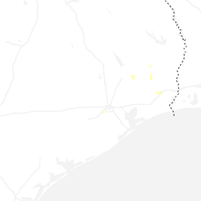


Connect with Interactive Hail Maps