

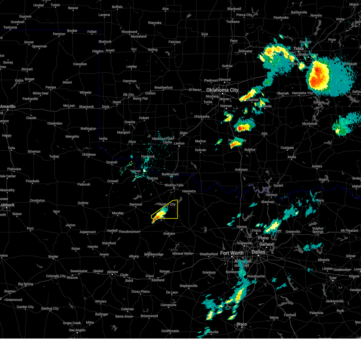
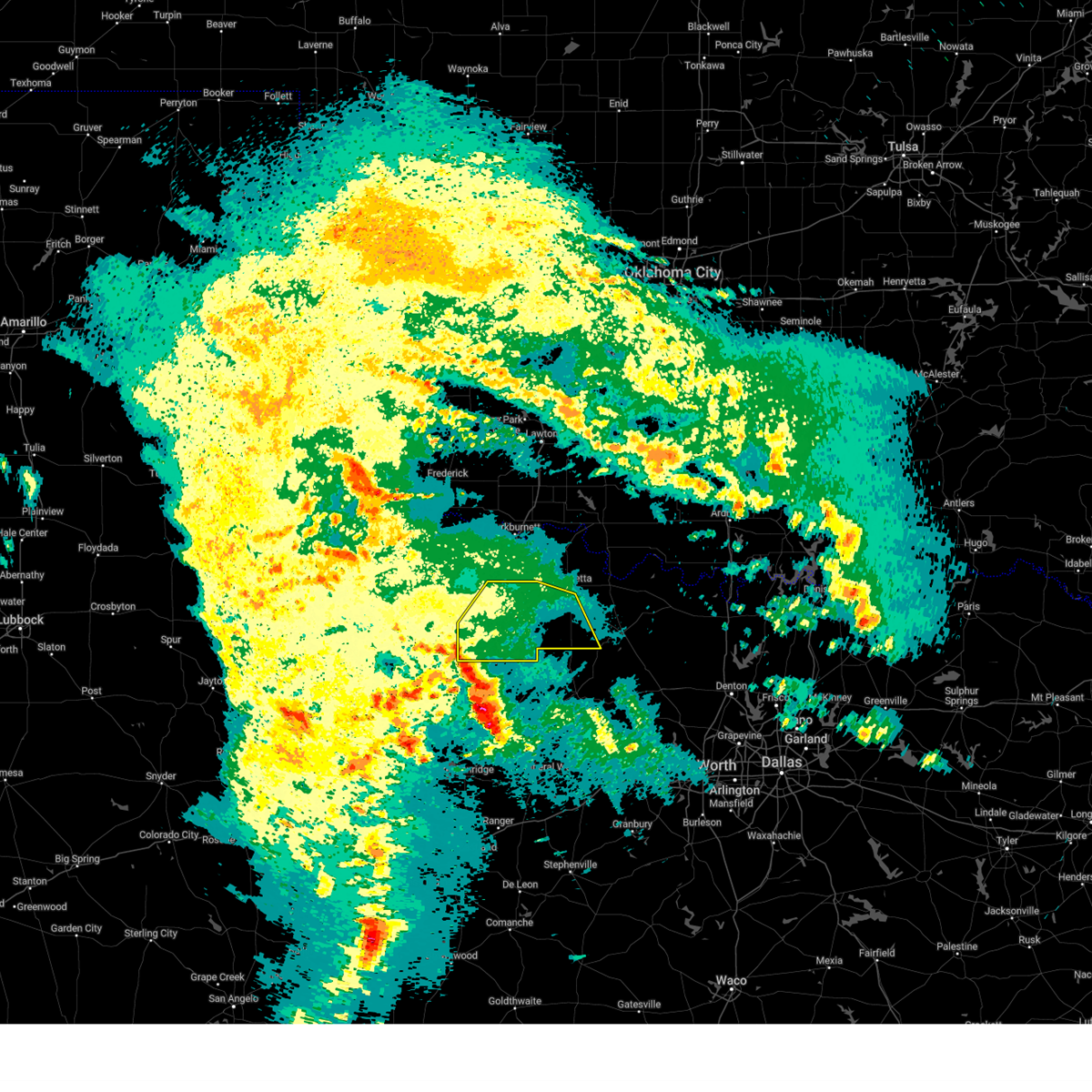
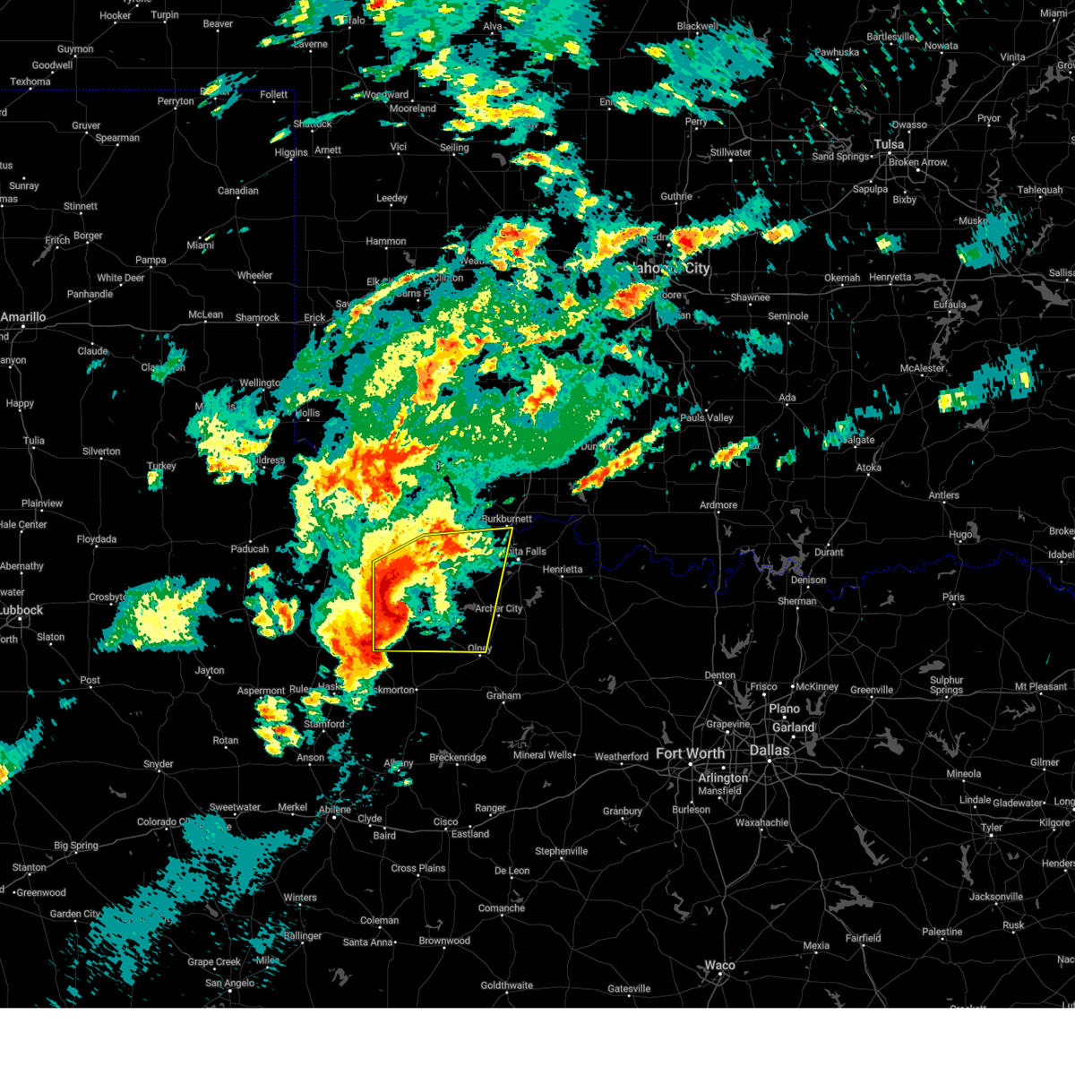
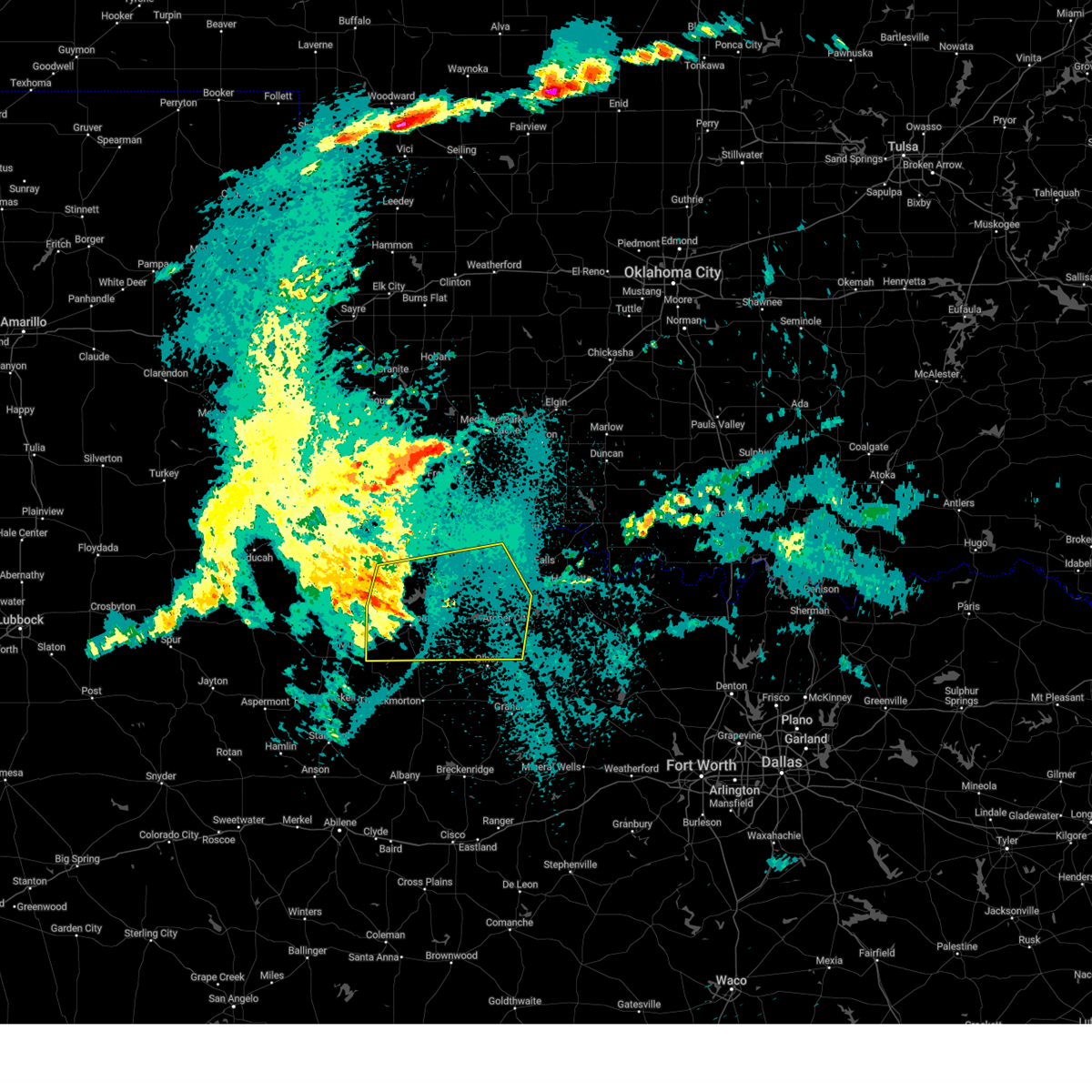
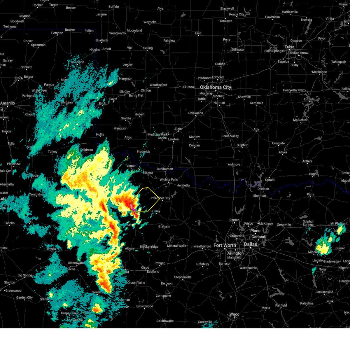
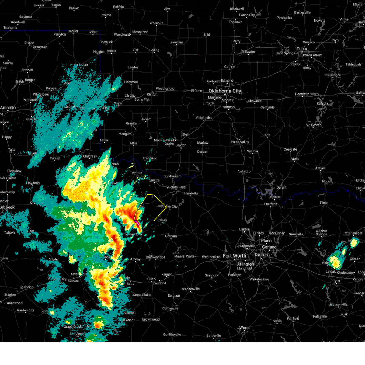
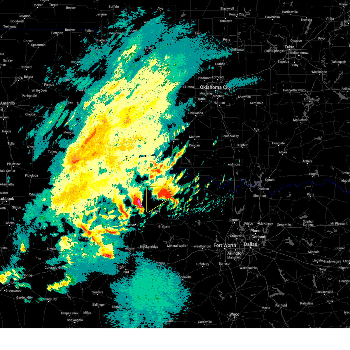
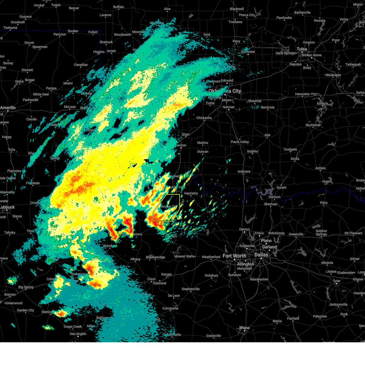
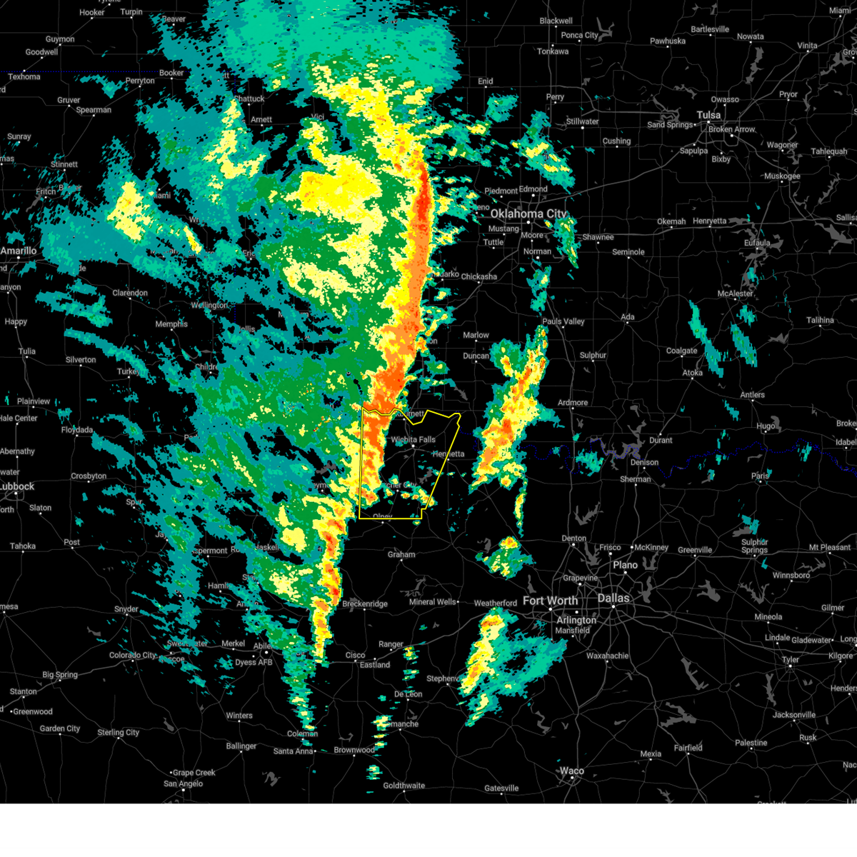
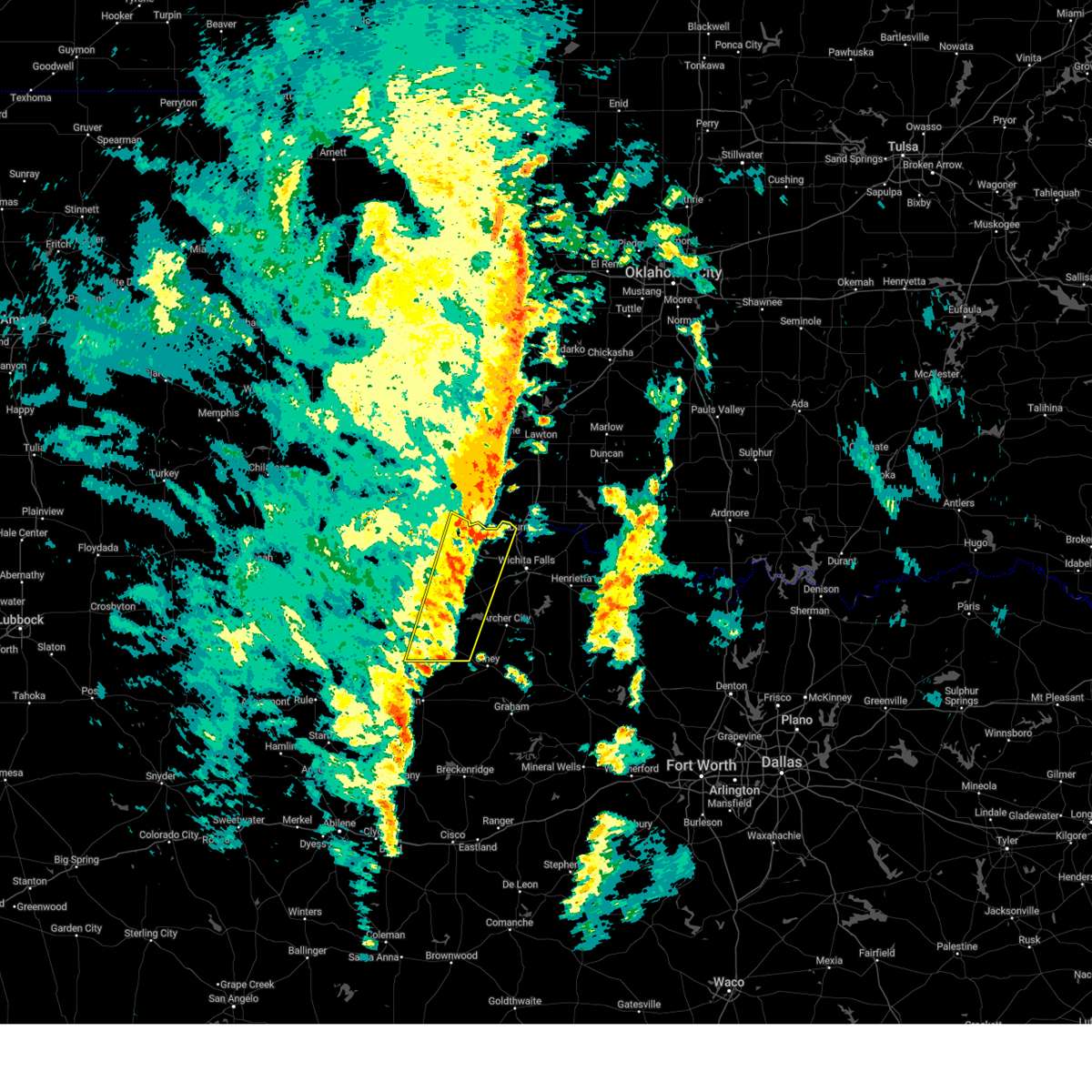
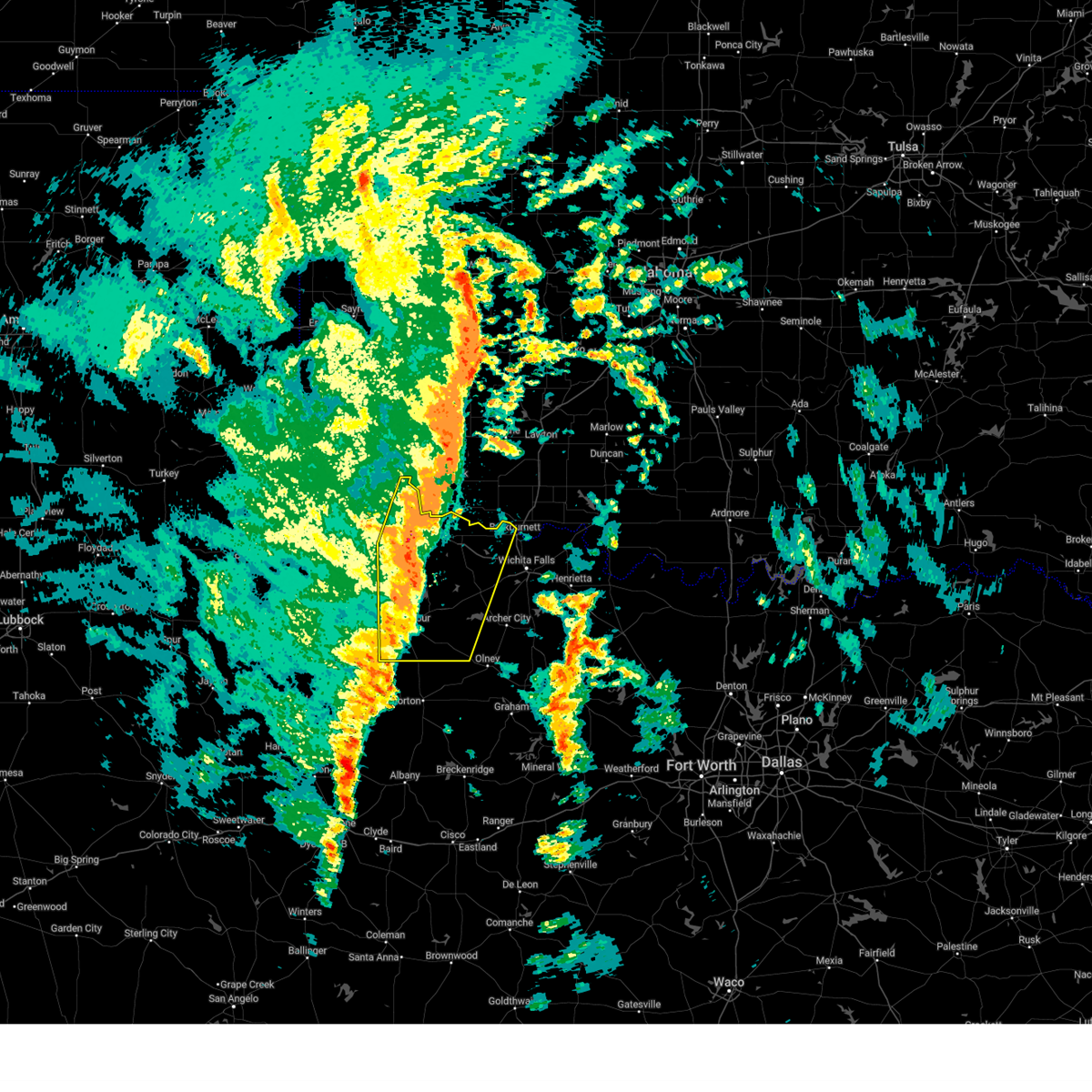
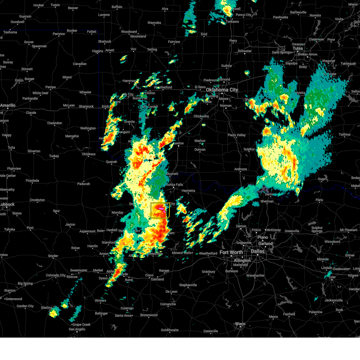
Hail Map for Megargel, TX
The Megargel, TX area has had 5 reports of on-the-ground hail by trained spotters, and has been under severe weather warnings 34 times during the past 12 months. Doppler radar has detected hail at or near Megargel, TX on 101 occasions, including 5 occasions during the past year.
| Name: | Megargel, TX |
| Where Located: | 39.8 miles SW of Wichita Falls, TX |
| Map: | Google Map for Megargel, TX |
| Population: | 203 |
| Housing Units: | 133 |
| More Info: | Search Google for Megargel, TX |
2
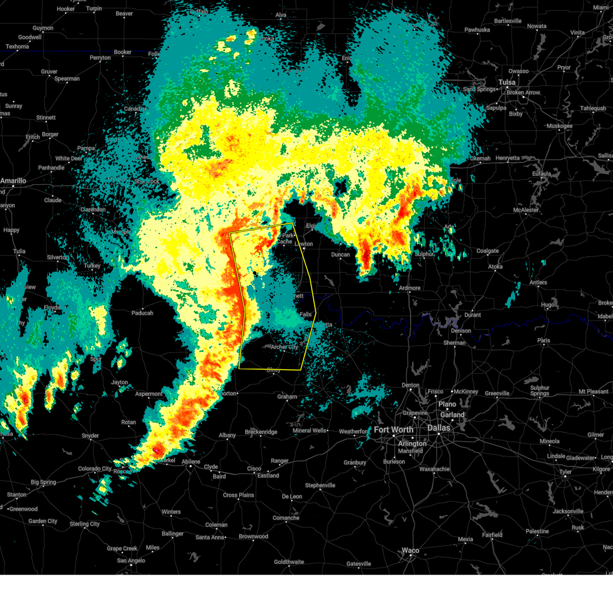
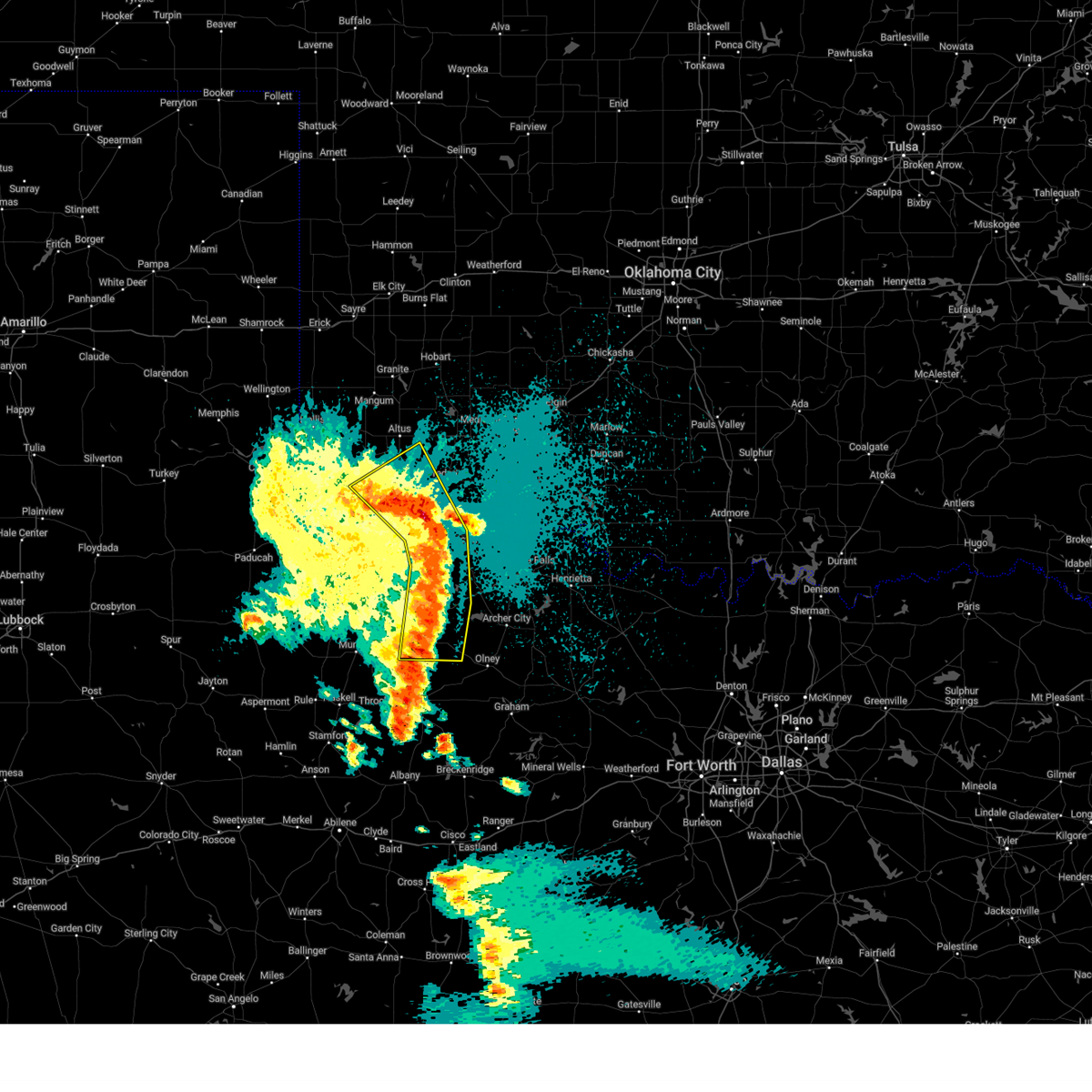
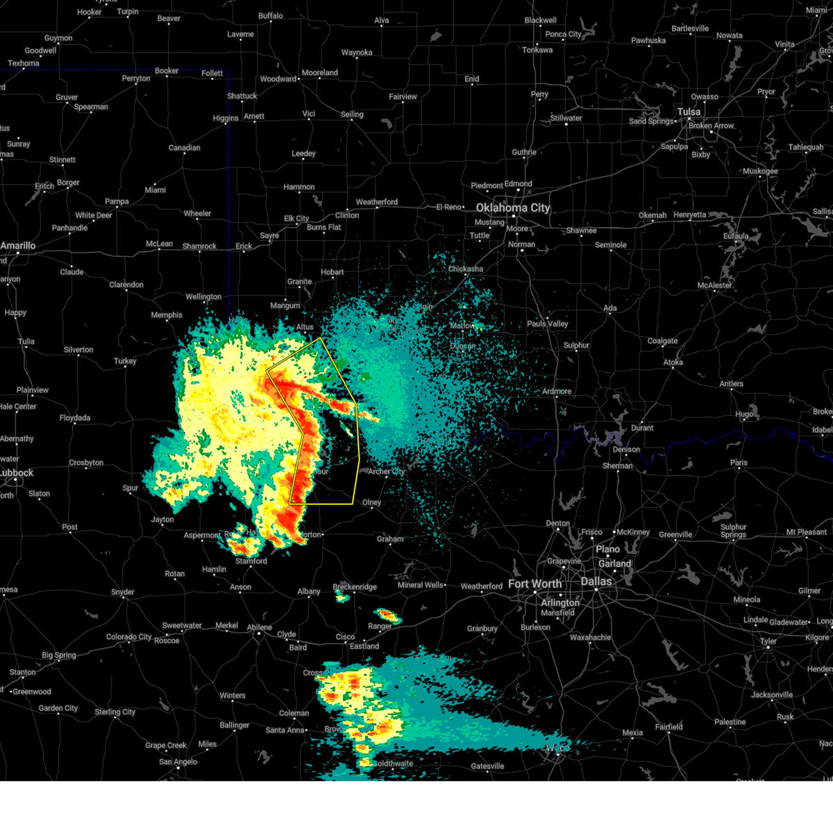
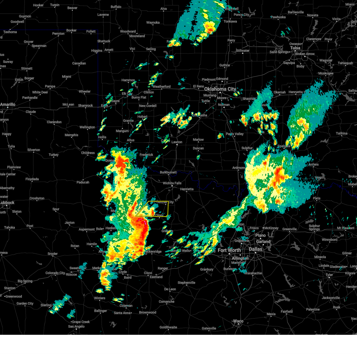
The Top Recent Hail Date for Megargel, TX is Friday, April 4, 2025 (7th out of 101)

Hail and Wind Damage Spotted near Megargel, TX
| Date / Time | Report Details |
|---|---|
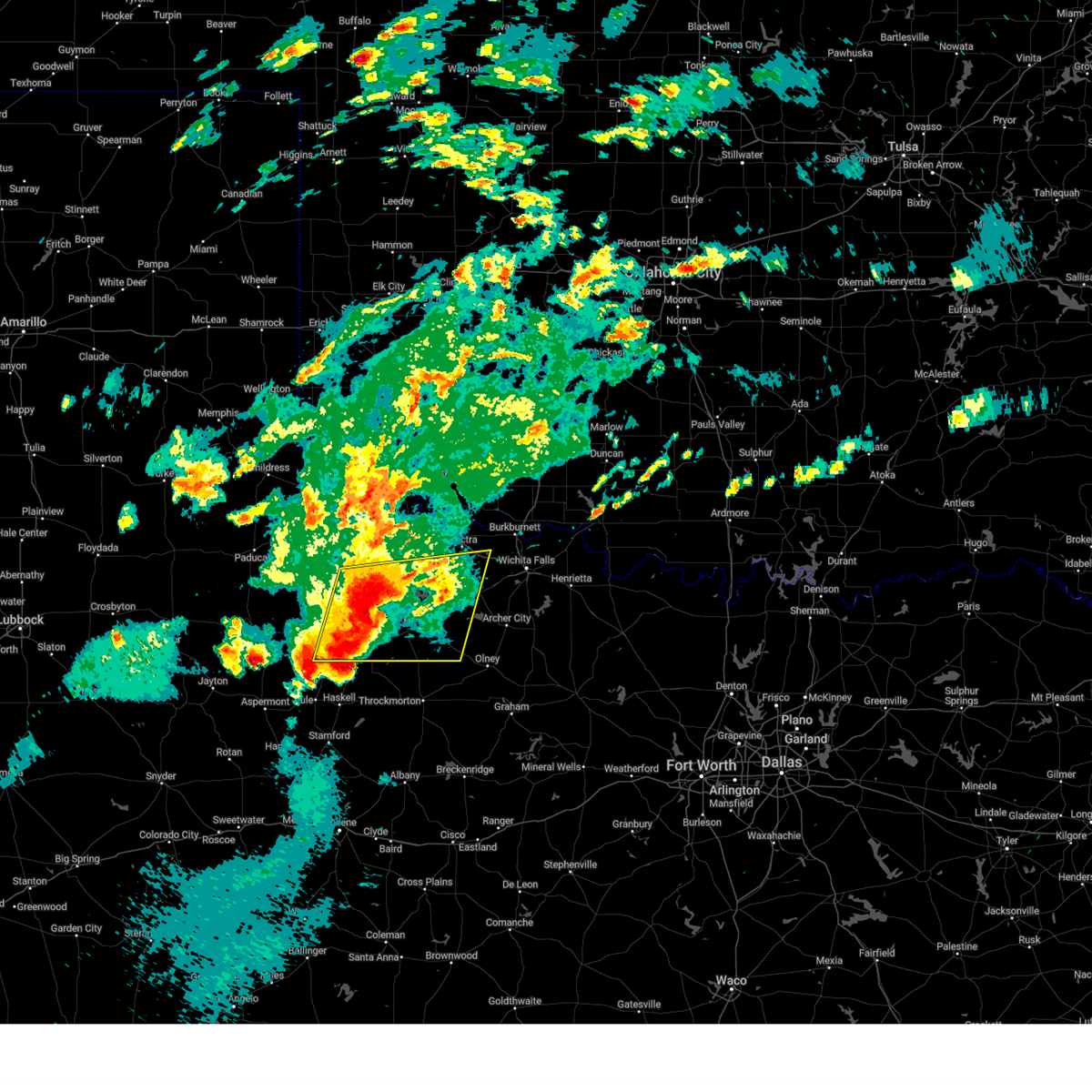
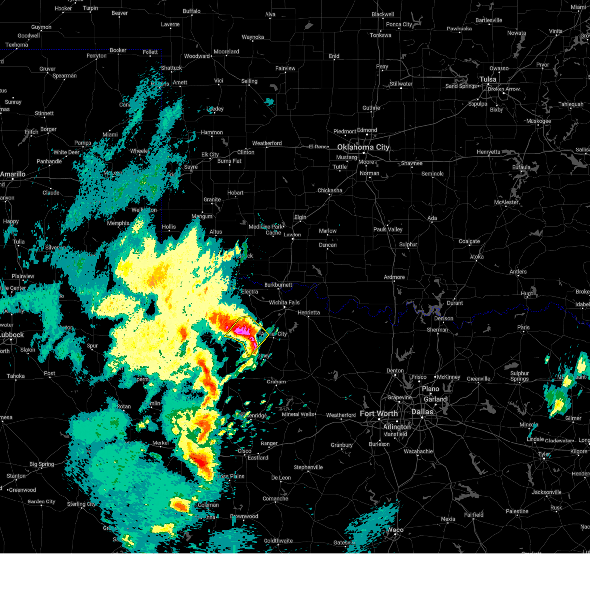
| 5/19/2025 1:09 PM CDT |
 Svroun the national weather service in norman has issued a * severe thunderstorm warning for, southern archer county in northern texas, * until 200 pm cdt. * at 109 pm cdt, a severe thunderstorm was located 5 miles northwest of olney, moving northeast at 30 mph (radar indicated). Hazards include ping pong ball size hail and 60 mph wind gusts. People and animals outdoors will be injured. expect hail damage to roofs, siding, windows, and vehicles. Expect wind damage to roofs, siding, and trees. Svroun the national weather service in norman has issued a * severe thunderstorm warning for, southern archer county in northern texas, * until 200 pm cdt. * at 109 pm cdt, a severe thunderstorm was located 5 miles northwest of olney, moving northeast at 30 mph (radar indicated). Hazards include ping pong ball size hail and 60 mph wind gusts. People and animals outdoors will be injured. expect hail damage to roofs, siding, windows, and vehicles. Expect wind damage to roofs, siding, and trees.
|
| 5/18/2025 5:55 PM CDT |
 the severe thunderstorm warning has been cancelled and is no longer in effect the severe thunderstorm warning has been cancelled and is no longer in effect
|
| 5/18/2025 5:43 PM CDT |
 At 543 pm cdt, a severe thunderstorm was located near megargel, moving northeast at 50 mph (radar indicated). Hazards include 60 mph wind gusts and half dollar size hail. Hail damage to vehicles is expected. expect wind damage to roofs, siding, and trees. Locations impacted include, archer city, megargel, westover, and lake kickapoo. At 543 pm cdt, a severe thunderstorm was located near megargel, moving northeast at 50 mph (radar indicated). Hazards include 60 mph wind gusts and half dollar size hail. Hail damage to vehicles is expected. expect wind damage to roofs, siding, and trees. Locations impacted include, archer city, megargel, westover, and lake kickapoo.
|
| 5/18/2025 5:32 PM CDT |
 Svroun the national weather service in norman has issued a * severe thunderstorm warning for, southern archer county in northern texas, southeastern baylor county in northern texas, * until 615 pm cdt. * at 532 pm cdt, a severe thunderstorm was located near elbert, moving northeast at 45 mph (radar indicated). Hazards include golf ball size hail and 60 mph wind gusts. People and animals outdoors will be injured. expect hail damage to roofs, siding, windows, and vehicles. Expect wind damage to roofs, siding, and trees. Svroun the national weather service in norman has issued a * severe thunderstorm warning for, southern archer county in northern texas, southeastern baylor county in northern texas, * until 615 pm cdt. * at 532 pm cdt, a severe thunderstorm was located near elbert, moving northeast at 45 mph (radar indicated). Hazards include golf ball size hail and 60 mph wind gusts. People and animals outdoors will be injured. expect hail damage to roofs, siding, windows, and vehicles. Expect wind damage to roofs, siding, and trees.
|
| 5/6/2025 6:30 AM CDT |
 Svroun the national weather service in norman has issued a * severe thunderstorm warning for, southwestern clay county in northern texas, archer county in northern texas, * until 715 am cdt. * at 630 am cdt, severe thunderstorms were located along a line extending from 5 miles northeast of megargel to 7 miles southeast of olney to 3 miles north of lake graham to 3 miles southwest of graham, moving northeast at 45 mph (radar indicated). Hazards include 60 mph wind gusts and quarter size hail. Hail damage to vehicles is expected. Expect wind damage to roofs, siding, and trees. Svroun the national weather service in norman has issued a * severe thunderstorm warning for, southwestern clay county in northern texas, archer county in northern texas, * until 715 am cdt. * at 630 am cdt, severe thunderstorms were located along a line extending from 5 miles northeast of megargel to 7 miles southeast of olney to 3 miles north of lake graham to 3 miles southwest of graham, moving northeast at 45 mph (radar indicated). Hazards include 60 mph wind gusts and quarter size hail. Hail damage to vehicles is expected. Expect wind damage to roofs, siding, and trees.
|
| 4/30/2025 5:11 AM CDT |
 Svroun the national weather service in norman has issued a * severe thunderstorm warning for, western comanche county in southwestern oklahoma, western cotton county in southwestern oklahoma, northeastern jackson county in southwestern oklahoma, south central kiowa county in southwestern oklahoma, tillman county in southwestern oklahoma, western clay county in northern texas, archer county in northern texas, wichita county in northern texas, southeastern wilbarger county in northern texas, eastern baylor county in northern texas, * until 600 am cdt. * at 510 am cdt, severe thunderstorms were located along a line extending from near headrick to 5 miles south of frederick to near electra to 3 miles north of westover, moving east at 45 mph (radar indicated). Hazards include 60 mph wind gusts. expect damage to roofs, siding, and trees Svroun the national weather service in norman has issued a * severe thunderstorm warning for, western comanche county in southwestern oklahoma, western cotton county in southwestern oklahoma, northeastern jackson county in southwestern oklahoma, south central kiowa county in southwestern oklahoma, tillman county in southwestern oklahoma, western clay county in northern texas, archer county in northern texas, wichita county in northern texas, southeastern wilbarger county in northern texas, eastern baylor county in northern texas, * until 600 am cdt. * at 510 am cdt, severe thunderstorms were located along a line extending from near headrick to 5 miles south of frederick to near electra to 3 miles north of westover, moving east at 45 mph (radar indicated). Hazards include 60 mph wind gusts. expect damage to roofs, siding, and trees
|
| 4/30/2025 4:30 AM CDT |
 Svroun the national weather service in norman has issued a * severe thunderstorm warning for, western archer county in northern texas, southwestern wichita county in northern texas, southeastern foard county in northern texas, eastern knox county in northern texas, wilbarger county in northern texas, baylor county in northern texas, southeastern hardeman county in northern texas, * until 515 am cdt. * at 430 am cdt, severe thunderstorms were located along a line extending from near thalia to 13 miles northeast of gilliland to near goree, moving northeast at 45 mph (radar indicated). Hazards include 60 mph wind gusts and penny size hail. expect damage to roofs, siding, and trees Svroun the national weather service in norman has issued a * severe thunderstorm warning for, western archer county in northern texas, southwestern wichita county in northern texas, southeastern foard county in northern texas, eastern knox county in northern texas, wilbarger county in northern texas, baylor county in northern texas, southeastern hardeman county in northern texas, * until 515 am cdt. * at 430 am cdt, severe thunderstorms were located along a line extending from near thalia to 13 miles northeast of gilliland to near goree, moving northeast at 45 mph (radar indicated). Hazards include 60 mph wind gusts and penny size hail. expect damage to roofs, siding, and trees
|
| 4/29/2025 8:59 PM CDT |
 Svroun the national weather service in norman has issued a * severe thunderstorm warning for, southwestern archer county in northern texas, southeastern baylor county in northern texas, * until 945 pm cdt. * at 859 pm cdt, a severe thunderstorm was located 6 miles southwest of megargel, moving northeast at 25 mph (radar indicated). Hazards include 60 mph wind gusts and quarter size hail. Hail damage to vehicles is expected. Expect wind damage to roofs, siding, and trees. Svroun the national weather service in norman has issued a * severe thunderstorm warning for, southwestern archer county in northern texas, southeastern baylor county in northern texas, * until 945 pm cdt. * at 859 pm cdt, a severe thunderstorm was located 6 miles southwest of megargel, moving northeast at 25 mph (radar indicated). Hazards include 60 mph wind gusts and quarter size hail. Hail damage to vehicles is expected. Expect wind damage to roofs, siding, and trees.
|
| 4/29/2025 8:06 PM CDT | the severe thunderstorm warning has been cancelled and is no longer in effect |
| 4/29/2025 8:06 PM CDT | At 805 pm cdt, severe thunderstorms were located along a line extending from 3 miles west of burkburnett to 6 miles northwest of scotland to 4 miles northeast of olney, moving east at 35 mph (radar indicated). Hazards include 70 mph wind gusts and half dollar size hail. Hail damage to vehicles is expected. expect considerable tree damage. wind damage is also likely to mobile homes, roofs, and outbuildings. Locations impacted include, wichita falls, burkburnett, henrietta, archer city, iowa park, electra, holliday, petrolia, scotland, byers, dean, windthorst, megargel, jolly, bluegrove, mankins, lake arrowhead, sheppard afb, lake kickapoo, and lakeside city. |
| 4/29/2025 7:52 PM CDT | Svroun the national weather service in norman has issued a * severe thunderstorm warning for, southern cotton county in southwestern oklahoma, clay county in northern texas, archer county in northern texas, wichita county in northern texas, southeastern wilbarger county in northern texas, eastern baylor county in northern texas, * until 830 pm cdt. * at 752 pm cdt, severe thunderstorms were located along a line extending from 5 miles northwest of iowa park to 6 miles northwest of archer city to 4 miles west of olney, moving east at 35 mph (radar indicated). Hazards include 70 mph wind gusts and ping pong ball size hail. People and animals outdoors will be injured. expect hail damage to roofs, siding, windows, and vehicles. expect considerable tree damage. Wind damage is also likely to mobile homes, roofs, and outbuildings. |
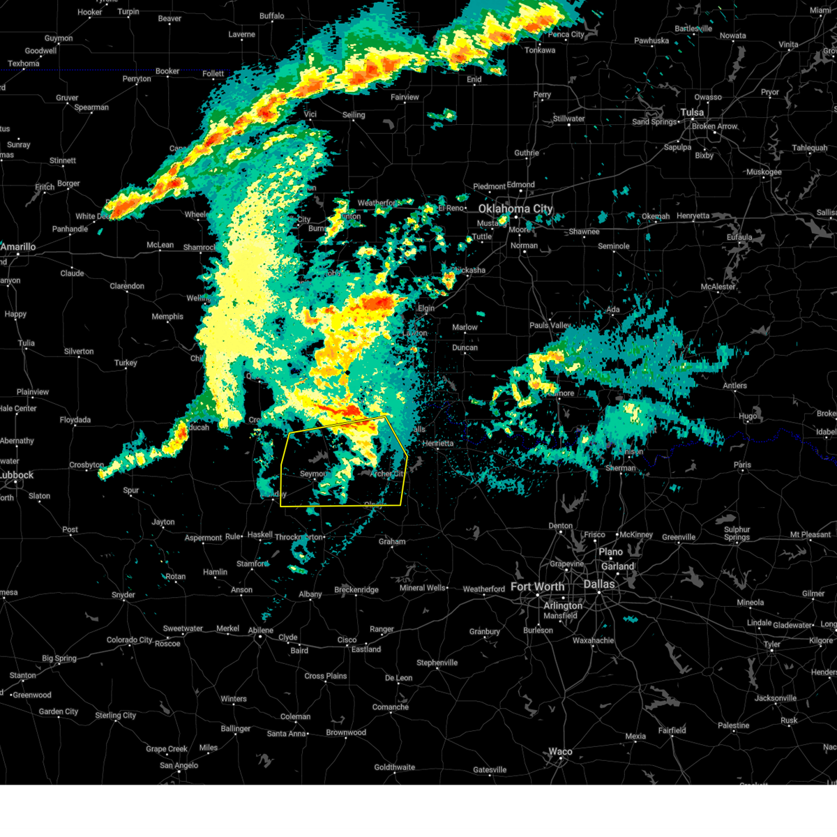
| 4/29/2025 7:45 PM CDT | At 745 pm cdt, severe thunderstorms were located along a line extending from 6 miles west of iowa park to 5 miles southeast of megargel, moving east at 40 mph. these are destructive storms for holliday (radar indicated). Hazards include 80 mph wind gusts and golf ball size hail. Flying debris will be dangerous to those caught without shelter. mobile homes will be heavily damaged. expect considerable damage to roofs, windows, and vehicles. extensive tree damage and power outages are likely. Locations impacted include, western wichita falls, burkburnett, iowa park, electra, holliday, megargel, lake diversion, dundee, mankins, westover, lake kickapoo, and pleasant valley. |
| 4/29/2025 7:26 PM CDT | At 725 pm cdt, severe thunderstorms were located along a line extending from 8 miles southwest of electra to 7 miles southwest of westover, moving east at 30 mph. these are destructive storms for dundee, mankins, and lake kickapoo (radar indicated). Hazards include 80 mph wind gusts and tennis ball size hail. Flying debris will be dangerous to those caught without shelter. mobile homes will be heavily damaged. expect considerable damage to roofs, windows, and vehicles. extensive tree damage and power outages are likely. Locations impacted include, western wichita falls, burkburnett, seymour, iowa park, electra, holliday, megargel, lake diversion, dundee, westover, lake kemp, mabelle, mankins, lake kickapoo, grayback, and pleasant valley. |
| 4/29/2025 7:10 PM CDT |
 Svroun the national weather service in norman has issued a * severe thunderstorm warning for, western archer county in northern texas, southern wichita county in northern texas, southern wilbarger county in northern texas, baylor county in northern texas, * until 800 pm cdt. * at 710 pm cdt, severe thunderstorms were located along a line extending from 8 miles southeast of grayback to 7 miles east of millers creek reservoir, moving east at 30 mph. these are destructive storms for lake diversion and dundee (radar indicated). Hazards include 80 mph wind gusts and tennis ball size hail. Flying debris will be dangerous to those caught without shelter. mobile homes will be heavily damaged. expect considerable damage to roofs, windows, and vehicles. Extensive tree damage and power outages are likely. Svroun the national weather service in norman has issued a * severe thunderstorm warning for, western archer county in northern texas, southern wichita county in northern texas, southern wilbarger county in northern texas, baylor county in northern texas, * until 800 pm cdt. * at 710 pm cdt, severe thunderstorms were located along a line extending from 8 miles southeast of grayback to 7 miles east of millers creek reservoir, moving east at 30 mph. these are destructive storms for lake diversion and dundee (radar indicated). Hazards include 80 mph wind gusts and tennis ball size hail. Flying debris will be dangerous to those caught without shelter. mobile homes will be heavily damaged. expect considerable damage to roofs, windows, and vehicles. Extensive tree damage and power outages are likely.
|
| 4/29/2025 6:52 PM CDT | At 651 pm cdt, severe thunderstorms were located along a line extending from 8 miles north of lake kemp to 7 miles southwest of millers creek reservoir, moving east at 30 mph. these are destructive storms for seymour, lake kemp, and mabelle (radar indicated). Hazards include 90 mph wind gusts and golf ball size hail. You are in a life-threatening situation. flying debris may be deadly to those caught without shelter. mobile homes will be heavily damaged or destroyed. homes and businesses will have substantial roof and window damage. expect extensive tree damage and power outages. Locations impacted include, seymour, munday, megargel, goree, red springs, lake diversion, dundee, westover, bomarton, lake kemp, mabelle, vera, rhineland, and lake kickapoo. |
| 4/29/2025 6:32 PM CDT |
 Svroun the national weather service in norman has issued a * severe thunderstorm warning for, western archer county in northern texas, southwestern wichita county in northern texas, southeastern foard county in northern texas, knox county in northern texas, southern wilbarger county in northern texas, baylor county in northern texas, * until 715 pm cdt. * at 631 pm cdt, severe thunderstorms were located along a line extending from 10 miles northwest of lake kemp to 4 miles south of munday, moving east at 35 mph. these are destructive storms for goree, seymour, and lake kemp (multiple wind gusts over 90 mph have been measured). Hazards include 90 mph wind gusts and two inch hail. You are in a life-threatening situation. flying debris may be deadly to those caught without shelter. mobile homes will be heavily damaged or destroyed. homes and businesses will have substantial roof and window damage. Expect extensive tree damage and power outages. Svroun the national weather service in norman has issued a * severe thunderstorm warning for, western archer county in northern texas, southwestern wichita county in northern texas, southeastern foard county in northern texas, knox county in northern texas, southern wilbarger county in northern texas, baylor county in northern texas, * until 715 pm cdt. * at 631 pm cdt, severe thunderstorms were located along a line extending from 10 miles northwest of lake kemp to 4 miles south of munday, moving east at 35 mph. these are destructive storms for goree, seymour, and lake kemp (multiple wind gusts over 90 mph have been measured). Hazards include 90 mph wind gusts and two inch hail. You are in a life-threatening situation. flying debris may be deadly to those caught without shelter. mobile homes will be heavily damaged or destroyed. homes and businesses will have substantial roof and window damage. Expect extensive tree damage and power outages.
|
| 4/29/2025 4:14 AM CDT |
 the severe thunderstorm warning has been cancelled and is no longer in effect the severe thunderstorm warning has been cancelled and is no longer in effect
|
| 4/29/2025 3:43 AM CDT |
 At 343 am cdt, severe thunderstorms were located along a line extending from 5 miles north of lake kemp to near mabelle to 11 miles east of millers creek reservoir, moving east at 60 mph (radar indicated). Hazards include 70 mph wind gusts. Expect considerable tree damage. damage is likely to mobile homes, roofs, and outbuildings. Locations impacted include, southwestern wichita falls, seymour, archer city, iowa park, holliday, scotland, megargel, goree, red springs, lake diversion, dundee, westover, bomarton, lake kemp, mabelle, mankins, lake kickapoo, lakeside city, and pleasant valley. At 343 am cdt, severe thunderstorms were located along a line extending from 5 miles north of lake kemp to near mabelle to 11 miles east of millers creek reservoir, moving east at 60 mph (radar indicated). Hazards include 70 mph wind gusts. Expect considerable tree damage. damage is likely to mobile homes, roofs, and outbuildings. Locations impacted include, southwestern wichita falls, seymour, archer city, iowa park, holliday, scotland, megargel, goree, red springs, lake diversion, dundee, westover, bomarton, lake kemp, mabelle, mankins, lake kickapoo, lakeside city, and pleasant valley.
|
| 4/29/2025 3:38 AM CDT |
 Svroun the national weather service in norman has issued a * severe thunderstorm warning for, archer county in northern texas, southwestern wichita county in northern texas, southeastern foard county in northern texas, southeastern knox county in northern texas, southern wilbarger county in northern texas, baylor county in northern texas, * until 430 am cdt. * at 338 am cdt, severe thunderstorms were located along a line extending from 5 miles north of lake kemp to near mabelle to 11 miles east of millers creek reservoir, moving east at 60 mph (radar indicated). Hazards include 60 mph wind gusts. expect damage to roofs, siding, and trees Svroun the national weather service in norman has issued a * severe thunderstorm warning for, archer county in northern texas, southwestern wichita county in northern texas, southeastern foard county in northern texas, southeastern knox county in northern texas, southern wilbarger county in northern texas, baylor county in northern texas, * until 430 am cdt. * at 338 am cdt, severe thunderstorms were located along a line extending from 5 miles north of lake kemp to near mabelle to 11 miles east of millers creek reservoir, moving east at 60 mph (radar indicated). Hazards include 60 mph wind gusts. expect damage to roofs, siding, and trees
|
| 4/23/2025 1:21 AM CDT |
 At 120 am cdt, severe thunderstorms were located along a line extending from near fargo to 4 miles west of davidson to 8 miles northwest of lake diversion to 7 miles southeast of seymour, moving northeast at 55 mph (radar indicated). Hazards include an area of 65 to 70 mph wind gusts and quarter size hail are approaching davidson, south of frederick. down the remaining line, wind gusts up to 60 mph are possible with nickel size hail. Hail damage to vehicles is expected. expect considerable tree damage. wind damage is also likely to mobile homes, roofs, and outbuildings. Locations impacted include, vernon, seymour, electra, tipton, chillicothe, davidson, megargel, elmer, lake diversion, dundee, westover, harrold, lake kemp, mabelle, fargo, humphreys, odell, oklaunion, grayback, and lake kickapoo. At 120 am cdt, severe thunderstorms were located along a line extending from near fargo to 4 miles west of davidson to 8 miles northwest of lake diversion to 7 miles southeast of seymour, moving northeast at 55 mph (radar indicated). Hazards include an area of 65 to 70 mph wind gusts and quarter size hail are approaching davidson, south of frederick. down the remaining line, wind gusts up to 60 mph are possible with nickel size hail. Hail damage to vehicles is expected. expect considerable tree damage. wind damage is also likely to mobile homes, roofs, and outbuildings. Locations impacted include, vernon, seymour, electra, tipton, chillicothe, davidson, megargel, elmer, lake diversion, dundee, westover, harrold, lake kemp, mabelle, fargo, humphreys, odell, oklaunion, grayback, and lake kickapoo.
|
| 4/23/2025 12:55 AM CDT |
 Svroun the national weather service in norman has issued a * severe thunderstorm warning for, southeastern jackson county in southwestern oklahoma, southwestern tillman county in southwestern oklahoma, western archer county in northern texas, western wichita county in northern texas, wilbarger county in northern texas, baylor county in northern texas, east central hardeman county in northern texas, * until 145 am cdt. * at 1255 am cdt, severe thunderstorms were located along a line extending from near chillicothe to 7 miles southwest of grayback to 3 miles southeast of bomarton, moving northeast at 20 mph (radar indicated). Hazards include 60 mph wind gusts and quarter size hail. Hail damage to vehicles is expected. Expect wind damage to roofs, siding, and trees. Svroun the national weather service in norman has issued a * severe thunderstorm warning for, southeastern jackson county in southwestern oklahoma, southwestern tillman county in southwestern oklahoma, western archer county in northern texas, western wichita county in northern texas, wilbarger county in northern texas, baylor county in northern texas, east central hardeman county in northern texas, * until 145 am cdt. * at 1255 am cdt, severe thunderstorms were located along a line extending from near chillicothe to 7 miles southwest of grayback to 3 miles southeast of bomarton, moving northeast at 20 mph (radar indicated). Hazards include 60 mph wind gusts and quarter size hail. Hail damage to vehicles is expected. Expect wind damage to roofs, siding, and trees.
|
| 4/5/2025 1:18 AM CDT |
 At 118 am cdt, a severe thunderstorm was located 7 miles west of lake kickapoo, moving northeast at 50 mph (radar indicated). Hazards include two inch hail. People and animals outdoors will be injured. expect damage to roofs, siding, windows, and vehicles. Locations impacted include, megargel, dundee, mabelle, lake kickapoo, and lake diversion. At 118 am cdt, a severe thunderstorm was located 7 miles west of lake kickapoo, moving northeast at 50 mph (radar indicated). Hazards include two inch hail. People and animals outdoors will be injured. expect damage to roofs, siding, windows, and vehicles. Locations impacted include, megargel, dundee, mabelle, lake kickapoo, and lake diversion.
|
| 4/5/2025 1:06 AM CDT | At 106 am cdt, a severe thunderstorm was located 4 miles northwest of westover, moving northeast at 50 mph (radar indicated). Hazards include tennis ball size hail. People and animals outdoors will be injured. expect damage to roofs, siding, windows, and vehicles. Locations impacted include, megargel, dundee, westover, mabelle, lake kickapoo, and lake diversion. |
| 4/5/2025 1:00 AM CDT |
 At 100 am cdt, a severe thunderstorm was located 7 miles southeast of seymour, moving northeast at 40 mph (radar indicated). Hazards include two inch hail. People and animals outdoors will be injured. expect damage to roofs, siding, windows, and vehicles. Locations impacted include, megargel, dundee, westover, mabelle, lake kickapoo, and lake diversion. At 100 am cdt, a severe thunderstorm was located 7 miles southeast of seymour, moving northeast at 40 mph (radar indicated). Hazards include two inch hail. People and animals outdoors will be injured. expect damage to roofs, siding, windows, and vehicles. Locations impacted include, megargel, dundee, westover, mabelle, lake kickapoo, and lake diversion.
|
| 4/5/2025 12:56 AM CDT |
 At 1256 am cdt, a severe thunderstorm was located 8 miles south of seymour, moving northeast at 40 mph (radar indicated). Hazards include ping pong ball size hail. People and animals outdoors will be injured. expect damage to roofs, siding, windows, and vehicles. Locations impacted include, megargel, mabelle, lake diversion, dundee, westover, lake kickapoo, and seymour. At 1256 am cdt, a severe thunderstorm was located 8 miles south of seymour, moving northeast at 40 mph (radar indicated). Hazards include ping pong ball size hail. People and animals outdoors will be injured. expect damage to roofs, siding, windows, and vehicles. Locations impacted include, megargel, mabelle, lake diversion, dundee, westover, lake kickapoo, and seymour.
|
| 4/5/2025 12:52 AM CDT |
 Svroun the national weather service in norman has issued a * severe thunderstorm warning for, western archer county in northern texas, eastern baylor county in northern texas, * until 130 am cdt. * at 1252 am cdt, a severe thunderstorm was located 8 miles northeast of millers creek reservoir, moving northeast at 40 mph (radar indicated). Hazards include quarter size hail. damage to vehicles is expected Svroun the national weather service in norman has issued a * severe thunderstorm warning for, western archer county in northern texas, eastern baylor county in northern texas, * until 130 am cdt. * at 1252 am cdt, a severe thunderstorm was located 8 miles northeast of millers creek reservoir, moving northeast at 40 mph (radar indicated). Hazards include quarter size hail. damage to vehicles is expected
|
| 4/4/2025 3:15 AM CDT |
 Svroun the national weather service in norman has issued a * severe thunderstorm warning for, archer county in northern texas, * until 400 am cdt. * at 314 am cdt, severe thunderstorms were located along a line extending from 3 miles southeast of mabelle to near westover, moving northeast at 50 mph (radar indicated). Hazards include ping pong ball size hail and 60 mph wind gusts. People and animals outdoors will be injured. expect hail damage to roofs, siding, windows, and vehicles. Expect wind damage to roofs, siding, and trees. Svroun the national weather service in norman has issued a * severe thunderstorm warning for, archer county in northern texas, * until 400 am cdt. * at 314 am cdt, severe thunderstorms were located along a line extending from 3 miles southeast of mabelle to near westover, moving northeast at 50 mph (radar indicated). Hazards include ping pong ball size hail and 60 mph wind gusts. People and animals outdoors will be injured. expect hail damage to roofs, siding, windows, and vehicles. Expect wind damage to roofs, siding, and trees.
|
| 4/4/2025 2:42 AM CDT |
 Svroun the national weather service in norman has issued a * severe thunderstorm warning for, archer county in northern texas, * until 330 am cdt. * at 242 am cdt, a severe thunderstorm was located 5 miles east of megargel, moving northeast at 55 mph (radar indicated). Hazards include 60 mph wind gusts and quarter size hail. Hail damage to vehicles is expected. Expect wind damage to roofs, siding, and trees. Svroun the national weather service in norman has issued a * severe thunderstorm warning for, archer county in northern texas, * until 330 am cdt. * at 242 am cdt, a severe thunderstorm was located 5 miles east of megargel, moving northeast at 55 mph (radar indicated). Hazards include 60 mph wind gusts and quarter size hail. Hail damage to vehicles is expected. Expect wind damage to roofs, siding, and trees.
|
| 11/18/2024 5:28 AM CST |
 Svroun the national weather service in norman has issued a * severe thunderstorm warning for, western clay county in northern texas, archer county in northern texas, wichita county in northern texas, * until 615 am cst. * at 528 am cst, severe thunderstorms were located along a line extending from 6 miles west of burkburnett to 3 miles south of megargel, moving northeast at 40 mph (radar indicated). Hazards include 60 mph wind gusts and penny size hail. expect damage to roofs, siding, and trees Svroun the national weather service in norman has issued a * severe thunderstorm warning for, western clay county in northern texas, archer county in northern texas, wichita county in northern texas, * until 615 am cst. * at 528 am cst, severe thunderstorms were located along a line extending from 6 miles west of burkburnett to 3 miles south of megargel, moving northeast at 40 mph (radar indicated). Hazards include 60 mph wind gusts and penny size hail. expect damage to roofs, siding, and trees
|
| 11/18/2024 5:18 AM CST |
 At 518 am cst, severe thunderstorms were located along a line extending from 7 miles west of burkburnett to near megargel, moving northeast at 85 mph (radar indicated). Hazards include 60 mph wind gusts and quarter size hail. Hail damage to vehicles is expected. expect wind damage to roofs, siding, and trees. Locations impacted include, burkburnett, iowa park, electra, holliday, megargel, lake diversion, dundee, westover, harrold, mabelle, mankins, lake kickapoo, eastern lake kemp, and haynesville. At 518 am cst, severe thunderstorms were located along a line extending from 7 miles west of burkburnett to near megargel, moving northeast at 85 mph (radar indicated). Hazards include 60 mph wind gusts and quarter size hail. Hail damage to vehicles is expected. expect wind damage to roofs, siding, and trees. Locations impacted include, burkburnett, iowa park, electra, holliday, megargel, lake diversion, dundee, westover, harrold, mabelle, mankins, lake kickapoo, eastern lake kemp, and haynesville.
|
| 11/18/2024 4:41 AM CST |
 Svroun the national weather service in norman has issued a * severe thunderstorm warning for, western archer county in northern texas, wichita county in northern texas, wilbarger county in northern texas, baylor county in northern texas, * until 530 am cst. * at 441 am cst, severe thunderstorms were located along a line extending from 3 miles south of davidson to 5 miles northeast of millers creek reservoir, moving northeast at 50 mph (radar indicated). Hazards include 60 mph wind gusts and quarter size hail. Hail damage to vehicles is expected. Expect wind damage to roofs, siding, and trees. Svroun the national weather service in norman has issued a * severe thunderstorm warning for, western archer county in northern texas, wichita county in northern texas, wilbarger county in northern texas, baylor county in northern texas, * until 530 am cst. * at 441 am cst, severe thunderstorms were located along a line extending from 3 miles south of davidson to 5 miles northeast of millers creek reservoir, moving northeast at 50 mph (radar indicated). Hazards include 60 mph wind gusts and quarter size hail. Hail damage to vehicles is expected. Expect wind damage to roofs, siding, and trees.
|
| 11/3/2024 1:42 PM CST |
 At 142 pm cst, a severe thunderstorm was located 8 miles southwest of archer city, moving northeast at 40 mph (radar indicated). Hazards include 70 mph wind gusts and quarter size hail. Hail damage to vehicles is expected. expect considerable tree damage. wind damage is also likely to mobile homes, roofs, and outbuildings. Locations impacted include, archer city, megargel, and lake kickapoo. At 142 pm cst, a severe thunderstorm was located 8 miles southwest of archer city, moving northeast at 40 mph (radar indicated). Hazards include 70 mph wind gusts and quarter size hail. Hail damage to vehicles is expected. expect considerable tree damage. wind damage is also likely to mobile homes, roofs, and outbuildings. Locations impacted include, archer city, megargel, and lake kickapoo.
|
| 11/3/2024 1:42 PM CST |
 the severe thunderstorm warning has been cancelled and is no longer in effect the severe thunderstorm warning has been cancelled and is no longer in effect
|
| 11/3/2024 1:13 PM CST |
 Svroun the national weather service in norman has issued a * severe thunderstorm warning for, southwestern archer county in northern texas, southeastern baylor county in northern texas, * until 200 pm cst. * at 113 pm cst, a severe thunderstorm was located 6 miles northwest of elbert, moving northeast at 30 mph (radar indicated). Hazards include 70 mph wind gusts and quarter size hail. Hail damage to vehicles is expected. expect considerable tree damage. Wind damage is also likely to mobile homes, roofs, and outbuildings. Svroun the national weather service in norman has issued a * severe thunderstorm warning for, southwestern archer county in northern texas, southeastern baylor county in northern texas, * until 200 pm cst. * at 113 pm cst, a severe thunderstorm was located 6 miles northwest of elbert, moving northeast at 30 mph (radar indicated). Hazards include 70 mph wind gusts and quarter size hail. Hail damage to vehicles is expected. expect considerable tree damage. Wind damage is also likely to mobile homes, roofs, and outbuildings.
|
| 6/2/2024 3:20 PM CDT |
 The storm which prompted the warning has moved out of the area. therefore, the warning will be allowed to expire. The storm which prompted the warning has moved out of the area. therefore, the warning will be allowed to expire.
|
| 6/2/2024 3:12 PM CDT |
 the severe thunderstorm warning has been cancelled and is no longer in effect the severe thunderstorm warning has been cancelled and is no longer in effect
|
| 6/2/2024 3:12 PM CDT |
 At 312 pm cdt, a severe thunderstorm was located near megargel, moving east at 25 mph (radar indicated). Hazards include 60 mph wind gusts and half dollar size hail. Hail damage to vehicles is expected. expect wind damage to roofs, siding, and trees. Locations impacted include, megargel. At 312 pm cdt, a severe thunderstorm was located near megargel, moving east at 25 mph (radar indicated). Hazards include 60 mph wind gusts and half dollar size hail. Hail damage to vehicles is expected. expect wind damage to roofs, siding, and trees. Locations impacted include, megargel.
|
| 6/2/2024 2:51 PM CDT |
 At 250 pm cdt, a severe thunderstorm was located near westover, moving southeast at 30 mph (radar indicated). Hazards include 60 mph wind gusts and half dollar size hail. Hail damage to vehicles is expected. expect wind damage to roofs, siding, and trees. Locations impacted include, megargel and westover. At 250 pm cdt, a severe thunderstorm was located near westover, moving southeast at 30 mph (radar indicated). Hazards include 60 mph wind gusts and half dollar size hail. Hail damage to vehicles is expected. expect wind damage to roofs, siding, and trees. Locations impacted include, megargel and westover.
|
| 6/2/2024 2:42 PM CDT |
 Svroun the national weather service in norman has issued a * severe thunderstorm warning for, southwestern archer county in northern texas, southeastern baylor county in northern texas, * until 330 pm cdt. * at 242 pm cdt, a severe thunderstorm was located 6 miles southeast of seymour, moving east at 25 mph (radar indicated). Hazards include 60 mph wind gusts. expect damage to roofs, siding, and trees Svroun the national weather service in norman has issued a * severe thunderstorm warning for, southwestern archer county in northern texas, southeastern baylor county in northern texas, * until 330 pm cdt. * at 242 pm cdt, a severe thunderstorm was located 6 miles southeast of seymour, moving east at 25 mph (radar indicated). Hazards include 60 mph wind gusts. expect damage to roofs, siding, and trees
|
| 5/25/2024 4:51 PM CDT |
 At 451 pm cdt, a severe thunderstorm was located 7 miles east of seymour, moving northeast at 50 mph (radar indicated). Hazards include two inch hail and 60 mph wind gusts. People and animals outdoors will be injured. expect hail damage to roofs, siding, windows, and vehicles. expect wind damage to roofs, siding, and trees. Locations impacted include, megargel, dundee, westover, mabelle, lake kickapoo, and lake diversion. At 451 pm cdt, a severe thunderstorm was located 7 miles east of seymour, moving northeast at 50 mph (radar indicated). Hazards include two inch hail and 60 mph wind gusts. People and animals outdoors will be injured. expect hail damage to roofs, siding, windows, and vehicles. expect wind damage to roofs, siding, and trees. Locations impacted include, megargel, dundee, westover, mabelle, lake kickapoo, and lake diversion.
|
| 5/25/2024 4:35 PM CDT |
 Svroun the national weather service in norman has issued a * severe thunderstorm warning for, northwestern archer county in northern texas, eastern baylor county in northern texas, * until 515 pm cdt. * at 434 pm cdt, a severe thunderstorm was located 7 miles east of millers creek reservoir, moving northeast at 55 mph (radar indicated). Hazards include ping pong ball size hail and 60 mph wind gusts. People and animals outdoors will be injured. expect hail damage to roofs, siding, windows, and vehicles. Expect wind damage to roofs, siding, and trees. Svroun the national weather service in norman has issued a * severe thunderstorm warning for, northwestern archer county in northern texas, eastern baylor county in northern texas, * until 515 pm cdt. * at 434 pm cdt, a severe thunderstorm was located 7 miles east of millers creek reservoir, moving northeast at 55 mph (radar indicated). Hazards include ping pong ball size hail and 60 mph wind gusts. People and animals outdoors will be injured. expect hail damage to roofs, siding, windows, and vehicles. Expect wind damage to roofs, siding, and trees.
|
| 5/25/2024 4:16 PM CDT |
 At 415 pm cdt, a severe thunderstorm was located 8 miles northeast of megargel, moving east at 30 mph (radar indicated). Hazards include golf ball size hail and 60 mph wind gusts. People and animals outdoors will be injured. expect hail damage to roofs, siding, windows, and vehicles. expect wind damage to roofs, siding, and trees. Locations impacted include, archer city, scotland, windthorst, megargel, and lake kickapoo. At 415 pm cdt, a severe thunderstorm was located 8 miles northeast of megargel, moving east at 30 mph (radar indicated). Hazards include golf ball size hail and 60 mph wind gusts. People and animals outdoors will be injured. expect hail damage to roofs, siding, windows, and vehicles. expect wind damage to roofs, siding, and trees. Locations impacted include, archer city, scotland, windthorst, megargel, and lake kickapoo.
|
| 5/25/2024 4:16 PM CDT |
 the severe thunderstorm warning has been cancelled and is no longer in effect the severe thunderstorm warning has been cancelled and is no longer in effect
|
| 5/25/2024 4:15 PM CDT |
 the tornado warning has been cancelled and is no longer in effect the tornado warning has been cancelled and is no longer in effect
|
| 5/25/2024 4:15 PM CDT |
 At 415 pm cdt, a severe thunderstorm capable of producing a tornado was located 4 miles southeast of megargel, moving east at 30 mph (radar indicated rotation). Hazards include tornado and golf ball size hail. Flying debris will be dangerous to those caught without shelter. mobile homes will be damaged or destroyed. damage to roofs, windows, and vehicles will occur. tree damage is likely. Locations impacted include, windthorst and megargel. At 415 pm cdt, a severe thunderstorm capable of producing a tornado was located 4 miles southeast of megargel, moving east at 30 mph (radar indicated rotation). Hazards include tornado and golf ball size hail. Flying debris will be dangerous to those caught without shelter. mobile homes will be damaged or destroyed. damage to roofs, windows, and vehicles will occur. tree damage is likely. Locations impacted include, windthorst and megargel.
|
| 5/25/2024 4:03 PM CDT |
 Toroun the national weather service in norman has issued a * tornado warning for, southern archer county in northern texas, southeastern baylor county in northern texas, * until 445 pm cdt. * at 403 pm cdt, a severe thunderstorm capable of producing a tornado was located near megargel, moving east at 30 mph (radar indicated rotation). Hazards include tornado and tennis ball size hail. Flying debris will be dangerous to those caught without shelter. mobile homes will be damaged or destroyed. damage to roofs, windows, and vehicles will occur. Tree damage is likely. Toroun the national weather service in norman has issued a * tornado warning for, southern archer county in northern texas, southeastern baylor county in northern texas, * until 445 pm cdt. * at 403 pm cdt, a severe thunderstorm capable of producing a tornado was located near megargel, moving east at 30 mph (radar indicated rotation). Hazards include tornado and tennis ball size hail. Flying debris will be dangerous to those caught without shelter. mobile homes will be damaged or destroyed. damage to roofs, windows, and vehicles will occur. Tree damage is likely.
|
| 5/25/2024 3:59 PM CDT |
 At 359 pm cdt, a severe thunderstorm was located near megargel, moving east at 35 mph (radar indicated). Hazards include tennis ball size hail and 60 mph wind gusts. People and animals outdoors will be injured. expect hail damage to roofs, siding, windows, and vehicles. expect wind damage to roofs, siding, and trees. Locations impacted include, archer city, scotland, windthorst, megargel, westover, and lake kickapoo. At 359 pm cdt, a severe thunderstorm was located near megargel, moving east at 35 mph (radar indicated). Hazards include tennis ball size hail and 60 mph wind gusts. People and animals outdoors will be injured. expect hail damage to roofs, siding, windows, and vehicles. expect wind damage to roofs, siding, and trees. Locations impacted include, archer city, scotland, windthorst, megargel, westover, and lake kickapoo.
|
| 5/25/2024 3:49 PM CDT |
 Svroun the national weather service in norman has issued a * severe thunderstorm warning for, archer county in northern texas, southeastern baylor county in northern texas, * until 430 pm cdt. * at 349 pm cdt, a severe thunderstorm was located near westover, moving east at 35 mph (radar indicated). Hazards include two inch hail and 60 mph wind gusts. People and animals outdoors will be injured. expect hail damage to roofs, siding, windows, and vehicles. Expect wind damage to roofs, siding, and trees. Svroun the national weather service in norman has issued a * severe thunderstorm warning for, archer county in northern texas, southeastern baylor county in northern texas, * until 430 pm cdt. * at 349 pm cdt, a severe thunderstorm was located near westover, moving east at 35 mph (radar indicated). Hazards include two inch hail and 60 mph wind gusts. People and animals outdoors will be injured. expect hail damage to roofs, siding, windows, and vehicles. Expect wind damage to roofs, siding, and trees.
|
| 5/25/2024 3:36 PM CDT |
 At 335 pm cdt, a severe thunderstorm was located 5 miles west of westover, moving northeast at 35 mph (radar indicated). Hazards include golf ball size hail and 60 mph wind gusts. People and animals outdoors will be injured. expect hail damage to roofs, siding, windows, and vehicles. expect wind damage to roofs, siding, and trees. Locations impacted include, megargel, dundee, westover, mabelle, lake kickapoo, and lake diversion. At 335 pm cdt, a severe thunderstorm was located 5 miles west of westover, moving northeast at 35 mph (radar indicated). Hazards include golf ball size hail and 60 mph wind gusts. People and animals outdoors will be injured. expect hail damage to roofs, siding, windows, and vehicles. expect wind damage to roofs, siding, and trees. Locations impacted include, megargel, dundee, westover, mabelle, lake kickapoo, and lake diversion.
|
| 5/25/2024 3:22 PM CDT |
 At 322 pm cdt, a severe thunderstorm was located 10 miles east of millers creek reservoir, moving east at 30 mph (radar indicated). Hazards include two inch hail and 60 mph wind gusts. People and animals outdoors will be injured. expect hail damage to roofs, siding, windows, and vehicles. expect wind damage to roofs, siding, and trees. Locations impacted include, seymour, megargel, mabelle, lake diversion, dundee, westover, and lake kickapoo. At 322 pm cdt, a severe thunderstorm was located 10 miles east of millers creek reservoir, moving east at 30 mph (radar indicated). Hazards include two inch hail and 60 mph wind gusts. People and animals outdoors will be injured. expect hail damage to roofs, siding, windows, and vehicles. expect wind damage to roofs, siding, and trees. Locations impacted include, seymour, megargel, mabelle, lake diversion, dundee, westover, and lake kickapoo.
|
| 5/25/2024 3:17 PM CDT |
 At 316 pm cdt, a severe thunderstorm was located 9 miles south of seymour, moving northeast at 35 mph (radar indicated). Hazards include two inch hail and 60 mph wind gusts. People and animals outdoors will be injured. expect hail damage to roofs, siding, windows, and vehicles. expect wind damage to roofs, siding, and trees. Locations impacted include, seymour, megargel, mabelle, lake diversion, dundee, westover, and lake kickapoo. At 316 pm cdt, a severe thunderstorm was located 9 miles south of seymour, moving northeast at 35 mph (radar indicated). Hazards include two inch hail and 60 mph wind gusts. People and animals outdoors will be injured. expect hail damage to roofs, siding, windows, and vehicles. expect wind damage to roofs, siding, and trees. Locations impacted include, seymour, megargel, mabelle, lake diversion, dundee, westover, and lake kickapoo.
|
| 5/25/2024 3:12 PM CDT |
 Svroun the national weather service in norman has issued a * severe thunderstorm warning for, western archer county in northern texas, central baylor county in northern texas, * until 400 pm cdt. * at 312 pm cdt, a severe thunderstorm was located 6 miles northeast of millers creek reservoir, moving northeast at 35 mph (radar indicated). Hazards include golf ball size hail and 60 mph wind gusts. People and animals outdoors will be injured. expect hail damage to roofs, siding, windows, and vehicles. Expect wind damage to roofs, siding, and trees. Svroun the national weather service in norman has issued a * severe thunderstorm warning for, western archer county in northern texas, central baylor county in northern texas, * until 400 pm cdt. * at 312 pm cdt, a severe thunderstorm was located 6 miles northeast of millers creek reservoir, moving northeast at 35 mph (radar indicated). Hazards include golf ball size hail and 60 mph wind gusts. People and animals outdoors will be injured. expect hail damage to roofs, siding, windows, and vehicles. Expect wind damage to roofs, siding, and trees.
|
| 5/1/2024 11:57 PM CDT |
 the severe thunderstorm warning has been cancelled and is no longer in effect the severe thunderstorm warning has been cancelled and is no longer in effect
|
| 5/1/2024 11:57 PM CDT |
 At 1157 pm cdt, a severe thunderstorm was located 5 miles east of megargel, moving east at 30 mph (radar indicated). Hazards include 60 mph wind gusts and quarter size hail. Hail damage to vehicles is expected. expect wind damage to roofs, siding, and trees. Locations impacted include, archer city, scotland, windthorst, and megargel. At 1157 pm cdt, a severe thunderstorm was located 5 miles east of megargel, moving east at 30 mph (radar indicated). Hazards include 60 mph wind gusts and quarter size hail. Hail damage to vehicles is expected. expect wind damage to roofs, siding, and trees. Locations impacted include, archer city, scotland, windthorst, and megargel.
|
| 5/1/2024 11:35 PM CDT |
 Svroun the national weather service in norman has issued a * severe thunderstorm warning for, southern archer county in northern texas, southeastern baylor county in northern texas, * until 1230 am cdt. * at 1134 pm cdt, a severe thunderstorm was located 6 miles southwest of westover, moving east at 35 mph (radar indicated). Hazards include 60 mph wind gusts and quarter size hail. Hail damage to vehicles is expected. Expect wind damage to roofs, siding, and trees. Svroun the national weather service in norman has issued a * severe thunderstorm warning for, southern archer county in northern texas, southeastern baylor county in northern texas, * until 1230 am cdt. * at 1134 pm cdt, a severe thunderstorm was located 6 miles southwest of westover, moving east at 35 mph (radar indicated). Hazards include 60 mph wind gusts and quarter size hail. Hail damage to vehicles is expected. Expect wind damage to roofs, siding, and trees.
|
| 4/27/2024 8:25 PM CDT |
 Svroun the national weather service in norman has issued a * severe thunderstorm warning for, west central clay county in northern texas, archer county in northern texas, southwestern wichita county in northern texas, southeastern knox county in northern texas, baylor county in northern texas, * until 915 pm cdt. * at 825 pm cdt, severe thunderstorms were located along a line extending from near wichita falls to 4 miles north of millers creek reservoir, moving east at 30 mph (radar indicated). Hazards include 60 mph wind gusts and quarter size hail. Hail damage to vehicles is expected. Expect wind damage to roofs, siding, and trees. Svroun the national weather service in norman has issued a * severe thunderstorm warning for, west central clay county in northern texas, archer county in northern texas, southwestern wichita county in northern texas, southeastern knox county in northern texas, baylor county in northern texas, * until 915 pm cdt. * at 825 pm cdt, severe thunderstorms were located along a line extending from near wichita falls to 4 miles north of millers creek reservoir, moving east at 30 mph (radar indicated). Hazards include 60 mph wind gusts and quarter size hail. Hail damage to vehicles is expected. Expect wind damage to roofs, siding, and trees.
|
| 4/27/2024 7:42 PM CDT |
 Svroun the national weather service in norman has issued a * severe thunderstorm warning for, archer county in northern texas, southeastern knox county in northern texas, baylor county in northern texas, * until 830 pm cdt. * at 742 pm cdt, severe thunderstorms were located along a line extending from near lake diversion to near o'brien, moving south at 5 mph (radar indicated). Hazards include ping pong ball size hail and 60 mph wind gusts. People and animals outdoors will be injured. expect hail damage to roofs, siding, windows, and vehicles. Expect wind damage to roofs, siding, and trees. Svroun the national weather service in norman has issued a * severe thunderstorm warning for, archer county in northern texas, southeastern knox county in northern texas, baylor county in northern texas, * until 830 pm cdt. * at 742 pm cdt, severe thunderstorms were located along a line extending from near lake diversion to near o'brien, moving south at 5 mph (radar indicated). Hazards include ping pong ball size hail and 60 mph wind gusts. People and animals outdoors will be injured. expect hail damage to roofs, siding, windows, and vehicles. Expect wind damage to roofs, siding, and trees.
|
| 4/26/2024 3:39 AM CDT |
 the severe thunderstorm warning has been cancelled and is no longer in effect the severe thunderstorm warning has been cancelled and is no longer in effect
|
| 4/26/2024 3:39 AM CDT |
 At 338 am cdt, severe thunderstorms were located along a line extending from 8 miles east of geronimo to near byers to 4 miles southwest of windthorst, moving east at 50 mph (radar indicated). Hazards include 60 mph wind gusts and nickel size hail. Expect damage to roofs, siding, and trees. Locations impacted include, wichita falls, lawton, walters, archer city, iowa park, holliday, geronimo, temple, petrolia, scotland, byers, dean, randlett, windthorst, megargel, jolly, mankins, cookietown, lake arrowhead, and sheppard afb. At 338 am cdt, severe thunderstorms were located along a line extending from 8 miles east of geronimo to near byers to 4 miles southwest of windthorst, moving east at 50 mph (radar indicated). Hazards include 60 mph wind gusts and nickel size hail. Expect damage to roofs, siding, and trees. Locations impacted include, wichita falls, lawton, walters, archer city, iowa park, holliday, geronimo, temple, petrolia, scotland, byers, dean, randlett, windthorst, megargel, jolly, mankins, cookietown, lake arrowhead, and sheppard afb.
|
| 4/26/2024 2:56 AM CDT |
 Svroun the national weather service in norman has issued a * severe thunderstorm warning for, southern comanche county in southwestern oklahoma, cotton county in southwestern oklahoma, southeastern tillman county in southwestern oklahoma, northwestern clay county in northern texas, archer county in northern texas, wichita county in northern texas, * until 345 am cdt. * at 255 am cdt, severe thunderstorms were located along a line extending from near loveland to 4 miles west of iowa park to 7 miles southwest of westover, moving east at 50 mph (radar indicated). Hazards include 60 mph wind gusts and quarter size hail. Hail damage to vehicles is expected. Expect wind damage to roofs, siding, and trees. Svroun the national weather service in norman has issued a * severe thunderstorm warning for, southern comanche county in southwestern oklahoma, cotton county in southwestern oklahoma, southeastern tillman county in southwestern oklahoma, northwestern clay county in northern texas, archer county in northern texas, wichita county in northern texas, * until 345 am cdt. * at 255 am cdt, severe thunderstorms were located along a line extending from near loveland to 4 miles west of iowa park to 7 miles southwest of westover, moving east at 50 mph (radar indicated). Hazards include 60 mph wind gusts and quarter size hail. Hail damage to vehicles is expected. Expect wind damage to roofs, siding, and trees.
|
| 4/9/2024 11:03 AM CDT |
 At 1102 am cdt, severe thunderstorms were located along a line extending from near lake diversion to 3 miles southwest of lake kickapoo to 5 miles southeast of megargel, moving northeast at 35 mph (radar indicated). Hazards include 60 mph wind gusts. Expect damage to roofs, siding, and trees. Locations impacted include, archer city, holliday, megargel, lake diversion, dundee, mankins, and lake kickapoo. At 1102 am cdt, severe thunderstorms were located along a line extending from near lake diversion to 3 miles southwest of lake kickapoo to 5 miles southeast of megargel, moving northeast at 35 mph (radar indicated). Hazards include 60 mph wind gusts. Expect damage to roofs, siding, and trees. Locations impacted include, archer city, holliday, megargel, lake diversion, dundee, mankins, and lake kickapoo.
|
| 4/9/2024 10:56 AM CDT |
 At 1055 am cdt, severe thunderstorms were located along a line extending from 6 miles southwest of lake diversion to 6 miles southwest of lake kickapoo to 4 miles southeast of megargel, moving east at 35 mph (radar indicated). Hazards include 60 mph wind gusts. Expect damage to roofs, siding, and trees. Locations impacted include, archer city, holliday, megargel, mabelle, lake diversion, dundee, mankins, westover, lake kickapoo, and southeastern lake kemp. At 1055 am cdt, severe thunderstorms were located along a line extending from 6 miles southwest of lake diversion to 6 miles southwest of lake kickapoo to 4 miles southeast of megargel, moving east at 35 mph (radar indicated). Hazards include 60 mph wind gusts. Expect damage to roofs, siding, and trees. Locations impacted include, archer city, holliday, megargel, mabelle, lake diversion, dundee, mankins, westover, lake kickapoo, and southeastern lake kemp.
|
| 4/9/2024 10:43 AM CDT |
 Svroun the national weather service in norman has issued a * severe thunderstorm warning for, western archer county in northern texas, eastern baylor county in northern texas, * until 1115 am cdt. * at 1043 am cdt, severe thunderstorms were located along a line extending from 3 miles northwest of mabelle to 3 miles north of westover to 6 miles north of elbert, moving east at 35 mph (radar indicated). Hazards include 60 mph wind gusts. expect damage to roofs, siding, and trees Svroun the national weather service in norman has issued a * severe thunderstorm warning for, western archer county in northern texas, eastern baylor county in northern texas, * until 1115 am cdt. * at 1043 am cdt, severe thunderstorms were located along a line extending from 3 miles northwest of mabelle to 3 miles north of westover to 6 miles north of elbert, moving east at 35 mph (radar indicated). Hazards include 60 mph wind gusts. expect damage to roofs, siding, and trees
|
| 2/2/2024 7:32 PM CST |
 At 732 pm cst, severe thunderstorms were located along a line extending from 7 miles southwest of grayback to 5 miles east of mabelle to 4 miles southwest of megargel, moving east at 40 mph (radar indicated). Hazards include 60 mph wind gusts and quarter size hail. Hail damage to vehicles is expected. Expect wind damage to roofs, siding, and trees. At 732 pm cst, severe thunderstorms were located along a line extending from 7 miles southwest of grayback to 5 miles east of mabelle to 4 miles southwest of megargel, moving east at 40 mph (radar indicated). Hazards include 60 mph wind gusts and quarter size hail. Hail damage to vehicles is expected. Expect wind damage to roofs, siding, and trees.
|
| 10/4/2023 6:37 PM CDT |
 At 637 pm cdt, a severe thunderstorm was located 6 miles north of olney, moving east at 30 mph (radar indicated). Hazards include 60 mph wind gusts and quarter size hail. Hail damage to vehicles is expected. expect wind damage to roofs, siding, and trees. locations impacted include, archer city, scotland, windthorst, and megargel. hail threat, radar indicated max hail size, 1. 00 in wind threat, radar indicated max wind gust, 60 mph. At 637 pm cdt, a severe thunderstorm was located 6 miles north of olney, moving east at 30 mph (radar indicated). Hazards include 60 mph wind gusts and quarter size hail. Hail damage to vehicles is expected. expect wind damage to roofs, siding, and trees. locations impacted include, archer city, scotland, windthorst, and megargel. hail threat, radar indicated max hail size, 1. 00 in wind threat, radar indicated max wind gust, 60 mph.
|
| 10/4/2023 6:31 PM CDT |
 At 631 pm cdt, severe thunderstorms were located along a line extending from near lake kickapoo to 9 miles southwest of archer city to 6 miles west of olney, moving east at 35 mph (radar indicated). Hazards include 60 mph wind gusts and quarter size hail. Hail damage to vehicles is expected. expect wind damage to roofs, siding, and trees. locations impacted include, archer city, scotland, windthorst, megargel, lake kickapoo, and southwestern lake arrowhead. hail threat, radar indicated max hail size, 1. 00 in wind threat, radar indicated max wind gust, 60 mph. At 631 pm cdt, severe thunderstorms were located along a line extending from near lake kickapoo to 9 miles southwest of archer city to 6 miles west of olney, moving east at 35 mph (radar indicated). Hazards include 60 mph wind gusts and quarter size hail. Hail damage to vehicles is expected. expect wind damage to roofs, siding, and trees. locations impacted include, archer city, scotland, windthorst, megargel, lake kickapoo, and southwestern lake arrowhead. hail threat, radar indicated max hail size, 1. 00 in wind threat, radar indicated max wind gust, 60 mph.
|
| 10/4/2023 6:13 PM CDT |
 At 613 pm cdt, severe thunderstorms were located along a line extending from 5 miles southwest of dundee to 3 miles north of megargel to 5 miles northwest of elbert, moving east at 35 mph (radar indicated). Hazards include 60 mph wind gusts and quarter size hail. Hail damage to vehicles is expected. Expect wind damage to roofs, siding, and trees. At 613 pm cdt, severe thunderstorms were located along a line extending from 5 miles southwest of dundee to 3 miles north of megargel to 5 miles northwest of elbert, moving east at 35 mph (radar indicated). Hazards include 60 mph wind gusts and quarter size hail. Hail damage to vehicles is expected. Expect wind damage to roofs, siding, and trees.
|
| 9/19/2023 8:13 PM CDT |
 At 812 pm cdt, a severe thunderstorm was located 8 miles northeast of millers creek reservoir, moving east at 25 mph (radar indicated). Hazards include two inch hail and 60 mph wind gusts. People and animals outdoors will be injured. expect hail damage to roofs, siding, windows, and vehicles. Expect wind damage to roofs, siding, and trees. At 812 pm cdt, a severe thunderstorm was located 8 miles northeast of millers creek reservoir, moving east at 25 mph (radar indicated). Hazards include two inch hail and 60 mph wind gusts. People and animals outdoors will be injured. expect hail damage to roofs, siding, windows, and vehicles. Expect wind damage to roofs, siding, and trees.
|
| 9/19/2023 8:01 PM CDT |
 At 801 pm cdt, a severe thunderstorm was located 5 miles northeast of millers creek reservoir, moving southeast at 25 mph (radar indicated). Hazards include golf ball size hail and 60 mph wind gusts. People and animals outdoors will be injured. expect hail damage to roofs, siding, windows, and vehicles. expect wind damage to roofs, siding, and trees. locations impacted include, megargel, westover, and bomarton. thunderstorm damage threat, considerable hail threat, radar indicated max hail size, 1. 75 in wind threat, radar indicated max wind gust, 60 mph. At 801 pm cdt, a severe thunderstorm was located 5 miles northeast of millers creek reservoir, moving southeast at 25 mph (radar indicated). Hazards include golf ball size hail and 60 mph wind gusts. People and animals outdoors will be injured. expect hail damage to roofs, siding, windows, and vehicles. expect wind damage to roofs, siding, and trees. locations impacted include, megargel, westover, and bomarton. thunderstorm damage threat, considerable hail threat, radar indicated max hail size, 1. 75 in wind threat, radar indicated max wind gust, 60 mph.
|
| 9/19/2023 7:42 PM CDT |
 At 742 pm cdt, a severe thunderstorm was located near bomarton, moving southeast at 25 mph (radar indicated). Hazards include 60 mph wind gusts and quarter size hail. Hail damage to vehicles is expected. Expect wind damage to roofs, siding, and trees. At 742 pm cdt, a severe thunderstorm was located near bomarton, moving southeast at 25 mph (radar indicated). Hazards include 60 mph wind gusts and quarter size hail. Hail damage to vehicles is expected. Expect wind damage to roofs, siding, and trees.
|
| 6/23/2023 11:53 PM CDT |
 At 1153 pm cdt, severe thunderstorms were located along a line extending from 4 miles northeast of vernon to 3 miles east of lake diversion to near megargel, moving east at 50 mph (radar indicated). Hazards include 70 mph wind gusts and nickel size hail. Expect considerable tree damage. damage is likely to mobile homes, roofs, and outbuildings. locations impacted include, wichita falls, vernon, seymour, archer city, iowa park, electra, holliday, scotland, windthorst, davidson, megargel, lake diversion, westover, bomarton, lockett, mabelle, mankins, dundee, harrold, and lake kemp. thunderstorm damage threat, considerable hail threat, radar indicated max hail size, 0. 88 in wind threat, radar indicated max wind gust, 70 mph. At 1153 pm cdt, severe thunderstorms were located along a line extending from 4 miles northeast of vernon to 3 miles east of lake diversion to near megargel, moving east at 50 mph (radar indicated). Hazards include 70 mph wind gusts and nickel size hail. Expect considerable tree damage. damage is likely to mobile homes, roofs, and outbuildings. locations impacted include, wichita falls, vernon, seymour, archer city, iowa park, electra, holliday, scotland, windthorst, davidson, megargel, lake diversion, westover, bomarton, lockett, mabelle, mankins, dundee, harrold, and lake kemp. thunderstorm damage threat, considerable hail threat, radar indicated max hail size, 0. 88 in wind threat, radar indicated max wind gust, 70 mph.
|
| 6/23/2023 11:38 PM CDT |
 At 1137 pm cdt, severe thunderstorms were located along a line extending from 4 miles northwest of lockett to 5 miles north of mabelle to 9 miles southwest of westover, moving east at 45 mph (radar indicated. at 1130 pm cdt, the seymour west texas mesonet site measured a 72 mph wind gust). Hazards include 70 mph wind gusts and half dollar size hail. Hail damage to vehicles is expected. expect considerable tree damage. Wind damage is also likely to mobile homes, roofs, and outbuildings. At 1137 pm cdt, severe thunderstorms were located along a line extending from 4 miles northwest of lockett to 5 miles north of mabelle to 9 miles southwest of westover, moving east at 45 mph (radar indicated. at 1130 pm cdt, the seymour west texas mesonet site measured a 72 mph wind gust). Hazards include 70 mph wind gusts and half dollar size hail. Hail damage to vehicles is expected. expect considerable tree damage. Wind damage is also likely to mobile homes, roofs, and outbuildings.
|
| 6/12/2023 2:28 AM CDT |
 At 228 am cdt, a severe thunderstorm was located 4 miles north of olney, moving east-northeast at 35 mph (radar indicated). Hazards include 60 mph wind gusts and quarter size hail. Hail damage to vehicles is expected. Expect wind damage to roofs, siding, and trees. At 228 am cdt, a severe thunderstorm was located 4 miles north of olney, moving east-northeast at 35 mph (radar indicated). Hazards include 60 mph wind gusts and quarter size hail. Hail damage to vehicles is expected. Expect wind damage to roofs, siding, and trees.
|
| 5/23/2023 11:45 PM CDT |
 At 1144 pm cdt, severe thunderstorms were located along a line extending from 4 miles northwest of lake diversion to 5 miles west of lake kickapoo to 4 miles southwest of megargel, moving east at 40 mph (radar indicated). Hazards include 70 mph wind gusts and penny size hail. Expect considerable tree damage. damage is likely to mobile homes, roofs, and outbuildings. locations impacted include, seymour, megargel, lake kemp, mabelle, lake diversion, dundee, and westover. thunderstorm damage threat, considerable hail threat, radar indicated max hail size, 0. 75 in wind threat, radar indicated max wind gust, 70 mph. At 1144 pm cdt, severe thunderstorms were located along a line extending from 4 miles northwest of lake diversion to 5 miles west of lake kickapoo to 4 miles southwest of megargel, moving east at 40 mph (radar indicated). Hazards include 70 mph wind gusts and penny size hail. Expect considerable tree damage. damage is likely to mobile homes, roofs, and outbuildings. locations impacted include, seymour, megargel, lake kemp, mabelle, lake diversion, dundee, and westover. thunderstorm damage threat, considerable hail threat, radar indicated max hail size, 0. 75 in wind threat, radar indicated max wind gust, 70 mph.
|
| 5/23/2023 11:35 PM CDT |
 At 1133 pm cdt, severe thunderstorms were located along a line extending from 7 miles northeast of lake kemp to 5 miles south of westover, moving east at 40 mph (west texas mesonet. at 1115 pm cdt, the seymour mesonet site recorded a 76 mph wind gust). Hazards include 70 mph wind gusts and penny size hail. Expect considerable tree damage. Damage is likely to mobile homes, roofs, and outbuildings. At 1133 pm cdt, severe thunderstorms were located along a line extending from 7 miles northeast of lake kemp to 5 miles south of westover, moving east at 40 mph (west texas mesonet. at 1115 pm cdt, the seymour mesonet site recorded a 76 mph wind gust). Hazards include 70 mph wind gusts and penny size hail. Expect considerable tree damage. Damage is likely to mobile homes, roofs, and outbuildings.
|
| 5/23/2023 11:15 PM CDT |
 At 1115 pm cdt, severe thunderstorms were located along a line extending from 8 miles northwest of lake kemp to near millers creek reservoir, moving east at 30 mph (radar indicated). Hazards include 70 mph wind gusts and quarter size hail. Hail damage to vehicles is expected. expect considerable tree damage. Wind damage is also likely to mobile homes, roofs, and outbuildings. At 1115 pm cdt, severe thunderstorms were located along a line extending from 8 miles northwest of lake kemp to near millers creek reservoir, moving east at 30 mph (radar indicated). Hazards include 70 mph wind gusts and quarter size hail. Hail damage to vehicles is expected. expect considerable tree damage. Wind damage is also likely to mobile homes, roofs, and outbuildings.
|
| 5/12/2023 9:05 PM CDT |
 At 905 pm cdt, severe thunderstorms were located along a line extending from 5 miles northwest of scotland to 7 miles south of windthorst to 11 miles west of graham, moving east at 15 mph (radar indicated). Hazards include 60 mph wind gusts and quarter size hail. Hail damage to vehicles is expected. expect wind damage to roofs, siding, and trees. Locations impacted include, archer city, scotland, windthorst, megargel, lake arrowhead, lake kickapoo, mankins, and shannon. At 905 pm cdt, severe thunderstorms were located along a line extending from 5 miles northwest of scotland to 7 miles south of windthorst to 11 miles west of graham, moving east at 15 mph (radar indicated). Hazards include 60 mph wind gusts and quarter size hail. Hail damage to vehicles is expected. expect wind damage to roofs, siding, and trees. Locations impacted include, archer city, scotland, windthorst, megargel, lake arrowhead, lake kickapoo, mankins, and shannon.
|
| 5/12/2023 8:29 PM CDT |
 At 829 pm cdt, severe thunderstorms were located along a line extending from 7 miles south of holliday to 8 miles southwest of windthorst to 11 miles northeast of woodson, moving east at 15 mph (radar indicated). Hazards include 60 mph wind gusts and half dollar size hail. Hail damage to vehicles is expected. Expect wind damage to roofs, siding, and trees. At 829 pm cdt, severe thunderstorms were located along a line extending from 7 miles south of holliday to 8 miles southwest of windthorst to 11 miles northeast of woodson, moving east at 15 mph (radar indicated). Hazards include 60 mph wind gusts and half dollar size hail. Hail damage to vehicles is expected. Expect wind damage to roofs, siding, and trees.
|
| 5/12/2023 8:20 PM CDT |
 At 819 pm cdt, severe thunderstorms were located along a line extending from 6 miles south of holliday to 8 miles northeast of olney to 7 miles east of elbert, moving east at 15 mph (radar indicated). Hazards include golf ball size hail and 60 mph wind gusts. People and animals outdoors will be injured. expect hail damage to roofs, siding, windows, and vehicles. expect wind damage to roofs, siding, and trees. Locations impacted include, archer city, scotland, windthorst, megargel, dundee, mankins, westover, lake kickapoo, southern lake diversion, and southwestern lake arrowhead. At 819 pm cdt, severe thunderstorms were located along a line extending from 6 miles south of holliday to 8 miles northeast of olney to 7 miles east of elbert, moving east at 15 mph (radar indicated). Hazards include golf ball size hail and 60 mph wind gusts. People and animals outdoors will be injured. expect hail damage to roofs, siding, windows, and vehicles. expect wind damage to roofs, siding, and trees. Locations impacted include, archer city, scotland, windthorst, megargel, dundee, mankins, westover, lake kickapoo, southern lake diversion, and southwestern lake arrowhead.
|
| 5/12/2023 8:06 PM CDT |
 At 805 pm cdt, severe thunderstorms were located along a line extending from 5 miles southeast of mankins to 6 miles northeast of olney to 4 miles east of elbert, moving east at 15 mph (public). Hazards include golf ball size hail and 60 mph wind gusts. People and animals outdoors will be injured. expect hail damage to roofs, siding, windows, and vehicles. expect wind damage to roofs, siding, and trees. locations impacted include, archer city, scotland, windthorst, megargel, dundee, mankins, westover, lake kickapoo, southern lake diversion, and southwestern lake arrowhead. thunderstorm damage threat, considerable hail threat, observed max hail size, 1. 75 in wind threat, radar indicated max wind gust, 60 mph. At 805 pm cdt, severe thunderstorms were located along a line extending from 5 miles southeast of mankins to 6 miles northeast of olney to 4 miles east of elbert, moving east at 15 mph (public). Hazards include golf ball size hail and 60 mph wind gusts. People and animals outdoors will be injured. expect hail damage to roofs, siding, windows, and vehicles. expect wind damage to roofs, siding, and trees. locations impacted include, archer city, scotland, windthorst, megargel, dundee, mankins, westover, lake kickapoo, southern lake diversion, and southwestern lake arrowhead. thunderstorm damage threat, considerable hail threat, observed max hail size, 1. 75 in wind threat, radar indicated max wind gust, 60 mph.
|
| 5/12/2023 7:44 PM CDT |
 At 743 pm cdt, severe thunderstorms were located along a line extending from 4 miles south of mankins to 4 miles north of olney to near elbert, moving east at 10 mph (radar indicated). Hazards include 60 mph wind gusts and half dollar size hail. Hail damage to vehicles is expected. Expect wind damage to roofs, siding, and trees. At 743 pm cdt, severe thunderstorms were located along a line extending from 4 miles south of mankins to 4 miles north of olney to near elbert, moving east at 10 mph (radar indicated). Hazards include 60 mph wind gusts and half dollar size hail. Hail damage to vehicles is expected. Expect wind damage to roofs, siding, and trees.
|
| 5/12/2023 7:07 PM CDT |
 At 706 pm cdt, severe thunderstorms were located along a line extending from 6 miles northwest of mankins to 6 miles north of megargel to 7 miles southwest of westover, moving east at 15 mph (radar indicated). Hazards include 60 mph wind gusts and half dollar size hail. Hail damage to vehicles is expected. Expect wind damage to roofs, siding, and trees. At 706 pm cdt, severe thunderstorms were located along a line extending from 6 miles northwest of mankins to 6 miles north of megargel to 7 miles southwest of westover, moving east at 15 mph (radar indicated). Hazards include 60 mph wind gusts and half dollar size hail. Hail damage to vehicles is expected. Expect wind damage to roofs, siding, and trees.
|
| 5/12/2023 6:50 PM CDT |
 At 649 pm cdt, severe thunderstorms were located along a line extending from near lake diversion to near westover, moving east at 20 mph (trained weather spotters). Hazards include golf ball size hail and 60 mph wind gusts. People and animals outdoors will be injured. expect hail damage to roofs, siding, windows, and vehicles. expect wind damage to roofs, siding, and trees. locations impacted include, megargel, eastern lake kemp, mabelle, lake diversion, dundee, westover, and lake kickapoo. thunderstorm damage threat, considerable hail threat, observed max hail size, 1. 75 in wind threat, radar indicated max wind gust, 60 mph. At 649 pm cdt, severe thunderstorms were located along a line extending from near lake diversion to near westover, moving east at 20 mph (trained weather spotters). Hazards include golf ball size hail and 60 mph wind gusts. People and animals outdoors will be injured. expect hail damage to roofs, siding, windows, and vehicles. expect wind damage to roofs, siding, and trees. locations impacted include, megargel, eastern lake kemp, mabelle, lake diversion, dundee, westover, and lake kickapoo. thunderstorm damage threat, considerable hail threat, observed max hail size, 1. 75 in wind threat, radar indicated max wind gust, 60 mph.
|
| 5/12/2023 6:29 PM CDT |
 At 629 pm cdt, severe thunderstorms were located along a line extending from 4 miles northwest of lake diversion to 4 miles west of westover, moving east at 10 mph (radar indicated). Hazards include ping pong ball size hail and 60 mph wind gusts. People and animals outdoors will be injured. expect hail damage to roofs, siding, windows, and vehicles. Expect wind damage to roofs, siding, and trees. At 629 pm cdt, severe thunderstorms were located along a line extending from 4 miles northwest of lake diversion to 4 miles west of westover, moving east at 10 mph (radar indicated). Hazards include ping pong ball size hail and 60 mph wind gusts. People and animals outdoors will be injured. expect hail damage to roofs, siding, windows, and vehicles. Expect wind damage to roofs, siding, and trees.
|
| 5/4/2023 6:01 PM CDT |
 At 600 pm cdt, a severe thunderstorm was located near lake kickapoo, moving northeast at 35 mph. a second severe storm was located north of megargel moving east at 25 mph (radar indicated). Hazards include ping pong ball size hail and 60 mph wind gusts. People and animals outdoors will be injured. expect hail damage to roofs, siding, windows, and vehicles. expect wind damage to roofs, siding, and trees. locations impacted include, archer city, holliday, megargel, and lake kickapoo. hail threat, radar indicated max hail size, 1. 50 in wind threat, radar indicated max wind gust, 60 mph. At 600 pm cdt, a severe thunderstorm was located near lake kickapoo, moving northeast at 35 mph. a second severe storm was located north of megargel moving east at 25 mph (radar indicated). Hazards include ping pong ball size hail and 60 mph wind gusts. People and animals outdoors will be injured. expect hail damage to roofs, siding, windows, and vehicles. expect wind damage to roofs, siding, and trees. locations impacted include, archer city, holliday, megargel, and lake kickapoo. hail threat, radar indicated max hail size, 1. 50 in wind threat, radar indicated max wind gust, 60 mph.
|
| 5/4/2023 5:36 PM CDT |
 At 535 pm cdt, a severe thunderstorm was located 4 miles west of westover, moving northeast at 35 mph (radar indicated). Hazards include ping pong ball size hail and 60 mph wind gusts. People and animals outdoors will be injured. expect hail damage to roofs, siding, windows, and vehicles. Expect wind damage to roofs, siding, and trees. At 535 pm cdt, a severe thunderstorm was located 4 miles west of westover, moving northeast at 35 mph (radar indicated). Hazards include ping pong ball size hail and 60 mph wind gusts. People and animals outdoors will be injured. expect hail damage to roofs, siding, windows, and vehicles. Expect wind damage to roofs, siding, and trees.
|
| 3/2/2023 1:06 PM CST |
 At 106 pm cst, a severe thunderstorm was located near lake kickapoo, moving northeast at 60 mph (radar indicated). Hazards include 60 mph wind gusts and quarter size hail. Hail damage to vehicles is expected. expect wind damage to roofs, siding, and trees. locations impacted include, wichita falls, archer city, holliday, scotland, windthorst, megargel, dundee, mankins, lake kickapoo, northeastern lake diversion, lakeside city and pleasant valley. hail threat, radar indicated max hail size, 1. 00 in wind threat, radar indicated max wind gust, 60 mph. At 106 pm cst, a severe thunderstorm was located near lake kickapoo, moving northeast at 60 mph (radar indicated). Hazards include 60 mph wind gusts and quarter size hail. Hail damage to vehicles is expected. expect wind damage to roofs, siding, and trees. locations impacted include, wichita falls, archer city, holliday, scotland, windthorst, megargel, dundee, mankins, lake kickapoo, northeastern lake diversion, lakeside city and pleasant valley. hail threat, radar indicated max hail size, 1. 00 in wind threat, radar indicated max wind gust, 60 mph.
|
| 3/2/2023 12:57 PM CST |
 At 1257 pm cst, a severe thunderstorm was located 5 miles west of lake kickapoo, moving northeast at 50 mph (radar indicated). Hazards include 60 mph wind gusts and quarter size hail. Hail damage to vehicles is expected. Expect wind damage to roofs, siding, and trees. At 1257 pm cst, a severe thunderstorm was located 5 miles west of lake kickapoo, moving northeast at 50 mph (radar indicated). Hazards include 60 mph wind gusts and quarter size hail. Hail damage to vehicles is expected. Expect wind damage to roofs, siding, and trees.
|
| 2/26/2023 8:30 PM CST |
 At 830 pm cst, severe thunderstorms were located along a line extending from 3 miles north of lake kemp to 4 miles south of millers creek reservoir, moving northeast at 65 mph (radar indicated). Hazards include 60 mph wind gusts and penny size hail. expect damage to roofs, siding, and trees At 830 pm cst, severe thunderstorms were located along a line extending from 3 miles north of lake kemp to 4 miles south of millers creek reservoir, moving northeast at 65 mph (radar indicated). Hazards include 60 mph wind gusts and penny size hail. expect damage to roofs, siding, and trees
|
| 6/18/2022 5:08 PM CDT |
 At 507 pm cdt, a severe thunderstorm was located 7 miles south of lake kickapoo, moving northwest at 15 mph (radar indicated). Hazards include 60 mph wind gusts and nickel size hail. expect damage to roofs, siding, and trees At 507 pm cdt, a severe thunderstorm was located 7 miles south of lake kickapoo, moving northwest at 15 mph (radar indicated). Hazards include 60 mph wind gusts and nickel size hail. expect damage to roofs, siding, and trees
|
| 6/8/2022 10:04 AM CDT |
 At 1003 am cdt, severe thunderstorms were located along a line extending from 6 miles southwest of ryan to 8 miles west of westover, moving southeast at 35 mph (trained weather spotters reported a 68 mph wind gust southwest of wichita falls). Hazards include 70 mph wind gusts. Expect considerable tree damage. Damage is likely to mobile homes, roofs, and outbuildings. At 1003 am cdt, severe thunderstorms were located along a line extending from 6 miles southwest of ryan to 8 miles west of westover, moving southeast at 35 mph (trained weather spotters reported a 68 mph wind gust southwest of wichita falls). Hazards include 70 mph wind gusts. Expect considerable tree damage. Damage is likely to mobile homes, roofs, and outbuildings.
|
| 6/1/2022 10:32 PM CDT |
 At 1031 pm cdt, a severe thunderstorm was located near megargel, moving southeast at 15 mph (broadcast media reported ping pong size hail southeast of westover). Hazards include ping pong ball size hail and 60 mph wind gusts. People and animals outdoors will be injured. expect hail damage to roofs, siding, windows, and vehicles. expect wind damage to roofs, siding, and trees. locations impacted include, megargel and westover. hail threat, observed max hail size, 1. 50 in wind threat, radar indicated max wind gust, 60 mph. At 1031 pm cdt, a severe thunderstorm was located near megargel, moving southeast at 15 mph (broadcast media reported ping pong size hail southeast of westover). Hazards include ping pong ball size hail and 60 mph wind gusts. People and animals outdoors will be injured. expect hail damage to roofs, siding, windows, and vehicles. expect wind damage to roofs, siding, and trees. locations impacted include, megargel and westover. hail threat, observed max hail size, 1. 50 in wind threat, radar indicated max wind gust, 60 mph.
|
| 6/1/2022 10:20 PM CDT |
 At 1020 pm cdt, a severe thunderstorm was located near westover, moving southeast at 15 mph (radar indicated). Hazards include golf ball size hail and 60 mph wind gusts. People and animals outdoors will be injured. expect hail damage to roofs, siding, windows, and vehicles. expect wind damage to roofs, siding, and trees. locations impacted include, megargel and westover. thunderstorm damage threat, considerable hail threat, radar indicated max hail size, 1. 75 in wind threat, radar indicated max wind gust, 60 mph. At 1020 pm cdt, a severe thunderstorm was located near westover, moving southeast at 15 mph (radar indicated). Hazards include golf ball size hail and 60 mph wind gusts. People and animals outdoors will be injured. expect hail damage to roofs, siding, windows, and vehicles. expect wind damage to roofs, siding, and trees. locations impacted include, megargel and westover. thunderstorm damage threat, considerable hail threat, radar indicated max hail size, 1. 75 in wind threat, radar indicated max wind gust, 60 mph.
|
| 6/1/2022 10:03 PM CDT |
 At 1003 pm cdt, a severe thunderstorm was located near westover, moving southeast at 10 mph (radar indicated). Hazards include two inch hail and 60 mph wind gusts. People and animals outdoors will be injured. expect hail damage to roofs, siding, windows, and vehicles. Expect wind damage to roofs, siding, and trees. At 1003 pm cdt, a severe thunderstorm was located near westover, moving southeast at 10 mph (radar indicated). Hazards include two inch hail and 60 mph wind gusts. People and animals outdoors will be injured. expect hail damage to roofs, siding, windows, and vehicles. Expect wind damage to roofs, siding, and trees.
|
| 5/4/2022 9:55 PM CDT |
 At 955 pm cdt, severe thunderstorms were located along a line extending from 8 miles northeast of olney to 3 miles south of archer city to 3 miles east of lake kickapoo to near mankins, moving east at 40 mph (radar indicated). Hazards include 70 mph wind gusts and quarter size hail. Hail damage to vehicles is expected. expect considerable tree damage. wind damage is also likely to mobile homes, roofs, and outbuildings. locations impacted include, southern wichita falls, archer city, holliday, scotland, dean, windthorst, megargel, lake arrowhead, dundee, mankins, lake kickapoo, lakeside city and shannon. thunderstorm damage threat, considerable hail threat, radar indicated max hail size, 1. 00 in wind threat, radar indicated max wind gust, 70 mph. At 955 pm cdt, severe thunderstorms were located along a line extending from 8 miles northeast of olney to 3 miles south of archer city to 3 miles east of lake kickapoo to near mankins, moving east at 40 mph (radar indicated). Hazards include 70 mph wind gusts and quarter size hail. Hail damage to vehicles is expected. expect considerable tree damage. wind damage is also likely to mobile homes, roofs, and outbuildings. locations impacted include, southern wichita falls, archer city, holliday, scotland, dean, windthorst, megargel, lake arrowhead, dundee, mankins, lake kickapoo, lakeside city and shannon. thunderstorm damage threat, considerable hail threat, radar indicated max hail size, 1. 00 in wind threat, radar indicated max wind gust, 70 mph.
|
| 5/4/2022 9:38 PM CDT |
 At 938 pm cdt, severe thunderstorms were located along a line extending from 5 miles west of olney to 3 miles southwest of dundee, moving east at 45 mph (radar indicated). Hazards include 70 mph wind gusts and quarter size hail. Hail damage to vehicles is expected. expect considerable tree damage. wind damage is also likely to mobile homes, roofs, and outbuildings. Locations impacted include, southern wichita falls, archer city, holliday, scotland, dean, windthorst, megargel, lake arrowhead, dundee, westover, mabelle, mankins, lake kickapoo, lakeside city and shannon. At 938 pm cdt, severe thunderstorms were located along a line extending from 5 miles west of olney to 3 miles southwest of dundee, moving east at 45 mph (radar indicated). Hazards include 70 mph wind gusts and quarter size hail. Hail damage to vehicles is expected. expect considerable tree damage. wind damage is also likely to mobile homes, roofs, and outbuildings. Locations impacted include, southern wichita falls, archer city, holliday, scotland, dean, windthorst, megargel, lake arrowhead, dundee, westover, mabelle, mankins, lake kickapoo, lakeside city and shannon.
|
| 5/4/2022 9:36 PM CDT |
 At 936 pm cdt, severe thunderstorms were located along a line extending from 6 miles southeast of megargel to 5 miles southwest of dundee, moving east at 45 mph (radar indicated). Hazards include 60 mph wind gusts and quarter size hail. Hail damage to vehicles is expected. Expect wind damage to roofs, siding, and trees. At 936 pm cdt, severe thunderstorms were located along a line extending from 6 miles southeast of megargel to 5 miles southwest of dundee, moving east at 45 mph (radar indicated). Hazards include 60 mph wind gusts and quarter size hail. Hail damage to vehicles is expected. Expect wind damage to roofs, siding, and trees.
|
| 7/11/2021 1:53 AM CDT |
 At 153 am cdt, the leading edge of winds from a line of severe thunderstorms was located along a line extending from 6 miles southeast of grayback to 3 miles northwest of mankins to 4 miles southeast of iowa park, moving south at 40 mph (the public measured a 70 mph wind gust northeast of electra). Hazards include 70 mph wind gusts. Expect considerable tree damage. Damage is likely to mobile homes, roofs, and outbuildings. At 153 am cdt, the leading edge of winds from a line of severe thunderstorms was located along a line extending from 6 miles southeast of grayback to 3 miles northwest of mankins to 4 miles southeast of iowa park, moving south at 40 mph (the public measured a 70 mph wind gust northeast of electra). Hazards include 70 mph wind gusts. Expect considerable tree damage. Damage is likely to mobile homes, roofs, and outbuildings.
|
| 6/7/2021 5:10 AM CDT |
 The severe thunderstorm warning for clay, archer, wichita and southeastern baylor counties will expire at 515 am cdt, the storms which prompted the warning have weakened below severe limits, therefore the warning will be allowed to expire. however, gusty winds are still possible with these thunderstorms. The severe thunderstorm warning for clay, archer, wichita and southeastern baylor counties will expire at 515 am cdt, the storms which prompted the warning have weakened below severe limits, therefore the warning will be allowed to expire. however, gusty winds are still possible with these thunderstorms.
|
| 6/7/2021 4:45 AM CDT |
 At 445 am cdt, severe thunderstorms were located along a line extending from 7 miles west of burkburnett to 3 miles south of iowa park to 4 miles southeast of lake kickapoo to near megargel, moving east at 45 mph (radar indicated). Hazards include ping pong ball size hail and 60 mph wind gusts. People and animals outdoors will be injured. expect hail damage to roofs, siding, windows, and vehicles. expect wind damage to roofs, siding, and trees. Locations impacted include, wichita falls, burkburnett, henrietta, archer city, iowa park, holliday, petrolia, scotland, byers, dean, windthorst, bellevue, megargel, jolly, bluegrove, mankins, lake arrowhead, sheppard afb, lake kickapoo and newport. At 445 am cdt, severe thunderstorms were located along a line extending from 7 miles west of burkburnett to 3 miles south of iowa park to 4 miles southeast of lake kickapoo to near megargel, moving east at 45 mph (radar indicated). Hazards include ping pong ball size hail and 60 mph wind gusts. People and animals outdoors will be injured. expect hail damage to roofs, siding, windows, and vehicles. expect wind damage to roofs, siding, and trees. Locations impacted include, wichita falls, burkburnett, henrietta, archer city, iowa park, holliday, petrolia, scotland, byers, dean, windthorst, bellevue, megargel, jolly, bluegrove, mankins, lake arrowhead, sheppard afb, lake kickapoo and newport.
|
| 6/7/2021 4:31 AM CDT |
 At 431 am cdt, severe thunderstorms were located along a line extending from 7 miles northeast of electra to 6 miles southwest of iowa park to 5 miles southwest of lake kickapoo to 4 miles south of westover, moving east at 50 mph (radar indicated). Hazards include 60 mph wind gusts and quarter size hail. Hail damage to vehicles is expected. Expect wind damage to roofs, siding, and trees. At 431 am cdt, severe thunderstorms were located along a line extending from 7 miles northeast of electra to 6 miles southwest of iowa park to 5 miles southwest of lake kickapoo to 4 miles south of westover, moving east at 50 mph (radar indicated). Hazards include 60 mph wind gusts and quarter size hail. Hail damage to vehicles is expected. Expect wind damage to roofs, siding, and trees.
|
| 6/7/2021 4:15 AM CDT |
 At 415 am cdt, severe thunderstorms were located along a line extending from 6 miles east of grayback to near lake diversion to 4 miles southwest of westover, and are nearly stationary (radar indicated). Hazards include ping pong ball size hail and 60 mph wind gusts. People and animals outdoors will be injured. expect hail damage to roofs, siding, windows, and vehicles. expect wind damage to roofs, siding, and trees. Locations impacted include, wichita falls, burkburnett, seymour, archer city, iowa park, electra, holliday, scotland, megargel, sheppard afb, lake diversion, dundee, westover, harrold, lake kemp, mabelle, oklaunion, mankins, grayback and lake kickapoo. At 415 am cdt, severe thunderstorms were located along a line extending from 6 miles east of grayback to near lake diversion to 4 miles southwest of westover, and are nearly stationary (radar indicated). Hazards include ping pong ball size hail and 60 mph wind gusts. People and animals outdoors will be injured. expect hail damage to roofs, siding, windows, and vehicles. expect wind damage to roofs, siding, and trees. Locations impacted include, wichita falls, burkburnett, seymour, archer city, iowa park, electra, holliday, scotland, megargel, sheppard afb, lake diversion, dundee, westover, harrold, lake kemp, mabelle, oklaunion, mankins, grayback and lake kickapoo.
|
| 6/7/2021 3:47 AM CDT |
 At 346 am cdt, severe thunderstorms were located along a line extending from near lockett to 8 miles southwest of grayback to near red springs, moving east at 60 mph (radar indicated). Hazards include ping pong ball size hail and 60 mph wind gusts. People and animals outdoors will be injured. expect hail damage to roofs, siding, windows, and vehicles. Expect wind damage to roofs, siding, and trees. At 346 am cdt, severe thunderstorms were located along a line extending from near lockett to 8 miles southwest of grayback to near red springs, moving east at 60 mph (radar indicated). Hazards include ping pong ball size hail and 60 mph wind gusts. People and animals outdoors will be injured. expect hail damage to roofs, siding, windows, and vehicles. Expect wind damage to roofs, siding, and trees.
|
| 5/28/2021 12:09 AM CDT |
 At 1208 am cdt, a severe thunderstorm was located near mabelle, moving southeast at 35 mph (radar indicated). Hazards include ping pong ball size hail and 60 mph wind gusts. People and animals outdoors will be injured. expect hail damage to roofs, siding, windows, and vehicles. Expect wind damage to roofs, siding, and trees. At 1208 am cdt, a severe thunderstorm was located near mabelle, moving southeast at 35 mph (radar indicated). Hazards include ping pong ball size hail and 60 mph wind gusts. People and animals outdoors will be injured. expect hail damage to roofs, siding, windows, and vehicles. Expect wind damage to roofs, siding, and trees.
|
| 5/17/2021 8:37 PM CDT |
 The severe thunderstorm warning for northwestern archer, southwestern wichita and southeastern baylor counties will expire at 845 pm cdt, the storm which prompted the warning has weakened below severe limits, therefore the warning will be allowed to expire. The severe thunderstorm warning for northwestern archer, southwestern wichita and southeastern baylor counties will expire at 845 pm cdt, the storm which prompted the warning has weakened below severe limits, therefore the warning will be allowed to expire.
|
| 5/17/2021 8:28 PM CDT |
 At 828 pm cdt, a severe thunderstorm was located 4 miles south of dundee, moving northeast at 30 mph (radar indicated). Hazards include quarter size hail. Damage to vehicles is expected. Locations impacted include, megargel, dundee, mankins, westover, lake kickapoo and lake diversion. At 828 pm cdt, a severe thunderstorm was located 4 miles south of dundee, moving northeast at 30 mph (radar indicated). Hazards include quarter size hail. Damage to vehicles is expected. Locations impacted include, megargel, dundee, mankins, westover, lake kickapoo and lake diversion.
|
| 5/17/2021 8:00 PM CDT |
 At 759 pm cdt, a severe thunderstorm was located 4 miles northwest of westover, moving northeast at 25 mph (radar indicated). Hazards include ping pong ball size hail and 60 mph wind gusts. People and animals outdoors will be injured. expect hail damage to roofs, siding, windows, and vehicles. Expect wind damage to roofs, siding, and trees. At 759 pm cdt, a severe thunderstorm was located 4 miles northwest of westover, moving northeast at 25 mph (radar indicated). Hazards include ping pong ball size hail and 60 mph wind gusts. People and animals outdoors will be injured. expect hail damage to roofs, siding, windows, and vehicles. Expect wind damage to roofs, siding, and trees.
|
| 5/17/2021 12:14 AM CDT |
 At 1213 am cdt, severe thunderstorms were located along a line extending from 3 miles southwest of oklaunion to 4 miles northwest of lake kemp to 4 miles south of vera, moving east at 35 mph (radar indicated). Hazards include 60 mph wind gusts and quarter size hail. Hail damage to vehicles is expected. Expect wind damage to roofs, siding, and trees. At 1213 am cdt, severe thunderstorms were located along a line extending from 3 miles southwest of oklaunion to 4 miles northwest of lake kemp to 4 miles south of vera, moving east at 35 mph (radar indicated). Hazards include 60 mph wind gusts and quarter size hail. Hail damage to vehicles is expected. Expect wind damage to roofs, siding, and trees.
|
| 8/16/2020 7:58 PM CDT |
 At 758 pm cdt, severe thunderstorms were located along a line extending from 8 miles south of wichita falls to 4 miles west of windthorst to 9 miles northeast of olney, moving east at 45 mph. these are very dangerous storms (radar indicated). Hazards include 80 mph wind gusts. Flying debris will be dangerous to those caught without shelter. mobile homes will be heavily damaged. expect considerable damage to roofs, windows, and vehicles. extensive tree damage and power outages are likely. Locations impacted include, archer city, holliday, scotland, megargel, dundee, mankins, lake kickapoo, northeastern lake diversion and lakeside city. At 758 pm cdt, severe thunderstorms were located along a line extending from 8 miles south of wichita falls to 4 miles west of windthorst to 9 miles northeast of olney, moving east at 45 mph. these are very dangerous storms (radar indicated). Hazards include 80 mph wind gusts. Flying debris will be dangerous to those caught without shelter. mobile homes will be heavily damaged. expect considerable damage to roofs, windows, and vehicles. extensive tree damage and power outages are likely. Locations impacted include, archer city, holliday, scotland, megargel, dundee, mankins, lake kickapoo, northeastern lake diversion and lakeside city.
|
| 8/16/2020 7:42 PM CDT |
 At 742 pm cdt, severe thunderstorms were located along a line extending from near mankins to 4 miles southeast of lake kickapoo to 3 miles southeast of megargel, moving east at 20 mph. these are very dangerous storms (the seymour mesonet measured an 86 mph wind gust. in addition, trained weather spotters reported damage in seymour). Hazards include 90 mph wind gusts and quarter size hail. You are in a life-threatening situation. flying debris may be deadly to those caught without shelter. mobile homes will be heavily damaged or destroyed. homes and businesses will have substantial roof and window damage. expect extensive tree damage and power outages. Locations impacted include, archer city, holliday, scotland, megargel, dundee, mankins, lake kickapoo, northeastern lake diversion and lakeside city. At 742 pm cdt, severe thunderstorms were located along a line extending from near mankins to 4 miles southeast of lake kickapoo to 3 miles southeast of megargel, moving east at 20 mph. these are very dangerous storms (the seymour mesonet measured an 86 mph wind gust. in addition, trained weather spotters reported damage in seymour). Hazards include 90 mph wind gusts and quarter size hail. You are in a life-threatening situation. flying debris may be deadly to those caught without shelter. mobile homes will be heavily damaged or destroyed. homes and businesses will have substantial roof and window damage. expect extensive tree damage and power outages. Locations impacted include, archer city, holliday, scotland, megargel, dundee, mankins, lake kickapoo, northeastern lake diversion and lakeside city.
|
| 8/16/2020 7:27 PM CDT |
 At 727 pm cdt, severe thunderstorms were located along a line extending from 4 miles southwest of lake diversion to 9 miles north of megargel to 6 miles southwest of westover, moving southeast at 35 mph. these are very dangerous storms (the seymour mesonet measured an 82 mph wind gust). Hazards include 80 mph wind gusts and quarter size hail. Flying debris will be dangerous to those caught without shelter. mobile homes will be heavily damaged. expect considerable damage to roofs, windows, and vehicles. Extensive tree damage and power outages are likely. At 727 pm cdt, severe thunderstorms were located along a line extending from 4 miles southwest of lake diversion to 9 miles north of megargel to 6 miles southwest of westover, moving southeast at 35 mph. these are very dangerous storms (the seymour mesonet measured an 82 mph wind gust). Hazards include 80 mph wind gusts and quarter size hail. Flying debris will be dangerous to those caught without shelter. mobile homes will be heavily damaged. expect considerable damage to roofs, windows, and vehicles. Extensive tree damage and power outages are likely.
|
| 5/23/2020 9:39 PM CDT |
 At 939 pm cdt, severe thunderstorms were located along a line extending from 3 miles west of grayback to 3 miles northeast of millers creek reservoir, moving east at 40 mph (radar indicated). Hazards include 60 mph wind gusts and nickel size hail. Expect damage to roofs, siding, and trees. Locations impacted include, vernon, frederick, seymour, munday, davidson, goree, megargel, red springs, lake diversion, westover, harrold, bomarton, lockett, lake kemp, mabelle, vera, oklaunion, grayback, thalia and rayland. At 939 pm cdt, severe thunderstorms were located along a line extending from 3 miles west of grayback to 3 miles northeast of millers creek reservoir, moving east at 40 mph (radar indicated). Hazards include 60 mph wind gusts and nickel size hail. Expect damage to roofs, siding, and trees. Locations impacted include, vernon, frederick, seymour, munday, davidson, goree, megargel, red springs, lake diversion, westover, harrold, bomarton, lockett, lake kemp, mabelle, vera, oklaunion, grayback, thalia and rayland.
|
| 5/23/2020 9:20 PM CDT |
 At 919 pm cdt, severe thunderstorms were located along a line extending from 7 miles south of lockett to 4 miles southeast of goree, moving east at 40 mph (radar indicated). Hazards include 60 mph wind gusts and nickel size hail. expect damage to roofs, siding, and trees At 919 pm cdt, severe thunderstorms were located along a line extending from 7 miles south of lockett to 4 miles southeast of goree, moving east at 40 mph (radar indicated). Hazards include 60 mph wind gusts and nickel size hail. expect damage to roofs, siding, and trees
|
| 5/23/2020 12:31 AM CDT |
 At 1230 am cdt, severe thunderstorms were located along a line extending west of grayback to near mabelle and lake kemp, moving east at 35 mph (radar indicated). Hazards include ping pong ball size hail and 60 mph wind gusts. People and animals outdoors will be injured. expect hail damage to roofs, siding, windows, and vehicles. Expect wind damage to roofs, siding, and trees. At 1230 am cdt, severe thunderstorms were located along a line extending west of grayback to near mabelle and lake kemp, moving east at 35 mph (radar indicated). Hazards include ping pong ball size hail and 60 mph wind gusts. People and animals outdoors will be injured. expect hail damage to roofs, siding, windows, and vehicles. Expect wind damage to roofs, siding, and trees.
|
| 5/22/2020 11:31 PM CDT |
 At 1130 pm cdt, severe thunderstorms were located along a line extending from 11 miles southeast of thalia to 9 miles south of seymour, moving east at 25 mph. additional storms are located near lake kickapoo (radar indicated). Hazards include 60 mph wind gusts and quarter size hail. Hail damage to vehicles is expected. Expect wind damage to roofs, siding, and trees. At 1130 pm cdt, severe thunderstorms were located along a line extending from 11 miles southeast of thalia to 9 miles south of seymour, moving east at 25 mph. additional storms are located near lake kickapoo (radar indicated). Hazards include 60 mph wind gusts and quarter size hail. Hail damage to vehicles is expected. Expect wind damage to roofs, siding, and trees.
|
| 5/15/2020 8:55 PM CDT |
 At 853 pm cdt, severe thunderstorms were located along a line extending from 4 miles southwest of temple to 4 miles north of dean to 5 miles northwest of lake arrowhead to 5 miles west of windthorst to 8 miles east of olney, moving east at 40 mph (radar indicated). Hazards include 60 mph wind gusts and quarter size hail. Hail damage to vehicles is expected. expect wind damage to roofs, siding, and trees. Locations impacted include, wichita falls, burkburnett, henrietta, archer city, iowa park, holliday, temple, petrolia, scotland, byers, dean, randlett, windthorst, megargel, jolly, devol, bluegrove, mankins, cookietown and lake arrowhead. At 853 pm cdt, severe thunderstorms were located along a line extending from 4 miles southwest of temple to 4 miles north of dean to 5 miles northwest of lake arrowhead to 5 miles west of windthorst to 8 miles east of olney, moving east at 40 mph (radar indicated). Hazards include 60 mph wind gusts and quarter size hail. Hail damage to vehicles is expected. expect wind damage to roofs, siding, and trees. Locations impacted include, wichita falls, burkburnett, henrietta, archer city, iowa park, holliday, temple, petrolia, scotland, byers, dean, randlett, windthorst, megargel, jolly, devol, bluegrove, mankins, cookietown and lake arrowhead.
|
| 5/15/2020 8:42 PM CDT |
 At 841 pm cdt, severe thunderstorms were located along a line extending from 3 miles east of grandfield to 3 miles southeast of iowa park to 5 miles northwest of archer city to 3 miles west of olney, moving southeast at 40 mph (radar indicated). Hazards include golf ball size hail and 60 mph wind gusts. People and animals outdoors will be injured. expect hail damage to roofs, siding, windows, and vehicles. expect wind damage to roofs, siding, and trees. Locations impacted include, iowa park, electra, holliday, grandfield, megargel, loveland, dundee, mankins, lake kickapoo, northeastern lake diversion, pleasant valley and haynesville. At 841 pm cdt, severe thunderstorms were located along a line extending from 3 miles east of grandfield to 3 miles southeast of iowa park to 5 miles northwest of archer city to 3 miles west of olney, moving southeast at 40 mph (radar indicated). Hazards include golf ball size hail and 60 mph wind gusts. People and animals outdoors will be injured. expect hail damage to roofs, siding, windows, and vehicles. expect wind damage to roofs, siding, and trees. Locations impacted include, iowa park, electra, holliday, grandfield, megargel, loveland, dundee, mankins, lake kickapoo, northeastern lake diversion, pleasant valley and haynesville.
|
| 5/15/2020 8:28 PM CDT | Quarter sized hail reported 0.3 miles NE of Megargel, TX |
| 5/15/2020 8:25 PM CDT |
 At 824 pm cdt, severe thunderstorms were located along a line extending from 5 miles northeast of loveland to near iowa park to 3 miles northeast of lake kickapoo to 6 miles south of megargel, moving east at 30 mph (trained weather spotters). Hazards include golf ball size hail and 70 mph wind gusts. People and animals outdoors will be injured. expect hail damage to roofs, siding, windows, and vehicles. expect considerable tree damage. Wind damage is also likely to mobile homes, roofs, and outbuildings. At 824 pm cdt, severe thunderstorms were located along a line extending from 5 miles northeast of loveland to near iowa park to 3 miles northeast of lake kickapoo to 6 miles south of megargel, moving east at 30 mph (trained weather spotters). Hazards include golf ball size hail and 70 mph wind gusts. People and animals outdoors will be injured. expect hail damage to roofs, siding, windows, and vehicles. expect considerable tree damage. Wind damage is also likely to mobile homes, roofs, and outbuildings.
|
| 5/15/2020 8:19 PM CDT |
 At 818 pm cdt, severe thunderstorms were located along a line extending from near loveland to 5 miles west of iowa park to near lake kickapoo to 3 miles south of megargel, moving east at 35 mph (public). Hazards include golf ball size hail and 70 mph wind gusts. People and animals outdoors will be injured. expect hail damage to roofs, siding, windows, and vehicles. expect considerable tree damage. wind damage is also likely to mobile homes, roofs, and outbuildings. Locations impacted include, frederick, iowa park, electra, holliday, grandfield, davidson, megargel, hollister, loveland, lake diversion, dundee, westover, harrold, mabelle, mankins, lake kickapoo, oklaunion, eastern lake kemp, pleasant valley and haynesville. At 818 pm cdt, severe thunderstorms were located along a line extending from near loveland to 5 miles west of iowa park to near lake kickapoo to 3 miles south of megargel, moving east at 35 mph (public). Hazards include golf ball size hail and 70 mph wind gusts. People and animals outdoors will be injured. expect hail damage to roofs, siding, windows, and vehicles. expect considerable tree damage. wind damage is also likely to mobile homes, roofs, and outbuildings. Locations impacted include, frederick, iowa park, electra, holliday, grandfield, davidson, megargel, hollister, loveland, lake diversion, dundee, westover, harrold, mabelle, mankins, lake kickapoo, oklaunion, eastern lake kemp, pleasant valley and haynesville.
|
| 5/15/2020 7:58 PM CDT |
 At 758 pm cdt, severe thunderstorms were located along a line extending from 3 miles northwest of hollister to near electra to near lake diversion to 3 miles west of westover, moving southeast at 20 mph (radar indicated). Hazards include 60 mph wind gusts and quarter size hail. Hail damage to vehicles is expected. Expect wind damage to roofs, siding, and trees. At 758 pm cdt, severe thunderstorms were located along a line extending from 3 miles northwest of hollister to near electra to near lake diversion to 3 miles west of westover, moving southeast at 20 mph (radar indicated). Hazards include 60 mph wind gusts and quarter size hail. Hail damage to vehicles is expected. Expect wind damage to roofs, siding, and trees.
|
| 5/7/2020 8:10 PM CDT |
 At 809 pm cdt, a severe thunderstorm was located 5 miles south of dundee, moving southeast at 40 mph. this is a very dangerous storm (radar indicated). Hazards include three inch hail and 70 mph wind gusts. People and animals outdoors will be severely injured. Expect shattered windows, extensive damage to roofs, siding, and vehicles. At 809 pm cdt, a severe thunderstorm was located 5 miles south of dundee, moving southeast at 40 mph. this is a very dangerous storm (radar indicated). Hazards include three inch hail and 70 mph wind gusts. People and animals outdoors will be severely injured. Expect shattered windows, extensive damage to roofs, siding, and vehicles.
|
| 5/7/2020 8:03 PM CDT |
 At 803 pm cdt, a severe thunderstorm was located 4 miles southeast of dundee, moving southeast at 45 mph. this is a very dangerous storm (radar indicated). Hazards include three inch hail and 70 mph wind gusts. People and animals outdoors will be severely injured. expect shattered windows, extensive damage to roofs, siding, and vehicles. Locations impacted include, holliday, megargel, lake diversion, dundee, mankins, westover and lake kickapoo. At 803 pm cdt, a severe thunderstorm was located 4 miles southeast of dundee, moving southeast at 45 mph. this is a very dangerous storm (radar indicated). Hazards include three inch hail and 70 mph wind gusts. People and animals outdoors will be severely injured. expect shattered windows, extensive damage to roofs, siding, and vehicles. Locations impacted include, holliday, megargel, lake diversion, dundee, mankins, westover and lake kickapoo.
|
| 5/7/2020 7:53 PM CDT |
 At 752 pm cdt, a severe thunderstorm was located near lake diversion, moving southeast at 45 mph. this is a very dangerous storm (radar indicated). Hazards include three inch hail and 70 mph wind gusts. People and animals outdoors will be severely injured. expect shattered windows, extensive damage to roofs, siding, and vehicles. Locations impacted include, holliday, megargel, lake kemp, mabelle, lake diversion, dundee, mankins, westover and lake kickapoo. At 752 pm cdt, a severe thunderstorm was located near lake diversion, moving southeast at 45 mph. this is a very dangerous storm (radar indicated). Hazards include three inch hail and 70 mph wind gusts. People and animals outdoors will be severely injured. expect shattered windows, extensive damage to roofs, siding, and vehicles. Locations impacted include, holliday, megargel, lake kemp, mabelle, lake diversion, dundee, mankins, westover and lake kickapoo.
|
| 5/7/2020 7:25 PM CDT |
 At 724 pm cdt, a severe thunderstorm was located 6 miles west of grayback, moving southeast at 45 mph. this is a very dangerous storm (radar indicated). Hazards include three inch hail and 70 mph wind gusts. People and animals outdoors will be severely injured. Expect shattered windows, extensive damage to roofs, siding, and vehicles. At 724 pm cdt, a severe thunderstorm was located 6 miles west of grayback, moving southeast at 45 mph. this is a very dangerous storm (radar indicated). Hazards include three inch hail and 70 mph wind gusts. People and animals outdoors will be severely injured. Expect shattered windows, extensive damage to roofs, siding, and vehicles.
|
| 4/27/2020 11:13 PM CDT |
 At 1112 pm cdt, a severe thunderstorm was located near westover, moving east at 35 mph. a second severe thunderstorm was located over seymour, moving east at 35 mph (radar indicated). Hazards include ping pong ball size hail and 60 mph wind gusts. People and animals outdoors will be injured. expect hail damage to roofs, siding, windows, and vehicles. Expect wind damage to roofs, siding, and trees. At 1112 pm cdt, a severe thunderstorm was located near westover, moving east at 35 mph. a second severe thunderstorm was located over seymour, moving east at 35 mph (radar indicated). Hazards include ping pong ball size hail and 60 mph wind gusts. People and animals outdoors will be injured. expect hail damage to roofs, siding, windows, and vehicles. Expect wind damage to roofs, siding, and trees.
|
| 7/7/2019 7:16 PM CDT |
 At 713 pm cdt, a severe thunderstorm was located 5 miles north of seymour, moving northeast at 20 mph. this storm will move across lake kemp by 7:30 pm. another small cluster of storms is approaching westover and megarel from the south. winds to 60 mph are possible with these storms (radar indicated). Hazards include 60 mph wind gusts. Expect damage to roofs, siding, and trees. Locations impacted include, seymour, archer city, megargel, red springs, lake kemp, mabelle, westover, lake kickapoo, bomarton and southwestern lake diversion. At 713 pm cdt, a severe thunderstorm was located 5 miles north of seymour, moving northeast at 20 mph. this storm will move across lake kemp by 7:30 pm. another small cluster of storms is approaching westover and megarel from the south. winds to 60 mph are possible with these storms (radar indicated). Hazards include 60 mph wind gusts. Expect damage to roofs, siding, and trees. Locations impacted include, seymour, archer city, megargel, red springs, lake kemp, mabelle, westover, lake kickapoo, bomarton and southwestern lake diversion.
|
| 7/7/2019 7:02 PM CDT |
 The national weather service in norman has issued a * severe thunderstorm warning for. southwestern archer county in northern texas. baylor county in northern texas. until 745 pm cdt. At 701 pm cdt, a severe thunderstorm was located near seymour,. The national weather service in norman has issued a * severe thunderstorm warning for. southwestern archer county in northern texas. baylor county in northern texas. until 745 pm cdt. At 701 pm cdt, a severe thunderstorm was located near seymour,.
|
| 6/23/2019 6:36 PM CDT |
 At 636 pm cdt, severe thunderstorms were located along a line extending from 4 miles southwest of windthorst to 4 miles southwest of megargel, moving east at 35 mph (radar indicated). Hazards include 60 mph wind gusts and quarter size hail. Hail damage to vehicles is expected. expect wind damage to roofs, siding, and trees. Locations impacted include, archer city, scotland, windthorst, bellevue, megargel, newport, lake arrowhead, westover, bluegrove, lake kickapoo, shannon, joy and vashti. At 636 pm cdt, severe thunderstorms were located along a line extending from 4 miles southwest of windthorst to 4 miles southwest of megargel, moving east at 35 mph (radar indicated). Hazards include 60 mph wind gusts and quarter size hail. Hail damage to vehicles is expected. expect wind damage to roofs, siding, and trees. Locations impacted include, archer city, scotland, windthorst, bellevue, megargel, newport, lake arrowhead, westover, bluegrove, lake kickapoo, shannon, joy and vashti.
|
| 6/23/2019 6:13 PM CDT |
 At 612 pm cdt, severe thunderstorms were located 4 miles southwest of bluegrove, 6 miles southwest of archer city, 7 miles southwest of westover, moving east-northeast at 35 mph (radar indicated). Hazards include 60 mph wind gusts and quarter size hail. Hail damage to vehicles is expected. Expect wind damage to roofs, siding, and trees. At 612 pm cdt, severe thunderstorms were located 4 miles southwest of bluegrove, 6 miles southwest of archer city, 7 miles southwest of westover, moving east-northeast at 35 mph (radar indicated). Hazards include 60 mph wind gusts and quarter size hail. Hail damage to vehicles is expected. Expect wind damage to roofs, siding, and trees.
|
| 6/23/2019 3:46 PM CDT |
 At 345 pm cdt, severe thunderstorms were located near dundee, 4 miles southwest of lake kickapoo, near westover, and just north of seymour. these storms were moving northeast at 40 mph (radar indicated). Hazards include 60 mph wind gusts and quarter size hail. Hail damage to vehicles is expected. Expect wind damage to roofs, siding, and trees. At 345 pm cdt, severe thunderstorms were located near dundee, 4 miles southwest of lake kickapoo, near westover, and just north of seymour. these storms were moving northeast at 40 mph (radar indicated). Hazards include 60 mph wind gusts and quarter size hail. Hail damage to vehicles is expected. Expect wind damage to roofs, siding, and trees.
|
| 6/15/2019 11:57 PM CDT |
 At 1157 pm cdt, severe thunderstorms were located along a line extending from near byers to near wichita falls to 3 miles north of olney, moving east at 45 mph. these storms have a history of producing wind damage south and west of wichita falls (radar indicated). Hazards include 60 mph wind gusts and nickel size hail. expect damage to roofs, siding, and trees At 1157 pm cdt, severe thunderstorms were located along a line extending from near byers to near wichita falls to 3 miles north of olney, moving east at 45 mph. these storms have a history of producing wind damage south and west of wichita falls (radar indicated). Hazards include 60 mph wind gusts and nickel size hail. expect damage to roofs, siding, and trees
|
| 6/15/2019 11:39 PM CDT |
 At 1138 pm cdt, severe thunderstorms were located along a line extending from 4 miles west of iowa park to near dundee to 7 miles west of westover, moving northeast at 45 mph (radar indicated). Hazards include 60 mph wind gusts and quarter size hail. Hail damage to vehicles is expected. expect wind damage to roofs, siding, and trees. Locations impacted include, wichita falls, seymour, iowa park, electra, holliday, megargel, sheppard afb, lake diversion, dundee, westover, eastern lake kemp, mabelle, mankins, lake kickapoo, lakeside city and pleasant valley. At 1138 pm cdt, severe thunderstorms were located along a line extending from 4 miles west of iowa park to near dundee to 7 miles west of westover, moving northeast at 45 mph (radar indicated). Hazards include 60 mph wind gusts and quarter size hail. Hail damage to vehicles is expected. expect wind damage to roofs, siding, and trees. Locations impacted include, wichita falls, seymour, iowa park, electra, holliday, megargel, sheppard afb, lake diversion, dundee, westover, eastern lake kemp, mabelle, mankins, lake kickapoo, lakeside city and pleasant valley.
|
| 6/15/2019 10:56 PM CDT |
 At 1055 pm cdt, severe thunderstorms were located along a line extending from 5 miles northeast of lake kemp to 7 miles north of red springs to near vera, moving east at 40 mph (radar indicated). Hazards include 60 mph wind gusts and quarter size hail. Hail damage to vehicles is expected. Expect wind damage to roofs, siding, and trees. At 1055 pm cdt, severe thunderstorms were located along a line extending from 5 miles northeast of lake kemp to 7 miles north of red springs to near vera, moving east at 40 mph (radar indicated). Hazards include 60 mph wind gusts and quarter size hail. Hail damage to vehicles is expected. Expect wind damage to roofs, siding, and trees.
|
| 5/1/2019 2:42 PM CDT |
 At 242 pm cdt, a severe thunderstorm capable of producing a tornado was located near megargel, moving northeast at 20 mph (radar indicated rotation). Hazards include tornado and two inch hail. Flying debris will be dangerous to those caught without shelter. mobile homes will be damaged or destroyed. damage to roofs, windows, and vehicles will occur. tree damage is likely. Locations impacted include, archer city, megargel and lake kickapoo. At 242 pm cdt, a severe thunderstorm capable of producing a tornado was located near megargel, moving northeast at 20 mph (radar indicated rotation). Hazards include tornado and two inch hail. Flying debris will be dangerous to those caught without shelter. mobile homes will be damaged or destroyed. damage to roofs, windows, and vehicles will occur. tree damage is likely. Locations impacted include, archer city, megargel and lake kickapoo.
|
| 5/1/2019 2:35 PM CDT | Tennis Ball sized hail reported 0.6 miles SSE of Megargel, TX |
| 5/1/2019 2:22 PM CDT |
 At 222 pm cdt, a severe thunderstorm capable of producing a tornado was located near megargel, moving north at 15 mph (radar indicated rotation). Hazards include tornado and golf ball size hail. Flying debris will be dangerous to those caught without shelter. mobile homes will be damaged or destroyed. damage to roofs, windows, and vehicles will occur. Tree damage is likely. At 222 pm cdt, a severe thunderstorm capable of producing a tornado was located near megargel, moving north at 15 mph (radar indicated rotation). Hazards include tornado and golf ball size hail. Flying debris will be dangerous to those caught without shelter. mobile homes will be damaged or destroyed. damage to roofs, windows, and vehicles will occur. Tree damage is likely.
|
| 12/26/2018 6:08 PM CST |
 At 607 pm cst, severe thunderstorms were located along a line extending from near frederick to 5 miles north of electra to near holliday to 3 miles south of archer city, moving east at 60 mph (radar indicated). Hazards include 70 mph wind gusts. Expect considerable tree damage. damage is likely to mobile homes, roofs, and outbuildings. Locations impacted include, wichita falls, western lawton, vernon, burkburnett, frederick, henrietta, walters, archer city, iowa park, cache, electra, holliday, geronimo, grandfield, temple, petrolia, scotland, byers, dean and chattanooga. At 607 pm cst, severe thunderstorms were located along a line extending from near frederick to 5 miles north of electra to near holliday to 3 miles south of archer city, moving east at 60 mph (radar indicated). Hazards include 70 mph wind gusts. Expect considerable tree damage. damage is likely to mobile homes, roofs, and outbuildings. Locations impacted include, wichita falls, western lawton, vernon, burkburnett, frederick, henrietta, walters, archer city, iowa park, cache, electra, holliday, geronimo, grandfield, temple, petrolia, scotland, byers, dean and chattanooga.
|
| 12/26/2018 5:55 PM CST |
 At 555 pm cst, severe thunderstorms were located along a line extending from 5 miles northwest of davidson to 4 miles south of harrold to 4 miles north of lake kickapoo to 5 miles north of olney, moving northeast at 60 mph (radar indicated). Hazards include 70 mph wind gusts. Expect considerable tree damage. Damage is likely to mobile homes, roofs, and outbuildings. At 555 pm cst, severe thunderstorms were located along a line extending from 5 miles northwest of davidson to 4 miles south of harrold to 4 miles north of lake kickapoo to 5 miles north of olney, moving northeast at 60 mph (radar indicated). Hazards include 70 mph wind gusts. Expect considerable tree damage. Damage is likely to mobile homes, roofs, and outbuildings.
|
| 5/3/2018 12:11 AM CDT |
 At 1210 am cdt, a severe thunderstorm was located 4 miles south of westover, moving northeast at 35 mph (radar indicated). Hazards include 60 mph wind gusts and quarter size hail. Hail damage to vehicles is expected. Expect wind damage to roofs, siding, and trees. At 1210 am cdt, a severe thunderstorm was located 4 miles south of westover, moving northeast at 35 mph (radar indicated). Hazards include 60 mph wind gusts and quarter size hail. Hail damage to vehicles is expected. Expect wind damage to roofs, siding, and trees.
|
| 5/2/2018 7:50 PM CDT |
 At 750 pm cdt, a severe thunderstorm was located 5 miles southwest of megargel, moving east at 35 mph (radar indicated). Hazards include 70 mph wind gusts and half dollar size hail. Hail damage to vehicles is expected. expect considerable tree damage. Wind damage is also likely to mobile homes, roofs, and outbuildings. At 750 pm cdt, a severe thunderstorm was located 5 miles southwest of megargel, moving east at 35 mph (radar indicated). Hazards include 70 mph wind gusts and half dollar size hail. Hail damage to vehicles is expected. expect considerable tree damage. Wind damage is also likely to mobile homes, roofs, and outbuildings.
|
| 5/2/2018 7:02 PM CDT |
 At 702 pm cdt, severe thunderstorms were located along a line extending from 3 miles south of electra to 4 miles northwest of holliday to 6 miles southwest of megargel, moving northeast at 70 mph (radar indicated). Hazards include 70 mph wind gusts and nickel size hail. Expect considerable tree damage. damage is likely to mobile homes, roofs, and outbuildings. Locations impacted include, western wichita falls, burkburnett, archer city, iowa park, electra, holliday, scotland, windthorst, megargel, lake diversion, dundee, westover, mankins, lake kickapoo, lakeside city and pleasant valley. At 702 pm cdt, severe thunderstorms were located along a line extending from 3 miles south of electra to 4 miles northwest of holliday to 6 miles southwest of megargel, moving northeast at 70 mph (radar indicated). Hazards include 70 mph wind gusts and nickel size hail. Expect considerable tree damage. damage is likely to mobile homes, roofs, and outbuildings. Locations impacted include, western wichita falls, burkburnett, archer city, iowa park, electra, holliday, scotland, windthorst, megargel, lake diversion, dundee, westover, mankins, lake kickapoo, lakeside city and pleasant valley.
|
| 5/2/2018 6:37 PM CDT |
 At 636 pm cdt, severe thunderstorms were located along a line extending from 4 miles northwest of lake kemp to 8 miles southwest of westover, moving east at 45 mph (radar indicated). Hazards include 70 mph wind gusts and nickel size hail. Expect considerable tree damage. Damage is likely to mobile homes, roofs, and outbuildings. At 636 pm cdt, severe thunderstorms were located along a line extending from 4 miles northwest of lake kemp to 8 miles southwest of westover, moving east at 45 mph (radar indicated). Hazards include 70 mph wind gusts and nickel size hail. Expect considerable tree damage. Damage is likely to mobile homes, roofs, and outbuildings.
|
| 3/26/2018 6:54 PM CDT |
 At 654 pm cdt, a severe thunderstorm was located 5 miles east of megargel, moving northeast at 40 mph (radar indicated). Hazards include half dollar size hail. damage to vehicles is expected At 654 pm cdt, a severe thunderstorm was located 5 miles east of megargel, moving northeast at 40 mph (radar indicated). Hazards include half dollar size hail. damage to vehicles is expected
|
| 10/21/2017 9:42 PM CDT |
 The severe thunderstorm warning for southwestern cotton, southeastern tillman, archer, wichita and southeastern baylor counties will expire at 945 pm cdt, the storms which prompted the warning have weakened below severe limits, therefore the warning will be allowed to expire. however gusty winds are still possible with these thunderstorms. The severe thunderstorm warning for southwestern cotton, southeastern tillman, archer, wichita and southeastern baylor counties will expire at 945 pm cdt, the storms which prompted the warning have weakened below severe limits, therefore the warning will be allowed to expire. however gusty winds are still possible with these thunderstorms.
|
| 10/21/2017 9:42 PM CDT |
 At 922 pm cdt, severe thunderstorms were located along a line extending from near devol to 4 miles west of wichita falls to 8 miles southwest of westover, moving east at 30 mph (radar indicated). Hazards include 60 mph wind gusts and quarter size hail. Hail damage to vehicles is expected. expect wind damage to roofs, siding, and trees. Locations impacted include, wichita falls, burkburnett, archer city, iowa park, holliday, grandfield, randlett, megargel, devol, cookietown, sheppard afb, dundee, westover, mankins, lake kickapoo, lakeside city, pleasant valley and cashion. At 922 pm cdt, severe thunderstorms were located along a line extending from near devol to 4 miles west of wichita falls to 8 miles southwest of westover, moving east at 30 mph (radar indicated). Hazards include 60 mph wind gusts and quarter size hail. Hail damage to vehicles is expected. expect wind damage to roofs, siding, and trees. Locations impacted include, wichita falls, burkburnett, archer city, iowa park, holliday, grandfield, randlett, megargel, devol, cookietown, sheppard afb, dundee, westover, mankins, lake kickapoo, lakeside city, pleasant valley and cashion.
|
| 10/21/2017 9:24 PM CDT |
 At 922 pm cdt, severe thunderstorms were located along a line extending from near devol to 4 miles west of wichita falls to 8 miles southwest of westover, moving east at 30 mph (radar indicated). Hazards include 60 mph wind gusts and quarter size hail. Hail damage to vehicles is expected. expect wind damage to roofs, siding, and trees. Locations impacted include, wichita falls, burkburnett, archer city, iowa park, holliday, grandfield, randlett, megargel, devol, cookietown, sheppard afb, dundee, westover, mankins, lake kickapoo, lakeside city, pleasant valley and cashion. At 922 pm cdt, severe thunderstorms were located along a line extending from near devol to 4 miles west of wichita falls to 8 miles southwest of westover, moving east at 30 mph (radar indicated). Hazards include 60 mph wind gusts and quarter size hail. Hail damage to vehicles is expected. expect wind damage to roofs, siding, and trees. Locations impacted include, wichita falls, burkburnett, archer city, iowa park, holliday, grandfield, randlett, megargel, devol, cookietown, sheppard afb, dundee, westover, mankins, lake kickapoo, lakeside city, pleasant valley and cashion.
|
| 10/21/2017 8:57 PM CDT |
 At 857 pm cdt, severe thunderstorms were located along a line extending from near electra to near lake diversion to 3 miles northwest of millers creek reservoir, moving northeast at 65 mph (radar indicated). Hazards include 60 mph wind gusts and quarter size hail. Hail damage to vehicles is expected. Expect wind damage to roofs, siding, and trees. At 857 pm cdt, severe thunderstorms were located along a line extending from near electra to near lake diversion to 3 miles northwest of millers creek reservoir, moving northeast at 65 mph (radar indicated). Hazards include 60 mph wind gusts and quarter size hail. Hail damage to vehicles is expected. Expect wind damage to roofs, siding, and trees.
|
| 8/5/2017 6:29 PM CDT |
 At 629 pm cdt, a severe thunderstorm was located near megargel, moving east at 15 mph (radar indicated). Hazards include 60 mph wind gusts. Expect damage to roofs, siding, and trees. Locations impacted include, megargel. At 629 pm cdt, a severe thunderstorm was located near megargel, moving east at 15 mph (radar indicated). Hazards include 60 mph wind gusts. Expect damage to roofs, siding, and trees. Locations impacted include, megargel.
|
| 8/5/2017 6:19 PM CDT |
 At 619 pm cdt, a severe thunderstorm was located near westover, moving east at 15 mph (radar indicated). Hazards include 60 mph wind gusts and nickel size hail. Expect damage to roofs, siding, and trees. Locations impacted include, megargel and westover. At 619 pm cdt, a severe thunderstorm was located near westover, moving east at 15 mph (radar indicated). Hazards include 60 mph wind gusts and nickel size hail. Expect damage to roofs, siding, and trees. Locations impacted include, megargel and westover.
|
| 8/5/2017 6:06 PM CDT |
 At 606 pm cdt, a severe thunderstorm was located 5 miles southwest of westover, moving east at 15 mph (radar indicated). Hazards include 60 mph wind gusts and quarter size hail. Hail damage to vehicles is expected. expect wind damage to roofs, siding, and trees. Locations impacted include, megargel and westover. At 606 pm cdt, a severe thunderstorm was located 5 miles southwest of westover, moving east at 15 mph (radar indicated). Hazards include 60 mph wind gusts and quarter size hail. Hail damage to vehicles is expected. expect wind damage to roofs, siding, and trees. Locations impacted include, megargel and westover.
|
| 8/5/2017 5:58 PM CDT |
 At 558 pm cdt, a severe thunderstorm was located 6 miles southwest of westover, moving east at 15 mph (radar indicated). Hazards include 60 mph wind gusts and half dollar size hail. Hail damage to vehicles is expected. Expect wind damage to roofs, siding, and trees. At 558 pm cdt, a severe thunderstorm was located 6 miles southwest of westover, moving east at 15 mph (radar indicated). Hazards include 60 mph wind gusts and half dollar size hail. Hail damage to vehicles is expected. Expect wind damage to roofs, siding, and trees.
|
| 7/4/2017 12:09 AM CDT |
 The severe thunderstorm warning for jefferson, southeastern cotton, clay, archer, southeastern wichita and northeastern baylor counties will expire at 1215 am cdt, the storms which prompted the warning have weakened below severe limits, and no longer pose an immediate threat to life or property. therefore the warning will be allowed to expire. however heavy rain is still possible with these thunderstorms. The severe thunderstorm warning for jefferson, southeastern cotton, clay, archer, southeastern wichita and northeastern baylor counties will expire at 1215 am cdt, the storms which prompted the warning have weakened below severe limits, and no longer pose an immediate threat to life or property. therefore the warning will be allowed to expire. however heavy rain is still possible with these thunderstorms.
|
| 7/3/2017 11:49 PM CDT |
 At 1148 pm cdt, severe thunderstorms were located along a line extending from 5 miles northeast of byers to 5 miles northwest of scotland to 5 miles northwest of westover, moving east at 45 mph (radar indicated). Hazards include 60 mph wind gusts and quarter size hail. Hail damage to vehicles is expected. expect wind damage to roofs, siding, and trees. Locations impacted include, wichita falls, henrietta, seymour, waurika, archer city, iowa park, holliday, ryan, petrolia, scotland, byers, dean, windthorst, terral, megargel, jolly, hastings, sugden, lake diversion and westover. At 1148 pm cdt, severe thunderstorms were located along a line extending from 5 miles northeast of byers to 5 miles northwest of scotland to 5 miles northwest of westover, moving east at 45 mph (radar indicated). Hazards include 60 mph wind gusts and quarter size hail. Hail damage to vehicles is expected. expect wind damage to roofs, siding, and trees. Locations impacted include, wichita falls, henrietta, seymour, waurika, archer city, iowa park, holliday, ryan, petrolia, scotland, byers, dean, windthorst, terral, megargel, jolly, hastings, sugden, lake diversion and westover.
|
| 7/3/2017 11:32 PM CDT |
 At 1132 pm cdt, severe thunderstorms were located along a line extending from 8 miles northwest of petrolia to near holliday to 4 miles northwest of seymour, moving east at 45 mph (radar indicated). Hazards include 60 mph wind gusts and quarter size hail. Hail damage to vehicles is expected. Expect wind damage to roofs, siding, and trees. At 1132 pm cdt, severe thunderstorms were located along a line extending from 8 miles northwest of petrolia to near holliday to 4 miles northwest of seymour, moving east at 45 mph (radar indicated). Hazards include 60 mph wind gusts and quarter size hail. Hail damage to vehicles is expected. Expect wind damage to roofs, siding, and trees.
|
| 5/23/2017 12:19 AM CDT |
 At 1218 am cdt, a severe thunderstorm was located near seymour, moving southeast at 25 mph. the most dangerous part of the storm will pass just east of seymour (radar indicated). Hazards include 70 mph wind gusts and ping pong ball size hail. People and animals outdoors will be injured. expect hail damage to roofs, siding, windows, and vehicles. expect considerable tree damage. wind damage is also likely to mobile homes, roofs, and outbuildings. Locations impacted include, seymour, megargel, westover and mabelle. At 1218 am cdt, a severe thunderstorm was located near seymour, moving southeast at 25 mph. the most dangerous part of the storm will pass just east of seymour (radar indicated). Hazards include 70 mph wind gusts and ping pong ball size hail. People and animals outdoors will be injured. expect hail damage to roofs, siding, windows, and vehicles. expect considerable tree damage. wind damage is also likely to mobile homes, roofs, and outbuildings. Locations impacted include, seymour, megargel, westover and mabelle.
|
| 5/23/2017 12:01 AM CDT |
 At 1200 am cdt, a severe thunderstorm was located 5 miles southwest of lake kemp, moving southeast at 25 mph. this storm will primarily impact locations between seymour and mabelle (radar indicated). Hazards include golf ball size hail and 70 mph wind gusts. People and animals outdoors will be injured. expect hail damage to roofs, siding, windows, and vehicles. expect considerable tree damage. Wind damage is also likely to mobile homes, roofs, and outbuildings. At 1200 am cdt, a severe thunderstorm was located 5 miles southwest of lake kemp, moving southeast at 25 mph. this storm will primarily impact locations between seymour and mabelle (radar indicated). Hazards include golf ball size hail and 70 mph wind gusts. People and animals outdoors will be injured. expect hail damage to roofs, siding, windows, and vehicles. expect considerable tree damage. Wind damage is also likely to mobile homes, roofs, and outbuildings.
|
| 5/19/2017 1:08 PM CDT |
 The severe thunderstorm warning for southwestern archer and southeastern baylor counties will expire at 115 pm cdt, the storm which prompted the warning has weakened below severe limits, and no longer poses an immediate threat to life or property. therefore the warning will be allowed to expire. however small hail, gusty winds and heavy rain are still possible with this thunderstorm. The severe thunderstorm warning for southwestern archer and southeastern baylor counties will expire at 115 pm cdt, the storm which prompted the warning has weakened below severe limits, and no longer poses an immediate threat to life or property. therefore the warning will be allowed to expire. however small hail, gusty winds and heavy rain are still possible with this thunderstorm.
|
| 5/19/2017 12:58 PM CDT |
 At 1258 pm cdt, a severe thunderstorm was located near westover, moving northeast at 30 mph (radar indicated). Hazards include ping pong ball size hail and 60 mph wind gusts. People and animals outdoors will be injured. expect hail damage to roofs, siding, windows, and vehicles. expect wind damage to roofs, siding, and trees. Locations impacted include, megargel and westover. At 1258 pm cdt, a severe thunderstorm was located near westover, moving northeast at 30 mph (radar indicated). Hazards include ping pong ball size hail and 60 mph wind gusts. People and animals outdoors will be injured. expect hail damage to roofs, siding, windows, and vehicles. expect wind damage to roofs, siding, and trees. Locations impacted include, megargel and westover.
|
| 5/19/2017 12:34 PM CDT |
 At 1233 pm cdt, a severe thunderstorm was located 10 miles north of throckmorton, moving northeast at 30 mph (radar indicated). Hazards include golf ball size hail and 60 mph wind gusts. People and animals outdoors will be injured. expect hail damage to roofs, siding, windows, and vehicles. Expect wind damage to roofs, siding, and trees. At 1233 pm cdt, a severe thunderstorm was located 10 miles north of throckmorton, moving northeast at 30 mph (radar indicated). Hazards include golf ball size hail and 60 mph wind gusts. People and animals outdoors will be injured. expect hail damage to roofs, siding, windows, and vehicles. Expect wind damage to roofs, siding, and trees.
|
| 5/19/2017 11:54 AM CDT |
 The severe thunderstorm warning for southern archer county will expire at noon cdt, the storm which prompted the warning has weakened below severe limits, and has exited the warned area. therefore, the warning will be allowed to expire. however small hail and gusty winds are still possible with this thunderstorm. The severe thunderstorm warning for southern archer county will expire at noon cdt, the storm which prompted the warning has weakened below severe limits, and has exited the warned area. therefore, the warning will be allowed to expire. however small hail and gusty winds are still possible with this thunderstorm.
|
| 5/19/2017 11:37 AM CDT |
 At 1137 am cdt, a severe thunderstorm was located 4 miles southeast of megargel, moving northeast at 40 mph (radar indicated). Hazards include 60 mph wind gusts and half dollar size hail. Hail damage to vehicles is expected. expect wind damage to roofs, siding, and trees. Locations impacted include, megargel. At 1137 am cdt, a severe thunderstorm was located 4 miles southeast of megargel, moving northeast at 40 mph (radar indicated). Hazards include 60 mph wind gusts and half dollar size hail. Hail damage to vehicles is expected. expect wind damage to roofs, siding, and trees. Locations impacted include, megargel.
|
| 5/19/2017 11:19 AM CDT |
 At 1118 am cdt, a severe thunderstorm was located near elbert, moving northeast at 35 mph (radar indicated). Hazards include ping pong ball size hail and 60 mph wind gusts. People and animals outdoors will be injured. expect hail damage to roofs, siding, windows, and vehicles. Expect wind damage to roofs, siding, and trees. At 1118 am cdt, a severe thunderstorm was located near elbert, moving northeast at 35 mph (radar indicated). Hazards include ping pong ball size hail and 60 mph wind gusts. People and animals outdoors will be injured. expect hail damage to roofs, siding, windows, and vehicles. Expect wind damage to roofs, siding, and trees.
|
| 5/18/2017 7:17 PM CDT |
 At 717 pm cdt, severe thunderstorms were located along a line extending from 7 miles east of duncan to 4 miles east of addington to near byers to 5 miles southeast of iowa park to 7 miles west of westover, moving east at 35 mph (radar indicated). Hazards include golf ball size hail and 70 mph wind gusts. People and animals outdoors will be injured. expect hail damage to roofs, siding, windows, and vehicles. expect considerable tree damage. wind damage is also likely to mobile homes, roofs, and outbuildings. locations impacted include, wichita falls, lawton, duncan, burkburnett, marlow, seymour, walters, waurika, archer city, iowa park, electra, elgin, holliday, comanche, geronimo, rush springs, bray, fletcher, grandfield and temple. This includes interstate 44 between mile markers 0 and 42, and between mile markers 57 and 61. At 717 pm cdt, severe thunderstorms were located along a line extending from 7 miles east of duncan to 4 miles east of addington to near byers to 5 miles southeast of iowa park to 7 miles west of westover, moving east at 35 mph (radar indicated). Hazards include golf ball size hail and 70 mph wind gusts. People and animals outdoors will be injured. expect hail damage to roofs, siding, windows, and vehicles. expect considerable tree damage. wind damage is also likely to mobile homes, roofs, and outbuildings. locations impacted include, wichita falls, lawton, duncan, burkburnett, marlow, seymour, walters, waurika, archer city, iowa park, electra, elgin, holliday, comanche, geronimo, rush springs, bray, fletcher, grandfield and temple. This includes interstate 44 between mile markers 0 and 42, and between mile markers 57 and 61.
|
| 5/18/2017 6:55 PM CDT |
 At 654 pm cdt, severe thunderstorms were located along a line extending from 4 miles west of marlow to near corum to 3 miles southwest of randlett to 5 miles southwest of iowa park to 9 miles west of westover, moving northeast at 35 mph (radar indicated). Hazards include golf ball size hail and 70 mph wind gusts. People and animals outdoors will be injured. expect hail damage to roofs, siding, windows, and vehicles. expect considerable tree damage. Wind damage is also likely to mobile homes, roofs, and outbuildings. At 654 pm cdt, severe thunderstorms were located along a line extending from 4 miles west of marlow to near corum to 3 miles southwest of randlett to 5 miles southwest of iowa park to 9 miles west of westover, moving northeast at 35 mph (radar indicated). Hazards include golf ball size hail and 70 mph wind gusts. People and animals outdoors will be injured. expect hail damage to roofs, siding, windows, and vehicles. expect considerable tree damage. Wind damage is also likely to mobile homes, roofs, and outbuildings.
|
| 5/18/2017 6:27 PM CDT |
 At 627 pm cdt, severe thunderstorms were located along a line extending from near millers creek reservoir to near megargel, moving northeast at 60 mph (radar indicated). Hazards include ping pong ball size hail and 60 mph wind gusts. People and animals outdoors will be injured. expect hail damage to roofs, siding, windows, and vehicles. Expect wind damage to roofs, siding, and trees. At 627 pm cdt, severe thunderstorms were located along a line extending from near millers creek reservoir to near megargel, moving northeast at 60 mph (radar indicated). Hazards include ping pong ball size hail and 60 mph wind gusts. People and animals outdoors will be injured. expect hail damage to roofs, siding, windows, and vehicles. Expect wind damage to roofs, siding, and trees.
|
| 3/28/2017 11:51 PM CDT |
 The severe thunderstorm warning for southeastern jackson, tillman, archer, wichita, wilbarger and eastern baylor counties will expire at midnight cdt, the storms which prompted the warning have weakened below severe limits, and no longer pose an immediate threat to life or property. therefore the warning will be allowed to expire. however gusty winds and heavy rain are still possible with these thunderstorms. The severe thunderstorm warning for southeastern jackson, tillman, archer, wichita, wilbarger and eastern baylor counties will expire at midnight cdt, the storms which prompted the warning have weakened below severe limits, and no longer pose an immediate threat to life or property. therefore the warning will be allowed to expire. however gusty winds and heavy rain are still possible with these thunderstorms.
|
| 3/28/2017 11:35 PM CDT |
 At 1134 pm cdt, severe thunderstorms were located along a line extending from 3 miles southwest of fargo to 8 miles southwest of electra to 5 miles north of megargel, moving northeast at 35 mph (radar indicated). Hazards include 60 mph wind gusts and nickel size hail. Expect damage to roofs, siding, and trees. Locations impacted include, southwestern wichita falls, vernon, frederick, archer city, iowa park, electra, holliday, grandfield, tipton, davidson, megargel, manitou, hollister, loveland, lake diversion, westover, mabelle, fargo, odell and mankins. At 1134 pm cdt, severe thunderstorms were located along a line extending from 3 miles southwest of fargo to 8 miles southwest of electra to 5 miles north of megargel, moving northeast at 35 mph (radar indicated). Hazards include 60 mph wind gusts and nickel size hail. Expect damage to roofs, siding, and trees. Locations impacted include, southwestern wichita falls, vernon, frederick, archer city, iowa park, electra, holliday, grandfield, tipton, davidson, megargel, manitou, hollister, loveland, lake diversion, westover, mabelle, fargo, odell and mankins.
|
| 3/28/2017 11:12 PM CDT |
 At 1112 pm cdt, severe thunderstorms were located along a line extending from 4 miles southeast of medicine mound to 9 miles southwest of grayback to 8 miles southeast of seymour, moving northeast at 45 mph (radar indicated). Hazards include 70 mph wind gusts and half dollar size hail. Hail damage to vehicles is expected. expect considerable tree damage. Wind damage is also likely to mobile homes, roofs, and outbuildings. At 1112 pm cdt, severe thunderstorms were located along a line extending from 4 miles southeast of medicine mound to 9 miles southwest of grayback to 8 miles southeast of seymour, moving northeast at 45 mph (radar indicated). Hazards include 70 mph wind gusts and half dollar size hail. Hail damage to vehicles is expected. expect considerable tree damage. Wind damage is also likely to mobile homes, roofs, and outbuildings.
|
| 10/19/2016 9:55 PM CDT |
 At 955 pm cdt, a severe thunderstorm was located near westover, moving southeast at 10 mph (radar indicated). Hazards include 60 mph wind gusts and quarter size hail. Hail damage to vehicles is expected. expect wind damage to roofs, siding, and trees. Locations impacted include, megargel and westover. At 955 pm cdt, a severe thunderstorm was located near westover, moving southeast at 10 mph (radar indicated). Hazards include 60 mph wind gusts and quarter size hail. Hail damage to vehicles is expected. expect wind damage to roofs, siding, and trees. Locations impacted include, megargel and westover.
|
| 10/19/2016 9:42 PM CDT |
 At 941 pm cdt, a severe thunderstorm was located near westover, moving southeast at 20 mph (radar indicated). Hazards include 60 mph wind gusts and half dollar size hail. Hail damage to vehicles is expected. Expect wind damage to roofs, siding, and trees. At 941 pm cdt, a severe thunderstorm was located near westover, moving southeast at 20 mph (radar indicated). Hazards include 60 mph wind gusts and half dollar size hail. Hail damage to vehicles is expected. Expect wind damage to roofs, siding, and trees.
|
| 5/29/2016 8:26 PM CDT | The severe thunderstorm warning for southeastern baylor and southwestern archer counties will expire at 830 pm cdt, the storms which prompted the warning have moved out of the area. therefore the warning will be allowed to expire. however gusty winds and heavy rain are still possible with these thunderstorms. |
| 5/29/2016 8:01 PM CDT |
 At 801 pm cdt, a severe thunderstorm extended from 7 miles southeast of seymour to 11 miles southwest of westover, moving east at 30 mph (radar indicated). Hazards include tennis ball size hail and 70 mph wind gusts. People and animals outdoors will be injured. expect hail damage to roofs, siding, windows, and vehicles. expect considerable tree damage. wind damage is also likely to mobile homes, roofs, and outbuildings. Locations impacted include, megargel and westover. At 801 pm cdt, a severe thunderstorm extended from 7 miles southeast of seymour to 11 miles southwest of westover, moving east at 30 mph (radar indicated). Hazards include tennis ball size hail and 70 mph wind gusts. People and animals outdoors will be injured. expect hail damage to roofs, siding, windows, and vehicles. expect considerable tree damage. wind damage is also likely to mobile homes, roofs, and outbuildings. Locations impacted include, megargel and westover.
|
| 5/29/2016 7:44 PM CDT |
 At 743 pm cdt, a large severe thunderstorm extended from near seymour to 5 miles northeast of millers creek reservoir, moving east at 25 mph. the strongest part of the storm will pass south of seymour toward megargel (radar indicated). Hazards include tennis ball size hail and 70 mph wind gusts. People and animals outdoors will be injured. expect hail damage to roofs, siding, windows, and vehicles. expect considerable tree damage. Wind damage is also likely to mobile homes, roofs, and outbuildings. At 743 pm cdt, a large severe thunderstorm extended from near seymour to 5 miles northeast of millers creek reservoir, moving east at 25 mph. the strongest part of the storm will pass south of seymour toward megargel (radar indicated). Hazards include tennis ball size hail and 70 mph wind gusts. People and animals outdoors will be injured. expect hail damage to roofs, siding, windows, and vehicles. expect considerable tree damage. Wind damage is also likely to mobile homes, roofs, and outbuildings.
|
| 5/28/2016 9:47 PM CDT |
 At 946 pm cdt, a severe thunderstorm was located 6 miles south of mabelle, moving east at 30 mph (radar indicated). Hazards include 60 mph wind gusts and half dollar size hail. Hail damage to vehicles is expected. expect wind damage to roofs, siding, and trees. Locations impacted include, seymour, megargel, westover, mabelle, southeastern lake kemp and southwestern lake diversion. At 946 pm cdt, a severe thunderstorm was located 6 miles south of mabelle, moving east at 30 mph (radar indicated). Hazards include 60 mph wind gusts and half dollar size hail. Hail damage to vehicles is expected. expect wind damage to roofs, siding, and trees. Locations impacted include, seymour, megargel, westover, mabelle, southeastern lake kemp and southwestern lake diversion.
|
| 5/28/2016 9:11 PM CDT |
 At 910 pm cdt, a severe thunderstorm was located near bomarton, moving east at 30 mph (radar indicated). Hazards include 60 mph wind gusts and half dollar size hail. Hail damage to vehicles is expected. Expect wind damage to roofs, siding, and trees. At 910 pm cdt, a severe thunderstorm was located near bomarton, moving east at 30 mph (radar indicated). Hazards include 60 mph wind gusts and half dollar size hail. Hail damage to vehicles is expected. Expect wind damage to roofs, siding, and trees.
|
| 5/26/2016 8:10 PM CDT | Quarter sized hail reported 0.3 miles NE of Megargel, TX |
| 5/26/2016 8:04 PM CDT |
 At 804 pm cdt, a severe thunderstorm was located 5 miles south of megargel, moving northeast at 40 mph (radar indicated). Hazards include golf ball size hail and 60 mph wind gusts. People and animals outdoors will be injured. expect hail damage to roofs, siding, windows, and vehicles. Expect wind damage to roofs, siding, and trees. At 804 pm cdt, a severe thunderstorm was located 5 miles south of megargel, moving northeast at 40 mph (radar indicated). Hazards include golf ball size hail and 60 mph wind gusts. People and animals outdoors will be injured. expect hail damage to roofs, siding, windows, and vehicles. Expect wind damage to roofs, siding, and trees.
|
| 4/26/2016 7:37 PM CDT |
 At 735 pm cdt, severe thunderstorms were located along a line extending from 4 miles north of loveland to 3 miles southwest of devol to near wichita falls to 4 miles northwest of scotland to 6 miles south of windthorst, moving east at 40 mph. wind gusts to 60 mph was measured at iowa park (radar indicated). Hazards include 65 to 70 mph wind gusts and half dollar size hail. Hail damage to vehicles is expected. expect considerable tree damage. wind damage is also likely to mobile homes, roofs, and outbuildings. locations impacted include, wichita falls, burkburnett, archer city, iowa park, electra, holliday, grandfield, scotland, dean, chattanooga, randlett, windthorst, megargel, jolly, devol, faxon, hollister, loveland, kamay and mankins. This includes interstate 44 between mile markers 0 and 16. At 735 pm cdt, severe thunderstorms were located along a line extending from 4 miles north of loveland to 3 miles southwest of devol to near wichita falls to 4 miles northwest of scotland to 6 miles south of windthorst, moving east at 40 mph. wind gusts to 60 mph was measured at iowa park (radar indicated). Hazards include 65 to 70 mph wind gusts and half dollar size hail. Hail damage to vehicles is expected. expect considerable tree damage. wind damage is also likely to mobile homes, roofs, and outbuildings. locations impacted include, wichita falls, burkburnett, archer city, iowa park, electra, holliday, grandfield, scotland, dean, chattanooga, randlett, windthorst, megargel, jolly, devol, faxon, hollister, loveland, kamay and mankins. This includes interstate 44 between mile markers 0 and 16.
|
| 4/26/2016 7:09 PM CDT |
 At 709 pm cdt, severe thunderstorms were located along a line extending from 3 miles southwest of hollister to 6 miles north of electra to 3 miles northwest of kamay to near lake kickapoo to 5 miles southeast of megargel, moving east at 45 mph (radar indicated). Hazards include 60 mph wind gusts and half dollar size hail. Hail damage to vehicles is expected. Expect wind damage to roofs, siding, and trees. At 709 pm cdt, severe thunderstorms were located along a line extending from 3 miles southwest of hollister to 6 miles north of electra to 3 miles northwest of kamay to near lake kickapoo to 5 miles southeast of megargel, moving east at 45 mph (radar indicated). Hazards include 60 mph wind gusts and half dollar size hail. Hail damage to vehicles is expected. Expect wind damage to roofs, siding, and trees.
|
| 4/19/2016 10:09 PM CDT |
 The severe thunderstorm warning for southeastern baylor and southwestern archer counties will expire at 1015 pm cdt, the storm which prompted the warning has weakened below severe limits, and have exited the warned area. therefore the warning will be allowed to expire. however small hail and gusty winds are still possible with this thunderstorm. The severe thunderstorm warning for southeastern baylor and southwestern archer counties will expire at 1015 pm cdt, the storm which prompted the warning has weakened below severe limits, and have exited the warned area. therefore the warning will be allowed to expire. however small hail and gusty winds are still possible with this thunderstorm.
|
| 4/19/2016 10:04 PM CDT |
 At 1004 pm cdt, a severe thunderstorm was located near megargel, moving east at 35 mph (radar indicated). Hazards include 60 mph wind gusts and quarter size hail. Hail damage to vehicles is expected. expect wind damage to roofs, siding, and trees. Locations impacted include, megargel and westover. At 1004 pm cdt, a severe thunderstorm was located near megargel, moving east at 35 mph (radar indicated). Hazards include 60 mph wind gusts and quarter size hail. Hail damage to vehicles is expected. expect wind damage to roofs, siding, and trees. Locations impacted include, megargel and westover.
|
| 4/19/2016 9:43 PM CDT |
 At 943 pm cdt, a severe thunderstorm was located 7 miles southwest of westover, moving east at 30 mph (radar indicated). Hazards include 60 mph wind gusts and half dollar size hail. Hail damage to vehicles is expected. expect wind damage to roofs, siding, and trees. Locations impacted include, megargel and westover. At 943 pm cdt, a severe thunderstorm was located 7 miles southwest of westover, moving east at 30 mph (radar indicated). Hazards include 60 mph wind gusts and half dollar size hail. Hail damage to vehicles is expected. expect wind damage to roofs, siding, and trees. Locations impacted include, megargel and westover.
|
| 4/19/2016 9:30 PM CDT |
 At 929 pm cdt, a severe thunderstorm was located 9 miles east of millers creek reservoir, moving east at 35 mph (radar indicated). Hazards include 60 mph wind gusts and half dollar size hail. Hail damage to vehicles is expected. expect wind damage to roofs, siding, and trees. Locations impacted include, megargel, westover and lake kickapoo. At 929 pm cdt, a severe thunderstorm was located 9 miles east of millers creek reservoir, moving east at 35 mph (radar indicated). Hazards include 60 mph wind gusts and half dollar size hail. Hail damage to vehicles is expected. expect wind damage to roofs, siding, and trees. Locations impacted include, megargel, westover and lake kickapoo.
|
| 4/19/2016 9:08 PM CDT |
 At 908 pm cdt, a severe thunderstorm was located near goree, moving east at 35 mph (radar indicated). Hazards include 60 mph wind gusts and half dollar size hail. Hail damage to vehicles is expected. Expect wind damage to roofs, siding, and trees. At 908 pm cdt, a severe thunderstorm was located near goree, moving east at 35 mph (radar indicated). Hazards include 60 mph wind gusts and half dollar size hail. Hail damage to vehicles is expected. Expect wind damage to roofs, siding, and trees.
|
| 8/23/2015 5:50 PM CDT | 50 to 60 mph wind gusts estimated in westove in baylor county TX, 6.4 miles ESE of Megargel, TX |
| 8/23/2015 5:27 PM CDT |
 At 527 pm cdt, a severe thunderstorm was located 4 miles south of megargel, moving northwest at 10 mph (radar indicated). Hazards include 60 mph wind gusts and quarter size hail. Hail damage to vehicles is expected. Expect wind damage to roofs, siding and trees. At 527 pm cdt, a severe thunderstorm was located 4 miles south of megargel, moving northwest at 10 mph (radar indicated). Hazards include 60 mph wind gusts and quarter size hail. Hail damage to vehicles is expected. Expect wind damage to roofs, siding and trees.
|
| 5/28/2015 5:53 PM CDT | At 552 pm cdt, the leading edge of severe thunderstorms extended along a line from near harrold to 4 miles north of kamay to 7 miles east of megargel, moving northeast at 35 mph (radar indicated. storm spotters also reported winds of 60 mph near electra at 545 pm). Hazards include 70 mph wind gusts and half dollar size hail. Hail damage to vehicles is expected. expect considerable tree damage. wind damage is also likely to mobile homes, roofs and outbuildings. Locations impacted include, wichita falls, vernon, burkburnett, archer city, iowa park, electra, holliday, grandfield, scotland, windthorst, davidson, megargel, loveland, kamay, harrold, mankins, lake diversion, lake kickapoo, westover and sheppard afb. |
| 5/28/2015 5:53 PM CDT | At 552 pm cdt, the leading edge of severe thunderstorms extended along a line from near harrold to 4 miles north of kamay to 7 miles east of megargel, moving northeast at 35 mph (radar indicated. storm spotters also reported winds of 60 mph near electra at 545 pm). Hazards include 70 mph wind gusts and half dollar size hail. Hail damage to vehicles is expected. expect considerable tree damage. wind damage is also likely to mobile homes, roofs and outbuildings. Locations impacted include, wichita falls, vernon, burkburnett, archer city, iowa park, electra, holliday, grandfield, scotland, windthorst, davidson, megargel, loveland, kamay, harrold, mankins, lake diversion, lake kickapoo, westover and sheppard afb. |
| 5/28/2015 5:40 PM CDT | At 540 pm cdt, severe thunderstorms were located along a line extending from near oklaunion to 3 miles east of lake diversion to near megargel, moving east at 30 mph (radar indicated). Hazards include up to 70 mph wind gusts and half dollar size hail. Hail damage to vehicles is expected. expect considerable tree damage. Wind damage is also likely to mobile homes, roofs and outbuildings. |
| 5/28/2015 5:40 PM CDT | At 540 pm cdt, severe thunderstorms were located along a line extending from near oklaunion to 3 miles east of lake diversion to near megargel, moving east at 30 mph (radar indicated). Hazards include up to 70 mph wind gusts and half dollar size hail. Hail damage to vehicles is expected. expect considerable tree damage. Wind damage is also likely to mobile homes, roofs and outbuildings. |
| 5/28/2015 5:21 PM CDT | At 520 pm cdt, severe thunderstorms were located along a line extending from 6 miles south of vernon to 6 miles west of lake diversion to 3 miles southwest of westover, moving east at 30 mph (radar indicated). Hazards include 70 mph wind gusts and half dollar size hail. Hail damage to vehicles is expected. expect considerable tree damage. wind damage is also likely to mobile homes, roofs and outbuildings. Locations impacted include, vernon, seymour, electra, megargel, kamay, grayback, harrold, mankins, lockett, lake kemp, dundee, mabelle, lake diversion, lake kickapoo, westover, oklaunion and haynesville. |
| 5/28/2015 5:00 PM CDT | At 459 pm cdt, severe thunderstorms were located along a line extending from 3 miles south of lockett to near lake kemp to 9 miles south of seymour, moving east at 30 mph (radar indicated. at 450 pm 70 mph winds were reported near seymour). Hazards include 70 mph wind gusts and half dollar size hail. Hail damage to vehicles is expected. expect considerable tree damage. Wind damage is also likely to mobile homes, roofs and outbuildings. |
| 5/26/2015 6:38 PM CDT | At 637 pm cdt, a severe thunderstorm was located 4 miles northwest of olney, moving east at 30 mph (radar indicated). Hazards include 60 mph wind gusts and half dollar size hail. Hail damage to vehicles is expected. expect wind damage to roofs, siding and trees. Locations impacted include, megargel. |
| 5/26/2015 5:59 PM CDT | At 558 pm cdt, a severe thunderstorm was located near megargel, moving east at 25 mph (radar indicated). Hazards include 60 mph wind gusts and half dollar size hail. Hail damage to vehicles is expected. Expect wind damage to roofs, siding and trees. |
| 5/26/2015 4:54 PM CDT | At 453 pm cdt, a large severe thunderstorm was located near windthorst, moving northeast at 40 mph. hail to the size of tennis balls is likely with this storm. other severe storms are developing through archer county moving east and northeast (radar indicated). Hazards include tennis ball size hail and 60 mph wind gusts. People and animals outdoors will be injured. expect hail damage to roofs, siding, windows and vehicles. Expect wind damage to roofs, siding and trees. |
| 5/26/2015 4:35 PM CDT | Quarter sized hail reported 0.3 miles NE of Megargel, TX |
| 5/25/2015 12:30 PM CDT | Sporadic tree damage. est 60 to 70 mph gust in archer county TX, 0.3 miles NE of Megargel, TX |
| 5/25/2015 12:27 PM CDT | At 1227 pm cdt, severe thunderstorms were located along a line extending from 7 miles north of westover to 9 miles southeast of olney, moving northeast at 55 mph (radar indicated). Hazards include 70 mph wind gusts and half dollar size hail. Hail damage to vehicles is expected. expect considerable tree damage. Wind damage is also likely to mobile homes, roofs and outbuildings. |
| 5/20/2015 1:06 AM CDT | At 103 am cdt, severe thunderstorms were located along a line extending from near terral to 5 miles northwest of bellevue to 8 miles south of bluegrove to 5 miles southeast of archer city to 5 miles northeast of westover, moving east at 35 mph (radar indicated). Hazards include 70 mph wind gusts and quarter size hail. Hail damage to vehicles is expected. expect considerable tree damage. wind damage is also likely to mobile homes, roofs and outbuildings. Locations impacted include, henrietta, archer city, scotland, windthorst, bellevue, megargel, lake arrowhead, newport, bluegrove, lake kickapoo, westover, buffalo springs, shannon, vashti and joy. |
| 5/20/2015 12:47 AM CDT | At 1245 am cdt, severe thunderstorms were located along a line extending from 7 miles west of terral to near bluegrove to near windthorst to near archer city to 6 miles southeast of mabelle, moving southeast at 25 mph (radar indicated). Hazards include 70 mph wind gusts and quarter size hail. Hail damage to vehicles is expected. expect considerable tree damage. wind damage is also likely to mobile homes, roofs and outbuildings. Locations impacted include, henrietta, archer city, scotland, windthorst, bellevue, megargel, jolly, lake arrowhead, newport, bluegrove, lake kickapoo, westover, buffalo springs, shannon, vashti and joy. |
| 5/20/2015 12:29 AM CDT | At 1228 am cdt, severe thunderstorms were located along a line extending from 5 miles southeast of petrolia to 4 miles north of lake arrowhead to 7 miles south of lake kickapoo to 5 miles east of seymour, moving southeast at 25 mph. one storm merging with the line south of jolly, shows signs of moderate rotation, and may produce a brief tornado (radar indicated). Hazards include 60 mph wind gusts and quarter size hail. Hail damage to vehicles is expected. expect wind damage to roofs, siding and trees. Locations impacted include, southeastern wichita falls, henrietta, archer city, petrolia, scotland, dean, windthorst, bellevue, megargel, jolly, lake arrowhead, newport, bluegrove, lake kickapoo, westover, buffalo springs, shannon, vashti and joy. |
| 5/20/2015 12:14 AM CDT | At 1213 am cdt, severe thunderstorms were located along a line extending from near petrolia to 7 miles south of wichita falls to 4 miles southwest of lake kickapoo to near seymour, moving east at 30 mph. another storm was located north of scotland, and was moving north at around 25 mph. this storm will eventually merge with the line of storms to the north (radar indicated). Hazards include 60 mph wind gusts and quarter size hail. Hail damage to vehicles is expected. expect wind damage to roofs, siding and trees. Locations impacted include, southeastern wichita falls, henrietta, seymour, archer city, petrolia, scotland, dean, windthorst, bellevue, megargel, jolly, lake arrowhead, newport, bluegrove, lake kickapoo, westover, lakeside city, buffalo springs, shannon and vashti. |
| 5/19/2015 11:57 PM CDT | At 1157 pm cdt, severe thunderstorms were located along a line extending from near sheppard afb to 4 miles south of holliday to 7 miles southwest of lake kickapoo to 7 miles west of westover, moving southeast at 25 mph (radar indicated). Hazards include 60 mph wind gusts and quarter size hail. Hail damage to vehicles is expected. Expect wind damage to roofs, siding and trees. |
| 5/19/2015 11:57 PM CDT | At 1157 pm cdt, severe thunderstorms were located along a line extending from near sheppard afb to 4 miles south of holliday to 7 miles southwest of lake kickapoo to 7 miles west of westover, moving southeast at 25 mph (radar indicated). Hazards include 60 mph wind gusts and quarter size hail. Hail damage to vehicles is expected. Expect wind damage to roofs, siding and trees. |
| 5/19/2015 11:57 PM CDT | At 1157 pm cdt, severe thunderstorms were located along a line extending from near sheppard afb to 4 miles south of holliday to 7 miles southwest of lake kickapoo to 7 miles west of westover, moving southeast at 25 mph (radar indicated). Hazards include 60 mph wind gusts and quarter size hail. Hail damage to vehicles is expected. Expect wind damage to roofs, siding and trees. |
| 5/19/2015 4:58 PM CDT | At 456 pm cdt, severe thunderstorms were located near megargel, and near olney, moving northeast at 25 mph (radar indicated). Hazards include golf ball size hail and 60 mph wind gusts. People and animals outdoors will be injured. expect hail damage to roofs, siding, windows and vehicles. Expect wind damage to roofs, siding and trees. |
| 5/6/2015 11:40 PM CDT | At 1140 pm cdt, severe thunderstorms were located along a line extending from 6 miles northeast of red springs to 7 miles east of mabelle to 7 miles south of lake kickapoo, moving northeast at 30 mph (radar indicated). Hazards include ping pong ball size hail and 60 mph wind gusts. People and animals outdoors will be injured. expect hail damage to roofs, siding, windows and vehicles. Expect wind damage to roofs, siding and trees. |
| 5/6/2015 11:26 PM CDT | At 1125 pm cdt, a severe thunderstorm capable of producing a tornado was located near megargel, moving northeast at 20 mph (radar indicated rotation). Hazards include tornado and hail up to two inches in diameter. Flying debris will be dangerous to those caught without shelter. mobile homes will be damaged or destroyed. damage to roofs, windows and vehicles will occur. Tree damage is likely. |
| 5/6/2015 11:19 PM CDT | At 1119 pm cdt, severe thunderstorms were located along a line extending from 7 miles east of seymour to near megargel, moving northeast at 25 mph (radar indicated). Hazards include two inch hail and 70 mph wind gusts. People and animals outdoors will be injured. expect hail damage to roofs, siding, windows and vehicles. expect considerable tree damage. wind damage is also likely to mobile homes, roofs and outbuildings. locations impacted include, megargel, westover and lake kickapoo. 2. 00in. |
| 5/6/2015 10:53 PM CDT | At 1053 pm cdt, a severe thunderstorm was located 6 miles southwest of westover, moving northeast at 15 mph (radar indicated). Hazards include tennis ball size hail and 70 mph wind gusts. People and animals outdoors will be injured. expect hail damage to roofs, siding, windows and vehicles. expect considerable tree damage. Wind damage is also likely to mobile homes, roofs and outbuildings. |
| 5/6/2015 7:32 PM CDT | At 732 pm cdt, a severe thunderstorm was located 6 miles north of westover, moving northeast at 35 mph (radar indicated). Hazards include golf ball size hail and 70 mph wind gusts. People and animals outdoors will be injured. expect hail damage to roofs, siding, windows and vehicles. expect considerable tree damage. Wind damage is also likely to mobile homes, roofs and outbuildings. |
| 5/6/2015 6:24 PM CDT | At 624 pm cdt, severe thunderstorms were located along a line extending from 3 miles northeast of mabelle to 3 miles east of olney, moving northeast at 20 mph (radar indicated). Hazards include 70 mph wind gusts and half dollar size hail. Hail damage to vehicles is expected. expect considerable tree damage. Wind damage is also likely to mobile homes, roofs and outbuildings. |
| 4/18/2015 4:00 PM CDT | Tennis Ball sized hail reported 5.9 miles SE of Megargel, TX |
| 4/18/2015 3:26 PM CDT | At 325 pm cdt, a severe thunderstorm was located near elbert, moving north at 30 mph (radar indicated). Hazards include two inch hail and 60 mph wind gusts. People and animals outdoors will be injured. expect hail damage to roofs, siding, windows and vehicles. Expect wind damage to roofs, siding and trees. |
| 4/18/2015 9:26 AM CDT | The national weather service in norman has issued a * severe thunderstorm warning for. southeastern baylor county in northern texas. southwestern archer county in northern texas. until 415 pm cdt * at 325 pm cdt. A severe thunderstorm was located near elbert. |
| 8/15/2013 3:45 PM CDT | Storm damage reported in baylor county TX, 6.4 miles ESE of Megargel, TX |
| 5/30/2012 9:44 PM CDT | Storm damage reported in baylor county TX, 6.4 miles ESE of Megargel, TX |
| 1/1/0001 12:00 AM | Reports of wind damage in the megargel are in archer county TX, 0.3 miles NE of Megargel, TX |
Hail Maps for Megargel, TX

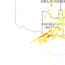
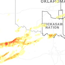

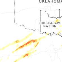


Connect with Interactive Hail Maps