

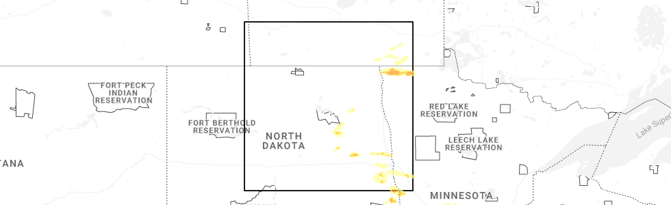
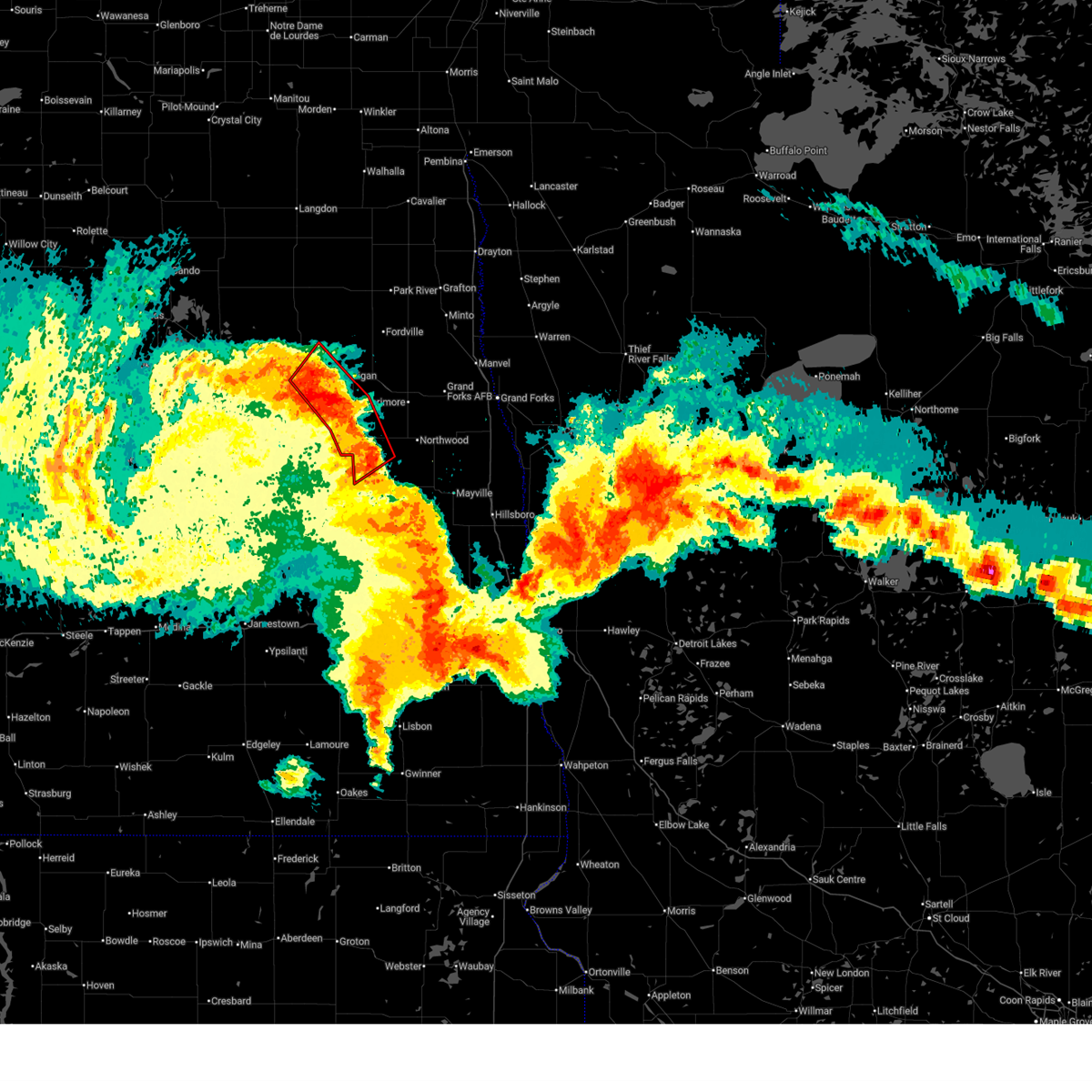
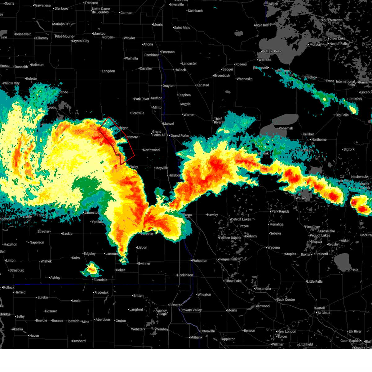
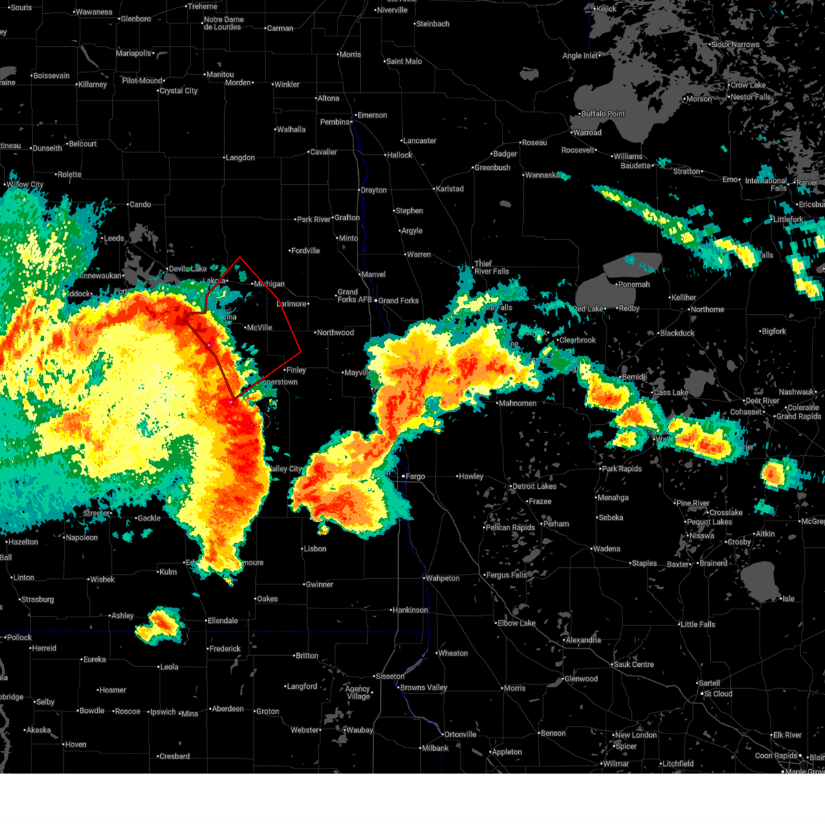
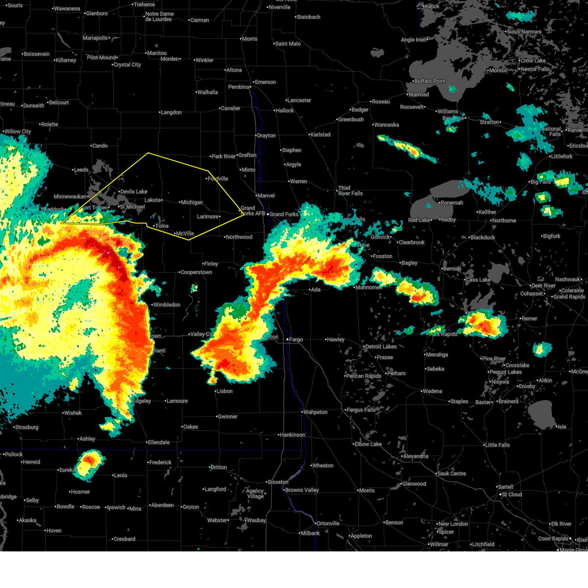
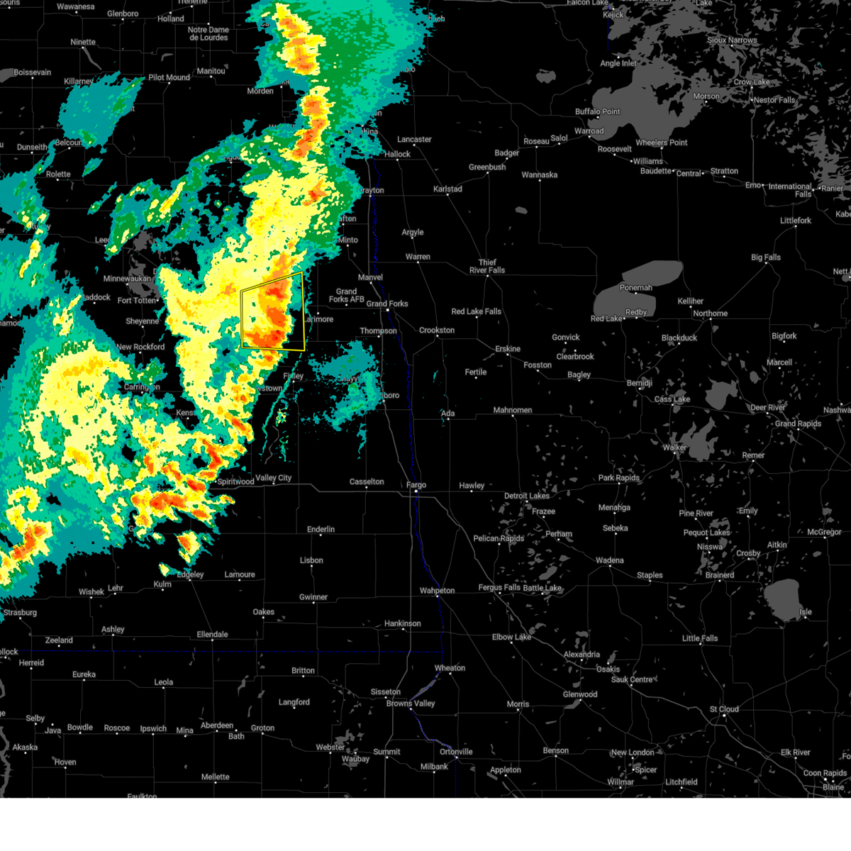
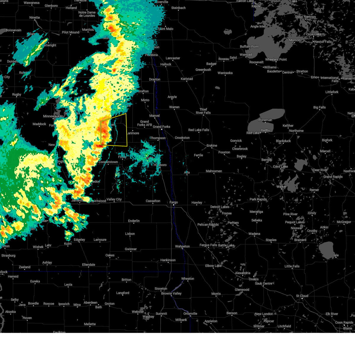
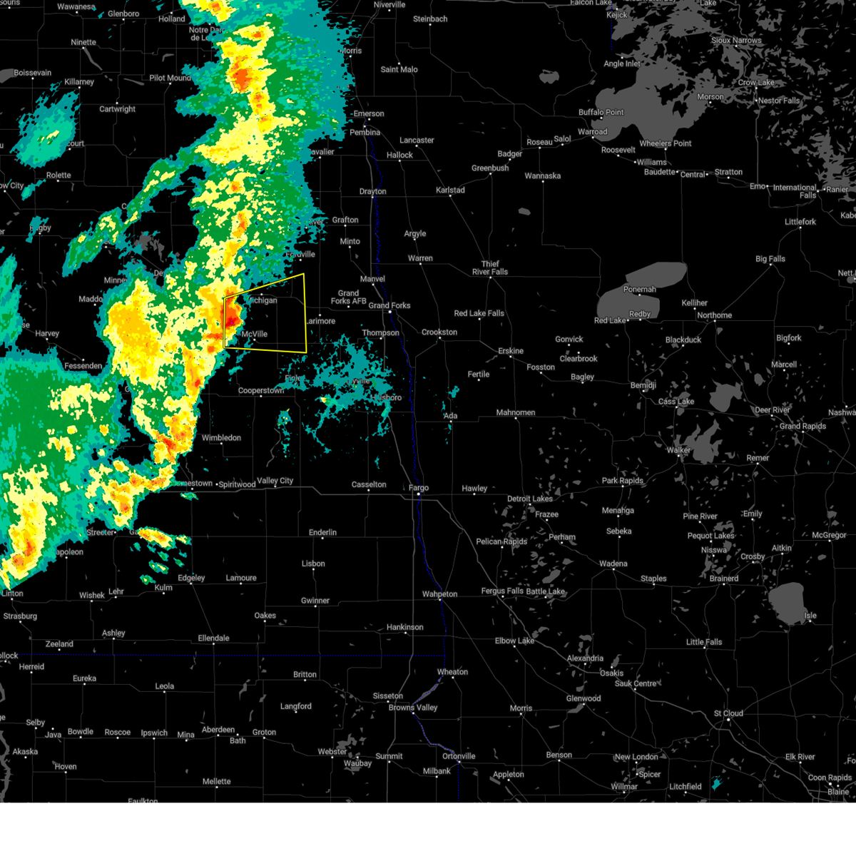
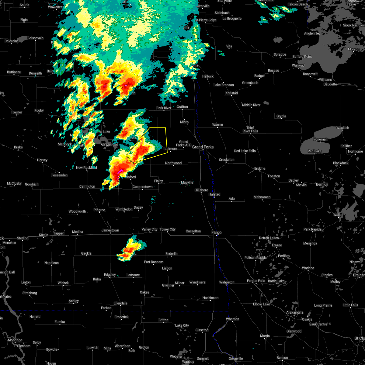
Hail Map for Michigan City, ND
The Michigan City, ND area has had 2 reports of on-the-ground hail by trained spotters, and has been under severe weather warnings 9 times during the past 12 months. Doppler radar has detected hail at or near Michigan City, ND on 28 occasions, including 2 occasions during the past year.
| Name: | Michigan City, ND |
| Where Located: | 34.7 miles E of Devils Lake, ND |
| Map: | Google Map for Michigan City, ND |
| Population: | 294 |
| Housing Units: | 173 |
| More Info: | Search Google for Michigan City, ND |
2
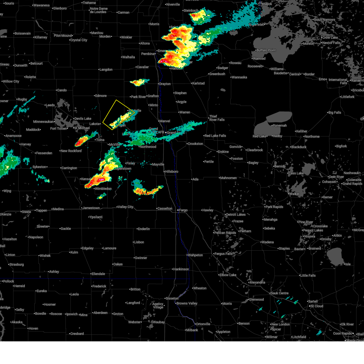
The Top Recent Hail Date for Michigan City, ND is Saturday, June 28, 2025 (11th out of 28)
Hail and Wind Damage Spotted near Michigan City, ND
| Date / Time | Report Details |
|---|---|
| 6/28/2025 4:37 PM CDT |
 the severe thunderstorm warning has been cancelled and is no longer in effect the severe thunderstorm warning has been cancelled and is no longer in effect
|
| 6/28/2025 4:11 PM CDT |
 Svrfgf the national weather service in grand forks has issued a * severe thunderstorm warning for, northwestern grand forks county in northeastern north dakota, northeastern nelson county in northeastern north dakota, southwestern walsh county in northeastern north dakota, * until 500 pm cdt. * at 410 pm cdt, a severe thunderstorm was located over michigan, or 34 miles east of devils lake, moving northeast at 25 mph (radar indicated). Hazards include 60 mph wind gusts and quarter size hail. Hail damage to vehicles is expected. Expect wind damage to roofs, siding, and trees. Svrfgf the national weather service in grand forks has issued a * severe thunderstorm warning for, northwestern grand forks county in northeastern north dakota, northeastern nelson county in northeastern north dakota, southwestern walsh county in northeastern north dakota, * until 500 pm cdt. * at 410 pm cdt, a severe thunderstorm was located over michigan, or 34 miles east of devils lake, moving northeast at 25 mph (radar indicated). Hazards include 60 mph wind gusts and quarter size hail. Hail damage to vehicles is expected. Expect wind damage to roofs, siding, and trees.
|
| 6/20/2025 11:56 PM CDT |
 The storms which prompted the warning have moved out of the area. therefore, the warning will be allowed to expire. however, gusty winds and heavy rain are still possible with these thunderstorms. a tornado watch remains in effect until 300 am cdt for northeastern north dakota. to report severe weather, contact your nearest law enforcement agency. they will relay your report to the national weather service grand forks. The storms which prompted the warning have moved out of the area. therefore, the warning will be allowed to expire. however, gusty winds and heavy rain are still possible with these thunderstorms. a tornado watch remains in effect until 300 am cdt for northeastern north dakota. to report severe weather, contact your nearest law enforcement agency. they will relay your report to the national weather service grand forks.
|
| 6/20/2025 11:38 PM CDT |
 The storms which prompted the warning have weakened below severe limits, and have exited the warned area. therefore, the warning will be allowed to expire. however, gusty winds are still possible with these thunderstorms. a tornado watch remains in effect until 300 am cdt for southeastern and northeastern north dakota. The storms which prompted the warning have weakened below severe limits, and have exited the warned area. therefore, the warning will be allowed to expire. however, gusty winds are still possible with these thunderstorms. a tornado watch remains in effect until 300 am cdt for southeastern and northeastern north dakota.
|
| 6/20/2025 11:33 PM CDT |
 At 1133 pm cdt, severe thunderstorms capable of producing tornadoes were located along a line extending from near lakota to near mcville to near aneta, moving northeast at 65 mph (radar indicated rotation). Hazards include tornado and ping pong ball size hail. Flying debris will be dangerous to those caught without shelter. mobile homes will be damaged or destroyed. damage to roofs, windows, and vehicles will occur. tree damage is likely. these dangerous storms will be near, michigan, aneta, and mapes around 1135 pm cdt. Petersburg and logan center around 1140 pm cdt. At 1133 pm cdt, severe thunderstorms capable of producing tornadoes were located along a line extending from near lakota to near mcville to near aneta, moving northeast at 65 mph (radar indicated rotation). Hazards include tornado and ping pong ball size hail. Flying debris will be dangerous to those caught without shelter. mobile homes will be damaged or destroyed. damage to roofs, windows, and vehicles will occur. tree damage is likely. these dangerous storms will be near, michigan, aneta, and mapes around 1135 pm cdt. Petersburg and logan center around 1140 pm cdt.
|
| 6/20/2025 11:33 PM CDT |
 the tornado warning has been cancelled and is no longer in effect the tornado warning has been cancelled and is no longer in effect
|
| 6/20/2025 11:13 PM CDT |
 Torfgf the national weather service in grand forks has issued a * tornado warning for, southwestern grand forks county in northeastern north dakota, nelson county in northeastern north dakota, northern griggs county in southeastern north dakota, northeastern eddy county in northeastern north dakota, northwestern steele county in southeastern north dakota, * until 1145 pm cdt. * at 1113 pm cdt, severe thunderstorms capable of producing a tornado were located along a line extending from near hamar to red willow lake to 6 miles south of jessie, moving northeast at 65 mph (radar indicated rotation). Hazards include tornado and ping pong ball size hail. Flying debris will be dangerous to those caught without shelter. mobile homes will be damaged or destroyed. damage to roofs, windows, and vehicles will occur. tree damage is likely. these dangerous storms will be near, binford, tolna, and red willow lake around 1115 pm cdt. mcville and pekin around 1120 pm cdt. kloten around 1125 pm cdt. aneta and mapes around 1130 pm cdt. Michigan around 1135 pm cdt. Torfgf the national weather service in grand forks has issued a * tornado warning for, southwestern grand forks county in northeastern north dakota, nelson county in northeastern north dakota, northern griggs county in southeastern north dakota, northeastern eddy county in northeastern north dakota, northwestern steele county in southeastern north dakota, * until 1145 pm cdt. * at 1113 pm cdt, severe thunderstorms capable of producing a tornado were located along a line extending from near hamar to red willow lake to 6 miles south of jessie, moving northeast at 65 mph (radar indicated rotation). Hazards include tornado and ping pong ball size hail. Flying debris will be dangerous to those caught without shelter. mobile homes will be damaged or destroyed. damage to roofs, windows, and vehicles will occur. tree damage is likely. these dangerous storms will be near, binford, tolna, and red willow lake around 1115 pm cdt. mcville and pekin around 1120 pm cdt. kloten around 1125 pm cdt. aneta and mapes around 1130 pm cdt. Michigan around 1135 pm cdt.
|
| 6/20/2025 11:04 PM CDT |
 Svrfgf the national weather service in grand forks has issued a * severe thunderstorm warning for, southeastern benson county in northeastern north dakota, northwestern grand forks county in northeastern north dakota, nelson county in northeastern north dakota, central ramsey county in northeastern north dakota, southwestern walsh county in northeastern north dakota, * until midnight cdt. * at 1102 pm cdt, severe thunderstorms were located along a line extending from near sheyenne to 8 miles southwest of warwick to near glenfield, moving northeast at 65 mph. these are destructive storms for benson, grand forks, nelson, ramsey, walsh counties (public). Hazards include 80 mph wind gusts and ping pong ball size hail. Flying debris will be dangerous to those caught without shelter. mobile homes will be heavily damaged. expect considerable damage to roofs, windows, and vehicles. extensive tree damage and power outages are likely. severe thunderstorms will be near, spirit lake nation around 1105 pm cdt. fort totten, warwick, and tokio around 1110 pm cdt. tolna, pekin, and st michael around 1115 pm cdt. mcville around 1120 pm cdt. Lakota, crary, and doyon around 1125 pm cdt. Svrfgf the national weather service in grand forks has issued a * severe thunderstorm warning for, southeastern benson county in northeastern north dakota, northwestern grand forks county in northeastern north dakota, nelson county in northeastern north dakota, central ramsey county in northeastern north dakota, southwestern walsh county in northeastern north dakota, * until midnight cdt. * at 1102 pm cdt, severe thunderstorms were located along a line extending from near sheyenne to 8 miles southwest of warwick to near glenfield, moving northeast at 65 mph. these are destructive storms for benson, grand forks, nelson, ramsey, walsh counties (public). Hazards include 80 mph wind gusts and ping pong ball size hail. Flying debris will be dangerous to those caught without shelter. mobile homes will be heavily damaged. expect considerable damage to roofs, windows, and vehicles. extensive tree damage and power outages are likely. severe thunderstorms will be near, spirit lake nation around 1105 pm cdt. fort totten, warwick, and tokio around 1110 pm cdt. tolna, pekin, and st michael around 1115 pm cdt. mcville around 1120 pm cdt. Lakota, crary, and doyon around 1125 pm cdt.
|
| 7/22/2024 5:54 PM CDT |
 Svrfgf the national weather service in grand forks has issued a * severe thunderstorm warning for, southeastern benson county in northeastern north dakota, northern nelson county in northeastern north dakota, ramsey county in northeastern north dakota, southwestern walsh county in northeastern north dakota, * until 645 pm cdt. * at 553 pm cdt, severe thunderstorms were located along a line extending from near penn to near crary to near brocket, moving south at 40 mph (radar indicated). Hazards include 60 mph wind gusts and quarter size hail. Hail damage to vehicles is expected. Expect wind damage to roofs, siding, and trees. Svrfgf the national weather service in grand forks has issued a * severe thunderstorm warning for, southeastern benson county in northeastern north dakota, northern nelson county in northeastern north dakota, ramsey county in northeastern north dakota, southwestern walsh county in northeastern north dakota, * until 645 pm cdt. * at 553 pm cdt, severe thunderstorms were located along a line extending from near penn to near crary to near brocket, moving south at 40 mph (radar indicated). Hazards include 60 mph wind gusts and quarter size hail. Hail damage to vehicles is expected. Expect wind damage to roofs, siding, and trees.
|
| 6/18/2024 12:54 AM CDT |
 the severe thunderstorm warning has been cancelled and is no longer in effect the severe thunderstorm warning has been cancelled and is no longer in effect
|
| 6/18/2024 12:54 AM CDT |
 At 1253 am cdt, severe thunderstorms were located along a line extending from lankin to near niagara to near aneta, moving east at 45 mph (radar indicated). Hazards include 60 mph wind gusts. Expect damage to roofs, siding, and trees. Locations impacted include, grand forks afb, park river, larimore, northwood, golden lake, mcville, and michigan. At 1253 am cdt, severe thunderstorms were located along a line extending from lankin to near niagara to near aneta, moving east at 45 mph (radar indicated). Hazards include 60 mph wind gusts. Expect damage to roofs, siding, and trees. Locations impacted include, grand forks afb, park river, larimore, northwood, golden lake, mcville, and michigan.
|
| 6/18/2024 12:30 AM CDT |
 Svrfgf the national weather service in grand forks has issued a * severe thunderstorm warning for, western grand forks county in northeastern north dakota, nelson county in northeastern north dakota, northern griggs county in southeastern north dakota, east central ramsey county in northeastern north dakota, southwestern walsh county in northeastern north dakota, northwestern steele county in southeastern north dakota, * until 115 am cdt. * at 1229 am cdt, severe thunderstorms were located along a line extending from near lawton to 7 miles south of mapes to near binford, moving east at 45 mph (radar indicated). Hazards include 60 mph wind gusts. expect damage to roofs, siding, and trees Svrfgf the national weather service in grand forks has issued a * severe thunderstorm warning for, western grand forks county in northeastern north dakota, nelson county in northeastern north dakota, northern griggs county in southeastern north dakota, east central ramsey county in northeastern north dakota, southwestern walsh county in northeastern north dakota, northwestern steele county in southeastern north dakota, * until 115 am cdt. * at 1229 am cdt, severe thunderstorms were located along a line extending from near lawton to 7 miles south of mapes to near binford, moving east at 45 mph (radar indicated). Hazards include 60 mph wind gusts. expect damage to roofs, siding, and trees
|
| 5/17/2024 7:35 PM CDT |
 The storm which prompted the warning has weakened below severe limits, and has exited the warned area. therefore, the warning will be allowed to expire. a severe thunderstorm watch remains in effect until midnight cdt for northeastern north dakota. The storm which prompted the warning has weakened below severe limits, and has exited the warned area. therefore, the warning will be allowed to expire. a severe thunderstorm watch remains in effect until midnight cdt for northeastern north dakota.
|
| 5/17/2024 7:13 PM CDT |
 At 713 pm cdt, a severe thunderstorm was located near niagara, or 39 miles west of grand forks, moving east at 45 mph (radar indicated). Hazards include 60 mph wind gusts and quarter size hail. Hail damage to vehicles is expected. expect wind damage to roofs, siding, and trees. Locations impacted include, mcville, michigan, petersburg, niagara, kloten, mapes, and logan center. At 713 pm cdt, a severe thunderstorm was located near niagara, or 39 miles west of grand forks, moving east at 45 mph (radar indicated). Hazards include 60 mph wind gusts and quarter size hail. Hail damage to vehicles is expected. expect wind damage to roofs, siding, and trees. Locations impacted include, mcville, michigan, petersburg, niagara, kloten, mapes, and logan center.
|
| 5/17/2024 6:54 PM CDT |
 Svrfgf the national weather service in grand forks has issued a * severe thunderstorm warning for, western grand forks county in northeastern north dakota, nelson county in northeastern north dakota, * until 745 pm cdt. * at 654 pm cdt, a severe thunderstorm was located near pekin, or 30 miles southeast of devils lake, moving east at 40 mph (radar indicated). Hazards include 60 mph wind gusts and quarter size hail. Hail damage to vehicles is expected. Expect wind damage to roofs, siding, and trees. Svrfgf the national weather service in grand forks has issued a * severe thunderstorm warning for, western grand forks county in northeastern north dakota, nelson county in northeastern north dakota, * until 745 pm cdt. * at 654 pm cdt, a severe thunderstorm was located near pekin, or 30 miles southeast of devils lake, moving east at 40 mph (radar indicated). Hazards include 60 mph wind gusts and quarter size hail. Hail damage to vehicles is expected. Expect wind damage to roofs, siding, and trees.
|
| 5/17/2024 6:34 PM CDT |
 At 632 pm cdt, severe thunderstorms were located along a line extending from 8 miles north of southam to spirit lake nation to near grace city, moving east at 35 mph (radar indicated). Hazards include 60 mph wind gusts and nickel size hail. Expect damage to roofs, siding, and trees. Locations impacted include, cooperstown, lakota, mcville, michigan, binford, edmore, and tolna. At 632 pm cdt, severe thunderstorms were located along a line extending from 8 miles north of southam to spirit lake nation to near grace city, moving east at 35 mph (radar indicated). Hazards include 60 mph wind gusts and nickel size hail. Expect damage to roofs, siding, and trees. Locations impacted include, cooperstown, lakota, mcville, michigan, binford, edmore, and tolna.
|
| 5/17/2024 6:14 PM CDT |
 Svrfgf the national weather service in grand forks has issued a * severe thunderstorm warning for, southeastern benson county in northeastern north dakota, nelson county in northeastern north dakota, northern griggs county in southeastern north dakota, ramsey county in northeastern north dakota, western walsh county in northeastern north dakota, eastern eddy county in northeastern north dakota, * until 700 pm cdt. * at 614 pm cdt, severe thunderstorms were located along a line extending from near webster to spirit lake nation to near carrington, moving east at 35 mph (radar indicated). Hazards include 60 mph wind gusts and nickel size hail. expect damage to roofs, siding, and trees Svrfgf the national weather service in grand forks has issued a * severe thunderstorm warning for, southeastern benson county in northeastern north dakota, nelson county in northeastern north dakota, northern griggs county in southeastern north dakota, ramsey county in northeastern north dakota, western walsh county in northeastern north dakota, eastern eddy county in northeastern north dakota, * until 700 pm cdt. * at 614 pm cdt, severe thunderstorms were located along a line extending from near webster to spirit lake nation to near carrington, moving east at 35 mph (radar indicated). Hazards include 60 mph wind gusts and nickel size hail. expect damage to roofs, siding, and trees
|
| 9/4/2023 11:39 PM CDT |
 At 1139 pm cdt, severe thunderstorms were located along a line extending from near derrick to near whitman to near finley, moving northeast at 45 mph (radar indicated). Hazards include 60 mph wind gusts. expect damage to roofs, siding, and trees At 1139 pm cdt, severe thunderstorms were located along a line extending from near derrick to near whitman to near finley, moving northeast at 45 mph (radar indicated). Hazards include 60 mph wind gusts. expect damage to roofs, siding, and trees
|
| 9/4/2023 11:27 PM CDT |
 At 1126 pm cdt, severe thunderstorms were located along a line extending from near brinsmade to lawton to 7 miles northwest of luverne, moving northeast at 20 mph (radar indicated). Hazards include 60 mph wind gusts and penny size hail. Expect damage to roofs, siding, and trees. Locations impacted include, devils lake, new rockford, cando, cooperstown, camp grafton, lakota and lakewood park. At 1126 pm cdt, severe thunderstorms were located along a line extending from near brinsmade to lawton to 7 miles northwest of luverne, moving northeast at 20 mph (radar indicated). Hazards include 60 mph wind gusts and penny size hail. Expect damage to roofs, siding, and trees. Locations impacted include, devils lake, new rockford, cando, cooperstown, camp grafton, lakota and lakewood park.
|
| 9/4/2023 10:58 PM CDT |
 At 1058 pm cdt, severe thunderstorms were located along a line extending from esmond to 7 miles northeast of devils lake to near wimbledon, moving northeast at 55 mph (radar indicated). Hazards include 60 mph wind gusts and penny size hail. expect damage to roofs, siding, and trees At 1058 pm cdt, severe thunderstorms were located along a line extending from esmond to 7 miles northeast of devils lake to near wimbledon, moving northeast at 55 mph (radar indicated). Hazards include 60 mph wind gusts and penny size hail. expect damage to roofs, siding, and trees
|
| 6/27/2023 8:17 PM CDT |
 At 817 pm cdt, a severe thunderstorm was located near mapes, or 27 miles east of devils lake, moving east at 5 mph (radar indicated). Hazards include ping pong ball size hail. People and animals outdoors will be injured. expect damage to roofs, siding, windows, and vehicles. locations impacted include, lakota, michigan, whitman and mapes. hail threat, radar indicated max hail size, 1. 50 in wind threat, radar indicated max wind gust, <50 mph. At 817 pm cdt, a severe thunderstorm was located near mapes, or 27 miles east of devils lake, moving east at 5 mph (radar indicated). Hazards include ping pong ball size hail. People and animals outdoors will be injured. expect damage to roofs, siding, windows, and vehicles. locations impacted include, lakota, michigan, whitman and mapes. hail threat, radar indicated max hail size, 1. 50 in wind threat, radar indicated max wind gust, <50 mph.
|
| 6/27/2023 8:06 PM CDT |
 At 806 pm cdt, a severe thunderstorm was located near mapes, or 27 miles east of devils lake, moving east at 10 mph (radar indicated). Hazards include half dollar size hail. damage to vehicles is expected At 806 pm cdt, a severe thunderstorm was located near mapes, or 27 miles east of devils lake, moving east at 10 mph (radar indicated). Hazards include half dollar size hail. damage to vehicles is expected
|
| 7/23/2022 12:19 AM CDT |
 At 1219 am cdt, severe thunderstorms were located along a line extending from near mandt to near petersburg, moving east at 40 mph. these are destructive storms! (radar indicated). Hazards include 80 mph wind gusts and quarter size hail. Flying debris will be dangerous to those caught without shelter. mobile homes will be heavily damaged. expect considerable damage to roofs, windows, and vehicles. extensive tree damage and power outages are likely. locations impacted include, mandt, hoople, nash, mccanna, grafton, auburn, larimore, cashel, oakwood and herrick. This includes interstate 29 between mile markers 176 and 184. At 1219 am cdt, severe thunderstorms were located along a line extending from near mandt to near petersburg, moving east at 40 mph. these are destructive storms! (radar indicated). Hazards include 80 mph wind gusts and quarter size hail. Flying debris will be dangerous to those caught without shelter. mobile homes will be heavily damaged. expect considerable damage to roofs, windows, and vehicles. extensive tree damage and power outages are likely. locations impacted include, mandt, hoople, nash, mccanna, grafton, auburn, larimore, cashel, oakwood and herrick. This includes interstate 29 between mile markers 176 and 184.
|
| 7/23/2022 12:02 AM CDT |
 At 1202 am cdt, severe thunderstorms were located along a line extending from edinburg to near michigan, moving east at 40 mph (radar indicated). Hazards include 70 mph wind gusts and quarter size hail. Hail damage to vehicles is expected. expect considerable tree damage. wind damage is also likely to mobile homes, roofs, and outbuildings. these severe storms will be near, edinburg around 1205 am cdt. park river around 1210 am cdt. other locations in the path of these severe thunderstorms include petersburg, mandt, hoople, nash and niagara. This includes interstate 29 between mile markers 176 and 184. At 1202 am cdt, severe thunderstorms were located along a line extending from edinburg to near michigan, moving east at 40 mph (radar indicated). Hazards include 70 mph wind gusts and quarter size hail. Hail damage to vehicles is expected. expect considerable tree damage. wind damage is also likely to mobile homes, roofs, and outbuildings. these severe storms will be near, edinburg around 1205 am cdt. park river around 1210 am cdt. other locations in the path of these severe thunderstorms include petersburg, mandt, hoople, nash and niagara. This includes interstate 29 between mile markers 176 and 184.
|
| 7/23/2022 12:01 AM CDT | Personal weather station reports 58 mp in nelson county ND, 5.9 miles S of Michigan City, ND |
| 7/22/2022 11:52 PM CDT |
 At 1151 pm cdt, severe thunderstorms were located along a line extending from near adams to near lakota, moving east at 40 mph. at 1145 pm cdt, (radar indicated). Hazards include 70 mph wind gusts and quarter size hail. Hail damage to vehicles is expected. expect considerable tree damage. wind damage is also likely to mobile homes, roofs, and outbuildings. severe thunderstorms will be near, adams around 1155 pm cdt. edinburg around 1200 am cdt. petersburg and park river around 1210 am cdt. other locations in the path of these severe thunderstorms include hoople, mandt and niagara. this includes interstate 29 between mile markers 176 and 184. thunderstorm damage threat, considerable hail threat, radar indicated max hail size, 1. 00 in wind threat, observed max wind gust, 70 mph. At 1151 pm cdt, severe thunderstorms were located along a line extending from near adams to near lakota, moving east at 40 mph. at 1145 pm cdt, (radar indicated). Hazards include 70 mph wind gusts and quarter size hail. Hail damage to vehicles is expected. expect considerable tree damage. wind damage is also likely to mobile homes, roofs, and outbuildings. severe thunderstorms will be near, adams around 1155 pm cdt. edinburg around 1200 am cdt. petersburg and park river around 1210 am cdt. other locations in the path of these severe thunderstorms include hoople, mandt and niagara. this includes interstate 29 between mile markers 176 and 184. thunderstorm damage threat, considerable hail threat, radar indicated max hail size, 1. 00 in wind threat, observed max wind gust, 70 mph.
|
| 7/22/2022 11:29 PM CDT |
 At 1129 pm cdt, severe thunderstorms were located along a line extending from near akra to spirit lake nation, moving east at 55 mph (radar indicated). Hazards include 70 mph wind gusts and ping pong ball size hail. People and animals outdoors will be injured. expect hail damage to roofs, siding, windows, and vehicles. expect considerable tree damage. wind damage is also likely to mobile homes, roofs, and outbuildings. these severe storms will be near, akra, mountain and backoo around 1130 pm cdt. hensel and cavalier around 1135 pm cdt. other locations in the path of these severe thunderstorms include hamar, tolna, hamilton and pekin. thunderstorm damage threat, considerable hail threat, radar indicated max hail size, 1. 50 in wind threat, observed max wind gust, 70 mph. At 1129 pm cdt, severe thunderstorms were located along a line extending from near akra to spirit lake nation, moving east at 55 mph (radar indicated). Hazards include 70 mph wind gusts and ping pong ball size hail. People and animals outdoors will be injured. expect hail damage to roofs, siding, windows, and vehicles. expect considerable tree damage. wind damage is also likely to mobile homes, roofs, and outbuildings. these severe storms will be near, akra, mountain and backoo around 1130 pm cdt. hensel and cavalier around 1135 pm cdt. other locations in the path of these severe thunderstorms include hamar, tolna, hamilton and pekin. thunderstorm damage threat, considerable hail threat, radar indicated max hail size, 1. 50 in wind threat, observed max wind gust, 70 mph.
|
| 7/22/2022 11:16 PM CDT |
 At 1112 pm cdt, severe thunderstorms were located along a line extending from olga to spirit lake nation, moving southeast at 55 mph. at 1104 pm cdt, a 60 mph wind gust was reported near webster (radar indicated). Hazards include 70 mph wind gusts and ping pong ball size hail. People and animals outdoors will be injured. expect hail damage to roofs, siding, windows, and vehicles. expect considerable tree damage. wind damage is also likely to mobile homes, roofs, and outbuildings. these severe storms will be near, olga around 1115 pm cdt. concrete and tokio around 1120 pm cdt. other locations in the path of these severe thunderstorms include mountain, akra, backoo, warwick, hensel, hamar and crystal. thunderstorm damage threat, considerable hail threat, radar indicated max hail size, 1. 50 in wind threat, observed max wind gust, 70 mph. At 1112 pm cdt, severe thunderstorms were located along a line extending from olga to spirit lake nation, moving southeast at 55 mph. at 1104 pm cdt, a 60 mph wind gust was reported near webster (radar indicated). Hazards include 70 mph wind gusts and ping pong ball size hail. People and animals outdoors will be injured. expect hail damage to roofs, siding, windows, and vehicles. expect considerable tree damage. wind damage is also likely to mobile homes, roofs, and outbuildings. these severe storms will be near, olga around 1115 pm cdt. concrete and tokio around 1120 pm cdt. other locations in the path of these severe thunderstorms include mountain, akra, backoo, warwick, hensel, hamar and crystal. thunderstorm damage threat, considerable hail threat, radar indicated max hail size, 1. 50 in wind threat, observed max wind gust, 70 mph.
|
| 7/22/2022 11:03 PM CDT |
 At 1102 pm cdt, severe thunderstorms were located along a line extending from near vang to oberon, moving southeast at 55 mph. at 1100 pm cdt, a mesonet reported a 62 mph wind gust near maddock (radar indicated). Hazards include 70 mph wind gusts and quarter size hail. Hail damage to vehicles is expected. expect considerable tree damage. wind damage is also likely to mobile homes, roofs, and outbuildings. severe thunderstorms will be near, vang around 1105 pm cdt. olga and fort totten around 1110 pm cdt. concrete and tokio around 1120 pm cdt. other locations in the path of these severe thunderstorms include mountain, akra and warwick. thunderstorm damage threat, considerable hail threat, radar indicated max hail size, 1. 00 in wind threat, observed max wind gust, 70 mph. At 1102 pm cdt, severe thunderstorms were located along a line extending from near vang to oberon, moving southeast at 55 mph. at 1100 pm cdt, a mesonet reported a 62 mph wind gust near maddock (radar indicated). Hazards include 70 mph wind gusts and quarter size hail. Hail damage to vehicles is expected. expect considerable tree damage. wind damage is also likely to mobile homes, roofs, and outbuildings. severe thunderstorms will be near, vang around 1105 pm cdt. olga and fort totten around 1110 pm cdt. concrete and tokio around 1120 pm cdt. other locations in the path of these severe thunderstorms include mountain, akra and warwick. thunderstorm damage threat, considerable hail threat, radar indicated max hail size, 1. 00 in wind threat, observed max wind gust, 70 mph.
|
| 7/10/2022 7:20 AM CDT |
 At 720 am cdt, severe thunderstorms were located along a line extending from near edinburg to near larimore to near blabon, moving east at 55 mph (radar indicated). Hazards include 60 mph wind gusts and nickel size hail. Expect damage to roofs, siding, and trees. locations impacted include, larimore, kempton, arvilla, colgate, mandt, clifford, grand forks afb and galesburg. hail threat, radar indicated max hail size, 0. 88 in wind threat, radar indicated max wind gust, 60 mph. At 720 am cdt, severe thunderstorms were located along a line extending from near edinburg to near larimore to near blabon, moving east at 55 mph (radar indicated). Hazards include 60 mph wind gusts and nickel size hail. Expect damage to roofs, siding, and trees. locations impacted include, larimore, kempton, arvilla, colgate, mandt, clifford, grand forks afb and galesburg. hail threat, radar indicated max hail size, 0. 88 in wind threat, radar indicated max wind gust, 60 mph.
|
| 7/10/2022 6:55 AM CDT |
 At 655 am cdt, severe thunderstorms were located along a line extending from edmore to 6 miles north of pekin to revere, moving east at 45 mph (radar indicated). Hazards include 60 mph wind gusts and nickel size hail. Expect damage to roofs, siding, and trees. severe thunderstorms will be near, mcville around 700 am cdt. hannaford and walum around 705 am cdt. other locations in the path of these severe thunderstorms include adams, luverne, sibley, logan center, blabon, lankin and pillsbury. hail threat, radar indicated max hail size, 0. 88 in wind threat, radar indicated max wind gust, 60 mph. At 655 am cdt, severe thunderstorms were located along a line extending from edmore to 6 miles north of pekin to revere, moving east at 45 mph (radar indicated). Hazards include 60 mph wind gusts and nickel size hail. Expect damage to roofs, siding, and trees. severe thunderstorms will be near, mcville around 700 am cdt. hannaford and walum around 705 am cdt. other locations in the path of these severe thunderstorms include adams, luverne, sibley, logan center, blabon, lankin and pillsbury. hail threat, radar indicated max hail size, 0. 88 in wind threat, radar indicated max wind gust, 60 mph.
|
| 6/24/2022 8:12 PM CDT |
 The severe thunderstorm warning for northwestern grand forks, eastern nelson and south central walsh counties will expire at 815 pm cdt, the storm which prompted the warning has weakened below severe limits, and no longer poses an immediate threat to life or property. therefore, the warning will be allowed to expire. however gusty winds and heavy rain are still possible with this thunderstorm. a severe thunderstorm watch remains in effect until 900 pm cdt for northeastern north dakota. The severe thunderstorm warning for northwestern grand forks, eastern nelson and south central walsh counties will expire at 815 pm cdt, the storm which prompted the warning has weakened below severe limits, and no longer poses an immediate threat to life or property. therefore, the warning will be allowed to expire. however gusty winds and heavy rain are still possible with this thunderstorm. a severe thunderstorm watch remains in effect until 900 pm cdt for northeastern north dakota.
|
| 6/24/2022 7:52 PM CDT |
 At 751 pm cdt, a severe thunderstorm was located near petersburg, or 41 miles west of grand forks, moving northeast at 60 mph (radar indicated). Hazards include 60 mph wind gusts. Expect damage to roofs, siding, and trees. locations impacted include, niagara, mccanna, orr, honeyford, inkster, gilby, johnstown and mekinock. hail threat, radar indicated max hail size, <. 75 in wind threat, radar indicated max wind gust, 60 mph. At 751 pm cdt, a severe thunderstorm was located near petersburg, or 41 miles west of grand forks, moving northeast at 60 mph (radar indicated). Hazards include 60 mph wind gusts. Expect damage to roofs, siding, and trees. locations impacted include, niagara, mccanna, orr, honeyford, inkster, gilby, johnstown and mekinock. hail threat, radar indicated max hail size, <. 75 in wind threat, radar indicated max wind gust, 60 mph.
|
| 6/24/2022 7:33 PM CDT |
 At 732 pm cdt, a severe thunderstorm was located over pekin, or 33 miles southeast of devils lake, moving northeast at 60 mph (radar indicated). Hazards include 60 mph wind gusts. Expect damage to roofs, siding, and trees. this severe thunderstorm will be near, mcville around 740 pm cdt. other locations in the path of this severe thunderstorm include petersburg, niagara, mccanna and orr. hail threat, radar indicated max hail size, <. 75 in wind threat, radar indicated max wind gust, 60 mph. At 732 pm cdt, a severe thunderstorm was located over pekin, or 33 miles southeast of devils lake, moving northeast at 60 mph (radar indicated). Hazards include 60 mph wind gusts. Expect damage to roofs, siding, and trees. this severe thunderstorm will be near, mcville around 740 pm cdt. other locations in the path of this severe thunderstorm include petersburg, niagara, mccanna and orr. hail threat, radar indicated max hail size, <. 75 in wind threat, radar indicated max wind gust, 60 mph.
|
| 6/24/2022 5:36 PM CDT |
 At 535 pm cdt, severe thunderstorms were located along a line extending from near johnstown to near larimore, moving east at 40 mph. storms are also creating blowing dust causing significant drops in visibility in the vicinity of northwood. these are destructive storms for grand forks (radar indicated). Hazards include 80 mph wind gusts and ping pong ball size hail. Flying debris will be dangerous to those caught without shelter. mobile homes will be heavily damaged. expect considerable damage to roofs, windows, and vehicles. extensive tree damage and power outages are likely. severe thunderstorms will be near, johnstown, gilby and forest river around 540 pm cdt. ardoch around 545 pm cdt. mekinock around 550 pm cdt. poland around 555 pm cdt. other locations in the path of these severe thunderstorms include manvel, emerado and oslo. This includes interstate 29 between mile markers 138 and 172. At 535 pm cdt, severe thunderstorms were located along a line extending from near johnstown to near larimore, moving east at 40 mph. storms are also creating blowing dust causing significant drops in visibility in the vicinity of northwood. these are destructive storms for grand forks (radar indicated). Hazards include 80 mph wind gusts and ping pong ball size hail. Flying debris will be dangerous to those caught without shelter. mobile homes will be heavily damaged. expect considerable damage to roofs, windows, and vehicles. extensive tree damage and power outages are likely. severe thunderstorms will be near, johnstown, gilby and forest river around 540 pm cdt. ardoch around 545 pm cdt. mekinock around 550 pm cdt. poland around 555 pm cdt. other locations in the path of these severe thunderstorms include manvel, emerado and oslo. This includes interstate 29 between mile markers 138 and 172.
|
| 6/24/2022 5:31 PM CDT |
 At 530 pm cdt, severe thunderstorms were located along a line extending from near northwood to near hannaford, moving southeast at 45 mph. high winds are creating significant blowing dust near northwood. visibility could fall as low as 1/4 mile at times! these are destructive storms for western grand forks county (radar indicated). Hazards include 80 mph wind gusts and ping pong ball size hail. Flying debris will be dangerous to those caught without shelter. mobile homes will be heavily damaged. expect considerable damage to roofs, windows, and vehicles. extensive tree damage and power outages are likely. locations impacted include, larimore, cooperstown, lakota, mcville, michigan, gilby and aneta. This includes interstate 29 between mile markers 161 and 164. At 530 pm cdt, severe thunderstorms were located along a line extending from near northwood to near hannaford, moving southeast at 45 mph. high winds are creating significant blowing dust near northwood. visibility could fall as low as 1/4 mile at times! these are destructive storms for western grand forks county (radar indicated). Hazards include 80 mph wind gusts and ping pong ball size hail. Flying debris will be dangerous to those caught without shelter. mobile homes will be heavily damaged. expect considerable damage to roofs, windows, and vehicles. extensive tree damage and power outages are likely. locations impacted include, larimore, cooperstown, lakota, mcville, michigan, gilby and aneta. This includes interstate 29 between mile markers 161 and 164.
|
| 6/24/2022 5:25 PM CDT |
 At 524 pm cdt, severe thunderstorms were located along a line extending from near northwood to near revere, moving southeast at 45 mph. these are destructive storms for niagra and mccanna (radar indicated). Hazards include 80 mph wind gusts and ping pong ball size hail. Flying debris will be dangerous to those caught without shelter. mobile homes will be heavily damaged. expect considerable damage to roofs, windows, and vehicles. extensive tree damage and power outages are likely. locations impacted include, larimore, cooperstown, lakota, mcville, michigan, gilby and aneta. This includes interstate 29 between mile markers 161 and 164. At 524 pm cdt, severe thunderstorms were located along a line extending from near northwood to near revere, moving southeast at 45 mph. these are destructive storms for niagra and mccanna (radar indicated). Hazards include 80 mph wind gusts and ping pong ball size hail. Flying debris will be dangerous to those caught without shelter. mobile homes will be heavily damaged. expect considerable damage to roofs, windows, and vehicles. extensive tree damage and power outages are likely. locations impacted include, larimore, cooperstown, lakota, mcville, michigan, gilby and aneta. This includes interstate 29 between mile markers 161 and 164.
|
| 6/24/2022 5:03 PM CDT |
 At 501 pm cdt, severe thunderstorms were located along a line extending from 7 miles northwest of logan center to near mchenry, moving southeast at 45 mph. these are destructive storms for lakota, mapes, and michigan (radar indicated). Hazards include 80 mph wind gusts and ping pong ball size hail. Flying debris will be dangerous to those caught without shelter. mobile homes will be heavily damaged. expect considerable damage to roofs, windows, and vehicles. extensive tree damage and power outages are likely. locations impacted include, logan center, kempton, cooperstown and hannaford. This includes interstate 29 between mile markers 161 and 164. At 501 pm cdt, severe thunderstorms were located along a line extending from 7 miles northwest of logan center to near mchenry, moving southeast at 45 mph. these are destructive storms for lakota, mapes, and michigan (radar indicated). Hazards include 80 mph wind gusts and ping pong ball size hail. Flying debris will be dangerous to those caught without shelter. mobile homes will be heavily damaged. expect considerable damage to roofs, windows, and vehicles. extensive tree damage and power outages are likely. locations impacted include, logan center, kempton, cooperstown and hannaford. This includes interstate 29 between mile markers 161 and 164.
|
| 6/24/2022 4:38 PM CDT |
 At 438 pm cdt, severe thunderstorms were located along a line extending from near mapes to 9 miles south of warwick, moving southeast at 45 mph (radar indicated). Hazards include ping pong ball size hail and 60 mph wind gusts. People and animals outdoors will be injured. expect hail damage to roofs, siding, windows, and vehicles. expect wind damage to roofs, siding, and trees. severe thunderstorms will be near, michigan and mapes around 440 pm cdt. petersburg around 450 pm cdt. other locations in the path of these severe thunderstorms include mose, logan center, binford and kempton. This includes interstate 29 between mile markers 161 and 164. At 438 pm cdt, severe thunderstorms were located along a line extending from near mapes to 9 miles south of warwick, moving southeast at 45 mph (radar indicated). Hazards include ping pong ball size hail and 60 mph wind gusts. People and animals outdoors will be injured. expect hail damage to roofs, siding, windows, and vehicles. expect wind damage to roofs, siding, and trees. severe thunderstorms will be near, michigan and mapes around 440 pm cdt. petersburg around 450 pm cdt. other locations in the path of these severe thunderstorms include mose, logan center, binford and kempton. This includes interstate 29 between mile markers 161 and 164.
|
| 6/19/2022 11:30 PM CDT |
 At 1130 pm cdt, severe thunderstorms were located along a line extending from near michigan to larimore, moving east at 60 mph (radar indicated). Hazards include 70 mph wind gusts and quarter size hail. Hail damage to vehicles is expected. expect considerable tree damage. wind damage is also likely to mobile homes, roofs, and outbuildings. locations impacted include, arvilla, larimore, kempton, grand forks afb, orr, inkster, mccanna, gilby, honeyford, johnstown and mekinock. this includes interstate 29 between mile markers 154 and 158. thunderstorm damage threat, considerable hail threat, radar indicated max hail size, 1. 00 in wind threat, observed max wind gust, 70 mph. At 1130 pm cdt, severe thunderstorms were located along a line extending from near michigan to larimore, moving east at 60 mph (radar indicated). Hazards include 70 mph wind gusts and quarter size hail. Hail damage to vehicles is expected. expect considerable tree damage. wind damage is also likely to mobile homes, roofs, and outbuildings. locations impacted include, arvilla, larimore, kempton, grand forks afb, orr, inkster, mccanna, gilby, honeyford, johnstown and mekinock. this includes interstate 29 between mile markers 154 and 158. thunderstorm damage threat, considerable hail threat, radar indicated max hail size, 1. 00 in wind threat, observed max wind gust, 70 mph.
|
| 6/19/2022 11:05 PM CDT |
 At 1104 pm cdt, severe thunderstorms were located along a line extending from pekin to near sharon, moving northeast at 60 mph. at 1100 pm cdt, a 68 mph wind gust was reported near cooperstown (radar indicated). Hazards include 70 mph wind gusts and quarter size hail. Hail damage to vehicles is expected. expect considerable tree damage. wind damage is also likely to mobile homes, roofs, and outbuildings. severe thunderstorms will be near, mapes and logan center around 1120 pm cdt. other locations in the path of these severe thunderstorms include michigan, kempton, petersburg, larimore, whitman, dahlen, arvilla, emerado, honeyford, mekinock and grand forks afb. this includes interstate 29 between mile markers 153 and 158. thunderstorm damage threat, considerable hail threat, radar indicated max hail size, 1. 00 in wind threat, observed max wind gust, 70 mph. At 1104 pm cdt, severe thunderstorms were located along a line extending from pekin to near sharon, moving northeast at 60 mph. at 1100 pm cdt, a 68 mph wind gust was reported near cooperstown (radar indicated). Hazards include 70 mph wind gusts and quarter size hail. Hail damage to vehicles is expected. expect considerable tree damage. wind damage is also likely to mobile homes, roofs, and outbuildings. severe thunderstorms will be near, mapes and logan center around 1120 pm cdt. other locations in the path of these severe thunderstorms include michigan, kempton, petersburg, larimore, whitman, dahlen, arvilla, emerado, honeyford, mekinock and grand forks afb. this includes interstate 29 between mile markers 153 and 158. thunderstorm damage threat, considerable hail threat, radar indicated max hail size, 1. 00 in wind threat, observed max wind gust, 70 mph.
|
| 6/14/2022 7:31 AM CDT |
 At 730 am cdt, severe thunderstorms were located along a line extending from near mapes to near kempton to near portland, moving northeast at 65 mph (radar indicated). Hazards include 60 mph wind gusts. Expect damage to roofs, siding, and trees. severe thunderstorms will be near, larimore around 735 am cdt. arvilla and holmes around 740 am cdt. thompson, whitman and mekinock around 745 am cdt. merrifield, grand forks and bygland around 750 am cdt. other locations in the path of these severe thunderstorms include lankin, east grand forks and mallory. this includes interstate 29 between mile markers 127 and 207. hail threat, radar indicated max hail size, <. 75 in wind threat, radar indicated max wind gust, 60 mph. At 730 am cdt, severe thunderstorms were located along a line extending from near mapes to near kempton to near portland, moving northeast at 65 mph (radar indicated). Hazards include 60 mph wind gusts. Expect damage to roofs, siding, and trees. severe thunderstorms will be near, larimore around 735 am cdt. arvilla and holmes around 740 am cdt. thompson, whitman and mekinock around 745 am cdt. merrifield, grand forks and bygland around 750 am cdt. other locations in the path of these severe thunderstorms include lankin, east grand forks and mallory. this includes interstate 29 between mile markers 127 and 207. hail threat, radar indicated max hail size, <. 75 in wind threat, radar indicated max wind gust, 60 mph.
|
| 6/14/2022 7:15 AM CDT |
 At 715 am cdt, severe thunderstorms were located along a line extending from near tolna to 6 miles northwest of logan center to near holmes, moving north at 55 mph (radar indicated). Hazards include 60 mph wind gusts and penny size hail. Expect damage to roofs, siding, and trees. severe thunderstorms will be near, niagara, petersburg and mccanna around 725 am cdt. emerado and arvilla around 730 am cdt. bartlett, grand forks afb and lakota around 735 am cdt. other locations in the path of these severe thunderstorms include mekinock, fordville, honeyford, brocket, johnstown and conway. this includes interstate 29 between mile markers 154 and 157. hail threat, radar indicated max hail size, 0. 75 in wind threat, radar indicated max wind gust, 60 mph. At 715 am cdt, severe thunderstorms were located along a line extending from near tolna to 6 miles northwest of logan center to near holmes, moving north at 55 mph (radar indicated). Hazards include 60 mph wind gusts and penny size hail. Expect damage to roofs, siding, and trees. severe thunderstorms will be near, niagara, petersburg and mccanna around 725 am cdt. emerado and arvilla around 730 am cdt. bartlett, grand forks afb and lakota around 735 am cdt. other locations in the path of these severe thunderstorms include mekinock, fordville, honeyford, brocket, johnstown and conway. this includes interstate 29 between mile markers 154 and 157. hail threat, radar indicated max hail size, 0. 75 in wind threat, radar indicated max wind gust, 60 mph.
|
| 6/14/2022 6:32 AM CDT |
 At 631 am cdt, severe thunderstorms were located along a line extending from revere to 7 miles southeast of cooperstown to near colgate, moving north at 65 mph (radar indicated). Hazards include 70 mph wind gusts and nickel size hail. Expect considerable tree damage. damage is likely to mobile homes, roofs, and outbuildings. severe thunderstorms will be near, cooperstown around 635 am cdt. sherbrooke and finley around 640 am cdt. binford, sharon and golden lake around 645 am cdt. aneta, red willow lake and hatton around 650 am cdt. other locations in the path of these severe thunderstorms include pekin, logan center and mcville. thunderstorm damage threat, considerable hail threat, radar indicated max hail size, 0. 88 in wind threat, radar indicated max wind gust, 70 mph. At 631 am cdt, severe thunderstorms were located along a line extending from revere to 7 miles southeast of cooperstown to near colgate, moving north at 65 mph (radar indicated). Hazards include 70 mph wind gusts and nickel size hail. Expect considerable tree damage. damage is likely to mobile homes, roofs, and outbuildings. severe thunderstorms will be near, cooperstown around 635 am cdt. sherbrooke and finley around 640 am cdt. binford, sharon and golden lake around 645 am cdt. aneta, red willow lake and hatton around 650 am cdt. other locations in the path of these severe thunderstorms include pekin, logan center and mcville. thunderstorm damage threat, considerable hail threat, radar indicated max hail size, 0. 88 in wind threat, radar indicated max wind gust, 70 mph.
|
| 6/14/2022 12:25 AM CDT |
 At 1224 am cdt, a severe thunderstorm was located near lakota, or 26 miles east of devils lake, moving east at 30 mph (radar indicated). Hazards include 60 mph wind gusts and nickel size hail. Expect damage to roofs, siding, and trees. locations impacted include, lakota, michigan, petersburg, crary, adams, doyon and brocket. hail threat, radar indicated max hail size, 0. 88 in wind threat, radar indicated max wind gust, 60 mph. At 1224 am cdt, a severe thunderstorm was located near lakota, or 26 miles east of devils lake, moving east at 30 mph (radar indicated). Hazards include 60 mph wind gusts and nickel size hail. Expect damage to roofs, siding, and trees. locations impacted include, lakota, michigan, petersburg, crary, adams, doyon and brocket. hail threat, radar indicated max hail size, 0. 88 in wind threat, radar indicated max wind gust, 60 mph.
|
| 6/14/2022 12:01 AM CDT |
 At 1201 am cdt, a severe thunderstorm was located 7 miles north of hamar, or 16 miles southeast of devils lake, moving east at 30 mph (radar indicated). Hazards include 70 mph wind gusts and quarter size hail. Hail damage to vehicles is expected. expect considerable tree damage. Wind damage is also likely to mobile homes, roofs, and outbuildings. At 1201 am cdt, a severe thunderstorm was located 7 miles north of hamar, or 16 miles southeast of devils lake, moving east at 30 mph (radar indicated). Hazards include 70 mph wind gusts and quarter size hail. Hail damage to vehicles is expected. expect considerable tree damage. Wind damage is also likely to mobile homes, roofs, and outbuildings.
|
| 8/9/2021 8:08 PM CDT |
 At 808 pm cdt, a severe thunderstorm was located near pekin, or 35 miles southeast of devils lake, moving northeast at 30 mph (radar indicated). Hazards include ping pong ball size hail and 60 mph wind gusts. People and animals outdoors will be injured. expect hail damage to roofs, siding, windows, and vehicles. Expect wind damage to roofs, siding, and trees. At 808 pm cdt, a severe thunderstorm was located near pekin, or 35 miles southeast of devils lake, moving northeast at 30 mph (radar indicated). Hazards include ping pong ball size hail and 60 mph wind gusts. People and animals outdoors will be injured. expect hail damage to roofs, siding, windows, and vehicles. Expect wind damage to roofs, siding, and trees.
|
| 7/19/2021 12:45 PM CDT |
 At 1245 pm cdt, a severe thunderstorm was located near logan center, or 36 miles west of grand forks, moving southeast at 35 mph (radar indicated). Hazards include 60 mph wind gusts and nickel size hail. Expect damage to roofs, siding, and trees. Locations impacted include, northwood. At 1245 pm cdt, a severe thunderstorm was located near logan center, or 36 miles west of grand forks, moving southeast at 35 mph (radar indicated). Hazards include 60 mph wind gusts and nickel size hail. Expect damage to roofs, siding, and trees. Locations impacted include, northwood.
|
| 7/19/2021 12:11 PM CDT |
 At 1210 pm cdt, a severe thunderstorm was located near michigan, or 34 miles east of devils lake, moving southeast at 35 mph (radar indicated). Hazards include 60 mph wind gusts and nickel size hail. Expect damage to roofs, siding, and trees. this severe thunderstorm will be near, petersburg around 1215 pm cdt. Other locations in the path of this severe thunderstorm include logan center and northwood. At 1210 pm cdt, a severe thunderstorm was located near michigan, or 34 miles east of devils lake, moving southeast at 35 mph (radar indicated). Hazards include 60 mph wind gusts and nickel size hail. Expect damage to roofs, siding, and trees. this severe thunderstorm will be near, petersburg around 1215 pm cdt. Other locations in the path of this severe thunderstorm include logan center and northwood.
|
| 7/19/2021 11:57 AM CDT |
 At 1157 am cdt, a severe thunderstorm was located near bartlett, or 20 miles east of devils lake, moving southeast at 35 mph (radar indicated). Hazards include 70 mph wind gusts and quarter size hail. Hail damage to vehicles is expected. expect considerable tree damage. wind damage is also likely to mobile homes, roofs, and outbuildings. Locations impacted include, bartlett, lakota, mapes and michigan. At 1157 am cdt, a severe thunderstorm was located near bartlett, or 20 miles east of devils lake, moving southeast at 35 mph (radar indicated). Hazards include 70 mph wind gusts and quarter size hail. Hail damage to vehicles is expected. expect considerable tree damage. wind damage is also likely to mobile homes, roofs, and outbuildings. Locations impacted include, bartlett, lakota, mapes and michigan.
|
| 7/19/2021 11:28 AM CDT |
 At 1128 am cdt, a severe thunderstorm was located 7 miles east of webster, or 13 miles northeast of devils lake, moving southeast at 35 mph (radar indicated). Hazards include 60 mph wind gusts and quarter size hail. Hail damage to vehicles is expected. expect wind damage to roofs, siding, and trees. this severe thunderstorm will be near, southam and crary around 1145 am cdt. Other locations in the path of this severe thunderstorm include doyon, bartlett, lakota and mapes. At 1128 am cdt, a severe thunderstorm was located 7 miles east of webster, or 13 miles northeast of devils lake, moving southeast at 35 mph (radar indicated). Hazards include 60 mph wind gusts and quarter size hail. Hail damage to vehicles is expected. expect wind damage to roofs, siding, and trees. this severe thunderstorm will be near, southam and crary around 1145 am cdt. Other locations in the path of this severe thunderstorm include doyon, bartlett, lakota and mapes.
|
| 7/3/2021 7:31 PM CDT |
 At 731 pm cdt, severe thunderstorms were located along a line extending from near michigan to 8 miles northwest of red willow lake to near barlow, moving southeast at 20 mph (radar indicated). Hazards include 60 mph wind gusts and quarter size hail. Hail damage to vehicles is expected. expect wind damage to roofs, siding, and trees. severe thunderstorms will be near, michigan and petersburg around 735 pm cdt. Other locations in the path of these severe thunderstorms include red willow lake, mose, binford, jessie and logan center. At 731 pm cdt, severe thunderstorms were located along a line extending from near michigan to 8 miles northwest of red willow lake to near barlow, moving southeast at 20 mph (radar indicated). Hazards include 60 mph wind gusts and quarter size hail. Hail damage to vehicles is expected. expect wind damage to roofs, siding, and trees. severe thunderstorms will be near, michigan and petersburg around 735 pm cdt. Other locations in the path of these severe thunderstorms include red willow lake, mose, binford, jessie and logan center.
|
| 7/3/2021 6:50 PM CDT |
 At 649 pm cdt, a severe thunderstorm was located near doyon, or 18 miles southeast of devils lake, moving east at 20 mph (radar indicated. at 630 pm a 72 mph wind gusts was recorded at the crary ndawn station). Hazards include 70 mph wind gusts and quarter size hail. Hail damage to vehicles is expected. expect considerable tree damage. wind damage is also likely to mobile homes, roofs, and outbuildings. Locations impacted include, bartlett, lakota, mapes and michigan. At 649 pm cdt, a severe thunderstorm was located near doyon, or 18 miles southeast of devils lake, moving east at 20 mph (radar indicated. at 630 pm a 72 mph wind gusts was recorded at the crary ndawn station). Hazards include 70 mph wind gusts and quarter size hail. Hail damage to vehicles is expected. expect considerable tree damage. wind damage is also likely to mobile homes, roofs, and outbuildings. Locations impacted include, bartlett, lakota, mapes and michigan.
|
| 7/3/2021 6:30 PM CDT |
 At 630 pm cdt, a severe thunderstorm was located near crary, or 12 miles southeast of devils lake, moving east at 20 mph (radar indicated). Hazards include ping pong ball size hail and 60 mph wind gusts. People and animals outdoors will be injured. expect hail damage to roofs, siding, windows, and vehicles. expect wind damage to roofs, siding, and trees. this severe thunderstorm will be near, doyon around 645 pm cdt. Other locations in the path of this severe thunderstorm include bartlett, lakota and mapes. At 630 pm cdt, a severe thunderstorm was located near crary, or 12 miles southeast of devils lake, moving east at 20 mph (radar indicated). Hazards include ping pong ball size hail and 60 mph wind gusts. People and animals outdoors will be injured. expect hail damage to roofs, siding, windows, and vehicles. expect wind damage to roofs, siding, and trees. this severe thunderstorm will be near, doyon around 645 pm cdt. Other locations in the path of this severe thunderstorm include bartlett, lakota and mapes.
|
| 6/11/2021 5:18 AM CDT |
 At 518 am cdt, severe thunderstorms were located along a line extending from near ardoch to near hendrum, moving east at 40 mph (radar indicated). Hazards include 70 mph wind gusts and quarter size hail. Hail damage to vehicles is expected. expect considerable tree damage. wind damage is also likely to mobile homes, roofs, and outbuildings. Locations impacted include, grand forks, east grand forks, crookston, grand forks afb, mayville, ada and hillsboro. At 518 am cdt, severe thunderstorms were located along a line extending from near ardoch to near hendrum, moving east at 40 mph (radar indicated). Hazards include 70 mph wind gusts and quarter size hail. Hail damage to vehicles is expected. expect considerable tree damage. wind damage is also likely to mobile homes, roofs, and outbuildings. Locations impacted include, grand forks, east grand forks, crookston, grand forks afb, mayville, ada and hillsboro.
|
| 6/11/2021 5:07 AM CDT |
 At 507 am cdt, severe thunderstorms were located along a line extending from forest river to near gardner, moving east at 40 mph (radar indicated). Hazards include 70 mph wind gusts. Expect considerable tree damage. damage is likely to mobile homes, roofs, and outbuildings. severe thunderstorms will be near, gardner and grandin around 510 am cdt. perley, poland and hendrum around 520 am cdt. warsaw around 525 am cdt. Other locations in the path of these severe thunderstorms include oslo, big woods and alvarado. At 507 am cdt, severe thunderstorms were located along a line extending from forest river to near gardner, moving east at 40 mph (radar indicated). Hazards include 70 mph wind gusts. Expect considerable tree damage. damage is likely to mobile homes, roofs, and outbuildings. severe thunderstorms will be near, gardner and grandin around 510 am cdt. perley, poland and hendrum around 520 am cdt. warsaw around 525 am cdt. Other locations in the path of these severe thunderstorms include oslo, big woods and alvarado.
|
| 6/11/2021 4:19 AM CDT |
 At 419 am cdt, severe thunderstorms were located along a line extending from mapes to 7 miles north of oriska, moving east at 70 mph. these are very dangerous storms (radar indicated). Hazards include 80 mph wind gusts. Flying debris will be dangerous to those caught without shelter. mobile homes will be heavily damaged. expect considerable damage to roofs, windows, and vehicles. Extensive tree damage and power outages are likely. At 419 am cdt, severe thunderstorms were located along a line extending from mapes to 7 miles north of oriska, moving east at 70 mph. these are very dangerous storms (radar indicated). Hazards include 80 mph wind gusts. Flying debris will be dangerous to those caught without shelter. mobile homes will be heavily damaged. expect considerable damage to roofs, windows, and vehicles. Extensive tree damage and power outages are likely.
|
| 6/6/2021 3:10 AM CDT |
 At 307 am cdt, severe thunderstorms were located along a line extending from near southam to near michigan to wimbledon, moving east at 60 mph (at 2:46 am cdt, a 66 mph wind gust was reported at the clyde, nd, ndawn mesonet site). Hazards include 70 mph wind gusts and penny size hail. Expect considerable tree damage. damage is likely to mobile homes, roofs, and outbuildings. Locations impacted include, langdon, park river, lakota, michigan, fordville, munich and edinburg. At 307 am cdt, severe thunderstorms were located along a line extending from near southam to near michigan to wimbledon, moving east at 60 mph (at 2:46 am cdt, a 66 mph wind gust was reported at the clyde, nd, ndawn mesonet site). Hazards include 70 mph wind gusts and penny size hail. Expect considerable tree damage. damage is likely to mobile homes, roofs, and outbuildings. Locations impacted include, langdon, park river, lakota, michigan, fordville, munich and edinburg.
|
| 6/6/2021 2:39 AM CDT |
 The national weather service in grand forks has issued a * severe thunderstorm warning for. southeastern benson county in northeastern north dakota. eastern towner county in northeastern north dakota. cavalier county in northeastern north dakota. Western grand forks county in northeastern north dakota. The national weather service in grand forks has issued a * severe thunderstorm warning for. southeastern benson county in northeastern north dakota. eastern towner county in northeastern north dakota. cavalier county in northeastern north dakota. Western grand forks county in northeastern north dakota.
|
| 9/2/2020 7:54 PM CDT |
 At 754 pm cdt, severe thunderstorms were located along a line extending from near dahlen to near bordulac, moving east at 60 mph (radar indicated). Hazards include 60 mph wind gusts. expect damage to roofs, siding, and trees At 754 pm cdt, severe thunderstorms were located along a line extending from near dahlen to near bordulac, moving east at 60 mph (radar indicated). Hazards include 60 mph wind gusts. expect damage to roofs, siding, and trees
|
| 7/24/2020 8:29 PM CDT |
 At 829 pm cdt, a severe thunderstorm was located near michigan, or 33 miles east of devils lake, moving northeast at 20 mph (radar indicated). Hazards include quarter size hail. Damage to vehicles is expected. this severe storm will be near, michigan and mapes around 840 pm cdt. Petersburg around 850 pm cdt. At 829 pm cdt, a severe thunderstorm was located near michigan, or 33 miles east of devils lake, moving northeast at 20 mph (radar indicated). Hazards include quarter size hail. Damage to vehicles is expected. this severe storm will be near, michigan and mapes around 840 pm cdt. Petersburg around 850 pm cdt.
|
| 7/24/2020 8:19 PM CDT |
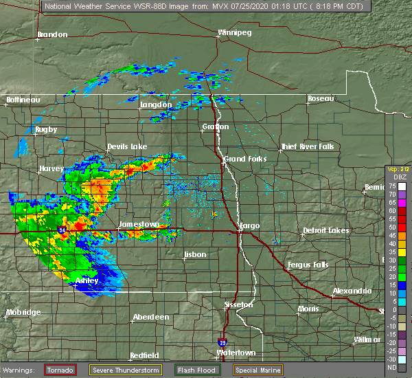 At 819 pm cdt, a severe thunderstorm was located 8 miles south of mapes, or 33 miles southeast of devils lake, moving northeast at 20 mph (radar indicated). Hazards include half dollar size hail. Damage to vehicles is expected. this severe thunderstorm will be near, mapes around 840 pm cdt. Michigan and petersburg around 845 pm cdt. At 819 pm cdt, a severe thunderstorm was located 8 miles south of mapes, or 33 miles southeast of devils lake, moving northeast at 20 mph (radar indicated). Hazards include half dollar size hail. Damage to vehicles is expected. this severe thunderstorm will be near, mapes around 840 pm cdt. Michigan and petersburg around 845 pm cdt.
|
| 7/17/2020 6:26 PM CDT |
 The severe thunderstorm warning for nelson county will expire at 630 pm cdt, the storm which prompted the warning has weakened below severe limits, and no longer pose an immediate threat to life or property. therefore, the warning will be allowed to expire. a severe thunderstorm watch remains in effect until 800 pm cdt for northeastern north dakota. a severe thunderstorm watch also remains in effect until 100 am cdt for southeastern north dakota. The severe thunderstorm warning for nelson county will expire at 630 pm cdt, the storm which prompted the warning has weakened below severe limits, and no longer pose an immediate threat to life or property. therefore, the warning will be allowed to expire. a severe thunderstorm watch remains in effect until 800 pm cdt for northeastern north dakota. a severe thunderstorm watch also remains in effect until 100 am cdt for southeastern north dakota.
|
| 7/17/2020 6:02 PM CDT |
 At 559 pm cdt, a severe thunderstorm was located near pekin, or 31 miles southeast of devils lake, moving east at 30 mph (radar indicated). Hazards include two inch hail and 60 mph wind gusts. People and animals outdoors will be injured. expect hail damage to roofs, siding, windows, and vehicles. expect wind damage to roofs, siding, and trees. this severe storm will be near, mcville around 605 pm cdt. Petersburg around 630 pm cdt. At 559 pm cdt, a severe thunderstorm was located near pekin, or 31 miles southeast of devils lake, moving east at 30 mph (radar indicated). Hazards include two inch hail and 60 mph wind gusts. People and animals outdoors will be injured. expect hail damage to roofs, siding, windows, and vehicles. expect wind damage to roofs, siding, and trees. this severe storm will be near, mcville around 605 pm cdt. Petersburg around 630 pm cdt.
|
| 7/17/2020 5:33 PM CDT |
 At 532 pm cdt, a severe thunderstorm was located near hamar, or 20 miles southeast of devils lake, moving east at 30 mph (radar indicated. at 510 pm, baseball size hail was reported 10 miles east of sheyenne). Hazards include two inch hail and 60 mph wind gusts. People and animals outdoors will be injured. expect hail damage to roofs, siding, windows, and vehicles. expect wind damage to roofs, siding, and trees. this severe storm will be near, tolna around 540 pm cdt. bartlett around 550 pm cdt. lakota around 600 pm cdt. mapes around 610 pm cdt. Michigan around 615 pm cdt. At 532 pm cdt, a severe thunderstorm was located near hamar, or 20 miles southeast of devils lake, moving east at 30 mph (radar indicated. at 510 pm, baseball size hail was reported 10 miles east of sheyenne). Hazards include two inch hail and 60 mph wind gusts. People and animals outdoors will be injured. expect hail damage to roofs, siding, windows, and vehicles. expect wind damage to roofs, siding, and trees. this severe storm will be near, tolna around 540 pm cdt. bartlett around 550 pm cdt. lakota around 600 pm cdt. mapes around 610 pm cdt. Michigan around 615 pm cdt.
|
| 7/17/2020 5:25 PM CDT |
 At 525 pm cdt, a severe thunderstorm was located near warwick, or 19 miles southeast of devils lake, moving east at 25 mph (radar indicated). Hazards include golf ball size hail and 60 mph wind gusts. People and animals outdoors will be injured. expect hail damage to roofs, siding, windows, and vehicles. expect wind damage to roofs, siding, and trees. this severe thunderstorm will be near, hamar around 530 pm cdt. tolna around 545 pm cdt. mapes around 615 pm cdt. michigan around 625 pm cdt. Petersburg around 630 pm cdt. At 525 pm cdt, a severe thunderstorm was located near warwick, or 19 miles southeast of devils lake, moving east at 25 mph (radar indicated). Hazards include golf ball size hail and 60 mph wind gusts. People and animals outdoors will be injured. expect hail damage to roofs, siding, windows, and vehicles. expect wind damage to roofs, siding, and trees. this severe thunderstorm will be near, hamar around 530 pm cdt. tolna around 545 pm cdt. mapes around 615 pm cdt. michigan around 625 pm cdt. Petersburg around 630 pm cdt.
|
| 7/17/2020 4:35 PM CDT |
 At 434 pm cdt, a severe thunderstorm was located near camp grafton, or near devils lake, moving east at 30 mph (radar indicated). Hazards include 60 mph wind gusts and quarter size hail. Hail damage to vehicles is expected. expect wind damage to roofs, siding, and trees. this severe storm will be near, crary around 455 pm cdt. doyon around 505 pm cdt. bartlett around 510 pm cdt. lakota around 520 pm cdt. Mapes around 530 pm cdt. At 434 pm cdt, a severe thunderstorm was located near camp grafton, or near devils lake, moving east at 30 mph (radar indicated). Hazards include 60 mph wind gusts and quarter size hail. Hail damage to vehicles is expected. expect wind damage to roofs, siding, and trees. this severe storm will be near, crary around 455 pm cdt. doyon around 505 pm cdt. bartlett around 510 pm cdt. lakota around 520 pm cdt. Mapes around 530 pm cdt.
|
| 7/17/2020 4:09 PM CDT |
 At 408 pm cdt, a severe thunderstorm was located over devils lake, moving east at 40 mph (radar indicated). Hazards include 70 mph wind gusts and quarter size hail. Hail damage to vehicles is expected. expect considerable tree damage. wind damage is also likely to mobile homes, roofs, and outbuildings. this severe thunderstorm will be near, devils lake around 410 pm cdt. crary around 425 pm cdt. southam around 430 pm cdt. doyon around 435 pm cdt. Bartlett around 440 pm cdt. At 408 pm cdt, a severe thunderstorm was located over devils lake, moving east at 40 mph (radar indicated). Hazards include 70 mph wind gusts and quarter size hail. Hail damage to vehicles is expected. expect considerable tree damage. wind damage is also likely to mobile homes, roofs, and outbuildings. this severe thunderstorm will be near, devils lake around 410 pm cdt. crary around 425 pm cdt. southam around 430 pm cdt. doyon around 435 pm cdt. Bartlett around 440 pm cdt.
|
| 7/17/2020 3:54 PM CDT |
 At 353 pm cdt, severe thunderstorms were located along a line extending from mountain to near southam, moving southeast at 45 mph (radar indicated). Hazards include 70 mph wind gusts and quarter size hail. Hail damage to vehicles is expected. expect considerable tree damage. wind damage is also likely to mobile homes, roofs, and outbuildings. severe thunderstorms will be near, mountain and gardar around 355 pm cdt. bartlett and crystal around 405 pm cdt. hoople and lakota around 410 pm cdt. mapes around 415 pm cdt. Nash, auburn and michigan around 420 pm cdt. At 353 pm cdt, severe thunderstorms were located along a line extending from mountain to near southam, moving southeast at 45 mph (radar indicated). Hazards include 70 mph wind gusts and quarter size hail. Hail damage to vehicles is expected. expect considerable tree damage. wind damage is also likely to mobile homes, roofs, and outbuildings. severe thunderstorms will be near, mountain and gardar around 355 pm cdt. bartlett and crystal around 405 pm cdt. hoople and lakota around 410 pm cdt. mapes around 415 pm cdt. Nash, auburn and michigan around 420 pm cdt.
|
| 7/8/2020 2:22 AM CDT |
 At 222 am cdt, severe thunderstorms were located along a line extending from near fairdale to near logan center, moving east at 50 mph (radar indicated). Hazards include 60 mph wind gusts. Expect damage to roofs, siding, and trees. severe thunderstorms will be near, logan center around 225 am cdt. union around 230 am cdt. northwood, gardar and edinburg around 235 am cdt. crystal, hoople and holmes around 245 am cdt. auburn around 250 am cdt. other locations impacted by these severe thunderstorms include grand forks airport and american crystal sugar. This includes interstate 29 between mile markers 125 and 196. At 222 am cdt, severe thunderstorms were located along a line extending from near fairdale to near logan center, moving east at 50 mph (radar indicated). Hazards include 60 mph wind gusts. Expect damage to roofs, siding, and trees. severe thunderstorms will be near, logan center around 225 am cdt. union around 230 am cdt. northwood, gardar and edinburg around 235 am cdt. crystal, hoople and holmes around 245 am cdt. auburn around 250 am cdt. other locations impacted by these severe thunderstorms include grand forks airport and american crystal sugar. This includes interstate 29 between mile markers 125 and 196.
|
| 7/8/2020 1:52 AM CDT |
 At 152 am cdt, severe thunderstorms were located along a line extending from near garske to near st michael, moving east at 45 mph (radar indicated). Hazards include 70 mph wind gusts. Expect considerable tree damage. damage is likely to mobile homes, roofs, and outbuildings. these severe storms will be near, webster around 155 am cdt. garske and tokio around 200 am cdt. crary around 210 am cdt. doyon and derrick around 220 am cdt. Bartlett and edmore around 225 am cdt. At 152 am cdt, severe thunderstorms were located along a line extending from near garske to near st michael, moving east at 45 mph (radar indicated). Hazards include 70 mph wind gusts. Expect considerable tree damage. damage is likely to mobile homes, roofs, and outbuildings. these severe storms will be near, webster around 155 am cdt. garske and tokio around 200 am cdt. crary around 210 am cdt. doyon and derrick around 220 am cdt. Bartlett and edmore around 225 am cdt.
|
| 7/8/2020 1:33 AM CDT |
 At 133 am cdt, severe thunderstorms were located along a line extending from near churchs ferry to oberon, moving east at 45 mph (radar indicated). Hazards include 70 mph wind gusts. Expect considerable tree damage. damage is likely to mobile homes, roofs, and outbuildings. severe thunderstorms will be near, churchs ferry and maza around 135 am cdt. penn around 140 am cdt. fort totten and grahams island state park around 145 am cdt. st michael, garske and webster around 155 am cdt. Crary around 210 am cdt. At 133 am cdt, severe thunderstorms were located along a line extending from near churchs ferry to oberon, moving east at 45 mph (radar indicated). Hazards include 70 mph wind gusts. Expect considerable tree damage. damage is likely to mobile homes, roofs, and outbuildings. severe thunderstorms will be near, churchs ferry and maza around 135 am cdt. penn around 140 am cdt. fort totten and grahams island state park around 145 am cdt. st michael, garske and webster around 155 am cdt. Crary around 210 am cdt.
|
| 6/25/2020 1:37 PM CDT |
 At 137 pm cdt, severe thunderstorms were located along a line extending from lakota to near pekin, moving east at 30 mph (radar indicated). Hazards include golf ball size hail and 60 mph wind gusts. People and animals outdoors will be injured. expect hail damage to roofs, siding, windows, and vehicles. expect wind damage to roofs, siding, and trees. Locations impacted include, lakota, mcville, michigan, tolna, pekin, brocket and kloten. At 137 pm cdt, severe thunderstorms were located along a line extending from lakota to near pekin, moving east at 30 mph (radar indicated). Hazards include golf ball size hail and 60 mph wind gusts. People and animals outdoors will be injured. expect hail damage to roofs, siding, windows, and vehicles. expect wind damage to roofs, siding, and trees. Locations impacted include, lakota, mcville, michigan, tolna, pekin, brocket and kloten.
|
| 6/25/2020 1:17 PM CDT |
 At 117 pm cdt, severe thunderstorms were located along a line extending from doyon to near hamar, moving southeast at 30 mph (radar indicated). Hazards include ping pong ball size hail and 60 mph wind gusts. People and animals outdoors will be injured. expect hail damage to roofs, siding, windows, and vehicles. expect wind damage to roofs, siding, and trees. these severe storms will be near, hamar around 120 pm cdt. bartlett and tolna around 130 pm cdt. lakota around 135 pm cdt. pekin around 140 pm cdt. Red willow lake around 145 pm cdt. At 117 pm cdt, severe thunderstorms were located along a line extending from doyon to near hamar, moving southeast at 30 mph (radar indicated). Hazards include ping pong ball size hail and 60 mph wind gusts. People and animals outdoors will be injured. expect hail damage to roofs, siding, windows, and vehicles. expect wind damage to roofs, siding, and trees. these severe storms will be near, hamar around 120 pm cdt. bartlett and tolna around 130 pm cdt. lakota around 135 pm cdt. pekin around 140 pm cdt. Red willow lake around 145 pm cdt.
|
| 6/25/2020 12:58 PM CDT |
 At 1257 pm cdt, severe thunderstorms were located along a line extending from 7 miles southeast of webster to 8 miles south of warwick, moving east at 30 mph (radar indicated). Hazards include 60 mph wind gusts and quarter size hail. Hail damage to vehicles is expected. expect wind damage to roofs, siding, and trees. severe thunderstorms will be near, hamar around 110 pm cdt. southam around 115 pm cdt. brocket around 130 pm cdt. red willow lake and pekin around 135 pm cdt. Mcville around 150 pm cdt. At 1257 pm cdt, severe thunderstorms were located along a line extending from 7 miles southeast of webster to 8 miles south of warwick, moving east at 30 mph (radar indicated). Hazards include 60 mph wind gusts and quarter size hail. Hail damage to vehicles is expected. expect wind damage to roofs, siding, and trees. severe thunderstorms will be near, hamar around 110 pm cdt. southam around 115 pm cdt. brocket around 130 pm cdt. red willow lake and pekin around 135 pm cdt. Mcville around 150 pm cdt.
|
| 6/17/2020 6:43 PM CDT | Golf Ball sized hail reported 6.4 miles SSE of Michigan City, ND, relayed photo on social media |
| 6/7/2020 9:01 PM CDT |
 At 901 pm cdt, severe thunderstorms were located along a line extending from 6 miles south of petersburg to near larimore to near northwood, moving northeast at 60 mph (radar indicated). Hazards include 70 mph wind gusts and quarter size hail. Hail damage to vehicles is expected. expect considerable tree damage. wind damage is also likely to mobile homes, roofs, and outbuildings. these severe storms will be near, larimore around 905 pm cdt. niagara, mccanna and turtle river state park around 910 pm cdt. emerado, dahlen and honeyford around 915 pm cdt. grand forks afb, gilby and mekinock around 920 pm cdt. This includes interstate 29 near mile marker 151. At 901 pm cdt, severe thunderstorms were located along a line extending from 6 miles south of petersburg to near larimore to near northwood, moving northeast at 60 mph (radar indicated). Hazards include 70 mph wind gusts and quarter size hail. Hail damage to vehicles is expected. expect considerable tree damage. wind damage is also likely to mobile homes, roofs, and outbuildings. these severe storms will be near, larimore around 905 pm cdt. niagara, mccanna and turtle river state park around 910 pm cdt. emerado, dahlen and honeyford around 915 pm cdt. grand forks afb, gilby and mekinock around 920 pm cdt. This includes interstate 29 near mile marker 151.
|
| 6/7/2020 8:38 PM CDT |
 At 838 pm cdt, severe thunderstorms were located along a line extending from near jessie to sherbrooke, moving northeast at 45 mph (radar indicated). Hazards include 70 mph wind gusts and quarter size hail. Hail damage to vehicles is expected. expect considerable tree damage. wind damage is also likely to mobile homes, roofs, and outbuildings. severe thunderstorms will be near, sherbrooke and finley around 840 pm cdt. golden lake around 850 pm cdt. mcville, kloten and aneta around 900 pm cdt. northwood around 905 pm cdt. kempton around 910 pm cdt. This includes interstate 29 near mile marker 151. At 838 pm cdt, severe thunderstorms were located along a line extending from near jessie to sherbrooke, moving northeast at 45 mph (radar indicated). Hazards include 70 mph wind gusts and quarter size hail. Hail damage to vehicles is expected. expect considerable tree damage. wind damage is also likely to mobile homes, roofs, and outbuildings. severe thunderstorms will be near, sherbrooke and finley around 840 pm cdt. golden lake around 850 pm cdt. mcville, kloten and aneta around 900 pm cdt. northwood around 905 pm cdt. kempton around 910 pm cdt. This includes interstate 29 near mile marker 151.
|
| 8/20/2019 1:21 AM CDT |
 A severe thunderstorm warning remains in effect until 145 am cdt for east central benson. northern nelson and southeastern ramsey counties. at 120 am cdt, a severe thunderstorm was located over mapes, or 29 miles east of devils lake, moving east at 40 mph. other storms continue westward to devils lake. Overall intensity has diminished. A severe thunderstorm warning remains in effect until 145 am cdt for east central benson. northern nelson and southeastern ramsey counties. at 120 am cdt, a severe thunderstorm was located over mapes, or 29 miles east of devils lake, moving east at 40 mph. other storms continue westward to devils lake. Overall intensity has diminished.
|
| 8/20/2019 12:44 AM CDT |
 At 1244 am cdt, a severe thunderstorm was located near crary, or 8 miles east of devils lake, moving east at 40 mph (radar indicated). Hazards include 60 mph wind gusts and quarter size hail. Hail damage to vehicles is expected. expect wind damage to roofs, siding, and trees. this severe thunderstorm will be near, crary and southam around 1250 am cdt. doyon around 1255 am cdt. bartlett around 105 am cdt. lakota around 110 am cdt. Mapes around 115 am cdt. At 1244 am cdt, a severe thunderstorm was located near crary, or 8 miles east of devils lake, moving east at 40 mph (radar indicated). Hazards include 60 mph wind gusts and quarter size hail. Hail damage to vehicles is expected. expect wind damage to roofs, siding, and trees. this severe thunderstorm will be near, crary and southam around 1250 am cdt. doyon around 1255 am cdt. bartlett around 105 am cdt. lakota around 110 am cdt. Mapes around 115 am cdt.
|
| 7/28/2019 2:52 PM CDT |
 The tornado warning for central nelson county will expire at 300 pm cdt, the storm which prompted the warning has moved out of the area. therefore, the warning will be allowed to expire. however gusty winds are still possible with this thunderstorm. to report severe weather, contact your nearest law enforcement agency. they will relay your report to the national weather service grand forks. remember, a tornado warning still remains in effect for far northeastern nelson county until 3:30 pm cdt. The tornado warning for central nelson county will expire at 300 pm cdt, the storm which prompted the warning has moved out of the area. therefore, the warning will be allowed to expire. however gusty winds are still possible with this thunderstorm. to report severe weather, contact your nearest law enforcement agency. they will relay your report to the national weather service grand forks. remember, a tornado warning still remains in effect for far northeastern nelson county until 3:30 pm cdt.
|
| 7/28/2019 2:24 PM CDT |
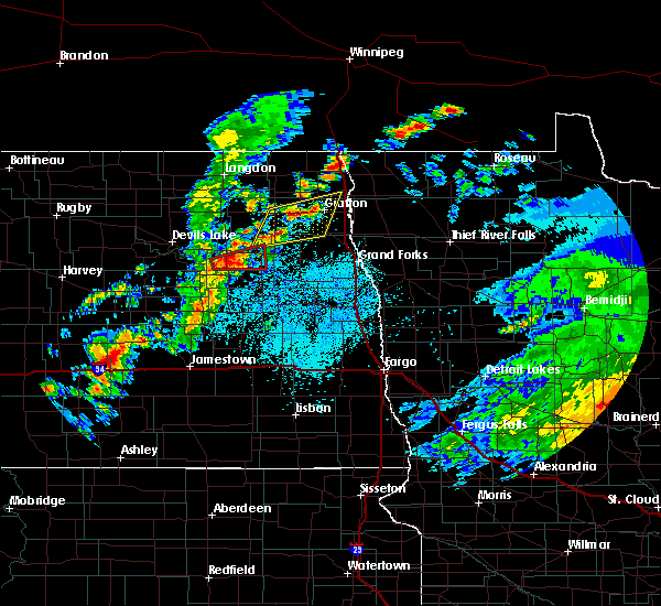 At 224 pm cdt, a severe thunderstorm capable of producing a tornado was located near mapes, or 29 miles southeast of devils lake, moving east at 25 mph (radar indicated rotation). Hazards include tornado and ping pong ball size hail. Expect damage to mobile homes, roofs, and vehicles. this dangerous storm will be near, mapes around 235 pm cdt. michigan around 245 pm cdt. Petersburg around 300 pm cdt. At 224 pm cdt, a severe thunderstorm capable of producing a tornado was located near mapes, or 29 miles southeast of devils lake, moving east at 25 mph (radar indicated rotation). Hazards include tornado and ping pong ball size hail. Expect damage to mobile homes, roofs, and vehicles. this dangerous storm will be near, mapes around 235 pm cdt. michigan around 245 pm cdt. Petersburg around 300 pm cdt.
|
| 7/28/2019 2:12 PM CDT |
 At 212 pm cdt, a severe thunderstorm capable of producing a tornado was located 7 miles north of tolna, or 25 miles southeast of devils lake, moving east at 25 mph (radar indicated rotation). Hazards include tornado. Expect damage to mobile homes, roofs, and vehicles. this dangerous storm will be near, mapes around 235 pm cdt. michigan around 245 pm cdt. Petersburg around 300 pm cdt. At 212 pm cdt, a severe thunderstorm capable of producing a tornado was located 7 miles north of tolna, or 25 miles southeast of devils lake, moving east at 25 mph (radar indicated rotation). Hazards include tornado. Expect damage to mobile homes, roofs, and vehicles. this dangerous storm will be near, mapes around 235 pm cdt. michigan around 245 pm cdt. Petersburg around 300 pm cdt.
|
| 7/8/2019 7:02 PM CDT |
 At 701 pm cdt, severe thunderstorms were located along a line extending from near petersburg to near logan center to sharon, moving east at 40 mph. these are very dangerous storms (radar indicated). Hazards include 80 mph wind gusts and penny size hail. Flying debris will be dangerous to those caught without shelter. mobile homes will be heavily damaged. expect considerable damage to roofs, windows, and vehicles. extensive tree damage and power outages are likely. Locations impacted include, larimore, northwood, golden lake, finley, mcville, aneta and petersburg. At 701 pm cdt, severe thunderstorms were located along a line extending from near petersburg to near logan center to sharon, moving east at 40 mph. these are very dangerous storms (radar indicated). Hazards include 80 mph wind gusts and penny size hail. Flying debris will be dangerous to those caught without shelter. mobile homes will be heavily damaged. expect considerable damage to roofs, windows, and vehicles. extensive tree damage and power outages are likely. Locations impacted include, larimore, northwood, golden lake, finley, mcville, aneta and petersburg.
|
| 7/8/2019 6:38 PM CDT |
 At 638 pm cdt, severe thunderstorms were located along a line extending from 7 miles south of mapes to near kloten to near jessie, moving east at 45 mph. these are very dangerous storms (radar indicated). Hazards include 80 mph wind gusts and penny size hail. Flying debris will be dangerous to those caught without shelter. mobile homes will be heavily damaged. expect considerable damage to roofs, windows, and vehicles. extensive tree damage and power outages are likely. Locations impacted include, larimore, northwood, golden lake, finley, mcville, aneta and petersburg. At 638 pm cdt, severe thunderstorms were located along a line extending from 7 miles south of mapes to near kloten to near jessie, moving east at 45 mph. these are very dangerous storms (radar indicated). Hazards include 80 mph wind gusts and penny size hail. Flying debris will be dangerous to those caught without shelter. mobile homes will be heavily damaged. expect considerable damage to roofs, windows, and vehicles. extensive tree damage and power outages are likely. Locations impacted include, larimore, northwood, golden lake, finley, mcville, aneta and petersburg.
|
| 7/8/2019 6:29 PM CDT |
 The national weather service in grand forks has issued a * severe thunderstorm warning for. western grand forks county in northeastern north dakota. nelson county in northeastern north dakota. northern griggs county in southeastern north dakota. Northern steele county in southeastern north dakota. The national weather service in grand forks has issued a * severe thunderstorm warning for. western grand forks county in northeastern north dakota. nelson county in northeastern north dakota. northern griggs county in southeastern north dakota. Northern steele county in southeastern north dakota.
|
| 7/3/2019 6:46 PM CDT |
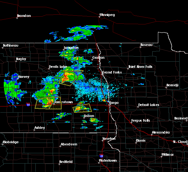 At 646 pm cdt, severe thunderstorms were located along a line extending from near mapes to red willow lake, moving east at 20 mph (radar indicated). Hazards include 60 mph wind gusts and quarter size hail. Hail damage to vehicles is expected. expect wind damage to roofs, siding, and trees. these severe storms will be near, michigan around 700 pm cdt. Petersburg, niagara and kloten around 715 pm cdt. At 646 pm cdt, severe thunderstorms were located along a line extending from near mapes to red willow lake, moving east at 20 mph (radar indicated). Hazards include 60 mph wind gusts and quarter size hail. Hail damage to vehicles is expected. expect wind damage to roofs, siding, and trees. these severe storms will be near, michigan around 700 pm cdt. Petersburg, niagara and kloten around 715 pm cdt.
|
| 7/3/2019 6:22 PM CDT |
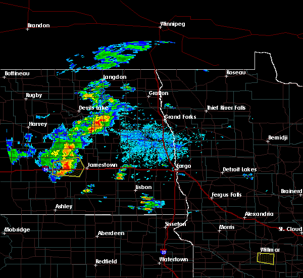 At 621 pm cdt, severe thunderstorms were located along a line extending from near lakota to 6 miles north of mchenry, moving east at 20 mph (radar indicated). Hazards include 60 mph wind gusts and quarter size hail. Hail damage to vehicles is expected. expect wind damage to roofs, siding, and trees. severe thunderstorms will be near, mapes around 645 pm cdt. red willow lake and michigan around 700 pm cdt. Petersburg and niagara around 715 pm cdt. At 621 pm cdt, severe thunderstorms were located along a line extending from near lakota to 6 miles north of mchenry, moving east at 20 mph (radar indicated). Hazards include 60 mph wind gusts and quarter size hail. Hail damage to vehicles is expected. expect wind damage to roofs, siding, and trees. severe thunderstorms will be near, mapes around 645 pm cdt. red willow lake and michigan around 700 pm cdt. Petersburg and niagara around 715 pm cdt.
|
| 6/29/2019 10:21 AM CDT |
 At 1020 am cdt, severe thunderstorms were located along a line extending from near lankin to 6 miles southwest of niagara to 6 miles southwest of jessie, moving east at 35 mph (radar indicated). Hazards include 60 mph wind gusts and quarter size hail. Hail damage to vehicles is expected. expect wind damage to roofs, siding, and trees. these severe storms will be near, niagara and lankin around 1025 am cdt. park river and pisek around 1035 am cdt. mccanna around 1040 am cdt. Larimore and mandt around 1045 am cdt. At 1020 am cdt, severe thunderstorms were located along a line extending from near lankin to 6 miles southwest of niagara to 6 miles southwest of jessie, moving east at 35 mph (radar indicated). Hazards include 60 mph wind gusts and quarter size hail. Hail damage to vehicles is expected. expect wind damage to roofs, siding, and trees. these severe storms will be near, niagara and lankin around 1025 am cdt. park river and pisek around 1035 am cdt. mccanna around 1040 am cdt. Larimore and mandt around 1045 am cdt.
|
| 6/29/2019 9:58 AM CDT |
 At 957 am cdt, severe thunderstorms were located along a line extending from near adams to 7 miles south of mapes to glenfield, moving east at 35 mph (radar indicated). Hazards include 60 mph wind gusts and quarter size hail. Hail damage to vehicles is expected. expect wind damage to roofs, siding, and trees. severe thunderstorms will be near, mapes around 1000 am cdt. adams and michigan around 1005 am cdt. petersburg and binford around 1015 am cdt. lankin and niagara around 1020 am cdt. Jessie around 1025 am cdt. At 957 am cdt, severe thunderstorms were located along a line extending from near adams to 7 miles south of mapes to glenfield, moving east at 35 mph (radar indicated). Hazards include 60 mph wind gusts and quarter size hail. Hail damage to vehicles is expected. expect wind damage to roofs, siding, and trees. severe thunderstorms will be near, mapes around 1000 am cdt. adams and michigan around 1005 am cdt. petersburg and binford around 1015 am cdt. lankin and niagara around 1020 am cdt. Jessie around 1025 am cdt.
|
| 6/29/2019 9:13 AM CDT |
 At 913 am cdt, severe thunderstorms were located along a line extending from near lawton to warwick to near carrington, moving southeast at 35 mph (radar indicated). Hazards include 60 mph wind gusts and quarter size hail. Hail damage to vehicles is expected. expect wind damage to roofs, siding, and trees. severe thunderstorms will be near, warwick around 915 am cdt. hamar around 920 am cdt. tolna around 925 am cdt. brocket around 930 am cdt. Red willow lake, whitman and mose around 945 am cdt. At 913 am cdt, severe thunderstorms were located along a line extending from near lawton to warwick to near carrington, moving southeast at 35 mph (radar indicated). Hazards include 60 mph wind gusts and quarter size hail. Hail damage to vehicles is expected. expect wind damage to roofs, siding, and trees. severe thunderstorms will be near, warwick around 915 am cdt. hamar around 920 am cdt. tolna around 925 am cdt. brocket around 930 am cdt. Red willow lake, whitman and mose around 945 am cdt.
|
| 8/26/2018 9:58 PM CDT |
 The national weather service in grand forks has issued a * severe thunderstorm warning for. western marshall county in northwestern minnesota. northwestern polk county in northwestern minnesota. western kittson county in northwestern minnesota. Grand forks county in northeastern north dakota. The national weather service in grand forks has issued a * severe thunderstorm warning for. western marshall county in northwestern minnesota. northwestern polk county in northwestern minnesota. western kittson county in northwestern minnesota. Grand forks county in northeastern north dakota.
|
| 8/26/2018 9:45 PM CDT |
 At 945 pm cdt, severe thunderstorms were located along a line extending from near walhalla to near pekin, moving east at 50 mph (radar indicated). Hazards include 70 mph wind gusts and penny size hail. Expect considerable tree damage. damage is likely to mobile homes, roofs, and outbuildings. these severe storms will be near, walhalla around 950 pm cdt. Leroy, kloten and backoo around 1000 pm cdt. At 945 pm cdt, severe thunderstorms were located along a line extending from near walhalla to near pekin, moving east at 50 mph (radar indicated). Hazards include 70 mph wind gusts and penny size hail. Expect considerable tree damage. damage is likely to mobile homes, roofs, and outbuildings. these severe storms will be near, walhalla around 950 pm cdt. Leroy, kloten and backoo around 1000 pm cdt.
|
| 8/26/2018 9:15 PM CDT |
 At 915 pm cdt, severe thunderstorms were located along a line extending from near mount carmel to 8 miles southwest of warwick, moving east at 50 mph (radar indicated). Hazards include 60 mph wind gusts and penny size hail. Expect damage to roofs, siding, and trees. severe thunderstorms will be near, mount carmel and maida around 920 pm cdt. hamar around 930 pm cdt. vang around 935 pm cdt. tolna around 940 pm cdt. Pekin around 945 pm cdt. At 915 pm cdt, severe thunderstorms were located along a line extending from near mount carmel to 8 miles southwest of warwick, moving east at 50 mph (radar indicated). Hazards include 60 mph wind gusts and penny size hail. Expect damage to roofs, siding, and trees. severe thunderstorms will be near, mount carmel and maida around 920 pm cdt. hamar around 930 pm cdt. vang around 935 pm cdt. tolna around 940 pm cdt. Pekin around 945 pm cdt.
|
| 7/8/2018 4:31 AM CDT |
 At 430 am cdt, severe thunderstorms were located along a line extending from 8 miles north of mcville to near kloten to near sharon, moving east at 55 mph. these are very dangerous storms (trained weather spotters and radar). Hazards include 80 mph wind gusts and nickel size hail. Flying debris will be dangerous to those caught without shelter. mobile homes will be heavily damaged. expect considerable damage to roofs, windows, and vehicles. extensive tree damage and power outages are likely. these severe storms will be near, sharon around 435 am cdt. logan center and petersburg around 440 am cdt. niagara around 445 am cdt. kempton, northwood and mccanna around 450 am cdt. Larimore and hatton around 455 am cdt. At 430 am cdt, severe thunderstorms were located along a line extending from 8 miles north of mcville to near kloten to near sharon, moving east at 55 mph. these are very dangerous storms (trained weather spotters and radar). Hazards include 80 mph wind gusts and nickel size hail. Flying debris will be dangerous to those caught without shelter. mobile homes will be heavily damaged. expect considerable damage to roofs, windows, and vehicles. extensive tree damage and power outages are likely. these severe storms will be near, sharon around 435 am cdt. logan center and petersburg around 440 am cdt. niagara around 445 am cdt. kempton, northwood and mccanna around 450 am cdt. Larimore and hatton around 455 am cdt.
|
| 7/8/2018 4:13 AM CDT |
 At 412 am cdt, severe thunderstorms were located along a line extending from near tolna to near pekin to binford, moving east at 55 mph. these are very dangerous storms (trained spotter and radar indicated). Hazards include 80 mph wind gusts and nickel size hail. Flying debris will be dangerous to those caught without shelter. mobile homes will be heavily damaged. expect considerable damage to roofs, windows, and vehicles. extensive tree damage and power outages are likely. severe thunderstorms will be near, mcville around 420 am cdt. kloten around 425 am cdt. aneta around 430 am cdt. sharon and logan center around 435 am cdt. Kempton and niagara around 445 am cdt. At 412 am cdt, severe thunderstorms were located along a line extending from near tolna to near pekin to binford, moving east at 55 mph. these are very dangerous storms (trained spotter and radar indicated). Hazards include 80 mph wind gusts and nickel size hail. Flying debris will be dangerous to those caught without shelter. mobile homes will be heavily damaged. expect considerable damage to roofs, windows, and vehicles. extensive tree damage and power outages are likely. severe thunderstorms will be near, mcville around 420 am cdt. kloten around 425 am cdt. aneta around 430 am cdt. sharon and logan center around 435 am cdt. Kempton and niagara around 445 am cdt.
|
| 7/4/2018 3:17 AM CDT |
 At 316 am cdt, severe thunderstorms were located along a line extending from near hampden to near whitman, moving northeast at 50 mph (radar indicated). Hazards include 60 mph wind gusts and nickel size hail. Expect damage to roofs, siding, and trees. these severe storms will be near, dahlen and whitman around 320 am cdt. Lankin and fordville around 330 am cdt. At 316 am cdt, severe thunderstorms were located along a line extending from near hampden to near whitman, moving northeast at 50 mph (radar indicated). Hazards include 60 mph wind gusts and nickel size hail. Expect damage to roofs, siding, and trees. these severe storms will be near, dahlen and whitman around 320 am cdt. Lankin and fordville around 330 am cdt.
|
| 7/4/2018 3:01 AM CDT |
 At 301 am cdt, severe thunderstorms were located along a line extending from near starkweather to near mapes, moving northeast at 50 mph (radar indicated). Hazards include 60 mph wind gusts and nickel size hail. Expect damage to roofs, siding, and trees. these severe storms will be near, mapes and michigan around 305 am cdt. whitman around 310 am cdt. hampden around 315 am cdt. alsen and dahlen around 320 am cdt. Loma, lankin and fordville around 325 am cdt. At 301 am cdt, severe thunderstorms were located along a line extending from near starkweather to near mapes, moving northeast at 50 mph (radar indicated). Hazards include 60 mph wind gusts and nickel size hail. Expect damage to roofs, siding, and trees. these severe storms will be near, mapes and michigan around 305 am cdt. whitman around 310 am cdt. hampden around 315 am cdt. alsen and dahlen around 320 am cdt. Loma, lankin and fordville around 325 am cdt.
|
| 7/4/2018 2:37 AM CDT |
 At 236 am cdt, severe thunderstorms were located along a line extending from near churchs ferry to near hamar, moving northeast at 50 mph (radar indicated). Hazards include 60 mph wind gusts and nickel size hail. Expect damage to roofs, siding, and trees. severe thunderstorms will be near, doyon around 245 am cdt. bartlett around 250 am cdt. lakota and garske around 255 am cdt. starkweather, mapes and michigan around 300 am cdt. Whitman around 310 am cdt. At 236 am cdt, severe thunderstorms were located along a line extending from near churchs ferry to near hamar, moving northeast at 50 mph (radar indicated). Hazards include 60 mph wind gusts and nickel size hail. Expect damage to roofs, siding, and trees. severe thunderstorms will be near, doyon around 245 am cdt. bartlett around 250 am cdt. lakota and garske around 255 am cdt. starkweather, mapes and michigan around 300 am cdt. Whitman around 310 am cdt.
|
| 6/29/2018 6:00 AM CDT | Trampoline re arranged within backyard. event time is time of report... damage would have occurred earlier. reported via social medi in nelson county ND, 0.4 miles S of Michigan City, ND |
| 6/29/2018 3:54 AM CDT |
 At 354 am cdt, severe thunderstorms were located along a line extending from near whitman to near larimore, moving northeast at 60 mph (radar indicated). Hazards include 60 mph wind gusts and quarter size hail. Hail damage to vehicles is expected. expect wind damage to roofs, siding, and trees. these severe storms will be near, arvilla and turtle river state park around 400 am cdt. Lankin around 405 am cdt. At 354 am cdt, severe thunderstorms were located along a line extending from near whitman to near larimore, moving northeast at 60 mph (radar indicated). Hazards include 60 mph wind gusts and quarter size hail. Hail damage to vehicles is expected. expect wind damage to roofs, siding, and trees. these severe storms will be near, arvilla and turtle river state park around 400 am cdt. Lankin around 405 am cdt.
|
| 6/29/2018 3:38 AM CDT |
 At 337 am cdt, severe thunderstorms were located along a line extending from near bartlett to 6 miles north of jessie, moving east at 40 mph (radar indicated). Hazards include 60 mph wind gusts and quarter size hail. Hail damage to vehicles is expected. expect wind damage to roofs, siding, and trees. these severe storms will be near, mapes and kloten around 350 am cdt. aneta and michigan around 355 am cdt. whitman around 400 am cdt. petersburg around 405 am cdt. Dahlen, northwood and fordville around 415 am cdt. At 337 am cdt, severe thunderstorms were located along a line extending from near bartlett to 6 miles north of jessie, moving east at 40 mph (radar indicated). Hazards include 60 mph wind gusts and quarter size hail. Hail damage to vehicles is expected. expect wind damage to roofs, siding, and trees. these severe storms will be near, mapes and kloten around 350 am cdt. aneta and michigan around 355 am cdt. whitman around 400 am cdt. petersburg around 405 am cdt. Dahlen, northwood and fordville around 415 am cdt.
|
| 6/29/2018 3:15 AM CDT |
 At 314 am cdt, severe thunderstorms were located along a line extending from near crary to near mose, moving east at 40 mph (radar indicated). Hazards include 60 mph wind gusts and quarter size hail. Hail damage to vehicles is expected. expect wind damage to roofs, siding, and trees. severe thunderstorms will be near, doyon, red willow lake and southam around 325 am cdt. bartlett around 335 am cdt. lakota around 340 am cdt. kloten around 345 am cdt. Aneta and mapes around 350 am cdt. At 314 am cdt, severe thunderstorms were located along a line extending from near crary to near mose, moving east at 40 mph (radar indicated). Hazards include 60 mph wind gusts and quarter size hail. Hail damage to vehicles is expected. expect wind damage to roofs, siding, and trees. severe thunderstorms will be near, doyon, red willow lake and southam around 325 am cdt. bartlett around 335 am cdt. lakota around 340 am cdt. kloten around 345 am cdt. Aneta and mapes around 350 am cdt.
|
| 6/8/2018 4:24 PM CDT |
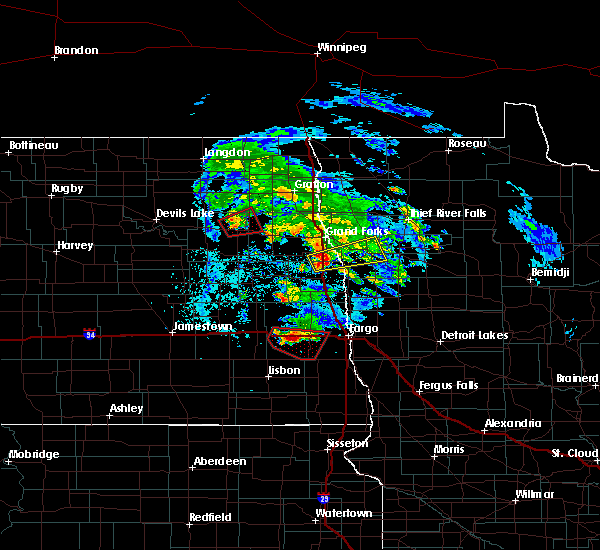 At 424 pm cdt, a confirmed tornado was located near petersburg, or 38 miles east of devils lake, moving east at 15 mph (weather spotters confirmed tornado). Hazards include tornado and quarter size hail. Expect damage to mobile homes, roofs, and vehicles. the tornado will be near, petersburg around 430 pm cdt. niagara around 445 pm cdt. Dahlen around 450 pm cdt. At 424 pm cdt, a confirmed tornado was located near petersburg, or 38 miles east of devils lake, moving east at 15 mph (weather spotters confirmed tornado). Hazards include tornado and quarter size hail. Expect damage to mobile homes, roofs, and vehicles. the tornado will be near, petersburg around 430 pm cdt. niagara around 445 pm cdt. Dahlen around 450 pm cdt.
|
| 7/11/2017 6:11 PM CDT |
 The severe thunderstorm warning for northwestern grand forks and northeastern nelson counties will expire at 615 pm cdt, the storm which prompted the warning has moved out of the area. therefore the warning will be allowed to expire. a tornado watch remains in effect until 1100 pm cdt for northeastern north dakota. The severe thunderstorm warning for northwestern grand forks and northeastern nelson counties will expire at 615 pm cdt, the storm which prompted the warning has moved out of the area. therefore the warning will be allowed to expire. a tornado watch remains in effect until 1100 pm cdt for northeastern north dakota.
|
| 7/11/2017 5:38 PM CDT |
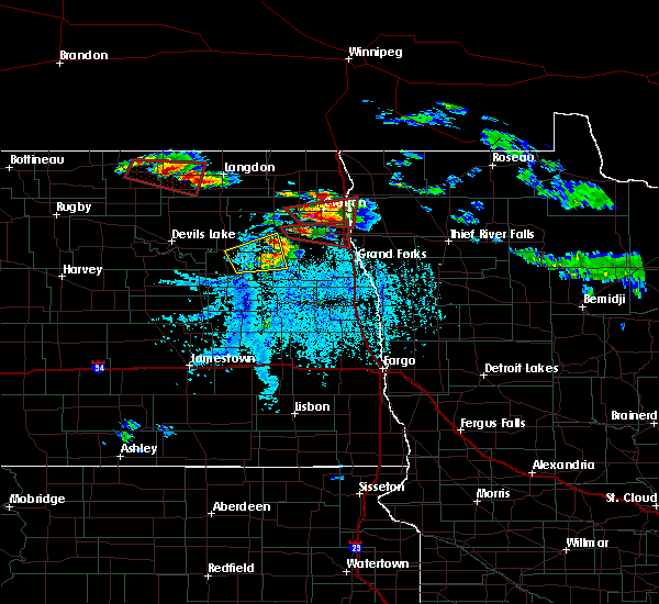 At 537 pm cdt, a severe thunderstorm was located near dahlen, or 31 miles southwest of grafton, moving east at 20 mph (radar indicated). Hazards include 60 mph wind gusts and half dollar size hail. Hail damage to vehicles is expected. expect wind damage to roofs, siding, and trees. this severe thunderstorm will remain over mainly rural areas of northwestern grand forks and northeastern nelson counties. A tornado watch remains in effect until 1100 pm cdt for northeastern north dakota. At 537 pm cdt, a severe thunderstorm was located near dahlen, or 31 miles southwest of grafton, moving east at 20 mph (radar indicated). Hazards include 60 mph wind gusts and half dollar size hail. Hail damage to vehicles is expected. expect wind damage to roofs, siding, and trees. this severe thunderstorm will remain over mainly rural areas of northwestern grand forks and northeastern nelson counties. A tornado watch remains in effect until 1100 pm cdt for northeastern north dakota.
|
| 7/11/2017 5:09 PM CDT |
 The national weather service in grand forks has issued a * severe thunderstorm warning for. northwestern grand forks county in northeastern north dakota. northeastern nelson county in northeastern north dakota. until 615 pm cdt. At 508 pm cdt, a severe thunderstorm was located near mapes, or 33. The national weather service in grand forks has issued a * severe thunderstorm warning for. northwestern grand forks county in northeastern north dakota. northeastern nelson county in northeastern north dakota. until 615 pm cdt. At 508 pm cdt, a severe thunderstorm was located near mapes, or 33.
|
| 6/10/2017 6:27 AM CDT |
 The severe thunderstorm warning for northwestern grand forks, south central cavalier, northeastern nelson, northeastern ramsey and western walsh counties will expire at 630 am cdt, the storms which prompted the warning have moved out of the area. therefore the warning will be allowed to expire. The severe thunderstorm warning for northwestern grand forks, south central cavalier, northeastern nelson, northeastern ramsey and western walsh counties will expire at 630 am cdt, the storms which prompted the warning have moved out of the area. therefore the warning will be allowed to expire.
|
| 6/10/2017 6:19 AM CDT |
 At 618 am cdt, severe thunderstorms were located along a line extending from near milton to near manvel, moving east at 55 mph (radar indicated). Hazards include 60 mph wind gusts and penny size hail. Expect damage to roofs, siding, and trees. Locations impacted include, michigan, fordville, petersburg, adams, lankin, forest river colony and dahlen. At 618 am cdt, severe thunderstorms were located along a line extending from near milton to near manvel, moving east at 55 mph (radar indicated). Hazards include 60 mph wind gusts and penny size hail. Expect damage to roofs, siding, and trees. Locations impacted include, michigan, fordville, petersburg, adams, lankin, forest river colony and dahlen.
|
| 6/10/2017 5:58 AM CDT |
 At 558 am cdt, severe thunderstorms were located along a line extending from hampden to near logan center, moving east at 50 mph (radar indicated). Hazards include 60 mph wind gusts and penny size hail. Expect damage to roofs, siding, and trees. Locations impacted include, lakota, michigan, fordville, petersburg, edmore, tolna and crary. At 558 am cdt, severe thunderstorms were located along a line extending from hampden to near logan center, moving east at 50 mph (radar indicated). Hazards include 60 mph wind gusts and penny size hail. Expect damage to roofs, siding, and trees. Locations impacted include, lakota, michigan, fordville, petersburg, edmore, tolna and crary.
|
| 6/10/2017 5:40 AM CDT |
 At 540 am cdt, severe thunderstorms were located along a line extending from near maza to near pekin, moving east at 55 mph (radar indicated). Hazards include 60 mph wind gusts and penny size hail. expect damage to roofs, siding, and trees At 540 am cdt, severe thunderstorms were located along a line extending from near maza to near pekin, moving east at 55 mph (radar indicated). Hazards include 60 mph wind gusts and penny size hail. expect damage to roofs, siding, and trees
|
| 6/9/2017 8:41 PM CDT |
 At 840 pm cdt, a confirmed tornado was located near southam, or 20 miles east of devils lake, moving east at 35 mph (public confirmed tornado. a report of a tornado 5 miles east of devils lake was received at 827 pm cdt). Hazards include tornado and quarter size hail. Expect damage to mobile homes, roofs, and vehicles. This tornado will be near, lakota and brocket around 845 pm cdt. At 840 pm cdt, a confirmed tornado was located near southam, or 20 miles east of devils lake, moving east at 35 mph (public confirmed tornado. a report of a tornado 5 miles east of devils lake was received at 827 pm cdt). Hazards include tornado and quarter size hail. Expect damage to mobile homes, roofs, and vehicles. This tornado will be near, lakota and brocket around 845 pm cdt.
|
| 6/9/2017 8:29 PM CDT |
 At 828 pm cdt, a confirmed tornado was located over southam, or 12 miles east of devils lake, moving east at 40 mph (public reported a tornado 5 miles east of devils lake). Hazards include tornado and quarter size hail. Expect damage to mobile homes, roofs, and vehicles. this tornado will be near, southam around 830 pm cdt. doyon around 835 pm cdt. bartlett around 840 pm cdt. Lakota and brocket around 845 pm cdt. At 828 pm cdt, a confirmed tornado was located over southam, or 12 miles east of devils lake, moving east at 40 mph (public reported a tornado 5 miles east of devils lake). Hazards include tornado and quarter size hail. Expect damage to mobile homes, roofs, and vehicles. this tornado will be near, southam around 830 pm cdt. doyon around 835 pm cdt. bartlett around 840 pm cdt. Lakota and brocket around 845 pm cdt.
|
| 6/9/2017 8:22 PM CDT |
 At 821 pm cdt, a severe thunderstorm capable of producing a tornado was located near crary, or near devils lake, moving east at 35 mph (radar indicated rotation). Hazards include tornado and quarter size hail. Expect damage to mobile homes, roofs, and vehicles. this dangerous storm will be near, crary around 830 pm cdt. southam and doyon around 835 pm cdt. bartlett around 845 pm cdt. lakota and brocket around 850 pm cdt. Mapes around 900 pm cdt. At 821 pm cdt, a severe thunderstorm capable of producing a tornado was located near crary, or near devils lake, moving east at 35 mph (radar indicated rotation). Hazards include tornado and quarter size hail. Expect damage to mobile homes, roofs, and vehicles. this dangerous storm will be near, crary around 830 pm cdt. southam and doyon around 835 pm cdt. bartlett around 845 pm cdt. lakota and brocket around 850 pm cdt. Mapes around 900 pm cdt.
|
| 6/9/2017 8:15 PM CDT |
 At 815 pm cdt, a severe thunderstorm capable of producing a tornado was located near devils lake, moving east at 35 mph (radar indicated rotation). Hazards include tornado and ping pong ball size hail. Expect damage to mobile homes, roofs, and vehicles. this dangerous storm will be near, crary around 830 pm cdt. southam and doyon around 835 pm cdt. bartlett around 845 pm cdt. lakota and brocket around 850 pm cdt. Mapes around 900 pm cdt. At 815 pm cdt, a severe thunderstorm capable of producing a tornado was located near devils lake, moving east at 35 mph (radar indicated rotation). Hazards include tornado and ping pong ball size hail. Expect damage to mobile homes, roofs, and vehicles. this dangerous storm will be near, crary around 830 pm cdt. southam and doyon around 835 pm cdt. bartlett around 845 pm cdt. lakota and brocket around 850 pm cdt. Mapes around 900 pm cdt.
|
| 8/8/2016 9:54 PM CDT |
 At 954 pm cdt, a severe thunderstorm was located over bartlett, or 21 miles east of devils lake, moving northeast at 25 mph (radar indicated). Hazards include quarter size hail. Damage to vehicles is expected. this severe storm will be near, lakota around 1000 pm cdt. Mapes around 1015 pm cdt. At 954 pm cdt, a severe thunderstorm was located over bartlett, or 21 miles east of devils lake, moving northeast at 25 mph (radar indicated). Hazards include quarter size hail. Damage to vehicles is expected. this severe storm will be near, lakota around 1000 pm cdt. Mapes around 1015 pm cdt.
|
| 8/8/2016 9:34 PM CDT |
 At 934 pm cdt, a severe thunderstorm was located near doyon, or 17 miles southeast of devils lake, moving northeast at 35 mph (radar indicated). Hazards include 60 mph wind gusts and quarter size hail. Hail damage to vehicles is expected. expect wind damage to roofs, siding, and trees. this severe thunderstorm will be near, bartlett around 940 pm cdt. lakota around 945 pm cdt. Mapes around 955 pm cdt. At 934 pm cdt, a severe thunderstorm was located near doyon, or 17 miles southeast of devils lake, moving northeast at 35 mph (radar indicated). Hazards include 60 mph wind gusts and quarter size hail. Hail damage to vehicles is expected. expect wind damage to roofs, siding, and trees. this severe thunderstorm will be near, bartlett around 940 pm cdt. lakota around 945 pm cdt. Mapes around 955 pm cdt.
|
| 7/20/2016 10:10 PM CDT |
 At 1010 pm cdt, a severe thunderstorm was located over pekin, or 35 miles southeast of devils lake, moving east at 40 mph (radar indicated). Hazards include 70 mph wind gusts and penny size hail. Expect considerable tree damage. damage is likely to mobile homes, roofs, and outbuildings. this severe thunderstorm will be near, mcville around 1020 pm cdt. kloten around 1030 pm cdt. aneta around 1035 pm cdt. sharon around 1045 pm cdt. golden lake around 1105 pm cdt. A tornado watch remains in effect until 1100 pm cdt for northeastern north dakota. At 1010 pm cdt, a severe thunderstorm was located over pekin, or 35 miles southeast of devils lake, moving east at 40 mph (radar indicated). Hazards include 70 mph wind gusts and penny size hail. Expect considerable tree damage. damage is likely to mobile homes, roofs, and outbuildings. this severe thunderstorm will be near, mcville around 1020 pm cdt. kloten around 1030 pm cdt. aneta around 1035 pm cdt. sharon around 1045 pm cdt. golden lake around 1105 pm cdt. A tornado watch remains in effect until 1100 pm cdt for northeastern north dakota.
|
| 7/9/2016 7:08 PM CDT |
 At 706 pm cdt, severe thunderstorms were located along a line extending from near pisek to near niagara to 7 miles northeast of kloten, moving east at 40 mph (public). Hazards include tennis ball size hail and 60 mph wind gusts. the greatest threat for tennis ball size hail is about 5 miles south of niagra. People and animals outdoors will be injured. expect hail damage to roofs, siding, windows, and vehicles. expect wind damage to roofs, siding, and trees. these severe storms will be near, mccanna, conway and forest river colony around 715 pm cdt. logan center, inkster and veseleyville around 720 pm cdt. forest river, larimore and voss around 725 pm cdt. arvilla, northwood and emerado around 730 pm cdt. Also includes interstate 29 between mile markers 168 and 171. At 706 pm cdt, severe thunderstorms were located along a line extending from near pisek to near niagara to 7 miles northeast of kloten, moving east at 40 mph (public). Hazards include tennis ball size hail and 60 mph wind gusts. the greatest threat for tennis ball size hail is about 5 miles south of niagra. People and animals outdoors will be injured. expect hail damage to roofs, siding, windows, and vehicles. expect wind damage to roofs, siding, and trees. these severe storms will be near, mccanna, conway and forest river colony around 715 pm cdt. logan center, inkster and veseleyville around 720 pm cdt. forest river, larimore and voss around 725 pm cdt. arvilla, northwood and emerado around 730 pm cdt. Also includes interstate 29 between mile markers 168 and 171.
|
| 7/9/2016 6:49 PM CDT |
 At 648 pm cdt, severe thunderstorms were located along a line extending from near lankin to near michigan to 7 miles northeast of pekin, moving east at 40 mph (public. at 646 pm...golf ball size was reported in michigan). Hazards include golf ball size hail. People and animals outdoors will be injured. expect damage to roofs, siding, windows, and vehicles. these severe storms will be near, petersburg, mcville and lankin around 655 pm cdt. fordville and niagara around 705 pm cdt. pisek around 710 pm cdt. mccanna, conway and forest river colony around 715 pm cdt. logan center, inkster and veseleyville around 720 pm cdt. Also includes interstate 29 between mile markers 166 and 171. At 648 pm cdt, severe thunderstorms were located along a line extending from near lankin to near michigan to 7 miles northeast of pekin, moving east at 40 mph (public. at 646 pm...golf ball size was reported in michigan). Hazards include golf ball size hail. People and animals outdoors will be injured. expect damage to roofs, siding, windows, and vehicles. these severe storms will be near, petersburg, mcville and lankin around 655 pm cdt. fordville and niagara around 705 pm cdt. pisek around 710 pm cdt. mccanna, conway and forest river colony around 715 pm cdt. logan center, inkster and veseleyville around 720 pm cdt. Also includes interstate 29 between mile markers 166 and 171.
|
| 7/9/2016 6:46 PM CDT | Golf Ball sized hail reported 0.4 miles S of Michigan City, ND, mostly quarter sized hail with several golf balls. |
| 7/9/2016 6:46 PM CDT |
 At 645 pm cdt, severe thunderstorms were located along a line extending from near lankin to near whitman to 6 miles northeast of pekin, moving east at 40 mph (radar indicated). Hazards include quarter size hail. Damage to vehicles is expected. severe thunderstorms will be near, petersburg, mcville and lankin around 655 pm cdt. pisek, fordville and niagara around 705 pm cdt. conway and orr around 710 pm cdt. mccanna, forest river colony and veseleyville around 715 pm cdt. logan center and inkster around 720 pm cdt. Also includes interstate 29 between mile markers 166 and 171. At 645 pm cdt, severe thunderstorms were located along a line extending from near lankin to near whitman to 6 miles northeast of pekin, moving east at 40 mph (radar indicated). Hazards include quarter size hail. Damage to vehicles is expected. severe thunderstorms will be near, petersburg, mcville and lankin around 655 pm cdt. pisek, fordville and niagara around 705 pm cdt. conway and orr around 710 pm cdt. mccanna, forest river colony and veseleyville around 715 pm cdt. logan center and inkster around 720 pm cdt. Also includes interstate 29 between mile markers 166 and 171.
|
| 7/7/2016 2:37 PM CDT | Deputy reports very strong winds and trees cracking. possible debris motio in nelson county ND, 0.4 miles S of Michigan City, ND |
| 7/7/2016 2:30 PM CDT |
 At 229 pm cdt, a severe thunderstorm capable of producing a tornado was located over michigan, or 34 miles east of devils lake, moving east at 15 mph (radar indicated rotation). Hazards include tornado. Expect damage to mobile homes. roofs. and vehicles. This dangerous storm will be near, michigan around 235 pm cdt. At 229 pm cdt, a severe thunderstorm capable of producing a tornado was located over michigan, or 34 miles east of devils lake, moving east at 15 mph (radar indicated rotation). Hazards include tornado. Expect damage to mobile homes. roofs. and vehicles. This dangerous storm will be near, michigan around 235 pm cdt.
|
| 7/7/2016 2:09 PM CDT |
 At 208 pm cdt, a severe thunderstorm capable of producing a tornado was located over mapes, or 30 miles east of devils lake, moving east at 15 mph (radar indicated rotation). Hazards include tornado. Expect damage to mobile homes. roofs. and vehicles. this dangerous storm will be near, mapes around 215 pm cdt. Michigan around 230 pm cdt. At 208 pm cdt, a severe thunderstorm capable of producing a tornado was located over mapes, or 30 miles east of devils lake, moving east at 15 mph (radar indicated rotation). Hazards include tornado. Expect damage to mobile homes. roofs. and vehicles. this dangerous storm will be near, mapes around 215 pm cdt. Michigan around 230 pm cdt.
|
| 7/7/2016 1:55 PM CDT |
 At 155 pm cdt, a severe thunderstorm capable of producing a tornado was located near lakota, or 27 miles east of devils lake, moving northeast at 10 mph (radar indicated rotation). Hazards include tornado. Expect damage to mobile homes. roofs. and vehicles. this dangerous storm will be near, mapes around 220 pm cdt. michigan around 240 pm cdt. Petersburg around 245 pm cdt. At 155 pm cdt, a severe thunderstorm capable of producing a tornado was located near lakota, or 27 miles east of devils lake, moving northeast at 10 mph (radar indicated rotation). Hazards include tornado. Expect damage to mobile homes. roofs. and vehicles. this dangerous storm will be near, mapes around 220 pm cdt. michigan around 240 pm cdt. Petersburg around 245 pm cdt.
|
| 7/4/2016 5:40 PM CDT |
 At 539 pm cdt, severe thunderstorms were located along a line extending from lawton to 8 miles northwest of red willow lake, moving east at 35 mph (radar indicated). Hazards include 70 mph wind gusts and quarter size hail. Hail damage to vehicles is expected. expect considerable tree damage. wind damage is also likely to mobile homes, roofs, and outbuildings. these severe storms will be near, lawton and brocket around 545 pm cdt. pekin around 555 pm cdt. Mcville around 600 pm cdt. At 539 pm cdt, severe thunderstorms were located along a line extending from lawton to 8 miles northwest of red willow lake, moving east at 35 mph (radar indicated). Hazards include 70 mph wind gusts and quarter size hail. Hail damage to vehicles is expected. expect considerable tree damage. wind damage is also likely to mobile homes, roofs, and outbuildings. these severe storms will be near, lawton and brocket around 545 pm cdt. pekin around 555 pm cdt. Mcville around 600 pm cdt.
|
| 7/4/2016 5:18 PM CDT |
 At 516 pm cdt, severe thunderstorms were located along a line extending from 8 miles east of webster to 10 miles south of warwick, moving east at 35 mph. the devils lake airport reported a wind gust to 62 mph at 456 pm (radar indicated). Hazards include 70 mph wind gusts and quarter size hail. Hail damage to vehicles is expected. expect considerable tree damage. wind damage is also likely to mobile homes, roofs, and outbuildings. these severe storms will be near, lawton and brocket around 545 pm cdt. pekin around 550 pm cdt. Mcville and kloten around 600 pm cdt. At 516 pm cdt, severe thunderstorms were located along a line extending from 8 miles east of webster to 10 miles south of warwick, moving east at 35 mph. the devils lake airport reported a wind gust to 62 mph at 456 pm (radar indicated). Hazards include 70 mph wind gusts and quarter size hail. Hail damage to vehicles is expected. expect considerable tree damage. wind damage is also likely to mobile homes, roofs, and outbuildings. these severe storms will be near, lawton and brocket around 545 pm cdt. pekin around 550 pm cdt. Mcville and kloten around 600 pm cdt.
|
| 7/4/2016 4:59 PM CDT |
 At 459 pm cdt, severe thunderstorms were located along a line extending from near webster to 8 miles north of brantford, moving east at 35 mph (radar indicated). Hazards include 60 mph wind gusts and quarter size hail. Hail damage to vehicles is expected. expect wind damage to roofs, siding, and trees. severe thunderstorms will be near, lawton and brocket around 535 pm cdt. pekin around 540 pm cdt. mcville around 550 pm cdt. Kloten around 600 pm cdt. At 459 pm cdt, severe thunderstorms were located along a line extending from near webster to 8 miles north of brantford, moving east at 35 mph (radar indicated). Hazards include 60 mph wind gusts and quarter size hail. Hail damage to vehicles is expected. expect wind damage to roofs, siding, and trees. severe thunderstorms will be near, lawton and brocket around 535 pm cdt. pekin around 540 pm cdt. mcville around 550 pm cdt. Kloten around 600 pm cdt.
|
| 6/17/2016 7:40 AM CDT | Trees and power lines down all around tow in nelson county ND, 0.4 miles S of Michigan City, ND |
| 6/17/2016 7:40 AM CDT | Trees and power lines down all around tow in nelson county ND, 0.4 miles S of Michigan City, ND |
| 6/17/2016 7:37 AM CDT | Measured at michigan ndawn sit in nelson county ND, 1.9 miles ESE of Michigan City, ND |
| 6/17/2016 7:17 AM CDT | At 716 am cdt, a severe thunderstorm was located over mapes, or 28 miles east of devils lake, moving east at 45 mph (radar indicated). Hazards include 70 mph wind gusts and quarter size hail. Hail damage to vehicles is expected. expect considerable tree damage. wind damage is also likely to mobile homes, roofs, and outbuildings. this severe storm will be near, michigan around 725 am cdt. whitman around 730 am cdt. Petersburg around 735 am cdt. |
| 6/17/2016 6:46 AM CDT | At 645 am cdt, a severe thunderstorm was located over tokio, or 14 miles southeast of devils lake, moving east at 45 mph (radar indicated). Hazards include 70 mph wind gusts and quarter size hail. Hail damage to vehicles is expected. expect considerable tree damage. wind damage is also likely to mobile homes, roofs, and outbuildings. this severe thunderstorm will be near, doyon around 700 am cdt. bartlett around 710 am cdt. lakota around 715 am cdt. mapes around 720 am cdt. Michigan around 725 am cdt. |
| 6/10/2016 3:24 AM CDT |
 At 324 am cdt, severe thunderstorms were located along a line extending from near voss to near emerado to near hope, moving east at 45 mph (radar indicated). Hazards include 60 mph wind gusts. Expect damage to roofs. siding. and trees. these severe storms will be near, forest river, emerado and grand forks afb around 325 am cdt. minto and ardoch around 330 am cdt. grand forks, warsaw and merrifield around 335 am cdt. poland around 340 am cdt. east grand forks, oslo and alvarado around 345 am cdt. Also includes interstate 29 between mile markers 102 and 168. At 324 am cdt, severe thunderstorms were located along a line extending from near voss to near emerado to near hope, moving east at 45 mph (radar indicated). Hazards include 60 mph wind gusts. Expect damage to roofs. siding. and trees. these severe storms will be near, forest river, emerado and grand forks afb around 325 am cdt. minto and ardoch around 330 am cdt. grand forks, warsaw and merrifield around 335 am cdt. poland around 340 am cdt. east grand forks, oslo and alvarado around 345 am cdt. Also includes interstate 29 between mile markers 102 and 168.
|
| 6/10/2016 2:56 AM CDT |
 At 254 am cdt, severe thunderstorms were located along a line extending from near whitman to near logan center to near dazey, moving east at 50 mph (radar indicated). Hazards include 60 mph wind gusts. Expect damage to roofs. siding. and trees. severe thunderstorms will be near, logan center and mccanna around 300 am cdt. larimore and kempton around 305 am cdt. fordville, arvilla and forest river colony around 310 am cdt. emerado, grand forks afb and conway around 315 am cdt. forest river, voss and johnstown around 320 am cdt. Also includes interstate 29 between mile markers 102 and 168. At 254 am cdt, severe thunderstorms were located along a line extending from near whitman to near logan center to near dazey, moving east at 50 mph (radar indicated). Hazards include 60 mph wind gusts. Expect damage to roofs. siding. and trees. severe thunderstorms will be near, logan center and mccanna around 300 am cdt. larimore and kempton around 305 am cdt. fordville, arvilla and forest river colony around 310 am cdt. emerado, grand forks afb and conway around 315 am cdt. forest river, voss and johnstown around 320 am cdt. Also includes interstate 29 between mile markers 102 and 168.
|
| 6/10/2016 2:50 AM CDT |
 At 249 am cdt, severe thunderstorms were located along a line extending from near mcville to near cooperstown to near rogers, moving east at 45 mph (radar indicated). Hazards include 60 mph wind gusts. Expect damage to roofs. siding. and trees. These severe storms will be near, bald hill dam and sharon around 300 am cdt. At 249 am cdt, severe thunderstorms were located along a line extending from near mcville to near cooperstown to near rogers, moving east at 45 mph (radar indicated). Hazards include 60 mph wind gusts. Expect damage to roofs. siding. and trees. These severe storms will be near, bald hill dam and sharon around 300 am cdt.
|
| 6/10/2016 2:33 AM CDT |
 At 231 am cdt, severe thunderstorms were located along a line extending from near hamar to near binford to near spiritwood lake, moving east at 45 mph (radar indicated). Hazards include 60 mph wind gusts. Expect damage to roofs. siding. and trees. these severe storms will be near, binford and red willow lake around 235 am cdt. jessie, leal and pekin around 240 am cdt. mcville, cooperstown and rogers around 245 am cdt. bald hill dam around 250 am cdt. Sharon around 255 am cdt. At 231 am cdt, severe thunderstorms were located along a line extending from near hamar to near binford to near spiritwood lake, moving east at 45 mph (radar indicated). Hazards include 60 mph wind gusts. Expect damage to roofs. siding. and trees. these severe storms will be near, binford and red willow lake around 235 am cdt. jessie, leal and pekin around 240 am cdt. mcville, cooperstown and rogers around 245 am cdt. bald hill dam around 250 am cdt. Sharon around 255 am cdt.
|
| 6/10/2016 2:11 AM CDT |
 At 210 am cdt, severe thunderstorms were located along a line extending from near st michael to near buchanan, moving east at 55 mph (radar indicated). Hazards include 60 mph wind gusts. Expect damage to roofs. siding. and trees. severe thunderstorms will be near, crary around 225 am cdt. doyon around 230 am cdt. bartlett around 235 am cdt. lakota and leal around 240 am cdt. Mapes around 245 am cdt. At 210 am cdt, severe thunderstorms were located along a line extending from near st michael to near buchanan, moving east at 55 mph (radar indicated). Hazards include 60 mph wind gusts. Expect damage to roofs. siding. and trees. severe thunderstorms will be near, crary around 225 am cdt. doyon around 230 am cdt. bartlett around 235 am cdt. lakota and leal around 240 am cdt. Mapes around 245 am cdt.
|
| 7/23/2015 10:45 PM CDT |
 At 1045 pm cdt, severe thunderstorms were located along a line extending from mountain to near park river to near brocket to near hamar, moving east at 45 mph (radar indicated). Hazards include 60 mph wind gusts and nickel size hail. Expect damage to roofs. siding and trees. these severe storms will be near, pisek and park river around 1050 pm cdt. crystal, veseleyville and mandt around 1100 pm cdt. dahlen around 1110 pm cdt. Fordville and conway around 1115 pm cdt. At 1045 pm cdt, severe thunderstorms were located along a line extending from mountain to near park river to near brocket to near hamar, moving east at 45 mph (radar indicated). Hazards include 60 mph wind gusts and nickel size hail. Expect damage to roofs. siding and trees. these severe storms will be near, pisek and park river around 1050 pm cdt. crystal, veseleyville and mandt around 1100 pm cdt. dahlen around 1110 pm cdt. Fordville and conway around 1115 pm cdt.
|
| 7/23/2015 10:09 PM CDT |
 At 1008 pm cdt, severe thunderstorms were located along a line extending from near loma to lawton to near devils lake to near warwick, moving east at 30 mph (radar indicated). Hazards include 60 mph wind gusts and nickel size hail. Expect damage to roofs. siding and trees. severe thunderstorms will be near, edmore, lawton and loma around 1010 pm cdt. nekoma around 1015 pm cdt. southam around 1025 pm cdt. hamar, hove mobile park and doyon around 1030 pm cdt. Adams around 1035 pm cdt. At 1008 pm cdt, severe thunderstorms were located along a line extending from near loma to lawton to near devils lake to near warwick, moving east at 30 mph (radar indicated). Hazards include 60 mph wind gusts and nickel size hail. Expect damage to roofs. siding and trees. severe thunderstorms will be near, edmore, lawton and loma around 1010 pm cdt. nekoma around 1015 pm cdt. southam around 1025 pm cdt. hamar, hove mobile park and doyon around 1030 pm cdt. Adams around 1035 pm cdt.
|
| 7/12/2015 4:55 PM CDT |
 The tornado warning for northeastern nelson, southwestern walsh and northwestern grand forks counties will expire at 500 pm cdt, the storm which prompted the warning has weakened below severe limits, and no longer appears capable of producing a tornado. therefore the warning will be allowed to expire. however heavy rain is still possible with this thunderstorm. a severe thunderstorm watch remains in effect until 1000 pm cdt for northeastern north dakota. The tornado warning for northeastern nelson, southwestern walsh and northwestern grand forks counties will expire at 500 pm cdt, the storm which prompted the warning has weakened below severe limits, and no longer appears capable of producing a tornado. therefore the warning will be allowed to expire. however heavy rain is still possible with this thunderstorm. a severe thunderstorm watch remains in effect until 1000 pm cdt for northeastern north dakota.
|
| 7/12/2015 4:32 PM CDT |
 At 431 pm cdt, a severe thunderstorm capable of producing a tornado was located near michigan, or 33 miles east of devils lake, moving northeast at 30 mph (radar indicated rotation). Hazards include tornado and half dollar size hail. Expect damage to mobile homes. roofs and vehicles. this dangerous storm will be near, petersburg and whitman around 440 pm cdt. dahlen around 455 pm cdt. Fordville around 500 pm cdt. At 431 pm cdt, a severe thunderstorm capable of producing a tornado was located near michigan, or 33 miles east of devils lake, moving northeast at 30 mph (radar indicated rotation). Hazards include tornado and half dollar size hail. Expect damage to mobile homes. roofs and vehicles. this dangerous storm will be near, petersburg and whitman around 440 pm cdt. dahlen around 455 pm cdt. Fordville around 500 pm cdt.
|
| 7/12/2015 4:14 PM CDT |
 At 413 pm cdt, a severe thunderstorm capable of producing a tornado was located over lakota, or 27 miles east of devils lake, moving northeast at 30 mph (radar indicated rotation). Hazards include tornado and golf ball size hail. Expect damage to mobile homes. roofs and vehicles. this dangerous storm will be near, mapes around 420 pm cdt. michigan around 430 pm cdt. whitman around 440 pm cdt. dahlen around 455 pm cdt. Fordville around 500 pm cdt. At 413 pm cdt, a severe thunderstorm capable of producing a tornado was located over lakota, or 27 miles east of devils lake, moving northeast at 30 mph (radar indicated rotation). Hazards include tornado and golf ball size hail. Expect damage to mobile homes. roofs and vehicles. this dangerous storm will be near, mapes around 420 pm cdt. michigan around 430 pm cdt. whitman around 440 pm cdt. dahlen around 455 pm cdt. Fordville around 500 pm cdt.
|
| 7/12/2015 3:55 PM CDT |
 At 355 pm cdt, a severe thunderstorm was located 7 miles north of tolna, or 22 miles southeast of devils lake, moving northeast at 25 mph (radar indicated). Hazards include ping pong ball size hail and 60 mph wind gusts. People and animals outdoors will be injured. expect hail damage to roofs, siding, windows and vehicles. expect wind damage to roofs, siding and trees. this severe thunderstorm will be near, bartlett around 410 pm cdt. lakota around 415 pm cdt. mapes around 425 pm cdt. Michigan around 430 pm cdt. At 355 pm cdt, a severe thunderstorm was located 7 miles north of tolna, or 22 miles southeast of devils lake, moving northeast at 25 mph (radar indicated). Hazards include ping pong ball size hail and 60 mph wind gusts. People and animals outdoors will be injured. expect hail damage to roofs, siding, windows and vehicles. expect wind damage to roofs, siding and trees. this severe thunderstorm will be near, bartlett around 410 pm cdt. lakota around 415 pm cdt. mapes around 425 pm cdt. Michigan around 430 pm cdt.
|
| 7/5/2015 11:09 AM CDT |
 The severe thunderstorm warning for southeastern ramsey, eastern eddy, northern griggs, nelson and southeastern benson counties will expire at 1115 am cdt, the storms which prompted the warning have moved out of the area. therefore the warning will be allowed to expire. however gusty winds are still possible with these thunderstorms. a severe thunderstorm watch remains in effect until 600 pm cdt for eastern north dakota. The severe thunderstorm warning for southeastern ramsey, eastern eddy, northern griggs, nelson and southeastern benson counties will expire at 1115 am cdt, the storms which prompted the warning have moved out of the area. therefore the warning will be allowed to expire. however gusty winds are still possible with these thunderstorms. a severe thunderstorm watch remains in effect until 600 pm cdt for eastern north dakota.
|
| 7/5/2015 10:18 AM CDT |
 At 1017 am cdt, severe thunderstorms were located along a line extending from near southam to juanita, moving east at 30 mph (law enforcement reports 65 mph winds in devils lake). Hazards include 70 mph wind gusts and quarter size hail. Hail damage to vehicles is expected. expect considerable tree damage. wind damage is also likely to mobile homes, roofs and outbuildings. severe thunderstorms will be near, bartlett around 1020 am cdt. lakota and brocket around 1025 am cdt. mose around 1030 am cdt. binford around 1035 am cdt. Jessie and whitman around 1040 am cdt. At 1017 am cdt, severe thunderstorms were located along a line extending from near southam to juanita, moving east at 30 mph (law enforcement reports 65 mph winds in devils lake). Hazards include 70 mph wind gusts and quarter size hail. Hail damage to vehicles is expected. expect considerable tree damage. wind damage is also likely to mobile homes, roofs and outbuildings. severe thunderstorms will be near, bartlett around 1020 am cdt. lakota and brocket around 1025 am cdt. mose around 1030 am cdt. binford around 1035 am cdt. Jessie and whitman around 1040 am cdt.
|
| 7/4/2015 11:30 PM CDT |
 At 1130 pm cdt, a severe thunderstorm was located near bartlett, or 22 miles southeast of devils lake, moving east at 40 mph (radar indicated). Hazards include golf ball size hail and 60 mph wind gusts. People and animals outdoors will be injured. expect hail damage to roofs, siding, windows and vehicles. expect wind damage to roofs, siding and trees. this severe storm will be near, lakota around 1140 pm cdt. mapes around 1145 pm cdt. michigan around 1150 pm cdt. Petersburg around 1200 am cdt. At 1130 pm cdt, a severe thunderstorm was located near bartlett, or 22 miles southeast of devils lake, moving east at 40 mph (radar indicated). Hazards include golf ball size hail and 60 mph wind gusts. People and animals outdoors will be injured. expect hail damage to roofs, siding, windows and vehicles. expect wind damage to roofs, siding and trees. this severe storm will be near, lakota around 1140 pm cdt. mapes around 1145 pm cdt. michigan around 1150 pm cdt. Petersburg around 1200 am cdt.
|
| 7/4/2015 10:54 PM CDT |
 At 1053 pm cdt, a severe thunderstorm was located over fort totten, or 11 miles southwest of devils lake, moving east at 35 mph (radar indicated). Hazards include golf ball size hail and 60 mph wind gusts. People and animals outdoors will be injured. expect hail damage to roofs, siding, windows and vehicles. expect wind damage to roofs, siding and trees. this severe thunderstorm will be near, camp grafton, lakewood park and st michael around 1100 pm cdt. tokio around 1105 pm cdt. warwick around 1115 pm cdt. crary around 1120 pm cdt. Doyon around 1125 pm cdt. At 1053 pm cdt, a severe thunderstorm was located over fort totten, or 11 miles southwest of devils lake, moving east at 35 mph (radar indicated). Hazards include golf ball size hail and 60 mph wind gusts. People and animals outdoors will be injured. expect hail damage to roofs, siding, windows and vehicles. expect wind damage to roofs, siding and trees. this severe thunderstorm will be near, camp grafton, lakewood park and st michael around 1100 pm cdt. tokio around 1105 pm cdt. warwick around 1115 pm cdt. crary around 1120 pm cdt. Doyon around 1125 pm cdt.
|
| 8/29/2013 6:20 AM CDT | Several large 4 to 8 inch tree branches broken down around tow in nelson county ND, 0.4 miles S of Michigan City, ND |
| 6/25/2013 10:30 PM CDT | Trees blown dow in nelson county ND, 5.1 miles N of Michigan City, ND |
| 6/7/2012 7:50 PM CDT | Several large tree branches broken down in shelter belt. hail from pea to dime sized fell for a few minutes off and o in nelson county ND, 3.2 miles S of Michigan City, ND |
Hail Maps for Michigan City, ND
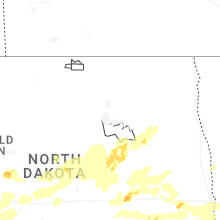


Connect with Interactive Hail Maps