

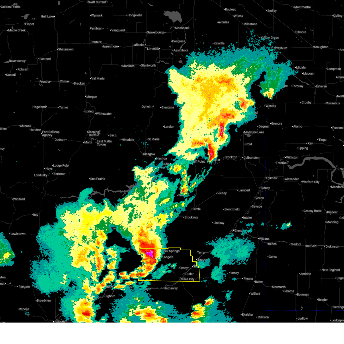
Hail Map for Miles City, MT
The Miles City, MT area has had 71 reports of on-the-ground hail by trained spotters, and has been under severe weather warnings 16 times during the past 12 months. Doppler radar has detected hail at or near Miles City, MT on 31 occasions, including 3 occasions during the past year.
| Name: | Miles City, MT |
| Where Located: | 0.7 miles E of Miles City, MT |
| Map: | Google Map for Miles City, MT |
| Population: | 8410 |
| Housing Units: | 4000 |
| More Info: | Search Google for Miles City, MT |
1
The Top Recent Hail Date for Miles City, MT is Saturday, July 13, 2024 (8th out of 31)

Hail and Wind Damage Spotted near Miles City, MT
| Date / Time | Report Details |
|---|---|
| 6/20/2025 3:45 PM MDT | Quarter sized hail reported 1.4 miles NNW of Miles City, MT, report from mping: quarter (1.00 in.). |
| 6/20/2025 3:38 PM MDT | Half Dollar sized hail reported 1.7 miles NW of Miles City, MT |
| 6/20/2025 3:37 PM MDT | Quarter sized hail reported 0.3 miles SE of Miles City, MT, facebook report. |
| 6/15/2025 10:58 PM MDT |
 The severe thunderstorm warning that was previously in effect has been reissued for custer county and is in effect until 1200 am mdt. please refer to that bulletin for the latest severe weather information. however, small hail, gusty winds, and heavy rain are still possible with these thunderstorms. The severe thunderstorm warning that was previously in effect has been reissued for custer county and is in effect until 1200 am mdt. please refer to that bulletin for the latest severe weather information. however, small hail, gusty winds, and heavy rain are still possible with these thunderstorms.
|
| 6/15/2025 10:31 PM MDT |
 the severe thunderstorm warning has been cancelled and is no longer in effect the severe thunderstorm warning has been cancelled and is no longer in effect
|
| 6/15/2025 10:31 PM MDT |
 At 1031 pm mdt, severe thunderstorms were located along a line from 28 miles northeast of miles city to 21 miles north of volborg, or along a line from 28 miles northeast of miles city to 22 miles southeast of miles city, moving east at 50 mph. these are destructive storms for miles city (at 1024 pm, miles city asos recorded an 76 mph wind gust). Hazards include 80 mph wind gusts and quarter size hail. Flying debris will be dangerous to those caught without shelter. mobile homes will be heavily damaged. expect considerable damage to roofs, windows, and vehicles. extensive tree damage and power outages are likely. Locations impacted include, miles city, volborg, twelve mile dam, strawberry hill recreation area, mizpah, matthews recreation area, locate, garland, moon creek ranch and knowlton. At 1031 pm mdt, severe thunderstorms were located along a line from 28 miles northeast of miles city to 21 miles north of volborg, or along a line from 28 miles northeast of miles city to 22 miles southeast of miles city, moving east at 50 mph. these are destructive storms for miles city (at 1024 pm, miles city asos recorded an 76 mph wind gust). Hazards include 80 mph wind gusts and quarter size hail. Flying debris will be dangerous to those caught without shelter. mobile homes will be heavily damaged. expect considerable damage to roofs, windows, and vehicles. extensive tree damage and power outages are likely. Locations impacted include, miles city, volborg, twelve mile dam, strawberry hill recreation area, mizpah, matthews recreation area, locate, garland, moon creek ranch and knowlton.
|
| 6/15/2025 10:18 PM MDT |
 At 1018 pm mdt, severe thunderstorms were located along a line from 19 miles northeast of miles city to 18 miles north of volborg, or along a line from 19 miles northeast of miles city to 22 miles south of miles city, moving east at 50 mph. these are destructive storms for at 1012 pm, miles city asos recorded an 81 mph wind gust (radar indicated). Hazards include 80 mph wind gusts and quarter size hail. Flying debris will be dangerous to those caught without shelter. mobile homes will be heavily damaged. expect considerable damage to roofs, windows, and vehicles. extensive tree damage and power outages are likely. Locations impacted include, miles city, volborg, twelve mile dam, strawberry hill recreation area, matthews recreation area, mizpah, locate, garland, moon creek ranch, knowlton and hathaway. At 1018 pm mdt, severe thunderstorms were located along a line from 19 miles northeast of miles city to 18 miles north of volborg, or along a line from 19 miles northeast of miles city to 22 miles south of miles city, moving east at 50 mph. these are destructive storms for at 1012 pm, miles city asos recorded an 81 mph wind gust (radar indicated). Hazards include 80 mph wind gusts and quarter size hail. Flying debris will be dangerous to those caught without shelter. mobile homes will be heavily damaged. expect considerable damage to roofs, windows, and vehicles. extensive tree damage and power outages are likely. Locations impacted include, miles city, volborg, twelve mile dam, strawberry hill recreation area, matthews recreation area, mizpah, locate, garland, moon creek ranch, knowlton and hathaway.
|
| 6/15/2025 10:14 PM MDT |
 Svrbyz the national weather service in billings has issued a * severe thunderstorm warning for, custer county in southeastern montana, north central powder river county in southeastern montana, rosebud county in southeastern montana, * until 1100 pm mdt. * at 1014 pm mdt, severe thunderstorms were located along a line from 16 miles northeast of miles city to 18 miles northwest of volborg, or along a line from 16 miles northeast of miles city to 23 miles south of miles city, moving east at 50 mph (radar indicated). Hazards include 60 mph wind gusts and quarter size hail. Hail damage to vehicles is expected. Expect wind damage to roofs, siding, and trees. Svrbyz the national weather service in billings has issued a * severe thunderstorm warning for, custer county in southeastern montana, north central powder river county in southeastern montana, rosebud county in southeastern montana, * until 1100 pm mdt. * at 1014 pm mdt, severe thunderstorms were located along a line from 16 miles northeast of miles city to 18 miles northwest of volborg, or along a line from 16 miles northeast of miles city to 23 miles south of miles city, moving east at 50 mph (radar indicated). Hazards include 60 mph wind gusts and quarter size hail. Hail damage to vehicles is expected. Expect wind damage to roofs, siding, and trees.
|
| 6/15/2025 10:12 PM MDT | Storm damage reported in custer county MT, 3 miles ESE of Miles City, MT |
| 6/15/2025 9:52 PM MDT |
 The storm which prompted the warning has weakened below severe limits, and no longer poses an immediate threat to life or property. therefore, the warning will be allowed to expire. however, small hail and gusty winds are still possible with this thunderstorm. a severe thunderstorm watch remains in effect until 1100 pm mdt sunday for a portion of southeast montana. The storm which prompted the warning has weakened below severe limits, and no longer poses an immediate threat to life or property. therefore, the warning will be allowed to expire. however, small hail and gusty winds are still possible with this thunderstorm. a severe thunderstorm watch remains in effect until 1100 pm mdt sunday for a portion of southeast montana.
|
| 6/15/2025 9:50 PM MDT | Storm damage reported in rosebud county MT, 35.8 miles SE of Miles City, MT |
| 6/15/2025 9:49 PM MDT |
 At 949 pm mdt, a severe thunderstorm was located 21 miles northwest of miles city, moving east at 35 mph (radar indicated). Hazards include 60 mph wind gusts and quarter size hail. Hail damage to vehicles is expected. expect wind damage to roofs, siding, and trees. Locations impacted include, miles city, angela, matthews recreation area, rock springs and strawberry hill recreation area. At 949 pm mdt, a severe thunderstorm was located 21 miles northwest of miles city, moving east at 35 mph (radar indicated). Hazards include 60 mph wind gusts and quarter size hail. Hail damage to vehicles is expected. expect wind damage to roofs, siding, and trees. Locations impacted include, miles city, angela, matthews recreation area, rock springs and strawberry hill recreation area.
|
| 6/15/2025 9:43 PM MDT |
 At 943 pm mdt, a severe thunderstorm was located 24 miles northwest of miles city, moving east at 35 mph (radar indicated). Hazards include 70 mph wind gusts and ping pong ball size hail. People and animals outdoors will be injured. expect hail damage to roofs, siding, windows, and vehicles. expect considerable tree damage. wind damage is also likely to mobile homes, roofs, and outbuildings. Locations impacted include, miles city, angela, matthews recreation area, rock springs and strawberry hill recreation area. At 943 pm mdt, a severe thunderstorm was located 24 miles northwest of miles city, moving east at 35 mph (radar indicated). Hazards include 70 mph wind gusts and ping pong ball size hail. People and animals outdoors will be injured. expect hail damage to roofs, siding, windows, and vehicles. expect considerable tree damage. wind damage is also likely to mobile homes, roofs, and outbuildings. Locations impacted include, miles city, angela, matthews recreation area, rock springs and strawberry hill recreation area.
|
| 6/15/2025 9:22 PM MDT |
 Svrbyz the national weather service in billings has issued a * severe thunderstorm warning for, northwestern custer county in southeastern montana, northern rosebud county in southeastern montana, * until 1000 pm mdt. * at 922 pm mdt, a severe thunderstorm was located 36 miles northeast of forsyth, or 35 miles northwest of miles city, moving east at 35 mph (radar indicated). Hazards include two inch hail and 70 mph wind gusts. People and animals outdoors will be injured. expect hail damage to roofs, siding, windows, and vehicles. expect considerable tree damage. Wind damage is also likely to mobile homes, roofs, and outbuildings. Svrbyz the national weather service in billings has issued a * severe thunderstorm warning for, northwestern custer county in southeastern montana, northern rosebud county in southeastern montana, * until 1000 pm mdt. * at 922 pm mdt, a severe thunderstorm was located 36 miles northeast of forsyth, or 35 miles northwest of miles city, moving east at 35 mph (radar indicated). Hazards include two inch hail and 70 mph wind gusts. People and animals outdoors will be injured. expect hail damage to roofs, siding, windows, and vehicles. expect considerable tree damage. Wind damage is also likely to mobile homes, roofs, and outbuildings.
|
| 8/21/2024 8:14 PM MDT |
 At 813 pm mdt, a severe thunderstorm was located over miles city, moving northeast at 30 mph (radar indicated). Hazards include 60 mph wind gusts and quarter size hail. Hail damage to vehicles is expected. expect wind damage to roofs, siding, and trees. Locations impacted include, miles city and strawberry hill recreation area. At 813 pm mdt, a severe thunderstorm was located over miles city, moving northeast at 30 mph (radar indicated). Hazards include 60 mph wind gusts and quarter size hail. Hail damage to vehicles is expected. expect wind damage to roofs, siding, and trees. Locations impacted include, miles city and strawberry hill recreation area.
|
| 8/21/2024 7:55 PM MDT |
 Svrbyz the national weather service in billings has issued a * severe thunderstorm warning for, west central custer county in southeastern montana, * until 830 pm mdt. * at 754 pm mdt, a severe thunderstorm was located 9 miles southwest of miles city, moving northeast at 30 mph (radar indicated). Hazards include 60 mph wind gusts and quarter size hail. Hail damage to vehicles is expected. Expect wind damage to roofs, siding, and trees. Svrbyz the national weather service in billings has issued a * severe thunderstorm warning for, west central custer county in southeastern montana, * until 830 pm mdt. * at 754 pm mdt, a severe thunderstorm was located 9 miles southwest of miles city, moving northeast at 30 mph (radar indicated). Hazards include 60 mph wind gusts and quarter size hail. Hail damage to vehicles is expected. Expect wind damage to roofs, siding, and trees.
|
| 8/21/2024 7:45 PM MDT |
 At 744 pm mdt, a severe thunderstorm was located 13 miles west of miles city, moving northeast at 30 mph (radar indicated). Hazards include 60 mph wind gusts and quarter size hail. Hail damage to vehicles is expected. expect wind damage to roofs, siding, and trees. Locations impacted include, miles city and moon creek ranch. At 744 pm mdt, a severe thunderstorm was located 13 miles west of miles city, moving northeast at 30 mph (radar indicated). Hazards include 60 mph wind gusts and quarter size hail. Hail damage to vehicles is expected. expect wind damage to roofs, siding, and trees. Locations impacted include, miles city and moon creek ranch.
|
| 8/21/2024 7:36 PM MDT |
 Svrbyz the national weather service in billings has issued a * severe thunderstorm warning for, west central custer county in southeastern montana, central rosebud county in southeastern montana, * until 800 pm mdt. * at 736 pm mdt, a severe thunderstorm was located 16 miles west of miles city, moving northeast at 30 mph (radar indicated). Hazards include 60 mph wind gusts and quarter size hail. Hail damage to vehicles is expected. Expect wind damage to roofs, siding, and trees. Svrbyz the national weather service in billings has issued a * severe thunderstorm warning for, west central custer county in southeastern montana, central rosebud county in southeastern montana, * until 800 pm mdt. * at 736 pm mdt, a severe thunderstorm was located 16 miles west of miles city, moving northeast at 30 mph (radar indicated). Hazards include 60 mph wind gusts and quarter size hail. Hail damage to vehicles is expected. Expect wind damage to roofs, siding, and trees.
|
| 8/4/2024 11:21 PM MDT | Mesonet station mccm8 cow cree in rosebud county MT, 31.1 miles NNE of Miles City, MT |
| 7/13/2024 7:30 PM MDT | Storm damage reported in custer county MT, 9.8 miles W of Miles City, MT |
| 7/13/2024 7:28 PM MDT | Trees uprooted or snapped; roof blown of in custer county MT, 0.7 miles ESE of Miles City, MT |
| 7/13/2024 7:25 PM MDT |
 At 722 pm mdt, a severe thunderstorm was located 10 miles south of miles city, moving southeast at 50 mph (trained weather spotters. 72 mph wind gust measured in miles city at 7:10 pm mdt). Hazards include golf ball size hail and 70 mph wind gusts. People and animals outdoors will be injured. expect hail damage to roofs, siding, windows, and vehicles. expect considerable tree damage. wind damage is also likely to mobile homes, roofs, and outbuildings. Locations impacted include, miles city, hathaway, twelve mile dam, locate, garland, moon creek ranch, strawberry hill recreation area, matthews recreation area, mizpah, and knowlton. At 722 pm mdt, a severe thunderstorm was located 10 miles south of miles city, moving southeast at 50 mph (trained weather spotters. 72 mph wind gust measured in miles city at 7:10 pm mdt). Hazards include golf ball size hail and 70 mph wind gusts. People and animals outdoors will be injured. expect hail damage to roofs, siding, windows, and vehicles. expect considerable tree damage. wind damage is also likely to mobile homes, roofs, and outbuildings. Locations impacted include, miles city, hathaway, twelve mile dam, locate, garland, moon creek ranch, strawberry hill recreation area, matthews recreation area, mizpah, and knowlton.
|
| 7/13/2024 7:22 PM MDT | 3-inch tree limbs broken; power poles broke in custer county MT, 1.4 miles SE of Miles City, MT |
| 7/13/2024 7:21 PM MDT | 1-inch tree limbs broken; shingles blown of in custer county MT, 2.3 miles SE of Miles City, MT |
| 7/13/2024 7:16 PM MDT | Storm damage reported in custer county MT, 3.9 miles SW of Miles City, MT |
| 7/13/2024 7:15 PM MDT | Fort keogh se mesone in custer county MT, 5.4 miles N of Miles City, MT |
| 7/13/2024 7:13 PM MDT |
 At 711 pm mdt, a severe thunderstorm was located near miles city, and is nearly stationary (trained weather spotters. 72 mph wind gust measured in miles city at 7:10 pm mdt). Hazards include golf ball size hail and 70 mph wind gusts. People and animals outdoors will be injured. expect hail damage to roofs, siding, windows, and vehicles. expect considerable tree damage. wind damage is also likely to mobile homes, roofs, and outbuildings. Locations impacted include, miles city, rosebud, locate, angela, cartersville, strawberry hill recreation area, matthews recreation area, hathaway, twelve mile dam, brandenberg, rock springs, garland, moon creek ranch, mizpah, and knowlton. At 711 pm mdt, a severe thunderstorm was located near miles city, and is nearly stationary (trained weather spotters. 72 mph wind gust measured in miles city at 7:10 pm mdt). Hazards include golf ball size hail and 70 mph wind gusts. People and animals outdoors will be injured. expect hail damage to roofs, siding, windows, and vehicles. expect considerable tree damage. wind damage is also likely to mobile homes, roofs, and outbuildings. Locations impacted include, miles city, rosebud, locate, angela, cartersville, strawberry hill recreation area, matthews recreation area, hathaway, twelve mile dam, brandenberg, rock springs, garland, moon creek ranch, mizpah, and knowlton.
|
| 7/13/2024 7:10 PM MDT | Measured by storm spotte in custer county MT, 0.3 miles SE of Miles City, MT |
| 7/13/2024 7:08 PM MDT | Tree and power line damage. power out in miles cit in custer county MT, 0.3 miles SE of Miles City, MT |
| 7/13/2024 6:55 PM MDT |
 Svrbyz the national weather service in billings has issued a * severe thunderstorm warning for, custer county in southeastern montana, northern rosebud county in southeastern montana, * until 800 pm mdt. * at 653 pm mdt, a severe thunderstorm was located 14 miles northwest of miles city, moving southeast at 50 mph (radar indicated). Hazards include ping pong ball size hail and 60 mph wind gusts. People and animals outdoors will be injured. expect hail damage to roofs, siding, windows, and vehicles. Expect wind damage to roofs, siding, and trees. Svrbyz the national weather service in billings has issued a * severe thunderstorm warning for, custer county in southeastern montana, northern rosebud county in southeastern montana, * until 800 pm mdt. * at 653 pm mdt, a severe thunderstorm was located 14 miles northwest of miles city, moving southeast at 50 mph (radar indicated). Hazards include ping pong ball size hail and 60 mph wind gusts. People and animals outdoors will be injured. expect hail damage to roofs, siding, windows, and vehicles. Expect wind damage to roofs, siding, and trees.
|
| 6/30/2024 8:54 PM MDT | Asos station kmls miles cit in custer county MT, 2.6 miles SE of Miles City, MT |
| 6/27/2024 4:37 PM MDT |
 The storms which prompted the warning have weakened below severe limits, and have exited the warned area. therefore, the warning will be allowed to expire. a severe thunderstorm watch remains in effect until 800 pm mdt for southeastern montana. The storms which prompted the warning have weakened below severe limits, and have exited the warned area. therefore, the warning will be allowed to expire. a severe thunderstorm watch remains in effect until 800 pm mdt for southeastern montana.
|
| 6/27/2024 4:14 PM MDT | Report from mping: 1-inch tree limbs broken; shingles blown of in custer county MT, 2 miles SW of Miles City, MT |
| 6/27/2024 4:11 PM MDT | Report from mping: 3-inch tree limbs broken; power poles broke in custer county MT, 0.3 miles SE of Miles City, MT |
| 6/27/2024 4:08 PM MDT | Report from mping: 1-inch tree limbs broken; shingles blown of in custer county MT, 0.7 miles ESE of Miles City, MT |
| 6/27/2024 4:06 PM MDT |
 Svrbyz the national weather service in billings has issued a * severe thunderstorm warning for, southern custer county in southeastern montana, northern powder river county in southeastern montana, * until 445 pm mdt. * at 405 pm mdt, severe thunderstorms were located along a line extending from 7 miles east of miles city to 9 miles northeast of volborg to 19 miles west of broadus, moving east at 50 mph (radar indicated). Hazards include 70 mph wind gusts and quarter size hail. Hail damage to vehicles is expected. expect considerable tree damage. Wind damage is also likely to mobile homes, roofs, and outbuildings. Svrbyz the national weather service in billings has issued a * severe thunderstorm warning for, southern custer county in southeastern montana, northern powder river county in southeastern montana, * until 445 pm mdt. * at 405 pm mdt, severe thunderstorms were located along a line extending from 7 miles east of miles city to 9 miles northeast of volborg to 19 miles west of broadus, moving east at 50 mph (radar indicated). Hazards include 70 mph wind gusts and quarter size hail. Hail damage to vehicles is expected. expect considerable tree damage. Wind damage is also likely to mobile homes, roofs, and outbuildings.
|
| 6/27/2024 3:49 PM MDT | Asos station kmls miles cit in custer county MT, 2.6 miles SE of Miles City, MT |
| 6/27/2024 3:44 PM MDT |
 At 343 pm mdt, a severe thunderstorm was located 19 miles southwest of miles city, moving east at 50 mph (radar indicated). Hazards include 70 mph wind gusts and quarter size hail. Hail damage to vehicles is expected. expect considerable tree damage. wind damage is also likely to mobile homes, roofs, and outbuildings. Locations impacted include, miles city, hathaway, twelve mile dam, garland, moon creek ranch, strawberry hill recreation area, and matthews recreation area. At 343 pm mdt, a severe thunderstorm was located 19 miles southwest of miles city, moving east at 50 mph (radar indicated). Hazards include 70 mph wind gusts and quarter size hail. Hail damage to vehicles is expected. expect considerable tree damage. wind damage is also likely to mobile homes, roofs, and outbuildings. Locations impacted include, miles city, hathaway, twelve mile dam, garland, moon creek ranch, strawberry hill recreation area, and matthews recreation area.
|
| 6/27/2024 3:09 PM MDT |
 Svrbyz the national weather service in billings has issued a * severe thunderstorm warning for, southwestern custer county in southeastern montana, central rosebud county in southeastern montana, * until 415 pm mdt. * at 309 pm mdt, a severe thunderstorm was located 7 miles south of forsyth, moving east at 50 mph (radar indicated). Hazards include 70 mph wind gusts and quarter size hail. Hail damage to vehicles is expected. expect considerable tree damage. Wind damage is also likely to mobile homes, roofs, and outbuildings. Svrbyz the national weather service in billings has issued a * severe thunderstorm warning for, southwestern custer county in southeastern montana, central rosebud county in southeastern montana, * until 415 pm mdt. * at 309 pm mdt, a severe thunderstorm was located 7 miles south of forsyth, moving east at 50 mph (radar indicated). Hazards include 70 mph wind gusts and quarter size hail. Hail damage to vehicles is expected. expect considerable tree damage. Wind damage is also likely to mobile homes, roofs, and outbuildings.
|
| 6/15/2024 7:53 PM MDT | Asos station kmls miles cit in custer county MT, 2.6 miles SE of Miles City, MT |
| 6/3/2024 8:35 PM MDT | 2 1/2 inch cottonwood tree branch blown down in custer county MT, 1.9 miles N of Miles City, MT |
| 6/3/2024 8:08 PM MDT | Storm damage reported in custer county MT, 3 miles ESE of Miles City, MT |
| 8/30/2023 7:10 PM MDT | Dead tree snapped. 18 inches in diamete in custer county MT, 8.4 miles W of Miles City, MT |
| 8/30/2023 7:00 PM MDT | Tree damage. tree snapped off at base... tree uprooted... multiple 4-12 inch diameter branches down in custer county MT, 0.7 miles ESE of Miles City, MT |
| 8/30/2023 6:58 PM MDT |
 At 655 pm mdt, severe thunderstorms were located along a line extending from 9 miles northwest of terry to 6 miles northwest of volborg, moving east at 45 mph (weather station. at 649 pm, a 63 mph wind gust was reported at the miles city airport). Hazards include 70 mph wind gusts and nickel size hail. Expect considerable tree damage. damage is likely to mobile homes, roofs, and outbuildings. locations impacted include, miles city, volborg, twelve mile dam, locate, powderville, garland, strawberry hill recreation area, matthews recreation area, mizpah, and knowlton. thunderstorm damage threat, considerable hail threat, radar indicated max hail size, 0. 88 in wind threat, observed max wind gust, 70 mph. At 655 pm mdt, severe thunderstorms were located along a line extending from 9 miles northwest of terry to 6 miles northwest of volborg, moving east at 45 mph (weather station. at 649 pm, a 63 mph wind gust was reported at the miles city airport). Hazards include 70 mph wind gusts and nickel size hail. Expect considerable tree damage. damage is likely to mobile homes, roofs, and outbuildings. locations impacted include, miles city, volborg, twelve mile dam, locate, powderville, garland, strawberry hill recreation area, matthews recreation area, mizpah, and knowlton. thunderstorm damage threat, considerable hail threat, radar indicated max hail size, 0. 88 in wind threat, observed max wind gust, 70 mph.
|
| 8/30/2023 6:49 PM MDT | Storm damage reported in custer county MT, 3 miles ESE of Miles City, MT |
| 8/30/2023 6:45 PM MDT | Storm damage reported in custer county MT, 4 miles N of Miles City, MT |
| 8/30/2023 6:40 PM MDT |
 At 639 pm mdt, severe thunderstorms were located along a line extending from 19 miles west of terry to 16 miles west of volborg, moving east at 45 mph (radar and weather station indicated. at 615 pm, 70 mph winds were reported 20 miles north of forsyth). Hazards include 70 mph wind gusts and nickel size hail. Expect considerable tree damage. Damage is likely to mobile homes, roofs, and outbuildings. At 639 pm mdt, severe thunderstorms were located along a line extending from 19 miles west of terry to 16 miles west of volborg, moving east at 45 mph (radar and weather station indicated. at 615 pm, 70 mph winds were reported 20 miles north of forsyth). Hazards include 70 mph wind gusts and nickel size hail. Expect considerable tree damage. Damage is likely to mobile homes, roofs, and outbuildings.
|
| 8/30/2023 6:23 PM MDT | Storm damage reported in rosebud county MT, 35.8 miles SE of Miles City, MT |
| 7/11/2023 8:00 PM MDT | Quarter sized hail reported 7.7 miles NNW of Miles City, MT |
| 7/11/2023 7:37 PM MDT |
 At 736 pm mdt, a severe thunderstorm was located 8 miles southwest of miles city, moving east at 35 mph (radar indicated). Hazards include 60 mph wind gusts and quarter size hail. Hail damage to vehicles is expected. Expect wind damage to roofs, siding, and trees. At 736 pm mdt, a severe thunderstorm was located 8 miles southwest of miles city, moving east at 35 mph (radar indicated). Hazards include 60 mph wind gusts and quarter size hail. Hail damage to vehicles is expected. Expect wind damage to roofs, siding, and trees.
|
| 7/11/2023 4:51 PM MDT | Large cottonwood tree down in custer county MT, 2.1 miles NNW of Miles City, MT |
| 7/11/2023 4:17 PM MDT | 3-4 inch diameter trees limbs dow in custer county MT, 0.9 miles NE of Miles City, MT |
| 7/11/2023 4:17 PM MDT | 3-4 inch diameter trees limbs dow in custer county MT, 0.9 miles NE of Miles City, MT |
| 6/20/2023 12:43 AM MDT |
 At 1241 am mdt, a severe thunderstorm was located 11 miles west of miles city, moving northeast at 55 mph (radar indicated). Hazards include golf ball size hail and 60 mph wind gusts. People and animals outdoors will be injured. expect hail damage to roofs, siding, windows, and vehicles. expect wind damage to roofs, siding, and trees. locations impacted include, miles city, hathaway, moon creek ranch, twelve mile dam, strawberry hill recreation area and matthews recreation area. a second severe storm was located 8 miles south of hathaway, moving northeast at 45 mph. this storm has weakened over the past 20 minutes, but may still produce quarter size hail and wind gusts to 60 mph. thunderstorm damage threat, considerable hail threat, radar indicated max hail size, 1. 75 in wind threat, radar indicated max wind gust, 60 mph. At 1241 am mdt, a severe thunderstorm was located 11 miles west of miles city, moving northeast at 55 mph (radar indicated). Hazards include golf ball size hail and 60 mph wind gusts. People and animals outdoors will be injured. expect hail damage to roofs, siding, windows, and vehicles. expect wind damage to roofs, siding, and trees. locations impacted include, miles city, hathaway, moon creek ranch, twelve mile dam, strawberry hill recreation area and matthews recreation area. a second severe storm was located 8 miles south of hathaway, moving northeast at 45 mph. this storm has weakened over the past 20 minutes, but may still produce quarter size hail and wind gusts to 60 mph. thunderstorm damage threat, considerable hail threat, radar indicated max hail size, 1. 75 in wind threat, radar indicated max wind gust, 60 mph.
|
| 6/20/2023 12:23 AM MDT |
 At 1221 am mdt, a severe thunderstorm was located 13 miles east of colstrip, moving northeast at 50 mph. a second severe storm was located near hathaway, moving northeast at 45 mph (radar indicated). Hazards include ping pong ball size hail and 60 mph wind gusts. People and animals outdoors will be injured. expect hail damage to roofs, siding, windows, and vehicles. Expect wind damage to roofs, siding, and trees. At 1221 am mdt, a severe thunderstorm was located 13 miles east of colstrip, moving northeast at 50 mph. a second severe storm was located near hathaway, moving northeast at 45 mph (radar indicated). Hazards include ping pong ball size hail and 60 mph wind gusts. People and animals outdoors will be injured. expect hail damage to roofs, siding, windows, and vehicles. Expect wind damage to roofs, siding, and trees.
|
| 6/19/2023 7:35 PM MDT | Storm damage reported in custer county MT, 28 miles WNW of Miles City, MT |
| 6/19/2023 7:35 PM MDT | Quarter sized hail reported 28 miles WNW of Miles City, MT |
| 6/19/2023 7:06 PM MDT | Report of several cottonwood trees down in powder river county MT, 27.3 miles WNW of Miles City, MT |
| 6/19/2023 6:39 PM MDT |
 At 638 pm mdt, a severe thunderstorms were located near garland, or 30 miles south of miles city, moving northeast at 40 mph (radar indicated). Hazards include 70 mph wind gusts and half dollar size hail. Hail damage to vehicles is expected. expect considerable tree damage. Wind damage is also likely to mobile homes, roofs, and outbuildings. At 638 pm mdt, a severe thunderstorms were located near garland, or 30 miles south of miles city, moving northeast at 40 mph (radar indicated). Hazards include 70 mph wind gusts and half dollar size hail. Hail damage to vehicles is expected. expect considerable tree damage. Wind damage is also likely to mobile homes, roofs, and outbuildings.
|
| 5/24/2023 6:45 PM MDT | Quarter sized hail reported 7.9 miles SSE of Miles City, MT |
| 8/14/2022 10:47 PM MDT | Asos station kmls miles cit in custer county MT, 2.6 miles SE of Miles City, MT |
| 7/17/2022 7:00 PM MDT | Storm damage reported in rosebud county MT, 32.4 miles SE of Miles City, MT |
| 7/15/2022 6:39 PM MDT | Storm damage reported in rosebud county MT, 35.8 miles SE of Miles City, MT |
| 7/9/2022 11:34 PM MDT |
 At 1132 pm mdt, severe thunderstorms were located along a line extending from 9 miles west of terry to near miles city, moving east at 45 mph (radar indicated). Hazards include 60 mph wind gusts and half dollar size hail. Hail damage to vehicles, wind damage to roofs, siding, and trees. these severe thunderstorms will remain over mainly rural areas of northern custer county, including the following locations, locate, strawberry hill recreation area and matthews recreation area. hail threat, observed max hail size, 1. 25 in wind threat, radar indicated max wind gust, 60 mph. At 1132 pm mdt, severe thunderstorms were located along a line extending from 9 miles west of terry to near miles city, moving east at 45 mph (radar indicated). Hazards include 60 mph wind gusts and half dollar size hail. Hail damage to vehicles, wind damage to roofs, siding, and trees. these severe thunderstorms will remain over mainly rural areas of northern custer county, including the following locations, locate, strawberry hill recreation area and matthews recreation area. hail threat, observed max hail size, 1. 25 in wind threat, radar indicated max wind gust, 60 mph.
|
| 7/9/2022 11:30 PM MDT | Storm damage reported in custer county MT, 3 miles ESE of Miles City, MT |
| 7/9/2022 11:26 PM MDT | 6 inch diameter tree branches down at mile marker 14 and 4 inch diameter branches down at mile marker 13 on kinsey rd./mt 489 in custer county MT, 11.3 miles SSW of Miles City, MT |
| 7/9/2022 10:57 PM MDT |
 At 1055 pm mdt, severe thunderstorms were located along a line extending from 19 miles southeast of hillside to 14 miles northwest of miles city to 14 miles northeast of forsyth, moving east at 40 mph (radar indicated). Hazards include golf ball size hail and 60 mph wind gusts. People and animals outdoors will be injured. expect hail and wind damage to roofs, siding, windows, and vehicles. expect wind damage to roofs, siding, and trees. severe thunderstorms will be near, miles city around 1135 pm mdt. other locations impacted by these severe thunderstorms include twelve mile dam, locate, moon creek ranch, strawberry hill recreation area, matthews recreation area, mizpah and knowlton. these storms have a history of producing golfball or larger hail. thunderstorm damage threat, considerable hail threat, observed max hail size, 1. 75 in wind threat, radar indicated max wind gust, 60 mph. At 1055 pm mdt, severe thunderstorms were located along a line extending from 19 miles southeast of hillside to 14 miles northwest of miles city to 14 miles northeast of forsyth, moving east at 40 mph (radar indicated). Hazards include golf ball size hail and 60 mph wind gusts. People and animals outdoors will be injured. expect hail and wind damage to roofs, siding, windows, and vehicles. expect wind damage to roofs, siding, and trees. severe thunderstorms will be near, miles city around 1135 pm mdt. other locations impacted by these severe thunderstorms include twelve mile dam, locate, moon creek ranch, strawberry hill recreation area, matthews recreation area, mizpah and knowlton. these storms have a history of producing golfball or larger hail. thunderstorm damage threat, considerable hail threat, observed max hail size, 1. 75 in wind threat, radar indicated max wind gust, 60 mph.
|
| 7/9/2022 10:51 PM MDT | Hen Egg sized hail reported 22.2 miles SE of Miles City, MT, public reported |
| 7/5/2022 2:13 AM MDT |
 The severe thunderstorm warning for west central custer county will expire at 215 am mdt, the storm which prompted the warning has weakened below severe limits, and no longer poses an immediate threat to life or property. therefore, the warning will be allowed to expire. however small hail, gusty winds and heavy rain are still expected with this thunderstorm as it tracks east of miles city. a severe thunderstorm watch remains in effect until 400 am mdt for southeastern montana. The severe thunderstorm warning for west central custer county will expire at 215 am mdt, the storm which prompted the warning has weakened below severe limits, and no longer poses an immediate threat to life or property. therefore, the warning will be allowed to expire. however small hail, gusty winds and heavy rain are still expected with this thunderstorm as it tracks east of miles city. a severe thunderstorm watch remains in effect until 400 am mdt for southeastern montana.
|
| 7/5/2022 1:54 AM MDT |
 At 153 am mdt, a severe thunderstorm was located 7 miles southeast of miles city, moving northeast at 25 mph. the strongest portion of this storm will stay south of i-94 (radar indicated). Hazards include 60 mph wind gusts and half dollar size hail, along with very heavy rain. Hail damage to vehicles is expected. expect wind damage to roofs, siding, and trees. locations impacted include, miles city, twelve mile dam and strawberry hill recreation area. hail threat, radar indicated max hail size, 1. 25 in wind threat, radar indicated max wind gust, 60 mph. At 153 am mdt, a severe thunderstorm was located 7 miles southeast of miles city, moving northeast at 25 mph. the strongest portion of this storm will stay south of i-94 (radar indicated). Hazards include 60 mph wind gusts and half dollar size hail, along with very heavy rain. Hail damage to vehicles is expected. expect wind damage to roofs, siding, and trees. locations impacted include, miles city, twelve mile dam and strawberry hill recreation area. hail threat, radar indicated max hail size, 1. 25 in wind threat, radar indicated max wind gust, 60 mph.
|
| 7/5/2022 1:30 AM MDT |
 At 129 am mdt, a severe thunderstorm was located 10 miles southwest of miles city, moving northeast at 15 mph. the strongest portion of this storm is expected to stay south of i-94 (radar indicated). Hazards include ping pong ball size hail and 60 mph wind gusts, along with very heavy rain. People and animals outdoors will be injured. expect hail damage to roofs, siding, windows, and vehicles. Expect wind damage to roofs, siding, and trees. At 129 am mdt, a severe thunderstorm was located 10 miles southwest of miles city, moving northeast at 15 mph. the strongest portion of this storm is expected to stay south of i-94 (radar indicated). Hazards include ping pong ball size hail and 60 mph wind gusts, along with very heavy rain. People and animals outdoors will be injured. expect hail damage to roofs, siding, windows, and vehicles. Expect wind damage to roofs, siding, and trees.
|
| 7/3/2022 8:40 PM MDT |
 At 839 pm mdt, severe thunderstorms were located along a line extending from 22 miles east of forsyth to 6 miles southeast of volborg, moving northeast at 50 mph (radar indicated). Hazards include 70 mph wind gusts and ping pong ball size hail. People and animals outdoors will be injured. expect hail damage to roofs, siding, windows, and vehicles. expect considerable tree damage. Wind damage is also likely to mobile homes, roofs, and outbuildings. At 839 pm mdt, severe thunderstorms were located along a line extending from 22 miles east of forsyth to 6 miles southeast of volborg, moving northeast at 50 mph (radar indicated). Hazards include 70 mph wind gusts and ping pong ball size hail. People and animals outdoors will be injured. expect hail damage to roofs, siding, windows, and vehicles. expect considerable tree damage. Wind damage is also likely to mobile homes, roofs, and outbuildings.
|
| 7/1/2022 5:54 PM MDT |
 At 553 pm mdt, a severe thunderstorm was located near miles city, moving southeast at 30 mph (radar indicated). Hazards include 60 mph wind gusts and quarter size hail. Hail damage to vehicles is expected. Expect wind damage to roofs, siding, and trees. At 553 pm mdt, a severe thunderstorm was located near miles city, moving southeast at 30 mph (radar indicated). Hazards include 60 mph wind gusts and quarter size hail. Hail damage to vehicles is expected. Expect wind damage to roofs, siding, and trees.
|
| 7/22/2021 1:39 PM MDT | 6 inch diameter tree limbs blown down in custer county MT, 0.9 miles NE of Miles City, MT |
| 7/7/2021 8:35 PM MDT | Storm damage reported in custer county MT, 36.5 miles NW of Miles City, MT |
| 7/7/2021 8:01 PM MDT | 4 inch tree branches dow in custer county MT, 1.9 miles N of Miles City, MT |
| 7/7/2021 7:53 PM MDT |
 At 751 pm mdt, a severe thunderstorm was located near miles city, moving east at 25 mph (radar indicated). Hazards include 60 mph wind gusts and nickel size hail. expect damage to roofs, siding, and trees At 751 pm mdt, a severe thunderstorm was located near miles city, moving east at 25 mph (radar indicated). Hazards include 60 mph wind gusts and nickel size hail. expect damage to roofs, siding, and trees
|
| 6/10/2021 7:30 PM MDT | Tennis Ball sized hail reported 31.6 miles SSE of Miles City, MT |
| 6/5/2021 6:43 PM MDT | Storm damage reported in custer county MT, 3 miles ESE of Miles City, MT |
| 6/5/2021 6:16 PM MDT | Storm damage reported in rosebud county MT, 35.8 miles SE of Miles City, MT |
| 8/20/2020 10:43 PM MDT |
 At 1042 pm mdt, a severe thunderstorm was located near miles city, moving east at 30 mph (miles city airport reported a gust to 58 mph). Hazards include 60 mph wind gusts. localized damage to roofs, siding, and trees is possible At 1042 pm mdt, a severe thunderstorm was located near miles city, moving east at 30 mph (miles city airport reported a gust to 58 mph). Hazards include 60 mph wind gusts. localized damage to roofs, siding, and trees is possible
|
| 8/20/2020 10:37 PM MDT | Storm damage reported in custer county MT, 3 miles ESE of Miles City, MT |
| 7/30/2020 7:44 PM MDT | Storm damage reported in custer county MT, 3 miles ESE of Miles City, MT |
| 7/30/2020 7:43 PM MDT |
 At 742 pm mdt, a severe thunderstorm was located over miles city, moving southeast at 30 mph (at 735 pm a wind gust of 68 mph was reported at the miles city airport with this storm). Hazards include 70 mph wind gusts. Expect considerable tree damage. Damage is likely to mobile homes, roofs, and outbuildings. At 742 pm mdt, a severe thunderstorm was located over miles city, moving southeast at 30 mph (at 735 pm a wind gust of 68 mph was reported at the miles city airport with this storm). Hazards include 70 mph wind gusts. Expect considerable tree damage. Damage is likely to mobile homes, roofs, and outbuildings.
|
| 7/30/2020 7:34 PM MDT | Storm damage reported in custer county MT, 3 miles ESE of Miles City, MT |
| 7/7/2020 7:22 PM MDT | Large tree branches down on i-94 at mile markers 144 and 14 in custer county MT, 7.1 miles SW of Miles City, MT |
| 7/7/2020 7:17 PM MDT |
 At 716 pm mdt, a severe thunderstorm was located near miles city, moving east at 55 mph (radar indicated. at 711pm a 74 mph wind gust was reported the miles city airport). Hazards include 75 mph wind gusts. Expect considerable tree damage. Damage is likely to mobile homes, roofs, and outbuildings. At 716 pm mdt, a severe thunderstorm was located near miles city, moving east at 55 mph (radar indicated. at 711pm a 74 mph wind gust was reported the miles city airport). Hazards include 75 mph wind gusts. Expect considerable tree damage. Damage is likely to mobile homes, roofs, and outbuildings.
|
| 7/7/2020 7:15 PM MDT | Storm damage reported in custer county MT, 3 miles ESE of Miles City, MT |
| 7/4/2020 7:18 PM MDT | Storm damage reported in custer county MT, 3 miles ESE of Miles City, MT |
| 7/3/2020 6:59 PM MDT |
 At 657 pm mdt, a severe thunderstorm was located 19 miles southwest of miles city, moving northeast at 35 mph (radar indicated. other storms in this area have a history of producing 50 to 60 mph gusts). Hazards include 60 mph wind gusts and half dollar size hail. Hail damage to vehicles is expected. Expect wind damage to roofs, siding, and trees. At 657 pm mdt, a severe thunderstorm was located 19 miles southwest of miles city, moving northeast at 35 mph (radar indicated. other storms in this area have a history of producing 50 to 60 mph gusts). Hazards include 60 mph wind gusts and half dollar size hail. Hail damage to vehicles is expected. Expect wind damage to roofs, siding, and trees.
|
| 5/31/2020 5:30 PM MDT | Quarter sized hail reported 12.4 miles W of Miles City, MT |
| 5/31/2020 5:20 PM MDT | Hail covered the groun in custer county MT, 8.4 miles W of Miles City, MT |
| 5/31/2020 5:10 PM MDT |
 At 508 pm mdt, a severe thunderstorm was located over miles city, moving east at 40 mph (weather station. a 55 kt gust was reported at the miles city airport). Hazards include 70 mph wind gusts and quarter size hail. Hail damage to vehicles is expected. expect considerable tree damage. Wind damage is also likely to mobile homes, roofs, and outbuildings. At 508 pm mdt, a severe thunderstorm was located over miles city, moving east at 40 mph (weather station. a 55 kt gust was reported at the miles city airport). Hazards include 70 mph wind gusts and quarter size hail. Hail damage to vehicles is expected. expect considerable tree damage. Wind damage is also likely to mobile homes, roofs, and outbuildings.
|
| 5/31/2020 5:06 PM MDT | Storm damage reported in custer county MT, 3 miles ESE of Miles City, MT |
| 5/20/2020 7:38 PM MDT | Storm damage reported in rosebud county MT, 35.8 miles SE of Miles City, MT |
| 5/20/2020 7:26 PM MDT | Semi tipped over on i-94 and 1 foot or more diameter trees dow in custer county MT, 14.4 miles SW of Miles City, MT |
| 5/20/2020 7:24 PM MDT |
 At 724 pm mdt, severe thunderstorms were located along a line extending from 14 miles north of forsyth to 22 miles northwest of ekalaka, moving north at 60 mph (weather station. at the miles city airport, a 66 mph gust was reported at 720 pm). Hazards include 70 mph wind gusts and quarter size hail. Hail damage to vehicles is expected. expect considerable tree damage. Wind damage is also likely to mobile homes, roofs, and outbuildings. At 724 pm mdt, severe thunderstorms were located along a line extending from 14 miles north of forsyth to 22 miles northwest of ekalaka, moving north at 60 mph (weather station. at the miles city airport, a 66 mph gust was reported at 720 pm). Hazards include 70 mph wind gusts and quarter size hail. Hail damage to vehicles is expected. expect considerable tree damage. Wind damage is also likely to mobile homes, roofs, and outbuildings.
|
| 5/20/2020 7:19 PM MDT | Storm damage reported in custer county MT, 3 miles ESE of Miles City, MT |
| 5/20/2020 7:16 PM MDT | Storm damage reported in custer county MT, 3 miles ESE of Miles City, MT |
| 5/20/2020 6:30 PM MDT | Golf Ball sized hail reported 13.4 miles SSW of Miles City, MT, cracked vehicle windshield and damaged car mirror. |
| 5/20/2020 6:20 PM MDT | Hen Egg sized hail reported 14.4 miles SW of Miles City, MT, rotating wall cloud with the storm. storm chaser vehicle was destroyed on i-94. |
| 5/20/2020 6:09 PM MDT | Tennis Ball sized hail reported 9.6 miles SW of Miles City, MT |
| 5/20/2020 6:05 PM MDT | Ping Pong Ball sized hail reported 7 miles W of Miles City, MT |
| 5/20/2020 5:58 PM MDT | Hen Egg sized hail reported 10.3 miles W of Miles City, MT |
| 5/20/2020 5:58 PM MDT | Ping Pong Ball sized hail reported 4.8 miles WSW of Miles City, MT, cracked windshield |
| 5/20/2020 5:50 PM MDT |
 At 550 pm mdt, a severe thunderstorm was located near miles city, moving north at 25 mph. the storm will move over miles city over the next 10 minutes (radar indicated). Hazards include 60 mph wind gusts and half dollar size hail. Hail damage to vehicles is expected. expect wind damage to roofs, siding, and trees. Locations impacted include, miles city, matthews recreation area and strawberry hill recreation area. At 550 pm mdt, a severe thunderstorm was located near miles city, moving north at 25 mph. the storm will move over miles city over the next 10 minutes (radar indicated). Hazards include 60 mph wind gusts and half dollar size hail. Hail damage to vehicles is expected. expect wind damage to roofs, siding, and trees. Locations impacted include, miles city, matthews recreation area and strawberry hill recreation area.
|
| 5/20/2020 5:45 PM MDT | Quarter sized hail reported 7.7 miles NNW of Miles City, MT |
| 5/20/2020 5:25 PM MDT | Hen Egg sized hail reported 16 miles NE of Miles City, MT |
| 5/20/2020 5:23 PM MDT |
 At 523 pm mdt, a severe thunderstorm was located 13 miles southeast of miles city, moving north at 20 mph (radar indicated). Hazards include 60 mph wind gusts and half dollar size hail. Hail damage to vehicles is expected. Expect wind damage to roofs, siding, and trees. At 523 pm mdt, a severe thunderstorm was located 13 miles southeast of miles city, moving north at 20 mph (radar indicated). Hazards include 60 mph wind gusts and half dollar size hail. Hail damage to vehicles is expected. Expect wind damage to roofs, siding, and trees.
|
| 5/3/2020 4:44 PM MDT | Storm damage reported in rosebud county MT, 35.8 miles SE of Miles City, MT |
| 5/3/2020 4:23 PM MDT | Storm damage reported in rosebud county MT, 35.8 miles SE of Miles City, MT |
| 5/3/2020 4:14 PM MDT | Storm damage reported in rosebud county MT, 35.8 miles SE of Miles City, MT |
| 9/1/2019 3:45 PM MDT | Ping Pong Ball sized hail reported 36.5 miles NW of Miles City, MT |
| 8/25/2019 7:33 PM MDT | Storm damage reported in rosebud county MT, 35.8 miles SE of Miles City, MT |
| 8/14/2019 6:25 PM MDT | Quarter sized hail reported 36.1 miles NNW of Miles City, MT, quarter-sized hail. |
| 8/11/2019 9:43 PM MDT | Storm damage reported in custer county MT, 0.9 miles NE of Miles City, MT |
| 8/11/2019 9:40 PM MDT |
 At 937 pm mdt, severe thunderstorms were located along a line extending from 23 miles east of hillside to near miles city to 15 miles northwest of volborg, moving east at 45 mph (radar indicated. wind gust of 60 mph was reported along i- 94 in eastern rosebud county). Hazards include 60 mph wind gusts and quarter size hail. rotation on the leading edge of the line of severe thunderstorms could produce a brief tornado. Hail damage to vehicles is expected. Expect wind damage to roofs, siding, and trees. At 937 pm mdt, severe thunderstorms were located along a line extending from 23 miles east of hillside to near miles city to 15 miles northwest of volborg, moving east at 45 mph (radar indicated. wind gust of 60 mph was reported along i- 94 in eastern rosebud county). Hazards include 60 mph wind gusts and quarter size hail. rotation on the leading edge of the line of severe thunderstorms could produce a brief tornado. Hail damage to vehicles is expected. Expect wind damage to roofs, siding, and trees.
|
| 8/11/2019 9:30 PM MDT |
 At 928 pm mdt, severe thunderstorms were located along a line extending from 18 miles east of hillside to 15 miles west of miles city to 22 miles east of colstrip, moving east at 50 mph (radar indicated). Hazards include 60 mph wind gusts and quarter size hail. areas of rotation on the leading edge of this line of severe storms could produce a brief tornado. Hail damage to vehicles is expected. expect wind damage to roofs, siding, and trees. Locations impacted include, miles city, rosebud, hathaway, twelve mile dam, brandenberg, rock springs, angela, garland, moon creek ranch, cartersville, matthews recreation area and strawberry hill recreation area. At 928 pm mdt, severe thunderstorms were located along a line extending from 18 miles east of hillside to 15 miles west of miles city to 22 miles east of colstrip, moving east at 50 mph (radar indicated). Hazards include 60 mph wind gusts and quarter size hail. areas of rotation on the leading edge of this line of severe storms could produce a brief tornado. Hail damage to vehicles is expected. expect wind damage to roofs, siding, and trees. Locations impacted include, miles city, rosebud, hathaway, twelve mile dam, brandenberg, rock springs, angela, garland, moon creek ranch, cartersville, matthews recreation area and strawberry hill recreation area.
|
| 8/11/2019 9:11 PM MDT |
 At 909 pm mdt, severe thunderstorms were located along a line extending from 9 miles southeast of hillside to 12 miles east of forsyth to near colstrip, moving east at 50 mph (radar indicated). Hazards include 60 mph wind gusts and half dollar size hail. there is some rotation on the leading edge of this line of severe storms which may produce a brief tornado. Hail damage to vehicles is expected. expect wind damage to roofs, siding, and trees. Locations impacted include, miles city, colstrip, forsyth, rosebud, angela, cartersville, matthews recreation area, strawberry hill recreation area, hathaway, twelve mile dam, brandenberg, rock springs, garland and moon creek ranch. At 909 pm mdt, severe thunderstorms were located along a line extending from 9 miles southeast of hillside to 12 miles east of forsyth to near colstrip, moving east at 50 mph (radar indicated). Hazards include 60 mph wind gusts and half dollar size hail. there is some rotation on the leading edge of this line of severe storms which may produce a brief tornado. Hail damage to vehicles is expected. expect wind damage to roofs, siding, and trees. Locations impacted include, miles city, colstrip, forsyth, rosebud, angela, cartersville, matthews recreation area, strawberry hill recreation area, hathaway, twelve mile dam, brandenberg, rock springs, garland and moon creek ranch.
|
| 8/11/2019 8:53 PM MDT |
 At 852 pm mdt, severe thunderstorms were located along a line extending from 9 miles southwest of hillside to 16 miles west of colstrip, moving east at 35 mph (radar indicated). Hazards include 60 mph wind gusts and half dollar size hail. Hail damage to vehicles is expected. Expect wind damage to roofs, siding, and trees. At 852 pm mdt, severe thunderstorms were located along a line extending from 9 miles southwest of hillside to 16 miles west of colstrip, moving east at 35 mph (radar indicated). Hazards include 60 mph wind gusts and half dollar size hail. Hail damage to vehicles is expected. Expect wind damage to roofs, siding, and trees.
|
| 7/30/2019 8:44 PM MDT | Golf Ball sized hail reported 28 miles WNW of Miles City, MT, golf ball-sized hail. |
| 7/30/2019 8:36 PM MDT | Half Dollar sized hail reported 27.3 miles WNW of Miles City, MT, half-dollar sized hail. |
| 7/14/2019 9:33 PM MDT |
 At 932 pm mdt, severe thunderstorms were located along a line extending from 10 miles north of terry to 15 miles north of volborg, moving east at 55 mph (radar indicated). Hazards include 70 mph wind gusts. winds of 69 mph were reported at the miles city airport at 927 pm. Expect considerable tree damage. Damage is likely to mobile homes, roofs, and outbuildings. At 932 pm mdt, severe thunderstorms were located along a line extending from 10 miles north of terry to 15 miles north of volborg, moving east at 55 mph (radar indicated). Hazards include 70 mph wind gusts. winds of 69 mph were reported at the miles city airport at 927 pm. Expect considerable tree damage. Damage is likely to mobile homes, roofs, and outbuildings.
|
| 7/14/2019 9:22 PM MDT | Storm damage reported in custer county MT, 3 miles ESE of Miles City, MT |
| 7/14/2019 9:20 PM MDT | Trees down. smashed fence. damage to street light. power outag in custer county MT, 0.9 miles NE of Miles City, MT |
| 7/14/2019 9:15 PM MDT | Storm damage reported in rosebud county MT, 35.8 miles SE of Miles City, MT |
| 7/14/2019 9:00 PM MDT | Storm damage reported in rosebud county MT, 35.8 miles SE of Miles City, MT |
| 7/8/2019 8:38 PM MDT | Quarter sized hail reported 15.6 miles W of Miles City, MT |
| 7/8/2019 8:15 PM MDT | Storm damage reported in custer county MT, 8.9 miles NNW of Miles City, MT |
| 7/8/2019 7:46 PM MDT |
 At 746 pm mdt, a severe thunderstorm was located 16 miles southwest of miles city, moving northeast at 20 mph (radar indicated). Hazards include 60 mph wind gusts and quarter size hail. Hail damage to vehicles is expected. expect wind damage to roofs, siding, and trees. Locations impacted include, miles city, hathaway and moon creek ranch. At 746 pm mdt, a severe thunderstorm was located 16 miles southwest of miles city, moving northeast at 20 mph (radar indicated). Hazards include 60 mph wind gusts and quarter size hail. Hail damage to vehicles is expected. expect wind damage to roofs, siding, and trees. Locations impacted include, miles city, hathaway and moon creek ranch.
|
| 7/8/2019 7:13 PM MDT |
 At 713 pm mdt, a severe thunderstorm was located 20 miles southeast of forsyth, moving northeast at 20 mph (radar indicated). Hazards include ping pong ball size hail and 60 mph wind gusts. People and animals outdoors will be injured. expect hail damage to roofs, siding, windows, and vehicles. Expect wind damage to roofs, siding, and trees. At 713 pm mdt, a severe thunderstorm was located 20 miles southeast of forsyth, moving northeast at 20 mph (radar indicated). Hazards include ping pong ball size hail and 60 mph wind gusts. People and animals outdoors will be injured. expect hail damage to roofs, siding, windows, and vehicles. Expect wind damage to roofs, siding, and trees.
|
| 7/7/2019 7:43 PM MDT |
 At 742 pm mdt, a severe thunderstorm was located 16 miles north of miles city, moving north at 50 mph (radar indicated). Hazards include 60 mph wind gusts and quarter size hail. Hail damage to vehicles is expected. Expect wind damage to roofs, siding, and trees. At 742 pm mdt, a severe thunderstorm was located 16 miles north of miles city, moving north at 50 mph (radar indicated). Hazards include 60 mph wind gusts and quarter size hail. Hail damage to vehicles is expected. Expect wind damage to roofs, siding, and trees.
|
| 7/7/2019 7:17 PM MDT |
 A severe thunderstorm warning remains in effect until 745 pm mdt for southwestern custer and northern rosebud counties. at 716 pm mdt, a severe thunderstorm was located 23 miles east of forsyth, moving north at 30 mph. hazard. 60 mph wind gusts and quarter size hail. source. Radar indicated. A severe thunderstorm warning remains in effect until 745 pm mdt for southwestern custer and northern rosebud counties. at 716 pm mdt, a severe thunderstorm was located 23 miles east of forsyth, moving north at 30 mph. hazard. 60 mph wind gusts and quarter size hail. source. Radar indicated.
|
| 7/7/2019 6:51 PM MDT |
 At 650 pm mdt, a severe thunderstorm was located 17 miles northeast of colstrip, moving north at 35 mph (radar indicated). Hazards include 60 mph wind gusts and quarter size hail. Hail damage to vehicles is expected. Expect wind damage to roofs, siding, and trees. At 650 pm mdt, a severe thunderstorm was located 17 miles northeast of colstrip, moving north at 35 mph (radar indicated). Hazards include 60 mph wind gusts and quarter size hail. Hail damage to vehicles is expected. Expect wind damage to roofs, siding, and trees.
|
| 5/13/2019 7:08 PM MDT | Storm damage reported in custer county MT, 3 miles ESE of Miles City, MT |
| 8/3/2018 7:40 PM MDT | Storm damage reported in custer county MT, 3 miles ESE of Miles City, MT |
| 8/3/2018 7:18 PM MDT |
 At 717 pm mdt, a gust front from severe thunderstorms was located 18 miles east of miles city, moving east at 50 mph (trained weather spotters). Hazards include 70 mph wind gusts. Expect considerable tree damage. damage is likely to mobile homes, roofs, and outbuildings. Locations impacted include, miles city, twelve mile dam, locate, moon creek ranch, matthews recreation area, strawberry hill recreation area, mizpah and knowlton. At 717 pm mdt, a gust front from severe thunderstorms was located 18 miles east of miles city, moving east at 50 mph (trained weather spotters). Hazards include 70 mph wind gusts. Expect considerable tree damage. damage is likely to mobile homes, roofs, and outbuildings. Locations impacted include, miles city, twelve mile dam, locate, moon creek ranch, matthews recreation area, strawberry hill recreation area, mizpah and knowlton.
|
| 8/3/2018 7:02 PM MDT |
 At 701 pm mdt, a gust front from severe thunderstorms was located near miles city, moving east at 50 mph (trained weather spotters). Hazards include 70 mph wind gusts. Expect considerable tree damage. Damage is likely to mobile homes, roofs, and outbuildings. At 701 pm mdt, a gust front from severe thunderstorms was located near miles city, moving east at 50 mph (trained weather spotters). Hazards include 70 mph wind gusts. Expect considerable tree damage. Damage is likely to mobile homes, roofs, and outbuildings.
|
| 8/3/2018 7:00 PM MDT | Storm damage reported in rosebud county MT, 35.8 miles SE of Miles City, MT |
| 8/3/2018 6:53 PM MDT | Storm damage reported in custer county MT, 3 miles ESE of Miles City, MT |
| 7/2/2018 10:40 PM MDT | Quarter sized hail reported 0.9 miles NE of Miles City, MT |
| 7/2/2018 10:30 PM MDT | Ping Pong Ball sized hail reported 10.6 miles NNW of Miles City, MT |
| 7/2/2018 10:18 PM MDT |
 At 1016 pm mdt, a severe thunderstorm was located 8 miles southwest of miles city, moving east at 35 mph (radar indicated). Hazards include 70 mph wind gusts and quarter size hail. Hail damage to vehicles is possible along with considerable tree damage. wind damage is also likely to mobile homes, roofs, and outbuildings. this severe storm will be near, miles city around 1030 pm mdt. the strongest part of the storm is expected to go just south of miles city. Other locations impacted by this severe thunderstorm include moon creek ranch, matthews recreation area, twelve mile dam, strawberry hill recreation area and mizpah. At 1016 pm mdt, a severe thunderstorm was located 8 miles southwest of miles city, moving east at 35 mph (radar indicated). Hazards include 70 mph wind gusts and quarter size hail. Hail damage to vehicles is possible along with considerable tree damage. wind damage is also likely to mobile homes, roofs, and outbuildings. this severe storm will be near, miles city around 1030 pm mdt. the strongest part of the storm is expected to go just south of miles city. Other locations impacted by this severe thunderstorm include moon creek ranch, matthews recreation area, twelve mile dam, strawberry hill recreation area and mizpah.
|
| 7/2/2018 9:45 PM MDT |
 At 945 pm mdt, a severe thunderstorm was located 20 miles east of forsyth, moving east at 45 mph (trained weather spotters). Hazards include 70 mph wind gusts and quarter size hail. Hail damage to vehicles is expected. expect considerable tree damage. wind damage is also likely to mobile homes, roofs, and outbuildings. this severe thunderstorm will be near, miles city around 1015 pm mdt. another severe storm is east of miles city. other locations impacted by this severe thunderstorm include hathaway, moon creek ranch, matthews recreation area, twelve mile dam, strawberry hill recreation area and mizpah. This replaces the warning previously in effect for this area. At 945 pm mdt, a severe thunderstorm was located 20 miles east of forsyth, moving east at 45 mph (trained weather spotters). Hazards include 70 mph wind gusts and quarter size hail. Hail damage to vehicles is expected. expect considerable tree damage. wind damage is also likely to mobile homes, roofs, and outbuildings. this severe thunderstorm will be near, miles city around 1015 pm mdt. another severe storm is east of miles city. other locations impacted by this severe thunderstorm include hathaway, moon creek ranch, matthews recreation area, twelve mile dam, strawberry hill recreation area and mizpah. This replaces the warning previously in effect for this area.
|
| 7/2/2018 9:34 PM MDT | Quarter sized hail reported 1.9 miles WSW of Miles City, MT |
| 7/2/2018 9:33 PM MDT |
 At 932 pm mdt, a severe thunderstorm was located near miles city, moving east at 45 mph (radar indicated). Hazards include 60 mph wind gusts and quarter size hail. Hail damage to vehicles is expected. Expect wind damage to roofs, siding, and trees. At 932 pm mdt, a severe thunderstorm was located near miles city, moving east at 45 mph (radar indicated). Hazards include 60 mph wind gusts and quarter size hail. Hail damage to vehicles is expected. Expect wind damage to roofs, siding, and trees.
|
| 6/28/2018 8:10 PM MDT | Golf Ball sized hail reported 43.2 miles NNW of Miles City, MT |
| 6/28/2018 7:53 PM MDT |
 At 753 pm mdt, a severe thunderstorm was located near miles city, and is nearly stationary (trained weather spotters). Hazards include tennis ball size hail and 60 mph wind gusts. People and animals outdoors will be injured. expect hail damage to roofs, siding, windows, and vehicles. expect wind damage to roofs, siding, and trees. locations impacted include, miles city, locate, matthews recreation area, twelve mile dam and strawberry hill recreation area. A tornado watch remains in effect until 1100 pm mdt for southeastern montana. At 753 pm mdt, a severe thunderstorm was located near miles city, and is nearly stationary (trained weather spotters). Hazards include tennis ball size hail and 60 mph wind gusts. People and animals outdoors will be injured. expect hail damage to roofs, siding, windows, and vehicles. expect wind damage to roofs, siding, and trees. locations impacted include, miles city, locate, matthews recreation area, twelve mile dam and strawberry hill recreation area. A tornado watch remains in effect until 1100 pm mdt for southeastern montana.
|
| 6/28/2018 7:40 PM MDT | Half Dollar sized hail reported 2.7 miles SW of Miles City, MT |
| 6/28/2018 7:30 PM MDT | Hen Egg sized hail reported 0.6 miles NNE of Miles City, MT |
| 6/28/2018 7:23 PM MDT |
 At 710 pm mdt, a severe thunderstorm was located near miles city, moving east at 30 mph (radar indicated). Hazards include ping pong ball size hail and 60 mph wind gusts. People and animals outdoors will be injured. expect hail damage to roofs, siding, windows, and vehicles. Expect wind damage to roofs, siding, and trees. At 710 pm mdt, a severe thunderstorm was located near miles city, moving east at 30 mph (radar indicated). Hazards include ping pong ball size hail and 60 mph wind gusts. People and animals outdoors will be injured. expect hail damage to roofs, siding, windows, and vehicles. Expect wind damage to roofs, siding, and trees.
|
| 6/28/2018 7:21 PM MDT | Golf Ball sized hail reported 0.7 miles ESE of Miles City, MT |
| 6/28/2018 7:20 PM MDT | Tennis Ball sized hail reported 0.9 miles SSE of Miles City, MT |
| 6/28/2018 7:15 PM MDT | Quarter sized hail reported 0.7 miles ESE of Miles City, MT |
| 6/28/2018 7:11 PM MDT |
 At 710 pm mdt, a severe thunderstorm was located near miles city, moving east at 30 mph (radar indicated). Hazards include ping pong ball size hail and 60 mph wind gusts. People and animals outdoors will be injured. expect hail damage to roofs, siding, windows, and vehicles. Expect wind damage to roofs, siding, and trees. At 710 pm mdt, a severe thunderstorm was located near miles city, moving east at 30 mph (radar indicated). Hazards include ping pong ball size hail and 60 mph wind gusts. People and animals outdoors will be injured. expect hail damage to roofs, siding, windows, and vehicles. Expect wind damage to roofs, siding, and trees.
|
| 6/7/2018 7:33 PM MDT |
 At 732 pm mdt, a severe thunderstorm was located 18 miles northeast of miles city, moving northeast at 25 mph (radar indicated). Hazards include 60 mph wind gusts and quarter size hail. Expect wind and hail damage to trees homes. Locations impacted include, miles city, locate, matthews recreation area, twelve mile dam, strawberry hill recreation area and mizpah. At 732 pm mdt, a severe thunderstorm was located 18 miles northeast of miles city, moving northeast at 25 mph (radar indicated). Hazards include 60 mph wind gusts and quarter size hail. Expect wind and hail damage to trees homes. Locations impacted include, miles city, locate, matthews recreation area, twelve mile dam, strawberry hill recreation area and mizpah.
|
| 6/7/2018 7:30 PM MDT | Tennis Ball sized hail reported 19 miles SW of Miles City, MT, rushing water over i-94 trapping some vehicles and pushing fences over at 740 pm. considerable hail on i-94 producing hazardous road conditions. |
| 6/7/2018 7:02 PM MDT | Storm damage reported in custer county MT, 3 miles ESE of Miles City, MT |
| 6/7/2018 7:00 PM MDT |
 At 657 pm mdt, a strong to severe thunderstorms were moving into western custer county, moving east at 25 mph (radar indicated). Hazards include 70 mph wind gusts and quarter size hail. Hail damage to vehicles is expected. expect tree damage. Wind damage is also likely to mobile homes, roofs, and outbuildings. At 657 pm mdt, a strong to severe thunderstorms were moving into western custer county, moving east at 25 mph (radar indicated). Hazards include 70 mph wind gusts and quarter size hail. Hail damage to vehicles is expected. expect tree damage. Wind damage is also likely to mobile homes, roofs, and outbuildings.
|
| 6/7/2018 6:30 PM MDT | Quarter sized hail reported 16 miles SW of Miles City, MT |
| 6/1/2018 1:20 PM MDT | Quarter sized hail reported 25.5 miles SE of Miles City, MT, reported by storm chaser. 2 inches deep on hwy 59 in some places. |
| 5/23/2018 8:09 PM MDT |
 At 748 pm mdt, a severe thunderstorm was located 17 miles northeast of ashland, or 26 miles east of colstrip, moving north at 30 mph (trained weather spotters). Hazards include half dollar size hail and torrential rain. Damage to vehicles is expected. Locations impacted include, miles city, garland, moon creek ranch, twelve mile dam and strawberry hill recreation area. At 748 pm mdt, a severe thunderstorm was located 17 miles northeast of ashland, or 26 miles east of colstrip, moving north at 30 mph (trained weather spotters). Hazards include half dollar size hail and torrential rain. Damage to vehicles is expected. Locations impacted include, miles city, garland, moon creek ranch, twelve mile dam and strawberry hill recreation area.
|
| 5/23/2018 7:50 PM MDT |
 At 748 pm mdt, a severe thunderstorm was located 17 miles northeast of ashland, or 26 miles east of colstrip, moving north at 30 mph (trained weather spotters). Hazards include half dollar size hail and torrential rain. Damage to vehicles is expected. Locations impacted include, miles city, garland, moon creek ranch, twelve mile dam and strawberry hill recreation area. At 748 pm mdt, a severe thunderstorm was located 17 miles northeast of ashland, or 26 miles east of colstrip, moving north at 30 mph (trained weather spotters). Hazards include half dollar size hail and torrential rain. Damage to vehicles is expected. Locations impacted include, miles city, garland, moon creek ranch, twelve mile dam and strawberry hill recreation area.
|
| 5/23/2018 7:16 PM MDT |
 The national weather service in billings has issued a * severe thunderstorm warning for. southwestern custer county in southeastern montana. northwestern powder river county in southeastern montana. until 815 pm mdt. At 715 pm mdt, a severe thunderstorm was located 8 miles northwest. The national weather service in billings has issued a * severe thunderstorm warning for. southwestern custer county in southeastern montana. northwestern powder river county in southeastern montana. until 815 pm mdt. At 715 pm mdt, a severe thunderstorm was located 8 miles northwest.
|
| 5/23/2018 6:20 PM MDT | Hen Egg sized hail reported 20.7 miles NNW of Miles City, MT |
| 5/23/2018 6:00 PM MDT | Half Dollar sized hail reported 13.6 miles NNW of Miles City, MT, one broken window in home. |
| 5/23/2018 5:55 PM MDT | Golf Ball sized hail reported 12.3 miles N of Miles City, MT |
| 5/23/2018 5:55 PM MDT | Golf Ball sized hail reported 14.7 miles NNW of Miles City, MT |
| 5/23/2018 5:18 PM MDT |
 At 518 pm mdt, a severe thunderstorm was located 21 miles southwest of miles city, moving northeast at 40 mph (radar indicated). Hazards include 70 mph wind gusts and half dollar size hail. Hail damage to vehicles is expected. expect considerable tree damage. Wind damage is also likely to mobile homes, roofs, and outbuildings. At 518 pm mdt, a severe thunderstorm was located 21 miles southwest of miles city, moving northeast at 40 mph (radar indicated). Hazards include 70 mph wind gusts and half dollar size hail. Hail damage to vehicles is expected. expect considerable tree damage. Wind damage is also likely to mobile homes, roofs, and outbuildings.
|
| 5/23/2018 5:07 PM MDT | Quarter sized hail reported 26.9 miles SE of Miles City, MT |
| 5/8/2018 7:01 PM MDT | Facebook photo. wind damage. tree branch snapped. camper damaged by tre in custer county MT, 0.7 miles ESE of Miles City, MT |
| 7/16/2017 6:15 PM MDT | Storm damage reported in rosebud county MT, 35.8 miles SE of Miles City, MT |
| 7/10/2017 6:29 PM MDT | Power outage in custer county MT, 36.5 miles NW of Miles City, MT |
| 7/10/2017 6:15 PM MDT | Storm damage reported in rosebud county MT, 35.8 miles SE of Miles City, MT |
| 7/10/2017 6:12 PM MDT |
 At 609 pm mdt, damaging winds preceding and associated with thunderstorms were located along a line extending from 14 miles southwest of terry to 17 miles northeast of ashland, moving southwest at 45 mph (trained weather spotters have reported downed power lines in miles city. gusts to 72 mph have been recorded). Hazards include 70 mph wind gusts. Expect considerable tree damage. damage is likely to mobile homes, roofs, and outbuildings. Locations impacted include, miles city, volborg, ismay, twelve mile dam, locate, garland, matthews recreation area, strawberry hill recreation area, mizpah and knowlton. At 609 pm mdt, damaging winds preceding and associated with thunderstorms were located along a line extending from 14 miles southwest of terry to 17 miles northeast of ashland, moving southwest at 45 mph (trained weather spotters have reported downed power lines in miles city. gusts to 72 mph have been recorded). Hazards include 70 mph wind gusts. Expect considerable tree damage. damage is likely to mobile homes, roofs, and outbuildings. Locations impacted include, miles city, volborg, ismay, twelve mile dam, locate, garland, matthews recreation area, strawberry hill recreation area, mizpah and knowlton.
|
| 7/10/2017 6:00 PM MDT | Storm damage reported in rosebud county MT, 35.8 miles SE of Miles City, MT |
| 7/10/2017 5:53 PM MDT | Created severe dust storm in custer county MT, 12.7 miles SSW of Miles City, MT |
| 7/10/2017 5:41 PM MDT | Strong winds brought down trees and power lines are down and have caused fires across miles city mt in custer county MT, 0.7 miles ESE of Miles City, MT |
| 7/10/2017 5:41 PM MDT |
 At 539 pm mdt, damaging winds were preceding thunderstorms along a line extending from 9 miles west of terry to 17 miles west of volborg, moving east at 45 mph (reported at miles city). Hazards include 70 mph wind gusts. Expect considerable tree damage. Damage is likely to mobile homes, roofs, and outbuildings. At 539 pm mdt, damaging winds were preceding thunderstorms along a line extending from 9 miles west of terry to 17 miles west of volborg, moving east at 45 mph (reported at miles city). Hazards include 70 mph wind gusts. Expect considerable tree damage. Damage is likely to mobile homes, roofs, and outbuildings.
|
| 7/10/2017 5:36 PM MDT | Storm damage reported in custer county MT, 3 miles ESE of Miles City, MT |
| 6/20/2017 10:40 PM MDT |
 The severe thunderstorm warning for southwestern custer county will expire at 1045 pm mdt, the storm which prompted the warning has weakened below severe limits, and no longer poses an immediate threat to life or property. therefore the warning will be allowed to expire. however small hail and strong gusty winds are still possible with this thunderstorm. The severe thunderstorm warning for southwestern custer county will expire at 1045 pm mdt, the storm which prompted the warning has weakened below severe limits, and no longer poses an immediate threat to life or property. therefore the warning will be allowed to expire. however small hail and strong gusty winds are still possible with this thunderstorm.
|
| 6/20/2017 10:34 PM MDT |
 At 1032 pm mdt, a severe thunderstorm was located 15 miles southeast of miles city, moving east at 50 mph (storm spotters in miles city reported dime sized hail at 1025 pm). Hazards include 60 mph wind gusts and quarter size hail. Hail damage to vehicles is expected. expect wind damage to roofs, siding, and trees. Locations impacted include, miles city, locate, garland, mizpah, twelve mile dam, moon creek ranch and strawberry hill recreation area. At 1032 pm mdt, a severe thunderstorm was located 15 miles southeast of miles city, moving east at 50 mph (storm spotters in miles city reported dime sized hail at 1025 pm). Hazards include 60 mph wind gusts and quarter size hail. Hail damage to vehicles is expected. expect wind damage to roofs, siding, and trees. Locations impacted include, miles city, locate, garland, mizpah, twelve mile dam, moon creek ranch and strawberry hill recreation area.
|
| 6/20/2017 10:07 PM MDT |
 At 1006 pm mdt, a severe thunderstorm was located 17 miles southwest of miles city, moving east at 50 mph (radar indicated). Hazards include 60 mph wind gusts and quarter size hail. Hail damage to vehicles is expected. expect wind damage to roofs, siding, and trees. Locations impacted include, miles city, locate, garland, mizpah, twelve mile dam, moon creek ranch and strawberry hill recreation area. At 1006 pm mdt, a severe thunderstorm was located 17 miles southwest of miles city, moving east at 50 mph (radar indicated). Hazards include 60 mph wind gusts and quarter size hail. Hail damage to vehicles is expected. expect wind damage to roofs, siding, and trees. Locations impacted include, miles city, locate, garland, mizpah, twelve mile dam, moon creek ranch and strawberry hill recreation area.
|
| 6/20/2017 9:50 PM MDT |
 At 949 pm mdt, a severe thunderstorm was located 18 miles southeast of forsyth, moving east at 50 mph (radar indicated). Hazards include 60 mph wind gusts and quarter size hail. Hail damage to vehicles is expected. Expect wind damage to roofs, siding, and trees. At 949 pm mdt, a severe thunderstorm was located 18 miles southeast of forsyth, moving east at 50 mph (radar indicated). Hazards include 60 mph wind gusts and quarter size hail. Hail damage to vehicles is expected. Expect wind damage to roofs, siding, and trees.
|
| 6/12/2017 9:59 PM MDT | Tree damage reported around miles city with trees up to 18 inches in diameter snapped of in custer county MT, 3 miles ESE of Miles City, MT |
| 5/24/2017 2:53 PM MDT | Storm damage reported in custer county MT, 3 miles ESE of Miles City, MT |
| 7/27/2016 9:05 PM MDT | Quarter sized hail reported 39.9 miles N of Miles City, MT |
| 6/11/2016 8:22 PM MDT |
 At 821 pm mdt, a line of severe thunderstorms from stacey to hathaway to forsyth, moving northeast at 30 mph (trained weather spotters). Hazards include 60 mph wind gusts and quarter size hail. Hail damage to vehicles is expected. expect wind damage to roofs, siding, and trees. Locations impacted include, miles city, forsyth, volborg, rosebud, hathaway, garland, cartersville, moon creek ranch, strawberry hill recreation area and twelve mile dam. At 821 pm mdt, a line of severe thunderstorms from stacey to hathaway to forsyth, moving northeast at 30 mph (trained weather spotters). Hazards include 60 mph wind gusts and quarter size hail. Hail damage to vehicles is expected. expect wind damage to roofs, siding, and trees. Locations impacted include, miles city, forsyth, volborg, rosebud, hathaway, garland, cartersville, moon creek ranch, strawberry hill recreation area and twelve mile dam.
|
| 6/11/2016 8:08 PM MDT |
 At 806 pm mdt, an line of thunderstorms extended from stacey to colstrip to forsyth, moving northeast at 30 mph (trained weather spotters). Hazards include 60 mph wind gusts and quarter size hail. Hail damage to vehicles is expected. expect wind damage to roofs, siding, and trees. Locations impacted include, miles city, forsyth, volborg, rosebud, hathaway, garland, cartersville, moon creek ranch, strawberry hill recreation area and twelve mile dam. At 806 pm mdt, an line of thunderstorms extended from stacey to colstrip to forsyth, moving northeast at 30 mph (trained weather spotters). Hazards include 60 mph wind gusts and quarter size hail. Hail damage to vehicles is expected. expect wind damage to roofs, siding, and trees. Locations impacted include, miles city, forsyth, volborg, rosebud, hathaway, garland, cartersville, moon creek ranch, strawberry hill recreation area and twelve mile dam.
|
| 6/11/2016 7:55 PM MDT |
 At 754 pm mdt, a severe thunderstorm was located 19 miles northeast of colstrip, moving northeast at 30 mph. another severe storm was located near stacey and moving north at 30 mph (radar indicated). Hazards include 60 mph wind gusts and quarter size hail. Hail damage to vehicles is expected. Expect wind damage to roofs, siding, and trees. At 754 pm mdt, a severe thunderstorm was located 19 miles northeast of colstrip, moving northeast at 30 mph. another severe storm was located near stacey and moving north at 30 mph (radar indicated). Hazards include 60 mph wind gusts and quarter size hail. Hail damage to vehicles is expected. Expect wind damage to roofs, siding, and trees.
|
| 6/11/2016 6:26 PM MDT |
 At 625 pm mdt, a severe thunderstorm was located 18 miles northwest of miles city, moving north at 15 mph. another severe storm was located 20 miles north of miles city moving north at 30 mph (radar indicated). Hazards include 70 mph wind gusts and ping pong ball size hail. People and animals outdoors will be injured. expect hail damage to roofs, siding, windows, and vehicles. expect considerable tree damage. Wind damage is also likely to mobile homes, roofs, and outbuildings. At 625 pm mdt, a severe thunderstorm was located 18 miles northwest of miles city, moving north at 15 mph. another severe storm was located 20 miles north of miles city moving north at 30 mph (radar indicated). Hazards include 70 mph wind gusts and ping pong ball size hail. People and animals outdoors will be injured. expect hail damage to roofs, siding, windows, and vehicles. expect considerable tree damage. Wind damage is also likely to mobile homes, roofs, and outbuildings.
|
| 6/11/2016 6:00 PM MDT | Hen Egg sized hail reported 3.9 miles SW of Miles City, MT, golf-ball to two-inch size hail. tree limbs with diameters of 3 to 4 inches downed. |
| 6/11/2016 6:00 PM MDT | Golf-ball to two-inch size hail. tree limbs with diameters of 3 to 4 inches downe in custer county MT, 3.9 miles SW of Miles City, MT |
| 6/11/2016 6:00 PM MDT |
 At 559 pm mdt, a severe thunderstorm was located 11 miles north of miles city, moving north at 45 mph. this is a very dangerous storm (trained weather spotters reported 2 inch diameter sized hail and winds gusts around 80 mph). Hazards include 80 mph wind gusts and two inch hail. Flying debris will be dangerous to those caught without shelter. mobile homes will be heavily damaged. expect considerable damage to roofs, windows, and vehicles. extensive tree damage and power outages are likely. Locations impacted include, miles city, matthews recreation area, locate, strawberry hill recreation area and knowlton. At 559 pm mdt, a severe thunderstorm was located 11 miles north of miles city, moving north at 45 mph. this is a very dangerous storm (trained weather spotters reported 2 inch diameter sized hail and winds gusts around 80 mph). Hazards include 80 mph wind gusts and two inch hail. Flying debris will be dangerous to those caught without shelter. mobile homes will be heavily damaged. expect considerable damage to roofs, windows, and vehicles. extensive tree damage and power outages are likely. Locations impacted include, miles city, matthews recreation area, locate, strawberry hill recreation area and knowlton.
|
| 6/11/2016 5:57 PM MDT | Hen Egg sized hail reported 5.4 miles SW of Miles City, MT, storm chaser 1 south of tusler. |
| 6/11/2016 5:55 PM MDT | Hen Egg sized hail reported 2.7 miles SW of Miles City, MT, storm chaser 2 nw of murn |
| 6/11/2016 5:53 PM MDT | Golf Ball sized hail reported 3.1 miles WSW of Miles City, MT, storm chaser 1 west of murn. |
| 6/11/2016 5:50 PM MDT | Golf Ball sized hail reported 4.8 miles SW of Miles City, MT, hail lasted for 10 to 15 minutes. windows broken out. |
| 6/11/2016 5:44 PM MDT |
 At 542 pm mdt, a severe thunderstorm was located near miles city, moving north at 40 mph. additional severe storms extended east southeast along a line towards mizpah. this is a very dangerous storm (radar indicated). Hazards include 80 mph wind gusts and golf ball size hail. Flying debris will be dangerous to those caught without shelter. mobile homes will be heavily damaged. expect considerable damage to roofs, windows, and vehicles. Extensive tree damage and power outages are likely. At 542 pm mdt, a severe thunderstorm was located near miles city, moving north at 40 mph. additional severe storms extended east southeast along a line towards mizpah. this is a very dangerous storm (radar indicated). Hazards include 80 mph wind gusts and golf ball size hail. Flying debris will be dangerous to those caught without shelter. mobile homes will be heavily damaged. expect considerable damage to roofs, windows, and vehicles. Extensive tree damage and power outages are likely.
|
| 6/11/2016 5:30 PM MDT |
 At 529 pm mdt, a severe thunderstorm was located 13 miles southeast of miles city, moving north at 40 mph. this is a very dangerous storm (trained weather spotters reported 80 mph wind gusts 15 miles south of miles city). Hazards include 80 mph wind gusts and quarter size hail. Flying debris will be dangerous to those caught without shelter. mobile homes will be heavily damaged. expect considerable damage to roofs, windows, and vehicles. extensive tree damage and power outages are likely. Locations impacted include, miles city, matthews recreation area, locate, twelve mile dam, mizpah and strawberry hill recreation area. At 529 pm mdt, a severe thunderstorm was located 13 miles southeast of miles city, moving north at 40 mph. this is a very dangerous storm (trained weather spotters reported 80 mph wind gusts 15 miles south of miles city). Hazards include 80 mph wind gusts and quarter size hail. Flying debris will be dangerous to those caught without shelter. mobile homes will be heavily damaged. expect considerable damage to roofs, windows, and vehicles. extensive tree damage and power outages are likely. Locations impacted include, miles city, matthews recreation area, locate, twelve mile dam, mizpah and strawberry hill recreation area.
|
| 6/11/2016 5:25 PM MDT | Quarter sized hail reported 13.1 miles NNW of Miles City, MT, storm chaser reports hail up to the size of quarters or greater. |
| 6/11/2016 5:22 PM MDT | Storm chaser reported estimated wind speeds of 70 to 80 mp in custer county MT, 13.9 miles NNW of Miles City, MT |
| 6/11/2016 5:15 PM MDT |
 At 513 pm mdt, a severe thunderstorm was located 20 miles south of miles city, moving north at 40 mph (radar indicated). Hazards include 70 mph wind gusts and quarter size hail. Hail damage to vehicles is expected. expect considerable tree damage. Wind damage is also likely to mobile homes, roofs, and outbuildings. At 513 pm mdt, a severe thunderstorm was located 20 miles south of miles city, moving north at 40 mph (radar indicated). Hazards include 70 mph wind gusts and quarter size hail. Hail damage to vehicles is expected. expect considerable tree damage. Wind damage is also likely to mobile homes, roofs, and outbuildings.
|
| 6/9/2016 8:30 PM MDT | Storm damage reported in rosebud county MT, 35.8 miles SE of Miles City, MT |
| 5/21/2016 6:50 PM MDT | Ping Pong Ball sized hail reported 34.6 miles SE of Miles City, MT |
| 9/2/2015 2:48 PM MDT | Storm damage reported in custer county MT, 3 miles ESE of Miles City, MT |
| 8/12/2015 5:29 PM MDT | Storm damage reported in custer county MT, 3 miles ESE of Miles City, MT |
| 7/27/2015 7:53 PM MDT | Storm damage reported in custer county MT, 3 miles ESE of Miles City, MT |
| 7/27/2015 7:50 PM MDT | Storm damage reported in custer county MT, 3 miles ESE of Miles City, MT |
| 7/27/2015 7:49 PM MDT | Trained spotter witnessed many roof shingles being blown of in custer county MT, 2.3 miles SE of Miles City, MT |
| 7/27/2015 7:48 PM MDT |
 At 747 pm mdt, severe thunderstorms were located along a line extending from 6 miles south of hillside to 25 miles west of ekalaka, moving northeast at 50 mph (radar indicated). Hazards include 70 mph wind gusts and quarter size hail. Hail damage to vehicles is expected. expect considerable tree damage. Wind damage is also likely to mobile homes, roofs and outbuildings. At 747 pm mdt, severe thunderstorms were located along a line extending from 6 miles south of hillside to 25 miles west of ekalaka, moving northeast at 50 mph (radar indicated). Hazards include 70 mph wind gusts and quarter size hail. Hail damage to vehicles is expected. expect considerable tree damage. Wind damage is also likely to mobile homes, roofs and outbuildings.
|
| 7/27/2015 7:36 PM MDT | 12-18 inch diameter trees snapped and power lines down in miles cit in custer county MT, 1.9 miles N of Miles City, MT |
| 7/27/2015 7:36 PM MDT | Storm damage reported in custer county MT, 3 miles ESE of Miles City, MT |
| 7/27/2015 5:56 PM MDT |
 At 553 pm mdt, a severe thunderstorm was located near mccloud, or 21 miles northwest of terry, and is nearly stationary (trained weather spotters. at 553 pm...half dollar sized hail was reported 20 miles north northwest of miles city). Hazards include 60 mph wind gusts and half dollar size hail. Hail damage to vehicles is expected. expect wind damage to roofs, siding and trees. Locations impacted include, miles city, matthews recreation area, locate, stawberry hill recreation are, mizpah and knowlton. At 553 pm mdt, a severe thunderstorm was located near mccloud, or 21 miles northwest of terry, and is nearly stationary (trained weather spotters. at 553 pm...half dollar sized hail was reported 20 miles north northwest of miles city). Hazards include 60 mph wind gusts and half dollar size hail. Hail damage to vehicles is expected. expect wind damage to roofs, siding and trees. Locations impacted include, miles city, matthews recreation area, locate, stawberry hill recreation are, mizpah and knowlton.
|
| 7/27/2015 5:53 PM MDT | Half Dollar sized hail reported 19.7 miles SE of Miles City, MT |
| 7/27/2015 5:47 PM MDT |
 At 547 pm mdt, a severe thunderstorm was located near mccloud, or 21 miles northwest of terry, moving north at 70 mph (radar indicated). Hazards include 60 mph wind gusts and quarter size hail. Hail damage to vehicles is expected. expect wind damage to roofs, siding and trees. Locations impacted include, miles city, matthews recreation area, locate, stawberry hill recreation are, mizpah and knowlton. At 547 pm mdt, a severe thunderstorm was located near mccloud, or 21 miles northwest of terry, moving north at 70 mph (radar indicated). Hazards include 60 mph wind gusts and quarter size hail. Hail damage to vehicles is expected. expect wind damage to roofs, siding and trees. Locations impacted include, miles city, matthews recreation area, locate, stawberry hill recreation are, mizpah and knowlton.
|
| 7/27/2015 5:17 PM MDT |
 At 516 pm mdt, a severe thunderstorm was located near miles city, moving north at 50 mph (radar indicated). Hazards include 60 mph wind gusts and quarter size hail. Hail damage to vehicles is expected. Expect wind damage to roofs, siding and trees. At 516 pm mdt, a severe thunderstorm was located near miles city, moving north at 50 mph (radar indicated). Hazards include 60 mph wind gusts and quarter size hail. Hail damage to vehicles is expected. Expect wind damage to roofs, siding and trees.
|
| 6/21/2015 8:40 PM MDT | Quarter sized hail reported 29.4 miles WNW of Miles City, MT, spotter reported 60 mph winds and hail up to the size of quarters. |
| 6/21/2015 8:29 PM MDT | Pull camper blown over at mile marker 13 in custer county MT, 5.7 miles NE of Miles City, MT |
| 6/21/2015 8:14 PM MDT | Storm damage reported in custer county MT, 3 miles ESE of Miles City, MT |
| 6/21/2015 8:14 PM MDT |
 At 812 pm mdt, severe thunderstorms were located along a line extending from 17 miles east of miles city to 13 miles northwest of volborg, moving east at 35 mph (trained weather spotters). Hazards include 60 mph wind gusts and quarter size hail. Hail damage to vehicles is expected. expect wind damage to roofs, siding and trees. locations impacted include, miles city, matthews recreation area, twelve mile dam, garland and stawberry hill recreation are. A tornado watch remains in effect until 1000 pm mdt for southeastern montana. At 812 pm mdt, severe thunderstorms were located along a line extending from 17 miles east of miles city to 13 miles northwest of volborg, moving east at 35 mph (trained weather spotters). Hazards include 60 mph wind gusts and quarter size hail. Hail damage to vehicles is expected. expect wind damage to roofs, siding and trees. locations impacted include, miles city, matthews recreation area, twelve mile dam, garland and stawberry hill recreation are. A tornado watch remains in effect until 1000 pm mdt for southeastern montana.
|
| 6/21/2015 8:10 PM MDT | Storm damage reported in custer county MT, 3 miles ESE of Miles City, MT |
| 6/21/2015 8:10 PM MDT | Pea hail and 60 mph winds and heavy rai in custer county MT, 8.9 miles NNW of Miles City, MT |
| 6/21/2015 8:02 PM MDT | Pull camper blown over at mile marker 13 in custer county MT, 5.7 miles NE of Miles City, MT |
| 6/21/2015 7:58 PM MDT |
 At 757 pm mdt, severe thunderstorms were located along a line extending from 9 miles north of miles city to 18 miles northwest of volborg, moving east at 30 mph (trained weather spotters. at 735 pm mdt...60 mph wind gusts were reported in forsyth). Hazards include 60 mph wind gusts and quarter size hail. Hail damage to vehicles is expected. expect wind damage to roofs, siding and trees. locations impacted include, miles city, rosebud, moon creek ranch, matthews recreation area, hathaway, stawberry hill recreation are, twelve mile dam, garland and cartersville. A tornado watch remains in effect until 1000 pm mdt for southeastern montana. At 757 pm mdt, severe thunderstorms were located along a line extending from 9 miles north of miles city to 18 miles northwest of volborg, moving east at 30 mph (trained weather spotters. at 735 pm mdt...60 mph wind gusts were reported in forsyth). Hazards include 60 mph wind gusts and quarter size hail. Hail damage to vehicles is expected. expect wind damage to roofs, siding and trees. locations impacted include, miles city, rosebud, moon creek ranch, matthews recreation area, hathaway, stawberry hill recreation are, twelve mile dam, garland and cartersville. A tornado watch remains in effect until 1000 pm mdt for southeastern montana.
|
| 6/21/2015 7:36 PM MDT |
 At 735 pm mdt, severe thunderstorms were located along a line extending from 11 miles south of hillside to 14 miles northeast of colstrip, moving east at 25 mph (trained weather spotters. at 735 pm...60 mph wind gusts were reported in forsyth). Hazards include 60 mph wind gusts and quarter size hail. Hail damage to vehicles is expected. Expect wind damage to roofs, siding and trees. At 735 pm mdt, severe thunderstorms were located along a line extending from 11 miles south of hillside to 14 miles northeast of colstrip, moving east at 25 mph (trained weather spotters. at 735 pm...60 mph wind gusts were reported in forsyth). Hazards include 60 mph wind gusts and quarter size hail. Hail damage to vehicles is expected. Expect wind damage to roofs, siding and trees.
|
| 6/19/2015 4:06 PM MDT | Quarter sized hail reported 12.8 miles W of Miles City, MT, public reported quarter size hail on the highway. |
| 6/19/2015 3:58 PM MDT |
 At 357 pm mdt, a severe thunderstorm was located 11 miles southwest of mildred, or 16 miles southeast of terry, moving east at 30 mph (radar indicated). Hazards include ping pong ball size hail and 60 mph wind gusts. People and animals outdoors will be injured. expect hail damage to roofs, siding, windows and vehicles. Expect wind damage to roofs, siding and trees. At 357 pm mdt, a severe thunderstorm was located 11 miles southwest of mildred, or 16 miles southeast of terry, moving east at 30 mph (radar indicated). Hazards include ping pong ball size hail and 60 mph wind gusts. People and animals outdoors will be injured. expect hail damage to roofs, siding, windows and vehicles. Expect wind damage to roofs, siding and trees.
|
| 6/19/2015 3:49 PM MDT |
 At 347 pm mdt, severe thunderstorms were located along a line extending from 19 miles southwest of terry to near miles city, moving east at 40 mph (radar indicated. at 341pm...60 mph wind gust was reported at the miles city airport). Hazards include 60 mph wind gusts and half dollar size hail. Hail damage to vehicles is expected. expect wind damage to roofs, siding and trees. locations impacted include, miles city, matthews recreation area, locate and stawberry hill recreation are. A tornado watch remains in effect until 1000 pm mdt for southeastern montana. At 347 pm mdt, severe thunderstorms were located along a line extending from 19 miles southwest of terry to near miles city, moving east at 40 mph (radar indicated. at 341pm...60 mph wind gust was reported at the miles city airport). Hazards include 60 mph wind gusts and half dollar size hail. Hail damage to vehicles is expected. expect wind damage to roofs, siding and trees. locations impacted include, miles city, matthews recreation area, locate and stawberry hill recreation are. A tornado watch remains in effect until 1000 pm mdt for southeastern montana.
|
| 6/19/2015 3:41 PM MDT | Storm damage reported in custer county MT, 3 miles ESE of Miles City, MT |
| 6/19/2015 3:13 PM MDT |
 At 312 pm mdt, severe thunderstorms were located along a line extending from 14 miles west of miles city to 23 miles east of forsyth, moving east at 45 mph (radar indicated). Hazards include 60 mph wind gusts and half dollar size hail. Hail damage to vehicles is expected. Expect wind damage to roofs, siding and trees. At 312 pm mdt, severe thunderstorms were located along a line extending from 14 miles west of miles city to 23 miles east of forsyth, moving east at 45 mph (radar indicated). Hazards include 60 mph wind gusts and half dollar size hail. Hail damage to vehicles is expected. Expect wind damage to roofs, siding and trees.
|
| 6/5/2015 7:20 PM MDT | Golf Ball sized hail reported 28 miles WNW of Miles City, MT |
| 6/5/2015 6:30 PM MDT | Quarter sized hail reported 29.4 miles WNW of Miles City, MT |
| 6/5/2015 6:30 PM MDT | Baseball sized hail reported 28 miles WNW of Miles City, MT |
| 6/1/2015 8:30 PM MDT | Winds estimate in custer county MT, 0.3 miles SE of Miles City, MT |
| 7/24/2014 6:32 PM MDT | Combination tstm outflow and cold front. sustained wind 46 mp in custer county MT, 0.3 miles SE of Miles City, MT |
| 7/22/2014 2:35 PM MDT | Half Dollar sized hail reported 33 miles SE of Miles City, MT |
| 5/31/2014 6:23 PM MDT | Storm damage reported in custer county MT, 3 miles ESE of Miles City, MT |
| 8/30/2013 7:27 PM MDT | Quarter sized hail reported 28 miles WNW of Miles City, MT |
| 8/30/2013 6:55 PM MDT | Half Dollar sized hail reported 8.9 miles W of Miles City, MT |
| 8/30/2013 6:47 PM MDT | Quarter sized hail reported 3.6 miles SW of Miles City, MT |
| 8/30/2013 6:35 PM MDT | Tennis Ball sized hail reported 4 miles SSE of Miles City, MT, damage to storage containers |
| 8/30/2013 6:32 PM MDT | Storm damage reported in custer county MT, 3 miles ESE of Miles City, MT |
| 8/30/2013 6:25 PM MDT | Quarter sized hail reported 9 miles SE of Miles City, MT, 1 inch hail covering the ground along highway 59 |
| 8/30/2013 6:23 PM MDT | Quarter sized hail reported 14.7 miles SE of Miles City, MT, spotter driving nw on highway 59 ran into 1 inch |
| 8/28/2013 6:30 PM MDT | Half Dollar sized hail reported 34.6 miles SE of Miles City, MT |
| 8/5/2013 5:40 PM MDT | Quarter sized hail reported 36.5 miles NW of Miles City, MT |
| 8/5/2013 5:15 PM MDT | Some 5 inch limbs down on chain link fence. minor tree damage around tow in custer county MT, 0.3 miles SE of Miles City, MT |
| 8/5/2013 5:03 PM MDT | Sustained wind at 44 mph in custer county MT, 3 miles ESE of Miles City, MT |
| 8/3/2013 8:30 PM MDT | Half Dollar sized hail reported 5.9 miles SW of Miles City, MT |
| 8/3/2013 8:30 PM MDT | Golf Ball sized hail reported 8.2 miles SW of Miles City, MT |
| 7/22/2013 8:05 PM MDT | Ping Pong Ball sized hail reported 16.2 miles SE of Miles City, MT, wind driven ping pong ball sized hail. winds estimated at 60mph. |
| 7/22/2013 8:05 PM MDT | Ping Pong Ball sized hail reported 15.9 miles SW of Miles City, MT, corrected location - wind driven ping pong ball sized hail. winds estimated at 60mph. |
| 7/22/2013 8:05 PM MDT | Wind driven ping pong ball sized hail. winds estimated at 60 mp in custer county MT, 0.3 miles SE of Miles City, MT |
| 7/22/2013 8:05 PM MDT | Corrected location - wind driven ping pong ball sized hail. winds estimated at 60 mp in custer county MT, 15.9 miles SW of Miles City, MT |
| 7/8/2013 7:00 PM MDT | Plywood peeled off building under construction and thrown acros main street. cars damaged by debris at zip trip. chain link fence rolled into haynes av in custer county MT, 1.9 miles N of Miles City, MT |
| 7/8/2013 6:58 PM MDT | Miles city airport in custer county MT, 3 miles ESE of Miles City, MT |
| 7/8/2013 6:56 PM MDT | Estimated 90 mph straight line winds due to extensive damage. a garage was completely distroyed and blown into a field. 4 houses with 1/2 of roof peeled back. motor hom in custer county MT, 11.8 miles NNW of Miles City, MT |
| 7/8/2013 6:54 PM MDT | Power lines and power poles downed highway 59 between mile markers 9 and 10. time estimated from rada in custer county MT, 9.7 miles NNW of Miles City, MT |
| 7/8/2013 6:54 PM MDT | Tree down on highway 59 mm 5 blocking traffic. time estimated from radar in custer county MT, 5.4 miles NNW of Miles City, MT |
| 6/14/2013 4:09 AM MDT | 6 inch limbs of trees down in sporadic locations in miles cit in custer county MT, 0.3 miles SE of Miles City, MT |
| 6/14/2013 12:49 AM MDT | 6 inch limbs of trees down in sporadic locations in miles cit in custer county MT, 0.3 miles SE of Miles City, MT |
| 8/13/2012 5:53 PM MDT | Golf Ball sized hail reported 0.3 miles SE of Miles City, MT |
| 8/13/2012 5:50 PM MDT | Quarter sized hail reported 0.7 miles ESE of Miles City, MT |
| 1/1/0001 12:00 AM | Quarter sized hail reported 11.9 miles S of Miles City, MT, up to quarter size hail...covering i94 and producing dense fog. |
| 1/1/0001 12:00 AM | Storm damage reported in custer county MT, 8.9 miles SW of Miles City, MT |
| 1/1/0001 12:00 AM | Half Dollar sized hail reported 13.2 miles SSW of Miles City, MT, very heavy rain. hail on highway causing locally dense fog. |
| 1/1/0001 12:00 AM | Quarter sized hail reported 17.4 miles NW of Miles City, MT |
| 1/1/0001 12:00 AM | Storm damage reported in custer county MT, 3 miles ESE of Miles City, MT |
| 1/1/0001 12:00 AM | Storm damage reported in custer county MT, 0.3 miles SE of Miles City, MT |
Hail Maps for Miles City, MT
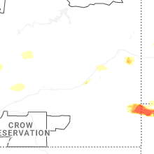


Connect with Interactive Hail Maps