

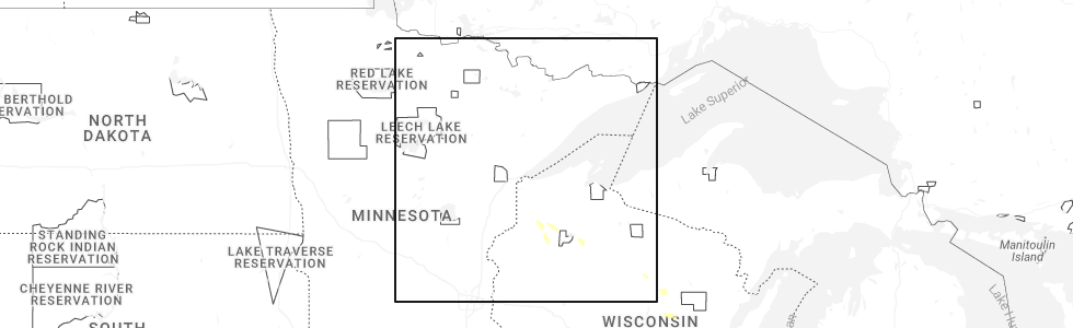
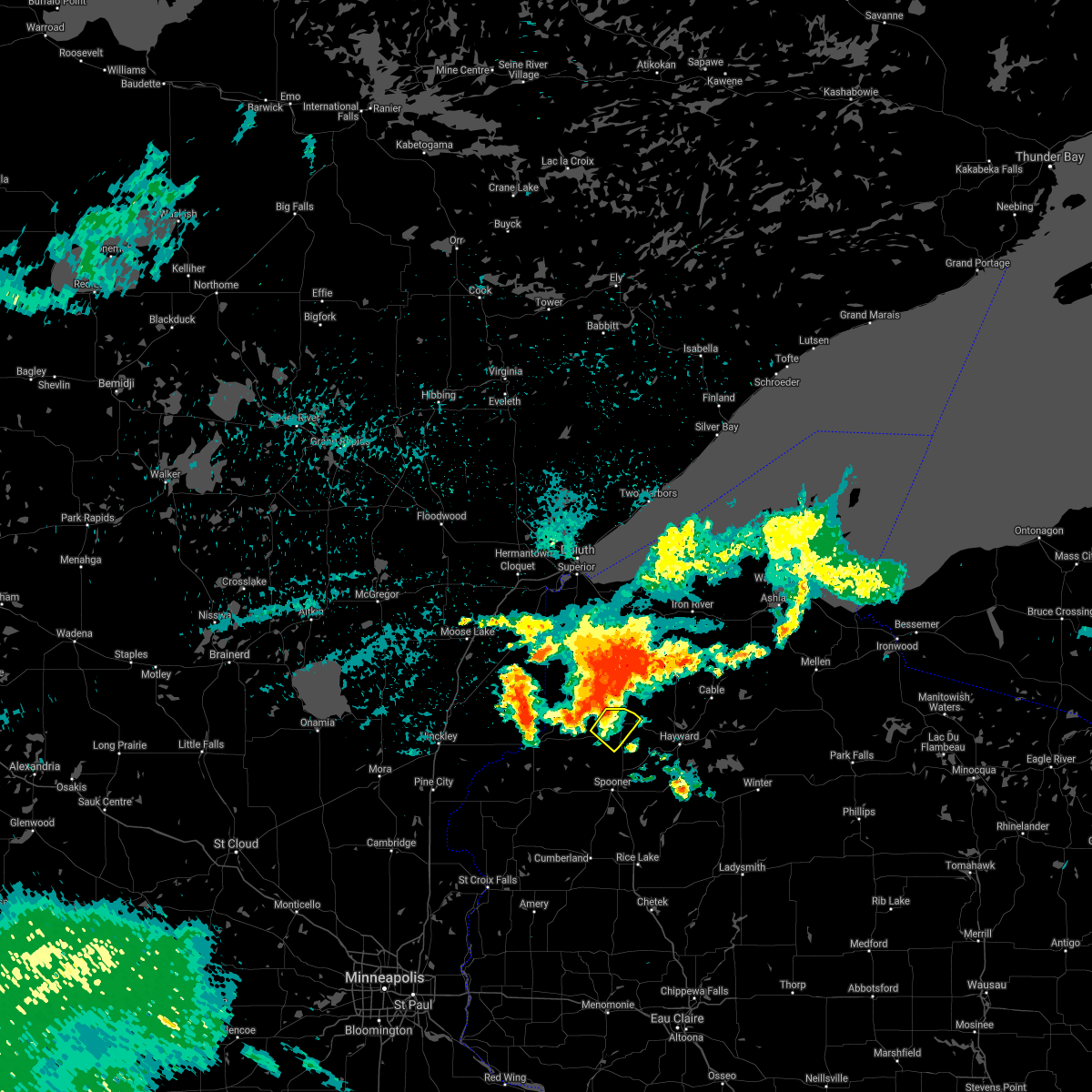
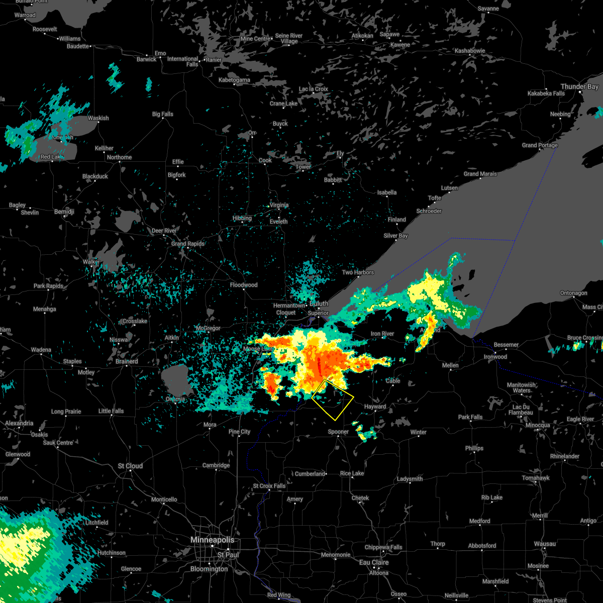
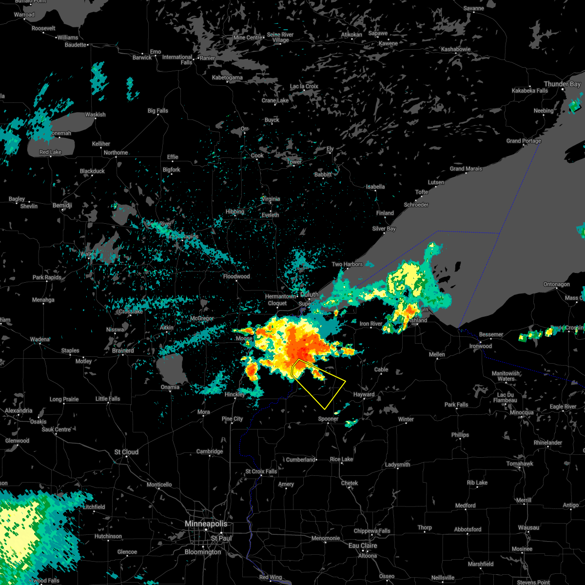
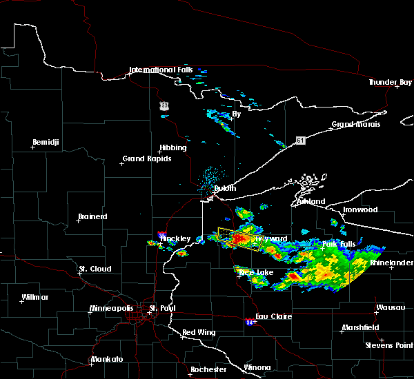
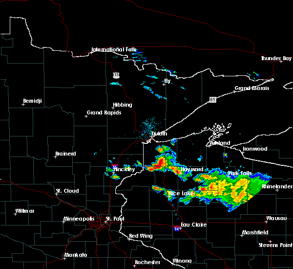
Hail Map for Minong, WI
The Minong, WI area has had 3 reports of on-the-ground hail by trained spotters, and has been under severe weather warnings 5 times during the past 12 months. Doppler radar has detected hail at or near Minong, WI on 54 occasions, including 3 occasions during the past year.
| Name: | Minong, WI |
| Where Located: | 49.4 miles SSE of Duluth, MN |
| Map: | Google Map for Minong, WI |
| Population: | 527 |
| Housing Units: | 277 |
| More Info: | Search Google for Minong, WI |
1
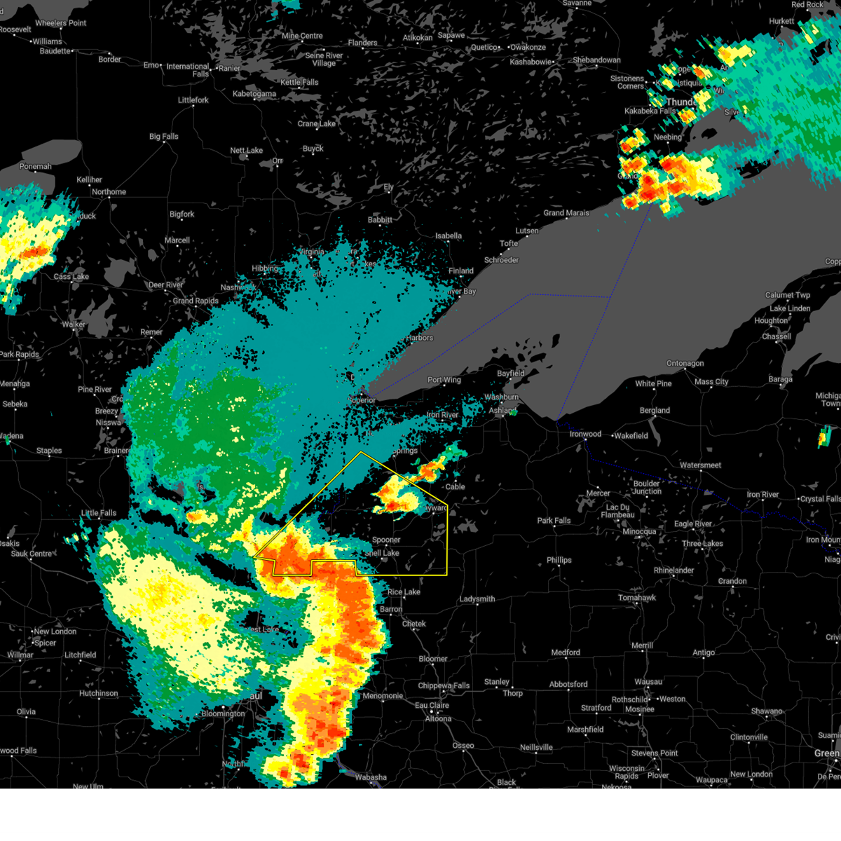
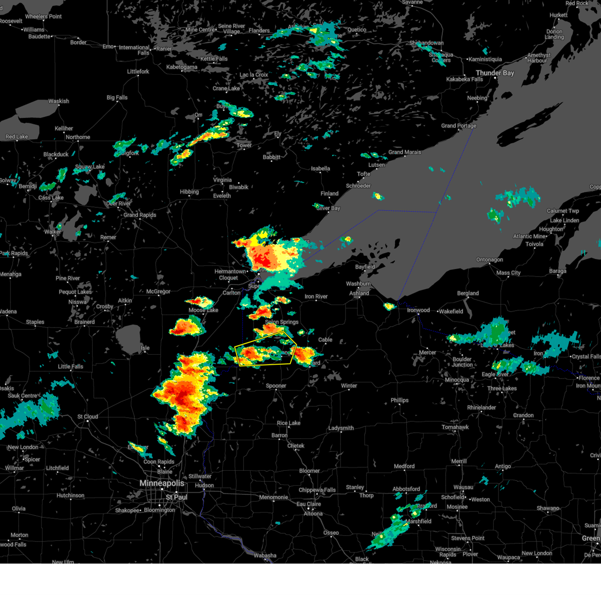
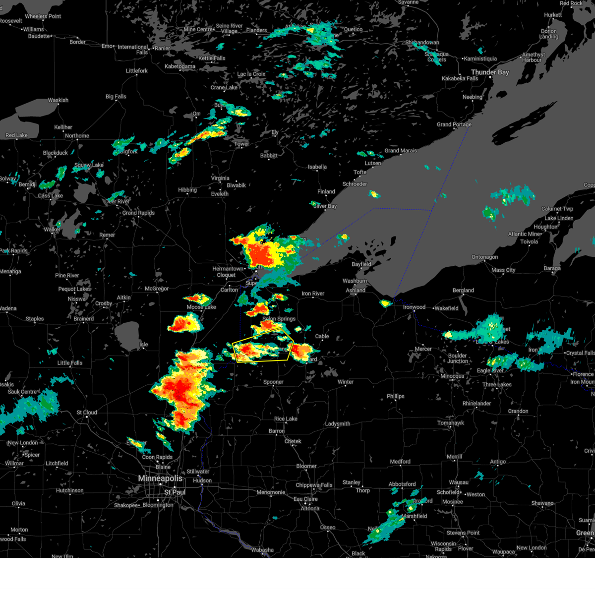
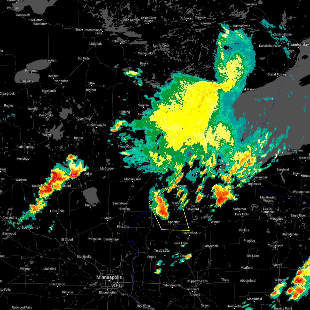
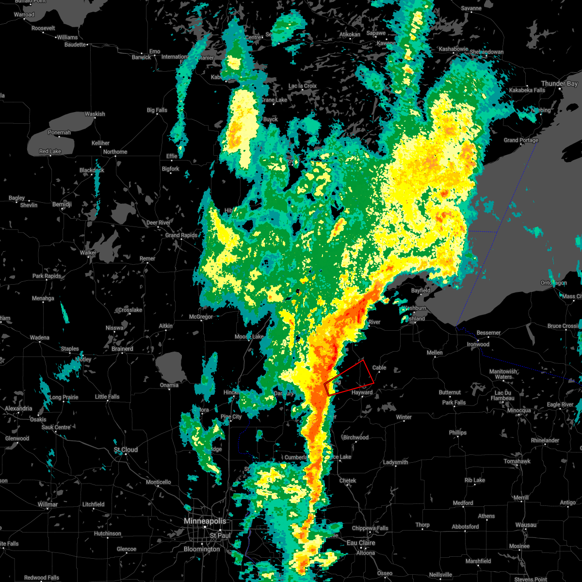
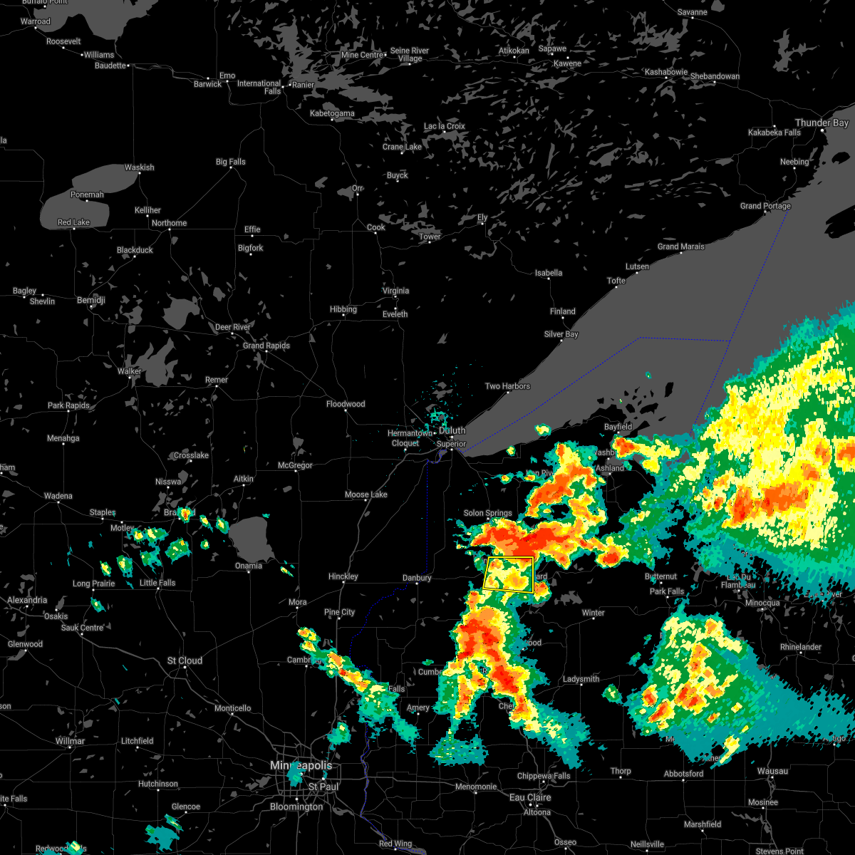
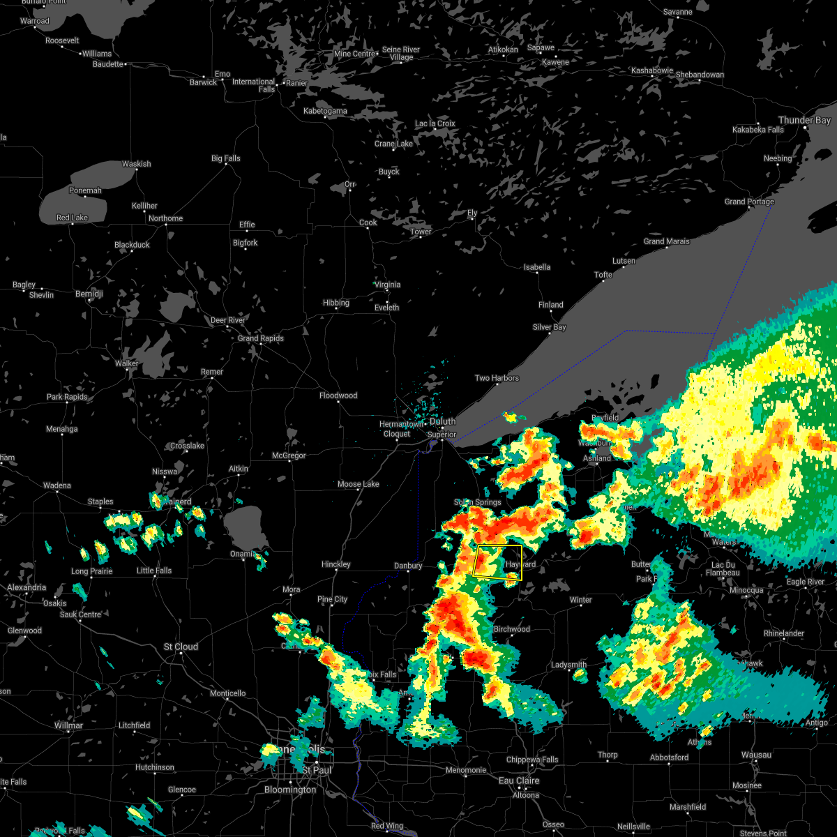
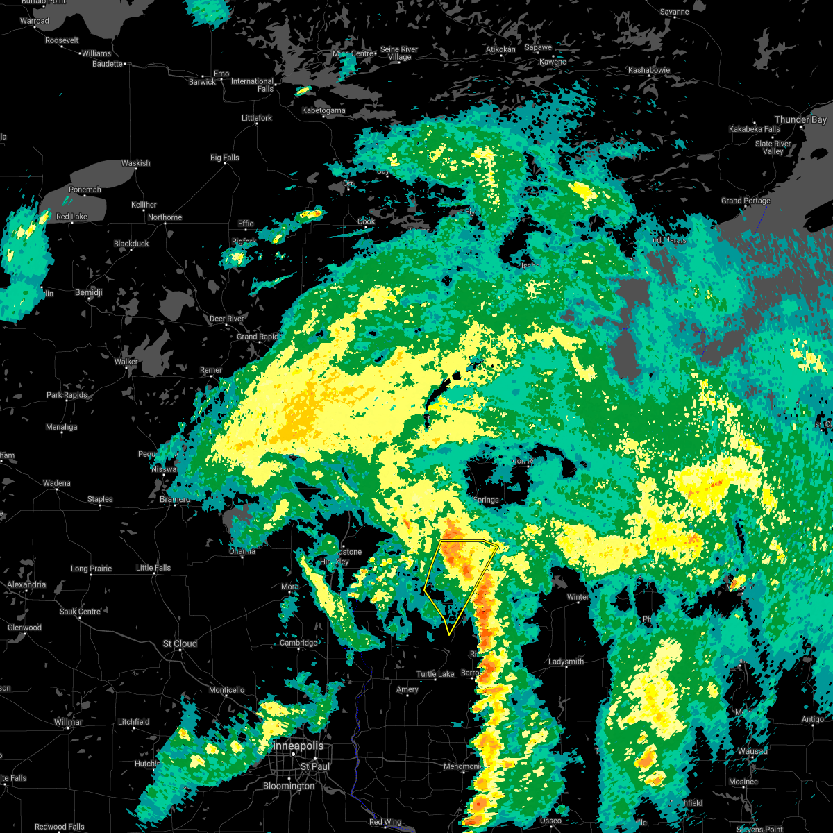
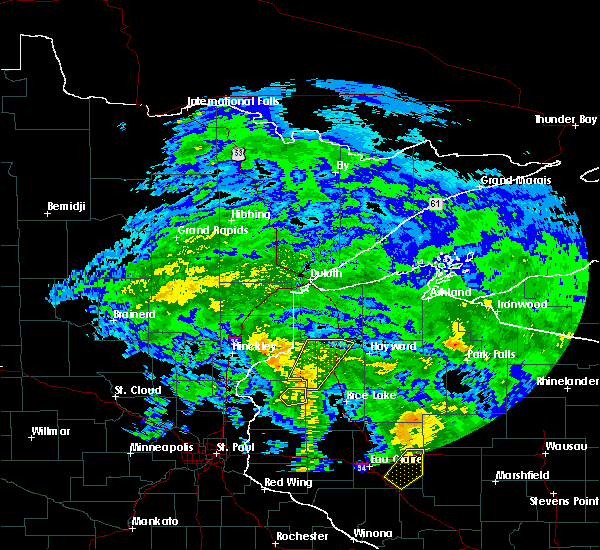
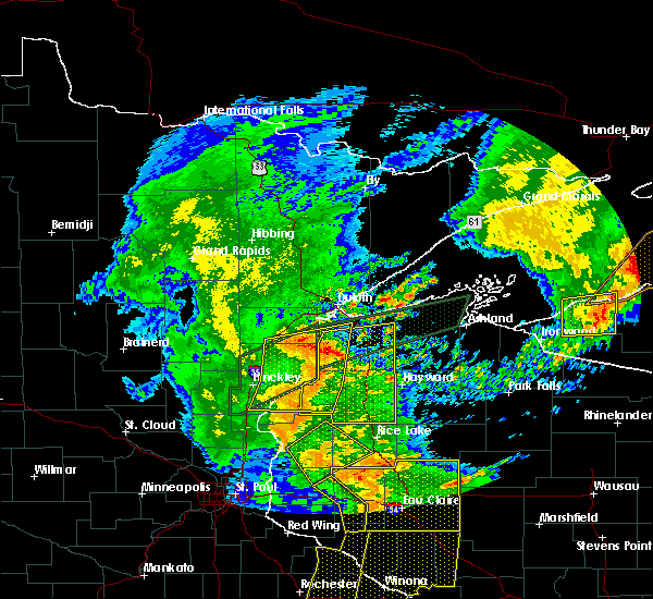
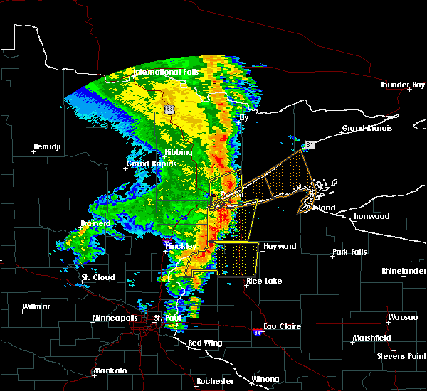
The Top Recent Hail Date for Minong, WI is Wednesday, July 2, 2025 (11th out of 54)
Hail and Wind Damage Spotted near Minong, WI
| Date / Time | Report Details |
|---|---|
| 7/2/2025 6:31 PM CDT |
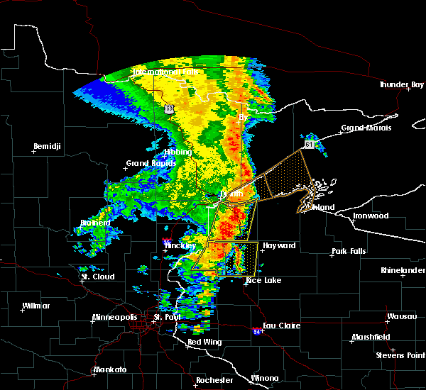
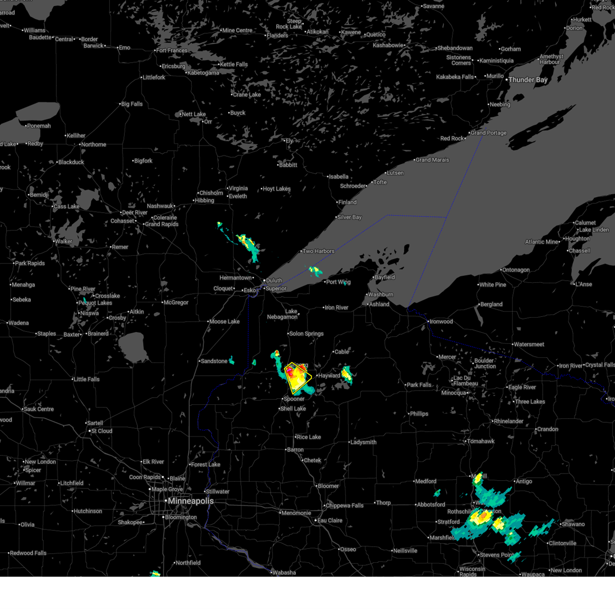 Svrdlh the national weather service in duluth mn has issued a * severe thunderstorm warning for, northeastern washburn county in northwestern wisconsin, * until 700 pm cdt. * at 630 pm cdt, a severe thunderstorm was located near minong, or 14 miles west of hayward, moving southeast at 20 mph (radar indicated). Hazards include 60 mph wind gusts and quarter size hail. Hail damage to vehicles is expected. expect wind damage to roofs, siding, and trees. This severe thunderstorm will remain over mainly rural areas of northeastern washburn county, including the following locations, springbrook, stanberry, lampson, and earl. Svrdlh the national weather service in duluth mn has issued a * severe thunderstorm warning for, northeastern washburn county in northwestern wisconsin, * until 700 pm cdt. * at 630 pm cdt, a severe thunderstorm was located near minong, or 14 miles west of hayward, moving southeast at 20 mph (radar indicated). Hazards include 60 mph wind gusts and quarter size hail. Hail damage to vehicles is expected. expect wind damage to roofs, siding, and trees. This severe thunderstorm will remain over mainly rural areas of northeastern washburn county, including the following locations, springbrook, stanberry, lampson, and earl.
|
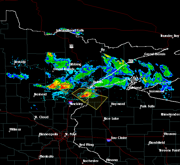
| 5/15/2025 5:08 PM CDT | Svrdlh the national weather service in duluth mn has issued a * severe thunderstorm warning for, bayfield county in northwestern wisconsin, southeastern douglas county in northwestern wisconsin, iron county in northwestern wisconsin, northern washburn county in northwestern wisconsin, ashland county in northwestern wisconsin, northwestern price county in north central wisconsin, sawyer county in northwestern wisconsin, * until 615 pm cdt. * at 508 pm cdt, severe thunderstorms were located along a line extending from 7 miles southeast of wascott to near winter to near hawkins, moving northeast at 70 mph (radar indicated). Hazards include 70 mph wind gusts and nickel size hail. Expect considerable tree damage. damage is likely to mobile homes, roofs, and outbuildings. severe thunderstorms will be near, chippewa flowage east, round lake, cable, and seeley around 515 pm cdt. namekagon lake around 520 pm cdt. drummond, namekagon, and clam lake around 525 pm cdt. Other locations in the path of these severe thunderstorms include park falls, town of delta, fifield, butternut, benoit, ino, glidden, sanborn, mellen, marengo, copper falls state park, turtle flambeau flowage, ashland, barksdale, washburn, gurney, upson and odanah. |
| 5/15/2025 4:37 PM CDT |
 Svrdlh the national weather service in duluth mn has issued a * severe thunderstorm warning for, southeastern douglas county in northwestern wisconsin, washburn county in northwestern wisconsin, southwestern sawyer county in northwestern wisconsin, * until 515 pm cdt. * at 437 pm cdt, severe thunderstorms were located along a line extending from near shell lake to 7 miles northeast of rice lake to 6 miles south of bruce, moving north at 60 mph (radar indicated). Hazards include 70 mph wind gusts and quarter size hail. Hail damage to vehicles is expected. expect considerable tree damage. wind damage is also likely to mobile homes, roofs, and outbuildings. severe thunderstorms will be near, spooner, trego, and birchwood around 445 pm cdt. stone lake and exeland around 450 pm cdt. minong around 455 pm cdt. Other locations in the path of these severe thunderstorms include wascott, radisson, couderay, hayward, chippewa flowage west, gordon, chief lake on chippewa flowage and little round lake. Svrdlh the national weather service in duluth mn has issued a * severe thunderstorm warning for, southeastern douglas county in northwestern wisconsin, washburn county in northwestern wisconsin, southwestern sawyer county in northwestern wisconsin, * until 515 pm cdt. * at 437 pm cdt, severe thunderstorms were located along a line extending from near shell lake to 7 miles northeast of rice lake to 6 miles south of bruce, moving north at 60 mph (radar indicated). Hazards include 70 mph wind gusts and quarter size hail. Hail damage to vehicles is expected. expect considerable tree damage. wind damage is also likely to mobile homes, roofs, and outbuildings. severe thunderstorms will be near, spooner, trego, and birchwood around 445 pm cdt. stone lake and exeland around 450 pm cdt. minong around 455 pm cdt. Other locations in the path of these severe thunderstorms include wascott, radisson, couderay, hayward, chippewa flowage west, gordon, chief lake on chippewa flowage and little round lake.
|
| 8/26/2024 9:25 PM CDT |
 Svrdlh the national weather service in duluth mn has issued a * severe thunderstorm warning for, southwestern bayfield county in northwestern wisconsin, southeastern douglas county in northwestern wisconsin, washburn county in northwestern wisconsin, southwestern ashland county in northwestern wisconsin, northwestern price county in north central wisconsin, northeastern burnett county in northwestern wisconsin, sawyer county in northwestern wisconsin, * until 1015 pm cdt. * at 924 pm cdt, severe thunderstorms were located along a line extending from near danbury to near stone lake to near bruce, moving northeast at 45 mph (radar indicated). Hazards include 60 mph wind gusts and penny size hail. Expect damage to roofs, siding, and trees. severe thunderstorms will be near, hayward, chippewa flowage west, trego, webb lake wisconsin, radisson, exeland, couderay, little round lake, and danbury around 930 pm cdt. round lake and chief lake on chippewa flowage around 935 pm cdt. chippewa flowage east, minong, and new post around 940 pm cdt. Other locations in the path of these severe thunderstorms include winter, seeley, wascott, cable, gordon, namekagon lake, namekagon and clam lake. Svrdlh the national weather service in duluth mn has issued a * severe thunderstorm warning for, southwestern bayfield county in northwestern wisconsin, southeastern douglas county in northwestern wisconsin, washburn county in northwestern wisconsin, southwestern ashland county in northwestern wisconsin, northwestern price county in north central wisconsin, northeastern burnett county in northwestern wisconsin, sawyer county in northwestern wisconsin, * until 1015 pm cdt. * at 924 pm cdt, severe thunderstorms were located along a line extending from near danbury to near stone lake to near bruce, moving northeast at 45 mph (radar indicated). Hazards include 60 mph wind gusts and penny size hail. Expect damage to roofs, siding, and trees. severe thunderstorms will be near, hayward, chippewa flowage west, trego, webb lake wisconsin, radisson, exeland, couderay, little round lake, and danbury around 930 pm cdt. round lake and chief lake on chippewa flowage around 935 pm cdt. chippewa flowage east, minong, and new post around 940 pm cdt. Other locations in the path of these severe thunderstorms include winter, seeley, wascott, cable, gordon, namekagon lake, namekagon and clam lake.
|
| 8/26/2024 8:41 PM CDT |
 Svrdlh the national weather service in duluth mn has issued a * severe thunderstorm warning for, southeastern pine county in east central minnesota, southwestern douglas county in northwestern wisconsin, washburn county in northwestern wisconsin, burnett county in northwestern wisconsin, western sawyer county in northwestern wisconsin, * until 930 pm cdt. * at 837 pm cdt, severe thunderstorms were located along a line extending from near grantsburg to 8 miles northwest of cumberland to near glenwood city, moving northeast at 55 mph (radar indicated). Hazards include 60 mph wind gusts and quarter size hail. Hail damage to vehicles is expected. expect wind damage to roofs, siding, and trees. severe thunderstorms will be near, siren, webster, hertel, saint croix state park, saint croix band pike lake area, saint croix band bashaw area, saint croix band clam lake area, and saint croix band sand lake area around 845 pm cdt. shell lake and mille lacs band lena lake area around 850 pm cdt. spooner and danbury around 855 pm cdt. Other locations in the path of these severe thunderstorms include webb lake wisconsin, trego, cloverton, minong, stone lake, birchwood, dairyland and hayward. Svrdlh the national weather service in duluth mn has issued a * severe thunderstorm warning for, southeastern pine county in east central minnesota, southwestern douglas county in northwestern wisconsin, washburn county in northwestern wisconsin, burnett county in northwestern wisconsin, western sawyer county in northwestern wisconsin, * until 930 pm cdt. * at 837 pm cdt, severe thunderstorms were located along a line extending from near grantsburg to 8 miles northwest of cumberland to near glenwood city, moving northeast at 55 mph (radar indicated). Hazards include 60 mph wind gusts and quarter size hail. Hail damage to vehicles is expected. expect wind damage to roofs, siding, and trees. severe thunderstorms will be near, siren, webster, hertel, saint croix state park, saint croix band pike lake area, saint croix band bashaw area, saint croix band clam lake area, and saint croix band sand lake area around 845 pm cdt. shell lake and mille lacs band lena lake area around 850 pm cdt. spooner and danbury around 855 pm cdt. Other locations in the path of these severe thunderstorms include webb lake wisconsin, trego, cloverton, minong, stone lake, birchwood, dairyland and hayward.
|
| 7/27/2023 4:16 PM CDT |
 At 416 pm cdt, a severe thunderstorm was located 7 miles west of minong, or 20 miles north of spooner, moving east at 40 mph (radar indicated). Hazards include two inch hail and 60 mph wind gusts. People and animals outdoors will be injured. expect hail damage to roofs, siding, windows, and vehicles. expect wind damage to roofs, siding, and trees. this severe thunderstorm will be near, wascott and minong around 430 pm cdt. other locations in the path of this severe thunderstorm include hayward, round lake, cable and seeley. thunderstorm damage threat, considerable hail threat, radar indicated max hail size, 2. 00 in wind threat, radar indicated max wind gust, 60 mph. At 416 pm cdt, a severe thunderstorm was located 7 miles west of minong, or 20 miles north of spooner, moving east at 40 mph (radar indicated). Hazards include two inch hail and 60 mph wind gusts. People and animals outdoors will be injured. expect hail damage to roofs, siding, windows, and vehicles. expect wind damage to roofs, siding, and trees. this severe thunderstorm will be near, wascott and minong around 430 pm cdt. other locations in the path of this severe thunderstorm include hayward, round lake, cable and seeley. thunderstorm damage threat, considerable hail threat, radar indicated max hail size, 2. 00 in wind threat, radar indicated max wind gust, 60 mph.
|
| 7/27/2023 3:27 PM CDT |
 At 327 pm cdt, a severe thunderstorm was located near cloverton, or 26 miles northwest of spooner, moving east at 35 mph (radar indicated). Hazards include 60 mph wind gusts and half dollar size hail. Hail damage to vehicles is expected. expect wind damage to roofs, siding, and trees. this severe thunderstorm will be near, dairyland around 335 pm cdt. other locations in the path of this severe thunderstorm include wascott, minong and gordon. hail threat, radar indicated max hail size, 1. 25 in wind threat, radar indicated max wind gust, 60 mph. At 327 pm cdt, a severe thunderstorm was located near cloverton, or 26 miles northwest of spooner, moving east at 35 mph (radar indicated). Hazards include 60 mph wind gusts and half dollar size hail. Hail damage to vehicles is expected. expect wind damage to roofs, siding, and trees. this severe thunderstorm will be near, dairyland around 335 pm cdt. other locations in the path of this severe thunderstorm include wascott, minong and gordon. hail threat, radar indicated max hail size, 1. 25 in wind threat, radar indicated max wind gust, 60 mph.
|
| 8/29/2022 12:14 AM CDT | At 1214 am cdt, a severe thunderstorm was located near wascott, or 24 miles northwest of hayward, moving east at 45 mph (radar indicated). Hazards include 70 mph wind gusts and penny size hail. Expect considerable tree damage. damage is likely to mobile homes, roofs, and outbuildings. Locations impacted include, hayward, wascott, solon springs, minong, webb lake wisconsin, gordon, dairyland, cloverton, cozy corner, minong flowage, moose junction, birch island lake, kingsdale, lampson, markville, totagatic flowage, stanberry, saint croix flowage, and riverside. |
| 8/29/2022 12:14 AM CDT | At 1214 am cdt, a severe thunderstorm was located near wascott, or 24 miles northwest of hayward, moving east at 45 mph (radar indicated). Hazards include 70 mph wind gusts and penny size hail. Expect considerable tree damage. damage is likely to mobile homes, roofs, and outbuildings. Locations impacted include, hayward, wascott, solon springs, minong, webb lake wisconsin, gordon, dairyland, cloverton, cozy corner, minong flowage, moose junction, birch island lake, kingsdale, lampson, markville, totagatic flowage, stanberry, saint croix flowage, and riverside. |
| 8/28/2022 11:52 PM CDT | At 1152 pm cdt, a severe thunderstorm was located over cloverton, or 29 miles northwest of spooner, moving east at 40 mph (radar indicated). Hazards include 70 mph wind gusts and penny size hail. Expect considerable tree damage. Damage is likely to mobile homes, roofs, and outbuildings. |
| 8/28/2022 11:52 PM CDT | At 1152 pm cdt, a severe thunderstorm was located over cloverton, or 29 miles northwest of spooner, moving east at 40 mph (radar indicated). Hazards include 70 mph wind gusts and penny size hail. Expect considerable tree damage. Damage is likely to mobile homes, roofs, and outbuildings. |
| 6/28/2022 2:06 PM CDT |
 At 206 pm cdt, severe thunderstorms were located along a line extending from 6 miles southwest of namekagon lake, to 8 miles northwest of hayward, to webb lake wisconsin, moving southeast at 25 mph (radar indicated). Hazards include 60 mph wind gusts and half dollar size hail. Hail damage to vehicles is expected. expect wind damage to roofs, siding, and trees. these severe storms will be near, hayward around 225 pm cdt. round lake and little round lake around 240 pm cdt. trego around 250 pm cdt. spooner and chief lake on chippewa flowage around 255 pm cdt. chippewa flowage west and couderay around 305 pm cdt. chippewa flowage east and new post around 310 pm cdt. stone lake around 315 pm cdt. other locations impacted by these severe thunderstorms include northwoods beach, reserve, spooner lake, mckenzie lake, springbrook, birch island lake, lampson, sissabagama lake, totagatic flowage and stanberry. hail threat, radar indicated max hail size, 1. 25 in wind threat, radar indicated max wind gust, 60 mph. At 206 pm cdt, severe thunderstorms were located along a line extending from 6 miles southwest of namekagon lake, to 8 miles northwest of hayward, to webb lake wisconsin, moving southeast at 25 mph (radar indicated). Hazards include 60 mph wind gusts and half dollar size hail. Hail damage to vehicles is expected. expect wind damage to roofs, siding, and trees. these severe storms will be near, hayward around 225 pm cdt. round lake and little round lake around 240 pm cdt. trego around 250 pm cdt. spooner and chief lake on chippewa flowage around 255 pm cdt. chippewa flowage west and couderay around 305 pm cdt. chippewa flowage east and new post around 310 pm cdt. stone lake around 315 pm cdt. other locations impacted by these severe thunderstorms include northwoods beach, reserve, spooner lake, mckenzie lake, springbrook, birch island lake, lampson, sissabagama lake, totagatic flowage and stanberry. hail threat, radar indicated max hail size, 1. 25 in wind threat, radar indicated max wind gust, 60 mph.
|
| 6/28/2022 1:53 PM CDT |
 At 153 pm cdt, severe thunderstorms were located along a line extending from cable, to near minong, to 6 miles northwest of webb lake wisconsin, moving southeast at 20 mph (radar indicated). Hazards include 60 mph wind gusts and half dollar size hail. Hail damage to vehicles is expected. expect wind damage to roofs, siding, and trees. severe thunderstorms will be near, cable and seeley around 200 pm cdt. other locations in the path of these severe thunderstorms include hayward, round lake, little round lake, trego, spooner, chippewa flowage west, couderay, chief lake on chippewa flowage and new post. hail threat, radar indicated max hail size, 1. 25 in wind threat, radar indicated max wind gust, 60 mph. At 153 pm cdt, severe thunderstorms were located along a line extending from cable, to near minong, to 6 miles northwest of webb lake wisconsin, moving southeast at 20 mph (radar indicated). Hazards include 60 mph wind gusts and half dollar size hail. Hail damage to vehicles is expected. expect wind damage to roofs, siding, and trees. severe thunderstorms will be near, cable and seeley around 200 pm cdt. other locations in the path of these severe thunderstorms include hayward, round lake, little round lake, trego, spooner, chippewa flowage west, couderay, chief lake on chippewa flowage and new post. hail threat, radar indicated max hail size, 1. 25 in wind threat, radar indicated max wind gust, 60 mph.
|
| 5/12/2022 2:07 PM CDT |
 At 207 pm cdt, a severe thunderstorm was located over webb lake wisconsin, or 14 miles northwest of spooner, moving east at 45 mph (radar indicated). Hazards include quarter size hail. Damage to vehicles is expected. locations impacted include, wascott and minong. hail threat, radar indicated max hail size, 1. 00 in wind threat, radar indicated max wind gust, <50 mph. At 207 pm cdt, a severe thunderstorm was located over webb lake wisconsin, or 14 miles northwest of spooner, moving east at 45 mph (radar indicated). Hazards include quarter size hail. Damage to vehicles is expected. locations impacted include, wascott and minong. hail threat, radar indicated max hail size, 1. 00 in wind threat, radar indicated max wind gust, <50 mph.
|
| 5/12/2022 1:39 PM CDT |
 At 138 pm cdt, a severe thunderstorm was located near grantsburg, or 17 miles east of pine city, moving east at 40 mph (trained weather spotters). Hazards include golf ball size hail. People and animals outdoors will be injured. expect damage to roofs, siding, windows, and vehicles. this severe thunderstorm will be near, siren around 150 pm cdt. webster around 155 pm cdt. other locations in the path of this severe thunderstorm include danbury, webb lake wisconsin, wascott and minong. thunderstorm damage threat, considerable hail threat, observed max hail size, 1. 75 in wind threat, radar indicated max wind gust, <50 mph. At 138 pm cdt, a severe thunderstorm was located near grantsburg, or 17 miles east of pine city, moving east at 40 mph (trained weather spotters). Hazards include golf ball size hail. People and animals outdoors will be injured. expect damage to roofs, siding, windows, and vehicles. this severe thunderstorm will be near, siren around 150 pm cdt. webster around 155 pm cdt. other locations in the path of this severe thunderstorm include danbury, webb lake wisconsin, wascott and minong. thunderstorm damage threat, considerable hail threat, observed max hail size, 1. 75 in wind threat, radar indicated max wind gust, <50 mph.
|
| 5/11/2022 10:29 PM CDT |
 At 1029 pm cdt, severe thunderstorms were located along a line extending from near solon springs, to 7 miles west of hayward, to birchwood, moving northeast at 60 mph (radar indicated). Hazards include 60 mph wind gusts and quarter size hail. Hail damage to vehicles is expected. expect wind damage to roofs, siding, and trees. Locations impacted include, spooner, hayward, chippewa flowage west, chippewa flowage east, shell lake, iron river, lake nebagamon, round lake, trego, cable, barnes, wascott, brule, solon springs, minong, stone lake, drummond, birchwood, winter, and gordon. At 1029 pm cdt, severe thunderstorms were located along a line extending from near solon springs, to 7 miles west of hayward, to birchwood, moving northeast at 60 mph (radar indicated). Hazards include 60 mph wind gusts and quarter size hail. Hail damage to vehicles is expected. expect wind damage to roofs, siding, and trees. Locations impacted include, spooner, hayward, chippewa flowage west, chippewa flowage east, shell lake, iron river, lake nebagamon, round lake, trego, cable, barnes, wascott, brule, solon springs, minong, stone lake, drummond, birchwood, winter, and gordon.
|
| 5/11/2022 10:10 PM CDT |
 At 1009 pm cdt, severe thunderstorms were located along a line extending from near webb lake wisconsin, to near spooner, to haugen, moving northeast at 60 mph (radar indicated). Hazards include 60 mph wind gusts and quarter size hail. Hail damage to vehicles is expected. Expect wind damage to roofs, siding, and trees. At 1009 pm cdt, severe thunderstorms were located along a line extending from near webb lake wisconsin, to near spooner, to haugen, moving northeast at 60 mph (radar indicated). Hazards include 60 mph wind gusts and quarter size hail. Hail damage to vehicles is expected. Expect wind damage to roofs, siding, and trees.
|
| 9/20/2021 5:05 PM CDT | Tree down. time estimated from rada in washburn county WI, 4.7 miles WSW of Minong, WI |
| 9/20/2021 4:59 PM CDT |
 At 459 pm cdt, a severe thunderstorm capable of producing a tornado was located over minong, or 15 miles west of hayward, moving east at 45 mph (radar indicated rotation). Hazards include tornado. Flying debris will be dangerous to those caught without shelter. mobile homes will be damaged or destroyed. damage to roofs, windows, and vehicles will occur. Tree damage is likely. At 459 pm cdt, a severe thunderstorm capable of producing a tornado was located over minong, or 15 miles west of hayward, moving east at 45 mph (radar indicated rotation). Hazards include tornado. Flying debris will be dangerous to those caught without shelter. mobile homes will be damaged or destroyed. damage to roofs, windows, and vehicles will occur. Tree damage is likely.
|
| 7/27/2021 1:14 AM CDT |
 At 114 am cdt, severe thunderstorms were located along a line extending from near seeley, to near hayward, to 9 miles southeast of minong, moving southeast at 40 mph (radar indicated). Hazards include 70 mph wind gusts and ping pong ball size hail. People and animals outdoors will be injured. expect hail damage to roofs, siding, windows, and vehicles. expect considerable tree damage. wind damage is also likely to mobile homes, roofs, and outbuildings. these severe storms will be near, round lake and little round lake around 120 am cdt. chief lake on chippewa flowage around 125 am cdt. chippewa flowage east, chippewa flowage west and stone lake around 130 am cdt. new post around 135 am cdt. Other locations impacted by these severe thunderstorms include reserve, northwoods beach, chief lake, lac courte oreilles reservation, totagatic lake, springbrook, grindstone lake, nelson lake, sissabagama lake and totagatic flowage. At 114 am cdt, severe thunderstorms were located along a line extending from near seeley, to near hayward, to 9 miles southeast of minong, moving southeast at 40 mph (radar indicated). Hazards include 70 mph wind gusts and ping pong ball size hail. People and animals outdoors will be injured. expect hail damage to roofs, siding, windows, and vehicles. expect considerable tree damage. wind damage is also likely to mobile homes, roofs, and outbuildings. these severe storms will be near, round lake and little round lake around 120 am cdt. chief lake on chippewa flowage around 125 am cdt. chippewa flowage east, chippewa flowage west and stone lake around 130 am cdt. new post around 135 am cdt. Other locations impacted by these severe thunderstorms include reserve, northwoods beach, chief lake, lac courte oreilles reservation, totagatic lake, springbrook, grindstone lake, nelson lake, sissabagama lake and totagatic flowage.
|
| 7/27/2021 1:06 AM CDT |
 At 104 am cdt, a severe thunderstorm was located over hayward, moving southeast at 35 mph (radar indicated). Hazards include 70 mph wind gusts and ping pong ball size hail. People and animals outdoors will be injured. expect hail damage to roofs, siding, windows, and vehicles. expect considerable tree damage. wind damage is also likely to mobile homes, roofs, and outbuildings. Locations impacted include, round lake, little round lake, chief lake on chippewa flowage, chippewa flowage west, chippewa flowage east and new post. At 104 am cdt, a severe thunderstorm was located over hayward, moving southeast at 35 mph (radar indicated). Hazards include 70 mph wind gusts and ping pong ball size hail. People and animals outdoors will be injured. expect hail damage to roofs, siding, windows, and vehicles. expect considerable tree damage. wind damage is also likely to mobile homes, roofs, and outbuildings. Locations impacted include, round lake, little round lake, chief lake on chippewa flowage, chippewa flowage west, chippewa flowage east and new post.
|
| 7/27/2021 12:49 AM CDT |
 At 1248 am cdt, a severe thunderstorm was located 8 miles southeast of wascott, or 10 miles northwest of hayward, moving southeast at 35 mph (radar indicated). Hazards include ping pong ball size hail and 60 mph wind gusts. People and animals outdoors will be injured. expect hail damage to roofs, siding, windows, and vehicles. expect wind damage to roofs, siding, and trees. this severe thunderstorm will be near, hayward and seeley around 105 am cdt. Other locations in the path of this severe thunderstorm include round lake, little round lake, chief lake on chippewa flowage, chippewa flowage west, chippewa flowage east and new post. At 1248 am cdt, a severe thunderstorm was located 8 miles southeast of wascott, or 10 miles northwest of hayward, moving southeast at 35 mph (radar indicated). Hazards include ping pong ball size hail and 60 mph wind gusts. People and animals outdoors will be injured. expect hail damage to roofs, siding, windows, and vehicles. expect wind damage to roofs, siding, and trees. this severe thunderstorm will be near, hayward and seeley around 105 am cdt. Other locations in the path of this severe thunderstorm include round lake, little round lake, chief lake on chippewa flowage, chippewa flowage west, chippewa flowage east and new post.
|
| 7/23/2021 11:21 PM CDT |
 At 1121 pm cdt, a severe thunderstorm was located near minong, or 16 miles north of spooner, moving southeast at 40 mph (radar indicated). Hazards include 60 mph wind gusts and penny size hail. Expect damage to roofs, siding, and trees. Locations impacted include, minong and minong flowage. At 1121 pm cdt, a severe thunderstorm was located near minong, or 16 miles north of spooner, moving southeast at 40 mph (radar indicated). Hazards include 60 mph wind gusts and penny size hail. Expect damage to roofs, siding, and trees. Locations impacted include, minong and minong flowage.
|
| 7/23/2021 11:07 PM CDT |
 At 1107 pm cdt, a severe thunderstorm was located 8 miles southeast of dairyland, or 22 miles north of spooner, moving southeast at 40 mph (radar indicated). Hazards include 60 mph wind gusts and penny size hail. Expect damage to roofs, siding, and trees. Locations impacted include, minong and minong flowage. At 1107 pm cdt, a severe thunderstorm was located 8 miles southeast of dairyland, or 22 miles north of spooner, moving southeast at 40 mph (radar indicated). Hazards include 60 mph wind gusts and penny size hail. Expect damage to roofs, siding, and trees. Locations impacted include, minong and minong flowage.
|
| 7/23/2021 10:59 PM CDT |
 At 1056 pm cdt, a severe thunderstorm was located over dairyland, or 29 miles northwest of spooner, moving southeast at 40 mph (radar indicated). Hazards include 60 mph wind gusts and penny size hail. expect damage to roofs, siding, and trees At 1056 pm cdt, a severe thunderstorm was located over dairyland, or 29 miles northwest of spooner, moving southeast at 40 mph (radar indicated). Hazards include 60 mph wind gusts and penny size hail. expect damage to roofs, siding, and trees
|
| 6/24/2021 4:21 AM CDT |
 The severe thunderstorm warning for northeastern washburn and northwestern sawyer counties will expire at 430 am cdt, the storm which prompted the warning has weakened below severe limits, and no longer poses an immediate threat to life or property. therefore, the warning will be allowed to expire. The severe thunderstorm warning for northeastern washburn and northwestern sawyer counties will expire at 430 am cdt, the storm which prompted the warning has weakened below severe limits, and no longer poses an immediate threat to life or property. therefore, the warning will be allowed to expire.
|
| 6/24/2021 4:12 AM CDT |
 At 411 am cdt, a severe thunderstorm was located near minong, or 11 miles northwest of hayward, moving east at 55 mph (radar indicated). Hazards include 60 mph wind gusts and quarter size hail. Hail damage to vehicles is expected. expect wind damage to roofs, siding, and trees. Locations impacted include, hayward. At 411 am cdt, a severe thunderstorm was located near minong, or 11 miles northwest of hayward, moving east at 55 mph (radar indicated). Hazards include 60 mph wind gusts and quarter size hail. Hail damage to vehicles is expected. expect wind damage to roofs, siding, and trees. Locations impacted include, hayward.
|
| 6/24/2021 3:54 AM CDT |
 At 354 am cdt, a severe thunderstorm was located 7 miles northeast of webb lake wisconsin, or 18 miles north of spooner, moving east at 55 mph (radar indicated). Hazards include 60 mph wind gusts and quarter size hail. Hail damage to vehicles is expected. expect wind damage to roofs, siding, and trees. this severe thunderstorm will be near, minong around 405 am cdt. Other locations in the path of this severe thunderstorm include hayward. At 354 am cdt, a severe thunderstorm was located 7 miles northeast of webb lake wisconsin, or 18 miles north of spooner, moving east at 55 mph (radar indicated). Hazards include 60 mph wind gusts and quarter size hail. Hail damage to vehicles is expected. expect wind damage to roofs, siding, and trees. this severe thunderstorm will be near, minong around 405 am cdt. Other locations in the path of this severe thunderstorm include hayward.
|
| 8/14/2020 8:35 PM CDT |
 The severe thunderstorm warning for bayfield, eastern douglas, northern washburn, northeastern burnett and northwestern sawyer counties will expire at 845 pm cdt, the storms which prompted the warning have weakened below severe limits, and no longer pose an immediate threat to life or property. therefore, the warning will be allowed to expire. a severe thunderstorm watch remains in effect until midnight cdt for northwestern wisconsin. The severe thunderstorm warning for bayfield, eastern douglas, northern washburn, northeastern burnett and northwestern sawyer counties will expire at 845 pm cdt, the storms which prompted the warning have weakened below severe limits, and no longer pose an immediate threat to life or property. therefore, the warning will be allowed to expire. a severe thunderstorm watch remains in effect until midnight cdt for northwestern wisconsin.
|
| 8/14/2020 8:18 PM CDT |
 At 818 pm cdt, severe thunderstorms were located along a line extending from near oulu, to near brule, to 8 miles southwest of barnes, to near trego, moving east at 55 mph (law enforcement reported trees down in solon springs associated with these storms). Hazards include 60 mph wind gusts. Expect damage to roofs, siding, and trees. Locations impacted include, hayward, iron river, lake nebagamon, round lake, cable, barnes, wascott, maple, brule, poplar, minong, oulu, drummond, gordon, ino, little round lake, seeley, benoit, namekagon lake, and springbrook. At 818 pm cdt, severe thunderstorms were located along a line extending from near oulu, to near brule, to 8 miles southwest of barnes, to near trego, moving east at 55 mph (law enforcement reported trees down in solon springs associated with these storms). Hazards include 60 mph wind gusts. Expect damage to roofs, siding, and trees. Locations impacted include, hayward, iron river, lake nebagamon, round lake, cable, barnes, wascott, maple, brule, poplar, minong, oulu, drummond, gordon, ino, little round lake, seeley, benoit, namekagon lake, and springbrook.
|
| 8/14/2020 8:11 PM CDT |
 At 811 pm cdt, severe thunderstorms were located along a line extending from near maple, to lake nebagamon, to near gordon, to 6 miles southeast of webb lake wisconsin, moving east at 50 mph (radar indicated). Hazards include 60 mph wind gusts. Expect damage to roofs, siding, and trees. Locations impacted include, hayward, hawthorne, iron river, lake nebagamon, round lake, cable, barnes, wascott, maple, brule, poplar, solon springs, minong, oulu, drummond, webb lake wisconsin, gordon, ino, little round lake, and seeley. At 811 pm cdt, severe thunderstorms were located along a line extending from near maple, to lake nebagamon, to near gordon, to 6 miles southeast of webb lake wisconsin, moving east at 50 mph (radar indicated). Hazards include 60 mph wind gusts. Expect damage to roofs, siding, and trees. Locations impacted include, hayward, hawthorne, iron river, lake nebagamon, round lake, cable, barnes, wascott, maple, brule, poplar, solon springs, minong, oulu, drummond, webb lake wisconsin, gordon, ino, little round lake, and seeley.
|
| 8/14/2020 7:55 PM CDT |
 At 755 pm cdt, severe thunderstorms were located along a line extending from south range, to near hawthorne, to 8 miles southwest of solon springs, to near danbury, moving east at 55 mph (radar indicated). Hazards include 60 mph wind gusts. expect damage to roofs, siding, and trees At 755 pm cdt, severe thunderstorms were located along a line extending from south range, to near hawthorne, to 8 miles southwest of solon springs, to near danbury, moving east at 55 mph (radar indicated). Hazards include 60 mph wind gusts. expect damage to roofs, siding, and trees
|
| 7/18/2020 2:12 AM CDT |
 The tornado warning for southeastern douglas and northern washburn counties will expire at 215 am cdt, the storm which prompted the warning has moved out of the area. therefore, the warning will be allowed to expire. a severe thunderstorm watch remains in effect until 600 am cdt for northwestern wisconsin. The tornado warning for southeastern douglas and northern washburn counties will expire at 215 am cdt, the storm which prompted the warning has moved out of the area. therefore, the warning will be allowed to expire. a severe thunderstorm watch remains in effect until 600 am cdt for northwestern wisconsin.
|
| 7/18/2020 2:03 AM CDT |
 At 203 am cdt, a severe thunderstorm capable of producing a tornado was located 7 miles northwest of trego, or 11 miles north of spooner, moving northeast at 55 mph (radar indicated rotation). Hazards include tornado. Flying debris will be dangerous to those caught without shelter. mobile homes will be damaged or destroyed. damage to roofs, windows, and vehicles will occur. tree damage is likely. this dangerous storm will be near, minong around 215 am cdt. Other locations impacted by this tornadic thunderstorm include lampson. At 203 am cdt, a severe thunderstorm capable of producing a tornado was located 7 miles northwest of trego, or 11 miles north of spooner, moving northeast at 55 mph (radar indicated rotation). Hazards include tornado. Flying debris will be dangerous to those caught without shelter. mobile homes will be damaged or destroyed. damage to roofs, windows, and vehicles will occur. tree damage is likely. this dangerous storm will be near, minong around 215 am cdt. Other locations impacted by this tornadic thunderstorm include lampson.
|
| 7/18/2020 1:56 AM CDT |
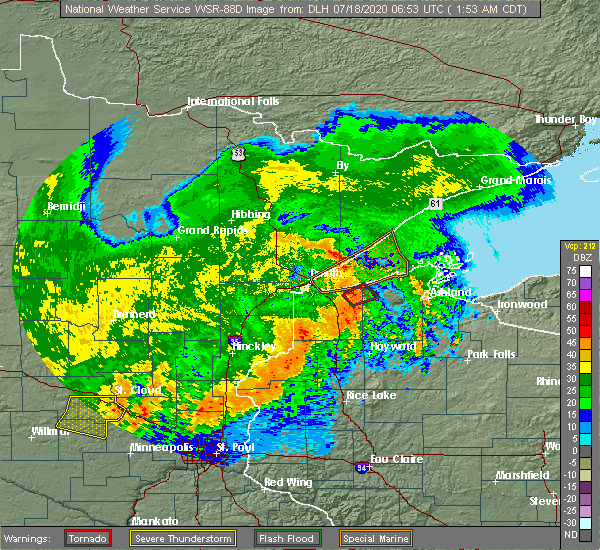 At 156 am cdt, a severe thunderstorm capable of producing a tornado was located near webb lake wisconsin, or 14 miles northwest of spooner, moving northeast at 60 mph (radar indicated rotation). Hazards include tornado. Flying debris will be dangerous to those caught without shelter. mobile homes will be damaged or destroyed. damage to roofs, windows, and vehicles will occur. tree damage is likely. this dangerous storm will be near, wascott and minong around 215 am cdt. Other locations impacted by this tornadic thunderstorm include birch island lake, mckenzie lake and lampson. At 156 am cdt, a severe thunderstorm capable of producing a tornado was located near webb lake wisconsin, or 14 miles northwest of spooner, moving northeast at 60 mph (radar indicated rotation). Hazards include tornado. Flying debris will be dangerous to those caught without shelter. mobile homes will be damaged or destroyed. damage to roofs, windows, and vehicles will occur. tree damage is likely. this dangerous storm will be near, wascott and minong around 215 am cdt. Other locations impacted by this tornadic thunderstorm include birch island lake, mckenzie lake and lampson.
|
| 7/8/2020 10:06 PM CDT |
 At 1005 pm cdt, severe thunderstorms were located along a line extending from near port wing, to near barnes, to near minong, moving east at 50 mph (radar indicated). Hazards include 70 mph wind gusts and nickel size hail. Expect considerable tree damage. Damage is likely to mobile homes, roofs, and outbuildings. At 1005 pm cdt, severe thunderstorms were located along a line extending from near port wing, to near barnes, to near minong, moving east at 50 mph (radar indicated). Hazards include 70 mph wind gusts and nickel size hail. Expect considerable tree damage. Damage is likely to mobile homes, roofs, and outbuildings.
|
| 9/5/2019 1:11 PM CDT |
 At 110 pm cdt, a severe thunderstorm was located near minong, or 14 miles northwest of hayward, moving east at 45 mph (radar indicated). Hazards include quarter size hail. Damage to vehicles is expected. Locations impacted include, hayward, wascott, minong, seeley, little round lake, totagatic flowage, stanberry, nelson lake, grindstone lake, and lac courte oreilles. At 110 pm cdt, a severe thunderstorm was located near minong, or 14 miles northwest of hayward, moving east at 45 mph (radar indicated). Hazards include quarter size hail. Damage to vehicles is expected. Locations impacted include, hayward, wascott, minong, seeley, little round lake, totagatic flowage, stanberry, nelson lake, grindstone lake, and lac courte oreilles.
|
| 9/5/2019 12:56 PM CDT |
 At 1256 pm cdt, a severe thunderstorm was located 7 miles northwest of minong, or 22 miles north of spooner, moving east at 45 mph (radar indicated). Hazards include quarter size hail. damage to vehicles is expected At 1256 pm cdt, a severe thunderstorm was located 7 miles northwest of minong, or 22 miles north of spooner, moving east at 45 mph (radar indicated). Hazards include quarter size hail. damage to vehicles is expected
|
| 7/28/2019 6:43 PM CDT |
 The severe thunderstorm warning for western washburn and northeastern burnett counties will expire at 645 pm cdt, the storm which prompted the warning has weakened below severe limits, and no longer poses an immediate threat to life or property. therefore, the warning will be allowed to expire. however gusty winds are still possible with this thunderstorm. The severe thunderstorm warning for western washburn and northeastern burnett counties will expire at 645 pm cdt, the storm which prompted the warning has weakened below severe limits, and no longer poses an immediate threat to life or property. therefore, the warning will be allowed to expire. however gusty winds are still possible with this thunderstorm.
|
| 7/28/2019 6:22 PM CDT |
 At 622 pm cdt, a severe thunderstorm was located 7 miles southeast of webb lake wisconsin, or 10 miles northwest of spooner, moving northeast at 45 mph (radar indicated). Hazards include 60 mph wind gusts. Expect damage to roofs, siding, and trees. Locations impacted include, spooner, trego, minong, webb lake wisconsin, mckenzie lake, minong flowage, birch island lake, and lampson. At 622 pm cdt, a severe thunderstorm was located 7 miles southeast of webb lake wisconsin, or 10 miles northwest of spooner, moving northeast at 45 mph (radar indicated). Hazards include 60 mph wind gusts. Expect damage to roofs, siding, and trees. Locations impacted include, spooner, trego, minong, webb lake wisconsin, mckenzie lake, minong flowage, birch island lake, and lampson.
|
| 7/28/2019 5:58 PM CDT |
 At 558 pm cdt, a severe thunderstorm was located near hertel, or 15 miles southwest of spooner, moving northeast at 45 mph (radar indicated). Hazards include 60 mph wind gusts. expect damage to roofs, siding, and trees At 558 pm cdt, a severe thunderstorm was located near hertel, or 15 miles southwest of spooner, moving northeast at 45 mph (radar indicated). Hazards include 60 mph wind gusts. expect damage to roofs, siding, and trees
|
| 7/19/2019 4:08 PM CDT |
 At 408 pm cdt, a severe thunderstorm was located near minong, or 12 miles west of hayward, moving east at 50 mph (radar indicated). Hazards include 70 mph wind gusts and nickel size hail. Expect considerable tree damage. damage is likely to mobile homes, roofs, and outbuildings. Locations impacted include, hayward, chippewa flowage west, chippewa flowage east, round lake, trego, minong, stone lake, couderay, new post, chief lake on chippewa flowage, little round lake, springbrook, spider lake, reserve, northwoods beach, minong flowage, lampson, totagatic flowage, stanberry, and earl. At 408 pm cdt, a severe thunderstorm was located near minong, or 12 miles west of hayward, moving east at 50 mph (radar indicated). Hazards include 70 mph wind gusts and nickel size hail. Expect considerable tree damage. damage is likely to mobile homes, roofs, and outbuildings. Locations impacted include, hayward, chippewa flowage west, chippewa flowage east, round lake, trego, minong, stone lake, couderay, new post, chief lake on chippewa flowage, little round lake, springbrook, spider lake, reserve, northwoods beach, minong flowage, lampson, totagatic flowage, stanberry, and earl.
|
| 7/19/2019 3:47 PM CDT |
 At 347 pm cdt, a severe thunderstorm was located near webb lake wisconsin, or 20 miles northwest of spooner, moving east at 55 mph (radar indicated). Hazards include 60 mph wind gusts and quarter size hail. Hail damage to vehicles is expected. Expect wind damage to roofs, siding, and trees. At 347 pm cdt, a severe thunderstorm was located near webb lake wisconsin, or 20 miles northwest of spooner, moving east at 55 mph (radar indicated). Hazards include 60 mph wind gusts and quarter size hail. Hail damage to vehicles is expected. Expect wind damage to roofs, siding, and trees.
|
| 7/19/2019 3:34 PM CDT |
 At 333 pm cdt, a severe thunderstorm was located over cloverton, or 31 miles northwest of spooner, moving east at 45 mph (radar indicated). Hazards include 60 mph wind gusts and quarter size hail. Hail damage to vehicles is expected. expect wind damage to roofs, siding, and trees. Locations impacted include, wascott, solon springs, minong, webb lake wisconsin, gordon, dairyland, cloverton, duxbury, springbrook, cozy corner, belden, minong flowage, moose junction, lampson, kingsdale, chaffey, markville, harlis, stanberry, and saint croix flowage. At 333 pm cdt, a severe thunderstorm was located over cloverton, or 31 miles northwest of spooner, moving east at 45 mph (radar indicated). Hazards include 60 mph wind gusts and quarter size hail. Hail damage to vehicles is expected. expect wind damage to roofs, siding, and trees. Locations impacted include, wascott, solon springs, minong, webb lake wisconsin, gordon, dairyland, cloverton, duxbury, springbrook, cozy corner, belden, minong flowage, moose junction, lampson, kingsdale, chaffey, markville, harlis, stanberry, and saint croix flowage.
|
| 7/19/2019 3:15 PM CDT |
 At 314 pm cdt, a second severe thunderstorm was located near bruno, or 20 miles northeast of hinckley, moving east at 50 mph (radar indicated). Hazards include 60 mph wind gusts and penny size hail. Expect damage to roofs, siding, and trees. Locations impacted include, wascott, solon springs, minong, webb lake wisconsin, gordon, dairyland, cloverton, duxbury, springbrook, cozy corner, belden, minong flowage, moose junction, lampson, kingsdale, chaffey, markville, harlis, stanberry, and saint croix flowage. At 314 pm cdt, a second severe thunderstorm was located near bruno, or 20 miles northeast of hinckley, moving east at 50 mph (radar indicated). Hazards include 60 mph wind gusts and penny size hail. Expect damage to roofs, siding, and trees. Locations impacted include, wascott, solon springs, minong, webb lake wisconsin, gordon, dairyland, cloverton, duxbury, springbrook, cozy corner, belden, minong flowage, moose junction, lampson, kingsdale, chaffey, markville, harlis, stanberry, and saint croix flowage.
|
| 7/19/2019 2:58 PM CDT |
 At 258 pm cdt, a severe thunderstorm was located near cloverton, or 30 miles northeast of hinckley, moving east at 55 mph (radar indicated). Hazards include 60 mph wind gusts and penny size hail. expect damage to roofs, siding, and trees At 258 pm cdt, a severe thunderstorm was located near cloverton, or 30 miles northeast of hinckley, moving east at 55 mph (radar indicated). Hazards include 60 mph wind gusts and penny size hail. expect damage to roofs, siding, and trees
|
| 7/19/2019 2:58 PM CDT |
 The national weather service in duluth mn has issued a * severe thunderstorm warning for. northeastern pine county in east central minnesota. southern douglas county in northwestern wisconsin. northern washburn county in northwestern wisconsin. Northeastern burnett county in northwestern wisconsin. The national weather service in duluth mn has issued a * severe thunderstorm warning for. northeastern pine county in east central minnesota. southern douglas county in northwestern wisconsin. northern washburn county in northwestern wisconsin. Northeastern burnett county in northwestern wisconsin.
|
| 6/27/2019 11:56 AM CDT |
 The national weather service in duluth mn has issued a * severe thunderstorm warning for. southeastern douglas county in northwestern wisconsin. northwestern washburn county in northwestern wisconsin. until 1230 pm cdt. At 1156 am cdt, a severe thunderstorm was located near minong, or. The national weather service in duluth mn has issued a * severe thunderstorm warning for. southeastern douglas county in northwestern wisconsin. northwestern washburn county in northwestern wisconsin. until 1230 pm cdt. At 1156 am cdt, a severe thunderstorm was located near minong, or.
|
| 8/27/2018 7:21 PM CDT |
 At 721 pm cdt, severe thunderstorms were located along a line extending from near brule, to 6 miles east of minong, to haugen, moving east at 35 mph (radar indicated). Hazards include 60 mph wind gusts. Expect damage to roofs, siding, and trees. these severe storms will be near, brule around 725 pm cdt. hayward and iron river around 735 pm cdt. birchwood around 740 pm cdt. round lake, cable, seeley, ino and little round lake around 745 pm cdt. Other locations impacted by these severe thunderstorms include reserve, spooner lake, northwoods beach, chief lake, lac courte oreilles reservation, edgewater, totagatic lake, middle eau claire lake, little sissabagama lake, and grindstone lake. At 721 pm cdt, severe thunderstorms were located along a line extending from near brule, to 6 miles east of minong, to haugen, moving east at 35 mph (radar indicated). Hazards include 60 mph wind gusts. Expect damage to roofs, siding, and trees. these severe storms will be near, brule around 725 pm cdt. hayward and iron river around 735 pm cdt. birchwood around 740 pm cdt. round lake, cable, seeley, ino and little round lake around 745 pm cdt. Other locations impacted by these severe thunderstorms include reserve, spooner lake, northwoods beach, chief lake, lac courte oreilles reservation, edgewater, totagatic lake, middle eau claire lake, little sissabagama lake, and grindstone lake.
|
| 8/27/2018 7:12 PM CDT |
 At 710 pm cdt, severe thunderstorms were located along a line extending from poplar in douglas county, to minong, to 6 miles west of haugen, moving east at 40 mph (radar indicated). Hazards include 60 mph wind gusts. Expect damage to roofs, siding, and trees. severe thunderstorms will be near, lake nebagamon around 720 pm cdt. brule around 725 pm cdt. hayward and iron river around 735 pm cdt. birchwood and little round lake around 740 pm cdt. round lake, cable, seeley and ino around 745 pm cdt. Other locations impacted by these severe thunderstorms include reserve, spooner lake, northwoods beach, chief lake, lac courte oreilles reservation, edgewater, totagatic lake, middle eau claire lake, little sissabagama lake, and grindstone lake. At 710 pm cdt, severe thunderstorms were located along a line extending from poplar in douglas county, to minong, to 6 miles west of haugen, moving east at 40 mph (radar indicated). Hazards include 60 mph wind gusts. Expect damage to roofs, siding, and trees. severe thunderstorms will be near, lake nebagamon around 720 pm cdt. brule around 725 pm cdt. hayward and iron river around 735 pm cdt. birchwood and little round lake around 740 pm cdt. round lake, cable, seeley and ino around 745 pm cdt. Other locations impacted by these severe thunderstorms include reserve, spooner lake, northwoods beach, chief lake, lac courte oreilles reservation, edgewater, totagatic lake, middle eau claire lake, little sissabagama lake, and grindstone lake.
|
| 8/27/2018 7:03 PM CDT |
 At 703 pm cdt, a severe thunderstorm was located over minong, or 18 miles northwest of hayward, moving east at 45 mph (radar indicated). Hazards include 60 mph wind gusts and torrential rainfall. Expect damage to roofs, siding, and trees. This severe thunderstorm will remain over mainly rural areas of southeastern douglas, washburn and eastern burnett counties, including the following locations: spooner lake, mckenzie lake, minong flowage, springbrook, lampson, sarona, bennett, earl, stanberry and lyman lake. At 703 pm cdt, a severe thunderstorm was located over minong, or 18 miles northwest of hayward, moving east at 45 mph (radar indicated). Hazards include 60 mph wind gusts and torrential rainfall. Expect damage to roofs, siding, and trees. This severe thunderstorm will remain over mainly rural areas of southeastern douglas, washburn and eastern burnett counties, including the following locations: spooner lake, mckenzie lake, minong flowage, springbrook, lampson, sarona, bennett, earl, stanberry and lyman lake.
|
| 8/27/2018 6:52 PM CDT |
 At 651 pm cdt, a severe thunderstorm was located 7 miles northeast of webb lake wisconsin, or 18 miles north of spooner, moving east at 35 mph (radar indicated). Hazards include 60 mph wind gusts and torrential rainfall. Expect damage to roofs, siding, and trees. this severe storm will be near, wascott, minong and gordon around 710 pm cdt. Other locations impacted by this severe thunderstorm include spooner lake, cozy corner, mckenzie lake, minong flowage, springbrook, moose junction, amnicon lake, birch island lake, lampson, and chaffey. At 651 pm cdt, a severe thunderstorm was located 7 miles northeast of webb lake wisconsin, or 18 miles north of spooner, moving east at 35 mph (radar indicated). Hazards include 60 mph wind gusts and torrential rainfall. Expect damage to roofs, siding, and trees. this severe storm will be near, wascott, minong and gordon around 710 pm cdt. Other locations impacted by this severe thunderstorm include spooner lake, cozy corner, mckenzie lake, minong flowage, springbrook, moose junction, amnicon lake, birch island lake, lampson, and chaffey.
|
| 8/27/2018 6:34 PM CDT |
 At 633 pm cdt, a severe thunderstorm was located near webb lake wisconsin, or 22 miles northwest of spooner, moving east at 45 mph (radar indicated). Hazards include 60 mph wind gusts. Expect damage to roofs, siding, and trees. this severe thunderstorm will be near, minong around 655 pm cdt. wascott and gordon around 700 pm cdt. Other locations impacted by this severe thunderstorm include spooner lake, cozy corner, mckenzie lake, minong flowage, springbrook, moose junction, amnicon lake, oakland, birch island lake, and lampson. At 633 pm cdt, a severe thunderstorm was located near webb lake wisconsin, or 22 miles northwest of spooner, moving east at 45 mph (radar indicated). Hazards include 60 mph wind gusts. Expect damage to roofs, siding, and trees. this severe thunderstorm will be near, minong around 655 pm cdt. wascott and gordon around 700 pm cdt. Other locations impacted by this severe thunderstorm include spooner lake, cozy corner, mckenzie lake, minong flowage, springbrook, moose junction, amnicon lake, oakland, birch island lake, and lampson.
|
| 6/28/2018 5:51 PM CDT |
 At 551 pm cdt, a severe thunderstorm was located near wascott, or 23 miles northwest of hayward, moving southeast at 30 mph (radar indicated). Hazards include 60 mph wind gusts and quarter size hail. Hail damage to vehicles is expected. expect wind damage to roofs, siding, and trees. this severe storm will be near, gordon around 555 pm cdt. wascott and minong around 600 pm cdt. Other locations impacted by this severe thunderstorm include chaffey, cozy corner, moose junction, minong flowage, saint croix flowage, and kingsdale. At 551 pm cdt, a severe thunderstorm was located near wascott, or 23 miles northwest of hayward, moving southeast at 30 mph (radar indicated). Hazards include 60 mph wind gusts and quarter size hail. Hail damage to vehicles is expected. expect wind damage to roofs, siding, and trees. this severe storm will be near, gordon around 555 pm cdt. wascott and minong around 600 pm cdt. Other locations impacted by this severe thunderstorm include chaffey, cozy corner, moose junction, minong flowage, saint croix flowage, and kingsdale.
|
| 6/28/2018 5:12 PM CDT |
 At 511 pm cdt, a severe thunderstorm was located 9 miles northwest of dairyland, or 28 miles south of superior, moving southeast at 30 mph (radar indicated). Hazards include 70 mph wind gusts and ping pong ball size hail. People and animals outdoors will be injured. expect hail damage to roofs, siding, windows, and vehicles. expect considerable tree damage. wind damage is also likely to mobile homes, roofs, and outbuildings. this severe thunderstorm will be near, cloverton around 520 pm cdt. dairyland around 530 pm cdt. gordon around 555 pm cdt. wascott and minong around 600 pm cdt. Other locations impacted by this severe thunderstorm include cozy corner, belden, minong flowage, duquette, moose junction, kingsdale, chaffey, harlis, patzau, and nickerson. At 511 pm cdt, a severe thunderstorm was located 9 miles northwest of dairyland, or 28 miles south of superior, moving southeast at 30 mph (radar indicated). Hazards include 70 mph wind gusts and ping pong ball size hail. People and animals outdoors will be injured. expect hail damage to roofs, siding, windows, and vehicles. expect considerable tree damage. wind damage is also likely to mobile homes, roofs, and outbuildings. this severe thunderstorm will be near, cloverton around 520 pm cdt. dairyland around 530 pm cdt. gordon around 555 pm cdt. wascott and minong around 600 pm cdt. Other locations impacted by this severe thunderstorm include cozy corner, belden, minong flowage, duquette, moose junction, kingsdale, chaffey, harlis, patzau, and nickerson.
|
| 6/17/2018 3:36 PM CDT |
 At 335 pm cdt, severe thunderstorms were located along a line extending from near lake nebagamon, to near wascott, moving east at 50 mph. these are very dangerous storms (radar indicated). Hazards include 80 mph wind gusts and penny size hail. Flying debris will be dangerous to those caught without shelter. mobile homes will be heavily damaged. expect considerable damage to roofs, windows, and vehicles. Extensive tree damage and power outages are likely. At 335 pm cdt, severe thunderstorms were located along a line extending from near lake nebagamon, to near wascott, moving east at 50 mph. these are very dangerous storms (radar indicated). Hazards include 80 mph wind gusts and penny size hail. Flying debris will be dangerous to those caught without shelter. mobile homes will be heavily damaged. expect considerable damage to roofs, windows, and vehicles. Extensive tree damage and power outages are likely.
|
| 6/17/2018 3:26 PM CDT |
 At 326 pm cdt, severe thunderstorms were located along a line extending from near lake nebagamon, to near solon springs, to near webster, moving east at 60 mph. in this line a stronger storm is near solon springs, moving east at 50 to 60 mph. these are very dangerous storms (radar indicated). Hazards include 80 mph wind gusts and quarter size hail. Hail damage to vehicles is expected. locations impacted include, pine city, grantsburg, trego, trade lake, siren, barnes, wascott, webster, solon springs, minong, webb lake wisconsin, gordon, dairyland, cloverton, duxbury, danbury, hertel, branstad, oakland, and bennett. A tornado watch remains in effect until 900 pm cdt for northeastern and east central minnesota, and northwestern wisconsin. At 326 pm cdt, severe thunderstorms were located along a line extending from near lake nebagamon, to near solon springs, to near webster, moving east at 60 mph. in this line a stronger storm is near solon springs, moving east at 50 to 60 mph. these are very dangerous storms (radar indicated). Hazards include 80 mph wind gusts and quarter size hail. Hail damage to vehicles is expected. locations impacted include, pine city, grantsburg, trego, trade lake, siren, barnes, wascott, webster, solon springs, minong, webb lake wisconsin, gordon, dairyland, cloverton, duxbury, danbury, hertel, branstad, oakland, and bennett. A tornado watch remains in effect until 900 pm cdt for northeastern and east central minnesota, and northwestern wisconsin.
|
| 6/17/2018 3:01 PM CDT |
 At 300 pm cdt, severe thunderstorms were located along a line extending from 6 miles southeast of foxboro, to near cloverton, to near grantsburg, moving east at 45 mph (radar indicated). Hazards include 70 mph wind gusts and quarter size hail. Hail damage to vehicles is expected. expect considerable tree damage. Wind damage is also likely to mobile homes, roofs, and outbuildings. At 300 pm cdt, severe thunderstorms were located along a line extending from 6 miles southeast of foxboro, to near cloverton, to near grantsburg, moving east at 45 mph (radar indicated). Hazards include 70 mph wind gusts and quarter size hail. Hail damage to vehicles is expected. expect considerable tree damage. Wind damage is also likely to mobile homes, roofs, and outbuildings.
|
| 6/16/2018 9:34 PM CDT |
 At 934 pm cdt, a severe thunderstorm was located just north of webb lake wisconsin, or 19 miles northwest of spooner, moving northeast at 25 mph (radar indicated). Hazards include 60 mph wind gusts and half dollar size hail. Hail damage to vehicles is expected. expect wind damage to roofs, siding, and trees. locations impacted include, minong, webb lake wisconsin, dairyland, minong flowage, and riverside. This also includes highway 53 in areas around minong. At 934 pm cdt, a severe thunderstorm was located just north of webb lake wisconsin, or 19 miles northwest of spooner, moving northeast at 25 mph (radar indicated). Hazards include 60 mph wind gusts and half dollar size hail. Hail damage to vehicles is expected. expect wind damage to roofs, siding, and trees. locations impacted include, minong, webb lake wisconsin, dairyland, minong flowage, and riverside. This also includes highway 53 in areas around minong.
|
| 6/16/2018 9:22 PM CDT |
 At 922 pm cdt, a severe thunderstorm was located over webb lake wisconsin, or 18 miles northwest of spooner, moving northeast at 25 mph (radar indicated). Hazards include 60 mph wind gusts and half dollar size hail. Hail damage to vehicles is expected. Expect wind damage to roofs, siding, and trees. At 922 pm cdt, a severe thunderstorm was located over webb lake wisconsin, or 18 miles northwest of spooner, moving northeast at 25 mph (radar indicated). Hazards include 60 mph wind gusts and half dollar size hail. Hail damage to vehicles is expected. Expect wind damage to roofs, siding, and trees.
|
| 5/25/2018 4:29 PM CDT |
 At 428 pm cdt, a severe thunderstorm was located near minong, or 15 miles northwest of hayward, moving east at 20 mph (radar indicated). Hazards include 60 mph wind gusts and quarter size hail. Hail damage to vehicles is expected. Expect wind damage to roofs, siding, and trees. At 428 pm cdt, a severe thunderstorm was located near minong, or 15 miles northwest of hayward, moving east at 20 mph (radar indicated). Hazards include 60 mph wind gusts and quarter size hail. Hail damage to vehicles is expected. Expect wind damage to roofs, siding, and trees.
|
| 9/20/2017 3:48 AM CDT |
 At 348 am cdt, severe thunderstorms were located along a line extending from near dairyland, to near hertel, moving east at 45 mph (radar indicated). Hazards include 60 mph wind gusts and penny size hail. Expect damage to roofs, siding, and trees. Locations impacted include, spooner, shell lake, trego, siren, webster, minong, webb lake wisconsin, hertel, oakland, springbrook, sarona, spooner lake, mckenzie lake, birch island lake, lampson, stanberry, earl, big sand lake, riverside, and angus. At 348 am cdt, severe thunderstorms were located along a line extending from near dairyland, to near hertel, moving east at 45 mph (radar indicated). Hazards include 60 mph wind gusts and penny size hail. Expect damage to roofs, siding, and trees. Locations impacted include, spooner, shell lake, trego, siren, webster, minong, webb lake wisconsin, hertel, oakland, springbrook, sarona, spooner lake, mckenzie lake, birch island lake, lampson, stanberry, earl, big sand lake, riverside, and angus.
|
| 9/20/2017 3:37 AM CDT |
 At 337 am cdt, severe thunderstorms were located along a line extending from near cloverton, to near siren, moving east at 50 mph (radar indicated). Hazards include 60 mph wind gusts and nickel size hail. Expect damage to roofs, siding, and trees. Locations impacted include, spooner, shell lake, trego, trade lake, siren, webster, minong, webb lake wisconsin, danbury, hertel, oakland, springbrook, sarona, spooner lake, falun, mckenzie lake, birch island lake, lampson, four corners, and stanberry. At 337 am cdt, severe thunderstorms were located along a line extending from near cloverton, to near siren, moving east at 50 mph (radar indicated). Hazards include 60 mph wind gusts and nickel size hail. Expect damage to roofs, siding, and trees. Locations impacted include, spooner, shell lake, trego, trade lake, siren, webster, minong, webb lake wisconsin, danbury, hertel, oakland, springbrook, sarona, spooner lake, falun, mckenzie lake, birch island lake, lampson, four corners, and stanberry.
|
| 9/20/2017 3:15 AM CDT |
 At 314 am cdt, severe thunderstorms were located along a line extending from duxbury, to 6 miles south of branstad, moving east at 55 mph (radar indicated). Hazards include 60 mph wind gusts and nickel size hail. expect damage to roofs, siding, and trees At 314 am cdt, severe thunderstorms were located along a line extending from duxbury, to 6 miles south of branstad, moving east at 55 mph (radar indicated). Hazards include 60 mph wind gusts and nickel size hail. expect damage to roofs, siding, and trees
|
| 8/4/2017 4:21 PM CDT |
 At 421 pm cdt, a severe thunderstorm was located over minong, or 16 miles west of hayward, moving southeast at 45 mph (radar indicated). Hazards include quarter size hail. damage to vehicles is expected At 421 pm cdt, a severe thunderstorm was located over minong, or 16 miles west of hayward, moving southeast at 45 mph (radar indicated). Hazards include quarter size hail. damage to vehicles is expected
|
| 7/25/2017 10:23 PM CDT |
 At 1022 pm cdt, a severe thunderstorm was located near wascott, or 17 miles northwest of hayward, moving east at 55 mph (radar indicated). Hazards include 60 mph wind gusts and half dollar size hail. Hail damage to vehicles is expected. expect wind damage to roofs, siding, and trees. this severe storm will be near, seeley around 1040 pm cdt. cable around 1045 pm cdt. drummond around 1050 pm cdt. namekagon lake around 1055 pm cdt. namekagon around 1100 pm cdt. Other locations impacted by this severe thunderstorm include ghost lake, totagatic flowage, minong flowage, totagatic lake, middle eau claire lake, lost land lake, teal lake, spider lake in sawyer county, upper eau claire lake, and saint croix flowage. At 1022 pm cdt, a severe thunderstorm was located near wascott, or 17 miles northwest of hayward, moving east at 55 mph (radar indicated). Hazards include 60 mph wind gusts and half dollar size hail. Hail damage to vehicles is expected. expect wind damage to roofs, siding, and trees. this severe storm will be near, seeley around 1040 pm cdt. cable around 1045 pm cdt. drummond around 1050 pm cdt. namekagon lake around 1055 pm cdt. namekagon around 1100 pm cdt. Other locations impacted by this severe thunderstorm include ghost lake, totagatic flowage, minong flowage, totagatic lake, middle eau claire lake, lost land lake, teal lake, spider lake in sawyer county, upper eau claire lake, and saint croix flowage.
|
| 7/25/2017 10:14 PM CDT |
 At 1014 pm cdt, a severe thunderstorm was located near wascott, or 22 miles northwest of hayward, moving east at 60 mph (radar indicated). Hazards include ping pong ball size hail and 60 mph wind gusts. People and animals outdoors will be injured. expect hail damage to roofs, siding, windows, and vehicles. expect wind damage to roofs, siding, and trees. this severe thunderstorm will be near, cable and seeley around 1040 pm cdt. drummond around 1045 pm cdt. namekagon lake and namekagon around 1055 pm cdt. Other locations impacted by this severe thunderstorm include ghost lake, totagatic flowage, minong flowage, totagatic lake, middle eau claire lake, lost land lake, teal lake, spider lake in sawyer county, upper eau claire lake, and saint croix flowage. At 1014 pm cdt, a severe thunderstorm was located near wascott, or 22 miles northwest of hayward, moving east at 60 mph (radar indicated). Hazards include ping pong ball size hail and 60 mph wind gusts. People and animals outdoors will be injured. expect hail damage to roofs, siding, windows, and vehicles. expect wind damage to roofs, siding, and trees. this severe thunderstorm will be near, cable and seeley around 1040 pm cdt. drummond around 1045 pm cdt. namekagon lake and namekagon around 1055 pm cdt. Other locations impacted by this severe thunderstorm include ghost lake, totagatic flowage, minong flowage, totagatic lake, middle eau claire lake, lost land lake, teal lake, spider lake in sawyer county, upper eau claire lake, and saint croix flowage.
|
| 7/21/2017 9:30 PM CDT |
 At 929 pm cdt, severe thunderstorms were located along a line extending from gordon, to 6 miles east of minong, to trego, moving east at 40 mph (radar indicated). Hazards include 60 mph wind gusts and quarter size hail. Hail damage to vehicles is expected. Expect wind damage to roofs, siding, and trees. At 929 pm cdt, severe thunderstorms were located along a line extending from gordon, to 6 miles east of minong, to trego, moving east at 40 mph (radar indicated). Hazards include 60 mph wind gusts and quarter size hail. Hail damage to vehicles is expected. Expect wind damage to roofs, siding, and trees.
|
| 7/6/2017 5:35 AM CDT |
 At 535 am cdt, severe thunderstorms were located along a line extending from 6 miles northeast of duxbury, to 8 miles west of webster, to 10 miles southwest of trade lake, moving east at 45 mph (radar indicated). Hazards include 60 mph wind gusts and penny size hail. expect damage to roofs, siding, and trees At 535 am cdt, severe thunderstorms were located along a line extending from 6 miles northeast of duxbury, to 8 miles west of webster, to 10 miles southwest of trade lake, moving east at 45 mph (radar indicated). Hazards include 60 mph wind gusts and penny size hail. expect damage to roofs, siding, and trees
|
| 6/14/2017 1:50 AM CDT | Raws site mrzw3. time estimated from rada in washburn county WI, 8 miles ESE of Minong, WI |
| 6/11/2017 10:42 AM CDT |
 At 1041 am cdt, severe thunderstorms were located along a line extending from 9 miles northwest of seeley, to exeland, moving northeast at 55 mph (radar indicated). Hazards include 70 mph wind gusts and nickel size hail. Expect considerable tree damage. damage is likely to mobile homes, roofs, and outbuildings. Locations impacted include, hayward, chippewa flowage, round lake, cable, wascott, minong, stone lake, drummond, birchwood, winter, radisson, exeland, couderay, new post, little round lake, chief lake, seeley, namekagon lake, namekagon, and edgewater. At 1041 am cdt, severe thunderstorms were located along a line extending from 9 miles northwest of seeley, to exeland, moving northeast at 55 mph (radar indicated). Hazards include 70 mph wind gusts and nickel size hail. Expect considerable tree damage. damage is likely to mobile homes, roofs, and outbuildings. Locations impacted include, hayward, chippewa flowage, round lake, cable, wascott, minong, stone lake, drummond, birchwood, winter, radisson, exeland, couderay, new post, little round lake, chief lake, seeley, namekagon lake, namekagon, and edgewater.
|
| 6/11/2017 10:31 AM CDT |
 At 1029 am cdt, severe thunderstorms were located along a line extending from near minong, to 7 miles southeast of birchwood, moving east at 55 mph (trained weather spotters reported trees and power lines down across burnett county). Hazards include 70 mph wind gusts and nickel size hail. Expect considerable tree damage. Damage is likely to mobile homes, roofs, and outbuildings. At 1029 am cdt, severe thunderstorms were located along a line extending from near minong, to 7 miles southeast of birchwood, moving east at 55 mph (trained weather spotters reported trees and power lines down across burnett county). Hazards include 70 mph wind gusts and nickel size hail. Expect considerable tree damage. Damage is likely to mobile homes, roofs, and outbuildings.
|
| 6/11/2017 10:15 AM CDT |
 At 1014 am cdt, severe thunderstorms were located along a line extending from near webb lake wisconsin, to near shell lake, moving east at 55 mph (trained weather spotters reported winds up to 70 mph and wind damage across burnett county). Hazards include 70 mph wind gusts and penny size hail. Expect considerable tree damage. damage is likely to mobile homes, roofs, and outbuildings. Locations impacted include, spooner, hayward, chippewa flowage, shell lake, trego, wascott, minong, stone lake, birchwood, webb lake wisconsin, radisson, exeland, couderay, little round lake, chief lake, danbury, hertel, oakland, edgewater, and springbrook. At 1014 am cdt, severe thunderstorms were located along a line extending from near webb lake wisconsin, to near shell lake, moving east at 55 mph (trained weather spotters reported winds up to 70 mph and wind damage across burnett county). Hazards include 70 mph wind gusts and penny size hail. Expect considerable tree damage. damage is likely to mobile homes, roofs, and outbuildings. Locations impacted include, spooner, hayward, chippewa flowage, shell lake, trego, wascott, minong, stone lake, birchwood, webb lake wisconsin, radisson, exeland, couderay, little round lake, chief lake, danbury, hertel, oakland, edgewater, and springbrook.
|
| 6/11/2017 10:03 AM CDT |
 At 1003 am cdt, severe thunderstorms were located along a line extending from near webb lake wisconsin, to 7 miles north of cumberland, moving east at 55 mph (radar indicated). Hazards include 70 mph wind gusts and penny size hail. Expect considerable tree damage. damage is likely to mobile homes, roofs, and outbuildings. Locations impacted include, spooner, hayward, chippewa flowage, shell lake, trego, siren, wascott, webster, minong, stone lake, birchwood, webb lake wisconsin, radisson, exeland, couderay, little round lake, chief lake, danbury, hertel, and oakland. At 1003 am cdt, severe thunderstorms were located along a line extending from near webb lake wisconsin, to 7 miles north of cumberland, moving east at 55 mph (radar indicated). Hazards include 70 mph wind gusts and penny size hail. Expect considerable tree damage. damage is likely to mobile homes, roofs, and outbuildings. Locations impacted include, spooner, hayward, chippewa flowage, shell lake, trego, siren, wascott, webster, minong, stone lake, birchwood, webb lake wisconsin, radisson, exeland, couderay, little round lake, chief lake, danbury, hertel, and oakland.
|
| 6/11/2017 9:51 AM CDT |
 At 951 am cdt, severe thunderstorms were located along a line extending from near danbury, to 10 miles northwest of cumberland, moving east at 55 mph (radar indicated). Hazards include 70 mph wind gusts and penny size hail. Expect considerable tree damage. Damage is likely to mobile homes, roofs, and outbuildings. At 951 am cdt, severe thunderstorms were located along a line extending from near danbury, to 10 miles northwest of cumberland, moving east at 55 mph (radar indicated). Hazards include 70 mph wind gusts and penny size hail. Expect considerable tree damage. Damage is likely to mobile homes, roofs, and outbuildings.
|
| 5/16/2017 6:57 PM CDT |
 At 657 pm cdt, a severe thunderstorm was located over minong, or 17 miles northwest of hayward, moving northeast at 40 mph (radar indicated). Hazards include 60 mph wind gusts and half dollar size hail. Hail damage to vehicles is expected. expect wind damage to roofs, siding, and trees. locations impacted include, cable, barnes, wascott, minong, gordon, totagatic flowage, minong flowage, totagatic lake, middle eau claire lake, and upper eau claire lake. A tornado watch remains in effect until 1000 pm cdt for northwestern wisconsin. At 657 pm cdt, a severe thunderstorm was located over minong, or 17 miles northwest of hayward, moving northeast at 40 mph (radar indicated). Hazards include 60 mph wind gusts and half dollar size hail. Hail damage to vehicles is expected. expect wind damage to roofs, siding, and trees. locations impacted include, cable, barnes, wascott, minong, gordon, totagatic flowage, minong flowage, totagatic lake, middle eau claire lake, and upper eau claire lake. A tornado watch remains in effect until 1000 pm cdt for northwestern wisconsin.
|
| 5/16/2017 6:47 PM CDT |
 At 646 pm cdt, a severe thunderstorm was located near minong, or 17 miles north of spooner, moving northeast at 40 mph (radar indicated). Hazards include 60 mph wind gusts and half dollar size hail. Hail damage to vehicles is expected. expect wind damage to roofs, siding, and trees. this severe thunderstorm will be near, minong around 655 pm cdt. wascott and gordon around 700 pm cdt. cable and barnes around 730 pm cdt. other locations impacted by this severe thunderstorm include middle eau claire lake, totagatic flowage, upper eau claire lake, minong flowage, and totagatic lake. A tornado watch remains in effect until 1000 pm cdt for northwestern wisconsin. At 646 pm cdt, a severe thunderstorm was located near minong, or 17 miles north of spooner, moving northeast at 40 mph (radar indicated). Hazards include 60 mph wind gusts and half dollar size hail. Hail damage to vehicles is expected. expect wind damage to roofs, siding, and trees. this severe thunderstorm will be near, minong around 655 pm cdt. wascott and gordon around 700 pm cdt. cable and barnes around 730 pm cdt. other locations impacted by this severe thunderstorm include middle eau claire lake, totagatic flowage, upper eau claire lake, minong flowage, and totagatic lake. A tornado watch remains in effect until 1000 pm cdt for northwestern wisconsin.
|
| 8/4/2016 5:19 AM CDT |
 At 518 am cdt, severe thunderstorms were located along a line extending from wascott, to near siren, moving east at 55 mph (radar indicated). Hazards include 60 mph wind gusts and penny size hail. Expect damage to roofs. siding. and trees. Locations impacted include, spooner, hayward, grantsburg, trego, cable, siren, wascott, webster, minong, webb lake wisconsin, danbury, seeley, hertel, oakland, springbrook, alpha, falun, lampson, riverside and totagatic flowage. At 518 am cdt, severe thunderstorms were located along a line extending from wascott, to near siren, moving east at 55 mph (radar indicated). Hazards include 60 mph wind gusts and penny size hail. Expect damage to roofs. siding. and trees. Locations impacted include, spooner, hayward, grantsburg, trego, cable, siren, wascott, webster, minong, webb lake wisconsin, danbury, seeley, hertel, oakland, springbrook, alpha, falun, lampson, riverside and totagatic flowage.
|
| 8/4/2016 5:02 AM CDT |
 At 502 am cdt, severe thunderstorms were located along a line extending from near dairyland, to near grantsburg, moving east at 55 mph (radar indicated). Hazards include 60 mph wind gusts and penny size hail. Expect damage to roofs. siding. And trees. At 502 am cdt, severe thunderstorms were located along a line extending from near dairyland, to near grantsburg, moving east at 55 mph (radar indicated). Hazards include 60 mph wind gusts and penny size hail. Expect damage to roofs. siding. And trees.
|
| 7/21/2016 4:20 AM CDT |
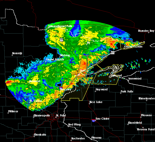 At 420 am cdt, severe thunderstorms were located along a line extending from near poplar in douglas county, to near luck, moving east at 50 mph (radar indicated). Hazards include 60 mph wind gusts and quarter size hail. Hail damage to vehicles is expected. expect wind damage to roofs, siding, and trees. these severe storms will be near, hawthorne and lake nebagamon around 425 am cdt. Other locations impacted by these severe thunderstorms include alpha, lyman lake, falun, birch island lake, riverside, four corners, mckenzie lake, markville, phantom lake and minong flowage. At 420 am cdt, severe thunderstorms were located along a line extending from near poplar in douglas county, to near luck, moving east at 50 mph (radar indicated). Hazards include 60 mph wind gusts and quarter size hail. Hail damage to vehicles is expected. expect wind damage to roofs, siding, and trees. these severe storms will be near, hawthorne and lake nebagamon around 425 am cdt. Other locations impacted by these severe thunderstorms include alpha, lyman lake, falun, birch island lake, riverside, four corners, mckenzie lake, markville, phantom lake and minong flowage.
|
| 7/21/2016 4:06 AM CDT |
 At 406 am cdt, severe thunderstorms were located along a line extending from near south range, to 6 miles south of trade lake, moving east at 50 mph (radar indicated). Hazards include 60 mph wind gusts and quarter size hail. Hail damage to vehicles is expected. expect wind damage to roofs, siding, and trees. these severe storms will be near, hawthorne around 410 am cdt. poplar in douglas county around 415 am cdt. lake nebagamon around 425 am cdt. Other locations impacted by these severe thunderstorms include pattison state park, alpha, falun, riverside, patzau, cloverdale, minong flowage, trade river, blueberry and bennett. At 406 am cdt, severe thunderstorms were located along a line extending from near south range, to 6 miles south of trade lake, moving east at 50 mph (radar indicated). Hazards include 60 mph wind gusts and quarter size hail. Hail damage to vehicles is expected. expect wind damage to roofs, siding, and trees. these severe storms will be near, hawthorne around 410 am cdt. poplar in douglas county around 415 am cdt. lake nebagamon around 425 am cdt. Other locations impacted by these severe thunderstorms include pattison state park, alpha, falun, riverside, patzau, cloverdale, minong flowage, trade river, blueberry and bennett.
|
| 7/21/2016 4:06 AM CDT |
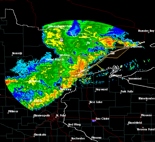 At 406 am cdt, severe thunderstorms were located along a line extending from near south range, to 6 miles south of trade lake, moving east at 50 mph (radar indicated). Hazards include 60 mph wind gusts and quarter size hail. Hail damage to vehicles is expected. expect wind damage to roofs, siding, and trees. these severe storms will be near, hawthorne around 410 am cdt. poplar in douglas county around 415 am cdt. lake nebagamon around 425 am cdt. Other locations impacted by these severe thunderstorms include pattison state park, alpha, falun, riverside, patzau, cloverdale, minong flowage, trade river, blueberry and bennett. At 406 am cdt, severe thunderstorms were located along a line extending from near south range, to 6 miles south of trade lake, moving east at 50 mph (radar indicated). Hazards include 60 mph wind gusts and quarter size hail. Hail damage to vehicles is expected. expect wind damage to roofs, siding, and trees. these severe storms will be near, hawthorne around 410 am cdt. poplar in douglas county around 415 am cdt. lake nebagamon around 425 am cdt. Other locations impacted by these severe thunderstorms include pattison state park, alpha, falun, riverside, patzau, cloverdale, minong flowage, trade river, blueberry and bennett.
|
| 7/21/2016 3:50 AM CDT |
 At 349 am cdt, severe thunderstorms were located along a line extending from 6 miles northeast of foxboro, to 7 miles southeast of rush city, moving east at 50 mph (radar indicated). Hazards include 60 mph wind gusts and quarter size hail. Hail damage to vehicles is expected. expect wind damage to roofs, siding, and trees. severe thunderstorms will be near, foxboro around 355 am cdt. trade lake around 405 am cdt. hawthorne around 410 am cdt. poplar in douglas county around 415 am cdt. lake nebagamon around 420 am cdt. Other locations impacted by these severe thunderstorms include pattison state park, alpha, falun, west rock, riverside, patzau, cloverdale, minong flowage, trade river and blueberry. At 349 am cdt, severe thunderstorms were located along a line extending from 6 miles northeast of foxboro, to 7 miles southeast of rush city, moving east at 50 mph (radar indicated). Hazards include 60 mph wind gusts and quarter size hail. Hail damage to vehicles is expected. expect wind damage to roofs, siding, and trees. severe thunderstorms will be near, foxboro around 355 am cdt. trade lake around 405 am cdt. hawthorne around 410 am cdt. poplar in douglas county around 415 am cdt. lake nebagamon around 420 am cdt. Other locations impacted by these severe thunderstorms include pattison state park, alpha, falun, west rock, riverside, patzau, cloverdale, minong flowage, trade river and blueberry.
|
| 7/7/2016 10:47 PM CDT |
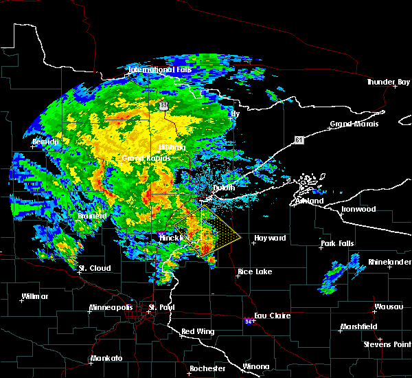 At 1046 pm cdt, severe thunderstorms were located along a line extending from near holyoke to 6 miles north of webb lake wisconsin, moving northeast at 35 mph (radar indicated). Hazards include 60 mph wind gusts and quarter size hail. Hail damage to vehicles is expected. expect wind damage to roofs, siding, and trees. these severe storms will be near, dairyland and holyoke around 1055 pm cdt. wascott, minong and foxboro around 1100 pm cdt. Other locations impacted by these severe thunderstorms include nickerson, birch island lake, riverside, belden, patzau, markville, chaffey, minong flowage, kingsdale and duquette. At 1046 pm cdt, severe thunderstorms were located along a line extending from near holyoke to 6 miles north of webb lake wisconsin, moving northeast at 35 mph (radar indicated). Hazards include 60 mph wind gusts and quarter size hail. Hail damage to vehicles is expected. expect wind damage to roofs, siding, and trees. these severe storms will be near, dairyland and holyoke around 1055 pm cdt. wascott, minong and foxboro around 1100 pm cdt. Other locations impacted by these severe thunderstorms include nickerson, birch island lake, riverside, belden, patzau, markville, chaffey, minong flowage, kingsdale and duquette.
|
| 7/7/2016 10:30 PM CDT |
 At 1029 pm cdt, severe thunderstorms were located along a line extending from near bruno to near danbury, moving northeast at 35 mph (radar indicated). Hazards include 60 mph wind gusts and quarter size hail. Hail damage to vehicles is expected. expect wind damage to roofs, siding, and trees. these severe storms will be near, webb lake wisconsin around 1040 pm cdt. dairyland and holyoke around 1055 pm cdt. wascott, minong and foxboro around 1100 pm cdt. Other locations impacted by these severe thunderstorms include nickerson, birch island lake, riverside, belden, patzau, markville, chaffey, minong flowage, kingsdale and duquette. At 1029 pm cdt, severe thunderstorms were located along a line extending from near bruno to near danbury, moving northeast at 35 mph (radar indicated). Hazards include 60 mph wind gusts and quarter size hail. Hail damage to vehicles is expected. expect wind damage to roofs, siding, and trees. these severe storms will be near, webb lake wisconsin around 1040 pm cdt. dairyland and holyoke around 1055 pm cdt. wascott, minong and foxboro around 1100 pm cdt. Other locations impacted by these severe thunderstorms include nickerson, birch island lake, riverside, belden, patzau, markville, chaffey, minong flowage, kingsdale and duquette.
|
| 7/7/2016 10:30 PM CDT |
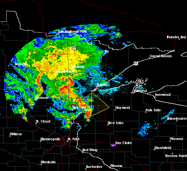 At 1029 pm cdt, severe thunderstorms were located along a line extending from near bruno to near danbury, moving northeast at 35 mph (radar indicated). Hazards include 60 mph wind gusts and quarter size hail. Hail damage to vehicles is expected. expect wind damage to roofs, siding, and trees. these severe storms will be near, webb lake wisconsin around 1040 pm cdt. dairyland and holyoke around 1055 pm cdt. wascott, minong and foxboro around 1100 pm cdt. Other locations impacted by these severe thunderstorms include nickerson, birch island lake, riverside, belden, patzau, markville, chaffey, minong flowage, kingsdale and duquette. At 1029 pm cdt, severe thunderstorms were located along a line extending from near bruno to near danbury, moving northeast at 35 mph (radar indicated). Hazards include 60 mph wind gusts and quarter size hail. Hail damage to vehicles is expected. expect wind damage to roofs, siding, and trees. these severe storms will be near, webb lake wisconsin around 1040 pm cdt. dairyland and holyoke around 1055 pm cdt. wascott, minong and foxboro around 1100 pm cdt. Other locations impacted by these severe thunderstorms include nickerson, birch island lake, riverside, belden, patzau, markville, chaffey, minong flowage, kingsdale and duquette.
|
| 7/7/2016 10:19 PM CDT |
 At 1018 pm cdt, severe thunderstorms were located along a line extending from near bruno to near webster, moving northeast at 35 mph (radar indicated). Hazards include 60 mph wind gusts and quarter size hail. Hail damage to vehicles is expected. expect wind damage to roofs, siding, and trees. severe thunderstorms will be near, webb lake wisconsin around 1035 pm cdt. dairyland around 1050 pm cdt. holyoke around 1055 pm cdt. wascott, minong and foxboro around 1100 pm cdt. Other locations impacted by these severe thunderstorms include nickerson, birch island lake, riverside, belden, patzau, markville, chaffey, minong flowage, kingsdale and duquette. At 1018 pm cdt, severe thunderstorms were located along a line extending from near bruno to near webster, moving northeast at 35 mph (radar indicated). Hazards include 60 mph wind gusts and quarter size hail. Hail damage to vehicles is expected. expect wind damage to roofs, siding, and trees. severe thunderstorms will be near, webb lake wisconsin around 1035 pm cdt. dairyland around 1050 pm cdt. holyoke around 1055 pm cdt. wascott, minong and foxboro around 1100 pm cdt. Other locations impacted by these severe thunderstorms include nickerson, birch island lake, riverside, belden, patzau, markville, chaffey, minong flowage, kingsdale and duquette.
|
| 6/25/2016 6:53 PM CDT |
 At 653 pm cdt, severe thunderstorms were located along a line extending from near seeley to near haugen, moving east at 60 mph (radar indicated). Hazards include 60 mph wind gusts. Expect damage to roofs. siding. and trees. Locations impacted include, spooner, hayward, chippewa flowage, shell lake, round lake, trego, minong, stone lake, birchwood, winter, radisson, exeland, couderay, new post, glidden, little round lake, clam lake, seeley, edgewater and springbrook. At 653 pm cdt, severe thunderstorms were located along a line extending from near seeley to near haugen, moving east at 60 mph (radar indicated). Hazards include 60 mph wind gusts. Expect damage to roofs. siding. and trees. Locations impacted include, spooner, hayward, chippewa flowage, shell lake, round lake, trego, minong, stone lake, birchwood, winter, radisson, exeland, couderay, new post, glidden, little round lake, clam lake, seeley, edgewater and springbrook.
|
| 6/25/2016 6:37 PM CDT |
 At 635 pm cdt, severe thunderstorms were located along a line extending from 7 miles northwest of hayward to 9 miles south of hertel, moving east at 45 mph (radar indicated). Hazards include 60 mph wind gusts and penny size hail. Expect damage to roofs. siding. And trees. At 635 pm cdt, severe thunderstorms were located along a line extending from 7 miles northwest of hayward to 9 miles south of hertel, moving east at 45 mph (radar indicated). Hazards include 60 mph wind gusts and penny size hail. Expect damage to roofs. siding. And trees.
|
| 6/25/2016 6:05 PM CDT |
 At 605 pm cdt, severe thunderstorms were located along a line extending from iron river to barnes to 6 miles northwest of webb lake wisconsin, moving east at 35 mph (radar indicated). Hazards include 60 mph wind gusts. Expect damage to roofs. siding. and trees. locations impacted include, hawthorne, iron river, lake nebagamon, barnes, wascott, maple, brule, poplar in douglas county, solon springs, oulu, minong, webb lake wisconsin, gordon, dairyland, danbury, cloverton, duxbury, bennett, cloverland and middle eau claire lake. A tornado watch remains in effect until 900 pm cdt for east central minnesota, and northwestern wisconsin. At 605 pm cdt, severe thunderstorms were located along a line extending from iron river to barnes to 6 miles northwest of webb lake wisconsin, moving east at 35 mph (radar indicated). Hazards include 60 mph wind gusts. Expect damage to roofs. siding. and trees. locations impacted include, hawthorne, iron river, lake nebagamon, barnes, wascott, maple, brule, poplar in douglas county, solon springs, oulu, minong, webb lake wisconsin, gordon, dairyland, danbury, cloverton, duxbury, bennett, cloverland and middle eau claire lake. A tornado watch remains in effect until 900 pm cdt for east central minnesota, and northwestern wisconsin.
|
| 6/25/2016 6:05 PM CDT |
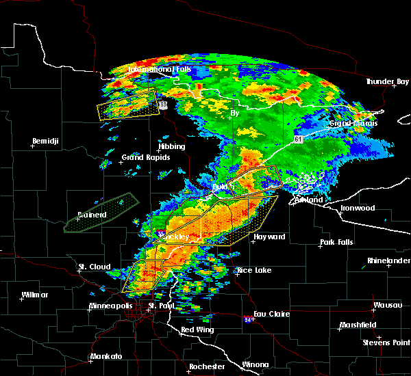 At 605 pm cdt, severe thunderstorms were located along a line extending from iron river to barnes to 6 miles northwest of webb lake wisconsin, moving east at 35 mph (radar indicated). Hazards include 60 mph wind gusts. Expect damage to roofs. siding. and trees. locations impacted include, hawthorne, iron river, lake nebagamon, barnes, wascott, maple, brule, poplar in douglas county, solon springs, oulu, minong, webb lake wisconsin, gordon, dairyland, danbury, cloverton, duxbury, bennett, cloverland and middle eau claire lake. A tornado watch remains in effect until 900 pm cdt for east central minnesota, and northwestern wisconsin. At 605 pm cdt, severe thunderstorms were located along a line extending from iron river to barnes to 6 miles northwest of webb lake wisconsin, moving east at 35 mph (radar indicated). Hazards include 60 mph wind gusts. Expect damage to roofs. siding. and trees. locations impacted include, hawthorne, iron river, lake nebagamon, barnes, wascott, maple, brule, poplar in douglas county, solon springs, oulu, minong, webb lake wisconsin, gordon, dairyland, danbury, cloverton, duxbury, bennett, cloverland and middle eau claire lake. A tornado watch remains in effect until 900 pm cdt for east central minnesota, and northwestern wisconsin.
|
| 6/25/2016 5:44 PM CDT |
 At 544 pm cdt, severe thunderstorms were located along a line extending from near brule to near solon springs to near duxbury, moving east at 45 mph (radar indicated). Hazards include 60 mph wind gusts. Expect damage to roofs. siding. And trees. At 544 pm cdt, severe thunderstorms were located along a line extending from near brule to near solon springs to near duxbury, moving east at 45 mph (radar indicated). Hazards include 60 mph wind gusts. Expect damage to roofs. siding. And trees.
|
| 6/19/2016 11:37 PM CDT |
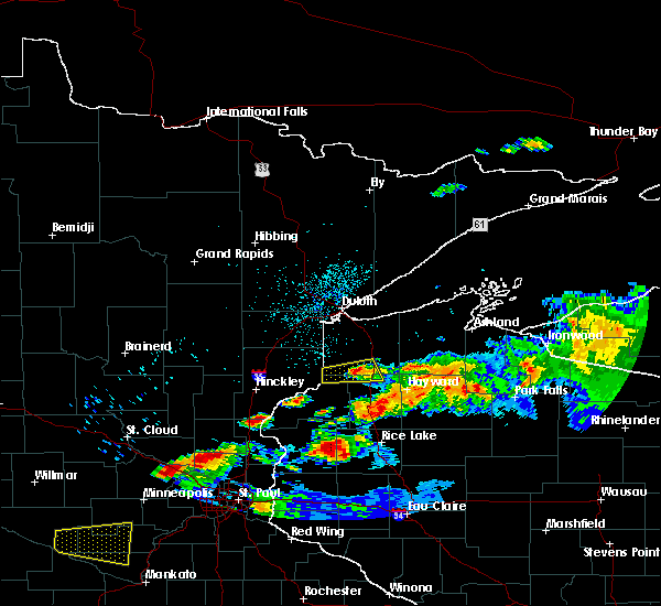 The severe thunderstorm warning for northeastern burnett, southwestern douglas and northwestern washburn counties will expire at 1145 pm cdt, the storm which prompted the warning has weakened below severe limits and exited the warned area. therefore the warning will be allowed to expire. however small hail, .gusty winds and heavy rain are still possible with this thunderstorm. additional thunderstorms are possible within the next hour or two. The severe thunderstorm warning for northeastern burnett, southwestern douglas and northwestern washburn counties will expire at 1145 pm cdt, the storm which prompted the warning has weakened below severe limits and exited the warned area. therefore the warning will be allowed to expire. however small hail, .gusty winds and heavy rain are still possible with this thunderstorm. additional thunderstorms are possible within the next hour or two.
|
| 6/19/2016 11:22 PM CDT |
 At 1122 pm cdt, a severe thunderstorm was located near dairyland, or 26 miles northwest of spooner, moving east at 60 mph (radar indicated). Hazards include 60 mph wind gusts and nickel size hail. Expect damage to roofs. siding. and trees. this severe storm will be near, wascott, minong and gordon around 1140 pm cdt. Other locations impacted by this severe thunderstorm include minong flowage, saint croix flowage and cozy corner. At 1122 pm cdt, a severe thunderstorm was located near dairyland, or 26 miles northwest of spooner, moving east at 60 mph (radar indicated). Hazards include 60 mph wind gusts and nickel size hail. Expect damage to roofs. siding. and trees. this severe storm will be near, wascott, minong and gordon around 1140 pm cdt. Other locations impacted by this severe thunderstorm include minong flowage, saint croix flowage and cozy corner.
|
| 6/19/2016 11:03 PM CDT |
 At 1102 pm cdt, a severe thunderstorm was located near duxbury, or 18 miles east of hinckley, moving east at 60 mph (radar indicated). Hazards include 60 mph wind gusts and half dollar size hail. Hail damage to vehicles is expected. expect wind damage to roofs, siding, and trees. this severe thunderstorm will be near, cloverton around 1115 pm cdt. dairyland around 1125 pm cdt. wascott, minong and gordon around 1140 pm cdt. Other locations impacted by this severe thunderstorm include minong flowage, kingsdale, riverside, moose junction, cozy corner, saint croix flowage and markville. At 1102 pm cdt, a severe thunderstorm was located near duxbury, or 18 miles east of hinckley, moving east at 60 mph (radar indicated). Hazards include 60 mph wind gusts and half dollar size hail. Hail damage to vehicles is expected. expect wind damage to roofs, siding, and trees. this severe thunderstorm will be near, cloverton around 1115 pm cdt. dairyland around 1125 pm cdt. wascott, minong and gordon around 1140 pm cdt. Other locations impacted by this severe thunderstorm include minong flowage, kingsdale, riverside, moose junction, cozy corner, saint croix flowage and markville.
|
| 6/19/2016 11:03 PM CDT |
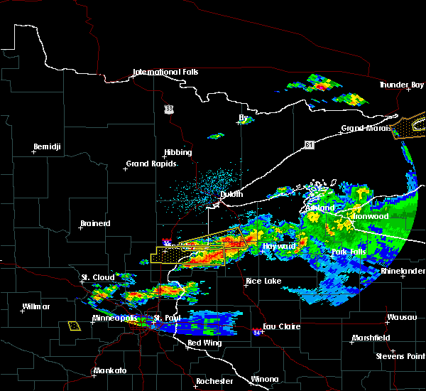 At 1102 pm cdt, a severe thunderstorm was located near duxbury, or 18 miles east of hinckley, moving east at 60 mph (radar indicated). Hazards include 60 mph wind gusts and half dollar size hail. Hail damage to vehicles is expected. expect wind damage to roofs, siding, and trees. this severe thunderstorm will be near, cloverton around 1115 pm cdt. dairyland around 1125 pm cdt. wascott, minong and gordon around 1140 pm cdt. Other locations impacted by this severe thunderstorm include minong flowage, kingsdale, riverside, moose junction, cozy corner, saint croix flowage and markville. At 1102 pm cdt, a severe thunderstorm was located near duxbury, or 18 miles east of hinckley, moving east at 60 mph (radar indicated). Hazards include 60 mph wind gusts and half dollar size hail. Hail damage to vehicles is expected. expect wind damage to roofs, siding, and trees. this severe thunderstorm will be near, cloverton around 1115 pm cdt. dairyland around 1125 pm cdt. wascott, minong and gordon around 1140 pm cdt. Other locations impacted by this severe thunderstorm include minong flowage, kingsdale, riverside, moose junction, cozy corner, saint croix flowage and markville.
|
| 6/19/2016 10:55 PM CDT |
 The severe thunderstorm warning for northeastern pine, northeastern burnett, southern douglas and northwestern washburn counties will expire at 1100 pm cdt, the storms which prompted the warning have weakened below severe limits, and no longer pose an immediate threat to life or property. therefore the warning will be allowed to expire. however small hail and gusty winds are still possible with these thunderstorms. a severe thunderstorm watch remains in effect until 1100 pm cdt for northeastern minnesota, and northwestern wisconsin. The severe thunderstorm warning for northeastern pine, northeastern burnett, southern douglas and northwestern washburn counties will expire at 1100 pm cdt, the storms which prompted the warning have weakened below severe limits, and no longer pose an immediate threat to life or property. therefore the warning will be allowed to expire. however small hail and gusty winds are still possible with these thunderstorms. a severe thunderstorm watch remains in effect until 1100 pm cdt for northeastern minnesota, and northwestern wisconsin.
|
| 6/19/2016 10:44 PM CDT |
 At 1043 pm cdt, severe thunderstorms were located along a line extending from near solon springs to near dairyland, moving east at 50 mph (radar indicated). Hazards include 60 mph wind gusts and quarter size hail. Hail damage to vehicles is expected. expect wind damage to roofs, siding, and trees. these severe storms will be near, solon springs around 1050 pm cdt. wascott, minong and gordon around 1100 pm cdt. Other locations impacted by these severe thunderstorms include minong flowage, kingsdale, moose junction, cozy corner, belden, saint croix flowage, harlis and chaffey. At 1043 pm cdt, severe thunderstorms were located along a line extending from near solon springs to near dairyland, moving east at 50 mph (radar indicated). Hazards include 60 mph wind gusts and quarter size hail. Hail damage to vehicles is expected. expect wind damage to roofs, siding, and trees. these severe storms will be near, solon springs around 1050 pm cdt. wascott, minong and gordon around 1100 pm cdt. Other locations impacted by these severe thunderstorms include minong flowage, kingsdale, moose junction, cozy corner, belden, saint croix flowage, harlis and chaffey.
|
| 6/19/2016 10:31 PM CDT |
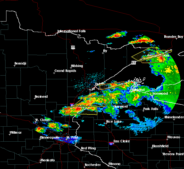 At 1031 pm cdt, severe thunderstorms were located along a line extending from 10 miles west of solon springs to cloverton, moving east at 75 mph (radar indicated). Hazards include 60 mph wind gusts and quarter size hail. Hail damage to vehicles is expected. expect wind damage to roofs, siding, and trees. these severe storms will be near, solon springs around 1040 pm cdt. wascott, minong and gordon around 1050 pm cdt. Other locations impacted by these severe thunderstorms include minong flowage, kingsdale, moose junction, cozy corner, belden, saint croix flowage, harlis, chaffey and kerrick. At 1031 pm cdt, severe thunderstorms were located along a line extending from 10 miles west of solon springs to cloverton, moving east at 75 mph (radar indicated). Hazards include 60 mph wind gusts and quarter size hail. Hail damage to vehicles is expected. expect wind damage to roofs, siding, and trees. these severe storms will be near, solon springs around 1040 pm cdt. wascott, minong and gordon around 1050 pm cdt. Other locations impacted by these severe thunderstorms include minong flowage, kingsdale, moose junction, cozy corner, belden, saint croix flowage, harlis, chaffey and kerrick.
|
| 6/19/2016 10:11 PM CDT |
 At 1010 pm cdt, severe thunderstorms were located along a line extending from near holyoke to near askov, moving east at 60 mph (radar indicated). Hazards include 60 mph wind gusts and quarter size hail. Hail damage to vehicles is expected. expect wind damage to roofs, siding, and trees. severe thunderstorms will be near, cloverton around 1030 pm cdt. dairyland around 1035 pm cdt. solon springs around 1040 pm cdt. wascott, minong and gordon around 1050 pm cdt. Other locations impacted by these severe thunderstorms include minong flowage, kingsdale, moose junction, cozy corner, belden, saint croix flowage, harlis, chaffey and kerrick. At 1010 pm cdt, severe thunderstorms were located along a line extending from near holyoke to near askov, moving east at 60 mph (radar indicated). Hazards include 60 mph wind gusts and quarter size hail. Hail damage to vehicles is expected. expect wind damage to roofs, siding, and trees. severe thunderstorms will be near, cloverton around 1030 pm cdt. dairyland around 1035 pm cdt. solon springs around 1040 pm cdt. wascott, minong and gordon around 1050 pm cdt. Other locations impacted by these severe thunderstorms include minong flowage, kingsdale, moose junction, cozy corner, belden, saint croix flowage, harlis, chaffey and kerrick.
|
| 6/19/2016 10:11 PM CDT |
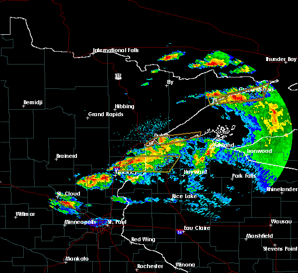 At 1010 pm cdt, severe thunderstorms were located along a line extending from near holyoke to near askov, moving east at 60 mph (radar indicated). Hazards include 60 mph wind gusts and quarter size hail. Hail damage to vehicles is expected. expect wind damage to roofs, siding, and trees. severe thunderstorms will be near, cloverton around 1030 pm cdt. dairyland around 1035 pm cdt. solon springs around 1040 pm cdt. wascott, minong and gordon around 1050 pm cdt. Other locations impacted by these severe thunderstorms include minong flowage, kingsdale, moose junction, cozy corner, belden, saint croix flowage, harlis, chaffey and kerrick. At 1010 pm cdt, severe thunderstorms were located along a line extending from near holyoke to near askov, moving east at 60 mph (radar indicated). Hazards include 60 mph wind gusts and quarter size hail. Hail damage to vehicles is expected. expect wind damage to roofs, siding, and trees. severe thunderstorms will be near, cloverton around 1030 pm cdt. dairyland around 1035 pm cdt. solon springs around 1040 pm cdt. wascott, minong and gordon around 1050 pm cdt. Other locations impacted by these severe thunderstorms include minong flowage, kingsdale, moose junction, cozy corner, belden, saint croix flowage, harlis, chaffey and kerrick.
|
| 6/19/2016 9:56 PM CDT |
 The severe thunderstorm warning for northwestern sawyer, southwestern bayfield, southeastern douglas and northeastern washburn counties will expire at 1000 pm cdt, the storms which prompted the warning have weakened below severe limits, and no longer pose an immediate threat to life or property. therefore the warning will be allowed to expire. however small hail and gusty winds are still possible with these thunderstorms. a severe thunderstorm watch remains in effect until 1100 pm cdt for northwestern wisconsin. The severe thunderstorm warning for northwestern sawyer, southwestern bayfield, southeastern douglas and northeastern washburn counties will expire at 1000 pm cdt, the storms which prompted the warning have weakened below severe limits, and no longer pose an immediate threat to life or property. therefore the warning will be allowed to expire. however small hail and gusty winds are still possible with these thunderstorms. a severe thunderstorm watch remains in effect until 1100 pm cdt for northwestern wisconsin.
|
| 6/19/2016 9:38 PM CDT |
 At 937 pm cdt, severe thunderstorms were located along a line extending from near barnes to near seeley, moving east at 45 mph (radar indicated). Hazards include 70 mph wind gusts and half dollar size hail. Hail damage to vehicles is expected. expect considerable tree damage. wind damage is also likely to mobile homes, roofs, and outbuildings. these severe storms will be near, round lake and drummond around 945 pm cdt. cable and ino around 950 pm cdt. benoit, namekagon and namekagon lake around 1000 pm cdt. Other locations impacted by these severe thunderstorms include totagatic lake, middle eau claire lake, upper eau claire lake, grand view, nelson lake, teal lake, totagatic flowage, spider lake in sawyer county, mason and lost land lake. At 937 pm cdt, severe thunderstorms were located along a line extending from near barnes to near seeley, moving east at 45 mph (radar indicated). Hazards include 70 mph wind gusts and half dollar size hail. Hail damage to vehicles is expected. expect considerable tree damage. wind damage is also likely to mobile homes, roofs, and outbuildings. these severe storms will be near, round lake and drummond around 945 pm cdt. cable and ino around 950 pm cdt. benoit, namekagon and namekagon lake around 1000 pm cdt. Other locations impacted by these severe thunderstorms include totagatic lake, middle eau claire lake, upper eau claire lake, grand view, nelson lake, teal lake, totagatic flowage, spider lake in sawyer county, mason and lost land lake.
|
| 6/19/2016 9:29 PM CDT |
 At 928 pm cdt, severe thunderstorms were located along a line extending from near barnes to 9 miles east of wascott, moving east at 60 mph. these are very dangerous storms (the solon springs airport reported 68 mph winds at 915 pm). Hazards include 80 mph wind gusts and two inch hail. Flying debris will be dangerous to those caught without shelter. mobile homes will be heavily damaged. expect considerable damage to roofs, windows, and vehicles. extensive tree damage and power outages are likely. these severe storms will be near, cable and seeley around 940 pm cdt. round lake, drummond and ino around 945 pm cdt. benoit and namekagon lake around 950 pm cdt. namekagon around 955 pm cdt. Other locations impacted by these severe thunderstorms include middle eau claire lake, totagatic lake, teal lake, totagatic flowage, mason, minong flowage, upper eau claire lake, grand view, nelson lake and bennett. At 928 pm cdt, severe thunderstorms were located along a line extending from near barnes to 9 miles east of wascott, moving east at 60 mph. these are very dangerous storms (the solon springs airport reported 68 mph winds at 915 pm). Hazards include 80 mph wind gusts and two inch hail. Flying debris will be dangerous to those caught without shelter. mobile homes will be heavily damaged. expect considerable damage to roofs, windows, and vehicles. extensive tree damage and power outages are likely. these severe storms will be near, cable and seeley around 940 pm cdt. round lake, drummond and ino around 945 pm cdt. benoit and namekagon lake around 950 pm cdt. namekagon around 955 pm cdt. Other locations impacted by these severe thunderstorms include middle eau claire lake, totagatic lake, teal lake, totagatic flowage, mason, minong flowage, upper eau claire lake, grand view, nelson lake and bennett.
|
| 6/19/2016 9:13 PM CDT |
 At 911 pm cdt, severe thunderstorms were located along a line extending from near hawthorne to 6 miles west of wascott, moving east at 50 mph. these are very dangerous storms (radar indicated). Hazards include 80 mph wind gusts and two inch hail. Flying debris will be dangerous to those caught without shelter. mobile homes will be heavily damaged. expect considerable damage to roofs, windows, and vehicles. extensive tree damage and power outages are likely. severe thunderstorms will be near, solon springs around 915 pm cdt. wascott, minong and gordon around 920 pm cdt. lake nebagamon around 925 pm cdt. brule around 930 pm cdt. barnes around 935 pm cdt. iron river around 940 pm cdt. seeley around 945 pm cdt. round lake, cable and drummond around 950 pm cdt. Other locations impacted by these severe thunderstorms include middle eau claire lake, totagatic lake, teal lake, totagatic flowage, mason, minong flowage, upper eau claire lake, grand view, nelson lake and bennett. At 911 pm cdt, severe thunderstorms were located along a line extending from near hawthorne to 6 miles west of wascott, moving east at 50 mph. these are very dangerous storms (radar indicated). Hazards include 80 mph wind gusts and two inch hail. Flying debris will be dangerous to those caught without shelter. mobile homes will be heavily damaged. expect considerable damage to roofs, windows, and vehicles. extensive tree damage and power outages are likely. severe thunderstorms will be near, solon springs around 915 pm cdt. wascott, minong and gordon around 920 pm cdt. lake nebagamon around 925 pm cdt. brule around 930 pm cdt. barnes around 935 pm cdt. iron river around 940 pm cdt. seeley around 945 pm cdt. round lake, cable and drummond around 950 pm cdt. Other locations impacted by these severe thunderstorms include middle eau claire lake, totagatic lake, teal lake, totagatic flowage, mason, minong flowage, upper eau claire lake, grand view, nelson lake and bennett.
|
| 5/25/2016 3:27 PM CDT | The severe thunderstorm warning for southeastern douglas and northeastern washburn counties will expire at 330 pm cdt, the storm which prompted the warning has weakened below severe limits, and no longer poses an immediate threat to life or property. therefore the warning will be allowed to expire. however penny size hail and gusty winds are still possible with this thunderstorm. |
| 5/25/2016 3:20 PM CDT | Ping Pong Ball sized hail reported 0.9 miles SSW of Minong, WI |
| 5/25/2016 3:13 PM CDT |
 At 313 pm cdt, a severe thunderstorm was located near minong, or 13 miles west of hayward, moving north at 25 mph (radar indicated). Hazards include ping pong ball size hail and 60 mph wind gusts. People and animals outdoors will be injured. expect hail damage to roofs, siding, windows, and vehicles. expect wind damage to roofs, siding, and trees. Locations impacted include, wascott, minong and lampson. At 313 pm cdt, a severe thunderstorm was located near minong, or 13 miles west of hayward, moving north at 25 mph (radar indicated). Hazards include ping pong ball size hail and 60 mph wind gusts. People and animals outdoors will be injured. expect hail damage to roofs, siding, windows, and vehicles. expect wind damage to roofs, siding, and trees. Locations impacted include, wascott, minong and lampson.
|
| 5/25/2016 9:00 AM CDT | At 300 pm cdt, a severe thunderstorm was located near trego, or 12 miles northeast of spooner, moving north at 25 mph (radar indicated). Hazards include 60 mph wind gusts and half dollar size hail. Hail damage to vehicles is expected. Expect wind damage to roofs, siding, and trees. |
| 8/2/2015 8:25 AM CDT | Quarter sized hail reported 8.5 miles S of Minong, WI, time radar estimated |
| 7/12/2015 10:45 PM CDT | Delayed report via social media of a live 7 foot pine tree down. time radar estimate in washburn county WI, 0.3 miles WSW of Minong, WI |
| 7/12/2015 10:25 PM CDT | Delayed report of a power line down. time radar estimate in washburn county WI, 0.3 miles WSW of Minong, WI |
| 9/4/2014 7:35 AM CDT | Delayed report. numerous trees down along us 77 at cn overpass. railroad crews working to clear trees along right-of-way... also. time estimated by rada in washburn county WI, 7.7 miles WNW of Minong, WI |
| 9/4/2014 7:33 AM CDT | Half Dollar sized hail reported 0.7 miles ESE of Minong, WI, hail diameter 1.14 inches measured with digital caliper. |
| 9/4/2014 7:30 AM CDT | Delayed report. several trees down along us 77 east of minong. time estimated by rada in washburn county WI, 3.6 miles W of Minong, WI |
| 1/1/0001 12:00 AM | Trees and branches were blown in washburn county WI, 0.3 miles WSW of Minong, WI |
| 1/1/0001 12:00 AM | Measured wind speed 59 mph. torential rainfall obscuring visibility. trees down along highway 5 in washburn county WI, 4.7 miles N of Minong, WI |
| 1/1/0001 12:00 AM | Roof blown off a business along highway 5 in washburn county WI, 0.3 miles WSW of Minong, WI |
Hail Maps for Minong, WI


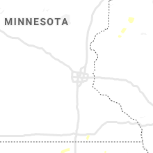


Connect with Interactive Hail Maps