

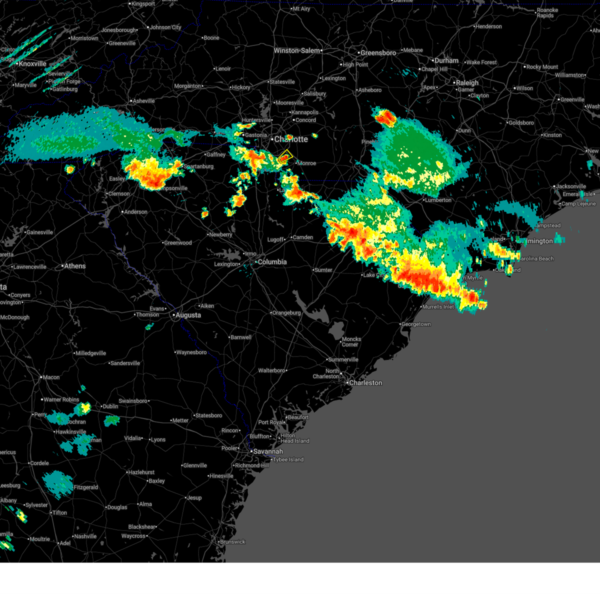
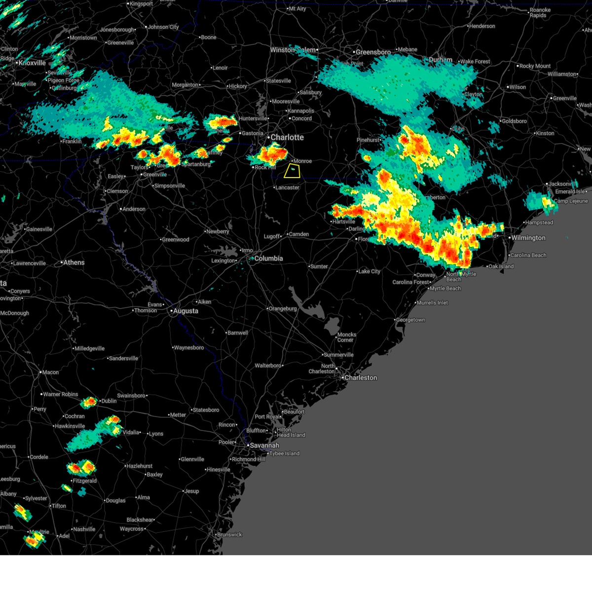
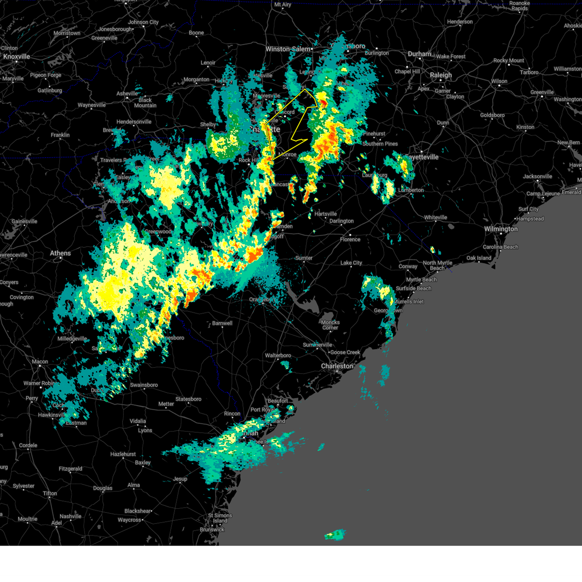
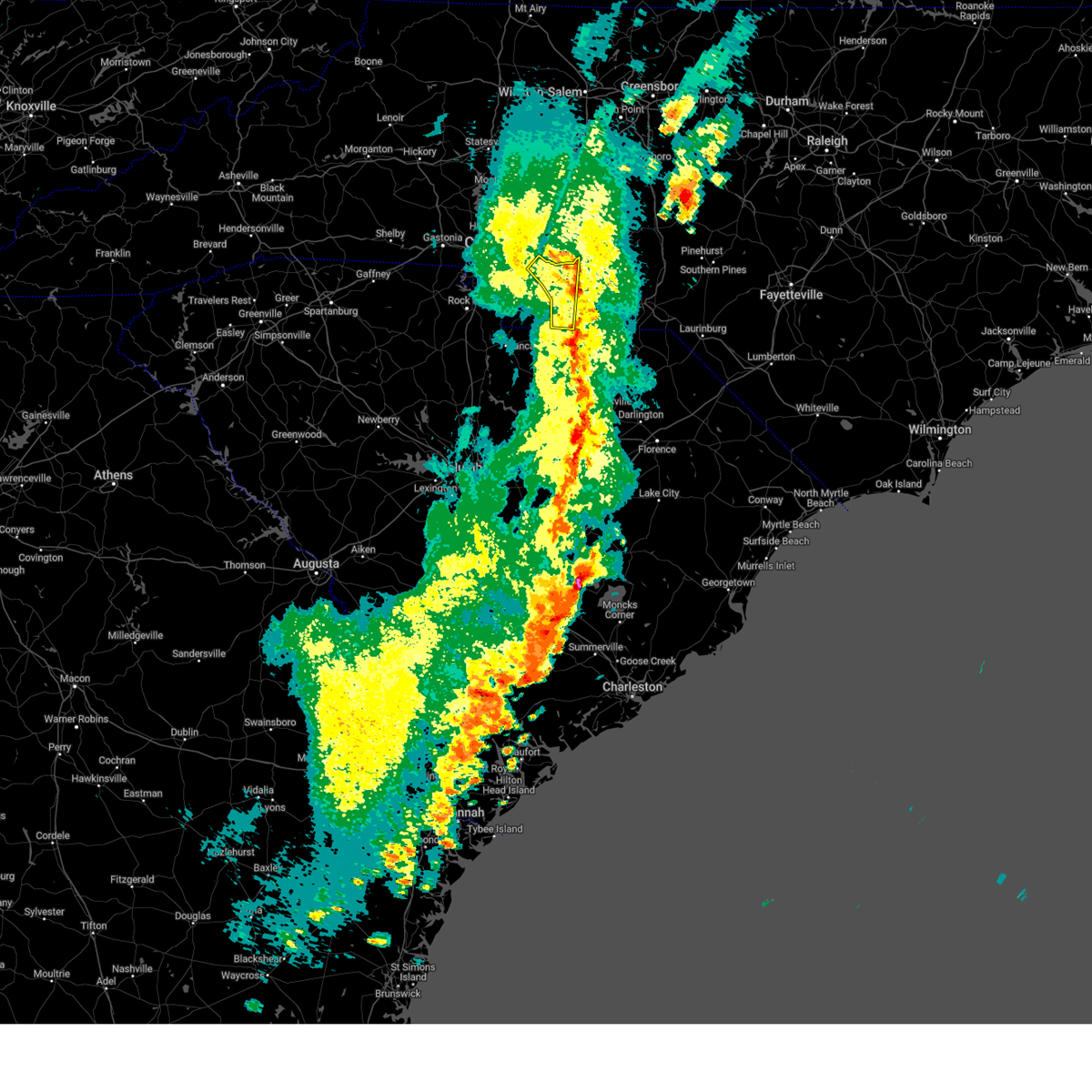
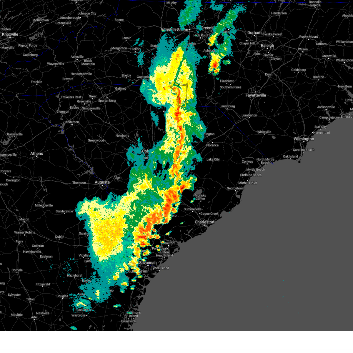
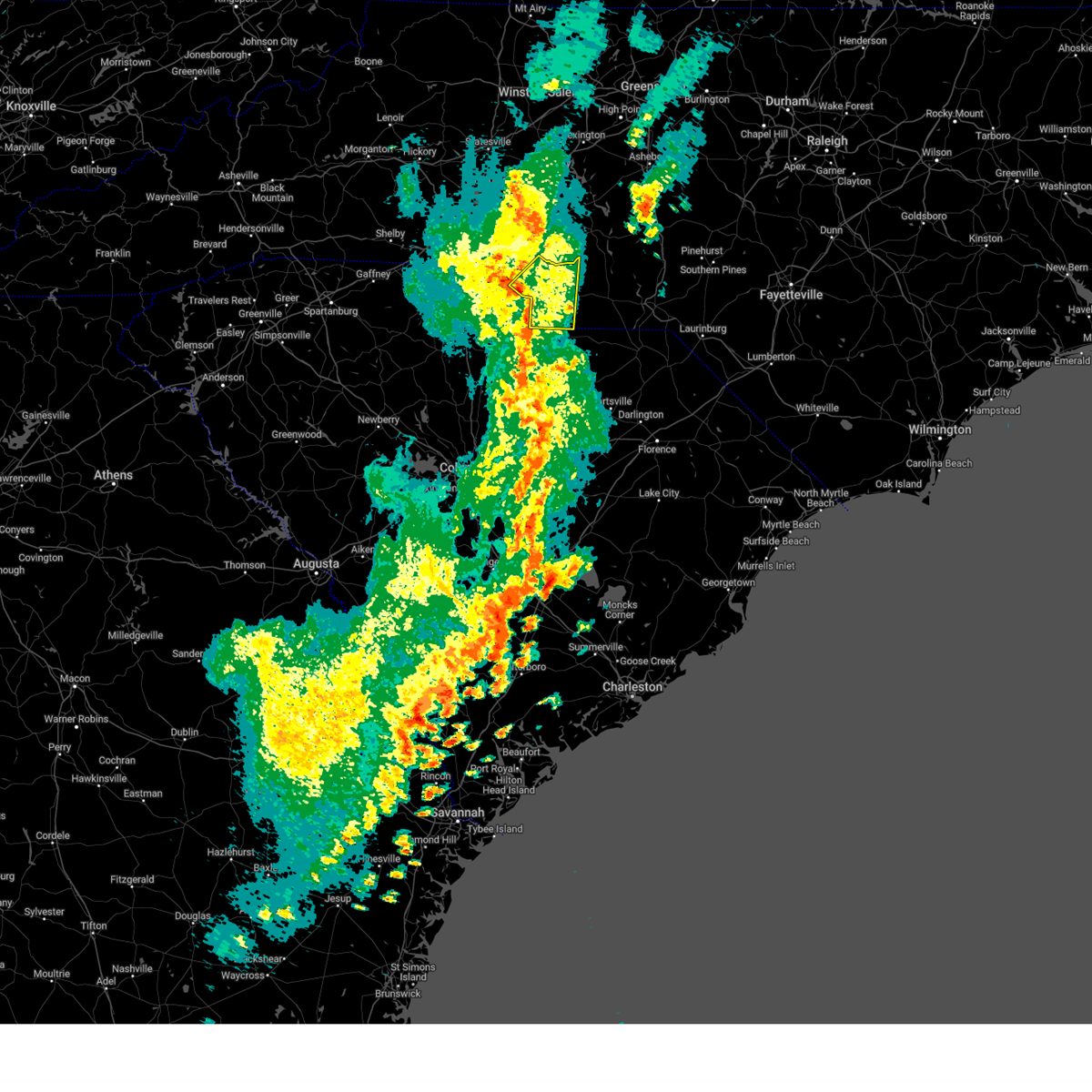
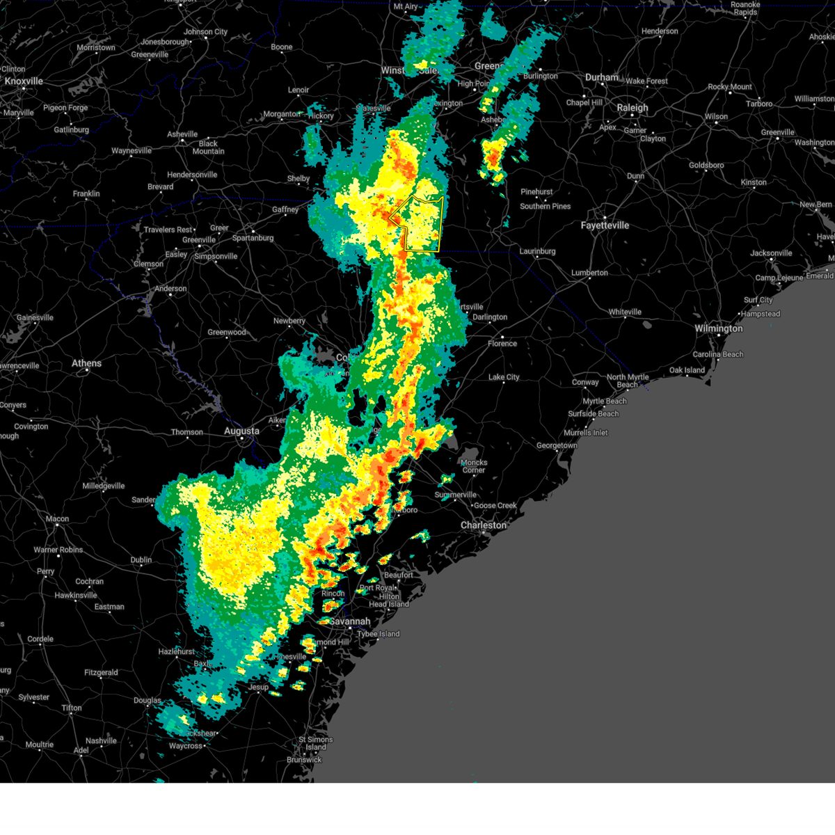
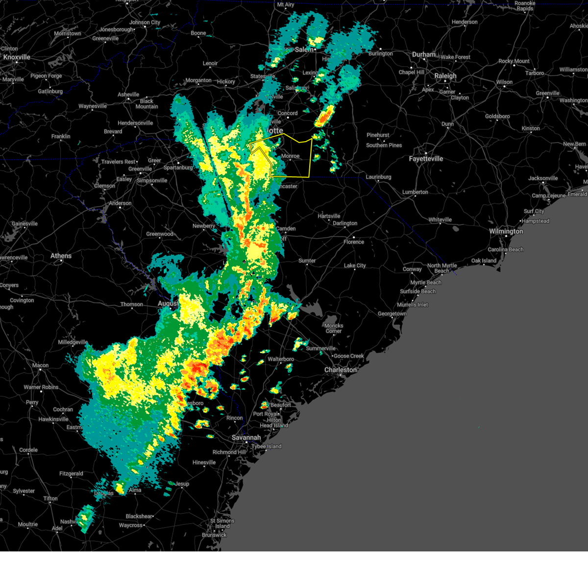
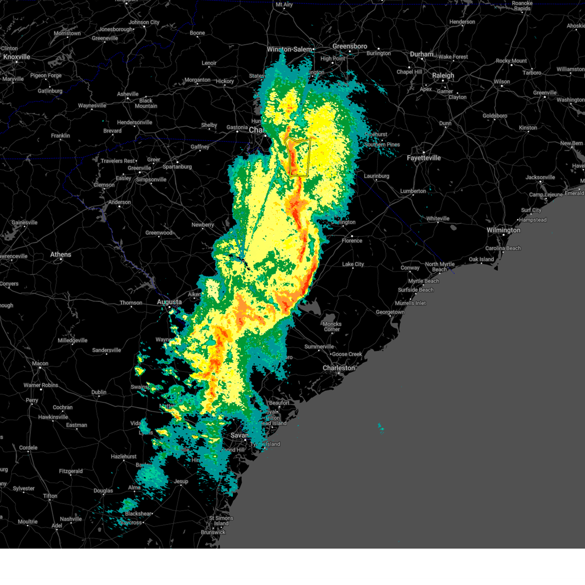
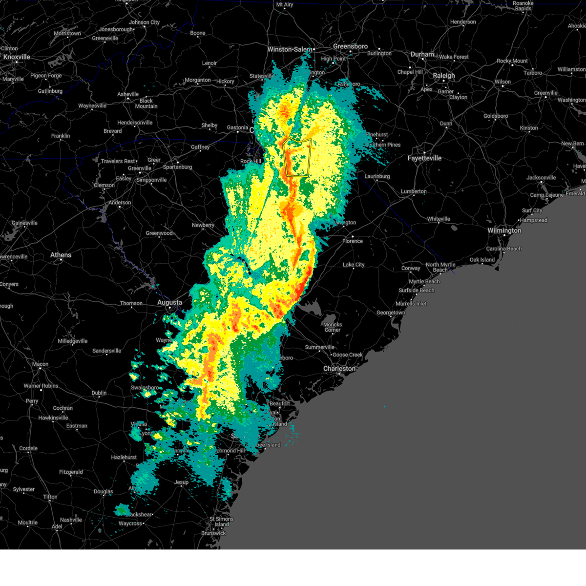
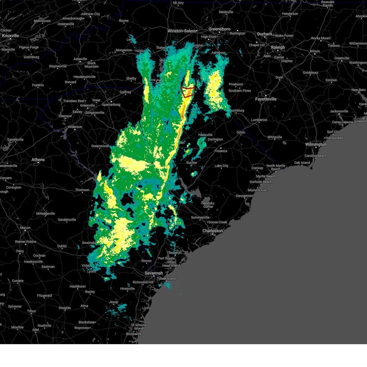
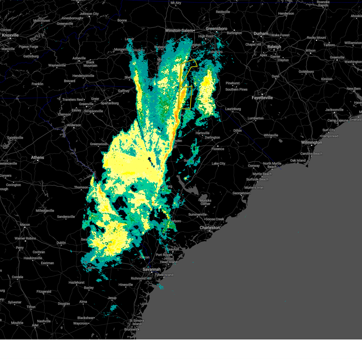
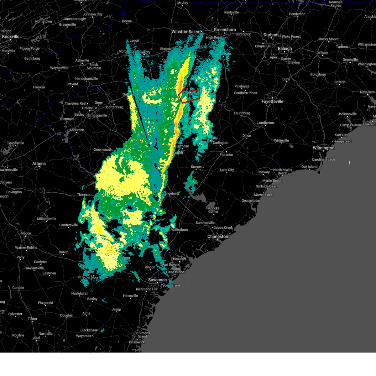
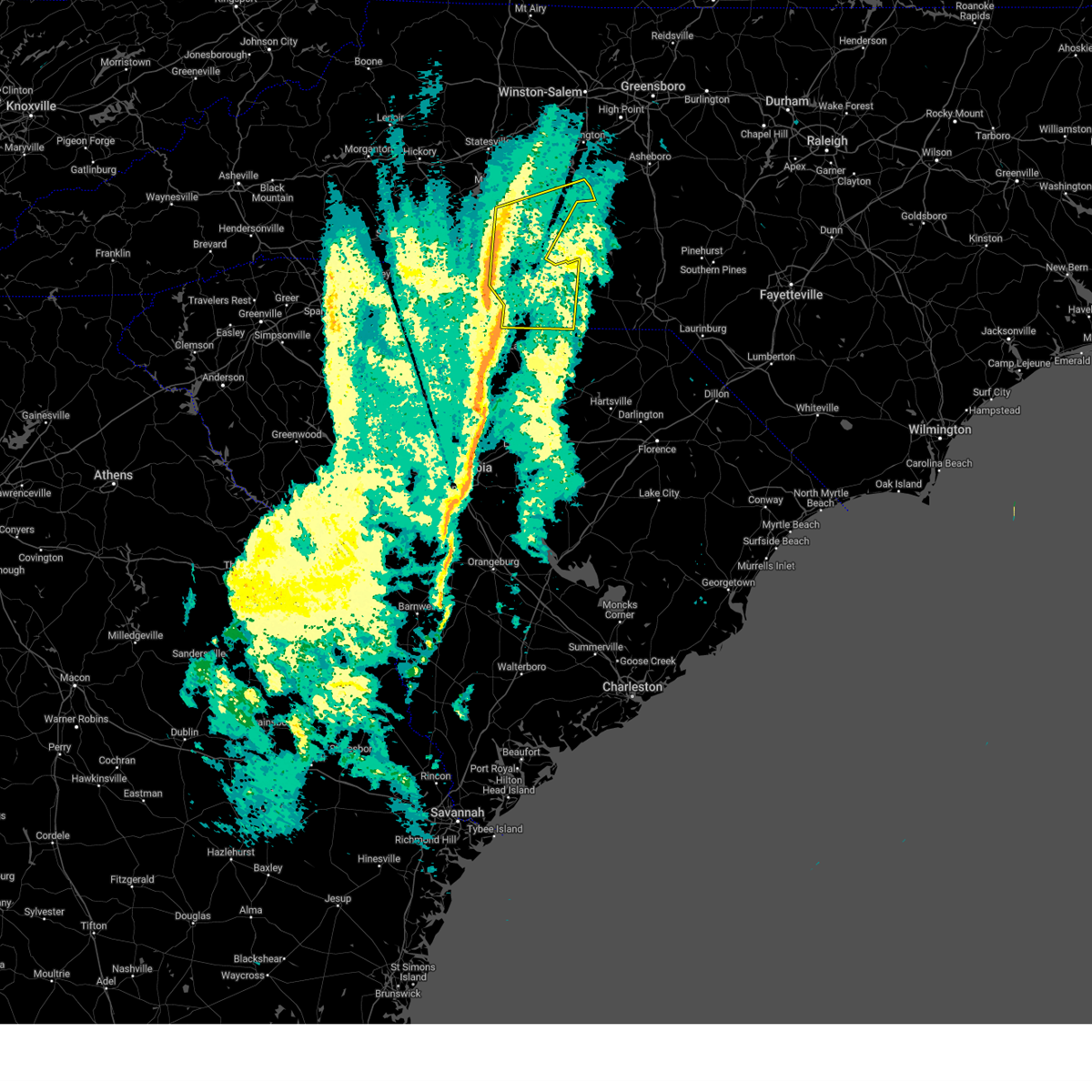
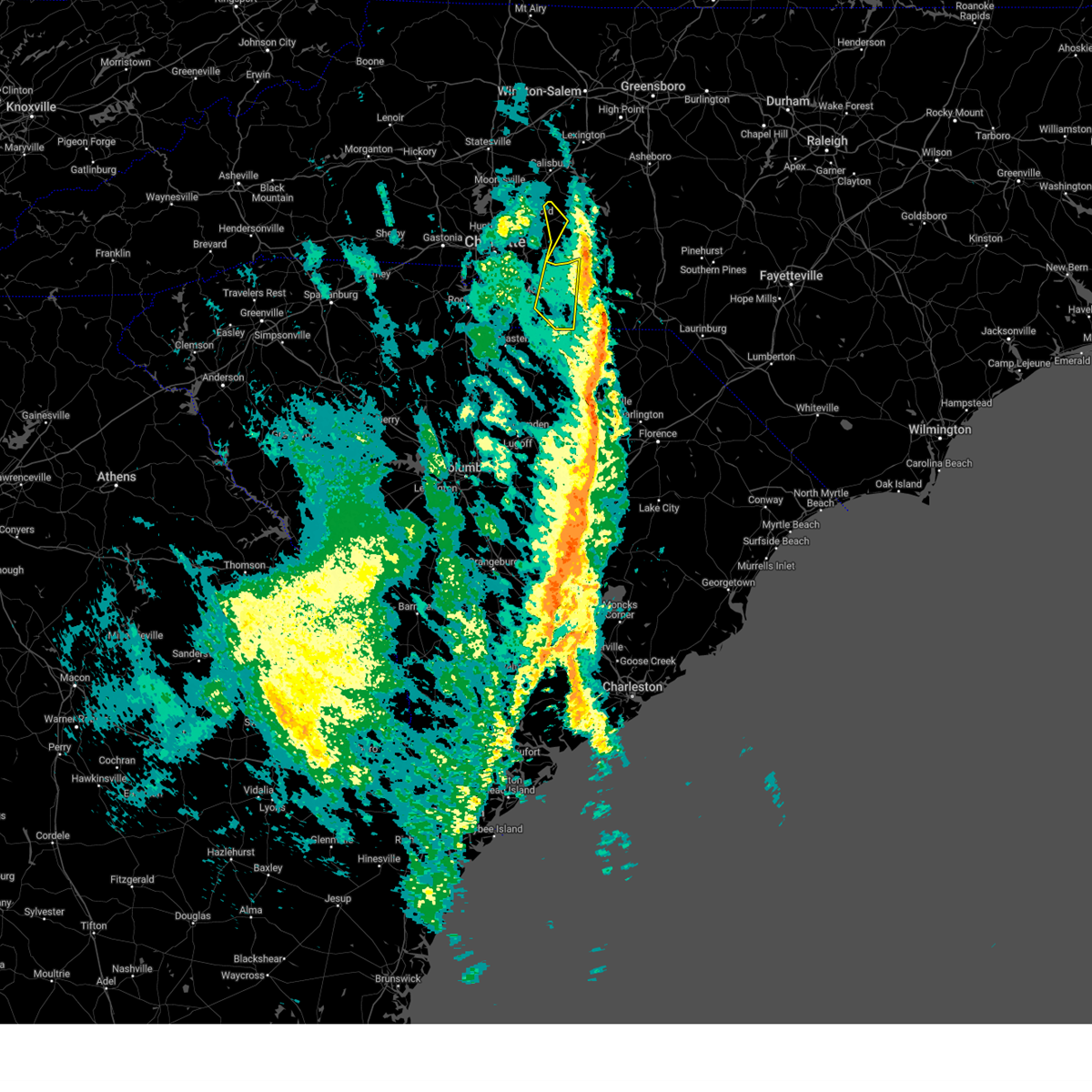
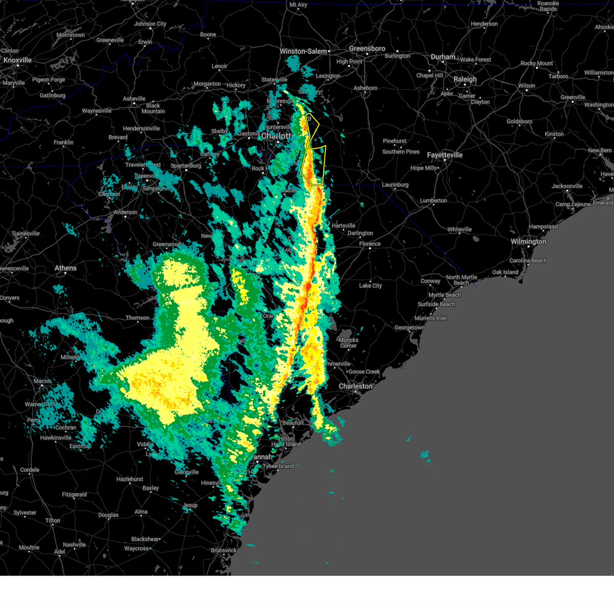
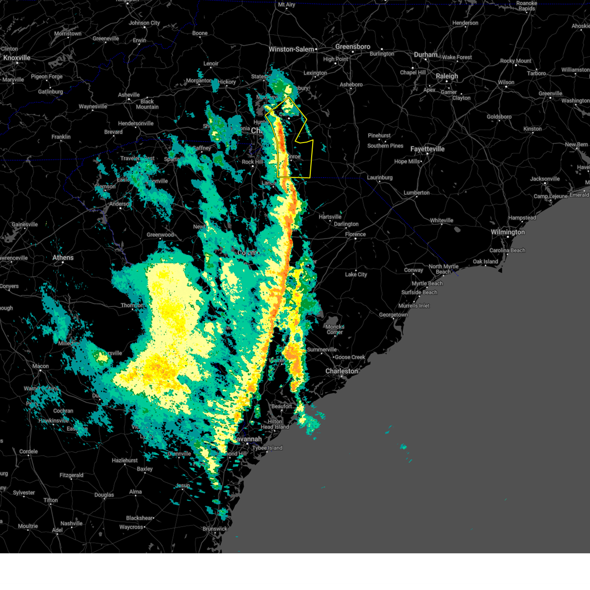
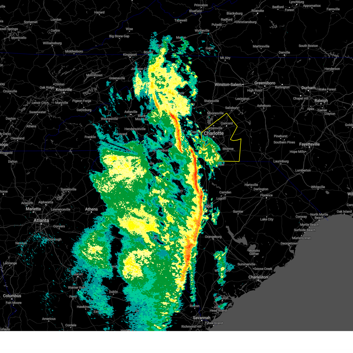
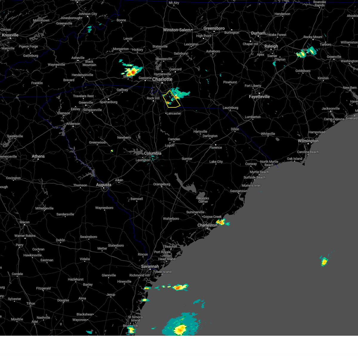
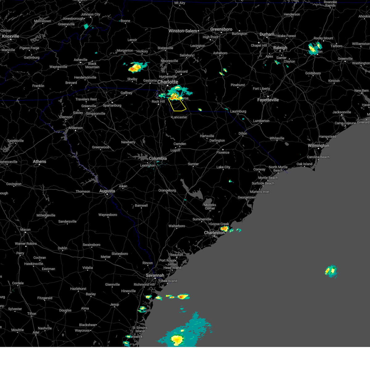
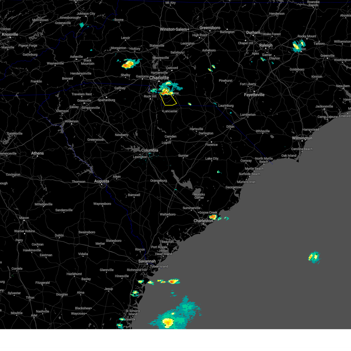
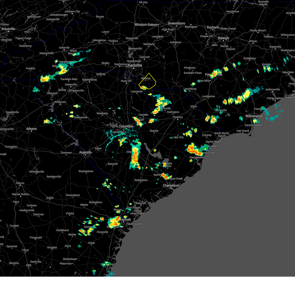
Hail Map for Monroe, NC
The Monroe, NC area has had 15 reports of on-the-ground hail by trained spotters, and has been under severe weather warnings 49 times during the past 12 months. Doppler radar has detected hail at or near Monroe, NC on 79 occasions, including 1 occasion during the past year.
| Name: | Monroe, NC |
| Where Located: | 22.1 miles SE of Charlotte, NC |
| Map: | Google Map for Monroe, NC |
| Population: | 32797 |
| Housing Units: | 12375 |
| More Info: | Search Google for Monroe, NC |
0
The Top Recent Hail Date for Monroe, NC is Wednesday, June 25, 2025 (79th out of 79)

Hail and Wind Damage Spotted near Monroe, NC
| Date / Time | Report Details |
|---|---|
| 6/25/2025 7:17 PM EDT |
 the severe thunderstorm warning has been cancelled and is no longer in effect the severe thunderstorm warning has been cancelled and is no longer in effect
|
| 6/25/2025 6:59 PM EDT |
 the severe thunderstorm warning has been cancelled and is no longer in effect the severe thunderstorm warning has been cancelled and is no longer in effect
|
| 6/25/2025 6:59 PM EDT |
 At 659 pm edt, a severe thunderstorm was located 9 miles northeast of indian land, or near indian trail, moving southeast at 5 mph (radar indicated). Hazards include 60 mph wind gusts and quarter size hail. Minor hail damage to vehicles is expected. expect wind damage to trees and power lines. Locations impacted include, indian trail, weddington, stallings, lake park, wesley chapel, and hemby bridge. At 659 pm edt, a severe thunderstorm was located 9 miles northeast of indian land, or near indian trail, moving southeast at 5 mph (radar indicated). Hazards include 60 mph wind gusts and quarter size hail. Minor hail damage to vehicles is expected. expect wind damage to trees and power lines. Locations impacted include, indian trail, weddington, stallings, lake park, wesley chapel, and hemby bridge.
|
| 6/25/2025 6:30 PM EDT |
 Svrgsp the national weather service in greenville-spartanburg has issued a * severe thunderstorm warning for, southeastern mecklenburg county in the piedmont of north carolina, west central union county in the piedmont of north carolina, * until 730 pm edt. * at 630 pm edt, a severe thunderstorm was located 9 miles northeast of indian land, or near matthews, moving southeast at 5 mph (radar indicated). Hazards include 60 mph wind gusts and half dollar size hail. Minor hail damage to vehicles is expected. Expect wind damage to trees and power lines. Svrgsp the national weather service in greenville-spartanburg has issued a * severe thunderstorm warning for, southeastern mecklenburg county in the piedmont of north carolina, west central union county in the piedmont of north carolina, * until 730 pm edt. * at 630 pm edt, a severe thunderstorm was located 9 miles northeast of indian land, or near matthews, moving southeast at 5 mph (radar indicated). Hazards include 60 mph wind gusts and half dollar size hail. Minor hail damage to vehicles is expected. Expect wind damage to trees and power lines.
|
| 6/25/2025 6:29 PM EDT | Keqy aso in union county NC, 4.1 miles ESE of Monroe, NC |
| 6/25/2025 6:20 PM EDT |
 Svrgsp the national weather service in greenville-spartanburg has issued a * severe thunderstorm warning for, south central union county in the piedmont of north carolina, * until 715 pm edt. * at 620 pm edt, a severe thunderstorm was located 7 miles south of monroe, moving south at 10 mph (radar indicated). Hazards include 60 mph wind gusts and half dollar size hail. Minor hail damage to vehicles is expected. Expect wind damage to trees and power lines. Svrgsp the national weather service in greenville-spartanburg has issued a * severe thunderstorm warning for, south central union county in the piedmont of north carolina, * until 715 pm edt. * at 620 pm edt, a severe thunderstorm was located 7 miles south of monroe, moving south at 10 mph (radar indicated). Hazards include 60 mph wind gusts and half dollar size hail. Minor hail damage to vehicles is expected. Expect wind damage to trees and power lines.
|
| 6/25/2025 6:18 PM EDT |
 Svrgsp the national weather service in greenville-spartanburg has issued a * severe thunderstorm warning for, southwestern union county in the piedmont of north carolina, * until 715 pm edt. * at 617 pm edt, a severe thunderstorm was located 7 miles northwest of monroe, or near wesley chapel, moving south at 10 mph (radar indicated). Hazards include 60 mph wind gusts and quarter size hail. Minor hail damage to vehicles is expected. Expect wind damage to trees and power lines. Svrgsp the national weather service in greenville-spartanburg has issued a * severe thunderstorm warning for, southwestern union county in the piedmont of north carolina, * until 715 pm edt. * at 617 pm edt, a severe thunderstorm was located 7 miles northwest of monroe, or near wesley chapel, moving south at 10 mph (radar indicated). Hazards include 60 mph wind gusts and quarter size hail. Minor hail damage to vehicles is expected. Expect wind damage to trees and power lines.
|
| 6/25/2025 5:29 PM EDT | Svrgsp the national weather service in greenville-spartanburg has issued a * severe thunderstorm warning for, southeastern mecklenburg county in the piedmont of north carolina, northwestern union county in the piedmont of north carolina, * until 630 pm edt. * at 528 pm edt, a severe thunderstorm was located 6 miles southeast of uptown charlotte, or near east charlotte, moving south at 5 mph (radar indicated). Hazards include 60 mph wind gusts and quarter size hail. Minor hail damage to vehicles is expected. Expect wind damage to trees and power lines. |
| 5/4/2025 1:00 AM EDT |
 Svrgsp the national weather service in greenville-spartanburg has issued a * severe thunderstorm warning for, cabarrus county in the piedmont of north carolina, southeastern mecklenburg county in the piedmont of north carolina, southeastern rowan county in the piedmont of north carolina, northern union county in the piedmont of north carolina, * until 145 am edt. * at 100 am edt, severe thunderstorms were located along a line extending from 8 miles northeast of uptown charlotte to 10 miles northwest of monroe, moving northeast at 45 mph (radar indicated). Hazards include 60 mph wind gusts. expect damage to trees and power lines Svrgsp the national weather service in greenville-spartanburg has issued a * severe thunderstorm warning for, cabarrus county in the piedmont of north carolina, southeastern mecklenburg county in the piedmont of north carolina, southeastern rowan county in the piedmont of north carolina, northern union county in the piedmont of north carolina, * until 145 am edt. * at 100 am edt, severe thunderstorms were located along a line extending from 8 miles northeast of uptown charlotte to 10 miles northwest of monroe, moving northeast at 45 mph (radar indicated). Hazards include 60 mph wind gusts. expect damage to trees and power lines
|
| 5/2/2025 7:15 PM EDT | the severe thunderstorm warning has been cancelled and is no longer in effect |
| 5/2/2025 7:07 PM EDT | the severe thunderstorm warning has been cancelled and is no longer in effect |
| 5/2/2025 7:07 PM EDT | At 706 pm edt, a severe thunderstorm was located 13 miles south of downtown concord, or 4 miles west of midland, moving north at 20 mph (radar indicated). Hazards include 60 mph wind gusts and quarter size hail. Minor hail damage to vehicles is expected. expect wind damage to trees and power lines. Locations impacted include, unionville, fairview in union county, and indian trail. |
| 5/2/2025 6:46 PM EDT | At 646 pm edt, a severe thunderstorm was located 10 miles northwest of monroe, or near hemby bridge, moving north at 20 mph (radar indicated). Hazards include 60 mph wind gusts and quarter size hail. Minor hail damage to vehicles is expected. expect wind damage to trees and power lines. Locations impacted include, indian trail, lake park, mint hill, south charlotte, matthews, stallings, the arboretum, hemby bridge, fairview in union county, and unionville. |
| 5/2/2025 6:16 PM EDT | Svrgsp the national weather service in greenville-spartanburg has issued a * severe thunderstorm warning for, southeastern mecklenburg county in the piedmont of north carolina, central union county in the piedmont of north carolina, * until 730 pm edt. * at 616 pm edt, a severe thunderstorm was located 8 miles west of monroe, or near wesley chapel, moving north at 20 mph (radar indicated). Hazards include 60 mph wind gusts and quarter size hail. Minor hail damage to vehicles is expected. Expect wind damage to trees and power lines. |
| 3/31/2025 5:53 PM EDT |
 the severe thunderstorm warning has been cancelled and is no longer in effect the severe thunderstorm warning has been cancelled and is no longer in effect
|
| 3/31/2025 5:40 PM EDT |
 At 540 pm edt, severe thunderstorms were located along a line extending from 14 miles south of downtown concord to 9 miles northeast of monroe to 22 miles east of lancaster, moving east at 50 mph (radar indicated). Hazards include 60 mph wind gusts. Expect damage to trees and power lines. Locations impacted include, marshville, new salem, fairview in union county, sturdivants, unionville, wingate, hemby bridge, and stallings. At 540 pm edt, severe thunderstorms were located along a line extending from 14 miles south of downtown concord to 9 miles northeast of monroe to 22 miles east of lancaster, moving east at 50 mph (radar indicated). Hazards include 60 mph wind gusts. Expect damage to trees and power lines. Locations impacted include, marshville, new salem, fairview in union county, sturdivants, unionville, wingate, hemby bridge, and stallings.
|
| 3/31/2025 5:30 PM EDT |
 At 530 pm edt, severe thunderstorms were located along a line extending from 10 miles southeast of uptown charlotte to near monroe to 14 miles east of lancaster, moving northeast at 55 mph (radar indicated). Hazards include 60 mph wind gusts. Expect damage to trees and power lines. Locations impacted include, marshville, indian trail, trinity, lake park, wesley chapel, monroe, wingate, stallings, new salem, and hemby bridge. At 530 pm edt, severe thunderstorms were located along a line extending from 10 miles southeast of uptown charlotte to near monroe to 14 miles east of lancaster, moving northeast at 55 mph (radar indicated). Hazards include 60 mph wind gusts. Expect damage to trees and power lines. Locations impacted include, marshville, indian trail, trinity, lake park, wesley chapel, monroe, wingate, stallings, new salem, and hemby bridge.
|
| 3/31/2025 5:30 PM EDT |
 the severe thunderstorm warning has been cancelled and is no longer in effect the severe thunderstorm warning has been cancelled and is no longer in effect
|
| 3/31/2025 5:22 PM EDT |
 At 522 pm edt, severe thunderstorms were located along a line extending from 8 miles southeast of uptown charlotte to 5 miles southwest of monroe to 12 miles southeast of lancaster, moving east at 50 mph (radar indicated). Hazards include 60 mph wind gusts. Expect damage to trees and power lines. Locations impacted include, marshville, trinity, lake park, mint hill, south charlotte, mineral springs, new salem, hemby bridge, southwest charlotte, and fairview in union county. At 522 pm edt, severe thunderstorms were located along a line extending from 8 miles southeast of uptown charlotte to 5 miles southwest of monroe to 12 miles southeast of lancaster, moving east at 50 mph (radar indicated). Hazards include 60 mph wind gusts. Expect damage to trees and power lines. Locations impacted include, marshville, trinity, lake park, mint hill, south charlotte, mineral springs, new salem, hemby bridge, southwest charlotte, and fairview in union county.
|
| 3/31/2025 4:57 PM EDT |
 Svrgsp the national weather service in greenville-spartanburg has issued a * severe thunderstorm warning for, southern mecklenburg county in the piedmont of north carolina, union county in the piedmont of north carolina, * until 615 pm edt. * at 457 pm edt, severe thunderstorms were located along a line extending from 7 miles east of york to 6 miles southeast of rock hill to 13 miles north of springdale, moving east at 50 mph (radar indicated). Hazards include 60 mph wind gusts. expect damage to trees and power lines Svrgsp the national weather service in greenville-spartanburg has issued a * severe thunderstorm warning for, southern mecklenburg county in the piedmont of north carolina, union county in the piedmont of north carolina, * until 615 pm edt. * at 457 pm edt, severe thunderstorms were located along a line extending from 7 miles east of york to 6 miles southeast of rock hill to 13 miles north of springdale, moving east at 50 mph (radar indicated). Hazards include 60 mph wind gusts. expect damage to trees and power lines
|
| 3/16/2025 9:23 AM EDT | Social media report of a couple trees down in the northeast portion of union county northeast of unionville. time and location estimated by rada in union county NC, 13.3 miles SW of Monroe, NC |
| 3/16/2025 9:17 AM EDT |
 At 917 am edt, severe thunderstorms were located along a line extending from 12 miles south of downtown concord to 9 miles northeast of monroe to 20 miles west of wadesboro, moving northeast at 50 mph (radar indicated). Hazards include 60 mph wind gusts. Expect damage to trees and power lines. Locations impacted include, marshville, trinity, new salem, fairview in union county, sturdivants, unionville, wingate, and monroe. At 917 am edt, severe thunderstorms were located along a line extending from 12 miles south of downtown concord to 9 miles northeast of monroe to 20 miles west of wadesboro, moving northeast at 50 mph (radar indicated). Hazards include 60 mph wind gusts. Expect damage to trees and power lines. Locations impacted include, marshville, trinity, new salem, fairview in union county, sturdivants, unionville, wingate, and monroe.
|
| 3/16/2025 9:09 AM EDT |
 Svrgsp the national weather service in greenville-spartanburg has issued a * severe thunderstorm warning for, union county in the piedmont of north carolina, * until 945 am edt. * at 909 am edt, severe thunderstorms were located along a line extending from 15 miles east of uptown charlotte to 3 miles northeast of monroe to 18 miles east of lancaster, moving northeast at 50 mph (radar indicated). Hazards include 60 mph wind gusts. expect damage to trees and power lines Svrgsp the national weather service in greenville-spartanburg has issued a * severe thunderstorm warning for, union county in the piedmont of north carolina, * until 945 am edt. * at 909 am edt, severe thunderstorms were located along a line extending from 15 miles east of uptown charlotte to 3 miles northeast of monroe to 18 miles east of lancaster, moving northeast at 50 mph (radar indicated). Hazards include 60 mph wind gusts. expect damage to trees and power lines
|
| 3/5/2025 8:50 AM EST |
 The storm which prompted the warning has moved out of the area. therefore, the warning will be allowed to expire. to report severe weather to the national weather service greenville-spartanburg, call toll free, 1, 800, 2 6 7, 8 1 0 1, or post on our facebook page, or tweet it using hashtag nwsgsp. your message should describe the event and the specific location where it occurred. The storm which prompted the warning has moved out of the area. therefore, the warning will be allowed to expire. to report severe weather to the national weather service greenville-spartanburg, call toll free, 1, 800, 2 6 7, 8 1 0 1, or post on our facebook page, or tweet it using hashtag nwsgsp. your message should describe the event and the specific location where it occurred.
|
| 3/5/2025 8:46 AM EST |
 the severe thunderstorm warning has been cancelled and is no longer in effect the severe thunderstorm warning has been cancelled and is no longer in effect
|
| 3/5/2025 8:46 AM EST |
 At 846 am est, severe thunderstorms were located along a line extending from 4 miles southwest of downtown concord to 9 miles west of monroe, moving northeast at 45 mph (radar indicated). Hazards include 60 mph wind gusts. Expect damage to trees and power lines. Locations impacted include, marshville, mt pleasant, trinity, gold hill, monroe, rockwell, wingate, midland, new salem, and high rock. At 846 am est, severe thunderstorms were located along a line extending from 4 miles southwest of downtown concord to 9 miles west of monroe, moving northeast at 45 mph (radar indicated). Hazards include 60 mph wind gusts. Expect damage to trees and power lines. Locations impacted include, marshville, mt pleasant, trinity, gold hill, monroe, rockwell, wingate, midland, new salem, and high rock.
|
| 3/5/2025 8:44 AM EST |
 At 844 am est, a severe thunderstorm capable of producing a tornado was located 12 miles northeast of monroe, or 6 miles east of fairview, moving northeast at 50 mph (radar indicated rotation). Hazards include tornado. Flying debris will be dangerous to those caught without shelter. mobile homes will be damaged or destroyed. damage to roofs, windows, and vehicles will occur. tree damage is likely. This tornadic thunderstorm will remain over mainly rural areas of northeastern union county, including the following locations, new salem. At 844 am est, a severe thunderstorm capable of producing a tornado was located 12 miles northeast of monroe, or 6 miles east of fairview, moving northeast at 50 mph (radar indicated rotation). Hazards include tornado. Flying debris will be dangerous to those caught without shelter. mobile homes will be damaged or destroyed. damage to roofs, windows, and vehicles will occur. tree damage is likely. This tornadic thunderstorm will remain over mainly rural areas of northeastern union county, including the following locations, new salem.
|
| 3/5/2025 8:31 AM EST |
 Torgsp the national weather service in greenville-spartanburg has issued a * tornado warning for, northeastern union county in the piedmont of north carolina, * until 900 am est. * at 830 am est, a severe thunderstorm capable of producing a tornado was located 4 miles northwest of monroe, or 4 miles southeast of lake park, moving northeast at 55 mph (radar indicated rotation). Hazards include tornado. Flying debris will be dangerous to those caught without shelter. mobile homes will be damaged or destroyed. damage to roofs, windows, and vehicles will occur. tree damage is likely. this dangerous storm will be near, unionville around 840 am est. Other locations impacted by this dangerous thunderstorm include new salem, and the northern side of monroe. Torgsp the national weather service in greenville-spartanburg has issued a * tornado warning for, northeastern union county in the piedmont of north carolina, * until 900 am est. * at 830 am est, a severe thunderstorm capable of producing a tornado was located 4 miles northwest of monroe, or 4 miles southeast of lake park, moving northeast at 55 mph (radar indicated rotation). Hazards include tornado. Flying debris will be dangerous to those caught without shelter. mobile homes will be damaged or destroyed. damage to roofs, windows, and vehicles will occur. tree damage is likely. this dangerous storm will be near, unionville around 840 am est. Other locations impacted by this dangerous thunderstorm include new salem, and the northern side of monroe.
|
| 3/5/2025 8:08 AM EST |
 Svrgsp the national weather service in greenville-spartanburg has issued a * severe thunderstorm warning for, cabarrus county in the piedmont of north carolina, central mecklenburg county in the piedmont of north carolina, southeastern rowan county in the piedmont of north carolina, union county in the piedmont of north carolina, * until 900 am est. * at 808 am est, severe thunderstorms were located along a line extending from 3 miles east of huntersville to 10 miles southeast of rock hill, moving northeast at 45 mph (radar indicated). Hazards include 60 mph wind gusts. expect damage to trees and power lines Svrgsp the national weather service in greenville-spartanburg has issued a * severe thunderstorm warning for, cabarrus county in the piedmont of north carolina, central mecklenburg county in the piedmont of north carolina, southeastern rowan county in the piedmont of north carolina, union county in the piedmont of north carolina, * until 900 am est. * at 808 am est, severe thunderstorms were located along a line extending from 3 miles east of huntersville to 10 miles southeast of rock hill, moving northeast at 45 mph (radar indicated). Hazards include 60 mph wind gusts. expect damage to trees and power lines
|
| 12/29/2024 10:13 AM EST |
 The storms which prompted the warning have moved out of the area. therefore, the warning will be allowed to expire. a tornado watch remains in effect until 100 pm est for the piedmont of north carolina. The storms which prompted the warning have moved out of the area. therefore, the warning will be allowed to expire. a tornado watch remains in effect until 100 pm est for the piedmont of north carolina.
|
| 12/29/2024 10:02 AM EST |
 At 1001 am est, severe thunderstorms were located along a line extending from 5 miles south of salisbury to 10 miles west of albemarle to 14 miles southeast of monroe, moving northeast at 50 mph (radar indicated). Hazards include 60 mph wind gusts. Expect damage to trees and power lines. Locations impacted include, monroe, unionville, wingate, marshville, mt pleasant, sturdivants, new salem, midland, and fairview in union county. At 1001 am est, severe thunderstorms were located along a line extending from 5 miles south of salisbury to 10 miles west of albemarle to 14 miles southeast of monroe, moving northeast at 50 mph (radar indicated). Hazards include 60 mph wind gusts. Expect damage to trees and power lines. Locations impacted include, monroe, unionville, wingate, marshville, mt pleasant, sturdivants, new salem, midland, and fairview in union county.
|
| 12/29/2024 10:02 AM EST |
 the severe thunderstorm warning has been cancelled and is no longer in effect the severe thunderstorm warning has been cancelled and is no longer in effect
|
| 12/29/2024 9:40 AM EST | Storm damage reported in union county NC, 4.1 miles ESE of Monroe, NC |
| 12/29/2024 9:39 AM EST |
 the severe thunderstorm warning has been cancelled and is no longer in effect the severe thunderstorm warning has been cancelled and is no longer in effect
|
| 12/29/2024 9:39 AM EST |
 At 938 am est, severe thunderstorms were located along a line extending from 4 miles east of huntersville to 11 miles east of uptown charlotte to 10 miles east of lancaster, moving northeast at 50 mph (radar indicated). Hazards include 60 mph wind gusts. Expect damage to trees and power lines. Locations impacted include, huntersville, kannapolis, downtown concord, monroe, west concord, matthews, mint hill, indian trail, stallings, and unionville. At 938 am est, severe thunderstorms were located along a line extending from 4 miles east of huntersville to 11 miles east of uptown charlotte to 10 miles east of lancaster, moving northeast at 50 mph (radar indicated). Hazards include 60 mph wind gusts. Expect damage to trees and power lines. Locations impacted include, huntersville, kannapolis, downtown concord, monroe, west concord, matthews, mint hill, indian trail, stallings, and unionville.
|
| 12/29/2024 8:59 AM EST |
 Svrgsp the national weather service in greenville-spartanburg has issued a * severe thunderstorm warning for, cabarrus county in the piedmont of north carolina, mecklenburg county in the piedmont of north carolina, south central rowan county in the piedmont of north carolina, southeastern gaston county in the piedmont of north carolina, union county in the piedmont of north carolina, * until 1015 am est. * at 859 am est, severe thunderstorms were located along a line extending from 8 miles north of york to 5 miles west of rock hill to 3 miles north of winnsboro, moving northeast at 50 mph (radar indicated). Hazards include 60 mph wind gusts. expect damage to trees and power lines Svrgsp the national weather service in greenville-spartanburg has issued a * severe thunderstorm warning for, cabarrus county in the piedmont of north carolina, mecklenburg county in the piedmont of north carolina, south central rowan county in the piedmont of north carolina, southeastern gaston county in the piedmont of north carolina, union county in the piedmont of north carolina, * until 1015 am est. * at 859 am est, severe thunderstorms were located along a line extending from 8 miles north of york to 5 miles west of rock hill to 3 miles north of winnsboro, moving northeast at 50 mph (radar indicated). Hazards include 60 mph wind gusts. expect damage to trees and power lines
|
| 8/19/2024 7:18 PM EDT |
 the severe thunderstorm warning has been cancelled and is no longer in effect the severe thunderstorm warning has been cancelled and is no longer in effect
|
| 8/19/2024 6:57 PM EDT |
 At 657 pm edt, a severe thunderstorm was located 7 miles east of indian land, or near weddington, moving southeast at 15 mph (radar indicated). Hazards include 60 mph wind gusts. Expect damage to trees and power lines. Locations impacted include, indian trail, weddington, stallings, wesley chapel, waxhaw, mineral springs, marvin, trinity, and jaars. At 657 pm edt, a severe thunderstorm was located 7 miles east of indian land, or near weddington, moving southeast at 15 mph (radar indicated). Hazards include 60 mph wind gusts. Expect damage to trees and power lines. Locations impacted include, indian trail, weddington, stallings, wesley chapel, waxhaw, mineral springs, marvin, trinity, and jaars.
|
| 8/19/2024 6:57 PM EDT |
 the severe thunderstorm warning has been cancelled and is no longer in effect the severe thunderstorm warning has been cancelled and is no longer in effect
|
| 8/19/2024 6:37 PM EDT |
 Svrgsp the national weather service in greenville-spartanburg has issued a * severe thunderstorm warning for, south central mecklenburg county in the piedmont of north carolina, southwestern union county in the piedmont of north carolina, * until 745 pm edt. * at 637 pm edt, a severe thunderstorm was located 5 miles northeast of indian land, or near the arboretum, moving southeast at 15 mph (radar indicated). Hazards include 60 mph wind gusts and penny size hail. expect damage to trees and power lines Svrgsp the national weather service in greenville-spartanburg has issued a * severe thunderstorm warning for, south central mecklenburg county in the piedmont of north carolina, southwestern union county in the piedmont of north carolina, * until 745 pm edt. * at 637 pm edt, a severe thunderstorm was located 5 miles northeast of indian land, or near the arboretum, moving southeast at 15 mph (radar indicated). Hazards include 60 mph wind gusts and penny size hail. expect damage to trees and power lines
|
| 8/11/2024 4:56 PM EDT |
 The storm which prompted the warning has weakened below severe limits, and no longer poses an immediate threat to life or property. therefore, the warning will be allowed to expire. The storm which prompted the warning has weakened below severe limits, and no longer poses an immediate threat to life or property. therefore, the warning will be allowed to expire.
|
| 8/11/2024 4:33 PM EDT |
 At 432 pm edt, a severe thunderstorm was located near monroe, moving northeast at 10 mph (radar indicated). Hazards include 60 mph wind gusts and penny size hail. Expect damage to trees and power lines. Locations impacted include, monroe, unionville, wingate, marshville, sturdivants, trinity, and mineral springs. At 432 pm edt, a severe thunderstorm was located near monroe, moving northeast at 10 mph (radar indicated). Hazards include 60 mph wind gusts and penny size hail. Expect damage to trees and power lines. Locations impacted include, monroe, unionville, wingate, marshville, sturdivants, trinity, and mineral springs.
|
| 8/11/2024 4:01 PM EDT |
 Svrgsp the national weather service in greenville-spartanburg has issued a * severe thunderstorm warning for, eastern union county in the piedmont of north carolina, * until 500 pm edt. * at 401 pm edt, a severe thunderstorm was located 8 miles south of monroe, or 6 miles southeast of mineral springs, moving northeast at 10 mph (radar indicated). Hazards include 60 mph wind gusts and penny size hail. expect damage to trees and power lines Svrgsp the national weather service in greenville-spartanburg has issued a * severe thunderstorm warning for, eastern union county in the piedmont of north carolina, * until 500 pm edt. * at 401 pm edt, a severe thunderstorm was located 8 miles south of monroe, or 6 miles southeast of mineral springs, moving northeast at 10 mph (radar indicated). Hazards include 60 mph wind gusts and penny size hail. expect damage to trees and power lines
|
| 7/30/2024 9:18 PM EDT |
 At 918 pm edt, a severe thunderstorm was located 5 miles east of uptown charlotte, or near east charlotte, moving east at 30 mph (radar indicated). Hazards include 60 mph wind gusts. Expect damage to trees and power lines. Locations impacted include, uptown charlotte, central charlotte, south charlotte, northeast charlotte, southwest charlotte, east charlotte, northwest charlotte, matthews, mint hill, and indian trail. At 918 pm edt, a severe thunderstorm was located 5 miles east of uptown charlotte, or near east charlotte, moving east at 30 mph (radar indicated). Hazards include 60 mph wind gusts. Expect damage to trees and power lines. Locations impacted include, uptown charlotte, central charlotte, south charlotte, northeast charlotte, southwest charlotte, east charlotte, northwest charlotte, matthews, mint hill, and indian trail.
|
| 7/30/2024 9:18 PM EDT |
 the severe thunderstorm warning has been cancelled and is no longer in effect the severe thunderstorm warning has been cancelled and is no longer in effect
|
| 7/30/2024 8:49 PM EDT |
 Svrgsp the national weather service in greenville-spartanburg has issued a * severe thunderstorm warning for, southwestern cabarrus county in the piedmont of north carolina, mecklenburg county in the piedmont of north carolina, eastern gaston county in the piedmont of north carolina, northern union county in the piedmont of north carolina, northeastern york county in upstate south carolina, * until 945 pm edt. * at 849 pm edt, a severe thunderstorm was located 8 miles east of gastonia, or near belmont, moving east at 30 mph (radar indicated). Hazards include 60 mph wind gusts and penny size hail. expect damage to trees and power lines Svrgsp the national weather service in greenville-spartanburg has issued a * severe thunderstorm warning for, southwestern cabarrus county in the piedmont of north carolina, mecklenburg county in the piedmont of north carolina, eastern gaston county in the piedmont of north carolina, northern union county in the piedmont of north carolina, northeastern york county in upstate south carolina, * until 945 pm edt. * at 849 pm edt, a severe thunderstorm was located 8 miles east of gastonia, or near belmont, moving east at 30 mph (radar indicated). Hazards include 60 mph wind gusts and penny size hail. expect damage to trees and power lines
|
| 7/18/2024 6:06 PM EDT |
 The storm which prompted the warning has weakened below severe limits, and has exited the warned area. therefore, the warning will be allowed to expire. a severe thunderstorm watch remains in effect until 900 pm edt for the piedmont of north carolina. The storm which prompted the warning has weakened below severe limits, and has exited the warned area. therefore, the warning will be allowed to expire. a severe thunderstorm watch remains in effect until 900 pm edt for the piedmont of north carolina.
|
| 7/18/2024 6:05 PM EDT | Powerlines down in yar in union county NC, 2.1 miles NNW of Monroe, NC |
| 7/18/2024 5:15 PM EDT |
 Svrgsp the national weather service in greenville-spartanburg has issued a * severe thunderstorm warning for, southern mecklenburg county in the piedmont of north carolina, southeastern gaston county in the piedmont of north carolina, northwestern union county in the piedmont of north carolina, northeastern york county in upstate south carolina, * until 615 pm edt. * at 515 pm edt, a severe thunderstorm was located 7 miles northwest of indian land, or near carowinds, moving east at 40 mph (radar indicated). Hazards include 60 mph wind gusts and quarter size hail. Minor hail damage to vehicles is expected. Expect wind damage to trees and power lines. Svrgsp the national weather service in greenville-spartanburg has issued a * severe thunderstorm warning for, southern mecklenburg county in the piedmont of north carolina, southeastern gaston county in the piedmont of north carolina, northwestern union county in the piedmont of north carolina, northeastern york county in upstate south carolina, * until 615 pm edt. * at 515 pm edt, a severe thunderstorm was located 7 miles northwest of indian land, or near carowinds, moving east at 40 mph (radar indicated). Hazards include 60 mph wind gusts and quarter size hail. Minor hail damage to vehicles is expected. Expect wind damage to trees and power lines.
|
| 7/15/2024 3:25 PM EDT |
 Svrgsp the national weather service in greenville-spartanburg has issued a * severe thunderstorm warning for, southeastern union county in the piedmont of north carolina, * until 400 pm edt. * at 325 pm edt, a severe thunderstorm was located 10 miles east of monroe, or near marshville, moving northeast at 5 mph (radar indicated). Hazards include 60 mph wind gusts. expect damage to trees and power lines Svrgsp the national weather service in greenville-spartanburg has issued a * severe thunderstorm warning for, southeastern union county in the piedmont of north carolina, * until 400 pm edt. * at 325 pm edt, a severe thunderstorm was located 10 miles east of monroe, or near marshville, moving northeast at 5 mph (radar indicated). Hazards include 60 mph wind gusts. expect damage to trees and power lines
|
| 7/6/2024 5:20 PM EDT |
 The storm which prompted the warning has weakened below severe limits, and no longer poses an immediate threat to life or property. therefore, the warning will be allowed to expire. however, heavy rain is still possible with this thunderstorm. The storm which prompted the warning has weakened below severe limits, and no longer poses an immediate threat to life or property. therefore, the warning will be allowed to expire. however, heavy rain is still possible with this thunderstorm.
|
| 7/6/2024 5:05 PM EDT |
 At 505 pm edt, a severe thunderstorm was located 6 miles southwest of monroe, or near mineral springs, moving northeast at 15 mph (radar indicated). Hazards include 60 mph wind gusts and penny size hail. Expect damage to trees and power lines. Locations impacted include, monroe, wesley chapel, waxhaw, mineral springs, jaars, trinity, and weddington. At 505 pm edt, a severe thunderstorm was located 6 miles southwest of monroe, or near mineral springs, moving northeast at 15 mph (radar indicated). Hazards include 60 mph wind gusts and penny size hail. Expect damage to trees and power lines. Locations impacted include, monroe, wesley chapel, waxhaw, mineral springs, jaars, trinity, and weddington.
|
| 7/6/2024 5:00 PM EDT | Power outage sw of monroe attributed to fallen trees or limbs. time estimated from rada in union county NC, 6 miles NNE of Monroe, NC |
| 7/6/2024 4:53 PM EDT |
 Svrgsp the national weather service in greenville-spartanburg has issued a * severe thunderstorm warning for, southern union county in the piedmont of north carolina, * until 530 pm edt. * at 453 pm edt, a severe thunderstorm was located 9 miles southwest of monroe, or near mineral springs, moving northeast at 15 mph (radar indicated). Hazards include 60 mph wind gusts and penny size hail. expect damage to trees and power lines Svrgsp the national weather service in greenville-spartanburg has issued a * severe thunderstorm warning for, southern union county in the piedmont of north carolina, * until 530 pm edt. * at 453 pm edt, a severe thunderstorm was located 9 miles southwest of monroe, or near mineral springs, moving northeast at 15 mph (radar indicated). Hazards include 60 mph wind gusts and penny size hail. expect damage to trees and power lines
|
| 6/30/2024 6:05 PM EDT |
 the severe thunderstorm warning has been cancelled and is no longer in effect the severe thunderstorm warning has been cancelled and is no longer in effect
|
| 6/30/2024 5:55 PM EDT |
 At 555 pm edt, a severe thunderstorm was located 8 miles southwest of monroe, or over mineral springs, moving south at 10 mph (radar indicated). Hazards include 60 mph wind gusts. Expect damage to trees and power lines. Locations impacted include, mineral springs, waxhaw, and wesley chapel. At 555 pm edt, a severe thunderstorm was located 8 miles southwest of monroe, or over mineral springs, moving south at 10 mph (radar indicated). Hazards include 60 mph wind gusts. Expect damage to trees and power lines. Locations impacted include, mineral springs, waxhaw, and wesley chapel.
|
| 6/30/2024 5:27 PM EDT |
 Svrgsp the national weather service in greenville-spartanburg has issued a * severe thunderstorm warning for, western union county in the piedmont of north carolina, * until 630 pm edt. * at 526 pm edt, a severe thunderstorm was located 8 miles west of monroe, or over wesley chapel, moving southeast at 10 mph (radar indicated). Hazards include 60 mph wind gusts and penny size hail. expect damage to trees and power lines Svrgsp the national weather service in greenville-spartanburg has issued a * severe thunderstorm warning for, western union county in the piedmont of north carolina, * until 630 pm edt. * at 526 pm edt, a severe thunderstorm was located 8 miles west of monroe, or over wesley chapel, moving southeast at 10 mph (radar indicated). Hazards include 60 mph wind gusts and penny size hail. expect damage to trees and power lines
|
| 5/15/2024 5:40 PM EDT |
 The storm which prompted the warning has moved out of the area. therefore, the warning will be allowed to expire. however, gusty winds and heavy rain are still possible with this thunderstorm. a severe thunderstorm watch remains in effect until 800 pm edt for the piedmont of north carolina. The storm which prompted the warning has moved out of the area. therefore, the warning will be allowed to expire. however, gusty winds and heavy rain are still possible with this thunderstorm. a severe thunderstorm watch remains in effect until 800 pm edt for the piedmont of north carolina.
|
| 5/15/2024 4:47 PM EDT |
 Svrgsp the national weather service in greenville-spartanburg has issued a * severe thunderstorm warning for, south central mecklenburg county in the piedmont of north carolina, union county in the piedmont of north carolina, * until 545 pm edt. * at 447 pm edt, a severe thunderstorm was located near indian land, or near marvin, moving east at 25 mph (radar indicated). Hazards include 60 mph wind gusts and quarter size hail. Minor hail damage to vehicles is expected. Expect wind damage to trees and power lines. Svrgsp the national weather service in greenville-spartanburg has issued a * severe thunderstorm warning for, south central mecklenburg county in the piedmont of north carolina, union county in the piedmont of north carolina, * until 545 pm edt. * at 447 pm edt, a severe thunderstorm was located near indian land, or near marvin, moving east at 25 mph (radar indicated). Hazards include 60 mph wind gusts and quarter size hail. Minor hail damage to vehicles is expected. Expect wind damage to trees and power lines.
|
| 5/8/2024 4:58 PM EDT |
 At 458 pm edt, a severe thunderstorm was located 9 miles northeast of monroe, or near marshville, moving east at 40 mph (radar indicated). Hazards include 70 mph wind gusts and nickel size hail. Expect considerable tree damage. damage is likely to mobile homes, roofs, and outbuildings. Locations impacted include, monroe, unionville, wingate, marshville, sturdivants, and new salem. At 458 pm edt, a severe thunderstorm was located 9 miles northeast of monroe, or near marshville, moving east at 40 mph (radar indicated). Hazards include 70 mph wind gusts and nickel size hail. Expect considerable tree damage. damage is likely to mobile homes, roofs, and outbuildings. Locations impacted include, monroe, unionville, wingate, marshville, sturdivants, and new salem.
|
| 5/8/2024 4:16 PM EDT |
 Svrgsp the national weather service in greenville-spartanburg has issued a * severe thunderstorm warning for, union county in the piedmont of north carolina, * until 515 pm edt. * at 416 pm edt, a severe thunderstorm was located 5 miles east of uptown charlotte, or over east charlotte, moving east at 45 mph (radar indicated). Hazards include 70 mph wind gusts and quarter size hail. Minor hail damage to vehicles is expected. expect considerable tree damage. Wind damage is also likely to mobile homes, roofs, and outbuildings. Svrgsp the national weather service in greenville-spartanburg has issued a * severe thunderstorm warning for, union county in the piedmont of north carolina, * until 515 pm edt. * at 416 pm edt, a severe thunderstorm was located 5 miles east of uptown charlotte, or over east charlotte, moving east at 45 mph (radar indicated). Hazards include 70 mph wind gusts and quarter size hail. Minor hail damage to vehicles is expected. expect considerable tree damage. Wind damage is also likely to mobile homes, roofs, and outbuildings.
|
| 2/28/2024 5:19 PM EST | At 518 pm est, severe thunderstorms were located along a line extending from near monroe to 10 miles south of chester, moving east at 65 mph (radar indicated). Hazards include 60 mph wind gusts. Expect damage to trees and power lines. Locations impacted include, monroe, wingate, marshville, mineral springs, great falls, fort lawn, sturdivants, jaars, trinity, and fishing creek reservoir. |
| 2/28/2024 4:52 PM EST | Svrgsp the national weather service in greenville-spartanburg has issued a * severe thunderstorm warning for, south central mecklenburg county in the piedmont of north carolina, union county in the piedmont of north carolina, chester county in upstate south carolina, southeastern york county in upstate south carolina, southeastern union county in upstate south carolina, * until 530 pm est. * at 452 pm est, severe thunderstorms were located along a line extending from 5 miles west of indian land to 15 miles north of newberry, moving east at 45 mph (radar indicated). Hazards include 60 mph wind gusts. expect damage to trees and power lines |
| 1/9/2024 3:24 PM EST |
 At 324 pm est, severe thunderstorms were located along a line extending from 6 miles west of albemarle to 16 miles northwest of wadesboro to 12 miles southeast of monroe, moving northeast at 60 mph (radar indicated). Hazards include 60 mph wind gusts. Expect damage to trees and power lines. Locations impacted include, monroe, wingate, marshville, sturdivants, trinity, and new salem. At 324 pm est, severe thunderstorms were located along a line extending from 6 miles west of albemarle to 16 miles northwest of wadesboro to 12 miles southeast of monroe, moving northeast at 60 mph (radar indicated). Hazards include 60 mph wind gusts. Expect damage to trees and power lines. Locations impacted include, monroe, wingate, marshville, sturdivants, trinity, and new salem.
|
| 1/9/2024 3:10 PM EST |
 At 310 pm est, severe thunderstorms were located along a line extending from 18 miles southeast of downtown concord to 5 miles southeast of monroe to 15 miles east of lancaster, moving northeast at 55 mph (radar indicated). Hazards include 60 mph wind gusts. Expect damage to trees and power lines. Locations impacted include, monroe, unionville, wingate, marshville, sturdivants, trinity, new salem, and fairview in union county. At 310 pm est, severe thunderstorms were located along a line extending from 18 miles southeast of downtown concord to 5 miles southeast of monroe to 15 miles east of lancaster, moving northeast at 55 mph (radar indicated). Hazards include 60 mph wind gusts. Expect damage to trees and power lines. Locations impacted include, monroe, unionville, wingate, marshville, sturdivants, trinity, new salem, and fairview in union county.
|
| 1/9/2024 2:45 PM EST |
 At 245 pm est, severe thunderstorms were located along a line extending from 10 miles northeast of indian land to 5 miles northeast of lancaster to 8 miles northwest of lake wateree dam, moving northeast at 60 mph (radar indicated). Hazards include 60 mph wind gusts. expect damage to trees and power lines At 245 pm est, severe thunderstorms were located along a line extending from 10 miles northeast of indian land to 5 miles northeast of lancaster to 8 miles northwest of lake wateree dam, moving northeast at 60 mph (radar indicated). Hazards include 60 mph wind gusts. expect damage to trees and power lines
|
| 1/9/2024 1:32 PM EST |
 At 132 pm est, severe thunderstorms were located along a line extending from 8 miles southwest of uptown charlotte to 4 miles southeast of rock hill to 12 miles south of chester, moving northeast at 75 mph (radar indicated). Hazards include 60 mph wind gusts. expect damage to trees and power lines At 132 pm est, severe thunderstorms were located along a line extending from 8 miles southwest of uptown charlotte to 4 miles southeast of rock hill to 12 miles south of chester, moving northeast at 75 mph (radar indicated). Hazards include 60 mph wind gusts. expect damage to trees and power lines
|
| 9/7/2023 7:28 PM EDT |
 At 727 pm edt, a severe thunderstorm was located 4 miles south of monroe, moving east at 25 mph (radar indicated). Hazards include 60 mph wind gusts and quarter size hail. Minor hail damage to vehicles is expected. Expect wind damage to trees and power lines. At 727 pm edt, a severe thunderstorm was located 4 miles south of monroe, moving east at 25 mph (radar indicated). Hazards include 60 mph wind gusts and quarter size hail. Minor hail damage to vehicles is expected. Expect wind damage to trees and power lines.
|
| 9/7/2023 6:47 PM EDT |
 At 647 pm edt, a severe thunderstorm was located near wesley chapel, or 6 miles west of monroe, moving northeast at 25 mph (radar indicated). Hazards include ping pong ball size hail and 60 mph wind gusts. People and animals outdoors will be injured. expect hail damage to roofs, siding, windows, and vehicles. Expect wind damage to trees and power lines. At 647 pm edt, a severe thunderstorm was located near wesley chapel, or 6 miles west of monroe, moving northeast at 25 mph (radar indicated). Hazards include ping pong ball size hail and 60 mph wind gusts. People and animals outdoors will be injured. expect hail damage to roofs, siding, windows, and vehicles. Expect wind damage to trees and power lines.
|
| 8/15/2023 5:28 PM EDT |
 The severe thunderstorm warning for union county will expire at 530 pm edt, the storms which prompted the warning have weakened below severe limits, and have exited the warned area. therefore, the warning will be allowed to expire. a severe thunderstorm watch remains in effect until 900 pm edt for the piedmont of north carolina. The severe thunderstorm warning for union county will expire at 530 pm edt, the storms which prompted the warning have weakened below severe limits, and have exited the warned area. therefore, the warning will be allowed to expire. a severe thunderstorm watch remains in effect until 900 pm edt for the piedmont of north carolina.
|
| 8/15/2023 5:03 PM EDT |
 At 503 pm edt, severe thunderstorms were located along a line extending from 19 miles northwest of wadesboro to 5 miles southeast of monroe, moving east at 35 mph (radar indicated). Hazards include 60 mph wind gusts and quarter size hail. Minor hail damage to vehicles is expected. Expect wind damage to trees and power lines. At 503 pm edt, severe thunderstorms were located along a line extending from 19 miles northwest of wadesboro to 5 miles southeast of monroe, moving east at 35 mph (radar indicated). Hazards include 60 mph wind gusts and quarter size hail. Minor hail damage to vehicles is expected. Expect wind damage to trees and power lines.
|
| 8/7/2023 6:44 PM EDT |
 At 644 pm edt, severe thunderstorms were located along a line extending from 15 miles northwest of wadesboro to 10 miles south of monroe, moving east at 40 mph (radar indicated). Hazards include 60 mph wind gusts. Expect damage to trees and power lines. locations impacted include, wingate, marshville, sturdivants, trinity, new salem, monroe and unionville. hail threat, radar indicated max hail size, <. 75 in wind threat, radar indicated max wind gust, 60 mph. At 644 pm edt, severe thunderstorms were located along a line extending from 15 miles northwest of wadesboro to 10 miles south of monroe, moving east at 40 mph (radar indicated). Hazards include 60 mph wind gusts. Expect damage to trees and power lines. locations impacted include, wingate, marshville, sturdivants, trinity, new salem, monroe and unionville. hail threat, radar indicated max hail size, <. 75 in wind threat, radar indicated max wind gust, 60 mph.
|
| 8/7/2023 6:31 PM EDT |
 At 631 pm edt, severe thunderstorms were located along a line extending from 15 miles northeast of monroe to 6 miles north of lancaster, moving east at 40 mph (radar indicated). Hazards include 60 mph wind gusts and penny size hail. Expect damage to trees and power lines. locations impacted include, monroe, unionville, wesley chapel, wingate, waxhaw, marshville, mineral springs, fairview in union county, sturdivants and jaars. hail threat, radar indicated max hail size, 0. 75 in wind threat, radar indicated max wind gust, 60 mph. At 631 pm edt, severe thunderstorms were located along a line extending from 15 miles northeast of monroe to 6 miles north of lancaster, moving east at 40 mph (radar indicated). Hazards include 60 mph wind gusts and penny size hail. Expect damage to trees and power lines. locations impacted include, monroe, unionville, wesley chapel, wingate, waxhaw, marshville, mineral springs, fairview in union county, sturdivants and jaars. hail threat, radar indicated max hail size, 0. 75 in wind threat, radar indicated max wind gust, 60 mph.
|
| 8/7/2023 6:25 PM EDT | Numerous reports of trees down across the county... including two on houses in monro in union county NC, 1.8 miles N of Monroe, NC |
| 8/7/2023 6:16 PM EDT |
 At 615 pm edt, severe thunderstorms were located along a line extending from 10 miles north of monroe to 9 miles northwest of lancaster, moving east at 40 mph (radar indicated). Hazards include 60 mph wind gusts and penny size hail. expect damage to trees and power lines At 615 pm edt, severe thunderstorms were located along a line extending from 10 miles north of monroe to 9 miles northwest of lancaster, moving east at 40 mph (radar indicated). Hazards include 60 mph wind gusts and penny size hail. expect damage to trees and power lines
|
| 8/7/2023 6:06 PM EDT |
 At 605 pm edt, severe thunderstorms were located along a line extending from 14 miles south of downtown concord to near indian land, moving east at 25 mph (radar indicated). Hazards include 60 mph wind gusts and penny size hail. Expect damage to trees and power lines. locations impacted include, monroe, indian trail, weddington, stallings, unionville, wesley chapel, wingate, waxhaw, marshville and lake park. hail threat, radar indicated max hail size, 0. 75 in wind threat, radar indicated max wind gust, 60 mph. At 605 pm edt, severe thunderstorms were located along a line extending from 14 miles south of downtown concord to near indian land, moving east at 25 mph (radar indicated). Hazards include 60 mph wind gusts and penny size hail. Expect damage to trees and power lines. locations impacted include, monroe, indian trail, weddington, stallings, unionville, wesley chapel, wingate, waxhaw, marshville and lake park. hail threat, radar indicated max hail size, 0. 75 in wind threat, radar indicated max wind gust, 60 mph.
|
| 8/7/2023 5:38 PM EDT |
 At 537 pm edt, severe thunderstorms were located along a line extending from 13 miles south of downtown concord to 11 miles southeast of uptown charlotte to 5 miles north of indian land, moving southeast at 40 mph (radar indicated). Hazards include 60 mph wind gusts. expect damage to trees and power lines At 537 pm edt, severe thunderstorms were located along a line extending from 13 miles south of downtown concord to 11 miles southeast of uptown charlotte to 5 miles north of indian land, moving southeast at 40 mph (radar indicated). Hazards include 60 mph wind gusts. expect damage to trees and power lines
|
| 7/30/2023 5:07 PM EDT |
 The severe thunderstorm warning for northeastern union county will expire at 515 pm edt, the storm which prompted the warning has moved out of the area. therefore, the warning will be allowed to expire. however gusty winds are still possible with this thunderstorm. The severe thunderstorm warning for northeastern union county will expire at 515 pm edt, the storm which prompted the warning has moved out of the area. therefore, the warning will be allowed to expire. however gusty winds are still possible with this thunderstorm.
|
| 7/30/2023 5:00 PM EDT | Multiple trees down and power outage in union county NC, 5 miles SW of Monroe, NC |
| 7/30/2023 4:31 PM EDT |
 At 431 pm edt, a severe thunderstorm was located 8 miles northeast of monroe, or near unionville, moving southeast at 25 mph (radar indicated). Hazards include 60 mph wind gusts and quarter size hail. Minor hail damage to vehicles is expected. Expect wind damage to trees and power lines. At 431 pm edt, a severe thunderstorm was located 8 miles northeast of monroe, or near unionville, moving southeast at 25 mph (radar indicated). Hazards include 60 mph wind gusts and quarter size hail. Minor hail damage to vehicles is expected. Expect wind damage to trees and power lines.
|
| 7/23/2023 1:39 PM EDT |
 At 138 pm edt, a severe thunderstorm was located 7 miles east of monroe, or near wingate, moving east at 20 mph (radar indicated). Hazards include 60 mph wind gusts and penny size hail. Expect damage to trees and power lines. locations impacted include, unionville, wingate, monroe and marshville. hail threat, radar indicated max hail size, 0. 75 in wind threat, radar indicated max wind gust, 60 mph. At 138 pm edt, a severe thunderstorm was located 7 miles east of monroe, or near wingate, moving east at 20 mph (radar indicated). Hazards include 60 mph wind gusts and penny size hail. Expect damage to trees and power lines. locations impacted include, unionville, wingate, monroe and marshville. hail threat, radar indicated max hail size, 0. 75 in wind threat, radar indicated max wind gust, 60 mph.
|
| 7/23/2023 1:02 PM EDT |
 At 101 pm edt, a severe thunderstorm was located 6 miles northwest of monroe, or near wesley chapel, moving east at 15 mph (radar indicated). Hazards include 60 mph wind gusts and quarter size hail. Minor hail damage to vehicles is expected. Expect wind damage to trees and power lines. At 101 pm edt, a severe thunderstorm was located 6 miles northwest of monroe, or near wesley chapel, moving east at 15 mph (radar indicated). Hazards include 60 mph wind gusts and quarter size hail. Minor hail damage to vehicles is expected. Expect wind damage to trees and power lines.
|
| 1/12/2023 7:33 PM EST |
 At 733 pm est, severe thunderstorms were located along a line extending from 10 miles southwest of albemarle to 6 miles east of monroe to 8 miles northeast of lancaster, moving east at 40 mph (radar indicated). Hazards include 60 mph wind gusts. Expect damage to trees and power lines. locations impacted include, monroe, wingate, marshville, sturdivants, trinity and new salem. hail threat, radar indicated max hail size, <. 75 in wind threat, radar indicated max wind gust, 60 mph. At 733 pm est, severe thunderstorms were located along a line extending from 10 miles southwest of albemarle to 6 miles east of monroe to 8 miles northeast of lancaster, moving east at 40 mph (radar indicated). Hazards include 60 mph wind gusts. Expect damage to trees and power lines. locations impacted include, monroe, wingate, marshville, sturdivants, trinity and new salem. hail threat, radar indicated max hail size, <. 75 in wind threat, radar indicated max wind gust, 60 mph.
|
| 1/12/2023 7:20 PM EST |
 At 719 pm est, severe thunderstorms were located along a line extending from 14 miles southeast of downtown concord to near monroe to 8 miles northwest of lancaster, moving east at 40 mph (radar indicated). Hazards include 60 mph wind gusts. Expect damage to trees and power lines. locations impacted include, monroe, unionville, wingate, waxhaw, marshville, mineral springs, sturdivants, jaars, trinity and new salem. hail threat, radar indicated max hail size, <. 75 in wind threat, radar indicated max wind gust, 60 mph. At 719 pm est, severe thunderstorms were located along a line extending from 14 miles southeast of downtown concord to near monroe to 8 miles northwest of lancaster, moving east at 40 mph (radar indicated). Hazards include 60 mph wind gusts. Expect damage to trees and power lines. locations impacted include, monroe, unionville, wingate, waxhaw, marshville, mineral springs, sturdivants, jaars, trinity and new salem. hail threat, radar indicated max hail size, <. 75 in wind threat, radar indicated max wind gust, 60 mph.
|
| 1/12/2023 6:59 PM EST |
 At 658 pm est, severe thunderstorms were located along a line extending from 3 miles west of downtown concord to 5 miles southeast of uptown charlotte to 4 miles west of indian land, moving east at 40 mph (radar indicated). Hazards include 60 mph wind gusts. expect damage to trees and power lines At 658 pm est, severe thunderstorms were located along a line extending from 3 miles west of downtown concord to 5 miles southeast of uptown charlotte to 4 miles west of indian land, moving east at 40 mph (radar indicated). Hazards include 60 mph wind gusts. expect damage to trees and power lines
|
| 7/25/2022 7:27 PM EDT |
 At 727 pm edt, a severe thunderstorm was located 10 miles east of monroe, or near marshville, moving northeast at 15 mph (radar indicated). Hazards include 60 mph wind gusts and quarter size hail. Minor hail damage to vehicles is expected. Expect wind damage to trees and power lines. At 727 pm edt, a severe thunderstorm was located 10 miles east of monroe, or near marshville, moving northeast at 15 mph (radar indicated). Hazards include 60 mph wind gusts and quarter size hail. Minor hail damage to vehicles is expected. Expect wind damage to trees and power lines.
|
| 7/9/2022 6:30 PM EDT | 911 call center reported tree block roadway on boyte rd and valley st in union county NC, 1.2 miles NNW of Monroe, NC |
| 7/9/2022 6:17 PM EDT |
 At 617 pm edt, a severe thunderstorm was located 7 miles north of monroe, or near hemby bridge, moving east at 25 mph (radar indicated). Hazards include 60 mph wind gusts and quarter size hail. Minor hail damage to vehicles is expected. Expect wind damage to trees and power lines. At 617 pm edt, a severe thunderstorm was located 7 miles north of monroe, or near hemby bridge, moving east at 25 mph (radar indicated). Hazards include 60 mph wind gusts and quarter size hail. Minor hail damage to vehicles is expected. Expect wind damage to trees and power lines.
|
| 7/6/2022 8:06 PM EDT |
 At 805 pm edt, a severe thunderstorm was located near monroe, moving southeast at 15 mph (radar indicated). Hazards include 60 mph wind gusts and penny size hail. Expect damage to trees and power lines. locations impacted include, monroe, unionville, wesley chapel, wingate, waxhaw, marshville, mineral springs, sturdivants, trinity and new salem. hail threat, radar indicated max hail size, 0. 75 in wind threat, radar indicated max wind gust, 60 mph. At 805 pm edt, a severe thunderstorm was located near monroe, moving southeast at 15 mph (radar indicated). Hazards include 60 mph wind gusts and penny size hail. Expect damage to trees and power lines. locations impacted include, monroe, unionville, wesley chapel, wingate, waxhaw, marshville, mineral springs, sturdivants, trinity and new salem. hail threat, radar indicated max hail size, 0. 75 in wind threat, radar indicated max wind gust, 60 mph.
|
| 7/6/2022 7:42 PM EDT | Trees blown down off spring meadow lane in monro in union county NC, 1.2 miles NNW of Monroe, NC |
| 7/6/2022 7:30 PM EDT |
 At 730 pm edt, a severe thunderstorm was located 8 miles east of indian land, or near weddington, moving southeast at 15 mph (radar indicated). Hazards include 60 mph wind gusts and quarter size hail. Minor hail damage to vehicles is expected. Expect wind damage to trees and power lines. At 730 pm edt, a severe thunderstorm was located 8 miles east of indian land, or near weddington, moving southeast at 15 mph (radar indicated). Hazards include 60 mph wind gusts and quarter size hail. Minor hail damage to vehicles is expected. Expect wind damage to trees and power lines.
|
| 7/6/2022 7:11 PM EDT |
 At 710 pm edt, a severe thunderstorm was located 7 miles northeast of indian land, or near the arboretum, moving southeast at 10 mph (radar indicated). Hazards include 60 mph wind gusts and quarter size hail. Minor hail damage to vehicles is expected. expect wind damage to trees and power lines. locations impacted include, south charlotte, east charlotte, matthews, mint hill, indian trail, weddington, stallings, wesley chapel, waxhaw and lake park. hail threat, radar indicated max hail size, 1. 00 in wind threat, radar indicated max wind gust, 60 mph. At 710 pm edt, a severe thunderstorm was located 7 miles northeast of indian land, or near the arboretum, moving southeast at 10 mph (radar indicated). Hazards include 60 mph wind gusts and quarter size hail. Minor hail damage to vehicles is expected. expect wind damage to trees and power lines. locations impacted include, south charlotte, east charlotte, matthews, mint hill, indian trail, weddington, stallings, wesley chapel, waxhaw and lake park. hail threat, radar indicated max hail size, 1. 00 in wind threat, radar indicated max wind gust, 60 mph.
|
| 7/6/2022 6:49 PM EDT |
 At 649 pm edt, a severe thunderstorm was located 7 miles south of uptown charlotte, or near southpark mall, moving southeast at 10 mph (radar indicated). Hazards include 60 mph wind gusts and quarter size hail. Minor hail damage to vehicles is expected. Expect wind damage to trees and power lines. At 649 pm edt, a severe thunderstorm was located 7 miles south of uptown charlotte, or near southpark mall, moving southeast at 10 mph (radar indicated). Hazards include 60 mph wind gusts and quarter size hail. Minor hail damage to vehicles is expected. Expect wind damage to trees and power lines.
|
| 7/5/2022 8:05 PM EDT |
 At 804 pm edt, severe thunderstorms were located along a line extending from near shelby to 9 miles west of albemarle, moving southeast at 35 mph (radar indicated). Hazards include 60 mph wind gusts and penny size hail. expect damage to trees and power lines At 804 pm edt, severe thunderstorms were located along a line extending from near shelby to 9 miles west of albemarle, moving southeast at 35 mph (radar indicated). Hazards include 60 mph wind gusts and penny size hail. expect damage to trees and power lines
|
| 6/16/2022 5:28 PM EDT | Trees down county wid in union county NC, 10.8 miles N of Monroe, NC |
| 6/16/2022 5:12 PM EDT | Trees down county wid in union county NC, 1.2 miles NNW of Monroe, NC |
| 6/16/2022 5:08 PM EDT |
 At 507 pm edt, a severe thunderstorm was located 5 miles south of indian land, or 4 miles north of van wyck, moving east at 20 mph (radar indicated). Hazards include 60 mph wind gusts and quarter size hail. Minor hail damage to vehicles is expected. Expect wind damage to trees and power lines. At 507 pm edt, a severe thunderstorm was located 5 miles south of indian land, or 4 miles north of van wyck, moving east at 20 mph (radar indicated). Hazards include 60 mph wind gusts and quarter size hail. Minor hail damage to vehicles is expected. Expect wind damage to trees and power lines.
|
| 6/16/2022 4:41 PM EDT |
 At 441 pm edt, severe thunderstorms were located along a line extending from 7 miles southeast of downtown concord to 8 miles southeast of uptown charlotte to 8 miles northwest of indian land, moving southeast at 20 mph (radar indicated). Hazards include 60 mph wind gusts and quarter size hail. Minor hail damage to vehicles is expected. Expect wind damage to trees and power lines. At 441 pm edt, severe thunderstorms were located along a line extending from 7 miles southeast of downtown concord to 8 miles southeast of uptown charlotte to 8 miles northwest of indian land, moving southeast at 20 mph (radar indicated). Hazards include 60 mph wind gusts and quarter size hail. Minor hail damage to vehicles is expected. Expect wind damage to trees and power lines.
|
| 6/14/2022 8:01 AM EDT | At 800 am edt, severe thunderstorms were located along a line extending from 9 miles northeast of shelby to 8 miles east of gastonia to 11 miles south of downtown concord, moving south at 10 mph (radar indicated). Hazards include 60 mph wind gusts and quarter size hail. Minor hail damage to vehicles is expected. expect wind damage to trees and power lines. locations impacted include, charlotte, gastonia, shelby, matthews and mint hill. hail threat, radar indicated max hail size, 1. 00 in wind threat, radar indicated max wind gust, 60 mph. |
| 6/14/2022 7:41 AM EDT |
 At 739 am edt, severe thunderstorms were located along a line extending from 16 miles southeast of morganton to 4 miles southeast of downtown concord, moving south at 20 mph (radar indicated). Hazards include 60 mph wind gusts and quarter size hail. Minor hail damage to vehicles is expected. Expect wind damage to trees and power lines. At 739 am edt, severe thunderstorms were located along a line extending from 16 miles southeast of morganton to 4 miles southeast of downtown concord, moving south at 20 mph (radar indicated). Hazards include 60 mph wind gusts and quarter size hail. Minor hail damage to vehicles is expected. Expect wind damage to trees and power lines.
|
| 6/3/2022 4:16 PM EDT |
 At 416 pm edt, a severe thunderstorm was located 8 miles north of lancaster, or near andrew jackson state park, moving east at 20 mph (radar indicated). Hazards include golf ball size hail and 60 mph wind gusts. People and animals outdoors will be injured. expect hail damage to roofs, siding, windows, and vehicles. Expect wind damage to trees and power lines. At 416 pm edt, a severe thunderstorm was located 8 miles north of lancaster, or near andrew jackson state park, moving east at 20 mph (radar indicated). Hazards include golf ball size hail and 60 mph wind gusts. People and animals outdoors will be injured. expect hail damage to roofs, siding, windows, and vehicles. Expect wind damage to trees and power lines.
|
| 5/23/2022 7:25 PM EDT | Broadcast media reported trees down and damage to hous in union county NC, 8 miles N of Monroe, NC |
| 5/23/2022 7:25 PM EDT |
 At 725 pm edt, a severe thunderstorm capable of producing a tornado was located 8 miles southeast of monroe, or 6 miles south of wingate, moving northeast at 25 mph (radar indicated rotation). Hazards include tornado. Flying debris will be dangerous to those caught without shelter. mobile homes will be damaged or destroyed. damage to roofs, windows, and vehicles will occur. tree damage is likely. this dangerous storm will be near, sturdivants and wingate around 740 pm edt. marshville around 750 pm edt. Other locations impacted by this dangerous thunderstorm include trinity and new salem. At 725 pm edt, a severe thunderstorm capable of producing a tornado was located 8 miles southeast of monroe, or 6 miles south of wingate, moving northeast at 25 mph (radar indicated rotation). Hazards include tornado. Flying debris will be dangerous to those caught without shelter. mobile homes will be damaged or destroyed. damage to roofs, windows, and vehicles will occur. tree damage is likely. this dangerous storm will be near, sturdivants and wingate around 740 pm edt. marshville around 750 pm edt. Other locations impacted by this dangerous thunderstorm include trinity and new salem.
|
| 5/6/2022 6:53 PM EDT |
 The severe thunderstorm warning for western cabarrus, southeastern catawba, southern iredell, mecklenburg and western union counties will expire at 700 pm edt, the storms which prompted the warning have weakened below severe limits, and have exited the warned area. therefore, the warning will be allowed to expire. a tornado watch remains in effect until 800 pm edt for the piedmont of north carolina, and upstate south carolina. The severe thunderstorm warning for western cabarrus, southeastern catawba, southern iredell, mecklenburg and western union counties will expire at 700 pm edt, the storms which prompted the warning have weakened below severe limits, and have exited the warned area. therefore, the warning will be allowed to expire. a tornado watch remains in effect until 800 pm edt for the piedmont of north carolina, and upstate south carolina.
|
| 5/6/2022 6:40 PM EDT | Quarter sized hail reported 12.8 miles N of Monroe, NC, reported quarter size hail and estimated wind gusts of 60 mph near the intersection of landsford road and sc hwy. 207. |
| 5/6/2022 6:37 PM EDT |
 At 636 pm edt, severe thunderstorms were located along a line extending from 9 miles northeast of lincolnton to 6 miles west of uptown charlotte to 3 miles southeast of rock hill, moving northeast at 35 mph (radar indicated). Hazards include 60 mph wind gusts and half dollar size hail. Minor hail damage to vehicles is expected. expect wind damage to trees and power lines. Locations impacted include, uptown charlotte, huntersville, statesville, central charlotte, south charlotte, northeast charlotte, east charlotte, northwest charlotte, west concord and matthews. At 636 pm edt, severe thunderstorms were located along a line extending from 9 miles northeast of lincolnton to 6 miles west of uptown charlotte to 3 miles southeast of rock hill, moving northeast at 35 mph (radar indicated). Hazards include 60 mph wind gusts and half dollar size hail. Minor hail damage to vehicles is expected. expect wind damage to trees and power lines. Locations impacted include, uptown charlotte, huntersville, statesville, central charlotte, south charlotte, northeast charlotte, east charlotte, northwest charlotte, west concord and matthews.
|
| 5/6/2022 6:28 PM EDT |
 At 627 pm edt, severe thunderstorms were located along a line extending from 6 miles northeast of lincolnton to 9 miles west of uptown charlotte to 4 miles south of rock hill, moving northeast at 35 mph (radar indicated). Hazards include 60 mph wind gusts and half dollar size hail. Minor hail damage to vehicles is expected. expect wind damage to trees and power lines. Locations impacted include, uptown charlotte, huntersville, statesville, central charlotte, south charlotte, northeast charlotte, southwest charlotte, east charlotte, northwest charlotte and west concord. At 627 pm edt, severe thunderstorms were located along a line extending from 6 miles northeast of lincolnton to 9 miles west of uptown charlotte to 4 miles south of rock hill, moving northeast at 35 mph (radar indicated). Hazards include 60 mph wind gusts and half dollar size hail. Minor hail damage to vehicles is expected. expect wind damage to trees and power lines. Locations impacted include, uptown charlotte, huntersville, statesville, central charlotte, south charlotte, northeast charlotte, southwest charlotte, east charlotte, northwest charlotte and west concord.
|
| 5/6/2022 6:08 PM EDT |
 At 607 pm edt, severe thunderstorms were located along a line extending from 4 miles west of lincolnton to 5 miles south of gastonia to 7 miles north of chester, moving northeast at 35 mph (radar indicated). Hazards include 60 mph wind gusts and half dollar size hail. Minor hail damage to vehicles is expected. Expect wind damage to trees and power lines. At 607 pm edt, severe thunderstorms were located along a line extending from 4 miles west of lincolnton to 5 miles south of gastonia to 7 miles north of chester, moving northeast at 35 mph (radar indicated). Hazards include 60 mph wind gusts and half dollar size hail. Minor hail damage to vehicles is expected. Expect wind damage to trees and power lines.
|
| 5/4/2022 6:32 PM EDT |
 At 631 pm edt, a severe thunderstorm was located 13 miles northeast of monroe, or 8 miles east of unionville, moving east at 25 mph. additional severe thunderstorms winds are arriving from mecklenburg county in the western end of union county (radar indicated). Hazards include 60 mph wind gusts and quarter size hail. Minor hail damage to vehicles is expected. expect wind damage to trees and power lines. locations impacted include, monroe, indian trail, weddington, stallings, unionville, wesley chapel, wingate, waxhaw, marshville and lake park. hail threat, radar indicated max hail size, 1. 00 in wind threat, radar indicated max wind gust, 60 mph. At 631 pm edt, a severe thunderstorm was located 13 miles northeast of monroe, or 8 miles east of unionville, moving east at 25 mph. additional severe thunderstorms winds are arriving from mecklenburg county in the western end of union county (radar indicated). Hazards include 60 mph wind gusts and quarter size hail. Minor hail damage to vehicles is expected. expect wind damage to trees and power lines. locations impacted include, monroe, indian trail, weddington, stallings, unionville, wesley chapel, wingate, waxhaw, marshville and lake park. hail threat, radar indicated max hail size, 1. 00 in wind threat, radar indicated max wind gust, 60 mph.
|
| 5/4/2022 6:18 PM EDT |
 At 617 pm edt, a severe thunderstorm was located 7 miles northeast of indian land, or near the arboretum, moving east at 15 mph (radar indicated). Hazards include 60 mph wind gusts and quarter size hail. Minor hail damage to vehicles is expected. expect wind damage to trees and power lines. locations impacted include, monroe, south charlotte, matthews, mint hill, indian trail, weddington, stallings, unionville, wesley chapel and wingate. hail threat, radar indicated max hail size, 1. 00 in wind threat, radar indicated max wind gust, 60 mph. At 617 pm edt, a severe thunderstorm was located 7 miles northeast of indian land, or near the arboretum, moving east at 15 mph (radar indicated). Hazards include 60 mph wind gusts and quarter size hail. Minor hail damage to vehicles is expected. expect wind damage to trees and power lines. locations impacted include, monroe, south charlotte, matthews, mint hill, indian trail, weddington, stallings, unionville, wesley chapel and wingate. hail threat, radar indicated max hail size, 1. 00 in wind threat, radar indicated max wind gust, 60 mph.
|
| 5/4/2022 6:03 PM EDT |
 At 602 pm edt, severe thunderstorms were located along a line extending from 5 miles southeast of uptown charlotte to near indian land, moving east at 15 mph (radar indicated). Hazards include 60 mph wind gusts and quarter size hail. Minor hail damage to vehicles is expected. Expect wind damage to trees and power lines. At 602 pm edt, severe thunderstorms were located along a line extending from 5 miles southeast of uptown charlotte to near indian land, moving east at 15 mph (radar indicated). Hazards include 60 mph wind gusts and quarter size hail. Minor hail damage to vehicles is expected. Expect wind damage to trees and power lines.
|
| 5/3/2022 4:19 PM EDT |
 At 418 pm edt, a severe thunderstorm was located 5 miles west of monroe, or near wesley chapel, moving east at 20 mph (radar indicated). Hazards include 60 mph wind gusts. Expect damage to trees and power lines. locations impacted include, monroe, indian trail, unionville, wesley chapel, lake park, mineral springs, hemby bridge, fairview in union county, stallings and wingate. hail threat, radar indicated max hail size, <. 75 in wind threat, radar indicated max wind gust, 60 mph. At 418 pm edt, a severe thunderstorm was located 5 miles west of monroe, or near wesley chapel, moving east at 20 mph (radar indicated). Hazards include 60 mph wind gusts. Expect damage to trees and power lines. locations impacted include, monroe, indian trail, unionville, wesley chapel, lake park, mineral springs, hemby bridge, fairview in union county, stallings and wingate. hail threat, radar indicated max hail size, <. 75 in wind threat, radar indicated max wind gust, 60 mph.
|
| 5/3/2022 4:03 PM EDT |
 At 402 pm edt, a severe thunderstorm was located 7 miles southeast of indian land, or near waxhaw, moving east at 20 mph (radar indicated). Hazards include 60 mph wind gusts and penny size hail. expect damage to trees and power lines At 402 pm edt, a severe thunderstorm was located 7 miles southeast of indian land, or near waxhaw, moving east at 20 mph (radar indicated). Hazards include 60 mph wind gusts and penny size hail. expect damage to trees and power lines
|
| 8/14/2021 4:26 PM EDT |
 The severe thunderstorm warning for western union county will expire at 430 pm edt, the storm which prompted the warning has weakened below severe limits, and no longer poses an immediate threat to life or property. therefore, the warning will be allowed to expire. however, gusty winds and heavy rain are still possible with this thunderstorm. The severe thunderstorm warning for western union county will expire at 430 pm edt, the storm which prompted the warning has weakened below severe limits, and no longer poses an immediate threat to life or property. therefore, the warning will be allowed to expire. however, gusty winds and heavy rain are still possible with this thunderstorm.
|
| 8/14/2021 4:13 PM EDT |
 At 412 pm edt, a severe thunderstorm was located 10 miles southeast of indian land, or near waxhaw, moving southwest at 15 mph (radar indicated). Hazards include 60 mph wind gusts and quarter size hail. Minor hail damage to vehicles is expected. expect wind damage to trees and power lines. locations impacted include, monroe, indian trail, weddington, stallings, wesley chapel, wingate, waxhaw, lake park, mineral springs and hemby bridge. hail threat, radar indicated max hail size, 1. 00 in wind threat, radar indicated max wind gust, 60 mph. At 412 pm edt, a severe thunderstorm was located 10 miles southeast of indian land, or near waxhaw, moving southwest at 15 mph (radar indicated). Hazards include 60 mph wind gusts and quarter size hail. Minor hail damage to vehicles is expected. expect wind damage to trees and power lines. locations impacted include, monroe, indian trail, weddington, stallings, wesley chapel, wingate, waxhaw, lake park, mineral springs and hemby bridge. hail threat, radar indicated max hail size, 1. 00 in wind threat, radar indicated max wind gust, 60 mph.
|
| 8/14/2021 3:39 PM EDT |
 At 339 pm edt, a severe thunderstorm was located 4 miles west of monroe, or near wesley chapel, moving west at 5 mph (radar indicated). Hazards include 60 mph wind gusts and quarter size hail. Minor hail damage to vehicles is expected. Expect wind damage to trees and power lines. At 339 pm edt, a severe thunderstorm was located 4 miles west of monroe, or near wesley chapel, moving west at 5 mph (radar indicated). Hazards include 60 mph wind gusts and quarter size hail. Minor hail damage to vehicles is expected. Expect wind damage to trees and power lines.
|
| 8/14/2021 3:27 PM EDT |
 The severe thunderstorm warning for northeastern union county will expire at 330 pm edt, the storm which prompted the warning has weakened below severe limits, and has exited the warned area. therefore, the warning will be allowed to expire. however, gusty winds and heavy rain are still possible with this thunderstorm. The severe thunderstorm warning for northeastern union county will expire at 330 pm edt, the storm which prompted the warning has weakened below severe limits, and has exited the warned area. therefore, the warning will be allowed to expire. however, gusty winds and heavy rain are still possible with this thunderstorm.
|
| 8/14/2021 2:43 PM EDT |
 At 243 pm edt, a severe thunderstorm was located 13 miles northeast of monroe, or 7 miles north of marshville, and is nearly stationary (radar indicated). Hazards include 60 mph wind gusts and quarter size hail. Minor hail damage to vehicles is expected. Expect wind damage to trees and power lines. At 243 pm edt, a severe thunderstorm was located 13 miles northeast of monroe, or 7 miles north of marshville, and is nearly stationary (radar indicated). Hazards include 60 mph wind gusts and quarter size hail. Minor hail damage to vehicles is expected. Expect wind damage to trees and power lines.
|
| 8/11/2021 5:34 PM EDT |
 At 534 pm edt, a severe thunderstorm was located 9 miles north of monroe, or near fairview in union county, and is nearly stationary (radar indicated). Hazards include 60 mph wind gusts and quarter size hail. Minor hail damage to vehicles is expected. Expect wind damage to trees and power lines. At 534 pm edt, a severe thunderstorm was located 9 miles north of monroe, or near fairview in union county, and is nearly stationary (radar indicated). Hazards include 60 mph wind gusts and quarter size hail. Minor hail damage to vehicles is expected. Expect wind damage to trees and power lines.
|
| 6/20/2021 3:13 PM EDT |
 At 313 pm edt, a severe thunderstorm capable of producing a tornado was located 7 miles southeast of monroe, or 5 miles south of wingate, moving northeast at 25 mph (radar indicated rotation). Hazards include tornado. Expect damage to mobile homes, roofs, and vehicles. This dangerous storm will be near, marshville, wingate and sturdivants around 330 pm edt. At 313 pm edt, a severe thunderstorm capable of producing a tornado was located 7 miles southeast of monroe, or 5 miles south of wingate, moving northeast at 25 mph (radar indicated rotation). Hazards include tornado. Expect damage to mobile homes, roofs, and vehicles. This dangerous storm will be near, marshville, wingate and sturdivants around 330 pm edt.
|
| 6/20/2021 3:03 PM EDT |
 At 303 pm edt, a severe thunderstorm capable of producing a tornado was located 8 miles south of monroe, moving northeast at 25 mph (radar indicated rotation). Hazards include tornado. Expect damage to mobile homes, roofs, and vehicles. this dangerous storm will be near, marshville, wingate and sturdivants around 330 pm edt. Other locations impacted by this dangerous thunderstorm include trinity. At 303 pm edt, a severe thunderstorm capable of producing a tornado was located 8 miles south of monroe, moving northeast at 25 mph (radar indicated rotation). Hazards include tornado. Expect damage to mobile homes, roofs, and vehicles. this dangerous storm will be near, marshville, wingate and sturdivants around 330 pm edt. Other locations impacted by this dangerous thunderstorm include trinity.
|
| 5/4/2021 4:38 PM EDT |
 The severe thunderstorm warning for union county will expire at 445 pm edt, the storm which prompted the warning has weakened below severe limits, and has exited the warned area. therefore the warning will be allowed to expire. The severe thunderstorm warning for union county will expire at 445 pm edt, the storm which prompted the warning has weakened below severe limits, and has exited the warned area. therefore the warning will be allowed to expire.
|
| 5/4/2021 4:11 PM EDT |
 At 411 pm edt, a severe thunderstorm was located 9 miles southeast of indian land, or near waxhaw, moving east at 40 mph (radar indicated). Hazards include 60 mph wind gusts and penny size hail. Expect damage to trees and power lines. Locations impacted include, monroe, indian trail, weddington, stallings, unionville, wesley chapel, wingate, waxhaw, lake park and mineral springs. At 411 pm edt, a severe thunderstorm was located 9 miles southeast of indian land, or near waxhaw, moving east at 40 mph (radar indicated). Hazards include 60 mph wind gusts and penny size hail. Expect damage to trees and power lines. Locations impacted include, monroe, indian trail, weddington, stallings, unionville, wesley chapel, wingate, waxhaw, lake park and mineral springs.
|
| 5/4/2021 3:53 PM EDT |
 At 353 pm edt, a severe thunderstorm was located 6 miles southeast of rock hill, or near lesslie, moving east at 40 mph (radar indicated). Hazards include 70 mph wind gusts and penny size hail. Expect considerable tree damage. Damage is likely to mobile homes, roofs, and outbuildings. At 353 pm edt, a severe thunderstorm was located 6 miles southeast of rock hill, or near lesslie, moving east at 40 mph (radar indicated). Hazards include 70 mph wind gusts and penny size hail. Expect considerable tree damage. Damage is likely to mobile homes, roofs, and outbuildings.
|
| 3/18/2021 4:38 PM EDT |
 At 438 pm edt, a severe thunderstorm capable of producing a tornado was located 8 miles north of rock hill, or near tega cay, moving east at 35 mph (radar indicated rotation). Hazards include tornado and quarter size hail. Flying debris will be dangerous to those caught without shelter. mobile homes will be damaged or destroyed. damage to roofs, windows, and vehicles will occur. tree damage is likely. this dangerous storm will be near, carowinds and fort mill around 440 pm edt. pineville around 450 pm edt. the arboretum, weddington, southpark mall, south charlotte and marvin around 500 pm edt. lake park, matthews and wesley chapel around 510 pm edt. Monroe, indian trail, hemby bridge, stallings and mint hill around 520 pm edt. At 438 pm edt, a severe thunderstorm capable of producing a tornado was located 8 miles north of rock hill, or near tega cay, moving east at 35 mph (radar indicated rotation). Hazards include tornado and quarter size hail. Flying debris will be dangerous to those caught without shelter. mobile homes will be damaged or destroyed. damage to roofs, windows, and vehicles will occur. tree damage is likely. this dangerous storm will be near, carowinds and fort mill around 440 pm edt. pineville around 450 pm edt. the arboretum, weddington, southpark mall, south charlotte and marvin around 500 pm edt. lake park, matthews and wesley chapel around 510 pm edt. Monroe, indian trail, hemby bridge, stallings and mint hill around 520 pm edt.
|
| 10/11/2020 7:12 PM EDT |
 The tornado warning for southeastern mecklenburg and west central union counties will expire at 715 pm edt, the storm which prompted the warning has weakened below severe limits, and no longer appears capable of producing a tornado. therefore the warning will be allowed to expire. The tornado warning for southeastern mecklenburg and west central union counties will expire at 715 pm edt, the storm which prompted the warning has weakened below severe limits, and no longer appears capable of producing a tornado. therefore the warning will be allowed to expire.
|
| 10/11/2020 7:09 PM EDT |
 At 709 pm edt, a severe thunderstorm capable of producing a tornado was located 10 miles southeast of uptown charlotte, or over matthews, moving northeast at 20 mph (radar indicated rotation). Hazards include tornado. Expect damage to mobile homes, roofs, and vehicles. This dangerous storm will be near, lake park around 720 pm edt. At 709 pm edt, a severe thunderstorm capable of producing a tornado was located 10 miles southeast of uptown charlotte, or over matthews, moving northeast at 20 mph (radar indicated rotation). Hazards include tornado. Expect damage to mobile homes, roofs, and vehicles. This dangerous storm will be near, lake park around 720 pm edt.
|
| 10/11/2020 7:01 PM EDT |
 At 649 pm edt, a severe thunderstorm capable of producing a tornado was located 5 miles northeast of indian land, or near the arboretum, moving northeast at 20 mph (radar indicated rotation). Hazards include tornado. Expect damage to mobile homes, roofs, and vehicles. this dangerous storm will be near, the arboretum around 650 pm edt. weddington around 700 pm edt. Matthews, lake park, stallings, south charlotte and indian trail around 710 pm edt. At 649 pm edt, a severe thunderstorm capable of producing a tornado was located 5 miles northeast of indian land, or near the arboretum, moving northeast at 20 mph (radar indicated rotation). Hazards include tornado. Expect damage to mobile homes, roofs, and vehicles. this dangerous storm will be near, the arboretum around 650 pm edt. weddington around 700 pm edt. Matthews, lake park, stallings, south charlotte and indian trail around 710 pm edt.
|
| 10/11/2020 6:50 PM EDT |
 At 649 pm edt, a severe thunderstorm capable of producing a tornado was located 5 miles northeast of indian land, or near the arboretum, moving northeast at 20 mph (radar indicated rotation). Hazards include tornado. Expect damage to mobile homes, roofs, and vehicles. this dangerous storm will be near, the arboretum around 650 pm edt. weddington around 700 pm edt. Matthews, lake park, stallings, south charlotte and indian trail around 710 pm edt. At 649 pm edt, a severe thunderstorm capable of producing a tornado was located 5 miles northeast of indian land, or near the arboretum, moving northeast at 20 mph (radar indicated rotation). Hazards include tornado. Expect damage to mobile homes, roofs, and vehicles. this dangerous storm will be near, the arboretum around 650 pm edt. weddington around 700 pm edt. Matthews, lake park, stallings, south charlotte and indian trail around 710 pm edt.
|
| 8/31/2020 10:37 AM EDT |
 At 1037 am edt, a severe thunderstorm was located 11 miles northeast of monroe, or 7 miles north of marshville, moving northeast at 15 mph (radar indicated). Hazards include 60 mph wind gusts and quarter size hail. Minor hail damage to vehicles is expected. expect wind damage to trees and power lines. Locations impacted include, new salem, monroe and unionville. At 1037 am edt, a severe thunderstorm was located 11 miles northeast of monroe, or 7 miles north of marshville, moving northeast at 15 mph (radar indicated). Hazards include 60 mph wind gusts and quarter size hail. Minor hail damage to vehicles is expected. expect wind damage to trees and power lines. Locations impacted include, new salem, monroe and unionville.
|
| 8/31/2020 10:12 AM EDT | Fire dept/rescue reported trees down near the intersection of unionville road and sikes mill roa in union county NC, 5.6 miles SSW of Monroe, NC |
| 8/31/2020 10:10 AM EDT |
 At 1010 am edt, a severe thunderstorm was located 7 miles northeast of monroe, or near unionville, moving northeast at 15 mph (radar indicated). Hazards include 60 mph wind gusts and quarter size hail. Minor hail damage to vehicles is expected. Expect wind damage to trees and power lines. At 1010 am edt, a severe thunderstorm was located 7 miles northeast of monroe, or near unionville, moving northeast at 15 mph (radar indicated). Hazards include 60 mph wind gusts and quarter size hail. Minor hail damage to vehicles is expected. Expect wind damage to trees and power lines.
|
| 8/10/2020 5:41 PM EDT |
 At 541 pm edt, a severe thunderstorm was located 9 miles north of monroe, or near fairview in union county, moving east at 10 mph (radar indicated). Hazards include 60 mph wind gusts and penny size hail. expect damage to trees and power lines At 541 pm edt, a severe thunderstorm was located 9 miles north of monroe, or near fairview in union county, moving east at 10 mph (radar indicated). Hazards include 60 mph wind gusts and penny size hail. expect damage to trees and power lines
|
| 7/24/2020 3:44 PM EDT |
 At 344 pm edt, a severe thunderstorm was located 11 miles south of monroe, or 6 miles northeast of buford, moving east at 5 mph (radar indicated). Hazards include 60 mph wind gusts. expect damage to trees and power lines At 344 pm edt, a severe thunderstorm was located 11 miles south of monroe, or 6 miles northeast of buford, moving east at 5 mph (radar indicated). Hazards include 60 mph wind gusts. expect damage to trees and power lines
|
| 7/20/2020 5:11 PM EDT |
 At 511 pm edt, a severe thunderstorm was located 4 miles southwest of monroe, and is nearly stationary (radar indicated). Hazards include 60 mph wind gusts and penny size hail. Expect damage to trees and power lines. Locations impacted include, monroe, unionville, wesley chapel, wingate, marshville, mineral springs, trinity and indian trail. At 511 pm edt, a severe thunderstorm was located 4 miles southwest of monroe, and is nearly stationary (radar indicated). Hazards include 60 mph wind gusts and penny size hail. Expect damage to trees and power lines. Locations impacted include, monroe, unionville, wesley chapel, wingate, marshville, mineral springs, trinity and indian trail.
|
| 7/20/2020 4:49 PM EDT |
 At 449 pm edt, a severe thunderstorm was located 4 miles southwest of monroe, or 4 miles east of mineral springs, and is nearly stationary (radar indicated). Hazards include 60 mph wind gusts and penny size hail. expect damage to trees and power lines At 449 pm edt, a severe thunderstorm was located 4 miles southwest of monroe, or 4 miles east of mineral springs, and is nearly stationary (radar indicated). Hazards include 60 mph wind gusts and penny size hail. expect damage to trees and power lines
|
| 7/18/2020 6:46 PM EDT |
 At 645 pm edt, a severe thunderstorm was located near monroe, moving southeast at 15 mph (radar indicated). Hazards include 60 mph wind gusts and quarter size hail. Minor hail damage to vehicles is expected. expect wind damage to trees and power lines. Locations impacted include, monroe, indian trail, weddington, unionville, wesley chapel, wingate, marshville, lake park, hemby bridge and fairview in union county. At 645 pm edt, a severe thunderstorm was located near monroe, moving southeast at 15 mph (radar indicated). Hazards include 60 mph wind gusts and quarter size hail. Minor hail damage to vehicles is expected. expect wind damage to trees and power lines. Locations impacted include, monroe, indian trail, weddington, unionville, wesley chapel, wingate, marshville, lake park, hemby bridge and fairview in union county.
|
| 7/18/2020 6:41 PM EDT |
 The severe thunderstorm warning for southern mecklenburg and northwestern union counties will expire at 645 pm edt, the storm which prompted the warning has moved out of the area. therefore the warning will be allowed to expire. however gusty winds and heavy rain are still possible with this thunderstorm. The severe thunderstorm warning for southern mecklenburg and northwestern union counties will expire at 645 pm edt, the storm which prompted the warning has moved out of the area. therefore the warning will be allowed to expire. however gusty winds and heavy rain are still possible with this thunderstorm.
|
| 7/18/2020 6:33 PM EDT |
 At 632 pm edt, a severe thunderstorm was located 6 miles northwest of monroe, or near lake park, moving southeast at 15 mph (radar indicated). Hazards include 60 mph wind gusts and quarter size hail. Minor hail damage to vehicles is expected. Expect wind damage to trees and power lines. At 632 pm edt, a severe thunderstorm was located 6 miles northwest of monroe, or near lake park, moving southeast at 15 mph (radar indicated). Hazards include 60 mph wind gusts and quarter size hail. Minor hail damage to vehicles is expected. Expect wind damage to trees and power lines.
|
| 7/18/2020 5:59 PM EDT |
 At 559 pm edt, a severe thunderstorm was located 7 miles north of indian land, or near the arboretum, moving southeast at 15 mph (radar indicated). Hazards include 60 mph wind gusts and quarter size hail. Minor hail damage to vehicles is expected. Expect wind damage to trees and power lines. At 559 pm edt, a severe thunderstorm was located 7 miles north of indian land, or near the arboretum, moving southeast at 15 mph (radar indicated). Hazards include 60 mph wind gusts and quarter size hail. Minor hail damage to vehicles is expected. Expect wind damage to trees and power lines.
|
| 7/18/2020 4:43 PM EDT | At least 2 trees down with one blocking the roadway along new salem road to the southeast of unionville and southwest of new sale in union county NC, 6.8 miles SW of Monroe, NC |
| 7/18/2020 4:33 PM EDT |
 At 432 pm edt, a severe thunderstorm was located 7 miles east of monroe, or near marshville, moving east at 10 mph (radar indicated). Hazards include 60 mph wind gusts and quarter size hail. Minor hail damage to vehicles is expected. Expect wind damage to trees and power lines. At 432 pm edt, a severe thunderstorm was located 7 miles east of monroe, or near marshville, moving east at 10 mph (radar indicated). Hazards include 60 mph wind gusts and quarter size hail. Minor hail damage to vehicles is expected. Expect wind damage to trees and power lines.
|
| 7/17/2020 4:03 PM EDT | Trees down off whitaker rd just nne of fairvie in union county NC, 10 miles S of Monroe, NC |
| 6/28/2020 5:55 PM EDT | 911 call center reported tree down on roadway. time estimated by rada in union county NC, 13.6 miles NNW of Monroe, NC |
| 6/28/2020 5:30 PM EDT | 911 call center reported tree down on roadway. time estimated by rada in union county NC, 12.8 miles NNE of Monroe, NC |
| 6/11/2020 11:36 PM EDT |
 The severe thunderstorm warning for southwestern union county will expire at 1145 pm edt, the storm which prompted the warning has weakened below severe limits, and no longer poses an immediate threat to life or property. therefore the warning will be allowed to expire. however heavy rain is still possible with this thunderstorm. if you observed large hail or wind damage, please report it to the national weather service greenville-spartanburg by calling toll free, 1, 800, 2 6 7, 8 1 0 1, or by posting on our facebook page, or tweet it using hashtag nwsgsp. your message should describe the event and the specific location where it occurred. The severe thunderstorm warning for southwestern union county will expire at 1145 pm edt, the storm which prompted the warning has weakened below severe limits, and no longer poses an immediate threat to life or property. therefore the warning will be allowed to expire. however heavy rain is still possible with this thunderstorm. if you observed large hail or wind damage, please report it to the national weather service greenville-spartanburg by calling toll free, 1, 800, 2 6 7, 8 1 0 1, or by posting on our facebook page, or tweet it using hashtag nwsgsp. your message should describe the event and the specific location where it occurred.
|
| 6/11/2020 11:24 PM EDT |
 At 1124 pm edt, a severe thunderstorm was located 8 miles east of indian land, or near wesley chapel, moving southeast at 10 mph (radar indicated). Hazards include 60 mph wind gusts. Expect damage to trees and power lines. Locations impacted include, monroe, indian trail, weddington, stallings, wesley chapel, waxhaw, mineral springs, jaars, wingate and marvin. At 1124 pm edt, a severe thunderstorm was located 8 miles east of indian land, or near wesley chapel, moving southeast at 10 mph (radar indicated). Hazards include 60 mph wind gusts. Expect damage to trees and power lines. Locations impacted include, monroe, indian trail, weddington, stallings, wesley chapel, waxhaw, mineral springs, jaars, wingate and marvin.
|
| 6/11/2020 11:05 PM EDT |
 At 1105 pm edt, a severe thunderstorm was located 6 miles east of indian land, or near weddington, moving southeast at 10 mph (radar indicated). Hazards include 60 mph wind gusts. expect damage to trees and power lines At 1105 pm edt, a severe thunderstorm was located 6 miles east of indian land, or near weddington, moving southeast at 10 mph (radar indicated). Hazards include 60 mph wind gusts. expect damage to trees and power lines
|
| 5/29/2020 1:10 PM EDT |
 At 110 pm edt, severe thunderstorms were located along a line extending from 16 miles southwest of albemarle to 10 miles southeast of monroe, moving east at 20 mph (radar indicated). Hazards include 60 mph wind gusts and quarter size hail. Minor hail damage to vehicles is expected. expect wind damage to trees and power lines. Locations impacted include, unionville, wingate, marshville, sturdivants, new salem, trinity, monroe and fairview in union county. At 110 pm edt, severe thunderstorms were located along a line extending from 16 miles southwest of albemarle to 10 miles southeast of monroe, moving east at 20 mph (radar indicated). Hazards include 60 mph wind gusts and quarter size hail. Minor hail damage to vehicles is expected. expect wind damage to trees and power lines. Locations impacted include, unionville, wingate, marshville, sturdivants, new salem, trinity, monroe and fairview in union county.
|
| 5/29/2020 1:09 PM EDT |
 At 108 pm edt, a severe thunderstorm was located 5 miles east of monroe, or over wingate, moving east at 20 mph (radar indicated). Hazards include 60 mph wind gusts and penny size hail. Expect damage to trees and power lines. Locations impacted include, unionville, wingate, marshville, sturdivants, monroe and fairview in union county. At 108 pm edt, a severe thunderstorm was located 5 miles east of monroe, or over wingate, moving east at 20 mph (radar indicated). Hazards include 60 mph wind gusts and penny size hail. Expect damage to trees and power lines. Locations impacted include, unionville, wingate, marshville, sturdivants, monroe and fairview in union county.
|
| 5/29/2020 12:58 PM EDT |
 At 1257 pm edt, severe thunderstorms were located along a line extending from 19 miles southwest of albemarle to 10 miles south of monroe, moving east at 20 mph (radar indicated). Hazards include 60 mph wind gusts and quarter size hail. Minor hail damage to vehicles is expected. Expect wind damage to trees and power lines. At 1257 pm edt, severe thunderstorms were located along a line extending from 19 miles southwest of albemarle to 10 miles south of monroe, moving east at 20 mph (radar indicated). Hazards include 60 mph wind gusts and quarter size hail. Minor hail damage to vehicles is expected. Expect wind damage to trees and power lines.
|
| 5/29/2020 12:51 PM EDT |
 At 1239 pm edt, a severe thunderstorm was located 6 miles southwest of monroe, or near mineral springs, moving east at 20 mph (radar indicated). Hazards include 60 mph wind gusts and quarter size hail. Minor hail damage to vehicles is expected. Expect wind damage to trees and power lines. At 1239 pm edt, a severe thunderstorm was located 6 miles southwest of monroe, or near mineral springs, moving east at 20 mph (radar indicated). Hazards include 60 mph wind gusts and quarter size hail. Minor hail damage to vehicles is expected. Expect wind damage to trees and power lines.
|
| 5/29/2020 12:39 PM EDT |
 The national weather service in greenville-spartanburg has issued a * severe thunderstorm warning for. union county in the piedmont of north carolina. until 130 pm edt. At 1239 pm edt, a severe thunderstorm was located 6 miles southwest of monroe, or near mineral springs, moving east at 20 mph. The national weather service in greenville-spartanburg has issued a * severe thunderstorm warning for. union county in the piedmont of north carolina. until 130 pm edt. At 1239 pm edt, a severe thunderstorm was located 6 miles southwest of monroe, or near mineral springs, moving east at 20 mph.
|
| 5/28/2020 3:46 PM EDT |
 At 345 pm edt, a severe thunderstorm was located 11 miles north of monroe, or over fairview in union county, moving northeast at 20 mph (radar indicated). Hazards include 60 mph wind gusts and quarter size hail. Minor hail damage to vehicles is expected. expect wind damage to trees and power lines. Locations impacted include, indian trail, stallings, unionville, lake park, hemby bridge, midland, fairview in union county, new salem, wesley chapel and monroe. At 345 pm edt, a severe thunderstorm was located 11 miles north of monroe, or over fairview in union county, moving northeast at 20 mph (radar indicated). Hazards include 60 mph wind gusts and quarter size hail. Minor hail damage to vehicles is expected. expect wind damage to trees and power lines. Locations impacted include, indian trail, stallings, unionville, lake park, hemby bridge, midland, fairview in union county, new salem, wesley chapel and monroe.
|
| 5/28/2020 3:30 PM EDT |
 At 329 pm edt, a severe thunderstorm was located 9 miles northwest of monroe, or over hemby bridge, moving northeast at 20 mph (radar indicated). Hazards include 60 mph wind gusts and quarter size hail. Minor hail damage to vehicles is expected. expect wind damage to trees and power lines. Locations impacted include, matthews, mint hill, indian trail, stallings, unionville, lake park, hemby bridge, midland, fairview in union county and new salem. At 329 pm edt, a severe thunderstorm was located 9 miles northwest of monroe, or over hemby bridge, moving northeast at 20 mph (radar indicated). Hazards include 60 mph wind gusts and quarter size hail. Minor hail damage to vehicles is expected. expect wind damage to trees and power lines. Locations impacted include, matthews, mint hill, indian trail, stallings, unionville, lake park, hemby bridge, midland, fairview in union county and new salem.
|
| 5/28/2020 3:09 PM EDT |
 At 309 pm edt, a severe thunderstorm was located 9 miles northeast of indian land, or near stallings, moving northeast at 20 mph (radar indicated). Hazards include 60 mph wind gusts and quarter size hail. Minor hail damage to vehicles is expected. Expect wind damage to trees and power lines. At 309 pm edt, a severe thunderstorm was located 9 miles northeast of indian land, or near stallings, moving northeast at 20 mph (radar indicated). Hazards include 60 mph wind gusts and quarter size hail. Minor hail damage to vehicles is expected. Expect wind damage to trees and power lines.
|
| 5/24/2020 5:24 PM EDT |
 The severe thunderstorm warning for union county will expire at 530 pm edt, the storm which prompted the warning has weakened below severe limits, and no longer poses an immediate threat to life or property. therefore the warning will be allowed to expire. however heavy rain is still possible with this thunderstorm. The severe thunderstorm warning for union county will expire at 530 pm edt, the storm which prompted the warning has weakened below severe limits, and no longer poses an immediate threat to life or property. therefore the warning will be allowed to expire. however heavy rain is still possible with this thunderstorm.
|
| 5/24/2020 5:02 PM EDT |
 At 502 pm edt, a severe thunderstorm was located 5 miles east of monroe, or over wingate, moving northeast at 5 mph (radar indicated). Hazards include 60 mph wind gusts and quarter size hail. Minor hail damage to vehicles is expected. expect wind damage to trees and power lines. Locations impacted include, monroe, unionville, wesley chapel, wingate, marshville, mineral springs, sturdivants, trinity, waxhaw and weddington. At 502 pm edt, a severe thunderstorm was located 5 miles east of monroe, or over wingate, moving northeast at 5 mph (radar indicated). Hazards include 60 mph wind gusts and quarter size hail. Minor hail damage to vehicles is expected. expect wind damage to trees and power lines. Locations impacted include, monroe, unionville, wesley chapel, wingate, marshville, mineral springs, sturdivants, trinity, waxhaw and weddington.
|
| 5/24/2020 4:42 PM EDT |
 At 442 pm edt, a severe thunderstorm was located near monroe, or near wingate, moving northeast at 5 mph (radar indicated). Hazards include 60 mph wind gusts and quarter size hail. Minor hail damage to vehicles is expected. Expect wind damage to trees and power lines. At 442 pm edt, a severe thunderstorm was located near monroe, or near wingate, moving northeast at 5 mph (radar indicated). Hazards include 60 mph wind gusts and quarter size hail. Minor hail damage to vehicles is expected. Expect wind damage to trees and power lines.
|
| 5/22/2020 4:30 PM EDT |
 At 430 pm edt, severe thunderstorms were located along a line extending from 14 miles south of downtown concord to 3 miles north of lancaster, moving east at 40 mph (radar indicated). Hazards include 60 mph wind gusts and penny size hail. expect damage to trees and power lines At 430 pm edt, severe thunderstorms were located along a line extending from 14 miles south of downtown concord to 3 miles north of lancaster, moving east at 40 mph (radar indicated). Hazards include 60 mph wind gusts and penny size hail. expect damage to trees and power lines
|
| 5/22/2020 4:12 PM EDT |
 At 412 pm edt, severe thunderstorms were located along a line extending from 10 miles northeast of gastonia to 5 miles northwest of uptown charlotte to 10 miles northeast of indian land, moving northeast at 45 mph (radar indicated). Hazards include 60 mph wind gusts and nickel size hail. expect damage to trees and power lines At 412 pm edt, severe thunderstorms were located along a line extending from 10 miles northeast of gastonia to 5 miles northwest of uptown charlotte to 10 miles northeast of indian land, moving northeast at 45 mph (radar indicated). Hazards include 60 mph wind gusts and nickel size hail. expect damage to trees and power lines
|
| 5/21/2020 2:24 PM EDT |
 The severe thunderstorm warning for eastern union county will expire at 230 pm edt, the storms which prompted the warning have weakened below severe limits, and have exited the warned area. therefore the warning will be allowed to expire. The severe thunderstorm warning for eastern union county will expire at 230 pm edt, the storms which prompted the warning have weakened below severe limits, and have exited the warned area. therefore the warning will be allowed to expire.
|
| 5/21/2020 2:11 PM EDT |
 At 211 pm edt, rain showers capable of producing damaging winds were located along a line extending from 14 miles southwest of albemarle to 10 miles east of monroe, moving northeast at 20 mph (radar indicated). Hazards include 60 mph wind gusts. Expect damage to trees and power lines. Locations impacted include, wingate, marshville, sturdivants, new salem, unionville and fairview in union county. At 211 pm edt, rain showers capable of producing damaging winds were located along a line extending from 14 miles southwest of albemarle to 10 miles east of monroe, moving northeast at 20 mph (radar indicated). Hazards include 60 mph wind gusts. Expect damage to trees and power lines. Locations impacted include, wingate, marshville, sturdivants, new salem, unionville and fairview in union county.
|
| 5/21/2020 1:39 PM EDT |
 At 139 pm edt, severe thunderstorms were located along a line extending from 8 miles north of monroe to 19 miles northeast of lancaster, moving northeast at 20 mph (radar indicated). Hazards include 60 mph wind gusts. expect damage to trees and power lines At 139 pm edt, severe thunderstorms were located along a line extending from 8 miles north of monroe to 19 miles northeast of lancaster, moving northeast at 20 mph (radar indicated). Hazards include 60 mph wind gusts. expect damage to trees and power lines
|
| 5/5/2020 4:51 AM EDT |
 At 450 am edt, severe thunderstorms were located along a line extending from 10 miles northeast of monroe to 18 miles east of lancaster, moving east at 45 mph (radar indicated). Hazards include 60 mph wind gusts and quarter size hail. Minor hail damage to vehicles is expected. expect wind damage to trees and power lines. Locations impacted include, monroe, unionville, wingate, marshville, lake park, hemby bridge, fairview in union county, sturdivants, trinity and new salem. At 450 am edt, severe thunderstorms were located along a line extending from 10 miles northeast of monroe to 18 miles east of lancaster, moving east at 45 mph (radar indicated). Hazards include 60 mph wind gusts and quarter size hail. Minor hail damage to vehicles is expected. expect wind damage to trees and power lines. Locations impacted include, monroe, unionville, wingate, marshville, lake park, hemby bridge, fairview in union county, sturdivants, trinity and new salem.
|
| 5/5/2020 4:33 AM EDT |
 At 432 am edt, severe thunderstorms were located along a line extending from 11 miles southeast of uptown charlotte to 6 miles northeast of lancaster, moving east at 45 mph (radar indicated). Hazards include 60 mph wind gusts and quarter size hail. Minor hail damage to vehicles is expected. Expect wind damage to trees and power lines. At 432 am edt, severe thunderstorms were located along a line extending from 11 miles southeast of uptown charlotte to 6 miles northeast of lancaster, moving east at 45 mph (radar indicated). Hazards include 60 mph wind gusts and quarter size hail. Minor hail damage to vehicles is expected. Expect wind damage to trees and power lines.
|
| 5/5/2020 4:13 AM EDT |
 At 413 am edt, severe thunderstorms were located along a line extending from 11 miles northwest of indian land to 8 miles southeast of rock hill to 12 miles southeast of chester, moving east at 55 mph (radar indicated). Hazards include 60 mph wind gusts and quarter size hail. Minor hail damage to vehicles is expected. expect wind damage to trees and power lines. Locations impacted include, rock hill, york, chester, south charlotte, indian trail, weddington, fort mill, stallings, pineville and tega cay. At 413 am edt, severe thunderstorms were located along a line extending from 11 miles northwest of indian land to 8 miles southeast of rock hill to 12 miles southeast of chester, moving east at 55 mph (radar indicated). Hazards include 60 mph wind gusts and quarter size hail. Minor hail damage to vehicles is expected. expect wind damage to trees and power lines. Locations impacted include, rock hill, york, chester, south charlotte, indian trail, weddington, fort mill, stallings, pineville and tega cay.
|
| 5/5/2020 3:57 AM EDT |
 At 356 am edt, severe thunderstorms were located along a line extending from 6 miles north of york to 9 miles southwest of rock hill to 8 miles southwest of chester, moving east at 55 mph (radar indicated). Hazards include 60 mph wind gusts and quarter size hail. Minor hail damage to vehicles is expected. Expect wind damage to trees and power lines. At 356 am edt, severe thunderstorms were located along a line extending from 6 miles north of york to 9 miles southwest of rock hill to 8 miles southwest of chester, moving east at 55 mph (radar indicated). Hazards include 60 mph wind gusts and quarter size hail. Minor hail damage to vehicles is expected. Expect wind damage to trees and power lines.
|
| 4/25/2020 11:22 PM EDT |
 At 1122 pm edt, a severe thunderstorm was located 8 miles northwest of monroe, or near indian trail, moving east at 40 mph (radar indicated). Hazards include 60 mph wind gusts and quarter size hail. Minor hail damage to vehicles is expected. expect wind damage to trees and power lines. Locations impacted include, monroe, south charlotte, east charlotte, matthews, mint hill, indian trail, weddington, stallings, unionville and wesley chapel. At 1122 pm edt, a severe thunderstorm was located 8 miles northwest of monroe, or near indian trail, moving east at 40 mph (radar indicated). Hazards include 60 mph wind gusts and quarter size hail. Minor hail damage to vehicles is expected. expect wind damage to trees and power lines. Locations impacted include, monroe, south charlotte, east charlotte, matthews, mint hill, indian trail, weddington, stallings, unionville and wesley chapel.
|
| 4/25/2020 10:59 PM EDT |
 The national weather service in greenville-spartanburg has issued a * severe thunderstorm warning for. southern mecklenburg county in the piedmont of north carolina. union county in the piedmont of north carolina. northeastern york county in upstate south carolina. Until midnight edt. The national weather service in greenville-spartanburg has issued a * severe thunderstorm warning for. southern mecklenburg county in the piedmont of north carolina. union county in the piedmont of north carolina. northeastern york county in upstate south carolina. Until midnight edt.
|
| 4/13/2020 6:25 AM EDT |
 The severe thunderstorm warning for eastern union county will expire at 630 am edt, the storms which prompted the warning have moved out of the area. therefore the warning will be allowed to expire. a tornado watch remains in effect until 800 am edt for the piedmont of north carolina. if you observed large hail or wind damage, please report it to the national weather service greenville-spartanburg by calling toll free, 1, 800, 2 6 7, 8 1 0 1, or by posting on our facebook page, or tweet it using hashtag nwsgsp. your message should describe the event and the specific location where it occurred. The severe thunderstorm warning for eastern union county will expire at 630 am edt, the storms which prompted the warning have moved out of the area. therefore the warning will be allowed to expire. a tornado watch remains in effect until 800 am edt for the piedmont of north carolina. if you observed large hail or wind damage, please report it to the national weather service greenville-spartanburg by calling toll free, 1, 800, 2 6 7, 8 1 0 1, or by posting on our facebook page, or tweet it using hashtag nwsgsp. your message should describe the event and the specific location where it occurred.
|
| 4/13/2020 6:08 AM EDT |
 At 608 am edt, severe thunderstorms were located along a line extending from 12 miles south of albemarle to 8 miles south of monroe, moving northeast at 50 mph (radar indicated). Hazards include 60 mph wind gusts. Expect damage to trees and power lines. Locations impacted include, wingate, marshville, sturdivants, trinity, new salem and monroe. At 608 am edt, severe thunderstorms were located along a line extending from 12 miles south of albemarle to 8 miles south of monroe, moving northeast at 50 mph (radar indicated). Hazards include 60 mph wind gusts. Expect damage to trees and power lines. Locations impacted include, wingate, marshville, sturdivants, trinity, new salem and monroe.
|
| 4/13/2020 5:51 AM EDT |
 The severe thunderstorm warning for cabarrus, central davie, mecklenburg, rowan, union, chester and southeastern york counties will expire at 600 am edt, the storms which prompted the warning have moved out of the area. therefore the warning will be allowed to expire. a tornado watch remains in effect until 800 am edt for the piedmont of north carolina, and upstate south carolina. if you observed large hail or wind damage, please report it to the national weather service greenville-spartanburg by calling toll free, 1, 800, 2 6 7, 8 1 0 1, or by posting on our facebook page, or tweet it using hashtag nwsgsp. your message should describe the event and the specific location where it occurred. remember, a severe thunderstorm warning still remains in effect for central and eastern union county in north carolina until 630 am edt. The severe thunderstorm warning for cabarrus, central davie, mecklenburg, rowan, union, chester and southeastern york counties will expire at 600 am edt, the storms which prompted the warning have moved out of the area. therefore the warning will be allowed to expire. a tornado watch remains in effect until 800 am edt for the piedmont of north carolina, and upstate south carolina. if you observed large hail or wind damage, please report it to the national weather service greenville-spartanburg by calling toll free, 1, 800, 2 6 7, 8 1 0 1, or by posting on our facebook page, or tweet it using hashtag nwsgsp. your message should describe the event and the specific location where it occurred. remember, a severe thunderstorm warning still remains in effect for central and eastern union county in north carolina until 630 am edt.
|
| 4/13/2020 5:48 AM EDT |
 At 548 am edt, severe thunderstorms were located along a line extending from 14 miles southeast of downtown concord to near lancaster, moving northeast at 60 mph (radar indicated). Hazards include 60 mph wind gusts. expect damage to trees and power lines At 548 am edt, severe thunderstorms were located along a line extending from 14 miles southeast of downtown concord to near lancaster, moving northeast at 60 mph (radar indicated). Hazards include 60 mph wind gusts. expect damage to trees and power lines
|
| 4/13/2020 5:10 AM EDT |
 At 509 am edt, severe thunderstorms were located along a line extending from 5 miles east of mocksville to 9 miles southeast of chester, moving northeast at 60 mph (radar indicated). Hazards include 60 mph wind gusts. expect damage to trees and power lines At 509 am edt, severe thunderstorms were located along a line extending from 5 miles east of mocksville to 9 miles southeast of chester, moving northeast at 60 mph (radar indicated). Hazards include 60 mph wind gusts. expect damage to trees and power lines
|
| 4/9/2020 6:40 AM EDT |
 At 640 am edt, a severe thunderstorm was located 5 miles east of monroe, or near wingate, moving east at 45 mph (radar indicated). Hazards include 60 mph wind gusts and penny size hail. Expect damage to trees and power lines. Locations impacted include, monroe, unionville, wingate, marshville, sturdivants, trinity and new salem. At 640 am edt, a severe thunderstorm was located 5 miles east of monroe, or near wingate, moving east at 45 mph (radar indicated). Hazards include 60 mph wind gusts and penny size hail. Expect damage to trees and power lines. Locations impacted include, monroe, unionville, wingate, marshville, sturdivants, trinity and new salem.
|
| 4/9/2020 6:26 AM EDT |
 At 626 am edt, a severe thunderstorm was located 5 miles west of monroe, or near wesley chapel, moving east at 45 mph (radar indicated). Hazards include 60 mph wind gusts and penny size hail. expect damage to trees and power lines At 626 am edt, a severe thunderstorm was located 5 miles west of monroe, or near wesley chapel, moving east at 45 mph (radar indicated). Hazards include 60 mph wind gusts and penny size hail. expect damage to trees and power lines
|
| 4/8/2020 9:43 PM EDT |
 The severe thunderstorm warning for mecklenburg, cleveland, gaston, union, central york and northeastern cherokee counties will expire at 945 pm edt, the storms which prompted the warning have weakened below severe limits, and no longer pose an immediate threat to life or property. therefore the warning will be allowed to expire. however heavy rain is still possible with these thunderstorms. The severe thunderstorm warning for mecklenburg, cleveland, gaston, union, central york and northeastern cherokee counties will expire at 945 pm edt, the storms which prompted the warning have weakened below severe limits, and no longer pose an immediate threat to life or property. therefore the warning will be allowed to expire. however heavy rain is still possible with these thunderstorms.
|
| 4/8/2020 9:26 PM EDT |
 At 925 pm edt, severe thunderstorms were located along a line extending from 3 miles south of shelby to 10 miles east of monroe, moving southeast at 5 mph (radar indicated). Hazards include 60 mph wind gusts and quarter size hail. Minor hail damage to vehicles is expected. expect wind damage to trees and power lines. Locations impacted include, gastonia, rock hill, uptown charlotte, monroe, shelby, york, central charlotte, south charlotte, southwest charlotte and east charlotte. At 925 pm edt, severe thunderstorms were located along a line extending from 3 miles south of shelby to 10 miles east of monroe, moving southeast at 5 mph (radar indicated). Hazards include 60 mph wind gusts and quarter size hail. Minor hail damage to vehicles is expected. expect wind damage to trees and power lines. Locations impacted include, gastonia, rock hill, uptown charlotte, monroe, shelby, york, central charlotte, south charlotte, southwest charlotte and east charlotte.
|
| 4/8/2020 8:56 PM EDT |
 At 855 pm edt, severe thunderstorms were located along a line extending from 3 miles west of shelby to 8 miles east of monroe, moving southeast at 5 mph (radar indicated). Hazards include 60 mph wind gusts and quarter size hail. Minor hail damage to vehicles is expected. Expect wind damage to trees and power lines. At 855 pm edt, severe thunderstorms were located along a line extending from 3 miles west of shelby to 8 miles east of monroe, moving southeast at 5 mph (radar indicated). Hazards include 60 mph wind gusts and quarter size hail. Minor hail damage to vehicles is expected. Expect wind damage to trees and power lines.
|
| 4/8/2020 6:54 PM EDT |
 The severe thunderstorm warning for northeastern union county will expire at 700 pm edt, the storm which prompted the warning has weakened below severe limits, and has exited the warned area. therefore the warning will be allowed to expire. however small hail and gusty winds are still possible with this thunderstorm. if you observed large hail or wind damage, please report it to the national weather service greenville-spartanburg by calling toll free, 1, 800, 2 6 7, 8 1 0 1, or by posting on our facebook page, or tweet it using hashtag nwsgsp. your message should describe the event and the specific location where it occurred. The severe thunderstorm warning for northeastern union county will expire at 700 pm edt, the storm which prompted the warning has weakened below severe limits, and has exited the warned area. therefore the warning will be allowed to expire. however small hail and gusty winds are still possible with this thunderstorm. if you observed large hail or wind damage, please report it to the national weather service greenville-spartanburg by calling toll free, 1, 800, 2 6 7, 8 1 0 1, or by posting on our facebook page, or tweet it using hashtag nwsgsp. your message should describe the event and the specific location where it occurred.
|
| 4/8/2020 6:25 PM EDT |
 At 625 pm edt, a severe thunderstorm was located 10 miles north of monroe, or near fairview in union county, moving southeast at 20 mph (radar indicated). Hazards include 60 mph wind gusts and quarter size hail. Minor hail damage to vehicles is expected. expect wind damage to trees and power lines. Locations impacted include, unionville, fairview in union county, new salem, marshville, hemby bridge and stallings. At 625 pm edt, a severe thunderstorm was located 10 miles north of monroe, or near fairview in union county, moving southeast at 20 mph (radar indicated). Hazards include 60 mph wind gusts and quarter size hail. Minor hail damage to vehicles is expected. expect wind damage to trees and power lines. Locations impacted include, unionville, fairview in union county, new salem, marshville, hemby bridge and stallings.
|
| 4/8/2020 6:12 PM EDT |
 At 612 pm edt, a severe thunderstorm was located 12 miles north of monroe, or near fairview in union county, moving southeast at 20 mph (radar indicated). Hazards include 60 mph wind gusts and quarter size hail. Minor hail damage to vehicles is expected. Expect wind damage to trees and power lines. At 612 pm edt, a severe thunderstorm was located 12 miles north of monroe, or near fairview in union county, moving southeast at 20 mph (radar indicated). Hazards include 60 mph wind gusts and quarter size hail. Minor hail damage to vehicles is expected. Expect wind damage to trees and power lines.
|
| 2/6/2020 12:30 PM EST |
 At 1230 pm est, severe thunderstorms were located along a line extending from 3 miles west of downtown concord to 7 miles east of uptown charlotte to 6 miles northwest of indian land, moving east at 70 mph (radar indicated). Hazards include 60 mph wind gusts and quarter size hail. Minor hail damage to vehicles is expected. expect wind damage to trees and power lines. Locations impacted include, rock hill, kannapolis, downtown concord, monroe, south charlotte, east charlotte, west concord, matthews, mint hill and indian trail. At 1230 pm est, severe thunderstorms were located along a line extending from 3 miles west of downtown concord to 7 miles east of uptown charlotte to 6 miles northwest of indian land, moving east at 70 mph (radar indicated). Hazards include 60 mph wind gusts and quarter size hail. Minor hail damage to vehicles is expected. expect wind damage to trees and power lines. Locations impacted include, rock hill, kannapolis, downtown concord, monroe, south charlotte, east charlotte, west concord, matthews, mint hill and indian trail.
|
| 2/6/2020 12:02 PM EST |
 At 1202 pm est, severe thunderstorms were located along a line extending from near gastonia to near york to 15 miles northeast of union, moving east at 70 mph (radar indicated). Hazards include 60 mph wind gusts. expect damage to trees and power lines At 1202 pm est, severe thunderstorms were located along a line extending from near gastonia to near york to 15 miles northeast of union, moving east at 70 mph (radar indicated). Hazards include 60 mph wind gusts. expect damage to trees and power lines
|
| 1/11/2020 10:31 PM EST |
 At 1031 pm est, a severe thunderstorm capable of producing a tornado was located near monroe, or near wingate, moving northeast at 60 mph (radar indicated rotation). Hazards include tornado. Flying debris will be dangerous to those caught without shelter. mobile homes will be damaged or destroyed. damage to roofs, windows, and vehicles will occur. Tree damage is likely. At 1031 pm est, a severe thunderstorm capable of producing a tornado was located near monroe, or near wingate, moving northeast at 60 mph (radar indicated rotation). Hazards include tornado. Flying debris will be dangerous to those caught without shelter. mobile homes will be damaged or destroyed. damage to roofs, windows, and vehicles will occur. Tree damage is likely.
|
| 1/11/2020 10:23 PM EST |
 At 1022 pm est, severe thunderstorms were located along a line extending from 11 miles east of uptown charlotte to 5 miles northwest of monroe to 11 miles northeast of lancaster, moving east at 45 mph (radar indicated). Hazards include 60 mph wind gusts. Expect damage to trees and power lines. locations impacted include, monroe, south charlotte, matthews, mint hill, indian trail, weddington, stallings, unionville, wesley chapel and wingate. A tornado watch remains in effect until midnight est for the piedmont of north carolina. At 1022 pm est, severe thunderstorms were located along a line extending from 11 miles east of uptown charlotte to 5 miles northwest of monroe to 11 miles northeast of lancaster, moving east at 45 mph (radar indicated). Hazards include 60 mph wind gusts. Expect damage to trees and power lines. locations impacted include, monroe, south charlotte, matthews, mint hill, indian trail, weddington, stallings, unionville, wesley chapel and wingate. A tornado watch remains in effect until midnight est for the piedmont of north carolina.
|
| 1/11/2020 9:55 PM EST |
 At 955 pm est, severe thunderstorms were located along a line extending from 7 miles south of gastonia to 12 miles southeast of chester, moving east at 55 mph (radar indicated). Hazards include 60 mph wind gusts. expect damage to trees and power lines At 955 pm est, severe thunderstorms were located along a line extending from 7 miles south of gastonia to 12 miles southeast of chester, moving east at 55 mph (radar indicated). Hazards include 60 mph wind gusts. expect damage to trees and power lines
|
| 10/31/2019 6:33 PM EDT |
 At 633 pm edt, a severe thunderstorm was located 11 miles east of monroe, or near marshville, moving northeast at 50 mph (radar indicated). Hazards include 60 mph wind gusts. Expect damage to trees and power lines. locations impacted include, monroe, unionville, wingate, marshville, mineral springs, fairview in union county, sturdivants, jaars, trinity and new salem. A tornado watch remains in effect until 1100 pm edt for the piedmont of north carolina. At 633 pm edt, a severe thunderstorm was located 11 miles east of monroe, or near marshville, moving northeast at 50 mph (radar indicated). Hazards include 60 mph wind gusts. Expect damage to trees and power lines. locations impacted include, monroe, unionville, wingate, marshville, mineral springs, fairview in union county, sturdivants, jaars, trinity and new salem. A tornado watch remains in effect until 1100 pm edt for the piedmont of north carolina.
|
| 10/31/2019 6:17 PM EDT |
 At 616 pm edt, severe thunderstorms were located along a line extending from 5 miles southeast of downtown concord to 10 miles northeast of lancaster, moving northeast at 45 mph (radar indicated). Hazards include 60 mph wind gusts. Expect damage to trees and power lines. locations impacted include, monroe, unionville, wesley chapel, wingate, waxhaw, marshville, lake park, mineral springs, rockwell and hemby bridge. A tornado watch remains in effect until 1100 pm edt for the piedmont of north carolina. At 616 pm edt, severe thunderstorms were located along a line extending from 5 miles southeast of downtown concord to 10 miles northeast of lancaster, moving northeast at 45 mph (radar indicated). Hazards include 60 mph wind gusts. Expect damage to trees and power lines. locations impacted include, monroe, unionville, wesley chapel, wingate, waxhaw, marshville, lake park, mineral springs, rockwell and hemby bridge. A tornado watch remains in effect until 1100 pm edt for the piedmont of north carolina.
|
| 10/31/2019 5:53 PM EDT |
 At 553 pm edt, severe thunderstorms were located along a line extending from 6 miles southeast of uptown charlotte to 7 miles north of lancaster, moving northeast at 55 mph (radar indicated). Hazards include 60 mph wind gusts. expect damage to trees and power lines At 553 pm edt, severe thunderstorms were located along a line extending from 6 miles southeast of uptown charlotte to 7 miles north of lancaster, moving northeast at 55 mph (radar indicated). Hazards include 60 mph wind gusts. expect damage to trees and power lines
|
| 9/13/2019 4:22 PM EDT |
 The severe thunderstorm warning for southeastern mecklenburg and northwestern union counties will expire at 430 pm edt, the storms which prompted the warning have weakened below severe limits, and no longer pose an immediate threat to life or property. therefore the warning will be allowed to expire. however gusty winds and heavy rain are still occurring with these thunderstorms. if you observed large hail or wind damage, please report it to the national weather service greenville-spartanburg by calling toll free, 1, 800, 2 6 7, 8 1 0 1, or by posting on our facebook page, or tweet it using hashtag nwsgsp. your message should describe the event and the specific location where it occurred. The severe thunderstorm warning for southeastern mecklenburg and northwestern union counties will expire at 430 pm edt, the storms which prompted the warning have weakened below severe limits, and no longer pose an immediate threat to life or property. therefore the warning will be allowed to expire. however gusty winds and heavy rain are still occurring with these thunderstorms. if you observed large hail or wind damage, please report it to the national weather service greenville-spartanburg by calling toll free, 1, 800, 2 6 7, 8 1 0 1, or by posting on our facebook page, or tweet it using hashtag nwsgsp. your message should describe the event and the specific location where it occurred.
|
| 9/13/2019 3:54 PM EDT |
 At 328 pm edt, a severe thunderstorm was located 11 miles northwest of monroe, or near hemby bridge, moving southwest at 10 mph (radar indicated). Hazards include 60 mph wind gusts and quarter size hail. Minor hail damage to vehicles is expected. Expect wind damage to trees and power lines. At 328 pm edt, a severe thunderstorm was located 11 miles northwest of monroe, or near hemby bridge, moving southwest at 10 mph (radar indicated). Hazards include 60 mph wind gusts and quarter size hail. Minor hail damage to vehicles is expected. Expect wind damage to trees and power lines.
|
| 9/13/2019 3:28 PM EDT |
 At 328 pm edt, a severe thunderstorm was located 11 miles northwest of monroe, or near hemby bridge, moving southwest at 10 mph (radar indicated). Hazards include 60 mph wind gusts and quarter size hail. Minor hail damage to vehicles is expected. Expect wind damage to trees and power lines. At 328 pm edt, a severe thunderstorm was located 11 miles northwest of monroe, or near hemby bridge, moving southwest at 10 mph (radar indicated). Hazards include 60 mph wind gusts and quarter size hail. Minor hail damage to vehicles is expected. Expect wind damage to trees and power lines.
|
| 8/19/2019 3:53 PM EDT |
 The national weather service in greenville-spartanburg has issued a * severe thunderstorm warning for. southern mecklenburg county in the piedmont of north carolina. northwestern union county in the piedmont of north carolina. until 445 pm edt. At 353 pm edt, a severe thunderstorm was located 4 miles southeast. The national weather service in greenville-spartanburg has issued a * severe thunderstorm warning for. southern mecklenburg county in the piedmont of north carolina. northwestern union county in the piedmont of north carolina. until 445 pm edt. At 353 pm edt, a severe thunderstorm was located 4 miles southeast.
|
| 6/24/2019 10:17 PM EDT |
 At 1016 pm edt, severe thunderstorms were located along a line extending from 7 miles southwest of winston-salem to 6 miles west of lexington to 11 miles north of badin lake to 9 miles east of downtown concord to 13 miles south of albemarle to 8 miles south of monroe to 14 miles northeast of lake wateree dam, moving east at 40 mph (radar indicated). Hazards include 60 mph wind gusts. Expect damage to trees and power lines. Locations impacted include, monroe, chester, indian trail, weddington, stallings, unionville, wesley chapel, wingate, waxhaw and marshville. At 1016 pm edt, severe thunderstorms were located along a line extending from 7 miles southwest of winston-salem to 6 miles west of lexington to 11 miles north of badin lake to 9 miles east of downtown concord to 13 miles south of albemarle to 8 miles south of monroe to 14 miles northeast of lake wateree dam, moving east at 40 mph (radar indicated). Hazards include 60 mph wind gusts. Expect damage to trees and power lines. Locations impacted include, monroe, chester, indian trail, weddington, stallings, unionville, wesley chapel, wingate, waxhaw and marshville.
|
| 6/24/2019 10:03 PM EDT |
 At 1003 pm edt, severe thunderstorms were located along a line extending from 12 miles southwest of winston-salem to 5 miles southeast of mocksville to 12 miles south of lexington to near downtown concord to 16 miles southwest of albemarle to 11 miles southwest of monroe to 13 miles south of lancaster, moving east at 40 mph (radar indicated). Hazards include 60 mph wind gusts. Expect damage to trees and power lines. Locations impacted include, rock hill, kannapolis, downtown concord, monroe, salisbury, mocksville, central charlotte, south charlotte, southwest charlotte and east charlotte. At 1003 pm edt, severe thunderstorms were located along a line extending from 12 miles southwest of winston-salem to 5 miles southeast of mocksville to 12 miles south of lexington to near downtown concord to 16 miles southwest of albemarle to 11 miles southwest of monroe to 13 miles south of lancaster, moving east at 40 mph (radar indicated). Hazards include 60 mph wind gusts. Expect damage to trees and power lines. Locations impacted include, rock hill, kannapolis, downtown concord, monroe, salisbury, mocksville, central charlotte, south charlotte, southwest charlotte and east charlotte.
|
| 6/24/2019 9:48 PM EDT |
 At 948 pm edt, severe thunderstorms were located along a line extending from 7 miles south of yadkinville to 7 miles southwest of mocksville to 4 miles east of salisbury to 6 miles east of huntersville to 14 miles north of monroe to 8 miles south of indian land to 14 miles southwest of lancaster, moving east at 25 mph (radar indicated). Hazards include 60 mph wind gusts. Expect damage to trees and power lines. Locations impacted include, rock hill, uptown charlotte, huntersville, kannapolis, downtown concord, monroe, salisbury, chester, mocksville and central charlotte. At 948 pm edt, severe thunderstorms were located along a line extending from 7 miles south of yadkinville to 7 miles southwest of mocksville to 4 miles east of salisbury to 6 miles east of huntersville to 14 miles north of monroe to 8 miles south of indian land to 14 miles southwest of lancaster, moving east at 25 mph (radar indicated). Hazards include 60 mph wind gusts. Expect damage to trees and power lines. Locations impacted include, rock hill, uptown charlotte, huntersville, kannapolis, downtown concord, monroe, salisbury, chester, mocksville and central charlotte.
|
| 6/24/2019 9:27 PM EDT |
 At 927 pm edt, severe thunderstorms were located along a line extending from 6 miles south of yadkinville to 4 miles north of statesville to 8 miles north of kannapolis to near huntersville to 7 miles northeast of indian land to 4 miles southwest of rock hill to 11 miles north of winnsboro, moving east at 40 mph (radar indicated). Hazards include 70 mph wind gusts. Expect considerable tree damage. Damage is likely to mobile homes, roofs, and outbuildings. At 927 pm edt, severe thunderstorms were located along a line extending from 6 miles south of yadkinville to 4 miles north of statesville to 8 miles north of kannapolis to near huntersville to 7 miles northeast of indian land to 4 miles southwest of rock hill to 11 miles north of winnsboro, moving east at 40 mph (radar indicated). Hazards include 70 mph wind gusts. Expect considerable tree damage. Damage is likely to mobile homes, roofs, and outbuildings.
|
| 6/24/2019 9:16 PM EDT |
 At 916 pm edt, severe thunderstorms were located along a line extending from 15 miles east of taylorsville to 7 miles northwest of statesville to 14 miles northwest of kannapolis to 5 miles west of huntersville to 6 miles southwest of uptown charlotte to 7 miles south of york to 6 miles south of chester, moving northeast at 70 mph (radar indicated). Hazards include 70 mph wind gusts. Expect considerable tree damage. damage is likely to mobile homes, roofs, and outbuildings. Locations impacted include, gastonia, rock hill, uptown charlotte, huntersville, statesville, lincolnton, york, chester, mocksville and central charlotte. At 916 pm edt, severe thunderstorms were located along a line extending from 15 miles east of taylorsville to 7 miles northwest of statesville to 14 miles northwest of kannapolis to 5 miles west of huntersville to 6 miles southwest of uptown charlotte to 7 miles south of york to 6 miles south of chester, moving northeast at 70 mph (radar indicated). Hazards include 70 mph wind gusts. Expect considerable tree damage. damage is likely to mobile homes, roofs, and outbuildings. Locations impacted include, gastonia, rock hill, uptown charlotte, huntersville, statesville, lincolnton, york, chester, mocksville and central charlotte.
|
| 6/24/2019 9:00 PM EDT |
 At 859 pm edt, severe thunderstorms were located along a line extending from 4 miles southeast of taylorsville to 10 miles southwest of statesville to 7 miles southeast of lincolnton to 8 miles southeast of gastonia to 7 miles southwest of york to 16 miles southeast of union, moving northeast at 50 mph (radar indicated). Hazards include 70 mph wind gusts. Expect considerable tree damage. Damage is likely to mobile homes, roofs, and outbuildings. At 859 pm edt, severe thunderstorms were located along a line extending from 4 miles southeast of taylorsville to 10 miles southwest of statesville to 7 miles southeast of lincolnton to 8 miles southeast of gastonia to 7 miles southwest of york to 16 miles southeast of union, moving northeast at 50 mph (radar indicated). Hazards include 70 mph wind gusts. Expect considerable tree damage. Damage is likely to mobile homes, roofs, and outbuildings.
|
| 6/22/2019 5:08 PM EDT |
 The severe thunderstorm warning for south central cabarrus and union counties will expire at 515 pm edt, the storms which prompted the warning have moved out of the area. therefore the warning will be allowed to expire. however gusty winds and heavy rain are still possible with these thunderstorms. a severe thunderstorm watch remains in effect until 900 pm edt for the piedmont of north carolina. if you observed large hail or wind damage, please report it to the national weather service greenville-spartanburg by calling toll free, 1, 800, 2 6 7, 8 1 0 1, or by posting on our facebook page, or tweet it using hashtag nwsgsp. your message should describe the event and the specific location where it occurred. The severe thunderstorm warning for south central cabarrus and union counties will expire at 515 pm edt, the storms which prompted the warning have moved out of the area. therefore the warning will be allowed to expire. however gusty winds and heavy rain are still possible with these thunderstorms. a severe thunderstorm watch remains in effect until 900 pm edt for the piedmont of north carolina. if you observed large hail or wind damage, please report it to the national weather service greenville-spartanburg by calling toll free, 1, 800, 2 6 7, 8 1 0 1, or by posting on our facebook page, or tweet it using hashtag nwsgsp. your message should describe the event and the specific location where it occurred.
|
| 6/22/2019 4:48 PM EDT |
 At 448 pm edt, severe thunderstorms were located along a line extending from 11 miles southwest of albemarle to 8 miles southeast of monroe, moving east at 45 mph (radar indicated). Hazards include 60 mph wind gusts and penny size hail. Expect damage to trees and power lines. Locations impacted include, monroe, unionville, wingate, marshville, midland, fairview in union county, sturdivants, trinity and new salem. At 448 pm edt, severe thunderstorms were located along a line extending from 11 miles southwest of albemarle to 8 miles southeast of monroe, moving east at 45 mph (radar indicated). Hazards include 60 mph wind gusts and penny size hail. Expect damage to trees and power lines. Locations impacted include, monroe, unionville, wingate, marshville, midland, fairview in union county, sturdivants, trinity and new salem.
|
| 6/22/2019 4:38 PM EDT | Multiple trees down off hwy 601 just north of monroe... n in union county NC, 0.7 miles NW of Monroe, NC |
| 6/22/2019 4:26 PM EDT |
 At 426 pm edt, severe thunderstorms were located along a line extending from 6 miles southeast of downtown concord to 5 miles east of indian land, moving east at 50 mph (radar indicated). Hazards include 60 mph wind gusts and quarter size hail. Minor hail damage to vehicles is expected. Expect wind damage to trees and power lines. At 426 pm edt, severe thunderstorms were located along a line extending from 6 miles southeast of downtown concord to 5 miles east of indian land, moving east at 50 mph (radar indicated). Hazards include 60 mph wind gusts and quarter size hail. Minor hail damage to vehicles is expected. Expect wind damage to trees and power lines.
|
| 5/4/2019 4:38 PM EDT |
 The severe thunderstorm warning for southeastern mecklenburg and central union counties will expire at 445 pm edt, the storm which prompted the warning has weakened below severe limits, and no longer poses an immediate threat to life or property. therefore the warning will be allowed to expire. however gusty winds and heavy rain are still possible, mainly across southern and eastern portions of union county. The severe thunderstorm warning for southeastern mecklenburg and central union counties will expire at 445 pm edt, the storm which prompted the warning has weakened below severe limits, and no longer poses an immediate threat to life or property. therefore the warning will be allowed to expire. however gusty winds and heavy rain are still possible, mainly across southern and eastern portions of union county.
|
| 5/4/2019 3:46 PM EDT |
 At 346 pm edt, a severe thunderstorm was located near indian land, or near marvin, moving northeast at 25 mph (radar indicated). Hazards include 60 mph wind gusts and half dollar size hail. Minor hail damage to vehicles is expected. Expect wind damage to trees and power lines. At 346 pm edt, a severe thunderstorm was located near indian land, or near marvin, moving northeast at 25 mph (radar indicated). Hazards include 60 mph wind gusts and half dollar size hail. Minor hail damage to vehicles is expected. Expect wind damage to trees and power lines.
|
| 4/19/2019 3:37 PM EDT |
 The severe thunderstorm warning for union county will expire at 345 pm edt, the storm which prompted the warning has moved out of the area. therefore the warning will be allowed to expire. however heavy rain is still possible across eastern union county. a tornado watch remains in effect until 500 pm edt for the piedmont of north carolina. The severe thunderstorm warning for union county will expire at 345 pm edt, the storm which prompted the warning has moved out of the area. therefore the warning will be allowed to expire. however heavy rain is still possible across eastern union county. a tornado watch remains in effect until 500 pm edt for the piedmont of north carolina.
|
| 4/19/2019 3:13 PM EDT |
 At 313 pm edt, a severe thunderstorm was located 7 miles northeast of monroe, or 4 miles north of wingate, moving north at 60 mph (radar indicated). Hazards include 60 mph wind gusts and penny size hail. Expect damage to trees and power lines. locations impacted include, monroe, unionville, wingate, marshville, fairview in union county, sturdivants, trinity and new salem. A tornado watch remains in effect until 500 pm edt for the piedmont of north carolina. At 313 pm edt, a severe thunderstorm was located 7 miles northeast of monroe, or 4 miles north of wingate, moving north at 60 mph (radar indicated). Hazards include 60 mph wind gusts and penny size hail. Expect damage to trees and power lines. locations impacted include, monroe, unionville, wingate, marshville, fairview in union county, sturdivants, trinity and new salem. A tornado watch remains in effect until 500 pm edt for the piedmont of north carolina.
|
| 4/19/2019 3:05 PM EDT | Trees down... shed collapsed and damage to a silo. time and location estimate in union county NC, 1.8 miles SSW of Monroe, NC |
| 4/19/2019 3:00 PM EDT | Trees knocked dow in union county NC, 2 miles ESE of Monroe, NC |
| 4/19/2019 2:56 PM EDT |
 At 256 pm edt, a severe thunderstorm was located 9 miles south of monroe, or 7 miles northeast of buford, moving north at 45 mph (radar indicated). Hazards include 60 mph wind gusts and penny size hail. expect damage to trees and power lines At 256 pm edt, a severe thunderstorm was located 9 miles south of monroe, or 7 miles northeast of buford, moving north at 45 mph (radar indicated). Hazards include 60 mph wind gusts and penny size hail. expect damage to trees and power lines
|
| 2/12/2019 5:31 PM EST |
 At 530 pm est, rain showers capable of producing damaging winds were located along a line extending from 3 miles northeast of downtown concord to near monroe, moving east at 50 mph (radar indicated). Hazards include 60 mph wind gusts. expect damage to trees and power lines At 530 pm est, rain showers capable of producing damaging winds were located along a line extending from 3 miles northeast of downtown concord to near monroe, moving east at 50 mph (radar indicated). Hazards include 60 mph wind gusts. expect damage to trees and power lines
|
| 9/27/2018 9:50 PM EDT |
 At 949 pm edt, severe thunderstorms were located along a line extending from near salisbury to 9 miles southeast of downtown concord to 5 miles southwest of monroe, moving northeast at 45 mph (law enforcement reported widespread tree damage as these storms crossed the north carolina piedmont). Hazards include 60 mph wind gusts. Expect damage to trees and power lines. Locations impacted include, monroe, salisbury, unionville, wingate, spencer, marshville, granite quarry, rockwell, mt pleasant and faith. At 949 pm edt, severe thunderstorms were located along a line extending from near salisbury to 9 miles southeast of downtown concord to 5 miles southwest of monroe, moving northeast at 45 mph (law enforcement reported widespread tree damage as these storms crossed the north carolina piedmont). Hazards include 60 mph wind gusts. Expect damage to trees and power lines. Locations impacted include, monroe, salisbury, unionville, wingate, spencer, marshville, granite quarry, rockwell, mt pleasant and faith.
|
| 9/27/2018 9:27 PM EDT |
 At 925 pm edt, severe thunderstorms were located along a line extending from 9 miles north of kannapolis to 7 miles northwest of lancaster, moving east at 40 mph (law enforcement reported widespread wind damage as this line of storms moved through the western parts of the charlotte metropolitan area). Hazards include 60 mph wind gusts. expect damage to trees and power lines At 925 pm edt, severe thunderstorms were located along a line extending from 9 miles north of kannapolis to 7 miles northwest of lancaster, moving east at 40 mph (law enforcement reported widespread wind damage as this line of storms moved through the western parts of the charlotte metropolitan area). Hazards include 60 mph wind gusts. expect damage to trees and power lines
|
| 8/30/2018 5:41 PM EDT |
 At 541 pm edt, a severe thunderstorm was located 11 miles north of monroe, or near fairview in union county, and is nearly stationary (radar indicated). Hazards include 60 mph wind gusts and quarter size hail. Minor hail damage to vehicles is expected. expect wind damage to trees and power lines. Locations impacted include, mint hill, unionville, hemby bridge, midland, fairview in union county, indian trail and stallings. At 541 pm edt, a severe thunderstorm was located 11 miles north of monroe, or near fairview in union county, and is nearly stationary (radar indicated). Hazards include 60 mph wind gusts and quarter size hail. Minor hail damage to vehicles is expected. expect wind damage to trees and power lines. Locations impacted include, mint hill, unionville, hemby bridge, midland, fairview in union county, indian trail and stallings.
|
| 8/30/2018 5:28 PM EDT |
 At 527 pm edt, a severe thunderstorm was located 10 miles north of monroe, or near fairview in union county, and is nearly stationary (radar indicated). Hazards include 60 mph wind gusts and quarter size hail. Minor hail damage to vehicles is expected. Expect wind damage to trees and power lines. At 527 pm edt, a severe thunderstorm was located 10 miles north of monroe, or near fairview in union county, and is nearly stationary (radar indicated). Hazards include 60 mph wind gusts and quarter size hail. Minor hail damage to vehicles is expected. Expect wind damage to trees and power lines.
|
| 8/7/2018 10:25 PM EDT |
 At 1025 pm edt, a severe thunderstorm was located 9 miles north of monroe, or near fairview in union county, moving east at 25 mph (radar indicated). Hazards include 60 mph wind gusts and quarter size hail. Minor hail damage to vehicles is expected. expect wind damage to trees and power lines. Locations impacted include, unionville, hemby bridge, fairview in union county, new salem, lake park, stallings and indian trail. At 1025 pm edt, a severe thunderstorm was located 9 miles north of monroe, or near fairview in union county, moving east at 25 mph (radar indicated). Hazards include 60 mph wind gusts and quarter size hail. Minor hail damage to vehicles is expected. expect wind damage to trees and power lines. Locations impacted include, unionville, hemby bridge, fairview in union county, new salem, lake park, stallings and indian trail.
|
| 8/7/2018 10:10 PM EDT |
 At 1010 pm edt, severe thunderstorms were located along a line extending from 10 miles southeast of downtown concord to 12 miles northwest of monroe, moving east at 20 mph (radar indicated). Hazards include 60 mph wind gusts and quarter size hail. Minor hail damage to vehicles is expected. expect wind damage to trees and power lines. Locations impacted include, downtown concord, east charlotte, matthews, mint hill, unionville, harrisburg, hemby bridge, mt pleasant, reedy creek park and midland. At 1010 pm edt, severe thunderstorms were located along a line extending from 10 miles southeast of downtown concord to 12 miles northwest of monroe, moving east at 20 mph (radar indicated). Hazards include 60 mph wind gusts and quarter size hail. Minor hail damage to vehicles is expected. expect wind damage to trees and power lines. Locations impacted include, downtown concord, east charlotte, matthews, mint hill, unionville, harrisburg, hemby bridge, mt pleasant, reedy creek park and midland.
|
| 8/7/2018 9:53 PM EDT |
 At 953 pm edt, severe thunderstorms were located along a line extending from 6 miles east of downtown concord to 7 miles southeast of uptown charlotte, moving east at 25 mph (radar indicated). Hazards include 60 mph wind gusts and quarter size hail. Minor hail damage to vehicles is expected. Expect wind damage to trees and power lines. At 953 pm edt, severe thunderstorms were located along a line extending from 6 miles east of downtown concord to 7 miles southeast of uptown charlotte, moving east at 25 mph (radar indicated). Hazards include 60 mph wind gusts and quarter size hail. Minor hail damage to vehicles is expected. Expect wind damage to trees and power lines.
|
| 7/6/2018 3:55 PM EDT |
 At 354 pm edt, a severe thunderstorm was located 7 miles northwest of monroe, or near lake park, moving west at 10 mph (radar indicated). Hazards include 60 mph wind gusts and quarter size hail. Minor hail damage to vehicles is expected. Expect wind damage to trees and power lines. At 354 pm edt, a severe thunderstorm was located 7 miles northwest of monroe, or near lake park, moving west at 10 mph (radar indicated). Hazards include 60 mph wind gusts and quarter size hail. Minor hail damage to vehicles is expected. Expect wind damage to trees and power lines.
|
| 6/25/2018 8:40 PM EDT |
 The severe thunderstorm warning for union county will expire at 845 pm edt, the storm which prompted the warning has moved out of the area. therefore the warning will be allowed to expire. however gusty winds are still possible with this thunderstorm. a severe thunderstorm watch remains in effect until 1000 pm edt for the piedmont of north carolina. The severe thunderstorm warning for union county will expire at 845 pm edt, the storm which prompted the warning has moved out of the area. therefore the warning will be allowed to expire. however gusty winds are still possible with this thunderstorm. a severe thunderstorm watch remains in effect until 1000 pm edt for the piedmont of north carolina.
|
| 6/25/2018 8:13 PM EDT |
 At 813 pm edt, a severe thunderstorm was located 12 miles northwest of wadesboro, or 8 miles west of ansonville, moving east at 25 mph (radar indicated). Hazards include 60 mph wind gusts and quarter size hail. Minor hail damage to vehicles is expected. expect wind damage to trees and power lines. Locations impacted include, monroe, indian trail, weddington, stallings, unionville, wesley chapel, wingate, waxhaw, marshville and lake park. At 813 pm edt, a severe thunderstorm was located 12 miles northwest of wadesboro, or 8 miles west of ansonville, moving east at 25 mph (radar indicated). Hazards include 60 mph wind gusts and quarter size hail. Minor hail damage to vehicles is expected. expect wind damage to trees and power lines. Locations impacted include, monroe, indian trail, weddington, stallings, unionville, wesley chapel, wingate, waxhaw, marshville and lake park.
|
| 6/25/2018 8:02 PM EDT | County reports many trees blown down in the waxhaw to mineral springs are in union county NC, 8.2 miles NE of Monroe, NC |
| 6/25/2018 7:59 PM EDT |
 At 758 pm edt, a severe thunderstorm was located 12 miles northeast of monroe, or 6 miles north of marshville, moving east at 25 mph (radar indicated). Hazards include 60 mph wind gusts and quarter size hail. Minor hail damage to vehicles is expected. Expect wind damage to trees and power lines. At 758 pm edt, a severe thunderstorm was located 12 miles northeast of monroe, or 6 miles north of marshville, moving east at 25 mph (radar indicated). Hazards include 60 mph wind gusts and quarter size hail. Minor hail damage to vehicles is expected. Expect wind damage to trees and power lines.
|
| 6/25/2018 7:39 PM EDT |
 At 739 pm edt, a severe thunderstorm was located 7 miles north of monroe, or over unionville, moving east at 25 mph (radar indicated). Hazards include 60 mph wind gusts and quarter size hail. Minor hail damage to vehicles is expected. expect wind damage to trees and power lines. Locations impacted include, monroe, indian trail, weddington, stallings, unionville, wesley chapel, wingate, waxhaw, marshville and lake park. At 739 pm edt, a severe thunderstorm was located 7 miles north of monroe, or over unionville, moving east at 25 mph (radar indicated). Hazards include 60 mph wind gusts and quarter size hail. Minor hail damage to vehicles is expected. expect wind damage to trees and power lines. Locations impacted include, monroe, indian trail, weddington, stallings, unionville, wesley chapel, wingate, waxhaw, marshville and lake park.
|
| 6/25/2018 7:21 PM EDT |
 At 721 pm edt, a severe thunderstorm was located 10 miles northwest of monroe, or near hemby bridge, moving east at 25 mph (radar indicated). Hazards include 60 mph wind gusts and quarter size hail. Minor hail damage to vehicles is expected. Expect wind damage to trees and power lines. At 721 pm edt, a severe thunderstorm was located 10 miles northwest of monroe, or near hemby bridge, moving east at 25 mph (radar indicated). Hazards include 60 mph wind gusts and quarter size hail. Minor hail damage to vehicles is expected. Expect wind damage to trees and power lines.
|
| 6/20/2018 6:45 PM EDT | Large tree limbs and power lines down just west southwest of unionvill in union county NC, 5.2 miles S of Monroe, NC |
| 6/20/2018 6:45 PM EDT | At least two trees down and a few power lines centered around the intersection of highway 601 and unionville indian trail road to the west of unionville. there was also in union county NC, 5.9 miles S of Monroe, NC |
| 6/20/2018 6:28 PM EDT |
 At 628 pm edt, a severe thunderstorm was located 7 miles northeast of monroe, or near unionville, moving east at 15 mph (radar indicated). Hazards include 60 mph wind gusts and quarter size hail. Minor hail damage to vehicles is expected. expect wind damage to trees and power lines. Locations impacted include, unionville, marshville, new salem and fairview in union county. At 628 pm edt, a severe thunderstorm was located 7 miles northeast of monroe, or near unionville, moving east at 15 mph (radar indicated). Hazards include 60 mph wind gusts and quarter size hail. Minor hail damage to vehicles is expected. expect wind damage to trees and power lines. Locations impacted include, unionville, marshville, new salem and fairview in union county.
|
| 6/20/2018 6:15 PM EDT |
 At 615 pm edt, a severe thunderstorm was located 7 miles north of monroe, or over unionville, moving east at 30 mph (radar indicated). Hazards include 60 mph wind gusts and quarter size hail. Minor hail damage to vehicles is expected. Expect wind damage to trees and power lines. At 615 pm edt, a severe thunderstorm was located 7 miles north of monroe, or over unionville, moving east at 30 mph (radar indicated). Hazards include 60 mph wind gusts and quarter size hail. Minor hail damage to vehicles is expected. Expect wind damage to trees and power lines.
|
| 6/1/2018 9:10 PM EDT | Reports of many trees blown down from monroe east toward the county lin in union county NC, 1.2 miles NNW of Monroe, NC |
| 6/1/2018 9:06 PM EDT |
 At 906 pm edt, a severe thunderstorm was located 12 miles east of monroe, or near marshville, moving east at 35 mph (radar indicated). Hazards include 60 mph wind gusts and quarter size hail. Minor hail damage to vehicles is expected. expect wind damage to trees and power lines. Locations impacted include, monroe, unionville, wingate, marshville, lake park, hemby bridge, fairview in union county, sturdivants, trinity and new salem. At 906 pm edt, a severe thunderstorm was located 12 miles east of monroe, or near marshville, moving east at 35 mph (radar indicated). Hazards include 60 mph wind gusts and quarter size hail. Minor hail damage to vehicles is expected. expect wind damage to trees and power lines. Locations impacted include, monroe, unionville, wingate, marshville, lake park, hemby bridge, fairview in union county, sturdivants, trinity and new salem.
|
| 6/1/2018 8:54 PM EDT |
 At 854 pm edt, a severe thunderstorm was located 6 miles east of monroe, or over wingate, moving east at 35 mph (radar indicated). Hazards include 60 mph wind gusts and quarter size hail. Minor hail damage to vehicles is expected. Expect wind damage to trees and power lines. At 854 pm edt, a severe thunderstorm was located 6 miles east of monroe, or over wingate, moving east at 35 mph (radar indicated). Hazards include 60 mph wind gusts and quarter size hail. Minor hail damage to vehicles is expected. Expect wind damage to trees and power lines.
|
| 6/1/2018 8:34 PM EDT |
 At 834 pm edt, severe thunderstorms were located along a line extending from 5 miles south of uptown charlotte to 9 miles west of monroe to 7 miles northeast of lancaster, moving east at 25 mph (radar indicated). Hazards include 60 mph wind gusts and quarter size hail. Minor hail damage to vehicles is expected. expect wind damage to trees and power lines. Locations impacted include, uptown charlotte, monroe, central charlotte, south charlotte, southwest charlotte, east charlotte, northwest charlotte, matthews, mint hill and indian trail. At 834 pm edt, severe thunderstorms were located along a line extending from 5 miles south of uptown charlotte to 9 miles west of monroe to 7 miles northeast of lancaster, moving east at 25 mph (radar indicated). Hazards include 60 mph wind gusts and quarter size hail. Minor hail damage to vehicles is expected. expect wind damage to trees and power lines. Locations impacted include, uptown charlotte, monroe, central charlotte, south charlotte, southwest charlotte, east charlotte, northwest charlotte, matthews, mint hill and indian trail.
|
| 6/1/2018 8:17 PM EDT |
 At 817 pm edt, severe thunderstorms were located along a line extending from 9 miles west of uptown charlotte to 12 miles east of rock hill to 6 miles north of lancaster, moving east at 20 mph (radar indicated). Hazards include 60 mph wind gusts and quarter size hail. Minor hail damage to vehicles is expected. Expect wind damage to trees and power lines. At 817 pm edt, severe thunderstorms were located along a line extending from 9 miles west of uptown charlotte to 12 miles east of rock hill to 6 miles north of lancaster, moving east at 20 mph (radar indicated). Hazards include 60 mph wind gusts and quarter size hail. Minor hail damage to vehicles is expected. Expect wind damage to trees and power lines.
|
| 5/10/2018 8:09 PM EDT |
 At 803 pm edt, a severe thunderstorm was located 10 miles west of wadesboro, or 5 miles northeast of sturdivants, moving east at 35 mph (radar indicated). Hazards include 60 mph wind gusts and quarter size hail. Minor hail damage to vehicles is expected. expect wind damage to trees and power lines. Locations impacted include, monroe, unionville, wingate, marshville, lake park, sturdivants, trinity, hemby bridge, mineral springs and wesley chapel. At 803 pm edt, a severe thunderstorm was located 10 miles west of wadesboro, or 5 miles northeast of sturdivants, moving east at 35 mph (radar indicated). Hazards include 60 mph wind gusts and quarter size hail. Minor hail damage to vehicles is expected. expect wind damage to trees and power lines. Locations impacted include, monroe, unionville, wingate, marshville, lake park, sturdivants, trinity, hemby bridge, mineral springs and wesley chapel.
|
| 5/10/2018 8:03 PM EDT |
 At 803 pm edt, a severe thunderstorm was located 10 miles west of wadesboro, or 5 miles northeast of sturdivants, moving east at 35 mph (radar indicated). Hazards include 60 mph wind gusts and quarter size hail. Minor hail damage to vehicles is expected. expect wind damage to trees and power lines. Locations impacted include, monroe, unionville, wingate, marshville, lake park, sturdivants, trinity, hemby bridge, mineral springs and wesley chapel. At 803 pm edt, a severe thunderstorm was located 10 miles west of wadesboro, or 5 miles northeast of sturdivants, moving east at 35 mph (radar indicated). Hazards include 60 mph wind gusts and quarter size hail. Minor hail damage to vehicles is expected. expect wind damage to trees and power lines. Locations impacted include, monroe, unionville, wingate, marshville, lake park, sturdivants, trinity, hemby bridge, mineral springs and wesley chapel.
|
| 5/10/2018 7:49 PM EDT |
 At 749 pm edt, a severe thunderstorm was located 7 miles east of monroe, or near marshville, moving east at 35 mph (radar indicated). Hazards include 60 mph wind gusts and quarter size hail. Minor hail damage to vehicles is expected. Expect wind damage to trees and power lines. At 749 pm edt, a severe thunderstorm was located 7 miles east of monroe, or near marshville, moving east at 35 mph (radar indicated). Hazards include 60 mph wind gusts and quarter size hail. Minor hail damage to vehicles is expected. Expect wind damage to trees and power lines.
|
| 5/10/2018 7:38 PM EDT | A few trees down starting in the city of monroe and extending eas in union county NC, 1.2 miles NNW of Monroe, NC |
| 4/15/2018 3:58 PM EDT |
 At 357 pm edt, severe thunderstorms were located along a line extending from 4 miles west of downtown concord to 11 miles west of albemarle, moving northeast at 55 mph (radar indicated). Hazards include 60 mph wind gusts and quarter size hail. Minor hail damage to vehicles is expected. expect wind damage to trees and power lines. locations impacted include, downtown concord, west concord, wingate, marshville, granite quarry and rockwell. A tornado watch remains in effect until 700 pm edt for the piedmont of north carolina. At 357 pm edt, severe thunderstorms were located along a line extending from 4 miles west of downtown concord to 11 miles west of albemarle, moving northeast at 55 mph (radar indicated). Hazards include 60 mph wind gusts and quarter size hail. Minor hail damage to vehicles is expected. expect wind damage to trees and power lines. locations impacted include, downtown concord, west concord, wingate, marshville, granite quarry and rockwell. A tornado watch remains in effect until 700 pm edt for the piedmont of north carolina.
|
| 4/15/2018 3:41 PM EDT |
 At 340 pm edt, severe thunderstorms were located along a line extending from 4 miles southeast of uptown charlotte to 17 miles south of downtown concord to 9 miles east of monroe, moving northeast at 55 mph (radar indicated). Hazards include 60 mph wind gusts and quarter size hail. Minor hail damage to vehicles is expected. Expect wind damage to trees and power lines. At 340 pm edt, severe thunderstorms were located along a line extending from 4 miles southeast of uptown charlotte to 17 miles south of downtown concord to 9 miles east of monroe, moving northeast at 55 mph (radar indicated). Hazards include 60 mph wind gusts and quarter size hail. Minor hail damage to vehicles is expected. Expect wind damage to trees and power lines.
|
| 4/15/2018 3:39 PM EDT | Tree down on house on unionville-brief rd. numerous trees down in the area. time estimated from rada in union county NC, 6.1 miles SSW of Monroe, NC |
| 4/15/2018 3:32 PM EDT | Tree down on house... causing damage to the structure. time estimated from rada in union county NC, 4.3 miles NE of Monroe, NC |
| 4/15/2018 3:30 PM EDT | Tree down on house on doster rd. time estimated from rada in union county NC, 5.7 miles NE of Monroe, NC |
| 4/15/2018 3:25 PM EDT |
 At 324 pm edt, a severe thunderstorm was located 8 miles west of monroe, or over wesley chapel, moving north at 60 mph (radar indicated). Hazards include 60 mph wind gusts and quarter size hail. Minor hail damage to vehicles is expected. expect wind damage to trees and power lines. locations impacted include, uptown charlotte, monroe, south charlotte, east charlotte, matthews, mint hill, indian trail, weddington, stallings and unionville. A tornado watch remains in effect until 700 pm edt for the piedmont of north carolina. At 324 pm edt, a severe thunderstorm was located 8 miles west of monroe, or over wesley chapel, moving north at 60 mph (radar indicated). Hazards include 60 mph wind gusts and quarter size hail. Minor hail damage to vehicles is expected. expect wind damage to trees and power lines. locations impacted include, uptown charlotte, monroe, south charlotte, east charlotte, matthews, mint hill, indian trail, weddington, stallings and unionville. A tornado watch remains in effect until 700 pm edt for the piedmont of north carolina.
|
| 4/15/2018 3:15 PM EDT |
 At 315 pm edt, a severe thunderstorm was located 9 miles north of lancaster, or 4 miles south of waxhaw, moving north at 65 mph (radar indicated). Hazards include 60 mph wind gusts and quarter size hail. Minor hail damage to vehicles is expected. Expect wind damage to trees and power lines. At 315 pm edt, a severe thunderstorm was located 9 miles north of lancaster, or 4 miles south of waxhaw, moving north at 65 mph (radar indicated). Hazards include 60 mph wind gusts and quarter size hail. Minor hail damage to vehicles is expected. Expect wind damage to trees and power lines.
|
| 10/23/2017 5:55 PM EDT |
 At 554 pm edt, severe thunderstorms were located along a line extending from 11 miles north of badin lake to 6 miles east of albemarle to 15 miles north of wadesboro, moving northeast at 40 mph (radar indicated). Hazards include 60 mph wind gusts. Expect damage to trees and power lines. locations impacted include, kannapolis, downtown concord, monroe, west concord, unionville, harrisburg, wesley chapel, wingate, waxhaw and lake park. A tornado watch remains in effect until 900 pm edt for the piedmont of north carolina. At 554 pm edt, severe thunderstorms were located along a line extending from 11 miles north of badin lake to 6 miles east of albemarle to 15 miles north of wadesboro, moving northeast at 40 mph (radar indicated). Hazards include 60 mph wind gusts. Expect damage to trees and power lines. locations impacted include, kannapolis, downtown concord, monroe, west concord, unionville, harrisburg, wesley chapel, wingate, waxhaw and lake park. A tornado watch remains in effect until 900 pm edt for the piedmont of north carolina.
|
| 10/23/2017 5:26 PM EDT |
 At 526 pm edt, severe thunderstorms were located along a line extending from 5 miles southeast of huntersville to 9 miles southeast of uptown charlotte to 13 miles east of rock hill, moving northeast at 40 mph (radar indicated). Hazards include 60 mph wind gusts. expect damage to trees and power lines At 526 pm edt, severe thunderstorms were located along a line extending from 5 miles southeast of huntersville to 9 miles southeast of uptown charlotte to 13 miles east of rock hill, moving northeast at 40 mph (radar indicated). Hazards include 60 mph wind gusts. expect damage to trees and power lines
|
| 9/1/2017 3:05 PM EDT |
 The severe thunderstorm warning for southeastern mecklenburg, western union and southeastern york counties will expire at 315 pm edt, the storm which prompted the warning has weakened below severe limits, and no longer poses an immediate threat to life or property. therefore the warning will be allowed to expire. a tornado watch remains in effect until 1000 pm edt for the piedmont of north carolina, and upstate south carolina. The severe thunderstorm warning for southeastern mecklenburg, western union and southeastern york counties will expire at 315 pm edt, the storm which prompted the warning has weakened below severe limits, and no longer poses an immediate threat to life or property. therefore the warning will be allowed to expire. a tornado watch remains in effect until 1000 pm edt for the piedmont of north carolina, and upstate south carolina.
|
| 9/1/2017 2:55 PM EDT |
 At 254 pm edt, a severe thunderstorm was located 13 miles east of rock hill, or near marvin, moving northeast at 45 mph (radar indicated). Hazards include 60 mph wind gusts and quarter size hail. Minor hail damage to vehicles is expected. expect wind damage to trees and power lines. locations impacted include, south charlotte, east charlotte, matthews, mint hill, indian trail, weddington, stallings, unionville, wesley chapel and waxhaw. A tornado watch remains in effect until 1000 pm edt for the piedmont of north carolina, and upstate south carolina. At 254 pm edt, a severe thunderstorm was located 13 miles east of rock hill, or near marvin, moving northeast at 45 mph (radar indicated). Hazards include 60 mph wind gusts and quarter size hail. Minor hail damage to vehicles is expected. expect wind damage to trees and power lines. locations impacted include, south charlotte, east charlotte, matthews, mint hill, indian trail, weddington, stallings, unionville, wesley chapel and waxhaw. A tornado watch remains in effect until 1000 pm edt for the piedmont of north carolina, and upstate south carolina.
|
| 9/1/2017 2:25 PM EDT |
 At 225 pm edt, a severe thunderstorm was located 10 miles east of chester, or near richburg, moving northeast at 45 mph (radar indicated). Hazards include 60 mph wind gusts and quarter size hail. Minor hail damage to vehicles is expected. Expect wind damage to trees and power lines. At 225 pm edt, a severe thunderstorm was located 10 miles east of chester, or near richburg, moving northeast at 45 mph (radar indicated). Hazards include 60 mph wind gusts and quarter size hail. Minor hail damage to vehicles is expected. Expect wind damage to trees and power lines.
|
| 8/23/2017 3:42 PM EDT |
 At 342 pm edt, a severe thunderstorm was located 11 miles south of uptown charlotte, or near pineville, moving east at 25 mph (radar indicated). Hazards include 60 mph wind gusts and penny size hail. expect damage to trees and power lines At 342 pm edt, a severe thunderstorm was located 11 miles south of uptown charlotte, or near pineville, moving east at 25 mph (radar indicated). Hazards include 60 mph wind gusts and penny size hail. expect damage to trees and power lines
|
| 7/28/2017 5:54 PM EDT |
 The severe thunderstorm warning for eastern cabarrus and eastern union counties will expire at 600 pm edt, the storms which prompted the warning have moved out of the area. therefore the warning will be allowed to expire. however gusty winds are still possible with these thunderstorms. The severe thunderstorm warning for eastern cabarrus and eastern union counties will expire at 600 pm edt, the storms which prompted the warning have moved out of the area. therefore the warning will be allowed to expire. however gusty winds are still possible with these thunderstorms.
|
| 7/28/2017 5:44 PM EDT |
 At 543 pm edt, severe thunderstorms were located along a line extending from 12 miles northwest of albemarle to 15 miles northeast of monroe to 16 miles southwest of wadesboro, moving east at 40 mph (radar indicated). Hazards include 60 mph wind gusts. Expect damage to trees and power lines. Locations impacted include, wingate, marshville, mt pleasant, midland, sturdivants, trinity, new salem, unionville, fairview in union county and monroe. At 543 pm edt, severe thunderstorms were located along a line extending from 12 miles northwest of albemarle to 15 miles northeast of monroe to 16 miles southwest of wadesboro, moving east at 40 mph (radar indicated). Hazards include 60 mph wind gusts. Expect damage to trees and power lines. Locations impacted include, wingate, marshville, mt pleasant, midland, sturdivants, trinity, new salem, unionville, fairview in union county and monroe.
|
| 7/28/2017 5:33 PM EDT | Social media reported multiple tree limbs down in monroe. power out on hwy 74. time estimated from rada in union county NC, 1.5 miles NW of Monroe, NC |
| 7/28/2017 5:30 PM EDT |
 At 530 pm edt, severe thunderstorms were located along a line extending from 9 miles northeast of downtown concord to 10 miles northeast of monroe to 19 miles southwest of wadesboro, moving east at 45 mph (radar indicated). Hazards include 60 mph wind gusts. expect damage to trees and power lines At 530 pm edt, severe thunderstorms were located along a line extending from 9 miles northeast of downtown concord to 10 miles northeast of monroe to 19 miles southwest of wadesboro, moving east at 45 mph (radar indicated). Hazards include 60 mph wind gusts. expect damage to trees and power lines
|
| 7/28/2017 5:01 PM EDT |
 At 501 pm edt, severe thunderstorms were located along a line extending from 6 miles northeast of huntersville to 4 miles southeast of uptown charlotte to 11 miles northeast of lancaster, moving east at 30 mph (radar indicated). Hazards include 70 mph wind gusts. Expect considerable tree damage. damage is likely to mobile homes, roofs, and outbuildings. Locations impacted include, uptown charlotte, huntersville, kannapolis, downtown concord, monroe, central charlotte, south charlotte, northeast charlotte, southwest charlotte and east charlotte. At 501 pm edt, severe thunderstorms were located along a line extending from 6 miles northeast of huntersville to 4 miles southeast of uptown charlotte to 11 miles northeast of lancaster, moving east at 30 mph (radar indicated). Hazards include 70 mph wind gusts. Expect considerable tree damage. damage is likely to mobile homes, roofs, and outbuildings. Locations impacted include, uptown charlotte, huntersville, kannapolis, downtown concord, monroe, central charlotte, south charlotte, northeast charlotte, southwest charlotte and east charlotte.
|
| 7/28/2017 4:47 PM EDT |
 At 447 pm edt, severe thunderstorms were located along a line extending from 5 miles northwest of huntersville to 3 miles southwest of uptown charlotte to 6 miles northeast of lancaster, moving east at 30 mph (radar indicated). Hazards include 70 mph wind gusts. Expect considerable tree damage. damage is likely to mobile homes, roofs, and outbuildings. Locations impacted include, rock hill, uptown charlotte, huntersville, kannapolis, downtown concord, monroe, central charlotte, south charlotte, northeast charlotte and southwest charlotte. At 447 pm edt, severe thunderstorms were located along a line extending from 5 miles northwest of huntersville to 3 miles southwest of uptown charlotte to 6 miles northeast of lancaster, moving east at 30 mph (radar indicated). Hazards include 70 mph wind gusts. Expect considerable tree damage. damage is likely to mobile homes, roofs, and outbuildings. Locations impacted include, rock hill, uptown charlotte, huntersville, kannapolis, downtown concord, monroe, central charlotte, south charlotte, northeast charlotte and southwest charlotte.
|
| 7/28/2017 4:22 PM EDT |
 At 422 pm edt, severe thunderstorms were located along a line extending from 10 miles northeast of lincolnton to 9 miles southeast of gastonia to 8 miles south of rock hill, moving east at 30 mph (radar indicated). Hazards include 60 mph wind gusts. expect damage to trees and power lines At 422 pm edt, severe thunderstorms were located along a line extending from 10 miles northeast of lincolnton to 9 miles southeast of gastonia to 8 miles south of rock hill, moving east at 30 mph (radar indicated). Hazards include 60 mph wind gusts. expect damage to trees and power lines
|
| 7/23/2017 4:52 PM EDT |
 At 451 pm edt, a severe thunderstorm was located 10 miles northwest of monroe, or near hemby bridge, moving east at 15 mph (radar indicated). Hazards include 60 mph wind gusts and quarter size hail. Minor hail damage to vehicles is expected. expect wind damage to trees and power lines. Locations impacted include, monroe, unionville, wesley chapel, lake park, hemby bridge, fairview in union county, indian trail, wingate, stallings and weddington. At 451 pm edt, a severe thunderstorm was located 10 miles northwest of monroe, or near hemby bridge, moving east at 15 mph (radar indicated). Hazards include 60 mph wind gusts and quarter size hail. Minor hail damage to vehicles is expected. expect wind damage to trees and power lines. Locations impacted include, monroe, unionville, wesley chapel, lake park, hemby bridge, fairview in union county, indian trail, wingate, stallings and weddington.
|
| 7/23/2017 4:40 PM EDT | Quarter sized hail reported 4.2 miles NNW of Monroe, NC, 1 inch hail reported south of monroe... nc. |
| 7/23/2017 4:31 PM EDT |
 At 431 pm edt, a severe thunderstorm was located 8 miles southeast of uptown charlotte, or near matthews, moving east at 15 mph (radar indicated). Hazards include 60 mph wind gusts and quarter size hail. Minor hail damage to vehicles is expected. Expect wind damage to trees and power lines. At 431 pm edt, a severe thunderstorm was located 8 miles southeast of uptown charlotte, or near matthews, moving east at 15 mph (radar indicated). Hazards include 60 mph wind gusts and quarter size hail. Minor hail damage to vehicles is expected. Expect wind damage to trees and power lines.
|
| 7/23/2017 4:14 PM EDT |
 At 414 pm edt, a severe thunderstorm was located 8 miles southeast of uptown charlotte, or near matthews, moving east at 15 mph (radar indicated). Hazards include 60 mph wind gusts and quarter size hail. Minor hail damage to vehicles is expected. expect wind damage to trees and power lines. Locations impacted include, uptown charlotte, central charlotte, south charlotte, southwest charlotte, east charlotte, matthews, mint hill, indian trail, weddington and stallings. At 414 pm edt, a severe thunderstorm was located 8 miles southeast of uptown charlotte, or near matthews, moving east at 15 mph (radar indicated). Hazards include 60 mph wind gusts and quarter size hail. Minor hail damage to vehicles is expected. expect wind damage to trees and power lines. Locations impacted include, uptown charlotte, central charlotte, south charlotte, southwest charlotte, east charlotte, matthews, mint hill, indian trail, weddington and stallings.
|
| 7/23/2017 3:45 PM EDT |
 At 345 pm edt, a severe thunderstorm was located 4 miles south of uptown charlotte, or near freedom park, moving east at 15 mph (radar indicated). Hazards include 60 mph wind gusts and quarter size hail. Minor hail damage to vehicles is expected. Expect wind damage to trees and power lines. At 345 pm edt, a severe thunderstorm was located 4 miles south of uptown charlotte, or near freedom park, moving east at 15 mph (radar indicated). Hazards include 60 mph wind gusts and quarter size hail. Minor hail damage to vehicles is expected. Expect wind damage to trees and power lines.
|
| 7/18/2017 8:43 PM EDT |
 The severe thunderstorm warning for southwestern cabarrus. southeastern mecklenburg and north central union counties will expire at 845 pm edt. the storm which prompted the warning has weakened below severe limits, and no longer poses an immediate threat to life or property. Therefore the warning will be allowed to expire. The severe thunderstorm warning for southwestern cabarrus. southeastern mecklenburg and north central union counties will expire at 845 pm edt. the storm which prompted the warning has weakened below severe limits, and no longer poses an immediate threat to life or property. Therefore the warning will be allowed to expire.
|
| 7/18/2017 8:07 PM EDT |
 At 806 pm edt, a severe thunderstorm was located 11 miles south of downtown concord, or 5 miles northeast of mint hill, moving south at 15 mph (radar indicated). Hazards include 60 mph wind gusts and quarter size hail. Minor hail damage to vehicles is expected. Expect wind damage to trees and power lines. At 806 pm edt, a severe thunderstorm was located 11 miles south of downtown concord, or 5 miles northeast of mint hill, moving south at 15 mph (radar indicated). Hazards include 60 mph wind gusts and quarter size hail. Minor hail damage to vehicles is expected. Expect wind damage to trees and power lines.
|
| 7/15/2017 4:07 PM EDT |
 At 407 pm edt, a severe thunderstorm was located 9 miles northeast of monroe, or near unionville, moving east at 15 mph (radar indicated). Hazards include 60 mph wind gusts and quarter size hail. Minor hail damage to vehicles is expected. expect wind damage to trees and power lines. Locations impacted include, unionville, lake park, hemby bridge, fairview in union county, new salem, wingate, monroe, stallings and indian trail. At 407 pm edt, a severe thunderstorm was located 9 miles northeast of monroe, or near unionville, moving east at 15 mph (radar indicated). Hazards include 60 mph wind gusts and quarter size hail. Minor hail damage to vehicles is expected. expect wind damage to trees and power lines. Locations impacted include, unionville, lake park, hemby bridge, fairview in union county, new salem, wingate, monroe, stallings and indian trail.
|
| 7/15/2017 3:55 PM EDT | The town of unionville has much damage with many trees down...several houses with roof damage and 5 chicken houses either heavily damaged or destroyed. the damage is in in union county NC, 6.2 miles SSW of Monroe, NC |
| 7/15/2017 3:43 PM EDT |
 At 343 pm edt, a severe thunderstorm was located 8 miles north of monroe, or near hemby bridge, moving east at 15 mph (radar indicated). Hazards include 60 mph wind gusts and quarter size hail. Minor hail damage to vehicles is expected. Expect wind damage to trees and power lines. At 343 pm edt, a severe thunderstorm was located 8 miles north of monroe, or near hemby bridge, moving east at 15 mph (radar indicated). Hazards include 60 mph wind gusts and quarter size hail. Minor hail damage to vehicles is expected. Expect wind damage to trees and power lines.
|
| 7/5/2017 7:02 PM EDT |
 At 640 pm edt, a severe thunderstorm was located 6 miles southwest of monroe, or near mineral springs, moving east at 25 mph (radar indicated). Hazards include 60 mph wind gusts and quarter size hail. Minor hail damage to vehicles is expected. Expect wind damage to trees and power lines. At 640 pm edt, a severe thunderstorm was located 6 miles southwest of monroe, or near mineral springs, moving east at 25 mph (radar indicated). Hazards include 60 mph wind gusts and quarter size hail. Minor hail damage to vehicles is expected. Expect wind damage to trees and power lines.
|
| 7/5/2017 6:45 PM EDT | Tree and power lines down on elizabeth av in union county NC, 2.1 miles NNW of Monroe, NC |
| 7/5/2017 6:40 PM EDT |
 At 640 pm edt, a severe thunderstorm was located 6 miles southwest of monroe, or near mineral springs, moving east at 25 mph (radar indicated). Hazards include 60 mph wind gusts and quarter size hail. Minor hail damage to vehicles is expected. Expect wind damage to trees and power lines. At 640 pm edt, a severe thunderstorm was located 6 miles southwest of monroe, or near mineral springs, moving east at 25 mph (radar indicated). Hazards include 60 mph wind gusts and quarter size hail. Minor hail damage to vehicles is expected. Expect wind damage to trees and power lines.
|
| 7/5/2017 6:18 PM EDT |
 At 617 pm edt, a severe thunderstorm was located 8 miles southeast of uptown charlotte, or near matthews, moving east at 30 mph (radar indicated). Hazards include 60 mph wind gusts and penny size hail. Expect damage to trees and power lines. Locations impacted include, uptown charlotte, central charlotte, south charlotte, southwest charlotte, east charlotte, matthews, mint hill, indian trail, weddington and stallings. At 617 pm edt, a severe thunderstorm was located 8 miles southeast of uptown charlotte, or near matthews, moving east at 30 mph (radar indicated). Hazards include 60 mph wind gusts and penny size hail. Expect damage to trees and power lines. Locations impacted include, uptown charlotte, central charlotte, south charlotte, southwest charlotte, east charlotte, matthews, mint hill, indian trail, weddington and stallings.
|
| 7/5/2017 5:56 PM EDT |
 At 556 pm edt, a severe thunderstorm was located 7 miles southwest of uptown charlotte, or near southwest charlotte, moving east at 30 mph (radar indicated). Hazards include 60 mph wind gusts and quarter size hail. Minor hail damage to vehicles is expected. Expect wind damage to trees and power lines. At 556 pm edt, a severe thunderstorm was located 7 miles southwest of uptown charlotte, or near southwest charlotte, moving east at 30 mph (radar indicated). Hazards include 60 mph wind gusts and quarter size hail. Minor hail damage to vehicles is expected. Expect wind damage to trees and power lines.
|
| 7/1/2017 7:25 PM EDT |
 The severe thunderstorm warning for southern union county will expire at 730 pm edt, the storms which prompted the warning are moving south out of the area. therefore the warning will be allowed to expire. however gusty winds and heavy rain are still possible with these thunderstorms. The severe thunderstorm warning for southern union county will expire at 730 pm edt, the storms which prompted the warning are moving south out of the area. therefore the warning will be allowed to expire. however gusty winds and heavy rain are still possible with these thunderstorms.
|
| 7/1/2017 7:04 PM EDT |
 At 703 pm edt, severe thunderstorms were located along a line extending from 3 miles north of monroe to 12 miles northeast of lancaster to 11 miles east of rock hill, moving south at 15 mph (radar indicated). Hazards include 60 mph wind gusts and penny size hail. Expect damage to trees and power lines. Locations impacted include, monroe, wesley chapel, wingate, waxhaw, mineral springs, jaars, trinity, sturdivants, marvin and unionville. At 703 pm edt, severe thunderstorms were located along a line extending from 3 miles north of monroe to 12 miles northeast of lancaster to 11 miles east of rock hill, moving south at 15 mph (radar indicated). Hazards include 60 mph wind gusts and penny size hail. Expect damage to trees and power lines. Locations impacted include, monroe, wesley chapel, wingate, waxhaw, mineral springs, jaars, trinity, sturdivants, marvin and unionville.
|
| 7/1/2017 6:46 PM EDT |
 At 646 pm edt, severe thunderstorms were located along a line extending from 4 miles north of monroe to 16 miles northeast of lancaster to 10 miles east of rock hill, moving southeast at 15 mph (radar indicated). Hazards include 60 mph wind gusts and nickel size hail. expect damage to trees and power lines At 646 pm edt, severe thunderstorms were located along a line extending from 4 miles north of monroe to 16 miles northeast of lancaster to 10 miles east of rock hill, moving southeast at 15 mph (radar indicated). Hazards include 60 mph wind gusts and nickel size hail. expect damage to trees and power lines
|
| 6/13/2017 6:40 PM EDT |
 At 640 pm edt, a severe thunderstorm was located 11 miles southeast of uptown charlotte, or near south charlotte, moving southeast at 15 mph (radar indicated). Hazards include 60 mph wind gusts and quarter size hail. Minor hail damage to vehicles is expected. expect wind damage to trees and power lines. Locations impacted include, uptown charlotte, central charlotte, south charlotte, northeast charlotte, southwest charlotte, east charlotte, northwest charlotte, matthews, mint hill and indian trail. At 640 pm edt, a severe thunderstorm was located 11 miles southeast of uptown charlotte, or near south charlotte, moving southeast at 15 mph (radar indicated). Hazards include 60 mph wind gusts and quarter size hail. Minor hail damage to vehicles is expected. expect wind damage to trees and power lines. Locations impacted include, uptown charlotte, central charlotte, south charlotte, northeast charlotte, southwest charlotte, east charlotte, northwest charlotte, matthews, mint hill and indian trail.
|
| 6/13/2017 6:17 PM EDT |
 At 616 pm edt, a severe thunderstorm was located near uptown charlotte, or near northwest charlotte, moving east at 10 mph. other severe storms were developing over southern mecklenburg county to the west of matthews and west of mint hill (radar indicated). Hazards include 60 mph wind gusts and quarter size hail. Minor hail damage to vehicles is expected. Expect wind damage to trees and power lines. At 616 pm edt, a severe thunderstorm was located near uptown charlotte, or near northwest charlotte, moving east at 10 mph. other severe storms were developing over southern mecklenburg county to the west of matthews and west of mint hill (radar indicated). Hazards include 60 mph wind gusts and quarter size hail. Minor hail damage to vehicles is expected. Expect wind damage to trees and power lines.
|
| 5/31/2017 5:42 PM EDT |
 At 542 pm edt, severe thunderstorms were located along a line extending from 11 miles south of downtown concord to 8 miles southeast of uptown charlotte, moving southeast at 15 mph (radar indicated). Hazards include 60 mph wind gusts. expect damage to trees and power lines At 542 pm edt, severe thunderstorms were located along a line extending from 11 miles south of downtown concord to 8 miles southeast of uptown charlotte, moving southeast at 15 mph (radar indicated). Hazards include 60 mph wind gusts. expect damage to trees and power lines
|
| 5/24/2017 4:43 PM EDT |
 The tornado warning for southeastern union county will expire at 445 pm edt, the storm which prompted the warning has weakened below severe limits, and no longer appears capable of producing a tornado. therefore the warning will be allowed to expire. a tornado watch remains in effect until 600 pm edt for the piedmont of north carolina. The tornado warning for southeastern union county will expire at 445 pm edt, the storm which prompted the warning has weakened below severe limits, and no longer appears capable of producing a tornado. therefore the warning will be allowed to expire. a tornado watch remains in effect until 600 pm edt for the piedmont of north carolina.
|
| 5/24/2017 4:30 PM EDT | Numerous trees and power lines down in the 5200 block of plyler mill rd. roof damage to homes and outbuildings. possible tornado damag in union county NC, 9.6 miles NNE of Monroe, NC |
| 5/24/2017 4:30 PM EDT | Trees down on homes and uprooted on austin rd. possible tornado damag in union county NC, 7.3 miles N of Monroe, NC |
| 5/24/2017 4:30 PM EDT | Trees down and shingles removed from home on joe collins rd in union county NC, 7.3 miles N of Monroe, NC |
| 5/24/2017 4:25 PM EDT | Outbuildings damaged on clarksville campground rd. possible tornado damag in union county NC, 8.7 miles N of Monroe, NC |
| 5/24/2017 4:25 PM EDT | Numerous trees down and truck damaged. possible tornado damag in union county NC, 8.8 miles NNE of Monroe, NC |
| 5/24/2017 4:25 PM EDT | Numerous trees down and truck damaged. possible tornado damag in union county NC, 8.8 miles NNE of Monroe, NC |
| 5/24/2017 4:16 PM EDT |
 At 415 pm edt, a severe thunderstorm capable of producing a tornado was located 7 miles northeast of lancaster, moving northeast at 30 mph (radar indicated rotation). Hazards include tornado. Flying debris will be dangerous to those caught without shelter. mobile homes will be damaged or destroyed. damage to roofs, windows, and vehicles will occur. tree damage is likely. This dangerous thunderstorm will remain over mainly rural areas of southeastern union county, including the following locations: trinity. At 415 pm edt, a severe thunderstorm capable of producing a tornado was located 7 miles northeast of lancaster, moving northeast at 30 mph (radar indicated rotation). Hazards include tornado. Flying debris will be dangerous to those caught without shelter. mobile homes will be damaged or destroyed. damage to roofs, windows, and vehicles will occur. tree damage is likely. This dangerous thunderstorm will remain over mainly rural areas of southeastern union county, including the following locations: trinity.
|
| 5/5/2017 1:50 AM EDT |
 At 150 am edt, a severe thunderstorm capable of producing a tornado was located 7 miles southeast of monroe, or 4 miles south of wingate, moving northeast at 30 mph (radar indicated rotation). Hazards include tornado. Flying debris will be dangerous to those caught without shelter. mobile homes will be damaged or destroyed. damage to roofs, windows, and vehicles will occur. tree damage is likely. this dangerous storm will be near, marshville around 200 am edt. Other locations impacted by this dangerous thunderstorm include new salem. At 150 am edt, a severe thunderstorm capable of producing a tornado was located 7 miles southeast of monroe, or 4 miles south of wingate, moving northeast at 30 mph (radar indicated rotation). Hazards include tornado. Flying debris will be dangerous to those caught without shelter. mobile homes will be damaged or destroyed. damage to roofs, windows, and vehicles will occur. tree damage is likely. this dangerous storm will be near, marshville around 200 am edt. Other locations impacted by this dangerous thunderstorm include new salem.
|
| 4/3/2017 5:08 PM EDT |
 The severe thunderstorm warning for union county will expire at 515 pm edt, the storm which prompted the warning has moved out of the area. therefore the warning will be allowed to expire. a tornado watch remains in effect until 900 pm edt for the piedmont of north carolina. The severe thunderstorm warning for union county will expire at 515 pm edt, the storm which prompted the warning has moved out of the area. therefore the warning will be allowed to expire. a tornado watch remains in effect until 900 pm edt for the piedmont of north carolina.
|
| 4/3/2017 4:45 PM EDT |
 At 444 pm edt, a severe thunderstorm was located 12 miles southwest of albemarle, or 7 miles northeast of midland, moving northeast at 60 mph (radar indicated). Hazards include 60 mph wind gusts and penny size hail. Expect damage to trees and minor damage to roofs and siding. locations impacted include, monroe, unionville, wingate, marshville, fairview in union county, sturdivants, trinity and new salem. A tornado watch remains in effect until 900 pm edt for the piedmont of north carolina. At 444 pm edt, a severe thunderstorm was located 12 miles southwest of albemarle, or 7 miles northeast of midland, moving northeast at 60 mph (radar indicated). Hazards include 60 mph wind gusts and penny size hail. Expect damage to trees and minor damage to roofs and siding. locations impacted include, monroe, unionville, wingate, marshville, fairview in union county, sturdivants, trinity and new salem. A tornado watch remains in effect until 900 pm edt for the piedmont of north carolina.
|
| 4/3/2017 4:24 PM EDT |
 At 423 pm edt, a severe thunderstorm was located 11 miles southeast of uptown charlotte, or near matthews, moving northeast at 60 mph (radar indicated). Hazards include 60 mph wind gusts and penny size hail. expect damage to trees and minor damage to roofs and siding At 423 pm edt, a severe thunderstorm was located 11 miles southeast of uptown charlotte, or near matthews, moving northeast at 60 mph (radar indicated). Hazards include 60 mph wind gusts and penny size hail. expect damage to trees and minor damage to roofs and siding
|
| 4/3/2017 4:05 PM EDT |
 At 405 pm edt, severe thunderstorms were located along a line extending from 7 miles southwest of uptown charlotte to 5 miles northeast of rock hill, moving northeast at 55 mph (radar indicated). Hazards include 60 mph wind gusts. expect damage to trees and minor damage to roofs and siding At 405 pm edt, severe thunderstorms were located along a line extending from 7 miles southwest of uptown charlotte to 5 miles northeast of rock hill, moving northeast at 55 mph (radar indicated). Hazards include 60 mph wind gusts. expect damage to trees and minor damage to roofs and siding
|
| 3/1/2017 8:54 PM EST |
 The severe thunderstorm warning for union and chester counties will expire at 900 pm est, the storms which prompted the warning have weakened below severe limits, and have exited the warned area. therefore the warning will be allowed to expire. if you observed large hail or wind damage, please report it to the national weather service greenville-spartanburg by calling toll free, 1, 800, 2 6 7, 8 1 0 1, or by posting on our facebook page, or tweet it using hashtag nwsgsp. your message should describe the event and the specific location where it occurred. The severe thunderstorm warning for union and chester counties will expire at 900 pm est, the storms which prompted the warning have weakened below severe limits, and have exited the warned area. therefore the warning will be allowed to expire. if you observed large hail or wind damage, please report it to the national weather service greenville-spartanburg by calling toll free, 1, 800, 2 6 7, 8 1 0 1, or by posting on our facebook page, or tweet it using hashtag nwsgsp. your message should describe the event and the specific location where it occurred.
|
| 3/1/2017 8:36 PM EST |
 At 834 pm est, severe thunderstorms were located along a line extending from 9 miles southwest of albemarle north carolina, to 11 miles southwest of monroe, to 11 miles north of winnsboro south carolina, moving east at 65 mph (indicated by radar. some of these storms also have a history of producing damaging winds). Hazards include 60 mph wind gusts and penny size hail. Expect damage to roofs. siding and trees. Locations impacted include, monroe, chester, indian trail, weddington, stallings, unionville, wesley chapel, wingate, waxhaw and marshville. At 834 pm est, severe thunderstorms were located along a line extending from 9 miles southwest of albemarle north carolina, to 11 miles southwest of monroe, to 11 miles north of winnsboro south carolina, moving east at 65 mph (indicated by radar. some of these storms also have a history of producing damaging winds). Hazards include 60 mph wind gusts and penny size hail. Expect damage to roofs. siding and trees. Locations impacted include, monroe, chester, indian trail, weddington, stallings, unionville, wesley chapel, wingate, waxhaw and marshville.
|
| 3/1/2017 8:21 PM EST |
 At 820 pm est, severe thunderstorms were located along a line extending from 9 miles east of uptown charlotte to 3 miles south of rock hill to 16 miles southwest of chester, moving east at 60 mph. several of these storms have already produced damaging winds and large hail (indicated by radar and public reports). Hazards include 60 mph wind gusts and quarter size hail. Hail damage to vehicles is expected. expect wind damage to roofs, siding and trees. Locations impacted include, rock hill, uptown charlotte, monroe, chester, central charlotte, south charlotte, southwest charlotte, east charlotte, matthews and mint hill. At 820 pm est, severe thunderstorms were located along a line extending from 9 miles east of uptown charlotte to 3 miles south of rock hill to 16 miles southwest of chester, moving east at 60 mph. several of these storms have already produced damaging winds and large hail (indicated by radar and public reports). Hazards include 60 mph wind gusts and quarter size hail. Hail damage to vehicles is expected. expect wind damage to roofs, siding and trees. Locations impacted include, rock hill, uptown charlotte, monroe, chester, central charlotte, south charlotte, southwest charlotte, east charlotte, matthews and mint hill.
|
| 3/1/2017 7:45 PM EST |
 At 745 pm est, severe thunderstorms were located along a line extending from 11 miles northwest of york to 10 miles northeast of union to 18 miles northeast of newberry, moving east at 55 mph (radar indicated). Hazards include 60 mph wind gusts and quarter size hail. Hail damage to vehicles is expected. Expect wind damage to roofs, siding and trees. At 745 pm est, severe thunderstorms were located along a line extending from 11 miles northwest of york to 10 miles northeast of union to 18 miles northeast of newberry, moving east at 55 mph (radar indicated). Hazards include 60 mph wind gusts and quarter size hail. Hail damage to vehicles is expected. Expect wind damage to roofs, siding and trees.
|
| 3/1/2017 7:12 PM EST |
 At 712 pm est, a severe thunderstorm was located 9 miles south of gastonia, or 4 miles west of town of lake wylie, moving east at 55 mph (radar indicated). Hazards include 60 mph wind gusts and quarter size hail. Hail damage to vehicles is expected. Expect wind damage to roofs, siding and trees. At 712 pm est, a severe thunderstorm was located 9 miles south of gastonia, or 4 miles west of town of lake wylie, moving east at 55 mph (radar indicated). Hazards include 60 mph wind gusts and quarter size hail. Hail damage to vehicles is expected. Expect wind damage to roofs, siding and trees.
|
| 11/30/2016 7:25 PM EST |
 The severe thunderstorm warning for rowan, union, eastern cabarrus and davie counties will expire at 730 pm est, the storms which prompted the warning have moved out of the area. therefore the warning will be allowed to expire. The severe thunderstorm warning for rowan, union, eastern cabarrus and davie counties will expire at 730 pm est, the storms which prompted the warning have moved out of the area. therefore the warning will be allowed to expire.
|
| 11/30/2016 7:11 PM EST |
 At 711 pm est, severe thunderstorms were located along a line extending from 9 miles northeast of mocksville to 9 miles southeast of monroe, moving northeast at 30 mph (radar indicated). Hazards include 60 mph wind gusts. Expect damage to roofs. siding and trees. Locations impacted include, monroe, salisbury, mocksville, unionville, wingate, spencer, marshville, granite quarry, rockwell and mt pleasant. At 711 pm est, severe thunderstorms were located along a line extending from 9 miles northeast of mocksville to 9 miles southeast of monroe, moving northeast at 30 mph (radar indicated). Hazards include 60 mph wind gusts. Expect damage to roofs. siding and trees. Locations impacted include, monroe, salisbury, mocksville, unionville, wingate, spencer, marshville, granite quarry, rockwell and mt pleasant.
|
| 11/30/2016 6:56 PM EST |
 At 656 pm est, severe thunderstorms were located along a line extending from 5 miles northeast of mocksville to 12 miles south of monroe, moving northeast at 60 mph (radar indicated). Hazards include 60 mph wind gusts. Expect damage to roofs. Siding and trees. At 656 pm est, severe thunderstorms were located along a line extending from 5 miles northeast of mocksville to 12 miles south of monroe, moving northeast at 60 mph (radar indicated). Hazards include 60 mph wind gusts. Expect damage to roofs. Siding and trees.
|
| 11/30/2016 6:40 PM EST |
 At 639 pm est, severe thunderstorms were located along a line extending from 9 miles southeast of yadkinville to 7 miles southeast of statesville to 10 miles north of huntersville to 10 miles southeast of uptown charlotte to 13 miles south of lancaster, moving east at 25 mph (radar indicated). Hazards include 60 mph wind gusts. Expect damage to roofs. siding and trees. Locations impacted include, uptown charlotte, huntersville, kannapolis, downtown concord, monroe, salisbury, statesville, mocksville, central charlotte and south charlotte. At 639 pm est, severe thunderstorms were located along a line extending from 9 miles southeast of yadkinville to 7 miles southeast of statesville to 10 miles north of huntersville to 10 miles southeast of uptown charlotte to 13 miles south of lancaster, moving east at 25 mph (radar indicated). Hazards include 60 mph wind gusts. Expect damage to roofs. siding and trees. Locations impacted include, uptown charlotte, huntersville, kannapolis, downtown concord, monroe, salisbury, statesville, mocksville, central charlotte and south charlotte.
|
| 11/30/2016 6:13 PM EST |
 At 613 pm est, severe thunderstorms were located along a line extending from 6 miles north of mocksville to 9 miles southwest of statesville to 10 miles northeast of lincolnton to 9 miles north of winnsboro, moving east at 35 mph (radar indicated). Hazards include 60 mph wind gusts. Expect damage to roofs. Siding and trees. At 613 pm est, severe thunderstorms were located along a line extending from 6 miles north of mocksville to 9 miles southwest of statesville to 10 miles northeast of lincolnton to 9 miles north of winnsboro, moving east at 35 mph (radar indicated). Hazards include 60 mph wind gusts. Expect damage to roofs. Siding and trees.
|
| 8/26/2016 3:59 PM EDT |
 At 358 pm edt, a severe thunderstorm was located 8 miles south of monroe, or 8 miles southeast of mineral springs, moving southwest at 20 mph (radar indicated). Hazards include 60 mph wind gusts. Expect damage to roofs. siding and trees. Locations impacted include, trinity. At 358 pm edt, a severe thunderstorm was located 8 miles south of monroe, or 8 miles southeast of mineral springs, moving southwest at 20 mph (radar indicated). Hazards include 60 mph wind gusts. Expect damage to roofs. siding and trees. Locations impacted include, trinity.
|
| 8/26/2016 3:39 PM EDT |
 At 339 pm edt, a severe thunderstorm was located 8 miles southeast of monroe, or 7 miles south of wingate, moving southwest at 20 mph (radar indicated). Hazards include 60 mph wind gusts. Expect damage to roofs. Siding and trees. At 339 pm edt, a severe thunderstorm was located 8 miles southeast of monroe, or 7 miles south of wingate, moving southwest at 20 mph (radar indicated). Hazards include 60 mph wind gusts. Expect damage to roofs. Siding and trees.
|
| 7/23/2016 5:19 PM EDT |
 At 519 pm edt, a severe thunderstorm was located 5 miles southeast of huntersville, or near northeast charlotte, moving south at 25 mph (radar indicated). Hazards include 60 mph wind gusts. Expect damage to roofs. Siding and trees. At 519 pm edt, a severe thunderstorm was located 5 miles southeast of huntersville, or near northeast charlotte, moving south at 25 mph (radar indicated). Hazards include 60 mph wind gusts. Expect damage to roofs. Siding and trees.
|
| 7/20/2016 12:34 AM EDT |
 At 1234 am edt, a severe thunderstorm was located 8 miles east of monroe, or near marshville, moving southeast at 15 mph (radar indicated). Hazards include 60 mph wind gusts. Expect damage to roofs. siding and trees. Locations impacted include, wingate, marshville, sturdivants, trinity and monroe. At 1234 am edt, a severe thunderstorm was located 8 miles east of monroe, or near marshville, moving southeast at 15 mph (radar indicated). Hazards include 60 mph wind gusts. Expect damage to roofs. siding and trees. Locations impacted include, wingate, marshville, sturdivants, trinity and monroe.
|
| 7/20/2016 12:12 AM EDT | A couple trees blown down on lanier l in union county NC, 2.4 miles WSW of Monroe, NC |
| 7/20/2016 12:10 AM EDT | Trees blown down and blocking morgan mill rd near deese r in union county NC, 2.4 miles WSW of Monroe, NC |
| 7/19/2016 11:59 PM EDT |
 At 1159 pm edt, a severe thunderstorm was located 10 miles northeast of monroe, or near unionville, moving southeast at 30 mph (radar indicated). Hazards include 60 mph wind gusts and penny size hail. Expect damage to roofs. Siding and trees. At 1159 pm edt, a severe thunderstorm was located 10 miles northeast of monroe, or near unionville, moving southeast at 30 mph (radar indicated). Hazards include 60 mph wind gusts and penny size hail. Expect damage to roofs. Siding and trees.
|
| 7/19/2016 11:54 PM EDT |
 At 1154 pm edt, a severe thunderstorm was located 5 miles east of monroe, or over wingate, moving south at 15 mph (radar indicated). Hazards include 60 mph wind gusts. Expect damage to roofs. siding and trees. Locations impacted include, monroe, unionville, wingate, marshville, lake park, hemby bridge, fairview in union county, new salem, indian trail and stallings. At 1154 pm edt, a severe thunderstorm was located 5 miles east of monroe, or over wingate, moving south at 15 mph (radar indicated). Hazards include 60 mph wind gusts. Expect damage to roofs. siding and trees. Locations impacted include, monroe, unionville, wingate, marshville, lake park, hemby bridge, fairview in union county, new salem, indian trail and stallings.
|
| 7/19/2016 11:45 PM EDT |
 At 1145 pm edt, a severe thunderstorm was located 5 miles northeast of monroe, or near wingate, moving southeast at 20 mph (radar indicated). Hazards include 60 mph wind gusts. Expect damage to roofs. siding and trees. Locations impacted include, monroe, unionville, wingate, marshville, lake park, hemby bridge, fairview in union county, new salem, indian trail and stallings. At 1145 pm edt, a severe thunderstorm was located 5 miles northeast of monroe, or near wingate, moving southeast at 20 mph (radar indicated). Hazards include 60 mph wind gusts. Expect damage to roofs. siding and trees. Locations impacted include, monroe, unionville, wingate, marshville, lake park, hemby bridge, fairview in union county, new salem, indian trail and stallings.
|
| 7/19/2016 11:28 PM EDT |
 At 1128 pm edt, a severe thunderstorm was located 8 miles north of monroe, or near unionville, moving south at 15 mph (radar indicated). Hazards include 60 mph wind gusts and penny size hail. Expect damage to roofs. siding and trees. Locations impacted include, monroe, indian trail, stallings, unionville, wingate, marshville, lake park, hemby bridge, fairview in union county and new salem. At 1128 pm edt, a severe thunderstorm was located 8 miles north of monroe, or near unionville, moving south at 15 mph (radar indicated). Hazards include 60 mph wind gusts and penny size hail. Expect damage to roofs. siding and trees. Locations impacted include, monroe, indian trail, stallings, unionville, wingate, marshville, lake park, hemby bridge, fairview in union county and new salem.
|
| 7/19/2016 11:03 PM EDT |
 At 1103 pm edt, a severe thunderstorm was located 14 miles south of downtown concord, or 4 miles west of midland, moving south at 15 mph (radar indicated). Hazards include 60 mph wind gusts and penny size hail. Expect damage to roofs. Siding and trees. At 1103 pm edt, a severe thunderstorm was located 14 miles south of downtown concord, or 4 miles west of midland, moving south at 15 mph (radar indicated). Hazards include 60 mph wind gusts and penny size hail. Expect damage to roofs. Siding and trees.
|
| 7/19/2016 12:12 PM EDT | A couple trees blown down on lanier l in union county NC, 2.4 miles WSW of Monroe, NC |
| 7/19/2016 12:10 PM EDT | Trees blown down and blocking morgan mill rd near deese r in union county NC, 2.4 miles WSW of Monroe, NC |
| 7/15/2016 6:45 PM EDT |
 At 644 pm edt, severe thunderstorms were located along a line extending from 10 miles east of uptown charlotte to 13 miles northeast of rock hill, moving northeast at 25 mph (radar indicated). Hazards include 60 mph wind gusts. Expect damage to roofs. siding and trees. Locations impacted include, monroe, south charlotte, matthews, mint hill, indian trail, weddington, stallings, unionville, pineville and wesley chapel. At 644 pm edt, severe thunderstorms were located along a line extending from 10 miles east of uptown charlotte to 13 miles northeast of rock hill, moving northeast at 25 mph (radar indicated). Hazards include 60 mph wind gusts. Expect damage to roofs. siding and trees. Locations impacted include, monroe, south charlotte, matthews, mint hill, indian trail, weddington, stallings, unionville, pineville and wesley chapel.
|
| 7/15/2016 6:27 PM EDT |
 At 626 pm edt, a severe thunderstorm was located 9 miles northeast of rock hill, or near fort mill, moving east at 25 mph (radar indicated). Hazards include 60 mph wind gusts and half dollar size hail. Hail damage to vehicles is expected. Expect wind damage to roofs, siding and trees. At 626 pm edt, a severe thunderstorm was located 9 miles northeast of rock hill, or near fort mill, moving east at 25 mph (radar indicated). Hazards include 60 mph wind gusts and half dollar size hail. Hail damage to vehicles is expected. Expect wind damage to roofs, siding and trees.
|
| 7/8/2016 9:32 PM EDT |
 At 931 pm edt, severe thunderstorms were located along a line extending from 5 miles south of albemarle to 9 miles north of lancaster, moving southeast at 35 mph (radar indicated). Hazards include 60 mph wind gusts. Expect damage to roofs. siding and trees. Locations impacted include, monroe, wingate, marshville, mineral springs, sturdivants, jaars, trinity, new salem and unionville. At 931 pm edt, severe thunderstorms were located along a line extending from 5 miles south of albemarle to 9 miles north of lancaster, moving southeast at 35 mph (radar indicated). Hazards include 60 mph wind gusts. Expect damage to roofs. siding and trees. Locations impacted include, monroe, wingate, marshville, mineral springs, sturdivants, jaars, trinity, new salem and unionville.
|
| 7/8/2016 9:15 PM EDT | Scattered areas of downed trees across the county... some on power line in union county NC, 1.2 miles NNW of Monroe, NC |
| 7/8/2016 9:06 PM EDT |
 At 906 pm edt, severe thunderstorms were located along a line extending from 4 miles northwest of albemarle to 11 miles west of monroe, moving southeast at 45 mph (radar indicated). Hazards include 60 mph wind gusts. Expect damage to roofs. Siding and trees. At 906 pm edt, severe thunderstorms were located along a line extending from 4 miles northwest of albemarle to 11 miles west of monroe, moving southeast at 45 mph (radar indicated). Hazards include 60 mph wind gusts. Expect damage to roofs. Siding and trees.
|
| 7/5/2016 5:18 PM EDT |
 At 517 pm edt, a gust front preceding strong thunderstorms was oriented along a line extending from 11 miles southeast of albemarle to 12 miles east of monroe to 5 miles northeast of lancaster, moving east at 35 mph (radar indicated. this gust front is known to have caused damage over the charlotte area). Hazards include 60 mph wind gusts. Expect damage to roofs. siding and trees. Locations impacted include, wingate, waxhaw, marshville, mineral springs, sturdivants, jaars and trinity. At 517 pm edt, a gust front preceding strong thunderstorms was oriented along a line extending from 11 miles southeast of albemarle to 12 miles east of monroe to 5 miles northeast of lancaster, moving east at 35 mph (radar indicated. this gust front is known to have caused damage over the charlotte area). Hazards include 60 mph wind gusts. Expect damage to roofs. siding and trees. Locations impacted include, wingate, waxhaw, marshville, mineral springs, sturdivants, jaars and trinity.
|
| 7/5/2016 5:06 PM EDT |
 At 505 pm edt, severe thunderstorms were located along a line extending from 5 miles south of albemarle to 6 miles east of monroe to 7 miles northwest of lancaster, moving east at 35 mph (radar indicated). Hazards include 60 mph wind gusts. Expect damage to roofs. siding and trees. Locations impacted include, monroe, unionville, wesley chapel, wingate, waxhaw, marshville, mineral springs, sturdivants, fairview in union county and jaars. At 505 pm edt, severe thunderstorms were located along a line extending from 5 miles south of albemarle to 6 miles east of monroe to 7 miles northwest of lancaster, moving east at 35 mph (radar indicated). Hazards include 60 mph wind gusts. Expect damage to roofs. siding and trees. Locations impacted include, monroe, unionville, wesley chapel, wingate, waxhaw, marshville, mineral springs, sturdivants, fairview in union county and jaars.
|
| 7/5/2016 4:44 PM EDT |
 At 443 pm edt, the leading edge of very strong winds associated with severe thunderstorms were located along a line extending from 11 miles west of albemarle to 7 miles northwest of monroe to 4 miles south of rock hill, moving east at 35 mph (radar indicated). Hazards include 60 mph wind gusts. Expect damage to roofs. Siding and trees. At 443 pm edt, the leading edge of very strong winds associated with severe thunderstorms were located along a line extending from 11 miles west of albemarle to 7 miles northwest of monroe to 4 miles south of rock hill, moving east at 35 mph (radar indicated). Hazards include 60 mph wind gusts. Expect damage to roofs. Siding and trees.
|
| 6/29/2016 8:12 PM EDT |
 At 812 pm edt, a severe thunderstorm was located 4 miles east of monroe, or near wingate, moving southeast at 10 mph (radar indicated). Hazards include 60 mph wind gusts. Expect damage to roofs. siding and trees. Locations impacted include, monroe, unionville, wingate, marshville, sturdivants, new salem and indian trail. At 812 pm edt, a severe thunderstorm was located 4 miles east of monroe, or near wingate, moving southeast at 10 mph (radar indicated). Hazards include 60 mph wind gusts. Expect damage to roofs. siding and trees. Locations impacted include, monroe, unionville, wingate, marshville, sturdivants, new salem and indian trail.
|
| 6/29/2016 7:39 PM EDT |
 At 739 pm edt, severe thunderstorms were located along a line extending from 7 miles northwest of wadesboro to near monroe, moving southeast at 10 mph (radar indicated). Hazards include 60 mph wind gusts and quarter size hail. Hail damage to vehicles is expected. Expect wind damage to roofs, siding and trees. At 739 pm edt, severe thunderstorms were located along a line extending from 7 miles northwest of wadesboro to near monroe, moving southeast at 10 mph (radar indicated). Hazards include 60 mph wind gusts and quarter size hail. Hail damage to vehicles is expected. Expect wind damage to roofs, siding and trees.
|
| 6/14/2016 7:42 PM EDT |
 At 742 pm edt, severe thunderstorms were located along a line extending from 14 miles west of wadesboro to 5 miles northeast of monroe to 12 miles southeast of uptown charlotte, moving northeast at 10 mph (radar indicated). Hazards include 60 mph wind gusts and penny size hail. Expect damage to roofs. siding and trees. Locations impacted include, monroe, matthews, mint hill, indian trail, stallings, unionville, wesley chapel, wingate, marshville and lake park. At 742 pm edt, severe thunderstorms were located along a line extending from 14 miles west of wadesboro to 5 miles northeast of monroe to 12 miles southeast of uptown charlotte, moving northeast at 10 mph (radar indicated). Hazards include 60 mph wind gusts and penny size hail. Expect damage to roofs. siding and trees. Locations impacted include, monroe, matthews, mint hill, indian trail, stallings, unionville, wesley chapel, wingate, marshville and lake park.
|
| 6/14/2016 7:42 PM EDT |
 A severe thunderstorm warning remains in effect until 815 pm edt for southeastern mecklenburg and central union counties. at 742 pm edt. severe thunderstorms were located along a line extending from 14 miles west of wadesboro to 5 miles northeast of monroe to 12 miles southeast of uptown charlotte. Moving northeast at 10 mph. A severe thunderstorm warning remains in effect until 815 pm edt for southeastern mecklenburg and central union counties. at 742 pm edt. severe thunderstorms were located along a line extending from 14 miles west of wadesboro to 5 miles northeast of monroe to 12 miles southeast of uptown charlotte. Moving northeast at 10 mph.
|
| 6/14/2016 7:20 PM EDT | Reports of several trees blown down across the cit in union county NC, 1.2 miles NNW of Monroe, NC |
| 6/14/2016 7:18 PM EDT |
 The national weather service in greenville-spartanburg has issued a * severe thunderstorm warning for. southeastern mecklenburg county in the piedmont of north carolina. union county in the piedmont of north carolina. Until 815 pm edt. The national weather service in greenville-spartanburg has issued a * severe thunderstorm warning for. southeastern mecklenburg county in the piedmont of north carolina. union county in the piedmont of north carolina. Until 815 pm edt.
|
| 6/14/2016 7:18 PM EDT |
 At 718 pm edt, severe thunderstorms were located along a line extending from 18 miles west of wadesboro to near monroe to 14 miles south of uptown charlotte, moving northeast at 10 mph (radar indicated). Hazards include 60 mph wind gusts and nickel size hail. Expect damage to roofs. Siding and trees. At 718 pm edt, severe thunderstorms were located along a line extending from 18 miles west of wadesboro to near monroe to 14 miles south of uptown charlotte, moving northeast at 10 mph (radar indicated). Hazards include 60 mph wind gusts and nickel size hail. Expect damage to roofs. Siding and trees.
|
| 5/12/2016 8:24 PM EDT |
 The severe thunderstorm warning for northern union county will expire at 830 pm edt, the storm which prompted the warning has weakened below severe limits, and have exited the warned area. therefore the warning will be allowed to expire. if you observed large hail or wind damage, please report it to the national weather service greenville-spartanburg by calling toll free, 1, 800, 2 6 7, 8 1 0 1, or by posting on our facebook page, or tweet it using hashtag nwsgsp. your message should describe the event and the specific location where it occurred. The severe thunderstorm warning for northern union county will expire at 830 pm edt, the storm which prompted the warning has weakened below severe limits, and have exited the warned area. therefore the warning will be allowed to expire. if you observed large hail or wind damage, please report it to the national weather service greenville-spartanburg by calling toll free, 1, 800, 2 6 7, 8 1 0 1, or by posting on our facebook page, or tweet it using hashtag nwsgsp. your message should describe the event and the specific location where it occurred.
|
| 5/12/2016 8:11 PM EDT |
 At 811 pm edt, a severe thunderstorm was located 8 miles north of monroe, or near hemby bridge, moving east at 30 mph (radar indicated). Hazards include quarter size hail. Damage to vehicles is expected. Locations impacted include, unionville, lake park, hemby bridge, fairview in union county, indian trail, stallings and monroe. At 811 pm edt, a severe thunderstorm was located 8 miles north of monroe, or near hemby bridge, moving east at 30 mph (radar indicated). Hazards include quarter size hail. Damage to vehicles is expected. Locations impacted include, unionville, lake park, hemby bridge, fairview in union county, indian trail, stallings and monroe.
|
| 5/12/2016 7:57 PM EDT |
 At 757 pm edt, a severe thunderstorm was located 10 miles northwest of monroe, or over stallings, moving northeast at 30 mph (radar indicated). Hazards include quarter size hail. damage to vehicles is expected At 757 pm edt, a severe thunderstorm was located 10 miles northwest of monroe, or over stallings, moving northeast at 30 mph (radar indicated). Hazards include quarter size hail. damage to vehicles is expected
|
| 5/3/2016 5:06 PM EDT |
 At 506 pm edt, a severe thunderstorm was located 9 miles north of monroe, or near hemby bridge, moving east at 30 mph (radar indicated). Hazards include 60 mph wind gusts and quarter size hail. Hail damage to vehicles is expected. expect wind damage to roofs, siding and trees. Locations impacted include, indian trail, stallings, unionville, wingate, marshville, lake park, hemby bridge, fairview in union county, new salem and monroe. At 506 pm edt, a severe thunderstorm was located 9 miles north of monroe, or near hemby bridge, moving east at 30 mph (radar indicated). Hazards include 60 mph wind gusts and quarter size hail. Hail damage to vehicles is expected. expect wind damage to roofs, siding and trees. Locations impacted include, indian trail, stallings, unionville, wingate, marshville, lake park, hemby bridge, fairview in union county, new salem and monroe.
|
| 5/3/2016 4:45 PM EDT |
 At 445 pm edt, a severe thunderstorm was located 7 miles southeast of uptown charlotte, or near south charlotte, moving east at 30 mph (radar indicated). Hazards include 60 mph wind gusts and quarter size hail. Hail damage to vehicles is expected. Expect wind damage to roofs, siding and trees. At 445 pm edt, a severe thunderstorm was located 7 miles southeast of uptown charlotte, or near south charlotte, moving east at 30 mph (radar indicated). Hazards include 60 mph wind gusts and quarter size hail. Hail damage to vehicles is expected. Expect wind damage to roofs, siding and trees.
|
| 5/2/2016 4:00 PM EDT | Quarter sized hail reported 2.5 miles WNW of Monroe, NC, 1 inch hail reported |
| 5/2/2016 3:51 PM EDT |
 At 351 pm edt, a severe thunderstorm was located near monroe, moving northeast at 20 mph (radar indicated). Hazards include 60 mph wind gusts and quarter size hail. Hail damage to vehicles is expected. Expect wind damage to roofs, siding and trees. At 351 pm edt, a severe thunderstorm was located near monroe, moving northeast at 20 mph (radar indicated). Hazards include 60 mph wind gusts and quarter size hail. Hail damage to vehicles is expected. Expect wind damage to roofs, siding and trees.
|
| 2/24/2016 1:35 PM EST | Several reports of trees and powerlines down throughout the count in union county NC, 1.2 miles NNW of Monroe, NC |
| 2/24/2016 1:35 PM EST |
 At 134 pm est, doppler radar indicated a line of severe thunderstorms with a history of producing damaging winds in excess of 60 mph, along with numerous downed trees. these storms were located along a line extending from 8 miles southwest of lexington to 9 miles south of salisbury to 10 miles northeast of lancaster, moving northeast at 50 mph. locations impacted include, kannapolis, downtown concord, monroe, salisbury, west concord, matthews, mint hill, indian trail, weddington and stallings. a tornado watch remains in effect until 700 pm est for central north carolina. At 134 pm est, doppler radar indicated a line of severe thunderstorms with a history of producing damaging winds in excess of 60 mph, along with numerous downed trees. these storms were located along a line extending from 8 miles southwest of lexington to 9 miles south of salisbury to 10 miles northeast of lancaster, moving northeast at 50 mph. locations impacted include, kannapolis, downtown concord, monroe, salisbury, west concord, matthews, mint hill, indian trail, weddington and stallings. a tornado watch remains in effect until 700 pm est for central north carolina.
|
| 2/24/2016 1:14 PM EST |
 At 113 pm est, doppler radar indicated a line of severe thunderstorms with a history of producing hurricane force winds in excess of 70 mph, along with numerous downed trees. these storms were located along a line extending from 8 miles northeast of mocksville to 5 miles southeast of salisbury to near downtown concord to 6 miles north of lancaster, and moving northeast at 80 mph. * locations in the warning include, kannapolis, downtown concord, monroe, salisbury, mocksville, west concord, matthews, mint hill, indian trail and weddington. At 113 pm est, doppler radar indicated a line of severe thunderstorms with a history of producing hurricane force winds in excess of 70 mph, along with numerous downed trees. these storms were located along a line extending from 8 miles northeast of mocksville to 5 miles southeast of salisbury to near downtown concord to 6 miles north of lancaster, and moving northeast at 80 mph. * locations in the warning include, kannapolis, downtown concord, monroe, salisbury, mocksville, west concord, matthews, mint hill, indian trail and weddington.
|
| 2/24/2016 1:03 PM EST |
 At 102 pm est, doppler radar indicated a line of severe thunderstorms with a history of producing hurricane force winds in excess of 70 mph, along with downing numerous trees. these storms were located along a line extending from 8 miles northeast of mocksville to 6 miles northeast of kannapolis to 11 miles east of rock hill, moving northeast at 85 mph. locations impacted include, uptown charlotte, huntersville, kannapolis, downtown concord, monroe, salisbury, mocksville, central charlotte, south charlotte and southwest charlotte. a tornado watch remains in effect until 700 pm est for central north carolina and central south carolina. At 102 pm est, doppler radar indicated a line of severe thunderstorms with a history of producing hurricane force winds in excess of 70 mph, along with downing numerous trees. these storms were located along a line extending from 8 miles northeast of mocksville to 6 miles northeast of kannapolis to 11 miles east of rock hill, moving northeast at 85 mph. locations impacted include, uptown charlotte, huntersville, kannapolis, downtown concord, monroe, salisbury, mocksville, central charlotte, south charlotte and southwest charlotte. a tornado watch remains in effect until 700 pm est for central north carolina and central south carolina.
|
| 2/24/2016 12:55 PM EST |
 At 1255 pm est, doppler radar indicated a line of severe thunderstorms capable of producing damaging winds in excess of 60 mph. these storms were located along a line extending from 4 miles southeast of mocksville to near downtown concord to 7 miles southeast of rock hill, moving northeast at 70 mph. locations impacted include, rock hill, uptown charlotte, huntersville, kannapolis, downtown concord, monroe, salisbury, york, chester and mocksville. a tornado watch remains in effect until 700 pm est for central north carolina and central south carolina. At 1255 pm est, doppler radar indicated a line of severe thunderstorms capable of producing damaging winds in excess of 60 mph. these storms were located along a line extending from 4 miles southeast of mocksville to near downtown concord to 7 miles southeast of rock hill, moving northeast at 70 mph. locations impacted include, rock hill, uptown charlotte, huntersville, kannapolis, downtown concord, monroe, salisbury, york, chester and mocksville. a tornado watch remains in effect until 700 pm est for central north carolina and central south carolina.
|
| 2/24/2016 12:13 PM EST |
 At 1212 pm est, doppler radar indicated a line of severe thunderstorms capable of producing damaging winds in excess of 60 mph. these storms were located along a line extending from 8 miles east of gastonia to 15 miles west of winnsboro, and moving northeast at 85 mph. * locations in the warning include, rock hill, uptown charlotte, huntersville, kannapolis, downtown concord, monroe, salisbury, york, chester and mocksville. At 1212 pm est, doppler radar indicated a line of severe thunderstorms capable of producing damaging winds in excess of 60 mph. these storms were located along a line extending from 8 miles east of gastonia to 15 miles west of winnsboro, and moving northeast at 85 mph. * locations in the warning include, rock hill, uptown charlotte, huntersville, kannapolis, downtown concord, monroe, salisbury, york, chester and mocksville.
|
| 12/30/2015 1:28 PM EST |
 At 127 pm est, doppler radar indicated a line of severe thunderstorms capable of producing damaging winds in excess of 60 mph. these storms were located along a line extending from 10 miles east of monroe to 20 miles southwest of wadesboro to 17 miles east of lancaster, moving east at 35 mph. the thunderstorm winds will combine with saturated soils to knock down trees across southeast union county. locations impacted include, wingate, marshville, sturdivants, trinity and new salem. At 127 pm est, doppler radar indicated a line of severe thunderstorms capable of producing damaging winds in excess of 60 mph. these storms were located along a line extending from 10 miles east of monroe to 20 miles southwest of wadesboro to 17 miles east of lancaster, moving east at 35 mph. the thunderstorm winds will combine with saturated soils to knock down trees across southeast union county. locations impacted include, wingate, marshville, sturdivants, trinity and new salem.
|
| 12/30/2015 1:05 PM EST |
 At 104 pm est, doppler radar indicated a severe thunderstorm capable of producing damaging winds in excess of 60 mph. this storm was located 10 miles east of lancaster, or 8 miles northeast of elgin, and moving northeast at 55 mph. * locations in the warning include, monroe, unionville, wingate, marshville, sturdivants, new salem and trinity. At 104 pm est, doppler radar indicated a severe thunderstorm capable of producing damaging winds in excess of 60 mph. this storm was located 10 miles east of lancaster, or 8 miles northeast of elgin, and moving northeast at 55 mph. * locations in the warning include, monroe, unionville, wingate, marshville, sturdivants, new salem and trinity.
|
| 9/4/2015 8:04 PM EDT |
 At 804 pm edt, doppler radar indicated a severe thunderstorm capable of producing quarter size hail and damaging winds in excess of 60 mph. this storm was located 7 miles northeast of monroe, or 4 miles southeast of unionville, moving south at 15 mph. locations impacted include, unionville, marshville, fairview in union county, new salem, wingate and monroe. At 804 pm edt, doppler radar indicated a severe thunderstorm capable of producing quarter size hail and damaging winds in excess of 60 mph. this storm was located 7 miles northeast of monroe, or 4 miles southeast of unionville, moving south at 15 mph. locations impacted include, unionville, marshville, fairview in union county, new salem, wingate and monroe.
|
| 9/4/2015 7:29 PM EDT |
 At 728 pm edt, doppler radar indicated a severe thunderstorm capable of producing quarter size hail and damaging winds in excess of 60 mph. this storm was located 15 miles northeast of monroe, or 8 miles southeast of midland, and moving south at 15 mph. * locations in the warning include, unionville, marshville, fairview in union county, new salem, wingate and monroe. At 728 pm edt, doppler radar indicated a severe thunderstorm capable of producing quarter size hail and damaging winds in excess of 60 mph. this storm was located 15 miles northeast of monroe, or 8 miles southeast of midland, and moving south at 15 mph. * locations in the warning include, unionville, marshville, fairview in union county, new salem, wingate and monroe.
|
| 8/11/2015 10:01 PM EDT |
 At 1001 pm edt, doppler radar indicated a severe thunderstorm capable of producing damaging winds in excess of 60 mph. this storm was located near monroe, or near wingate, moving southeast at 25 mph. locations impacted include, monroe, indian trail, weddington, stallings, unionville, wesley chapel, wingate, marshville, lake park and hemby bridge. At 1001 pm edt, doppler radar indicated a severe thunderstorm capable of producing damaging winds in excess of 60 mph. this storm was located near monroe, or near wingate, moving southeast at 25 mph. locations impacted include, monroe, indian trail, weddington, stallings, unionville, wesley chapel, wingate, marshville, lake park and hemby bridge.
|
| 8/11/2015 9:45 PM EDT |
 At 945 pm edt, doppler radar indicated a severe thunderstorm capable of producing damaging winds in excess of 60 mph. this storm was located 5 miles north of monroe, or 4 miles southeast of lake park, and moving southeast at 25 mph. * locations in the warning include, monroe, indian trail, weddington, stallings, unionville, wesley chapel, wingate, marshville, lake park and hemby bridge. At 945 pm edt, doppler radar indicated a severe thunderstorm capable of producing damaging winds in excess of 60 mph. this storm was located 5 miles north of monroe, or 4 miles southeast of lake park, and moving southeast at 25 mph. * locations in the warning include, monroe, indian trail, weddington, stallings, unionville, wesley chapel, wingate, marshville, lake park and hemby bridge.
|
| 8/11/2015 9:36 PM EDT |
 At 936 pm edt, doppler radar indicated a severe thunderstorm capable of producing damaging winds in excess of 60 mph. this storm was located 8 miles northwest of monroe, or over lake park, moving southeast at 25 mph. locations impacted include, matthews, mint hill, indian trail, weddington, stallings, wesley chapel, lake park, hemby bridge, south charlotte and east charlotte. At 936 pm edt, doppler radar indicated a severe thunderstorm capable of producing damaging winds in excess of 60 mph. this storm was located 8 miles northwest of monroe, or over lake park, moving southeast at 25 mph. locations impacted include, matthews, mint hill, indian trail, weddington, stallings, wesley chapel, lake park, hemby bridge, south charlotte and east charlotte.
|
| 8/11/2015 9:20 PM EDT |
 At 920 pm edt, doppler radar indicated a severe thunderstorm capable of producing damaging winds in excess of 60 mph. this storm was located 9 miles east of uptown charlotte, or near mint hill, moving southeast at 25 mph. locations impacted include, uptown charlotte, matthews, mint hill, indian trail, weddington, stallings, harrisburg, wesley chapel, lake park and hemby bridge. At 920 pm edt, doppler radar indicated a severe thunderstorm capable of producing damaging winds in excess of 60 mph. this storm was located 9 miles east of uptown charlotte, or near mint hill, moving southeast at 25 mph. locations impacted include, uptown charlotte, matthews, mint hill, indian trail, weddington, stallings, harrisburg, wesley chapel, lake park and hemby bridge.
|
| 8/11/2015 9:06 PM EDT |
 At 906 pm edt, doppler radar indicated a severe thunderstorm capable of producing damaging winds in excess of 60 mph. this storm was located 5 miles northeast of uptown charlotte, or near hidden valley, and moving southeast at 25 mph. * locations in the warning include, uptown charlotte, matthews, mint hill, indian trail, weddington, stallings, harrisburg, wesley chapel, lake park and hemby bridge. At 906 pm edt, doppler radar indicated a severe thunderstorm capable of producing damaging winds in excess of 60 mph. this storm was located 5 miles northeast of uptown charlotte, or near hidden valley, and moving southeast at 25 mph. * locations in the warning include, uptown charlotte, matthews, mint hill, indian trail, weddington, stallings, harrisburg, wesley chapel, lake park and hemby bridge.
|
| 8/6/2015 3:06 PM EDT |
 At 305 pm edt, doppler radar indicated a line of severe thunderstorms capable of producing damaging winds in excess of 60 mph. these storms were located along a line extending from 21 miles south of east concord to 7 miles east of monroe, moving east at 30 mph. locations impacted include, monroe, indian trail, unionville, wingate, marshville, lake park, hemby bridge, fairview in union county, new salem and stallings. At 305 pm edt, doppler radar indicated a line of severe thunderstorms capable of producing damaging winds in excess of 60 mph. these storms were located along a line extending from 21 miles south of east concord to 7 miles east of monroe, moving east at 30 mph. locations impacted include, monroe, indian trail, unionville, wingate, marshville, lake park, hemby bridge, fairview in union county, new salem and stallings.
|
| 8/6/2015 2:45 PM EDT |
 At 245 pm edt, doppler radar indicated a line of severe thunderstorms capable of producing damaging winds in excess of 60 mph. these storms were located along a line extending from 16 miles southeast of uptown charlotte to 7 miles southwest of monroe, moving northeast at 30 mph. penny size hail may also accompany the damaging winds. locations impacted include, monroe, indian trail, weddington, unionville, wesley chapel, wingate, waxhaw, marshville, lake park and mineral springs. At 245 pm edt, doppler radar indicated a line of severe thunderstorms capable of producing damaging winds in excess of 60 mph. these storms were located along a line extending from 16 miles southeast of uptown charlotte to 7 miles southwest of monroe, moving northeast at 30 mph. penny size hail may also accompany the damaging winds. locations impacted include, monroe, indian trail, weddington, unionville, wesley chapel, wingate, waxhaw, marshville, lake park and mineral springs.
|
| 8/6/2015 2:29 PM EDT |
 At 229 pm edt, doppler radar indicated a line of severe thunderstorms capable of producing damaging winds in excess of 60 mph. these storms were located along a line extending from 11 miles west of monroe to 7 miles northeast of lancaster, and moving northeast at 20 mph. penny size hail may also accompany the damaging winds. * locations in the warning include, monroe, indian trail, weddington, unionville, wesley chapel, wingate, waxhaw, marshville, lake park and mineral springs. At 229 pm edt, doppler radar indicated a line of severe thunderstorms capable of producing damaging winds in excess of 60 mph. these storms were located along a line extending from 11 miles west of monroe to 7 miles northeast of lancaster, and moving northeast at 20 mph. penny size hail may also accompany the damaging winds. * locations in the warning include, monroe, indian trail, weddington, unionville, wesley chapel, wingate, waxhaw, marshville, lake park and mineral springs.
|
| 7/23/2015 6:38 PM EDT |
 The severe thunderstorm warning for southeastern mecklenburg and northwestern union counties will expire at 645 pm edt, the storm which prompted the warning has weakened below severe limits, and no longer poses an immediate threat to life or property. therefore the warning will be allowed to expire. however heavy rain is still possible with this thunderstorm. The severe thunderstorm warning for southeastern mecklenburg and northwestern union counties will expire at 645 pm edt, the storm which prompted the warning has weakened below severe limits, and no longer poses an immediate threat to life or property. therefore the warning will be allowed to expire. however heavy rain is still possible with this thunderstorm.
|
| 7/23/2015 6:23 PM EDT |
 At 623 pm edt, doppler radar indicated a severe thunderstorm capable of producing quarter size hail and damaging winds in excess of 60 mph. this storm was located 12 miles south of uptown charlotte, or near weddington, moving east at 20 mph. locations impacted include, monroe, matthews, mint hill, indian trail, weddington, stallings, wesley chapel, lake park, hemby bridge and marvin. At 623 pm edt, doppler radar indicated a severe thunderstorm capable of producing quarter size hail and damaging winds in excess of 60 mph. this storm was located 12 miles south of uptown charlotte, or near weddington, moving east at 20 mph. locations impacted include, monroe, matthews, mint hill, indian trail, weddington, stallings, wesley chapel, lake park, hemby bridge and marvin.
|
| 7/23/2015 6:04 PM EDT |
 At 604 pm edt, doppler radar indicated a severe thunderstorm capable of producing quarter size hail and damaging winds in excess of 60 mph. this storm was located 9 miles south of uptown charlotte, or over pineville, and moving east at 20 mph. * locations in the warning include, monroe, matthews, mint hill, indian trail, weddington, fort mill, stallings, pineville, wesley chapel and lake park. At 604 pm edt, doppler radar indicated a severe thunderstorm capable of producing quarter size hail and damaging winds in excess of 60 mph. this storm was located 9 miles south of uptown charlotte, or over pineville, and moving east at 20 mph. * locations in the warning include, monroe, matthews, mint hill, indian trail, weddington, fort mill, stallings, pineville, wesley chapel and lake park.
|
| 7/23/2015 4:53 PM EDT |
 At 453 pm edt, doppler radar indicated a severe thunderstorm capable of producing quarter size hail and damaging winds in excess of 60 mph. this storm was located 7 miles north of monroe, or over unionville, moving east at 15 mph. locations impacted include, monroe, unionville, wingate, marshville, fairview in union county, new salem, sturdivants, hemby bridge and indian trail. At 453 pm edt, doppler radar indicated a severe thunderstorm capable of producing quarter size hail and damaging winds in excess of 60 mph. this storm was located 7 miles north of monroe, or over unionville, moving east at 15 mph. locations impacted include, monroe, unionville, wingate, marshville, fairview in union county, new salem, sturdivants, hemby bridge and indian trail.
|
| 7/23/2015 4:34 PM EDT |
 At 434 pm edt, doppler radar indicated a severe thunderstorm capable of producing quarter size hail and damaging winds in excess of 60 mph. this storm was located 8 miles northwest of monroe, or near hemby bridge, and moving east at 15 mph. * locations in the warning include, monroe, mint hill, indian trail, unionville, wingate, marshville, lake park, hemby bridge, fairview in union county and new salem. At 434 pm edt, doppler radar indicated a severe thunderstorm capable of producing quarter size hail and damaging winds in excess of 60 mph. this storm was located 8 miles northwest of monroe, or near hemby bridge, and moving east at 15 mph. * locations in the warning include, monroe, mint hill, indian trail, unionville, wingate, marshville, lake park, hemby bridge, fairview in union county and new salem.
|
| 6/24/2015 8:29 PM EDT |
 At 828 pm edt, doppler radar indicated a severe thunderstorm capable of producing damaging winds in excess of 60 mph. this storm was located 12 miles east of monroe, or near marshville, moving east at 15 mph. penny size hail may also accompany the damaging winds. locations impacted include, wingate, marshville, sturdivants and new salem. At 828 pm edt, doppler radar indicated a severe thunderstorm capable of producing damaging winds in excess of 60 mph. this storm was located 12 miles east of monroe, or near marshville, moving east at 15 mph. penny size hail may also accompany the damaging winds. locations impacted include, wingate, marshville, sturdivants and new salem.
|
| 6/24/2015 8:09 PM EDT |
 At 809 pm edt, doppler radar indicated a severe thunderstorm capable of producing damaging winds in excess of 60 mph. this storm was located 10 miles east of monroe, or near marshville, and moving east at 15 mph. penny size hail may also accompany the damaging winds. At 809 pm edt, doppler radar indicated a severe thunderstorm capable of producing damaging winds in excess of 60 mph. this storm was located 10 miles east of monroe, or near marshville, and moving east at 15 mph. penny size hail may also accompany the damaging winds.
|
| 6/24/2015 6:36 PM EDT |
 A severe thunderstorm warning remains in effect until 645 pm edt for southwestern mecklenburg. west central union and east central york counties. at 636 pm edt. doppler radar indicated a severe thunderstorm capable of producing damaging winds in excess of 60 mph. this storm was located 12 miles west of monroe. or near waxhaw. Moving southeast. A severe thunderstorm warning remains in effect until 645 pm edt for southwestern mecklenburg. west central union and east central york counties. at 636 pm edt. doppler radar indicated a severe thunderstorm capable of producing damaging winds in excess of 60 mph. this storm was located 12 miles west of monroe. or near waxhaw. Moving southeast.
|
| 6/24/2015 6:36 PM EDT |
 At 636 pm edt, doppler radar indicated a severe thunderstorm capable of producing damaging winds in excess of 60 mph. this storm was located 12 miles west of monroe, or near waxhaw, moving southeast at 15 mph. penny size hail may also accompany the damaging winds. locations impacted include, weddington, fort mill, pineville, wesley chapel, waxhaw, marvin, the arboretum, south charlotte, carowinds and southpark mall. At 636 pm edt, doppler radar indicated a severe thunderstorm capable of producing damaging winds in excess of 60 mph. this storm was located 12 miles west of monroe, or near waxhaw, moving southeast at 15 mph. penny size hail may also accompany the damaging winds. locations impacted include, weddington, fort mill, pineville, wesley chapel, waxhaw, marvin, the arboretum, south charlotte, carowinds and southpark mall.
|
| 6/24/2015 5:56 PM EDT |
 At 555 pm edt, doppler radar indicated a severe thunderstorm capable of producing damaging winds in excess of 60 mph. this storm was located 11 miles northeast of rock hill, or near pineville, and moving southeast at 15 mph. penny size hail may also accompany the damaging winds. At 555 pm edt, doppler radar indicated a severe thunderstorm capable of producing damaging winds in excess of 60 mph. this storm was located 11 miles northeast of rock hill, or near pineville, and moving southeast at 15 mph. penny size hail may also accompany the damaging winds.
|
| 6/19/2015 5:29 PM EDT |
 At 529 pm edt, doppler radar indicated a severe thunderstorm capable of producing quarter size hail and damaging winds in excess of 60 mph. this storm was located 9 miles southeast of northeast charlotte, or near reedy creek park, and moving east at 35 mph. At 529 pm edt, doppler radar indicated a severe thunderstorm capable of producing quarter size hail and damaging winds in excess of 60 mph. this storm was located 9 miles southeast of northeast charlotte, or near reedy creek park, and moving east at 35 mph.
|
| 6/2/2015 3:06 PM EDT | The severe thunderstorm warning for southeastern mecklenburg, northern union and south central cabarrus counties will expire at 315 pm edt, the storm which prompted the warning is weakening below severe limits, and no longer poses an immediate threat to life or property. therefore the warning will be allowed to expire. |
| 6/2/2015 2:59 PM EDT | At 259 pm edt, doppler radar indicated a severe thunderstorm capable of producing quarter size hail and damaging winds in excess of 60 mph. this storm was located 11 miles south of uptown charlotte, or over the arboretum, moving northeast at 15 mph. locations impacted include, matthews, mint hill, indian trail, weddington, stallings, unionville, wesley chapel, lake park, hemby bridge and south charlotte. |
| 6/2/2015 2:36 PM EDT | At 235 pm edt, doppler radar indicated a severe thunderstorm capable of producing quarter size hail and damaging winds in excess of 60 mph. this storm was located 10 miles southeast of uptown charlotte, or over the arboretum, and moving northeast at 25 mph. |
| 10/11/2014 5:44 PM EDT | Several large trees blown down on fowler seacrest r in union county NC, 1.2 miles NNW of Monroe, NC |
| 6/21/2014 4:20 PM EDT | Quarter sized hail reported 5.5 miles NNW of Monroe, NC, spotter reports quarter size hail. some damage to garden plants. |
| 6/13/2013 6:15 PM EDT | Golf Ball sized hail reported 2.4 miles SSW of Monroe, NC |
| 6/13/2013 6:14 PM EDT | Quarter sized hail reported 12 miles S of Monroe, NC |
| 8/2/2012 6:25 PM EDT | Golf Ball sized hail reported 5.4 miles SW of Monroe, NC |
| 7/17/2012 4:51 PM EDT | A few trees down along wolf pond road in union county NC, 2.5 miles NNW of Monroe, NC |
| 7/5/2012 7:00 PM EDT | Large limbs down on mecedonia church and medlin road in union county NC, 5.7 miles NNW of Monroe, NC |
| 7/5/2012 6:50 PM EDT | Multiple trees and powerlines down on west franklin street and bragg stree in union county NC, 1.2 miles NNW of Monroe, NC |
| 7/5/2012 6:15 PM EDT | Four trees down on bruce thomas rd near stack r in union county NC, 7.3 miles N of Monroe, NC |
| 7/5/2012 6:15 PM EDT | Four trees down on bruce thomas rd near stack rd. quarter size hail also reporte in union county NC, 7.3 miles N of Monroe, NC |
| 7/5/2012 6:10 PM EDT | Large limbs down on wolf pond road near joe collins roa in union county NC, 5.2 miles N of Monroe, NC |
| 7/1/2012 7:30 PM EDT | Trees down on macedonia church road and pageland hw in union county NC, 5.7 miles NNW of Monroe, NC |
| 7/1/2012 6:55 PM EDT | Tree down across a road with several limbs down in the area. time determined from radar dat in union county NC, 6.2 miles SSW of Monroe, NC |
| 5/14/2012 8:35 PM EDT | Quarter sized hail reported 1.2 miles NNW of Monroe, NC, public reports quarter sized hail. |
| 5/14/2012 8:30 PM EDT | Quarter sized hail reported 2.9 miles E of Monroe, NC, 1 inch hail reported wnw of monroe. |
| 5/14/2012 8:30 PM EDT | Quarter sized hail reported 5.7 miles E of Monroe, NC, public reported 1 inch hail to media. |
| 5/14/2012 8:29 PM EDT | Quarter sized hail reported 6.9 miles E of Monroe, NC, public reports quarter sized hail. |
| 4/26/2012 7:30 PM EDT | Half Dollar sized hail reported 9.3 miles S of Monroe, NC, public report of half dollar size hail. |
| 4/3/2012 11:15 PM EDT | Several trees down along waxhaw highway...especially near the intersection with south rocky river roa in union county NC, 2.7 miles NNE of Monroe, NC |
| 9/5/2011 7:59 PM EDT | Quarter sized hail reported 5.9 miles SE of Monroe, NC, sardis church and unionville indian road. |
| 1/1/0001 12:00 AM | One tree down on willoughby roa in union county NC, 4.7 miles ENE of Monroe, NC |
| 1/1/0001 12:00 AM | Widespread tree and power line damage across the count in union county NC, 1.2 miles NNW of Monroe, NC |
| 1/1/0001 12:00 AM | At least two trees down along highway 207 at the state lin in union county NC, 12.1 miles N of Monroe, NC |
| 1/1/0001 12:00 AM | Metal roof damage and storage buildings damaged at williams road and highway 7 in union county NC, 0.7 miles ESE of Monroe, NC |
| 1/1/0001 12:00 AM | Quarter sized hail reported 7.3 miles N of Monroe, NC |
| 4/9/2011 7:00 PM EDT | Half Dollar sized hail reported 6.9 miles E of Monroe, NC, cocorahs observer reported half dollar size hail. |
Hail Maps for Monroe, NC


Connect with Interactive Hail Maps