

Hail Map for Natoma, KS
The Natoma, KS area has had 24 reports of on-the-ground hail by trained spotters, and has been under severe weather warnings 26 times during the past 12 months. Doppler radar has detected hail at or near Natoma, KS on 104 occasions, including 11 occasions during the past year.
| Name: | Natoma, KS |
| Where Located: | 27.4 miles NE of Hays, KS |
| Map: | Google Map for Natoma, KS |
| Population: | 335 |
| Housing Units: | 229 |
| More Info: | Search Google for Natoma, KS |
1
The Top Recent Hail Date for Natoma, KS is Tuesday, May 9, 2023 (6th out of 104)

Hail and Wind Damage Spotted near Natoma, KS
| Date / Time | Report Details |
|---|---|
| 4/16/2024 1:43 AM CDT |
 At 142 am cdt, severe thunderstorms were located along a line extending from near alma to near athol to 7 miles southeast of alton, moving northeast at 55 mph (radar indicated). Hazards include 60 mph wind gusts and quarter size hail. Hail damage to vehicles is expected. expect wind damage to roofs, siding, and trees. Locations impacted include, smith center, osborne, alma, kensington, orleans, natoma, agra, lebanon, kirwin, republican city, woodston, gaylord, naponee, alton, portis, bloomington, athol, harlan, cedar, and woodruff. At 142 am cdt, severe thunderstorms were located along a line extending from near alma to near athol to 7 miles southeast of alton, moving northeast at 55 mph (radar indicated). Hazards include 60 mph wind gusts and quarter size hail. Hail damage to vehicles is expected. expect wind damage to roofs, siding, and trees. Locations impacted include, smith center, osborne, alma, kensington, orleans, natoma, agra, lebanon, kirwin, republican city, woodston, gaylord, naponee, alton, portis, bloomington, athol, harlan, cedar, and woodruff.
|
| 4/16/2024 1:26 AM CDT |
 Svrgid the national weather service in hastings has issued a * severe thunderstorm warning for, eastern rooks county in north central kansas, smith county in north central kansas, osborne county in north central kansas, phillips county in north central kansas, southern franklin county in south central nebraska, southern harlan county in south central nebraska, * until 215 am cdt. * at 124 am cdt, severe thunderstorms were located along a line extending from near prairie view to 7 miles northwest of alton to natoma, moving northeast at 50 mph (radar indicated). Hazards include 60 mph wind gusts and quarter size hail. Hail damage to vehicles is expected. expect wind damage to roofs, siding, and trees. severe thunderstorms will be near, kensington, agra, kirwin, alton, cedar, and woodruff around 130 am cdt. gaylord and athol around 135 am cdt. alma around 140 am cdt. Other locations in the path of these severe thunderstorms include smith center, republican city, naponee, harlan, harlan county dam, bloomington, portis and bellaire. Svrgid the national weather service in hastings has issued a * severe thunderstorm warning for, eastern rooks county in north central kansas, smith county in north central kansas, osborne county in north central kansas, phillips county in north central kansas, southern franklin county in south central nebraska, southern harlan county in south central nebraska, * until 215 am cdt. * at 124 am cdt, severe thunderstorms were located along a line extending from near prairie view to 7 miles northwest of alton to natoma, moving northeast at 50 mph (radar indicated). Hazards include 60 mph wind gusts and quarter size hail. Hail damage to vehicles is expected. expect wind damage to roofs, siding, and trees. severe thunderstorms will be near, kensington, agra, kirwin, alton, cedar, and woodruff around 130 am cdt. gaylord and athol around 135 am cdt. alma around 140 am cdt. Other locations in the path of these severe thunderstorms include smith center, republican city, naponee, harlan, harlan county dam, bloomington, portis and bellaire.
|
| 3/13/2024 9:11 PM CDT | Ping Pong Ball sized hail reported 6.5 miles SE of Natoma, KS |
| 3/13/2024 9:04 PM CDT |
 At 903 pm cdt, a severe thunderstorm was located near natoma, or 21 miles northeast of emmeram, moving east at 30 mph (radar indicated). Hazards include ping pong ball size hail and 60 mph wind gusts. People and animals outdoors will be injured. expect hail damage to roofs, siding, windows, and vehicles. expect wind damage to roofs, siding, and trees. This severe thunderstorm will remain over mainly rural areas of southwestern osborne county. At 903 pm cdt, a severe thunderstorm was located near natoma, or 21 miles northeast of emmeram, moving east at 30 mph (radar indicated). Hazards include ping pong ball size hail and 60 mph wind gusts. People and animals outdoors will be injured. expect hail damage to roofs, siding, windows, and vehicles. expect wind damage to roofs, siding, and trees. This severe thunderstorm will remain over mainly rural areas of southwestern osborne county.
|
| 3/13/2024 9:04 PM CDT |
 the severe thunderstorm warning has been cancelled and is no longer in effect the severe thunderstorm warning has been cancelled and is no longer in effect
|
| 3/13/2024 9:00 PM CDT | Quarter sized hail reported 0.4 miles ESE of Natoma, KS, picture from facebook. |
| 3/13/2024 8:50 PM CDT | Ping Pong Ball sized hail reported 6.5 miles SE of Natoma, KS, corrects previous hail report time and location previous hail report from 6 ne codell. |
| 3/13/2024 8:36 PM CDT |
 Svrgid the national weather service in hastings has issued a * severe thunderstorm warning for, southeastern rooks county in north central kansas, southwestern osborne county in north central kansas, * until 915 pm cdt. * at 835 pm cdt, a severe thunderstorm was located near natoma, or 11 miles north of emmeram, moving east at 25 mph (radar indicated). Hazards include ping pong ball size hail and 60 mph wind gusts. People and animals outdoors will be injured. expect hail damage to roofs, siding, windows, and vehicles. expect wind damage to roofs, siding, and trees. This severe thunderstorm will be near, natoma around 840 pm cdt. Svrgid the national weather service in hastings has issued a * severe thunderstorm warning for, southeastern rooks county in north central kansas, southwestern osborne county in north central kansas, * until 915 pm cdt. * at 835 pm cdt, a severe thunderstorm was located near natoma, or 11 miles north of emmeram, moving east at 25 mph (radar indicated). Hazards include ping pong ball size hail and 60 mph wind gusts. People and animals outdoors will be injured. expect hail damage to roofs, siding, windows, and vehicles. expect wind damage to roofs, siding, and trees. This severe thunderstorm will be near, natoma around 840 pm cdt.
|
| 10/3/2023 6:30 PM CDT |
 At 630 pm cdt, severe thunderstorms were located along a line extending from near gaylord to 7 miles northwest of luray, moving east at 35 mph (radar indicated). Hazards include 60 mph wind gusts and quarter size hail. Hail damage to vehicles is expected. expect wind damage to roofs, siding, and trees. severe thunderstorms will be near, osborne, gaylord, and harlan around 635 pm cdt. portis around 640 pm cdt. hail threat, radar indicated max hail size, 1. 00 in wind threat, radar indicated max wind gust, 60 mph. At 630 pm cdt, severe thunderstorms were located along a line extending from near gaylord to 7 miles northwest of luray, moving east at 35 mph (radar indicated). Hazards include 60 mph wind gusts and quarter size hail. Hail damage to vehicles is expected. expect wind damage to roofs, siding, and trees. severe thunderstorms will be near, osborne, gaylord, and harlan around 635 pm cdt. portis around 640 pm cdt. hail threat, radar indicated max hail size, 1. 00 in wind threat, radar indicated max wind gust, 60 mph.
|
| 10/3/2023 5:40 PM CDT |
 At 540 pm cdt, a severe thunderstorm was located near natoma, or 18 miles northeast of emmeram, moving north at 50 mph (radar indicated). Hazards include ping pong ball size hail and 60 mph wind gusts. People and animals outdoors will be injured. expect hail damage to roofs, siding, windows, and vehicles. expect wind damage to roofs, siding, and trees. this severe thunderstorm will remain over mainly rural areas of osborne county. hail threat, radar indicated max hail size, 1. 50 in wind threat, radar indicated max wind gust, 60 mph. At 540 pm cdt, a severe thunderstorm was located near natoma, or 18 miles northeast of emmeram, moving north at 50 mph (radar indicated). Hazards include ping pong ball size hail and 60 mph wind gusts. People and animals outdoors will be injured. expect hail damage to roofs, siding, windows, and vehicles. expect wind damage to roofs, siding, and trees. this severe thunderstorm will remain over mainly rural areas of osborne county. hail threat, radar indicated max hail size, 1. 50 in wind threat, radar indicated max wind gust, 60 mph.
|
| 10/3/2023 5:28 PM CDT | Mesonet reports a 59 mph gus in rooks county KS, 9.9 miles SSE of Natoma, KS |
| 10/3/2023 5:26 PM CDT | Mesonet reports a 62 mph gus in rooks county KS, 5.6 miles SE of Natoma, KS |
| 8/5/2023 9:54 PM CDT |
 The severe thunderstorm warning for osborne county will expire at 1000 pm cdt, the storms which prompted the warning have weakened below severe limits, and no longer pose an immediate threat to life or property. therefore, the warning will be allowed to expire. however gusty winds are still possible with these thunderstorms. a severe thunderstorm watch remains in effect until 100 am cdt for north central kansas. The severe thunderstorm warning for osborne county will expire at 1000 pm cdt, the storms which prompted the warning have weakened below severe limits, and no longer pose an immediate threat to life or property. therefore, the warning will be allowed to expire. however gusty winds are still possible with these thunderstorms. a severe thunderstorm watch remains in effect until 100 am cdt for north central kansas.
|
| 8/5/2023 9:45 PM CDT |
 At 943 pm cdt, severe thunderstorms were located along a line extending from near portis to near luray, moving east at 55 mph (automated weather station). Hazards include 60 mph wind gusts. Expect damage to roofs, siding, and trees. these severe storms will be near, downs and osborne. hail threat, radar indicated max hail size, <. 75 in wind threat, observed max wind gust, 60 mph. At 943 pm cdt, severe thunderstorms were located along a line extending from near portis to near luray, moving east at 55 mph (automated weather station). Hazards include 60 mph wind gusts. Expect damage to roofs, siding, and trees. these severe storms will be near, downs and osborne. hail threat, radar indicated max hail size, <. 75 in wind threat, observed max wind gust, 60 mph.
|
| 8/5/2023 9:30 PM CDT |
 At 924 pm cdt, severe thunderstorms were located along a line extending from near woodston to 6 miles southwest of natoma, moving east at 50 mph. these are destructive storms for codell and natoma (automated weather station. at 916 pm cdt 77 mph winds were measured 9 miles north northeast of codell in rooks county). Hazards include 80 mph wind gusts and quarter size hail. Flying debris will be dangerous to those caught without shelter. mobile homes will be heavily damaged. expect considerable damage to roofs, windows, and vehicles. extensive tree damage and power outages are likely. these severe storms will be over primarily rural areas of east central rooks county and southern osborne county but may extend south into natoma. thunderstorm damage threat, destructive hail threat, radar indicated max hail size, 1. 00 in wind threat, observed max wind gust, 80 mph. At 924 pm cdt, severe thunderstorms were located along a line extending from near woodston to 6 miles southwest of natoma, moving east at 50 mph. these are destructive storms for codell and natoma (automated weather station. at 916 pm cdt 77 mph winds were measured 9 miles north northeast of codell in rooks county). Hazards include 80 mph wind gusts and quarter size hail. Flying debris will be dangerous to those caught without shelter. mobile homes will be heavily damaged. expect considerable damage to roofs, windows, and vehicles. extensive tree damage and power outages are likely. these severe storms will be over primarily rural areas of east central rooks county and southern osborne county but may extend south into natoma. thunderstorm damage threat, destructive hail threat, radar indicated max hail size, 1. 00 in wind threat, observed max wind gust, 80 mph.
|
| 8/5/2023 9:22 PM CDT | Unofficial personal statio in osborne county KS, 7 miles SSW of Natoma, KS |
| 8/5/2023 9:20 PM CDT |
 At 919 pm cdt, severe thunderstorms were located along a line extending from near woodston to 7 miles south of natoma, moving east at 55 mph (automated weather station). Hazards include 70 mph wind gusts and quarter size hail. Hail damage to vehicles is expected. expect considerable tree damage. wind damage is also likely to mobile homes, roofs, and outbuildings. severe thunderstorms will be near, alton around 930 pm cdt. other locations in the path of these severe thunderstorms include osborne, portis and downs. thunderstorm damage threat, considerable hail threat, radar indicated max hail size, 1. 00 in wind threat, observed max wind gust, 70 mph. At 919 pm cdt, severe thunderstorms were located along a line extending from near woodston to 7 miles south of natoma, moving east at 55 mph (automated weather station). Hazards include 70 mph wind gusts and quarter size hail. Hail damage to vehicles is expected. expect considerable tree damage. wind damage is also likely to mobile homes, roofs, and outbuildings. severe thunderstorms will be near, alton around 930 pm cdt. other locations in the path of these severe thunderstorms include osborne, portis and downs. thunderstorm damage threat, considerable hail threat, radar indicated max hail size, 1. 00 in wind threat, observed max wind gust, 70 mph.
|
| 8/5/2023 9:18 PM CDT | Unofficial weather statio in rooks county KS, 5.6 miles SE of Natoma, KS |
| 8/5/2023 9:16 PM CDT | Unofficial weather statio in rooks county KS, 5.6 miles SE of Natoma, KS |
| 8/5/2023 9:16 PM CDT | Unofficial weather statio in rooks county KS, 9.6 miles SSE of Natoma, KS |
| 7/10/2023 10:49 PM CDT |
 At 1047 pm cdt, severe thunderstorms were located along a line extending from esbon to near harlan to 9 miles west of luray, moving southeast at 30 mph (radar indicated. in addition, at 1035 pm cdt, the sensor at smith center airport measured a 61 mph gust). Hazards include 60 mph wind gusts. Expect damage to roofs, siding, and trees. locations impacted include, smith center, osborne, downs, mankato, natoma, lebanon, gaylord, alton, portis, esbon, ionia, harlan, cedar and bellaire. hail threat, radar indicated max hail size, <. 75 in wind threat, observed max wind gust, 60 mph. At 1047 pm cdt, severe thunderstorms were located along a line extending from esbon to near harlan to 9 miles west of luray, moving southeast at 30 mph (radar indicated. in addition, at 1035 pm cdt, the sensor at smith center airport measured a 61 mph gust). Hazards include 60 mph wind gusts. Expect damage to roofs, siding, and trees. locations impacted include, smith center, osborne, downs, mankato, natoma, lebanon, gaylord, alton, portis, esbon, ionia, harlan, cedar and bellaire. hail threat, radar indicated max hail size, <. 75 in wind threat, observed max wind gust, 60 mph.
|
| 7/10/2023 10:32 PM CDT |
 At 1030 pm cdt, severe thunderstorms were located along a line extending from near bellaire to near cedar to natoma, moving southeast at 30 mph (radar indicated. in addition, at 1015 pm cdt an automated weather station measured a 57 mph wind gust near kirwin). Hazards include 60 mph wind gusts. Expect damage to roofs, siding, and trees. locations impacted include, smith center, osborne, downs, mankato, natoma, lebanon, woodston, gaylord, alton, portis, esbon, ionia, athol, harlan, cedar and bellaire. hail threat, radar indicated max hail size, <. 75 in wind threat, radar indicated max wind gust, 60 mph. At 1030 pm cdt, severe thunderstorms were located along a line extending from near bellaire to near cedar to natoma, moving southeast at 30 mph (radar indicated. in addition, at 1015 pm cdt an automated weather station measured a 57 mph wind gust near kirwin). Hazards include 60 mph wind gusts. Expect damage to roofs, siding, and trees. locations impacted include, smith center, osborne, downs, mankato, natoma, lebanon, woodston, gaylord, alton, portis, esbon, ionia, athol, harlan, cedar and bellaire. hail threat, radar indicated max hail size, <. 75 in wind threat, radar indicated max wind gust, 60 mph.
|
| 7/10/2023 10:13 PM CDT |
 At 1012 pm cdt, severe thunderstorms were located along a line extending from 8 miles north of smith center to kirwin to near codell, moving southeast at 30 mph (automated weather station and doppler radar. at 954 pm cdt, a kansas state mesonet station measured a 63 mph wind gust just southwest of phillipsburg). Hazards include 60 mph wind gusts. expect damage to roofs, siding, and trees At 1012 pm cdt, severe thunderstorms were located along a line extending from 8 miles north of smith center to kirwin to near codell, moving southeast at 30 mph (automated weather station and doppler radar. at 954 pm cdt, a kansas state mesonet station measured a 63 mph wind gust just southwest of phillipsburg). Hazards include 60 mph wind gusts. expect damage to roofs, siding, and trees
|
| 7/4/2023 6:56 PM CDT |
 At 656 pm cdt, severe thunderstorms were located along a line extending from portis to near natoma, moving east at 20 mph (automated weather station). Hazards include 60 mph wind gusts and penny size hail. Expect damage to roofs, siding, and trees. severe thunderstorms will be near, portis around 700 pm cdt. other locations in the path of these severe thunderstorms include downs and cawker city. hail threat, radar indicated max hail size, 0. 75 in wind threat, observed max wind gust, 60 mph. At 656 pm cdt, severe thunderstorms were located along a line extending from portis to near natoma, moving east at 20 mph (automated weather station). Hazards include 60 mph wind gusts and penny size hail. Expect damage to roofs, siding, and trees. severe thunderstorms will be near, portis around 700 pm cdt. other locations in the path of these severe thunderstorms include downs and cawker city. hail threat, radar indicated max hail size, 0. 75 in wind threat, observed max wind gust, 60 mph.
|
| 6/30/2023 8:06 PM CDT |
 At 806 pm cdt, a severe thunderstorm was located 7 miles south of alton, or 29 miles north of emmeram, moving east at 35 mph (radar indicated). Hazards include 60 mph wind gusts and half dollar size hail. Hail damage to vehicles is expected. expect wind damage to roofs, siding, and trees. this severe storm will be near, osborne around 830 pm cdt. hail threat, radar indicated max hail size, 1. 25 in wind threat, radar indicated max wind gust, 60 mph. At 806 pm cdt, a severe thunderstorm was located 7 miles south of alton, or 29 miles north of emmeram, moving east at 35 mph (radar indicated). Hazards include 60 mph wind gusts and half dollar size hail. Hail damage to vehicles is expected. expect wind damage to roofs, siding, and trees. this severe storm will be near, osborne around 830 pm cdt. hail threat, radar indicated max hail size, 1. 25 in wind threat, radar indicated max wind gust, 60 mph.
|
| 6/30/2023 7:40 PM CDT |
 At 739 pm cdt, a severe thunderstorm was located over stockton, or 24 miles south of phillipsburg, moving east at 40 mph (radar indicated). Hazards include ping pong ball size hail and 60 mph wind gusts. People and animals outdoors will be injured. expect hail damage to roofs, siding, windows, and vehicles. expect wind damage to roofs, siding, and trees. this severe thunderstorm will be near, woodston around 750 pm cdt. other locations in the path of this severe thunderstorm include alton and osborne. hail threat, radar indicated max hail size, 1. 50 in wind threat, radar indicated max wind gust, 60 mph. At 739 pm cdt, a severe thunderstorm was located over stockton, or 24 miles south of phillipsburg, moving east at 40 mph (radar indicated). Hazards include ping pong ball size hail and 60 mph wind gusts. People and animals outdoors will be injured. expect hail damage to roofs, siding, windows, and vehicles. expect wind damage to roofs, siding, and trees. this severe thunderstorm will be near, woodston around 750 pm cdt. other locations in the path of this severe thunderstorm include alton and osborne. hail threat, radar indicated max hail size, 1. 50 in wind threat, radar indicated max wind gust, 60 mph.
|
| 5/28/2023 4:19 PM CDT |
 At 418 pm cdt, a severe thunderstorm was located over natoma, or 18 miles northeast of emmeram, moving northeast at 25 mph (radar indicated). Hazards include 60 mph wind gusts and nickel size hail. Expect damage to roofs, siding, and trees. locations impacted include, natoma. hail threat, radar indicated max hail size, 0. 88 in wind threat, radar indicated max wind gust, 60 mph. At 418 pm cdt, a severe thunderstorm was located over natoma, or 18 miles northeast of emmeram, moving northeast at 25 mph (radar indicated). Hazards include 60 mph wind gusts and nickel size hail. Expect damage to roofs, siding, and trees. locations impacted include, natoma. hail threat, radar indicated max hail size, 0. 88 in wind threat, radar indicated max wind gust, 60 mph.
|
| 5/28/2023 4:06 PM CDT |
 At 406 pm cdt, severe thunderstorms were located along a line extending from near codell to near natoma, moving northeast at 25 mph (radar indicated). Hazards include 60 mph wind gusts and nickel size hail. expect damage to roofs, siding, and trees At 406 pm cdt, severe thunderstorms were located along a line extending from near codell to near natoma, moving northeast at 25 mph (radar indicated). Hazards include 60 mph wind gusts and nickel size hail. expect damage to roofs, siding, and trees
|
| 5/9/2023 12:20 PM CDT |
 At 1219 pm cdt, severe thunderstorms were located along a line extending from near lovewell state park to near scottsville to near luray, moving east at 35 mph (automated weather station reported a 70 mph wind gust near beloit). Hazards include 70 mph wind gusts and half dollar size hail. Hail damage to vehicles is expected. expect considerable tree damage. wind damage is also likely to mobile homes, roofs, and outbuildings. these severe storms will be near, asherville, webber, scottsville and lovewell state park around 1225 pm cdt. formoso and simpson around 1230 pm cdt. Hunter around 1255 pm cdt. At 1219 pm cdt, severe thunderstorms were located along a line extending from near lovewell state park to near scottsville to near luray, moving east at 35 mph (automated weather station reported a 70 mph wind gust near beloit). Hazards include 70 mph wind gusts and half dollar size hail. Hail damage to vehicles is expected. expect considerable tree damage. wind damage is also likely to mobile homes, roofs, and outbuildings. these severe storms will be near, asherville, webber, scottsville and lovewell state park around 1225 pm cdt. formoso and simpson around 1230 pm cdt. Hunter around 1255 pm cdt.
|
| 5/9/2023 12:06 PM CDT |
 At 1206 pm cdt, severe thunderstorms were located along a line extending from near webber to near glen elder to near natoma, moving east at 30 mph (radar indicated). Hazards include golf ball size hail and 70 mph wind gusts. People and animals outdoors will be injured. expect hail damage to roofs, siding, windows, and vehicles. expect considerable tree damage. wind damage is also likely to mobile homes, roofs, and outbuildings. these severe storms will be near, cawker city, glen elder and webber around 1210 pm cdt. lovewell state park around 1215 pm cdt. formoso around 1220 pm cdt. Beloit around 1230 pm cdt. At 1206 pm cdt, severe thunderstorms were located along a line extending from near webber to near glen elder to near natoma, moving east at 30 mph (radar indicated). Hazards include golf ball size hail and 70 mph wind gusts. People and animals outdoors will be injured. expect hail damage to roofs, siding, windows, and vehicles. expect considerable tree damage. wind damage is also likely to mobile homes, roofs, and outbuildings. these severe storms will be near, cawker city, glen elder and webber around 1210 pm cdt. lovewell state park around 1215 pm cdt. formoso around 1220 pm cdt. Beloit around 1230 pm cdt.
|
| 5/9/2023 12:02 PM CDT | Storm damage reported in russell county KS, 5.4 miles N of Natoma, KS |
| 5/9/2023 11:54 AM CDT |
 At 1154 am cdt, severe thunderstorms were located along a line extending from near burr oak to glen elder to natoma, moving east at 35 mph (trained weather spotters reported quarter size hail near codell and automated weather stations have reported wind gusts above 60 mph at multiple locations). Hazards include 70 mph wind gusts and half dollar size hail. Hail damage to vehicles is expected. expect considerable tree damage. wind damage is also likely to mobile homes, roofs, and outbuildings. severe thunderstorms will be near, glen elder and burr oak around 1200 pm cdt. beloit around 1210 pm cdt. Other locations in the path of these severe thunderstorms include asherville, webber, scottsville, simpson, lovewell state park, formoso and hunter. At 1154 am cdt, severe thunderstorms were located along a line extending from near burr oak to glen elder to natoma, moving east at 35 mph (trained weather spotters reported quarter size hail near codell and automated weather stations have reported wind gusts above 60 mph at multiple locations). Hazards include 70 mph wind gusts and half dollar size hail. Hail damage to vehicles is expected. expect considerable tree damage. wind damage is also likely to mobile homes, roofs, and outbuildings. severe thunderstorms will be near, glen elder and burr oak around 1200 pm cdt. beloit around 1210 pm cdt. Other locations in the path of these severe thunderstorms include asherville, webber, scottsville, simpson, lovewell state park, formoso and hunter.
|
| 5/9/2023 11:53 AM CDT |
 At 1153 am cdt, severe thunderstorms were located along a line extending from near burr oak to glen elder to natoma, moving east at 35 mph (law enforcement). Hazards include 70 mph wind gusts and half dollar size hail. Hail damage to vehicles is expected. expect considerable tree damage. wind damage is also likely to mobile homes, roofs, and outbuildings. severe thunderstorms will be near, glen elder and burr oak around 1200 pm cdt. beloit around 1210 pm cdt. Other locations in the path of these severe thunderstorms include asherville, webber, scottsville, lovewell state park, formoso and simpson. At 1153 am cdt, severe thunderstorms were located along a line extending from near burr oak to glen elder to natoma, moving east at 35 mph (law enforcement). Hazards include 70 mph wind gusts and half dollar size hail. Hail damage to vehicles is expected. expect considerable tree damage. wind damage is also likely to mobile homes, roofs, and outbuildings. severe thunderstorms will be near, glen elder and burr oak around 1200 pm cdt. beloit around 1210 pm cdt. Other locations in the path of these severe thunderstorms include asherville, webber, scottsville, lovewell state park, formoso and simpson.
|
| 5/9/2023 11:42 AM CDT | Quarter sized hail reported 7.9 miles E of Natoma, KS |
| 5/9/2023 11:39 AM CDT |
 At 1139 am cdt, severe thunderstorms were located along a line extending from near burr oak to near downs to near plainville, moving east at 30 mph (radar indicated). Hazards include golf ball size hail and 70 mph wind gusts. People and animals outdoors will be injured. expect hail damage to roofs, siding, windows, and vehicles. expect considerable tree damage. wind damage is also likely to mobile homes, roofs, and outbuildings. these severe storms will be near, downs and burr oak around 1145 am cdt. cawker city around 1155 am cdt. glen elder, natoma, webber and lovewell state park around 1210 pm cdt. formoso around 1220 pm cdt. Beloit around 1230 pm cdt. At 1139 am cdt, severe thunderstorms were located along a line extending from near burr oak to near downs to near plainville, moving east at 30 mph (radar indicated). Hazards include golf ball size hail and 70 mph wind gusts. People and animals outdoors will be injured. expect hail damage to roofs, siding, windows, and vehicles. expect considerable tree damage. wind damage is also likely to mobile homes, roofs, and outbuildings. these severe storms will be near, downs and burr oak around 1145 am cdt. cawker city around 1155 am cdt. glen elder, natoma, webber and lovewell state park around 1210 pm cdt. formoso around 1220 pm cdt. Beloit around 1230 pm cdt.
|
| 5/9/2023 11:31 AM CDT |
 At 1130 am cdt, severe thunderstorms were located along a line extending from 7 miles northwest of burr oak to near portis to near zurich, moving east at 30 mph. these are destructive storms for north central kansas (automated weather station reported 80 mph winds at osborne). Hazards include 80 mph wind gusts and golf ball size hail. Flying debris will be dangerous to those caught without shelter. mobile homes will be heavily damaged. expect considerable damage to roofs, windows, and vehicles. extensive tree damage and power outages are likely. these severe storms will be near, portis around 1135 am cdt. burr oak around 1140 am cdt. downs around 1145 am cdt. cawker city and codell around 1155 am cdt. glen elder and webber around 1205 pm cdt. natoma and lovewell state park around 1210 pm cdt. formoso around 1215 pm cdt. Beloit around 1225 pm cdt. At 1130 am cdt, severe thunderstorms were located along a line extending from 7 miles northwest of burr oak to near portis to near zurich, moving east at 30 mph. these are destructive storms for north central kansas (automated weather station reported 80 mph winds at osborne). Hazards include 80 mph wind gusts and golf ball size hail. Flying debris will be dangerous to those caught without shelter. mobile homes will be heavily damaged. expect considerable damage to roofs, windows, and vehicles. extensive tree damage and power outages are likely. these severe storms will be near, portis around 1135 am cdt. burr oak around 1140 am cdt. downs around 1145 am cdt. cawker city and codell around 1155 am cdt. glen elder and webber around 1205 pm cdt. natoma and lovewell state park around 1210 pm cdt. formoso around 1215 pm cdt. Beloit around 1225 pm cdt.
|
| 5/9/2023 11:17 AM CDT |
 At 1117 am cdt, severe thunderstorms were located along a line extending from 7 miles south of red cloud to harlan to near zurich, moving east at 30 mph (radar indicated). Hazards include ping pong ball size hail and 60 mph wind gusts. People and animals outdoors will be injured. expect hail damage to roofs, siding, windows, and vehicles. expect wind damage to roofs, siding, and trees. severe thunderstorms will be near, harlan around 1120 am cdt. portis around 1125 am cdt. Other locations in the path of these severe thunderstorms include plainville, downs, burr oak, cawker city, codell, glen elder, natoma, webber, lovewell state park, beloit and formoso. At 1117 am cdt, severe thunderstorms were located along a line extending from 7 miles south of red cloud to harlan to near zurich, moving east at 30 mph (radar indicated). Hazards include ping pong ball size hail and 60 mph wind gusts. People and animals outdoors will be injured. expect hail damage to roofs, siding, windows, and vehicles. expect wind damage to roofs, siding, and trees. severe thunderstorms will be near, harlan around 1120 am cdt. portis around 1125 am cdt. Other locations in the path of these severe thunderstorms include plainville, downs, burr oak, cawker city, codell, glen elder, natoma, webber, lovewell state park, beloit and formoso.
|
| 7/22/2022 10:32 PM CDT |
 At 1031 pm cdt, a severe thunderstorm was located near codell, or 13 miles north of emmeram, moving east at 20 mph (radar indicated). Hazards include 60 mph wind gusts and nickel size hail. Expect damage to roofs, siding, and trees. this severe thunderstorm will be near, natoma around 1050 pm cdt. hail threat, radar indicated max hail size, 0. 88 in wind threat, radar indicated max wind gust, 60 mph. At 1031 pm cdt, a severe thunderstorm was located near codell, or 13 miles north of emmeram, moving east at 20 mph (radar indicated). Hazards include 60 mph wind gusts and nickel size hail. Expect damage to roofs, siding, and trees. this severe thunderstorm will be near, natoma around 1050 pm cdt. hail threat, radar indicated max hail size, 0. 88 in wind threat, radar indicated max wind gust, 60 mph.
|
| 6/12/2022 10:58 PM CDT |
 At 1058 pm cdt, severe thunderstorms were located along a line extending from near woodston to 9 miles north of natoma, moving northeast at 50 mph (radar indicated). Hazards include 60 mph wind gusts and quarter size hail. Hail damage to vehicles is expected. expect wind damage to roofs, siding, and trees. severe thunderstorms will be near, kirwin and alton around 1110 pm cdt. other locations in the path of these severe thunderstorms include gaylord and cedar. hail threat, radar indicated max hail size, 1. 00 in wind threat, radar indicated max wind gust, 60 mph. At 1058 pm cdt, severe thunderstorms were located along a line extending from near woodston to 9 miles north of natoma, moving northeast at 50 mph (radar indicated). Hazards include 60 mph wind gusts and quarter size hail. Hail damage to vehicles is expected. expect wind damage to roofs, siding, and trees. severe thunderstorms will be near, kirwin and alton around 1110 pm cdt. other locations in the path of these severe thunderstorms include gaylord and cedar. hail threat, radar indicated max hail size, 1. 00 in wind threat, radar indicated max wind gust, 60 mph.
|
| 6/12/2022 10:42 PM CDT |
 At 1042 pm cdt, severe thunderstorms were located along a line extending from near logan to near stockton to near plainville, moving northeast at 50 mph (radar indicated). Hazards include 60 mph wind gusts and quarter size hail. Hail damage to vehicles is expected. expect wind damage to roofs, siding, and trees. these severe storms will be near, stockton and logan around 1050 pm cdt. woodston and speed around 1055 pm cdt. glade around 1100 pm cdt. phillipsburg around 1105 pm cdt. kirwin around 1110 pm cdt. kensington, alton and cedar around 1115 pm cdt. hail threat, radar indicated max hail size, 1. 00 in wind threat, radar indicated max wind gust, 60 mph. At 1042 pm cdt, severe thunderstorms were located along a line extending from near logan to near stockton to near plainville, moving northeast at 50 mph (radar indicated). Hazards include 60 mph wind gusts and quarter size hail. Hail damage to vehicles is expected. expect wind damage to roofs, siding, and trees. these severe storms will be near, stockton and logan around 1050 pm cdt. woodston and speed around 1055 pm cdt. glade around 1100 pm cdt. phillipsburg around 1105 pm cdt. kirwin around 1110 pm cdt. kensington, alton and cedar around 1115 pm cdt. hail threat, radar indicated max hail size, 1. 00 in wind threat, radar indicated max wind gust, 60 mph.
|
| 6/12/2022 10:27 PM CDT |
 At 1027 pm cdt, severe thunderstorms were located along a line extending from 9 miles north of bogue to near damar to 10 miles south of zurich, moving northeast at 45 mph (radar indicated). Hazards include 60 mph wind gusts and quarter size hail. Hail damage to vehicles is expected. expect wind damage to roofs, siding, and trees. severe thunderstorms will be near, webster state park around 1035 pm cdt. plainville around 1040 pm cdt. stockton, logan and codell around 1045 pm cdt. other locations in the path of these severe thunderstorms include woodston, speed, phillipsburg, kirwin and glade. hail threat, radar indicated max hail size, 1. 00 in wind threat, radar indicated max wind gust, 60 mph. At 1027 pm cdt, severe thunderstorms were located along a line extending from 9 miles north of bogue to near damar to 10 miles south of zurich, moving northeast at 45 mph (radar indicated). Hazards include 60 mph wind gusts and quarter size hail. Hail damage to vehicles is expected. expect wind damage to roofs, siding, and trees. severe thunderstorms will be near, webster state park around 1035 pm cdt. plainville around 1040 pm cdt. stockton, logan and codell around 1045 pm cdt. other locations in the path of these severe thunderstorms include woodston, speed, phillipsburg, kirwin and glade. hail threat, radar indicated max hail size, 1. 00 in wind threat, radar indicated max wind gust, 60 mph.
|
| 6/9/2022 11:55 PM CDT |
 At 1155 pm cdt, severe thunderstorms were located along a line extending from near bogue to near plainville, moving southeast at 25 mph (radar indicated). Hazards include quarter size hail. Damage to vehicles is expected. severe thunderstorms will be near, plainville around 1200 am cdt. codell around 1210 am cdt. other locations in the path of these severe thunderstorms include zurich. hail threat, radar indicated max hail size, 1. 00 in wind threat, radar indicated max wind gust, <50 mph. At 1155 pm cdt, severe thunderstorms were located along a line extending from near bogue to near plainville, moving southeast at 25 mph (radar indicated). Hazards include quarter size hail. Damage to vehicles is expected. severe thunderstorms will be near, plainville around 1200 am cdt. codell around 1210 am cdt. other locations in the path of these severe thunderstorms include zurich. hail threat, radar indicated max hail size, 1. 00 in wind threat, radar indicated max wind gust, <50 mph.
|
| 6/5/2022 11:42 PM CDT |
 At 1142 pm cdt, a severe thunderstorm was located over codell, or 19 miles north of emmeram, moving southeast at 35 mph (radar indicated). Hazards include quarter size hail. Damage to vehicles is expected. this severe storm will be near, codell around 1145 pm cdt. natoma around 1155 pm cdt. hail threat, radar indicated max hail size, 1. 00 in wind threat, radar indicated max wind gust, <50 mph. At 1142 pm cdt, a severe thunderstorm was located over codell, or 19 miles north of emmeram, moving southeast at 35 mph (radar indicated). Hazards include quarter size hail. Damage to vehicles is expected. this severe storm will be near, codell around 1145 pm cdt. natoma around 1155 pm cdt. hail threat, radar indicated max hail size, 1. 00 in wind threat, radar indicated max wind gust, <50 mph.
|
| 6/5/2022 11:26 PM CDT |
 At 1125 pm cdt, a severe thunderstorm was located near stockton, or 27 miles south of phillipsburg, moving southeast at 30 mph (radar indicated). Hazards include quarter size hail. Damage to vehicles is expected. this severe storm will be near, codell around 1150 pm cdt. natoma around 1200 am cdt. hail threat, radar indicated max hail size, 1. 00 in wind threat, radar indicated max wind gust, <50 mph. At 1125 pm cdt, a severe thunderstorm was located near stockton, or 27 miles south of phillipsburg, moving southeast at 30 mph (radar indicated). Hazards include quarter size hail. Damage to vehicles is expected. this severe storm will be near, codell around 1150 pm cdt. natoma around 1200 am cdt. hail threat, radar indicated max hail size, 1. 00 in wind threat, radar indicated max wind gust, <50 mph.
|
| 6/5/2022 11:10 PM CDT |
 At 1109 pm cdt, a severe thunderstorm was located near stockton, or 19 miles south of phillipsburg, moving southeast at 30 mph (radar indicated). Hazards include quarter size hail. Damage to vehicles is expected. this severe thunderstorm will be near, stockton around 1115 pm cdt. other locations in the path of this severe thunderstorm include woodston and natoma. hail threat, radar indicated max hail size, 1. 00 in wind threat, radar indicated max wind gust, <50 mph. At 1109 pm cdt, a severe thunderstorm was located near stockton, or 19 miles south of phillipsburg, moving southeast at 30 mph (radar indicated). Hazards include quarter size hail. Damage to vehicles is expected. this severe thunderstorm will be near, stockton around 1115 pm cdt. other locations in the path of this severe thunderstorm include woodston and natoma. hail threat, radar indicated max hail size, 1. 00 in wind threat, radar indicated max wind gust, <50 mph.
|
| 6/5/2022 6:18 PM CDT |
 At 618 pm cdt, severe thunderstorms were located along a line extending from zurich to near natoma, moving east at 15 mph (trained weather spotters). Hazards include half dollar size hail. Damage to vehicles is expected. these severe storms will be near, natoma around 630 pm cdt. codell around 700 pm cdt. hail threat, radar indicated max hail size, 1. 25 in wind threat, radar indicated max wind gust, <50 mph. At 618 pm cdt, severe thunderstorms were located along a line extending from zurich to near natoma, moving east at 15 mph (trained weather spotters). Hazards include half dollar size hail. Damage to vehicles is expected. these severe storms will be near, natoma around 630 pm cdt. codell around 700 pm cdt. hail threat, radar indicated max hail size, 1. 25 in wind threat, radar indicated max wind gust, <50 mph.
|
| 6/5/2022 6:02 PM CDT |
 At 602 pm cdt, severe thunderstorms were located along a line extending from near palco to near codell, moving east at 20 mph (trained weather spotters). Hazards include half dollar size hail. Damage to vehicles is expected. these severe storms will be near, natoma around 625 pm cdt. plainville around 635 pm cdt. codell around 645 pm cdt. hail threat, radar indicated max hail size, 1. 25 in wind threat, radar indicated max wind gust, <50 mph. At 602 pm cdt, severe thunderstorms were located along a line extending from near palco to near codell, moving east at 20 mph (trained weather spotters). Hazards include half dollar size hail. Damage to vehicles is expected. these severe storms will be near, natoma around 625 pm cdt. plainville around 635 pm cdt. codell around 645 pm cdt. hail threat, radar indicated max hail size, 1. 25 in wind threat, radar indicated max wind gust, <50 mph.
|
| 6/5/2022 5:56 PM CDT |
 At 555 pm cdt, a cluster of severe thunderstorms were located along a line extending from near palco to near codell, moving east at 10 mph (radar indicated). Hazards include quarter size hail. Damage to vehicles is expected. severe thunderstorms will be near, plainville around 600 pm cdt. codell around 610 pm cdt. other locations in the path of these severe thunderstorms include natoma. hail threat, radar indicated max hail size, 1. 00 in wind threat, radar indicated max wind gust, <50 mph. At 555 pm cdt, a cluster of severe thunderstorms were located along a line extending from near palco to near codell, moving east at 10 mph (radar indicated). Hazards include quarter size hail. Damage to vehicles is expected. severe thunderstorms will be near, plainville around 600 pm cdt. codell around 610 pm cdt. other locations in the path of these severe thunderstorms include natoma. hail threat, radar indicated max hail size, 1. 00 in wind threat, radar indicated max wind gust, <50 mph.
|
| 6/5/2022 5:45 PM CDT |
 At 545 pm cdt, a severe thunderstorm was located over codell, or 18 miles north of emmeram, moving east at 15 mph (radar indicated). Hazards include quarter size hail. Damage to vehicles is expected. this severe thunderstorm will be near, natoma around 600 pm cdt. hail threat, radar indicated max hail size, 1. 00 in wind threat, radar indicated max wind gust, <50 mph. At 545 pm cdt, a severe thunderstorm was located over codell, or 18 miles north of emmeram, moving east at 15 mph (radar indicated). Hazards include quarter size hail. Damage to vehicles is expected. this severe thunderstorm will be near, natoma around 600 pm cdt. hail threat, radar indicated max hail size, 1. 00 in wind threat, radar indicated max wind gust, <50 mph.
|
| 5/17/2022 8:47 PM CDT |
 At 846 pm cdt, severe thunderstorms were located along a line extending from near downs to 6 miles northeast of luray to 12 miles north of russell, moving southeast at 35 mph (radar indicated). Hazards include 60 mph wind gusts and penny size hail. at 844 pm cdt, the osborne airport reported a 50 mph gust, and a stronger gust was measured in this area within the past half hour. Expect damage to roofs, siding, and trees. locations impacted include, osborne, downs, cawker city, natoma, tipton, alton, portis, hunter, harlan and victor. hail threat, radar indicated max hail size, 0. 75 in wind threat, observed max wind gust, 60 mph. At 846 pm cdt, severe thunderstorms were located along a line extending from near downs to 6 miles northeast of luray to 12 miles north of russell, moving southeast at 35 mph (radar indicated). Hazards include 60 mph wind gusts and penny size hail. at 844 pm cdt, the osborne airport reported a 50 mph gust, and a stronger gust was measured in this area within the past half hour. Expect damage to roofs, siding, and trees. locations impacted include, osborne, downs, cawker city, natoma, tipton, alton, portis, hunter, harlan and victor. hail threat, radar indicated max hail size, 0. 75 in wind threat, observed max wind gust, 60 mph.
|
| 5/17/2022 8:27 PM CDT |
 At 826 pm cdt, severe thunderstorms were located along a line extending from near downs to 10 miles north of luray to near natoma, moving southeast at 35 mph (radar indicated. in addition, at 819 pm cdt, a kansas state university mesonet station near osborne reported a 58 mph wind gust). Hazards include 60 mph wind gusts and penny size hail. Expect damage to roofs, siding, and trees. locations impacted include, osborne, downs, cawker city, natoma, tipton, woodston, gaylord, alton, portis, hunter, harlan, cedar and victor. hail threat, radar indicated max hail size, 0. 75 in wind threat, observed max wind gust, 60 mph. At 826 pm cdt, severe thunderstorms were located along a line extending from near downs to 10 miles north of luray to near natoma, moving southeast at 35 mph (radar indicated. in addition, at 819 pm cdt, a kansas state university mesonet station near osborne reported a 58 mph wind gust). Hazards include 60 mph wind gusts and penny size hail. Expect damage to roofs, siding, and trees. locations impacted include, osborne, downs, cawker city, natoma, tipton, woodston, gaylord, alton, portis, hunter, harlan, cedar and victor. hail threat, radar indicated max hail size, 0. 75 in wind threat, observed max wind gust, 60 mph.
|
| 5/17/2022 8:13 PM CDT |
 At 813 pm cdt, severe thunderstorms were located along a line extending from 6 miles northeast of portis to 8 miles southwest of osborne to near natoma, moving southeast at 35 mph (radar indicated). Hazards include 60 mph wind gusts and penny size hail. expect damage to roofs, siding, and trees At 813 pm cdt, severe thunderstorms were located along a line extending from 6 miles northeast of portis to 8 miles southwest of osborne to near natoma, moving southeast at 35 mph (radar indicated). Hazards include 60 mph wind gusts and penny size hail. expect damage to roofs, siding, and trees
|
| 5/12/2022 8:55 PM CDT |
 At 855 pm cdt, a severe thunderstorm was located 8 miles south of codell, or 8 miles north of emmeram, moving northeast at 30 mph (radar indicated). Hazards include 60 mph wind gusts and quarter size hail. Hail damage to vehicles is expected. expect wind damage to roofs, siding, and trees. this severe thunderstorm will be near, codell around 905 pm cdt. other locations in the path of this severe thunderstorm include natoma. hail threat, radar indicated max hail size, 1. 00 in wind threat, radar indicated max wind gust, 60 mph. At 855 pm cdt, a severe thunderstorm was located 8 miles south of codell, or 8 miles north of emmeram, moving northeast at 30 mph (radar indicated). Hazards include 60 mph wind gusts and quarter size hail. Hail damage to vehicles is expected. expect wind damage to roofs, siding, and trees. this severe thunderstorm will be near, codell around 905 pm cdt. other locations in the path of this severe thunderstorm include natoma. hail threat, radar indicated max hail size, 1. 00 in wind threat, radar indicated max wind gust, 60 mph.
|
| 5/12/2022 4:00 PM CDT |
 At 359 pm cdt, severe thunderstorms were located along a line extending from near gaylord to 6 miles west of osborne to near natoma, moving northeast at 45 mph (radar indicated). Hazards include 60 mph wind gusts and half dollar size hail. Hail damage to vehicles is expected. expect wind damage to roofs, siding, and trees. these severe storms will be near, gaylord and athol around 405 pm cdt. smith center around 410 pm cdt. portis, harlan and bellaire around 415 pm cdt. lebanon around 425 pm cdt. osborne around 430 pm cdt. downs around 440 pm cdt. hail threat, radar indicated max hail size, 1. 25 in wind threat, radar indicated max wind gust, 60 mph. At 359 pm cdt, severe thunderstorms were located along a line extending from near gaylord to 6 miles west of osborne to near natoma, moving northeast at 45 mph (radar indicated). Hazards include 60 mph wind gusts and half dollar size hail. Hail damage to vehicles is expected. expect wind damage to roofs, siding, and trees. these severe storms will be near, gaylord and athol around 405 pm cdt. smith center around 410 pm cdt. portis, harlan and bellaire around 415 pm cdt. lebanon around 425 pm cdt. osborne around 430 pm cdt. downs around 440 pm cdt. hail threat, radar indicated max hail size, 1. 25 in wind threat, radar indicated max wind gust, 60 mph.
|
| 5/12/2022 3:58 PM CDT |
 At 358 pm cdt, a severe thunderstorm was located 8 miles southeast of alton, or 31 miles northeast of emmeram, moving northeast at 60 mph (radar indicated). Hazards include 60 mph wind gusts and quarter size hail. Hail damage to vehicles is expected. expect wind damage to roofs, siding, and trees. this severe thunderstorm will remain over mainly rural areas of western osborne county. hail threat, radar indicated max hail size, 1. 00 in wind threat, radar indicated max wind gust, 60 mph. At 358 pm cdt, a severe thunderstorm was located 8 miles southeast of alton, or 31 miles northeast of emmeram, moving northeast at 60 mph (radar indicated). Hazards include 60 mph wind gusts and quarter size hail. Hail damage to vehicles is expected. expect wind damage to roofs, siding, and trees. this severe thunderstorm will remain over mainly rural areas of western osborne county. hail threat, radar indicated max hail size, 1. 00 in wind threat, radar indicated max wind gust, 60 mph.
|
| 5/12/2022 3:52 PM CDT |
 At 352 pm cdt, severe thunderstorms were located along a line extending from cedar to 6 miles southeast of alton to near natoma, moving northeast at 40 mph. this warning replaces the previous warning for rooks and osborne counties (radar indicated). Hazards include 60 mph wind gusts and half dollar size hail. Hail damage to vehicles is expected. expect wind damage to roofs, siding, and trees. severe thunderstorms will be near, gaylord and cedar around 355 pm cdt. athol around 400 pm cdt. osborne around 405 pm cdt. smith center around 410 pm cdt. other locations in the path of these severe thunderstorms include portis, harlan, bellaire, downs and lebanon. hail threat, radar indicated max hail size, 1. 25 in wind threat, radar indicated max wind gust, 60 mph. At 352 pm cdt, severe thunderstorms were located along a line extending from cedar to 6 miles southeast of alton to near natoma, moving northeast at 40 mph. this warning replaces the previous warning for rooks and osborne counties (radar indicated). Hazards include 60 mph wind gusts and half dollar size hail. Hail damage to vehicles is expected. expect wind damage to roofs, siding, and trees. severe thunderstorms will be near, gaylord and cedar around 355 pm cdt. athol around 400 pm cdt. osborne around 405 pm cdt. smith center around 410 pm cdt. other locations in the path of these severe thunderstorms include portis, harlan, bellaire, downs and lebanon. hail threat, radar indicated max hail size, 1. 25 in wind threat, radar indicated max wind gust, 60 mph.
|
| 5/12/2022 3:28 PM CDT |
 At 328 pm cdt, a severe thunderstorm was located near codell, or 11 miles north of emmeram, moving north at 25 mph (radar indicated). Hazards include 60 mph wind gusts and quarter size hail. Hail damage to vehicles is expected. expect wind damage to roofs, siding, and trees. this severe thunderstorm will be near, codell around 340 pm cdt. natoma around 345 pm cdt. other locations in the path of this severe thunderstorm include woodston and alton. hail threat, radar indicated max hail size, 1. 00 in wind threat, radar indicated max wind gust, 60 mph. At 328 pm cdt, a severe thunderstorm was located near codell, or 11 miles north of emmeram, moving north at 25 mph (radar indicated). Hazards include 60 mph wind gusts and quarter size hail. Hail damage to vehicles is expected. expect wind damage to roofs, siding, and trees. this severe thunderstorm will be near, codell around 340 pm cdt. natoma around 345 pm cdt. other locations in the path of this severe thunderstorm include woodston and alton. hail threat, radar indicated max hail size, 1. 00 in wind threat, radar indicated max wind gust, 60 mph.
|
| 4/23/2022 3:48 AM CDT |
 At 345 am cdt, severe thunderstorms were located along a line extending from near bladen to near smith center to 7 miles east of natoma, moving east at 45 mph (radar indicated. in addition, a 61 mph wind gust was measured at the smith center kansas airport at 343 am cdt). Hazards include 60 mph wind gusts. Expect damage to roofs, siding, and trees. these severe storms will be near, bladen around 350 am cdt. lebanon around 355 am cdt. blue hill and ayr around 400 am cdt. esbon and rosemont around 405 am cdt. in addition, a high wind warning for non-thunderstorm winds also remains in effect, and damaging wind gusts could still occur behind this line of storms. hail threat, radar indicated max hail size, <. 75 in wind threat, observed max wind gust, 60 mph. At 345 am cdt, severe thunderstorms were located along a line extending from near bladen to near smith center to 7 miles east of natoma, moving east at 45 mph (radar indicated. in addition, a 61 mph wind gust was measured at the smith center kansas airport at 343 am cdt). Hazards include 60 mph wind gusts. Expect damage to roofs, siding, and trees. these severe storms will be near, bladen around 350 am cdt. lebanon around 355 am cdt. blue hill and ayr around 400 am cdt. esbon and rosemont around 405 am cdt. in addition, a high wind warning for non-thunderstorm winds also remains in effect, and damaging wind gusts could still occur behind this line of storms. hail threat, radar indicated max hail size, <. 75 in wind threat, observed max wind gust, 60 mph.
|
| 4/23/2022 3:27 AM CDT |
 At 326 am cdt, severe thunderstorms were located along a line extending from near upland to near cedar to near codell, moving east at 45 mph (radar indicated). Hazards include 60 mph wind gusts. Expect damage to roofs, siding, and trees. severe thunderstorms will be near, upland and athol around 330 am cdt. gaylord around 335 am cdt. smith center, campbell and harlan around 340 am cdt. other locations in the path of these severe thunderstorms include bladen, bellaire, lebanon, blue hill, esbon, ayr and rosemont. please note that a high wind warning for non-thunderstorm winds remains in effect across the area, and isolated damaging wind gusts could still occur behind this line of thunderstorms. hail threat, radar indicated max hail size, <. 75 in wind threat, radar indicated max wind gust, 60 mph. At 326 am cdt, severe thunderstorms were located along a line extending from near upland to near cedar to near codell, moving east at 45 mph (radar indicated). Hazards include 60 mph wind gusts. Expect damage to roofs, siding, and trees. severe thunderstorms will be near, upland and athol around 330 am cdt. gaylord around 335 am cdt. smith center, campbell and harlan around 340 am cdt. other locations in the path of these severe thunderstorms include bladen, bellaire, lebanon, blue hill, esbon, ayr and rosemont. please note that a high wind warning for non-thunderstorm winds remains in effect across the area, and isolated damaging wind gusts could still occur behind this line of thunderstorms. hail threat, radar indicated max hail size, <. 75 in wind threat, radar indicated max wind gust, 60 mph.
|
| 4/23/2022 3:21 AM CDT |
 At 320 am cdt, severe thunderstorms were located along a line extending from near kirwin to 7 miles southwest of woodston to near codell, moving east at 40 mph (radar indicated. in addition, a 67 mph wind gusts was recorded by a mesonet station in stockton at 309 am cdt). Hazards include 70 mph wind gusts. Expect considerable tree damage. damage is likely to mobile homes, roofs, and outbuildings. locations impacted include, plainville, stockton, natoma, woodston, alton, zurich and codell. thunderstorm damage threat, considerable hail threat, radar indicated max hail size, <. 75 in wind threat, radar indicated max wind gust, 70 mph. At 320 am cdt, severe thunderstorms were located along a line extending from near kirwin to 7 miles southwest of woodston to near codell, moving east at 40 mph (radar indicated. in addition, a 67 mph wind gusts was recorded by a mesonet station in stockton at 309 am cdt). Hazards include 70 mph wind gusts. Expect considerable tree damage. damage is likely to mobile homes, roofs, and outbuildings. locations impacted include, plainville, stockton, natoma, woodston, alton, zurich and codell. thunderstorm damage threat, considerable hail threat, radar indicated max hail size, <. 75 in wind threat, radar indicated max wind gust, 70 mph.
|
| 4/23/2022 3:01 AM CDT |
 At 300 am cdt, severe thunderstorms were located along a line extending from 7 miles south of glade to near stockton to 7 miles southwest of zurich, moving east at 60 mph (radar indicated). Hazards include 70 mph wind gusts. Expect considerable tree damage. damage is likely to mobile homes, roofs, and outbuildings. severe thunderstorms will be near, stockton around 305 am cdt. woodston around 315 am cdt. alton and codell around 320 am cdt. other locations in the path of these severe thunderstorms include natoma. thunderstorm damage threat, considerable hail threat, radar indicated max hail size, <. 75 in wind threat, radar indicated max wind gust, 70 mph. At 300 am cdt, severe thunderstorms were located along a line extending from 7 miles south of glade to near stockton to 7 miles southwest of zurich, moving east at 60 mph (radar indicated). Hazards include 70 mph wind gusts. Expect considerable tree damage. damage is likely to mobile homes, roofs, and outbuildings. severe thunderstorms will be near, stockton around 305 am cdt. woodston around 315 am cdt. alton and codell around 320 am cdt. other locations in the path of these severe thunderstorms include natoma. thunderstorm damage threat, considerable hail threat, radar indicated max hail size, <. 75 in wind threat, radar indicated max wind gust, 70 mph.
|
| 12/15/2021 1:07 PM CST |
 At 106 pm cst, severe thunderstorms were located along a line extending from atlanta to 6 miles southeast of naponee to near natoma, moving northeast at 80 mph (radar indicated). Hazards include 70 mph wind gusts. Expect considerable tree damage. damage is likely to mobile homes, roofs, and outbuildings. these severe storms will be near, holdrege, naponee, bloomington and ragan around 110 pm cst. franklin, wilcox and funk around 115 pm cst. axtell and riverton around 120 pm cst. osborne and inavale around 125 pm cst. minden and red cloud around 130 pm cst. thunderstorm damage threat, considerable hail threat, radar indicated max hail size, <. 75 in wind threat, radar indicated max wind gust, 70 mph. At 106 pm cst, severe thunderstorms were located along a line extending from atlanta to 6 miles southeast of naponee to near natoma, moving northeast at 80 mph (radar indicated). Hazards include 70 mph wind gusts. Expect considerable tree damage. damage is likely to mobile homes, roofs, and outbuildings. these severe storms will be near, holdrege, naponee, bloomington and ragan around 110 pm cst. franklin, wilcox and funk around 115 pm cst. axtell and riverton around 120 pm cst. osborne and inavale around 125 pm cst. minden and red cloud around 130 pm cst. thunderstorm damage threat, considerable hail threat, radar indicated max hail size, <. 75 in wind threat, radar indicated max wind gust, 70 mph.
|
| 12/15/2021 1:00 PM CST | Storm damage reported in rooks county KS, 9.9 miles SSE of Natoma, KS |
| 12/15/2021 12:54 PM CST |
 At 1250 pm cst, severe thunderstorms were located along a line extending from near stamford to phillipsburg to plainville, moving northeast at 75 mph (radar indicated). Hazards include 70 mph wind gusts. Expect considerable tree damage. damage is likely to mobile homes, roofs, and outbuildings. severe thunderstorms will be near, phillipsburg, agra and stamford around 1255 pm cst. stockton and orleans around 100 pm cst. woodston and huntley around 105 pm cst. atlanta, naponee, alton and ragan around 110 pm cst. other locations in the path of these severe thunderstorms include holdrege, franklin, wilcox, bloomington, axtell, funk, gaylord, riverton, harlan, cedar, smith center, upland, athol, campbell, bladen and bellaire. thunderstorm damage threat, considerable hail threat, radar indicated max hail size, <. 75 in wind threat, radar indicated max wind gust, 70 mph. At 1250 pm cst, severe thunderstorms were located along a line extending from near stamford to phillipsburg to plainville, moving northeast at 75 mph (radar indicated). Hazards include 70 mph wind gusts. Expect considerable tree damage. damage is likely to mobile homes, roofs, and outbuildings. severe thunderstorms will be near, phillipsburg, agra and stamford around 1255 pm cst. stockton and orleans around 100 pm cst. woodston and huntley around 105 pm cst. atlanta, naponee, alton and ragan around 110 pm cst. other locations in the path of these severe thunderstorms include holdrege, franklin, wilcox, bloomington, axtell, funk, gaylord, riverton, harlan, cedar, smith center, upland, athol, campbell, bladen and bellaire. thunderstorm damage threat, considerable hail threat, radar indicated max hail size, <. 75 in wind threat, radar indicated max wind gust, 70 mph.
|
| 8/10/2021 1:06 AM CDT |
 At 106 am cdt, a severe thunderstorm was located near webster state park, or 19 miles south of phillipsburg, moving east at 35 mph (radar indicated). Hazards include golf ball size hail and 70 mph wind gusts. People and animals outdoors will be injured. expect hail damage to roofs, siding, windows, and vehicles. expect considerable tree damage. wind damage is also likely to mobile homes, roofs, and outbuildings. this severe thunderstorm will be near, stockton around 120 am cdt. other locations in the path of this severe thunderstorm include woodston and alton. thunderstorm damage threat, considerable hail threat, radar indicated max hail size, 1. 75 in wind threat, observed max wind gust, 70 mph. At 106 am cdt, a severe thunderstorm was located near webster state park, or 19 miles south of phillipsburg, moving east at 35 mph (radar indicated). Hazards include golf ball size hail and 70 mph wind gusts. People and animals outdoors will be injured. expect hail damage to roofs, siding, windows, and vehicles. expect considerable tree damage. wind damage is also likely to mobile homes, roofs, and outbuildings. this severe thunderstorm will be near, stockton around 120 am cdt. other locations in the path of this severe thunderstorm include woodston and alton. thunderstorm damage threat, considerable hail threat, radar indicated max hail size, 1. 75 in wind threat, observed max wind gust, 70 mph.
|
| 8/7/2021 7:45 PM CDT |
 At 744 pm cdt, severe thunderstorms were located along a line extending from 6 miles north of alton to 12 miles northeast of natoma, moving east at 25 mph (radar indicated). Hazards include 60 mph wind gusts and half dollar size hail. Hail damage to vehicles is expected. expect wind damage to roofs, siding, and trees. locations impacted include, osborne, downs, cawker city, glen elder, natoma, tipton, gaylord, alton, portis, ionia, hunter and harlan. hail threat, radar indicated max hail size, 1. 25 in wind threat, radar indicated max wind gust, 60 mph. At 744 pm cdt, severe thunderstorms were located along a line extending from 6 miles north of alton to 12 miles northeast of natoma, moving east at 25 mph (radar indicated). Hazards include 60 mph wind gusts and half dollar size hail. Hail damage to vehicles is expected. expect wind damage to roofs, siding, and trees. locations impacted include, osborne, downs, cawker city, glen elder, natoma, tipton, gaylord, alton, portis, ionia, hunter and harlan. hail threat, radar indicated max hail size, 1. 25 in wind threat, radar indicated max wind gust, 60 mph.
|
| 8/7/2021 7:14 PM CDT |
 At 714 pm cdt, severe thunderstorms were located along a line extending from near lebanon to 7 miles east of natoma, moving east at 25 mph (radar indicated). Hazards include 60 mph wind gusts and half dollar size hail. Hail damage to vehicles is expected. Expect wind damage to roofs, siding, and trees. At 714 pm cdt, severe thunderstorms were located along a line extending from near lebanon to 7 miles east of natoma, moving east at 25 mph (radar indicated). Hazards include 60 mph wind gusts and half dollar size hail. Hail damage to vehicles is expected. Expect wind damage to roofs, siding, and trees.
|
| 8/7/2021 6:44 PM CDT |
 At 644 pm cdt, severe thunderstorms were located along a line extending from nicodemus to 9 miles southwest of palco to 9 miles north of yocemento, moving west at 35 mph (radar indicated). Hazards include 60 mph wind gusts and half dollar size hail. Hail damage to vehicles is expected. expect wind damage to roofs, siding, and trees. these severe thunderstorms will remain over mainly rural areas of rooks and osborne counties. hail threat, radar indicated max hail size, 1. 25 in wind threat, radar indicated max wind gust, 60 mph. At 644 pm cdt, severe thunderstorms were located along a line extending from nicodemus to 9 miles southwest of palco to 9 miles north of yocemento, moving west at 35 mph (radar indicated). Hazards include 60 mph wind gusts and half dollar size hail. Hail damage to vehicles is expected. expect wind damage to roofs, siding, and trees. these severe thunderstorms will remain over mainly rural areas of rooks and osborne counties. hail threat, radar indicated max hail size, 1. 25 in wind threat, radar indicated max wind gust, 60 mph.
|
| 7/9/2021 11:38 PM CDT |
 At 1138 pm cdt, severe thunderstorms were located along a line extending from hardy to 7 miles southeast of stockton, moving southeast at 55 mph (radar indicated). Hazards include 60 mph wind gusts and nickel size hail. Expect damage to roofs, siding, and trees. These severe thunderstorms will remain over mainly rural areas of mitchell, eastern rooks, jewell, southeastern smith and osborne counties. At 1138 pm cdt, severe thunderstorms were located along a line extending from hardy to 7 miles southeast of stockton, moving southeast at 55 mph (radar indicated). Hazards include 60 mph wind gusts and nickel size hail. Expect damage to roofs, siding, and trees. These severe thunderstorms will remain over mainly rural areas of mitchell, eastern rooks, jewell, southeastern smith and osborne counties.
|
| 6/19/2021 10:36 PM CDT |
 At 1034 pm cdt, severe thunderstorms were located along a line extending from near portis to near osborne to 8 miles north of luray, moving east at 45 mph (radar indicated). Hazards include 60 mph wind gusts. Expect damage to roofs, siding, and trees. Locations impacted include, osborne, downs, cawker city, tipton, hunter, glen elder and victor. At 1034 pm cdt, severe thunderstorms were located along a line extending from near portis to near osborne to 8 miles north of luray, moving east at 45 mph (radar indicated). Hazards include 60 mph wind gusts. Expect damage to roofs, siding, and trees. Locations impacted include, osborne, downs, cawker city, tipton, hunter, glen elder and victor.
|
| 6/19/2021 10:09 PM CDT |
 At 1009 pm cdt, severe thunderstorms were located along a line extending from near kirwin to near woodston to near codell, moving east at 30 mph (radar indicated). Hazards include 70 mph wind gusts. Expect considerable tree damage. damage is likely to mobile homes, roofs, and outbuildings. severe thunderstorms will be near, natoma and alton around 1025 pm cdt. Other locations in the path of these severe thunderstorms include portis and osborne. At 1009 pm cdt, severe thunderstorms were located along a line extending from near kirwin to near woodston to near codell, moving east at 30 mph (radar indicated). Hazards include 70 mph wind gusts. Expect considerable tree damage. damage is likely to mobile homes, roofs, and outbuildings. severe thunderstorms will be near, natoma and alton around 1025 pm cdt. Other locations in the path of these severe thunderstorms include portis and osborne.
|
| 5/8/2021 6:54 PM CDT | Ping Pong Ball sized hail reported 5.9 miles SE of Natoma, KS |
| 5/8/2021 6:51 PM CDT |
 At 651 pm cdt, a severe thunderstorm was located near natoma, or 20 miles northeast of emmeram, moving east at 30 mph (radar indicated). Hazards include 60 mph wind gusts and quarter size hail. Hail damage to vehicles is expected. Expect wind damage to roofs, siding, and trees. At 651 pm cdt, a severe thunderstorm was located near natoma, or 20 miles northeast of emmeram, moving east at 30 mph (radar indicated). Hazards include 60 mph wind gusts and quarter size hail. Hail damage to vehicles is expected. Expect wind damage to roofs, siding, and trees.
|
| 5/8/2021 6:37 PM CDT | Quarter sized hail reported 5.6 miles SE of Natoma, KS |
| 5/2/2021 10:30 PM CDT |
 At 1030 pm cdt, severe thunderstorms were located along a line extending from near bladen to near lebanon to 8 miles south of natoma, moving east at 35 mph (radar indicated). Hazards include 60 mph wind gusts and penny size hail. expect damage to roofs, siding, and trees At 1030 pm cdt, severe thunderstorms were located along a line extending from near bladen to near lebanon to 8 miles south of natoma, moving east at 35 mph (radar indicated). Hazards include 60 mph wind gusts and penny size hail. expect damage to roofs, siding, and trees
|
| 5/2/2021 10:02 PM CDT |
 At 1002 pm cdt, severe thunderstorms were located along a line extending from near upland to near athol to 6 miles south of codell, moving east at 35 mph (radar indicated). Hazards include 60 mph wind gusts and penny size hail. Expect damage to roofs, siding, and trees. Locations impacted include, plainville, smith center, osborne, stockton, red cloud, franklin, blue hill, downs, kensington, hildreth, campbell, natoma, agra, bladen, lebanon, kirwin, upland, woodston, gaylord and naponee. At 1002 pm cdt, severe thunderstorms were located along a line extending from near upland to near athol to 6 miles south of codell, moving east at 35 mph (radar indicated). Hazards include 60 mph wind gusts and penny size hail. Expect damage to roofs, siding, and trees. Locations impacted include, plainville, smith center, osborne, stockton, red cloud, franklin, blue hill, downs, kensington, hildreth, campbell, natoma, agra, bladen, lebanon, kirwin, upland, woodston, gaylord and naponee.
|
| 5/2/2021 9:45 PM CDT |
 At 945 pm cdt, severe thunderstorms were located along a line extending from near hildreth to kensington to 9 miles north of yocemento, moving east at 35 mph (radar indicated). Hazards include 60 mph wind gusts and penny size hail. expect damage to roofs, siding, and trees At 945 pm cdt, severe thunderstorms were located along a line extending from near hildreth to kensington to 9 miles north of yocemento, moving east at 35 mph (radar indicated). Hazards include 60 mph wind gusts and penny size hail. expect damage to roofs, siding, and trees
|
| 5/2/2021 9:36 PM CDT |
 At 935 pm cdt, severe thunderstorms were located along a line extending from 7 miles northwest of bloomington to 7 miles northwest of woodston to 7 miles south of zurich, moving east at 30 mph (radar indicated). Hazards include 70 mph wind gusts and penny size hail. Expect considerable tree damage. damage is likely to mobile homes, roofs, and outbuildings. Locations impacted include, phillipsburg, plainville, stockton, alma, franklin, kensington, natoma, palco, agra, kirwin, republican city, woodston, naponee, bloomington, alton, zurich, glade, athol, huntley and speed. At 935 pm cdt, severe thunderstorms were located along a line extending from 7 miles northwest of bloomington to 7 miles northwest of woodston to 7 miles south of zurich, moving east at 30 mph (radar indicated). Hazards include 70 mph wind gusts and penny size hail. Expect considerable tree damage. damage is likely to mobile homes, roofs, and outbuildings. Locations impacted include, phillipsburg, plainville, stockton, alma, franklin, kensington, natoma, palco, agra, kirwin, republican city, woodston, naponee, bloomington, alton, zurich, glade, athol, huntley and speed.
|
| 5/2/2021 8:54 PM CDT |
 At 853 pm cdt, severe thunderstorms were located along a line extending from near stamford to near logan to 9 miles west of palco, moving east at 40 mph (radar indicated). Hazards include 70 mph wind gusts. Expect considerable tree damage. Damage is likely to mobile homes, roofs, and outbuildings. At 853 pm cdt, severe thunderstorms were located along a line extending from near stamford to near logan to 9 miles west of palco, moving east at 40 mph (radar indicated). Hazards include 70 mph wind gusts. Expect considerable tree damage. Damage is likely to mobile homes, roofs, and outbuildings.
|
| 7/30/2020 1:19 AM CDT | Corrects previous tstm wnd gst report from 9 nne codell as a mesonet repor in rooks county KS, 9.9 miles SSE of Natoma, KS |
| 7/30/2020 1:18 AM CDT |
 At 118 am cdt, a severe thunderstorm was located 9 miles south of alton, or 27 miles north of emmeram, moving east at 55 mph (radar indicated). Hazards include 70 mph wind gusts. Expect considerable tree damage. Damage is likely to mobile homes, roofs, and outbuildings. At 118 am cdt, a severe thunderstorm was located 9 miles south of alton, or 27 miles north of emmeram, moving east at 55 mph (radar indicated). Hazards include 70 mph wind gusts. Expect considerable tree damage. Damage is likely to mobile homes, roofs, and outbuildings.
|
| 7/2/2020 9:43 PM CDT |
 At 943 pm cdt, severe thunderstorms were located along a line extending from 9 miles southeast of bellaire to 6 miles northwest of tipton to 7 miles southwest of luray, moving east at 55 mph (trained weather spotters). Hazards include 70 mph wind gusts. Expect considerable tree damage. Damage is likely to mobile homes, roofs, and outbuildings. At 943 pm cdt, severe thunderstorms were located along a line extending from 9 miles southeast of bellaire to 6 miles northwest of tipton to 7 miles southwest of luray, moving east at 55 mph (trained weather spotters). Hazards include 70 mph wind gusts. Expect considerable tree damage. Damage is likely to mobile homes, roofs, and outbuildings.
|
| 7/2/2020 9:37 PM CDT |
 At 936 pm cdt, severe thunderstorms were located along a line extending from 8 miles south of inavale to near lebanon to near luray, moving east at 50 mph (trained weather spotters. at 904 pm cdt, a 61 mph wind gust was reported by an automated observation 5 miles northeast of alton). Hazards include 70 mph wind gusts. Expect considerable tree damage. damage is likely to mobile homes, roofs, and outbuildings. locations impacted include, smith center, osborne, downs, mankato, kensington, cawker city, glen elder, jewell, natoma, lebanon, tipton, burr oak, woodston, gaylord, portis, alton, esbon, ionia, hunter and athol. People attending waconda lake, and downs should seek safe shelter immediately!. At 936 pm cdt, severe thunderstorms were located along a line extending from 8 miles south of inavale to near lebanon to near luray, moving east at 50 mph (trained weather spotters. at 904 pm cdt, a 61 mph wind gust was reported by an automated observation 5 miles northeast of alton). Hazards include 70 mph wind gusts. Expect considerable tree damage. damage is likely to mobile homes, roofs, and outbuildings. locations impacted include, smith center, osborne, downs, mankato, kensington, cawker city, glen elder, jewell, natoma, lebanon, tipton, burr oak, woodston, gaylord, portis, alton, esbon, ionia, hunter and athol. People attending waconda lake, and downs should seek safe shelter immediately!.
|
| 7/2/2020 9:25 PM CDT |
 At 923 pm cdt, severe thunderstorms were located along a line extending from 7 miles southwest of riverton to near bellaire to 6 miles southeast of natoma, moving east at 50 mph (trained weather spotters and automated observations. 60 to 70 mph wind gusts were observed from phillipsburg to plainville with this line of thunderstorms). Hazards include 70 mph wind gusts. Expect considerable tree damage. damage is likely to mobile homes, roofs, and outbuildings. locations impacted include, plainville, smith center, osborne, stockton, downs, mankato, kensington, cawker city, glen elder, jewell, natoma, agra, lebanon, tipton, burr oak, kirwin, woodston, gaylord, portis and alton. People attending waconda lake, and downs should seek safe shelter immediately!. At 923 pm cdt, severe thunderstorms were located along a line extending from 7 miles southwest of riverton to near bellaire to 6 miles southeast of natoma, moving east at 50 mph (trained weather spotters and automated observations. 60 to 70 mph wind gusts were observed from phillipsburg to plainville with this line of thunderstorms). Hazards include 70 mph wind gusts. Expect considerable tree damage. damage is likely to mobile homes, roofs, and outbuildings. locations impacted include, plainville, smith center, osborne, stockton, downs, mankato, kensington, cawker city, glen elder, jewell, natoma, agra, lebanon, tipton, burr oak, kirwin, woodston, gaylord, portis and alton. People attending waconda lake, and downs should seek safe shelter immediately!.
|
| 7/2/2020 9:12 PM CDT |
 At 912 pm cdt, severe thunderstorms were located along a line extending from 8 miles north of bloomington to near athol to near codell, moving east at 50 mph (radar indicated). Hazards include 60 mph wind gusts. Expect damage to roofs, siding, and trees. locations impacted include, plainville, smith center, osborne, stockton, red cloud, franklin, blue hill, downs, mankato, kensington, cawker city, glen elder, jewell, campbell, natoma, agra, guide rock, lebanon, tipton and burr oak. People attending waconda lake, and downs should seek safe shelter immediately!. At 912 pm cdt, severe thunderstorms were located along a line extending from 8 miles north of bloomington to near athol to near codell, moving east at 50 mph (radar indicated). Hazards include 60 mph wind gusts. Expect damage to roofs, siding, and trees. locations impacted include, plainville, smith center, osborne, stockton, red cloud, franklin, blue hill, downs, mankato, kensington, cawker city, glen elder, jewell, campbell, natoma, agra, guide rock, lebanon, tipton and burr oak. People attending waconda lake, and downs should seek safe shelter immediately!.
|
| 7/2/2020 8:54 PM CDT |
 At 854 pm cdt, severe thunderstorms were located along a line extending from near funk to 6 miles north of athol to near natoma, moving east at 50 mph (radar indicated). Hazards include 60 mph wind gusts. expect damage to roofs, siding, and trees At 854 pm cdt, severe thunderstorms were located along a line extending from near funk to 6 miles north of athol to near natoma, moving east at 50 mph (radar indicated). Hazards include 60 mph wind gusts. expect damage to roofs, siding, and trees
|
| 7/2/2020 8:41 PM CDT |
 At 839 pm cdt, severe thunderstorms were located along a line extending from near loomis to 8 miles north of agra to near codell, moving east at 55 mph (trained weather spotters and mesonet stations have reported several wind gusts of 60 to 70 mph along the leading edge of this line of thunderstorms). Hazards include 70 mph wind gusts and nickel size hail. Expect considerable tree damage. damage is likely to mobile homes, roofs, and outbuildings. Locations impacted include, holdrege, phillipsburg, plainville, smith center, stockton, alma, arapahoe, franklin, oxford, axtell, beaver city, logan, kensington, orleans, loomis, hildreth, wilcox, natoma, palco and agra. At 839 pm cdt, severe thunderstorms were located along a line extending from near loomis to 8 miles north of agra to near codell, moving east at 55 mph (trained weather spotters and mesonet stations have reported several wind gusts of 60 to 70 mph along the leading edge of this line of thunderstorms). Hazards include 70 mph wind gusts and nickel size hail. Expect considerable tree damage. damage is likely to mobile homes, roofs, and outbuildings. Locations impacted include, holdrege, phillipsburg, plainville, smith center, stockton, alma, arapahoe, franklin, oxford, axtell, beaver city, logan, kensington, orleans, loomis, hildreth, wilcox, natoma, palco and agra.
|
| 7/2/2020 8:23 PM CDT |
 At 820 pm cdt, severe thunderstorms were located along a line extending from 7 miles southwest of smithfield to near long island to 9 miles southwest of palco, moving east at 60 mph (trained weather spotters. multiple trained spotters and mesonet stations are reporting wind gusts near 70 mph all along the leading edge of the line of thunderstorms). Hazards include 70 mph wind gusts and quarter size hail. Hail damage to vehicles is expected. expect considerable tree damage. wind damage is also likely to mobile homes, roofs, and outbuildings. Locations impacted include, holdrege, phillipsburg, plainville, smith center, stockton, alma, arapahoe, franklin, oxford, axtell, beaver city, logan, kensington, orleans, loomis, hildreth, wilcox, natoma, palco and agra. At 820 pm cdt, severe thunderstorms were located along a line extending from 7 miles southwest of smithfield to near long island to 9 miles southwest of palco, moving east at 60 mph (trained weather spotters. multiple trained spotters and mesonet stations are reporting wind gusts near 70 mph all along the leading edge of the line of thunderstorms). Hazards include 70 mph wind gusts and quarter size hail. Hail damage to vehicles is expected. expect considerable tree damage. wind damage is also likely to mobile homes, roofs, and outbuildings. Locations impacted include, holdrege, phillipsburg, plainville, smith center, stockton, alma, arapahoe, franklin, oxford, axtell, beaver city, logan, kensington, orleans, loomis, hildreth, wilcox, natoma, palco and agra.
|
| 7/2/2020 8:03 PM CDT |
 At 803 pm cdt, severe thunderstorms were located along a line extending from 11 miles southwest of elwood to near beaver city to 11 miles southwest of hill city, moving east at 55 mph (radar indicated). Hazards include 70 mph wind gusts and quarter size hail. Hail damage to vehicles is expected. expect considerable tree damage. Wind damage is also likely to mobile homes, roofs, and outbuildings. At 803 pm cdt, severe thunderstorms were located along a line extending from 11 miles southwest of elwood to near beaver city to 11 miles southwest of hill city, moving east at 55 mph (radar indicated). Hazards include 70 mph wind gusts and quarter size hail. Hail damage to vehicles is expected. expect considerable tree damage. Wind damage is also likely to mobile homes, roofs, and outbuildings.
|
| 6/27/2020 2:46 AM CDT |
 At 245 am cdt, severe thunderstorms were located along a line extending from near kirwin to near osborne to 7 miles north of luray, moving east at 35 mph (radar indicated). Hazards include 60 mph wind gusts. Expect damage to roofs, siding, and trees. Locations impacted include, phillipsburg, smith center, osborne, downs, kensington, natoma, agra, kirwin, woodston, gaylord, alton, portis, glade, athol, speed, harlan and cedar. At 245 am cdt, severe thunderstorms were located along a line extending from near kirwin to near osborne to 7 miles north of luray, moving east at 35 mph (radar indicated). Hazards include 60 mph wind gusts. Expect damage to roofs, siding, and trees. Locations impacted include, phillipsburg, smith center, osborne, downs, kensington, natoma, agra, kirwin, woodston, gaylord, alton, portis, glade, athol, speed, harlan and cedar.
|
| 6/27/2020 2:37 AM CDT |
 At 236 am cdt, severe thunderstorms were located along a line extending from near kirwin to near alton to 6 miles north of luray, moving east at 35 mph (radar indicated). Hazards include 70 mph wind gusts. Expect considerable tree damage. damage is likely to mobile homes, roofs, and outbuildings. Locations impacted include, phillipsburg, smith center, osborne, stockton, downs, kensington, natoma, agra, kirwin, woodston, gaylord, alton, portis, glade, athol, speed, harlan and cedar. At 236 am cdt, severe thunderstorms were located along a line extending from near kirwin to near alton to 6 miles north of luray, moving east at 35 mph (radar indicated). Hazards include 70 mph wind gusts. Expect considerable tree damage. damage is likely to mobile homes, roofs, and outbuildings. Locations impacted include, phillipsburg, smith center, osborne, stockton, downs, kensington, natoma, agra, kirwin, woodston, gaylord, alton, portis, glade, athol, speed, harlan and cedar.
|
| 6/27/2020 2:24 AM CDT |
 At 223 am cdt, severe thunderstorms were located along a line extending from glade to 6 miles north of natoma, moving east at 40 mph (radar indicated). Hazards include 70 mph wind gusts. Expect considerable tree damage. damage is likely to mobile homes, roofs, and outbuildings. Locations impacted include, phillipsburg, smith center, osborne, stockton, downs, kensington, natoma, agra, kirwin, woodston, gaylord, alton, portis, glade, athol, speed, harlan and cedar. At 223 am cdt, severe thunderstorms were located along a line extending from glade to 6 miles north of natoma, moving east at 40 mph (radar indicated). Hazards include 70 mph wind gusts. Expect considerable tree damage. damage is likely to mobile homes, roofs, and outbuildings. Locations impacted include, phillipsburg, smith center, osborne, stockton, downs, kensington, natoma, agra, kirwin, woodston, gaylord, alton, portis, glade, athol, speed, harlan and cedar.
|
| 6/27/2020 2:16 AM CDT | Pws station kksnatom in rooks county KS, 9.9 miles SSE of Natoma, KS |
| 6/27/2020 2:14 AM CDT | Pws station kksnatom in rooks county KS, 9.9 miles SSE of Natoma, KS |
| 6/27/2020 2:12 AM CDT |
 At 212 am cdt, severe thunderstorms were located along a line extending from near speed to 7 miles north of codell, moving northeast at 45 mph (radar indicated). Hazards include 60 mph wind gusts. expect damage to roofs, siding, and trees At 212 am cdt, severe thunderstorms were located along a line extending from near speed to 7 miles north of codell, moving northeast at 45 mph (radar indicated). Hazards include 60 mph wind gusts. expect damage to roofs, siding, and trees
|
| 6/21/2020 4:40 PM CDT |
 The severe thunderstorm warning for rooks and western osborne counties will expire at 445 pm cdt, the storms which prompted the warning have weakened below severe limits, and no longer pose an immediate threat to life or property. therefore, the warning will be allowed to expire. however small hail, gusty winds and heavy rain are still possible with these thunderstorms. a severe thunderstorm watch remains in effect until 1000 pm cdt for north central kansas. The severe thunderstorm warning for rooks and western osborne counties will expire at 445 pm cdt, the storms which prompted the warning have weakened below severe limits, and no longer pose an immediate threat to life or property. therefore, the warning will be allowed to expire. however small hail, gusty winds and heavy rain are still possible with these thunderstorms. a severe thunderstorm watch remains in effect until 1000 pm cdt for north central kansas.
|
| 6/21/2020 4:17 PM CDT |
 At 416 pm cdt, severe thunderstorms were located along a line extending from 6 miles southeast of webster state park to 6 miles northwest of luray, moving east at 10 mph (radar indicated). Hazards include 60 mph wind gusts and quarter size hail. Hail damage to vehicles is expected. expect wind damage to roofs, siding, and trees. Locations impacted include, plainville, stockton, natoma, palco, woodston, damar, alton, zurich, codell and webster state park. At 416 pm cdt, severe thunderstorms were located along a line extending from 6 miles southeast of webster state park to 6 miles northwest of luray, moving east at 10 mph (radar indicated). Hazards include 60 mph wind gusts and quarter size hail. Hail damage to vehicles is expected. expect wind damage to roofs, siding, and trees. Locations impacted include, plainville, stockton, natoma, palco, woodston, damar, alton, zurich, codell and webster state park.
|
| 6/21/2020 3:57 PM CDT |
 At 357 pm cdt, a cluster of severe thunderstorms were located along a line extending from near webster state park to 7 miles northwest of luray, moving east at 10 mph. this warning replaces the previous warning in effect for rooks nd osborne counties (radar indicated). Hazards include ping pong ball size hail and 60 mph wind gusts. People and animals outdoors will be injured. expect hail damage to roofs, siding, windows, and vehicles. Expect wind damage to roofs, siding, and trees. At 357 pm cdt, a cluster of severe thunderstorms were located along a line extending from near webster state park to 7 miles northwest of luray, moving east at 10 mph. this warning replaces the previous warning in effect for rooks nd osborne counties (radar indicated). Hazards include ping pong ball size hail and 60 mph wind gusts. People and animals outdoors will be injured. expect hail damage to roofs, siding, windows, and vehicles. Expect wind damage to roofs, siding, and trees.
|
| 6/21/2020 3:46 PM CDT |
 At 346 pm cdt, severe thunderstorms were located along a line extending from near webster state park to 8 miles west of luray, moving east at 5 mph (radar indicated). Hazards include ping pong ball size hail and 60 mph wind gusts. People and animals outdoors will be injured. expect hail damage to roofs, siding, windows, and vehicles. expect wind damage to roofs, siding, and trees. Locations impacted include, plainville, stockton, natoma, palco, woodston, damar, alton, zurich, codell and webster state park. At 346 pm cdt, severe thunderstorms were located along a line extending from near webster state park to 8 miles west of luray, moving east at 5 mph (radar indicated). Hazards include ping pong ball size hail and 60 mph wind gusts. People and animals outdoors will be injured. expect hail damage to roofs, siding, windows, and vehicles. expect wind damage to roofs, siding, and trees. Locations impacted include, plainville, stockton, natoma, palco, woodston, damar, alton, zurich, codell and webster state park.
|
| 6/21/2020 3:32 PM CDT |
 At 332 pm cdt, severe thunderstorms were located along a line extending from near webster state park to 7 miles west of luray, moving east at 10 mph (radar indicated). Hazards include 60 mph wind gusts and half dollar size hail. Hail damage to vehicles is expected. expect wind damage to roofs, siding, and trees. Locations impacted include, plainville, stockton, natoma, palco, woodston, damar, alton, zurich, codell and webster state park. At 332 pm cdt, severe thunderstorms were located along a line extending from near webster state park to 7 miles west of luray, moving east at 10 mph (radar indicated). Hazards include 60 mph wind gusts and half dollar size hail. Hail damage to vehicles is expected. expect wind damage to roofs, siding, and trees. Locations impacted include, plainville, stockton, natoma, palco, woodston, damar, alton, zurich, codell and webster state park.
|
| 6/21/2020 3:11 PM CDT |
 At 311 pm cdt, severe thunderstorms were located along a line extending from near webster state park to 8 miles southeast of natoma, moving east at 10 mph (radar indicated). Hazards include 60 mph wind gusts and half dollar size hail. Hail damage to vehicles is expected. Expect wind damage to roofs, siding, and trees. At 311 pm cdt, severe thunderstorms were located along a line extending from near webster state park to 8 miles southeast of natoma, moving east at 10 mph (radar indicated). Hazards include 60 mph wind gusts and half dollar size hail. Hail damage to vehicles is expected. Expect wind damage to roofs, siding, and trees.
|
| 9/21/2019 7:19 PM CDT |
 At 718 pm cdt, a severe thunderstorm was located over natoma, or 17 miles north of emmeram, moving northeast at 10 mph (radar indicated). Hazards include ping pong ball size hail. People and animals outdoors will be injured. expect damage to roofs, siding, windows, and vehicles. Locations impacted include, natoma. At 718 pm cdt, a severe thunderstorm was located over natoma, or 17 miles north of emmeram, moving northeast at 10 mph (radar indicated). Hazards include ping pong ball size hail. People and animals outdoors will be injured. expect damage to roofs, siding, windows, and vehicles. Locations impacted include, natoma.
|
| 9/21/2019 7:09 PM CDT |
 At 708 pm cdt, a severe thunderstorm was located over natoma, or 15 miles north of emmeram, moving northeast at 10 mph (radar indicated). Hazards include quarter size hail. damage to vehicles is expected At 708 pm cdt, a severe thunderstorm was located over natoma, or 15 miles north of emmeram, moving northeast at 10 mph (radar indicated). Hazards include quarter size hail. damage to vehicles is expected
|
| 8/29/2019 10:31 PM CDT |
 At 1031 pm cdt, a severe thunderstorm was located near luray, or 23 miles northeast of russell, moving east at 25 mph (radar indicated). Hazards include 60 mph wind gusts and penny size hail. Expect damage to roofs, siding, and trees. Locations impacted include, osborne and natoma. At 1031 pm cdt, a severe thunderstorm was located near luray, or 23 miles northeast of russell, moving east at 25 mph (radar indicated). Hazards include 60 mph wind gusts and penny size hail. Expect damage to roofs, siding, and trees. Locations impacted include, osborne and natoma.
|
| 8/29/2019 10:15 PM CDT |
 At 1015 pm cdt, severe thunderstorms were located along a line extending from 10 miles southwest of tipton to 7 miles west of luray, moving southeast at 25 mph (radar indicated). Hazards include 60 mph wind gusts and penny size hail. expect damage to roofs, siding, and trees At 1015 pm cdt, severe thunderstorms were located along a line extending from 10 miles southwest of tipton to 7 miles west of luray, moving southeast at 25 mph (radar indicated). Hazards include 60 mph wind gusts and penny size hail. expect damage to roofs, siding, and trees
|
| 8/29/2019 10:02 PM CDT |
 At 1001 pm cdt, severe thunderstorms were located along a line extending from near luray to 6 miles south of gorham, moving southeast at 40 mph (radar indicated. in addition, at 919 pm cdt, a 71 mph wind gust was measured in plainville, with reports of power lines down and some roof damage in town). Hazards include 70 mph wind gusts. Expect considerable tree damage. damage is likely to mobile homes, roofs, and outbuildings. Locations impacted include, plainville, natoma, zurich and codell. At 1001 pm cdt, severe thunderstorms were located along a line extending from near luray to 6 miles south of gorham, moving southeast at 40 mph (radar indicated. in addition, at 919 pm cdt, a 71 mph wind gust was measured in plainville, with reports of power lines down and some roof damage in town). Hazards include 70 mph wind gusts. Expect considerable tree damage. damage is likely to mobile homes, roofs, and outbuildings. Locations impacted include, plainville, natoma, zurich and codell.
|
| 8/29/2019 9:30 PM CDT |
 At 930 pm cdt, severe thunderstorms were located along a line extending from near natoma to near hays, moving southeast at 40 mph (radar indicated). Hazards include 70 mph wind gusts and penny size hail. Expect considerable tree damage. Damage is likely to mobile homes, roofs, and outbuildings. At 930 pm cdt, severe thunderstorms were located along a line extending from near natoma to near hays, moving southeast at 40 mph (radar indicated). Hazards include 70 mph wind gusts and penny size hail. Expect considerable tree damage. Damage is likely to mobile homes, roofs, and outbuildings.
|
| 8/17/2019 2:51 AM CDT | Storm damage reported in rooks county KS, 9.9 miles SSE of Natoma, KS |
| 8/17/2019 2:50 AM CDT |
 At 249 am cdt, a severe thunderstorm was located 7 miles northeast of natoma, or 23 miles northeast of emmeram, moving east at 30 mph (radar indicated). Hazards include 70 mph wind gusts and nickel size hail. Expect considerable tree damage. damage is likely to mobile homes, roofs, and outbuildings. Locations impacted include, plainville, osborne, natoma, palco, zurich and codell. At 249 am cdt, a severe thunderstorm was located 7 miles northeast of natoma, or 23 miles northeast of emmeram, moving east at 30 mph (radar indicated). Hazards include 70 mph wind gusts and nickel size hail. Expect considerable tree damage. damage is likely to mobile homes, roofs, and outbuildings. Locations impacted include, plainville, osborne, natoma, palco, zurich and codell.
|
| 8/17/2019 2:34 AM CDT |
 The national weather service in hastings has issued a * severe thunderstorm warning for. southern rooks county in north central kansas. osborne county in north central kansas. until 315 am cdt. At 234 am cdt, a severe thunderstorm was located near natoma, or 19. The national weather service in hastings has issued a * severe thunderstorm warning for. southern rooks county in north central kansas. osborne county in north central kansas. until 315 am cdt. At 234 am cdt, a severe thunderstorm was located near natoma, or 19.
|
| 8/12/2019 12:16 AM CDT |
 At 1216 am cdt, severe thunderstorms were located along a line extending from near campbell to near cowles to 7 miles southwest of guide rock to near portis, moving east at 45 mph (radar indicated). Hazards include 70 mph wind gusts. Expect considerable tree damage. damage is likely to mobile homes, roofs, and outbuildings. Locations impacted include, phillipsburg, plainville, smith center, osborne, stockton, red cloud, franklin, blue hill, downs, kensington, hildreth, wilcox, campbell, natoma, palco, agra, bladen, guide rock, lebanon and holstein. At 1216 am cdt, severe thunderstorms were located along a line extending from near campbell to near cowles to 7 miles southwest of guide rock to near portis, moving east at 45 mph (radar indicated). Hazards include 70 mph wind gusts. Expect considerable tree damage. damage is likely to mobile homes, roofs, and outbuildings. Locations impacted include, phillipsburg, plainville, smith center, osborne, stockton, red cloud, franklin, blue hill, downs, kensington, hildreth, wilcox, campbell, natoma, palco, agra, bladen, guide rock, lebanon and holstein.
|
| 8/12/2019 12:06 AM CDT |
 At 1206 am cdt, severe thunderstorms were located along a line extending from near upland to near inavale to 8 miles south of red cloud to near portis, moving east at 45 mph (radar indicated). Hazards include 70 mph wind gusts. Expect considerable tree damage. damage is likely to mobile homes, roofs, and outbuildings. Locations impacted include, phillipsburg, plainville, smith center, osborne, stockton, alma, red cloud, franklin, blue hill, downs, oxford, logan, kensington, orleans, hildreth, wilcox, campbell, natoma, palco and agra. At 1206 am cdt, severe thunderstorms were located along a line extending from near upland to near inavale to 8 miles south of red cloud to near portis, moving east at 45 mph (radar indicated). Hazards include 70 mph wind gusts. Expect considerable tree damage. damage is likely to mobile homes, roofs, and outbuildings. Locations impacted include, phillipsburg, plainville, smith center, osborne, stockton, alma, red cloud, franklin, blue hill, downs, oxford, logan, kensington, orleans, hildreth, wilcox, campbell, natoma, palco and agra.
|
| 8/11/2019 11:43 PM CDT |
 At 1142 pm cdt, severe thunderstorms were located along a line extending from near wilcox to franklin to 9 miles northwest of smith center to woodston, moving east at 45 mph. this warning replaces the previous warning in effect for harlan, franklin, phillips, smith, rooks and osborne counties (radar indicated). Hazards include 70 mph wind gusts. Expect considerable tree damage. Damage is likely to mobile homes, roofs, and outbuildings. At 1142 pm cdt, severe thunderstorms were located along a line extending from near wilcox to franklin to 9 miles northwest of smith center to woodston, moving east at 45 mph. this warning replaces the previous warning in effect for harlan, franklin, phillips, smith, rooks and osborne counties (radar indicated). Hazards include 70 mph wind gusts. Expect considerable tree damage. Damage is likely to mobile homes, roofs, and outbuildings.
|
| 8/11/2019 11:35 PM CDT |
 At 1135 pm cdt, severe thunderstorms were located along a line extending from near ragan to bloomington to 8 miles north of kensington to near stockton, moving east at 45 mph (radar indicated). Hazards include 70 mph wind gusts. Expect considerable tree damage. damage is likely to mobile homes, roofs, and outbuildings. Locations impacted include, phillipsburg, plainville, stockton, alma, franklin, oxford, logan, kensington, orleans, hildreth, natoma, palco, agra, stamford, kirwin, republican city, woodston, prairie view, long island and damar. At 1135 pm cdt, severe thunderstorms were located along a line extending from near ragan to bloomington to 8 miles north of kensington to near stockton, moving east at 45 mph (radar indicated). Hazards include 70 mph wind gusts. Expect considerable tree damage. damage is likely to mobile homes, roofs, and outbuildings. Locations impacted include, phillipsburg, plainville, stockton, alma, franklin, oxford, logan, kensington, orleans, hildreth, natoma, palco, agra, stamford, kirwin, republican city, woodston, prairie view, long island and damar.
|
| 8/11/2019 11:22 PM CDT |
 At 1122 pm cdt, severe thunderstorms were located along a line extending from 8 miles west of huntley to harlan county dam to 6 miles north of agra to near webster state park, moving east at 45 mph (radar indicated). Hazards include 60 mph wind gusts. Expect damage to roofs, siding, and trees. Locations impacted include, phillipsburg, plainville, stockton, alma, cambridge, arapahoe, franklin, oxford, beaver city, logan, kensington, orleans, hildreth, natoma, palco, agra, holbrook, stamford, kirwin and republican city. At 1122 pm cdt, severe thunderstorms were located along a line extending from 8 miles west of huntley to harlan county dam to 6 miles north of agra to near webster state park, moving east at 45 mph (radar indicated). Hazards include 60 mph wind gusts. Expect damage to roofs, siding, and trees. Locations impacted include, phillipsburg, plainville, stockton, alma, cambridge, arapahoe, franklin, oxford, beaver city, logan, kensington, orleans, hildreth, natoma, palco, agra, holbrook, stamford, kirwin and republican city.
|
| 8/11/2019 11:16 PM CDT |
 At 1116 pm cdt, severe thunderstorms were located along a line extending from 6 miles east of oxford to near alma to 7 miles northeast of phillipsburg to webster state park, moving east at 45 mph (radar indicated). Hazards include 70 mph wind gusts. Expect considerable tree damage. damage is likely to mobile homes, roofs, and outbuildings. Locations impacted include, phillipsburg, plainville, stockton, alma, cambridge, arapahoe, franklin, oxford, beaver city, logan, kensington, orleans, hildreth, natoma, palco, agra, holbrook, stamford, kirwin and republican city. At 1116 pm cdt, severe thunderstorms were located along a line extending from 6 miles east of oxford to near alma to 7 miles northeast of phillipsburg to webster state park, moving east at 45 mph (radar indicated). Hazards include 70 mph wind gusts. Expect considerable tree damage. damage is likely to mobile homes, roofs, and outbuildings. Locations impacted include, phillipsburg, plainville, stockton, alma, cambridge, arapahoe, franklin, oxford, beaver city, logan, kensington, orleans, hildreth, natoma, palco, agra, holbrook, stamford, kirwin and republican city.
|
| 8/11/2019 10:59 PM CDT |
 The national weather service in hastings has issued a * severe thunderstorm warning for. rooks county in north central kansas. western smith county in north central kansas. western osborne county in north central kansas. Phillips county in north central kansas. The national weather service in hastings has issued a * severe thunderstorm warning for. rooks county in north central kansas. western smith county in north central kansas. western osborne county in north central kansas. Phillips county in north central kansas.
|
| 8/11/2019 10:59 PM CDT |
 At 1058 pm cdt, severe thunderstorms were located along a line extending from near hollinger to near long island to logan to near bogue, moving east at 50 mph. this warning replaces the previous warning for furnas, harlan, phillips and rooks counties (radar indicated). Hazards include 70 mph wind gusts. Expect considerable tree damage. Damage is likely to mobile homes, roofs, and outbuildings. At 1058 pm cdt, severe thunderstorms were located along a line extending from near hollinger to near long island to logan to near bogue, moving east at 50 mph. this warning replaces the previous warning for furnas, harlan, phillips and rooks counties (radar indicated). Hazards include 70 mph wind gusts. Expect considerable tree damage. Damage is likely to mobile homes, roofs, and outbuildings.
|
| 8/11/2019 2:14 AM CDT |
 At 214 am cdt, severe thunderstorms were located along a line extending from near gaylord to 7 miles southwest of osborne to 8 miles southeast of natoma, moving east at 50 mph (radar indicated). Hazards include 60 mph wind gusts and penny size hail. expect damage to roofs, siding, and trees At 214 am cdt, severe thunderstorms were located along a line extending from near gaylord to 7 miles southwest of osborne to 8 miles southeast of natoma, moving east at 50 mph (radar indicated). Hazards include 60 mph wind gusts and penny size hail. expect damage to roofs, siding, and trees
|
| 8/11/2019 2:07 AM CDT |
 At 207 am cdt, severe thunderstorms were located along a line extending from near cedar to near alton to near natoma, moving east at 40 mph (radar indicated). Hazards include 60 mph wind gusts and penny size hail. Expect damage to roofs, siding, and trees. Locations impacted include, osborne, natoma, gaylord, alton, portis, harlan and cedar. At 207 am cdt, severe thunderstorms were located along a line extending from near cedar to near alton to near natoma, moving east at 40 mph (radar indicated). Hazards include 60 mph wind gusts and penny size hail. Expect damage to roofs, siding, and trees. Locations impacted include, osborne, natoma, gaylord, alton, portis, harlan and cedar.
|
| 8/11/2019 1:58 AM CDT |
 At 158 am cdt, severe thunderstorms were located along a line extending from near kirwin to near alton to near natoma, moving east at 40 mph (radar indicated). Hazards include 60 mph wind gusts and penny size hail. Expect damage to roofs, siding, and trees. Locations impacted include, osborne, natoma, kirwin, woodston, gaylord, alton, portis, harlan, cedar and codell. At 158 am cdt, severe thunderstorms were located along a line extending from near kirwin to near alton to near natoma, moving east at 40 mph (radar indicated). Hazards include 60 mph wind gusts and penny size hail. Expect damage to roofs, siding, and trees. Locations impacted include, osborne, natoma, kirwin, woodston, gaylord, alton, portis, harlan, cedar and codell.
|
| 8/11/2019 1:48 AM CDT |
 At 148 am cdt, severe thunderstorms were located along a line extending from kirwin to near woodston to near codell, moving east at 45 mph (radar indicated). Hazards include 60 mph wind gusts and penny size hail. Expect damage to roofs, siding, and trees. Locations impacted include, plainville, osborne, stockton, natoma, kirwin, woodston, gaylord, alton, portis, glade, harlan, cedar and codell. At 148 am cdt, severe thunderstorms were located along a line extending from kirwin to near woodston to near codell, moving east at 45 mph (radar indicated). Hazards include 60 mph wind gusts and penny size hail. Expect damage to roofs, siding, and trees. Locations impacted include, plainville, osborne, stockton, natoma, kirwin, woodston, gaylord, alton, portis, glade, harlan, cedar and codell.
|
| 8/11/2019 1:36 AM CDT |
 At 135 am cdt, severe thunderstorms were located along a line extending from near glade to 6 miles north of plainville to 10 miles south of zurich, moving east at 40 mph (radar indicated. at 130 am cdt, a 59 mph wind gust was reported in stockton). Hazards include 60 mph wind gusts and penny size hail. expect damage to roofs, siding, and trees At 135 am cdt, severe thunderstorms were located along a line extending from near glade to 6 miles north of plainville to 10 miles south of zurich, moving east at 40 mph (radar indicated. at 130 am cdt, a 59 mph wind gust was reported in stockton). Hazards include 60 mph wind gusts and penny size hail. expect damage to roofs, siding, and trees
|
| 6/22/2019 1:27 AM CDT |
 The severe thunderstorm warning for southwestern osborne county will expire at 130 am cdt, the storm which prompted the warning has weakened below severe limits, and no longer poses an immediate threat to life or property. therefore, the warning will be allowed to expire. however gusty winds are still possible with this thunderstorm. a severe thunderstorm watch remains in effect until 500 am cdt for north central kansas. The severe thunderstorm warning for southwestern osborne county will expire at 130 am cdt, the storm which prompted the warning has weakened below severe limits, and no longer poses an immediate threat to life or property. therefore, the warning will be allowed to expire. however gusty winds are still possible with this thunderstorm. a severe thunderstorm watch remains in effect until 500 am cdt for north central kansas.
|
| 6/22/2019 1:20 AM CDT |
 At 119 am cdt, a severe thunderstorm was located 7 miles east of natoma, or 22 miles northeast of emmeram, moving east at 40 mph (radar indicated). Hazards include 60 mph wind gusts and quarter size hail. Hail damage to vehicles is expected. expect wind damage to roofs, siding, and trees. Locations impacted include, natoma. At 119 am cdt, a severe thunderstorm was located 7 miles east of natoma, or 22 miles northeast of emmeram, moving east at 40 mph (radar indicated). Hazards include 60 mph wind gusts and quarter size hail. Hail damage to vehicles is expected. expect wind damage to roofs, siding, and trees. Locations impacted include, natoma.
|
| 6/22/2019 12:44 AM CDT |
 At 1244 am cdt, a severe thunderstorm was located near codell, or 18 miles north of emmeram, moving east at 35 mph (radar indicated). Hazards include 60 mph wind gusts and half dollar size hail. Hail damage to vehicles is expected. Expect wind damage to roofs, siding, and trees. At 1244 am cdt, a severe thunderstorm was located near codell, or 18 miles north of emmeram, moving east at 35 mph (radar indicated). Hazards include 60 mph wind gusts and half dollar size hail. Hail damage to vehicles is expected. Expect wind damage to roofs, siding, and trees.
|
| 5/28/2019 7:14 PM CDT |
 At 712 pm cdt, severe thunderstorms were located along a line extending from 9 miles south of woodston to near natoma to near emmeram, moving east at 40 mph (public). Hazards include golf ball size hail and 60 mph wind gusts. People and animals outdoors will be injured. expect hail damage to roofs, siding, windows, and vehicles. expect wind damage to roofs, siding, and trees. locations impacted include, natoma. at 706 pm cdt, large hail was reported by the public 3 miles east of codell kansas. A tornado watch remains in effect until 1000 pm cdt for north central kansas. At 712 pm cdt, severe thunderstorms were located along a line extending from 9 miles south of woodston to near natoma to near emmeram, moving east at 40 mph (public). Hazards include golf ball size hail and 60 mph wind gusts. People and animals outdoors will be injured. expect hail damage to roofs, siding, windows, and vehicles. expect wind damage to roofs, siding, and trees. locations impacted include, natoma. at 706 pm cdt, large hail was reported by the public 3 miles east of codell kansas. A tornado watch remains in effect until 1000 pm cdt for north central kansas.
|
| 5/28/2019 7:06 PM CDT | Tea Cup sized hail reported 5.2 miles E of Natoma, KS, one random 3 inch hail stone... otherwise peas to quarter sized hail. |
| 5/28/2019 7:00 PM CDT |
 At 700 pm cdt, severe thunderstorms were located along a line extending from 6 miles northeast of plainville to near codell to 7 miles southwest of natoma, moving northeast at 35 mph (radar indicated). Hazards include 60 mph wind gusts and quarter size hail. Hail damage to vehicles is expected. Expect wind damage to roofs, siding, and trees. At 700 pm cdt, severe thunderstorms were located along a line extending from 6 miles northeast of plainville to near codell to 7 miles southwest of natoma, moving northeast at 35 mph (radar indicated). Hazards include 60 mph wind gusts and quarter size hail. Hail damage to vehicles is expected. Expect wind damage to roofs, siding, and trees.
|
| 5/28/2019 5:16 PM CDT |
 At 514 pm cdt, a severe thunderstorm capable of producing a tornado was located 9 miles southeast of natoma, or 14 miles north of russell, moving northeast at 35 mph (radar indicated rotation). Hazards include tornado and two inch hail. Flying debris will be dangerous to those caught without shelter. mobile homes will be damaged or destroyed. damage to roofs, windows, and vehicles will occur. tree damage is likely. This tornadic thunderstorm will remain over mainly rural areas of southwestern osborne county. At 514 pm cdt, a severe thunderstorm capable of producing a tornado was located 9 miles southeast of natoma, or 14 miles north of russell, moving northeast at 35 mph (radar indicated rotation). Hazards include tornado and two inch hail. Flying debris will be dangerous to those caught without shelter. mobile homes will be damaged or destroyed. damage to roofs, windows, and vehicles will occur. tree damage is likely. This tornadic thunderstorm will remain over mainly rural areas of southwestern osborne county.
|
| 5/28/2019 5:08 PM CDT |
 At 507 pm cdt, a severe thunderstorm was located near natoma, or 13 miles northeast of emmeram, moving northeast at 30 mph (radar indicated). Hazards include two inch hail and 70 mph wind gusts. People and animals outdoors will be injured. expect hail damage to roofs, siding, windows, and vehicles. expect considerable tree damage. wind damage is also likely to mobile homes, roofs, and outbuildings. locations impacted include, natoma and codell. A tornado warning is also in effect with this storm over southern osborne county. At 507 pm cdt, a severe thunderstorm was located near natoma, or 13 miles northeast of emmeram, moving northeast at 30 mph (radar indicated). Hazards include two inch hail and 70 mph wind gusts. People and animals outdoors will be injured. expect hail damage to roofs, siding, windows, and vehicles. expect considerable tree damage. wind damage is also likely to mobile homes, roofs, and outbuildings. locations impacted include, natoma and codell. A tornado warning is also in effect with this storm over southern osborne county.
|
| 5/28/2019 5:03 PM CDT |
 At 503 pm cdt, a severe thunderstorm capable of producing a tornado was located 7 miles south of natoma, or 10 miles northeast of emmeram, moving northeast at 25 mph (radar indicated rotation). Hazards include tornado and hail up to two inches in diameter. Flying debris will be dangerous to those caught without shelter. mobile homes will be damaged or destroyed. damage to roofs, windows, and vehicles will occur. tree damage is likely. This dangerous storm will be near, natoma around 515 pm cdt. At 503 pm cdt, a severe thunderstorm capable of producing a tornado was located 7 miles south of natoma, or 10 miles northeast of emmeram, moving northeast at 25 mph (radar indicated rotation). Hazards include tornado and hail up to two inches in diameter. Flying debris will be dangerous to those caught without shelter. mobile homes will be damaged or destroyed. damage to roofs, windows, and vehicles will occur. tree damage is likely. This dangerous storm will be near, natoma around 515 pm cdt.
|
| 5/28/2019 4:54 PM CDT |
 At 453 pm cdt, a severe thunderstorm was located near codell, or 10 miles north of emmeram, moving northeast at 20 mph (radar indicated). Hazards include golf ball size hail and 60 mph wind gusts. People and animals outdoors will be injured. expect hail damage to roofs, siding, windows, and vehicles. Expect wind damage to roofs, siding, and trees. At 453 pm cdt, a severe thunderstorm was located near codell, or 10 miles north of emmeram, moving northeast at 20 mph (radar indicated). Hazards include golf ball size hail and 60 mph wind gusts. People and animals outdoors will be injured. expect hail damage to roofs, siding, windows, and vehicles. Expect wind damage to roofs, siding, and trees.
|
| 5/27/2019 8:23 PM CDT |
 At 823 pm cdt, a severe thunderstorm capable of producing a tornado was located over codell, or 17 miles north of emmeram, moving northeast at 30 mph (radar indicated rotation). Hazards include tornado and hail up to two inches in diameter. Flying debris will be dangerous to those caught without shelter. mobile homes will be damaged or destroyed. damage to roofs, windows, and vehicles will occur. tree damage is likely. This dangerous storm will be near, natoma around 840 pm cdt. At 823 pm cdt, a severe thunderstorm capable of producing a tornado was located over codell, or 17 miles north of emmeram, moving northeast at 30 mph (radar indicated rotation). Hazards include tornado and hail up to two inches in diameter. Flying debris will be dangerous to those caught without shelter. mobile homes will be damaged or destroyed. damage to roofs, windows, and vehicles will occur. tree damage is likely. This dangerous storm will be near, natoma around 840 pm cdt.
|
| 5/21/2019 5:27 PM CDT |
 The national weather service in hastings has issued a * severe thunderstorm warning for. south central smith county in north central kansas. central osborne county in north central kansas. until 615 pm cdt. At 526 pm cdt, a severe thunderstorm was located 7 miles northeast. The national weather service in hastings has issued a * severe thunderstorm warning for. south central smith county in north central kansas. central osborne county in north central kansas. until 615 pm cdt. At 526 pm cdt, a severe thunderstorm was located 7 miles northeast.
|
| 5/21/2019 5:26 PM CDT |
 The national weather service in hastings has issued a * severe thunderstorm warning for. south central smith county in north central kansas. central osborne county in north central kansas. until 615 pm cdt. At 525 pm cdt, a severe thunderstorm was located near natoma, or 22. The national weather service in hastings has issued a * severe thunderstorm warning for. south central smith county in north central kansas. central osborne county in north central kansas. until 615 pm cdt. At 525 pm cdt, a severe thunderstorm was located near natoma, or 22.
|
| 5/21/2019 12:27 PM CDT |
 The national weather service in hastings has issued a * severe thunderstorm warning for. south central smith county in north central kansas. central osborne county in north central kansas. until 615 pm cdt. At 526 pm cdt, a severe thunderstorm was located 7 miles northeast. The national weather service in hastings has issued a * severe thunderstorm warning for. south central smith county in north central kansas. central osborne county in north central kansas. until 615 pm cdt. At 526 pm cdt, a severe thunderstorm was located 7 miles northeast.
|
| 5/6/2019 10:28 PM CDT |
 The severe thunderstorm warning for southeastern rooks and southwestern osborne counties will expire at 1030 pm cdt, the storms which prompted the warning have weakened below severe limits, and no longer pose an immediate threat to life or property. therefore, the warning will be allowed to expire. however, small hail is still possible with these thunderstorms. The severe thunderstorm warning for southeastern rooks and southwestern osborne counties will expire at 1030 pm cdt, the storms which prompted the warning have weakened below severe limits, and no longer pose an immediate threat to life or property. therefore, the warning will be allowed to expire. however, small hail is still possible with these thunderstorms.
|
| 5/6/2019 10:13 PM CDT |
 At 1013 pm cdt, severe thunderstorms were located along a line extending from 9 miles south of osborne to near natoma, moving east at 15 mph (radar indicated). Hazards include 60 mph wind gusts and quarter size hail. Hail damage to vehicles is expected. expect wind damage to roofs, siding, and trees. Locations impacted include, natoma and codell. At 1013 pm cdt, severe thunderstorms were located along a line extending from 9 miles south of osborne to near natoma, moving east at 15 mph (radar indicated). Hazards include 60 mph wind gusts and quarter size hail. Hail damage to vehicles is expected. expect wind damage to roofs, siding, and trees. Locations impacted include, natoma and codell.
|
| 5/6/2019 10:00 PM CDT |
 The national weather service in hastings has issued a * severe thunderstorm warning for. southeastern rooks county in north central kansas. southwestern osborne county in north central kansas. until 1030 pm cdt. At 1000 pm cdt, severe thunderstorms were located along a line. The national weather service in hastings has issued a * severe thunderstorm warning for. southeastern rooks county in north central kansas. southwestern osborne county in north central kansas. until 1030 pm cdt. At 1000 pm cdt, severe thunderstorms were located along a line.
|
| 4/21/2019 8:11 PM CDT |
 At 810 pm cdt, severe thunderstorms were located along a line extending from near long island to glade to near kirwin to 11 miles southwest of osborne, moving northeast at 40 mph (radar indicated). Hazards include 70 mph wind gusts and quarter size hail. Hail damage to vehicles is expected. expect considerable tree damage. wind damage is also likely to mobile homes, roofs, and outbuildings. Locations impacted include, phillipsburg, smith center, osborne, stockton, alma, downs, logan, kensington, orleans, natoma, agra, kirwin, republican city, woodston, prairie view, long island, gaylord, portis, alton and glade. At 810 pm cdt, severe thunderstorms were located along a line extending from near long island to glade to near kirwin to 11 miles southwest of osborne, moving northeast at 40 mph (radar indicated). Hazards include 70 mph wind gusts and quarter size hail. Hail damage to vehicles is expected. expect considerable tree damage. wind damage is also likely to mobile homes, roofs, and outbuildings. Locations impacted include, phillipsburg, smith center, osborne, stockton, alma, downs, logan, kensington, orleans, natoma, agra, kirwin, republican city, woodston, prairie view, long island, gaylord, portis, alton and glade.
|
| 4/21/2019 7:50 PM CDT |
 At 749 pm cdt, severe thunderstorms were located along a line extending from 7 miles northwest of logan to 8 miles north of webster state park to near stockton to 6 miles southeast of natoma, moving northeast at 40 mph (radar indicated). Hazards include 70 mph wind gusts and quarter size hail. Hail damage to vehicles is expected. expect considerable tree damage. Wind damage is also likely to mobile homes, roofs, and outbuildings. At 749 pm cdt, severe thunderstorms were located along a line extending from 7 miles northwest of logan to 8 miles north of webster state park to near stockton to 6 miles southeast of natoma, moving northeast at 40 mph (radar indicated). Hazards include 70 mph wind gusts and quarter size hail. Hail damage to vehicles is expected. expect considerable tree damage. Wind damage is also likely to mobile homes, roofs, and outbuildings.
|
| 4/21/2019 7:44 PM CDT | Pws station kksnatom in rooks county KS, 9.9 miles SSE of Natoma, KS |
| 4/21/2019 7:41 PM CDT |
 At 740 pm cdt, severe thunderstorms were located along a line extending from 6 miles southwest of logan to near codell, moving northeast at 45 mph (radar indicated). Hazards include 70 mph wind gusts and half dollar size hail. Hail damage to vehicles is expected. expect considerable tree damage. wind damage is also likely to mobile homes, roofs, and outbuildings. Locations impacted include, plainville, stockton, natoma, palco, woodston, damar, alton, zurich, glade, speed, codell and webster state park. At 740 pm cdt, severe thunderstorms were located along a line extending from 6 miles southwest of logan to near codell, moving northeast at 45 mph (radar indicated). Hazards include 70 mph wind gusts and half dollar size hail. Hail damage to vehicles is expected. expect considerable tree damage. wind damage is also likely to mobile homes, roofs, and outbuildings. Locations impacted include, plainville, stockton, natoma, palco, woodston, damar, alton, zurich, glade, speed, codell and webster state park.
|
| 4/21/2019 7:26 PM CDT |
 At 725 pm cdt, severe thunderstorms were located along a line extending from 6 miles northwest of bogue to 6 miles southwest of plainville, moving northeast at 45 mph (radar indicated). Hazards include 60 mph wind gusts and half dollar size hail. Hail damage to vehicles is expected. Expect wind damage to roofs, siding, and trees. At 725 pm cdt, severe thunderstorms were located along a line extending from 6 miles northwest of bogue to 6 miles southwest of plainville, moving northeast at 45 mph (radar indicated). Hazards include 60 mph wind gusts and half dollar size hail. Hail damage to vehicles is expected. Expect wind damage to roofs, siding, and trees.
|
| 4/10/2019 7:06 PM CDT |
 The severe thunderstorm warning for mitchell and osborne counties will expire at 715 pm cdt, the storms which prompted the warning have weakened below severe limits, and no longer pose an immediate threat to life or property. therefore, the warning will be allowed to expire. a severe thunderstorm watch remains in effect until 100 am cdt for north central kansas. The severe thunderstorm warning for mitchell and osborne counties will expire at 715 pm cdt, the storms which prompted the warning have weakened below severe limits, and no longer pose an immediate threat to life or property. therefore, the warning will be allowed to expire. a severe thunderstorm watch remains in effect until 100 am cdt for north central kansas.
|
| 4/10/2019 6:36 PM CDT |
 At 636 pm cdt, severe thunderstorms were located along a line extending from 10 miles southwest of luray to near lucas to sylvan grove, moving northeast at 45 mph (radar indicated). Hazards include golf ball size hail and 70 mph wind gusts. People and animals outdoors will be injured. expect hail damage to roofs, siding, windows, and vehicles. expect considerable tree damage. Wind damage is also likely to mobile homes, roofs, and outbuildings. At 636 pm cdt, severe thunderstorms were located along a line extending from 10 miles southwest of luray to near lucas to sylvan grove, moving northeast at 45 mph (radar indicated). Hazards include golf ball size hail and 70 mph wind gusts. People and animals outdoors will be injured. expect hail damage to roofs, siding, windows, and vehicles. expect considerable tree damage. Wind damage is also likely to mobile homes, roofs, and outbuildings.
|
| 9/1/2018 5:37 PM CDT |
 At 537 pm cdt, a severe thunderstorm was located near natoma, or 18 miles north of emmeram, moving northeast at 30 mph (radar indicated). Hazards include 60 mph wind gusts and quarter size hail. Hail damage to vehicles is expected. expect wind damage to roofs, siding, and trees. Locations impacted include, plainville, natoma and codell. At 537 pm cdt, a severe thunderstorm was located near natoma, or 18 miles north of emmeram, moving northeast at 30 mph (radar indicated). Hazards include 60 mph wind gusts and quarter size hail. Hail damage to vehicles is expected. expect wind damage to roofs, siding, and trees. Locations impacted include, plainville, natoma and codell.
|
| 9/1/2018 5:22 PM CDT |
 At 522 pm cdt, a severe thunderstorm was located over codell, or 14 miles north of emmeram, moving northeast at 30 mph (radar indicated). Hazards include ping pong ball size hail and 60 mph wind gusts. People and animals outdoors will be injured. expect hail damage to roofs, siding, windows, and vehicles. expect wind damage to roofs, siding, and trees. Locations impacted include, plainville, natoma and codell. At 522 pm cdt, a severe thunderstorm was located over codell, or 14 miles north of emmeram, moving northeast at 30 mph (radar indicated). Hazards include ping pong ball size hail and 60 mph wind gusts. People and animals outdoors will be injured. expect hail damage to roofs, siding, windows, and vehicles. expect wind damage to roofs, siding, and trees. Locations impacted include, plainville, natoma and codell.
|
| 9/1/2018 5:07 PM CDT |
 At 507 pm cdt, a severe thunderstorm was located 9 miles southwest of codell, or 11 miles north of catherine, moving northeast at 30 mph (radar indicated). Hazards include golf ball size hail and 60 mph wind gusts. People and animals outdoors will be injured. expect hail damage to roofs, siding, windows, and vehicles. Expect wind damage to roofs, siding, and trees. At 507 pm cdt, a severe thunderstorm was located 9 miles southwest of codell, or 11 miles north of catherine, moving northeast at 30 mph (radar indicated). Hazards include golf ball size hail and 60 mph wind gusts. People and animals outdoors will be injured. expect hail damage to roofs, siding, windows, and vehicles. Expect wind damage to roofs, siding, and trees.
|
| 6/19/2018 7:49 PM CDT |
 At 749 pm cdt, a severe thunderstorm was located 7 miles southwest of codell, or 12 miles north of catherine, moving northeast at 30 mph (automated weather stations around hays reported wind gusts as high as 62 mph at 725 pm). Hazards include 60 mph wind gusts. Expect damage to roofs, siding, and trees. this severe thunderstorm will be near, plainville around 755 pm cdt. codell around 805 pm cdt. Natoma around 815 pm cdt. At 749 pm cdt, a severe thunderstorm was located 7 miles southwest of codell, or 12 miles north of catherine, moving northeast at 30 mph (automated weather stations around hays reported wind gusts as high as 62 mph at 725 pm). Hazards include 60 mph wind gusts. Expect damage to roofs, siding, and trees. this severe thunderstorm will be near, plainville around 755 pm cdt. codell around 805 pm cdt. Natoma around 815 pm cdt.
|
| 6/7/2018 3:26 AM CDT |
 The severe thunderstorm warning for eastern rooks, smith, osborne and eastern phillips counties will expire at 330 am cdt, the storms which prompted the warning have weakened below severe limits, and no longer pose an immediate threat to life or property. therefore the warning will be allowed to expire. however gusty winds are still possible with these thunderstorms. a severe thunderstorm watch remains in effect until 700 am cdt for north central kansas. The severe thunderstorm warning for eastern rooks, smith, osborne and eastern phillips counties will expire at 330 am cdt, the storms which prompted the warning have weakened below severe limits, and no longer pose an immediate threat to life or property. therefore the warning will be allowed to expire. however gusty winds are still possible with these thunderstorms. a severe thunderstorm watch remains in effect until 700 am cdt for north central kansas.
|
| 6/7/2018 3:14 AM CDT |
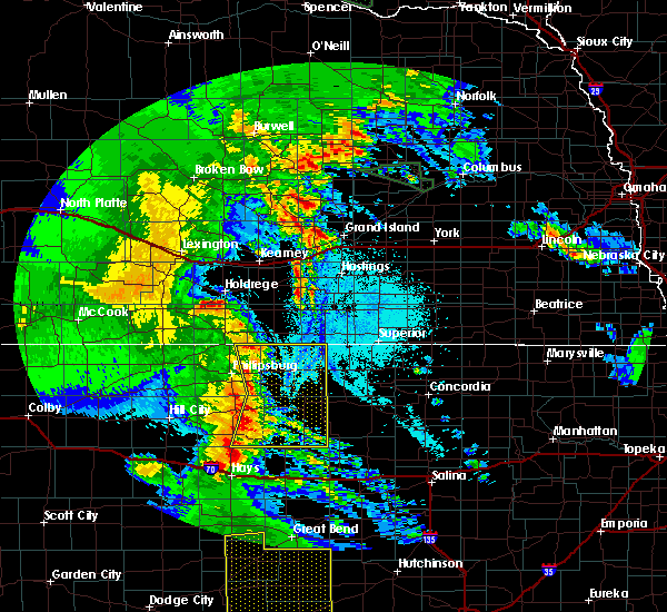 At 313 am cdt, severe thunderstorms were located along a line extending from 7 miles south of franklin to near gaylord to natoma, moving east at 40 mph (radar indicated). Hazards include 60 mph wind gusts and penny size hail. Expect damage to roofs, siding, and trees. Locations impacted include, smith center, osborne, downs, kensington, natoma, agra, lebanon, kirwin, woodston, gaylord, alton, portis, athol, harlan, cedar, codell and bellaire. At 313 am cdt, severe thunderstorms were located along a line extending from 7 miles south of franklin to near gaylord to natoma, moving east at 40 mph (radar indicated). Hazards include 60 mph wind gusts and penny size hail. Expect damage to roofs, siding, and trees. Locations impacted include, smith center, osborne, downs, kensington, natoma, agra, lebanon, kirwin, woodston, gaylord, alton, portis, athol, harlan, cedar, codell and bellaire.
|
| 6/7/2018 2:49 AM CDT |
 At 249 am cdt, severe thunderstorms were located along a line extending from 6 miles south of harlan county dam to near kirwin to near codell, moving east at 45 mph (radar indicated). Hazards include 60 mph wind gusts and nickel size hail. expect damage to roofs, siding, and trees At 249 am cdt, severe thunderstorms were located along a line extending from 6 miles south of harlan county dam to near kirwin to near codell, moving east at 45 mph (radar indicated). Hazards include 60 mph wind gusts and nickel size hail. expect damage to roofs, siding, and trees
|
| 5/29/2018 6:57 PM CDT |
 At 633 pm cdt, severe thunderstorms were located along a line extending from 7 miles west of osborne to near alton to 9 miles south of woodston to near plainville, moving northeast at 40 mph (radar indicated). Hazards include 60 mph wind gusts and half dollar size hail. Hail damage to vehicles is expected. expect wind damage to roofs, siding, and trees. Locations impacted include, plainville, osborne, stockton, natoma, palco, woodston, alton, portis, zurich and codell. At 633 pm cdt, severe thunderstorms were located along a line extending from 7 miles west of osborne to near alton to 9 miles south of woodston to near plainville, moving northeast at 40 mph (radar indicated). Hazards include 60 mph wind gusts and half dollar size hail. Hail damage to vehicles is expected. expect wind damage to roofs, siding, and trees. Locations impacted include, plainville, osborne, stockton, natoma, palco, woodston, alton, portis, zurich and codell.
|
| 5/29/2018 6:34 PM CDT |
 At 633 pm cdt, severe thunderstorms were located along a line extending from 7 miles west of osborne to near alton to 9 miles south of woodston to near plainville, moving northeast at 40 mph (radar indicated). Hazards include 60 mph wind gusts and half dollar size hail. Hail damage to vehicles is expected. expect wind damage to roofs, siding, and trees. Locations impacted include, plainville, osborne, stockton, natoma, palco, woodston, alton, portis, zurich and codell. At 633 pm cdt, severe thunderstorms were located along a line extending from 7 miles west of osborne to near alton to 9 miles south of woodston to near plainville, moving northeast at 40 mph (radar indicated). Hazards include 60 mph wind gusts and half dollar size hail. Hail damage to vehicles is expected. expect wind damage to roofs, siding, and trees. Locations impacted include, plainville, osborne, stockton, natoma, palco, woodston, alton, portis, zurich and codell.
|
| 5/29/2018 6:14 PM CDT |
 At 613 pm cdt, severe thunderstorms were located along a line extending from near alton to 6 miles north of codell to near plainville to 10 miles north of ellis, moving northeast at 25 mph (radar indicated). Hazards include 60 mph wind gusts and half dollar size hail. Hail damage to vehicles is expected. Expect wind damage to roofs, siding, and trees. At 613 pm cdt, severe thunderstorms were located along a line extending from near alton to 6 miles north of codell to near plainville to 10 miles north of ellis, moving northeast at 25 mph (radar indicated). Hazards include 60 mph wind gusts and half dollar size hail. Hail damage to vehicles is expected. Expect wind damage to roofs, siding, and trees.
|
| 5/23/2018 5:59 PM CDT |
 At 559 pm cdt, a severe thunderstorm was located 8 miles southeast of natoma, or 13 miles northeast of emmeram, moving northeast at 30 mph (radar indicated). Hazards include golf ball size hail and 70 mph wind gusts. People and animals outdoors will be injured. expect hail damage to roofs, siding, windows, and vehicles. expect considerable tree damage. wind damage is also likely to mobile homes, roofs, and outbuildings. This severe thunderstorm will remain over mainly rural areas of southern osborne county. At 559 pm cdt, a severe thunderstorm was located 8 miles southeast of natoma, or 13 miles northeast of emmeram, moving northeast at 30 mph (radar indicated). Hazards include golf ball size hail and 70 mph wind gusts. People and animals outdoors will be injured. expect hail damage to roofs, siding, windows, and vehicles. expect considerable tree damage. wind damage is also likely to mobile homes, roofs, and outbuildings. This severe thunderstorm will remain over mainly rural areas of southern osborne county.
|
| 5/13/2018 9:11 PM CDT |
 At 905 pm cdt, a severe thunderstorm was located 7 miles southwest of alton, or 29 miles north of emmeram, moving northeast at 35 mph (radar indicated). Hazards include quarter size hail. Damage to vehicles is expected. Locations impacted include, natoma. At 905 pm cdt, a severe thunderstorm was located 7 miles southwest of alton, or 29 miles north of emmeram, moving northeast at 35 mph (radar indicated). Hazards include quarter size hail. Damage to vehicles is expected. Locations impacted include, natoma.
|
| 5/13/2018 9:06 PM CDT |
 At 905 pm cdt, a severe thunderstorm was located 7 miles southwest of alton, or 29 miles north of emmeram, moving northeast at 35 mph (radar indicated). Hazards include quarter size hail. Damage to vehicles is expected. Locations impacted include, natoma. At 905 pm cdt, a severe thunderstorm was located 7 miles southwest of alton, or 29 miles north of emmeram, moving northeast at 35 mph (radar indicated). Hazards include quarter size hail. Damage to vehicles is expected. Locations impacted include, natoma.
|
| 5/13/2018 9:00 PM CDT | Quarter sized hail reported 4.3 miles S of Natoma, KS, a few hail stones fell the size of quarters. |
| 5/13/2018 8:57 PM CDT |
 At 857 pm cdt, a severe thunderstorm was located 8 miles north of natoma, or 24 miles north of emmeram, moving northeast at 40 mph (radar indicated). Hazards include quarter size hail. Damage to vehicles is expected. Locations impacted include, natoma, woodston, alton and codell. At 857 pm cdt, a severe thunderstorm was located 8 miles north of natoma, or 24 miles north of emmeram, moving northeast at 40 mph (radar indicated). Hazards include quarter size hail. Damage to vehicles is expected. Locations impacted include, natoma, woodston, alton and codell.
|
| 5/13/2018 8:46 PM CDT |
 At 846 pm cdt, a severe thunderstorm was located over codell, or 17 miles north of emmeram, moving northeast at 35 mph (radar indicated). Hazards include quarter size hail. Damage to vehicles is expected. Locations impacted include, plainville, natoma, woodston, alton and codell. At 846 pm cdt, a severe thunderstorm was located over codell, or 17 miles north of emmeram, moving northeast at 35 mph (radar indicated). Hazards include quarter size hail. Damage to vehicles is expected. Locations impacted include, plainville, natoma, woodston, alton and codell.
|
| 5/13/2018 8:35 PM CDT |
 At 834 pm cdt, a severe thunderstorm was located near codell, or 12 miles northwest of emmeram, moving northeast at 40 mph (radar indicated). Hazards include half dollar size hail. damage to vehicles is expected At 834 pm cdt, a severe thunderstorm was located near codell, or 12 miles northwest of emmeram, moving northeast at 40 mph (radar indicated). Hazards include half dollar size hail. damage to vehicles is expected
|
| 5/1/2018 4:47 PM CDT |
 At 446 pm cdt, a severe thunderstorm was located 8 miles north of luray, or 25 miles north of russell, moving northeast at 25 mph (radar indicated). Hazards include golf ball size hail and 60 mph wind gusts. People and animals outdoors will be injured. expect hail damage to roofs, siding, windows, and vehicles. expect wind damage to roofs, siding, and trees. locations impacted include, osborne, downs, natoma and portis. A tornado watch remains in effect until 1000 pm cdt for north central kansas. At 446 pm cdt, a severe thunderstorm was located 8 miles north of luray, or 25 miles north of russell, moving northeast at 25 mph (radar indicated). Hazards include golf ball size hail and 60 mph wind gusts. People and animals outdoors will be injured. expect hail damage to roofs, siding, windows, and vehicles. expect wind damage to roofs, siding, and trees. locations impacted include, osborne, downs, natoma and portis. A tornado watch remains in effect until 1000 pm cdt for north central kansas.
|
| 5/1/2018 4:19 PM CDT |
 At 419 pm cdt, a severe thunderstorm was located near luray, or 17 miles north of russell, moving northeast at 55 mph (radar indicated). Hazards include golf ball size hail and 60 mph wind gusts. People and animals outdoors will be injured. expect hail damage to roofs, siding, windows, and vehicles. Expect wind damage to roofs, siding, and trees. At 419 pm cdt, a severe thunderstorm was located near luray, or 17 miles north of russell, moving northeast at 55 mph (radar indicated). Hazards include golf ball size hail and 60 mph wind gusts. People and animals outdoors will be injured. expect hail damage to roofs, siding, windows, and vehicles. Expect wind damage to roofs, siding, and trees.
|
| 5/1/2018 3:51 PM CDT |
 At 350 pm cdt, a severe thunderstorm was located near codell, or 13 miles north of emmeram, moving northeast at 45 mph (radar indicated). Hazards include golf ball size hail and 60 mph wind gusts. People and animals outdoors will be injured. expect hail damage to roofs, siding, windows, and vehicles. Expect wind damage to roofs, siding, and trees. At 350 pm cdt, a severe thunderstorm was located near codell, or 13 miles north of emmeram, moving northeast at 45 mph (radar indicated). Hazards include golf ball size hail and 60 mph wind gusts. People and animals outdoors will be injured. expect hail damage to roofs, siding, windows, and vehicles. Expect wind damage to roofs, siding, and trees.
|
| 8/16/2017 4:16 AM CDT |
 At 415 am cdt, severe thunderstorms were located along a line extending from cowles to near esbon to near osborne to near natoma, moving east at 40 mph (mesonet observation recorded a 62 mph wind gust near lebanon kansas). Hazards include 60 mph wind gusts. Expect damage to roofs, siding, and trees. Locations impacted include, osborne, red cloud, blue hill, downs, cawker city, glen elder, natoma, bladen, guide rock, lebanon, tipton, burr oak, portis, esbon, ionia, cowles, harlan, rosemont, inavale and codell. At 415 am cdt, severe thunderstorms were located along a line extending from cowles to near esbon to near osborne to near natoma, moving east at 40 mph (mesonet observation recorded a 62 mph wind gust near lebanon kansas). Hazards include 60 mph wind gusts. Expect damage to roofs, siding, and trees. Locations impacted include, osborne, red cloud, blue hill, downs, cawker city, glen elder, natoma, bladen, guide rock, lebanon, tipton, burr oak, portis, esbon, ionia, cowles, harlan, rosemont, inavale and codell.
|
| 8/16/2017 3:38 AM CDT |
 At 337 am cdt, severe thunderstorms were located along a line extending from near upland to 11 miles south of franklin to near woodston to near zurich, moving east at 40 mph (radar indicated). Hazards include 60 to 65 mph wind gusts. expect damage to roofs, siding, and trees At 337 am cdt, severe thunderstorms were located along a line extending from near upland to 11 miles south of franklin to near woodston to near zurich, moving east at 40 mph (radar indicated). Hazards include 60 to 65 mph wind gusts. expect damage to roofs, siding, and trees
|
| 7/22/2017 5:22 PM CDT |
 At 521 pm cdt, a severe thunderstorm was located 7 miles north of natoma, or 24 miles north of emmeram, moving southeast at 10 mph (radar indicated). Hazards include 60 mph wind gusts and quarter size hail. Hail damage to vehicles is expected. expect wind damage to roofs, siding, and trees. Locations impacted include, natoma. At 521 pm cdt, a severe thunderstorm was located 7 miles north of natoma, or 24 miles north of emmeram, moving southeast at 10 mph (radar indicated). Hazards include 60 mph wind gusts and quarter size hail. Hail damage to vehicles is expected. expect wind damage to roofs, siding, and trees. Locations impacted include, natoma.
|
| 7/22/2017 5:11 PM CDT |
 At 511 pm cdt, a severe thunderstorm was located near natoma, or 21 miles north of emmeram, moving southeast at 15 mph (storm chaser reported quarter size hail with this storm at around 458 pm). Hazards include 60 mph wind gusts and quarter size hail. Hail damage to vehicles is expected. expect wind damage to roofs, siding, and trees. Locations impacted include, natoma and codell. At 511 pm cdt, a severe thunderstorm was located near natoma, or 21 miles north of emmeram, moving southeast at 15 mph (storm chaser reported quarter size hail with this storm at around 458 pm). Hazards include 60 mph wind gusts and quarter size hail. Hail damage to vehicles is expected. expect wind damage to roofs, siding, and trees. Locations impacted include, natoma and codell.
|
| 7/22/2017 4:55 PM CDT |
 At 455 pm cdt, a severe thunderstorm was located 8 miles north of codell, or 24 miles north of emmeram, moving southeast at 10 mph (radar indicated). Hazards include ping pong ball size hail and 60 mph wind gusts. People and animals outdoors will be injured. expect hail damage to roofs, siding, windows, and vehicles. Expect wind damage to roofs, siding, and trees. At 455 pm cdt, a severe thunderstorm was located 8 miles north of codell, or 24 miles north of emmeram, moving southeast at 10 mph (radar indicated). Hazards include ping pong ball size hail and 60 mph wind gusts. People and animals outdoors will be injured. expect hail damage to roofs, siding, windows, and vehicles. Expect wind damage to roofs, siding, and trees.
|
| 7/3/2017 12:49 AM CDT |
 At 1249 am cdt, severe thunderstorms were located along a line extending from near bellaire to near harlan to 6 miles southeast of alton to near natoma, moving east at 25 mph (radar indicated). Hazards include 60 mph wind gusts and nickel size hail. Expect damage to roofs, siding, and trees. Locations impacted include, plainville, smith center, osborne, downs, natoma, lebanon, gaylord, alton, portis, harlan, codell and bellaire. At 1249 am cdt, severe thunderstorms were located along a line extending from near bellaire to near harlan to 6 miles southeast of alton to near natoma, moving east at 25 mph (radar indicated). Hazards include 60 mph wind gusts and nickel size hail. Expect damage to roofs, siding, and trees. Locations impacted include, plainville, smith center, osborne, downs, natoma, lebanon, gaylord, alton, portis, harlan, codell and bellaire.
|
| 7/3/2017 12:14 AM CDT |
 At 1214 am cdt, severe thunderstorms were located along a line extending from 7 miles north of kensington to near cedar to woodston to near plainville, moving east at 25 mph (radar indicated). Hazards include 60 mph wind gusts and nickel size hail. expect damage to roofs, siding, and trees At 1214 am cdt, severe thunderstorms were located along a line extending from 7 miles north of kensington to near cedar to woodston to near plainville, moving east at 25 mph (radar indicated). Hazards include 60 mph wind gusts and nickel size hail. expect damage to roofs, siding, and trees
|
| 6/13/2017 6:22 PM CDT | Quarter sized hail reported 0.4 miles ESE of Natoma, KS, quarter size hail in natoma. |
| 6/13/2017 6:20 PM CDT |
 At 606 pm cdt, a severe thunderstorm was located near emmeram, moving north at 55 mph (radar indicated). Hazards include ping pong ball size hail and 60 mph wind gusts. People and animals outdoors will be injured. expect hail damage to roofs, siding, windows, and vehicles. Expect wind damage to roofs, siding, and trees. At 606 pm cdt, a severe thunderstorm was located near emmeram, moving north at 55 mph (radar indicated). Hazards include ping pong ball size hail and 60 mph wind gusts. People and animals outdoors will be injured. expect hail damage to roofs, siding, windows, and vehicles. Expect wind damage to roofs, siding, and trees.
|
| 6/13/2017 6:07 PM CDT |
 At 606 pm cdt, a severe thunderstorm was located near emmeram, moving north at 55 mph (radar indicated). Hazards include ping pong ball size hail and 60 mph wind gusts. People and animals outdoors will be injured. expect hail damage to roofs, siding, windows, and vehicles. Expect wind damage to roofs, siding, and trees. At 606 pm cdt, a severe thunderstorm was located near emmeram, moving north at 55 mph (radar indicated). Hazards include ping pong ball size hail and 60 mph wind gusts. People and animals outdoors will be injured. expect hail damage to roofs, siding, windows, and vehicles. Expect wind damage to roofs, siding, and trees.
|
| 5/27/2017 3:01 AM CDT |
 At 300 am cdt, severe thunderstorms were located along a line extending from near kensington to near alton to 12 miles northeast of codell to near natoma, moving east at 40 mph (radar indicated). Hazards include 60 mph wind gusts and quarter size hail. Hail damage to vehicles is expected. expect wind damage to roofs, siding, and trees. Locations impacted include, kensington, natoma, agra, kirwin, woodston, alton, cedar and codell. At 300 am cdt, severe thunderstorms were located along a line extending from near kensington to near alton to 12 miles northeast of codell to near natoma, moving east at 40 mph (radar indicated). Hazards include 60 mph wind gusts and quarter size hail. Hail damage to vehicles is expected. expect wind damage to roofs, siding, and trees. Locations impacted include, kensington, natoma, agra, kirwin, woodston, alton, cedar and codell.
|
| 5/27/2017 2:30 AM CDT |
 At 230 am cdt, severe thunderstorms were located along a line extending from near speed to near webster state park to near zurich to 9 miles north of yocemento, moving east at 35 mph (radar indicated). Hazards include 60 mph wind gusts and quarter size hail. Hail damage to vehicles is expected. Expect wind damage to roofs, siding, and trees. At 230 am cdt, severe thunderstorms were located along a line extending from near speed to near webster state park to near zurich to 9 miles north of yocemento, moving east at 35 mph (radar indicated). Hazards include 60 mph wind gusts and quarter size hail. Hail damage to vehicles is expected. Expect wind damage to roofs, siding, and trees.
|
| 5/16/2017 5:23 PM CDT |
 The severe thunderstorm warning for eastern rooks and western osborne counties will expire at 530 pm cdt, the storm which prompted the warning has weakened below severe limits, and no longer poses an immediate threat to life or property. therefore, the warning will be allowed to expire. however small hail is still possible with this thunderstorm. a severe thunderstorm watch remains in effect until midnight cdt for north central kansas. The severe thunderstorm warning for eastern rooks and western osborne counties will expire at 530 pm cdt, the storm which prompted the warning has weakened below severe limits, and no longer poses an immediate threat to life or property. therefore, the warning will be allowed to expire. however small hail is still possible with this thunderstorm. a severe thunderstorm watch remains in effect until midnight cdt for north central kansas.
|
| 5/16/2017 4:43 PM CDT |
 At 443 pm cdt, a severe thunderstorm was located near codell, or 11 miles north of emmeram, moving north at 20 mph (radar indicated). Hazards include golf ball size hail and 60 mph wind gusts. People and animals outdoors will be injured. expect hail damage to roofs, siding, windows, and vehicles. Expect wind damage to roofs, siding, and trees. At 443 pm cdt, a severe thunderstorm was located near codell, or 11 miles north of emmeram, moving north at 20 mph (radar indicated). Hazards include golf ball size hail and 60 mph wind gusts. People and animals outdoors will be injured. expect hail damage to roofs, siding, windows, and vehicles. Expect wind damage to roofs, siding, and trees.
|
| 8/11/2016 5:07 PM CDT |
 At 507 pm cdt, a severe thunderstorm was located 12 miles southwest of osborne, or 27 miles north of russell, moving northeast at 25 mph (radar indicated). Hazards include golf ball size hail and 60 mph wind gusts. People and animals outdoors will be injured. expect hail damage to roofs, siding, windows, and vehicles. expect wind damage to roofs, siding, and trees. Locations impacted include, osborne, downs, natoma, tipton and portis. At 507 pm cdt, a severe thunderstorm was located 12 miles southwest of osborne, or 27 miles north of russell, moving northeast at 25 mph (radar indicated). Hazards include golf ball size hail and 60 mph wind gusts. People and animals outdoors will be injured. expect hail damage to roofs, siding, windows, and vehicles. expect wind damage to roofs, siding, and trees. Locations impacted include, osborne, downs, natoma, tipton and portis.
|
| 8/11/2016 5:04 PM CDT |
 At 504 pm cdt, a severe thunderstorm was located 12 miles northeast of natoma, or 26 miles north of russell, moving northeast at 25 mph (radar indicated). Hazards include 60 mph wind gusts and quarter size hail. Hail damage to vehicles is expected. Expect wind damage to roofs, siding, and trees. At 504 pm cdt, a severe thunderstorm was located 12 miles northeast of natoma, or 26 miles north of russell, moving northeast at 25 mph (radar indicated). Hazards include 60 mph wind gusts and quarter size hail. Hail damage to vehicles is expected. Expect wind damage to roofs, siding, and trees.
|
| 7/13/2016 6:47 AM CDT |
 At 645 am cdt, a severe thunderstorm was located over downs, or 23 miles west of beloit, moving east at 30 mph (radar indicated). Hazards include 60 mph wind gusts. Expect damage to roofs. siding. and trees. strong winds may linger even after the heavier precipitation has passed the area. Locations impacted include, osborne, downs, cawker city, glen elder, tipton, asherville, simpson, hunter, scottsville and victor. At 645 am cdt, a severe thunderstorm was located over downs, or 23 miles west of beloit, moving east at 30 mph (radar indicated). Hazards include 60 mph wind gusts. Expect damage to roofs. siding. and trees. strong winds may linger even after the heavier precipitation has passed the area. Locations impacted include, osborne, downs, cawker city, glen elder, tipton, asherville, simpson, hunter, scottsville and victor.
|
| 7/13/2016 6:27 AM CDT |
 At 627 am cdt, a severe thunderstorm was located over osborne, or 29 miles west of beloit, moving east at 45 mph (radar indicated). Hazards include 60 mph wind gusts. Expect damage to roofs. siding. And trees. At 627 am cdt, a severe thunderstorm was located over osborne, or 29 miles west of beloit, moving east at 45 mph (radar indicated). Hazards include 60 mph wind gusts. Expect damage to roofs. siding. And trees.
|
| 6/3/2016 6:55 PM CDT |
 At 655 pm cdt, a severe thunderstorm was located 7 miles northeast of natoma, or 39 miles southeast of phillipsburg, moving southeast at 15 mph (radar indicated). Hazards include 60 mph wind gusts and quarter size hail. Hail damage to vehicles is expected. expect wind damage to roofs, siding, and trees. Locations impacted include, natoma. At 655 pm cdt, a severe thunderstorm was located 7 miles northeast of natoma, or 39 miles southeast of phillipsburg, moving southeast at 15 mph (radar indicated). Hazards include 60 mph wind gusts and quarter size hail. Hail damage to vehicles is expected. expect wind damage to roofs, siding, and trees. Locations impacted include, natoma.
|
| 6/3/2016 6:47 PM CDT |
 At 646 pm cdt, severe thunderstorms were located along a line extending from 6 miles southwest of osborne to 11 miles southeast of alton to 9 miles north of natoma, moving southeast at 15 mph (radar indicated). Hazards include 60 mph wind gusts and quarter size hail. Hail damage to vehicles is expected. Expect wind damage to roofs, siding, and trees. At 646 pm cdt, severe thunderstorms were located along a line extending from 6 miles southwest of osborne to 11 miles southeast of alton to 9 miles north of natoma, moving southeast at 15 mph (radar indicated). Hazards include 60 mph wind gusts and quarter size hail. Hail damage to vehicles is expected. Expect wind damage to roofs, siding, and trees.
|
| 5/9/2016 1:04 AM CDT | At 103 am cdt, a severe thunderstorm was located near tipton and hunter, or 17 miles southwest of beloit, moving northeast at 30 mph (radar indicated. at 101 am cdt...golf ball size hail was reported in hunter). Hazards include two inch hail and 60 mph wind gusts. People and animals outdoors will be injured. expect hail damage to roofs, siding, windows, and vehicles. expect wind damage to roofs, siding, and trees. Locations impacted include, beloit, natoma, tipton, hunter and victor. |
| 5/9/2016 12:57 AM CDT | At 1256 am cdt, a severe thunderstorm was located near tipton, or 20 miles southwest of beloit, moving northeast at 30 mph (radar indicated). Hazards include golf ball size hail and 60 mph wind gusts. People and animals outdoors will be injured. expect hail damage to roofs, siding, windows, and vehicles. expect wind damage to roofs, siding, and trees. Locations impacted include, beloit, natoma, tipton, hunter and victor. |
| 5/9/2016 12:42 AM CDT | At 1242 am cdt, a severe thunderstorm was located 10 miles west of hunter, or 31 miles southwest of beloit, moving northeast at 30 mph (radar indicated). Hazards include golf ball size hail and 60 mph wind gusts. People and animals outdoors will be injured. expect hail damage to roofs, siding, windows, and vehicles. Expect wind damage to roofs, siding, and trees. |
| 5/9/2016 12:24 AM CDT | At 1224 am cdt, a severe thunderstorm was located 16 miles southwest of tipton, or 37 miles southwest of beloit, moving northeast at 35 mph (radar indicated). Hazards include golf ball size hail and 60 mph wind gusts. People and animals outdoors will be injured. expect hail damage to roofs, siding, windows, and vehicles. expect wind damage to roofs, siding, and trees. Locations impacted include, plainville, osborne, downs, natoma and codell. |
| 5/9/2016 12:10 AM CDT | At 1209 am cdt, a severe thunderstorm was located 8 miles southeast of natoma, or 46 miles southwest of beloit, moving northeast at 30 mph (radar indicated). Hazards include golf ball size hail and 60 mph wind gusts. People and animals outdoors will be injured. expect hail damage to roofs, siding, windows, and vehicles. Expect wind damage to roofs, siding, and trees. |
| 5/8/2016 10:17 PM CDT |
 At 1017 pm cdt, a severe thunderstorm was located 8 miles south of natoma, or 49 miles south of phillipsburg, moving north at 35 mph (radar indicated). Hazards include 60 mph wind gusts and quarter size hail. Hail damage to vehicles is expected. Expect wind damage to roofs, siding, and trees. At 1017 pm cdt, a severe thunderstorm was located 8 miles south of natoma, or 49 miles south of phillipsburg, moving north at 35 mph (radar indicated). Hazards include 60 mph wind gusts and quarter size hail. Hail damage to vehicles is expected. Expect wind damage to roofs, siding, and trees.
|
| 5/8/2016 8:17 PM CDT |
 A severe thunderstorm warning remains in effect until 830 pm cdt for osborne, southeastern rooks and smith counties, a toranado warning is still in effect for central osborne county. at 815 pm cdt, severe thunderstorms were located along a line extending from 9 miles southwest of riverton to 13 miles east of natoma, moving southeast at 35 mph (radar indicated). Hazards include golf ball size hail and 70 mph wind gusts. People and animals outdoors will be injured. expect hail damage to roofs, siding, windows, and vehicles. expect considerable tree damage. wind damage is also likely to mobile homes, roofs, and outbuildings. locations impacted include, smith center, osborne, downs, natoma, lebanon, gaylord, alton, portis, codell, athol, harlan, cedar and bellaire. A tornado watch remains in effect until 1000 pm cdt for north central kansas. A severe thunderstorm warning remains in effect until 830 pm cdt for osborne, southeastern rooks and smith counties, a toranado warning is still in effect for central osborne county. at 815 pm cdt, severe thunderstorms were located along a line extending from 9 miles southwest of riverton to 13 miles east of natoma, moving southeast at 35 mph (radar indicated). Hazards include golf ball size hail and 70 mph wind gusts. People and animals outdoors will be injured. expect hail damage to roofs, siding, windows, and vehicles. expect considerable tree damage. wind damage is also likely to mobile homes, roofs, and outbuildings. locations impacted include, smith center, osborne, downs, natoma, lebanon, gaylord, alton, portis, codell, athol, harlan, cedar and bellaire. A tornado watch remains in effect until 1000 pm cdt for north central kansas.
|
| 5/8/2016 7:57 PM CDT |
 At 757 pm cdt, a severe thunderstorm capable of producing a tornado was located near natoma, or 39 miles southeast of phillipsburg, moving northeast at 30 mph (radar indicated rotation). Hazards include tornado and golf ball size hail. Flying debris will be dangerous to those caught without shelter. mobile homes will be damaged or destroyed. damage to roofs, windows, and vehicles will occur. tree damage is likely. Locations impacted include, osborne, natoma and alton. At 757 pm cdt, a severe thunderstorm capable of producing a tornado was located near natoma, or 39 miles southeast of phillipsburg, moving northeast at 30 mph (radar indicated rotation). Hazards include tornado and golf ball size hail. Flying debris will be dangerous to those caught without shelter. mobile homes will be damaged or destroyed. damage to roofs, windows, and vehicles will occur. tree damage is likely. Locations impacted include, osborne, natoma and alton.
|
| 5/8/2016 7:50 PM CDT | Golf Ball sized hail reported 0.3 miles SW of Natoma, KS, largest hail ranged from nickel to golf ball size. |
| 5/8/2016 7:45 PM CDT |
 At 745 pm cdt, a severe thunderstorm capable of producing a tornado was located over natoma, or 39 miles south of phillipsburg, moving north at 20 mph (radar indicated rotation). Hazards include tornado and golf ball size hail. Flying debris will be dangerous to those caught without shelter. mobile homes will be damaged or destroyed. damage to roofs, windows, and vehicles will occur. tree damage is likely. This tornadic thunderstorm will remain over mainly rural areas of western osborne and southeastern rooks counties. At 745 pm cdt, a severe thunderstorm capable of producing a tornado was located over natoma, or 39 miles south of phillipsburg, moving north at 20 mph (radar indicated rotation). Hazards include tornado and golf ball size hail. Flying debris will be dangerous to those caught without shelter. mobile homes will be damaged or destroyed. damage to roofs, windows, and vehicles will occur. tree damage is likely. This tornadic thunderstorm will remain over mainly rural areas of western osborne and southeastern rooks counties.
|
| 5/8/2016 7:43 PM CDT |
 At 743 pm cdt, severe thunderstorms were located along a line extending from near kirwin to 9 miles east of natoma, moving northeast at 35 mph (radar indicated). Hazards include golf ball size hail and 70 mph wind gusts. People and animals outdoors will be injured. expect hail damage to roofs, siding, windows, and vehicles. expect considerable tree damage. Wind damage is also likely to mobile homes, roofs, and outbuildings. At 743 pm cdt, severe thunderstorms were located along a line extending from near kirwin to 9 miles east of natoma, moving northeast at 35 mph (radar indicated). Hazards include golf ball size hail and 70 mph wind gusts. People and animals outdoors will be injured. expect hail damage to roofs, siding, windows, and vehicles. expect considerable tree damage. Wind damage is also likely to mobile homes, roofs, and outbuildings.
|
| 5/8/2016 7:33 PM CDT |
 At 731 pm cdt, a confirmed tornado was located over codell, or 39 miles south of phillipsburg, moving north at 30 mph (radar and spotter confirmed tornado). Hazards include damaging tornado and golf ball size hail. Flying debris will be dangerous to those caught without shelter. mobile homes will be damaged or destroyed. damage to roofs, windows, and vehicles will occur. tree damage is likely. This tornado will be near, codell around 733 pm cdt. At 731 pm cdt, a confirmed tornado was located over codell, or 39 miles south of phillipsburg, moving north at 30 mph (radar and spotter confirmed tornado). Hazards include damaging tornado and golf ball size hail. Flying debris will be dangerous to those caught without shelter. mobile homes will be damaged or destroyed. damage to roofs, windows, and vehicles will occur. tree damage is likely. This tornado will be near, codell around 733 pm cdt.
|
| 5/8/2016 7:30 PM CDT |
 At 731 pm cdt, a confirmed tornado was located over codell, or 39 miles south of phillipsburg, moving north at 30 mph (radar and spotter confirmed tornado). Hazards include damaging tornado and golf ball size hail. Flying debris will be dangerous to those caught without shelter. mobile homes will be damaged or destroyed. damage to roofs, windows, and vehicles will occur. tree damage is likely. This tornado will be near, codell around 733 pm cdt. At 731 pm cdt, a confirmed tornado was located over codell, or 39 miles south of phillipsburg, moving north at 30 mph (radar and spotter confirmed tornado). Hazards include damaging tornado and golf ball size hail. Flying debris will be dangerous to those caught without shelter. mobile homes will be damaged or destroyed. damage to roofs, windows, and vehicles will occur. tree damage is likely. This tornado will be near, codell around 733 pm cdt.
|
| 5/8/2016 7:26 PM CDT |
 At 725 pm cdt, a confirmed tornado was located over codell, or 42 miles south of phillipsburg, moving north at 25 mph (weather spotters confirmed tornado). Hazards include damaging tornado and golf ball size hail. Flying debris will be dangerous to those caught without shelter. mobile homes will be damaged or destroyed. damage to roofs, windows, and vehicles will occur. tree damage is likely. this tornado will be near, codell around 730 pm cdt. Natoma around 735 pm cdt. At 725 pm cdt, a confirmed tornado was located over codell, or 42 miles south of phillipsburg, moving north at 25 mph (weather spotters confirmed tornado). Hazards include damaging tornado and golf ball size hail. Flying debris will be dangerous to those caught without shelter. mobile homes will be damaged or destroyed. damage to roofs, windows, and vehicles will occur. tree damage is likely. this tornado will be near, codell around 730 pm cdt. Natoma around 735 pm cdt.
|
| 5/8/2016 7:15 PM CDT |
 At 715 pm cdt, a severe thunderstorm capable of producing a tornado was located near codell, or 45 miles south of phillipsburg, moving northeast at 30 mph (radar indicated rotation). Hazards include tornado and half dollar size hail. Flying debris will be dangerous to those caught without shelter. mobile homes will be damaged or destroyed. damage to roofs, windows, and vehicles will occur. tree damage is likely. this dangerous storm will be near, codell around 725 pm cdt. Natoma around 735 pm cdt. At 715 pm cdt, a severe thunderstorm capable of producing a tornado was located near codell, or 45 miles south of phillipsburg, moving northeast at 30 mph (radar indicated rotation). Hazards include tornado and half dollar size hail. Flying debris will be dangerous to those caught without shelter. mobile homes will be damaged or destroyed. damage to roofs, windows, and vehicles will occur. tree damage is likely. this dangerous storm will be near, codell around 725 pm cdt. Natoma around 735 pm cdt.
|
| 9/10/2015 5:58 PM CDT |
 At 556 pm cdt, a severe thunderstorm was located 9 miles north of natoma, or 34 miles southeast of phillipsburg, moving southeast at 30 mph. this is a very dangerous storm (radar indicated). Hazards include baseball size hail and 60 mph wind gusts. People and animals outdoors will be severely injured. expect shattered windows, extensive damage to roofs, siding and vehicles. in addition, another severe thunderstorm was between plainville and webster state park. This storm was also moving southeast at 30 mph and hail up to the size of golf balls is possible with this storm. At 556 pm cdt, a severe thunderstorm was located 9 miles north of natoma, or 34 miles southeast of phillipsburg, moving southeast at 30 mph. this is a very dangerous storm (radar indicated). Hazards include baseball size hail and 60 mph wind gusts. People and animals outdoors will be severely injured. expect shattered windows, extensive damage to roofs, siding and vehicles. in addition, another severe thunderstorm was between plainville and webster state park. This storm was also moving southeast at 30 mph and hail up to the size of golf balls is possible with this storm.
|
| 9/10/2015 5:31 PM CDT |
 At 531 pm cdt, a severe thunderstorm was located over woodston, or 23 miles southeast of phillipsburg, moving southeast at 35 mph (radar indicated). Hazards include tennis ball size hail and 60 mph wind gusts. People and animals outdoors will be injured. expect hail damage to roofs, siding, windows and vehicles. expect wind damage to roofs, siding and trees. This severe thunderstorm will remain over mainly rural areas of osborne and southern rooks counties. At 531 pm cdt, a severe thunderstorm was located over woodston, or 23 miles southeast of phillipsburg, moving southeast at 35 mph (radar indicated). Hazards include tennis ball size hail and 60 mph wind gusts. People and animals outdoors will be injured. expect hail damage to roofs, siding, windows and vehicles. expect wind damage to roofs, siding and trees. This severe thunderstorm will remain over mainly rural areas of osborne and southern rooks counties.
|
| 8/8/2015 9:47 PM CDT |
 At 946 pm cdt, a severe thunderstorm was located 8 miles northeast of natoma, or 24 miles northeast of emmeram, moving east at 30 mph (radar indicated). Hazards include 60 mph wind gusts and quarter size hail. Hail damage to vehicles is expected. expect wind damage to roofs, siding and trees. Locations impacted include, natoma. At 946 pm cdt, a severe thunderstorm was located 8 miles northeast of natoma, or 24 miles northeast of emmeram, moving east at 30 mph (radar indicated). Hazards include 60 mph wind gusts and quarter size hail. Hail damage to vehicles is expected. expect wind damage to roofs, siding and trees. Locations impacted include, natoma.
|
| 8/8/2015 9:33 PM CDT |
 At 932 pm cdt, a severe thunderstorm was located near natoma, or 19 miles north of emmeram, moving east at 30 mph (radar indicated). Hazards include 60 mph wind gusts and quarter size hail. Hail damage to vehicles is expected. Expect wind damage to roofs, siding and trees. At 932 pm cdt, a severe thunderstorm was located near natoma, or 19 miles north of emmeram, moving east at 30 mph (radar indicated). Hazards include 60 mph wind gusts and quarter size hail. Hail damage to vehicles is expected. Expect wind damage to roofs, siding and trees.
|
| 6/3/2015 9:24 PM CDT | The severe thunderstorm warning for southern osborne county will expire at 930 pm cdt, the storm which prompted the warning has weakened below severe limits, and no longer poses an immediate threat to life or property. therefore the warning will be allowed to expire. however gusty winds are still possible with this thunderstorm. a tornado watch remains in effect until 200 am cdt for north central kansas. |
| 6/3/2015 9:09 PM CDT | At 907 pm cdt, a severe thunderstorm was located near natoma, or 18 miles northeast of emmeram, moving east at 10 mph (radar indicated). Hazards include 60 mph wind gusts. Expect damage to roofs. siding and trees. locations impacted include, natoma. this storm has shown signs of weakening and if this trend continues will allow the warning to expire. A tornado watch remains in effect until 200 am cdt for north central kansas. |
| 6/3/2015 8:50 PM CDT | At 850 pm cdt, a severe thunderstorm was located over natoma, or 16 miles northeast of emmeram, moving east at 10 mph (radar indicated). Hazards include 60 mph wind gusts and quarter size hail. Hail damage to vehicles is expected. Expect wind damage to roofs, siding and trees. |
| 6/3/2015 8:49 PM CDT | Quarter sized hail reported 0.3 miles SW of Natoma, KS, hail as large as quarters began at 842 pm. mostly dime sized. |
| 6/3/2015 8:36 PM CDT | The tornado warning for southeastern rooks and southwestern osborne counties will expire at 845 pm cdt, the storm which prompted the warning has weakened below severe limits, and no longer appears capable of producing a tornado. therefore the warning will be allowed to expire. however small. |
| 6/3/2015 8:28 PM CDT | At 826 pm cdt, a severe thunderstorm capable of producing a tornado was located over natoma, or 16 miles north of emmeram, moving east at 10 mph (radar indicated rotation). Hazards include tornado and quarter size hail. Flying debris will be dangerous to those caught without shelter. mobile homes will be damaged or destroyed. damage to roofs, windows and vehicles will occur. tree damage is likely. this tornadic thunderstorm will remain over mainly rural areas of southeastern rooks and southwestern osborne counties. This storm has shown signs of weakening over the last few minutes and the tornado warning may be allowed to expire if this weakening trend continues. |
| 6/3/2015 8:17 PM CDT | At 816 pm cdt, a severe thunderstorm was located near luray, or 21 miles northeast of russell, moving east at 10 mph. a tornado warning is in effect for southeastern rooks and southwestern osborne counties until 845 pm cdt. a severe thunderstorm warning is also in effect for northeastern osborne county until 845 pm cdt (radar indicated). Hazards include 60 mph wind gusts and quarter size hail. Hail damage to vehicles is expected. expect wind damage to roofs, siding and trees. locations impacted include, natoma. A tornado watch remains in effect until 200 am cdt for north central kansas. |
| 6/3/2015 8:11 PM CDT | At 811 pm cdt, a severe thunderstorm capable of producing a tornado was located near natoma, or 15 miles north of emmeram, moving east at 10 mph (radar indicated rotation). Hazards include tornado and ping pong ball size hail. Flying debris will be dangerous to those caught without shelter. mobile homes will be damaged or destroyed. damage to roofs, windows and vehicles will occur. tree damage is likely. This dangerous storm will be near, natoma around 830 pm cdt. |
| 6/3/2015 8:06 PM CDT | At 804 pm cdt, a severe thunderstorm was located 9 miles north of luray, or 25 miles north of russell, moving north at 20 mph. another severe thunderstorm currently over eastern rooks county will be making its way into the natoma area of southwestern osborne county over the next 25 minutes (radar indicated). Hazards include 60 mph wind gusts and quarter size hail. Hail damage to vehicles is expected. expect wind damage to roofs, siding and trees. locations impacted include, natoma. A tornado watch remains in effect until 200 am cdt for north central kansas. |
| 6/3/2015 8:02 PM CDT | Quarter sized hail reported 4.1 miles E of Natoma, KS |
| 6/3/2015 7:56 PM CDT | At 756 pm cdt, a severe thunderstorm was located 7 miles north of luray, or 23 miles north of russell, moving north at 20 mph (radar indicated). Hazards include 60 mph wind gusts and quarter size hail. Hail damage to vehicles is expected. Expect wind damage to roofs, siding and trees. |
| 5/6/2015 4:10 PM CDT | Ping Pong Ball sized hail reported 4.2 miles SE of Natoma, KS, hail from approximately 410-412 pm. |
| 5/6/2015 4:04 PM CDT | At 404 pm cdt, a severe thunderstorm was located near natoma, or 19 miles north of emmeram, moving northeast at 35 mph (radar indicated). Hazards include quarter size hail. Damage to vehicles is expected. locations impacted include, natoma, alton and codell. a tornado watch remains in effect until 900 pm cdt for north central kansas. 1. 00in. |
| 5/6/2015 3:52 PM CDT | At 352 pm cdt, a severe thunderstorm was located over codell, or 15 miles north of emmeram, moving northeast at 45 mph (radar indicated). Hazards include quarter size hail. damage to vehicles is expected |
| 4/24/2015 5:29 PM CDT | At 528 pm cdt, a severe thunderstorm was located near natoma, or 16 miles northeast of emmeram, moving east at 10 mph (radar indicated). Hazards include golf ball size hail and 60 mph wind gusts. People and animals outdoors will be injured. expect hail damage to roofs, siding, windows and vehicles. Expect wind damage to roofs, siding and trees. |
| 4/24/2015 5:19 PM CDT | At 519 pm cdt, a severe thunderstorm was located near natoma, or 12 miles north of emmeram, moving northeast at 20 mph (radar indicated). Hazards include two inch hail and 60 mph wind gusts. People and animals outdoors will be injured. expect hail damage to roofs, siding, windows and vehicles. expect wind damage to roofs, siding and trees. locations impacted include, natoma. a tornado watch remains in effect until 1100 pm cdt for north central kansas. 2. 00in. |
| 4/24/2015 5:13 PM CDT | Baseball sized hail reported 8.7 miles NNE of Natoma, KS |
| 4/24/2015 5:08 PM CDT | At 507 pm cdt, a severe thunderstorm was located near codell, or 10 miles north of emmeram, moving northeast at 20 mph (radar indicated). Hazards include two inch hail and 60 mph wind gusts. People and animals outdoors will be injured. expect hail damage to roofs, siding, windows and vehicles. expect wind damage to roofs, siding and trees. locations impacted include, natoma and codell. a tornado watch remains in effect until 1100 pm cdt for north central kansas. 2. 00in. |
| 4/24/2015 4:55 PM CDT | At 455 pm cdt, a severe thunderstorm was located near codell, or 10 miles north of emmeram, moving northeast at 20 mph (radar indicated). Hazards include two inch hail and 60 mph wind gusts. People and animals outdoors will be injured. expect hail damage to roofs, siding, windows and vehicles. Expect wind damage to roofs, siding and trees. |
| 8/18/2014 11:12 PM CDT | Winds estimated at 60-70 mph. numerous tree branches down. heavy rain and no hai in rooks county KS, 4.2 miles SE of Natoma, KS |
| 5/11/2014 5:19 PM CDT | Half Dollar sized hail reported 0.3 miles SW of Natoma, KS, report/picture via facebook. |
| 5/11/2014 4:30 PM CDT | Golf Ball sized hail reported 0.3 miles SW of Natoma, KS |
| 5/11/2014 4:27 PM CDT | Quarter sized hail reported 0.3 miles SW of Natoma, KS |
| 5/11/2014 4:11 PM CDT | Golf Ball sized hail reported 0.3 miles SW of Natoma, KS |
| 6/30/2012 7:58 PM CDT | Weather bug equiptment at natoma elementary measured 60 mph wind gust at 710 pm cd in osborne county KS, 0.3 miles SW of Natoma, KS |
| 6/30/2012 7:10 PM CDT | Weather bug equiptment at natoma elementary measured 60 mph wind gust at 710 pm cd in osborne county KS, 0.3 miles SW of Natoma, KS |
| 1/1/0001 12:00 AM | Golf Ball sized hail reported 8 miles NE of Natoma, KS |
| 1/1/0001 12:00 AM | Golf Ball sized hail reported 8.3 miles NE of Natoma, KS, the north facing windows of the house were knocked out. |
| 1/1/0001 12:00 AM | 50 to 60 mph winds. small tree limbs dow in osborne county KS, 0.3 miles SW of Natoma, KS |
| 1/1/0001 12:00 AM | Ping Pong Ball sized hail reported 0.9 miles SSW of Natoma, KS |
| 1/1/0001 12:00 AM | Quarter sized hail reported 0.3 miles SW of Natoma, KS |
| 1/1/0001 12:00 AM | Hen Egg sized hail reported 0.3 miles SW of Natoma, KS |
| 1/1/0001 12:00 AM | Quarter sized hail reported 6.4 miles S of Natoma, KS, nickel to quarter |
| 1/1/0001 12:00 AM | Possible brief tornado. damage to a lean-to outbuilding and power in osborne county KS, 0.3 miles SW of Natoma, KS |
Hail Maps for Natoma, KS


Connect with Interactive Hail Maps