

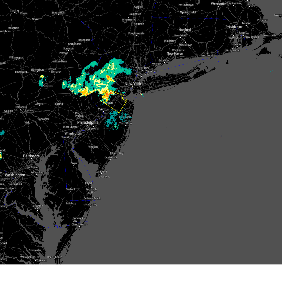
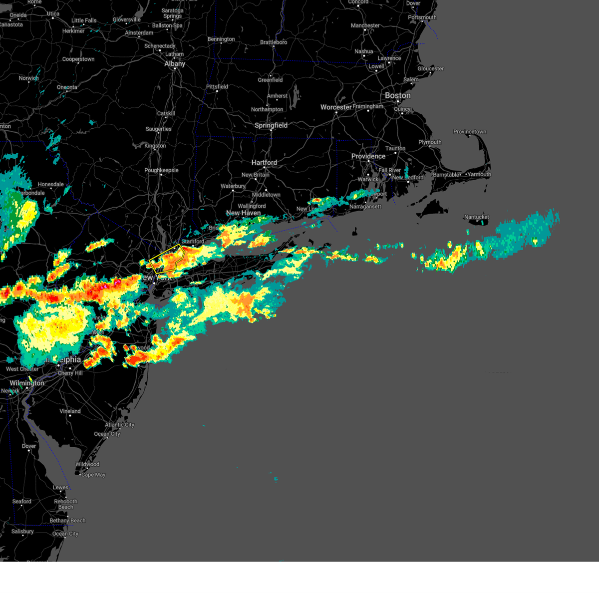
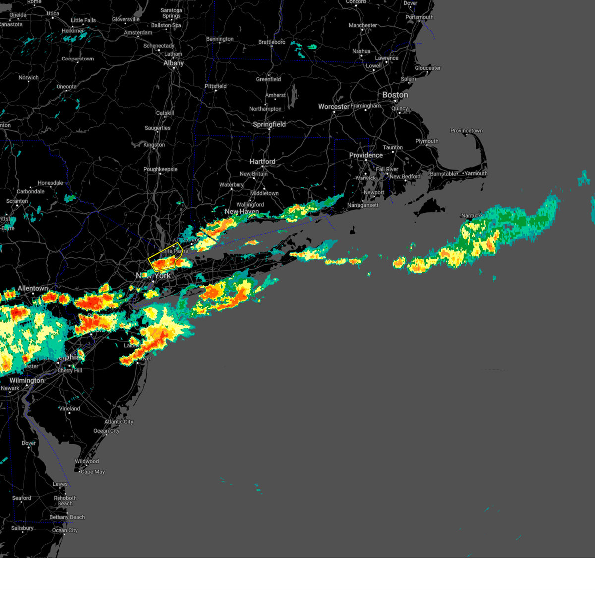
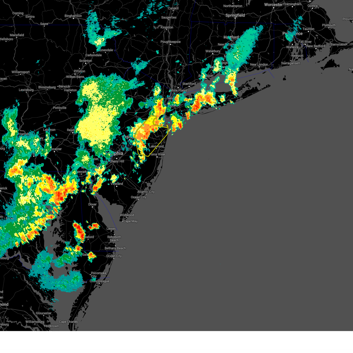
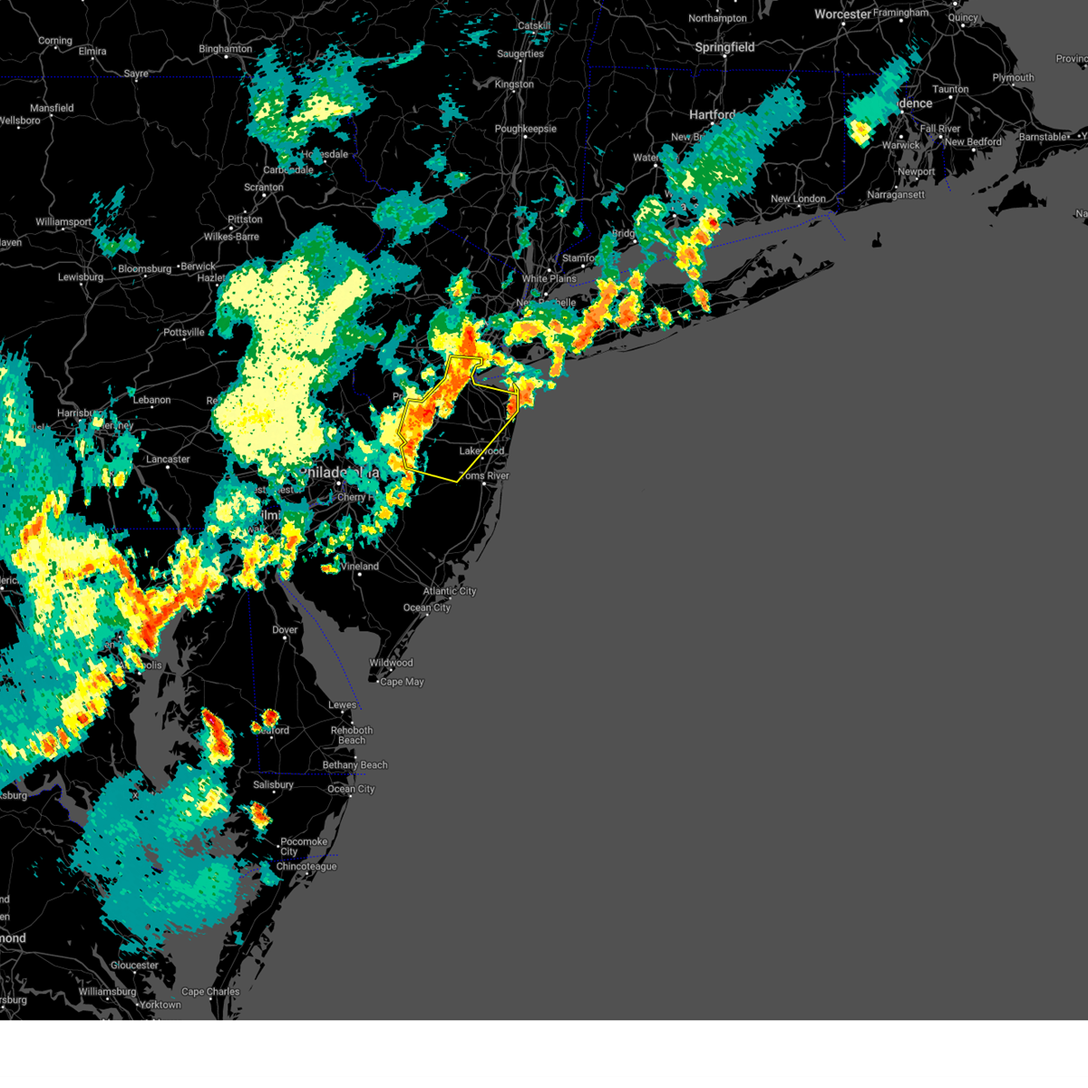
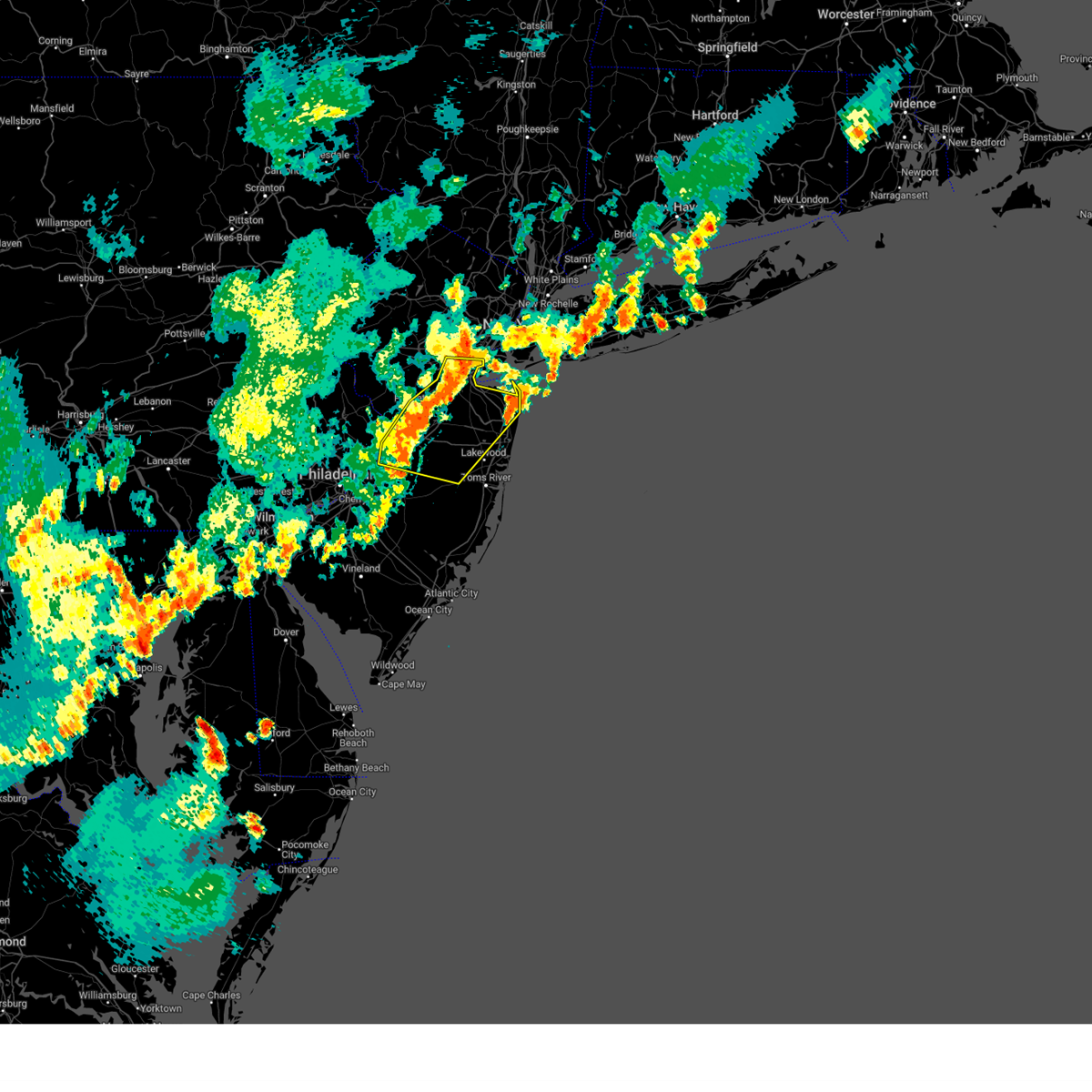
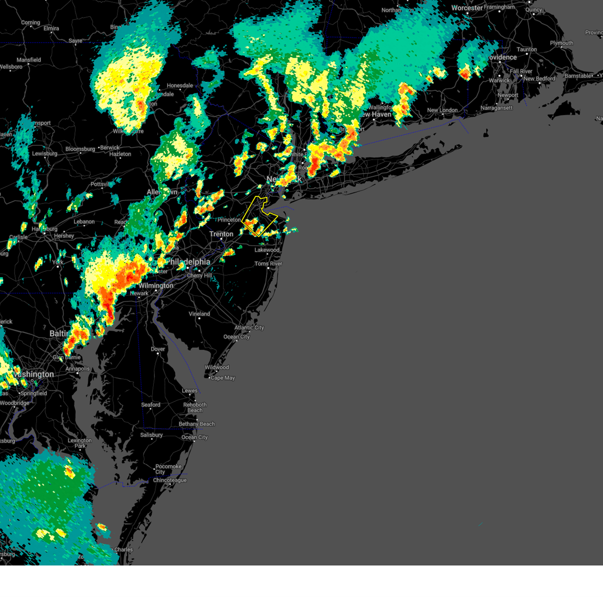
Hail Map for New York, NY
The New York, NY area has had 16 reports of on-the-ground hail by trained spotters, and has been under severe weather warnings 98 times during the past 12 months. Doppler radar has detected hail at or near New York, NY on 57 occasions, including 3 occasions during the past year.
| Name: | New York, NY |
| Where Located: | 6.4 miles NE of Brooklyn, NY |
| Map: | Google Map for New York, NY |
| Population: | 8175133 |
| Housing Units: | 3371062 |
| More Info: | Search Google for New York, NY |
0
The Top Recent Hail Date for New York, NY is Wednesday, July 17, 2024 (57th out of 57)

Hail and Wind Damage Spotted near New York, NY
| Date / Time | Report Details |
|---|---|
| 8/28/2024 8:25 PM EDT |
 the severe thunderstorm warning has been cancelled and is no longer in effect the severe thunderstorm warning has been cancelled and is no longer in effect
|
| 8/28/2024 8:25 PM EDT |
 At 824 pm edt, a severe thunderstorm was located over somerset, or near new brunswick, moving southeast at 35 mph (radar indicated). Hazards include 60 mph wind gusts. Damage to roofs, siding, trees, and power lines is possible. locations impacted include, new brunswick, perth amboy, somerville, somerset, edison, old bridge, east brunswick, bridgewater, south brunswick, sayreville, north brunswick, manalapan, middlesex, princeton, bound brook, manville, matawan, jamesburg, cranbury, and rocky hill. this includes the following highways, new jersey turnpike between exits 9 and 12. interstate 78 in new jersey between mile markers 30 and 33. interstate 287 in new jersey between mile markers 0 and 22. Garden state parkway between mile markers 117 and 131. At 824 pm edt, a severe thunderstorm was located over somerset, or near new brunswick, moving southeast at 35 mph (radar indicated). Hazards include 60 mph wind gusts. Damage to roofs, siding, trees, and power lines is possible. locations impacted include, new brunswick, perth amboy, somerville, somerset, edison, old bridge, east brunswick, bridgewater, south brunswick, sayreville, north brunswick, manalapan, middlesex, princeton, bound brook, manville, matawan, jamesburg, cranbury, and rocky hill. this includes the following highways, new jersey turnpike between exits 9 and 12. interstate 78 in new jersey between mile markers 30 and 33. interstate 287 in new jersey between mile markers 0 and 22. Garden state parkway between mile markers 117 and 131.
|
| 8/28/2024 7:59 PM EDT |
 Svrphi the national weather service in mount holly nj has issued a * severe thunderstorm warning for, eastern hunterdon county in northwestern new jersey, northeastern mercer county in central new jersey, somerset county in northern new jersey, central monmouth county in central new jersey, middlesex county in northern new jersey, * until 845 pm edt. * at 759 pm edt, a severe thunderstorm was located near white house station, or 9 miles west of somerville, moving southeast at 35 mph (radar indicated). Hazards include 60 mph wind gusts. damage to roofs, siding, trees, and power lines is possible Svrphi the national weather service in mount holly nj has issued a * severe thunderstorm warning for, eastern hunterdon county in northwestern new jersey, northeastern mercer county in central new jersey, somerset county in northern new jersey, central monmouth county in central new jersey, middlesex county in northern new jersey, * until 845 pm edt. * at 759 pm edt, a severe thunderstorm was located near white house station, or 9 miles west of somerville, moving southeast at 35 mph (radar indicated). Hazards include 60 mph wind gusts. damage to roofs, siding, trees, and power lines is possible
|
| 8/18/2024 8:00 PM EDT | 59 mph wind gust at city island mesone in anz335 county NY, 9 miles SW of New York, NY |
| 8/18/2024 6:28 PM EDT |
 Svrokx the national weather service in upton ny has issued a * severe thunderstorm warning for, eastern passaic county in northeastern new jersey, union county in northeastern new jersey, northwestern bergen county in northeastern new jersey, essex county in northeastern new jersey, * until 715 pm edt. * at 628 pm edt, severe thunderstorms were located along a line extending from near fairfield to north brunswick township, moving northeast at 15 mph (radar indicated). Hazards include 60 mph wind gusts and penny size hail. expect damage to trees and power lines Svrokx the national weather service in upton ny has issued a * severe thunderstorm warning for, eastern passaic county in northeastern new jersey, union county in northeastern new jersey, northwestern bergen county in northeastern new jersey, essex county in northeastern new jersey, * until 715 pm edt. * at 628 pm edt, severe thunderstorms were located along a line extending from near fairfield to north brunswick township, moving northeast at 15 mph (radar indicated). Hazards include 60 mph wind gusts and penny size hail. expect damage to trees and power lines
|
| 8/6/2024 6:02 PM EDT |
 The storm which prompted the warning has weakened below severe limits, and no longer poses an immediate threat to life or property. therefore, the warning has been allowed to expire. however, heavy rain is still possible with this thunderstorm. a severe thunderstorm watch remains in effect until 1100 pm edt for northeastern new jersey. to report severe weather, contact your nearest law enforcement agency. they will relay your report to the national weather service upton ny. The storm which prompted the warning has weakened below severe limits, and no longer poses an immediate threat to life or property. therefore, the warning has been allowed to expire. however, heavy rain is still possible with this thunderstorm. a severe thunderstorm watch remains in effect until 1100 pm edt for northeastern new jersey. to report severe weather, contact your nearest law enforcement agency. they will relay your report to the national weather service upton ny.
|
| 8/6/2024 5:27 PM EDT |
 At 527 pm edt, a severe thunderstorm was located over riverdale, or near east tremont, and is nearly stationary (radar indicated). Hazards include 60 mph wind gusts and quarter size hail. Minor hail damage to vehicles is possible. expect wind damage to trees and power lines. this severe storm will be near, east tremont and riverdale around 530 pm edt. co-op city around 540 pm edt. Yonkers around 545 pm edt. At 527 pm edt, a severe thunderstorm was located over riverdale, or near east tremont, and is nearly stationary (radar indicated). Hazards include 60 mph wind gusts and quarter size hail. Minor hail damage to vehicles is possible. expect wind damage to trees and power lines. this severe storm will be near, east tremont and riverdale around 530 pm edt. co-op city around 540 pm edt. Yonkers around 545 pm edt.
|
| 8/6/2024 4:53 PM EDT |
 Svrokx the national weather service in upton ny has issued a * severe thunderstorm warning for, southeastern bergen county in northeastern new jersey, southern westchester county in southeastern new york, bronx county in southeastern new york, new york (manhattan) county in southeastern new york, * until 600 pm edt. * at 453 pm edt, a severe thunderstorm was located over englewood, or near bergenfield, and is nearly stationary (radar indicated). Hazards include 60 mph wind gusts and quarter size hail. Minor hail damage to vehicles is possible. expect wind damage to trees and power lines. this severe thunderstorm will be near, riverdale around 500 pm edt. East tremont around 510 pm edt. Svrokx the national weather service in upton ny has issued a * severe thunderstorm warning for, southeastern bergen county in northeastern new jersey, southern westchester county in southeastern new york, bronx county in southeastern new york, new york (manhattan) county in southeastern new york, * until 600 pm edt. * at 453 pm edt, a severe thunderstorm was located over englewood, or near bergenfield, and is nearly stationary (radar indicated). Hazards include 60 mph wind gusts and quarter size hail. Minor hail damage to vehicles is possible. expect wind damage to trees and power lines. this severe thunderstorm will be near, riverdale around 500 pm edt. East tremont around 510 pm edt.
|
| 8/3/2024 7:35 PM EDT |
 At 735 pm edt, severe thunderstorms were located along a line extending from near keansburg to yorketown to near woodruff, moving east at 30 mph (radar indicated). Hazards include 60 mph wind gusts and quarter size hail. Minor damage to vehicles is possible. wind damage to roofs, siding, trees, and power lines is possible. locations impacted include, new brunswick, perth amboy, long branch, sandy hook, edison, lakewood, middletown, old bridge, jackson, howell, east brunswick, south brunswick, sayreville, north brunswick, marlboro, manalapan, carteret, tinton falls, holmdel, and red bank. this includes the following highways, new jersey turnpike between exits 8 and 12. interstate 195 in new jersey between mile markers 5 and 31. interstate 287 in new jersey between mile markers 0 and 3. Garden state parkway between mile markers 101 and 134. At 735 pm edt, severe thunderstorms were located along a line extending from near keansburg to yorketown to near woodruff, moving east at 30 mph (radar indicated). Hazards include 60 mph wind gusts and quarter size hail. Minor damage to vehicles is possible. wind damage to roofs, siding, trees, and power lines is possible. locations impacted include, new brunswick, perth amboy, long branch, sandy hook, edison, lakewood, middletown, old bridge, jackson, howell, east brunswick, south brunswick, sayreville, north brunswick, marlboro, manalapan, carteret, tinton falls, holmdel, and red bank. this includes the following highways, new jersey turnpike between exits 8 and 12. interstate 195 in new jersey between mile markers 5 and 31. interstate 287 in new jersey between mile markers 0 and 3. Garden state parkway between mile markers 101 and 134.
|
| 8/3/2024 7:22 PM EDT |
 the severe thunderstorm warning has been cancelled and is no longer in effect the severe thunderstorm warning has been cancelled and is no longer in effect
|
| 8/3/2024 7:22 PM EDT |
 At 722 pm edt, severe thunderstorms were located along a line extending from tottenville to clearbrook park to georgetown, moving east at 30 mph (radar indicated). Hazards include 60 mph wind gusts and quarter size hail. Minor damage to vehicles is possible. wind damage to roofs, siding, trees, and power lines is possible. locations impacted include, trenton, new brunswick, perth amboy, long branch, sandy hook, edison, lakewood, middletown, old bridge, jackson, howell, east brunswick, south brunswick, sayreville, north brunswick, marlboro, manalapan, ewing, carteret, and tinton falls. this includes the following highways, new jersey turnpike between exits 7 and 12. interstate 195 in new jersey between mile markers 0 and 31. interstate 295 in new jersey between mile markers 55 and 69. interstate 287 in new jersey between mile markers 0 and 5. Garden state parkway between mile markers 101 and 133. At 722 pm edt, severe thunderstorms were located along a line extending from tottenville to clearbrook park to georgetown, moving east at 30 mph (radar indicated). Hazards include 60 mph wind gusts and quarter size hail. Minor damage to vehicles is possible. wind damage to roofs, siding, trees, and power lines is possible. locations impacted include, trenton, new brunswick, perth amboy, long branch, sandy hook, edison, lakewood, middletown, old bridge, jackson, howell, east brunswick, south brunswick, sayreville, north brunswick, marlboro, manalapan, ewing, carteret, and tinton falls. this includes the following highways, new jersey turnpike between exits 7 and 12. interstate 195 in new jersey between mile markers 0 and 31. interstate 295 in new jersey between mile markers 55 and 69. interstate 287 in new jersey between mile markers 0 and 5. Garden state parkway between mile markers 101 and 133.
|
| 8/3/2024 7:12 PM EDT |
 At 711 pm edt, severe thunderstorms were located along a line extending from near perth amboy to cranbury to bordentown, moving east at 25 mph (radar indicated). Hazards include 60 mph wind gusts and quarter size hail. Minor damage to vehicles is possible. wind damage to roofs, siding, trees, and power lines is possible. locations impacted include, trenton, new brunswick, perth amboy, long branch, sandy hook, somerset, edison, lakewood, middletown, old bridge, jackson, howell, east brunswick, south brunswick, sayreville, north brunswick, marlboro, manalapan, ewing, and carteret. this includes the following highways, new jersey turnpike between exits 6 and 12. pennsylvania turnpike between mile markers 356 and 359. interstate 95 in pennsylvania between mile markers 39 and 40. interstate 195 in new jersey between mile markers 0 and 31. interstate 295 in new jersey between mile markers 48 and 72. interstate 287 in new jersey between mile markers 0 and 8. Garden state parkway between mile markers 101 and 133. At 711 pm edt, severe thunderstorms were located along a line extending from near perth amboy to cranbury to bordentown, moving east at 25 mph (radar indicated). Hazards include 60 mph wind gusts and quarter size hail. Minor damage to vehicles is possible. wind damage to roofs, siding, trees, and power lines is possible. locations impacted include, trenton, new brunswick, perth amboy, long branch, sandy hook, somerset, edison, lakewood, middletown, old bridge, jackson, howell, east brunswick, south brunswick, sayreville, north brunswick, marlboro, manalapan, ewing, and carteret. this includes the following highways, new jersey turnpike between exits 6 and 12. pennsylvania turnpike between mile markers 356 and 359. interstate 95 in pennsylvania between mile markers 39 and 40. interstate 195 in new jersey between mile markers 0 and 31. interstate 295 in new jersey between mile markers 48 and 72. interstate 287 in new jersey between mile markers 0 and 8. Garden state parkway between mile markers 101 and 133.
|
| 8/3/2024 6:49 PM EDT |
 Svrphi the national weather service in mount holly nj has issued a * severe thunderstorm warning for, northwestern ocean county in southern new jersey, mercer county in central new jersey, northern burlington county in southern new jersey, southern somerset county in northern new jersey, monmouth county in central new jersey, middlesex county in northern new jersey, southeastern bucks county in southeastern pennsylvania, * until 745 pm edt. * at 649 pm edt, severe thunderstorms were located along a line extending from near north brunswick township to near levittown, moving east at 30 mph (radar indicated). Hazards include 60 mph wind gusts and quarter size hail. Minor damage to vehicles is possible. Wind damage to roofs, siding, trees, and power lines is possible. Svrphi the national weather service in mount holly nj has issued a * severe thunderstorm warning for, northwestern ocean county in southern new jersey, mercer county in central new jersey, northern burlington county in southern new jersey, southern somerset county in northern new jersey, monmouth county in central new jersey, middlesex county in northern new jersey, southeastern bucks county in southeastern pennsylvania, * until 745 pm edt. * at 649 pm edt, severe thunderstorms were located along a line extending from near north brunswick township to near levittown, moving east at 30 mph (radar indicated). Hazards include 60 mph wind gusts and quarter size hail. Minor damage to vehicles is possible. Wind damage to roofs, siding, trees, and power lines is possible.
|
| 8/3/2024 6:37 PM EDT |
 The storm which prompted the warning has moved out of the area. therefore, the warning will be allowed to expire. a severe thunderstorm watch remains in effect until 900 pm edt for northern and central new jersey. to report severe weather, contact your nearest law enforcement agency. they will relay your report to the national weather service mount holly nj. The storm which prompted the warning has moved out of the area. therefore, the warning will be allowed to expire. a severe thunderstorm watch remains in effect until 900 pm edt for northern and central new jersey. to report severe weather, contact your nearest law enforcement agency. they will relay your report to the national weather service mount holly nj.
|
| 8/3/2024 6:20 PM EDT |
 At 620 pm edt, a severe thunderstorm was located over sayreville, or near perth amboy, moving northeast at 30 mph (radar indicated). Hazards include 60 mph wind gusts and quarter size hail. Minor damage to vehicles is possible. wind damage to roofs, siding, trees, and power lines is possible. locations impacted include, perth amboy, edison, sayreville, carteret, holmdel, matawan, colonia, woodbridge, metuchen, keyport, madison park, iselin, sewaren, port reading, strathmore, north middletown, fords, avenel, and laurence harbor. this includes the following highways, new jersey turnpike between exits 11 and 13. interstate 287 in new jersey between mile markers 0 and 3. Garden state parkway between mile markers 114 and 134. At 620 pm edt, a severe thunderstorm was located over sayreville, or near perth amboy, moving northeast at 30 mph (radar indicated). Hazards include 60 mph wind gusts and quarter size hail. Minor damage to vehicles is possible. wind damage to roofs, siding, trees, and power lines is possible. locations impacted include, perth amboy, edison, sayreville, carteret, holmdel, matawan, colonia, woodbridge, metuchen, keyport, madison park, iselin, sewaren, port reading, strathmore, north middletown, fords, avenel, and laurence harbor. this includes the following highways, new jersey turnpike between exits 11 and 13. interstate 287 in new jersey between mile markers 0 and 3. Garden state parkway between mile markers 114 and 134.
|
| 8/3/2024 6:04 PM EDT |
 Svrphi the national weather service in mount holly nj has issued a * severe thunderstorm warning for, north central monmouth county in central new jersey, eastern middlesex county in northern new jersey, * until 645 pm edt. * at 604 pm edt, a severe thunderstorm was located over old bridge, or near new brunswick, moving northeast at 30 mph (radar indicated). Hazards include 60 mph wind gusts and quarter size hail. Minor damage to vehicles is possible. Wind damage to roofs, siding, trees, and power lines is possible. Svrphi the national weather service in mount holly nj has issued a * severe thunderstorm warning for, north central monmouth county in central new jersey, eastern middlesex county in northern new jersey, * until 645 pm edt. * at 604 pm edt, a severe thunderstorm was located over old bridge, or near new brunswick, moving northeast at 30 mph (radar indicated). Hazards include 60 mph wind gusts and quarter size hail. Minor damage to vehicles is possible. Wind damage to roofs, siding, trees, and power lines is possible.
|
| 8/3/2024 5:26 PM EDT | Downed tree on bronx river parkway northbound approaching east gun hill road. all lanes blocke in bronx county NY, 9.4 miles S of New York, NY |
| 8/3/2024 5:22 PM EDT | Svrokx the national weather service in upton ny has issued a * severe thunderstorm warning for, southern fairfield county in southern connecticut, southeastern bergen county in northeastern new jersey, southern westchester county in southeastern new york, queens county in southeastern new york, bronx county in southeastern new york, west central suffolk county in southeastern new york, new york (manhattan) county in southeastern new york, northern nassau county in southeastern new york, * until 615 pm edt. * at 521 pm edt, a severe thunderstorm was located over harlem, or over mott haven, moving northeast at 20 mph (radar indicated). Hazards include 60 mph wind gusts and quarter size hail. Minor hail damage to vehicles is possible. expect wind damage to trees and power lines. this severe thunderstorm will be near, east tremont and riverdale around 525 pm edt. city island around 535 pm edt. new rochelle and bronxville around 540 pm edt. Rye around 555 pm edt. |
| 8/2/2024 7:26 PM EDT |
 The storms which prompted the warning are weakening below severe limits, so the warning will be allowed to expire. gusty winds to 45 mph and heavy rain are still possible with this thunderstorm as it moves through the rockaways and areas in or near jamaica bay. to report severe weather, contact your nearest law enforcement agency. they will relay your report to the national weather service upton ny. The storms which prompted the warning are weakening below severe limits, so the warning will be allowed to expire. gusty winds to 45 mph and heavy rain are still possible with this thunderstorm as it moves through the rockaways and areas in or near jamaica bay. to report severe weather, contact your nearest law enforcement agency. they will relay your report to the national weather service upton ny.
|
| 8/2/2024 7:10 PM EDT |
 At 709 pm edt, severe thunderstorms were located along a line extending from jackson heights to near sandy hook, moving northeast at 30 mph (radar indicated). Hazards include 60 mph wind gusts. Expect damage to trees and power lines. Locations impacted include, flatbush, flushing, coney island, rockaway beach, crown heights, kennedy airport, forest hills, canarsie, bay ridge, howard beach, ozone park, brooklyn heights, bensonhurst, sheepshead bay, and park slope. At 709 pm edt, severe thunderstorms were located along a line extending from jackson heights to near sandy hook, moving northeast at 30 mph (radar indicated). Hazards include 60 mph wind gusts. Expect damage to trees and power lines. Locations impacted include, flatbush, flushing, coney island, rockaway beach, crown heights, kennedy airport, forest hills, canarsie, bay ridge, howard beach, ozone park, brooklyn heights, bensonhurst, sheepshead bay, and park slope.
|
| 8/2/2024 7:10 PM EDT |
 the severe thunderstorm warning has been cancelled and is no longer in effect the severe thunderstorm warning has been cancelled and is no longer in effect
|
| 8/2/2024 7:00 PM EDT | New york city emergency management reports a few trees down along the mta q line in sheepshead ba in kings county NY, 11.1 miles NNE of New York, NY |
| 8/2/2024 6:55 PM EDT |
 The storms which prompted the warning are weakening below severe limits, and no longer pose an immediate threat to life or property. therefore, the warning will be allowed to expire. however, gusty winds and heavy rain are still possible with these thunderstorms. The storms which prompted the warning are weakening below severe limits, and no longer pose an immediate threat to life or property. therefore, the warning will be allowed to expire. however, gusty winds and heavy rain are still possible with these thunderstorms.
|
| 8/2/2024 6:46 PM EDT |
 Svrokx the national weather service in upton ny has issued a * severe thunderstorm warning for, hudson county in northeastern new jersey, queens county in southeastern new york, richmond county in southeastern new york, kings county in southeastern new york, * until 730 pm edt. * at 646 pm edt, a severe thunderstorm was located over todt hill, moving east at 20 mph (radar indicated). Hazards include 60 mph wind gusts. expect damage to trees and power lines Svrokx the national weather service in upton ny has issued a * severe thunderstorm warning for, hudson county in northeastern new jersey, queens county in southeastern new york, richmond county in southeastern new york, kings county in southeastern new york, * until 730 pm edt. * at 646 pm edt, a severe thunderstorm was located over todt hill, moving east at 20 mph (radar indicated). Hazards include 60 mph wind gusts. expect damage to trees and power lines
|
| 8/2/2024 6:43 PM EDT |
 the severe thunderstorm warning has been cancelled and is no longer in effect the severe thunderstorm warning has been cancelled and is no longer in effect
|
| 8/2/2024 6:43 PM EDT |
 At 642 pm edt, severe thunderstorms were located along a line extending from rutherford to port richmond, moving northeast at 25 mph (radar indicated). Hazards include 60 mph wind gusts. Expect damage to trees and power lines. these severe storms will be near, jersey city and hoboken around 645 pm edt. hackensack and ridgefield around 650 pm edt. fort lee and englewood around 655 pm edt. Bergenfield around 700 pm edt. At 642 pm edt, severe thunderstorms were located along a line extending from rutherford to port richmond, moving northeast at 25 mph (radar indicated). Hazards include 60 mph wind gusts. Expect damage to trees and power lines. these severe storms will be near, jersey city and hoboken around 645 pm edt. hackensack and ridgefield around 650 pm edt. fort lee and englewood around 655 pm edt. Bergenfield around 700 pm edt.
|
| 8/2/2024 6:34 PM EDT |
 the severe thunderstorm warning has been cancelled and is no longer in effect the severe thunderstorm warning has been cancelled and is no longer in effect
|
| 8/2/2024 6:34 PM EDT |
 At 633 pm edt, severe thunderstorms were located along a line extending from bloomfield to elizabeth, moving northeast at 20 mph (radar indicated). Hazards include 60 mph wind gusts. Expect damage to trees and power lines. these severe storms will be near, jersey city and lyndhurst around 640 pm edt. hoboken and hackensack around 645 pm edt. Bergenfield and fort lee around 655 pm edt. At 633 pm edt, severe thunderstorms were located along a line extending from bloomfield to elizabeth, moving northeast at 20 mph (radar indicated). Hazards include 60 mph wind gusts. Expect damage to trees and power lines. these severe storms will be near, jersey city and lyndhurst around 640 pm edt. hoboken and hackensack around 645 pm edt. Bergenfield and fort lee around 655 pm edt.
|
| 8/2/2024 6:08 PM EDT |
 Svrokx the national weather service in upton ny has issued a * severe thunderstorm warning for, hudson county in northeastern new jersey, eastern passaic county in northeastern new jersey, central union county in northeastern new jersey, southeastern bergen county in northeastern new jersey, essex county in northeastern new jersey, * until 700 pm edt. * at 608 pm edt, severe thunderstorms were located along a line extending from near east hanover to summit to clark, moving northeast at 25 mph (radar indicated). Hazards include 60 mph wind gusts. Expect damage to trees and power lines. severe thunderstorms will be near, elizabeth and linden around 615 pm edt. newark and bloomfield around 620 pm edt. passaic and harrison around 625 pm edt. paterson and lyndhurst around 630 pm edt. jersey city and secaucus around 635 pm edt. hoboken and hackensack around 640 pm edt. Ridgefield around 645 pm edt. Svrokx the national weather service in upton ny has issued a * severe thunderstorm warning for, hudson county in northeastern new jersey, eastern passaic county in northeastern new jersey, central union county in northeastern new jersey, southeastern bergen county in northeastern new jersey, essex county in northeastern new jersey, * until 700 pm edt. * at 608 pm edt, severe thunderstorms were located along a line extending from near east hanover to summit to clark, moving northeast at 25 mph (radar indicated). Hazards include 60 mph wind gusts. Expect damage to trees and power lines. severe thunderstorms will be near, elizabeth and linden around 615 pm edt. newark and bloomfield around 620 pm edt. passaic and harrison around 625 pm edt. paterson and lyndhurst around 630 pm edt. jersey city and secaucus around 635 pm edt. hoboken and hackensack around 640 pm edt. Ridgefield around 645 pm edt.
|
| 7/17/2024 9:49 PM EDT |
 At 948 pm edt, severe thunderstorms were located along a line extending from greenwich to glen cove to forest hills, moving east at 35 mph (radar indicated). Hazards include 60 mph wind gusts. Expect damage to trees and power lines. These severe storms will be near, glen cove and great neck around 955 pm edt. At 948 pm edt, severe thunderstorms were located along a line extending from greenwich to glen cove to forest hills, moving east at 35 mph (radar indicated). Hazards include 60 mph wind gusts. Expect damage to trees and power lines. These severe storms will be near, glen cove and great neck around 955 pm edt.
|
| 7/17/2024 9:49 PM EDT |
 the severe thunderstorm warning has been cancelled and is no longer in effect the severe thunderstorm warning has been cancelled and is no longer in effect
|
| 7/17/2024 9:08 PM EDT |
 Svrokx the national weather service in upton ny has issued a * severe thunderstorm warning for, hudson county in northeastern new jersey, eastern passaic county in northeastern new jersey, eastern union county in northeastern new jersey, bergen county in northeastern new jersey, eastern essex county in northeastern new jersey, southern westchester county in southeastern new york, queens county in southeastern new york, bronx county in southeastern new york, richmond county in southeastern new york, kings county in southeastern new york, new york (manhattan) county in southeastern new york, western nassau county in southeastern new york, * until 1000 pm edt. * at 908 pm edt, severe thunderstorms were located along a line extending from near ridgewood to secaucus to linden, moving east at 35 mph (radar indicated). Hazards include 60 mph wind gusts. Expect damage to trees and power lines. severe thunderstorms will be near, jersey city and elizabeth around 915 pm edt. yonkers and east tremont around 920 pm edt. new rochelle and flushing around 925 pm edt. flatbush and white plains around 930 pm edt. port chester and great neck around 935 pm edt. Jamaica and glen cove around 940 pm edt. Svrokx the national weather service in upton ny has issued a * severe thunderstorm warning for, hudson county in northeastern new jersey, eastern passaic county in northeastern new jersey, eastern union county in northeastern new jersey, bergen county in northeastern new jersey, eastern essex county in northeastern new jersey, southern westchester county in southeastern new york, queens county in southeastern new york, bronx county in southeastern new york, richmond county in southeastern new york, kings county in southeastern new york, new york (manhattan) county in southeastern new york, western nassau county in southeastern new york, * until 1000 pm edt. * at 908 pm edt, severe thunderstorms were located along a line extending from near ridgewood to secaucus to linden, moving east at 35 mph (radar indicated). Hazards include 60 mph wind gusts. Expect damage to trees and power lines. severe thunderstorms will be near, jersey city and elizabeth around 915 pm edt. yonkers and east tremont around 920 pm edt. new rochelle and flushing around 925 pm edt. flatbush and white plains around 930 pm edt. port chester and great neck around 935 pm edt. Jamaica and glen cove around 940 pm edt.
|
| 7/17/2024 8:36 PM EDT |
 Svrokx the national weather service in upton ny has issued a * severe thunderstorm warning for, hudson county in northeastern new jersey, union county in northeastern new jersey, essex county in northeastern new jersey, richmond county in southeastern new york, * until 915 pm edt. * at 836 pm edt, severe thunderstorms were located along a line extending from near morristown to near millington to millstone, moving east at 30 mph (radar indicated). Hazards include 60 mph wind gusts. Expect damage to trees and power lines. severe thunderstorms will be near, plainfield and summit around 840 pm edt. millburn around 845 pm edt. clark and union around 850 pm edt. linden and orange around 855 pm edt. newark and elizabeth around 900 pm edt. Harrison around 905 pm edt. Svrokx the national weather service in upton ny has issued a * severe thunderstorm warning for, hudson county in northeastern new jersey, union county in northeastern new jersey, essex county in northeastern new jersey, richmond county in southeastern new york, * until 915 pm edt. * at 836 pm edt, severe thunderstorms were located along a line extending from near morristown to near millington to millstone, moving east at 30 mph (radar indicated). Hazards include 60 mph wind gusts. Expect damage to trees and power lines. severe thunderstorms will be near, plainfield and summit around 840 pm edt. millburn around 845 pm edt. clark and union around 850 pm edt. linden and orange around 855 pm edt. newark and elizabeth around 900 pm edt. Harrison around 905 pm edt.
|
| 7/17/2024 4:33 PM EDT | Svrokx the national weather service in upton ny has issued a * severe thunderstorm warning for, fairfield county in southern connecticut, western new haven county in southern connecticut, east central bergen county in northeastern new jersey, westchester county in southeastern new york, eastern putnam county in southeastern new york, bronx county in southeastern new york, rockland county in southeastern new york, * until 515 pm edt. * at 432 pm edt, severe thunderstorms were located along a line extending from near brewster to near hawthorne to englewood, moving east at 25 mph (radar indicated). Hazards include 60 mph wind gusts. Expect damage to trees and power lines. severe thunderstorms will be near, yonkers and stamford around 435 pm edt. harrison and redding around 440 pm edt. new rochelle and new canaan around 445 pm edt. port chester around 450 pm edt. rye and newtown around 455 pm edt. Norwalk around 500 pm edt. |
| 7/16/2024 9:38 PM EDT |
 the severe thunderstorm warning has been cancelled and is no longer in effect the severe thunderstorm warning has been cancelled and is no longer in effect
|
| 7/16/2024 9:25 PM EDT |
 Svrokx the national weather service in upton ny has issued a * severe thunderstorm warning for, hudson county in northeastern new jersey, eastern union county in northeastern new jersey, richmond county in southeastern new york, kings county in southeastern new york, new york (manhattan) county in southeastern new york, * until 1000 pm edt. * at 925 pm edt, a severe thunderstorm was located over linden, moving east at 35 mph (radar indicated). Hazards include 60 mph wind gusts. Expect damage to trees and power lines. this severe thunderstorm will be near, bayonne and todt hill around 930 pm edt. jersey city and the verrazano narrows bridge around 935 pm edt. flatbush and crown heights around 940 pm edt. East village around 945 pm edt. Svrokx the national weather service in upton ny has issued a * severe thunderstorm warning for, hudson county in northeastern new jersey, eastern union county in northeastern new jersey, richmond county in southeastern new york, kings county in southeastern new york, new york (manhattan) county in southeastern new york, * until 1000 pm edt. * at 925 pm edt, a severe thunderstorm was located over linden, moving east at 35 mph (radar indicated). Hazards include 60 mph wind gusts. Expect damage to trees and power lines. this severe thunderstorm will be near, bayonne and todt hill around 930 pm edt. jersey city and the verrazano narrows bridge around 935 pm edt. flatbush and crown heights around 940 pm edt. East village around 945 pm edt.
|
| 7/16/2024 8:59 PM EDT |
 the severe thunderstorm warning has been cancelled and is no longer in effect the severe thunderstorm warning has been cancelled and is no longer in effect
|
| 7/16/2024 8:59 PM EDT |
 At 858 pm edt, a severe thunderstorm was located over princeton, or 11 miles northeast of trenton, moving east at 30 mph. these storms may impact first responders responding to storms from earlier this evening across the warned area (radar indicated). Hazards include 60 mph wind gusts. Damage to roofs, siding, trees, and power lines is possible. locations impacted include, trenton, new brunswick, perth amboy, somerset, edison, east brunswick, south brunswick, sayreville, north brunswick, ewing, carteret, princeton, jamesburg, hightstown, cranbury, pennington, yardley, hopewell, rocky hill, and millstone. this includes the following highways, new jersey turnpike between exits 9 and 12. interstate 295 in new jersey between mile markers 65 and 76. interstate 287 in new jersey between mile markers 0 and 6, and near mile marker 10. Garden state parkway between mile markers 126 and 132. At 858 pm edt, a severe thunderstorm was located over princeton, or 11 miles northeast of trenton, moving east at 30 mph. these storms may impact first responders responding to storms from earlier this evening across the warned area (radar indicated). Hazards include 60 mph wind gusts. Damage to roofs, siding, trees, and power lines is possible. locations impacted include, trenton, new brunswick, perth amboy, somerset, edison, east brunswick, south brunswick, sayreville, north brunswick, ewing, carteret, princeton, jamesburg, hightstown, cranbury, pennington, yardley, hopewell, rocky hill, and millstone. this includes the following highways, new jersey turnpike between exits 9 and 12. interstate 295 in new jersey between mile markers 65 and 76. interstate 287 in new jersey between mile markers 0 and 6, and near mile marker 10. Garden state parkway between mile markers 126 and 132.
|
| 7/16/2024 8:31 PM EDT |
 At 830 pm edt, severe thunderstorms were located along a line extending from middlesex to new hope, moving east at 35 mph. these storms may impact first responders responding to storms from earlier this evening across the warned area (radar indicated). Hazards include 60 mph wind gusts. Damage to roofs, siding, trees, and power lines is possible. locations impacted include, trenton, new brunswick, perth amboy, somerville, somerset, edison, east brunswick, bridgewater, south brunswick, sayreville, north brunswick, ewing, carteret, middlesex, princeton, bound brook, manville, doylestown, byram, and souderton. this includes the following highways, new jersey turnpike between exits 9 and 12. northeast extension between mile markers 32 and 33. interstate 78 in new jersey between mile markers 24 and 42. interstate 295 in new jersey between mile markers 65 and 76. interstate 287 in new jersey between mile markers 0 and 28. Garden state parkway between mile markers 126 and 134. At 830 pm edt, severe thunderstorms were located along a line extending from middlesex to new hope, moving east at 35 mph. these storms may impact first responders responding to storms from earlier this evening across the warned area (radar indicated). Hazards include 60 mph wind gusts. Damage to roofs, siding, trees, and power lines is possible. locations impacted include, trenton, new brunswick, perth amboy, somerville, somerset, edison, east brunswick, bridgewater, south brunswick, sayreville, north brunswick, ewing, carteret, middlesex, princeton, bound brook, manville, doylestown, byram, and souderton. this includes the following highways, new jersey turnpike between exits 9 and 12. northeast extension between mile markers 32 and 33. interstate 78 in new jersey between mile markers 24 and 42. interstate 295 in new jersey between mile markers 65 and 76. interstate 287 in new jersey between mile markers 0 and 28. Garden state parkway between mile markers 126 and 134.
|
| 7/16/2024 8:13 PM EDT |
 Svrphi the national weather service in mount holly nj has issued a * severe thunderstorm warning for, hunterdon county in northwestern new jersey, south central morris county in northern new jersey, mercer county in central new jersey, somerset county in northern new jersey, middlesex county in northern new jersey, central montgomery county in southeastern pennsylvania, central bucks county in southeastern pennsylvania, * until 915 pm edt. * at 812 pm edt, severe thunderstorms were located along a line extending from near bridgewater to bedminster, moving east at 35 mph. these storms may impact first responders responding to storms from earlier this evening across the warned area (radar indicated). Hazards include 60 mph wind gusts. damage to roofs, siding, trees, and power lines is possible Svrphi the national weather service in mount holly nj has issued a * severe thunderstorm warning for, hunterdon county in northwestern new jersey, south central morris county in northern new jersey, mercer county in central new jersey, somerset county in northern new jersey, middlesex county in northern new jersey, central montgomery county in southeastern pennsylvania, central bucks county in southeastern pennsylvania, * until 915 pm edt. * at 812 pm edt, severe thunderstorms were located along a line extending from near bridgewater to bedminster, moving east at 35 mph. these storms may impact first responders responding to storms from earlier this evening across the warned area (radar indicated). Hazards include 60 mph wind gusts. damage to roofs, siding, trees, and power lines is possible
|
| 7/16/2024 7:58 PM EDT |
 the severe thunderstorm warning has been cancelled and is no longer in effect the severe thunderstorm warning has been cancelled and is no longer in effect
|
| 7/16/2024 7:39 PM EDT |
 Svrokx the national weather service in upton ny has issued a * severe thunderstorm warning for, western suffolk county in southeastern new york, southern nassau county in southeastern new york, * until 830 pm edt. * at 739 pm edt, a severe thunderstorm was located over lido beach, or near freeport, moving east at 40 mph (radar indicated). Hazards include 60 mph wind gusts. Expect damage to trees and power lines. this severe thunderstorm will be near, massapequa and jones beach around 745 pm edt. amityville and gilgo state park around 750 pm edt. lindenhurst and babylon around 755 pm edt. robert moses state park and captree state park around 800 pm edt. Sayville around 820 pm edt. Svrokx the national weather service in upton ny has issued a * severe thunderstorm warning for, western suffolk county in southeastern new york, southern nassau county in southeastern new york, * until 830 pm edt. * at 739 pm edt, a severe thunderstorm was located over lido beach, or near freeport, moving east at 40 mph (radar indicated). Hazards include 60 mph wind gusts. Expect damage to trees and power lines. this severe thunderstorm will be near, massapequa and jones beach around 745 pm edt. amityville and gilgo state park around 750 pm edt. lindenhurst and babylon around 755 pm edt. robert moses state park and captree state park around 800 pm edt. Sayville around 820 pm edt.
|
| 7/16/2024 7:34 PM EDT |
 At 734 pm edt, a severe thunderstorm was located over hempstead, or near freeport, moving east at 40 mph (radar indicated). Hazards include 60 mph wind gusts. Expect damage to trees and power lines. This severe thunderstorm will remain over mainly rural areas of queens, kings and southwestern nassau counties. At 734 pm edt, a severe thunderstorm was located over hempstead, or near freeport, moving east at 40 mph (radar indicated). Hazards include 60 mph wind gusts. Expect damage to trees and power lines. This severe thunderstorm will remain over mainly rural areas of queens, kings and southwestern nassau counties.
|
| 7/16/2024 7:18 PM EDT | Sandy hook... nj (nos-nwlon) gusted to 66mp in monmouth county NJ, 20 miles NNE of New York, NY |
| 7/16/2024 7:17 PM EDT |
 At 716 pm edt, a severe thunderstorm was located near kennedy airport, moving east at 50 mph (radar indicated). Hazards include 60 mph wind gusts. Expect damage to trees and power lines. This severe storm will be near, valley stream and garden city around 720 pm edt. At 716 pm edt, a severe thunderstorm was located near kennedy airport, moving east at 50 mph (radar indicated). Hazards include 60 mph wind gusts. Expect damage to trees and power lines. This severe storm will be near, valley stream and garden city around 720 pm edt.
|
| 7/16/2024 7:17 PM EDT |
 the severe thunderstorm warning has been cancelled and is no longer in effect the severe thunderstorm warning has been cancelled and is no longer in effect
|
| 7/16/2024 6:56 PM EDT |
 Svrokx the national weather service in upton ny has issued a * severe thunderstorm warning for, hudson county in northeastern new jersey, southeastern union county in northeastern new jersey, queens county in southeastern new york, richmond county in southeastern new york, kings county in southeastern new york, southwestern nassau county in southeastern new york, * until 745 pm edt. * at 655 pm edt, a severe thunderstorm was located over tompkinsville, or over the verrazano narrows bridge, moving east at 50 mph (radar indicated). Hazards include 60 mph wind gusts. Expect damage to trees and power lines. this severe thunderstorm will be near, flatbush and coney island around 700 pm edt. canarsie and howard beach around 705 pm edt. jamaica and kennedy airport around 710 pm edt. valley stream and woodmere around 715 pm edt. garden city and lynbrook around 720 pm edt. baldwin around 725 pm edt. Freeport around 730 pm edt. Svrokx the national weather service in upton ny has issued a * severe thunderstorm warning for, hudson county in northeastern new jersey, southeastern union county in northeastern new jersey, queens county in southeastern new york, richmond county in southeastern new york, kings county in southeastern new york, southwestern nassau county in southeastern new york, * until 745 pm edt. * at 655 pm edt, a severe thunderstorm was located over tompkinsville, or over the verrazano narrows bridge, moving east at 50 mph (radar indicated). Hazards include 60 mph wind gusts. Expect damage to trees and power lines. this severe thunderstorm will be near, flatbush and coney island around 700 pm edt. canarsie and howard beach around 705 pm edt. jamaica and kennedy airport around 710 pm edt. valley stream and woodmere around 715 pm edt. garden city and lynbrook around 720 pm edt. baldwin around 725 pm edt. Freeport around 730 pm edt.
|
| 7/16/2024 6:56 PM EDT |
 The storm which prompted the warning is moving out of the area into staten island. therefore, the warning will be allowed to expire. a severe thunderstorm watch remains in effect until 1000 pm edt for northern new jersey. to report severe weather, contact your nearest law enforcement agency. they will relay your report to the national weather service mount holly nj. The storm which prompted the warning is moving out of the area into staten island. therefore, the warning will be allowed to expire. a severe thunderstorm watch remains in effect until 1000 pm edt for northern new jersey. to report severe weather, contact your nearest law enforcement agency. they will relay your report to the national weather service mount holly nj.
|
| 7/16/2024 6:43 PM EDT | At 643 pm edt, a severe thunderstorm was located over edison, or near perth amboy, moving east at 45 mph (radar indicated). Hazards include 60 mph wind gusts. Damage to roofs, siding, trees, and power lines is possible. locations impacted include, new brunswick, perth amboy, somerset, edison, east brunswick, sayreville, carteret, middlesex, bound brook, colonia, society hill, north brunswick township, woodbridge, south plainfield, south river, highland park, metuchen, dunellen, milltown, and south bound brook. this includes the following highways, new jersey turnpike between exits 10 and 13. interstate 287 in new jersey between mile markers 0 and 11. Garden state parkway between mile markers 125 and 134. |
| 7/16/2024 6:43 PM EDT | the severe thunderstorm warning has been cancelled and is no longer in effect |
| 7/16/2024 6:35 PM EDT |
 At 635 pm edt, a severe thunderstorm was located over middlesex, or near plainfield, moving east at 45 mph (radar indicated). Hazards include 60 mph wind gusts. Damage to roofs, siding, trees, and power lines is possible. locations impacted include, new brunswick, perth amboy, somerville, somerset, edison, east brunswick, bridgewater, sayreville, north brunswick, carteret, middlesex, bound brook, manville, millstone, flagtown, colonia, belle mead, martinsville, north brunswick township, and society hill. this includes the following highways, new jersey turnpike between exits 10 and 13. interstate 78 in new jersey between mile markers 36 and 43. interstate 287 in new jersey between mile markers 0 and 18. Garden state parkway between mile markers 125 and 134. At 635 pm edt, a severe thunderstorm was located over middlesex, or near plainfield, moving east at 45 mph (radar indicated). Hazards include 60 mph wind gusts. Damage to roofs, siding, trees, and power lines is possible. locations impacted include, new brunswick, perth amboy, somerville, somerset, edison, east brunswick, bridgewater, sayreville, north brunswick, carteret, middlesex, bound brook, manville, millstone, flagtown, colonia, belle mead, martinsville, north brunswick township, and society hill. this includes the following highways, new jersey turnpike between exits 10 and 13. interstate 78 in new jersey between mile markers 36 and 43. interstate 287 in new jersey between mile markers 0 and 18. Garden state parkway between mile markers 125 and 134.
|
| 7/16/2024 6:32 PM EDT |
 Svrokx the national weather service in upton ny has issued a * severe thunderstorm warning for, southern union county in northeastern new jersey, richmond county in southeastern new york, * until 700 pm edt. * at 632 pm edt, a severe thunderstorm was located near plainfield, moving east at 45 mph (radar indicated). Hazards include 60 mph wind gusts. Expect damage to trees and power lines. this severe thunderstorm will be near, plainfield and clark around 635 pm edt. linden around 640 pm edt. todt hill around 645 pm edt. port richmond and oakwood around 650 pm edt. The verrazano narrows bridge around 655 pm edt. Svrokx the national weather service in upton ny has issued a * severe thunderstorm warning for, southern union county in northeastern new jersey, richmond county in southeastern new york, * until 700 pm edt. * at 632 pm edt, a severe thunderstorm was located near plainfield, moving east at 45 mph (radar indicated). Hazards include 60 mph wind gusts. Expect damage to trees and power lines. this severe thunderstorm will be near, plainfield and clark around 635 pm edt. linden around 640 pm edt. todt hill around 645 pm edt. port richmond and oakwood around 650 pm edt. The verrazano narrows bridge around 655 pm edt.
|
| 7/16/2024 6:22 PM EDT |
 Svrphi the national weather service in mount holly nj has issued a * severe thunderstorm warning for, southeastern morris county in northern new jersey, somerset county in northern new jersey, northeastern middlesex county in northern new jersey, * until 700 pm edt. * at 621 pm edt, a severe thunderstorm was located over flagtown, or near somerville, moving east at 45 mph. this storm has a history of producing damaging winds across hunterdon county (radar indicated). Hazards include 60 mph wind gusts. damage to roofs, siding, trees, and power lines is possible Svrphi the national weather service in mount holly nj has issued a * severe thunderstorm warning for, southeastern morris county in northern new jersey, somerset county in northern new jersey, northeastern middlesex county in northern new jersey, * until 700 pm edt. * at 621 pm edt, a severe thunderstorm was located over flagtown, or near somerville, moving east at 45 mph. this storm has a history of producing damaging winds across hunterdon county (radar indicated). Hazards include 60 mph wind gusts. damage to roofs, siding, trees, and power lines is possible
|
| 7/14/2024 3:04 PM EDT |
 the severe thunderstorm warning has been cancelled and is no longer in effect the severe thunderstorm warning has been cancelled and is no longer in effect
|
| 7/14/2024 2:53 PM EDT |
 At 253 pm edt, a severe thunderstorm was located over colonia, or near perth amboy, moving northeast at 15 mph (radar indicated). Hazards include 60 mph wind gusts and penny size hail. Damage to roofs, siding, trees, and power lines is possible. locations impacted include, perth amboy, edison, east brunswick, sayreville, carteret, colonia, woodbridge, south plainfield, south river, metuchen, iselin, sewaren, port reading, fords, avenel, and madison park. this includes the following highways, new jersey turnpike between exits 11 and 13. interstate 287 in new jersey between mile markers 0 and 4. Garden state parkway between mile markers 124 and 134. At 253 pm edt, a severe thunderstorm was located over colonia, or near perth amboy, moving northeast at 15 mph (radar indicated). Hazards include 60 mph wind gusts and penny size hail. Damage to roofs, siding, trees, and power lines is possible. locations impacted include, perth amboy, edison, east brunswick, sayreville, carteret, colonia, woodbridge, south plainfield, south river, metuchen, iselin, sewaren, port reading, fords, avenel, and madison park. this includes the following highways, new jersey turnpike between exits 11 and 13. interstate 287 in new jersey between mile markers 0 and 4. Garden state parkway between mile markers 124 and 134.
|
| 7/14/2024 2:31 PM EDT |
 Svrphi the national weather service in mount holly nj has issued a * severe thunderstorm warning for, northeastern middlesex county in northern new jersey, * until 315 pm edt. * at 231 pm edt, a severe thunderstorm was located over edison, or near new brunswick, moving northeast at 10 mph (radar indicated). Hazards include 60 mph wind gusts and penny size hail. damage to roofs, siding, trees, and power lines is possible Svrphi the national weather service in mount holly nj has issued a * severe thunderstorm warning for, northeastern middlesex county in northern new jersey, * until 315 pm edt. * at 231 pm edt, a severe thunderstorm was located over edison, or near new brunswick, moving northeast at 10 mph (radar indicated). Hazards include 60 mph wind gusts and penny size hail. damage to roofs, siding, trees, and power lines is possible
|
| 6/30/2024 5:55 PM EDT |
 Svrphi the national weather service in mount holly nj has issued a * severe thunderstorm warning for, southeastern somerset county in northern new jersey, northeastern monmouth county in central new jersey, middlesex county in northern new jersey, * until 645 pm edt. * at 555 pm edt, a severe thunderstorm was located over new brunswick, moving east at 30 mph (radar indicated). Hazards include 60 mph wind gusts. damage to roofs, siding, trees, and power lines is possible Svrphi the national weather service in mount holly nj has issued a * severe thunderstorm warning for, southeastern somerset county in northern new jersey, northeastern monmouth county in central new jersey, middlesex county in northern new jersey, * until 645 pm edt. * at 555 pm edt, a severe thunderstorm was located over new brunswick, moving east at 30 mph (radar indicated). Hazards include 60 mph wind gusts. damage to roofs, siding, trees, and power lines is possible
|
| 6/30/2024 5:46 PM EDT |
 The severe thunderstorm which prompted the warning has weakened and moved out of the warned area. therefore, the warning will be allowed to expire. a severe thunderstorm watch remains in effect until 700 pm edt for southeastern new york. The severe thunderstorm which prompted the warning has weakened and moved out of the warned area. therefore, the warning will be allowed to expire. a severe thunderstorm watch remains in effect until 700 pm edt for southeastern new york.
|
| 6/30/2024 5:38 PM EDT | Fdny reports wires down and tree on home on elmwood ave. time estimate from rada in richmond county NY, 20 miles NE of New York, NY |
| 6/30/2024 5:36 PM EDT |
 At 536 pm edt, a severe thunderstorm was located over bound brook, or near somerville, moving east at 25 mph (radar indicated). Hazards include 60 mph wind gusts. Damage to roofs, siding, trees, and power lines is possible. locations impacted include, new brunswick, perth amboy, somerville, somerset, edison, old bridge, east brunswick, bridgewater, south brunswick, sayreville, north brunswick, middlesex, bound brook, manville, millstone, flagtown, colonia, belle mead, martinsville, and north brunswick township. this includes the following highways, new jersey turnpike between exits 10 and 12. interstate 78 in new jersey between mile markers 32 and 35. interstate 287 in new jersey between mile markers 0 and 20. Garden state parkway between mile markers 125 and 133. At 536 pm edt, a severe thunderstorm was located over bound brook, or near somerville, moving east at 25 mph (radar indicated). Hazards include 60 mph wind gusts. Damage to roofs, siding, trees, and power lines is possible. locations impacted include, new brunswick, perth amboy, somerville, somerset, edison, old bridge, east brunswick, bridgewater, south brunswick, sayreville, north brunswick, middlesex, bound brook, manville, millstone, flagtown, colonia, belle mead, martinsville, and north brunswick township. this includes the following highways, new jersey turnpike between exits 10 and 12. interstate 78 in new jersey between mile markers 32 and 35. interstate 287 in new jersey between mile markers 0 and 20. Garden state parkway between mile markers 125 and 133.
|
| 6/30/2024 5:11 PM EDT |
 Svrphi the national weather service in mount holly nj has issued a * severe thunderstorm warning for, east central hunterdon county in northwestern new jersey, somerset county in northern new jersey, middlesex county in northern new jersey, * until 600 pm edt. * at 510 pm edt, a severe thunderstorm was located near white house station, or near somerville, moving east at 30 mph (radar indicated). Hazards include 60 mph wind gusts. damage to roofs, siding, trees, and power lines is possible Svrphi the national weather service in mount holly nj has issued a * severe thunderstorm warning for, east central hunterdon county in northwestern new jersey, somerset county in northern new jersey, middlesex county in northern new jersey, * until 600 pm edt. * at 510 pm edt, a severe thunderstorm was located near white house station, or near somerville, moving east at 30 mph (radar indicated). Hazards include 60 mph wind gusts. damage to roofs, siding, trees, and power lines is possible
|
| 6/30/2024 5:10 PM EDT |
 The storm which prompted the warning has moved out of the area. therefore, the warning will be allowed to expire. a severe thunderstorm watch remains in effect until 700 pm edt for northeastern new jersey, and southeastern new york. The storm which prompted the warning has moved out of the area. therefore, the warning will be allowed to expire. a severe thunderstorm watch remains in effect until 700 pm edt for northeastern new jersey, and southeastern new york.
|
| 6/30/2024 5:03 PM EDT |
 At 503 pm edt, a severe thunderstorm was located over perth amboy, moving east at 30 mph (radar indicated). Hazards include 60 mph wind gusts. Damage to roofs, siding, trees, and power lines is possible. locations impacted include, perth amboy, somerville, somerset, edison, bridgewater, carteret, middlesex, bound brook, manville, far hills, colonia, martinsville, millington, white house station, society hill, woodbridge, south plainfield, north plainfield, highland park, and metuchen. this includes the following highways, new jersey turnpike between exits 11 and 12. interstate 78 in new jersey between mile markers 22 and 42. interstate 287 in new jersey between mile markers 0 and 25. Garden state parkway between mile markers 126 and 134. At 503 pm edt, a severe thunderstorm was located over perth amboy, moving east at 30 mph (radar indicated). Hazards include 60 mph wind gusts. Damage to roofs, siding, trees, and power lines is possible. locations impacted include, perth amboy, somerville, somerset, edison, bridgewater, carteret, middlesex, bound brook, manville, far hills, colonia, martinsville, millington, white house station, society hill, woodbridge, south plainfield, north plainfield, highland park, and metuchen. this includes the following highways, new jersey turnpike between exits 11 and 12. interstate 78 in new jersey between mile markers 22 and 42. interstate 287 in new jersey between mile markers 0 and 25. Garden state parkway between mile markers 126 and 134.
|
| 6/30/2024 5:01 PM EDT |
 Svrokx the national weather service in upton ny has issued a * severe thunderstorm warning for, richmond county in southeastern new york, * until 545 pm edt. * at 500 pm edt, a severe thunderstorm was located over huguenot, moving east at 40 mph (radar indicated). Hazards include 60 mph wind gusts and quarter size hail. Minor hail damage to vehicles is possible. expect wind damage to trees and power lines. This severe thunderstorm will be near, huguenot and oakwood around 505 pm edt. Svrokx the national weather service in upton ny has issued a * severe thunderstorm warning for, richmond county in southeastern new york, * until 545 pm edt. * at 500 pm edt, a severe thunderstorm was located over huguenot, moving east at 40 mph (radar indicated). Hazards include 60 mph wind gusts and quarter size hail. Minor hail damage to vehicles is possible. expect wind damage to trees and power lines. This severe thunderstorm will be near, huguenot and oakwood around 505 pm edt.
|
| 6/30/2024 5:00 PM EDT | Utility reports downed wires. time estimated from rada in queens county NY, 3.2 miles SW of New York, NY |
| 6/30/2024 4:44 PM EDT |
 Svrphi the national weather service in mount holly nj has issued a * severe thunderstorm warning for, east central hunterdon county in northwestern new jersey, south central morris county in northern new jersey, northern somerset county in northern new jersey, northeastern middlesex county in northern new jersey, * until 515 pm edt. * at 444 pm edt, a severe thunderstorm was located over middlesex, or over plainfield, moving east at 30 mph (radar indicated). Hazards include 60 mph wind gusts. damage to roofs, siding, trees, and power lines is possible Svrphi the national weather service in mount holly nj has issued a * severe thunderstorm warning for, east central hunterdon county in northwestern new jersey, south central morris county in northern new jersey, northern somerset county in northern new jersey, northeastern middlesex county in northern new jersey, * until 515 pm edt. * at 444 pm edt, a severe thunderstorm was located over middlesex, or over plainfield, moving east at 30 mph (radar indicated). Hazards include 60 mph wind gusts. damage to roofs, siding, trees, and power lines is possible
|
| 6/30/2024 4:32 PM EDT |
 Svrokx the national weather service in upton ny has issued a * severe thunderstorm warning for, hudson county in northeastern new jersey, union county in northeastern new jersey, southern essex county in northeastern new jersey, queens county in southeastern new york, richmond county in southeastern new york, kings county in southeastern new york, new york (manhattan) county in southeastern new york, southwestern nassau county in southeastern new york, * until 515 pm edt. * at 431 pm edt, a severe thunderstorm was located over union, or near millburn, moving east at 45 mph (radar indicated). Hazards include 60 mph wind gusts and quarter size hail. Minor hail damage to vehicles is possible. expect wind damage to trees and power lines. this severe thunderstorm will be near, newark and elizabeth around 435 pm edt. jersey city and bayonne around 440 pm edt. lower east side and soho around 445 pm edt. flatbush and crown heights around 450 pm edt. canarsie and howard beach around 455 pm edt. kennedy airport and forest hills around 500 pm edt. jamaica and valley stream around 505 pm edt. Lynbrook and elmont around 510 pm edt. Svrokx the national weather service in upton ny has issued a * severe thunderstorm warning for, hudson county in northeastern new jersey, union county in northeastern new jersey, southern essex county in northeastern new jersey, queens county in southeastern new york, richmond county in southeastern new york, kings county in southeastern new york, new york (manhattan) county in southeastern new york, southwestern nassau county in southeastern new york, * until 515 pm edt. * at 431 pm edt, a severe thunderstorm was located over union, or near millburn, moving east at 45 mph (radar indicated). Hazards include 60 mph wind gusts and quarter size hail. Minor hail damage to vehicles is possible. expect wind damage to trees and power lines. this severe thunderstorm will be near, newark and elizabeth around 435 pm edt. jersey city and bayonne around 440 pm edt. lower east side and soho around 445 pm edt. flatbush and crown heights around 450 pm edt. canarsie and howard beach around 455 pm edt. kennedy airport and forest hills around 500 pm edt. jamaica and valley stream around 505 pm edt. Lynbrook and elmont around 510 pm edt.
|
| 6/30/2024 4:10 PM EDT |
 Svrphi the national weather service in mount holly nj has issued a * severe thunderstorm warning for, northeastern hunterdon county in northwestern new jersey, southern morris county in northern new jersey, northern somerset county in northern new jersey, northeastern middlesex county in northern new jersey, * until 445 pm edt. * at 410 pm edt, a severe thunderstorm was located over far hills, or 9 miles north of somerville, moving east at 45 mph (radar indicated). Hazards include 60 mph wind gusts and penny size hail. damage to roofs, siding, trees, and power lines is possible Svrphi the national weather service in mount holly nj has issued a * severe thunderstorm warning for, northeastern hunterdon county in northwestern new jersey, southern morris county in northern new jersey, northern somerset county in northern new jersey, northeastern middlesex county in northern new jersey, * until 445 pm edt. * at 410 pm edt, a severe thunderstorm was located over far hills, or 9 miles north of somerville, moving east at 45 mph (radar indicated). Hazards include 60 mph wind gusts and penny size hail. damage to roofs, siding, trees, and power lines is possible
|
| 6/30/2024 3:54 PM EDT |
 the severe thunderstorm warning has been cancelled and is no longer in effect the severe thunderstorm warning has been cancelled and is no longer in effect
|
| 6/30/2024 3:22 PM EDT |
 Svrokx the national weather service in upton ny has issued a * severe thunderstorm warning for, hudson county in northeastern new jersey, eastern passaic county in northeastern new jersey, bergen county in northeastern new jersey, northern essex county in northeastern new jersey, southern westchester county in southeastern new york, queens county in southeastern new york, bronx county in southeastern new york, west central suffolk county in southeastern new york, new york (manhattan) county in southeastern new york, northern nassau county in southeastern new york, * until 415 pm edt. * at 321 pm edt, a severe thunderstorm was located near fairfield, or near wayne, moving east at 35 mph (radar indicated). Hazards include 60 mph wind gusts and quarter size hail. Minor hail damage to vehicles is possible. expect wind damage to trees and power lines. this severe thunderstorm will be near, paterson and passaic around 325 pm edt. hackensack and teterboro around 330 pm edt. bergenfield and paramus around 335 pm edt. fort lee around 340 pm edt. riverdale around 345 pm edt. yonkers and east tremont around 350 pm edt. new rochelle and city island around 355 pm edt. sands point around 400 pm edt. Glen cove and rye around 405 pm edt. Svrokx the national weather service in upton ny has issued a * severe thunderstorm warning for, hudson county in northeastern new jersey, eastern passaic county in northeastern new jersey, bergen county in northeastern new jersey, northern essex county in northeastern new jersey, southern westchester county in southeastern new york, queens county in southeastern new york, bronx county in southeastern new york, west central suffolk county in southeastern new york, new york (manhattan) county in southeastern new york, northern nassau county in southeastern new york, * until 415 pm edt. * at 321 pm edt, a severe thunderstorm was located near fairfield, or near wayne, moving east at 35 mph (radar indicated). Hazards include 60 mph wind gusts and quarter size hail. Minor hail damage to vehicles is possible. expect wind damage to trees and power lines. this severe thunderstorm will be near, paterson and passaic around 325 pm edt. hackensack and teterboro around 330 pm edt. bergenfield and paramus around 335 pm edt. fort lee around 340 pm edt. riverdale around 345 pm edt. yonkers and east tremont around 350 pm edt. new rochelle and city island around 355 pm edt. sands point around 400 pm edt. Glen cove and rye around 405 pm edt.
|
| 6/26/2024 9:43 PM EDT |
 The storm which prompted the warning has moved out of the area. therefore, the warning will be allowed to expire. a severe thunderstorm watch remains in effect until midnight edt for southeastern new york. The storm which prompted the warning has moved out of the area. therefore, the warning will be allowed to expire. a severe thunderstorm watch remains in effect until midnight edt for southeastern new york.
|
| 6/26/2024 9:11 PM EDT |
 The storms which prompted the warning have moved out of the area. therefore, the warning will be allowed to expire. a severe thunderstorm watch remains in effect until midnight edt for northeastern new jersey, and southeastern new york. The storms which prompted the warning have moved out of the area. therefore, the warning will be allowed to expire. a severe thunderstorm watch remains in effect until midnight edt for northeastern new jersey, and southeastern new york.
|
| 6/26/2024 9:00 PM EDT | Tree down on occupied car near fort totten. three people trappe in queens county NY, 6.6 miles WSW of New York, NY |
| 6/26/2024 8:56 PM EDT |
 The storms which prompted the warning have moved out of the warned area. therefore, the warning will be allowed to expire. a severe thunderstorm watch remains in effect until midnight edt for northeastern new jersey, and southeastern new york. The storms which prompted the warning have moved out of the warned area. therefore, the warning will be allowed to expire. a severe thunderstorm watch remains in effect until midnight edt for northeastern new jersey, and southeastern new york.
|
| 6/26/2024 8:55 PM EDT | Tree down on house with structural damage near 79th street and penelope avenu in queens county NY, 1.8 miles NNW of New York, NY |
| 6/26/2024 8:47 PM EDT |
 Svrokx the national weather service in upton ny has issued a * severe thunderstorm warning for, western suffolk county in southeastern new york, nassau county in southeastern new york, * until 945 pm edt. * at 847 pm edt, a severe thunderstorm was located over lower east side, or near crown heights, moving east at 30 mph (radar indicated). Hazards include 60 mph wind gusts and penny size hail. Expect damage to trees and power lines. this severe thunderstorm will be near, elmont around 905 pm edt. garden city and mineola around 910 pm edt. westbury around 915 pm edt. levittown and hicksville around 920 pm edt. plainview and massapequa around 930 pm edt. Lindenhurst and melville around 935 pm edt. Svrokx the national weather service in upton ny has issued a * severe thunderstorm warning for, western suffolk county in southeastern new york, nassau county in southeastern new york, * until 945 pm edt. * at 847 pm edt, a severe thunderstorm was located over lower east side, or near crown heights, moving east at 30 mph (radar indicated). Hazards include 60 mph wind gusts and penny size hail. Expect damage to trees and power lines. this severe thunderstorm will be near, elmont around 905 pm edt. garden city and mineola around 910 pm edt. westbury around 915 pm edt. levittown and hicksville around 920 pm edt. plainview and massapequa around 930 pm edt. Lindenhurst and melville around 935 pm edt.
|
| 6/26/2024 8:41 PM EDT |
 the severe thunderstorm warning has been cancelled and is no longer in effect the severe thunderstorm warning has been cancelled and is no longer in effect
|
| 6/26/2024 8:40 PM EDT | Mesonet station fw2280 jersey city measured a 59 mph wind gus in anz338 county NJ, 8.4 miles ENE of New York, NY |
| 6/26/2024 8:35 PM EDT | Large tree branch and wires dow in kings county NY, 6.5 miles NE of New York, NY |
| 6/26/2024 8:32 PM EDT |
 Svrokx the national weather service in upton ny has issued a * severe thunderstorm warning for, hudson county in northeastern new jersey, eastern passaic county in northeastern new jersey, eastern union county in northeastern new jersey, bergen county in northeastern new jersey, eastern essex county in northeastern new jersey, richmond county in southeastern new york, rockland county in southeastern new york, * until 900 pm edt. * at 831 pm edt, severe thunderstorms were located along a line extending from near sloatsburg to near bloomfield to perth amboy, moving east at 35 mph (radar indicated). Hazards include 60 mph wind gusts. Expect damage to trees and power lines. severe thunderstorms will be near, newark and paterson around 835 pm edt. jersey city and bayonne around 840 pm edt. hoboken and hackensack around 845 pm edt. Tappan and fort lee around 850 pm edt. Svrokx the national weather service in upton ny has issued a * severe thunderstorm warning for, hudson county in northeastern new jersey, eastern passaic county in northeastern new jersey, eastern union county in northeastern new jersey, bergen county in northeastern new jersey, eastern essex county in northeastern new jersey, richmond county in southeastern new york, rockland county in southeastern new york, * until 900 pm edt. * at 831 pm edt, severe thunderstorms were located along a line extending from near sloatsburg to near bloomfield to perth amboy, moving east at 35 mph (radar indicated). Hazards include 60 mph wind gusts. Expect damage to trees and power lines. severe thunderstorms will be near, newark and paterson around 835 pm edt. jersey city and bayonne around 840 pm edt. hoboken and hackensack around 845 pm edt. Tappan and fort lee around 850 pm edt.
|
| 6/26/2024 8:32 PM EDT |
 At 832 pm edt, a severe thunderstorm was located over colonia, or near perth amboy, moving east at 30 mph (radar indicated). Hazards include 60 mph wind gusts. Damage to roofs, siding, trees, and power lines is possible. locations impacted include, new brunswick, perth amboy, somerset, edison, east brunswick, sayreville, carteret, keansburg, colonia, society hill, north brunswick township, woodbridge, south plainfield, south river, highland park, metuchen, milltown, iselin, sewaren, and port reading. this includes the following highways, new jersey turnpike between exits 10 and 13. interstate 287 in new jersey between mile markers 0 and 7. Garden state parkway between mile markers 123 and 134. At 832 pm edt, a severe thunderstorm was located over colonia, or near perth amboy, moving east at 30 mph (radar indicated). Hazards include 60 mph wind gusts. Damage to roofs, siding, trees, and power lines is possible. locations impacted include, new brunswick, perth amboy, somerset, edison, east brunswick, sayreville, carteret, keansburg, colonia, society hill, north brunswick township, woodbridge, south plainfield, south river, highland park, metuchen, milltown, iselin, sewaren, and port reading. this includes the following highways, new jersey turnpike between exits 10 and 13. interstate 287 in new jersey between mile markers 0 and 7. Garden state parkway between mile markers 123 and 134.
|
| 6/26/2024 8:32 PM EDT |
 the severe thunderstorm warning has been cancelled and is no longer in effect the severe thunderstorm warning has been cancelled and is no longer in effect
|
| 6/26/2024 8:17 PM EDT |
 Svrokx the national weather service in upton ny has issued a * severe thunderstorm warning for, southern westchester county in southeastern new york, queens county in southeastern new york, bronx county in southeastern new york, kings county in southeastern new york, new york (manhattan) county in southeastern new york, * until 915 pm edt. * at 816 pm edt, severe thunderstorms were located along a line extending from near greenwood lake to near east hanover to edison, moving east at 30 mph (radar indicated). Hazards include 60 mph wind gusts. Expect damage to trees and power lines. severe thunderstorms will be near, the verrazano narrows bridge and bay ridge around 840 pm edt. coney island and midtown manhattan around 845 pm edt. flatbush and mott haven around 850 pm edt. yonkers and east tremont around 855 pm edt. flushing and throgs neck bridge around 900 pm edt. Jamaica and new rochelle around 905 pm edt. Svrokx the national weather service in upton ny has issued a * severe thunderstorm warning for, southern westchester county in southeastern new york, queens county in southeastern new york, bronx county in southeastern new york, kings county in southeastern new york, new york (manhattan) county in southeastern new york, * until 915 pm edt. * at 816 pm edt, severe thunderstorms were located along a line extending from near greenwood lake to near east hanover to edison, moving east at 30 mph (radar indicated). Hazards include 60 mph wind gusts. Expect damage to trees and power lines. severe thunderstorms will be near, the verrazano narrows bridge and bay ridge around 840 pm edt. coney island and midtown manhattan around 845 pm edt. flatbush and mott haven around 850 pm edt. yonkers and east tremont around 855 pm edt. flushing and throgs neck bridge around 900 pm edt. Jamaica and new rochelle around 905 pm edt.
|
| 6/26/2024 8:13 PM EDT |
 Svrphi the national weather service in mount holly nj has issued a * severe thunderstorm warning for, central somerset county in northern new jersey, northeastern monmouth county in central new jersey, northeastern middlesex county in northern new jersey, * until 900 pm edt. * at 813 pm edt, a severe thunderstorm was located over bound brook, or near somerville, moving east at 30 mph (radar indicated). Hazards include 60 mph wind gusts. damage to roofs, siding, trees, and power lines is possible Svrphi the national weather service in mount holly nj has issued a * severe thunderstorm warning for, central somerset county in northern new jersey, northeastern monmouth county in central new jersey, northeastern middlesex county in northern new jersey, * until 900 pm edt. * at 813 pm edt, a severe thunderstorm was located over bound brook, or near somerville, moving east at 30 mph (radar indicated). Hazards include 60 mph wind gusts. damage to roofs, siding, trees, and power lines is possible
|
| 6/26/2024 8:06 PM EDT |
 the severe thunderstorm warning has been cancelled and is no longer in effect the severe thunderstorm warning has been cancelled and is no longer in effect
|
| 6/26/2024 8:06 PM EDT |
 At 806 pm edt, severe thunderstorms were located along a line extending from near warwick to near millington, moving east at 55 mph (radar indicated). Hazards include 70 mph wind gusts. Expect considerable tree damage. damage is likely to mobile homes, roofs, and outbuildings. locations impacted include, new brunswick, perth amboy, morristown, somerville, somerset, edison, east brunswick, carteret, dover, madison, middlesex, florham park, east hanover, lincoln park, bound brook, manville, kinnelon, chatham, boonton, and butler. this includes the following highways, new jersey turnpike between exits 10 and 13. interstate 78 in new jersey between mile markers 32 and 42. interstate 80 in new jersey between mile markers 33 and 47. interstate 287 in new jersey between mile markers 0 and 20, and between mile markers 24 and 54. Garden state parkway between mile markers 125 and 134. At 806 pm edt, severe thunderstorms were located along a line extending from near warwick to near millington, moving east at 55 mph (radar indicated). Hazards include 70 mph wind gusts. Expect considerable tree damage. damage is likely to mobile homes, roofs, and outbuildings. locations impacted include, new brunswick, perth amboy, morristown, somerville, somerset, edison, east brunswick, carteret, dover, madison, middlesex, florham park, east hanover, lincoln park, bound brook, manville, kinnelon, chatham, boonton, and butler. this includes the following highways, new jersey turnpike between exits 10 and 13. interstate 78 in new jersey between mile markers 32 and 42. interstate 80 in new jersey between mile markers 33 and 47. interstate 287 in new jersey between mile markers 0 and 20, and between mile markers 24 and 54. Garden state parkway between mile markers 125 and 134.
|
| 6/26/2024 7:59 PM EDT |
 At 759 pm edt, severe thunderstorms were located along a line extending from vernon valley to near martinsville, moving east at 55 mph (radar indicated). Hazards include 70 mph wind gusts. Expect considerable tree damage. damage is likely to mobile homes, roofs, and outbuildings. locations impacted include, new brunswick, perth amboy, morristown, somerville, newton, somerset, edison, east brunswick, bridgewater, carteret, dover, madison, hopatcong, middlesex, florham park, east hanover, lincoln park, bound brook, manville, and kinnelon. this includes the following highways, new jersey turnpike between exits 10 and 13. interstate 78 in new jersey between mile markers 20 and 42. interstate 80 in new jersey between mile markers 20 and 47. interstate 287 in new jersey between mile markers 0 and 54. Garden state parkway between mile markers 125 and 134. At 759 pm edt, severe thunderstorms were located along a line extending from vernon valley to near martinsville, moving east at 55 mph (radar indicated). Hazards include 70 mph wind gusts. Expect considerable tree damage. damage is likely to mobile homes, roofs, and outbuildings. locations impacted include, new brunswick, perth amboy, morristown, somerville, newton, somerset, edison, east brunswick, bridgewater, carteret, dover, madison, hopatcong, middlesex, florham park, east hanover, lincoln park, bound brook, manville, and kinnelon. this includes the following highways, new jersey turnpike between exits 10 and 13. interstate 78 in new jersey between mile markers 20 and 42. interstate 80 in new jersey between mile markers 20 and 47. interstate 287 in new jersey between mile markers 0 and 54. Garden state parkway between mile markers 125 and 134.
|
| 6/26/2024 7:44 PM EDT |
 Svrokx the national weather service in upton ny has issued a * severe thunderstorm warning for, hudson county in northeastern new jersey, passaic county in northeastern new jersey, union county in northeastern new jersey, bergen county in northeastern new jersey, essex county in northeastern new jersey, south central orange county in southeastern new york, richmond county in southeastern new york, rockland county in southeastern new york, * until 830 pm edt. * at 743 pm edt, severe thunderstorms were located along a line extending from branchville to near long valley to near skillman, moving east at 40 mph (radar indicated). Hazards include 70 mph wind gusts and penny size hail. Expect considerable tree damage. damage is likely to mobile homes, roofs, and outbuildings. severe thunderstorms will be near, plainfield and west milford around 805 pm edt. summit and millburn around 810 pm edt. wayne and ringwood around 815 pm edt. Linden and orange around 820 pm edt. Svrokx the national weather service in upton ny has issued a * severe thunderstorm warning for, hudson county in northeastern new jersey, passaic county in northeastern new jersey, union county in northeastern new jersey, bergen county in northeastern new jersey, essex county in northeastern new jersey, south central orange county in southeastern new york, richmond county in southeastern new york, rockland county in southeastern new york, * until 830 pm edt. * at 743 pm edt, severe thunderstorms were located along a line extending from branchville to near long valley to near skillman, moving east at 40 mph (radar indicated). Hazards include 70 mph wind gusts and penny size hail. Expect considerable tree damage. damage is likely to mobile homes, roofs, and outbuildings. severe thunderstorms will be near, plainfield and west milford around 805 pm edt. summit and millburn around 810 pm edt. wayne and ringwood around 815 pm edt. Linden and orange around 820 pm edt.
|
| 6/26/2024 7:37 PM EDT |
 Svrphi the national weather service in mount holly nj has issued a * severe thunderstorm warning for, hunterdon county in northwestern new jersey, morris county in northern new jersey, sussex county in northwestern new jersey, eastern warren county in northwestern new jersey, somerset county in northern new jersey, northeastern middlesex county in northern new jersey, * until 815 pm edt. * at 737 pm edt, severe thunderstorms were located along a line extending from near crandon lakes to near clinton, moving east at 55 mph (radar indicated). Hazards include 70 mph wind gusts. Expect considerable tree damage. Damage is likely to mobile homes, roofs, and outbuildings. Svrphi the national weather service in mount holly nj has issued a * severe thunderstorm warning for, hunterdon county in northwestern new jersey, morris county in northern new jersey, sussex county in northwestern new jersey, eastern warren county in northwestern new jersey, somerset county in northern new jersey, northeastern middlesex county in northern new jersey, * until 815 pm edt. * at 737 pm edt, severe thunderstorms were located along a line extending from near crandon lakes to near clinton, moving east at 55 mph (radar indicated). Hazards include 70 mph wind gusts. Expect considerable tree damage. Damage is likely to mobile homes, roofs, and outbuildings.
|
| 6/22/2024 4:12 PM EDT | A 62 mph thunderstorm wind gust measured at the sandy hook nos weather statio in monmouth county NJ, 20 miles NNE of New York, NY |
| 6/22/2024 4:07 PM EDT |
 The storm which prompted the warning has moved out of the area. therefore, the warning will be allowed to expire. The storm which prompted the warning has moved out of the area. therefore, the warning will be allowed to expire.
|
| 6/22/2024 3:47 PM EDT |
 At 346 pm edt, a severe thunderstorm was located over huguenot, moving east at 20 mph (radar indicated). Hazards include 60 mph wind gusts. Expect damage to trees and power lines. This severe storm will be near, todt hill and huguenot around 350 pm edt. At 346 pm edt, a severe thunderstorm was located over huguenot, moving east at 20 mph (radar indicated). Hazards include 60 mph wind gusts. Expect damage to trees and power lines. This severe storm will be near, todt hill and huguenot around 350 pm edt.
|
| 6/22/2024 3:47 PM EDT |
 the severe thunderstorm warning has been cancelled and is no longer in effect the severe thunderstorm warning has been cancelled and is no longer in effect
|
| 6/22/2024 3:24 PM EDT |
 Svrokx the national weather service in upton ny has issued a * severe thunderstorm warning for, southern union county in northeastern new jersey, richmond county in southeastern new york, * until 415 pm edt. * at 324 pm edt, a severe thunderstorm was located over linden, moving east at 15 mph (radar indicated). Hazards include 60 mph wind gusts. Expect damage to trees and power lines. this severe thunderstorm will be near, elizabeth and linden around 330 pm edt. todt hill and port richmond around 335 pm edt. oakwood and tompkinsville around 350 pm edt. The verrazano narrows bridge around 355 pm edt. Svrokx the national weather service in upton ny has issued a * severe thunderstorm warning for, southern union county in northeastern new jersey, richmond county in southeastern new york, * until 415 pm edt. * at 324 pm edt, a severe thunderstorm was located over linden, moving east at 15 mph (radar indicated). Hazards include 60 mph wind gusts. Expect damage to trees and power lines. this severe thunderstorm will be near, elizabeth and linden around 330 pm edt. todt hill and port richmond around 335 pm edt. oakwood and tompkinsville around 350 pm edt. The verrazano narrows bridge around 355 pm edt.
|
| 6/14/2024 7:40 PM EDT | A marine thunderstorm wind gust of 39 kt was reported at the ny harbor entrance buo in anz355 county NY, 27.7 miles NNW of New York, NY |
| 6/14/2024 6:39 PM EDT |
 The initial storm which prompted the warning has moved out of the area. therefore, the warning will be allowed to expire. a severe thunderstorm watch remains in effect until 900 pm edt for northern and central new jersey. remember, a severe thunderstorm warning still remains in effect for north central monmouth county until 715 pm. The initial storm which prompted the warning has moved out of the area. therefore, the warning will be allowed to expire. a severe thunderstorm watch remains in effect until 900 pm edt for northern and central new jersey. remember, a severe thunderstorm warning still remains in effect for north central monmouth county until 715 pm.
|
| 6/14/2024 6:18 PM EDT |
 Svrphi the national weather service in mount holly nj has issued a * severe thunderstorm warning for, southeastern somerset county in northern new jersey, north central monmouth county in central new jersey, middlesex county in northern new jersey, * until 645 pm edt. * at 617 pm edt, a severe thunderstorm was located over new brunswick, moving east at 40 mph (radar indicated). Hazards include 60 mph wind gusts. damage to roofs, siding, trees, and power lines is possible Svrphi the national weather service in mount holly nj has issued a * severe thunderstorm warning for, southeastern somerset county in northern new jersey, north central monmouth county in central new jersey, middlesex county in northern new jersey, * until 645 pm edt. * at 617 pm edt, a severe thunderstorm was located over new brunswick, moving east at 40 mph (radar indicated). Hazards include 60 mph wind gusts. damage to roofs, siding, trees, and power lines is possible
|
| 6/14/2024 6:10 PM EDT |
 The storms which prompted the warning have weakened below severe limits, and have exited the warned area. therefore, the warning will be allowed to expire. however gusty winds are still possible with these thunderstorms. a severe thunderstorm watch remains in effect until 900 pm edt for central, northern and northwestern new jersey. to report severe weather, contact your nearest law enforcement agency. they will relay your report to the national weather service mount holly nj. The storms which prompted the warning have weakened below severe limits, and have exited the warned area. therefore, the warning will be allowed to expire. however gusty winds are still possible with these thunderstorms. a severe thunderstorm watch remains in effect until 900 pm edt for central, northern and northwestern new jersey. to report severe weather, contact your nearest law enforcement agency. they will relay your report to the national weather service mount holly nj.
|
| 6/14/2024 5:59 PM EDT |
 At 559 pm edt, severe thunderstorms were located along a line extending from mendham to near cloverhill, moving east at 30 mph (radar indicated). Hazards include 60 mph wind gusts. Damage to roofs, siding, trees, and power lines is possible. locations impacted include, new brunswick, perth amboy, morristown, somerville, somerset, edison, old bridge, east brunswick, bridgewater, south brunswick, sayreville, north brunswick, carteret, madison, middlesex, bound brook, manville, chatham, matawan, and jamesburg. this includes the following highways, new jersey turnpike between exits 10 and 12. interstate 78 in new jersey between mile markers 28 and 42. interstate 287 in new jersey between mile markers 0 and 35. Garden state parkway between mile markers 121 and 133. At 559 pm edt, severe thunderstorms were located along a line extending from mendham to near cloverhill, moving east at 30 mph (radar indicated). Hazards include 60 mph wind gusts. Damage to roofs, siding, trees, and power lines is possible. locations impacted include, new brunswick, perth amboy, morristown, somerville, somerset, edison, old bridge, east brunswick, bridgewater, south brunswick, sayreville, north brunswick, carteret, madison, middlesex, bound brook, manville, chatham, matawan, and jamesburg. this includes the following highways, new jersey turnpike between exits 10 and 12. interstate 78 in new jersey between mile markers 28 and 42. interstate 287 in new jersey between mile markers 0 and 35. Garden state parkway between mile markers 121 and 133.
|
| 6/14/2024 5:59 PM EDT |
 the severe thunderstorm warning has been cancelled and is no longer in effect the severe thunderstorm warning has been cancelled and is no longer in effect
|
| 6/14/2024 5:23 PM EDT |
 Svrphi the national weather service in mount holly nj has issued a * severe thunderstorm warning for, hunterdon county in northwestern new jersey, southern morris county in northern new jersey, south central warren county in northwestern new jersey, somerset county in northern new jersey, middlesex county in northern new jersey, north central bucks county in southeastern pennsylvania, * until 615 pm edt. * at 523 pm edt, severe thunderstorms were located along a line extending from near washington to near erwinna, moving east at 50 mph (radar indicated). Hazards include 60 mph wind gusts. damage to roofs, siding, trees, and power lines is possible Svrphi the national weather service in mount holly nj has issued a * severe thunderstorm warning for, hunterdon county in northwestern new jersey, southern morris county in northern new jersey, south central warren county in northwestern new jersey, somerset county in northern new jersey, middlesex county in northern new jersey, north central bucks county in southeastern pennsylvania, * until 615 pm edt. * at 523 pm edt, severe thunderstorms were located along a line extending from near washington to near erwinna, moving east at 50 mph (radar indicated). Hazards include 60 mph wind gusts. damage to roofs, siding, trees, and power lines is possible
|
| 5/23/2024 10:40 AM EDT |
 The storms which prompted the warning have exited and weakened below severe limits. therefore, the warning will be allowed to expire. The storms which prompted the warning have exited and weakened below severe limits. therefore, the warning will be allowed to expire.
|
| 5/23/2024 9:58 AM EDT | Mesonet station fw2280 jersey cit in anz338 county NJ, 8.4 miles ENE of New York, NY |
| 5/23/2024 9:54 AM EDT |
 Svrokx the national weather service in upton ny has issued a * severe thunderstorm warning for, fairfield county in southern connecticut, west central new haven county in southern connecticut, hudson county in northeastern new jersey, eastern bergen county in northeastern new jersey, eastern putnam county in southeastern new york, queens county in southeastern new york, bronx county in southeastern new york, richmond county in southeastern new york, kings county in southeastern new york, rockland county in southeastern new york, westchester county in southeastern new york, west central suffolk county in southeastern new york, new york (manhattan) county in southeastern new york, nassau county in southeastern new york, * until 1045 am edt. * at 954 am edt, severe thunderstorms were located along a line extending from yorktown heights to yonkers to park slope, moving east at 55 mph (radar indicated). Hazards include 60 mph wind gusts. Expect damage to trees and power lines. severe thunderstorms will be near, jamaica and new rochelle around 1000 am edt. stamford and danbury around 1005 am edt. garden city and mineola around 1010 am edt. norwalk and syosset around 1015 am edt. levittown and huntington station around 1020 am edt. bridgeport and shelton around 1025 am edt. commack and deer park around 1030 am edt. Naugatuck and middlebury around 1035 am edt. Svrokx the national weather service in upton ny has issued a * severe thunderstorm warning for, fairfield county in southern connecticut, west central new haven county in southern connecticut, hudson county in northeastern new jersey, eastern bergen county in northeastern new jersey, eastern putnam county in southeastern new york, queens county in southeastern new york, bronx county in southeastern new york, richmond county in southeastern new york, kings county in southeastern new york, rockland county in southeastern new york, westchester county in southeastern new york, west central suffolk county in southeastern new york, new york (manhattan) county in southeastern new york, nassau county in southeastern new york, * until 1045 am edt. * at 954 am edt, severe thunderstorms were located along a line extending from yorktown heights to yonkers to park slope, moving east at 55 mph (radar indicated). Hazards include 60 mph wind gusts. Expect damage to trees and power lines. severe thunderstorms will be near, jamaica and new rochelle around 1000 am edt. stamford and danbury around 1005 am edt. garden city and mineola around 1010 am edt. norwalk and syosset around 1015 am edt. levittown and huntington station around 1020 am edt. bridgeport and shelton around 1025 am edt. commack and deer park around 1030 am edt. Naugatuck and middlebury around 1035 am edt.
|
| 5/23/2024 9:45 AM EDT |
 The storms which prompted the warning have moved out of the area. therefore, the warning has been allowed to expire. The storms which prompted the warning have moved out of the area. therefore, the warning has been allowed to expire.
|
| 5/23/2024 9:37 AM EDT |
 At 936 am edt, severe thunderstorms were located along a line extending from ramsey to harrison to sayreville, moving east at 60 mph (radar indicated). Hazards include 60 mph wind gusts and penny size hail. Expect damage to trees and power lines. these severe storms will be near, newark and jersey city around 940 am edt. yonkers and mott haven around 945 am edt. flatbush and flushing around 950 am edt. Rockaway beach and howard beach around 955 am edt. At 936 am edt, severe thunderstorms were located along a line extending from ramsey to harrison to sayreville, moving east at 60 mph (radar indicated). Hazards include 60 mph wind gusts and penny size hail. Expect damage to trees and power lines. these severe storms will be near, newark and jersey city around 940 am edt. yonkers and mott haven around 945 am edt. flatbush and flushing around 950 am edt. Rockaway beach and howard beach around 955 am edt.
|
| 5/23/2024 9:27 AM EDT |
 At 926 am edt, severe thunderstorms were located along a line extending from rockaway to near chatham to society hill, moving east at 50 mph (radar indicated). Hazards include 60 mph wind gusts and penny size hail. Damage to roofs, siding, trees, and power lines is possible. locations impacted include, perth amboy, morristown, edison, carteret, dover, madison, middlesex, florham park, east hanover, lincoln park, bound brook, chatham, boonton, wharton, rockaway, morris plains, mendham, mountain lakes, riverdale, and victory gardens. this includes the following highways, new jersey turnpike between exits 11 and 13. interstate 78 in new jersey between mile markers 34 and 43. interstate 80 in new jersey between mile markers 32 and 48. interstate 287 in new jersey between mile markers 0 and 14, and between mile markers 25 and 53. Garden state parkway between mile markers 129 and 134. At 926 am edt, severe thunderstorms were located along a line extending from rockaway to near chatham to society hill, moving east at 50 mph (radar indicated). Hazards include 60 mph wind gusts and penny size hail. Damage to roofs, siding, trees, and power lines is possible. locations impacted include, perth amboy, morristown, edison, carteret, dover, madison, middlesex, florham park, east hanover, lincoln park, bound brook, chatham, boonton, wharton, rockaway, morris plains, mendham, mountain lakes, riverdale, and victory gardens. this includes the following highways, new jersey turnpike between exits 11 and 13. interstate 78 in new jersey between mile markers 34 and 43. interstate 80 in new jersey between mile markers 32 and 48. interstate 287 in new jersey between mile markers 0 and 14, and between mile markers 25 and 53. Garden state parkway between mile markers 129 and 134.
|
| 5/23/2024 9:27 AM EDT |
 the severe thunderstorm warning has been cancelled and is no longer in effect the severe thunderstorm warning has been cancelled and is no longer in effect
|
| 5/23/2024 9:13 AM EDT |
 At 912 am edt, severe thunderstorms were located along a line extending from budd lake to far hills to flagtown, moving east at 50 mph (radar indicated). Hazards include 60 mph wind gusts and penny size hail. Damage to roofs, siding, trees, and power lines is possible. locations impacted include, perth amboy, morristown, somerville, edison, bridgewater, carteret, dover, madison, hopatcong, middlesex, florham park, east hanover, lincoln park, bound brook, manville, hackettstown, chatham, boonton, wharton, and rockaway. this includes the following highways, new jersey turnpike between exits 11 and 13. interstate 78 in new jersey between mile markers 21 and 43. interstate 80 in new jersey between mile markers 22 and 48. interstate 287 in new jersey between mile markers 0 and 53. Garden state parkway between mile markers 129 and 134. At 912 am edt, severe thunderstorms were located along a line extending from budd lake to far hills to flagtown, moving east at 50 mph (radar indicated). Hazards include 60 mph wind gusts and penny size hail. Damage to roofs, siding, trees, and power lines is possible. locations impacted include, perth amboy, morristown, somerville, edison, bridgewater, carteret, dover, madison, hopatcong, middlesex, florham park, east hanover, lincoln park, bound brook, manville, hackettstown, chatham, boonton, wharton, and rockaway. this includes the following highways, new jersey turnpike between exits 11 and 13. interstate 78 in new jersey between mile markers 21 and 43. interstate 80 in new jersey between mile markers 22 and 48. interstate 287 in new jersey between mile markers 0 and 53. Garden state parkway between mile markers 129 and 134.
|
| 5/23/2024 9:09 AM EDT |
 Svrokx the national weather service in upton ny has issued a * severe thunderstorm warning for, hudson county in northeastern new jersey, central passaic county in northeastern new jersey, union county in northeastern new jersey, bergen county in northeastern new jersey, essex county in northeastern new jersey, southern westchester county in southeastern new york, queens county in southeastern new york, bronx county in southeastern new york, richmond county in southeastern new york, kings county in southeastern new york, rockland county in southeastern new york, new york (manhattan) county in southeastern new york, * until 1000 am edt. * at 909 am edt, severe thunderstorms were located along a line extending from allamuchy-panther valley to near califon to near cloverhill, moving east at 50 mph (radar indicated). Hazards include 60 mph wind gusts and penny size hail. Expect damage to trees and power lines. severe thunderstorms will be near, plainfield around 925 am edt. summit and millburn around 930 am edt. linden and caldwell around 935 am edt. newark and elizabeth around 940 am edt. paterson and passaic around 945 am edt. Jersey city and hoboken around 950 am edt. Svrokx the national weather service in upton ny has issued a * severe thunderstorm warning for, hudson county in northeastern new jersey, central passaic county in northeastern new jersey, union county in northeastern new jersey, bergen county in northeastern new jersey, essex county in northeastern new jersey, southern westchester county in southeastern new york, queens county in southeastern new york, bronx county in southeastern new york, richmond county in southeastern new york, kings county in southeastern new york, rockland county in southeastern new york, new york (manhattan) county in southeastern new york, * until 1000 am edt. * at 909 am edt, severe thunderstorms were located along a line extending from allamuchy-panther valley to near califon to near cloverhill, moving east at 50 mph (radar indicated). Hazards include 60 mph wind gusts and penny size hail. Expect damage to trees and power lines. severe thunderstorms will be near, plainfield around 925 am edt. summit and millburn around 930 am edt. linden and caldwell around 935 am edt. newark and elizabeth around 940 am edt. paterson and passaic around 945 am edt. Jersey city and hoboken around 950 am edt.
|
| 5/23/2024 8:59 AM EDT |
 Svrphi the national weather service in mount holly nj has issued a * severe thunderstorm warning for, northeastern hunterdon county in northwestern new jersey, morris county in northern new jersey, south central sussex county in northwestern new jersey, central warren county in northwestern new jersey, somerset county in northern new jersey, northeastern middlesex county in northern new jersey, * until 945 am edt. * at 858 am edt, severe thunderstorms were located along a line extending from near hope to high bridge to near sand brook, moving east at 50 mph (radar indicated). Hazards include 60 mph wind gusts and penny size hail. damage to roofs, siding, trees, and power lines is possible Svrphi the national weather service in mount holly nj has issued a * severe thunderstorm warning for, northeastern hunterdon county in northwestern new jersey, morris county in northern new jersey, south central sussex county in northwestern new jersey, central warren county in northwestern new jersey, somerset county in northern new jersey, northeastern middlesex county in northern new jersey, * until 945 am edt. * at 858 am edt, severe thunderstorms were located along a line extending from near hope to high bridge to near sand brook, moving east at 50 mph (radar indicated). Hazards include 60 mph wind gusts and penny size hail. damage to roofs, siding, trees, and power lines is possible
|
| 4/29/2024 6:27 PM EDT |
 The storm which prompted the warning has moved out of the area. therefore, the warning will be allowed to expire. however, gusty winds are still possible with this thunderstorm. The storm which prompted the warning has moved out of the area. therefore, the warning will be allowed to expire. however, gusty winds are still possible with this thunderstorm.
|
| 4/29/2024 6:14 PM EDT |
 At 612 pm edt, a severe thunderstorm was located over scarsdale, or over new rochelle, moving southeast at 20 mph (radar indicated). Hazards include 60 mph wind gusts and penny size hail. Expect damage to trees and power lines. This severe thunderstorm will remain over mainly rural areas of southern westchester and bronx counties. At 612 pm edt, a severe thunderstorm was located over scarsdale, or over new rochelle, moving southeast at 20 mph (radar indicated). Hazards include 60 mph wind gusts and penny size hail. Expect damage to trees and power lines. This severe thunderstorm will remain over mainly rural areas of southern westchester and bronx counties.
|
| 4/29/2024 6:14 PM EDT |
 the severe thunderstorm warning has been cancelled and is no longer in effect the severe thunderstorm warning has been cancelled and is no longer in effect
|
| 4/29/2024 5:52 PM EDT |
 Svrokx the national weather service in upton ny has issued a * severe thunderstorm warning for, east central bergen county in northeastern new jersey, southern westchester county in southeastern new york, bronx county in southeastern new york, rockland county in southeastern new york, * until 630 pm edt. * at 552 pm edt, a severe thunderstorm was located over dobbs ferry, moving southeast at 20 mph (radar indicated). Hazards include 60 mph wind gusts and quarter size hail. Minor hail damage to vehicles is possible. expect wind damage to trees and power lines. this severe thunderstorm will be near, white plains and scarsdale around 600 pm edt. New rochelle and bronxville around 605 pm edt. Svrokx the national weather service in upton ny has issued a * severe thunderstorm warning for, east central bergen county in northeastern new jersey, southern westchester county in southeastern new york, bronx county in southeastern new york, rockland county in southeastern new york, * until 630 pm edt. * at 552 pm edt, a severe thunderstorm was located over dobbs ferry, moving southeast at 20 mph (radar indicated). Hazards include 60 mph wind gusts and quarter size hail. Minor hail damage to vehicles is possible. expect wind damage to trees and power lines. this severe thunderstorm will be near, white plains and scarsdale around 600 pm edt. New rochelle and bronxville around 605 pm edt.
|
| 9/9/2023 3:12 PM EDT |
 At 311 pm edt, a severe thunderstorm was located over harlem, or over mott haven, moving west at 10 mph (radar indicated). Hazards include 60 mph wind gusts. Expect damage to trees and power lines. locations impacted include, ridgefield, midtown manhattan, harlem, fort lee, teterboro, upper west side, north bergen, west new york, cliffside park, palisades park, fairview, ridgefield park, weehawken, edgewater, and guttenberg. hail threat, radar indicated max hail size, <. 75 in wind threat, radar indicated max wind gust, 60 mph. At 311 pm edt, a severe thunderstorm was located over harlem, or over mott haven, moving west at 10 mph (radar indicated). Hazards include 60 mph wind gusts. Expect damage to trees and power lines. locations impacted include, ridgefield, midtown manhattan, harlem, fort lee, teterboro, upper west side, north bergen, west new york, cliffside park, palisades park, fairview, ridgefield park, weehawken, edgewater, and guttenberg. hail threat, radar indicated max hail size, <. 75 in wind threat, radar indicated max wind gust, 60 mph.
|
| 9/9/2023 2:56 PM EDT |
 At 254 pm edt, a severe thunderstorm was located over harlem, or over mott haven, and is nearly stationary. additional storms were building to the south and west of this storm (radar indicated). Hazards include 60 mph wind gusts and penny size hail. expect damage to trees and power lines At 254 pm edt, a severe thunderstorm was located over harlem, or over mott haven, and is nearly stationary. additional storms were building to the south and west of this storm (radar indicated). Hazards include 60 mph wind gusts and penny size hail. expect damage to trees and power lines
|
| 9/9/2023 2:45 PM EDT |
 At 245 pm edt, a severe thunderstorm was located over east tremont, and is nearly stationary (radar indicated). Hazards include 60 mph wind gusts. Expect damage to trees and power lines. locations impacted include, mott haven, east tremont, harlem, riverdale, washington heights, and fordham. hail threat, radar indicated max hail size, <. 75 in wind threat, radar indicated max wind gust, 60 mph. At 245 pm edt, a severe thunderstorm was located over east tremont, and is nearly stationary (radar indicated). Hazards include 60 mph wind gusts. Expect damage to trees and power lines. locations impacted include, mott haven, east tremont, harlem, riverdale, washington heights, and fordham. hail threat, radar indicated max hail size, <. 75 in wind threat, radar indicated max wind gust, 60 mph.
|
| 9/9/2023 2:34 PM EDT |
 At 233 pm edt, a severe thunderstorm was located over east tremont, moving northeast at 10 mph (radar indicated). Hazards include 60 mph wind gusts. Expect damage to trees and power lines. locations impacted include, yonkers, new rochelle, mott haven, east tremont, dobbs ferry, harlem, riverdale, scarsdale, bronxville, mount vernon, eastchester, hastings-on-hudson, greenville, pelham, and woodlawn. hail threat, radar indicated max hail size, <. 75 in wind threat, radar indicated max wind gust, 60 mph. At 233 pm edt, a severe thunderstorm was located over east tremont, moving northeast at 10 mph (radar indicated). Hazards include 60 mph wind gusts. Expect damage to trees and power lines. locations impacted include, yonkers, new rochelle, mott haven, east tremont, dobbs ferry, harlem, riverdale, scarsdale, bronxville, mount vernon, eastchester, hastings-on-hudson, greenville, pelham, and woodlawn. hail threat, radar indicated max hail size, <. 75 in wind threat, radar indicated max wind gust, 60 mph.
|
| 9/9/2023 2:04 PM EDT |
 At 203 pm edt, a severe thunderstorm was located over riverdale, or over east tremont, moving northeast at 5 mph (radar indicated). Hazards include 60 mph wind gusts and penny size hail. expect damage to trees and power lines At 203 pm edt, a severe thunderstorm was located over riverdale, or over east tremont, moving northeast at 5 mph (radar indicated). Hazards include 60 mph wind gusts and penny size hail. expect damage to trees and power lines
|
| 9/8/2023 4:11 PM EDT |
 The severe thunderstorm warning for northeastern bergen, southern westchester and rockland counties will expire at 415 pm edt, the storm which prompted the warning has weakened below severe limits, and has exited the warned area. therefore, the warning will be allowed to expire. a severe thunderstorm watch remains in effect until 1100 pm edt for northeastern new jersey, and southeastern new york. The severe thunderstorm warning for northeastern bergen, southern westchester and rockland counties will expire at 415 pm edt, the storm which prompted the warning has weakened below severe limits, and has exited the warned area. therefore, the warning will be allowed to expire. a severe thunderstorm watch remains in effect until 1100 pm edt for northeastern new jersey, and southeastern new york.
|
| 9/8/2023 3:31 PM EDT |
 At 331 pm edt, a severe thunderstorm was located near tappan, moving northeast at 10 mph (radar indicated). Hazards include 60 mph wind gusts and quarter size hail. Minor hail damage to vehicles is possible. expect wind damage to trees and power lines. this severe thunderstorm will be near, tappan and pearl river around 335 pm edt. nanuet around 345 pm edt. nyack around 355 pm edt. hail threat, radar indicated max hail size, 1. 00 in wind threat, radar indicated max wind gust, 60 mph. At 331 pm edt, a severe thunderstorm was located near tappan, moving northeast at 10 mph (radar indicated). Hazards include 60 mph wind gusts and quarter size hail. Minor hail damage to vehicles is possible. expect wind damage to trees and power lines. this severe thunderstorm will be near, tappan and pearl river around 335 pm edt. nanuet around 345 pm edt. nyack around 355 pm edt. hail threat, radar indicated max hail size, 1. 00 in wind threat, radar indicated max wind gust, 60 mph.
|
| 9/8/2023 3:09 PM EDT |
 The severe thunderstorm warning for northeastern middlesex county will expire at 315 pm edt, the storm which prompted the warning has moved out of the area. therefore, the warning will be allowed to expire. a severe thunderstorm watch remains in effect until 1100 pm edt for northern new jersey. to report severe weather, contact your nearest law enforcement agency. they will relay your report to the national weather service mount holly nj. remember, a severe thunderstorm warning still remains in effect for southern middlesex county until 345 pm edt. The severe thunderstorm warning for northeastern middlesex county will expire at 315 pm edt, the storm which prompted the warning has moved out of the area. therefore, the warning will be allowed to expire. a severe thunderstorm watch remains in effect until 1100 pm edt for northern new jersey. to report severe weather, contact your nearest law enforcement agency. they will relay your report to the national weather service mount holly nj. remember, a severe thunderstorm warning still remains in effect for southern middlesex county until 345 pm edt.
|
| 9/8/2023 3:04 PM EDT |
 At 304 pm edt, a severe thunderstorm was located over clark, or near linden, moving north at 20 mph (radar indicated). Hazards include 60 mph wind gusts and quarter size hail. Minor hail damage to vehicles is possible. expect wind damage to trees and power lines. this severe thunderstorm will be near, union around 310 pm edt. millburn around 315 pm edt. orange around 320 pm edt. bloomfield and caldwell around 335 pm edt. hail threat, radar indicated max hail size, 1. 00 in wind threat, radar indicated max wind gust, 60 mph. At 304 pm edt, a severe thunderstorm was located over clark, or near linden, moving north at 20 mph (radar indicated). Hazards include 60 mph wind gusts and quarter size hail. Minor hail damage to vehicles is possible. expect wind damage to trees and power lines. this severe thunderstorm will be near, union around 310 pm edt. millburn around 315 pm edt. orange around 320 pm edt. bloomfield and caldwell around 335 pm edt. hail threat, radar indicated max hail size, 1. 00 in wind threat, radar indicated max wind gust, 60 mph.
|
| 9/8/2023 3:00 PM EDT |
 At 300 pm edt, a severe thunderstorm was located over port richmond, or over bayonne, moving north at 20 mph (radar indicated). Hazards include 60 mph wind gusts and quarter size hail. Minor hail damage to vehicles is possible. expect wind damage to trees and power lines. locations impacted include, elizabeth, bayonne, linden, coney island, todt hill, the verrazano narrows bridge, bay ridge, port richmond, tompkinsville, bensonhurst, oakwood, annadale, new dorp, grasmere, and heartland village. hail threat, radar indicated max hail size, 1. 00 in wind threat, radar indicated max wind gust, 60 mph. At 300 pm edt, a severe thunderstorm was located over port richmond, or over bayonne, moving north at 20 mph (radar indicated). Hazards include 60 mph wind gusts and quarter size hail. Minor hail damage to vehicles is possible. expect wind damage to trees and power lines. locations impacted include, elizabeth, bayonne, linden, coney island, todt hill, the verrazano narrows bridge, bay ridge, port richmond, tompkinsville, bensonhurst, oakwood, annadale, new dorp, grasmere, and heartland village. hail threat, radar indicated max hail size, 1. 00 in wind threat, radar indicated max wind gust, 60 mph.
|
| 9/8/2023 2:47 PM EDT |
 At 246 pm edt, a severe thunderstorm was located over tottenville, or over huguenot, moving north at 15 mph (radar indicated). Hazards include 60 mph wind gusts and quarter size hail. Minor damage to vehicles is possible. wind damage to roofs, siding, trees, and power lines is possible. locations impacted include, perth amboy, carteret, woodbridge, port reading and sewaren. this includes new jersey turnpike near exit 13. hail threat, radar indicated max hail size, 1. 00 in wind threat, radar indicated max wind gust, 60 mph. At 246 pm edt, a severe thunderstorm was located over tottenville, or over huguenot, moving north at 15 mph (radar indicated). Hazards include 60 mph wind gusts and quarter size hail. Minor damage to vehicles is possible. wind damage to roofs, siding, trees, and power lines is possible. locations impacted include, perth amboy, carteret, woodbridge, port reading and sewaren. this includes new jersey turnpike near exit 13. hail threat, radar indicated max hail size, 1. 00 in wind threat, radar indicated max wind gust, 60 mph.
|
| 9/8/2023 2:40 PM EDT | Half Dollar sized hail reported 19.9 miles NE of New York, NY, half dollar hail reported in annadale on staten island. |
| 9/8/2023 2:31 PM EDT |
 At 230 pm edt, a severe thunderstorm was located over huguenot, moving north at 20 mph (radar indicated). Hazards include 60 mph wind gusts and quarter size hail. Minor hail damage to vehicles is possible. Expect wind damage to trees and power lines. At 230 pm edt, a severe thunderstorm was located over huguenot, moving north at 20 mph (radar indicated). Hazards include 60 mph wind gusts and quarter size hail. Minor hail damage to vehicles is possible. Expect wind damage to trees and power lines.
|
| 9/8/2023 2:28 PM EDT |
 At 228 pm edt, a severe thunderstorm was located over bergenfield, moving northeast at 10 mph (radar indicated). Hazards include 60 mph wind gusts and quarter size hail. Minor hail damage to vehicles is possible. Expect wind damage to trees and power lines. At 228 pm edt, a severe thunderstorm was located over bergenfield, moving northeast at 10 mph (radar indicated). Hazards include 60 mph wind gusts and quarter size hail. Minor hail damage to vehicles is possible. Expect wind damage to trees and power lines.
|
| 9/8/2023 2:27 PM EDT |
 At 226 pm edt, a severe thunderstorm was located over matawan, or 9 miles southeast of perth amboy, moving northeast at 15 mph (radar indicated). Hazards include 60 mph wind gusts and quarter size hail. Minor damage to vehicles is possible. Wind damage to roofs, siding, trees, and power lines is possible. At 226 pm edt, a severe thunderstorm was located over matawan, or 9 miles southeast of perth amboy, moving northeast at 15 mph (radar indicated). Hazards include 60 mph wind gusts and quarter size hail. Minor damage to vehicles is possible. Wind damage to roofs, siding, trees, and power lines is possible.
|
| 8/13/2023 3:08 AM EDT |
 The severe thunderstorm warning for south central westchester, queens, bronx, western suffolk, kings, new york (manhattan) and nassau counties will expire at 315 am edt, the storms which prompted the warning will move east of the area by around 315 am. therefore, the warning will be allowed to expire. to report severe weather, contact your nearest law enforcement agency. they will relay your report to the national weather service upton ny. remember, a severe thunderstorm warning still remains in effect for suffolk county till 4am. The severe thunderstorm warning for south central westchester, queens, bronx, western suffolk, kings, new york (manhattan) and nassau counties will expire at 315 am edt, the storms which prompted the warning will move east of the area by around 315 am. therefore, the warning will be allowed to expire. to report severe weather, contact your nearest law enforcement agency. they will relay your report to the national weather service upton ny. remember, a severe thunderstorm warning still remains in effect for suffolk county till 4am.
|
| 8/13/2023 2:49 AM EDT |
 At 248 am edt, severe thunderstorms were located along a line extending from tappan to great neck to 9 miles east of highlands, moving northeast at 50 mph (radar indicated). Hazards include 60 mph wind gusts. Expect damage to trees and power lines. these severe storms will be near, freeport and valley stream around 255 am edt. levittown and plainview around 300 am edt. huntington station and massapequa around 305 am edt. amityville and centerport around 310 am edt. hail threat, radar indicated max hail size, <. 75 in wind threat, radar indicated max wind gust, 60 mph. At 248 am edt, severe thunderstorms were located along a line extending from tappan to great neck to 9 miles east of highlands, moving northeast at 50 mph (radar indicated). Hazards include 60 mph wind gusts. Expect damage to trees and power lines. these severe storms will be near, freeport and valley stream around 255 am edt. levittown and plainview around 300 am edt. huntington station and massapequa around 305 am edt. amityville and centerport around 310 am edt. hail threat, radar indicated max hail size, <. 75 in wind threat, radar indicated max wind gust, 60 mph.
|
| 8/13/2023 2:40 AM EDT |
 The severe thunderstorm warning for hudson, eastern passaic, union, central bergen, essex, richmond, kings and new york (manhattan) counties will expire at 245 am edt, the storms which prompted the warning have moved out of the area. therefore, the warning will be allowed to expire. The severe thunderstorm warning for hudson, eastern passaic, union, central bergen, essex, richmond, kings and new york (manhattan) counties will expire at 245 am edt, the storms which prompted the warning have moved out of the area. therefore, the warning will be allowed to expire.
|
| 8/13/2023 2:15 AM EDT |
 At 215 am edt, severe thunderstorms were located along a line extending from mountain lakes to elizabeth to east freehold, moving northeast at 50 mph (radar indicated). Hazards include 60 mph wind gusts. Expect damage to trees and power lines. severe thunderstorms will be near, flatbush and ridgefield around 225 am edt. mott haven and hackensack around 230 am edt. flushing and east tremont around 235 am edt. jamaica and yonkers around 240 am edt. new rochelle and valley stream around 245 am edt. white plains and long beach around 250 am edt. freeport and port chester around 255 am edt. stamford and levittown around 300 am edt. huntington station and huntington around 305 am edt. hail threat, radar indicated max hail size, <. 75 in wind threat, radar indicated max wind gust, 60 mph. At 215 am edt, severe thunderstorms were located along a line extending from mountain lakes to elizabeth to east freehold, moving northeast at 50 mph (radar indicated). Hazards include 60 mph wind gusts. Expect damage to trees and power lines. severe thunderstorms will be near, flatbush and ridgefield around 225 am edt. mott haven and hackensack around 230 am edt. flushing and east tremont around 235 am edt. jamaica and yonkers around 240 am edt. new rochelle and valley stream around 245 am edt. white plains and long beach around 250 am edt. freeport and port chester around 255 am edt. stamford and levittown around 300 am edt. huntington station and huntington around 305 am edt. hail threat, radar indicated max hail size, <. 75 in wind threat, radar indicated max wind gust, 60 mph.
|
| 8/13/2023 2:11 AM EDT |
 At 211 am edt, severe thunderstorms were located along a line extending from near morris plains to linden to west freehold, moving east at 50 mph (radar indicated). Hazards include 60 mph wind gusts. Expect damage to trees and power lines. these severe storms will be near, newark and elizabeth around 215 am edt. jersey city and bloomfield around 220 am edt. paterson and flatbush around 225 am edt. hackensack and ridgewood around 230 am edt. hail threat, radar indicated max hail size, <. 75 in wind threat, radar indicated max wind gust, 60 mph. At 211 am edt, severe thunderstorms were located along a line extending from near morris plains to linden to west freehold, moving east at 50 mph (radar indicated). Hazards include 60 mph wind gusts. Expect damage to trees and power lines. these severe storms will be near, newark and elizabeth around 215 am edt. jersey city and bloomfield around 220 am edt. paterson and flatbush around 225 am edt. hackensack and ridgewood around 230 am edt. hail threat, radar indicated max hail size, <. 75 in wind threat, radar indicated max wind gust, 60 mph.
|
| 8/13/2023 2:10 AM EDT |
 At 210 am edt, severe thunderstorms were located along a line extending from summit to carteret to matawan, moving northeast at 50 mph (radar indicated). Hazards include 60 mph wind gusts. Damage to roofs, siding, trees, and power lines is possible. locations impacted include, perth amboy, edison, sayreville, carteret, colonia, woodbridge, south plainfield, metuchen, madison park, iselin, sewaren, port reading, fords, avenel and laurence harbor. this includes the following highways, new jersey turnpike between exits 11 and 13. interstate 287 in new jersey between mile markers 0 and 4. garden state parkway between mile markers 121 and 134. hail threat, radar indicated max hail size, <. 75 in wind threat, radar indicated max wind gust, 60 mph. At 210 am edt, severe thunderstorms were located along a line extending from summit to carteret to matawan, moving northeast at 50 mph (radar indicated). Hazards include 60 mph wind gusts. Damage to roofs, siding, trees, and power lines is possible. locations impacted include, perth amboy, edison, sayreville, carteret, colonia, woodbridge, south plainfield, metuchen, madison park, iselin, sewaren, port reading, fords, avenel and laurence harbor. this includes the following highways, new jersey turnpike between exits 11 and 13. interstate 287 in new jersey between mile markers 0 and 4. garden state parkway between mile markers 121 and 134. hail threat, radar indicated max hail size, <. 75 in wind threat, radar indicated max wind gust, 60 mph.
|
| 8/13/2023 2:02 AM EDT |
 At 202 am edt, severe thunderstorms were located along a line extending from near victory gardens to near chatham to near edison, moving northeast at 50 mph (radar indicated). Hazards include 60 mph wind gusts. Damage to roofs, siding, trees, and power lines is possible. locations impacted include, new brunswick, perth amboy, morristown, somerset, edison, old bridge, east brunswick, sayreville, north brunswick, carteret, madison, middlesex, florham park, east hanover, lincoln park, chatham, boonton, morris plains, riverdale and far hills. this includes the following highways, new jersey turnpike between exits 10 and 13. interstate 78 in new jersey between mile markers 35 and 42. interstate 80 in new jersey between mile markers 43 and 48. interstate 287 in new jersey between mile markers 0 and 9, between mile markers 25 and 43, and between mile markers 46 and 53. garden state parkway between mile markers 121 and 134. hail threat, radar indicated max hail size, <. 75 in wind threat, radar indicated max wind gust, 60 mph. At 202 am edt, severe thunderstorms were located along a line extending from near victory gardens to near chatham to near edison, moving northeast at 50 mph (radar indicated). Hazards include 60 mph wind gusts. Damage to roofs, siding, trees, and power lines is possible. locations impacted include, new brunswick, perth amboy, morristown, somerset, edison, old bridge, east brunswick, sayreville, north brunswick, carteret, madison, middlesex, florham park, east hanover, lincoln park, chatham, boonton, morris plains, riverdale and far hills. this includes the following highways, new jersey turnpike between exits 10 and 13. interstate 78 in new jersey between mile markers 35 and 42. interstate 80 in new jersey between mile markers 43 and 48. interstate 287 in new jersey between mile markers 0 and 9, between mile markers 25 and 43, and between mile markers 46 and 53. garden state parkway between mile markers 121 and 134. hail threat, radar indicated max hail size, <. 75 in wind threat, radar indicated max wind gust, 60 mph.
|
| 8/13/2023 1:41 AM EDT |
 At 141 am edt, severe thunderstorms were located along a line extending from near lebanon to near flagtown to rocky hill, moving northeast at 50 mph (radar indicated). Hazards include 70 mph wind gusts. Expect considerable tree damage. Damage is likely to mobile homes, roofs, and outbuildings. At 141 am edt, severe thunderstorms were located along a line extending from near lebanon to near flagtown to rocky hill, moving northeast at 50 mph (radar indicated). Hazards include 70 mph wind gusts. Expect considerable tree damage. Damage is likely to mobile homes, roofs, and outbuildings.
|
| 8/13/2023 1:38 AM EDT |
 At 138 am edt, severe thunderstorms were located along a line extending from near califon to belle mead to near bordentown, moving east at 40 mph (radar indicated). Hazards include 60 mph wind gusts and penny size hail. Expect damage to trees and power lines. severe thunderstorms will be near, plainfield around 155 am edt. clark around 200 am edt. linden and summit around 205 am edt. elizabeth and huguenot around 210 am edt. newark and bayonne around 215 am edt. bloomfield and harrison around 220 am edt. jersey city and paterson around 225 am edt. flatbush and ridgefield around 230 am edt. Hackensack and ridgewood around 235 am edt. At 138 am edt, severe thunderstorms were located along a line extending from near califon to belle mead to near bordentown, moving east at 40 mph (radar indicated). Hazards include 60 mph wind gusts and penny size hail. Expect damage to trees and power lines. severe thunderstorms will be near, plainfield around 155 am edt. clark around 200 am edt. linden and summit around 205 am edt. elizabeth and huguenot around 210 am edt. newark and bayonne around 215 am edt. bloomfield and harrison around 220 am edt. jersey city and paterson around 225 am edt. flatbush and ridgefield around 230 am edt. Hackensack and ridgewood around 235 am edt.
|
| 8/7/2023 8:03 PM EDT |
 At 802 pm edt, severe thunderstorms were located along a line extending from kendall park to near east brunswick to east freehold to leisure village east to brookville, moving east at 50 mph (radar indicated). Hazards include 60 mph wind gusts and nickel size hail. Damage to roofs, siding, trees, and power lines is possible. locations impacted include, toms river, new brunswick, perth amboy, long branch, asbury park, sandy hook, somerset, edison, lakewood, middletown, old bridge, jackson, howell, east brunswick, south brunswick, sayreville, north brunswick, marlboro, manalapan and carteret. this includes the following highways, new jersey turnpike between exits 9 and 12. interstate 195 in new jersey between mile markers 19 and 34. interstate 287 in new jersey between mile markers 0 and 11. garden state parkway between mile markers 47 and 134. hail threat, radar indicated max hail size, 0. 88 in wind threat, radar indicated max wind gust, 60 mph. At 802 pm edt, severe thunderstorms were located along a line extending from kendall park to near east brunswick to east freehold to leisure village east to brookville, moving east at 50 mph (radar indicated). Hazards include 60 mph wind gusts and nickel size hail. Damage to roofs, siding, trees, and power lines is possible. locations impacted include, toms river, new brunswick, perth amboy, long branch, asbury park, sandy hook, somerset, edison, lakewood, middletown, old bridge, jackson, howell, east brunswick, south brunswick, sayreville, north brunswick, marlboro, manalapan and carteret. this includes the following highways, new jersey turnpike between exits 9 and 12. interstate 195 in new jersey between mile markers 19 and 34. interstate 287 in new jersey between mile markers 0 and 11. garden state parkway between mile markers 47 and 134. hail threat, radar indicated max hail size, 0. 88 in wind threat, radar indicated max wind gust, 60 mph.
|
| 8/7/2023 7:48 PM EDT |
 At 748 pm edt, severe thunderstorms were located along a line extending from hopewell to south brunswick to near roosevelt to whiting to penn state forest, moving east at 50 mph (radar indicated). Hazards include 60 mph wind gusts and nickel size hail. Damage to roofs, siding, trees, and power lines is possible. locations impacted include, toms river, new brunswick, perth amboy, long branch, asbury park, sandy hook, somerset, edison, lakewood, middletown, old bridge, jackson, howell, east brunswick, south brunswick, sayreville, north brunswick, marlboro, manalapan and carteret. this includes the following highways, new jersey turnpike between exits 8a and 12. interstate 195 in new jersey between mile markers 9 and 34. interstate 287 in new jersey between mile markers 0 and 11. garden state parkway between mile markers 47 and 134. atlantic city expressway between mile markers 22 and 28. hail threat, radar indicated max hail size, 0. 88 in wind threat, radar indicated max wind gust, 60 mph. At 748 pm edt, severe thunderstorms were located along a line extending from hopewell to south brunswick to near roosevelt to whiting to penn state forest, moving east at 50 mph (radar indicated). Hazards include 60 mph wind gusts and nickel size hail. Damage to roofs, siding, trees, and power lines is possible. locations impacted include, toms river, new brunswick, perth amboy, long branch, asbury park, sandy hook, somerset, edison, lakewood, middletown, old bridge, jackson, howell, east brunswick, south brunswick, sayreville, north brunswick, marlboro, manalapan and carteret. this includes the following highways, new jersey turnpike between exits 8a and 12. interstate 195 in new jersey between mile markers 9 and 34. interstate 287 in new jersey between mile markers 0 and 11. garden state parkway between mile markers 47 and 134. atlantic city expressway between mile markers 22 and 28. hail threat, radar indicated max hail size, 0. 88 in wind threat, radar indicated max wind gust, 60 mph.
|
| 8/7/2023 7:20 PM EDT |
 At 720 pm edt, severe thunderstorms were located along a line extending from doylestown to near washington crossing to tullytown to near medford to near hammonton, moving east at 50 mph (radar indicated). Hazards include 60 mph wind gusts and nickel size hail. damage to roofs, siding, trees, and power lines is possible At 720 pm edt, severe thunderstorms were located along a line extending from doylestown to near washington crossing to tullytown to near medford to near hammonton, moving east at 50 mph (radar indicated). Hazards include 60 mph wind gusts and nickel size hail. damage to roofs, siding, trees, and power lines is possible
|
| 7/29/2023 7:41 PM EDT |
 At 741 pm edt, severe thunderstorms were located along a line extending from near greenwich to near jackson heights, moving east at 45 mph (radar indicated). Hazards include 60 mph wind gusts. expect damage to trees and power lines At 741 pm edt, severe thunderstorms were located along a line extending from near greenwich to near jackson heights, moving east at 45 mph (radar indicated). Hazards include 60 mph wind gusts. expect damage to trees and power lines
|
| 7/25/2023 4:11 PM EDT |
 The severe thunderstorm warning for hudson, queens, bronx, richmond, kings, new york (manhattan) and southwestern nassau counties will expire at 415 pm edt, the storm which prompted the warning has weakened below severe limits, and has exited the warned area. therefore, the warning will be allowed to expire. however heavy rain is still possible with this thunderstorm. a severe thunderstorm watch remains in effect until 800 pm edt for northeastern new jersey, and southeastern new york. The severe thunderstorm warning for hudson, queens, bronx, richmond, kings, new york (manhattan) and southwestern nassau counties will expire at 415 pm edt, the storm which prompted the warning has weakened below severe limits, and has exited the warned area. therefore, the warning will be allowed to expire. however heavy rain is still possible with this thunderstorm. a severe thunderstorm watch remains in effect until 800 pm edt for northeastern new jersey, and southeastern new york.
|
| 7/25/2023 3:43 PM EDT |
 At 343 pm edt, a severe thunderstorm was located over ozone park, or near crown heights, moving east at 30 mph (radar indicated). Hazards include 60 mph wind gusts and penny size hail. Expect damage to trees and power lines. this severe storm will be near, flushing around 350 pm edt. jamaica and kennedy airport around 355 pm edt. valley stream and woodmere around 400 pm edt. lynbrook and great neck around 405 pm edt. hail threat, radar indicated max hail size, 0. 75 in wind threat, radar indicated max wind gust, 60 mph. At 343 pm edt, a severe thunderstorm was located over ozone park, or near crown heights, moving east at 30 mph (radar indicated). Hazards include 60 mph wind gusts and penny size hail. Expect damage to trees and power lines. this severe storm will be near, flushing around 350 pm edt. jamaica and kennedy airport around 355 pm edt. valley stream and woodmere around 400 pm edt. lynbrook and great neck around 405 pm edt. hail threat, radar indicated max hail size, 0. 75 in wind threat, radar indicated max wind gust, 60 mph.
|
| 7/25/2023 3:40 PM EDT | Fdny reports trees down along bay ridge ave in bensonhurst between 18th and 20th ave. social media photos depict numerous large trees down on roadway and vehicles. time in kings county NY, 10.7 miles NNE of New York, NY |
| 7/25/2023 3:37 PM EDT | Several trees and wires down near bay ridge parkway and 18th avenu in kings county NY, 10.9 miles NNE of New York, NY |
| 7/25/2023 3:28 PM EDT |
 At 328 pm edt, a severe thunderstorm was located over huguenot, moving east at 30 mph (radar indicated). Hazards include 60 mph wind gusts and penny size hail. Damage to roofs, siding, trees, and power lines is possible. locations impacted include, new brunswick, perth amboy, sandy hook, somerset, edison, middletown, old bridge, east brunswick, south brunswick, sayreville, north brunswick, carteret, manville, matawan, jamesburg, highlands, millstone, princeton meadows, brownville and dayton. this includes the following highways, new jersey turnpike between exits 9 and 13. interstate 287 in new jersey between mile markers 0 and 7, and between mile markers 9 and 11. garden state parkway between mile markers 114 and 132. hail threat, radar indicated max hail size, 0. 75 in wind threat, radar indicated max wind gust, 60 mph. At 328 pm edt, a severe thunderstorm was located over huguenot, moving east at 30 mph (radar indicated). Hazards include 60 mph wind gusts and penny size hail. Damage to roofs, siding, trees, and power lines is possible. locations impacted include, new brunswick, perth amboy, sandy hook, somerset, edison, middletown, old bridge, east brunswick, south brunswick, sayreville, north brunswick, carteret, manville, matawan, jamesburg, highlands, millstone, princeton meadows, brownville and dayton. this includes the following highways, new jersey turnpike between exits 9 and 13. interstate 287 in new jersey between mile markers 0 and 7, and between mile markers 9 and 11. garden state parkway between mile markers 114 and 132. hail threat, radar indicated max hail size, 0. 75 in wind threat, radar indicated max wind gust, 60 mph.
|
| 7/25/2023 3:26 PM EDT |
 The severe thunderstorm warning for hudson, eastern passaic, union, south central bergen, essex, richmond and kings counties will expire at 330 pm edt, the storms which prompted the warning have moved out of the area. therefore, the warning will be allowed to expire. however heavy rain is still possible with these thunderstorms. a severe thunderstorm watch remains in effect until 800 pm edt for northeastern new jersey, and southeastern new york. The severe thunderstorm warning for hudson, eastern passaic, union, south central bergen, essex, richmond and kings counties will expire at 330 pm edt, the storms which prompted the warning have moved out of the area. therefore, the warning will be allowed to expire. however heavy rain is still possible with these thunderstorms. a severe thunderstorm watch remains in effect until 800 pm edt for northeastern new jersey, and southeastern new york.
|
| 7/25/2023 3:12 PM EDT |
 At 312 pm edt, a severe thunderstorm was located over port richmond, or over todt hill, moving east at 30 mph (radar indicated). Hazards include 60 mph wind gusts and penny size hail. Expect damage to trees and power lines. this severe thunderstorm will be near, todt hill and port richmond around 315 pm edt. bayonne and harrison around 320 pm edt. jersey city and the verrazano narrows bridge around 325 pm edt. hoboken and coney island around 330 pm edt. flatbush and crown heights around 335 pm edt. midtown manhattan and canarsie around 340 pm edt. rfk bridge and astoria around 345 pm edt. laguardia airport and jackson heights around 350 pm edt. jamaica and flushing around 355 pm edt. valley stream and woodmere around 400 pm edt. lynbrook and great neck around 405 pm edt. hail threat, radar indicated max hail size, 0. 75 in wind threat, radar indicated max wind gust, 60 mph. At 312 pm edt, a severe thunderstorm was located over port richmond, or over todt hill, moving east at 30 mph (radar indicated). Hazards include 60 mph wind gusts and penny size hail. Expect damage to trees and power lines. this severe thunderstorm will be near, todt hill and port richmond around 315 pm edt. bayonne and harrison around 320 pm edt. jersey city and the verrazano narrows bridge around 325 pm edt. hoboken and coney island around 330 pm edt. flatbush and crown heights around 335 pm edt. midtown manhattan and canarsie around 340 pm edt. rfk bridge and astoria around 345 pm edt. laguardia airport and jackson heights around 350 pm edt. jamaica and flushing around 355 pm edt. valley stream and woodmere around 400 pm edt. lynbrook and great neck around 405 pm edt. hail threat, radar indicated max hail size, 0. 75 in wind threat, radar indicated max wind gust, 60 mph.
|
| 7/25/2023 2:58 PM EDT |
 At 258 pm edt, severe thunderstorms were located along a line extending from east hanover to colonia, moving northeast at 25 mph (radar indicated). Hazards include 60 mph wind gusts and penny size hail. Expect damage to trees and power lines. these severe storms will be near, orange and caldwell around 310 pm edt. elizabeth and bloomfield around 315 pm edt. newark and todt hill around 320 pm edt. paterson and passaic around 325 pm edt. the verrazano narrows bridge and bay ridge around 330 pm edt. jersey city and ridgewood around 335 pm edt. hoboken and secaucus around 340 pm edt. hail threat, radar indicated max hail size, 0. 75 in wind threat, radar indicated max wind gust, 60 mph. At 258 pm edt, severe thunderstorms were located along a line extending from east hanover to colonia, moving northeast at 25 mph (radar indicated). Hazards include 60 mph wind gusts and penny size hail. Expect damage to trees and power lines. these severe storms will be near, orange and caldwell around 310 pm edt. elizabeth and bloomfield around 315 pm edt. newark and todt hill around 320 pm edt. paterson and passaic around 325 pm edt. the verrazano narrows bridge and bay ridge around 330 pm edt. jersey city and ridgewood around 335 pm edt. hoboken and secaucus around 340 pm edt. hail threat, radar indicated max hail size, 0. 75 in wind threat, radar indicated max wind gust, 60 mph.
|
| 7/25/2023 2:53 PM EDT |
 At 253 pm edt, a severe thunderstorm was located over new brunswick, moving east at 30 mph (radar indicated). Hazards include 60 mph wind gusts and penny size hail. damage to roofs, siding, trees, and power lines is possible At 253 pm edt, a severe thunderstorm was located over new brunswick, moving east at 30 mph (radar indicated). Hazards include 60 mph wind gusts and penny size hail. damage to roofs, siding, trees, and power lines is possible
|
| 7/25/2023 2:34 PM EDT |
 At 234 pm edt, severe thunderstorms were located along a line extending from near morristown to society hill, moving northeast at 25 mph (radar indicated). Hazards include 60 mph wind gusts and penny size hail. Expect damage to trees and power lines. severe thunderstorms will be near, plainfield around 245 pm edt. summit around 250 pm edt. millburn around 255 pm edt. clark around 300 pm edt. linden and orange around 305 pm edt. huguenot around 310 pm edt. elizabeth and bloomfield around 315 pm edt. newark and lyndhurst around 320 pm edt. paterson and passaic around 325 pm edt. jersey city and hoboken around 330 pm edt. hail threat, radar indicated max hail size, 0. 75 in wind threat, radar indicated max wind gust, 60 mph. At 234 pm edt, severe thunderstorms were located along a line extending from near morristown to society hill, moving northeast at 25 mph (radar indicated). Hazards include 60 mph wind gusts and penny size hail. Expect damage to trees and power lines. severe thunderstorms will be near, plainfield around 245 pm edt. summit around 250 pm edt. millburn around 255 pm edt. clark around 300 pm edt. linden and orange around 305 pm edt. huguenot around 310 pm edt. elizabeth and bloomfield around 315 pm edt. newark and lyndhurst around 320 pm edt. paterson and passaic around 325 pm edt. jersey city and hoboken around 330 pm edt. hail threat, radar indicated max hail size, 0. 75 in wind threat, radar indicated max wind gust, 60 mph.
|
| 7/15/2023 6:07 PM EDT |
 At 607 pm edt, a severe thunderstorm was located over perth amboy, moving east at 15 mph (radar indicated). Hazards include 60 mph wind gusts and penny size hail. Damage to roofs, siding, trees, and power lines is possible. locations impacted include, perth amboy, middletown, old bridge, sayreville, carteret, matawan, brownville, navesink, woodbridge, keyport, rumson, madison park, sewaren, port reading, strathmore, north middletown, avenel, laurence harbor and fords. this includes the following highways, new jersey turnpike between exits 12 and 13. garden state parkway between mile markers 115 and 129. hail threat, radar indicated max hail size, 0. 75 in wind threat, radar indicated max wind gust, 60 mph. At 607 pm edt, a severe thunderstorm was located over perth amboy, moving east at 15 mph (radar indicated). Hazards include 60 mph wind gusts and penny size hail. Damage to roofs, siding, trees, and power lines is possible. locations impacted include, perth amboy, middletown, old bridge, sayreville, carteret, matawan, brownville, navesink, woodbridge, keyport, rumson, madison park, sewaren, port reading, strathmore, north middletown, avenel, laurence harbor and fords. this includes the following highways, new jersey turnpike between exits 12 and 13. garden state parkway between mile markers 115 and 129. hail threat, radar indicated max hail size, 0. 75 in wind threat, radar indicated max wind gust, 60 mph.
|
| 7/15/2023 5:49 PM EDT |
 At 549 pm edt, a severe thunderstorm was located over sayreville, or near perth amboy, moving east at 15 mph (radar indicated). Hazards include 60 mph wind gusts and penny size hail. damage to roofs, siding, trees, and power lines is possible At 549 pm edt, a severe thunderstorm was located over sayreville, or near perth amboy, moving east at 15 mph (radar indicated). Hazards include 60 mph wind gusts and penny size hail. damage to roofs, siding, trees, and power lines is possible
|
| 7/14/2023 10:10 PM EDT |
 At 1009 pm edt, a severe thunderstorm was located near millington, or near summit, moving east at 25 mph (radar indicated). Hazards include 60 mph wind gusts. Expect damage to roofs, siding, trees, and power lines. this severe thunderstorm will be near, summit around 1020 pm edt. millburn and clark around 1025 pm edt. union around 1030 pm edt. linden and orange around 1035 pm edt. elizabeth and bloomfield around 1040 pm edt. newark around 1045 pm edt. other locations that could be impacted by this severe thunderstorm include fanwood, mountainside, rahway, roselle park, livingston, glen ridge, belleville, irvington, berkeley heights and hillside. hail threat, radar indicated max hail size, <. 75 in wind threat, radar indicated max wind gust, 60 mph. At 1009 pm edt, a severe thunderstorm was located near millington, or near summit, moving east at 25 mph (radar indicated). Hazards include 60 mph wind gusts. Expect damage to roofs, siding, trees, and power lines. this severe thunderstorm will be near, summit around 1020 pm edt. millburn and clark around 1025 pm edt. union around 1030 pm edt. linden and orange around 1035 pm edt. elizabeth and bloomfield around 1040 pm edt. newark around 1045 pm edt. other locations that could be impacted by this severe thunderstorm include fanwood, mountainside, rahway, roselle park, livingston, glen ridge, belleville, irvington, berkeley heights and hillside. hail threat, radar indicated max hail size, <. 75 in wind threat, radar indicated max wind gust, 60 mph.
|
| 7/8/2023 2:19 PM EDT |
 At 219 pm edt, a severe thunderstorm was located over east brunswick, or near new brunswick, moving east at 10 mph (radar indicated). Hazards include 60 mph wind gusts. damage to roofs, siding, trees, and power lines is possible At 219 pm edt, a severe thunderstorm was located over east brunswick, or near new brunswick, moving east at 10 mph (radar indicated). Hazards include 60 mph wind gusts. damage to roofs, siding, trees, and power lines is possible
|
| 7/2/2023 11:38 PM EDT |
 The severe thunderstorm warning for southeastern morris, east central somerset and northeastern middlesex counties will expire at 1145 pm edt, the storm which prompted the warning is moving out of the area. therefore, the warning will be allowed to expire. The severe thunderstorm warning for southeastern morris, east central somerset and northeastern middlesex counties will expire at 1145 pm edt, the storm which prompted the warning is moving out of the area. therefore, the warning will be allowed to expire.
|
| 7/2/2023 11:30 PM EDT |
 At 1130 pm edt, a severe thunderstorm was located over plainfield, moving east at 25 mph (radar indicated). Hazards include 60 mph wind gusts. Damage to roofs, siding, trees, and power lines is possible. locations impacted include, perth amboy, edison, carteret, madison, middlesex, chatham, colonia, society hill, woodbridge, south plainfield, north plainfield, metuchen, dunellen, watchung, iselin, sewaren, port reading, fords and avenel. this includes the following highways, new jersey turnpike between exits 11 and 13. interstate 78 in new jersey between mile markers 39 and 43. interstate 287 in new jersey between mile markers 0 and 10. garden state parkway between mile markers 128 and 134. hail threat, radar indicated max hail size, <. 75 in wind threat, radar indicated max wind gust, 60 mph. At 1130 pm edt, a severe thunderstorm was located over plainfield, moving east at 25 mph (radar indicated). Hazards include 60 mph wind gusts. Damage to roofs, siding, trees, and power lines is possible. locations impacted include, perth amboy, edison, carteret, madison, middlesex, chatham, colonia, society hill, woodbridge, south plainfield, north plainfield, metuchen, dunellen, watchung, iselin, sewaren, port reading, fords and avenel. this includes the following highways, new jersey turnpike between exits 11 and 13. interstate 78 in new jersey between mile markers 39 and 43. interstate 287 in new jersey between mile markers 0 and 10. garden state parkway between mile markers 128 and 134. hail threat, radar indicated max hail size, <. 75 in wind threat, radar indicated max wind gust, 60 mph.
|
| 7/2/2023 11:27 PM EDT |
 At 1127 pm edt, severe thunderstorms were located along a line extending from madison to near edison, moving east at 35 mph (radar indicated). Hazards include 60 mph wind gusts. Expect damage to trees and power lines. severe thunderstorms will be near, summit around 1130 pm edt. millburn around 1135 pm edt. clark and union around 1140 pm edt. linden and orange around 1145 pm edt. newark and elizabeth around 1150 pm edt. todt hill and port richmond around 1155 pm edt. bayonne and lyndhurst around 1200 am edt. jersey city and hoboken around 1205 am edt. ridgefield and battery park around 1210 am edt. hail threat, radar indicated max hail size, <. 75 in wind threat, radar indicated max wind gust, 60 mph. At 1127 pm edt, severe thunderstorms were located along a line extending from madison to near edison, moving east at 35 mph (radar indicated). Hazards include 60 mph wind gusts. Expect damage to trees and power lines. severe thunderstorms will be near, summit around 1130 pm edt. millburn around 1135 pm edt. clark and union around 1140 pm edt. linden and orange around 1145 pm edt. newark and elizabeth around 1150 pm edt. todt hill and port richmond around 1155 pm edt. bayonne and lyndhurst around 1200 am edt. jersey city and hoboken around 1205 am edt. ridgefield and battery park around 1210 am edt. hail threat, radar indicated max hail size, <. 75 in wind threat, radar indicated max wind gust, 60 mph.
|
| 7/2/2023 11:13 PM EDT |
 At 1112 pm edt, a severe thunderstorm was located over millington, or near somerville, moving east at 30 mph (radar indicated). Hazards include 60 mph wind gusts. damage to roofs, siding, trees, and power lines is possible At 1112 pm edt, a severe thunderstorm was located over millington, or near somerville, moving east at 30 mph (radar indicated). Hazards include 60 mph wind gusts. damage to roofs, siding, trees, and power lines is possible
|
| 6/27/2023 12:03 AM EDT |
 At 1202 am edt, severe thunderstorms were located along a line extending from near millington to near sayreville to yorketown, moving east at 35 mph (radar indicated). Hazards include 60 mph wind gusts. Damage to roofs, siding, trees, and power lines is possible. locations impacted include, new brunswick, perth amboy, somerville, somerset, edison, old bridge, east brunswick, bridgewater, south brunswick, sayreville, north brunswick, carteret, middlesex, bound brook, manville, jamesburg, hightstown, cranbury, far hills and millstone. this includes the following highways, new jersey turnpike between exits 8a and 12. interstate 78 in new jersey between mile markers 29 and 41. interstate 287 in new jersey between mile markers 0 and 28. garden state parkway between mile markers 121 and 133. hail threat, radar indicated max hail size, <. 75 in wind threat, radar indicated max wind gust, 60 mph. At 1202 am edt, severe thunderstorms were located along a line extending from near millington to near sayreville to yorketown, moving east at 35 mph (radar indicated). Hazards include 60 mph wind gusts. Damage to roofs, siding, trees, and power lines is possible. locations impacted include, new brunswick, perth amboy, somerville, somerset, edison, old bridge, east brunswick, bridgewater, south brunswick, sayreville, north brunswick, carteret, middlesex, bound brook, manville, jamesburg, hightstown, cranbury, far hills and millstone. this includes the following highways, new jersey turnpike between exits 8a and 12. interstate 78 in new jersey between mile markers 29 and 41. interstate 287 in new jersey between mile markers 0 and 28. garden state parkway between mile markers 121 and 133. hail threat, radar indicated max hail size, <. 75 in wind threat, radar indicated max wind gust, 60 mph.
|
| 6/26/2023 11:42 PM EDT |
 At 1141 pm edt, severe thunderstorms were located along a line extending from near white house station to rocky hill to near allentown, moving northeast at 45 mph (radar indicated). Hazards include 60 mph wind gusts. damage to roofs, siding, trees, and power lines is possible At 1141 pm edt, severe thunderstorms were located along a line extending from near white house station to rocky hill to near allentown, moving northeast at 45 mph (radar indicated). Hazards include 60 mph wind gusts. damage to roofs, siding, trees, and power lines is possible
|
| 6/26/2023 3:33 PM EDT |
 At 332 pm edt, a severe thunderstorm was located over perth amboy, moving northeast at 35 mph (radar indicated). Hazards include 60 mph wind gusts and quarter size hail. Minor hail damage to vehicles is possible. Expect wind damage to trees and power lines. At 332 pm edt, a severe thunderstorm was located over perth amboy, moving northeast at 35 mph (radar indicated). Hazards include 60 mph wind gusts and quarter size hail. Minor hail damage to vehicles is possible. Expect wind damage to trees and power lines.
|
| 6/26/2023 11:37 AM EDT |
 At 1136 am edt, a severe thunderstorm was located over norwood, or over bergenfield, moving northeast at 20 mph (radar indicated). Hazards include 60 mph wind gusts and quarter size hail. Minor hail damage to vehicles is possible. expect wind damage to trees and power lines. this severe thunderstorm will remain over mainly rural areas of southeastern bergen, bronx and new york (manhattan) counties. hail threat, radar indicated max hail size, 1. 00 in wind threat, radar indicated max wind gust, 60 mph. At 1136 am edt, a severe thunderstorm was located over norwood, or over bergenfield, moving northeast at 20 mph (radar indicated). Hazards include 60 mph wind gusts and quarter size hail. Minor hail damage to vehicles is possible. expect wind damage to trees and power lines. this severe thunderstorm will remain over mainly rural areas of southeastern bergen, bronx and new york (manhattan) counties. hail threat, radar indicated max hail size, 1. 00 in wind threat, radar indicated max wind gust, 60 mph.
|
| 6/26/2023 11:14 AM EDT |
 At 1113 am edt, a severe thunderstorm was located over ridgefield, moving northeast at 20 mph (radar indicated). Hazards include 60 mph wind gusts and quarter size hail. Minor hail damage to vehicles is possible. expect wind damage to trees and power lines. this severe thunderstorm will be near, englewood around 1125 am edt. bergenfield and riverdale around 1130 am edt. hail threat, radar indicated max hail size, 1. 00 in wind threat, radar indicated max wind gust, 60 mph. At 1113 am edt, a severe thunderstorm was located over ridgefield, moving northeast at 20 mph (radar indicated). Hazards include 60 mph wind gusts and quarter size hail. Minor hail damage to vehicles is possible. expect wind damage to trees and power lines. this severe thunderstorm will be near, englewood around 1125 am edt. bergenfield and riverdale around 1130 am edt. hail threat, radar indicated max hail size, 1. 00 in wind threat, radar indicated max wind gust, 60 mph.
|
| 6/26/2023 10:32 AM EDT |
 At 1032 am edt, a severe thunderstorm was located over jersey city, moving northeast at 15 mph (radar indicated). Hazards include 60 mph wind gusts and quarter size hail. Minor hail damage to vehicles is possible. expect wind damage to trees and power lines. this severe thunderstorm will be near, jersey city and kearny around 1040 am edt. brooklyn heights around 1045 am edt. hoboken and secaucus around 1050 am edt. union city around 1055 am edt. hail threat, radar indicated max hail size, 1. 00 in wind threat, radar indicated max wind gust, 60 mph. At 1032 am edt, a severe thunderstorm was located over jersey city, moving northeast at 15 mph (radar indicated). Hazards include 60 mph wind gusts and quarter size hail. Minor hail damage to vehicles is possible. expect wind damage to trees and power lines. this severe thunderstorm will be near, jersey city and kearny around 1040 am edt. brooklyn heights around 1045 am edt. hoboken and secaucus around 1050 am edt. union city around 1055 am edt. hail threat, radar indicated max hail size, 1. 00 in wind threat, radar indicated max wind gust, 60 mph.
|
| 6/14/2023 1:22 PM EDT |
 At 122 pm edt, a severe thunderstorm was located over riverdale, or near yonkers, moving northeast at 35 mph (radar indicated). Hazards include quarter size hail. Minor damage to vehicles is possible. this severe thunderstorm will be near, yonkers around 125 pm edt. new rochelle and bronxville around 130 pm edt. scarsdale around 135 pm edt. white plains and rye around 140 pm edt. port chester and harrison around 145 pm edt. other locations impacted by this severe thunderstorm include hartsdale, greenville, fordham, woodlawn, larchmont, mount vernon, eastchester, pelham, rye brook and tuckahoe. hail threat, radar indicated max hail size, 1. 00 in wind threat, radar indicated max wind gust, <50 mph. At 122 pm edt, a severe thunderstorm was located over riverdale, or near yonkers, moving northeast at 35 mph (radar indicated). Hazards include quarter size hail. Minor damage to vehicles is possible. this severe thunderstorm will be near, yonkers around 125 pm edt. new rochelle and bronxville around 130 pm edt. scarsdale around 135 pm edt. white plains and rye around 140 pm edt. port chester and harrison around 145 pm edt. other locations impacted by this severe thunderstorm include hartsdale, greenville, fordham, woodlawn, larchmont, mount vernon, eastchester, pelham, rye brook and tuckahoe. hail threat, radar indicated max hail size, 1. 00 in wind threat, radar indicated max wind gust, <50 mph.
|
| 6/6/2023 3:40 PM EDT |
 At 340 pm edt, a severe thunderstorm was located over amityville, or over lindenhurst, moving southeast at 45 mph (trained weather spotters). Hazards include 60 mph wind gusts and quarter size hail. Minor hail damage to vehicles is possible. expect wind damage to trees and power lines. this severe storm will be near, robert moses state park and gilgo state park around 350 pm edt. hail threat, observed max hail size, 1. 00 in wind threat, radar indicated max wind gust, 60 mph. At 340 pm edt, a severe thunderstorm was located over amityville, or over lindenhurst, moving southeast at 45 mph (trained weather spotters). Hazards include 60 mph wind gusts and quarter size hail. Minor hail damage to vehicles is possible. expect wind damage to trees and power lines. this severe storm will be near, robert moses state park and gilgo state park around 350 pm edt. hail threat, observed max hail size, 1. 00 in wind threat, radar indicated max wind gust, 60 mph.
|
| 6/6/2023 3:16 PM EDT |
 At 316 pm edt, a severe thunderstorm was located over bayville, or near glen cove, moving southeast at 45 mph (trained weather spotters). Hazards include 60 mph wind gusts and quarter size hail. Minor hail damage to vehicles is possible. expect wind damage to trees and power lines. this severe thunderstorm will be near, huntington and oyster bay around 325 pm edt. huntington station and plainview around 330 pm edt. levittown and farmingdale around 335 pm edt. deer park and massapequa around 340 pm edt. lindenhurst and babylon around 345 pm edt. robert moses state park and captree state park around 350 pm edt. hail threat, observed max hail size, 1. 00 in wind threat, radar indicated max wind gust, 60 mph. At 316 pm edt, a severe thunderstorm was located over bayville, or near glen cove, moving southeast at 45 mph (trained weather spotters). Hazards include 60 mph wind gusts and quarter size hail. Minor hail damage to vehicles is possible. expect wind damage to trees and power lines. this severe thunderstorm will be near, huntington and oyster bay around 325 pm edt. huntington station and plainview around 330 pm edt. levittown and farmingdale around 335 pm edt. deer park and massapequa around 340 pm edt. lindenhurst and babylon around 345 pm edt. robert moses state park and captree state park around 350 pm edt. hail threat, observed max hail size, 1. 00 in wind threat, radar indicated max wind gust, 60 mph.
|
| 6/2/2023 6:09 PM EDT |
 At 608 pm edt, a severe thunderstorm was located over hawthorne, or over tarrytown, moving south at 25 mph (radar indicated). Hazards include ping pong ball size hail and 60 mph wind gusts. People and animals outdoors will be injured. expect hail damage to roofs, siding, windows, and vehicles. expect wind damage to trees and power lines. this severe storm will be near, tappan around 615 pm edt. white plains and port chester around 620 pm edt. scarsdale around 625 pm edt. yonkers and rye around 630 pm edt. new rochelle around 635 pm edt. riverdale around 640 pm edt. east tremont and co-op city around 645 pm edt. mott haven and throgs neck bridge around 650 pm edt. great neck and laguardia airport around 655 pm edt. jamaica and flushing around 700 pm edt. hail threat, radar indicated max hail size, 1. 50 in wind threat, radar indicated max wind gust, 60 mph. At 608 pm edt, a severe thunderstorm was located over hawthorne, or over tarrytown, moving south at 25 mph (radar indicated). Hazards include ping pong ball size hail and 60 mph wind gusts. People and animals outdoors will be injured. expect hail damage to roofs, siding, windows, and vehicles. expect wind damage to trees and power lines. this severe storm will be near, tappan around 615 pm edt. white plains and port chester around 620 pm edt. scarsdale around 625 pm edt. yonkers and rye around 630 pm edt. new rochelle around 635 pm edt. riverdale around 640 pm edt. east tremont and co-op city around 645 pm edt. mott haven and throgs neck bridge around 650 pm edt. great neck and laguardia airport around 655 pm edt. jamaica and flushing around 700 pm edt. hail threat, radar indicated max hail size, 1. 50 in wind threat, radar indicated max wind gust, 60 mph.
|
| 6/2/2023 6:02 PM EDT |
 At 602 pm edt, a severe thunderstorm was located over hawthorne, or near tarrytown, moving south at 25 mph (radar indicated). Hazards include 60 mph wind gusts and quarter size hail. Minor hail damage to vehicles is possible. expect wind damage to trees and power lines. this severe thunderstorm will be near, nyack around 605 pm edt. tarrytown and orangeburg around 610 pm edt. tappan around 615 pm edt. white plains and port chester around 620 pm edt. scarsdale around 625 pm edt. yonkers and rye around 630 pm edt. new rochelle and riverdale around 635 pm edt. co-op city and city island around 640 pm edt. east tremont and sands point around 645 pm edt. mott haven and throgs neck bridge around 650 pm edt. great neck and laguardia airport around 655 pm edt. jamaica and flushing around 700 pm edt. hail threat, radar indicated max hail size, 1. 00 in wind threat, radar indicated max wind gust, 60 mph. At 602 pm edt, a severe thunderstorm was located over hawthorne, or near tarrytown, moving south at 25 mph (radar indicated). Hazards include 60 mph wind gusts and quarter size hail. Minor hail damage to vehicles is possible. expect wind damage to trees and power lines. this severe thunderstorm will be near, nyack around 605 pm edt. tarrytown and orangeburg around 610 pm edt. tappan around 615 pm edt. white plains and port chester around 620 pm edt. scarsdale around 625 pm edt. yonkers and rye around 630 pm edt. new rochelle and riverdale around 635 pm edt. co-op city and city island around 640 pm edt. east tremont and sands point around 645 pm edt. mott haven and throgs neck bridge around 650 pm edt. great neck and laguardia airport around 655 pm edt. jamaica and flushing around 700 pm edt. hail threat, radar indicated max hail size, 1. 00 in wind threat, radar indicated max wind gust, 60 mph.
|
| 4/22/2023 8:31 PM EDT |
 At 830 pm edt, a severe thunderstorm was located over six flags theme park, or 16 miles northwest of toms river, moving north at 40 mph (radar indicated). Hazards include 60 mph wind gusts and quarter size hail. Minor damage to vehicles is possible. wind damage to roofs, siding, trees, and power lines is possible. locations impacted include, new brunswick, perth amboy, somerset, edison, old bridge, east brunswick, sayreville, north brunswick, manalapan, carteret, middlesex, matawan, jamesburg, colonia, brownville, robertsville, north brunswick township, clearbrook park, yorketown and whittingham. this includes the following highways, new jersey turnpike between exits 10 and 13. interstate 287 in new jersey between mile markers 0 and 8. garden state parkway between mile markers 120 and 134. hail threat, radar indicated max hail size, 1. 00 in wind threat, radar indicated max wind gust, 60 mph. At 830 pm edt, a severe thunderstorm was located over six flags theme park, or 16 miles northwest of toms river, moving north at 40 mph (radar indicated). Hazards include 60 mph wind gusts and quarter size hail. Minor damage to vehicles is possible. wind damage to roofs, siding, trees, and power lines is possible. locations impacted include, new brunswick, perth amboy, somerset, edison, old bridge, east brunswick, sayreville, north brunswick, manalapan, carteret, middlesex, matawan, jamesburg, colonia, brownville, robertsville, north brunswick township, clearbrook park, yorketown and whittingham. this includes the following highways, new jersey turnpike between exits 10 and 13. interstate 287 in new jersey between mile markers 0 and 8. garden state parkway between mile markers 120 and 134. hail threat, radar indicated max hail size, 1. 00 in wind threat, radar indicated max wind gust, 60 mph.
|
| 4/22/2023 8:16 PM EDT |
 At 816 pm edt, a severe thunderstorm was located near woodruff, or 11 miles west of toms river, moving north at 40 mph (radar indicated). Hazards include 60 mph wind gusts and quarter size hail. Minor damage to vehicles is possible. Wind damage to roofs, siding, trees, and power lines is possible. At 816 pm edt, a severe thunderstorm was located near woodruff, or 11 miles west of toms river, moving north at 40 mph (radar indicated). Hazards include 60 mph wind gusts and quarter size hail. Minor damage to vehicles is possible. Wind damage to roofs, siding, trees, and power lines is possible.
|
| 4/1/2023 7:22 PM EDT |
 At 721 pm edt, severe thunderstorms were located along a line extending from near matawan to near wrightstown to pitman, moving southeast at 40 mph. the philadelphia international airport measured a 63 mph wind gust (trained weather spotters). Hazards include 70 mph wind gusts and quarter size hail. Minor damage to vehicles is possible. expect considerable tree damage. wind damage is also likely to mobile homes, roofs, and outbuildings. locations impacted include, toms river, camden, new brunswick, perth amboy, long branch, asbury park, gloucester city, sandy hook, somerset, edison, lakewood, cherry hill, middletown, old bridge, jackson, howell, east brunswick, evesham, south brunswick and sayreville. this includes the following highways, new jersey turnpike between exits 2 and 13. interstate 76 in new jersey between mile markers 0 and 2. interstate 195 in new jersey between mile markers 2 and 34. interstate 295 in new jersey between mile markers 16 and 58. interstate 287 in new jersey between mile markers 0 and 5. interstate 676 in new jersey near mile marker 0. garden state parkway between mile markers 42 and 134. Atlantic city expressway between mile markers 10 and 44. At 721 pm edt, severe thunderstorms were located along a line extending from near matawan to near wrightstown to pitman, moving southeast at 40 mph. the philadelphia international airport measured a 63 mph wind gust (trained weather spotters). Hazards include 70 mph wind gusts and quarter size hail. Minor damage to vehicles is possible. expect considerable tree damage. wind damage is also likely to mobile homes, roofs, and outbuildings. locations impacted include, toms river, camden, new brunswick, perth amboy, long branch, asbury park, gloucester city, sandy hook, somerset, edison, lakewood, cherry hill, middletown, old bridge, jackson, howell, east brunswick, evesham, south brunswick and sayreville. this includes the following highways, new jersey turnpike between exits 2 and 13. interstate 76 in new jersey between mile markers 0 and 2. interstate 195 in new jersey between mile markers 2 and 34. interstate 295 in new jersey between mile markers 16 and 58. interstate 287 in new jersey between mile markers 0 and 5. interstate 676 in new jersey near mile marker 0. garden state parkway between mile markers 42 and 134. Atlantic city expressway between mile markers 10 and 44.
|
| 4/1/2023 7:11 PM EDT |
 At 711 pm edt, severe thunderstorms were located along a line extending from near sayreville to georgetown to near mullica hill, moving southeast at 40 mph (radar indicated). Hazards include 70 mph wind gusts and quarter size hail. Minor damage to vehicles is possible. expect considerable tree damage. Wind damage is also likely to mobile homes, roofs, and outbuildings. At 711 pm edt, severe thunderstorms were located along a line extending from near sayreville to georgetown to near mullica hill, moving southeast at 40 mph (radar indicated). Hazards include 70 mph wind gusts and quarter size hail. Minor damage to vehicles is possible. expect considerable tree damage. Wind damage is also likely to mobile homes, roofs, and outbuildings.
|
| 4/1/2023 6:53 PM EDT |
 At 652 pm edt, severe thunderstorms were located along a line extending from millburn to hopewell, moving east at 45 mph (radar indicated). Hazards include 60 mph wind gusts and penny size hail. Damage to roofs, siding, trees, and power lines is possible. locations impacted include, new brunswick, perth amboy, morristown, somerville, somerset, edison, east brunswick, bridgewater, south brunswick, sayreville, north brunswick, carteret, madison, middlesex, princeton, florham park, east hanover, bound brook, manville and chatham. this includes the following highways, new jersey turnpike between exits 9 and 13. interstate 78 in new jersey between mile markers 29 and 41. interstate 80 in new jersey between mile markers 41 and 48. interstate 287 in new jersey between mile markers 0 and 44. garden state parkway between mile markers 125 and 134. hail threat, radar indicated max hail size, 0. 75 in wind threat, radar indicated max wind gust, 60 mph. At 652 pm edt, severe thunderstorms were located along a line extending from millburn to hopewell, moving east at 45 mph (radar indicated). Hazards include 60 mph wind gusts and penny size hail. Damage to roofs, siding, trees, and power lines is possible. locations impacted include, new brunswick, perth amboy, morristown, somerville, somerset, edison, east brunswick, bridgewater, south brunswick, sayreville, north brunswick, carteret, madison, middlesex, princeton, florham park, east hanover, bound brook, manville and chatham. this includes the following highways, new jersey turnpike between exits 9 and 13. interstate 78 in new jersey between mile markers 29 and 41. interstate 80 in new jersey between mile markers 41 and 48. interstate 287 in new jersey between mile markers 0 and 44. garden state parkway between mile markers 125 and 134. hail threat, radar indicated max hail size, 0. 75 in wind threat, radar indicated max wind gust, 60 mph.
|
| 4/1/2023 6:31 PM EDT |
 At 631 pm edt, severe thunderstorms were located along a line extending from chester to tinicum, moving east at 45 mph (radar indicated). Hazards include 60 mph wind gusts and penny size hail. damage to roofs, siding, trees, and power lines is possible At 631 pm edt, severe thunderstorms were located along a line extending from chester to tinicum, moving east at 45 mph (radar indicated). Hazards include 60 mph wind gusts and penny size hail. damage to roofs, siding, trees, and power lines is possible
|
| 12/23/2022 1:04 PM EST |
 At 103 pm est, showers producing damaging winds were located along a line extending from little neck to baldwin, moving northeast at 35 mph (radar indicated). Hazards include 60 mph wind gusts. Expect damage to trees and power lines. locations impacted include, jamaica, levittown, freeport, valley stream, long beach, garden city, massapequa, lynbrook, mineola, woodmere, westbury, rockaway beach, farmingdale, kennedy airport and forest hills. hail threat, radar indicated max hail size, <. 75 in wind threat, radar indicated max wind gust, 60 mph. At 103 pm est, showers producing damaging winds were located along a line extending from little neck to baldwin, moving northeast at 35 mph (radar indicated). Hazards include 60 mph wind gusts. Expect damage to trees and power lines. locations impacted include, jamaica, levittown, freeport, valley stream, long beach, garden city, massapequa, lynbrook, mineola, woodmere, westbury, rockaway beach, farmingdale, kennedy airport and forest hills. hail threat, radar indicated max hail size, <. 75 in wind threat, radar indicated max wind gust, 60 mph.
|
| 12/23/2022 12:52 PM EST | Storm damage reported in queens county NY, 9.9 miles NW of New York, NY |
| 12/23/2022 12:36 PM EST |
 At 1234 pm est, showers producing damaging winds were located along a line extending from bensonhurst to near sheepshead bay, moving northeast at 35 mph (radar indicated). Hazards include 60 mph wind gusts. expect damage to trees and power lines At 1234 pm est, showers producing damaging winds were located along a line extending from bensonhurst to near sheepshead bay, moving northeast at 35 mph (radar indicated). Hazards include 60 mph wind gusts. expect damage to trees and power lines
|
| 9/13/2022 4:35 AM EDT |
 At 434 am edt, a severe thunderstorm capable of producing a tornado was located just south of coney island, moving east at 20 mph (radar indicated rotation). Hazards include tornado. Flying debris will be dangerous to those caught without shelter. mobile homes will be damaged or destroyed. damage to roofs, windows, and vehicles will occur. tree damage is likely. This dangerous storm will be near, rockaway beach around 500 am edt. At 434 am edt, a severe thunderstorm capable of producing a tornado was located just south of coney island, moving east at 20 mph (radar indicated rotation). Hazards include tornado. Flying debris will be dangerous to those caught without shelter. mobile homes will be damaged or destroyed. damage to roofs, windows, and vehicles will occur. tree damage is likely. This dangerous storm will be near, rockaway beach around 500 am edt.
|
| 8/9/2022 6:29 PM EDT |
 At 628 pm edt, severe thunderstorms were located along a line extending from ridgewood to union, moving east at 25 mph (radar indicated). Hazards include 60 mph wind gusts and quarter size hail. Minor hail damage to vehicles is possible. Expect wind damage to trees and power lines. At 628 pm edt, severe thunderstorms were located along a line extending from ridgewood to union, moving east at 25 mph (radar indicated). Hazards include 60 mph wind gusts and quarter size hail. Minor hail damage to vehicles is possible. Expect wind damage to trees and power lines.
|
| 8/7/2022 2:45 PM EDT |
 At 244 pm edt, a severe thunderstorm was located over bayonne, moving northeast at 30 mph (radar indicated). Hazards include 60 mph wind gusts. Expect damage to trees and power lines. this severe storm will be near, bensonhurst around 250 pm edt. hail threat, radar indicated max hail size, <. 75 in wind threat, radar indicated max wind gust, 60 mph. At 244 pm edt, a severe thunderstorm was located over bayonne, moving northeast at 30 mph (radar indicated). Hazards include 60 mph wind gusts. Expect damage to trees and power lines. this severe storm will be near, bensonhurst around 250 pm edt. hail threat, radar indicated max hail size, <. 75 in wind threat, radar indicated max wind gust, 60 mph.
|
| 8/7/2022 2:31 PM EDT |
 At 230 pm edt, a severe thunderstorm was located over linden, moving northeast at 30 mph (radar indicated). Hazards include 60 mph wind gusts. Expect damage to trees and power lines. this severe thunderstorm will be near, todt hill and port richmond around 235 pm edt. newark and bayonne around 240 pm edt. harrison and the verrazano narrows bridge around 245 pm edt. jersey city and kearny around 250 pm edt. hail threat, radar indicated max hail size, <. 75 in wind threat, radar indicated max wind gust, 60 mph. At 230 pm edt, a severe thunderstorm was located over linden, moving northeast at 30 mph (radar indicated). Hazards include 60 mph wind gusts. Expect damage to trees and power lines. this severe thunderstorm will be near, todt hill and port richmond around 235 pm edt. newark and bayonne around 240 pm edt. harrison and the verrazano narrows bridge around 245 pm edt. jersey city and kearny around 250 pm edt. hail threat, radar indicated max hail size, <. 75 in wind threat, radar indicated max wind gust, 60 mph.
|
| 8/4/2022 8:53 PM EDT | Nyc em reports several trees down in and around eltingville on staten island. time estimated by rada in richmond county NY, 20 miles NE of New York, NY |
| 8/4/2022 8:52 PM EDT |
 At 852 pm edt, a severe thunderstorm was located over oakwood, or over todt hill, and is nearly stationary (radar indicated). Hazards include 60 mph wind gusts and penny size hail. Expect damage to trees and power lines. this severe thunderstorm will be near, oakwood around 900 pm edt. tompkinsville around 925 pm edt. the verrazano narrows bridge around 945 pm edt. hail threat, radar indicated max hail size, 0. 75 in wind threat, radar indicated max wind gust, 60 mph. At 852 pm edt, a severe thunderstorm was located over oakwood, or over todt hill, and is nearly stationary (radar indicated). Hazards include 60 mph wind gusts and penny size hail. Expect damage to trees and power lines. this severe thunderstorm will be near, oakwood around 900 pm edt. tompkinsville around 925 pm edt. the verrazano narrows bridge around 945 pm edt. hail threat, radar indicated max hail size, 0. 75 in wind threat, radar indicated max wind gust, 60 mph.
|
| 7/25/2022 1:53 PM EDT |
 At 153 pm edt, a severe thunderstorm was located over woodbury, or over plainview, moving east at 30 mph (radar indicated). Hazards include 60 mph wind gusts and quarter size hail. Minor hail damage to vehicles is possible. expect wind damage to trees and power lines. this severe storm will be near, huntington around 200 pm edt. centerport around 205 pm edt. hail threat, radar indicated max hail size, 1. 00 in wind threat, radar indicated max wind gust, 60 mph. At 153 pm edt, a severe thunderstorm was located over woodbury, or over plainview, moving east at 30 mph (radar indicated). Hazards include 60 mph wind gusts and quarter size hail. Minor hail damage to vehicles is possible. expect wind damage to trees and power lines. this severe storm will be near, huntington around 200 pm edt. centerport around 205 pm edt. hail threat, radar indicated max hail size, 1. 00 in wind threat, radar indicated max wind gust, 60 mph.
|
| 7/25/2022 1:29 PM EDT |
 At 128 pm edt, a severe thunderstorm was located over manhasset, or over great neck, moving east at 30 mph (radar indicated). Hazards include 60 mph wind gusts and quarter size hail. Minor hail damage to vehicles is possible. expect wind damage to trees and power lines. this severe thunderstorm will be near, glen cove and hempstead around 135 pm edt. westbury around 140 pm edt. levittown and hicksville around 145 pm edt. syosset and oyster bay around 150 pm edt. plainview and farmingdale around 155 pm edt. huntington station and huntington around 200 pm edt. centerport around 205 pm edt. hail threat, radar indicated max hail size, 1. 00 in wind threat, radar indicated max wind gust, 60 mph. At 128 pm edt, a severe thunderstorm was located over manhasset, or over great neck, moving east at 30 mph (radar indicated). Hazards include 60 mph wind gusts and quarter size hail. Minor hail damage to vehicles is possible. expect wind damage to trees and power lines. this severe thunderstorm will be near, glen cove and hempstead around 135 pm edt. westbury around 140 pm edt. levittown and hicksville around 145 pm edt. syosset and oyster bay around 150 pm edt. plainview and farmingdale around 155 pm edt. huntington station and huntington around 200 pm edt. centerport around 205 pm edt. hail threat, radar indicated max hail size, 1. 00 in wind threat, radar indicated max wind gust, 60 mph.
|
| 7/25/2022 1:12 PM EDT |
 The severe thunderstorm warning for hudson, southeastern bergen, southeastern essex, queens, bronx and new york (manhattan) counties will expire at 115 pm edt, the storm which prompted the warning has weakened below severe limits, and has exited the warned area. therefore, the warning will be allowed to expire. however gusty winds are still possible with this thunderstorm. a severe thunderstorm watch remains in effect until 800 pm edt for northeastern new jersey, and southeastern new york. The severe thunderstorm warning for hudson, southeastern bergen, southeastern essex, queens, bronx and new york (manhattan) counties will expire at 115 pm edt, the storm which prompted the warning has weakened below severe limits, and has exited the warned area. therefore, the warning will be allowed to expire. however gusty winds are still possible with this thunderstorm. a severe thunderstorm watch remains in effect until 800 pm edt for northeastern new jersey, and southeastern new york.
|
| 7/25/2022 12:49 PM EDT |
 At 1248 pm edt, a severe thunderstorm was located over teterboro, or over ridgefield, moving east at 35 mph (radar indicated). Hazards include 60 mph wind gusts and penny size hail. Expect damage to trees and power lines. this severe storm will be near, bergenfield and midtown manhattan around 1255 pm edt. mott haven and rfk bridge around 100 pm edt. east tremont and laguardia airport around 105 pm edt. hail threat, radar indicated max hail size, 0. 75 in wind threat, radar indicated max wind gust, 60 mph. At 1248 pm edt, a severe thunderstorm was located over teterboro, or over ridgefield, moving east at 35 mph (radar indicated). Hazards include 60 mph wind gusts and penny size hail. Expect damage to trees and power lines. this severe storm will be near, bergenfield and midtown manhattan around 1255 pm edt. mott haven and rfk bridge around 100 pm edt. east tremont and laguardia airport around 105 pm edt. hail threat, radar indicated max hail size, 0. 75 in wind threat, radar indicated max wind gust, 60 mph.
|
| 7/25/2022 12:25 PM EDT |
 At 1225 pm edt, a severe thunderstorm was located over east hanover, or near caldwell, moving east at 35 mph (radar indicated). Hazards include 60 mph wind gusts and penny size hail. Expect damage to trees and power lines. this severe thunderstorm will be near, orange and caldwell around 1230 pm edt. newark around 1235 pm edt. paterson and bloomfield around 1240 pm edt. passaic and lyndhurst around 1245 pm edt. hoboken and hackensack around 1250 pm edt. bergenfield and ridgefield around 1255 pm edt. mott haven and rfk bridge around 100 pm edt. east tremont and laguardia airport around 105 pm edt. hail threat, radar indicated max hail size, 0. 75 in wind threat, radar indicated max wind gust, 60 mph. At 1225 pm edt, a severe thunderstorm was located over east hanover, or near caldwell, moving east at 35 mph (radar indicated). Hazards include 60 mph wind gusts and penny size hail. Expect damage to trees and power lines. this severe thunderstorm will be near, orange and caldwell around 1230 pm edt. newark around 1235 pm edt. paterson and bloomfield around 1240 pm edt. passaic and lyndhurst around 1245 pm edt. hoboken and hackensack around 1250 pm edt. bergenfield and ridgefield around 1255 pm edt. mott haven and rfk bridge around 100 pm edt. east tremont and laguardia airport around 105 pm edt. hail threat, radar indicated max hail size, 0. 75 in wind threat, radar indicated max wind gust, 60 mph.
|
| 7/21/2022 2:23 PM EDT |
 At 223 pm edt, severe thunderstorms were located along a line extending from huntington station to manhasset, moving east at 30 mph (radar indicated). Hazards include 60 mph wind gusts and quarter size hail. Minor hail damage to vehicles is possible. expect wind damage to trees and power lines. Locations impacted include, huntington station, glen cove, plainview, syosset, mineola, huntington, westbury, great neck, oyster bay, bayside, hicksville, melville, port washington, woodbury and manhasset. At 223 pm edt, severe thunderstorms were located along a line extending from huntington station to manhasset, moving east at 30 mph (radar indicated). Hazards include 60 mph wind gusts and quarter size hail. Minor hail damage to vehicles is possible. expect wind damage to trees and power lines. Locations impacted include, huntington station, glen cove, plainview, syosset, mineola, huntington, westbury, great neck, oyster bay, bayside, hicksville, melville, port washington, woodbury and manhasset.
|
| 7/21/2022 1:54 PM EDT |
 At 153 pm edt, a severe thunderstorm was located over manhasset, or over great neck, moving east at 25 mph (radar indicated). Hazards include 60 mph wind gusts and quarter size hail. Minor hail damage to vehicles is possible. expect wind damage to trees and power lines. this severe thunderstorm will be near, glen cove around 205 pm edt. westbury around 210 pm edt. brookville around 215 pm edt. hicksville and bayville around 220 pm edt. syosset and oyster bay around 225 pm edt. plainview around 230 pm edt. woodbury around 235 pm edt. melville and cold spring harbor around 240 pm edt. Huntington station and huntington around 245 pm edt. At 153 pm edt, a severe thunderstorm was located over manhasset, or over great neck, moving east at 25 mph (radar indicated). Hazards include 60 mph wind gusts and quarter size hail. Minor hail damage to vehicles is possible. expect wind damage to trees and power lines. this severe thunderstorm will be near, glen cove around 205 pm edt. westbury around 210 pm edt. brookville around 215 pm edt. hicksville and bayville around 220 pm edt. syosset and oyster bay around 225 pm edt. plainview around 230 pm edt. woodbury around 235 pm edt. melville and cold spring harbor around 240 pm edt. Huntington station and huntington around 245 pm edt.
|
| 7/21/2022 1:22 PM EDT | Quarter sized hail reported 5.4 miles SSW of New York, NY |
| 7/21/2022 1:22 PM EDT |
 At 121 pm edt, a severe thunderstorm was located over laguardia airport, moving east at 25 mph (radar indicated). Hazards include ping pong ball size hail and 60 mph wind gusts. People and animals outdoors will be injured. expect hail damage to roofs, siding, windows, and vehicles. expect wind damage to trees and power lines. this severe storm will be near, co-op city around 130 pm edt. Throgs neck bridge around 135 pm edt. At 121 pm edt, a severe thunderstorm was located over laguardia airport, moving east at 25 mph (radar indicated). Hazards include ping pong ball size hail and 60 mph wind gusts. People and animals outdoors will be injured. expect hail damage to roofs, siding, windows, and vehicles. expect wind damage to trees and power lines. this severe storm will be near, co-op city around 130 pm edt. Throgs neck bridge around 135 pm edt.
|
| 7/21/2022 1:20 PM EDT | Quarter sized hail reported 5.4 miles SSW of New York, NY, corrects time of previous hail report from 1 ssw parkchester. |
| 7/21/2022 1:18 PM EDT |
 At 117 pm edt, a severe thunderstorm was located over mott haven, moving east at 30 mph (radar indicated). Hazards include ping pong ball size hail and 60 mph wind gusts. People and animals outdoors will be injured. expect hail damage to roofs, siding, windows, and vehicles. expect wind damage to trees and power lines. this severe thunderstorm will be near, throgs neck bridge around 125 pm edt. great neck and bayside around 130 pm edt. manhasset and sands point around 135 pm edt. port washington around 140 pm edt. glen cove around 145 pm edt. bayville and brookville around 150 pm edt. Syosset and oyster bay around 155 pm edt. At 117 pm edt, a severe thunderstorm was located over mott haven, moving east at 30 mph (radar indicated). Hazards include ping pong ball size hail and 60 mph wind gusts. People and animals outdoors will be injured. expect hail damage to roofs, siding, windows, and vehicles. expect wind damage to trees and power lines. this severe thunderstorm will be near, throgs neck bridge around 125 pm edt. great neck and bayside around 130 pm edt. manhasset and sands point around 135 pm edt. port washington around 140 pm edt. glen cove around 145 pm edt. bayville and brookville around 150 pm edt. Syosset and oyster bay around 155 pm edt.
|
| 7/21/2022 1:17 PM EDT | Quarter sized hail reported 5.9 miles S of New York, NY, report from mping: quarter (1.00 in.). |
| 7/21/2022 1:12 PM EDT | Tree down in the parking lot at the bronx zo in bronx county NY, 6.7 miles S of New York, NY |
| 7/21/2022 12:56 PM EDT |
 At 1254 pm edt, a severe thunderstorm was located over rutherford, moving east at 20 mph (trained spotter has reported weak rotation with this storm in bloomfield nj). Hazards include 60 mph wind gusts and quarter size hail. Minor hail damage to vehicles is possible. expect wind damage to trees and power lines. this severe thunderstorm will be near, teterboro around 100 pm edt. ridgefield around 110 pm edt. upper west side around 115 pm edt. fort lee around 120 pm edt. harlem around 125 pm edt. mott haven and riverdale around 130 pm edt. east tremont around 135 pm edt. Throgs neck bridge and co-op city around 145 pm edt. At 1254 pm edt, a severe thunderstorm was located over rutherford, moving east at 20 mph (trained spotter has reported weak rotation with this storm in bloomfield nj). Hazards include 60 mph wind gusts and quarter size hail. Minor hail damage to vehicles is possible. expect wind damage to trees and power lines. this severe thunderstorm will be near, teterboro around 100 pm edt. ridgefield around 110 pm edt. upper west side around 115 pm edt. fort lee around 120 pm edt. harlem around 125 pm edt. mott haven and riverdale around 130 pm edt. east tremont around 135 pm edt. Throgs neck bridge and co-op city around 145 pm edt.
|
| 7/21/2022 12:52 PM EDT |
 At 1252 pm edt, a severe thunderstorm was located over rutherford, moving east at 15 mph (radar indicated). Hazards include 60 mph wind gusts and quarter size hail. Minor hail damage to vehicles is possible. expect wind damage to trees and power lines. this severe storm will be near, hackensack and paramus around 105 pm edt. ridgefield around 110 pm edt. oradell around 115 pm edt. bergenfield and fort lee around 120 pm edt. Yonkers and riverdale around 130 pm edt. At 1252 pm edt, a severe thunderstorm was located over rutherford, moving east at 15 mph (radar indicated). Hazards include 60 mph wind gusts and quarter size hail. Minor hail damage to vehicles is possible. expect wind damage to trees and power lines. this severe storm will be near, hackensack and paramus around 105 pm edt. ridgefield around 110 pm edt. oradell around 115 pm edt. bergenfield and fort lee around 120 pm edt. Yonkers and riverdale around 130 pm edt.
|
| 7/21/2022 12:32 PM EDT |
 At 1232 pm edt, a severe thunderstorm was located over bloomfield, moving northeast at 25 mph (radar indicated). Hazards include 60 mph wind gusts and quarter size hail. Minor hail damage to vehicles is possible. expect wind damage to trees and power lines. this severe thunderstorm will be near, lyndhurst and rutherford around 1240 pm edt. paterson and passaic around 1245 pm edt. teterboro around 1250 pm edt. hackensack and paramus around 1255 pm edt. fort lee and oradell around 100 pm edt. bergenfield and englewood around 105 pm edt. riverdale around 110 pm edt. Yonkers and co-op city around 115 pm edt. At 1232 pm edt, a severe thunderstorm was located over bloomfield, moving northeast at 25 mph (radar indicated). Hazards include 60 mph wind gusts and quarter size hail. Minor hail damage to vehicles is possible. expect wind damage to trees and power lines. this severe thunderstorm will be near, lyndhurst and rutherford around 1240 pm edt. paterson and passaic around 1245 pm edt. teterboro around 1250 pm edt. hackensack and paramus around 1255 pm edt. fort lee and oradell around 100 pm edt. bergenfield and englewood around 105 pm edt. riverdale around 110 pm edt. Yonkers and co-op city around 115 pm edt.
|
| 7/18/2022 4:22 PM EDT |
 The severe thunderstorm warning for west central suffolk and northern nassau counties will expire at 430 pm edt, the storm which prompted the warning has weakened below severe limits, and no longer poses an immediate threat to life or property. therefore, the warning will be allowed to expire. however heavy rain is still possible with this thunderstorm. a severe thunderstorm watch remains in effect until 1000 pm edt for southeastern new york. The severe thunderstorm warning for west central suffolk and northern nassau counties will expire at 430 pm edt, the storm which prompted the warning has weakened below severe limits, and no longer poses an immediate threat to life or property. therefore, the warning will be allowed to expire. however heavy rain is still possible with this thunderstorm. a severe thunderstorm watch remains in effect until 1000 pm edt for southeastern new york.
|
| 7/18/2022 3:59 PM EDT |
 At 359 pm edt, a severe thunderstorm was located over northport, moving east at 30 mph (radar indicated). Hazards include 60 mph wind gusts and penny size hail. Expect damage to trees and power lines. this severe storm will be near, smithtown around 410 pm edt. stony brook around 420 pm edt. centereach around 425 pm edt. port jefferson around 430 pm edt. hail threat, radar indicated max hail size, 0. 75 in wind threat, radar indicated max wind gust, 60 mph. At 359 pm edt, a severe thunderstorm was located over northport, moving east at 30 mph (radar indicated). Hazards include 60 mph wind gusts and penny size hail. Expect damage to trees and power lines. this severe storm will be near, smithtown around 410 pm edt. stony brook around 420 pm edt. centereach around 425 pm edt. port jefferson around 430 pm edt. hail threat, radar indicated max hail size, 0. 75 in wind threat, radar indicated max wind gust, 60 mph.
|
| 7/18/2022 3:36 PM EDT |
 The severe thunderstorm warning for southern fairfield and south central westchester counties will expire at 345 pm edt, the storm which prompted the warning has weakened below severe limits, and is exiting the warned area. therefore, the warning will be allowed to expire. a severe thunderstorm watch remains in effect until 1000 pm edt for southern connecticut, and southeastern new york. The severe thunderstorm warning for southern fairfield and south central westchester counties will expire at 345 pm edt, the storm which prompted the warning has weakened below severe limits, and is exiting the warned area. therefore, the warning will be allowed to expire. a severe thunderstorm watch remains in effect until 1000 pm edt for southern connecticut, and southeastern new york.
|
| 7/18/2022 3:27 PM EDT |
 At 326 pm edt, a severe thunderstorm was located over glen cove, moving east at 35 mph (radar indicated). Hazards include 60 mph wind gusts and penny size hail. Expect damage to trees and power lines. this severe thunderstorm will be near, bayville around 335 pm edt. oyster bay around 340 pm edt. huntington station and huntington around 350 pm edt. centerport around 355 pm edt. northport around 400 pm edt. commack around 405 pm edt. smithtown around 410 pm edt. stony brook around 420 pm edt. centereach and port jefferson around 425 pm edt. hail threat, radar indicated max hail size, 0. 75 in wind threat, radar indicated max wind gust, 60 mph. At 326 pm edt, a severe thunderstorm was located over glen cove, moving east at 35 mph (radar indicated). Hazards include 60 mph wind gusts and penny size hail. Expect damage to trees and power lines. this severe thunderstorm will be near, bayville around 335 pm edt. oyster bay around 340 pm edt. huntington station and huntington around 350 pm edt. centerport around 355 pm edt. northport around 400 pm edt. commack around 405 pm edt. smithtown around 410 pm edt. stony brook around 420 pm edt. centereach and port jefferson around 425 pm edt. hail threat, radar indicated max hail size, 0. 75 in wind threat, radar indicated max wind gust, 60 mph.
|
| 7/18/2022 3:23 PM EDT |
 The severe thunderstorm warning for southeastern bergen, southern westchester, queens, bronx and new york (manhattan) counties will expire at 330 pm edt, the storm which prompted the warning is moving out of the area. therefore, the warning will be allowed to expire. however heavy rain is still possible with this thunderstorm. a severe thunderstorm watch remains in effect until 1000 pm edt for northeastern new jersey, and southeastern new york. The severe thunderstorm warning for southeastern bergen, southern westchester, queens, bronx and new york (manhattan) counties will expire at 330 pm edt, the storm which prompted the warning is moving out of the area. therefore, the warning will be allowed to expire. however heavy rain is still possible with this thunderstorm. a severe thunderstorm watch remains in effect until 1000 pm edt for northeastern new jersey, and southeastern new york.
|
| 7/18/2022 3:19 PM EDT |
 At 319 pm edt, a severe thunderstorm was located over stamford, moving east at 30 mph (radar indicated). Hazards include 60 mph wind gusts and penny size hail. Expect damage to trees and power lines. this severe storm will be near, darien around 330 pm edt. hail threat, radar indicated max hail size, 0. 75 in wind threat, radar indicated max wind gust, 60 mph. At 319 pm edt, a severe thunderstorm was located over stamford, moving east at 30 mph (radar indicated). Hazards include 60 mph wind gusts and penny size hail. Expect damage to trees and power lines. this severe storm will be near, darien around 330 pm edt. hail threat, radar indicated max hail size, 0. 75 in wind threat, radar indicated max wind gust, 60 mph.
|
| 7/18/2022 3:06 PM EDT |
 At 306 pm edt, a severe thunderstorm was located over riverdale, or over east tremont, moving east at 30 mph (radar indicated). Hazards include 60 mph wind gusts and penny size hail. Expect damage to trees and power lines. this severe storm will be near, flushing around 310 pm edt. yonkers and throgs neck bridge around 315 pm edt. new rochelle and bayside around 320 pm edt. hail threat, radar indicated max hail size, 0. 75 in wind threat, radar indicated max wind gust, 60 mph. At 306 pm edt, a severe thunderstorm was located over riverdale, or over east tremont, moving east at 30 mph (radar indicated). Hazards include 60 mph wind gusts and penny size hail. Expect damage to trees and power lines. this severe storm will be near, flushing around 310 pm edt. yonkers and throgs neck bridge around 315 pm edt. new rochelle and bayside around 320 pm edt. hail threat, radar indicated max hail size, 0. 75 in wind threat, radar indicated max wind gust, 60 mph.
|
| 7/18/2022 2:59 PM EDT |
 At 259 pm edt, a severe thunderstorm was located over scarsdale, or near rye, moving east at 30 mph (radar indicated). Hazards include 60 mph wind gusts and penny size hail. Expect damage to trees and power lines. this severe thunderstorm will be near, rye around 305 pm edt. port chester around 310 pm edt. darien around 330 pm edt. hail threat, radar indicated max hail size, 0. 75 in wind threat, radar indicated max wind gust, 60 mph. At 259 pm edt, a severe thunderstorm was located over scarsdale, or near rye, moving east at 30 mph (radar indicated). Hazards include 60 mph wind gusts and penny size hail. Expect damage to trees and power lines. this severe thunderstorm will be near, rye around 305 pm edt. port chester around 310 pm edt. darien around 330 pm edt. hail threat, radar indicated max hail size, 0. 75 in wind threat, radar indicated max wind gust, 60 mph.
|
| 7/18/2022 2:55 PM EDT |
 The severe thunderstorm warning for northeastern bergen, southern westchester, bronx and rockland counties will expire at 300 pm edt, the storm which prompted the warning is moving out of the area. therefore, the warning will be allowed to expire. however heavy rain is still possible with this thunderstorm. a severe thunderstorm watch remains in effect until 1000 pm edt for northeastern new jersey, and southeastern new york. The severe thunderstorm warning for northeastern bergen, southern westchester, bronx and rockland counties will expire at 300 pm edt, the storm which prompted the warning is moving out of the area. therefore, the warning will be allowed to expire. however heavy rain is still possible with this thunderstorm. a severe thunderstorm watch remains in effect until 1000 pm edt for northeastern new jersey, and southeastern new york.
|
| 7/18/2022 2:41 PM EDT |
 At 241 pm edt, a severe thunderstorm was located over rutherford, moving east at 30 mph (radar indicated). Hazards include 60 mph wind gusts and penny size hail. Expect damage to trees and power lines. this severe thunderstorm will be near, secaucus around 245 pm edt. union city and teterboro around 250 pm edt. hackensack and ridgefield around 255 pm edt. bergenfield and harlem around 300 pm edt. mott haven and rfk bridge around 305 pm edt. flushing and east tremont around 310 pm edt. yonkers and throgs neck bridge around 315 pm edt. new rochelle and bayside around 320 pm edt. hail threat, radar indicated max hail size, 0. 75 in wind threat, radar indicated max wind gust, 60 mph. At 241 pm edt, a severe thunderstorm was located over rutherford, moving east at 30 mph (radar indicated). Hazards include 60 mph wind gusts and penny size hail. Expect damage to trees and power lines. this severe thunderstorm will be near, secaucus around 245 pm edt. union city and teterboro around 250 pm edt. hackensack and ridgefield around 255 pm edt. bergenfield and harlem around 300 pm edt. mott haven and rfk bridge around 305 pm edt. flushing and east tremont around 310 pm edt. yonkers and throgs neck bridge around 315 pm edt. new rochelle and bayside around 320 pm edt. hail threat, radar indicated max hail size, 0. 75 in wind threat, radar indicated max wind gust, 60 mph.
|
| 7/18/2022 2:36 PM EDT |
 At 236 pm edt, a severe thunderstorm was located over oradell, or over paramus, moving east at 30 mph (radar indicated). Hazards include 60 mph wind gusts and penny size hail. Expect damage to trees and power lines. this severe storm will be near, englewood around 240 pm edt. tappan and riverdale around 245 pm edt. orangeburg around 250 pm edt. yonkers and dobbs ferry around 255 pm edt. new rochelle and tarrytown around 300 pm edt. white plains and scarsdale around 305 pm edt. hail threat, radar indicated max hail size, 0. 75 in wind threat, radar indicated max wind gust, 60 mph. At 236 pm edt, a severe thunderstorm was located over oradell, or over paramus, moving east at 30 mph (radar indicated). Hazards include 60 mph wind gusts and penny size hail. Expect damage to trees and power lines. this severe storm will be near, englewood around 240 pm edt. tappan and riverdale around 245 pm edt. orangeburg around 250 pm edt. yonkers and dobbs ferry around 255 pm edt. new rochelle and tarrytown around 300 pm edt. white plains and scarsdale around 305 pm edt. hail threat, radar indicated max hail size, 0. 75 in wind threat, radar indicated max wind gust, 60 mph.
|
| 7/18/2022 2:16 PM EDT |
 At 216 pm edt, a severe thunderstorm was located over hawthorne, or over paterson, moving east at 30 mph (radar indicated). Hazards include 60 mph wind gusts and penny size hail. Expect damage to trees and power lines. this severe thunderstorm will be near, ridgewood around 220 pm edt. hackensack and paramus around 225 pm edt. oradell around 230 pm edt. bergenfield and englewood around 235 pm edt. tappan and riverdale around 240 pm edt. nyack and orangeburg around 245 pm edt. yonkers and dobbs ferry around 250 pm edt. new rochelle and tarrytown around 255 pm edt. white plains and scarsdale around 300 pm edt. hail threat, radar indicated max hail size, 0. 75 in wind threat, radar indicated max wind gust, 60 mph. At 216 pm edt, a severe thunderstorm was located over hawthorne, or over paterson, moving east at 30 mph (radar indicated). Hazards include 60 mph wind gusts and penny size hail. Expect damage to trees and power lines. this severe thunderstorm will be near, ridgewood around 220 pm edt. hackensack and paramus around 225 pm edt. oradell around 230 pm edt. bergenfield and englewood around 235 pm edt. tappan and riverdale around 240 pm edt. nyack and orangeburg around 245 pm edt. yonkers and dobbs ferry around 250 pm edt. new rochelle and tarrytown around 255 pm edt. white plains and scarsdale around 300 pm edt. hail threat, radar indicated max hail size, 0. 75 in wind threat, radar indicated max wind gust, 60 mph.
|
| 7/2/2022 7:00 PM EDT | 51 kt gust at buoy 4406 in anz355 county NY, 27.7 miles NNW of New York, NY |
| 7/1/2022 5:42 PM EDT |
 At 542 pm edt, a severe thunderstorm was located over coney island, moving northeast at 30 mph (radar indicated). Hazards include 60 mph wind gusts and penny size hail. Expect damage to trees and power lines. this severe thunderstorm will be near, sheepshead bay around 545 pm edt. flatbush around 550 pm edt. canarsie around 555 pm edt. rockaway beach and howard beach around 600 pm edt. kennedy airport around 605 pm edt. jamaica and long beach around 610 pm edt. valley stream and lynbrook around 615 pm edt. garden city and baldwin around 620 pm edt. freeport and mineola around 625 pm edt. levittown and massapequa around 630 pm edt. hail threat, radar indicated max hail size, 0. 75 in wind threat, radar indicated max wind gust, 60 mph. At 542 pm edt, a severe thunderstorm was located over coney island, moving northeast at 30 mph (radar indicated). Hazards include 60 mph wind gusts and penny size hail. Expect damage to trees and power lines. this severe thunderstorm will be near, sheepshead bay around 545 pm edt. flatbush around 550 pm edt. canarsie around 555 pm edt. rockaway beach and howard beach around 600 pm edt. kennedy airport around 605 pm edt. jamaica and long beach around 610 pm edt. valley stream and lynbrook around 615 pm edt. garden city and baldwin around 620 pm edt. freeport and mineola around 625 pm edt. levittown and massapequa around 630 pm edt. hail threat, radar indicated max hail size, 0. 75 in wind threat, radar indicated max wind gust, 60 mph.
|
| 6/2/2022 4:06 PM EDT |
 At 404 pm edt, a severe thunderstorm was located near alpine, riverdale, and yonkers, moving southeast at 20 mph (radar indicated). Hazards include 60 mph wind gusts. Expect damage to trees and power lines. this severe storm will be near, harlem and bronxville around 415 pm edt. new rochelle, mott haven and east tremont around 420 pm edt. co-op city and city island around 425 pm edt. hail threat, radar indicated max hail size, <. 75 in wind threat, radar indicated max wind gust, 60 mph. At 404 pm edt, a severe thunderstorm was located near alpine, riverdale, and yonkers, moving southeast at 20 mph (radar indicated). Hazards include 60 mph wind gusts. Expect damage to trees and power lines. this severe storm will be near, harlem and bronxville around 415 pm edt. new rochelle, mott haven and east tremont around 420 pm edt. co-op city and city island around 425 pm edt. hail threat, radar indicated max hail size, <. 75 in wind threat, radar indicated max wind gust, 60 mph.
|
| 6/2/2022 3:45 PM EDT |
 At 344 pm edt, a severe thunderstorm was located over oradell, or over paramus, moving southeast at 25 mph (radar indicated). Hazards include 60 mph wind gusts. Expect damage to trees and power lines. this severe thunderstorm will be near, bergenfield and norwood around 350 pm. fort lee and englewood around 400 pm. yonkers, harlem and riverdale around 405 pm. mott haven, east tremont and bronxville around 410 pm. new rochelle, co-op city and city island around 415 pm. hail threat, radar indicated max hail size, <. 75 in wind threat, radar indicated max wind gust, 60 mph. At 344 pm edt, a severe thunderstorm was located over oradell, or over paramus, moving southeast at 25 mph (radar indicated). Hazards include 60 mph wind gusts. Expect damage to trees and power lines. this severe thunderstorm will be near, bergenfield and norwood around 350 pm. fort lee and englewood around 400 pm. yonkers, harlem and riverdale around 405 pm. mott haven, east tremont and bronxville around 410 pm. new rochelle, co-op city and city island around 415 pm. hail threat, radar indicated max hail size, <. 75 in wind threat, radar indicated max wind gust, 60 mph.
|
| 5/28/2022 1:12 PM EDT |
 The severe thunderstorm warning for bergen, southern westchester and rockland counties will expire at 115 pm edt, the storm which prompted the warning has moved out of the area. therefore, the warning will be allowed to expire. however heavy rain is still possible with this thunderstorm. The severe thunderstorm warning for bergen, southern westchester and rockland counties will expire at 115 pm edt, the storm which prompted the warning has moved out of the area. therefore, the warning will be allowed to expire. however heavy rain is still possible with this thunderstorm.
|
| 5/28/2022 12:40 PM EDT |
 At 1240 pm edt, a severe thunderstorm was located over ridgewood, moving northeast at 15 mph (radar indicated). Hazards include 60 mph wind gusts and quarter size hail. Minor hail damage to vehicles is possible. expect wind damage to trees and power lines. this severe storm will be near, bergenfield and oradell around 1250 pm edt. monsey around 100 pm edt. nanuet and pearl river around 105 pm edt. tappan around 110 pm edt. new city and orangeburg around 115 pm edt. dobbs ferry and nyack around 125 pm edt. tarrytown around 130 pm edt. hail threat, observed max hail size, 1. 00 in wind threat, radar indicated max wind gust, 60 mph. At 1240 pm edt, a severe thunderstorm was located over ridgewood, moving northeast at 15 mph (radar indicated). Hazards include 60 mph wind gusts and quarter size hail. Minor hail damage to vehicles is possible. expect wind damage to trees and power lines. this severe storm will be near, bergenfield and oradell around 1250 pm edt. monsey around 100 pm edt. nanuet and pearl river around 105 pm edt. tappan around 110 pm edt. new city and orangeburg around 115 pm edt. dobbs ferry and nyack around 125 pm edt. tarrytown around 130 pm edt. hail threat, observed max hail size, 1. 00 in wind threat, radar indicated max wind gust, 60 mph.
|
| 5/28/2022 12:30 PM EDT | 52 kt wind gust. mesonet station mhrn6 2 se elizabet in richmond county NY, 15.9 miles ENE of New York, NY |
| 5/28/2022 12:23 PM EDT |
 At 1223 pm edt, a severe thunderstorm was located over hawthorne, or over wayne, moving northeast at 20 mph (radar indicated). Hazards include 60 mph wind gusts and quarter size hail. Minor hail damage to vehicles is possible. expect wind damage to trees and power lines. this severe thunderstorm will be near, hackensack and paramus around 1240 pm edt. bergenfield and oradell around 1250 pm edt. monsey around 100 pm edt. nanuet and pearl river around 105 pm edt. tappan and orangeburg around 110 pm edt. yonkers and new city around 115 pm edt. hail threat, radar indicated max hail size, 1. 00 in wind threat, radar indicated max wind gust, 60 mph. At 1223 pm edt, a severe thunderstorm was located over hawthorne, or over wayne, moving northeast at 20 mph (radar indicated). Hazards include 60 mph wind gusts and quarter size hail. Minor hail damage to vehicles is possible. expect wind damage to trees and power lines. this severe thunderstorm will be near, hackensack and paramus around 1240 pm edt. bergenfield and oradell around 1250 pm edt. monsey around 100 pm edt. nanuet and pearl river around 105 pm edt. tappan and orangeburg around 110 pm edt. yonkers and new city around 115 pm edt. hail threat, radar indicated max hail size, 1. 00 in wind threat, radar indicated max wind gust, 60 mph.
|
| 5/27/2022 5:23 PM EDT |
 At 523 pm edt, a severe thunderstorm was located over jersey city, moving northeast at 35 mph (radar indicated). Hazards include 60 mph wind gusts and penny size hail. Expect damage to trees and power lines. this severe storm will be near, midtown manhattan around 530 pm edt. ridgefield and jackson heights around 535 pm edt. flushing and mott haven around 540 pm edt. hail threat, radar indicated max hail size, 0. 75 in wind threat, radar indicated max wind gust, 60 mph. At 523 pm edt, a severe thunderstorm was located over jersey city, moving northeast at 35 mph (radar indicated). Hazards include 60 mph wind gusts and penny size hail. Expect damage to trees and power lines. this severe storm will be near, midtown manhattan around 530 pm edt. ridgefield and jackson heights around 535 pm edt. flushing and mott haven around 540 pm edt. hail threat, radar indicated max hail size, 0. 75 in wind threat, radar indicated max wind gust, 60 mph.
|
| 5/27/2022 4:59 PM EDT |
 At 459 pm edt, a severe thunderstorm was located over carteret, or near huguenot, moving northeast at 35 mph (radar indicated). Hazards include 60 mph wind gusts and penny size hail. Expect damage to trees and power lines. this severe thunderstorm will be near, oakwood around 505 pm edt. elizabeth and todt hill around 510 pm edt. newark and bayonne around 515 pm edt. jersey city and flatbush around 520 pm edt. hoboken and lyndhurst around 525 pm edt. rutherford and secaucus around 530 pm edt. ridgefield and jackson heights around 535 pm edt. flushing and mott haven around 540 pm edt. hail threat, radar indicated max hail size, 0. 75 in wind threat, radar indicated max wind gust, 60 mph. At 459 pm edt, a severe thunderstorm was located over carteret, or near huguenot, moving northeast at 35 mph (radar indicated). Hazards include 60 mph wind gusts and penny size hail. Expect damage to trees and power lines. this severe thunderstorm will be near, oakwood around 505 pm edt. elizabeth and todt hill around 510 pm edt. newark and bayonne around 515 pm edt. jersey city and flatbush around 520 pm edt. hoboken and lyndhurst around 525 pm edt. rutherford and secaucus around 530 pm edt. ridgefield and jackson heights around 535 pm edt. flushing and mott haven around 540 pm edt. hail threat, radar indicated max hail size, 0. 75 in wind threat, radar indicated max wind gust, 60 mph.
|
| 5/27/2022 4:39 PM EDT |
 The severe thunderstorm warning for north central ocean, central somerset, monmouth and middlesex counties will expire at 445 pm edt, the storms which prompted the warning have weakened below severe limits, and no longer pose an immediate threat to life or property. therefore, the warning will be allowed to expire. however gusty winds and heavy rain are still possible with these thunderstorms. a severe thunderstorm watch remains in effect until 700 pm edt for northern, central and southern new jersey. to report severe weather, contact your nearest law enforcement agency. they will relay your report to the national weather service mount holly nj. The severe thunderstorm warning for north central ocean, central somerset, monmouth and middlesex counties will expire at 445 pm edt, the storms which prompted the warning have weakened below severe limits, and no longer pose an immediate threat to life or property. therefore, the warning will be allowed to expire. however gusty winds and heavy rain are still possible with these thunderstorms. a severe thunderstorm watch remains in effect until 700 pm edt for northern, central and southern new jersey. to report severe weather, contact your nearest law enforcement agency. they will relay your report to the national weather service mount holly nj.
|
| 5/27/2022 4:33 PM EDT |
 At 433 pm edt, severe thunderstorms were located along a line extending from near millstone to near manalapan to lakewood, moving northeast at 45 mph (radar indicated). Hazards include 60 mph wind gusts and penny size hail. Damage to roofs, siding, trees, and power lines is possible. locations impacted include, new brunswick, perth amboy, asbury park, somerville, somerset, edison, lakewood, middletown, old bridge, howell, east brunswick, south brunswick, sayreville, north brunswick, marlboro, manalapan, tinton falls, holmdel, middlesex and red bank. this includes the following highways, new jersey turnpike between exits 9 and 12. interstate 78 in new jersey between mile markers 37 and 41. interstate 195 in new jersey between mile markers 24 and 34. interstate 287 in new jersey between mile markers 0 and 16. garden state parkway between mile markers 97 and 132. hail threat, radar indicated max hail size, 0. 75 in wind threat, radar indicated max wind gust, 60 mph. At 433 pm edt, severe thunderstorms were located along a line extending from near millstone to near manalapan to lakewood, moving northeast at 45 mph (radar indicated). Hazards include 60 mph wind gusts and penny size hail. Damage to roofs, siding, trees, and power lines is possible. locations impacted include, new brunswick, perth amboy, asbury park, somerville, somerset, edison, lakewood, middletown, old bridge, howell, east brunswick, south brunswick, sayreville, north brunswick, marlboro, manalapan, tinton falls, holmdel, middlesex and red bank. this includes the following highways, new jersey turnpike between exits 9 and 12. interstate 78 in new jersey between mile markers 37 and 41. interstate 195 in new jersey between mile markers 24 and 34. interstate 287 in new jersey between mile markers 0 and 16. garden state parkway between mile markers 97 and 132. hail threat, radar indicated max hail size, 0. 75 in wind threat, radar indicated max wind gust, 60 mph.
|
| 5/27/2022 4:27 PM EDT |
 At 427 pm edt, severe thunderstorms were located along a line extending from belle mead to twin rivers to jacksons mills, moving northeast at 45 mph (radar indicated). Hazards include 60 mph wind gusts and penny size hail. Damage to roofs, siding, trees, and power lines is possible. locations impacted include, new brunswick, perth amboy, asbury park, somerville, somerset, edison, lakewood, old bridge, jackson, howell, east brunswick, south brunswick, sayreville, north brunswick, marlboro, manalapan, tinton falls, holmdel, middlesex and princeton. this includes the following highways, new jersey turnpike between exits 8a and 12. interstate 78 in new jersey between mile markers 36 and 41. interstate 195 in new jersey between mile markers 14 and 34. interstate 287 in new jersey between mile markers 0 and 17. garden state parkway between mile markers 96 and 132. hail threat, radar indicated max hail size, 0. 75 in wind threat, radar indicated max wind gust, 60 mph. At 427 pm edt, severe thunderstorms were located along a line extending from belle mead to twin rivers to jacksons mills, moving northeast at 45 mph (radar indicated). Hazards include 60 mph wind gusts and penny size hail. Damage to roofs, siding, trees, and power lines is possible. locations impacted include, new brunswick, perth amboy, asbury park, somerville, somerset, edison, lakewood, old bridge, jackson, howell, east brunswick, south brunswick, sayreville, north brunswick, marlboro, manalapan, tinton falls, holmdel, middlesex and princeton. this includes the following highways, new jersey turnpike between exits 8a and 12. interstate 78 in new jersey between mile markers 36 and 41. interstate 195 in new jersey between mile markers 14 and 34. interstate 287 in new jersey between mile markers 0 and 17. garden state parkway between mile markers 96 and 132. hail threat, radar indicated max hail size, 0. 75 in wind threat, radar indicated max wind gust, 60 mph.
|
| 5/27/2022 4:18 PM EDT |
 At 418 pm edt, severe thunderstorms were located along a line extending from hopewell to windsor to cassville, moving northeast at 50 mph (radar indicated). Hazards include 60 mph wind gusts and penny size hail. damage to roofs, siding, trees, and power lines is possible At 418 pm edt, severe thunderstorms were located along a line extending from hopewell to windsor to cassville, moving northeast at 50 mph (radar indicated). Hazards include 60 mph wind gusts and penny size hail. damage to roofs, siding, trees, and power lines is possible
|
| 5/22/2022 8:38 PM EDT |
 The severe thunderstorm warning for southern fairfield, hudson, eastern passaic, northwestern union, bergen, essex, southern westchester, bronx, rockland and new york (manhattan) counties will expire at 845 pm edt, the storms which prompted the warning have moved out of the area. therefore, the warning will be allowed to expire. The severe thunderstorm warning for southern fairfield, hudson, eastern passaic, northwestern union, bergen, essex, southern westchester, bronx, rockland and new york (manhattan) counties will expire at 845 pm edt, the storms which prompted the warning have moved out of the area. therefore, the warning will be allowed to expire.
|
| 5/22/2022 8:17 PM EDT |
 At 817 pm edt, severe thunderstorms were located along a line extending from near greenwich to harrison to upper west side, moving northeast at 25 mph (radar indicated). Hazards include 60 mph wind gusts and quarter size hail. Minor hail damage to vehicles is possible. expect wind damage to trees and power lines. these severe storms will be near, white plains and harrison around 820 pm edt. port chester around 825 pm edt. greenwich and bedford around 830 pm edt. throgs neck bridge around 835 pm edt. yonkers and stamford around 840 pm edt. new rochelle around 845 pm edt. rye around 900 pm edt. hail threat, radar indicated max hail size, 1. 00 in wind threat, radar indicated max wind gust, 60 mph. At 817 pm edt, severe thunderstorms were located along a line extending from near greenwich to harrison to upper west side, moving northeast at 25 mph (radar indicated). Hazards include 60 mph wind gusts and quarter size hail. Minor hail damage to vehicles is possible. expect wind damage to trees and power lines. these severe storms will be near, white plains and harrison around 820 pm edt. port chester around 825 pm edt. greenwich and bedford around 830 pm edt. throgs neck bridge around 835 pm edt. yonkers and stamford around 840 pm edt. new rochelle around 845 pm edt. rye around 900 pm edt. hail threat, radar indicated max hail size, 1. 00 in wind threat, radar indicated max wind gust, 60 mph.
|
| 5/22/2022 7:40 PM EDT |
 At 739 pm edt, severe thunderstorms were located along a line extending from paterson to near caldwell to near east hanover, moving northeast at 25 mph (radar indicated). Hazards include 60 mph wind gusts and quarter size hail. Minor hail damage to vehicles is possible. expect wind damage to trees and power lines. severe thunderstorms will be near, paterson and wayne around 745 pm edt. paramus and ridgewood around 755 pm edt. kearny and oradell around 800 pm edt. passaic and lyndhurst around 805 pm edt. union city around 810 pm edt. bergenfield and ridgefield around 815 pm edt. hackensack and orangeburg around 820 pm edt. dobbs ferry and nyack around 825 pm edt. mott haven and tarrytown around 830 pm edt. east tremont and riverdale around 835 pm edt. hawthorne around 840 pm edt. yonkers and new rochelle around 845 pm edt. hail threat, radar indicated max hail size, 1. 00 in wind threat, radar indicated max wind gust, 60 mph. At 739 pm edt, severe thunderstorms were located along a line extending from paterson to near caldwell to near east hanover, moving northeast at 25 mph (radar indicated). Hazards include 60 mph wind gusts and quarter size hail. Minor hail damage to vehicles is possible. expect wind damage to trees and power lines. severe thunderstorms will be near, paterson and wayne around 745 pm edt. paramus and ridgewood around 755 pm edt. kearny and oradell around 800 pm edt. passaic and lyndhurst around 805 pm edt. union city around 810 pm edt. bergenfield and ridgefield around 815 pm edt. hackensack and orangeburg around 820 pm edt. dobbs ferry and nyack around 825 pm edt. mott haven and tarrytown around 830 pm edt. east tremont and riverdale around 835 pm edt. hawthorne around 840 pm edt. yonkers and new rochelle around 845 pm edt. hail threat, radar indicated max hail size, 1. 00 in wind threat, radar indicated max wind gust, 60 mph.
|
| 5/16/2022 6:59 PM EDT |
 At 659 pm edt, a severe thunderstorm was located over ozone park, or near crown heights, moving northeast at 35 mph (radar indicated). Hazards include 60 mph wind gusts and penny size hail. Expect damage to trees and power lines. this severe thunderstorm will be near, jamaica and flushing around 705 pm edt. valley stream and lynbrook around 710 pm edt. great neck and throgs neck bridge around 715 pm edt. garden city and mineola around 720 pm edt. hail threat, radar indicated max hail size, 0. 75 in wind threat, radar indicated max wind gust, 60 mph. At 659 pm edt, a severe thunderstorm was located over ozone park, or near crown heights, moving northeast at 35 mph (radar indicated). Hazards include 60 mph wind gusts and penny size hail. Expect damage to trees and power lines. this severe thunderstorm will be near, jamaica and flushing around 705 pm edt. valley stream and lynbrook around 710 pm edt. great neck and throgs neck bridge around 715 pm edt. garden city and mineola around 720 pm edt. hail threat, radar indicated max hail size, 0. 75 in wind threat, radar indicated max wind gust, 60 mph.
|
| 4/14/2022 5:36 PM EDT |
 At 535 pm edt, a severe thunderstorm was located over rye, moving east at 35 mph (radar indicated). Hazards include 60 mph wind gusts and penny size hail. Expect damage to trees and power lines. this severe storm will be near, darien around 600 pm edt. norwalk around 605 pm edt. westport around 615 pm edt. hail threat, radar indicated max hail size, 0. 75 in wind threat, radar indicated max wind gust, 60 mph. At 535 pm edt, a severe thunderstorm was located over rye, moving east at 35 mph (radar indicated). Hazards include 60 mph wind gusts and penny size hail. Expect damage to trees and power lines. this severe storm will be near, darien around 600 pm edt. norwalk around 605 pm edt. westport around 615 pm edt. hail threat, radar indicated max hail size, 0. 75 in wind threat, radar indicated max wind gust, 60 mph.
|
| 4/14/2022 5:24 PM EDT |
 At 524 pm edt, a severe thunderstorm was located over bronxville, or over yonkers, moving east at 35 mph (radar indicated). Hazards include 60 mph wind gusts and penny size hail. Expect damage to trees and power lines. this severe thunderstorm will be near, scarsdale around 530 pm edt. white plains and rye around 535 pm edt. port chester around 540 pm edt. darien around 600 pm edt. norwalk around 605 pm edt. westport around 615 pm edt. hail threat, radar indicated max hail size, 0. 75 in wind threat, radar indicated max wind gust, 60 mph. At 524 pm edt, a severe thunderstorm was located over bronxville, or over yonkers, moving east at 35 mph (radar indicated). Hazards include 60 mph wind gusts and penny size hail. Expect damage to trees and power lines. this severe thunderstorm will be near, scarsdale around 530 pm edt. white plains and rye around 535 pm edt. port chester around 540 pm edt. darien around 600 pm edt. norwalk around 605 pm edt. westport around 615 pm edt. hail threat, radar indicated max hail size, 0. 75 in wind threat, radar indicated max wind gust, 60 mph.
|
| 3/7/2022 9:44 PM EST |
 At 944 pm est, severe thunderstorms were located along a line extending from near bayville to near jamaica to near sandy hook, moving east at 55 mph (radar indicated). Hazards include 60 mph wind gusts. Expect damage to trees and power lines. severe thunderstorms will be near, long beach and garden city around 950 pm est. levittown and freeport around 955 pm est. massapequa and farmingdale around 1000 pm est. brentwood and commack around 1005 pm est. islip and hauppauge around 1010 pm est. centereach and ronkonkoma around 1015 pm est. hail threat, radar indicated max hail size, <. 75 in wind threat, radar indicated max wind gust, 60 mph. At 944 pm est, severe thunderstorms were located along a line extending from near bayville to near jamaica to near sandy hook, moving east at 55 mph (radar indicated). Hazards include 60 mph wind gusts. Expect damage to trees and power lines. severe thunderstorms will be near, long beach and garden city around 950 pm est. levittown and freeport around 955 pm est. massapequa and farmingdale around 1000 pm est. brentwood and commack around 1005 pm est. islip and hauppauge around 1010 pm est. centereach and ronkonkoma around 1015 pm est. hail threat, radar indicated max hail size, <. 75 in wind threat, radar indicated max wind gust, 60 mph.
|
| 3/7/2022 9:35 PM EST | 59 mph gust at brooklyn colleg in kings county NY, 8.5 miles NNE of New York, NY |
| 3/7/2022 9:28 PM EST | Fallen tree onto home. time estimated by rada in kings county NY, 10.1 miles NE of New York, NY |
| 3/7/2022 9:26 PM EST |
 At 925 pm est, severe thunderstorms were located along a line extending from near ossining to near bayonne to elizabeth to princeton, moving east at 60 mph (radar indicated). Hazards include 60 mph wind gusts. Expect damage to trees and power lines. these severe storms will be near, jersey city and bayonne around 930 pm est. coney island and crown heights around 935 pm est. stamford and flatbush around 940 pm est. jamaica and norwalk around 945 pm est. valley stream and lynbrook around 950 pm est. long beach and garden city around 955 pm est. hail threat, radar indicated max hail size, <. 75 in wind threat, radar indicated max wind gust, 60 mph. At 925 pm est, severe thunderstorms were located along a line extending from near ossining to near bayonne to elizabeth to princeton, moving east at 60 mph (radar indicated). Hazards include 60 mph wind gusts. Expect damage to trees and power lines. these severe storms will be near, jersey city and bayonne around 930 pm est. coney island and crown heights around 935 pm est. stamford and flatbush around 940 pm est. jamaica and norwalk around 945 pm est. valley stream and lynbrook around 950 pm est. long beach and garden city around 955 pm est. hail threat, radar indicated max hail size, <. 75 in wind threat, radar indicated max wind gust, 60 mph.
|
| 3/7/2022 9:23 PM EST | Large tree branches reported dow in richmond county NY, 15.2 miles NE of New York, NY |
| 3/7/2022 8:54 PM EST |
 At 853 pm est, severe showers and embedded thunderstorms were located along a line extending from near kinnelon to near bridgewater to near east norriton, moving east at 60 mph. this line has a history of producing areas of wind damage (radar indicated). Hazards include 70 mph wind gusts. Expect considerable tree damage. Damage is likely to mobile homes, roofs, and outbuildings. At 853 pm est, severe showers and embedded thunderstorms were located along a line extending from near kinnelon to near bridgewater to near east norriton, moving east at 60 mph. this line has a history of producing areas of wind damage (radar indicated). Hazards include 70 mph wind gusts. Expect considerable tree damage. Damage is likely to mobile homes, roofs, and outbuildings.
|
| 3/7/2022 8:52 PM EST |
 At 852 pm est, severe thunderstorms were located along a line extending from near warwick to near peapack and gladstone to near white house station to dublin, moving east at 60 mph (radar indicated). Hazards include 70 mph wind gusts. Expect considerable tree damage. damage is likely to mobile homes, roofs, and outbuildings. severe thunderstorms will be near, warwick and greenwood lake around 855 pm est. ringwood and sloatsburg around 900 pm est. suffern around 905 pm est. plainfield and summit around 910 pm est. new city and millburn around 915 pm est. newark and elizabeth around 920 pm est. jersey city and bayonne around 925 pm est. hoboken and the verrazano narrows bridge around 930 pm est. stamford and flatbush around 935 pm est. jamaica and new canaan around 940 pm est. norwalk and valley stream around 945 pm est. thunderstorm damage threat, considerable hail threat, radar indicated max hail size, <. 75 in wind threat, radar indicated max wind gust, 70 mph. At 852 pm est, severe thunderstorms were located along a line extending from near warwick to near peapack and gladstone to near white house station to dublin, moving east at 60 mph (radar indicated). Hazards include 70 mph wind gusts. Expect considerable tree damage. damage is likely to mobile homes, roofs, and outbuildings. severe thunderstorms will be near, warwick and greenwood lake around 855 pm est. ringwood and sloatsburg around 900 pm est. suffern around 905 pm est. plainfield and summit around 910 pm est. new city and millburn around 915 pm est. newark and elizabeth around 920 pm est. jersey city and bayonne around 925 pm est. hoboken and the verrazano narrows bridge around 930 pm est. stamford and flatbush around 935 pm est. jamaica and new canaan around 940 pm est. norwalk and valley stream around 945 pm est. thunderstorm damage threat, considerable hail threat, radar indicated max hail size, <. 75 in wind threat, radar indicated max wind gust, 70 mph.
|
| 2/18/2022 6:40 AM EST | Mesonet station bkln brooklyn college. 50 kt gus in kings county NY, 8.5 miles NNE of New York, NY |
| 2/18/2022 6:37 AM EST |
 At 637 am est, severe thunderstorms were located along a line extending from co-op city to near morganville, moving east at 45 mph (radar indicated). Hazards include 65 mph wind gusts. Expect considerable tree damage. damage is likely to mobile homes, roofs, and outbuildings. severe thunderstorms will be near, flushing and great neck around 645 am est. manhasset around 650 am est. garden city and mineola around 655 am est. levittown and syosset around 700 am est. plainview and woodbury around 705 am est. thunderstorm damage threat, considerable hail threat, radar indicated max hail size, <. 75 in wind threat, radar indicated max wind gust, 70 mph. At 637 am est, severe thunderstorms were located along a line extending from co-op city to near morganville, moving east at 45 mph (radar indicated). Hazards include 65 mph wind gusts. Expect considerable tree damage. damage is likely to mobile homes, roofs, and outbuildings. severe thunderstorms will be near, flushing and great neck around 645 am est. manhasset around 650 am est. garden city and mineola around 655 am est. levittown and syosset around 700 am est. plainview and woodbury around 705 am est. thunderstorm damage threat, considerable hail threat, radar indicated max hail size, <. 75 in wind threat, radar indicated max wind gust, 70 mph.
|
| 1/17/2022 3:21 AM EST |
 At 319 am est, a severe thunderstorm was located over the verrazano narrows bridge, and eastern staten island, moving north at 30 mph (radar indicated). Hazards include 60 mph wind gusts. Expect damage to trees and power lines. this severe storm will be near, bay ridge and tompkinsville around 330 am est. flatbush and bayonne around 335 am est. crown heights and park slope around 340 am est. brooklyn heights and battery park around 345 am est. jersey city and lower east side around 350 am est. hoboken and east village around 355 am est. midtown manhattan and union city around 400 am est. secaucus and astoria around 405 am est. rfk bridge around 410 am est. mott haven and ridgefield around 415 am est. fort lee and teterboro around 420 am est. hackensack and bergenfield around 430 am est. hail threat, radar indicated max hail size, <. 75 in wind threat, radar indicated max wind gust, 60 mph. At 319 am est, a severe thunderstorm was located over the verrazano narrows bridge, and eastern staten island, moving north at 30 mph (radar indicated). Hazards include 60 mph wind gusts. Expect damage to trees and power lines. this severe storm will be near, bay ridge and tompkinsville around 330 am est. flatbush and bayonne around 335 am est. crown heights and park slope around 340 am est. brooklyn heights and battery park around 345 am est. jersey city and lower east side around 350 am est. hoboken and east village around 355 am est. midtown manhattan and union city around 400 am est. secaucus and astoria around 405 am est. rfk bridge around 410 am est. mott haven and ridgefield around 415 am est. fort lee and teterboro around 420 am est. hackensack and bergenfield around 430 am est. hail threat, radar indicated max hail size, <. 75 in wind threat, radar indicated max wind gust, 60 mph.
|
| 1/17/2022 2:39 AM EST |
 At 238 am est, a severe thunderstorm was located over navesink, or near sandy hook, moving north at 40 mph (radar indicated). Hazards include 60 mph wind gusts are possible. Expect damage to trees and power lines. this severe thunderstorm will be near, oakwood around 255 am est. coney island and the verrazano narrows bridge around 300 am est. flatbush and bayonne around 305 am est. jersey city and crown heights around 310 am est. hoboken and forest hills around 315 am est. flushing and secaucus around 320 am est. mott haven and ridgefield around 325 am est. east tremont and hackensack around 330 am est. bergenfield and riverdale around 335 am est. hail threat, radar indicated max hail size, <. 75 in wind threat, radar indicated max wind gust, 60 mph. At 238 am est, a severe thunderstorm was located over navesink, or near sandy hook, moving north at 40 mph (radar indicated). Hazards include 60 mph wind gusts are possible. Expect damage to trees and power lines. this severe thunderstorm will be near, oakwood around 255 am est. coney island and the verrazano narrows bridge around 300 am est. flatbush and bayonne around 305 am est. jersey city and crown heights around 310 am est. hoboken and forest hills around 315 am est. flushing and secaucus around 320 am est. mott haven and ridgefield around 325 am est. east tremont and hackensack around 330 am est. bergenfield and riverdale around 335 am est. hail threat, radar indicated max hail size, <. 75 in wind threat, radar indicated max wind gust, 60 mph.
|
| 1/17/2022 2:24 AM EST |
 At 224 am est, a severe thunderstorm was located over tinton falls, or near asbury park, moving north at 45 mph (radar indicated). Hazards include 70 mph wind gusts. Expect considerable tree damage. Damage is likely to mobile homes, roofs, and outbuildings. At 224 am est, a severe thunderstorm was located over tinton falls, or near asbury park, moving north at 45 mph (radar indicated). Hazards include 70 mph wind gusts. Expect considerable tree damage. Damage is likely to mobile homes, roofs, and outbuildings.
|
| 11/13/2021 3:10 PM EST | Ndbc buoy 44065 measured a wind gust of 52 knot in anz355 county NY, 27.7 miles NNW of New York, NY |
| 11/13/2021 2:58 PM EST |
 The severe thunderstorm warning for queens, kings and nassau counties will expire at 300 pm est, the storm which prompted the warning is moving out of the area. therefore, the warning will be allowed to expire. a severe thunderstorm watch remains in effect until 700 pm est for southeastern new york. The severe thunderstorm warning for queens, kings and nassau counties will expire at 300 pm est, the storm which prompted the warning is moving out of the area. therefore, the warning will be allowed to expire. a severe thunderstorm watch remains in effect until 700 pm est for southeastern new york.
|
| 11/13/2021 2:28 PM EST |
 The severe thunderstorm warning for hudson, eastern passaic, union, central bergen, essex, queens, richmond, bronx, kings and new york (manhattan) counties will expire at 230 pm est, the storm which prompted the warning has moved out of the area. therefore, the warning will be allowed to expire. a severe thunderstorm watch remains in effect until 700 pm est for northeastern new jersey, and southeastern new york. The severe thunderstorm warning for hudson, eastern passaic, union, central bergen, essex, queens, richmond, bronx, kings and new york (manhattan) counties will expire at 230 pm est, the storm which prompted the warning has moved out of the area. therefore, the warning will be allowed to expire. a severe thunderstorm watch remains in effect until 700 pm est for northeastern new jersey, and southeastern new york.
|
| 11/13/2021 2:22 PM EST |
 At 221 pm est, a severe thunderstorm was located over forest hills, or over flushing, moving northeast at 35 mph (radar indicated). Hazards include 60 mph wind gusts and quarter size hail. Minor hail damage to vehicles is possible. Expect wind damage to trees and power lines. At 221 pm est, a severe thunderstorm was located over forest hills, or over flushing, moving northeast at 35 mph (radar indicated). Hazards include 60 mph wind gusts and quarter size hail. Minor hail damage to vehicles is possible. Expect wind damage to trees and power lines.
|
| 11/13/2021 2:18 PM EST | Nypd reports a light pole blown down onto mta bus. no injurie in new york county NY, 5.5 miles ESE of New York, NY |
| 11/13/2021 2:15 PM EST | Half Dollar sized hail reported 5.8 miles E of New York, NY |
| 11/13/2021 1:51 PM EST |
 At 150 pm est, a severe thunderstorm was located over perth amboy, moving northeast at 55 mph (radar indicated). Hazards include 60 mph wind gusts and quarter size hail. Minor damage to vehicles is possible. Wind damage to roofs, siding, trees, and power lines is possible. At 150 pm est, a severe thunderstorm was located over perth amboy, moving northeast at 55 mph (radar indicated). Hazards include 60 mph wind gusts and quarter size hail. Minor damage to vehicles is possible. Wind damage to roofs, siding, trees, and power lines is possible.
|
| 11/13/2021 1:48 PM EST |
 At 148 pm est, a severe thunderstorm was located over sayreville, or near perth amboy, moving northeast at 50 mph (radar indicated). Hazards include 60 mph wind gusts and quarter size hail. Minor hail damage to vehicles is possible. expect wind damage to trees and power lines. this severe thunderstorm will be near, huguenot and clark around 155 pm est. linden and oakwood around 200 pm est. elizabeth and todt hill around 205 pm est. newark and bayonne around 210 pm est. jersey city and hoboken around 215 pm est. passaic and rutherford around 220 pm est. mott haven and hackensack around 225 pm est. east tremont and bergenfield around 230 pm est. hail threat, radar indicated max hail size, 1. 00 in wind threat, radar indicated max wind gust, 60 mph. At 148 pm est, a severe thunderstorm was located over sayreville, or near perth amboy, moving northeast at 50 mph (radar indicated). Hazards include 60 mph wind gusts and quarter size hail. Minor hail damage to vehicles is possible. expect wind damage to trees and power lines. this severe thunderstorm will be near, huguenot and clark around 155 pm est. linden and oakwood around 200 pm est. elizabeth and todt hill around 205 pm est. newark and bayonne around 210 pm est. jersey city and hoboken around 215 pm est. passaic and rutherford around 220 pm est. mott haven and hackensack around 225 pm est. east tremont and bergenfield around 230 pm est. hail threat, radar indicated max hail size, 1. 00 in wind threat, radar indicated max wind gust, 60 mph.
|
| 11/13/2021 1:15 PM EST |
 At 114 pm est, a severe thunderstorm was located over kingston, or 11 miles southwest of new brunswick, moving northeast at 40 mph (radar indicated). Hazards include 60 mph wind gusts and quarter size hail. Minor damage to vehicles is possible. Wind damage to roofs, siding, trees, and power lines is possible. At 114 pm est, a severe thunderstorm was located over kingston, or 11 miles southwest of new brunswick, moving northeast at 40 mph (radar indicated). Hazards include 60 mph wind gusts and quarter size hail. Minor damage to vehicles is possible. Wind damage to roofs, siding, trees, and power lines is possible.
|
| 10/16/2021 5:44 PM EDT |
 At 544 pm edt, severe thunderstorms were located along a line extending from dobbs ferry to riverdale, moving northeast at 55 mph (radar indicated). Hazards include 60 mph wind gusts. Expect damage to trees and power lines. locations impacted include, yonkers, white plains, dobbs ferry, riverdale, harrison, scarsdale, bronxville, mount vernon, eastchester, rye brook, hastings-on-hudson, greenville, woodlawn, tuckahoe and irvington. hail threat, radar indicated max hail size, <. 75 in wind threat, radar indicated max wind gust, 60 mph. At 544 pm edt, severe thunderstorms were located along a line extending from dobbs ferry to riverdale, moving northeast at 55 mph (radar indicated). Hazards include 60 mph wind gusts. Expect damage to trees and power lines. locations impacted include, yonkers, white plains, dobbs ferry, riverdale, harrison, scarsdale, bronxville, mount vernon, eastchester, rye brook, hastings-on-hudson, greenville, woodlawn, tuckahoe and irvington. hail threat, radar indicated max hail size, <. 75 in wind threat, radar indicated max wind gust, 60 mph.
|
| 10/16/2021 5:20 PM EDT |
 At 520 pm edt, severe thunderstorms were located along a line extending from paramus to todt hill, moving northeast at 35 mph (radar indicated). Hazards include 60 mph wind gusts. expect damage to trees and power lines At 520 pm edt, severe thunderstorms were located along a line extending from paramus to todt hill, moving northeast at 35 mph (radar indicated). Hazards include 60 mph wind gusts. expect damage to trees and power lines
|
| 9/13/2021 10:24 PM EDT | Measured at sandy hook sit in monmouth county NJ, 20.5 miles NNE of New York, NY |
| 9/13/2021 10:00 PM EDT |
 At 1000 pm edt, a severe thunderstorm was located over tottenville, or over perth amboy, moving east at 40 mph (radar indicated). Hazards include 60 mph wind gusts and nickel size hail. Damage to roofs, siding, trees, and power lines is possible. locations impacted include, new brunswick, perth amboy, somerset, edison, carteret, colonia, society hill, woodbridge, highland park, metuchen, iselin, sewaren, port reading, fords and avenel. this includes the following highways, new jersey turnpike between exits 11 and 13. interstate 287 in new jersey between mile markers 0 and 4. garden state parkway between mile markers 127 and 134. hail threat, radar indicated max hail size, 0. 88 in wind threat, radar indicated max wind gust, 60 mph. At 1000 pm edt, a severe thunderstorm was located over tottenville, or over perth amboy, moving east at 40 mph (radar indicated). Hazards include 60 mph wind gusts and nickel size hail. Damage to roofs, siding, trees, and power lines is possible. locations impacted include, new brunswick, perth amboy, somerset, edison, carteret, colonia, society hill, woodbridge, highland park, metuchen, iselin, sewaren, port reading, fords and avenel. this includes the following highways, new jersey turnpike between exits 11 and 13. interstate 287 in new jersey between mile markers 0 and 4. garden state parkway between mile markers 127 and 134. hail threat, radar indicated max hail size, 0. 88 in wind threat, radar indicated max wind gust, 60 mph.
|
| 9/13/2021 9:34 PM EDT |
 At 933 pm edt, a severe thunderstorm was located over martinsville, or near somerville, moving east at 40 mph (radar indicated). Hazards include 60 mph wind gusts and nickel size hail. damage to roofs, siding, trees, and power lines is possible At 933 pm edt, a severe thunderstorm was located over martinsville, or near somerville, moving east at 40 mph (radar indicated). Hazards include 60 mph wind gusts and nickel size hail. damage to roofs, siding, trees, and power lines is possible
|
| 9/1/2021 10:44 PM EDT |
 At 1043 pm edt, severe thunderstorms were located along a line extending from elmont to 9 miles south of rockaway beach, moving northeast at 25 mph (radar indicated). Hazards include 60 mph wind gusts. Expect damage to trees and power lines. severe thunderstorms will be near, valley stream and lynbrook around 1050 pm edt. garden city and mineola around 1055 pm edt. levittown and westbury around 1105 pm edt. long beach and farmingdale around 1110 pm edt. plainview around 1115 pm edt. syosset and oceanside around 1120 pm edt. oyster bay and jones beach around 1125 pm edt. Freeport and massapequa around 1130 pm edt. At 1043 pm edt, severe thunderstorms were located along a line extending from elmont to 9 miles south of rockaway beach, moving northeast at 25 mph (radar indicated). Hazards include 60 mph wind gusts. Expect damage to trees and power lines. severe thunderstorms will be near, valley stream and lynbrook around 1050 pm edt. garden city and mineola around 1055 pm edt. levittown and westbury around 1105 pm edt. long beach and farmingdale around 1110 pm edt. plainview around 1115 pm edt. syosset and oceanside around 1120 pm edt. oyster bay and jones beach around 1125 pm edt. Freeport and massapequa around 1130 pm edt.
|
| 9/1/2021 9:57 PM EDT |
 At 957 pm edt, a severe thunderstorm was located near canarsie, or near rockaway beach, moving east at 10 mph (radar indicated). Hazards include 60 mph wind gusts. Expect damage to trees and power lines. this severe thunderstorm will be near, rockaway beach and howard beach around 1015 pm edt. kennedy airport around 1035 pm edt. jamaica around 1040 pm edt. Valley stream and long beach around 1045 pm edt. At 957 pm edt, a severe thunderstorm was located near canarsie, or near rockaway beach, moving east at 10 mph (radar indicated). Hazards include 60 mph wind gusts. Expect damage to trees and power lines. this severe thunderstorm will be near, rockaway beach and howard beach around 1015 pm edt. kennedy airport around 1035 pm edt. jamaica around 1040 pm edt. Valley stream and long beach around 1045 pm edt.
|
| 9/1/2021 9:25 PM EDT |
 At 925 pm edt, severe thunderstorms were located along a line extending from norwood to sands point, moving northeast at 30 mph (radar indicated). Hazards include 60 mph wind gusts. Expect damage to trees and power lines. severe thunderstorms will be near, glen cove around 930 pm edt. rye and nyack around 935 pm edt. white plains and tarrytown around 940 pm edt. port chester and harrison around 945 pm edt. ossining and hawthorne around 950 pm edt. mount kisco and greenwich around 1005 pm edt. darien around 1010 pm edt. stamford and norwalk around 1015 pm edt. new canaan around 1020 pm edt. Fairfield and westport around 1030 pm edt. At 925 pm edt, severe thunderstorms were located along a line extending from norwood to sands point, moving northeast at 30 mph (radar indicated). Hazards include 60 mph wind gusts. Expect damage to trees and power lines. severe thunderstorms will be near, glen cove around 930 pm edt. rye and nyack around 935 pm edt. white plains and tarrytown around 940 pm edt. port chester and harrison around 945 pm edt. ossining and hawthorne around 950 pm edt. mount kisco and greenwich around 1005 pm edt. darien around 1010 pm edt. stamford and norwalk around 1015 pm edt. new canaan around 1020 pm edt. Fairfield and westport around 1030 pm edt.
|
| 9/1/2021 9:06 PM EDT |
 At 905 pm edt, a severe thunderstorm capable of producing a tornado was located over harlem, or over mott haven, moving northeast at 25 mph (radar indicated rotation). Hazards include tornado. Flying debris will be dangerous to those caught without shelter. mobile homes will be damaged or destroyed. damage to roofs, windows, and vehicles will occur. tree damage is likely. this dangerous storm will be near, east tremont and throgs neck bridge around 915 pm edt. co-op city around 920 pm edt. bronxville and city island around 925 pm edt. New rochelle around 930 pm edt. At 905 pm edt, a severe thunderstorm capable of producing a tornado was located over harlem, or over mott haven, moving northeast at 25 mph (radar indicated rotation). Hazards include tornado. Flying debris will be dangerous to those caught without shelter. mobile homes will be damaged or destroyed. damage to roofs, windows, and vehicles will occur. tree damage is likely. this dangerous storm will be near, east tremont and throgs neck bridge around 915 pm edt. co-op city around 920 pm edt. bronxville and city island around 925 pm edt. New rochelle around 930 pm edt.
|
| 9/1/2021 9:03 PM EDT |
 At 903 pm edt, severe thunderstorms were located along a line extending from ridgefield to near crown heights, moving northeast at 15 mph (radar indicated). Hazards include 60 mph wind gusts. Expect damage to trees and power lines. severe thunderstorms will be near, astoria around 910 pm edt. rfk bridge and harlem around 915 pm edt. mott haven and laguardia airport around 920 pm edt. flushing around 925 pm edt. riverdale around 930 pm edt. east tremont and whitestone around 935 pm edt. throgs neck bridge and bayside around 940 pm edt. yonkers and new rochelle around 945 pm edt. hail threat, radar indicated max hail size, <. 75 in wind threat, radar indicated max wind gust, 60 mph. At 903 pm edt, severe thunderstorms were located along a line extending from ridgefield to near crown heights, moving northeast at 15 mph (radar indicated). Hazards include 60 mph wind gusts. Expect damage to trees and power lines. severe thunderstorms will be near, astoria around 910 pm edt. rfk bridge and harlem around 915 pm edt. mott haven and laguardia airport around 920 pm edt. flushing around 925 pm edt. riverdale around 930 pm edt. east tremont and whitestone around 935 pm edt. throgs neck bridge and bayside around 940 pm edt. yonkers and new rochelle around 945 pm edt. hail threat, radar indicated max hail size, <. 75 in wind threat, radar indicated max wind gust, 60 mph.
|
| 9/1/2021 8:32 PM EDT |
 At 832 pm edt, a severe thunderstorm was located over carteret, or over linden, moving northeast at 15 mph (radar indicated). Hazards include 60 mph wind gusts. Expect damage to trees and power lines. this severe thunderstorm will be near, todt hill around 845 pm edt. elizabeth and port richmond around 850 pm edt. bayonne and tompkinsville around 855 pm edt. newark around 900 pm edt. harrison around 905 pm edt. jersey city and kearny around 910 pm edt. Hoboken and secaucus around 915 pm edt. At 832 pm edt, a severe thunderstorm was located over carteret, or over linden, moving northeast at 15 mph (radar indicated). Hazards include 60 mph wind gusts. Expect damage to trees and power lines. this severe thunderstorm will be near, todt hill around 845 pm edt. elizabeth and port richmond around 850 pm edt. bayonne and tompkinsville around 855 pm edt. newark around 900 pm edt. harrison around 905 pm edt. jersey city and kearny around 910 pm edt. Hoboken and secaucus around 915 pm edt.
|
| 9/1/2021 8:15 PM EDT |
 At 814 pm edt, a severe thunderstorm was located over harrison, moving northeast at 20 mph (radar indicated). Hazards include 60 mph wind gusts. Expect damage to trees and power lines. this severe thunderstorm will be near, jersey city and kearny around 820 pm edt. hoboken and lyndhurst around 830 pm edt. rutherford and secaucus around 835 pm edt. ridgefield and teterboro around 845 pm edt. hackensack and fort lee around 855 pm edt. Bergenfield and paramus around 900 pm edt. At 814 pm edt, a severe thunderstorm was located over harrison, moving northeast at 20 mph (radar indicated). Hazards include 60 mph wind gusts. Expect damage to trees and power lines. this severe thunderstorm will be near, jersey city and kearny around 820 pm edt. hoboken and lyndhurst around 830 pm edt. rutherford and secaucus around 835 pm edt. ridgefield and teterboro around 845 pm edt. hackensack and fort lee around 855 pm edt. Bergenfield and paramus around 900 pm edt.
|
| 9/1/2021 8:05 PM EDT |
 The tornado warning for southern morris, eastern somerset and northeastern middlesex counties will expire at 815 pm edt, the storm which prompted the warning has weakened below severe limits, and is exiting the warned area. therefore, the warning will be allowed to expire. however gusty winds and heavy rain are still possible with this thunderstorm. a tornado watch remains in effect until 1000 pm edt for northern new jersey. The tornado warning for southern morris, eastern somerset and northeastern middlesex counties will expire at 815 pm edt, the storm which prompted the warning has weakened below severe limits, and is exiting the warned area. therefore, the warning will be allowed to expire. however gusty winds and heavy rain are still possible with this thunderstorm. a tornado watch remains in effect until 1000 pm edt for northern new jersey.
|
| 9/1/2021 7:59 PM EDT |
 At 759 pm edt, a severe thunderstorm capable of producing a tornado was located over society hill, or near new brunswick, moving northeast at 40 mph (radar indicated rotation). Hazards include tornado. Flying debris will be dangerous to those caught without shelter. mobile homes will be damaged or destroyed. damage to roofs, windows, and vehicles will occur. tree damage is likely. locations impacted include, new brunswick, somerset, edison, east brunswick, north brunswick, carteret, middlesex, bound brook, manville, millstone, colonia, martinsville, millington, north brunswick township, society hill, woodbridge, south plainfield, north plainfield, highland park and metuchen. this includes the following highways, new jersey turnpike between exits 10 and 13. interstate 78 in new jersey between mile markers 36 and 42. interstate 287 in new jersey between mile markers 0 and 14. Garden state parkway between mile markers 129 and 134. At 759 pm edt, a severe thunderstorm capable of producing a tornado was located over society hill, or near new brunswick, moving northeast at 40 mph (radar indicated rotation). Hazards include tornado. Flying debris will be dangerous to those caught without shelter. mobile homes will be damaged or destroyed. damage to roofs, windows, and vehicles will occur. tree damage is likely. locations impacted include, new brunswick, somerset, edison, east brunswick, north brunswick, carteret, middlesex, bound brook, manville, millstone, colonia, martinsville, millington, north brunswick township, society hill, woodbridge, south plainfield, north plainfield, highland park and metuchen. this includes the following highways, new jersey turnpike between exits 10 and 13. interstate 78 in new jersey between mile markers 36 and 42. interstate 287 in new jersey between mile markers 0 and 14. Garden state parkway between mile markers 129 and 134.
|
| 9/1/2021 7:54 PM EDT |
 The severe thunderstorm warning for southeastern hunterdon, southeastern morris, mercer, somerset, north central monmouth, middlesex and southeastern bucks counties will expire at 800 pm edt, the storms which prompted the warning have weakened below severe limits, and no longer pose an immediate threat to life or property. therefore, the warning will be allowed to expire. a tornado watch remains in effect until 1000 pm edt for central, northern and northwestern new jersey, and southeastern pennsylvania. The severe thunderstorm warning for southeastern hunterdon, southeastern morris, mercer, somerset, north central monmouth, middlesex and southeastern bucks counties will expire at 800 pm edt, the storms which prompted the warning have weakened below severe limits, and no longer pose an immediate threat to life or property. therefore, the warning will be allowed to expire. a tornado watch remains in effect until 1000 pm edt for central, northern and northwestern new jersey, and southeastern pennsylvania.
|
| 9/1/2021 7:52 PM EDT |
 At 752 pm edt, a severe thunderstorm capable of producing a tornado was located over somerset, or near new brunswick, moving northeast at 40 mph (radar indicated rotation). Hazards include tornado. Flying debris will be dangerous to those caught without shelter. mobile homes will be damaged or destroyed. damage to roofs, windows, and vehicles will occur. tree damage is likely. locations impacted include, new brunswick, somerville, somerset, edison, east brunswick, south brunswick, north brunswick, carteret, middlesex, bound brook, manville, rocky hill, millstone, colonia, martinsville, millington, north brunswick township, kendall park, society hill and dayton. this includes the following highways, new jersey turnpike between exits 10 and 13. interstate 78 in new jersey between mile markers 35 and 42. interstate 287 in new jersey between mile markers 0 and 16. Garden state parkway between mile markers 129 and 134. At 752 pm edt, a severe thunderstorm capable of producing a tornado was located over somerset, or near new brunswick, moving northeast at 40 mph (radar indicated rotation). Hazards include tornado. Flying debris will be dangerous to those caught without shelter. mobile homes will be damaged or destroyed. damage to roofs, windows, and vehicles will occur. tree damage is likely. locations impacted include, new brunswick, somerville, somerset, edison, east brunswick, south brunswick, north brunswick, carteret, middlesex, bound brook, manville, rocky hill, millstone, colonia, martinsville, millington, north brunswick township, kendall park, society hill and dayton. this includes the following highways, new jersey turnpike between exits 10 and 13. interstate 78 in new jersey between mile markers 35 and 42. interstate 287 in new jersey between mile markers 0 and 16. Garden state parkway between mile markers 129 and 134.
|
| 9/1/2021 7:52 PM EDT |
 At 752 pm edt, a severe thunderstorm was located over plainfield, and is moving northeast at 25 mph (radar indicated). Hazards include 60 mph wind gusts. Expect damage to trees and power lines. this severe storm will be near, clark around 800 pm edt. linden and summit around 805 pm edt. Union around 810 pm edt. At 752 pm edt, a severe thunderstorm was located over plainfield, and is moving northeast at 25 mph (radar indicated). Hazards include 60 mph wind gusts. Expect damage to trees and power lines. this severe storm will be near, clark around 800 pm edt. linden and summit around 805 pm edt. Union around 810 pm edt.
|
| 9/1/2021 7:50 PM EDT |
 At 750 pm edt, severe thunderstorms were located along a line extending from cloverhill to palmyra, moving southwest at 50 mph (radar indicated). Hazards include 60 mph wind gusts. Damage to roofs, siding, trees, and power lines is possible. locations impacted include, trenton, new brunswick, perth amboy, morristown, somerville, somerset, edison, old bridge, east brunswick, bridgewater, south brunswick, sayreville, north brunswick, ewing, carteret, madison, middlesex, princeton, florham park and east hanover. this includes the following highways, new jersey turnpike between exits 9 and 13. interstate 78 in new jersey between mile markers 21 and 42. interstate 80 in new jersey between mile markers 45 and 51. interstate 295 in new jersey between mile markers 64 and 76. interstate 287 in new jersey between mile markers 0 and 40. Garden state parkway between mile markers 117 and 134. At 750 pm edt, severe thunderstorms were located along a line extending from cloverhill to palmyra, moving southwest at 50 mph (radar indicated). Hazards include 60 mph wind gusts. Damage to roofs, siding, trees, and power lines is possible. locations impacted include, trenton, new brunswick, perth amboy, morristown, somerville, somerset, edison, old bridge, east brunswick, bridgewater, south brunswick, sayreville, north brunswick, ewing, carteret, madison, middlesex, princeton, florham park and east hanover. this includes the following highways, new jersey turnpike between exits 9 and 13. interstate 78 in new jersey between mile markers 21 and 42. interstate 80 in new jersey between mile markers 45 and 51. interstate 295 in new jersey between mile markers 64 and 76. interstate 287 in new jersey between mile markers 0 and 40. Garden state parkway between mile markers 117 and 134.
|
| 9/1/2021 7:40 PM EDT |
 At 739 pm edt, a confirmed tornado was located over rocky hill, or 12 miles southwest of new brunswick, moving northeast at 40 mph. this strong has a history of producing strong tornadoes across southern new jersey (radar confirmed tornado). Hazards include damaging tornado. Flying debris will be dangerous to those caught without shelter. mobile homes will be damaged or destroyed. damage to roofs, windows, and vehicles will occur. tree damage is likely. locations impacted include, new brunswick, somerville, somerset, edison, east brunswick, south brunswick, north brunswick, carteret, middlesex, princeton, bound brook, manville, rocky hill, millstone, colonia, kingston, dayton, plainsboro center, belle mead and martinsville. this includes the following highways, new jersey turnpike between exits 10 and 13. interstate 78 in new jersey between mile markers 35 and 42. interstate 287 in new jersey between mile markers 0 and 16. Garden state parkway between mile markers 129 and 134. At 739 pm edt, a confirmed tornado was located over rocky hill, or 12 miles southwest of new brunswick, moving northeast at 40 mph. this strong has a history of producing strong tornadoes across southern new jersey (radar confirmed tornado). Hazards include damaging tornado. Flying debris will be dangerous to those caught without shelter. mobile homes will be damaged or destroyed. damage to roofs, windows, and vehicles will occur. tree damage is likely. locations impacted include, new brunswick, somerville, somerset, edison, east brunswick, south brunswick, north brunswick, carteret, middlesex, princeton, bound brook, manville, rocky hill, millstone, colonia, kingston, dayton, plainsboro center, belle mead and martinsville. this includes the following highways, new jersey turnpike between exits 10 and 13. interstate 78 in new jersey between mile markers 35 and 42. interstate 287 in new jersey between mile markers 0 and 16. Garden state parkway between mile markers 129 and 134.
|
| 9/1/2021 7:36 PM EDT |
 At 735 pm edt, a severe thunderstorm capable of producing a tornado was located over princeton, or 10 miles northeast of trenton, moving northeast at 40 mph. this storm has a history of producing tornadoes across southern new jersey (radar indicated rotation). Hazards include tornado. Flying debris will be dangerous to those caught without shelter. mobile homes will be damaged or destroyed. damage to roofs, windows, and vehicles will occur. tree damage is likely. locations impacted include, new brunswick, somerville, somerset, edison, east brunswick, south brunswick, north brunswick, carteret, middlesex, princeton, bound brook, manville, rocky hill, millstone, princeton meadows, colonia, kingston, dayton, plainsboro center and belle mead. this includes the following highways, new jersey turnpike between exits 10 and 13. interstate 78 in new jersey between mile markers 35 and 42. interstate 295 in new jersey between mile markers 68 and 70. interstate 287 in new jersey between mile markers 0 and 16. Garden state parkway between mile markers 128 and 134. At 735 pm edt, a severe thunderstorm capable of producing a tornado was located over princeton, or 10 miles northeast of trenton, moving northeast at 40 mph. this storm has a history of producing tornadoes across southern new jersey (radar indicated rotation). Hazards include tornado. Flying debris will be dangerous to those caught without shelter. mobile homes will be damaged or destroyed. damage to roofs, windows, and vehicles will occur. tree damage is likely. locations impacted include, new brunswick, somerville, somerset, edison, east brunswick, south brunswick, north brunswick, carteret, middlesex, princeton, bound brook, manville, rocky hill, millstone, princeton meadows, colonia, kingston, dayton, plainsboro center and belle mead. this includes the following highways, new jersey turnpike between exits 10 and 13. interstate 78 in new jersey between mile markers 35 and 42. interstate 295 in new jersey between mile markers 68 and 70. interstate 287 in new jersey between mile markers 0 and 16. Garden state parkway between mile markers 128 and 134.
|
| 9/1/2021 7:29 PM EDT |
 At 727 pm edt, a severe thunderstorm was located over manville, or over somerville, moving northeast at 25 mph (radar indicated). Hazards include 60 mph wind gusts. Expect damage to trees and power lines. this severe thunderstorm will be near, plainfield around 750 pm edt. clark around 800 pm edt. linden and summit around 805 pm edt. Union around 810 pm edt. At 727 pm edt, a severe thunderstorm was located over manville, or over somerville, moving northeast at 25 mph (radar indicated). Hazards include 60 mph wind gusts. Expect damage to trees and power lines. this severe thunderstorm will be near, plainfield around 750 pm edt. clark around 800 pm edt. linden and summit around 805 pm edt. Union around 810 pm edt.
|
| 9/1/2021 7:28 PM EDT |
 At 728 pm edt, a severe thunderstorm capable of producing a tornado was located over lawrenceville, or near trenton, moving northeast at 40 mph (radar indicated rotation). Hazards include tornado. Flying debris will be dangerous to those caught without shelter. mobile homes will be damaged or destroyed. damage to roofs, windows, and vehicles will occur. Tree damage is likely. At 728 pm edt, a severe thunderstorm capable of producing a tornado was located over lawrenceville, or near trenton, moving northeast at 40 mph (radar indicated rotation). Hazards include tornado. Flying debris will be dangerous to those caught without shelter. mobile homes will be damaged or destroyed. damage to roofs, windows, and vehicles will occur. Tree damage is likely.
|
| 9/1/2021 6:59 PM EDT |
 The national weather service in mount holly nj has issued a * severe thunderstorm warning for. hunterdon county in northwestern new jersey. southeastern morris county in northern new jersey. mercer county in central new jersey. Somerset county in northern new jersey. The national weather service in mount holly nj has issued a * severe thunderstorm warning for. hunterdon county in northwestern new jersey. southeastern morris county in northern new jersey. mercer county in central new jersey. Somerset county in northern new jersey.
|
| 9/1/2021 6:59 PM EDT |
 At 659 pm edt, severe thunderstorms were located along a line extending from white house station to lawrenceville, moving northeast at 65 mph (radar indicated). Hazards include 60 mph wind gusts. damage to roofs, siding, trees, and power lines is possible At 659 pm edt, severe thunderstorms were located along a line extending from white house station to lawrenceville, moving northeast at 65 mph (radar indicated). Hazards include 60 mph wind gusts. damage to roofs, siding, trees, and power lines is possible
|
| 8/27/2021 4:50 PM EDT | Multiple downed trees that are blocking several roads on the willowbrook campus of the college of staten islan in richmond county NY, 16.9 miles NE of New York, NY |
| 8/11/2021 7:46 PM EDT |
 At 745 pm edt, a severe thunderstorm was located over florham park, or near morristown, moving east at 30 mph (radar indicated). Hazards include 60 mph wind gusts. Expect damage to trees and power lines. this severe thunderstorm will be near, millburn and fairfield around 755 pm edt. caldwell around 800 pm edt. orange around 805 pm edt. newark and bloomfield around 810 pm edt. passaic and lyndhurst around 815 pm edt. secaucus and teterboro around 820 pm edt. hoboken and hackensack around 825 pm edt. hail threat, radar indicated max hail size, <. 75 in wind threat, radar indicated max wind gust, 60 mph. At 745 pm edt, a severe thunderstorm was located over florham park, or near morristown, moving east at 30 mph (radar indicated). Hazards include 60 mph wind gusts. Expect damage to trees and power lines. this severe thunderstorm will be near, millburn and fairfield around 755 pm edt. caldwell around 800 pm edt. orange around 805 pm edt. newark and bloomfield around 810 pm edt. passaic and lyndhurst around 815 pm edt. secaucus and teterboro around 820 pm edt. hoboken and hackensack around 825 pm edt. hail threat, radar indicated max hail size, <. 75 in wind threat, radar indicated max wind gust, 60 mph.
|
| 7/25/2021 10:58 PM EDT |
 At 1058 pm edt, a severe thunderstorm was located over orangeburg, or over tappan, moving southeast at 30 mph (radar indicated). Hazards include 60 mph wind gusts and quarter size hail. Minor hail damage to vehicles is possible. expect wind damage to trees and power lines. this severe thunderstorm will be near, hawthorne around 1105 pm edt. dobbs ferry around 1110 pm edt. yonkers and white plains around 1115 pm edt. new rochelle and harrison around 1120 pm edt. port chester and rye around 1125 pm edt. throgs neck bridge and sands point around 1130 pm edt. glen cove and great neck around 1135 pm edt. manhasset and bayville around 1140 pm edt. mineola and oyster bay around 1145 pm edt. garden city and syosset around 1150 pm edt. Huntington station and plainview around 1155 pm edt. At 1058 pm edt, a severe thunderstorm was located over orangeburg, or over tappan, moving southeast at 30 mph (radar indicated). Hazards include 60 mph wind gusts and quarter size hail. Minor hail damage to vehicles is possible. expect wind damage to trees and power lines. this severe thunderstorm will be near, hawthorne around 1105 pm edt. dobbs ferry around 1110 pm edt. yonkers and white plains around 1115 pm edt. new rochelle and harrison around 1120 pm edt. port chester and rye around 1125 pm edt. throgs neck bridge and sands point around 1130 pm edt. glen cove and great neck around 1135 pm edt. manhasset and bayville around 1140 pm edt. mineola and oyster bay around 1145 pm edt. garden city and syosset around 1150 pm edt. Huntington station and plainview around 1155 pm edt.
|
| 7/17/2021 4:03 PM EDT |
 At 403 pm edt, a severe thunderstorm was located over todt hill, moving northeast at 25 mph (radar indicated). Hazards include 60 mph wind gusts and quarter size hail. Minor damage to vehicles is possible. wind damage to roofs, siding, trees, and power lines is possible. locations impacted include, perth amboy, carteret, colonia, woodbridge, iselin, sewaren, port reading, avenel and fords. this includes the following highways, new jersey turnpike between exits 12 and 13. Garden state parkway near mile marker 134. At 403 pm edt, a severe thunderstorm was located over todt hill, moving northeast at 25 mph (radar indicated). Hazards include 60 mph wind gusts and quarter size hail. Minor damage to vehicles is possible. wind damage to roofs, siding, trees, and power lines is possible. locations impacted include, perth amboy, carteret, colonia, woodbridge, iselin, sewaren, port reading, avenel and fords. this includes the following highways, new jersey turnpike between exits 12 and 13. Garden state parkway near mile marker 134.
|
| 7/17/2021 3:54 PM EDT |
 At 354 pm edt, a severe thunderstorm was located over tottenville, or over perth amboy, moving east at 20 mph (radar indicated). Hazards include 60 mph wind gusts. Expect damage to trees and power lines. this severe thunderstorm will be near, huguenot around 405 pm edt. oakwood around 410 pm edt. todt hill and port richmond around 415 pm edt. The verrazano narrows bridge and tompkinsville around 425 pm edt. At 354 pm edt, a severe thunderstorm was located over tottenville, or over perth amboy, moving east at 20 mph (radar indicated). Hazards include 60 mph wind gusts. Expect damage to trees and power lines. this severe thunderstorm will be near, huguenot around 405 pm edt. oakwood around 410 pm edt. todt hill and port richmond around 415 pm edt. The verrazano narrows bridge and tompkinsville around 425 pm edt.
|
| 7/17/2021 3:51 PM EDT |
 At 350 pm edt, a severe thunderstorm was located over carteret, or over huguenot, moving northeast at 25 mph (radar indicated). Hazards include 60 mph wind gusts and quarter size hail. Minor damage to vehicles is possible. Wind damage to roofs, siding, trees, and power lines is possible. At 350 pm edt, a severe thunderstorm was located over carteret, or over huguenot, moving northeast at 25 mph (radar indicated). Hazards include 60 mph wind gusts and quarter size hail. Minor damage to vehicles is possible. Wind damage to roofs, siding, trees, and power lines is possible.
|
| 7/17/2021 3:41 PM EDT |
 At 341 pm edt, severe thunderstorms were located along a line extending from newark to near the verrazano narrows bridge to tottenville, moving east at 25 mph (radar indicated). Hazards include 60 mph wind gusts and penny size hail. Expect damage to trees and power lines. these severe storms will be near, bayonne, harrison, the verrazano narrows bridge and tompkinsville around 345 pm edt. jersey city, linden, bay ridge, kearny and bensonhurst around 350 pm edt. hoboken, battery park and park slope around 355 pm edt. flatbush, lower east side, union city, east village, soho and brooklyn heights around 400 pm edt. Coney island around 415 pm edt. At 341 pm edt, severe thunderstorms were located along a line extending from newark to near the verrazano narrows bridge to tottenville, moving east at 25 mph (radar indicated). Hazards include 60 mph wind gusts and penny size hail. Expect damage to trees and power lines. these severe storms will be near, bayonne, harrison, the verrazano narrows bridge and tompkinsville around 345 pm edt. jersey city, linden, bay ridge, kearny and bensonhurst around 350 pm edt. hoboken, battery park and park slope around 355 pm edt. flatbush, lower east side, union city, east village, soho and brooklyn heights around 400 pm edt. Coney island around 415 pm edt.
|
| 7/17/2021 3:22 PM EDT |
 The tornado warning for northeastern middlesex county will expire at 330 pm edt, the storm which prompted the warning has moved out of the area. therefore, the warning will be allowed to expire. however small hail and gusty winds are still possible with this thunderstorm. a severe thunderstorm watch remains in effect until 1100 pm edt for northern new jersey. remember, a severe thunderstorm warning still remains in effect for eastern middlesex county. The tornado warning for northeastern middlesex county will expire at 330 pm edt, the storm which prompted the warning has moved out of the area. therefore, the warning will be allowed to expire. however small hail and gusty winds are still possible with this thunderstorm. a severe thunderstorm watch remains in effect until 1100 pm edt for northern new jersey. remember, a severe thunderstorm warning still remains in effect for eastern middlesex county.
|
| 7/17/2021 3:18 PM EDT |
 At 318 pm edt, severe thunderstorms were located along a line extending from near linden to carteret to sayreville, moving east at 20 mph (radar indicated). Hazards include 60 mph wind gusts and penny size hail. Expect damage to trees and power lines. severe thunderstorms will be near, elizabeth around 325 pm edt. newark, harrison, todt hill, port richmond and oakwood around 335 pm edt. bayonne around 340 pm edt. the verrazano narrows bridge, huguenot, kearny and tompkinsville around 345 pm edt. jersey city and bay ridge around 350 pm edt. hoboken, coney island, union city, battery park and bensonhurst around 355 pm edt. Flatbush, lower east side, east village, soho, brooklyn heights and park slope around 400 pm edt. At 318 pm edt, severe thunderstorms were located along a line extending from near linden to carteret to sayreville, moving east at 20 mph (radar indicated). Hazards include 60 mph wind gusts and penny size hail. Expect damage to trees and power lines. severe thunderstorms will be near, elizabeth around 325 pm edt. newark, harrison, todt hill, port richmond and oakwood around 335 pm edt. bayonne around 340 pm edt. the verrazano narrows bridge, huguenot, kearny and tompkinsville around 345 pm edt. jersey city and bay ridge around 350 pm edt. hoboken, coney island, union city, battery park and bensonhurst around 355 pm edt. Flatbush, lower east side, east village, soho, brooklyn heights and park slope around 400 pm edt.
|
| 7/17/2021 3:16 PM EDT |
 At 315 pm edt, a severe thunderstorm was located over perth amboy, moving east at 25 mph (radar indicated). Hazards include 60 mph wind gusts and quarter size hail. Minor damage to vehicles is possible. wind damage to roofs, siding, trees, and power lines is possible. locations impacted include, new brunswick, perth amboy, edison, east brunswick, sayreville, carteret, colonia, woodbridge, highland park, metuchen, iselin, sewaren, port reading, fords and avenel. this includes the following highways, new jersey turnpike between exits 10 and 13. interstate 287 in new jersey between mile markers 0 and 3. Garden state parkway between mile markers 123 and 134. At 315 pm edt, a severe thunderstorm was located over perth amboy, moving east at 25 mph (radar indicated). Hazards include 60 mph wind gusts and quarter size hail. Minor damage to vehicles is possible. wind damage to roofs, siding, trees, and power lines is possible. locations impacted include, new brunswick, perth amboy, edison, east brunswick, sayreville, carteret, colonia, woodbridge, highland park, metuchen, iselin, sewaren, port reading, fords and avenel. this includes the following highways, new jersey turnpike between exits 10 and 13. interstate 287 in new jersey between mile markers 0 and 3. Garden state parkway between mile markers 123 and 134.
|
| 7/17/2021 3:10 PM EDT |
 At 310 pm edt, a severe thunderstorm capable of producing a tornado was located over carteret, or near perth amboy, moving east at 15 mph (radar indicated rotation). Hazards include tornado. Flying debris will be dangerous to those caught without shelter. mobile homes will be damaged or destroyed. damage to roofs, windows, and vehicles will occur. tree damage is likely. this dangerous storm will be near, huguenot around 335 pm edt. Todt hill around 340 pm edt. At 310 pm edt, a severe thunderstorm capable of producing a tornado was located over carteret, or near perth amboy, moving east at 15 mph (radar indicated rotation). Hazards include tornado. Flying debris will be dangerous to those caught without shelter. mobile homes will be damaged or destroyed. damage to roofs, windows, and vehicles will occur. tree damage is likely. this dangerous storm will be near, huguenot around 335 pm edt. Todt hill around 340 pm edt.
|
| 7/17/2021 3:09 PM EDT |
 At 309 pm edt, a severe thunderstorm capable of producing a tornado was located over carteret, or near linden, moving east at 55 mph (radar indicated rotation). Hazards include tornado. Flying debris will be dangerous to those caught without shelter. mobile homes will be damaged or destroyed. damage to roofs, windows, and vehicles will occur. Tree damage is likely. At 309 pm edt, a severe thunderstorm capable of producing a tornado was located over carteret, or near linden, moving east at 55 mph (radar indicated rotation). Hazards include tornado. Flying debris will be dangerous to those caught without shelter. mobile homes will be damaged or destroyed. damage to roofs, windows, and vehicles will occur. Tree damage is likely.
|
| 7/17/2021 2:56 PM EDT |
 At 256 pm edt, a severe thunderstorm was located over society hill, or over new brunswick, moving east at 25 mph (radar indicated). Hazards include 60 mph wind gusts and quarter size hail. Minor damage to vehicles is possible. Wind damage to roofs, siding, trees, and power lines is possible. At 256 pm edt, a severe thunderstorm was located over society hill, or over new brunswick, moving east at 25 mph (radar indicated). Hazards include 60 mph wind gusts and quarter size hail. Minor damage to vehicles is possible. Wind damage to roofs, siding, trees, and power lines is possible.
|
| 7/17/2021 2:42 PM EDT |
 At 241 pm edt, a severe thunderstorm was located over kearny, or over harrison, moving northeast at 20 mph (public). Hazards include 60 mph wind gusts and quarter size hail. Minor hail damage to vehicles is possible. expect wind damage to trees and power lines. this severe thunderstorm will be near, jersey city around 245 pm edt. soho around 250 pm edt. hoboken, lyndhurst, rutherford, secaucus, union city and east village around 255 pm edt. midtown manhattan, teterboro and upper west side around 305 pm edt. ridgefield around 310 pm edt. hackensack, harlem and fort lee around 315 pm edt. paramus and englewood around 320 pm edt. Bergenfield and oradell around 325 pm edt. At 241 pm edt, a severe thunderstorm was located over kearny, or over harrison, moving northeast at 20 mph (public). Hazards include 60 mph wind gusts and quarter size hail. Minor hail damage to vehicles is possible. expect wind damage to trees and power lines. this severe thunderstorm will be near, jersey city around 245 pm edt. soho around 250 pm edt. hoboken, lyndhurst, rutherford, secaucus, union city and east village around 255 pm edt. midtown manhattan, teterboro and upper west side around 305 pm edt. ridgefield around 310 pm edt. hackensack, harlem and fort lee around 315 pm edt. paramus and englewood around 320 pm edt. Bergenfield and oradell around 325 pm edt.
|
| 7/17/2021 2:18 PM EDT |
 At 217 pm edt, a severe thunderstorm was located over newark, moving northeast at 20 mph (radar indicated). Hazards include 70 mph wind gusts and quarter size hail. Minor hail damage to vehicles is possible. expect considerable tree damage. wind damage is also likely to mobile homes, roofs, and outbuildings. this severe storm will be near, jersey city and kearny around 230 pm edt. battery park around 235 pm edt. hoboken, secaucus, lower east side and soho around 240 pm edt. union city and east village around 245 pm edt. midtown manhattan around 250 pm edt. Ridgefield and upper west side around 255 pm edt. At 217 pm edt, a severe thunderstorm was located over newark, moving northeast at 20 mph (radar indicated). Hazards include 70 mph wind gusts and quarter size hail. Minor hail damage to vehicles is possible. expect considerable tree damage. wind damage is also likely to mobile homes, roofs, and outbuildings. this severe storm will be near, jersey city and kearny around 230 pm edt. battery park around 235 pm edt. hoboken, secaucus, lower east side and soho around 240 pm edt. union city and east village around 245 pm edt. midtown manhattan around 250 pm edt. Ridgefield and upper west side around 255 pm edt.
|
| 7/17/2021 2:08 PM EDT |
 The severe thunderstorm warning for queens and kings counties will expire at 215 pm edt, the storm which prompted the warning has weakened below severe limits, and no longer poses an immediate threat to life or property. therefore, the warning will be allowed to expire. however gusty winds up to 40 mph and heavy rain are still possible with this thunderstorm. a severe thunderstorm watch remains in effect until 1100 pm edt for southeastern new york. The severe thunderstorm warning for queens and kings counties will expire at 215 pm edt, the storm which prompted the warning has weakened below severe limits, and no longer poses an immediate threat to life or property. therefore, the warning will be allowed to expire. however gusty winds up to 40 mph and heavy rain are still possible with this thunderstorm. a severe thunderstorm watch remains in effect until 1100 pm edt for southeastern new york.
|
| 7/17/2021 2:01 PM EDT |
 At 201 pm edt, a severe thunderstorm was located over newark, moving northeast at 15 mph (radar indicated). Hazards include 60 mph wind gusts and quarter size hail. Minor hail damage to vehicles is possible. expect wind damage to trees and power lines. this severe thunderstorm will be near, bayonne around 205 pm edt. harrison around 210 pm edt. kearny around 215 pm edt. jersey city around 220 pm edt. secaucus and battery park around 230 pm edt. hoboken, lower east side, union city and soho around 235 pm edt. east village around 240 pm edt. Ridgefield, midtown manhattan and upper west side around 245 pm edt. At 201 pm edt, a severe thunderstorm was located over newark, moving northeast at 15 mph (radar indicated). Hazards include 60 mph wind gusts and quarter size hail. Minor hail damage to vehicles is possible. expect wind damage to trees and power lines. this severe thunderstorm will be near, bayonne around 205 pm edt. harrison around 210 pm edt. kearny around 215 pm edt. jersey city around 220 pm edt. secaucus and battery park around 230 pm edt. hoboken, lower east side, union city and soho around 235 pm edt. east village around 240 pm edt. Ridgefield, midtown manhattan and upper west side around 245 pm edt.
|
| 7/17/2021 1:51 PM EDT |
 At 150 pm edt, a severe thunderstorm was located near oakwood, or near sandy hook, moving northeast at 25 mph (radar indicated). Hazards include 60 mph wind gusts and quarter size hail. Minor hail damage to vehicles is possible. expect wind damage to trees and power lines. this severe thunderstorm will be near, coney island around 205 pm edt. sheepshead bay and bensonhurst around 210 pm edt. Flatbush, rockaway beach, crown heights, canarsie and howard beach around 215 pm edt. At 150 pm edt, a severe thunderstorm was located near oakwood, or near sandy hook, moving northeast at 25 mph (radar indicated). Hazards include 60 mph wind gusts and quarter size hail. Minor hail damage to vehicles is possible. expect wind damage to trees and power lines. this severe thunderstorm will be near, coney island around 205 pm edt. sheepshead bay and bensonhurst around 210 pm edt. Flatbush, rockaway beach, crown heights, canarsie and howard beach around 215 pm edt.
|
| 7/12/2021 4:02 PM EDT |
 At 402 pm edt, a severe thunderstorm was located over perth amboy, moving northeast at 20 mph (law enforcement). Hazards include 60 mph wind gusts. Damage to roofs, siding, trees, and power lines is possible. locations impacted include, perth amboy, sandy hook, edison, middletown, old bridge, sayreville, carteret, red bank, matawan, highlands, brownville, navesink, colonia, lincroft, woodbridge, metuchen, keyport, rumson, iselin and port reading. this includes the following highways, new jersey turnpike between exits 11 and 12. interstate 287 in new jersey between mile markers 0 and 1. Garden state parkway between mile markers 113 and 133. At 402 pm edt, a severe thunderstorm was located over perth amboy, moving northeast at 20 mph (law enforcement). Hazards include 60 mph wind gusts. Damage to roofs, siding, trees, and power lines is possible. locations impacted include, perth amboy, sandy hook, edison, middletown, old bridge, sayreville, carteret, red bank, matawan, highlands, brownville, navesink, colonia, lincroft, woodbridge, metuchen, keyport, rumson, iselin and port reading. this includes the following highways, new jersey turnpike between exits 11 and 12. interstate 287 in new jersey between mile markers 0 and 1. Garden state parkway between mile markers 113 and 133.
|
| 7/12/2021 3:45 PM EDT |
 At 344 pm edt, a severe thunderstorm was located over old bridge, or 7 miles southeast of new brunswick, moving northeast at 15 mph. power outages have been reported in the jamesburg area (radar indicated). Hazards include 60 mph wind gusts and nickel size hail. Damage to roofs, siding, trees, and power lines is possible. locations impacted include, new brunswick, perth amboy, sandy hook, edison, middletown, old bridge, east brunswick, sayreville, north brunswick, marlboro, carteret, tinton falls, holmdel, red bank, keansburg, matawan, jamesburg, highlands, brownville and yorketown. this includes the following highways, new jersey turnpike between exits 10 and 12. interstate 287 in new jersey between mile markers 0 and 3. Garden state parkway between mile markers 110 and 132. At 344 pm edt, a severe thunderstorm was located over old bridge, or 7 miles southeast of new brunswick, moving northeast at 15 mph. power outages have been reported in the jamesburg area (radar indicated). Hazards include 60 mph wind gusts and nickel size hail. Damage to roofs, siding, trees, and power lines is possible. locations impacted include, new brunswick, perth amboy, sandy hook, edison, middletown, old bridge, east brunswick, sayreville, north brunswick, marlboro, carteret, tinton falls, holmdel, red bank, keansburg, matawan, jamesburg, highlands, brownville and yorketown. this includes the following highways, new jersey turnpike between exits 10 and 12. interstate 287 in new jersey between mile markers 0 and 3. Garden state parkway between mile markers 110 and 132.
|
| 7/12/2021 3:31 PM EDT |
 At 331 pm edt, a severe thunderstorm was located over east brunswick, or near new brunswick, moving northeast at 15 mph (radar indicated). Hazards include 60 mph wind gusts and nickel size hail. damage to roofs, siding, trees, and power lines is possible At 331 pm edt, a severe thunderstorm was located over east brunswick, or near new brunswick, moving northeast at 15 mph (radar indicated). Hazards include 60 mph wind gusts and nickel size hail. damage to roofs, siding, trees, and power lines is possible
|
| 7/8/2021 4:48 PM EDT | Sdhn in monmouth county NJ, 20 miles NNE of New York, NY |
| 7/8/2021 4:43 PM EDT |
 At 443 pm edt, a severe thunderstorm was located over dayton, or 8 miles south of new brunswick, moving north at 25 mph (radar indicated). Hazards include 60 mph wind gusts and quarter size hail. Minor damage to vehicles is possible. Wind damage to roofs, siding, trees, and power lines is possible. At 443 pm edt, a severe thunderstorm was located over dayton, or 8 miles south of new brunswick, moving north at 25 mph (radar indicated). Hazards include 60 mph wind gusts and quarter size hail. Minor damage to vehicles is possible. Wind damage to roofs, siding, trees, and power lines is possible.
|
| 7/8/2021 2:36 PM EDT |
 At 235 pm edt, a cluster of strong to severe thunderstorms was located over the warned area. the strongest of these storms was located near dobbs ferry, moving northeast at 20 mph (radar indicated). Hazards include 60 mph wind gusts and quarter size hail. Minor hail damage to vehicles is possible. expect wind damage to trees and power lines. Locations impacted include, yonkers, white plains, tarrytown, dobbs ferry, nyack, tappan, harrison, scarsdale, pearl river, bronxville, norwood, hawthorne, orangeburg, mount vernon and eastchester. At 235 pm edt, a cluster of strong to severe thunderstorms was located over the warned area. the strongest of these storms was located near dobbs ferry, moving northeast at 20 mph (radar indicated). Hazards include 60 mph wind gusts and quarter size hail. Minor hail damage to vehicles is possible. expect wind damage to trees and power lines. Locations impacted include, yonkers, white plains, tarrytown, dobbs ferry, nyack, tappan, harrison, scarsdale, pearl river, bronxville, norwood, hawthorne, orangeburg, mount vernon and eastchester.
|
| 7/8/2021 2:11 PM EDT |
 At 209 pm edt, a cluster of severe thunderstorms was located over over northeast new jersey and southern rockland county. the strongest of these cells was located over norwood, or over tappan, moving east at 15 mph (this storm has a history of producing large hail). Hazards include 60 mph wind gusts and quarter size hail. Minor hail damage to vehicles is possible. Expect wind damage to trees and power lines. At 209 pm edt, a cluster of severe thunderstorms was located over over northeast new jersey and southern rockland county. the strongest of these cells was located over norwood, or over tappan, moving east at 15 mph (this storm has a history of producing large hail). Hazards include 60 mph wind gusts and quarter size hail. Minor hail damage to vehicles is possible. Expect wind damage to trees and power lines.
|
| 7/6/2021 10:15 PM EDT |
 At 1015 pm edt, severe thunderstorms were located along a line extending from near elberon to lawrenceville, moving southeast at 25 mph (radar indicated). Hazards include 60 mph wind gusts and quarter size hail. Minor damage to vehicles is possible. wind damage to roofs, siding, trees, and power lines is possible. locations impacted include, new brunswick, perth amboy, long branch, asbury park, sandy hook, somerset, edison, middletown, old bridge, howell, east brunswick, south brunswick, sayreville, north brunswick, marlboro, manalapan, ewing, carteret, tinton falls and holmdel. this includes the following highways, new jersey turnpike between exits 8a and 13. interstate 195 in new jersey between mile markers 28 and 34. interstate 295 in new jersey between mile markers 65 and 75. interstate 287 in new jersey between mile markers 0 and 11. Garden state parkway between mile markers 97 and 134. At 1015 pm edt, severe thunderstorms were located along a line extending from near elberon to lawrenceville, moving southeast at 25 mph (radar indicated). Hazards include 60 mph wind gusts and quarter size hail. Minor damage to vehicles is possible. wind damage to roofs, siding, trees, and power lines is possible. locations impacted include, new brunswick, perth amboy, long branch, asbury park, sandy hook, somerset, edison, middletown, old bridge, howell, east brunswick, south brunswick, sayreville, north brunswick, marlboro, manalapan, ewing, carteret, tinton falls and holmdel. this includes the following highways, new jersey turnpike between exits 8a and 13. interstate 195 in new jersey between mile markers 28 and 34. interstate 295 in new jersey between mile markers 65 and 75. interstate 287 in new jersey between mile markers 0 and 11. Garden state parkway between mile markers 97 and 134.
|
| 7/6/2021 10:02 PM EDT |
 At 1001 pm edt, severe thunderstorms were located along a line extending from newark to near perth amboy, moving southeast at 20 mph (radar indicated). Hazards include 60 mph wind gusts and quarter size hail. Minor hail damage to vehicles is possible. expect wind damage to trees and power lines. severe thunderstorms will be near, bayonne and huguenot around 1010 pm edt. todt hill around 1015 pm edt. tompkinsville and oakwood around 1020 pm edt. the verrazano narrows bridge around 1025 pm edt. bay ridge and bensonhurst around 1030 pm edt. coney island around 1035 pm edt. Sheepshead bay around 1040 pm edt. At 1001 pm edt, severe thunderstorms were located along a line extending from newark to near perth amboy, moving southeast at 20 mph (radar indicated). Hazards include 60 mph wind gusts and quarter size hail. Minor hail damage to vehicles is possible. expect wind damage to trees and power lines. severe thunderstorms will be near, bayonne and huguenot around 1010 pm edt. todt hill around 1015 pm edt. tompkinsville and oakwood around 1020 pm edt. the verrazano narrows bridge around 1025 pm edt. bay ridge and bensonhurst around 1030 pm edt. coney island around 1035 pm edt. Sheepshead bay around 1040 pm edt.
|
| 7/6/2021 9:53 PM EDT |
 At 952 pm edt, severe thunderstorms were located along a line extending from plainfield to lincroft to near lawrenceville, moving east at 40 mph (radar indicated). Hazards include 60 mph wind gusts and half dollar size hail. Minor damage to vehicles is possible. wind damage to roofs, siding, trees, and power lines is possible. locations impacted include, new brunswick, perth amboy, long branch, asbury park, somerville, sandy hook, somerset, edison, middletown, old bridge, howell, east brunswick, bridgewater, south brunswick, sayreville, north brunswick, marlboro, manalapan, ewing and carteret. this includes the following highways, new jersey turnpike between exits 8a and 13. interstate 78 in new jersey between mile markers 36 and 42. interstate 195 in new jersey between mile markers 28 and 34. interstate 295 in new jersey between mile markers 65 and 75. interstate 287 in new jersey between mile markers 0 and 20. Garden state parkway between mile markers 97 and 134. At 952 pm edt, severe thunderstorms were located along a line extending from plainfield to lincroft to near lawrenceville, moving east at 40 mph (radar indicated). Hazards include 60 mph wind gusts and half dollar size hail. Minor damage to vehicles is possible. wind damage to roofs, siding, trees, and power lines is possible. locations impacted include, new brunswick, perth amboy, long branch, asbury park, somerville, sandy hook, somerset, edison, middletown, old bridge, howell, east brunswick, bridgewater, south brunswick, sayreville, north brunswick, marlboro, manalapan, ewing and carteret. this includes the following highways, new jersey turnpike between exits 8a and 13. interstate 78 in new jersey between mile markers 36 and 42. interstate 195 in new jersey between mile markers 28 and 34. interstate 295 in new jersey between mile markers 65 and 75. interstate 287 in new jersey between mile markers 0 and 20. Garden state parkway between mile markers 97 and 134.
|
| 7/6/2021 9:29 PM EDT |
 At 929 pm edt, severe thunderstorms were located along a line extending from madison to white house station to near new hope, moving east at 35 mph (radar indicated). Hazards include 60 mph wind gusts and half dollar size hail. Minor damage to vehicles is possible. Wind damage to roofs, siding, trees, and power lines is possible. At 929 pm edt, severe thunderstorms were located along a line extending from madison to white house station to near new hope, moving east at 35 mph (radar indicated). Hazards include 60 mph wind gusts and half dollar size hail. Minor damage to vehicles is possible. Wind damage to roofs, siding, trees, and power lines is possible.
|
| 7/6/2021 9:01 PM EDT |
 At 901 pm edt, severe thunderstorms were located along a line extending from near martinsville to near colonia to near east brunswick, moving east at 40 mph (radar indicated). Hazards include 70 mph wind gusts and half dollar size hail. Minor damage to vehicles is possible. expect considerable tree damage. wind damage is also likely to mobile homes, roofs, and outbuildings. locations impacted include, new brunswick, perth amboy, long branch, morristown, somerville, sandy hook, somerset, edison, middletown, old bridge, east brunswick, bridgewater, sayreville, north brunswick, carteret, tinton falls, holmdel, madison, middlesex and red bank. this includes the following highways, new jersey turnpike between exits 10 and 13. interstate 78 in new jersey between mile markers 21 and 42. interstate 287 in new jersey between mile markers 0 and 36. Garden state parkway between mile markers 110 and 134. At 901 pm edt, severe thunderstorms were located along a line extending from near martinsville to near colonia to near east brunswick, moving east at 40 mph (radar indicated). Hazards include 70 mph wind gusts and half dollar size hail. Minor damage to vehicles is possible. expect considerable tree damage. wind damage is also likely to mobile homes, roofs, and outbuildings. locations impacted include, new brunswick, perth amboy, long branch, morristown, somerville, sandy hook, somerset, edison, middletown, old bridge, east brunswick, bridgewater, sayreville, north brunswick, carteret, tinton falls, holmdel, madison, middlesex and red bank. this includes the following highways, new jersey turnpike between exits 10 and 13. interstate 78 in new jersey between mile markers 21 and 42. interstate 287 in new jersey between mile markers 0 and 36. Garden state parkway between mile markers 110 and 134.
|
| 7/6/2021 9:00 PM EDT |
 At 900 pm edt, severe thunderstorms were located along a line extending from union to near east brunswick, moving southeast at 25 mph (radar indicated). Hazards include 60 mph wind gusts and quarter size hail. Minor hail damage to vehicles is possible. expect wind damage to trees and power lines. severe thunderstorms will be near, elizabeth and linden around 915 pm edt. port richmond around 925 pm edt. todt hill and huguenot around 930 pm edt. tompkinsville and oakwood around 935 pm edt. the verrazano narrows bridge and bay ridge around 940 pm edt. Coney island around 945 pm edt. At 900 pm edt, severe thunderstorms were located along a line extending from union to near east brunswick, moving southeast at 25 mph (radar indicated). Hazards include 60 mph wind gusts and quarter size hail. Minor hail damage to vehicles is possible. expect wind damage to trees and power lines. severe thunderstorms will be near, elizabeth and linden around 915 pm edt. port richmond around 925 pm edt. todt hill and huguenot around 930 pm edt. tompkinsville and oakwood around 935 pm edt. the verrazano narrows bridge and bay ridge around 940 pm edt. Coney island around 945 pm edt.
|
| 7/6/2021 8:37 PM EDT |
 At 837 pm edt, an area of severe thunderstorms were located along a line extending from peapack and gladstone to white house station to society hill to near east brunswick, moving east at 40 mph (radar indicated). Hazards include 60 mph wind gusts and quarter size hail. Minor damage to vehicles is possible. Wind damage to roofs, siding, trees, and power lines is possible. At 837 pm edt, an area of severe thunderstorms were located along a line extending from peapack and gladstone to white house station to society hill to near east brunswick, moving east at 40 mph (radar indicated). Hazards include 60 mph wind gusts and quarter size hail. Minor damage to vehicles is possible. Wind damage to roofs, siding, trees, and power lines is possible.
|
| 7/6/2021 7:12 PM EDT |
 The severe thunderstorm warning for southern fairfield, hudson, southeastern union, southeastern bergen, southern westchester, queens, richmond, bronx, western suffolk, kings, new york (manhattan) and nassau counties will expire at 715 pm edt, the storms which prompted the warning are exiting the warned area. therefore, the warning will be allowed to expire. a severe thunderstorm watch remains in effect until 1000 pm edt for southern connecticut, northeastern new jersey, and southeastern new york. to report severe weather, contact your nearest law enforcement agency. they will relay your report to the national weather service upton ny. The severe thunderstorm warning for southern fairfield, hudson, southeastern union, southeastern bergen, southern westchester, queens, richmond, bronx, western suffolk, kings, new york (manhattan) and nassau counties will expire at 715 pm edt, the storms which prompted the warning are exiting the warned area. therefore, the warning will be allowed to expire. a severe thunderstorm watch remains in effect until 1000 pm edt for southern connecticut, northeastern new jersey, and southeastern new york. to report severe weather, contact your nearest law enforcement agency. they will relay your report to the national weather service upton ny.
|
| 7/6/2021 7:09 PM EDT |
 At 708 pm edt, severe thunderstorms were located along a line extending from near sandy hook to matawan to belle mead, moving southeast at 35 mph. this storm has a history of producing wind damage (public). Hazards include 70 mph wind gusts and quarter size hail. Minor damage to vehicles is possible. expect considerable tree damage. wind damage is also likely to mobile homes, roofs, and outbuildings. locations impacted include, new brunswick, perth amboy, somerville, somerset, edison, middletown, old bridge, east brunswick, bridgewater, south brunswick, sayreville, north brunswick, marlboro, carteret, holmdel, middlesex, bound brook, manville, matawan and jamesburg. this includes the following highways, new jersey turnpike between exits 9 and 12. interstate 78 in new jersey between mile markers 20 and 42. interstate 287 in new jersey between mile markers 0 and 27. Garden state parkway between mile markers 112 and 133. At 708 pm edt, severe thunderstorms were located along a line extending from near sandy hook to matawan to belle mead, moving southeast at 35 mph. this storm has a history of producing wind damage (public). Hazards include 70 mph wind gusts and quarter size hail. Minor damage to vehicles is possible. expect considerable tree damage. wind damage is also likely to mobile homes, roofs, and outbuildings. locations impacted include, new brunswick, perth amboy, somerville, somerset, edison, middletown, old bridge, east brunswick, bridgewater, south brunswick, sayreville, north brunswick, marlboro, carteret, holmdel, middlesex, bound brook, manville, matawan and jamesburg. this includes the following highways, new jersey turnpike between exits 9 and 12. interstate 78 in new jersey between mile markers 20 and 42. interstate 287 in new jersey between mile markers 0 and 27. Garden state parkway between mile markers 112 and 133.
|
| 7/6/2021 7:01 PM EDT |
 At 700 pm edt, severe thunderstorms were located along a line extending from sandy hook to brownville to cloverhill, moving southeast at 35 mph. this line of storms has a history of producing wind damage across portions of eastern pennsylvania and northern new jersey (radar indicated). Hazards include 70 mph wind gusts and quarter size hail. Minor damage to vehicles is possible. expect considerable tree damage. Wind damage is also likely to mobile homes, roofs, and outbuildings. At 700 pm edt, severe thunderstorms were located along a line extending from sandy hook to brownville to cloverhill, moving southeast at 35 mph. this line of storms has a history of producing wind damage across portions of eastern pennsylvania and northern new jersey (radar indicated). Hazards include 70 mph wind gusts and quarter size hail. Minor damage to vehicles is possible. expect considerable tree damage. Wind damage is also likely to mobile homes, roofs, and outbuildings.
|
| 7/6/2021 6:55 PM EDT |
 At 655 pm edt, severe thunderstorms were located along a line extending from near keansburg to near sayreville to cloverhill, moving southeast at 35 mph. this line of storms has a history of producing wind damage (public). Hazards include 70 mph wind gusts and quarter size hail. Minor damage to vehicles is possible. expect considerable tree damage. wind damage is also likely to mobile homes, roofs, and outbuildings. locations impacted include, new brunswick, perth amboy, somerville, somerset, edison, middletown, old bridge, east brunswick, bridgewater, south brunswick, sayreville, north brunswick, marlboro, carteret, holmdel, middlesex, bound brook, manville, matawan and jamesburg. this includes the following highways, new jersey turnpike between exits 9 and 12. interstate 78 in new jersey between mile markers 20 and 42. interstate 287 in new jersey between mile markers 0 and 30. Garden state parkway between mile markers 112 and 133. At 655 pm edt, severe thunderstorms were located along a line extending from near keansburg to near sayreville to cloverhill, moving southeast at 35 mph. this line of storms has a history of producing wind damage (public). Hazards include 70 mph wind gusts and quarter size hail. Minor damage to vehicles is possible. expect considerable tree damage. wind damage is also likely to mobile homes, roofs, and outbuildings. locations impacted include, new brunswick, perth amboy, somerville, somerset, edison, middletown, old bridge, east brunswick, bridgewater, south brunswick, sayreville, north brunswick, marlboro, carteret, holmdel, middlesex, bound brook, manville, matawan and jamesburg. this includes the following highways, new jersey turnpike between exits 9 and 12. interstate 78 in new jersey between mile markers 20 and 42. interstate 287 in new jersey between mile markers 0 and 30. Garden state parkway between mile markers 112 and 133.
|
| 7/6/2021 6:45 PM EDT | Tree down on 95th av in queens county NY, 4.7 miles NNW of New York, NY |
| 7/6/2021 6:40 PM EDT | Tree down on the jackie robinson parkway neat exit 4. road is closed and fire department is on scen in queens county NY, 3.2 miles NW of New York, NY |
| 7/6/2021 6:35 PM EDT | 61 mph at kew garden hills new york state mesone in queens county NY, 3.8 miles WNW of New York, NY |
| 7/6/2021 6:31 PM EDT | Tree down blocking road on 32nd avenue north of bell boulevar in queens county NY, 6.8 miles WSW of New York, NY |
| 7/6/2021 6:31 PM EDT | Tree down blocking road on 32nd avenue north of bell boulevar in queens county NY, 6.8 miles WSW of New York, NY |
| 7/6/2021 6:31 PM EDT | Storm damage reported in bronx county NY, 3.3 miles SSW of New York, NY |
| 7/6/2021 6:30 PM EDT | 58 mph at the midtown manhattan new york state mesone in new york county NY, 4.1 miles ESE of New York, NY |
| 7/6/2021 6:28 PM EDT |
 At 626 pm edt, severe thunderstorms were located along a line extending from near dobbs ferry to flushing to huguenot, moving southeast at 60 mph (radar indicated). Hazards include 70 mph wind gusts. Expect damage to trees and power lines. severe thunderstorms will be near, jamaica and new rochelle around 630 pm edt. valley stream and port chester around 635 pm edt. long beach and glen cove around 640 pm edt. levittown and freeport around 645 pm edt. plainview and massapequa around 650 pm edt. huntington station and lindenhurst around 655 pm edt. brentwood and commack around 700 pm edt. islip and hauppauge around 705 pm edt. Centereach and ronkonkoma around 710 pm edt. At 626 pm edt, severe thunderstorms were located along a line extending from near dobbs ferry to flushing to huguenot, moving southeast at 60 mph (radar indicated). Hazards include 70 mph wind gusts. Expect damage to trees and power lines. severe thunderstorms will be near, jamaica and new rochelle around 630 pm edt. valley stream and port chester around 635 pm edt. long beach and glen cove around 640 pm edt. levittown and freeport around 645 pm edt. plainview and massapequa around 650 pm edt. huntington station and lindenhurst around 655 pm edt. brentwood and commack around 700 pm edt. islip and hauppauge around 705 pm edt. Centereach and ronkonkoma around 710 pm edt.
|
| 7/6/2021 6:17 PM EDT |
 At 617 pm edt, severe thunderstorms were located along a line extending from chatham to near bridgewater, moving southeast at 35 mph (radar indicated). Hazards include 60 mph wind gusts and quarter size hail. Minor damage to vehicles is possible. Wind damage to roofs, siding, trees, and power lines is possible. At 617 pm edt, severe thunderstorms were located along a line extending from chatham to near bridgewater, moving southeast at 35 mph (radar indicated). Hazards include 60 mph wind gusts and quarter size hail. Minor damage to vehicles is possible. Wind damage to roofs, siding, trees, and power lines is possible.
|
| 7/6/2021 5:53 PM EDT |
 At 549 pm edt, severe thunderstorms were located along a line extending from near vernon valley to near lake telemark to near chester, moving east at 55 mph (radar indicated). Hazards include 70 mph wind gusts. Expect considerable tree damage. damage is likely to mobile homes, outbuildings. severe thunderstorms will be near, bloomingdale around 555 pm edt. wayne, ringwood, pompton lakes, fairfield and greenwood lake around 600 pm edt. sloatsburg and hawthorne around 605 pm edt. paterson, paramus, summit, and caldwell around 610 pm edt. bloomfield and hackensack around 615 pm edt. newark, ridgefield, harlem and riverdale around 620 pm edt. jersey city, yonkers, bayonne, and secaucus around 625 pm edt. Flatbush, flushing, hoboken, coney island, crown heights, the throgs neck bridge and midtown manhattan around 630 pm edt. At 549 pm edt, severe thunderstorms were located along a line extending from near vernon valley to near lake telemark to near chester, moving east at 55 mph (radar indicated). Hazards include 70 mph wind gusts. Expect considerable tree damage. damage is likely to mobile homes, outbuildings. severe thunderstorms will be near, bloomingdale around 555 pm edt. wayne, ringwood, pompton lakes, fairfield and greenwood lake around 600 pm edt. sloatsburg and hawthorne around 605 pm edt. paterson, paramus, summit, and caldwell around 610 pm edt. bloomfield and hackensack around 615 pm edt. newark, ridgefield, harlem and riverdale around 620 pm edt. jersey city, yonkers, bayonne, and secaucus around 625 pm edt. Flatbush, flushing, hoboken, coney island, crown heights, the throgs neck bridge and midtown manhattan around 630 pm edt.
|
| 6/30/2021 10:16 PM EDT |
 At 1015 pm edt, severe thunderstorms were located along a line extending from hempstead to near sandy hook, moving east at 35 mph (radar indicated). Hazards include 60 mph wind gusts. Expect damage to trees and power lines. locations impacted include, jamaica, flatbush, freeport, valley stream, long beach, coney island, lynbrook, woodmere, rockaway beach, kennedy airport, forest hills, canarsie, hempstead, elmont and oceanside. This includes the following new york state covid tent site aqueduct racetrack. At 1015 pm edt, severe thunderstorms were located along a line extending from hempstead to near sandy hook, moving east at 35 mph (radar indicated). Hazards include 60 mph wind gusts. Expect damage to trees and power lines. locations impacted include, jamaica, flatbush, freeport, valley stream, long beach, coney island, lynbrook, woodmere, rockaway beach, kennedy airport, forest hills, canarsie, hempstead, elmont and oceanside. This includes the following new york state covid tent site aqueduct racetrack.
|
| 6/30/2021 10:04 PM EDT | Nypd reports wires down in lower manhatta in new york county NY, 5.8 miles E of New York, NY |
| 6/30/2021 9:39 PM EDT |
 At 938 pm edt, severe thunderstorms were located along a line extending from soho to near sayreville, moving east at 35 mph (radar indicated). Hazards include 60 mph wind gusts and quarter size hail. Minor hail damage to vehicles is possible. Expect wind damage to trees and power lines. At 938 pm edt, severe thunderstorms were located along a line extending from soho to near sayreville, moving east at 35 mph (radar indicated). Hazards include 60 mph wind gusts and quarter size hail. Minor hail damage to vehicles is possible. Expect wind damage to trees and power lines.
|
| 6/8/2021 4:15 PM EDT |
 At 414 pm edt, severe thunderstorms were located along a line extending from east tremont to sandy hook, moving northeast at 20 mph (radar indicated). Hazards include 65 mph wind gusts and quarter size hail. Minor hail damage to vehicles is possible. expect wind damage to trees and power lines. severe thunderstorms will be near, flushing and mott haven around 420 pm edt. throgs neck bridge and bayside around 425 pm edt. great neck and city island around 430 pm edt. manhasset around 435 pm edt. port washington and sands point around 440 pm edt. glen cove and rockaway beach around 450 pm edt. oyster bay and kennedy airport around 500 pm edt. long beach and woodmere around 505 pm edt. valley stream around 510 pm edt. freeport and garden city around 515 pm edt. This includes the following new york state covid tent sites bay plaza, new rochelle, aqueduct racetrack, staten island omh, and beverly road in brooklyn. At 414 pm edt, severe thunderstorms were located along a line extending from east tremont to sandy hook, moving northeast at 20 mph (radar indicated). Hazards include 65 mph wind gusts and quarter size hail. Minor hail damage to vehicles is possible. expect wind damage to trees and power lines. severe thunderstorms will be near, flushing and mott haven around 420 pm edt. throgs neck bridge and bayside around 425 pm edt. great neck and city island around 430 pm edt. manhasset around 435 pm edt. port washington and sands point around 440 pm edt. glen cove and rockaway beach around 450 pm edt. oyster bay and kennedy airport around 500 pm edt. long beach and woodmere around 505 pm edt. valley stream around 510 pm edt. freeport and garden city around 515 pm edt. This includes the following new york state covid tent sites bay plaza, new rochelle, aqueduct racetrack, staten island omh, and beverly road in brooklyn.
|
| 6/8/2021 4:02 PM EDT |
 At 402 pm edt, severe thunderstorms were located along a line extending from co-op city to near huguenot, moving east at 25 mph (radar indicated). Hazards include 60 mph wind gusts and quarter size hail. Minor hail damage to vehicles is possible. expect wind damage to trees and power lines. these severe storms will be near, flushing and mott haven around 405 pm edt. bayside around 410 pm edt. bay ridge around 420 pm edt. coney island and bensonhurst around 425 pm edt. sheepshead bay around 430 pm edt. This includes the following new york state covid tent sites staten island omh, and beverly road in brooklyn. At 402 pm edt, severe thunderstorms were located along a line extending from co-op city to near huguenot, moving east at 25 mph (radar indicated). Hazards include 60 mph wind gusts and quarter size hail. Minor hail damage to vehicles is possible. expect wind damage to trees and power lines. these severe storms will be near, flushing and mott haven around 405 pm edt. bayside around 410 pm edt. bay ridge around 420 pm edt. coney island and bensonhurst around 425 pm edt. sheepshead bay around 430 pm edt. This includes the following new york state covid tent sites staten island omh, and beverly road in brooklyn.
|
| 6/8/2021 3:58 PM EDT |
 The severe thunderstorm warning for northeastern bergen, southern westchester, bronx and rockland counties will expire at 400 pm edt, the storms which prompted the warning have weakened below severe limits, and no longer pose an immediate threat to life or property. therefore, the warning will be allowed to expire. The severe thunderstorm warning for northeastern bergen, southern westchester, bronx and rockland counties will expire at 400 pm edt, the storms which prompted the warning have weakened below severe limits, and no longer pose an immediate threat to life or property. therefore, the warning will be allowed to expire.
|
| 6/8/2021 3:29 PM EDT |
 At 327 pm edt, severe thunderstorms were located along a line extending from teterboro to edison, moving east at 25 mph (radar indicated). Hazards include 60 mph wind gusts and quarter size hail. Minor hail damage to vehicles is possible. expect wind damage to trees and power lines. severe thunderstorms will be near, hoboken and lyndhurst around 335 pm edt. midtown manhattan and upper west side around 340 pm edt. harlem and long island city around 345 pm edt. mott haven and rfk bridge around 350 pm edt. huguenot and laguardia airport around 355 pm edt. flushing and throgs neck bridge around 400 pm edt. bayside around 405 pm edt. coney island around 415 pm edt. This includes the following new york state covid tent sites staten island omh, and beverly road in brooklyn. At 327 pm edt, severe thunderstorms were located along a line extending from teterboro to edison, moving east at 25 mph (radar indicated). Hazards include 60 mph wind gusts and quarter size hail. Minor hail damage to vehicles is possible. expect wind damage to trees and power lines. severe thunderstorms will be near, hoboken and lyndhurst around 335 pm edt. midtown manhattan and upper west side around 340 pm edt. harlem and long island city around 345 pm edt. mott haven and rfk bridge around 350 pm edt. huguenot and laguardia airport around 355 pm edt. flushing and throgs neck bridge around 400 pm edt. bayside around 405 pm edt. coney island around 415 pm edt. This includes the following new york state covid tent sites staten island omh, and beverly road in brooklyn.
|
| 6/8/2021 3:10 PM EDT |
 At 310 pm edt, severe thunderstorms were located along a line extending from pearl river to bergenfield, moving east at 15 mph (radar indicated). Hazards include 60 mph wind gusts and quarter size hail. Minor hail damage to vehicles is possible. expect wind damage to trees and power lines. severe thunderstorms will be near, tappan and orangeburg around 315 pm edt. norwood around 320 pm edt. nyack and riverdale around 325 pm edt. dobbs ferry around 330 pm edt. yonkers and tarrytown around 335 pm edt. bronxville around 340 pm edt. hawthorne around 345 pm edt. new rochelle and white plains around 350 pm edt. harrison around 355 pm edt. Port chester and rye around 400 pm edt. At 310 pm edt, severe thunderstorms were located along a line extending from pearl river to bergenfield, moving east at 15 mph (radar indicated). Hazards include 60 mph wind gusts and quarter size hail. Minor hail damage to vehicles is possible. expect wind damage to trees and power lines. severe thunderstorms will be near, tappan and orangeburg around 315 pm edt. norwood around 320 pm edt. nyack and riverdale around 325 pm edt. dobbs ferry around 330 pm edt. yonkers and tarrytown around 335 pm edt. bronxville around 340 pm edt. hawthorne around 345 pm edt. new rochelle and white plains around 350 pm edt. harrison around 355 pm edt. Port chester and rye around 400 pm edt.
|
| 6/4/2021 4:24 PM EDT |
 The severe thunderstorm warning for east central mercer, southeastern somerset and middlesex counties will expire at 430 pm edt, the storm which prompted the warning has moved out of the area. therefore, the warning will be allowed to expire. however gusty winds and heavy rain are still possible with this thunderstorm. a severe thunderstorm watch remains in effect until 800 pm edt for northern and central new jersey. The severe thunderstorm warning for east central mercer, southeastern somerset and middlesex counties will expire at 430 pm edt, the storm which prompted the warning has moved out of the area. therefore, the warning will be allowed to expire. however gusty winds and heavy rain are still possible with this thunderstorm. a severe thunderstorm watch remains in effect until 800 pm edt for northern and central new jersey.
|
| 6/4/2021 4:19 PM EDT |
 At 418 pm edt, severe thunderstorms were located along a line extending from near riverdale to flushing to coney island, moving east at 35 mph (radar indicated). Hazards include 60 mph wind gusts and penny size hail. Expect damage to trees and power lines. severe thunderstorms will be near, jamaica and new rochelle around 425 pm edt. valley stream and elmont around 430 pm edt. garden city and mineola around 435 pm edt. glen cove and woodmere around 440 pm edt. long beach and lynbrook around 445 pm edt. levittown and plainview around 450 pm edt. freeport and massapequa around 455 pm edt. huntington station and deer park around 500 pm edt. This includes the following new york state covid tent sites lehman college, bay plaza, new rochelle, aqueduct racetrack, jones beach, and beverly road in brooklyn. At 418 pm edt, severe thunderstorms were located along a line extending from near riverdale to flushing to coney island, moving east at 35 mph (radar indicated). Hazards include 60 mph wind gusts and penny size hail. Expect damage to trees and power lines. severe thunderstorms will be near, jamaica and new rochelle around 425 pm edt. valley stream and elmont around 430 pm edt. garden city and mineola around 435 pm edt. glen cove and woodmere around 440 pm edt. long beach and lynbrook around 445 pm edt. levittown and plainview around 450 pm edt. freeport and massapequa around 455 pm edt. huntington station and deer park around 500 pm edt. This includes the following new york state covid tent sites lehman college, bay plaza, new rochelle, aqueduct racetrack, jones beach, and beverly road in brooklyn.
|
| 6/4/2021 4:12 PM EDT |
 At 412 pm edt, a severe thunderstorm was located over brownville, or 8 miles south of perth amboy, moving southeast at 30 mph (radar indicated). Hazards include 60 mph wind gusts and nickel size hail. damage to roofs, siding, trees, and power lines is possible At 412 pm edt, a severe thunderstorm was located over brownville, or 8 miles south of perth amboy, moving southeast at 30 mph (radar indicated). Hazards include 60 mph wind gusts and nickel size hail. damage to roofs, siding, trees, and power lines is possible
|
| 6/4/2021 4:08 PM EDT | Ping Pong Ball sized hail reported 2.7 miles SSE of New York, NY, ping pong ball sized reported. |
| 6/4/2021 4:07 PM EDT | Large branches downed. 60-70 mph winds estimate in kings county NY, 7 miles NE of New York, NY |
| 6/4/2021 4:05 PM EDT | 5 trees reported dow in bronx county NY, 5.3 miles S of New York, NY |
| 6/4/2021 4:05 PM EDT |
 At 405 pm edt, severe thunderstorms were located along a line extending from riverdale to matawan, moving east at 30 mph (radar indicated). Hazards include 60 mph wind gusts and quarter size hail. Minor hail damage to vehicles is possible. expect wind damage to trees and power lines. these severe storms will be near, yonkers and mott haven around 410 pm edt. new rochelle and flushing around 415 pm edt. rye and bayside around 420 pm edt. great neck and sands point around 425 pm edt. This includes the following new york state covid tent sites lehman college, bay plaza, new rochelle, aqueduct racetrack, staten island omh, and beverly road in brooklyn. At 405 pm edt, severe thunderstorms were located along a line extending from riverdale to matawan, moving east at 30 mph (radar indicated). Hazards include 60 mph wind gusts and quarter size hail. Minor hail damage to vehicles is possible. expect wind damage to trees and power lines. these severe storms will be near, yonkers and mott haven around 410 pm edt. new rochelle and flushing around 415 pm edt. rye and bayside around 420 pm edt. great neck and sands point around 425 pm edt. This includes the following new york state covid tent sites lehman college, bay plaza, new rochelle, aqueduct racetrack, staten island omh, and beverly road in brooklyn.
|
| 6/4/2021 4:05 PM EDT |
 At 405 pm edt, a severe thunderstorm was located over yorketown, or 14 miles south of new brunswick, moving southeast at 30 mph (radar indicated). Hazards include 60 mph wind gusts and nickel size hail. Damage to roofs, siding, trees, and power lines is possible. locations impacted include, new brunswick, perth amboy, somerset, edison, old bridge, east brunswick, south brunswick, sayreville, north brunswick, carteret, jamesburg, hightstown, cranbury, princeton meadows, colonia, brownville, dayton, north brunswick township, clearbrook park and whittingham. people at the middlesex county mega site should seek safe shelter immediately! this includes the following highways, new jersey turnpike between exits 8a and 12. interstate 287 in new jersey between mile markers 0 and 8. Garden state parkway between mile markers 121 and 134. At 405 pm edt, a severe thunderstorm was located over yorketown, or 14 miles south of new brunswick, moving southeast at 30 mph (radar indicated). Hazards include 60 mph wind gusts and nickel size hail. Damage to roofs, siding, trees, and power lines is possible. locations impacted include, new brunswick, perth amboy, somerset, edison, old bridge, east brunswick, south brunswick, sayreville, north brunswick, carteret, jamesburg, hightstown, cranbury, princeton meadows, colonia, brownville, dayton, north brunswick township, clearbrook park and whittingham. people at the middlesex county mega site should seek safe shelter immediately! this includes the following highways, new jersey turnpike between exits 8a and 12. interstate 287 in new jersey between mile markers 0 and 8. Garden state parkway between mile markers 121 and 134.
|
| 6/4/2021 4:05 PM EDT |
 At 405 pm edt, severe thunderstorms were located along a line extending from riverdale to matawan, moving east at 30 mph (radar indicated). Hazards include 60 mph wind gusts and quarter size hail. Minor hail damage to vehicles is possible. expect wind damage to trees and power lines. these severe storms will be near, yonkers and mott haven around 410 pm edt. new rochelle and flushing around 415 pm edt. rye and bayside around 420 pm edt. great neck and sands point around 425 pm edt. This includes the following new york state covid tent sites lehman college, bay plaza, new rochelle, aqueduct racetrack, staten island omh, and beverly road in brooklyn. At 405 pm edt, severe thunderstorms were located along a line extending from riverdale to matawan, moving east at 30 mph (radar indicated). Hazards include 60 mph wind gusts and quarter size hail. Minor hail damage to vehicles is possible. expect wind damage to trees and power lines. these severe storms will be near, yonkers and mott haven around 410 pm edt. new rochelle and flushing around 415 pm edt. rye and bayside around 420 pm edt. great neck and sands point around 425 pm edt. This includes the following new york state covid tent sites lehman college, bay plaza, new rochelle, aqueduct racetrack, staten island omh, and beverly road in brooklyn.
|
| 6/4/2021 4:02 PM EDT | 29 trees reported dow in kings county NY, 7.5 miles NE of New York, NY |
| 6/4/2021 4:02 PM EDT | 3 trees reported dow in new york county NY, 5.7 miles SE of New York, NY |
| 6/4/2021 4:01 PM EDT | 6 trees reported dow in queens county NY, 3.2 miles E of New York, NY |
| 6/4/2021 3:58 PM EDT | Tree down at the intersection of 9th ave. and 45th s in new york county NY, 4.5 miles ESE of New York, NY |
| 6/4/2021 3:49 PM EDT | 4 trees reported dow in richmond county NY, 18.6 miles NE of New York, NY |
| 6/4/2021 3:43 PM EDT |
 At 342 pm edt, severe thunderstorms were located along a line extending from ridgewood to new brunswick, moving southeast at 30 mph (radar indicated). Hazards include 60 mph wind gusts and quarter size hail. Minor hail damage to vehicles is possible. expect wind damage to trees and power lines. severe thunderstorms will be near, hackensack and teterboro around 350 pm edt. bergenfield and ridgefield around 355 pm edt. fort lee and englewood around 400 pm edt. yonkers and mott haven around 405 pm edt. east tremont and laguardia airport around 410 pm edt. new rochelle and flushing around 415 pm edt. rye and bayside around 420 pm edt. great neck and sands point around 425 pm edt. This includes the following new york state covid tent sites lehman college, bay plaza, new rochelle, aqueduct racetrack, staten island omh, and beverly road in brooklyn. At 342 pm edt, severe thunderstorms were located along a line extending from ridgewood to new brunswick, moving southeast at 30 mph (radar indicated). Hazards include 60 mph wind gusts and quarter size hail. Minor hail damage to vehicles is possible. expect wind damage to trees and power lines. severe thunderstorms will be near, hackensack and teterboro around 350 pm edt. bergenfield and ridgefield around 355 pm edt. fort lee and englewood around 400 pm edt. yonkers and mott haven around 405 pm edt. east tremont and laguardia airport around 410 pm edt. new rochelle and flushing around 415 pm edt. rye and bayside around 420 pm edt. great neck and sands point around 425 pm edt. This includes the following new york state covid tent sites lehman college, bay plaza, new rochelle, aqueduct racetrack, staten island omh, and beverly road in brooklyn.
|
| 6/4/2021 3:42 PM EDT |
 At 342 pm edt, a severe thunderstorm was located over princeton meadows, or 10 miles southwest of new brunswick, moving southeast at 30 mph (radar indicated). Hazards include 60 mph wind gusts. Damage to roofs, siding, trees, and power lines is possible. locations impacted include, new brunswick, perth amboy, somerville, somerset, edison, old bridge, east brunswick, bridgewater, south brunswick, sayreville, north brunswick, carteret, middlesex, princeton, bound brook, manville, jamesburg, hightstown, cranbury and rocky hill. people at the middlesex county mega site should seek safe shelter immediately! this includes the following highways, new jersey turnpike between exits 8a and 12. interstate 295 in new jersey between mile markers 67 and 70. interstate 287 in new jersey between mile markers 0 and 18. Garden state parkway between mile markers 121 and 134. At 342 pm edt, a severe thunderstorm was located over princeton meadows, or 10 miles southwest of new brunswick, moving southeast at 30 mph (radar indicated). Hazards include 60 mph wind gusts. Damage to roofs, siding, trees, and power lines is possible. locations impacted include, new brunswick, perth amboy, somerville, somerset, edison, old bridge, east brunswick, bridgewater, south brunswick, sayreville, north brunswick, carteret, middlesex, princeton, bound brook, manville, jamesburg, hightstown, cranbury and rocky hill. people at the middlesex county mega site should seek safe shelter immediately! this includes the following highways, new jersey turnpike between exits 8a and 12. interstate 295 in new jersey between mile markers 67 and 70. interstate 287 in new jersey between mile markers 0 and 18. Garden state parkway between mile markers 121 and 134.
|
| 6/4/2021 3:32 PM EDT |
 At 332 pm edt, severe thunderstorms were located along a line extending from near ramsey to millington, moving east at 30 mph (radar indicated). Hazards include 60 mph wind gusts and penny size hail. Expect damage to trees and power lines. these severe storms will be near, ridgewood and hawthorne around 335 pm edt. paramus around 340 pm edt. oradell around 345 pm edt. bergenfield and millburn around 350 pm edt. union around 355 pm edt. elizabeth and linden around 400 pm edt. newark around 405 pm edt. bayonne around 410 pm edt. Jersey city around 415 pm edt. At 332 pm edt, severe thunderstorms were located along a line extending from near ramsey to millington, moving east at 30 mph (radar indicated). Hazards include 60 mph wind gusts and penny size hail. Expect damage to trees and power lines. these severe storms will be near, ridgewood and hawthorne around 335 pm edt. paramus around 340 pm edt. oradell around 345 pm edt. bergenfield and millburn around 350 pm edt. union around 355 pm edt. elizabeth and linden around 400 pm edt. newark around 405 pm edt. bayonne around 410 pm edt. Jersey city around 415 pm edt.
|
| 6/4/2021 3:23 PM EDT |
 At 322 pm edt, a severe thunderstorm was located over skillman, or 12 miles southwest of somerville, moving southeast at 30 mph (radar indicated). Hazards include 60 mph wind gusts. damage to roofs, siding, trees, and power lines is possible At 322 pm edt, a severe thunderstorm was located over skillman, or 12 miles southwest of somerville, moving southeast at 30 mph (radar indicated). Hazards include 60 mph wind gusts. damage to roofs, siding, trees, and power lines is possible
|
| 6/4/2021 3:10 PM EDT |
 At 309 pm edt, severe thunderstorms were located along a line extending from bloomingdale to near peapack and gladstone, moving east at 30 mph (radar indicated). Hazards include 60 mph wind gusts and penny size hail. Expect damage to trees and power lines. severe thunderstorms will be near, pompton lakes and bloomingdale around 315 pm edt. wayne around 320 pm edt. paterson and hawthorne around 330 pm edt. ridgewood around 335 pm edt. plainfield and paramus around 340 pm edt. bergenfield and summit around 345 pm edt. englewood and clark around 350 pm edt. union around 355 pm edt. Newark and elizabeth around 400 pm edt. At 309 pm edt, severe thunderstorms were located along a line extending from bloomingdale to near peapack and gladstone, moving east at 30 mph (radar indicated). Hazards include 60 mph wind gusts and penny size hail. Expect damage to trees and power lines. severe thunderstorms will be near, pompton lakes and bloomingdale around 315 pm edt. wayne around 320 pm edt. paterson and hawthorne around 330 pm edt. ridgewood around 335 pm edt. plainfield and paramus around 340 pm edt. bergenfield and summit around 345 pm edt. englewood and clark around 350 pm edt. union around 355 pm edt. Newark and elizabeth around 400 pm edt.
|
| 5/26/2021 6:41 PM EDT |
 At 611 pm edt, severe thunderstorms were located along a line extending from succasunna-kenvil to lawrenceville, moving east at 40 mph (radar indicated). Hazards include 60 mph wind gusts. Expect damage to trees and power lines. severe thunderstorms will be near, fairfield around 640 pm edt. caldwell around 645 pm edt. bloomfield around 650 pm edt. paterson and passaic around 655 pm edt. paramus and teterboro around 700 pm edt. hackensack and ridgefield around 705 pm edt. bergenfield and fort lee around 710 pm edt. This includes the following new york state covid tent site staten island omh. At 611 pm edt, severe thunderstorms were located along a line extending from succasunna-kenvil to lawrenceville, moving east at 40 mph (radar indicated). Hazards include 60 mph wind gusts. Expect damage to trees and power lines. severe thunderstorms will be near, fairfield around 640 pm edt. caldwell around 645 pm edt. bloomfield around 650 pm edt. paterson and passaic around 655 pm edt. paramus and teterboro around 700 pm edt. hackensack and ridgefield around 705 pm edt. bergenfield and fort lee around 710 pm edt. This includes the following new york state covid tent site staten island omh.
|
| 5/26/2021 6:41 PM EDT |
 At 641 pm edt, severe thunderstorms were located along a line extending from fairfield to near tottenville, moving northeast at 55 mph (radar indicated). Hazards include 60 mph wind gusts. Expect damage to trees and power lines. these severe storms will be near, caldwell and fairfield around 645 pm edt. paterson and passaic around 650 pm edt. hackensack and paramus around 655 pm edt. bergenfield around 700 pm edt. This includes the following new york state covid tent site staten island omh. At 641 pm edt, severe thunderstorms were located along a line extending from fairfield to near tottenville, moving northeast at 55 mph (radar indicated). Hazards include 60 mph wind gusts. Expect damage to trees and power lines. these severe storms will be near, caldwell and fairfield around 645 pm edt. paterson and passaic around 650 pm edt. hackensack and paramus around 655 pm edt. bergenfield around 700 pm edt. This includes the following new york state covid tent site staten island omh.
|
| 5/26/2021 6:21 PM EDT |
 At 621 pm edt, severe thunderstorms were located along a line extending from near morris plains to martinsville, moving east at 35 mph (radar indicated). Hazards include 60 mph wind gusts and nickel size hail. Damage to roofs, siding, trees, and power lines is possible. locations impacted include, perth amboy, morristown, somerville, edison, bridgewater, carteret, dover, madison, middlesex, florham park, east hanover, bound brook, manville, chatham, boonton, wharton, rockaway, morris plains, mendham and mountain lakes. people at the morris county mega site should seek safe shelter immediately! this includes the following highways, new jersey turnpike between exits 11 and 12. interstate 78 in new jersey between mile markers 29 and 41. interstate 80 in new jersey between mile markers 32 and 34, and between mile markers 38 and 48. interstate 287 in new jersey between mile markers 0 and 9, and between mile markers 12 and 46. Garden state parkway between mile markers 126 and 133. At 621 pm edt, severe thunderstorms were located along a line extending from near morris plains to martinsville, moving east at 35 mph (radar indicated). Hazards include 60 mph wind gusts and nickel size hail. Damage to roofs, siding, trees, and power lines is possible. locations impacted include, perth amboy, morristown, somerville, edison, bridgewater, carteret, dover, madison, middlesex, florham park, east hanover, bound brook, manville, chatham, boonton, wharton, rockaway, morris plains, mendham and mountain lakes. people at the morris county mega site should seek safe shelter immediately! this includes the following highways, new jersey turnpike between exits 11 and 12. interstate 78 in new jersey between mile markers 29 and 41. interstate 80 in new jersey between mile markers 32 and 34, and between mile markers 38 and 48. interstate 287 in new jersey between mile markers 0 and 9, and between mile markers 12 and 46. Garden state parkway between mile markers 126 and 133.
|
| 5/26/2021 6:12 PM EDT |
 At 611 pm edt, severe thunderstorms were located along a line extending from succasunna-kenvil to lawrenceville, moving east at 40 mph (radar indicated). Hazards include 60 mph wind gusts. Expect damage to trees and power lines. severe thunderstorms will be near, fairfield around 640 pm edt. caldwell around 645 pm edt. bloomfield around 650 pm edt. paterson and passaic around 655 pm edt. paramus and teterboro around 700 pm edt. hackensack and ridgefield around 705 pm edt. bergenfield and fort lee around 710 pm edt. This includes the following new york state covid tent site staten island omh. At 611 pm edt, severe thunderstorms were located along a line extending from succasunna-kenvil to lawrenceville, moving east at 40 mph (radar indicated). Hazards include 60 mph wind gusts. Expect damage to trees and power lines. severe thunderstorms will be near, fairfield around 640 pm edt. caldwell around 645 pm edt. bloomfield around 650 pm edt. paterson and passaic around 655 pm edt. paramus and teterboro around 700 pm edt. hackensack and ridgefield around 705 pm edt. bergenfield and fort lee around 710 pm edt. This includes the following new york state covid tent site staten island omh.
|
| 5/26/2021 6:08 PM EDT |
 At 608 pm edt, severe thunderstorms were located along a line extending from near budd lake to white house station, moving east at 30 mph (radar indicated). Hazards include 60 mph wind gusts. damage to roofs, siding, trees, and power lines is possible At 608 pm edt, severe thunderstorms were located along a line extending from near budd lake to white house station, moving east at 30 mph (radar indicated). Hazards include 60 mph wind gusts. damage to roofs, siding, trees, and power lines is possible
|
| 4/28/2021 8:45 PM EDT |
 At 844 pm edt, a severe thunderstorm was located over highland lake, or near west milford, moving east at 45 mph (radar indicated). Hazards include 60 mph wind gusts. Expect damage to trees and power lines. this severe thunderstorm will be near, ringwood and pompton lakes around 855 pm edt. sloatsburg around 900 pm edt. ramsey and suffern around 905 pm edt. new city and paramus around 910 pm edt. Bergenfield and nyack around 915 pm edt. At 844 pm edt, a severe thunderstorm was located over highland lake, or near west milford, moving east at 45 mph (radar indicated). Hazards include 60 mph wind gusts. Expect damage to trees and power lines. this severe thunderstorm will be near, ringwood and pompton lakes around 855 pm edt. sloatsburg around 900 pm edt. ramsey and suffern around 905 pm edt. new city and paramus around 910 pm edt. Bergenfield and nyack around 915 pm edt.
|
| 4/21/2021 2:57 PM EDT |
 The severe thunderstorm warning for queens, bronx and northwestern nassau counties will expire at 300 pm edt, the storm which prompted the warning has weakened below severe limits, and has exited the warned area. therefore, the warning will be allowed to expire. a severe thunderstorm watch remains in effect until 600 pm edt for southeastern new york. The severe thunderstorm warning for queens, bronx and northwestern nassau counties will expire at 300 pm edt, the storm which prompted the warning has weakened below severe limits, and has exited the warned area. therefore, the warning will be allowed to expire. a severe thunderstorm watch remains in effect until 600 pm edt for southeastern new york.
|
| 4/21/2021 2:53 PM EDT |
 At 253 pm edt, severe thunderstorms were located along a line extending from gaylordsville to port washington, moving east at 40 mph (radar indicated). Hazards include 60 mph wind gusts and penny size hail. expect damage to trees and power lines At 253 pm edt, severe thunderstorms were located along a line extending from gaylordsville to port washington, moving east at 40 mph (radar indicated). Hazards include 60 mph wind gusts and penny size hail. expect damage to trees and power lines
|
| 4/21/2021 2:40 PM EDT |
 At 240 pm edt, a severe thunderstorm was located over bayside, or over throgs neck bridge, moving east at 35 mph (radar indicated). Hazards include 60 mph wind gusts and penny size hail. Expect damage to trees and power lines. this severe storm will be near, great neck and elmont around 245 pm edt. garden city and port washington around 250 pm edt. Mineola and hempstead around 255 pm edt. At 240 pm edt, a severe thunderstorm was located over bayside, or over throgs neck bridge, moving east at 35 mph (radar indicated). Hazards include 60 mph wind gusts and penny size hail. Expect damage to trees and power lines. this severe storm will be near, great neck and elmont around 245 pm edt. garden city and port washington around 250 pm edt. Mineola and hempstead around 255 pm edt.
|
| 4/21/2021 2:35 PM EDT | Tree down on roadwa in kings county NY, 6.9 miles ENE of New York, NY |
| 4/21/2021 2:28 PM EDT |
 At 228 pm edt, a severe thunderstorm was located over dobbs ferry, moving northeast at 30 mph (radar indicated). Hazards include 60 mph wind gusts and quarter size hail. Minor hail damage to vehicles is possible. expect wind damage to trees and power lines. this severe thunderstorm will be near, scarsdale around 235 pm edt. white plains and tarrytown around 240 pm edt. harrison and hawthorne around 245 pm edt. mount kisco around 300 pm edt. greenwich and bedford around 305 pm edt. darien around 310 pm edt. Stamford and new canaan around 315 pm edt. At 228 pm edt, a severe thunderstorm was located over dobbs ferry, moving northeast at 30 mph (radar indicated). Hazards include 60 mph wind gusts and quarter size hail. Minor hail damage to vehicles is possible. expect wind damage to trees and power lines. this severe thunderstorm will be near, scarsdale around 235 pm edt. white plains and tarrytown around 240 pm edt. harrison and hawthorne around 245 pm edt. mount kisco around 300 pm edt. greenwich and bedford around 305 pm edt. darien around 310 pm edt. Stamford and new canaan around 315 pm edt.
|
| 4/21/2021 2:12 PM EDT |
 At 211 pm edt, a severe thunderstorm was located over passaic, moving east at 40 mph (radar indicated). Hazards include 60 mph wind gusts. Expect damage to trees and power lines. this severe thunderstorm will be near, lyndhurst and rutherford around 215 pm edt. hoboken and hackensack around 220 pm edt. bergenfield and ridgefield around 225 pm edt. mott haven and rfk bridge around 230 pm edt. yonkers and flushing around 235 pm edt. new rochelle and throgs neck bridge around 240 pm edt. great neck and sands point around 245 pm edt. Garden city and mineola around 250 pm edt. At 211 pm edt, a severe thunderstorm was located over passaic, moving east at 40 mph (radar indicated). Hazards include 60 mph wind gusts. Expect damage to trees and power lines. this severe thunderstorm will be near, lyndhurst and rutherford around 215 pm edt. hoboken and hackensack around 220 pm edt. bergenfield and ridgefield around 225 pm edt. mott haven and rfk bridge around 230 pm edt. yonkers and flushing around 235 pm edt. new rochelle and throgs neck bridge around 240 pm edt. great neck and sands point around 245 pm edt. Garden city and mineola around 250 pm edt.
|
| 4/21/2021 1:41 PM EDT |
 The national weather service in upton ny has issued a * severe thunderstorm warning for. hudson county in northeastern new jersey. passaic county in northeastern new jersey. union county in northeastern new jersey. Bergen county in northeastern new jersey. The national weather service in upton ny has issued a * severe thunderstorm warning for. hudson county in northeastern new jersey. passaic county in northeastern new jersey. union county in northeastern new jersey. Bergen county in northeastern new jersey.
|
| 4/21/2021 1:41 PM EDT |
 At 141 pm edt, severe thunderstorms were located along a line extending from near unionville to near cloverhill, moving east at 35 mph (radar indicated). Hazards include 60 mph wind gusts. Expect damage to trees and power lines. severe thunderstorms will be near, warwick and florida around 150 pm edt. goshen around 155 pm edt. chester around 200 pm edt. monroe around 205 pm edt. harriman around 210 pm edt. plainfield around 220 pm edt. west point and new windsor around 225 pm edt. clark around 230 pm edt. linden around 240 pm edt. Bayonne around 245 pm edt. At 141 pm edt, severe thunderstorms were located along a line extending from near unionville to near cloverhill, moving east at 35 mph (radar indicated). Hazards include 60 mph wind gusts. Expect damage to trees and power lines. severe thunderstorms will be near, warwick and florida around 150 pm edt. goshen around 155 pm edt. chester around 200 pm edt. monroe around 205 pm edt. harriman around 210 pm edt. plainfield around 220 pm edt. west point and new windsor around 225 pm edt. clark around 230 pm edt. linden around 240 pm edt. Bayonne around 245 pm edt.
|
| 3/28/2021 7:48 PM EDT | Storm damage reported in richmond county NY, 15.9 miles ENE of New York, NY |
| 3/28/2021 7:35 PM EDT |
 At 734 pm edt, severe thunderstorms were located along a line extending from colonia to near manalapan, moving east at 50 mph (radar indicated). Hazards include 60 mph wind gusts. Damage to roofs, siding, trees, and power lines is possible. locations impacted include, new brunswick, perth amboy, long branch, asbury park, sandy hook, edison, lakewood, middletown, old bridge, howell, east brunswick, sayreville, marlboro, manalapan, carteret, tinton falls, holmdel, red bank, matawan and jamesburg. this includes the following highways, new jersey turnpike between exits 8 and 12. interstate 195 in new jersey between mile markers 6 and 34. interstate 287 in new jersey between mile markers 0 and 4. Garden state parkway between mile markers 93 and 133. At 734 pm edt, severe thunderstorms were located along a line extending from colonia to near manalapan, moving east at 50 mph (radar indicated). Hazards include 60 mph wind gusts. Damage to roofs, siding, trees, and power lines is possible. locations impacted include, new brunswick, perth amboy, long branch, asbury park, sandy hook, edison, lakewood, middletown, old bridge, howell, east brunswick, sayreville, marlboro, manalapan, carteret, tinton falls, holmdel, red bank, matawan and jamesburg. this includes the following highways, new jersey turnpike between exits 8 and 12. interstate 195 in new jersey between mile markers 6 and 34. interstate 287 in new jersey between mile markers 0 and 4. Garden state parkway between mile markers 93 and 133.
|
| 3/28/2021 7:17 PM EDT |
 At 716 pm edt, severe thunderstorms were located along a line extending from morristown to millstone to trenton, moving east at 45 mph (radar indicated). Hazards include 60 mph wind gusts. damage to roofs, siding, trees, and power lines is possible At 716 pm edt, severe thunderstorms were located along a line extending from morristown to millstone to trenton, moving east at 45 mph (radar indicated). Hazards include 60 mph wind gusts. damage to roofs, siding, trees, and power lines is possible
|
| 3/28/2021 7:14 PM EDT |
 At 712 pm edt, a strong gust front with heavy downpours and possibly a thunderstorm was located along a line extending from rockaway to near martinsville to near levittown, moving east at 40 mph (radar indicated). Hazards include 60 mph wind gusts. Expect damage to trees and power lines. gust front with heavy downpours and possibly a thunderstorm will be near, plainfield around 725 pm edt. summit and millburn around 730 pm edt. orange and clark around 735 pm edt. elizabeth and passaic around 740 pm edt. newark and lyndhurst around 745 pm edt. jersey city and bayonne around 750 pm edt. the verrazano narrows bridge and midtown manhattan around 755 pm edt. Flatbush and coney island around 800 pm edt. At 712 pm edt, a strong gust front with heavy downpours and possibly a thunderstorm was located along a line extending from rockaway to near martinsville to near levittown, moving east at 40 mph (radar indicated). Hazards include 60 mph wind gusts. Expect damage to trees and power lines. gust front with heavy downpours and possibly a thunderstorm will be near, plainfield around 725 pm edt. summit and millburn around 730 pm edt. orange and clark around 735 pm edt. elizabeth and passaic around 740 pm edt. newark and lyndhurst around 745 pm edt. jersey city and bayonne around 750 pm edt. the verrazano narrows bridge and midtown manhattan around 755 pm edt. Flatbush and coney island around 800 pm edt.
|
| 11/15/2020 8:58 PM EST |
 The tornado warning for southern fairfield, south central westchester and bronx counties will expire at 900 pm est, the storm which prompted the warning has moved out over long island sound. therefore, the warning will be allowed to expire. a severe thunderstorm watch remains in effect until 200 am est for southern connecticut, and southeastern new york. The tornado warning for southern fairfield, south central westchester and bronx counties will expire at 900 pm est, the storm which prompted the warning has moved out over long island sound. therefore, the warning will be allowed to expire. a severe thunderstorm watch remains in effect until 200 am est for southern connecticut, and southeastern new york.
|
| 11/15/2020 8:51 PM EST |
 At 850 pm est, a squall line capable of producing both tornadoes and extensive straight line wind damage was located over new rochelle, moving northeast at 55 mph (radar indicated rotation). Hazards include tornado. Flying debris will be dangerous to those caught without shelter. mobile homes will be damaged or destroyed. damage to roofs, windows, and vehicles will occur. Tree damage is likely. At 850 pm est, a squall line capable of producing both tornadoes and extensive straight line wind damage was located over new rochelle, moving northeast at 55 mph (radar indicated rotation). Hazards include tornado. Flying debris will be dangerous to those caught without shelter. mobile homes will be damaged or destroyed. damage to roofs, windows, and vehicles will occur. Tree damage is likely.
|
| 11/15/2020 8:50 PM EST | Tree down in roadway near cross island parkway and 14th ave. time estimated by rada in queens county NY, 6.6 miles WSW of New York, NY |
| 11/15/2020 8:44 PM EST | Lga asos recorded a 62 mph wind gus in queens county NY, 2.5 miles SSW of New York, NY |
| 11/15/2020 8:41 PM EST |
 At 840 pm est, severe thunderstorms were located along a line extending from lake carmel to near sandy hook, moving east at 70 mph (radar indicated). Hazards include 60 mph wind gusts. Expect damage to trees and power lines. severe thunderstorms will be near, brewster around 845 pm est. danbury and bethel around 850 pm est. long beach and newtown around 855 pm est. freeport and jones beach around 900 pm est. massapequa and southbury around 905 pm est. waterbury and lindenhurst around 910 pm est. islip and brentwood around 915 pm est. ronkonkoma and sayville around 920 pm est. patchogue and holbrook around 925 pm est. shirley and medford around 930 pm est. manorville and center moriches around 935 pm est. Calverton around 940 pm est. At 840 pm est, severe thunderstorms were located along a line extending from lake carmel to near sandy hook, moving east at 70 mph (radar indicated). Hazards include 60 mph wind gusts. Expect damage to trees and power lines. severe thunderstorms will be near, brewster around 845 pm est. danbury and bethel around 850 pm est. long beach and newtown around 855 pm est. freeport and jones beach around 900 pm est. massapequa and southbury around 905 pm est. waterbury and lindenhurst around 910 pm est. islip and brentwood around 915 pm est. ronkonkoma and sayville around 920 pm est. patchogue and holbrook around 925 pm est. shirley and medford around 930 pm est. manorville and center moriches around 935 pm est. Calverton around 940 pm est.
|
| 11/15/2020 8:37 PM EST |
 At 836 pm est, intense showers and some embedded severe thunderstorms were located along a line extending from near fahnestock state park to near peekskill to bergenfield to oakwood to near matawan to near windsor, moving east at 45 mph. this line may contain little or no lightning. do not wait until you hear thunder before taking cover (trained weather spotters). Hazards include 60 mph wind gusts. Damage to roofs, siding, trees, and power lines is possible. locations impacted include, perth amboy, long branch, asbury park, sandy hook, middletown, old bridge, howell, east brunswick, sayreville, marlboro, manalapan, carteret, tinton falls, holmdel, red bank, matawan, jamesburg, hightstown, highlands and cranbury. this includes the following highways, new jersey turnpike between exits 8 and 9, and between exits 11 and 13. interstate 195 in new jersey between mile markers 6 and 9. interstate 287 in new jersey between mile markers 0 and 1. Garden state parkway between mile markers 99 and 131. At 836 pm est, intense showers and some embedded severe thunderstorms were located along a line extending from near fahnestock state park to near peekskill to bergenfield to oakwood to near matawan to near windsor, moving east at 45 mph. this line may contain little or no lightning. do not wait until you hear thunder before taking cover (trained weather spotters). Hazards include 60 mph wind gusts. Damage to roofs, siding, trees, and power lines is possible. locations impacted include, perth amboy, long branch, asbury park, sandy hook, middletown, old bridge, howell, east brunswick, sayreville, marlboro, manalapan, carteret, tinton falls, holmdel, red bank, matawan, jamesburg, hightstown, highlands and cranbury. this includes the following highways, new jersey turnpike between exits 8 and 9, and between exits 11 and 13. interstate 195 in new jersey between mile markers 6 and 9. interstate 287 in new jersey between mile markers 0 and 1. Garden state parkway between mile markers 99 and 131.
|
| 11/15/2020 8:36 PM EST |
 At 835 pm est, a severe thunderstorm capable of producing a tornado was located over fort lee, or over ridgefield, moving northeast at 65 mph (radar indicated rotation). Hazards include tornado. Flying debris will be dangerous to those caught without shelter. mobile homes will be damaged or destroyed. damage to roofs, windows, and vehicles will occur. tree damage is likely. this dangerous storm will be near, east tremont and riverdale around 840 pm est. yonkers and new rochelle around 845 pm est. white plains and rye around 850 pm est. port chester around 855 pm est. Greenwich around 900 pm est. At 835 pm est, a severe thunderstorm capable of producing a tornado was located over fort lee, or over ridgefield, moving northeast at 65 mph (radar indicated rotation). Hazards include tornado. Flying debris will be dangerous to those caught without shelter. mobile homes will be damaged or destroyed. damage to roofs, windows, and vehicles will occur. tree damage is likely. this dangerous storm will be near, east tremont and riverdale around 840 pm est. yonkers and new rochelle around 845 pm est. white plains and rye around 850 pm est. port chester around 855 pm est. Greenwich around 900 pm est.
|
| 11/15/2020 8:35 PM EST | Downed scaffolding at 18th street and seventh ave. time estimated by rada in new york county NY, 5.8 miles E of New York, NY |
| 11/15/2020 8:35 PM EST | Downed scaffolding at west 179th street and st. nicholas ave. time estimated by rada in new york county NY, 7.7 miles SSE of New York, NY |
| 11/15/2020 8:31 PM EST |
 At 830 pm est, severe thunderstorms were located along a line extending from near myers corner to peekskill to near hackensack to union city to near east brunswick, moving east at 55 mph (radar indicated). Hazards include 60 mph wind gusts. Expect damage to trees and power lines. these severe storms will be near, peekskill and harlem around 835 pm est. flushing and mott haven around 840 pm est. jamaica and yonkers around 845 pm est. new rochelle and white plains around 850 pm est. ridgefield around 855 pm est. Rockaway beach around 905 pm est. At 830 pm est, severe thunderstorms were located along a line extending from near myers corner to peekskill to near hackensack to union city to near east brunswick, moving east at 55 mph (radar indicated). Hazards include 60 mph wind gusts. Expect damage to trees and power lines. these severe storms will be near, peekskill and harlem around 835 pm est. flushing and mott haven around 840 pm est. jamaica and yonkers around 845 pm est. new rochelle and white plains around 850 pm est. ridgefield around 855 pm est. Rockaway beach around 905 pm est.
|
| 11/15/2020 8:16 PM EST |
 At 816 pm est, intense showers and embedded severe thunderstorms were located along a line extending from near new windsor to near greenwood lake to lincoln park to edison to kendall park to near woodside, moving east at 45 mph. this line may contain little or no lightning. do not wait until you hear thunder before taking cover (trained weather spotters). Hazards include 60 mph wind gusts. Damage to roofs, siding, trees, and power lines is possible. locations impacted include, trenton, new brunswick, perth amboy, long branch, morristown, asbury park, somerville, sandy hook, somerset, edison, middletown, old bridge, howell, east brunswick, bridgewater, south brunswick, sayreville, north brunswick, marlboro and manalapan. this includes the following highways, new jersey turnpike between exits 8 and 13. interstate 78 in new jersey between mile markers 29 and 41. interstate 80 in new jersey between mile markers 35 and 48. interstate 195 in new jersey between mile markers 0 and 9. interstate 295 in new jersey between mile markers 60 and 76. interstate 287 in new jersey between mile markers 0 and 54. Garden state parkway between mile markers 99 and 134. At 816 pm est, intense showers and embedded severe thunderstorms were located along a line extending from near new windsor to near greenwood lake to lincoln park to edison to kendall park to near woodside, moving east at 45 mph. this line may contain little or no lightning. do not wait until you hear thunder before taking cover (trained weather spotters). Hazards include 60 mph wind gusts. Damage to roofs, siding, trees, and power lines is possible. locations impacted include, trenton, new brunswick, perth amboy, long branch, morristown, asbury park, somerville, sandy hook, somerset, edison, middletown, old bridge, howell, east brunswick, bridgewater, south brunswick, sayreville, north brunswick, marlboro and manalapan. this includes the following highways, new jersey turnpike between exits 8 and 13. interstate 78 in new jersey between mile markers 29 and 41. interstate 80 in new jersey between mile markers 35 and 48. interstate 195 in new jersey between mile markers 0 and 9. interstate 295 in new jersey between mile markers 60 and 76. interstate 287 in new jersey between mile markers 0 and 54. Garden state parkway between mile markers 99 and 134.
|
| 11/15/2020 7:57 PM EST |
 At 757 pm est, severe thunderstorms were located along a line extending from 6 miles northwest of wallkill to near franklin to chester to near bridgewater to near doylestown, moving east at 55 mph (radar indicated). Hazards include 60 mph wind gusts. Expect damage to trees and power lines. severe thunderstorms will be near, west milford around 800 pm est. upper greenwood lake around 805 pm est. plainfield and ringwood around 810 pm est. summit and millburn around 815 pm est. orange and monsey around 820 pm est. newark and paterson around 825 pm est. jersey city and passaic around 830 pm est. hoboken and hackensack around 835 pm est. mott haven and nanuet around 840 pm est. yonkers and east tremont around 845 pm est. new rochelle and white plains around 850 pm est. Todt hill and port richmond around 855 pm est. At 757 pm est, severe thunderstorms were located along a line extending from 6 miles northwest of wallkill to near franklin to chester to near bridgewater to near doylestown, moving east at 55 mph (radar indicated). Hazards include 60 mph wind gusts. Expect damage to trees and power lines. severe thunderstorms will be near, west milford around 800 pm est. upper greenwood lake around 805 pm est. plainfield and ringwood around 810 pm est. summit and millburn around 815 pm est. orange and monsey around 820 pm est. newark and paterson around 825 pm est. jersey city and passaic around 830 pm est. hoboken and hackensack around 835 pm est. mott haven and nanuet around 840 pm est. yonkers and east tremont around 845 pm est. new rochelle and white plains around 850 pm est. Todt hill and port richmond around 855 pm est.
|
| 11/15/2020 7:31 PM EST |
 At 730 pm est, intense showers and embedded severe thunderstorms were located along a line extending from near millrift to dingmans ferry to near great meadows-vienna to near frenchtown to dublin to collegeville, moving east at 45 mph. this line may contain little or no lightning. do not wait until you hear thunder before taking cover (trained weather spotters). Hazards include 60 mph wind gusts. damage to roofs, siding, trees, and power lines is possible At 730 pm est, intense showers and embedded severe thunderstorms were located along a line extending from near millrift to dingmans ferry to near great meadows-vienna to near frenchtown to dublin to collegeville, moving east at 45 mph. this line may contain little or no lightning. do not wait until you hear thunder before taking cover (trained weather spotters). Hazards include 60 mph wind gusts. damage to roofs, siding, trees, and power lines is possible
|
| 8/27/2020 9:12 PM EDT |
 The severe thunderstorm warning for southeastern hunterdon, mercer, somerset, monmouth, middlesex and east central bucks counties will expire at 915 pm edt, the storms which prompted the warning have weakened below severe limits, and no longer pose an immediate threat to life or property. therefore, the warning will be allowed to expire. however gusty winds are still possible with these thunderstorms. to report severe weather, contact your nearest law enforcement agency. they will relay your report to the national weather service mount holly nj. The severe thunderstorm warning for southeastern hunterdon, mercer, somerset, monmouth, middlesex and east central bucks counties will expire at 915 pm edt, the storms which prompted the warning have weakened below severe limits, and no longer pose an immediate threat to life or property. therefore, the warning will be allowed to expire. however gusty winds are still possible with these thunderstorms. to report severe weather, contact your nearest law enforcement agency. they will relay your report to the national weather service mount holly nj.
|
| 8/27/2020 8:55 PM EDT |
 At 855 pm edt, severe thunderstorms were located along a line extending from highlands to somerset to near pipersville, moving southeast at 30 mph (radar indicated). Hazards include 60 mph wind gusts. Damage to roofs, siding, trees, and power lines is possible. locations impacted include, trenton, new brunswick, perth amboy, long branch, asbury park, somerville, sandy hook, somerset, edison, middletown, old bridge, east brunswick, bridgewater, south brunswick, sayreville, north brunswick, marlboro, manalapan, ewing and carteret. this includes the following highways, new jersey turnpike between exits 8a and 13. interstate 78 in new jersey between mile markers 14 and 40. interstate 195 in new jersey between mile markers 0 and 6. interstate 295 in new jersey between mile markers 60 and 76. interstate 287 in new jersey between mile markers 0 and 24. Garden state parkway between mile markers 102 and 134. At 855 pm edt, severe thunderstorms were located along a line extending from highlands to somerset to near pipersville, moving southeast at 30 mph (radar indicated). Hazards include 60 mph wind gusts. Damage to roofs, siding, trees, and power lines is possible. locations impacted include, trenton, new brunswick, perth amboy, long branch, asbury park, somerville, sandy hook, somerset, edison, middletown, old bridge, east brunswick, bridgewater, south brunswick, sayreville, north brunswick, marlboro, manalapan, ewing and carteret. this includes the following highways, new jersey turnpike between exits 8a and 13. interstate 78 in new jersey between mile markers 14 and 40. interstate 195 in new jersey between mile markers 0 and 6. interstate 295 in new jersey between mile markers 60 and 76. interstate 287 in new jersey between mile markers 0 and 24. Garden state parkway between mile markers 102 and 134.
|
| 8/27/2020 8:29 PM EDT |
 At 828 pm edt, severe thunderstorms were located along a line extending from oakwood to near far hills to pleasant valley, moving southeast at 30 mph (radar indicated). Hazards include 60 mph wind gusts. damage to roofs, siding, trees, and power lines is possible At 828 pm edt, severe thunderstorms were located along a line extending from oakwood to near far hills to pleasant valley, moving southeast at 30 mph (radar indicated). Hazards include 60 mph wind gusts. damage to roofs, siding, trees, and power lines is possible
|
| 8/27/2020 8:14 PM EDT |
 At 813 pm edt, a severe thunderstorm was located over garden city, moving east at 45 mph (radar indicated). Hazards include 60 mph wind gusts and penny size hail. Expect damage to trees and power lines. this severe thunderstorm will be near, baldwin around 820 pm edt. freeport and levittown around 825 pm edt. farmingdale and massapequa around 830 pm edt. lindenhurst and amityville around 835 pm edt. babylon and gilgo state park around 840 pm edt. Robert moses state park and captree state park around 845 pm edt. At 813 pm edt, a severe thunderstorm was located over garden city, moving east at 45 mph (radar indicated). Hazards include 60 mph wind gusts and penny size hail. Expect damage to trees and power lines. this severe thunderstorm will be near, baldwin around 820 pm edt. freeport and levittown around 825 pm edt. farmingdale and massapequa around 830 pm edt. lindenhurst and amityville around 835 pm edt. babylon and gilgo state park around 840 pm edt. Robert moses state park and captree state park around 845 pm edt.
|
| 8/27/2020 8:03 PM EDT |
 At 803 pm edt, a severe thunderstorm was located over mott haven, moving east at 45 mph (radar indicated). Hazards include 60 mph wind gusts and penny size hail. Expect damage to trees and power lines. this severe storm will be near, bayside and clearview expressway around 810 pm edt. Jamaica and little neck around 815 pm edt. At 803 pm edt, a severe thunderstorm was located over mott haven, moving east at 45 mph (radar indicated). Hazards include 60 mph wind gusts and penny size hail. Expect damage to trees and power lines. this severe storm will be near, bayside and clearview expressway around 810 pm edt. Jamaica and little neck around 815 pm edt.
|
| 8/27/2020 7:34 PM EDT |
 At 734 pm edt, a severe thunderstorm was located over wayne, moving east at 45 mph (radar indicated). Hazards include 60 mph wind gusts and penny size hail. Expect damage to trees and power lines. this severe thunderstorm will be near, paterson and bloomfield around 740 pm edt. passaic and paramus around 745 pm edt. hackensack and bergenfield around 750 pm edt. ridgefield and union city around 755 pm edt. new york and yonkers around 800 pm edt. new rochelle and laguardia airport around 805 pm edt. throgs neck bridge and jamaica around 810 pm edt. Little neck around 815 pm edt. At 734 pm edt, a severe thunderstorm was located over wayne, moving east at 45 mph (radar indicated). Hazards include 60 mph wind gusts and penny size hail. Expect damage to trees and power lines. this severe thunderstorm will be near, paterson and bloomfield around 740 pm edt. passaic and paramus around 745 pm edt. hackensack and bergenfield around 750 pm edt. ridgefield and union city around 755 pm edt. new york and yonkers around 800 pm edt. new rochelle and laguardia airport around 805 pm edt. throgs neck bridge and jamaica around 810 pm edt. Little neck around 815 pm edt.
|
| 8/25/2020 6:30 PM EDT | Tree on house at 82-36 beverly roa in queens county NY, 5.8 miles WNW of New York, NY |
| 8/25/2020 6:26 PM EDT |
 At 625 pm edt, a severe thunderstorm was located over clearview expressway, or over jamaica, moving southeast at 30 mph (radar indicated). Hazards include 60 mph wind gusts and penny size hail. Expect damage to trees and power lines. this severe thunderstorm will be near, garden city and kennedy airport around 635 pm edt. valley stream and woodmere around 640 pm edt. lynbrook and cedarhurst around 645 pm edt. freeport and long beach around 650 pm edt. Lido beach around 655 pm edt. At 625 pm edt, a severe thunderstorm was located over clearview expressway, or over jamaica, moving southeast at 30 mph (radar indicated). Hazards include 60 mph wind gusts and penny size hail. Expect damage to trees and power lines. this severe thunderstorm will be near, garden city and kennedy airport around 635 pm edt. valley stream and woodmere around 640 pm edt. lynbrook and cedarhurst around 645 pm edt. freeport and long beach around 650 pm edt. Lido beach around 655 pm edt.
|
| 8/25/2020 6:23 PM EDT |
 At 622 pm edt, severe thunderstorms were located along a line extending from throgs neck bridge to near orange, moving south at 20 mph (radar indicated). Hazards include 60 mph wind gusts and penny size hail. Expect damage to trees and power lines. these severe storms will be near, throgs neck bridge and rfk bridge around 625 pm edt. newark and laguardia airport around 630 pm edt. great neck and flushing around 635 pm edt. elizabeth and clark around 640 pm edt. Bayonne and forest hills around 645 pm edt. At 622 pm edt, severe thunderstorms were located along a line extending from throgs neck bridge to near orange, moving south at 20 mph (radar indicated). Hazards include 60 mph wind gusts and penny size hail. Expect damage to trees and power lines. these severe storms will be near, throgs neck bridge and rfk bridge around 625 pm edt. newark and laguardia airport around 630 pm edt. great neck and flushing around 635 pm edt. elizabeth and clark around 640 pm edt. Bayonne and forest hills around 645 pm edt.
|
| 8/25/2020 6:12 PM EDT | Large tree branch down on hoe ave in the longwood section of the bron in bronx county NY, 7.4 miles S of New York, NY |
| 8/25/2020 6:00 PM EDT |
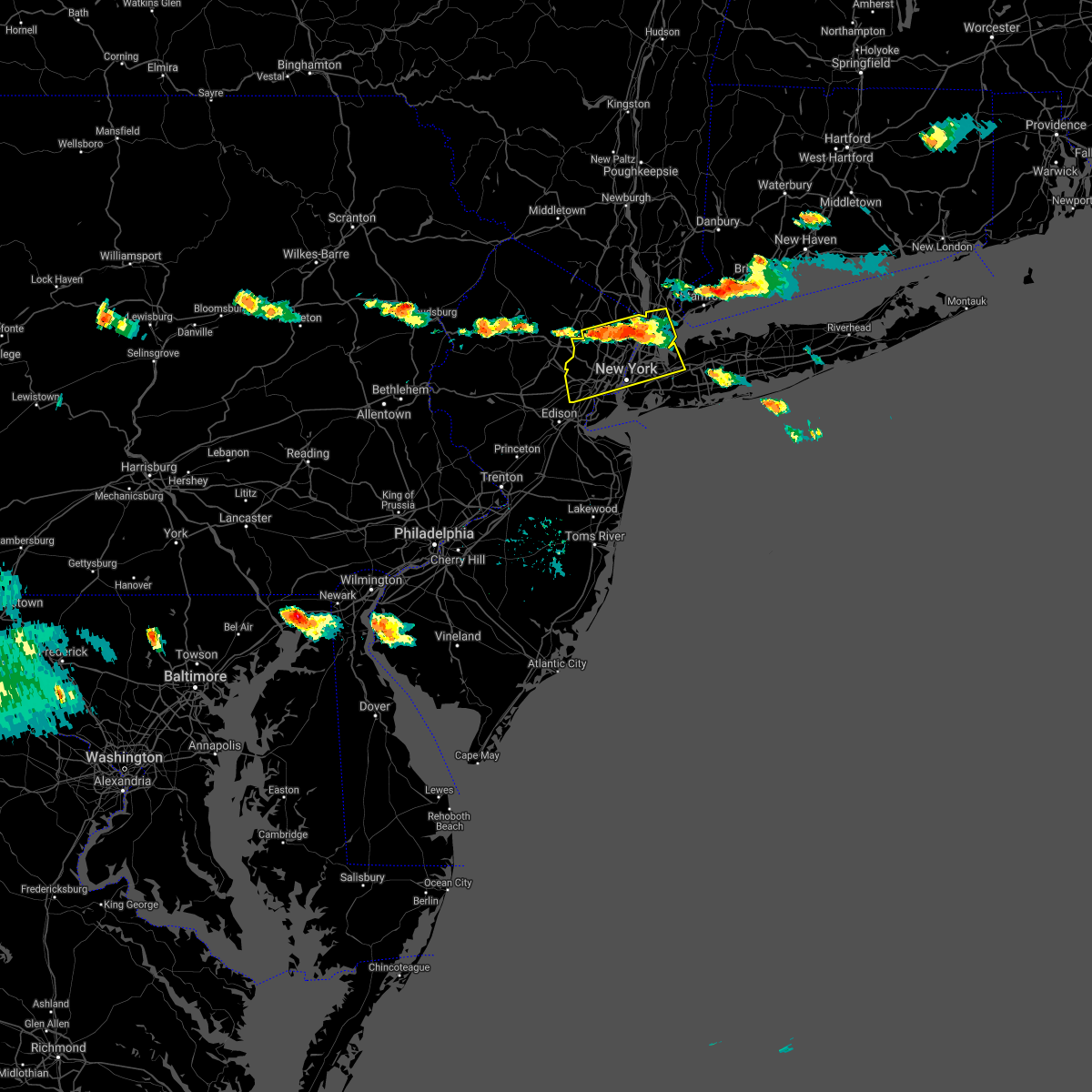 At 559 pm edt, severe thunderstorms were located along a line extending from bronxville to caldwell, moving south at 20 mph (radar indicated). Hazards include 60 mph wind gusts and penny size hail. Expect damage to trees and power lines. severe thunderstorms will be near, new rochelle and riverdale around 605 pm edt. bloomfield and cardinal spellman hs around 610 pm edt. millburn and orange around 615 pm edt. summit and mott haven around 620 pm edt. newark and harrison around 625 pm edt. great neck and flushing around 630 pm edt. elizabeth and little neck around 635 pm edt. Bayonne and clark around 640 pm edt. At 559 pm edt, severe thunderstorms were located along a line extending from bronxville to caldwell, moving south at 20 mph (radar indicated). Hazards include 60 mph wind gusts and penny size hail. Expect damage to trees and power lines. severe thunderstorms will be near, new rochelle and riverdale around 605 pm edt. bloomfield and cardinal spellman hs around 610 pm edt. millburn and orange around 615 pm edt. summit and mott haven around 620 pm edt. newark and harrison around 625 pm edt. great neck and flushing around 630 pm edt. elizabeth and little neck around 635 pm edt. Bayonne and clark around 640 pm edt.
|
| 8/12/2020 4:21 PM EDT |
 At 351 pm edt, a severe thunderstorm was located over fort lee, or over ridgefield, and is nearly stationary (radar indicated). Hazards include 60 mph wind gusts and quarter size hail. Minor hail damage to vehicles is possible. Expect wind damage to trees and power lines. At 351 pm edt, a severe thunderstorm was located over fort lee, or over ridgefield, and is nearly stationary (radar indicated). Hazards include 60 mph wind gusts and quarter size hail. Minor hail damage to vehicles is possible. Expect wind damage to trees and power lines.
|
| 8/12/2020 3:51 PM EDT |
 At 351 pm edt, a severe thunderstorm was located over fort lee, or over ridgefield, and is nearly stationary (radar indicated). Hazards include 60 mph wind gusts and quarter size hail. Minor hail damage to vehicles is possible. Expect wind damage to trees and power lines. At 351 pm edt, a severe thunderstorm was located over fort lee, or over ridgefield, and is nearly stationary (radar indicated). Hazards include 60 mph wind gusts and quarter size hail. Minor hail damage to vehicles is possible. Expect wind damage to trees and power lines.
|
| 8/3/2020 8:56 PM EDT |
 The national weather service in upton ny has issued a * severe thunderstorm warning for. queens county in southeastern new york. west central suffolk county in southeastern new york. kings county in southeastern new york. Nassau county in southeastern new york. The national weather service in upton ny has issued a * severe thunderstorm warning for. queens county in southeastern new york. west central suffolk county in southeastern new york. kings county in southeastern new york. Nassau county in southeastern new york.
|
| 8/3/2020 8:50 PM EDT | A marine thunderstorm wind gust of 55 knots was reported at the ny harbor entrance buoy in anz355 county NY, 27.7 miles NNW of New York, NY |
| 8/3/2020 8:25 PM EDT |
 At 824 pm edt, a severe thunderstorm was located over old bridge, or 9 miles southeast of new brunswick, moving northeast at 45 mph (radar indicated). Hazards include 60 mph wind gusts. Damage to roofs, siding, trees, and power lines is possible. locations impacted include, new brunswick, perth amboy, sandy hook, somerset, edison, middletown, old bridge, east brunswick, south brunswick, sayreville, north brunswick, marlboro, manalapan, carteret, tinton falls, holmdel, red bank, matawan, jamesburg and highlands. this includes the following highways, new jersey turnpike between exits 9 and 13. interstate 287 in new jersey between mile markers 0 and 8. Garden state parkway between mile markers 109 and 134. At 824 pm edt, a severe thunderstorm was located over old bridge, or 9 miles southeast of new brunswick, moving northeast at 45 mph (radar indicated). Hazards include 60 mph wind gusts. Damage to roofs, siding, trees, and power lines is possible. locations impacted include, new brunswick, perth amboy, sandy hook, somerset, edison, middletown, old bridge, east brunswick, south brunswick, sayreville, north brunswick, marlboro, manalapan, carteret, tinton falls, holmdel, red bank, matawan, jamesburg and highlands. this includes the following highways, new jersey turnpike between exits 9 and 13. interstate 287 in new jersey between mile markers 0 and 8. Garden state parkway between mile markers 109 and 134.
|
| 8/3/2020 7:56 PM EDT |
 At 755 pm edt, a severe thunderstorm was located over crosswicks, or 9 miles southeast of trenton, moving northeast at 45 mph (radar indicated). Hazards include 60 mph wind gusts. damage to roofs, siding, trees, and power lines is possible At 755 pm edt, a severe thunderstorm was located over crosswicks, or 9 miles southeast of trenton, moving northeast at 45 mph (radar indicated). Hazards include 60 mph wind gusts. damage to roofs, siding, trees, and power lines is possible
|
| 7/31/2020 1:38 AM EDT |
 The severe thunderstorm warning for southeastern morris, east central somerset and northeastern middlesex counties will expire at 145 am edt, the storm which prompted the warning has moved out of the area. therefore, the warning will be allowed to expire. The severe thunderstorm warning for southeastern morris, east central somerset and northeastern middlesex counties will expire at 145 am edt, the storm which prompted the warning has moved out of the area. therefore, the warning will be allowed to expire.
|
| 7/31/2020 1:27 AM EDT |
 At 126 am edt, a severe thunderstorm was located over bayonne, moving northeast at 30 mph (trained weather spotters. a 70 mph wind gust was previously reported by a trained spotter in keyport). Hazards include 70 mph wind gusts. Expect considerable tree damage. damage is likely to mobile homes, roofs, and outbuildings. locations impacted include, new brunswick, perth amboy, somerset, edison, east brunswick, sayreville, carteret, madison, middlesex, bound brook, manville, colonia, society hill, woodbridge, south plainfield, north plainfield, highland park, metuchen, dunellen and watchung. this includes the following highways, new jersey turnpike between exits 11 and 13. interstate 78 in new jersey between mile markers 39 and 42. interstate 287 in new jersey between mile markers 0 and 13. Garden state parkway between mile markers 124 and 134. At 126 am edt, a severe thunderstorm was located over bayonne, moving northeast at 30 mph (trained weather spotters. a 70 mph wind gust was previously reported by a trained spotter in keyport). Hazards include 70 mph wind gusts. Expect considerable tree damage. damage is likely to mobile homes, roofs, and outbuildings. locations impacted include, new brunswick, perth amboy, somerset, edison, east brunswick, sayreville, carteret, madison, middlesex, bound brook, manville, colonia, society hill, woodbridge, south plainfield, north plainfield, highland park, metuchen, dunellen and watchung. this includes the following highways, new jersey turnpike between exits 11 and 13. interstate 78 in new jersey between mile markers 39 and 42. interstate 287 in new jersey between mile markers 0 and 13. Garden state parkway between mile markers 124 and 134.
|
| 7/31/2020 1:13 AM EDT |
 The severe thunderstorm warning for southeastern morris, east central hunterdon, somerset, central monmouth and middlesex counties will expire at 115 am edt, the storms which prompted the warning have moved out of the area. therefore, the warning will be allowed to expire. a new severe thunderstorm warning still remains in effect for portions of morris, somerset, monmouth, and middlesex counties until 145 am. The severe thunderstorm warning for southeastern morris, east central hunterdon, somerset, central monmouth and middlesex counties will expire at 115 am edt, the storms which prompted the warning have moved out of the area. therefore, the warning will be allowed to expire. a new severe thunderstorm warning still remains in effect for portions of morris, somerset, monmouth, and middlesex counties until 145 am.
|
| 7/31/2020 1:10 AM EDT |
 At 110 am edt, a severe thunderstorm was located over huguenot, moving northeast at 25 mph (trained weather spotters. a trained spotter in keyport reported a measured wind gust of 70 mph). Hazards include 70 mph wind gusts. Expect considerable tree damage. Damage is likely to mobile homes, roofs, and outbuildings. At 110 am edt, a severe thunderstorm was located over huguenot, moving northeast at 25 mph (trained weather spotters. a trained spotter in keyport reported a measured wind gust of 70 mph). Hazards include 70 mph wind gusts. Expect considerable tree damage. Damage is likely to mobile homes, roofs, and outbuildings.
|
| 7/31/2020 12:53 AM EDT |
 At 1253 am edt, severe thunderstorms were located along a line extending from millington to collingwood park, moving east at 45 mph (radar indicated). Hazards include 60 mph wind gusts. Damage to roofs, siding, trees, and power lines is possible. locations impacted include, new brunswick, perth amboy, somerville, sandy hook, somerset, edison, middletown, old bridge, east brunswick, bridgewater, south brunswick, sayreville, north brunswick, marlboro, manalapan, carteret, tinton falls, holmdel, madison and middlesex. this includes the following highways, new jersey turnpike between exits 9 and 13. interstate 78 in new jersey between mile markers 28 and 42. interstate 287 in new jersey between mile markers 0 and 28. Garden state parkway between mile markers 109 and 134. At 1253 am edt, severe thunderstorms were located along a line extending from millington to collingwood park, moving east at 45 mph (radar indicated). Hazards include 60 mph wind gusts. Damage to roofs, siding, trees, and power lines is possible. locations impacted include, new brunswick, perth amboy, somerville, sandy hook, somerset, edison, middletown, old bridge, east brunswick, bridgewater, south brunswick, sayreville, north brunswick, marlboro, manalapan, carteret, tinton falls, holmdel, madison and middlesex. this includes the following highways, new jersey turnpike between exits 9 and 13. interstate 78 in new jersey between mile markers 28 and 42. interstate 287 in new jersey between mile markers 0 and 28. Garden state parkway between mile markers 109 and 134.
|
| 7/31/2020 12:33 AM EDT |
 At 1232 am edt, severe thunderstorms were located along a line extending from white house station to near vista center, moving east at 45 mph (radar indicated). Hazards include 60 mph wind gusts. damage to roofs, siding, trees, and power lines is possible At 1232 am edt, severe thunderstorms were located along a line extending from white house station to near vista center, moving east at 45 mph (radar indicated). Hazards include 60 mph wind gusts. damage to roofs, siding, trees, and power lines is possible
|
| 7/24/2020 2:51 AM EDT |
 The severe thunderstorm warning for southeastern morris, northern somerset and northeastern middlesex counties will expire at 300 am edt, the storms which prompted the warning have weakened below severe limits, and no longer pose an immediate threat to life or property. therefore, the warning will be allowed to expire. however gusty winds and heavy rain are still possible with these thunderstorms. The severe thunderstorm warning for southeastern morris, northern somerset and northeastern middlesex counties will expire at 300 am edt, the storms which prompted the warning have weakened below severe limits, and no longer pose an immediate threat to life or property. therefore, the warning will be allowed to expire. however gusty winds and heavy rain are still possible with these thunderstorms.
|
| 7/24/2020 2:38 AM EDT |
 At 238 am edt, severe thunderstorms were located along a line extending from near far hills to near martinsville to near perth amboy, moving northeast at 20 mph (radar indicated). Hazards include 60 mph wind gusts. Damage to roofs, siding, trees, and power lines is possible. locations impacted include, perth amboy, somerville, edison, bridgewater, carteret, madison, middlesex, bound brook, chatham, mendham, peapack and gladstone, far hills, colonia, martinsville, millington, society hill, basking ridge, woodbridge, south plainfield and north plainfield. this includes the following highways, new jersey turnpike between exits 11 and 13. interstate 78 in new jersey between mile markers 27 and 42. interstate 287 in new jersey between mile markers 0 and 9, and between mile markers 13 and 34. Garden state parkway between mile markers 127 and 134. At 238 am edt, severe thunderstorms were located along a line extending from near far hills to near martinsville to near perth amboy, moving northeast at 20 mph (radar indicated). Hazards include 60 mph wind gusts. Damage to roofs, siding, trees, and power lines is possible. locations impacted include, perth amboy, somerville, edison, bridgewater, carteret, madison, middlesex, bound brook, chatham, mendham, peapack and gladstone, far hills, colonia, martinsville, millington, society hill, basking ridge, woodbridge, south plainfield and north plainfield. this includes the following highways, new jersey turnpike between exits 11 and 13. interstate 78 in new jersey between mile markers 27 and 42. interstate 287 in new jersey between mile markers 0 and 9, and between mile markers 13 and 34. Garden state parkway between mile markers 127 and 134.
|
| 7/24/2020 2:18 AM EDT |
 At 218 am edt, severe thunderstorms were located along a line extending from near white house station to near tottenville, moving east at 30 mph (radar indicated). Hazards include 60 mph wind gusts. damage to roofs, siding, trees, and power lines is possible At 218 am edt, severe thunderstorms were located along a line extending from near white house station to near tottenville, moving east at 30 mph (radar indicated). Hazards include 60 mph wind gusts. damage to roofs, siding, trees, and power lines is possible
|
| 7/22/2020 7:35 PM EDT |
 At 735 pm edt, severe thunderstorms were located along a line extending from throgs neck bridge to jamaica to near rockaway beach, moving northeast at 35 mph (radar indicated). Hazards include 60 mph wind gusts. Expect damage to trees and power lines. these severe storms will be near, clearview expressway and elmont around 740 pm edt. great neck and sands point around 745 pm edt. valley stream and lynbrook around 750 pm edt. freeport and baldwin around 755 pm edt. garden city and hempstead around 800 pm edt. Westbury around 805 pm edt. At 735 pm edt, severe thunderstorms were located along a line extending from throgs neck bridge to jamaica to near rockaway beach, moving northeast at 35 mph (radar indicated). Hazards include 60 mph wind gusts. Expect damage to trees and power lines. these severe storms will be near, clearview expressway and elmont around 740 pm edt. great neck and sands point around 745 pm edt. valley stream and lynbrook around 750 pm edt. freeport and baldwin around 755 pm edt. garden city and hempstead around 800 pm edt. Westbury around 805 pm edt.
|
| 7/22/2020 7:14 PM EDT | Down tree on 88th st. between northern blvd and 32nd ave. time estimated by rada in queens county NY, 1.2 miles SSW of New York, NY |
| 7/22/2020 7:02 PM EDT |
 At 702 pm edt, severe thunderstorms were located along a line extending from paramus to rutherford to near jersey city to huguenot, moving east at 45 mph (radar indicated). Hazards include 60 mph wind gusts and quarter size hail. Minor hail damage to vehicles is possible. expect wind damage to trees and power lines. these severe storms will be near, bergenfield and ridgefield around 710 pm edt. new york and midtown manhattan around 715 pm edt. east tremont and laguardia airport around 720 pm edt. Flushing and rockaway beach around 725 pm edt. At 702 pm edt, severe thunderstorms were located along a line extending from paramus to rutherford to near jersey city to huguenot, moving east at 45 mph (radar indicated). Hazards include 60 mph wind gusts and quarter size hail. Minor hail damage to vehicles is possible. expect wind damage to trees and power lines. these severe storms will be near, bergenfield and ridgefield around 710 pm edt. new york and midtown manhattan around 715 pm edt. east tremont and laguardia airport around 720 pm edt. Flushing and rockaway beach around 725 pm edt.
|
| 7/22/2020 6:58 PM EDT |
 At 658 pm edt, a severe thunderstorm was located over rockaway beach, moving northeast at 20 mph (radar indicated). Hazards include 60 mph wind gusts. Expect damage to trees and power lines. this severe thunderstorm will be near, canarsie around 710 pm edt. howard beach around 715 pm edt. atlantic beach and ozone park around 720 pm edt. kennedy airport and woodmere around 725 pm edt. valley stream and jamaica around 730 pm edt. lynbrook and elmont around 735 pm edt. baldwin and little neck around 740 pm edt. Freeport and garden city around 745 pm edt. At 658 pm edt, a severe thunderstorm was located over rockaway beach, moving northeast at 20 mph (radar indicated). Hazards include 60 mph wind gusts. Expect damage to trees and power lines. this severe thunderstorm will be near, canarsie around 710 pm edt. howard beach around 715 pm edt. atlantic beach and ozone park around 720 pm edt. kennedy airport and woodmere around 725 pm edt. valley stream and jamaica around 730 pm edt. lynbrook and elmont around 735 pm edt. baldwin and little neck around 740 pm edt. Freeport and garden city around 745 pm edt.
|
| 7/22/2020 6:33 PM EDT |
 At 632 pm edt, severe thunderstorms were located along a line extending from lake telemark to bridgewater, moving east at 25 mph (radar indicated). Hazards include 60 mph wind gusts and penny size hail. Damage to roofs, siding, trees, and power lines is possible. locations impacted include, perth amboy, morristown, somerville, somerset, edison, bridgewater, carteret, dover, madison, middlesex, florham park, east hanover, lincoln park, bound brook, manville, chatham, boonton, wharton, rockaway and morris plains. this includes the following highways, new jersey turnpike between exits 11 and 13. interstate 78 in new jersey between mile markers 28 and 42. interstate 80 in new jersey between mile markers 33 and 48. interstate 287 in new jersey between mile markers 0 and 52. Garden state parkway between mile markers 128 and 134. At 632 pm edt, severe thunderstorms were located along a line extending from lake telemark to bridgewater, moving east at 25 mph (radar indicated). Hazards include 60 mph wind gusts and penny size hail. Damage to roofs, siding, trees, and power lines is possible. locations impacted include, perth amboy, morristown, somerville, somerset, edison, bridgewater, carteret, dover, madison, middlesex, florham park, east hanover, lincoln park, bound brook, manville, chatham, boonton, wharton, rockaway and morris plains. this includes the following highways, new jersey turnpike between exits 11 and 13. interstate 78 in new jersey between mile markers 28 and 42. interstate 80 in new jersey between mile markers 33 and 48. interstate 287 in new jersey between mile markers 0 and 52. Garden state parkway between mile markers 128 and 134.
|
| 7/22/2020 6:30 PM EDT |
 At 630 pm edt, severe thunderstorms were located along a line extending from lake telemark to near morristown to near martinsville to millstone, moving east at 45 mph (radar indicated). Hazards include 60 mph wind gusts and quarter size hail. Minor hail damage to vehicles is possible. expect wind damage to trees and power lines. severe thunderstorms will be near, plainfield around 640 pm edt. summit and millburn around 645 pm edt. wayne and linden around 650 pm edt. elizabeth and bloomfield around 655 pm edt. newark and paterson around 700 pm edt. jersey city and hackensack around 705 pm edt. hoboken and bergenfield around 710 pm edt. New york and coney island around 715 pm edt. At 630 pm edt, severe thunderstorms were located along a line extending from lake telemark to near morristown to near martinsville to millstone, moving east at 45 mph (radar indicated). Hazards include 60 mph wind gusts and quarter size hail. Minor hail damage to vehicles is possible. expect wind damage to trees and power lines. severe thunderstorms will be near, plainfield around 640 pm edt. summit and millburn around 645 pm edt. wayne and linden around 650 pm edt. elizabeth and bloomfield around 655 pm edt. newark and paterson around 700 pm edt. jersey city and hackensack around 705 pm edt. hoboken and bergenfield around 710 pm edt. New york and coney island around 715 pm edt.
|
| 7/22/2020 6:21 PM EDT |
 At 621 pm edt, a severe thunderstorm was located over plainfield, moving northeast at 25 mph (radar indicated). Hazards include 60 mph wind gusts and quarter size hail. Minor hail damage to vehicles is possible. expect wind damage to trees and power lines. this severe thunderstorm will be near, clark around 635 pm edt. linden and summit around 640 pm edt. millburn and union around 645 pm edt. elizabeth around 650 pm edt. port richmond around 655 pm edt. Newark and jersey city around 700 pm edt. At 621 pm edt, a severe thunderstorm was located over plainfield, moving northeast at 25 mph (radar indicated). Hazards include 60 mph wind gusts and quarter size hail. Minor hail damage to vehicles is possible. expect wind damage to trees and power lines. this severe thunderstorm will be near, clark around 635 pm edt. linden and summit around 640 pm edt. millburn and union around 645 pm edt. elizabeth around 650 pm edt. port richmond around 655 pm edt. Newark and jersey city around 700 pm edt.
|
| 7/22/2020 6:04 PM EDT |
 At 604 pm edt, severe thunderstorms were located along a line extending from near andover to near clinton, moving east at 25 mph (radar indicated). Hazards include 60 mph wind gusts and penny size hail. damage to roofs, siding, trees, and power lines is possible At 604 pm edt, severe thunderstorms were located along a line extending from near andover to near clinton, moving east at 25 mph (radar indicated). Hazards include 60 mph wind gusts and penny size hail. damage to roofs, siding, trees, and power lines is possible
|
| 7/11/2020 6:31 PM EDT |
 At 631 pm edt, a severe thunderstorm was located over edison, or near new brunswick, moving northeast at 30 mph (radar indicated). Hazards include 60 mph wind gusts. Damage to roofs, siding, trees, and power lines is possible. locations impacted include, new brunswick, perth amboy, edison, east brunswick, carteret, colonia, north brunswick township, woodbridge, south river, highland park, metuchen, milltown, iselin, sewaren, port reading, fords and avenel. this includes the following highways, new jersey turnpike between exits 10 and 13. interstate 287 in new jersey between mile markers 0 and 4. Garden state parkway between mile markers 126 and 134. At 631 pm edt, a severe thunderstorm was located over edison, or near new brunswick, moving northeast at 30 mph (radar indicated). Hazards include 60 mph wind gusts. Damage to roofs, siding, trees, and power lines is possible. locations impacted include, new brunswick, perth amboy, edison, east brunswick, carteret, colonia, north brunswick township, woodbridge, south river, highland park, metuchen, milltown, iselin, sewaren, port reading, fords and avenel. this includes the following highways, new jersey turnpike between exits 10 and 13. interstate 287 in new jersey between mile markers 0 and 4. Garden state parkway between mile markers 126 and 134.
|
| 7/11/2020 6:18 PM EDT |
 At 618 pm edt, a severe thunderstorm was located over edison, or near new brunswick, moving northeast at 30 mph (radar indicated). Hazards include 60 mph wind gusts. damage to roofs, siding, trees, and power lines is possible At 618 pm edt, a severe thunderstorm was located over edison, or near new brunswick, moving northeast at 30 mph (radar indicated). Hazards include 60 mph wind gusts. damage to roofs, siding, trees, and power lines is possible
|
| 7/6/2020 5:03 PM EDT |
 At 502 pm edt, severe thunderstorms were located along a line extending from throgs neck bridge to sands point to rye, moving east at 15 mph (radar indicated). Hazards include 60 mph wind gusts and quarter size hail. Minor hail damage to vehicles is possible. expect wind damage to trees and power lines. severe thunderstorms will be near, glen cove around 520 pm edt. manhasset around 525 pm edt. port washington around 530 pm edt. bayville around 535 pm edt. oyster bay and mineola around 540 pm edt. Huntington and westbury around 545 pm edt. At 502 pm edt, severe thunderstorms were located along a line extending from throgs neck bridge to sands point to rye, moving east at 15 mph (radar indicated). Hazards include 60 mph wind gusts and quarter size hail. Minor hail damage to vehicles is possible. expect wind damage to trees and power lines. severe thunderstorms will be near, glen cove around 520 pm edt. manhasset around 525 pm edt. port washington around 530 pm edt. bayville around 535 pm edt. oyster bay and mineola around 540 pm edt. Huntington and westbury around 545 pm edt.
|
| 7/6/2020 4:58 PM EDT |
 The severe thunderstorm warning for hudson, eastern passaic, south central bergen, essex, richmond, kings and new york (manhattan) counties will expire at 500 pm edt, the storms which prompted the warning have weakened below severe limits, and no longer pose an immediate threat to life or property. therefore, the warning will be allowed to expire. however heavy rain is still possible with these thunderstorms. a severe thunderstorm watch remains in effect until 1100 pm edt for northeastern new jersey. to report severe weather, contact your nearest law enforcement agency. they will relay your report to the national weather service upton ny. The severe thunderstorm warning for hudson, eastern passaic, south central bergen, essex, richmond, kings and new york (manhattan) counties will expire at 500 pm edt, the storms which prompted the warning have weakened below severe limits, and no longer pose an immediate threat to life or property. therefore, the warning will be allowed to expire. however heavy rain is still possible with these thunderstorms. a severe thunderstorm watch remains in effect until 1100 pm edt for northeastern new jersey. to report severe weather, contact your nearest law enforcement agency. they will relay your report to the national weather service upton ny.
|
| 7/6/2020 4:39 PM EDT |
 At 439 pm edt, a severe thunderstorm was located over riverdale, or near bergenfield, moving east at 5 mph (radar indicated). Hazards include ping pong ball size hail and 60 mph wind gusts. People and animals outdoors will be injured. expect hail damage to roofs, siding, windows, and vehicles. Expect wind damage to trees and power lines. At 439 pm edt, a severe thunderstorm was located over riverdale, or near bergenfield, moving east at 5 mph (radar indicated). Hazards include ping pong ball size hail and 60 mph wind gusts. People and animals outdoors will be injured. expect hail damage to roofs, siding, windows, and vehicles. Expect wind damage to trees and power lines.
|
| 7/6/2020 4:13 PM EDT |
 The severe thunderstorm warning for hudson, southeastern bergen, queens, bronx and new york (manhattan) counties will expire at 415 pm edt, the storm which prompted the warning has moved out of the area. therefore, the warning will be allowed to expire. however heavy rain and small hail is still possible with this thunderstorm. a severe thunderstorm watch remains in effect until 1100 pm edt for northeastern new jersey. to report severe weather, contact your nearest law enforcement agency. they will relay your report to the national weather service upton ny. The severe thunderstorm warning for hudson, southeastern bergen, queens, bronx and new york (manhattan) counties will expire at 415 pm edt, the storm which prompted the warning has moved out of the area. therefore, the warning will be allowed to expire. however heavy rain and small hail is still possible with this thunderstorm. a severe thunderstorm watch remains in effect until 1100 pm edt for northeastern new jersey. to report severe weather, contact your nearest law enforcement agency. they will relay your report to the national weather service upton ny.
|
| 7/6/2020 3:59 PM EDT |
 At 358 pm edt, severe thunderstorms were located along a line extending from near paterson to upper west side, moving south at 5 mph (radar indicated). Hazards include ping pong ball size hail and 60 mph wind gusts. People and animals outdoors will be injured. expect hail damage to roofs, siding, windows, and vehicles. expect wind damage to trees and power lines. severe thunderstorms will be near, new york and midtown manhattan around 405 pm edt. secaucus around 415 pm edt. union city around 420 pm edt. hoboken around 435 pm edt. east village around 440 pm edt. soho around 445 pm edt. kearny and lower east side around 450 pm edt. passaic around 455 pm edt. Newark and jersey city around 500 pm edt. At 358 pm edt, severe thunderstorms were located along a line extending from near paterson to upper west side, moving south at 5 mph (radar indicated). Hazards include ping pong ball size hail and 60 mph wind gusts. People and animals outdoors will be injured. expect hail damage to roofs, siding, windows, and vehicles. expect wind damage to trees and power lines. severe thunderstorms will be near, new york and midtown manhattan around 405 pm edt. secaucus around 415 pm edt. union city around 420 pm edt. hoboken around 435 pm edt. east village around 440 pm edt. soho around 445 pm edt. kearny and lower east side around 450 pm edt. passaic around 455 pm edt. Newark and jersey city around 500 pm edt.
|
| 7/6/2020 3:51 PM EDT |
 The severe thunderstorm warning for northeastern middlesex county will expire at 400 pm edt, the storm which prompted the warning has weakened below severe limits, and no longer poses an immediate threat to life or property. therefore, the warning will be allowed to expire. however gusty winds are still possible with this thunderstorm. a severe thunderstorm watch remains in effect until 1100 pm edt for northern new jersey. The severe thunderstorm warning for northeastern middlesex county will expire at 400 pm edt, the storm which prompted the warning has weakened below severe limits, and no longer poses an immediate threat to life or property. therefore, the warning will be allowed to expire. however gusty winds are still possible with this thunderstorm. a severe thunderstorm watch remains in effect until 1100 pm edt for northern new jersey.
|
| 7/6/2020 3:31 PM EDT |
 At 331 pm edt, a severe thunderstorm was located over hackensack, moving southeast at 10 mph (radar indicated). Hazards include 60 mph wind gusts and quarter size hail. Minor hail damage to vehicles is possible. expect wind damage to trees and power lines. this severe thunderstorm will be near, hackensack and bergenfield around 335 pm edt. teterboro around 345 pm edt. englewood around 350 pm edt. ridgefield and fort lee around 405 pm edt. New york and mott haven around 415 pm edt. At 331 pm edt, a severe thunderstorm was located over hackensack, moving southeast at 10 mph (radar indicated). Hazards include 60 mph wind gusts and quarter size hail. Minor hail damage to vehicles is possible. expect wind damage to trees and power lines. this severe thunderstorm will be near, hackensack and bergenfield around 335 pm edt. teterboro around 345 pm edt. englewood around 350 pm edt. ridgefield and fort lee around 405 pm edt. New york and mott haven around 415 pm edt.
|
| 7/6/2020 3:26 PM EDT |
 At 325 pm edt, a severe thunderstorm was located over edison, or near perth amboy, moving east at 5 mph (radar indicated). Hazards include 60 mph wind gusts and quarter size hail. Minor hail damage to vehicles is possible. expect wind damage to trees and power lines. this severe thunderstorm will be near, clark around 340 pm edt. linden and tottenville around 420 pm edt. Huguenot and todt hill around 430 pm edt. At 325 pm edt, a severe thunderstorm was located over edison, or near perth amboy, moving east at 5 mph (radar indicated). Hazards include 60 mph wind gusts and quarter size hail. Minor hail damage to vehicles is possible. expect wind damage to trees and power lines. this severe thunderstorm will be near, clark around 340 pm edt. linden and tottenville around 420 pm edt. Huguenot and todt hill around 430 pm edt.
|
| 7/6/2020 3:18 PM EDT |
 At 318 pm edt, a severe thunderstorm was located over edison, or near perth amboy, moving northeast at 20 mph (radar indicated). Hazards include 60 mph wind gusts and quarter size hail. Minor damage to vehicles is possible. Wind damage to roofs, siding, trees, and power lines is possible. At 318 pm edt, a severe thunderstorm was located over edison, or near perth amboy, moving northeast at 20 mph (radar indicated). Hazards include 60 mph wind gusts and quarter size hail. Minor damage to vehicles is possible. Wind damage to roofs, siding, trees, and power lines is possible.
|
| 7/3/2020 8:25 PM EDT |
 At 824 pm edt, a severe thunderstorm was located over colonia, or near plainfield, moving south at 25 mph (radar indicated. there are strong indications a microburst with damaging wind gusts and large hail is imminent in northeastern middlesex county). Hazards include 70 mph wind gusts and quarter size hail. Minor damage to vehicles is possible. expect considerable tree damage. wind damage is also likely to mobile homes, roofs, and outbuildings. locations impacted include, new brunswick, perth amboy, sandy hook, edison, middletown, old bridge, east brunswick, sayreville, carteret, matawan, highlands, colonia, brownville, navesink, morganville, society hill, north brunswick township, lincroft, woodbridge and south plainfield. this includes the following highways, new jersey turnpike between exits 10 and 13. interstate 287 in new jersey between mile markers 0 and 6. Garden state parkway between mile markers 114 and 134. At 824 pm edt, a severe thunderstorm was located over colonia, or near plainfield, moving south at 25 mph (radar indicated. there are strong indications a microburst with damaging wind gusts and large hail is imminent in northeastern middlesex county). Hazards include 70 mph wind gusts and quarter size hail. Minor damage to vehicles is possible. expect considerable tree damage. wind damage is also likely to mobile homes, roofs, and outbuildings. locations impacted include, new brunswick, perth amboy, sandy hook, edison, middletown, old bridge, east brunswick, sayreville, carteret, matawan, highlands, colonia, brownville, navesink, morganville, society hill, north brunswick township, lincroft, woodbridge and south plainfield. this includes the following highways, new jersey turnpike between exits 10 and 13. interstate 287 in new jersey between mile markers 0 and 6. Garden state parkway between mile markers 114 and 134.
|
| 7/3/2020 8:19 PM EDT |
 At 819 pm edt, a severe thunderstorm was located over plainfield, moving south at 25 mph (radar indicated). Hazards include 70 mph wind gusts. Expect considerable tree damage. Damage is likely to mobile homes, roofs, and outbuildings. At 819 pm edt, a severe thunderstorm was located over plainfield, moving south at 25 mph (radar indicated). Hazards include 70 mph wind gusts. Expect considerable tree damage. Damage is likely to mobile homes, roofs, and outbuildings.
|
| 7/3/2020 7:51 PM EDT |
 At 751 pm edt, a severe thunderstorm was located over kearny, or over harrison, moving southeast at 50 mph (radar indicated). Hazards include quarter size hail. Minor damage to vehicles is possible. this severe thunderstorm will be near, jersey city and hoboken around 755 pm edt. bayonne and todt hill around 800 pm edt. verrazano-narrows bridge and flatbush around 805 pm edt. coney island and arturo toscanini ps around 810 pm edt. Rockaway beach around 815 pm edt. At 751 pm edt, a severe thunderstorm was located over kearny, or over harrison, moving southeast at 50 mph (radar indicated). Hazards include quarter size hail. Minor damage to vehicles is possible. this severe thunderstorm will be near, jersey city and hoboken around 755 pm edt. bayonne and todt hill around 800 pm edt. verrazano-narrows bridge and flatbush around 805 pm edt. coney island and arturo toscanini ps around 810 pm edt. Rockaway beach around 815 pm edt.
|
| 6/29/2020 7:07 PM EDT |
 The severe thunderstorm warning for queens, kings and new york (manhattan) counties will expire at 715 pm edt, the storm which prompted the warning has moved out of the area. therefore, the warning will be allowed to expire. The severe thunderstorm warning for queens, kings and new york (manhattan) counties will expire at 715 pm edt, the storm which prompted the warning has moved out of the area. therefore, the warning will be allowed to expire.
|
| 6/29/2020 6:57 PM EDT | A marine thunderstorm wind gust of 60 knots was reported at breezy point mesonet in queens county NY, 13.6 miles N of New York, NY |
| 6/29/2020 6:50 PM EDT | Tree snapped at base and high up and fallen to ground at ocean parkway and ocean court in kings county NY, 11.5 miles NNE of New York, NY |
| 6/29/2020 6:50 PM EDT | Tree down in marine park section of brooklyn in kings county NY, 9.5 miles NNE of New York, NY |
| 6/29/2020 6:48 PM EDT | Large tree limbs reported down on mcdonald avenue at samual hubbard house and sourrounding area in kings county NY, 10.8 miles NNE of New York, NY |
| 6/29/2020 6:45 PM EDT | Large tree down on a house near intersection of 9th avenue and 57th stree in kings county NY, 9.6 miles NE of New York, NY |
| 6/29/2020 6:44 PM EDT |
 At 644 pm edt, a severe thunderstorm was located over crown heights, moving south at 25 mph (radar indicated). Hazards include 60 mph wind gusts and quarter size hail. Minor hail damage to vehicles is possible. expect wind damage to trees and power lines. this severe storm will be near, coney island and sheepshead bay around 655 pm edt. Rockaway beach around 700 pm edt. At 644 pm edt, a severe thunderstorm was located over crown heights, moving south at 25 mph (radar indicated). Hazards include 60 mph wind gusts and quarter size hail. Minor hail damage to vehicles is possible. expect wind damage to trees and power lines. this severe storm will be near, coney island and sheepshead bay around 655 pm edt. Rockaway beach around 700 pm edt.
|
| 6/29/2020 6:31 PM EDT |
 At 631 pm edt, a severe thunderstorm was located over long island city, or over midtown manhattan, moving south at 25 mph (radar indicated). Hazards include quarter size hail. Minor damage to vehicles is possible. this severe thunderstorm will be near, brooklyn heights and forest hills around 635 pm edt. crown heights and park slope around 640 pm edt. flatbush and canarsie around 645 pm edt. bensonhurst and bay ridge around 650 pm edt. coney island and sheepshead bay around 655 pm edt. Rockaway beach around 700 pm edt. At 631 pm edt, a severe thunderstorm was located over long island city, or over midtown manhattan, moving south at 25 mph (radar indicated). Hazards include quarter size hail. Minor damage to vehicles is possible. this severe thunderstorm will be near, brooklyn heights and forest hills around 635 pm edt. crown heights and park slope around 640 pm edt. flatbush and canarsie around 645 pm edt. bensonhurst and bay ridge around 650 pm edt. coney island and sheepshead bay around 655 pm edt. Rockaway beach around 700 pm edt.
|
| 6/28/2020 7:39 PM EDT |
 The severe thunderstorm warning for queens and kings counties will expire at 745 pm edt, the severe thunderstorm which prompted the warning has weakened and moved out of the warned area. therefore, the warning will be allowed to expire. a severe thunderstorm watch remains in effect until 800 pm edt for southeastern new york. The severe thunderstorm warning for queens and kings counties will expire at 745 pm edt, the severe thunderstorm which prompted the warning has weakened and moved out of the warned area. therefore, the warning will be allowed to expire. a severe thunderstorm watch remains in effect until 800 pm edt for southeastern new york.
|
| 6/28/2020 7:19 PM EDT |
 At 718 pm edt, a severe thunderstorm was located over clearview expressway, or over jamaica, moving east at 30 mph (radar indicated). Hazards include 60 mph wind gusts and quarter size hail. Minor hail damage to vehicles is possible. Expect wind damage to trees and power lines. At 718 pm edt, a severe thunderstorm was located over clearview expressway, or over jamaica, moving east at 30 mph (radar indicated). Hazards include 60 mph wind gusts and quarter size hail. Minor hail damage to vehicles is possible. Expect wind damage to trees and power lines.
|
| 6/28/2020 7:10 PM EDT |
 At 709 pm edt, a severe thunderstorm was located over great neck, moving east at 60 mph (radar indicated). Hazards include 60 mph wind gusts and quarter size hail. Minor hail damage to vehicles is possible. Expect wind damage to trees and power lines. At 709 pm edt, a severe thunderstorm was located over great neck, moving east at 60 mph (radar indicated). Hazards include 60 mph wind gusts and quarter size hail. Minor hail damage to vehicles is possible. Expect wind damage to trees and power lines.
|
| 6/28/2020 6:47 PM EDT |
 At 646 pm edt, a severe thunderstorm was located over bloomfield, moving east at 25 mph (radar indicated). Hazards include 60 mph wind gusts and quarter size hail. Hail damage to vehicles is possible. expect wind damage to trees and power lines. this severe thunderstorm will be near, secaucus and teterboro around 650 pm edt. new york and hoboken around 655 pm edt. Mott haven and east tremont around 700 pm edt. At 646 pm edt, a severe thunderstorm was located over bloomfield, moving east at 25 mph (radar indicated). Hazards include 60 mph wind gusts and quarter size hail. Hail damage to vehicles is possible. expect wind damage to trees and power lines. this severe thunderstorm will be near, secaucus and teterboro around 650 pm edt. new york and hoboken around 655 pm edt. Mott haven and east tremont around 700 pm edt.
|
| 6/28/2020 5:49 PM EDT |
 At 549 pm edt, a severe thunderstorm was located over lebanon, or 12 miles northwest of somerville, moving southeast at 40 mph (radar indicated). Hazards include 60 mph wind gusts and half dollar size hail. Minor damage to vehicles is possible. Wind damage to roofs, siding, trees, and power lines is possible. At 549 pm edt, a severe thunderstorm was located over lebanon, or 12 miles northwest of somerville, moving southeast at 40 mph (radar indicated). Hazards include 60 mph wind gusts and half dollar size hail. Minor damage to vehicles is possible. Wind damage to roofs, siding, trees, and power lines is possible.
|
| 6/6/2020 3:10 PM EDT | Large tree limbs down. time estimated by rada in queens county NY, 8 miles W of New York, NY |
| 4/21/2020 2:56 PM EDT |
 At 255 pm edt, severe thunderstorms were located along a line extending from near stamford to navesink, moving east at 45 mph (radar indicated). Hazards include 60 mph wind gusts. Expect damage to trees and power lines. severe thunderstorms will be near, northport and centerport around 305 pm edt. Port jefferson around 325 pm edt. At 255 pm edt, severe thunderstorms were located along a line extending from near stamford to navesink, moving east at 45 mph (radar indicated). Hazards include 60 mph wind gusts. Expect damage to trees and power lines. severe thunderstorms will be near, northport and centerport around 305 pm edt. Port jefferson around 325 pm edt.
|
| 4/21/2020 2:35 PM EDT | Storm damage reported in bronx county NY, 8.7 miles S of New York, NY |
| 4/21/2020 2:33 PM EDT |
 At 233 pm edt, a severe thunderstorm capable of producing a tornado was located over east tremont, moving east at 50 mph (radar indicated rotation). Hazards include tornado. Flying debris will be dangerous to those caught without shelter. mobile homes will be damaged or destroyed. damage to roofs, windows, and vehicles will occur. tree damage is likely. this dangerous storm will be near, sands point and port washington around 245 pm edt. Glen cove around 250 pm edt. At 233 pm edt, a severe thunderstorm capable of producing a tornado was located over east tremont, moving east at 50 mph (radar indicated rotation). Hazards include tornado. Flying debris will be dangerous to those caught without shelter. mobile homes will be damaged or destroyed. damage to roofs, windows, and vehicles will occur. tree damage is likely. this dangerous storm will be near, sands point and port washington around 245 pm edt. Glen cove around 250 pm edt.
|
| 4/21/2020 2:30 PM EDT |
 At 230 pm edt, severe thunderstorms were located along a line extending from white plains to near yorketown to medford, moving southeast at 40 mph (radar indicated). Hazards include 60 mph wind gusts. Damage to roofs, siding, trees, and power lines is possible. locations impacted include, toms river, new brunswick, perth amboy, long branch, asbury park, sandy hook, somerset, edison, lakewood, middletown, old bridge, jackson, howell, east brunswick, south brunswick, sayreville, north brunswick, marlboro, manalapan and medford. this includes the following highways, garden state parkway between mile markers 64 and 136. interstate 195 in new jersey between mile markers 0 and 34. interstate 287 in new jersey between mile markers 0 and 8. interstate 295 in new jersey between mile markers 43 and 65. New jersey turnpike between exits 5 and 13. At 230 pm edt, severe thunderstorms were located along a line extending from white plains to near yorketown to medford, moving southeast at 40 mph (radar indicated). Hazards include 60 mph wind gusts. Damage to roofs, siding, trees, and power lines is possible. locations impacted include, toms river, new brunswick, perth amboy, long branch, asbury park, sandy hook, somerset, edison, lakewood, middletown, old bridge, jackson, howell, east brunswick, south brunswick, sayreville, north brunswick, marlboro, manalapan and medford. this includes the following highways, garden state parkway between mile markers 64 and 136. interstate 195 in new jersey between mile markers 0 and 34. interstate 287 in new jersey between mile markers 0 and 8. interstate 295 in new jersey between mile markers 43 and 65. New jersey turnpike between exits 5 and 13.
|
| 4/21/2020 2:27 PM EDT |
 At 226 pm edt, severe thunderstorms were located along a line extending from near oradell to near dayton, moving east at 35 mph (radar indicated). Hazards include 60 mph wind gusts. Expect damage to trees and power lines. these severe storms will be near, hackensack and bergenfield around 230 pm edt. fort lee and riverdale around 235 pm edt. yonkers around 240 pm edt. east tremont and bronxville around 245 pm edt. New rochelle and throgs neck bridge around 250 pm edt. At 226 pm edt, severe thunderstorms were located along a line extending from near oradell to near dayton, moving east at 35 mph (radar indicated). Hazards include 60 mph wind gusts. Expect damage to trees and power lines. these severe storms will be near, hackensack and bergenfield around 230 pm edt. fort lee and riverdale around 235 pm edt. yonkers around 240 pm edt. east tremont and bronxville around 245 pm edt. New rochelle and throgs neck bridge around 250 pm edt.
|
| 4/21/2020 2:12 PM EDT |
 At 211 pm edt, severe thunderstorms were located along a line extending from near ridgewood to rocky hill, moving east at 35 mph (radar indicated). Hazards include 60 mph wind gusts. Expect damage to trees and power lines. severe thunderstorms will be near, paterson and wayne around 215 pm edt. paramus around 220 pm edt. hackensack and oradell around 225 pm edt. bergenfield and englewood around 230 pm edt. fort lee and riverdale around 235 pm edt. yonkers and east tremont around 240 pm edt. new rochelle and bronxville around 245 pm edt. Throgs neck bridge and city island around 250 pm edt. At 211 pm edt, severe thunderstorms were located along a line extending from near ridgewood to rocky hill, moving east at 35 mph (radar indicated). Hazards include 60 mph wind gusts. Expect damage to trees and power lines. severe thunderstorms will be near, paterson and wayne around 215 pm edt. paramus around 220 pm edt. hackensack and oradell around 225 pm edt. bergenfield and englewood around 230 pm edt. fort lee and riverdale around 235 pm edt. yonkers and east tremont around 240 pm edt. new rochelle and bronxville around 245 pm edt. Throgs neck bridge and city island around 250 pm edt.
|
| 4/21/2020 1:59 PM EDT |
 The national weather service in mount holly nj has issued a * severe thunderstorm warning for. ocean county in southern new jersey. southeastern morris county in northern new jersey. southeastern hunterdon county in northwestern new jersey. Northwestern camden county in southern new jersey. The national weather service in mount holly nj has issued a * severe thunderstorm warning for. ocean county in southern new jersey. southeastern morris county in northern new jersey. southeastern hunterdon county in northwestern new jersey. Northwestern camden county in southern new jersey.
|
| 4/9/2020 2:15 PM EDT |
 At 215 pm edt, severe thunderstorms were located along a line extending from near oyster bay to manasquan, moving east at 55 mph (radar indicated). Hazards include 60 mph wind gusts and quarter size hail. Minor hail damage to vehicles is possible. expect wind damage to trees and power lines. severe thunderstorms will be near, oyster bay and glen cove around 220 pm edt. huntington and huntington station around 225 pm edt. northport and commack around 230 pm edt. hauppauge and brentwood around 235 pm edt. stony brook and ronkonkoma around 240 pm edt. patchogue and port jefferson around 245 pm edt. Middle island and medford around 250 pm edt. At 215 pm edt, severe thunderstorms were located along a line extending from near oyster bay to manasquan, moving east at 55 mph (radar indicated). Hazards include 60 mph wind gusts and quarter size hail. Minor hail damage to vehicles is possible. expect wind damage to trees and power lines. severe thunderstorms will be near, oyster bay and glen cove around 220 pm edt. huntington and huntington station around 225 pm edt. northport and commack around 230 pm edt. hauppauge and brentwood around 235 pm edt. stony brook and ronkonkoma around 240 pm edt. patchogue and port jefferson around 245 pm edt. Middle island and medford around 250 pm edt.
|
| 4/9/2020 2:09 PM EDT |
 The severe thunderstorm warning for southeastern mercer, monmouth and middlesex counties will expire at 215 pm edt, the storms which prompted the warning have moved out of the area. therefore, the warning will be allowed to expire. however gusty winds are still possible with these thunderstorms. a severe thunderstorm watch remains in effect until 400 pm edt for central and northern new jersey. to report severe weather, contact your nearest law enforcement agency. they will relay your report to the national weather service mount holly nj. The severe thunderstorm warning for southeastern mercer, monmouth and middlesex counties will expire at 215 pm edt, the storms which prompted the warning have moved out of the area. therefore, the warning will be allowed to expire. however gusty winds are still possible with these thunderstorms. a severe thunderstorm watch remains in effect until 400 pm edt for central and northern new jersey. to report severe weather, contact your nearest law enforcement agency. they will relay your report to the national weather service mount holly nj.
|
| 4/9/2020 2:00 PM EDT |
 At 200 pm edt, severe thunderstorms were located along a line extending from rfk bridge to keansburg, moving east at 65 mph (radar indicated). Hazards include 70 mph wind gusts and quarter size hail. Minor hail damage to vehicles is possible. expect considerable tree damage. wind damage is also likely to mobile homes, roofs, and outbuildings. these severe storms will be near, jamaica and clearview expressway around 205 pm edt. coney island and arturo toscanini ps around 210 pm edt. rockaway beach around 215 pm edt. Valley stream and lynbrook around 225 pm edt. At 200 pm edt, severe thunderstorms were located along a line extending from rfk bridge to keansburg, moving east at 65 mph (radar indicated). Hazards include 70 mph wind gusts and quarter size hail. Minor hail damage to vehicles is possible. expect considerable tree damage. wind damage is also likely to mobile homes, roofs, and outbuildings. these severe storms will be near, jamaica and clearview expressway around 205 pm edt. coney island and arturo toscanini ps around 210 pm edt. rockaway beach around 215 pm edt. Valley stream and lynbrook around 225 pm edt.
|
| 4/9/2020 1:47 PM EDT |
 At 147 pm edt, severe thunderstorms were located along a line extending from union to old bridge to roosevelt, moving east at 70 mph (radar indicated). Hazards include 60 mph wind gusts and penny size hail. Damage to roofs, siding, trees, and power lines is possible. locations impacted include, new brunswick, perth amboy, long branch, asbury park, sandy hook, edison, middletown, old bridge, howell, east brunswick, sayreville, marlboro, manalapan, carteret, tinton falls, holmdel, red bank, matawan, jamesburg and hightstown. people attending covid-19 drive through testing should seek safe shelter immediately! this includes the following highways, garden state parkway between mile markers 100 and 134. interstate 287 in new jersey between mile markers 0 and 4. New jersey turnpike between exits 8a and 13. At 147 pm edt, severe thunderstorms were located along a line extending from union to old bridge to roosevelt, moving east at 70 mph (radar indicated). Hazards include 60 mph wind gusts and penny size hail. Damage to roofs, siding, trees, and power lines is possible. locations impacted include, new brunswick, perth amboy, long branch, asbury park, sandy hook, edison, middletown, old bridge, howell, east brunswick, sayreville, marlboro, manalapan, carteret, tinton falls, holmdel, red bank, matawan, jamesburg and hightstown. people attending covid-19 drive through testing should seek safe shelter immediately! this includes the following highways, garden state parkway between mile markers 100 and 134. interstate 287 in new jersey between mile markers 0 and 4. New jersey turnpike between exits 8a and 13.
|
| 4/9/2020 1:34 PM EDT |
 At 133 pm edt, severe thunderstorms were located along a line extending from summit to kingston, moving east at 65 mph (radar indicated). Hazards include 60 mph wind gusts and quarter size hail. Minor hail damage to vehicles is possible. expect wind damage to trees and power lines. severe thunderstorms will be near, elizabeth and linden around 140 pm edt. newark and bayonne around 145 pm edt. jersey city and hoboken around 150 pm edt. midtown manhattan and long island city around 155 pm edt. huguenot and forest hills around 200 pm edt. clearview expressway around 205 pm edt. Rockaway beach and coney island around 210 pm edt. At 133 pm edt, severe thunderstorms were located along a line extending from summit to kingston, moving east at 65 mph (radar indicated). Hazards include 60 mph wind gusts and quarter size hail. Minor hail damage to vehicles is possible. expect wind damage to trees and power lines. severe thunderstorms will be near, elizabeth and linden around 140 pm edt. newark and bayonne around 145 pm edt. jersey city and hoboken around 150 pm edt. midtown manhattan and long island city around 155 pm edt. huguenot and forest hills around 200 pm edt. clearview expressway around 205 pm edt. Rockaway beach and coney island around 210 pm edt.
|
| 4/9/2020 1:23 PM EDT |
 At 123 pm edt, severe thunderstorms were located along a line extending from near bridgewater to pennington to langhorne, moving east at 70 mph (radar indicated). Hazards include 60 mph wind gusts and penny size hail. damage to roofs, siding, trees, and power lines is possible At 123 pm edt, severe thunderstorms were located along a line extending from near bridgewater to pennington to langhorne, moving east at 70 mph (radar indicated). Hazards include 60 mph wind gusts and penny size hail. damage to roofs, siding, trees, and power lines is possible
|
| 2/7/2020 11:37 AM EST |
 The severe thunderstorm warning for northeastern ocean, monmouth and middlesex counties will expire at 1145 am est, the storms which prompted the warning have moved out of the area. therefore, the warning will be allowed to expire. however strong to damaging winds are still possible in the wake of these storms. a high wind warning remains in effect for ocean and monmouth counties until 7 pm est. The severe thunderstorm warning for northeastern ocean, monmouth and middlesex counties will expire at 1145 am est, the storms which prompted the warning have moved out of the area. therefore, the warning will be allowed to expire. however strong to damaging winds are still possible in the wake of these storms. a high wind warning remains in effect for ocean and monmouth counties until 7 pm est.
|
| 2/7/2020 11:36 AM EST | Storm damage reported in monmouth county NJ, 20 miles NNE of New York, NY |
| 2/7/2020 11:13 AM EST |
 The severe thunderstorm warning for northwestern ocean, east central camden, mercer, central burlington, southern somerset, central monmouth, middlesex and eastern bucks counties will expire at 1115 am est, the storms which prompted the warning have moved out of the area. therefore, the warning will be allowed to expire. however gusty winds are still possible with these thunderstorms. remember, a severe thunderstorm warning still remains in effect for portions of monmouth and middlesex counties until 1145 am. The severe thunderstorm warning for northwestern ocean, east central camden, mercer, central burlington, southern somerset, central monmouth, middlesex and eastern bucks counties will expire at 1115 am est, the storms which prompted the warning have moved out of the area. therefore, the warning will be allowed to expire. however gusty winds are still possible with these thunderstorms. remember, a severe thunderstorm warning still remains in effect for portions of monmouth and middlesex counties until 1145 am.
|
| 2/7/2020 11:01 AM EST |
 The national weather service in mount holly nj has issued a * severe thunderstorm warning for. northeastern ocean county in southern new jersey. monmouth county in central new jersey. middlesex county in northern new jersey. Until 1145 am est. The national weather service in mount holly nj has issued a * severe thunderstorm warning for. northeastern ocean county in southern new jersey. monmouth county in central new jersey. middlesex county in northern new jersey. Until 1145 am est.
|
| 2/7/2020 10:55 AM EST |
 At 1054 am est, severe thunderstorms were located along a line extending from kendall park to near crosswicks to near atsion, moving northeast at 55 mph (radar indicated). Hazards include 70 mph wind gusts and penny size hail. Expect considerable tree damage. damage is likely to mobile homes, roofs, and outbuildings. locations impacted include, trenton, new brunswick, perth amboy, somerset, edison, old bridge, jackson, east brunswick, south brunswick, sayreville, north brunswick, marlboro, manalapan, ewing, medford, carteret, holmdel, middlesex, princeton and mount holly. this includes the following highways, garden state parkway between mile markers 116 and 134. interstate 195 in new jersey between mile markers 0 and 27. interstate 287 in new jersey between mile markers 0 and 12. interstate 295 in new jersey between mile markers 51 and 72. New jersey turnpike near exit 6, and between exits 7 and 13. At 1054 am est, severe thunderstorms were located along a line extending from kendall park to near crosswicks to near atsion, moving northeast at 55 mph (radar indicated). Hazards include 70 mph wind gusts and penny size hail. Expect considerable tree damage. damage is likely to mobile homes, roofs, and outbuildings. locations impacted include, trenton, new brunswick, perth amboy, somerset, edison, old bridge, jackson, east brunswick, south brunswick, sayreville, north brunswick, marlboro, manalapan, ewing, medford, carteret, holmdel, middlesex, princeton and mount holly. this includes the following highways, garden state parkway between mile markers 116 and 134. interstate 195 in new jersey between mile markers 0 and 27. interstate 287 in new jersey between mile markers 0 and 12. interstate 295 in new jersey between mile markers 51 and 72. New jersey turnpike near exit 6, and between exits 7 and 13.
|
| 2/7/2020 10:14 AM EST |
 At 1013 am est, severe thunderstorms were located along a line extending from near ambler to darby township to near quinton, moving northeast at 55 mph (radar indicated). Hazards include 70 mph wind gusts and penny size hail. Expect considerable tree damage. Damage is likely to mobile homes, roofs, and outbuildings. At 1013 am est, severe thunderstorms were located along a line extending from near ambler to darby township to near quinton, moving northeast at 55 mph (radar indicated). Hazards include 70 mph wind gusts and penny size hail. Expect considerable tree damage. Damage is likely to mobile homes, roofs, and outbuildings.
|
| 11/1/2019 1:21 AM EDT |
 At 121 am edt, severe thunderstorms were located along a line extending from wingdale to near new canaan to woodmere, moving northeast at 50 mph (radar indicated). Hazards include 60 mph wind gusts. expect damage to trees and power lines At 121 am edt, severe thunderstorms were located along a line extending from wingdale to near new canaan to woodmere, moving northeast at 50 mph (radar indicated). Hazards include 60 mph wind gusts. expect damage to trees and power lines
|
| 11/1/2019 1:05 AM EDT | Tree blown down near 43rd st and astoria blvd south. time estimated by rada in queens county NY, 2 miles SSE of New York, NY |
| 11/1/2019 12:50 AM EDT |
 At 1249 am edt, showers and thunderstorms were located along a line extending from newburgh to near oradell to port richmond, moving east at 55 mph (radar indicated). Hazards include 60 mph wind gusts. Expect damage to trees and power lines. these severe storms will be near, newburgh and nyack around 1255 am edt. new york and yonkers around 100 am edt. new rochelle and white plains around 105 am edt. port chester and rye around 110 am edt. Valley stream and lynbrook around 115 am edt. At 1249 am edt, showers and thunderstorms were located along a line extending from newburgh to near oradell to port richmond, moving east at 55 mph (radar indicated). Hazards include 60 mph wind gusts. Expect damage to trees and power lines. these severe storms will be near, newburgh and nyack around 1255 am edt. new york and yonkers around 100 am edt. new rochelle and white plains around 105 am edt. port chester and rye around 110 am edt. Valley stream and lynbrook around 115 am edt.
|
| 11/1/2019 12:35 AM EDT |
 At 1234 am edt, severe thunderstorms were located along a line extending from near new brunswick to near shamong, moving northeast at 45 mph (radar indicated). Hazards include 60 mph wind gusts. Damage to roofs, siding, trees, and power lines is possible. locations impacted include, trenton, vineland, new brunswick, perth amboy, somerset, edison, old bridge, east brunswick, evesham, south brunswick, sayreville, north brunswick, manalapan, ewing, medford, carteret, hammonton, middlesex, lumberton and princeton. this includes the following highways, atlantic city expressway between mile markers 29 and 37. garden state parkway between mile markers 121 and 133. interstate 195 in new jersey between mile markers 0 and 16. interstate 287 in new jersey between mile markers 0 and 10. interstate 295 in new jersey between mile markers 44 and 71. New jersey turnpike between exits 5 and 13. At 1234 am edt, severe thunderstorms were located along a line extending from near new brunswick to near shamong, moving northeast at 45 mph (radar indicated). Hazards include 60 mph wind gusts. Damage to roofs, siding, trees, and power lines is possible. locations impacted include, trenton, vineland, new brunswick, perth amboy, somerset, edison, old bridge, east brunswick, evesham, south brunswick, sayreville, north brunswick, manalapan, ewing, medford, carteret, hammonton, middlesex, lumberton and princeton. this includes the following highways, atlantic city expressway between mile markers 29 and 37. garden state parkway between mile markers 121 and 133. interstate 195 in new jersey between mile markers 0 and 16. interstate 287 in new jersey between mile markers 0 and 10. interstate 295 in new jersey between mile markers 44 and 71. New jersey turnpike between exits 5 and 13.
|
| 11/1/2019 12:28 AM EDT |
 At 1226 am edt, showers and possible thunderstorms were located along a line extending from near goshen to near boonton to society hill, moving northeast at 50 mph (radar indicated). Hazards include 60 mph wind gusts. Expect damage to trees and power lines. severe thunderstorms will be near, goshen and chester around 1230 am edt. wayne and pompton lakes around 1235 am edt. paterson and linden around 1240 am edt. elizabeth and newburgh around 1245 am edt. newark and bayonne around 1250 am edt. jersey city and secaucus around 1255 am edt. hoboken and tarrytown around 100 am edt. new york and white plains around 105 am edt. flushing and laguardia airport around 110 am edt. mount kisco and great neck around 115 am edt. sherman and bedford around 120 am edt. Stamford and glen cove around 125 am edt. At 1226 am edt, showers and possible thunderstorms were located along a line extending from near goshen to near boonton to society hill, moving northeast at 50 mph (radar indicated). Hazards include 60 mph wind gusts. Expect damage to trees and power lines. severe thunderstorms will be near, goshen and chester around 1230 am edt. wayne and pompton lakes around 1235 am edt. paterson and linden around 1240 am edt. elizabeth and newburgh around 1245 am edt. newark and bayonne around 1250 am edt. jersey city and secaucus around 1255 am edt. hoboken and tarrytown around 100 am edt. new york and white plains around 105 am edt. flushing and laguardia airport around 110 am edt. mount kisco and great neck around 115 am edt. sherman and bedford around 120 am edt. Stamford and glen cove around 125 am edt.
|
| 10/31/2019 11:54 PM EDT |
 At 1154 pm edt, severe thunderstorms were located along a line extending from near richboro to near alloway, moving northeast at 70 mph (radar indicated). Hazards include 60 mph wind gusts. damage to roofs, siding, trees, and power lines is possible At 1154 pm edt, severe thunderstorms were located along a line extending from near richboro to near alloway, moving northeast at 70 mph (radar indicated). Hazards include 60 mph wind gusts. damage to roofs, siding, trees, and power lines is possible
|
| 9/4/2019 4:41 PM EDT |
 The severe thunderstorm warning for queens, kings and southwestern nassau counties will expire at 445 pm edt, the storm which prompted the warning has weakened below severe limits, and no longer poses an immediate threat to life or property. therefore, the warning will be allowed to expire. however gusty winds are still possible with this thunderstorm. a severe thunderstorm watch remains in effect until 900 pm edt for southeastern new york. remember, a severe thunderstorm warning still remains in effect for queens and nassau counties. The severe thunderstorm warning for queens, kings and southwestern nassau counties will expire at 445 pm edt, the storm which prompted the warning has weakened below severe limits, and no longer poses an immediate threat to life or property. therefore, the warning will be allowed to expire. however gusty winds are still possible with this thunderstorm. a severe thunderstorm watch remains in effect until 900 pm edt for southeastern new york. remember, a severe thunderstorm warning still remains in effect for queens and nassau counties.
|
| 9/4/2019 4:25 PM EDT |
 At 406 pm edt, a severe thunderstorm was located over bay ridge, or over the verrazano narrows bridge, moving east at 30 mph (radar indicated). Hazards include 60 mph wind gusts. Expect damage to trees and power lines. this severe thunderstorm will be near, bensonhurst around 410 pm edt. flatbush and sheepshead bay around 415 pm edt. crown heights around 420 pm edt. canarsie around 425 pm edt. howard beach and ozone park around 430 pm edt. jamaica and kennedy airport around 435 pm edt. woodmere and cedarhurst around 440 pm edt. Valley stream and lynbrook around 445 pm edt. At 406 pm edt, a severe thunderstorm was located over bay ridge, or over the verrazano narrows bridge, moving east at 30 mph (radar indicated). Hazards include 60 mph wind gusts. Expect damage to trees and power lines. this severe thunderstorm will be near, bensonhurst around 410 pm edt. flatbush and sheepshead bay around 415 pm edt. crown heights around 420 pm edt. canarsie around 425 pm edt. howard beach and ozone park around 430 pm edt. jamaica and kennedy airport around 435 pm edt. woodmere and cedarhurst around 440 pm edt. Valley stream and lynbrook around 445 pm edt.
|
| 9/4/2019 4:15 PM EDT | Large tree limbs reported down on van sicklen street north of avenue in kings county NY, 11.3 miles NNE of New York, NY |
| 9/4/2019 4:15 PM EDT | Tree fell onto a car at gravesend neck road and west stree in kings county NY, 10.8 miles NNE of New York, NY |
| 9/4/2019 4:12 PM EDT |
 The severe thunderstorm warning for hudson, eastern union, southeastern essex, richmond, kings and new york (manhattan) counties will expire at 415 pm edt, the storm which prompted the warning has moved out of the area. therefore, the warning will be allowed to expire. a severe thunderstorm watch remains in effect until 900 pm edt for northeastern new jersey, and southeastern new york. The severe thunderstorm warning for hudson, eastern union, southeastern essex, richmond, kings and new york (manhattan) counties will expire at 415 pm edt, the storm which prompted the warning has moved out of the area. therefore, the warning will be allowed to expire. a severe thunderstorm watch remains in effect until 900 pm edt for northeastern new jersey, and southeastern new york.
|
| 9/4/2019 4:10 PM EDT | Large tree limb reported down on van sicklen street south of avenue t in kings county NY, 10.8 miles NNE of New York, NY |
| 9/4/2019 4:07 PM EDT |
 At 406 pm edt, a severe thunderstorm was located over bay ridge, or over the verrazano narrows bridge, moving east at 30 mph (radar indicated). Hazards include 60 mph wind gusts. Expect damage to trees and power lines. this severe thunderstorm will be near, bensonhurst around 410 pm edt. flatbush and sheepshead bay around 415 pm edt. crown heights around 420 pm edt. canarsie around 425 pm edt. howard beach and ozone park around 430 pm edt. jamaica and kennedy airport around 435 pm edt. woodmere and cedarhurst around 440 pm edt. Valley stream and lynbrook around 445 pm edt. At 406 pm edt, a severe thunderstorm was located over bay ridge, or over the verrazano narrows bridge, moving east at 30 mph (radar indicated). Hazards include 60 mph wind gusts. Expect damage to trees and power lines. this severe thunderstorm will be near, bensonhurst around 410 pm edt. flatbush and sheepshead bay around 415 pm edt. crown heights around 420 pm edt. canarsie around 425 pm edt. howard beach and ozone park around 430 pm edt. jamaica and kennedy airport around 435 pm edt. woodmere and cedarhurst around 440 pm edt. Valley stream and lynbrook around 445 pm edt.
|
| 9/4/2019 3:52 PM EDT |
 At 351 pm edt, a severe thunderstorm was located over linden, moving east at 35 mph (radar indicated). Hazards include 60 mph wind gusts. Expect damage to trees and power lines. this severe thunderstorm will be near, todt hill and port richmond around 355 pm edt. newark and bayonne around 400 pm edt. jersey city and the verrazano narrows bridge around 405 pm edt. hoboken and union city around 410 pm edt. Flatbush and crown heights around 415 pm edt. At 351 pm edt, a severe thunderstorm was located over linden, moving east at 35 mph (radar indicated). Hazards include 60 mph wind gusts. Expect damage to trees and power lines. this severe thunderstorm will be near, todt hill and port richmond around 355 pm edt. newark and bayonne around 400 pm edt. jersey city and the verrazano narrows bridge around 405 pm edt. hoboken and union city around 410 pm edt. Flatbush and crown heights around 415 pm edt.
|
| 9/2/2019 3:23 PM EDT |
 The severe thunderstorm warning for richmond and kings counties will expire at 330 pm edt, the storm which prompted the warning has weakened below severe limits, and is exiting the warned area. therefore, the warning will be allowed to expire. to report severe weather, contact your nearest law enforcement agency. they will relay your report to the national weather service upton ny. The severe thunderstorm warning for richmond and kings counties will expire at 330 pm edt, the storm which prompted the warning has weakened below severe limits, and is exiting the warned area. therefore, the warning will be allowed to expire. to report severe weather, contact your nearest law enforcement agency. they will relay your report to the national weather service upton ny.
|
| 9/2/2019 2:46 PM EDT | Tree down on decker ave. time estimate in richmond county NY, 15.3 miles ENE of New York, NY |
| 9/2/2019 2:42 PM EDT |
 At 241 pm edt, a severe thunderstorm was located over carteret, or near linden, moving east at 20 mph (radar indicated). Hazards include 60 mph wind gusts. Expect damage to trees and power lines. this severe thunderstorm will be near, todt hill and port richmond around 250 pm edt. oakwood around 255 pm edt. tompkinsville around 300 pm edt. the verrazano narrows bridge around 305 pm edt. bay ridge and bensonhurst around 310 pm edt. coney island around 315 pm edt. flatbush and crown heights around 320 pm edt. Canarsie around 325 pm edt. At 241 pm edt, a severe thunderstorm was located over carteret, or near linden, moving east at 20 mph (radar indicated). Hazards include 60 mph wind gusts. Expect damage to trees and power lines. this severe thunderstorm will be near, todt hill and port richmond around 250 pm edt. oakwood around 255 pm edt. tompkinsville around 300 pm edt. the verrazano narrows bridge around 305 pm edt. bay ridge and bensonhurst around 310 pm edt. coney island around 315 pm edt. flatbush and crown heights around 320 pm edt. Canarsie around 325 pm edt.
|
| 8/22/2019 8:58 PM EDT |
 At 858 pm edt, a severe thunderstorm was located over rockaway beach, moving southeast at 35 mph (radar indicated). Hazards include 60 mph wind gusts. Expect damage to trees and power lines. this severe storm will be near, lynbrook and atlantic beach around 905 pm edt. long beach and oceanside around 910 pm edt. Jones beach and lido beach around 915 pm edt. At 858 pm edt, a severe thunderstorm was located over rockaway beach, moving southeast at 35 mph (radar indicated). Hazards include 60 mph wind gusts. Expect damage to trees and power lines. this severe storm will be near, lynbrook and atlantic beach around 905 pm edt. long beach and oceanside around 910 pm edt. Jones beach and lido beach around 915 pm edt.
|
| 8/22/2019 8:39 PM EDT | Storm damage reported in new york county NY, 6.5 miles ENE of New York, NY |
| 8/22/2019 8:39 PM EDT | Storm damage reported in anz338 county NY, 7 miles ENE of New York, NY |
| 8/22/2019 8:33 PM EDT |
 At 832 pm edt, a severe thunderstorm was located over jersey city, moving southeast at 35 mph (radar indicated). Hazards include 60 mph wind gusts. Expect damage to trees and power lines. this severe thunderstorm will be near, bensonhurst around 840 pm edt. flatbush and coney island around 845 pm edt. forest hills and canarsie around 850 pm edt. jamaica and kennedy airport around 855 pm edt. valley stream and rockaway beach around 900 pm edt. lynbrook and woodmere around 905 pm edt. long beach and oceanside around 910 pm edt. Lido beach around 915 pm edt. At 832 pm edt, a severe thunderstorm was located over jersey city, moving southeast at 35 mph (radar indicated). Hazards include 60 mph wind gusts. Expect damage to trees and power lines. this severe thunderstorm will be near, bensonhurst around 840 pm edt. flatbush and coney island around 845 pm edt. forest hills and canarsie around 850 pm edt. jamaica and kennedy airport around 855 pm edt. valley stream and rockaway beach around 900 pm edt. lynbrook and woodmere around 905 pm edt. long beach and oceanside around 910 pm edt. Lido beach around 915 pm edt.
|
| 8/22/2019 8:16 PM EDT |
 At 753 pm edt, a severe thunderstorm was located over morristown, moving southeast at 35 mph (radar indicated). Hazards include 60 mph wind gusts. Expect damage to trees and power lines. this severe thunderstorm will be near, plainfield and summit around 805 pm edt. orange around 810 pm edt. clark and union around 815 pm edt. newark and elizabeth around 820 pm edt. port richmond around 825 pm edt. jersey city and bayonne around 830 pm edt. the verrazano narrows bridge and bay ridge around 835 pm edt. flatbush and coney island around 840 pm edt. Sheepshead bay around 845 pm edt. At 753 pm edt, a severe thunderstorm was located over morristown, moving southeast at 35 mph (radar indicated). Hazards include 60 mph wind gusts. Expect damage to trees and power lines. this severe thunderstorm will be near, plainfield and summit around 805 pm edt. orange around 810 pm edt. clark and union around 815 pm edt. newark and elizabeth around 820 pm edt. port richmond around 825 pm edt. jersey city and bayonne around 830 pm edt. the verrazano narrows bridge and bay ridge around 835 pm edt. flatbush and coney island around 840 pm edt. Sheepshead bay around 845 pm edt.
|
| 8/22/2019 7:54 PM EDT |
 The national weather service in upton ny has issued a * severe thunderstorm warning for. hudson county in northeastern new jersey. union county in northeastern new jersey. southern essex county in northeastern new jersey. Richmond county in southeastern new york. The national weather service in upton ny has issued a * severe thunderstorm warning for. hudson county in northeastern new jersey. union county in northeastern new jersey. southern essex county in northeastern new jersey. Richmond county in southeastern new york.
|
| 8/21/2019 5:58 PM EDT |
 At 557 pm edt, a severe thunderstorm was located over crown heights, moving east at 30 mph (radar indicated). Hazards include 60 mph wind gusts. Expect damage to trees and power lines. this severe storm will be near, laguardia airport and forest hills around 605 pm edt. flushing and rockaway beach around 610 pm edt. jamaica and kennedy airport around 615 pm edt. Valley stream and woodmere around 620 pm edt. At 557 pm edt, a severe thunderstorm was located over crown heights, moving east at 30 mph (radar indicated). Hazards include 60 mph wind gusts. Expect damage to trees and power lines. this severe storm will be near, laguardia airport and forest hills around 605 pm edt. flushing and rockaway beach around 610 pm edt. jamaica and kennedy airport around 615 pm edt. Valley stream and woodmere around 620 pm edt.
|
| 8/21/2019 5:45 PM EDT | Large tree down on power lines on bedford avenu in kings county NY, 7.2 miles NNE of New York, NY |
| 8/21/2019 5:29 PM EDT |
 At 528 pm edt, a severe thunderstorm was located over union, or over linden, moving east at 30 mph (radar indicated). Hazards include 60 mph wind gusts. Expect damage to trees and power lines. this severe thunderstorm will be near, newark around 535 pm edt. bayonne and harrison around 540 pm edt. jersey city and secaucus around 545 pm edt. hoboken and the verrazano narrows bridge around 550 pm edt. coney island and midtown manhattan around 555 pm edt. flatbush and crown heights around 600 pm edt. laguardia airport and jackson heights around 605 pm edt. flushing and rockaway beach around 610 pm edt. jamaica and kennedy airport around 615 pm edt. Valley stream and woodmere around 620 pm edt. At 528 pm edt, a severe thunderstorm was located over union, or over linden, moving east at 30 mph (radar indicated). Hazards include 60 mph wind gusts. Expect damage to trees and power lines. this severe thunderstorm will be near, newark around 535 pm edt. bayonne and harrison around 540 pm edt. jersey city and secaucus around 545 pm edt. hoboken and the verrazano narrows bridge around 550 pm edt. coney island and midtown manhattan around 555 pm edt. flatbush and crown heights around 600 pm edt. laguardia airport and jackson heights around 605 pm edt. flushing and rockaway beach around 610 pm edt. jamaica and kennedy airport around 615 pm edt. Valley stream and woodmere around 620 pm edt.
|
| 8/21/2019 5:21 PM EDT |
 The severe thunderstorm warning for southeastern morris, northeastern somerset and northeastern middlesex counties will expire at 530 pm edt, the storm which prompted the warning has moved out of the area. therefore, the warning will be allowed to expire. a severe thunderstorm watch remains in effect until 1000 pm edt for northern new jersey. The severe thunderstorm warning for southeastern morris, northeastern somerset and northeastern middlesex counties will expire at 530 pm edt, the storm which prompted the warning has moved out of the area. therefore, the warning will be allowed to expire. a severe thunderstorm watch remains in effect until 1000 pm edt for northern new jersey.
|
| 8/21/2019 5:03 PM EDT |
 At 503 pm edt, a severe thunderstorm was located over martinsville, or near somerville, moving east at 25 mph (radar indicated). Hazards include 60 mph wind gusts and penny size hail. Damage to roofs, siding, trees, and power lines is possible. locations impacted include, perth amboy, somerville, edison, bridgewater, carteret, madison, middlesex, bound brook, chatham, peapack and gladstone, far hills, colonia, martinsville, millington, basking ridge, society hill, woodbridge, south plainfield, north plainfield and metuchen. this includes the following highways, garden state parkway between mile markers 128 and 134. interstate 287 in new jersey between mile markers 0 and 8, and between mile markers 14 and 31. interstate 78 in new jersey between mile markers 31 and 41. New jersey turnpike between exits 11 and 13. At 503 pm edt, a severe thunderstorm was located over martinsville, or near somerville, moving east at 25 mph (radar indicated). Hazards include 60 mph wind gusts and penny size hail. Damage to roofs, siding, trees, and power lines is possible. locations impacted include, perth amboy, somerville, edison, bridgewater, carteret, madison, middlesex, bound brook, chatham, peapack and gladstone, far hills, colonia, martinsville, millington, basking ridge, society hill, woodbridge, south plainfield, north plainfield and metuchen. this includes the following highways, garden state parkway between mile markers 128 and 134. interstate 287 in new jersey between mile markers 0 and 8, and between mile markers 14 and 31. interstate 78 in new jersey between mile markers 31 and 41. New jersey turnpike between exits 11 and 13.
|
| 8/21/2019 4:53 PM EDT |
 A severe thunderstorm warning remains in effect until 530 pm edt for southeastern morris. northern somerset and northeastern middlesex counties. at 453 pm edt, a severe thunderstorm was located near far hills, or near somerville, moving east at 25 mph. hazard. 60 mph wind gusts and nickel size hail. A severe thunderstorm warning remains in effect until 530 pm edt for southeastern morris. northern somerset and northeastern middlesex counties. at 453 pm edt, a severe thunderstorm was located near far hills, or near somerville, moving east at 25 mph. hazard. 60 mph wind gusts and nickel size hail.
|
| 8/21/2019 4:36 PM EDT |
 At 436 pm edt, a severe thunderstorm was located over white house station, or 9 miles northwest of somerville, moving east at 25 mph (radar indicated). Hazards include 60 mph wind gusts and nickel size hail. damage to roofs, siding, trees, and power lines is possible At 436 pm edt, a severe thunderstorm was located over white house station, or 9 miles northwest of somerville, moving east at 25 mph (radar indicated). Hazards include 60 mph wind gusts and nickel size hail. damage to roofs, siding, trees, and power lines is possible
|
| 8/19/2019 4:21 PM EDT |
 The national weather service in upton ny has issued a * severe thunderstorm warning for. queens county in southeastern new york. kings county in southeastern new york. western nassau county in southeastern new york. Until 500 pm edt. The national weather service in upton ny has issued a * severe thunderstorm warning for. queens county in southeastern new york. kings county in southeastern new york. western nassau county in southeastern new york. Until 500 pm edt.
|
| 8/18/2019 5:08 PM EDT |
 At 508 pm edt, a severe thunderstorm was located over secaucus, moving northeast at 15 mph (radar indicated). Hazards include 60 mph wind gusts and quarter size hail. Minor hail damage to vehicles is possible. expect wind damage to trees and power lines. this severe thunderstorm will be near, ridgefield around 530 pm edt. midtown manhattan and upper west side around 535 pm edt. fort lee around 550 pm edt. harlem and englewood around 555 pm edt. mott haven around 600 pm edt. Yonkers and new rochelle around 615 pm edt. At 508 pm edt, a severe thunderstorm was located over secaucus, moving northeast at 15 mph (radar indicated). Hazards include 60 mph wind gusts and quarter size hail. Minor hail damage to vehicles is possible. expect wind damage to trees and power lines. this severe thunderstorm will be near, ridgefield around 530 pm edt. midtown manhattan and upper west side around 535 pm edt. fort lee around 550 pm edt. harlem and englewood around 555 pm edt. mott haven around 600 pm edt. Yonkers and new rochelle around 615 pm edt.
|
| 8/8/2019 8:15 PM EDT |
 At 815 pm edt, a severe thunderstorm was located over newark, moving east at 30 mph (radar indicated). Hazards include 60 mph wind gusts. Expect damage to trees and power lines. this severe storm will be near, bayonne and rutherford around 820 pm edt. jersey city and secaucus around 825 pm edt. Hoboken and union city around 830 pm edt. At 815 pm edt, a severe thunderstorm was located over newark, moving east at 30 mph (radar indicated). Hazards include 60 mph wind gusts. Expect damage to trees and power lines. this severe storm will be near, bayonne and rutherford around 820 pm edt. jersey city and secaucus around 825 pm edt. Hoboken and union city around 830 pm edt.
|
| 8/8/2019 7:59 PM EDT |
 At 759 pm edt, a severe thunderstorm was located over millburn, moving east at 40 mph (radar indicated). Hazards include 60 mph wind gusts. Expect damage to trees and power lines. this severe thunderstorm will be near, orange around 805 pm edt. bloomfield around 810 pm edt. newark and elizabeth around 815 pm edt. bayonne and lyndhurst around 820 pm edt. jersey city and secaucus around 825 pm edt. Hoboken and union city around 830 pm edt. At 759 pm edt, a severe thunderstorm was located over millburn, moving east at 40 mph (radar indicated). Hazards include 60 mph wind gusts. Expect damage to trees and power lines. this severe thunderstorm will be near, orange around 805 pm edt. bloomfield around 810 pm edt. newark and elizabeth around 815 pm edt. bayonne and lyndhurst around 820 pm edt. jersey city and secaucus around 825 pm edt. Hoboken and union city around 830 pm edt.
|
| 8/8/2019 7:51 PM EDT |
 At 751 pm edt, a severe thunderstorm was located over port richmond, or over elizabeth, moving southeast at 45 mph (radar indicated). Hazards include 60 mph wind gusts and penny size hail. Expect damage to trees and power lines. this severe storm will be near, todt hill and huguenot around 755 pm edt. Tompkinsville and oakwood around 800 pm edt. At 751 pm edt, a severe thunderstorm was located over port richmond, or over elizabeth, moving southeast at 45 mph (radar indicated). Hazards include 60 mph wind gusts and penny size hail. Expect damage to trees and power lines. this severe storm will be near, todt hill and huguenot around 755 pm edt. Tompkinsville and oakwood around 800 pm edt.
|
| 8/8/2019 7:37 PM EDT |
 At 736 pm edt, a severe thunderstorm was located over ridgewood, moving east at 30 mph (radar indicated). Hazards include 60 mph wind gusts and penny size hail. Expect damage to trees and power lines. this severe storm will be near, paramus and nanuet around 740 pm edt. hackensack and pearl river around 745 pm edt. bergenfield and tappan around 750 pm edt. Englewood around 755 pm edt. At 736 pm edt, a severe thunderstorm was located over ridgewood, moving east at 30 mph (radar indicated). Hazards include 60 mph wind gusts and penny size hail. Expect damage to trees and power lines. this severe storm will be near, paramus and nanuet around 740 pm edt. hackensack and pearl river around 745 pm edt. bergenfield and tappan around 750 pm edt. Englewood around 755 pm edt.
|
| 8/8/2019 7:19 PM EDT |
 At 718 pm edt, a severe thunderstorm was located over victory gardens, or near morristown, moving southeast at 40 mph (radar indicated). Hazards include 60 mph wind gusts and penny size hail. Expect damage to trees and power lines. this severe thunderstorm will be near, summit and caldwell around 735 pm edt. orange and millburn around 740 pm edt. clark and union around 745 pm edt. newark and elizabeth around 750 pm edt. jersey city and bayonne around 755 pm edt. Huguenot and tompkinsville around 800 pm edt. At 718 pm edt, a severe thunderstorm was located over victory gardens, or near morristown, moving southeast at 40 mph (radar indicated). Hazards include 60 mph wind gusts and penny size hail. Expect damage to trees and power lines. this severe thunderstorm will be near, summit and caldwell around 735 pm edt. orange and millburn around 740 pm edt. clark and union around 745 pm edt. newark and elizabeth around 750 pm edt. jersey city and bayonne around 755 pm edt. Huguenot and tompkinsville around 800 pm edt.
|
| 8/8/2019 7:11 PM EDT |
 At 711 pm edt, a severe thunderstorm was located over bloomingdale, or over pompton lakes, moving east at 30 mph (radar indicated). Hazards include 60 mph wind gusts and penny size hail. Expect damage to trees and power lines. this severe thunderstorm will be near, wayne around 720 pm edt. suffern around 725 pm edt. paterson and ramsey around 730 pm edt. ridgewood around 735 pm edt. paramus and nanuet around 740 pm edt. hackensack and pearl river around 745 pm edt. Bergenfield and nyack around 750 pm edt. At 711 pm edt, a severe thunderstorm was located over bloomingdale, or over pompton lakes, moving east at 30 mph (radar indicated). Hazards include 60 mph wind gusts and penny size hail. Expect damage to trees and power lines. this severe thunderstorm will be near, wayne around 720 pm edt. suffern around 725 pm edt. paterson and ramsey around 730 pm edt. ridgewood around 735 pm edt. paramus and nanuet around 740 pm edt. hackensack and pearl river around 745 pm edt. Bergenfield and nyack around 750 pm edt.
|
| 8/7/2019 6:37 PM EDT |
 At 636 pm edt, a severe thunderstorm was located over hicksville, or over westbury, moving east at 25 mph (radar indicated). Hazards include 60 mph wind gusts. Expect damage to trees and power lines. this severe storm will be near, massapequa and oyster bay around 640 pm edt. Plainview and syosset around 645 pm edt. At 636 pm edt, a severe thunderstorm was located over hicksville, or over westbury, moving east at 25 mph (radar indicated). Hazards include 60 mph wind gusts. Expect damage to trees and power lines. this severe storm will be near, massapequa and oyster bay around 640 pm edt. Plainview and syosset around 645 pm edt.
|
| 8/7/2019 6:22 PM EDT |
 At 621 pm edt, a severe thunderstorm was located over garden city, moving east at 25 mph (radar indicated). Hazards include 60 mph wind gusts. Expect damage to trees and power lines. this severe storm will be near, garden city and mineola around 625 pm edt. freeport around 630 pm edt. westbury and brookville around 635 pm edt. levittown and massapequa around 640 pm edt. Plainview and syosset around 645 pm edt. At 621 pm edt, a severe thunderstorm was located over garden city, moving east at 25 mph (radar indicated). Hazards include 60 mph wind gusts. Expect damage to trees and power lines. this severe storm will be near, garden city and mineola around 625 pm edt. freeport around 630 pm edt. westbury and brookville around 635 pm edt. levittown and massapequa around 640 pm edt. Plainview and syosset around 645 pm edt.
|
| 8/7/2019 6:05 PM EDT |
 The national weather service in upton ny has issued a * severe thunderstorm warning for. queens county in southeastern new york. bronx county in southeastern new york. kings county in southeastern new york. New york (manhattan) county in southeastern new york. The national weather service in upton ny has issued a * severe thunderstorm warning for. queens county in southeastern new york. bronx county in southeastern new york. kings county in southeastern new york. New york (manhattan) county in southeastern new york.
|
| 8/7/2019 5:22 PM EDT | Large tree down in kings county NY, 5.8 miles NNE of New York, NY |
| 8/7/2019 5:17 PM EDT |
 At 517 pm edt, severe thunderstorms were located along a line extending from carteret to millstone, moving northeast at 20 mph (radar indicated). Hazards include 60 mph wind gusts and penny size hail. Damage to roofs, siding, trees, and power lines is possible. locations impacted include, new brunswick, perth amboy, somerville, somerset, edison, old bridge, east brunswick, south brunswick, sayreville, north brunswick, carteret, middlesex, princeton, bound brook, manville, keansburg, matawan, rocky hill, millstone and brownville. this includes the following highways, garden state parkway between mile markers 118 and 133. Interstate 287 in new jersey between mile markers 0 and 19. At 517 pm edt, severe thunderstorms were located along a line extending from carteret to millstone, moving northeast at 20 mph (radar indicated). Hazards include 60 mph wind gusts and penny size hail. Damage to roofs, siding, trees, and power lines is possible. locations impacted include, new brunswick, perth amboy, somerville, somerset, edison, old bridge, east brunswick, south brunswick, sayreville, north brunswick, carteret, middlesex, princeton, bound brook, manville, keansburg, matawan, rocky hill, millstone and brownville. this includes the following highways, garden state parkway between mile markers 118 and 133. Interstate 287 in new jersey between mile markers 0 and 19.
|
| 8/7/2019 5:03 PM EDT |
 At 503 pm edt, a severe thunderstorm was located over sayreville, or near perth amboy, moving northeast at 30 mph (radar indicated). Hazards include 60 mph wind gusts and penny size hail. Damage to roofs, siding, trees, and power lines is possible. locations impacted include, new brunswick, perth amboy, edison, old bridge, east brunswick, sayreville, north brunswick, carteret, keansburg, matawan, jamesburg, hightstown, cranbury, colonia, brownville, dayton, robertsville, north brunswick township, clearbrook park and yorketown. this includes the following highways, garden state parkway between mile markers 117 and 134. Interstate 287 in new jersey between mile markers 0 and 4. At 503 pm edt, a severe thunderstorm was located over sayreville, or near perth amboy, moving northeast at 30 mph (radar indicated). Hazards include 60 mph wind gusts and penny size hail. Damage to roofs, siding, trees, and power lines is possible. locations impacted include, new brunswick, perth amboy, edison, old bridge, east brunswick, sayreville, north brunswick, carteret, keansburg, matawan, jamesburg, hightstown, cranbury, colonia, brownville, dayton, robertsville, north brunswick township, clearbrook park and yorketown. this includes the following highways, garden state parkway between mile markers 117 and 134. Interstate 287 in new jersey between mile markers 0 and 4.
|
| 8/7/2019 5:02 PM EDT |
 At 501 pm edt, severe thunderstorms were located along a line extending from near tottenville to near rocky hill, moving northeast at 20 mph (radar indicated). Hazards include 60 mph wind gusts and penny size hail. damage to roofs, siding, trees, and power lines is possible At 501 pm edt, severe thunderstorms were located along a line extending from near tottenville to near rocky hill, moving northeast at 20 mph (radar indicated). Hazards include 60 mph wind gusts and penny size hail. damage to roofs, siding, trees, and power lines is possible
|
| 8/7/2019 4:51 PM EDT |
 At 450 pm edt, a severe thunderstorm was located over old bridge, or near new brunswick, moving northeast at 30 mph (radar indicated). Hazards include 60 mph wind gusts and penny size hail. Damage to roofs, siding, trees, and power lines is possible. locations impacted include, new brunswick, perth amboy, edison, old bridge, east brunswick, sayreville, north brunswick, manalapan, carteret, keansburg, matawan, jamesburg, hightstown, cranbury, roosevelt, colonia, brownville, dayton, robertsville and north brunswick township. this includes the following highways, garden state parkway between mile markers 117 and 134. interstate 195 in new jersey between mile markers 15 and 16. Interstate 287 in new jersey between mile markers 0 and 4. At 450 pm edt, a severe thunderstorm was located over old bridge, or near new brunswick, moving northeast at 30 mph (radar indicated). Hazards include 60 mph wind gusts and penny size hail. Damage to roofs, siding, trees, and power lines is possible. locations impacted include, new brunswick, perth amboy, edison, old bridge, east brunswick, sayreville, north brunswick, manalapan, carteret, keansburg, matawan, jamesburg, hightstown, cranbury, roosevelt, colonia, brownville, dayton, robertsville and north brunswick township. this includes the following highways, garden state parkway between mile markers 117 and 134. interstate 195 in new jersey between mile markers 15 and 16. Interstate 287 in new jersey between mile markers 0 and 4.
|
| 8/7/2019 4:34 PM EDT |
 At 434 pm edt, a severe thunderstorm was located over twin rivers, or 13 miles south of new brunswick, moving northeast at 30 mph (radar indicated). Hazards include 60 mph wind gusts and penny size hail. damage to roofs, siding, trees, and power lines is possible At 434 pm edt, a severe thunderstorm was located over twin rivers, or 13 miles south of new brunswick, moving northeast at 30 mph (radar indicated). Hazards include 60 mph wind gusts and penny size hail. damage to roofs, siding, trees, and power lines is possible
|
| 8/7/2019 4:16 PM EDT |
 At 415 pm edt, a severe thunderstorm was located near tottenville, or near perth amboy, moving northeast at 20 mph (radar indicated). Hazards include 60 mph wind gusts and penny size hail. Damage to roofs, siding, trees, and power lines is possible. locations impacted include, perth amboy, old bridge, east brunswick, sayreville, carteret, keansburg, matawan, jamesburg, brownville, robertsville, morganville, yorketown, woodbridge, south river, spotswood, keyport, helmetta, port reading, strathmore and laurence harbor. This includes garden state parkway between mile markers 115 and 130. At 415 pm edt, a severe thunderstorm was located near tottenville, or near perth amboy, moving northeast at 20 mph (radar indicated). Hazards include 60 mph wind gusts and penny size hail. Damage to roofs, siding, trees, and power lines is possible. locations impacted include, perth amboy, old bridge, east brunswick, sayreville, carteret, keansburg, matawan, jamesburg, brownville, robertsville, morganville, yorketown, woodbridge, south river, spotswood, keyport, helmetta, port reading, strathmore and laurence harbor. This includes garden state parkway between mile markers 115 and 130.
|
| 8/7/2019 3:59 PM EDT |
 At 359 pm edt, a severe thunderstorm was located over brownville, or 7 miles south of perth amboy, moving northeast at 20 mph (radar indicated). Hazards include 60 mph wind gusts and penny size hail. damage to roofs, siding, trees, and power lines is possible At 359 pm edt, a severe thunderstorm was located over brownville, or 7 miles south of perth amboy, moving northeast at 20 mph (radar indicated). Hazards include 60 mph wind gusts and penny size hail. damage to roofs, siding, trees, and power lines is possible
|
| 8/7/2019 2:56 PM EDT |
 At 256 pm edt, a severe thunderstorm was located over union, or over orange, moving northeast at 20 mph (radar indicated). Hazards include 60 mph wind gusts and quarter size hail. Minor hail damage to vehicles is possible. expect wind damage to trees and power lines. this severe thunderstorm will be near, elizabeth around 300 pm edt. orange and caldwell around 305 pm edt. newark and bayonne around 310 pm edt. bloomfield and harrison around 315 pm edt. kearny around 320 pm edt. jersey city and lyndhurst around 325 pm edt. passaic and hoboken around 330 pm edt. union city around 335 pm edt. teterboro around 340 pm edt. Hackensack and bergenfield around 345 pm edt. At 256 pm edt, a severe thunderstorm was located over union, or over orange, moving northeast at 20 mph (radar indicated). Hazards include 60 mph wind gusts and quarter size hail. Minor hail damage to vehicles is possible. expect wind damage to trees and power lines. this severe thunderstorm will be near, elizabeth around 300 pm edt. orange and caldwell around 305 pm edt. newark and bayonne around 310 pm edt. bloomfield and harrison around 315 pm edt. kearny around 320 pm edt. jersey city and lyndhurst around 325 pm edt. passaic and hoboken around 330 pm edt. union city around 335 pm edt. teterboro around 340 pm edt. Hackensack and bergenfield around 345 pm edt.
|
| 8/7/2019 2:49 PM EDT |
 At 249 pm edt, a severe thunderstorm was located over tottenville, or over huguenot, moving northeast at 20 mph (radar indicated). Hazards include 60 mph wind gusts and quarter size hail. Minor hail damage to vehicles is possible. expect wind damage to trees and power lines. this severe storm will be near, huguenot around 255 pm edt. oakwood around 305 pm edt. todt hill and port richmond around 310 pm edt. The verrazano narrows bridge and tompkinsville around 315 pm edt. At 249 pm edt, a severe thunderstorm was located over tottenville, or over huguenot, moving northeast at 20 mph (radar indicated). Hazards include 60 mph wind gusts and quarter size hail. Minor hail damage to vehicles is possible. expect wind damage to trees and power lines. this severe storm will be near, huguenot around 255 pm edt. oakwood around 305 pm edt. todt hill and port richmond around 310 pm edt. The verrazano narrows bridge and tompkinsville around 315 pm edt.
|
| 8/7/2019 2:49 PM EDT |
 At 248 pm edt, severe thunderstorms were located along a line extending from carteret to matawan, moving east at 25 mph (radar indicated). Hazards include 60 mph wind gusts and penny size hail. Damage to roofs, siding, trees, and power lines is possible. locations impacted include, perth amboy, sandy hook, middletown, old bridge, sayreville, marlboro, carteret, tinton falls, holmdel, red bank, keansburg, matawan, highlands, colonia, brownville, robertsville, yorketown, navesink, lincroft and morganville. this includes the following highways, garden state parkway between mile markers 109 and 134. Interstate 287 in new jersey near mile marker 0. At 248 pm edt, severe thunderstorms were located along a line extending from carteret to matawan, moving east at 25 mph (radar indicated). Hazards include 60 mph wind gusts and penny size hail. Damage to roofs, siding, trees, and power lines is possible. locations impacted include, perth amboy, sandy hook, middletown, old bridge, sayreville, marlboro, carteret, tinton falls, holmdel, red bank, keansburg, matawan, highlands, colonia, brownville, robertsville, yorketown, navesink, lincroft and morganville. this includes the following highways, garden state parkway between mile markers 109 and 134. Interstate 287 in new jersey near mile marker 0.
|
| 8/7/2019 2:35 PM EDT |
 At 235 pm edt, a severe thunderstorm was located over summit, moving east at 20 mph (radar indicated). Hazards include 60 mph wind gusts and quarter size hail. Minor hail damage to vehicles is possible. expect wind damage to trees and power lines. this severe storm will be near, summit around 240 pm edt. clark around 245 pm edt. millburn around 250 pm edt. union around 255 pm edt. Newark and elizabeth around 300 pm edt. At 235 pm edt, a severe thunderstorm was located over summit, moving east at 20 mph (radar indicated). Hazards include 60 mph wind gusts and quarter size hail. Minor hail damage to vehicles is possible. expect wind damage to trees and power lines. this severe storm will be near, summit around 240 pm edt. clark around 245 pm edt. millburn around 250 pm edt. union around 255 pm edt. Newark and elizabeth around 300 pm edt.
|
| 8/7/2019 2:32 PM EDT |
 At 232 pm edt, a severe thunderstorm was located over sayreville, or near perth amboy, moving northeast at 30 mph (radar indicated). Hazards include 60 mph wind gusts and quarter size hail. Minor hail damage to vehicles is possible. expect wind damage to trees and power lines. this severe thunderstorm will be near, tottenville around 245 pm edt. huguenot around 255 pm edt. oakwood around 305 pm edt. todt hill and port richmond around 310 pm edt. The verrazano narrows bridge and tompkinsville around 315 pm edt. At 232 pm edt, a severe thunderstorm was located over sayreville, or near perth amboy, moving northeast at 30 mph (radar indicated). Hazards include 60 mph wind gusts and quarter size hail. Minor hail damage to vehicles is possible. expect wind damage to trees and power lines. this severe thunderstorm will be near, tottenville around 245 pm edt. huguenot around 255 pm edt. oakwood around 305 pm edt. todt hill and port richmond around 310 pm edt. The verrazano narrows bridge and tompkinsville around 315 pm edt.
|
| 8/7/2019 2:30 PM EDT |
 At 230 pm edt, severe thunderstorms were located along a line extending from edison to old bridge, moving east at 25 mph (radar indicated). Hazards include 70 mph wind gusts and penny size hail. Expect considerable tree damage. Damage is likely to mobile homes, roofs, and outbuildings. At 230 pm edt, severe thunderstorms were located along a line extending from edison to old bridge, moving east at 25 mph (radar indicated). Hazards include 70 mph wind gusts and penny size hail. Expect considerable tree damage. Damage is likely to mobile homes, roofs, and outbuildings.
|
| 8/7/2019 2:18 PM EDT |
 At 217 pm edt, a severe thunderstorm was located over millington, or near morristown, moving east at 25 mph (radar indicated). Hazards include 60 mph wind gusts and quarter size hail. Minor hail damage to vehicles is possible. expect wind damage to trees and power lines. this severe thunderstorm will be near, plainfield around 230 pm edt. summit around 245 pm edt. millburn and clark around 250 pm edt. Newark and elizabeth around 300 pm edt. At 217 pm edt, a severe thunderstorm was located over millington, or near morristown, moving east at 25 mph (radar indicated). Hazards include 60 mph wind gusts and quarter size hail. Minor hail damage to vehicles is possible. expect wind damage to trees and power lines. this severe thunderstorm will be near, plainfield around 230 pm edt. summit around 245 pm edt. millburn and clark around 250 pm edt. Newark and elizabeth around 300 pm edt.
|
| 7/31/2019 4:28 PM EDT |
 The severe thunderstorm warning for hudson, union, southern essex, richmond and new york (manhattan) counties will expire at 430 pm edt, the storms which prompted the warning have weakened below severe limits, and no longer pose an immediate threat to life or property. therefore, the warning will be allowed to expire. however gusty winds are still possible with these thunderstorms. a severe thunderstorm watch remains in effect until 900 pm edt for northeastern new jersey, and southeastern new york. The severe thunderstorm warning for hudson, union, southern essex, richmond and new york (manhattan) counties will expire at 430 pm edt, the storms which prompted the warning have weakened below severe limits, and no longer pose an immediate threat to life or property. therefore, the warning will be allowed to expire. however gusty winds are still possible with these thunderstorms. a severe thunderstorm watch remains in effect until 900 pm edt for northeastern new jersey, and southeastern new york.
|
| 7/31/2019 4:28 PM EDT |
 At 408 pm edt, severe thunderstorms were located along a line extending from clark to the verrazano narrows bridge, moving northeast at 10 mph (radar indicated). Hazards include 60 mph wind gusts and quarter size hail. Minor hail damage to vehicles is possible. expect wind damage to trees and power lines. these severe storms will be near, bayonne and todt hill around 415 pm edt. the verrazano narrows bridge around 420 pm edt. Newark and jersey city around 430 pm edt. At 408 pm edt, severe thunderstorms were located along a line extending from clark to the verrazano narrows bridge, moving northeast at 10 mph (radar indicated). Hazards include 60 mph wind gusts and quarter size hail. Minor hail damage to vehicles is possible. expect wind damage to trees and power lines. these severe storms will be near, bayonne and todt hill around 415 pm edt. the verrazano narrows bridge around 420 pm edt. Newark and jersey city around 430 pm edt.
|
| 7/31/2019 4:08 PM EDT |
 At 349 pm edt, severe thunderstorms were located along a line extending from near clark to oakwood, moving northeast at 10 mph (radar indicated). Hazards include 60 mph wind gusts and quarter size hail. Minor hail damage to vehicles is possible. expect wind damage to trees and power lines. severe thunderstorms will be near, todt hill and huguenot around 355 pm edt. bayonne around 405 pm edt. the verrazano narrows bridge and tompkinsville around 410 pm edt. jersey city around 425 pm edt. Newark and elizabeth around 430 pm edt. At 349 pm edt, severe thunderstorms were located along a line extending from near clark to oakwood, moving northeast at 10 mph (radar indicated). Hazards include 60 mph wind gusts and quarter size hail. Minor hail damage to vehicles is possible. expect wind damage to trees and power lines. severe thunderstorms will be near, todt hill and huguenot around 355 pm edt. bayonne around 405 pm edt. the verrazano narrows bridge and tompkinsville around 410 pm edt. jersey city around 425 pm edt. Newark and elizabeth around 430 pm edt.
|
| 7/31/2019 3:49 PM EDT |
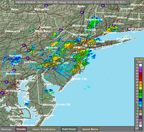 At 349 pm edt, severe thunderstorms were located along a line extending from near clark to oakwood, moving northeast at 10 mph (radar indicated). Hazards include 60 mph wind gusts and quarter size hail. Minor hail damage to vehicles is possible. expect wind damage to trees and power lines. severe thunderstorms will be near, todt hill and huguenot around 355 pm edt. bayonne around 405 pm edt. the verrazano narrows bridge and tompkinsville around 410 pm edt. jersey city around 425 pm edt. Newark and elizabeth around 430 pm edt. At 349 pm edt, severe thunderstorms were located along a line extending from near clark to oakwood, moving northeast at 10 mph (radar indicated). Hazards include 60 mph wind gusts and quarter size hail. Minor hail damage to vehicles is possible. expect wind damage to trees and power lines. severe thunderstorms will be near, todt hill and huguenot around 355 pm edt. bayonne around 405 pm edt. the verrazano narrows bridge and tompkinsville around 410 pm edt. jersey city around 425 pm edt. Newark and elizabeth around 430 pm edt.
|
| 7/31/2019 3:32 PM EDT |
 At 332 pm edt, a severe thunderstorm was located over great neck, moving southeast at 5 mph (radar indicated). Hazards include 60 mph wind gusts and quarter size hail. Minor hail damage to vehicles is possible. expect wind damage to trees and power lines. this severe thunderstorm will be near, port washington around 345 pm edt. glen cove around 350 pm edt. manhasset around 355 pm edt. Garden city and mineola around 415 pm edt. At 332 pm edt, a severe thunderstorm was located over great neck, moving southeast at 5 mph (radar indicated). Hazards include 60 mph wind gusts and quarter size hail. Minor hail damage to vehicles is possible. expect wind damage to trees and power lines. this severe thunderstorm will be near, port washington around 345 pm edt. glen cove around 350 pm edt. manhasset around 355 pm edt. Garden city and mineola around 415 pm edt.
|
| 7/31/2019 3:20 PM EDT |
 The severe thunderstorm warning for hudson, southeastern bergen, queens, bronx and new york (manhattan) counties will expire at 330 pm edt, the storms which prompted the warning have weakened below severe limits, and no longer pose an immediate threat to life or property. therefore, the warning will be allowed to expire. however gusty winds are still possible with these thunderstorms. a severe thunderstorm watch remains in effect until 900 pm edt for northeastern new jersey, and southeastern new york. The severe thunderstorm warning for hudson, southeastern bergen, queens, bronx and new york (manhattan) counties will expire at 330 pm edt, the storms which prompted the warning have weakened below severe limits, and no longer pose an immediate threat to life or property. therefore, the warning will be allowed to expire. however gusty winds are still possible with these thunderstorms. a severe thunderstorm watch remains in effect until 900 pm edt for northeastern new jersey, and southeastern new york.
|
| 7/31/2019 3:20 PM EDT |
 At 312 pm edt, severe thunderstorms were located along a line extending from fort lee to near lower east side, moving northeast at 20 mph (radar indicated). Hazards include 60 mph wind gusts. Expect damage to trees and power lines. these severe storms will be near, harlem and fort lee around 315 pm edt. astoria and riverdale around 325 pm edt. Mott haven and rfk bridge around 330 pm edt. At 312 pm edt, severe thunderstorms were located along a line extending from fort lee to near lower east side, moving northeast at 20 mph (radar indicated). Hazards include 60 mph wind gusts. Expect damage to trees and power lines. these severe storms will be near, harlem and fort lee around 315 pm edt. astoria and riverdale around 325 pm edt. Mott haven and rfk bridge around 330 pm edt.
|
| 7/31/2019 3:12 PM EDT |
 At 312 pm edt, severe thunderstorms were located along a line extending from fort lee to near lower east side, moving northeast at 20 mph (radar indicated). Hazards include 60 mph wind gusts. Expect damage to trees and power lines. these severe storms will be near, harlem and fort lee around 315 pm edt. astoria and riverdale around 325 pm edt. Mott haven and rfk bridge around 330 pm edt. At 312 pm edt, severe thunderstorms were located along a line extending from fort lee to near lower east side, moving northeast at 20 mph (radar indicated). Hazards include 60 mph wind gusts. Expect damage to trees and power lines. these severe storms will be near, harlem and fort lee around 315 pm edt. astoria and riverdale around 325 pm edt. Mott haven and rfk bridge around 330 pm edt.
|
| 7/31/2019 2:49 PM EDT |
 At 248 pm edt, severe thunderstorms were located along a line extending from secaucus to bay ridge, moving northeast at 20 mph (radar indicated). Hazards include 60 mph wind gusts. Expect damage to trees and power lines. severe thunderstorms will be near, secaucus and union city around 255 pm edt. ridgefield around 300 pm edt. harlem and lower east side around 305 pm edt. east village and fort lee around 310 pm edt. midtown manhattan around 315 pm edt. long island city around 320 pm edt. jackson heights and astoria around 325 pm edt. Mott haven and rfk bridge around 330 pm edt. At 248 pm edt, severe thunderstorms were located along a line extending from secaucus to bay ridge, moving northeast at 20 mph (radar indicated). Hazards include 60 mph wind gusts. Expect damage to trees and power lines. severe thunderstorms will be near, secaucus and union city around 255 pm edt. ridgefield around 300 pm edt. harlem and lower east side around 305 pm edt. east village and fort lee around 310 pm edt. midtown manhattan around 315 pm edt. long island city around 320 pm edt. jackson heights and astoria around 325 pm edt. Mott haven and rfk bridge around 330 pm edt.
|
| 7/31/2019 2:49 PM EDT |
 The national weather service in upton ny has issued a * severe thunderstorm warning for. hudson county in northeastern new jersey. southeastern bergen county in northeastern new jersey. queens county in southeastern new york. Richmond county in southeastern new york. The national weather service in upton ny has issued a * severe thunderstorm warning for. hudson county in northeastern new jersey. southeastern bergen county in northeastern new jersey. queens county in southeastern new york. Richmond county in southeastern new york.
|
| 7/31/2019 2:35 PM EDT |
 At 235 pm edt, a severe thunderstorm was located over tompkinsville, or over bayonne, moving northeast at 15 mph (radar indicated). Hazards include 60 mph wind gusts and quarter size hail. Minor hail damage to vehicles is possible. expect wind damage to trees and power lines. This severe thunderstorm will remain over mainly rural areas of richmond county. At 235 pm edt, a severe thunderstorm was located over tompkinsville, or over bayonne, moving northeast at 15 mph (radar indicated). Hazards include 60 mph wind gusts and quarter size hail. Minor hail damage to vehicles is possible. expect wind damage to trees and power lines. This severe thunderstorm will remain over mainly rural areas of richmond county.
|
| 7/31/2019 2:23 PM EDT |
 At 222 pm edt, a severe thunderstorm was located over port richmond, or over todt hill, moving northeast at 15 mph (radar indicated). Hazards include 60 mph wind gusts. Expect damage to trees and power lines. This severe storm will be near, the verrazano narrows bridge and tompkinsville around 230 pm edt. At 222 pm edt, a severe thunderstorm was located over port richmond, or over todt hill, moving northeast at 15 mph (radar indicated). Hazards include 60 mph wind gusts. Expect damage to trees and power lines. This severe storm will be near, the verrazano narrows bridge and tompkinsville around 230 pm edt.
|
| 7/31/2019 2:19 PM EDT |
 At 219 pm edt, a severe thunderstorm was located over port richmond, or over todt hill, moving northeast at 15 mph (radar indicated). Hazards include 60 mph wind gusts. Expect damage to trees and power lines. this severe thunderstorm will be near, tompkinsville around 230 pm edt. the verrazano narrows bridge around 235 pm edt. Midtown manhattan and lower east side around 245 pm edt. At 219 pm edt, a severe thunderstorm was located over port richmond, or over todt hill, moving northeast at 15 mph (radar indicated). Hazards include 60 mph wind gusts. Expect damage to trees and power lines. this severe thunderstorm will be near, tompkinsville around 230 pm edt. the verrazano narrows bridge around 235 pm edt. Midtown manhattan and lower east side around 245 pm edt.
|
| 7/30/2019 2:50 PM EDT |
 At 249 pm edt, a severe thunderstorm was located over jersey city, moving northeast at 15 mph (radar indicated). Hazards include 60 mph wind gusts and quarter size hail. Minor hail damage to vehicles is possible. expect wind damage to trees and power lines. this severe storm will be near, battery park around 255 pm edt. hoboken and lower east side around 305 pm edt. union city and east village around 310 pm edt. Midtown manhattan around 315 pm edt. At 249 pm edt, a severe thunderstorm was located over jersey city, moving northeast at 15 mph (radar indicated). Hazards include 60 mph wind gusts and quarter size hail. Minor hail damage to vehicles is possible. expect wind damage to trees and power lines. this severe storm will be near, battery park around 255 pm edt. hoboken and lower east side around 305 pm edt. union city and east village around 310 pm edt. Midtown manhattan around 315 pm edt.
|
| 7/30/2019 2:37 PM EDT |
 At 236 pm edt, a severe thunderstorm was located over bayonne, moving northeast at 15 mph (radar indicated). Hazards include 60 mph wind gusts and quarter size hail. Minor hail damage to vehicles is possible. expect wind damage to trees and power lines. this severe thunderstorm will be near, bay ridge and bensonhurst around 240 pm edt. jersey city and kearny around 250 pm edt. battery park and park slope around 255 pm edt. crown heights and brooklyn heights around 300 pm edt. hoboken and secaucus around 305 pm edt. union city around 310 pm edt. Midtown manhattan and upper west side around 315 pm edt. At 236 pm edt, a severe thunderstorm was located over bayonne, moving northeast at 15 mph (radar indicated). Hazards include 60 mph wind gusts and quarter size hail. Minor hail damage to vehicles is possible. expect wind damage to trees and power lines. this severe thunderstorm will be near, bay ridge and bensonhurst around 240 pm edt. jersey city and kearny around 250 pm edt. battery park and park slope around 255 pm edt. crown heights and brooklyn heights around 300 pm edt. hoboken and secaucus around 305 pm edt. union city around 310 pm edt. Midtown manhattan and upper west side around 315 pm edt.
|
| 7/22/2019 7:14 PM EDT |
 At 713 pm edt, severe thunderstorms were located along a line extending from near brookville to near farmingdale to near islip to 9 miles southeast of robert moses state park to 27 miles south of captree state park, moving northeast at 85 mph (radar indicated). Hazards include 60 mph wind gusts. Expect damage to trees and power lines. severe thunderstorms will be near, islip and brentwood around 720 pm edt. centereach and medford around 725 pm edt. shirley and middle island around 730 pm edt. manorville and wading river around 735 pm edt. riverhead and westhampton around 740 pm edt. mattituck around 745 pm edt. peconic around 750 pm edt. southold and southampton around 755 pm edt. Sag harbor and bridgehampton around 800 pm edt. At 713 pm edt, severe thunderstorms were located along a line extending from near brookville to near farmingdale to near islip to 9 miles southeast of robert moses state park to 27 miles south of captree state park, moving northeast at 85 mph (radar indicated). Hazards include 60 mph wind gusts. Expect damage to trees and power lines. severe thunderstorms will be near, islip and brentwood around 720 pm edt. centereach and medford around 725 pm edt. shirley and middle island around 730 pm edt. manorville and wading river around 735 pm edt. riverhead and westhampton around 740 pm edt. mattituck around 745 pm edt. peconic around 750 pm edt. southold and southampton around 755 pm edt. Sag harbor and bridgehampton around 800 pm edt.
|
| 7/22/2019 6:50 PM EDT | 51.6 kt gus in anz355 county NY, 27.7 miles NNW of New York, NY |
| 7/22/2019 6:43 PM EDT |
 At 642 pm edt, severe thunderstorms were located along a line extending from near east hanover to new hope, moving east at 30 mph (law enforcement reports several trees and wires down in somerset and middlesex counties). Hazards include 70 mph wind gusts and penny size hail. Expect considerable tree damage. damage is likely to mobile homes, roofs, and outbuildings. Locations impacted include, new brunswick, perth amboy, morristown, somerville, somerset, edison, old bridge, east brunswick, bridgewater, sayreville, north brunswick, carteret, madison, middlesex, florham park, east hanover, bound brook, manville, chatham and matawan. At 642 pm edt, severe thunderstorms were located along a line extending from near east hanover to new hope, moving east at 30 mph (law enforcement reports several trees and wires down in somerset and middlesex counties). Hazards include 70 mph wind gusts and penny size hail. Expect considerable tree damage. damage is likely to mobile homes, roofs, and outbuildings. Locations impacted include, new brunswick, perth amboy, morristown, somerville, somerset, edison, old bridge, east brunswick, bridgewater, sayreville, north brunswick, carteret, madison, middlesex, florham park, east hanover, bound brook, manville, chatham and matawan.
|
| 7/22/2019 6:35 PM EDT |
 The national weather service in upton ny has issued a * severe thunderstorm warning for. hudson county in northeastern new jersey. southern union county in northeastern new jersey. queens county in southeastern new york. Richmond county in southeastern new york. The national weather service in upton ny has issued a * severe thunderstorm warning for. hudson county in northeastern new jersey. southern union county in northeastern new jersey. queens county in southeastern new york. Richmond county in southeastern new york.
|
| 7/22/2019 6:35 PM EDT |
 At 634 pm edt, severe thunderstorms were located along a line extending from near edison to near highlands to 21 miles east of mantoloking, moving east at 65 mph (radar indicated). Hazards include 60 mph wind gusts. Expect damage to trees and power lines. severe thunderstorms will be near, jersey city and bayonne around 650 pm edt. flatbush and crown heights around 655 pm edt. flushing and rockaway beach around 700 pm edt. jamaica and valley stream around 705 pm edt. freeport and garden city around 710 pm edt. Levittown and plainview around 715 pm edt. At 634 pm edt, severe thunderstorms were located along a line extending from near edison to near highlands to 21 miles east of mantoloking, moving east at 65 mph (radar indicated). Hazards include 60 mph wind gusts. Expect damage to trees and power lines. severe thunderstorms will be near, jersey city and bayonne around 650 pm edt. flatbush and crown heights around 655 pm edt. flushing and rockaway beach around 700 pm edt. jamaica and valley stream around 705 pm edt. freeport and garden city around 710 pm edt. Levittown and plainview around 715 pm edt.
|
| 7/22/2019 6:27 PM EDT |
 At 626 pm edt, severe thunderstorms were located along a line extending from morris plains to gardenville, moving east at 30 mph (law enforcement. several reports of trees and wires down have been received from somerset, warren, hunterdon, and mercer counties in association with these storms). Hazards include 70 mph wind gusts and penny size hail. Expect considerable tree damage. Damage is likely to mobile homes, roofs, and outbuildings. At 626 pm edt, severe thunderstorms were located along a line extending from morris plains to gardenville, moving east at 30 mph (law enforcement. several reports of trees and wires down have been received from somerset, warren, hunterdon, and mercer counties in association with these storms). Hazards include 70 mph wind gusts and penny size hail. Expect considerable tree damage. Damage is likely to mobile homes, roofs, and outbuildings.
|
| 7/22/2019 6:13 PM EDT |
 At 612 pm edt, severe thunderstorms were located along a line extending from near mountain lakes to kendall park, moving east at 40 mph (law enforcement. several reports of wind damage have occurred with these storms). Hazards include 70 mph wind gusts. Expect considerable tree damage. damage is likely to mobile homes, roofs, and outbuildings. Locations impacted include, trenton, new brunswick, perth amboy, morristown, somerville, somerset, edison, old bridge, east brunswick, bridgewater, south brunswick, sayreville, north brunswick, ewing, carteret, dover, madison, hopatcong, middlesex and princeton. At 612 pm edt, severe thunderstorms were located along a line extending from near mountain lakes to kendall park, moving east at 40 mph (law enforcement. several reports of wind damage have occurred with these storms). Hazards include 70 mph wind gusts. Expect considerable tree damage. damage is likely to mobile homes, roofs, and outbuildings. Locations impacted include, trenton, new brunswick, perth amboy, morristown, somerville, somerset, edison, old bridge, east brunswick, bridgewater, south brunswick, sayreville, north brunswick, ewing, carteret, dover, madison, hopatcong, middlesex and princeton.
|
| 7/22/2019 5:58 PM EDT |
 The severe thunderstorm warning for hudson, eastern passaic, bergen, northeastern essex, westchester, bronx, rockland and new york (manhattan) counties will expire at 600 pm edt, the storms which prompted the warning have weakened below severe limits, and no longer pose an immediate threat to life or property. therefore, the warning will be allowed to expire. however flash flooding is still expected from the training thunderstorm activity. a severe thunderstorm watch remains in effect until 1000 pm edt for southern connecticut, northeastern new jersey, and southeastern new york. The severe thunderstorm warning for hudson, eastern passaic, bergen, northeastern essex, westchester, bronx, rockland and new york (manhattan) counties will expire at 600 pm edt, the storms which prompted the warning have weakened below severe limits, and no longer pose an immediate threat to life or property. therefore, the warning will be allowed to expire. however flash flooding is still expected from the training thunderstorm activity. a severe thunderstorm watch remains in effect until 1000 pm edt for southern connecticut, northeastern new jersey, and southeastern new york.
|
| 7/22/2019 5:50 PM EDT |
 At 549 pm edt, severe thunderstorms were located along a line extending from boonton to green lane, moving east at 40 mph (law enforcement. widespread wind damage has occurred with these storms). Hazards include 70 mph wind gusts. Expect considerable tree damage. Damage is likely to mobile homes, roofs, and outbuildings. At 549 pm edt, severe thunderstorms were located along a line extending from boonton to green lane, moving east at 40 mph (law enforcement. widespread wind damage has occurred with these storms). Hazards include 70 mph wind gusts. Expect considerable tree damage. Damage is likely to mobile homes, roofs, and outbuildings.
|
| 7/22/2019 5:48 PM EDT |
 At 548 pm edt, a severe thunderstorm was located over little neck, or over great neck, moving northeast at 30 mph (radar indicated). Hazards include 60 mph wind gusts and quarter size hail. Minor hail damage to vehicles is possible. expect wind damage to trees and power lines. this severe thunderstorm will be near, port washington around 600 pm edt. glen cove and brookville around 605 pm edt. oyster bay and bayville around 615 pm edt. cold spring harbor around 620 pm edt. Centerport around 630 pm edt. At 548 pm edt, a severe thunderstorm was located over little neck, or over great neck, moving northeast at 30 mph (radar indicated). Hazards include 60 mph wind gusts and quarter size hail. Minor hail damage to vehicles is possible. expect wind damage to trees and power lines. this severe thunderstorm will be near, port washington around 600 pm edt. glen cove and brookville around 605 pm edt. oyster bay and bayville around 615 pm edt. cold spring harbor around 620 pm edt. Centerport around 630 pm edt.
|
| 7/22/2019 5:16 PM EDT |
 At 516 pm edt, severe thunderstorms were located along a line extending from wayne to lyndhurst, moving northeast at 30 mph (radar indicated). Hazards include 60 mph wind gusts and quarter size hail. Minor hail damage to vehicles is possible. expect wind damage to trees and power lines. severe thunderstorms will be near, paterson and secaucus around 520 pm edt. ridgefield and hawthorne around 525 pm edt. hackensack and paramus around 530 pm edt. bergenfield and harlem around 535 pm edt. east tremont and riverdale around 540 pm edt. monsey and co-op city around 545 pm edt. yonkers and nanuet around 550 pm edt. new rochelle and new city around 555 pm edt. White plains and port chester around 600 pm edt. At 516 pm edt, severe thunderstorms were located along a line extending from wayne to lyndhurst, moving northeast at 30 mph (radar indicated). Hazards include 60 mph wind gusts and quarter size hail. Minor hail damage to vehicles is possible. expect wind damage to trees and power lines. severe thunderstorms will be near, paterson and secaucus around 520 pm edt. ridgefield and hawthorne around 525 pm edt. hackensack and paramus around 530 pm edt. bergenfield and harlem around 535 pm edt. east tremont and riverdale around 540 pm edt. monsey and co-op city around 545 pm edt. yonkers and nanuet around 550 pm edt. new rochelle and new city around 555 pm edt. White plains and port chester around 600 pm edt.
|
| 7/22/2019 4:26 PM EDT |
 The severe thunderstorm warning for central passaic, bergen, southern westchester and rockland counties will expire at 430 pm edt, the storm which prompted the warning has weakened below severe limits, and is exiting the warned area. therefore, the warning will be allowed to expire. a severe thunderstorm watch remains in effect until 1000 pm edt for southern connecticut, northeastern new jersey, and southeastern new york. The severe thunderstorm warning for central passaic, bergen, southern westchester and rockland counties will expire at 430 pm edt, the storm which prompted the warning has weakened below severe limits, and is exiting the warned area. therefore, the warning will be allowed to expire. a severe thunderstorm watch remains in effect until 1000 pm edt for southern connecticut, northeastern new jersey, and southeastern new york.
|
| 7/22/2019 4:00 PM EDT |
 At 359 pm edt, a severe thunderstorm was located near yorktown heights, or near mahopac, and is nearly stationary (radar indicated). Hazards include ping pong to possibly golf ball size hail and 60 mph wind gusts. People and animals outdoors will be injured. expect hail damage to roofs, siding, windows, and vehicles. expect wind damage to trees and power lines. This severe thunderstorm will remain over mainly rural areas of central passaic, bergen, southern westchester and rockland counties. At 359 pm edt, a severe thunderstorm was located near yorktown heights, or near mahopac, and is nearly stationary (radar indicated). Hazards include ping pong to possibly golf ball size hail and 60 mph wind gusts. People and animals outdoors will be injured. expect hail damage to roofs, siding, windows, and vehicles. expect wind damage to trees and power lines. This severe thunderstorm will remain over mainly rural areas of central passaic, bergen, southern westchester and rockland counties.
|
| 7/22/2019 3:38 PM EDT |
 At 338 pm edt, a severe thunderstorm was located over kinnelon, or near pompton lakes, moving east at 40 mph (radar indicated). Hazards include 60 mph wind gusts and quarter size hail. Minor hail damage to vehicles is possible. expect wind damage to trees and power lines. this severe thunderstorm will be near, pompton lakes around 345 pm edt. wayne around 350 pm edt. paterson and hawthorne around 355 pm edt. paramus and ridgewood around 400 pm edt. monsey and oradell around 405 pm edt. bergenfield and nanuet around 410 pm edt. tappan and norwood around 415 pm edt. yonkers and tarrytown around 420 pm edt. ossining and scarsdale around 425 pm edt. White plains and harrison around 430 pm edt. At 338 pm edt, a severe thunderstorm was located over kinnelon, or near pompton lakes, moving east at 40 mph (radar indicated). Hazards include 60 mph wind gusts and quarter size hail. Minor hail damage to vehicles is possible. expect wind damage to trees and power lines. this severe thunderstorm will be near, pompton lakes around 345 pm edt. wayne around 350 pm edt. paterson and hawthorne around 355 pm edt. paramus and ridgewood around 400 pm edt. monsey and oradell around 405 pm edt. bergenfield and nanuet around 410 pm edt. tappan and norwood around 415 pm edt. yonkers and tarrytown around 420 pm edt. ossining and scarsdale around 425 pm edt. White plains and harrison around 430 pm edt.
|
| 7/21/2019 11:27 PM EDT |
 The severe thunderstorm warning for queens. kings and southern nassau counties will expire at 1130 pm edt. the storms which prompted the warning have weakened. therefore, the warning will be allowed to expire. However gusty winds are still possible with these thunderstorms. The severe thunderstorm warning for queens. kings and southern nassau counties will expire at 1130 pm edt. the storms which prompted the warning have weakened. therefore, the warning will be allowed to expire. However gusty winds are still possible with these thunderstorms.
|
| 7/21/2019 11:06 PM EDT |
 At 1105 pm edt, outflow winds associated with severe thunderstorms were located along a line extending from near sheepshead bay to 7 miles east of highlands, moving east at 35 mph (radar indicated). Hazards include 60 mph wind gusts. Expect damage to trees and power lines. severe thunderstorms will be near, howard beach around 1110 pm edt. rockaway beach around 1115 pm edt. kennedy airport and cedarhurst around 1120 pm edt. valley stream and long beach around 1125 pm edt. Freeport and garden city around 1130 pm edt. At 1105 pm edt, outflow winds associated with severe thunderstorms were located along a line extending from near sheepshead bay to 7 miles east of highlands, moving east at 35 mph (radar indicated). Hazards include 60 mph wind gusts. Expect damage to trees and power lines. severe thunderstorms will be near, howard beach around 1110 pm edt. rockaway beach around 1115 pm edt. kennedy airport and cedarhurst around 1120 pm edt. valley stream and long beach around 1125 pm edt. Freeport and garden city around 1130 pm edt.
|
| 7/21/2019 10:48 PM EDT |
 At 1048 pm edt, severe thunderstorms were located along a line extending from union to near carteret, moving east at 25 mph (radar indicated). Hazards include 60 mph wind gusts. Expect damage to trees and power lines. these severe storms will be near, elizabeth and huguenot around 1055 pm edt. Bayonne and todt hill around 1100 pm edt. At 1048 pm edt, severe thunderstorms were located along a line extending from union to near carteret, moving east at 25 mph (radar indicated). Hazards include 60 mph wind gusts. Expect damage to trees and power lines. these severe storms will be near, elizabeth and huguenot around 1055 pm edt. Bayonne and todt hill around 1100 pm edt.
|
| 7/21/2019 10:30 PM EDT |
 At 1029 pm edt, severe thunderstorms were located along a line extending from near summit to near martinsville to east brunswick, moving southeast at 20 mph (radar indicated). Hazards include 60 mph wind gusts. Damage to roofs, siding, trees, and power lines is possible. Locations impacted include, new brunswick, perth amboy, somerville, somerset, edison, old bridge, east brunswick, sayreville, north brunswick, carteret, madison, middlesex, bound brook, manville, chatham, matawan, millstone, flagtown, colonia and brownville. At 1029 pm edt, severe thunderstorms were located along a line extending from near summit to near martinsville to east brunswick, moving southeast at 20 mph (radar indicated). Hazards include 60 mph wind gusts. Damage to roofs, siding, trees, and power lines is possible. Locations impacted include, new brunswick, perth amboy, somerville, somerset, edison, old bridge, east brunswick, sayreville, north brunswick, carteret, madison, middlesex, bound brook, manville, chatham, matawan, millstone, flagtown, colonia and brownville.
|
| 7/21/2019 10:29 PM EDT |
 At 1029 pm edt, severe thunderstorms were located along a line extending from near plainfield to edison, moving east at 25 mph (radar indicated). Hazards include 60 mph wind gusts. Expect damage to trees and power lines. these severe storms will be near, clark around 1040 pm edt. linden and tottenville around 1050 pm edt. elizabeth and huguenot around 1055 pm edt. Bayonne and todt hill around 1100 pm edt. At 1029 pm edt, severe thunderstorms were located along a line extending from near plainfield to edison, moving east at 25 mph (radar indicated). Hazards include 60 mph wind gusts. Expect damage to trees and power lines. these severe storms will be near, clark around 1040 pm edt. linden and tottenville around 1050 pm edt. elizabeth and huguenot around 1055 pm edt. Bayonne and todt hill around 1100 pm edt.
|
| 7/21/2019 10:24 PM EDT |
 At 1024 pm edt, severe thunderstorms were located along a line extending from plainfield to near edison, moving east at 20 mph (radar indicated). Hazards include 60 mph wind gusts. Expect damage to trees and power lines. severe thunderstorms will be near, clark around 1040 pm edt. linden and tottenville around 1050 pm edt. elizabeth and huguenot around 1055 pm edt. Bayonne and todt hill around 1100 pm edt. At 1024 pm edt, severe thunderstorms were located along a line extending from plainfield to near edison, moving east at 20 mph (radar indicated). Hazards include 60 mph wind gusts. Expect damage to trees and power lines. severe thunderstorms will be near, clark around 1040 pm edt. linden and tottenville around 1050 pm edt. elizabeth and huguenot around 1055 pm edt. Bayonne and todt hill around 1100 pm edt.
|
| 7/21/2019 10:12 PM EDT |
 At 1011 pm edt, severe thunderstorms were located along a line extending from madison to basking ridge to near flagtown, moving east at 30 mph (radar indicated). Hazards include 60 mph wind gusts. damage to roofs, siding, trees, and power lines is possible At 1011 pm edt, severe thunderstorms were located along a line extending from madison to basking ridge to near flagtown, moving east at 30 mph (radar indicated). Hazards include 60 mph wind gusts. damage to roofs, siding, trees, and power lines is possible
|
| 7/21/2019 8:07 PM EDT |
 The severe thunderstorm warning for central monmouth and middlesex counties will expire at 815 pm edt, the storm which prompted the warning has weakened below severe limits, and no longer poses an immediate threat to life or property. therefore, the warning will be allowed to expire. however gusty winds are still possible with this thunderstorm. The severe thunderstorm warning for central monmouth and middlesex counties will expire at 815 pm edt, the storm which prompted the warning has weakened below severe limits, and no longer poses an immediate threat to life or property. therefore, the warning will be allowed to expire. however gusty winds are still possible with this thunderstorm.
|
| 7/21/2019 7:55 PM EDT |
 At 755 pm edt, a severe thunderstorm was located over old bridge, or near new brunswick, moving southeast at 30 mph (radar indicated). Hazards include 60 mph wind gusts and quarter size hail. Minor damage to vehicles is possible. wind damage to roofs, siding, trees, and power lines is possible. Locations impacted include, new brunswick, perth amboy, somerset, edison, middletown, old bridge, east brunswick, sayreville, north brunswick, marlboro, manalapan, holmdel, matawan, jamesburg, colonia, brownville, robertsville, north brunswick township, clearbrook park and yorketown. At 755 pm edt, a severe thunderstorm was located over old bridge, or near new brunswick, moving southeast at 30 mph (radar indicated). Hazards include 60 mph wind gusts and quarter size hail. Minor damage to vehicles is possible. wind damage to roofs, siding, trees, and power lines is possible. Locations impacted include, new brunswick, perth amboy, somerset, edison, middletown, old bridge, east brunswick, sayreville, north brunswick, marlboro, manalapan, holmdel, matawan, jamesburg, colonia, brownville, robertsville, north brunswick township, clearbrook park and yorketown.
|
| 7/21/2019 7:43 PM EDT |
 At 742 pm edt, a severe thunderstorm was located over new brunswick, moving southeast at 20 mph (radar indicated). Hazards include 70 mph wind gusts and quarter size hail. Minor damage to vehicles is possible. expect considerable tree damage. wind damage is also likely to mobile homes, roofs, and outbuildings. Locations impacted include, new brunswick, perth amboy, somerset, edison, middletown, old bridge, east brunswick, south brunswick, sayreville, north brunswick, marlboro, manalapan, carteret, holmdel, middlesex, matawan, jamesburg, cranbury, millstone and brownville. At 742 pm edt, a severe thunderstorm was located over new brunswick, moving southeast at 20 mph (radar indicated). Hazards include 70 mph wind gusts and quarter size hail. Minor damage to vehicles is possible. expect considerable tree damage. wind damage is also likely to mobile homes, roofs, and outbuildings. Locations impacted include, new brunswick, perth amboy, somerset, edison, middletown, old bridge, east brunswick, south brunswick, sayreville, north brunswick, marlboro, manalapan, carteret, holmdel, middlesex, matawan, jamesburg, cranbury, millstone and brownville.
|
| 7/21/2019 7:23 PM EDT |
 At 722 pm edt, a severe thunderstorm was located over bound brook, or near somerville, moving southeast at 30 mph (radar indicated). Hazards include 70 mph wind gusts and quarter size hail. Minor damage to vehicles is possible. expect considerable tree damage. Wind damage is also likely to mobile homes, roofs, and outbuildings. At 722 pm edt, a severe thunderstorm was located over bound brook, or near somerville, moving southeast at 30 mph (radar indicated). Hazards include 70 mph wind gusts and quarter size hail. Minor damage to vehicles is possible. expect considerable tree damage. Wind damage is also likely to mobile homes, roofs, and outbuildings.
|
| 7/21/2019 7:13 PM EDT |
 At 712 pm edt, severe thunderstorms were located along a line extending from near millington to near bridgewater to lebanon, moving east at 25 mph (radar indicated). Hazards include 60 mph wind gusts. Damage to roofs, siding, trees, and power lines is possible. Locations impacted include, perth amboy, morristown, somerville, edison, bridgewater, carteret, madison, middlesex, bound brook, manville, chatham, mendham, peapack and gladstone, lebanon, far hills, colonia, martinsville, millington, white house station and society hill. At 712 pm edt, severe thunderstorms were located along a line extending from near millington to near bridgewater to lebanon, moving east at 25 mph (radar indicated). Hazards include 60 mph wind gusts. Damage to roofs, siding, trees, and power lines is possible. Locations impacted include, perth amboy, morristown, somerville, edison, bridgewater, carteret, madison, middlesex, bound brook, manville, chatham, mendham, peapack and gladstone, lebanon, far hills, colonia, martinsville, millington, white house station and society hill.
|
| 7/21/2019 6:58 PM EDT |
 At 658 pm edt, severe thunderstorms were located along a line extending from basking ridge to near white house station to high bridge, moving east at 30 mph (radar indicated). Hazards include 60 mph wind gusts. Damage to roofs, siding, trees, and power lines is possible. Locations impacted include, perth amboy, morristown, somerville, edison, bridgewater, carteret, madison, middlesex, bound brook, manville, chatham, mendham, high bridge, clinton, peapack and gladstone, glen gardner, chester, hampton, lebanon and califon. At 658 pm edt, severe thunderstorms were located along a line extending from basking ridge to near white house station to high bridge, moving east at 30 mph (radar indicated). Hazards include 60 mph wind gusts. Damage to roofs, siding, trees, and power lines is possible. Locations impacted include, perth amboy, morristown, somerville, edison, bridgewater, carteret, madison, middlesex, bound brook, manville, chatham, mendham, high bridge, clinton, peapack and gladstone, glen gardner, chester, hampton, lebanon and califon.
|
| 7/21/2019 6:49 PM EDT |
 At 648 pm edt, severe thunderstorms were located along a line extending from near peapack and gladstone to near lebanon to near hampton, moving east at 35 mph (radar indicated). Hazards include 60 mph wind gusts. damage to roofs, siding, trees, and power lines is possible At 648 pm edt, severe thunderstorms were located along a line extending from near peapack and gladstone to near lebanon to near hampton, moving east at 35 mph (radar indicated). Hazards include 60 mph wind gusts. damage to roofs, siding, trees, and power lines is possible
|
| 7/17/2019 9:26 PM EDT |
 The severe thunderstorm warning for southeastern somerset, northern monmouth and middlesex counties will expire at 930 pm edt, the storm which prompted the warning has weakened below severe limits, and will be moving out of the warned area. therefore, the warning will be allowed to expire. however gusty winds and heavy rain are still possible with this thunderstorm. a severe thunderstorm watch remains in effect until 1000 pm edt for northern and central new jersey. remember, a severe thunderstorm warning still remains in effect for monmouth county until 1000 pm edt. The severe thunderstorm warning for southeastern somerset, northern monmouth and middlesex counties will expire at 930 pm edt, the storm which prompted the warning has weakened below severe limits, and will be moving out of the warned area. therefore, the warning will be allowed to expire. however gusty winds and heavy rain are still possible with this thunderstorm. a severe thunderstorm watch remains in effect until 1000 pm edt for northern and central new jersey. remember, a severe thunderstorm warning still remains in effect for monmouth county until 1000 pm edt.
|
| 7/17/2019 9:15 PM EDT |
 At 914 pm edt, a severe thunderstorm was located over huguenot, moving northeast at 40 mph. another line of storms was located near spotswood moving northeast at 40 mph (radar indicated). Hazards include 60 mph wind gusts and quarter size hail. Minor damage to vehicles is possible. wind damage to roofs, siding, trees, and power lines is possible. Locations impacted include, new brunswick, perth amboy, somerville, somerset, edison, old bridge, east brunswick, sayreville, north brunswick, carteret, middlesex, bound brook, manville, keansburg, matawan, jamesburg, millstone, colonia, brownville and dayton. At 914 pm edt, a severe thunderstorm was located over huguenot, moving northeast at 40 mph. another line of storms was located near spotswood moving northeast at 40 mph (radar indicated). Hazards include 60 mph wind gusts and quarter size hail. Minor damage to vehicles is possible. wind damage to roofs, siding, trees, and power lines is possible. Locations impacted include, new brunswick, perth amboy, somerville, somerset, edison, old bridge, east brunswick, sayreville, north brunswick, carteret, middlesex, bound brook, manville, keansburg, matawan, jamesburg, millstone, colonia, brownville and dayton.
|
| 7/17/2019 8:50 PM EDT |
 At 850 pm edt, a severe thunderstorm was located over east brunswick, or near new brunswick, moving northeast at 40 mph (radar indicated). Hazards include 60 mph wind gusts and quarter size hail. Minor damage to vehicles is possible. Wind damage to roofs, siding, trees, and power lines is possible. At 850 pm edt, a severe thunderstorm was located over east brunswick, or near new brunswick, moving northeast at 40 mph (radar indicated). Hazards include 60 mph wind gusts and quarter size hail. Minor damage to vehicles is possible. Wind damage to roofs, siding, trees, and power lines is possible.
|
| 7/17/2019 8:16 PM EDT |
 At 816 pm edt, a severe thunderstorm was located over park slope, or over flatbush, moving east at 35 mph (radar indicated). Hazards include 60 mph wind gusts. Expect damage to trees and power lines. this severe thunderstorm will be near, flatbush and crown heights around 820 pm edt. canarsie and sheepshead bay around 825 pm edt. howard beach and ozone park around 830 pm edt. rockaway beach and kennedy airport around 835 pm edt. valley stream and woodmere around 840 pm edt. atlantic beach around 845 pm edt. Long beach and oceanside around 850 pm edt. At 816 pm edt, a severe thunderstorm was located over park slope, or over flatbush, moving east at 35 mph (radar indicated). Hazards include 60 mph wind gusts. Expect damage to trees and power lines. this severe thunderstorm will be near, flatbush and crown heights around 820 pm edt. canarsie and sheepshead bay around 825 pm edt. howard beach and ozone park around 830 pm edt. rockaway beach and kennedy airport around 835 pm edt. valley stream and woodmere around 840 pm edt. atlantic beach around 845 pm edt. Long beach and oceanside around 850 pm edt.
|
| 7/17/2019 8:15 PM EDT | Large tree down on steinway stree in queens county NY, 2.7 miles SSE of New York, NY |
| 7/17/2019 8:09 PM EDT | *** 1 inj *** a tree limb fell on a car on west 46th street at 8th avenue. one person was taken to the hospital with injurie in new york (manhatta county NY, 5.3 miles ESE of New York, NY |
| 7/17/2019 7:33 PM EDT |
 At 733 pm edt, severe thunderstorms were located along a line extending from florida to lake telemark to near clinton, moving east at 50 mph (radar indicated). Hazards include 60 mph wind gusts. Expect damage to trees and power lines. these severe storms will be near, pompton lakes and caldwell around 745 pm edt. wayne around 750 pm edt. paterson and passaic around 755 pm edt. Plainfield and hackensack around 800 pm edt. At 733 pm edt, severe thunderstorms were located along a line extending from florida to lake telemark to near clinton, moving east at 50 mph (radar indicated). Hazards include 60 mph wind gusts. Expect damage to trees and power lines. these severe storms will be near, pompton lakes and caldwell around 745 pm edt. wayne around 750 pm edt. paterson and passaic around 755 pm edt. Plainfield and hackensack around 800 pm edt.
|
| 7/17/2019 7:19 PM EDT |
 At 718 pm edt, severe thunderstorms were located along a line extending from near unionville to near stanhope to ferndale, moving east at 50 mph (radar indicated). Hazards include 60 mph wind gusts. Expect damage to trees and power lines. severe thunderstorms will be near, pompton lakes and caldwell around 745 pm edt. wayne around 750 pm edt. paterson and passaic around 755 pm edt. Plainfield and hackensack around 800 pm edt. At 718 pm edt, severe thunderstorms were located along a line extending from near unionville to near stanhope to ferndale, moving east at 50 mph (radar indicated). Hazards include 60 mph wind gusts. Expect damage to trees and power lines. severe thunderstorms will be near, pompton lakes and caldwell around 745 pm edt. wayne around 750 pm edt. paterson and passaic around 755 pm edt. Plainfield and hackensack around 800 pm edt.
|
| 7/17/2019 7:19 PM EDT |
 The national weather service in upton ny has issued a * severe thunderstorm warning for. southern fairfield county in southern connecticut. hudson county in northeastern new jersey. passaic county in northeastern new jersey. Union county in northeastern new jersey. The national weather service in upton ny has issued a * severe thunderstorm warning for. southern fairfield county in southern connecticut. hudson county in northeastern new jersey. passaic county in northeastern new jersey. Union county in northeastern new jersey.
|
| 7/17/2019 7:19 PM EDT |
 At 718 pm edt, severe thunderstorms were located along a line extending from near unionville to near stanhope to ferndale, moving east at 50 mph (radar indicated). Hazards include 60 mph wind gusts. Expect damage to trees and power lines. severe thunderstorms will be near, pompton lakes and caldwell around 745 pm edt. wayne around 750 pm edt. paterson and passaic around 755 pm edt. Plainfield and hackensack around 800 pm edt. At 718 pm edt, severe thunderstorms were located along a line extending from near unionville to near stanhope to ferndale, moving east at 50 mph (radar indicated). Hazards include 60 mph wind gusts. Expect damage to trees and power lines. severe thunderstorms will be near, pompton lakes and caldwell around 745 pm edt. wayne around 750 pm edt. paterson and passaic around 755 pm edt. Plainfield and hackensack around 800 pm edt.
|
| 6/29/2019 5:43 PM EDT |
 At 543 pm edt, a severe thunderstorm was located over rockaway beach, moving east at 45 mph (radar indicated). Hazards include 60 mph wind gusts. Expect damage to trees and power lines. this severe storm will be near, valley stream and lynbrook around 550 pm edt. Long beach and oceanside around 555 pm edt. At 543 pm edt, a severe thunderstorm was located over rockaway beach, moving east at 45 mph (radar indicated). Hazards include 60 mph wind gusts. Expect damage to trees and power lines. this severe storm will be near, valley stream and lynbrook around 550 pm edt. Long beach and oceanside around 555 pm edt.
|
| 6/29/2019 5:42 PM EDT | Large branch down on shore parkway at coney island hospital with time estimated by radar in kings county NY, 11.9 miles NNE of New York, NY |
| 6/29/2019 5:42 PM EDT |
 At 542 pm edt, a severe thunderstorm was located over port richmond, or over todt hill, moving southeast at 25 mph (radar indicated). Hazards include 60 mph wind gusts. Expect damage to trees and power lines. this severe storm will be near, todt hill and huguenot around 545 pm edt. tompkinsville and oakwood around 550 pm edt. The verrazano narrows bridge around 555 pm edt. At 542 pm edt, a severe thunderstorm was located over port richmond, or over todt hill, moving southeast at 25 mph (radar indicated). Hazards include 60 mph wind gusts. Expect damage to trees and power lines. this severe storm will be near, todt hill and huguenot around 545 pm edt. tompkinsville and oakwood around 550 pm edt. The verrazano narrows bridge around 555 pm edt.
|
| 6/29/2019 5:36 PM EDT | 60 mph observed at sandy hook mesonet in anz338 county NY, 20 miles NNE of New York, NY |
| 6/29/2019 5:35 PM EDT | Large tree down on a home on east 5th stree in kings county NY, 7.8 miles NNE of New York, NY |
| 6/29/2019 5:31 PM EDT |
 At 531 pm edt, a severe thunderstorm was located over elizabeth, moving southeast at 45 mph (radar indicated). Hazards include 60 mph wind gusts and penny size hail. Expect damage to trees and power lines. this severe storm will be near, bayonne and todt hill around 545 pm edt. tompkinsville and oakwood around 550 pm edt. The verrazano narrows bridge around 555 pm edt. At 531 pm edt, a severe thunderstorm was located over elizabeth, moving southeast at 45 mph (radar indicated). Hazards include 60 mph wind gusts and penny size hail. Expect damage to trees and power lines. this severe storm will be near, bayonne and todt hill around 545 pm edt. tompkinsville and oakwood around 550 pm edt. The verrazano narrows bridge around 555 pm edt.
|
| 6/29/2019 5:28 PM EDT |
 At 528 pm edt, a severe thunderstorm was located over bay ridge, or over the verrazano narrows bridge, moving east at 45 mph (radar indicated). Hazards include 60 mph wind gusts and penny size hail. Expect damage to trees and power lines. this severe thunderstorm will be near, forest hills and canarsie around 540 pm edt. jamaica and rockaway beach around 545 pm edt. valley stream and lynbrook around 550 pm edt. Long beach and oceanside around 555 pm edt. At 528 pm edt, a severe thunderstorm was located over bay ridge, or over the verrazano narrows bridge, moving east at 45 mph (radar indicated). Hazards include 60 mph wind gusts and penny size hail. Expect damage to trees and power lines. this severe thunderstorm will be near, forest hills and canarsie around 540 pm edt. jamaica and rockaway beach around 545 pm edt. valley stream and lynbrook around 550 pm edt. Long beach and oceanside around 555 pm edt.
|
| 6/29/2019 5:20 PM EDT | A large tree was brought down and blocking maine avenu in richmond county NY, 15.2 miles NE of New York, NY |
| 6/29/2019 5:20 PM EDT | A tree fell onto a car at caswell avenue and livermore avenue. the road is also blocked by the downed tre in richmond county NY, 15.2 miles NE of New York, NY |
| 6/29/2019 5:19 PM EDT | A tree fell on a house on windham loo in richmond county NY, 17.7 miles NE of New York, NY |
| 6/29/2019 5:18 PM EDT | Trees down on power lines around grand plaza with time estimated by radar in richmond county NY, 19.1 miles NE of New York, NY |
| 6/29/2019 5:18 PM EDT |
 At 517 pm edt, a severe thunderstorm was located over edison, or near perth amboy, moving east at 25 mph (radar indicated). Hazards include 60 mph wind gusts and penny size hail. Damage to roofs, siding, trees, and power lines is possible. Locations impacted include, new brunswick, perth amboy, edison, east brunswick, carteret, colonia, woodbridge, south plainfield, metuchen, iselin, sewaren, port reading, fords and avenel. At 517 pm edt, a severe thunderstorm was located over edison, or near perth amboy, moving east at 25 mph (radar indicated). Hazards include 60 mph wind gusts and penny size hail. Damage to roofs, siding, trees, and power lines is possible. Locations impacted include, new brunswick, perth amboy, edison, east brunswick, carteret, colonia, woodbridge, south plainfield, metuchen, iselin, sewaren, port reading, fords and avenel.
|
| 6/29/2019 5:15 PM EDT |
 At 515 pm edt, a severe thunderstorm was located over summit, moving southeast at 25 mph (radar indicated). Hazards include 60 mph wind gusts and penny size hail. Expect damage to trees and power lines. this severe storm will be near, clark and union around 525 pm edt. newark and elizabeth around 535 pm edt. bayonne and todt hill around 545 pm edt. huguenot and tompkinsville around 550 pm edt. The verrazano narrows bridge and oakwood around 555 pm edt. At 515 pm edt, a severe thunderstorm was located over summit, moving southeast at 25 mph (radar indicated). Hazards include 60 mph wind gusts and penny size hail. Expect damage to trees and power lines. this severe storm will be near, clark and union around 525 pm edt. newark and elizabeth around 535 pm edt. bayonne and todt hill around 545 pm edt. huguenot and tompkinsville around 550 pm edt. The verrazano narrows bridge and oakwood around 555 pm edt.
|
| 6/29/2019 5:03 PM EDT |
 At 502 pm edt, a severe thunderstorm was located over society hill, or near new brunswick, moving east at 25 mph (radar indicated). Hazards include 60 mph wind gusts and quarter size hail. Damage to vehicles is possible. Wind damage to roofs, siding, trees, and power lines is possible. At 502 pm edt, a severe thunderstorm was located over society hill, or near new brunswick, moving east at 25 mph (radar indicated). Hazards include 60 mph wind gusts and quarter size hail. Damage to vehicles is possible. Wind damage to roofs, siding, trees, and power lines is possible.
|
| 6/29/2019 4:59 PM EDT |
 The national weather service in upton ny has issued a * severe thunderstorm warning for. hudson county in northeastern new jersey. union county in northeastern new jersey. southern essex county in northeastern new jersey. Richmond county in southeastern new york. The national weather service in upton ny has issued a * severe thunderstorm warning for. hudson county in northeastern new jersey. union county in northeastern new jersey. southern essex county in northeastern new jersey. Richmond county in southeastern new york.
|
| 6/29/2019 4:59 PM EDT |
 At 458 pm edt, a severe thunderstorm was located over madison, or over morristown, moving southeast at 40 mph (radar indicated). Hazards include 60 mph wind gusts. Expect damage to trees and power lines. this severe thunderstorm will be near, summit around 510 pm edt. plainfield and millburn around 515 pm edt. clark and union around 525 pm edt. newark and elizabeth around 535 pm edt. bayonne and todt hill around 545 pm edt. huguenot around 550 pm edt. The verrazano narrows bridge and tompkinsville around 555 pm edt. At 458 pm edt, a severe thunderstorm was located over madison, or over morristown, moving southeast at 40 mph (radar indicated). Hazards include 60 mph wind gusts. Expect damage to trees and power lines. this severe thunderstorm will be near, summit around 510 pm edt. plainfield and millburn around 515 pm edt. clark and union around 525 pm edt. newark and elizabeth around 535 pm edt. bayonne and todt hill around 545 pm edt. huguenot around 550 pm edt. The verrazano narrows bridge and tompkinsville around 555 pm edt.
|
| 6/2/2019 9:56 PM EDT |
 At 956 pm edt, severe thunderstorms were located along a line extending from upper west side to ozone park to near rockaway beach, moving northeast at 30 mph (radar indicated). Hazards include 60 mph wind gusts and penny size hail. Expect damage to trees and power lines. these severe storms will be near, forest hills and ozone park around 1000 pm edt. jamaica and flushing around 1005 pm edt. east tremont and valley stream around 1010 pm edt. Garden city and lynbrook around 1015 pm edt. At 956 pm edt, severe thunderstorms were located along a line extending from upper west side to ozone park to near rockaway beach, moving northeast at 30 mph (radar indicated). Hazards include 60 mph wind gusts and penny size hail. Expect damage to trees and power lines. these severe storms will be near, forest hills and ozone park around 1000 pm edt. jamaica and flushing around 1005 pm edt. east tremont and valley stream around 1010 pm edt. Garden city and lynbrook around 1015 pm edt.
|
| 6/2/2019 9:32 PM EDT |
 At 931 pm edt, severe thunderstorms were located along a line extending from near newark to tompkinsville to sandy hook, moving northeast at 30 mph (radar indicated). Hazards include 60 mph wind gusts and penny size hail. Expect damage to trees and power lines. severe thunderstorms will be near, the verrazano narrows bridge around 935 pm edt. coney island and bay ridge around 940 pm edt. flatbush and lower east side around 945 pm edt. hoboken and crown heights around 950 pm edt. rockaway beach and ridgefield around 955 pm edt. forest hills and fort lee around 1000 pm edt. jamaica and flushing around 1005 pm edt. east tremont and valley stream around 1010 pm edt. Garden city and lynbrook around 1015 pm edt. At 931 pm edt, severe thunderstorms were located along a line extending from near newark to tompkinsville to sandy hook, moving northeast at 30 mph (radar indicated). Hazards include 60 mph wind gusts and penny size hail. Expect damage to trees and power lines. severe thunderstorms will be near, the verrazano narrows bridge around 935 pm edt. coney island and bay ridge around 940 pm edt. flatbush and lower east side around 945 pm edt. hoboken and crown heights around 950 pm edt. rockaway beach and ridgefield around 955 pm edt. forest hills and fort lee around 1000 pm edt. jamaica and flushing around 1005 pm edt. east tremont and valley stream around 1010 pm edt. Garden city and lynbrook around 1015 pm edt.
|
| 6/2/2019 9:10 PM EDT |
 At 910 pm edt, severe thunderstorms were located along a line extending from near chatham to sayreville to near tinton falls, moving northeast at 75 mph (radar indicated). Hazards include 60 mph wind gusts. Expect damage to trees and power lines. severe thunderstorms will be near, summit and millburn around 915 pm edt. elizabeth and bloomfield around 920 pm edt. newark and jersey city around 925 pm edt. Paramus and ridgewood around 930 pm edt. At 910 pm edt, severe thunderstorms were located along a line extending from near chatham to sayreville to near tinton falls, moving northeast at 75 mph (radar indicated). Hazards include 60 mph wind gusts. Expect damage to trees and power lines. severe thunderstorms will be near, summit and millburn around 915 pm edt. elizabeth and bloomfield around 920 pm edt. newark and jersey city around 925 pm edt. Paramus and ridgewood around 930 pm edt.
|
| 6/2/2019 9:07 PM EDT |
 At 906 pm edt, severe thunderstorms were located along a line extending from far hills to near edison, moving east at 25 mph (radar indicated). Hazards include 60 mph wind gusts and penny size hail. damage to roofs, siding, trees, and power lines is possible At 906 pm edt, severe thunderstorms were located along a line extending from far hills to near edison, moving east at 25 mph (radar indicated). Hazards include 60 mph wind gusts and penny size hail. damage to roofs, siding, trees, and power lines is possible
|
| 6/2/2019 6:18 PM EDT |
 A severe thunderstorm warning remains in effect until 630 pm edt for southern nassau county. at 618 pm edt, a severe thunderstorm was located over oceanside, or over long beach, moving east at 40 mph. hazard. 60 mph wind gusts and quarter size hail. source. Radar indicated. A severe thunderstorm warning remains in effect until 630 pm edt for southern nassau county. at 618 pm edt, a severe thunderstorm was located over oceanside, or over long beach, moving east at 40 mph. hazard. 60 mph wind gusts and quarter size hail. source. Radar indicated.
|
| 6/2/2019 6:01 PM EDT |
 At 601 pm edt, a severe thunderstorm was located over howard beach, or near kennedy airport, moving east at 25 mph (radar indicated). Hazards include 60 mph wind gusts and quarter size hail. Minor hail damage to vehicles is possible. expect wind damage to trees and power lines. this severe storm will be near, rockaway beach around 605 pm edt. jamaica and kennedy airport around 610 pm edt. woodmere and cedarhurst around 615 pm edt. valley stream and long beach around 620 pm edt. garden city and mineola around 625 pm edt. Levittown and freeport around 630 pm edt. At 601 pm edt, a severe thunderstorm was located over howard beach, or near kennedy airport, moving east at 25 mph (radar indicated). Hazards include 60 mph wind gusts and quarter size hail. Minor hail damage to vehicles is possible. expect wind damage to trees and power lines. this severe storm will be near, rockaway beach around 605 pm edt. jamaica and kennedy airport around 610 pm edt. woodmere and cedarhurst around 615 pm edt. valley stream and long beach around 620 pm edt. garden city and mineola around 625 pm edt. Levittown and freeport around 630 pm edt.
|
| 6/2/2019 5:55 PM EDT | Quarter sized hail reported 6 miles NNE of New York, NY |
| 6/2/2019 5:50 PM EDT |
 At 550 pm edt, a severe thunderstorm was located over flatbush, moving east at 25 mph (radar indicated). Hazards include quarter size hail. Minor damage to vehicles is possible. this severe thunderstorm will be near, canarsie around 555 pm edt. forest hills and howard beach around 600 pm edt. rockaway beach around 605 pm edt. jamaica and kennedy airport around 610 pm edt. woodmere and cedarhurst around 615 pm edt. valley stream and long beach around 620 pm edt. garden city and mineola around 625 pm edt. Levittown and freeport around 630 pm edt. At 550 pm edt, a severe thunderstorm was located over flatbush, moving east at 25 mph (radar indicated). Hazards include quarter size hail. Minor damage to vehicles is possible. this severe thunderstorm will be near, canarsie around 555 pm edt. forest hills and howard beach around 600 pm edt. rockaway beach around 605 pm edt. jamaica and kennedy airport around 610 pm edt. woodmere and cedarhurst around 615 pm edt. valley stream and long beach around 620 pm edt. garden city and mineola around 625 pm edt. Levittown and freeport around 630 pm edt.
|
| 5/30/2019 6:12 PM EDT |
 At 612 pm edt, severe thunderstorms were located along a line extending from near edison to millstone, moving east at 30 mph (radar indicated). Hazards include 60 mph wind gusts and penny size hail. Damage to roofs, siding, trees, and power lines is possible. Locations impacted include, new brunswick, perth amboy, somerville, somerset, edison, old bridge, east brunswick, sayreville, north brunswick, carteret, middlesex, bound brook, manville, matawan, millstone, colonia, brownville, belle mead, north brunswick township and society hill. At 612 pm edt, severe thunderstorms were located along a line extending from near edison to millstone, moving east at 30 mph (radar indicated). Hazards include 60 mph wind gusts and penny size hail. Damage to roofs, siding, trees, and power lines is possible. Locations impacted include, new brunswick, perth amboy, somerville, somerset, edison, old bridge, east brunswick, sayreville, north brunswick, carteret, middlesex, bound brook, manville, matawan, millstone, colonia, brownville, belle mead, north brunswick township and society hill.
|
| 5/30/2019 5:55 PM EDT |
 At 554 pm edt, severe thunderstorms were located along a line extending from millington to near flagtown, moving east at 35 mph (radar indicated). Hazards include 60 mph wind gusts and penny size hail. damage to roofs, siding, trees, and power lines is possible At 554 pm edt, severe thunderstorms were located along a line extending from millington to near flagtown, moving east at 35 mph (radar indicated). Hazards include 60 mph wind gusts and penny size hail. damage to roofs, siding, trees, and power lines is possible
|
| 5/29/2019 6:12 PM EDT |
 At 611 pm edt, severe thunderstorms were located along a line extending from sayreville to near woodruff, moving east at 35 mph (radar indicated). Hazards include 60 mph wind gusts and quarter size hail. Minor damage to vehicles is possible. wind damage to roofs, siding, trees, and power lines is possible. Locations impacted include, toms river, trenton, new brunswick, perth amboy, long branch, asbury park, sandy hook, lakewood, middletown, old bridge, jackson, howell, east brunswick, south brunswick, sayreville, north brunswick, marlboro, manalapan, ewing and tinton falls. At 611 pm edt, severe thunderstorms were located along a line extending from sayreville to near woodruff, moving east at 35 mph (radar indicated). Hazards include 60 mph wind gusts and quarter size hail. Minor damage to vehicles is possible. wind damage to roofs, siding, trees, and power lines is possible. Locations impacted include, toms river, trenton, new brunswick, perth amboy, long branch, asbury park, sandy hook, lakewood, middletown, old bridge, jackson, howell, east brunswick, south brunswick, sayreville, north brunswick, marlboro, manalapan, ewing and tinton falls.
|
| 5/29/2019 5:39 PM EDT |
 At 538 pm edt, severe thunderstorms were located along a line extending from flagtown to burlington, moving east at 35 mph (radar indicated). Hazards include 60 mph wind gusts and quarter size hail. Minor damage to vehicles is possible. Wind damage to roofs, siding, trees, and power lines is possible. At 538 pm edt, severe thunderstorms were located along a line extending from flagtown to burlington, moving east at 35 mph (radar indicated). Hazards include 60 mph wind gusts and quarter size hail. Minor damage to vehicles is possible. Wind damage to roofs, siding, trees, and power lines is possible.
|
| 5/29/2019 5:39 PM EDT |
 The national weather service in mount holly nj has issued a * severe thunderstorm warning for. ocean county in southern new jersey. southeastern hunterdon county in northwestern new jersey. mercer county in central new jersey. Northern burlington county in southern new jersey. The national weather service in mount holly nj has issued a * severe thunderstorm warning for. ocean county in southern new jersey. southeastern hunterdon county in northwestern new jersey. mercer county in central new jersey. Northern burlington county in southern new jersey.
|
| 5/28/2019 10:17 PM EDT |
 At 1017 pm edt, a severe thunderstorm was located over the verrazano narrows bridge, moving east at 30 mph (radar indicated). Hazards include ping pong ball size hail and 60 mph wind gusts. People and animals outdoors will be injured. expect hail damage to roofs, siding, windows, and vehicles. expect wind damage to trees and power lines. this severe thunderstorm will be near, flatbush and coney island around 1020 pm edt. canarsie and sheepshead bay around 1025 pm edt. Rockaway beach around 1035 pm edt. At 1017 pm edt, a severe thunderstorm was located over the verrazano narrows bridge, moving east at 30 mph (radar indicated). Hazards include ping pong ball size hail and 60 mph wind gusts. People and animals outdoors will be injured. expect hail damage to roofs, siding, windows, and vehicles. expect wind damage to trees and power lines. this severe thunderstorm will be near, flatbush and coney island around 1020 pm edt. canarsie and sheepshead bay around 1025 pm edt. Rockaway beach around 1035 pm edt.
|
| 5/28/2019 10:06 PM EDT |
 At 948 pm edt, a severe thunderstorm capable of producing a tornado was located over clark, or near plainfield, moving southeast at 40 mph (radar indicated rotation). Hazards include tornado. Flying debris will be dangerous to those caught without shelter. mobile homes will be damaged or destroyed. damage to roofs, windows, and vehicles will occur. tree damage is likely. this dangerous storm will be near, linden around 955 pm edt. port richmond and tottenville around 1000 pm edt. Todt hill and huguenot around 1005 pm edt. At 948 pm edt, a severe thunderstorm capable of producing a tornado was located over clark, or near plainfield, moving southeast at 40 mph (radar indicated rotation). Hazards include tornado. Flying debris will be dangerous to those caught without shelter. mobile homes will be damaged or destroyed. damage to roofs, windows, and vehicles will occur. tree damage is likely. this dangerous storm will be near, linden around 955 pm edt. port richmond and tottenville around 1000 pm edt. Todt hill and huguenot around 1005 pm edt.
|
| 5/28/2019 10:04 PM EDT | Half Dollar sized hail reported 17.8 miles NE of New York, NY, graniteville section. |
| 5/28/2019 10:02 PM EDT | Golf Ball sized hail reported 16.9 miles ENE of New York, NY, time estimated from radar |
| 5/28/2019 9:49 PM EDT |
 At 933 pm edt, a severe thunderstorm capable of producing a tornado was located over basking ridge, or near morristown, moving southeast at 30 mph (radar indicated rotation). Hazards include tornado. Flying debris will be dangerous to those caught without shelter. mobile homes will be damaged or destroyed. damage to roofs, windows, and vehicles will occur. tree damage is likely. this dangerous storm will be near, plainfield and summit around 945 pm edt. clark and union around 955 pm edt. linden around 1000 pm edt. elizabeth around 1005 pm edt. todt hill and huguenot around 1010 pm edt. Oakwood and tompkinsville around 1015 pm edt. At 933 pm edt, a severe thunderstorm capable of producing a tornado was located over basking ridge, or near morristown, moving southeast at 30 mph (radar indicated rotation). Hazards include tornado. Flying debris will be dangerous to those caught without shelter. mobile homes will be damaged or destroyed. damage to roofs, windows, and vehicles will occur. tree damage is likely. this dangerous storm will be near, plainfield and summit around 945 pm edt. clark and union around 955 pm edt. linden around 1000 pm edt. elizabeth around 1005 pm edt. todt hill and huguenot around 1010 pm edt. Oakwood and tompkinsville around 1015 pm edt.
|
| 5/28/2019 9:49 PM EDT |
 At 948 pm edt, a severe thunderstorm capable of producing a tornado was located over clark, or near plainfield, moving southeast at 40 mph (radar indicated rotation). Hazards include tornado. Flying debris will be dangerous to those caught without shelter. mobile homes will be damaged or destroyed. damage to roofs, windows, and vehicles will occur. tree damage is likely. this dangerous storm will be near, linden around 955 pm edt. port richmond and tottenville around 1000 pm edt. Todt hill and huguenot around 1005 pm edt. At 948 pm edt, a severe thunderstorm capable of producing a tornado was located over clark, or near plainfield, moving southeast at 40 mph (radar indicated rotation). Hazards include tornado. Flying debris will be dangerous to those caught without shelter. mobile homes will be damaged or destroyed. damage to roofs, windows, and vehicles will occur. tree damage is likely. this dangerous storm will be near, linden around 955 pm edt. port richmond and tottenville around 1000 pm edt. Todt hill and huguenot around 1005 pm edt.
|
| 5/28/2019 9:33 PM EDT |
 At 933 pm edt, a severe thunderstorm capable of producing a tornado was located over basking ridge, or near morristown, moving southeast at 30 mph (radar indicated rotation). Hazards include tornado. Flying debris will be dangerous to those caught without shelter. mobile homes will be damaged or destroyed. damage to roofs, windows, and vehicles will occur. tree damage is likely. this dangerous storm will be near, plainfield and summit around 945 pm edt. clark and union around 955 pm edt. linden around 1000 pm edt. elizabeth around 1005 pm edt. todt hill and huguenot around 1010 pm edt. Oakwood and tompkinsville around 1015 pm edt. At 933 pm edt, a severe thunderstorm capable of producing a tornado was located over basking ridge, or near morristown, moving southeast at 30 mph (radar indicated rotation). Hazards include tornado. Flying debris will be dangerous to those caught without shelter. mobile homes will be damaged or destroyed. damage to roofs, windows, and vehicles will occur. tree damage is likely. this dangerous storm will be near, plainfield and summit around 945 pm edt. clark and union around 955 pm edt. linden around 1000 pm edt. elizabeth around 1005 pm edt. todt hill and huguenot around 1010 pm edt. Oakwood and tompkinsville around 1015 pm edt.
|
| 5/28/2019 9:18 PM EDT |
 At 917 pm edt, a severe thunderstorm capable of producing a tornado was located over union, or near elizabeth, moving southeast at 25 mph (radar indicated rotation). Hazards include tornado. Flying debris will be dangerous to those caught without shelter. mobile homes will be damaged or destroyed. damage to roofs, windows, and vehicles will occur. tree damage is likely. this dangerous storm will be near, newark and elizabeth around 925 pm edt. Bayonne and todt hill around 930 pm edt. At 917 pm edt, a severe thunderstorm capable of producing a tornado was located over union, or near elizabeth, moving southeast at 25 mph (radar indicated rotation). Hazards include tornado. Flying debris will be dangerous to those caught without shelter. mobile homes will be damaged or destroyed. damage to roofs, windows, and vehicles will occur. tree damage is likely. this dangerous storm will be near, newark and elizabeth around 925 pm edt. Bayonne and todt hill around 930 pm edt.
|
| 5/28/2019 9:00 PM EDT |
 At 900 pm edt, a severe thunderstorm capable of producing a tornado was located over chatham, or over millburn, moving southeast at 40 mph (radar indicated rotation). Hazards include tornado and quarter size hail. Flying debris will be dangerous to those caught without shelter. mobile homes will be damaged or destroyed. damage to roofs, windows, and vehicles will occur. tree damage is likely. this dangerous storm will be near, orange and union around 910 pm edt. newark and linden around 915 pm edt. elizabeth around 920 pm edt. bayonne and todt hill around 925 pm edt. Tompkinsville and oakwood around 930 pm edt. At 900 pm edt, a severe thunderstorm capable of producing a tornado was located over chatham, or over millburn, moving southeast at 40 mph (radar indicated rotation). Hazards include tornado and quarter size hail. Flying debris will be dangerous to those caught without shelter. mobile homes will be damaged or destroyed. damage to roofs, windows, and vehicles will occur. tree damage is likely. this dangerous storm will be near, orange and union around 910 pm edt. newark and linden around 915 pm edt. elizabeth around 920 pm edt. bayonne and todt hill around 925 pm edt. Tompkinsville and oakwood around 930 pm edt.
|
| 5/28/2019 8:48 PM EDT |
 At 848 pm edt, a severe thunderstorm was located over morris plains, or near morristown, moving southeast at 30 mph (radar indicated). Hazards include 60 mph wind gusts and quarter size hail. Minor hail damage to vehicles is possible. expect wind damage to trees and power lines. this severe thunderstorm will be near, summit around 905 pm edt. millburn around 910 pm edt. orange and union around 915 pm edt. newark and elizabeth around 925 pm edt. kearny around 930 pm edt. jersey city and bayonne around 935 pm edt. east village and soho around 940 pm edt. The verrazano narrows bridge and bay ridge around 945 pm edt. At 848 pm edt, a severe thunderstorm was located over morris plains, or near morristown, moving southeast at 30 mph (radar indicated). Hazards include 60 mph wind gusts and quarter size hail. Minor hail damage to vehicles is possible. expect wind damage to trees and power lines. this severe thunderstorm will be near, summit around 905 pm edt. millburn around 910 pm edt. orange and union around 915 pm edt. newark and elizabeth around 925 pm edt. kearny around 930 pm edt. jersey city and bayonne around 935 pm edt. east village and soho around 940 pm edt. The verrazano narrows bridge and bay ridge around 945 pm edt.
|
| 5/26/2019 6:01 PM EDT |
 At 601 pm edt, a severe thunderstorm was located over whitestone, or over flushing, moving southeast at 40 mph (radar indicated). Hazards include 60 mph wind gusts. Expect damage to trees and power lines. this severe storm will be near, great neck and little neck around 605 pm edt. elmont and manhasset around 610 pm edt. valley stream and garden city around 615 pm edt. westbury and hempstead around 620 pm edt. levittown and freeport around 625 pm edt. Massapequa and farmingdale around 630 pm edt. At 601 pm edt, a severe thunderstorm was located over whitestone, or over flushing, moving southeast at 40 mph (radar indicated). Hazards include 60 mph wind gusts. Expect damage to trees and power lines. this severe storm will be near, great neck and little neck around 605 pm edt. elmont and manhasset around 610 pm edt. valley stream and garden city around 615 pm edt. westbury and hempstead around 620 pm edt. levittown and freeport around 625 pm edt. Massapequa and farmingdale around 630 pm edt.
|
| 5/26/2019 5:51 PM EDT | Tree down on car in southbound lane near fordham roa in bronx county NY, 8 miles S of New York, NY |
| 5/26/2019 5:47 PM EDT |
 At 547 pm edt, a severe thunderstorm was located over harlem, or over mott haven, moving southeast at 35 mph (radar indicated). Hazards include 60 mph wind gusts. Expect damage to trees and power lines. this severe thunderstorm will be near, laguardia airport and jackson heights around 555 pm edt. flushing and throgs neck bridge around 600 pm edt. jamaica and great neck around 605 pm edt. kennedy airport and manhasset around 610 pm edt. valley stream and garden city around 615 pm edt. lynbrook and westbury around 620 pm edt. levittown and freeport around 625 pm edt. Massapequa and jones beach around 630 pm edt. At 547 pm edt, a severe thunderstorm was located over harlem, or over mott haven, moving southeast at 35 mph (radar indicated). Hazards include 60 mph wind gusts. Expect damage to trees and power lines. this severe thunderstorm will be near, laguardia airport and jackson heights around 555 pm edt. flushing and throgs neck bridge around 600 pm edt. jamaica and great neck around 605 pm edt. kennedy airport and manhasset around 610 pm edt. valley stream and garden city around 615 pm edt. lynbrook and westbury around 620 pm edt. levittown and freeport around 625 pm edt. Massapequa and jones beach around 630 pm edt.
|
| 5/26/2019 5:30 PM EDT | Tree down completely crushing a car on drumgoole roa in richmond county NY, 19.5 miles NE of New York, NY |
| 5/26/2019 5:29 PM EDT |
 At 529 pm edt, a severe thunderstorm was located over paterson, moving east at 40 mph (radar indicated). Hazards include 60 mph wind gusts. Expect damage to trees and power lines. this severe thunderstorm will be near, hackensack and oradell around 535 pm edt. bergenfield and ridgefield around 540 pm edt. Fort lee around 545 pm edt. At 529 pm edt, a severe thunderstorm was located over paterson, moving east at 40 mph (radar indicated). Hazards include 60 mph wind gusts. Expect damage to trees and power lines. this severe thunderstorm will be near, hackensack and oradell around 535 pm edt. bergenfield and ridgefield around 540 pm edt. Fort lee around 545 pm edt.
|
| 5/19/2019 10:27 PM EDT |
 At 1025 pm edt, thunderstorms, some of them possibly severe, were moving through far eastern bucks county in pennsylvania and hunterdon county in western new jersey. these thunderstorms were moving east at 45 mph and will be moving through new jersey through the late evening hours (radar indicated). Hazards include 60 mph wind gusts and quarter size hail. Minor damage to vehicles is possible. Wind damage to roofs, siding, trees, and power lines is possible. At 1025 pm edt, thunderstorms, some of them possibly severe, were moving through far eastern bucks county in pennsylvania and hunterdon county in western new jersey. these thunderstorms were moving east at 45 mph and will be moving through new jersey through the late evening hours (radar indicated). Hazards include 60 mph wind gusts and quarter size hail. Minor damage to vehicles is possible. Wind damage to roofs, siding, trees, and power lines is possible.
|
| 4/15/2019 4:55 AM EDT |
 The severe thunderstorm warning for southern fairfield, southern westchester, queens, bronx, kings, new york (manhattan) and western nassau counties will expire at 500 am edt, the storms which prompted the warning have weakened below severe limits, and no longer pose an immediate threat to life or property. therefore, the warning will be allowed to expire. a tornado watch remains in effect until 700 am edt for southern connecticut, and southeastern new york. The severe thunderstorm warning for southern fairfield, southern westchester, queens, bronx, kings, new york (manhattan) and western nassau counties will expire at 500 am edt, the storms which prompted the warning have weakened below severe limits, and no longer pose an immediate threat to life or property. therefore, the warning will be allowed to expire. a tornado watch remains in effect until 700 am edt for southern connecticut, and southeastern new york.
|
| 4/15/2019 4:48 AM EDT |
 At 448 am edt, severe thunderstorms were located along a line extending from mount kisco to co- op city to near coney island, moving east at 50 mph (radar indicated). Hazards include 60 mph wind gusts. Expect damage to trees and power lines. these severe storms will be near, mount kisco and greenwich around 455 am edt. Stamford and glen cove around 500 am edt. At 448 am edt, severe thunderstorms were located along a line extending from mount kisco to co- op city to near coney island, moving east at 50 mph (radar indicated). Hazards include 60 mph wind gusts. Expect damage to trees and power lines. these severe storms will be near, mount kisco and greenwich around 455 am edt. Stamford and glen cove around 500 am edt.
|
| 4/15/2019 4:42 AM EDT | Peak wind gust of 70 mp in monmouth county NJ, 20 miles NNE of New York, NY |
| 4/15/2019 4:37 AM EDT |
 At 437 am edt, severe thunderstorms were located along a line extending from ossining to harlem to near keansburg, moving east at 50 mph (radar indicated). Hazards include 60 mph wind gusts. Expect damage to trees and power lines. severe thunderstorms will be near, mott haven and ossining around 440 am edt. yonkers and flushing around 445 am edt. flatbush and new rochelle around 450 am edt. canarsie and howard beach around 455 am edt. Stamford and valley stream around 500 am edt. At 437 am edt, severe thunderstorms were located along a line extending from ossining to harlem to near keansburg, moving east at 50 mph (radar indicated). Hazards include 60 mph wind gusts. Expect damage to trees and power lines. severe thunderstorms will be near, mott haven and ossining around 440 am edt. yonkers and flushing around 445 am edt. flatbush and new rochelle around 450 am edt. canarsie and howard beach around 455 am edt. Stamford and valley stream around 500 am edt.
|
| 4/15/2019 4:29 AM EDT |
 At 429 am edt, severe thunderstorms were located along a line extending from near monsey to lyndhurst to perth amboy, moving northeast at 55 mph (radar indicated). Hazards include 60 mph wind gusts. Expect damage to trees and power lines. these severe storms will be near, hackensack and ridgefield around 435 am edt. elizabeth and bergenfield around 440 am edt. Jersey city and bayonne around 445 am edt. At 429 am edt, severe thunderstorms were located along a line extending from near monsey to lyndhurst to perth amboy, moving northeast at 55 mph (radar indicated). Hazards include 60 mph wind gusts. Expect damage to trees and power lines. these severe storms will be near, hackensack and ridgefield around 435 am edt. elizabeth and bergenfield around 440 am edt. Jersey city and bayonne around 445 am edt.
|
| 4/15/2019 4:08 AM EDT |
 At 407 am edt, severe thunderstorms were located along a line extending from near boonton to near plainfield to plainsboro center, moving northeast at 55 mph (radar indicated). Hazards include 60 mph wind gusts. Expect damage to trees and power lines. severe thunderstorms will be near, clark and fairfield around 410 am edt. wayne and summit around 415 am edt. newark and elizabeth around 420 am edt. jersey city and bloomfield around 425 am edt. passaic and lyndhurst around 430 am edt. hackensack and linden around 435 am edt. bergenfield and todt hill around 440 am edt. Bayonne and norwood around 445 am edt. At 407 am edt, severe thunderstorms were located along a line extending from near boonton to near plainfield to plainsboro center, moving northeast at 55 mph (radar indicated). Hazards include 60 mph wind gusts. Expect damage to trees and power lines. severe thunderstorms will be near, clark and fairfield around 410 am edt. wayne and summit around 415 am edt. newark and elizabeth around 420 am edt. jersey city and bloomfield around 425 am edt. passaic and lyndhurst around 430 am edt. hackensack and linden around 435 am edt. bergenfield and todt hill around 440 am edt. Bayonne and norwood around 445 am edt.
|
| 4/15/2019 4:02 AM EDT |
 At 401 am edt, severe thunderstorms were located along a line extending from near rocky hill to jacksonville, moving northeast at 60 mph (radar indicated). Hazards include 60 mph wind gusts and penny size hail. Damage to roofs, siding, trees, and power lines is possible. locations impacted include, trenton, new brunswick, perth amboy, somerset, edison, old bridge, east brunswick, south brunswick, sayreville, north brunswick, manalapan, ewing, carteret, lumberton, princeton, florence, mount holly, jamesburg, hightstown and bordentown. A tornado watch remains in effect until 700 am edt for southern, central and northern new jersey, and southeastern pennsylvania. At 401 am edt, severe thunderstorms were located along a line extending from near rocky hill to jacksonville, moving northeast at 60 mph (radar indicated). Hazards include 60 mph wind gusts and penny size hail. Damage to roofs, siding, trees, and power lines is possible. locations impacted include, trenton, new brunswick, perth amboy, somerset, edison, old bridge, east brunswick, south brunswick, sayreville, north brunswick, manalapan, ewing, carteret, lumberton, princeton, florence, mount holly, jamesburg, hightstown and bordentown. A tornado watch remains in effect until 700 am edt for southern, central and northern new jersey, and southeastern pennsylvania.
|
| 4/15/2019 3:39 AM EDT |
 At 338 am edt, severe thunderstorms were located along a line extending from near newtown to bellmawr, moving northeast at 60 mph (radar indicated). Hazards include 60 mph wind gusts and penny size hail. damage to roofs, siding, trees, and power lines is possible At 338 am edt, severe thunderstorms were located along a line extending from near newtown to bellmawr, moving northeast at 60 mph (radar indicated). Hazards include 60 mph wind gusts and penny size hail. damage to roofs, siding, trees, and power lines is possible
|
| 8/17/2018 11:59 PM EDT |
 At 1158 pm edt, a severe thunderstorm was located near summit, moving east at 30 mph (radar indicated). Hazards include 60 mph wind gusts. Expect damage to trees and power lines. Locations impacted include, plainfield, linden, orange, summit, millburn, clark, union, irvington, westfield, rahway, maplewood, scotch plains, cranford, hillside and roselle. At 1158 pm edt, a severe thunderstorm was located near summit, moving east at 30 mph (radar indicated). Hazards include 60 mph wind gusts. Expect damage to trees and power lines. Locations impacted include, plainfield, linden, orange, summit, millburn, clark, union, irvington, westfield, rahway, maplewood, scotch plains, cranford, hillside and roselle.
|
| 8/17/2018 11:44 PM EDT |
 At 1143 pm edt, a severe thunderstorm was located near plainfield, moving east at 25 mph (radar indicated). Hazards include 60 mph wind gusts. expect damage to trees and power lines At 1143 pm edt, a severe thunderstorm was located near plainfield, moving east at 25 mph (radar indicated). Hazards include 60 mph wind gusts. expect damage to trees and power lines
|
| 8/17/2018 9:21 PM EDT |
 The severe thunderstorm warning for eastern morris, southeastern hunterdon, northern mercer, somerset and middlesex counties will expire at 930 pm edt, the storms which prompted the warning have weakened below severe limits, and no longer pose an immediate threat to life or property. therefore, the warning will be allowed to expire. however gusty winds and heavy rain are still possible with these thunderstorms. a severe thunderstorm watch remains in effect until 1100 pm edt for northern new jersey. to report severe weather, contact your nearest law enforcement agency. they will relay your report to the national weather service in mount holly nj. The severe thunderstorm warning for eastern morris, southeastern hunterdon, northern mercer, somerset and middlesex counties will expire at 930 pm edt, the storms which prompted the warning have weakened below severe limits, and no longer pose an immediate threat to life or property. therefore, the warning will be allowed to expire. however gusty winds and heavy rain are still possible with these thunderstorms. a severe thunderstorm watch remains in effect until 1100 pm edt for northern new jersey. to report severe weather, contact your nearest law enforcement agency. they will relay your report to the national weather service in mount holly nj.
|
| 8/17/2018 9:10 PM EDT |
 At 910 pm edt, severe thunderstorms were located along a line extending from near bloomingdale to florham park to near washington crossing, moving east at 30 mph (public. several reports of wind damage have been received with this line of storms). Hazards include 70 mph wind gusts. Expect considerable tree damage. damage is likely to mobile homes, roofs, and outbuildings. Locations impacted include, new brunswick, perth amboy, morristown, somerville, somerset, edison, old bridge, east brunswick, bridgewater, south brunswick, sayreville, north brunswick, carteret, madison, middlesex, princeton, florham park, east hanover, lincoln park and bound brook. At 910 pm edt, severe thunderstorms were located along a line extending from near bloomingdale to florham park to near washington crossing, moving east at 30 mph (public. several reports of wind damage have been received with this line of storms). Hazards include 70 mph wind gusts. Expect considerable tree damage. damage is likely to mobile homes, roofs, and outbuildings. Locations impacted include, new brunswick, perth amboy, morristown, somerville, somerset, edison, old bridge, east brunswick, bridgewater, south brunswick, sayreville, north brunswick, carteret, madison, middlesex, princeton, florham park, east hanover, lincoln park and bound brook.
|
| 8/17/2018 8:47 PM EDT |
 At 846 pm edt, severe thunderstorms were located along a line extending from ogdensburg to near mendham to new hope, moving east at 30 mph (emergency management. hunterdon county reported tree damage with this storm in hampton earlier). Hazards include 70 mph wind gusts. Expect considerable tree damage. Damage is likely to mobile homes, roofs, and outbuildings. At 846 pm edt, severe thunderstorms were located along a line extending from ogdensburg to near mendham to new hope, moving east at 30 mph (emergency management. hunterdon county reported tree damage with this storm in hampton earlier). Hazards include 70 mph wind gusts. Expect considerable tree damage. Damage is likely to mobile homes, roofs, and outbuildings.
|
| 8/17/2018 7:29 PM EDT |
 At 729 pm edt, severe thunderstorms were located along a line extending from near yorktown heights to greenwich, moving northeast at 40 mph (radar indicated). Hazards include 60 mph wind gusts and quarter size hail. Minor hail damage to vehicles is possible. expect wind damage to trees and power lines. severe thunderstorms will be near, norwalk and new canaan around 745 pm edt. westport and wilton around 755 pm edt. ridgefield and weston around 800 pm edt. danbury and redding around 805 pm edt. Bethel around 810 pm edt. At 729 pm edt, severe thunderstorms were located along a line extending from near yorktown heights to greenwich, moving northeast at 40 mph (radar indicated). Hazards include 60 mph wind gusts and quarter size hail. Minor hail damage to vehicles is possible. expect wind damage to trees and power lines. severe thunderstorms will be near, norwalk and new canaan around 745 pm edt. westport and wilton around 755 pm edt. ridgefield and weston around 800 pm edt. danbury and redding around 805 pm edt. Bethel around 810 pm edt.
|
| 8/11/2018 8:53 AM EDT |
 A severe thunderstorm warning remains in effect until 915 am edt for south central westchester. queens. bronx and northern nassau counties. At 851 am edt, a severe thunderstorm was located along a line from northern nassau county into southern westchester county, moving northeast at 20 mph. A severe thunderstorm warning remains in effect until 915 am edt for south central westchester. queens. bronx and northern nassau counties. At 851 am edt, a severe thunderstorm was located along a line from northern nassau county into southern westchester county, moving northeast at 20 mph.
|
| 8/11/2018 8:23 AM EDT |
 At 823 am edt, a severe thunderstorm was located over astoria, or over rfk bridge, moving northeast at 20 mph (radar indicated). Hazards include 60 mph wind gusts. Expect damage to trees and power lines. this severe thunderstorm will be near, east tremont and riverdale around 835 am edt. throgs neck bridge and bayside around 840 am edt. great neck and city island around 845 am edt. new rochelle and manhasset around 850 am edt. port washington and sands point around 855 am edt. scarsdale around 900 am edt. glen cove and rye around 905 am edt. Port chester and oyster bay around 915 am edt. At 823 am edt, a severe thunderstorm was located over astoria, or over rfk bridge, moving northeast at 20 mph (radar indicated). Hazards include 60 mph wind gusts. Expect damage to trees and power lines. this severe thunderstorm will be near, east tremont and riverdale around 835 am edt. throgs neck bridge and bayside around 840 am edt. great neck and city island around 845 am edt. new rochelle and manhasset around 850 am edt. port washington and sands point around 855 am edt. scarsdale around 900 am edt. glen cove and rye around 905 am edt. Port chester and oyster bay around 915 am edt.
|
| 8/7/2018 6:44 PM EDT |
 At 643 pm edt, a severe thunderstorm was located over wayne, moving east at 15 mph (radar indicated). Hazards include 60 mph wind gusts and quarter size hail. Minor hail damage to vehicles is possible. expect wind damage to trees and power lines. this severe thunderstorm will be near, paterson and hawthorne around 655 pm edt. passaic and paramus around 710 pm edt. lyndhurst and rutherford around 715 pm edt. hackensack and oradell around 720 pm edt. bergenfield and secaucus around 725 pm edt. ridgefield around 730 pm edt. union city and englewood around 735 pm edt. hoboken and fort lee around 740 pm edt. Midtown manhattan and harlem around 745 pm edt. At 643 pm edt, a severe thunderstorm was located over wayne, moving east at 15 mph (radar indicated). Hazards include 60 mph wind gusts and quarter size hail. Minor hail damage to vehicles is possible. expect wind damage to trees and power lines. this severe thunderstorm will be near, paterson and hawthorne around 655 pm edt. passaic and paramus around 710 pm edt. lyndhurst and rutherford around 715 pm edt. hackensack and oradell around 720 pm edt. bergenfield and secaucus around 725 pm edt. ridgefield around 730 pm edt. union city and englewood around 735 pm edt. hoboken and fort lee around 740 pm edt. Midtown manhattan and harlem around 745 pm edt.
|
| 8/2/2018 10:32 PM EDT |
 At 1032 pm edt, a severe thunderstorm capable of producing a tornado was located over sands point, or near great neck, moving east at 20 mph (radar indicated rotation). Hazards include tornado. Flying debris will be dangerous to those caught without shelter. mobile homes will be damaged or destroyed. damage to roofs, windows, and vehicles will occur. tree damage is likely. this dangerous storm will be near, manhasset and sands point around 1035 pm edt. port washington around 1040 pm edt. Glen cove and oyster bay around 1045 pm edt. At 1032 pm edt, a severe thunderstorm capable of producing a tornado was located over sands point, or near great neck, moving east at 20 mph (radar indicated rotation). Hazards include tornado. Flying debris will be dangerous to those caught without shelter. mobile homes will be damaged or destroyed. damage to roofs, windows, and vehicles will occur. tree damage is likely. this dangerous storm will be near, manhasset and sands point around 1035 pm edt. port washington around 1040 pm edt. Glen cove and oyster bay around 1045 pm edt.
|
| 8/2/2018 10:20 PM EDT | Multiple trees down in the area of 3rd avenue and 147th stree in queens county NY, 5.3 miles SW of New York, NY |
| 8/2/2018 10:18 PM EDT |
 At 1018 pm edt, a severe thunderstorm capable of producing a tornado was located over whitestone, or over flushing, moving east at 20 mph (radar indicated rotation). Hazards include tornado. Flying debris will be dangerous to those caught without shelter. mobile homes will be damaged or destroyed. damage to roofs, windows, and vehicles will occur. tree damage is likely. this dangerous storm will be near, bayside around 1025 pm edt. great neck and city island around 1030 pm edt. garden city and port washington around 1040 pm edt. Glen cove and mineola around 1045 pm edt. At 1018 pm edt, a severe thunderstorm capable of producing a tornado was located over whitestone, or over flushing, moving east at 20 mph (radar indicated rotation). Hazards include tornado. Flying debris will be dangerous to those caught without shelter. mobile homes will be damaged or destroyed. damage to roofs, windows, and vehicles will occur. tree damage is likely. this dangerous storm will be near, bayside around 1025 pm edt. great neck and city island around 1030 pm edt. garden city and port washington around 1040 pm edt. Glen cove and mineola around 1045 pm edt.
|
| 8/2/2018 10:16 PM EDT | Numerous trees and wires down in the college point are in queens county NY, 3.8 miles SW of New York, NY |
| 7/27/2018 6:07 PM EDT | Treee down on hous in richmond county NY, 15.7 miles NE of New York, NY |
| 7/27/2018 6:06 PM EDT | Tree on car on manor roa in richmond county NY, 15.6 miles NE of New York, NY |
| 7/27/2018 5:46 PM EDT |
 At 544 pm edt, a severe thunderstorm was located over coney island, moving east at 20 mph (radar indicated). Hazards include 60 mph wind gusts. Expect damage to trees and power lines. this severe storm will be near, park slope around 550 pm edt. brooklyn heights around 555 pm edt. Flatbush and crown heights around 600 pm edt. At 544 pm edt, a severe thunderstorm was located over coney island, moving east at 20 mph (radar indicated). Hazards include 60 mph wind gusts. Expect damage to trees and power lines. this severe storm will be near, park slope around 550 pm edt. brooklyn heights around 555 pm edt. Flatbush and crown heights around 600 pm edt.
|
| 7/27/2018 5:35 PM EDT |
 At 534 pm edt, a severe thunderstorm was located over the verrazano narrows bridge, moving east at 10 mph (radar indicated). Hazards include 60 mph wind gusts. Expect damage to trees and power lines. this severe storm will be near, battery park around 545 pm edt. coney island and bensonhurst around 550 pm edt. brooklyn heights around 555 pm edt. Flatbush and rockaway beach around 600 pm edt. At 534 pm edt, a severe thunderstorm was located over the verrazano narrows bridge, moving east at 10 mph (radar indicated). Hazards include 60 mph wind gusts. Expect damage to trees and power lines. this severe storm will be near, battery park around 545 pm edt. coney island and bensonhurst around 550 pm edt. brooklyn heights around 555 pm edt. Flatbush and rockaway beach around 600 pm edt.
|
| 7/27/2018 5:26 PM EDT |
 At 516 pm edt, a severe thunderstorm was located over staten island, moving east at 40 mph (emergency management). Hazards include 60 mph wind gusts. Expect damage to trees and power lines. This severe storm will be near, hoboken around 525 pm edt. At 516 pm edt, a severe thunderstorm was located over staten island, moving east at 40 mph (emergency management). Hazards include 60 mph wind gusts. Expect damage to trees and power lines. This severe storm will be near, hoboken around 525 pm edt.
|
| 7/27/2018 5:26 PM EDT |
 The severe thunderstorm warning for hudson and richmond counties will expire at 530 pm edt, the portion of the thunderstorms that prompted the warning has moved out of the warned area. however, torrential rainfall and dangerous lightning will continue to occur. a severe thunderstorm watch remains in effect until 1000 pm edt for northeastern new jersey, and southeastern new york. The severe thunderstorm warning for hudson and richmond counties will expire at 530 pm edt, the portion of the thunderstorms that prompted the warning has moved out of the warned area. however, torrential rainfall and dangerous lightning will continue to occur. a severe thunderstorm watch remains in effect until 1000 pm edt for northeastern new jersey, and southeastern new york.
|
| 7/27/2018 5:17 PM EDT |
 At 516 pm edt, a severe thunderstorm was located over staten island, moving east at 40 mph (emergency management). Hazards include 60 mph wind gusts. Expect damage to trees and power lines. This severe storm will be near, hoboken around 525 pm edt. At 516 pm edt, a severe thunderstorm was located over staten island, moving east at 40 mph (emergency management). Hazards include 60 mph wind gusts. Expect damage to trees and power lines. This severe storm will be near, hoboken around 525 pm edt.
|
| 7/27/2018 5:14 PM EDT |
 At 513 pm edt, a severe thunderstorm was located over oakwood, or over todt hill, moving east at 40 mph (radar indicated). Hazards include 60 mph wind gusts. Expect damage to trees and power lines. this severe thunderstorm will be near, the verrazano narrows bridge around 535 pm edt. bay ridge around 540 pm edt. battery park around 545 pm edt. coney island and bensonhurst around 550 pm edt. park slope around 555 pm edt. Flatbush and rockaway beach around 600 pm edt. At 513 pm edt, a severe thunderstorm was located over oakwood, or over todt hill, moving east at 40 mph (radar indicated). Hazards include 60 mph wind gusts. Expect damage to trees and power lines. this severe thunderstorm will be near, the verrazano narrows bridge around 535 pm edt. bay ridge around 540 pm edt. battery park around 545 pm edt. coney island and bensonhurst around 550 pm edt. park slope around 555 pm edt. Flatbush and rockaway beach around 600 pm edt.
|
| 7/27/2018 5:12 PM EDT | Staten island railroad trains are running with delays in both directions becuase of downed trees between oakwood heights... new dorp... and grant city. (tweet from @nyc in richmond county NY, 17.8 miles NE of New York, NY |
| 7/27/2018 5:11 PM EDT | Tree down on house on sanilac stree in richmond county NY, 16 miles NE of New York, NY |
| 7/27/2018 5:07 PM EDT | Treee down on hous in richmond county NY, 15.7 miles NE of New York, NY |
| 7/27/2018 5:06 PM EDT | Tree on car on manor roa in richmond county NY, 15.6 miles NE of New York, NY |
| 7/27/2018 5:00 PM EDT | Multiple reports of down power lines throughout the entire county of richmon in richmond county NY, 18.2 miles NE of New York, NY |
| 7/27/2018 4:49 PM EDT |
 At 449 pm edt, a severe thunderstorm was located over carteret, or near perth amboy, moving east at 15 mph (radar indicated). Hazards include 60 mph wind gusts and penny size hail. Damage to roofs, siding, trees, and power lines is possible. Locations impacted include, new brunswick, perth amboy, edison, east brunswick, sayreville, carteret, colonia, woodbridge, south plainfield, south river, highland park, metuchen, iselin, sewaren, port reading, fords, avenel and madison park. At 449 pm edt, a severe thunderstorm was located over carteret, or near perth amboy, moving east at 15 mph (radar indicated). Hazards include 60 mph wind gusts and penny size hail. Damage to roofs, siding, trees, and power lines is possible. Locations impacted include, new brunswick, perth amboy, edison, east brunswick, sayreville, carteret, colonia, woodbridge, south plainfield, south river, highland park, metuchen, iselin, sewaren, port reading, fords, avenel and madison park.
|
| 7/27/2018 4:45 PM EDT |
 At 444 pm edt, a severe thunderstorm was located over carteret, or over linden, moving northeast at 20 mph (radar indicated). Hazards include 60 mph wind gusts. Expect damage to trees and power lines. this severe thunderstorm will be near, elizabeth and oakwood around 450 pm edt. todt hill and port richmond around 455 pm edt. bayonne and the verrazano narrows bridge around 505 pm edt. jersey city around 515 pm edt. Hoboken and union city around 525 pm edt. At 444 pm edt, a severe thunderstorm was located over carteret, or over linden, moving northeast at 20 mph (radar indicated). Hazards include 60 mph wind gusts. Expect damage to trees and power lines. this severe thunderstorm will be near, elizabeth and oakwood around 450 pm edt. todt hill and port richmond around 455 pm edt. bayonne and the verrazano narrows bridge around 505 pm edt. jersey city around 515 pm edt. Hoboken and union city around 525 pm edt.
|
| 7/27/2018 4:32 PM EDT |
 At 432 pm edt, a severe thunderstorm was located over colonia, or near perth amboy, moving east at 15 mph (radar indicated). Hazards include 60 mph wind gusts and penny size hail. damage to roofs, siding, trees, and power lines is possible At 432 pm edt, a severe thunderstorm was located over colonia, or near perth amboy, moving east at 15 mph (radar indicated). Hazards include 60 mph wind gusts and penny size hail. damage to roofs, siding, trees, and power lines is possible
|
| 7/3/2018 2:23 PM EDT |
 At 211 pm edt, a severe thunderstorm was located over clark, or near linden, and is nearly stationary (radar indicated). Hazards include 60 mph wind gusts. Expect damage to trees and power lines. this severe storm will be near, clark around 220 pm edt. Plainfield around 230 pm edt. At 211 pm edt, a severe thunderstorm was located over clark, or near linden, and is nearly stationary (radar indicated). Hazards include 60 mph wind gusts. Expect damage to trees and power lines. this severe storm will be near, clark around 220 pm edt. Plainfield around 230 pm edt.
|
| 7/3/2018 2:11 PM EDT |
 At 211 pm edt, a severe thunderstorm was located over clark, or near linden, and is nearly stationary (radar indicated). Hazards include 60 mph wind gusts. Expect damage to trees and power lines. this severe storm will be near, clark around 220 pm edt. Plainfield around 230 pm edt. At 211 pm edt, a severe thunderstorm was located over clark, or near linden, and is nearly stationary (radar indicated). Hazards include 60 mph wind gusts. Expect damage to trees and power lines. this severe storm will be near, clark around 220 pm edt. Plainfield around 230 pm edt.
|
| 7/3/2018 1:45 PM EDT |
 At 145 pm edt, a severe thunderstorm was located over clark, or over linden, moving southwest at 5 mph (radar indicated). Hazards include 60 mph wind gusts. Expect damage to trees and power lines. this severe thunderstorm will be near, clark around 200 pm edt. Plainfield around 230 pm edt. At 145 pm edt, a severe thunderstorm was located over clark, or over linden, moving southwest at 5 mph (radar indicated). Hazards include 60 mph wind gusts. Expect damage to trees and power lines. this severe thunderstorm will be near, clark around 200 pm edt. Plainfield around 230 pm edt.
|
| 5/15/2018 6:35 PM EDT | Tree on car on saint john's place in park slop in kings county NY, 7.3 miles NE of New York, NY |
| 5/15/2018 6:11 PM EDT |
 The severe thunderstorm warning for new london, southeastern new haven, middlesex, queens, suffolk, kings and nassau counties will expire at 615 pm edt, the storms which prompted the warning have weakened below severe limits, and no longer pose an immediate threat to life or property. therefore, the warning will be allowed to expire. however small hail and gusty winds are still possible with these thunderstorms across far eastern new london county in connecticut, and across the south shore and east end of long island. The severe thunderstorm warning for new london, southeastern new haven, middlesex, queens, suffolk, kings and nassau counties will expire at 615 pm edt, the storms which prompted the warning have weakened below severe limits, and no longer pose an immediate threat to life or property. therefore, the warning will be allowed to expire. however small hail and gusty winds are still possible with these thunderstorms across far eastern new london county in connecticut, and across the south shore and east end of long island.
|
| 5/15/2018 6:00 PM EDT | At 24th avenue and 23rd street... tree dow in queens county NY, 2.7 miles SSE of New York, NY |
| 5/15/2018 5:33 PM EDT | Tree down on parked cars on lincoln place between 7th avenue and 8th avenue in park slop in kings county NY, 6.1 miles NE of New York, NY |
| 5/15/2018 5:31 PM EDT | Several limbs down on 77th street between 31st and 32nd avenue in jackson height in queens county NY, 1.1 miles S of New York, NY |
| 5/15/2018 5:29 PM EDT | Large tree limb down on 24th avenue between 21st and 23rd street in queens county NY, 2.9 miles SSE of New York, NY |
| 5/15/2018 5:28 PM EDT |
 At 527 pm edt, severe thunderstorms were located along a line extending from near colchester to near guilford to port jefferson to sheepshead bay, moving east at 60 mph (radar indicated). Hazards include 60 mph wind gusts. Expect damage to trees and power lines. severe thunderstorms will be near, colchester and middle island around 535 pm edt. manorville and wading river around 540 pm edt. jewett city and freeport around 545 pm edt. massapequa and mattituck around 550 pm edt. fishers island and shinnecock hills around 555 pm edt. southampton and bridgehampton around 600 pm edt. East hampton around 605 pm edt. At 527 pm edt, severe thunderstorms were located along a line extending from near colchester to near guilford to port jefferson to sheepshead bay, moving east at 60 mph (radar indicated). Hazards include 60 mph wind gusts. Expect damage to trees and power lines. severe thunderstorms will be near, colchester and middle island around 535 pm edt. manorville and wading river around 540 pm edt. jewett city and freeport around 545 pm edt. massapequa and mattituck around 550 pm edt. fishers island and shinnecock hills around 555 pm edt. southampton and bridgehampton around 600 pm edt. East hampton around 605 pm edt.
|
| 5/15/2018 5:27 PM EDT | Large tree branch down on car at 146th street and 13th avenue. wires also dow in queens county NY, 4.8 miles SW of New York, NY |
| 5/15/2018 5:27 PM EDT | Large tree branch down on car at 146th street and 13th avenue. wires also dow in queens county NY, 4.8 miles SW of New York, NY |
| 5/15/2018 5:27 PM EDT |
 At 526 pm edt, severe thunderstorms were located along a line extending from near little neck to near paoli, moving east at 50 mph (radar indicated). Hazards include 70 mph wind gusts and quarter size hail. Minor damage to vehicles is possible. expect considerable tree damage. wind damage is also likely to mobile homes, roofs, and outbuildings. Locations impacted include, new brunswick, perth amboy, somerville, somerset, edison, east brunswick, bridgewater, south brunswick, sayreville, north brunswick, ewing, norristown, carteret, pottstown, phoenixville, lansdale, west norriton, middlesex, east norriton and princeton. At 526 pm edt, severe thunderstorms were located along a line extending from near little neck to near paoli, moving east at 50 mph (radar indicated). Hazards include 70 mph wind gusts and quarter size hail. Minor damage to vehicles is possible. expect considerable tree damage. wind damage is also likely to mobile homes, roofs, and outbuildings. Locations impacted include, new brunswick, perth amboy, somerville, somerset, edison, east brunswick, bridgewater, south brunswick, sayreville, north brunswick, ewing, norristown, carteret, pottstown, phoenixville, lansdale, west norriton, middlesex, east norriton and princeton.
|
| 5/15/2018 5:25 PM EDT | Tree dow in new york county NY, 5.7 miles SE of New York, NY |
| 5/15/2018 5:25 PM EDT | Large tree limb down in new york county NY, 5.3 miles SE of New York, NY |
| 5/15/2018 5:25 PM EDT | Multiple trees down on car in queens county NY, 3.8 miles WNW of New York, NY |
| 5/15/2018 5:25 PM EDT | Multiple trees down on car in queens county NY, 3.8 miles WNW of New York, NY |
| 5/15/2018 5:21 PM EDT | Scaffold collapse and flying debris (corrugated metal panels) from building under construction on 133rd street and broadway. several injuries reporte in new york county NY, 4.8 miles ESE of New York, NY |
| 5/15/2018 5:20 PM EDT | Trees down along the hudson river drive at 158th street. boat basin area lanes blocke in new york county NY, 4.8 miles ESE of New York, NY |
| 5/15/2018 5:19 PM EDT |
 At 516 pm edt, severe thunderstorms were located along a line extending from near tolland to plainville to near hamden to stamford to kearny to near white house station, moving east at 50 mph (trained weather spotters and automated surface observations, with numerous reports of wind damage). Hazards include 70 mph wind gusts and nickel size hail. Expect considerable tree damage. damage is likely to mobile homes, roofs, and outbuildings. Locations impacted include, newark, jersey city, jamaica, yonkers, paterson, bridgeport, new haven, elizabeth, stamford, flatbush, waterbury, norwalk, danbury, new rochelle and flushing. At 516 pm edt, severe thunderstorms were located along a line extending from near tolland to plainville to near hamden to stamford to kearny to near white house station, moving east at 50 mph (trained weather spotters and automated surface observations, with numerous reports of wind damage). Hazards include 70 mph wind gusts and nickel size hail. Expect considerable tree damage. damage is likely to mobile homes, roofs, and outbuildings. Locations impacted include, newark, jersey city, jamaica, yonkers, paterson, bridgeport, new haven, elizabeth, stamford, flatbush, waterbury, norwalk, danbury, new rochelle and flushing.
|
| 5/15/2018 5:10 PM EDT |
 At 510 pm edt, severe thunderstorms were located along a line extending from new york to near glenmoore, moving southeast at 25 mph (radar indicated). Hazards include 70 mph wind gusts and quarter size hail. Minor damage to vehicles is possible. expect considerable tree damage. wind damage is also likely to mobile homes, roofs, and outbuildings. Locations impacted include, allentown, reading, new brunswick, perth amboy, morristown, somerville, somerset, edison, bethlehem, east brunswick, bridgewater, south brunswick, sayreville, north brunswick, ewing, norristown, carteret, pottstown, dover and phoenixville. At 510 pm edt, severe thunderstorms were located along a line extending from new york to near glenmoore, moving southeast at 25 mph (radar indicated). Hazards include 70 mph wind gusts and quarter size hail. Minor damage to vehicles is possible. expect considerable tree damage. wind damage is also likely to mobile homes, roofs, and outbuildings. Locations impacted include, allentown, reading, new brunswick, perth amboy, morristown, somerville, somerset, edison, bethlehem, east brunswick, bridgewater, south brunswick, sayreville, north brunswick, ewing, norristown, carteret, pottstown, dover and phoenixville.
|
| 5/15/2018 4:51 PM EDT |
 At 448 pm edt, severe thunderstorms were located along a line extending from near windsor locks to sherman to danbury to near pomona to boonton to near bloomsbury, moving east at 45 mph (mesonet observations and trained weather spotters. the new york state mesonet site at beacon reported winds of 78 mph at 420 pm). Hazards include 70 mph wind gusts and quarter size hail. Minor hail damage to vehicles is possible. expect considerable tree damage. Wind damage is also likely to mobile homes, roofs, and outbuildings. At 448 pm edt, severe thunderstorms were located along a line extending from near windsor locks to sherman to danbury to near pomona to boonton to near bloomsbury, moving east at 45 mph (mesonet observations and trained weather spotters. the new york state mesonet site at beacon reported winds of 78 mph at 420 pm). Hazards include 70 mph wind gusts and quarter size hail. Minor hail damage to vehicles is possible. expect considerable tree damage. Wind damage is also likely to mobile homes, roofs, and outbuildings.
|
| 5/15/2018 4:41 PM EDT |
 At 441 pm edt, severe thunderstorms were located along a line extending from near hawthorne to spring ridge, moving east at 55 mph (radar indicated). Hazards include 70 mph wind gusts and quarter size hail. Minor damage to vehicles is possible. expect considerable tree damage. Wind damage is also likely to mobile homes, roofs, and outbuildings. At 441 pm edt, severe thunderstorms were located along a line extending from near hawthorne to spring ridge, moving east at 55 mph (radar indicated). Hazards include 70 mph wind gusts and quarter size hail. Minor damage to vehicles is possible. expect considerable tree damage. Wind damage is also likely to mobile homes, roofs, and outbuildings.
|
| 5/10/2018 8:56 PM EDT |
 At 856 pm edt, a severe thunderstorm was located over chatham, or over summit, moving east at 30 mph (radar indicated). Hazards include 60 mph wind gusts and quarter size hail. Minor hail damage to vehicles is possible. expect wind damage to trees and power lines. this severe thunderstorm will be near, millburn around 905 pm edt. orange and union around 910 pm edt. elizabeth around 915 pm edt. newark and harrison around 920 pm edt. bayonne and kearny around 925 pm edt. jersey city and secaucus around 930 pm edt. Hoboken and union city around 935 pm edt. At 856 pm edt, a severe thunderstorm was located over chatham, or over summit, moving east at 30 mph (radar indicated). Hazards include 60 mph wind gusts and quarter size hail. Minor hail damage to vehicles is possible. expect wind damage to trees and power lines. this severe thunderstorm will be near, millburn around 905 pm edt. orange and union around 910 pm edt. elizabeth around 915 pm edt. newark and harrison around 920 pm edt. bayonne and kearny around 925 pm edt. jersey city and secaucus around 930 pm edt. Hoboken and union city around 935 pm edt.
|
| 8/22/2017 11:06 PM EDT |
 At 1106 pm edt, severe thunderstorms were located along a line extending from near perth amboy to princeton to near fricks, moving east at 25 mph (radar indicated). Hazards include 60 mph wind gusts. Expect damage to trees and power lines. Locations impacted include, new brunswick, perth amboy, long branch, somerville, sandy hook, somerset, edison, middletown, old bridge, east brunswick, south brunswick, sayreville, north brunswick, marlboro, ewing, carteret, tinton falls, holmdel, middlesex and princeton. At 1106 pm edt, severe thunderstorms were located along a line extending from near perth amboy to princeton to near fricks, moving east at 25 mph (radar indicated). Hazards include 60 mph wind gusts. Expect damage to trees and power lines. Locations impacted include, new brunswick, perth amboy, long branch, somerville, sandy hook, somerset, edison, middletown, old bridge, east brunswick, south brunswick, sayreville, north brunswick, marlboro, ewing, carteret, tinton falls, holmdel, middlesex and princeton.
|
| 8/22/2017 10:45 PM EDT |
 At 1044 pm edt, severe thunderstorms were located along a line extending from near todt hill to near new brunswick to near souderton, moving east at 45 mph. wind damage has been reported in somerset, hunterdon, and morris counties as these storms passed through (radar indicated). Hazards include 60 mph wind gusts and penny size hail. Expect damage to trees and power lines. Locations impacted include, new brunswick, perth amboy, long branch, somerville, sandy hook, somerset, edison, middletown, old bridge, east brunswick, south brunswick, sayreville, north brunswick, marlboro, ewing, carteret, tinton falls, holmdel, middlesex and princeton. At 1044 pm edt, severe thunderstorms were located along a line extending from near todt hill to near new brunswick to near souderton, moving east at 45 mph. wind damage has been reported in somerset, hunterdon, and morris counties as these storms passed through (radar indicated). Hazards include 60 mph wind gusts and penny size hail. Expect damage to trees and power lines. Locations impacted include, new brunswick, perth amboy, long branch, somerville, sandy hook, somerset, edison, middletown, old bridge, east brunswick, south brunswick, sayreville, north brunswick, marlboro, ewing, carteret, tinton falls, holmdel, middlesex and princeton.
|
| 8/22/2017 10:27 PM EDT |
 At 1026 pm edt, severe thunderstorms were located along a line extending from near plainfield to near belle mead to green lane, moving east at 20 mph. wind damage has been reported in hunterdon and somerset counties in association with these storms (public). Hazards include 70 mph wind gusts and penny size hail. Expect considerable tree damage. Damage is likely to mobile homes, roofs, and outbuildings. At 1026 pm edt, severe thunderstorms were located along a line extending from near plainfield to near belle mead to green lane, moving east at 20 mph. wind damage has been reported in hunterdon and somerset counties in association with these storms (public). Hazards include 70 mph wind gusts and penny size hail. Expect considerable tree damage. Damage is likely to mobile homes, roofs, and outbuildings.
|
| 8/22/2017 10:23 PM EDT |
 At 1022 pm edt, severe thunderstorms were located along a line extending from near florham park to somerset to near byram, moving east at 40 mph. wind damage has been reported in somerset and hunterdon counties with these storms (public). Hazards include 70 mph wind gusts and penny size hail. Expect considerable tree damage. damage is likely to mobile homes, roofs, and outbuildings. Locations impacted include, new brunswick, perth amboy, somerville, somerset, edison, old bridge, east brunswick, south brunswick, sayreville, north brunswick, ewing, carteret, middlesex, princeton, bound brook, manville, perkasie, doylestown, byram and souderton. At 1022 pm edt, severe thunderstorms were located along a line extending from near florham park to somerset to near byram, moving east at 40 mph. wind damage has been reported in somerset and hunterdon counties with these storms (public). Hazards include 70 mph wind gusts and penny size hail. Expect considerable tree damage. damage is likely to mobile homes, roofs, and outbuildings. Locations impacted include, new brunswick, perth amboy, somerville, somerset, edison, old bridge, east brunswick, south brunswick, sayreville, north brunswick, ewing, carteret, middlesex, princeton, bound brook, manville, perkasie, doylestown, byram and souderton.
|
| 8/22/2017 10:01 PM EDT |
 At 1000 pm edt, severe thunderstorms were located along a line extending from mendham to cloverhill to near perkasie, moving east at 45 mph (law enforcement. wind damage has been reported in hunterdon county as the line has moved through). Hazards include 70 mph wind gusts and penny size hail. Expect considerable tree damage. damage is likely to mobile homes, roofs, and outbuildings. Locations impacted include, new brunswick, perth amboy, morristown, somerville, somerset, edison, old bridge, east brunswick, bridgewater, south brunswick, sayreville, north brunswick, ewing, carteret, dover, madison, middlesex, princeton, florham park and east hanover. At 1000 pm edt, severe thunderstorms were located along a line extending from mendham to cloverhill to near perkasie, moving east at 45 mph (law enforcement. wind damage has been reported in hunterdon county as the line has moved through). Hazards include 70 mph wind gusts and penny size hail. Expect considerable tree damage. damage is likely to mobile homes, roofs, and outbuildings. Locations impacted include, new brunswick, perth amboy, morristown, somerville, somerset, edison, old bridge, east brunswick, bridgewater, south brunswick, sayreville, north brunswick, ewing, carteret, dover, madison, middlesex, princeton, florham park and east hanover.
|
| 8/22/2017 9:42 PM EDT |
 At 941 pm edt, severe thunderstorms were located along a line extending from beatyestown to near erwinna to near green lane, moving east at 40 mph. this line of storms has a history of producing wind damage in much of eastern pennsylvania (radar indicated). Hazards include 70 mph wind gusts and penny size hail. Expect considerable tree damage. Damage is likely to mobile homes, roofs, and outbuildings. At 941 pm edt, severe thunderstorms were located along a line extending from beatyestown to near erwinna to near green lane, moving east at 40 mph. this line of storms has a history of producing wind damage in much of eastern pennsylvania (radar indicated). Hazards include 70 mph wind gusts and penny size hail. Expect considerable tree damage. Damage is likely to mobile homes, roofs, and outbuildings.
|
| 8/18/2017 7:00 PM EDT |
 At 700 pm edt, severe thunderstorms were located along a line extending from tottenville to near georgetown, moving northeast at 30 mph (radar indicated). Hazards include 60 mph wind gusts and penny size hail. expect damage to trees and power lines At 700 pm edt, severe thunderstorms were located along a line extending from tottenville to near georgetown, moving northeast at 30 mph (radar indicated). Hazards include 60 mph wind gusts and penny size hail. expect damage to trees and power lines
|
| 8/2/2017 1:06 PM EDT |
 The severe thunderstorm warning for southern westchester and bronx counties will expire at 115 pm edt, the severe thunderstorm which prompted the warning has weakened. therefore, the warning will be allowed to expire. additional thunderstorm development is possible this afternoon. The severe thunderstorm warning for southern westchester and bronx counties will expire at 115 pm edt, the severe thunderstorm which prompted the warning has weakened. therefore, the warning will be allowed to expire. additional thunderstorm development is possible this afternoon.
|
| 8/2/2017 12:35 PM EDT |
 At 1234 pm edt, a severe thunderstorm was located over co-op city, or near east tremont, moving north at 10 mph (radar indicated). Hazards include 60 mph wind gusts and penny size hail. expect damage to roofs, siding, and trees At 1234 pm edt, a severe thunderstorm was located over co-op city, or near east tremont, moving north at 10 mph (radar indicated). Hazards include 60 mph wind gusts and penny size hail. expect damage to roofs, siding, and trees
|
| 7/13/2017 5:39 PM EDT |
 The severe thunderstorm warning for southeastern somerset, northeastern monmouth and middlesex counties will expire at 545 pm edt, the storm which prompted the warning has moved out of somerset county. therefore the warning will be allowed to expire. a severe thunderstorm warning still remains in effect for southeastern middlesex and monmouth counties until 615 pm. a severe thunderstorm watch remains in effect until 900 pm edt for northern and central new jersey. The severe thunderstorm warning for southeastern somerset, northeastern monmouth and middlesex counties will expire at 545 pm edt, the storm which prompted the warning has moved out of somerset county. therefore the warning will be allowed to expire. a severe thunderstorm warning still remains in effect for southeastern middlesex and monmouth counties until 615 pm. a severe thunderstorm watch remains in effect until 900 pm edt for northern and central new jersey.
|
| 7/13/2017 5:20 PM EDT |
 At 520 pm edt, a severe thunderstorm was located over east brunswick, or over new brunswick, moving east at 40 mph (radar indicated). Hazards include 60 mph wind gusts. Expect damage to trees and power lines. this severe storm will be near, old bridge around 525 pm edt. perth amboy, sayreville and brownville around 530 pm edt. matawan around 535 pm edt. lincroft around 540 pm edt. keansburg around 545 pm edt. Other locations impacted by this severe thunderstorm include madison park, highland park, south plainfield, iselin, metuchen, sewaren, keyport, port reading, strathmore and milltown. At 520 pm edt, a severe thunderstorm was located over east brunswick, or over new brunswick, moving east at 40 mph (radar indicated). Hazards include 60 mph wind gusts. Expect damage to trees and power lines. this severe storm will be near, old bridge around 525 pm edt. perth amboy, sayreville and brownville around 530 pm edt. matawan around 535 pm edt. lincroft around 540 pm edt. keansburg around 545 pm edt. Other locations impacted by this severe thunderstorm include madison park, highland park, south plainfield, iselin, metuchen, sewaren, keyport, port reading, strathmore and milltown.
|
| 7/13/2017 4:50 PM EDT |
 At 449 pm edt, a severe thunderstorm was located near white house station, or near somerville, moving east at 30 mph (radar indicated). Hazards include 60 mph wind gusts. Expect damage to trees and power lines. this severe thunderstorm will be near, belle mead around 455 pm edt. somerville and bridgewater around 500 pm edt. manville, millstone and martinsville around 505 pm edt. bound brook and millington around 510 pm edt. somerset, middlesex and society hill around 515 pm edt. new brunswick and north brunswick township around 520 pm edt. east brunswick around 525 pm edt. edison around 530 pm edt. Other locations impacted by this severe thunderstorm include iselin, bernardsville, watchung, port reading, strathmore, dunellen, milltown, heathcote, south river and laurence harbor. At 449 pm edt, a severe thunderstorm was located near white house station, or near somerville, moving east at 30 mph (radar indicated). Hazards include 60 mph wind gusts. Expect damage to trees and power lines. this severe thunderstorm will be near, belle mead around 455 pm edt. somerville and bridgewater around 500 pm edt. manville, millstone and martinsville around 505 pm edt. bound brook and millington around 510 pm edt. somerset, middlesex and society hill around 515 pm edt. new brunswick and north brunswick township around 520 pm edt. east brunswick around 525 pm edt. edison around 530 pm edt. Other locations impacted by this severe thunderstorm include iselin, bernardsville, watchung, port reading, strathmore, dunellen, milltown, heathcote, south river and laurence harbor.
|
| 7/11/2017 5:38 PM EDT |
 At 537 pm edt, a severe thunderstorm was located over brookville, mineola and near westbury, moving east at 40 mph (radar indicated). Hazards include 60 mph wind gusts and quarter size hail. Hail damage to vehicles is expected. expect wind damage to roofs, siding, and trees. This severe thunderstorm will remain over mainly rural areas of queens, bronx, western suffolk and nassau counties. At 537 pm edt, a severe thunderstorm was located over brookville, mineola and near westbury, moving east at 40 mph (radar indicated). Hazards include 60 mph wind gusts and quarter size hail. Hail damage to vehicles is expected. expect wind damage to roofs, siding, and trees. This severe thunderstorm will remain over mainly rural areas of queens, bronx, western suffolk and nassau counties.
|
| 7/11/2017 5:20 PM EDT |
 At 520 pm edt, a severe thunderstorm was located over whitestone, or over flushing, moving east at 40 mph (radar indicated). Hazards include 60 mph wind gusts and quarter size hail. Hail damage to vehicles is expected. expect wind damage to roofs, siding, and trees. this severe thunderstorm will be near, little neck around 525 pm edt. great neck and elmont around 530 pm edt. glen cove and garden city around 535 pm edt. westbury and brookville around 540 pm edt. Levittown and huntington station around 545 pm edt. At 520 pm edt, a severe thunderstorm was located over whitestone, or over flushing, moving east at 40 mph (radar indicated). Hazards include 60 mph wind gusts and quarter size hail. Hail damage to vehicles is expected. expect wind damage to roofs, siding, and trees. this severe thunderstorm will be near, little neck around 525 pm edt. great neck and elmont around 530 pm edt. glen cove and garden city around 535 pm edt. westbury and brookville around 540 pm edt. Levittown and huntington station around 545 pm edt.
|
| 6/19/2017 6:09 PM EDT |
 The severe thunderstorm warning for queens and northwestern nassau counties will expire at 615 pm edt, the storms which prompted the warning have moved out of the warned area. therefore, the warning will be allowed to expire. a severe thunderstorm watch remains in effect until 800 pm edt for southeastern new york. The severe thunderstorm warning for queens and northwestern nassau counties will expire at 615 pm edt, the storms which prompted the warning have moved out of the warned area. therefore, the warning will be allowed to expire. a severe thunderstorm watch remains in effect until 800 pm edt for southeastern new york.
|
| 6/19/2017 5:52 PM EDT |
 At 551 pm edt, severe thunderstorms were located along a line extending from near city island to little neck to near elmont, moving northeast at 60 mph (radar indicated). Hazards include 60 mph wind gusts. expect damage to roofs, siding, and trees At 551 pm edt, severe thunderstorms were located along a line extending from near city island to little neck to near elmont, moving northeast at 60 mph (radar indicated). Hazards include 60 mph wind gusts. expect damage to roofs, siding, and trees
|
| 6/19/2017 5:45 PM EDT | Tree fell on the road in forest hills in queens county NY, 2.7 miles NW of New York, NY |
| 6/19/2017 5:37 PM EDT | Tree fell onto home in kings county NY, 9.5 miles NNE of New York, NY |
| 6/19/2017 5:36 PM EDT |
 The severe thunderstorm warning for hudson, eastern passaic, union, bergen, essex, southern westchester, richmond, bronx, new york and rockland counties will expire at 545 pm edt, the storms which prompted the warning have moved out of the warned area. therefore, the warning will be allowed to expire. a severe thunderstorm watch remains in effect until 800 pm edt for northeastern new jersey, and southeastern new york. The severe thunderstorm warning for hudson, eastern passaic, union, bergen, essex, southern westchester, richmond, bronx, new york and rockland counties will expire at 545 pm edt, the storms which prompted the warning have moved out of the warned area. therefore, the warning will be allowed to expire. a severe thunderstorm watch remains in effect until 800 pm edt for northeastern new jersey, and southeastern new york.
|
| 6/19/2017 5:25 PM EDT |
 At 524 pm edt, a line of severe thunderstorms was located over tompkinsville, or over the verrazano narrows bridge, moving northeast at 35 mph (radar indicated). Hazards include 60 mph wind gusts. Expect damage to roofs, siding, and trees. this severe thunderstorm will be near, flatbush and soho around 530 pm edt. crown heights and canarsie around 535 pm edt. midtown manhattan and howard beach around 540 pm edt. jamaica and flushing around 545 pm edt. whitestone around 550 pm edt. great neck and throgs neck bridge around 555 pm edt. garden city and mineola around 600 pm edt. westbury and port washington around 605 pm edt. Glen cove and brookville around 610 pm edt. At 524 pm edt, a line of severe thunderstorms was located over tompkinsville, or over the verrazano narrows bridge, moving northeast at 35 mph (radar indicated). Hazards include 60 mph wind gusts. Expect damage to roofs, siding, and trees. this severe thunderstorm will be near, flatbush and soho around 530 pm edt. crown heights and canarsie around 535 pm edt. midtown manhattan and howard beach around 540 pm edt. jamaica and flushing around 545 pm edt. whitestone around 550 pm edt. great neck and throgs neck bridge around 555 pm edt. garden city and mineola around 600 pm edt. westbury and port washington around 605 pm edt. Glen cove and brookville around 610 pm edt.
|
| 6/19/2017 5:01 PM EDT |
 At 500 pm edt, severe thunderstorms were located along a line extending from millstone to bound brook to society hill to near edison to near new brunswick, moving northeast at 45 mph (radar indicated). Hazards include 60 mph wind gusts. Expect damage to roofs, siding, and trees. severe thunderstorms will be near, plainfield around 505 pm edt. clark around 510 pm edt. elizabeth and linden around 515 pm edt. newark and jersey city around 520 pm edt. passaic and hoboken around 525 pm edt. paterson and hackensack around 530 pm edt. wayne and bergenfield around 535 pm edt. yonkers and tappan around 540 pm edt. White plains and new city around 545 pm edt. At 500 pm edt, severe thunderstorms were located along a line extending from millstone to bound brook to society hill to near edison to near new brunswick, moving northeast at 45 mph (radar indicated). Hazards include 60 mph wind gusts. Expect damage to roofs, siding, and trees. severe thunderstorms will be near, plainfield around 505 pm edt. clark around 510 pm edt. elizabeth and linden around 515 pm edt. newark and jersey city around 520 pm edt. passaic and hoboken around 525 pm edt. paterson and hackensack around 530 pm edt. wayne and bergenfield around 535 pm edt. yonkers and tappan around 540 pm edt. White plains and new city around 545 pm edt.
|
| 6/19/2017 5:00 PM EDT | Tree fell on a car at w 78th street between amsterdam and columbus in new york county NY, 4.8 miles ESE of New York, NY |
| 6/19/2017 4:56 PM EDT | Tree split in half and blocking street at w167 street and woodycrest aveneu in bronx county NY, 7.4 miles S of New York, NY |
| 6/19/2017 4:56 PM EDT | Tree split in half and blocking street at w167 street and woodycrest aveneu in bronx county NY, 6.9 miles SSE of New York, NY |
| 6/19/2017 4:48 PM EDT | Tree branch blocking two lanes going westbound at 360 west 34th street in new york county NY, 4.5 miles ESE of New York, NY |
| 6/19/2017 4:35 PM EDT |
 At 435 pm edt, a severe thunderstorm was located over newark, moving northeast at 45 mph (radar indicated). Hazards include 60 mph wind gusts and penny size hail. Expect damage to roofs, siding, and trees. this severe thunderstorm will be near, jersey city around 440 pm edt. hoboken and lyndhurst around 445 pm edt. hackensack and ridgefield around 450 pm edt. flushing and mott haven around 455 pm edt. east tremont and throgs neck bridge around 500 pm edt. yonkers and co-op city around 505 pm edt. new rochelle and dobbs ferry around 510 pm edt. white plains and glen cove around 515 pm edt. Bayville around 520 pm edt. At 435 pm edt, a severe thunderstorm was located over newark, moving northeast at 45 mph (radar indicated). Hazards include 60 mph wind gusts and penny size hail. Expect damage to roofs, siding, and trees. this severe thunderstorm will be near, jersey city around 440 pm edt. hoboken and lyndhurst around 445 pm edt. hackensack and ridgefield around 450 pm edt. flushing and mott haven around 455 pm edt. east tremont and throgs neck bridge around 500 pm edt. yonkers and co-op city around 505 pm edt. new rochelle and dobbs ferry around 510 pm edt. white plains and glen cove around 515 pm edt. Bayville around 520 pm edt.
|
| 5/14/2017 4:54 PM EDT |
 At 454 pm edt, severe thunderstorms were located along a line extending from riverdale to union city to near union, moving southeast at 45 mph (radar indicated). Hazards include 60 mph wind gusts. Expect damage to roofs, siding, and trees. severe thunderstorms will be near, new rochelle and east tremont around 500 pm edt. flatbush and flushing around 505 pm edt. jamaica and great neck around 510 pm edt. coney island and garden city around 515 pm edt. valley stream and long beach around 520 pm edt. levittown and freeport around 525 pm edt. Massapequa around 530 pm edt. At 454 pm edt, severe thunderstorms were located along a line extending from riverdale to union city to near union, moving southeast at 45 mph (radar indicated). Hazards include 60 mph wind gusts. Expect damage to roofs, siding, and trees. severe thunderstorms will be near, new rochelle and east tremont around 500 pm edt. flatbush and flushing around 505 pm edt. jamaica and great neck around 510 pm edt. coney island and garden city around 515 pm edt. valley stream and long beach around 520 pm edt. levittown and freeport around 525 pm edt. Massapequa around 530 pm edt.
|
| 4/29/2017 5:07 AM EDT |
 The severe thunderstorm warning for southeastern morris, southeastern hunterdon, northwestern mercer, somerset, northeastern monmouth and middlesex counties will expire at 515 am edt, the storm which prompted the warning has weakened below severe limits, and has exited the warned area. therefore, the warning will be allowed to expire. The severe thunderstorm warning for southeastern morris, southeastern hunterdon, northwestern mercer, somerset, northeastern monmouth and middlesex counties will expire at 515 am edt, the storm which prompted the warning has weakened below severe limits, and has exited the warned area. therefore, the warning will be allowed to expire.
|
| 4/29/2017 4:57 AM EDT |
 At 456 am edt, a severe thunderstorm was located over edison, or near new brunswick, moving east at 55 mph (radar indicated). Hazards include 60 mph wind gusts and quarter size hail. Hail damage to vehicles is expected. expect wind damage to roofs, siding, and trees. Locations impacted include, new brunswick, perth amboy, morristown, somerville, sandy hook, somerset, edison, old bridge, east brunswick, bridgewater, south brunswick, sayreville, north brunswick, carteret, madison, middlesex, princeton, florham park, east hanover and bound brook. At 456 am edt, a severe thunderstorm was located over edison, or near new brunswick, moving east at 55 mph (radar indicated). Hazards include 60 mph wind gusts and quarter size hail. Hail damage to vehicles is expected. expect wind damage to roofs, siding, and trees. Locations impacted include, new brunswick, perth amboy, morristown, somerville, sandy hook, somerset, edison, old bridge, east brunswick, bridgewater, south brunswick, sayreville, north brunswick, carteret, madison, middlesex, princeton, florham park, east hanover and bound brook.
|
| 4/29/2017 4:32 AM EDT |
 At 432 am edt, a severe thunderstorm was located over cloverhill, or 12 miles southwest of somerville, moving east at 55 mph (radar indicated). Hazards include 60 mph wind gusts and quarter size hail. Hail damage to vehicles is expected. Expect wind damage to roofs, siding, and trees. At 432 am edt, a severe thunderstorm was located over cloverhill, or 12 miles southwest of somerville, moving east at 55 mph (radar indicated). Hazards include 60 mph wind gusts and quarter size hail. Hail damage to vehicles is expected. Expect wind damage to roofs, siding, and trees.
|
| 9/14/2016 6:07 PM EDT |
 At 607 pm edt, a severe thunderstorm was located over cedarhurst, or over woodmere, moving southeast at 30 mph (radar indicated). Hazards include 60 mph wind gusts. Expect damage to roofs. siding. and trees. this severe storm will be near, long beach, baldwin and oceanside around 615 pm edt. freeport around 620 pm edt. lido beach around 625 pm edt. Other locations impacted by this severe thunderstorm include west hempstead, bellerose, east rockaway, franklin square, inwood, rockville centre, bellmore, hewlett, merrick and baldwin harbor. At 607 pm edt, a severe thunderstorm was located over cedarhurst, or over woodmere, moving southeast at 30 mph (radar indicated). Hazards include 60 mph wind gusts. Expect damage to roofs. siding. and trees. this severe storm will be near, long beach, baldwin and oceanside around 615 pm edt. freeport around 620 pm edt. lido beach around 625 pm edt. Other locations impacted by this severe thunderstorm include west hempstead, bellerose, east rockaway, franklin square, inwood, rockville centre, bellmore, hewlett, merrick and baldwin harbor.
|
| 9/14/2016 5:36 PM EDT |
 At 536 pm edt, a severe thunderstorm was located over soho, or over hoboken, moving southeast at 30 mph (radar indicated). Hazards include 60 mph wind gusts. Expect damage to roofs. siding. and trees. this severe thunderstorm will be near, brooklyn heights, park slope, long island city, astoria and bay ridge around 540 pm edt. crown heights, flatbush, jackson heights and bensonhurst around 545 pm edt. flushing, forest hills, sheepshead bay and arturo toscanini ps around 550 pm edt. rockaway beach, howard beach, ozone park, canarsie and clearview expressway around 555 pm edt. jamaica around 600 pm edt. kennedy airport and elmont around 605 pm edt. valley stream, woodmere and cedarhurst around 610 pm edt. lynbrook and atlantic beach around 615 pm edt. Other locations impacted by this severe thunderstorm include west hempstead, bellerose, east rockaway, franklin square, inwood, lincoln center, rockville centre, bellmore, woodside and greenwich village. At 536 pm edt, a severe thunderstorm was located over soho, or over hoboken, moving southeast at 30 mph (radar indicated). Hazards include 60 mph wind gusts. Expect damage to roofs. siding. and trees. this severe thunderstorm will be near, brooklyn heights, park slope, long island city, astoria and bay ridge around 540 pm edt. crown heights, flatbush, jackson heights and bensonhurst around 545 pm edt. flushing, forest hills, sheepshead bay and arturo toscanini ps around 550 pm edt. rockaway beach, howard beach, ozone park, canarsie and clearview expressway around 555 pm edt. jamaica around 600 pm edt. kennedy airport and elmont around 605 pm edt. valley stream, woodmere and cedarhurst around 610 pm edt. lynbrook and atlantic beach around 615 pm edt. Other locations impacted by this severe thunderstorm include west hempstead, bellerose, east rockaway, franklin square, inwood, lincoln center, rockville centre, bellmore, woodside and greenwich village.
|
| 8/12/2016 7:30 PM EDT |
 At 728 pm edt, a severe thunderstorm was located over glen cove, moving east at 30 mph (trained weather spotters). Hazards include 60 mph wind gusts. Expect damage to roofs. siding. and trees. This severe thunderstorm will impact thomaston, glen head, east hills, roslyn heights, locust valley, lake success, plandome, east williston, upper brookville and roslyn. At 728 pm edt, a severe thunderstorm was located over glen cove, moving east at 30 mph (trained weather spotters). Hazards include 60 mph wind gusts. Expect damage to roofs. siding. and trees. This severe thunderstorm will impact thomaston, glen head, east hills, roslyn heights, locust valley, lake success, plandome, east williston, upper brookville and roslyn.
|
| 8/12/2016 7:25 PM EDT |
 At 723 pm edt, a severe thunderstorm was located over glen cove, moving east at 30 mph (spotter and radar indicated). Hazards include 60 mph wind gusts. Expect damage to roofs. siding. and trees. this severe thunderstorm will be near, bayville and brookville around 730 pm edt. oyster bay, syosset and hicksville around 735 pm edt. plainview and woodbury around 740 pm edt. huntington, cold spring harbor and melville around 745 pm edt. centerport around 750 pm edt. northport and dix hills around 755 pm edt. commack and brentwood around 800 pm edt. Hauppauge and smithtown around 805 pm edt. At 723 pm edt, a severe thunderstorm was located over glen cove, moving east at 30 mph (spotter and radar indicated). Hazards include 60 mph wind gusts. Expect damage to roofs. siding. and trees. this severe thunderstorm will be near, bayville and brookville around 730 pm edt. oyster bay, syosset and hicksville around 735 pm edt. plainview and woodbury around 740 pm edt. huntington, cold spring harbor and melville around 745 pm edt. centerport around 750 pm edt. northport and dix hills around 755 pm edt. commack and brentwood around 800 pm edt. Hauppauge and smithtown around 805 pm edt.
|
| 8/12/2016 6:57 PM EDT |
 At 655 pm edt, a severe thunderstorm was located over hackensack, moving east at 25 mph (trained weather spotters). Hazards include 60 mph wind gusts. Expect damage to roofs. siding. and trees. this severe thunderstorm will be near, bergenfield and ridgefield around 700 pm edt. fort lee and englewood around 705 pm edt. riverdale, and central park around 710 pm edt. yonkers, and the rfk bridge around 715 pm edt. east tremont, and laguardia airport around 720 pm edt. the throgs neck bridge and flushing around 725 pm edt. bayside around 730 pm edt. Great neck around 735 pm edt. At 655 pm edt, a severe thunderstorm was located over hackensack, moving east at 25 mph (trained weather spotters). Hazards include 60 mph wind gusts. Expect damage to roofs. siding. and trees. this severe thunderstorm will be near, bergenfield and ridgefield around 700 pm edt. fort lee and englewood around 705 pm edt. riverdale, and central park around 710 pm edt. yonkers, and the rfk bridge around 715 pm edt. east tremont, and laguardia airport around 720 pm edt. the throgs neck bridge and flushing around 725 pm edt. bayside around 730 pm edt. Great neck around 735 pm edt.
|
| 7/25/2016 7:00 PM EDT |
 At 658 pm edt, severe thunderstorms were located along a line extending from near redding to near hawthorne to harrison to yonkers, moving east at 40 mph (radar indicated). Hazards include wind gusts up to 60 mph. Expect damage to roofs. siding. and trees. these severe storms will be near, bridgeport, fairfield, trumbull, westport, weston and redding around 705 pm edt. stamford and shelton around 710 pm edt. norwalk, stratford, darien and derby around 715 pm edt. Other locations impacted by these severe thunderstorms include pleasantville, easton, hastings-on- hudson, greenville, tuckahoe, rye brook, mount vernon, thornwood, elmsford and armonk. At 658 pm edt, severe thunderstorms were located along a line extending from near redding to near hawthorne to harrison to yonkers, moving east at 40 mph (radar indicated). Hazards include wind gusts up to 60 mph. Expect damage to roofs. siding. and trees. these severe storms will be near, bridgeport, fairfield, trumbull, westport, weston and redding around 705 pm edt. stamford and shelton around 710 pm edt. norwalk, stratford, darien and derby around 715 pm edt. Other locations impacted by these severe thunderstorms include pleasantville, easton, hastings-on- hudson, greenville, tuckahoe, rye brook, mount vernon, thornwood, elmsford and armonk.
|
| 7/25/2016 7:00 PM EDT |
 At 700 pm edt, severe thunderstorms were located along a line extending from society hill to jamesburg to crosswicks, moving east at 55 mph (radar indicated). Hazards include 60 mph wind gusts and penny size hail. frequent cloud to ground lightning is occurring. Expect damage to roofs. siding. and trees. Locations impacted include, new brunswick, perth amboy, long branch, asbury park, somerville, sandy hook, somerset, edison, middletown, old bridge, east brunswick, south brunswick, sayreville, north brunswick, marlboro, manalapan, carteret, tinton falls, holmdel and middlesex. At 700 pm edt, severe thunderstorms were located along a line extending from society hill to jamesburg to crosswicks, moving east at 55 mph (radar indicated). Hazards include 60 mph wind gusts and penny size hail. frequent cloud to ground lightning is occurring. Expect damage to roofs. siding. and trees. Locations impacted include, new brunswick, perth amboy, long branch, asbury park, somerville, sandy hook, somerset, edison, middletown, old bridge, east brunswick, south brunswick, sayreville, north brunswick, marlboro, manalapan, carteret, tinton falls, holmdel and middlesex.
|
| 7/25/2016 7:00 PM EDT |
 At 658 pm edt, severe thunderstorms were located along a line extending from near redding to near hawthorne to harrison to yonkers, moving east at 40 mph (radar indicated). Hazards include wind gusts up to 60 mph. Expect damage to roofs. siding. and trees. these severe storms will be near, bridgeport, fairfield, trumbull, westport, weston and redding around 705 pm edt. stamford and shelton around 710 pm edt. norwalk, stratford, darien and derby around 715 pm edt. Other locations impacted by these severe thunderstorms include pleasantville, easton, hastings-on- hudson, greenville, tuckahoe, rye brook, mount vernon, thornwood, elmsford and armonk. At 658 pm edt, severe thunderstorms were located along a line extending from near redding to near hawthorne to harrison to yonkers, moving east at 40 mph (radar indicated). Hazards include wind gusts up to 60 mph. Expect damage to roofs. siding. and trees. these severe storms will be near, bridgeport, fairfield, trumbull, westport, weston and redding around 705 pm edt. stamford and shelton around 710 pm edt. norwalk, stratford, darien and derby around 715 pm edt. Other locations impacted by these severe thunderstorms include pleasantville, easton, hastings-on- hudson, greenville, tuckahoe, rye brook, mount vernon, thornwood, elmsford and armonk.
|
| 7/25/2016 6:39 PM EDT |
 At 638 pm edt, severe thunderstorms were located along a line extending from lebanon to cloverhill to near richboro, moving east at 45 mph (radar indicated). Hazards include 60 mph wind gusts and penny size hail. Expect damage to roofs. siding. And trees. At 638 pm edt, severe thunderstorms were located along a line extending from lebanon to cloverhill to near richboro, moving east at 45 mph (radar indicated). Hazards include 60 mph wind gusts and penny size hail. Expect damage to roofs. siding. And trees.
|
| 7/25/2016 6:32 PM EDT |
 At 631 pm edt, severe thunderstorms were located along a line extending from near peekskill to new city to hawthorne, moving east at 40 mph (radar indicated). Hazards include 60 mph wind gusts. Expect damage to roofs. siding. and trees. severe thunderstorms will be near, peekskill, haverstraw, nyack, upper nyack and orangeburg around 635 pm edt. englewood and hawthorne around 645 pm edt. yonkers, dobbs ferry and bedford around 655 pm edt. stamford, white plains, new canaan, harrison and ridgefield around 705 pm edt. Port chester, rye, darien, wilton and georgetown around 710 pm edt. At 631 pm edt, severe thunderstorms were located along a line extending from near peekskill to new city to hawthorne, moving east at 40 mph (radar indicated). Hazards include 60 mph wind gusts. Expect damage to roofs. siding. and trees. severe thunderstorms will be near, peekskill, haverstraw, nyack, upper nyack and orangeburg around 635 pm edt. englewood and hawthorne around 645 pm edt. yonkers, dobbs ferry and bedford around 655 pm edt. stamford, white plains, new canaan, harrison and ridgefield around 705 pm edt. Port chester, rye, darien, wilton and georgetown around 710 pm edt.
|
| 7/25/2016 6:10 PM EDT | Tree limbs broken and power poles broken in kings county NY, 11.8 miles NNE of New York, NY |
| 7/25/2016 5:43 PM EDT |
 The severe thunderstorm warning for southeastern essex. hudson. kings. queens. richmond. new york and bronx counties will expire at 545 pm edt. the severe thunderstorm which prompted the warning has weakened. therefore. the warning will be allowed to expire. A severe thunderstorm watch remains in effect until 800 pm edt for. The severe thunderstorm warning for southeastern essex. hudson. kings. queens. richmond. new york and bronx counties will expire at 545 pm edt. the severe thunderstorm which prompted the warning has weakened. therefore. the warning will be allowed to expire. A severe thunderstorm watch remains in effect until 800 pm edt for.
|
| 7/25/2016 5:43 PM EDT |
 The severe thunderstorm warning for union and southwestern essex counties will expire at 545 pm edt. the severe thunderstorm which prompted the warning has weakened. therefore. the warning will be allowed to expire. a severe thunderstorm watch remains in effect until 800 pm edt for northeastern new jersey. And southeastern new york. The severe thunderstorm warning for union and southwestern essex counties will expire at 545 pm edt. the severe thunderstorm which prompted the warning has weakened. therefore. the warning will be allowed to expire. a severe thunderstorm watch remains in effect until 800 pm edt for northeastern new jersey. And southeastern new york.
|
| 7/25/2016 5:43 PM EDT |
 The severe thunderstorm warning for southeastern essex. hudson. kings. queens. richmond. new york and bronx counties will expire at 545 pm edt. the severe thunderstorm which prompted the warning has weakened. therefore. the warning will be allowed to expire. A severe thunderstorm watch remains in effect until 800 pm edt for. The severe thunderstorm warning for southeastern essex. hudson. kings. queens. richmond. new york and bronx counties will expire at 545 pm edt. the severe thunderstorm which prompted the warning has weakened. therefore. the warning will be allowed to expire. A severe thunderstorm watch remains in effect until 800 pm edt for.
|
| 7/25/2016 5:19 PM EDT |
 At 518 pm edt, a severe thunderstorm was located over bridgewater, or over somerville, moving east at 55 mph (radar indicated). Hazards include 60 mph wind gusts and penny size hail. Expect damage to roofs. siding. And trees. At 518 pm edt, a severe thunderstorm was located over bridgewater, or over somerville, moving east at 55 mph (radar indicated). Hazards include 60 mph wind gusts and penny size hail. Expect damage to roofs. siding. And trees.
|
| 7/25/2016 5:15 PM EDT |
 At 514 pm edt, a severe thunderstorm was located over stockton, or 18 miles northwest of trenton, moving east at 55 mph (radar indicated). Hazards include 60 mph wind gusts and quarter size hail. Hail damage to vehicles is expected. Expect wind damage to roofs, siding, and trees. At 514 pm edt, a severe thunderstorm was located over stockton, or 18 miles northwest of trenton, moving east at 55 mph (radar indicated). Hazards include 60 mph wind gusts and quarter size hail. Hail damage to vehicles is expected. Expect wind damage to roofs, siding, and trees.
|
| 7/25/2016 5:12 PM EDT |
 The severe thunderstorm warning for southeastern union and richmond counties will expire at 515 pm edt, the storm which prompted the warning has moved out of the area. therefore, the warning will be allowed to expire. a severe thunderstorm watch remains in effect until 800 pm edt for northeastern new jersey, and southeastern new york. to report severe weather, contact your nearest law enforcement agency. they will relay your report to the national weather service upton ny. The severe thunderstorm warning for southeastern union and richmond counties will expire at 515 pm edt, the storm which prompted the warning has moved out of the area. therefore, the warning will be allowed to expire. a severe thunderstorm watch remains in effect until 800 pm edt for northeastern new jersey, and southeastern new york. to report severe weather, contact your nearest law enforcement agency. they will relay your report to the national weather service upton ny.
|
| 7/25/2016 5:12 PM EDT |
 At 512 pm edt, a severe thunderstorm was located over bayonne, moving east at 20 mph (radar indicated). Hazards include 60 mph wind gusts. Expect damage to roofs. siding. and trees. this severe thunderstorm will be near, tompkinsville around 515 pm edt. jersey city, secaucus and verrazano-narrows bridge around 520 pm edt. hoboken, union city and bay ridge around 525 pm edt. battery park, soho, park slope and bensonhurst around 530 pm edt. brooklyn heights, lower east side, east village and upper west side around 535 pm edt. new york, crown heights, midtown manhattan, flatbush and central park around 540 pm edt. rfk bridge, flushing, laguardia airport, mott haven, forest hills, long island city, ozone park, jackson heights, canarsie and astoria around 545 pm edt. Other locations impacted by this severe thunderstorm include west shore express, lincoln center, woodside, east orange, greenwich village, weehawken, east newark, north bergen, grasmere and greenpoint. At 512 pm edt, a severe thunderstorm was located over bayonne, moving east at 20 mph (radar indicated). Hazards include 60 mph wind gusts. Expect damage to roofs. siding. and trees. this severe thunderstorm will be near, tompkinsville around 515 pm edt. jersey city, secaucus and verrazano-narrows bridge around 520 pm edt. hoboken, union city and bay ridge around 525 pm edt. battery park, soho, park slope and bensonhurst around 530 pm edt. brooklyn heights, lower east side, east village and upper west side around 535 pm edt. new york, crown heights, midtown manhattan, flatbush and central park around 540 pm edt. rfk bridge, flushing, laguardia airport, mott haven, forest hills, long island city, ozone park, jackson heights, canarsie and astoria around 545 pm edt. Other locations impacted by this severe thunderstorm include west shore express, lincoln center, woodside, east orange, greenwich village, weehawken, east newark, north bergen, grasmere and greenpoint.
|
| 7/25/2016 5:12 PM EDT |
 The severe thunderstorm warning for southeastern union and richmond counties will expire at 515 pm edt, the storm which prompted the warning has moved out of the area. therefore, the warning will be allowed to expire. a severe thunderstorm watch remains in effect until 800 pm edt for northeastern new jersey, and southeastern new york. to report severe weather, contact your nearest law enforcement agency. they will relay your report to the national weather service upton ny. The severe thunderstorm warning for southeastern union and richmond counties will expire at 515 pm edt, the storm which prompted the warning has moved out of the area. therefore, the warning will be allowed to expire. a severe thunderstorm watch remains in effect until 800 pm edt for northeastern new jersey, and southeastern new york. to report severe weather, contact your nearest law enforcement agency. they will relay your report to the national weather service upton ny.
|
| 7/25/2016 5:12 PM EDT |
 At 512 pm edt, a severe thunderstorm was located over bayonne, moving east at 20 mph (radar indicated). Hazards include 60 mph wind gusts. Expect damage to roofs. siding. and trees. this severe thunderstorm will be near, tompkinsville around 515 pm edt. jersey city, secaucus and verrazano-narrows bridge around 520 pm edt. hoboken, union city and bay ridge around 525 pm edt. battery park, soho, park slope and bensonhurst around 530 pm edt. brooklyn heights, lower east side, east village and upper west side around 535 pm edt. new york, crown heights, midtown manhattan, flatbush and central park around 540 pm edt. rfk bridge, flushing, laguardia airport, mott haven, forest hills, long island city, ozone park, jackson heights, canarsie and astoria around 545 pm edt. Other locations impacted by this severe thunderstorm include west shore express, lincoln center, woodside, east orange, greenwich village, weehawken, east newark, north bergen, grasmere and greenpoint. At 512 pm edt, a severe thunderstorm was located over bayonne, moving east at 20 mph (radar indicated). Hazards include 60 mph wind gusts. Expect damage to roofs. siding. and trees. this severe thunderstorm will be near, tompkinsville around 515 pm edt. jersey city, secaucus and verrazano-narrows bridge around 520 pm edt. hoboken, union city and bay ridge around 525 pm edt. battery park, soho, park slope and bensonhurst around 530 pm edt. brooklyn heights, lower east side, east village and upper west side around 535 pm edt. new york, crown heights, midtown manhattan, flatbush and central park around 540 pm edt. rfk bridge, flushing, laguardia airport, mott haven, forest hills, long island city, ozone park, jackson heights, canarsie and astoria around 545 pm edt. Other locations impacted by this severe thunderstorm include west shore express, lincoln center, woodside, east orange, greenwich village, weehawken, east newark, north bergen, grasmere and greenpoint.
|
| 7/25/2016 4:58 PM EDT |
 At 457 pm edt, a severe thunderstorm was located over bayonne, moving east at 30 mph (radar indicated). Hazards include 60 mph wind gusts and quarter size hail. Hail damage to vehicles is expected. expect wind damage to roofs, siding, and trees. this severe thunderstorm will be near, battery park, soho, bay ridge and bensonhurst around 510 pm edt. flatbush, brooklyn heights, lower east side, park slope and east village around 515 pm edt. crown heights around 520 pm edt. canarsie around 525 pm edt. Other locations impacted by this severe thunderstorm include grasmere, greenpoint and west shore express. At 457 pm edt, a severe thunderstorm was located over bayonne, moving east at 30 mph (radar indicated). Hazards include 60 mph wind gusts and quarter size hail. Hail damage to vehicles is expected. expect wind damage to roofs, siding, and trees. this severe thunderstorm will be near, battery park, soho, bay ridge and bensonhurst around 510 pm edt. flatbush, brooklyn heights, lower east side, park slope and east village around 515 pm edt. crown heights around 520 pm edt. canarsie around 525 pm edt. Other locations impacted by this severe thunderstorm include grasmere, greenpoint and west shore express.
|
| 7/25/2016 4:43 PM EDT |
 At 443 pm edt, a severe thunderstorm was located over linden, moving east at 5 mph (radar indicated). Hazards include 70 mph wind gusts and penny size hail. Expect considerable tree damage. damage is likely to mobile homes, roofs, and outbuildings. this severe thunderstorm will be near, linden around 455 pm edt. todt hill, port richmond and oakwood around 515 pm edt. Other locations impacted by this severe thunderstorm include heartland village, greenridge, rahway, west shore express, hylan blvd, annadale and new dorp. At 443 pm edt, a severe thunderstorm was located over linden, moving east at 5 mph (radar indicated). Hazards include 70 mph wind gusts and penny size hail. Expect considerable tree damage. damage is likely to mobile homes, roofs, and outbuildings. this severe thunderstorm will be near, linden around 455 pm edt. todt hill, port richmond and oakwood around 515 pm edt. Other locations impacted by this severe thunderstorm include heartland village, greenridge, rahway, west shore express, hylan blvd, annadale and new dorp.
|
| 7/25/2016 4:37 PM EDT |
 At 436 pm edt, a severe thunderstorm was located over jamaica, moving east at 35 mph (radar indicated). Hazards include 60 mph wind gusts and quarter size hail. Hail damage to vehicles is expected. expect wind damage to roofs, siding, and trees. Locations impacted include, freeport, valley stream, garden city, lynbrook, mineola, westbury, farmingdale, levittown, kennedy airport, woodmere, flushing, massapequa, jamaica, hempstead, cedarhurst, baldwin, ozone park, wantagh, lido beach and clearview expressway. At 436 pm edt, a severe thunderstorm was located over jamaica, moving east at 35 mph (radar indicated). Hazards include 60 mph wind gusts and quarter size hail. Hail damage to vehicles is expected. expect wind damage to roofs, siding, and trees. Locations impacted include, freeport, valley stream, garden city, lynbrook, mineola, westbury, farmingdale, levittown, kennedy airport, woodmere, flushing, massapequa, jamaica, hempstead, cedarhurst, baldwin, ozone park, wantagh, lido beach and clearview expressway.
|
| 7/25/2016 4:27 PM EDT |
 At 427 pm edt, a severe thunderstorm was located over jackson heights, or over flushing, moving east at 35 mph (radar indicated). Hazards include 60 mph wind gusts and penny size hail. Expect damage to roofs. siding. and trees. this severe thunderstorm will be near, throgs neck bridge, whitestone and ozone park around 430 pm edt. great neck, jamaica, clearview expressway, bayside and howard beach around 435 pm edt. kennedy airport, little neck and manhasset around 440 pm edt. valley stream, garden city, lynbrook, mineola, woodmere, cedarhurst and elmont around 445 pm edt. westbury, hempstead and oceanside around 450 pm edt. freeport, baldwin, hicksville and lido beach around 455 pm edt. farmingdale, massapequa, levittown and wantagh around 500 pm edt. Other locations impacted by this severe thunderstorm include west hempstead, thomaston, bellerose, east rockaway, north wantagh, east williston, herricks, east meadow, bellmore and east massapequa. At 427 pm edt, a severe thunderstorm was located over jackson heights, or over flushing, moving east at 35 mph (radar indicated). Hazards include 60 mph wind gusts and penny size hail. Expect damage to roofs. siding. and trees. this severe thunderstorm will be near, throgs neck bridge, whitestone and ozone park around 430 pm edt. great neck, jamaica, clearview expressway, bayside and howard beach around 435 pm edt. kennedy airport, little neck and manhasset around 440 pm edt. valley stream, garden city, lynbrook, mineola, woodmere, cedarhurst and elmont around 445 pm edt. westbury, hempstead and oceanside around 450 pm edt. freeport, baldwin, hicksville and lido beach around 455 pm edt. farmingdale, massapequa, levittown and wantagh around 500 pm edt. Other locations impacted by this severe thunderstorm include west hempstead, thomaston, bellerose, east rockaway, north wantagh, east williston, herricks, east meadow, bellmore and east massapequa.
|
| 7/25/2016 3:41 PM EDT |
 At 340 pm edt, a severe thunderstorm was located over ridgewood, moving east at 40 mph (radar indicated). Hazards include 60 mph wind gusts and penny size hail. Expect damage to roofs. siding. and trees. this severe storm will be near, hackensack and oradell around 345 pm edt. bergenfield, englewood and norwood around 350 pm edt. fort lee around 355 pm edt. Other locations impacted by this severe thunderstorm include haworth, wyckoff, waldwick, new milford, bogota, dumont, franklin lakes, elmwood park, harrington park and demarest. At 340 pm edt, a severe thunderstorm was located over ridgewood, moving east at 40 mph (radar indicated). Hazards include 60 mph wind gusts and penny size hail. Expect damage to roofs. siding. and trees. this severe storm will be near, hackensack and oradell around 345 pm edt. bergenfield, englewood and norwood around 350 pm edt. fort lee around 355 pm edt. Other locations impacted by this severe thunderstorm include haworth, wyckoff, waldwick, new milford, bogota, dumont, franklin lakes, elmwood park, harrington park and demarest.
|
| 7/25/2016 3:23 PM EDT |
 At 322 pm edt, a severe thunderstorm was located over butler, or near pompton lakes, moving east at 40 mph. Hazards include 60 mph wind gusts and penny size hail. Expect damage to roofs. siding. and trees. this severe thunderstorm will be near, wayne around 330 pm edt. ramsey around 335 pm edt. paterson, ridgewood and hawthorne around 340 pm edt. hackensack, paramus and oradell around 345 pm edt. bergenfield, tappan and norwood around 350 pm edt. fort lee and englewood around 355 pm edt. Other locations impacted by this severe thunderstorm include rockleigh, upper saddle river, haworth, wyckoff, montvale, bogota, northvale, franklin lakes, elmwood park and harrington park. At 322 pm edt, a severe thunderstorm was located over butler, or near pompton lakes, moving east at 40 mph. Hazards include 60 mph wind gusts and penny size hail. Expect damage to roofs. siding. and trees. this severe thunderstorm will be near, wayne around 330 pm edt. ramsey around 335 pm edt. paterson, ridgewood and hawthorne around 340 pm edt. hackensack, paramus and oradell around 345 pm edt. bergenfield, tappan and norwood around 350 pm edt. fort lee and englewood around 355 pm edt. Other locations impacted by this severe thunderstorm include rockleigh, upper saddle river, haworth, wyckoff, montvale, bogota, northvale, franklin lakes, elmwood park and harrington park.
|
| 7/18/2016 5:07 PM EDT |
 At 506 pm edt, a severe thunderstorm was located over bensonhurst, or over flatbush, moving east at 40 mph (public reported wind damage in union county, nj). Hazards include 60 mph wind gusts. Expect damage to roofs. siding. and trees. Locations impacted include, coney island, arturo toscanini ps, bensonhurst, park slope and bay ridge. At 506 pm edt, a severe thunderstorm was located over bensonhurst, or over flatbush, moving east at 40 mph (public reported wind damage in union county, nj). Hazards include 60 mph wind gusts. Expect damage to roofs. siding. and trees. Locations impacted include, coney island, arturo toscanini ps, bensonhurst, park slope and bay ridge.
|
| 7/18/2016 4:55 PM EDT |
 At 455 pm edt, a severe thunderstorm was located over bensonhurst, or over flatbush, moving east at 40 mph (radar indicated). Hazards include 60 mph wind gusts. Expect damage to roofs. siding. And trees. At 455 pm edt, a severe thunderstorm was located over bensonhurst, or over flatbush, moving east at 40 mph (radar indicated). Hazards include 60 mph wind gusts. Expect damage to roofs. siding. And trees.
|
| 7/18/2016 4:48 PM EDT | Marine thunderstorm wind of 59 knots in richmond county NY, 15.9 miles ENE of New York, NY |
| 7/18/2016 4:40 PM EDT |
 At 439 pm edt, a severe thunderstorm was located over linden, moving east at 30 mph (radar indicated). Hazards include 60 mph wind gusts. Expect damage to roofs. siding. And trees. At 439 pm edt, a severe thunderstorm was located over linden, moving east at 30 mph (radar indicated). Hazards include 60 mph wind gusts. Expect damage to roofs. siding. And trees.
|
| 7/18/2016 4:07 PM EDT |
 At 407 pm edt, a severe thunderstorm was located over somerville, moving east at 45 mph (radar indicated). Hazards include 60 mph wind gusts and penny size hail. Expect damage to roofs. siding. And trees. At 407 pm edt, a severe thunderstorm was located over somerville, moving east at 45 mph (radar indicated). Hazards include 60 mph wind gusts and penny size hail. Expect damage to roofs. siding. And trees.
|
| 7/14/2016 4:44 PM EDT |
 At 443 pm edt, a severe thunderstorm was located over huntington station, moving east at 50 mph (radar indicated. at 358 pm...a tree fell on a car at branchbrook drive in newark nj). Hazards include 60 mph wind gusts. Expect damage to roofs. siding. and trees. Locations impacted include, new york, oyster bay, huntington, yonkers, stamford, new rochelle, glen cove, garden city, mineola, rye, westbury, great neck, northport, commack, syosset, midtown manhattan, east tremont, mott haven, flushing and huntington station. At 443 pm edt, a severe thunderstorm was located over huntington station, moving east at 50 mph (radar indicated. at 358 pm...a tree fell on a car at branchbrook drive in newark nj). Hazards include 60 mph wind gusts. Expect damage to roofs. siding. and trees. Locations impacted include, new york, oyster bay, huntington, yonkers, stamford, new rochelle, glen cove, garden city, mineola, rye, westbury, great neck, northport, commack, syosset, midtown manhattan, east tremont, mott haven, flushing and huntington station.
|
| 7/14/2016 4:37 PM EDT | 147th avenue closed between 232nd street and 235th street due to trees down on top of primary wires in queens county NY, 9.4 miles NW of New York, NY |
| 7/14/2016 4:12 PM EDT |
 At 410 pm edt, a severe thunderstorm was located over mott haven, moving east at 50 mph (radar indicated. at 345 pm a tree was reported down on north avenue in westfield nj). Hazards include 60 mph wind gusts. Expect damage to roofs. siding. And trees. At 410 pm edt, a severe thunderstorm was located over mott haven, moving east at 50 mph (radar indicated. at 345 pm a tree was reported down on north avenue in westfield nj). Hazards include 60 mph wind gusts. Expect damage to roofs. siding. And trees.
|
| 7/14/2016 4:04 PM EDT |
 At 403 pm edt, a severe thunderstorm was located over newark, moving east at 35 mph (radar indicated. at 345 pm...a tree was reported down at north avenue in union county). Hazards include 60 mph wind gusts. Expect damage to roofs. siding. and trees. Locations impacted include, new york, newark, jersey city, paterson, elizabeth, passaic, bayonne, wayne, hoboken, plainfield, bloomfield, hackensack, linden, bergenfield, paramus, summit, lyndhurst, millburn, rutherford and secaucus. At 403 pm edt, a severe thunderstorm was located over newark, moving east at 35 mph (radar indicated. at 345 pm...a tree was reported down at north avenue in union county). Hazards include 60 mph wind gusts. Expect damage to roofs. siding. and trees. Locations impacted include, new york, newark, jersey city, paterson, elizabeth, passaic, bayonne, wayne, hoboken, plainfield, bloomfield, hackensack, linden, bergenfield, paramus, summit, lyndhurst, millburn, rutherford and secaucus.
|
| 7/14/2016 3:34 PM EDT |
 At 332 pm edt, a severe thunderstorm was located near morristown, moving east at 35 mph (radar indicated). Hazards include 60 mph wind gusts. Expect damage to roofs. siding. And trees. At 332 pm edt, a severe thunderstorm was located near morristown, moving east at 35 mph (radar indicated). Hazards include 60 mph wind gusts. Expect damage to roofs. siding. And trees.
|
| 7/1/2016 9:10 PM EDT |
 At 909 pm edt, a severe thunderstorm was located over hackensack, moving east at 30 mph (radar indicated). Hazards include 60 mph wind gusts and quarter size hail. Hail damage to vehicles is expected. expect wind damage to roofs, siding, and trees. this severe thunderstorm will be near, fort lee and morningside heights around 915 pm edt. harlem, riverdale and central park around 920 pm edt. yonkers, east tremont, mott haven and rfk bridge around 925 pm edt. laguardia airport, bronxville, co-op city and cardinal spellman hs around 930 pm edt. new rochelle, throgs neck bridge, city island and whitestone around 935 pm edt. bayside around 940 pm edt. great neck, sands point and little neck around 945 pm edt. glen cove, port washington and manhasset around 950 pm edt. other locations impacted by this severe thunderstorm include thomaston, east hills, haworth, east williston, mount vernon, washington heights, herricks, bogota, cresskill and woodlawn. A tornado watch remains in effect until 1000 pm edt for northeastern new jersey, and southeastern new york. At 909 pm edt, a severe thunderstorm was located over hackensack, moving east at 30 mph (radar indicated). Hazards include 60 mph wind gusts and quarter size hail. Hail damage to vehicles is expected. expect wind damage to roofs, siding, and trees. this severe thunderstorm will be near, fort lee and morningside heights around 915 pm edt. harlem, riverdale and central park around 920 pm edt. yonkers, east tremont, mott haven and rfk bridge around 925 pm edt. laguardia airport, bronxville, co-op city and cardinal spellman hs around 930 pm edt. new rochelle, throgs neck bridge, city island and whitestone around 935 pm edt. bayside around 940 pm edt. great neck, sands point and little neck around 945 pm edt. glen cove, port washington and manhasset around 950 pm edt. other locations impacted by this severe thunderstorm include thomaston, east hills, haworth, east williston, mount vernon, washington heights, herricks, bogota, cresskill and woodlawn. A tornado watch remains in effect until 1000 pm edt for northeastern new jersey, and southeastern new york.
|
| 7/1/2016 8:57 PM EDT |
 At 856 pm edt, a severe thunderstorm was located over passaic, moving east at 25 mph (radar indicated). Hazards include 60 mph wind gusts and quarter size hail. Hail damage to vehicles is expected. expect wind damage to roofs, siding, and trees. this severe storm will be near, passaic around 900 pm edt. lyndhurst and rutherford around 905 pm edt. hackensack, secaucus and teterboro around 910 pm edt. hoboken, ridgefield, union city, fort lee and englewood around 915 pm edt. other locations impacted by this severe thunderstorm include glen ridge, montclair, north arlington, little falls, clifton, bogota, nutley, elmwood park, maywood and teaneck. A tornado watch remains in effect until 1000 pm edt for northeastern new jersey, and southeastern new york. At 856 pm edt, a severe thunderstorm was located over passaic, moving east at 25 mph (radar indicated). Hazards include 60 mph wind gusts and quarter size hail. Hail damage to vehicles is expected. expect wind damage to roofs, siding, and trees. this severe storm will be near, passaic around 900 pm edt. lyndhurst and rutherford around 905 pm edt. hackensack, secaucus and teterboro around 910 pm edt. hoboken, ridgefield, union city, fort lee and englewood around 915 pm edt. other locations impacted by this severe thunderstorm include glen ridge, montclair, north arlington, little falls, clifton, bogota, nutley, elmwood park, maywood and teaneck. A tornado watch remains in effect until 1000 pm edt for northeastern new jersey, and southeastern new york.
|
| 7/1/2016 8:31 PM EDT |
 At 831 pm edt, a severe thunderstorm was located over boonton, or near caldwell, moving east at 25 mph (radar indicated). Hazards include 60 mph wind gusts and quarter size hail. Hail damage to vehicles is expected. expect wind damage to roofs, siding, and trees. this severe thunderstorm will be near, fairfield around 840 pm edt. wayne and caldwell around 845 pm edt. paterson, bloomfield and orange around 855 pm edt. passaic around 900 pm edt. lyndhurst, rutherford and harrison around 905 pm edt. hackensack, kearny and teterboro around 910 pm edt. jersey city, hoboken, secaucus, ridgefield, union city, fort lee and englewood around 915 pm edt. other locations impacted by this severe thunderstorm include glen ridge, montclair, north arlington, little falls, clifton, bogota, nutley, elmwood park, maywood and east newark. A tornado watch remains in effect until 1000 pm edt for northeastern new jersey, and southeastern new york. At 831 pm edt, a severe thunderstorm was located over boonton, or near caldwell, moving east at 25 mph (radar indicated). Hazards include 60 mph wind gusts and quarter size hail. Hail damage to vehicles is expected. expect wind damage to roofs, siding, and trees. this severe thunderstorm will be near, fairfield around 840 pm edt. wayne and caldwell around 845 pm edt. paterson, bloomfield and orange around 855 pm edt. passaic around 900 pm edt. lyndhurst, rutherford and harrison around 905 pm edt. hackensack, kearny and teterboro around 910 pm edt. jersey city, hoboken, secaucus, ridgefield, union city, fort lee and englewood around 915 pm edt. other locations impacted by this severe thunderstorm include glen ridge, montclair, north arlington, little falls, clifton, bogota, nutley, elmwood park, maywood and east newark. A tornado watch remains in effect until 1000 pm edt for northeastern new jersey, and southeastern new york.
|
| 7/1/2016 5:40 PM EDT |
 The severe thunderstorm warning for essex, central union, eastern passaic, hudson, bergen, new york and southern westchester counties will expire at 545 pm edt, the storm which prompted the warning is weakening and exiting the warned area. therefore, the warning will be allowed to expire. a tornado watch remains in effect until 1000 pm edt for northeastern new jersey, and southeastern new york. to report severe weather, contact your nearest law enforcement agency. they will relay your report to the national weather service upton ny. The severe thunderstorm warning for essex, central union, eastern passaic, hudson, bergen, new york and southern westchester counties will expire at 545 pm edt, the storm which prompted the warning is weakening and exiting the warned area. therefore, the warning will be allowed to expire. a tornado watch remains in effect until 1000 pm edt for northeastern new jersey, and southeastern new york. to report severe weather, contact your nearest law enforcement agency. they will relay your report to the national weather service upton ny.
|
| 7/1/2016 5:02 PM EDT |
 At 502 pm edt, a severe thunderstorm was located over summit, moving east at 30 mph (radar indicated). Hazards include 60 mph wind gusts. Expect damage to roofs. siding. and trees. this severe thunderstorm will be near, millburn around 505 pm edt. union around 510 pm edt. elizabeth, caldwell and orange around 515 pm edt. newark around 520 pm edt. bayonne, bloomfield and harrison around 525 pm edt. passaic, lyndhurst and kearny around 530 pm edt. jersey city, rutherford and secaucus around 535 pm edt. hoboken, hackensack, union city and teterboro around 540 pm edt. other locations impacted by this severe thunderstorm include springfield, montclair, hillside, livingston, clifton, bogota, nutley, elmwood park, berkeley heights and cranford. A tornado watch remains in effect until 1000 pm edt for northeastern new jersey, and southeastern new york. At 502 pm edt, a severe thunderstorm was located over summit, moving east at 30 mph (radar indicated). Hazards include 60 mph wind gusts. Expect damage to roofs. siding. and trees. this severe thunderstorm will be near, millburn around 505 pm edt. union around 510 pm edt. elizabeth, caldwell and orange around 515 pm edt. newark around 520 pm edt. bayonne, bloomfield and harrison around 525 pm edt. passaic, lyndhurst and kearny around 530 pm edt. jersey city, rutherford and secaucus around 535 pm edt. hoboken, hackensack, union city and teterboro around 540 pm edt. other locations impacted by this severe thunderstorm include springfield, montclair, hillside, livingston, clifton, bogota, nutley, elmwood park, berkeley heights and cranford. A tornado watch remains in effect until 1000 pm edt for northeastern new jersey, and southeastern new york.
|
| 7/1/2016 4:15 PM EDT |
 At 414 pm edt, severe thunderstorms were located along a line extending from ramsey to bergenfield, moving northeast at 30 mph (radar indicated). Hazards include 60 mph wind gusts. Expect damage to roofs. siding. and trees. severe thunderstorms will be near, norwood around 420 pm edt. yonkers, monsey, tappan and pearl river around 425 pm edt. dobbs ferry, nanuet and orangeburg around 430 pm edt. tarrytown, nyack, new city, north tarrytown, scarsdale, pomona and upper nyack around 435 pm edt. white plains, haverstraw and harrison around 440 pm edt. ossining and hawthorne around 445 pm edt. peekskill around 450 pm edt. mount kisco around 455 pm edt. other locations impacted by these severe thunderstorms include west haverstraw, rockleigh, pleasantville, upper saddle river, west nyack, haworth, wyckoff, spring valley, montvale and bogota. A tornado watch remains in effect until 1000 pm edt for southern connecticut, northeastern new jersey, and southeastern new york. At 414 pm edt, severe thunderstorms were located along a line extending from ramsey to bergenfield, moving northeast at 30 mph (radar indicated). Hazards include 60 mph wind gusts. Expect damage to roofs. siding. and trees. severe thunderstorms will be near, norwood around 420 pm edt. yonkers, monsey, tappan and pearl river around 425 pm edt. dobbs ferry, nanuet and orangeburg around 430 pm edt. tarrytown, nyack, new city, north tarrytown, scarsdale, pomona and upper nyack around 435 pm edt. white plains, haverstraw and harrison around 440 pm edt. ossining and hawthorne around 445 pm edt. peekskill around 450 pm edt. mount kisco around 455 pm edt. other locations impacted by these severe thunderstorms include west haverstraw, rockleigh, pleasantville, upper saddle river, west nyack, haworth, wyckoff, spring valley, montvale and bogota. A tornado watch remains in effect until 1000 pm edt for southern connecticut, northeastern new jersey, and southeastern new york.
|
| 7/1/2016 3:45 PM EDT |
 At 344 pm edt, a severe thunderstorm was located over orange, moving northeast at 35 mph (radar indicated). Hazards include 60 mph wind gusts. Expect damage to roofs. siding. and trees. this severe storm will be near, lyndhurst, secaucus and union city around 350 pm edt. passaic and rutherford around 355 pm edt. paterson, ridgefield and teterboro around 400 pm edt. hackensack, fort lee and hawthorne around 405 pm edt. other locations impacted by this severe thunderstorm include springfield, montclair, hillside, livingston, clifton, bogota, franklin lakes, nutley, elmwood park and teaneck. A tornado watch remains in effect until 1000 pm edt for northeastern new jersey, and southeastern new york. At 344 pm edt, a severe thunderstorm was located over orange, moving northeast at 35 mph (radar indicated). Hazards include 60 mph wind gusts. Expect damage to roofs. siding. and trees. this severe storm will be near, lyndhurst, secaucus and union city around 350 pm edt. passaic and rutherford around 355 pm edt. paterson, ridgefield and teterboro around 400 pm edt. hackensack, fort lee and hawthorne around 405 pm edt. other locations impacted by this severe thunderstorm include springfield, montclair, hillside, livingston, clifton, bogota, franklin lakes, nutley, elmwood park and teaneck. A tornado watch remains in effect until 1000 pm edt for northeastern new jersey, and southeastern new york.
|
| 7/1/2016 3:18 PM EDT |
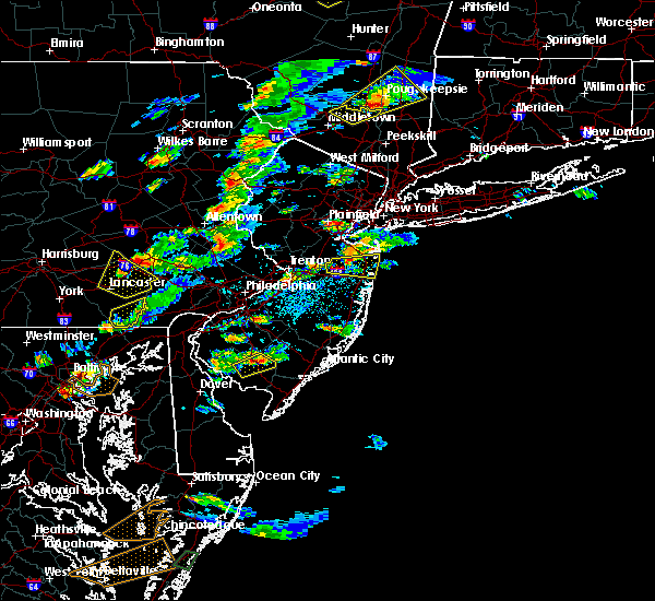 At 318 pm edt, a severe thunderstorm was located over colonia, or over plainfield, moving northeast at 35 mph (radar indicated). Hazards include 60 mph wind gusts and quarter size hail. Hail damage to vehicles is expected. expect wind damage to roofs, siding, and trees. this severe thunderstorm will be near, linden and summit around 330 pm edt. elizabeth, millburn, union and port richmond around 335 pm edt. newark, bayonne and orange around 340 pm edt. jersey city, harrison, caldwell and kearny around 345 pm edt. hoboken, bloomfield and lyndhurst around 350 pm edt. passaic, rutherford, secaucus and union city around 355 pm edt. paterson, ridgefield and teterboro around 400 pm edt. hackensack, fort lee, hawthorne and morningside heights around 405 pm edt. other locations impacted by this severe thunderstorm include springfield, montclair, hillside, livingston, clifton, bogota, roselle, franklin lakes, nutley and elmwood park. A tornado watch remains in effect until 1000 pm edt for northeastern new jersey, and southeastern new york. At 318 pm edt, a severe thunderstorm was located over colonia, or over plainfield, moving northeast at 35 mph (radar indicated). Hazards include 60 mph wind gusts and quarter size hail. Hail damage to vehicles is expected. expect wind damage to roofs, siding, and trees. this severe thunderstorm will be near, linden and summit around 330 pm edt. elizabeth, millburn, union and port richmond around 335 pm edt. newark, bayonne and orange around 340 pm edt. jersey city, harrison, caldwell and kearny around 345 pm edt. hoboken, bloomfield and lyndhurst around 350 pm edt. passaic, rutherford, secaucus and union city around 355 pm edt. paterson, ridgefield and teterboro around 400 pm edt. hackensack, fort lee, hawthorne and morningside heights around 405 pm edt. other locations impacted by this severe thunderstorm include springfield, montclair, hillside, livingston, clifton, bogota, roselle, franklin lakes, nutley and elmwood park. A tornado watch remains in effect until 1000 pm edt for northeastern new jersey, and southeastern new york.
|
| 6/28/2016 10:06 PM EDT |
 The severe thunderstorm warning for essex, union, hudson, south central bergen and richmond counties will expire at 1015 pm edt, the severe thunderstorm which prompted the warning has weakened. therefore, the warning will be allowed to expire. The severe thunderstorm warning for essex, union, hudson, south central bergen and richmond counties will expire at 1015 pm edt, the severe thunderstorm which prompted the warning has weakened. therefore, the warning will be allowed to expire.
|
| 6/28/2016 9:31 PM EDT |
 At 931 pm edt, a severe thunderstorm was located over chatham, or over summit, moving east at 20 mph (radar indicated). Hazards include 60 mph wind gusts. Expect damage to roofs. siding. and trees. this severe thunderstorm will be near, summit around 940 pm edt. clark around 945 pm edt. millburn around 950 pm edt. union around 955 pm edt. linden and caldwell around 1000 pm edt. orange around 1005 pm edt. elizabeth around 1010 pm edt. newark, jersey city, bayonne, hoboken, bloomfield, lyndhurst, rutherford, secaucus, harrison and union city around 1015 pm edt. Other locations impacted by this severe thunderstorm include new providence, springfield, glen ridge, montclair, north arlington, hillside, livingston, bogota, roselle and nutley. At 931 pm edt, a severe thunderstorm was located over chatham, or over summit, moving east at 20 mph (radar indicated). Hazards include 60 mph wind gusts. Expect damage to roofs. siding. and trees. this severe thunderstorm will be near, summit around 940 pm edt. clark around 945 pm edt. millburn around 950 pm edt. union around 955 pm edt. linden and caldwell around 1000 pm edt. orange around 1005 pm edt. elizabeth around 1010 pm edt. newark, jersey city, bayonne, hoboken, bloomfield, lyndhurst, rutherford, secaucus, harrison and union city around 1015 pm edt. Other locations impacted by this severe thunderstorm include new providence, springfield, glen ridge, montclair, north arlington, hillside, livingston, bogota, roselle and nutley.
|
| 6/8/2016 12:04 PM EDT |
 At 1203 pm edt, severe thunderstorms were located along a line extending from near flemington to near mercerville-hamilton square to bristol, moving east at 35 mph (radar indicated). Hazards include 60 mph wind gusts. Expect damage to roofs. siding. And trees. At 1203 pm edt, severe thunderstorms were located along a line extending from near flemington to near mercerville-hamilton square to bristol, moving east at 35 mph (radar indicated). Hazards include 60 mph wind gusts. Expect damage to roofs. siding. And trees.
|
| 6/5/2016 6:40 PM EDT |
 The severe thunderstorm warning for essex, union, eastern passaic, hudson, east central bergen, rockland and southeastern orange counties will expire at 645 pm edt, the storms which prompted the warning are moving out of the warned area. therefore, the warning will be allowed to expire. The severe thunderstorm warning for essex, union, eastern passaic, hudson, east central bergen, rockland and southeastern orange counties will expire at 645 pm edt, the storms which prompted the warning are moving out of the warned area. therefore, the warning will be allowed to expire.
|
| 6/5/2016 6:35 PM EDT | Tree down on henry hudson parkway at mosholu parkway which has closed all manhattan bound lane in bronx county NY, 10.7 miles S of New York, NY |
| 6/5/2016 6:27 PM EDT |
 At 626 pm edt, severe thunderstorms were located along a line extending from haverstraw to hackensack to colonia, moving east at 45 mph (radar indicated). Hazards include 60 mph wind gusts. Expect damage to roofs. siding. and trees. severe thunderstorms will be near, new york, ossining, tarrytown, north tarrytown, midtown manhattan, morningside heights and upper west side around 630 pm edt. mott haven, rfk bridge, riverdale, harlem, hawthorne, central park, astoria and long island city around 635 pm edt. yonkers, mount kisco, east tremont, todt hill, laguardia airport, flushing, bronxville, cardinal spellman hs, co-op city and port richmond around 640 pm edt. new rochelle, bayonne, verrazano- narrows bridge, throgs neck bridge, city island, oakwood, tompkinsville and whitestone around 645 pm edt. coney island, bedford, arturo toscanini ps, bay ridge, bensonhurst and park slope around 650 pm edt. flatbush, crown heights and sheepshead bay around 655 pm edt. canarsie around 700 pm edt. Other locations impacted by these severe thunderstorms include pleasantville, hastings-on-hudson, tuckahoe, rye brook, mount vernon, thornwood, washington heights, elmsford, armonk and greenwich village. At 626 pm edt, severe thunderstorms were located along a line extending from haverstraw to hackensack to colonia, moving east at 45 mph (radar indicated). Hazards include 60 mph wind gusts. Expect damage to roofs. siding. and trees. severe thunderstorms will be near, new york, ossining, tarrytown, north tarrytown, midtown manhattan, morningside heights and upper west side around 630 pm edt. mott haven, rfk bridge, riverdale, harlem, hawthorne, central park, astoria and long island city around 635 pm edt. yonkers, mount kisco, east tremont, todt hill, laguardia airport, flushing, bronxville, cardinal spellman hs, co-op city and port richmond around 640 pm edt. new rochelle, bayonne, verrazano- narrows bridge, throgs neck bridge, city island, oakwood, tompkinsville and whitestone around 645 pm edt. coney island, bedford, arturo toscanini ps, bay ridge, bensonhurst and park slope around 650 pm edt. flatbush, crown heights and sheepshead bay around 655 pm edt. canarsie around 700 pm edt. Other locations impacted by these severe thunderstorms include pleasantville, hastings-on-hudson, tuckahoe, rye brook, mount vernon, thornwood, washington heights, elmsford, armonk and greenwich village.
|
| 6/5/2016 6:15 PM EDT |
 At 614 pm edt, severe thunderstorms were located along a line extending from near pomona to near paterson to middlesex, moving east at 45 mph (radar indicated). Hazards include 60 mph wind gusts. Expect damage to roofs. siding. and trees. these severe storms will be near, paterson, passaic, bloomfield, ridgewood, lyndhurst, rutherford, suffern, monsey, nanuet and hawthorne around 620 pm edt. hackensack, paramus, secaucus, haverstraw, new city, oradell and teterboro around 625 pm edt. bergenfield, ridgefield, nyack, fort lee, englewood, union and upper nyack around 630 pm edt. elizabeth and linden around 635 pm edt. bayonne around 640 pm edt. Other locations impacted by these severe thunderstorms include west haverstraw, upper saddle river, wyckoff, springfield, montclair, spring valley, hillside, clifton, montvale and bogota. At 614 pm edt, severe thunderstorms were located along a line extending from near pomona to near paterson to middlesex, moving east at 45 mph (radar indicated). Hazards include 60 mph wind gusts. Expect damage to roofs. siding. and trees. these severe storms will be near, paterson, passaic, bloomfield, ridgewood, lyndhurst, rutherford, suffern, monsey, nanuet and hawthorne around 620 pm edt. hackensack, paramus, secaucus, haverstraw, new city, oradell and teterboro around 625 pm edt. bergenfield, ridgefield, nyack, fort lee, englewood, union and upper nyack around 630 pm edt. elizabeth and linden around 635 pm edt. bayonne around 640 pm edt. Other locations impacted by these severe thunderstorms include west haverstraw, upper saddle river, wyckoff, springfield, montclair, spring valley, hillside, clifton, montvale and bogota.
|
| 6/5/2016 6:07 PM EDT |
 At 606 pm edt, severe thunderstorms were located along a line extending from riverdale to chatham to near pennington, moving east at 60 mph (radar indicated). Hazards include 60 mph wind gusts. Expect damage to roofs. siding. and trees. locations impacted include, trenton, new brunswick, perth amboy, morristown, somerville, somerset, edison, old bridge, east brunswick, bridgewater, south brunswick, sayreville, north brunswick, ewing, carteret, dover, madison, middlesex, princeton and florham park. Areas of damaging winds are expected along the fast moving squall line. At 606 pm edt, severe thunderstorms were located along a line extending from riverdale to chatham to near pennington, moving east at 60 mph (radar indicated). Hazards include 60 mph wind gusts. Expect damage to roofs. siding. and trees. locations impacted include, trenton, new brunswick, perth amboy, morristown, somerville, somerset, edison, old bridge, east brunswick, bridgewater, south brunswick, sayreville, north brunswick, ewing, carteret, dover, madison, middlesex, princeton and florham park. Areas of damaging winds are expected along the fast moving squall line.
|
| 6/5/2016 5:53 PM EDT |
 At 552 pm edt, severe thunderstorms were located along a line extending from rockaway to mendham to near flemington, moving northeast at 65 mph (radar indicated). Hazards include 60 mph wind gusts. Expect damage to roofs. siding. And trees. At 552 pm edt, severe thunderstorms were located along a line extending from rockaway to mendham to near flemington, moving northeast at 65 mph (radar indicated). Hazards include 60 mph wind gusts. Expect damage to roofs. siding. And trees.
|
| 6/5/2016 5:47 PM EDT |
 At 545 pm edt, severe thunderstorms were located along a line extending from near franklin to near califon, moving east at 45 mph (radar indicated). Hazards include 60 mph wind gusts. Expect damage to roofs. siding. and trees. severe thunderstorms will be near, west milford and upper greenwood lake around 555 pm edt. bloomingdale and poughkeepsie-- newburgh around 600 pm edt. ringwood and pompton lakes around 605 pm edt. plainfield and sloatsburg around 610 pm edt. ridgewood, summit, millburn, ramsey and suffern around 615 pm edt. monsey, clark, union, pomona and colonia around 620 pm edt. elizabeth, linden, haverstraw, nanuet, new city, orange and pearl river around 625 pm edt. newark, harrison, nyack, tappan, kearny, norwood, upper nyack and orangeburg around 630 pm edt. Other locations impacted by these severe thunderstorms include west haverstraw, upper saddle river, wyckoff, springfield, montclair, spring valley, hillside, clifton, montvale and bogota. At 545 pm edt, severe thunderstorms were located along a line extending from near franklin to near califon, moving east at 45 mph (radar indicated). Hazards include 60 mph wind gusts. Expect damage to roofs. siding. and trees. severe thunderstorms will be near, west milford and upper greenwood lake around 555 pm edt. bloomingdale and poughkeepsie-- newburgh around 600 pm edt. ringwood and pompton lakes around 605 pm edt. plainfield and sloatsburg around 610 pm edt. ridgewood, summit, millburn, ramsey and suffern around 615 pm edt. monsey, clark, union, pomona and colonia around 620 pm edt. elizabeth, linden, haverstraw, nanuet, new city, orange and pearl river around 625 pm edt. newark, harrison, nyack, tappan, kearny, norwood, upper nyack and orangeburg around 630 pm edt. Other locations impacted by these severe thunderstorms include west haverstraw, upper saddle river, wyckoff, springfield, montclair, spring valley, hillside, clifton, montvale and bogota.
|
| 4/2/2016 11:56 PM EDT | At 1155 pm edt, doppler radar indicated a line of severe thunderstorms capable of producing damaging winds in excess of 60 mph. these storms were located along a line extending from near pennington to marlton, and moving northeast at 70 to 75 mph. pea to penny size hail may also accompany the damaging winds. * severe thunderstorms will be near, princeton, pennington, hopewell, rocky hill, skillman, kingston and plainsboro center around 1200 am edt. south brunswick, north brunswick, florence, burlington, bristol, wrightstown, millstone, columbus, jobstown and belle mead around 1205 am edt. new brunswick, somerset, east brunswick, middlesex, bound brook, manville, bordentown, society hill, crosswicks and georgetown around 1210 am edt. edison, allentown, imlaystown, cream ridge, windsor, colonia, edinburg, six flags theme park and mercerville-hamilton square around 1215 am edt. manalapan, hightstown, cranbury, roosevelt, twin rivers, clearbrook park and clarksburg around 1220 am edt. jamesburg, yorketown, robertsville, whittingham, west freehold and east freehold around 1225 am edt. old bridge, sayreville, marlboro, holmdel, matawan, brownville, morganville and lincroft around 1230 am edt. other locations impacted by these severe thunderstorms include fords, watchung, rossmoor, freehold, shrewsbury, metuchen, laurence harbor, eatontown, south river and yardville-groveville. |
| 4/2/2016 11:56 PM EDT | At 1155 pm edt, doppler radar indicated a line of severe thunderstorms capable of producing damaging winds in excess of 60 mph. these storms were located along a line extending from near pennington to marlton, and moving northeast at 70 to 75 mph. pea to penny size hail may also accompany the damaging winds. * severe thunderstorms will be near, princeton, pennington, hopewell, rocky hill, skillman, kingston and plainsboro center around 1200 am edt. south brunswick, north brunswick, florence, burlington, bristol, wrightstown, millstone, columbus, jobstown and belle mead around 1205 am edt. new brunswick, somerset, east brunswick, middlesex, bound brook, manville, bordentown, society hill, crosswicks and georgetown around 1210 am edt. edison, allentown, imlaystown, cream ridge, windsor, colonia, edinburg, six flags theme park and mercerville-hamilton square around 1215 am edt. manalapan, hightstown, cranbury, roosevelt, twin rivers, clearbrook park and clarksburg around 1220 am edt. jamesburg, yorketown, robertsville, whittingham, west freehold and east freehold around 1225 am edt. old bridge, sayreville, marlboro, holmdel, matawan, brownville, morganville and lincroft around 1230 am edt. other locations impacted by these severe thunderstorms include fords, watchung, rossmoor, freehold, shrewsbury, metuchen, laurence harbor, eatontown, south river and yardville-groveville. |
| 2/25/2016 12:27 AM EST | The severe thunderstorm warning for western new haven, fairfield, union, essex, hudson, eastern passaic, bergen, eastern orange, kings, queens, richmond, rockland, westchester, new york, bronx, central nassau and putnam counties will expire at 1230 am est, the storms which prompted the warning have moved out of the warned area. therefore the warning will be allowed to expire. |
| 2/25/2016 12:27 AM EST | The severe thunderstorm warning for western new haven, fairfield, union, essex, hudson, eastern passaic, bergen, eastern orange, kings, queens, richmond, rockland, westchester, new york, bronx, central nassau and putnam counties will expire at 1230 am est, the storms which prompted the warning have moved out of the warned area. therefore the warning will be allowed to expire. |
| 2/25/2016 12:27 AM EST | The severe thunderstorm warning for western new haven, fairfield, union, essex, hudson, eastern passaic, bergen, eastern orange, kings, queens, richmond, rockland, westchester, new york, bronx, central nassau and putnam counties will expire at 1230 am est, the storms which prompted the warning have moved out of the warned area. therefore the warning will be allowed to expire. |
| 2/25/2016 12:00 AM EST |
 At 1159 pm est, doppler radar indicated a line of severe thunderstorms capable of producing damaging winds in excess of 60 mph. these storms were located along a line extending from near myers corner to near new city to lyndhurst, moving northeast at 50 mph. these severe storms will be near, peekskill around 1205 am est. ridgewood, yorktown heights and riverdale around 1210 am est. yonkers, dobbs ferry, tappan, mahopac, bronxville, norwood and pearl river around 1215 am est. white plains, tarrytown, nyack, brewster, north tarrytown, lake carmel, nanuet, carmel, upper nyack and orangeburg around 1220 am est. new york--newark and hawthorne around 1225 am est. mount kisco, pawling and new fairfield around 1230 am est. other locations impacted by these severe thunderstorms include west hempstead, thomaston, west haverstraw, pleasantville, springfield, mount vernon, montclair, spring valley, hillside and washington heights. At 1159 pm est, doppler radar indicated a line of severe thunderstorms capable of producing damaging winds in excess of 60 mph. these storms were located along a line extending from near myers corner to near new city to lyndhurst, moving northeast at 50 mph. these severe storms will be near, peekskill around 1205 am est. ridgewood, yorktown heights and riverdale around 1210 am est. yonkers, dobbs ferry, tappan, mahopac, bronxville, norwood and pearl river around 1215 am est. white plains, tarrytown, nyack, brewster, north tarrytown, lake carmel, nanuet, carmel, upper nyack and orangeburg around 1220 am est. new york--newark and hawthorne around 1225 am est. mount kisco, pawling and new fairfield around 1230 am est. other locations impacted by these severe thunderstorms include west hempstead, thomaston, west haverstraw, pleasantville, springfield, mount vernon, montclair, spring valley, hillside and washington heights.
|
| 2/24/2016 11:36 PM EST |
 At 1136 pm est, doppler radar indicated a severe thunderstorm capable of producing damaging winds in excess of 60 mph. this storm was located over paterson, moving northeast at 100 mph. locations impacted include, new brunswick, perth amboy, morristown, somerville, somerset, edison, old bridge, east brunswick, sayreville, carteret, madison, middlesex, florham park, east hanover, lincoln park, bound brook, chatham, boonton, riverdale and society hill. a tornado watch remains in effect until 100 am est for northern new jersey. At 1136 pm est, doppler radar indicated a severe thunderstorm capable of producing damaging winds in excess of 60 mph. this storm was located over paterson, moving northeast at 100 mph. locations impacted include, new brunswick, perth amboy, morristown, somerville, somerset, edison, old bridge, east brunswick, sayreville, carteret, madison, middlesex, florham park, east hanover, lincoln park, bound brook, chatham, boonton, riverdale and society hill. a tornado watch remains in effect until 100 am est for northern new jersey.
|
| 2/24/2016 11:26 PM EST |
 At 1122 pm est, doppler radar indicated a line of severe thunderstorms capable of producing damaging winds in excess of 60 mph. this line extending across the lower hudson valley of new york through portions of new york city and portions of northeast new jersey. it was moving northeast at 40 mph. * severe thunderstorms will be near, bergenfield, and riverdale around 1130 pm est. yonkers, tappan, norwood and orangeburg around 1135 pm est. new rochelle, tarrytown, dobbs ferry, nyack, bronxville and upper nyack around 1140 pm est. north tarrytown and scarsdale around 1145 pm est. white plains, perth amboy, harrison, hawthorne and colonia around 1150 pm est. port chester around 1155 pm est. linden, greenwich and carteret around 1200 am est. bedford and port richmond around 1205 am est. other locations impacted by these severe thunderstorms include west hempstead, thomaston, west haverstraw, pleasantville, springfield, mount vernon, montclair, spring valley, hillside and washington heights. At 1122 pm est, doppler radar indicated a line of severe thunderstorms capable of producing damaging winds in excess of 60 mph. this line extending across the lower hudson valley of new york through portions of new york city and portions of northeast new jersey. it was moving northeast at 40 mph. * severe thunderstorms will be near, bergenfield, and riverdale around 1130 pm est. yonkers, tappan, norwood and orangeburg around 1135 pm est. new rochelle, tarrytown, dobbs ferry, nyack, bronxville and upper nyack around 1140 pm est. north tarrytown and scarsdale around 1145 pm est. white plains, perth amboy, harrison, hawthorne and colonia around 1150 pm est. port chester around 1155 pm est. linden, greenwich and carteret around 1200 am est. bedford and port richmond around 1205 am est. other locations impacted by these severe thunderstorms include west hempstead, thomaston, west haverstraw, pleasantville, springfield, mount vernon, montclair, spring valley, hillside and washington heights.
|
| 2/24/2016 11:03 PM EST |
 At 1103 pm est, doppler radar indicated a severe thunderstorm capable of producing damaging winds in excess of 60 mph. this storm was located over trenton, and moving northeast at 100 mph. At 1103 pm est, doppler radar indicated a severe thunderstorm capable of producing damaging winds in excess of 60 mph. this storm was located over trenton, and moving northeast at 100 mph.
|
| 2/24/2016 10:57 PM EST |
 At 1055 pm est, doppler radar indicated thunderstorms capable of producing damaging winds in excess of 60 mph. the storms were moving northeast and will continue to impact the warning area. At 1055 pm est, doppler radar indicated thunderstorms capable of producing damaging winds in excess of 60 mph. the storms were moving northeast and will continue to impact the warning area.
|
| 2/24/2016 10:28 PM EST |
 At 1024 pm est, doppler radar indicated a line of thunderstorms, with additional thunderstorms developing in central new jersey capable of producing damaging winds in excess of 60 mph. this activity is moving northeast at 40 to 50 mph and will impact much of northeast new jersey and the new york city metropolitan area. other locations impacted by this severe thunderstorm include upper saddle river, wyckoff, springfield, mount vernon, montclair, hillside, washington heights, clifton, montvale and bogota. expect strong winds and heavy downpours. At 1024 pm est, doppler radar indicated a line of thunderstorms, with additional thunderstorms developing in central new jersey capable of producing damaging winds in excess of 60 mph. this activity is moving northeast at 40 to 50 mph and will impact much of northeast new jersey and the new york city metropolitan area. other locations impacted by this severe thunderstorm include upper saddle river, wyckoff, springfield, mount vernon, montclair, hillside, washington heights, clifton, montvale and bogota. expect strong winds and heavy downpours.
|
| 2/16/2016 2:47 PM EST |
 At 246 pm est, doppler radar indicated a strong storm capable of producing damaging winds in excess of 60 mph. this storm was located over rockaway beach, and moving northeast at 45 mph. * this severe thunderstorm will be near, crown heights and canarsie around 250 pm est. kennedy airport, cedarhurst, howard beach and ozone park around 255 pm est. valley stream, lynbrook, jamaica, woodmere, flushing, forest hills and oceanside around 300 pm est. freeport, garden city, hempstead, baldwin, elmont, little neck and clearview expressway around 305 pm est. mineola, westbury, great neck, manhasset and port washington around 310 pm est. oyster bay, syosset, levittown, bayville, brookville and hicksville around 315 pm est. other locations impacted by this severe thunderstorm include west hempstead, thomaston, east hills, east rockaway, jericho, east williston, herricks, east meadow, hewlett and munsey park. At 246 pm est, doppler radar indicated a strong storm capable of producing damaging winds in excess of 60 mph. this storm was located over rockaway beach, and moving northeast at 45 mph. * this severe thunderstorm will be near, crown heights and canarsie around 250 pm est. kennedy airport, cedarhurst, howard beach and ozone park around 255 pm est. valley stream, lynbrook, jamaica, woodmere, flushing, forest hills and oceanside around 300 pm est. freeport, garden city, hempstead, baldwin, elmont, little neck and clearview expressway around 305 pm est. mineola, westbury, great neck, manhasset and port washington around 310 pm est. oyster bay, syosset, levittown, bayville, brookville and hicksville around 315 pm est. other locations impacted by this severe thunderstorm include west hempstead, thomaston, east hills, east rockaway, jericho, east williston, herricks, east meadow, hewlett and munsey park.
|
| 2/16/2016 2:30 PM EST | Sidewalk shed blew over on bowery stree in new york county NY, 4.8 miles ESE of New York, NY |
| 2/16/2016 2:26 PM EST | Large branches down on 37th stree in queens county NY, 1.9 miles SE of New York, NY |
| 2/16/2016 2:21 PM EST |
 At 219 pm est, doppler radar indicated a strong shower capable of producing damaging winds in excess of 60 mph. this storm was located over holmdel, or 9 miles west of long branch, and moving northeast at 40 mph. * this strong shower will be near, coney island, sheepshead bay, arturo toscanini ps and bensonhurst around 245 pm est. flatbush, crown heights and canarsie around 250 pm est. kennedy airport, howard beach and ozone park around 255 pm est. jamaica, clearview expressway and forest hills around 300 pm est. other locations impacted by this severe thunderstorm include woodside and greenpoint. At 219 pm est, doppler radar indicated a strong shower capable of producing damaging winds in excess of 60 mph. this storm was located over holmdel, or 9 miles west of long branch, and moving northeast at 40 mph. * this strong shower will be near, coney island, sheepshead bay, arturo toscanini ps and bensonhurst around 245 pm est. flatbush, crown heights and canarsie around 250 pm est. kennedy airport, howard beach and ozone park around 255 pm est. jamaica, clearview expressway and forest hills around 300 pm est. other locations impacted by this severe thunderstorm include woodside and greenpoint.
|
| 2/16/2016 2:17 PM EST |
 At 213 pm est, doppler radar indicated a line of heavy rain with embedded strong to severe winds, some in excess of 60 mph.this line was moving east at 40 mph and will reach the coast by 230 pm. locations impacted include, toms river, perth amboy, long branch, asbury park, edison, lakewood, middletown, old bridge, jackson, howell, east brunswick, sayreville, marlboro, carteret, barnegat, tinton falls, holmdel, red bank, beachwood and keansburg. At 213 pm est, doppler radar indicated a line of heavy rain with embedded strong to severe winds, some in excess of 60 mph.this line was moving east at 40 mph and will reach the coast by 230 pm. locations impacted include, toms river, perth amboy, long branch, asbury park, edison, lakewood, middletown, old bridge, jackson, howell, east brunswick, sayreville, marlboro, carteret, barnegat, tinton falls, holmdel, red bank, beachwood and keansburg.
|
| 2/16/2016 1:11 PM EST |
 At 108 pm est, doppler radar indicated a line of severe thunderstorms just east of the delaware river moving east at 45 mph.these thunderstorms have a history of producing wind gusts near 60 mph, with tree and wire damage. At 108 pm est, doppler radar indicated a line of severe thunderstorms just east of the delaware river moving east at 45 mph.these thunderstorms have a history of producing wind gusts near 60 mph, with tree and wire damage.
|
| 7/30/2015 2:53 PM EDT | 2 large pin oaks down on 216th street. trees fell on a house and took down power line in queens county NY, 7 miles WSW of New York, NY |
| 7/30/2015 2:53 PM EDT | Tree down on wire in queens county NY, 5.7 miles WSW of New York, NY |
| 7/30/2015 2:50 PM EDT | Trees down on car in queens county NY, 5.2 miles SW of New York, NY |
| 7/30/2015 2:50 PM EDT |
 At 250 pm edt, doppler radar indicated a line of severe thunderstorms capable of producing damaging winds in excess of 60 mph. these storms were located along a line extending from cardinal spellman hs to jamaica, and moving northeast at 35 mph. At 250 pm edt, doppler radar indicated a line of severe thunderstorms capable of producing damaging winds in excess of 60 mph. these storms were located along a line extending from cardinal spellman hs to jamaica, and moving northeast at 35 mph.
|
| 7/1/2015 4:43 AM EDT |
 At 442 am edt, doppler radar indicated a severe thunderstorm capable of producing damaging winds in excess of 60 mph. this storm was located over jamaica, moving east at 40 mph. this severe storm will be near, lynbrook, great neck, little neck and elmont around 450 am edt. garden city, mineola, hempstead, baldwin and manhasset around 455 am edt. At 442 am edt, doppler radar indicated a severe thunderstorm capable of producing damaging winds in excess of 60 mph. this storm was located over jamaica, moving east at 40 mph. this severe storm will be near, lynbrook, great neck, little neck and elmont around 450 am edt. garden city, mineola, hempstead, baldwin and manhasset around 455 am edt.
|
| 7/1/2015 4:34 AM EDT |
 At 434 am edt, doppler radar indicated a line of severe thunderstorms capable of producing damaging winds in excess of 60 mph. these storms were located along a line extending from near oradell to bergenfield to upper west side, and moving northeast at 40 mph. * severe thunderstorms will be near, tappan, norwood, pearl river and riverdale around 440 am edt. yonkers, dobbs ferry, east tremont, bronxville and orangeburg around 445 am edt. tarrytown, nyack, north tarrytown, throgs neck bridge, scarsdale, upper nyack, co-op city and cardinal spellman hs around 450 am edt. new rochelle, white plains, ossining and city island around 455 am edt. port chester, harrison, sands point and hawthorne around 500 am edt. glen cove and rye around 505 am edt. mount kisco, greenwich and bayville around 510 am edt. stamford, new canaan, darien and bedford around 515 am edt. At 434 am edt, doppler radar indicated a line of severe thunderstorms capable of producing damaging winds in excess of 60 mph. these storms were located along a line extending from near oradell to bergenfield to upper west side, and moving northeast at 40 mph. * severe thunderstorms will be near, tappan, norwood, pearl river and riverdale around 440 am edt. yonkers, dobbs ferry, east tremont, bronxville and orangeburg around 445 am edt. tarrytown, nyack, north tarrytown, throgs neck bridge, scarsdale, upper nyack, co-op city and cardinal spellman hs around 450 am edt. new rochelle, white plains, ossining and city island around 455 am edt. port chester, harrison, sands point and hawthorne around 500 am edt. glen cove and rye around 505 am edt. mount kisco, greenwich and bayville around 510 am edt. stamford, new canaan, darien and bedford around 515 am edt.
|
| 7/1/2015 4:13 AM EDT |
 At 412 am edt, doppler radar indicated a severe thunderstorm capable of producing damaging winds in excess of 60 mph. this storm was located over port richmond, or over todt hill, and moving east at 40 mph. * this severe thunderstorm will be near, port richmond around 415 am edt. bayonne around 420 am edt. jersey city, coney island, bay ridge, bensonhurst and arturo toscanini ps around 425 am edt. hoboken, crown heights, flatbush, park slope, brooklyn heights, lower east side, battery park, soho, east village and sheepshead bay around 430 am edt. midtown manhattan, canarsie and long island city around 435 am edt. laguardia airport, rfk bridge, forest hills, ozone park, howard beach, jackson heights and astoria around 440 am edt. jamaica, flushing, kennedy airport, woodmere, cedarhurst, clearview expressway and whitestone around 445 am edt. valley stream, lynbrook, little neck and elmont around 450 am edt. At 412 am edt, doppler radar indicated a severe thunderstorm capable of producing damaging winds in excess of 60 mph. this storm was located over port richmond, or over todt hill, and moving east at 40 mph. * this severe thunderstorm will be near, port richmond around 415 am edt. bayonne around 420 am edt. jersey city, coney island, bay ridge, bensonhurst and arturo toscanini ps around 425 am edt. hoboken, crown heights, flatbush, park slope, brooklyn heights, lower east side, battery park, soho, east village and sheepshead bay around 430 am edt. midtown manhattan, canarsie and long island city around 435 am edt. laguardia airport, rfk bridge, forest hills, ozone park, howard beach, jackson heights and astoria around 440 am edt. jamaica, flushing, kennedy airport, woodmere, cedarhurst, clearview expressway and whitestone around 445 am edt. valley stream, lynbrook, little neck and elmont around 450 am edt.
|
| 6/23/2015 6:37 PM EDT |
 At 637 pm edt, doppler radar indicated a severe thunderstorm capable of producing quarter size hail and destructive winds in excess of 70 mph. this storm was located over brookville, or near westbury, moving east at 35 mph. locations impacted include, oyster bay, glen cove, garden city, mineola, westbury, great neck, farmingdale, levittown, syosset, plainview, hempstead, woodbury, bayville, brookville, sands point, hicksville, manhasset, port washington, melville and elmont. At 637 pm edt, doppler radar indicated a severe thunderstorm capable of producing quarter size hail and destructive winds in excess of 70 mph. this storm was located over brookville, or near westbury, moving east at 35 mph. locations impacted include, oyster bay, glen cove, garden city, mineola, westbury, great neck, farmingdale, levittown, syosset, plainview, hempstead, woodbury, bayville, brookville, sands point, hicksville, manhasset, port washington, melville and elmont.
|
| 6/23/2015 6:20 PM EDT | Sizeable tree limb down approx. 2 diameter... 15 length in queens county NY, 3.2 miles SW of New York, NY |
| 6/23/2015 6:19 PM EDT | Large tree down on two vehicle in queens county NY, 5.4 miles W of New York, NY |
| 6/23/2015 6:19 PM EDT |
 At 618 pm edt, doppler radar indicated a severe thunderstorm capable of producing damaging winds in excess of 60 mph. this storm was located over flushing, moving east at 35 mph. nickel size hail may also accompany the damaging winds. locations impacted include, oyster bay, valley stream, glen cove, garden city, mineola, westbury, great neck, farmingdale, levittown, kennedy airport, syosset, flushing, plainview, laguardia airport, jamaica, hempstead, woodbury, bayville, brookville and sands point. At 618 pm edt, doppler radar indicated a severe thunderstorm capable of producing damaging winds in excess of 60 mph. this storm was located over flushing, moving east at 35 mph. nickel size hail may also accompany the damaging winds. locations impacted include, oyster bay, valley stream, glen cove, garden city, mineola, westbury, great neck, farmingdale, levittown, kennedy airport, syosset, flushing, plainview, laguardia airport, jamaica, hempstead, woodbury, bayville, brookville and sands point.
|
| 6/23/2015 6:15 PM EDT | Large tree limb down in queens county NY, 3.2 miles SW of New York, NY |
| 6/23/2015 5:58 PM EDT |
 At 557 pm edt, doppler radar indicated a severe thunderstorm capable of producing damaging winds in excess of 60 mph. this storm was located over jersey city, and moving east at 35 mph. nickel size hail may also accompany the damaging winds. At 557 pm edt, doppler radar indicated a severe thunderstorm capable of producing damaging winds in excess of 60 mph. this storm was located over jersey city, and moving east at 35 mph. nickel size hail may also accompany the damaging winds.
|
| 6/23/2015 5:19 PM EDT | Large tree down on two vehicle in queens county NY, 5.4 miles W of New York, NY |
| 5/31/2015 7:11 PM EDT | At 710 pm edt, doppler radar indicated a severe thunderstorm capable of producing large hail up to ping pong ball size and damaging winds to 60 mph. this storm was located over old bridge, or near new brunswick, moving east at 15 mph. locations impacted include, new brunswick, perth amboy, middletown, old bridge, east brunswick, sayreville, keansburg, matawan, brownville, robertsville, morganville, woodbridge, south river, keyport, laurence harbor, sewaren, north middletown, strathmore, madison park and fords. |
| 5/31/2015 6:50 PM EDT | At 650 pm edt, doppler radar indicated a severe thunderstorm capable of producing large hail up to ping pong ball size and damaging winds to 60 mph. this storm was located over matawan, or near perth amboy, and moving east at 20 mph. |
| 5/31/2015 5:33 PM EDT | At 533 pm edt, doppler radar indicated a severe thunderstorm capable of producing quarter size hail and damaging winds in excess of 60 mph. this storm was located over port richmond, or over todt hill, moving southeast at 10 mph. this severe thunderstorm will remain over mainly rural areas of eastern union, southeastern union, hudson and richmond counties, including the following locations, west shore express. |
| 5/31/2015 5:33 PM EDT | At 533 pm edt, doppler radar indicated a severe thunderstorm capable of producing quarter size hail and damaging winds in excess of 60 mph. this storm was located over port richmond, or over todt hill, moving southeast at 10 mph. this severe thunderstorm will remain over mainly rural areas of eastern union, southeastern union, hudson and richmond counties, including the following locations, west shore express. |
| 5/31/2015 5:08 PM EDT | At 507 pm edt, doppler radar indicated a severe thunderstorm capable of producing quarter size hail and damaging winds in excess of 60 mph. this storm was located over elizabeth, and moving northeast at 10 mph. * this severe thunderstorm will be near, port richmond around 515 pm edt. newark, bayonne and harrison around 535 pm edt. kearny around 545 pm edt. new york around 550 pm edt. jersey city around 600 pm edt. other locations impacted by this severe thunderstorm include roselle, west shore express, kenilworth, east newark, roselle park, irvington, hillside, belleville, north arlington and east orange. |
| 5/31/2015 5:08 PM EDT | At 507 pm edt, doppler radar indicated a severe thunderstorm capable of producing quarter size hail and damaging winds in excess of 60 mph. this storm was located over elizabeth, and moving northeast at 10 mph. * this severe thunderstorm will be near, port richmond around 515 pm edt. newark, bayonne and harrison around 535 pm edt. kearny around 545 pm edt. new york around 550 pm edt. jersey city around 600 pm edt. other locations impacted by this severe thunderstorm include roselle, west shore express, kenilworth, east newark, roselle park, irvington, hillside, belleville, north arlington and east orange. |
| 5/16/2015 7:28 PM EDT | At 728 pm edt, doppler radar indicated a severe thunderstorm capable of producing quarter size hail and damaging winds in excess of 60 mph. this storm was located over millington, or near plainfield, and moving southeast at 20 mph. |
| 4/22/2015 3:57 PM EDT | At 357 pm edt, doppler radar indicated a line of severe thunderstorms capable of producing damaging winds in excess of 60 mph. these storms were located along a line extending from forest hills to near sandy hook, and moving east at 35 mph. penny size hail may also accompany the damaging winds. |
| 4/22/2015 3:50 PM EDT | Branch fell on front of parked vehicle with minor damage to front of vehicle in queens county NY, 2.3 miles WNW of New York, NY |
| 11/17/2014 2:32 PM EST | Large branch down on car breaking rear windo in kings county NY, 7.2 miles NNE of New York, NY |
| 9/6/2014 4:00 PM EDT | Numerous trees and wires down in the 109 precinct. one tree fell on car and one tree fell on hom in queens county NY, 3.2 miles SW of New York, NY |
| 7/23/2014 8:56 PM EDT | Multiple power lines down in richmond county NY, 19.5 miles NE of New York, NY |
| 7/23/2014 8:56 PM EDT | Multiple power lines down in richmond county NY, 19.9 miles NE of New York, NY |
| 7/8/2014 10:15 PM EDT | Trees down on hylan blvd from page avenue to midland avenu in richmond county NY, 15.8 miles NE of New York, NY |
| 7/8/2014 10:00 PM EDT | Two trees down. debris from construction site also fell at the same locatio in new york county NY, 5.9 miles E of New York, NY |
| 7/8/2014 9:40 PM EDT | Several downed trees in tottenvill in richmond county NY, 24.9 miles NE of New York, NY |
| 7/3/2014 8:25 PM EDT | Tree down with complete road closure at west 175th street and broadway in new york county NY, 4.8 miles ESE of New York, NY |
| 7/3/2014 7:45 PM EDT | Downed tree blocking two lanes of southbound henry hudson parkway and west 181st street in new york county NY, 7.7 miles SSE of New York, NY |
| 7/3/2014 7:45 PM EDT | Downed tree blocking two southbound lanes of the henry hudson parkway and west 181st street in new york (manhatta county NY, 7.6 miles SSE of New York, NY |
| 6/17/2013 3:40 PM EDT | Tree fell onto home. time estimated by rada in kings county NY, 6.9 miles NNE of New York, NY |
| 5/11/2013 4:04 PM EDT | 3 to 5 trees reported down on south end avenu in new york county NY, 7.2 miles ENE of New York, NY |
| 5/11/2013 4:04 PM EDT | Several trees down on south end avenu in new york county NY, 7.2 miles ENE of New York, NY |
| 4/10/2013 7:37 PM EDT | Storm damage reported in anz355 county NY, 27.7 miles NNW of New York, NY |
| 9/18/2012 8:00 PM EDT | Three large trees down at 35th st north of astoria blvd in queens county NY, 2.7 miles SSE of New York, NY |
| 9/8/2012 11:00 AM EDT | Fdny reports multiple trees and power lines down in breezy point. possible structural damage and cars moved. time based on rada in queens county NY, 12.9 miles N of New York, NY |
| 9/8/2012 10:58 AM EDT | Structural damage at surf shop in breezy point. reported by fdny. time based on rada in queens county NY, 13.6 miles N of New York, NY |
| 9/8/2012 10:38 AM EDT | Multiple trees and power lines down in flatbush. possible structural damage. time based on rada in kings (brooklyn) county NY, 7.9 miles NNE of New York, NY |
| 8/15/2012 4:15 PM EDT | Large tree branch down on car and across clinton ave near green ave in kings county NY, 5.6 miles NE of New York, NY |
| 8/15/2012 4:00 PM EDT | Quarter sized hail reported 2.6 miles E of New York, NY |
| 8/15/2012 3:50 PM EDT | Ping Pong Ball sized hail reported 2 miles NNE of New York, NY |
| 8/15/2012 1:52 PM EDT | Power lines down across rosedale creating numerous power outage in queens county NY, 9.8 miles NW of New York, NY |
| 8/15/2012 1:35 PM EDT | Power lines down across middle village creating numerous power outage in queens county NY, 1.8 miles NNW of New York, NY |
| 8/5/2012 11:00 PM EDT | Mesonet in anz355 county NY, 19.7 miles NNE of New York, NY |
| 8/5/2012 7:57 PM EDT | Trees down on 45th drive. time estimated by rada in queens county NY, 5.2 miles SW of New York, NY |
| 7/26/2012 8:15 PM EDT | 65 ft tree split in two on arthur kill rd in richmond county NY, 24.9 miles NE of New York, NY |
| 7/26/2012 7:45 PM EDT | 65 ft tree split in two on arthur kill rd in richmond county NY, 24.9 miles NE of New York, NY |
| 7/18/2012 4:50 PM EDT | Quarter sized hail reported 5.2 miles NW of New York, NY, estimated quarter size hail just west of jamaica station |
| 7/18/2012 4:25 PM EDT | Quarter sized hail reported 6 miles ENE of New York, NY, hail covering the ground at w broadway and spring |
| 6/22/2012 2:15 PM EDT | Public reports 58 mph wind gust measured midway across verrazano-narrows bridg in richmond county NY, 12.9 miles NE of New York, NY |
| 6/6/2012 8:00 PM EDT | Quarter sized hail reported 15.3 miles ENE of New York, NY, public |
| 1/1/0001 12:00 AM | Trees down across railroad lines at laurelton station. delays reporte in queens county NY, 9 miles NW of New York, NY |
| 1/1/0001 12:00 AM | Trees down across tracks at rosedale lirr station. delays reporte in queens county NY, 9.8 miles NW of New York, NY |
| 1/1/0001 12:00 AM | Tree down on railroad tracks at graysend road and neck roa in kings (brooklyn) county NY, 11 miles NNE of New York, NY |
| 8/18/2011 7:33 PM EDT | Power lines down near high school in richmond county NY, 12.3 miles NE of New York, NY |
| 8/1/2011 7:36 PM EDT | Baseball sized hail reported 7 miles WSW of New York, NY, baseball size hail. car damage |
| 1/1/0001 12:00 AM | Half Dollar sized hail reported 6.8 miles SSW of New York, NY, bronx coop observer |
| 1/1/0001 12:00 AM | Large branches took down power lines on east 102nd street... time estimated from rada in kings (brooklyn) county NY, 6.5 miles N of New York, NY |
Hail Maps for New York, NY


Connect with Interactive Hail Maps