

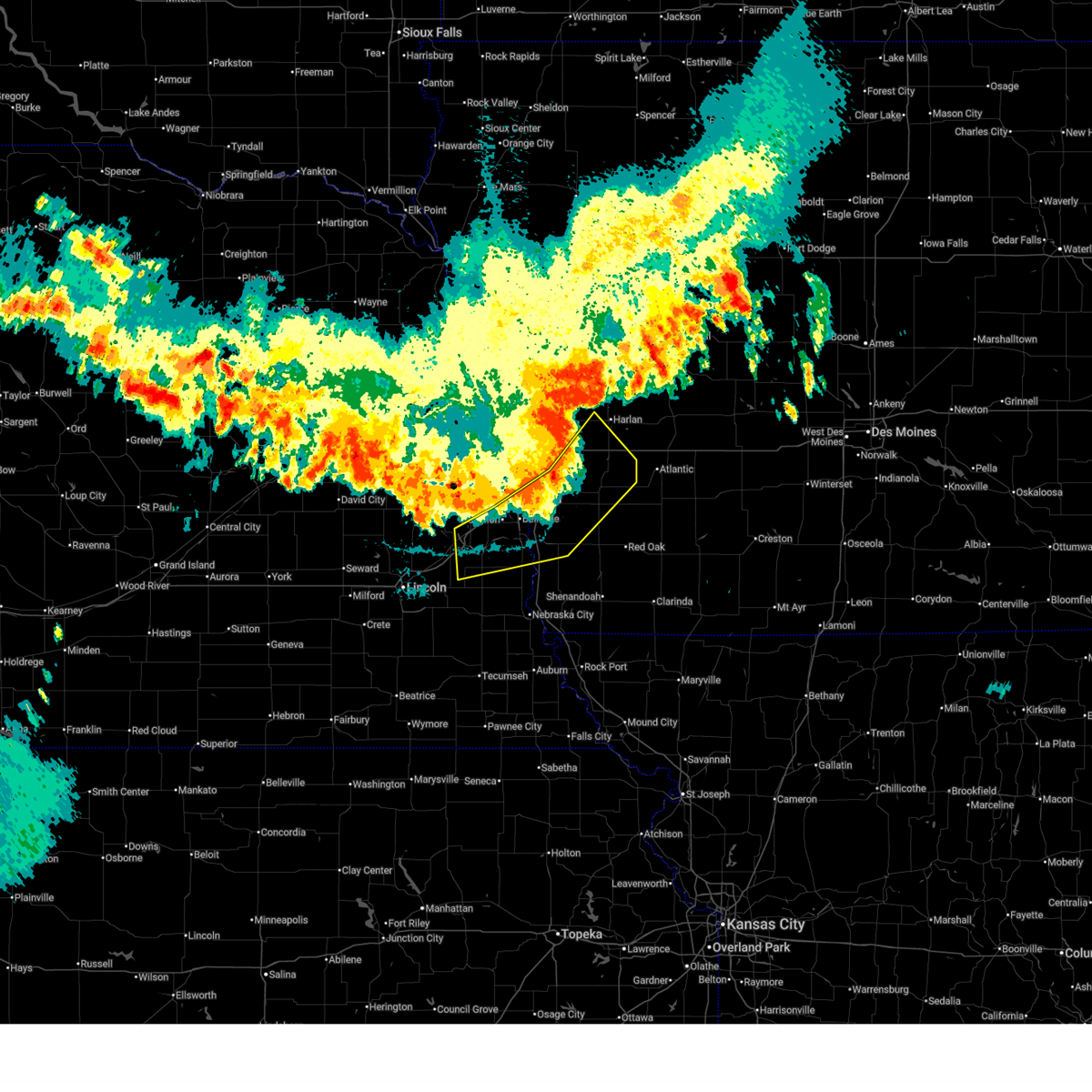
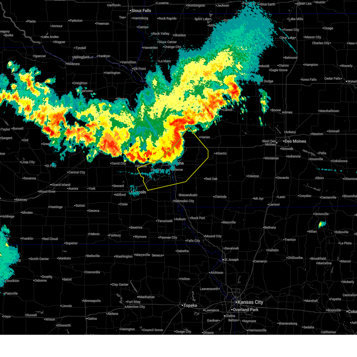
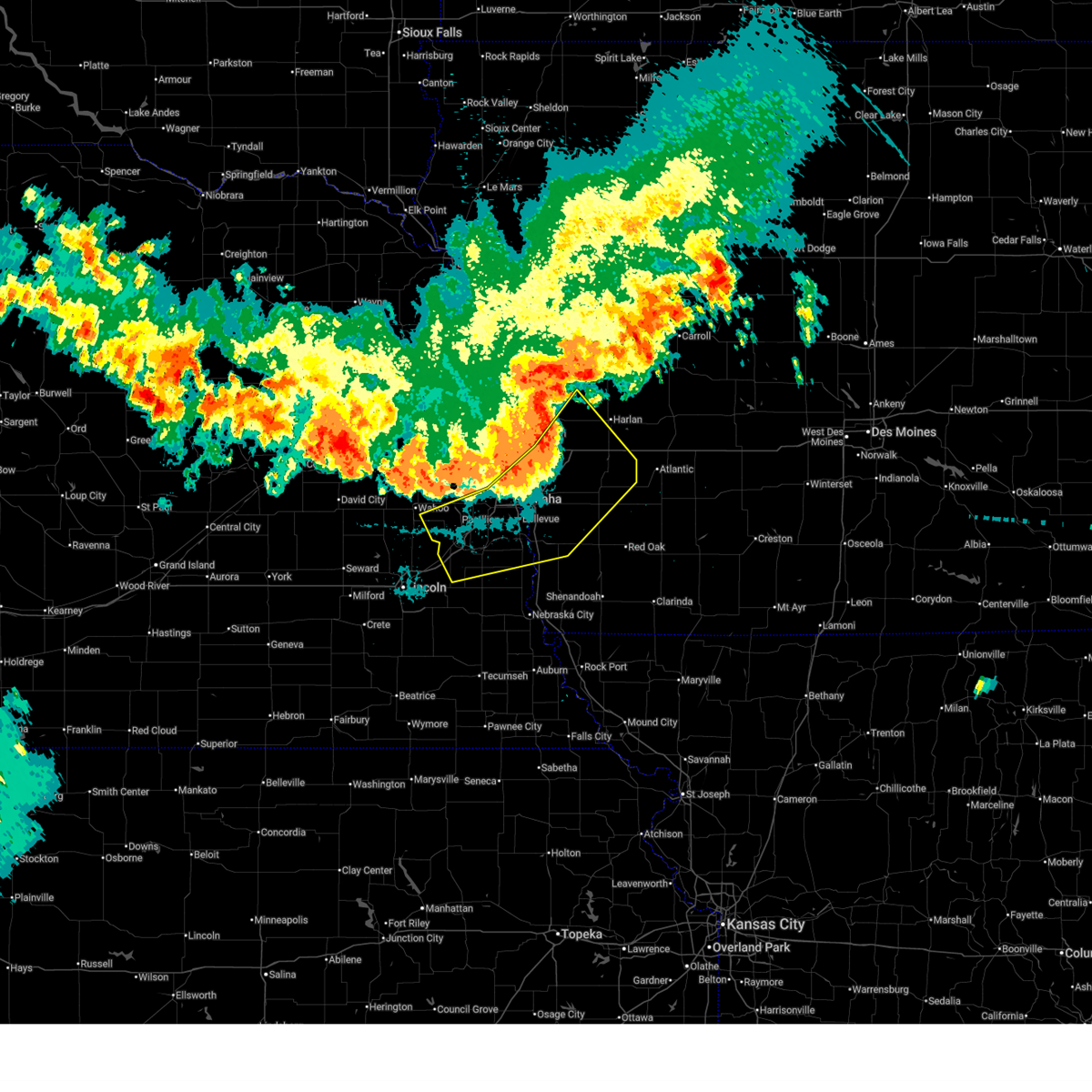
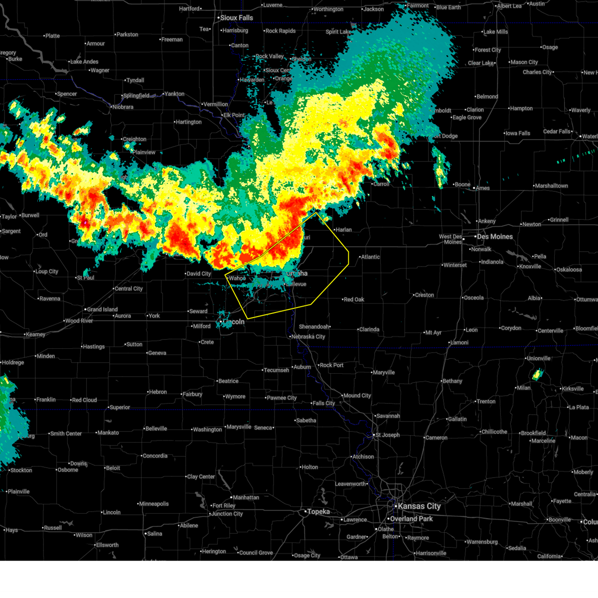
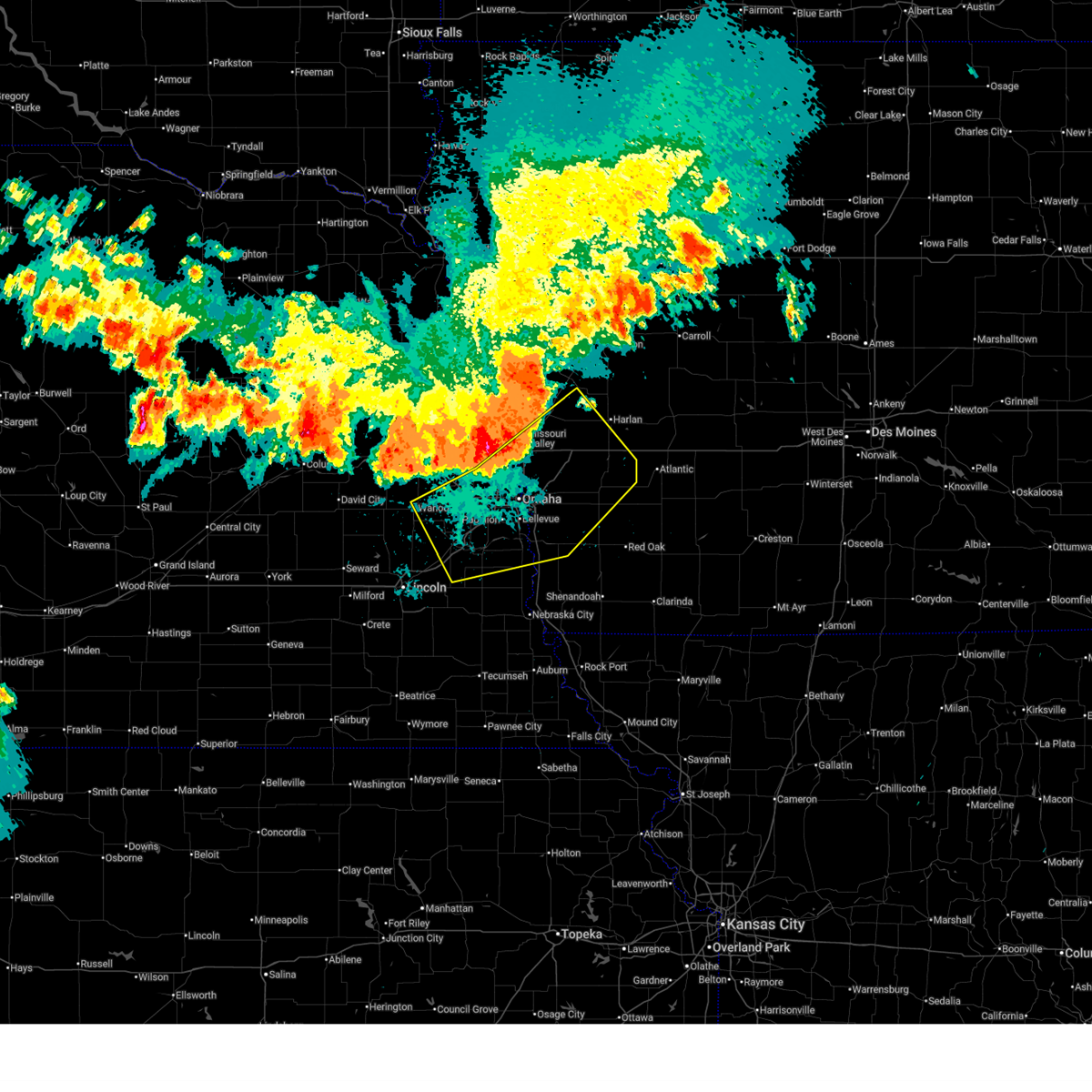
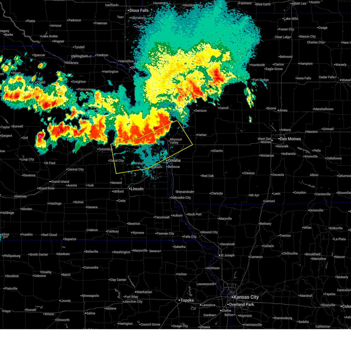
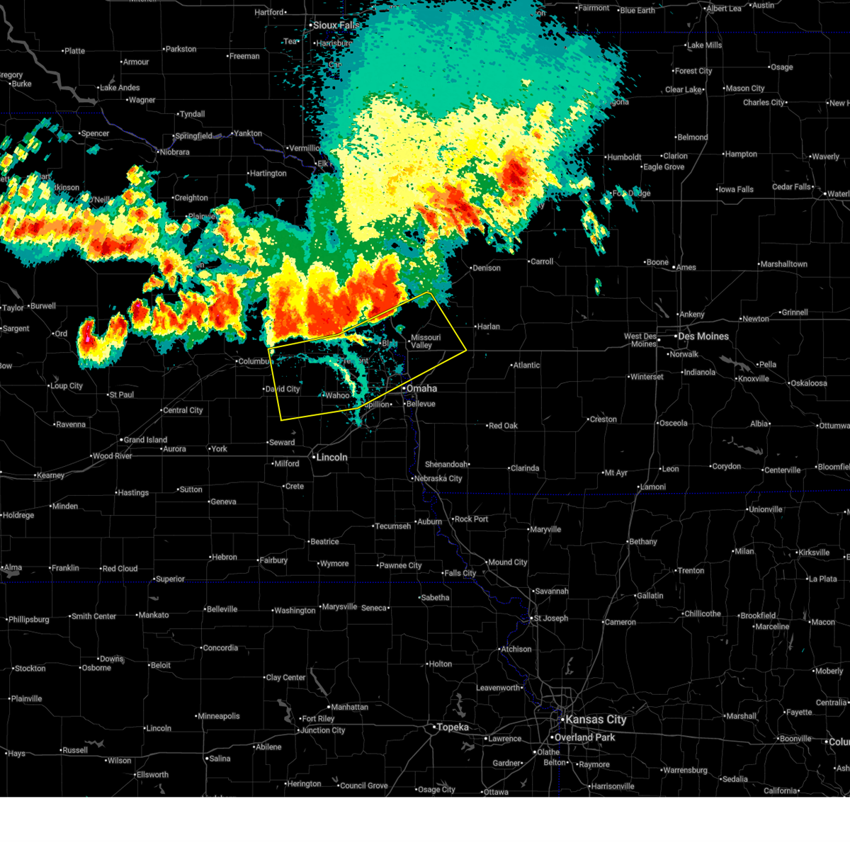
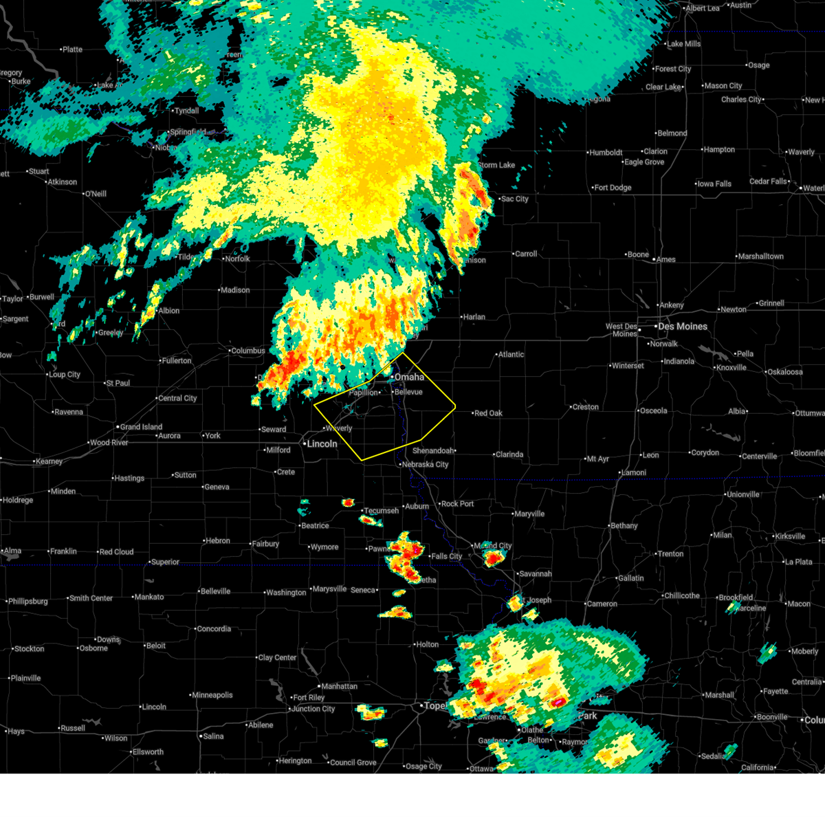
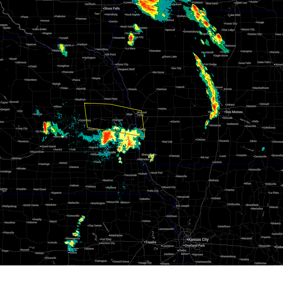
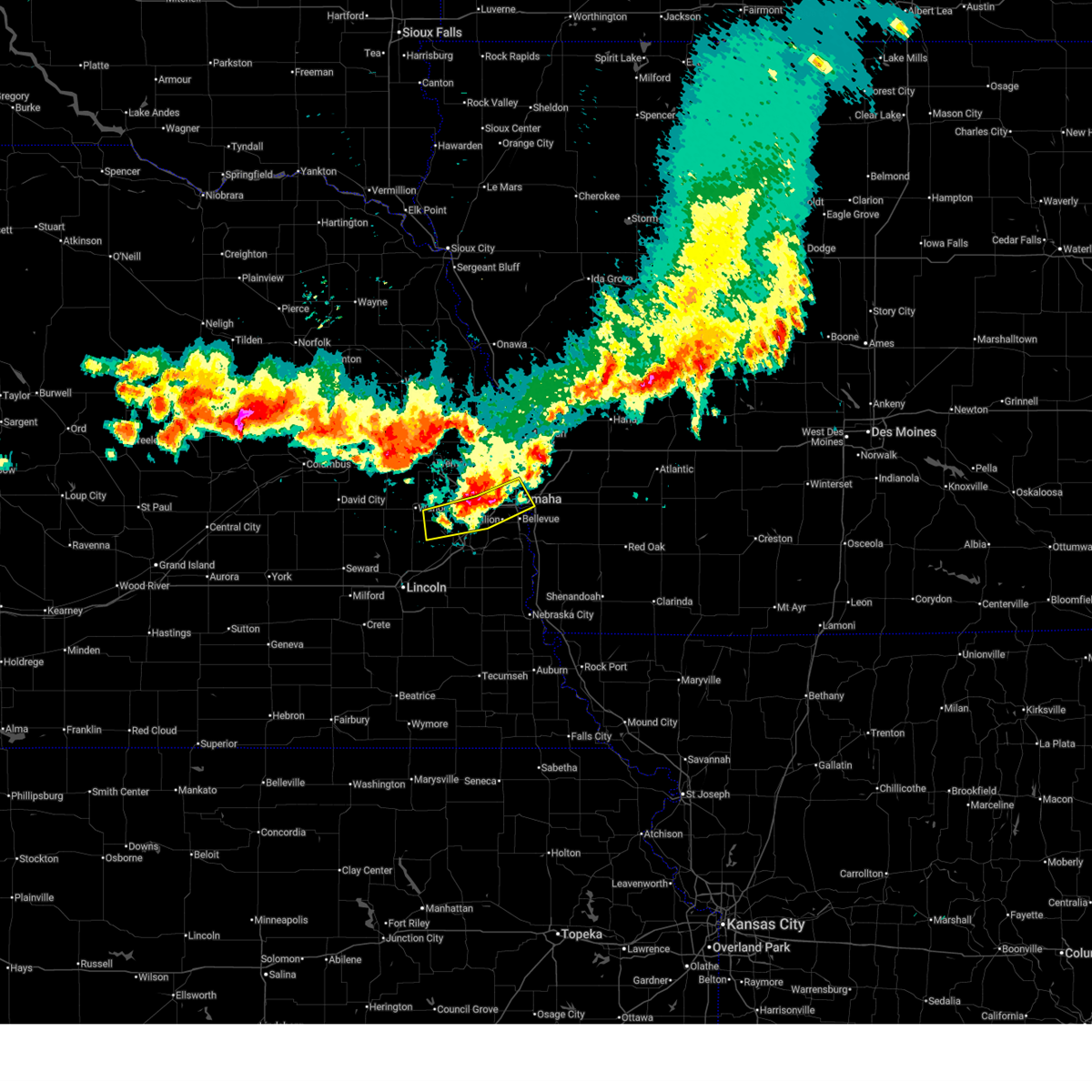
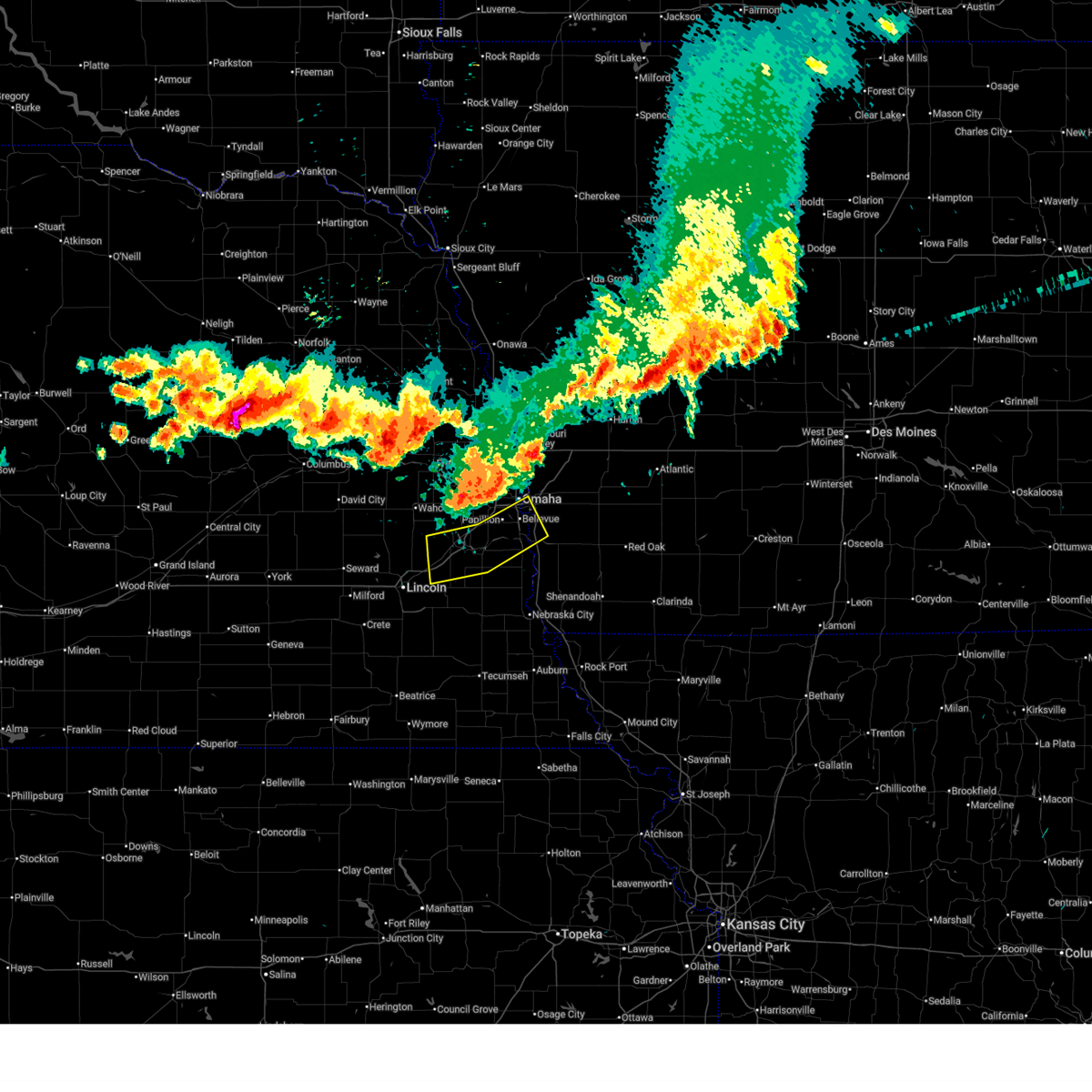
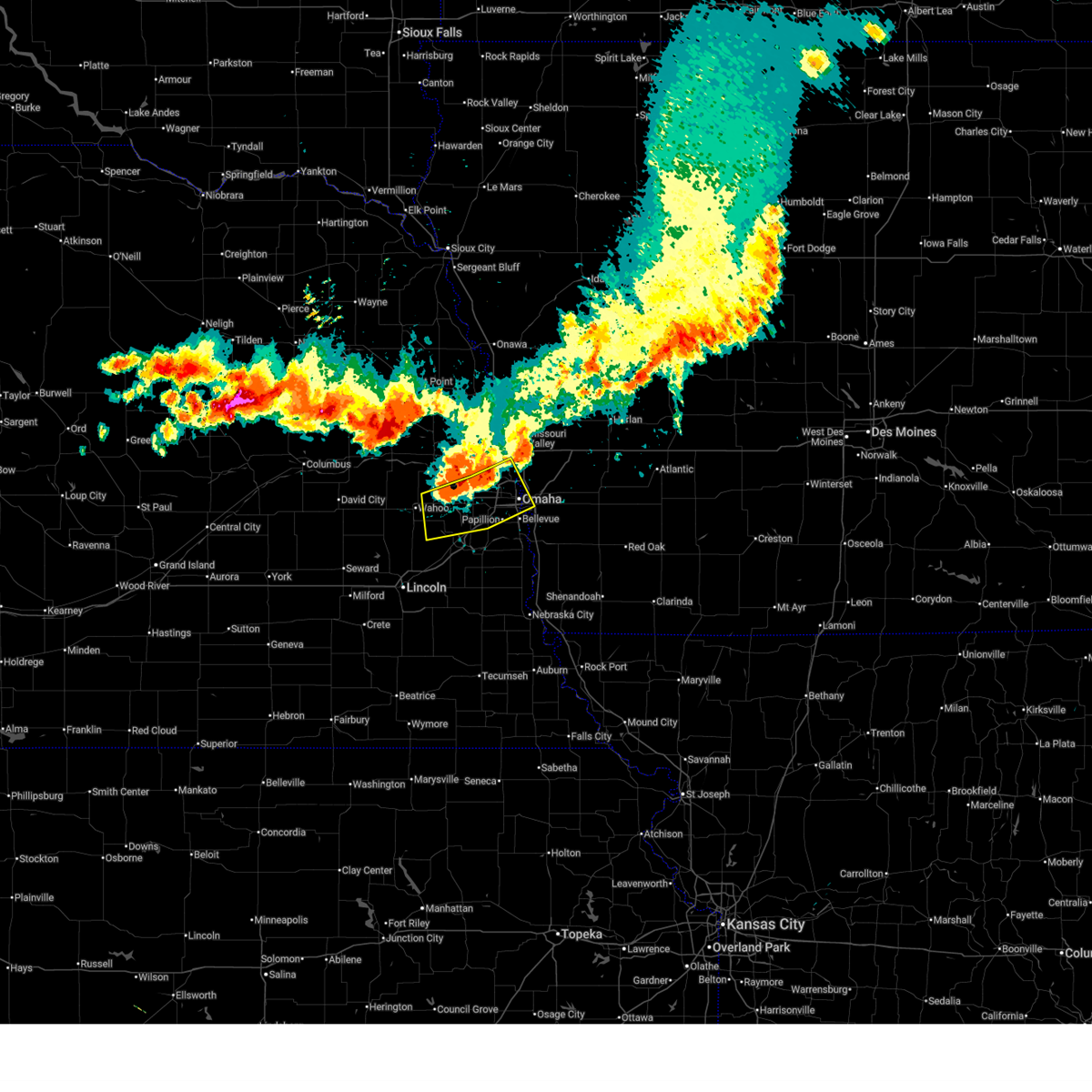
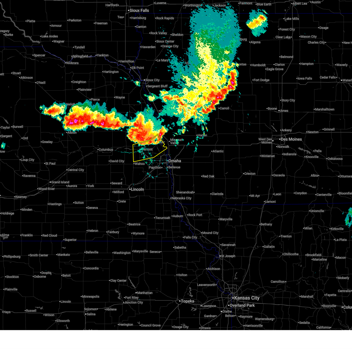
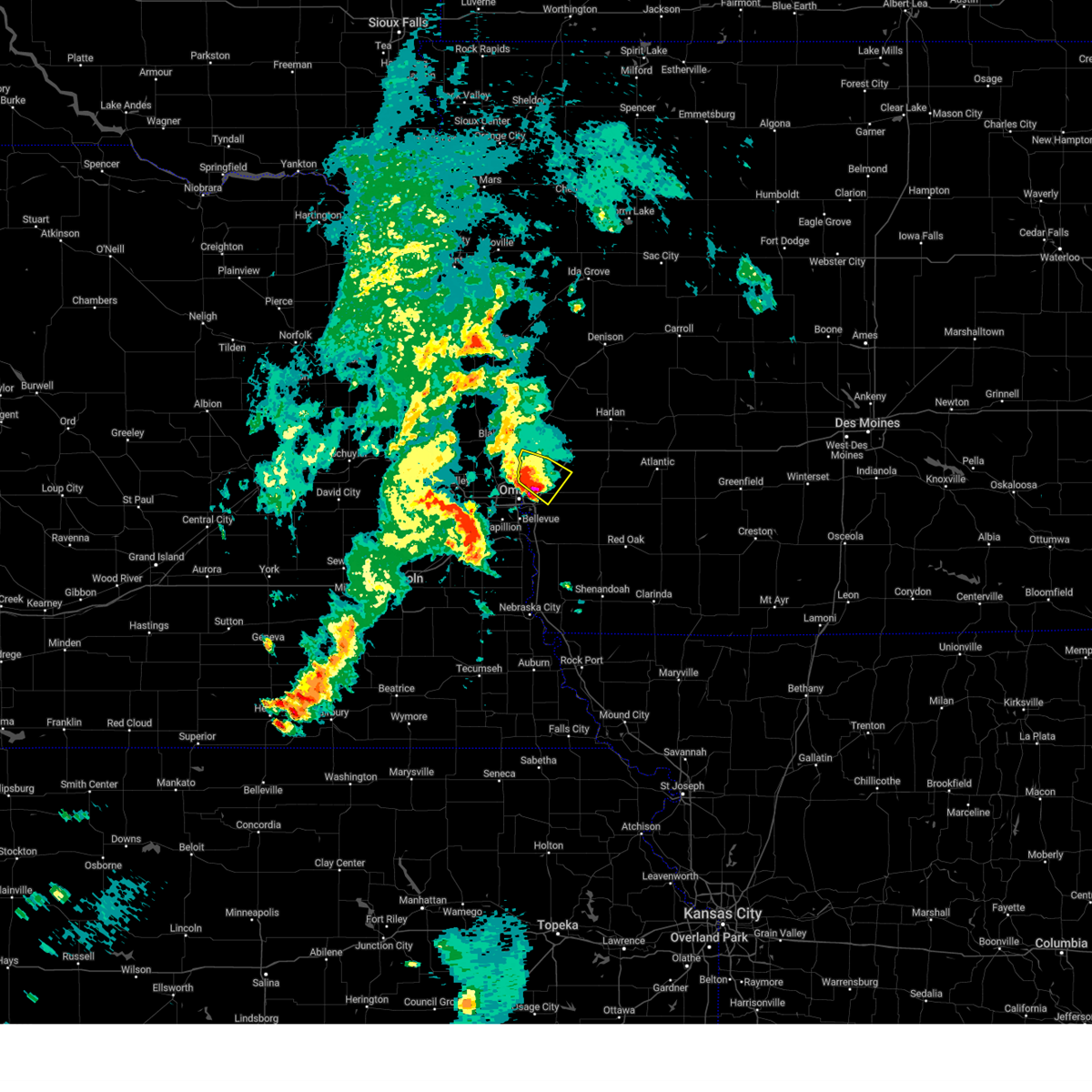
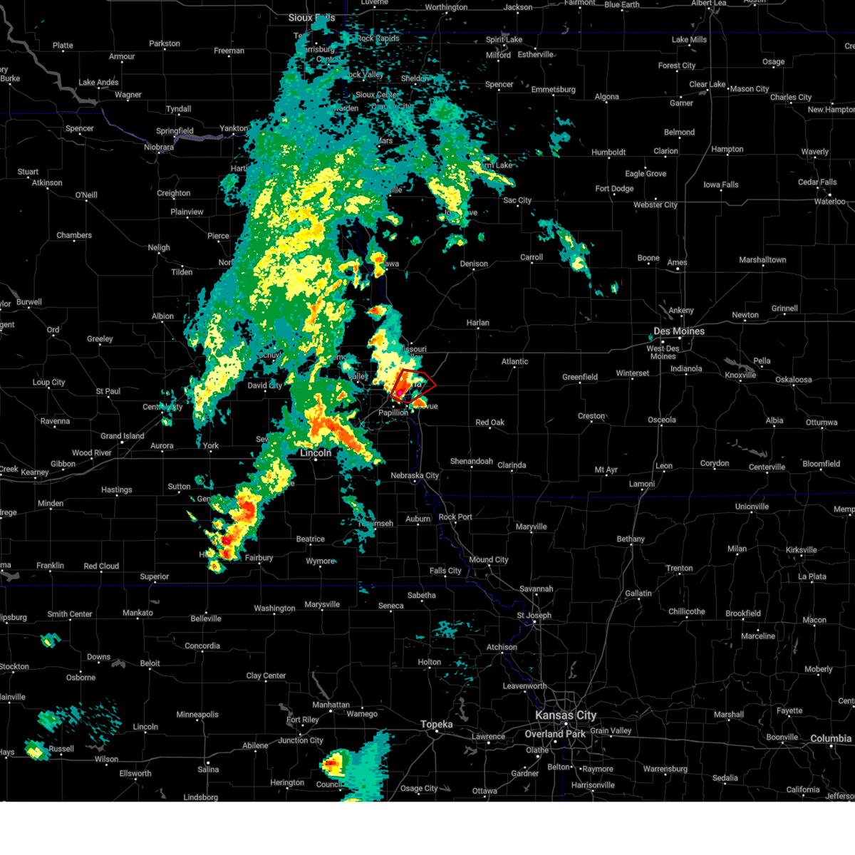
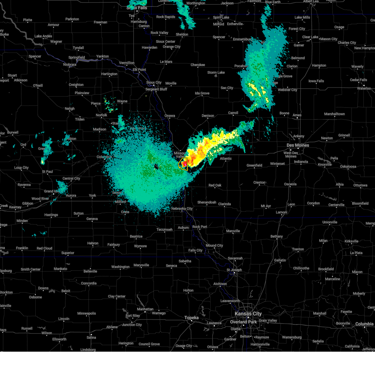
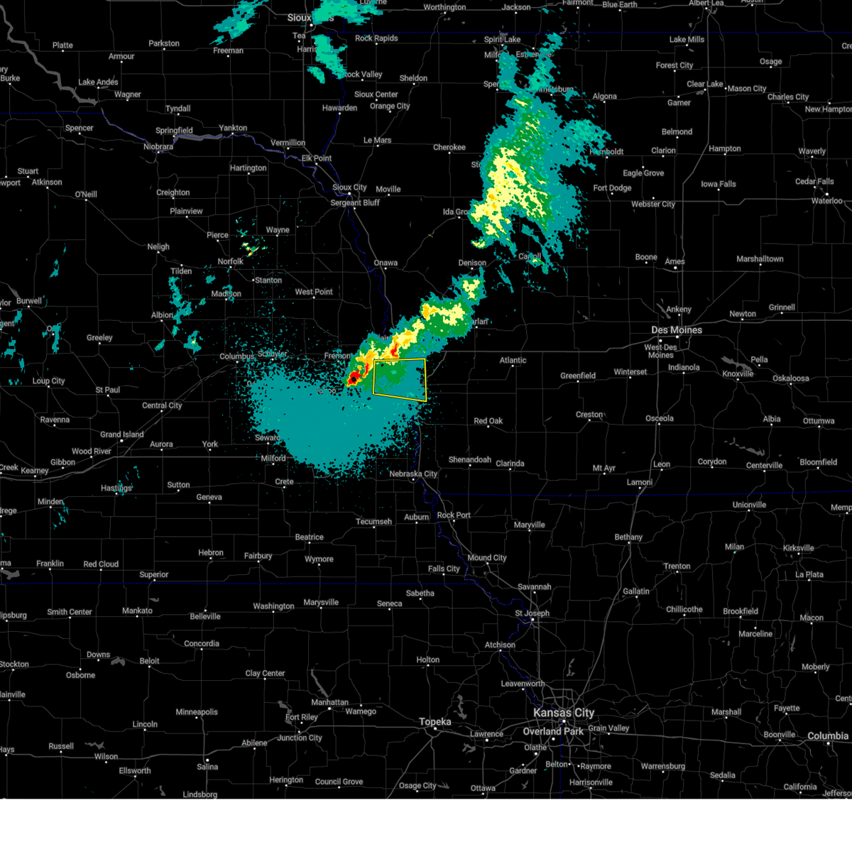
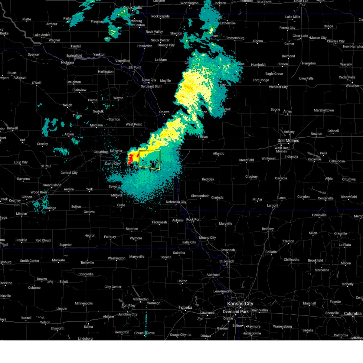
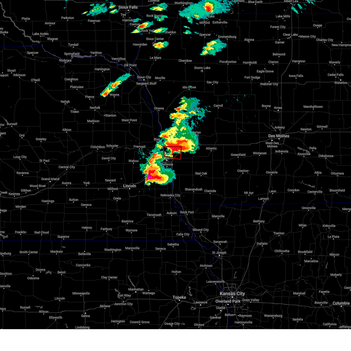
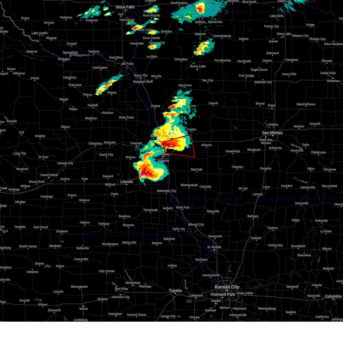
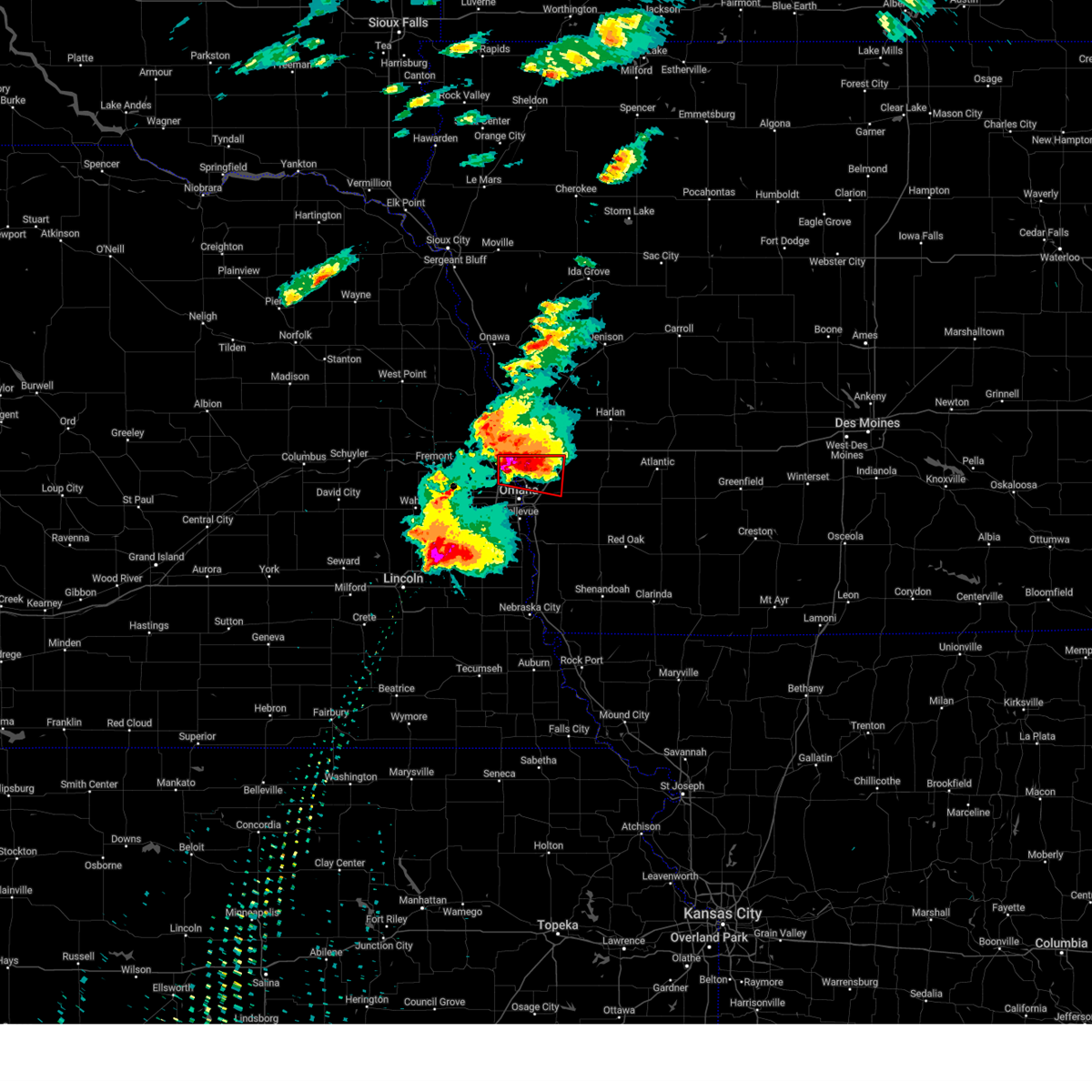
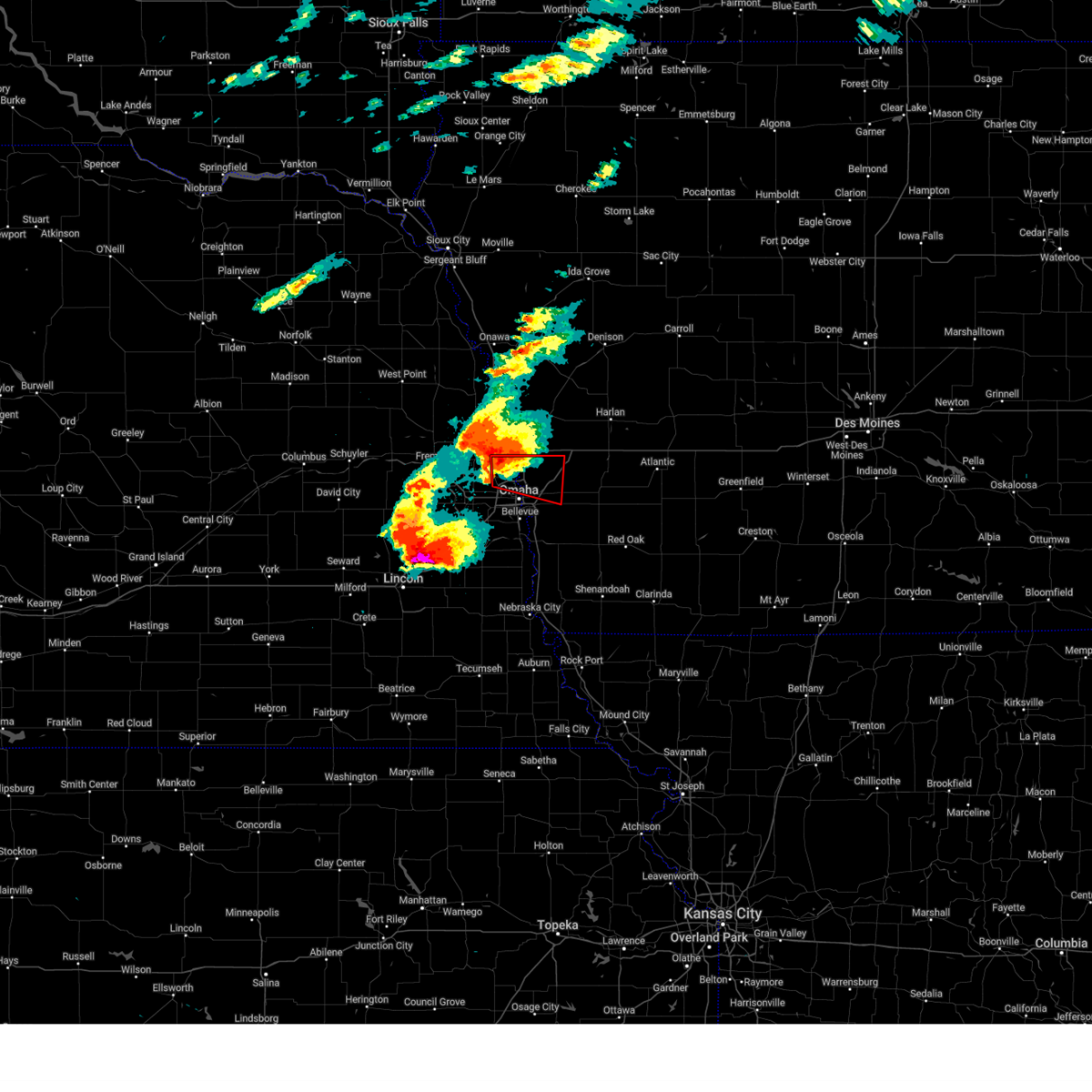
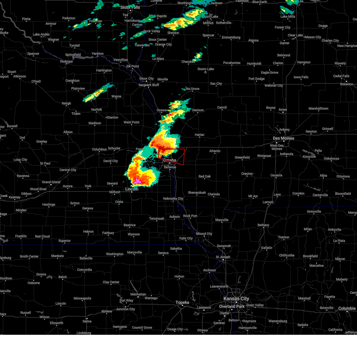
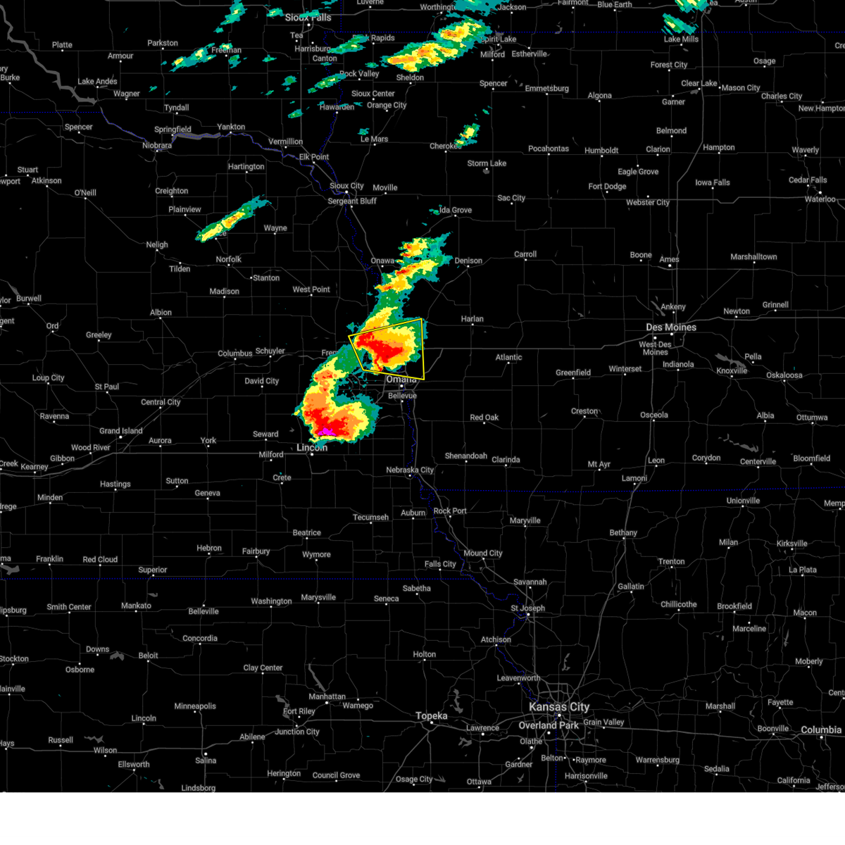
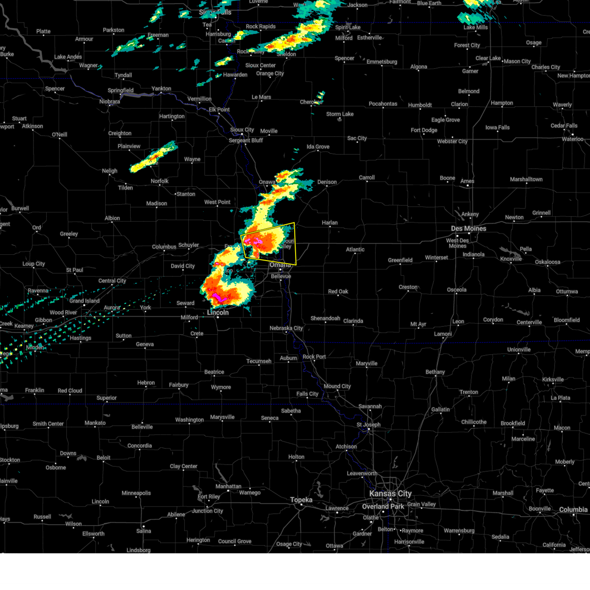
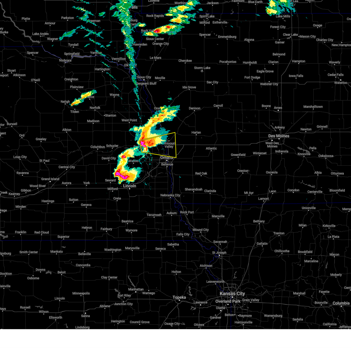
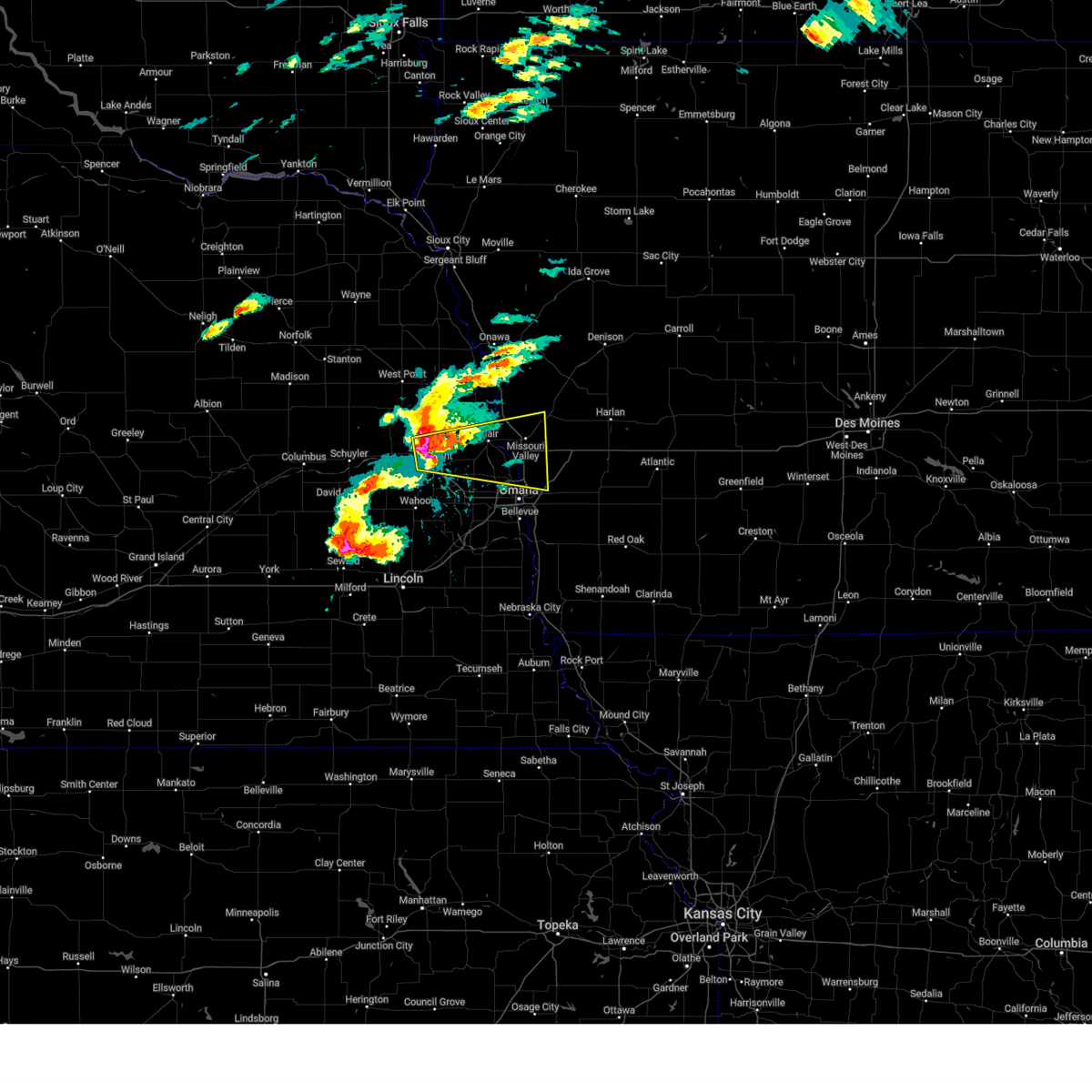
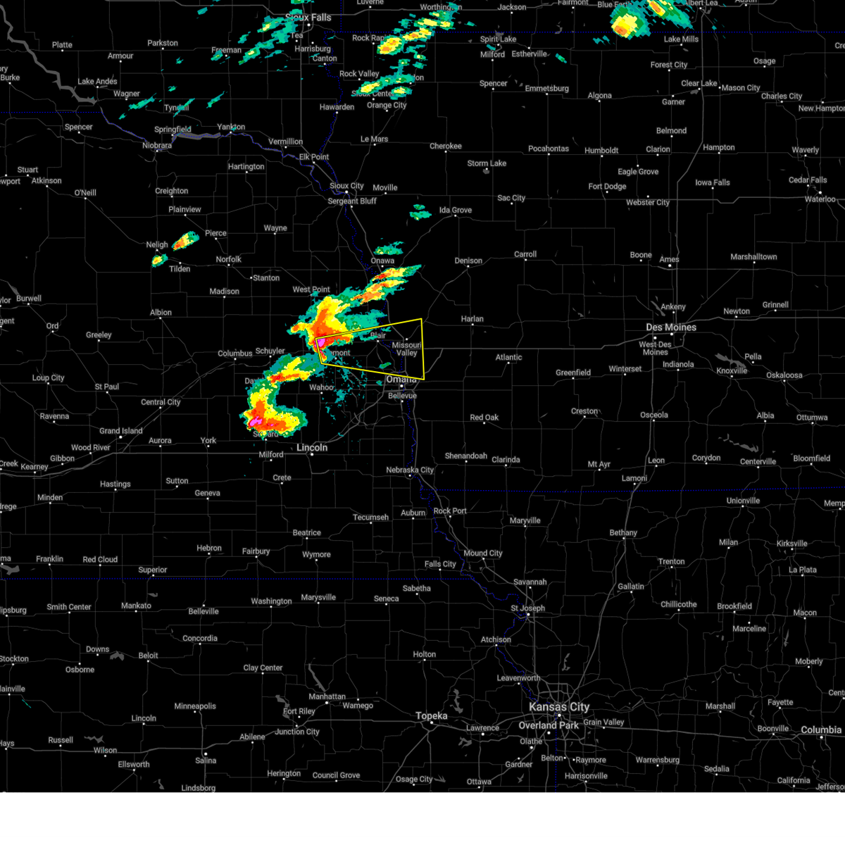
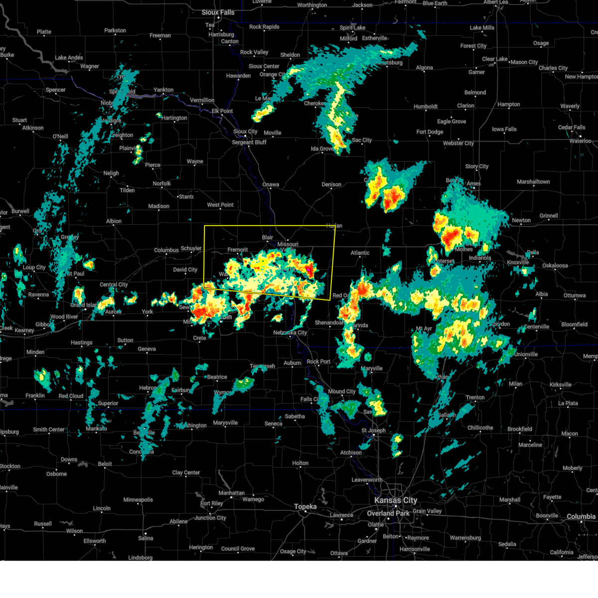
Hail Map for Omaha, NE
The Omaha, NE area has had 236 reports of on-the-ground hail by trained spotters, and has been under severe weather warnings 69 times during the past 12 months. Doppler radar has detected hail at or near Omaha, NE on 180 occasions, including 9 occasions during the past year.
| Name: | Omaha, NE |
| Where Located: | 7.9 miles W of Omaha, NE |
| Map: | Google Map for Omaha, NE |
| Population: | 408958 |
| Housing Units: | 177518 |
| More Info: | Search Google for Omaha, NE |
2
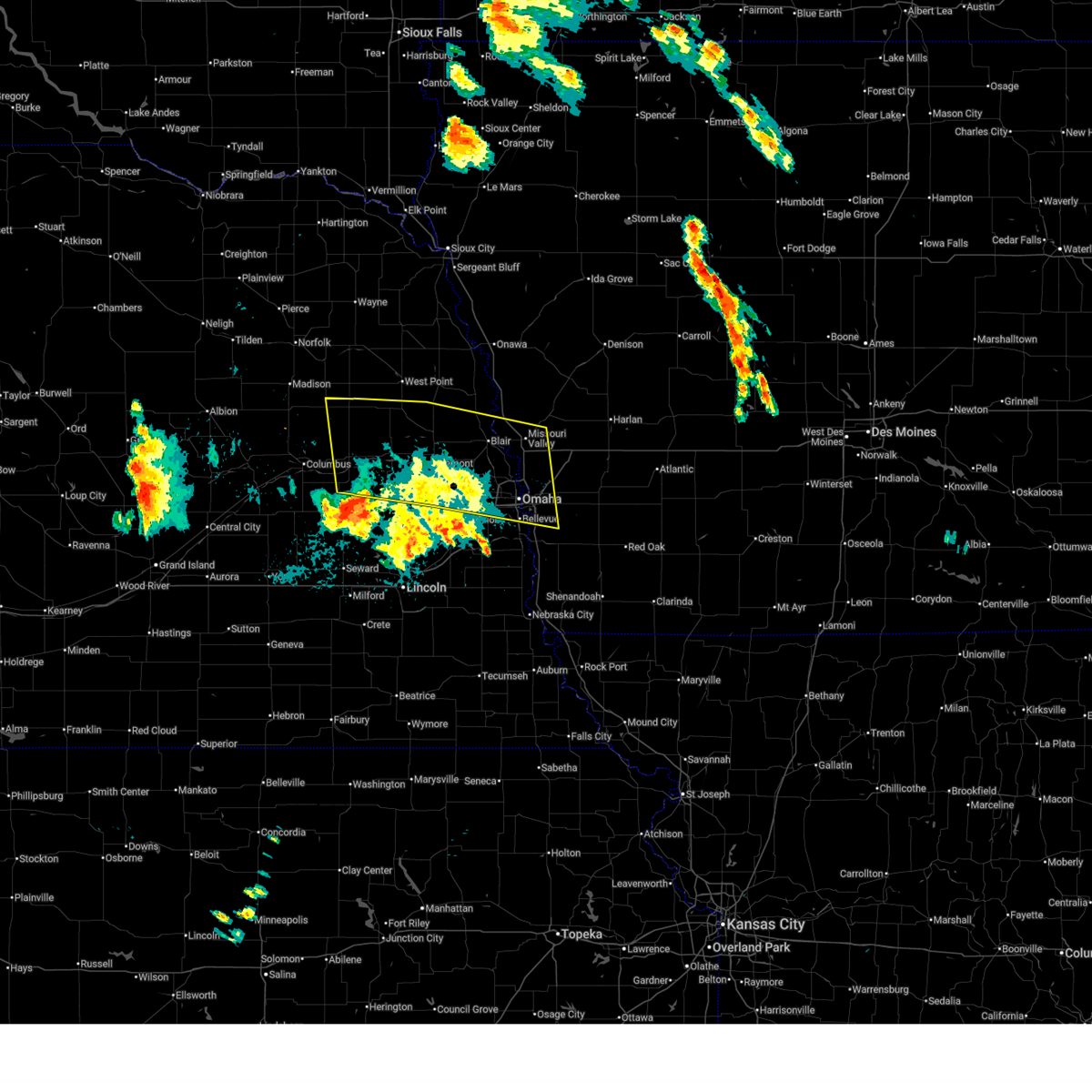
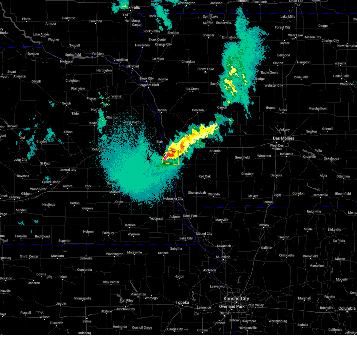
The Top Recent Hail Date for Omaha, NE is Monday, April 21, 2025 (14th out of 180)

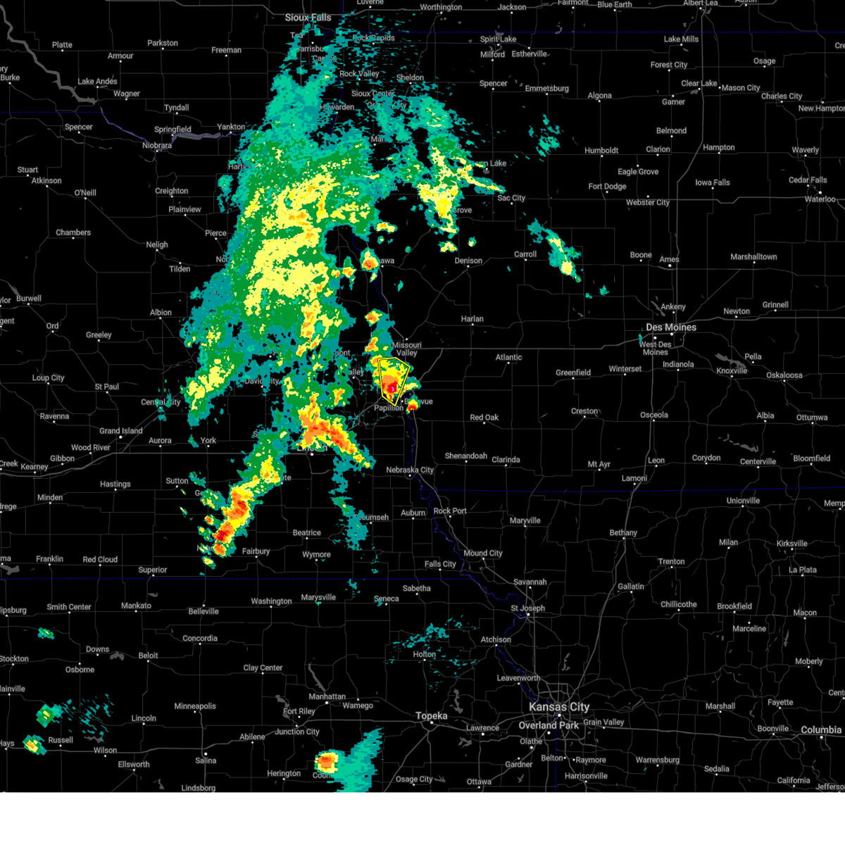
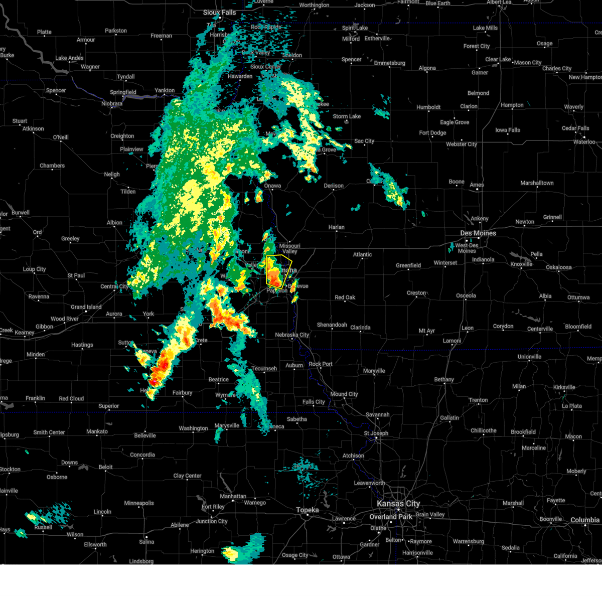
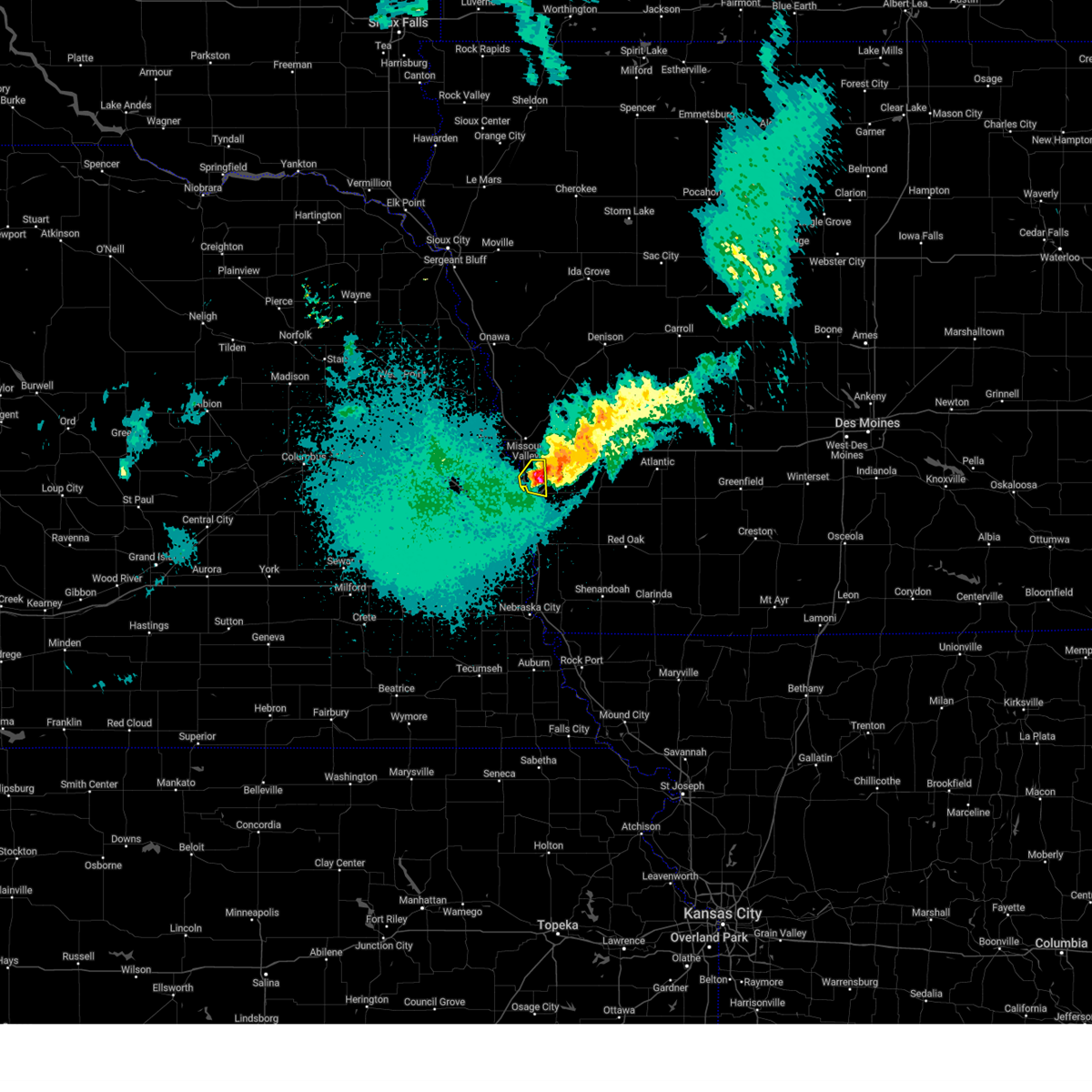
Hail and Wind Damage Spotted near Omaha, NE
| Date / Time | Report Details |
|---|---|
| 7/7/2025 10:26 PM CDT |
 the severe thunderstorm warning has been cancelled and is no longer in effect the severe thunderstorm warning has been cancelled and is no longer in effect
|
| 7/7/2025 10:26 PM CDT |
 At 1025 pm cdt, severe thunderstorms were located along a line extending from 2 miles northwest of hancock to 2 miles north of pacific junction to 4 miles north of murdock, moving southeast at 45 mph (radar indicated). Hazards include 60 mph wind gusts and penny size hail. Expect damage to roofs, siding, and trees. these severe storms will be near, plattsmouth, glenwood, oakland, malvern, louisville, carson, pacific junction, murray, macedonia, and silver city around 1030 pm cdt. Henderson around 1035 pm cdt. At 1025 pm cdt, severe thunderstorms were located along a line extending from 2 miles northwest of hancock to 2 miles north of pacific junction to 4 miles north of murdock, moving southeast at 45 mph (radar indicated). Hazards include 60 mph wind gusts and penny size hail. Expect damage to roofs, siding, and trees. these severe storms will be near, plattsmouth, glenwood, oakland, malvern, louisville, carson, pacific junction, murray, macedonia, and silver city around 1030 pm cdt. Henderson around 1035 pm cdt.
|
| 7/7/2025 10:17 PM CDT | Personal weather statio in douglas county NE, 8.2 miles NE of Omaha, NE |
| 7/7/2025 10:16 PM CDT | Personal weather statio in douglas county NE, 7.4 miles NE of Omaha, NE |
| 7/7/2025 10:15 PM CDT |
 At 1014 pm cdt, severe thunderstorms were located along a line extending from 2 miles west of shelby to near bellevue to 3 miles northwest of ashland, moving southeast at 45 mph (radar indicated). Hazards include 60 mph wind gusts and penny size hail. Expect damage to roofs, siding, and trees. these severe storms will be near, bellevue, offutt afb, plattsmouth, glenwood, ashland, springfield, avoca, louisville, treynor, and cedar creek around 1020 pm cdt. oakland, carson, pacific junction, silver city, and murdock around 1025 pm cdt. Other locations in the path of these severe thunderstorms include malvern, murray, macedonia, henderson and beaver lake. At 1014 pm cdt, severe thunderstorms were located along a line extending from 2 miles west of shelby to near bellevue to 3 miles northwest of ashland, moving southeast at 45 mph (radar indicated). Hazards include 60 mph wind gusts and penny size hail. Expect damage to roofs, siding, and trees. these severe storms will be near, bellevue, offutt afb, plattsmouth, glenwood, ashland, springfield, avoca, louisville, treynor, and cedar creek around 1020 pm cdt. oakland, carson, pacific junction, silver city, and murdock around 1025 pm cdt. Other locations in the path of these severe thunderstorms include malvern, murray, macedonia, henderson and beaver lake.
|
| 7/7/2025 10:15 PM CDT |
 the severe thunderstorm warning has been cancelled and is no longer in effect the severe thunderstorm warning has been cancelled and is no longer in effect
|
| 7/7/2025 10:09 PM CDT | Storm damage reported in douglas county NE, 4.1 miles SSW of Omaha, NE |
| 7/7/2025 10:09 PM CDT |
 At 1009 pm cdt, severe thunderstorms were located along a line extending from 3 miles south of persia to omaha to 5 miles southeast of ithaca, moving southeast at 45 mph (radar indicated). Hazards include 60 mph wind gusts and nickel size hail. Expect damage to roofs, siding, and trees. these severe storms will be near, southeastern council bluffs, bellevue, papillion, gretna, offutt afb, ashland, springfield, shelby, minden, and cedar creek around 1015 pm cdt. Other locations in the path of these severe thunderstorms include plattsmouth, glenwood, avoca, louisville, treynor, hancock, oakland, carson, pacific junction, silver city, malvern, murray, macedonia, henderson and beaver lake. At 1009 pm cdt, severe thunderstorms were located along a line extending from 3 miles south of persia to omaha to 5 miles southeast of ithaca, moving southeast at 45 mph (radar indicated). Hazards include 60 mph wind gusts and nickel size hail. Expect damage to roofs, siding, and trees. these severe storms will be near, southeastern council bluffs, bellevue, papillion, gretna, offutt afb, ashland, springfield, shelby, minden, and cedar creek around 1015 pm cdt. Other locations in the path of these severe thunderstorms include plattsmouth, glenwood, avoca, louisville, treynor, hancock, oakland, carson, pacific junction, silver city, malvern, murray, macedonia, henderson and beaver lake.
|
| 7/7/2025 10:03 PM CDT | Personal weather statio in douglas county NE, 4.9 miles SE of Omaha, NE |
| 7/7/2025 10:00 PM CDT | Storm damage reported in douglas county NE, 8.4 miles SW of Omaha, NE |
| 7/7/2025 9:57 PM CDT |
 Svroax the national weather service in omaha has issued a * severe thunderstorm warning for, mills county in southwestern iowa, pottawattamie county in southwestern iowa, southeastern harrison county in southwestern iowa, southwestern shelby county in southwestern iowa, sarpy county in east central nebraska, southeastern washington county in east central nebraska, northeastern lancaster county in southeastern nebraska, douglas county in east central nebraska, southeastern saunders county in east central nebraska, central cass county in southeastern nebraska, * until 1045 pm cdt. * at 956 pm cdt, severe thunderstorms were located along a line extending from 3 miles south of persia to omaha to near wahoo, moving southeast at 45 mph (radar indicated). Hazards include 60 mph wind gusts and quarter size hail. Hail damage to vehicles is expected. expect wind damage to roofs, siding, and trees. severe thunderstorms will be near, omaha, council bluffs, bellevue, ralston, gretna, boys town, elkhorn, millard, la vista, and carter lake around 1000 pm cdt. papillion, walnut creek recreation area, and council bluffs airport around 1005 pm cdt. offutt afb, ashland, springfield, treynor, and hancock around 1010 pm cdt. oakland, louisville, and cedar creek around 1015 pm cdt. other locations in the path of these severe thunderstorms include plattsmouth, glenwood, carson, pacific junction, macedonia, silver city, murdock, henderson, malvern, murray and beaver lake. this includes the following highways, interstate 29 between mile markers 29 and 77. interstate 80 in iowa between mile markers 1 and 46. Interstate 80 in nebraska between mile markers 418 and 454. Svroax the national weather service in omaha has issued a * severe thunderstorm warning for, mills county in southwestern iowa, pottawattamie county in southwestern iowa, southeastern harrison county in southwestern iowa, southwestern shelby county in southwestern iowa, sarpy county in east central nebraska, southeastern washington county in east central nebraska, northeastern lancaster county in southeastern nebraska, douglas county in east central nebraska, southeastern saunders county in east central nebraska, central cass county in southeastern nebraska, * until 1045 pm cdt. * at 956 pm cdt, severe thunderstorms were located along a line extending from 3 miles south of persia to omaha to near wahoo, moving southeast at 45 mph (radar indicated). Hazards include 60 mph wind gusts and quarter size hail. Hail damage to vehicles is expected. expect wind damage to roofs, siding, and trees. severe thunderstorms will be near, omaha, council bluffs, bellevue, ralston, gretna, boys town, elkhorn, millard, la vista, and carter lake around 1000 pm cdt. papillion, walnut creek recreation area, and council bluffs airport around 1005 pm cdt. offutt afb, ashland, springfield, treynor, and hancock around 1010 pm cdt. oakland, louisville, and cedar creek around 1015 pm cdt. other locations in the path of these severe thunderstorms include plattsmouth, glenwood, carson, pacific junction, macedonia, silver city, murdock, henderson, malvern, murray and beaver lake. this includes the following highways, interstate 29 between mile markers 29 and 77. interstate 80 in iowa between mile markers 1 and 46. Interstate 80 in nebraska between mile markers 418 and 454.
|
| 7/7/2025 9:53 PM CDT |
 the severe thunderstorm warning has been cancelled and is no longer in effect the severe thunderstorm warning has been cancelled and is no longer in effect
|
| 7/7/2025 9:53 PM CDT |
 At 951 pm cdt, severe thunderstorms were located along a line extending from 4 miles east of logan to bennington to near colon, moving southeast at 45 mph (weather instrumentation. at 949 pm, 61 mph winds were reported at the nws in valley). Hazards include 60 mph wind gusts and quarter size hail. Hail damage to vehicles is expected. expect wind damage to roofs, siding, and trees. these severe storms will be near, omaha, wahoo, bennington, boys town, elkhorn, valley, yutan, waterloo, mead, and leshara around 955 pm cdt. carter lake, crescent, persia, ithaca, eppley airfield, midtown, benson, and zorinsky lake around 1000 pm cdt. Other locations in the path of these severe thunderstorms include millard, underwood, neola and minden. At 951 pm cdt, severe thunderstorms were located along a line extending from 4 miles east of logan to bennington to near colon, moving southeast at 45 mph (weather instrumentation. at 949 pm, 61 mph winds were reported at the nws in valley). Hazards include 60 mph wind gusts and quarter size hail. Hail damage to vehicles is expected. expect wind damage to roofs, siding, and trees. these severe storms will be near, omaha, wahoo, bennington, boys town, elkhorn, valley, yutan, waterloo, mead, and leshara around 955 pm cdt. carter lake, crescent, persia, ithaca, eppley airfield, midtown, benson, and zorinsky lake around 1000 pm cdt. Other locations in the path of these severe thunderstorms include millard, underwood, neola and minden.
|
| 7/7/2025 9:41 PM CDT |
 At 940 pm cdt, severe thunderstorms were located along a line extending from 2 miles southwest of woodbine to 2 miles east of fremont to near octavia, moving south at 40 mph (radar indicated). Hazards include 60 mph wind gusts and quarter size hail. Hail damage to vehicles is expected. expect wind damage to roofs, siding, and trees. these severe storms will be near, fremont, blair, missouri valley, logan, arlington, cedar bluffs, kennard, inglewood, prague, and leshara around 945 pm cdt. Other locations in the path of these severe thunderstorms include bennington, valley, fort calhoun, brainard, malmo, omaha, wahoo, elkhorn, yutan, waterloo, mead, weston, flanagan lake, ithaca, florence, standing bear lake, boys town, neola, crescent, valparaiso, eppley airfield, benson, zorinsky lake, millard, carter lake, underwood and midtown. At 940 pm cdt, severe thunderstorms were located along a line extending from 2 miles southwest of woodbine to 2 miles east of fremont to near octavia, moving south at 40 mph (radar indicated). Hazards include 60 mph wind gusts and quarter size hail. Hail damage to vehicles is expected. expect wind damage to roofs, siding, and trees. these severe storms will be near, fremont, blair, missouri valley, logan, arlington, cedar bluffs, kennard, inglewood, prague, and leshara around 945 pm cdt. Other locations in the path of these severe thunderstorms include bennington, valley, fort calhoun, brainard, malmo, omaha, wahoo, elkhorn, yutan, waterloo, mead, weston, flanagan lake, ithaca, florence, standing bear lake, boys town, neola, crescent, valparaiso, eppley airfield, benson, zorinsky lake, millard, carter lake, underwood and midtown.
|
| 7/7/2025 9:29 PM CDT |
 Svroax the national weather service in omaha has issued a * severe thunderstorm warning for, northwestern pottawattamie county in southwestern iowa, harrison county in southwestern iowa, southwestern shelby county in southwestern iowa, northwestern sarpy county in east central nebraska, southeastern burt county in east central nebraska, southeastern colfax county in northeastern nebraska, washington county in east central nebraska, southern dodge county in east central nebraska, douglas county in east central nebraska, eastern butler county in east central nebraska, saunders county in east central nebraska, * until 1015 pm cdt. * at 928 pm cdt, severe thunderstorms were located along a line extending from 6 miles northwest of woodbine to nickerson to schuyler, moving south at 40 mph (radar indicated). Hazards include 60 mph wind gusts and quarter size hail. Hail damage to vehicles is expected. expect wind damage to roofs, siding, and trees. severe thunderstorms will be near, fremont, blair, logan, woodbine, arlington, cedar bluffs, inglewood, modale, magnolia, and morse bluff around 935 pm cdt. missouri valley, kennard, prague, and bruno around 940 pm cdt. valley, fort calhoun, malmo, leshara, and colon around 945 pm cdt. other locations in the path of these severe thunderstorms include omaha, wahoo, bennington, waterloo, brainard, elkhorn, yutan, mead, weston, flanagan lake, standing bear lake, boys town, neola, crescent, ithaca, benson, florence, zorinsky lake, millard, carter lake, underwood, valparaiso and eppley airfield. this includes the following highways, interstate 29 between mile markers 58 and 92. Interstate 80 in iowa between mile markers 20 and 34. Svroax the national weather service in omaha has issued a * severe thunderstorm warning for, northwestern pottawattamie county in southwestern iowa, harrison county in southwestern iowa, southwestern shelby county in southwestern iowa, northwestern sarpy county in east central nebraska, southeastern burt county in east central nebraska, southeastern colfax county in northeastern nebraska, washington county in east central nebraska, southern dodge county in east central nebraska, douglas county in east central nebraska, eastern butler county in east central nebraska, saunders county in east central nebraska, * until 1015 pm cdt. * at 928 pm cdt, severe thunderstorms were located along a line extending from 6 miles northwest of woodbine to nickerson to schuyler, moving south at 40 mph (radar indicated). Hazards include 60 mph wind gusts and quarter size hail. Hail damage to vehicles is expected. expect wind damage to roofs, siding, and trees. severe thunderstorms will be near, fremont, blair, logan, woodbine, arlington, cedar bluffs, inglewood, modale, magnolia, and morse bluff around 935 pm cdt. missouri valley, kennard, prague, and bruno around 940 pm cdt. valley, fort calhoun, malmo, leshara, and colon around 945 pm cdt. other locations in the path of these severe thunderstorms include omaha, wahoo, bennington, waterloo, brainard, elkhorn, yutan, mead, weston, flanagan lake, standing bear lake, boys town, neola, crescent, ithaca, benson, florence, zorinsky lake, millard, carter lake, underwood, valparaiso and eppley airfield. this includes the following highways, interstate 29 between mile markers 58 and 92. Interstate 80 in iowa between mile markers 20 and 34.
|
| 6/29/2025 5:42 AM CDT |
 Svroax the national weather service in omaha has issued a * severe thunderstorm warning for, northwestern fremont county in southwestern iowa, mills county in southwestern iowa, southwestern pottawattamie county in southwestern iowa, sarpy county in east central nebraska, northeastern lancaster county in southeastern nebraska, north central otoe county in southeastern nebraska, southeastern douglas county in east central nebraska, southeastern saunders county in east central nebraska, cass county in southeastern nebraska, * until 615 am cdt. * at 542 am cdt, severe thunderstorms were located along a line extending from 5 miles southwest of underwood to near walnut creek recreation area to 3 miles north of greenwood, moving southeast at 45 mph (weather instrument measurement measured gust of 62 mph at omaha eppley airfield at 5:43 am). Hazards include 60 mph wind gusts. Expect damage to roofs, siding, and trees. severe thunderstorms will be near, southeastern omaha, council bluffs, bellevue, papillion, offutt afb, ashland, springfield, louisville, greenwood, and cedar creek around 545 am cdt. plattsmouth, treynor, and murdock around 550 am cdt. glenwood, elmwood, and pacific junction around 555 am cdt. weeping water, murray, silver city, and beaver lake around 600 am cdt. other locations in the path of these severe thunderstorms include malvern, avoca and nehawka. this includes the following highways, interstate 29 between mile markers 20 and 63. interstate 80 in iowa between mile markers 1 and 11. Interstate 80 in nebraska between mile markers 415 and 454. Svroax the national weather service in omaha has issued a * severe thunderstorm warning for, northwestern fremont county in southwestern iowa, mills county in southwestern iowa, southwestern pottawattamie county in southwestern iowa, sarpy county in east central nebraska, northeastern lancaster county in southeastern nebraska, north central otoe county in southeastern nebraska, southeastern douglas county in east central nebraska, southeastern saunders county in east central nebraska, cass county in southeastern nebraska, * until 615 am cdt. * at 542 am cdt, severe thunderstorms were located along a line extending from 5 miles southwest of underwood to near walnut creek recreation area to 3 miles north of greenwood, moving southeast at 45 mph (weather instrument measurement measured gust of 62 mph at omaha eppley airfield at 5:43 am). Hazards include 60 mph wind gusts. Expect damage to roofs, siding, and trees. severe thunderstorms will be near, southeastern omaha, council bluffs, bellevue, papillion, offutt afb, ashland, springfield, louisville, greenwood, and cedar creek around 545 am cdt. plattsmouth, treynor, and murdock around 550 am cdt. glenwood, elmwood, and pacific junction around 555 am cdt. weeping water, murray, silver city, and beaver lake around 600 am cdt. other locations in the path of these severe thunderstorms include malvern, avoca and nehawka. this includes the following highways, interstate 29 between mile markers 20 and 63. interstate 80 in iowa between mile markers 1 and 11. Interstate 80 in nebraska between mile markers 415 and 454.
|
| 6/29/2025 5:38 AM CDT | Koma asos measured gust of 61 mp in douglas county NE, 10.2 miles WSW of Omaha, NE |
| 6/19/2025 11:55 PM CDT |
 The strong winds which prompted the warning have weakened below severe limits, and the storm has exited the warned area. therefore, the warning will be allowed to expire. however, gusty winds up to 40 mph are still possible. The strong winds which prompted the warning have weakened below severe limits, and the storm has exited the warned area. therefore, the warning will be allowed to expire. however, gusty winds up to 40 mph are still possible.
|
| 6/19/2025 11:50 PM CDT | Power line damag in douglas county NE, 7.7 miles E of Omaha, NE |
| 6/19/2025 11:14 PM CDT |
 Svroax the national weather service in omaha has issued a * severe thunderstorm warning for, northwestern mills county in southwestern iowa, western pottawattamie county in southwestern iowa, southwestern harrison county in southwestern iowa, south central burt county in east central nebraska, colfax county in northeastern nebraska, douglas county in east central nebraska, northern saunders county in east central nebraska, northeastern sarpy county in east central nebraska, southwestern cuming county in northeastern nebraska, washington county in east central nebraska, dodge county in east central nebraska, northeastern butler county in east central nebraska, southeastern stanton county in northeastern nebraska, * until midnight cdt. * at 1111 pm cdt, showers and thunderstorms producing damaging winds up to 60 mph were located across southern dodge, northern saunders, and into washington and douglas counties, moving east at 20 mph (radar indicated). Hazards include 60 mph wind gusts. Expect damage to roofs, siding, and trees. this severe thunderstorm will be near, fremont and cedar bluffs around 1115 pm cdt. inglewood around 1125 pm cdt. woodcliff around 1130 pm cdt. other locations in the path of this severe thunderstorm include arlington. people attending charles schwab field should seek safe shelter immediately! this includes the following highways, interstate 29 between mile markers 42 and 84. interstate 80 in iowa between mile markers 1 and 14. Interstate 80 in nebraska between mile markers 443 and 454. Svroax the national weather service in omaha has issued a * severe thunderstorm warning for, northwestern mills county in southwestern iowa, western pottawattamie county in southwestern iowa, southwestern harrison county in southwestern iowa, south central burt county in east central nebraska, colfax county in northeastern nebraska, douglas county in east central nebraska, northern saunders county in east central nebraska, northeastern sarpy county in east central nebraska, southwestern cuming county in northeastern nebraska, washington county in east central nebraska, dodge county in east central nebraska, northeastern butler county in east central nebraska, southeastern stanton county in northeastern nebraska, * until midnight cdt. * at 1111 pm cdt, showers and thunderstorms producing damaging winds up to 60 mph were located across southern dodge, northern saunders, and into washington and douglas counties, moving east at 20 mph (radar indicated). Hazards include 60 mph wind gusts. Expect damage to roofs, siding, and trees. this severe thunderstorm will be near, fremont and cedar bluffs around 1115 pm cdt. inglewood around 1125 pm cdt. woodcliff around 1130 pm cdt. other locations in the path of this severe thunderstorm include arlington. people attending charles schwab field should seek safe shelter immediately! this includes the following highways, interstate 29 between mile markers 42 and 84. interstate 80 in iowa between mile markers 1 and 14. Interstate 80 in nebraska between mile markers 443 and 454.
|
| 6/16/2025 8:14 PM CDT |
 the severe thunderstorm warning has been cancelled and is no longer in effect the severe thunderstorm warning has been cancelled and is no longer in effect
|
| 6/16/2025 7:59 PM CDT |
 At 759 pm cdt, severe thunderstorms were located along a line extending from 5 miles east of offutt afb to near louisville to near waverly, moving south at 30 mph (radar indicated). Hazards include 60 mph wind gusts and quarter size hail. Hail damage to vehicles is expected. expect wind damage to roofs, siding, and trees. Locations impacted include, plattsmouth and murdock. At 759 pm cdt, severe thunderstorms were located along a line extending from 5 miles east of offutt afb to near louisville to near waverly, moving south at 30 mph (radar indicated). Hazards include 60 mph wind gusts and quarter size hail. Hail damage to vehicles is expected. expect wind damage to roofs, siding, and trees. Locations impacted include, plattsmouth and murdock.
|
| 6/16/2025 7:51 PM CDT |
 At 750 pm cdt, severe thunderstorms were located along a line extending from council bluffs to near wehrspann lake to 5 miles west of ashland, moving south at 25 mph (radar indicated). Hazards include 60 mph wind gusts and quarter size hail. Hail damage to vehicles is expected. expect wind damage to roofs, siding, and trees. locations impacted include, southeastern omaha, council bluffs, bellevue, papillion, ralston, gretna, la vista, prairie queen recreation area, walnut creek recreation area and south omaha. People attending charles schwab field should seek safe shelter immediately!. At 750 pm cdt, severe thunderstorms were located along a line extending from council bluffs to near wehrspann lake to 5 miles west of ashland, moving south at 25 mph (radar indicated). Hazards include 60 mph wind gusts and quarter size hail. Hail damage to vehicles is expected. expect wind damage to roofs, siding, and trees. locations impacted include, southeastern omaha, council bluffs, bellevue, papillion, ralston, gretna, la vista, prairie queen recreation area, walnut creek recreation area and south omaha. People attending charles schwab field should seek safe shelter immediately!.
|
| 6/16/2025 7:51 PM CDT |
 the severe thunderstorm warning has been cancelled and is no longer in effect the severe thunderstorm warning has been cancelled and is no longer in effect
|
| 6/16/2025 7:41 PM CDT |
 Svroax the national weather service in omaha has issued a * severe thunderstorm warning for, northwestern mills county in southwestern iowa, southwestern pottawattamie county in southwestern iowa, sarpy county in east central nebraska, northeastern lancaster county in southeastern nebraska, southeastern douglas county in east central nebraska, southeastern saunders county in east central nebraska, central cass county in southeastern nebraska, * until 830 pm cdt. * at 741 pm cdt, severe thunderstorms were located along a line extending from council bluffs to near gretna to 5 miles south of ithaca, moving south at 30 mph (radar indicated). Hazards include 60 mph wind gusts and quarter size hail. Hail damage to vehicles is expected. expect wind damage to roofs, siding, and trees. severe thunderstorms will be near, southeastern omaha, council bluffs, bellevue, papillion, offutt afb, la vista, ashland, springfield, prairie queen recreation area, and walnut creek recreation area around 745 pm cdt. louisville, greenwood, and cedar creek around 750 pm cdt. plattsmouth, waverly, and murdock around 800 pm cdt. this includes the following highways, interstate 29 between mile markers 35 and 45, and between mile markers 50 and 53. interstate 80 in iowa between mile markers 1 and 3. Interstate 80 in nebraska between mile markers 411 and 439, and between mile markers 452 and 454. Svroax the national weather service in omaha has issued a * severe thunderstorm warning for, northwestern mills county in southwestern iowa, southwestern pottawattamie county in southwestern iowa, sarpy county in east central nebraska, northeastern lancaster county in southeastern nebraska, southeastern douglas county in east central nebraska, southeastern saunders county in east central nebraska, central cass county in southeastern nebraska, * until 830 pm cdt. * at 741 pm cdt, severe thunderstorms were located along a line extending from council bluffs to near gretna to 5 miles south of ithaca, moving south at 30 mph (radar indicated). Hazards include 60 mph wind gusts and quarter size hail. Hail damage to vehicles is expected. expect wind damage to roofs, siding, and trees. severe thunderstorms will be near, southeastern omaha, council bluffs, bellevue, papillion, offutt afb, la vista, ashland, springfield, prairie queen recreation area, and walnut creek recreation area around 745 pm cdt. louisville, greenwood, and cedar creek around 750 pm cdt. plattsmouth, waverly, and murdock around 800 pm cdt. this includes the following highways, interstate 29 between mile markers 35 and 45, and between mile markers 50 and 53. interstate 80 in iowa between mile markers 1 and 3. Interstate 80 in nebraska between mile markers 411 and 439, and between mile markers 452 and 454.
|
| 6/16/2025 7:31 PM CDT |
 At 730 pm cdt, severe thunderstorms were located along a line extending from omaha to 2 miles west of boys town to near ithaca, moving south at 25 mph (radar indicated). Hazards include 60 mph wind gusts and quarter size hail. Hail damage to vehicles is expected. expect wind damage to roofs, siding, and trees. these severe storms will be near, omaha, council bluffs, ralston, gretna, boys town, millard, la vista, carter lake, ithaca, and eppley airfield around 735 pm cdt. other locations in the path of these severe thunderstorms include bellevue, papillion, prairie queen recreation area, south omaha and walnut creek recreation area. People attending charles schwab field should seek safe shelter immediately!. At 730 pm cdt, severe thunderstorms were located along a line extending from omaha to 2 miles west of boys town to near ithaca, moving south at 25 mph (radar indicated). Hazards include 60 mph wind gusts and quarter size hail. Hail damage to vehicles is expected. expect wind damage to roofs, siding, and trees. these severe storms will be near, omaha, council bluffs, ralston, gretna, boys town, millard, la vista, carter lake, ithaca, and eppley airfield around 735 pm cdt. other locations in the path of these severe thunderstorms include bellevue, papillion, prairie queen recreation area, south omaha and walnut creek recreation area. People attending charles schwab field should seek safe shelter immediately!.
|
| 6/16/2025 7:16 PM CDT |
 Svroax the national weather service in omaha has issued a * severe thunderstorm warning for, southwestern pottawattamie county in southwestern iowa, northwestern sarpy county in east central nebraska, southeastern washington county in east central nebraska, douglas county in east central nebraska, southeastern saunders county in east central nebraska, * until 800 pm cdt. * at 716 pm cdt, severe thunderstorms were located along a line extending from near fort calhoun to 3 miles northwest of flanagan lake to 2 miles southeast of colon, moving south at 30 mph (radar indicated). Hazards include 60 mph wind gusts and quarter size hail. Hail damage to vehicles is expected. expect wind damage to roofs, siding, and trees. severe thunderstorms will be near, omaha, bennington, elkhorn, valley, yutan, waterloo, mead, flanagan lake, and standing bear lake around 720 pm cdt. boys town, ithaca, benson, and florence around 725 pm cdt. eppley airfield and zorinsky lake around 730 pm cdt. millard, carter lake, midtown, aksarben, and chalco around 735 pm cdt. other locations in the path of these severe thunderstorms include northwestern council bluffs, ralston, gretna, la vista, prairie queen recreation area, south omaha, wehrspann lake, bellevue, papillion and walnut creek recreation area. people attending charles schwab field should seek safe shelter immediately! this includes the following highways, interstate 29 between mile markers 47 and 55. interstate 80 in iowa between mile markers 1 and 4. Interstate 80 in nebraska between mile markers 432 and 454. Svroax the national weather service in omaha has issued a * severe thunderstorm warning for, southwestern pottawattamie county in southwestern iowa, northwestern sarpy county in east central nebraska, southeastern washington county in east central nebraska, douglas county in east central nebraska, southeastern saunders county in east central nebraska, * until 800 pm cdt. * at 716 pm cdt, severe thunderstorms were located along a line extending from near fort calhoun to 3 miles northwest of flanagan lake to 2 miles southeast of colon, moving south at 30 mph (radar indicated). Hazards include 60 mph wind gusts and quarter size hail. Hail damage to vehicles is expected. expect wind damage to roofs, siding, and trees. severe thunderstorms will be near, omaha, bennington, elkhorn, valley, yutan, waterloo, mead, flanagan lake, and standing bear lake around 720 pm cdt. boys town, ithaca, benson, and florence around 725 pm cdt. eppley airfield and zorinsky lake around 730 pm cdt. millard, carter lake, midtown, aksarben, and chalco around 735 pm cdt. other locations in the path of these severe thunderstorms include northwestern council bluffs, ralston, gretna, la vista, prairie queen recreation area, south omaha, wehrspann lake, bellevue, papillion and walnut creek recreation area. people attending charles schwab field should seek safe shelter immediately! this includes the following highways, interstate 29 between mile markers 47 and 55. interstate 80 in iowa between mile markers 1 and 4. Interstate 80 in nebraska between mile markers 432 and 454.
|
| 6/16/2025 6:58 PM CDT |
 Svroax the national weather service in omaha has issued a * severe thunderstorm warning for, southwestern harrison county in southwestern iowa, washington county in east central nebraska, southeastern dodge county in east central nebraska, northwestern douglas county in east central nebraska, northeastern saunders county in east central nebraska, * until 745 pm cdt. * at 657 pm cdt, severe thunderstorms were located along a line extending from 2 miles southwest of modale to 3 miles northeast of arlington to 3 miles north of cedar bluffs, moving south at 35 mph (radar indicated). Hazards include 60 mph wind gusts and quarter size hail. Hail damage to vehicles is expected. expect wind damage to roofs, siding, and trees. severe thunderstorms will be near, fremont, blair, arlington, cedar bluffs, kennard, inglewood, and woodcliff around 700 pm cdt. fort calhoun around 710 pm cdt. valley and leshara around 715 pm cdt. Other locations in the path of these severe thunderstorms include bennington, colon and flanagan lake. Svroax the national weather service in omaha has issued a * severe thunderstorm warning for, southwestern harrison county in southwestern iowa, washington county in east central nebraska, southeastern dodge county in east central nebraska, northwestern douglas county in east central nebraska, northeastern saunders county in east central nebraska, * until 745 pm cdt. * at 657 pm cdt, severe thunderstorms were located along a line extending from 2 miles southwest of modale to 3 miles northeast of arlington to 3 miles north of cedar bluffs, moving south at 35 mph (radar indicated). Hazards include 60 mph wind gusts and quarter size hail. Hail damage to vehicles is expected. expect wind damage to roofs, siding, and trees. severe thunderstorms will be near, fremont, blair, arlington, cedar bluffs, kennard, inglewood, and woodcliff around 700 pm cdt. fort calhoun around 710 pm cdt. valley and leshara around 715 pm cdt. Other locations in the path of these severe thunderstorms include bennington, colon and flanagan lake.
|
| 4/24/2025 5:06 PM CDT |
 At 506 pm cdt, a severe thunderstorm was located over crescent, or 8 miles northeast of omaha, moving northeast at 20 mph (radar indicated). Hazards include 60 mph wind gusts and quarter size hail. Hail damage to vehicles is expected. expect wind damage to roofs, siding, and trees. This severe storm will be near, crescent around 510 pm cdt. At 506 pm cdt, a severe thunderstorm was located over crescent, or 8 miles northeast of omaha, moving northeast at 20 mph (radar indicated). Hazards include 60 mph wind gusts and quarter size hail. Hail damage to vehicles is expected. expect wind damage to roofs, siding, and trees. This severe storm will be near, crescent around 510 pm cdt.
|
| 4/24/2025 5:06 PM CDT |
 the severe thunderstorm warning has been cancelled and is no longer in effect the severe thunderstorm warning has been cancelled and is no longer in effect
|
| 4/24/2025 4:54 PM CDT |
 The tornado threat has diminished and the tornado warning has been cancelled. however, large hail and damaging winds remain likely and a severe thunderstorm warning remains in effect for the area. The tornado threat has diminished and the tornado warning has been cancelled. however, large hail and damaging winds remain likely and a severe thunderstorm warning remains in effect for the area.
|
| 4/24/2025 4:53 PM CDT |
 Svroax the national weather service in omaha has issued a * severe thunderstorm warning for, western pottawattamie county in southwestern iowa, northeastern douglas county in east central nebraska, * until 530 pm cdt. * at 452 pm cdt, a severe thunderstorm was located over eastern omaha, moving northeast at 20 mph (radar indicated). Hazards include 60 mph wind gusts and quarter size hail. Hail damage to vehicles is expected. expect wind damage to roofs, siding, and trees. this severe thunderstorm will be near, crescent around 500 pm cdt. this includes the following highways, interstate 29 between mile markers 47 and 48, and between mile markers 54 and 71. Interstate 80 in iowa between mile markers 3 and 20. Svroax the national weather service in omaha has issued a * severe thunderstorm warning for, western pottawattamie county in southwestern iowa, northeastern douglas county in east central nebraska, * until 530 pm cdt. * at 452 pm cdt, a severe thunderstorm was located over eastern omaha, moving northeast at 20 mph (radar indicated). Hazards include 60 mph wind gusts and quarter size hail. Hail damage to vehicles is expected. expect wind damage to roofs, siding, and trees. this severe thunderstorm will be near, crescent around 500 pm cdt. this includes the following highways, interstate 29 between mile markers 47 and 48, and between mile markers 54 and 71. Interstate 80 in iowa between mile markers 3 and 20.
|
| 4/24/2025 4:42 PM CDT |
 At 442 pm cdt, a severe thunderstorm capable of producing a tornado was located over eastern omaha, moving northeast at 20 mph (radar indicated rotation). Hazards include tornado and up to half dollar size hail. Flying debris will be dangerous to those caught without shelter. mobile homes will be damaged or destroyed. damage to roofs, windows, and vehicles will occur. tree damage is likely. This dangerous storm will be near, eastern omaha, northeastern council bluffs, carter lake, crescent, and eppley airfield around 445 pm cdt. At 442 pm cdt, a severe thunderstorm capable of producing a tornado was located over eastern omaha, moving northeast at 20 mph (radar indicated rotation). Hazards include tornado and up to half dollar size hail. Flying debris will be dangerous to those caught without shelter. mobile homes will be damaged or destroyed. damage to roofs, windows, and vehicles will occur. tree damage is likely. This dangerous storm will be near, eastern omaha, northeastern council bluffs, carter lake, crescent, and eppley airfield around 445 pm cdt.
|
| 4/24/2025 4:34 PM CDT |
 the severe thunderstorm warning has been cancelled and is no longer in effect the severe thunderstorm warning has been cancelled and is no longer in effect
|
| 4/24/2025 4:34 PM CDT |
 At 433 pm cdt, a severe thunderstorm was located 4 miles northwest of florence, or 7 miles east of bennington, moving north at 25 mph (radar indicated). Hazards include golf ball size hail and 60 mph wind gusts. People and animals outdoors will be injured. expect hail damage to roofs, siding, windows, and vehicles. expect wind damage to roofs, siding, and trees. This severe thunderstorm will remain over mainly rural areas of west central pottawattamie, southeastern washington and eastern douglas counties, including the following locations, old market. At 433 pm cdt, a severe thunderstorm was located 4 miles northwest of florence, or 7 miles east of bennington, moving north at 25 mph (radar indicated). Hazards include golf ball size hail and 60 mph wind gusts. People and animals outdoors will be injured. expect hail damage to roofs, siding, windows, and vehicles. expect wind damage to roofs, siding, and trees. This severe thunderstorm will remain over mainly rural areas of west central pottawattamie, southeastern washington and eastern douglas counties, including the following locations, old market.
|
| 4/24/2025 4:30 PM CDT | Tea Cup sized hail reported 6.7 miles NW of Omaha, NE, pictures on social media. |
| 4/24/2025 4:30 PM CDT |
 Toroax the national weather service in omaha has issued a * tornado warning for, southwestern pottawattamie county in southwestern iowa, eastern douglas county in east central nebraska, * until 500 pm cdt. * at 430 pm cdt, a severe thunderstorm capable of producing a tornado was located over southeastern omaha, moving northeast at 20 mph (radar indicated rotation). Hazards include tornado and quarter size hail. Flying debris will be dangerous to those caught without shelter. mobile homes will be damaged or destroyed. damage to roofs, windows, and vehicles will occur. tree damage is likely. this dangerous storm will be near, southeastern omaha, council bluffs, carter lake, midtown, and eppley airfield around 435 pm cdt. Crescent around 450 pm cdt. Toroax the national weather service in omaha has issued a * tornado warning for, southwestern pottawattamie county in southwestern iowa, eastern douglas county in east central nebraska, * until 500 pm cdt. * at 430 pm cdt, a severe thunderstorm capable of producing a tornado was located over southeastern omaha, moving northeast at 20 mph (radar indicated rotation). Hazards include tornado and quarter size hail. Flying debris will be dangerous to those caught without shelter. mobile homes will be damaged or destroyed. damage to roofs, windows, and vehicles will occur. tree damage is likely. this dangerous storm will be near, southeastern omaha, council bluffs, carter lake, midtown, and eppley airfield around 435 pm cdt. Crescent around 450 pm cdt.
|
| 4/24/2025 4:29 PM CDT | Golf Ball sized hail reported 5.7 miles WNW of Omaha, NE |
| 4/24/2025 4:25 PM CDT | Quarter sized hail reported 5.8 miles NNW of Omaha, NE, report from mping: quarter (1.00 in.). |
| 4/24/2025 4:23 PM CDT | Quarter sized hail reported 5.8 miles NNW of Omaha, NE, report from mping: quarter (1.00 in.). |
| 4/24/2025 4:23 PM CDT | Quarter sized hail reported 6.4 miles W of Omaha, NE |
| 4/24/2025 4:19 PM CDT |
 At 418 pm cdt, a severe thunderstorm was located over southeastern omaha, moving north at 25 mph (radar indicated). Hazards include 60 mph wind gusts and quarter size hail. Hail damage to vehicles is expected. expect wind damage to roofs, siding, and trees. This severe storm will be near, northern omaha and florence around 425 pm cdt. At 418 pm cdt, a severe thunderstorm was located over southeastern omaha, moving north at 25 mph (radar indicated). Hazards include 60 mph wind gusts and quarter size hail. Hail damage to vehicles is expected. expect wind damage to roofs, siding, and trees. This severe storm will be near, northern omaha and florence around 425 pm cdt.
|
| 4/24/2025 4:18 PM CDT | Quarter sized hail reported 5.9 miles NW of Omaha, NE |
| 4/24/2025 4:17 PM CDT | Quarter sized hail reported 6.5 miles WNW of Omaha, NE, report from mping: quarter (1.00 in.). |
| 4/24/2025 4:14 PM CDT | Quarter sized hail reported 4.3 miles NW of Omaha, NE, report from mping: quarter (1.00 in.). |
| 4/24/2025 4:13 PM CDT | Quarter sized hail reported 3.9 miles NW of Omaha, NE |
| 4/24/2025 4:10 PM CDT | Half Dollar sized hail reported 3.9 miles NW of Omaha, NE |
| 4/24/2025 4:08 PM CDT | Quarter sized hail reported 4.7 miles NW of Omaha, NE |
| 4/24/2025 4:07 PM CDT |
 Svroax the national weather service in omaha has issued a * severe thunderstorm warning for, west central pottawattamie county in southwestern iowa, north central sarpy county in east central nebraska, southeastern washington county in east central nebraska, eastern douglas county in east central nebraska, * until 445 pm cdt. * at 407 pm cdt, a severe thunderstorm was located over southern omaha, moving north at 25 mph (radar indicated). Hazards include 60 mph wind gusts and quarter size hail. Hail damage to vehicles is expected. expect wind damage to roofs, siding, and trees. this severe thunderstorm will be near, omaha, boys town, midtown, benson, aksarben, and south omaha around 410 pm cdt. florence around 420 pm cdt. this includes the following highways, interstate 29 between mile markers 61 and 63. Interstate 80 in nebraska between mile markers 443 and 452. Svroax the national weather service in omaha has issued a * severe thunderstorm warning for, west central pottawattamie county in southwestern iowa, north central sarpy county in east central nebraska, southeastern washington county in east central nebraska, eastern douglas county in east central nebraska, * until 445 pm cdt. * at 407 pm cdt, a severe thunderstorm was located over southern omaha, moving north at 25 mph (radar indicated). Hazards include 60 mph wind gusts and quarter size hail. Hail damage to vehicles is expected. expect wind damage to roofs, siding, and trees. this severe thunderstorm will be near, omaha, boys town, midtown, benson, aksarben, and south omaha around 410 pm cdt. florence around 420 pm cdt. this includes the following highways, interstate 29 between mile markers 61 and 63. Interstate 80 in nebraska between mile markers 443 and 452.
|
| 4/21/2025 11:09 PM CDT |
 the severe thunderstorm warning has been cancelled and is no longer in effect the severe thunderstorm warning has been cancelled and is no longer in effect
|
| 4/21/2025 11:09 PM CDT |
 At 1108 pm cdt, a severe thunderstorm was located 4 miles east of crescent, or 8 miles northeast of council bluffs, moving east at 45 mph (public. at 1104 pm ping pong ball sized hail was reported near 42nd and sorensen parkway in omaha). Hazards include ping pong ball size hail. People and animals outdoors will be injured. expect damage to roofs, siding, windows, and vehicles. This severe thunderstorm will remain over mainly rural areas of northwestern pottawattamie county, including the following locations, hitchcock nature center and weston. At 1108 pm cdt, a severe thunderstorm was located 4 miles east of crescent, or 8 miles northeast of council bluffs, moving east at 45 mph (public. at 1104 pm ping pong ball sized hail was reported near 42nd and sorensen parkway in omaha). Hazards include ping pong ball size hail. People and animals outdoors will be injured. expect damage to roofs, siding, windows, and vehicles. This severe thunderstorm will remain over mainly rural areas of northwestern pottawattamie county, including the following locations, hitchcock nature center and weston.
|
| 4/21/2025 11:04 PM CDT | Ping Pong Ball sized hail reported 6.5 miles WSW of Omaha, NE, report from mping: ping pong ball (1.50 in.). |
| 4/21/2025 11:04 PM CDT | Half Dollar sized hail reported 5.7 miles WSW of Omaha, NE |
| 4/21/2025 11:03 PM CDT | Half Dollar sized hail reported 6.3 miles ESE of Omaha, NE, report from mping: half dollar (1.25 in.). |
| 4/21/2025 11:03 PM CDT | Ping Pong Ball sized hail reported 8.4 miles SW of Omaha, NE |
| 4/21/2025 10:58 PM CDT | Ping Pong Ball sized hail reported 4.7 miles SW of Omaha, NE, report from mping: ping pong ball (1.50 in.). |
| 4/21/2025 10:57 PM CDT |
 At 1056 pm cdt, a severe thunderstorm was located near crescent, or 7 miles north of council bluffs, moving east at 45 mph (trained spotters. at 1054 pm, quarter sized hail was reported near 72nd and state in omaha). Hazards include ping pong ball size hail. People and animals outdoors will be injured. expect damage to roofs, siding, windows, and vehicles. This severe storm will be near, northeastern council bluffs around 1100 pm cdt. At 1056 pm cdt, a severe thunderstorm was located near crescent, or 7 miles north of council bluffs, moving east at 45 mph (trained spotters. at 1054 pm, quarter sized hail was reported near 72nd and state in omaha). Hazards include ping pong ball size hail. People and animals outdoors will be injured. expect damage to roofs, siding, windows, and vehicles. This severe storm will be near, northeastern council bluffs around 1100 pm cdt.
|
| 4/21/2025 10:55 PM CDT | Golf Ball sized hail reported 2.7 miles SW of Omaha, NE |
| 4/21/2025 10:54 PM CDT | Quarter sized hail reported 3.2 miles SSW of Omaha, NE |
| 4/21/2025 10:54 PM CDT | Quarter sized hail reported 6.1 miles SW of Omaha, NE |
| 4/21/2025 10:53 PM CDT | Quarter sized hail reported 8.7 miles SW of Omaha, NE |
| 4/21/2025 10:52 PM CDT | Quarter sized hail reported 2.1 miles S of Omaha, NE |
| 4/21/2025 10:52 PM CDT | Quarter sized hail reported 2.1 miles S of Omaha, NE |
| 4/21/2025 10:52 PM CDT | Half Dollar sized hail reported 3.6 miles SSW of Omaha, NE, 680 and blair high rd. |
| 4/21/2025 10:47 PM CDT | Golf Ball sized hail reported 4.5 miles SE of Omaha, NE |
| 4/21/2025 10:44 PM CDT | Ping Pong Ball sized hail reported 6.7 miles ESE of Omaha, NE, report from mping: ping pong ball (1.50 in.). |
| 4/21/2025 10:43 PM CDT |
 At 1042 pm cdt, a severe thunderstorm was located near florence, or 6 miles northwest of omaha, moving east at 45 mph (public. at 1042 pm, half dollar sized hail was reported in elkhorn). Hazards include ping pong ball size hail. People and animals outdoors will be injured. expect damage to roofs, siding, windows, and vehicles. Locations impacted include, northeastern omaha, northeastern council bluffs, carter lake, crescent and eppley airfield. At 1042 pm cdt, a severe thunderstorm was located near florence, or 6 miles northwest of omaha, moving east at 45 mph (public. at 1042 pm, half dollar sized hail was reported in elkhorn). Hazards include ping pong ball size hail. People and animals outdoors will be injured. expect damage to roofs, siding, windows, and vehicles. Locations impacted include, northeastern omaha, northeastern council bluffs, carter lake, crescent and eppley airfield.
|
| 4/21/2025 10:42 PM CDT | Quarter sized hail reported 6.3 miles ESE of Omaha, NE, report from mping: quarter (1.00 in.). |
| 4/21/2025 10:42 PM CDT | Half Dollar sized hail reported 7.7 miles E of Omaha, NE, half dollar. |
| 4/21/2025 10:40 PM CDT | Quarter sized hail reported 7.8 miles E of Omaha, NE, report from mping: quarter (1.00 in.). |
| 4/21/2025 10:38 PM CDT | Half Dollar sized hail reported 6.7 miles ESE of Omaha, NE, report from mping: half dollar (1.25 in.). |
| 4/21/2025 10:33 PM CDT |
 the severe thunderstorm warning has been cancelled and is no longer in effect the severe thunderstorm warning has been cancelled and is no longer in effect
|
| 4/21/2025 10:33 PM CDT |
 At 1032 pm cdt, a severe thunderstorm was located over flanagan lake, or 3 miles southwest of bennington, moving east at 40 mph (trained weather spotters. at 1027 pm, quarter sized hail was observed at the national weather service office in valley). Hazards include quarter size hail. Damage to vehicles is expected. Locations impacted include, elkhorn, valley, waterloo, flanagan lake, and washington. At 1032 pm cdt, a severe thunderstorm was located over flanagan lake, or 3 miles southwest of bennington, moving east at 40 mph (trained weather spotters. at 1027 pm, quarter sized hail was observed at the national weather service office in valley). Hazards include quarter size hail. Damage to vehicles is expected. Locations impacted include, elkhorn, valley, waterloo, flanagan lake, and washington.
|
| 4/21/2025 10:29 PM CDT |
 Svroax the national weather service in omaha has issued a * severe thunderstorm warning for, western pottawattamie county in southwestern iowa, southeastern washington county in east central nebraska, eastern douglas county in east central nebraska, * until 1115 pm cdt. * at 1028 pm cdt, a severe thunderstorm was located 3 miles northeast of waterloo, or 3 miles north of elkhorn, moving east at 40 mph (trained weather spotters. at 1027 pm, quarter sized hail was observed at the national weather service office in valley). Hazards include quarter size hail. Damage to vehicles is expected. this severe thunderstorm will be near, omaha, bennington, flanagan lake, and standing bear lake around 1035 pm cdt. benson around 1040 pm cdt. florence around 1045 pm cdt. other locations in the path of this severe thunderstorm include carter lake, midtown, eppley airfield, northern council bluffs and crescent. this includes the following highways, interstate 29 between mile markers 45 and 66. interstate 80 in iowa between mile markers 1 and 11. Interstate 80 in nebraska between mile markers 446 and 454. Svroax the national weather service in omaha has issued a * severe thunderstorm warning for, western pottawattamie county in southwestern iowa, southeastern washington county in east central nebraska, eastern douglas county in east central nebraska, * until 1115 pm cdt. * at 1028 pm cdt, a severe thunderstorm was located 3 miles northeast of waterloo, or 3 miles north of elkhorn, moving east at 40 mph (trained weather spotters. at 1027 pm, quarter sized hail was observed at the national weather service office in valley). Hazards include quarter size hail. Damage to vehicles is expected. this severe thunderstorm will be near, omaha, bennington, flanagan lake, and standing bear lake around 1035 pm cdt. benson around 1040 pm cdt. florence around 1045 pm cdt. other locations in the path of this severe thunderstorm include carter lake, midtown, eppley airfield, northern council bluffs and crescent. this includes the following highways, interstate 29 between mile markers 45 and 66. interstate 80 in iowa between mile markers 1 and 11. Interstate 80 in nebraska between mile markers 446 and 454.
|
| 4/21/2025 10:27 PM CDT |
 At 1026 pm cdt, a severe thunderstorm was located near waterloo, or 4 miles northwest of elkhorn, moving east at 40 mph (trained weather spotters. at 1027 pm, quarter sized hail was observed at the national weather service office in valley). Hazards include quarter size hail. Damage to vehicles is expected. Locations impacted include, elkhorn and flanagan lake. At 1026 pm cdt, a severe thunderstorm was located near waterloo, or 4 miles northwest of elkhorn, moving east at 40 mph (trained weather spotters. at 1027 pm, quarter sized hail was observed at the national weather service office in valley). Hazards include quarter size hail. Damage to vehicles is expected. Locations impacted include, elkhorn and flanagan lake.
|
| 4/21/2025 10:00 PM CDT |
 Svroax the national weather service in omaha has issued a * severe thunderstorm warning for, southwestern washington county in east central nebraska, southeastern dodge county in east central nebraska, western douglas county in east central nebraska, northeastern saunders county in east central nebraska, * until 1045 pm cdt. * at 1000 pm cdt, a severe thunderstorm was located 3 miles northwest of colon, or 8 miles north of wahoo, moving east at 40 mph (radar indicated). Hazards include 60 mph wind gusts and quarter size hail. Hail damage to vehicles is expected. expect wind damage to roofs, siding, and trees. this severe thunderstorm will be near, leshara and woodcliff around 1010 pm cdt. valley around 1015 pm cdt. Other locations in the path of this severe thunderstorm include elkhorn, waterloo and flanagan lake. Svroax the national weather service in omaha has issued a * severe thunderstorm warning for, southwestern washington county in east central nebraska, southeastern dodge county in east central nebraska, western douglas county in east central nebraska, northeastern saunders county in east central nebraska, * until 1045 pm cdt. * at 1000 pm cdt, a severe thunderstorm was located 3 miles northwest of colon, or 8 miles north of wahoo, moving east at 40 mph (radar indicated). Hazards include 60 mph wind gusts and quarter size hail. Hail damage to vehicles is expected. expect wind damage to roofs, siding, and trees. this severe thunderstorm will be near, leshara and woodcliff around 1010 pm cdt. valley around 1015 pm cdt. Other locations in the path of this severe thunderstorm include elkhorn, waterloo and flanagan lake.
|
| 4/17/2025 7:27 PM CDT |
 The tornado warning that was previously in effect has been reissued for pottawattamie county and is in effect until 8 pm. please refer to that bulletin for the latest severe weather information. a tornado watch remains in effect until midnight cdt for southwestern iowa, and east central nebraska. The tornado warning that was previously in effect has been reissued for pottawattamie county and is in effect until 8 pm. please refer to that bulletin for the latest severe weather information. a tornado watch remains in effect until midnight cdt for southwestern iowa, and east central nebraska.
|
| 4/17/2025 7:23 PM CDT |
 Toroax the national weather service in omaha has issued a * tornado warning for, northern pottawattamie county in southwestern iowa, southeastern harrison county in southwestern iowa, southwestern shelby county in southwestern iowa, * until 800 pm cdt. * at 723 pm cdt, a severe thunderstorm capable of producing a tornado was located 4 miles northeast of crescent, or 12 miles north of council bluffs, moving east at 35 mph (radar indicated rotation). Hazards include tornado and tennis ball size hail. Flying debris will be dangerous to those caught without shelter. mobile homes will be damaged or destroyed. damage to roofs, windows, and vehicles will occur. tree damage is likely. this dangerous storm will be near, underwood and neola around 730 pm cdt. minden around 740 pm cdt. Other locations in the path of this tornadic thunderstorm include shelby. Toroax the national weather service in omaha has issued a * tornado warning for, northern pottawattamie county in southwestern iowa, southeastern harrison county in southwestern iowa, southwestern shelby county in southwestern iowa, * until 800 pm cdt. * at 723 pm cdt, a severe thunderstorm capable of producing a tornado was located 4 miles northeast of crescent, or 12 miles north of council bluffs, moving east at 35 mph (radar indicated rotation). Hazards include tornado and tennis ball size hail. Flying debris will be dangerous to those caught without shelter. mobile homes will be damaged or destroyed. damage to roofs, windows, and vehicles will occur. tree damage is likely. this dangerous storm will be near, underwood and neola around 730 pm cdt. minden around 740 pm cdt. Other locations in the path of this tornadic thunderstorm include shelby.
|
| 4/17/2025 7:18 PM CDT |
 At 717 pm cdt, a confirmed tornado was located near crescent, or 9 miles north of council bluffs, moving east at 45 mph (emergency management confirmed tornado). Hazards include damaging tornado and baseball size hail. Flying debris will be dangerous to those caught without shelter. mobile homes will be damaged or destroyed. damage to roofs, windows, and vehicles will occur. tree damage is likely. This tornado will be near, underwood around 725 pm cdt. At 717 pm cdt, a confirmed tornado was located near crescent, or 9 miles north of council bluffs, moving east at 45 mph (emergency management confirmed tornado). Hazards include damaging tornado and baseball size hail. Flying debris will be dangerous to those caught without shelter. mobile homes will be damaged or destroyed. damage to roofs, windows, and vehicles will occur. tree damage is likely. This tornado will be near, underwood around 725 pm cdt.
|
| 4/17/2025 7:13 PM CDT | Hen Egg sized hail reported 10.5 miles S of Omaha, NE, report from mping: hen egg (2.00 in.). |
| 4/17/2025 7:05 PM CDT |
 At 705 pm cdt, a confirmed tornado was located 3 miles north of florence, or 8 miles north of omaha, moving east at 45 mph (emergency management confirmed tornado). Hazards include damaging tornado and baseball size hail. Flying debris will be dangerous to those caught without shelter. mobile homes will be damaged or destroyed. damage to roofs, windows, and vehicles will occur. tree damage is likely. this tornado will be near, crescent around 710 pm cdt. Underwood around 720 pm cdt. At 705 pm cdt, a confirmed tornado was located 3 miles north of florence, or 8 miles north of omaha, moving east at 45 mph (emergency management confirmed tornado). Hazards include damaging tornado and baseball size hail. Flying debris will be dangerous to those caught without shelter. mobile homes will be damaged or destroyed. damage to roofs, windows, and vehicles will occur. tree damage is likely. this tornado will be near, crescent around 710 pm cdt. Underwood around 720 pm cdt.
|
| 4/17/2025 7:03 PM CDT |
 At 703 pm cdt, a severe thunderstorm was located 3 miles northwest of missouri valley, or 10 miles east of blair, moving east at 40 mph. this is a destructive storm for fort calhoun, ne and crescent ia (trained weather spotters). Hazards include 80 mph wind gusts and baseball size hail. Flying debris will be dangerous to those caught without shelter. mobile homes will be heavily damaged. expect considerable damage to roofs, windows, and vehicles. extensive tree damage and power outages are likely. Locations impacted include, northeastern omaha, missouri valley, fort calhoun, crescent, florence, desoto bend national wildlife refuge, hitchcock nature center, wilson island state park, historical village welcome center, and weston. At 703 pm cdt, a severe thunderstorm was located 3 miles northwest of missouri valley, or 10 miles east of blair, moving east at 40 mph. this is a destructive storm for fort calhoun, ne and crescent ia (trained weather spotters). Hazards include 80 mph wind gusts and baseball size hail. Flying debris will be dangerous to those caught without shelter. mobile homes will be heavily damaged. expect considerable damage to roofs, windows, and vehicles. extensive tree damage and power outages are likely. Locations impacted include, northeastern omaha, missouri valley, fort calhoun, crescent, florence, desoto bend national wildlife refuge, hitchcock nature center, wilson island state park, historical village welcome center, and weston.
|
| 4/17/2025 7:00 PM CDT |
 At 700 pm cdt, a confirmed tornado was located 3 miles northwest of florence, or 7 miles east of bennington, moving east at 45 mph (emergency management confirmed tornado). Hazards include damaging tornado and baseball size hail. Flying debris will be dangerous to those caught without shelter. mobile homes will be damaged or destroyed. damage to roofs, windows, and vehicles will occur. tree damage is likely. this tornado will be near, northeastern omaha, crescent, eppley airfield, and florence around 705 pm cdt. Other locations in the path of this tornadic thunderstorm include underwood. At 700 pm cdt, a confirmed tornado was located 3 miles northwest of florence, or 7 miles east of bennington, moving east at 45 mph (emergency management confirmed tornado). Hazards include damaging tornado and baseball size hail. Flying debris will be dangerous to those caught without shelter. mobile homes will be damaged or destroyed. damage to roofs, windows, and vehicles will occur. tree damage is likely. this tornado will be near, northeastern omaha, crescent, eppley airfield, and florence around 705 pm cdt. Other locations in the path of this tornadic thunderstorm include underwood.
|
| 4/17/2025 6:57 PM CDT |
 Toroax the national weather service in omaha has issued a * tornado warning for, western pottawattamie county in southwestern iowa, southeastern washington county in east central nebraska, northeastern douglas county in east central nebraska, * until 730 pm cdt. * at 656 pm cdt, a severe thunderstorm capable of producing a tornado was located over northern omaha, moving east at 45 mph (radar indicated rotation). Hazards include tornado and baseball size hail. Flying debris will be dangerous to those caught without shelter. mobile homes will be damaged or destroyed. damage to roofs, windows, and vehicles will occur. tree damage is likely. this dangerous storm will be near, northeastern omaha and florence around 700 pm cdt. crescent and eppley airfield around 705 pm cdt. Other locations in the path of this tornadic thunderstorm include underwood. Toroax the national weather service in omaha has issued a * tornado warning for, western pottawattamie county in southwestern iowa, southeastern washington county in east central nebraska, northeastern douglas county in east central nebraska, * until 730 pm cdt. * at 656 pm cdt, a severe thunderstorm capable of producing a tornado was located over northern omaha, moving east at 45 mph (radar indicated rotation). Hazards include tornado and baseball size hail. Flying debris will be dangerous to those caught without shelter. mobile homes will be damaged or destroyed. damage to roofs, windows, and vehicles will occur. tree damage is likely. this dangerous storm will be near, northeastern omaha and florence around 700 pm cdt. crescent and eppley airfield around 705 pm cdt. Other locations in the path of this tornadic thunderstorm include underwood.
|
| 4/17/2025 6:55 PM CDT |
 the severe thunderstorm warning has been cancelled and is no longer in effect the severe thunderstorm warning has been cancelled and is no longer in effect
|
| 4/17/2025 6:55 PM CDT |
 At 653 pm cdt, a severe thunderstorm was located 3 miles southwest of modale, or 4 miles northeast of blair, moving east at 40 mph. this is a destructive storm for bennington, blair and fort calhoun, nebraska and missouri valley and crescent iowa (trained weather spotters). Hazards include 80 mph wind gusts and baseball size hail. Flying debris will be dangerous to those caught without shelter. mobile homes will be heavily damaged. expect considerable damage to roofs, windows, and vehicles. extensive tree damage and power outages are likely. Locations impacted include, northeastern omaha, blair, bennington, missouri valley, logan, fort calhoun, crescent, kennard, modale, florence, washington, wilson island state park, desoto bend national wildlife refuge, hitchcock nature center, historical village welcome center, and weston. At 653 pm cdt, a severe thunderstorm was located 3 miles southwest of modale, or 4 miles northeast of blair, moving east at 40 mph. this is a destructive storm for bennington, blair and fort calhoun, nebraska and missouri valley and crescent iowa (trained weather spotters). Hazards include 80 mph wind gusts and baseball size hail. Flying debris will be dangerous to those caught without shelter. mobile homes will be heavily damaged. expect considerable damage to roofs, windows, and vehicles. extensive tree damage and power outages are likely. Locations impacted include, northeastern omaha, blair, bennington, missouri valley, logan, fort calhoun, crescent, kennard, modale, florence, washington, wilson island state park, desoto bend national wildlife refuge, hitchcock nature center, historical village welcome center, and weston.
|
| 4/17/2025 6:48 PM CDT |
 At 646 pm cdt, a severe thunderstorm was located 3 miles northwest of blair, moving east at 40 mph. this is a destructive storm for kennard, blair, and fort calhoun (trained weather spotters). Hazards include 80 mph wind gusts and baseball size hail. Flying debris will be dangerous to those caught without shelter. mobile homes will be heavily damaged. expect considerable damage to roofs, windows, and vehicles. extensive tree damage and power outages are likely. Locations impacted include, northeastern omaha, blair, bennington, missouri valley, logan, arlington, fort calhoun, crescent, kennard, modale, florence, washington, wilson island state park, desoto bend national wildlife refuge, hitchcock nature center, historical village welcome center, and weston. At 646 pm cdt, a severe thunderstorm was located 3 miles northwest of blair, moving east at 40 mph. this is a destructive storm for kennard, blair, and fort calhoun (trained weather spotters). Hazards include 80 mph wind gusts and baseball size hail. Flying debris will be dangerous to those caught without shelter. mobile homes will be heavily damaged. expect considerable damage to roofs, windows, and vehicles. extensive tree damage and power outages are likely. Locations impacted include, northeastern omaha, blair, bennington, missouri valley, logan, arlington, fort calhoun, crescent, kennard, modale, florence, washington, wilson island state park, desoto bend national wildlife refuge, hitchcock nature center, historical village welcome center, and weston.
|
| 4/17/2025 6:38 PM CDT |
 At 637 pm cdt, a severe thunderstorm was located 7 miles southwest of herman, or 8 miles west of blair, moving east at 40 mph. this is a destructive storm for kennard, fort calhoun and blair nebraska (trained weather spotters). Hazards include 80 mph wind gusts and baseball size hail. Flying debris will be dangerous to those caught without shelter. mobile homes will be heavily damaged. expect considerable damage to roofs, windows, and vehicles. extensive tree damage and power outages are likely. Locations impacted include, northeastern omaha, fremont, blair, bennington, missouri valley, logan, arlington, fort calhoun, crescent, nickerson, kennard, modale, florence, washington, fontanelle, wilson island state park, desoto bend national wildlife refuge, hitchcock nature center, historical village welcome center, and weston. At 637 pm cdt, a severe thunderstorm was located 7 miles southwest of herman, or 8 miles west of blair, moving east at 40 mph. this is a destructive storm for kennard, fort calhoun and blair nebraska (trained weather spotters). Hazards include 80 mph wind gusts and baseball size hail. Flying debris will be dangerous to those caught without shelter. mobile homes will be heavily damaged. expect considerable damage to roofs, windows, and vehicles. extensive tree damage and power outages are likely. Locations impacted include, northeastern omaha, fremont, blair, bennington, missouri valley, logan, arlington, fort calhoun, crescent, nickerson, kennard, modale, florence, washington, fontanelle, wilson island state park, desoto bend national wildlife refuge, hitchcock nature center, historical village welcome center, and weston.
|
| 4/17/2025 6:34 PM CDT |
 the severe thunderstorm warning has been cancelled and is no longer in effect the severe thunderstorm warning has been cancelled and is no longer in effect
|
| 4/17/2025 6:34 PM CDT |
 At 633 pm cdt, a severe thunderstorm was located 7 miles east of nickerson, or 10 miles west of blair, moving east at 40 mph (radar indicated). Hazards include tennis ball size hail and 70 mph wind gusts. People and animals outdoors will be injured. expect hail damage to roofs, siding, windows, and vehicles. expect considerable tree damage. wind damage is also likely to mobile homes, roofs, and outbuildings. Locations impacted include, northeastern omaha, fremont, blair, bennington, missouri valley, logan, arlington, fort calhoun, crescent, nickerson, kennard, modale, florence, woodcliff, washington, fontanelle, wilson island state park, desoto bend national wildlife refuge, hitchcock nature center, and historical village welcome center. At 633 pm cdt, a severe thunderstorm was located 7 miles east of nickerson, or 10 miles west of blair, moving east at 40 mph (radar indicated). Hazards include tennis ball size hail and 70 mph wind gusts. People and animals outdoors will be injured. expect hail damage to roofs, siding, windows, and vehicles. expect considerable tree damage. wind damage is also likely to mobile homes, roofs, and outbuildings. Locations impacted include, northeastern omaha, fremont, blair, bennington, missouri valley, logan, arlington, fort calhoun, crescent, nickerson, kennard, modale, florence, woodcliff, washington, fontanelle, wilson island state park, desoto bend national wildlife refuge, hitchcock nature center, and historical village welcome center.
|
| 4/17/2025 6:24 PM CDT |
 At 624 pm cdt, a severe thunderstorm was located near nickerson, or 8 miles north of fremont, moving east at 40 mph (radar indicated). Hazards include tennis ball size hail and 70 mph wind gusts. People and animals outdoors will be injured. expect hail damage to roofs, siding, windows, and vehicles. expect considerable tree damage. wind damage is also likely to mobile homes, roofs, and outbuildings. Locations impacted include, blair, modale and missouri valley. At 624 pm cdt, a severe thunderstorm was located near nickerson, or 8 miles north of fremont, moving east at 40 mph (radar indicated). Hazards include tennis ball size hail and 70 mph wind gusts. People and animals outdoors will be injured. expect hail damage to roofs, siding, windows, and vehicles. expect considerable tree damage. wind damage is also likely to mobile homes, roofs, and outbuildings. Locations impacted include, blair, modale and missouri valley.
|
| 4/17/2025 6:20 PM CDT |
 Svroax the national weather service in omaha has issued a * severe thunderstorm warning for, northwestern pottawattamie county in southwestern iowa, southwestern harrison county in southwestern iowa, washington county in east central nebraska, southeastern dodge county in east central nebraska, northern douglas county in east central nebraska, north central saunders county in east central nebraska, * until 715 pm cdt. * at 620 pm cdt, a severe thunderstorm was located near nickerson, or 8 miles north of fremont, moving east at 40 mph (radar indicated). Hazards include two inch hail and 70 mph wind gusts. People and animals outdoors will be injured. expect hail damage to roofs, siding, windows, and vehicles. expect considerable tree damage. wind damage is also likely to mobile homes, roofs, and outbuildings. this severe thunderstorm will be near, nickerson around 625 pm cdt. other locations in the path of this severe thunderstorm include blair, modale and missouri valley. this includes the following highways, interstate 29 between mile markers 61 and 84. Interstate 80 in iowa near mile marker 11. Svroax the national weather service in omaha has issued a * severe thunderstorm warning for, northwestern pottawattamie county in southwestern iowa, southwestern harrison county in southwestern iowa, washington county in east central nebraska, southeastern dodge county in east central nebraska, northern douglas county in east central nebraska, north central saunders county in east central nebraska, * until 715 pm cdt. * at 620 pm cdt, a severe thunderstorm was located near nickerson, or 8 miles north of fremont, moving east at 40 mph (radar indicated). Hazards include two inch hail and 70 mph wind gusts. People and animals outdoors will be injured. expect hail damage to roofs, siding, windows, and vehicles. expect considerable tree damage. wind damage is also likely to mobile homes, roofs, and outbuildings. this severe thunderstorm will be near, nickerson around 625 pm cdt. other locations in the path of this severe thunderstorm include blair, modale and missouri valley. this includes the following highways, interstate 29 between mile markers 61 and 84. Interstate 80 in iowa near mile marker 11.
|
| 3/19/2025 3:07 AM CDT | Quarter sized hail reported 10.5 miles S of Omaha, NE, report from mping: quarter (1.00 in.). |
| 3/14/2025 4:59 PM CDT |
 At 458 pm cdt, severe thunderstorms were located along a line extending from 2 miles southwest of north bend to 2 miles west of fort calhoun to near oakland, moving north at 55 mph (weather instrument measurement. at 4:48 pm, a 62 mph wind gust was reported at omaha eppley field). Hazards include 60 mph wind gusts and nickel size hail. Expect damage to roofs, siding, and trees. Locations impacted include, two rivers state recreation area, millard, council bluffs airport, florence, tennant, ralston, inglewood, nishna bend recreation area, winslow, czechland lake, arlington, historical village welcome center, narrows river park, underwood, benson, standing bear lake, glenwood, magnolia, emerson, and woodcliff. At 458 pm cdt, severe thunderstorms were located along a line extending from 2 miles southwest of north bend to 2 miles west of fort calhoun to near oakland, moving north at 55 mph (weather instrument measurement. at 4:48 pm, a 62 mph wind gust was reported at omaha eppley field). Hazards include 60 mph wind gusts and nickel size hail. Expect damage to roofs, siding, and trees. Locations impacted include, two rivers state recreation area, millard, council bluffs airport, florence, tennant, ralston, inglewood, nishna bend recreation area, winslow, czechland lake, arlington, historical village welcome center, narrows river park, underwood, benson, standing bear lake, glenwood, magnolia, emerson, and woodcliff.
|
| 3/14/2025 4:48 PM CDT | Storm damage reported in douglas county NE, 10.7 miles W of Omaha, NE |
| 3/14/2025 4:48 PM CDT |
 At 448 pm cdt, severe thunderstorms were located along a line extending from 3 miles southwest of prague to 2 miles north of standing bear lake to 3 miles east of oakland, moving north at 55 mph (radar indicated). Hazards include 60 mph wind gusts and nickel size hail. Expect damage to roofs, siding, and trees. Locations impacted include, two rivers state recreation area, millard, council bluffs airport, florence, tennant, ralston, inglewood, nishna bend recreation area, winslow, czechland lake, arlington, historical village welcome center, narrows river park, underwood, benson, standing bear lake, glenwood, magnolia, emerson, and woodcliff. At 448 pm cdt, severe thunderstorms were located along a line extending from 3 miles southwest of prague to 2 miles north of standing bear lake to 3 miles east of oakland, moving north at 55 mph (radar indicated). Hazards include 60 mph wind gusts and nickel size hail. Expect damage to roofs, siding, and trees. Locations impacted include, two rivers state recreation area, millard, council bluffs airport, florence, tennant, ralston, inglewood, nishna bend recreation area, winslow, czechland lake, arlington, historical village welcome center, narrows river park, underwood, benson, standing bear lake, glenwood, magnolia, emerson, and woodcliff.
|
| 3/14/2025 4:38 PM CDT |
 At 438 pm cdt, severe thunderstorms were located along a line extending from malmo to 2 miles southeast of carson, moving north at 50 mph (radar indicated). Hazards include 60 mph wind gusts and nickel size hail. Expect damage to roofs, siding, and trees. Locations impacted include, two rivers state recreation area, millard, council bluffs airport, florence, tennant, ralston, inglewood, nishna bend recreation area, winslow, czechland lake, arlington, historical village welcome center, narrows river park, underwood, benson, standing bear lake, glenwood, magnolia, emerson, and woodcliff. At 438 pm cdt, severe thunderstorms were located along a line extending from malmo to 2 miles southeast of carson, moving north at 50 mph (radar indicated). Hazards include 60 mph wind gusts and nickel size hail. Expect damage to roofs, siding, and trees. Locations impacted include, two rivers state recreation area, millard, council bluffs airport, florence, tennant, ralston, inglewood, nishna bend recreation area, winslow, czechland lake, arlington, historical village welcome center, narrows river park, underwood, benson, standing bear lake, glenwood, magnolia, emerson, and woodcliff.
|
| 3/14/2025 4:24 PM CDT |
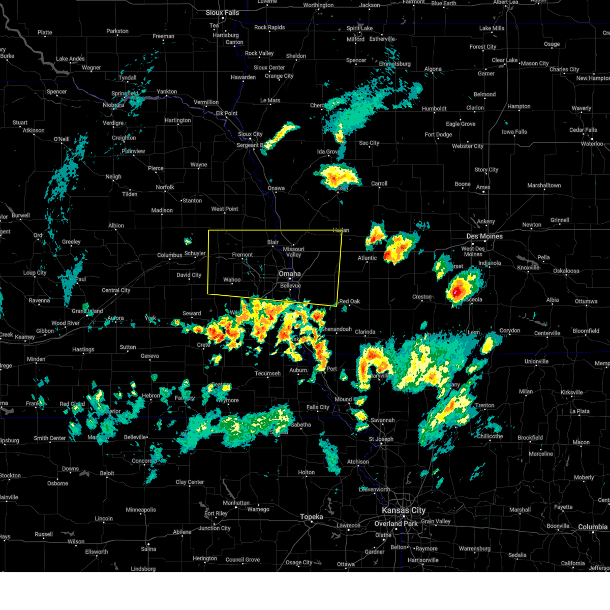 Svroax the national weather service in omaha has issued a * severe thunderstorm warning for, west central montgomery county in southwestern iowa, northern mills county in southwestern iowa, pottawattamie county in southwestern iowa, southern harrison county in southwestern iowa, southwestern shelby county in southwestern iowa, sarpy county in east central nebraska, south central burt county in east central nebraska, washington county in east central nebraska, dodge county in east central nebraska, douglas county in east central nebraska, saunders county in east central nebraska, * until 515 pm cdt. * at 424 pm cdt, severe thunderstorms were located along a line extending from 5 miles south of weston to 2 miles northeast of emerson, moving north at 55 mph (radar indicated). Hazards include 60 mph wind gusts and nickel size hail. expect damage to roofs, siding, and trees Svroax the national weather service in omaha has issued a * severe thunderstorm warning for, west central montgomery county in southwestern iowa, northern mills county in southwestern iowa, pottawattamie county in southwestern iowa, southern harrison county in southwestern iowa, southwestern shelby county in southwestern iowa, sarpy county in east central nebraska, south central burt county in east central nebraska, washington county in east central nebraska, dodge county in east central nebraska, douglas county in east central nebraska, saunders county in east central nebraska, * until 515 pm cdt. * at 424 pm cdt, severe thunderstorms were located along a line extending from 5 miles south of weston to 2 miles northeast of emerson, moving north at 55 mph (radar indicated). Hazards include 60 mph wind gusts and nickel size hail. expect damage to roofs, siding, and trees
|
| 7/31/2024 6:32 PM CDT |
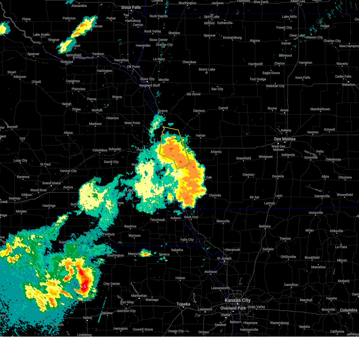 the severe thunderstorm warning has been cancelled and is no longer in effect the severe thunderstorm warning has been cancelled and is no longer in effect
|
| 7/31/2024 6:32 PM CDT |
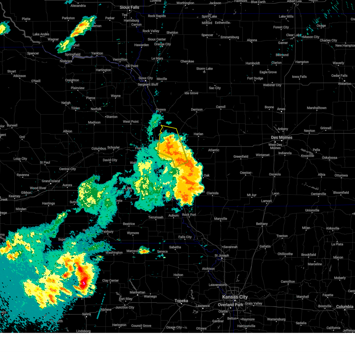 At 631 pm cdt, severe thunderstorms were located along a line extending from 3 miles northeast of mondamin to 3 miles northwest of persia to 3 miles west of hancock, moving northeast at 45 mph. these are destructive storms for portions of pottawattamie, harrison, washington, and douglas counties (weather instrument measurement. these storms produced a 90 mph wind gust at the omaha airport). Hazards include 90 mph wind gusts. You are in a life-threatening situation. flying debris may be deadly to those caught without shelter. mobile homes will be heavily damaged or destroyed. homes and businesses will have substantial roof and window damage. expect extensive tree damage and power outages. Locations impacted include, northern omaha, northeastern council bluffs, blair, missouri valley, logan, underwood, fort calhoun, crescent, mondamin, modale, magnolia, little sioux, council bluffs airport, mcclelland, wilson island state park, desoto bend national wildlife refuge, weston, hitchcock nature center, historical village welcome center, and willow lake recreation area. At 631 pm cdt, severe thunderstorms were located along a line extending from 3 miles northeast of mondamin to 3 miles northwest of persia to 3 miles west of hancock, moving northeast at 45 mph. these are destructive storms for portions of pottawattamie, harrison, washington, and douglas counties (weather instrument measurement. these storms produced a 90 mph wind gust at the omaha airport). Hazards include 90 mph wind gusts. You are in a life-threatening situation. flying debris may be deadly to those caught without shelter. mobile homes will be heavily damaged or destroyed. homes and businesses will have substantial roof and window damage. expect extensive tree damage and power outages. Locations impacted include, northern omaha, northeastern council bluffs, blair, missouri valley, logan, underwood, fort calhoun, crescent, mondamin, modale, magnolia, little sioux, council bluffs airport, mcclelland, wilson island state park, desoto bend national wildlife refuge, weston, hitchcock nature center, historical village welcome center, and willow lake recreation area.
|
| 7/31/2024 6:16 PM CDT | the severe thunderstorm warning has been cancelled and is no longer in effect |
| 7/31/2024 6:16 PM CDT | At 615 pm cdt, severe thunderstorms were located along a line extending from 4 miles north of blair to 7 miles northwest of underwood to near treynor, moving northeast at 35 mph. these are destructive storms for portions of pottawattamie, harrison, burt, washington, and douglas counties (weather instrument measurement. at 605 pm a 90 mph wind gust was measured at the omaha airport). Hazards include 90 mph wind gusts. You are in a life-threatening situation. flying debris may be deadly to those caught without shelter. mobile homes will be heavily damaged or destroyed. homes and businesses will have substantial roof and window damage. expect extensive tree damage and power outages. Locations impacted include, northern omaha, northeastern council bluffs, blair, tekamah, missouri valley, logan, underwood, fort calhoun, crescent, mondamin, kennard, modale, herman, magnolia, little sioux, council bluffs airport, mcclelland, wilson island state park, desoto bend national wildlife refuge, and weston. |
| 7/31/2024 6:08 PM CDT | Storm damage reported in douglas county NE, 10.7 miles W of Omaha, NE |
| 7/31/2024 6:05 PM CDT | Storm damage reported in douglas county NE, 10.7 miles W of Omaha, NE |
| 7/31/2024 6:02 PM CDT | Downed power line in road at maple and 70th circl in douglas county NE, 3.8 miles W of Omaha, NE |
| 7/31/2024 6:00 PM CDT | At 558 pm cdt, severe thunderstorms were located along a line extending from 2 miles west of arlington to near fort calhoun to council bluffs, moving northeast at 40 mph. these are destructive storms for portions of pottawattamie, sarpy, washington, dodge, douglas, and saunders counties (emergency management. these storms have produced widespread wind damage to trees, powerlines, structures, and cars. in addition, we recently measured a 76 mph wind gust at our office). Hazards include 80 mph wind gusts. Flying debris will be dangerous to those caught without shelter. mobile homes will be heavily damaged. expect considerable damage to roofs, windows, and vehicles. extensive tree damage and power outages are likely. Locations impacted include, omaha, council bluffs, bellevue, papillion, ralston, gretna, bennington, boys town, elkhorn, millard, la vista, carter lake, ashland, valley, arlington, yutan, waterloo, mead, ithaca, and leshara. |
| 7/31/2024 5:57 PM CDT | At 556 pm cdt, a severe thunderstorm capable of producing a tornado was located near fort calhoun, or 10 miles southeast of blair, moving northeast at 45 mph (radar indicated rotation). Hazards include tornado. Flying debris will be dangerous to those caught without shelter. mobile homes will be damaged or destroyed. damage to roofs, windows, and vehicles will occur. tree damage is likely. This dangerous storm will be near, missouri valley around 600 pm cdt. |
| 7/31/2024 5:50 PM CDT | Storm damage reported in douglas county NE, 3.2 miles W of Omaha, NE |
| 7/31/2024 5:45 PM CDT |
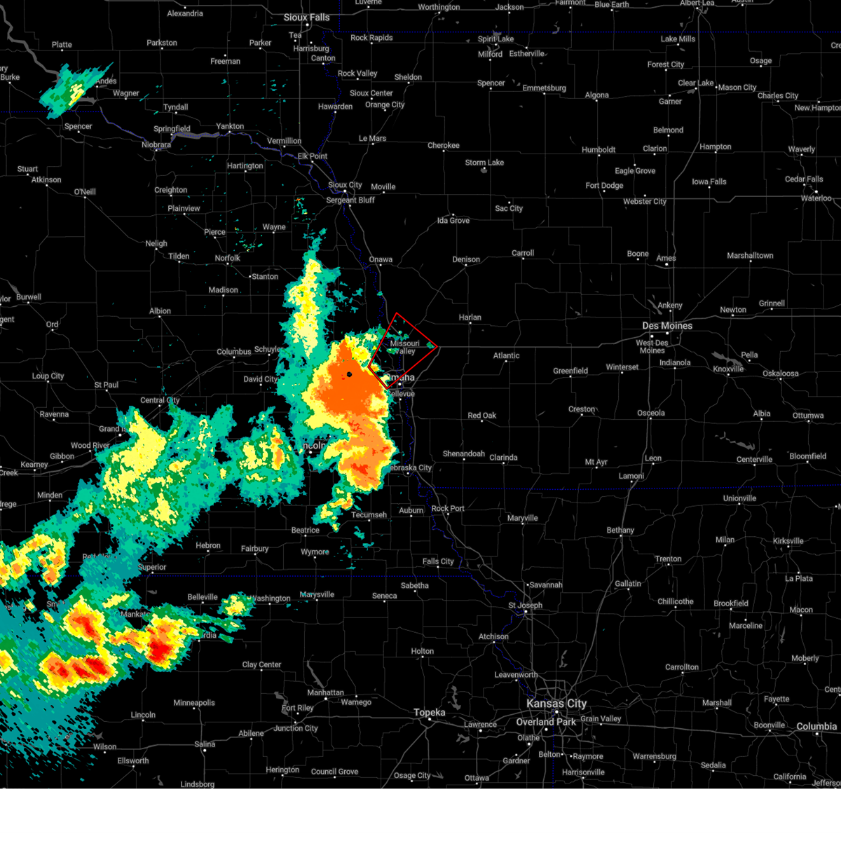 Toroax the national weather service in omaha has issued a * tornado warning for, northwestern pottawattamie county in southwestern iowa, southwestern harrison county in southwestern iowa, southeastern washington county in east central nebraska, eastern douglas county in east central nebraska, * until 615 pm cdt. * at 544 pm cdt, a severe thunderstorm capable of producing a tornado was located over bennington, moving northeast at 50 mph. a second area of rotation was located near boys town, also moving northeast at 50 mph (radar indicated rotation). Hazards include tornado. Flying debris will be dangerous to those caught without shelter. mobile homes will be damaged or destroyed. damage to roofs, windows, and vehicles will occur. tree damage is likely. this dangerous storm will be near, fort calhoun around 550 pm cdt. Missouri valley around 600 pm cdt. Toroax the national weather service in omaha has issued a * tornado warning for, northwestern pottawattamie county in southwestern iowa, southwestern harrison county in southwestern iowa, southeastern washington county in east central nebraska, eastern douglas county in east central nebraska, * until 615 pm cdt. * at 544 pm cdt, a severe thunderstorm capable of producing a tornado was located over bennington, moving northeast at 50 mph. a second area of rotation was located near boys town, also moving northeast at 50 mph (radar indicated rotation). Hazards include tornado. Flying debris will be dangerous to those caught without shelter. mobile homes will be damaged or destroyed. damage to roofs, windows, and vehicles will occur. tree damage is likely. this dangerous storm will be near, fort calhoun around 550 pm cdt. Missouri valley around 600 pm cdt.
|
| 7/31/2024 5:44 PM CDT | Storm damage reported in douglas county NE, 5.1 miles E of Omaha, NE |
| 7/31/2024 5:44 PM CDT |
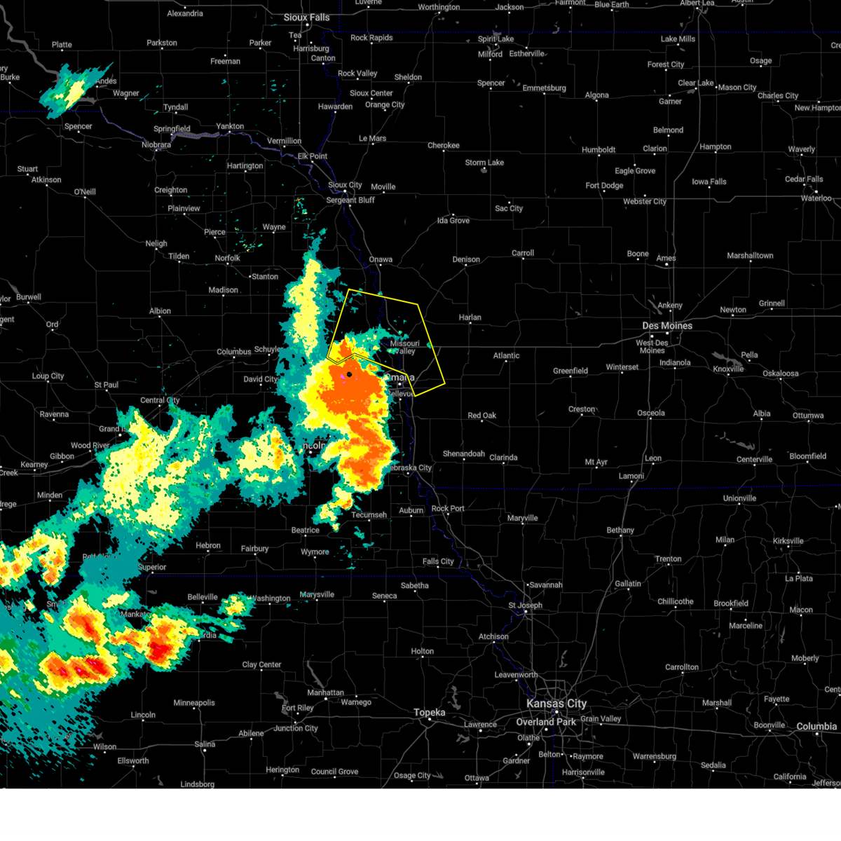 Svroax the national weather service in omaha has issued a * severe thunderstorm warning for, western pottawattamie county in southwestern iowa, western harrison county in southwestern iowa, southeastern burt county in east central nebraska, washington county in east central nebraska, eastern dodge county in east central nebraska, northeastern douglas county in east central nebraska, * until 645 pm cdt. * at 542 pm cdt, severe thunderstorms were located along a line extending from 3 miles east of hooper to 2 miles east of bennington to 3 miles west of offutt afb, moving northeast at 45 mph. these are destructive storms for areas including blair, fort calhoun, tekamah, missouri valley, and crescent (emergency management. these storms have a history of producing widespread wind damage to trees, powerlines, structures, and vehicles). Hazards include 80 mph wind gusts. Flying debris will be dangerous to those caught without shelter. mobile homes will be heavily damaged. expect considerable damage to roofs, windows, and vehicles. Extensive tree damage and power outages are likely. Svroax the national weather service in omaha has issued a * severe thunderstorm warning for, western pottawattamie county in southwestern iowa, western harrison county in southwestern iowa, southeastern burt county in east central nebraska, washington county in east central nebraska, eastern dodge county in east central nebraska, northeastern douglas county in east central nebraska, * until 645 pm cdt. * at 542 pm cdt, severe thunderstorms were located along a line extending from 3 miles east of hooper to 2 miles east of bennington to 3 miles west of offutt afb, moving northeast at 45 mph. these are destructive storms for areas including blair, fort calhoun, tekamah, missouri valley, and crescent (emergency management. these storms have a history of producing widespread wind damage to trees, powerlines, structures, and vehicles). Hazards include 80 mph wind gusts. Flying debris will be dangerous to those caught without shelter. mobile homes will be heavily damaged. expect considerable damage to roofs, windows, and vehicles. Extensive tree damage and power outages are likely.
|
| 7/31/2024 5:32 PM CDT | Storm damage reported in douglas county NE, 8.2 miles NE of Omaha, NE |
| 7/31/2024 5:19 PM CDT | Svroax the national weather service in omaha has issued a * severe thunderstorm warning for, southwestern pottawattamie county in southwestern iowa, northern sarpy county in east central nebraska, southwestern washington county in east central nebraska, southeastern dodge county in east central nebraska, douglas county in east central nebraska, eastern saunders county in east central nebraska, * until 615 pm cdt. * at 517 pm cdt, a severe thunderstorm was located over mead, or 5 miles east of wahoo, moving northeast at 35 mph. this is a destructive storm for saunders, douglas, sarpy, pottawattamie, washington, dodge counties (public. these storms have a history of producing 70 to 80 mph wind gusts and widespread wind damage to trees, powerlines, and some structures). Hazards include 80 mph wind gusts. Flying debris will be dangerous to those caught without shelter. mobile homes will be heavily damaged. expect considerable damage to roofs, windows, and vehicles. Extensive tree damage and power outages are likely. |
| 7/31/2024 5:12 PM CDT | Svroax the national weather service in omaha has issued a * severe thunderstorm warning for, northwestern fremont county in southwestern iowa, western mills county in southwestern iowa, southwestern pottawattamie county in southwestern iowa, sarpy county in east central nebraska, central otoe county in southeastern nebraska, douglas county in east central nebraska, eastern saunders county in east central nebraska, cass county in southeastern nebraska, * until 615 pm cdt. * at 511 pm cdt, severe thunderstorms were located along a line extending from 2 miles southwest of mead to 3 miles southeast of greenwood to 4 miles southeast of palmyra, moving east at 40 mph (public. these storms have a history of producing widespread wind damage to trees, powerlines, and structures across lancaster county). Hazards include 70 mph wind gusts and quarter size hail. Hail damage to vehicles is expected. expect considerable tree damage. Wind damage is also likely to mobile homes, roofs, and outbuildings. |
| 7/7/2024 6:14 PM CDT | Svroax the national weather service in omaha has issued a * severe thunderstorm warning for, northwestern pottawattamie county in southwestern iowa, * until 700 pm cdt. * at 614 pm cdt, a severe thunderstorm was located over crescent, or 7 miles northeast of omaha, moving northeast at 15 mph (radar indicated). Hazards include 60 mph wind gusts and quarter size hail. Hail damage to vehicles is expected. Expect wind damage to roofs, siding, and trees. |
| 6/25/2024 11:32 PM CDT | Ping Pong Ball sized hail reported 4.8 miles WNW of Omaha, NE |
| 6/25/2024 11:32 PM CDT | Half Dollar sized hail reported 4.7 miles NW of Omaha, NE |
| 6/25/2024 11:31 PM CDT |
 At 1130 pm cdt, a severe thunderstorm was located 5 miles east of offutt afb, moving southeast at 20 mph (public). Hazards include ping pong ball size hail and 60 mph wind gusts. People and animals outdoors will be injured. expect hail damage to roofs, siding, windows, and vehicles. expect wind damage to roofs, siding, and trees. Locations impacted include, southeastern omaha, southwestern council bluffs, bellevue, ralston, offutt afb, la vista, aksarben, south omaha, midtown, old market, and lake manawa state park. At 1130 pm cdt, a severe thunderstorm was located 5 miles east of offutt afb, moving southeast at 20 mph (public). Hazards include ping pong ball size hail and 60 mph wind gusts. People and animals outdoors will be injured. expect hail damage to roofs, siding, windows, and vehicles. expect wind damage to roofs, siding, and trees. Locations impacted include, southeastern omaha, southwestern council bluffs, bellevue, ralston, offutt afb, la vista, aksarben, south omaha, midtown, old market, and lake manawa state park.
|
| 6/25/2024 11:13 PM CDT |
 the severe thunderstorm warning has been cancelled and is no longer in effect the severe thunderstorm warning has been cancelled and is no longer in effect
|
| 6/25/2024 11:11 PM CDT |
 At 1111 pm cdt, a severe thunderstorm was located over southwestern council bluffs, moving southeast at 30 mph (radar indicated). Hazards include 60 mph wind gusts and quarter size hail. Hail damage to vehicles is expected. expect wind damage to roofs, siding, and trees. Locations impacted include, eastern omaha, council bluffs, carter lake, aksarben, florence, eppley airfield, south omaha, midtown, benson, council bluffs airport, old market, lake manawa state park, and narrows river park. At 1111 pm cdt, a severe thunderstorm was located over southwestern council bluffs, moving southeast at 30 mph (radar indicated). Hazards include 60 mph wind gusts and quarter size hail. Hail damage to vehicles is expected. expect wind damage to roofs, siding, and trees. Locations impacted include, eastern omaha, council bluffs, carter lake, aksarben, florence, eppley airfield, south omaha, midtown, benson, council bluffs airport, old market, lake manawa state park, and narrows river park.
|
| 6/25/2024 11:10 PM CDT | Quarter sized hail reported 8.3 miles E of Omaha, NE |
| 6/25/2024 11:10 PM CDT |
 At 1110 pm cdt, a severe thunderstorm was located over flanagan lake, or 3 miles northwest of boys town, moving east at 15 mph (radar indicated). Hazards include 60 mph wind gusts and quarter size hail. Hail damage to vehicles is expected. expect wind damage to roofs, siding, and trees. Locations impacted include, western omaha, boys town, elkhorn, standing bear lake, and flanagan lake. At 1110 pm cdt, a severe thunderstorm was located over flanagan lake, or 3 miles northwest of boys town, moving east at 15 mph (radar indicated). Hazards include 60 mph wind gusts and quarter size hail. Hail damage to vehicles is expected. expect wind damage to roofs, siding, and trees. Locations impacted include, western omaha, boys town, elkhorn, standing bear lake, and flanagan lake.
|
| 6/25/2024 11:08 PM CDT |
 Svroax the national weather service in omaha has issued a * severe thunderstorm warning for, northwestern mills county in southwestern iowa, southwestern pottawattamie county in southwestern iowa, northeastern sarpy county in east central nebraska, southeastern douglas county in east central nebraska, * until midnight cdt. * at 1108 pm cdt, a severe thunderstorm was located over southeastern omaha, moving southeast at 20 mph (radar indicated). Hazards include 60 mph wind gusts and quarter size hail. Hail damage to vehicles is expected. Expect wind damage to roofs, siding, and trees. Svroax the national weather service in omaha has issued a * severe thunderstorm warning for, northwestern mills county in southwestern iowa, southwestern pottawattamie county in southwestern iowa, northeastern sarpy county in east central nebraska, southeastern douglas county in east central nebraska, * until midnight cdt. * at 1108 pm cdt, a severe thunderstorm was located over southeastern omaha, moving southeast at 20 mph (radar indicated). Hazards include 60 mph wind gusts and quarter size hail. Hail damage to vehicles is expected. Expect wind damage to roofs, siding, and trees.
|
| 6/25/2024 11:06 PM CDT |
 the severe thunderstorm warning has been cancelled and is no longer in effect the severe thunderstorm warning has been cancelled and is no longer in effect
|
| 6/25/2024 11:06 PM CDT |
 At 1106 pm cdt, a severe thunderstorm was located over southeastern omaha, moving southeast at 20 mph (radar indicated). Hazards include 60 mph wind gusts and quarter size hail. Hail damage to vehicles is expected. expect wind damage to roofs, siding, and trees. Locations impacted include, eastern omaha, council bluffs, carter lake, aksarben, benson, council bluffs airport, florence, eppley airfield, south omaha, midtown, old market, lake manawa state park, and narrows river park. At 1106 pm cdt, a severe thunderstorm was located over southeastern omaha, moving southeast at 20 mph (radar indicated). Hazards include 60 mph wind gusts and quarter size hail. Hail damage to vehicles is expected. expect wind damage to roofs, siding, and trees. Locations impacted include, eastern omaha, council bluffs, carter lake, aksarben, benson, council bluffs airport, florence, eppley airfield, south omaha, midtown, old market, lake manawa state park, and narrows river park.
|
| 6/25/2024 11:05 PM CDT | Report from mping: 1-inch tree limbs broken; shingles blown of in douglas county NE, 3.9 miles NW of Omaha, NE |
| 6/25/2024 11:04 PM CDT |
 At 1104 pm cdt, a severe thunderstorm was located over flanagan lake, or 3 miles northeast of elkhorn, moving east at 15 mph (radar indicated). Hazards include quarter size hail. Damage to vehicles is expected. Locations impacted include, omaha, bennington, boys town, elkhorn, waterloo, flanagan lake, standing bear lake, and benson. At 1104 pm cdt, a severe thunderstorm was located over flanagan lake, or 3 miles northeast of elkhorn, moving east at 15 mph (radar indicated). Hazards include quarter size hail. Damage to vehicles is expected. Locations impacted include, omaha, bennington, boys town, elkhorn, waterloo, flanagan lake, standing bear lake, and benson.
|
| 6/25/2024 11:04 PM CDT |
 the severe thunderstorm warning has been cancelled and is no longer in effect the severe thunderstorm warning has been cancelled and is no longer in effect
|
| 6/25/2024 11:00 PM CDT | Quarter sized hail reported 7.8 miles E of Omaha, NE, report from mping: quarter (1.00 in.). |
| 6/25/2024 10:55 PM CDT | Large tree blown dow in douglas county NE, 1.8 miles SW of Omaha, NE |
| 6/25/2024 10:47 PM CDT |
 Svroax the national weather service in omaha has issued a * severe thunderstorm warning for, northwestern mills county in southwestern iowa, southwestern pottawattamie county in southwestern iowa, eastern douglas county in east central nebraska, * until 1130 pm cdt. * at 1047 pm cdt, a severe thunderstorm was located over northeastern council bluffs, moving southeast at 30 mph (radar indicated). Hazards include half dollar size hail. damage to vehicles is expected Svroax the national weather service in omaha has issued a * severe thunderstorm warning for, northwestern mills county in southwestern iowa, southwestern pottawattamie county in southwestern iowa, eastern douglas county in east central nebraska, * until 1130 pm cdt. * at 1047 pm cdt, a severe thunderstorm was located over northeastern council bluffs, moving southeast at 30 mph (radar indicated). Hazards include half dollar size hail. damage to vehicles is expected
|
| 6/25/2024 10:40 PM CDT |
 At 1040 pm cdt, a severe thunderstorm was located over valley, or 5 miles northwest of elkhorn, moving east at 15 mph (nws employee). Hazards include half dollar size hail. Damage to vehicles is expected. Locations impacted include, omaha, bennington, boys town, elkhorn, valley, waterloo, leshara, flanagan lake, standing bear lake, and benson. At 1040 pm cdt, a severe thunderstorm was located over valley, or 5 miles northwest of elkhorn, moving east at 15 mph (nws employee). Hazards include half dollar size hail. Damage to vehicles is expected. Locations impacted include, omaha, bennington, boys town, elkhorn, valley, waterloo, leshara, flanagan lake, standing bear lake, and benson.
|
| 6/25/2024 10:39 PM CDT |
 Svroax the national weather service in omaha has issued a * severe thunderstorm warning for, western douglas county in east central nebraska, northeastern saunders county in east central nebraska, * until 1130 pm cdt. * at 1039 pm cdt, a severe thunderstorm was located over valley, or 5 miles northwest of elkhorn, moving east at 15 mph (radar indicated). Hazards include half dollar size hail. damage to vehicles is expected Svroax the national weather service in omaha has issued a * severe thunderstorm warning for, western douglas county in east central nebraska, northeastern saunders county in east central nebraska, * until 1130 pm cdt. * at 1039 pm cdt, a severe thunderstorm was located over valley, or 5 miles northwest of elkhorn, moving east at 15 mph (radar indicated). Hazards include half dollar size hail. damage to vehicles is expected
|
| 6/25/2024 9:49 PM CDT | Power lines blown dow in douglas county NE, 4.7 miles SW of Omaha, NE |
| 6/25/2024 9:49 PM CDT | Medium sized tree limbs blown down. power ou in douglas county NE, 6.9 miles WSW of Omaha, NE |
| 6/25/2024 9:38 PM CDT | Measured at the omaha airpor in douglas county NE, 10.7 miles W of Omaha, NE |
| 6/25/2024 9:36 PM CDT | At omaha eppley airpor in douglas county NE, 10.7 miles W of Omaha, NE |
| 6/25/2024 9:31 PM CDT | Report from mping: 3-inch tree limbs broken; power poles broke in douglas county NE, 2.8 miles S of Omaha, NE |
| 6/25/2024 9:31 PM CDT |
 At 930 pm cdt, a severe thunderstorm was located near crescent, or 9 miles north of omaha, moving east at 50 mph (radar indicated). Hazards include 60 mph wind gusts and quarter size hail. Hail damage to vehicles is expected. expect wind damage to roofs, siding, and trees. Locations impacted include, omaha, northern council bluffs, bennington, boys town, carter lake, fort calhoun, crescent, benson, council bluffs airport, florence, standing bear lake, flanagan lake, eppley airfield, midtown, wilson island state park, hitchcock nature center, narrows river park, and weston. At 930 pm cdt, a severe thunderstorm was located near crescent, or 9 miles north of omaha, moving east at 50 mph (radar indicated). Hazards include 60 mph wind gusts and quarter size hail. Hail damage to vehicles is expected. expect wind damage to roofs, siding, and trees. Locations impacted include, omaha, northern council bluffs, bennington, boys town, carter lake, fort calhoun, crescent, benson, council bluffs airport, florence, standing bear lake, flanagan lake, eppley airfield, midtown, wilson island state park, hitchcock nature center, narrows river park, and weston.
|
| 6/25/2024 9:28 PM CDT | Report from mping: 1-inch tree limbs broken; shingles blown of in douglas county NE, 1.5 miles SSW of Omaha, NE |
| 6/25/2024 9:25 PM CDT | Report from mping: 3-inch tree limbs broken; power poles broke in douglas county NE, 6.7 miles ESE of Omaha, NE |
| 6/25/2024 9:23 PM CDT | Half Dollar sized hail reported 6.7 miles ESE of Omaha, NE, report from mping: half dollar (1.25 in.). |
| 6/25/2024 9:16 PM CDT |
 Svroax the national weather service in omaha has issued a * severe thunderstorm warning for, western pottawattamie county in southwestern iowa, south central harrison county in southwestern iowa, southeastern washington county in east central nebraska, northeastern douglas county in east central nebraska, * until 1000 pm cdt. * at 916 pm cdt, a severe thunderstorm was located 3 miles north of bennington, moving east at 40 mph (radar indicated). Hazards include 60 mph wind gusts and quarter size hail. Hail damage to vehicles is expected. Expect wind damage to roofs, siding, and trees. Svroax the national weather service in omaha has issued a * severe thunderstorm warning for, western pottawattamie county in southwestern iowa, south central harrison county in southwestern iowa, southeastern washington county in east central nebraska, northeastern douglas county in east central nebraska, * until 1000 pm cdt. * at 916 pm cdt, a severe thunderstorm was located 3 miles north of bennington, moving east at 40 mph (radar indicated). Hazards include 60 mph wind gusts and quarter size hail. Hail damage to vehicles is expected. Expect wind damage to roofs, siding, and trees.
|
| 6/25/2024 9:03 PM CDT |
 At 902 pm cdt, a severe thunderstorm was located near leshara, or 6 miles southeast of fremont, moving east at 40 mph (radar indicated). Hazards include 60 mph wind gusts and quarter size hail. Hail damage to vehicles is expected. expect wind damage to roofs, siding, and trees. Locations impacted include, fremont, elkhorn, valley, arlington, yutan, waterloo, kennard, inglewood, leshara, woodcliff, washington, fremont lakes state recreation area, and camp eagle. At 902 pm cdt, a severe thunderstorm was located near leshara, or 6 miles southeast of fremont, moving east at 40 mph (radar indicated). Hazards include 60 mph wind gusts and quarter size hail. Hail damage to vehicles is expected. expect wind damage to roofs, siding, and trees. Locations impacted include, fremont, elkhorn, valley, arlington, yutan, waterloo, kennard, inglewood, leshara, woodcliff, washington, fremont lakes state recreation area, and camp eagle.
|
| 6/25/2024 8:51 PM CDT |
 Svroax the national weather service in omaha has issued a * severe thunderstorm warning for, southwestern washington county in east central nebraska, southeastern dodge county in east central nebraska, western douglas county in east central nebraska, northeastern saunders county in east central nebraska, * until 930 pm cdt. * at 851 pm cdt, a severe thunderstorm was located near cedar bluffs, or 4 miles southwest of fremont, moving east at 40 mph (radar indicated). Hazards include 60 mph wind gusts and quarter size hail. Hail damage to vehicles is expected. Expect wind damage to roofs, siding, and trees. Svroax the national weather service in omaha has issued a * severe thunderstorm warning for, southwestern washington county in east central nebraska, southeastern dodge county in east central nebraska, western douglas county in east central nebraska, northeastern saunders county in east central nebraska, * until 930 pm cdt. * at 851 pm cdt, a severe thunderstorm was located near cedar bluffs, or 4 miles southwest of fremont, moving east at 40 mph (radar indicated). Hazards include 60 mph wind gusts and quarter size hail. Hail damage to vehicles is expected. Expect wind damage to roofs, siding, and trees.
|
| 6/25/2024 8:11 PM CDT |
 Svroax the national weather service in omaha has issued a * severe thunderstorm warning for, northwestern pottawattamie county in southwestern iowa, southern harrison county in southwestern iowa, southwestern shelby county in southwestern iowa, * until 915 pm cdt. * at 810 pm cdt, a cluster of severe thunderstorms was located near persia, or 12 miles west of harlan, moving east at 25 mph (radar indicated). Hazards include ping pong ball size hail and 60 mph wind gusts. People and animals outdoors will be injured. expect hail damage to roofs, siding, windows, and vehicles. Expect wind damage to roofs, siding, and trees. Svroax the national weather service in omaha has issued a * severe thunderstorm warning for, northwestern pottawattamie county in southwestern iowa, southern harrison county in southwestern iowa, southwestern shelby county in southwestern iowa, * until 915 pm cdt. * at 810 pm cdt, a cluster of severe thunderstorms was located near persia, or 12 miles west of harlan, moving east at 25 mph (radar indicated). Hazards include ping pong ball size hail and 60 mph wind gusts. People and animals outdoors will be injured. expect hail damage to roofs, siding, windows, and vehicles. Expect wind damage to roofs, siding, and trees.
|
| 6/25/2024 6:44 PM CDT |
 Svroax the national weather service in omaha has issued a * severe thunderstorm warning for, western pottawattamie county in southwestern iowa, * until 745 pm cdt. * at 643 pm cdt, a severe thunderstorm was located 3 miles southeast of crescent, or 7 miles northeast of council bluffs, moving northeast at 15 mph (public. this storm has a history of producing quarter sized hail near 42nd and grover in omaha). Hazards include 60 mph wind gusts and quarter size hail. Hail damage to vehicles is expected. Expect wind damage to roofs, siding, and trees. Svroax the national weather service in omaha has issued a * severe thunderstorm warning for, western pottawattamie county in southwestern iowa, * until 745 pm cdt. * at 643 pm cdt, a severe thunderstorm was located 3 miles southeast of crescent, or 7 miles northeast of council bluffs, moving northeast at 15 mph (public. this storm has a history of producing quarter sized hail near 42nd and grover in omaha). Hazards include 60 mph wind gusts and quarter size hail. Hail damage to vehicles is expected. Expect wind damage to roofs, siding, and trees.
|
| 6/25/2024 6:16 PM CDT | Quarter sized hail reported 8.5 miles W of Omaha, NE |
| 6/25/2024 6:03 PM CDT | Golf Ball sized hail reported 8.7 miles NW of Omaha, NE, report from mping: golf ball (1.75 in.). |
| 6/25/2024 5:56 PM CDT | Hen Egg sized hail reported 7.9 miles NNW of Omaha, NE |
| 6/25/2024 5:54 PM CDT | Quarter sized hail reported 4.3 miles NW of Omaha, NE, report from mping: quarter (1.00 in.). |
| 6/25/2024 5:54 PM CDT | Hen Egg sized hail reported 7.5 miles NW of Omaha, NE, report from mping: hen egg+ (2.25 in.). |
| 6/25/2024 5:39 PM CDT |
 Svroax the national weather service in omaha has issued a * severe thunderstorm warning for, northwestern mills county in southwestern iowa, southwestern pottawattamie county in southwestern iowa, northeastern sarpy county in east central nebraska, southeastern douglas county in east central nebraska, northeastern cass county in southeastern nebraska, * until 630 pm cdt. * at 538 pm cdt, a severe thunderstorm was located over bellevue, moving south at 10 mph (radar indicated). Hazards include two inch hail and 60 mph wind gusts. People and animals outdoors will be injured. expect hail damage to roofs, siding, windows, and vehicles. Expect wind damage to roofs, siding, and trees. Svroax the national weather service in omaha has issued a * severe thunderstorm warning for, northwestern mills county in southwestern iowa, southwestern pottawattamie county in southwestern iowa, northeastern sarpy county in east central nebraska, southeastern douglas county in east central nebraska, northeastern cass county in southeastern nebraska, * until 630 pm cdt. * at 538 pm cdt, a severe thunderstorm was located over bellevue, moving south at 10 mph (radar indicated). Hazards include two inch hail and 60 mph wind gusts. People and animals outdoors will be injured. expect hail damage to roofs, siding, windows, and vehicles. Expect wind damage to roofs, siding, and trees.
|
| 6/25/2024 5:35 PM CDT | Hen Egg sized hail reported 8 miles WNW of Omaha, NE |
| 6/25/2024 5:31 PM CDT |
 At 530 pm cdt, a severe thunderstorm was located over southwestern council bluffs, moving southeast at 10 mph (public). Hazards include tennis ball size hail and 60 mph wind gusts. People and animals outdoors will be injured. expect hail damage to roofs, siding, windows, and vehicles. expect wind damage to roofs, siding, and trees. Locations impacted include, southeastern omaha, council bluffs, bellevue, ralston, offutt afb, south omaha, and lake manawa state park. At 530 pm cdt, a severe thunderstorm was located over southwestern council bluffs, moving southeast at 10 mph (public). Hazards include tennis ball size hail and 60 mph wind gusts. People and animals outdoors will be injured. expect hail damage to roofs, siding, windows, and vehicles. expect wind damage to roofs, siding, and trees. Locations impacted include, southeastern omaha, council bluffs, bellevue, ralston, offutt afb, south omaha, and lake manawa state park.
|
| 6/25/2024 5:26 PM CDT | Tennis Ball sized hail reported 9.4 miles WNW of Omaha, NE |
| 6/25/2024 5:19 PM CDT | Quarter sized hail reported 8.6 miles W of Omaha, NE, at ketv at 10th and pacific. |
| 6/25/2024 5:16 PM CDT |
 At 516 pm cdt, a severe thunderstorm was located over western council bluffs, moving southeast at 10 mph (public). Hazards include ping pong ball size hail and 60 mph wind gusts. People and animals outdoors will be injured. expect hail damage to roofs, siding, windows, and vehicles. expect wind damage to roofs, siding, and trees. Locations impacted include, southeastern omaha, council bluffs, bellevue, ralston, offutt afb, carter lake, council bluffs airport, eppley airfield, south omaha, midtown, old market, lake manawa state park, and narrows river park. At 516 pm cdt, a severe thunderstorm was located over western council bluffs, moving southeast at 10 mph (public). Hazards include ping pong ball size hail and 60 mph wind gusts. People and animals outdoors will be injured. expect hail damage to roofs, siding, windows, and vehicles. expect wind damage to roofs, siding, and trees. Locations impacted include, southeastern omaha, council bluffs, bellevue, ralston, offutt afb, carter lake, council bluffs airport, eppley airfield, south omaha, midtown, old market, lake manawa state park, and narrows river park.
|
| 6/25/2024 5:12 PM CDT | Ping Pong Ball sized hail reported 9.4 miles WNW of Omaha, NE, report from mping: ping pong ball (1.50 in.). |
| 6/25/2024 5:08 PM CDT |
 At 508 pm cdt, a severe thunderstorm was located over northwestern council bluffs, moving southeast at 10 mph (radar indicated). Hazards include 60 mph wind gusts and quarter size hail. Hail damage to vehicles is expected. expect wind damage to roofs, siding, and trees. Locations impacted include, southeastern omaha, council bluffs, bellevue, ralston, offutt afb, carter lake, aksarben, council bluffs airport, eppley airfield, south omaha, midtown, old market, lake manawa state park, and narrows river park. At 508 pm cdt, a severe thunderstorm was located over northwestern council bluffs, moving southeast at 10 mph (radar indicated). Hazards include 60 mph wind gusts and quarter size hail. Hail damage to vehicles is expected. expect wind damage to roofs, siding, and trees. Locations impacted include, southeastern omaha, council bluffs, bellevue, ralston, offutt afb, carter lake, aksarben, council bluffs airport, eppley airfield, south omaha, midtown, old market, lake manawa state park, and narrows river park.
|
| 6/25/2024 5:00 PM CDT |
 Svroax the national weather service in omaha has issued a * severe thunderstorm warning for, northwestern mills county in southwestern iowa, southwestern pottawattamie county in southwestern iowa, northeastern sarpy county in east central nebraska, southeastern douglas county in east central nebraska, * until 545 pm cdt. * at 500 pm cdt, a severe thunderstorm was located over northwestern council bluffs, moving southeast at 10 mph (radar indicated). Hazards include 60 mph wind gusts and quarter size hail. Hail damage to vehicles is expected. Expect wind damage to roofs, siding, and trees. Svroax the national weather service in omaha has issued a * severe thunderstorm warning for, northwestern mills county in southwestern iowa, southwestern pottawattamie county in southwestern iowa, northeastern sarpy county in east central nebraska, southeastern douglas county in east central nebraska, * until 545 pm cdt. * at 500 pm cdt, a severe thunderstorm was located over northwestern council bluffs, moving southeast at 10 mph (radar indicated). Hazards include 60 mph wind gusts and quarter size hail. Hail damage to vehicles is expected. Expect wind damage to roofs, siding, and trees.
|
| 6/15/2024 7:50 PM CDT |
 Svroax the national weather service in omaha has issued a * severe thunderstorm warning for, pottawattamie county in southwestern iowa, southeastern harrison county in southwestern iowa, southeastern shelby county in southwestern iowa, * until 845 pm cdt. * at 750 pm cdt, severe thunderstorms were located along a line extending from 5 miles southeast of underwood to 2 miles northeast of treynor, moving east at 45 mph (radar indicated). Hazards include 60 mph wind gusts. expect damage to roofs, siding, and trees Svroax the national weather service in omaha has issued a * severe thunderstorm warning for, pottawattamie county in southwestern iowa, southeastern harrison county in southwestern iowa, southeastern shelby county in southwestern iowa, * until 845 pm cdt. * at 750 pm cdt, severe thunderstorms were located along a line extending from 5 miles southeast of underwood to 2 miles northeast of treynor, moving east at 45 mph (radar indicated). Hazards include 60 mph wind gusts. expect damage to roofs, siding, and trees
|
| 6/12/2024 9:34 PM CDT | Hen Egg sized hail reported 5.5 miles WNW of Omaha, NE, picture from facebook. |
| 6/12/2024 9:34 PM CDT |
 the severe thunderstorm warning has been cancelled and is no longer in effect the severe thunderstorm warning has been cancelled and is no longer in effect
|
| 6/12/2024 9:34 PM CDT |
 At 932 pm cdt, a severe thunderstorm was located near malvern, or 17 miles southeast of offutt afb, moving southeast at 30 mph (trained weather spotters. at 915 pm, tennis ball sized hail was reported 3 miles southwest of council bluffs). Hazards include tennis ball size hail and 60 mph wind gusts. People and animals outdoors will be injured. expect hail damage to roofs, siding, windows, and vehicles. expect wind damage to roofs, siding, and trees. Locations impacted include, council bluffs, bellevue, offutt afb, la vista, plattsmouth, glenwood, pacific junction, silver city, beaver lake, lake manawa state park, and mineola. At 932 pm cdt, a severe thunderstorm was located near malvern, or 17 miles southeast of offutt afb, moving southeast at 30 mph (trained weather spotters. at 915 pm, tennis ball sized hail was reported 3 miles southwest of council bluffs). Hazards include tennis ball size hail and 60 mph wind gusts. People and animals outdoors will be injured. expect hail damage to roofs, siding, windows, and vehicles. expect wind damage to roofs, siding, and trees. Locations impacted include, council bluffs, bellevue, offutt afb, la vista, plattsmouth, glenwood, pacific junction, silver city, beaver lake, lake manawa state park, and mineola.
|
| 6/12/2024 9:25 PM CDT | Tennis Ball sized hail reported 4.8 miles WSW of Omaha, NE, picture from facebook. |
| 6/12/2024 9:20 PM CDT | Tennis Ball sized hail reported 6.9 miles W of Omaha, NE, picture from twitter. |
| 6/12/2024 9:17 PM CDT | Baseball sized hail reported 7.2 miles WNW of Omaha, NE, golfball to baseball-size hail. |
| 6/12/2024 9:16 PM CDT |
 the severe thunderstorm warning has been cancelled and is no longer in effect the severe thunderstorm warning has been cancelled and is no longer in effect
|
| 6/12/2024 9:16 PM CDT |
 At 915 pm cdt, a severe thunderstorm was located 3 miles north of glenwood, or 10 miles east of offutt afb, moving southeast at 30 mph (trained weather spotters). Hazards include tennis ball size hail and 60 mph wind gusts. People and animals outdoors will be injured. expect hail damage to roofs, siding, windows, and vehicles. expect wind damage to roofs, siding, and trees. locations impacted include, omaha, council bluffs, bellevue, ralston, offutt afb, la vista, plattsmouth, glenwood, carter lake, crescent, pacific junction, silver city, aksarben, council bluffs airport, florence, south omaha, midtown, benson, eppley airfield, and beaver lake. People attending charles schwab field should seek safe shelter immediately!. At 915 pm cdt, a severe thunderstorm was located 3 miles north of glenwood, or 10 miles east of offutt afb, moving southeast at 30 mph (trained weather spotters). Hazards include tennis ball size hail and 60 mph wind gusts. People and animals outdoors will be injured. expect hail damage to roofs, siding, windows, and vehicles. expect wind damage to roofs, siding, and trees. locations impacted include, omaha, council bluffs, bellevue, ralston, offutt afb, la vista, plattsmouth, glenwood, carter lake, crescent, pacific junction, silver city, aksarben, council bluffs airport, florence, south omaha, midtown, benson, eppley airfield, and beaver lake. People attending charles schwab field should seek safe shelter immediately!.
|
| 6/12/2024 9:15 PM CDT | Golf Ball sized hail reported 6.4 miles W of Omaha, NE, picture from twitter. |
| 6/12/2024 9:15 PM CDT | Golf Ball sized hail reported 4.3 miles W of Omaha, NE, university of nebraska at omaha. |
| 6/12/2024 9:15 PM CDT | Tea Cup sized hail reported 6.2 miles WNW of Omaha, NE, 45th and pine. |
| 6/12/2024 9:13 PM CDT | Golf Ball sized hail reported 4.8 miles W of Omaha, NE, sporadic golf ball sized hail near 54th and seward. |
| 6/12/2024 9:11 PM CDT | Quarter sized hail reported 6.9 miles W of Omaha, NE |
| 6/12/2024 9:07 PM CDT | Hen Egg sized hail reported 6.9 miles W of Omaha, NE |
| 6/12/2024 9:05 PM CDT | Tea Cup sized hail reported 5.2 miles WSW of Omaha, NE, north benson area. picture via twitter. |
| 6/12/2024 9:02 PM CDT | Golf Ball sized hail reported 5.4 miles W of Omaha, NE, golf ball sized hail near benson high school. |
| 6/12/2024 9:01 PM CDT |
 At 901 pm cdt, a severe thunderstorm was located 4 miles south of fort calhoun, or 8 miles east of bennington, moving southeast at 20 mph (trained weather spotters). Hazards include two inch hail and 60 mph wind gusts. People and animals outdoors will be injured. expect hail damage to roofs, siding, windows, and vehicles. expect wind damage to roofs, siding, and trees. Locations impacted include, omaha, crescent, florence, benson, and hitchcock nature center. At 901 pm cdt, a severe thunderstorm was located 4 miles south of fort calhoun, or 8 miles east of bennington, moving southeast at 20 mph (trained weather spotters). Hazards include two inch hail and 60 mph wind gusts. People and animals outdoors will be injured. expect hail damage to roofs, siding, windows, and vehicles. expect wind damage to roofs, siding, and trees. Locations impacted include, omaha, crescent, florence, benson, and hitchcock nature center.
|
| 6/12/2024 9:01 PM CDT |
 the severe thunderstorm warning has been cancelled and is no longer in effect the severe thunderstorm warning has been cancelled and is no longer in effect
|
| 6/12/2024 9:00 PM CDT | Hen Egg sized hail reported 5.1 miles SW of Omaha, NE, from facebook. |
| 6/12/2024 8:59 PM CDT | Golf Ball sized hail reported 8 miles WSW of Omaha, NE |
| 6/12/2024 8:58 PM CDT | Ping Pong Ball sized hail reported 8.8 miles SW of Omaha, NE |
| 6/12/2024 8:55 PM CDT | Ping Pong Ball sized hail reported 5 miles WSW of Omaha, NE |
| 6/12/2024 8:53 PM CDT |
 Svroax the national weather service in omaha has issued a * severe thunderstorm warning for, northwestern mills county in southwestern iowa, southwestern pottawattamie county in southwestern iowa, northeastern sarpy county in east central nebraska, southeastern washington county in east central nebraska, eastern douglas county in east central nebraska, northeastern cass county in southeastern nebraska, * until 945 pm cdt. * at 852 pm cdt, a severe thunderstorm was located over southwestern council bluffs, moving southeast at 30 mph (radar indicated. at 850 pm, two inch hail was reported 6 miles ese of bennington). Hazards include two inch hail and 60 mph wind gusts. People and animals outdoors will be injured. expect hail damage to roofs, siding, windows, and vehicles. Expect wind damage to roofs, siding, and trees. Svroax the national weather service in omaha has issued a * severe thunderstorm warning for, northwestern mills county in southwestern iowa, southwestern pottawattamie county in southwestern iowa, northeastern sarpy county in east central nebraska, southeastern washington county in east central nebraska, eastern douglas county in east central nebraska, northeastern cass county in southeastern nebraska, * until 945 pm cdt. * at 852 pm cdt, a severe thunderstorm was located over southwestern council bluffs, moving southeast at 30 mph (radar indicated. at 850 pm, two inch hail was reported 6 miles ese of bennington). Hazards include two inch hail and 60 mph wind gusts. People and animals outdoors will be injured. expect hail damage to roofs, siding, windows, and vehicles. Expect wind damage to roofs, siding, and trees.
|
| 6/12/2024 8:50 PM CDT | Hen Egg sized hail reported 5.9 miles SSW of Omaha, NE, lake cunningham. |
| 6/12/2024 8:50 PM CDT | Golf Ball sized hail reported 6.8 miles SW of Omaha, NE |
| 6/12/2024 8:46 PM CDT | Golf Ball sized hail reported 7.9 miles SSW of Omaha, NE, reported at north omaha airport. |
| 6/12/2024 8:38 PM CDT |
 At 837 pm cdt, a severe thunderstorm was located 3 miles northwest of fort calhoun, or 4 miles southeast of blair, moving southeast at 20 mph (trained weather spotters. at 823 pm, golf ball sized hail was reported just southwest of blair). Hazards include two inch hail and 60 mph wind gusts. People and animals outdoors will be injured. expect hail damage to roofs, siding, windows, and vehicles. expect wind damage to roofs, siding, and trees. Locations impacted include, omaha, fort calhoun, crescent, florence, benson, desoto bend national wildlife refuge, hitchcock nature center, and wilson island state park. At 837 pm cdt, a severe thunderstorm was located 3 miles northwest of fort calhoun, or 4 miles southeast of blair, moving southeast at 20 mph (trained weather spotters. at 823 pm, golf ball sized hail was reported just southwest of blair). Hazards include two inch hail and 60 mph wind gusts. People and animals outdoors will be injured. expect hail damage to roofs, siding, windows, and vehicles. expect wind damage to roofs, siding, and trees. Locations impacted include, omaha, fort calhoun, crescent, florence, benson, desoto bend national wildlife refuge, hitchcock nature center, and wilson island state park.
|
| 6/12/2024 8:25 PM CDT |
 Svroax the national weather service in omaha has issued a * severe thunderstorm warning for, northwestern pottawattamie county in southwestern iowa, southwestern harrison county in southwestern iowa, southeastern washington county in east central nebraska, northeastern douglas county in east central nebraska, * until 915 pm cdt. * at 824 pm cdt, a severe thunderstorm was located over blair, moving southeast at 20 mph (trained weather spotters. at 815 pm, quarter sized hail was reported 3 miles south of blair). Hazards include two inch hail and 60 mph wind gusts. People and animals outdoors will be injured. expect hail damage to roofs, siding, windows, and vehicles. Expect wind damage to roofs, siding, and trees. Svroax the national weather service in omaha has issued a * severe thunderstorm warning for, northwestern pottawattamie county in southwestern iowa, southwestern harrison county in southwestern iowa, southeastern washington county in east central nebraska, northeastern douglas county in east central nebraska, * until 915 pm cdt. * at 824 pm cdt, a severe thunderstorm was located over blair, moving southeast at 20 mph (trained weather spotters. at 815 pm, quarter sized hail was reported 3 miles south of blair). Hazards include two inch hail and 60 mph wind gusts. People and animals outdoors will be injured. expect hail damage to roofs, siding, windows, and vehicles. Expect wind damage to roofs, siding, and trees.
|
| 5/25/2024 11:47 PM CDT | Estimated 70 mph gusts near 72nd and center. power ou in douglas county NE, 4.3 miles NW of Omaha, NE |
| 5/25/2024 11:40 PM CDT | Asos station koma omaha eppley airfiel in douglas county NE, 10.6 miles WSW of Omaha, NE |
| 5/24/2024 2:51 AM CDT |
 the severe thunderstorm warning has been cancelled and is no longer in effect the severe thunderstorm warning has been cancelled and is no longer in effect
|
| 5/24/2024 2:51 AM CDT |
 At 250 am cdt, severe thunderstorms were located along a line extending from 3 miles northwest of woodbine to 3 miles northwest of neola to 4 miles south of union, moving east at 60 mph (radar indicated). Hazards include 70 mph wind gusts and quarter size hail. Hail damage to vehicles is expected. expect considerable tree damage. wind damage is also likely to mobile homes, roofs, and outbuildings. Locations impacted include, omaha, council bluffs, bellevue, papillion, blair, ralston, red oak, harlan, boys town, offutt afb, la vista, plattsmouth, glenwood, shenandoah, carter lake, missouri valley, logan, springfield, oakland, and woodbine. At 250 am cdt, severe thunderstorms were located along a line extending from 3 miles northwest of woodbine to 3 miles northwest of neola to 4 miles south of union, moving east at 60 mph (radar indicated). Hazards include 70 mph wind gusts and quarter size hail. Hail damage to vehicles is expected. expect considerable tree damage. wind damage is also likely to mobile homes, roofs, and outbuildings. Locations impacted include, omaha, council bluffs, bellevue, papillion, blair, ralston, red oak, harlan, boys town, offutt afb, la vista, plattsmouth, glenwood, shenandoah, carter lake, missouri valley, logan, springfield, oakland, and woodbine.
|
| 5/24/2024 2:49 AM CDT | Report from mping: 1-inch tree limbs broken; shingles blown of in douglas county NE, 4.7 miles NW of Omaha, NE |
| 5/24/2024 2:45 AM CDT | Tree fell on a hom in douglas county NE, 6.5 miles WNW of Omaha, NE |
| 5/24/2024 2:41 AM CDT | At eppley airfiel in douglas county NE, 10.7 miles W of Omaha, NE |
| 5/24/2024 2:40 AM CDT | Trees blown dow in douglas county NE, 6.7 miles ESE of Omaha, NE |
| 5/24/2024 2:38 AM CDT | Delayed report of powerlines down at pacific and 32nd. time estimated by rada in douglas county NE, 7 miles WNW of Omaha, NE |
| 5/24/2024 2:38 AM CDT |
 At 238 am cdt, severe thunderstorms were located along a line extending from 3 miles north of mondamin to 5 miles southeast of fort calhoun to 5 miles north of unadilla, moving east at 55 mph (radar indicated). Hazards include 70 mph wind gusts and quarter size hail. Hail damage to vehicles is expected. expect considerable tree damage. wind damage is also likely to mobile homes, roofs, and outbuildings. Locations impacted include, omaha, lincoln, western council bluffs, bellevue, fremont, papillion, blair, ralston, wahoo, gretna, bennington, boys town, elkhorn, millard, offutt afb, la vista, carter lake, waverly, missouri valley, and ashland. At 238 am cdt, severe thunderstorms were located along a line extending from 3 miles north of mondamin to 5 miles southeast of fort calhoun to 5 miles north of unadilla, moving east at 55 mph (radar indicated). Hazards include 70 mph wind gusts and quarter size hail. Hail damage to vehicles is expected. expect considerable tree damage. wind damage is also likely to mobile homes, roofs, and outbuildings. Locations impacted include, omaha, lincoln, western council bluffs, bellevue, fremont, papillion, blair, ralston, wahoo, gretna, bennington, boys town, elkhorn, millard, offutt afb, la vista, carter lake, waverly, missouri valley, and ashland.
|
| 5/24/2024 2:38 AM CDT |
 the severe thunderstorm warning has been cancelled and is no longer in effect the severe thunderstorm warning has been cancelled and is no longer in effect
|
| 5/24/2024 2:34 AM CDT | Storm damage reported in douglas county NE, 8.4 miles SW of Omaha, NE |
| 5/24/2024 2:30 AM CDT | Storm damage reported in douglas county NE, 0.7 miles S of Omaha, NE |
| 5/24/2024 2:28 AM CDT |
 Svroax the national weather service in omaha has issued a * severe thunderstorm warning for, western montgomery county in southwestern iowa, mills county in southwestern iowa, shelby county in southwestern iowa, northern fremont county in southwestern iowa, pottawattamie county in southwestern iowa, harrison county in southwestern iowa, northwestern page county in southwestern iowa, southeastern burt county in east central nebraska, east central lancaster county in southeastern nebraska, douglas county in east central nebraska, southeastern saunders county in east central nebraska, sarpy county in east central nebraska, washington county in east central nebraska, northwestern otoe county in southeastern nebraska, cass county in southeastern nebraska, * until 315 am cdt. * at 228 am cdt, severe thunderstorms were located along a line extending from 4 miles southeast of tekamah to near fort calhoun to 3 miles north of unadilla, moving east at 60 mph (radar indicated). Hazards include 70 mph wind gusts and quarter size hail. Hail damage to vehicles is expected. expect considerable tree damage. Wind damage is also likely to mobile homes, roofs, and outbuildings. Svroax the national weather service in omaha has issued a * severe thunderstorm warning for, western montgomery county in southwestern iowa, mills county in southwestern iowa, shelby county in southwestern iowa, northern fremont county in southwestern iowa, pottawattamie county in southwestern iowa, harrison county in southwestern iowa, northwestern page county in southwestern iowa, southeastern burt county in east central nebraska, east central lancaster county in southeastern nebraska, douglas county in east central nebraska, southeastern saunders county in east central nebraska, sarpy county in east central nebraska, washington county in east central nebraska, northwestern otoe county in southeastern nebraska, cass county in southeastern nebraska, * until 315 am cdt. * at 228 am cdt, severe thunderstorms were located along a line extending from 4 miles southeast of tekamah to near fort calhoun to 3 miles north of unadilla, moving east at 60 mph (radar indicated). Hazards include 70 mph wind gusts and quarter size hail. Hail damage to vehicles is expected. expect considerable tree damage. Wind damage is also likely to mobile homes, roofs, and outbuildings.
|
| 5/24/2024 2:27 AM CDT | Report from mping: 1-inch tree limbs broken; shingles blown of in douglas county NE, 3.6 miles SSE of Omaha, NE |
| 5/24/2024 2:25 AM CDT |
 the tornado warning has been cancelled and is no longer in effect the tornado warning has been cancelled and is no longer in effect
|
| 5/24/2024 2:25 AM CDT |
 At 225 am cdt, a severe thunderstorm capable of producing a tornado was located 3 miles west of springfield, or 4 miles southeast of gretna, moving east at 60 mph (radar indicated rotation). Hazards include tornado. Flying debris will be dangerous to those caught without shelter. mobile homes will be damaged or destroyed. damage to roofs, windows, and vehicles will occur. tree damage is likely. this dangerous storm will be near, papillion, springfield, cedar creek, walnut creek recreation area, and prairie queen recreation area around 230 am cdt. Bellevue and offutt afb around 235 am cdt. At 225 am cdt, a severe thunderstorm capable of producing a tornado was located 3 miles west of springfield, or 4 miles southeast of gretna, moving east at 60 mph (radar indicated rotation). Hazards include tornado. Flying debris will be dangerous to those caught without shelter. mobile homes will be damaged or destroyed. damage to roofs, windows, and vehicles will occur. tree damage is likely. this dangerous storm will be near, papillion, springfield, cedar creek, walnut creek recreation area, and prairie queen recreation area around 230 am cdt. Bellevue and offutt afb around 235 am cdt.
|
| 5/24/2024 2:18 AM CDT |
 the severe thunderstorm warning has been cancelled and is no longer in effect the severe thunderstorm warning has been cancelled and is no longer in effect
|
| 5/24/2024 2:18 AM CDT |
 At 218 am cdt, severe thunderstorms were located along a line extending from 3 miles southeast of craig to 5 miles southwest of kennard to lincoln, moving east at 55 mph (radar indicated). Hazards include 70 mph wind gusts and quarter size hail. Hail damage to vehicles is expected. expect considerable tree damage. wind damage is also likely to mobile homes, roofs, and outbuildings. Locations impacted include, omaha, lincoln, western council bluffs, bellevue, fremont, papillion, blair, ralston, wahoo, gretna, bennington, boys town, elkhorn, millard, offutt afb, la vista, carter lake, waverly, missouri valley, and ashland. At 218 am cdt, severe thunderstorms were located along a line extending from 3 miles southeast of craig to 5 miles southwest of kennard to lincoln, moving east at 55 mph (radar indicated). Hazards include 70 mph wind gusts and quarter size hail. Hail damage to vehicles is expected. expect considerable tree damage. wind damage is also likely to mobile homes, roofs, and outbuildings. Locations impacted include, omaha, lincoln, western council bluffs, bellevue, fremont, papillion, blair, ralston, wahoo, gretna, bennington, boys town, elkhorn, millard, offutt afb, la vista, carter lake, waverly, missouri valley, and ashland.
|
| 5/24/2024 2:16 AM CDT |
 At 216 am cdt, a severe thunderstorm capable of producing a tornado was located 3 miles northwest of ashland, or 8 miles southwest of gretna, moving east at 55 mph (radar indicated rotation). Hazards include tornado. Flying debris will be dangerous to those caught without shelter. mobile homes will be damaged or destroyed. damage to roofs, windows, and vehicles will occur. tree damage is likely. this dangerous storm will be near, gretna and ashland around 220 am cdt. springfield and wehrspann lake around 225 am cdt. Other locations in the path of this tornadic thunderstorm include chalco, walnut creek recreation area, prairie queen recreation area, bellevue, papillion, offutt afb and cedar creek. At 216 am cdt, a severe thunderstorm capable of producing a tornado was located 3 miles northwest of ashland, or 8 miles southwest of gretna, moving east at 55 mph (radar indicated rotation). Hazards include tornado. Flying debris will be dangerous to those caught without shelter. mobile homes will be damaged or destroyed. damage to roofs, windows, and vehicles will occur. tree damage is likely. this dangerous storm will be near, gretna and ashland around 220 am cdt. springfield and wehrspann lake around 225 am cdt. Other locations in the path of this tornadic thunderstorm include chalco, walnut creek recreation area, prairie queen recreation area, bellevue, papillion, offutt afb and cedar creek.
|
| 5/24/2024 2:16 AM CDT |
 the tornado warning has been cancelled and is no longer in effect the tornado warning has been cancelled and is no longer in effect
|
| 5/24/2024 2:16 AM CDT |
 At 216 am cdt, a severe thunderstorm capable of producing a tornado was located 5 miles northwest of flanagan lake, or 5 miles west of bennington, moving east at 50 mph (radar indicated rotation). Hazards include tornado and quarter size hail. Flying debris will be dangerous to those caught without shelter. mobile homes will be damaged or destroyed. damage to roofs, windows, and vehicles will occur. tree damage is likely. Locations impacted include, omaha, bennington, valley, arlington, kennard, flanagan lake, standing bear lake, and washington. At 216 am cdt, a severe thunderstorm capable of producing a tornado was located 5 miles northwest of flanagan lake, or 5 miles west of bennington, moving east at 50 mph (radar indicated rotation). Hazards include tornado and quarter size hail. Flying debris will be dangerous to those caught without shelter. mobile homes will be damaged or destroyed. damage to roofs, windows, and vehicles will occur. tree damage is likely. Locations impacted include, omaha, bennington, valley, arlington, kennard, flanagan lake, standing bear lake, and washington.
|
| 5/24/2024 2:16 AM CDT |
 the tornado warning has been cancelled and is no longer in effect the tornado warning has been cancelled and is no longer in effect
|
| 5/24/2024 2:09 AM CDT |
 At 209 am cdt, a severe thunderstorm capable of producing a tornado was located 5 miles northwest of ashland, or 12 miles southeast of wahoo, moving east at 55 mph (radar indicated rotation). Hazards include tornado. Flying debris will be dangerous to those caught without shelter. mobile homes will be damaged or destroyed. damage to roofs, windows, and vehicles will occur. tree damage is likely. this dangerous storm will be near, gretna and ashland around 215 am cdt. Other locations in the path of this tornadic thunderstorm include springfield, prairie queen recreation area, wehrspann lake, papillion, cedar creek, walnut creek recreation area, bellevue and offutt afb. At 209 am cdt, a severe thunderstorm capable of producing a tornado was located 5 miles northwest of ashland, or 12 miles southeast of wahoo, moving east at 55 mph (radar indicated rotation). Hazards include tornado. Flying debris will be dangerous to those caught without shelter. mobile homes will be damaged or destroyed. damage to roofs, windows, and vehicles will occur. tree damage is likely. this dangerous storm will be near, gretna and ashland around 215 am cdt. Other locations in the path of this tornadic thunderstorm include springfield, prairie queen recreation area, wehrspann lake, papillion, cedar creek, walnut creek recreation area, bellevue and offutt afb.
|
| 5/24/2024 2:08 AM CDT |
 At 208 am cdt, a severe thunderstorm capable of producing a tornado was located near leshara, or 7 miles southeast of fremont, moving east at 50 mph (radar indicated rotation). Hazards include tornado and quarter size hail. Flying debris will be dangerous to those caught without shelter. mobile homes will be damaged or destroyed. damage to roofs, windows, and vehicles will occur. tree damage is likely. Locations impacted include, bennington, flanagan lake and standing bear lake. At 208 am cdt, a severe thunderstorm capable of producing a tornado was located near leshara, or 7 miles southeast of fremont, moving east at 50 mph (radar indicated rotation). Hazards include tornado and quarter size hail. Flying debris will be dangerous to those caught without shelter. mobile homes will be damaged or destroyed. damage to roofs, windows, and vehicles will occur. tree damage is likely. Locations impacted include, bennington, flanagan lake and standing bear lake.
|
| 5/24/2024 1:57 AM CDT |
 Toroax the national weather service in omaha has issued a * tornado warning for, sarpy county in east central nebraska, northeastern lancaster county in southeastern nebraska, southeastern douglas county in east central nebraska, southeastern saunders county in east central nebraska, northern cass county in southeastern nebraska, * until 245 am cdt. * at 156 am cdt, a severe thunderstorm capable of producing a tornado was located over ceresco, or 10 miles south of wahoo, moving east at 55 mph (radar indicated rotation). Hazards include tornado. Flying debris will be dangerous to those caught without shelter. mobile homes will be damaged or destroyed. damage to roofs, windows, and vehicles will occur. tree damage is likely. this dangerous storm will be near, ceresco around 200 am cdt. ashland around 210 am cdt. gretna around 215 am cdt. Other locations in the path of this tornadic thunderstorm include springfield, cedar creek, walnut creek recreation area, prairie queen recreation area, wehrspann lake, bellevue, papillion and offutt afb. Toroax the national weather service in omaha has issued a * tornado warning for, sarpy county in east central nebraska, northeastern lancaster county in southeastern nebraska, southeastern douglas county in east central nebraska, southeastern saunders county in east central nebraska, northern cass county in southeastern nebraska, * until 245 am cdt. * at 156 am cdt, a severe thunderstorm capable of producing a tornado was located over ceresco, or 10 miles south of wahoo, moving east at 55 mph (radar indicated rotation). Hazards include tornado. Flying debris will be dangerous to those caught without shelter. mobile homes will be damaged or destroyed. damage to roofs, windows, and vehicles will occur. tree damage is likely. this dangerous storm will be near, ceresco around 200 am cdt. ashland around 210 am cdt. gretna around 215 am cdt. Other locations in the path of this tornadic thunderstorm include springfield, cedar creek, walnut creek recreation area, prairie queen recreation area, wehrspann lake, bellevue, papillion and offutt afb.
|
| 5/24/2024 1:55 AM CDT |
 Toroax the national weather service in omaha has issued a * tornado warning for, southwestern washington county in east central nebraska, southeastern dodge county in east central nebraska, northwestern douglas county in east central nebraska, northeastern saunders county in east central nebraska, * until 230 am cdt. * at 155 am cdt, a severe thunderstorm capable of producing a tornado was located 3 miles south of cedar bluffs, or 9 miles southwest of fremont, moving east at 50 mph (radar indicated rotation). Hazards include tornado and quarter size hail. Flying debris will be dangerous to those caught without shelter. mobile homes will be damaged or destroyed. damage to roofs, windows, and vehicles will occur. tree damage is likely. this dangerous storm will be near, inglewood and woodcliff around 200 am cdt. valley and leshara around 205 am cdt. Other locations in the path of this tornadic thunderstorm include bennington, flanagan lake and standing bear lake. Toroax the national weather service in omaha has issued a * tornado warning for, southwestern washington county in east central nebraska, southeastern dodge county in east central nebraska, northwestern douglas county in east central nebraska, northeastern saunders county in east central nebraska, * until 230 am cdt. * at 155 am cdt, a severe thunderstorm capable of producing a tornado was located 3 miles south of cedar bluffs, or 9 miles southwest of fremont, moving east at 50 mph (radar indicated rotation). Hazards include tornado and quarter size hail. Flying debris will be dangerous to those caught without shelter. mobile homes will be damaged or destroyed. damage to roofs, windows, and vehicles will occur. tree damage is likely. this dangerous storm will be near, inglewood and woodcliff around 200 am cdt. valley and leshara around 205 am cdt. Other locations in the path of this tornadic thunderstorm include bennington, flanagan lake and standing bear lake.
|
| 5/24/2024 1:53 AM CDT |
 Svroax the national weather service in omaha has issued a * severe thunderstorm warning for, western pottawattamie county in southwestern iowa, southwestern harrison county in southwestern iowa, southern burt county in east central nebraska, northeastern colfax county in northeastern nebraska, lancaster county in southeastern nebraska, eastern seward county in southeastern nebraska, douglas county in east central nebraska, saunders county in east central nebraska, sarpy county in east central nebraska, washington county in east central nebraska, dodge county in east central nebraska, northwestern otoe county in southeastern nebraska, southeastern butler county in east central nebraska, cass county in southeastern nebraska, * until 245 am cdt. * at 153 am cdt, severe thunderstorms were located along a line extending from 4 miles northeast of snyder to 2 miles west of cedar bluffs to near pleasant dale, moving east at 55 mph (radar indicated). Hazards include 70 mph wind gusts and quarter size hail. Hail damage to vehicles is expected. expect considerable tree damage. Wind damage is also likely to mobile homes, roofs, and outbuildings. Svroax the national weather service in omaha has issued a * severe thunderstorm warning for, western pottawattamie county in southwestern iowa, southwestern harrison county in southwestern iowa, southern burt county in east central nebraska, northeastern colfax county in northeastern nebraska, lancaster county in southeastern nebraska, eastern seward county in southeastern nebraska, douglas county in east central nebraska, saunders county in east central nebraska, sarpy county in east central nebraska, washington county in east central nebraska, dodge county in east central nebraska, northwestern otoe county in southeastern nebraska, southeastern butler county in east central nebraska, cass county in southeastern nebraska, * until 245 am cdt. * at 153 am cdt, severe thunderstorms were located along a line extending from 4 miles northeast of snyder to 2 miles west of cedar bluffs to near pleasant dale, moving east at 55 mph (radar indicated). Hazards include 70 mph wind gusts and quarter size hail. Hail damage to vehicles is expected. expect considerable tree damage. Wind damage is also likely to mobile homes, roofs, and outbuildings.
|
| 5/21/2024 2:14 PM CDT |
 The storm which prompted the warning has weakened below severe limits, and no longer poses an immediate threat to life or property. therefore, the warning will be allowed to expire. a tornado watch remains in effect until 500 pm cdt for southwestern iowa, and east central nebraska. to report severe weather, contact your nearest law enforcement agency. they will relay your report to the national weather service omaha. The storm which prompted the warning has weakened below severe limits, and no longer poses an immediate threat to life or property. therefore, the warning will be allowed to expire. a tornado watch remains in effect until 500 pm cdt for southwestern iowa, and east central nebraska. to report severe weather, contact your nearest law enforcement agency. they will relay your report to the national weather service omaha.
|
| 5/21/2024 2:00 PM CDT |
 the severe thunderstorm warning has been cancelled and is no longer in effect the severe thunderstorm warning has been cancelled and is no longer in effect
|
| 5/21/2024 1:53 PM CDT |
 the severe thunderstorm warning has been cancelled and is no longer in effect the severe thunderstorm warning has been cancelled and is no longer in effect
|
| 5/21/2024 1:53 PM CDT |
 At 153 pm cdt, a severe thunderstorm was located near offutt afb, moving northeast at 55 mph (radar indicated). Hazards include 60 mph wind gusts and quarter size hail. Hail damage to vehicles is expected. expect wind damage to roofs, siding, and trees. Locations impacted include, southeastern omaha, council bluffs, bellevue, offutt afb, south omaha, council bluffs airport, eppley airfield, lake manawa state park, and narrows river park. At 153 pm cdt, a severe thunderstorm was located near offutt afb, moving northeast at 55 mph (radar indicated). Hazards include 60 mph wind gusts and quarter size hail. Hail damage to vehicles is expected. expect wind damage to roofs, siding, and trees. Locations impacted include, southeastern omaha, council bluffs, bellevue, offutt afb, south omaha, council bluffs airport, eppley airfield, lake manawa state park, and narrows river park.
|
| 5/21/2024 1:51 PM CDT |
 The storm which prompted the warning has moved out of the area. therefore, the warning will be allowed to expire. a tornado watch remains in effect until 500 pm cdt for southwestern iowa, and east central nebraska. The storm which prompted the warning has moved out of the area. therefore, the warning will be allowed to expire. a tornado watch remains in effect until 500 pm cdt for southwestern iowa, and east central nebraska.
|
| 5/21/2024 1:38 PM CDT |
 Svroax the national weather service in omaha has issued a * severe thunderstorm warning for, western pottawattamie county in southwestern iowa, * until 215 pm cdt. * at 137 pm cdt, a severe thunderstorm was located over southeastern omaha, moving northeast at 45 mph (radar indicated). Hazards include 60 mph wind gusts and half dollar size hail. Hail damage to vehicles is expected. Expect wind damage to roofs, siding, and trees. Svroax the national weather service in omaha has issued a * severe thunderstorm warning for, western pottawattamie county in southwestern iowa, * until 215 pm cdt. * at 137 pm cdt, a severe thunderstorm was located over southeastern omaha, moving northeast at 45 mph (radar indicated). Hazards include 60 mph wind gusts and half dollar size hail. Hail damage to vehicles is expected. Expect wind damage to roofs, siding, and trees.
|
| 5/21/2024 1:37 PM CDT | Trees reported dow in douglas county NE, 7.1 miles SSW of Omaha, NE |
| 5/21/2024 1:34 PM CDT |
 Svroax the national weather service in omaha has issued a * severe thunderstorm warning for, northwestern mills county in southwestern iowa, southwestern pottawattamie county in southwestern iowa, northeastern sarpy county in east central nebraska, southeastern douglas county in east central nebraska, central cass county in southeastern nebraska, * until 215 pm cdt. * at 134 pm cdt, a severe thunderstorm was located over weeping water, or 19 miles south of gretna, moving northeast at 50 mph (radar indicated). Hazards include ping pong ball size hail and 60 mph wind gusts. People and animals outdoors will be injured. expect hail damage to roofs, siding, windows, and vehicles. Expect wind damage to roofs, siding, and trees. Svroax the national weather service in omaha has issued a * severe thunderstorm warning for, northwestern mills county in southwestern iowa, southwestern pottawattamie county in southwestern iowa, northeastern sarpy county in east central nebraska, southeastern douglas county in east central nebraska, central cass county in southeastern nebraska, * until 215 pm cdt. * at 134 pm cdt, a severe thunderstorm was located over weeping water, or 19 miles south of gretna, moving northeast at 50 mph (radar indicated). Hazards include ping pong ball size hail and 60 mph wind gusts. People and animals outdoors will be injured. expect hail damage to roofs, siding, windows, and vehicles. Expect wind damage to roofs, siding, and trees.
|
| 5/21/2024 1:30 PM CDT | Quarter sized hail reported 4.2 miles N of Omaha, NE, report from mping: quarter (1.00 in.). |
| 5/21/2024 1:29 PM CDT |
 At 129 pm cdt, a severe thunderstorm was located over la vista, or over ralston, moving northeast at 50 mph (radar indicated). Hazards include 60 mph wind gusts and quarter size hail. Hail damage to vehicles is expected. expect wind damage to roofs, siding, and trees. Locations impacted include, southeastern omaha, bellevue, papillion, ralston, la vista, carter lake, aksarben, benson, chalco, prairie queen recreation area, eppley airfield, south omaha, walnut creek recreation area, midtown, and old market. At 129 pm cdt, a severe thunderstorm was located over la vista, or over ralston, moving northeast at 50 mph (radar indicated). Hazards include 60 mph wind gusts and quarter size hail. Hail damage to vehicles is expected. expect wind damage to roofs, siding, and trees. Locations impacted include, southeastern omaha, bellevue, papillion, ralston, la vista, carter lake, aksarben, benson, chalco, prairie queen recreation area, eppley airfield, south omaha, walnut creek recreation area, midtown, and old market.
|
| 5/21/2024 1:27 PM CDT |
 At 127 pm cdt, severe thunderstorms were located along a line extending from 2 miles south of modale to 4 miles northeast of bennington, moving northeast at 50 mph (radar indicated). Hazards include 60 mph wind gusts and penny size hail. Expect damage to roofs, siding, and trees. Locations impacted include, northern omaha, missouri valley, logan, woodbine, fort calhoun, persia, panama, portsmouth, tennant, wilson island state park, desoto bend national wildlife refuge, hitchcock nature center, and historical village welcome center. At 127 pm cdt, severe thunderstorms were located along a line extending from 2 miles south of modale to 4 miles northeast of bennington, moving northeast at 50 mph (radar indicated). Hazards include 60 mph wind gusts and penny size hail. Expect damage to roofs, siding, and trees. Locations impacted include, northern omaha, missouri valley, logan, woodbine, fort calhoun, persia, panama, portsmouth, tennant, wilson island state park, desoto bend national wildlife refuge, hitchcock nature center, and historical village welcome center.
|
| 5/21/2024 1:21 PM CDT |
 The storm which prompted the warning has been replaced by a new warning. therefore, the warning will be allowed to expire. a tornado watch remains in effect until 500 pm cdt for southwestern iowa, and east central nebraska. to report severe weather, contact your nearest law enforcement agency. they will relay your report to the national weather service omaha. The storm which prompted the warning has been replaced by a new warning. therefore, the warning will be allowed to expire. a tornado watch remains in effect until 500 pm cdt for southwestern iowa, and east central nebraska. to report severe weather, contact your nearest law enforcement agency. they will relay your report to the national weather service omaha.
|
| 5/21/2024 1:17 PM CDT |
 At 116 pm cdt, a severe thunderstorm was located 4 miles west of springfield, or 5 miles south of gretna, moving northeast at 45 mph (radar indicated). Hazards include 60 mph wind gusts and quarter size hail. Hail damage to vehicles is expected. expect wind damage to roofs, siding, and trees. Locations impacted include, southeastern omaha, bellevue, papillion, ralston, offutt afb, la vista, carter lake, springfield, cedar creek, aksarben, benson, chalco, prairie queen recreation area, eppley airfield, south omaha, walnut creek recreation area, midtown, wehrspann lake, old market, and schramm park state recreation area. At 116 pm cdt, a severe thunderstorm was located 4 miles west of springfield, or 5 miles south of gretna, moving northeast at 45 mph (radar indicated). Hazards include 60 mph wind gusts and quarter size hail. Hail damage to vehicles is expected. expect wind damage to roofs, siding, and trees. Locations impacted include, southeastern omaha, bellevue, papillion, ralston, offutt afb, la vista, carter lake, springfield, cedar creek, aksarben, benson, chalco, prairie queen recreation area, eppley airfield, south omaha, walnut creek recreation area, midtown, wehrspann lake, old market, and schramm park state recreation area.
|
| 5/21/2024 1:17 PM CDT |
 the severe thunderstorm warning has been cancelled and is no longer in effect the severe thunderstorm warning has been cancelled and is no longer in effect
|
| 5/21/2024 1:16 PM CDT |
 Svroax the national weather service in omaha has issued a * severe thunderstorm warning for, northwestern pottawattamie county in southwestern iowa, southern harrison county in southwestern iowa, southwestern shelby county in southwestern iowa, southeastern washington county in east central nebraska, north central douglas county in east central nebraska, * until 215 pm cdt. * at 116 pm cdt, severe thunderstorms were located along a line extending from near kennard to near flanagan lake, moving northeast at 45 mph (radar indicated). Hazards include 60 mph wind gusts and quarter size hail. Hail damage to vehicles is expected. Expect wind damage to roofs, siding, and trees. Svroax the national weather service in omaha has issued a * severe thunderstorm warning for, northwestern pottawattamie county in southwestern iowa, southern harrison county in southwestern iowa, southwestern shelby county in southwestern iowa, southeastern washington county in east central nebraska, north central douglas county in east central nebraska, * until 215 pm cdt. * at 116 pm cdt, severe thunderstorms were located along a line extending from near kennard to near flanagan lake, moving northeast at 45 mph (radar indicated). Hazards include 60 mph wind gusts and quarter size hail. Hail damage to vehicles is expected. Expect wind damage to roofs, siding, and trees.
|
| 5/21/2024 1:10 PM CDT |
 the severe thunderstorm warning has been cancelled and is no longer in effect the severe thunderstorm warning has been cancelled and is no longer in effect
|
| 5/21/2024 1:10 PM CDT |
 At 110 pm cdt, a severe thunderstorm was located near kennard, or 7 miles northwest of bennington, moving northeast at 50 mph (radar indicated). Hazards include 60 mph wind gusts and quarter size hail. Hail damage to vehicles is expected. expect wind damage to roofs, siding, and trees. this severe storm will be near, blair and kennard around 115 pm cdt. Other locations impacted by this severe thunderstorm include desoto bend national wildlife refuge and washington. At 110 pm cdt, a severe thunderstorm was located near kennard, or 7 miles northwest of bennington, moving northeast at 50 mph (radar indicated). Hazards include 60 mph wind gusts and quarter size hail. Hail damage to vehicles is expected. expect wind damage to roofs, siding, and trees. this severe storm will be near, blair and kennard around 115 pm cdt. Other locations impacted by this severe thunderstorm include desoto bend national wildlife refuge and washington.
|
| 5/21/2024 1:06 PM CDT |
 The storm which prompted the warning has weakened below severe limits, and no longer appears capable of producing a tornado. therefore, the warning will be allowed to expire. a tornado watch remains in effect until 500 pm cdt for east central nebraska. to report severe weather, contact your nearest law enforcement agency. they will relay your report to the national weather service omaha. remember, a severe thunderstorm warning still remains in effect for douglas and washington counties. The storm which prompted the warning has weakened below severe limits, and no longer appears capable of producing a tornado. therefore, the warning will be allowed to expire. a tornado watch remains in effect until 500 pm cdt for east central nebraska. to report severe weather, contact your nearest law enforcement agency. they will relay your report to the national weather service omaha. remember, a severe thunderstorm warning still remains in effect for douglas and washington counties.
|
| 5/21/2024 1:03 PM CDT |
 the tornado warning has been cancelled and is no longer in effect the tornado warning has been cancelled and is no longer in effect
|
| 5/21/2024 1:03 PM CDT |
 At 103 pm cdt, a severe thunderstorm capable of producing a tornado was located over waterloo, or 3 miles northwest of elkhorn, moving northeast at 45 mph (radar indicated rotation). Hazards include tornado and half dollar size hail. Flying debris will be dangerous to those caught without shelter. mobile homes will be damaged or destroyed. damage to roofs, windows, and vehicles will occur. tree damage is likely. This dangerous storm will be near, flanagan lake around 110 pm cdt. At 103 pm cdt, a severe thunderstorm capable of producing a tornado was located over waterloo, or 3 miles northwest of elkhorn, moving northeast at 45 mph (radar indicated rotation). Hazards include tornado and half dollar size hail. Flying debris will be dangerous to those caught without shelter. mobile homes will be damaged or destroyed. damage to roofs, windows, and vehicles will occur. tree damage is likely. This dangerous storm will be near, flanagan lake around 110 pm cdt.
|
| 5/21/2024 1:01 PM CDT |
 Svroax the national weather service in omaha has issued a * severe thunderstorm warning for, sarpy county in east central nebraska, southeastern douglas county in east central nebraska, northwestern cass county in southeastern nebraska, * until 200 pm cdt. * at 100 pm cdt, a severe thunderstorm was located 3 miles southeast of greenwood, or 15 miles southwest of gretna, moving northeast at 50 mph (radar indicated). Hazards include 60 mph wind gusts and half dollar size hail. Hail damage to vehicles is expected. Expect wind damage to roofs, siding, and trees. Svroax the national weather service in omaha has issued a * severe thunderstorm warning for, sarpy county in east central nebraska, southeastern douglas county in east central nebraska, northwestern cass county in southeastern nebraska, * until 200 pm cdt. * at 100 pm cdt, a severe thunderstorm was located 3 miles southeast of greenwood, or 15 miles southwest of gretna, moving northeast at 50 mph (radar indicated). Hazards include 60 mph wind gusts and half dollar size hail. Hail damage to vehicles is expected. Expect wind damage to roofs, siding, and trees.
|
| 5/21/2024 1:00 PM CDT |
 the severe thunderstorm warning has been cancelled and is no longer in effect the severe thunderstorm warning has been cancelled and is no longer in effect
|
| 5/21/2024 1:00 PM CDT |
 At 100 pm cdt, a severe thunderstorm was located near valley, or 8 miles northwest of elkhorn, moving northeast at 50 mph (radar indicated). Hazards include 60 mph wind gusts and half dollar size hail. Hail damage to vehicles is expected. expect wind damage to roofs, siding, and trees. this severe storm will be near, arlington around 105 pm cdt. kennard around 110 pm cdt. blair around 115 pm cdt. Other locations impacted by this severe thunderstorm include desoto bend national wildlife refuge and washington. At 100 pm cdt, a severe thunderstorm was located near valley, or 8 miles northwest of elkhorn, moving northeast at 50 mph (radar indicated). Hazards include 60 mph wind gusts and half dollar size hail. Hail damage to vehicles is expected. expect wind damage to roofs, siding, and trees. this severe storm will be near, arlington around 105 pm cdt. kennard around 110 pm cdt. blair around 115 pm cdt. Other locations impacted by this severe thunderstorm include desoto bend national wildlife refuge and washington.
|
| 5/21/2024 12:55 PM CDT |
 At 1255 pm cdt, a severe thunderstorm capable of producing a tornado was located over yutan, or 6 miles west of elkhorn, moving northeast at 45 mph (radar indicated rotation). Hazards include tornado and half dollar size hail. Flying debris will be dangerous to those caught without shelter. mobile homes will be damaged or destroyed. damage to roofs, windows, and vehicles will occur. tree damage is likely. this dangerous storm will be near, elkhorn, valley, and waterloo around 100 pm cdt. omaha and flanagan lake around 105 pm cdt. Standing bear lake around 110 pm cdt. At 1255 pm cdt, a severe thunderstorm capable of producing a tornado was located over yutan, or 6 miles west of elkhorn, moving northeast at 45 mph (radar indicated rotation). Hazards include tornado and half dollar size hail. Flying debris will be dangerous to those caught without shelter. mobile homes will be damaged or destroyed. damage to roofs, windows, and vehicles will occur. tree damage is likely. this dangerous storm will be near, elkhorn, valley, and waterloo around 100 pm cdt. omaha and flanagan lake around 105 pm cdt. Standing bear lake around 110 pm cdt.
|
| 5/21/2024 12:44 PM CDT |
 Toroax the national weather service in omaha has issued a * tornado warning for, western douglas county in east central nebraska, east central saunders county in east central nebraska, * until 115 pm cdt. * at 1244 pm cdt, a severe thunderstorm capable of producing a tornado was located near ithaca, or 7 miles southeast of wahoo, moving northeast at 45 mph (radar indicated rotation). Hazards include tornado and half dollar size hail. Flying debris will be dangerous to those caught without shelter. mobile homes will be damaged or destroyed. damage to roofs, windows, and vehicles will occur. tree damage is likely. this dangerous storm will be near, yutan and mead around 1250 pm cdt. elkhorn and waterloo around 1255 pm cdt. valley around 100 pm cdt. western omaha, flanagan lake, and standing bear lake around 105 pm cdt. Other locations impacted by this tornadic thunderstorm include two rivers state recreation area. Toroax the national weather service in omaha has issued a * tornado warning for, western douglas county in east central nebraska, east central saunders county in east central nebraska, * until 115 pm cdt. * at 1244 pm cdt, a severe thunderstorm capable of producing a tornado was located near ithaca, or 7 miles southeast of wahoo, moving northeast at 45 mph (radar indicated rotation). Hazards include tornado and half dollar size hail. Flying debris will be dangerous to those caught without shelter. mobile homes will be damaged or destroyed. damage to roofs, windows, and vehicles will occur. tree damage is likely. this dangerous storm will be near, yutan and mead around 1250 pm cdt. elkhorn and waterloo around 1255 pm cdt. valley around 100 pm cdt. western omaha, flanagan lake, and standing bear lake around 105 pm cdt. Other locations impacted by this tornadic thunderstorm include two rivers state recreation area.
|
| 5/21/2024 12:38 PM CDT |
 Svroax the national weather service in omaha has issued a * severe thunderstorm warning for, southern washington county in east central nebraska, southeastern dodge county in east central nebraska, western douglas county in east central nebraska, eastern saunders county in east central nebraska, * until 130 pm cdt. * at 1238 pm cdt, a severe thunderstorm was located 3 miles west of ithaca, or 4 miles south of wahoo, moving northeast at 50 mph (radar indicated). Hazards include 60 mph wind gusts and half dollar size hail. Hail damage to vehicles is expected. expect wind damage to roofs, siding, and trees. this severe thunderstorm will be near, wahoo, mead, and ithaca around 1245 pm cdt. yutan and leshara around 1250 pm cdt. valley around 1255 pm cdt. kennard around 110 pm cdt. blair around 115 pm cdt. Other locations impacted by this severe thunderstorm include lake wanahoo recreation area, desoto bend national wildlife refuge, and washington. Svroax the national weather service in omaha has issued a * severe thunderstorm warning for, southern washington county in east central nebraska, southeastern dodge county in east central nebraska, western douglas county in east central nebraska, eastern saunders county in east central nebraska, * until 130 pm cdt. * at 1238 pm cdt, a severe thunderstorm was located 3 miles west of ithaca, or 4 miles south of wahoo, moving northeast at 50 mph (radar indicated). Hazards include 60 mph wind gusts and half dollar size hail. Hail damage to vehicles is expected. expect wind damage to roofs, siding, and trees. this severe thunderstorm will be near, wahoo, mead, and ithaca around 1245 pm cdt. yutan and leshara around 1250 pm cdt. valley around 1255 pm cdt. kennard around 110 pm cdt. blair around 115 pm cdt. Other locations impacted by this severe thunderstorm include lake wanahoo recreation area, desoto bend national wildlife refuge, and washington.
|
| 5/21/2024 6:24 AM CDT | Quarter sized hail reported 3.8 miles W of Omaha, NE |
| 5/21/2024 6:20 AM CDT |
 The storm which prompted the warning has weakened below severe limits, and no longer appears capable of producing a tornado. therefore, the warning will be allowed to expire. a severe thunderstorm watch remains in effect until 700 am cdt for southwestern iowa, and east central nebraska. The storm which prompted the warning has weakened below severe limits, and no longer appears capable of producing a tornado. therefore, the warning will be allowed to expire. a severe thunderstorm watch remains in effect until 700 am cdt for southwestern iowa, and east central nebraska.
|
| 5/21/2024 6:19 AM CDT | Storm damage reported in douglas county NE, 3.8 miles W of Omaha, NE |
| 5/21/2024 6:17 AM CDT |
 At 617 am cdt, severe thunderstorms were located along a line extending from 3 miles southwest of fort calhoun to 2 miles northwest of murdock, moving east at 55 mph (radar indicated). Hazards include 60 mph wind gusts. Expect damage to roofs, siding, and trees. Locations impacted include, blair, gretna, bennington, boys town, elkhorn, valley, arlington, yutan, waterloo, kennard, zorinsky lake, flanagan lake, standing bear lake, washington, and two rivers state recreation area. At 617 am cdt, severe thunderstorms were located along a line extending from 3 miles southwest of fort calhoun to 2 miles northwest of murdock, moving east at 55 mph (radar indicated). Hazards include 60 mph wind gusts. Expect damage to roofs, siding, and trees. Locations impacted include, blair, gretna, bennington, boys town, elkhorn, valley, arlington, yutan, waterloo, kennard, zorinsky lake, flanagan lake, standing bear lake, washington, and two rivers state recreation area.
|
| 5/21/2024 6:15 AM CDT |
 Svroax the national weather service in omaha has issued a * severe thunderstorm warning for, northwestern montgomery county in southwestern iowa, northern mills county in southwestern iowa, pottawattamie county in southwestern iowa, southern harrison county in southwestern iowa, shelby county in southwestern iowa, sarpy county in east central nebraska, southeastern washington county in east central nebraska, eastern douglas county in east central nebraska, north central cass county in southeastern nebraska, * until 700 am cdt. * at 614 am cdt, severe thunderstorms were located along a line extending from 2 miles southwest of modale to near walnut creek recreation area, moving east at 60 mph (radar indicated). Hazards include golf ball size hail and 60 mph wind gusts. People and animals outdoors will be injured. expect hail damage to roofs, siding, windows, and vehicles. Expect wind damage to roofs, siding, and trees. Svroax the national weather service in omaha has issued a * severe thunderstorm warning for, northwestern montgomery county in southwestern iowa, northern mills county in southwestern iowa, pottawattamie county in southwestern iowa, southern harrison county in southwestern iowa, shelby county in southwestern iowa, sarpy county in east central nebraska, southeastern washington county in east central nebraska, eastern douglas county in east central nebraska, north central cass county in southeastern nebraska, * until 700 am cdt. * at 614 am cdt, severe thunderstorms were located along a line extending from 2 miles southwest of modale to near walnut creek recreation area, moving east at 60 mph (radar indicated). Hazards include golf ball size hail and 60 mph wind gusts. People and animals outdoors will be injured. expect hail damage to roofs, siding, windows, and vehicles. Expect wind damage to roofs, siding, and trees.
|
| 5/21/2024 6:11 AM CDT |
 At 611 am cdt, a severe thunderstorm capable of producing a tornado was located 3 miles northeast of bennington, moving east at 55 mph (radar indicated rotation). Hazards include tornado. Flying debris will be dangerous to those caught without shelter. mobile homes will be damaged or destroyed. damage to roofs, windows, and vehicles will occur. tree damage is likely. This dangerous storm will be near, northern omaha and fort calhoun around 615 am cdt. At 611 am cdt, a severe thunderstorm capable of producing a tornado was located 3 miles northeast of bennington, moving east at 55 mph (radar indicated rotation). Hazards include tornado. Flying debris will be dangerous to those caught without shelter. mobile homes will be damaged or destroyed. damage to roofs, windows, and vehicles will occur. tree damage is likely. This dangerous storm will be near, northern omaha and fort calhoun around 615 am cdt.
|
| 5/21/2024 6:07 AM CDT |
 At 606 am cdt, severe thunderstorms were located along a line extending from 4 miles north of neola to council bluffs, moving east at 30 mph (trained weather spotters). Hazards include golf ball size hail. People and animals outdoors will be injured. expect damage to roofs, siding, windows, and vehicles. Locations impacted include, eastern omaha, northern council bluffs, carter lake, missouri valley, underwood, neola, crescent, minden, persia, council bluffs airport, eppley airfield, florence, south omaha, portsmouth, mcclelland, tennant, old market, weston, hitchcock nature center, and arrowhead park. At 606 am cdt, severe thunderstorms were located along a line extending from 4 miles north of neola to council bluffs, moving east at 30 mph (trained weather spotters). Hazards include golf ball size hail. People and animals outdoors will be injured. expect damage to roofs, siding, windows, and vehicles. Locations impacted include, eastern omaha, northern council bluffs, carter lake, missouri valley, underwood, neola, crescent, minden, persia, council bluffs airport, eppley airfield, florence, south omaha, portsmouth, mcclelland, tennant, old market, weston, hitchcock nature center, and arrowhead park.
|
| 5/21/2024 6:03 AM CDT |
 At 602 am cdt, a severe thunderstorm capable of producing a tornado was located 4 miles southwest of kennard, or 5 miles northwest of bennington, moving east at 60 mph (radar indicated rotation). Hazards include tornado. Flying debris will be dangerous to those caught without shelter. mobile homes will be damaged or destroyed. damage to roofs, windows, and vehicles will occur. tree damage is likely. This dangerous storm will be near, bennington and fort calhoun around 610 am cdt. At 602 am cdt, a severe thunderstorm capable of producing a tornado was located 4 miles southwest of kennard, or 5 miles northwest of bennington, moving east at 60 mph (radar indicated rotation). Hazards include tornado. Flying debris will be dangerous to those caught without shelter. mobile homes will be damaged or destroyed. damage to roofs, windows, and vehicles will occur. tree damage is likely. This dangerous storm will be near, bennington and fort calhoun around 610 am cdt.
|
| 5/21/2024 6:03 AM CDT |
 the tornado warning has been cancelled and is no longer in effect the tornado warning has been cancelled and is no longer in effect
|
| 5/21/2024 6:02 AM CDT | Quarter sized hail reported 2.3 miles WNW of Omaha, NE |
| 5/21/2024 6:00 AM CDT | Ping Pong Ball sized hail reported 3.8 miles W of Omaha, NE |
| 5/21/2024 5:53 AM CDT |
 Svroax the national weather service in omaha has issued a * severe thunderstorm warning for, western pottawattamie county in southwestern iowa, southeastern harrison county in southwestern iowa, southwestern shelby county in southwestern iowa, southeastern washington county in east central nebraska, eastern douglas county in east central nebraska, * until 645 am cdt. * at 552 am cdt, severe thunderstorms were located along a line extending from 8 miles southeast of missouri valley to omaha, moving east at 30 mph (radar indicated). Hazards include ping pong ball size hail. People and animals outdoors will be injured. Expect damage to roofs, siding, windows, and vehicles. Svroax the national weather service in omaha has issued a * severe thunderstorm warning for, western pottawattamie county in southwestern iowa, southeastern harrison county in southwestern iowa, southwestern shelby county in southwestern iowa, southeastern washington county in east central nebraska, eastern douglas county in east central nebraska, * until 645 am cdt. * at 552 am cdt, severe thunderstorms were located along a line extending from 8 miles southeast of missouri valley to omaha, moving east at 30 mph (radar indicated). Hazards include ping pong ball size hail. People and animals outdoors will be injured. Expect damage to roofs, siding, windows, and vehicles.
|
| 5/21/2024 5:53 AM CDT |
 Toroax the national weather service in omaha has issued a * tornado warning for, northwestern pottawattamie county in southwestern iowa, southwestern harrison county in southwestern iowa, washington county in east central nebraska, southeastern dodge county in east central nebraska, northern douglas county in east central nebraska, northeastern saunders county in east central nebraska, * until 630 am cdt. * at 553 am cdt, a severe thunderstorm capable of producing a tornado was located near woodcliff, or 4 miles southeast of fremont, moving east at 55 mph (radar indicated rotation). Hazards include tornado. Flying debris will be dangerous to those caught without shelter. mobile homes will be damaged or destroyed. damage to roofs, windows, and vehicles will occur. tree damage is likely. this dangerous storm will be near, arlington around 600 am cdt. bennington and kennard around 605 am cdt. Northern omaha and fort calhoun around 610 am cdt. Toroax the national weather service in omaha has issued a * tornado warning for, northwestern pottawattamie county in southwestern iowa, southwestern harrison county in southwestern iowa, washington county in east central nebraska, southeastern dodge county in east central nebraska, northern douglas county in east central nebraska, northeastern saunders county in east central nebraska, * until 630 am cdt. * at 553 am cdt, a severe thunderstorm capable of producing a tornado was located near woodcliff, or 4 miles southeast of fremont, moving east at 55 mph (radar indicated rotation). Hazards include tornado. Flying debris will be dangerous to those caught without shelter. mobile homes will be damaged or destroyed. damage to roofs, windows, and vehicles will occur. tree damage is likely. this dangerous storm will be near, arlington around 600 am cdt. bennington and kennard around 605 am cdt. Northern omaha and fort calhoun around 610 am cdt.
|
| 5/21/2024 5:50 AM CDT |
 the severe thunderstorm warning has been cancelled and is no longer in effect the severe thunderstorm warning has been cancelled and is no longer in effect
|
| 5/21/2024 5:50 AM CDT |
 At 550 am cdt, severe thunderstorms were located along a line extending from 3 miles west of persia to 4 miles southwest of elkhorn, moving northeast at 35 mph (public). Hazards include ping pong ball size hail. People and animals outdoors will be injured. expect damage to roofs, siding, windows, and vehicles. Locations impacted include, omaha, northern council bluffs, bennington, boys town, carter lake, missouri valley, fort calhoun, crescent, kennard, aksarben, benson, florence, standing bear lake, zorinsky lake, flanagan lake, eppley airfield, midtown, washington, wilson island state park, and desoto bend national wildlife refuge. At 550 am cdt, severe thunderstorms were located along a line extending from 3 miles west of persia to 4 miles southwest of elkhorn, moving northeast at 35 mph (public). Hazards include ping pong ball size hail. People and animals outdoors will be injured. expect damage to roofs, siding, windows, and vehicles. Locations impacted include, omaha, northern council bluffs, bennington, boys town, carter lake, missouri valley, fort calhoun, crescent, kennard, aksarben, benson, florence, standing bear lake, zorinsky lake, flanagan lake, eppley airfield, midtown, washington, wilson island state park, and desoto bend national wildlife refuge.
|
| 5/21/2024 5:45 AM CDT |
 Svroax the national weather service in omaha has issued a * severe thunderstorm warning for, southwestern harrison county in southwestern iowa, northwestern sarpy county in east central nebraska, southwestern washington county in east central nebraska, southeastern dodge county in east central nebraska, western douglas county in east central nebraska, central saunders county in east central nebraska, * until 630 am cdt. * at 545 am cdt, severe thunderstorms were located along a line extending from cedar bluffs to near malcolm, moving east at 55 mph (radar indicated). Hazards include 70 mph wind gusts. Expect considerable tree damage. Damage is likely to mobile homes, roofs, and outbuildings. Svroax the national weather service in omaha has issued a * severe thunderstorm warning for, southwestern harrison county in southwestern iowa, northwestern sarpy county in east central nebraska, southwestern washington county in east central nebraska, southeastern dodge county in east central nebraska, western douglas county in east central nebraska, central saunders county in east central nebraska, * until 630 am cdt. * at 545 am cdt, severe thunderstorms were located along a line extending from cedar bluffs to near malcolm, moving east at 55 mph (radar indicated). Hazards include 70 mph wind gusts. Expect considerable tree damage. Damage is likely to mobile homes, roofs, and outbuildings.
|
| 5/21/2024 5:42 AM CDT | Half Dollar sized hail reported 5.7 miles SE of Omaha, NE |
| 5/21/2024 5:40 AM CDT | Quarter sized hail reported 6.2 miles E of Omaha, NE |
| 5/21/2024 5:40 AM CDT |
 At 539 am cdt, severe thunderstorms were located along a line extending from 8 miles northwest of neola to 3 miles south of yutan, moving northeast at 35 mph (public). Hazards include ping pong ball size hail. People and animals outdoors will be injured. expect damage to roofs, siding, windows, and vehicles. Locations impacted include, omaha, northern council bluffs, bennington, boys town, elkhorn, carter lake, missouri valley, valley, arlington, yutan, fort calhoun, waterloo, crescent, kennard, leshara, florence, zorinsky lake, midtown, benson, and standing bear lake. At 539 am cdt, severe thunderstorms were located along a line extending from 8 miles northwest of neola to 3 miles south of yutan, moving northeast at 35 mph (public). Hazards include ping pong ball size hail. People and animals outdoors will be injured. expect damage to roofs, siding, windows, and vehicles. Locations impacted include, omaha, northern council bluffs, bennington, boys town, elkhorn, carter lake, missouri valley, valley, arlington, yutan, fort calhoun, waterloo, crescent, kennard, leshara, florence, zorinsky lake, midtown, benson, and standing bear lake.
|
| 5/21/2024 5:36 AM CDT | Quarter sized hail reported 4.6 miles E of Omaha, NE |
| 5/21/2024 5:19 AM CDT |
 At 519 am cdt, severe thunderstorms were located along a line extending from 3 miles east of fort calhoun to 4 miles north of ceresco, moving east at 20 mph (trained weather spotters). Hazards include quarter size hail. Damage to vehicles is expected. Locations impacted include, omaha, northern council bluffs, bennington, boys town, elkhorn, carter lake, missouri valley, valley, arlington, yutan, fort calhoun, waterloo, crescent, mead, kennard, leshara, florence, zorinsky lake, midtown, and benson. At 519 am cdt, severe thunderstorms were located along a line extending from 3 miles east of fort calhoun to 4 miles north of ceresco, moving east at 20 mph (trained weather spotters). Hazards include quarter size hail. Damage to vehicles is expected. Locations impacted include, omaha, northern council bluffs, bennington, boys town, elkhorn, carter lake, missouri valley, valley, arlington, yutan, fort calhoun, waterloo, crescent, mead, kennard, leshara, florence, zorinsky lake, midtown, and benson.
|
| 5/21/2024 5:12 AM CDT |
 Svroax the national weather service in omaha has issued a * severe thunderstorm warning for, northwestern pottawattamie county in southwestern iowa, southwestern harrison county in southwestern iowa, southern washington county in east central nebraska, southeastern dodge county in east central nebraska, douglas county in east central nebraska, northeastern saunders county in east central nebraska, * until 600 am cdt. * at 512 am cdt, a severe thunderstorm was located 3 miles northeast of valley, or 6 miles northwest of elkhorn, moving east at 35 mph (trained weather spotters). Hazards include quarter size hail. damage to vehicles is expected Svroax the national weather service in omaha has issued a * severe thunderstorm warning for, northwestern pottawattamie county in southwestern iowa, southwestern harrison county in southwestern iowa, southern washington county in east central nebraska, southeastern dodge county in east central nebraska, douglas county in east central nebraska, northeastern saunders county in east central nebraska, * until 600 am cdt. * at 512 am cdt, a severe thunderstorm was located 3 miles northeast of valley, or 6 miles northwest of elkhorn, moving east at 35 mph (trained weather spotters). Hazards include quarter size hail. damage to vehicles is expected
|
| 5/21/2024 12:21 AM CDT |
 At 1221 am cdt, severe thunderstorms were located along a line extending from 4 miles north of persia to near neola to council bluffs, moving northeast at 15 mph (radar indicated). Hazards include 60 mph wind gusts and quarter size hail. Hail damage to vehicles is expected. expect wind damage to roofs, siding, and trees. Locations impacted include, northeastern council bluffs, crescent, eppley airfield, weston, and hitchcock nature center. At 1221 am cdt, severe thunderstorms were located along a line extending from 4 miles north of persia to near neola to council bluffs, moving northeast at 15 mph (radar indicated). Hazards include 60 mph wind gusts and quarter size hail. Hail damage to vehicles is expected. expect wind damage to roofs, siding, and trees. Locations impacted include, northeastern council bluffs, crescent, eppley airfield, weston, and hitchcock nature center.
|
| 5/21/2024 12:21 AM CDT |
 the severe thunderstorm warning has been cancelled and is no longer in effect the severe thunderstorm warning has been cancelled and is no longer in effect
|
| 5/21/2024 12:01 AM CDT |
 At 1200 am cdt, severe thunderstorms were located along a line extending from 5 miles west of persia to 2 miles north of underwood to omaha, moving northeast at 15 mph (radar indicated). Hazards include 60 mph wind gusts and quarter size hail. Hail damage to vehicles is expected. expect wind damage to roofs, siding, and trees. Locations impacted include, omaha, council bluffs, bellevue, papillion, ralston, offutt afb, la vista, carter lake, missouri valley, fort calhoun, crescent, aksarben, benson, council bluffs airport, florence, eppley airfield, south omaha, midtown, old market, and lake manawa state park. At 1200 am cdt, severe thunderstorms were located along a line extending from 5 miles west of persia to 2 miles north of underwood to omaha, moving northeast at 15 mph (radar indicated). Hazards include 60 mph wind gusts and quarter size hail. Hail damage to vehicles is expected. expect wind damage to roofs, siding, and trees. Locations impacted include, omaha, council bluffs, bellevue, papillion, ralston, offutt afb, la vista, carter lake, missouri valley, fort calhoun, crescent, aksarben, benson, council bluffs airport, florence, eppley airfield, south omaha, midtown, old market, and lake manawa state park.
|
| 5/20/2024 11:57 PM CDT |
 The storm which prompted the warning has moved out of the area. therefore, the warning will be allowed to expire. however, heavy rain is still possible with this thunderstorm. a severe thunderstorm watch remains in effect until 700 am cdt for southeastern and east central nebraska. remember, a severe thunderstorm warning still remains in effect for eastern portions of douglas and sarpy counties. The storm which prompted the warning has moved out of the area. therefore, the warning will be allowed to expire. however, heavy rain is still possible with this thunderstorm. a severe thunderstorm watch remains in effect until 700 am cdt for southeastern and east central nebraska. remember, a severe thunderstorm warning still remains in effect for eastern portions of douglas and sarpy counties.
|
| 5/20/2024 11:41 PM CDT |
 At 1140 pm cdt, severe thunderstorms were located along a line extending from 4 miles southeast of logan to 4 miles west of underwood to near ralston, moving northeast at 35 mph (radar indicated. this line of storms has a history of producing a 69 mph wind gust at the blair airport). Hazards include 60 mph wind gusts and quarter size hail. Hail damage to vehicles is expected. expect wind damage to roofs, siding, and trees. Locations impacted include, omaha, council bluffs, bellevue, papillion, blair, ralston, offutt afb, la vista, carter lake, missouri valley, fort calhoun, crescent, modale, aksarben, council bluffs airport, florence, south omaha, midtown, benson, and eppley airfield. At 1140 pm cdt, severe thunderstorms were located along a line extending from 4 miles southeast of logan to 4 miles west of underwood to near ralston, moving northeast at 35 mph (radar indicated. this line of storms has a history of producing a 69 mph wind gust at the blair airport). Hazards include 60 mph wind gusts and quarter size hail. Hail damage to vehicles is expected. expect wind damage to roofs, siding, and trees. Locations impacted include, omaha, council bluffs, bellevue, papillion, blair, ralston, offutt afb, la vista, carter lake, missouri valley, fort calhoun, crescent, modale, aksarben, council bluffs airport, florence, south omaha, midtown, benson, and eppley airfield.
|
| 5/20/2024 11:37 PM CDT |
 At 1136 pm cdt, a severe thunderstorm was located over southeastern omaha, moving east at 25 mph (radar indicated). Hazards include 60 mph wind gusts and quarter size hail. Hail damage to vehicles is expected. expect wind damage to roofs, siding, and trees. Locations impacted include, southwestern omaha, papillion, gretna, bennington, boys town, elkhorn, millard, la vista, springfield, cedar creek, chalco, standing bear lake, zorinsky lake, prairie queen recreation area, flanagan lake, walnut creek recreation area, wehrspann lake, and two rivers state recreation area. At 1136 pm cdt, a severe thunderstorm was located over southeastern omaha, moving east at 25 mph (radar indicated). Hazards include 60 mph wind gusts and quarter size hail. Hail damage to vehicles is expected. expect wind damage to roofs, siding, and trees. Locations impacted include, southwestern omaha, papillion, gretna, bennington, boys town, elkhorn, millard, la vista, springfield, cedar creek, chalco, standing bear lake, zorinsky lake, prairie queen recreation area, flanagan lake, walnut creek recreation area, wehrspann lake, and two rivers state recreation area.
|
| 5/20/2024 11:25 PM CDT |
 At 1125 pm cdt, a severe thunderstorm was located over southwestern omaha, moving east at 25 mph (radar indicated). Hazards include 70 mph wind gusts and ping pong ball size hail. People and animals outdoors will be injured. expect hail damage to roofs, siding, windows, and vehicles. expect considerable tree damage. wind damage is also likely to mobile homes, roofs, and outbuildings. Locations impacted include, southwestern omaha, papillion, gretna, bennington, boys town, elkhorn, millard, la vista, ashland, valley, springfield, yutan, waterloo, cedar creek, chalco, standing bear lake, zorinsky lake, prairie queen recreation area, flanagan lake, and walnut creek recreation area. At 1125 pm cdt, a severe thunderstorm was located over southwestern omaha, moving east at 25 mph (radar indicated). Hazards include 70 mph wind gusts and ping pong ball size hail. People and animals outdoors will be injured. expect hail damage to roofs, siding, windows, and vehicles. expect considerable tree damage. wind damage is also likely to mobile homes, roofs, and outbuildings. Locations impacted include, southwestern omaha, papillion, gretna, bennington, boys town, elkhorn, millard, la vista, ashland, valley, springfield, yutan, waterloo, cedar creek, chalco, standing bear lake, zorinsky lake, prairie queen recreation area, flanagan lake, and walnut creek recreation area.
|
| 5/20/2024 11:23 PM CDT |
 Svroax the national weather service in omaha has issued a * severe thunderstorm warning for, northwestern mills county in southwestern iowa, western pottawattamie county in southwestern iowa, southwestern harrison county in southwestern iowa, northeastern sarpy county in east central nebraska, southeastern washington county in east central nebraska, eastern douglas county in east central nebraska, * until 1230 am cdt. * at 1122 pm cdt, severe thunderstorms were located along a line extending from 3 miles east of blair to 4 miles southeast of fort calhoun to omaha, moving east at 15 mph (weather instrument measurement. at 1115 pm a 69 mph wind gust was reported at the blair airport). Hazards include 70 mph wind gusts and quarter size hail. Hail damage to vehicles is expected. expect considerable tree damage. Wind damage is also likely to mobile homes, roofs, and outbuildings. Svroax the national weather service in omaha has issued a * severe thunderstorm warning for, northwestern mills county in southwestern iowa, western pottawattamie county in southwestern iowa, southwestern harrison county in southwestern iowa, northeastern sarpy county in east central nebraska, southeastern washington county in east central nebraska, eastern douglas county in east central nebraska, * until 1230 am cdt. * at 1122 pm cdt, severe thunderstorms were located along a line extending from 3 miles east of blair to 4 miles southeast of fort calhoun to omaha, moving east at 15 mph (weather instrument measurement. at 1115 pm a 69 mph wind gust was reported at the blair airport). Hazards include 70 mph wind gusts and quarter size hail. Hail damage to vehicles is expected. expect considerable tree damage. Wind damage is also likely to mobile homes, roofs, and outbuildings.
|
| 5/20/2024 11:06 PM CDT |
 At 1106 pm cdt, a severe thunderstorm was located 4 miles northwest of gretna, moving east at 30 mph (radar indicated). Hazards include 70 mph wind gusts and ping pong ball size hail. People and animals outdoors will be injured. expect hail damage to roofs, siding, windows, and vehicles. expect considerable tree damage. wind damage is also likely to mobile homes, roofs, and outbuildings. Locations impacted include, southwestern omaha, papillion, gretna, bennington, boys town, elkhorn, millard, la vista, ashland, valley, springfield, yutan, waterloo, mead, cedar creek, ithaca, zorinsky lake, walnut creek recreation area, chalco, and standing bear lake. At 1106 pm cdt, a severe thunderstorm was located 4 miles northwest of gretna, moving east at 30 mph (radar indicated). Hazards include 70 mph wind gusts and ping pong ball size hail. People and animals outdoors will be injured. expect hail damage to roofs, siding, windows, and vehicles. expect considerable tree damage. wind damage is also likely to mobile homes, roofs, and outbuildings. Locations impacted include, southwestern omaha, papillion, gretna, bennington, boys town, elkhorn, millard, la vista, ashland, valley, springfield, yutan, waterloo, mead, cedar creek, ithaca, zorinsky lake, walnut creek recreation area, chalco, and standing bear lake.
|
| 5/20/2024 10:54 PM CDT |
 Svroax the national weather service in omaha has issued a * severe thunderstorm warning for, sarpy county in east central nebraska, western douglas county in east central nebraska, southeastern saunders county in east central nebraska, * until midnight cdt. * at 1054 pm cdt, a severe thunderstorm was located 5 miles southeast of ithaca, or 10 miles west of gretna, moving east at 25 mph (radar indicated). Hazards include ping pong ball size hail and 60 mph wind gusts. People and animals outdoors will be injured. expect hail damage to roofs, siding, windows, and vehicles. Expect wind damage to roofs, siding, and trees. Svroax the national weather service in omaha has issued a * severe thunderstorm warning for, sarpy county in east central nebraska, western douglas county in east central nebraska, southeastern saunders county in east central nebraska, * until midnight cdt. * at 1054 pm cdt, a severe thunderstorm was located 5 miles southeast of ithaca, or 10 miles west of gretna, moving east at 25 mph (radar indicated). Hazards include ping pong ball size hail and 60 mph wind gusts. People and animals outdoors will be injured. expect hail damage to roofs, siding, windows, and vehicles. Expect wind damage to roofs, siding, and trees.
|
| 5/15/2024 4:44 PM CDT |
 The storm which prompted the warning has weakened below severe limits, and no longer poses an immediate threat to life or property. therefore, the warning will be allowed to expire. however, heavy rain and flooding is still possible with thunderstorms moving through the omaha metro area. The storm which prompted the warning has weakened below severe limits, and no longer poses an immediate threat to life or property. therefore, the warning will be allowed to expire. however, heavy rain and flooding is still possible with thunderstorms moving through the omaha metro area.
|
| 5/15/2024 4:38 PM CDT |
 At 437 pm cdt, a severe thunderstorm was located near florence, or 6 miles north of omaha, moving east at 20 mph (radar indicated). Hazards include quarter size hail. Damage to vehicles is expected. locations impacted include, omaha, boys town, carter lake, eppley airfield, benson, florence, midtown, and aksarben. People attending omaha burke stadium should seek safe shelter immediately!. At 437 pm cdt, a severe thunderstorm was located near florence, or 6 miles north of omaha, moving east at 20 mph (radar indicated). Hazards include quarter size hail. Damage to vehicles is expected. locations impacted include, omaha, boys town, carter lake, eppley airfield, benson, florence, midtown, and aksarben. People attending omaha burke stadium should seek safe shelter immediately!.
|
| 5/15/2024 4:21 PM CDT |
 At 420 pm cdt, a severe thunderstorm was located over northeastern omaha, moving east at 30 mph (radar indicated). Hazards include quarter size hail. Damage to vehicles is expected. locations impacted include, omaha, bennington, boys town, carter lake, flanagan lake, eppley airfield, benson, florence, standing bear lake, midtown, and aksarben. People attending omaha burke stadium should seek safe shelter immediately!. At 420 pm cdt, a severe thunderstorm was located over northeastern omaha, moving east at 30 mph (radar indicated). Hazards include quarter size hail. Damage to vehicles is expected. locations impacted include, omaha, bennington, boys town, carter lake, flanagan lake, eppley airfield, benson, florence, standing bear lake, midtown, and aksarben. People attending omaha burke stadium should seek safe shelter immediately!.
|
| 5/15/2024 4:07 PM CDT |
 Svroax the national weather service in omaha has issued a * severe thunderstorm warning for, southeastern washington county in east central nebraska, northeastern douglas county in east central nebraska, * until 445 pm cdt. * at 406 pm cdt, a severe thunderstorm was located over flanagan lake, or 3 miles northeast of elkhorn, moving east at 20 mph (radar indicated). Hazards include 60 mph wind gusts and quarter size hail. Hail damage to vehicles is expected. Expect wind damage to roofs, siding, and trees. Svroax the national weather service in omaha has issued a * severe thunderstorm warning for, southeastern washington county in east central nebraska, northeastern douglas county in east central nebraska, * until 445 pm cdt. * at 406 pm cdt, a severe thunderstorm was located over flanagan lake, or 3 miles northeast of elkhorn, moving east at 20 mph (radar indicated). Hazards include 60 mph wind gusts and quarter size hail. Hail damage to vehicles is expected. Expect wind damage to roofs, siding, and trees.
|
| 5/6/2024 8:58 PM CDT |
 The storms which prompted the warning have moved out of the area. therefore, the warning will be allowed to expire. a tornado watch remains in effect until 1100 pm cdt for southwestern iowa, and southeastern and east central nebraska. The storms which prompted the warning have moved out of the area. therefore, the warning will be allowed to expire. a tornado watch remains in effect until 1100 pm cdt for southwestern iowa, and southeastern and east central nebraska.
|
| 5/6/2024 8:55 PM CDT |
 the severe thunderstorm warning has been cancelled and is no longer in effect the severe thunderstorm warning has been cancelled and is no longer in effect
|
| 5/6/2024 8:55 PM CDT |
 At 854 pm cdt, severe thunderstorms were located along a line extending from 2 miles north of council bluffs airport to near randolph, moving northeast at 50 mph (emergency management reported downed power lines and snapped trees in the plattsmouth area with these storms). Hazards include 70 mph wind gusts and quarter size hail. Hail damage to vehicles is expected. expect considerable tree damage. wind damage is also likely to mobile homes, roofs, and outbuildings. these severe storms will be near, malvern, treynor, underwood, silver city, and hastings around 900 pm cdt. neola and emerson around 905 pm cdt. carson, minden, macedonia, and henderson around 910 pm cdt. oakland around 915 pm cdt. other locations impacted by these severe thunderstorms include thurman, old town park, lake manawa state park, weston, mcclelland, mineola, arrowhead park, and narrows river park. People attending council bluffs should seek safe shelter immediately!. At 854 pm cdt, severe thunderstorms were located along a line extending from 2 miles north of council bluffs airport to near randolph, moving northeast at 50 mph (emergency management reported downed power lines and snapped trees in the plattsmouth area with these storms). Hazards include 70 mph wind gusts and quarter size hail. Hail damage to vehicles is expected. expect considerable tree damage. wind damage is also likely to mobile homes, roofs, and outbuildings. these severe storms will be near, malvern, treynor, underwood, silver city, and hastings around 900 pm cdt. neola and emerson around 905 pm cdt. carson, minden, macedonia, and henderson around 910 pm cdt. oakland around 915 pm cdt. other locations impacted by these severe thunderstorms include thurman, old town park, lake manawa state park, weston, mcclelland, mineola, arrowhead park, and narrows river park. People attending council bluffs should seek safe shelter immediately!.
|
| 5/6/2024 8:43 PM CDT |
 Svroax the national weather service in omaha has issued a * severe thunderstorm warning for, northwestern pottawattamie county in southwestern iowa, harrison county in southwestern iowa, * until 945 pm cdt. * at 842 pm cdt, severe thunderstorms were located along a line extending from 3 miles east of bennington to omaha, moving northeast at 40 mph (radar indicated). Hazards include 60 mph wind gusts and nickel size hail. expect damage to roofs, siding, and trees Svroax the national weather service in omaha has issued a * severe thunderstorm warning for, northwestern pottawattamie county in southwestern iowa, harrison county in southwestern iowa, * until 945 pm cdt. * at 842 pm cdt, severe thunderstorms were located along a line extending from 3 miles east of bennington to omaha, moving northeast at 40 mph (radar indicated). Hazards include 60 mph wind gusts and nickel size hail. expect damage to roofs, siding, and trees
|
| 5/6/2024 8:39 PM CDT |
 At 838 pm cdt, severe thunderstorms were located along a line extending from 3 miles north of bennington to central omaha, moving northeast at 45 mph (trained weather spotters reported quarter size hail near chalco). Hazards include 60 mph wind gusts and quarter size hail. Hail damage to vehicles is expected. expect wind damage to roofs, siding, and trees. locations impacted include, omaha, bellevue, papillion, blair, ralston, bennington, boys town, millard, la vista, carter lake, springfield, fort calhoun, cedar creek, kennard, aksarben, florence, zorinsky lake, south omaha, walnut creek recreation area, and midtown. People attending morrison stadium should seek safe shelter immediately!. At 838 pm cdt, severe thunderstorms were located along a line extending from 3 miles north of bennington to central omaha, moving northeast at 45 mph (trained weather spotters reported quarter size hail near chalco). Hazards include 60 mph wind gusts and quarter size hail. Hail damage to vehicles is expected. expect wind damage to roofs, siding, and trees. locations impacted include, omaha, bellevue, papillion, blair, ralston, bennington, boys town, millard, la vista, carter lake, springfield, fort calhoun, cedar creek, kennard, aksarben, florence, zorinsky lake, south omaha, walnut creek recreation area, and midtown. People attending morrison stadium should seek safe shelter immediately!.
|
| 5/6/2024 8:39 PM CDT |
 the severe thunderstorm warning has been cancelled and is no longer in effect the severe thunderstorm warning has been cancelled and is no longer in effect
|
| 5/6/2024 8:34 PM CDT | Quarter sized hail reported 9 miles N of Omaha, NE, report from mping: quarter (1.00 in.). |
| 5/6/2024 8:31 PM CDT | Quarter sized hail reported 6.7 miles ESE of Omaha, NE, report from mping: quarter (1.00 in.). |
| 5/6/2024 8:27 PM CDT |
 Svroax the national weather service in omaha has issued a * severe thunderstorm warning for, northwestern fremont county in southwestern iowa, mills county in southwestern iowa, central pottawattamie county in southwestern iowa, northeastern sarpy county in east central nebraska, northeastern otoe county in southeastern nebraska, eastern cass county in southeastern nebraska, * until 930 pm cdt. * at 827 pm cdt, severe thunderstorms were located along a line extending from 2 miles northeast of cedar creek to 3 miles northwest of nebraska city, moving northeast at 50 mph (emergency management). Hazards include 60 mph wind gusts and nickel size hail. Expect damage to roofs, siding, and trees. severe thunderstorms will be near, bellevue, papillion, offutt afb, la vista, plattsmouth, murray, union, and beaver lake around 830 pm cdt. council bluffs around 835 pm cdt. pacific junction around 840 pm cdt. glenwood, carter lake, tabor, and council bluffs airport around 845 pm cdt. malvern and silver city around 850 pm cdt. treynor around 855 pm cdt. underwood and hastings around 900 pm cdt. neola, minden, emerson, and henderson around 905 pm cdt. other locations impacted by these severe thunderstorms include thurman, old town park, lake manawa state park, camp maha, weston, camp catron, mcclelland, mineola, arrowhead park, and narrows river park. people attending council bluffs should seek safe shelter immediately! this includes the following highways, interstate 29 between mile markers 15 and 56. Interstate 80 in iowa between mile markers 3 and 31. Svroax the national weather service in omaha has issued a * severe thunderstorm warning for, northwestern fremont county in southwestern iowa, mills county in southwestern iowa, central pottawattamie county in southwestern iowa, northeastern sarpy county in east central nebraska, northeastern otoe county in southeastern nebraska, eastern cass county in southeastern nebraska, * until 930 pm cdt. * at 827 pm cdt, severe thunderstorms were located along a line extending from 2 miles northeast of cedar creek to 3 miles northwest of nebraska city, moving northeast at 50 mph (emergency management). Hazards include 60 mph wind gusts and nickel size hail. Expect damage to roofs, siding, and trees. severe thunderstorms will be near, bellevue, papillion, offutt afb, la vista, plattsmouth, murray, union, and beaver lake around 830 pm cdt. council bluffs around 835 pm cdt. pacific junction around 840 pm cdt. glenwood, carter lake, tabor, and council bluffs airport around 845 pm cdt. malvern and silver city around 850 pm cdt. treynor around 855 pm cdt. underwood and hastings around 900 pm cdt. neola, minden, emerson, and henderson around 905 pm cdt. other locations impacted by these severe thunderstorms include thurman, old town park, lake manawa state park, camp maha, weston, camp catron, mcclelland, mineola, arrowhead park, and narrows river park. people attending council bluffs should seek safe shelter immediately! this includes the following highways, interstate 29 between mile markers 15 and 56. Interstate 80 in iowa between mile markers 3 and 31.
|
| 5/6/2024 8:18 PM CDT |
 Svroax the national weather service in omaha has issued a * severe thunderstorm warning for, sarpy county in east central nebraska, eastern washington county in east central nebraska, douglas county in east central nebraska, east central saunders county in east central nebraska, * until 900 pm cdt. * at 818 pm cdt, severe thunderstorms were located along a line extending from 3 miles southwest of waterloo to 3 miles northwest of louisville, moving northeast at 45 mph (radar indicated). Hazards include 60 mph wind gusts and penny size hail. expect damage to roofs, siding, and trees Svroax the national weather service in omaha has issued a * severe thunderstorm warning for, sarpy county in east central nebraska, eastern washington county in east central nebraska, douglas county in east central nebraska, east central saunders county in east central nebraska, * until 900 pm cdt. * at 818 pm cdt, severe thunderstorms were located along a line extending from 3 miles southwest of waterloo to 3 miles northwest of louisville, moving northeast at 45 mph (radar indicated). Hazards include 60 mph wind gusts and penny size hail. expect damage to roofs, siding, and trees
|
| 4/26/2024 5:39 PM CDT |
 At 538 pm cdt, a severe thunderstorm was located over crescent, or 9 miles northeast of omaha, moving northeast at 50 mph (radar indicated). Hazards include ping pong ball size hail and 60 mph wind gusts. People and animals outdoors will be injured. expect hail damage to roofs, siding, windows, and vehicles. expect wind damage to roofs, siding, and trees. Locations impacted include, missouri valley, logan, neola, crescent, persia, hitchcock nature center, historical village welcome center, and weston. At 538 pm cdt, a severe thunderstorm was located over crescent, or 9 miles northeast of omaha, moving northeast at 50 mph (radar indicated). Hazards include ping pong ball size hail and 60 mph wind gusts. People and animals outdoors will be injured. expect hail damage to roofs, siding, windows, and vehicles. expect wind damage to roofs, siding, and trees. Locations impacted include, missouri valley, logan, neola, crescent, persia, hitchcock nature center, historical village welcome center, and weston.
|
| 4/26/2024 5:39 PM CDT |
 the severe thunderstorm warning has been cancelled and is no longer in effect the severe thunderstorm warning has been cancelled and is no longer in effect
|
| 4/26/2024 5:26 PM CDT |
 Svroax the national weather service in omaha has issued a * severe thunderstorm warning for, western pottawattamie county in southwestern iowa, southeastern harrison county in southwestern iowa, southeastern washington county in east central nebraska, eastern douglas county in east central nebraska, * until 615 pm cdt. * at 526 pm cdt, a severe thunderstorm was located over southeastern omaha, moving northeast at 50 mph (radar indicated). Hazards include ping pong ball size hail and 60 mph wind gusts. People and animals outdoors will be injured. expect hail damage to roofs, siding, windows, and vehicles. Expect wind damage to roofs, siding, and trees. Svroax the national weather service in omaha has issued a * severe thunderstorm warning for, western pottawattamie county in southwestern iowa, southeastern harrison county in southwestern iowa, southeastern washington county in east central nebraska, eastern douglas county in east central nebraska, * until 615 pm cdt. * at 526 pm cdt, a severe thunderstorm was located over southeastern omaha, moving northeast at 50 mph (radar indicated). Hazards include ping pong ball size hail and 60 mph wind gusts. People and animals outdoors will be injured. expect hail damage to roofs, siding, windows, and vehicles. Expect wind damage to roofs, siding, and trees.
|
| 4/26/2024 5:09 PM CDT |
 At 509 pm cdt, a confirmed tornado was located over crescent, or 10 miles northeast of omaha, moving northeast at 35 mph (emergency management confirmed tornado). Hazards include damaging tornado and golf ball size hail. Flying debris will be dangerous to those caught without shelter. mobile homes will be damaged or destroyed. damage to roofs, windows, and vehicles will occur. tree damage is likely. This tornadic thunderstorm will remain over mainly rural areas of northwestern pottawattamie and south central harrison counties, including the following locations, hitchcock nature center, historical village welcome center, and weston. At 509 pm cdt, a confirmed tornado was located over crescent, or 10 miles northeast of omaha, moving northeast at 35 mph (emergency management confirmed tornado). Hazards include damaging tornado and golf ball size hail. Flying debris will be dangerous to those caught without shelter. mobile homes will be damaged or destroyed. damage to roofs, windows, and vehicles will occur. tree damage is likely. This tornadic thunderstorm will remain over mainly rural areas of northwestern pottawattamie and south central harrison counties, including the following locations, hitchcock nature center, historical village welcome center, and weston.
|
| 4/26/2024 5:09 PM CDT |
 the tornado warning has been cancelled and is no longer in effect the tornado warning has been cancelled and is no longer in effect
|
| 4/26/2024 5:08 PM CDT |
 The storm which prompted the warning has moved out of the area. therefore, the warning will be allowed to expire. a tornado watch remains in effect until 700 pm cdt for southwestern iowa, and east central nebraska. The storm which prompted the warning has moved out of the area. therefore, the warning will be allowed to expire. a tornado watch remains in effect until 700 pm cdt for southwestern iowa, and east central nebraska.
|
| 4/26/2024 5:03 PM CDT |
 At 502 pm cdt, a confirmed tornado was located over eastern omaha, moving northeast at 35 mph (emergency management confirmed tornado). Hazards include damaging tornado and golf ball size hail. Flying debris will be dangerous to those caught without shelter. mobile homes will be damaged or destroyed. damage to roofs, windows, and vehicles will occur. tree damage is likely. This tornadic thunderstorm will remain over mainly rural areas of southwestern pottawattamie and northeastern douglas counties, including the following locations, narrows river park. At 502 pm cdt, a confirmed tornado was located over eastern omaha, moving northeast at 35 mph (emergency management confirmed tornado). Hazards include damaging tornado and golf ball size hail. Flying debris will be dangerous to those caught without shelter. mobile homes will be damaged or destroyed. damage to roofs, windows, and vehicles will occur. tree damage is likely. This tornadic thunderstorm will remain over mainly rural areas of southwestern pottawattamie and northeastern douglas counties, including the following locations, narrows river park.
|
| 4/26/2024 5:03 PM CDT |
 the tornado warning has been cancelled and is no longer in effect the tornado warning has been cancelled and is no longer in effect
|
| 4/26/2024 5:02 PM CDT |
 the tornado warning has been cancelled and is no longer in effect the tornado warning has been cancelled and is no longer in effect
|
| 4/26/2024 5:02 PM CDT |
 At 501 pm cdt, a confirmed tornado was located over eppley airfield, or 4 miles northeast of omaha, moving northeast at 35 mph (emergency management confirmed tornado). Hazards include damaging tornado and golf ball size hail. Flying debris will be dangerous to those caught without shelter. mobile homes will be damaged or destroyed. damage to roofs, windows, and vehicles will occur. tree damage is likely. This tornado will be near, crescent around 505 pm cdt. At 501 pm cdt, a confirmed tornado was located over eppley airfield, or 4 miles northeast of omaha, moving northeast at 35 mph (emergency management confirmed tornado). Hazards include damaging tornado and golf ball size hail. Flying debris will be dangerous to those caught without shelter. mobile homes will be damaged or destroyed. damage to roofs, windows, and vehicles will occur. tree damage is likely. This tornado will be near, crescent around 505 pm cdt.
|
| 4/26/2024 4:55 PM CDT | Quarter sized hail reported 4.8 miles W of Omaha, NE |
| 4/26/2024 4:55 PM CDT | Golf Ball sized hail reported 8.7 miles WSW of Omaha, NE |
| 4/26/2024 4:55 PM CDT | Golf Ball sized hail reported 8.2 miles WSW of Omaha, NE |
| 4/26/2024 4:55 PM CDT |
 At 455 pm cdt, a severe thunderstorm capable of producing a tornado was located over southeastern omaha, moving northeast at 35 mph (radar indicated rotation). Hazards include tornado and golf ball size hail. Flying debris will be dangerous to those caught without shelter. mobile homes will be damaged or destroyed. damage to roofs, windows, and vehicles will occur. tree damage is likely. This dangerous storm will be near, eastern omaha, northwestern council bluffs, carter lake, benson, eppley airfield, midtown, and florence around 500 pm cdt. At 455 pm cdt, a severe thunderstorm capable of producing a tornado was located over southeastern omaha, moving northeast at 35 mph (radar indicated rotation). Hazards include tornado and golf ball size hail. Flying debris will be dangerous to those caught without shelter. mobile homes will be damaged or destroyed. damage to roofs, windows, and vehicles will occur. tree damage is likely. This dangerous storm will be near, eastern omaha, northwestern council bluffs, carter lake, benson, eppley airfield, midtown, and florence around 500 pm cdt.
|
| 4/26/2024 4:54 PM CDT |
 Toroax the national weather service in omaha has issued a * tornado warning for, western pottawattamie county in southwestern iowa, south central harrison county in southwestern iowa, northern sarpy county in east central nebraska, southeastern washington county in east central nebraska, eastern douglas county in east central nebraska, * until 545 pm cdt. * at 454 pm cdt, a severe thunderstorm capable of producing a tornado was located over southeastern omaha, moving northeast at 35 mph (radar indicated rotation). Hazards include tornado and golf ball size hail. Flying debris will be dangerous to those caught without shelter. mobile homes will be damaged or destroyed. damage to roofs, windows, and vehicles will occur. tree damage is likely. This dangerous storm will be near, eastern omaha, northern council bluffs, carter lake, crescent, and eppley airfield around 500 pm cdt. Toroax the national weather service in omaha has issued a * tornado warning for, western pottawattamie county in southwestern iowa, south central harrison county in southwestern iowa, northern sarpy county in east central nebraska, southeastern washington county in east central nebraska, eastern douglas county in east central nebraska, * until 545 pm cdt. * at 454 pm cdt, a severe thunderstorm capable of producing a tornado was located over southeastern omaha, moving northeast at 35 mph (radar indicated rotation). Hazards include tornado and golf ball size hail. Flying debris will be dangerous to those caught without shelter. mobile homes will be damaged or destroyed. damage to roofs, windows, and vehicles will occur. tree damage is likely. This dangerous storm will be near, eastern omaha, northern council bluffs, carter lake, crescent, and eppley airfield around 500 pm cdt.
|
| 4/26/2024 4:46 PM CDT |
 the tornado warning has been cancelled and is no longer in effect the tornado warning has been cancelled and is no longer in effect
|
| 4/26/2024 4:46 PM CDT |
 At 445 pm cdt, a severe thunderstorm capable of producing a tornado was located over papillion, moving northeast at 35 mph (radar indicated rotation). Hazards include tornado and baseball size hail. Flying debris will be dangerous to those caught without shelter. mobile homes will be damaged or destroyed. damage to roofs, windows, and vehicles will occur. tree damage is likely. this dangerous storm will be near, eastern omaha, northwestern council bluffs, bellevue, ralston, benson, midtown, aksarben, and south omaha around 450 pm cdt. carter lake and eppley airfield around 455 pm cdt. Florence around 500 pm cdt. At 445 pm cdt, a severe thunderstorm capable of producing a tornado was located over papillion, moving northeast at 35 mph (radar indicated rotation). Hazards include tornado and baseball size hail. Flying debris will be dangerous to those caught without shelter. mobile homes will be damaged or destroyed. damage to roofs, windows, and vehicles will occur. tree damage is likely. this dangerous storm will be near, eastern omaha, northwestern council bluffs, bellevue, ralston, benson, midtown, aksarben, and south omaha around 450 pm cdt. carter lake and eppley airfield around 455 pm cdt. Florence around 500 pm cdt.
|
| 4/26/2024 4:40 PM CDT | Quarter sized hail reported 4.7 miles NNW of Omaha, NE |
| 4/26/2024 4:40 PM CDT |
 At 440 pm cdt, a severe thunderstorm capable of producing a tornado was located over walnut creek recreation area, or over papillion, moving northeast at 35 mph (radar indicated rotation). Hazards include tornado and baseball size hail. Flying debris will be dangerous to those caught without shelter. mobile homes will be damaged or destroyed. damage to roofs, windows, and vehicles will occur. tree damage is likely. this dangerous storm will be near, eastern omaha, bellevue, papillion, ralston, offutt afb, la vista, and south omaha around 445 pm cdt. western council bluffs, benson, midtown, and aksarben around 450 pm cdt. carter lake around 455 pm cdt. Other locations in the path of this tornadic thunderstorm include eppley airfield and florence. At 440 pm cdt, a severe thunderstorm capable of producing a tornado was located over walnut creek recreation area, or over papillion, moving northeast at 35 mph (radar indicated rotation). Hazards include tornado and baseball size hail. Flying debris will be dangerous to those caught without shelter. mobile homes will be damaged or destroyed. damage to roofs, windows, and vehicles will occur. tree damage is likely. this dangerous storm will be near, eastern omaha, bellevue, papillion, ralston, offutt afb, la vista, and south omaha around 445 pm cdt. western council bluffs, benson, midtown, and aksarben around 450 pm cdt. carter lake around 455 pm cdt. Other locations in the path of this tornadic thunderstorm include eppley airfield and florence.
|
| 4/26/2024 4:38 PM CDT |
 At 437 pm cdt, a severe thunderstorm capable of producing a tornado was located near walnut creek recreation area, or 3 miles south of papillion, moving northeast at 35 mph (radar indicated rotation). Hazards include tornado and two inch hail. Flying debris will be dangerous to those caught without shelter. mobile homes will be damaged or destroyed. damage to roofs, windows, and vehicles will occur. tree damage is likely. this dangerous storm will be near, eastern omaha, bellevue, papillion, ralston, offutt afb, la vista, and south omaha around 445 pm cdt. Other locations in the path of this tornadic thunderstorm include western council bluffs, benson, midtown, aksarben, carter lake, eppley airfield and florence. At 437 pm cdt, a severe thunderstorm capable of producing a tornado was located near walnut creek recreation area, or 3 miles south of papillion, moving northeast at 35 mph (radar indicated rotation). Hazards include tornado and two inch hail. Flying debris will be dangerous to those caught without shelter. mobile homes will be damaged or destroyed. damage to roofs, windows, and vehicles will occur. tree damage is likely. this dangerous storm will be near, eastern omaha, bellevue, papillion, ralston, offutt afb, la vista, and south omaha around 445 pm cdt. Other locations in the path of this tornadic thunderstorm include western council bluffs, benson, midtown, aksarben, carter lake, eppley airfield and florence.
|
| 4/26/2024 4:26 PM CDT |
 Toroax the national weather service in omaha has issued a * tornado warning for, southwestern pottawattamie county in southwestern iowa, eastern sarpy county in east central nebraska, eastern douglas county in east central nebraska, north central cass county in southeastern nebraska, * until 515 pm cdt. * at 425 pm cdt, a severe thunderstorm capable of producing a tornado was located near louisville, or 11 miles southeast of gretna, moving northeast at 35 mph (radar indicated rotation). Hazards include tornado and hail up to two inches in diameter. Flying debris will be dangerous to those caught without shelter. mobile homes will be damaged or destroyed. damage to roofs, windows, and vehicles will occur. tree damage is likely. this dangerous storm will be near, springfield and cedar creek around 430 pm cdt. papillion and walnut creek recreation area around 435 pm cdt. eastern omaha, bellevue, ralston, offutt afb, la vista, and prairie queen recreation area around 440 pm cdt. south omaha around 445 pm cdt. Other locations in the path of this tornadic thunderstorm include western council bluffs, midtown, aksarben, carter lake, benson, eppley airfield and florence. Toroax the national weather service in omaha has issued a * tornado warning for, southwestern pottawattamie county in southwestern iowa, eastern sarpy county in east central nebraska, eastern douglas county in east central nebraska, north central cass county in southeastern nebraska, * until 515 pm cdt. * at 425 pm cdt, a severe thunderstorm capable of producing a tornado was located near louisville, or 11 miles southeast of gretna, moving northeast at 35 mph (radar indicated rotation). Hazards include tornado and hail up to two inches in diameter. Flying debris will be dangerous to those caught without shelter. mobile homes will be damaged or destroyed. damage to roofs, windows, and vehicles will occur. tree damage is likely. this dangerous storm will be near, springfield and cedar creek around 430 pm cdt. papillion and walnut creek recreation area around 435 pm cdt. eastern omaha, bellevue, ralston, offutt afb, la vista, and prairie queen recreation area around 440 pm cdt. south omaha around 445 pm cdt. Other locations in the path of this tornadic thunderstorm include western council bluffs, midtown, aksarben, carter lake, benson, eppley airfield and florence.
|
| 4/26/2024 3:51 PM CDT |
 At 350 pm cdt, a confirmed large and destructive tornado was located near flanagan lake, or 3 miles southwest of bennington, moving northeast at 35 mph. tornado emergency for bennington. this is a particularly dangerous situation. take cover now! (emergency management confirmed tornado was doing damage in western elkhorn, moving northeast). Hazards include deadly tornado. You are in a life-threatening situation. flying debris may be deadly to those caught without shelter. mobile homes will be destroyed. considerable damage to homes, businesses, and vehicles is likely and complete destruction is possible. the tornado will be near, bennington around 355 pm cdt. kennard around 405 pm cdt. Other locations in the path of this tornadic thunderstorm include blair and modale. At 350 pm cdt, a confirmed large and destructive tornado was located near flanagan lake, or 3 miles southwest of bennington, moving northeast at 35 mph. tornado emergency for bennington. this is a particularly dangerous situation. take cover now! (emergency management confirmed tornado was doing damage in western elkhorn, moving northeast). Hazards include deadly tornado. You are in a life-threatening situation. flying debris may be deadly to those caught without shelter. mobile homes will be destroyed. considerable damage to homes, businesses, and vehicles is likely and complete destruction is possible. the tornado will be near, bennington around 355 pm cdt. kennard around 405 pm cdt. Other locations in the path of this tornadic thunderstorm include blair and modale.
|
| 4/26/2024 3:46 PM CDT |
 the tornado warning has been cancelled and is no longer in effect the tornado warning has been cancelled and is no longer in effect
|
| 4/26/2024 3:46 PM CDT |
 At 345 pm cdt, a confirmed large and destructive tornado was located near elkhorn, moving northeast at 35 mph. tornado emergency for western elkhorn and bennington. this is a particularly dangerous situation. take cover now! (emergency management confirmed tornado). Hazards include deadly tornado. You are in a life-threatening situation. flying debris may be deadly to those caught without shelter. mobile homes will be destroyed. considerable damage to homes, businesses, and vehicles is likely and complete destruction is possible. the tornado will be near, bennington and flanagan lake around 350 pm cdt. Other locations in the path of this tornadic thunderstorm include fort calhoun, blair, missouri valley and modale. At 345 pm cdt, a confirmed large and destructive tornado was located near elkhorn, moving northeast at 35 mph. tornado emergency for western elkhorn and bennington. this is a particularly dangerous situation. take cover now! (emergency management confirmed tornado). Hazards include deadly tornado. You are in a life-threatening situation. flying debris may be deadly to those caught without shelter. mobile homes will be destroyed. considerable damage to homes, businesses, and vehicles is likely and complete destruction is possible. the tornado will be near, bennington and flanagan lake around 350 pm cdt. Other locations in the path of this tornadic thunderstorm include fort calhoun, blair, missouri valley and modale.
|
| 4/26/2024 3:41 PM CDT |
 Toroax the national weather service in omaha has issued a * tornado warning for, northwestern pottawattamie county in southwestern iowa, southwestern harrison county in southwestern iowa, eastern washington county in east central nebraska, douglas county in east central nebraska, east central saunders county in east central nebraska, * until 430 pm cdt. * at 340 pm cdt, a confirmed large and destructive tornado was observed over elkhorn, moving northeast at 45 mph. tornado emergency for west elkhorn, nebraska. this is a particularly dangerous situation. take cover now! (radar confirmed tornado). Hazards include deadly tornado. You are in a life-threatening situation. flying debris may be deadly to those caught without shelter. mobile homes will be destroyed. considerable damage to homes, businesses, and vehicles is likely and complete destruction is possible. the tornado will be near, northwestern omaha, bennington, flanagan lake, and standing bear lake around 345 pm cdt. fort calhoun around 355 pm cdt. Other locations in the path of this tornadic thunderstorm include missouri valley. Toroax the national weather service in omaha has issued a * tornado warning for, northwestern pottawattamie county in southwestern iowa, southwestern harrison county in southwestern iowa, eastern washington county in east central nebraska, douglas county in east central nebraska, east central saunders county in east central nebraska, * until 430 pm cdt. * at 340 pm cdt, a confirmed large and destructive tornado was observed over elkhorn, moving northeast at 45 mph. tornado emergency for west elkhorn, nebraska. this is a particularly dangerous situation. take cover now! (radar confirmed tornado). Hazards include deadly tornado. You are in a life-threatening situation. flying debris may be deadly to those caught without shelter. mobile homes will be destroyed. considerable damage to homes, businesses, and vehicles is likely and complete destruction is possible. the tornado will be near, northwestern omaha, bennington, flanagan lake, and standing bear lake around 345 pm cdt. fort calhoun around 355 pm cdt. Other locations in the path of this tornadic thunderstorm include missouri valley.
|
| 4/26/2024 3:38 PM CDT |
 At 337 pm cdt, a confirmed large and destructive tornado was located over elkhorn, moving northeast at 45 mph. tornado emergency for far west side of elkhorn. this is a particularly dangerous situation. take cover now! (radar confirmed tornado). Hazards include deadly tornado. You are in a life-threatening situation. flying debris may be deadly to those caught without shelter. mobile homes will be destroyed. considerable damage to homes, businesses, and vehicles is likely and complete destruction is possible. Locations impacted include, southwestern omaha, boys town, elkhorn, valley, yutan, waterloo, mead, leshara, zorinsky lake, and two rivers state recreation area. At 337 pm cdt, a confirmed large and destructive tornado was located over elkhorn, moving northeast at 45 mph. tornado emergency for far west side of elkhorn. this is a particularly dangerous situation. take cover now! (radar confirmed tornado). Hazards include deadly tornado. You are in a life-threatening situation. flying debris may be deadly to those caught without shelter. mobile homes will be destroyed. considerable damage to homes, businesses, and vehicles is likely and complete destruction is possible. Locations impacted include, southwestern omaha, boys town, elkhorn, valley, yutan, waterloo, mead, leshara, zorinsky lake, and two rivers state recreation area.
|
| 4/26/2024 3:30 PM CDT |
 At 330 pm cdt, a confirmed tornado was located 4 miles southeast of yutan, or 5 miles northwest of gretna, moving northeast at 40 mph (law enforcement confirmed tornado). Hazards include damaging tornado and two inch hail. Flying debris will be dangerous to those caught without shelter. mobile homes will be damaged or destroyed. damage to roofs, windows, and vehicles will occur. tree damage is likely. Locations impacted include, southwestern omaha, boys town, elkhorn, valley, yutan, waterloo, mead, leshara, zorinsky lake, and two rivers state recreation area. At 330 pm cdt, a confirmed tornado was located 4 miles southeast of yutan, or 5 miles northwest of gretna, moving northeast at 40 mph (law enforcement confirmed tornado). Hazards include damaging tornado and two inch hail. Flying debris will be dangerous to those caught without shelter. mobile homes will be damaged or destroyed. damage to roofs, windows, and vehicles will occur. tree damage is likely. Locations impacted include, southwestern omaha, boys town, elkhorn, valley, yutan, waterloo, mead, leshara, zorinsky lake, and two rivers state recreation area.
|
| 4/26/2024 3:19 PM CDT |
 At 318 pm cdt, a confirmed tornado was located 4 miles north of ashland, or 8 miles west of gretna, moving northeast at 45 mph (law enforcement confirmed tornado). Hazards include damaging tornado and softball size hail. Flying debris will be dangerous to those caught without shelter. mobile homes will be damaged or destroyed. damage to roofs, windows, and vehicles will occur. tree damage is likely. Locations impacted include, southwestern omaha, gretna, elkhorn, waterloo, zorinsky lake and boys town. At 318 pm cdt, a confirmed tornado was located 4 miles north of ashland, or 8 miles west of gretna, moving northeast at 45 mph (law enforcement confirmed tornado). Hazards include damaging tornado and softball size hail. Flying debris will be dangerous to those caught without shelter. mobile homes will be damaged or destroyed. damage to roofs, windows, and vehicles will occur. tree damage is likely. Locations impacted include, southwestern omaha, gretna, elkhorn, waterloo, zorinsky lake and boys town.
|
| 4/26/2024 3:19 PM CDT |
 the tornado warning has been cancelled and is no longer in effect the tornado warning has been cancelled and is no longer in effect
|
| 4/26/2024 3:03 PM CDT |
 Toroax the national weather service in omaha has issued a * tornado warning for, sarpy county in east central nebraska, northeastern lancaster county in southeastern nebraska, western douglas county in east central nebraska, southeastern saunders county in east central nebraska, northwestern cass county in southeastern nebraska, * until 345 pm cdt. * at 303 pm cdt, a confirmed tornado was located 3 miles west of greenwood, or 13 miles northeast of lincoln, moving northeast at 40 mph (weather spotters confirmed tornado). Hazards include damaging tornado and softball size hail. Flying debris will be dangerous to those caught without shelter. mobile homes will be damaged or destroyed. damage to roofs, windows, and vehicles will occur. tree damage is likely. the tornado will be near, ashland around 310 pm cdt. Other locations in the path of this tornadic thunderstorm include gretna, southwestern omaha, zorinsky lake, wehrspann lake, boys town, elkhorn, millard and chalco. Toroax the national weather service in omaha has issued a * tornado warning for, sarpy county in east central nebraska, northeastern lancaster county in southeastern nebraska, western douglas county in east central nebraska, southeastern saunders county in east central nebraska, northwestern cass county in southeastern nebraska, * until 345 pm cdt. * at 303 pm cdt, a confirmed tornado was located 3 miles west of greenwood, or 13 miles northeast of lincoln, moving northeast at 40 mph (weather spotters confirmed tornado). Hazards include damaging tornado and softball size hail. Flying debris will be dangerous to those caught without shelter. mobile homes will be damaged or destroyed. damage to roofs, windows, and vehicles will occur. tree damage is likely. the tornado will be near, ashland around 310 pm cdt. Other locations in the path of this tornadic thunderstorm include gretna, southwestern omaha, zorinsky lake, wehrspann lake, boys town, elkhorn, millard and chalco.
|
| 10/3/2023 8:54 PM CDT |
 The severe thunderstorm warning for monona, northwestern pottawattamie, harrison, southeastern burt, washington and north central douglas counties will expire at 900 pm cdt, the storms which prompted the warning have weakened below severe limits, and no longer pose an immediate threat to life or property. therefore, the warning will be allowed to expire. a severe thunderstorm watch remains in effect until 1100 pm cdt for southwestern and west central iowa, and east central nebraska. to report severe weather, contact your nearest law enforcement agency. they will relay your report to the national weather service omaha. The severe thunderstorm warning for monona, northwestern pottawattamie, harrison, southeastern burt, washington and north central douglas counties will expire at 900 pm cdt, the storms which prompted the warning have weakened below severe limits, and no longer pose an immediate threat to life or property. therefore, the warning will be allowed to expire. a severe thunderstorm watch remains in effect until 1100 pm cdt for southwestern and west central iowa, and east central nebraska. to report severe weather, contact your nearest law enforcement agency. they will relay your report to the national weather service omaha.
|
| 10/3/2023 8:41 PM CDT |
 At 841 pm cdt, severe thunderstorms were located along a line extending from 5 miles north of castana to near little sioux to 3 miles north of bennington, moving east at 40 mph (radar indicated). Hazards include 60 mph wind gusts. Expect damage to roofs, siding, and trees. locations impacted include, blair, bennington, elkhorn, onawa, missouri valley, logan, mapleton, fort calhoun, waterloo, mondamin, ute, kennard, modale, herman, pisgah, moorhead, blencoe, magnolia, soldier, and little sioux. hail threat, radar indicated max hail size, <. 75 in wind threat, observed max wind gust, 60 mph. At 841 pm cdt, severe thunderstorms were located along a line extending from 5 miles north of castana to near little sioux to 3 miles north of bennington, moving east at 40 mph (radar indicated). Hazards include 60 mph wind gusts. Expect damage to roofs, siding, and trees. locations impacted include, blair, bennington, elkhorn, onawa, missouri valley, logan, mapleton, fort calhoun, waterloo, mondamin, ute, kennard, modale, herman, pisgah, moorhead, blencoe, magnolia, soldier, and little sioux. hail threat, radar indicated max hail size, <. 75 in wind threat, observed max wind gust, 60 mph.
|
| 10/3/2023 8:09 PM CDT |
 At 809 pm cdt, severe thunderstorms were located along a line extending from 3 miles west of winnebago to 6 miles west of decatur to near craig to near inglewood, moving northeast at 70 mph (radar indicated). Hazards include 60 mph wind gusts. expect damage to roofs, siding, and trees At 809 pm cdt, severe thunderstorms were located along a line extending from 3 miles west of winnebago to 6 miles west of decatur to near craig to near inglewood, moving northeast at 70 mph (radar indicated). Hazards include 60 mph wind gusts. expect damage to roofs, siding, and trees
|
| 7/28/2023 6:25 PM CDT |
 The severe thunderstorm warning for north central sarpy and eastern douglas counties will expire at 630 pm cdt, the storm which prompted the warning has weakened below severe limits, and has exited the warned area. therefore, the warning will be allowed to expire. a severe thunderstorm watch remains in effect until midnight cdt for east central nebraska. The severe thunderstorm warning for north central sarpy and eastern douglas counties will expire at 630 pm cdt, the storm which prompted the warning has weakened below severe limits, and has exited the warned area. therefore, the warning will be allowed to expire. a severe thunderstorm watch remains in effect until midnight cdt for east central nebraska.
|
| 7/28/2023 6:23 PM CDT | Quarter sized hail reported 4.9 miles N of Omaha, NE, report from mping: quarter (1.00 in.). |
| 7/28/2023 6:20 PM CDT | Quarter sized hail reported 3 miles E of Omaha, NE, report from mping: quarter (1.00 in.). |
| 7/28/2023 6:18 PM CDT | Hen Egg sized hail reported 4.6 miles E of Omaha, NE, report from mping: hen egg+ (2.25 in.). |
| 7/28/2023 6:17 PM CDT | Golf Ball sized hail reported 4.6 miles E of Omaha, NE, report from mping: golf ball (1.75 in.). |
| 7/28/2023 6:17 PM CDT |
 At 616 pm cdt, a severe thunderstorm was located over southwestern omaha, moving southeast at 25 mph (radar indicated). Hazards include 60 mph wind gusts and half dollar size hail. Hail damage to vehicles is expected. Expect wind damage to roofs, siding, and trees. At 616 pm cdt, a severe thunderstorm was located over southwestern omaha, moving southeast at 25 mph (radar indicated). Hazards include 60 mph wind gusts and half dollar size hail. Hail damage to vehicles is expected. Expect wind damage to roofs, siding, and trees.
|
| 7/28/2023 6:13 PM CDT | Quarter sized hail reported 2.5 miles NE of Omaha, NE, report from mping: quarter (1.00 in.). |
| 7/28/2023 6:12 PM CDT | Quarter sized hail reported 4.1 miles ENE of Omaha, NE, report from mping: quarter (1.00 in.). |
| 7/28/2023 6:11 PM CDT | Golf Ball sized hail reported 8.2 miles ESE of Omaha, NE, report from mping: golf ball (1.75 in.). |
| 7/28/2023 6:10 PM CDT | Ping Pong Ball sized hail reported 3.1 miles ESE of Omaha, NE |
| 7/28/2023 6:10 PM CDT | Ping Pong Ball sized hail reported 3 miles E of Omaha, NE, report from mping: ping pong ball (1.50 in.). |
| 7/28/2023 6:09 PM CDT | Quarter sized hail reported 2.9 miles SE of Omaha, NE |
| 7/28/2023 6:08 PM CDT | Hen Egg sized hail reported 4.8 miles ESE of Omaha, NE, 1.5 to 2.1 inch hail. |
| 7/28/2023 6:06 PM CDT |
 At 605 pm cdt, a severe thunderstorm was located over boys town, moving southeast at 25 mph (radar indicated). Hazards include 60 mph wind gusts and half dollar size hail. Hail damage to vehicles is expected. expect wind damage to roofs, siding, and trees. locations impacted include, omaha, bennington, boys town, elkhorn, millard, la vista, aksarben, benson, chalco, florence, standing bear lake, zorinsky lake, flanagan lake, wehrspann lake, prairie queen recreation area, and midtown. hail threat, observed max hail size, 1. 25 in wind threat, radar indicated max wind gust, 60 mph. At 605 pm cdt, a severe thunderstorm was located over boys town, moving southeast at 25 mph (radar indicated). Hazards include 60 mph wind gusts and half dollar size hail. Hail damage to vehicles is expected. expect wind damage to roofs, siding, and trees. locations impacted include, omaha, bennington, boys town, elkhorn, millard, la vista, aksarben, benson, chalco, florence, standing bear lake, zorinsky lake, flanagan lake, wehrspann lake, prairie queen recreation area, and midtown. hail threat, observed max hail size, 1. 25 in wind threat, radar indicated max wind gust, 60 mph.
|
| 7/28/2023 6:05 PM CDT | Tennis Ball sized hail reported 4.6 miles E of Omaha, NE |
| 7/28/2023 6:02 PM CDT | Golf Ball sized hail reported 5.8 miles ESE of Omaha, NE, report from mping: golf ball (1.75 in.). |
| 7/28/2023 6:00 PM CDT | Ping Pong Ball sized hail reported 4.8 miles ESE of Omaha, NE, 1 1/2 inch hail at 168th and blondo in omaha. report from social media. |
| 7/28/2023 5:59 PM CDT | Quarter sized hail reported 4.1 miles SE of Omaha, NE, report from mping: quarter (1.00 in.). |
| 7/28/2023 5:59 PM CDT | Half Dollar sized hail reported 5.8 miles ESE of Omaha, NE, report from mping: half dollar (1.25 in.). |
| 7/28/2023 5:59 PM CDT |
 At 558 pm cdt, a severe thunderstorm was located over flanagan lake, or 3 miles northeast of elkhorn, moving southeast at 25 mph (radar indicated). Hazards include golf ball size hail and 60 mph wind gusts. People and animals outdoors will be injured. expect hail damage to roofs, siding, windows, and vehicles. expect wind damage to roofs, siding, and trees. locations impacted include, omaha, bennington, boys town, elkhorn, millard, la vista, waterloo, aksarben, benson, chalco, florence, standing bear lake, zorinsky lake, flanagan lake, wehrspann lake, prairie queen recreation area, and midtown. thunderstorm damage threat, considerable hail threat, observed max hail size, 1. 75 in wind threat, radar indicated max wind gust, 60 mph. At 558 pm cdt, a severe thunderstorm was located over flanagan lake, or 3 miles northeast of elkhorn, moving southeast at 25 mph (radar indicated). Hazards include golf ball size hail and 60 mph wind gusts. People and animals outdoors will be injured. expect hail damage to roofs, siding, windows, and vehicles. expect wind damage to roofs, siding, and trees. locations impacted include, omaha, bennington, boys town, elkhorn, millard, la vista, waterloo, aksarben, benson, chalco, florence, standing bear lake, zorinsky lake, flanagan lake, wehrspann lake, prairie queen recreation area, and midtown. thunderstorm damage threat, considerable hail threat, observed max hail size, 1. 75 in wind threat, radar indicated max wind gust, 60 mph.
|
| 7/28/2023 5:57 PM CDT | Hen Egg sized hail reported 5.1 miles E of Omaha, NE, 2 inch diameter hail at 174th and blondo in omaha. report from social media. |
| 7/28/2023 5:56 PM CDT | Quarter sized hail reported 6.3 miles ESE of Omaha, NE, report from mping: quarter (1.00 in.). |
| 7/28/2023 5:55 PM CDT | Hen Egg sized hail reported 7.3 miles E of Omaha, NE, hail a bit larger than 2 inches fell at 204th and maple in elkhorn... report from social media. |
| 7/28/2023 5:55 PM CDT | Quarter sized hail reported 5.3 miles ESE of Omaha, NE, report from mping: quarter (1.00 in.). |
| 7/28/2023 5:55 PM CDT | Quarter sized hail reported 7.8 miles E of Omaha, NE |
| 7/28/2023 5:55 PM CDT | Baseball sized hail reported 7.7 miles ESE of Omaha, NE, photo sent. measured with a ruler. delayed report. |
| 7/28/2023 5:53 PM CDT | Tennis Ball sized hail reported 8.2 miles ESE of Omaha, NE |
| 7/28/2023 5:53 PM CDT | Tennis Ball sized hail reported 8.9 miles ESE of Omaha, NE, 2 to 2 1/2 inch hail at 213th and ida. |
| 7/28/2023 5:50 PM CDT | Golf Ball sized hail reported 7.7 miles ESE of Omaha, NE |
| 7/28/2023 5:47 PM CDT |
 At 546 pm cdt, a severe thunderstorm was located 4 miles north of waterloo, or 5 miles north of elkhorn, moving southeast at 20 mph (radar indicated). Hazards include golf ball size hail and 60 mph wind gusts. People and animals outdoors will be injured. expect hail damage to roofs, siding, windows, and vehicles. Expect wind damage to roofs, siding, and trees. At 546 pm cdt, a severe thunderstorm was located 4 miles north of waterloo, or 5 miles north of elkhorn, moving southeast at 20 mph (radar indicated). Hazards include golf ball size hail and 60 mph wind gusts. People and animals outdoors will be injured. expect hail damage to roofs, siding, windows, and vehicles. Expect wind damage to roofs, siding, and trees.
|
| 7/28/2023 5:39 PM CDT |
 At 539 pm cdt, a severe thunderstorm was located 4 miles north of valley, or 8 miles northwest of elkhorn, moving southeast at 20 mph (radar indicated). Hazards include two inch hail and 60 mph wind gusts. People and animals outdoors will be injured. expect hail damage to roofs, siding, windows, and vehicles. expect wind damage to roofs, siding, and trees. locations impacted include, bennington, valley, arlington, yutan, waterloo, leshara, and washington. thunderstorm damage threat, considerable hail threat, radar indicated max hail size, 2. 00 in wind threat, radar indicated max wind gust, 60 mph. At 539 pm cdt, a severe thunderstorm was located 4 miles north of valley, or 8 miles northwest of elkhorn, moving southeast at 20 mph (radar indicated). Hazards include two inch hail and 60 mph wind gusts. People and animals outdoors will be injured. expect hail damage to roofs, siding, windows, and vehicles. expect wind damage to roofs, siding, and trees. locations impacted include, bennington, valley, arlington, yutan, waterloo, leshara, and washington. thunderstorm damage threat, considerable hail threat, radar indicated max hail size, 2. 00 in wind threat, radar indicated max wind gust, 60 mph.
|
| 7/28/2023 5:32 PM CDT |
 At 532 pm cdt, a severe thunderstorm was located 3 miles south of arlington, or 6 miles east of fremont, moving southeast at 20 mph (trained weather spotters). Hazards include two inch hail and 60 mph wind gusts. People and animals outdoors will be injured. expect hail damage to roofs, siding, windows, and vehicles. expect wind damage to roofs, siding, and trees. locations impacted include, fremont, bennington, valley, arlington, yutan, waterloo, inglewood, leshara, woodcliff, and washington. thunderstorm damage threat, considerable hail threat, observed max hail size, 2. 00 in wind threat, radar indicated max wind gust, 60 mph. At 532 pm cdt, a severe thunderstorm was located 3 miles south of arlington, or 6 miles east of fremont, moving southeast at 20 mph (trained weather spotters). Hazards include two inch hail and 60 mph wind gusts. People and animals outdoors will be injured. expect hail damage to roofs, siding, windows, and vehicles. expect wind damage to roofs, siding, and trees. locations impacted include, fremont, bennington, valley, arlington, yutan, waterloo, inglewood, leshara, woodcliff, and washington. thunderstorm damage threat, considerable hail threat, observed max hail size, 2. 00 in wind threat, radar indicated max wind gust, 60 mph.
|
| 7/28/2023 5:28 PM CDT |
 At 528 pm cdt, a severe thunderstorm was located 3 miles southwest of arlington, or 5 miles east of fremont, moving southeast at 20 mph (public). Hazards include golf ball size hail and 60 mph wind gusts. People and animals outdoors will be injured. expect hail damage to roofs, siding, windows, and vehicles. expect wind damage to roofs, siding, and trees. locations impacted include, fremont, bennington, valley, arlington, yutan, waterloo, nickerson, inglewood, leshara, woodcliff, washington, fontanelle, and fremont lakes state recreation area. thunderstorm damage threat, considerable hail threat, observed max hail size, 1. 75 in wind threat, radar indicated max wind gust, 60 mph. At 528 pm cdt, a severe thunderstorm was located 3 miles southwest of arlington, or 5 miles east of fremont, moving southeast at 20 mph (public). Hazards include golf ball size hail and 60 mph wind gusts. People and animals outdoors will be injured. expect hail damage to roofs, siding, windows, and vehicles. expect wind damage to roofs, siding, and trees. locations impacted include, fremont, bennington, valley, arlington, yutan, waterloo, nickerson, inglewood, leshara, woodcliff, washington, fontanelle, and fremont lakes state recreation area. thunderstorm damage threat, considerable hail threat, observed max hail size, 1. 75 in wind threat, radar indicated max wind gust, 60 mph.
|
| 7/28/2023 5:21 PM CDT |
 At 521 pm cdt, a severe thunderstorm was located near fremont, moving southeast at 20 mph (public). Hazards include golf ball size hail and 60 mph wind gusts. People and animals outdoors will be injured. expect hail damage to roofs, siding, windows, and vehicles. Expect wind damage to roofs, siding, and trees. At 521 pm cdt, a severe thunderstorm was located near fremont, moving southeast at 20 mph (public). Hazards include golf ball size hail and 60 mph wind gusts. People and animals outdoors will be injured. expect hail damage to roofs, siding, windows, and vehicles. Expect wind damage to roofs, siding, and trees.
|
| 7/24/2023 5:09 AM CDT | Asos station koma omaha eppley airfiel in douglas county NE, 10.6 miles WSW of Omaha, NE |
| 7/17/2023 8:31 AM CDT |
 At 830 am cdt, a severe thunderstorm was located over council bluffs airport, or 4 miles east of council bluffs, moving east at 55 mph (radar indicated). Hazards include quarter size hail. Damage to vehicles is expected. this severe thunderstorm will remain over mainly rural areas of southwestern pottawattamie county, including the following locations, narrows river park. hail threat, radar indicated max hail size, 1. 00 in wind threat, radar indicated max wind gust, <50 mph. At 830 am cdt, a severe thunderstorm was located over council bluffs airport, or 4 miles east of council bluffs, moving east at 55 mph (radar indicated). Hazards include quarter size hail. Damage to vehicles is expected. this severe thunderstorm will remain over mainly rural areas of southwestern pottawattamie county, including the following locations, narrows river park. hail threat, radar indicated max hail size, 1. 00 in wind threat, radar indicated max wind gust, <50 mph.
|
| 7/17/2023 8:24 AM CDT |
 At 824 am cdt, a severe thunderstorm was located over northeastern omaha, moving east at 50 mph (radar indicated). Hazards include quarter size hail. Damage to vehicles is expected. this severe storm will be near, council bluffs airport around 835 am cdt. hail threat, radar indicated max hail size, 1. 00 in wind threat, radar indicated max wind gust, <50 mph. At 824 am cdt, a severe thunderstorm was located over northeastern omaha, moving east at 50 mph (radar indicated). Hazards include quarter size hail. Damage to vehicles is expected. this severe storm will be near, council bluffs airport around 835 am cdt. hail threat, radar indicated max hail size, 1. 00 in wind threat, radar indicated max wind gust, <50 mph.
|
| 7/17/2023 8:19 AM CDT |
 At 819 am cdt, a severe thunderstorm was located over northeastern omaha, moving east at 50 mph (radar indicated. this storm has a history of producing up to golf ball size hail in the arlington and fremont areas). Hazards include quarter size hail. Damage to vehicles is expected. this severe storm will be near, crescent and eppley airfield around 825 am cdt. northern council bluffs around 830 am cdt. other locations in the path of this severe thunderstorm include council bluffs airport. hail threat, radar indicated max hail size, 1. 00 in wind threat, radar indicated max wind gust, <50 mph. At 819 am cdt, a severe thunderstorm was located over northeastern omaha, moving east at 50 mph (radar indicated. this storm has a history of producing up to golf ball size hail in the arlington and fremont areas). Hazards include quarter size hail. Damage to vehicles is expected. this severe storm will be near, crescent and eppley airfield around 825 am cdt. northern council bluffs around 830 am cdt. other locations in the path of this severe thunderstorm include council bluffs airport. hail threat, radar indicated max hail size, 1. 00 in wind threat, radar indicated max wind gust, <50 mph.
|
| 7/17/2023 8:11 AM CDT |
 At 811 am cdt, a severe thunderstorm was located 3 miles east of bennington, moving east at 50 mph (public reported golf ball size hail in arlington and north of fremont with this storm as it moved through). Hazards include golf ball size hail. People and animals outdoors will be injured. expect damage to roofs, siding, windows, and vehicles. this severe storm will be near, omaha and benson around 815 am cdt. florence around 820 am cdt. other locations in the path of this severe thunderstorm include carter lake, crescent, eppley airfield, midtown, council bluffs and council bluffs airport. thunderstorm damage threat, considerable hail threat, observed max hail size, 1. 75 in wind threat, radar indicated max wind gust, <50 mph. At 811 am cdt, a severe thunderstorm was located 3 miles east of bennington, moving east at 50 mph (public reported golf ball size hail in arlington and north of fremont with this storm as it moved through). Hazards include golf ball size hail. People and animals outdoors will be injured. expect damage to roofs, siding, windows, and vehicles. this severe storm will be near, omaha and benson around 815 am cdt. florence around 820 am cdt. other locations in the path of this severe thunderstorm include carter lake, crescent, eppley airfield, midtown, council bluffs and council bluffs airport. thunderstorm damage threat, considerable hail threat, observed max hail size, 1. 75 in wind threat, radar indicated max wind gust, <50 mph.
|
| 7/17/2023 8:08 AM CDT |
 The severe thunderstorm warning for southwestern pottawattamie and east central douglas counties will expire at 815 am cdt, the storm which prompted the warning has weakened below severe limits, and no longer poses an immediate threat to life or property. therefore, the warning will be allowed to expire. however small hail is still possible with this thunderstorm. remember, a separate severe thunderstorm warning still remains in effect for northern douglas and western pottawattamie counties for a separate severe storm. The severe thunderstorm warning for southwestern pottawattamie and east central douglas counties will expire at 815 am cdt, the storm which prompted the warning has weakened below severe limits, and no longer poses an immediate threat to life or property. therefore, the warning will be allowed to expire. however small hail is still possible with this thunderstorm. remember, a separate severe thunderstorm warning still remains in effect for northern douglas and western pottawattamie counties for a separate severe storm.
|
| 7/17/2023 8:02 AM CDT |
 At 801 am cdt, a severe thunderstorm was located 4 miles northwest of bennington, moving southeast at 60 mph (public reported golf ball size hail 4 miles north of fremont with this storm). Hazards include golf ball size hail. People and animals outdoors will be injured. expect damage to roofs, siding, windows, and vehicles. this severe storm will be near, bennington around 805 am cdt. northern omaha, fort calhoun and standing bear lake around 810 am cdt. florence, benson and aksarben around 815 am cdt. other locations in the path of this severe thunderstorm include carter lake, crescent, eppley airfield, midtown, council bluffs and council bluffs airport. thunderstorm damage threat, considerable hail threat, observed max hail size, 1. 75 in wind threat, radar indicated max wind gust, <50 mph. At 801 am cdt, a severe thunderstorm was located 4 miles northwest of bennington, moving southeast at 60 mph (public reported golf ball size hail 4 miles north of fremont with this storm). Hazards include golf ball size hail. People and animals outdoors will be injured. expect damage to roofs, siding, windows, and vehicles. this severe storm will be near, bennington around 805 am cdt. northern omaha, fort calhoun and standing bear lake around 810 am cdt. florence, benson and aksarben around 815 am cdt. other locations in the path of this severe thunderstorm include carter lake, crescent, eppley airfield, midtown, council bluffs and council bluffs airport. thunderstorm damage threat, considerable hail threat, observed max hail size, 1. 75 in wind threat, radar indicated max wind gust, <50 mph.
|
| 7/17/2023 7:59 AM CDT |
 At 758 am cdt, a severe thunderstorm was located over northwestern council bluffs, moving southeast at 45 mph (public reported quarter size hail at eppley airport). Hazards include quarter size hail. Damage to vehicles is expected. this severe thunderstorm will impact northeast omaha, council bluffs, lake manawa state park and narrows river park. hail threat, observed max hail size, 1. 00 in wind threat, radar indicated max wind gust, <50 mph. At 758 am cdt, a severe thunderstorm was located over northwestern council bluffs, moving southeast at 45 mph (public reported quarter size hail at eppley airport). Hazards include quarter size hail. Damage to vehicles is expected. this severe thunderstorm will impact northeast omaha, council bluffs, lake manawa state park and narrows river park. hail threat, observed max hail size, 1. 00 in wind threat, radar indicated max wind gust, <50 mph.
|
| 7/17/2023 7:55 AM CDT |
 At 754 am cdt, a severe thunderstorm was located over arlington, or 7 miles east of fremont, moving southeast at 60 mph (radar indicated). Hazards include ping pong ball size hail. People and animals outdoors will be injured. expect damage to roofs, siding, windows, and vehicles. this severe thunderstorm will be near, kennard around 800 am cdt. bennington around 805 am cdt. northern omaha, fort calhoun and standing bear lake around 810 am cdt. other locations in the path of this severe thunderstorm include florence, benson, aksarben, carter lake, crescent, eppley airfield, midtown, council bluffs and council bluffs airport. this includes the following highways, interstate 29 between mile markers 45 and 66. interstate 80 in iowa between mile markers 1 and 17. interstate 80 in nebraska near mile marker 454. hail threat, radar indicated max hail size, 1. 50 in wind threat, radar indicated max wind gust, <50 mph. At 754 am cdt, a severe thunderstorm was located over arlington, or 7 miles east of fremont, moving southeast at 60 mph (radar indicated). Hazards include ping pong ball size hail. People and animals outdoors will be injured. expect damage to roofs, siding, windows, and vehicles. this severe thunderstorm will be near, kennard around 800 am cdt. bennington around 805 am cdt. northern omaha, fort calhoun and standing bear lake around 810 am cdt. other locations in the path of this severe thunderstorm include florence, benson, aksarben, carter lake, crescent, eppley airfield, midtown, council bluffs and council bluffs airport. this includes the following highways, interstate 29 between mile markers 45 and 66. interstate 80 in iowa between mile markers 1 and 17. interstate 80 in nebraska near mile marker 454. hail threat, radar indicated max hail size, 1. 50 in wind threat, radar indicated max wind gust, <50 mph.
|
| 7/17/2023 7:50 AM CDT | Quarter sized hail reported 10.7 miles W of Omaha, NE, near airport. |
| 7/17/2023 7:48 AM CDT |
 At 747 am cdt, a severe thunderstorm was located over northeastern omaha, moving southeast at 45 mph (radar indicated). Hazards include quarter size hail. Damage to vehicles is expected. this severe thunderstorm will be near, carter lake and eppley airfield around 755 am cdt. council bluffs and south omaha around 800 am cdt. this includes the following highways, interstate 29 between mile markers 43 and 56. interstate 80 in iowa between mile markers 1 and 5. interstate 80 in nebraska between mile markers 452 and 454. hail threat, radar indicated max hail size, 1. 00 in wind threat, radar indicated max wind gust, <50 mph. At 747 am cdt, a severe thunderstorm was located over northeastern omaha, moving southeast at 45 mph (radar indicated). Hazards include quarter size hail. Damage to vehicles is expected. this severe thunderstorm will be near, carter lake and eppley airfield around 755 am cdt. council bluffs and south omaha around 800 am cdt. this includes the following highways, interstate 29 between mile markers 43 and 56. interstate 80 in iowa between mile markers 1 and 5. interstate 80 in nebraska between mile markers 452 and 454. hail threat, radar indicated max hail size, 1. 00 in wind threat, radar indicated max wind gust, <50 mph.
|
| 7/12/2023 6:50 AM CDT |
 At 650 am cdt, severe thunderstorms were located along a line extending from 2 miles east of audubon to 6 miles south of atlantic to 2 miles south of randolph to 2 miles north of unadilla, moving southeast at 65 mph (public). Hazards include 70 mph wind gusts. Expect considerable tree damage. damage is likely to mobile homes, roofs, and outbuildings. locations impacted include, eastern omaha, lincoln, council bluffs, bellevue, papillion, red oak, harlan, gretna, offutt afb, la vista, plattsmouth, glenwood, carter lake, waverly, syracuse, springfield, oakland, malvern, sidney and louisville. people attending westfair amphitheater should seek safe shelter immediately! thunderstorm damage threat, considerable hail threat, radar indicated max hail size, <. 75 in wind threat, observed max wind gust, 70 mph. At 650 am cdt, severe thunderstorms were located along a line extending from 2 miles east of audubon to 6 miles south of atlantic to 2 miles south of randolph to 2 miles north of unadilla, moving southeast at 65 mph (public). Hazards include 70 mph wind gusts. Expect considerable tree damage. damage is likely to mobile homes, roofs, and outbuildings. locations impacted include, eastern omaha, lincoln, council bluffs, bellevue, papillion, red oak, harlan, gretna, offutt afb, la vista, plattsmouth, glenwood, carter lake, waverly, syracuse, springfield, oakland, malvern, sidney and louisville. people attending westfair amphitheater should seek safe shelter immediately! thunderstorm damage threat, considerable hail threat, radar indicated max hail size, <. 75 in wind threat, observed max wind gust, 70 mph.
|
| 7/12/2023 6:33 AM CDT |
 At 633 am cdt, severe thunderstorms were located along a line extending from 3 miles northeast of irwin to 4 miles southeast of avoca to 2 miles southeast of plattsmouth to 3 miles north of walton, moving southeast at 65 mph (weather instrument measurement). Hazards include 70 mph wind gusts. Expect considerable tree damage. damage is likely to mobile homes, roofs, and outbuildings. locations impacted include, tabor, elmwood, sidney, unadilla, randolph and syracuse. people attending westfair amphitheater should seek safe shelter immediately! thunderstorm damage threat, considerable hail threat, radar indicated max hail size, <. 75 in wind threat, observed max wind gust, 70 mph. At 633 am cdt, severe thunderstorms were located along a line extending from 3 miles northeast of irwin to 4 miles southeast of avoca to 2 miles southeast of plattsmouth to 3 miles north of walton, moving southeast at 65 mph (weather instrument measurement). Hazards include 70 mph wind gusts. Expect considerable tree damage. damage is likely to mobile homes, roofs, and outbuildings. locations impacted include, tabor, elmwood, sidney, unadilla, randolph and syracuse. people attending westfair amphitheater should seek safe shelter immediately! thunderstorm damage threat, considerable hail threat, radar indicated max hail size, <. 75 in wind threat, observed max wind gust, 70 mph.
|
| 7/12/2023 6:32 AM CDT | Medium tree snapped at trun in douglas county NE, 8 miles W of Omaha, NE |
| 7/12/2023 6:19 AM CDT | Storm damage reported in douglas county NE, 5.5 miles SW of Omaha, NE |
| 7/12/2023 6:16 AM CDT | Recorded at eppley airpor in douglas county NE, 10.2 miles WSW of Omaha, NE |
| 7/12/2023 6:09 AM CDT | Personal weather statio in douglas county NE, 7.5 miles SW of Omaha, NE |
| 7/12/2023 6:05 AM CDT |
 At 605 am cdt, severe thunderstorms were located along a line extending from 2 miles east of ute to near logan to 5 miles southeast of yutan to 2 miles southwest of dwight, moving southeast at 65 mph (weather instrument measurement). Hazards include 70 mph wind gusts. Expect considerable tree damage. damage is likely to mobile homes, roofs, and outbuildings. severe thunderstorms will be near, gretna, millard, logan, ute and zorinsky lake around 610 am cdt. springfield, neola, valparaiso, persia, prairie queen recreation area, wehrspann lake, walnut creek recreation area and chalco around 615 am cdt. papillion, louisville, shelby, minden, cedar creek, malcolm and raymond around 620 am cdt. bellevue, offutt afb, avoca, defiance, davey and lincoln airport around 625 am cdt. other locations in the path of these severe thunderstorms include lincoln, plattsmouth, waverly, walnut, murray, irwin, hancock, beaver lake, holmes lake park, pacific junction, walton, tabor, eagle, bennet, elmwood and palmyra. people attending westfair amphitheater should seek safe shelter immediately! this includes the following highways, interstate 29 between mile markers 15 and 82. interstate 80 in iowa between mile markers 1 and 48. interstate 80 in nebraska between mile markers 382 and 454. thunderstorm damage threat, considerable hail threat, radar indicated max hail size, <. 75 in wind threat, observed max wind gust, 70 mph. At 605 am cdt, severe thunderstorms were located along a line extending from 2 miles east of ute to near logan to 5 miles southeast of yutan to 2 miles southwest of dwight, moving southeast at 65 mph (weather instrument measurement). Hazards include 70 mph wind gusts. Expect considerable tree damage. damage is likely to mobile homes, roofs, and outbuildings. severe thunderstorms will be near, gretna, millard, logan, ute and zorinsky lake around 610 am cdt. springfield, neola, valparaiso, persia, prairie queen recreation area, wehrspann lake, walnut creek recreation area and chalco around 615 am cdt. papillion, louisville, shelby, minden, cedar creek, malcolm and raymond around 620 am cdt. bellevue, offutt afb, avoca, defiance, davey and lincoln airport around 625 am cdt. other locations in the path of these severe thunderstorms include lincoln, plattsmouth, waverly, walnut, murray, irwin, hancock, beaver lake, holmes lake park, pacific junction, walton, tabor, eagle, bennet, elmwood and palmyra. people attending westfair amphitheater should seek safe shelter immediately! this includes the following highways, interstate 29 between mile markers 15 and 82. interstate 80 in iowa between mile markers 1 and 48. interstate 80 in nebraska between mile markers 382 and 454. thunderstorm damage threat, considerable hail threat, radar indicated max hail size, <. 75 in wind threat, observed max wind gust, 70 mph.
|
| 7/12/2023 5:53 AM CDT |
 At 553 am cdt, severe thunderstorms were located along a line extending from 2 miles south of pisgah to near bennington to 4 miles north of valparaiso, moving southeast at 75 mph (radar indicated). Hazards include 70 mph wind gusts. Expect considerable tree damage. damage is likely to mobile homes, roofs, and outbuildings. locations impacted include, ralston, boys town, woodbine, aksarben, benson, florence, standing bear lake, chalco, council bluffs, bellevue, papillion, offutt afb, la vista, carter lake, logan, south omaha, midtown, eppley airfield, waverly, greenwood, persia, glenwood, eagle, neola, minden, pacific junction, murdock and elmwood. people attending westfair amphitheater should seek safe shelter immediately! thunderstorm damage threat, considerable hail threat, radar indicated max hail size, <. 75 in wind threat, observed max wind gust, 70 mph. At 553 am cdt, severe thunderstorms were located along a line extending from 2 miles south of pisgah to near bennington to 4 miles north of valparaiso, moving southeast at 75 mph (radar indicated). Hazards include 70 mph wind gusts. Expect considerable tree damage. damage is likely to mobile homes, roofs, and outbuildings. locations impacted include, ralston, boys town, woodbine, aksarben, benson, florence, standing bear lake, chalco, council bluffs, bellevue, papillion, offutt afb, la vista, carter lake, logan, south omaha, midtown, eppley airfield, waverly, greenwood, persia, glenwood, eagle, neola, minden, pacific junction, murdock and elmwood. people attending westfair amphitheater should seek safe shelter immediately! thunderstorm damage threat, considerable hail threat, radar indicated max hail size, <. 75 in wind threat, observed max wind gust, 70 mph.
|
| 7/12/2023 5:18 AM CDT |
 At 518 am cdt, severe thunderstorms were located along a line extending from 5 miles west of winnebago to 4 miles north of snyder to 2 miles northeast of platte center, moving southeast at 80 mph (radar indicated). Hazards include 70 mph wind gusts and penny size hail. Expect considerable tree damage. damage is likely to mobile homes, roofs, and outbuildings. severe thunderstorms will be near, scribner, snyder and macy around 525 am cdt. hooper around 530 am cdt. decatur and nickerson around 535 am cdt. other locations in the path of these severe thunderstorms include fremont, arlington, inglewood, octavia, abie, valley, kennard, blencoe, bruno, bennington, elkhorn, waterloo, pisgah, little sioux, omaha, boys town, millard, valparaiso, mondamin, weston, standing bear lake, flanagan lake, zorinsky lake, ralston, la vista, carter lake, logan, woodbine, ceresco, magnolia, davey, aksarben and midtown. people attending westfair amphitheater should seek safe shelter immediately! this includes the following highways, interstate 29 between mile markers 32 and 125. interstate 80 in iowa between mile markers 1 and 31. interstate 80 in nebraska between mile markers 409 and 454. thunderstorm damage threat, considerable hail threat, radar indicated max hail size, 0. 75 in wind threat, observed max wind gust, 70 mph. At 518 am cdt, severe thunderstorms were located along a line extending from 5 miles west of winnebago to 4 miles north of snyder to 2 miles northeast of platte center, moving southeast at 80 mph (radar indicated). Hazards include 70 mph wind gusts and penny size hail. Expect considerable tree damage. damage is likely to mobile homes, roofs, and outbuildings. severe thunderstorms will be near, scribner, snyder and macy around 525 am cdt. hooper around 530 am cdt. decatur and nickerson around 535 am cdt. other locations in the path of these severe thunderstorms include fremont, arlington, inglewood, octavia, abie, valley, kennard, blencoe, bruno, bennington, elkhorn, waterloo, pisgah, little sioux, omaha, boys town, millard, valparaiso, mondamin, weston, standing bear lake, flanagan lake, zorinsky lake, ralston, la vista, carter lake, logan, woodbine, ceresco, magnolia, davey, aksarben and midtown. people attending westfair amphitheater should seek safe shelter immediately! this includes the following highways, interstate 29 between mile markers 32 and 125. interstate 80 in iowa between mile markers 1 and 31. interstate 80 in nebraska between mile markers 409 and 454. thunderstorm damage threat, considerable hail threat, radar indicated max hail size, 0. 75 in wind threat, observed max wind gust, 70 mph.
|
| 6/29/2023 7:51 AM CDT |
 At 750 am cdt, severe thunderstorms were located along a line extending from 3 miles north of crescent to 8 miles southeast of riverton, moving east at 40 mph (radar indicated). Hazards include 60 mph wind gusts and penny size hail. Expect damage to roofs, siding, and trees. severe thunderstorms will be near, underwood around 800 am cdt. neola, coin and blanchard around 810 am cdt. other locations in the path of these severe thunderstorms include minden, shelby, college springs, hancock, shambaugh, braddyville, clarinda, avoca and walnut. this includes the following highways, interstate 29 between mile markers 43 and 48, near mile marker 56, and between mile markers 61 and 71. interstate 80 in iowa between mile markers 3 and 48. hail threat, radar indicated max hail size, 0. 75 in wind threat, observed max wind gust, 60 mph. At 750 am cdt, severe thunderstorms were located along a line extending from 3 miles north of crescent to 8 miles southeast of riverton, moving east at 40 mph (radar indicated). Hazards include 60 mph wind gusts and penny size hail. Expect damage to roofs, siding, and trees. severe thunderstorms will be near, underwood around 800 am cdt. neola, coin and blanchard around 810 am cdt. other locations in the path of these severe thunderstorms include minden, shelby, college springs, hancock, shambaugh, braddyville, clarinda, avoca and walnut. this includes the following highways, interstate 29 between mile markers 43 and 48, near mile marker 56, and between mile markers 61 and 71. interstate 80 in iowa between mile markers 3 and 48. hail threat, radar indicated max hail size, 0. 75 in wind threat, observed max wind gust, 60 mph.
|
| 6/29/2023 7:42 AM CDT | Asos station koma omaha eppley airfiel in douglas county NE, 10.6 miles WSW of Omaha, NE |
| 6/29/2023 7:41 AM CDT |
 At 741 am cdt, a severe thunderstorm was located 4 miles southeast of council bluffs, moving east at 35 mph (public). Hazards include 60 mph wind gusts and nickel size hail. Expect damage to roofs, siding, and trees. this severe storm will be near, council bluffs airport around 745 am cdt. other locations in the path of this severe thunderstorm include treynor. hail threat, radar indicated max hail size, 0. 88 in wind threat, observed max wind gust, 60 mph. At 741 am cdt, a severe thunderstorm was located 4 miles southeast of council bluffs, moving east at 35 mph (public). Hazards include 60 mph wind gusts and nickel size hail. Expect damage to roofs, siding, and trees. this severe storm will be near, council bluffs airport around 745 am cdt. other locations in the path of this severe thunderstorm include treynor. hail threat, radar indicated max hail size, 0. 88 in wind threat, observed max wind gust, 60 mph.
|
| 6/29/2023 7:35 AM CDT | Public posted photo via twitter of a large tree damaged via thunderstorm wind gus in douglas county NE, 4.2 miles N of Omaha, NE |
| 6/29/2023 7:33 AM CDT | Multiple tree limbs down... the largest of which was approximately one foot in diameter. report time based on radar dat in douglas county NE, 8 miles WSW of Omaha, NE |
| 6/29/2023 7:30 AM CDT | Storm damage reported in douglas county NE, 4.2 miles NNE of Omaha, NE |
| 6/29/2023 7:29 AM CDT |
 At 729 am cdt, a severe thunderstorm was located over bellevue, moving east at 35 mph (radar indicated). Hazards include 60 mph wind gusts and nickel size hail. Expect damage to roofs, siding, and trees. this severe thunderstorm will be near, eppley airfield around 735 am cdt. council bluffs around 740 am cdt. council bluffs airport around 745 am cdt. other locations in the path of this severe thunderstorm include treynor. this includes the following highways, interstate 29 between mile markers 17 and 71. interstate 80 in iowa between mile markers 1 and 17. interstate 80 in nebraska between mile markers 437 and 454. hail threat, radar indicated max hail size, 0. 88 in wind threat, radar indicated max wind gust, 60 mph. At 729 am cdt, a severe thunderstorm was located over bellevue, moving east at 35 mph (radar indicated). Hazards include 60 mph wind gusts and nickel size hail. Expect damage to roofs, siding, and trees. this severe thunderstorm will be near, eppley airfield around 735 am cdt. council bluffs around 740 am cdt. council bluffs airport around 745 am cdt. other locations in the path of this severe thunderstorm include treynor. this includes the following highways, interstate 29 between mile markers 17 and 71. interstate 80 in iowa between mile markers 1 and 17. interstate 80 in nebraska between mile markers 437 and 454. hail threat, radar indicated max hail size, 0. 88 in wind threat, radar indicated max wind gust, 60 mph.
|
| 6/29/2023 7:25 AM CDT | Large tree branch downed. report and accompanying photos received via social media. report time based off radar dat in douglas county NE, 3 miles SSW of Omaha, NE |
| 6/1/2023 4:54 PM CDT |
 The severe thunderstorm warning for southwestern pottawattamie, northeastern sarpy and eastern douglas counties will expire at 500 pm cdt, the storm which prompted the warning has weakened below severe limits, and no longer poses an immediate threat to life or property. therefore, the warning will be allowed to expire. however gusty winds and heavy rain are still possible with this thunderstorm. The severe thunderstorm warning for southwestern pottawattamie, northeastern sarpy and eastern douglas counties will expire at 500 pm cdt, the storm which prompted the warning has weakened below severe limits, and no longer poses an immediate threat to life or property. therefore, the warning will be allowed to expire. however gusty winds and heavy rain are still possible with this thunderstorm.
|
| 6/1/2023 4:30 PM CDT | Storm damage reported in douglas county NE, 3.2 miles NNW of Omaha, NE |
| 6/1/2023 4:29 PM CDT | Ping Pong Ball sized hail reported 4.2 miles N of Omaha, NE |
| 6/1/2023 4:28 PM CDT |
 At 428 pm cdt, a severe thunderstorm was located 4 miles west of bennington, moving northeast at 20 mph (radar indicated). Hazards include 60 mph wind gusts and quarter size hail. Hail damage to vehicles is expected. expect wind damage to roofs, siding, and trees. this severe thunderstorm will remain over mainly rural areas of southwestern washington, southeastern dodge and northwestern douglas counties, including the following locations, washington. hail threat, radar indicated max hail size, 1. 00 in wind threat, radar indicated max wind gust, 60 mph. At 428 pm cdt, a severe thunderstorm was located 4 miles west of bennington, moving northeast at 20 mph (radar indicated). Hazards include 60 mph wind gusts and quarter size hail. Hail damage to vehicles is expected. expect wind damage to roofs, siding, and trees. this severe thunderstorm will remain over mainly rural areas of southwestern washington, southeastern dodge and northwestern douglas counties, including the following locations, washington. hail threat, radar indicated max hail size, 1. 00 in wind threat, radar indicated max wind gust, 60 mph.
|
| 6/1/2023 4:27 PM CDT |
 At 426 pm cdt, a severe thunderstorm was located over southern omaha, moving north at 25 mph (trained weather spotters. at 424 pm, quarter sized hail and 60 mph winds were reported 1 mile north of papillion). Hazards include 60 mph wind gusts and quarter size hail. Hail damage to vehicles is expected. expect wind damage to roofs, siding, and trees. this severe storm will be near, carter lake around 430 pm cdt. benson and eppley airfield around 435 pm cdt. other locations in the path of this severe thunderstorm include florence and omaha. hail threat, observed max hail size, 1. 00 in wind threat, observed max wind gust, 60 mph. At 426 pm cdt, a severe thunderstorm was located over southern omaha, moving north at 25 mph (trained weather spotters. at 424 pm, quarter sized hail and 60 mph winds were reported 1 mile north of papillion). Hazards include 60 mph wind gusts and quarter size hail. Hail damage to vehicles is expected. expect wind damage to roofs, siding, and trees. this severe storm will be near, carter lake around 430 pm cdt. benson and eppley airfield around 435 pm cdt. other locations in the path of this severe thunderstorm include florence and omaha. hail threat, observed max hail size, 1. 00 in wind threat, observed max wind gust, 60 mph.
|
| 6/1/2023 4:17 PM CDT |
 At 417 pm cdt, a severe thunderstorm was located over ralston, moving northeast at 25 mph (radar indicated). Hazards include 60 mph wind gusts and quarter size hail. Hail damage to vehicles is expected. expect wind damage to roofs, siding, and trees. this severe thunderstorm will be near, bellevue around 420 pm cdt. aksarben around 425 pm cdt. midtown and south omaha around 430 pm cdt. benson around 435 pm cdt. other locations in the path of this severe thunderstorm include carter lake, eppley airfield, florence, council bluffs, council bluffs airport and crescent. this includes the following highways, interstate 29 between mile markers 47 and 63. interstate 80 in iowa between mile markers 1 and 8. interstate 80 in nebraska between mile markers 444 and 454. hail threat, radar indicated max hail size, 1. 00 in wind threat, radar indicated max wind gust, 60 mph. At 417 pm cdt, a severe thunderstorm was located over ralston, moving northeast at 25 mph (radar indicated). Hazards include 60 mph wind gusts and quarter size hail. Hail damage to vehicles is expected. expect wind damage to roofs, siding, and trees. this severe thunderstorm will be near, bellevue around 420 pm cdt. aksarben around 425 pm cdt. midtown and south omaha around 430 pm cdt. benson around 435 pm cdt. other locations in the path of this severe thunderstorm include carter lake, eppley airfield, florence, council bluffs, council bluffs airport and crescent. this includes the following highways, interstate 29 between mile markers 47 and 63. interstate 80 in iowa between mile markers 1 and 8. interstate 80 in nebraska between mile markers 444 and 454. hail threat, radar indicated max hail size, 1. 00 in wind threat, radar indicated max wind gust, 60 mph.
|
| 6/1/2023 4:04 PM CDT |
 At 404 pm cdt, a severe thunderstorm was located 3 miles east of yutan, or 5 miles west of elkhorn, moving northeast at 25 mph (radar indicated). Hazards include 60 mph wind gusts and quarter size hail. Hail damage to vehicles is expected. expect wind damage to roofs, siding, and trees. this severe thunderstorm will be near, valley around 410 pm cdt. waterloo around 415 pm cdt. elkhorn around 420 pm cdt. other locations in the path of this severe thunderstorm include flanagan lake, standing bear lake and bennington. hail threat, radar indicated max hail size, 1. 00 in wind threat, radar indicated max wind gust, 60 mph. At 404 pm cdt, a severe thunderstorm was located 3 miles east of yutan, or 5 miles west of elkhorn, moving northeast at 25 mph (radar indicated). Hazards include 60 mph wind gusts and quarter size hail. Hail damage to vehicles is expected. expect wind damage to roofs, siding, and trees. this severe thunderstorm will be near, valley around 410 pm cdt. waterloo around 415 pm cdt. elkhorn around 420 pm cdt. other locations in the path of this severe thunderstorm include flanagan lake, standing bear lake and bennington. hail threat, radar indicated max hail size, 1. 00 in wind threat, radar indicated max wind gust, 60 mph.
|
| 4/19/2023 12:54 AM CDT |
 The severe thunderstorm warning for sarpy, northeastern lancaster, southeastern douglas, southeastern saunders and northwestern cass counties will expire at 100 am cdt, the storm which prompted the warning has weakened below severe limits, and no longer poses an immediate threat to life or property. therefore, the warning will be allowed to expire. The severe thunderstorm warning for sarpy, northeastern lancaster, southeastern douglas, southeastern saunders and northwestern cass counties will expire at 100 am cdt, the storm which prompted the warning has weakened below severe limits, and no longer poses an immediate threat to life or property. therefore, the warning will be allowed to expire.
|
| 4/19/2023 12:48 AM CDT | Quarter sized hail reported 6.5 miles SSE of Omaha, NE, relayed via social media. time estimated from radar. |
| 4/19/2023 12:18 AM CDT |
 At 1218 am cdt, a severe thunderstorm was located 5 miles northwest of ashland, or 12 miles southeast of wahoo, moving east at 45 mph (radar indicated). Hazards include 60 mph wind gusts and quarter size hail. Hail damage to vehicles is expected. expect wind damage to roofs, siding, and trees. locations impacted include, gretna, millard, springfield, wehrspann lake, zorinsky lake, prairie queen recreation area, chalco, walnut creek recreation area, papillion, ralston, la vista, aksarben, bellevue, offutt afb and south omaha. hail threat, radar indicated max hail size, 1. 00 in wind threat, radar indicated max wind gust, 60 mph. At 1218 am cdt, a severe thunderstorm was located 5 miles northwest of ashland, or 12 miles southeast of wahoo, moving east at 45 mph (radar indicated). Hazards include 60 mph wind gusts and quarter size hail. Hail damage to vehicles is expected. expect wind damage to roofs, siding, and trees. locations impacted include, gretna, millard, springfield, wehrspann lake, zorinsky lake, prairie queen recreation area, chalco, walnut creek recreation area, papillion, ralston, la vista, aksarben, bellevue, offutt afb and south omaha. hail threat, radar indicated max hail size, 1. 00 in wind threat, radar indicated max wind gust, 60 mph.
|
| 4/19/2023 12:13 AM CDT |
 At 1212 am cdt, a severe thunderstorm was located 4 miles east of ceresco, or 12 miles south of wahoo, moving east at 45 mph (radar indicated). Hazards include 60 mph wind gusts and quarter size hail. Hail damage to vehicles is expected. expect wind damage to roofs, siding, and trees. this severe thunderstorm will be near, ashland around 1225 am cdt. other locations in the path of this severe thunderstorm include gretna, springfield, zorinsky lake, millard, cedar creek, prairie queen recreation area, chalco, wehrspann lake, walnut creek recreation area, papillion, ralston, la vista, bellevue, offutt afb, aksarben and south omaha. this includes interstate 80 in nebraska between mile markers 428 and 450. hail threat, radar indicated max hail size, 1. 00 in wind threat, radar indicated max wind gust, 60 mph. At 1212 am cdt, a severe thunderstorm was located 4 miles east of ceresco, or 12 miles south of wahoo, moving east at 45 mph (radar indicated). Hazards include 60 mph wind gusts and quarter size hail. Hail damage to vehicles is expected. expect wind damage to roofs, siding, and trees. this severe thunderstorm will be near, ashland around 1225 am cdt. other locations in the path of this severe thunderstorm include gretna, springfield, zorinsky lake, millard, cedar creek, prairie queen recreation area, chalco, wehrspann lake, walnut creek recreation area, papillion, ralston, la vista, bellevue, offutt afb, aksarben and south omaha. this includes interstate 80 in nebraska between mile markers 428 and 450. hail threat, radar indicated max hail size, 1. 00 in wind threat, radar indicated max wind gust, 60 mph.
|
| 4/14/2023 8:55 PM CDT |
 The severe thunderstorm warning for western pottawattamie county will expire at 900 pm cdt, the storms which prompted the warning have moved out of the area. therefore, the warning will be allowed to expire. however small hail and gusty winds are still possible with these thunderstorms. a severe thunderstorm watch remains in effect until midnight cdt for southwestern iowa, and east central nebraska. remember, severe thunderstorm warnings still remain in effect for central into northeastern pottawattamie county. The severe thunderstorm warning for western pottawattamie county will expire at 900 pm cdt, the storms which prompted the warning have moved out of the area. therefore, the warning will be allowed to expire. however small hail and gusty winds are still possible with these thunderstorms. a severe thunderstorm watch remains in effect until midnight cdt for southwestern iowa, and east central nebraska. remember, severe thunderstorm warnings still remain in effect for central into northeastern pottawattamie county.
|
| 4/14/2023 8:38 PM CDT |
 At 838 pm cdt, severe thunderstorms were located along a line extending from 5 miles northeast of persia to 2 miles south of neola to 3 miles northeast of council bluffs airport, moving northeast at 35 mph (public. these storms have a history of producing observed wind gusts between 60 and 70 mph). Hazards include 70 mph wind gusts and quarter size hail. Hail damage to vehicles is expected. expect considerable tree damage. wind damage is also likely to mobile homes, roofs, and outbuildings. these severe thunderstorms will remain over mainly rural areas of central pottawattamie county, including the following locations, mcclelland, weston, arrowhead park and narrows river park. thunderstorm damage threat, considerable hail threat, observed max hail size, 1. 00 in wind threat, observed max wind gust, 70 mph. At 838 pm cdt, severe thunderstorms were located along a line extending from 5 miles northeast of persia to 2 miles south of neola to 3 miles northeast of council bluffs airport, moving northeast at 35 mph (public. these storms have a history of producing observed wind gusts between 60 and 70 mph). Hazards include 70 mph wind gusts and quarter size hail. Hail damage to vehicles is expected. expect considerable tree damage. wind damage is also likely to mobile homes, roofs, and outbuildings. these severe thunderstorms will remain over mainly rural areas of central pottawattamie county, including the following locations, mcclelland, weston, arrowhead park and narrows river park. thunderstorm damage threat, considerable hail threat, observed max hail size, 1. 00 in wind threat, observed max wind gust, 70 mph.
|
| 4/14/2023 8:07 PM CDT |
 At 806 pm cdt, severe thunderstorms were located along a line extending from underwood to 6 miles south of council bluffs airport to 2 miles northeast of plattsmouth, moving northeast at 35 mph (public. at 736 pm, a 67 mph wind gust was recorded at offutt air force base. in addition, these storms have a history of producing quarter to half dollar sized hail). Hazards include 70 mph wind gusts and half dollar size hail. Hail damage to vehicles is expected. expect considerable tree damage. wind damage is also likely to mobile homes, roofs, and outbuildings. these severe storms will be near, underwood around 810 pm cdt. council bluffs airport around 815 pm cdt. other locations in the path of these severe thunderstorms include treynor. thunderstorm damage threat, considerable hail threat, observed max hail size, 1. 25 in wind threat, observed max wind gust, 70 mph. At 806 pm cdt, severe thunderstorms were located along a line extending from underwood to 6 miles south of council bluffs airport to 2 miles northeast of plattsmouth, moving northeast at 35 mph (public. at 736 pm, a 67 mph wind gust was recorded at offutt air force base. in addition, these storms have a history of producing quarter to half dollar sized hail). Hazards include 70 mph wind gusts and half dollar size hail. Hail damage to vehicles is expected. expect considerable tree damage. wind damage is also likely to mobile homes, roofs, and outbuildings. these severe storms will be near, underwood around 810 pm cdt. council bluffs airport around 815 pm cdt. other locations in the path of these severe thunderstorms include treynor. thunderstorm damage threat, considerable hail threat, observed max hail size, 1. 25 in wind threat, observed max wind gust, 70 mph.
|
| 4/14/2023 8:01 PM CDT |
 At 800 pm cdt, a severe thunderstorm was located 3 miles northwest of plattsmouth, or 5 miles south of offutt afb, moving northeast at 35 mph (public. these storms have a history of producing quarter to half dollar sized hail). Hazards include 60 mph wind gusts and half dollar size hail. Hail damage to vehicles is expected. expect wind damage to roofs, siding, and trees. this severe thunderstorm will be near, offutt afb around 805 pm cdt. bellevue around 810 pm cdt. other locations in the path of this severe thunderstorm include council bluffs, council bluffs airport and underwood. this includes the following highways, interstate 29 between mile markers 37 and 50, near mile marker 53, and between mile markers 55 and 56. interstate 80 in iowa between mile markers 3 and 23. hail threat, observed max hail size, 1. 25 in wind threat, radar indicated max wind gust, 60 mph. At 800 pm cdt, a severe thunderstorm was located 3 miles northwest of plattsmouth, or 5 miles south of offutt afb, moving northeast at 35 mph (public. these storms have a history of producing quarter to half dollar sized hail). Hazards include 60 mph wind gusts and half dollar size hail. Hail damage to vehicles is expected. expect wind damage to roofs, siding, and trees. this severe thunderstorm will be near, offutt afb around 805 pm cdt. bellevue around 810 pm cdt. other locations in the path of this severe thunderstorm include council bluffs, council bluffs airport and underwood. this includes the following highways, interstate 29 between mile markers 37 and 50, near mile marker 53, and between mile markers 55 and 56. interstate 80 in iowa between mile markers 3 and 23. hail threat, observed max hail size, 1. 25 in wind threat, radar indicated max wind gust, 60 mph.
|
| 4/14/2023 7:49 PM CDT |
 At 748 pm cdt, a severe thunderstorm was located 4 miles east of crescent, or 8 miles northeast of council bluffs, moving northeast at 25 mph (public. these storms have a history of producing quarter sized hail). Hazards include 60 mph wind gusts and quarter size hail. Hail damage to vehicles is expected. expect wind damage to roofs, siding, and trees. locations impacted include, southeastern omaha, council bluffs, bellevue, papillion, ralston, offutt afb, la vista, carter lake, springfield, louisville, crescent, cedar creek, eppley airfield, south omaha, walnut creek recreation area, midtown, lake manawa state park, louisville state recreation area, camp maha and narrows river park. hail threat, observed max hail size, 1. 00 in wind threat, radar indicated max wind gust, 60 mph. At 748 pm cdt, a severe thunderstorm was located 4 miles east of crescent, or 8 miles northeast of council bluffs, moving northeast at 25 mph (public. these storms have a history of producing quarter sized hail). Hazards include 60 mph wind gusts and quarter size hail. Hail damage to vehicles is expected. expect wind damage to roofs, siding, and trees. locations impacted include, southeastern omaha, council bluffs, bellevue, papillion, ralston, offutt afb, la vista, carter lake, springfield, louisville, crescent, cedar creek, eppley airfield, south omaha, walnut creek recreation area, midtown, lake manawa state park, louisville state recreation area, camp maha and narrows river park. hail threat, observed max hail size, 1. 00 in wind threat, radar indicated max wind gust, 60 mph.
|
| 4/14/2023 7:34 PM CDT |
 At 734 pm cdt, a severe thunderstorm was located over northern council bluffs, moving northeast at 20 mph (public. these storms have a history of producing quarter sized hail). Hazards include 60 mph wind gusts and quarter size hail. Hail damage to vehicles is expected. expect wind damage to roofs, siding, and trees. locations impacted include, crescent. hail threat, observed max hail size, 1. 00 in wind threat, radar indicated max wind gust, 60 mph. At 734 pm cdt, a severe thunderstorm was located over northern council bluffs, moving northeast at 20 mph (public. these storms have a history of producing quarter sized hail). Hazards include 60 mph wind gusts and quarter size hail. Hail damage to vehicles is expected. expect wind damage to roofs, siding, and trees. locations impacted include, crescent. hail threat, observed max hail size, 1. 00 in wind threat, radar indicated max wind gust, 60 mph.
|
| 4/14/2023 6:58 PM CDT |
 At 658 pm cdt, a severe thunderstorm was located over southeastern omaha, moving northeast at 25 mph (public. at 655 pm, quarter sized hail was reported in papillion). Hazards include 60 mph wind gusts and quarter size hail. Hail damage to vehicles is expected. expect wind damage to roofs, siding, and trees. this severe thunderstorm will be near, carter lake around 705 pm cdt. eppley airfield and florence around 710 pm cdt. council bluffs around 715 pm cdt. other locations in the path of this severe thunderstorm include crescent. this includes the following highways, interstate 29 between mile markers 47 and 63. interstate 80 in iowa between mile markers 1 and 11. interstate 80 in nebraska between mile markers 428 and 454. hail threat, observed max hail size, 1. 00 in wind threat, radar indicated max wind gust, 60 mph. At 658 pm cdt, a severe thunderstorm was located over southeastern omaha, moving northeast at 25 mph (public. at 655 pm, quarter sized hail was reported in papillion). Hazards include 60 mph wind gusts and quarter size hail. Hail damage to vehicles is expected. expect wind damage to roofs, siding, and trees. this severe thunderstorm will be near, carter lake around 705 pm cdt. eppley airfield and florence around 710 pm cdt. council bluffs around 715 pm cdt. other locations in the path of this severe thunderstorm include crescent. this includes the following highways, interstate 29 between mile markers 47 and 63. interstate 80 in iowa between mile markers 1 and 11. interstate 80 in nebraska between mile markers 428 and 454. hail threat, observed max hail size, 1. 00 in wind threat, radar indicated max wind gust, 60 mph.
|
| 4/14/2023 6:43 PM CDT |
 At 642 pm cdt, a severe thunderstorm was located over southeastern omaha, moving northeast at 35 mph (public. these storms have a history of producing quarter sized hail south of gretna). Hazards include 60 mph wind gusts and quarter size hail. Hail damage to vehicles is expected. expect wind damage to roofs, siding, and trees. locations impacted include, omaha, council bluffs, bellevue, papillion, ralston, gretna, boys town, millard, offutt afb, la vista, carter lake, springfield, aksarben, council bluffs airport, florence, zorinsky lake, south omaha, walnut creek recreation area, midtown and benson. hail threat, observed max hail size, 1. 00 in wind threat, radar indicated max wind gust, 60 mph. At 642 pm cdt, a severe thunderstorm was located over southeastern omaha, moving northeast at 35 mph (public. these storms have a history of producing quarter sized hail south of gretna). Hazards include 60 mph wind gusts and quarter size hail. Hail damage to vehicles is expected. expect wind damage to roofs, siding, and trees. locations impacted include, omaha, council bluffs, bellevue, papillion, ralston, gretna, boys town, millard, offutt afb, la vista, carter lake, springfield, aksarben, council bluffs airport, florence, zorinsky lake, south omaha, walnut creek recreation area, midtown and benson. hail threat, observed max hail size, 1. 00 in wind threat, radar indicated max wind gust, 60 mph.
|
| 4/14/2023 6:26 PM CDT |
 At 625 pm cdt, a severe thunderstorm was located over eastern omaha, moving northeast at 35 mph. additional strong to possibly severe storms are moving into the warned area from the south (radar indicated). Hazards include 60 mph wind gusts and quarter size hail. Hail damage to vehicles is expected. expect wind damage to roofs, siding, and trees. locations impacted include, eppley airfield, florence and council bluffs airport. hail threat, radar indicated max hail size, 1. 00 in wind threat, radar indicated max wind gust, 60 mph. At 625 pm cdt, a severe thunderstorm was located over eastern omaha, moving northeast at 35 mph. additional strong to possibly severe storms are moving into the warned area from the south (radar indicated). Hazards include 60 mph wind gusts and quarter size hail. Hail damage to vehicles is expected. expect wind damage to roofs, siding, and trees. locations impacted include, eppley airfield, florence and council bluffs airport. hail threat, radar indicated max hail size, 1. 00 in wind threat, radar indicated max wind gust, 60 mph.
|
| 4/14/2023 6:07 PM CDT |
 At 606 pm cdt, a severe thunderstorm was located near springfield, or 4 miles southeast of gretna, moving northeast at 35 mph (radar indicated). Hazards include 60 mph wind gusts and quarter size hail. Hail damage to vehicles is expected. expect wind damage to roofs, siding, and trees. this severe thunderstorm will be near, springfield around 610 pm cdt. wehrspann lake around 615 pm cdt. papillion, millard, walnut creek recreation area, prairie queen recreation area, chalco and zorinsky lake around 620 pm cdt. bellevue, ralston, boys town, offutt afb and la vista around 625 pm cdt. other locations in the path of this severe thunderstorm include aksarben, midtown, south omaha, benson, carter lake, eppley airfield, florence, council bluffs and council bluffs airport. this includes the following highways, interstate 29 between mile markers 45 and 61. interstate 80 in iowa between mile markers 1 and 8. interstate 80 in nebraska between mile markers 428 and 454. hail threat, radar indicated max hail size, 1. 00 in wind threat, radar indicated max wind gust, 60 mph. At 606 pm cdt, a severe thunderstorm was located near springfield, or 4 miles southeast of gretna, moving northeast at 35 mph (radar indicated). Hazards include 60 mph wind gusts and quarter size hail. Hail damage to vehicles is expected. expect wind damage to roofs, siding, and trees. this severe thunderstorm will be near, springfield around 610 pm cdt. wehrspann lake around 615 pm cdt. papillion, millard, walnut creek recreation area, prairie queen recreation area, chalco and zorinsky lake around 620 pm cdt. bellevue, ralston, boys town, offutt afb and la vista around 625 pm cdt. other locations in the path of this severe thunderstorm include aksarben, midtown, south omaha, benson, carter lake, eppley airfield, florence, council bluffs and council bluffs airport. this includes the following highways, interstate 29 between mile markers 45 and 61. interstate 80 in iowa between mile markers 1 and 8. interstate 80 in nebraska between mile markers 428 and 454. hail threat, radar indicated max hail size, 1. 00 in wind threat, radar indicated max wind gust, 60 mph.
|
| 9/17/2022 8:16 PM CDT | Quarter sized hail reported 2.8 miles SSW of Omaha, NE, report via social media with a picture of 1 hail at 108th and fort. |
| 8/19/2022 3:20 PM CDT | Half Dollar sized hail reported 4.5 miles SSW of Omaha, NE |
| 7/22/2022 12:35 AM CDT |
 The severe thunderstorm warning for northern sarpy, southwestern washington, southeastern dodge and western douglas counties will expire at 1245 am cdt, the storm which prompted the warning has weakened below severe limits, and has exited the warned area. therefore, the warning will be allowed to expire. however gusty winds are still possible with this thunderstorm. The severe thunderstorm warning for northern sarpy, southwestern washington, southeastern dodge and western douglas counties will expire at 1245 am cdt, the storm which prompted the warning has weakened below severe limits, and has exited the warned area. therefore, the warning will be allowed to expire. however gusty winds are still possible with this thunderstorm.
|
| 7/22/2022 12:21 AM CDT |
 At 1220 am cdt, a severe thunderstorm was located over elkhorn, moving east at 35 mph (radar indicated). Hazards include 60 mph wind gusts and quarter size hail. Hail damage to vehicles is expected. expect wind damage to roofs, siding, and trees. locations impacted include, flanagan lake, bennington and zorinsky lake. hail threat, radar indicated max hail size, 1. 00 in wind threat, radar indicated max wind gust, 60 mph. At 1220 am cdt, a severe thunderstorm was located over elkhorn, moving east at 35 mph (radar indicated). Hazards include 60 mph wind gusts and quarter size hail. Hail damage to vehicles is expected. expect wind damage to roofs, siding, and trees. locations impacted include, flanagan lake, bennington and zorinsky lake. hail threat, radar indicated max hail size, 1. 00 in wind threat, radar indicated max wind gust, 60 mph.
|
| 7/21/2022 11:58 PM CDT |
 At 1157 pm cdt, a severe thunderstorm was located 3 miles west of leshara, or 8 miles south of fremont, moving east at 35 mph (radar indicated). Hazards include 60 mph wind gusts and quarter size hail. Hail damage to vehicles is expected. expect wind damage to roofs, siding, and trees. this severe thunderstorm will be near, valley and yutan around 1210 am cdt. other locations in the path of this severe thunderstorm include waterloo, elkhorn, flanagan lake, bennington and zorinsky lake. hail threat, radar indicated max hail size, 1. 00 in wind threat, radar indicated max wind gust, 60 mph. At 1157 pm cdt, a severe thunderstorm was located 3 miles west of leshara, or 8 miles south of fremont, moving east at 35 mph (radar indicated). Hazards include 60 mph wind gusts and quarter size hail. Hail damage to vehicles is expected. expect wind damage to roofs, siding, and trees. this severe thunderstorm will be near, valley and yutan around 1210 am cdt. other locations in the path of this severe thunderstorm include waterloo, elkhorn, flanagan lake, bennington and zorinsky lake. hail threat, radar indicated max hail size, 1. 00 in wind threat, radar indicated max wind gust, 60 mph.
|
| 7/11/2022 2:13 AM CDT |
 At 212 am cdt, severe thunderstorms were located along a line extending from 6 miles west of oakland to 2 miles northwest of nickerson to 4 miles northwest of colon, moving east at 55 mph (radar indicated). Hazards include 60 mph wind gusts. Expect damage to roofs, siding, and trees. severe thunderstorms will be near, woodcliff around 220 am cdt. arlington, mead, craig and leshara around 225 am cdt. valley, yutan and kennard around 230 am cdt. other locations in the path of these severe thunderstorms include blair, tekamah, bennington, elkhorn, waterloo, herman, omaha, gretna, fort calhoun, zorinsky lake, flanagan lake, standing bear lake, boys town, millard, mondamin, modale, little sioux, chalco, prairie queen recreation area, wehrspann lake, florence, papillion, ralston, la vista, aksarben, walnut creek recreation area, midtown, benson, bellevue, carter lake, missouri valley and south omaha. this includes the following highways, interstate 29 between mile markers 61 and 99. interstate 80 in nebraska between mile markers 437 and 450. hail threat, radar indicated max hail size, <. 75 in wind threat, radar indicated max wind gust, 60 mph. At 212 am cdt, severe thunderstorms were located along a line extending from 6 miles west of oakland to 2 miles northwest of nickerson to 4 miles northwest of colon, moving east at 55 mph (radar indicated). Hazards include 60 mph wind gusts. Expect damage to roofs, siding, and trees. severe thunderstorms will be near, woodcliff around 220 am cdt. arlington, mead, craig and leshara around 225 am cdt. valley, yutan and kennard around 230 am cdt. other locations in the path of these severe thunderstorms include blair, tekamah, bennington, elkhorn, waterloo, herman, omaha, gretna, fort calhoun, zorinsky lake, flanagan lake, standing bear lake, boys town, millard, mondamin, modale, little sioux, chalco, prairie queen recreation area, wehrspann lake, florence, papillion, ralston, la vista, aksarben, walnut creek recreation area, midtown, benson, bellevue, carter lake, missouri valley and south omaha. this includes the following highways, interstate 29 between mile markers 61 and 99. interstate 80 in nebraska between mile markers 437 and 450. hail threat, radar indicated max hail size, <. 75 in wind threat, radar indicated max wind gust, 60 mph.
|
| 6/15/2022 1:52 AM CDT |
 At 152 am cdt, a severe thunderstorm was located 3 miles west of leshara, or 7 miles south of fremont, moving northeast at 50 mph (radar indicated). Hazards include 60 mph wind gusts and half dollar size hail. Hail damage to vehicles is expected. expect wind damage to roofs, siding, and trees. this severe thunderstorm will be near, fremont, leshara and woodcliff around 155 am cdt. valley around 200 am cdt. arlington around 205 am cdt. bennington around 210 am cdt. other locations in the path of this severe thunderstorm include kennard, blair and fort calhoun. hail threat, radar indicated max hail size, 1. 25 in wind threat, radar indicated max wind gust, 60 mph. At 152 am cdt, a severe thunderstorm was located 3 miles west of leshara, or 7 miles south of fremont, moving northeast at 50 mph (radar indicated). Hazards include 60 mph wind gusts and half dollar size hail. Hail damage to vehicles is expected. expect wind damage to roofs, siding, and trees. this severe thunderstorm will be near, fremont, leshara and woodcliff around 155 am cdt. valley around 200 am cdt. arlington around 205 am cdt. bennington around 210 am cdt. other locations in the path of this severe thunderstorm include kennard, blair and fort calhoun. hail threat, radar indicated max hail size, 1. 25 in wind threat, radar indicated max wind gust, 60 mph.
|
| 6/15/2022 12:25 AM CDT |
 The severe thunderstorm warning for western mills, southwestern pottawattamie, northeastern sarpy, southeastern douglas and northeastern cass counties will expire at 1230 am cdt, the storm which prompted the warning has moved out of the area. therefore, the warning will be allowed to expire. a severe thunderstorm watch remains in effect until 400 am cdt for southwestern iowa, and southeastern and east central nebraska. The severe thunderstorm warning for western mills, southwestern pottawattamie, northeastern sarpy, southeastern douglas and northeastern cass counties will expire at 1230 am cdt, the storm which prompted the warning has moved out of the area. therefore, the warning will be allowed to expire. a severe thunderstorm watch remains in effect until 400 am cdt for southwestern iowa, and southeastern and east central nebraska.
|
| 6/15/2022 12:15 AM CDT |
 At 1214 am cdt, a severe thunderstorm was located near pacific junction, or 7 miles southeast of offutt afb, moving east at 30 mph (radar indicated). Hazards include 60 mph wind gusts and nickel size hail. Expect damage to roofs, siding, and trees. locations impacted include, southeastern omaha, council bluffs, bellevue, papillion, ralston, offutt afb, la vista, plattsmouth, glenwood, pacific junction, murray, aksarben, council bluffs airport, beaver lake, south omaha, walnut creek recreation area, midtown, chalco, lake manawa state park and camp maha. hail threat, radar indicated max hail size, 0. 88 in wind threat, radar indicated max wind gust, 60 mph. At 1214 am cdt, a severe thunderstorm was located near pacific junction, or 7 miles southeast of offutt afb, moving east at 30 mph (radar indicated). Hazards include 60 mph wind gusts and nickel size hail. Expect damage to roofs, siding, and trees. locations impacted include, southeastern omaha, council bluffs, bellevue, papillion, ralston, offutt afb, la vista, plattsmouth, glenwood, pacific junction, murray, aksarben, council bluffs airport, beaver lake, south omaha, walnut creek recreation area, midtown, chalco, lake manawa state park and camp maha. hail threat, radar indicated max hail size, 0. 88 in wind threat, radar indicated max wind gust, 60 mph.
|
| 6/14/2022 11:59 PM CDT |
 At 1159 pm cdt, a severe thunderstorm was located 5 miles west of plattsmouth, or 7 miles southwest of offutt afb, moving east at 30 mph (radar indicated). Hazards include 70 mph wind gusts and nickel size hail. Expect considerable tree damage. damage is likely to mobile homes, roofs, and outbuildings. locations impacted include, southern omaha, council bluffs, bellevue, papillion, ralston, millard, offutt afb, la vista, plattsmouth, glenwood, springfield, louisville, weeping water, pacific junction, murray, cedar creek, avoca, union, nehawka and aksarben. thunderstorm damage threat, considerable hail threat, radar indicated max hail size, 0. 88 in wind threat, radar indicated max wind gust, 70 mph. At 1159 pm cdt, a severe thunderstorm was located 5 miles west of plattsmouth, or 7 miles southwest of offutt afb, moving east at 30 mph (radar indicated). Hazards include 70 mph wind gusts and nickel size hail. Expect considerable tree damage. damage is likely to mobile homes, roofs, and outbuildings. locations impacted include, southern omaha, council bluffs, bellevue, papillion, ralston, millard, offutt afb, la vista, plattsmouth, glenwood, springfield, louisville, weeping water, pacific junction, murray, cedar creek, avoca, union, nehawka and aksarben. thunderstorm damage threat, considerable hail threat, radar indicated max hail size, 0. 88 in wind threat, radar indicated max wind gust, 70 mph.
|
| 6/14/2022 11:55 PM CDT | Quarter sized hail reported 7.4 miles NNE of Omaha, NE |
| 6/14/2022 11:54 PM CDT | Report from mping: 1-inch tree limbs broken; shingles blown of in douglas county NE, 4.7 miles NW of Omaha, NE |
| 6/14/2022 11:54 PM CDT |
 At 1152 pm cdt, a severe thunderstorm was located near cedar creek, or 10 miles south of papillion, moving east at 30 mph. this is a destructive storm for northwestern fremont, western mills, southwestern pottawattamie, sarpy, northern otoe, southeastern douglas, southeastern saunders and cass counties, (radar indicated). Hazards include 80 mph wind gusts and nickel size hail. Flying debris will be dangerous to those caught without shelter. mobile homes will be heavily damaged. expect considerable damage to roofs, windows, and vehicles. extensive tree damage and power outages are likely. Locations impacted include, southern omaha, council bluffs, bellevue, papillion, ralston, gretna, millard, offutt afb, la vista, plattsmouth, glenwood, ashland, springfield, louisville, weeping water, eagle, elmwood, pacific junction, murray and cedar creek. At 1152 pm cdt, a severe thunderstorm was located near cedar creek, or 10 miles south of papillion, moving east at 30 mph. this is a destructive storm for northwestern fremont, western mills, southwestern pottawattamie, sarpy, northern otoe, southeastern douglas, southeastern saunders and cass counties, (radar indicated). Hazards include 80 mph wind gusts and nickel size hail. Flying debris will be dangerous to those caught without shelter. mobile homes will be heavily damaged. expect considerable damage to roofs, windows, and vehicles. extensive tree damage and power outages are likely. Locations impacted include, southern omaha, council bluffs, bellevue, papillion, ralston, gretna, millard, offutt afb, la vista, plattsmouth, glenwood, ashland, springfield, louisville, weeping water, eagle, elmwood, pacific junction, murray and cedar creek.
|
| 6/14/2022 11:48 PM CDT | Quarter sized hail reported 7.4 miles NNE of Omaha, NE, report from mping: quarter (1.00 in.). |
| 6/14/2022 11:47 PM CDT |
 At 1147 pm cdt, a severe thunderstorm was located near cedar creek, or 10 miles south of papillion, moving east at 30 mph (radar indicated). Hazards include 70 mph wind gusts and quarter size hail. Hail damage to vehicles is expected. expect considerable tree damage. wind damage is also likely to mobile homes, roofs, and outbuildings. locations impacted include, bellevue, offutt afb, murray, beaver lake, plattsmouth, pacific junction and glenwood. thunderstorm damage threat, considerable hail threat, radar indicated max hail size, 1. 00 in wind threat, radar indicated max wind gust, 70 mph. At 1147 pm cdt, a severe thunderstorm was located near cedar creek, or 10 miles south of papillion, moving east at 30 mph (radar indicated). Hazards include 70 mph wind gusts and quarter size hail. Hail damage to vehicles is expected. expect considerable tree damage. wind damage is also likely to mobile homes, roofs, and outbuildings. locations impacted include, bellevue, offutt afb, murray, beaver lake, plattsmouth, pacific junction and glenwood. thunderstorm damage threat, considerable hail threat, radar indicated max hail size, 1. 00 in wind threat, radar indicated max wind gust, 70 mph.
|
| 6/14/2022 11:39 PM CDT |
 At 1139 pm cdt, a severe thunderstorm was located over louisville, or 9 miles south of gretna, moving east at 30 mph (radar indicated). Hazards include 60 mph wind gusts and quarter size hail. Hail damage to vehicles is expected. expect wind damage to roofs, siding, and trees. this severe thunderstorm will be near, springfield around 1145 pm cdt. cedar creek around 1150 pm cdt. other locations in the path of this severe thunderstorm include bellevue, offutt afb, murray, beaver lake, plattsmouth, pacific junction and glenwood. this includes the following highways, interstate 29 between mile markers 12 and 54. interstate 80 in iowa between mile markers 1 and 8. interstate 80 in nebraska between mile markers 415 and 454. hail threat, radar indicated max hail size, 1. 00 in wind threat, radar indicated max wind gust, 60 mph. At 1139 pm cdt, a severe thunderstorm was located over louisville, or 9 miles south of gretna, moving east at 30 mph (radar indicated). Hazards include 60 mph wind gusts and quarter size hail. Hail damage to vehicles is expected. expect wind damage to roofs, siding, and trees. this severe thunderstorm will be near, springfield around 1145 pm cdt. cedar creek around 1150 pm cdt. other locations in the path of this severe thunderstorm include bellevue, offutt afb, murray, beaver lake, plattsmouth, pacific junction and glenwood. this includes the following highways, interstate 29 between mile markers 12 and 54. interstate 80 in iowa between mile markers 1 and 8. interstate 80 in nebraska between mile markers 415 and 454. hail threat, radar indicated max hail size, 1. 00 in wind threat, radar indicated max wind gust, 60 mph.
|
| 6/11/2022 5:51 PM CDT |
 The severe thunderstorm warning for north central douglas county will expire at 600 pm cdt, the storm which prompted the warning has moved out of the area. therefore, the warning will be allowed to expire. a tornado watch remains in effect until 1000 pm cdt for southwestern iowa, and east central nebraska. remember, a severe thunderstorm warning still remains in effect for eastern douglas county. The severe thunderstorm warning for north central douglas county will expire at 600 pm cdt, the storm which prompted the warning has moved out of the area. therefore, the warning will be allowed to expire. a tornado watch remains in effect until 1000 pm cdt for southwestern iowa, and east central nebraska. remember, a severe thunderstorm warning still remains in effect for eastern douglas county.
|
| 6/11/2022 5:38 PM CDT |
 At 538 pm cdt, a severe thunderstorm was located over northwestern omaha, moving southeast at 40 mph (radar indicated). Hazards include ping pong ball size hail and 60 mph wind gusts. People and animals outdoors will be injured. expect hail damage to roofs, siding, windows, and vehicles. expect wind damage to roofs, siding, and trees. locations impacted include, northern omaha, bennington, elkhorn, flanagan lake and standing bear lake. hail threat, radar indicated max hail size, 1. 50 in wind threat, radar indicated max wind gust, 60 mph. At 538 pm cdt, a severe thunderstorm was located over northwestern omaha, moving southeast at 40 mph (radar indicated). Hazards include ping pong ball size hail and 60 mph wind gusts. People and animals outdoors will be injured. expect hail damage to roofs, siding, windows, and vehicles. expect wind damage to roofs, siding, and trees. locations impacted include, northern omaha, bennington, elkhorn, flanagan lake and standing bear lake. hail threat, radar indicated max hail size, 1. 50 in wind threat, radar indicated max wind gust, 60 mph.
|
| 6/11/2022 5:33 PM CDT | Trees and powerlines down. time estimated from rada in douglas county NE, 3.5 miles S of Omaha, NE |
| 6/11/2022 5:28 PM CDT |
 At 527 pm cdt, a severe thunderstorm was located near bennington, moving southeast at 30 mph (radar indicated). Hazards include ping pong ball size hail and 60 mph wind gusts. People and animals outdoors will be injured. expect hail damage to roofs, siding, windows, and vehicles. expect wind damage to roofs, siding, and trees. locations impacted include, northern omaha and standing bear lake. hail threat, radar indicated max hail size, 1. 50 in wind threat, radar indicated max wind gust, 60 mph. At 527 pm cdt, a severe thunderstorm was located near bennington, moving southeast at 30 mph (radar indicated). Hazards include ping pong ball size hail and 60 mph wind gusts. People and animals outdoors will be injured. expect hail damage to roofs, siding, windows, and vehicles. expect wind damage to roofs, siding, and trees. locations impacted include, northern omaha and standing bear lake. hail threat, radar indicated max hail size, 1. 50 in wind threat, radar indicated max wind gust, 60 mph.
|
| 6/11/2022 5:25 PM CDT |
 At 524 pm cdt, a severe thunderstorm was located 3 miles north of bennington, moving southeast at 30 mph (radar indicated). Hazards include ping pong ball size hail and 60 mph wind gusts. People and animals outdoors will be injured. expect hail damage to roofs, siding, windows, and vehicles. expect wind damage to roofs, siding, and trees. this severe thunderstorm will be near, omaha and flanagan lake around 535 pm cdt. standing bear lake around 540 pm cdt. other locations in the path of this severe thunderstorm include boys town, benson, aksarben, florence, ralston, la vista, carter lake, midtown, eppley airfield, council bluffs, papillion, south omaha, bellevue and offutt afb. people attending westfair fairground & amphitheater should seek safe shelter immediately! this includes the following highways, interstate 29 between mile markers 42 and 63. interstate 80 in iowa between mile markers 1 and 11. interstate 80 in nebraska between mile markers 439 and 454. hail threat, radar indicated max hail size, 1. 50 in wind threat, radar indicated max wind gust, 60 mph. At 524 pm cdt, a severe thunderstorm was located 3 miles north of bennington, moving southeast at 30 mph (radar indicated). Hazards include ping pong ball size hail and 60 mph wind gusts. People and animals outdoors will be injured. expect hail damage to roofs, siding, windows, and vehicles. expect wind damage to roofs, siding, and trees. this severe thunderstorm will be near, omaha and flanagan lake around 535 pm cdt. standing bear lake around 540 pm cdt. other locations in the path of this severe thunderstorm include boys town, benson, aksarben, florence, ralston, la vista, carter lake, midtown, eppley airfield, council bluffs, papillion, south omaha, bellevue and offutt afb. people attending westfair fairground & amphitheater should seek safe shelter immediately! this includes the following highways, interstate 29 between mile markers 42 and 63. interstate 80 in iowa between mile markers 1 and 11. interstate 80 in nebraska between mile markers 439 and 454. hail threat, radar indicated max hail size, 1. 50 in wind threat, radar indicated max wind gust, 60 mph.
|
| 6/11/2022 5:08 PM CDT |
 At 508 pm cdt, a severe thunderstorm was located 4 miles northwest of kennard, or 7 miles west of blair, moving southeast at 30 mph (radar indicated). Hazards include ping pong ball size hail and 60 mph wind gusts. People and animals outdoors will be injured. expect hail damage to roofs, siding, windows, and vehicles. expect wind damage to roofs, siding, and trees. this severe thunderstorm will be near, blair and kennard around 515 pm cdt. other locations in the path of this severe thunderstorm include bennington, elkhorn, fort calhoun, northern omaha, flanagan lake and standing bear lake. this includes interstate 29 between mile markers 66 and 68. hail threat, radar indicated max hail size, 1. 50 in wind threat, radar indicated max wind gust, 60 mph. At 508 pm cdt, a severe thunderstorm was located 4 miles northwest of kennard, or 7 miles west of blair, moving southeast at 30 mph (radar indicated). Hazards include ping pong ball size hail and 60 mph wind gusts. People and animals outdoors will be injured. expect hail damage to roofs, siding, windows, and vehicles. expect wind damage to roofs, siding, and trees. this severe thunderstorm will be near, blair and kennard around 515 pm cdt. other locations in the path of this severe thunderstorm include bennington, elkhorn, fort calhoun, northern omaha, flanagan lake and standing bear lake. this includes interstate 29 between mile markers 66 and 68. hail threat, radar indicated max hail size, 1. 50 in wind threat, radar indicated max wind gust, 60 mph.
|
| 6/11/2022 4:58 PM CDT |
 At 457 pm cdt, a severe thunderstorm was located 4 miles southwest of gretna, moving southeast at 35 mph (public. at 454 pm quarter sized hail was reported in mead). Hazards include ping pong ball size hail and 60 mph wind gusts. People and animals outdoors will be injured. expect hail damage to roofs, siding, windows, and vehicles. expect wind damage to roofs, siding, and trees. this severe thunderstorm will remain over mainly rural areas of western sarpy, southwestern douglas and southeastern saunders counties, including the following locations, memphis, memphis state recreation area, two rivers state recreation area and lake wanahoo recreation area. hail threat, observed max hail size, 1. 50 in wind threat, radar indicated max wind gust, 60 mph. At 457 pm cdt, a severe thunderstorm was located 4 miles southwest of gretna, moving southeast at 35 mph (public. at 454 pm quarter sized hail was reported in mead). Hazards include ping pong ball size hail and 60 mph wind gusts. People and animals outdoors will be injured. expect hail damage to roofs, siding, windows, and vehicles. expect wind damage to roofs, siding, and trees. this severe thunderstorm will remain over mainly rural areas of western sarpy, southwestern douglas and southeastern saunders counties, including the following locations, memphis, memphis state recreation area, two rivers state recreation area and lake wanahoo recreation area. hail threat, observed max hail size, 1. 50 in wind threat, radar indicated max wind gust, 60 mph.
|
| 6/11/2022 4:40 PM CDT |
 At 440 pm cdt, a severe thunderstorm was located 3 miles north of mead, or 8 miles northeast of wahoo, moving southeast at 30 mph (public. at 436 pm quarter sized hail was reported in cedar bluffs). Hazards include ping pong ball size hail and 60 mph wind gusts. People and animals outdoors will be injured. expect hail damage to roofs, siding, windows, and vehicles. expect wind damage to roofs, siding, and trees. this severe storm will be near, valley around 445 pm cdt. yutan around 450 pm cdt. waterloo around 455 pm cdt. other locations in the path of this severe thunderstorm include gretna and ashland. hail threat, observed max hail size, 1. 50 in wind threat, radar indicated max wind gust, 60 mph. At 440 pm cdt, a severe thunderstorm was located 3 miles north of mead, or 8 miles northeast of wahoo, moving southeast at 30 mph (public. at 436 pm quarter sized hail was reported in cedar bluffs). Hazards include ping pong ball size hail and 60 mph wind gusts. People and animals outdoors will be injured. expect hail damage to roofs, siding, windows, and vehicles. expect wind damage to roofs, siding, and trees. this severe storm will be near, valley around 445 pm cdt. yutan around 450 pm cdt. waterloo around 455 pm cdt. other locations in the path of this severe thunderstorm include gretna and ashland. hail threat, observed max hail size, 1. 50 in wind threat, radar indicated max wind gust, 60 mph.
|
| 6/11/2022 4:38 PM CDT |
 At 437 pm cdt, a severe thunderstorm was located 4 miles north of mead, or 7 miles northeast of wahoo, moving southeast at 30 mph (radar indicated). Hazards include ping pong ball size hail and 60 mph wind gusts. People and animals outdoors will be injured. expect hail damage to roofs, siding, windows, and vehicles. expect wind damage to roofs, siding, and trees. this severe thunderstorm will be near, valley around 445 pm cdt. yutan and ithaca around 450 pm cdt. waterloo around 455 pm cdt. other locations in the path of this severe thunderstorm include gretna and ashland. this includes interstate 80 in nebraska between mile markers 428 and 435. hail threat, radar indicated max hail size, 1. 50 in wind threat, radar indicated max wind gust, 60 mph. At 437 pm cdt, a severe thunderstorm was located 4 miles north of mead, or 7 miles northeast of wahoo, moving southeast at 30 mph (radar indicated). Hazards include ping pong ball size hail and 60 mph wind gusts. People and animals outdoors will be injured. expect hail damage to roofs, siding, windows, and vehicles. expect wind damage to roofs, siding, and trees. this severe thunderstorm will be near, valley around 445 pm cdt. yutan and ithaca around 450 pm cdt. waterloo around 455 pm cdt. other locations in the path of this severe thunderstorm include gretna and ashland. this includes interstate 80 in nebraska between mile markers 428 and 435. hail threat, radar indicated max hail size, 1. 50 in wind threat, radar indicated max wind gust, 60 mph.
|
| 6/7/2022 9:23 PM CDT |
 At 922 pm cdt, a severe thunderstorm was located over southeastern omaha, moving east at 35 mph (radar indicated). Hazards include 60 mph wind gusts and quarter size hail. Hail damage to vehicles is expected. expect wind damage to roofs, siding, and trees. locations impacted include, carter lake, eppley airfield and council bluffs. hail threat, radar indicated max hail size, 1. 00 in wind threat, radar indicated max wind gust, 60 mph. At 922 pm cdt, a severe thunderstorm was located over southeastern omaha, moving east at 35 mph (radar indicated). Hazards include 60 mph wind gusts and quarter size hail. Hail damage to vehicles is expected. expect wind damage to roofs, siding, and trees. locations impacted include, carter lake, eppley airfield and council bluffs. hail threat, radar indicated max hail size, 1. 00 in wind threat, radar indicated max wind gust, 60 mph.
|
| 6/7/2022 9:11 PM CDT |
 At 910 pm cdt, a severe thunderstorm was located over southwestern omaha, moving east at 25 mph (radar indicated). Hazards include 60 mph wind gusts and quarter size hail. Hail damage to vehicles is expected. expect wind damage to roofs, siding, and trees. this severe storm will be near, boys town, chalco and standing bear lake around 915 pm cdt. other locations in the path of this severe thunderstorm include prairie queen recreation area, walnut creek recreation area, papillion, ralston, la vista, aksarben, benson, midtown, florence, bellevue, south omaha, carter lake, eppley airfield and council bluffs. hail threat, radar indicated max hail size, 1. 00 in wind threat, radar indicated max wind gust, 60 mph. At 910 pm cdt, a severe thunderstorm was located over southwestern omaha, moving east at 25 mph (radar indicated). Hazards include 60 mph wind gusts and quarter size hail. Hail damage to vehicles is expected. expect wind damage to roofs, siding, and trees. this severe storm will be near, boys town, chalco and standing bear lake around 915 pm cdt. other locations in the path of this severe thunderstorm include prairie queen recreation area, walnut creek recreation area, papillion, ralston, la vista, aksarben, benson, midtown, florence, bellevue, south omaha, carter lake, eppley airfield and council bluffs. hail threat, radar indicated max hail size, 1. 00 in wind threat, radar indicated max wind gust, 60 mph.
|
| 6/7/2022 9:00 PM CDT | Quarter sized hail reported 7.7 miles E of Omaha, NE, social media photo. |
| 6/7/2022 9:00 PM CDT | Quarter sized hail reported 9 miles ENE of Omaha, NE, mping report. |
| 6/7/2022 8:56 PM CDT |
 At 856 pm cdt, a severe thunderstorm was located over elkhorn, moving east at 35 mph (radar indicated). Hazards include 60 mph wind gusts and quarter size hail. Hail damage to vehicles is expected. expect wind damage to roofs, siding, and trees. this severe thunderstorm will be near, zorinsky lake and flanagan lake around 900 pm cdt. bennington, boys town, millard, standing bear lake, chalco, wehrspann lake and prairie queen recreation area around 905 pm cdt. walnut creek recreation area around 910 pm cdt. ralston, la vista, aksarben and benson around 915 pm cdt. other locations in the path of this severe thunderstorm include midtown, florence, carter lake, eppley airfield, south omaha, council bluffs and crescent. this includes the following highways, interstate 29 between mile markers 47 and 61. interstate 80 in iowa between mile markers 1 and 5. interstate 80 in nebraska between mile markers 437 and 454. hail threat, radar indicated max hail size, 1. 00 in wind threat, radar indicated max wind gust, 60 mph. At 856 pm cdt, a severe thunderstorm was located over elkhorn, moving east at 35 mph (radar indicated). Hazards include 60 mph wind gusts and quarter size hail. Hail damage to vehicles is expected. expect wind damage to roofs, siding, and trees. this severe thunderstorm will be near, zorinsky lake and flanagan lake around 900 pm cdt. bennington, boys town, millard, standing bear lake, chalco, wehrspann lake and prairie queen recreation area around 905 pm cdt. walnut creek recreation area around 910 pm cdt. ralston, la vista, aksarben and benson around 915 pm cdt. other locations in the path of this severe thunderstorm include midtown, florence, carter lake, eppley airfield, south omaha, council bluffs and crescent. this includes the following highways, interstate 29 between mile markers 47 and 61. interstate 80 in iowa between mile markers 1 and 5. interstate 80 in nebraska between mile markers 437 and 454. hail threat, radar indicated max hail size, 1. 00 in wind threat, radar indicated max wind gust, 60 mph.
|
| 6/7/2022 8:10 PM CDT | Quarter sized hail reported 6.7 miles NW of Omaha, NE |
| 6/7/2022 8:10 PM CDT |
 At 809 pm cdt, a severe thunderstorm was located over southeastern omaha, moving east at 30 mph (public). Hazards include two inch hail and 60 mph wind gusts. People and animals outdoors will be injured. expect hail damage to roofs, siding, windows, and vehicles. expect wind damage to roofs, siding, and trees. this severe storm will be near, council bluffs around 820 pm cdt. council bluffs airport around 825 pm cdt. thunderstorm damage threat, considerable hail threat, radar indicated max hail size, 2. 00 in wind threat, radar indicated max wind gust, 60 mph. At 809 pm cdt, a severe thunderstorm was located over southeastern omaha, moving east at 30 mph (public). Hazards include two inch hail and 60 mph wind gusts. People and animals outdoors will be injured. expect hail damage to roofs, siding, windows, and vehicles. expect wind damage to roofs, siding, and trees. this severe storm will be near, council bluffs around 820 pm cdt. council bluffs airport around 825 pm cdt. thunderstorm damage threat, considerable hail threat, radar indicated max hail size, 2. 00 in wind threat, radar indicated max wind gust, 60 mph.
|
| 6/7/2022 8:05 PM CDT | Ping Pong Ball sized hail reported 4.7 miles NW of Omaha, NE, delayed report. several cars damaged in the area. |
| 6/7/2022 8:05 PM CDT |
 At 805 pm cdt, a severe thunderstorm was located over southeastern omaha, moving east at 30 mph (public). Hazards include ping pong ball size hail and 60 mph wind gusts. People and animals outdoors will be injured. expect hail damage to roofs, siding, windows, and vehicles. expect wind damage to roofs, siding, and trees. this severe storm will be near, bellevue, offutt afb and eppley airfield around 810 pm cdt. carter lake around 815 pm cdt. council bluffs around 820 pm cdt. other locations in the path of this severe thunderstorm include council bluffs airport. hail threat, radar indicated max hail size, 1. 50 in wind threat, radar indicated max wind gust, 60 mph. At 805 pm cdt, a severe thunderstorm was located over southeastern omaha, moving east at 30 mph (public). Hazards include ping pong ball size hail and 60 mph wind gusts. People and animals outdoors will be injured. expect hail damage to roofs, siding, windows, and vehicles. expect wind damage to roofs, siding, and trees. this severe storm will be near, bellevue, offutt afb and eppley airfield around 810 pm cdt. carter lake around 815 pm cdt. council bluffs around 820 pm cdt. other locations in the path of this severe thunderstorm include council bluffs airport. hail threat, radar indicated max hail size, 1. 50 in wind threat, radar indicated max wind gust, 60 mph.
|
| 6/7/2022 8:04 PM CDT | Hen Egg sized hail reported 4.7 miles NW of Omaha, NE, mping report. |
| 6/7/2022 8:01 PM CDT |
 At 801 pm cdt, a severe thunderstorm was located over southern omaha, moving east at 30 mph (public). Hazards include 60 mph wind gusts and quarter size hail. Hail damage to vehicles is expected. expect wind damage to roofs, siding, and trees. this severe storm will be near, florence around 805 pm cdt. bellevue, south omaha, midtown and eppley airfield around 810 pm cdt. carter lake around 815 pm cdt. other locations in the path of this severe thunderstorm include council bluffs and council bluffs airport. hail threat, radar indicated max hail size, 1. 00 in wind threat, radar indicated max wind gust, 60 mph. At 801 pm cdt, a severe thunderstorm was located over southern omaha, moving east at 30 mph (public). Hazards include 60 mph wind gusts and quarter size hail. Hail damage to vehicles is expected. expect wind damage to roofs, siding, and trees. this severe storm will be near, florence around 805 pm cdt. bellevue, south omaha, midtown and eppley airfield around 810 pm cdt. carter lake around 815 pm cdt. other locations in the path of this severe thunderstorm include council bluffs and council bluffs airport. hail threat, radar indicated max hail size, 1. 00 in wind threat, radar indicated max wind gust, 60 mph.
|
| 6/7/2022 7:57 PM CDT |
 At 757 pm cdt, a severe thunderstorm was located over southwestern omaha, moving east at 30 mph (radar indicated). Hazards include 60 mph wind gusts and quarter size hail. Hail damage to vehicles is expected. expect wind damage to roofs, siding, and trees. this severe storm will be near, aksarben and benson around 800 pm cdt. papillion, ralston and la vista around 805 pm cdt. bellevue, south omaha, midtown and florence around 810 pm cdt. other locations in the path of this severe thunderstorm include carter lake, eppley airfield, council bluffs and council bluffs airport. hail threat, radar indicated max hail size, 1. 00 in wind threat, radar indicated max wind gust, 60 mph. At 757 pm cdt, a severe thunderstorm was located over southwestern omaha, moving east at 30 mph (radar indicated). Hazards include 60 mph wind gusts and quarter size hail. Hail damage to vehicles is expected. expect wind damage to roofs, siding, and trees. this severe storm will be near, aksarben and benson around 800 pm cdt. papillion, ralston and la vista around 805 pm cdt. bellevue, south omaha, midtown and florence around 810 pm cdt. other locations in the path of this severe thunderstorm include carter lake, eppley airfield, council bluffs and council bluffs airport. hail threat, radar indicated max hail size, 1. 00 in wind threat, radar indicated max wind gust, 60 mph.
|
| 6/7/2022 7:56 PM CDT | Quarter sized hail reported 5.5 miles ENE of Omaha, NE, mping report of 1 inch hail. |
| 6/7/2022 7:52 PM CDT |
 At 751 pm cdt, a severe thunderstorm was located over boys town, moving east at 30 mph (radar indicated). Hazards include 60 mph wind gusts and quarter size hail. Hail damage to vehicles is expected. expect wind damage to roofs, siding, and trees. this severe thunderstorm will be near, prairie queen recreation area around 755 pm cdt. benson and walnut creek recreation area around 800 pm cdt. papillion, ralston, la vista and aksarben around 805 pm cdt. midtown and florence around 810 pm cdt. other locations in the path of this severe thunderstorm include bellevue, offutt afb, carter lake, south omaha, eppley airfield, council bluffs and council bluffs airport. this includes the following highways, interstate 29 between mile markers 42 and 58. interstate 80 in iowa between mile markers 1 and 11. interstate 80 in nebraska between mile markers 440 and 454. hail threat, radar indicated max hail size, 1. 00 in wind threat, radar indicated max wind gust, 60 mph. At 751 pm cdt, a severe thunderstorm was located over boys town, moving east at 30 mph (radar indicated). Hazards include 60 mph wind gusts and quarter size hail. Hail damage to vehicles is expected. expect wind damage to roofs, siding, and trees. this severe thunderstorm will be near, prairie queen recreation area around 755 pm cdt. benson and walnut creek recreation area around 800 pm cdt. papillion, ralston, la vista and aksarben around 805 pm cdt. midtown and florence around 810 pm cdt. other locations in the path of this severe thunderstorm include bellevue, offutt afb, carter lake, south omaha, eppley airfield, council bluffs and council bluffs airport. this includes the following highways, interstate 29 between mile markers 42 and 58. interstate 80 in iowa between mile markers 1 and 11. interstate 80 in nebraska between mile markers 440 and 454. hail threat, radar indicated max hail size, 1. 00 in wind threat, radar indicated max wind gust, 60 mph.
|
| 6/5/2022 5:11 PM CDT | Tents destroyed at art fai in douglas county NE, 2.6 miles WNW of Omaha, NE |
| 5/18/2022 12:18 AM CDT |
 At 1217 am cdt, a severe thunderstorm was located over valley, or 8 miles west of elkhorn, moving east at 35 mph (radar indicated). Hazards include quarter size hail. Damage to vehicles is expected. this severe thunderstorm will be near, waterloo around 1225 am cdt. elkhorn, flanagan lake and zorinsky lake around 1235 am cdt. other locations in the path of this severe thunderstorm include bennington and southwestern omaha. hail threat, radar indicated max hail size, 1. 00 in wind threat, radar indicated max wind gust, <50 mph. At 1217 am cdt, a severe thunderstorm was located over valley, or 8 miles west of elkhorn, moving east at 35 mph (radar indicated). Hazards include quarter size hail. Damage to vehicles is expected. this severe thunderstorm will be near, waterloo around 1225 am cdt. elkhorn, flanagan lake and zorinsky lake around 1235 am cdt. other locations in the path of this severe thunderstorm include bennington and southwestern omaha. hail threat, radar indicated max hail size, 1. 00 in wind threat, radar indicated max wind gust, <50 mph.
|
| 5/17/2022 11:52 PM CDT |
 At 1152 pm cdt, a severe thunderstorm was located over northeastern council bluffs, moving east at 30 mph (radar indicated). Hazards include quarter size hail. damage to vehicles is expected At 1152 pm cdt, a severe thunderstorm was located over northeastern council bluffs, moving east at 30 mph (radar indicated). Hazards include quarter size hail. damage to vehicles is expected
|
| 5/12/2022 8:03 PM CDT |
 At 803 pm cdt, severe thunderstorms were located along a line extending from 2 miles southwest of tekamah to omaha, moving east at 35 mph (trained weather spotters). Hazards include 60 mph wind gusts and quarter size hail. Hail damage to vehicles is expected. expect wind damage to roofs, siding, and trees. these severe thunderstorms will remain over mainly rural areas of southeastern burt, washington, eastern dodge, western douglas and eastern saunders counties, including the following locations, camp eagle, summit lake state recreation area, camp cedars, winslow, fontanelle, two rivers state recreation area, lake wanahoo recreation area, ames, fremont lakes state recreation area and washington. hail threat, radar indicated max hail size, 1. 00 in wind threat, radar indicated max wind gust, 60 mph. At 803 pm cdt, severe thunderstorms were located along a line extending from 2 miles southwest of tekamah to omaha, moving east at 35 mph (trained weather spotters). Hazards include 60 mph wind gusts and quarter size hail. Hail damage to vehicles is expected. expect wind damage to roofs, siding, and trees. these severe thunderstorms will remain over mainly rural areas of southeastern burt, washington, eastern dodge, western douglas and eastern saunders counties, including the following locations, camp eagle, summit lake state recreation area, camp cedars, winslow, fontanelle, two rivers state recreation area, lake wanahoo recreation area, ames, fremont lakes state recreation area and washington. hail threat, radar indicated max hail size, 1. 00 in wind threat, radar indicated max wind gust, 60 mph.
|
| 5/12/2022 7:39 PM CDT |
 At 738 pm cdt, severe thunderstorms were located along a line extending from 2 miles southeast of uehling to 5 miles south of yutan, moving east at 35 mph (trained weather spotters). Hazards include 60 mph wind gusts and quarter size hail. Hail damage to vehicles is expected. expect wind damage to roofs, siding, and trees. severe thunderstorms will be near, waterloo around 750 pm cdt. elkhorn and zorinsky lake around 755 pm cdt. other locations in the path of these severe thunderstorms include herman, flanagan lake, tekamah, boys town and standing bear lake. hail threat, radar indicated max hail size, 1. 00 in wind threat, radar indicated max wind gust, 60 mph. At 738 pm cdt, severe thunderstorms were located along a line extending from 2 miles southeast of uehling to 5 miles south of yutan, moving east at 35 mph (trained weather spotters). Hazards include 60 mph wind gusts and quarter size hail. Hail damage to vehicles is expected. expect wind damage to roofs, siding, and trees. severe thunderstorms will be near, waterloo around 750 pm cdt. elkhorn and zorinsky lake around 755 pm cdt. other locations in the path of these severe thunderstorms include herman, flanagan lake, tekamah, boys town and standing bear lake. hail threat, radar indicated max hail size, 1. 00 in wind threat, radar indicated max wind gust, 60 mph.
|
| 5/12/2022 6:57 PM CDT |
 At 657 pm cdt, severe thunderstorms were located along a line extending from 6 miles north of macy to 3 miles south of decatur to 6 miles northwest of kennard, moving northeast at 60 mph (trained weather spotters). Hazards include 70 mph wind gusts, quarter size hail, and blowing dust. Hail damage to vehicles is expected. expect considerable tree damage. wind damage is also likely to mobile homes, roofs, and outbuildings. locations impacted include, decatur, onawa, tekamah, whiting, mondamin, little sioux, pisgah, blencoe, moorhead, soldier, ute, castana and mapleton. thunderstorm damage threat, considerable hail threat, radar indicated max hail size, 1. 00 in wind threat, radar indicated max wind gust, 70 mph. At 657 pm cdt, severe thunderstorms were located along a line extending from 6 miles north of macy to 3 miles south of decatur to 6 miles northwest of kennard, moving northeast at 60 mph (trained weather spotters). Hazards include 70 mph wind gusts, quarter size hail, and blowing dust. Hail damage to vehicles is expected. expect considerable tree damage. wind damage is also likely to mobile homes, roofs, and outbuildings. locations impacted include, decatur, onawa, tekamah, whiting, mondamin, little sioux, pisgah, blencoe, moorhead, soldier, ute, castana and mapleton. thunderstorm damage threat, considerable hail threat, radar indicated max hail size, 1. 00 in wind threat, radar indicated max wind gust, 70 mph.
|
| 5/12/2022 6:39 PM CDT |
 At 638 pm cdt, severe thunderstorms were located along a line extending from 2 miles northwest of lyons to 5 miles east of uehling to 2 miles south of leshara, moving northeast at 85 mph (radar indicated). Hazards include 70 mph wind gusts, quarter size hail, and blowing dust. Hail damage to vehicles is expected. expect considerable tree damage. wind damage is also likely to mobile homes, roofs, and outbuildings. severe thunderstorms will be near, tekamah around 645 pm cdt. kennard and macy around 650 pm cdt. blair, decatur and blencoe around 655 pm cdt. other locations in the path of these severe thunderstorms include onawa, whiting, modale, herman, mondamin, castana, mapleton, pisgah, magnolia, little sioux, moorhead and soldier. this includes the following highways, interstate 29 between mile markers 63 and 125. Interstate 80 in iowa between mile markers 23 and 27. At 638 pm cdt, severe thunderstorms were located along a line extending from 2 miles northwest of lyons to 5 miles east of uehling to 2 miles south of leshara, moving northeast at 85 mph (radar indicated). Hazards include 70 mph wind gusts, quarter size hail, and blowing dust. Hail damage to vehicles is expected. expect considerable tree damage. wind damage is also likely to mobile homes, roofs, and outbuildings. severe thunderstorms will be near, tekamah around 645 pm cdt. kennard and macy around 650 pm cdt. blair, decatur and blencoe around 655 pm cdt. other locations in the path of these severe thunderstorms include onawa, whiting, modale, herman, mondamin, castana, mapleton, pisgah, magnolia, little sioux, moorhead and soldier. this includes the following highways, interstate 29 between mile markers 63 and 125. Interstate 80 in iowa between mile markers 23 and 27.
|
| 4/29/2022 8:51 PM CDT |
 At 850 pm cdt, a severe thunderstorm was located over papillion, or 6 miles south of omaha, moving northeast at 30 mph (public. this storm has a history of producing quarter to ping pong ball sized hail). Hazards include 60 mph wind gusts and quarter size hail. Hail damage to vehicles is expected. expect wind damage to roofs, siding, and trees. locations impacted include, council bluffs and underwood. hail threat, observed max hail size, 1. 00 in wind threat, radar indicated max wind gust, 60 mph. At 850 pm cdt, a severe thunderstorm was located over papillion, or 6 miles south of omaha, moving northeast at 30 mph (public. this storm has a history of producing quarter to ping pong ball sized hail). Hazards include 60 mph wind gusts and quarter size hail. Hail damage to vehicles is expected. expect wind damage to roofs, siding, and trees. locations impacted include, council bluffs and underwood. hail threat, observed max hail size, 1. 00 in wind threat, radar indicated max wind gust, 60 mph.
|
| 4/29/2022 8:39 PM CDT |
 At 838 pm cdt, a severe thunderstorm was located near springfield, or 12 miles south of omaha, moving north at 40 mph (public. this storm has a history of producing ping pong ball sized hail 2 miles south of louisville). Hazards include 70 mph wind gusts and ping pong ball size hail. People and animals outdoors will be injured. expect hail damage to roofs, siding, windows, and vehicles. expect considerable tree damage. wind damage is also likely to mobile homes, roofs, and outbuildings. this severe storm will be near, bellevue, papillion, offutt afb and millard around 845 pm cdt. other locations in the path of this severe thunderstorm include la vista, ralston, council bluffs and omaha. thunderstorm damage threat, considerable hail threat, observed max hail size, 1. 50 in wind threat, radar indicated max wind gust, 70 mph. At 838 pm cdt, a severe thunderstorm was located near springfield, or 12 miles south of omaha, moving north at 40 mph (public. this storm has a history of producing ping pong ball sized hail 2 miles south of louisville). Hazards include 70 mph wind gusts and ping pong ball size hail. People and animals outdoors will be injured. expect hail damage to roofs, siding, windows, and vehicles. expect considerable tree damage. wind damage is also likely to mobile homes, roofs, and outbuildings. this severe storm will be near, bellevue, papillion, offutt afb and millard around 845 pm cdt. other locations in the path of this severe thunderstorm include la vista, ralston, council bluffs and omaha. thunderstorm damage threat, considerable hail threat, observed max hail size, 1. 50 in wind threat, radar indicated max wind gust, 70 mph.
|
| 4/29/2022 8:26 PM CDT |
 At 825 pm cdt, a severe thunderstorm was located over louisville, or 20 miles south of omaha, moving northeast at 30 mph (radar indicated). Hazards include 70 mph wind gusts and half dollar size hail. Hail damage to vehicles is expected. expect considerable tree damage. wind damage is also likely to mobile homes, roofs, and outbuildings. this severe thunderstorm will be near, cedar creek around 835 pm cdt. springfield around 840 pm cdt. other locations in the path of this severe thunderstorm include omaha, papillion, offutt afb, bellevue, la vista, ralston, council bluffs and underwood. this includes the following highways, interstate 29 between mile markers 35 and 63. interstate 80 in iowa between mile markers 1 and 17. interstate 80 in nebraska between mile markers 432 and 454. thunderstorm damage threat, considerable hail threat, radar indicated max hail size, 1. 25 in wind threat, radar indicated max wind gust, 70 mph. At 825 pm cdt, a severe thunderstorm was located over louisville, or 20 miles south of omaha, moving northeast at 30 mph (radar indicated). Hazards include 70 mph wind gusts and half dollar size hail. Hail damage to vehicles is expected. expect considerable tree damage. wind damage is also likely to mobile homes, roofs, and outbuildings. this severe thunderstorm will be near, cedar creek around 835 pm cdt. springfield around 840 pm cdt. other locations in the path of this severe thunderstorm include omaha, papillion, offutt afb, bellevue, la vista, ralston, council bluffs and underwood. this includes the following highways, interstate 29 between mile markers 35 and 63. interstate 80 in iowa between mile markers 1 and 17. interstate 80 in nebraska between mile markers 432 and 454. thunderstorm damage threat, considerable hail threat, radar indicated max hail size, 1. 25 in wind threat, radar indicated max wind gust, 70 mph.
|
| 4/23/2022 5:14 AM CDT |
 At 514 am cdt, severe thunderstorms were located along a line extending from near pacific junction to near millard, moving northeast at 65 mph (radar indicated). Hazards include 60 mph wind gusts and quarter size hail. Hail damage to vehicles is expected. expect wind damage to roofs, siding, and trees. locations impacted include, council bluffs, omaha, treynor, underwood and fort calhoun. hail threat, radar indicated max hail size, 1. 00 in wind threat, radar indicated max wind gust, 60 mph. At 514 am cdt, severe thunderstorms were located along a line extending from near pacific junction to near millard, moving northeast at 65 mph (radar indicated). Hazards include 60 mph wind gusts and quarter size hail. Hail damage to vehicles is expected. expect wind damage to roofs, siding, and trees. locations impacted include, council bluffs, omaha, treynor, underwood and fort calhoun. hail threat, radar indicated max hail size, 1. 00 in wind threat, radar indicated max wind gust, 60 mph.
|
| 4/23/2022 5:12 AM CDT | Quarter sized hail reported 4.3 miles SE of Omaha, NE, report from mping: quarter (1.00 in.). |
| 4/23/2022 5:12 AM CDT |
 At 512 am cdt, a severe thunderstorm was located over fort calhoun, or 14 miles north of omaha, moving northeast at 60 mph (radar indicated). Hazards include 60 mph wind gusts and quarter size hail. Hail damage to vehicles is expected. expect wind damage to roofs, siding, and trees. this severe thunderstorm will be near, missouri valley around 520 am cdt. modale around 525 am cdt. logan and mondamin around 530 am cdt. other locations in the path of this severe thunderstorm include pisgah. this includes interstate 29 between mile markers 71 and 92. hail threat, observed max hail size, 1. 00 in wind threat, radar indicated max wind gust, 60 mph. At 512 am cdt, a severe thunderstorm was located over fort calhoun, or 14 miles north of omaha, moving northeast at 60 mph (radar indicated). Hazards include 60 mph wind gusts and quarter size hail. Hail damage to vehicles is expected. expect wind damage to roofs, siding, and trees. this severe thunderstorm will be near, missouri valley around 520 am cdt. modale around 525 am cdt. logan and mondamin around 530 am cdt. other locations in the path of this severe thunderstorm include pisgah. this includes interstate 29 between mile markers 71 and 92. hail threat, observed max hail size, 1. 00 in wind threat, radar indicated max wind gust, 60 mph.
|
| 4/23/2022 5:05 AM CDT | Quarter sized hail reported 4.5 miles SE of Omaha, NE, at 156th and fort. |
| 4/23/2022 5:03 AM CDT | Quarter sized hail reported 4.3 miles SE of Omaha, NE, report from mping: quarter (1.00 in.). |
| 4/23/2022 5:01 AM CDT |
 At 501 am cdt, severe thunderstorms were located along a line extending from near murray to 4 miles northwest of louisville, moving northeast at 65 mph (radar indicated). Hazards include 60 mph wind gusts and quarter size hail. Hail damage to vehicles is expected. expect wind damage to roofs, siding, and trees. severe thunderstorms will be near, plattsmouth around 505 am cdt. papillion, glenwood, gretna and pacific junction around 510 am cdt. la vista, ralston and millard around 515 am cdt. other locations in the path of these severe thunderstorms include omaha, council bluffs, treynor, underwood and fort calhoun. this includes the following highways, interstate 29 between mile markers 24 and 68. interstate 80 in iowa between mile markers 1 and 17. interstate 80 in nebraska between mile markers 435 and 454. hail threat, radar indicated max hail size, 1. 00 in wind threat, radar indicated max wind gust, 60 mph. At 501 am cdt, severe thunderstorms were located along a line extending from near murray to 4 miles northwest of louisville, moving northeast at 65 mph (radar indicated). Hazards include 60 mph wind gusts and quarter size hail. Hail damage to vehicles is expected. expect wind damage to roofs, siding, and trees. severe thunderstorms will be near, plattsmouth around 505 am cdt. papillion, glenwood, gretna and pacific junction around 510 am cdt. la vista, ralston and millard around 515 am cdt. other locations in the path of these severe thunderstorms include omaha, council bluffs, treynor, underwood and fort calhoun. this includes the following highways, interstate 29 between mile markers 24 and 68. interstate 80 in iowa between mile markers 1 and 17. interstate 80 in nebraska between mile markers 435 and 454. hail threat, radar indicated max hail size, 1. 00 in wind threat, radar indicated max wind gust, 60 mph.
|
| 4/23/2022 4:57 AM CDT | Quarter sized hail reported 5.1 miles E of Omaha, NE, report from mping: quarter (1.00 in.). |
| 4/12/2022 8:34 PM CDT |
 At 834 pm cdt, severe thunderstorms were located along a line extending from underwood to near offutt afb to 5 miles north of syracuse, moving east at 45 mph (radar indicated). Hazards include 70 mph wind gusts and penny size hail. Expect considerable tree damage. damage is likely to mobile homes, roofs, and outbuildings. severe thunderstorms will be near, underwood and pacific junction around 840 pm cdt. glenwood around 845 pm cdt. nehawka around 850 pm cdt. other locations in the path of these severe thunderstorms include oakland, malvern, union, emerson, macedonia, sidney, red oak, farragut and elliott. this includes the following highways, interstate 29 between mile markers 12 and 63. interstate 80 in iowa between mile markers 1 and 17. interstate 80 in nebraska between mile markers 448 and 454. thunderstorm damage threat, considerable hail threat, radar indicated max hail size, 0. 75 in wind threat, radar indicated max wind gust, 70 mph. At 834 pm cdt, severe thunderstorms were located along a line extending from underwood to near offutt afb to 5 miles north of syracuse, moving east at 45 mph (radar indicated). Hazards include 70 mph wind gusts and penny size hail. Expect considerable tree damage. damage is likely to mobile homes, roofs, and outbuildings. severe thunderstorms will be near, underwood and pacific junction around 840 pm cdt. glenwood around 845 pm cdt. nehawka around 850 pm cdt. other locations in the path of these severe thunderstorms include oakland, malvern, union, emerson, macedonia, sidney, red oak, farragut and elliott. this includes the following highways, interstate 29 between mile markers 12 and 63. interstate 80 in iowa between mile markers 1 and 17. interstate 80 in nebraska between mile markers 448 and 454. thunderstorm damage threat, considerable hail threat, radar indicated max hail size, 0. 75 in wind threat, radar indicated max wind gust, 70 mph.
|
| 4/12/2022 8:21 PM CDT |
 At 821 pm cdt, severe thunderstorms were located along a line extending from 8 miles southeast of fort calhoun to 5 miles south of elmwood, moving east at 35 mph (radar indicated). Hazards include 70 mph wind gusts and penny size hail. Expect considerable tree damage. damage is likely to mobile homes, roofs, and outbuildings. locations impacted include, council bluffs, weeping water, underwood, avoca and nehawka. thunderstorm damage threat, considerable hail threat, radar indicated max hail size, 0. 75 in wind threat, radar indicated max wind gust, 70 mph. At 821 pm cdt, severe thunderstorms were located along a line extending from 8 miles southeast of fort calhoun to 5 miles south of elmwood, moving east at 35 mph (radar indicated). Hazards include 70 mph wind gusts and penny size hail. Expect considerable tree damage. damage is likely to mobile homes, roofs, and outbuildings. locations impacted include, council bluffs, weeping water, underwood, avoca and nehawka. thunderstorm damage threat, considerable hail threat, radar indicated max hail size, 0. 75 in wind threat, radar indicated max wind gust, 70 mph.
|
| 4/12/2022 7:55 PM CDT |
 At 755 pm cdt, severe thunderstorms were located along a line extending from 6 miles north of elkhorn to lincoln, moving east at 30 mph (radar indicated). Hazards include 70 mph wind gusts and penny size hail. Expect considerable tree damage. damage is likely to mobile homes, roofs, and outbuildings. severe thunderstorms will be near, elkhorn around 800 pm cdt. omaha around 815 pm cdt. other locations in the path of these severe thunderstorms include council bluffs, elmwood, underwood and avoca. this includes the following highways, interstate 29 between mile markers 35 and 63. interstate 80 in iowa between mile markers 1 and 17. interstate 80 in nebraska between mile markers 395 and 454. thunderstorm damage threat, considerable hail threat, radar indicated max hail size, 0. 75 in wind threat, radar indicated max wind gust, 70 mph. At 755 pm cdt, severe thunderstorms were located along a line extending from 6 miles north of elkhorn to lincoln, moving east at 30 mph (radar indicated). Hazards include 70 mph wind gusts and penny size hail. Expect considerable tree damage. damage is likely to mobile homes, roofs, and outbuildings. severe thunderstorms will be near, elkhorn around 800 pm cdt. omaha around 815 pm cdt. other locations in the path of these severe thunderstorms include council bluffs, elmwood, underwood and avoca. this includes the following highways, interstate 29 between mile markers 35 and 63. interstate 80 in iowa between mile markers 1 and 17. interstate 80 in nebraska between mile markers 395 and 454. thunderstorm damage threat, considerable hail threat, radar indicated max hail size, 0. 75 in wind threat, radar indicated max wind gust, 70 mph.
|
| 4/12/2022 7:53 PM CDT |
 At 753 pm cdt, severe thunderstorms were located along a line extending from 7 miles east of onawa to near kennard, moving east at 35 mph (radar indicated). Hazards include 70 mph wind gusts and quarter size hail. Hail damage to vehicles is expected. expect considerable tree damage. wind damage is also likely to mobile homes, roofs, and outbuildings. locations impacted include, moorhead, ute and missouri valley. thunderstorm damage threat, considerable hail threat, radar indicated max hail size, 1. 00 in wind threat, radar indicated max wind gust, 70 mph. At 753 pm cdt, severe thunderstorms were located along a line extending from 7 miles east of onawa to near kennard, moving east at 35 mph (radar indicated). Hazards include 70 mph wind gusts and quarter size hail. Hail damage to vehicles is expected. expect considerable tree damage. wind damage is also likely to mobile homes, roofs, and outbuildings. locations impacted include, moorhead, ute and missouri valley. thunderstorm damage threat, considerable hail threat, radar indicated max hail size, 1. 00 in wind threat, radar indicated max wind gust, 70 mph.
|
| 4/12/2022 7:50 PM CDT |
 At 750 pm cdt, a severe thunderstorm capable of producing a tornado was located 5 miles southwest of fort calhoun, or 10 miles northwest of omaha, moving northeast at 55 mph (radar indicated rotation). Hazards include tornado and quarter size hail. Flying debris will be dangerous to those caught without shelter. mobile homes will be damaged or destroyed. damage to roofs, windows, and vehicles will occur. tree damage is likely. This dangerous storm will be near, fort calhoun around 755 pm cdt. At 750 pm cdt, a severe thunderstorm capable of producing a tornado was located 5 miles southwest of fort calhoun, or 10 miles northwest of omaha, moving northeast at 55 mph (radar indicated rotation). Hazards include tornado and quarter size hail. Flying debris will be dangerous to those caught without shelter. mobile homes will be damaged or destroyed. damage to roofs, windows, and vehicles will occur. tree damage is likely. This dangerous storm will be near, fort calhoun around 755 pm cdt.
|
| 4/12/2022 7:47 PM CDT |
 At 747 pm cdt, severe thunderstorms were located along a line extending from 4 miles north of valley to 6 miles north of hallam, moving east at 35 mph (radar indicated). Hazards include 70 mph wind gusts and quarter size hail. Hail damage to vehicles is expected. expect considerable tree damage. wind damage is also likely to mobile homes, roofs, and outbuildings. Locations impacted include, omaha, lincoln, bellevue, papillion, la vista, ralston, gretna, waverly, ashland, valley, springfield, yutan, louisville, waterloo, elmwood, mead, greenwood, cedar creek, elkhorn and murdock. At 747 pm cdt, severe thunderstorms were located along a line extending from 4 miles north of valley to 6 miles north of hallam, moving east at 35 mph (radar indicated). Hazards include 70 mph wind gusts and quarter size hail. Hail damage to vehicles is expected. expect considerable tree damage. wind damage is also likely to mobile homes, roofs, and outbuildings. Locations impacted include, omaha, lincoln, bellevue, papillion, la vista, ralston, gretna, waverly, ashland, valley, springfield, yutan, louisville, waterloo, elmwood, mead, greenwood, cedar creek, elkhorn and murdock.
|
| 4/12/2022 7:23 PM CDT |
 At 722 pm cdt, severe thunderstorms were located along a line extending from decatur to inglewood, moving east at 35 mph (radar indicated). Hazards include 70 mph wind gusts and quarter size hail. Hail damage to vehicles is expected. expect considerable tree damage. wind damage is also likely to mobile homes, roofs, and outbuildings. severe thunderstorms will be near, decatur around 730 pm cdt. onawa around 740 pm cdt. other locations in the path of these severe thunderstorms include kennard, moorhead, fort calhoun, missouri valley and ute. this includes interstate 29 between mile markers 66 and 125. thunderstorm damage threat, considerable hail threat, radar indicated max hail size, 1. 00 in wind threat, radar indicated max wind gust, 70 mph. At 722 pm cdt, severe thunderstorms were located along a line extending from decatur to inglewood, moving east at 35 mph (radar indicated). Hazards include 70 mph wind gusts and quarter size hail. Hail damage to vehicles is expected. expect considerable tree damage. wind damage is also likely to mobile homes, roofs, and outbuildings. severe thunderstorms will be near, decatur around 730 pm cdt. onawa around 740 pm cdt. other locations in the path of these severe thunderstorms include kennard, moorhead, fort calhoun, missouri valley and ute. this includes interstate 29 between mile markers 66 and 125. thunderstorm damage threat, considerable hail threat, radar indicated max hail size, 1. 00 in wind threat, radar indicated max wind gust, 70 mph.
|
| 4/12/2022 7:21 PM CDT |
 At 721 pm cdt, severe thunderstorms were located along a line extending from near cedar bluffs to 4 miles west of crete, moving east at 35 mph (radar indicated). Hazards include 70 mph wind gusts and quarter size hail. Hail damage to vehicles is expected. expect considerable tree damage. Wind damage is also likely to mobile homes, roofs, and outbuildings. At 721 pm cdt, severe thunderstorms were located along a line extending from near cedar bluffs to 4 miles west of crete, moving east at 35 mph (radar indicated). Hazards include 70 mph wind gusts and quarter size hail. Hail damage to vehicles is expected. expect considerable tree damage. Wind damage is also likely to mobile homes, roofs, and outbuildings.
|
| 4/12/2022 7:09 PM CDT |
 At 709 pm cdt, severe thunderstorms were located along a line extending from 5 miles southwest of lyons to cedar bluffs, moving east at 40 mph (radar indicated). Hazards include 70 mph wind gusts and half dollar size hail. Hail damage to vehicles is expected. expect considerable tree damage. wind damage is also likely to mobile homes, roofs, and outbuildings. these severe storms will be near, lyons around 715 pm cdt. other locations in the path of these severe thunderstorms include craig, valley, tekamah, arlington, decatur and kennard. thunderstorm damage threat, considerable hail threat, observed max hail size, 1. 25 in wind threat, radar indicated max wind gust, 70 mph. At 709 pm cdt, severe thunderstorms were located along a line extending from 5 miles southwest of lyons to cedar bluffs, moving east at 40 mph (radar indicated). Hazards include 70 mph wind gusts and half dollar size hail. Hail damage to vehicles is expected. expect considerable tree damage. wind damage is also likely to mobile homes, roofs, and outbuildings. these severe storms will be near, lyons around 715 pm cdt. other locations in the path of these severe thunderstorms include craig, valley, tekamah, arlington, decatur and kennard. thunderstorm damage threat, considerable hail threat, observed max hail size, 1. 25 in wind threat, radar indicated max wind gust, 70 mph.
|
| 4/12/2022 6:58 PM CDT |
 At 658 pm cdt, severe thunderstorms were located along a line extending from near west point to 5 miles northeast of prague, moving east at 40 mph (radar indicated. one inch hail was reported in west point, ne). Hazards include 70 mph wind gusts and half dollar size hail. Hail damage to vehicles is expected. expect considerable tree damage. wind damage is also likely to mobile homes, roofs, and outbuildings. these severe storms will be near, lyons around 710 pm cdt. other locations in the path of these severe thunderstorms include inglewood, fremont, craig, valley, tekamah, arlington, decatur and kennard. thunderstorm damage threat, considerable hail threat, observed max hail size, 1. 25 in wind threat, radar indicated max wind gust, 70 mph. At 658 pm cdt, severe thunderstorms were located along a line extending from near west point to 5 miles northeast of prague, moving east at 40 mph (radar indicated. one inch hail was reported in west point, ne). Hazards include 70 mph wind gusts and half dollar size hail. Hail damage to vehicles is expected. expect considerable tree damage. wind damage is also likely to mobile homes, roofs, and outbuildings. these severe storms will be near, lyons around 710 pm cdt. other locations in the path of these severe thunderstorms include inglewood, fremont, craig, valley, tekamah, arlington, decatur and kennard. thunderstorm damage threat, considerable hail threat, observed max hail size, 1. 25 in wind threat, radar indicated max wind gust, 70 mph.
|
| 4/12/2022 6:51 PM CDT |
 At 650 pm cdt, severe thunderstorms were located along a line extending from west point to near prague, moving east at 40 mph (radar indicated). Hazards include 60 mph wind gusts and quarter size hail. Hail damage to vehicles is expected. expect wind damage to roofs, siding, and trees. severe thunderstorms will be near, west point around 655 pm cdt. cedar bluffs around 705 pm cdt. lyons around 710 pm cdt. other locations in the path of these severe thunderstorms include fremont, inglewood, craig, valley, tekamah, arlington and kennard. this includes interstate 29 between mile markers 99 and 112. hail threat, radar indicated max hail size, 1. 00 in wind threat, radar indicated max wind gust, 60 mph. At 650 pm cdt, severe thunderstorms were located along a line extending from west point to near prague, moving east at 40 mph (radar indicated). Hazards include 60 mph wind gusts and quarter size hail. Hail damage to vehicles is expected. expect wind damage to roofs, siding, and trees. severe thunderstorms will be near, west point around 655 pm cdt. cedar bluffs around 705 pm cdt. lyons around 710 pm cdt. other locations in the path of these severe thunderstorms include fremont, inglewood, craig, valley, tekamah, arlington and kennard. this includes interstate 29 between mile markers 99 and 112. hail threat, radar indicated max hail size, 1. 00 in wind threat, radar indicated max wind gust, 60 mph.
|
| 12/15/2021 4:44 PM CST | Roof blown off hom in douglas county NE, 2.8 miles N of Omaha, NE |
| 12/15/2021 4:41 PM CST | Corrects previous tstm wnd dmg report from 1 ssw omaha. residential building collapse due to heavy tree falling on a hous in douglas county NE, 4 miles WNW of Omaha, NE |
| 12/15/2021 4:27 PM CST | Large diameter tree broken in hal in douglas county NE, 4.9 miles S of Omaha, NE |
| 12/15/2021 4:26 PM CST | Recorded at eppley airfiel in douglas county NE, 10.7 miles W of Omaha, NE |
| 12/15/2021 4:26 PM CST |
 At 425 pm cst, severe thunderstorms were located along a line extending from logan to 4 miles southeast of glenwood to near onaga, moving east at 65 mph. these are very destructive storms (trained weather spotters). Hazards include 90 mph wind gusts and penny size hail. You are in a life-threatening situation. flying debris may be deadly to those caught without shelter. mobile homes will be heavily damaged or destroyed. homes and businesses will have substantial roof and window damage. expect extensive tree damage and power outages. Locations impacted include, omaha, falls city, council bluffs, bellevue, papillion, la vista, blair, nebraska city, plattsmouth, ralston, glenwood, auburn, missouri valley, logan, hamburg, malvern, sidney, treynor, underwood and fort calhoun. At 425 pm cst, severe thunderstorms were located along a line extending from logan to 4 miles southeast of glenwood to near onaga, moving east at 65 mph. these are very destructive storms (trained weather spotters). Hazards include 90 mph wind gusts and penny size hail. You are in a life-threatening situation. flying debris may be deadly to those caught without shelter. mobile homes will be heavily damaged or destroyed. homes and businesses will have substantial roof and window damage. expect extensive tree damage and power outages. Locations impacted include, omaha, falls city, council bluffs, bellevue, papillion, la vista, blair, nebraska city, plattsmouth, ralston, glenwood, auburn, missouri valley, logan, hamburg, malvern, sidney, treynor, underwood and fort calhoun.
|
| 12/15/2021 4:21 PM CST |
 At 420 pm cst, a severe thunderstorm capable of producing a tornado was located over eastern council bluffs, or 11 miles east of omaha, moving northeast at 85 mph (radar indicated rotation). Hazards include tornado. Flying debris will be dangerous to those caught without shelter. mobile homes will be damaged or destroyed. damage to roofs, windows, and vehicles will occur. tree damage is likely. this dangerous storm will be near, underwood around 430 pm cst. minden around 435 pm cst. Shelby around 440 pm cst. At 420 pm cst, a severe thunderstorm capable of producing a tornado was located over eastern council bluffs, or 11 miles east of omaha, moving northeast at 85 mph (radar indicated rotation). Hazards include tornado. Flying debris will be dangerous to those caught without shelter. mobile homes will be damaged or destroyed. damage to roofs, windows, and vehicles will occur. tree damage is likely. this dangerous storm will be near, underwood around 430 pm cst. minden around 435 pm cst. Shelby around 440 pm cst.
|
| 12/15/2021 4:15 PM CST | Branches down more than 6 inches in diamete in douglas county NE, 3.5 miles S of Omaha, NE |
| 12/15/2021 4:12 PM CST | Several large tree limbs dow in douglas county NE, 7.2 miles SW of Omaha, NE |
| 12/15/2021 4:12 PM CST |
 At 412 pm cst, severe thunderstorms were located along a line extending from 4 miles south of modale to near murray to near westmoreland, moving northeast at 80 mph. these are very destructive storms (trained weather spotters). Hazards include 90 mph wind gusts and penny size hail. You are in a life-threatening situation. flying debris may be deadly to those caught without shelter. mobile homes will be heavily damaged or destroyed. homes and businesses will have substantial roof and window damage. expect extensive tree damage and power outages. Locations impacted include, omaha, falls city, council bluffs, bellevue, papillion, la vista, blair, nebraska city, plattsmouth, ralston, glenwood, auburn, missouri valley, logan, hamburg, malvern, sidney, treynor, underwood and fort calhoun. At 412 pm cst, severe thunderstorms were located along a line extending from 4 miles south of modale to near murray to near westmoreland, moving northeast at 80 mph. these are very destructive storms (trained weather spotters). Hazards include 90 mph wind gusts and penny size hail. You are in a life-threatening situation. flying debris may be deadly to those caught without shelter. mobile homes will be heavily damaged or destroyed. homes and businesses will have substantial roof and window damage. expect extensive tree damage and power outages. Locations impacted include, omaha, falls city, council bluffs, bellevue, papillion, la vista, blair, nebraska city, plattsmouth, ralston, glenwood, auburn, missouri valley, logan, hamburg, malvern, sidney, treynor, underwood and fort calhoun.
|
| 12/15/2021 3:46 PM CST |
 At 345 pm cst, severe thunderstorms were located along a line extending from inglewood to 7 miles north of summerfield, moving east at 65 mph. these are very destructive storms (trained weather spotters). Hazards include 90 mph wind gusts and penny size hail. You are in a life-threatening situation. flying debris may be deadly to those caught without shelter. mobile homes will be heavily damaged or destroyed. homes and businesses will have substantial roof and window damage. expect extensive tree damage and power outages. Locations impacted include, omaha, falls city, council bluffs, bellevue, papillion, la vista, blair, nebraska city, plattsmouth, ralston, glenwood, gretna, auburn, missouri valley, syracuse, tecumseh, logan, springfield, hamburg and malvern. At 345 pm cst, severe thunderstorms were located along a line extending from inglewood to 7 miles north of summerfield, moving east at 65 mph. these are very destructive storms (trained weather spotters). Hazards include 90 mph wind gusts and penny size hail. You are in a life-threatening situation. flying debris may be deadly to those caught without shelter. mobile homes will be heavily damaged or destroyed. homes and businesses will have substantial roof and window damage. expect extensive tree damage and power outages. Locations impacted include, omaha, falls city, council bluffs, bellevue, papillion, la vista, blair, nebraska city, plattsmouth, ralston, glenwood, gretna, auburn, missouri valley, syracuse, tecumseh, logan, springfield, hamburg and malvern.
|
| 12/15/2021 3:35 PM CST |
 At 333 pm cst, severe thunderstorms were located along a line extending from 5 miles northeast of prague to 5 miles north of oketo, moving east at 65 mph. these are destructive storms (radar indicated). Hazards include 80 mph wind gusts and penny size hail. Flying debris will be dangerous to those caught without shelter. mobile homes will be heavily damaged. expect considerable damage to roofs, windows, and vehicles. Extensive tree damage and power outages are likely. At 333 pm cst, severe thunderstorms were located along a line extending from 5 miles northeast of prague to 5 miles north of oketo, moving east at 65 mph. these are destructive storms (radar indicated). Hazards include 80 mph wind gusts and penny size hail. Flying debris will be dangerous to those caught without shelter. mobile homes will be heavily damaged. expect considerable damage to roofs, windows, and vehicles. Extensive tree damage and power outages are likely.
|
| 8/31/2021 1:47 AM CDT |
 At 146 am cdt, severe thunderstorms were located along a line extending from 7 miles northwest of omaha to near millard to near ashland, moving southeast at 30 mph (radar indicated). Hazards include 60 mph wind gusts. Expect damage to roofs, siding, and trees. these severe storms will be near, omaha and millard around 150 am cdt. other locations in the path of these severe thunderstorms include la vista, ralston, springfield, papillion, western council bluffs, bellevue and offutt afb. hail threat, radar indicated max hail size, <. 75 in wind threat, observed max wind gust, 60 mph. At 146 am cdt, severe thunderstorms were located along a line extending from 7 miles northwest of omaha to near millard to near ashland, moving southeast at 30 mph (radar indicated). Hazards include 60 mph wind gusts. Expect damage to roofs, siding, and trees. these severe storms will be near, omaha and millard around 150 am cdt. other locations in the path of these severe thunderstorms include la vista, ralston, springfield, papillion, western council bluffs, bellevue and offutt afb. hail threat, radar indicated max hail size, <. 75 in wind threat, observed max wind gust, 60 mph.
|
| 8/31/2021 1:45 AM CDT | Storm damage reported in douglas county NE, 9.5 miles ENE of Omaha, NE |
| 8/31/2021 1:35 AM CDT |
 At 135 am cdt, severe thunderstorms were located along a line extending from 7 miles northeast of elkhorn to 4 miles north of gretna to 6 miles southeast of mead, moving southeast at 30 mph (radar indicated). Hazards include 60 mph wind gusts. Expect damage to roofs, siding, and trees. severe thunderstorms will be near, omaha and gretna around 140 am cdt. millard around 145 am cdt. la vista, ralston and springfield around 155 am cdt. other locations in the path of these severe thunderstorms include western council bluffs, bellevue, papillion and offutt afb. this includes the following highways, interstate 29 between mile markers 52 and 58. interstate 80 in iowa near mile marker 1. interstate 80 in nebraska between mile markers 426 and 454. hail threat, radar indicated max hail size, <. 75 in wind threat, observed max wind gust, 60 mph. At 135 am cdt, severe thunderstorms were located along a line extending from 7 miles northeast of elkhorn to 4 miles north of gretna to 6 miles southeast of mead, moving southeast at 30 mph (radar indicated). Hazards include 60 mph wind gusts. Expect damage to roofs, siding, and trees. severe thunderstorms will be near, omaha and gretna around 140 am cdt. millard around 145 am cdt. la vista, ralston and springfield around 155 am cdt. other locations in the path of these severe thunderstorms include western council bluffs, bellevue, papillion and offutt afb. this includes the following highways, interstate 29 between mile markers 52 and 58. interstate 80 in iowa near mile marker 1. interstate 80 in nebraska between mile markers 426 and 454. hail threat, radar indicated max hail size, <. 75 in wind threat, observed max wind gust, 60 mph.
|
| 8/31/2021 1:22 AM CDT |
 At 122 am cdt, severe thunderstorms were located along a line extending from near kennard to near valley to 5 miles northwest of yutan, moving southeast at 30 mph (radar indicated). Hazards include 60 mph wind gusts. Expect damage to roofs, siding, and trees. severe thunderstorms will be near, valley around 125 am cdt. yutan and waterloo around 130 am cdt. elkhorn around 135 am cdt. hail threat, radar indicated max hail size, <. 75 in wind threat, radar indicated max wind gust, 60 mph. At 122 am cdt, severe thunderstorms were located along a line extending from near kennard to near valley to 5 miles northwest of yutan, moving southeast at 30 mph (radar indicated). Hazards include 60 mph wind gusts. Expect damage to roofs, siding, and trees. severe thunderstorms will be near, valley around 125 am cdt. yutan and waterloo around 130 am cdt. elkhorn around 135 am cdt. hail threat, radar indicated max hail size, <. 75 in wind threat, radar indicated max wind gust, 60 mph.
|
| 8/27/2021 6:44 PM CDT |
 At 643 pm cdt, a severe thunderstorm was located over waterloo, or 13 miles west of omaha, moving northeast at 20 mph (trained weather spotters). Hazards include ping pong ball size hail and 60 mph wind gusts. People and animals outdoors will be injured. expect hail damage to roofs, siding, windows, and vehicles. expect wind damage to roofs, siding, and trees. this severe thunderstorm will remain over mainly rural areas of south central washington and northwestern douglas counties, including the following locations, bennington and washington. hail threat, observed max hail size, 1. 50 in wind threat, radar indicated max wind gust, 60 mph. At 643 pm cdt, a severe thunderstorm was located over waterloo, or 13 miles west of omaha, moving northeast at 20 mph (trained weather spotters). Hazards include ping pong ball size hail and 60 mph wind gusts. People and animals outdoors will be injured. expect hail damage to roofs, siding, windows, and vehicles. expect wind damage to roofs, siding, and trees. this severe thunderstorm will remain over mainly rural areas of south central washington and northwestern douglas counties, including the following locations, bennington and washington. hail threat, observed max hail size, 1. 50 in wind threat, radar indicated max wind gust, 60 mph.
|
| 8/27/2021 6:28 PM CDT | Half Dollar sized hail reported 5.3 miles ESE of Omaha, NE, located at 17th and maple. |
| 8/27/2021 6:28 PM CDT |
 At 627 pm cdt, a severe thunderstorm was located near waterloo, or 16 miles west of omaha, moving northeast at 20 mph (trained weather spotters. one inch hail was reported in yutan at 622 pm cdt). Hazards include ping pong ball size hail and 60 mph wind gusts. People and animals outdoors will be injured. expect hail damage to roofs, siding, windows, and vehicles. expect wind damage to roofs, siding, and trees. this severe storm will be near, waterloo around 635 pm cdt. other locations in the path of this severe thunderstorm include elkhorn and northwestern omaha. hail threat, observed max hail size, 1. 50 in wind threat, radar indicated max wind gust, 60 mph. At 627 pm cdt, a severe thunderstorm was located near waterloo, or 16 miles west of omaha, moving northeast at 20 mph (trained weather spotters. one inch hail was reported in yutan at 622 pm cdt). Hazards include ping pong ball size hail and 60 mph wind gusts. People and animals outdoors will be injured. expect hail damage to roofs, siding, windows, and vehicles. expect wind damage to roofs, siding, and trees. this severe storm will be near, waterloo around 635 pm cdt. other locations in the path of this severe thunderstorm include elkhorn and northwestern omaha. hail threat, observed max hail size, 1. 50 in wind threat, radar indicated max wind gust, 60 mph.
|
| 8/27/2021 6:21 PM CDT |
 At 621 pm cdt, a severe thunderstorm was located over yutan, or 18 miles west of omaha, moving northeast at 20 mph (radar indicated). Hazards include ping pong ball size hail and 60 mph wind gusts. People and animals outdoors will be injured. expect hail damage to roofs, siding, windows, and vehicles. expect wind damage to roofs, siding, and trees. this severe thunderstorm will be near, valley and waterloo around 635 pm cdt. other locations in the path of this severe thunderstorm include elkhorn and northwestern omaha. hail threat, radar indicated max hail size, 1. 50 in wind threat, radar indicated max wind gust, 60 mph. At 621 pm cdt, a severe thunderstorm was located over yutan, or 18 miles west of omaha, moving northeast at 20 mph (radar indicated). Hazards include ping pong ball size hail and 60 mph wind gusts. People and animals outdoors will be injured. expect hail damage to roofs, siding, windows, and vehicles. expect wind damage to roofs, siding, and trees. this severe thunderstorm will be near, valley and waterloo around 635 pm cdt. other locations in the path of this severe thunderstorm include elkhorn and northwestern omaha. hail threat, radar indicated max hail size, 1. 50 in wind threat, radar indicated max wind gust, 60 mph.
|
| 8/27/2021 6:10 PM CDT |
 At 609 pm cdt, a severe thunderstorm was located near waterloo, or 15 miles west of omaha, moving northeast at 25 mph (trained weather spotters. at 607 pm quarter-size hail was reported in elkhorn). Hazards include ping pong ball size hail and 60 mph wind gusts. People and animals outdoors will be injured. expect hail damage to roofs, siding, windows, and vehicles. expect wind damage to roofs, siding, and trees. this severe storm will be near, waterloo around 620 pm cdt. other locations in the path of this severe thunderstorm include elkhorn. hail threat, radar indicated max hail size, 1. 50 in wind threat, radar indicated max wind gust, 60 mph. At 609 pm cdt, a severe thunderstorm was located near waterloo, or 15 miles west of omaha, moving northeast at 25 mph (trained weather spotters. at 607 pm quarter-size hail was reported in elkhorn). Hazards include ping pong ball size hail and 60 mph wind gusts. People and animals outdoors will be injured. expect hail damage to roofs, siding, windows, and vehicles. expect wind damage to roofs, siding, and trees. this severe storm will be near, waterloo around 620 pm cdt. other locations in the path of this severe thunderstorm include elkhorn. hail threat, radar indicated max hail size, 1. 50 in wind threat, radar indicated max wind gust, 60 mph.
|
| 8/27/2021 6:07 PM CDT | Quarter sized hail reported 7.7 miles E of Omaha, NE, nws employee sent in picture of hail the size of quarters. |
| 8/27/2021 6:04 PM CDT |
 At 604 pm cdt, a severe thunderstorm was located over yutan, or 17 miles west of omaha, moving northeast at 25 mph (radar indicated). Hazards include ping pong ball size hail and 60 mph wind gusts. People and animals outdoors will be injured. expect hail damage to roofs, siding, windows, and vehicles. expect wind damage to roofs, siding, and trees. this severe thunderstorm will be near, valley around 615 pm cdt. waterloo around 620 pm cdt. other locations in the path of this severe thunderstorm include elkhorn. hail threat, radar indicated max hail size, 1. 50 in wind threat, radar indicated max wind gust, 60 mph. At 604 pm cdt, a severe thunderstorm was located over yutan, or 17 miles west of omaha, moving northeast at 25 mph (radar indicated). Hazards include ping pong ball size hail and 60 mph wind gusts. People and animals outdoors will be injured. expect hail damage to roofs, siding, windows, and vehicles. expect wind damage to roofs, siding, and trees. this severe thunderstorm will be near, valley around 615 pm cdt. waterloo around 620 pm cdt. other locations in the path of this severe thunderstorm include elkhorn. hail threat, radar indicated max hail size, 1. 50 in wind threat, radar indicated max wind gust, 60 mph.
|
| 8/25/2021 1:40 AM CDT | Large tree limb... 8 to 10 inches in diameter... down on a hom in douglas county NE, 6.4 miles W of Omaha, NE |
| 8/25/2021 1:30 AM CDT | Public report of a large tree limb down on a power lin in douglas county NE, 7.2 miles NW of Omaha, NE |
| 8/25/2021 1:30 AM CDT | Public report of a large tree limb down on a power lin in douglas county NE, 7.2 miles NW of Omaha, NE |
| 8/25/2021 1:25 AM CDT |
 At 124 am cdt, severe thunderstorms were located along a line extending from omaha to 5 miles east of council bluffs to glenwood, moving east at 25 mph (radar indicated). Hazards include 60 mph wind gusts and quarter size hail. Hail damage to vehicles is expected. Expect wind damage to roofs, siding, and trees. At 124 am cdt, severe thunderstorms were located along a line extending from omaha to 5 miles east of council bluffs to glenwood, moving east at 25 mph (radar indicated). Hazards include 60 mph wind gusts and quarter size hail. Hail damage to vehicles is expected. Expect wind damage to roofs, siding, and trees.
|
| 8/25/2021 1:18 AM CDT |
 At 118 am cdt, a severe thunderstorm was located 5 miles east of bellevue, or 12 miles southeast of omaha, moving east at 25 mph (radar indicated). Hazards include 60 mph wind gusts and quarter size hail. Hail damage to vehicles is expected. expect wind damage to roofs, siding, and trees. locations impacted include, omaha, council bluffs, bellevue, papillion, la vista, plattsmouth, ralston, glenwood, springfield, pacific junction, cedar creek, offutt afb, millard, carter lake, boys town, lake manawa state park, camp maha, chalco and narrows river park. hail threat, radar indicated max hail size, 1. 00 in wind threat, radar indicated max wind gust, 60 mph. At 118 am cdt, a severe thunderstorm was located 5 miles east of bellevue, or 12 miles southeast of omaha, moving east at 25 mph (radar indicated). Hazards include 60 mph wind gusts and quarter size hail. Hail damage to vehicles is expected. expect wind damage to roofs, siding, and trees. locations impacted include, omaha, council bluffs, bellevue, papillion, la vista, plattsmouth, ralston, glenwood, springfield, pacific junction, cedar creek, offutt afb, millard, carter lake, boys town, lake manawa state park, camp maha, chalco and narrows river park. hail threat, radar indicated max hail size, 1. 00 in wind threat, radar indicated max wind gust, 60 mph.
|
| 8/25/2021 1:05 AM CDT |
 The severe thunderstorm warning for western sarpy and south central douglas counties will expire at 115 am cdt, the storm which prompted the warning has moved out of the area. therefore, the warning will be allowed to expire. The severe thunderstorm warning for western sarpy and south central douglas counties will expire at 115 am cdt, the storm which prompted the warning has moved out of the area. therefore, the warning will be allowed to expire.
|
| 8/25/2021 1:00 AM CDT |
 At 100 am cdt, a severe thunderstorm was located 7 miles northwest of omaha, moving east at 25 mph (radar indicated). Hazards include 60 mph wind gusts. Expect damage to roofs, siding, and trees. this severe thunderstorm will be near, northern omaha around 105 am cdt. fort calhoun around 110 am cdt. this includes interstate 29 between mile markers 61 and 68. hail threat, radar indicated max hail size, <. 75 in wind threat, radar indicated max wind gust, 60 mph. At 100 am cdt, a severe thunderstorm was located 7 miles northwest of omaha, moving east at 25 mph (radar indicated). Hazards include 60 mph wind gusts. Expect damage to roofs, siding, and trees. this severe thunderstorm will be near, northern omaha around 105 am cdt. fort calhoun around 110 am cdt. this includes interstate 29 between mile markers 61 and 68. hail threat, radar indicated max hail size, <. 75 in wind threat, radar indicated max wind gust, 60 mph.
|
| 8/25/2021 12:56 AM CDT |
 The severe thunderstorm warning for south central washington, southeastern dodge, western douglas and northeastern saunders counties will expire at 100 am cdt, the severe thunderstorm which prompted the warning has weakened. therefore, the warning will be allowed to expire. however heavy rain is still possible with this thunderstorm. The severe thunderstorm warning for south central washington, southeastern dodge, western douglas and northeastern saunders counties will expire at 100 am cdt, the severe thunderstorm which prompted the warning has weakened. therefore, the warning will be allowed to expire. however heavy rain is still possible with this thunderstorm.
|
| 8/25/2021 12:55 AM CDT | Personal weather station measured a sustained wind speed of 36 mph and a gust of 64 mph from the southwest at 12:55am. several 3 to 6 inch diameter branched dow in douglas county NE, 3.9 miles SW of Omaha, NE |
| 8/25/2021 12:54 AM CDT |
 At 1254 am cdt, a severe thunderstorm was located near cedar creek, or 12 miles south of omaha, moving east at 25 mph (radar indicated). Hazards include 60 mph wind gusts. Expect damage to roofs, siding, and trees. locations impacted include, southwestern omaha, gretna, elkhorn, millard, koa campground and chalco. hail threat, radar indicated max hail size, <. 75 in wind threat, radar indicated max wind gust, 60 mph. At 1254 am cdt, a severe thunderstorm was located near cedar creek, or 12 miles south of omaha, moving east at 25 mph (radar indicated). Hazards include 60 mph wind gusts. Expect damage to roofs, siding, and trees. locations impacted include, southwestern omaha, gretna, elkhorn, millard, koa campground and chalco. hail threat, radar indicated max hail size, <. 75 in wind threat, radar indicated max wind gust, 60 mph.
|
| 8/25/2021 12:46 AM CDT |
 At 1245 am cdt, a severe thunderstorm was located over springfield, or 13 miles southwest of omaha, moving east at 25 mph (radar indicated). Hazards include 60 mph wind gusts. Expect damage to roofs, siding, and trees. this severe thunderstorm will remain over gretna and mainly rural areas of western sarpy, south central douglas, east central saunders and northern cass counties, including the following locations, louisville state recreation area, two rivers state recreation area, koa campground, schramm park state recreation area and chalco. hail threat, radar indicated max hail size, <. 75 in wind threat, radar indicated max wind gust, 60 mph. At 1245 am cdt, a severe thunderstorm was located over springfield, or 13 miles southwest of omaha, moving east at 25 mph (radar indicated). Hazards include 60 mph wind gusts. Expect damage to roofs, siding, and trees. this severe thunderstorm will remain over gretna and mainly rural areas of western sarpy, south central douglas, east central saunders and northern cass counties, including the following locations, louisville state recreation area, two rivers state recreation area, koa campground, schramm park state recreation area and chalco. hail threat, radar indicated max hail size, <. 75 in wind threat, radar indicated max wind gust, 60 mph.
|
| 8/25/2021 12:43 AM CDT |
 At 1242 am cdt, a severe thunderstorm was located near papillion, or 9 miles southwest of omaha, moving east at 25 mph (radar indicated). Hazards include 60 mph wind gusts. Expect damage to roofs, siding, and trees. this severe thunderstorm will be near, omaha, papillion, la vista and ralston around 1255 am cdt. offutt afb around 100 am cdt. other locations in the path of this severe thunderstorm include bellevue, gretna and glenwood. this includes the following highways, interstate 29 between mile markers 29 and 58. interstate 80 in iowa between mile markers 1 and 8. interstate 80 in nebraska between mile markers 439 and 454. hail threat, radar indicated max hail size, <. 75 in wind threat, radar indicated max wind gust, 60 mph. At 1242 am cdt, a severe thunderstorm was located near papillion, or 9 miles southwest of omaha, moving east at 25 mph (radar indicated). Hazards include 60 mph wind gusts. Expect damage to roofs, siding, and trees. this severe thunderstorm will be near, omaha, papillion, la vista and ralston around 1255 am cdt. offutt afb around 100 am cdt. other locations in the path of this severe thunderstorm include bellevue, gretna and glenwood. this includes the following highways, interstate 29 between mile markers 29 and 58. interstate 80 in iowa between mile markers 1 and 8. interstate 80 in nebraska between mile markers 439 and 454. hail threat, radar indicated max hail size, <. 75 in wind threat, radar indicated max wind gust, 60 mph.
|
| 8/25/2021 12:34 AM CDT |
 At 1234 am cdt, a severe thunderstorm was located near gretna, or 15 miles southwest of omaha, moving east at 25 mph (radar indicated). Hazards include 60 mph wind gusts and penny size hail. Expect damage to roofs, siding, and trees. this severe storm will be near, louisville around 1245 am cdt. hail threat, radar indicated max hail size, 0. 75 in wind threat, radar indicated max wind gust, 60 mph. At 1234 am cdt, a severe thunderstorm was located near gretna, or 15 miles southwest of omaha, moving east at 25 mph (radar indicated). Hazards include 60 mph wind gusts and penny size hail. Expect damage to roofs, siding, and trees. this severe storm will be near, louisville around 1245 am cdt. hail threat, radar indicated max hail size, 0. 75 in wind threat, radar indicated max wind gust, 60 mph.
|
| 8/25/2021 12:29 AM CDT |
 At 1229 am cdt, a severe thunderstorm was located over valley, or 16 miles west of omaha, moving northeast at 15 mph (radar indicated). Hazards include 60 mph wind gusts. Expect damage to roofs, siding, and trees. this severe thunderstorm will be near, elkhorn around 1240 am cdt. other locations in the path of this severe thunderstorm include western omaha and washington. hail threat, radar indicated max hail size, <. 75 in wind threat, radar indicated max wind gust, 60 mph. At 1229 am cdt, a severe thunderstorm was located over valley, or 16 miles west of omaha, moving northeast at 15 mph (radar indicated). Hazards include 60 mph wind gusts. Expect damage to roofs, siding, and trees. this severe thunderstorm will be near, elkhorn around 1240 am cdt. other locations in the path of this severe thunderstorm include western omaha and washington. hail threat, radar indicated max hail size, <. 75 in wind threat, radar indicated max wind gust, 60 mph.
|
| 8/25/2021 12:25 AM CDT |
 At 1224 am cdt, a severe thunderstorm was located near gretna, or 18 miles southwest of omaha, moving east at 25 mph (radar indicated). Hazards include 60 mph wind gusts and quarter size hail. Hail damage to vehicles is expected. expect wind damage to roofs, siding, and trees. this severe thunderstorm will be near, gretna around 1230 am cdt. other locations in the path of this severe thunderstorm include louisville, ashland, memphis and south bend. this includes interstate 80 in nebraska between mile markers 426 and 439. hail threat, radar indicated max hail size, 1. 00 in wind threat, radar indicated max wind gust, 60 mph. At 1224 am cdt, a severe thunderstorm was located near gretna, or 18 miles southwest of omaha, moving east at 25 mph (radar indicated). Hazards include 60 mph wind gusts and quarter size hail. Hail damage to vehicles is expected. expect wind damage to roofs, siding, and trees. this severe thunderstorm will be near, gretna around 1230 am cdt. other locations in the path of this severe thunderstorm include louisville, ashland, memphis and south bend. this includes interstate 80 in nebraska between mile markers 426 and 439. hail threat, radar indicated max hail size, 1. 00 in wind threat, radar indicated max wind gust, 60 mph.
|
| 8/25/2021 12:18 AM CDT |
 At 1218 am cdt, a severe thunderstorm was located over yutan, or 21 miles west of omaha, moving northeast at 15 mph (radar indicated). Hazards include 70 mph wind gusts and penny size hail. Expect considerable tree damage. damage is likely to mobile homes, roofs, and outbuildings. locations impacted include, valley, waterloo, yutan and elkhorn. thunderstorm damage threat, considerable hail threat, radar indicated max hail size, 0. 75 in wind threat, radar indicated max wind gust, 70 mph. At 1218 am cdt, a severe thunderstorm was located over yutan, or 21 miles west of omaha, moving northeast at 15 mph (radar indicated). Hazards include 70 mph wind gusts and penny size hail. Expect considerable tree damage. damage is likely to mobile homes, roofs, and outbuildings. locations impacted include, valley, waterloo, yutan and elkhorn. thunderstorm damage threat, considerable hail threat, radar indicated max hail size, 0. 75 in wind threat, radar indicated max wind gust, 70 mph.
|
| 8/25/2021 12:05 AM CDT |
 At 1205 am cdt, a severe thunderstorm was located over mead, or 24 miles west of omaha, moving northeast at 15 mph (radar indicated). Hazards include 60 mph wind gusts and penny size hail. Expect damage to roofs, siding, and trees. this severe thunderstorm will be near, yutan around 1220 am cdt. other locations in the path of this severe thunderstorm include valley, waterloo and elkhorn. hail threat, radar indicated max hail size, 0. 75 in wind threat, radar indicated max wind gust, 60 mph. At 1205 am cdt, a severe thunderstorm was located over mead, or 24 miles west of omaha, moving northeast at 15 mph (radar indicated). Hazards include 60 mph wind gusts and penny size hail. Expect damage to roofs, siding, and trees. this severe thunderstorm will be near, yutan around 1220 am cdt. other locations in the path of this severe thunderstorm include valley, waterloo and elkhorn. hail threat, radar indicated max hail size, 0. 75 in wind threat, radar indicated max wind gust, 60 mph.
|
| 8/7/2021 10:11 PM CDT |
 The severe thunderstorm warning for northwestern mills, western pottawattamie, sarpy, southeastern washington and douglas counties will expire at 1015 pm cdt, the storm which prompted the warning has weakened below severe limits. therefore, the warning will be allowed to expire. however heavy rain and flash flooding are still possible. a severe thunderstorm watch remains in effect until 100 am cdt for southwestern iowa, and southeastern and east central nebraska. The severe thunderstorm warning for northwestern mills, western pottawattamie, sarpy, southeastern washington and douglas counties will expire at 1015 pm cdt, the storm which prompted the warning has weakened below severe limits. therefore, the warning will be allowed to expire. however heavy rain and flash flooding are still possible. a severe thunderstorm watch remains in effect until 100 am cdt for southwestern iowa, and southeastern and east central nebraska.
|
| 8/7/2021 9:50 PM CDT |
 At 950 pm cdt, a severe thunderstorm was located over bellevue, or 10 miles southeast of omaha, moving east at 25 mph (trained weather spotters). Hazards include 60 mph wind gusts and quarter size hail. Hail damage to vehicles is expected. expect wind damage to roofs, siding, and trees. locations impacted include, omaha, council bluffs, bellevue, papillion, la vista, ralston, gretna, springfield, treynor, underwood, waterloo, cedar creek, elkhorn, millard, offutt afb, carter lake, bennington, boys town, crescent and silver city. hail threat, radar indicated max hail size, 1. 00 in wind threat, radar indicated max wind gust, 60 mph. At 950 pm cdt, a severe thunderstorm was located over bellevue, or 10 miles southeast of omaha, moving east at 25 mph (trained weather spotters). Hazards include 60 mph wind gusts and quarter size hail. Hail damage to vehicles is expected. expect wind damage to roofs, siding, and trees. locations impacted include, omaha, council bluffs, bellevue, papillion, la vista, ralston, gretna, springfield, treynor, underwood, waterloo, cedar creek, elkhorn, millard, offutt afb, carter lake, bennington, boys town, crescent and silver city. hail threat, radar indicated max hail size, 1. 00 in wind threat, radar indicated max wind gust, 60 mph.
|
| 8/7/2021 9:41 PM CDT |
 At 941 pm cdt, a severe thunderstorm was located over eastern omaha, moving east at 25 mph (radar indicated). Hazards include 60 mph wind gusts. Expect damage to roofs, siding, and trees. locations impacted include, council bluffs and treynor. hail threat, radar indicated max hail size, <. 75 in wind threat, radar indicated max wind gust, 60 mph. At 941 pm cdt, a severe thunderstorm was located over eastern omaha, moving east at 25 mph (radar indicated). Hazards include 60 mph wind gusts. Expect damage to roofs, siding, and trees. locations impacted include, council bluffs and treynor. hail threat, radar indicated max hail size, <. 75 in wind threat, radar indicated max wind gust, 60 mph.
|
| 8/7/2021 9:39 PM CDT | Report from mping: 3-inch tree limbs broken; power poles broke in douglas county NE, 7 miles WNW of Omaha, NE |
| 8/7/2021 9:24 PM CDT |
 At 923 pm cdt, a severe thunderstorm was located over western omaha, moving east at 25 mph (trained weather spotters). Hazards include 60 mph wind gusts and penny size hail. Expect damage to roofs, siding, and trees. this severe thunderstorm will be near, omaha, la vista and ralston around 930 pm cdt. other locations in the path of this severe thunderstorm include council bluffs and treynor. this includes the following highways, interstate 29 between mile markers 39 and 68. interstate 80 in iowa between mile markers 1 and 17. interstate 80 in nebraska between mile markers 430 and 454. hail threat, radar indicated max hail size, 0. 75 in wind threat, radar indicated max wind gust, 60 mph. At 923 pm cdt, a severe thunderstorm was located over western omaha, moving east at 25 mph (trained weather spotters). Hazards include 60 mph wind gusts and penny size hail. Expect damage to roofs, siding, and trees. this severe thunderstorm will be near, omaha, la vista and ralston around 930 pm cdt. other locations in the path of this severe thunderstorm include council bluffs and treynor. this includes the following highways, interstate 29 between mile markers 39 and 68. interstate 80 in iowa between mile markers 1 and 17. interstate 80 in nebraska between mile markers 430 and 454. hail threat, radar indicated max hail size, 0. 75 in wind threat, radar indicated max wind gust, 60 mph.
|
| 8/7/2021 9:05 PM CDT | Windows shattered from wind driven hai in douglas county NE, 2.2 miles NW of Omaha, NE |
| 8/7/2021 9:01 PM CDT |
 At 901 pm cdt, a severe thunderstorm was located over southwestern omaha, moving east at 40 mph (radar indicated). Hazards include 70 mph wind gusts and penny size hail. Expect considerable tree damage. damage is likely to mobile homes, roofs, and outbuildings. this severe storm will be near, omaha around 905 pm cdt. council bluffs around 920 pm cdt. underwood around 935 pm cdt. treynor around 940 pm cdt. other locations impacted by this severe thunderstorm include crescent, hitchcock nature center, carter lake, mcclelland, boys town, bennington and narrows river park. thunderstorm damage threat, considerable hail threat, radar indicated max hail size, 0. 75 in wind threat, radar indicated max wind gust, 70 mph. At 901 pm cdt, a severe thunderstorm was located over southwestern omaha, moving east at 40 mph (radar indicated). Hazards include 70 mph wind gusts and penny size hail. Expect considerable tree damage. damage is likely to mobile homes, roofs, and outbuildings. this severe storm will be near, omaha around 905 pm cdt. council bluffs around 920 pm cdt. underwood around 935 pm cdt. treynor around 940 pm cdt. other locations impacted by this severe thunderstorm include crescent, hitchcock nature center, carter lake, mcclelland, boys town, bennington and narrows river park. thunderstorm damage threat, considerable hail threat, radar indicated max hail size, 0. 75 in wind threat, radar indicated max wind gust, 70 mph.
|
| 8/7/2021 9:00 PM CDT |
 At 859 pm cdt, a severe thunderstorm was located near springfield, or 10 miles southwest of omaha, moving east at 30 mph (radar indicated). Hazards include 70 mph wind gusts and penny size hail. Expect considerable tree damage. damage is likely to mobile homes, roofs, and outbuildings. locations impacted include, papillion, la vista, ralston, bellevue, offutt afb, glenwood and treynor. thunderstorm damage threat, considerable hail threat, radar indicated max hail size, 0. 75 in wind threat, radar indicated max wind gust, 70 mph. At 859 pm cdt, a severe thunderstorm was located near springfield, or 10 miles southwest of omaha, moving east at 30 mph (radar indicated). Hazards include 70 mph wind gusts and penny size hail. Expect considerable tree damage. damage is likely to mobile homes, roofs, and outbuildings. locations impacted include, papillion, la vista, ralston, bellevue, offutt afb, glenwood and treynor. thunderstorm damage threat, considerable hail threat, radar indicated max hail size, 0. 75 in wind threat, radar indicated max wind gust, 70 mph.
|
| 8/7/2021 8:50 PM CDT |
 At 850 pm cdt, a severe thunderstorm was located over elkhorn, or 9 miles west of omaha, moving east at 40 mph (radar indicated). Hazards include 70 mph wind gusts and quarter size hail. Hail damage to vehicles is expected. expect considerable tree damage. wind damage is also likely to mobile homes, roofs, and outbuildings. this severe thunderstorm will be near, omaha around 905 pm cdt. council bluffs around 920 pm cdt. treynor and underwood around 930 pm cdt. other locations impacted by this severe thunderstorm include crescent, hitchcock nature center, carter lake, mcclelland, boys town, bennington and narrows river park. this includes the following highways, interstate 29 between mile markers 48 and 66. interstate 80 in iowa between mile markers 1 and 17. interstate 80 in nebraska between mile markers 452 and 454. thunderstorm damage threat, considerable hail threat, radar indicated max hail size, 1. 00 in wind threat, radar indicated max wind gust, 70 mph. At 850 pm cdt, a severe thunderstorm was located over elkhorn, or 9 miles west of omaha, moving east at 40 mph (radar indicated). Hazards include 70 mph wind gusts and quarter size hail. Hail damage to vehicles is expected. expect considerable tree damage. wind damage is also likely to mobile homes, roofs, and outbuildings. this severe thunderstorm will be near, omaha around 905 pm cdt. council bluffs around 920 pm cdt. treynor and underwood around 930 pm cdt. other locations impacted by this severe thunderstorm include crescent, hitchcock nature center, carter lake, mcclelland, boys town, bennington and narrows river park. this includes the following highways, interstate 29 between mile markers 48 and 66. interstate 80 in iowa between mile markers 1 and 17. interstate 80 in nebraska between mile markers 452 and 454. thunderstorm damage threat, considerable hail threat, radar indicated max hail size, 1. 00 in wind threat, radar indicated max wind gust, 70 mph.
|
| 8/7/2021 8:41 PM CDT |
 At 840 pm cdt, a severe thunderstorm was located over springfield, or 14 miles southwest of omaha, moving east at 40 mph (radar indicated). Hazards include 70 mph wind gusts and quarter size hail. Hail damage to vehicles is expected. expect considerable tree damage. wind damage is also likely to mobile homes, roofs, and outbuildings. this severe thunderstorm will be near, cedar creek around 845 pm cdt. la vista and ralston around 850 pm cdt. papillion around 855 pm cdt. bellevue and offutt afb around 900 pm cdt. plattsmouth around 905 pm cdt. pacific junction around 910 pm cdt. glenwood around 915 pm cdt. other locations impacted by this severe thunderstorm include lake manawa state park, camp maha, louisville state recreation area, two rivers state recreation area, koa campground, schramm park state recreation area, chalco, platte river state park, silver city and memphis state recreation area. this includes the following highways, interstate 29 between mile markers 29 and 48. interstate 80 in iowa near mile marker 4. interstate 80 in nebraska between mile markers 426 and 454. thunderstorm damage threat, considerable hail threat, radar indicated max hail size, 1. 00 in wind threat, radar indicated max wind gust, 70 mph. At 840 pm cdt, a severe thunderstorm was located over springfield, or 14 miles southwest of omaha, moving east at 40 mph (radar indicated). Hazards include 70 mph wind gusts and quarter size hail. Hail damage to vehicles is expected. expect considerable tree damage. wind damage is also likely to mobile homes, roofs, and outbuildings. this severe thunderstorm will be near, cedar creek around 845 pm cdt. la vista and ralston around 850 pm cdt. papillion around 855 pm cdt. bellevue and offutt afb around 900 pm cdt. plattsmouth around 905 pm cdt. pacific junction around 910 pm cdt. glenwood around 915 pm cdt. other locations impacted by this severe thunderstorm include lake manawa state park, camp maha, louisville state recreation area, two rivers state recreation area, koa campground, schramm park state recreation area, chalco, platte river state park, silver city and memphis state recreation area. this includes the following highways, interstate 29 between mile markers 29 and 48. interstate 80 in iowa near mile marker 4. interstate 80 in nebraska between mile markers 426 and 454. thunderstorm damage threat, considerable hail threat, radar indicated max hail size, 1. 00 in wind threat, radar indicated max wind gust, 70 mph.
|
| 8/7/2021 8:41 PM CDT |
 The national weather service in omaha has issued a * severe thunderstorm warning for. western mills county in southwestern iowa. southwestern pottawattamie county in southwestern iowa. sarpy county in east central nebraska. Northeastern lancaster county in southeastern nebraska. The national weather service in omaha has issued a * severe thunderstorm warning for. western mills county in southwestern iowa. southwestern pottawattamie county in southwestern iowa. sarpy county in east central nebraska. Northeastern lancaster county in southeastern nebraska.
|
| 8/7/2021 8:09 PM CDT |
 At 809 pm cdt, a severe thunderstorm was located over wahoo, or 26 miles north of lincoln, moving east at 30 mph (radar indicated). Hazards include 70 mph wind gusts and ping pong ball size hail. People and animals outdoors will be injured. expect hail damage to roofs, siding, windows, and vehicles. expect considerable tree damage. wind damage is also likely to mobile homes, roofs, and outbuildings. locations impacted include, mead, yutan, waterloo, gretna, elkhorn, springfield, millard, papillion, la vista and ralston. thunderstorm damage threat, considerable hail threat, radar indicated max hail size, 1. 50 in wind threat, radar indicated max wind gust, 70 mph. At 809 pm cdt, a severe thunderstorm was located over wahoo, or 26 miles north of lincoln, moving east at 30 mph (radar indicated). Hazards include 70 mph wind gusts and ping pong ball size hail. People and animals outdoors will be injured. expect hail damage to roofs, siding, windows, and vehicles. expect considerable tree damage. wind damage is also likely to mobile homes, roofs, and outbuildings. locations impacted include, mead, yutan, waterloo, gretna, elkhorn, springfield, millard, papillion, la vista and ralston. thunderstorm damage threat, considerable hail threat, radar indicated max hail size, 1. 50 in wind threat, radar indicated max wind gust, 70 mph.
|
| 8/7/2021 7:56 PM CDT |
 At 755 pm cdt, a severe thunderstorm was located over wahoo, or 26 miles north of lincoln, moving east at 35 mph (radar indicated). Hazards include 70 mph wind gusts and ping pong ball size hail. People and animals outdoors will be injured. expect hail damage to roofs, siding, windows, and vehicles. expect considerable tree damage. wind damage is also likely to mobile homes, roofs, and outbuildings. this severe thunderstorm will be near, mead around 810 pm cdt. yutan around 815 pm cdt. other locations in the path of this severe thunderstorm include waterloo, gretna, elkhorn, millard, papillion, la vista and ralston. this includes interstate 80 in nebraska between mile markers 428 and 450. thunderstorm damage threat, considerable hail threat, radar indicated max hail size, 1. 50 in wind threat, radar indicated max wind gust, 70 mph. At 755 pm cdt, a severe thunderstorm was located over wahoo, or 26 miles north of lincoln, moving east at 35 mph (radar indicated). Hazards include 70 mph wind gusts and ping pong ball size hail. People and animals outdoors will be injured. expect hail damage to roofs, siding, windows, and vehicles. expect considerable tree damage. wind damage is also likely to mobile homes, roofs, and outbuildings. this severe thunderstorm will be near, mead around 810 pm cdt. yutan around 815 pm cdt. other locations in the path of this severe thunderstorm include waterloo, gretna, elkhorn, millard, papillion, la vista and ralston. this includes interstate 80 in nebraska between mile markers 428 and 450. thunderstorm damage threat, considerable hail threat, radar indicated max hail size, 1. 50 in wind threat, radar indicated max wind gust, 70 mph.
|
| 7/10/2021 2:56 PM CDT |
 The severe thunderstorm warning for western pottawattamie, eastern sarpy and eastern douglas counties will expire at 300 pm cdt, the storms which prompted the warning have weakened and have exited the warned area. therefore, the warning will be allowed to expire. a severe thunderstorm watch remains in effect until 1000 pm cdt for southwestern iowa, and southeastern and east central nebraska. The severe thunderstorm warning for western pottawattamie, eastern sarpy and eastern douglas counties will expire at 300 pm cdt, the storms which prompted the warning have weakened and have exited the warned area. therefore, the warning will be allowed to expire. a severe thunderstorm watch remains in effect until 1000 pm cdt for southwestern iowa, and southeastern and east central nebraska.
|
| 7/10/2021 2:53 PM CDT |
 At 253 pm cdt, severe thunderstorms were located along a line extending from near glenwood to near pacific junction to near avoca, moving southeast at 40 mph (radar indicated). Hazards include 60 mph wind gusts. Expect damage to roofs, siding, and trees. Locations impacted include, eastern omaha, council bluffs, bellevue, papillion, la vista, ralston, springfield, cedar creek, offutt afb, carter lake, crescent, lake manawa state park, chalco, hitchcock nature center and narrows river park. At 253 pm cdt, severe thunderstorms were located along a line extending from near glenwood to near pacific junction to near avoca, moving southeast at 40 mph (radar indicated). Hazards include 60 mph wind gusts. Expect damage to roofs, siding, and trees. Locations impacted include, eastern omaha, council bluffs, bellevue, papillion, la vista, ralston, springfield, cedar creek, offutt afb, carter lake, crescent, lake manawa state park, chalco, hitchcock nature center and narrows river park.
|
| 7/10/2021 2:31 PM CDT |
 At 229 pm cdt, severe thunderstorms were located along a line extending from council bluffs to near bellevue to murdock, moving southeast at 40 mph (radar indicated). Hazards include 60 mph wind gusts. Expect damage to roofs, siding, and trees. Locations impacted include, omaha papillion bellevue offutt afb. At 229 pm cdt, severe thunderstorms were located along a line extending from council bluffs to near bellevue to murdock, moving southeast at 40 mph (radar indicated). Hazards include 60 mph wind gusts. Expect damage to roofs, siding, and trees. Locations impacted include, omaha papillion bellevue offutt afb.
|
| 7/10/2021 2:07 PM CDT |
 At 206 pm cdt, severe thunderstorms were located along a line extending from fort calhoun to omaha to 6 miles northwest of ashland, moving southeast at 40 mph (radar indicated). Hazards include 60 mph wind gusts. Expect damage to roofs, siding, and trees. these severe storms will be near, omaha around 210 pm cdt. ashland and millard around 215 pm cdt. other locations in the path of these severe thunderstorms include la vista, ralston, papillion, council bluffs, bellevue and offutt afb. People attending omaha country club should seek safe shelter immediately!. At 206 pm cdt, severe thunderstorms were located along a line extending from fort calhoun to omaha to 6 miles northwest of ashland, moving southeast at 40 mph (radar indicated). Hazards include 60 mph wind gusts. Expect damage to roofs, siding, and trees. these severe storms will be near, omaha around 210 pm cdt. ashland and millard around 215 pm cdt. other locations in the path of these severe thunderstorms include la vista, ralston, papillion, council bluffs, bellevue and offutt afb. People attending omaha country club should seek safe shelter immediately!.
|
| 7/10/2021 1:56 PM CDT |
 At 155 pm cdt, severe thunderstorms were located along a line extending from 4 miles northwest of fort calhoun to 6 miles south of kennard to 4 miles south of mead, moving southeast at 40 mph (radar indicated). Hazards include 60 mph wind gusts. Expect damage to roofs, siding, and trees. severe thunderstorms will be near, elkhorn around 200 pm cdt. omaha around 205 pm cdt. millard around 210 pm cdt. ashland around 215 pm cdt. other locations in the path of these severe thunderstorms include la vista, ralston, council bluffs, papillion, bellevue and offutt afb. people attending omaha country club should seek safe shelter immediately! this includes the following highways, interstate 29 between mile markers 43 and 71. interstate 80 in iowa between mile markers 1 and 5. Interstate 80 in nebraska between mile markers 428 and 454. At 155 pm cdt, severe thunderstorms were located along a line extending from 4 miles northwest of fort calhoun to 6 miles south of kennard to 4 miles south of mead, moving southeast at 40 mph (radar indicated). Hazards include 60 mph wind gusts. Expect damage to roofs, siding, and trees. severe thunderstorms will be near, elkhorn around 200 pm cdt. omaha around 205 pm cdt. millard around 210 pm cdt. ashland around 215 pm cdt. other locations in the path of these severe thunderstorms include la vista, ralston, council bluffs, papillion, bellevue and offutt afb. people attending omaha country club should seek safe shelter immediately! this includes the following highways, interstate 29 between mile markers 43 and 71. interstate 80 in iowa between mile markers 1 and 5. Interstate 80 in nebraska between mile markers 428 and 454.
|
| 7/10/2021 12:55 AM CDT |
 The severe thunderstorm warning for west central pottawattamie, southern washington, southeastern dodge, douglas and northeastern saunders counties will expire at 100 am cdt, the storms which prompted the warning have moved out of the area. therefore, the warning will be allowed to expire. a severe thunderstorm watch remains in effect until 500 am cdt for southwestern iowa, and east central nebraska. The severe thunderstorm warning for west central pottawattamie, southern washington, southeastern dodge, douglas and northeastern saunders counties will expire at 100 am cdt, the storms which prompted the warning have moved out of the area. therefore, the warning will be allowed to expire. a severe thunderstorm watch remains in effect until 500 am cdt for southwestern iowa, and east central nebraska.
|
| 7/10/2021 12:52 AM CDT | Report from mping: 3-inch tree limbs broken; power poles broke in douglas county NE, 2.5 miles E of Omaha, NE |
| 7/10/2021 12:45 AM CDT | Portion of a roof is tore of in douglas county NE, 5.5 miles ENE of Omaha, NE |
| 7/10/2021 12:42 AM CDT |
 At 1242 am cdt, severe thunderstorms were located along a line extending from near bellevue to 6 miles south of yutan, moving southeast at 30 mph (radar indicated). Hazards include 75 mph wind gusts. Expect considerable tree damage. damage is likely to mobile homes, roofs, and outbuildings. these severe thunderstorms will remain over mainly rural areas of west central pottawattamie, southern washington, southeastern dodge, douglas and northeastern saunders counties, including the following locations, crescent, hitchcock nature center, carter lake, boys town, leshara, bennington, washington and narrows river park. People attending omaha country club should seek safe shelter immediately! this includes interstate 29 between mile markers 54 and 66. At 1242 am cdt, severe thunderstorms were located along a line extending from near bellevue to 6 miles south of yutan, moving southeast at 30 mph (radar indicated). Hazards include 75 mph wind gusts. Expect considerable tree damage. damage is likely to mobile homes, roofs, and outbuildings. these severe thunderstorms will remain over mainly rural areas of west central pottawattamie, southern washington, southeastern dodge, douglas and northeastern saunders counties, including the following locations, crescent, hitchcock nature center, carter lake, boys town, leshara, bennington, washington and narrows river park. People attending omaha country club should seek safe shelter immediately! this includes interstate 29 between mile markers 54 and 66.
|
| 7/10/2021 12:33 AM CDT | Report from mping: 3-inch tree limbs broken; power poles broke in douglas county NE, 6.8 miles WNW of Omaha, NE |
| 7/10/2021 12:32 AM CDT | Storm damage reported in douglas county NE, 10.7 miles W of Omaha, NE |
| 7/10/2021 12:31 AM CDT |
 At 1230 am cdt, severe thunderstorms were located along a line extending from omaha to 5 miles southeast of sterling, moving east at 60 mph (trained weather spotters). Hazards include 75 mph wind gusts and penny size hail. Expect considerable tree damage. damage is likely to mobile homes, roofs, and outbuildings. Locations impacted include, southern omaha, lincoln, council bluffs, bellevue, papillion, la vista, plattsmouth, ralston, gretna, waverly, ashland, syracuse, tecumseh, hickman, springfield, yutan, louisville, weeping water, bennet and elmwood. At 1230 am cdt, severe thunderstorms were located along a line extending from omaha to 5 miles southeast of sterling, moving east at 60 mph (trained weather spotters). Hazards include 75 mph wind gusts and penny size hail. Expect considerable tree damage. damage is likely to mobile homes, roofs, and outbuildings. Locations impacted include, southern omaha, lincoln, council bluffs, bellevue, papillion, la vista, plattsmouth, ralston, gretna, waverly, ashland, syracuse, tecumseh, hickman, springfield, yutan, louisville, weeping water, bennet and elmwood.
|
| 7/10/2021 12:30 AM CDT | Report from mping: 3-inch tree limbs broken; power poles broke in douglas county NE, 3.5 miles N of Omaha, NE |
| 7/10/2021 12:26 AM CDT | From social media a small fedex cargo aircraft was blown across tarmac and onto its side along the airport property fence line. time estimated off radar and aso in douglas county NE, 9.9 miles WSW of Omaha, NE |
| 7/10/2021 12:26 AM CDT |
 At 1226 am cdt, severe thunderstorms were located along a line extending from omaha to near mead, moving southeast at 30 mph (radar indicated). Hazards include 70 mph wind gusts. Expect considerable tree damage. damage is likely to mobile homes, roofs, and outbuildings. severe thunderstorms will be near, northern council bluffs around 1230 am cdt. People attending omaha country club should seek safe shelter immediately! this includes interstate 29 between mile markers 54 and 66. At 1226 am cdt, severe thunderstorms were located along a line extending from omaha to near mead, moving southeast at 30 mph (radar indicated). Hazards include 70 mph wind gusts. Expect considerable tree damage. damage is likely to mobile homes, roofs, and outbuildings. severe thunderstorms will be near, northern council bluffs around 1230 am cdt. People attending omaha country club should seek safe shelter immediately! this includes interstate 29 between mile markers 54 and 66.
|
| 7/10/2021 12:25 AM CDT |
 At 1224 am cdt, severe thunderstorms were located along a line extending from 4 miles west of millard to 5 miles southwest of sterling, moving east at 55 mph (public). Hazards include 70 mph wind gusts and penny size hail. Expect considerable tree damage. damage is likely to mobile homes, roofs, and outbuildings. Locations impacted include, southern omaha, lincoln, council bluffs, bellevue, papillion, la vista, plattsmouth, ralston, gretna, waverly, ashland, syracuse, tecumseh, hickman, springfield, yutan, louisville, weeping water, bennet and elmwood. At 1224 am cdt, severe thunderstorms were located along a line extending from 4 miles west of millard to 5 miles southwest of sterling, moving east at 55 mph (public). Hazards include 70 mph wind gusts and penny size hail. Expect considerable tree damage. damage is likely to mobile homes, roofs, and outbuildings. Locations impacted include, southern omaha, lincoln, council bluffs, bellevue, papillion, la vista, plattsmouth, ralston, gretna, waverly, ashland, syracuse, tecumseh, hickman, springfield, yutan, louisville, weeping water, bennet and elmwood.
|
| 7/10/2021 12:24 AM CDT | Large trees dow in douglas county NE, 7.3 miles E of Omaha, NE |
| 7/10/2021 12:18 AM CDT |
 At 1217 am cdt, severe thunderstorms were located along a line extending from 4 miles northwest of oakland to omaha, moving southeast at 50 mph (radar indicated). Hazards include 75 mph wind gusts. Expect considerable tree damage. damage is likely to mobile homes, roofs, and outbuildings. locations impacted include, omaha, northern council bluffs, fremont, blair, valley, arlington, fort calhoun, waterloo, kennard, elkhorn, carter lake, bennington, boys town, crescent, washington, leshara, wilson island state park, hitchcock nature center and narrows river park. People attending omaha country club should seek safe shelter immediately!. At 1217 am cdt, severe thunderstorms were located along a line extending from 4 miles northwest of oakland to omaha, moving southeast at 50 mph (radar indicated). Hazards include 75 mph wind gusts. Expect considerable tree damage. damage is likely to mobile homes, roofs, and outbuildings. locations impacted include, omaha, northern council bluffs, fremont, blair, valley, arlington, fort calhoun, waterloo, kennard, elkhorn, carter lake, bennington, boys town, crescent, washington, leshara, wilson island state park, hitchcock nature center and narrows river park. People attending omaha country club should seek safe shelter immediately!.
|
| 7/10/2021 12:15 AM CDT | Trained spotter estimated wind gusts at 70 mph and reported a power outag in douglas county NE, 2.2 miles W of Omaha, NE |
| 7/10/2021 12:15 AM CDT | Storm damage reported in douglas county NE, 8.2 miles NE of Omaha, NE |
| 7/10/2021 12:14 AM CDT | Storm damage reported in douglas county NE, 8 miles W of Omaha, NE |
| 7/10/2021 12:11 AM CDT | Personal weather statio in washington county NE, 8.5 miles SSE of Omaha, NE |
| 7/10/2021 12:11 AM CDT | Report from mping: 1-inch tree limbs broken; shingles blown of in douglas county NE, 3.4 miles SW of Omaha, NE |
| 7/9/2021 11:55 PM CDT |
 At 1154 pm cdt, severe thunderstorms were located along a line extending from weston to de witt, moving east at 60 mph (radar indicated). Hazards include 75 mph wind gusts and penny size hail. Expect considerable tree damage. damage is likely to mobile homes, roofs, and outbuildings. severe thunderstorms will be near, weston around 1200 am cdt. yutan around 1210 am cdt. other locations in the path of these severe thunderstorms include gretna, elkhorn, sterling, millard, papillion, la vista, ralston, tecumseh, bellevue, cook and council bluffs. this includes the following highways, interstate 29 between mile markers 37 and 53. interstate 80 in iowa between mile markers 1 and 5. Interstate 80 in nebraska between mile markers 395 and 454. At 1154 pm cdt, severe thunderstorms were located along a line extending from weston to de witt, moving east at 60 mph (radar indicated). Hazards include 75 mph wind gusts and penny size hail. Expect considerable tree damage. damage is likely to mobile homes, roofs, and outbuildings. severe thunderstorms will be near, weston around 1200 am cdt. yutan around 1210 am cdt. other locations in the path of these severe thunderstorms include gretna, elkhorn, sterling, millard, papillion, la vista, ralston, tecumseh, bellevue, cook and council bluffs. this includes the following highways, interstate 29 between mile markers 37 and 53. interstate 80 in iowa between mile markers 1 and 5. Interstate 80 in nebraska between mile markers 395 and 454.
|
| 7/9/2021 11:49 PM CDT |
 At 1148 pm cdt, severe thunderstorms were located along a line extending from 4 miles southeast of logan to 8 miles northeast of nickerson, moving southeast at 50 mph (radar indicated). Hazards include 75 mph wind gusts and penny size hail. Expect considerable tree damage. damage is likely to mobile homes, roofs, and outbuildings. locations impacted include, fort calhoun, omaha and northern council bluffs. People attending omaha country club should seek safe shelter immediately!. At 1148 pm cdt, severe thunderstorms were located along a line extending from 4 miles southeast of logan to 8 miles northeast of nickerson, moving southeast at 50 mph (radar indicated). Hazards include 75 mph wind gusts and penny size hail. Expect considerable tree damage. damage is likely to mobile homes, roofs, and outbuildings. locations impacted include, fort calhoun, omaha and northern council bluffs. People attending omaha country club should seek safe shelter immediately!.
|
| 7/9/2021 11:38 PM CDT |
 At 1137 pm cdt, severe thunderstorms were located along a line extending from near logan to near uehling, moving southeast at 50 mph (radar indicated). Hazards include 70 mph wind gusts and penny size hail. Expect considerable tree damage. damage is likely to mobile homes, roofs, and outbuildings. severe thunderstorms will be near, arlington around 1155 pm cdt. other locations in the path of these severe thunderstorms include blair, kennard, fort calhoun, omaha and northern council bluffs. People attending omaha country club should seek safe shelter immediately! this includes interstate 29 between mile markers 54 and 86. At 1137 pm cdt, severe thunderstorms were located along a line extending from near logan to near uehling, moving southeast at 50 mph (radar indicated). Hazards include 70 mph wind gusts and penny size hail. Expect considerable tree damage. damage is likely to mobile homes, roofs, and outbuildings. severe thunderstorms will be near, arlington around 1155 pm cdt. other locations in the path of these severe thunderstorms include blair, kennard, fort calhoun, omaha and northern council bluffs. People attending omaha country club should seek safe shelter immediately! this includes interstate 29 between mile markers 54 and 86.
|
| 6/24/2021 3:22 AM CDT | Asos station koma omaha eppley airfiel in douglas county NE, 10.6 miles WSW of Omaha, NE |
| 6/24/2021 3:20 AM CDT | Large diameter tree broken at the trunk and laying across road on harney s in douglas county NE, 6.9 miles W of Omaha, NE |
| 6/24/2021 3:12 AM CDT | Significant tree damage about 34th and harney area. tree in the road. report time based on rada in douglas county NE, 6.9 miles W of Omaha, NE |
| 6/24/2021 2:35 AM CDT |
 At 234 am cdt, severe thunderstorms were located along a line extending from 7 miles east of onawa to omaha, moving east at 65 mph (radar indicated). Hazards include 60 mph wind gusts. Expect damage to roofs, siding, and trees. locations impacted include, council bluffs, ute, treynor, oakland, carson and macedonia. People near td ameritrade park should seek safe shelter immediately!. At 234 am cdt, severe thunderstorms were located along a line extending from 7 miles east of onawa to omaha, moving east at 65 mph (radar indicated). Hazards include 60 mph wind gusts. Expect damage to roofs, siding, and trees. locations impacted include, council bluffs, ute, treynor, oakland, carson and macedonia. People near td ameritrade park should seek safe shelter immediately!.
|
| 6/24/2021 2:15 AM CDT |
 At 214 am cdt, severe thunderstorms were located along a line extending from 4 miles south of macy to yutan, moving east at 65 mph (radar indicated). Hazards include 70 mph wind gusts. this storm has a history of producing widespread wind damage. Expect considerable tree damage. damage is likely to mobile homes, roofs, and outbuildings. severe thunderstorms will be near, whiting and decatur around 220 am cdt. gretna, onawa, elkhorn and millard around 225 am cdt. other locations in the path of these severe thunderstorms include bellevue, papillion, la vista, ralston, council bluffs, ute, treynor, carson, macedonia and oakland. people near td ameritrade park should seek safe shelter immediately! this includes the following highways, interstate 29 between mile markers 35 and 125. interstate 80 in iowa between mile markers 1 and 34. Interstate 80 in nebraska between mile markers 430 and 454. At 214 am cdt, severe thunderstorms were located along a line extending from 4 miles south of macy to yutan, moving east at 65 mph (radar indicated). Hazards include 70 mph wind gusts. this storm has a history of producing widespread wind damage. Expect considerable tree damage. damage is likely to mobile homes, roofs, and outbuildings. severe thunderstorms will be near, whiting and decatur around 220 am cdt. gretna, onawa, elkhorn and millard around 225 am cdt. other locations in the path of these severe thunderstorms include bellevue, papillion, la vista, ralston, council bluffs, ute, treynor, carson, macedonia and oakland. people near td ameritrade park should seek safe shelter immediately! this includes the following highways, interstate 29 between mile markers 35 and 125. interstate 80 in iowa between mile markers 1 and 34. Interstate 80 in nebraska between mile markers 430 and 454.
|
| 5/2/2021 7:34 PM CDT |
 At 734 pm cdt, a severe thunderstorm was located over blair, or 20 miles north of omaha, moving east at 15 mph (radar indicated). Hazards include 60 mph wind gusts and quarter size hail. Hail damage to vehicles is expected. expect wind damage to roofs, siding, and trees. locations impacted include, blair, missouri valley, fort calhoun, kennard, modale, desoto bend national wildlife refuge and wilson island state park. This includes interstate 29 between mile markers 74 and 82. At 734 pm cdt, a severe thunderstorm was located over blair, or 20 miles north of omaha, moving east at 15 mph (radar indicated). Hazards include 60 mph wind gusts and quarter size hail. Hail damage to vehicles is expected. expect wind damage to roofs, siding, and trees. locations impacted include, blair, missouri valley, fort calhoun, kennard, modale, desoto bend national wildlife refuge and wilson island state park. This includes interstate 29 between mile markers 74 and 82.
|
| 5/2/2021 7:21 PM CDT |
 At 721 pm cdt, a severe thunderstorm was located over blair, or 21 miles north of omaha, moving east at 15 mph (trained weather spotters). Hazards include 60 mph wind gusts and quarter size hail. Hail damage to vehicles is expected. Expect wind damage to roofs, siding, and trees. At 721 pm cdt, a severe thunderstorm was located over blair, or 21 miles north of omaha, moving east at 15 mph (trained weather spotters). Hazards include 60 mph wind gusts and quarter size hail. Hail damage to vehicles is expected. Expect wind damage to roofs, siding, and trees.
|
| 4/5/2021 1:56 AM CDT |
 The severe thunderstorm warning for northwestern pottawattamie, southern harrison, southeastern washington and northeastern douglas counties will expire at 200 am cdt, the strong winds which prompted the warning have weakened below severe limits, and no longer pose an immediate threat to life or property. therefore, the warning will be allowed to expire. however gusty winds are still possible with the showers moving through the area. The severe thunderstorm warning for northwestern pottawattamie, southern harrison, southeastern washington and northeastern douglas counties will expire at 200 am cdt, the strong winds which prompted the warning have weakened below severe limits, and no longer pose an immediate threat to life or property. therefore, the warning will be allowed to expire. however gusty winds are still possible with the showers moving through the area.
|
| 4/5/2021 1:28 AM CDT |
 At 127 am cdt, outflow associated with weakening showers was located along a line extending from near kennard to omaha to 6 miles north of ralston, moving east at 25 mph (radar indicated). Hazards include 65 mph wind gusts. expect damage to roofs, siding, and trees At 127 am cdt, outflow associated with weakening showers was located along a line extending from near kennard to omaha to 6 miles north of ralston, moving east at 25 mph (radar indicated). Hazards include 65 mph wind gusts. expect damage to roofs, siding, and trees
|
| 4/5/2021 12:58 AM CDT |
 The severe thunderstorm warning for northwestern sarpy, southwestern washington, southeastern dodge, western douglas and eastern saunders counties will expire at 100 am cdt, the strong winds which prompted the warning have weakened below severe limits, and no longer pose an immediate threat to life or property. therefore, the warning will be allowed to expire. however, wind gusts of 50 to 55 mph winds are still possible with the showers moving through the area. The severe thunderstorm warning for northwestern sarpy, southwestern washington, southeastern dodge, western douglas and eastern saunders counties will expire at 100 am cdt, the strong winds which prompted the warning have weakened below severe limits, and no longer pose an immediate threat to life or property. therefore, the warning will be allowed to expire. however, wind gusts of 50 to 55 mph winds are still possible with the showers moving through the area.
|
| 4/5/2021 12:24 AM CDT |
 At 1223 am cdt, outflow associated with weakening showers was located along a line extending from cedar bluffs to near mead to 5 miles northwest of ashland, moving northeast at 30 mph (radar indicated). Hazards include 60 mph wind gusts. expect damage to roofs, siding, and trees At 1223 am cdt, outflow associated with weakening showers was located along a line extending from cedar bluffs to near mead to 5 miles northwest of ashland, moving northeast at 30 mph (radar indicated). Hazards include 60 mph wind gusts. expect damage to roofs, siding, and trees
|
| 10/11/2020 10:38 PM CDT |
 The severe thunderstorm warning for western mills, southwestern pottawattamie, sarpy, southern douglas, southeastern saunders and northern cass counties will expire at 1045 pm cdt, the storm which prompted the warning has moved out of the area. therefore, the warning will be allowed to expire. however gusty winds are still possible with this thunderstorm. a severe thunderstorm watch remains in effect until midnight cdt for southwestern iowa, and southeastern and east central nebraska. remember, a severe thunderstorm warning remains in effect for eastern parts of sarpy and cass counties, and western parts of pottawattamie and mills counties until 1115 pm cdt. The severe thunderstorm warning for western mills, southwestern pottawattamie, sarpy, southern douglas, southeastern saunders and northern cass counties will expire at 1045 pm cdt, the storm which prompted the warning has moved out of the area. therefore, the warning will be allowed to expire. however gusty winds are still possible with this thunderstorm. a severe thunderstorm watch remains in effect until midnight cdt for southwestern iowa, and southeastern and east central nebraska. remember, a severe thunderstorm warning remains in effect for eastern parts of sarpy and cass counties, and western parts of pottawattamie and mills counties until 1115 pm cdt.
|
| 10/11/2020 10:25 PM CDT |
 At 1025 pm cdt, a severe thunderstorm was located over papillion, or 9 miles south of omaha, moving east at 50 mph (radar indicated). Hazards include 65 mph wind gusts. Expect damage to roofs, siding, and trees. locations impacted include, omaha, council bluffs, bellevue, papillion, la vista, plattsmouth, ralston, glenwood, gretna, ashland, springfield, yutan, louisville, pacific junction, cedar creek, elkhorn, millard, offutt afb, carter lake and boys town. this includes the following highways, interstate 29 between mile markers 27 and 55. interstate 80 in iowa between mile markers 1 and 8. Interstate 80 in nebraska between mile markers 426 and 454. At 1025 pm cdt, a severe thunderstorm was located over papillion, or 9 miles south of omaha, moving east at 50 mph (radar indicated). Hazards include 65 mph wind gusts. Expect damage to roofs, siding, and trees. locations impacted include, omaha, council bluffs, bellevue, papillion, la vista, plattsmouth, ralston, glenwood, gretna, ashland, springfield, yutan, louisville, pacific junction, cedar creek, elkhorn, millard, offutt afb, carter lake and boys town. this includes the following highways, interstate 29 between mile markers 27 and 55. interstate 80 in iowa between mile markers 1 and 8. Interstate 80 in nebraska between mile markers 426 and 454.
|
| 10/11/2020 10:10 PM CDT |
 At 1010 pm cdt, a severe thunderstorm was located near ashland, or 21 miles southwest of omaha, moving east at 50 mph (trained weather spotters). Hazards include 65 mph wind gusts. expect damage to roofs, siding, and trees At 1010 pm cdt, a severe thunderstorm was located near ashland, or 21 miles southwest of omaha, moving east at 50 mph (trained weather spotters). Hazards include 65 mph wind gusts. expect damage to roofs, siding, and trees
|
| 10/11/2020 10:02 PM CDT | Reported at koma... omaha eppley... 60 mp in douglas county NE, 10.7 miles W of Omaha, NE |
| 8/10/2020 9:20 AM CDT | Omaha public power district reported crews are responding to widespread power outages in the omaha area due to straight line wind damag in douglas county NE, 4.3 miles W of Omaha, NE |
| 8/10/2020 9:17 AM CDT |
 At 916 am cdt, severe thunderstorms were located along a line extending from minden to 4 miles east of offutt afb, moving east at 65 mph (trained weather spotters an automated weather stations have reported tree damage and 55 to 65 mph winds). Hazards include 60 mph wind gusts. Expect damage to roofs, siding, and trees. locations impacted include, council bluffs, bellevue, underwood, minden, offutt afb, neola, crescent, mcclelland, lake manawa state park, arrowhead park and narrows river park. this includes the following highways, interstate 29 between mile markers 42 and 53, and between mile markers 55 and 56. Interstate 80 in iowa between mile markers 3 and 29. At 916 am cdt, severe thunderstorms were located along a line extending from minden to 4 miles east of offutt afb, moving east at 65 mph (trained weather spotters an automated weather stations have reported tree damage and 55 to 65 mph winds). Hazards include 60 mph wind gusts. Expect damage to roofs, siding, and trees. locations impacted include, council bluffs, bellevue, underwood, minden, offutt afb, neola, crescent, mcclelland, lake manawa state park, arrowhead park and narrows river park. this includes the following highways, interstate 29 between mile markers 42 and 53, and between mile markers 55 and 56. Interstate 80 in iowa between mile markers 3 and 29.
|
| 8/10/2020 9:09 AM CDT | Public called in report of large tree branches... up to 10 inches in diameter damage in douglas county NE, 7.3 miles SSW of Omaha, NE |
| 8/10/2020 9:07 AM CDT | Trained spotter called in report of downed tree branches with 8 inch diameter. also said there was a power outag in douglas county NE, 3.9 miles SW of Omaha, NE |
| 8/10/2020 9:06 AM CDT | Asos station koma omaha eppley airfiel in douglas county NE, 10.6 miles WSW of Omaha, NE |
| 8/10/2020 9:03 AM CDT | Measured on a personal weather statio in douglas county NE, 8.2 miles NE of Omaha, NE |
| 8/10/2020 9:02 AM CDT | Personal weather station (pws-kneomaha539) measured a peak wind gust of 59 mp in douglas county NE, 2.7 miles W of Omaha, NE |
| 8/10/2020 9:01 AM CDT |
 At 859 am cdt, a gust front associated with severe thunderstorms to the north was located along a line extending from 6 miles south of missouri valley to omaha to 5 miles west of ashland, moving southeast at 50 mph (radar indicated). Hazards include 60 mph wind gusts. Expect damage to roofs, siding, and trees. locations impacted include, omaha, council bluffs, bellevue, papillion, la vista, ralston, gretna, ashland, springfield, louisville, underwood, fort calhoun, waterloo, minden, cedar creek, elkhorn, murdock, millard, offutt afb and carter lake. this includes the following highways, interstate 29 between mile markers 42 and 74. interstate 80 in iowa between mile markers 1 and 29. Interstate 80 in nebraska between mile markers 420 and 454. At 859 am cdt, a gust front associated with severe thunderstorms to the north was located along a line extending from 6 miles south of missouri valley to omaha to 5 miles west of ashland, moving southeast at 50 mph (radar indicated). Hazards include 60 mph wind gusts. Expect damage to roofs, siding, and trees. locations impacted include, omaha, council bluffs, bellevue, papillion, la vista, ralston, gretna, ashland, springfield, louisville, underwood, fort calhoun, waterloo, minden, cedar creek, elkhorn, murdock, millard, offutt afb and carter lake. this includes the following highways, interstate 29 between mile markers 42 and 74. interstate 80 in iowa between mile markers 1 and 29. Interstate 80 in nebraska between mile markers 420 and 454.
|
| 8/10/2020 8:58 AM CDT | Corrects previous tstm wnd gst report from 3 nnw boys town. e 55-6 in douglas county NE, 3.7 miles SE of Omaha, NE |
| 8/10/2020 8:57 AM CDT | Personal weather station (kneomaha429) measured a peak wind gust of 77 mp in douglas county NE, 4.2 miles S of Omaha, NE |
| 8/10/2020 8:53 AM CDT |
 At 852 am cdt, a gust front associated with severe thunderstorms to the north was located along a line extending from 5 miles west of missouri valley to near elkhorn to 6 miles southeast of wahoo, moving southeast at 50 mph (radar indicated). Hazards include 60 mph wind gusts. expect damage to roofs, siding, and trees At 852 am cdt, a gust front associated with severe thunderstorms to the north was located along a line extending from 5 miles west of missouri valley to near elkhorn to 6 miles southeast of wahoo, moving southeast at 50 mph (radar indicated). Hazards include 60 mph wind gusts. expect damage to roofs, siding, and trees
|
| 8/9/2020 7:51 AM CDT |
 At 743 am cdt, a severe thunderstorm was located over kennard, or 17 miles northwest of omaha, moving east at 35 mph (radar indicated. 66 mph wind gust measured at seaton ave and west dakota st in fremont at 720 am. 3 inch diameter tree blown over). Hazards include 75 mph wind gusts. Expect considerable tree damage. damage is likely to mobile homes, roofs, and outbuildings. Locations impacted include, northern omaha, blair, arlington, fort calhoun, kennard, bennington, washington and desoto bend national wildlife refuge. At 743 am cdt, a severe thunderstorm was located over kennard, or 17 miles northwest of omaha, moving east at 35 mph (radar indicated. 66 mph wind gust measured at seaton ave and west dakota st in fremont at 720 am. 3 inch diameter tree blown over). Hazards include 75 mph wind gusts. Expect considerable tree damage. damage is likely to mobile homes, roofs, and outbuildings. Locations impacted include, northern omaha, blair, arlington, fort calhoun, kennard, bennington, washington and desoto bend national wildlife refuge.
|
| 8/9/2020 7:26 AM CDT |
 At 725 am cdt, a severe thunderstorm was located over fremont, or 26 miles northwest of omaha, moving east at 35 mph (radar indicated). Hazards include 75 mph wind gusts. Expect considerable tree damage. Damage is likely to mobile homes, roofs, and outbuildings. At 725 am cdt, a severe thunderstorm was located over fremont, or 26 miles northwest of omaha, moving east at 35 mph (radar indicated). Hazards include 75 mph wind gusts. Expect considerable tree damage. Damage is likely to mobile homes, roofs, and outbuildings.
|
| 7/1/2020 12:05 AM CDT |
 At 1139 pm cdt, severe thunderstorms were located along a line extending from 4 miles northeast of snyder to 4 miles southwest of cedar bluffs to near weston, moving east at 35 mph (radar indicated). Hazards include 60 mph wind gusts and penny size hail. expect damage to roofs, siding, and trees At 1139 pm cdt, severe thunderstorms were located along a line extending from 4 miles northeast of snyder to 4 miles southwest of cedar bluffs to near weston, moving east at 35 mph (radar indicated). Hazards include 60 mph wind gusts and penny size hail. expect damage to roofs, siding, and trees
|
| 6/30/2020 11:39 PM CDT |
 At 1139 pm cdt, severe thunderstorms were located along a line extending from 4 miles northeast of snyder to 4 miles southwest of cedar bluffs to near weston, moving east at 35 mph (radar indicated). Hazards include 60 mph wind gusts and penny size hail. expect damage to roofs, siding, and trees At 1139 pm cdt, severe thunderstorms were located along a line extending from 4 miles northeast of snyder to 4 miles southwest of cedar bluffs to near weston, moving east at 35 mph (radar indicated). Hazards include 60 mph wind gusts and penny size hail. expect damage to roofs, siding, and trees
|
| 6/9/2020 9:07 PM CDT | Report from mping: 1-inch tree limbs broken; shingles blown of in douglas county NE, 7.5 miles W of Omaha, NE |
| 6/5/2020 12:41 AM CDT |
 At 1240 am cdt, a severe thunderstorm was located near gretna and millard, or 10 miles southwest of omaha, moving east at 25 mph (public. quarter size hail was reported near gretna). Hazards include quarter size hail. Damage to vehicles is expected. locations impacted include, southwestern omaha, papillion, la vista, ralston, gretna, springfield, millard and chalco. This includes interstate 80 in nebraska between mile markers 435 and 444. At 1240 am cdt, a severe thunderstorm was located near gretna and millard, or 10 miles southwest of omaha, moving east at 25 mph (public. quarter size hail was reported near gretna). Hazards include quarter size hail. Damage to vehicles is expected. locations impacted include, southwestern omaha, papillion, la vista, ralston, gretna, springfield, millard and chalco. This includes interstate 80 in nebraska between mile markers 435 and 444.
|
| 6/5/2020 12:29 AM CDT |
 At 1229 am cdt, a severe thunderstorm was located 5 miles north of gretna, or 13 miles west of omaha, moving east at 25 mph (radar indicated). Hazards include quarter size hail. damage to vehicles is expected At 1229 am cdt, a severe thunderstorm was located 5 miles north of gretna, or 13 miles west of omaha, moving east at 25 mph (radar indicated). Hazards include quarter size hail. damage to vehicles is expected
|
| 5/24/2020 5:51 AM CDT |
 At 550 am cdt, severe thunderstorms were located along a line extending from council bluffs to 4 miles northeast of weeping water to 4 miles southwest of unadilla, moving east at 30 mph (radar indicated). Hazards include 60 mph wind gusts. Expect damage to roofs, siding, and trees. locations impacted include, southwestern omaha, southwestern council bluffs, bellevue, papillion, la vista, nebraska city, plattsmouth, ralston, gretna, syracuse, springfield, louisville, weeping water, elmwood, palmyra, murray, cedar creek, unadilla, avoca and murdock. This includes interstate 80 in nebraska between mile markers 432 and 444. At 550 am cdt, severe thunderstorms were located along a line extending from council bluffs to 4 miles northeast of weeping water to 4 miles southwest of unadilla, moving east at 30 mph (radar indicated). Hazards include 60 mph wind gusts. Expect damage to roofs, siding, and trees. locations impacted include, southwestern omaha, southwestern council bluffs, bellevue, papillion, la vista, nebraska city, plattsmouth, ralston, gretna, syracuse, springfield, louisville, weeping water, elmwood, palmyra, murray, cedar creek, unadilla, avoca and murdock. This includes interstate 80 in nebraska between mile markers 432 and 444.
|
| 5/24/2020 5:38 AM CDT |
 At 538 am cdt, severe thunderstorms were located along a line extending from 7 miles southwest of earling to 5 miles west of minden to near bellevue, moving southeast at 30 mph (radar indicated). Hazards include 60 mph wind gusts. expect damage to roofs, siding, and trees At 538 am cdt, severe thunderstorms were located along a line extending from 7 miles southwest of earling to 5 miles west of minden to near bellevue, moving southeast at 30 mph (radar indicated). Hazards include 60 mph wind gusts. expect damage to roofs, siding, and trees
|
| 5/24/2020 5:23 AM CDT |
 At 523 am cdt, severe thunderstorms were located along a line extending from near papillion to 4 miles south of elmwood to near sterling, moving east at 35 mph (radar indicated). Hazards include 65 mph wind gusts and penny size hail. Expect damage to roofs, siding, and trees. locations impacted include, southwestern omaha, lincoln, papillion, la vista, ralston, gretna, waverly, ashland, springfield, yutan, louisville, bennet, elmwood, mead, greenwood, palmyra, cedar creek, murdock, millard and eagle. This includes interstate 80 in nebraska between mile markers 401 and 444. At 523 am cdt, severe thunderstorms were located along a line extending from near papillion to 4 miles south of elmwood to near sterling, moving east at 35 mph (radar indicated). Hazards include 65 mph wind gusts and penny size hail. Expect damage to roofs, siding, and trees. locations impacted include, southwestern omaha, lincoln, papillion, la vista, ralston, gretna, waverly, ashland, springfield, yutan, louisville, bennet, elmwood, mead, greenwood, palmyra, cedar creek, murdock, millard and eagle. This includes interstate 80 in nebraska between mile markers 401 and 444.
|
| 5/24/2020 5:17 AM CDT |
 At 517 am cdt, severe thunderstorms were located along a line extending from omaha to near greenwood to near hickman, moving east at 30 mph (radar indicated). Hazards include 65 mph wind gusts. expect damage to roofs, siding, and trees At 517 am cdt, severe thunderstorms were located along a line extending from omaha to near greenwood to near hickman, moving east at 30 mph (radar indicated). Hazards include 65 mph wind gusts. expect damage to roofs, siding, and trees
|
| 5/24/2020 5:12 AM CDT |
 At 512 am cdt, severe thunderstorms were located along a line extending from 4 miles west of logan to fort calhoun to elkhorn, moving southeast at 30 mph (radar indicated). Hazards include 70 mph wind gusts. Expect considerable tree damage. Damage is likely to mobile homes, roofs, and outbuildings. At 512 am cdt, severe thunderstorms were located along a line extending from 4 miles west of logan to fort calhoun to elkhorn, moving southeast at 30 mph (radar indicated). Hazards include 70 mph wind gusts. Expect considerable tree damage. Damage is likely to mobile homes, roofs, and outbuildings.
|
| 5/24/2020 5:06 AM CDT |
 At 504 am cdt, severe thunderstorms were located along a line extending from 6 miles east of pisgah to 6 miles northwest of underwood to near offutt afb, moving southeast at 45 mph (radar indicated). Hazards include 70 mph wind gusts. a 71 mph wind gust was measured at 5 am in valley, nebraska. Expect considerable tree damage. damage is likely to mobile homes, roofs, and outbuildings. locations impacted include, omaha, blair, onawa, missouri valley, valley, logan, arlington, fort calhoun, waterloo, whiting, mondamin, ute, kennard, modale, elkhorn, pisgah, moorhead, bennington, mapleton and blencoe. This includes interstate 29 between mile markers 68 and 115. At 504 am cdt, severe thunderstorms were located along a line extending from 6 miles east of pisgah to 6 miles northwest of underwood to near offutt afb, moving southeast at 45 mph (radar indicated). Hazards include 70 mph wind gusts. a 71 mph wind gust was measured at 5 am in valley, nebraska. Expect considerable tree damage. damage is likely to mobile homes, roofs, and outbuildings. locations impacted include, omaha, blair, onawa, missouri valley, valley, logan, arlington, fort calhoun, waterloo, whiting, mondamin, ute, kennard, modale, elkhorn, pisgah, moorhead, bennington, mapleton and blencoe. This includes interstate 29 between mile markers 68 and 115.
|
| 5/24/2020 4:54 AM CDT |
 At 454 am cdt, severe thunderstorms were located along a line extending from near yutan to near waverly to near hallam, moving southeast at 35 mph (radar indicated). Hazards include 75 mph wind gusts and penny size hail. Expect considerable tree damage. Damage is likely to mobile homes, roofs, and outbuildings. At 454 am cdt, severe thunderstorms were located along a line extending from near yutan to near waverly to near hallam, moving southeast at 35 mph (radar indicated). Hazards include 75 mph wind gusts and penny size hail. Expect considerable tree damage. Damage is likely to mobile homes, roofs, and outbuildings.
|
| 5/24/2020 4:26 AM CDT |
 At 426 am cdt, severe thunderstorms were located along a line extending from near decatur to 7 miles south of tekamah to 4 miles north of mead, moving southeast at 45 mph (radar indicated). Hazards include 60 mph wind gusts. expect damage to roofs, siding, and trees At 426 am cdt, severe thunderstorms were located along a line extending from near decatur to 7 miles south of tekamah to 4 miles north of mead, moving southeast at 45 mph (radar indicated). Hazards include 60 mph wind gusts. expect damage to roofs, siding, and trees
|
| 4/12/2020 5:51 AM CDT |
 At 551 am cdt, a severe thunderstorm was located near yutan, or 17 miles west of omaha, moving northeast at 40 mph (radar indicated). Hazards include quarter size hail. Damage to vehicles is expected. Locations impacted include, waterloo, elkhorn and two rivers state recreation area. At 551 am cdt, a severe thunderstorm was located near yutan, or 17 miles west of omaha, moving northeast at 40 mph (radar indicated). Hazards include quarter size hail. Damage to vehicles is expected. Locations impacted include, waterloo, elkhorn and two rivers state recreation area.
|
| 4/12/2020 5:44 AM CDT |
 At 544 am cdt, a severe thunderstorm was located 6 miles south of yutan, or 21 miles west of omaha, moving northeast at 40 mph (radar indicated). Hazards include half dollar size hail. damage to vehicles is expected At 544 am cdt, a severe thunderstorm was located 6 miles south of yutan, or 21 miles west of omaha, moving northeast at 40 mph (radar indicated). Hazards include half dollar size hail. damage to vehicles is expected
|
| 3/19/2020 5:18 PM CDT | Quarter sized hail reported 2.3 miles WNW of Omaha, NE |
| 3/19/2020 5:18 PM CDT |
 At 518 pm cdt, a severe thunderstorm was located over southern omaha, moving northeast at 45 mph (radar indicated). Hazards include quarter size hail. damage to vehicles is expected At 518 pm cdt, a severe thunderstorm was located over southern omaha, moving northeast at 45 mph (radar indicated). Hazards include quarter size hail. damage to vehicles is expected
|
| 3/19/2020 5:14 PM CDT | Half Dollar sized hail reported 2.9 miles NNE of Omaha, NE |
| 3/19/2020 5:14 PM CDT | Quarter sized hail reported 2.8 miles N of Omaha, NE |
| 3/19/2020 5:10 PM CDT | Quarter sized hail reported 6.7 miles NNE of Omaha, NE |
| 7/3/2019 7:56 PM CDT |
 At 754 pm cdt, a severe thunderstorm was located over southern omaha, moving south at 5 mph (trained weather spotters reported 60 mph winds with this storm). Hazards include 60 mph wind gusts and nickel size hail. Expect damage to roofs, siding, and trees. Locations impacted include, omaha, fort calhoun, carter lake and wilson island state park. At 754 pm cdt, a severe thunderstorm was located over southern omaha, moving south at 5 mph (trained weather spotters reported 60 mph winds with this storm). Hazards include 60 mph wind gusts and nickel size hail. Expect damage to roofs, siding, and trees. Locations impacted include, omaha, fort calhoun, carter lake and wilson island state park.
|
| 7/3/2019 7:32 PM CDT |
 At 731 pm cdt, a severe thunderstorm was located 5 miles north of omaha, moving northeast at 20 mph (radar indicated). Hazards include 60 mph wind gusts and nickel size hail. expect damage to roofs, siding, and trees At 731 pm cdt, a severe thunderstorm was located 5 miles north of omaha, moving northeast at 20 mph (radar indicated). Hazards include 60 mph wind gusts and nickel size hail. expect damage to roofs, siding, and trees
|
| 7/3/2019 7:30 PM CDT | Report from social media of a tree limb that fell on a house. estimated size from the picture attached is around 4 inches in diamete in douglas county NE, 2.6 miles WSW of Omaha, NE |
| 7/3/2019 7:20 PM CDT | Tree damage sustained with estimated gusts of 55 to 60 mph. limb that was damaged was about 4 to 5 inches in diamete in douglas county NE, 2.8 miles WSW of Omaha, NE |
| 7/2/2019 4:58 PM CDT |
 The severe thunderstorm warning for northwestern pottawattamie, southeastern harrison, southwestern shelby, southeastern washington and northeastern douglas counties will expire at 500 pm cdt, the storm which prompted the warning has weakened below severe limits, and no longer poses an immediate threat to life or property. therefore, the warning will be allowed to expire. however small hail, gusty winds and very heavy rain are still possible with this thunderstorm. The severe thunderstorm warning for northwestern pottawattamie, southeastern harrison, southwestern shelby, southeastern washington and northeastern douglas counties will expire at 500 pm cdt, the storm which prompted the warning has weakened below severe limits, and no longer poses an immediate threat to life or property. therefore, the warning will be allowed to expire. however small hail, gusty winds and very heavy rain are still possible with this thunderstorm.
|
| 7/2/2019 4:37 PM CDT |
 At 436 pm cdt, a severe thunderstorm was located 5 miles southeast of missouri valley, or 18 miles northeast of omaha, moving northeast at 15 mph (trained weather spotters). Hazards include 60 mph wind gusts and quarter size hail. Hail damage to vehicles is expected. expect wind damage to roofs, siding, and trees. locations impacted include, missouri valley, fort calhoun, shelby, persia, portsmouth, tennant and hitchcock nature center. this includes the following highways, interstate 29 between mile markers 63 and 74. Interstate 80 in iowa between mile markers 27 and 29. At 436 pm cdt, a severe thunderstorm was located 5 miles southeast of missouri valley, or 18 miles northeast of omaha, moving northeast at 15 mph (trained weather spotters). Hazards include 60 mph wind gusts and quarter size hail. Hail damage to vehicles is expected. expect wind damage to roofs, siding, and trees. locations impacted include, missouri valley, fort calhoun, shelby, persia, portsmouth, tennant and hitchcock nature center. this includes the following highways, interstate 29 between mile markers 63 and 74. Interstate 80 in iowa between mile markers 27 and 29.
|
| 7/2/2019 4:21 PM CDT |
 At 417 pm cdt, a severe thunderstorm was located 5 miles southeast of missouri valley, or 18 miles northeast of omaha, moving northeast at 15 mph (radar indicated). Hazards include 60 mph wind gusts and quarter size hail. Hail damage to vehicles is expected. Expect wind damage to roofs, siding, and trees. At 417 pm cdt, a severe thunderstorm was located 5 miles southeast of missouri valley, or 18 miles northeast of omaha, moving northeast at 15 mph (radar indicated). Hazards include 60 mph wind gusts and quarter size hail. Hail damage to vehicles is expected. Expect wind damage to roofs, siding, and trees.
|
| 7/2/2019 4:21 PM CDT |
 At 420 pm cdt, a severe thunderstorm was located 6 miles south of missouri valley, or 15 miles northeast of omaha, moving northeast at 15 mph (trained weather spotters). Hazards include 70 mph wind gusts and half dollar size hail. Hail damage to vehicles is expected. expect considerable tree damage. wind damage is also likely to mobile homes, roofs, and outbuildings. locations impacted include, missouri valley, fort calhoun, shelby, persia, portsmouth, tennant and hitchcock nature center. this includes the following highways, interstate 29 between mile markers 63 and 74. Interstate 80 in iowa between mile markers 27 and 29. At 420 pm cdt, a severe thunderstorm was located 6 miles south of missouri valley, or 15 miles northeast of omaha, moving northeast at 15 mph (trained weather spotters). Hazards include 70 mph wind gusts and half dollar size hail. Hail damage to vehicles is expected. expect considerable tree damage. wind damage is also likely to mobile homes, roofs, and outbuildings. locations impacted include, missouri valley, fort calhoun, shelby, persia, portsmouth, tennant and hitchcock nature center. this includes the following highways, interstate 29 between mile markers 63 and 74. Interstate 80 in iowa between mile markers 27 and 29.
|
| 7/2/2019 4:17 PM CDT |
 At 417 pm cdt, a severe thunderstorm was located 5 miles southeast of missouri valley, or 18 miles northeast of omaha, moving northeast at 15 mph (radar indicated). Hazards include 60 mph wind gusts and quarter size hail. Hail damage to vehicles is expected. Expect wind damage to roofs, siding, and trees. At 417 pm cdt, a severe thunderstorm was located 5 miles southeast of missouri valley, or 18 miles northeast of omaha, moving northeast at 15 mph (radar indicated). Hazards include 60 mph wind gusts and quarter size hail. Hail damage to vehicles is expected. Expect wind damage to roofs, siding, and trees.
|
| 5/28/2019 4:38 AM CDT |
 At 438 am cdt, a severe thunderstorm was located 5 miles north of council bluffs, or 8 miles northeast of omaha, moving northeast at 40 mph (trained weather spotters). Hazards include 60 mph wind gusts and up to quarter size hail. Hail damage to vehicles is expected. expect wind damage to roofs, siding, and trees. locations impacted include, eastern omaha, council bluffs, bellevue, treynor, underwood, carter lake, crescent, mcclelland, lake manawa state park and narrows river park. this includes the following highways, interstate 29 between mile markers 43 and 61. interstate 80 in iowa between mile markers 1 and 17. Interstate 80 in nebraska between mile markers 450 and 454. At 438 am cdt, a severe thunderstorm was located 5 miles north of council bluffs, or 8 miles northeast of omaha, moving northeast at 40 mph (trained weather spotters). Hazards include 60 mph wind gusts and up to quarter size hail. Hail damage to vehicles is expected. expect wind damage to roofs, siding, and trees. locations impacted include, eastern omaha, council bluffs, bellevue, treynor, underwood, carter lake, crescent, mcclelland, lake manawa state park and narrows river park. this includes the following highways, interstate 29 between mile markers 43 and 61. interstate 80 in iowa between mile markers 1 and 17. Interstate 80 in nebraska between mile markers 450 and 454.
|
| 5/28/2019 4:34 AM CDT | Quarter sized hail reported 6.8 miles WNW of Omaha, NE, near 42nd and i-80. |
| 5/28/2019 4:32 AM CDT |
 At 431 am cdt, a severe thunderstorm was located over eastern omaha, moving northeast at 40 mph (trained weather spotters). Hazards include up to golf ball size hail and 60 mph wind gusts. People and animals outdoors will be injured. expect hail damage to roofs, siding, windows, and vehicles. expect wind damage to roofs, siding, and trees. locations impacted include, omaha, council bluffs, bellevue, papillion, la vista, ralston, treynor, underwood, carter lake, boys town, crescent, mcclelland, lake manawa state park, chalco, hitchcock nature center and narrows river park. this includes the following highways, interstate 29 between mile markers 45 and 63. interstate 80 in iowa between mile markers 1 and 17. Interstate 80 in nebraska between mile markers 443 and 454. At 431 am cdt, a severe thunderstorm was located over eastern omaha, moving northeast at 40 mph (trained weather spotters). Hazards include up to golf ball size hail and 60 mph wind gusts. People and animals outdoors will be injured. expect hail damage to roofs, siding, windows, and vehicles. expect wind damage to roofs, siding, and trees. locations impacted include, omaha, council bluffs, bellevue, papillion, la vista, ralston, treynor, underwood, carter lake, boys town, crescent, mcclelland, lake manawa state park, chalco, hitchcock nature center and narrows river park. this includes the following highways, interstate 29 between mile markers 45 and 63. interstate 80 in iowa between mile markers 1 and 17. Interstate 80 in nebraska between mile markers 443 and 454.
|
| 5/28/2019 4:31 AM CDT | Quarter sized hail reported 2.2 miles W of Omaha, NE |
| 5/28/2019 4:30 AM CDT | Golf Ball sized hail reported 2.8 miles N of Omaha, NE, 10 minutes of golf ball hail near 120th and center. |
| 5/28/2019 4:23 AM CDT |
 At 423 am cdt, a severe thunderstorm was located over southwestern omaha, moving northeast at 35 mph (radar indicated). Hazards include 60 mph wind gusts and quarter size hail. Hail damage to vehicles is expected. Expect wind damage to roofs, siding, and trees. At 423 am cdt, a severe thunderstorm was located over southwestern omaha, moving northeast at 35 mph (radar indicated). Hazards include 60 mph wind gusts and quarter size hail. Hail damage to vehicles is expected. Expect wind damage to roofs, siding, and trees.
|
| 5/28/2019 4:20 AM CDT | Quarter sized hail reported 8.3 miles NE of Omaha, NE |
| 5/28/2019 4:18 AM CDT |
 At 417 am cdt, a severe thunderstorm was located over gretna, or 13 miles southwest of omaha, moving east at 35 mph (radar indicated). Hazards include 60 mph wind gusts and quarter size hail. Hail damage to vehicles is expected. expect wind damage to roofs, siding, and trees. locations impacted include, southwestern omaha, papillion, la vista, gretna, elkhorn, millard, boys town, two rivers state recreation area, koa campground and chalco. This includes interstate 80 in nebraska between mile markers 432 and 446. At 417 am cdt, a severe thunderstorm was located over gretna, or 13 miles southwest of omaha, moving east at 35 mph (radar indicated). Hazards include 60 mph wind gusts and quarter size hail. Hail damage to vehicles is expected. expect wind damage to roofs, siding, and trees. locations impacted include, southwestern omaha, papillion, la vista, gretna, elkhorn, millard, boys town, two rivers state recreation area, koa campground and chalco. This includes interstate 80 in nebraska between mile markers 432 and 446.
|
| 5/28/2019 4:15 AM CDT | Quarter sized hail reported 9.5 miles ENE of Omaha, NE |
| 5/28/2019 4:15 AM CDT | Storm damage reported in douglas county NE, 9.5 miles ENE of Omaha, NE |
| 5/28/2019 4:06 AM CDT |
 At 405 am cdt, a severe thunderstorm was located 6 miles south of yutan, or 20 miles west of omaha, moving east at 35 mph (radar indicated). Hazards include 60 mph wind gusts and quarter size hail. Hail damage to vehicles is expected. expect wind damage to roofs, siding, and trees. locations impacted include, southwestern omaha, papillion, la vista, gretna, ashland, springfield, yutan, waterloo, mead, cedar creek, elkhorn, millard, boys town, memphis, two rivers state recreation area, koa campground, schramm park state recreation area, chalco, memphis state recreation area and mahoney state park. This includes interstate 80 in nebraska between mile markers 428 and 446. At 405 am cdt, a severe thunderstorm was located 6 miles south of yutan, or 20 miles west of omaha, moving east at 35 mph (radar indicated). Hazards include 60 mph wind gusts and quarter size hail. Hail damage to vehicles is expected. expect wind damage to roofs, siding, and trees. locations impacted include, southwestern omaha, papillion, la vista, gretna, ashland, springfield, yutan, waterloo, mead, cedar creek, elkhorn, millard, boys town, memphis, two rivers state recreation area, koa campground, schramm park state recreation area, chalco, memphis state recreation area and mahoney state park. This includes interstate 80 in nebraska between mile markers 428 and 446.
|
| 5/28/2019 3:51 AM CDT |
 At 351 am cdt, a severe thunderstorm was located 7 miles south of mead, or 22 miles northeast of lincoln, moving east at 35 mph (radar indicated). Hazards include 60 mph wind gusts and quarter size hail. Hail damage to vehicles is expected. Expect wind damage to roofs, siding, and trees. At 351 am cdt, a severe thunderstorm was located 7 miles south of mead, or 22 miles northeast of lincoln, moving east at 35 mph (radar indicated). Hazards include 60 mph wind gusts and quarter size hail. Hail damage to vehicles is expected. Expect wind damage to roofs, siding, and trees.
|
| 5/5/2019 3:37 PM CDT |
 At 336 pm cdt, a severe thunderstorm was located near wahoo, or 30 miles north of lincoln, moving east at 30 mph (radar indicated). Hazards include two inch hail and 60 mph wind gusts. People and animals outdoors will be injured. expect hail damage to roofs, siding, windows, and vehicles. Expect wind damage to roofs, siding, and trees. At 336 pm cdt, a severe thunderstorm was located near wahoo, or 30 miles north of lincoln, moving east at 30 mph (radar indicated). Hazards include two inch hail and 60 mph wind gusts. People and animals outdoors will be injured. expect hail damage to roofs, siding, windows, and vehicles. Expect wind damage to roofs, siding, and trees.
|
| 9/20/2018 7:34 PM CDT | Storm damage reported in douglas county NE, 3.5 miles S of Omaha, NE |
| 9/1/2018 10:11 PM CDT |
 The severe thunderstorm warning for western sarpy. western douglas. eastern saunders and northwestern cass counties will expire at 1015 pm cdt. the storms which prompted the warning have weakened below severe limits, and no longer pose an immediate threat to life or property. Therefore, the warning will be allowed to expire. The severe thunderstorm warning for western sarpy. western douglas. eastern saunders and northwestern cass counties will expire at 1015 pm cdt. the storms which prompted the warning have weakened below severe limits, and no longer pose an immediate threat to life or property. Therefore, the warning will be allowed to expire.
|
| 9/1/2018 9:44 PM CDT |
 At 943 pm cdt, severe thunderstorms were located along a line extending from 7 miles south of wahoo to 8 miles north of greenwood to 3 miles southeast of ashland, moving northeast at 45 mph (radar indicated). Hazards include 60 mph wind gusts. expect damage to roofs, siding, and trees At 943 pm cdt, severe thunderstorms were located along a line extending from 7 miles south of wahoo to 8 miles north of greenwood to 3 miles southeast of ashland, moving northeast at 45 mph (radar indicated). Hazards include 60 mph wind gusts. expect damage to roofs, siding, and trees
|
| 9/1/2018 5:36 AM CDT |
 At 536 am cdt, a severe thunderstorm was located near council bluffs, or 10 miles east of omaha, moving east at 35 mph (radar indicated). Hazards include 60 mph wind gusts and quarter size hail. Hail damage to vehicles is expected. Expect wind damage to roofs, siding, and trees. At 536 am cdt, a severe thunderstorm was located near council bluffs, or 10 miles east of omaha, moving east at 35 mph (radar indicated). Hazards include 60 mph wind gusts and quarter size hail. Hail damage to vehicles is expected. Expect wind damage to roofs, siding, and trees.
|
| 8/20/2018 5:13 AM CDT | Storm damage reported in douglas county NE, 10.7 miles W of Omaha, NE |
| 7/4/2018 10:23 PM CDT |
 At 1022 pm cdt, severe thunderstorms were located along a line extending from near minden to offutt afb, moving east at 30 mph (radar indicated). Hazards include 60 mph wind gusts. Expect damage to roofs, siding, and trees. locations impacted include, omaha, council bluffs, bellevue, la vista, ralston, oakland, treynor, underwood, minden, offutt afb, carter lake, neola, crescent, hancock, mcclelland, lake manawa state park, botna bend park, hitchcock nature center, arrowhead park and narrows river park. this includes the following highways, interstate 29 between mile markers 37 and 68. interstate 80 in iowa between mile markers 1 and 29. Interstate 80 in nebraska between mile markers 448 and 454. At 1022 pm cdt, severe thunderstorms were located along a line extending from near minden to offutt afb, moving east at 30 mph (radar indicated). Hazards include 60 mph wind gusts. Expect damage to roofs, siding, and trees. locations impacted include, omaha, council bluffs, bellevue, la vista, ralston, oakland, treynor, underwood, minden, offutt afb, carter lake, neola, crescent, hancock, mcclelland, lake manawa state park, botna bend park, hitchcock nature center, arrowhead park and narrows river park. this includes the following highways, interstate 29 between mile markers 37 and 68. interstate 80 in iowa between mile markers 1 and 29. Interstate 80 in nebraska between mile markers 448 and 454.
|
| 7/4/2018 10:18 PM CDT |
 At 1017 pm cdt, severe thunderstorms were located along a line extending from near minden to near bellevue, moving east at 35 mph (radar indicated). Hazards include 60 mph wind gusts. Expect damage to roofs, siding, and trees. locations impacted include, omaha, council bluffs, bellevue, la vista, ralston, oakland, treynor, underwood, minden, offutt afb, carter lake, neola, crescent, hancock, mcclelland, lake manawa state park, botna bend park, hitchcock nature center, arrowhead park and narrows river park. this includes the following highways, interstate 29 between mile markers 37 and 68. interstate 80 in iowa between mile markers 1 and 29. Interstate 80 in nebraska between mile markers 448 and 454. At 1017 pm cdt, severe thunderstorms were located along a line extending from near minden to near bellevue, moving east at 35 mph (radar indicated). Hazards include 60 mph wind gusts. Expect damage to roofs, siding, and trees. locations impacted include, omaha, council bluffs, bellevue, la vista, ralston, oakland, treynor, underwood, minden, offutt afb, carter lake, neola, crescent, hancock, mcclelland, lake manawa state park, botna bend park, hitchcock nature center, arrowhead park and narrows river park. this includes the following highways, interstate 29 between mile markers 37 and 68. interstate 80 in iowa between mile markers 1 and 29. Interstate 80 in nebraska between mile markers 448 and 454.
|
| 7/4/2018 10:13 PM CDT |
 At 1012 pm cdt, severe thunderstorms were located along a line extending from near minden to near papillion, moving east at 30 mph (radar indicated). Hazards include 60 mph wind gusts. Expect damage to roofs, siding, and trees. Locations impacted include, omaha, council bluffs, bellevue, papillion, la vista, ralston, oakland, treynor, underwood, minden, elkhorn, offutt afb, carter lake, bennington, neola, boys town, crescent, hancock, mcclelland and lake manawa state park. At 1012 pm cdt, severe thunderstorms were located along a line extending from near minden to near papillion, moving east at 30 mph (radar indicated). Hazards include 60 mph wind gusts. Expect damage to roofs, siding, and trees. Locations impacted include, omaha, council bluffs, bellevue, papillion, la vista, ralston, oakland, treynor, underwood, minden, elkhorn, offutt afb, carter lake, bennington, neola, boys town, crescent, hancock, mcclelland and lake manawa state park.
|
| 7/4/2018 10:07 PM CDT |
 At 1007 pm cdt, severe thunderstorms were located along a line extending from near minden to omaha, moving east at 40 mph (radar indicated). Hazards include 60 mph wind gusts. Expect damage to roofs, siding, and trees. Locations impacted include, omaha, council bluffs, bellevue, papillion, la vista, ralston, oakland, treynor, underwood, minden, elkhorn, offutt afb, carter lake, bennington, neola, boys town, crescent, hancock, mcclelland and lake manawa state park. At 1007 pm cdt, severe thunderstorms were located along a line extending from near minden to omaha, moving east at 40 mph (radar indicated). Hazards include 60 mph wind gusts. Expect damage to roofs, siding, and trees. Locations impacted include, omaha, council bluffs, bellevue, papillion, la vista, ralston, oakland, treynor, underwood, minden, elkhorn, offutt afb, carter lake, bennington, neola, boys town, crescent, hancock, mcclelland and lake manawa state park.
|
| 7/4/2018 10:02 PM CDT |
 At 1002 pm cdt, severe thunderstorms were located along a line extending from 3 miles southwest of persia to 3 miles north of millard, moving east at 35 mph (radar indicated). Hazards include 60 mph wind gusts. Expect damage to roofs, siding, and trees. Locations impacted include, omaha, council bluffs, bellevue, papillion, la vista, ralston, oakland, treynor, underwood, minden, elkhorn, offutt afb, carter lake, bennington, neola, boys town, crescent, hancock, mcclelland and lake manawa state park. At 1002 pm cdt, severe thunderstorms were located along a line extending from 3 miles southwest of persia to 3 miles north of millard, moving east at 35 mph (radar indicated). Hazards include 60 mph wind gusts. Expect damage to roofs, siding, and trees. Locations impacted include, omaha, council bluffs, bellevue, papillion, la vista, ralston, oakland, treynor, underwood, minden, elkhorn, offutt afb, carter lake, bennington, neola, boys town, crescent, hancock, mcclelland and lake manawa state park.
|
| 7/4/2018 10:00 PM CDT | Several large tree limbs fell on top of parked car in douglas county NE, 2.8 miles N of Omaha, NE |
| 7/4/2018 9:53 PM CDT |
 At 953 pm cdt, severe thunderstorms were located along a line extending from 7 miles west of persia to near elkhorn, moving southeast at 25 mph (radar indicated). Hazards include 60 mph wind gusts. Expect damage to roofs, siding, and trees. Locations impacted include, omaha, council bluffs, bellevue, papillion, la vista, ralston, oakland, treynor, underwood, minden, elkhorn, offutt afb, carter lake, bennington, neola, boys town, crescent, hancock, mcclelland and lake manawa state park. At 953 pm cdt, severe thunderstorms were located along a line extending from 7 miles west of persia to near elkhorn, moving southeast at 25 mph (radar indicated). Hazards include 60 mph wind gusts. Expect damage to roofs, siding, and trees. Locations impacted include, omaha, council bluffs, bellevue, papillion, la vista, ralston, oakland, treynor, underwood, minden, elkhorn, offutt afb, carter lake, bennington, neola, boys town, crescent, hancock, mcclelland and lake manawa state park.
|
| 7/4/2018 9:51 PM CDT |
 At 951 pm cdt, severe thunderstorms were located along a line extending from 5 miles south of dunlap to 4 miles south of missouri valley to 3 miles north of elkhorn, moving east at 40 mph (radar indicated). Hazards include 60 mph wind gusts. Expect damage to roofs, siding, and trees. locations impacted include, fremont, blair, wahoo, missouri valley, valley, tekamah, logan, arlington, yutan, fort calhoun, waterloo, cedar bluffs, mead, mondamin, nickerson, kennard, inglewood, modale, elkhorn and woodbine. This includes interstate 29 between mile markers 74 and 95. At 951 pm cdt, severe thunderstorms were located along a line extending from 5 miles south of dunlap to 4 miles south of missouri valley to 3 miles north of elkhorn, moving east at 40 mph (radar indicated). Hazards include 60 mph wind gusts. Expect damage to roofs, siding, and trees. locations impacted include, fremont, blair, wahoo, missouri valley, valley, tekamah, logan, arlington, yutan, fort calhoun, waterloo, cedar bluffs, mead, mondamin, nickerson, kennard, inglewood, modale, elkhorn and woodbine. This includes interstate 29 between mile markers 74 and 95.
|
| 7/4/2018 9:50 PM CDT | Large 8 inch tree limb blocking roa in douglas county NE, 4.8 miles W of Omaha, NE |
| 7/4/2018 9:50 PM CDT | Large 24 inch tree fell on hous in douglas county NE, 4.4 miles NNE of Omaha, NE |
| 7/4/2018 9:45 PM CDT |
 The national weather service in omaha has issued a * severe thunderstorm warning for. northwestern mills county in southwestern iowa. pottawattamie county in southwestern iowa. south central harrison county in southwestern iowa. Northeastern sarpy county in east central nebraska. The national weather service in omaha has issued a * severe thunderstorm warning for. northwestern mills county in southwestern iowa. pottawattamie county in southwestern iowa. south central harrison county in southwestern iowa. Northeastern sarpy county in east central nebraska.
|
| 7/4/2018 9:45 PM CDT |
 At 945 pm cdt, severe thunderstorms were located along a line extending from 7 miles west of earling to near waterloo, moving east at 35 mph (radar indicated). Hazards include 60 mph wind gusts. expect damage to roofs, siding, and trees At 945 pm cdt, severe thunderstorms were located along a line extending from 7 miles west of earling to near waterloo, moving east at 35 mph (radar indicated). Hazards include 60 mph wind gusts. expect damage to roofs, siding, and trees
|
| 7/4/2018 9:41 PM CDT |
 At 940 pm cdt, severe thunderstorms were located along a line extending from 9 miles southwest of dunlap to near fort calhoun to near valley, moving east at 40 mph (radar indicated). Hazards include 60 mph wind gusts. Expect damage to roofs, siding, and trees. locations impacted include, fremont, blair, wahoo, missouri valley, valley, tekamah, logan, arlington, yutan, fort calhoun, waterloo, cedar bluffs, mead, mondamin, nickerson, kennard, inglewood, modale, elkhorn and woodbine. This includes interstate 29 between mile markers 74 and 95. At 940 pm cdt, severe thunderstorms were located along a line extending from 9 miles southwest of dunlap to near fort calhoun to near valley, moving east at 40 mph (radar indicated). Hazards include 60 mph wind gusts. Expect damage to roofs, siding, and trees. locations impacted include, fremont, blair, wahoo, missouri valley, valley, tekamah, logan, arlington, yutan, fort calhoun, waterloo, cedar bluffs, mead, mondamin, nickerson, kennard, inglewood, modale, elkhorn and woodbine. This includes interstate 29 between mile markers 74 and 95.
|
| 7/4/2018 9:38 PM CDT | Storm damage reported in douglas county NE, 10.7 miles W of Omaha, NE |
| 7/4/2018 9:34 PM CDT |
 At 933 pm cdt, severe thunderstorms were located along a line extending from 7 miles north of logan to 3 miles south of blair to 4 miles west of valley, moving east at 40 mph (radar indicated). Hazards include 60 mph wind gusts. Expect damage to roofs, siding, and trees. locations impacted include, fremont, blair, wahoo, missouri valley, valley, tekamah, logan, arlington, yutan, fort calhoun, waterloo, cedar bluffs, mead, mondamin, nickerson, kennard, inglewood, modale, elkhorn and woodbine. This includes interstate 29 between mile markers 74 and 95. At 933 pm cdt, severe thunderstorms were located along a line extending from 7 miles north of logan to 3 miles south of blair to 4 miles west of valley, moving east at 40 mph (radar indicated). Hazards include 60 mph wind gusts. Expect damage to roofs, siding, and trees. locations impacted include, fremont, blair, wahoo, missouri valley, valley, tekamah, logan, arlington, yutan, fort calhoun, waterloo, cedar bluffs, mead, mondamin, nickerson, kennard, inglewood, modale, elkhorn and woodbine. This includes interstate 29 between mile markers 74 and 95.
|
| 7/4/2018 9:27 PM CDT |
 At 927 pm cdt, severe thunderstorms were located along a line extending from 6 miles south of pisgah to near kennard to 5 miles north of mead, moving east at 40 mph (radar indicated). Hazards include 60 mph wind gusts. Expect damage to roofs, siding, and trees. locations impacted include, fremont, blair, wahoo, missouri valley, valley, tekamah, logan, arlington, yutan, fort calhoun, waterloo, cedar bluffs, mead, mondamin, nickerson, kennard, inglewood, modale, elkhorn and woodbine. This includes interstate 29 between mile markers 74 and 95. At 927 pm cdt, severe thunderstorms were located along a line extending from 6 miles south of pisgah to near kennard to 5 miles north of mead, moving east at 40 mph (radar indicated). Hazards include 60 mph wind gusts. Expect damage to roofs, siding, and trees. locations impacted include, fremont, blair, wahoo, missouri valley, valley, tekamah, logan, arlington, yutan, fort calhoun, waterloo, cedar bluffs, mead, mondamin, nickerson, kennard, inglewood, modale, elkhorn and woodbine. This includes interstate 29 between mile markers 74 and 95.
|
| 7/4/2018 9:20 PM CDT |
 At 919 pm cdt, severe thunderstorms were located along a line extending from 3 miles northeast of mondamin to 4 miles northeast of arlington to 6 miles north of wahoo, moving east at 40 mph. this storm produced winds of 60 mph at woodcliff in northern saunders county (radar indicated). Hazards include 60 mph wind gusts. Expect damage to roofs, siding, and trees. locations impacted include, fremont, blair, wahoo, missouri valley, valley, tekamah, logan, arlington, yutan, fort calhoun, waterloo, cedar bluffs, mead, mondamin, nickerson, kennard, inglewood, modale, elkhorn and woodbine. This includes interstate 29 between mile markers 74 and 95. At 919 pm cdt, severe thunderstorms were located along a line extending from 3 miles northeast of mondamin to 4 miles northeast of arlington to 6 miles north of wahoo, moving east at 40 mph. this storm produced winds of 60 mph at woodcliff in northern saunders county (radar indicated). Hazards include 60 mph wind gusts. Expect damage to roofs, siding, and trees. locations impacted include, fremont, blair, wahoo, missouri valley, valley, tekamah, logan, arlington, yutan, fort calhoun, waterloo, cedar bluffs, mead, mondamin, nickerson, kennard, inglewood, modale, elkhorn and woodbine. This includes interstate 29 between mile markers 74 and 95.
|
| 7/4/2018 9:10 PM CDT |
 At 910 pm cdt, severe thunderstorms were located along a line extending from 5 miles south of tekamah to near cedar bluffs, moving east at 40 mph (radar indicated). Hazards include 60 mph wind gusts. expect damage to roofs, siding, and trees At 910 pm cdt, severe thunderstorms were located along a line extending from 5 miles south of tekamah to near cedar bluffs, moving east at 40 mph (radar indicated). Hazards include 60 mph wind gusts. expect damage to roofs, siding, and trees
|
| 6/30/2018 7:12 PM CDT |
 The severe thunderstorm warning for southwestern pottawattamie, northeastern sarpy and eastern douglas counties will expire at 715 pm cdt, the storm which prompted the warning has weakened below severe limits, and no longer poses an immediate threat to life or property. therefore, the warning will be allowed to expire. however gusty winds and heavy rain are still possible with this thunderstorm. a severe thunderstorm watch remains in effect until 900 pm cdt for southwestern iowa, and southeastern and east central nebraska. The severe thunderstorm warning for southwestern pottawattamie, northeastern sarpy and eastern douglas counties will expire at 715 pm cdt, the storm which prompted the warning has weakened below severe limits, and no longer poses an immediate threat to life or property. therefore, the warning will be allowed to expire. however gusty winds and heavy rain are still possible with this thunderstorm. a severe thunderstorm watch remains in effect until 900 pm cdt for southwestern iowa, and southeastern and east central nebraska.
|
| 6/30/2018 6:50 PM CDT |
 At 650 pm cdt, a severe thunderstorm was located near papillion, or 10 miles south of omaha, moving north at 30 mph (radar indicated). Hazards include 60 mph wind gusts and quarter size hail. Hail damage to vehicles is expected. Expect wind damage to roofs, siding, and trees. At 650 pm cdt, a severe thunderstorm was located near papillion, or 10 miles south of omaha, moving north at 30 mph (radar indicated). Hazards include 60 mph wind gusts and quarter size hail. Hail damage to vehicles is expected. Expect wind damage to roofs, siding, and trees.
|
| 6/19/2018 12:29 AM CDT |
 At 1229 am cdt, a severe thunderstorm was located near bellevue, or 11 miles southeast of omaha, moving northeast at 35 mph (radar indicated). Hazards include 60 mph wind gusts. expect damage to roofs, siding, and trees At 1229 am cdt, a severe thunderstorm was located near bellevue, or 11 miles southeast of omaha, moving northeast at 35 mph (radar indicated). Hazards include 60 mph wind gusts. expect damage to roofs, siding, and trees
|
| 6/18/2018 3:33 PM CDT |
 At 333 pm cdt, severe thunderstorms were located along a line extending from 3 miles northwest of missouri valley to 8 miles east of fort calhoun to omaha, moving northeast at 40 mph (radar indicated). Hazards include 70 mph wind gusts. Expect considerable tree damage. damage is likely to mobile homes, roofs, and outbuildings. locations impacted include, northeastern omaha, missouri valley, logan, underwood, fort calhoun, crescent, desoto bend national wildlife refuge, hitchcock nature center, wilson island state park and historical village welcome center. this includes the following highways, interstate 29 between mile markers 58 and 79. Interstate 80 in iowa between mile markers 14 and 20. At 333 pm cdt, severe thunderstorms were located along a line extending from 3 miles northwest of missouri valley to 8 miles east of fort calhoun to omaha, moving northeast at 40 mph (radar indicated). Hazards include 70 mph wind gusts. Expect considerable tree damage. damage is likely to mobile homes, roofs, and outbuildings. locations impacted include, northeastern omaha, missouri valley, logan, underwood, fort calhoun, crescent, desoto bend national wildlife refuge, hitchcock nature center, wilson island state park and historical village welcome center. this includes the following highways, interstate 29 between mile markers 58 and 79. Interstate 80 in iowa between mile markers 14 and 20.
|
| 6/18/2018 3:23 PM CDT |
 At 322 pm cdt, severe thunderstorms were located along a line extending from 4 miles east of blair to near fort calhoun to omaha, moving northeast at 40 mph (radar indicated). Hazards include 60 mph wind gusts. expect damage to roofs, siding, and trees At 322 pm cdt, severe thunderstorms were located along a line extending from 4 miles east of blair to near fort calhoun to omaha, moving northeast at 40 mph (radar indicated). Hazards include 60 mph wind gusts. expect damage to roofs, siding, and trees
|
| 6/18/2018 3:16 PM CDT |
 At 316 pm cdt, a severe thunderstorm was located 4 miles southwest of fort calhoun, or 11 miles north of omaha, moving northeast at 25 mph (radar indicated). Hazards include 60 mph wind gusts. Expect damage to roofs, siding, and trees. Locations impacted include, northern omaha, blair, fort calhoun, kennard, bennington, washington, desoto bend national wildlife refuge and wilson island state park. At 316 pm cdt, a severe thunderstorm was located 4 miles southwest of fort calhoun, or 11 miles north of omaha, moving northeast at 25 mph (radar indicated). Hazards include 60 mph wind gusts. Expect damage to roofs, siding, and trees. Locations impacted include, northern omaha, blair, fort calhoun, kennard, bennington, washington, desoto bend national wildlife refuge and wilson island state park.
|
| 6/18/2018 3:06 PM CDT |
 At 305 pm cdt, a severe thunderstorm was located 5 miles south of kennard, or 12 miles northwest of omaha, moving northeast at 25 mph (radar indicated). Hazards include 60 mph wind gusts. expect damage to roofs, siding, and trees At 305 pm cdt, a severe thunderstorm was located 5 miles south of kennard, or 12 miles northwest of omaha, moving northeast at 25 mph (radar indicated). Hazards include 60 mph wind gusts. expect damage to roofs, siding, and trees
|
| 6/11/2018 6:32 PM CDT |
 At 630 pm cdt, severe thunderstorms were located along a line extending from 3 miles southeast of millard to near murdock, moving east at 30 mph. additional storms were producing large hail across cass and sarpy counties (spotters reported dime sized hail near gretna and eagle at 625 pm and getting larger). Hazards include two inch hail and 60 mph wind gusts. People and animals outdoors will be injured. expect hail damage to roofs, siding, windows, and vehicles. expect wind damage to roofs, siding, and trees. locations impacted include, southern omaha, council bluffs, bellevue, papillion, la vista, plattsmouth, ralston, gretna, ashland, springfield, louisville, weeping water, greenwood, murray, cedar creek, elkhorn, murdock, millard, offutt afb and boys town. this includes the following highways, interstate 29 between mile markers 47 and 53. interstate 80 in iowa between mile markers 1 and 4. interstate 80 in nebraska between mile markers 415 and 454. A tornado watch remains in effect until 1100 pm cdt for southwestern iowa, and southeastern and east central nebraska. At 630 pm cdt, severe thunderstorms were located along a line extending from 3 miles southeast of millard to near murdock, moving east at 30 mph. additional storms were producing large hail across cass and sarpy counties (spotters reported dime sized hail near gretna and eagle at 625 pm and getting larger). Hazards include two inch hail and 60 mph wind gusts. People and animals outdoors will be injured. expect hail damage to roofs, siding, windows, and vehicles. expect wind damage to roofs, siding, and trees. locations impacted include, southern omaha, council bluffs, bellevue, papillion, la vista, plattsmouth, ralston, gretna, ashland, springfield, louisville, weeping water, greenwood, murray, cedar creek, elkhorn, murdock, millard, offutt afb and boys town. this includes the following highways, interstate 29 between mile markers 47 and 53. interstate 80 in iowa between mile markers 1 and 4. interstate 80 in nebraska between mile markers 415 and 454. A tornado watch remains in effect until 1100 pm cdt for southwestern iowa, and southeastern and east central nebraska.
|
| 6/11/2018 6:13 PM CDT |
 At 613 pm cdt, severe thunderstorms were located along a line extending from near waterloo to near murdock, moving northeast at 30 mph (radar indicated). Hazards include ping pong ball size hail and 60 mph wind gusts. People and animals outdoors will be injured. expect hail damage to roofs, siding, windows, and vehicles. Expect wind damage to roofs, siding, and trees. At 613 pm cdt, severe thunderstorms were located along a line extending from near waterloo to near murdock, moving northeast at 30 mph (radar indicated). Hazards include ping pong ball size hail and 60 mph wind gusts. People and animals outdoors will be injured. expect hail damage to roofs, siding, windows, and vehicles. Expect wind damage to roofs, siding, and trees.
|
| 6/11/2018 6:05 PM CDT |
 At 604 pm cdt, severe thunderstorms were located along a line extending from omaha to 4 miles southwest of plattsmouth, moving northeast at 45 mph (trained weather spotters reported 2 inch hail with this storm). Hazards include two inch hail and 60 mph wind gusts. People and animals outdoors will be injured. expect hail damage to roofs, siding, windows, and vehicles. expect wind damage to roofs, siding, and trees. locations impacted include, southeastern omaha, western council bluffs, bellevue, papillion, la vista, plattsmouth, ralston, springfield, louisville, murray, cedar creek, offutt afb, carter lake, camp maha, louisville state recreation area, chalco, narrows river park and platte river state park. this includes the following highways, interstate 29 between mile markers 50 and 55. interstate 80 in iowa near mile marker 1. interstate 80 in nebraska between mile markers 437 and 444, and between mile markers 450 and 454. A tornado watch remains in effect until 1100 pm cdt for southwestern iowa, and southeastern and east central nebraska. At 604 pm cdt, severe thunderstorms were located along a line extending from omaha to 4 miles southwest of plattsmouth, moving northeast at 45 mph (trained weather spotters reported 2 inch hail with this storm). Hazards include two inch hail and 60 mph wind gusts. People and animals outdoors will be injured. expect hail damage to roofs, siding, windows, and vehicles. expect wind damage to roofs, siding, and trees. locations impacted include, southeastern omaha, western council bluffs, bellevue, papillion, la vista, plattsmouth, ralston, springfield, louisville, murray, cedar creek, offutt afb, carter lake, camp maha, louisville state recreation area, chalco, narrows river park and platte river state park. this includes the following highways, interstate 29 between mile markers 50 and 55. interstate 80 in iowa near mile marker 1. interstate 80 in nebraska between mile markers 437 and 444, and between mile markers 450 and 454. A tornado watch remains in effect until 1100 pm cdt for southwestern iowa, and southeastern and east central nebraska.
|
| 6/11/2018 6:05 PM CDT |
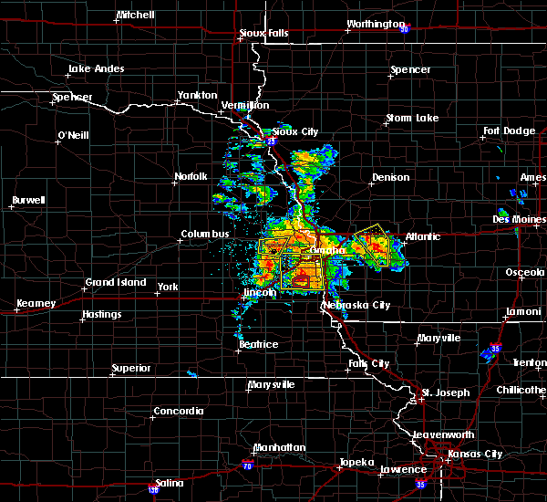 At 604 pm cdt, severe thunderstorms were located along a line extending from omaha to 4 miles southwest of plattsmouth, moving northeast at 45 mph (trained weather spotters reported 2 inch hail with this storm). Hazards include two inch hail and 60 mph wind gusts. People and animals outdoors will be injured. expect hail damage to roofs, siding, windows, and vehicles. expect wind damage to roofs, siding, and trees. locations impacted include, southeastern omaha, western council bluffs, bellevue, papillion, la vista, plattsmouth, ralston, springfield, louisville, murray, cedar creek, offutt afb, carter lake, camp maha, louisville state recreation area, chalco, narrows river park and platte river state park. this includes the following highways, interstate 29 between mile markers 50 and 55. interstate 80 in iowa near mile marker 1. interstate 80 in nebraska between mile markers 437 and 444, and between mile markers 450 and 454. A tornado watch remains in effect until 1100 pm cdt for southwestern iowa, and southeastern and east central nebraska. At 604 pm cdt, severe thunderstorms were located along a line extending from omaha to 4 miles southwest of plattsmouth, moving northeast at 45 mph (trained weather spotters reported 2 inch hail with this storm). Hazards include two inch hail and 60 mph wind gusts. People and animals outdoors will be injured. expect hail damage to roofs, siding, windows, and vehicles. expect wind damage to roofs, siding, and trees. locations impacted include, southeastern omaha, western council bluffs, bellevue, papillion, la vista, plattsmouth, ralston, springfield, louisville, murray, cedar creek, offutt afb, carter lake, camp maha, louisville state recreation area, chalco, narrows river park and platte river state park. this includes the following highways, interstate 29 between mile markers 50 and 55. interstate 80 in iowa near mile marker 1. interstate 80 in nebraska between mile markers 437 and 444, and between mile markers 450 and 454. A tornado watch remains in effect until 1100 pm cdt for southwestern iowa, and southeastern and east central nebraska.
|
| 6/11/2018 5:38 PM CDT | Half Dollar sized hail reported 6 miles ENE of Omaha, NE |
| 6/11/2018 5:24 PM CDT |
 At 522 pm cdt, severe thunderstorms were located along a line extending from omaha to 5 miles southeast of louisville, moving northeast at 30 mph. rotation was beginngin to develop on the southwest side of the storm toward cedar creek in cass co (trained weather spotters). Hazards include two inch hail and 60 mph wind gusts. People and animals outdoors will be injured. expect hail damage to roofs, siding, windows, and vehicles. Expect wind damage to roofs, siding, and trees. At 522 pm cdt, severe thunderstorms were located along a line extending from omaha to 5 miles southeast of louisville, moving northeast at 30 mph. rotation was beginngin to develop on the southwest side of the storm toward cedar creek in cass co (trained weather spotters). Hazards include two inch hail and 60 mph wind gusts. People and animals outdoors will be injured. expect hail damage to roofs, siding, windows, and vehicles. Expect wind damage to roofs, siding, and trees.
|
| 6/11/2018 5:13 PM CDT |
 At 512 pm cdt, severe thunderstorms were located along a line extending from near millard to near cedar creek, moving east at 20 mph (public reported 2 inch hail near 174th and cornhusker). Hazards include two inch hail and 60 mph wind gusts. People and animals outdoors will be injured. expect hail damage to roofs, siding, windows, and vehicles. expect wind damage to roofs, siding, and trees. locations impacted include, southwestern omaha, bellevue, papillion, la vista, plattsmouth, ralston, gretna, springfield, louisville, cedar creek, offutt afb, millard, south bend, camp maha, louisville state recreation area, koa campground, schramm park state recreation area, chalco and platte river state park. this includes interstate 80 in nebraska between mile markers 428 and 448. A tornado watch remains in effect until 1100 pm cdt for southwestern iowa, and southeastern and east central nebraska. At 512 pm cdt, severe thunderstorms were located along a line extending from near millard to near cedar creek, moving east at 20 mph (public reported 2 inch hail near 174th and cornhusker). Hazards include two inch hail and 60 mph wind gusts. People and animals outdoors will be injured. expect hail damage to roofs, siding, windows, and vehicles. expect wind damage to roofs, siding, and trees. locations impacted include, southwestern omaha, bellevue, papillion, la vista, plattsmouth, ralston, gretna, springfield, louisville, cedar creek, offutt afb, millard, south bend, camp maha, louisville state recreation area, koa campground, schramm park state recreation area, chalco and platte river state park. this includes interstate 80 in nebraska between mile markers 428 and 448. A tornado watch remains in effect until 1100 pm cdt for southwestern iowa, and southeastern and east central nebraska.
|
| 6/11/2018 5:10 PM CDT | Golf Ball sized hail reported 9.7 miles NNE of Omaha, NE |
| 6/11/2018 5:09 PM CDT |
 At 458 pm cdt, a severe thunderstorm was located near gretna, or 14 miles southwest of omaha, moving northeast at 35 mph (amatuer radio reported quarter-sized hail at nebraska crossing at 455 pm). Hazards include ping pong ball size hail and 60 mph wind gusts. People and animals outdoors will be injured. expect hail damage to roofs, siding, windows, and vehicles. expect wind damage to roofs, siding, and trees. locations impacted include, southwestern omaha, bellevue, papillion, la vista, plattsmouth, ralston, gretna, springfield, louisville, cedar creek, offutt afb, millard, south bend, camp maha, louisville state recreation area, koa campground, schramm park state recreation area, chalco and platte river state park. this includes interstate 80 in nebraska between mile markers 428 and 448. A tornado watch remains in effect until 1100 pm cdt for southwestern iowa, and southeastern and east central nebraska. At 458 pm cdt, a severe thunderstorm was located near gretna, or 14 miles southwest of omaha, moving northeast at 35 mph (amatuer radio reported quarter-sized hail at nebraska crossing at 455 pm). Hazards include ping pong ball size hail and 60 mph wind gusts. People and animals outdoors will be injured. expect hail damage to roofs, siding, windows, and vehicles. expect wind damage to roofs, siding, and trees. locations impacted include, southwestern omaha, bellevue, papillion, la vista, plattsmouth, ralston, gretna, springfield, louisville, cedar creek, offutt afb, millard, south bend, camp maha, louisville state recreation area, koa campground, schramm park state recreation area, chalco and platte river state park. this includes interstate 80 in nebraska between mile markers 428 and 448. A tornado watch remains in effect until 1100 pm cdt for southwestern iowa, and southeastern and east central nebraska.
|
| 6/11/2018 5:04 PM CDT | Ping Pong Ball sized hail reported 9.1 miles NE of Omaha, NE |
| 6/11/2018 4:59 PM CDT |
 At 458 pm cdt, a severe thunderstorm was located near gretna, or 14 miles southwest of omaha, moving northeast at 35 mph (amatuer radio reported quarter-sized hail at nebraska crossing at 455 pm). Hazards include ping pong ball size hail and 60 mph wind gusts. People and animals outdoors will be injured. expect hail damage to roofs, siding, windows, and vehicles. expect wind damage to roofs, siding, and trees. locations impacted include, southwestern omaha, bellevue, papillion, la vista, plattsmouth, ralston, gretna, springfield, louisville, cedar creek, offutt afb, millard, south bend, camp maha, louisville state recreation area, koa campground, schramm park state recreation area, chalco and platte river state park. this includes interstate 80 in nebraska between mile markers 428 and 448. A tornado watch remains in effect until 1100 pm cdt for southwestern iowa, and southeastern and east central nebraska. At 458 pm cdt, a severe thunderstorm was located near gretna, or 14 miles southwest of omaha, moving northeast at 35 mph (amatuer radio reported quarter-sized hail at nebraska crossing at 455 pm). Hazards include ping pong ball size hail and 60 mph wind gusts. People and animals outdoors will be injured. expect hail damage to roofs, siding, windows, and vehicles. expect wind damage to roofs, siding, and trees. locations impacted include, southwestern omaha, bellevue, papillion, la vista, plattsmouth, ralston, gretna, springfield, louisville, cedar creek, offutt afb, millard, south bend, camp maha, louisville state recreation area, koa campground, schramm park state recreation area, chalco and platte river state park. this includes interstate 80 in nebraska between mile markers 428 and 448. A tornado watch remains in effect until 1100 pm cdt for southwestern iowa, and southeastern and east central nebraska.
|
| 6/11/2018 4:50 PM CDT |
 At 449 pm cdt, a severe thunderstorm was located 4 miles south of gretna, or 17 miles southwest of omaha, moving northeast at 25 mph (radar indicated). Hazards include ping pong ball size hail and 60 mph wind gusts. People and animals outdoors will be injured. expect hail damage to roofs, siding, windows, and vehicles. Expect wind damage to roofs, siding, and trees. At 449 pm cdt, a severe thunderstorm was located 4 miles south of gretna, or 17 miles southwest of omaha, moving northeast at 25 mph (radar indicated). Hazards include ping pong ball size hail and 60 mph wind gusts. People and animals outdoors will be injured. expect hail damage to roofs, siding, windows, and vehicles. Expect wind damage to roofs, siding, and trees.
|
| 6/9/2018 4:12 AM CDT |
 The severe thunderstorm warning for northwestern mills. western pottawattamie. southwestern harrison. southeastern burt. lancaster. western johnson. jefferson. douglas. southeastern saline. eastern saunders. sarpy. washington. eastern dodge. otoe. gage and cass counties will expire at 415 am cdt. The storms which prompted the warning have weakened below severe. The severe thunderstorm warning for northwestern mills. western pottawattamie. southwestern harrison. southeastern burt. lancaster. western johnson. jefferson. douglas. southeastern saline. eastern saunders. sarpy. washington. eastern dodge. otoe. gage and cass counties will expire at 415 am cdt. The storms which prompted the warning have weakened below severe.
|
| 6/9/2018 4:05 AM CDT | At omaha eppley airfield in douglas county NE, 4.3 miles W of Omaha, NE |
| 6/9/2018 3:41 AM CDT |
 At 338 am cdt, severe thunderstorms were located along a line extending from 6 miles south of tekamah to 3 miles southwest of gretna to near firth to 4 miles northeast of mahaska, moving east at 50 mph (radar indicated. wind gusts of 50 to 70 mph have been reported with the outflow preceeding the line of storms). Hazards include 70 mph wind gusts. Expect considerable tree damage. damage is likely to mobile homes, roofs, and outbuildings. locations impacted include, omaha, lincoln, beatrice, council bluffs, bellevue, fremont, papillion, la vista, blair, plattsmouth, ralston, gretna, fairbury, waverly, missouri valley, ashland, syracuse, valley, wilber and tekamah. this includes the following highways, interstate 29 between mile markers 42 and 92. interstate 80 in iowa between mile markers 1 and 5. Interstate 80 in nebraska between mile markers 399 and 454. At 338 am cdt, severe thunderstorms were located along a line extending from 6 miles south of tekamah to 3 miles southwest of gretna to near firth to 4 miles northeast of mahaska, moving east at 50 mph (radar indicated. wind gusts of 50 to 70 mph have been reported with the outflow preceeding the line of storms). Hazards include 70 mph wind gusts. Expect considerable tree damage. damage is likely to mobile homes, roofs, and outbuildings. locations impacted include, omaha, lincoln, beatrice, council bluffs, bellevue, fremont, papillion, la vista, blair, plattsmouth, ralston, gretna, fairbury, waverly, missouri valley, ashland, syracuse, valley, wilber and tekamah. this includes the following highways, interstate 29 between mile markers 42 and 92. interstate 80 in iowa between mile markers 1 and 5. Interstate 80 in nebraska between mile markers 399 and 454.
|
| 6/9/2018 3:25 AM CDT |
 At 324 am cdt, severe thunderstorms were located along a line extending from 5 miles south of craig to 5 miles south of mead to near hallam to near hubbell, moving east at 40 mph (radar indicated). Hazards include 70 mph wind gusts. Expect considerable tree damage. Damage is likely to mobile homes, roofs, and outbuildings. At 324 am cdt, severe thunderstorms were located along a line extending from 5 miles south of craig to 5 miles south of mead to near hallam to near hubbell, moving east at 40 mph (radar indicated). Hazards include 70 mph wind gusts. Expect considerable tree damage. Damage is likely to mobile homes, roofs, and outbuildings.
|
| 6/6/2018 9:48 PM CDT |
 At 947 pm cdt, a severe thunderstorm was located over northwestern council bluffs, or 7 miles east of omaha, moving southeast at 20 mph (radar indicated). Hazards include 60 mph wind gusts. Expect damage to roofs, siding, and trees. locations impacted include, council bluffs, lake manawa state park and narrows river park. this includes the following highways, interstate 29 between mile markers 43 and 50, near mile marker 53, and between mile markers 55 and 56. Interstate 80 in iowa between mile markers 1 and 8. At 947 pm cdt, a severe thunderstorm was located over northwestern council bluffs, or 7 miles east of omaha, moving southeast at 20 mph (radar indicated). Hazards include 60 mph wind gusts. Expect damage to roofs, siding, and trees. locations impacted include, council bluffs, lake manawa state park and narrows river park. this includes the following highways, interstate 29 between mile markers 43 and 50, near mile marker 53, and between mile markers 55 and 56. Interstate 80 in iowa between mile markers 1 and 8.
|
| 6/6/2018 9:39 PM CDT |
 At 939 pm cdt, a severe thunderstorm was located over northwestern council bluffs, or 6 miles east of omaha, moving southeast at 20 mph (radar indicated). Hazards include 60 mph wind gusts. expect damage to roofs, siding, and trees At 939 pm cdt, a severe thunderstorm was located over northwestern council bluffs, or 6 miles east of omaha, moving southeast at 20 mph (radar indicated). Hazards include 60 mph wind gusts. expect damage to roofs, siding, and trees
|
| 6/6/2018 9:25 PM CDT | Trees blown dow in douglas county NE, 9.9 miles SW of Omaha, NE |
| 6/2/2018 12:41 AM CDT |
 At 1240 am cdt, severe thunderstorms were located along a line extending from 8 miles west of underwood to 4 miles west of plattsmouth, moving east at 40 mph (trained weather spotters have reported tree damage, power outages, and winds up to 65 mph in omaha and surrounding areas). Hazards include 60 mph wind gusts and nickel size hail. Expect damage to roofs, siding, and trees. locations impacted include, omaha, council bluffs, bellevue, papillion, la vista, plattsmouth, ralston, glenwood, springfield, oakland, malvern, louisville, treynor, underwood, carson, pacific junction, emerson, cedar creek, macedonia and offutt afb. people attending heartland of america park should seek safe shelter immediately! this includes the following highways, interstate 29 between mile markers 29 and 61. interstate 80 in iowa between mile markers 1 and 17. Interstate 80 in nebraska between mile markers 437 and 454. At 1240 am cdt, severe thunderstorms were located along a line extending from 8 miles west of underwood to 4 miles west of plattsmouth, moving east at 40 mph (trained weather spotters have reported tree damage, power outages, and winds up to 65 mph in omaha and surrounding areas). Hazards include 60 mph wind gusts and nickel size hail. Expect damage to roofs, siding, and trees. locations impacted include, omaha, council bluffs, bellevue, papillion, la vista, plattsmouth, ralston, glenwood, springfield, oakland, malvern, louisville, treynor, underwood, carson, pacific junction, emerson, cedar creek, macedonia and offutt afb. people attending heartland of america park should seek safe shelter immediately! this includes the following highways, interstate 29 between mile markers 29 and 61. interstate 80 in iowa between mile markers 1 and 17. Interstate 80 in nebraska between mile markers 437 and 454.
|
| 6/2/2018 12:26 AM CDT | Tree down across the roa in douglas county NE, 1.8 miles WSW of Omaha, NE |
| 6/2/2018 12:25 AM CDT | Estimated 60-65 mph winds and leaves blown off tree in douglas county NE, 6.7 miles WSW of Omaha, NE |
| 6/2/2018 12:19 AM CDT |
 At 1219 am cdt, a severe thunderstorm was located over springfield, or 13 miles southwest of omaha, moving east at 55 mph (radar indicated). Hazards include 60 mph wind gusts and nickel size hail. expect damage to roofs, siding, and trees At 1219 am cdt, a severe thunderstorm was located over springfield, or 13 miles southwest of omaha, moving east at 55 mph (radar indicated). Hazards include 60 mph wind gusts and nickel size hail. expect damage to roofs, siding, and trees
|
| 6/2/2018 12:05 AM CDT |
 At 1203 am cdt, severe thunderstorms were located along a line extending from 6 miles northwest of blair to 7 miles south of kennard, moving east at 35 mph (radar indicated. these storms have a history of 60 mph wind gusts). Hazards include 60 mph wind gusts. Expect damage to roofs, siding, and trees. locations impacted include, far northern omaha, blair, missouri valley, fort calhoun, kennard, modale, bennington, crescent, herman, magnolia, washington, wilson island state park, desoto bend national wildlife refuge. This includes the following highways, interstate 29 between mile markers 61 and 86. At 1203 am cdt, severe thunderstorms were located along a line extending from 6 miles northwest of blair to 7 miles south of kennard, moving east at 35 mph (radar indicated. these storms have a history of 60 mph wind gusts). Hazards include 60 mph wind gusts. Expect damage to roofs, siding, and trees. locations impacted include, far northern omaha, blair, missouri valley, fort calhoun, kennard, modale, bennington, crescent, herman, magnolia, washington, wilson island state park, desoto bend national wildlife refuge. This includes the following highways, interstate 29 between mile markers 61 and 86.
|
| 6/1/2018 11:51 PM CDT |
 At 1119 pm cdt, the leading edge of a line of severe thunderstorms was located along a line extending from near hooper to 3 miles north of wahoo, moving east at 45 mph (trained weather spotters have reported 60 mph winds at dodge. additional widespread wind damage has been reported with this line of storms). Hazards include 70 mph wind gusts and penny size hail. Expect considerable tree damage. Damage is likely to mobile homes, roofs, and outbuildings. At 1119 pm cdt, the leading edge of a line of severe thunderstorms was located along a line extending from near hooper to 3 miles north of wahoo, moving east at 45 mph (trained weather spotters have reported 60 mph winds at dodge. additional widespread wind damage has been reported with this line of storms). Hazards include 70 mph wind gusts and penny size hail. Expect considerable tree damage. Damage is likely to mobile homes, roofs, and outbuildings.
|
| 6/1/2018 11:51 PM CDT |
 At 1150 pm cdt, the leading edge of a line of severe thunderstorms were located along a line extending from 7 miles northwest of blair to 6 miles northeast of elkhorn, moving east at 40 mph. severe wind gusts will continue well behind the leading edge of these storms (trained weather spotters measured 60 mph winds at the fremont airport). Hazards include 60 mph wind gusts and penny size hail. Expect damage to roofs, siding, and trees. locations impacted include, northern omaha, blair, missouri valley, arlington, fort calhoun, kennard, modale, bennington, crescent, herman, magnolia, washington, wilson island state park, desoto bend national wildlife refuge and historical village welcome center. This includes the following highways, interstate 29 between mile markers 61 and 86. At 1150 pm cdt, the leading edge of a line of severe thunderstorms were located along a line extending from 7 miles northwest of blair to 6 miles northeast of elkhorn, moving east at 40 mph. severe wind gusts will continue well behind the leading edge of these storms (trained weather spotters measured 60 mph winds at the fremont airport). Hazards include 60 mph wind gusts and penny size hail. Expect damage to roofs, siding, and trees. locations impacted include, northern omaha, blair, missouri valley, arlington, fort calhoun, kennard, modale, bennington, crescent, herman, magnolia, washington, wilson island state park, desoto bend national wildlife refuge and historical village welcome center. This includes the following highways, interstate 29 between mile markers 61 and 86.
|
| 6/1/2018 11:20 PM CDT |
 The national weather service in omaha has issued a * severe thunderstorm warning for. northwestern pottawattamie county in southwestern iowa. southwestern harrison county in southwestern iowa. washington county in east central nebraska. Southeastern dodge county in east central nebraska. The national weather service in omaha has issued a * severe thunderstorm warning for. northwestern pottawattamie county in southwestern iowa. southwestern harrison county in southwestern iowa. washington county in east central nebraska. Southeastern dodge county in east central nebraska.
|
| 8/20/2017 12:22 AM CDT |
 The severe thunderstorm warning for north central sarpy and eastern douglas counties will expire at 1230 am cdt, the storm which prompted the warning has weakened and no longer poses an immediate threat to life or property. therefore the warning will be allowed to expire. however gusty winds are still possible with thunderstorms in the area. The severe thunderstorm warning for north central sarpy and eastern douglas counties will expire at 1230 am cdt, the storm which prompted the warning has weakened and no longer poses an immediate threat to life or property. therefore the warning will be allowed to expire. however gusty winds are still possible with thunderstorms in the area.
|
| 8/20/2017 12:16 AM CDT |
 At 1215 am cdt, a severe thunderstorm was located over southwestern omaha, moving east at 40 mph (trained weather spotters). Hazards include 60 mph wind gusts. Expect damage to roofs, siding, and trees. 61 mph winds were observed at the national weather service in valley with this storm at 1154 pm. locations impacted include, omaha, bellevue, papillion, la vista, ralston, millard, boys town and chalco. this includes the following highways, highway 75 in nebraska near mile marker 88, and between mile markers 94 and 99. Interstate 80 in nebraska between mile markers 443 and 452. At 1215 am cdt, a severe thunderstorm was located over southwestern omaha, moving east at 40 mph (trained weather spotters). Hazards include 60 mph wind gusts. Expect damage to roofs, siding, and trees. 61 mph winds were observed at the national weather service in valley with this storm at 1154 pm. locations impacted include, omaha, bellevue, papillion, la vista, ralston, millard, boys town and chalco. this includes the following highways, highway 75 in nebraska near mile marker 88, and between mile markers 94 and 99. Interstate 80 in nebraska between mile markers 443 and 452.
|
| 8/19/2017 11:57 PM CDT |
 At 1156 pm cdt, a severe thunderstorm was located over waterloo, or 15 miles west of omaha, moving east at 40 mph (radar indicated). Hazards include 60 mph wind gusts. expect damage to roofs, siding, and trees At 1156 pm cdt, a severe thunderstorm was located over waterloo, or 15 miles west of omaha, moving east at 40 mph (radar indicated). Hazards include 60 mph wind gusts. expect damage to roofs, siding, and trees
|
| 7/3/2017 5:23 PM CDT |
 At 512 pm cdt, a severe thunderstorm was located near valley, or 16 miles west of omaha, moving northwest at 5 mph (radar indicated). Hazards include half dollar size hail. Damage to vehicles is expected. locations impacted include, valley, yutan, waterloo, elkhorn, washington, leshara and two rivers state recreation area. this includes the following highways, highway 275 in nebraska near mile marker 167. Highway 92 in nebraska between mile markers 462 and 466. At 512 pm cdt, a severe thunderstorm was located near valley, or 16 miles west of omaha, moving northwest at 5 mph (radar indicated). Hazards include half dollar size hail. Damage to vehicles is expected. locations impacted include, valley, yutan, waterloo, elkhorn, washington, leshara and two rivers state recreation area. this includes the following highways, highway 275 in nebraska near mile marker 167. Highway 92 in nebraska between mile markers 462 and 466.
|
| 7/3/2017 5:12 PM CDT |
 At 512 pm cdt, a severe thunderstorm was located near valley, or 16 miles west of omaha, moving northwest at 5 mph (radar indicated). Hazards include half dollar size hail. Damage to vehicles is expected. locations impacted include, valley, yutan, waterloo, elkhorn, washington, leshara and two rivers state recreation area. this includes the following highways, highway 275 in nebraska near mile marker 167. Highway 92 in nebraska between mile markers 462 and 466. At 512 pm cdt, a severe thunderstorm was located near valley, or 16 miles west of omaha, moving northwest at 5 mph (radar indicated). Hazards include half dollar size hail. Damage to vehicles is expected. locations impacted include, valley, yutan, waterloo, elkhorn, washington, leshara and two rivers state recreation area. this includes the following highways, highway 275 in nebraska near mile marker 167. Highway 92 in nebraska between mile markers 462 and 466.
|
| 7/3/2017 5:05 PM CDT |
 At 505 pm cdt, a severe thunderstorm was located near valley, or 16 miles west of omaha, moving northwest at 5 mph (radar indicated). Hazards include quarter size hail. damage to vehicles is expected At 505 pm cdt, a severe thunderstorm was located near valley, or 16 miles west of omaha, moving northwest at 5 mph (radar indicated). Hazards include quarter size hail. damage to vehicles is expected
|
| 6/29/2017 10:09 PM CDT | Quarter sized hail reported 6.5 miles NNE of Omaha, NE |
| 6/29/2017 10:07 PM CDT | Golf Ball sized hail reported 5.7 miles NNE of Omaha, NE, 160th to 132nd along harrison. |
| 6/29/2017 10:05 PM CDT | Ping Pong Ball sized hail reported 5.4 miles NE of Omaha, NE |
| 6/29/2017 10:01 PM CDT | Golf Ball sized hail reported 6.2 miles NE of Omaha, NE, 174th and f. |
| 6/29/2017 10:00 PM CDT | Golf Ball sized hail reported 6.2 miles NE of Omaha, NE |
| 6/29/2017 10:00 PM CDT | Golf Ball sized hail reported 6.6 miles NE of Omaha, NE |
| 6/29/2017 9:53 PM CDT | Ping Pong Ball sized hail reported 4.3 miles W of Omaha, NE, omaha-chalco 164th and giles |
| 6/29/2017 9:51 PM CDT | Quarter sized hail reported 7.7 miles E of Omaha, NE, near 216 and pacific. |
| 6/29/2017 9:49 PM CDT | Ping Pong Ball sized hail reported 9.1 miles W of Omaha, NE |
| 6/29/2017 9:41 PM CDT | Quarter sized hail reported 8.5 miles W of Omaha, NE, downtown omaha. |
| 6/29/2017 9:40 PM CDT | Tea Cup sized hail reported 4.8 miles W of Omaha, NE, several 2 inch stones... one up to 3.75 inches. |
| 6/29/2017 9:40 PM CDT | Ping Pong Ball sized hail reported 5.2 miles WSW of Omaha, NE, 60th and ames. |
| 6/29/2017 9:39 PM CDT | Hen Egg sized hail reported 6.4 miles W of Omaha, NE, 35th and charles. |
| 6/29/2017 9:38 PM CDT | Golf Ball sized hail reported 5.4 miles W of Omaha, NE |
| 6/29/2017 9:36 PM CDT | Ping Pong Ball sized hail reported 3.2 miles W of Omaha, NE, 82nd and blondo. |
| 6/29/2017 9:35 PM CDT | Golf Ball sized hail reported 3 miles SSW of Omaha, NE, 114th and fort. |
| 6/29/2017 9:30 PM CDT | Quarter sized hail reported 4.3 miles W of Omaha, NE, omaha - 106th and browne streets |
| 6/29/2017 9:29 PM CDT | Quarter sized hail reported 11.6 miles SSW of Omaha, NE |
| 6/29/2017 7:00 PM CDT |
 At 1200 am cdt, a severe thunderstorm was located near bellevue, or 8 miles south of omaha, moving east at 35 mph. half dollar size hail was reported with this storm, and larger hail is likely (trained weather spotters). Hazards include ping pong ball size hail. People and animals outdoors will be injured. Expect damage to roofs, siding, windows, and vehicles. At 1200 am cdt, a severe thunderstorm was located near bellevue, or 8 miles south of omaha, moving east at 35 mph. half dollar size hail was reported with this storm, and larger hail is likely (trained weather spotters). Hazards include ping pong ball size hail. People and animals outdoors will be injured. Expect damage to roofs, siding, windows, and vehicles.
|
| 6/29/2017 6:55 PM CDT | Quarter sized hail reported 4.3 miles W of Omaha, NE, omaha - 106th and browne streets |
| 6/29/2017 5:11 PM CDT |
 At 1010 pm cdt, a severe thunderstorm was located over ralston, or 4 miles south of omaha, moving east at 35 mph (radar indicated). Hazards include golf ball size hail. People and animals outdoors will be injured. expect damage to roofs, siding, windows, and vehicles. locations impacted include, omaha, council bluffs, bellevue, papillion, la vista, ralston, oakland, treynor, carson, macedonia, millard, offutt afb, carter lake, boys town, silver city, henderson, old town park, lake manawa state park, chalco and narrows river park. this includes the following highways, highway 59 in iowa between mile markers 34 and 48. highway 75 in nebraska between mile markers 82 and 94. interstate 29 between mile markers 42 and 58. interstate 80 in iowa between mile markers 1 and 11. Interstate 80 in nebraska between mile markers 439 and 454. At 1010 pm cdt, a severe thunderstorm was located over ralston, or 4 miles south of omaha, moving east at 35 mph (radar indicated). Hazards include golf ball size hail. People and animals outdoors will be injured. expect damage to roofs, siding, windows, and vehicles. locations impacted include, omaha, council bluffs, bellevue, papillion, la vista, ralston, oakland, treynor, carson, macedonia, millard, offutt afb, carter lake, boys town, silver city, henderson, old town park, lake manawa state park, chalco and narrows river park. this includes the following highways, highway 59 in iowa between mile markers 34 and 48. highway 75 in nebraska between mile markers 82 and 94. interstate 29 between mile markers 42 and 58. interstate 80 in iowa between mile markers 1 and 11. Interstate 80 in nebraska between mile markers 439 and 454.
|
| 6/29/2017 4:55 PM CDT |
 At 955 pm cdt, a severe thunderstorm was located near millard, or 7 miles west of omaha, moving east at 40 mph (radar indicated). Hazards include golf ball size hail. People and animals outdoors will be injured. Expect damage to roofs, siding, windows, and vehicles. At 955 pm cdt, a severe thunderstorm was located near millard, or 7 miles west of omaha, moving east at 40 mph (radar indicated). Hazards include golf ball size hail. People and animals outdoors will be injured. Expect damage to roofs, siding, windows, and vehicles.
|
| 6/29/2017 4:46 PM CDT |
 At 946 pm cdt, severe thunderstorms were located along a line extending from 3 miles west of persia to near minden to near underwood to council bluffs, moving east at 40 mph (radar indicated). Hazards include ping pong ball size hail and 60 mph wind gusts. People and animals outdoors will be injured. expect hail damage to roofs, siding, windows, and vehicles. Expect wind damage to roofs, siding, and trees. At 946 pm cdt, severe thunderstorms were located along a line extending from 3 miles west of persia to near minden to near underwood to council bluffs, moving east at 40 mph (radar indicated). Hazards include ping pong ball size hail and 60 mph wind gusts. People and animals outdoors will be injured. expect hail damage to roofs, siding, windows, and vehicles. Expect wind damage to roofs, siding, and trees.
|
| 6/29/2017 4:45 PM CDT |
 At 945 pm cdt, severe thunderstorms were located along a line extending from 6 miles southeast of logan to 4 miles west of minden to 5 miles southwest of underwood to omaha, moving east at 470 mph (radar indicated). Hazards include ping pong ball size hail and 60 mph wind gusts. People and animals outdoors will be injured. expect hail damage to roofs, siding, windows, and vehicles. Expect wind damage to roofs, siding, and trees. At 945 pm cdt, severe thunderstorms were located along a line extending from 6 miles southeast of logan to 4 miles west of minden to 5 miles southwest of underwood to omaha, moving east at 470 mph (radar indicated). Hazards include ping pong ball size hail and 60 mph wind gusts. People and animals outdoors will be injured. expect hail damage to roofs, siding, windows, and vehicles. Expect wind damage to roofs, siding, and trees.
|
| 6/29/2017 4:42 PM CDT |
 At 942 pm cdt, a severe thunderstorm was located near waterloo, or 16 miles west of omaha, moving southeast at 40 mph (radar indicated). Hazards include quarter size hail. damage to vehicles is expected At 942 pm cdt, a severe thunderstorm was located near waterloo, or 16 miles west of omaha, moving southeast at 40 mph (radar indicated). Hazards include quarter size hail. damage to vehicles is expected
|
| 6/29/2017 4:32 PM CDT |
 At 931 pm cdt, a severe thunderstorm was located over southeastern omaha, moving east at 40 mph (radar indicated). Hazards include 60 mph wind gusts and half dollar size hail. Hail damage to vehicles is expected. Expect wind damage to roofs, siding, and trees. At 931 pm cdt, a severe thunderstorm was located over southeastern omaha, moving east at 40 mph (radar indicated). Hazards include 60 mph wind gusts and half dollar size hail. Hail damage to vehicles is expected. Expect wind damage to roofs, siding, and trees.
|
| 6/29/2017 4:16 PM CDT |
 At 916 pm cdt, a severe thunderstorm was located near fort calhoun, or 11 miles north of omaha, moving east at 40 mph (radar indicated). Hazards include 60 mph wind gusts and quarter size hail. Hail damage to vehicles is expected. Expect wind damage to roofs, siding, and trees. At 916 pm cdt, a severe thunderstorm was located near fort calhoun, or 11 miles north of omaha, moving east at 40 mph (radar indicated). Hazards include 60 mph wind gusts and quarter size hail. Hail damage to vehicles is expected. Expect wind damage to roofs, siding, and trees.
|
| 6/16/2017 8:14 PM CDT |
 At 814 pm cdt, severe thunderstorms were located along a line extending from 5 miles east of persia to treynor to 3 miles southeast of pacific junction to 4 miles southwest of elmwood, moving southeast at 45 mph. these are very dangerous storms (radar indicated). Hazards include 80 mph wind gusts. Flying debris will be dangerous to those caught without shelter. mobile homes will be heavily damaged. expect considerable damage to roofs, windows, and vehicles. Extensive tree damage and power outages are likely. At 814 pm cdt, severe thunderstorms were located along a line extending from 5 miles east of persia to treynor to 3 miles southeast of pacific junction to 4 miles southwest of elmwood, moving southeast at 45 mph. these are very dangerous storms (radar indicated). Hazards include 80 mph wind gusts. Flying debris will be dangerous to those caught without shelter. mobile homes will be heavily damaged. expect considerable damage to roofs, windows, and vehicles. Extensive tree damage and power outages are likely.
|
| 6/16/2017 8:04 PM CDT | At omaha airpor in douglas county NE, 10.2 miles WSW of Omaha, NE |
| 6/16/2017 7:59 PM CDT | 132nd and cornhusker in douglas county NE, 4.3 miles W of Omaha, NE |
| 6/16/2017 7:57 PM CDT |
 At 756 pm cdt, severe thunderstorms were located along a line extending from 4 miles northwest of underwood to 5 miles east of council bluffs to near cedar creek to 6 miles northwest of greenwood, moving southeast at 45 mph. these are very dangerous storms (radar indicated. numerous reports of 70 to 90 mph winds have been received associated with the leading edge of the storm). Hazards include 90 mph wind gusts. You are in a life-threatening situation. flying debris may be deadly to those caught without shelter. mobile homes will be heavily damaged or destroyed. homes and businesses will have substantial roof and window damage. expect extensive tree damage and power outages. locations impacted include, southeastern omaha, council bluffs, bellevue, papillion, la vista, plattsmouth, ralston, glenwood, gretna, waverly, ashland, springfield, oakland, malvern, louisville, weeping water, treynor, underwood, carson and elmwood. this includes the following highways, highway 34 in iowa between mile markers 1 and 23. highway 59 in iowa between mile markers 31 and 55. highway 75 in nebraska between mile markers 57 and 91. highway 77 in nebraska between mile markers 81 and 82. interstate 29 between mile markers 15 and 56. interstate 80 in iowa between mile markers 1 and 23. Interstate 80 in nebraska between mile markers 411 and 444, and between mile markers 448 and 454. At 756 pm cdt, severe thunderstorms were located along a line extending from 4 miles northwest of underwood to 5 miles east of council bluffs to near cedar creek to 6 miles northwest of greenwood, moving southeast at 45 mph. these are very dangerous storms (radar indicated. numerous reports of 70 to 90 mph winds have been received associated with the leading edge of the storm). Hazards include 90 mph wind gusts. You are in a life-threatening situation. flying debris may be deadly to those caught without shelter. mobile homes will be heavily damaged or destroyed. homes and businesses will have substantial roof and window damage. expect extensive tree damage and power outages. locations impacted include, southeastern omaha, council bluffs, bellevue, papillion, la vista, plattsmouth, ralston, glenwood, gretna, waverly, ashland, springfield, oakland, malvern, louisville, weeping water, treynor, underwood, carson and elmwood. this includes the following highways, highway 34 in iowa between mile markers 1 and 23. highway 59 in iowa between mile markers 31 and 55. highway 75 in nebraska between mile markers 57 and 91. highway 77 in nebraska between mile markers 81 and 82. interstate 29 between mile markers 15 and 56. interstate 80 in iowa between mile markers 1 and 23. Interstate 80 in nebraska between mile markers 411 and 444, and between mile markers 448 and 454.
|
| 6/16/2017 7:55 PM CDT | 132nd and harrison area. big trees down along with several fences in the neighboo in douglas county NE, 4.3 miles W of Omaha, NE |
| 6/16/2017 7:50 PM CDT | Trees dow in douglas county NE, 6.6 miles NE of Omaha, NE |
| 6/16/2017 7:49 PM CDT |
 At 748 pm cdt, severe thunderstorms were located along a line extending from 6 miles southeast of missouri valley to 4 miles north of council bluffs to near gretna to 9 miles south of wahoo, moving southeast at 40 mph. these are very dangerous storms (radar indicated). Hazards include 80 mph wind gusts. Flying debris will be dangerous to those caught without shelter. mobile homes will be heavily damaged. expect considerable damage to roofs, windows, and vehicles. Extensive tree damage and power outages are likely. At 748 pm cdt, severe thunderstorms were located along a line extending from 6 miles southeast of missouri valley to 4 miles north of council bluffs to near gretna to 9 miles south of wahoo, moving southeast at 40 mph. these are very dangerous storms (radar indicated). Hazards include 80 mph wind gusts. Flying debris will be dangerous to those caught without shelter. mobile homes will be heavily damaged. expect considerable damage to roofs, windows, and vehicles. Extensive tree damage and power outages are likely.
|
| 6/16/2017 7:48 PM CDT | Storm damage reported in sarpy county NE, 9.2 miles NE of Omaha, NE |
| 6/16/2017 7:40 PM CDT | Storm damage reported in douglas county NE, 7.7 miles E of Omaha, NE |
| 6/16/2017 7:36 PM CDT |
 At 736 pm cdt, severe thunderstorms were located along a line extending from 4 miles southwest of missouri valley to 8 miles southwest of fort calhoun to 3 miles south of waterloo to near wahoo, moving southeast at 40 mph. these are very dangerous storms (radar indicated). Hazards include 80 mph wind gusts and quarter size hail. Flying debris will be dangerous to those caught without shelter. mobile homes will be heavily damaged. expect considerable damage to roofs, windows, and vehicles. extensive tree damage and power outages are likely. locations impacted include, omaha, council bluffs, bellevue, papillion, la vista, blair, ralston, wahoo, gretna, missouri valley, ashland, valley, springfield, yutan, underwood, fort calhoun, waterloo, mead, cedar creek and kennard. this includes the following highways, highway 275 in nebraska near mile marker 167. highway 30 in iowa between mile markers 1 and 5. highway 30 in nebraska between mile markers 441 and 444, and near mile marker 450. highway 75 in nebraska between mile markers 76 and 114. highway 77 in nebraska between mile markers 90 and 104. highway 92 in nebraska between mile markers 446 and 466. interstate 29 between mile markers 39 and 79. interstate 80 in iowa between mile markers 1 and 23. Interstate 80 in nebraska between mile markers 428 and 454. At 736 pm cdt, severe thunderstorms were located along a line extending from 4 miles southwest of missouri valley to 8 miles southwest of fort calhoun to 3 miles south of waterloo to near wahoo, moving southeast at 40 mph. these are very dangerous storms (radar indicated). Hazards include 80 mph wind gusts and quarter size hail. Flying debris will be dangerous to those caught without shelter. mobile homes will be heavily damaged. expect considerable damage to roofs, windows, and vehicles. extensive tree damage and power outages are likely. locations impacted include, omaha, council bluffs, bellevue, papillion, la vista, blair, ralston, wahoo, gretna, missouri valley, ashland, valley, springfield, yutan, underwood, fort calhoun, waterloo, mead, cedar creek and kennard. this includes the following highways, highway 275 in nebraska near mile marker 167. highway 30 in iowa between mile markers 1 and 5. highway 30 in nebraska between mile markers 441 and 444, and near mile marker 450. highway 75 in nebraska between mile markers 76 and 114. highway 77 in nebraska between mile markers 90 and 104. highway 92 in nebraska between mile markers 446 and 466. interstate 29 between mile markers 39 and 79. interstate 80 in iowa between mile markers 1 and 23. Interstate 80 in nebraska between mile markers 428 and 454.
|
| 6/16/2017 7:35 PM CDT | 173rd and f. numerous trees down and transformers in douglas county NE, 4.3 miles W of Omaha, NE |
| 6/16/2017 7:30 PM CDT |
 At 729 pm cdt, severe thunderstorms were located along a line extending from 5 miles south of modale to 5 miles south of kennard to near valley to 4 miles northwest of wahoo, moving southeast at 40 mph (radar indicated). Hazards include 60 mph wind gusts and quarter size hail. Hail damage to vehicles is expected. Expect wind damage to roofs, siding, and trees. At 729 pm cdt, severe thunderstorms were located along a line extending from 5 miles south of modale to 5 miles south of kennard to near valley to 4 miles northwest of wahoo, moving southeast at 40 mph (radar indicated). Hazards include 60 mph wind gusts and quarter size hail. Hail damage to vehicles is expected. Expect wind damage to roofs, siding, and trees.
|
| 6/16/2017 7:07 PM CDT |
 At 706 pm cdt, severe thunderstorms were located along a line extending from 4 miles northwest of pisgah to near shelby, moving southeast at 35 mph (radar indicated). Hazards include 70 mph wind gusts and quarter size hail. Hail damage to vehicles is expected. expect considerable tree damage. Wind damage is also likely to mobile homes, roofs, and outbuildings. At 706 pm cdt, severe thunderstorms were located along a line extending from 4 miles northwest of pisgah to near shelby, moving southeast at 35 mph (radar indicated). Hazards include 70 mph wind gusts and quarter size hail. Hail damage to vehicles is expected. expect considerable tree damage. Wind damage is also likely to mobile homes, roofs, and outbuildings.
|
| 6/2/2017 4:20 AM CDT | Additional reports of large limbs and trees down in midtown area south towards i80 in douglas county NE, 4.3 miles W of Omaha, NE |
| 6/2/2017 4:15 AM CDT | Several large limbs down in the midtown are in douglas county NE, 4.3 miles W of Omaha, NE |
| 5/17/2017 2:36 PM CDT |
 The severe thunderstorm warning for southeastern washington and northwestern douglas counties will expire at 245 pm cdt, the storm which prompted the warning has weakened below severe limits, and no longer poses an immediate threat to life or property. therefore the warning will be allowed to expire. however small hail and gusty winds are still possible with this thunderstorm. a tornado watch remains in effect until 700 pm cdt for east central nebraska. The severe thunderstorm warning for southeastern washington and northwestern douglas counties will expire at 245 pm cdt, the storm which prompted the warning has weakened below severe limits, and no longer poses an immediate threat to life or property. therefore the warning will be allowed to expire. however small hail and gusty winds are still possible with this thunderstorm. a tornado watch remains in effect until 700 pm cdt for east central nebraska.
|
| 5/17/2017 2:21 PM CDT |
 At 220 pm cdt, a severe thunderstorm was located near waterloo, or 14 miles west of omaha, moving north at 25 mph (radar indicated). Hazards include 60 mph wind gusts and quarter size hail. Hail damage to vehicles is expected. Expect wind damage to roofs, siding, and trees. At 220 pm cdt, a severe thunderstorm was located near waterloo, or 14 miles west of omaha, moving north at 25 mph (radar indicated). Hazards include 60 mph wind gusts and quarter size hail. Hail damage to vehicles is expected. Expect wind damage to roofs, siding, and trees.
|
| 5/16/2017 7:00 PM CDT | Small plane flipped over at eppley in douglas county NE, 4.3 miles W of Omaha, NE |
| 5/16/2017 6:44 PM CDT | Asos station oma... omaha eppley airfiel in douglas county NE, 10.7 miles W of Omaha, NE |
| 5/16/2017 6:44 PM CDT | 55kt gust reported at omaha/eppley in douglas county NE, 4.3 miles W of Omaha, NE |
| 5/16/2017 6:40 PM CDT | Trees down at aksarben near s 63rd in douglas county NE, 4.3 miles W of Omaha, NE |
| 5/16/2017 6:39 PM CDT | Mesonet station d6324... 3 ene benningto in washington county NE, 9 miles S of Omaha, NE |
| 5/16/2017 6:39 PM CDT |
 The severe thunderstorm warning for western sarpy, south central washington, southeastern dodge, western douglas, eastern saunders and northwestern cass counties will expire at 645 pm cdt, the storms which prompted this warning were moving out of this warning, but a new warning is in effect farther east. the new warning does include parts of douglas, sarpy and cass counties. this warning will be allowed to expire. a severe thunderstorm watch remains in effect until midnight cdt for southeastern and east central nebraska. The severe thunderstorm warning for western sarpy, south central washington, southeastern dodge, western douglas, eastern saunders and northwestern cass counties will expire at 645 pm cdt, the storms which prompted this warning were moving out of this warning, but a new warning is in effect farther east. the new warning does include parts of douglas, sarpy and cass counties. this warning will be allowed to expire. a severe thunderstorm watch remains in effect until midnight cdt for southeastern and east central nebraska.
|
| 5/16/2017 6:35 PM CDT | Trees damaged at gene leahy mall at 13th and douglas in douglas county NE, 4.3 miles W of Omaha, NE |
| 5/16/2017 6:30 PM CDT | Quarter sized hail reported 4.3 miles W of Omaha, NE, 132nd and giles |
| 5/16/2017 6:30 PM CDT |
 At 630 pm cdt, severe thunderstorms were located along a line extending from 3 miles north of fort calhoun omaha and then to near cedar creek, moving northeast at 45 mph. these are very dangerous storms (radar indicated). Hazards include 80 mph wind gusts and half dollar size hail. Flying debris will be dangerous to those caught without shelter. mobile homes will be heavily damaged. expect considerable damage to roofs, windows, and vehicles. extensive tree damage and power outages are likely. locations impacted include, omaha, council bluffs, bellevue, papillion, la vista, ralston, gretna, missouri valley, springfield, fort calhoun, waterloo, cedar creek, kennard, elkhorn, millard, offutt afb, carter lake, bennington, boys town and crescent. People attending werner park and fricke field, and creighton university stadium should seek safe shelter immediately!. At 630 pm cdt, severe thunderstorms were located along a line extending from 3 miles north of fort calhoun omaha and then to near cedar creek, moving northeast at 45 mph. these are very dangerous storms (radar indicated). Hazards include 80 mph wind gusts and half dollar size hail. Flying debris will be dangerous to those caught without shelter. mobile homes will be heavily damaged. expect considerable damage to roofs, windows, and vehicles. extensive tree damage and power outages are likely. locations impacted include, omaha, council bluffs, bellevue, papillion, la vista, ralston, gretna, missouri valley, springfield, fort calhoun, waterloo, cedar creek, kennard, elkhorn, millard, offutt afb, carter lake, bennington, boys town and crescent. People attending werner park and fricke field, and creighton university stadium should seek safe shelter immediately!.
|
| 5/16/2017 6:27 PM CDT |
 At 625 pm cdt, severe thunderstorms with damaging winds were located along a line extending from 3 miles northwest of fort calhoun across central douglas county and to near cedar creek in sarpy county, moving northeast at 45 mph. a storm that may produce large hail was near gretna. these are very dangerous storms (radar indicated). Hazards include 80 mph wind gusts and half dollar size hail. Flying debris will be dangerous to those caught without shelter. mobile homes will be heavily damaged. expect considerable damage to roofs, windows, and vehicles. extensive tree damage and power outages are likely. locations impacted include, omaha, council bluffs, bellevue, papillion, la vista, ralston, gretna, missouri valley, springfield, fort calhoun, waterloo, cedar creek, kennard, elkhorn, millard, offutt afb, carter lake, bennington, boys town and crescent. People attending werner park and fricke field, and creighton university stadium should seek safe shelter immediately!. At 625 pm cdt, severe thunderstorms with damaging winds were located along a line extending from 3 miles northwest of fort calhoun across central douglas county and to near cedar creek in sarpy county, moving northeast at 45 mph. a storm that may produce large hail was near gretna. these are very dangerous storms (radar indicated). Hazards include 80 mph wind gusts and half dollar size hail. Flying debris will be dangerous to those caught without shelter. mobile homes will be heavily damaged. expect considerable damage to roofs, windows, and vehicles. extensive tree damage and power outages are likely. locations impacted include, omaha, council bluffs, bellevue, papillion, la vista, ralston, gretna, missouri valley, springfield, fort calhoun, waterloo, cedar creek, kennard, elkhorn, millard, offutt afb, carter lake, bennington, boys town and crescent. People attending werner park and fricke field, and creighton university stadium should seek safe shelter immediately!.
|
| 5/16/2017 6:27 PM CDT |
 At 618 pm cdt, severe thunderstorms were located along a line extending from kennard to 3 miles west of springfield, moving northeast at 45 mph. these are very dangerous storms (radar indicated). Hazards include 80 mph wind gusts. Flying debris will be dangerous to those caught without shelter. mobile homes will be heavily damaged. expect considerable damage to roofs, windows, and vehicles. Extensive tree damage and power outages are likely. At 618 pm cdt, severe thunderstorms were located along a line extending from kennard to 3 miles west of springfield, moving northeast at 45 mph. these are very dangerous storms (radar indicated). Hazards include 80 mph wind gusts. Flying debris will be dangerous to those caught without shelter. mobile homes will be heavily damaged. expect considerable damage to roofs, windows, and vehicles. Extensive tree damage and power outages are likely.
|
| 5/16/2017 6:23 PM CDT |
 At 621 pm cdt, severe thunderstorms were located along a line extending from 3 miles south of kennard to near millard to near murdock, moving east at 40 mph. a storm with hail was near gretna. these are very dangerous storms (radar indicated). Hazards include 80 mph wind gusts and half dollar size hail. Flying debris will be dangerous to those caught without shelter. mobile homes will be heavily damaged. expect considerable damage to roofs, windows, and vehicles. extensive tree damage and power outages are likely. locations impacted include, gretna, ashland, valley, yutan, waterloo, greenwood, elkhorn, murdock, bennington, washington, alvo, memphis, leshara, koa campground, two rivers state recreation area, schramm park state recreation area, memphis state recreation area, mahoney state park and camp carol joy holling. this includes the following highways, highway 275 in nebraska between mile markers 156 and 167. highway 92 in nebraska between mile markers 459 and 466. Interstate 80 in nebraska between mile markers 415 and 435. At 621 pm cdt, severe thunderstorms were located along a line extending from 3 miles south of kennard to near millard to near murdock, moving east at 40 mph. a storm with hail was near gretna. these are very dangerous storms (radar indicated). Hazards include 80 mph wind gusts and half dollar size hail. Flying debris will be dangerous to those caught without shelter. mobile homes will be heavily damaged. expect considerable damage to roofs, windows, and vehicles. extensive tree damage and power outages are likely. locations impacted include, gretna, ashland, valley, yutan, waterloo, greenwood, elkhorn, murdock, bennington, washington, alvo, memphis, leshara, koa campground, two rivers state recreation area, schramm park state recreation area, memphis state recreation area, mahoney state park and camp carol joy holling. this includes the following highways, highway 275 in nebraska between mile markers 156 and 167. highway 92 in nebraska between mile markers 459 and 466. Interstate 80 in nebraska between mile markers 415 and 435.
|
| 5/16/2017 6:18 PM CDT |
 At 618 pm cdt, severe thunderstorms were located along a line extending from kennard to 3 miles west of springfield, moving northeast at 45 mph. these are very dangerous storms (radar indicated). Hazards include 80 mph wind gusts. Flying debris will be dangerous to those caught without shelter. mobile homes will be heavily damaged. expect considerable damage to roofs, windows, and vehicles. Extensive tree damage and power outages are likely. At 618 pm cdt, severe thunderstorms were located along a line extending from kennard to 3 miles west of springfield, moving northeast at 45 mph. these are very dangerous storms (radar indicated). Hazards include 80 mph wind gusts. Flying debris will be dangerous to those caught without shelter. mobile homes will be heavily damaged. expect considerable damage to roofs, windows, and vehicles. Extensive tree damage and power outages are likely.
|
| 5/16/2017 6:12 PM CDT |
 At 611 pm cdt, severe thunderstorms were located along a line extending from 4 miles southeast of arlington to 5 miles southeast of yutan to near greenwood, moving east at 45 mph. winds of 85 mph occurred at valley nws office at 609 pm cdt. these are very dangerous storms (radar indicated). Hazards include 80 mph wind gusts and half dollar size hail. Flying debris will be dangerous to those caught without shelter. mobile homes will be heavily damaged. expect considerable damage to roofs, windows, and vehicles. extensive tree damage and power outages are likely. locations impacted include, wahoo, gretna, waverly, ashland, valley, yutan, waterloo, elmwood, mead, greenwood, elkhorn, murdock, bennington, washington, ithaca, alvo, memphis, leshara, koa campground and two rivers state recreation area. this includes the following highways, highway 275 in nebraska between mile markers 156 and 167. highway 77 in nebraska between mile markers 97 and 112. highway 92 in nebraska between mile markers 452 and 466. Interstate 80 in nebraska between mile markers 411 and 435. At 611 pm cdt, severe thunderstorms were located along a line extending from 4 miles southeast of arlington to 5 miles southeast of yutan to near greenwood, moving east at 45 mph. winds of 85 mph occurred at valley nws office at 609 pm cdt. these are very dangerous storms (radar indicated). Hazards include 80 mph wind gusts and half dollar size hail. Flying debris will be dangerous to those caught without shelter. mobile homes will be heavily damaged. expect considerable damage to roofs, windows, and vehicles. extensive tree damage and power outages are likely. locations impacted include, wahoo, gretna, waverly, ashland, valley, yutan, waterloo, elmwood, mead, greenwood, elkhorn, murdock, bennington, washington, ithaca, alvo, memphis, leshara, koa campground and two rivers state recreation area. this includes the following highways, highway 275 in nebraska between mile markers 156 and 167. highway 77 in nebraska between mile markers 97 and 112. highway 92 in nebraska between mile markers 452 and 466. Interstate 80 in nebraska between mile markers 411 and 435.
|
| 5/16/2017 6:03 PM CDT |
 At 602 pm cdt, severe thunderstorms were located along a line extending from 4 miles southeast of inglewood to lincoln, moving east at 35 mph. the strongest winds were likely from near mead to west of leshara, moving toward yutan and valley (radar indicated). Hazards include 70 mph wind gusts and half dollar size hail. Hail damage to vehicles is expected. expect considerable tree damage. wind damage is also likely to mobile homes, roofs, and outbuildings. locations impacted include, northeastern lincoln, wahoo, gretna, waverly, ashland, valley, yutan, waterloo, elmwood, cedar bluffs, mead, greenwood, inglewood, elkhorn, murdock, bennington, ceresco, raymond, davey and washington. this includes the following highways, highway 275 in nebraska between mile markers 156 and 167. highway 77 in nebraska between mile markers 71 and 112. highway 92 in nebraska between mile markers 446 and 466. Interstate 80 in nebraska between mile markers 401 and 435. At 602 pm cdt, severe thunderstorms were located along a line extending from 4 miles southeast of inglewood to lincoln, moving east at 35 mph. the strongest winds were likely from near mead to west of leshara, moving toward yutan and valley (radar indicated). Hazards include 70 mph wind gusts and half dollar size hail. Hail damage to vehicles is expected. expect considerable tree damage. wind damage is also likely to mobile homes, roofs, and outbuildings. locations impacted include, northeastern lincoln, wahoo, gretna, waverly, ashland, valley, yutan, waterloo, elmwood, cedar bluffs, mead, greenwood, inglewood, elkhorn, murdock, bennington, ceresco, raymond, davey and washington. this includes the following highways, highway 275 in nebraska between mile markers 156 and 167. highway 77 in nebraska between mile markers 71 and 112. highway 92 in nebraska between mile markers 446 and 466. Interstate 80 in nebraska between mile markers 401 and 435.
|
| 5/16/2017 5:53 PM CDT |
 At 553 pm cdt, severe thunderstorms were located along a line extending from 3 miles south of inglewood to lincoln, moving east at 35 mph. outflow winds may reach 60 to 65 mph (radar indicated). Hazards include 60 mph wind gusts. expect damage to roofs, siding, and trees At 553 pm cdt, severe thunderstorms were located along a line extending from 3 miles south of inglewood to lincoln, moving east at 35 mph. outflow winds may reach 60 to 65 mph (radar indicated). Hazards include 60 mph wind gusts. expect damage to roofs, siding, and trees
|
| 4/19/2017 6:51 AM CDT |
 At 650 am cdt, a severe thunderstorm was located 5 miles southwest of fort calhoun, or 8 miles north of omaha, moving northeast at 35 mph (radar indicated). Hazards include quarter size hail. Damage to vehicles is expected. locations impacted include, northern omaha and fort calhoun. this includes the following highways, highway 75 in nebraska between mile markers 99 and 111. Interstate 29 near mile marker 66. At 650 am cdt, a severe thunderstorm was located 5 miles southwest of fort calhoun, or 8 miles north of omaha, moving northeast at 35 mph (radar indicated). Hazards include quarter size hail. Damage to vehicles is expected. locations impacted include, northern omaha and fort calhoun. this includes the following highways, highway 75 in nebraska between mile markers 99 and 111. Interstate 29 near mile marker 66.
|
| 4/19/2017 6:40 AM CDT |
 At 639 am cdt, a severe thunderstorm was located 5 miles northeast of elkhorn, or 7 miles northwest of omaha, moving northeast at 35 mph (trained weather spotters). Hazards include quarter size hail. damage to vehicles is expected At 639 am cdt, a severe thunderstorm was located 5 miles northeast of elkhorn, or 7 miles northwest of omaha, moving northeast at 35 mph (trained weather spotters). Hazards include quarter size hail. damage to vehicles is expected
|
| 4/19/2017 6:38 AM CDT | Quarter sized hail reported 4.3 miles W of Omaha, NE, omaha - 170th and maple street |
| 3/6/2017 3:58 PM CST |
 At 357 pm cst, a severe thunderstorm was located 7 miles north of persia, or 25 miles southwest of denison, moving northeast at 60 mph (radar indicated). Hazards include 60 mph wind gusts and half dollar size hail. Hail damage to vehicles is expected. expect wind damage to roofs, siding, and trees. locations impacted include, eastern omaha, council bluffs, underwood, earling, persia, defiance, carter lake, woodbine, dunlap, neola, crescent, panama, portsmouth, mcclelland, westphalia, tennant, manteno recreation area, hitchcock nature center, schaben park and arrowhead park. this includes the following highways, highway 59 in iowa between mile markers 83 and 89. highway 75 in nebraska near mile marker 91. interstate 29 between mile markers 47 and 63. interstate 80 in iowa between mile markers 3 and 29. A tornado watch remains in effect until 1000 pm cst for southwestern iowa. At 357 pm cst, a severe thunderstorm was located 7 miles north of persia, or 25 miles southwest of denison, moving northeast at 60 mph (radar indicated). Hazards include 60 mph wind gusts and half dollar size hail. Hail damage to vehicles is expected. expect wind damage to roofs, siding, and trees. locations impacted include, eastern omaha, council bluffs, underwood, earling, persia, defiance, carter lake, woodbine, dunlap, neola, crescent, panama, portsmouth, mcclelland, westphalia, tennant, manteno recreation area, hitchcock nature center, schaben park and arrowhead park. this includes the following highways, highway 59 in iowa between mile markers 83 and 89. highway 75 in nebraska near mile marker 91. interstate 29 between mile markers 47 and 63. interstate 80 in iowa between mile markers 3 and 29. A tornado watch remains in effect until 1000 pm cst for southwestern iowa.
|
| 3/6/2017 3:47 PM CST |
 At 346 pm cst, a severe thunderstorm was located near bellevue, or 5 miles southeast of omaha, moving northeast at 55 mph (radar indicated). Hazards include 60 mph wind gusts and penny size hail. expect damage to roofs, siding, and trees At 346 pm cst, a severe thunderstorm was located near bellevue, or 5 miles southeast of omaha, moving northeast at 55 mph (radar indicated). Hazards include 60 mph wind gusts and penny size hail. expect damage to roofs, siding, and trees
|
| 3/6/2017 3:44 PM CST |
 At 344 pm cst, a severe thunderstorm was located 7 miles east of missouri valley, or 22 miles northeast of omaha, moving northeast at 55 mph (radar indicated). Hazards include two inch hail and 60 mph wind gusts. People and animals outdoors will be injured. expect hail damage to roofs, siding, windows, and vehicles. expect wind damage to roofs, siding, and trees. locations impacted include, omaha, council bluffs, missouri valley, logan, underwood, fort calhoun, earling, persia, defiance, carter lake, woodbine, dunlap, neola, crescent, panama, portsmouth, mcclelland, westphalia, tennant and willow lake recreation area. this includes the following highways, highway 59 in iowa between mile markers 83 and 89. highway 75 in nebraska between mile markers 91 and 105. interstate 29 between mile markers 47 and 77. interstate 80 in iowa between mile markers 3 and 29. A tornado watch remains in effect until 1000 pm cst for southwestern iowa. At 344 pm cst, a severe thunderstorm was located 7 miles east of missouri valley, or 22 miles northeast of omaha, moving northeast at 55 mph (radar indicated). Hazards include two inch hail and 60 mph wind gusts. People and animals outdoors will be injured. expect hail damage to roofs, siding, windows, and vehicles. expect wind damage to roofs, siding, and trees. locations impacted include, omaha, council bluffs, missouri valley, logan, underwood, fort calhoun, earling, persia, defiance, carter lake, woodbine, dunlap, neola, crescent, panama, portsmouth, mcclelland, westphalia, tennant and willow lake recreation area. this includes the following highways, highway 59 in iowa between mile markers 83 and 89. highway 75 in nebraska between mile markers 91 and 105. interstate 29 between mile markers 47 and 77. interstate 80 in iowa between mile markers 3 and 29. A tornado watch remains in effect until 1000 pm cst for southwestern iowa.
|
| 3/6/2017 3:38 PM CST |
 At 337 pm cst, a severe thunderstorm was located near missouri valley, or 20 miles northeast of omaha, moving northeast at 60 mph (trained weather spotters). Hazards include ping pong ball size hail and 60 mph wind gusts. People and animals outdoors will be injured. expect hail damage to roofs, siding, windows, and vehicles. Expect wind damage to roofs, siding, and trees. At 337 pm cst, a severe thunderstorm was located near missouri valley, or 20 miles northeast of omaha, moving northeast at 60 mph (trained weather spotters). Hazards include ping pong ball size hail and 60 mph wind gusts. People and animals outdoors will be injured. expect hail damage to roofs, siding, windows, and vehicles. Expect wind damage to roofs, siding, and trees.
|
| 3/6/2017 3:35 PM CST |
 At 334 pm cst, a severe thunderstorm was located near missouri valley, or 17 miles north of omaha, moving northeast at 60 mph (trained weather spotters). Hazards include ping pong ball size hail and 60 mph wind gusts. People and animals outdoors will be injured. expect hail damage to roofs, siding, windows, and vehicles. expect wind damage to roofs, siding, and trees. locations impacted include, omaha, missouri valley, logan, fort calhoun, modale, bennington, magnolia, washington, desoto bend national wildlife refuge, hitchcock nature center, wilson island state park and historical village welcome center. this includes the following highways, highway 30 in iowa between mile markers 1 and 5. highway 75 in nebraska between mile markers 94 and 111. interstate 29 between mile markers 63 and 82. A tornado watch remains in effect until 1000 pm cst for southwestern iowa. At 334 pm cst, a severe thunderstorm was located near missouri valley, or 17 miles north of omaha, moving northeast at 60 mph (trained weather spotters). Hazards include ping pong ball size hail and 60 mph wind gusts. People and animals outdoors will be injured. expect hail damage to roofs, siding, windows, and vehicles. expect wind damage to roofs, siding, and trees. locations impacted include, omaha, missouri valley, logan, fort calhoun, modale, bennington, magnolia, washington, desoto bend national wildlife refuge, hitchcock nature center, wilson island state park and historical village welcome center. this includes the following highways, highway 30 in iowa between mile markers 1 and 5. highway 75 in nebraska between mile markers 94 and 111. interstate 29 between mile markers 63 and 82. A tornado watch remains in effect until 1000 pm cst for southwestern iowa.
|
| 3/6/2017 3:33 PM CST |
 At 333 pm cst, a severe thunderstorm was located over southwestern omaha, moving northeast at 55 mph (radar indicated). Hazards include 60 mph wind gusts and quarter size hail. Hail damage to vehicles is expected. expect wind damage to roofs, siding, and trees. locations impacted include, southern omaha, bellevue, papillion, la vista, ralston, gretna, springfield, millard, boys town, koa campground and chalco. this includes the following highways, highway 75 in nebraska near mile marker 88. Interstate 80 in nebraska between mile markers 430 and 454. At 333 pm cst, a severe thunderstorm was located over southwestern omaha, moving northeast at 55 mph (radar indicated). Hazards include 60 mph wind gusts and quarter size hail. Hail damage to vehicles is expected. expect wind damage to roofs, siding, and trees. locations impacted include, southern omaha, bellevue, papillion, la vista, ralston, gretna, springfield, millard, boys town, koa campground and chalco. this includes the following highways, highway 75 in nebraska near mile marker 88. Interstate 80 in nebraska between mile markers 430 and 454.
|
| 3/6/2017 3:30 PM CST |
 At 330 pm cst, a severe thunderstorm was located near fort calhoun, or 14 miles north of omaha, moving northeast at 60 mph (radar indicated). Hazards include 60 mph wind gusts and quarter size hail. Hail damage to vehicles is expected. expect wind damage to roofs, siding, and trees. locations impacted include, omaha, missouri valley, logan, fort calhoun, modale, bennington, magnolia, washington, desoto bend national wildlife refuge, hitchcock nature center, wilson island state park and historical village welcome center. this includes the following highways, highway 30 in iowa between mile markers 1 and 5. highway 75 in nebraska between mile markers 94 and 111. interstate 29 between mile markers 63 and 82. A tornado watch remains in effect until 1000 pm cst for southwestern iowa. At 330 pm cst, a severe thunderstorm was located near fort calhoun, or 14 miles north of omaha, moving northeast at 60 mph (radar indicated). Hazards include 60 mph wind gusts and quarter size hail. Hail damage to vehicles is expected. expect wind damage to roofs, siding, and trees. locations impacted include, omaha, missouri valley, logan, fort calhoun, modale, bennington, magnolia, washington, desoto bend national wildlife refuge, hitchcock nature center, wilson island state park and historical village welcome center. this includes the following highways, highway 30 in iowa between mile markers 1 and 5. highway 75 in nebraska between mile markers 94 and 111. interstate 29 between mile markers 63 and 82. A tornado watch remains in effect until 1000 pm cst for southwestern iowa.
|
| 3/6/2017 3:25 PM CST |
 At 323 pm cst, a severe thunderstorm was located near gretna, or 13 miles southwest of omaha, moving northeast at 55 mph (radar indicated). Hazards include 60 mph wind gusts and quarter size hail. Hail damage to vehicles is expected. Expect wind damage to roofs, siding, and trees. At 323 pm cst, a severe thunderstorm was located near gretna, or 13 miles southwest of omaha, moving northeast at 55 mph (radar indicated). Hazards include 60 mph wind gusts and quarter size hail. Hail damage to vehicles is expected. Expect wind damage to roofs, siding, and trees.
|
| 3/6/2017 3:20 PM CST | Pea sized hail also reported in douglas county NE, 7.7 miles E of Omaha, NE |
| 3/6/2017 3:20 PM CST |
 At 319 pm cst, a severe thunderstorm was located 6 miles southwest of fort calhoun, or 9 miles northwest of omaha, moving northeast at 55 mph (radar indicated). Hazards include 60 mph wind gusts and quarter size hail. Hail damage to vehicles is expected. Expect wind damage to roofs, siding, and trees. At 319 pm cst, a severe thunderstorm was located 6 miles southwest of fort calhoun, or 9 miles northwest of omaha, moving northeast at 55 mph (radar indicated). Hazards include 60 mph wind gusts and quarter size hail. Hail damage to vehicles is expected. Expect wind damage to roofs, siding, and trees.
|
| 3/6/2017 3:15 PM CST | Quarter sized hail reported 2.8 miles ESE of Omaha, NE |
| 3/6/2017 3:11 PM CST |
 At 310 pm cst, a severe thunderstorm was located over elkhorn, or 11 miles west of omaha, moving northeast at 55 mph (radar indicated). Hazards include 60 mph wind gusts and half dollar size hail. Hail damage to vehicles is expected. expect wind damage to roofs, siding, and trees. locations impacted include, omaha, la vista, gretna, valley, yutan, waterloo, elkhorn, millard, bennington, boys town, two rivers state recreation area and chalco. this includes the following highways, highway 275 in nebraska near mile marker 167. highway 75 in nebraska near mile marker 99. highway 92 in nebraska between mile markers 462 and 466. Interstate 80 in nebraska between mile markers 432 and 446. At 310 pm cst, a severe thunderstorm was located over elkhorn, or 11 miles west of omaha, moving northeast at 55 mph (radar indicated). Hazards include 60 mph wind gusts and half dollar size hail. Hail damage to vehicles is expected. expect wind damage to roofs, siding, and trees. locations impacted include, omaha, la vista, gretna, valley, yutan, waterloo, elkhorn, millard, bennington, boys town, two rivers state recreation area and chalco. this includes the following highways, highway 275 in nebraska near mile marker 167. highway 75 in nebraska near mile marker 99. highway 92 in nebraska between mile markers 462 and 466. Interstate 80 in nebraska between mile markers 432 and 446.
|
| 3/6/2017 3:03 PM CST |
 At 303 pm cst, a severe thunderstorm was located near yutan, or 18 miles west of omaha, moving northeast at 50 mph (radar indicated). Hazards include ping pong ball size hail and 60 mph wind gusts. People and animals outdoors will be injured. expect hail damage to roofs, siding, windows, and vehicles. expect wind damage to roofs, siding, and trees. locations impacted include, omaha, la vista, gretna, valley, yutan, waterloo, elkhorn, millard, bennington, boys town, koa campground, two rivers state recreation area and chalco. this includes the following highways, highway 275 in nebraska near mile marker 167. highway 75 in nebraska near mile marker 99. highway 92 in nebraska between mile markers 462 and 466. Interstate 80 in nebraska between mile markers 430 and 446. At 303 pm cst, a severe thunderstorm was located near yutan, or 18 miles west of omaha, moving northeast at 50 mph (radar indicated). Hazards include ping pong ball size hail and 60 mph wind gusts. People and animals outdoors will be injured. expect hail damage to roofs, siding, windows, and vehicles. expect wind damage to roofs, siding, and trees. locations impacted include, omaha, la vista, gretna, valley, yutan, waterloo, elkhorn, millard, bennington, boys town, koa campground, two rivers state recreation area and chalco. this includes the following highways, highway 275 in nebraska near mile marker 167. highway 75 in nebraska near mile marker 99. highway 92 in nebraska between mile markers 462 and 466. Interstate 80 in nebraska between mile markers 430 and 446.
|
| 3/6/2017 2:56 PM CST |
 At 255 pm cst, a severe thunderstorm was located 4 miles south of yutan, or 21 miles west of omaha, moving northeast at 55 mph (radar indicated). Hazards include 60 mph wind gusts and quarter size hail. Hail damage to vehicles is expected. Expect wind damage to roofs, siding, and trees. At 255 pm cst, a severe thunderstorm was located 4 miles south of yutan, or 21 miles west of omaha, moving northeast at 55 mph (radar indicated). Hazards include 60 mph wind gusts and quarter size hail. Hail damage to vehicles is expected. Expect wind damage to roofs, siding, and trees.
|
| 3/6/2017 8:11 AM CST |
 At 310 pm cst, a severe thunderstorm was located over elkhorn, or 11 miles west of omaha, moving northeast at 55 mph (radar indicated). Hazards include 60 mph wind gusts and half dollar size hail. Hail damage to vehicles is expected. expect wind damage to roofs, siding, and trees. locations impacted include, omaha, la vista, gretna, valley, yutan, waterloo, elkhorn, millard, bennington, boys town, two rivers state recreation area and chalco. this includes the following highways, highway 275 in nebraska near mile marker 167. highway 75 in nebraska near mile marker 99. highway 92 in nebraska between mile markers 462 and 466. Interstate 80 in nebraska between mile markers 432 and 446. At 310 pm cst, a severe thunderstorm was located over elkhorn, or 11 miles west of omaha, moving northeast at 55 mph (radar indicated). Hazards include 60 mph wind gusts and half dollar size hail. Hail damage to vehicles is expected. expect wind damage to roofs, siding, and trees. locations impacted include, omaha, la vista, gretna, valley, yutan, waterloo, elkhorn, millard, bennington, boys town, two rivers state recreation area and chalco. this includes the following highways, highway 275 in nebraska near mile marker 167. highway 75 in nebraska near mile marker 99. highway 92 in nebraska between mile markers 462 and 466. Interstate 80 in nebraska between mile markers 432 and 446.
|
| 9/15/2016 4:59 PM CDT |
 At 458 pm cdt, a severe thunderstorm capable of producing a tornado was located near fort calhoun, or 12 miles north of omaha, moving northeast at 15 mph. off duty nws personnel report a funnel cloud with this storm (radar indicated rotation). Hazards include tornado and half dollar size hail. Flying debris will be dangerous to those caught without shelter. mobile homes will be damaged or destroyed. damage to roofs, windows, and vehicles will occur. tree damage is likely. this dangerous storm will be near, fort calhoun around 510 pm cdt. blair around 515 pm cdt. other locations impacted by this tornadic thunderstorm include desoto bend national wildlife refuge and wilson island state park. this includes the following highways, highway 30 in iowa between mile markers 1 and 5. highway 30 in nebraska near mile marker 450. Highway 75 in nebraska between mile markers 105 and 114. At 458 pm cdt, a severe thunderstorm capable of producing a tornado was located near fort calhoun, or 12 miles north of omaha, moving northeast at 15 mph. off duty nws personnel report a funnel cloud with this storm (radar indicated rotation). Hazards include tornado and half dollar size hail. Flying debris will be dangerous to those caught without shelter. mobile homes will be damaged or destroyed. damage to roofs, windows, and vehicles will occur. tree damage is likely. this dangerous storm will be near, fort calhoun around 510 pm cdt. blair around 515 pm cdt. other locations impacted by this tornadic thunderstorm include desoto bend national wildlife refuge and wilson island state park. this includes the following highways, highway 30 in iowa between mile markers 1 and 5. highway 30 in nebraska near mile marker 450. Highway 75 in nebraska between mile markers 105 and 114.
|
| 9/15/2016 4:54 PM CDT |
 At 454 pm cdt, a severe thunderstorm capable of producing a tornado was located near fort calhoun, or 12 miles north of omaha, moving northeast at 15 mph. this storm does have rotation and was close to producing a tornado earlier. this is still a dangerous storm (radar indicated rotation). Hazards include tornado and golf ball size hail. Flying debris will be dangerous to those caught without shelter. mobile homes will be damaged or destroyed. damage to roofs, windows, and vehicles will occur. tree damage is likely. this dangerous storm will be near, fort calhoun around 505 pm cdt. blair around 515 pm cdt. other locations impacted by this tornadic thunderstorm include desoto bend national wildlife refuge and wilson island state park. this includes the following highways, highway 30 in iowa between mile markers 1 and 5. highway 30 in nebraska near mile marker 450. Highway 75 in nebraska between mile markers 105 and 114. At 454 pm cdt, a severe thunderstorm capable of producing a tornado was located near fort calhoun, or 12 miles north of omaha, moving northeast at 15 mph. this storm does have rotation and was close to producing a tornado earlier. this is still a dangerous storm (radar indicated rotation). Hazards include tornado and golf ball size hail. Flying debris will be dangerous to those caught without shelter. mobile homes will be damaged or destroyed. damage to roofs, windows, and vehicles will occur. tree damage is likely. this dangerous storm will be near, fort calhoun around 505 pm cdt. blair around 515 pm cdt. other locations impacted by this tornadic thunderstorm include desoto bend national wildlife refuge and wilson island state park. this includes the following highways, highway 30 in iowa between mile markers 1 and 5. highway 30 in nebraska near mile marker 450. Highway 75 in nebraska between mile markers 105 and 114.
|
| 9/15/2016 4:48 PM CDT |
 At 448 pm cdt, a severe thunderstorm capable of producing a tornado was located 4 miles southwest of fort calhoun, or 11 miles northwest of omaha, moving northeast at 25 mph (radar indicated rotation). Hazards include tornado and golf ball size hail. Flying debris will be dangerous to those caught without shelter. mobile homes will be damaged or destroyed. damage to roofs, windows, and vehicles will occur. tree damage is likely. this dangerous storm will be near, fort calhoun around 500 pm cdt. blair around 510 pm cdt. other locations impacted by this tornadic thunderstorm include desoto bend national wildlife refuge and wilson island state park. this includes the following highways, highway 30 in iowa between mile markers 1 and 5. highway 30 in nebraska near mile marker 450. Highway 75 in nebraska between mile markers 102 and 114. At 448 pm cdt, a severe thunderstorm capable of producing a tornado was located 4 miles southwest of fort calhoun, or 11 miles northwest of omaha, moving northeast at 25 mph (radar indicated rotation). Hazards include tornado and golf ball size hail. Flying debris will be dangerous to those caught without shelter. mobile homes will be damaged or destroyed. damage to roofs, windows, and vehicles will occur. tree damage is likely. this dangerous storm will be near, fort calhoun around 500 pm cdt. blair around 510 pm cdt. other locations impacted by this tornadic thunderstorm include desoto bend national wildlife refuge and wilson island state park. this includes the following highways, highway 30 in iowa between mile markers 1 and 5. highway 30 in nebraska near mile marker 450. Highway 75 in nebraska between mile markers 102 and 114.
|
| 9/15/2016 4:42 PM CDT |
 At 442 pm cdt, a severe thunderstorm capable of producing a tornado was located 7 miles southwest of fort calhoun, or 10 miles northwest of omaha, moving northeast at 15 mph (radar indicated rotation). Hazards include tornado and golf ball size hail. Flying debris will be dangerous to those caught without shelter. mobile homes will be damaged or destroyed. damage to roofs, windows, and vehicles will occur. tree damage is likely. this dangerous storm will be near, kennard around 500 pm cdt. fort calhoun around 510 pm cdt. blair around 515 pm cdt. other locations impacted by this tornadic thunderstorm include bennington, washington, desoto bend national wildlife refuge and wilson island state park. this includes the following highways, highway 30 in iowa between mile markers 1 and 5. highway 30 in nebraska between mile markers 441 and 450. highway 75 in nebraska between mile markers 99 and 117. Interstate 29 between mile markers 68 and 74. At 442 pm cdt, a severe thunderstorm capable of producing a tornado was located 7 miles southwest of fort calhoun, or 10 miles northwest of omaha, moving northeast at 15 mph (radar indicated rotation). Hazards include tornado and golf ball size hail. Flying debris will be dangerous to those caught without shelter. mobile homes will be damaged or destroyed. damage to roofs, windows, and vehicles will occur. tree damage is likely. this dangerous storm will be near, kennard around 500 pm cdt. fort calhoun around 510 pm cdt. blair around 515 pm cdt. other locations impacted by this tornadic thunderstorm include bennington, washington, desoto bend national wildlife refuge and wilson island state park. this includes the following highways, highway 30 in iowa between mile markers 1 and 5. highway 30 in nebraska between mile markers 441 and 450. highway 75 in nebraska between mile markers 99 and 117. Interstate 29 between mile markers 68 and 74.
|
| 9/15/2016 4:35 PM CDT |
 At 434 pm cdt, a severe thunderstorm was located 4 miles east of kennard, or 14 miles north of omaha, moving northeast at 30 mph. another storm was near boys town and could produce nickel size hail (radar indicated). Hazards include 60 mph wind gusts and quarter size hail. Hail damage to vehicles is expected. expect wind damage to roofs, siding, and trees. locations impacted include, northwestern omaha, blair, missouri valley, fort calhoun, kennard, bennington, washington, desoto bend national wildlife refuge and wilson island state park. this includes the following highways, highway 30 in iowa between mile markers 1 and 5. highway 30 in nebraska between mile markers 441 and 450. highway 75 in nebraska between mile markers 102 and 114. Interstate 29 between mile markers 74 and 75. At 434 pm cdt, a severe thunderstorm was located 4 miles east of kennard, or 14 miles north of omaha, moving northeast at 30 mph. another storm was near boys town and could produce nickel size hail (radar indicated). Hazards include 60 mph wind gusts and quarter size hail. Hail damage to vehicles is expected. expect wind damage to roofs, siding, and trees. locations impacted include, northwestern omaha, blair, missouri valley, fort calhoun, kennard, bennington, washington, desoto bend national wildlife refuge and wilson island state park. this includes the following highways, highway 30 in iowa between mile markers 1 and 5. highway 30 in nebraska between mile markers 441 and 450. highway 75 in nebraska between mile markers 102 and 114. Interstate 29 between mile markers 74 and 75.
|
| 9/15/2016 4:25 PM CDT |
 At 424 pm cdt, a severe thunderstorm was located 5 miles south of kennard, or 13 miles northwest of omaha, moving northeast at 25 mph. this storm produced golfball size hail 1 mile north of washington at 424 pm cdt (radar indicated). Hazards include golf ball size hail and 60 mph wind gusts. People and animals outdoors will be injured. expect hail damage to roofs, siding, windows, and vehicles. expect wind damage to roofs, siding, and trees. locations impacted include, northwestern omaha, blair, missouri valley, fort calhoun, kennard, bennington, washington, desoto bend national wildlife refuge and wilson island state park. this includes the following highways, highway 30 in iowa between mile markers 1 and 5. highway 30 in nebraska between mile markers 441 and 450. highway 75 in nebraska between mile markers 102 and 114. Interstate 29 between mile markers 74 and 75. At 424 pm cdt, a severe thunderstorm was located 5 miles south of kennard, or 13 miles northwest of omaha, moving northeast at 25 mph. this storm produced golfball size hail 1 mile north of washington at 424 pm cdt (radar indicated). Hazards include golf ball size hail and 60 mph wind gusts. People and animals outdoors will be injured. expect hail damage to roofs, siding, windows, and vehicles. expect wind damage to roofs, siding, and trees. locations impacted include, northwestern omaha, blair, missouri valley, fort calhoun, kennard, bennington, washington, desoto bend national wildlife refuge and wilson island state park. this includes the following highways, highway 30 in iowa between mile markers 1 and 5. highway 30 in nebraska between mile markers 441 and 450. highway 75 in nebraska between mile markers 102 and 114. Interstate 29 between mile markers 74 and 75.
|
| 9/15/2016 4:17 PM CDT |
 At 417 pm cdt, a severe thunderstorm was located 5 miles northeast of elkhorn, or 11 miles northwest of omaha, moving northeast at 25 mph (radar indicated). Hazards include ping pong ball size hail and 60 mph wind gusts. People and animals outdoors will be injured. expect hail damage to roofs, siding, windows, and vehicles. expect wind damage to roofs, siding, and trees. locations impacted include, northwestern omaha, blair, missouri valley, fort calhoun, kennard, elkhorn, bennington, boys town, washington, desoto bend national wildlife refuge and wilson island state park. this includes the following highways, highway 30 in iowa between mile markers 1 and 5. highway 30 in nebraska between mile markers 441 and 450. highway 75 in nebraska between mile markers 102 and 114. Interstate 29 between mile markers 74 and 75. At 417 pm cdt, a severe thunderstorm was located 5 miles northeast of elkhorn, or 11 miles northwest of omaha, moving northeast at 25 mph (radar indicated). Hazards include ping pong ball size hail and 60 mph wind gusts. People and animals outdoors will be injured. expect hail damage to roofs, siding, windows, and vehicles. expect wind damage to roofs, siding, and trees. locations impacted include, northwestern omaha, blair, missouri valley, fort calhoun, kennard, elkhorn, bennington, boys town, washington, desoto bend national wildlife refuge and wilson island state park. this includes the following highways, highway 30 in iowa between mile markers 1 and 5. highway 30 in nebraska between mile markers 441 and 450. highway 75 in nebraska between mile markers 102 and 114. Interstate 29 between mile markers 74 and 75.
|
| 9/15/2016 4:10 PM CDT |
 At 410 pm cdt, a severe thunderstorm was located near elkhorn, or 10 miles northwest of omaha, moving northeast at 30 mph (radar indicated). Hazards include 60 mph wind gusts and quarter size hail. Hail damage to vehicles is expected. Expect wind damage to roofs, siding, and trees. At 410 pm cdt, a severe thunderstorm was located near elkhorn, or 10 miles northwest of omaha, moving northeast at 30 mph (radar indicated). Hazards include 60 mph wind gusts and quarter size hail. Hail damage to vehicles is expected. Expect wind damage to roofs, siding, and trees.
|
| 8/23/2016 10:11 PM CDT |
 At 1011 pm cdt, severe thunderstorms were located along a line extending from near shelby to 4 miles east of cedar creek, moving east at 40 mph (radar indicated). Hazards include 70 mph wind gusts. Expect considerable tree damage. damage is likely to mobile homes, roofs, and outbuildings. locations impacted include, omaha, council bluffs, bellevue, papillion, la vista, ralston, gretna, springfield, avoca, treynor, underwood, shelby, minden, millard, offutt afb, carter lake, neola, boys town, crescent and silver city. this includes the following highways, highway 59 in iowa between mile markers 61 and 64. highway 75 in nebraska between mile markers 79 and 99. interstate 29 between mile markers 39 and 72. interstate 80 in iowa between mile markers 1 and 34. Interstate 80 in nebraska between mile markers 432 and 454. At 1011 pm cdt, severe thunderstorms were located along a line extending from near shelby to 4 miles east of cedar creek, moving east at 40 mph (radar indicated). Hazards include 70 mph wind gusts. Expect considerable tree damage. damage is likely to mobile homes, roofs, and outbuildings. locations impacted include, omaha, council bluffs, bellevue, papillion, la vista, ralston, gretna, springfield, avoca, treynor, underwood, shelby, minden, millard, offutt afb, carter lake, neola, boys town, crescent and silver city. this includes the following highways, highway 59 in iowa between mile markers 61 and 64. highway 75 in nebraska between mile markers 79 and 99. interstate 29 between mile markers 39 and 72. interstate 80 in iowa between mile markers 1 and 34. Interstate 80 in nebraska between mile markers 432 and 454.
|
| 8/23/2016 10:10 PM CDT | Storm damage reported in douglas county NE, 10.2 miles WSW of Omaha, NE |
| 8/23/2016 10:01 PM CDT |
 At 1001 pm cdt, severe thunderstorms were located along a line extending from 3 miles southwest of persia to near springfield, moving east at 40 mph (radar indicated). Hazards include 60 mph wind gusts. Expect damage to roofs. siding. And trees. At 1001 pm cdt, severe thunderstorms were located along a line extending from 3 miles southwest of persia to near springfield, moving east at 40 mph (radar indicated). Hazards include 60 mph wind gusts. Expect damage to roofs. siding. And trees.
|
| 8/23/2016 10:01 PM CDT |
 The national weather service in omaha has issued a * severe thunderstorm warning for. southwestern shelby county in southwestern iowa. southeastern harrison county in southwestern iowa. northwestern mills county in southwestern iowa. Pottawattamie county in southwestern iowa. The national weather service in omaha has issued a * severe thunderstorm warning for. southwestern shelby county in southwestern iowa. southeastern harrison county in southwestern iowa. northwestern mills county in southwestern iowa. Pottawattamie county in southwestern iowa.
|
| 8/23/2016 10:00 PM CDT | Storm damage reported in douglas county NE, 10.2 miles WSW of Omaha, NE |
| 8/23/2016 9:49 PM CDT | Koma asos in douglas county NE, 10.2 miles WSW of Omaha, NE |
| 8/23/2016 9:05 PM CDT |
 At 905 pm cdt, a severe thunderstorm was located 4 miles south of blair, or 15 miles north of omaha, moving east at 5 mph (radar indicated). Hazards include 60 mph wind gusts and quarter size hail. Hail damage to vehicles is expected. expect wind damage to roofs, siding, and trees. locations impacted include, blair, arlington, fort calhoun, kennard, washington, desoto bend national wildlife refuge and wilson island state park. this includes the following highways, highway 30 in iowa between mile markers 1 and 5. highway 30 in nebraska between mile markers 435 and 450. Highway 75 in nebraska between mile markers 102 and 120. At 905 pm cdt, a severe thunderstorm was located 4 miles south of blair, or 15 miles north of omaha, moving east at 5 mph (radar indicated). Hazards include 60 mph wind gusts and quarter size hail. Hail damage to vehicles is expected. expect wind damage to roofs, siding, and trees. locations impacted include, blair, arlington, fort calhoun, kennard, washington, desoto bend national wildlife refuge and wilson island state park. this includes the following highways, highway 30 in iowa between mile markers 1 and 5. highway 30 in nebraska between mile markers 435 and 450. Highway 75 in nebraska between mile markers 102 and 120.
|
| 8/23/2016 9:01 PM CDT |
 At 901 pm cdt, a severe thunderstorm was located near blair, or 17 miles north of omaha, moving northeast at 10 mph (radar indicated). Hazards include 60 mph wind gusts and quarter size hail. Hail damage to vehicles is expected. Expect wind damage to roofs, siding, and trees. At 901 pm cdt, a severe thunderstorm was located near blair, or 17 miles north of omaha, moving northeast at 10 mph (radar indicated). Hazards include 60 mph wind gusts and quarter size hail. Hail damage to vehicles is expected. Expect wind damage to roofs, siding, and trees.
|
| 8/23/2016 7:44 PM CDT |
 At 743 pm cdt, a severe thunderstorm was located 5 miles southeast of kennard, or 12 miles northwest of omaha, moving northeast at 10 mph (trained weather spotters. very large tree limbs have been blown down with this thunderstorm). Hazards include 60 mph wind gusts and quarter size hail. Hail damage to vehicles is expected. expect wind damage to roofs, siding, and trees. locations impacted include, blair, fort calhoun, kennard and washington. this includes the following highways, highway 30 in nebraska between mile markers 438 and 447. Highway 75 in nebraska between mile markers 102 and 117. At 743 pm cdt, a severe thunderstorm was located 5 miles southeast of kennard, or 12 miles northwest of omaha, moving northeast at 10 mph (trained weather spotters. very large tree limbs have been blown down with this thunderstorm). Hazards include 60 mph wind gusts and quarter size hail. Hail damage to vehicles is expected. expect wind damage to roofs, siding, and trees. locations impacted include, blair, fort calhoun, kennard and washington. this includes the following highways, highway 30 in nebraska between mile markers 438 and 447. Highway 75 in nebraska between mile markers 102 and 117.
|
| 8/23/2016 7:23 PM CDT |
 At 723 pm cdt, a severe thunderstorm was located 5 miles south of kennard, or 12 miles northwest of omaha, moving northeast at 10 mph (radar indicated). Hazards include 60 mph wind gusts and quarter size hail. Hail damage to vehicles is expected. expect wind damage to roofs, siding, and trees. locations impacted include, blair, fort calhoun, kennard, bennington and washington. this includes the following highways, highway 30 in nebraska between mile markers 438 and 447. Highway 75 in nebraska between mile markers 102 and 117. At 723 pm cdt, a severe thunderstorm was located 5 miles south of kennard, or 12 miles northwest of omaha, moving northeast at 10 mph (radar indicated). Hazards include 60 mph wind gusts and quarter size hail. Hail damage to vehicles is expected. expect wind damage to roofs, siding, and trees. locations impacted include, blair, fort calhoun, kennard, bennington and washington. this includes the following highways, highway 30 in nebraska between mile markers 438 and 447. Highway 75 in nebraska between mile markers 102 and 117.
|
| 8/23/2016 7:15 PM CDT |
 At 715 pm cdt, a severe thunderstorm was located 6 miles south of kennard, or 12 miles northwest of omaha, moving northeast at 10 mph (radar indicated). Hazards include 60 mph wind gusts and quarter size hail. Hail damage to vehicles is expected. Expect wind damage to roofs, siding, and trees. At 715 pm cdt, a severe thunderstorm was located 6 miles south of kennard, or 12 miles northwest of omaha, moving northeast at 10 mph (radar indicated). Hazards include 60 mph wind gusts and quarter size hail. Hail damage to vehicles is expected. Expect wind damage to roofs, siding, and trees.
|
| 7/18/2016 1:20 AM CDT |
 At 120 am cdt, a severe thunderstorm was located over eastern omaha, moving east at 20 mph (radar indicated). Hazards include 60 mph wind gusts and quarter size hail. Hail damage to vehicles is expected. expect wind damage to roofs, siding, and trees. locations impacted include, eastern omaha, northern council bluffs, underwood, carter lake, crescent, mcclelland, narrows river park and hitchcock nature center. this includes the following highways, highway 75 in nebraska between mile markers 91 and 99. interstate 29 between mile markers 52 and 66. interstate 80 in iowa between mile markers 8 and 17. Interstate 80 in nebraska between mile markers 452 and 454. At 120 am cdt, a severe thunderstorm was located over eastern omaha, moving east at 20 mph (radar indicated). Hazards include 60 mph wind gusts and quarter size hail. Hail damage to vehicles is expected. expect wind damage to roofs, siding, and trees. locations impacted include, eastern omaha, northern council bluffs, underwood, carter lake, crescent, mcclelland, narrows river park and hitchcock nature center. this includes the following highways, highway 75 in nebraska between mile markers 91 and 99. interstate 29 between mile markers 52 and 66. interstate 80 in iowa between mile markers 8 and 17. Interstate 80 in nebraska between mile markers 452 and 454.
|
| 7/18/2016 1:14 AM CDT |
 At 114 am cdt, a severe thunderstorm was located over northeastern omaha, moving east at 20 mph (radar indicated). Hazards include 60 mph wind gusts and quarter size hail. Hail damage to vehicles is expected. Expect wind damage to roofs, siding, and trees. At 114 am cdt, a severe thunderstorm was located over northeastern omaha, moving east at 20 mph (radar indicated). Hazards include 60 mph wind gusts and quarter size hail. Hail damage to vehicles is expected. Expect wind damage to roofs, siding, and trees.
|
| 7/18/2016 12:42 AM CDT | The severe thunderstorm warning for southeastern douglas and eastern sarpy counties will expire at 1245 am cdt, the storm which prompted the warning has weakened below severe limits, and no longer pose an immediate threat to life or property. therefore, the warning will be allowed to expire. however gusty winds and heavy rain are still possible with this thunderstorm. |
| 7/18/2016 12:35 AM CDT |
 At 1235 am cdt, a severe thunderstorm was located near springfield, or 10 miles southwest of omaha, moving northeast at 15 mph (radar indicated). Hazards include 60 mph wind gusts and penny size hail. Expect damage to roofs. siding. and trees. locations impacted include, omaha, bellevue, papillion, la vista, ralston, springfield, cedar creek, millard, offutt afb, boys town and chalco. this includes the following highways, highway 75 in nebraska between mile markers 82 and 91. Interstate 80 in nebraska between mile markers 437 and 454. At 1235 am cdt, a severe thunderstorm was located near springfield, or 10 miles southwest of omaha, moving northeast at 15 mph (radar indicated). Hazards include 60 mph wind gusts and penny size hail. Expect damage to roofs. siding. and trees. locations impacted include, omaha, bellevue, papillion, la vista, ralston, springfield, cedar creek, millard, offutt afb, boys town and chalco. this includes the following highways, highway 75 in nebraska between mile markers 82 and 91. Interstate 80 in nebraska between mile markers 437 and 454.
|
| 7/18/2016 12:30 AM CDT |
 At 1230 am cdt, a severe thunderstorm was located 4 miles southeast of council bluffs, or 12 miles east of omaha, moving northeast at 25 mph (radar indicated). Hazards include 60 mph wind gusts and quarter size hail. Hail damage to vehicles is expected. Expect wind damage to roofs, siding, and trees. At 1230 am cdt, a severe thunderstorm was located 4 miles southeast of council bluffs, or 12 miles east of omaha, moving northeast at 25 mph (radar indicated). Hazards include 60 mph wind gusts and quarter size hail. Hail damage to vehicles is expected. Expect wind damage to roofs, siding, and trees.
|
| 7/18/2016 12:25 AM CDT | Storm damage reported in douglas county NE, 3.8 miles W of Omaha, NE |
| 7/18/2016 12:14 AM CDT |
 At 1214 am cdt, a severe thunderstorm was located near springfield, or 14 miles southwest of omaha, moving northeast at 20 mph (radar indicated). Hazards include 60 mph wind gusts and quarter size hail. Hail damage to vehicles is expected. Expect wind damage to roofs, siding, and trees. At 1214 am cdt, a severe thunderstorm was located near springfield, or 14 miles southwest of omaha, moving northeast at 20 mph (radar indicated). Hazards include 60 mph wind gusts and quarter size hail. Hail damage to vehicles is expected. Expect wind damage to roofs, siding, and trees.
|
| 7/7/2016 2:20 AM CDT |
 At 219 am cdt, a severe thunderstorm was located near plattsmouth, or 16 miles south of omaha, moving east at 35 mph. the potential severe part of these storms also extended back to the west toward murdock and gretna (radar indicated). Hazards include 60 mph wind gusts and quarter size hail. Hail damage to vehicles is expected. expect wind damage to roofs, siding and trees. Locations impacted include, southern omaha, council bluffs, bellevue, papillion, la vista, plattsmouth, ralston, glenwood, gretna, springfield, malvern, louisville, weeping water, treynor, elmwood, pacific junction, murray, cedar creek, murdock and union. At 219 am cdt, a severe thunderstorm was located near plattsmouth, or 16 miles south of omaha, moving east at 35 mph. the potential severe part of these storms also extended back to the west toward murdock and gretna (radar indicated). Hazards include 60 mph wind gusts and quarter size hail. Hail damage to vehicles is expected. expect wind damage to roofs, siding and trees. Locations impacted include, southern omaha, council bluffs, bellevue, papillion, la vista, plattsmouth, ralston, glenwood, gretna, springfield, malvern, louisville, weeping water, treynor, elmwood, pacific junction, murray, cedar creek, murdock and union.
|
| 7/7/2016 2:12 AM CDT |
 At 212 am cdt, a severe thunderstorm was located 4 miles east of cedar creek, or 15 miles south of omaha, moving east at 35 mph (radar indicated). Hazards include 60 mph wind gusts and quarter size hail. Hail damage to vehicles is expected. expect wind damage to roofs, siding and trees. Locations impacted include, southern omaha, council bluffs, bellevue, papillion, la vista, plattsmouth, ralston, glenwood, gretna, springfield, malvern, louisville, weeping water, treynor, elmwood, pacific junction, murray, cedar creek, murdock and union. At 212 am cdt, a severe thunderstorm was located 4 miles east of cedar creek, or 15 miles south of omaha, moving east at 35 mph (radar indicated). Hazards include 60 mph wind gusts and quarter size hail. Hail damage to vehicles is expected. expect wind damage to roofs, siding and trees. Locations impacted include, southern omaha, council bluffs, bellevue, papillion, la vista, plattsmouth, ralston, glenwood, gretna, springfield, malvern, louisville, weeping water, treynor, elmwood, pacific junction, murray, cedar creek, murdock and union.
|
| 7/7/2016 2:02 AM CDT |
 At 202 am cdt, a severe thunderstorm was located over cedar creek, or 16 miles south of omaha, moving east at 35 mph (radar indicated). Hazards include 60 mph wind gusts and quarter size hail. Hail damage to vehicles is expected. Expect wind damage to roofs, siding and trees. At 202 am cdt, a severe thunderstorm was located over cedar creek, or 16 miles south of omaha, moving east at 35 mph (radar indicated). Hazards include 60 mph wind gusts and quarter size hail. Hail damage to vehicles is expected. Expect wind damage to roofs, siding and trees.
|
| 6/29/2016 7:50 PM CDT | Quarter sized hail reported 5.5 miles WNW of Omaha, NE |
| 6/29/2016 7:40 PM CDT | Quarter sized hail reported 2.8 miles N of Omaha, NE, quarter size hail at 108th and mockingbird. |
| 6/29/2016 7:32 PM CDT |
 At 732 pm cdt, a severe thunderstorm was located over papillion, or 8 miles south of omaha, moving southeast at 10 mph (trained weather spotters). Hazards include ping pong ball size hail. People and animals outdoors will be injured. expect damage to roofs, siding, windows and vehicles. locations impacted include, southern omaha, bellevue, papillion, la vista, ralston, springfield, offutt afb and chalco. This includes interstate 80 in nebraska between mile markers 440 and 448. At 732 pm cdt, a severe thunderstorm was located over papillion, or 8 miles south of omaha, moving southeast at 10 mph (trained weather spotters). Hazards include ping pong ball size hail. People and animals outdoors will be injured. expect damage to roofs, siding, windows and vehicles. locations impacted include, southern omaha, bellevue, papillion, la vista, ralston, springfield, offutt afb and chalco. This includes interstate 80 in nebraska between mile markers 440 and 448.
|
| 6/29/2016 7:30 PM CDT | Ping Pong Ball sized hail reported 4.8 miles N of Omaha, NE, ping pong ball size hail at 96th and q streets. |
| 6/29/2016 7:28 PM CDT |
 At 728 pm cdt, a severe thunderstorm was located over papillion, or 8 miles south of omaha, moving southeast at 10 mph (radar indicated). Hazards include quarter size hail. Damage to vehicles is expected. locations impacted include, southern omaha, bellevue, papillion, la vista, ralston, springfield, offutt afb and chalco. This includes interstate 80 in nebraska between mile markers 440 and 448. At 728 pm cdt, a severe thunderstorm was located over papillion, or 8 miles south of omaha, moving southeast at 10 mph (radar indicated). Hazards include quarter size hail. Damage to vehicles is expected. locations impacted include, southern omaha, bellevue, papillion, la vista, ralston, springfield, offutt afb and chalco. This includes interstate 80 in nebraska between mile markers 440 and 448.
|
| 6/29/2016 7:18 PM CDT |
 At 717 pm cdt, a severe thunderstorm was located near papillion, or 7 miles southwest of omaha, moving south at 10 mph (radar indicated). Hazards include quarter size hail. damage to vehicles is expected At 717 pm cdt, a severe thunderstorm was located near papillion, or 7 miles southwest of omaha, moving south at 10 mph (radar indicated). Hazards include quarter size hail. damage to vehicles is expected
|
| 6/29/2016 6:22 PM CDT | Ping Pong Ball sized hail reported 4.8 miles N of Omaha, NE, ping pong ball size hail at 96th and q streets. |
| 6/20/2016 5:50 PM CDT |
 At 550 pm cdt, a severe thunderstorm was located near fort calhoun, or 15 miles north of omaha, moving southeast at 30 mph (radar indicated). Hazards include 60 mph wind gusts and quarter size hail. Hail damage to vehicles is expected. Expect wind damage to roofs, siding and trees. At 550 pm cdt, a severe thunderstorm was located near fort calhoun, or 15 miles north of omaha, moving southeast at 30 mph (radar indicated). Hazards include 60 mph wind gusts and quarter size hail. Hail damage to vehicles is expected. Expect wind damage to roofs, siding and trees.
|
| 6/3/2016 7:10 PM CDT |
 The severe thunderstorm warning for western douglas, southeastern saunders and northwestern sarpy counties will expire at 715 pm cdt, the storms which prompted the warning have weakened below severe limits, and no longer pose an immediate threat to life or property. therefore the warning will be allowed to expire. however gusty winds and heavy rain are still possible with these thunderstorms. The severe thunderstorm warning for western douglas, southeastern saunders and northwestern sarpy counties will expire at 715 pm cdt, the storms which prompted the warning have weakened below severe limits, and no longer pose an immediate threat to life or property. therefore the warning will be allowed to expire. however gusty winds and heavy rain are still possible with these thunderstorms.
|
| 6/3/2016 6:57 PM CDT |
 At 657 pm cdt, severe thunderstorms were located along a line extending from near elkhorn to near wahoo, moving south at 20 mph (trained weather spotters. a wind gust to 59 mph was measured at the national weather service in valley). Hazards include 60 mph wind gusts and penny size hail. Expect damage to roofs. siding and trees. locations impacted include, southwestern omaha, papillion, la vista, wahoo, gretna, valley, springfield, yutan, waterloo, mead, elkhorn, millard, bennington, boys town, ithaca, memphis, leshara, colon, two rivers state recreation area and koa campground. this includes the following highways, highway 275 in nebraska near mile marker 167. highway 77 in nebraska between milemarkers 87 and 104. highway 92 in nebraska between mile markers 446 and 466. Interstate 80 in nebraska between mile markers 432 and 444. At 657 pm cdt, severe thunderstorms were located along a line extending from near elkhorn to near wahoo, moving south at 20 mph (trained weather spotters. a wind gust to 59 mph was measured at the national weather service in valley). Hazards include 60 mph wind gusts and penny size hail. Expect damage to roofs. siding and trees. locations impacted include, southwestern omaha, papillion, la vista, wahoo, gretna, valley, springfield, yutan, waterloo, mead, elkhorn, millard, bennington, boys town, ithaca, memphis, leshara, colon, two rivers state recreation area and koa campground. this includes the following highways, highway 275 in nebraska near mile marker 167. highway 77 in nebraska between milemarkers 87 and 104. highway 92 in nebraska between mile markers 446 and 466. Interstate 80 in nebraska between mile markers 432 and 444.
|
| 6/3/2016 6:50 PM CDT |
 At 650 pm cdt, severe thunderstorms were located along a line extending from 3 miles north of waterloo to 3 miles northeast of wahoo, moving south at 25 mph (radar indicated). Hazards include 60 mph wind gusts and penny size hail. Expect damage to roofs. Siding and trees. At 650 pm cdt, severe thunderstorms were located along a line extending from 3 miles north of waterloo to 3 miles northeast of wahoo, moving south at 25 mph (radar indicated). Hazards include 60 mph wind gusts and penny size hail. Expect damage to roofs. Siding and trees.
|
| 5/30/2016 5:05 PM CDT |
 The severe thunderstorm warning for central douglas and north central sarpy counties will expire at 515 pm cdt, the storm which prompted the warning has weakened below severe limits, and no longer poses an immediate threat to life or property. therefore the warning will be allowed to expire. The severe thunderstorm warning for central douglas and north central sarpy counties will expire at 515 pm cdt, the storm which prompted the warning has weakened below severe limits, and no longer poses an immediate threat to life or property. therefore the warning will be allowed to expire.
|
| 5/30/2016 4:54 PM CDT |
 At 454 pm cdt, a severe thunderstorm was located over southwestern omaha, moving north at 20 mph (radar indicated). Hazards include 60 mph wind gusts and quarter size hail. Hail damage to vehicles is expected. expect wind damage to roofs, siding and trees. locations impacted include, omaha, la vista, ralston, millard, boys town and chalco. This includes interstate 80 in nebraska between mile markers 439 and 448. At 454 pm cdt, a severe thunderstorm was located over southwestern omaha, moving north at 20 mph (radar indicated). Hazards include 60 mph wind gusts and quarter size hail. Hail damage to vehicles is expected. expect wind damage to roofs, siding and trees. locations impacted include, omaha, la vista, ralston, millard, boys town and chalco. This includes interstate 80 in nebraska between mile markers 439 and 448.
|
| 5/30/2016 4:43 PM CDT |
 At 443 pm cdt, a severe thunderstorm was located over southwestern omaha, moving north at 20 mph (radar indicated). Hazards include 60 mph wind gusts and quarter size hail. Hail damage to vehicles is expected. Expect wind damage to roofs, siding and trees. At 443 pm cdt, a severe thunderstorm was located over southwestern omaha, moving north at 20 mph (radar indicated). Hazards include 60 mph wind gusts and quarter size hail. Hail damage to vehicles is expected. Expect wind damage to roofs, siding and trees.
|
| 5/30/2016 4:40 PM CDT | Quarter sized hail reported 7.9 miles NE of Omaha, NE |
| 5/30/2016 4:30 PM CDT | Quarter sized hail reported 7.7 miles NE of Omaha, NE |
| 5/26/2016 1:26 AM CDT |
 The severe thunderstorm warning for western pottawattamie, southwestern harrison, eastern douglas and eastern washington counties will expire at 130 am cdt, the storms which prompted the warning have weakened below severe limits, and no longer pose an immediate threat to life or property. therefore the warning will be allowed to expire. The severe thunderstorm warning for western pottawattamie, southwestern harrison, eastern douglas and eastern washington counties will expire at 130 am cdt, the storms which prompted the warning have weakened below severe limits, and no longer pose an immediate threat to life or property. therefore the warning will be allowed to expire.
|
| 5/26/2016 1:12 AM CDT | Tree blown down near 120th and mapl in douglas county NE, 1.4 miles SSE of Omaha, NE |
| 5/26/2016 1:10 AM CDT | Furniture blown off dec in douglas county NE, 2.8 miles ESE of Omaha, NE |
| 5/26/2016 1:07 AM CDT |
 At 106 am cdt, severe thunderstorms were located along a line extending from 4 miles northwest of blair to 7 miles south of fort calhoun to omaha, moving east at 45 mph (radar indicated). Hazards include 60 mph wind gusts. Expect damage to roofs. Siding and trees. At 106 am cdt, severe thunderstorms were located along a line extending from 4 miles northwest of blair to 7 miles south of fort calhoun to omaha, moving east at 45 mph (radar indicated). Hazards include 60 mph wind gusts. Expect damage to roofs. Siding and trees.
|
| 5/26/2016 1:00 AM CDT |
 At 100 am cdt, a severe thunderstorm was located 5 miles south of kennard, or 14 miles northwest of omaha, moving east at 50 mph (radar indicated). Hazards include 60 mph wind gusts. Expect damage to roofs. siding and trees. locations impacted include, western omaha, fremont, valley, arlington, yutan, waterloo, kennard, inglewood, elkhorn, bennington, boys town, washington, leshara, fremont lakes state recreation area, two rivers state recreation area and camp eagle. this includes the following highways, highway 275 in nebraska between mile markers 153 and 167. highway 30 in nebraska between mile markers 423 and 444. highway 77 in nebraska between milemarkers 104 and 117. Highway 92 in nebraska between mile markers 459 and 466. At 100 am cdt, a severe thunderstorm was located 5 miles south of kennard, or 14 miles northwest of omaha, moving east at 50 mph (radar indicated). Hazards include 60 mph wind gusts. Expect damage to roofs. siding and trees. locations impacted include, western omaha, fremont, valley, arlington, yutan, waterloo, kennard, inglewood, elkhorn, bennington, boys town, washington, leshara, fremont lakes state recreation area, two rivers state recreation area and camp eagle. this includes the following highways, highway 275 in nebraska between mile markers 153 and 167. highway 30 in nebraska between mile markers 423 and 444. highway 77 in nebraska between milemarkers 104 and 117. Highway 92 in nebraska between mile markers 459 and 466.
|
| 5/26/2016 12:49 AM CDT |
 At 1248 am cdt, a severe thunderstorm was located 6 miles southeast of cedar bluffs, or 27 miles west of omaha, moving east at 35 mph (radar indicated). Hazards include 60 mph wind gusts. Expect damage to roofs. Siding and trees. At 1248 am cdt, a severe thunderstorm was located 6 miles southeast of cedar bluffs, or 27 miles west of omaha, moving east at 35 mph (radar indicated). Hazards include 60 mph wind gusts. Expect damage to roofs. Siding and trees.
|
| 5/11/2016 3:47 AM CDT |
 At 347 am cdt, a severe thunderstorm was located over northeastern omaha, moving east at 30 mph (radar indicated). Hazards include 60 mph wind gusts and quarter size hail. Hail damage to vehicles is expected. expect wind damage to roofs, siding and trees. locations impacted include, eastern omaha, northern council bluffs, fort calhoun, carter lake, crescent, narrows river park and hitchcock nature center. this includes the following highways, highway 75 in nebraska between mile markers 91 and 105. interstate 29 near mile marker 52, and between mile markers 54 and 68. Interstate 80 in iowa between mile markers 8 and 11. At 347 am cdt, a severe thunderstorm was located over northeastern omaha, moving east at 30 mph (radar indicated). Hazards include 60 mph wind gusts and quarter size hail. Hail damage to vehicles is expected. expect wind damage to roofs, siding and trees. locations impacted include, eastern omaha, northern council bluffs, fort calhoun, carter lake, crescent, narrows river park and hitchcock nature center. this includes the following highways, highway 75 in nebraska between mile markers 91 and 105. interstate 29 near mile marker 52, and between mile markers 54 and 68. Interstate 80 in iowa between mile markers 8 and 11.
|
| 5/11/2016 3:40 AM CDT | Quarter sized hail reported 4.3 miles W of Omaha, NE, 114th and maple street. |
| 5/11/2016 3:40 AM CDT | 114th and maple st. estimated winds 50 to 60 mp in douglas county NE, 4.3 miles W of Omaha, NE |
| 5/11/2016 3:39 AM CDT |
 At 338 am cdt, a severe thunderstorm was located over northeastern omaha, moving east at 30 mph (radar indicated). Hazards include golf ball size hail and 60 mph wind gusts. People and animals outdoors will be injured. expect hail damage to roofs, siding, windows and vehicles. expect wind damage to roofs, siding and trees. locations impacted include, omaha, northern council bluffs, carter lake, crescent, narrows river park and hitchcock nature center. this includes the following highways, highway 75 in nebraska between mile markers 91 and 105. interstate 29 near mile marker 52, and between mile markers 54 and 68. interstate 80 in iowa between mile markers 8 and 11. interstate 80 in nebraska near mile marker 448. This storm has a history of producing quarter size to golf ball size hail. At 338 am cdt, a severe thunderstorm was located over northeastern omaha, moving east at 30 mph (radar indicated). Hazards include golf ball size hail and 60 mph wind gusts. People and animals outdoors will be injured. expect hail damage to roofs, siding, windows and vehicles. expect wind damage to roofs, siding and trees. locations impacted include, omaha, northern council bluffs, carter lake, crescent, narrows river park and hitchcock nature center. this includes the following highways, highway 75 in nebraska between mile markers 91 and 105. interstate 29 near mile marker 52, and between mile markers 54 and 68. interstate 80 in iowa between mile markers 8 and 11. interstate 80 in nebraska near mile marker 448. This storm has a history of producing quarter size to golf ball size hail.
|
| 5/11/2016 3:35 AM CDT | Half Dollar sized hail reported 4.3 miles W of Omaha, NE, 72nd st. maple and blondo. |
| 5/11/2016 3:33 AM CDT |
 At 332 am cdt, a severe thunderstorm was located 4 miles northwest of omaha, moving east at 30 mph (radar indicated). Hazards include golf ball size hail and 60 mph wind gusts. People and animals outdoors will be injured. expect hail damage to roofs, siding, windows and vehicles. expect wind damage to roofs, siding and trees. locations impacted include, omaha, northern council bluffs, fort calhoun, carter lake, bennington, boys town, crescent, narrows river park and hitchcock nature center. this includes the following highways, highway 75 in nebraska between mile markers 91 and 105. interstate 29 between mile markers 52 and 68. interstate 80 in iowa between mile markers 8 and 11. Interstate 80 in nebraska between mile markers 446 and 448. At 332 am cdt, a severe thunderstorm was located 4 miles northwest of omaha, moving east at 30 mph (radar indicated). Hazards include golf ball size hail and 60 mph wind gusts. People and animals outdoors will be injured. expect hail damage to roofs, siding, windows and vehicles. expect wind damage to roofs, siding and trees. locations impacted include, omaha, northern council bluffs, fort calhoun, carter lake, bennington, boys town, crescent, narrows river park and hitchcock nature center. this includes the following highways, highway 75 in nebraska between mile markers 91 and 105. interstate 29 between mile markers 52 and 68. interstate 80 in iowa between mile markers 8 and 11. Interstate 80 in nebraska between mile markers 446 and 448.
|
| 5/11/2016 3:27 AM CDT |
 At 326 am cdt, a severe thunderstorm was located over northwestern omaha, moving east at 30 mph (radar indicated). Hazards include golf ball size hail and 60 mph wind gusts. People and animals outdoors will be injured. expect hail damage to roofs, siding, windows and vehicles. Expect wind damage to roofs, siding and trees. At 326 am cdt, a severe thunderstorm was located over northwestern omaha, moving east at 30 mph (radar indicated). Hazards include golf ball size hail and 60 mph wind gusts. People and animals outdoors will be injured. expect hail damage to roofs, siding, windows and vehicles. Expect wind damage to roofs, siding and trees.
|
| 5/11/2016 3:24 AM CDT | Quarter sized hail reported 4.3 miles W of Omaha, NE, 135th and larimore. |
| 5/11/2016 3:22 AM CDT |
 At 321 am cdt, a severe thunderstorm was located 4 miles east of elkhorn, or 8 miles west of omaha, moving northeast at 35 mph (law enforcement). Hazards include golf ball size hail and 60 mph wind gusts. People and animals outdoors will be injured. expect hail damage to roofs, siding, windows and vehicles. expect wind damage to roofs, siding and trees. locations impacted include, omaha, la vista, ralston, elkhorn, millard, bennington, boys town and chalco. this includes interstate 80 in nebraska between mile markers 446 and 450. Golf ball size hail was reported by law enforcement near 168th and dodge at 320 am. At 321 am cdt, a severe thunderstorm was located 4 miles east of elkhorn, or 8 miles west of omaha, moving northeast at 35 mph (law enforcement). Hazards include golf ball size hail and 60 mph wind gusts. People and animals outdoors will be injured. expect hail damage to roofs, siding, windows and vehicles. expect wind damage to roofs, siding and trees. locations impacted include, omaha, la vista, ralston, elkhorn, millard, bennington, boys town and chalco. this includes interstate 80 in nebraska between mile markers 446 and 450. Golf ball size hail was reported by law enforcement near 168th and dodge at 320 am.
|
| 5/11/2016 3:20 AM CDT | Golf Ball sized hail reported 4.3 miles W of Omaha, NE, 168th and dodge st. |
| 5/11/2016 3:18 AM CDT |
 At 317 am cdt, severe thunderstorms were located along a line extending from 6 miles northeast of valley to near millard, moving northeast at 35 mph (trained weather spotters). Hazards include quarter size hail. Damage to vehicles is expected. locations impacted include, omaha, la vista, ralston, waterloo, elkhorn, millard, bennington, boys town and chalco. this includes the following highways, highway 275 in nebraska near mile marker 167. interstate 80 in nebraska between mile markers 446 and 450. quarter size hail was reported in elkhorn by an off duty national weather service employee at 315 am. hail covered the ground. trees were being stripped. Downspouts were clogging. At 317 am cdt, severe thunderstorms were located along a line extending from 6 miles northeast of valley to near millard, moving northeast at 35 mph (trained weather spotters). Hazards include quarter size hail. Damage to vehicles is expected. locations impacted include, omaha, la vista, ralston, waterloo, elkhorn, millard, bennington, boys town and chalco. this includes the following highways, highway 275 in nebraska near mile marker 167. interstate 80 in nebraska between mile markers 446 and 450. quarter size hail was reported in elkhorn by an off duty national weather service employee at 315 am. hail covered the ground. trees were being stripped. Downspouts were clogging.
|
| 5/11/2016 3:15 AM CDT | Quarter sized hail reported 7.7 miles E of Omaha, NE, ground covered. trees being stripped. downspouts getting clogged. |
| 5/11/2016 3:15 AM CDT | Ping Pong Ball sized hail reported 7.7 miles E of Omaha, NE |
| 5/11/2016 3:05 AM CDT |
 At 305 am cdt, severe thunderstorms were located along a line extending from 4 miles south of arlington to 4 miles north of gretna, moving northeast at 40 mph (radar indicated). Hazards include 60 mph wind gusts and quarter size hail. Hail damage to vehicles is expected. Expect wind damage to roofs, siding and trees. At 305 am cdt, severe thunderstorms were located along a line extending from 4 miles south of arlington to 4 miles north of gretna, moving northeast at 40 mph (radar indicated). Hazards include 60 mph wind gusts and quarter size hail. Hail damage to vehicles is expected. Expect wind damage to roofs, siding and trees.
|
| 4/27/2016 4:02 PM CDT |
 At 402 pm cdt, a severe thunderstorm was located over southeastern council bluffs, or 9 miles east of omaha, moving north at 30 mph (radar indicated). Hazards include quarter size hail. Damage to vehicles is expected. locations impacted include, southeastern omaha, council bluffs, bellevue, glenwood, offutt afb, carter lake and lake manawa state park. this includes the following highways, highway 34 in iowa near mile marker 6. highway 75 in nebraska between mile markers 85 and 91. interstate 29 between mile markers 35 and 55. interstate 80 in iowa between mile markers 1 and 8. interstate 80 in nebraska between mile markers 452 and 454. A tornado watch remains in effect until 900 pm cdt for southwestern iowa. At 402 pm cdt, a severe thunderstorm was located over southeastern council bluffs, or 9 miles east of omaha, moving north at 30 mph (radar indicated). Hazards include quarter size hail. Damage to vehicles is expected. locations impacted include, southeastern omaha, council bluffs, bellevue, glenwood, offutt afb, carter lake and lake manawa state park. this includes the following highways, highway 34 in iowa near mile marker 6. highway 75 in nebraska between mile markers 85 and 91. interstate 29 between mile markers 35 and 55. interstate 80 in iowa between mile markers 1 and 8. interstate 80 in nebraska between mile markers 452 and 454. A tornado watch remains in effect until 900 pm cdt for southwestern iowa.
|
| 4/27/2016 3:52 PM CDT |
 At 352 pm cdt, a confirmed large and extremely dangerous tornado was located over western omaha, moving north at 20 mph. this is a particularly dangerous situation (radar confirmed tornado). Hazards include damaging tornado. You are in a life threatening situation. flying debris may be deadly to those caught without shelter. mobile homes will be destroyed. considerable damage to homes, businesses and vehicles is likely and complete destruction is possible. Locations impacted include, the tornado was on the ground near 144th and fort street, moving north. At 352 pm cdt, a confirmed large and extremely dangerous tornado was located over western omaha, moving north at 20 mph. this is a particularly dangerous situation (radar confirmed tornado). Hazards include damaging tornado. You are in a life threatening situation. flying debris may be deadly to those caught without shelter. mobile homes will be destroyed. considerable damage to homes, businesses and vehicles is likely and complete destruction is possible. Locations impacted include, the tornado was on the ground near 144th and fort street, moving north.
|
| 4/27/2016 3:50 PM CDT |
 At 349 pm cdt, a severe thunderstorm capable of producing a tornado was located over western omaha, moving north at 20 mph (radar indicated rotation). Hazards include tornado. Flying debris will be dangerous to those caught without shelter. mobile homes will be damaged or destroyed. damage to roofs, windows and vehicles will occur. tree damage is likely. Locations impacted include, maple street along 132nd street, moving north. At 349 pm cdt, a severe thunderstorm capable of producing a tornado was located over western omaha, moving north at 20 mph (radar indicated rotation). Hazards include tornado. Flying debris will be dangerous to those caught without shelter. mobile homes will be damaged or destroyed. damage to roofs, windows and vehicles will occur. tree damage is likely. Locations impacted include, maple street along 132nd street, moving north.
|
| 4/27/2016 3:48 PM CDT |
 At 347 pm cdt, a severe thunderstorm was located 4 miles east of offutt afb, or 13 miles southeast of omaha, moving north at 30 mph (radar indicated). Hazards include quarter size hail. damage to vehicles is expected At 347 pm cdt, a severe thunderstorm was located 4 miles east of offutt afb, or 13 miles southeast of omaha, moving north at 30 mph (radar indicated). Hazards include quarter size hail. damage to vehicles is expected
|
| 4/27/2016 3:44 PM CDT |
 At 343 pm cdt, a confirmed large and extremely dangerous tornado was located over western omaha, moving north at 20 mph. this is a particularly dangerous situation (weather spotters confirmed tornado). Hazards include damaging tornado. You are in a life threatening situation. flying debris may be deadly to those caught without shelter. mobile homes will be destroyed. considerable damage to homes, businesses and vehicles is likely and complete destruction is possible. At 343 pm, an off duty nws employee observed a tornado along 132nd street just of dodge, heading north. At 343 pm cdt, a confirmed large and extremely dangerous tornado was located over western omaha, moving north at 20 mph. this is a particularly dangerous situation (weather spotters confirmed tornado). Hazards include damaging tornado. You are in a life threatening situation. flying debris may be deadly to those caught without shelter. mobile homes will be destroyed. considerable damage to homes, businesses and vehicles is likely and complete destruction is possible. At 343 pm, an off duty nws employee observed a tornado along 132nd street just of dodge, heading north.
|
| 4/27/2016 3:42 PM CDT |
 At 343 pm cdt, a confirmed large and extremely dangerous tornado was located over western omaha, moving north at 20 mph. this is a particularly dangerous situation (weather spotters confirmed tornado). Hazards include damaging tornado. You are in a life threatening situation. flying debris may be deadly to those caught without shelter. mobile homes will be destroyed. considerable damage to homes, businesses and vehicles is likely and complete destruction is possible. At 343 pm, an off duty nws employee observed a tornado along 132nd street just of dodge, heading north. At 343 pm cdt, a confirmed large and extremely dangerous tornado was located over western omaha, moving north at 20 mph. this is a particularly dangerous situation (weather spotters confirmed tornado). Hazards include damaging tornado. You are in a life threatening situation. flying debris may be deadly to those caught without shelter. mobile homes will be destroyed. considerable damage to homes, businesses and vehicles is likely and complete destruction is possible. At 343 pm, an off duty nws employee observed a tornado along 132nd street just of dodge, heading north.
|
| 4/27/2016 3:37 PM CDT |
 At 336 pm cdt, a severe thunderstorm capable of producing a tornado was located over southwestern omaha, moving north at 20 mph (radar indicated rotation). Hazards include tornado. Flying debris will be dangerous to those caught without shelter. mobile homes will be damaged or destroyed. damage to roofs, windows and vehicles will occur. tree damage is likely. this dangerous storm will be near, omaha around 400 pm cdt. other locations impacted by this tornadic thunderstorm include boys town and bennington. This includes interstate 80 in nebraska between mile markers 446 and 450. At 336 pm cdt, a severe thunderstorm capable of producing a tornado was located over southwestern omaha, moving north at 20 mph (radar indicated rotation). Hazards include tornado. Flying debris will be dangerous to those caught without shelter. mobile homes will be damaged or destroyed. damage to roofs, windows and vehicles will occur. tree damage is likely. this dangerous storm will be near, omaha around 400 pm cdt. other locations impacted by this tornadic thunderstorm include boys town and bennington. This includes interstate 80 in nebraska between mile markers 446 and 450.
|
| 9/23/2015 5:12 AM CDT | The severe thunderstorm warning for northwestern pottawattamie, south central harrison, northeastern douglas and southeastern washington counties will expire at 515 am cdt, the storm which prompted the warning has weakened and no longer poses an immediate threat to life or property. therefore the warning will be allowed to expire. however small hail, .gusty winds and heavy rain are still possible with thunderstorms as they continue to drift north along the river, affecting the omaha and council bluffs metro areas north through fort calhoun and crescent. to report severe weather, contact your nearest law enforcement agency. they will relay your report to the national weather service omaha. |
| 9/23/2015 5:12 AM CDT | The severe thunderstorm warning for northwestern pottawattamie, south central harrison, northeastern douglas and southeastern washington counties will expire at 515 am cdt, the storm which prompted the warning has weakened and no longer poses an immediate threat to life or property. therefore the warning will be allowed to expire. however small hail, .gusty winds and heavy rain are still possible with thunderstorms as they continue to drift north along the river, affecting the omaha and council bluffs metro areas north through fort calhoun and crescent. to report severe weather, contact your nearest law enforcement agency. they will relay your report to the national weather service omaha. |
| 9/23/2015 4:46 AM CDT | At 445 am cdt, a severe thunderstorm was located 7 miles north of council bluffs, or 8 miles northeast of omaha, moving north at 15 mph. this storm produced 60 mph winds at eppley airfield at 439 am (radar indicated). Hazards include 60 mph wind gusts and nickel size hail. Expect damage to roofs. Siding and trees. |
| 9/23/2015 4:46 AM CDT | At 445 am cdt, a severe thunderstorm was located 7 miles north of council bluffs, or 8 miles northeast of omaha, moving north at 15 mph. this storm produced 60 mph winds at eppley airfield at 439 am (radar indicated). Hazards include 60 mph wind gusts and nickel size hail. Expect damage to roofs. Siding and trees. |
| 9/23/2015 4:39 AM CDT | Measured at eppley airfield in douglas county NE, 4.3 miles W of Omaha, NE |
| 9/6/2015 7:35 PM CDT |
 The severe thunderstorm warning for western douglas, east central saunders and northwestern sarpy counties will expire at 745 pm cdt, the storm which prompted the warning has weakened below severe limits, and no longer poses an immediate threat to life or property. therefore the warning will be allowed to expire. however small hail and heavy rain are still possible with this thunderstorm. a severe thunderstorm watch remains in effect until 100 am cdt for east central nebraska. The severe thunderstorm warning for western douglas, east central saunders and northwestern sarpy counties will expire at 745 pm cdt, the storm which prompted the warning has weakened below severe limits, and no longer poses an immediate threat to life or property. therefore the warning will be allowed to expire. however small hail and heavy rain are still possible with this thunderstorm. a severe thunderstorm watch remains in effect until 100 am cdt for east central nebraska.
|
| 9/6/2015 7:20 PM CDT |
 At 720 pm cdt, a severe thunderstorm was located near elkhorn, or 10 miles west of omaha, moving northeast at 35 mph (radar indicated). Hazards include 60 mph wind gusts and quarter size hail. Hail damage to vehicles is expected. expect wind damage to roofs, siding and trees. locations impacted include, southwestern omaha, papillion, la vista, gretna, yutan, waterloo, elkhorn, millard, boys town, two rivers state recreation area and chalco. this includes the following highways, highway 275 in nebraska near mile marker 167. highway 92 in nebraska between mile markers 459 and 466. Interstate 80 in nebraska between mile markers 437 and 444. At 720 pm cdt, a severe thunderstorm was located near elkhorn, or 10 miles west of omaha, moving northeast at 35 mph (radar indicated). Hazards include 60 mph wind gusts and quarter size hail. Hail damage to vehicles is expected. expect wind damage to roofs, siding and trees. locations impacted include, southwestern omaha, papillion, la vista, gretna, yutan, waterloo, elkhorn, millard, boys town, two rivers state recreation area and chalco. this includes the following highways, highway 275 in nebraska near mile marker 167. highway 92 in nebraska between mile markers 459 and 466. Interstate 80 in nebraska between mile markers 437 and 444.
|
| 9/6/2015 6:56 PM CDT |
 At 656 pm cdt, a severe thunderstorm was located near ashland, or 22 miles southwest of omaha, moving northeast at 35 mph (radar indicated). Hazards include ping pong ball size hail and 60 mph wind gusts. People and animals outdoors will be injured. expect hail damage to roofs, siding, windows and vehicles. Expect wind damage to roofs, siding and trees. At 656 pm cdt, a severe thunderstorm was located near ashland, or 22 miles southwest of omaha, moving northeast at 35 mph (radar indicated). Hazards include ping pong ball size hail and 60 mph wind gusts. People and animals outdoors will be injured. expect hail damage to roofs, siding, windows and vehicles. Expect wind damage to roofs, siding and trees.
|
| 5/10/2015 1:25 PM CDT | Measured at omaha eppley airfield in douglas county NE, 4.3 miles W of Omaha, NE |
| 4/12/2015 8:40 PM CDT | Quarter sized hail reported 7.7 miles NE of Omaha, NE |
| 4/12/2015 8:31 PM CDT | A severe thunderstorm warning remains in effect until 900 pm cdt for south central douglas. southeastern saunders and western sarpy counties. at 831 pm cdt. a severe thunderstorm was located near gretna. or 15 miles southwest of omaha. moving east at 25 mph. hazard. 60 mph wind gusts and quarter size hail. |
| 4/12/2015 8:20 PM CDT | A severe thunderstorm warning remains in effect until 900 pm cdt for southwestern douglas. southeastern saunders and western sarpy counties. at 820 pm cdt. a severe thunderstorm was located near yutan. or 20 miles west of omaha. moving east at 25 mph. hazard. 60 mph wind gusts and quarter size hail. |
| 4/12/2015 8:12 PM CDT | The national weather service in omaha has issued a * severe thunderstorm warning for. southwestern douglas county in east central nebraska. southeastern saunders county in east central nebraska. western sarpy county in east central nebraska. Until 900 pm cdt. |
| 6/28/2014 10:42 PM CDT | Quarter sized hail reported 6.9 miles S of Omaha, NE |
| 6/20/2014 10:25 PM CDT | Quarter sized hail reported 8 miles NE of Omaha, NE |
| 6/20/2014 8:26 PM CDT | Quarter sized hail reported 4.3 miles W of Omaha, NE, est quarter sz hail mid town omaha |
| 6/20/2014 8:09 PM CDT | Quarter sized hail reported 4.3 miles W of Omaha, NE, est quarter sz hail |
| 6/16/2014 11:40 AM CDT | Golf Ball sized hail reported 4.3 miles W of Omaha, NE, estimated golfball size hail 180th and dodge |
| 6/16/2014 11:40 AM CDT | Half Dollar sized hail reported 4.3 miles W of Omaha, NE, 168th and blondo larger than quarter size hail |
| 6/16/2014 11:36 AM CDT | Quarter sized hail reported 4.3 miles W of Omaha, NE |
| 6/16/2014 11:35 AM CDT | Ping Pong Ball sized hail reported 7.7 miles E of Omaha, NE, measured 1.5 inch hail 192s and maple |
| 6/16/2014 11:35 AM CDT | Quarter sized hail reported 2.5 miles E of Omaha, NE |
| 6/16/2014 11:34 AM CDT | Golf Ball sized hail reported 4.3 miles W of Omaha, NE, 168th and dodge. |
| 6/16/2014 11:33 AM CDT | Hen Egg sized hail reported 7.7 miles E of Omaha, NE, 1.5 to 2 inch hail at 192 and blondo and 192 and pacific |
| 6/16/2014 11:33 AM CDT | Quarter sized hail reported 7.7 miles E of Omaha, NE, estimated quarter size hail 204th and maple |
| 6/16/2014 11:31 AM CDT | Ping Pong Ball sized hail reported 7.7 miles E of Omaha, NE |
| 6/16/2014 11:30 AM CDT | Golf Ball sized hail reported 7.7 miles E of Omaha, NE, estimated golf ball size hail |
| 6/5/2014 6:58 PM CDT | Quarter sized hail reported 8.4 miles WNW of Omaha, NE, quarter size hail at 20th street and i80. |
| 6/5/2014 6:56 PM CDT | Half Dollar sized hail reported 7 miles WNW of Omaha, NE, at park and leavenworth. |
| 6/5/2014 6:55 PM CDT | Quarter sized hail reported 7.7 miles WNW of Omaha, NE, at i480 and martha area. |
| 6/3/2014 4:40 PM CDT | Measured at eppley airfield in douglas county NE, 4.3 miles W of Omaha, NE |
| 6/1/2014 5:21 PM CDT | At eppley airpor in douglas county NE, 10.2 miles WSW of Omaha, NE |
| 6/1/2014 4:55 PM CDT | Nickel sized hail to in douglas county NE, 8.3 miles E of Omaha, NE |
| 6/1/2014 4:53 PM CDT | 192nd and q street are in douglas county NE, 4.3 miles W of Omaha, NE |
| 5/11/2014 8:20 PM CDT | In the benson neighborhood between 72nd street and 60th street 18 to 24 inch diameter tree limbs dow in douglas county NE, 4.3 miles W of Omaha, NE |
| 5/11/2014 7:51 PM CDT | Omaha eppley airfield aso in douglas county NE, 4.3 miles W of Omaha, NE |
| 5/11/2014 7:35 PM CDT | Kmle awo in douglas county NE, 5.4 miles NE of Omaha, NE |
| 5/11/2014 7:30 PM CDT | Large tree limbs and branches down greater than 2 inches in diamete in douglas county NE, 7.7 miles E of Omaha, NE |
| 5/11/2014 7:30 PM CDT | At 38th and leavanworth... large tree down on hom in douglas county NE, 4.3 miles W of Omaha, NE |
| 5/11/2014 7:28 PM CDT | Winds were blowing from multiple directions but no tornad in douglas county NE, 7.7 miles E of Omaha, NE |
| 7/22/2013 8:13 PM CDT | Quarter sized hail reported 5 miles SSE of Omaha, NE |
| 7/22/2013 8:08 PM CDT | Quarter sized hail reported 4.5 miles SE of Omaha, NE, correction to time |
| 7/22/2013 7:10 PM CDT | Quarter sized hail reported 4.5 miles SE of Omaha, NE |
| 6/24/2013 10:04 AM CDT | Storm damage reported in douglas county NE, 4.3 miles W of Omaha, NE |
| 6/24/2013 10:00 AM CDT | Benson area large trees down in douglas county NE, 4.3 miles W of Omaha, NE |
| 6/24/2013 10:00 AM CDT | Storm damage reported in douglas county NE, 4.3 miles W of Omaha, NE |
| 6/24/2013 9:55 AM CDT | Patio furniture and potted plants blown over near 108th and blair high roa in douglas county NE, 4.3 miles W of Omaha, NE |
| 6/24/2013 9:55 AM CDT | Large tree branches down. 45th and h streets in omah in douglas county NE, 4.3 miles W of Omaha, NE |
| 6/24/2013 9:52 AM CDT | Estimated 50 to 60 mph wind in douglas county NE, 5.4 miles NE of Omaha, NE |
| 5/27/2013 2:27 AM CDT | Some branches blown down. miller park are in douglas county NE, 8.2 miles WSW of Omaha, NE |
| 5/27/2013 2:25 AM CDT | 3 inch limbs down near 61st and blondo in douglas county NE, 4.3 miles W of Omaha, NE |
| 5/27/2013 2:22 AM CDT | 3 inch diameter limbs down near 61st and blond in douglas county NE, 4.3 miles W of Omaha, NE |
| 4/9/2013 8:40 PM CDT | Quarter sized hail reported 4.3 miles W of Omaha, NE, 120th and center |
| 4/9/2013 8:38 PM CDT | Golf Ball sized hail reported 4.3 miles W of Omaha, NE, 114th and fort |
| 4/9/2013 8:30 PM CDT | Quarter sized hail reported 4.3 miles W of Omaha, NE, 156th and dodge |
| 4/9/2013 8:30 PM CDT | Half Dollar sized hail reported 4.3 miles W of Omaha, NE, 132 and dodge |
| 4/9/2013 8:30 PM CDT | Ping Pong Ball sized hail reported 4.3 miles W of Omaha, NE, 3ne boystown |
| 4/9/2013 8:30 PM CDT | Golf Ball sized hail reported 4.3 miles W of Omaha, NE, 156th and center |
| 4/9/2013 8:27 PM CDT | Quarter sized hail reported 4.3 miles W of Omaha, NE, 120th and maple in omaha |
| 4/9/2013 8:27 PM CDT | Quarter sized hail reported 2 miles E of Omaha, NE |
| 4/9/2013 8:26 PM CDT | Quarter sized hail reported 4.3 miles W of Omaha, NE, 166th and mason |
| 4/9/2013 8:26 PM CDT | Half Dollar sized hail reported 4.3 miles W of Omaha, NE, 150th and binney |
| 4/9/2013 8:26 PM CDT | Golf Ball sized hail reported 5.4 miles NE of Omaha, NE, 168th and q. |
| 4/9/2013 8:25 PM CDT | Ping Pong Ball sized hail reported 4.3 miles W of Omaha, NE, 132 and dodge...cars dented with hail covering the ground |
| 4/9/2013 8:25 PM CDT | Golf Ball sized hail reported 5.4 miles NE of Omaha, NE, 176th and q street |
| 4/9/2013 8:24 PM CDT | Quarter sized hail reported 5.4 miles NE of Omaha, NE, 177th and center. |
| 4/9/2013 8:24 PM CDT | Half Dollar sized hail reported 4.3 miles W of Omaha, NE, 144th and center |
| 4/9/2013 8:23 PM CDT | Hen Egg sized hail reported 8.2 miles NNE of Omaha, NE |
| 4/9/2013 8:22 PM CDT | Half Dollar sized hail reported 5.4 miles NE of Omaha, NE, 156th and f. |
| 4/9/2013 8:20 PM CDT | Golf Ball sized hail reported 6.6 miles NNE of Omaha, NE, near 161st and harrison. |
| 4/9/2013 8:19 PM CDT | Half Dollar sized hail reported 8.2 miles NNE of Omaha, NE |
| 4/9/2013 8:19 PM CDT | Ping Pong Ball sized hail reported 8.2 miles NNE of Omaha, NE, 156th and giles |
| 8/15/2012 11:42 PM CDT | Quarter sized hail reported 1.4 miles SSE of Omaha, NE, 72nd and hwy 36. also winds 40-50 mph. |
| 8/8/2012 7:00 PM CDT | At eppley airfield. 56 knot gust - 64 mph in douglas county NE, 4.3 miles W of Omaha, NE |
| 8/8/2012 7:00 PM CDT | At eppley airfield. 56 knot gust - 64 mph in douglas county NE, 9.4 miles WSW of Omaha, NE |
| 8/8/2012 6:50 PM CDT | 6 to 8 inch diamter limbs blown dow in douglas county NE, 6.5 miles WNW of Omaha, NE |
| 6/20/2012 6:20 PM CDT | Possible microburst southwest of millard airport...from around 132nd to 144th a little south of harrison. fences damaged...large branches and a few trees downed some po in douglas county NE, 6.3 miles NE of Omaha, NE |
| 5/19/2012 8:11 PM CDT | Quarter sized hail reported 4.7 miles SSW of Omaha, NE |
| 5/19/2012 8:10 PM CDT | Tree and power lines down near dodge park along north 36th s in douglas county NE, 4.3 miles W of Omaha, NE |
| 5/19/2012 6:11 PM CDT | Quarter sized hail reported 4.7 miles SSW of Omaha, NE |
| 5/6/2012 5:00 AM CDT | Power lines down 42nd and valley in south omah in douglas county NE, 4.3 miles W of Omaha, NE |
| 5/6/2012 4:58 AM CDT | Quarter sized hail reported 4.3 miles W of Omaha, NE, 1 inch hail for 5 minutes near 60th and blondo. |
| 5/2/2012 1:55 AM CDT | Quarter sized hail reported 4.3 miles W of Omaha, NE, hail up to 1 inch in diameter in the florence area...near 32nd and tucker. also had 1.82 rainfall in the last 24 hours. time estimated. |
| 8/22/2011 3:45 AM CDT | Golf Ball sized hail reported 4.3 miles W of Omaha, NE, near 50th and center |
| 8/22/2011 2:45 AM CDT | Quarter sized hail reported 4.3 miles W of Omaha, NE, 32nd and charles |
| 8/18/2011 8:00 PM CDT | Trees down in gallagher park near 52nd and mapl in douglas county NE, 4.3 miles W of Omaha, NE |
| 8/18/2011 7:40 PM CDT | Winds estimated up to 65 mph near interstate 680 at irvingto in douglas county NE, 4.3 miles W of Omaha, NE |
| 8/18/2011 7:30 PM CDT | Thunderstorm wind gust at eppley airfield in douglas county NE, 4.3 miles W of Omaha, NE |
| 8/18/2011 7:28 PM CDT | Near 163rd and for in douglas county NE, 4.3 miles W of Omaha, NE |
| 8/18/2011 5:30 PM CDT | Quarter sized hail reported 4.3 miles W of Omaha, NE, up to one inch hail on interstate 480 bridge downtown omaha. |
| 8/18/2011 5:25 PM CDT | Hen Egg sized hail reported 4.3 miles W of Omaha, NE, hail up to 2 inch diamter in koma observation |
| 8/18/2011 5:25 PM CDT | Grapefruit sized hail reported 4.3 miles W of Omaha, NE, *** 1 inj *** hail up to softball size at eppley airfield. relayed by news media. pilot hit by hailstone. |
| 8/18/2011 5:24 PM CDT | Tea Cup sized hail reported 4.3 miles W of Omaha, NE, at least one broken window in florence area. |
| 8/18/2011 5:22 PM CDT | Storm damage reported in douglas county NE, 4.3 miles W of Omaha, NE |
| 8/18/2011 5:18 PM CDT | Golf Ball sized hail reported 4.3 miles W of Omaha, NE |
| 8/18/2011 5:12 PM CDT | Baseball sized hail reported 4.3 miles W of Omaha, NE, up to softball size hail at interstate 680 and 48th street |
| 8/18/2011 5:10 PM CDT | Golf Ball sized hail reported 4.3 miles W of Omaha, NE, up to golfball size hail near 40th street and north post road. |
| 1/1/0001 12:00 AM | Golf Ball sized hail reported 4.3 miles W of Omaha, NE, at 63rd and emmet. |
| 1/1/0001 12:00 AM | Large tree limb down near 45th and h in omaha...estimated wind gusts of 60 to 65 mp in douglas county NE, 4.3 miles W of Omaha, NE |
| 1/1/0001 12:00 AM | Eight inch diameter tree limb down...time estimated by radar...near 144th and blond in douglas county NE, 2.5 miles E of Omaha, NE |
| 1/1/0001 12:00 AM | Measured thunderstorm gust by home wind equipment on roof. scattered tree damage with some power outages...mainly on north side of tow in douglas county NE, 4.3 miles W of Omaha, NE |
| 1/1/0001 12:00 AM | 8 inch tree limbs down in south omaha at 45th street. wind estimated to be 60 miles an hour plu in douglas county NE, 4.3 miles W of Omaha, NE |
| 1/1/0001 12:00 AM | Official observation at eppley airfiel in douglas county NE, 4.3 miles W of Omaha, NE |
| 1/1/0001 12:00 AM | Near 72 and 68 in douglas county NE, 4.3 miles W of Omaha, NE |
| 1/1/0001 12:00 AM | Near 72 and 68 in douglas county NE, 8.3 miles S of Omaha, NE |
| 1/1/0001 12:00 AM | Neighbors siding blown of in douglas county NE, 5 miles ENE of Omaha, NE |
| 1/1/0001 12:00 AM | Half Dollar sized hail reported 7.7 miles E of Omaha, NE, mostly nickel size and smaller. some around quarter size and a few up to half dollar size. largest ones were not round but spikey. |
| 1/1/0001 12:00 AM | Golf Ball sized hail reported 4.3 miles W of Omaha, NE |
| 1/1/0001 12:00 AM | Quarter sized hail reported 4.3 miles W of Omaha, NE, 108th and blondo street. |
| 1/1/0001 12:00 AM | Quarter sized hail reported 4.3 miles W of Omaha, NE, 90th and burt street. |
| 1/1/0001 12:00 AM | Quarter sized hail reported 4.3 miles W of Omaha, NE, quarter size hail reported at 156th and state street in omaha |
| 1/1/0001 12:00 AM | Quarter sized hail reported 4.3 miles W of Omaha, NE |
| 1/1/0001 12:00 AM | Quarter sized hail reported 4.3 miles W of Omaha, NE, 144th and fort street |
| 1/1/0001 12:00 AM | Quarter sized hail reported 4.3 miles W of Omaha, NE, few quarter size hail stones near 145th and blondo. |
| 1/1/0001 12:00 AM | Half Dollar sized hail reported 5.4 miles NE of Omaha, NE, 146th and chandler road. |
| 1/1/0001 12:00 AM | Quarter sized hail reported 6.5 miles NNE of Omaha, NE, 163rd and harrison st. |
| 1/1/0001 12:00 AM | Quarter sized hail reported 4.3 miles W of Omaha, NE |
| 1/1/0001 12:00 AM | Quarter sized hail reported 9.1 miles NE of Omaha, NE |
| 1/1/0001 12:00 AM | Quarter sized hail reported 4.3 miles W of Omaha, NE, near 107th and ida streets far northwest omaha. |
Hail Maps for Omaha, NE
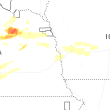
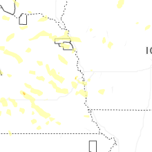
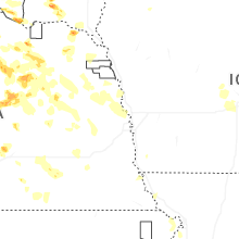

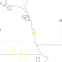


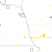


Connect with Interactive Hail Maps