

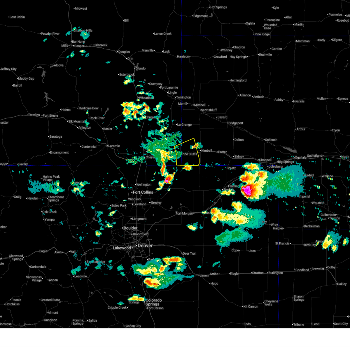
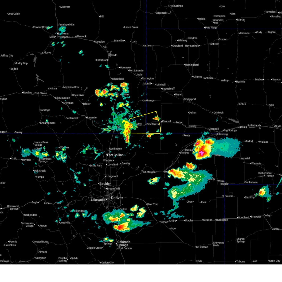
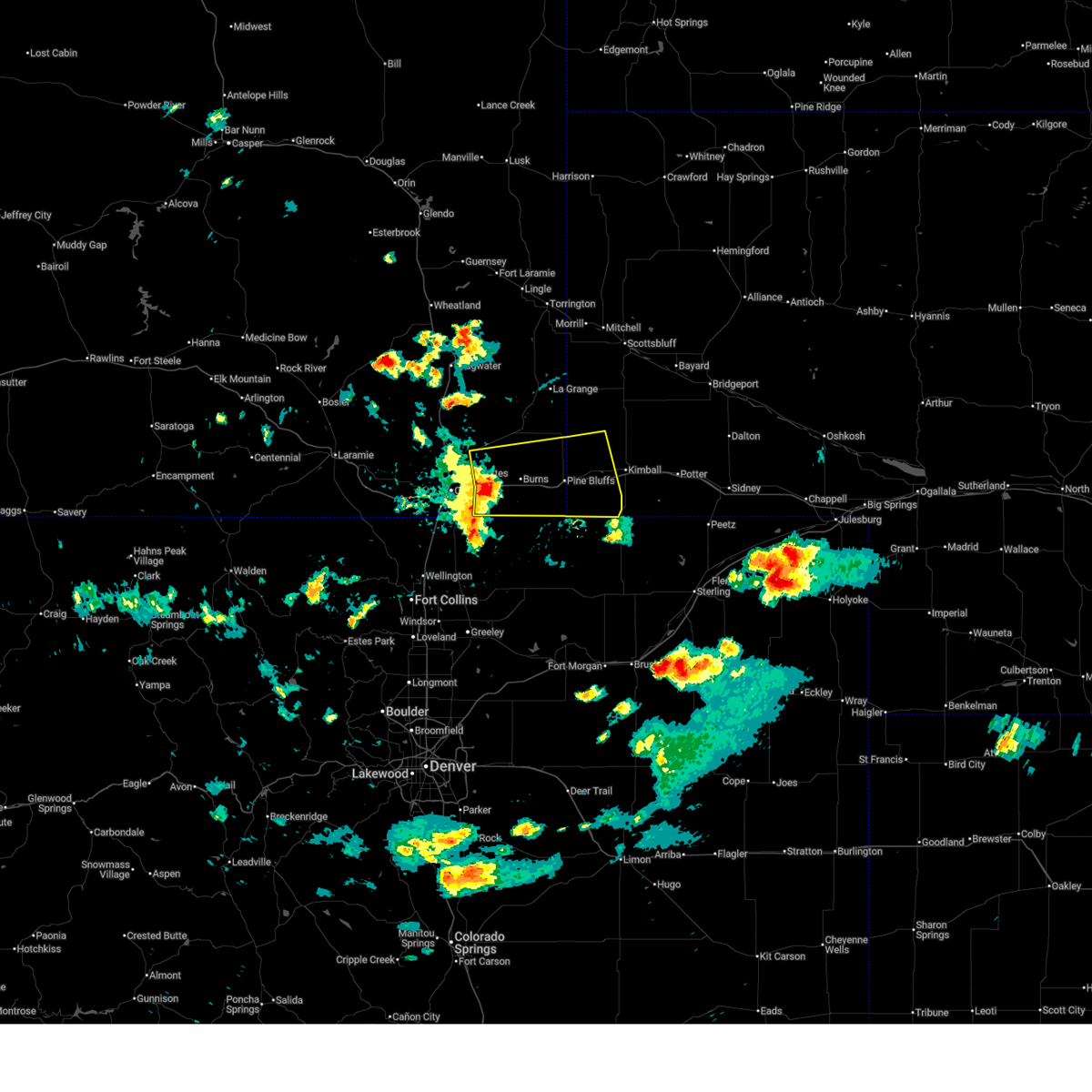
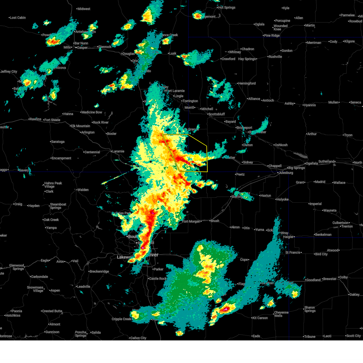
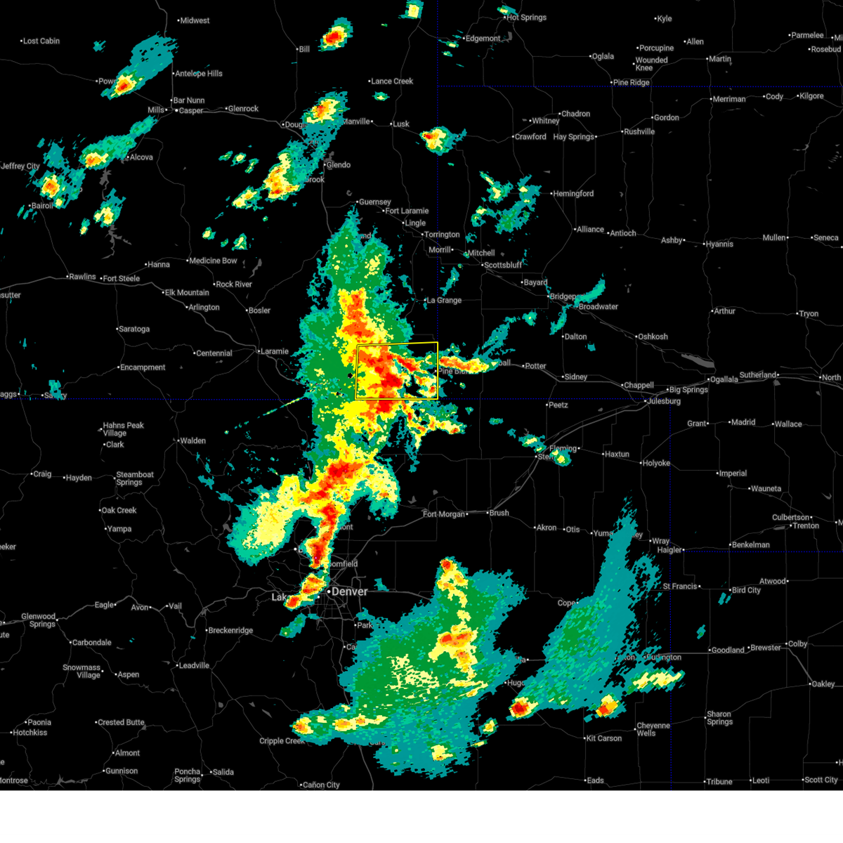
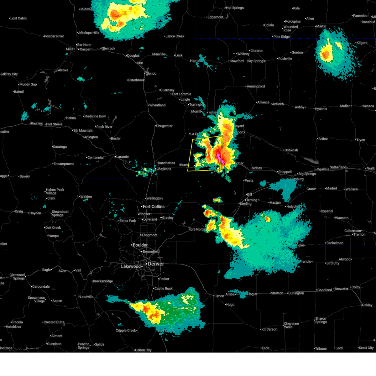
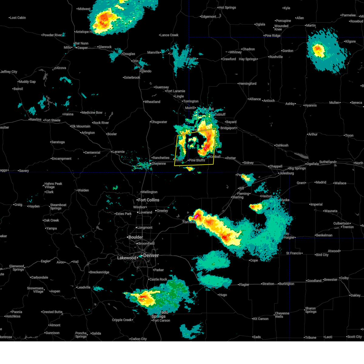
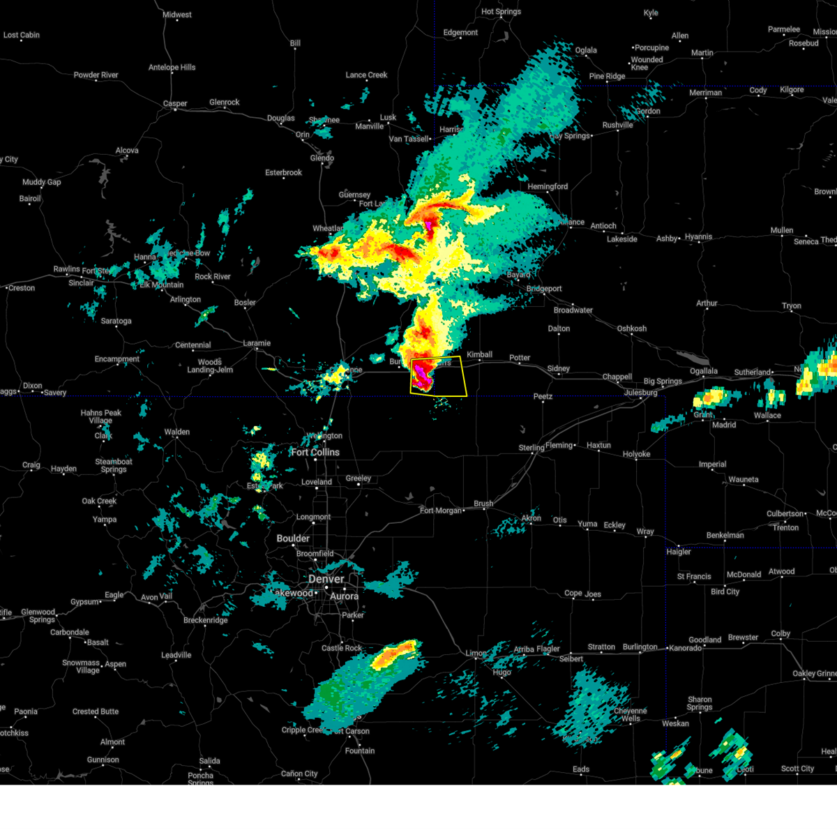
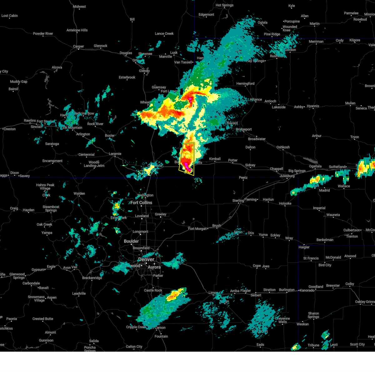
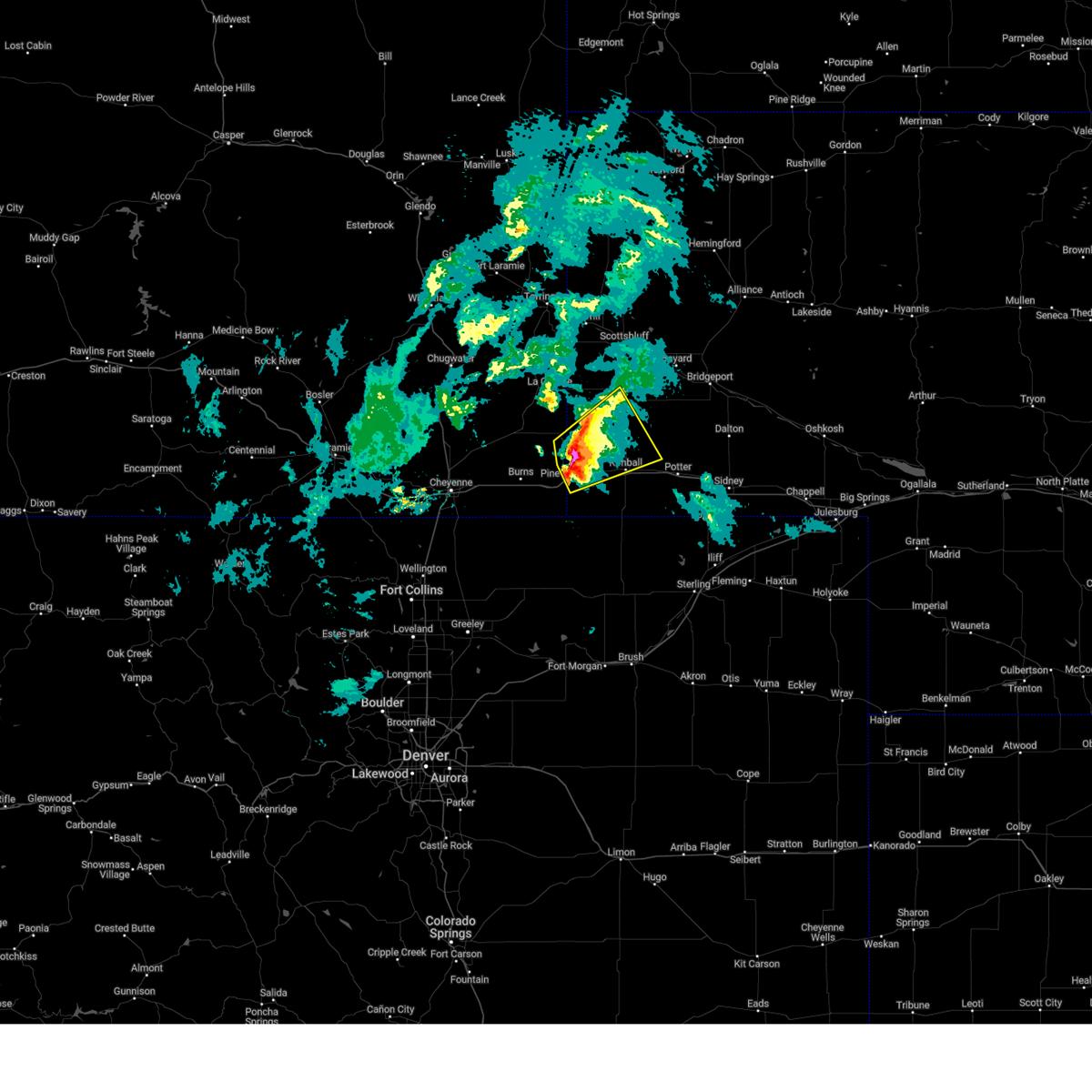
Hail Map for Pine Bluffs, WY
The Pine Bluffs, WY area has had 38 reports of on-the-ground hail by trained spotters, and has been under severe weather warnings 27 times during the past 12 months. Doppler radar has detected hail at or near Pine Bluffs, WY on 93 occasions, including 8 occasions during the past year.
| Name: | Pine Bluffs, WY |
| Where Located: | 51.7 miles SSW of Scottsbluff, NE |
| Map: | Google Map for Pine Bluffs, WY |
| Population: | 1129 |
| Housing Units: | 532 |
| More Info: | Search Google for Pine Bluffs, WY |
1
The Top Recent Hail Date for Pine Bluffs, WY is Monday, August 12, 2024 (5th out of 93)

Hail and Wind Damage Spotted near Pine Bluffs, WY
| Date / Time | Report Details |
|---|---|
| 7/6/2025 4:25 PM MDT |
 At 424 pm mdt, severe thunderstorms were located along a line extending from 7 miles south of albin to 7 miles northeast of pine bluffs municipal airport to near pine bluffs to panorama point, moving east at 40 mph (radar indicated). Hazards include 60 mph wind gusts. Expect damage to roofs, siding, and trees. Locations impacted include, pine bluffs, bushnell, panorama point, oliver reservoir, pine bluffs municipal airport, and oliver reservoir campground. At 424 pm mdt, severe thunderstorms were located along a line extending from 7 miles south of albin to 7 miles northeast of pine bluffs municipal airport to near pine bluffs to panorama point, moving east at 40 mph (radar indicated). Hazards include 60 mph wind gusts. Expect damage to roofs, siding, and trees. Locations impacted include, pine bluffs, bushnell, panorama point, oliver reservoir, pine bluffs municipal airport, and oliver reservoir campground.
|
| 7/6/2025 4:10 PM MDT |
 At 410 pm mdt, severe thunderstorms were located along a line extending from 9 miles southeast of gun barrel to near egbert to near pine bluffs municipal airport to 7 miles east of carpenter to near hereford, moving east at 40 mph (radar indicated). Hazards include 60 mph wind gusts. Expect damage to roofs, siding, and trees. Locations impacted include, pine bluffs, burns, bushnell, egbert, oliver reservoir, pine bluffs municipal airport, panorama point, carpenter, hillsdale, and oliver reservoir campground. At 410 pm mdt, severe thunderstorms were located along a line extending from 9 miles southeast of gun barrel to near egbert to near pine bluffs municipal airport to 7 miles east of carpenter to near hereford, moving east at 40 mph (radar indicated). Hazards include 60 mph wind gusts. Expect damage to roofs, siding, and trees. Locations impacted include, pine bluffs, burns, bushnell, egbert, oliver reservoir, pine bluffs municipal airport, panorama point, carpenter, hillsdale, and oliver reservoir campground.
|
| 7/6/2025 3:53 PM MDT |
 Svrcys the national weather service in cheyenne has issued a * severe thunderstorm warning for, western kimball county in the panhandle of nebraska, southwestern banner county in the panhandle of nebraska, southeastern laramie county in southeastern wyoming, * until 445 pm mdt. * at 353 pm mdt, severe thunderstorms were located along a line extending from 10 miles southwest of gun barrel to near hillsdale to near burns to near carpenter to 7 miles west of hereford, moving east at 40 mph (radar indicated). Hazards include 60 mph wind gusts. expect damage to roofs, siding, and trees Svrcys the national weather service in cheyenne has issued a * severe thunderstorm warning for, western kimball county in the panhandle of nebraska, southwestern banner county in the panhandle of nebraska, southeastern laramie county in southeastern wyoming, * until 445 pm mdt. * at 353 pm mdt, severe thunderstorms were located along a line extending from 10 miles southwest of gun barrel to near hillsdale to near burns to near carpenter to 7 miles west of hereford, moving east at 40 mph (radar indicated). Hazards include 60 mph wind gusts. expect damage to roofs, siding, and trees
|
| 6/17/2025 2:16 PM MDT | At 216 pm mdt, severe thunderstorms were located along a line extending from 7 miles south of gun barrel to 7 miles south of pine bluffs municipal airport, moving east at 30 mph (radar indicated). Hazards include 60 mph wind gusts and quarter size hail. Hail damage to vehicles is expected. expect wind damage to roofs, siding, and trees. Locations impacted include, pine bluffs, burns, egbert, carpenter, pine bluffs municipal airport, and hillsdale. |
| 6/17/2025 2:11 PM MDT |
 Svrcys the national weather service in cheyenne has issued a * severe thunderstorm warning for, western kimball county in the panhandle of nebraska, southwestern banner county in the panhandle of nebraska, eastern laramie county in southeastern wyoming, * until 245 pm mdt. * at 211 pm mdt, severe thunderstorms were located along a line extending from near gun barrel to near pine bluffs, moving northeast at 20 mph (radar indicated). Hazards include 60 mph wind gusts and quarter size hail. Hail damage to vehicles is expected. Expect wind damage to roofs, siding, and trees. Svrcys the national weather service in cheyenne has issued a * severe thunderstorm warning for, western kimball county in the panhandle of nebraska, southwestern banner county in the panhandle of nebraska, eastern laramie county in southeastern wyoming, * until 245 pm mdt. * at 211 pm mdt, severe thunderstorms were located along a line extending from near gun barrel to near pine bluffs, moving northeast at 20 mph (radar indicated). Hazards include 60 mph wind gusts and quarter size hail. Hail damage to vehicles is expected. Expect wind damage to roofs, siding, and trees.
|
| 6/17/2025 1:49 PM MDT |
 At 149 pm mdt, severe thunderstorms were located along a line extending from near hillsdale to 9 miles west of carpenter, moving east at 30 mph (radar indicated). Hazards include 60 mph wind gusts and quarter size hail. Hail damage to vehicles is expected. expect wind damage to roofs, siding, and trees. Locations impacted include, cheyenne, pine bluffs, burns, egbert, laramie county fairgrounds at archer, hillsdale, pine bluffs municipal airport, carpenter, ranchettes, grass hills, and cowboy ranch south. At 149 pm mdt, severe thunderstorms were located along a line extending from near hillsdale to 9 miles west of carpenter, moving east at 30 mph (radar indicated). Hazards include 60 mph wind gusts and quarter size hail. Hail damage to vehicles is expected. expect wind damage to roofs, siding, and trees. Locations impacted include, cheyenne, pine bluffs, burns, egbert, laramie county fairgrounds at archer, hillsdale, pine bluffs municipal airport, carpenter, ranchettes, grass hills, and cowboy ranch south.
|
| 6/17/2025 1:35 PM MDT | Svrcys the national weather service in cheyenne has issued a * severe thunderstorm warning for, southeastern laramie county in southeastern wyoming, * until 230 pm mdt. * at 135 pm mdt, severe thunderstorms were located along a line extending from 7 miles northeast of ranchettes to 8 miles south of laramie county fairgrounds at archer, moving east at 30 mph (radar indicated). Hazards include 60 mph wind gusts and penny size hail. expect damage to roofs, siding, and trees |
| 6/15/2025 6:07 PM MDT |
 The storm which prompted the warning has moved out of east laramie county. severe thunderstorm warning still active for banner and kimball county. a severe thunderstorm watch remains in effect until 1100 pm mdt for the panhandle of nebraska. to report severe weather, contact your nearest law enforcement agency. they will relay your report to the national weather service cheyenne. The storm which prompted the warning has moved out of east laramie county. severe thunderstorm warning still active for banner and kimball county. a severe thunderstorm watch remains in effect until 1100 pm mdt for the panhandle of nebraska. to report severe weather, contact your nearest law enforcement agency. they will relay your report to the national weather service cheyenne.
|
| 6/15/2025 5:44 PM MDT | the severe thunderstorm warning has been cancelled and is no longer in effect |
| 6/15/2025 5:44 PM MDT | At 543 pm mdt, a severe thunderstorm was located 7 miles northeast of albin, or 23 miles northwest of kimball, moving east at 45 mph (radar indicated). Hazards include 60 mph wind gusts and half dollar size hail. Hail damage to vehicles is expected. expect wind damage to roofs, siding, and trees. Locations impacted include, kimball, pine bluffs, albin, bushnell, oliver reservoir, pine bluffs municipal airport, harrisburg, kimball municipal airport, oliver reservoir campground, and kimball county fairgrounds. |
| 6/15/2025 5:32 PM MDT |
 Svrcys the national weather service in cheyenne has issued a * severe thunderstorm warning for, northwestern kimball county in the panhandle of nebraska, banner county in the panhandle of nebraska, southeastern goshen county in southeastern wyoming, eastern laramie county in southeastern wyoming, * until 615 pm mdt. * at 532 pm mdt, a severe thunderstorm was located near albin, or 29 miles northwest of kimball, moving east at 40 mph (radar indicated). Hazards include 60 mph wind gusts. expect damage to roofs, siding, and trees Svrcys the national weather service in cheyenne has issued a * severe thunderstorm warning for, northwestern kimball county in the panhandle of nebraska, banner county in the panhandle of nebraska, southeastern goshen county in southeastern wyoming, eastern laramie county in southeastern wyoming, * until 615 pm mdt. * at 532 pm mdt, a severe thunderstorm was located near albin, or 29 miles northwest of kimball, moving east at 40 mph (radar indicated). Hazards include 60 mph wind gusts. expect damage to roofs, siding, and trees
|
| 6/2/2025 5:15 PM MDT |
 Svrcys the national weather service in cheyenne has issued a * severe thunderstorm warning for, southwestern kimball county in the panhandle of nebraska, southeastern laramie county in southeastern wyoming, * until 600 pm mdt. * at 514 pm mdt, a severe thunderstorm was located over pine bluffs municipal airport, or 26 miles west of kimball, moving east at 20 mph (radar indicated). Hazards include golf ball size hail and 70 mph wind gusts. People and animals outdoors will be injured. expect hail damage to roofs, siding, windows, and vehicles. expect considerable tree damage. Wind damage is also likely to mobile homes, roofs, and outbuildings. Svrcys the national weather service in cheyenne has issued a * severe thunderstorm warning for, southwestern kimball county in the panhandle of nebraska, southeastern laramie county in southeastern wyoming, * until 600 pm mdt. * at 514 pm mdt, a severe thunderstorm was located over pine bluffs municipal airport, or 26 miles west of kimball, moving east at 20 mph (radar indicated). Hazards include golf ball size hail and 70 mph wind gusts. People and animals outdoors will be injured. expect hail damage to roofs, siding, windows, and vehicles. expect considerable tree damage. Wind damage is also likely to mobile homes, roofs, and outbuildings.
|
| 6/2/2025 5:11 PM MDT |
 At 511 pm mdt, severe thunderstorms were located along a line extending from near albin to 6 miles southwest of pine bluffs municipal airport, moving east at 20 mph (radar indicated). Hazards include golf ball size hail and 60 mph wind gusts. People and animals outdoors will be injured. expect hail damage to roofs, siding, windows, and vehicles. expect wind damage to roofs, siding, and trees. Locations impacted include, pine bluffs, burns, albin, egbert, and pine bluffs municipal airport. At 511 pm mdt, severe thunderstorms were located along a line extending from near albin to 6 miles southwest of pine bluffs municipal airport, moving east at 20 mph (radar indicated). Hazards include golf ball size hail and 60 mph wind gusts. People and animals outdoors will be injured. expect hail damage to roofs, siding, windows, and vehicles. expect wind damage to roofs, siding, and trees. Locations impacted include, pine bluffs, burns, albin, egbert, and pine bluffs municipal airport.
|
| 6/2/2025 4:59 PM MDT |
 At 459 pm mdt, severe thunderstorms were located along a line extending from near albin to near carpenter, moving east at 25 mph (radar indicated). Hazards include golf ball size hail and 60 mph wind gusts. People and animals outdoors will be injured. expect hail damage to roofs, siding, windows, and vehicles. expect wind damage to roofs, siding, and trees. Locations impacted include, pine bluffs, burns, albin, egbert, and pine bluffs municipal airport. At 459 pm mdt, severe thunderstorms were located along a line extending from near albin to near carpenter, moving east at 25 mph (radar indicated). Hazards include golf ball size hail and 60 mph wind gusts. People and animals outdoors will be injured. expect hail damage to roofs, siding, windows, and vehicles. expect wind damage to roofs, siding, and trees. Locations impacted include, pine bluffs, burns, albin, egbert, and pine bluffs municipal airport.
|
| 6/2/2025 4:45 PM MDT | At 444 pm mdt, severe thunderstorms were located along a line extending from gun barrel to near carpenter, moving east at 25 mph (radar indicated). Hazards include golf ball size hail and 60 mph wind gusts. People and animals outdoors will be injured. expect hail damage to roofs, siding, windows, and vehicles. expect wind damage to roofs, siding, and trees. Locations impacted include, pine bluffs, burns, albin, egbert, pine bluffs municipal airport, gun barrel, and hillsdale. |
| 6/2/2025 4:38 PM MDT |
 Svrcys the national weather service in cheyenne has issued a * severe thunderstorm warning for, southeastern laramie county in southeastern wyoming, * until 530 pm mdt. * at 438 pm mdt, severe thunderstorms were located along a line extending from gun barrel to near carpenter, moving east at 20 mph (radar indicated). Hazards include ping pong ball size hail and 60 mph wind gusts. People and animals outdoors will be injured. expect hail damage to roofs, siding, windows, and vehicles. Expect wind damage to roofs, siding, and trees. Svrcys the national weather service in cheyenne has issued a * severe thunderstorm warning for, southeastern laramie county in southeastern wyoming, * until 530 pm mdt. * at 438 pm mdt, severe thunderstorms were located along a line extending from gun barrel to near carpenter, moving east at 20 mph (radar indicated). Hazards include ping pong ball size hail and 60 mph wind gusts. People and animals outdoors will be injured. expect hail damage to roofs, siding, windows, and vehicles. Expect wind damage to roofs, siding, and trees.
|
| 5/18/2025 4:45 PM MDT |
 the severe thunderstorm warning has been cancelled and is no longer in effect the severe thunderstorm warning has been cancelled and is no longer in effect
|
| 5/18/2025 4:30 PM MDT | At 429 pm mdt, severe thunderstorms were located along a line extending from near albin to 7 miles northwest of kimball, moving north at 65 mph (radar indicated). Hazards include 70 mph wind gusts and half dollar size hail. Hail damage to vehicles is expected. expect considerable tree damage. wind damage is also likely to mobile homes, roofs, and outbuildings. Locations impacted include, kimball, pine bluffs, albin, bushnell, oliver reservoir, pine bluffs municipal airport, meriden rest area, kimball municipal airport, oliver reservoir campground, and kimball county fairgrounds. |
| 5/18/2025 4:21 PM MDT | At 421 pm mdt, severe thunderstorms were located along a line extending from 6 miles northwest of pine bluffs to 7 miles southeast of kimball municipal airport, moving north at 40 mph (radar indicated). Hazards include 70 mph wind gusts and half dollar size hail. Hail damage to vehicles is expected. expect considerable tree damage. wind damage is also likely to mobile homes, roofs, and outbuildings. Locations impacted include, kimball, pine bluffs, albin, bushnell, oliver reservoir, pine bluffs municipal airport, meriden rest area, kimball municipal airport, panorama point, oliver reservoir campground, and kimball county fairgrounds. |
| 5/18/2025 4:20 PM MDT | At 419 pm mdt, severe thunderstorms were located along a line extending from 6 miles northwest of pine bluffs to 8 miles southeast of kimball municipal airport, moving north at 40 mph (radar indicated). Hazards include 60 mph wind gusts and half dollar size hail. Hail damage to vehicles is expected. expect wind damage to roofs, siding, and trees. Locations impacted include, kimball, pine bluffs, albin, bushnell, oliver reservoir, pine bluffs municipal airport, meriden rest area, kimball municipal airport, panorama point, oliver reservoir campground, and kimball county fairgrounds. |
| 5/18/2025 4:08 PM MDT | Svrcys the national weather service in cheyenne has issued a * severe thunderstorm warning for, kimball county in the panhandle of nebraska, southern banner county in the panhandle of nebraska, eastern laramie county in southeastern wyoming, * until 500 pm mdt. * at 408 pm mdt, severe thunderstorms were located along a line extending from near pine bluffs municipal airport to 11 miles northwest of westplains, moving north at 40 mph (radar indicated). Hazards include 60 mph wind gusts and nickel size hail. expect damage to roofs, siding, and trees |
| 3/31/2025 7:13 PM MDT |
 Svrcys the national weather service in cheyenne has issued a * severe thunderstorm warning for, northern kimball county in the panhandle of nebraska, western banner county in the panhandle of nebraska, east central laramie county in southeastern wyoming, * until 745 pm mdt. * at 712 pm mdt, a severe thunderstorm was located near bushnell, or 13 miles northwest of kimball, moving northeast at 35 mph (radar indicated). Hazards include quarter size hail. damage to vehicles is expected Svrcys the national weather service in cheyenne has issued a * severe thunderstorm warning for, northern kimball county in the panhandle of nebraska, western banner county in the panhandle of nebraska, east central laramie county in southeastern wyoming, * until 745 pm mdt. * at 712 pm mdt, a severe thunderstorm was located near bushnell, or 13 miles northwest of kimball, moving northeast at 35 mph (radar indicated). Hazards include quarter size hail. damage to vehicles is expected
|
| 3/31/2025 7:11 PM MDT | Quarter sized hail reported 0.2 miles WSW of Pine Bluffs, WY |
| 8/19/2024 4:10 PM MDT | Report from mping: 3-inch diameter tree limbs broken; power poles broke in laramie county WY, 7.2 miles NNE of Pine Bluffs, WY |
| 8/19/2024 4:04 PM MDT | Corrects previous tstm wnd dmg report from 7 sw pine bluffs. report from mping: 3-inch diameter tree limbs broken; power poles broke in laramie county WY, 7.2 miles NNE of Pine Bluffs, WY |
| 8/19/2024 3:50 PM MDT |
 Svrcys the national weather service in cheyenne has issued a * severe thunderstorm warning for, southwestern kimball county in the panhandle of nebraska, southeastern laramie county in southeastern wyoming, * until 430 pm mdt. * at 350 pm mdt, a severe thunderstorm was located near pine bluffs municipal airport, or 24 miles west of kimball, moving east at 20 mph (radar indicated). Hazards include ping pong ball size hail and 60 mph wind gusts. People and animals outdoors will be injured. expect hail damage to roofs, siding, windows, and vehicles. Expect wind damage to roofs, siding, and trees. Svrcys the national weather service in cheyenne has issued a * severe thunderstorm warning for, southwestern kimball county in the panhandle of nebraska, southeastern laramie county in southeastern wyoming, * until 430 pm mdt. * at 350 pm mdt, a severe thunderstorm was located near pine bluffs municipal airport, or 24 miles west of kimball, moving east at 20 mph (radar indicated). Hazards include ping pong ball size hail and 60 mph wind gusts. People and animals outdoors will be injured. expect hail damage to roofs, siding, windows, and vehicles. Expect wind damage to roofs, siding, and trees.
|
| 8/12/2024 4:43 PM MDT |
 The storm which prompted the warning has moved out of the area. therefore, the warning will be allowed to expire. however, heavy rain is still possible with this thunderstorm. The storm which prompted the warning has moved out of the area. therefore, the warning will be allowed to expire. however, heavy rain is still possible with this thunderstorm.
|
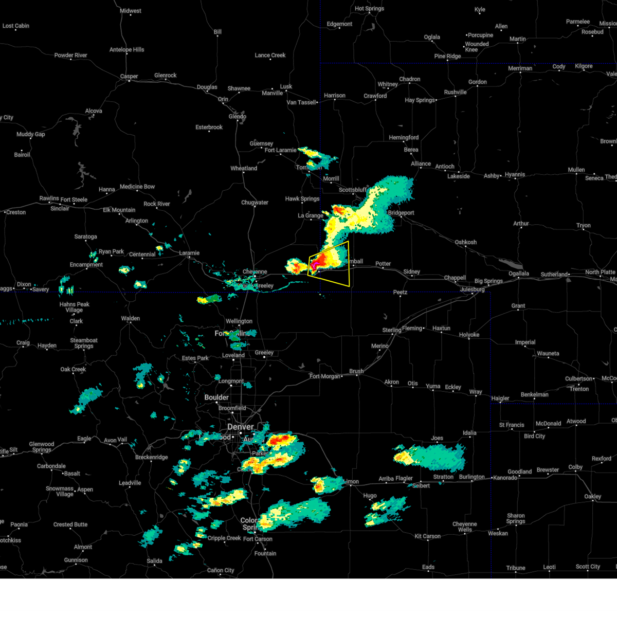
| 8/12/2024 4:16 PM MDT |
 Svrcys the national weather service in cheyenne has issued a * severe thunderstorm warning for, southwestern kimball county in the panhandle of nebraska, southeastern laramie county in southeastern wyoming, * until 445 pm mdt. * at 416 pm mdt, a severe thunderstorm was located near panorama point, or 22 miles southwest of kimball, moving southeast at 25 mph (radar indicated). Hazards include golf ball size hail and 60 mph wind gusts. People and animals outdoors will be injured. expect hail damage to roofs, siding, windows, and vehicles. Expect wind damage to roofs, siding, and trees. Svrcys the national weather service in cheyenne has issued a * severe thunderstorm warning for, southwestern kimball county in the panhandle of nebraska, southeastern laramie county in southeastern wyoming, * until 445 pm mdt. * at 416 pm mdt, a severe thunderstorm was located near panorama point, or 22 miles southwest of kimball, moving southeast at 25 mph (radar indicated). Hazards include golf ball size hail and 60 mph wind gusts. People and animals outdoors will be injured. expect hail damage to roofs, siding, windows, and vehicles. Expect wind damage to roofs, siding, and trees.
|
| 8/12/2024 4:01 PM MDT |
 At 401 pm mdt, a severe thunderstorm was located near oliver reservoir, or 8 miles west of kimball, moving east at 25 mph (radar indicated). Hazards include golf ball size hail and 60 mph wind gusts. People and animals outdoors will be injured. expect hail damage to roofs, siding, windows, and vehicles. expect wind damage to roofs, siding, and trees. Locations impacted include, pine bluffs, bushnell, oliver reservoir, pine bluffs municipal airport, and oliver reservoir campground. At 401 pm mdt, a severe thunderstorm was located near oliver reservoir, or 8 miles west of kimball, moving east at 25 mph (radar indicated). Hazards include golf ball size hail and 60 mph wind gusts. People and animals outdoors will be injured. expect hail damage to roofs, siding, windows, and vehicles. expect wind damage to roofs, siding, and trees. Locations impacted include, pine bluffs, bushnell, oliver reservoir, pine bluffs municipal airport, and oliver reservoir campground.
|
| 8/12/2024 3:56 PM MDT | Quarter sized hail reported 0.2 miles WSW of Pine Bluffs, WY, emergency manager reported 1 inch hail in pine bluffs. |
| 8/12/2024 3:53 PM MDT | Quarter sized hail reported 0.2 miles WSW of Pine Bluffs, WY, storm chaser reported 1.2 inch hail in pine bluffs. |
| 8/12/2024 3:48 PM MDT | Half Dollar sized hail reported 0.2 miles WSW of Pine Bluffs, WY, storm chaser reports half dollar sized hail in pine bluffs. |
| 8/12/2024 3:48 PM MDT | Storm chaser reports 60mph winds in pine bluff in laramie county WY, 0.2 miles WSW of Pine Bluffs, WY |
| 8/12/2024 3:38 PM MDT | Golf Ball sized hail reported 6.3 miles S of Pine Bluffs, WY, storm chaser reporting golf ball sized hail 6n of pine bluffs. |
| 8/12/2024 3:38 PM MDT |
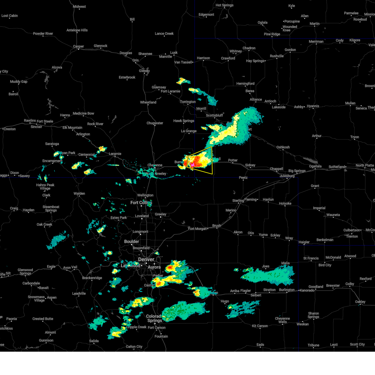
 Svrcys the national weather service in cheyenne has issued a * severe thunderstorm warning for, western kimball county in the panhandle of nebraska, southwestern banner county in the panhandle of nebraska, east central laramie county in southeastern wyoming, * until 415 pm mdt. * at 337 pm mdt, a severe thunderstorm was located near pine bluffs, or 18 miles west of kimball, moving east at 25 mph (radar indicated). Hazards include two inch hail and 60 mph wind gusts. People and animals outdoors will be injured. expect hail damage to roofs, siding, windows, and vehicles. Expect wind damage to roofs, siding, and trees. Svrcys the national weather service in cheyenne has issued a * severe thunderstorm warning for, western kimball county in the panhandle of nebraska, southwestern banner county in the panhandle of nebraska, east central laramie county in southeastern wyoming, * until 415 pm mdt. * at 337 pm mdt, a severe thunderstorm was located near pine bluffs, or 18 miles west of kimball, moving east at 25 mph (radar indicated). Hazards include two inch hail and 60 mph wind gusts. People and animals outdoors will be injured. expect hail damage to roofs, siding, windows, and vehicles. Expect wind damage to roofs, siding, and trees.
|
| 8/12/2024 3:28 PM MDT | Golf Ball sized hail reported 6.5 miles SSE of Pine Bluffs, WY, storm chaser reports 1.8 inch hail via spotter network. |
| 8/12/2024 3:10 PM MDT | Quarter sized hail reported 10 miles SSE of Pine Bluffs, WY |
| 6/20/2024 4:57 PM MDT |
 The storm which prompted the warning has weakened below severe limits, and no longer poses an immediate threat to life or property. therefore, the warning will be allowed to expire. however, small hail and heavy rain are still possible with this thunderstorm. a severe thunderstorm watch remains in effect until 700 pm mdt for southeastern wyoming. to report severe weather, contact your nearest law enforcement agency. they will relay your report to the national weather service cheyenne. The storm which prompted the warning has weakened below severe limits, and no longer poses an immediate threat to life or property. therefore, the warning will be allowed to expire. however, small hail and heavy rain are still possible with this thunderstorm. a severe thunderstorm watch remains in effect until 700 pm mdt for southeastern wyoming. to report severe weather, contact your nearest law enforcement agency. they will relay your report to the national weather service cheyenne.
|
| 6/20/2024 4:20 PM MDT |
 Svrcys the national weather service in cheyenne has issued a * severe thunderstorm warning for, southeastern laramie county in southeastern wyoming, * until 500 pm mdt. * at 420 pm mdt, a severe thunderstorm was located near carpenter, or 26 miles east of cheyenne, moving northeast at 20 mph (radar indicated). Hazards include quarter size hail. damage to vehicles is expected Svrcys the national weather service in cheyenne has issued a * severe thunderstorm warning for, southeastern laramie county in southeastern wyoming, * until 500 pm mdt. * at 420 pm mdt, a severe thunderstorm was located near carpenter, or 26 miles east of cheyenne, moving northeast at 20 mph (radar indicated). Hazards include quarter size hail. damage to vehicles is expected
|
| 6/10/2024 4:09 PM MDT |
 The storms which prompted the warning have weakened below severe limits, and have exited the warned area. therefore, the warning will be allowed to expire. however, gusty winds are still possible with these thunderstorms. a severe thunderstorm watch remains in effect until 800 pm mdt for the panhandle of nebraska, and southeastern wyoming. The storms which prompted the warning have weakened below severe limits, and have exited the warned area. therefore, the warning will be allowed to expire. however, gusty winds are still possible with these thunderstorms. a severe thunderstorm watch remains in effect until 800 pm mdt for the panhandle of nebraska, and southeastern wyoming.
|
| 6/10/2024 3:50 PM MDT |
 At 350 pm mdt, severe thunderstorms were located along a line extending from near burns to near carpenter to 6 miles west of hereford, moving east at 15 mph (radar indicated). Hazards include 60 mph wind gusts and quarter size hail. Hail damage to vehicles is expected. expect wind damage to roofs, siding, and trees. Locations impacted include, pine bluffs, burns, egbert, carpenter, and pine bluffs municipal airport. At 350 pm mdt, severe thunderstorms were located along a line extending from near burns to near carpenter to 6 miles west of hereford, moving east at 15 mph (radar indicated). Hazards include 60 mph wind gusts and quarter size hail. Hail damage to vehicles is expected. expect wind damage to roofs, siding, and trees. Locations impacted include, pine bluffs, burns, egbert, carpenter, and pine bluffs municipal airport.
|
| 6/10/2024 3:35 PM MDT |
 Svrcys the national weather service in cheyenne has issued a * severe thunderstorm warning for, southeastern laramie county in southeastern wyoming, * until 415 pm mdt. * at 334 pm mdt, severe thunderstorms were located along a line extending from near burns to 6 miles northwest of carpenter to 10 miles west of hereford, moving east at 15 mph (radar indicated). Hazards include 60 mph wind gusts and quarter size hail. Hail damage to vehicles is expected. Expect wind damage to roofs, siding, and trees. Svrcys the national weather service in cheyenne has issued a * severe thunderstorm warning for, southeastern laramie county in southeastern wyoming, * until 415 pm mdt. * at 334 pm mdt, severe thunderstorms were located along a line extending from near burns to 6 miles northwest of carpenter to 10 miles west of hereford, moving east at 15 mph (radar indicated). Hazards include 60 mph wind gusts and quarter size hail. Hail damage to vehicles is expected. Expect wind damage to roofs, siding, and trees.
|
| 6/8/2024 2:39 PM MDT |
 The storm which prompted the warning has weakened below severe limits, and no longer poses an immediate threat to life or property. therefore, the warning will be allowed to expire. however, small hail, gusty winds and heavy rain are still possible with this thunderstorm. a severe thunderstorm watch remains in effect until 700 pm mdt for southeastern wyoming. to report severe weather, contact your nearest law enforcement agency. they will relay your report to the national weather service cheyenne. The storm which prompted the warning has weakened below severe limits, and no longer poses an immediate threat to life or property. therefore, the warning will be allowed to expire. however, small hail, gusty winds and heavy rain are still possible with this thunderstorm. a severe thunderstorm watch remains in effect until 700 pm mdt for southeastern wyoming. to report severe weather, contact your nearest law enforcement agency. they will relay your report to the national weather service cheyenne.
|
| 6/8/2024 2:34 PM MDT |
 At 234 pm mdt, a severe thunderstorm was located near egbert, or 29 miles east of cheyenne, moving east at 20 mph (radar indicated). Hazards include 60 mph wind gusts and half dollar size hail. Hail damage to vehicles is expected. expect wind damage to roofs, siding, and trees. Locations impacted include, pine bluffs, burns, egbert, carpenter, and pine bluffs municipal airport. At 234 pm mdt, a severe thunderstorm was located near egbert, or 29 miles east of cheyenne, moving east at 20 mph (radar indicated). Hazards include 60 mph wind gusts and half dollar size hail. Hail damage to vehicles is expected. expect wind damage to roofs, siding, and trees. Locations impacted include, pine bluffs, burns, egbert, carpenter, and pine bluffs municipal airport.
|
| 6/8/2024 1:46 PM MDT |
 Svrcys the national weather service in cheyenne has issued a * severe thunderstorm warning for, southeastern laramie county in southeastern wyoming, * until 245 pm mdt. * at 146 pm mdt, a severe thunderstorm was located 7 miles southeast of laramie county fairgrounds at archer, or 14 miles east of cheyenne, moving east at 20 mph (radar indicated). Hazards include two inch hail and 60 mph wind gusts. People and animals outdoors will be injured. expect hail damage to roofs, siding, windows, and vehicles. Expect wind damage to roofs, siding, and trees. Svrcys the national weather service in cheyenne has issued a * severe thunderstorm warning for, southeastern laramie county in southeastern wyoming, * until 245 pm mdt. * at 146 pm mdt, a severe thunderstorm was located 7 miles southeast of laramie county fairgrounds at archer, or 14 miles east of cheyenne, moving east at 20 mph (radar indicated). Hazards include two inch hail and 60 mph wind gusts. People and animals outdoors will be injured. expect hail damage to roofs, siding, windows, and vehicles. Expect wind damage to roofs, siding, and trees.
|
| 6/8/2024 1:33 PM MDT |
 At 133 pm mdt, a severe thunderstorm was located over egbert, or 26 miles east of cheyenne, moving east at 25 mph (radar indicated). Hazards include two inch hail and 60 mph wind gusts. People and animals outdoors will be injured. expect hail damage to roofs, siding, windows, and vehicles. Locations impacted include, pine bluffs, burns, egbert, hillsdale, pine bluffs municipal airport, and carpenter. At 133 pm mdt, a severe thunderstorm was located over egbert, or 26 miles east of cheyenne, moving east at 25 mph (radar indicated). Hazards include two inch hail and 60 mph wind gusts. People and animals outdoors will be injured. expect hail damage to roofs, siding, windows, and vehicles. Locations impacted include, pine bluffs, burns, egbert, hillsdale, pine bluffs municipal airport, and carpenter.
|
| 6/8/2024 1:23 PM MDT |
 At 123 pm mdt, a severe thunderstorm was located over burns, or 22 miles east of cheyenne, moving east at 25 mph (radar indicated). Hazards include golf ball size hail and 60 mph wind gusts. People and animals outdoors will be injured. expect hail damage to roofs, siding, windows, and vehicles. expect wind damage to roofs, siding, and trees. Locations impacted include, pine bluffs, burns, egbert, hillsdale, pine bluffs municipal airport, and carpenter. At 123 pm mdt, a severe thunderstorm was located over burns, or 22 miles east of cheyenne, moving east at 25 mph (radar indicated). Hazards include golf ball size hail and 60 mph wind gusts. People and animals outdoors will be injured. expect hail damage to roofs, siding, windows, and vehicles. expect wind damage to roofs, siding, and trees. Locations impacted include, pine bluffs, burns, egbert, hillsdale, pine bluffs municipal airport, and carpenter.
|
| 6/8/2024 1:07 PM MDT |
 Svrcys the national weather service in cheyenne has issued a * severe thunderstorm warning for, southeastern laramie county in southeastern wyoming, * until 145 pm mdt. * at 107 pm mdt, a severe thunderstorm was located near hillsdale, or 15 miles east of cheyenne, moving east at 25 mph (radar indicated). Hazards include 60 mph wind gusts and quarter size hail. Hail damage to vehicles is expected. Expect wind damage to roofs, siding, and trees. Svrcys the national weather service in cheyenne has issued a * severe thunderstorm warning for, southeastern laramie county in southeastern wyoming, * until 145 pm mdt. * at 107 pm mdt, a severe thunderstorm was located near hillsdale, or 15 miles east of cheyenne, moving east at 25 mph (radar indicated). Hazards include 60 mph wind gusts and quarter size hail. Hail damage to vehicles is expected. Expect wind damage to roofs, siding, and trees.
|
| 6/2/2024 2:20 PM MDT |
 Svrcys the national weather service in cheyenne has issued a * severe thunderstorm warning for, northwestern kimball county in the panhandle of nebraska, southwestern banner county in the panhandle of nebraska, east central laramie county in southeastern wyoming, * until 300 pm mdt. * at 220 pm mdt, a severe thunderstorm was located near bushnell, or 16 miles west of kimball, moving east at 25 mph (radar indicated). Hazards include 60 mph wind gusts and quarter size hail. Hail damage to vehicles is expected. Expect wind damage to roofs, siding, and trees. Svrcys the national weather service in cheyenne has issued a * severe thunderstorm warning for, northwestern kimball county in the panhandle of nebraska, southwestern banner county in the panhandle of nebraska, east central laramie county in southeastern wyoming, * until 300 pm mdt. * at 220 pm mdt, a severe thunderstorm was located near bushnell, or 16 miles west of kimball, moving east at 25 mph (radar indicated). Hazards include 60 mph wind gusts and quarter size hail. Hail damage to vehicles is expected. Expect wind damage to roofs, siding, and trees.
|
| 6/28/2023 7:43 PM MDT |
 The severe thunderstorm warning for west central cheyenne, kimball and east central laramie counties will expire at 745 pm mdt, the storm which prompted the warning has weakened below severe limits, and has exited the warned area. therefore, the warning will be allowed to expire. however small hail, gusty winds and heavy rain are still possible with this thunderstorm. a severe thunderstorm watch remains in effect until 900 pm mdt for the panhandle of nebraska, and southeastern wyoming. to report severe weather, contact your nearest law enforcement agency. they will relay your report to the national weather service cheyenne. The severe thunderstorm warning for west central cheyenne, kimball and east central laramie counties will expire at 745 pm mdt, the storm which prompted the warning has weakened below severe limits, and has exited the warned area. therefore, the warning will be allowed to expire. however small hail, gusty winds and heavy rain are still possible with this thunderstorm. a severe thunderstorm watch remains in effect until 900 pm mdt for the panhandle of nebraska, and southeastern wyoming. to report severe weather, contact your nearest law enforcement agency. they will relay your report to the national weather service cheyenne.
|
| 6/28/2023 7:05 PM MDT |
 At 704 pm mdt, a severe thunderstorm was located near oliver campground, or 15 miles west of kimball, moving east at 20 mph (radar indicated). Hazards include 60 mph wind gusts and quarter size hail. Hail damage to vehicles is expected. expect wind damage to roofs, siding, and trees. this severe storm will be near, oliver campground around 725 pm mdt. oliver reservoir around 730 pm mdt. kimball and kimball airport around 755 pm mdt. other locations impacted by this severe thunderstorm include bushnell. this includes the following highways, interstate 80 in wyoming between mile markers 393 and 402. interstate 80 in nebraska between mile markers 1 and 43. hail threat, radar indicated max hail size, 1. 00 in wind threat, radar indicated max wind gust, 60 mph. At 704 pm mdt, a severe thunderstorm was located near oliver campground, or 15 miles west of kimball, moving east at 20 mph (radar indicated). Hazards include 60 mph wind gusts and quarter size hail. Hail damage to vehicles is expected. expect wind damage to roofs, siding, and trees. this severe storm will be near, oliver campground around 725 pm mdt. oliver reservoir around 730 pm mdt. kimball and kimball airport around 755 pm mdt. other locations impacted by this severe thunderstorm include bushnell. this includes the following highways, interstate 80 in wyoming between mile markers 393 and 402. interstate 80 in nebraska between mile markers 1 and 43. hail threat, radar indicated max hail size, 1. 00 in wind threat, radar indicated max wind gust, 60 mph.
|
| 6/28/2023 6:46 PM MDT |
 At 646 pm mdt, a severe thunderstorm was located over pine bluffs, or 20 miles west of kimball, moving east at 35 mph (radar indicated). Hazards include ping pong ball size hail and 60 mph wind gusts. People and animals outdoors will be injured. expect hail damage to roofs, siding, windows, and vehicles. expect wind damage to roofs, siding, and trees. this severe thunderstorm will be near, oliver campground and oliver reservoir around 705 pm mdt. kimball and kimball airport around 715 pm mdt. other locations impacted by this severe thunderstorm include bushnell. this includes the following highways, interstate 80 in wyoming between mile markers 393 and 402. interstate 80 in nebraska between mile markers 1 and 43. hail threat, radar indicated max hail size, 1. 50 in wind threat, radar indicated max wind gust, 60 mph. At 646 pm mdt, a severe thunderstorm was located over pine bluffs, or 20 miles west of kimball, moving east at 35 mph (radar indicated). Hazards include ping pong ball size hail and 60 mph wind gusts. People and animals outdoors will be injured. expect hail damage to roofs, siding, windows, and vehicles. expect wind damage to roofs, siding, and trees. this severe thunderstorm will be near, oliver campground and oliver reservoir around 705 pm mdt. kimball and kimball airport around 715 pm mdt. other locations impacted by this severe thunderstorm include bushnell. this includes the following highways, interstate 80 in wyoming between mile markers 393 and 402. interstate 80 in nebraska between mile markers 1 and 43. hail threat, radar indicated max hail size, 1. 50 in wind threat, radar indicated max wind gust, 60 mph.
|
| 6/28/2023 5:40 PM MDT | Grapefruit sized hail reported 8.5 miles S of Pine Bluffs, WY |
| 6/28/2023 5:39 PM MDT |
 At 537 pm mdt, a severe thunderstorm was located 9 miles south of albin, wy, oliver campground, or 15 miles northwest of kimball, moving southeast at 25 mph. this is a destructive storm for areas near albin, bushnell, and kimball (trained spotters reported up to baseball sized hail 6 miles south of albin, wy). Hazards include baseball size hail and 60 mph wind gusts. People and animals outdoors will be severely injured. expect shattered windows, extensive damage to roofs, siding, and vehicles. locations impacted include, kimball, pine bluffs, albin, oliver campground, oliver reservoir, kimball airport and bushnell. this includes the following highways, interstate 80 in wyoming between mile markers 401 and 402. Interstate 80 in nebraska between mile markers 1 and 24. At 537 pm mdt, a severe thunderstorm was located 9 miles south of albin, wy, oliver campground, or 15 miles northwest of kimball, moving southeast at 25 mph. this is a destructive storm for areas near albin, bushnell, and kimball (trained spotters reported up to baseball sized hail 6 miles south of albin, wy). Hazards include baseball size hail and 60 mph wind gusts. People and animals outdoors will be severely injured. expect shattered windows, extensive damage to roofs, siding, and vehicles. locations impacted include, kimball, pine bluffs, albin, oliver campground, oliver reservoir, kimball airport and bushnell. this includes the following highways, interstate 80 in wyoming between mile markers 401 and 402. Interstate 80 in nebraska between mile markers 1 and 24.
|
| 6/28/2023 5:26 PM MDT | Baseball sized hail reported 10.5 miles S of Pine Bluffs, WY, baseball hail reported per trained spotter. |
| 6/28/2023 5:18 PM MDT |
 At 517 pm mdt, a severe thunderstorm was located over albin, or 23 miles northwest of kimball, moving southeast at 25 mph (radar indicated). Hazards include two inch hail and 60 mph wind gusts. People and animals outdoors will be injured. expect hail damage to roofs, siding, windows, and vehicles. Expect wind damage to roofs, siding, and trees. At 517 pm mdt, a severe thunderstorm was located over albin, or 23 miles northwest of kimball, moving southeast at 25 mph (radar indicated). Hazards include two inch hail and 60 mph wind gusts. People and animals outdoors will be injured. expect hail damage to roofs, siding, windows, and vehicles. Expect wind damage to roofs, siding, and trees.
|
| 6/21/2023 4:05 PM MDT |
 At 405 pm mdt, a severe thunderstorm was located over panorama point, or 24 miles southwest of kimball, moving northeast at 10 mph (radar indicated). Hazards include 60 mph wind gusts and quarter size hail. Hail damage to vehicles is expected. expect wind damage to roofs, siding, and trees. locations impacted include, kimball, pine bluffs, oliver campground, oliver reservoir, kimball airport, panorama point and bushnell. this includes the following highways, interstate 80 in wyoming between mile markers 398 and 402. Interstate 80 in nebraska between mile markers 1 and 27. At 405 pm mdt, a severe thunderstorm was located over panorama point, or 24 miles southwest of kimball, moving northeast at 10 mph (radar indicated). Hazards include 60 mph wind gusts and quarter size hail. Hail damage to vehicles is expected. expect wind damage to roofs, siding, and trees. locations impacted include, kimball, pine bluffs, oliver campground, oliver reservoir, kimball airport, panorama point and bushnell. this includes the following highways, interstate 80 in wyoming between mile markers 398 and 402. Interstate 80 in nebraska between mile markers 1 and 27.
|
| 6/21/2023 3:39 PM MDT |
 At 338 pm mdt, severe thunderstorms were located along a line extending from 8 miles east of albin to 9 miles south of oliver campground to near panorama point, moving northeast at 20 mph (trained weather spotters). Hazards include 60 mph wind gusts and quarter size hail. Hail damage to vehicles is expected. Expect wind damage to roofs, siding, and trees. At 338 pm mdt, severe thunderstorms were located along a line extending from 8 miles east of albin to 9 miles south of oliver campground to near panorama point, moving northeast at 20 mph (trained weather spotters). Hazards include 60 mph wind gusts and quarter size hail. Hail damage to vehicles is expected. Expect wind damage to roofs, siding, and trees.
|
| 6/21/2023 3:23 PM MDT |
 At 322 pm mdt, a severe thunderstorm was located near panorama point, or 20 miles southwest of kimball, moving east at 10 mph (radar indicated). Hazards include 60 mph wind gusts and quarter size hail. Hail damage to vehicles is expected. expect wind damage to roofs, siding, and trees. locations impacted include, pine bluffs, panorama point and bushnell. this includes the following highways, interstate 80 in wyoming between mile markers 399 and 402. interstate 80 in nebraska between mile markers 1 and 11. hail threat, radar indicated max hail size, 1. 00 in wind threat, radar indicated max wind gust, 60 mph. At 322 pm mdt, a severe thunderstorm was located near panorama point, or 20 miles southwest of kimball, moving east at 10 mph (radar indicated). Hazards include 60 mph wind gusts and quarter size hail. Hail damage to vehicles is expected. expect wind damage to roofs, siding, and trees. locations impacted include, pine bluffs, panorama point and bushnell. this includes the following highways, interstate 80 in wyoming between mile markers 399 and 402. interstate 80 in nebraska between mile markers 1 and 11. hail threat, radar indicated max hail size, 1. 00 in wind threat, radar indicated max wind gust, 60 mph.
|
| 6/21/2023 2:54 PM MDT |
 At 254 pm mdt, a severe thunderstorm was located near pine bluffs, or 27 miles west of kimball, moving northeast at 10 mph (radar indicated). Hazards include 60 mph wind gusts and half dollar size hail. Hail damage to vehicles is expected. Expect wind damage to roofs, siding, and trees. At 254 pm mdt, a severe thunderstorm was located near pine bluffs, or 27 miles west of kimball, moving northeast at 10 mph (radar indicated). Hazards include 60 mph wind gusts and half dollar size hail. Hail damage to vehicles is expected. Expect wind damage to roofs, siding, and trees.
|
| 5/27/2023 6:15 PM MDT |
 At 615 pm mdt, severe thunderstorms were located along a line extending from 6 miles northeast of veteran to 9 miles east of albin to 8 miles east of panorama point, moving northeast at 35 mph (radar indicated). Hazards include 60 mph wind gusts and half dollar size hail. Hail damage to vehicles is expected. Expect wind damage to roofs, siding, and trees. At 615 pm mdt, severe thunderstorms were located along a line extending from 6 miles northeast of veteran to 9 miles east of albin to 8 miles east of panorama point, moving northeast at 35 mph (radar indicated). Hazards include 60 mph wind gusts and half dollar size hail. Hail damage to vehicles is expected. Expect wind damage to roofs, siding, and trees.
|
| 5/27/2023 6:02 PM MDT |
 At 602 pm mdt, severe thunderstorms capable of producing a tornado were located along a line extending from 6 miles north of albin to near pine bluffs, moving northeast at 40 mph (radar indicated rotation). Hazards include tornado. Flying debris will be dangerous to those caught without shelter. mobile homes will be damaged or destroyed. damage to roofs, windows, and vehicles will occur. tree damage is likely. these dangerous storms will be near, oliver campground and oliver reservoir around 615 pm mdt. this includes the following highways, interstate 80 in wyoming between mile markers 401 and 402. Interstate 80 in nebraska between mile markers 1 and 17. At 602 pm mdt, severe thunderstorms capable of producing a tornado were located along a line extending from 6 miles north of albin to near pine bluffs, moving northeast at 40 mph (radar indicated rotation). Hazards include tornado. Flying debris will be dangerous to those caught without shelter. mobile homes will be damaged or destroyed. damage to roofs, windows, and vehicles will occur. tree damage is likely. these dangerous storms will be near, oliver campground and oliver reservoir around 615 pm mdt. this includes the following highways, interstate 80 in wyoming between mile markers 401 and 402. Interstate 80 in nebraska between mile markers 1 and 17.
|
| 5/27/2023 6:00 PM MDT | Portion of manufactured building roof torn off. corrects report from 2.3 se bushnel in laramie county WY, 14.6 miles S of Pine Bluffs, WY |
| 5/27/2023 5:43 PM MDT |
 At 543 pm mdt, severe thunderstorms were located along a line extending from 8 miles southeast of gun barrel to near pine bluffs to near panorama point, moving northeast at 35 mph (radar indicated). Hazards include 70 mph wind gusts. Expect considerable tree damage. damage is likely to mobile homes, roofs, and outbuildings. locations impacted include, pine bluffs, burns, oliver campground, panorama point, oliver reservoir and bushnell. this includes the following highways, interstate 80 in wyoming between mile markers 386 and 402. Interstate 80 in nebraska between mile markers 1 and 15. At 543 pm mdt, severe thunderstorms were located along a line extending from 8 miles southeast of gun barrel to near pine bluffs to near panorama point, moving northeast at 35 mph (radar indicated). Hazards include 70 mph wind gusts. Expect considerable tree damage. damage is likely to mobile homes, roofs, and outbuildings. locations impacted include, pine bluffs, burns, oliver campground, panorama point, oliver reservoir and bushnell. this includes the following highways, interstate 80 in wyoming between mile markers 386 and 402. Interstate 80 in nebraska between mile markers 1 and 15.
|
| 5/27/2023 5:32 PM MDT |
 At 530 pm mdt, severe thunderstorms were located along a line extending from near hillsdale to near pine bluffs to near panorama point, moving northeast at 40 mph (radar indicated). Hazards include 60 mph wind gusts. expect damage to roofs, siding, and trees At 530 pm mdt, severe thunderstorms were located along a line extending from near hillsdale to near pine bluffs to near panorama point, moving northeast at 40 mph (radar indicated). Hazards include 60 mph wind gusts. expect damage to roofs, siding, and trees
|
| 5/18/2023 2:21 PM MDT |
 At 221 pm mdt, severe thunderstorms were located along a line extending from 10 miles south of albin to near pine bluffs to near panorama point, moving east at 30 mph (radar indicated). Hazards include 60 mph wind gusts and nickel size hail. Expect damage to roofs, siding, and trees. locations impacted include, kimball, pine bluffs, oliver campground, oliver reservoir, kimball airport, panorama point and bushnell. this includes the following highways, interstate 80 in wyoming between mile markers 397 and 402. interstate 80 in nebraska between mile markers 1 and 20. hail threat, radar indicated max hail size, 0. 88 in wind threat, radar indicated max wind gust, 60 mph. At 221 pm mdt, severe thunderstorms were located along a line extending from 10 miles south of albin to near pine bluffs to near panorama point, moving east at 30 mph (radar indicated). Hazards include 60 mph wind gusts and nickel size hail. Expect damage to roofs, siding, and trees. locations impacted include, kimball, pine bluffs, oliver campground, oliver reservoir, kimball airport, panorama point and bushnell. this includes the following highways, interstate 80 in wyoming between mile markers 397 and 402. interstate 80 in nebraska between mile markers 1 and 20. hail threat, radar indicated max hail size, 0. 88 in wind threat, radar indicated max wind gust, 60 mph.
|
| 5/18/2023 2:20 PM MDT | Trained storm spotter estimates 60mph wind gusts with pea sized hail... and heavy rainfall in the severe thunderstor in laramie county WY, 6.6 miles NNE of Pine Bluffs, WY |
| 5/18/2023 2:08 PM MDT |
 At 207 pm mdt, severe thunderstorms were located along a line extending from 10 miles south of albin to pine bluffs to 6 miles northwest of panorama point, moving east at 30 mph (radar indicated). Hazards include 60 mph wind gusts and nickel size hail. expect damage to roofs, siding, and trees At 207 pm mdt, severe thunderstorms were located along a line extending from 10 miles south of albin to pine bluffs to 6 miles northwest of panorama point, moving east at 30 mph (radar indicated). Hazards include 60 mph wind gusts and nickel size hail. expect damage to roofs, siding, and trees
|
| 8/2/2022 3:30 PM MDT | Upr mesonet station lndbrg (ur343) measured wind gus in laramie county WY, 10.6 miles S of Pine Bluffs, WY |
| 7/27/2022 7:10 PM MDT |
 The severe thunderstorm warning for east central laramie county will expire at 715 pm mdt, the storm which prompted the warning was moving out of the area. therefore, the warning will be allowed to expire. however small hail, gusty winds and heavy rain are still possible with this thunderstorm. The severe thunderstorm warning for east central laramie county will expire at 715 pm mdt, the storm which prompted the warning was moving out of the area. therefore, the warning will be allowed to expire. however small hail, gusty winds and heavy rain are still possible with this thunderstorm.
|
| 7/27/2022 6:55 PM MDT |
 At 653 pm mdt, a severe thunderstorm was located 8 miles south of albin, or 26 miles west of kimball, moving east at 20 mph (radar indicated. at 643 pm mdt, golf ball size hail was reported 8 miles northeast of burns). Hazards include two inch hail and 60 mph wind gusts. People and animals outdoors will be injured. expect hail damage to roofs, siding, windows, and vehicles. expect wind damage to roofs, siding, and trees. locations impacted include, pine bluffs. thunderstorm damage threat, considerable hail threat, radar indicated max hail size, 2. 00 in wind threat, radar indicated max wind gust, 60 mph. At 653 pm mdt, a severe thunderstorm was located 8 miles south of albin, or 26 miles west of kimball, moving east at 20 mph (radar indicated. at 643 pm mdt, golf ball size hail was reported 8 miles northeast of burns). Hazards include two inch hail and 60 mph wind gusts. People and animals outdoors will be injured. expect hail damage to roofs, siding, windows, and vehicles. expect wind damage to roofs, siding, and trees. locations impacted include, pine bluffs. thunderstorm damage threat, considerable hail threat, radar indicated max hail size, 2. 00 in wind threat, radar indicated max wind gust, 60 mph.
|
| 7/27/2022 6:39 PM MDT |
 At 639 pm mdt, a severe thunderstorm was located 7 miles northeast of burns, or 28 miles east of cheyenne, moving east at 20 mph (radar indicated). Hazards include golf ball size hail and 60 mph wind gusts. People and animals outdoors will be injured. expect hail damage to roofs, siding, windows, and vehicles. expect wind damage to roofs, siding, and trees. locations impacted include, pine bluffs and burns. this includes interstate 80 in wyoming between mile markers 398 and 401. thunderstorm damage threat, considerable hail threat, radar indicated max hail size, 1. 75 in wind threat, radar indicated max wind gust, 60 mph. At 639 pm mdt, a severe thunderstorm was located 7 miles northeast of burns, or 28 miles east of cheyenne, moving east at 20 mph (radar indicated). Hazards include golf ball size hail and 60 mph wind gusts. People and animals outdoors will be injured. expect hail damage to roofs, siding, windows, and vehicles. expect wind damage to roofs, siding, and trees. locations impacted include, pine bluffs and burns. this includes interstate 80 in wyoming between mile markers 398 and 401. thunderstorm damage threat, considerable hail threat, radar indicated max hail size, 1. 75 in wind threat, radar indicated max wind gust, 60 mph.
|
| 7/27/2022 6:28 PM MDT |
 At 628 pm mdt, a severe thunderstorm was located near burns, or 23 miles northeast of cheyenne, moving east at 15 mph (radar indicated). Hazards include 60 mph wind gusts and quarter size hail. Hail damage to vehicles is expected. Expect wind damage to roofs, siding, and trees. At 628 pm mdt, a severe thunderstorm was located near burns, or 23 miles northeast of cheyenne, moving east at 15 mph (radar indicated). Hazards include 60 mph wind gusts and quarter size hail. Hail damage to vehicles is expected. Expect wind damage to roofs, siding, and trees.
|
| 7/7/2022 3:57 PM MDT |
 The severe thunderstorm warning for west central kimball county will expire at 400 pm mdt, the storm which prompted the warning has weakened below severe limits, and no longer poses an immediate threat to life or property. therefore, the warning will be allowed to expire. however small hail and heavy rain are still possible with this thunderstorm. The severe thunderstorm warning for west central kimball county will expire at 400 pm mdt, the storm which prompted the warning has weakened below severe limits, and no longer poses an immediate threat to life or property. therefore, the warning will be allowed to expire. however small hail and heavy rain are still possible with this thunderstorm.
|
| 7/7/2022 3:49 PM MDT |
 At 348 pm mdt, a severe thunderstorm was located near pine bluffs, or 16 miles west of kimball, moving northeast at 15 mph (radar indicated). Hazards include quarter size hail. Damage to vehicles is expected. locations impacted include, pine bluffs, oliver campground, oliver reservoir and bushnell. this includes interstate 80 in nebraska between mile markers 1 and 13. hail threat, radar indicated max hail size, 1. 00 in wind threat, radar indicated max wind gust, <50 mph. At 348 pm mdt, a severe thunderstorm was located near pine bluffs, or 16 miles west of kimball, moving northeast at 15 mph (radar indicated). Hazards include quarter size hail. Damage to vehicles is expected. locations impacted include, pine bluffs, oliver campground, oliver reservoir and bushnell. this includes interstate 80 in nebraska between mile markers 1 and 13. hail threat, radar indicated max hail size, 1. 00 in wind threat, radar indicated max wind gust, <50 mph.
|
| 7/7/2022 3:18 PM MDT |
 At 318 pm mdt, a severe thunderstorm was located near pine bluffs, or 19 miles west of kimball, moving east at 15 mph (radar indicated). Hazards include quarter size hail. damage to vehicles is expected At 318 pm mdt, a severe thunderstorm was located near pine bluffs, or 19 miles west of kimball, moving east at 15 mph (radar indicated). Hazards include quarter size hail. damage to vehicles is expected
|
| 6/17/2022 2:40 AM MDT | Storm damage reported in banner county NE, 25.7 miles S of Pine Bluffs, WY |
| 6/17/2022 2:22 AM MDT |
 At 221 am mdt, severe thunderstorms were located along a line extending from 6 miles south of albin to near oliver campground to 6 miles northwest of westplains, moving east at 30 mph (radar indicated). Hazards include 60 mph wind gusts. Expect damage to roofs, siding, and trees. locations impacted include, kimball, pine bluffs, oliver campground, oliver reservoir, kimball airport and bushnell. this includes the following highways, interstate 80 in wyoming between mile markers 389 and 402. interstate 80 in nebraska between mile markers 1 and 29. hail threat, radar indicated max hail size, <. 75 in wind threat, radar indicated max wind gust, 60 mph. At 221 am mdt, severe thunderstorms were located along a line extending from 6 miles south of albin to near oliver campground to 6 miles northwest of westplains, moving east at 30 mph (radar indicated). Hazards include 60 mph wind gusts. Expect damage to roofs, siding, and trees. locations impacted include, kimball, pine bluffs, oliver campground, oliver reservoir, kimball airport and bushnell. this includes the following highways, interstate 80 in wyoming between mile markers 389 and 402. interstate 80 in nebraska between mile markers 1 and 29. hail threat, radar indicated max hail size, <. 75 in wind threat, radar indicated max wind gust, 60 mph.
|
| 6/17/2022 1:54 AM MDT |
 At 154 am mdt, severe thunderstorms were located along a line extending from near burns to near pine bluffs to 11 miles north of stoneham, moving northeast at 30 mph (radar indicated). Hazards include 60 mph wind gusts. expect damage to roofs, siding, and trees At 154 am mdt, severe thunderstorms were located along a line extending from near burns to near pine bluffs to 11 miles north of stoneham, moving northeast at 30 mph (radar indicated). Hazards include 60 mph wind gusts. expect damage to roofs, siding, and trees
|
| 6/12/2022 4:28 PM MDT |
 At 428 pm mdt, a severe thunderstorm was located near pine bluffs, or 18 miles west of kimball, moving east at 20 mph (radar indicated). Hazards include ping pong ball size hail and 60 mph wind gusts. People and animals outdoors will be injured. expect hail damage to roofs, siding, windows, and vehicles. expect wind damage to roofs, siding, and trees. locations impacted include, pine bluffs, oliver campground, oliver reservoir and bushnell. this includes the following highways, interstate 80 in wyoming between mile markers 398 and 402. interstate 80 in nebraska between mile markers 1 and 13. hail threat, radar indicated max hail size, 1. 50 in wind threat, radar indicated max wind gust, 60 mph. At 428 pm mdt, a severe thunderstorm was located near pine bluffs, or 18 miles west of kimball, moving east at 20 mph (radar indicated). Hazards include ping pong ball size hail and 60 mph wind gusts. People and animals outdoors will be injured. expect hail damage to roofs, siding, windows, and vehicles. expect wind damage to roofs, siding, and trees. locations impacted include, pine bluffs, oliver campground, oliver reservoir and bushnell. this includes the following highways, interstate 80 in wyoming between mile markers 398 and 402. interstate 80 in nebraska between mile markers 1 and 13. hail threat, radar indicated max hail size, 1. 50 in wind threat, radar indicated max wind gust, 60 mph.
|
| 6/12/2022 4:08 PM MDT |
 At 407 pm mdt, a severe thunderstorm was located over pine bluffs, or 24 miles west of kimball, moving east at 20 mph (radar indicated). Hazards include ping pong ball size hail and 60 mph wind gusts. People and animals outdoors will be injured. expect hail damage to roofs, siding, windows, and vehicles. Expect wind damage to roofs, siding, and trees. At 407 pm mdt, a severe thunderstorm was located over pine bluffs, or 24 miles west of kimball, moving east at 20 mph (radar indicated). Hazards include ping pong ball size hail and 60 mph wind gusts. People and animals outdoors will be injured. expect hail damage to roofs, siding, windows, and vehicles. Expect wind damage to roofs, siding, and trees.
|
| 6/12/2022 3:35 PM MDT |
 At 335 pm mdt, a severe thunderstorm was located near burns, or 25 miles east of cheyenne, moving east at 20 mph (radar indicated). Hazards include ping pong ball size hail and 60 mph wind gusts. People and animals outdoors will be injured. expect hail damage to roofs, siding, windows, and vehicles. Expect wind damage to roofs, siding, and trees. At 335 pm mdt, a severe thunderstorm was located near burns, or 25 miles east of cheyenne, moving east at 20 mph (radar indicated). Hazards include ping pong ball size hail and 60 mph wind gusts. People and animals outdoors will be injured. expect hail damage to roofs, siding, windows, and vehicles. Expect wind damage to roofs, siding, and trees.
|
| 6/3/2022 3:26 PM MDT | Quarter sized hail reported 0.2 miles WSW of Pine Bluffs, WY |
| 6/3/2022 3:24 PM MDT |
 At 323 pm mdt, severe thunderstorms were located along a line extending from 7 miles northwest of oliver campground to 6 miles southeast of pine bluffs to near hereford, moving east at 30 mph (radar indicated). Hazards include 60 mph wind gusts and half dollar size hail. Hail damage to vehicles is expected. Expect wind damage to roofs, siding, and trees. At 323 pm mdt, severe thunderstorms were located along a line extending from 7 miles northwest of oliver campground to 6 miles southeast of pine bluffs to near hereford, moving east at 30 mph (radar indicated). Hazards include 60 mph wind gusts and half dollar size hail. Hail damage to vehicles is expected. Expect wind damage to roofs, siding, and trees.
|
| 5/29/2022 3:11 PM MDT |
 At 311 pm mdt, severe thunderstorms were located along a line extending from 10 miles southeast of lance creek to near stegall to 7 miles northeast of panorama point, moving northeast at 40 mph (radar indicated). Hazards include 60 mph wind gusts and penny size hail. expect damage to roofs, siding, and trees At 311 pm mdt, severe thunderstorms were located along a line extending from 10 miles southeast of lance creek to near stegall to 7 miles northeast of panorama point, moving northeast at 40 mph (radar indicated). Hazards include 60 mph wind gusts and penny size hail. expect damage to roofs, siding, and trees
|
| 9/3/2021 5:03 PM MDT |
 At 503 pm mdt, severe thunderstorms were located along a line extending from 10 miles northeast of hillsdale to near burns to 8 miles west of carpenter to 9 miles southeast of south greeley, moving east at 15 mph (radar indicated). Hazards include 60 mph wind gusts and quarter size hail. Hail damage to vehicles is expected. expect wind damage to roofs, siding, and trees. locations impacted include, pine bluffs, burns and carpenter. this includes interstate 80 in wyoming between mile markers 379 and 402. hail threat, radar indicated max hail size, 1. 00 in wind threat, radar indicated max wind gust, 60 mph. At 503 pm mdt, severe thunderstorms were located along a line extending from 10 miles northeast of hillsdale to near burns to 8 miles west of carpenter to 9 miles southeast of south greeley, moving east at 15 mph (radar indicated). Hazards include 60 mph wind gusts and quarter size hail. Hail damage to vehicles is expected. expect wind damage to roofs, siding, and trees. locations impacted include, pine bluffs, burns and carpenter. this includes interstate 80 in wyoming between mile markers 379 and 402. hail threat, radar indicated max hail size, 1. 00 in wind threat, radar indicated max wind gust, 60 mph.
|
| 9/3/2021 4:45 PM MDT |
 At 444 pm mdt, severe thunderstorms were located along a line extending from 7 miles north of burns to near hillsdale to 12 miles east of cheyenne to near south greeley, moving east at 15 mph (radar indicated). Hazards include 60 mph wind gusts and half dollar size hail. Hail damage to vehicles is expected. Expect wind damage to roofs, siding, and trees. At 444 pm mdt, severe thunderstorms were located along a line extending from 7 miles north of burns to near hillsdale to 12 miles east of cheyenne to near south greeley, moving east at 15 mph (radar indicated). Hazards include 60 mph wind gusts and half dollar size hail. Hail damage to vehicles is expected. Expect wind damage to roofs, siding, and trees.
|
| 7/9/2021 2:51 PM MDT |
 At 251 pm mdt, a severe thunderstorm was located near albin, or 29 miles west of kimball, moving southeast at 25 mph (radar indicated). Hazards include 60 mph wind gusts and half dollar size hail. Hail damage to vehicles is expected. Expect wind damage to roofs, siding, and trees. At 251 pm mdt, a severe thunderstorm was located near albin, or 29 miles west of kimball, moving southeast at 25 mph (radar indicated). Hazards include 60 mph wind gusts and half dollar size hail. Hail damage to vehicles is expected. Expect wind damage to roofs, siding, and trees.
|
| 7/9/2021 2:39 PM MDT |
 At 238 pm mdt, a severe thunderstorm was located near pine bluffs, or 15 miles west of kimball, moving east at 45 mph (trained weather spotters. quarter sized hail was reported in pine bluffs with this storm). Hazards include 60 mph wind gusts and quarter size hail. Hail damage to vehicles is expected. expect wind damage to roofs, siding, and trees. locations impacted include, pine bluffs, oliver campground, oliver reservoir and bushnell. this includes the following highways, interstate 80 in wyoming between mile markers 398 and 402. Interstate 80 in nebraska between mile markers 1 and 19. At 238 pm mdt, a severe thunderstorm was located near pine bluffs, or 15 miles west of kimball, moving east at 45 mph (trained weather spotters. quarter sized hail was reported in pine bluffs with this storm). Hazards include 60 mph wind gusts and quarter size hail. Hail damage to vehicles is expected. expect wind damage to roofs, siding, and trees. locations impacted include, pine bluffs, oliver campground, oliver reservoir and bushnell. this includes the following highways, interstate 80 in wyoming between mile markers 398 and 402. Interstate 80 in nebraska between mile markers 1 and 19.
|
| 7/9/2021 2:37 PM MDT | Quarter sized hail reported 0.2 miles WSW of Pine Bluffs, WY |
| 7/9/2021 2:30 PM MDT | Quarter sized hail reported 0.2 miles WSW of Pine Bluffs, WY |
| 7/9/2021 2:20 PM MDT |
 At 219 pm mdt, a severe thunderstorm was located near burns, or 25 miles east of cheyenne, moving east at 45 mph (radar indicated). Hazards include 60 mph wind gusts and quarter size hail. Hail damage to vehicles is expected. Expect wind damage to roofs, siding, and trees. At 219 pm mdt, a severe thunderstorm was located near burns, or 25 miles east of cheyenne, moving east at 45 mph (radar indicated). Hazards include 60 mph wind gusts and quarter size hail. Hail damage to vehicles is expected. Expect wind damage to roofs, siding, and trees.
|
| 6/17/2021 5:15 PM MDT | Received reports of trees down (some appeared to be pine trees) and heavy outdoor table flipped and blown across yar in laramie county WY, 0.2 miles WSW of Pine Bluffs, WY |
| 6/8/2021 11:58 PM MDT |
 The severe thunderstorm warning for kimball and southeastern laramie counties will expire at midnight mdt, the storms which prompted the warning have weakened below severe limits, and no longer pose an immediate threat to life or property. therefore, the warning will be allowed to expire. however gusty winds and heavy rain are still possible with these thunderstorms. The severe thunderstorm warning for kimball and southeastern laramie counties will expire at midnight mdt, the storms which prompted the warning have weakened below severe limits, and no longer pose an immediate threat to life or property. therefore, the warning will be allowed to expire. however gusty winds and heavy rain are still possible with these thunderstorms.
|
| 6/8/2021 11:44 PM MDT |
 At 1144 pm mdt, severe thunderstorms were located along a line extending from 7 miles south of harrisburg to pine bluffs, moving east at 25 mph (radar indicated). Hazards include 60 mph wind gusts and quarter size hail. Hail damage to vehicles is expected. expect wind damage to roofs, siding, and trees. locations impacted include, kimball, pine bluffs, oliver campground, oliver reservoir, kimball airport and bushnell. this includes the following highways, interstate 80 in wyoming between mile markers 397 and 402. Interstate 80 in nebraska between mile markers 1 and 25. At 1144 pm mdt, severe thunderstorms were located along a line extending from 7 miles south of harrisburg to pine bluffs, moving east at 25 mph (radar indicated). Hazards include 60 mph wind gusts and quarter size hail. Hail damage to vehicles is expected. expect wind damage to roofs, siding, and trees. locations impacted include, kimball, pine bluffs, oliver campground, oliver reservoir, kimball airport and bushnell. this includes the following highways, interstate 80 in wyoming between mile markers 397 and 402. Interstate 80 in nebraska between mile markers 1 and 25.
|
| 6/8/2021 11:15 PM MDT |
 At 1115 pm mdt, severe thunderstorms were located along a line extending from 10 miles east of albin to 6 miles southeast of burns, moving east at 25 mph (radar indicated). Hazards include 60 mph wind gusts and quarter size hail. Hail damage to vehicles is expected. expect wind damage to roofs, siding, and trees. severe thunderstorms will be near, pine bluffs around 1145 pm mdt. oliver campground and oliver reservoir around 1200 am mdt. other locations impacted by these severe thunderstorms include bushnell. this includes the following highways, interstate 80 in wyoming between mile markers 389 and 402. Interstate 80 in nebraska between mile markers 1 and 25. At 1115 pm mdt, severe thunderstorms were located along a line extending from 10 miles east of albin to 6 miles southeast of burns, moving east at 25 mph (radar indicated). Hazards include 60 mph wind gusts and quarter size hail. Hail damage to vehicles is expected. expect wind damage to roofs, siding, and trees. severe thunderstorms will be near, pine bluffs around 1145 pm mdt. oliver campground and oliver reservoir around 1200 am mdt. other locations impacted by these severe thunderstorms include bushnell. this includes the following highways, interstate 80 in wyoming between mile markers 389 and 402. Interstate 80 in nebraska between mile markers 1 and 25.
|
| 6/8/2021 10:51 PM MDT |
 At 1050 pm mdt, severe thunderstorms were located along a line extending from near the intersection of highway 385 and 92 to 6 miles west of gurley to near dix to 7 miles south of oliver reservoir, moving east at 30 mph (radar indicated). Hazards include 60 mph wind gusts and quarter size hail. Hail damage to vehicles is expected. expect wind damage to roofs, siding, and trees. these severe storms will be near, the intersection of highway 385 and 92 and court house and jail rocks around 1055 pm mdt. dalton around 1100 pm mdt. kimball around 1105 pm mdt. brownson around 1125 pm mdt. other locations impacted by these severe thunderstorms include bushnell. this includes the following highways, interstate 80 in wyoming between mile markers 385 and 402. Interstate 80 in nebraska between mile markers 1 and 55. At 1050 pm mdt, severe thunderstorms were located along a line extending from near the intersection of highway 385 and 92 to 6 miles west of gurley to near dix to 7 miles south of oliver reservoir, moving east at 30 mph (radar indicated). Hazards include 60 mph wind gusts and quarter size hail. Hail damage to vehicles is expected. expect wind damage to roofs, siding, and trees. these severe storms will be near, the intersection of highway 385 and 92 and court house and jail rocks around 1055 pm mdt. dalton around 1100 pm mdt. kimball around 1105 pm mdt. brownson around 1125 pm mdt. other locations impacted by these severe thunderstorms include bushnell. this includes the following highways, interstate 80 in wyoming between mile markers 385 and 402. Interstate 80 in nebraska between mile markers 1 and 55.
|
| 6/8/2021 10:26 PM MDT | Quarter sized hail reported 0.2 miles WSW of Pine Bluffs, WY |
| 6/8/2021 10:26 PM MDT |
 At 1025 pm mdt, severe thunderstorms were located along a line extending from near redington to 6 miles north of potter to kimball airport to near pine bluffs, moving east at 30 mph. a second severe thunderstorm was located near burns wyoming, also moving east at 30 mph (radar indicated). Hazards include 60 mph wind gusts and quarter size hail. Hail damage to vehicles is expected. Expect wind damage to roofs, siding, and trees. At 1025 pm mdt, severe thunderstorms were located along a line extending from near redington to 6 miles north of potter to kimball airport to near pine bluffs, moving east at 30 mph. a second severe thunderstorm was located near burns wyoming, also moving east at 30 mph (radar indicated). Hazards include 60 mph wind gusts and quarter size hail. Hail damage to vehicles is expected. Expect wind damage to roofs, siding, and trees.
|
| 6/8/2021 9:03 PM MDT |
 At 903 pm mdt, severe thunderstorms were located along a line extending from 6 miles southeast of la grange to 6 miles southeast of albin to pine bluffs, moving east at 30 mph (radar indicated). Hazards include 70 mph wind gusts and penny size hail. Expect considerable tree damage. Damage is likely to mobile homes, roofs, and outbuildings. At 903 pm mdt, severe thunderstorms were located along a line extending from 6 miles southeast of la grange to 6 miles southeast of albin to pine bluffs, moving east at 30 mph (radar indicated). Hazards include 70 mph wind gusts and penny size hail. Expect considerable tree damage. Damage is likely to mobile homes, roofs, and outbuildings.
|
| 6/6/2021 5:21 PM MDT |
 At 521 pm mdt, a severe thunderstorm was located near panorama point, or 22 miles southwest of kimball, moving east at 15 mph (radar indicated). Hazards include 60 mph wind gusts and half dollar size hail. Hail damage to vehicles is expected. Expect wind damage to roofs, siding, and trees. At 521 pm mdt, a severe thunderstorm was located near panorama point, or 22 miles southwest of kimball, moving east at 15 mph (radar indicated). Hazards include 60 mph wind gusts and half dollar size hail. Hail damage to vehicles is expected. Expect wind damage to roofs, siding, and trees.
|
| 7/19/2020 3:50 PM MDT |
 At 350 pm mdt, a severe thunderstorm was located near pine bluffs, or 18 miles west of kimball, moving east at 25 mph (radar indicated). Hazards include 60 mph wind gusts and quarter size hail. Hail damage to vehicles is expected. expect wind damage to roofs, siding, and trees. locations impacted include, pine bluffs, oliver campground, panorama point, oliver reservoir and bushnell. this includes the following highways, interstate 80 in wyoming between mile markers 392 and 402. Interstate 80 in nebraska between mile markers 1 and 18. At 350 pm mdt, a severe thunderstorm was located near pine bluffs, or 18 miles west of kimball, moving east at 25 mph (radar indicated). Hazards include 60 mph wind gusts and quarter size hail. Hail damage to vehicles is expected. expect wind damage to roofs, siding, and trees. locations impacted include, pine bluffs, oliver campground, panorama point, oliver reservoir and bushnell. this includes the following highways, interstate 80 in wyoming between mile markers 392 and 402. Interstate 80 in nebraska between mile markers 1 and 18.
|
| 7/19/2020 3:35 PM MDT |
 At 334 pm mdt, a severe thunderstorm was located near pine bluffs, or 26 miles west of kimball, moving east at 25 mph (radar indicated). Hazards include 60 mph wind gusts and quarter size hail. Hail damage to vehicles is expected. Expect wind damage to roofs, siding, and trees. At 334 pm mdt, a severe thunderstorm was located near pine bluffs, or 26 miles west of kimball, moving east at 25 mph (radar indicated). Hazards include 60 mph wind gusts and quarter size hail. Hail damage to vehicles is expected. Expect wind damage to roofs, siding, and trees.
|
| 7/13/2020 5:09 PM MDT |
 The severe thunderstorm warning for western kimball, southwestern banner and eastern laramie counties will expire at 515 pm mdt, the storms which prompted the warning have weakened below severe limits, and no longer pose an immediate threat to life or property. therefore, the warning will be allowed to expire. The severe thunderstorm warning for western kimball, southwestern banner and eastern laramie counties will expire at 515 pm mdt, the storms which prompted the warning have weakened below severe limits, and no longer pose an immediate threat to life or property. therefore, the warning will be allowed to expire.
|
| 7/13/2020 4:44 PM MDT |
 At 444 pm mdt, severe thunderstorms were located along a line extending from near meriden rest area to 10 miles east of rockport, moving east at 45 mph (radar indicated). Hazards include 60 mph wind gusts and penny size hail. Expect damage to roofs, siding, and trees. these severe thunderstorms will remain over mainly rural areas of western kimball, southwestern banner and eastern laramie counties. this includes the following highways, interstate 80 in wyoming between mile markers 376 and 402. Interstate 80 in nebraska between mile markers 1 and 5. At 444 pm mdt, severe thunderstorms were located along a line extending from near meriden rest area to 10 miles east of rockport, moving east at 45 mph (radar indicated). Hazards include 60 mph wind gusts and penny size hail. Expect damage to roofs, siding, and trees. these severe thunderstorms will remain over mainly rural areas of western kimball, southwestern banner and eastern laramie counties. this includes the following highways, interstate 80 in wyoming between mile markers 376 and 402. Interstate 80 in nebraska between mile markers 1 and 5.
|
| 7/3/2020 6:39 PM MDT |
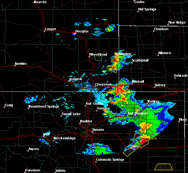 At 638 pm mdt, severe thunderstorms were located along a line extending from near pine bluffs to near grover, moving southeast at 15 mph (radar indicated). Hazards include ping pong ball size hail and 60 mph wind gusts. People and animals outdoors will be injured. expect hail damage to roofs, siding, windows, and vehicles. Expect wind damage to roofs, siding, and trees. At 638 pm mdt, severe thunderstorms were located along a line extending from near pine bluffs to near grover, moving southeast at 15 mph (radar indicated). Hazards include ping pong ball size hail and 60 mph wind gusts. People and animals outdoors will be injured. expect hail damage to roofs, siding, windows, and vehicles. Expect wind damage to roofs, siding, and trees.
|
| 6/6/2020 4:56 PM MDT |
 At 455 pm mdt, severe thunderstorms were located along a line extending from near meriden rest area to near grover, moving northeast at 60 mph (radar indicated). Hazards include 70 mph wind gusts. Expect considerable tree damage. Damage is likely to mobile homes, roofs, and outbuildings. At 455 pm mdt, severe thunderstorms were located along a line extending from near meriden rest area to near grover, moving northeast at 60 mph (radar indicated). Hazards include 70 mph wind gusts. Expect considerable tree damage. Damage is likely to mobile homes, roofs, and outbuildings.
|
| 6/6/2020 4:55 PM MDT | Awos station k82v pine bluffs airport - 82 in laramie county WY, 3.5 miles NE of Pine Bluffs, WY |
| 6/6/2020 4:30 PM MDT |
 At 429 pm mdt, a severe thunderstorm was located 8 miles northwest of hillsdale, or 16 miles northeast of cheyenne, moving northeast at 60 mph (radar indicated). Hazards include 70 mph wind gusts. Expect considerable tree damage. damage is likely to mobile homes, roofs, and outbuildings. locations impacted include, pine bluffs, la grange, albin, hawk springs campground, hawk springs recreation area, meriden rest area, gun barrel and carpenter. This includes interstate 80 in wyoming between mile markers 388 and 402. At 429 pm mdt, a severe thunderstorm was located 8 miles northwest of hillsdale, or 16 miles northeast of cheyenne, moving northeast at 60 mph (radar indicated). Hazards include 70 mph wind gusts. Expect considerable tree damage. damage is likely to mobile homes, roofs, and outbuildings. locations impacted include, pine bluffs, la grange, albin, hawk springs campground, hawk springs recreation area, meriden rest area, gun barrel and carpenter. This includes interstate 80 in wyoming between mile markers 388 and 402.
|
| 6/6/2020 4:23 PM MDT |
 At 422 pm mdt, a severe thunderstorm was located 7 miles east of ranchettes, or 8 miles northeast of cheyenne, moving northeast at 60 mph (radar indicated). Hazards include 60 mph wind gusts. expect damage to roofs, siding, and trees At 422 pm mdt, a severe thunderstorm was located 7 miles east of ranchettes, or 8 miles northeast of cheyenne, moving northeast at 60 mph (radar indicated). Hazards include 60 mph wind gusts. expect damage to roofs, siding, and trees
|
| 6/3/2020 4:12 PM MDT |
 The severe thunderstorm warning for northwestern kimball and east central laramie counties will expire at 415 pm mdt, the storm which prompted the warning has weakened below severe limits, and no longer poses an immediate threat to life or property. therefore, the warning will be allowed to expire. however gusty winds are still possible with this thunderstorm and a special weather statement has been issued in its stead. The severe thunderstorm warning for northwestern kimball and east central laramie counties will expire at 415 pm mdt, the storm which prompted the warning has weakened below severe limits, and no longer poses an immediate threat to life or property. therefore, the warning will be allowed to expire. however gusty winds are still possible with this thunderstorm and a special weather statement has been issued in its stead.
|
| 6/3/2020 4:07 PM MDT |
 At 407 pm mdt, a severe thunderstorm was located over oliver campground, or 9 miles west of kimball, moving east at 45 mph (radar indicated). Hazards include 60 mph wind gusts and penny size hail. Expect damage to roofs, siding, and trees. locations impacted include, pine bluffs, oliver campground, oliver reservoir, kimball airport and bushnell. this includes the following highways, interstate 80 in wyoming between mile markers 400 and 402. Interstate 80 in nebraska between mile markers 1 and 20. At 407 pm mdt, a severe thunderstorm was located over oliver campground, or 9 miles west of kimball, moving east at 45 mph (radar indicated). Hazards include 60 mph wind gusts and penny size hail. Expect damage to roofs, siding, and trees. locations impacted include, pine bluffs, oliver campground, oliver reservoir, kimball airport and bushnell. this includes the following highways, interstate 80 in wyoming between mile markers 400 and 402. Interstate 80 in nebraska between mile markers 1 and 20.
|
| 6/3/2020 3:59 PM MDT |
 At 340 pm mdt, a severe thunderstorm was located 7 miles east of burns, or 29 miles west of kimball, moving east at 40 mph (radar indicated). Hazards include 70 mph wind gusts and penny size hail. Expect considerable tree damage. Damage is likely to mobile homes, roofs, and outbuildings. At 340 pm mdt, a severe thunderstorm was located 7 miles east of burns, or 29 miles west of kimball, moving east at 40 mph (radar indicated). Hazards include 70 mph wind gusts and penny size hail. Expect considerable tree damage. Damage is likely to mobile homes, roofs, and outbuildings.
|
| 6/3/2020 3:59 PM MDT |
 At 358 pm mdt, a severe thunderstorm was located near pine bluffs, or 16 miles west of kimball, moving east at 45 mph (radar indicated). Hazards include 70 mph wind gusts and penny size hail. Expect considerable tree damage. damage is likely to mobile homes, roofs, and outbuildings. locations impacted include, pine bluffs, oliver campground, oliver reservoir, kimball airport and bushnell. this includes the following highways, interstate 80 in wyoming between mile markers 394 and 402. Interstate 80 in nebraska between mile markers 1 and 20. At 358 pm mdt, a severe thunderstorm was located near pine bluffs, or 16 miles west of kimball, moving east at 45 mph (radar indicated). Hazards include 70 mph wind gusts and penny size hail. Expect considerable tree damage. damage is likely to mobile homes, roofs, and outbuildings. locations impacted include, pine bluffs, oliver campground, oliver reservoir, kimball airport and bushnell. this includes the following highways, interstate 80 in wyoming between mile markers 394 and 402. Interstate 80 in nebraska between mile markers 1 and 20.
|
| 6/3/2020 3:40 PM MDT |
 At 340 pm mdt, a severe thunderstorm was located 7 miles east of burns, or 29 miles west of kimball, moving east at 40 mph (radar indicated). Hazards include 70 mph wind gusts and penny size hail. Expect considerable tree damage. Damage is likely to mobile homes, roofs, and outbuildings. At 340 pm mdt, a severe thunderstorm was located 7 miles east of burns, or 29 miles west of kimball, moving east at 40 mph (radar indicated). Hazards include 70 mph wind gusts and penny size hail. Expect considerable tree damage. Damage is likely to mobile homes, roofs, and outbuildings.
|
| 5/31/2020 4:56 PM MDT |
 At 456 pm mdt, severe thunderstorms were located along a line extending from near albin to near pine bluffs, moving east at 20 mph (radar indicated). Hazards include 60 mph wind gusts and penny size hail. Expect damage to roofs, siding, and trees. locations impacted include, pine bluffs. this includes the following highways, interstate 80 in wyoming between mile markers 389 and 402. Interstate 80 in nebraska between mile markers 1 and 7. At 456 pm mdt, severe thunderstorms were located along a line extending from near albin to near pine bluffs, moving east at 20 mph (radar indicated). Hazards include 60 mph wind gusts and penny size hail. Expect damage to roofs, siding, and trees. locations impacted include, pine bluffs. this includes the following highways, interstate 80 in wyoming between mile markers 389 and 402. Interstate 80 in nebraska between mile markers 1 and 7.
|
| 5/31/2020 4:41 PM MDT |
 At 440 pm mdt, severe thunderstorms were located along a line extending from 8 miles southwest of albin to near burns, moving east at 20 mph (radar indicated). Hazards include 60 mph wind gusts and penny size hail. expect damage to roofs, siding, and trees At 440 pm mdt, severe thunderstorms were located along a line extending from 8 miles southwest of albin to near burns, moving east at 20 mph (radar indicated). Hazards include 60 mph wind gusts and penny size hail. expect damage to roofs, siding, and trees
|
| 8/22/2019 4:15 PM MDT |
 At 409 pm mdt, trained weather spotters reported golf ball size hail 8 miles south-southwest of pine bluffs. a severe thunderstorm was located near panorama point, or 27 miles southwest of kimball, moving east at 10 mph (trained weather spotters). Hazards include ping pong ball size hail. People and animals outdoors will be injured. expect damage to roofs, siding, windows, and vehicles. locations impacted include, pine bluffs and panorama point. this includes the following highways, interstate 80 in wyoming between mile markers 391 and 402. Interstate 80 in nebraska between mile markers 1 and 5. At 409 pm mdt, trained weather spotters reported golf ball size hail 8 miles south-southwest of pine bluffs. a severe thunderstorm was located near panorama point, or 27 miles southwest of kimball, moving east at 10 mph (trained weather spotters). Hazards include ping pong ball size hail. People and animals outdoors will be injured. expect damage to roofs, siding, windows, and vehicles. locations impacted include, pine bluffs and panorama point. this includes the following highways, interstate 80 in wyoming between mile markers 391 and 402. Interstate 80 in nebraska between mile markers 1 and 5.
|
| 8/22/2019 4:03 PM MDT |
 At 403 pm mdt, a severe thunderstorm was located 7 miles northwest of panorama point, or 28 miles southwest of kimball, moving east at 10 mph (radar indicated). Hazards include half dollar size hail. damage to vehicles is expected At 403 pm mdt, a severe thunderstorm was located 7 miles northwest of panorama point, or 28 miles southwest of kimball, moving east at 10 mph (radar indicated). Hazards include half dollar size hail. damage to vehicles is expected
|
| 8/20/2019 11:22 PM MDT |
 At 1121 pm mdt, severe thunderstorms were located along a line extending from near box butte dam to near hillsdale, moving east at 15 mph. a meteorologist at kneb reports large trees down in scotts bluff county. one tree had a diameter of 3 feet (trained weather spotters). Hazards include 70 mph wind gusts and half dollar size hail. Hail damage to vehicles is expected. expect considerable tree damage. wind damage is also likely to mobile homes, roofs, and outbuildings. locations impacted include, alliance, kimball, bridgeport, bayard, pine bluffs, minatare, hemingford, dix, albin, oliver campground, northport, angora, oliver reservoir, court house and jail rocks, harrisburg, berea, wild horse butte, chimney rock state park, bridgeport state recreation area and kilpatrick lake. this includes the following highways, interstate 80 in wyoming between mile markers 390 and 402. Interstate 80 in nebraska between mile markers 1 and 33. At 1121 pm mdt, severe thunderstorms were located along a line extending from near box butte dam to near hillsdale, moving east at 15 mph. a meteorologist at kneb reports large trees down in scotts bluff county. one tree had a diameter of 3 feet (trained weather spotters). Hazards include 70 mph wind gusts and half dollar size hail. Hail damage to vehicles is expected. expect considerable tree damage. wind damage is also likely to mobile homes, roofs, and outbuildings. locations impacted include, alliance, kimball, bridgeport, bayard, pine bluffs, minatare, hemingford, dix, albin, oliver campground, northport, angora, oliver reservoir, court house and jail rocks, harrisburg, berea, wild horse butte, chimney rock state park, bridgeport state recreation area and kilpatrick lake. this includes the following highways, interstate 80 in wyoming between mile markers 390 and 402. Interstate 80 in nebraska between mile markers 1 and 33.
|
| 8/20/2019 11:09 PM MDT |
 At 1108 pm mdt, severe thunderstorms were located along a line extending from near box butte dam to 6 miles west of hillsdale, moving south at 15 mph. at 11 pm mdt, a trained spotter reported half dollar size hail in albin (trained weather spotters). Hazards include 70 mph wind gusts and half dollar size hail. Hail damage to vehicles is expected. expect considerable tree damage. wind damage is also likely to mobile homes, roofs, and outbuildings. locations impacted include, scottsbluff, alliance, kimball, gering, bridgeport, bayard, terrytown, pine bluffs, minatare, hemingford, burns, dix, albin, oliver campground, wildcat hills state recreation area, northport, angora, wildcat hills campground, box butte dam and oliver reservoir. this includes the following highways, interstate 80 in wyoming between mile markers 388 and 402. Interstate 80 in nebraska between mile markers 1 and 33. At 1108 pm mdt, severe thunderstorms were located along a line extending from near box butte dam to 6 miles west of hillsdale, moving south at 15 mph. at 11 pm mdt, a trained spotter reported half dollar size hail in albin (trained weather spotters). Hazards include 70 mph wind gusts and half dollar size hail. Hail damage to vehicles is expected. expect considerable tree damage. wind damage is also likely to mobile homes, roofs, and outbuildings. locations impacted include, scottsbluff, alliance, kimball, gering, bridgeport, bayard, terrytown, pine bluffs, minatare, hemingford, burns, dix, albin, oliver campground, wildcat hills state recreation area, northport, angora, wildcat hills campground, box butte dam and oliver reservoir. this includes the following highways, interstate 80 in wyoming between mile markers 388 and 402. Interstate 80 in nebraska between mile markers 1 and 33.
|
| 8/20/2019 11:00 PM MDT |
 At 1050 pm mdt, severe thunderstorms were located along a line extending from 7 miles north of box butte campground to 8 miles northwest of hillsdale, moving south at 15 mph (radar indicated). Hazards include 70 mph wind gusts and quarter size hail. Hail damage to vehicles is expected. expect considerable tree damage. Wind damage is also likely to mobile homes, roofs, and outbuildings. At 1050 pm mdt, severe thunderstorms were located along a line extending from 7 miles north of box butte campground to 8 miles northwest of hillsdale, moving south at 15 mph (radar indicated). Hazards include 70 mph wind gusts and quarter size hail. Hail damage to vehicles is expected. expect considerable tree damage. Wind damage is also likely to mobile homes, roofs, and outbuildings.
|
| 8/20/2019 11:00 PM MDT |
 At 1059 pm mdt, severe thunderstorms were located along a line extending from 6 miles north of box butte campground to 7 miles west of hillsdale, moving south at 15 mph. at 1044 pm mdt, the scottsbluff airport asos measured a gust to 73 mph (radar indicated). Hazards include 70 mph wind gusts and quarter size hail. Hail damage to vehicles is expected. expect considerable tree damage. wind damage is also likely to mobile homes, roofs, and outbuildings. locations impacted include, scottsbluff, alliance, kimball, gering, mitchell, bridgeport, bayard, terrytown, pine bluffs, minatare, hemingford, la grange, burns, dix, albin, oliver campground, wildcat hills state recreation area, northport, angora and wildcat hills campground. this includes the following highways, interstate 80 in wyoming between mile markers 387 and 402. Interstate 80 in nebraska between mile markers 1 and 33. At 1059 pm mdt, severe thunderstorms were located along a line extending from 6 miles north of box butte campground to 7 miles west of hillsdale, moving south at 15 mph. at 1044 pm mdt, the scottsbluff airport asos measured a gust to 73 mph (radar indicated). Hazards include 70 mph wind gusts and quarter size hail. Hail damage to vehicles is expected. expect considerable tree damage. wind damage is also likely to mobile homes, roofs, and outbuildings. locations impacted include, scottsbluff, alliance, kimball, gering, mitchell, bridgeport, bayard, terrytown, pine bluffs, minatare, hemingford, la grange, burns, dix, albin, oliver campground, wildcat hills state recreation area, northport, angora and wildcat hills campground. this includes the following highways, interstate 80 in wyoming between mile markers 387 and 402. Interstate 80 in nebraska between mile markers 1 and 33.
|
| 8/20/2019 10:50 PM MDT |
 The national weather service in cheyenne has issued a * severe thunderstorm warning for. box butte county in the panhandle of nebraska. scotts bluff county in the panhandle of nebraska. northwestern cheyenne county in the panhandle of nebraska. Kimball county in the panhandle of nebraska. The national weather service in cheyenne has issued a * severe thunderstorm warning for. box butte county in the panhandle of nebraska. scotts bluff county in the panhandle of nebraska. northwestern cheyenne county in the panhandle of nebraska. Kimball county in the panhandle of nebraska.
|
| 8/1/2019 8:54 PM MDT |
 At 853 pm mdt, a severe thunderstorm was located over pine bluffs, or 21 miles west of kimball, moving northeast at 20 mph (radar indicated). Hazards include golf ball size hail and 60 mph wind gusts. People and animals outdoors will be injured. expect hail damage to roofs, siding, windows, and vehicles. expect wind damage to roofs, siding, and trees. locations impacted include, pine bluffs and bushnell. this includes the following highways, interstate 80 in wyoming between mile markers 399 and 402. Interstate 80 in nebraska between mile markers 1 and 5. At 853 pm mdt, a severe thunderstorm was located over pine bluffs, or 21 miles west of kimball, moving northeast at 20 mph (radar indicated). Hazards include golf ball size hail and 60 mph wind gusts. People and animals outdoors will be injured. expect hail damage to roofs, siding, windows, and vehicles. expect wind damage to roofs, siding, and trees. locations impacted include, pine bluffs and bushnell. this includes the following highways, interstate 80 in wyoming between mile markers 399 and 402. Interstate 80 in nebraska between mile markers 1 and 5.
|
| 8/1/2019 8:35 PM MDT |
 At 835 pm mdt, a severe thunderstorm was located near pine bluffs, or 25 miles west of kimball, moving northeast at 15 mph (radar indicated). Hazards include golf ball size hail and 60 mph wind gusts. People and animals outdoors will be injured. expect hail damage to roofs, siding, windows, and vehicles. Expect wind damage to roofs, siding, and trees. At 835 pm mdt, a severe thunderstorm was located near pine bluffs, or 25 miles west of kimball, moving northeast at 15 mph (radar indicated). Hazards include golf ball size hail and 60 mph wind gusts. People and animals outdoors will be injured. expect hail damage to roofs, siding, windows, and vehicles. Expect wind damage to roofs, siding, and trees.
|
| 7/6/2019 10:24 PM MDT |
 At 1023 pm mdt, severe thunderstorms were located along a line extending from 6 miles southwest of harrisburg to 8 miles northeast of panorama point, moving east at 35 mph (radar indicated). Hazards include 70 mph wind gusts. Expect considerable tree damage. damage is likely to mobile homes, roofs, and outbuildings. locations impacted include, kimball, pine bluffs, dix, oliver campground, oliver reservoir, kimball airport, harrisburg and bushnell. This includes interstate 80 in nebraska between mile markers 1 and 30. At 1023 pm mdt, severe thunderstorms were located along a line extending from 6 miles southwest of harrisburg to 8 miles northeast of panorama point, moving east at 35 mph (radar indicated). Hazards include 70 mph wind gusts. Expect considerable tree damage. damage is likely to mobile homes, roofs, and outbuildings. locations impacted include, kimball, pine bluffs, dix, oliver campground, oliver reservoir, kimball airport, harrisburg and bushnell. This includes interstate 80 in nebraska between mile markers 1 and 30.
|
| 7/6/2019 10:22 PM MDT |
 A severe thunderstorm warning remains in effect until 1045 pm mdt for kimball. southern banner and southeastern laramie counties. at 1022 pm mdt, severe thunderstorms were located along a line extending from 6 miles southwest of harrisburg to 7 miles northeast of panorama point, moving east at 35 mph. hazard. 70 mph wind gusts. A severe thunderstorm warning remains in effect until 1045 pm mdt for kimball. southern banner and southeastern laramie counties. at 1022 pm mdt, severe thunderstorms were located along a line extending from 6 miles southwest of harrisburg to 7 miles northeast of panorama point, moving east at 35 mph. hazard. 70 mph wind gusts.
|
| 7/6/2019 9:58 PM MDT |
 At 958 pm mdt, severe thunderstorms were located along a line extending from near albin to 7 miles west of panorama point, moving east at 35 mph (radar indicated). Hazards include 70 mph wind gusts. Expect considerable tree damage. Damage is likely to mobile homes, roofs, and outbuildings. At 958 pm mdt, severe thunderstorms were located along a line extending from near albin to 7 miles west of panorama point, moving east at 35 mph (radar indicated). Hazards include 70 mph wind gusts. Expect considerable tree damage. Damage is likely to mobile homes, roofs, and outbuildings.
|
| 7/6/2019 9:47 PM MDT |
 At 946 pm mdt, a severe thunderstorm was located 8 miles south of albin, or 26 miles west of kimball, moving east at 25 mph (trained weather spotters). Hazards include 70 mph wind gusts. Expect considerable tree damage. damage is likely to mobile homes, roofs, and outbuildings. locations impacted include, pine bluffs and albin. this includes the following highways, interstate 80 in wyoming near mile marker 402. Interstate 80 in nebraska between mile markers 1 and 3. At 946 pm mdt, a severe thunderstorm was located 8 miles south of albin, or 26 miles west of kimball, moving east at 25 mph (trained weather spotters). Hazards include 70 mph wind gusts. Expect considerable tree damage. damage is likely to mobile homes, roofs, and outbuildings. locations impacted include, pine bluffs and albin. this includes the following highways, interstate 80 in wyoming near mile marker 402. Interstate 80 in nebraska between mile markers 1 and 3.
|
| 7/6/2019 9:28 PM MDT |
 At 928 pm mdt, a severe thunderstorm was located 8 miles north of burns, or 27 miles northeast of cheyenne, moving east at 25 mph (trained weather spotters). Hazards include 60 mph wind gusts. expect damage to roofs, siding, and trees At 928 pm mdt, a severe thunderstorm was located 8 miles north of burns, or 27 miles northeast of cheyenne, moving east at 25 mph (trained weather spotters). Hazards include 60 mph wind gusts. expect damage to roofs, siding, and trees
|
| 7/6/2019 9:14 PM MDT |
 At 914 pm mdt, a severe thunderstorm was located over burns, or 21 miles east of cheyenne, moving east at 35 mph (radar indicated). Hazards include 60 mph wind gusts and half dollar size hail. Hail damage to vehicles is expected. expect wind damage to roofs, siding, and trees. locations impacted include, pine bluffs, burns and hillsdale. This includes interstate 80 in wyoming between mile markers 383 and 400. At 914 pm mdt, a severe thunderstorm was located over burns, or 21 miles east of cheyenne, moving east at 35 mph (radar indicated). Hazards include 60 mph wind gusts and half dollar size hail. Hail damage to vehicles is expected. expect wind damage to roofs, siding, and trees. locations impacted include, pine bluffs, burns and hillsdale. This includes interstate 80 in wyoming between mile markers 383 and 400.
|
| 7/6/2019 8:56 PM MDT |
 At 856 pm mdt, a severe thunderstorm was located near hillsdale, or 14 miles northeast of cheyenne, moving east at 35 mph (radar indicated). Hazards include 60 mph wind gusts and half dollar size hail. Hail damage to vehicles is expected. Expect wind damage to roofs, siding, and trees. At 856 pm mdt, a severe thunderstorm was located near hillsdale, or 14 miles northeast of cheyenne, moving east at 35 mph (radar indicated). Hazards include 60 mph wind gusts and half dollar size hail. Hail damage to vehicles is expected. Expect wind damage to roofs, siding, and trees.
|
| 6/3/2019 5:14 PM MDT | Quarter sized hail reported 6.6 miles NNE of Pine Bluffs, WY, slight accumulation of hail on intersection of roads 161 & 206. |
| 6/3/2019 4:31 PM MDT |
 At 431 pm mdt, a severe thunderstorm was located over pine bluffs, or 22 miles west of kimball, moving northeast at 25 mph (trained weather spotters reported quarter sized hail south of pine bluffs at 4:21). Hazards include 60 mph wind gusts and quarter size hail. Hail damage to vehicles is expected. expect wind damage to roofs, siding, and trees. locations impacted include, pine bluffs and panorama point. this includes the following highways, interstate 80 in wyoming between mile markers 392 and 402. Interstate 80 in nebraska between mile markers 1 and 4. At 431 pm mdt, a severe thunderstorm was located over pine bluffs, or 22 miles west of kimball, moving northeast at 25 mph (trained weather spotters reported quarter sized hail south of pine bluffs at 4:21). Hazards include 60 mph wind gusts and quarter size hail. Hail damage to vehicles is expected. expect wind damage to roofs, siding, and trees. locations impacted include, pine bluffs and panorama point. this includes the following highways, interstate 80 in wyoming between mile markers 392 and 402. Interstate 80 in nebraska between mile markers 1 and 4.
|
| 6/3/2019 4:21 PM MDT | Quarter sized hail reported 6.6 miles NNE of Pine Bluffs, WY, half inch to slightly larger than quarter sized hail. |
| 6/3/2019 4:15 PM MDT |
 At 414 pm mdt, a severe thunderstorm was located 8 miles northwest of panorama point, or 29 miles southwest of kimball, moving northeast at 25 mph (radar indicated). Hazards include quarter size hail. damage to vehicles is expected At 414 pm mdt, a severe thunderstorm was located 8 miles northwest of panorama point, or 29 miles southwest of kimball, moving northeast at 25 mph (radar indicated). Hazards include quarter size hail. damage to vehicles is expected
|
| 6/2/2019 5:51 PM MDT |
 The severe thunderstorm warning for west central kimball and southeastern laramie counties will expire at 600 pm mdt, the severe thunderstorm which prompted the warning has weakened. therefore, the warning will be allowed to expire. heavy rain will continue with this storm. urban and small stream flooding is likely. a severe thunderstorm watch remains in effect until 800 pm mdt for southeastern wyoming. a severe thunderstorm watch also remains in effect until 1100 pm mdt for the panhandle of nebraska. The severe thunderstorm warning for west central kimball and southeastern laramie counties will expire at 600 pm mdt, the severe thunderstorm which prompted the warning has weakened. therefore, the warning will be allowed to expire. heavy rain will continue with this storm. urban and small stream flooding is likely. a severe thunderstorm watch remains in effect until 800 pm mdt for southeastern wyoming. a severe thunderstorm watch also remains in effect until 1100 pm mdt for the panhandle of nebraska.
|
| 6/2/2019 5:31 PM MDT |
 At 525 pm mdt, a severe thunderstorm was located over carpenter, or 27 miles east of cheyenne, moving northeast at 20 mph (radar indicated). Hazards include 60 mph wind gusts and quarter size hail. Hail damage to vehicles is expected. Expect wind damage to roofs, siding, and trees. At 525 pm mdt, a severe thunderstorm was located over carpenter, or 27 miles east of cheyenne, moving northeast at 20 mph (radar indicated). Hazards include 60 mph wind gusts and quarter size hail. Hail damage to vehicles is expected. Expect wind damage to roofs, siding, and trees.
|
| 5/26/2019 3:04 AM MDT |
 At 303 am mdt, a severe thunderstorm was located 7 miles south of albin, or 20 miles west of kimball, moving northeast at 20 mph (radar indicated). Hazards include half dollar size hail. Damage to vehicles is possible. locations impacted include, bushnell. This includes interstate 80 in nebraska between mile markers 1 and 4. At 303 am mdt, a severe thunderstorm was located 7 miles south of albin, or 20 miles west of kimball, moving northeast at 20 mph (radar indicated). Hazards include half dollar size hail. Damage to vehicles is possible. locations impacted include, bushnell. This includes interstate 80 in nebraska between mile markers 1 and 4.
|
| 5/26/2019 2:43 AM MDT |
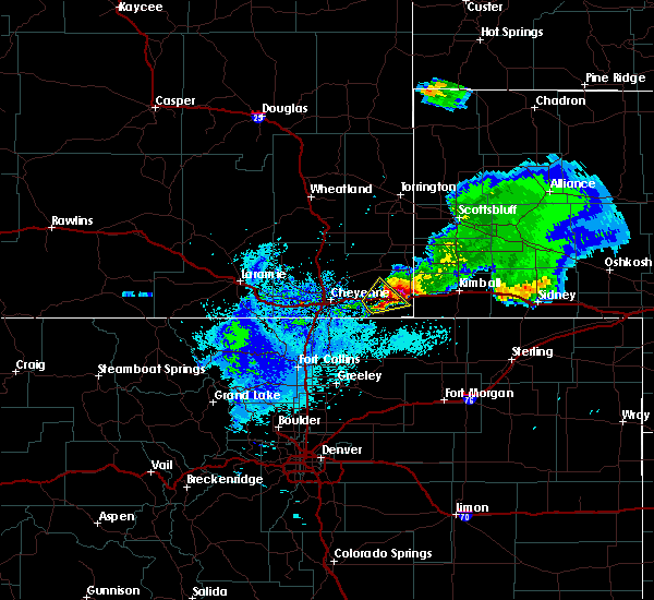 At 240 am mdt, a severe thunderstorm was located near pine bluffs, or 25 miles west of kimball, moving northeast at 25 mph. this storm has a history of producing a large amount of hail as it moved northeast through the burns area (radar indicated). Hazards include half dollar size hail. damage to vehicles is possible At 240 am mdt, a severe thunderstorm was located near pine bluffs, or 25 miles west of kimball, moving northeast at 25 mph. this storm has a history of producing a large amount of hail as it moved northeast through the burns area (radar indicated). Hazards include half dollar size hail. damage to vehicles is possible
|
| 5/17/2019 3:25 PM MDT | Quarter sized hail reported 17 miles NW of Pine Bluffs, WY |
| 5/17/2019 3:08 PM MDT |
 The severe thunderstorm warning for west central kimball and southeastern laramie counties will expire at 315 pm mdt, the storm which prompted the warning has weakened below severe limits, and no longer poses an immediate threat to life or property. therefore, the warning will be allowed to expire. however small hail is still possible with this thunderstorm. a severe thunderstorm watch remains in effect until 800 pm mdt for the panhandle of nebraska, and southeastern wyoming. The severe thunderstorm warning for west central kimball and southeastern laramie counties will expire at 315 pm mdt, the storm which prompted the warning has weakened below severe limits, and no longer poses an immediate threat to life or property. therefore, the warning will be allowed to expire. however small hail is still possible with this thunderstorm. a severe thunderstorm watch remains in effect until 800 pm mdt for the panhandle of nebraska, and southeastern wyoming.
|
| 5/17/2019 2:59 PM MDT |
 At 247 pm mdt, trained spotters reported golf ball size hail just south of interstate 80 and southeast of burns. a severe thunderstorm was located 7 miles west of pine bluffs, or 28 miles west of kimball, moving northeast at 25 mph (trained weather spotters). Hazards include golf ball size hail and 60 mph wind gusts. People and animals outdoors will be injured. expect hail damage to roofs, siding, windows, and vehicles. expect wind damage to roofs, siding, and trees. locations impacted include, pine bluffs and burns. this includes the following highways, interstate 80 in wyoming between mile markers 385 and 402. Interstate 80 in nebraska between mile markers 1 and 6. At 247 pm mdt, trained spotters reported golf ball size hail just south of interstate 80 and southeast of burns. a severe thunderstorm was located 7 miles west of pine bluffs, or 28 miles west of kimball, moving northeast at 25 mph (trained weather spotters). Hazards include golf ball size hail and 60 mph wind gusts. People and animals outdoors will be injured. expect hail damage to roofs, siding, windows, and vehicles. expect wind damage to roofs, siding, and trees. locations impacted include, pine bluffs and burns. this includes the following highways, interstate 80 in wyoming between mile markers 385 and 402. Interstate 80 in nebraska between mile markers 1 and 6.
|
| 5/17/2019 2:59 PM MDT |
 At 248 pm mdt, a trained spotter reported golf ball size hail 7 miles southeast of burns. a severe thunderstorm was located over pine bluffs, or 23 miles west of kimball, moving northeast at 25 mph (trained weather spotters). Hazards include golf ball size hail and 60 mph wind gusts. People and animals outdoors will be injured. expect hail damage to roofs, siding, windows, and vehicles. expect wind damage to roofs, siding, and trees. locations impacted include, pine bluffs. this includes the following highways, interstate 80 in wyoming between mile markers 390 and 402. Interstate 80 in nebraska between mile markers 1 and 6. At 248 pm mdt, a trained spotter reported golf ball size hail 7 miles southeast of burns. a severe thunderstorm was located over pine bluffs, or 23 miles west of kimball, moving northeast at 25 mph (trained weather spotters). Hazards include golf ball size hail and 60 mph wind gusts. People and animals outdoors will be injured. expect hail damage to roofs, siding, windows, and vehicles. expect wind damage to roofs, siding, and trees. locations impacted include, pine bluffs. this includes the following highways, interstate 80 in wyoming between mile markers 390 and 402. Interstate 80 in nebraska between mile markers 1 and 6.
|
| 5/17/2019 2:49 PM MDT |
 At 247 pm mdt, trained spotters reported golf ball size hail just south of interstate 80 and southeast of burns. a severe thunderstorm was located 7 miles west of pine bluffs, or 28 miles west of kimball, moving northeast at 25 mph (trained weather spotters). Hazards include golf ball size hail and 60 mph wind gusts. People and animals outdoors will be injured. expect hail damage to roofs, siding, windows, and vehicles. expect wind damage to roofs, siding, and trees. locations impacted include, pine bluffs and burns. this includes the following highways, interstate 80 in wyoming between mile markers 385 and 402. Interstate 80 in nebraska between mile markers 1 and 6. At 247 pm mdt, trained spotters reported golf ball size hail just south of interstate 80 and southeast of burns. a severe thunderstorm was located 7 miles west of pine bluffs, or 28 miles west of kimball, moving northeast at 25 mph (trained weather spotters). Hazards include golf ball size hail and 60 mph wind gusts. People and animals outdoors will be injured. expect hail damage to roofs, siding, windows, and vehicles. expect wind damage to roofs, siding, and trees. locations impacted include, pine bluffs and burns. this includes the following highways, interstate 80 in wyoming between mile markers 385 and 402. Interstate 80 in nebraska between mile markers 1 and 6.
|
| 5/17/2019 2:49 PM MDT |
 At 243 pm mdt, a severe thunderstorm was located 7 miles southeast of burns, or 28 miles east of cheyenne, moving northeast at 25 mph (radar indicated). Hazards include 60 mph wind gusts and quarter size hail. Hail damage to vehicles is expected. expect wind damage to roofs, siding, and trees. locations impacted include, pine bluffs and burns. this includes the following highways, interstate 80 in wyoming between mile markers 385 and 402. Interstate 80 in nebraska between mile markers 1 and 6. At 243 pm mdt, a severe thunderstorm was located 7 miles southeast of burns, or 28 miles east of cheyenne, moving northeast at 25 mph (radar indicated). Hazards include 60 mph wind gusts and quarter size hail. Hail damage to vehicles is expected. expect wind damage to roofs, siding, and trees. locations impacted include, pine bluffs and burns. this includes the following highways, interstate 80 in wyoming between mile markers 385 and 402. Interstate 80 in nebraska between mile markers 1 and 6.
|
| 5/17/2019 2:43 PM MDT |
 At 243 pm mdt, a severe thunderstorm was located 7 miles southeast of burns, or 28 miles east of cheyenne, moving northeast at 25 mph (radar indicated). Hazards include 60 mph wind gusts and quarter size hail. Hail damage to vehicles is expected. expect wind damage to roofs, siding, and trees. locations impacted include, pine bluffs and burns. this includes the following highways, interstate 80 in wyoming between mile markers 385 and 402. Interstate 80 in nebraska between mile markers 1 and 6. At 243 pm mdt, a severe thunderstorm was located 7 miles southeast of burns, or 28 miles east of cheyenne, moving northeast at 25 mph (radar indicated). Hazards include 60 mph wind gusts and quarter size hail. Hail damage to vehicles is expected. expect wind damage to roofs, siding, and trees. locations impacted include, pine bluffs and burns. this includes the following highways, interstate 80 in wyoming between mile markers 385 and 402. Interstate 80 in nebraska between mile markers 1 and 6.
|
| 5/17/2019 2:38 PM MDT |
 At 238 pm mdt, a severe thunderstorm was located near burns, or 26 miles east of cheyenne, moving northeast at 25 mph (radar indicated). Hazards include 60 mph wind gusts and quarter size hail. Hail damage to vehicles is expected. Expect wind damage to roofs, siding, and trees. At 238 pm mdt, a severe thunderstorm was located near burns, or 26 miles east of cheyenne, moving northeast at 25 mph (radar indicated). Hazards include 60 mph wind gusts and quarter size hail. Hail damage to vehicles is expected. Expect wind damage to roofs, siding, and trees.
|
| 7/29/2018 4:55 PM MDT |
 The national weather service in cheyenne has issued a * severe thunderstorm warning for. eastern laramie county in southeastern wyoming. until 545 pm mdt. At 454 pm mdt, a severe thunderstorm was located 7 miles west of gun barrel, or 27 miles northeast of cheyenne, moving southeast at. The national weather service in cheyenne has issued a * severe thunderstorm warning for. eastern laramie county in southeastern wyoming. until 545 pm mdt. At 454 pm mdt, a severe thunderstorm was located 7 miles west of gun barrel, or 27 miles northeast of cheyenne, moving southeast at.
|
| 7/29/2018 2:50 PM MDT |
 At 250 pm mdt, a severe thunderstorm capable of producing a tornado was located near panorama point, or 27 miles southwest of kimball, moving southeast at 40 mph (radar indicated rotation). Hazards include tornado and two inch hail. Flying debris will be dangerous to those caught without shelter. mobile homes will be damaged or destroyed. damage to roofs, windows, and vehicles will occur. tree damage is likely. this dangerous storm will be near, panorama point around 255 pm mdt. this includes the following highways, interstate 80 in wyoming between mile markers 388 and 402. Interstate 80 in nebraska between mile markers 1 and 3. At 250 pm mdt, a severe thunderstorm capable of producing a tornado was located near panorama point, or 27 miles southwest of kimball, moving southeast at 40 mph (radar indicated rotation). Hazards include tornado and two inch hail. Flying debris will be dangerous to those caught without shelter. mobile homes will be damaged or destroyed. damage to roofs, windows, and vehicles will occur. tree damage is likely. this dangerous storm will be near, panorama point around 255 pm mdt. this includes the following highways, interstate 80 in wyoming between mile markers 388 and 402. Interstate 80 in nebraska between mile markers 1 and 3.
|
| 7/29/2018 2:26 PM MDT |
 At 225 pm mdt, a severe thunderstorm capable of producing a tornado was located 7 miles northeast of burns, or 29 miles west of kimball, moving southeast at 40 mph (radar indicated rotation). Hazards include tornado and hail up to two inches in diameter. Flying debris will be dangerous to those caught without shelter. mobile homes will be damaged or destroyed. damage to roofs, windows, and vehicles will occur. tree damage is likely. this dangerous storm will be near, pine bluffs around 235 pm mdt. panorama point around 255 pm mdt. this includes the following highways, interstate 80 in wyoming between mile markers 388 and 402. Interstate 80 in nebraska between mile markers 1 and 3. At 225 pm mdt, a severe thunderstorm capable of producing a tornado was located 7 miles northeast of burns, or 29 miles west of kimball, moving southeast at 40 mph (radar indicated rotation). Hazards include tornado and hail up to two inches in diameter. Flying debris will be dangerous to those caught without shelter. mobile homes will be damaged or destroyed. damage to roofs, windows, and vehicles will occur. tree damage is likely. this dangerous storm will be near, pine bluffs around 235 pm mdt. panorama point around 255 pm mdt. this includes the following highways, interstate 80 in wyoming between mile markers 388 and 402. Interstate 80 in nebraska between mile markers 1 and 3.
|
| 7/3/2018 3:22 PM MDT |
 At 322 pm mdt, a severe thunderstorm was located over pine bluffs, or 23 miles west of kimball, moving east at 10 mph (radar indicated). Hazards include 60 mph wind gusts and quarter size hail. Hail damage to vehicles is expected. expect wind damage to roofs, siding, and trees. locations impacted include, pine bluffs. This includes interstate 80 in wyoming between mile markers 398 and 402. At 322 pm mdt, a severe thunderstorm was located over pine bluffs, or 23 miles west of kimball, moving east at 10 mph (radar indicated). Hazards include 60 mph wind gusts and quarter size hail. Hail damage to vehicles is expected. expect wind damage to roofs, siding, and trees. locations impacted include, pine bluffs. This includes interstate 80 in wyoming between mile markers 398 and 402.
|
| 7/3/2018 3:10 PM MDT |
 At 310 pm mdt, a severe thunderstorm was located near pine bluffs, or 24 miles west of kimball, and is nearly stationary (radar indicated). Hazards include golf ball size hail and 60 mph wind gusts. People and animals outdoors will be injured. expect hail damage to roofs, siding, windows, and vehicles. expect wind damage to roofs, siding, and trees. locations impacted include, pine bluffs. this includes the following highways, interstate 80 in wyoming between mile markers 395 and 402. Interstate 80 in nebraska between mile markers 1 and 7. At 310 pm mdt, a severe thunderstorm was located near pine bluffs, or 24 miles west of kimball, and is nearly stationary (radar indicated). Hazards include golf ball size hail and 60 mph wind gusts. People and animals outdoors will be injured. expect hail damage to roofs, siding, windows, and vehicles. expect wind damage to roofs, siding, and trees. locations impacted include, pine bluffs. this includes the following highways, interstate 80 in wyoming between mile markers 395 and 402. Interstate 80 in nebraska between mile markers 1 and 7.
|
| 7/3/2018 2:51 PM MDT |
 At 250 pm mdt, a severe thunderstorm was located near pine bluffs, or 26 miles west of kimball, moving east at 10 mph (radar indicated). Hazards include golf ball size hail and 60 mph wind gusts. People and animals outdoors will be injured. expect hail damage to roofs, siding, windows, and vehicles. expect wind damage to roofs, siding, and trees. locations impacted include, pine bluffs. this includes the following highways, interstate 80 in wyoming between mile markers 394 and 402. Interstate 80 in nebraska between mile markers 1 and 7. At 250 pm mdt, a severe thunderstorm was located near pine bluffs, or 26 miles west of kimball, moving east at 10 mph (radar indicated). Hazards include golf ball size hail and 60 mph wind gusts. People and animals outdoors will be injured. expect hail damage to roofs, siding, windows, and vehicles. expect wind damage to roofs, siding, and trees. locations impacted include, pine bluffs. this includes the following highways, interstate 80 in wyoming between mile markers 394 and 402. Interstate 80 in nebraska between mile markers 1 and 7.
|
| 7/3/2018 2:51 PM MDT |
 At 239 pm mdt, a severe thunderstorm was located 7 miles west of pine bluffs, or 28 miles west of kimball, moving east at 10 mph (radar indicated). Hazards include 60 mph wind gusts and quarter size hail. Hail damage to vehicles is expected. Expect wind damage to roofs, siding, and trees. At 239 pm mdt, a severe thunderstorm was located 7 miles west of pine bluffs, or 28 miles west of kimball, moving east at 10 mph (radar indicated). Hazards include 60 mph wind gusts and quarter size hail. Hail damage to vehicles is expected. Expect wind damage to roofs, siding, and trees.
|
| 7/3/2018 2:39 PM MDT |
 At 239 pm mdt, a severe thunderstorm was located 7 miles west of pine bluffs, or 28 miles west of kimball, moving east at 10 mph (radar indicated). Hazards include 60 mph wind gusts and quarter size hail. Hail damage to vehicles is expected. Expect wind damage to roofs, siding, and trees. At 239 pm mdt, a severe thunderstorm was located 7 miles west of pine bluffs, or 28 miles west of kimball, moving east at 10 mph (radar indicated). Hazards include 60 mph wind gusts and quarter size hail. Hail damage to vehicles is expected. Expect wind damage to roofs, siding, and trees.
|
| 6/22/2018 6:57 PM MDT | Quarter sized hail reported 12.5 miles S of Pine Bluffs, WY, hail lasted for about ten minutes. |
| 6/19/2018 4:50 PM MDT |
 At 450 pm mdt, severe thunderstorms were located along a line extending from near albin to 12 miles west of oliver campground to pine bluffs to carpenter, moving east at 25 mph (radar indicated). Hazards include 60 mph wind gusts and half dollar size hail. Hail damage to vehicles is expected. expect wind damage to roofs, siding, and trees. locations impacted include, pine bluffs, oliver campground, oliver reservoir and bushnell. this includes the following highways, interstate 80 in wyoming between mile markers 393 and 402. Interstate 80 in nebraska between mile markers 1 and 15. At 450 pm mdt, severe thunderstorms were located along a line extending from near albin to 12 miles west of oliver campground to pine bluffs to carpenter, moving east at 25 mph (radar indicated). Hazards include 60 mph wind gusts and half dollar size hail. Hail damage to vehicles is expected. expect wind damage to roofs, siding, and trees. locations impacted include, pine bluffs, oliver campground, oliver reservoir and bushnell. this includes the following highways, interstate 80 in wyoming between mile markers 393 and 402. Interstate 80 in nebraska between mile markers 1 and 15.
|
| 6/19/2018 4:50 PM MDT |
 At 438 pm mdt, severe thunderstorms were located along a line extending from near albin to 10 miles northeast of burns to 7 miles northwest of pine bluffs to 6 miles west of carpenter, moving east at 25 mph (radar indicated). Hazards include 60 mph wind gusts and half dollar size hail. Hail damage to vehicles is expected. Expect wind damage to roofs, siding, and trees. At 438 pm mdt, severe thunderstorms were located along a line extending from near albin to 10 miles northeast of burns to 7 miles northwest of pine bluffs to 6 miles west of carpenter, moving east at 25 mph (radar indicated). Hazards include 60 mph wind gusts and half dollar size hail. Hail damage to vehicles is expected. Expect wind damage to roofs, siding, and trees.
|
| 6/19/2018 4:38 PM MDT |
 At 438 pm mdt, severe thunderstorms were located along a line extending from near albin to 10 miles northeast of burns to 7 miles northwest of pine bluffs to 6 miles west of carpenter, moving east at 25 mph (radar indicated). Hazards include 60 mph wind gusts and half dollar size hail. Hail damage to vehicles is expected. Expect wind damage to roofs, siding, and trees. At 438 pm mdt, severe thunderstorms were located along a line extending from near albin to 10 miles northeast of burns to 7 miles northwest of pine bluffs to 6 miles west of carpenter, moving east at 25 mph (radar indicated). Hazards include 60 mph wind gusts and half dollar size hail. Hail damage to vehicles is expected. Expect wind damage to roofs, siding, and trees.
|
| 6/16/2018 5:40 PM MDT |
 At 540 pm mdt, a severe thunderstorm was located near pine bluffs, or 22 miles west of kimball, moving northeast at 15 mph (radar indicated). Hazards include 60 mph wind gusts and quarter size hail. Hail damage to vehicles is expected. Expect wind damage to roofs, siding, and trees. At 540 pm mdt, a severe thunderstorm was located near pine bluffs, or 22 miles west of kimball, moving northeast at 15 mph (radar indicated). Hazards include 60 mph wind gusts and quarter size hail. Hail damage to vehicles is expected. Expect wind damage to roofs, siding, and trees.
|
| 6/6/2018 9:20 PM MDT |
 At 920 pm mdt, severe thunderstorms were located along a line extending from near potter to near burns, moving north at 20 mph (radar indicated). Hazards include ping pong ball size hail and 60 mph wind gusts. People and animals outdoors will be injured. expect hail damage to roofs, siding, windows, and vehicles. expect wind damage to roofs, siding, and trees. locations impacted include, kimball, pine bluffs, burns, dix, oliver campground, hillsdale, oliver reservoir, kimball airport, panorama point, carpenter and bushnell. this includes the following highways, interstate 80 in wyoming between mile markers 378 and 402. Interstate 80 in nebraska between mile markers 1 and 35. At 920 pm mdt, severe thunderstorms were located along a line extending from near potter to near burns, moving north at 20 mph (radar indicated). Hazards include ping pong ball size hail and 60 mph wind gusts. People and animals outdoors will be injured. expect hail damage to roofs, siding, windows, and vehicles. expect wind damage to roofs, siding, and trees. locations impacted include, kimball, pine bluffs, burns, dix, oliver campground, hillsdale, oliver reservoir, kimball airport, panorama point, carpenter and bushnell. this includes the following highways, interstate 80 in wyoming between mile markers 378 and 402. Interstate 80 in nebraska between mile markers 1 and 35.
|
| 6/6/2018 8:53 PM MDT |
 At 852 pm mdt, severe thunderstorms were located along a line extending from near potter to near carpenter, moving north at 20 mph (radar indicated). Hazards include ping pong ball size hail and 60 mph wind gusts. People and animals outdoors will be injured. expect hail damage to roofs, siding, windows, and vehicles. Expect wind damage to roofs, siding, and trees. At 852 pm mdt, severe thunderstorms were located along a line extending from near potter to near carpenter, moving north at 20 mph (radar indicated). Hazards include ping pong ball size hail and 60 mph wind gusts. People and animals outdoors will be injured. expect hail damage to roofs, siding, windows, and vehicles. Expect wind damage to roofs, siding, and trees.
|
| 6/6/2018 8:16 PM MDT |
 At 815 pm mdt, a severe thunderstorm was located 7 miles east of carpenter, or 30 miles southwest of kimball, moving north at 35 mph (radar indicated). Hazards include ping pong ball size hail and 60 mph wind gusts. People and animals outdoors will be injured. expect hail damage to roofs, siding, windows, and vehicles. Expect wind damage to roofs, siding, and trees. At 815 pm mdt, a severe thunderstorm was located 7 miles east of carpenter, or 30 miles southwest of kimball, moving north at 35 mph (radar indicated). Hazards include ping pong ball size hail and 60 mph wind gusts. People and animals outdoors will be injured. expect hail damage to roofs, siding, windows, and vehicles. Expect wind damage to roofs, siding, and trees.
|
| 5/28/2018 6:42 PM MDT |
 The severe thunderstorm warning for central kimball and southeastern laramie counties will expire at 645 pm mdt, the storms which prompted the warning have moved out of the area. therefore the warning will be allowed to expire. a severe thunderstorm watch remains in effect until 900 pm mdt for the panhandle of nebraska, and southeastern wyoming. remember, a severe thunderstorm warning still remains in effect for kimball county nebraska until 7:30 pm mdt. The severe thunderstorm warning for central kimball and southeastern laramie counties will expire at 645 pm mdt, the storms which prompted the warning have moved out of the area. therefore the warning will be allowed to expire. a severe thunderstorm watch remains in effect until 900 pm mdt for the panhandle of nebraska, and southeastern wyoming. remember, a severe thunderstorm warning still remains in effect for kimball county nebraska until 7:30 pm mdt.
|
| 5/28/2018 6:42 PM MDT |
 At 628 pm mdt, severe thunderstorms were located along a line extending from near pine bluffs to 12 miles southwest of kimball airport, moving northeast at 30 mph (radar indicated). Hazards include 60 mph wind gusts and quarter size hail. Hail damage to vehicles is expected. expect wind damage to roofs, siding, and trees. locations impacted include, kimball, pine bluffs, oliver campground, oliver reservoir, kimball airport and bushnell. this includes the following highways, interstate 80 in wyoming between mile markers 393 and 402. Interstate 80 in nebraska between mile markers 1 and 26. At 628 pm mdt, severe thunderstorms were located along a line extending from near pine bluffs to 12 miles southwest of kimball airport, moving northeast at 30 mph (radar indicated). Hazards include 60 mph wind gusts and quarter size hail. Hail damage to vehicles is expected. expect wind damage to roofs, siding, and trees. locations impacted include, kimball, pine bluffs, oliver campground, oliver reservoir, kimball airport and bushnell. this includes the following highways, interstate 80 in wyoming between mile markers 393 and 402. Interstate 80 in nebraska between mile markers 1 and 26.
|
| 5/28/2018 6:28 PM MDT |
 At 628 pm mdt, severe thunderstorms were located along a line extending from near pine bluffs to 12 miles southwest of kimball airport, moving northeast at 30 mph (radar indicated). Hazards include 60 mph wind gusts and quarter size hail. Hail damage to vehicles is expected. expect wind damage to roofs, siding, and trees. locations impacted include, kimball, pine bluffs, oliver campground, oliver reservoir, kimball airport and bushnell. this includes the following highways, interstate 80 in wyoming between mile markers 393 and 402. Interstate 80 in nebraska between mile markers 1 and 26. At 628 pm mdt, severe thunderstorms were located along a line extending from near pine bluffs to 12 miles southwest of kimball airport, moving northeast at 30 mph (radar indicated). Hazards include 60 mph wind gusts and quarter size hail. Hail damage to vehicles is expected. expect wind damage to roofs, siding, and trees. locations impacted include, kimball, pine bluffs, oliver campground, oliver reservoir, kimball airport and bushnell. this includes the following highways, interstate 80 in wyoming between mile markers 393 and 402. Interstate 80 in nebraska between mile markers 1 and 26.
|
| 5/28/2018 5:39 PM MDT |
 At 538 pm mdt, severe thunderstorms were located along a line extending from near hereford to near keota, moving northeast at 30 mph (radar indicated). Hazards include 60 mph wind gusts and quarter size hail. Hail damage to vehicles is expected. Expect wind damage to roofs, siding, and trees. At 538 pm mdt, severe thunderstorms were located along a line extending from near hereford to near keota, moving northeast at 30 mph (radar indicated). Hazards include 60 mph wind gusts and quarter size hail. Hail damage to vehicles is expected. Expect wind damage to roofs, siding, and trees.
|
| 8/15/2017 5:10 PM MDT |
 The severe thunderstorm warning for southeastern laramie county will expire at 515 pm mdt, the storm which prompted the warning has weakened below severe limits, and no longer poses an immediate threat to life or property. therefore the warning will be allowed to expire. however small hail and heavy rain are still possible with this thunderstorm. The severe thunderstorm warning for southeastern laramie county will expire at 515 pm mdt, the storm which prompted the warning has weakened below severe limits, and no longer poses an immediate threat to life or property. therefore the warning will be allowed to expire. however small hail and heavy rain are still possible with this thunderstorm.
|
| 8/15/2017 4:59 PM MDT |
 At 459 pm mdt, a severe thunderstorm was located near carpenter, or 29 miles east of cheyenne, moving southwest at 5 mph (radar indicated). Hazards include 60 mph wind gusts and quarter size hail. Hail damage to vehicles is expected. expect wind damage to roofs, siding, and trees. this severe storm will be near, carpenter around 515 pm mdt. This includes interstate 80 in wyoming between mile markers 390 and 401. At 459 pm mdt, a severe thunderstorm was located near carpenter, or 29 miles east of cheyenne, moving southwest at 5 mph (radar indicated). Hazards include 60 mph wind gusts and quarter size hail. Hail damage to vehicles is expected. expect wind damage to roofs, siding, and trees. this severe storm will be near, carpenter around 515 pm mdt. This includes interstate 80 in wyoming between mile markers 390 and 401.
|
| 8/15/2017 4:39 PM MDT |
 At 438 pm mdt, a severe thunderstorm was located near gun barrel, or 26 miles northeast of cheyenne, moving northeast at 35 mph (radar indicated). Hazards include 60 mph wind gusts and penny size hail. Expect damage to roofs, siding, and trees. this severe storm will be near, gun barrel around 445 pm mdt. This includes interstate 80 in wyoming between mile markers 376 and 401. At 438 pm mdt, a severe thunderstorm was located near gun barrel, or 26 miles northeast of cheyenne, moving northeast at 35 mph (radar indicated). Hazards include 60 mph wind gusts and penny size hail. Expect damage to roofs, siding, and trees. this severe storm will be near, gun barrel around 445 pm mdt. This includes interstate 80 in wyoming between mile markers 376 and 401.
|
| 8/15/2017 4:14 PM MDT |
 At 414 pm mdt, severe thunderstorms were located along a line extending from 9 miles west of gun barrel to 6 miles east of cheyenne to 12 miles northeast of rockport, moving northeast at 35 mph (radar indicated). Hazards include 60 mph wind gusts and quarter size hail. Hail damage to vehicles is expected. expect wind damage to roofs, siding, and trees. severe thunderstorms will be near, hillsdale and gun barrel around 430 pm mdt. carpenter around 435 pm mdt. burns around 440 pm mdt. pine bluffs around 505 pm mdt. This includes interstate 80 in wyoming between mile markers 366 and 401. At 414 pm mdt, severe thunderstorms were located along a line extending from 9 miles west of gun barrel to 6 miles east of cheyenne to 12 miles northeast of rockport, moving northeast at 35 mph (radar indicated). Hazards include 60 mph wind gusts and quarter size hail. Hail damage to vehicles is expected. expect wind damage to roofs, siding, and trees. severe thunderstorms will be near, hillsdale and gun barrel around 430 pm mdt. carpenter around 435 pm mdt. burns around 440 pm mdt. pine bluffs around 505 pm mdt. This includes interstate 80 in wyoming between mile markers 366 and 401.
|
| 8/5/2017 3:42 PM MDT |
 At 342 pm mdt, a severe thunderstorm was located near burns, or 20 miles east of cheyenne, moving east at 25 mph (radar indicated). Hazards include 60 mph wind gusts and quarter size hail. Hail damage to vehicles is expected. Expect wind damage to roofs, siding, and trees. At 342 pm mdt, a severe thunderstorm was located near burns, or 20 miles east of cheyenne, moving east at 25 mph (radar indicated). Hazards include 60 mph wind gusts and quarter size hail. Hail damage to vehicles is expected. Expect wind damage to roofs, siding, and trees.
|
| 6/27/2017 12:21 PM MDT |
 At 619 pm mdt, a severe thunderstorm was located 8 miles north of whitaker, or 26 miles north of cheyenne, moving northeast at 35 mph (radar indicated). Hazards include 60 mph wind gusts. Expect damage to roofs, siding, and trees. this severe thunderstorm will remain over mainly rural areas of southern goshen, laramie and southeastern platte counties, including the following locations: fox farm-college and south greeley high. the outflow boundary producing wind gusts up to 60 mph will pass through gun barrel at 620 pm, through albin at 635 pm. through burns at 625 pm. through pine bluffs at 635 pm. this includes the following highways, interstate 25 in wyoming between mile markers 1 and 59. Interstate 80 in wyoming between mile markers 349 and 401. At 619 pm mdt, a severe thunderstorm was located 8 miles north of whitaker, or 26 miles north of cheyenne, moving northeast at 35 mph (radar indicated). Hazards include 60 mph wind gusts. Expect damage to roofs, siding, and trees. this severe thunderstorm will remain over mainly rural areas of southern goshen, laramie and southeastern platte counties, including the following locations: fox farm-college and south greeley high. the outflow boundary producing wind gusts up to 60 mph will pass through gun barrel at 620 pm, through albin at 635 pm. through burns at 625 pm. through pine bluffs at 635 pm. this includes the following highways, interstate 25 in wyoming between mile markers 1 and 59. Interstate 80 in wyoming between mile markers 349 and 401.
|
| 6/27/2017 12:04 PM MDT |
 At 603 pm mdt, a severe thunderstorm was located near whitaker, or 20 miles north of cheyenne, moving east at 40 mph (radar indicated. at 602 pm mdt...a 60 mph wind gust was reported at the cheyenne airport). Hazards include 60 mph wind gusts. Expect damage to roofs, siding, and trees. this severe thunderstorm will be near, gun barrel around 650 pm mdt. meriden rest area around 655 pm mdt. other locations impacted by this severe thunderstorm include fox farm-college and south greeley high. this includes the following highways, interstate 25 in wyoming between mile markers 1 and 59. Interstate 80 in wyoming between mile markers 349 and 401. At 603 pm mdt, a severe thunderstorm was located near whitaker, or 20 miles north of cheyenne, moving east at 40 mph (radar indicated. at 602 pm mdt...a 60 mph wind gust was reported at the cheyenne airport). Hazards include 60 mph wind gusts. Expect damage to roofs, siding, and trees. this severe thunderstorm will be near, gun barrel around 650 pm mdt. meriden rest area around 655 pm mdt. other locations impacted by this severe thunderstorm include fox farm-college and south greeley high. this includes the following highways, interstate 25 in wyoming between mile markers 1 and 59. Interstate 80 in wyoming between mile markers 349 and 401.
|
| 6/12/2017 5:43 PM MDT |
 At 542 pm mdt, a severe thunderstorm capable of producing a tornado was located near oliver campground, or 12 miles west of kimball, moving northeast at 25 mph (radar indicated rotation). Hazards include tornado and three inch hail. Flying debris will be dangerous to those caught without shelter. mobile homes will be damaged or destroyed. damage to roofs, windows, and vehicles will occur. tree damage is likely. this tornadic thunderstorm will remain over mainly rural areas of northwestern kimball, southwestern banner and east central laramie counties, including the following locations: bushnell. This includes interstate 80 in nebraska between mile markers 3 and 13. At 542 pm mdt, a severe thunderstorm capable of producing a tornado was located near oliver campground, or 12 miles west of kimball, moving northeast at 25 mph (radar indicated rotation). Hazards include tornado and three inch hail. Flying debris will be dangerous to those caught without shelter. mobile homes will be damaged or destroyed. damage to roofs, windows, and vehicles will occur. tree damage is likely. this tornadic thunderstorm will remain over mainly rural areas of northwestern kimball, southwestern banner and east central laramie counties, including the following locations: bushnell. This includes interstate 80 in nebraska between mile markers 3 and 13.
|
| 6/12/2017 5:33 PM MDT | Tea Cup sized hail reported 0.2 miles WSW of Pine Bluffs, WY |
| 6/12/2017 5:30 PM MDT | Tea Cup sized hail reported 0.2 miles WSW of Pine Bluffs, WY, time based on radar. |
| 6/12/2017 5:27 PM MDT |
 At 526 pm mdt, a confirmed tornado was located near pine bluffs, or 18 miles west of kimball, moving northeast at 25 mph (weather spotters confirmed tornado. those in bushnell should seek shelter immediately!). Hazards include damaging tornado and baseball size hail. Flying debris will be dangerous to those caught without shelter. mobile homes will be damaged or destroyed. damage to roofs, windows, and vehicles will occur. tree damage is likely. this tornado will be near, oliver campground and oliver reservoir around 545 pm mdt. other locations impacted by this tornadic thunderstorm include bushnell. this includes the following highways, interstate 80 in wyoming between mile markers 389 and 402. Interstate 80 in nebraska between mile markers 1 and 17. At 526 pm mdt, a confirmed tornado was located near pine bluffs, or 18 miles west of kimball, moving northeast at 25 mph (weather spotters confirmed tornado. those in bushnell should seek shelter immediately!). Hazards include damaging tornado and baseball size hail. Flying debris will be dangerous to those caught without shelter. mobile homes will be damaged or destroyed. damage to roofs, windows, and vehicles will occur. tree damage is likely. this tornado will be near, oliver campground and oliver reservoir around 545 pm mdt. other locations impacted by this tornadic thunderstorm include bushnell. this includes the following highways, interstate 80 in wyoming between mile markers 389 and 402. Interstate 80 in nebraska between mile markers 1 and 17.
|
| 6/12/2017 5:21 PM MDT |
 At 520 pm mdt, a severe thunderstorm capable of producing a tornado was located near pine bluffs, or 20 miles west of kimball, moving northeast at 25 mph (radar indicated rotation). Hazards include tornado and baseball size hail. Flying debris will be dangerous to those caught without shelter. mobile homes will be damaged or destroyed. damage to roofs, windows, and vehicles will occur. tree damage is likely. this dangerous storm will be near, pine bluffs around 530 pm mdt. oliver campground and oliver reservoir around 550 pm mdt. other locations impacted by this tornadic thunderstorm include bushnell. this includes the following highways, interstate 80 in wyoming between mile markers 389 and 402. Interstate 80 in nebraska between mile markers 1 and 17. At 520 pm mdt, a severe thunderstorm capable of producing a tornado was located near pine bluffs, or 20 miles west of kimball, moving northeast at 25 mph (radar indicated rotation). Hazards include tornado and baseball size hail. Flying debris will be dangerous to those caught without shelter. mobile homes will be damaged or destroyed. damage to roofs, windows, and vehicles will occur. tree damage is likely. this dangerous storm will be near, pine bluffs around 530 pm mdt. oliver campground and oliver reservoir around 550 pm mdt. other locations impacted by this tornadic thunderstorm include bushnell. this includes the following highways, interstate 80 in wyoming between mile markers 389 and 402. Interstate 80 in nebraska between mile markers 1 and 17.
|
| 6/12/2017 5:10 PM MDT |
 At 508 pm mdt, a confirmed large and extremely dangerous tornado was located near panorama point, or 26 miles southwest of kimball, moving north at 25 mph. a second tornado was confirmed north of carpenter, also moving north. this is particularly dangerous situation. take cover now! those around pine bluffs, especially to the southwest, should seek shelter now! (weather spotters confirmed tornado). Hazards include damaging tornado and baseball sized hail. You are in a life-threatening situation. flying debris may be deadly to those caught without shelter. mobile homes will be destroyed. considerable damage to homes, businesses, and vehicles is likely and complete destruction is possible. the tornado will be near, pine bluffs around 530 pm mdt. This includes interstate 80 in wyoming between mile markers 386 and 402. At 508 pm mdt, a confirmed large and extremely dangerous tornado was located near panorama point, or 26 miles southwest of kimball, moving north at 25 mph. a second tornado was confirmed north of carpenter, also moving north. this is particularly dangerous situation. take cover now! those around pine bluffs, especially to the southwest, should seek shelter now! (weather spotters confirmed tornado). Hazards include damaging tornado and baseball sized hail. You are in a life-threatening situation. flying debris may be deadly to those caught without shelter. mobile homes will be destroyed. considerable damage to homes, businesses, and vehicles is likely and complete destruction is possible. the tornado will be near, pine bluffs around 530 pm mdt. This includes interstate 80 in wyoming between mile markers 386 and 402.
|
| 6/12/2017 4:59 PM MDT |
 At 457 pm mdt, a confirmed large and extremely dangerous tornado was located near carpenter, or 26 miles east of cheyenne, moving north at 20 mph. this is particularly dangerous situation. take cover now! those on the east side of carpenter should seek shelter immediately! (weather spotters confirmed large wedge tornado). Hazards include damaging tornado. You are in a life-threatening situation. flying debris may be deadly to those caught without shelter. mobile homes will be destroyed. considerable damage to homes, businesses, and vehicles is likely and complete destruction is possible. the tornado will be near, carpenter now! burns around 530 pm mdt. This includes interstate 80 in wyoming between mile markers 386 and 402. At 457 pm mdt, a confirmed large and extremely dangerous tornado was located near carpenter, or 26 miles east of cheyenne, moving north at 20 mph. this is particularly dangerous situation. take cover now! those on the east side of carpenter should seek shelter immediately! (weather spotters confirmed large wedge tornado). Hazards include damaging tornado. You are in a life-threatening situation. flying debris may be deadly to those caught without shelter. mobile homes will be destroyed. considerable damage to homes, businesses, and vehicles is likely and complete destruction is possible. the tornado will be near, carpenter now! burns around 530 pm mdt. This includes interstate 80 in wyoming between mile markers 386 and 402.
|
| 6/12/2017 4:51 PM MDT |
 At 450 pm mdt, a confirmed tornado was located over hereford, or 28 miles southeast of cheyenne, moving north at 20 mph (public confirmed tornado). Hazards include damaging tornado and baseball size hail. Flying debris will be dangerous to those caught without shelter. mobile homes will be damaged or destroyed. damage to roofs, windows, and vehicles will occur. tree damage is likely. the tornado will be near, carpenter around 500 pm mdt. burns around 530 pm mdt. This includes interstate 80 in wyoming between mile markers 386 and 402. At 450 pm mdt, a confirmed tornado was located over hereford, or 28 miles southeast of cheyenne, moving north at 20 mph (public confirmed tornado). Hazards include damaging tornado and baseball size hail. Flying debris will be dangerous to those caught without shelter. mobile homes will be damaged or destroyed. damage to roofs, windows, and vehicles will occur. tree damage is likely. the tornado will be near, carpenter around 500 pm mdt. burns around 530 pm mdt. This includes interstate 80 in wyoming between mile markers 386 and 402.
|
| 5/31/2017 5:35 PM MDT |
 The severe thunderstorm warning for southwestern kimball and eastern laramie counties will expire at 545 pm mdt, the storm which prompted the warning has moved out of the area. therefore the warning will be allowed to expire. however small hail, gusty winds and heavy rain are still possible with this thunderstorm. The severe thunderstorm warning for southwestern kimball and eastern laramie counties will expire at 545 pm mdt, the storm which prompted the warning has moved out of the area. therefore the warning will be allowed to expire. however small hail, gusty winds and heavy rain are still possible with this thunderstorm.
|
| 5/31/2017 5:21 PM MDT |
 At 521 pm mdt, a severe thunderstorm was located near oliver campground, or 14 miles west of kimball, moving east at 10 mph (radar indicated). Hazards include quarter size hail. Damage to vehicles is expected. locations impacted include, kimball, pine bluffs, oliver campground, oliver reservoir, kimball airport and bushnell. This includes interstate 80 in nebraska between mile markers 1 and 22. At 521 pm mdt, a severe thunderstorm was located near oliver campground, or 14 miles west of kimball, moving east at 10 mph (radar indicated). Hazards include quarter size hail. Damage to vehicles is expected. locations impacted include, kimball, pine bluffs, oliver campground, oliver reservoir, kimball airport and bushnell. This includes interstate 80 in nebraska between mile markers 1 and 22.
|
| 5/31/2017 4:59 PM MDT |
 At 459 pm mdt, a severe thunderstorm was located near pine bluffs, or 15 miles west of kimball, moving east at 15 mph (radar indicated). Hazards include quarter size hail. damage to vehicles is expected At 459 pm mdt, a severe thunderstorm was located near pine bluffs, or 15 miles west of kimball, moving east at 15 mph (radar indicated). Hazards include quarter size hail. damage to vehicles is expected
|
| 7/27/2016 5:39 PM MDT |
 At 539 pm mdt, a severe thunderstorm was located near pine bluffs, or 16 miles west of kimball, moving east at 25 mph (public). Hazards include golf ball size hail and 60 mph wind gusts. People and animals outdoors will be injured. expect hail damage to roofs, siding, windows, and vehicles. expect wind damage to roofs, siding, and trees. locations impacted include, pine bluffs, oliver reservoir, oliver campground and bushnell. this includes the following highways, interstate 80 in wyoming between mile markers 401 and 402. Interstate 80 in nebraska between mile markers 1 and 19. At 539 pm mdt, a severe thunderstorm was located near pine bluffs, or 16 miles west of kimball, moving east at 25 mph (public). Hazards include golf ball size hail and 60 mph wind gusts. People and animals outdoors will be injured. expect hail damage to roofs, siding, windows, and vehicles. expect wind damage to roofs, siding, and trees. locations impacted include, pine bluffs, oliver reservoir, oliver campground and bushnell. this includes the following highways, interstate 80 in wyoming between mile markers 401 and 402. Interstate 80 in nebraska between mile markers 1 and 19.
|
| 7/27/2016 5:38 PM MDT | Golf Ball sized hail reported 0.2 miles WSW of Pine Bluffs, WY, along interstate 80. the hail cracked his windsheald. |
| 7/27/2016 5:28 PM MDT | Some trees uprooted and power lines downed. also a lot of damage reports due to wind driven golf ball size hai in laramie county WY, 0.2 miles WSW of Pine Bluffs, WY |
| 7/27/2016 5:28 PM MDT | Golf Ball sized hail reported 0.2 miles WSW of Pine Bluffs, WY, wind driven golfball hail produced significant damage to homes and businesses. |
| 7/27/2016 5:24 PM MDT |
 At 523 pm mdt, a severe thunderstorm was located near pine bluffs, or 20 miles west of kimball, moving east at 30 mph (radar indicated). Hazards include ping pong ball size hail. People and animals outdoors will be injured. Expect damage to roofs, siding, windows, and vehicles. At 523 pm mdt, a severe thunderstorm was located near pine bluffs, or 20 miles west of kimball, moving east at 30 mph (radar indicated). Hazards include ping pong ball size hail. People and animals outdoors will be injured. Expect damage to roofs, siding, windows, and vehicles.
|
| 7/27/2016 5:17 PM MDT |
 At 516 pm mdt, a severe thunderstorm was located near pine bluffs, or 25 miles west of kimball, moving east at 20 mph (radar indicated). Hazards include ping pong ball size hail and 60 mph wind gusts. People and animals outdoors will be injured. expect hail damage to roofs, siding, windows, and vehicles. expect wind damage to roofs, siding, and trees. locations impacted include, pine bluffs and panorama point. this includes the following highways, interstate 80 in wyoming between mile markers 393 and 402. Interstate 80 in nebraska near mile marker 1. At 516 pm mdt, a severe thunderstorm was located near pine bluffs, or 25 miles west of kimball, moving east at 20 mph (radar indicated). Hazards include ping pong ball size hail and 60 mph wind gusts. People and animals outdoors will be injured. expect hail damage to roofs, siding, windows, and vehicles. expect wind damage to roofs, siding, and trees. locations impacted include, pine bluffs and panorama point. this includes the following highways, interstate 80 in wyoming between mile markers 393 and 402. Interstate 80 in nebraska near mile marker 1.
|
| 7/27/2016 5:06 PM MDT |
 At 505 pm mdt, a severe thunderstorm was located 7 miles southwest of pine bluffs, or 28 miles west of kimball, moving east at 25 mph (radar indicated). Hazards include ping pong ball size hail and 60 mph wind gusts. People and animals outdoors will be injured. expect hail damage to roofs, siding, windows, and vehicles. Expect wind damage to roofs, siding, and trees. At 505 pm mdt, a severe thunderstorm was located 7 miles southwest of pine bluffs, or 28 miles west of kimball, moving east at 25 mph (radar indicated). Hazards include ping pong ball size hail and 60 mph wind gusts. People and animals outdoors will be injured. expect hail damage to roofs, siding, windows, and vehicles. Expect wind damage to roofs, siding, and trees.
|
| 7/17/2016 4:58 PM MDT | The severe thunderstorm warning for southeastern laramie county will expire at 500 pm mdt. the storm which prompted the warning has weakened below severe limits. and no longer pose an immediate threat to life or property. therefore the warning will be allowed to expire. however small hail. Gusty winds and heavy rain are still possible with this. |
| 7/17/2016 4:39 PM MDT |
 At 438 pm mdt, a severe thunderstorm was located near carpenter, or 29 miles east of cheyenne, moving southeast at 30 mph. this is a very dangerous storm (radar indicated. at 403 pm mdt...two inch diameter hail was reported at burns in laramie county). Hazards include baseball size hail and 60 mph wind gusts. People and animals outdoors will be severely injured. expect shattered windows, extensive damage to roofs, siding, and vehicles. this severe thunderstorm will remain over mainly rural areas of southeastern laramie county. This includes interstate 80 in wyoming between mile markers 378 and 402. At 438 pm mdt, a severe thunderstorm was located near carpenter, or 29 miles east of cheyenne, moving southeast at 30 mph. this is a very dangerous storm (radar indicated. at 403 pm mdt...two inch diameter hail was reported at burns in laramie county). Hazards include baseball size hail and 60 mph wind gusts. People and animals outdoors will be severely injured. expect shattered windows, extensive damage to roofs, siding, and vehicles. this severe thunderstorm will remain over mainly rural areas of southeastern laramie county. This includes interstate 80 in wyoming between mile markers 378 and 402.
|
| 7/17/2016 4:21 PM MDT |
 At 420 pm mdt, a severe thunderstorm was located over burns, or 21 miles east of cheyenne, moving southeast at 25 mph (radar indicated. at 401 pm mdt...hail of 1.5 inches in diameter was reported at hillsdale in laramie county). Hazards include two inch hail and 60 mph wind gusts. People and animals outdoors will be injured. expect hail damage to roofs, siding, windows, and vehicles. expect wind damage to roofs, siding, and trees. this severe storm will be near, carpenter around 435 pm mdt. This includes interstate 80 in wyoming between mile markers 374 and 402. At 420 pm mdt, a severe thunderstorm was located over burns, or 21 miles east of cheyenne, moving southeast at 25 mph (radar indicated. at 401 pm mdt...hail of 1.5 inches in diameter was reported at hillsdale in laramie county). Hazards include two inch hail and 60 mph wind gusts. People and animals outdoors will be injured. expect hail damage to roofs, siding, windows, and vehicles. expect wind damage to roofs, siding, and trees. this severe storm will be near, carpenter around 435 pm mdt. This includes interstate 80 in wyoming between mile markers 374 and 402.
|
| 7/17/2016 3:56 PM MDT |
 At 356 pm mdt, a severe thunderstorm was located near hillsdale, or 14 miles northeast of cheyenne, moving southeast at 30 mph (radar indicated). Hazards include two inch hail and 60 mph wind gusts. People and animals outdoors will be injured. expect hail damage to roofs, siding, windows, and vehicles. expect wind damage to roofs, siding, and trees. this severe thunderstorm will be near, hillsdale around 405 pm mdt. burns around 415 pm mdt. carpenter around 430 pm mdt. This includes interstate 80 in wyoming between mile markers 374 and 402. At 356 pm mdt, a severe thunderstorm was located near hillsdale, or 14 miles northeast of cheyenne, moving southeast at 30 mph (radar indicated). Hazards include two inch hail and 60 mph wind gusts. People and animals outdoors will be injured. expect hail damage to roofs, siding, windows, and vehicles. expect wind damage to roofs, siding, and trees. this severe thunderstorm will be near, hillsdale around 405 pm mdt. burns around 415 pm mdt. carpenter around 430 pm mdt. This includes interstate 80 in wyoming between mile markers 374 and 402.
|
| 6/12/2016 8:57 PM MDT | The severe thunderstorm warning for northwestern cheyenne, eastern banner, morrill, southeastern sioux, eastern scotts bluff, kimball, southern box butte and southeastern laramie counties will expire at 900 pm mdt, the storms which prompted the warning have weakened below severe limits, and no longer pose an immediate threat to life or property. therefore the warning will be allowed to expire. however heavy rain is still possible with these thunderstorms. to report severe weather, contact your nearest law enforcement agency. they will relay your report to the national weather service cheyenne. |
| 6/12/2016 8:57 PM MDT | The severe thunderstorm warning for northwestern cheyenne, eastern banner, morrill, southeastern sioux, eastern scotts bluff, kimball, southern box butte and southeastern laramie counties will expire at 900 pm mdt, the storms which prompted the warning have weakened below severe limits, and no longer pose an immediate threat to life or property. therefore the warning will be allowed to expire. however heavy rain is still possible with these thunderstorms. to report severe weather, contact your nearest law enforcement agency. they will relay your report to the national weather service cheyenne. |
| 6/12/2016 8:11 PM MDT |
 At 810 pm mdt, severe thunderstorms were located along a line extending from 8 miles east of flahertys corner to 6 miles east of lake minatare to near redington to 8 miles north of potter to 6 miles southwest of kimball airport, moving northeast at 25 mph (radar indicated). Hazards include 60 mph wind gusts and nickel size hail. Expect damage to roofs. siding. And trees. At 810 pm mdt, severe thunderstorms were located along a line extending from 8 miles east of flahertys corner to 6 miles east of lake minatare to near redington to 8 miles north of potter to 6 miles southwest of kimball airport, moving northeast at 25 mph (radar indicated). Hazards include 60 mph wind gusts and nickel size hail. Expect damage to roofs. siding. And trees.
|
| 6/12/2016 7:38 PM MDT |
 At 737 pm mdt, severe thunderstorms were located along a line extending from 7 miles west of hemingford to near kilpatrick lake to near moomaws corner to 8 miles southeast of harrisburg to near panorama point, moving east at 45 mph (radar indicated). Hazards include 60 mph wind gusts and nickel size hail. Expect damage to roofs. siding. And trees. At 737 pm mdt, severe thunderstorms were located along a line extending from 7 miles west of hemingford to near kilpatrick lake to near moomaws corner to 8 miles southeast of harrisburg to near panorama point, moving east at 45 mph (radar indicated). Hazards include 60 mph wind gusts and nickel size hail. Expect damage to roofs. siding. And trees.
|
| 5/7/2016 4:52 PM MDT |
 At 452 pm mdt, a severe thunderstorm was located over burns, or 24 miles east of cheyenne, moving north at 40 mph (radar indicated). Hazards include 60 mph wind gusts and quarter size hail. Hail damage to vehicles is expected. expect wind damage to roofs, siding, and trees. this severe storm will be near, gun barrel around 515 pm mdt. This includes interstate 80 in wyoming between mile markers 375 and 402. At 452 pm mdt, a severe thunderstorm was located over burns, or 24 miles east of cheyenne, moving north at 40 mph (radar indicated). Hazards include 60 mph wind gusts and quarter size hail. Hail damage to vehicles is expected. expect wind damage to roofs, siding, and trees. this severe storm will be near, gun barrel around 515 pm mdt. This includes interstate 80 in wyoming between mile markers 375 and 402.
|
| 5/7/2016 4:33 PM MDT |
 At 433 pm mdt, a severe thunderstorm was located over carpenter, or 26 miles east of cheyenne, moving north at 30 mph (radar indicated). Hazards include 60 mph wind gusts and quarter size hail. Hail damage to vehicles is expected. expect wind damage to roofs, siding, and trees. this severe storm will be near, burns and hillsdale around 500 pm mdt. This includes interstate 80 in wyoming between mile markers 375 and 402. At 433 pm mdt, a severe thunderstorm was located over carpenter, or 26 miles east of cheyenne, moving north at 30 mph (radar indicated). Hazards include 60 mph wind gusts and quarter size hail. Hail damage to vehicles is expected. expect wind damage to roofs, siding, and trees. this severe storm will be near, burns and hillsdale around 500 pm mdt. This includes interstate 80 in wyoming between mile markers 375 and 402.
|
| 5/7/2016 4:16 PM MDT |
 At 416 pm mdt, a severe thunderstorm was located near hereford, or 30 miles southeast of cheyenne, moving north at 40 mph (radar indicated). Hazards include 60 mph wind gusts and quarter size hail. Hail damage to vehicles is expected. expect wind damage to roofs, siding, and trees. this severe thunderstorm will be near, carpenter around 430 pm mdt. burns around 445 pm mdt. hillsdale around 450 pm mdt. gun barrel around 510 pm mdt. This includes interstate 80 in wyoming between mile markers 375 and 402. At 416 pm mdt, a severe thunderstorm was located near hereford, or 30 miles southeast of cheyenne, moving north at 40 mph (radar indicated). Hazards include 60 mph wind gusts and quarter size hail. Hail damage to vehicles is expected. expect wind damage to roofs, siding, and trees. this severe thunderstorm will be near, carpenter around 430 pm mdt. burns around 445 pm mdt. hillsdale around 450 pm mdt. gun barrel around 510 pm mdt. This includes interstate 80 in wyoming between mile markers 375 and 402.
|
| 6/30/2015 9:43 PM MDT |
 At 941 pm mdt, severe thunderstorms were located along a line extending from near kimball to 13 miles west of westplains, moving southeast at 45 mph (radar indicated). Hazards include 60 mph wind gusts. Expect damage to roofs. siding and trees. locations impacted include, kimball, pine bluffs, potter, dix, oliver campground, oliver reservoir, kimball airport, panorama point and bushnell. this includes the following highways, interstate 80 in wyoming between mile markers 398 and 402. Interstate 80 in nebraska between mile markers 1 and 47. At 941 pm mdt, severe thunderstorms were located along a line extending from near kimball to 13 miles west of westplains, moving southeast at 45 mph (radar indicated). Hazards include 60 mph wind gusts. Expect damage to roofs. siding and trees. locations impacted include, kimball, pine bluffs, potter, dix, oliver campground, oliver reservoir, kimball airport, panorama point and bushnell. this includes the following highways, interstate 80 in wyoming between mile markers 398 and 402. Interstate 80 in nebraska between mile markers 1 and 47.
|
| 6/30/2015 9:27 PM MDT |
 At 927 pm mdt, severe thunderstorms were located along a line extending from 7 miles southwest of harrisburg to near panorama point, moving east at 60 mph (radar indicated). Hazards include 60 mph wind gusts. Expect damage to roofs. Siding and trees. At 927 pm mdt, severe thunderstorms were located along a line extending from 7 miles southwest of harrisburg to near panorama point, moving east at 60 mph (radar indicated). Hazards include 60 mph wind gusts. Expect damage to roofs. Siding and trees.
|
| 6/14/2015 8:03 PM MDT |
 At 803 pm mdt, a severe thunderstorm was located near burns, or 26 miles east of cheyenne, moving southeast at 20 mph (trained weather spotters). Hazards include quarter size hail. Damage to vehicles is expected. this severe thunderstorm will remain over mainly rural areas of southeastern laramie county. This includes interstate 80 in wyoming between mile markers 386 and 402. At 803 pm mdt, a severe thunderstorm was located near burns, or 26 miles east of cheyenne, moving southeast at 20 mph (trained weather spotters). Hazards include quarter size hail. Damage to vehicles is expected. this severe thunderstorm will remain over mainly rural areas of southeastern laramie county. This includes interstate 80 in wyoming between mile markers 386 and 402.
|
| 6/14/2015 7:50 PM MDT |
 At 750 pm mdt, trained weather spotters reported a severe thunderstorm producing quarter size hail. this storm was located over burns, or 24 miles east of cheyenne, and moving southeast at 15 mph. * this severe thunderstorm will be near, pine bluffs around 815 pm mdt. this includes interstate 80 in wyoming between mile markers 384 and 402. this does not include the city of cheyenne. At 750 pm mdt, trained weather spotters reported a severe thunderstorm producing quarter size hail. this storm was located over burns, or 24 miles east of cheyenne, and moving southeast at 15 mph. * this severe thunderstorm will be near, pine bluffs around 815 pm mdt. this includes interstate 80 in wyoming between mile markers 384 and 402. this does not include the city of cheyenne.
|
| 8/18/2014 4:15 PM MDT | Storm damage reported in laramie county WY, 0.2 miles WSW of Pine Bluffs, WY |
| 5/7/2014 4:14 PM MDT | Quarter sized hail reported 0.2 miles WSW of Pine Bluffs, WY, some larger. |
| 7/10/2013 7:20 PM MDT | Quarter sized hail reported 3.7 miles ENE of Pine Bluffs, WY, event duration 10 minutes. |
| 7/10/2013 7:20 PM MDT | Ping Pong Ball sized hail reported 5.4 miles ENE of Pine Bluffs, WY, vehicle windshields busted out along interstate 80. |
| 7/10/2013 7:15 PM MDT | Quarter sized hail reported 4.8 miles NE of Pine Bluffs, WY, event duration 25 minutes. |
| 7/10/2013 7:00 PM MDT | Ping Pong Ball sized hail reported 4.5 miles E of Pine Bluffs, WY, event duration 20 minutes. |
| 7/10/2013 7:00 PM MDT | Golf Ball sized hail reported 7.6 miles ENE of Pine Bluffs, WY, event duration 30 minutes. |
| 6/22/2013 5:23 PM MDT | Ping Pong Ball sized hail reported 11.5 miles SSE of Pine Bluffs, WY |
| 6/15/2013 6:45 PM MDT | Golf Ball sized hail reported 19.2 miles NW of Pine Bluffs, WY |
| 6/7/2012 7:25 PM MDT | Golf Ball sized hail reported 0.2 miles WSW of Pine Bluffs, WY |
| 6/7/2012 7:22 PM MDT | Half Dollar sized hail reported 0.2 miles WSW of Pine Bluffs, WY |
| 5/5/2012 5:40 PM MDT | Golf Ball sized hail reported 0.2 miles WSW of Pine Bluffs, WY |
| 5/5/2012 5:29 PM MDT | Ping Pong Ball sized hail reported 0.2 miles WSW of Pine Bluffs, WY |
| 5/5/2012 5:27 PM MDT | Half Dollar sized hail reported 0.2 miles WSW of Pine Bluffs, WY, spotter reported siding damage due to the large hail. |
| 5/5/2012 5:25 PM MDT | Hen Egg sized hail reported 0.2 miles WSW of Pine Bluffs, WY |
| 5/5/2012 5:15 PM MDT | Quarter sized hail reported 6.8 miles SSE of Pine Bluffs, WY |
| 1/1/0001 12:00 AM | Golf Ball sized hail reported 0.2 miles WSW of Pine Bluffs, WY, also heavy rain with some minor flooding. |
| 1/1/0001 12:00 AM | Half Dollar sized hail reported 0.2 miles WSW of Pine Bluffs, WY, hail ranged in size from 1 inch to 1.25 inches. |
Hail Maps for Pine Bluffs, WY

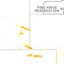

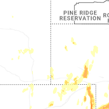


Connect with Interactive Hail Maps