

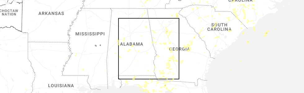
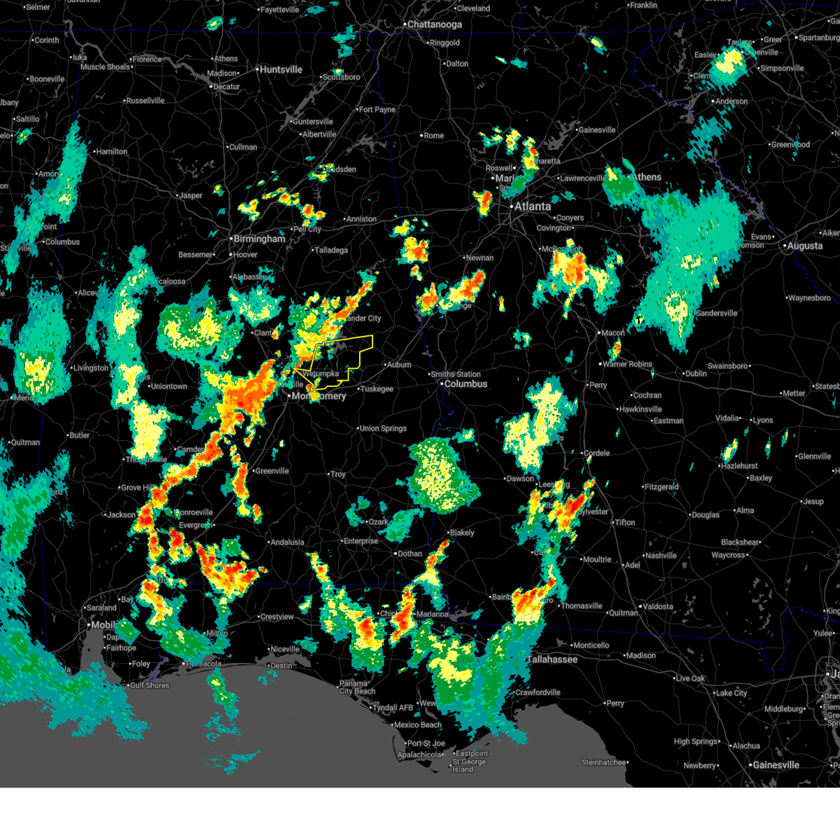
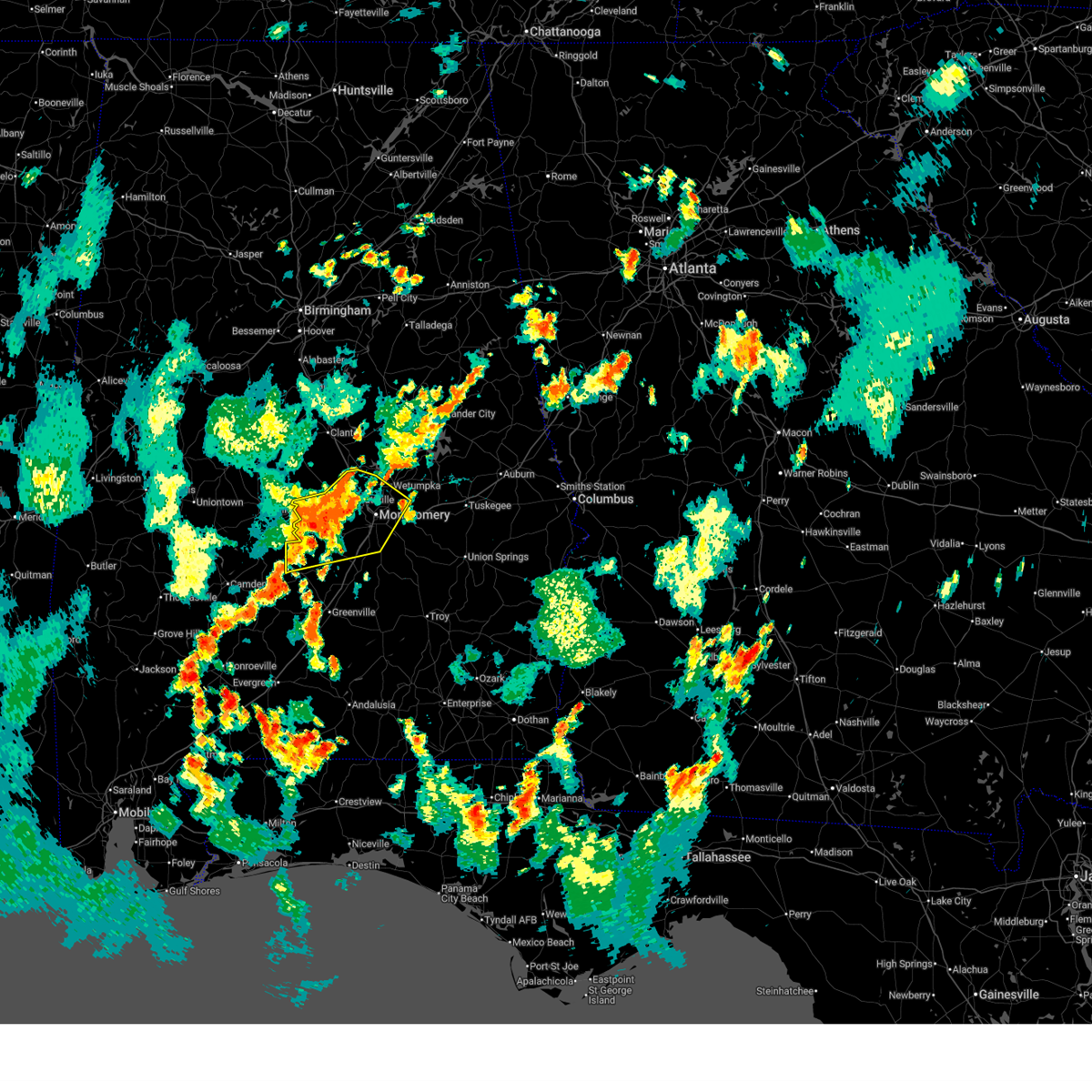
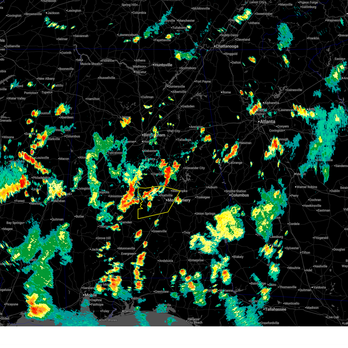
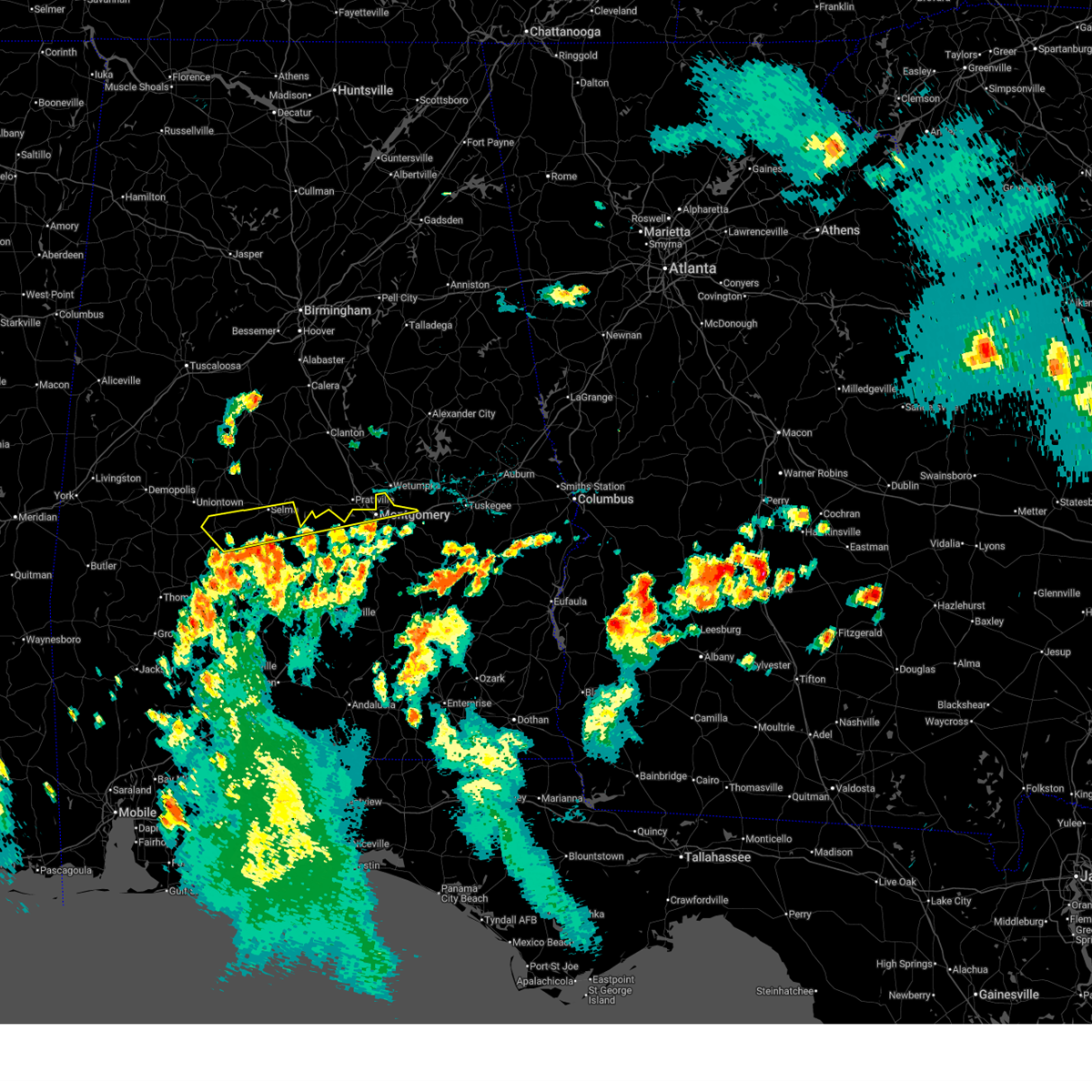
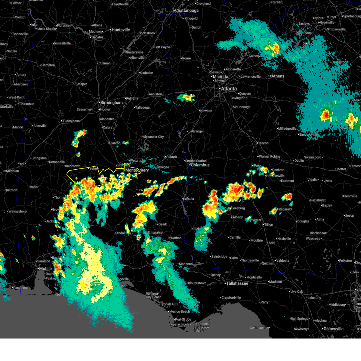
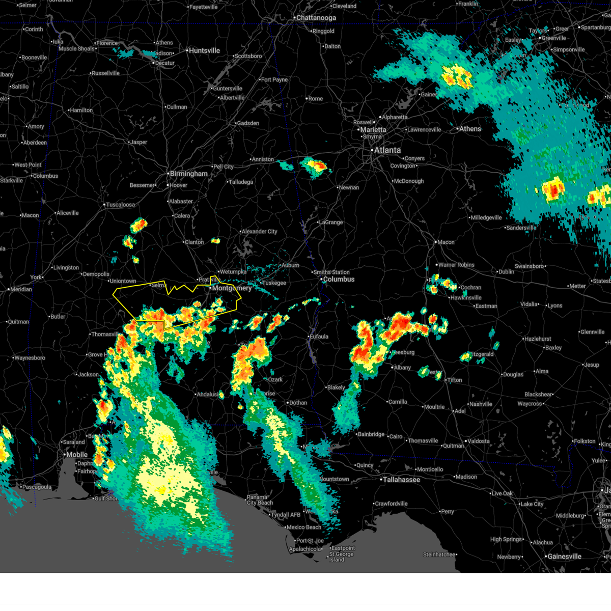
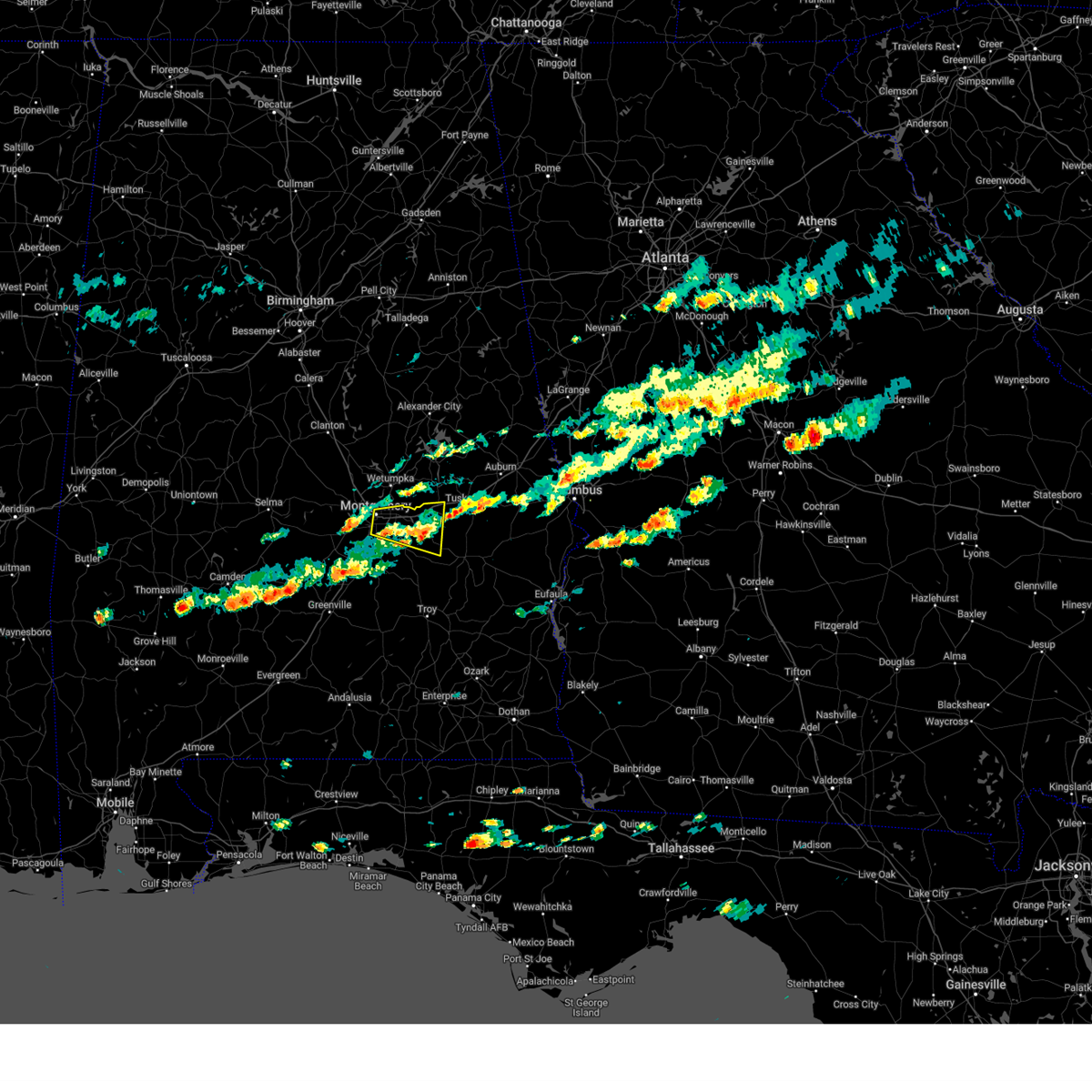
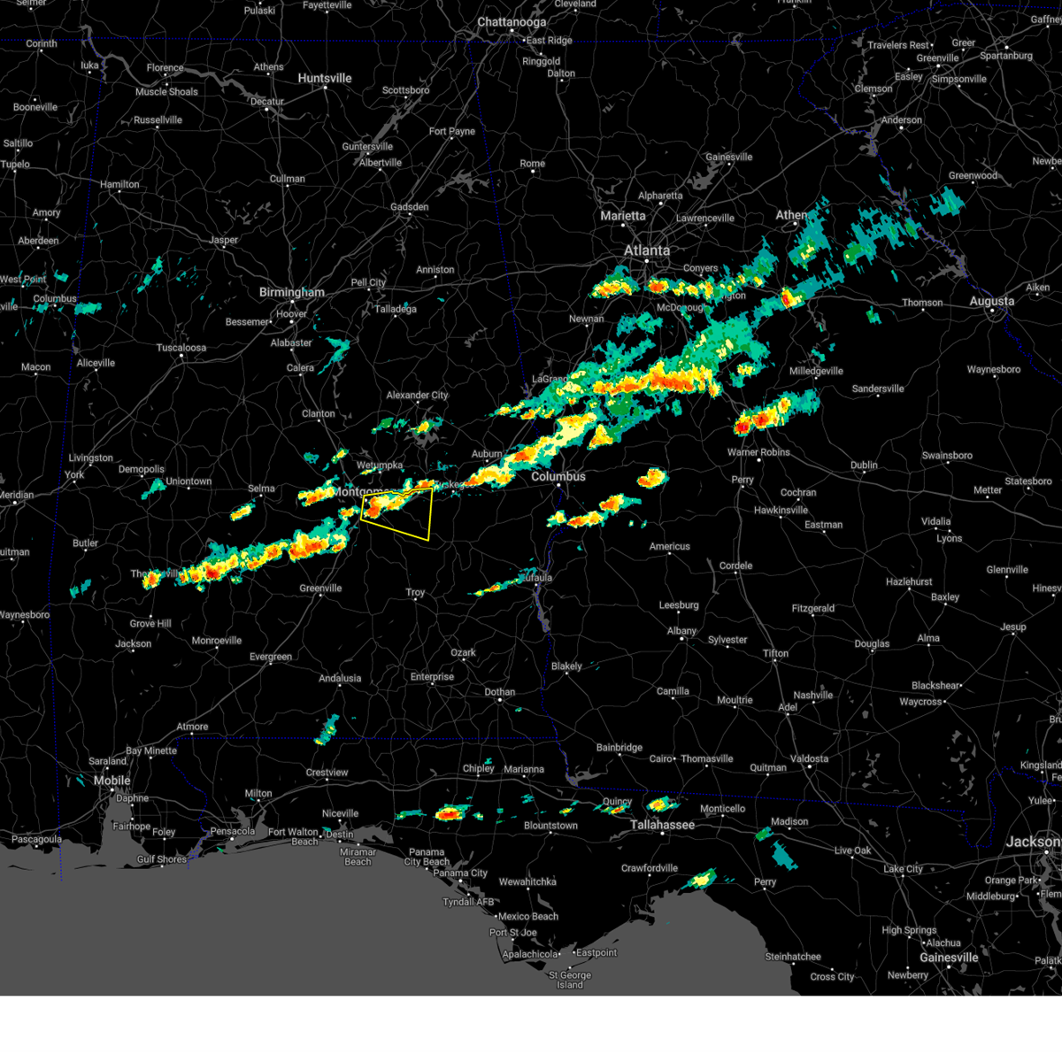
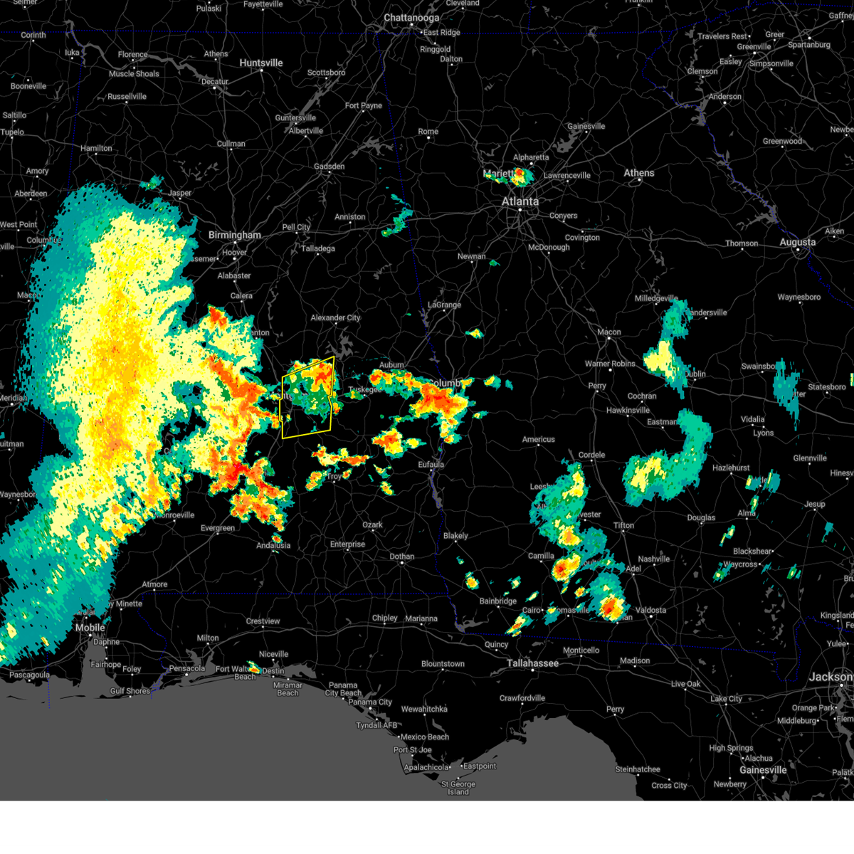
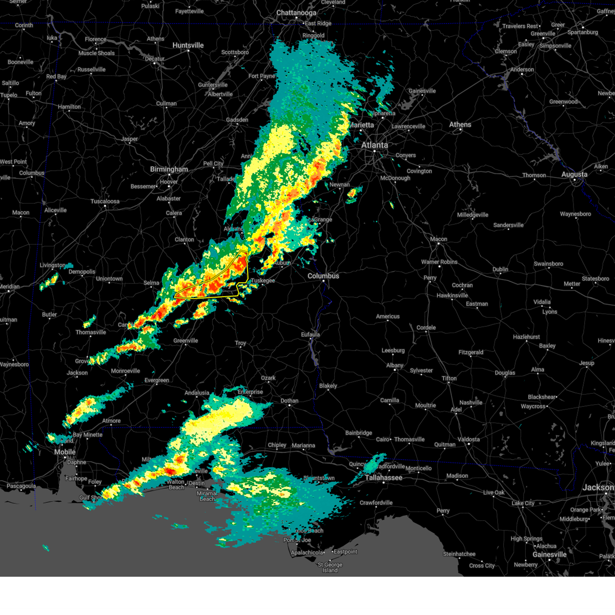
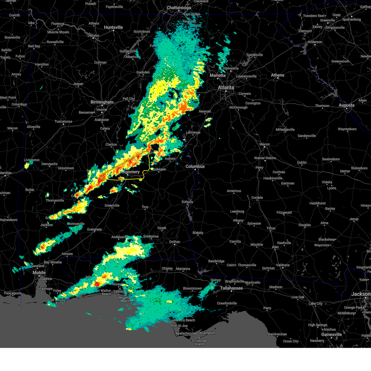
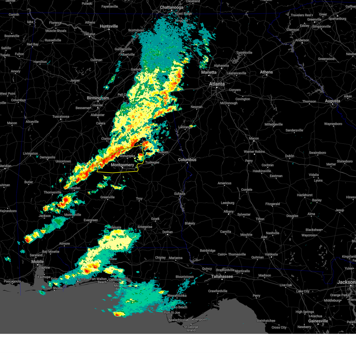
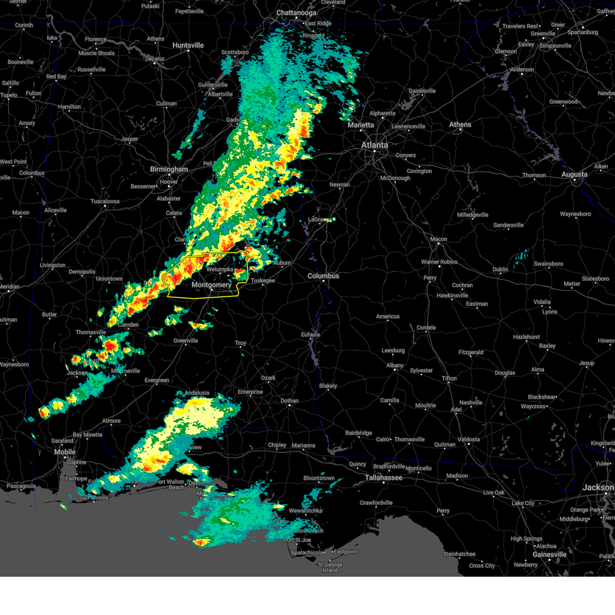
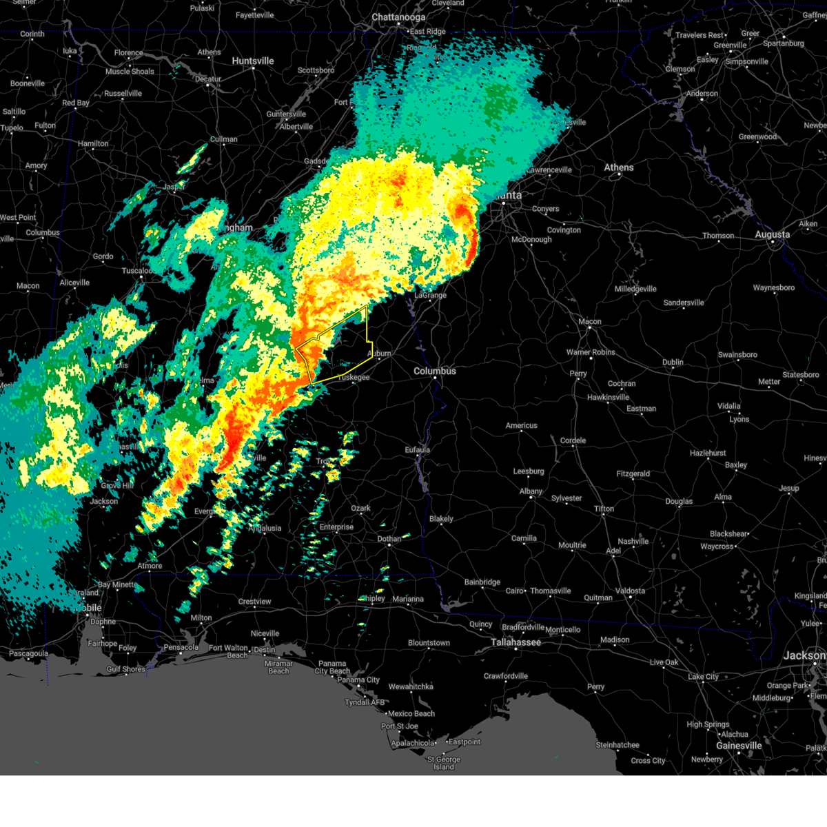
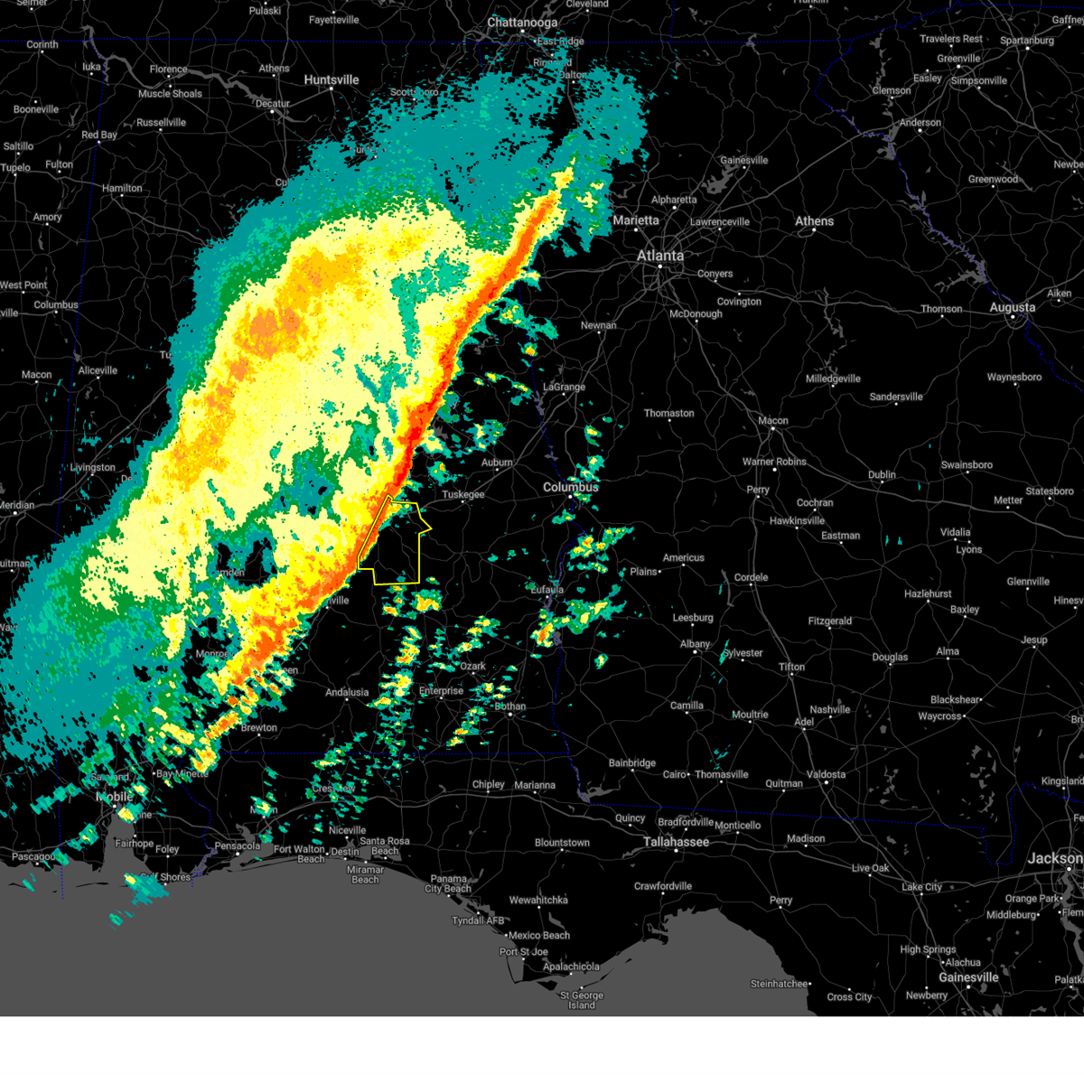
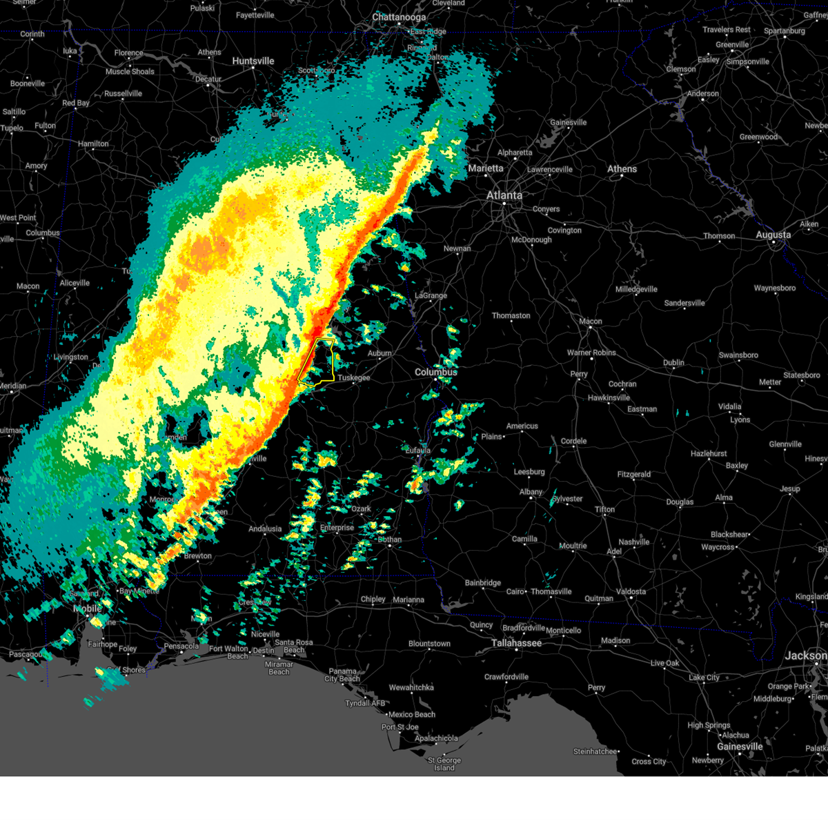
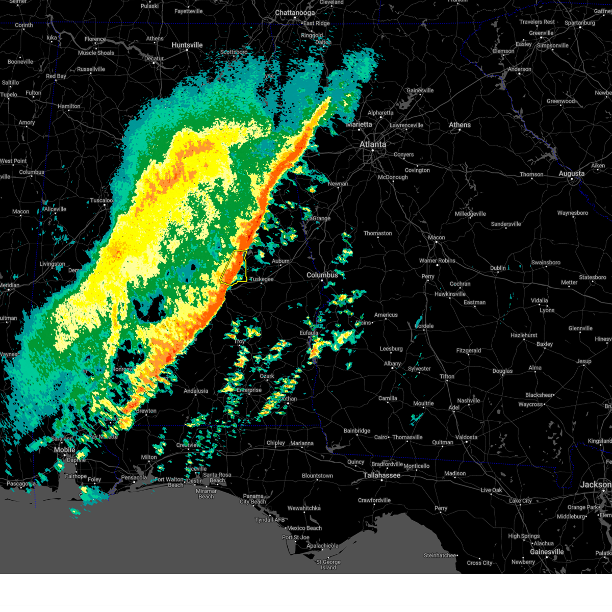
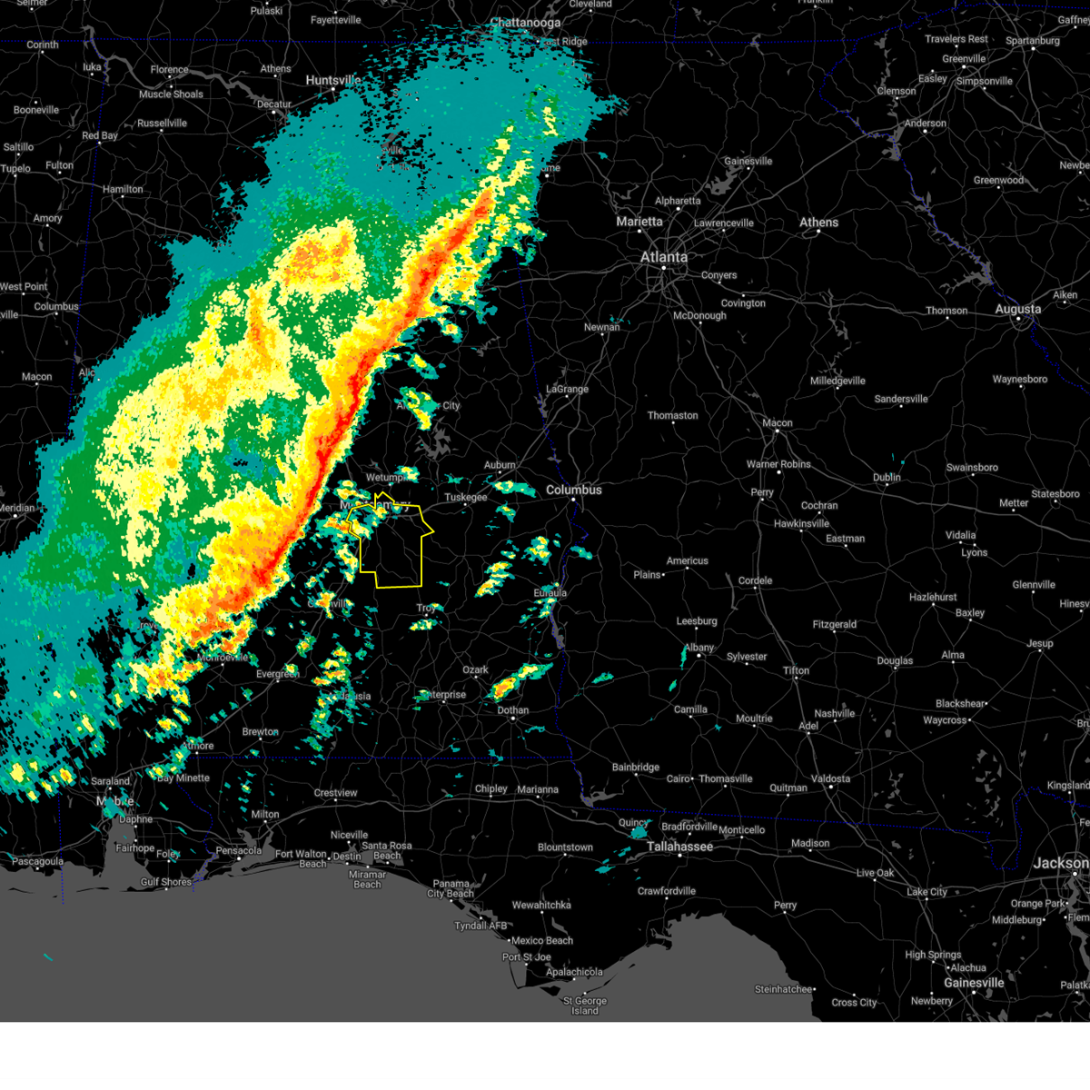
Hail Map for Redland, AL
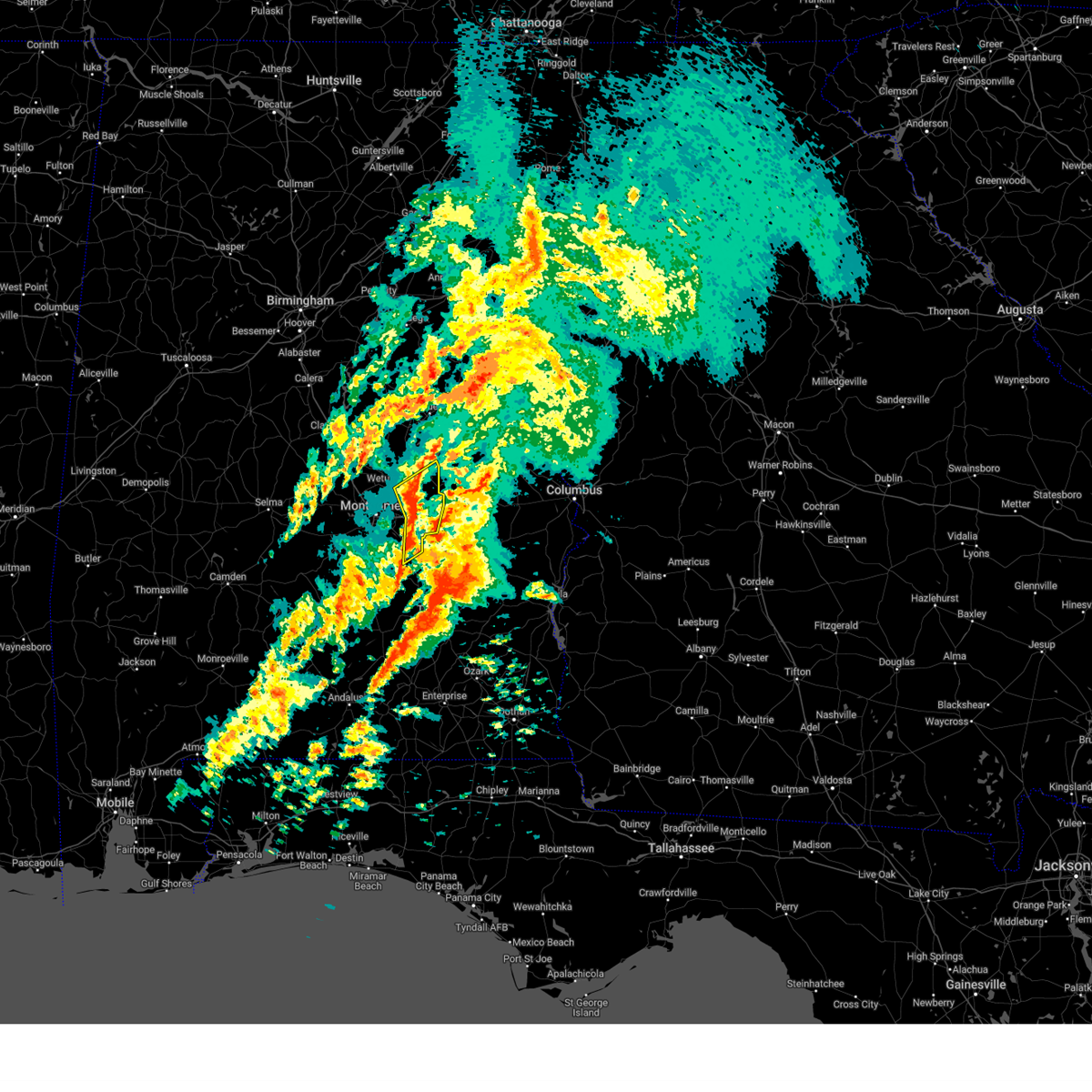
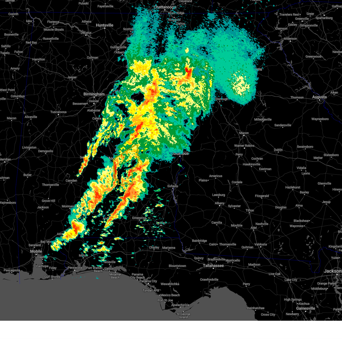
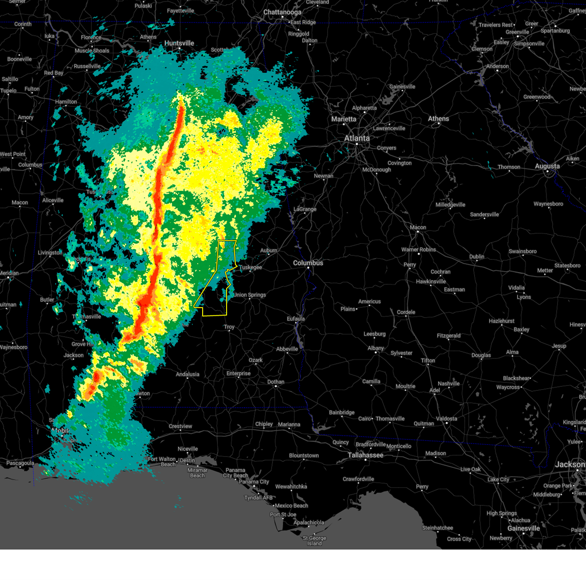
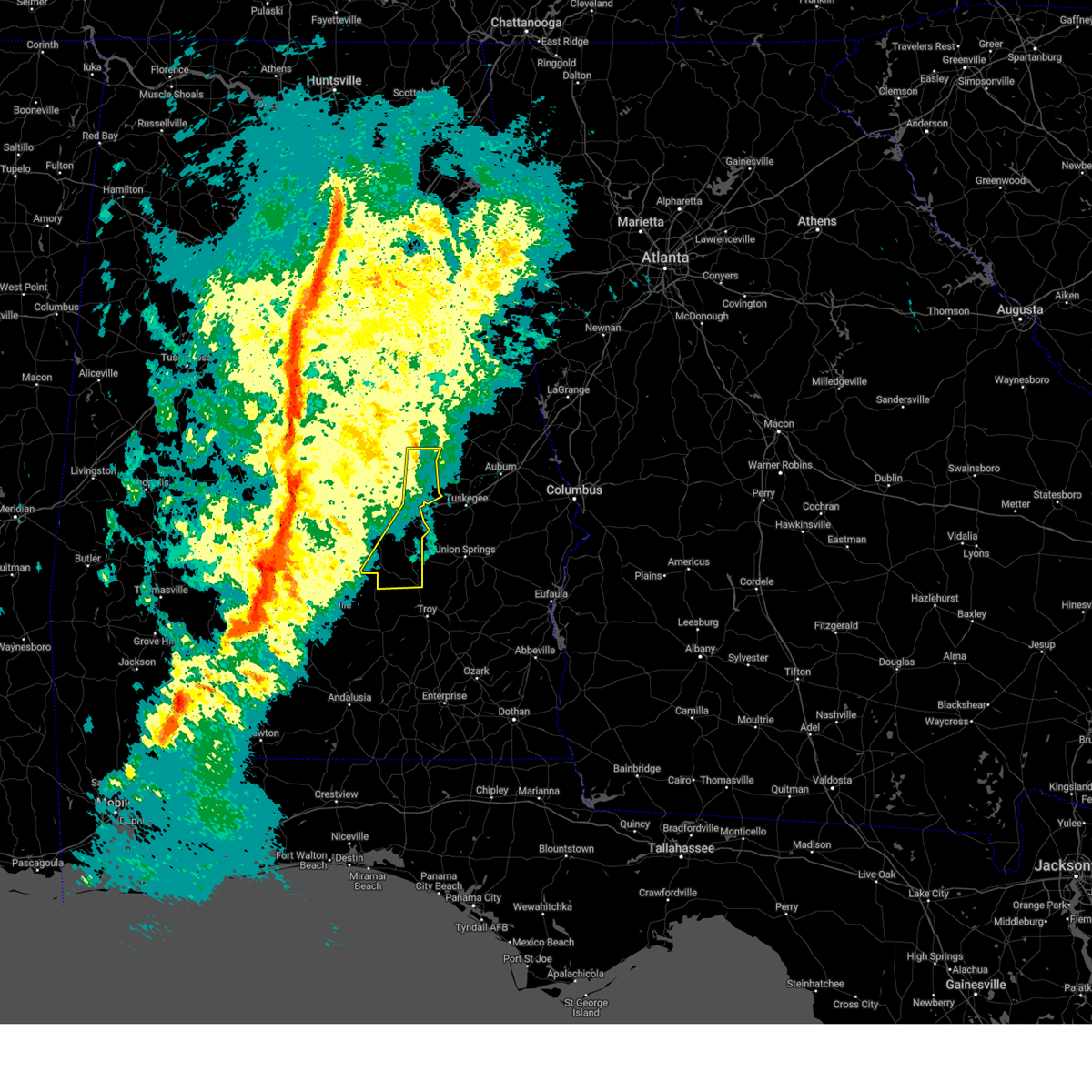
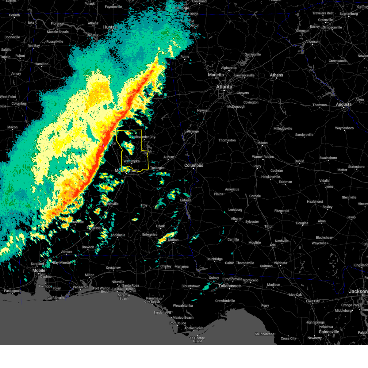
The Redland, AL area has had 0 reports of on-the-ground hail by trained spotters, and has been under severe weather warnings 57 times during the past 12 months. Doppler radar has detected hail at or near Redland, AL on 87 occasions, including 4 occasions during the past year.
| Name: | Redland, AL |
| Where Located: | 39.4 miles WSW of Auburn, AL |
| Map: | Google Map for Redland, AL |
| Population: | 3736 |
| Housing Units: | 1438 |
| More Info: | Search Google for Redland, AL |
2
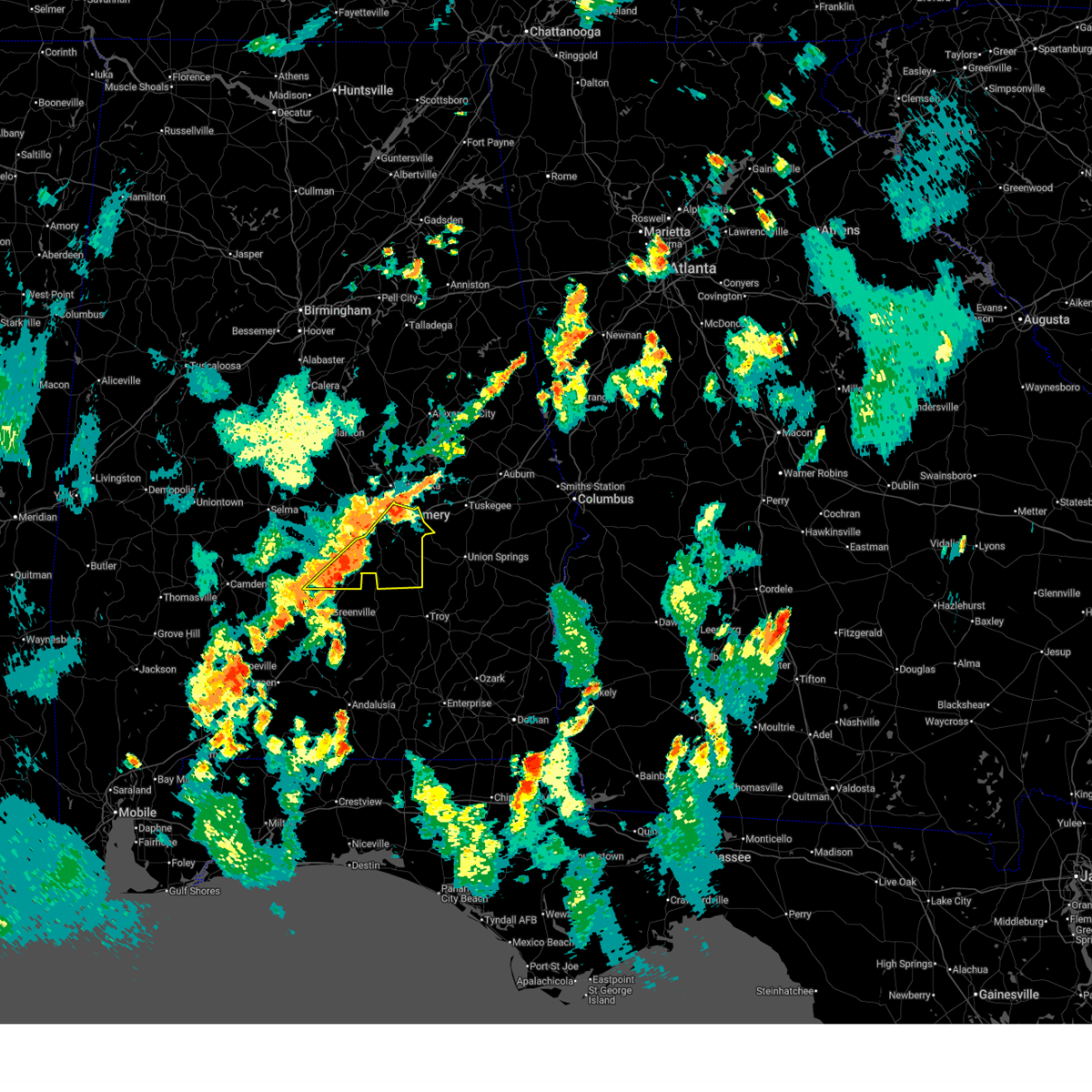
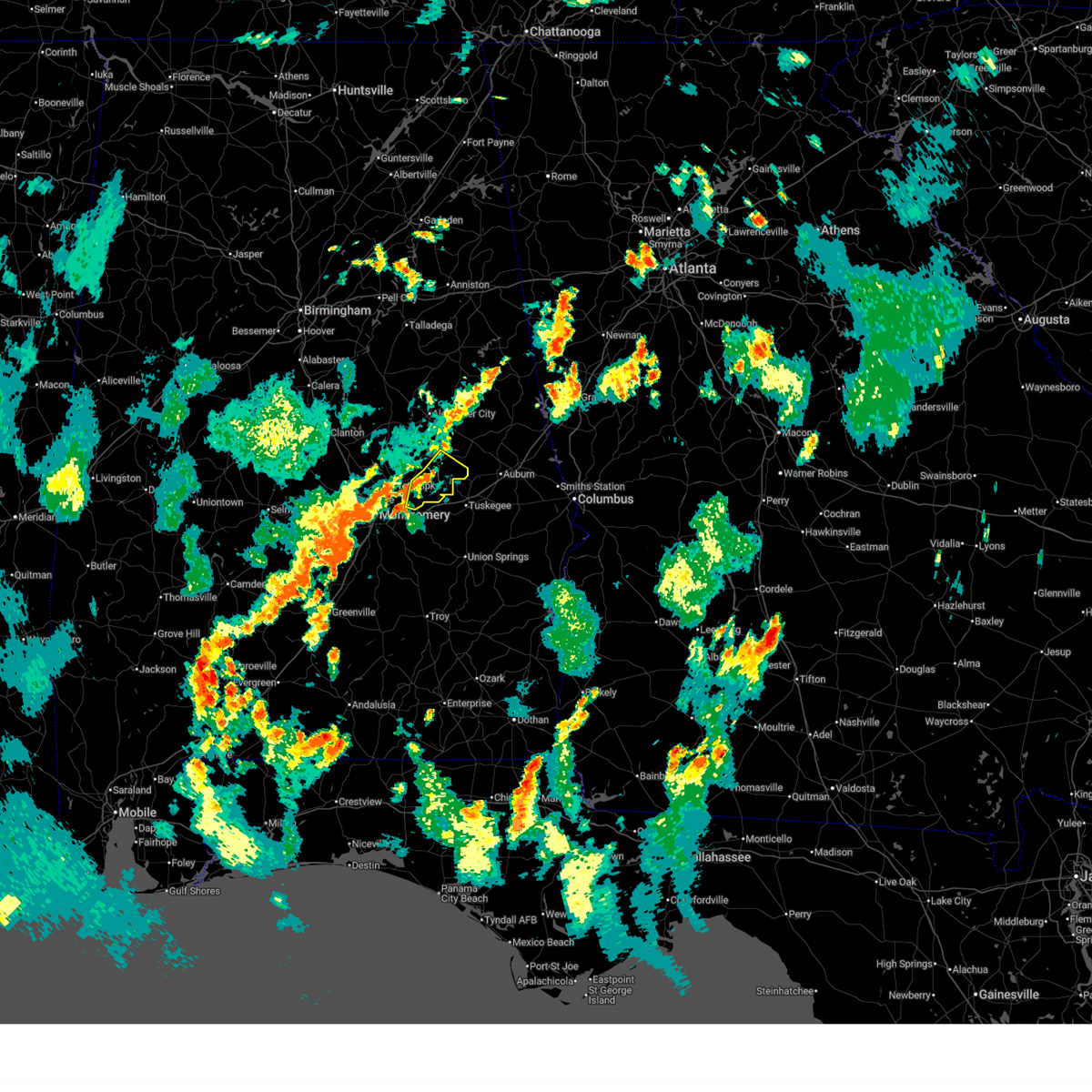
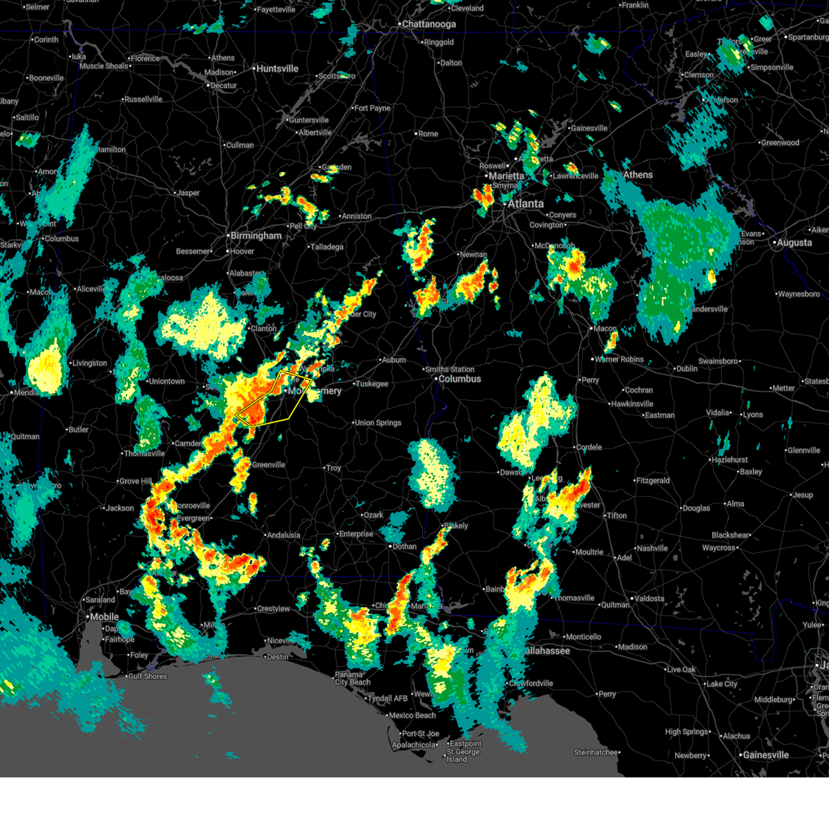
The Top Recent Hail Date for Redland, AL is Wednesday, June 25, 2025 (11th out of 87)
Hail and Wind Damage Spotted near Redland, AL
| Date / Time | Report Details |
|---|---|
| 7/1/2025 6:12 PM CDT |
 At 612 pm cdt, severe thunderstorms were located along a line extending from montgomery to near pintlala to 6 miles south of beechwood, moving southeast at 30 mph (radar indicated). Hazards include 60 mph wind gusts. Expect damage to roofs, siding, and trees. Locations impacted include, montgomery, fort deposit, meadville, pike road, pine level, hyundai motors of alabama, auburn university in montgomery, dublin, snowdoun, grady, sellers, davenport, ramer, waugh, lagoon park, pintlala, lowndes county airport, strata, naftel, and hope hull. At 612 pm cdt, severe thunderstorms were located along a line extending from montgomery to near pintlala to 6 miles south of beechwood, moving southeast at 30 mph (radar indicated). Hazards include 60 mph wind gusts. Expect damage to roofs, siding, and trees. Locations impacted include, montgomery, fort deposit, meadville, pike road, pine level, hyundai motors of alabama, auburn university in montgomery, dublin, snowdoun, grady, sellers, davenport, ramer, waugh, lagoon park, pintlala, lowndes county airport, strata, naftel, and hope hull.
|
| 7/1/2025 6:09 PM CDT | the severe thunderstorm warning has been cancelled and is no longer in effect |
| 7/1/2025 6:09 PM CDT | The storms which prompted the warning have weakened below severe limits, and no longer pose an immediate threat to life or property. therefore, the warning will be allowed to expire. |
| 7/1/2025 6:07 PM CDT | At 607 pm cdt, severe thunderstorms were located along a line extending from montgomery to hyundai motors of alabama to near pintlala, moving southeast at 35 mph (radar indicated). Hazards include 60 mph wind gusts. Expect damage to roofs, siding, and trees. Locations impacted include, montgomery, hayneville, coosada, montgomery zoo, boylston, hyundai motors of alabama, alabama state university, auburn university in montgomery, bob woodruff lake, hope hull, woodcrest, dannelly field, eastdale mall, maxwell air force base, snowdoun, montgomery riverwalk stadium, pinedale, lagoon park, gunter air force base, and alabama state capitol. |
| 7/1/2025 6:07 PM CDT | the severe thunderstorm warning has been cancelled and is no longer in effect |
| 7/1/2025 5:59 PM CDT |
 At 559 pm cdt, severe thunderstorms were located along a line extending from montgomery to near hayneville to near gordonville, moving southeast at 30 mph (radar indicated). Hazards include 60 mph wind gusts. Expect damage to roofs, siding, and trees. Locations impacted include, montgomery, fort deposit, mosses, hayneville, meadville, pike road, gordonville, pine level, hyundai motors of alabama, beechwood, auburn university in montgomery, dublin, snowdoun, grady, sellers, davenport, ramer, waugh, lagoon park, and pintlala. At 559 pm cdt, severe thunderstorms were located along a line extending from montgomery to near hayneville to near gordonville, moving southeast at 30 mph (radar indicated). Hazards include 60 mph wind gusts. Expect damage to roofs, siding, and trees. Locations impacted include, montgomery, fort deposit, mosses, hayneville, meadville, pike road, gordonville, pine level, hyundai motors of alabama, beechwood, auburn university in montgomery, dublin, snowdoun, grady, sellers, davenport, ramer, waugh, lagoon park, and pintlala.
|
| 7/1/2025 5:56 PM CDT |
 At 556 pm cdt, severe thunderstorms were located along a line extending from near martin dam to near tallassee to near blue ridge, moving southeast at 20 mph (radar indicated). Hazards include 60 mph wind gusts. Expect damage to roofs, siding, and trees. Locations impacted include, tallassee, martin dam, southern lake martin, liberty city, reeves airport, tallapoosa city, blue ridge, ware, claud, yates dam, reeltown, and yates reservoir. At 556 pm cdt, severe thunderstorms were located along a line extending from near martin dam to near tallassee to near blue ridge, moving southeast at 20 mph (radar indicated). Hazards include 60 mph wind gusts. Expect damage to roofs, siding, and trees. Locations impacted include, tallassee, martin dam, southern lake martin, liberty city, reeves airport, tallapoosa city, blue ridge, ware, claud, yates dam, reeltown, and yates reservoir.
|
| 7/1/2025 5:55 PM CDT |
 At 555 pm cdt, severe thunderstorms were located along a line extending from near southern lake martin to near eclectic to emerald mountain, moving south at 15 mph (radar indicated). Hazards include 60 mph wind gusts. Expect damage to roofs, siding, and trees. Locations impacted include, tallassee, martin dam, southern lake martin, liberty city, reeves airport, tallapoosa city, ware, yates dam, reeltown, and yates reservoir. At 555 pm cdt, severe thunderstorms were located along a line extending from near southern lake martin to near eclectic to emerald mountain, moving south at 15 mph (radar indicated). Hazards include 60 mph wind gusts. Expect damage to roofs, siding, and trees. Locations impacted include, tallassee, martin dam, southern lake martin, liberty city, reeves airport, tallapoosa city, ware, yates dam, reeltown, and yates reservoir.
|
| 7/1/2025 5:54 PM CDT |
 the severe thunderstorm warning has been cancelled and is no longer in effect the severe thunderstorm warning has been cancelled and is no longer in effect
|
| 7/1/2025 5:54 PM CDT |
 At 554 pm cdt, severe thunderstorms were located along a line extending from near bob woodruff lake to montgomery to near hayneville, moving southeast at 30 mph (radar indicated). Hazards include 60 mph wind gusts. Expect damage to roofs, siding, and trees. Locations impacted include, montgomery, prattville, millbrook, mosses, hayneville, coosada, lowndesboro, montgomery zoo, boylston, hyundai motors of alabama, auburn university in montgomery, bob woodruff lake, woodcrest, emerald mountain, maxwell air force base, snowdoun, lagoon park, pintlala, hunter, and alabama state university. At 554 pm cdt, severe thunderstorms were located along a line extending from near bob woodruff lake to montgomery to near hayneville, moving southeast at 30 mph (radar indicated). Hazards include 60 mph wind gusts. Expect damage to roofs, siding, and trees. Locations impacted include, montgomery, prattville, millbrook, mosses, hayneville, coosada, lowndesboro, montgomery zoo, boylston, hyundai motors of alabama, auburn university in montgomery, bob woodruff lake, woodcrest, emerald mountain, maxwell air force base, snowdoun, lagoon park, pintlala, hunter, and alabama state university.
|
| 7/1/2025 5:46 PM CDT | Svrbmx the national weather service in birmingham has issued a * severe thunderstorm warning for, lowndes county in south central alabama, montgomery county in south central alabama, * until 700 pm cdt. * at 546 pm cdt, severe thunderstorms were located along a line extending from coosada to near hayneville to 10 miles west of gordonville, moving southeast at 30 mph (radar indicated). Hazards include 60 mph wind gusts. expect damage to roofs, siding, and trees |
| 7/1/2025 5:44 PM CDT | At 543 pm cdt, severe thunderstorms were located along a line extending from eastern lake martin to near martin dam to wetumpka, moving east at 25 mph (radar indicated). Hazards include 60 mph wind gusts. Expect damage to roofs, siding, and trees. Locations impacted include, tallassee, camp hill, eclectic, waverly, martin dam, liberty city, western lake martin, reeves airport, tallapoosa city, southern lake martin, kowaliga bridge, still waters resort, blue ridge, eastern lake martin, susannah crossing, claud, maxwell gunter recreation area, yates dam, blue creek marina, and ware. |
| 7/1/2025 5:42 PM CDT | At 542 pm cdt, severe thunderstorms were located along a line extending from near eastern lake martin to near martin dam to blue ridge, moving east at 30 mph (radar indicated). Hazards include 60 mph wind gusts. Expect damage to roofs, siding, and trees. Locations impacted include, tallassee, camp hill, eclectic, waverly, martin dam, liberty city, reeves airport, tallapoosa city, southern lake martin, kowaliga bridge, still waters resort, western lake martin, eastern lake martin, claud, yates dam, blue creek marina, ware, reeltown, yates reservoir, and maxwell gunter recreation area. |
| 7/1/2025 5:37 PM CDT |
 At 537 pm cdt, severe thunderstorms were located along a line extending from near eastern lake martin to near eclectic to near wetumpka, moving east at 35 mph (radar indicated). Hazards include 60 mph wind gusts. Expect damage to roofs, siding, and trees. Locations impacted include, wetumpka, tallassee, camp hill, eclectic, waverly, martin dam, liberty city, western lake martin, reeves airport, tallapoosa city, southern lake martin, kowaliga bridge, still waters resort, blue ridge, eastern lake martin, susannah crossing, claud, maxwell gunter recreation area, yates dam, and blue creek marina. At 537 pm cdt, severe thunderstorms were located along a line extending from near eastern lake martin to near eclectic to near wetumpka, moving east at 35 mph (radar indicated). Hazards include 60 mph wind gusts. Expect damage to roofs, siding, and trees. Locations impacted include, wetumpka, tallassee, camp hill, eclectic, waverly, martin dam, liberty city, western lake martin, reeves airport, tallapoosa city, southern lake martin, kowaliga bridge, still waters resort, blue ridge, eastern lake martin, susannah crossing, claud, maxwell gunter recreation area, yates dam, and blue creek marina.
|
| 7/1/2025 5:34 PM CDT |
 At 533 pm cdt, severe thunderstorms were located along a line extending from deatsville to near autauga county airport to white hall to 8 miles southeast of belknap, moving southeast at 20 mph (radar indicated). Hazards include 60 mph wind gusts. Expect damage to roofs, siding, and trees. Locations impacted include, montgomery, prattville, millbrook, wetumpka, mosses, hayneville, elmore, coosada, deatsville, autaugaville, white hall, gordonville, lowndesboro, benton, hyundai motors of alabama, auburn university in montgomery, autauga county airport, woodcrest, snowdoun, and lagoon park. At 533 pm cdt, severe thunderstorms were located along a line extending from deatsville to near autauga county airport to white hall to 8 miles southeast of belknap, moving southeast at 20 mph (radar indicated). Hazards include 60 mph wind gusts. Expect damage to roofs, siding, and trees. Locations impacted include, montgomery, prattville, millbrook, wetumpka, mosses, hayneville, elmore, coosada, deatsville, autaugaville, white hall, gordonville, lowndesboro, benton, hyundai motors of alabama, auburn university in montgomery, autauga county airport, woodcrest, snowdoun, and lagoon park.
|
| 7/1/2025 5:24 PM CDT | At 523 pm cdt, severe thunderstorms were located along a line extending from near deatsville to near autaugaville to near mulberry to near tyler, moving southeast at 20 mph (radar indicated). Hazards include 60 mph wind gusts. Expect damage to roofs, siding, and trees. Locations impacted include, montgomery, prattville, millbrook, wetumpka, mosses, hayneville, elmore, coosada, deatsville, autaugaville, white hall, gordonville, lowndesboro, benton, hyundai motors of alabama, auburn university in montgomery, autauga county airport, woodcrest, snowdoun, and lagoon park. |
| 7/1/2025 5:20 PM CDT | Svrbmx the national weather service in birmingham has issued a * severe thunderstorm warning for, eastern elmore county in east central alabama, southern tallapoosa county in east central alabama, * until 630 pm cdt. * at 520 pm cdt, severe thunderstorms were located along a line extending from highway 9 and highway 22 to near dexter to near millbrook, moving east at 25 mph (radar indicated). Hazards include 60 mph wind gusts. expect damage to roofs, siding, and trees |
| 7/1/2025 5:19 PM CDT | Svrbmx the national weather service in birmingham has issued a * severe thunderstorm warning for, eastern elmore county in east central alabama, southern tallapoosa county in east central alabama, * until 615 pm cdt. * at 518 pm cdt, severe thunderstorms were located along a line extending from highway 9 and highway 22 to near dexter to near millbrook, moving east at 25 mph (radar indicated). Hazards include 60 mph wind gusts. expect damage to roofs, siding, and trees |
| 7/1/2025 5:18 PM CDT | At 517 pm cdt, severe thunderstorms were located along a line extending from near deatsville to autaugaville to near gardner island to near dallas lake, moving southeast at 20 mph (radar indicated). Hazards include 60 mph wind gusts. Expect damage to roofs, siding, and trees. Locations impacted include, montgomery, prattville, millbrook, wetumpka, mosses, hayneville, elmore, coosada, deatsville, autaugaville, white hall, gordonville, lowndesboro, benton, hyundai motors of alabama, auburn university in montgomery, autauga county airport, woodcrest, snowdoun, and lagoon park. |
| 7/1/2025 5:06 PM CDT |
 Svrbmx the national weather service in birmingham has issued a * severe thunderstorm warning for, autauga county in central alabama, southwestern elmore county in east central alabama, lowndes county in south central alabama, northwestern montgomery county in south central alabama, * until 615 pm cdt. * at 505 pm cdt, severe thunderstorms were located along a line extending from near deatsville to near mulberry to near paul m grist state park, moving southeast at 35 mph (radar indicated). Hazards include 60 mph wind gusts. expect damage to roofs, siding, and trees Svrbmx the national weather service in birmingham has issued a * severe thunderstorm warning for, autauga county in central alabama, southwestern elmore county in east central alabama, lowndes county in south central alabama, northwestern montgomery county in south central alabama, * until 615 pm cdt. * at 505 pm cdt, severe thunderstorms were located along a line extending from near deatsville to near mulberry to near paul m grist state park, moving southeast at 35 mph (radar indicated). Hazards include 60 mph wind gusts. expect damage to roofs, siding, and trees
|
| 6/25/2025 9:51 PM CDT |
 At 950 pm cdt, severe thunderstorms were located along a line extending from near emerald mountain to near orrville, moving northwest at 20 mph (radar indicated). Hazards include 60 mph wind gusts. Expect damage to roofs, siding, and trees. Locations impacted include, northern montgomery, selma, selmont-west selmont, coosada, white hall, orrville, benton, montgomery zoo, boylston, bogue chitto, gardner island, bob woodruff lake, tyler, central mills, old cahaba park, maxwell air force base, dallas county horse arena, lagoon park, hunter, and alabama state university. At 950 pm cdt, severe thunderstorms were located along a line extending from near emerald mountain to near orrville, moving northwest at 20 mph (radar indicated). Hazards include 60 mph wind gusts. Expect damage to roofs, siding, and trees. Locations impacted include, northern montgomery, selma, selmont-west selmont, coosada, white hall, orrville, benton, montgomery zoo, boylston, bogue chitto, gardner island, bob woodruff lake, tyler, central mills, old cahaba park, maxwell air force base, dallas county horse arena, lagoon park, hunter, and alabama state university.
|
| 6/25/2025 9:38 PM CDT |
 At 938 pm cdt, severe thunderstorms were located along a line extending from montgomery to near dannelly reservoir, moving northwest at 30 mph (radar indicated). Hazards include 60 mph wind gusts. Expect damage to roofs, siding, and trees. Locations impacted include, montgomery, selma, mosses, hayneville, selmont-west selmont, pike road, coosada, white hall, gordonville, orrville, lowndesboro, benton, hyundai motors of alabama, bogue chitto, auburn university in montgomery, tyler, woodcrest, dannelly reservoir, waugh, and lagoon park. At 938 pm cdt, severe thunderstorms were located along a line extending from montgomery to near dannelly reservoir, moving northwest at 30 mph (radar indicated). Hazards include 60 mph wind gusts. Expect damage to roofs, siding, and trees. Locations impacted include, montgomery, selma, mosses, hayneville, selmont-west selmont, pike road, coosada, white hall, gordonville, orrville, lowndesboro, benton, hyundai motors of alabama, bogue chitto, auburn university in montgomery, tyler, woodcrest, dannelly reservoir, waugh, and lagoon park.
|
| 6/25/2025 9:20 PM CDT |
 Svrbmx the national weather service in birmingham has issued a * severe thunderstorm warning for, lowndes county in south central alabama, dallas county in south central alabama, montgomery county in south central alabama, * until 1015 pm cdt. * at 920 pm cdt, severe thunderstorms were located along a line extending from pike road to 8 miles southeast of dannelly reservoir, moving northwest at 25 mph (radar indicated). Hazards include 60 mph wind gusts. expect damage to roofs, siding, and trees Svrbmx the national weather service in birmingham has issued a * severe thunderstorm warning for, lowndes county in south central alabama, dallas county in south central alabama, montgomery county in south central alabama, * until 1015 pm cdt. * at 920 pm cdt, severe thunderstorms were located along a line extending from pike road to 8 miles southeast of dannelly reservoir, moving northwest at 25 mph (radar indicated). Hazards include 60 mph wind gusts. expect damage to roofs, siding, and trees
|
| 5/30/2025 2:10 PM CDT |
 the severe thunderstorm warning has been cancelled and is no longer in effect the severe thunderstorm warning has been cancelled and is no longer in effect
|
| 5/30/2025 1:50 PM CDT |
 Svrbmx the national weather service in birmingham has issued a * severe thunderstorm warning for, northwestern bullock county in southeastern alabama, southwestern macon county in southeastern alabama, northeastern montgomery county in south central alabama, * until 230 pm cdt. * at 149 pm cdt, a severe thunderstorm was located over southeastern montgomery, moving east at 35 mph (radar indicated). Hazards include 60 mph wind gusts and quarter size hail. Hail damage to vehicles is expected. Expect wind damage to roofs, siding, and trees. Svrbmx the national weather service in birmingham has issued a * severe thunderstorm warning for, northwestern bullock county in southeastern alabama, southwestern macon county in southeastern alabama, northeastern montgomery county in south central alabama, * until 230 pm cdt. * at 149 pm cdt, a severe thunderstorm was located over southeastern montgomery, moving east at 35 mph (radar indicated). Hazards include 60 mph wind gusts and quarter size hail. Hail damage to vehicles is expected. Expect wind damage to roofs, siding, and trees.
|
| 5/26/2025 7:14 PM CDT | the severe thunderstorm warning has been cancelled and is no longer in effect |
| 5/26/2025 6:42 PM CDT |
 Svrbmx the national weather service in birmingham has issued a * severe thunderstorm warning for, elmore county in east central alabama, montgomery county in south central alabama, * until 745 pm cdt. * at 642 pm cdt, severe thunderstorms were located along a line extending from booth to beechwood, moving east at 35 mph (radar indicated). Hazards include 60 mph wind gusts. expect damage to roofs, siding, and trees Svrbmx the national weather service in birmingham has issued a * severe thunderstorm warning for, elmore county in east central alabama, montgomery county in south central alabama, * until 745 pm cdt. * at 642 pm cdt, severe thunderstorms were located along a line extending from booth to beechwood, moving east at 35 mph (radar indicated). Hazards include 60 mph wind gusts. expect damage to roofs, siding, and trees
|
| 5/3/2025 6:33 PM CDT |
 At 633 pm cdt, severe thunderstorms were located along a line extending from near martin dam to near blue ridge to 6 miles west of dannelly field, moving east at 35 mph (radar indicated). Hazards include 60 mph wind gusts and quarter size hail. Hail damage to vehicles is expected. expect wind damage to roofs, siding, and trees. Locations impacted include, eclectic, montgomery zoo, boylston, mitylene, auburn university in montgomery, bob woodruff lake, tallassee, woodcrest, brassell, emerald mountain, maxwell air force base, waugh, lagoon park, yates reservoir, manack, hunter, claud, alabama state university, montgomery, and yates dam. At 633 pm cdt, severe thunderstorms were located along a line extending from near martin dam to near blue ridge to 6 miles west of dannelly field, moving east at 35 mph (radar indicated). Hazards include 60 mph wind gusts and quarter size hail. Hail damage to vehicles is expected. expect wind damage to roofs, siding, and trees. Locations impacted include, eclectic, montgomery zoo, boylston, mitylene, auburn university in montgomery, bob woodruff lake, tallassee, woodcrest, brassell, emerald mountain, maxwell air force base, waugh, lagoon park, yates reservoir, manack, hunter, claud, alabama state university, montgomery, and yates dam.
|
| 5/3/2025 6:14 PM CDT |
 At 614 pm cdt, severe thunderstorms were located along a line extending from eclectic to bob woodruff lake to near lowndesboro, moving east at 30 mph (radar indicated). Hazards include 60 mph wind gusts and quarter size hail. Hail damage to vehicles is expected. expect wind damage to roofs, siding, and trees. locations impacted include, santuck, auburn university in montgomery, millbrook, robert f. Henry lock and dam, central, tallassee, autauga county airport, woodcrest, wallsboro, waugh, dexter, lagoon park, yates reservoir, hunter, alabama state university, montgomery, jordan dam, ware, speigner, and tallapoosa water plant. At 614 pm cdt, severe thunderstorms were located along a line extending from eclectic to bob woodruff lake to near lowndesboro, moving east at 30 mph (radar indicated). Hazards include 60 mph wind gusts and quarter size hail. Hail damage to vehicles is expected. expect wind damage to roofs, siding, and trees. locations impacted include, santuck, auburn university in montgomery, millbrook, robert f. Henry lock and dam, central, tallassee, autauga county airport, woodcrest, wallsboro, waugh, dexter, lagoon park, yates reservoir, hunter, alabama state university, montgomery, jordan dam, ware, speigner, and tallapoosa water plant.
|
| 5/3/2025 6:00 PM CDT |
 At 600 pm cdt, severe thunderstorms were located along a line extending from near dexter to near prattville to near benton, moving east at 30 mph (radar indicated). Hazards include 60 mph wind gusts and quarter size hail. Hail damage to vehicles is expected. expect wind damage to roofs, siding, and trees. locations impacted include, santuck, auburn university in montgomery, millbrook, robert f. Henry lock and dam, central, tallassee, autauga county airport, woodcrest, wallsboro, ten cedar estates, waugh, dexter, lagoon park, yates reservoir, mulberry, hunter, alabama state university, montgomery, jordan dam, and jordan lake. At 600 pm cdt, severe thunderstorms were located along a line extending from near dexter to near prattville to near benton, moving east at 30 mph (radar indicated). Hazards include 60 mph wind gusts and quarter size hail. Hail damage to vehicles is expected. expect wind damage to roofs, siding, and trees. locations impacted include, santuck, auburn university in montgomery, millbrook, robert f. Henry lock and dam, central, tallassee, autauga county airport, woodcrest, wallsboro, ten cedar estates, waugh, dexter, lagoon park, yates reservoir, mulberry, hunter, alabama state university, montgomery, jordan dam, and jordan lake.
|
| 5/3/2025 5:49 PM CDT |
 Svrbmx the national weather service in birmingham has issued a * severe thunderstorm warning for, autauga county in central alabama, elmore county in east central alabama, northern lowndes county in south central alabama, northern montgomery county in south central alabama, * until 645 pm cdt. * at 549 pm cdt, severe thunderstorms were located along a line extending from near marbury to selmont-west selmont, moving east at 35 mph (radar indicated). Hazards include 60 mph wind gusts and quarter size hail. Hail damage to vehicles is expected. Expect wind damage to roofs, siding, and trees. Svrbmx the national weather service in birmingham has issued a * severe thunderstorm warning for, autauga county in central alabama, elmore county in east central alabama, northern lowndes county in south central alabama, northern montgomery county in south central alabama, * until 645 pm cdt. * at 549 pm cdt, severe thunderstorms were located along a line extending from near marbury to selmont-west selmont, moving east at 35 mph (radar indicated). Hazards include 60 mph wind gusts and quarter size hail. Hail damage to vehicles is expected. Expect wind damage to roofs, siding, and trees.
|
| 4/6/2025 6:33 PM CDT |
 the severe thunderstorm warning has been cancelled and is no longer in effect the severe thunderstorm warning has been cancelled and is no longer in effect
|
| 4/6/2025 6:22 PM CDT |
 the severe thunderstorm warning has been cancelled and is no longer in effect the severe thunderstorm warning has been cancelled and is no longer in effect
|
| 4/6/2025 6:22 PM CDT |
 At 622 pm cdt, a severe thunderstorm was located over coosada, or over millbrook, moving northeast at 40 mph (radar indicated). Hazards include 60 mph wind gusts and penny size hail. Expect damage to roofs, siding, and trees. Locations impacted include, prattville, montgomery zoo, boylston, wetumpka municipal airport, deatsville, millbrook, bob woodruff lake, autauga county airport, woodcrest, emerald mountain, wallsboro, maxwell air force base, coosada, wetumpka, lagoon park, hunter, holtville, alabama state university, montgomery, and jordan dam. At 622 pm cdt, a severe thunderstorm was located over coosada, or over millbrook, moving northeast at 40 mph (radar indicated). Hazards include 60 mph wind gusts and penny size hail. Expect damage to roofs, siding, and trees. Locations impacted include, prattville, montgomery zoo, boylston, wetumpka municipal airport, deatsville, millbrook, bob woodruff lake, autauga county airport, woodcrest, emerald mountain, wallsboro, maxwell air force base, coosada, wetumpka, lagoon park, hunter, holtville, alabama state university, montgomery, and jordan dam.
|
| 4/6/2025 6:05 PM CDT |
 Svrbmx the national weather service in birmingham has issued a * severe thunderstorm warning for, southeastern autauga county in central alabama, western elmore county in east central alabama, northeastern lowndes county in south central alabama, northwestern montgomery county in south central alabama, * until 700 pm cdt. * at 605 pm cdt, a severe thunderstorm was located near hunter, or near prattville, moving northeast at 35 mph (radar indicated). Hazards include 60 mph wind gusts and penny size hail. expect damage to roofs, siding, and trees Svrbmx the national weather service in birmingham has issued a * severe thunderstorm warning for, southeastern autauga county in central alabama, western elmore county in east central alabama, northeastern lowndes county in south central alabama, northwestern montgomery county in south central alabama, * until 700 pm cdt. * at 605 pm cdt, a severe thunderstorm was located near hunter, or near prattville, moving northeast at 35 mph (radar indicated). Hazards include 60 mph wind gusts and penny size hail. expect damage to roofs, siding, and trees
|
| 4/6/2025 11:53 AM CDT |
 Svrbmx the national weather service in birmingham has issued a * severe thunderstorm warning for, eastern elmore county in east central alabama, northwestern lee county in east central alabama, northwestern macon county in southeastern alabama, central tallapoosa county in east central alabama, * until 100 pm cdt. * at 1152 am cdt, severe thunderstorms were located along a line extending from equality to near eclectic to near emerald mountain, moving northeast at 35 mph (radar indicated). Hazards include 60 mph wind gusts. expect damage to roofs, siding, and trees Svrbmx the national weather service in birmingham has issued a * severe thunderstorm warning for, eastern elmore county in east central alabama, northwestern lee county in east central alabama, northwestern macon county in southeastern alabama, central tallapoosa county in east central alabama, * until 100 pm cdt. * at 1152 am cdt, severe thunderstorms were located along a line extending from equality to near eclectic to near emerald mountain, moving northeast at 35 mph (radar indicated). Hazards include 60 mph wind gusts. expect damage to roofs, siding, and trees
|
| 4/6/2025 11:34 AM CDT |
 At 1134 am cdt, severe thunderstorms were located along a line extending from near speed to dexter to near wetumpka to lagoon park to near montgomery to hope hull, moving northeast at 40 mph (radar indicated). Hazards include 60 mph wind gusts. Expect damage to roofs, siding, and trees. Locations impacted include, hyundai motors of alabama, santuck, auburn university in montgomery, central, titus, woodcrest, wallsboro, snowdoun, ten cedar estates, waugh, dexter, lagoon park, alabama state university, montgomery, jordan dam, jordan lake, pike road, ware, speigner, and tallapoosa water plant. At 1134 am cdt, severe thunderstorms were located along a line extending from near speed to dexter to near wetumpka to lagoon park to near montgomery to hope hull, moving northeast at 40 mph (radar indicated). Hazards include 60 mph wind gusts. Expect damage to roofs, siding, and trees. Locations impacted include, hyundai motors of alabama, santuck, auburn university in montgomery, central, titus, woodcrest, wallsboro, snowdoun, ten cedar estates, waugh, dexter, lagoon park, alabama state university, montgomery, jordan dam, jordan lake, pike road, ware, speigner, and tallapoosa water plant.
|
| 4/6/2025 11:34 AM CDT |
 the severe thunderstorm warning has been cancelled and is no longer in effect the severe thunderstorm warning has been cancelled and is no longer in effect
|
| 4/6/2025 11:11 AM CDT |
 Svrbmx the national weather service in birmingham has issued a * severe thunderstorm warning for, eastern autauga county in central alabama, elmore county in east central alabama, northeastern lowndes county in south central alabama, montgomery county in south central alabama, * until noon cdt. * at 1110 am cdt, severe thunderstorms were located along a line extending from near marbury to near deatsville to prattville to near dannelly field to 7 miles east of lowndesboro to hayneville, moving east at 25 mph (radar indicated). Hazards include 60 mph wind gusts. expect damage to roofs, siding, and trees Svrbmx the national weather service in birmingham has issued a * severe thunderstorm warning for, eastern autauga county in central alabama, elmore county in east central alabama, northeastern lowndes county in south central alabama, montgomery county in south central alabama, * until noon cdt. * at 1110 am cdt, severe thunderstorms were located along a line extending from near marbury to near deatsville to prattville to near dannelly field to 7 miles east of lowndesboro to hayneville, moving east at 25 mph (radar indicated). Hazards include 60 mph wind gusts. expect damage to roofs, siding, and trees
|
| 3/15/2025 11:30 PM CDT |
 the severe thunderstorm warning has been cancelled and is no longer in effect the severe thunderstorm warning has been cancelled and is no longer in effect
|
| 3/15/2025 11:11 PM CDT |
 At 1111 pm cdt, severe thunderstorms were located along a line extending from 6 miles north of emerald mountain to waugh to 6 miles southeast of pike road, moving northeast at 65 mph (radar indicated). Hazards include 60 mph wind gusts. Expect damage to roofs, siding, and trees. Locations impacted include, claud, shorter, carters hill, milstead, tallassee, cross keys, brassell, emerald mountain, mount meigs, ware, tysonville, victoryland, cecil, waugh, yates reservoir, martin dam, yates dam, blue ridge, and pike road. At 1111 pm cdt, severe thunderstorms were located along a line extending from 6 miles north of emerald mountain to waugh to 6 miles southeast of pike road, moving northeast at 65 mph (radar indicated). Hazards include 60 mph wind gusts. Expect damage to roofs, siding, and trees. Locations impacted include, claud, shorter, carters hill, milstead, tallassee, cross keys, brassell, emerald mountain, mount meigs, ware, tysonville, victoryland, cecil, waugh, yates reservoir, martin dam, yates dam, blue ridge, and pike road.
|
| 3/15/2025 10:53 PM CDT |
 Svrbmx the national weather service in birmingham has issued a * severe thunderstorm warning for, southeastern elmore county in east central alabama, southwestern macon county in southeastern alabama, montgomery county in south central alabama, * until 1145 pm cdt. * at 1052 pm cdt, severe thunderstorms were located along a line extending from maxwell air force base to snowdoun to sellers, moving northeast at 60 mph (radar indicated). Hazards include 60 mph wind gusts. expect damage to roofs, siding, and trees Svrbmx the national weather service in birmingham has issued a * severe thunderstorm warning for, southeastern elmore county in east central alabama, southwestern macon county in southeastern alabama, montgomery county in south central alabama, * until 1145 pm cdt. * at 1052 pm cdt, severe thunderstorms were located along a line extending from maxwell air force base to snowdoun to sellers, moving northeast at 60 mph (radar indicated). Hazards include 60 mph wind gusts. expect damage to roofs, siding, and trees
|
| 3/4/2025 10:29 PM CST |
 the severe thunderstorm warning has been cancelled and is no longer in effect the severe thunderstorm warning has been cancelled and is no longer in effect
|
| 3/4/2025 10:29 PM CST |
 At 1029 pm cst, severe thunderstorms were located along a line extending from kowaliga bridge to tysonville to near naftel, moving east at 40 mph (radar indicated). Hazards include 60 mph wind gusts. Expect damage to roofs, siding, and trees. Locations impacted include, eclectic, pine level, carters hill, auburn university in montgomery, dublin, central, brassell, emerald mountain, grady, currys, sellers, davenport, ramer, cecil, waugh, claud, strata, naftel, meadville, and barachias. At 1029 pm cst, severe thunderstorms were located along a line extending from kowaliga bridge to tysonville to near naftel, moving east at 40 mph (radar indicated). Hazards include 60 mph wind gusts. Expect damage to roofs, siding, and trees. Locations impacted include, eclectic, pine level, carters hill, auburn university in montgomery, dublin, central, brassell, emerald mountain, grady, currys, sellers, davenport, ramer, cecil, waugh, claud, strata, naftel, meadville, and barachias.
|
| 3/4/2025 9:30 PM CST |
 Svrbmx the national weather service in birmingham has issued a * severe thunderstorm warning for, elmore county in east central alabama, montgomery county in south central alabama, coosa county in east central alabama, * until 1045 pm cst. * at 930 pm cst, severe thunderstorms were located along a line extending from 7 miles northeast of jemison to near autaugaville to 12 miles west of lowndes county airport, moving east at 45 mph (radar indicated). Hazards include 60 mph wind gusts. expect damage to roofs, siding, and trees Svrbmx the national weather service in birmingham has issued a * severe thunderstorm warning for, elmore county in east central alabama, montgomery county in south central alabama, coosa county in east central alabama, * until 1045 pm cst. * at 930 pm cst, severe thunderstorms were located along a line extending from 7 miles northeast of jemison to near autaugaville to 12 miles west of lowndes county airport, moving east at 45 mph (radar indicated). Hazards include 60 mph wind gusts. expect damage to roofs, siding, and trees
|
| 2/16/2025 2:38 AM CST |
 At 238 am cst, severe thunderstorms were located along a line extending from near martin dam to near highland home, moving east at 65 mph (radar indicated). Hazards include 70 mph wind gusts. Expect considerable tree damage. damage is likely to mobile homes, roofs, and outbuildings. Locations impacted include, montgomery, meadville, pike road, pine level, auburn university in montgomery, dublin, snowdoun, grady, sellers, davenport, ramer, waugh, lagoon park, pintlala, strata, naftel, eastdale mall, mount meigs, sprague, and pinedale. At 238 am cst, severe thunderstorms were located along a line extending from near martin dam to near highland home, moving east at 65 mph (radar indicated). Hazards include 70 mph wind gusts. Expect considerable tree damage. damage is likely to mobile homes, roofs, and outbuildings. Locations impacted include, montgomery, meadville, pike road, pine level, auburn university in montgomery, dublin, snowdoun, grady, sellers, davenport, ramer, waugh, lagoon park, pintlala, strata, naftel, eastdale mall, mount meigs, sprague, and pinedale.
|
| 2/16/2025 2:37 AM CST |
 the severe thunderstorm warning has been cancelled and is no longer in effect the severe thunderstorm warning has been cancelled and is no longer in effect
|
| 2/16/2025 2:37 AM CST |
 At 237 am cst, severe thunderstorms were located along a line extending from near malone to montgomery, moving east at 65 mph (radar indicated). Hazards include 70 mph wind gusts. Expect considerable tree damage. damage is likely to mobile homes, roofs, and outbuildings. Locations impacted include, tallassee, eclectic, emerald mountain, kowaliga bridge, martin dam, blue ridge, southern lake martin, western lake martin, ware, claud, yates reservoir, and yates dam. At 237 am cst, severe thunderstorms were located along a line extending from near malone to montgomery, moving east at 65 mph (radar indicated). Hazards include 70 mph wind gusts. Expect considerable tree damage. damage is likely to mobile homes, roofs, and outbuildings. Locations impacted include, tallassee, eclectic, emerald mountain, kowaliga bridge, martin dam, blue ridge, southern lake martin, western lake martin, ware, claud, yates reservoir, and yates dam.
|
| 2/16/2025 2:06 AM CST |
 Svrbmx the national weather service in birmingham has issued a * severe thunderstorm warning for, montgomery county in south central alabama, * until 315 am cst. * at 205 am cst, severe thunderstorms were located along a line extending from near marbury to 12 miles northeast of pine apple, moving east at 65 mph (radar indicated). Hazards include 70 mph wind gusts. Expect considerable tree damage. Damage is likely to mobile homes, roofs, and outbuildings. Svrbmx the national weather service in birmingham has issued a * severe thunderstorm warning for, montgomery county in south central alabama, * until 315 am cst. * at 205 am cst, severe thunderstorms were located along a line extending from near marbury to 12 miles northeast of pine apple, moving east at 65 mph (radar indicated). Hazards include 70 mph wind gusts. Expect considerable tree damage. Damage is likely to mobile homes, roofs, and outbuildings.
|
| 2/16/2025 1:43 AM CST |
 Svrbmx the national weather service in birmingham has issued a * severe thunderstorm warning for, elmore county in east central alabama, coosa county in east central alabama, * until 300 am cst. * at 143 am cst, severe thunderstorms were located along a line extending from near wilsonville to near old cahaba park, moving east at 65 mph (radar indicated). Hazards include 70 mph wind gusts. Expect considerable tree damage. Damage is likely to mobile homes, roofs, and outbuildings. Svrbmx the national weather service in birmingham has issued a * severe thunderstorm warning for, elmore county in east central alabama, coosa county in east central alabama, * until 300 am cst. * at 143 am cst, severe thunderstorms were located along a line extending from near wilsonville to near old cahaba park, moving east at 65 mph (radar indicated). Hazards include 70 mph wind gusts. Expect considerable tree damage. Damage is likely to mobile homes, roofs, and outbuildings.
|
| 2/13/2025 12:16 AM CST | the severe thunderstorm warning has been cancelled and is no longer in effect |
| 2/13/2025 12:08 AM CST | At 1207 am cst, severe thunderstorms were located along a line extending from montgomery to logan, moving east at 55 mph (radar indicated). Hazards include 60 mph wind gusts. Expect damage to roofs, siding, and trees. Locations impacted include, montgomery, fort deposit, meadville, pike road, pine level, hyundai motors of alabama, auburn university in montgomery, dublin, woodcrest, maxwell air force base, snowdoun, grady, sellers, davenport, ramer, waugh, lagoon park, pintlala, alabama state university, and strata. |
| 2/12/2025 11:53 PM CST | At 1153 pm cst, severe thunderstorms were located along a line extending from near dannelly field to near lowndes county airport, moving east at 50 mph (radar indicated). Hazards include 60 mph wind gusts. Expect damage to roofs, siding, and trees. Locations impacted include, montgomery, fort deposit, hayneville, meadville, pike road, pine level, hyundai motors of alabama, auburn university in montgomery, dublin, woodcrest, maxwell air force base, snowdoun, grady, sellers, davenport, ramer, waugh, lagoon park, pintlala, and lowndes county airport. |
| 2/12/2025 11:41 PM CST | Svrbmx the national weather service in birmingham has issued a * severe thunderstorm warning for, lowndes county in south central alabama, montgomery county in south central alabama, * until 1245 am cst. * at 1141 pm cst, severe thunderstorms were located along a line extending from lowndesboro to 9 miles west of lowndes county airport, moving east at 50 mph (radar indicated). Hazards include 60 mph wind gusts. expect damage to roofs, siding, and trees |
| 12/29/2024 1:08 AM CST |
 At 108 am cst, severe thunderstorms were located along a line extending from near wetumpka to near waugh to near dublin, moving northeast at 45 mph (radar indicated). Hazards include 60 mph wind gusts. Expect damage to roofs, siding, and trees. Locations impacted include, eastern montgomery, tuskegee, wetumpka, tallassee, union springs, notasulga, meadville, milstead, pike road, shorter, franklin, auburn university in montgomery, dublin, lake tuskegee, beans crossroads, shopton, ramer, waugh, liverpool, and liberty city. At 108 am cst, severe thunderstorms were located along a line extending from near wetumpka to near waugh to near dublin, moving northeast at 45 mph (radar indicated). Hazards include 60 mph wind gusts. Expect damage to roofs, siding, and trees. Locations impacted include, eastern montgomery, tuskegee, wetumpka, tallassee, union springs, notasulga, meadville, milstead, pike road, shorter, franklin, auburn university in montgomery, dublin, lake tuskegee, beans crossroads, shopton, ramer, waugh, liverpool, and liberty city.
|
| 12/29/2024 12:54 AM CST |
 Svrbmx the national weather service in birmingham has issued a * severe thunderstorm warning for, southern elmore county in east central alabama, western bullock county in southeastern alabama, central macon county in southeastern alabama, south central tallapoosa county in east central alabama, montgomery county in south central alabama, * until 200 am cst. * at 1254 am cst, severe thunderstorms were located along a line extending from near boylston to near pinedale to naftel, moving northeast at 45 mph (radar indicated). Hazards include 60 mph wind gusts. expect damage to roofs, siding, and trees Svrbmx the national weather service in birmingham has issued a * severe thunderstorm warning for, southern elmore county in east central alabama, western bullock county in southeastern alabama, central macon county in southeastern alabama, south central tallapoosa county in east central alabama, montgomery county in south central alabama, * until 200 am cst. * at 1254 am cst, severe thunderstorms were located along a line extending from near boylston to near pinedale to naftel, moving northeast at 45 mph (radar indicated). Hazards include 60 mph wind gusts. expect damage to roofs, siding, and trees
|
| 11/28/2024 5:34 AM CST |
 Torbmx the national weather service in birmingham has issued a * tornado warning for, southeastern elmore county in east central alabama, * until 600 am cst. * at 533 am cst, a severe thunderstorm capable of producing a tornado was located near emerald mountain, or near wetumpka, moving east at 30 mph (radar indicated rotation). Hazards include tornado. Flying debris will be dangerous to those caught without shelter. mobile homes will be damaged or destroyed. damage to roofs, windows, and vehicles will occur. Tree damage is likely. Torbmx the national weather service in birmingham has issued a * tornado warning for, southeastern elmore county in east central alabama, * until 600 am cst. * at 533 am cst, a severe thunderstorm capable of producing a tornado was located near emerald mountain, or near wetumpka, moving east at 30 mph (radar indicated rotation). Hazards include tornado. Flying debris will be dangerous to those caught without shelter. mobile homes will be damaged or destroyed. damage to roofs, windows, and vehicles will occur. Tree damage is likely.
|
| 5/18/2024 8:05 PM CDT |
 The storm which prompted the warning has weakened below severe limits, and no longer poses an immediate threat to life or property. therefore, the warning will be allowed to expire. however, gusty winds and heavy rain are still possible with this thunderstorm. The storm which prompted the warning has weakened below severe limits, and no longer poses an immediate threat to life or property. therefore, the warning will be allowed to expire. however, gusty winds and heavy rain are still possible with this thunderstorm.
|
| 5/18/2024 7:47 PM CDT |
 Svrbmx the national weather service in birmingham has issued a * severe thunderstorm warning for, east central autauga county in central alabama, southern elmore county in east central alabama, northeastern montgomery county in south central alabama, * until 815 pm cdt. * at 747 pm cdt, a severe thunderstorm was located near deatsville, or near millbrook, moving east at 45 mph (radar indicated). Hazards include 60 mph wind gusts and quarter size hail. Hail damage to vehicles is expected. Expect wind damage to roofs, siding, and trees. Svrbmx the national weather service in birmingham has issued a * severe thunderstorm warning for, east central autauga county in central alabama, southern elmore county in east central alabama, northeastern montgomery county in south central alabama, * until 815 pm cdt. * at 747 pm cdt, a severe thunderstorm was located near deatsville, or near millbrook, moving east at 45 mph (radar indicated). Hazards include 60 mph wind gusts and quarter size hail. Hail damage to vehicles is expected. Expect wind damage to roofs, siding, and trees.
|
| 5/10/2024 1:14 AM CDT |
 Svrbmx the national weather service in birmingham has issued a * severe thunderstorm warning for, southeastern elmore county in east central alabama, north central macon county in southeastern alabama, south central tallapoosa county in east central alabama, * until 200 am cdt. * at 113 am cdt, a severe thunderstorm was located near eclectic, or 7 miles west of tallassee, moving east at 30 mph (radar indicated). Hazards include 60 mph wind gusts and half dollar size hail. Hail damage to vehicles is expected. Expect wind damage to roofs, siding, and trees. Svrbmx the national weather service in birmingham has issued a * severe thunderstorm warning for, southeastern elmore county in east central alabama, north central macon county in southeastern alabama, south central tallapoosa county in east central alabama, * until 200 am cdt. * at 113 am cdt, a severe thunderstorm was located near eclectic, or 7 miles west of tallassee, moving east at 30 mph (radar indicated). Hazards include 60 mph wind gusts and half dollar size hail. Hail damage to vehicles is expected. Expect wind damage to roofs, siding, and trees.
|
| 5/10/2024 12:56 AM CDT |
 At 1256 am cdt, a severe thunderstorm was located near wetumpka, moving east at 30 mph (radar indicated). Hazards include two inch hail and 60 mph wind gusts. People and animals outdoors will be injured. expect hail damage to roofs, siding, windows, and vehicles. expect wind damage to roofs, siding, and trees. Locations impacted include, wetumpka, tallassee, eclectic, santuck, blue ridge, dexter, martin dam, southern lake martin, wallsboro, claud, yates reservoir, and yates dam. At 1256 am cdt, a severe thunderstorm was located near wetumpka, moving east at 30 mph (radar indicated). Hazards include two inch hail and 60 mph wind gusts. People and animals outdoors will be injured. expect hail damage to roofs, siding, windows, and vehicles. expect wind damage to roofs, siding, and trees. Locations impacted include, wetumpka, tallassee, eclectic, santuck, blue ridge, dexter, martin dam, southern lake martin, wallsboro, claud, yates reservoir, and yates dam.
|
| 5/10/2024 12:44 AM CDT |
 At 1244 am cdt, a severe thunderstorm was located over wetumpka, moving east at 35 mph (radar indicated). Hazards include ping pong ball size hail and 60 mph wind gusts. People and animals outdoors will be injured. expect hail damage to roofs, siding, windows, and vehicles. expect wind damage to roofs, siding, and trees. Locations impacted include, wetumpka, tallassee, elmore, coosada, eclectic, santuck, blue ridge, dexter, martin dam, jordan lake, southern lake martin, claud, wetumpka municipal airport, jordan dam, wallsboro, yates reservoir, and yates dam. At 1244 am cdt, a severe thunderstorm was located over wetumpka, moving east at 35 mph (radar indicated). Hazards include ping pong ball size hail and 60 mph wind gusts. People and animals outdoors will be injured. expect hail damage to roofs, siding, windows, and vehicles. expect wind damage to roofs, siding, and trees. Locations impacted include, wetumpka, tallassee, elmore, coosada, eclectic, santuck, blue ridge, dexter, martin dam, jordan lake, southern lake martin, claud, wetumpka municipal airport, jordan dam, wallsboro, yates reservoir, and yates dam.
|
| 5/10/2024 12:34 AM CDT |
 Svrbmx the national weather service in birmingham has issued a * severe thunderstorm warning for, elmore county in east central alabama, * until 115 am cdt. * at 1234 am cdt, a severe thunderstorm was located over elmore, or near millbrook, moving east at 35 mph (radar indicated). Hazards include 60 mph wind gusts and quarter size hail. Hail damage to vehicles is expected. Expect wind damage to roofs, siding, and trees. Svrbmx the national weather service in birmingham has issued a * severe thunderstorm warning for, elmore county in east central alabama, * until 115 am cdt. * at 1234 am cdt, a severe thunderstorm was located over elmore, or near millbrook, moving east at 35 mph (radar indicated). Hazards include 60 mph wind gusts and quarter size hail. Hail damage to vehicles is expected. Expect wind damage to roofs, siding, and trees.
|
| 5/9/2024 10:19 PM CDT |
 the severe thunderstorm warning has been cancelled and is no longer in effect the severe thunderstorm warning has been cancelled and is no longer in effect
|
| 5/9/2024 9:54 PM CDT |
 At 954 pm cdt, severe thunderstorms were located along a line extending from still waters resort to near victoryland to near dannelly field, moving southeast at 40 mph (radar indicated). Hazards include 70 mph wind gusts. Expect considerable tree damage. damage is likely to mobile homes, roofs, and outbuildings. Locations impacted include, montgomery, prattville, millbrook, tallassee, coosada, montgomery zoo, boylston, martin dam, hyundai motors of alabama, auburn university in montgomery, bob woodruff lake, reeves airport, woodcrest, emerald mountain, maxwell air force base, southern lake martin, waugh, lagoon park, hunter, and eastern lake martin. At 954 pm cdt, severe thunderstorms were located along a line extending from still waters resort to near victoryland to near dannelly field, moving southeast at 40 mph (radar indicated). Hazards include 70 mph wind gusts. Expect considerable tree damage. damage is likely to mobile homes, roofs, and outbuildings. Locations impacted include, montgomery, prattville, millbrook, tallassee, coosada, montgomery zoo, boylston, martin dam, hyundai motors of alabama, auburn university in montgomery, bob woodruff lake, reeves airport, woodcrest, emerald mountain, maxwell air force base, southern lake martin, waugh, lagoon park, hunter, and eastern lake martin.
|
| 5/9/2024 9:54 PM CDT |
 the severe thunderstorm warning has been cancelled and is no longer in effect the severe thunderstorm warning has been cancelled and is no longer in effect
|
| 5/9/2024 9:32 PM CDT |
 At 932 pm cdt, severe thunderstorms were located along a line extending from near wind creek state park to near dexter to near booth, moving southeast at 45 mph (radar indicated). Hazards include 70 mph wind gusts. Expect considerable tree damage. damage is likely to mobile homes, roofs, and outbuildings. Locations impacted include, montgomery, prattville, alexander city, millbrook, wetumpka, tallassee, dadeville, camp hill, elmore, coosada, deatsville, eclectic, autaugaville, jacksons' gap, martin dam, hyundai motors of alabama, auburn university in montgomery, autauga county airport, woodcrest, and waugh. At 932 pm cdt, severe thunderstorms were located along a line extending from near wind creek state park to near dexter to near booth, moving southeast at 45 mph (radar indicated). Hazards include 70 mph wind gusts. Expect considerable tree damage. damage is likely to mobile homes, roofs, and outbuildings. Locations impacted include, montgomery, prattville, alexander city, millbrook, wetumpka, tallassee, dadeville, camp hill, elmore, coosada, deatsville, eclectic, autaugaville, jacksons' gap, martin dam, hyundai motors of alabama, auburn university in montgomery, autauga county airport, woodcrest, and waugh.
|
| 5/9/2024 9:17 PM CDT |
 Svrbmx the national weather service in birmingham has issued a * severe thunderstorm warning for, southeastern autauga county in central alabama, elmore county in east central alabama, central tallapoosa county in east central alabama, northern montgomery county in south central alabama, * until 1030 pm cdt. * at 916 pm cdt, severe thunderstorms were located along a line extending from near crewsville to titus to near parnell, moving southeast at 40 mph (radar indicated). Hazards include 60 mph wind gusts. expect damage to roofs, siding, and trees Svrbmx the national weather service in birmingham has issued a * severe thunderstorm warning for, southeastern autauga county in central alabama, elmore county in east central alabama, central tallapoosa county in east central alabama, northern montgomery county in south central alabama, * until 1030 pm cdt. * at 916 pm cdt, severe thunderstorms were located along a line extending from near crewsville to titus to near parnell, moving southeast at 40 mph (radar indicated). Hazards include 60 mph wind gusts. expect damage to roofs, siding, and trees
|
| 4/2/2024 11:57 PM CDT |
 Svrbmx the national weather service in birmingham has issued a * severe thunderstorm warning for, southeastern elmore county in east central alabama, northwestern lee county in east central alabama, northern macon county in southeastern alabama, southeastern tallapoosa county in east central alabama, * until 1245 am cdt. * at 1156 pm cdt, severe thunderstorms were located along a line extending from martin dam to near emerald mountain, moving east at 50 mph (radar indicated). Hazards include 60 mph wind gusts. expect damage to roofs, siding, and trees Svrbmx the national weather service in birmingham has issued a * severe thunderstorm warning for, southeastern elmore county in east central alabama, northwestern lee county in east central alabama, northern macon county in southeastern alabama, southeastern tallapoosa county in east central alabama, * until 1245 am cdt. * at 1156 pm cdt, severe thunderstorms were located along a line extending from martin dam to near emerald mountain, moving east at 50 mph (radar indicated). Hazards include 60 mph wind gusts. expect damage to roofs, siding, and trees
|
| 8/28/2023 2:01 PM CDT |
 At 201 pm cdt, a severe thunderstorm was located near tallassee, moving northeast at 15 mph (radar indicated). Hazards include 60 mph wind gusts. expect damage to roofs, siding, and trees At 201 pm cdt, a severe thunderstorm was located near tallassee, moving northeast at 15 mph (radar indicated). Hazards include 60 mph wind gusts. expect damage to roofs, siding, and trees
|
| 8/15/2023 2:14 PM CDT |
 At 213 pm cdt, a severe thunderstorm was located over eastern montgomery, moving east at 25 mph (radar indicated). Hazards include 60 mph wind gusts and penny size hail. expect damage to roofs, siding, and trees At 213 pm cdt, a severe thunderstorm was located over eastern montgomery, moving east at 25 mph (radar indicated). Hazards include 60 mph wind gusts and penny size hail. expect damage to roofs, siding, and trees
|
| 8/11/2023 4:03 PM CDT |
 At 403 pm cdt, a severe thunderstorm was located near hardaway, or 8 miles south of milstead, moving southeast at 25 mph (radar indicated). Hazards include 60 mph wind gusts. expect damage to roofs, siding, and trees At 403 pm cdt, a severe thunderstorm was located near hardaway, or 8 miles south of milstead, moving southeast at 25 mph (radar indicated). Hazards include 60 mph wind gusts. expect damage to roofs, siding, and trees
|
| 8/11/2023 3:21 PM CDT |
 At 320 pm cdt, a severe thunderstorm was located over eclectic, or 9 miles northeast of wetumpka, moving southeast at 15 mph (emergency management). Hazards include 60 mph wind gusts. Expect damage to roofs, siding, and trees. locations impacted include, tallassee, milstead, eclectic, franklin, martin dam, santuck, reeves airport, tallapoosa city, southern lake martin, kowaliga bridge, dexter, western lake martin, claud, yates dam, central, ware, reeltown and yates reservoir. hail threat, radar indicated max hail size, <. 75 in wind threat, observed max wind gust, 60 mph. At 320 pm cdt, a severe thunderstorm was located over eclectic, or 9 miles northeast of wetumpka, moving southeast at 15 mph (emergency management). Hazards include 60 mph wind gusts. Expect damage to roofs, siding, and trees. locations impacted include, tallassee, milstead, eclectic, franklin, martin dam, santuck, reeves airport, tallapoosa city, southern lake martin, kowaliga bridge, dexter, western lake martin, claud, yates dam, central, ware, reeltown and yates reservoir. hail threat, radar indicated max hail size, <. 75 in wind threat, observed max wind gust, 60 mph.
|
| 8/11/2023 2:46 PM CDT |
 At 245 pm cdt, severe thunderstorms were located along a line extending from near eclectic to near liberty city to near opelika, moving southeast at 30 mph (emergency management). Hazards include 60 mph wind gusts. this storm has a history of blowing down trees. Expect damage to roofs, siding, and trees. locations impacted include, auburn, opelika, tuskegee, tallassee, notasulga, milstead, eclectic, franklin, waverly, martin dam, santuck, reeves airport, lake tuskegee, auburn university, tuskegee national forest, beauregard, southern lake martin, dexter, liberty city and tallapoosa city. hail threat, radar indicated max hail size, <. 75 in wind threat, observed max wind gust, 60 mph. At 245 pm cdt, severe thunderstorms were located along a line extending from near eclectic to near liberty city to near opelika, moving southeast at 30 mph (emergency management). Hazards include 60 mph wind gusts. this storm has a history of blowing down trees. Expect damage to roofs, siding, and trees. locations impacted include, auburn, opelika, tuskegee, tallassee, notasulga, milstead, eclectic, franklin, waverly, martin dam, santuck, reeves airport, lake tuskegee, auburn university, tuskegee national forest, beauregard, southern lake martin, dexter, liberty city and tallapoosa city. hail threat, radar indicated max hail size, <. 75 in wind threat, observed max wind gust, 60 mph.
|
| 8/11/2023 2:39 PM CDT |
 At 238 pm cdt, severe thunderstorms were located along a line extending from santuck to near tallapoosa city to near oak bowery, moving southeast at 35 mph (emergency management). Hazards include 60 mph wind gusts. this storm has a history of blowing down trees. Expect damage to roofs, siding, and trees. locations impacted include, auburn, opelika, tuskegee, wetumpka, tallassee, notasulga, milstead, eclectic, franklin, waverly, martin dam, santuck, reeves airport, lake tuskegee, auburn university, emerald mountain, tuskegee national forest, beauregard, ten cedar estates and southern lake martin. hail threat, radar indicated max hail size, <. 75 in wind threat, observed max wind gust, 60 mph. At 238 pm cdt, severe thunderstorms were located along a line extending from santuck to near tallapoosa city to near oak bowery, moving southeast at 35 mph (emergency management). Hazards include 60 mph wind gusts. this storm has a history of blowing down trees. Expect damage to roofs, siding, and trees. locations impacted include, auburn, opelika, tuskegee, wetumpka, tallassee, notasulga, milstead, eclectic, franklin, waverly, martin dam, santuck, reeves airport, lake tuskegee, auburn university, emerald mountain, tuskegee national forest, beauregard, ten cedar estates and southern lake martin. hail threat, radar indicated max hail size, <. 75 in wind threat, observed max wind gust, 60 mph.
|
| 8/11/2023 2:12 PM CDT |
 At 212 pm cdt, severe thunderstorms were located along a line extending from near speed to ridge grove, moving southeast at 30 mph (radar indicated). Hazards include 60 mph wind gusts. expect damage to roofs, siding, and trees At 212 pm cdt, severe thunderstorms were located along a line extending from near speed to ridge grove, moving southeast at 30 mph (radar indicated). Hazards include 60 mph wind gusts. expect damage to roofs, siding, and trees
|
| 8/8/2023 2:11 PM CDT |
 At 211 pm cdt, severe thunderstorms were located along a line extending from near mount meigs to near pine level, moving east at 40 mph (radar indicated). Hazards include 60 mph wind gusts. Expect damage to roofs, siding, and trees. locations impacted include, montgomery, meadville, pike road, pine level, montgomery zoo, boylston, hyundai motors of alabama, auburn university in montgomery, dublin, woodcrest, maxwell air force base, snowdoun, grady, ramer, waugh, lagoon park, alabama state university, hope hull, eastdale mall and mount meigs. hail threat, radar indicated max hail size, <. 75 in wind threat, radar indicated max wind gust, 60 mph. At 211 pm cdt, severe thunderstorms were located along a line extending from near mount meigs to near pine level, moving east at 40 mph (radar indicated). Hazards include 60 mph wind gusts. Expect damage to roofs, siding, and trees. locations impacted include, montgomery, meadville, pike road, pine level, montgomery zoo, boylston, hyundai motors of alabama, auburn university in montgomery, dublin, woodcrest, maxwell air force base, snowdoun, grady, ramer, waugh, lagoon park, alabama state university, hope hull, eastdale mall and mount meigs. hail threat, radar indicated max hail size, <. 75 in wind threat, radar indicated max wind gust, 60 mph.
|
| 8/8/2023 1:52 PM CDT |
 At 151 pm cdt, severe thunderstorms were located along a line extending from montgomery to near highland home, moving east at 35 mph (radar indicated). Hazards include 60 mph wind gusts and penny size hail. expect damage to roofs, siding, and trees At 151 pm cdt, severe thunderstorms were located along a line extending from montgomery to near highland home, moving east at 35 mph (radar indicated). Hazards include 60 mph wind gusts and penny size hail. expect damage to roofs, siding, and trees
|
| 8/6/2023 5:57 PM CDT |
 At 557 pm cdt, severe thunderstorms were located along a line extending from near oak bowery to near tuskegee to near blue ridge, moving southeast at 40 mph (radar indicated). Hazards include 60 mph wind gusts. Expect damage to roofs, siding, and trees. locations impacted include, auburn, opelika, tuskegee, tallassee, notasulga, milstead, shorter, franklin, waverly, lake tuskegee, auburn university, emerald mountain, tuskegee national forest, beauregard, davisville, liverpool, hardaway, tysonville, victoryland and society hill. hail threat, radar indicated max hail size, <. 75 in wind threat, radar indicated max wind gust, 60 mph. At 557 pm cdt, severe thunderstorms were located along a line extending from near oak bowery to near tuskegee to near blue ridge, moving southeast at 40 mph (radar indicated). Hazards include 60 mph wind gusts. Expect damage to roofs, siding, and trees. locations impacted include, auburn, opelika, tuskegee, tallassee, notasulga, milstead, shorter, franklin, waverly, lake tuskegee, auburn university, emerald mountain, tuskegee national forest, beauregard, davisville, liverpool, hardaway, tysonville, victoryland and society hill. hail threat, radar indicated max hail size, <. 75 in wind threat, radar indicated max wind gust, 60 mph.
|
| 8/6/2023 5:50 PM CDT |
 At 549 pm cdt, severe thunderstorms were located along a line extending from near waverly to near tallapoosa city to near emerald mountain, moving southeast at 40 mph (radar indicated). Hazards include 60 mph wind gusts. Expect damage to roofs, siding, and trees. locations impacted include, auburn, opelika, tuskegee, wetumpka, tallassee, notasulga, milstead, shorter, franklin, waverly, lake tuskegee, auburn university, emerald mountain, tuskegee national forest, beauregard, davisville, liverpool, hardaway, tysonville and victoryland. hail threat, radar indicated max hail size, <. 75 in wind threat, radar indicated max wind gust, 60 mph. At 549 pm cdt, severe thunderstorms were located along a line extending from near waverly to near tallapoosa city to near emerald mountain, moving southeast at 40 mph (radar indicated). Hazards include 60 mph wind gusts. Expect damage to roofs, siding, and trees. locations impacted include, auburn, opelika, tuskegee, wetumpka, tallassee, notasulga, milstead, shorter, franklin, waverly, lake tuskegee, auburn university, emerald mountain, tuskegee national forest, beauregard, davisville, liverpool, hardaway, tysonville and victoryland. hail threat, radar indicated max hail size, <. 75 in wind threat, radar indicated max wind gust, 60 mph.
|
| 8/6/2023 5:35 PM CDT |
 At 535 pm cdt, severe thunderstorms were located along a line extending from near camp hill to near tallassee to blue ridge, moving southeast at 40 mph (radar indicated). Hazards include 60 mph wind gusts. expect damage to roofs, siding, and trees At 535 pm cdt, severe thunderstorms were located along a line extending from near camp hill to near tallassee to blue ridge, moving southeast at 40 mph (radar indicated). Hazards include 60 mph wind gusts. expect damage to roofs, siding, and trees
|
| 8/3/2023 5:37 PM CDT |
 At 537 pm cdt, severe thunderstorms were located along a line extending from montgomery to victoryland to near martin dam, moving east at 65 mph (radar indicated). Hazards include 60 mph wind gusts. Expect damage to roofs, siding, and trees. locations impacted include, prattville, millbrook, wetumpka, tallassee, coosada, eclectic, emerald mountain, blue ridge, southern lake martin, yates dam, ware, yates reservoir and claud. hail threat, radar indicated max hail size, <. 75 in wind threat, radar indicated max wind gust, 60 mph. At 537 pm cdt, severe thunderstorms were located along a line extending from montgomery to victoryland to near martin dam, moving east at 65 mph (radar indicated). Hazards include 60 mph wind gusts. Expect damage to roofs, siding, and trees. locations impacted include, prattville, millbrook, wetumpka, tallassee, coosada, eclectic, emerald mountain, blue ridge, southern lake martin, yates dam, ware, yates reservoir and claud. hail threat, radar indicated max hail size, <. 75 in wind threat, radar indicated max wind gust, 60 mph.
|
| 8/3/2023 5:17 PM CDT |
 At 517 pm cdt, severe thunderstorms were located along a line extending from near mulberry to millbrook to near equality, moving southeast at 30 mph (radar indicated). Hazards include 60 mph wind gusts. Expect damage to roofs, siding, and trees. locations impacted include, prattville, millbrook, wetumpka, tallassee, elmore, coosada, deatsville, eclectic, autaugaville, booth, vida junction, santuck, autauga county airport, emerald mountain, ten cedar estates, dexter, mulberry, weoka mills, jordan lake and blue ridge. hail threat, radar indicated max hail size, <. 75 in wind threat, radar indicated max wind gust, 60 mph. At 517 pm cdt, severe thunderstorms were located along a line extending from near mulberry to millbrook to near equality, moving southeast at 30 mph (radar indicated). Hazards include 60 mph wind gusts. Expect damage to roofs, siding, and trees. locations impacted include, prattville, millbrook, wetumpka, tallassee, elmore, coosada, deatsville, eclectic, autaugaville, booth, vida junction, santuck, autauga county airport, emerald mountain, ten cedar estates, dexter, mulberry, weoka mills, jordan lake and blue ridge. hail threat, radar indicated max hail size, <. 75 in wind threat, radar indicated max wind gust, 60 mph.
|
| 8/3/2023 5:02 PM CDT |
 At 502 pm cdt, severe thunderstorms were located along a line extending from near paul m grist state park to near deatsville to near pentonville, moving southeast at 40 mph (radar indicated). Hazards include 60 mph wind gusts. Expect damage to roofs, siding, and trees. locations impacted include, prattville, millbrook, wetumpka, tallassee, elmore, coosada, deatsville, eclectic, autaugaville, billingsley, booth, vida junction, martin dam, santuck, autauga county airport, titus, emerald mountain, welona, ten cedar estates and dexter. hail threat, radar indicated max hail size, <. 75 in wind threat, radar indicated max wind gust, 60 mph. At 502 pm cdt, severe thunderstorms were located along a line extending from near paul m grist state park to near deatsville to near pentonville, moving southeast at 40 mph (radar indicated). Hazards include 60 mph wind gusts. Expect damage to roofs, siding, and trees. locations impacted include, prattville, millbrook, wetumpka, tallassee, elmore, coosada, deatsville, eclectic, autaugaville, billingsley, booth, vida junction, martin dam, santuck, autauga county airport, titus, emerald mountain, welona, ten cedar estates and dexter. hail threat, radar indicated max hail size, <. 75 in wind threat, radar indicated max wind gust, 60 mph.
|
| 8/3/2023 4:40 PM CDT |
 At 440 pm cdt, severe thunderstorms were located along a line extending from 8 miles west of parnell to 6 miles southwest of verbena to near moriah, moving southeast at 40 mph (radar indicated). Hazards include 60 mph wind gusts. expect damage to roofs, siding, and trees At 440 pm cdt, severe thunderstorms were located along a line extending from 8 miles west of parnell to 6 miles southwest of verbena to near moriah, moving southeast at 40 mph (radar indicated). Hazards include 60 mph wind gusts. expect damage to roofs, siding, and trees
|
| 7/8/2023 1:46 PM CDT |
 At 145 pm cdt, a severe thunderstorm was located near elmore, or near millbrook, moving east at 30 mph (radar indicated). Hazards include 60 mph wind gusts. expect damage to roofs, siding, and trees At 145 pm cdt, a severe thunderstorm was located near elmore, or near millbrook, moving east at 30 mph (radar indicated). Hazards include 60 mph wind gusts. expect damage to roofs, siding, and trees
|
| 7/2/2023 7:07 PM CDT |
 At 707 pm cdt, severe thunderstorms were located along a line extending from titus to near tallassee, moving north at 25 mph (radar indicated). Hazards include 60 mph wind gusts. Expect damage to roofs, siding, and trees. locations impacted include, prattville, millbrook, wetumpka, elmore, coosada, deatsville, eclectic, santuck, emerald mountain, jordan lake, ten cedar estates, blue ridge, dexter, bob woodruff lake, claud, holtville, wetumpka municipal airport, jordan dam, wallsboro and ware. hail threat, radar indicated max hail size, <. 75 in wind threat, radar indicated max wind gust, 60 mph. At 707 pm cdt, severe thunderstorms were located along a line extending from titus to near tallassee, moving north at 25 mph (radar indicated). Hazards include 60 mph wind gusts. Expect damage to roofs, siding, and trees. locations impacted include, prattville, millbrook, wetumpka, elmore, coosada, deatsville, eclectic, santuck, emerald mountain, jordan lake, ten cedar estates, blue ridge, dexter, bob woodruff lake, claud, holtville, wetumpka municipal airport, jordan dam, wallsboro and ware. hail threat, radar indicated max hail size, <. 75 in wind threat, radar indicated max wind gust, 60 mph.
|
| 7/2/2023 6:55 PM CDT |
 The severe thunderstorm warning for northwestern montgomery county will expire at 700 pm cdt, the storm which prompted the warning has moved out of the area. therefore, the warning will be allowed to expire. however gusty winds are still possible with this thunderstorm. a severe thunderstorm watch remains in effect until 800 pm cdt for east central alabama. The severe thunderstorm warning for northwestern montgomery county will expire at 700 pm cdt, the storm which prompted the warning has moved out of the area. therefore, the warning will be allowed to expire. however gusty winds are still possible with this thunderstorm. a severe thunderstorm watch remains in effect until 800 pm cdt for east central alabama.
|
| 7/2/2023 6:42 PM CDT |
 At 642 pm cdt, severe thunderstorms were located along a line extending from near deatsville to near tysonville, moving north at 30 mph (radar indicated). Hazards include 60 mph wind gusts and penny size hail. a wind gust to 56 mph was recently measured at the montgomery airport. Expect damage to roofs, siding, and trees. locations impacted include, prattville, millbrook, wetumpka, elmore, coosada, deatsville, eclectic, santuck, emerald mountain, jordan lake, ten cedar estates, blue ridge, dexter, bob woodruff lake, claud, holtville, wetumpka municipal airport, jordan dam, wallsboro and ware. hail threat, radar indicated max hail size, 0. 75 in wind threat, radar indicated max wind gust, 60 mph. At 642 pm cdt, severe thunderstorms were located along a line extending from near deatsville to near tysonville, moving north at 30 mph (radar indicated). Hazards include 60 mph wind gusts and penny size hail. a wind gust to 56 mph was recently measured at the montgomery airport. Expect damage to roofs, siding, and trees. locations impacted include, prattville, millbrook, wetumpka, elmore, coosada, deatsville, eclectic, santuck, emerald mountain, jordan lake, ten cedar estates, blue ridge, dexter, bob woodruff lake, claud, holtville, wetumpka municipal airport, jordan dam, wallsboro and ware. hail threat, radar indicated max hail size, 0. 75 in wind threat, radar indicated max wind gust, 60 mph.
|
| 7/2/2023 6:32 PM CDT |
 At 632 pm cdt, a severe thunderstorm was located over northeastern montgomery, moving north at 25 mph (radar indicated). Hazards include 60 mph wind gusts. Expect damage to roofs, siding, and trees. locations impacted include, montgomery, pike road, coosada, hunter, montgomery zoo, boylston, hyundai motors of alabama, alabama state university, auburn university in montgomery, bob woodruff lake, hope hull, woodcrest, dannelly field, eastdale mall, maxwell air force base, snowdoun, montgomery riverwalk stadium, pinedale, lagoon park and gunter air force base. hail threat, radar indicated max hail size, <. 75 in wind threat, radar indicated max wind gust, 60 mph. At 632 pm cdt, a severe thunderstorm was located over northeastern montgomery, moving north at 25 mph (radar indicated). Hazards include 60 mph wind gusts. Expect damage to roofs, siding, and trees. locations impacted include, montgomery, pike road, coosada, hunter, montgomery zoo, boylston, hyundai motors of alabama, alabama state university, auburn university in montgomery, bob woodruff lake, hope hull, woodcrest, dannelly field, eastdale mall, maxwell air force base, snowdoun, montgomery riverwalk stadium, pinedale, lagoon park and gunter air force base. hail threat, radar indicated max hail size, <. 75 in wind threat, radar indicated max wind gust, 60 mph.
|
| 7/2/2023 6:31 PM CDT |
 At 631 pm cdt, a severe thunderstorm was located over northern montgomery, moving north at 25 mph (radar indicated). Hazards include 60 mph wind gusts and penny size hail. expect damage to roofs, siding, and trees At 631 pm cdt, a severe thunderstorm was located over northern montgomery, moving north at 25 mph (radar indicated). Hazards include 60 mph wind gusts and penny size hail. expect damage to roofs, siding, and trees
|
| 7/2/2023 6:14 PM CDT |
 At 614 pm cdt, a severe thunderstorm was located over snowdoun, or 9 miles southwest of montgomery, moving north at 20 mph (radar indicated). Hazards include 60 mph wind gusts and penny size hail. expect damage to roofs, siding, and trees At 614 pm cdt, a severe thunderstorm was located over snowdoun, or 9 miles southwest of montgomery, moving north at 20 mph (radar indicated). Hazards include 60 mph wind gusts and penny size hail. expect damage to roofs, siding, and trees
|
| 6/25/2023 8:51 PM CDT |
 At 851 pm cdt, severe thunderstorms were located along a line extending from wetumpka to reeves airport, moving south at 25 mph (radar indicated). Hazards include 60 mph wind gusts. Expect damage to roofs, siding, and trees. locations impacted include, wetumpka, tallassee, emerald mountain, blue ridge, jordan lake, wallsboro, ware, claud, jordan dam, yates dam and yates reservoir. hail threat, radar indicated max hail size, <. 75 in wind threat, radar indicated max wind gust, 60 mph. At 851 pm cdt, severe thunderstorms were located along a line extending from wetumpka to reeves airport, moving south at 25 mph (radar indicated). Hazards include 60 mph wind gusts. Expect damage to roofs, siding, and trees. locations impacted include, wetumpka, tallassee, emerald mountain, blue ridge, jordan lake, wallsboro, ware, claud, jordan dam, yates dam and yates reservoir. hail threat, radar indicated max hail size, <. 75 in wind threat, radar indicated max wind gust, 60 mph.
|
| 6/25/2023 8:14 PM CDT |
 At 814 pm cdt, severe thunderstorms were located along a line extending from speed to near still waters resort, moving south at 25 mph (radar indicated). Hazards include 60 mph wind gusts. Expect damage to roofs, siding, and trees. locations impacted include, wetumpka, tallassee, eclectic, santuck, emerald mountain, ten cedar estates, blue ridge, kowaliga bridge, dexter, martin dam, southern lake martin, western lake martin, jordan lake, eastern lake martin, claud, central, jordan dam, wallsboro, ware and yates reservoir. hail threat, radar indicated max hail size, <. 75 in wind threat, radar indicated max wind gust, 60 mph. At 814 pm cdt, severe thunderstorms were located along a line extending from speed to near still waters resort, moving south at 25 mph (radar indicated). Hazards include 60 mph wind gusts. Expect damage to roofs, siding, and trees. locations impacted include, wetumpka, tallassee, eclectic, santuck, emerald mountain, ten cedar estates, blue ridge, kowaliga bridge, dexter, martin dam, southern lake martin, western lake martin, jordan lake, eastern lake martin, claud, central, jordan dam, wallsboro, ware and yates reservoir. hail threat, radar indicated max hail size, <. 75 in wind threat, radar indicated max wind gust, 60 mph.
|
| 6/25/2023 8:02 PM CDT |
 At 802 pm cdt, severe thunderstorms were located along a line extending from near rockford to near still waters resort, moving south at 25 mph (radar indicated). Hazards include 60 mph wind gusts. expect damage to roofs, siding, and trees At 802 pm cdt, severe thunderstorms were located along a line extending from near rockford to near still waters resort, moving south at 25 mph (radar indicated). Hazards include 60 mph wind gusts. expect damage to roofs, siding, and trees
|
| 6/15/2023 6:13 AM CDT |
 The severe thunderstorm warning for southern elmore and northeastern montgomery counties will expire at 615 am cdt, the storm which prompted the warning has weakened below severe limits, and no longer poses an immediate threat to life or property. therefore, the warning will be allowed to expire. however small hail is still possible with this thunderstorm. The severe thunderstorm warning for southern elmore and northeastern montgomery counties will expire at 615 am cdt, the storm which prompted the warning has weakened below severe limits, and no longer poses an immediate threat to life or property. therefore, the warning will be allowed to expire. however small hail is still possible with this thunderstorm.
|
| 6/15/2023 6:06 AM CDT |
 At 606 am cdt, a severe thunderstorm was located near tysonville, or 8 miles west of milstead, moving east at 50 mph (radar indicated). Hazards include 60 mph wind gusts and quarter size hail. Hail damage to vehicles is expected. expect wind damage to roofs, siding, and trees. locations impacted include, northeastern montgomery, wetumpka, tallassee, coosada, montgomery zoo, boylston, bob woodruff lake, emerald mountain, eastdale mall, mount meigs, blue ridge, waugh, lagoon park, gunter air force base, claud, mitylene, brassell, wallsboro, ware and tallapoosa water plant. hail threat, radar indicated max hail size, 1. 00 in wind threat, radar indicated max wind gust, 60 mph. At 606 am cdt, a severe thunderstorm was located near tysonville, or 8 miles west of milstead, moving east at 50 mph (radar indicated). Hazards include 60 mph wind gusts and quarter size hail. Hail damage to vehicles is expected. expect wind damage to roofs, siding, and trees. locations impacted include, northeastern montgomery, wetumpka, tallassee, coosada, montgomery zoo, boylston, bob woodruff lake, emerald mountain, eastdale mall, mount meigs, blue ridge, waugh, lagoon park, gunter air force base, claud, mitylene, brassell, wallsboro, ware and tallapoosa water plant. hail threat, radar indicated max hail size, 1. 00 in wind threat, radar indicated max wind gust, 60 mph.
|
| 6/15/2023 5:52 AM CDT |
 At 552 am cdt, a severe thunderstorm was located over emerald mountain, or near wetumpka, moving east at 55 mph (radar indicated). Hazards include 60 mph wind gusts and quarter size hail. Hail damage to vehicles is expected. expect wind damage to roofs, siding, and trees. locations impacted include, northern montgomery, prattville, millbrook, wetumpka, tallassee, elmore, coosada, montgomery zoo, boylston, bob woodruff lake, emerald mountain, waugh, lagoon park, eastdale mall, mount meigs, blue ridge, gunter air force base, auburn university in montgomery, wetumpka municipal airport and mitylene. hail threat, radar indicated max hail size, 1. 00 in wind threat, radar indicated max wind gust, 60 mph. At 552 am cdt, a severe thunderstorm was located over emerald mountain, or near wetumpka, moving east at 55 mph (radar indicated). Hazards include 60 mph wind gusts and quarter size hail. Hail damage to vehicles is expected. expect wind damage to roofs, siding, and trees. locations impacted include, northern montgomery, prattville, millbrook, wetumpka, tallassee, elmore, coosada, montgomery zoo, boylston, bob woodruff lake, emerald mountain, waugh, lagoon park, eastdale mall, mount meigs, blue ridge, gunter air force base, auburn university in montgomery, wetumpka municipal airport and mitylene. hail threat, radar indicated max hail size, 1. 00 in wind threat, radar indicated max wind gust, 60 mph.
|
| 6/15/2023 5:42 AM CDT |
 At 542 am cdt, a severe thunderstorm was located over bob woodruff lake, or near wetumpka, moving east at 55 mph (radar indicated). Hazards include 60 mph wind gusts and quarter size hail. Hail damage to vehicles is expected. expect wind damage to roofs, siding, and trees. locations impacted include, northern montgomery, prattville, millbrook, wetumpka, tallassee, elmore, coosada, deatsville, eclectic, montgomery zoo, boylston, bob woodruff lake, autauga county airport, emerald mountain, waugh, lagoon park, eastdale mall, mount meigs, blue ridge and gunter air force base. hail threat, radar indicated max hail size, 1. 00 in wind threat, radar indicated max wind gust, 60 mph. At 542 am cdt, a severe thunderstorm was located over bob woodruff lake, or near wetumpka, moving east at 55 mph (radar indicated). Hazards include 60 mph wind gusts and quarter size hail. Hail damage to vehicles is expected. expect wind damage to roofs, siding, and trees. locations impacted include, northern montgomery, prattville, millbrook, wetumpka, tallassee, elmore, coosada, deatsville, eclectic, montgomery zoo, boylston, bob woodruff lake, autauga county airport, emerald mountain, waugh, lagoon park, eastdale mall, mount meigs, blue ridge and gunter air force base. hail threat, radar indicated max hail size, 1. 00 in wind threat, radar indicated max wind gust, 60 mph.
|
| 6/15/2023 5:32 AM CDT |
 At 531 am cdt, a severe thunderstorm was located over deatsville, or near millbrook, moving east at 55 mph (radar indicated). Hazards include 60 mph wind gusts and quarter size hail. Hail damage to vehicles is expected. Expect wind damage to roofs, siding, and trees. At 531 am cdt, a severe thunderstorm was located over deatsville, or near millbrook, moving east at 55 mph (radar indicated). Hazards include 60 mph wind gusts and quarter size hail. Hail damage to vehicles is expected. Expect wind damage to roofs, siding, and trees.
|
| 6/14/2023 5:44 PM CDT |
 At 544 pm cdt, severe thunderstorms were located along a line extending from 6 miles northeast of emerald mountain to near naftel, moving east at 60 mph (radar indicated). Hazards include 70 mph wind gusts. Expect considerable tree damage. damage is likely to mobile homes, roofs, and outbuildings. locations impacted include, southeastern montgomery, meadville, pike road, pine level, strata, dublin, naftel, mount meigs, sprague, grady, sellers, ramer, waugh, lapine, emerald mountain, carters hill, barachias, brassell, ware and currys. thunderstorm damage threat, considerable hail threat, radar indicated max hail size, <. 75 in wind threat, radar indicated max wind gust, 70 mph. At 544 pm cdt, severe thunderstorms were located along a line extending from 6 miles northeast of emerald mountain to near naftel, moving east at 60 mph (radar indicated). Hazards include 70 mph wind gusts. Expect considerable tree damage. damage is likely to mobile homes, roofs, and outbuildings. locations impacted include, southeastern montgomery, meadville, pike road, pine level, strata, dublin, naftel, mount meigs, sprague, grady, sellers, ramer, waugh, lapine, emerald mountain, carters hill, barachias, brassell, ware and currys. thunderstorm damage threat, considerable hail threat, radar indicated max hail size, <. 75 in wind threat, radar indicated max wind gust, 70 mph.
|
| 6/14/2023 5:39 PM CDT |
 At 539 pm cdt, severe thunderstorms were located along a line extending from near emerald mountain to highland home, moving east at 70 mph (radar indicated). Hazards include 70 mph wind gusts. Expect considerable tree damage. damage is likely to mobile homes, roofs, and outbuildings. locations impacted include, montgomery, wetumpka, meadville, pike road, pine level, montgomery zoo, boylston, hyundai motors of alabama, auburn university in montgomery, dublin, bob woodruff lake, emerald mountain, snowdoun, grady, sellers, davenport, ramer, waugh, lagoon park and pintlala. thunderstorm damage threat, considerable hail threat, radar indicated max hail size, <. 75 in wind threat, radar indicated max wind gust, 70 mph. At 539 pm cdt, severe thunderstorms were located along a line extending from near emerald mountain to highland home, moving east at 70 mph (radar indicated). Hazards include 70 mph wind gusts. Expect considerable tree damage. damage is likely to mobile homes, roofs, and outbuildings. locations impacted include, montgomery, wetumpka, meadville, pike road, pine level, montgomery zoo, boylston, hyundai motors of alabama, auburn university in montgomery, dublin, bob woodruff lake, emerald mountain, snowdoun, grady, sellers, davenport, ramer, waugh, lagoon park and pintlala. thunderstorm damage threat, considerable hail threat, radar indicated max hail size, <. 75 in wind threat, radar indicated max wind gust, 70 mph.
|
| 6/14/2023 5:23 PM CDT |
 At 523 pm cdt, severe thunderstorms were located along a line extending from coosada to lowndes county airport, moving east at 70 mph (radar indicated). Hazards include 60 mph wind gusts. expect damage to roofs, siding, and trees At 523 pm cdt, severe thunderstorms were located along a line extending from coosada to lowndes county airport, moving east at 70 mph (radar indicated). Hazards include 60 mph wind gusts. expect damage to roofs, siding, and trees
|
| 6/14/2023 2:56 PM CDT |
 At 255 pm cdt, a severe thunderstorm was located over eastern montgomery, moving east at 50 mph (radar indicated). Hazards include ping pong ball size hail and 60 mph wind gusts. People and animals outdoors will be injured. expect hail damage to roofs, siding, windows, and vehicles. expect wind damage to roofs, siding, and trees. locations impacted include, montgomery, tuskegee, tallassee, union springs, midway, milstead, pike road, shorter, franklin, montgomery zoo, boylston, auburn university in montgomery, franklin field, lake tuskegee, woodcrest, guerryton, emerald mountain, davisville, waugh and lagoon park. hail threat, radar indicated max hail size, 1. 50 in wind threat, radar indicated max wind gust, 60 mph. At 255 pm cdt, a severe thunderstorm was located over eastern montgomery, moving east at 50 mph (radar indicated). Hazards include ping pong ball size hail and 60 mph wind gusts. People and animals outdoors will be injured. expect hail damage to roofs, siding, windows, and vehicles. expect wind damage to roofs, siding, and trees. locations impacted include, montgomery, tuskegee, tallassee, union springs, midway, milstead, pike road, shorter, franklin, montgomery zoo, boylston, auburn university in montgomery, franklin field, lake tuskegee, woodcrest, guerryton, emerald mountain, davisville, waugh and lagoon park. hail threat, radar indicated max hail size, 1. 50 in wind threat, radar indicated max wind gust, 60 mph.
|
| 6/14/2023 2:38 PM CDT |
 At 238 pm cdt, a severe thunderstorm was located over boylston, or near millbrook, moving east at 40 mph (radar indicated). Hazards include 60 mph wind gusts and quarter size hail. Hail damage to vehicles is expected. Expect wind damage to roofs, siding, and trees. At 238 pm cdt, a severe thunderstorm was located over boylston, or near millbrook, moving east at 40 mph (radar indicated). Hazards include 60 mph wind gusts and quarter size hail. Hail damage to vehicles is expected. Expect wind damage to roofs, siding, and trees.
|
| 4/6/2023 4:59 PM CDT |
 At 459 pm cdt, a severe thunderstorm was located over lagoon park, or near wetumpka, moving northeast at 20 mph (radar indicated). Hazards include 60 mph wind gusts and quarter size hail. Hail damage to vehicles is expected. expect wind damage to roofs, siding, and trees. locations impacted include, northeastern montgomery, eclectic, emerald mountain, eastdale mall, blue ridge, lagoon park, ware, claud and tallapoosa water plant. hail threat, radar indicated max hail size, 1. 00 in wind threat, radar indicated max wind gust, 60 mph. At 459 pm cdt, a severe thunderstorm was located over lagoon park, or near wetumpka, moving northeast at 20 mph (radar indicated). Hazards include 60 mph wind gusts and quarter size hail. Hail damage to vehicles is expected. expect wind damage to roofs, siding, and trees. locations impacted include, northeastern montgomery, eclectic, emerald mountain, eastdale mall, blue ridge, lagoon park, ware, claud and tallapoosa water plant. hail threat, radar indicated max hail size, 1. 00 in wind threat, radar indicated max wind gust, 60 mph.
|
| 4/6/2023 4:42 PM CDT |
 At 442 pm cdt, a severe thunderstorm was located over northwestern montgomery, moving northeast at 25 mph (radar indicated). Hazards include 60 mph wind gusts and quarter size hail. Hail damage to vehicles is expected. Expect wind damage to roofs, siding, and trees. At 442 pm cdt, a severe thunderstorm was located over northwestern montgomery, moving northeast at 25 mph (radar indicated). Hazards include 60 mph wind gusts and quarter size hail. Hail damage to vehicles is expected. Expect wind damage to roofs, siding, and trees.
|
| 3/27/2023 2:39 AM CDT |
 At 239 am cdt, a severe thunderstorm capable of producing a tornado was located near tysonville, or 8 miles west of milstead, moving east at 35 mph (radar indicated rotation). Hazards include tornado. Flying debris will be dangerous to those caught without shelter. mobile homes will be damaged or destroyed. damage to roofs, windows, and vehicles will occur. Tree damage is likely. At 239 am cdt, a severe thunderstorm capable of producing a tornado was located near tysonville, or 8 miles west of milstead, moving east at 35 mph (radar indicated rotation). Hazards include tornado. Flying debris will be dangerous to those caught without shelter. mobile homes will be damaged or destroyed. damage to roofs, windows, and vehicles will occur. Tree damage is likely.
|
| 3/26/2023 9:59 PM CDT |
 At 959 pm cdt, severe thunderstorms were located along a line extending from ten cedar estates to snowdoun, moving east at 55 mph (radar indicated). Hazards include 60 mph wind gusts. Expect damage to roofs, siding, and trees. locations impacted include, montgomery, wetumpka, tallassee, pike road, eclectic, montgomery zoo, boylston, hyundai motors of alabama, santuck, auburn university in montgomery, bob woodruff lake, woodcrest, emerald mountain, snowdoun, ten cedar estates, waugh, dexter, lagoon park, pintlala and alabama state university. hail threat, radar indicated max hail size, <. 75 in wind threat, radar indicated max wind gust, 60 mph. At 959 pm cdt, severe thunderstorms were located along a line extending from ten cedar estates to snowdoun, moving east at 55 mph (radar indicated). Hazards include 60 mph wind gusts. Expect damage to roofs, siding, and trees. locations impacted include, montgomery, wetumpka, tallassee, pike road, eclectic, montgomery zoo, boylston, hyundai motors of alabama, santuck, auburn university in montgomery, bob woodruff lake, woodcrest, emerald mountain, snowdoun, ten cedar estates, waugh, dexter, lagoon park, pintlala and alabama state university. hail threat, radar indicated max hail size, <. 75 in wind threat, radar indicated max wind gust, 60 mph.
|
| 3/26/2023 9:53 PM CDT |
 At 953 pm cdt, severe thunderstorms were located along a line extending from jordan lake to near pintlala, moving east at 55 mph (radar indicated). Hazards include 60 mph wind gusts. Expect damage to roofs, siding, and trees. locations impacted include, montgomery, prattville, millbrook, wetumpka, tallassee, meadville, pike road, elmore, coosada, deatsville, eclectic, hyundai motors of alabama, santuck, auburn university in montgomery, woodcrest, snowdoun, sellers, ten cedar estates, waugh and dexter. hail threat, radar indicated max hail size, <. 75 in wind threat, radar indicated max wind gust, 60 mph. At 953 pm cdt, severe thunderstorms were located along a line extending from jordan lake to near pintlala, moving east at 55 mph (radar indicated). Hazards include 60 mph wind gusts. Expect damage to roofs, siding, and trees. locations impacted include, montgomery, prattville, millbrook, wetumpka, tallassee, meadville, pike road, elmore, coosada, deatsville, eclectic, hyundai motors of alabama, santuck, auburn university in montgomery, woodcrest, snowdoun, sellers, ten cedar estates, waugh and dexter. hail threat, radar indicated max hail size, <. 75 in wind threat, radar indicated max wind gust, 60 mph.
|
| 3/26/2023 9:36 PM CDT |
 At 935 pm cdt, severe thunderstorms were located along a line extending from near vida junction to beechwood, moving east at 55 mph (radar indicated). Hazards include 60 mph wind gusts. expect damage to roofs, siding, and trees At 935 pm cdt, severe thunderstorms were located along a line extending from near vida junction to beechwood, moving east at 55 mph (radar indicated). Hazards include 60 mph wind gusts. expect damage to roofs, siding, and trees
|
| 1/12/2023 2:44 PM CST |
 At 244 pm cst, severe thunderstorms were located along a line extending from near notasulga to milstead to montgomery, moving southeast at 10 mph (radar indicated). Hazards include 60 mph wind gusts. Expect damage to roofs, siding, and trees. locations impacted include, eastern montgomery, tuskegee, tallassee, notasulga, milstead, shorter, franklin, auburn university in montgomery, liberty city, reeves airport, tallapoosa city, emerald mountain, mount meigs, tysonville, victoryland, waugh, mitylene, uphapee creek, barachias and brassell. hail threat, radar indicated max hail size, <. 75 in wind threat, radar indicated max wind gust, 60 mph. At 244 pm cst, severe thunderstorms were located along a line extending from near notasulga to milstead to montgomery, moving southeast at 10 mph (radar indicated). Hazards include 60 mph wind gusts. Expect damage to roofs, siding, and trees. locations impacted include, eastern montgomery, tuskegee, tallassee, notasulga, milstead, shorter, franklin, auburn university in montgomery, liberty city, reeves airport, tallapoosa city, emerald mountain, mount meigs, tysonville, victoryland, waugh, mitylene, uphapee creek, barachias and brassell. hail threat, radar indicated max hail size, <. 75 in wind threat, radar indicated max wind gust, 60 mph.
|
| 1/12/2023 2:34 PM CST |
 At 234 pm cst, severe thunderstorms were located along a line extending from near oak bowery to near opelika to near notasulga, moving east at 80 mph (radar indicated). Hazards include 70 mph wind gusts. Expect considerable tree damage. damage is likely to mobile homes, roofs, and outbuildings. locations impacted include, eastern montgomery, tuskegee, tallassee, notasulga, milstead, shorter, franklin, auburn university in montgomery, reeves airport, emerald mountain, waugh, liberty city, tallapoosa city, mount meigs, tysonville, victoryland, blue ridge, mitylene, uphapee creek and brassell. thunderstorm damage threat, considerable hail threat, radar indicated max hail size, <. 75 in wind threat, radar indicated max wind gust, 70 mph. At 234 pm cst, severe thunderstorms were located along a line extending from near oak bowery to near opelika to near notasulga, moving east at 80 mph (radar indicated). Hazards include 70 mph wind gusts. Expect considerable tree damage. damage is likely to mobile homes, roofs, and outbuildings. locations impacted include, eastern montgomery, tuskegee, tallassee, notasulga, milstead, shorter, franklin, auburn university in montgomery, reeves airport, emerald mountain, waugh, liberty city, tallapoosa city, mount meigs, tysonville, victoryland, blue ridge, mitylene, uphapee creek and brassell. thunderstorm damage threat, considerable hail threat, radar indicated max hail size, <. 75 in wind threat, radar indicated max wind gust, 70 mph.
|
| 1/12/2023 2:18 PM CST |
 At 217 pm cst, severe thunderstorms were located along a line extending from montgomery to 10 miles northeast of pine apple, moving east at 50 mph (radar indicated). Hazards include 60 mph wind gusts and quarter size hail. Hail damage to vehicles is expected. expect wind damage to roofs, siding, and trees. locations impacted include, montgomery, fort deposit, mosses, hayneville, coosada, gordonville, lowndesboro, montgomery zoo, boylston, hyundai motors of alabama, beechwood, auburn university in montgomery, woodcrest, maxwell air force base, snowdoun, davenport, lagoon park, pintlala, hunter and lowndes county airport. hail threat, radar indicated max hail size, 1. 00 in wind threat, radar indicated max wind gust, 60 mph. At 217 pm cst, severe thunderstorms were located along a line extending from montgomery to 10 miles northeast of pine apple, moving east at 50 mph (radar indicated). Hazards include 60 mph wind gusts and quarter size hail. Hail damage to vehicles is expected. expect wind damage to roofs, siding, and trees. locations impacted include, montgomery, fort deposit, mosses, hayneville, coosada, gordonville, lowndesboro, montgomery zoo, boylston, hyundai motors of alabama, beechwood, auburn university in montgomery, woodcrest, maxwell air force base, snowdoun, davenport, lagoon park, pintlala, hunter and lowndes county airport. hail threat, radar indicated max hail size, 1. 00 in wind threat, radar indicated max wind gust, 60 mph.
|
| 1/12/2023 2:03 PM CST |
 At 202 pm cst, severe thunderstorms were located along a line extending from near eclectic to near emerald mountain to montgomery, moving east at 70 mph (radar indicated). Hazards include 70 mph wind gusts and penny size hail. Expect considerable tree damage. Damage is likely to mobile homes, roofs, and outbuildings. At 202 pm cst, severe thunderstorms were located along a line extending from near eclectic to near emerald mountain to montgomery, moving east at 70 mph (radar indicated). Hazards include 70 mph wind gusts and penny size hail. Expect considerable tree damage. Damage is likely to mobile homes, roofs, and outbuildings.
|
| 1/12/2023 1:56 PM CST |
 At 156 pm cst, severe thunderstorms were located along a line extending from near coosada to near pine apple, moving east at 60 mph (radar indicated). Hazards include 60 mph wind gusts and quarter size hail. Hail damage to vehicles is expected. expect wind damage to roofs, siding, and trees. locations impacted include, montgomery, fort deposit, mosses, hayneville, coosada, white hall, gordonville, lowndesboro, montgomery zoo, boylston, hyundai motors of alabama, beechwood, auburn university in montgomery, bob woodruff lake, woodcrest, maxwell air force base, snowdoun, davenport, lagoon park and pintlala. hail threat, radar indicated max hail size, 1. 00 in wind threat, radar indicated max wind gust, 60 mph. At 156 pm cst, severe thunderstorms were located along a line extending from near coosada to near pine apple, moving east at 60 mph (radar indicated). Hazards include 60 mph wind gusts and quarter size hail. Hail damage to vehicles is expected. expect wind damage to roofs, siding, and trees. locations impacted include, montgomery, fort deposit, mosses, hayneville, coosada, white hall, gordonville, lowndesboro, montgomery zoo, boylston, hyundai motors of alabama, beechwood, auburn university in montgomery, bob woodruff lake, woodcrest, maxwell air force base, snowdoun, davenport, lagoon park and pintlala. hail threat, radar indicated max hail size, 1. 00 in wind threat, radar indicated max wind gust, 60 mph.
|
| 1/12/2023 1:46 PM CST |
 At 146 pm cst, severe thunderstorms were located along a line extending from near wedowee to near camp hill to near emerald mountain, moving east at 85 mph (radar indicated). Hazards include 70 mph wind gusts and penny size hail. Expect considerable tree damage. damage is likely to mobile homes, roofs, and outbuildings. locations impacted include, prattville, millbrook, wetumpka, tallassee, elmore, coosada, deatsville, eclectic, autaugaville, booth, martin dam, santuck, autauga county airport, emerald mountain, ten cedar estates, dexter, jordan lake, blue ridge, kowaliga bridge and southern lake martin. thunderstorm damage threat, considerable hail threat, radar indicated max hail size, 0. 75 in wind threat, radar indicated max wind gust, 70 mph. At 146 pm cst, severe thunderstorms were located along a line extending from near wedowee to near camp hill to near emerald mountain, moving east at 85 mph (radar indicated). Hazards include 70 mph wind gusts and penny size hail. Expect considerable tree damage. damage is likely to mobile homes, roofs, and outbuildings. locations impacted include, prattville, millbrook, wetumpka, tallassee, elmore, coosada, deatsville, eclectic, autaugaville, booth, martin dam, santuck, autauga county airport, emerald mountain, ten cedar estates, dexter, jordan lake, blue ridge, kowaliga bridge and southern lake martin. thunderstorm damage threat, considerable hail threat, radar indicated max hail size, 0. 75 in wind threat, radar indicated max wind gust, 70 mph.
|
| 1/12/2023 1:40 PM CST |
 At 140 pm cst, severe thunderstorms were located along a line extending from near autauga county airport to near vredenburgh, moving east at 60 mph (radar indicated). Hazards include 60 mph wind gusts and quarter size hail. Hail damage to vehicles is expected. expect wind damage to roofs, siding, and trees. locations impacted include, montgomery, fort deposit, mosses, hayneville, coosada, white hall, gordonville, lowndesboro, benton, montgomery zoo, boylston, hyundai motors of alabama, beechwood, auburn university in montgomery, bob woodruff lake, woodcrest, maxwell air force base, snowdoun, davenport and lagoon park. hail threat, radar indicated max hail size, 1. 00 in wind threat, radar indicated max wind gust, 60 mph. At 140 pm cst, severe thunderstorms were located along a line extending from near autauga county airport to near vredenburgh, moving east at 60 mph (radar indicated). Hazards include 60 mph wind gusts and quarter size hail. Hail damage to vehicles is expected. expect wind damage to roofs, siding, and trees. locations impacted include, montgomery, fort deposit, mosses, hayneville, coosada, white hall, gordonville, lowndesboro, benton, montgomery zoo, boylston, hyundai motors of alabama, beechwood, auburn university in montgomery, bob woodruff lake, woodcrest, maxwell air force base, snowdoun, davenport and lagoon park. hail threat, radar indicated max hail size, 1. 00 in wind threat, radar indicated max wind gust, 60 mph.
|
| 1/12/2023 1:35 PM CST |
 At 134 pm cst, severe thunderstorms were located along a line extending from 6 miles southeast of lineville to southern lake martin to near boylston, moving east at 85 mph (radar indicated). Hazards include 70 mph wind gusts and penny size hail. Expect considerable tree damage. damage is likely to mobile homes, roofs, and outbuildings. locations impacted include, prattville, millbrook, wetumpka, tallassee, goodwater, kellyton, equality, elmore, coosada, deatsville, eclectic, autaugaville, booth, martin dam, bradford, santuck, cottage grove, autauga county airport, titus and emerald mountain. thunderstorm damage threat, considerable hail threat, radar indicated max hail size, 0. 75 in wind threat, radar indicated max wind gust, 70 mph. At 134 pm cst, severe thunderstorms were located along a line extending from 6 miles southeast of lineville to southern lake martin to near boylston, moving east at 85 mph (radar indicated). Hazards include 70 mph wind gusts and penny size hail. Expect considerable tree damage. damage is likely to mobile homes, roofs, and outbuildings. locations impacted include, prattville, millbrook, wetumpka, tallassee, goodwater, kellyton, equality, elmore, coosada, deatsville, eclectic, autaugaville, booth, martin dam, bradford, santuck, cottage grove, autauga county airport, titus and emerald mountain. thunderstorm damage threat, considerable hail threat, radar indicated max hail size, 0. 75 in wind threat, radar indicated max wind gust, 70 mph.
|
| 1/12/2023 1:24 PM CST |
 At 124 pm cst, severe thunderstorms were located along a line extending from near benton to near yellow bluff, moving east at 60 mph (radar indicated). Hazards include 60 mph wind gusts and quarter size hail. Hail damage to vehicles is expected. Expect wind damage to roofs, siding, and trees. At 124 pm cst, severe thunderstorms were located along a line extending from near benton to near yellow bluff, moving east at 60 mph (radar indicated). Hazards include 60 mph wind gusts and quarter size hail. Hail damage to vehicles is expected. Expect wind damage to roofs, siding, and trees.
|
| 1/12/2023 1:09 PM CST |
 At 109 pm cst, severe thunderstorms were located along a line extending from stewartville to near deatsville to near benton, moving east at 85 mph (radar indicated). Hazards include 70 mph wind gusts and penny size hail. Expect considerable tree damage. Damage is likely to mobile homes, roofs, and outbuildings. At 109 pm cst, severe thunderstorms were located along a line extending from stewartville to near deatsville to near benton, moving east at 85 mph (radar indicated). Hazards include 70 mph wind gusts and penny size hail. Expect considerable tree damage. Damage is likely to mobile homes, roofs, and outbuildings.
|
| 1/4/2023 2:55 AM CST |
 At 255 am cst, severe thunderstorms were located along a line extending from near nixburg to santuck to montgomery to snowdoun, moving east at 50 mph (radar indicated). Hazards include 60 mph wind gusts and penny size hail. Expect damage to roofs, siding, and trees. locations impacted include, northern montgomery, wetumpka, tallassee, equality, eclectic, montgomery zoo, boylston, santuck, cottage grove, bob woodruff lake, emerald mountain, nixburg, dexter, lagoon park, highway 9 and highway 22, montgomery riverwalk stadium, blue ridge, kowaliga bridge, gunter air force base and alabama state capitol. hail threat, radar indicated max hail size, 0. 75 in wind threat, radar indicated max wind gust, 60 mph. At 255 am cst, severe thunderstorms were located along a line extending from near nixburg to santuck to montgomery to snowdoun, moving east at 50 mph (radar indicated). Hazards include 60 mph wind gusts and penny size hail. Expect damage to roofs, siding, and trees. locations impacted include, northern montgomery, wetumpka, tallassee, equality, eclectic, montgomery zoo, boylston, santuck, cottage grove, bob woodruff lake, emerald mountain, nixburg, dexter, lagoon park, highway 9 and highway 22, montgomery riverwalk stadium, blue ridge, kowaliga bridge, gunter air force base and alabama state capitol. hail threat, radar indicated max hail size, 0. 75 in wind threat, radar indicated max wind gust, 60 mph.
|
| 1/4/2023 2:44 AM CST |
 At 243 am cst, severe thunderstorms were located along a line extending from speed to near elmore to near hunter to near pintlala, moving east at 50 mph (radar indicated). Hazards include 60 mph wind gusts and penny size hail. Expect damage to roofs, siding, and trees. locations impacted include, montgomery, prattville, millbrook, wetumpka, tallassee, equality, pike road, elmore, coosada, deatsville, eclectic, hyundai motors of alabama, santuck, auburn university in montgomery, titus, woodcrest, snowdoun, ten cedar estates, waugh and dexter. hail threat, radar indicated max hail size, 0. 75 in wind threat, radar indicated max wind gust, 60 mph. At 243 am cst, severe thunderstorms were located along a line extending from speed to near elmore to near hunter to near pintlala, moving east at 50 mph (radar indicated). Hazards include 60 mph wind gusts and penny size hail. Expect damage to roofs, siding, and trees. locations impacted include, montgomery, prattville, millbrook, wetumpka, tallassee, equality, pike road, elmore, coosada, deatsville, eclectic, hyundai motors of alabama, santuck, auburn university in montgomery, titus, woodcrest, snowdoun, ten cedar estates, waugh and dexter. hail threat, radar indicated max hail size, 0. 75 in wind threat, radar indicated max wind gust, 60 mph.
|
| 1/4/2023 2:31 AM CST |
 At 231 am cst, severe thunderstorms were located along a line extending from near welona to near deatsville to near lowndesboro to hayneville, moving east at 50 mph (radar indicated). Hazards include 60 mph wind gusts and penny size hail. expect damage to roofs, siding, and trees At 231 am cst, severe thunderstorms were located along a line extending from near welona to near deatsville to near lowndesboro to hayneville, moving east at 50 mph (radar indicated). Hazards include 60 mph wind gusts and penny size hail. expect damage to roofs, siding, and trees
|
| 1/3/2023 2:55 PM CST |
 At 255 pm cst, a severe thunderstorm was located over emerald mountain, or 9 miles southeast of wetumpka, moving northeast at 45 mph (radar indicated). Hazards include 60 mph wind gusts and quarter size hail. Hail damage to vehicles is expected. expect wind damage to roofs, siding, and trees. locations impacted include, northeastern montgomery, tallassee, eclectic, emerald mountain, auburn university in montgomery, blue ridge, ware, claud, mitylene, tallapoosa water plant, yates reservoir and yates dam. hail threat, radar indicated max hail size, 1. 00 in wind threat, radar indicated max wind gust, 60 mph. At 255 pm cst, a severe thunderstorm was located over emerald mountain, or 9 miles southeast of wetumpka, moving northeast at 45 mph (radar indicated). Hazards include 60 mph wind gusts and quarter size hail. Hail damage to vehicles is expected. expect wind damage to roofs, siding, and trees. locations impacted include, northeastern montgomery, tallassee, eclectic, emerald mountain, auburn university in montgomery, blue ridge, ware, claud, mitylene, tallapoosa water plant, yates reservoir and yates dam. hail threat, radar indicated max hail size, 1. 00 in wind threat, radar indicated max wind gust, 60 mph.
|
| 1/3/2023 2:44 PM CST |
 At 243 pm cst, a severe thunderstorm was located over northeastern montgomery, moving northeast at 60 mph (radar indicated). Hazards include 60 mph wind gusts and half dollar size hail. Hail damage to vehicles is expected. expect wind damage to roofs, siding, and trees. Locations impacted include, montgomery, wetumpka, tallassee, eclectic, montgomery zoo, boylston, hyundai motors of alabama, auburn university in montgomery, bob woodruff lake, woodcrest, emerald mountain, maxwell air force base, lagoon park, hunter, alabama state university, hope hull, eastdale mall, montgomery riverwalk stadium, blue ridge and gunter air force base. At 243 pm cst, a severe thunderstorm was located over northeastern montgomery, moving northeast at 60 mph (radar indicated). Hazards include 60 mph wind gusts and half dollar size hail. Hail damage to vehicles is expected. expect wind damage to roofs, siding, and trees. Locations impacted include, montgomery, wetumpka, tallassee, eclectic, montgomery zoo, boylston, hyundai motors of alabama, auburn university in montgomery, bob woodruff lake, woodcrest, emerald mountain, maxwell air force base, lagoon park, hunter, alabama state university, hope hull, eastdale mall, montgomery riverwalk stadium, blue ridge and gunter air force base.
|
| 1/3/2023 2:38 PM CST |
 At 238 pm cst, a severe thunderstorm was located near dannelly field, or 10 miles northeast of hayneville, moving northeast at 45 mph (radar indicated). Hazards include 60 mph wind gusts and quarter size hail. Hail damage to vehicles is expected. Expect wind damage to roofs, siding, and trees. At 238 pm cst, a severe thunderstorm was located near dannelly field, or 10 miles northeast of hayneville, moving northeast at 45 mph (radar indicated). Hazards include 60 mph wind gusts and quarter size hail. Hail damage to vehicles is expected. Expect wind damage to roofs, siding, and trees.
|
| 11/30/2022 3:38 AM CST |
 At 338 am cst, a severe thunderstorm capable of producing a tornado was located near tysonville, or 7 miles northwest of milstead, moving east at 50 mph (radar indicated rotation). Hazards include tornado. Flying debris will be dangerous to those caught without shelter. mobile homes will be damaged or destroyed. damage to roofs, windows, and vehicles will occur. tree damage is likely. Locations impacted include, tallassee, ware, yates reservoir and yates dam. At 338 am cst, a severe thunderstorm capable of producing a tornado was located near tysonville, or 7 miles northwest of milstead, moving east at 50 mph (radar indicated rotation). Hazards include tornado. Flying debris will be dangerous to those caught without shelter. mobile homes will be damaged or destroyed. damage to roofs, windows, and vehicles will occur. tree damage is likely. Locations impacted include, tallassee, ware, yates reservoir and yates dam.
|
| 11/30/2022 3:32 AM CST |
 At 331 am cst, a confirmed tornado was located over emerald mountain, or near wetumpka, moving east at 50 mph (radar confirmed tornado). Hazards include damaging tornado. Flying debris will be dangerous to those caught without shelter. mobile homes will be damaged or destroyed. damage to roofs, windows, and vehicles will occur. tree damage is likely. Locations impacted include, wetumpka, tallassee, emerald mountain, blue ridge, claud, yates reservoir, yates dam and ware. At 331 am cst, a confirmed tornado was located over emerald mountain, or near wetumpka, moving east at 50 mph (radar confirmed tornado). Hazards include damaging tornado. Flying debris will be dangerous to those caught without shelter. mobile homes will be damaged or destroyed. damage to roofs, windows, and vehicles will occur. tree damage is likely. Locations impacted include, wetumpka, tallassee, emerald mountain, blue ridge, claud, yates reservoir, yates dam and ware.
|
| 11/30/2022 3:24 AM CST |
 At 324 am cst, a confirmed tornado was located over blue ridge, or near wetumpka, moving east at 45 mph (radar confirmed tornado). Hazards include damaging tornado and quarter size hail. Flying debris will be dangerous to those caught without shelter. mobile homes will be damaged or destroyed. damage to roofs, windows, and vehicles will occur. tree damage is likely. Locations impacted include, northern montgomery, wetumpka, tallassee, elmore, coosada, eclectic, boylston, santuck, bob woodruff lake, emerald mountain, blue ridge, martin dam, southern lake martin, claud, wallsboro, ware, tallapoosa water plant, yates reservoir and yates dam. At 324 am cst, a confirmed tornado was located over blue ridge, or near wetumpka, moving east at 45 mph (radar confirmed tornado). Hazards include damaging tornado and quarter size hail. Flying debris will be dangerous to those caught without shelter. mobile homes will be damaged or destroyed. damage to roofs, windows, and vehicles will occur. tree damage is likely. Locations impacted include, northern montgomery, wetumpka, tallassee, elmore, coosada, eclectic, boylston, santuck, bob woodruff lake, emerald mountain, blue ridge, martin dam, southern lake martin, claud, wallsboro, ware, tallapoosa water plant, yates reservoir and yates dam.
|
| 11/30/2022 3:19 AM CST |
 At 319 am cst, a confirmed tornado was located over bob woodruff lake, or near wetumpka, moving east at 40 mph (radar confirmed tornado). Hazards include damaging tornado and quarter size hail. Flying debris will be dangerous to those caught without shelter. mobile homes will be damaged or destroyed. damage to roofs, windows, and vehicles will occur. tree damage is likely. Locations impacted include, northern montgomery, wetumpka, tallassee, elmore, coosada, eclectic, boylston, santuck, bob woodruff lake, emerald mountain, blue ridge, martin dam, southern lake martin, claud, wallsboro, ware, tallapoosa water plant, yates reservoir and yates dam. At 319 am cst, a confirmed tornado was located over bob woodruff lake, or near wetumpka, moving east at 40 mph (radar confirmed tornado). Hazards include damaging tornado and quarter size hail. Flying debris will be dangerous to those caught without shelter. mobile homes will be damaged or destroyed. damage to roofs, windows, and vehicles will occur. tree damage is likely. Locations impacted include, northern montgomery, wetumpka, tallassee, elmore, coosada, eclectic, boylston, santuck, bob woodruff lake, emerald mountain, blue ridge, martin dam, southern lake martin, claud, wallsboro, ware, tallapoosa water plant, yates reservoir and yates dam.
|
| 11/30/2022 3:07 AM CST |
 At 307 am cst, a severe thunderstorm capable of producing a tornado was located over millbrook, moving east at 45 mph (radar indicated rotation). Hazards include tornado and baseball size hail. Flying debris will be dangerous to those caught without shelter. mobile homes will be damaged or destroyed. damage to roofs, windows, and vehicles will occur. tree damage is likely. Locations impacted include, northwestern montgomery, prattville, millbrook, wetumpka, tallassee, elmore, coosada, deatsville, eclectic, montgomery zoo, boylston, santuck, bob woodruff lake, emerald mountain, blue ridge, martin dam, southern lake martin, wetumpka municipal airport, wallsboro and yates reservoir. At 307 am cst, a severe thunderstorm capable of producing a tornado was located over millbrook, moving east at 45 mph (radar indicated rotation). Hazards include tornado and baseball size hail. Flying debris will be dangerous to those caught without shelter. mobile homes will be damaged or destroyed. damage to roofs, windows, and vehicles will occur. tree damage is likely. Locations impacted include, northwestern montgomery, prattville, millbrook, wetumpka, tallassee, elmore, coosada, deatsville, eclectic, montgomery zoo, boylston, santuck, bob woodruff lake, emerald mountain, blue ridge, martin dam, southern lake martin, wetumpka municipal airport, wallsboro and yates reservoir.
|
| 11/30/2022 3:01 AM CST |
 At 300 am cst, a severe thunderstorm capable of producing a tornado was located over autauga county airport, or over prattville, moving east at 45 mph (radar indicated rotation). Hazards include tornado and quarter size hail. Flying debris will be dangerous to those caught without shelter. mobile homes will be damaged or destroyed. damage to roofs, windows, and vehicles will occur. Tree damage is likely. At 300 am cst, a severe thunderstorm capable of producing a tornado was located over autauga county airport, or over prattville, moving east at 45 mph (radar indicated rotation). Hazards include tornado and quarter size hail. Flying debris will be dangerous to those caught without shelter. mobile homes will be damaged or destroyed. damage to roofs, windows, and vehicles will occur. Tree damage is likely.
|
| 8/7/2022 7:50 PM CDT |
 At 750 pm cdt, a severe thunderstorm was located over emerald mountain, or 7 miles southeast of wetumpka, moving southwest at 15 mph (radar indicated). Hazards include 60 mph wind gusts and penny size hail. expect damage to roofs, siding, and trees At 750 pm cdt, a severe thunderstorm was located over emerald mountain, or 7 miles southeast of wetumpka, moving southwest at 15 mph (radar indicated). Hazards include 60 mph wind gusts and penny size hail. expect damage to roofs, siding, and trees
|
| 8/1/2022 3:55 PM CDT |
 The severe thunderstorm warning for north central montgomery county will expire at 400 pm cdt, the storm which prompted the warning has weakened below severe limits, and no longer poses an immediate threat to life or property. therefore, the warning will be allowed to expire. however gusty winds are still possible with this thunderstorm. The severe thunderstorm warning for north central montgomery county will expire at 400 pm cdt, the storm which prompted the warning has weakened below severe limits, and no longer poses an immediate threat to life or property. therefore, the warning will be allowed to expire. however gusty winds are still possible with this thunderstorm.
|
| 8/1/2022 3:50 PM CDT |
 At 350 pm cdt, a severe thunderstorm was located over northeastern montgomery, and is nearly stationary (radar indicated). Hazards include 60 mph wind gusts. Expect damage to roofs, siding, and trees. locations impacted include, eastern montgomery, auburn university in montgomery, eastdale mall, lagoon park, gunter air force base and mitylene. hail threat, radar indicated max hail size, <. 75 in wind threat, radar indicated max wind gust, 60 mph. At 350 pm cdt, a severe thunderstorm was located over northeastern montgomery, and is nearly stationary (radar indicated). Hazards include 60 mph wind gusts. Expect damage to roofs, siding, and trees. locations impacted include, eastern montgomery, auburn university in montgomery, eastdale mall, lagoon park, gunter air force base and mitylene. hail threat, radar indicated max hail size, <. 75 in wind threat, radar indicated max wind gust, 60 mph.
|
| 8/1/2022 3:39 PM CDT |
 At 339 pm cdt, a severe thunderstorm was located over eastern montgomery, and is nearly stationary (radar indicated). Hazards include 60 mph wind gusts and quarter size hail. Hail damage to vehicles is expected. expect wind damage to roofs, siding, and trees. locations impacted include, montgomery, eastdale mall, montgomery zoo, alabama state university, auburn university in montgomery, montgomery riverwalk stadium, lagoon park, gunter air force base, alabama state capitol and mitylene. hail threat, radar indicated max hail size, 1. 00 in wind threat, radar indicated max wind gust, 60 mph. At 339 pm cdt, a severe thunderstorm was located over eastern montgomery, and is nearly stationary (radar indicated). Hazards include 60 mph wind gusts and quarter size hail. Hail damage to vehicles is expected. expect wind damage to roofs, siding, and trees. locations impacted include, montgomery, eastdale mall, montgomery zoo, alabama state university, auburn university in montgomery, montgomery riverwalk stadium, lagoon park, gunter air force base, alabama state capitol and mitylene. hail threat, radar indicated max hail size, 1. 00 in wind threat, radar indicated max wind gust, 60 mph.
|
| 7/21/2022 8:04 PM CDT |
 At 804 pm cdt, severe thunderstorms were located along a line extending from waugh to near dannelly field to near selmont-west selmont, moving south at 25 mph (radar indicated). Hazards include 60 mph wind gusts and quarter size hail. Hail damage to vehicles is expected. expect wind damage to roofs, siding, and trees. locations impacted include, montgomery, fort deposit, mosses, hayneville, meadville, pike road, coosada, white hall, gordonville, lowndesboro, benton, hyundai motors of alabama, auburn university in montgomery, dublin, woodcrest, snowdoun, sellers, ramer, waugh and lagoon park. hail threat, radar indicated max hail size, 1. 00 in wind threat, radar indicated max wind gust, 60 mph. At 804 pm cdt, severe thunderstorms were located along a line extending from waugh to near dannelly field to near selmont-west selmont, moving south at 25 mph (radar indicated). Hazards include 60 mph wind gusts and quarter size hail. Hail damage to vehicles is expected. expect wind damage to roofs, siding, and trees. locations impacted include, montgomery, fort deposit, mosses, hayneville, meadville, pike road, coosada, white hall, gordonville, lowndesboro, benton, hyundai motors of alabama, auburn university in montgomery, dublin, woodcrest, snowdoun, sellers, ramer, waugh and lagoon park. hail threat, radar indicated max hail size, 1. 00 in wind threat, radar indicated max wind gust, 60 mph.
|
| 7/21/2022 7:43 PM CDT |
 At 743 pm cdt, severe thunderstorms were located along a line extending from tallassee to montgomery to valley grande, moving south at 35 mph (radar indicated). Hazards include 60 mph wind gusts and quarter size hail. Hail damage to vehicles is expected. expect wind damage to roofs, siding, and trees. locations impacted include, montgomery, union springs, fort deposit, mosses, hayneville, meadville, milstead, pike road, coosada, white hall, shorter, gordonville, franklin, lowndesboro, benton, hyundai motors of alabama, auburn university in montgomery, dublin, woodcrest and snowdoun. hail threat, radar indicated max hail size, 1. 00 in wind threat, radar indicated max wind gust, 60 mph. At 743 pm cdt, severe thunderstorms were located along a line extending from tallassee to montgomery to valley grande, moving south at 35 mph (radar indicated). Hazards include 60 mph wind gusts and quarter size hail. Hail damage to vehicles is expected. expect wind damage to roofs, siding, and trees. locations impacted include, montgomery, union springs, fort deposit, mosses, hayneville, meadville, milstead, pike road, coosada, white hall, shorter, gordonville, franklin, lowndesboro, benton, hyundai motors of alabama, auburn university in montgomery, dublin, woodcrest and snowdoun. hail threat, radar indicated max hail size, 1. 00 in wind threat, radar indicated max wind gust, 60 mph.
|
| 7/21/2022 7:39 PM CDT |
 At 739 pm cdt, severe thunderstorms were located along a line extending from near still waters resort to emerald mountain to near paul m grist state park to central mills, moving south at 20 mph (radar indicated). Hazards include 60 mph wind gusts and penny size hail. Expect damage to roofs, siding, and trees. locations impacted include, prattville, selma, millbrook, wetumpka, tallassee, valley grande, selmont-west selmont, elmore, coosada, deatsville, eclectic, autaugaville, orrville, billingsley, martin dam, bogue chitto, santuck, tyler, autauga county airport and dannelly reservoir. hail threat, radar indicated max hail size, 0. 75 in wind threat, radar indicated max wind gust, 60 mph. At 739 pm cdt, severe thunderstorms were located along a line extending from near still waters resort to emerald mountain to near paul m grist state park to central mills, moving south at 20 mph (radar indicated). Hazards include 60 mph wind gusts and penny size hail. Expect damage to roofs, siding, and trees. locations impacted include, prattville, selma, millbrook, wetumpka, tallassee, valley grande, selmont-west selmont, elmore, coosada, deatsville, eclectic, autaugaville, orrville, billingsley, martin dam, bogue chitto, santuck, tyler, autauga county airport and dannelly reservoir. hail threat, radar indicated max hail size, 0. 75 in wind threat, radar indicated max wind gust, 60 mph.
|
| 7/21/2022 7:34 PM CDT |
 At 733 pm cdt, severe thunderstorms were located along a line extending from near still waters resort to near blue ridge to valley grande to near uniontown, moving south at 45 mph (radar indicated). Hazards include 60 mph wind gusts and penny size hail. Expect damage to roofs, siding, and trees. locations impacted include, prattville, selma, millbrook, wetumpka, tallassee, valley grande, selmont-west selmont, elmore, coosada, deatsville, eclectic, autaugaville, orrville, billingsley, martin dam, bogue chitto, santuck, vaiden, tyler and autauga county airport. hail threat, radar indicated max hail size, 0. 75 in wind threat, radar indicated max wind gust, 60 mph. At 733 pm cdt, severe thunderstorms were located along a line extending from near still waters resort to near blue ridge to valley grande to near uniontown, moving south at 45 mph (radar indicated). Hazards include 60 mph wind gusts and penny size hail. Expect damage to roofs, siding, and trees. locations impacted include, prattville, selma, millbrook, wetumpka, tallassee, valley grande, selmont-west selmont, elmore, coosada, deatsville, eclectic, autaugaville, orrville, billingsley, martin dam, bogue chitto, santuck, vaiden, tyler and autauga county airport. hail threat, radar indicated max hail size, 0. 75 in wind threat, radar indicated max wind gust, 60 mph.
|
| 7/21/2022 7:24 PM CDT |
 At 724 pm cdt, severe thunderstorms were located along a line extending from martin dam to near millbrook to near paul m grist state park, moving south at 35 mph (radar indicated). Hazards include 60 mph wind gusts and quarter size hail. Hail damage to vehicles is expected. Expect wind damage to roofs, siding, and trees. At 724 pm cdt, severe thunderstorms were located along a line extending from martin dam to near millbrook to near paul m grist state park, moving south at 35 mph (radar indicated). Hazards include 60 mph wind gusts and quarter size hail. Hail damage to vehicles is expected. Expect wind damage to roofs, siding, and trees.
|
| 7/21/2022 7:07 PM CDT |
 At 707 pm cdt, severe thunderstorms were located along a line extending from hillabee creek to speed to 6 miles south of talladega national forest to near uniontown, moving south at 30 mph (radar indicated). Hazards include 60 mph wind gusts and penny size hail. Expect damage to roofs, siding, and trees. locations impacted include, prattville, selma, alexander city, millbrook, wetumpka, tallassee, valley grande, selmont-west selmont, elmore, coosada, deatsville, eclectic, autaugaville, jacksons` gap, orrville, billingsley, martin dam, bogue chitto, santuck and vaiden. hail threat, radar indicated max hail size, 0. 75 in wind threat, radar indicated max wind gust, 60 mph. At 707 pm cdt, severe thunderstorms were located along a line extending from hillabee creek to speed to 6 miles south of talladega national forest to near uniontown, moving south at 30 mph (radar indicated). Hazards include 60 mph wind gusts and penny size hail. Expect damage to roofs, siding, and trees. locations impacted include, prattville, selma, alexander city, millbrook, wetumpka, tallassee, valley grande, selmont-west selmont, elmore, coosada, deatsville, eclectic, autaugaville, jacksons` gap, orrville, billingsley, martin dam, bogue chitto, santuck and vaiden. hail threat, radar indicated max hail size, 0. 75 in wind threat, radar indicated max wind gust, 60 mph.
|
| 7/21/2022 6:53 PM CDT |
 At 652 pm cdt, severe thunderstorms were located along a line extending from 8 miles west of goldville to near pentonville to near talladega national forest to near newbern, moving south at 45 mph (radar indicated). Hazards include 60 mph wind gusts and penny size hail. expect damage to roofs, siding, and trees At 652 pm cdt, severe thunderstorms were located along a line extending from 8 miles west of goldville to near pentonville to near talladega national forest to near newbern, moving south at 45 mph (radar indicated). Hazards include 60 mph wind gusts and penny size hail. expect damage to roofs, siding, and trees
|
| 7/21/2022 6:52 PM CDT |
 At 652 pm cdt, severe thunderstorms were located along a line extending from 8 miles west of goldville to near pentonville to near talladega national forest to near newbern, moving south at 45 mph (radar indicated). Hazards include 60 mph wind gusts and penny size hail. expect damage to roofs, siding, and trees At 652 pm cdt, severe thunderstorms were located along a line extending from 8 miles west of goldville to near pentonville to near talladega national forest to near newbern, moving south at 45 mph (radar indicated). Hazards include 60 mph wind gusts and penny size hail. expect damage to roofs, siding, and trees
|
| 6/23/2022 7:08 PM CDT |
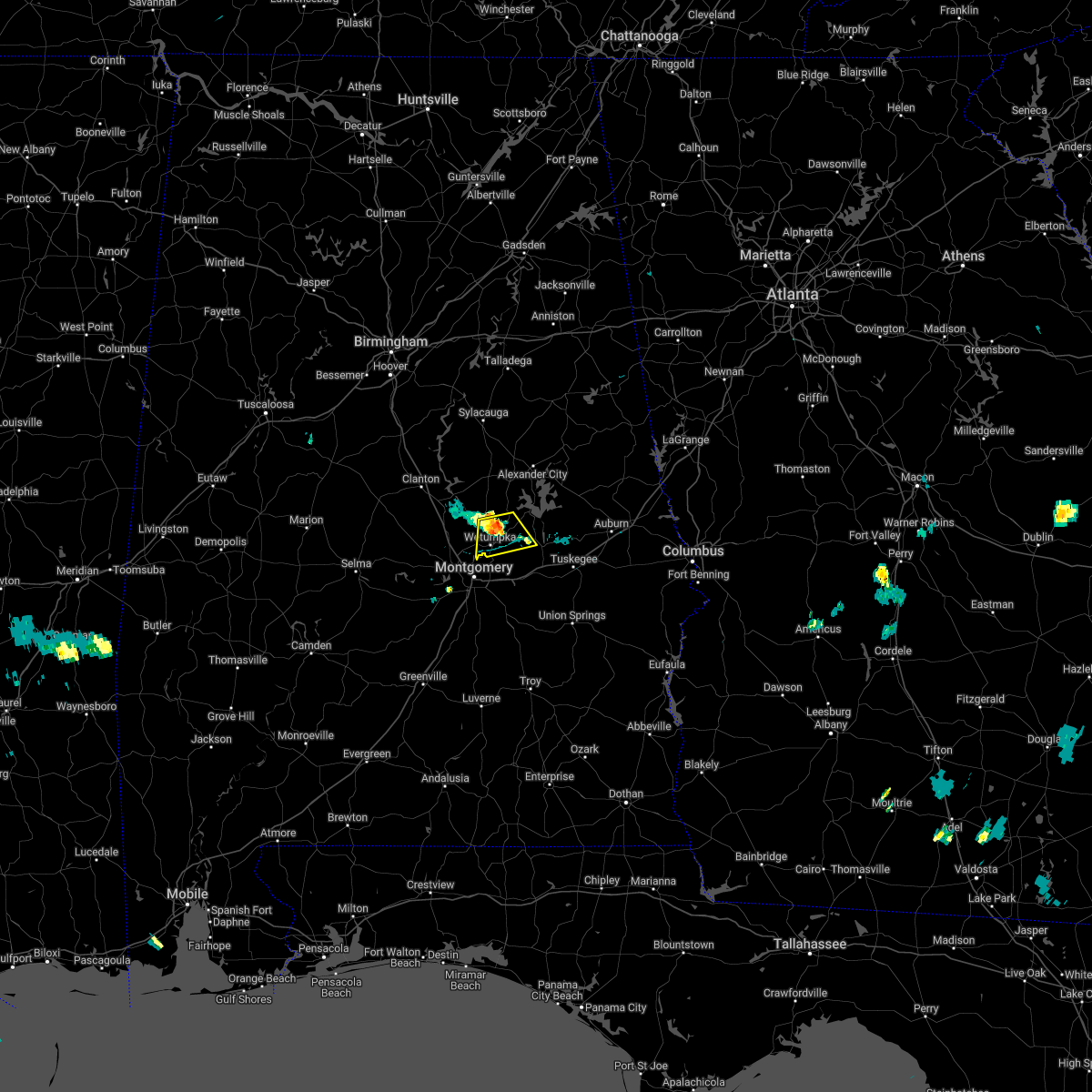 At 708 pm cdt, a severe thunderstorm was located near dexter, or near wetumpka, moving south at 20 mph (radar indicated). Hazards include 60 mph wind gusts and penny size hail. Expect damage to roofs, siding, and trees. locations impacted include, wetumpka, eclectic, santuck, ten cedar estates, blue ridge, dexter, jordan lake, wallsboro, claud, central and jordan dam. hail threat, radar indicated max hail size, 0. 75 in wind threat, radar indicated max wind gust, 60 mph. At 708 pm cdt, a severe thunderstorm was located near dexter, or near wetumpka, moving south at 20 mph (radar indicated). Hazards include 60 mph wind gusts and penny size hail. Expect damage to roofs, siding, and trees. locations impacted include, wetumpka, eclectic, santuck, ten cedar estates, blue ridge, dexter, jordan lake, wallsboro, claud, central and jordan dam. hail threat, radar indicated max hail size, 0. 75 in wind threat, radar indicated max wind gust, 60 mph.
|
| 6/23/2022 6:49 PM CDT |
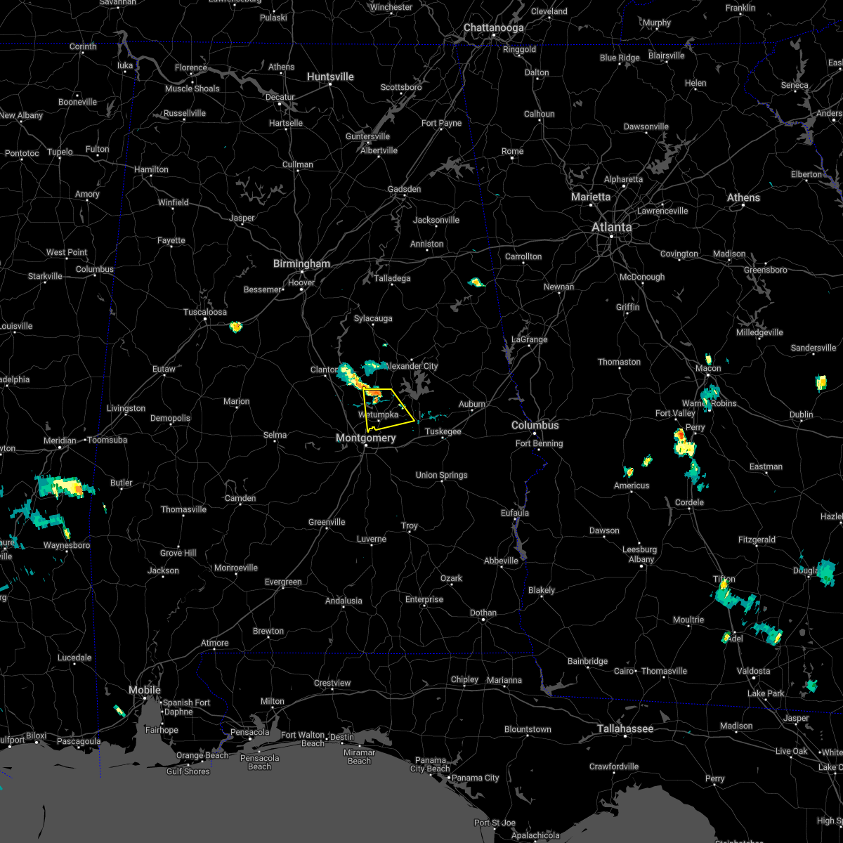 At 648 pm cdt, a severe thunderstorm was located over ten cedar estates, or 8 miles southwest of equality, moving south at 20 mph (radar indicated). Hazards include 60 mph wind gusts and quarter size hail. Hail damage to vehicles is expected. Expect wind damage to roofs, siding, and trees. At 648 pm cdt, a severe thunderstorm was located over ten cedar estates, or 8 miles southwest of equality, moving south at 20 mph (radar indicated). Hazards include 60 mph wind gusts and quarter size hail. Hail damage to vehicles is expected. Expect wind damage to roofs, siding, and trees.
|
| 6/15/2022 9:19 PM CDT |
 At 918 pm cdt, severe thunderstorms were located along a line extending from near speed to pike road to near linwood, moving west at 25 mph (emergency management). Hazards include 60 mph wind gusts. trees have been knoced down with this line of storms. expect damage to roofs, siding, and trees At 918 pm cdt, severe thunderstorms were located along a line extending from near speed to pike road to near linwood, moving west at 25 mph (emergency management). Hazards include 60 mph wind gusts. trees have been knoced down with this line of storms. expect damage to roofs, siding, and trees
|
| 6/15/2022 8:30 PM CDT |
 At 830 pm cdt, severe thunderstorms were located along a line extending from 6 miles northeast of liberty city to tuskegee, moving west at 15 mph (radar indicated). Hazards include 60 mph wind gusts and quarter size hail. Hail damage to vehicles is expected. Expect wind damage to roofs, siding, and trees. At 830 pm cdt, severe thunderstorms were located along a line extending from 6 miles northeast of liberty city to tuskegee, moving west at 15 mph (radar indicated). Hazards include 60 mph wind gusts and quarter size hail. Hail damage to vehicles is expected. Expect wind damage to roofs, siding, and trees.
|
| 4/5/2022 11:21 AM CDT | At 1120 am cdt, severe thunderstorms were located along a line extending from near waugh to 8 miles southeast of glenwood, moving east at 60 mph (radar indicated). Hazards include 60 mph wind gusts and penny size hail. expect damage to roofs, siding, and trees |
| 4/5/2022 11:03 AM CDT |
 At 1103 am cdt, a confirmed tornado was located near eclectic, or 8 miles east of wetumpka, moving east at 55 mph (radar confirmed tornado). Hazards include damaging tornado. Flying debris will be dangerous to those caught without shelter. mobile homes will be damaged or destroyed. damage to roofs, windows, and vehicles will occur. tree damage is likely. Locations impacted include, eclectic, claud and yates reservoir. At 1103 am cdt, a confirmed tornado was located near eclectic, or 8 miles east of wetumpka, moving east at 55 mph (radar confirmed tornado). Hazards include damaging tornado. Flying debris will be dangerous to those caught without shelter. mobile homes will be damaged or destroyed. damage to roofs, windows, and vehicles will occur. tree damage is likely. Locations impacted include, eclectic, claud and yates reservoir.
|
| 4/5/2022 10:56 AM CDT |
 At 1056 am cdt, a tornado producing storm was located over wetumpka, moving northeast at 50 mph (radar confirmed tornado). Hazards include damaging tornado. Flying debris will be dangerous to those caught without shelter. mobile homes will be damaged or destroyed. damage to roofs, windows, and vehicles will occur. Tree damage is likely. At 1056 am cdt, a tornado producing storm was located over wetumpka, moving northeast at 50 mph (radar confirmed tornado). Hazards include damaging tornado. Flying debris will be dangerous to those caught without shelter. mobile homes will be damaged or destroyed. damage to roofs, windows, and vehicles will occur. Tree damage is likely.
|
| 4/5/2022 10:54 AM CDT |
 At 1054 am cdt, a severe thunderstorm capable of producing a tornado was located over wetumpka, moving northeast at 50 mph (radar indicated rotation). Hazards include tornado. Flying debris will be dangerous to those caught without shelter. mobile homes will be damaged or destroyed. damage to roofs, windows, and vehicles will occur. Tree damage is likely. At 1054 am cdt, a severe thunderstorm capable of producing a tornado was located over wetumpka, moving northeast at 50 mph (radar indicated rotation). Hazards include tornado. Flying debris will be dangerous to those caught without shelter. mobile homes will be damaged or destroyed. damage to roofs, windows, and vehicles will occur. Tree damage is likely.
|
| 4/5/2022 8:21 AM CDT |
 The severe thunderstorm warning for northern montgomery county will expire at 830 am cdt, the storm which prompted the warning has weakened below severe limits, and is exiting the warned area. therefore, the warning will be allowed to expire. however small hail and heavy rain are still possible with this thunderstorm as it exits the county. a tornado watch remains in effect until 200 pm cdt for south central, southeastern and east central alabama. The severe thunderstorm warning for northern montgomery county will expire at 830 am cdt, the storm which prompted the warning has weakened below severe limits, and is exiting the warned area. therefore, the warning will be allowed to expire. however small hail and heavy rain are still possible with this thunderstorm as it exits the county. a tornado watch remains in effect until 200 pm cdt for south central, southeastern and east central alabama.
|
| 4/5/2022 8:08 AM CDT |
 At 808 am cdt, a severe thunderstorm was located over southeastern montgomery, moving northeast at 45 mph (radar indicated). Hazards include 60 mph wind gusts and quarter size hail. Hail damage to vehicles is expected. expect wind damage to roofs, siding, and trees. locations impacted include, montgomery, pike road, montgomery zoo, boylston, alabama state university, auburn university in montgomery, mount meigs, eastdale mall, maxwell air force base, montgomery riverwalk stadium, pinedale, waugh, lagoon park, gunter air force base, alabama state capitol, mitylene, barachias, brassell, tallapoosa water plant and cecil. hail threat, radar indicated max hail size, 1. 00 in wind threat, radar indicated max wind gust, 60 mph. At 808 am cdt, a severe thunderstorm was located over southeastern montgomery, moving northeast at 45 mph (radar indicated). Hazards include 60 mph wind gusts and quarter size hail. Hail damage to vehicles is expected. expect wind damage to roofs, siding, and trees. locations impacted include, montgomery, pike road, montgomery zoo, boylston, alabama state university, auburn university in montgomery, mount meigs, eastdale mall, maxwell air force base, montgomery riverwalk stadium, pinedale, waugh, lagoon park, gunter air force base, alabama state capitol, mitylene, barachias, brassell, tallapoosa water plant and cecil. hail threat, radar indicated max hail size, 1. 00 in wind threat, radar indicated max wind gust, 60 mph.
|
| 4/5/2022 7:59 AM CDT |
 At 758 am cdt, a severe thunderstorm was located over snowdoun, or near montgomery, moving northeast at 45 mph (radar indicated). Hazards include 60 mph wind gusts and quarter size hail. Hail damage to vehicles is expected. expect wind damage to roofs, siding, and trees. locations impacted include, montgomery, pike road, montgomery zoo, boylston, hyundai motors of alabama, alabama state university, auburn university in montgomery, hope hull, woodcrest, dannelly field, mount meigs, eastdale mall, snowdoun, montgomery riverwalk stadium, pinedale, waugh, lagoon park, gunter air force base, alabama state capitol and mitylene. hail threat, radar indicated max hail size, 1. 00 in wind threat, radar indicated max wind gust, 60 mph. At 758 am cdt, a severe thunderstorm was located over snowdoun, or near montgomery, moving northeast at 45 mph (radar indicated). Hazards include 60 mph wind gusts and quarter size hail. Hail damage to vehicles is expected. expect wind damage to roofs, siding, and trees. locations impacted include, montgomery, pike road, montgomery zoo, boylston, hyundai motors of alabama, alabama state university, auburn university in montgomery, hope hull, woodcrest, dannelly field, mount meigs, eastdale mall, snowdoun, montgomery riverwalk stadium, pinedale, waugh, lagoon park, gunter air force base, alabama state capitol and mitylene. hail threat, radar indicated max hail size, 1. 00 in wind threat, radar indicated max wind gust, 60 mph.
|
| 4/5/2022 7:51 AM CDT |
 At 751 am cdt, a severe thunderstorm was located over pintlala, or 11 miles east of hayneville, moving northeast at 40 mph (radar indicated). Hazards include 60 mph wind gusts and quarter size hail. Hail damage to vehicles is expected. Expect wind damage to roofs, siding, and trees. At 751 am cdt, a severe thunderstorm was located over pintlala, or 11 miles east of hayneville, moving northeast at 40 mph (radar indicated). Hazards include 60 mph wind gusts and quarter size hail. Hail damage to vehicles is expected. Expect wind damage to roofs, siding, and trees.
|
| 4/5/2022 7:41 AM CDT |
 At 740 am cdt, a severe thunderstorm was located near eclectic, or 8 miles west of tallassee, moving northeast at 50 mph (public). Hazards include 60 mph wind gusts and quarter size hail. Hail damage to vehicles is expected. expect wind damage to roofs, siding, and trees. locations impacted include, wetumpka, tallassee, dadeville, eclectic, martin dam, liberty city, reeves airport, tallapoosa city, emerald mountain, southern lake martin, still waters resort, blue ridge, eastern lake martin, claud, susannah crossing, maxwell gunter recreation area, yates dam, blue creek marina, ware and reeltown. hail threat, radar indicated max hail size, 1. 00 in wind threat, radar indicated max wind gust, 60 mph. At 740 am cdt, a severe thunderstorm was located near eclectic, or 8 miles west of tallassee, moving northeast at 50 mph (public). Hazards include 60 mph wind gusts and quarter size hail. Hail damage to vehicles is expected. expect wind damage to roofs, siding, and trees. locations impacted include, wetumpka, tallassee, dadeville, eclectic, martin dam, liberty city, reeves airport, tallapoosa city, emerald mountain, southern lake martin, still waters resort, blue ridge, eastern lake martin, claud, susannah crossing, maxwell gunter recreation area, yates dam, blue creek marina, ware and reeltown. hail threat, radar indicated max hail size, 1. 00 in wind threat, radar indicated max wind gust, 60 mph.
|
| 4/5/2022 7:25 AM CDT |
 At 725 am cdt, a severe thunderstorm was located over blue ridge, or near wetumpka, moving northeast at 50 mph (radar indicated). Hazards include 60 mph wind gusts and quarter size hail. Hail damage to vehicles is expected. Expect wind damage to roofs, siding, and trees. At 725 am cdt, a severe thunderstorm was located over blue ridge, or near wetumpka, moving northeast at 50 mph (radar indicated). Hazards include 60 mph wind gusts and quarter size hail. Hail damage to vehicles is expected. Expect wind damage to roofs, siding, and trees.
|
| 3/31/2022 12:48 AM CDT |
 At 1248 am cdt, a severe squall line capable of producing both tornadoes and extensive straight line wind damage was located along a line extending from near deatsville to near wetumpka to montgomery, moving northeast at 50 mph (radar indicated rotation). Hazards include tornado. Flying debris will be dangerous to those caught without shelter. mobile homes will be damaged or destroyed. damage to roofs, windows, and vehicles will occur. tree damage is likely. Locations impacted include, northern montgomery, millbrook, wetumpka, elmore, coosada, deatsville, eclectic, santuck, bob woodruff lake, titus, emerald mountain, welona, ten cedar estates, dexter, lagoon park, weoka mills, jordan lake, blue ridge, gunter air force base and western lake martin. At 1248 am cdt, a severe squall line capable of producing both tornadoes and extensive straight line wind damage was located along a line extending from near deatsville to near wetumpka to montgomery, moving northeast at 50 mph (radar indicated rotation). Hazards include tornado. Flying debris will be dangerous to those caught without shelter. mobile homes will be damaged or destroyed. damage to roofs, windows, and vehicles will occur. tree damage is likely. Locations impacted include, northern montgomery, millbrook, wetumpka, elmore, coosada, deatsville, eclectic, santuck, bob woodruff lake, titus, emerald mountain, welona, ten cedar estates, dexter, lagoon park, weoka mills, jordan lake, blue ridge, gunter air force base and western lake martin.
|
| 3/31/2022 12:32 AM CDT |
 At 1232 am cdt, a severe squall line capable of producing both tornadoes and extensive straight line wind damage was located along a line extending from booth to near millbrook to montgomery, moving northeast at 50 mph (radar indicated rotation). Hazards include tornado. Flying debris will be dangerous to those caught without shelter. mobile homes will be damaged or destroyed. damage to roofs, windows, and vehicles will occur. tree damage is likely. Locations impacted include, northwestern montgomery, prattville, millbrook, wetumpka, elmore, coosada, deatsville, eclectic, autaugaville, booth, montgomery zoo, boylston, santuck, bob woodruff lake, autauga county airport, titus, emerald mountain, maxwell air force base, welona and ten cedar estates. At 1232 am cdt, a severe squall line capable of producing both tornadoes and extensive straight line wind damage was located along a line extending from booth to near millbrook to montgomery, moving northeast at 50 mph (radar indicated rotation). Hazards include tornado. Flying debris will be dangerous to those caught without shelter. mobile homes will be damaged or destroyed. damage to roofs, windows, and vehicles will occur. tree damage is likely. Locations impacted include, northwestern montgomery, prattville, millbrook, wetumpka, elmore, coosada, deatsville, eclectic, autaugaville, booth, montgomery zoo, boylston, santuck, bob woodruff lake, autauga county airport, titus, emerald mountain, maxwell air force base, welona and ten cedar estates.
|
| 3/31/2022 12:17 AM CDT |
 At 1217 am cdt, tornado producing storms were located along a line extending from near autaugaville to dannelly field to near pintlala, moving northeast at 60 mph (radar confirmed tornado). Hazards include damaging tornado. Flying debris will be dangerous to those caught without shelter. mobile homes will be damaged or destroyed. damage to roofs, windows, and vehicles will occur. tree damage is likely. Locations impacted include, montgomery, prattville, millbrook, wetumpka, tallassee, elmore, coosada, deatsville, eclectic, autaugaville, white hall, hyundai motors of alabama, santuck, auburn university in montgomery, autauga county airport, titus, woodcrest, ten cedar estates, dexter and lagoon park. At 1217 am cdt, tornado producing storms were located along a line extending from near autaugaville to dannelly field to near pintlala, moving northeast at 60 mph (radar confirmed tornado). Hazards include damaging tornado. Flying debris will be dangerous to those caught without shelter. mobile homes will be damaged or destroyed. damage to roofs, windows, and vehicles will occur. tree damage is likely. Locations impacted include, montgomery, prattville, millbrook, wetumpka, tallassee, elmore, coosada, deatsville, eclectic, autaugaville, white hall, hyundai motors of alabama, santuck, auburn university in montgomery, autauga county airport, titus, woodcrest, ten cedar estates, dexter and lagoon park.
|
| 3/31/2022 12:16 AM CDT |
 At 1215 am cdt, severe thunderstorms capable of producing both tornadoes and extensive straight line wind damage were located along a line extending from near autaugaville to dannelly field to near pintlala, moving northeast at 60 mph (radar indicated rotation). Hazards include tornado. Flying debris will be dangerous to those caught without shelter. mobile homes will be damaged or destroyed. damage to roofs, windows, and vehicles will occur. Tree damage is likely. At 1215 am cdt, severe thunderstorms capable of producing both tornadoes and extensive straight line wind damage were located along a line extending from near autaugaville to dannelly field to near pintlala, moving northeast at 60 mph (radar indicated rotation). Hazards include tornado. Flying debris will be dangerous to those caught without shelter. mobile homes will be damaged or destroyed. damage to roofs, windows, and vehicles will occur. Tree damage is likely.
|
| 3/18/2022 8:16 AM CDT |
 At 815 am cdt, severe thunderstorms were located along a line extending from stewartville to near hunter, moving east at 55 mph (radar indicated). Hazards include 60 mph wind gusts and penny size hail. Expect damage to roofs, siding, and trees. locations impacted include, prattville, alexander city, millbrook, wetumpka, tallassee, goodwater, rockford, kellyton, equality, stewartville, elmore, coosada, deatsville, eclectic, jacksons` gap, martin dam, bradford, santuck, titus and bentleyville. hail threat, radar indicated max hail size, 0. 75 in wind threat, radar indicated max wind gust, 60 mph. At 815 am cdt, severe thunderstorms were located along a line extending from stewartville to near hunter, moving east at 55 mph (radar indicated). Hazards include 60 mph wind gusts and penny size hail. Expect damage to roofs, siding, and trees. locations impacted include, prattville, alexander city, millbrook, wetumpka, tallassee, goodwater, rockford, kellyton, equality, stewartville, elmore, coosada, deatsville, eclectic, jacksons` gap, martin dam, bradford, santuck, titus and bentleyville. hail threat, radar indicated max hail size, 0. 75 in wind threat, radar indicated max wind gust, 60 mph.
|
| 3/18/2022 7:52 AM CDT |
 At 752 am cdt, severe thunderstorms were located along a line extending from near lay lake dam to near white hall, moving east at 60 mph (radar indicated). Hazards include 60 mph wind gusts and penny size hail. expect damage to roofs, siding, and trees At 752 am cdt, severe thunderstorms were located along a line extending from near lay lake dam to near white hall, moving east at 60 mph (radar indicated). Hazards include 60 mph wind gusts and penny size hail. expect damage to roofs, siding, and trees
|
| 3/16/2022 11:52 AM CDT |
 At 1152 am cdt, a severe thunderstorm was located over emerald mountain, or 8 miles southeast of wetumpka, moving northeast at 10 mph (radar indicated). Hazards include 60 mph wind gusts and quarter size hail. Hail damage to vehicles is expected. Expect wind damage to roofs, siding, and trees. At 1152 am cdt, a severe thunderstorm was located over emerald mountain, or 8 miles southeast of wetumpka, moving northeast at 10 mph (radar indicated). Hazards include 60 mph wind gusts and quarter size hail. Hail damage to vehicles is expected. Expect wind damage to roofs, siding, and trees.
|
| 2/3/2022 5:51 PM CST |
 At 551 pm cst, severe thunderstorms were located along a line extending from near hillabee creek to near dadeville to 6 miles southwest of waverly to near tysonville, moving northeast at 50 mph (radar indicated). Hazards include 60 mph wind gusts. Expect damage to roofs, siding, and trees. locations impacted include, montgomery, alexander city, tuskegee, tallassee, dadeville, camp hill, notasulga, milstead, pike road, eclectic, jacksons` gap, new site, shorter, franklin, waverly, goldville, martin dam, hyundai motors of alabama, auburn university in montgomery and lake tuskegee. hail threat, radar indicated max hail size, <. 75 in wind threat, radar indicated max wind gust, 60 mph. At 551 pm cst, severe thunderstorms were located along a line extending from near hillabee creek to near dadeville to 6 miles southwest of waverly to near tysonville, moving northeast at 50 mph (radar indicated). Hazards include 60 mph wind gusts. Expect damage to roofs, siding, and trees. locations impacted include, montgomery, alexander city, tuskegee, tallassee, dadeville, camp hill, notasulga, milstead, pike road, eclectic, jacksons` gap, new site, shorter, franklin, waverly, goldville, martin dam, hyundai motors of alabama, auburn university in montgomery and lake tuskegee. hail threat, radar indicated max hail size, <. 75 in wind threat, radar indicated max wind gust, 60 mph.
|
| 2/3/2022 5:31 PM CST |
 At 531 pm cst, severe thunderstorms were located along a line extending from highway 9 and highway 22 to kowaliga bridge to kent to montgomery, moving northeast at 50 mph (radar indicated). Hazards include 60 mph wind gusts. Expect damage to roofs, siding, and trees. locations impacted include, montgomery, alexander city, tuskegee, wetumpka, tallassee, dadeville, camp hill, notasulga, hayneville, kellyton, equality, milstead, pike road, eclectic, jacksons` gap, new site, shorter, franklin, waverly and goldville. hail threat, radar indicated max hail size, <. 75 in wind threat, radar indicated max wind gust, 60 mph. At 531 pm cst, severe thunderstorms were located along a line extending from highway 9 and highway 22 to kowaliga bridge to kent to montgomery, moving northeast at 50 mph (radar indicated). Hazards include 60 mph wind gusts. Expect damage to roofs, siding, and trees. locations impacted include, montgomery, alexander city, tuskegee, wetumpka, tallassee, dadeville, camp hill, notasulga, hayneville, kellyton, equality, milstead, pike road, eclectic, jacksons` gap, new site, shorter, franklin, waverly and goldville. hail threat, radar indicated max hail size, <. 75 in wind threat, radar indicated max wind gust, 60 mph.
|
| 2/3/2022 5:16 PM CST |
 At 516 pm cst, severe thunderstorms were located along a line extending from speed to santuck to near emerald mountain to near dannelly field, moving northeast at 50 mph (radar indicated). Hazards include 60 mph wind gusts. expect damage to roofs, siding, and trees At 516 pm cst, severe thunderstorms were located along a line extending from speed to santuck to near emerald mountain to near dannelly field, moving northeast at 50 mph (radar indicated). Hazards include 60 mph wind gusts. expect damage to roofs, siding, and trees
|
| 8/2/2021 3:43 PM CDT |
 At 342 pm cdt, a severe thunderstorm was located over waugh, or 9 miles southwest of milstead, moving east at 30 mph (radar indicated). Hazards include 60 mph wind gusts and penny size hail. Expect damage to roofs, siding, and trees. Locations impacted include, southeastern montgomery, tuskegee, tallassee, notasulga, milstead, shorter, franklin, liverpool, lake tuskegee, hardaway, mount meigs, tysonville, victoryland, davisville, waugh, uphapee creek, cross keys, brassell, ware and cecil. At 342 pm cdt, a severe thunderstorm was located over waugh, or 9 miles southwest of milstead, moving east at 30 mph (radar indicated). Hazards include 60 mph wind gusts and penny size hail. Expect damage to roofs, siding, and trees. Locations impacted include, southeastern montgomery, tuskegee, tallassee, notasulga, milstead, shorter, franklin, liverpool, lake tuskegee, hardaway, mount meigs, tysonville, victoryland, davisville, waugh, uphapee creek, cross keys, brassell, ware and cecil.
|
| 8/2/2021 3:29 PM CDT |
 At 329 pm cdt, a severe thunderstorm was located over eastern montgomery, moving east at 30 mph (radar indicated). Hazards include 60 mph wind gusts and penny size hail. expect damage to roofs, siding, and trees At 329 pm cdt, a severe thunderstorm was located over eastern montgomery, moving east at 30 mph (radar indicated). Hazards include 60 mph wind gusts and penny size hail. expect damage to roofs, siding, and trees
|
| 5/4/2021 6:55 PM CDT |
 The severe thunderstorm warning for elmore county will expire at 700 pm cdt, the storms which prompted the warning have moved out of the area. therefore, the warning will be allowed to expire. a tornado watch remains in effect until 1000 pm cdt for central, south central and east central alabama. a severe thunderstorm watch remains in effect until midnight cdt for southeastern alabama. to report severe weather, contact your nearest law enforcement agency. they will relay your report to the national weather service birmingham. The severe thunderstorm warning for elmore county will expire at 700 pm cdt, the storms which prompted the warning have moved out of the area. therefore, the warning will be allowed to expire. a tornado watch remains in effect until 1000 pm cdt for central, south central and east central alabama. a severe thunderstorm watch remains in effect until midnight cdt for southeastern alabama. to report severe weather, contact your nearest law enforcement agency. they will relay your report to the national weather service birmingham.
|
| 5/4/2021 6:31 PM CDT |
 At 631 pm cdt, a severe thunderstorm capable of producing a tornado was located over blue ridge, or near wetumpka, moving east at 55 mph (radar indicated rotation). Hazards include tornado. Flying debris will be dangerous to those caught without shelter. mobile homes will be damaged or destroyed. damage to roofs, windows, and vehicles will occur. tree damage is likely. Locations impacted include, northern montgomery, wetumpka, tallassee, emerald mountain, blue ridge, bob woodruff lake, ware, tallapoosa water plant, yates dam and yates reservoir. At 631 pm cdt, a severe thunderstorm capable of producing a tornado was located over blue ridge, or near wetumpka, moving east at 55 mph (radar indicated rotation). Hazards include tornado. Flying debris will be dangerous to those caught without shelter. mobile homes will be damaged or destroyed. damage to roofs, windows, and vehicles will occur. tree damage is likely. Locations impacted include, northern montgomery, wetumpka, tallassee, emerald mountain, blue ridge, bob woodruff lake, ware, tallapoosa water plant, yates dam and yates reservoir.
|
| 5/4/2021 6:24 PM CDT |
 The national weather service in birmingham has issued a * tornado warning for. southern elmore county in east central alabama. north central montgomery county in south central alabama. until 700 pm cdt. At 624 pm cdt, a severe thunderstorm capable of producing a tornado. The national weather service in birmingham has issued a * tornado warning for. southern elmore county in east central alabama. north central montgomery county in south central alabama. until 700 pm cdt. At 624 pm cdt, a severe thunderstorm capable of producing a tornado.
|
| 5/4/2021 6:21 PM CDT |
 At 621 pm cdt, severe thunderstorms were located along a line extending from near speed to montgomery, moving east at 50 mph (radar indicated). Hazards include 60 mph wind gusts. this line of storms has a history of producing high winds and wind damage. Expect damage to roofs, siding, and trees. Locations impacted include, prattville, millbrook, wetumpka, tallassee, elmore, coosada, deatsville, eclectic, santuck, titus, emerald mountain, ten cedar estates, dexter, weoka mills, jordan lake, blue ridge, kowaliga bridge, welona, martin dam and western lake martin. At 621 pm cdt, severe thunderstorms were located along a line extending from near speed to montgomery, moving east at 50 mph (radar indicated). Hazards include 60 mph wind gusts. this line of storms has a history of producing high winds and wind damage. Expect damage to roofs, siding, and trees. Locations impacted include, prattville, millbrook, wetumpka, tallassee, elmore, coosada, deatsville, eclectic, santuck, titus, emerald mountain, ten cedar estates, dexter, weoka mills, jordan lake, blue ridge, kowaliga bridge, welona, martin dam and western lake martin.
|
| 5/4/2021 5:59 PM CDT |
 At 559 pm cdt, severe thunderstorms were located along a line extending from near marbury to near autaugaville, moving east at 50 mph (radar indicated). Hazards include 60 mph wind gusts. expect damage to roofs, siding, and trees At 559 pm cdt, severe thunderstorms were located along a line extending from near marbury to near autaugaville, moving east at 50 mph (radar indicated). Hazards include 60 mph wind gusts. expect damage to roofs, siding, and trees
|
| 5/3/2021 7:40 PM CDT |
 At 739 pm cdt, a severe thunderstorm was located over tysonville, or 8 miles west of milstead, moving east at 25 mph (radar indicated). Hazards include 60 mph wind gusts and half dollar size hail. Hail damage to vehicles is expected. Expect wind damage to roofs, siding, and trees. At 739 pm cdt, a severe thunderstorm was located over tysonville, or 8 miles west of milstead, moving east at 25 mph (radar indicated). Hazards include 60 mph wind gusts and half dollar size hail. Hail damage to vehicles is expected. Expect wind damage to roofs, siding, and trees.
|
| 5/3/2021 7:33 PM CDT |
 At 733 pm cdt, a severe thunderstorm was located over waugh, or 10 miles west of milstead, moving east at 25 mph (radar indicated). Hazards include 60 mph wind gusts and quarter size hail. Hail damage to vehicles is expected. expect wind damage to roofs, siding, and trees. Locations impacted include, emerald mountain, waugh, brassell and ware. At 733 pm cdt, a severe thunderstorm was located over waugh, or 10 miles west of milstead, moving east at 25 mph (radar indicated). Hazards include 60 mph wind gusts and quarter size hail. Hail damage to vehicles is expected. expect wind damage to roofs, siding, and trees. Locations impacted include, emerald mountain, waugh, brassell and ware.
|
| 5/3/2021 7:20 PM CDT |
 At 719 pm cdt, a severe thunderstorm was located near auburn university in montgomery, or 8 miles northeast of montgomery, moving east at 25 mph (radar indicated). Hazards include 60 mph wind gusts and quarter size hail. Hail damage to vehicles is expected. expect wind damage to roofs, siding, and trees. Locations impacted include, northeastern montgomery, auburn university in montgomery, emerald mountain, mount meigs, eastdale mall, blue ridge, waugh, lagoon park, gunter air force base, mitylene, brassell, ware and tallapoosa water plant. At 719 pm cdt, a severe thunderstorm was located near auburn university in montgomery, or 8 miles northeast of montgomery, moving east at 25 mph (radar indicated). Hazards include 60 mph wind gusts and quarter size hail. Hail damage to vehicles is expected. expect wind damage to roofs, siding, and trees. Locations impacted include, northeastern montgomery, auburn university in montgomery, emerald mountain, mount meigs, eastdale mall, blue ridge, waugh, lagoon park, gunter air force base, mitylene, brassell, ware and tallapoosa water plant.
|
| 5/3/2021 7:05 PM CDT |
 At 705 pm cdt, a severe thunderstorm was located over lagoon park, or near wetumpka, moving east at 25 mph (radar indicated). Hazards include 60 mph wind gusts and half dollar size hail. Hail damage to vehicles is expected. expect wind damage to roofs, siding, and trees. Locations impacted include, wetumpka, emerald mountain, blue ridge, bob woodruff lake, boylston and tallapoosa water plant. At 705 pm cdt, a severe thunderstorm was located over lagoon park, or near wetumpka, moving east at 25 mph (radar indicated). Hazards include 60 mph wind gusts and half dollar size hail. Hail damage to vehicles is expected. expect wind damage to roofs, siding, and trees. Locations impacted include, wetumpka, emerald mountain, blue ridge, bob woodruff lake, boylston and tallapoosa water plant.
|
| 5/3/2021 7:02 PM CDT |
 At 702 pm cdt, a severe thunderstorm was located over northern montgomery, moving east at 25 mph (radar indicated). Hazards include 60 mph wind gusts and half dollar size hail. Hail damage to vehicles is expected. Expect wind damage to roofs, siding, and trees. At 702 pm cdt, a severe thunderstorm was located over northern montgomery, moving east at 25 mph (radar indicated). Hazards include 60 mph wind gusts and half dollar size hail. Hail damage to vehicles is expected. Expect wind damage to roofs, siding, and trees.
|
| 5/3/2021 6:50 PM CDT |
 At 650 pm cdt, a severe thunderstorm was located over coosada, or over millbrook, moving east at 25 mph (radar indicated). Hazards include golf ball size hail and 60 mph wind gusts. People and animals outdoors will be injured. expect hail damage to roofs, siding, windows, and vehicles. expect wind damage to roofs, siding, and trees. Locations impacted include, prattville, millbrook, wetumpka, elmore, coosada, emerald mountain, boylston, blue ridge, bob woodruff lake, wallsboro, wetumpka municipal airport and tallapoosa water plant. At 650 pm cdt, a severe thunderstorm was located over coosada, or over millbrook, moving east at 25 mph (radar indicated). Hazards include golf ball size hail and 60 mph wind gusts. People and animals outdoors will be injured. expect hail damage to roofs, siding, windows, and vehicles. expect wind damage to roofs, siding, and trees. Locations impacted include, prattville, millbrook, wetumpka, elmore, coosada, emerald mountain, boylston, blue ridge, bob woodruff lake, wallsboro, wetumpka municipal airport and tallapoosa water plant.
|
| 5/3/2021 6:29 PM CDT |
 At 629 pm cdt, a severe thunderstorm was located over prattville, moving east at 25 mph (radar indicated). Hazards include golf ball size hail and 60 mph wind gusts. People and animals outdoors will be injured. expect hail damage to roofs, siding, windows, and vehicles. expect wind damage to roofs, siding, and trees. Locations impacted include, prattville, millbrook, wetumpka, elmore, coosada, deatsville, bob woodruff lake, autauga county airport, emerald mountain, blue ridge, boylston, wetumpka municipal airport, wallsboro and tallapoosa water plant. At 629 pm cdt, a severe thunderstorm was located over prattville, moving east at 25 mph (radar indicated). Hazards include golf ball size hail and 60 mph wind gusts. People and animals outdoors will be injured. expect hail damage to roofs, siding, windows, and vehicles. expect wind damage to roofs, siding, and trees. Locations impacted include, prattville, millbrook, wetumpka, elmore, coosada, deatsville, bob woodruff lake, autauga county airport, emerald mountain, blue ridge, boylston, wetumpka municipal airport, wallsboro and tallapoosa water plant.
|
| 5/3/2021 6:26 PM CDT |
 At 625 pm cdt, a severe thunderstorm was located over autauga county airport, or near prattville, moving east at 25 mph (radar indicated). Hazards include 60 mph wind gusts and quarter size hail. Hail damage to vehicles is expected. Expect wind damage to roofs, siding, and trees. At 625 pm cdt, a severe thunderstorm was located over autauga county airport, or near prattville, moving east at 25 mph (radar indicated). Hazards include 60 mph wind gusts and quarter size hail. Hail damage to vehicles is expected. Expect wind damage to roofs, siding, and trees.
|
| 4/24/2021 4:50 PM CDT |
 At 450 pm cdt, a severe thunderstorm was located over blue ridge, or near wetumpka, moving east at 45 mph (radar indicated). Hazards include golf ball size hail and 60 mph wind gusts. People and animals outdoors will be injured. expect hail damage to roofs, siding, windows, and vehicles. expect wind damage to roofs, siding, and trees. Locations impacted include, wetumpka, tallassee, blue ridge, claud, yates reservoir and yates dam. At 450 pm cdt, a severe thunderstorm was located over blue ridge, or near wetumpka, moving east at 45 mph (radar indicated). Hazards include golf ball size hail and 60 mph wind gusts. People and animals outdoors will be injured. expect hail damage to roofs, siding, windows, and vehicles. expect wind damage to roofs, siding, and trees. Locations impacted include, wetumpka, tallassee, blue ridge, claud, yates reservoir and yates dam.
|
| 4/24/2021 4:35 PM CDT |
 At 435 pm cdt, a severe thunderstorm was located over millbrook, moving east at 45 mph (radar indicated). Hazards include golf ball size hail and 60 mph wind gusts. People and animals outdoors will be injured. expect hail damage to roofs, siding, windows, and vehicles. Expect wind damage to roofs, siding, and trees. At 435 pm cdt, a severe thunderstorm was located over millbrook, moving east at 45 mph (radar indicated). Hazards include golf ball size hail and 60 mph wind gusts. People and animals outdoors will be injured. expect hail damage to roofs, siding, windows, and vehicles. Expect wind damage to roofs, siding, and trees.
|
| 3/17/2021 10:34 PM CDT |
 At 1033 pm cdt, severe thunderstorms were located along a line extending from stewartville to near blue ridge to grady, moving east at 55 mph (radar indicated). Hazards include 60 mph wind gusts. Expect damage to roofs, siding, and trees. Locations impacted include, montgomery, wetumpka, tallassee, goodwater, rockford, kellyton, equality, meadville, stewartville, weogufka, pike road, elmore, coosada, eclectic, martin dam, bradford, santuck, auburn university in montgomery, dublin and titus. At 1033 pm cdt, severe thunderstorms were located along a line extending from stewartville to near blue ridge to grady, moving east at 55 mph (radar indicated). Hazards include 60 mph wind gusts. Expect damage to roofs, siding, and trees. Locations impacted include, montgomery, wetumpka, tallassee, goodwater, rockford, kellyton, equality, meadville, stewartville, weogufka, pike road, elmore, coosada, eclectic, martin dam, bradford, santuck, auburn university in montgomery, dublin and titus.
|
| 3/17/2021 10:23 PM CDT |
 At 1023 pm cdt, severe thunderstorms were located along a line extending from near strickland crossroads to near jordan lake to highland home, moving east at 50 mph (radar indicated). Hazards include 60 mph wind gusts. Expect damage to roofs, siding, and trees. Locations impacted include, montgomery, prattville, millbrook, wetumpka, tallassee, goodwater, rockford, kellyton, weogufka, equality, meadville, stewartville, pike road, elmore, coosada, deatsville, eclectic, bradford, santuck and strickland crossroads. At 1023 pm cdt, severe thunderstorms were located along a line extending from near strickland crossroads to near jordan lake to highland home, moving east at 50 mph (radar indicated). Hazards include 60 mph wind gusts. Expect damage to roofs, siding, and trees. Locations impacted include, montgomery, prattville, millbrook, wetumpka, tallassee, goodwater, rockford, kellyton, weogufka, equality, meadville, stewartville, pike road, elmore, coosada, deatsville, eclectic, bradford, santuck and strickland crossroads.
|
| 3/17/2021 10:07 PM CDT |
 At 1007 pm cdt, severe thunderstorms were located along a line extending from 7 miles northeast of jemison to near booth to near lowndes county airport, moving east at 50 mph (radar indicated). Hazards include 60 mph wind gusts. Expect damage to roofs, siding, and trees. Locations impacted include, montgomery, prattville, millbrook, clanton, wetumpka, tallassee, jemison, goodwater, fort deposit, mosses, hayneville, rockford, kellyton, weogufka, equality, meadville, stewartville, pike road, thorsby and elmore. At 1007 pm cdt, severe thunderstorms were located along a line extending from 7 miles northeast of jemison to near booth to near lowndes county airport, moving east at 50 mph (radar indicated). Hazards include 60 mph wind gusts. Expect damage to roofs, siding, and trees. Locations impacted include, montgomery, prattville, millbrook, clanton, wetumpka, tallassee, jemison, goodwater, fort deposit, mosses, hayneville, rockford, kellyton, weogufka, equality, meadville, stewartville, pike road, thorsby and elmore.
|
| 3/17/2021 9:51 PM CDT |
 At 951 pm cdt, severe thunderstorms were located along a line extending from near ashby to near vida junction to 9 miles northwest of greenville, moving east at 50 mph (radar indicated). Hazards include 60 mph wind gusts. expect damage to roofs, siding, and trees At 951 pm cdt, severe thunderstorms were located along a line extending from near ashby to near vida junction to 9 miles northwest of greenville, moving east at 50 mph (radar indicated). Hazards include 60 mph wind gusts. expect damage to roofs, siding, and trees
|
| 8/19/2020 10:01 PM CDT |
 At 1000 pm cdt, a severe thunderstorm was located over northern montgomery, and is nearly stationary (radar indicated). Hazards include 60 mph wind gusts and penny size hail. Expect damage to roofs, siding, and trees. Locations impacted include, northern montgomery, coosada, emerald mountain, montgomery zoo, boylston, montgomery riverwalk stadium, blue ridge, bob woodruff lake, lagoon park, gunter air force base, eastdale mall and tallapoosa water plant. At 1000 pm cdt, a severe thunderstorm was located over northern montgomery, and is nearly stationary (radar indicated). Hazards include 60 mph wind gusts and penny size hail. Expect damage to roofs, siding, and trees. Locations impacted include, northern montgomery, coosada, emerald mountain, montgomery zoo, boylston, montgomery riverwalk stadium, blue ridge, bob woodruff lake, lagoon park, gunter air force base, eastdale mall and tallapoosa water plant.
|
| 8/19/2020 9:38 PM CDT |
 The national weather service in birmingham has issued a * severe thunderstorm warning for. southwestern elmore county in east central alabama. north central montgomery county in south central alabama. until 1030 pm cdt. At 938 pm cdt, a severe thunderstorm was located over northern. The national weather service in birmingham has issued a * severe thunderstorm warning for. southwestern elmore county in east central alabama. north central montgomery county in south central alabama. until 1030 pm cdt. At 938 pm cdt, a severe thunderstorm was located over northern.
|
| 8/12/2020 6:51 PM CDT |
 At 636 pm cdt, a severe thunderstorm was located near lagoon park, or 8 miles northeast of montgomery, and is nearly stationary (radar indicated). Hazards include 60 mph wind gusts. Expect damage to roofs, siding, and trees. Locations impacted include, montgomery, montgomery zoo, boylston, auburn university in montgomery, emerald mountain, mount meigs, eastdale mall, blue ridge, waugh, lagoon park, gunter air force base, mitylene, brassell and tallapoosa water plant. At 636 pm cdt, a severe thunderstorm was located near lagoon park, or 8 miles northeast of montgomery, and is nearly stationary (radar indicated). Hazards include 60 mph wind gusts. Expect damage to roofs, siding, and trees. Locations impacted include, montgomery, montgomery zoo, boylston, auburn university in montgomery, emerald mountain, mount meigs, eastdale mall, blue ridge, waugh, lagoon park, gunter air force base, mitylene, brassell and tallapoosa water plant.
|
| 8/12/2020 6:36 PM CDT |
 At 636 pm cdt, a severe thunderstorm was located near lagoon park, or 8 miles northeast of montgomery, and is nearly stationary (radar indicated). Hazards include 60 mph wind gusts. Expect damage to roofs, siding, and trees. Locations impacted include, montgomery, montgomery zoo, boylston, auburn university in montgomery, emerald mountain, mount meigs, eastdale mall, blue ridge, waugh, lagoon park, gunter air force base, mitylene, brassell and tallapoosa water plant. At 636 pm cdt, a severe thunderstorm was located near lagoon park, or 8 miles northeast of montgomery, and is nearly stationary (radar indicated). Hazards include 60 mph wind gusts. Expect damage to roofs, siding, and trees. Locations impacted include, montgomery, montgomery zoo, boylston, auburn university in montgomery, emerald mountain, mount meigs, eastdale mall, blue ridge, waugh, lagoon park, gunter air force base, mitylene, brassell and tallapoosa water plant.
|
| 8/12/2020 6:24 PM CDT |
 At 624 pm cdt, a severe thunderstorm was located over eastdale mall, or 7 miles northeast of montgomery, and is nearly stationary (radar indicated). Hazards include 60 mph wind gusts and quarter size hail. Hail damage to vehicles is expected. Expect wind damage to roofs, siding, and trees. At 624 pm cdt, a severe thunderstorm was located over eastdale mall, or 7 miles northeast of montgomery, and is nearly stationary (radar indicated). Hazards include 60 mph wind gusts and quarter size hail. Hail damage to vehicles is expected. Expect wind damage to roofs, siding, and trees.
|
| 8/11/2020 3:07 PM CDT |
 The severe thunderstorm warning for north central montgomery county will expire at 315 pm cdt. the storm which prompted the warning has weakened below severe limits. therefore, the warning will be allowed to expire. to report severe weather, contact your nearest law enforcement agency. They will relay your report to the national weather service. The severe thunderstorm warning for north central montgomery county will expire at 315 pm cdt. the storm which prompted the warning has weakened below severe limits. therefore, the warning will be allowed to expire. to report severe weather, contact your nearest law enforcement agency. They will relay your report to the national weather service.
|
| 8/11/2020 2:58 PM CDT |
 A severe thunderstorm warning remains in effect until 315 pm cdt for north central montgomery county. at 257 pm cdt, a severe thunderstorm was located over boylston, or near montgomery, moving east at 10 mph. hazard. 60 mph wind gusts and penny size hail. source. Radar indicated. A severe thunderstorm warning remains in effect until 315 pm cdt for north central montgomery county. at 257 pm cdt, a severe thunderstorm was located over boylston, or near montgomery, moving east at 10 mph. hazard. 60 mph wind gusts and penny size hail. source. Radar indicated.
|
| 8/11/2020 2:48 PM CDT |
 At 248 pm cdt, a severe thunderstorm was located over boylston, or near montgomery, moving southeast at 5 mph (radar indicated). Hazards include 60 mph wind gusts and penny size hail. Expect damage to roofs, siding, and trees. Locations impacted include, montgomery, prattville, millbrook, coosada, montgomery zoo, boylston, alabama state university, bob woodruff lake, eastdale mall, maxwell air force base, montgomery riverwalk stadium, lagoon park, gunter air force base, alabama state capitol, blue ridge and tallapoosa water plant. At 248 pm cdt, a severe thunderstorm was located over boylston, or near montgomery, moving southeast at 5 mph (radar indicated). Hazards include 60 mph wind gusts and penny size hail. Expect damage to roofs, siding, and trees. Locations impacted include, montgomery, prattville, millbrook, coosada, montgomery zoo, boylston, alabama state university, bob woodruff lake, eastdale mall, maxwell air force base, montgomery riverwalk stadium, lagoon park, gunter air force base, alabama state capitol, blue ridge and tallapoosa water plant.
|
| 8/11/2020 2:36 PM CDT |
 At 236 pm cdt, a severe thunderstorm was located over boylston, or near millbrook, moving southeast at 5 mph (radar indicated). Hazards include 60 mph wind gusts and quarter size hail. Hail damage to vehicles is expected. Expect wind damage to roofs, siding, and trees. At 236 pm cdt, a severe thunderstorm was located over boylston, or near millbrook, moving southeast at 5 mph (radar indicated). Hazards include 60 mph wind gusts and quarter size hail. Hail damage to vehicles is expected. Expect wind damage to roofs, siding, and trees.
|
| 7/12/2020 4:09 PM CDT |
 At 409 pm cdt, severe thunderstorms were located along a line extending from near gordonville to near liverpool, moving southeast at 35 mph (radar indicated). Hazards include 60 mph wind gusts. Expect damage to roofs, siding, and trees. Locations impacted include, montgomery, union springs, fort deposit, mosses, hayneville, meadville, milstead, pike road, white hall, shorter, gordonville, lowndesboro, benton, hyundai motors of alabama, auburn university in montgomery, dublin, woodcrest, beans crossroads, snowdoun and shopton. At 409 pm cdt, severe thunderstorms were located along a line extending from near gordonville to near liverpool, moving southeast at 35 mph (radar indicated). Hazards include 60 mph wind gusts. Expect damage to roofs, siding, and trees. Locations impacted include, montgomery, union springs, fort deposit, mosses, hayneville, meadville, milstead, pike road, white hall, shorter, gordonville, lowndesboro, benton, hyundai motors of alabama, auburn university in montgomery, dublin, woodcrest, beans crossroads, snowdoun and shopton.
|
| 7/12/2020 4:03 PM CDT |
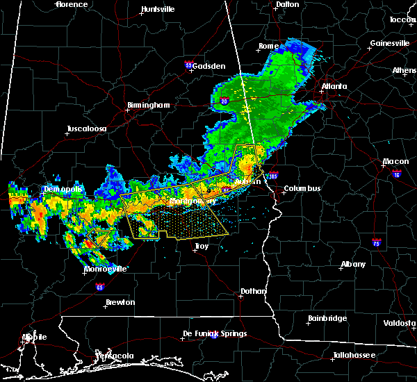 At 403 pm cdt, severe thunderstorms were located along a line extending from near white hall to near milstead, moving southeast at 35 mph (radar indicated). Hazards include 60 mph wind gusts. Expect damage to roofs, siding, and trees. Locations impacted include, montgomery, prattville, millbrook, union springs, fort deposit, mosses, hayneville, meadville, milstead, pike road, white hall, shorter, gordonville, lowndesboro, benton, hyundai motors of alabama, auburn university in montgomery, dublin, woodcrest and beans crossroads. At 403 pm cdt, severe thunderstorms were located along a line extending from near white hall to near milstead, moving southeast at 35 mph (radar indicated). Hazards include 60 mph wind gusts. Expect damage to roofs, siding, and trees. Locations impacted include, montgomery, prattville, millbrook, union springs, fort deposit, mosses, hayneville, meadville, milstead, pike road, white hall, shorter, gordonville, lowndesboro, benton, hyundai motors of alabama, auburn university in montgomery, dublin, woodcrest and beans crossroads.
|
| 7/12/2020 3:49 PM CDT |
 At 349 pm cdt, severe thunderstorms were located along a line extending from near benton to near milstead, moving southeast at 35 mph (radar indicated). Hazards include 60 mph wind gusts. expect damage to roofs, siding, and trees At 349 pm cdt, severe thunderstorms were located along a line extending from near benton to near milstead, moving southeast at 35 mph (radar indicated). Hazards include 60 mph wind gusts. expect damage to roofs, siding, and trees
|
| 4/12/2020 11:11 PM CDT |
 At 1110 pm cdt, severe thunderstorms were located along a line extending from near speed to montgomery, moving east at 35 mph (radar indicated). Hazards include 60 mph wind gusts. Expect damage to roofs, siding, and trees. Locations impacted include, prattville, millbrook, wetumpka, tallassee, elmore, coosada, deatsville, eclectic, santuck, titus, emerald mountain, ten cedar estates, dexter, weoka mills, jordan lake, blue ridge, kowaliga bridge, western lake martin, southern lake martin and wetumpka municipal airport. At 1110 pm cdt, severe thunderstorms were located along a line extending from near speed to montgomery, moving east at 35 mph (radar indicated). Hazards include 60 mph wind gusts. Expect damage to roofs, siding, and trees. Locations impacted include, prattville, millbrook, wetumpka, tallassee, elmore, coosada, deatsville, eclectic, santuck, titus, emerald mountain, ten cedar estates, dexter, weoka mills, jordan lake, blue ridge, kowaliga bridge, western lake martin, southern lake martin and wetumpka municipal airport.
|
| 4/12/2020 10:53 PM CDT |
 At 1053 pm cdt, severe thunderstorms were located along a line extending from near marbury to near autauga county airport, moving east at 35 mph (radar indicated). Hazards include 60 mph wind gusts. expect damage to roofs, siding, and trees At 1053 pm cdt, severe thunderstorms were located along a line extending from near marbury to near autauga county airport, moving east at 35 mph (radar indicated). Hazards include 60 mph wind gusts. expect damage to roofs, siding, and trees
|
| 1/11/2020 2:42 PM CST |
 At 242 pm cst, severe thunderstorms were located along a line extending from cottage grove to near lapine, moving east at 50 mph (radar indicated). Hazards include 60 mph wind gusts. Expect damage to roofs, siding, and trees. Locations impacted include, montgomery, wetumpka, tallassee, meadville, pike road, eclectic, santuck, auburn university in montgomery, dublin, snowdoun, sellers, ten cedar estates, ramer, waugh, dexter, lagoon park, alabama state university, blue ridge, kowaliga bridge and lapine. At 242 pm cst, severe thunderstorms were located along a line extending from cottage grove to near lapine, moving east at 50 mph (radar indicated). Hazards include 60 mph wind gusts. Expect damage to roofs, siding, and trees. Locations impacted include, montgomery, wetumpka, tallassee, meadville, pike road, eclectic, santuck, auburn university in montgomery, dublin, snowdoun, sellers, ten cedar estates, ramer, waugh, dexter, lagoon park, alabama state university, blue ridge, kowaliga bridge and lapine.
|
| 1/11/2020 2:31 PM CST |
 At 231 pm cst, severe thunderstorms were located along a line extending from pentonville to near highland home, moving east at 45 mph (radar indicated). Hazards include 60 mph wind gusts. Expect damage to roofs, siding, and trees. Locations impacted include, montgomery, prattville, millbrook, wetumpka, tallassee, meadville, pike road, elmore, coosada, deatsville, eclectic, hyundai motors of alabama, santuck, auburn university in montgomery, dublin, titus, woodcrest, snowdoun, sellers and ten cedar estates. At 231 pm cst, severe thunderstorms were located along a line extending from pentonville to near highland home, moving east at 45 mph (radar indicated). Hazards include 60 mph wind gusts. Expect damage to roofs, siding, and trees. Locations impacted include, montgomery, prattville, millbrook, wetumpka, tallassee, meadville, pike road, elmore, coosada, deatsville, eclectic, hyundai motors of alabama, santuck, auburn university in montgomery, dublin, titus, woodcrest, snowdoun, sellers and ten cedar estates.
|
| 1/11/2020 2:18 PM CST |
 At 218 pm cst, severe thunderstorms were located along a line extending from welona to 7 miles south of logan, moving northeast at 50 mph (radar indicated). Hazards include 60 mph wind gusts. Expect damage to roofs, siding, and trees. Locations impacted include, montgomery, prattville, millbrook, wetumpka, tallassee, meadville, pike road, elmore, coosada, deatsville, eclectic, hyundai motors of alabama, santuck, auburn university in montgomery, dublin, titus, woodcrest, snowdoun, sellers and ten cedar estates. At 218 pm cst, severe thunderstorms were located along a line extending from welona to 7 miles south of logan, moving northeast at 50 mph (radar indicated). Hazards include 60 mph wind gusts. Expect damage to roofs, siding, and trees. Locations impacted include, montgomery, prattville, millbrook, wetumpka, tallassee, meadville, pike road, elmore, coosada, deatsville, eclectic, hyundai motors of alabama, santuck, auburn university in montgomery, dublin, titus, woodcrest, snowdoun, sellers and ten cedar estates.
|
| 1/11/2020 2:09 PM CST |
 At 209 pm cst, severe thunderstorms were located along a line extending from near welona to greenville, moving east at 50 mph (radar indicated). Hazards include 60 mph wind gusts. expect damage to roofs, siding, and trees At 209 pm cst, severe thunderstorms were located along a line extending from near welona to greenville, moving east at 50 mph (radar indicated). Hazards include 60 mph wind gusts. expect damage to roofs, siding, and trees
|
| 6/7/2019 1:37 PM CDT |
 The severe thunderstorm warning for central elmore county will expire at 145 pm cdt, the storms which prompted the warning have weakened below severe limits, and have exited the warned area. therefore, the warning will be allowed to expire. however gusty winds are still possible with these thunderstorms. a severe thunderstorm watch remains in effect until 600 pm cdt for southeastern and east central alabama. to report severe weather, contact your nearest law enforcement agency. they will relay your report to the national weather service birmingham. The severe thunderstorm warning for central elmore county will expire at 145 pm cdt, the storms which prompted the warning have weakened below severe limits, and have exited the warned area. therefore, the warning will be allowed to expire. however gusty winds are still possible with these thunderstorms. a severe thunderstorm watch remains in effect until 600 pm cdt for southeastern and east central alabama. to report severe weather, contact your nearest law enforcement agency. they will relay your report to the national weather service birmingham.
|
| 6/7/2019 1:10 PM CDT |
 At 109 pm cdt, severe thunderstorms were located along a line extending from wetumpka to near blue ridge, moving east at 30 mph (radar indicated). Hazards include 60 mph wind gusts. Expect damage to roofs, siding, and trees. Locations impacted include, wetumpka, tallassee, eclectic, santuck, emerald mountain, blue ridge, dexter, martin dam, southern lake martin, claud, wallsboro, ware, yates reservoir and yates dam. At 109 pm cdt, severe thunderstorms were located along a line extending from wetumpka to near blue ridge, moving east at 30 mph (radar indicated). Hazards include 60 mph wind gusts. Expect damage to roofs, siding, and trees. Locations impacted include, wetumpka, tallassee, eclectic, santuck, emerald mountain, blue ridge, dexter, martin dam, southern lake martin, claud, wallsboro, ware, yates reservoir and yates dam.
|
| 6/7/2019 1:06 PM CDT |
 At 105 pm cdt, a severe thunderstorm was located near mount meigs, or 11 miles west of milstead, moving east at 45 mph (radar indicated). Hazards include 60 mph wind gusts. Expect damage to roofs, siding, and trees. Locations impacted include, northeastern montgomery, mount meigs, waugh and brassell. At 105 pm cdt, a severe thunderstorm was located near mount meigs, or 11 miles west of milstead, moving east at 45 mph (radar indicated). Hazards include 60 mph wind gusts. Expect damage to roofs, siding, and trees. Locations impacted include, northeastern montgomery, mount meigs, waugh and brassell.
|
| 6/7/2019 12:57 PM CDT |
 At 1256 pm cdt, severe thunderstorms were located along a line extending from elmore to boylston, moving east at 35 mph (radar indicated). Hazards include 60 mph wind gusts. Expect damage to roofs, siding, and trees. Locations impacted include, millbrook, wetumpka, tallassee, elmore, coosada, eclectic, santuck, emerald mountain, blue ridge, dexter, martin dam, southern lake martin, jordan lake, claud, wetumpka municipal airport, jordan dam, wallsboro, ware, speigner and yates reservoir. At 1256 pm cdt, severe thunderstorms were located along a line extending from elmore to boylston, moving east at 35 mph (radar indicated). Hazards include 60 mph wind gusts. Expect damage to roofs, siding, and trees. Locations impacted include, millbrook, wetumpka, tallassee, elmore, coosada, eclectic, santuck, emerald mountain, blue ridge, dexter, martin dam, southern lake martin, jordan lake, claud, wetumpka municipal airport, jordan dam, wallsboro, ware, speigner and yates reservoir.
|
| 6/7/2019 12:47 PM CDT |
 At 1246 pm cdt, a severe thunderstorm was located over western montgomery, moving east at 45 mph (radar indicated). Hazards include 60 mph wind gusts. Expect damage to roofs, siding, and trees. Locations impacted include, montgomery, hunter, montgomery zoo, boylston, alabama state university, auburn university in montgomery, woodcrest, dannelly field, mount meigs, eastdale mall, maxwell air force base, montgomery riverwalk stadium, waugh, lagoon park, gunter air force base, alabama state capitol, mitylene, brassell and tallapoosa water plant. At 1246 pm cdt, a severe thunderstorm was located over western montgomery, moving east at 45 mph (radar indicated). Hazards include 60 mph wind gusts. Expect damage to roofs, siding, and trees. Locations impacted include, montgomery, hunter, montgomery zoo, boylston, alabama state university, auburn university in montgomery, woodcrest, dannelly field, mount meigs, eastdale mall, maxwell air force base, montgomery riverwalk stadium, waugh, lagoon park, gunter air force base, alabama state capitol, mitylene, brassell and tallapoosa water plant.
|
| 6/7/2019 12:44 PM CDT |
 At 1243 pm cdt, severe thunderstorms were located along a line extending from near prattville to hunter, moving east at 30 mph (radar indicated). Hazards include 60 mph wind gusts. expect damage to roofs, siding, and trees At 1243 pm cdt, severe thunderstorms were located along a line extending from near prattville to hunter, moving east at 30 mph (radar indicated). Hazards include 60 mph wind gusts. expect damage to roofs, siding, and trees
|
| 6/7/2019 12:30 PM CDT |
 At 1230 pm cdt, a severe thunderstorm was located near lowndesboro, or 9 miles north of hayneville, moving east at 45 mph (radar indicated). Hazards include 60 mph wind gusts. expect damage to roofs, siding, and trees At 1230 pm cdt, a severe thunderstorm was located near lowndesboro, or 9 miles north of hayneville, moving east at 45 mph (radar indicated). Hazards include 60 mph wind gusts. expect damage to roofs, siding, and trees
|
| 5/9/2019 3:48 PM CDT |
 At 348 pm cdt, severe thunderstorms were located along a line extending from 6 miles southwest of kent to pike road to near ramer, moving east at 50 mph (radar indicated). Hazards include 60 mph wind gusts. Expect damage to roofs, siding, and trees. Locations impacted include, montgomery, tuskegee, tallassee, union springs, notasulga, meadville, milstead, pike road, shorter, franklin, hyundai motors of alabama, auburn university in montgomery, dublin, lake tuskegee, woodcrest, beans crossroads, snowdoun, shopton, sellers and ramer. At 348 pm cdt, severe thunderstorms were located along a line extending from 6 miles southwest of kent to pike road to near ramer, moving east at 50 mph (radar indicated). Hazards include 60 mph wind gusts. Expect damage to roofs, siding, and trees. Locations impacted include, montgomery, tuskegee, tallassee, union springs, notasulga, meadville, milstead, pike road, shorter, franklin, hyundai motors of alabama, auburn university in montgomery, dublin, lake tuskegee, woodcrest, beans crossroads, snowdoun, shopton, sellers and ramer.
|
| 5/9/2019 3:32 PM CDT |
 The national weather service in birmingham has issued a * severe thunderstorm warning for. northwestern pike county in southeastern alabama. southern elmore county in east central alabama. western bullock county in southeastern alabama. Southeastern lowndes county in south central alabama. The national weather service in birmingham has issued a * severe thunderstorm warning for. northwestern pike county in southeastern alabama. southern elmore county in east central alabama. western bullock county in southeastern alabama. Southeastern lowndes county in south central alabama.
|
| 5/1/2019 4:58 PM CDT |
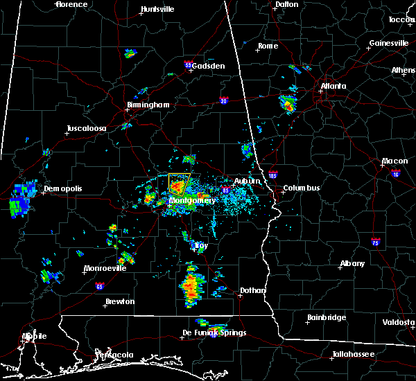 At 458 pm cdt, a severe thunderstorm was located near wetumpka, moving north at 15 mph (trained weather spotters). Hazards include 60 mph wind gusts and quarter size hail. Hail damage to vehicles is expected. expect wind damage to roofs, siding, and trees. Locations impacted include, wetumpka, eclectic, santuck, ten cedar estates, dexter, blue ridge, jordan lake, western lake martin, wallsboro, central, jordan dam and claud. At 458 pm cdt, a severe thunderstorm was located near wetumpka, moving north at 15 mph (trained weather spotters). Hazards include 60 mph wind gusts and quarter size hail. Hail damage to vehicles is expected. expect wind damage to roofs, siding, and trees. Locations impacted include, wetumpka, eclectic, santuck, ten cedar estates, dexter, blue ridge, jordan lake, western lake martin, wallsboro, central, jordan dam and claud.
|
| 5/1/2019 4:48 PM CDT |
 At 447 pm cdt, a severe thunderstorm was located over wetumpka, moving north at 15 mph (radar indicated). Hazards include 60 mph wind gusts and quarter size hail. Hail damage to vehicles is expected. Expect wind damage to roofs, siding, and trees. At 447 pm cdt, a severe thunderstorm was located over wetumpka, moving north at 15 mph (radar indicated). Hazards include 60 mph wind gusts and quarter size hail. Hail damage to vehicles is expected. Expect wind damage to roofs, siding, and trees.
|
| 4/18/2019 9:39 PM CDT |
 The severe thunderstorm warning for montgomery county will expire at 945 pm cdt, the storms which prompted the warning have weakened below severe limits, and no longer pose an immediate threat to life or property. therefore, the warning will be allowed to expire. however gusty winds are still possible with these thunderstorms. remember, a severe thunderstorm warning still remains in effect for southeast montgomery county until 1015 pm cdt. a tornado watch remains in effect until 1100 pm cdt for central, south central and east central alabama. a severe thunderstorm watch remains in effect until 200 am cdt for southeastern alabama. The severe thunderstorm warning for montgomery county will expire at 945 pm cdt, the storms which prompted the warning have weakened below severe limits, and no longer pose an immediate threat to life or property. therefore, the warning will be allowed to expire. however gusty winds are still possible with these thunderstorms. remember, a severe thunderstorm warning still remains in effect for southeast montgomery county until 1015 pm cdt. a tornado watch remains in effect until 1100 pm cdt for central, south central and east central alabama. a severe thunderstorm watch remains in effect until 200 am cdt for southeastern alabama.
|
| 4/18/2019 9:25 PM CDT |
 At 925 pm cdt, severe thunderstorms were located along a line extending from near millbrook to montgomery to sprague, moving northeast at 65 mph (radar indicated). Hazards include 60 mph wind gusts and penny size hail. Expect damage to roofs, siding, and trees. locations impacted include, montgomery, pike road, montgomery zoo, boylston, hyundai motors of alabama, auburn university in montgomery, woodcrest, maxwell air force base, snowdoun, sellers, davenport, waugh, lagoon park, pintlala, hunter, alabama state university, strata, naftel, hope hull and dannelly field. A tornado watch remains in effect until 1100 pm cdt for central, south central and east central alabama. At 925 pm cdt, severe thunderstorms were located along a line extending from near millbrook to montgomery to sprague, moving northeast at 65 mph (radar indicated). Hazards include 60 mph wind gusts and penny size hail. Expect damage to roofs, siding, and trees. locations impacted include, montgomery, pike road, montgomery zoo, boylston, hyundai motors of alabama, auburn university in montgomery, woodcrest, maxwell air force base, snowdoun, sellers, davenport, waugh, lagoon park, pintlala, hunter, alabama state university, strata, naftel, hope hull and dannelly field. A tornado watch remains in effect until 1100 pm cdt for central, south central and east central alabama.
|
| 4/18/2019 9:06 PM CDT |
 At 905 pm cdt, severe thunderstorms were located along a line extending from near white hall to near hayneville to logan, moving northeast at 60 mph (radar indicated). Hazards include 60 mph wind gusts and penny size hail. Expect damage to roofs, siding, and trees. locations impacted include, montgomery, fort deposit, mosses, hayneville, pike road, white hall, gordonville, lowndesboro, benton, montgomery zoo, boylston, hyundai motors of alabama, beechwood, auburn university in montgomery, woodcrest, maxwell air force base, snowdoun, sellers, davenport and waugh. A tornado watch remains in effect until 1100 pm cdt for central, south central and east central alabama. At 905 pm cdt, severe thunderstorms were located along a line extending from near white hall to near hayneville to logan, moving northeast at 60 mph (radar indicated). Hazards include 60 mph wind gusts and penny size hail. Expect damage to roofs, siding, and trees. locations impacted include, montgomery, fort deposit, mosses, hayneville, pike road, white hall, gordonville, lowndesboro, benton, montgomery zoo, boylston, hyundai motors of alabama, beechwood, auburn university in montgomery, woodcrest, maxwell air force base, snowdoun, sellers, davenport and waugh. A tornado watch remains in effect until 1100 pm cdt for central, south central and east central alabama.
|
| 4/18/2019 8:43 PM CDT |
 At 843 pm cdt, severe thunderstorms were located along a line extending from 11 miles north of pine apple to 12 miles west of lowndes county airport to 8 miles north of georgiana, moving northeast at 70 mph (radar indicated). Hazards include 60 mph wind gusts and penny size hail. expect damage to roofs, siding, and trees At 843 pm cdt, severe thunderstorms were located along a line extending from 11 miles north of pine apple to 12 miles west of lowndes county airport to 8 miles north of georgiana, moving northeast at 70 mph (radar indicated). Hazards include 60 mph wind gusts and penny size hail. expect damage to roofs, siding, and trees
|
| 3/3/2019 1:50 PM CST |
 At 150 pm cst, severe thunderstorms were located along a line extending from blue ridge to 8 miles north of pine apple, moving east at 45 mph (radar indicated). Hazards include 60 mph wind gusts and nickel size hail. Expect damage to roofs, siding, and trees. locations impacted include, montgomery, fort deposit, mosses, hayneville, meadville, pike road, gordonville, pine level, hyundai motors of alabama, beechwood, auburn university in montgomery, dublin, woodcrest, snowdoun, grady, sellers, davenport, ramer, waugh and lagoon park. A tornado watch remains in effect until 600 pm cst for south central, southeastern and east central alabama. At 150 pm cst, severe thunderstorms were located along a line extending from blue ridge to 8 miles north of pine apple, moving east at 45 mph (radar indicated). Hazards include 60 mph wind gusts and nickel size hail. Expect damage to roofs, siding, and trees. locations impacted include, montgomery, fort deposit, mosses, hayneville, meadville, pike road, gordonville, pine level, hyundai motors of alabama, beechwood, auburn university in montgomery, dublin, woodcrest, snowdoun, grady, sellers, davenport, ramer, waugh and lagoon park. A tornado watch remains in effect until 600 pm cst for south central, southeastern and east central alabama.
|
| 3/3/2019 1:40 PM CST |
 At 140 pm cst, severe thunderstorms were located along a line extending from boylston to 11 miles north of pine apple, moving east at 50 mph (radar indicated). Hazards include 60 mph wind gusts and nickel size hail. expect damage to roofs, siding, and trees At 140 pm cst, severe thunderstorms were located along a line extending from boylston to 11 miles north of pine apple, moving east at 50 mph (radar indicated). Hazards include 60 mph wind gusts and nickel size hail. expect damage to roofs, siding, and trees
|
| 1/19/2019 3:05 PM CST |
 At 305 pm cst, a confirmed tornado was located over eclectic, or 9 miles northeast of wetumpka, moving northeast at 55 mph (radar confirmed tornado). Hazards include damaging tornado. Flying debris will be dangerous to those caught without shelter. mobile homes will be damaged or destroyed. damage to roofs, windows, and vehicles will occur. tree damage is likely. Locations impacted include, tallassee, eclectic, emerald mountain, southern lake martin, claud, yates reservoir and yates dam. At 305 pm cst, a confirmed tornado was located over eclectic, or 9 miles northeast of wetumpka, moving northeast at 55 mph (radar confirmed tornado). Hazards include damaging tornado. Flying debris will be dangerous to those caught without shelter. mobile homes will be damaged or destroyed. damage to roofs, windows, and vehicles will occur. tree damage is likely. Locations impacted include, tallassee, eclectic, emerald mountain, southern lake martin, claud, yates reservoir and yates dam.
|
| 1/19/2019 2:56 PM CST |
 At 256 pm cst, a confirmed tornado was located over wetumpka, moving northeast at 55 mph (radar confirmed tornado). Hazards include damaging tornado. Flying debris will be dangerous to those caught without shelter. mobile homes will be damaged or destroyed. damage to roofs, windows, and vehicles will occur. tree damage is likely. Locations impacted include, northern montgomery, wetumpka, tallassee, eclectic, montgomery zoo, boylston, santuck, bob woodruff lake, emerald mountain, blue ridge, dexter, lagoon park, gunter air force base, montgomery riverwalk stadium, southern lake martin, claud, wallsboro, tallapoosa water plant, yates reservoir and yates dam. At 256 pm cst, a confirmed tornado was located over wetumpka, moving northeast at 55 mph (radar confirmed tornado). Hazards include damaging tornado. Flying debris will be dangerous to those caught without shelter. mobile homes will be damaged or destroyed. damage to roofs, windows, and vehicles will occur. tree damage is likely. Locations impacted include, northern montgomery, wetumpka, tallassee, eclectic, montgomery zoo, boylston, santuck, bob woodruff lake, emerald mountain, blue ridge, dexter, lagoon park, gunter air force base, montgomery riverwalk stadium, southern lake martin, claud, wallsboro, tallapoosa water plant, yates reservoir and yates dam.
|
| 1/19/2019 2:44 PM CST |
 At 244 pm cst, a severe thunderstorm capable of producing a tornado was located over bob woodruff lake, or near millbrook, moving northeast at 55 mph (radar indicated rotation). Hazards include tornado. Flying debris will be dangerous to those caught without shelter. mobile homes will be damaged or destroyed. damage to roofs, windows, and vehicles will occur. Tree damage is likely. At 244 pm cst, a severe thunderstorm capable of producing a tornado was located over bob woodruff lake, or near millbrook, moving northeast at 55 mph (radar indicated rotation). Hazards include tornado. Flying debris will be dangerous to those caught without shelter. mobile homes will be damaged or destroyed. damage to roofs, windows, and vehicles will occur. Tree damage is likely.
|
| 6/28/2018 4:25 PM CDT |
 At 425 pm cdt, severe thunderstorms were located along a line extending from near smiths to near uchee to montgomery, moving southeast at 35 mph (radar indicated). Hazards include 60 mph wind gusts. expect damage to roofs, siding, and trees At 425 pm cdt, severe thunderstorms were located along a line extending from near smiths to near uchee to montgomery, moving southeast at 35 mph (radar indicated). Hazards include 60 mph wind gusts. expect damage to roofs, siding, and trees
|
| 6/28/2018 4:05 PM CDT |
 At 404 pm cdt, severe thunderstorms were located along a line extending from society hill to near prattville, moving east at 30 mph (radar indicated). Hazards include 60 mph wind gusts. expect damage to roofs, siding, and trees At 404 pm cdt, severe thunderstorms were located along a line extending from society hill to near prattville, moving east at 30 mph (radar indicated). Hazards include 60 mph wind gusts. expect damage to roofs, siding, and trees
|
| 6/28/2018 3:33 PM CDT |
 At 333 pm cdt, severe thunderstorms were located along a line extending from near welona to western lake martin to near camp hill, moving south at 45 mph (radar indicated). Hazards include 60 mph wind gusts. expect damage to roofs, siding, and trees At 333 pm cdt, severe thunderstorms were located along a line extending from near welona to western lake martin to near camp hill, moving south at 45 mph (radar indicated). Hazards include 60 mph wind gusts. expect damage to roofs, siding, and trees
|
| 4/4/2018 2:10 AM CDT |
 At 210 am cdt, severe thunderstorms were located along a line extending from wind creek state park to near emerald mountain, moving east at 40 mph (radar indicated). Hazards include 60 mph wind gusts. Expect damage to roofs, siding, and trees. Locations impacted include, tallassee, equality, eclectic, santuck, kowaliga bridge, martin dam, western lake martin, southern lake martin, blue ridge, fishpond, claud, central, ray, yates reservoir and yates dam. At 210 am cdt, severe thunderstorms were located along a line extending from wind creek state park to near emerald mountain, moving east at 40 mph (radar indicated). Hazards include 60 mph wind gusts. Expect damage to roofs, siding, and trees. Locations impacted include, tallassee, equality, eclectic, santuck, kowaliga bridge, martin dam, western lake martin, southern lake martin, blue ridge, fishpond, claud, central, ray, yates reservoir and yates dam.
|
| 4/4/2018 1:51 AM CDT |
 At 151 am cdt, severe thunderstorms were located along a line extending from near rockford to elmore, moving east at 40 mph (radar indicated). Hazards include 60 mph wind gusts. Expect damage to roofs, siding, and trees. Locations impacted include, millbrook, wetumpka, tallassee, rockford, equality, elmore, coosada, eclectic, pentonville, santuck, cottage grove, ten cedar estates, nixburg, dexter, speed, weoka mills, jordan lake, highway 9 and highway 22, kowaliga bridge and martin dam. At 151 am cdt, severe thunderstorms were located along a line extending from near rockford to elmore, moving east at 40 mph (radar indicated). Hazards include 60 mph wind gusts. Expect damage to roofs, siding, and trees. Locations impacted include, millbrook, wetumpka, tallassee, rockford, equality, elmore, coosada, eclectic, pentonville, santuck, cottage grove, ten cedar estates, nixburg, dexter, speed, weoka mills, jordan lake, highway 9 and highway 22, kowaliga bridge and martin dam.
|
| 4/4/2018 1:34 AM CDT |
 At 134 am cdt, severe thunderstorms were located along a line extending from near dollar to near deatsville, moving east at 40 mph (radar indicated). Hazards include 60 mph wind gusts. expect damage to roofs, siding, and trees At 134 am cdt, severe thunderstorms were located along a line extending from near dollar to near deatsville, moving east at 40 mph (radar indicated). Hazards include 60 mph wind gusts. expect damage to roofs, siding, and trees
|
| 6/15/2017 5:33 PM CDT |
 At 532 pm cdt, a severe thunderstorm was located near tysonville, or 7 miles northwest of milstead, moving southeast at 30 mph (radar indicated). Hazards include 60 mph wind gusts. Expect damage to roofs, siding, and trees. Locations impacted include, wetumpka, tallassee, eclectic, emerald mountain, blue ridge, ware and claud. At 532 pm cdt, a severe thunderstorm was located near tysonville, or 7 miles northwest of milstead, moving southeast at 30 mph (radar indicated). Hazards include 60 mph wind gusts. Expect damage to roofs, siding, and trees. Locations impacted include, wetumpka, tallassee, eclectic, emerald mountain, blue ridge, ware and claud.
|
| 6/15/2017 5:25 PM CDT |
 At 524 pm cdt, a severe thunderstorm was located over tallassee, moving southeast at 40 mph (radar indicated). Hazards include 60 mph wind gusts. trees have been blown down by this storm. Expect damage to roofs, siding, and trees. Locations impacted include, wetumpka, tallassee, eclectic, emerald mountain, santuck, blue ridge, martin lake at kowaliga, dexter, ware, claud and central. At 524 pm cdt, a severe thunderstorm was located over tallassee, moving southeast at 40 mph (radar indicated). Hazards include 60 mph wind gusts. trees have been blown down by this storm. Expect damage to roofs, siding, and trees. Locations impacted include, wetumpka, tallassee, eclectic, emerald mountain, santuck, blue ridge, martin lake at kowaliga, dexter, ware, claud and central.
|
| 6/15/2017 5:09 PM CDT |
 At 509 pm cdt, a severe thunderstorm was located over eclectic, or 8 miles northeast of wetumpka, moving southeast at 45 mph (radar indicated). Hazards include 60 mph wind gusts and penny size hail. these storms have a history of blowing down trees. Expect damage to roofs, siding, and trees. Locations impacted include, prattville, millbrook, wetumpka, tallassee, elmore, coosada, deatsville, eclectic, santuck, titus, emerald mountain, welona, ten cedar estates, dexter, martin lake at kowaliga, weoka mills, jordan lake, blue ridge, wetumpka municipal airport and central. At 509 pm cdt, a severe thunderstorm was located over eclectic, or 8 miles northeast of wetumpka, moving southeast at 45 mph (radar indicated). Hazards include 60 mph wind gusts and penny size hail. these storms have a history of blowing down trees. Expect damage to roofs, siding, and trees. Locations impacted include, prattville, millbrook, wetumpka, tallassee, elmore, coosada, deatsville, eclectic, santuck, titus, emerald mountain, welona, ten cedar estates, dexter, martin lake at kowaliga, weoka mills, jordan lake, blue ridge, wetumpka municipal airport and central.
|
| 6/15/2017 4:50 PM CDT |
 At 450 pm cdt, a severe thunderstorm was located over titus, or 12 miles west of equality, moving southeast at 45 mph (radar indicated). Hazards include 60 mph wind gusts and penny size hail. expect damage to roofs, siding, and trees At 450 pm cdt, a severe thunderstorm was located over titus, or 12 miles west of equality, moving southeast at 45 mph (radar indicated). Hazards include 60 mph wind gusts and penny size hail. expect damage to roofs, siding, and trees
|
| 4/5/2017 10:38 AM CDT |
 At 1038 am cdt, a severe thunderstorm was located over waugh, or 10 miles southwest of milstead, moving northeast at 45 mph (trained weather spotters). Hazards include 60 mph wind gusts and quarter size hail. Hail damage to vehicles is expected. Expect wind damage to roofs, siding, and trees. At 1038 am cdt, a severe thunderstorm was located over waugh, or 10 miles southwest of milstead, moving northeast at 45 mph (trained weather spotters). Hazards include 60 mph wind gusts and quarter size hail. Hail damage to vehicles is expected. Expect wind damage to roofs, siding, and trees.
|
| 3/10/2017 4:18 AM CST |
 At 417 am cst, severe thunderstorms were located along a line extending from near tallapoosa city to prattville to near mulberry, moving south at 50 mph (radar indicated). Hazards include 60 mph wind gusts. Expect damage to roofs, siding, and trees. Locations impacted include, prattville, millbrook, wetumpka, tallassee, elmore, coosada, deatsville, eclectic, autaugaville, booth, vida junction, santuck, autauga county airport, emerald mountain, dexter, mulberry, blue ridge, jordan lake, wetumpka municipal airport and wallsboro. At 417 am cst, severe thunderstorms were located along a line extending from near tallapoosa city to prattville to near mulberry, moving south at 50 mph (radar indicated). Hazards include 60 mph wind gusts. Expect damage to roofs, siding, and trees. Locations impacted include, prattville, millbrook, wetumpka, tallassee, elmore, coosada, deatsville, eclectic, autaugaville, booth, vida junction, santuck, autauga county airport, emerald mountain, dexter, mulberry, blue ridge, jordan lake, wetumpka municipal airport and wallsboro.
|
| 3/10/2017 4:02 AM CST |
 At 402 am cst, severe thunderstorms were located along a line extending from near kowaliga bridge to near deatsville to near parnell, moving south at 50 mph (radar indicated). Hazards include 60 mph wind gusts. expect damage to roofs, siding, and trees At 402 am cst, severe thunderstorms were located along a line extending from near kowaliga bridge to near deatsville to near parnell, moving south at 50 mph (radar indicated). Hazards include 60 mph wind gusts. expect damage to roofs, siding, and trees
|
| 1/22/2017 12:32 PM CST |
 At 1231 pm cst, severe thunderstorms were located along a line extending from near clanton to 6 miles west of petrey, moving northeast at 60 mph (radar indicated). Hazards include 60 mph wind gusts and quarter size hail. Hail damage to vehicles is expected. Expect wind damage to roofs, siding, and trees. At 1231 pm cst, severe thunderstorms were located along a line extending from near clanton to 6 miles west of petrey, moving northeast at 60 mph (radar indicated). Hazards include 60 mph wind gusts and quarter size hail. Hail damage to vehicles is expected. Expect wind damage to roofs, siding, and trees.
|
| 1/21/2017 8:07 AM CST |
 At 807 am cst, a severe thunderstorm capable of producing a tornado was located near emerald mountain, or 7 miles west of tallassee, moving northeast at 35 mph (radar indicated rotation). Hazards include tornado. Flying debris will be dangerous to those caught without shelter. mobile homes will be damaged or destroyed. damage to roofs, windows, and vehicles will occur. tree damage is likely. Locations impacted include, tallassee, eclectic, yates reservoir, claud, ware and yates dam. At 807 am cst, a severe thunderstorm capable of producing a tornado was located near emerald mountain, or 7 miles west of tallassee, moving northeast at 35 mph (radar indicated rotation). Hazards include tornado. Flying debris will be dangerous to those caught without shelter. mobile homes will be damaged or destroyed. damage to roofs, windows, and vehicles will occur. tree damage is likely. Locations impacted include, tallassee, eclectic, yates reservoir, claud, ware and yates dam.
|
| 1/21/2017 7:59 AM CST |
 At 758 am cst, a confirmed tornado was located over emerald mountain, or near wetumpka, moving northeast at 35 mph (radar confirmed tornado). Hazards include damaging tornado. Flying debris will be dangerous to those caught without shelter. mobile homes will be damaged or destroyed. damage to roofs, windows, and vehicles will occur. tree damage is likely. Locations impacted include, wetumpka, tallassee, eclectic, emerald mountain, blue ridge, yates reservoir, claud, ware and yates dam. At 758 am cst, a confirmed tornado was located over emerald mountain, or near wetumpka, moving northeast at 35 mph (radar confirmed tornado). Hazards include damaging tornado. Flying debris will be dangerous to those caught without shelter. mobile homes will be damaged or destroyed. damage to roofs, windows, and vehicles will occur. tree damage is likely. Locations impacted include, wetumpka, tallassee, eclectic, emerald mountain, blue ridge, yates reservoir, claud, ware and yates dam.
|
| 1/21/2017 7:55 AM CST |
 At 755 am cst, severe thunderstorms were located along a line extending from near emerald mountain to near waugh to near naftel, moving east at 55 mph (radar indicated). Hazards include 60 mph wind gusts. Expect damage to roofs, siding, and trees. locations impacted include, eastern montgomery, meadville, pike road, mount meigs, auburn university in montgomery, sellers, waugh, grady, ramer, naftel, strata, dublin, sprague, pine level, lapine, brassell, barachias, currys, cecil and carters hill. A tornado watch remains in effect until 1100 am cst for south central, southeastern and east central alabama. At 755 am cst, severe thunderstorms were located along a line extending from near emerald mountain to near waugh to near naftel, moving east at 55 mph (radar indicated). Hazards include 60 mph wind gusts. Expect damage to roofs, siding, and trees. locations impacted include, eastern montgomery, meadville, pike road, mount meigs, auburn university in montgomery, sellers, waugh, grady, ramer, naftel, strata, dublin, sprague, pine level, lapine, brassell, barachias, currys, cecil and carters hill. A tornado watch remains in effect until 1100 am cst for south central, southeastern and east central alabama.
|
| 1/21/2017 7:54 AM CST |
 At 754 am cst, severe thunderstorms were located along a line extending from near elmore to near emerald mountain, moving northeast at 55 mph (radar indicated). Hazards include 60 mph wind gusts. Expect damage to roofs, siding, and trees. locations impacted include, wetumpka, tallassee, elmore, deatsville, eclectic, emerald mountain, kowaliga bridge, western lake martin, jordan lake, blue ridge, dexter, ten cedar estates, santuck, martin dam, eastern lake martin, central, speigner, yates reservoir, claud and wallsboro. A tornado watch remains in effect until 1100 am cst for south central, southeastern and east central alabama. At 754 am cst, severe thunderstorms were located along a line extending from near elmore to near emerald mountain, moving northeast at 55 mph (radar indicated). Hazards include 60 mph wind gusts. Expect damage to roofs, siding, and trees. locations impacted include, wetumpka, tallassee, elmore, deatsville, eclectic, emerald mountain, kowaliga bridge, western lake martin, jordan lake, blue ridge, dexter, ten cedar estates, santuck, martin dam, eastern lake martin, central, speigner, yates reservoir, claud and wallsboro. A tornado watch remains in effect until 1100 am cst for south central, southeastern and east central alabama.
|
| 1/21/2017 7:52 AM CST |
 At 752 am cst, a severe thunderstorm capable of producing a tornado was located over blue ridge, or near wetumpka, moving northeast at 35 mph (radar indicated rotation). Hazards include tornado. Flying debris will be dangerous to those caught without shelter. mobile homes will be damaged or destroyed. damage to roofs, windows, and vehicles will occur. Tree damage is likely. At 752 am cst, a severe thunderstorm capable of producing a tornado was located over blue ridge, or near wetumpka, moving northeast at 35 mph (radar indicated rotation). Hazards include tornado. Flying debris will be dangerous to those caught without shelter. mobile homes will be damaged or destroyed. damage to roofs, windows, and vehicles will occur. Tree damage is likely.
|
| 1/21/2017 7:48 AM CST |
 At 748 am cst, severe thunderstorms were located along a line extending from near deatsville to near emerald mountain, moving northeast at 40 mph (radar indicated). Hazards include 60 mph wind gusts. Expect damage to roofs, siding, and trees. locations impacted include, millbrook, wetumpka, tallassee, elmore, coosada, deatsville, eclectic, emerald mountain, kowaliga bridge, western lake martin, jordan lake, ten cedar estates, blue ridge, dexter, santuck, martin dam, eastern lake martin, central, yates reservoir and wallsboro. A tornado watch remains in effect until 1100 am cst for south central, southeastern and east central alabama. At 748 am cst, severe thunderstorms were located along a line extending from near deatsville to near emerald mountain, moving northeast at 40 mph (radar indicated). Hazards include 60 mph wind gusts. Expect damage to roofs, siding, and trees. locations impacted include, millbrook, wetumpka, tallassee, elmore, coosada, deatsville, eclectic, emerald mountain, kowaliga bridge, western lake martin, jordan lake, ten cedar estates, blue ridge, dexter, santuck, martin dam, eastern lake martin, central, yates reservoir and wallsboro. A tornado watch remains in effect until 1100 am cst for south central, southeastern and east central alabama.
|
| 1/21/2017 7:46 AM CST |
 At 746 am cst, severe thunderstorms were located along a line extending from near blue ridge to montgomery to near naftel, moving east at 55 mph (radar indicated). Hazards include 60 mph wind gusts. Expect damage to roofs, siding, and trees. locations impacted include, montgomery, meadville, pike road, mount meigs, auburn university in montgomery, waugh, gunter air force base, ramer, snowdoun, lagoon park, davenport, eastdale mall, dublin, sellers, grady, pinedale, naftel, strata, sprague and pine level. A tornado watch remains in effect until 1100 am cst for south central, southeastern and east central alabama. At 746 am cst, severe thunderstorms were located along a line extending from near blue ridge to montgomery to near naftel, moving east at 55 mph (radar indicated). Hazards include 60 mph wind gusts. Expect damage to roofs, siding, and trees. locations impacted include, montgomery, meadville, pike road, mount meigs, auburn university in montgomery, waugh, gunter air force base, ramer, snowdoun, lagoon park, davenport, eastdale mall, dublin, sellers, grady, pinedale, naftel, strata, sprague and pine level. A tornado watch remains in effect until 1100 am cst for south central, southeastern and east central alabama.
|
| 1/21/2017 7:37 AM CST |
 At 737 am cst, severe thunderstorms were located along a line extending from near booth to dannelly field, moving northeast at 60 mph (radar indicated). Hazards include 60 mph wind gusts. expect damage to roofs, siding, and trees At 737 am cst, severe thunderstorms were located along a line extending from near booth to dannelly field, moving northeast at 60 mph (radar indicated). Hazards include 60 mph wind gusts. expect damage to roofs, siding, and trees
|
| 1/21/2017 7:33 AM CST |
 At 733 am cst, severe thunderstorms were located along a line extending from hunter to hope hull to near lowndes county airport, moving east at 55 mph (radar indicated). Hazards include 60 mph wind gusts. Expect damage to roofs, siding, and trees. locations impacted include, montgomery, fort deposit, meadville, pike road, coosada, mount meigs, dannelly field, auburn university in montgomery, logan, boylston, waugh, alabama state university, woodcrest, bob woodruff lake, gunter air force base, ramer, snowdoun, pintlala, lagoon park and lowndes county airport. A tornado watch remains in effect until 1100 am cst for south central, southeastern, east central alabama. At 733 am cst, severe thunderstorms were located along a line extending from hunter to hope hull to near lowndes county airport, moving east at 55 mph (radar indicated). Hazards include 60 mph wind gusts. Expect damage to roofs, siding, and trees. locations impacted include, montgomery, fort deposit, meadville, pike road, coosada, mount meigs, dannelly field, auburn university in montgomery, logan, boylston, waugh, alabama state university, woodcrest, bob woodruff lake, gunter air force base, ramer, snowdoun, pintlala, lagoon park and lowndes county airport. A tornado watch remains in effect until 1100 am cst for south central, southeastern, east central alabama.
|
| 1/21/2017 7:24 AM CST |
 At 724 am cst, severe thunderstorms were located along a line extending from near cantelous to 6 miles northeast of hayneville to near lowndes county airport, moving east at 55 mph (radar indicated). Hazards include 60 mph wind gusts. expect damage to roofs, siding, and trees At 724 am cst, severe thunderstorms were located along a line extending from near cantelous to 6 miles northeast of hayneville to near lowndes county airport, moving east at 55 mph (radar indicated). Hazards include 60 mph wind gusts. expect damage to roofs, siding, and trees
|
| 7/11/2016 2:21 PM CDT |
 At 220 pm cdt, a severe thunderstorm was located over waugh, or 8 miles southwest of milstead, moving northeast at 10 mph (radar indicated). Hazards include 60 mph wind gusts and quarter size hail. Hail damage to vehicles is expected. Expect wind damage to roofs, siding, and trees. At 220 pm cdt, a severe thunderstorm was located over waugh, or 8 miles southwest of milstead, moving northeast at 10 mph (radar indicated). Hazards include 60 mph wind gusts and quarter size hail. Hail damage to vehicles is expected. Expect wind damage to roofs, siding, and trees.
|
| 6/17/2016 5:31 PM CDT |
 At 531 pm cdt, severe thunderstorms were located along a line extending from near mount meigs to near pintlala to 7 miles northeast of pine apple, moving southeast at 45 mph (radar indicated). Hazards include 60 mph wind gusts. Expect damage to roofs. siding. and trees. Locations impacted include, montgomery, fort deposit, mosses, hayneville, meadville, pike road, gordonville, boylston, waugh, alabama state university, woodcrest, ramer, snowdoun, lagoon park, lowndes county airport, dublin, sellers, montgomery riverwalk stadium, grady and montgomery zoo. At 531 pm cdt, severe thunderstorms were located along a line extending from near mount meigs to near pintlala to 7 miles northeast of pine apple, moving southeast at 45 mph (radar indicated). Hazards include 60 mph wind gusts. Expect damage to roofs. siding. and trees. Locations impacted include, montgomery, fort deposit, mosses, hayneville, meadville, pike road, gordonville, boylston, waugh, alabama state university, woodcrest, ramer, snowdoun, lagoon park, lowndes county airport, dublin, sellers, montgomery riverwalk stadium, grady and montgomery zoo.
|
| 6/17/2016 5:27 PM CDT |
 At 527 pm cdt, severe thunderstorms were located along a line extending from near waverly to gunter air force base, moving southeast at 40 mph (radar indicated). Hazards include 60 mph wind gusts. Expect damage to roofs. siding. and trees. Locations impacted include, wetumpka, tallassee, eclectic, martin dam, emerald mountain, blue ridge, tallapoosa city, reeves airport, yates reservoir, claud, ware, yates dam and reeltown. At 527 pm cdt, severe thunderstorms were located along a line extending from near waverly to gunter air force base, moving southeast at 40 mph (radar indicated). Hazards include 60 mph wind gusts. Expect damage to roofs. siding. and trees. Locations impacted include, wetumpka, tallassee, eclectic, martin dam, emerald mountain, blue ridge, tallapoosa city, reeves airport, yates reservoir, claud, ware, yates dam and reeltown.
|
| 6/17/2016 5:19 PM CDT |
 At 519 pm cdt, severe thunderstorms were located along a line extending from near blue ridge to near pintlala to 9 miles northeast of oak hill, moving southeast at 45 mph (radar indicated). Hazards include 60 mph wind gusts. Expect damage to roofs. siding. and trees. Locations impacted include, montgomery, fort deposit, mosses, hayneville, meadville, pike road, white hall, gordonville, lowndesboro, boylston, waugh, alabama state university, woodcrest, ramer, snowdoun, lagoon park, lowndes county airport, dublin, sellers and montgomery riverwalk stadium. At 519 pm cdt, severe thunderstorms were located along a line extending from near blue ridge to near pintlala to 9 miles northeast of oak hill, moving southeast at 45 mph (radar indicated). Hazards include 60 mph wind gusts. Expect damage to roofs. siding. and trees. Locations impacted include, montgomery, fort deposit, mosses, hayneville, meadville, pike road, white hall, gordonville, lowndesboro, boylston, waugh, alabama state university, woodcrest, ramer, snowdoun, lagoon park, lowndes county airport, dublin, sellers and montgomery riverwalk stadium.
|
| 6/17/2016 5:12 PM CDT |
 At 512 pm cdt, severe thunderstorms were located along a line extending from near camp hill to elmore, moving southeast at 40 mph (radar indicated). Hazards include 60 mph wind gusts. Expect damage to roofs. siding. and trees. Locations impacted include, alexander city, millbrook, wetumpka, tallassee, dadeville, camp hill, elmore, coosada, deatsville, eclectic, jacksons` gap, waverly, emerald mountain, kowaliga bridge, western lake martin, jordan lake, tallapoosa city, eastern lake martin, ten cedar estates and reeves airport. At 512 pm cdt, severe thunderstorms were located along a line extending from near camp hill to elmore, moving southeast at 40 mph (radar indicated). Hazards include 60 mph wind gusts. Expect damage to roofs. siding. and trees. Locations impacted include, alexander city, millbrook, wetumpka, tallassee, dadeville, camp hill, elmore, coosada, deatsville, eclectic, jacksons` gap, waverly, emerald mountain, kowaliga bridge, western lake martin, jordan lake, tallapoosa city, eastern lake martin, ten cedar estates and reeves airport.
|
| 6/17/2016 5:08 PM CDT |
 At 508 pm cdt, severe thunderstorms were located along a line extending from near wetumpka to near cantelous to 8 miles south of belknap, moving southeast at 45 mph (radar indicated). Hazards include 60 mph wind gusts. Expect damage to roofs. siding. and trees. Locations impacted include, montgomery, fort deposit, mosses, hayneville, meadville, pike road, white hall, gordonville, lowndesboro, benton, boylston, waugh, alabama state university, woodcrest, ramer, snowdoun, lagoon park, lowndes county airport, dublin and sellers. At 508 pm cdt, severe thunderstorms were located along a line extending from near wetumpka to near cantelous to 8 miles south of belknap, moving southeast at 45 mph (radar indicated). Hazards include 60 mph wind gusts. Expect damage to roofs. siding. and trees. Locations impacted include, montgomery, fort deposit, mosses, hayneville, meadville, pike road, white hall, gordonville, lowndesboro, benton, boylston, waugh, alabama state university, woodcrest, ramer, snowdoun, lagoon park, lowndes county airport, dublin and sellers.
|
| 6/17/2016 5:00 PM CDT |
 At 500 pm cdt, severe thunderstorms were located along a line extending from near new site to near deatsville, moving southeast at 30 mph (radar indicated). Hazards include 60 mph wind gusts. Expect damage to roofs. siding. and trees. Locations impacted include, prattville, alexander city, millbrook, wetumpka, tallassee, dadeville, camp hill, elmore, coosada, deatsville, eclectic, jacksons` gap, new site, waverly, emerald mountain, kowaliga bridge, jordan lake, eastern lake martin, weoka mills and titus. At 500 pm cdt, severe thunderstorms were located along a line extending from near new site to near deatsville, moving southeast at 30 mph (radar indicated). Hazards include 60 mph wind gusts. Expect damage to roofs. siding. and trees. Locations impacted include, prattville, alexander city, millbrook, wetumpka, tallassee, dadeville, camp hill, elmore, coosada, deatsville, eclectic, jacksons` gap, new site, waverly, emerald mountain, kowaliga bridge, jordan lake, eastern lake martin, weoka mills and titus.
|
| 6/17/2016 4:53 PM CDT |
 At 452 pm cdt, severe thunderstorms were located along a line extending from near deatsville to near autaugaville to near dannelly reservoir, moving southeast at 45 mph (radar indicated). Hazards include 60 mph wind gusts. Expect damage to roofs. siding. and trees. Locations impacted include, montgomery, fort deposit, mosses, hayneville, meadville, pike road, white hall, gordonville, lowndesboro, benton, boylston, waugh, alabama state university, woodcrest, ramer, snowdoun, lagoon park, lowndes county airport, dublin and sellers. At 452 pm cdt, severe thunderstorms were located along a line extending from near deatsville to near autaugaville to near dannelly reservoir, moving southeast at 45 mph (radar indicated). Hazards include 60 mph wind gusts. Expect damage to roofs. siding. and trees. Locations impacted include, montgomery, fort deposit, mosses, hayneville, meadville, pike road, white hall, gordonville, lowndesboro, benton, boylston, waugh, alabama state university, woodcrest, ramer, snowdoun, lagoon park, lowndes county airport, dublin and sellers.
|
| 6/17/2016 4:43 PM CDT |
 At 443 pm cdt, severe thunderstorms were located along a line extending from 6 miles east of new site to near billingsley, moving southeast at 35 mph (radar indicated). Hazards include 60 mph wind gusts. Expect damage to roofs. siding. and trees. Locations impacted include, prattville, alexander city, millbrook, wetumpka, tallassee, dadeville, camp hill, elmore, coosada, deatsville, eclectic, jacksons` gap, new site, waverly, goldville, emerald mountain, kowaliga bridge, jordan lake, eastern lake martin and weoka mills. At 443 pm cdt, severe thunderstorms were located along a line extending from 6 miles east of new site to near billingsley, moving southeast at 35 mph (radar indicated). Hazards include 60 mph wind gusts. Expect damage to roofs. siding. and trees. Locations impacted include, prattville, alexander city, millbrook, wetumpka, tallassee, dadeville, camp hill, elmore, coosada, deatsville, eclectic, jacksons` gap, new site, waverly, goldville, emerald mountain, kowaliga bridge, jordan lake, eastern lake martin and weoka mills.
|
| 6/17/2016 4:39 PM CDT |
 At 438 pm cdt, severe thunderstorms were located along a line extending from near marbury to near orrville, moving southeast at 40 mph (radar indicated). Hazards include 60 mph wind gusts. Expect damage to roofs. siding. And trees. At 438 pm cdt, severe thunderstorms were located along a line extending from near marbury to near orrville, moving southeast at 40 mph (radar indicated). Hazards include 60 mph wind gusts. Expect damage to roofs. siding. And trees.
|
| 6/17/2016 4:26 PM CDT |
 At 426 pm cdt, severe thunderstorms were located along a line extending from near wadley to near clanton, moving southeast at 40 mph (radar indicated). Hazards include 60 mph wind gusts. Expect damage to roofs. siding. And trees. At 426 pm cdt, severe thunderstorms were located along a line extending from near wadley to near clanton, moving southeast at 40 mph (radar indicated). Hazards include 60 mph wind gusts. Expect damage to roofs. siding. And trees.
|
| 4/29/2016 8:27 PM CDT |
 At 827 pm cdt, a severe thunderstorm was located over milstead, moving east at 10 mph (radar indicated). Hazards include 60 mph wind gusts and quarter size hail. Hail damage to vehicles is expected. expect wind damage to roofs, siding, and trees. Locations impacted include, wetumpka, tallassee, milstead, shorter, franklin, emerald mountain, victoryland, blue ridge, tysonville, claud, wallsboro, ware and cross keys. At 827 pm cdt, a severe thunderstorm was located over milstead, moving east at 10 mph (radar indicated). Hazards include 60 mph wind gusts and quarter size hail. Hail damage to vehicles is expected. expect wind damage to roofs, siding, and trees. Locations impacted include, wetumpka, tallassee, milstead, shorter, franklin, emerald mountain, victoryland, blue ridge, tysonville, claud, wallsboro, ware and cross keys.
|
| 4/29/2016 8:10 PM CDT |
 At 809 pm cdt, a severe thunderstorm was located near tysonville, or near milstead, moving east at 10 mph (radar indicated). Hazards include 60 mph wind gusts and quarter size hail. Hail damage to vehicles is expected. expect wind damage to roofs, siding, and trees. Locations impacted include, northeastern montgomery, wetumpka, tallassee, milstead, shorter, franklin, mount meigs, emerald mountain, victoryland, waugh, blue ridge, tysonville, claud, wallsboro, ware, brassell, tallapoosa water plant and cross keys. At 809 pm cdt, a severe thunderstorm was located near tysonville, or near milstead, moving east at 10 mph (radar indicated). Hazards include 60 mph wind gusts and quarter size hail. Hail damage to vehicles is expected. expect wind damage to roofs, siding, and trees. Locations impacted include, northeastern montgomery, wetumpka, tallassee, milstead, shorter, franklin, mount meigs, emerald mountain, victoryland, waugh, blue ridge, tysonville, claud, wallsboro, ware, brassell, tallapoosa water plant and cross keys.
|
| 4/29/2016 7:56 PM CDT |
 At 756 pm cdt, a severe thunderstorm was located near emerald mountain, or 8 miles west of milstead, moving east at 10 mph (radar indicated). Hazards include 60 mph wind gusts and quarter size hail. Hail damage to vehicles is expected. Expect wind damage to roofs, siding, and trees. At 756 pm cdt, a severe thunderstorm was located near emerald mountain, or 8 miles west of milstead, moving east at 10 mph (radar indicated). Hazards include 60 mph wind gusts and quarter size hail. Hail damage to vehicles is expected. Expect wind damage to roofs, siding, and trees.
|
| 4/27/2016 4:58 PM CDT |
 At 457 pm cdt, a severe thunderstorm was located over southwestern montgomery, moving northeast at 25 mph (radar indicated). Hazards include 60 mph wind gusts and nickel size hail. Expect damage to roofs. siding. and trees. this severe storm will be near, alabama state university, alabama state capitol and montgomery riverwalk stadium around 505 pm cdt. gunter air force base, lagoon park, montgomery zoo, boylston, eastdale mall and auburn university in montgomery around 515 pm cdt. bob woodruff lake around 520 pm cdt. Other locations impacted by this severe thunderstorm include tallapoosa water plant and mitylene. At 457 pm cdt, a severe thunderstorm was located over southwestern montgomery, moving northeast at 25 mph (radar indicated). Hazards include 60 mph wind gusts and nickel size hail. Expect damage to roofs. siding. and trees. this severe storm will be near, alabama state university, alabama state capitol and montgomery riverwalk stadium around 505 pm cdt. gunter air force base, lagoon park, montgomery zoo, boylston, eastdale mall and auburn university in montgomery around 515 pm cdt. bob woodruff lake around 520 pm cdt. Other locations impacted by this severe thunderstorm include tallapoosa water plant and mitylene.
|
| 4/27/2016 4:47 PM CDT |
 At 446 pm cdt, a severe thunderstorm was located over southwestern montgomery, moving northeast at 35 mph (radar indicated). Hazards include 60 mph wind gusts and nickel size hail. Expect damage to roofs. siding. and trees. this severe thunderstorm will be near, pinedale around 450 pm cdt. alabama state university, maxwell air force base and hunter around 455 pm cdt. montgomery riverwalk stadium and alabama state capitol around 500 pm cdt. boylston, montgomery zoo, gunter air force base, lagoon park, eastdale mall and auburn university in montgomery around 505 pm cdt. bob woodruff lake around 510 pm cdt. coosada around 515 pm cdt. other locations impacted by this severe thunderstorm include tallapoosa water plant and mitylene. this includes the following highways, interstate 65 between mile markers 164 and 176. Interstate 85 between mile markers 1 and 9. At 446 pm cdt, a severe thunderstorm was located over southwestern montgomery, moving northeast at 35 mph (radar indicated). Hazards include 60 mph wind gusts and nickel size hail. Expect damage to roofs. siding. and trees. this severe thunderstorm will be near, pinedale around 450 pm cdt. alabama state university, maxwell air force base and hunter around 455 pm cdt. montgomery riverwalk stadium and alabama state capitol around 500 pm cdt. boylston, montgomery zoo, gunter air force base, lagoon park, eastdale mall and auburn university in montgomery around 505 pm cdt. bob woodruff lake around 510 pm cdt. coosada around 515 pm cdt. other locations impacted by this severe thunderstorm include tallapoosa water plant and mitylene. this includes the following highways, interstate 65 between mile markers 164 and 176. Interstate 85 between mile markers 1 and 9.
|
| 4/27/2016 4:40 PM CDT |
 At 440 pm cdt, a severe thunderstorm was located over northeastern montgomery, moving northeast at 20 mph (radar indicated). Hazards include 60 mph wind gusts and quarter size hail. Hail damage to vehicles is expected. expect wind damage to roofs, siding, and trees. Locations impacted include, eastern montgomery, montgomery zoo, lagoon park, eastdale mall, boylston, bob woodruff lake, gunter air force base and tallapoosa water plant. At 440 pm cdt, a severe thunderstorm was located over northeastern montgomery, moving northeast at 20 mph (radar indicated). Hazards include 60 mph wind gusts and quarter size hail. Hail damage to vehicles is expected. expect wind damage to roofs, siding, and trees. Locations impacted include, eastern montgomery, montgomery zoo, lagoon park, eastdale mall, boylston, bob woodruff lake, gunter air force base and tallapoosa water plant.
|
| 4/27/2016 4:29 PM CDT |
 At 428 pm cdt, a severe thunderstorm was located over southwestern montgomery, moving northeast at 20 mph (radar indicated). Hazards include 60 mph wind gusts and quarter size hail. Hail damage to vehicles is expected. Expect wind damage to roofs, siding, and trees. At 428 pm cdt, a severe thunderstorm was located over southwestern montgomery, moving northeast at 20 mph (radar indicated). Hazards include 60 mph wind gusts and quarter size hail. Hail damage to vehicles is expected. Expect wind damage to roofs, siding, and trees.
|
| 3/31/2016 11:32 PM CDT |
 At 1132 pm cdt, severe thunderstorms were located along a line extending from near still waters resort to mount meigs, moving east at 60 mph (radar indicated). Hazards include 60 mph wind gusts and quarter size hail. Hail damage to vehicles is expected. expect wind damage to roofs, siding, and trees. locations impacted include, eastern montgomery, tuskegee, tallassee, notasulga, milstead, pike road, eclectic, shorter, franklin, waverly, mount meigs, emerald mountain, kowaliga bridge, western lake martin, lake tuskegee, auburn university in montgomery, waugh, tallapoosa city, hardaway and liverpool. a tornado watch remains in effect until 100 am cdt for southeastern alabama. A tornado watch also remains in effect until 400 am cdt for southeastern alabama. At 1132 pm cdt, severe thunderstorms were located along a line extending from near still waters resort to mount meigs, moving east at 60 mph (radar indicated). Hazards include 60 mph wind gusts and quarter size hail. Hail damage to vehicles is expected. expect wind damage to roofs, siding, and trees. locations impacted include, eastern montgomery, tuskegee, tallassee, notasulga, milstead, pike road, eclectic, shorter, franklin, waverly, mount meigs, emerald mountain, kowaliga bridge, western lake martin, lake tuskegee, auburn university in montgomery, waugh, tallapoosa city, hardaway and liverpool. a tornado watch remains in effect until 100 am cdt for southeastern alabama. A tornado watch also remains in effect until 400 am cdt for southeastern alabama.
|
| 3/31/2016 11:17 PM CDT |
 At 1117 pm cdt, severe thunderstorms were located along a line extending from kowaliga bridge to montgomery, moving east at 60 mph (radar indicated). Hazards include 60 mph wind gusts and quarter size hail. Hail damage to vehicles is expected. Expect wind damage to roofs, siding, and trees. At 1117 pm cdt, severe thunderstorms were located along a line extending from kowaliga bridge to montgomery, moving east at 60 mph (radar indicated). Hazards include 60 mph wind gusts and quarter size hail. Hail damage to vehicles is expected. Expect wind damage to roofs, siding, and trees.
|
| 2/15/2016 5:35 PM CST |
 The severe thunderstorm warning for montgomery county will expire at 545 pm cst, the storms which prompted the warning have weakened below severe limits, and exited the warned area. therefore the warning will be allowed to expire. however gusty winds are still possible with these thunderstorms. a tornado watch remains in effect until 900 pm cst for southeastern alabama. The severe thunderstorm warning for montgomery county will expire at 545 pm cst, the storms which prompted the warning have weakened below severe limits, and exited the warned area. therefore the warning will be allowed to expire. however gusty winds are still possible with these thunderstorms. a tornado watch remains in effect until 900 pm cst for southeastern alabama.
|
| 2/15/2016 5:14 PM CST |
 At 514 pm cst, severe thunderstorms were located along a line extending from near blue ridge to pike road to ramer, moving northeast at 40 mph (radar indicated). Hazards include 60 mph wind gusts. Expect damage to roofs. siding and trees. locations impacted include, eastern montgomery, meadville, pike road, mount meigs, auburn university in montgomery, sellers, waugh, grady, ramer, naftel, strata, dublin, sprague, pine level, lapine, brassell, barachias, currys, cecil and carters hill. this includes interstate 85 between mile markers 9 and 16. A tornado watch remains in effect until 900 pm cst for southeastern alabama. At 514 pm cst, severe thunderstorms were located along a line extending from near blue ridge to pike road to ramer, moving northeast at 40 mph (radar indicated). Hazards include 60 mph wind gusts. Expect damage to roofs. siding and trees. locations impacted include, eastern montgomery, meadville, pike road, mount meigs, auburn university in montgomery, sellers, waugh, grady, ramer, naftel, strata, dublin, sprague, pine level, lapine, brassell, barachias, currys, cecil and carters hill. this includes interstate 85 between mile markers 9 and 16. A tornado watch remains in effect until 900 pm cst for southeastern alabama.
|
| 2/15/2016 4:57 PM CST |
 At 457 pm cst, severe thunderstorms were located along a line extending from montgomery to near sprague to lapine, moving northeast at 45 mph (radar indicated). Hazards include 60 mph wind gusts. Expect damage to roofs. Siding and trees. At 457 pm cst, severe thunderstorms were located along a line extending from montgomery to near sprague to lapine, moving northeast at 45 mph (radar indicated). Hazards include 60 mph wind gusts. Expect damage to roofs. Siding and trees.
|
| 8/6/2015 8:06 PM CDT |
 At 806 pm cdt, severe thunderstorms were located along a line extending from near liberty city to near tysonville to montgomery, moving southeast at 35 mph (radar indicated). Hazards include 60 mph wind gusts. Expect damage to roofs. siding and trees. Locations impacted include, montgomery, prattville, millbrook, tuskegee, tallassee, notasulga, milstead, pike road, coosada, shorter, franklin, emerald mountain, boylston, waugh, alabama state university, snowdoun, lagoon park, liverpool, victoryland and montgomery riverwalk stadium. At 806 pm cdt, severe thunderstorms were located along a line extending from near liberty city to near tysonville to montgomery, moving southeast at 35 mph (radar indicated). Hazards include 60 mph wind gusts. Expect damage to roofs. siding and trees. Locations impacted include, montgomery, prattville, millbrook, tuskegee, tallassee, notasulga, milstead, pike road, coosada, shorter, franklin, emerald mountain, boylston, waugh, alabama state university, snowdoun, lagoon park, liverpool, victoryland and montgomery riverwalk stadium.
|
| 8/6/2015 7:52 PM CDT |
 At 752 pm cdt, severe thunderstorms were located along a line extending from near martin dam to near emerald mountain to prattville, moving southeast at 40 mph (radar indicated). Hazards include 60 mph wind gusts. Expect damage to roofs. siding and trees. Locations impacted include, montgomery, prattville, millbrook, tuskegee, wetumpka, tallassee, notasulga, milstead, pike road, elmore, coosada, eclectic, shorter, franklin, emerald mountain, boylston, waugh, alabama state university, snowdoun and lagoon park. At 752 pm cdt, severe thunderstorms were located along a line extending from near martin dam to near emerald mountain to prattville, moving southeast at 40 mph (radar indicated). Hazards include 60 mph wind gusts. Expect damage to roofs. siding and trees. Locations impacted include, montgomery, prattville, millbrook, tuskegee, wetumpka, tallassee, notasulga, milstead, pike road, elmore, coosada, eclectic, shorter, franklin, emerald mountain, boylston, waugh, alabama state university, snowdoun and lagoon park.
|
| 8/6/2015 7:41 PM CDT |
 At 741 pm cdt, severe thunderstorms were located along a line extending from near kowaliga bridge to wetumpka to near booth, moving southeast at 35 mph (radar indicated). Hazards include 60 mph wind gusts. Expect damage to roofs. Siding and trees. At 741 pm cdt, severe thunderstorms were located along a line extending from near kowaliga bridge to wetumpka to near booth, moving southeast at 35 mph (radar indicated). Hazards include 60 mph wind gusts. Expect damage to roofs. Siding and trees.
|
| 7/22/2015 8:55 PM CDT |
 At 854 pm cdt, severe thunderstorms were located along a line extending from near kent to tysonville to near sprague, moving east at 20 mph (radar indicated). Hazards include 60 mph wind gusts. Expect damage to roofs. siding and trees. Locations impacted include, southeastern montgomery, tuskegee, tallassee, milstead, pike road, shorter, franklin, mount meigs, emerald mountain, auburn university in montgomery, victoryland, waugh, pinedale, snowdoun, tysonville, hardaway, liverpool, ware, brassell and barachias. At 854 pm cdt, severe thunderstorms were located along a line extending from near kent to tysonville to near sprague, moving east at 20 mph (radar indicated). Hazards include 60 mph wind gusts. Expect damage to roofs. siding and trees. Locations impacted include, southeastern montgomery, tuskegee, tallassee, milstead, pike road, shorter, franklin, mount meigs, emerald mountain, auburn university in montgomery, victoryland, waugh, pinedale, snowdoun, tysonville, hardaway, liverpool, ware, brassell and barachias.
|
| 7/22/2015 8:42 PM CDT |
 At 841 pm cdt, severe thunderstorms were located along a line extending from eclectic to near emerald mountain to snowdoun, moving southeast at 25 mph (radar indicated). Hazards include 60 mph wind gusts. Expect damage to roofs. Siding and trees. At 841 pm cdt, severe thunderstorms were located along a line extending from eclectic to near emerald mountain to snowdoun, moving southeast at 25 mph (radar indicated). Hazards include 60 mph wind gusts. Expect damage to roofs. Siding and trees.
|
| 7/22/2015 6:47 PM CDT |
 At 647 pm cdt, a severe thunderstorm was located near santuck, or near wetumpka, moving southeast at 20 mph (radar indicated). Hazards include 60 mph wind gusts. Expect damage to roofs. siding and trees. Locations impacted include, wetumpka, santuck, dexter, blue ridge and claud. At 647 pm cdt, a severe thunderstorm was located near santuck, or near wetumpka, moving southeast at 20 mph (radar indicated). Hazards include 60 mph wind gusts. Expect damage to roofs. siding and trees. Locations impacted include, wetumpka, santuck, dexter, blue ridge and claud.
|
| 7/22/2015 6:37 PM CDT |
 At 637 pm cdt, a severe thunderstorm was located over wetumpka, moving southeast at 15 mph (radar indicated). Hazards include 60 mph wind gusts. Expect damage to roofs. Siding and trees. At 637 pm cdt, a severe thunderstorm was located over wetumpka, moving southeast at 15 mph (radar indicated). Hazards include 60 mph wind gusts. Expect damage to roofs. Siding and trees.
|
| 7/14/2015 9:50 PM CDT |
 At 950 pm cdt, severe thunderstorms were located along a line extending from near kowaliga bridge to millbrook to near gardner island, and are nearly stationary (radar indicated). Hazards include 60 mph wind gusts. Expect damage to roofs. siding and trees. Locations impacted include, prattville, millbrook, wetumpka, tallassee, elmore, coosada, autaugaville, benton, emerald mountain, blue ridge, autauga county airport, booth, mulberry, ware, tallapoosa water plant, yates dam, wetumpka municipal airport and yates reservoir. At 950 pm cdt, severe thunderstorms were located along a line extending from near kowaliga bridge to millbrook to near gardner island, and are nearly stationary (radar indicated). Hazards include 60 mph wind gusts. Expect damage to roofs. siding and trees. Locations impacted include, prattville, millbrook, wetumpka, tallassee, elmore, coosada, autaugaville, benton, emerald mountain, blue ridge, autauga county airport, booth, mulberry, ware, tallapoosa water plant, yates dam, wetumpka municipal airport and yates reservoir.
|
| 7/14/2015 9:36 PM CDT |
 At 936 pm cdt, severe thunderstorms were located along a line extending from near kowaliga bridge to millbrook to near gardner island, moving south at 40 mph (radar indicated). Hazards include 60 mph wind gusts. Expect damage to roofs. siding and trees. Locations impacted include, prattville, millbrook, wetumpka, tallassee, elmore, coosada, deatsville, eclectic, autaugaville, billingsley, benton, emerald mountain, kowaliga bridge, western lake martin, jordan lake, vida junction, ten cedar estates, marbury, weoka mills and titus. At 936 pm cdt, severe thunderstorms were located along a line extending from near kowaliga bridge to millbrook to near gardner island, moving south at 40 mph (radar indicated). Hazards include 60 mph wind gusts. Expect damage to roofs. siding and trees. Locations impacted include, prattville, millbrook, wetumpka, tallassee, elmore, coosada, deatsville, eclectic, autaugaville, billingsley, benton, emerald mountain, kowaliga bridge, western lake martin, jordan lake, vida junction, ten cedar estates, marbury, weoka mills and titus.
|
| 7/14/2015 9:15 PM CDT |
 At 915 pm cdt, severe thunderstorms were located along a line extending from near kellyton to marbury to near parnell, moving southeast at 45 mph (radar indicated). Hazards include 60 mph wind gusts. Expect damage to roofs. Siding and trees. At 915 pm cdt, severe thunderstorms were located along a line extending from near kellyton to marbury to near parnell, moving southeast at 45 mph (radar indicated). Hazards include 60 mph wind gusts. Expect damage to roofs. Siding and trees.
|
| 7/4/2015 5:38 PM CDT |
 At 537 pm cdt, a severe thunderstorm was located near emerald mountain, or 8 miles west of tallassee, moving east at 35 mph (radar indicated). Hazards include 70 mph wind gusts. Expect considerable tree damage. damage is likely to mobile homes, roofs and outbuildings. Locations impacted include, wetumpka, tallassee, eclectic, martin dam, emerald mountain, blue ridge, tallapoosa city, santuck, reeves airport, western lake martin, yates reservoir, claud, wallsboro, ware and yates dam. At 537 pm cdt, a severe thunderstorm was located near emerald mountain, or 8 miles west of tallassee, moving east at 35 mph (radar indicated). Hazards include 70 mph wind gusts. Expect considerable tree damage. damage is likely to mobile homes, roofs and outbuildings. Locations impacted include, wetumpka, tallassee, eclectic, martin dam, emerald mountain, blue ridge, tallapoosa city, santuck, reeves airport, western lake martin, yates reservoir, claud, wallsboro, ware and yates dam.
|
| 7/4/2015 5:30 PM CDT | Tree and power lines down on price rd north of redland r in elmore county AL, 3.2 miles SSW of Redland, AL |
| 7/4/2015 5:23 PM CDT |
 At 523 pm cdt, a severe thunderstorm was located over blue ridge, or over wetumpka, moving east at 35 mph (radar indicated). Hazards include 60 mph wind gusts. Expect damage to roofs. Siding and trees. At 523 pm cdt, a severe thunderstorm was located over blue ridge, or over wetumpka, moving east at 35 mph (radar indicated). Hazards include 60 mph wind gusts. Expect damage to roofs. Siding and trees.
|
| 6/24/2015 9:13 PM CDT |
 At 912 pm cdt, severe thunderstorms were located along a line extending from hunter to near davenport, moving west at 35 mph (radar indicated). Hazards include 60 mph wind gusts and quarter size hail. Hail damage to vehicles is expected. Expect wind damage to roofs, siding and trees. At 912 pm cdt, severe thunderstorms were located along a line extending from hunter to near davenport, moving west at 35 mph (radar indicated). Hazards include 60 mph wind gusts and quarter size hail. Hail damage to vehicles is expected. Expect wind damage to roofs, siding and trees.
|
| 6/24/2015 9:02 PM CDT |
 At 901 pm cdt, severe thunderstorms were located along a line extending from near pine level to montgomery to boylston, moving southwest at 30 mph (radar indicated). Hazards include 70 mph wind gusts and quarter size hail. Hail damage to vehicles is expected. expect considerable tree damage. wind damage is also likely to mobile homes, roofs and outbuildings. Locations impacted include, montgomery, prattville, millbrook, wetumpka, meadville, pike road, coosada, mount meigs, emerald mountain, cantelous, dannelly field, auburn university in montgomery, boylston, waugh, alabama state university, woodcrest, bob woodruff lake, gunter air force base, ramer and snowdoun. At 901 pm cdt, severe thunderstorms were located along a line extending from near pine level to montgomery to boylston, moving southwest at 30 mph (radar indicated). Hazards include 70 mph wind gusts and quarter size hail. Hail damage to vehicles is expected. expect considerable tree damage. wind damage is also likely to mobile homes, roofs and outbuildings. Locations impacted include, montgomery, prattville, millbrook, wetumpka, meadville, pike road, coosada, mount meigs, emerald mountain, cantelous, dannelly field, auburn university in montgomery, boylston, waugh, alabama state university, woodcrest, bob woodruff lake, gunter air force base, ramer and snowdoun.
|
| 6/24/2015 8:49 PM CDT |
 At 846 pm cdt, severe thunderstorms were located along a line extending from shopton to mount meigs to blue ridge, moving southwest at 30 mph (radar indicated). Hazards include 70 mph wind gusts and quarter size hail. Hail damage to vehicles is expected. expect considerable tree damage. wind damage is also likely to mobile homes, roofs and outbuildings. Locations impacted include, montgomery, prattville, millbrook, wetumpka, tallassee, union springs, milstead, meadville, pike road, coosada, shorter, emerald mountain, boylston, waugh, alabama state university, woodcrest, ramer, snowdoun, lagoon park and liverpool. At 846 pm cdt, severe thunderstorms were located along a line extending from shopton to mount meigs to blue ridge, moving southwest at 30 mph (radar indicated). Hazards include 70 mph wind gusts and quarter size hail. Hail damage to vehicles is expected. expect considerable tree damage. wind damage is also likely to mobile homes, roofs and outbuildings. Locations impacted include, montgomery, prattville, millbrook, wetumpka, tallassee, union springs, milstead, meadville, pike road, coosada, shorter, emerald mountain, boylston, waugh, alabama state university, woodcrest, ramer, snowdoun, lagoon park and liverpool.
|
| 6/24/2015 8:20 PM CDT |
 At 819 pm cdt, severe thunderstorms were located along a line extending from near franklin field to near victoryland to near eclectic, moving southwest at 25 mph (radar indicated). Hazards include 60 mph wind gusts and quarter size hail. Hail damage to vehicles is expected. Expect wind damage to roofs, siding and trees. At 819 pm cdt, severe thunderstorms were located along a line extending from near franklin field to near victoryland to near eclectic, moving southwest at 25 mph (radar indicated). Hazards include 60 mph wind gusts and quarter size hail. Hail damage to vehicles is expected. Expect wind damage to roofs, siding and trees.
|
| 8/8/2014 3:50 PM CDT | Tree dow in elmore county AL, 4.3 miles SW of Redland, AL |
| 12/20/2012 11:05 AM CST | A large tree fell across ware rd near friendship. crews were dispatched to clear the roadwa in elmore county AL, 5.5 miles WSW of Redland, AL |
Hail Maps for Redland, AL
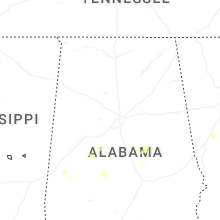


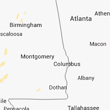


Connect with Interactive Hail Maps