

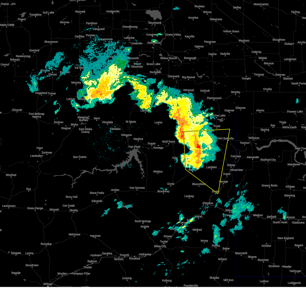
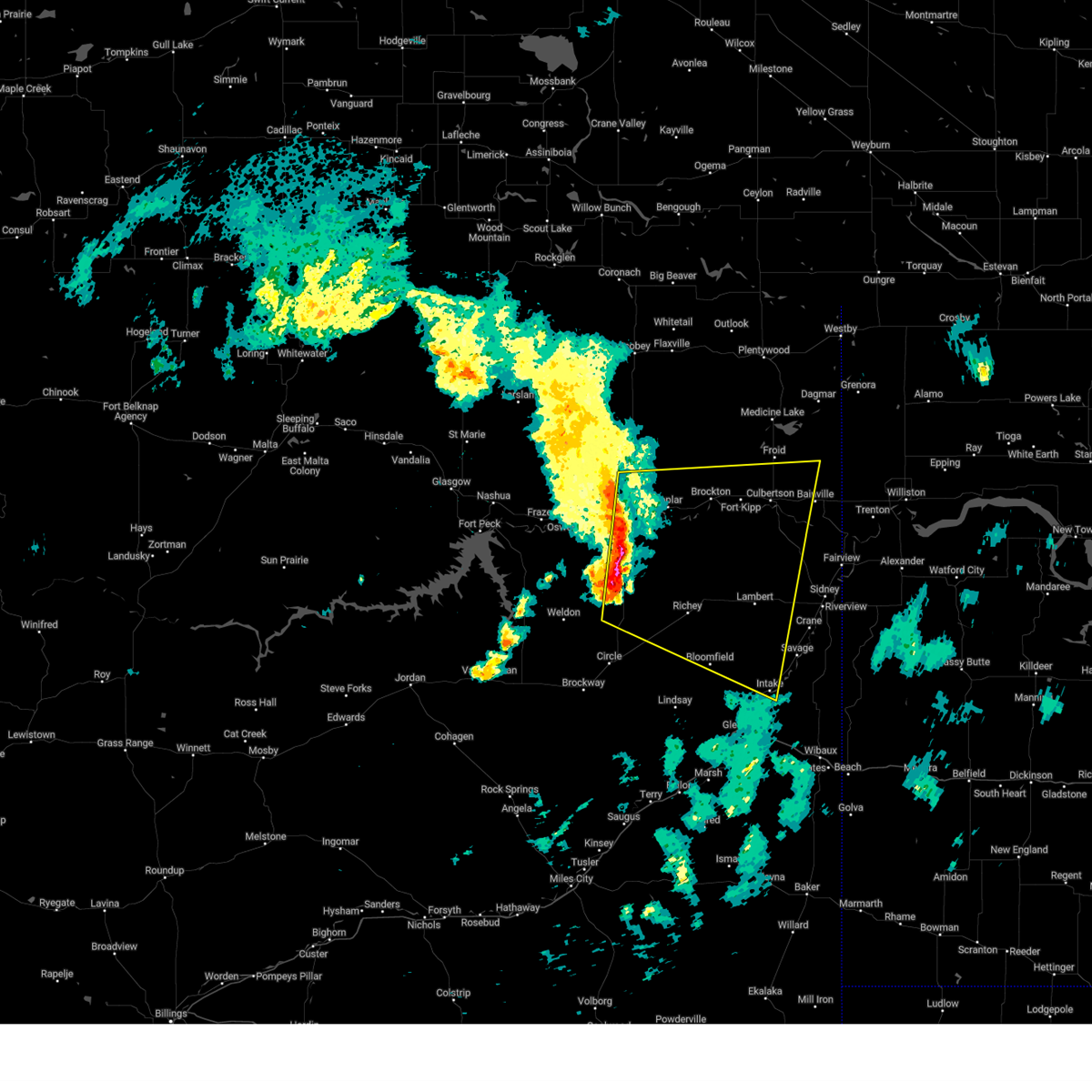
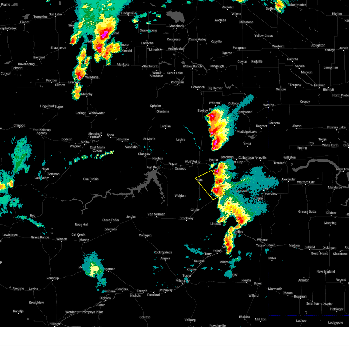
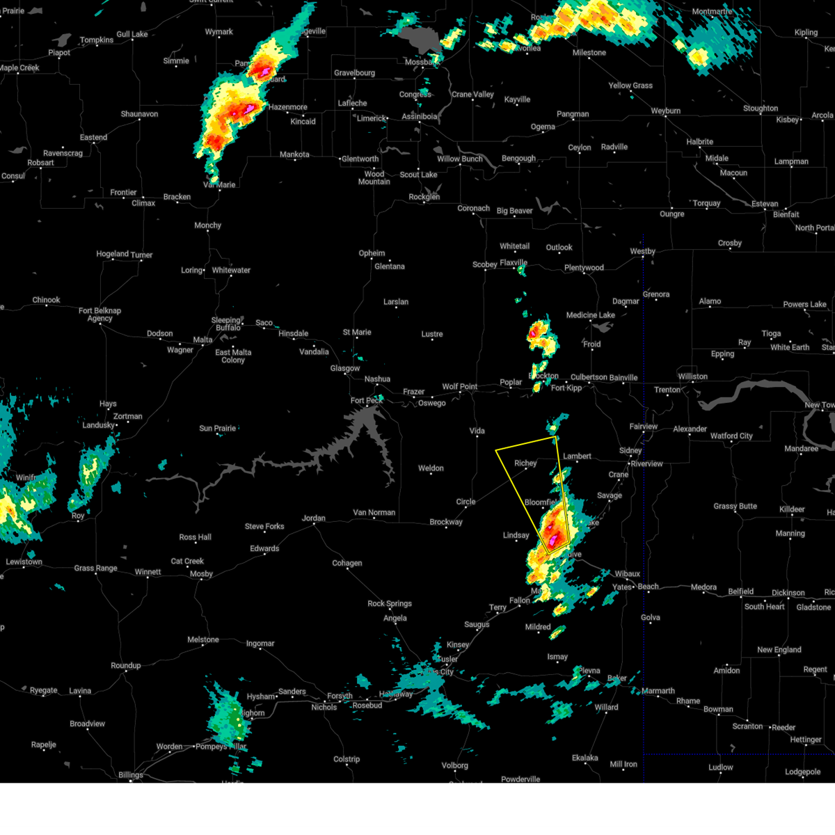
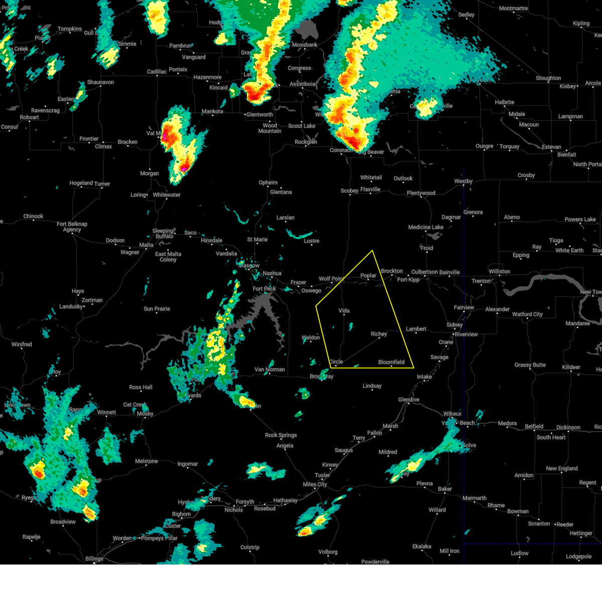
Hail Map for Richey, MT
The Richey, MT area has had 18 reports of on-the-ground hail by trained spotters, and has been under severe weather warnings 13 times during the past 12 months. Doppler radar has detected hail at or near Richey, MT on 27 occasions, including 2 occasions during the past year.
| Name: | Richey, MT |
| Where Located: | 75.7 miles WSW of Williston, ND |
| Map: | Google Map for Richey, MT |
| Population: | 177 |
| Housing Units: | 139 |
| More Info: | Search Google for Richey, MT |
2
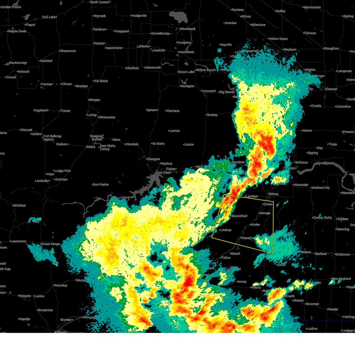
The Top Recent Hail Date for Richey, MT is Tuesday, September 17, 2024 (6th out of 27)

Hail and Wind Damage Spotted near Richey, MT
| Date / Time | Report Details |
|---|---|
| 6/15/2025 10:22 PM MDT |
 Svrggw the national weather service in glasgow has issued a * severe thunderstorm warning for, northeastern wibaux county in northeastern montana, dawson county in northeastern montana, southern richland county in northeastern montana, * until 1130 pm mdt. * at 1022 pm mdt, a severe thunderstorm was located over bloomfield, or 22 miles northwest of glendive, moving east at 40 mph (radar indicated). Hazards include 70 mph wind gusts. Expect considerable tree damage. Damage is likely to mobile homes, roofs, and outbuildings. Svrggw the national weather service in glasgow has issued a * severe thunderstorm warning for, northeastern wibaux county in northeastern montana, dawson county in northeastern montana, southern richland county in northeastern montana, * until 1130 pm mdt. * at 1022 pm mdt, a severe thunderstorm was located over bloomfield, or 22 miles northwest of glendive, moving east at 40 mph (radar indicated). Hazards include 70 mph wind gusts. Expect considerable tree damage. Damage is likely to mobile homes, roofs, and outbuildings.
|
| 6/15/2025 10:16 PM MDT | Bloomfield... mt (aprswxnet/cwop) statio in dawson county MT, 16.4 miles NNW of Richey, MT |
| 6/15/2025 8:20 PM MDT |
 At 818 pm mdt, severe thunderstorms were located along a line extending from 6 miles soutt of lustre to the nelson creek recreation area, moving southeast at 45 mph (trained weather spotters). Hazards include 70 mph wind gusts and half dollar size hail. Hail damage to vehicles is expected. expect considerable tree damage. wind damage is also likely to mobile homes, roofs, and outbuildings. Locations impacted include, wolf point, sprole, circle, oswego, weldon, richey, frazer, poplar, vida, and rock creek rec area. At 818 pm mdt, severe thunderstorms were located along a line extending from 6 miles soutt of lustre to the nelson creek recreation area, moving southeast at 45 mph (trained weather spotters). Hazards include 70 mph wind gusts and half dollar size hail. Hail damage to vehicles is expected. expect considerable tree damage. wind damage is also likely to mobile homes, roofs, and outbuildings. Locations impacted include, wolf point, sprole, circle, oswego, weldon, richey, frazer, poplar, vida, and rock creek rec area.
|
| 6/15/2025 8:20 PM MDT |
 the severe thunderstorm warning has been cancelled and is no longer in effect the severe thunderstorm warning has been cancelled and is no longer in effect
|
| 6/15/2025 7:48 PM MDT |
 Svrggw the national weather service in glasgow has issued a * severe thunderstorm warning for, northeastern garfield county in northeastern montana, southwestern roosevelt county in northeastern montana, eastern valley county in northeastern montana, mccone county in northeastern montana, northwestern dawson county in northeastern montana, northwestern richland county in northeastern montana, * until 845 pm mdt. * at 747 pm mdt, severe thunderstorms were located along a line extending from 15 miles north of st. marie to near nashua to 6 miles south of fort peck, moving southeast at 85 mph (trained weather spotters). Hazards include 70 mph wind gusts and half dollar size hail. Hail damage to vehicles is expected. expect considerable tree damage. Wind damage is also likely to mobile homes, roofs, and outbuildings. Svrggw the national weather service in glasgow has issued a * severe thunderstorm warning for, northeastern garfield county in northeastern montana, southwestern roosevelt county in northeastern montana, eastern valley county in northeastern montana, mccone county in northeastern montana, northwestern dawson county in northeastern montana, northwestern richland county in northeastern montana, * until 845 pm mdt. * at 747 pm mdt, severe thunderstorms were located along a line extending from 15 miles north of st. marie to near nashua to 6 miles south of fort peck, moving southeast at 85 mph (trained weather spotters). Hazards include 70 mph wind gusts and half dollar size hail. Hail damage to vehicles is expected. expect considerable tree damage. Wind damage is also likely to mobile homes, roofs, and outbuildings.
|
| 9/20/2024 8:45 PM MDT |
 The storm which prompted the warning has weakened below severe limits, and has exited the warned area. therefore, the warning will be allowed to expire. however, gusty winds are still possible behind this thunderstorm. The storm which prompted the warning has weakened below severe limits, and has exited the warned area. therefore, the warning will be allowed to expire. however, gusty winds are still possible behind this thunderstorm.
|
| 9/20/2024 8:15 PM MDT |
 At 815 pm mdt, a severe thunderstorm was located 14 miles south of brockton, or 18 miles southeast of poplar, moving east at 50 mph (radar indicated). Hazards include 60 mph wind gusts. Expect damage to roofs, siding, and trees. Locations impacted include, poplar, culbertson, brockton, richey, lambert, sprole, mccabe, fort kipp, and enid. At 815 pm mdt, a severe thunderstorm was located 14 miles south of brockton, or 18 miles southeast of poplar, moving east at 50 mph (radar indicated). Hazards include 60 mph wind gusts. Expect damage to roofs, siding, and trees. Locations impacted include, poplar, culbertson, brockton, richey, lambert, sprole, mccabe, fort kipp, and enid.
|
| 9/20/2024 7:44 PM MDT |
 Svrggw the national weather service in glasgow has issued a * severe thunderstorm warning for, southern roosevelt county in northeastern montana, northeastern mccone county in northeastern montana, richland county in northeastern montana, northern dawson county in northeastern montana, * until 845 pm mdt. * at 743 pm mdt, a severe thunderstorm was located 11 miles northeast of vida, or 12 miles southwest of poplar, moving east at 50 mph (trained weather spotters). Hazards include 70 mph wind gusts. Expect considerable tree damage. Damage is likely to mobile homes, roofs, and outbuildings. Svrggw the national weather service in glasgow has issued a * severe thunderstorm warning for, southern roosevelt county in northeastern montana, northeastern mccone county in northeastern montana, richland county in northeastern montana, northern dawson county in northeastern montana, * until 845 pm mdt. * at 743 pm mdt, a severe thunderstorm was located 11 miles northeast of vida, or 12 miles southwest of poplar, moving east at 50 mph (trained weather spotters). Hazards include 70 mph wind gusts. Expect considerable tree damage. Damage is likely to mobile homes, roofs, and outbuildings.
|
| 9/17/2024 5:56 PM MDT |
 Svrggw the national weather service in glasgow has issued a * severe thunderstorm warning for, northeastern mccone county in northeastern montana, west central richland county in northeastern montana, northwestern dawson county in northeastern montana, * until 645 pm mdt. * at 555 pm mdt, a severe thunderstorm was located near richey, or 27 miles south of poplar, moving northwest at 25 mph (at 5 50 pm, a member public reported golfball sized hail near bloomfield). Hazards include golf ball size hail and 60 mph wind gusts. People and animals outdoors will be injured. expect hail damage to roofs, siding, windows, and vehicles. Expect wind damage to roofs, siding, and trees. Svrggw the national weather service in glasgow has issued a * severe thunderstorm warning for, northeastern mccone county in northeastern montana, west central richland county in northeastern montana, northwestern dawson county in northeastern montana, * until 645 pm mdt. * at 555 pm mdt, a severe thunderstorm was located near richey, or 27 miles south of poplar, moving northwest at 25 mph (at 5 50 pm, a member public reported golfball sized hail near bloomfield). Hazards include golf ball size hail and 60 mph wind gusts. People and animals outdoors will be injured. expect hail damage to roofs, siding, windows, and vehicles. Expect wind damage to roofs, siding, and trees.
|
| 9/17/2024 5:45 PM MDT | Mesonet gust to 61 mp in dawson county MT, 16.4 miles NNW of Richey, MT |
| 9/17/2024 5:31 PM MDT |
 At 530 pm mdt, a severe thunderstorm was located near richey, or 28 miles northeast of circle, moving north at 45 mph (radar indicated). Hazards include 60 mph wind gusts and quarter size hail. Hail damage to vehicles is expected. expect wind damage to roofs, siding, and trees. Locations impacted include, richey and bloomfield. At 530 pm mdt, a severe thunderstorm was located near richey, or 28 miles northeast of circle, moving north at 45 mph (radar indicated). Hazards include 60 mph wind gusts and quarter size hail. Hail damage to vehicles is expected. expect wind damage to roofs, siding, and trees. Locations impacted include, richey and bloomfield.
|
| 9/17/2024 5:10 PM MDT | Golf Ball sized hail reported 17 miles NNW of Richey, MT, golf ball size hail around 5:10 pm. wind gusts in the upper 40s. |
| 9/17/2024 4:57 PM MDT |
 Svrggw the national weather service in glasgow has issued a * severe thunderstorm warning for, west central richland county in northeastern montana, northwestern dawson county in northeastern montana, * until 600 pm mdt. * at 457 pm mdt, a severe thunderstorm was located 9 miles northwest of west glendive, or 10 miles northwest of glendive, moving north at 45 mph (radar indicated). Hazards include 60 mph wind gusts and half dollar size hail. Hail damage to vehicles is expected. Expect wind damage to roofs, siding, and trees. Svrggw the national weather service in glasgow has issued a * severe thunderstorm warning for, west central richland county in northeastern montana, northwestern dawson county in northeastern montana, * until 600 pm mdt. * at 457 pm mdt, a severe thunderstorm was located 9 miles northwest of west glendive, or 10 miles northwest of glendive, moving north at 45 mph (radar indicated). Hazards include 60 mph wind gusts and half dollar size hail. Hail damage to vehicles is expected. Expect wind damage to roofs, siding, and trees.
|
| 9/12/2024 6:45 PM MDT | Mesonet station gw0525 bloomfiel in dawson county MT, 16.4 miles NNW of Richey, MT |
| 8/21/2024 7:54 PM MDT |
 At 753 pm mdt, severe thunderstorms were located along a line extending from 10 miles south of poplar to near bloomfield, moving east at 30 mph (trained weather spotters. quarter size hail has been reportd with these storms). Hazards include 70 mph wind gusts and half dollar size hail. Hail damage to vehicles is expected. expect considerable tree damage. wind damage is also likely to mobile homes, roofs, and outbuildings. Locations impacted include, richey, bloomfield, and vida. At 753 pm mdt, severe thunderstorms were located along a line extending from 10 miles south of poplar to near bloomfield, moving east at 30 mph (trained weather spotters. quarter size hail has been reportd with these storms). Hazards include 70 mph wind gusts and half dollar size hail. Hail damage to vehicles is expected. expect considerable tree damage. wind damage is also likely to mobile homes, roofs, and outbuildings. Locations impacted include, richey, bloomfield, and vida.
|
| 8/21/2024 7:53 PM MDT | Ping Pong Ball sized hail reported 11.5 miles NE of Richey, MT, report from mping: ping pong ball (1.50 in.). |
| 8/21/2024 7:53 PM MDT | Hen Egg sized hail reported 11.5 miles NE of Richey, MT, corrects previous hail report from 11 sw richey. report from mping: ping pong ball (1.50 in.). |
| 8/21/2024 7:34 PM MDT |
 At 733 pm mdt, severe thunderstorms were located along a line extending from 9 miles southeast of wolf point to 7 miles southwest of richey, moving east at 25 mph (radar indicated). Hazards include 70 mph wind gusts and half dollar size hail. Hail damage to vehicles is expected. expect considerable tree damage. wind damage is also likely to mobile homes, roofs, and outbuildings. Locations impacted include, poplar, richey, vida, bloomfield, and sprole. At 733 pm mdt, severe thunderstorms were located along a line extending from 9 miles southeast of wolf point to 7 miles southwest of richey, moving east at 25 mph (radar indicated). Hazards include 70 mph wind gusts and half dollar size hail. Hail damage to vehicles is expected. expect considerable tree damage. wind damage is also likely to mobile homes, roofs, and outbuildings. Locations impacted include, poplar, richey, vida, bloomfield, and sprole.
|
| 8/21/2024 7:20 PM MDT |
 Svrggw the national weather service in glasgow has issued a * severe thunderstorm warning for, southwestern roosevelt county in northeastern montana, northeastern mccone county in northeastern montana, northwestern dawson county in northeastern montana, northwestern richland county in northeastern montana, * until 815 pm mdt. * at 719 pm mdt, severe thunderstorms were located along a line extending from 7 miles southeast of wolf point to 12 miles southwest of richey, moving northeast at 25 mph (radar indicated). Hazards include 60 mph wind gusts and quarter size hail. Hail damage to vehicles is expected. Expect wind damage to roofs, siding, and trees. Svrggw the national weather service in glasgow has issued a * severe thunderstorm warning for, southwestern roosevelt county in northeastern montana, northeastern mccone county in northeastern montana, northwestern dawson county in northeastern montana, northwestern richland county in northeastern montana, * until 815 pm mdt. * at 719 pm mdt, severe thunderstorms were located along a line extending from 7 miles southeast of wolf point to 12 miles southwest of richey, moving northeast at 25 mph (radar indicated). Hazards include 60 mph wind gusts and quarter size hail. Hail damage to vehicles is expected. Expect wind damage to roofs, siding, and trees.
|
| 6/15/2024 8:13 PM MDT |
 At 812 pm mdt, severe thunderstorms were located along a line extending from 6 miles southwest of redstone to 7 miles northwest of culbertson to 11 miles east of bloomfield, moving east at 40 mph (radar indicated). Hazards include 70 mph wind gusts and quarter size hail. Hail damage to vehicles is expected. expect considerable tree damage. wind damage is also likely to mobile homes, roofs, and outbuildings. Locations impacted include, poplar, culbertson, brockton, medicine lake, bainville, froid, richey, archer, lambert, bredette, redstone, reserve, fort kipp, homestead, enid, navajo, sprole, and mccabe. At 812 pm mdt, severe thunderstorms were located along a line extending from 6 miles southwest of redstone to 7 miles northwest of culbertson to 11 miles east of bloomfield, moving east at 40 mph (radar indicated). Hazards include 70 mph wind gusts and quarter size hail. Hail damage to vehicles is expected. expect considerable tree damage. wind damage is also likely to mobile homes, roofs, and outbuildings. Locations impacted include, poplar, culbertson, brockton, medicine lake, bainville, froid, richey, archer, lambert, bredette, redstone, reserve, fort kipp, homestead, enid, navajo, sprole, and mccabe.
|
| 6/15/2024 8:13 PM MDT |
 the severe thunderstorm warning has been cancelled and is no longer in effect the severe thunderstorm warning has been cancelled and is no longer in effect
|
| 6/15/2024 8:00 PM MDT | Meso net observation reported a thunderstorm wind gust of 60 mp in dawson county MT, 16.4 miles NNW of Richey, MT |
| 6/15/2024 7:27 PM MDT |
 Svrggw the national weather service in glasgow has issued a * severe thunderstorm warning for, southern daniels county in northeastern montana, roosevelt county in northeastern montana, east central valley county in northeastern montana, western sheridan county in northeastern montana, northeastern mccone county in northeastern montana, richland county in northeastern montana, northern dawson county in northeastern montana, * until 830 pm mdt. * at 726 pm mdt, severe thunderstorms were located along a line extending from 12 miles south of peerless to 6 miles west of poplar to 6 miles south of circle, moving east at 45 mph (radar indicated). Hazards include 70 mph wind gusts and quarter size hail. Hail damage to vehicles is expected. expect considerable tree damage. Wind damage is also likely to mobile homes, roofs, and outbuildings. Svrggw the national weather service in glasgow has issued a * severe thunderstorm warning for, southern daniels county in northeastern montana, roosevelt county in northeastern montana, east central valley county in northeastern montana, western sheridan county in northeastern montana, northeastern mccone county in northeastern montana, richland county in northeastern montana, northern dawson county in northeastern montana, * until 830 pm mdt. * at 726 pm mdt, severe thunderstorms were located along a line extending from 12 miles south of peerless to 6 miles west of poplar to 6 miles south of circle, moving east at 45 mph (radar indicated). Hazards include 70 mph wind gusts and quarter size hail. Hail damage to vehicles is expected. expect considerable tree damage. Wind damage is also likely to mobile homes, roofs, and outbuildings.
|
| 6/3/2024 9:00 PM MDT | Mesonet station gw0525 bloomfiel in dawson county MT, 16.4 miles NNW of Richey, MT |
| 5/5/2024 9:38 PM MDT |
 The storm which prompted the warning has weakened below severe limits, and no longer poses an immediate threat to life or property. therefore, the warning will be allowed to expire. however, gusty winds are still possible with this thunderstorm. The storm which prompted the warning has weakened below severe limits, and no longer poses an immediate threat to life or property. therefore, the warning will be allowed to expire. however, gusty winds are still possible with this thunderstorm.
|
| 5/5/2024 9:16 PM MDT |
 At 914 pm mdt, a severe thunderstorm was located 14 miles east of rock creek rec area, or 24 miles northwest of circle, moving northeast at 35 mph (radar indicated). Hazards include 60 mph wind gusts. wind gusts as high as 59 mph have been observed with this storm near cow creek at 900 pm mdt. Expect damage to roofs, siding, and trees. Locations impacted include, circle, richey, vida, nelson creek rec area, lindsay, rock creek rec area, brockway, weldon, and enid. At 914 pm mdt, a severe thunderstorm was located 14 miles east of rock creek rec area, or 24 miles northwest of circle, moving northeast at 35 mph (radar indicated). Hazards include 60 mph wind gusts. wind gusts as high as 59 mph have been observed with this storm near cow creek at 900 pm mdt. Expect damage to roofs, siding, and trees. Locations impacted include, circle, richey, vida, nelson creek rec area, lindsay, rock creek rec area, brockway, weldon, and enid.
|
| 5/5/2024 9:16 PM MDT |
 the severe thunderstorm warning has been cancelled and is no longer in effect the severe thunderstorm warning has been cancelled and is no longer in effect
|
| 5/5/2024 8:43 PM MDT |
 Svrggw the national weather service in glasgow has issued a * severe thunderstorm warning for, east central garfield county in northeastern montana, mccone county in northeastern montana, northwestern prairie county in northeastern montana, west central richland county in northeastern montana, northwestern dawson county in northeastern montana, * until 945 pm mdt. * at 842 pm mdt, a severe thunderstorm was located 7 miles north of flowing wells rest area, or 27 miles west of circle, moving northeast at 35 mph (radar indicated). Hazards include 60 mph wind gusts. wind gusts to 60 mph were observed at circle airport at 825 pm mdt. expect damage to roofs, siding, and trees Svrggw the national weather service in glasgow has issued a * severe thunderstorm warning for, east central garfield county in northeastern montana, mccone county in northeastern montana, northwestern prairie county in northeastern montana, west central richland county in northeastern montana, northwestern dawson county in northeastern montana, * until 945 pm mdt. * at 842 pm mdt, a severe thunderstorm was located 7 miles north of flowing wells rest area, or 27 miles west of circle, moving northeast at 35 mph (radar indicated). Hazards include 60 mph wind gusts. wind gusts to 60 mph were observed at circle airport at 825 pm mdt. expect damage to roofs, siding, and trees
|
| 4/22/2024 4:47 PM MDT |
 The storms which prompted the warning have weakened below severe limits, and no longer pose an immediate threat to life or property. therefore, the warning has been allowed to expire. however, gusty winds are still possible with these thunderstorms. The storms which prompted the warning have weakened below severe limits, and no longer pose an immediate threat to life or property. therefore, the warning has been allowed to expire. however, gusty winds are still possible with these thunderstorms.
|
| 4/22/2024 3:42 PM MDT |
 Svrggw the national weather service in glasgow has issued a * severe thunderstorm warning for, southwestern roosevelt county in northeastern montana, east central valley county in northeastern montana, northeastern mccone county in northeastern montana, northwestern richland county in northeastern montana, northwestern dawson county in northeastern montana, * until 445 pm mdt. * at 341 pm mdt, showers with damaging gusts were located along a line extending from 13 miles southwest of bredette to 8 miles southeast of st. marie, moving southeast at 60 mph (radar indicated). Hazards include 60 mph wind gusts. expect damage to roofs, siding, and trees Svrggw the national weather service in glasgow has issued a * severe thunderstorm warning for, southwestern roosevelt county in northeastern montana, east central valley county in northeastern montana, northeastern mccone county in northeastern montana, northwestern richland county in northeastern montana, northwestern dawson county in northeastern montana, * until 445 pm mdt. * at 341 pm mdt, showers with damaging gusts were located along a line extending from 13 miles southwest of bredette to 8 miles southeast of st. marie, moving southeast at 60 mph (radar indicated). Hazards include 60 mph wind gusts. expect damage to roofs, siding, and trees
|
| 4/22/2024 2:24 PM MDT |
 The storm which prompted the warning has weakened below severe limits, and no longer poses an immediate threat to life or property. therefore, the warning will be allowed to expire. however, gusty winds are still possible with this thunderstorm. The storm which prompted the warning has weakened below severe limits, and no longer poses an immediate threat to life or property. therefore, the warning will be allowed to expire. however, gusty winds are still possible with this thunderstorm.
|
| 4/22/2024 1:30 PM MDT |
 Svrggw the national weather service in glasgow has issued a * severe thunderstorm warning for, northeastern garfield county in northeastern montana, southwestern roosevelt county in northeastern montana, east central valley county in northeastern montana, northern mccone county in northeastern montana, west central richland county in northeastern montana, northwestern dawson county in northeastern montana, * until 230 pm mdt. * at 128 pm mdt, severe winds with showers were located 8 miles east of fort peck, or 23 miles southeast of glasgow, moving east at 55 mph (radar indicated). Hazards include 60 mph wind gusts. Expect damage possibly to roofs, siding, and trees. Also expect blowing dust and dirt. Svrggw the national weather service in glasgow has issued a * severe thunderstorm warning for, northeastern garfield county in northeastern montana, southwestern roosevelt county in northeastern montana, east central valley county in northeastern montana, northern mccone county in northeastern montana, west central richland county in northeastern montana, northwestern dawson county in northeastern montana, * until 230 pm mdt. * at 128 pm mdt, severe winds with showers were located 8 miles east of fort peck, or 23 miles southeast of glasgow, moving east at 55 mph (radar indicated). Hazards include 60 mph wind gusts. Expect damage possibly to roofs, siding, and trees. Also expect blowing dust and dirt.
|
| 7/30/2023 6:35 PM MDT |
 At 634 pm mdt, a severe thunderstorm was located 7 miles west of lambert, or 28 miles west of sidney, moving southeast at 45 mph (radar indicated). Hazards include two inch hail and 70 mph wind gusts. People and animals outdoors will be injured. expect hail damage to roofs, siding, windows, and vehicles. expect considerable tree damage. Wind damage is also likely to mobile homes, roofs, and outbuildings. At 634 pm mdt, a severe thunderstorm was located 7 miles west of lambert, or 28 miles west of sidney, moving southeast at 45 mph (radar indicated). Hazards include two inch hail and 70 mph wind gusts. People and animals outdoors will be injured. expect hail damage to roofs, siding, windows, and vehicles. expect considerable tree damage. Wind damage is also likely to mobile homes, roofs, and outbuildings.
|
| 7/30/2023 6:15 PM MDT |
 At 614 pm mdt, a severe thunderstorm was located 9 miles north of richey, or 24 miles south of poplar, moving southeast at 40 mph. this is a destructive storm for western richland county (radar indicated). Hazards include 80 mph wind gusts and half dollar size hail. Flying debris will be dangerous to those caught without shelter. mobile homes will be heavily damaged. expect considerable damage to roofs, windows, and vehicles. extensive tree damage and power outages are likely. locations impacted include, richey, lambert, vida, sprole and enid. thunderstorm damage threat, destructive hail threat, radar indicated max hail size, 1. 25 in wind threat, radar indicated max wind gust, 80 mph. At 614 pm mdt, a severe thunderstorm was located 9 miles north of richey, or 24 miles south of poplar, moving southeast at 40 mph. this is a destructive storm for western richland county (radar indicated). Hazards include 80 mph wind gusts and half dollar size hail. Flying debris will be dangerous to those caught without shelter. mobile homes will be heavily damaged. expect considerable damage to roofs, windows, and vehicles. extensive tree damage and power outages are likely. locations impacted include, richey, lambert, vida, sprole and enid. thunderstorm damage threat, destructive hail threat, radar indicated max hail size, 1. 25 in wind threat, radar indicated max wind gust, 80 mph.
|
| 7/30/2023 5:43 PM MDT |
 At 541 pm mdt, a severe thunderstorm was located 8 miles south of poplar, moving southeast at 45 mph. this is a destructive storm for areas near wolf point (at 510 pm an nws employee reported an estimated wind gust of 80 mph). Hazards include 80 mph wind gusts and half dollar size hail. Flying debris will be dangerous to those caught without shelter. mobile homes will be heavily damaged. expect considerable damage to roofs, windows, and vehicles. Extensive tree damage and power outages are likely. At 541 pm mdt, a severe thunderstorm was located 8 miles south of poplar, moving southeast at 45 mph. this is a destructive storm for areas near wolf point (at 510 pm an nws employee reported an estimated wind gust of 80 mph). Hazards include 80 mph wind gusts and half dollar size hail. Flying debris will be dangerous to those caught without shelter. mobile homes will be heavily damaged. expect considerable damage to roofs, windows, and vehicles. Extensive tree damage and power outages are likely.
|
| 6/4/2023 5:21 PM MDT |
 At 520 pm mdt, severe thunderstorms were located along a line extending from near east fairview to 17 miles southwest of terry, moving northwest at 25 mph (trained weather spotter reported an estimated wind gust of 60 mph at 5:20 pm). Hazards include 60 mph wind gusts and penny size hail. expect damage to roofs, siding, and trees At 520 pm mdt, severe thunderstorms were located along a line extending from near east fairview to 17 miles southwest of terry, moving northwest at 25 mph (trained weather spotter reported an estimated wind gust of 60 mph at 5:20 pm). Hazards include 60 mph wind gusts and penny size hail. expect damage to roofs, siding, and trees
|
| 5/25/2023 9:06 PM MDT |
 The severe thunderstorm warning for northern dawson and central richland counties will expire at 915 pm mdt, the storms which prompted the warning have weakened below severe limits, and no longer pose an immediate threat to life or property. therefore, the warning will be allowed to expire. however heavy rain is still possible with these thunderstorms. The severe thunderstorm warning for northern dawson and central richland counties will expire at 915 pm mdt, the storms which prompted the warning have weakened below severe limits, and no longer pose an immediate threat to life or property. therefore, the warning will be allowed to expire. however heavy rain is still possible with these thunderstorms.
|
| 5/25/2023 8:43 PM MDT |
 At 842 pm mdt, severe thunderstorms were located along a line extending from 12 miles south of lambert to 8 miles northeast of bloomfield, moving north at 30 mph (radar indicated). Hazards include 60 mph wind gusts and quarter size hail. Hail damage to vehicles is expected. expect wind damage to roofs, siding, and trees. locations impacted include, richey, lambert, bloomfield and enid. hail threat, radar indicated max hail size, 1. 00 in wind threat, radar indicated max wind gust, 60 mph. At 842 pm mdt, severe thunderstorms were located along a line extending from 12 miles south of lambert to 8 miles northeast of bloomfield, moving north at 30 mph (radar indicated). Hazards include 60 mph wind gusts and quarter size hail. Hail damage to vehicles is expected. expect wind damage to roofs, siding, and trees. locations impacted include, richey, lambert, bloomfield and enid. hail threat, radar indicated max hail size, 1. 00 in wind threat, radar indicated max wind gust, 60 mph.
|
| 5/25/2023 8:17 PM MDT |
 At 817 pm mdt, severe thunderstorms were located along a line extending from near savage to 8 miles west of intake, moving northwest at 20 mph (radar indicated). Hazards include 60 mph wind gusts and quarter size hail. Hail damage to vehicles is expected. Expect wind damage to roofs, siding, and trees. At 817 pm mdt, severe thunderstorms were located along a line extending from near savage to 8 miles west of intake, moving northwest at 20 mph (radar indicated). Hazards include 60 mph wind gusts and quarter size hail. Hail damage to vehicles is expected. Expect wind damage to roofs, siding, and trees.
|
| 7/18/2022 4:53 PM MDT |
 At 453 pm mdt, a severe thunderstorm was located 13 miles west of richey, or 18 miles northeast of circle, moving east at 55 mph (radar indicated). Hazards include 60 mph wind gusts and quarter size hail. Hail damage to vehicles is expected. Expect wind damage to roofs, siding, and trees. At 453 pm mdt, a severe thunderstorm was located 13 miles west of richey, or 18 miles northeast of circle, moving east at 55 mph (radar indicated). Hazards include 60 mph wind gusts and quarter size hail. Hail damage to vehicles is expected. Expect wind damage to roofs, siding, and trees.
|
| 7/13/2022 9:56 PM MDT |
 The severe thunderstorm warning for eastern garfield, southwestern roosevelt, southeastern valley, mccone, northwestern prairie, northwestern dawson and northwestern richland counties will expire at 1000 pm mdt, the storms which prompted the warning have weakened below severe limits, and no longer pose an immediate threat to life or property. therefore, the warning will be allowed to expire. however gusty winds are still possible with these thunderstorms. a severe thunderstorm watch remains in effect until 1100 pm mdt for northeastern montana. The severe thunderstorm warning for eastern garfield, southwestern roosevelt, southeastern valley, mccone, northwestern prairie, northwestern dawson and northwestern richland counties will expire at 1000 pm mdt, the storms which prompted the warning have weakened below severe limits, and no longer pose an immediate threat to life or property. therefore, the warning will be allowed to expire. however gusty winds are still possible with these thunderstorms. a severe thunderstorm watch remains in effect until 1100 pm mdt for northeastern montana.
|
| 7/13/2022 9:42 PM MDT |
 At 941 pm mdt, severe thunderstorms were located along a line extending from near nashua to 10 miles northwest of vida to 15 miles south of brockway, moving northeast at 45 mph (trained weather spotters). Hazards include 70 mph wind gusts and penny size hail. Expect considerable tree damage. damage is likely to mobile homes, roofs, and outbuildings. locations impacted include, glasgow, wolf point, poplar, circle, nashua, brockton, fort peck, richey, duck creek rec area, brockway, flowing wells rest area, lustre, fort peck marina, frazer, vida, nelson creek rec area, lindsay, rock creek rec area, park grove and volt. thunderstorm damage threat, considerable hail threat, radar indicated max hail size, 0. 75 in wind threat, radar indicated max wind gust, 70 mph. At 941 pm mdt, severe thunderstorms were located along a line extending from near nashua to 10 miles northwest of vida to 15 miles south of brockway, moving northeast at 45 mph (trained weather spotters). Hazards include 70 mph wind gusts and penny size hail. Expect considerable tree damage. damage is likely to mobile homes, roofs, and outbuildings. locations impacted include, glasgow, wolf point, poplar, circle, nashua, brockton, fort peck, richey, duck creek rec area, brockway, flowing wells rest area, lustre, fort peck marina, frazer, vida, nelson creek rec area, lindsay, rock creek rec area, park grove and volt. thunderstorm damage threat, considerable hail threat, radar indicated max hail size, 0. 75 in wind threat, radar indicated max wind gust, 70 mph.
|
| 7/13/2022 9:07 PM MDT |
 At 905 pm mdt, severe thunderstorms were located along a line extending from 13 miles west of duck creek rec area to 8 miles east of rock creek rec area to 11 miles east of hillside, moving northeast at 40 mph (trained weather spotters). Hazards include 70 mph wind gusts and penny size hail. Expect considerable tree damage. Damage is likely to mobile homes, roofs, and outbuildings. At 905 pm mdt, severe thunderstorms were located along a line extending from 13 miles west of duck creek rec area to 8 miles east of rock creek rec area to 11 miles east of hillside, moving northeast at 40 mph (trained weather spotters). Hazards include 70 mph wind gusts and penny size hail. Expect considerable tree damage. Damage is likely to mobile homes, roofs, and outbuildings.
|
| 7/9/2022 11:48 PM MDT |
 At 1148 pm mdt, severe thunderstorms were located along a line extending from 13 miles southwest of richey to 12 miles south of terry, moving east at 60 mph (radar indicated). Hazards include 70 mph wind gusts and half dollar size hail. Hail damage to vehicles is expected. expect considerable tree damage. wind damage is also likely to mobile homes, roofs, and outbuildings. locations impacted include, sidney, glendive, terry, wibaux, fallon, fairview, richey, savage, west glendive, intake, bloomfield, lambert, carlyle, lindsay, east fairview, enid, wooley, crane, mildred and calypso. thunderstorm damage threat, considerable hail threat, radar indicated max hail size, 1. 25 in wind threat, radar indicated max wind gust, 70 mph. At 1148 pm mdt, severe thunderstorms were located along a line extending from 13 miles southwest of richey to 12 miles south of terry, moving east at 60 mph (radar indicated). Hazards include 70 mph wind gusts and half dollar size hail. Hail damage to vehicles is expected. expect considerable tree damage. wind damage is also likely to mobile homes, roofs, and outbuildings. locations impacted include, sidney, glendive, terry, wibaux, fallon, fairview, richey, savage, west glendive, intake, bloomfield, lambert, carlyle, lindsay, east fairview, enid, wooley, crane, mildred and calypso. thunderstorm damage threat, considerable hail threat, radar indicated max hail size, 1. 25 in wind threat, radar indicated max wind gust, 70 mph.
|
| 7/9/2022 11:27 PM MDT |
 At 1126 pm mdt, severe thunderstorms were located along a line extending from 10 miles northwest of circle to 15 miles north of miles city, moving east at 60 mph (radar indicated). Hazards include 70 mph wind gusts and half dollar size hail. Hail damage to vehicles is expected. expect considerable tree damage. Wind damage is also likely to mobile homes, roofs, and outbuildings. At 1126 pm mdt, severe thunderstorms were located along a line extending from 10 miles northwest of circle to 15 miles north of miles city, moving east at 60 mph (radar indicated). Hazards include 70 mph wind gusts and half dollar size hail. Hail damage to vehicles is expected. expect considerable tree damage. Wind damage is also likely to mobile homes, roofs, and outbuildings.
|
| 7/9/2022 10:30 PM MDT |
 At 1030 pm mdt, severe thunderstorms were located along a line extending from 11 miles southwest of vida to 14 miles west of terry, moving east at 60 mph (radar indicated). Hazards include 70 mph wind gusts and half dollar size hail. Hail damage to vehicles is expected. expect considerable tree damage. Wind damage is also likely to mobile homes, roofs, and outbuildings. At 1030 pm mdt, severe thunderstorms were located along a line extending from 11 miles southwest of vida to 14 miles west of terry, moving east at 60 mph (radar indicated). Hazards include 70 mph wind gusts and half dollar size hail. Hail damage to vehicles is expected. expect considerable tree damage. Wind damage is also likely to mobile homes, roofs, and outbuildings.
|
| 7/9/2022 12:53 AM MDT | At 1252 am mdt, severe thunderstorms were located along a line extending from 6 miles north of redstone to near richey, moving east at 60 mph (radar indicated). Hazards include 60 mph wind gusts and nickel size hail. Expect considerable tree damage. damage is likely to mobile homes, roofs, and outbuildings. locations impacted include, sidney, glendive, plentywood, poplar, culbertson, wibaux, fairview, brockton, medicine lake, bainville, froid, richey, westby, archer, port of raymond, savage, west glendive, intake, bloomfield and lambert. thunderstorm damage threat, considerable hail threat, radar indicated max hail size, 0. 88 in wind threat, observed max wind gust, 70 mph. |
| 7/9/2022 12:38 AM MDT | At 1237 am mdt, severe thunderstorms were located along a line extending from 6 miles north of redstone to richey, moving east at 70 mph (radar indicated). Hazards include 60 mph wind gusts and nickel size hail. expect damage to roofs, siding, and trees |
| 7/9/2022 12:31 AM MDT | Mesonet observatio in dawson county MT, 16.4 miles NNW of Richey, MT |
| 7/9/2022 12:07 AM MDT | At 1206 am mdt, severe thunderstorms were located along a line extending from 6 miles southeast of port of scobey to 11 miles southeast of vida, moving east at 60 mph (radar indicated). Hazards include 60 mph wind gusts and penny size hail. Expect damage to roofs, siding, and trees. locations impacted include, sidney, wolf point, plentywood, scobey, poplar, culbertson, fairview, brockton, medicine lake, bainville, froid, richey, westby, flaxville, archer, port of raymond, madoc, lambert, bredette and redstone. hail threat, radar indicated max hail size, 0. 75 in wind threat, observed max wind gust, 60 mph. |
| 7/8/2022 11:41 PM MDT | At 1140 pm mdt, severe thunderstorms were located along a line extending from 11 miles north of peerless to 12 miles west of vida, moving east at 60 mph (radar indicated). Hazards include 70 mph wind gusts and penny size hail. Expect considerable tree damage. Damage is likely to mobile homes, roofs, and outbuildings. |
| 7/6/2022 6:26 PM MDT |
 At 625 pm mdt, a severe thunderstorm was located near richey, or 33 miles northeast of circle, moving southeast at 30 mph (radar indicated). Hazards include 60 mph wind gusts and quarter size hail. Hail damage to vehicles is expected. expect wind damage to roofs, siding, and trees. locations impacted include, richey, lambert, bloomfield and enid. hail threat, radar indicated max hail size, 1. 00 in wind threat, radar indicated max wind gust, 60 mph. At 625 pm mdt, a severe thunderstorm was located near richey, or 33 miles northeast of circle, moving southeast at 30 mph (radar indicated). Hazards include 60 mph wind gusts and quarter size hail. Hail damage to vehicles is expected. expect wind damage to roofs, siding, and trees. locations impacted include, richey, lambert, bloomfield and enid. hail threat, radar indicated max hail size, 1. 00 in wind threat, radar indicated max wind gust, 60 mph.
|
| 7/6/2022 5:54 PM MDT |
 At 553 pm mdt, a severe thunderstorm was located 11 miles northwest of richey, or 23 miles south of poplar, moving southeast at 30 mph (radar indicated). Hazards include 60 mph wind gusts and quarter size hail. Hail damage to vehicles is expected. Expect wind damage to roofs, siding, and trees. At 553 pm mdt, a severe thunderstorm was located 11 miles northwest of richey, or 23 miles south of poplar, moving southeast at 30 mph (radar indicated). Hazards include 60 mph wind gusts and quarter size hail. Hail damage to vehicles is expected. Expect wind damage to roofs, siding, and trees.
|
| 7/6/2022 5:30 PM MDT |
 At 529 pm mdt, a severe thunderstorm was located over vida, or 21 miles southeast of wolf point, moving southeast at 25 mph (public). Hazards include golf ball size hail and 70 mph wind gusts. People and animals outdoors will be injured. expect hail damage to roofs, siding, windows, and vehicles. expect considerable tree damage. wind damage is also likely to mobile homes, roofs, and outbuildings. locations impacted include, richey and vida. thunderstorm damage threat, considerable hail threat, radar indicated max hail size, 1. 75 in wind threat, radar indicated max wind gust, 70 mph. At 529 pm mdt, a severe thunderstorm was located over vida, or 21 miles southeast of wolf point, moving southeast at 25 mph (public). Hazards include golf ball size hail and 70 mph wind gusts. People and animals outdoors will be injured. expect hail damage to roofs, siding, windows, and vehicles. expect considerable tree damage. wind damage is also likely to mobile homes, roofs, and outbuildings. locations impacted include, richey and vida. thunderstorm damage threat, considerable hail threat, radar indicated max hail size, 1. 75 in wind threat, radar indicated max wind gust, 70 mph.
|
| 7/6/2022 5:06 PM MDT |
 At 506 pm mdt, a severe thunderstorm was located 8 miles north of vida, or 11 miles southeast of wolf point, moving southeast at 25 mph (radar indicated). Hazards include golf ball size hail and 70 mph wind gusts. People and animals outdoors will be injured. expect hail damage to roofs, siding, windows, and vehicles. expect considerable tree damage. Wind damage is also likely to mobile homes, roofs, and outbuildings. At 506 pm mdt, a severe thunderstorm was located 8 miles north of vida, or 11 miles southeast of wolf point, moving southeast at 25 mph (radar indicated). Hazards include golf ball size hail and 70 mph wind gusts. People and animals outdoors will be injured. expect hail damage to roofs, siding, windows, and vehicles. expect considerable tree damage. Wind damage is also likely to mobile homes, roofs, and outbuildings.
|
| 7/3/2022 7:26 PM MDT |
 At 726 pm mdt, severe thunderstorms were located along a line extending from near richey to 7 miles south of bloomfield to 16 miles southeast of fallon, moving east at 30 mph (radar indicated). Hazards include 70 mph wind gusts and half dollar size hail. Hail damage to vehicles is expected. expect considerable tree damage. wind damage is also likely to mobile homes, roofs, and outbuildings. Locations impacted include, sidney, glendive, terry, wibaux, fallon, richey, savage, west glendive, intake, bloomfield, lambert, carlyle, lindsay, enid, wooley, crane, mildred, midway, hoyt and saint phillip. At 726 pm mdt, severe thunderstorms were located along a line extending from near richey to 7 miles south of bloomfield to 16 miles southeast of fallon, moving east at 30 mph (radar indicated). Hazards include 70 mph wind gusts and half dollar size hail. Hail damage to vehicles is expected. expect considerable tree damage. wind damage is also likely to mobile homes, roofs, and outbuildings. Locations impacted include, sidney, glendive, terry, wibaux, fallon, richey, savage, west glendive, intake, bloomfield, lambert, carlyle, lindsay, enid, wooley, crane, mildred, midway, hoyt and saint phillip.
|
| 7/3/2022 7:01 PM MDT |
 At 701 pm mdt, severe thunderstorms were located along a line extending from near vida to 6 miles northeast of lindsay to 13 miles west of west glendive, moving northeast at 45 mph (radar indicated). Hazards include 60 mph wind gusts and quarter size hail. Hail damage to vehicles is expected. Expect wind damage to roofs, siding, and trees. At 701 pm mdt, severe thunderstorms were located along a line extending from near vida to 6 miles northeast of lindsay to 13 miles west of west glendive, moving northeast at 45 mph (radar indicated). Hazards include 60 mph wind gusts and quarter size hail. Hail damage to vehicles is expected. Expect wind damage to roofs, siding, and trees.
|
| 7/22/2021 8:07 PM MDT |
 The severe thunderstorm warning for western roosevelt, south central sheridan, northeastern mccone, northwestern dawson and northwestern richland counties will expire at 815 pm mdt, the storms which prompted the warning have weakened below severe limits, and no longer pose an immediate threat to life or property. therefore, the warning will be allowed to expire. however gusty winds are still possible with these thunderstorms. a severe thunderstorm watch remains in effect until 1100 pm mdt for northeastern montana. The severe thunderstorm warning for western roosevelt, south central sheridan, northeastern mccone, northwestern dawson and northwestern richland counties will expire at 815 pm mdt, the storms which prompted the warning have weakened below severe limits, and no longer pose an immediate threat to life or property. therefore, the warning will be allowed to expire. however gusty winds are still possible with these thunderstorms. a severe thunderstorm watch remains in effect until 1100 pm mdt for northeastern montana.
|
| 7/22/2021 7:51 PM MDT |
 At 751 pm mdt, severe thunderstorms were located along a line extending from near bredette to 13 miles southwest of richey, moving east at 45 mph (radar indicated). Hazards include 60 mph wind gusts. Expect damage to roofs, siding, and trees. Locations impacted include, wolf point, poplar, brockton, richey, vida, sprole and fort kipp. At 751 pm mdt, severe thunderstorms were located along a line extending from near bredette to 13 miles southwest of richey, moving east at 45 mph (radar indicated). Hazards include 60 mph wind gusts. Expect damage to roofs, siding, and trees. Locations impacted include, wolf point, poplar, brockton, richey, vida, sprole and fort kipp.
|
| 7/22/2021 7:28 PM MDT |
 At 727 pm mdt, severe thunderstorms were located along a line extending from 7 miles east of lustre to 9 miles northwest of circle, moving east at 45 mph (radar indicated). Hazards include 60 mph wind gusts. Expect damage to roofs, siding, and trees. Locations impacted include, wolf point, poplar, brockton, medicine lake, richey, lustre, frazer, vida, oswego, fort kipp, volt, sprole and homestead. At 727 pm mdt, severe thunderstorms were located along a line extending from 7 miles east of lustre to 9 miles northwest of circle, moving east at 45 mph (radar indicated). Hazards include 60 mph wind gusts. Expect damage to roofs, siding, and trees. Locations impacted include, wolf point, poplar, brockton, medicine lake, richey, lustre, frazer, vida, oswego, fort kipp, volt, sprole and homestead.
|
| 7/22/2021 7:11 PM MDT |
 At 710 pm mdt, severe thunderstorms were located along a line extending from near lustre to 13 miles east of nelson creek rec area, moving east at 45 mph (radar indicated). Hazards include 70 mph wind gusts. Expect considerable tree damage. Damage is likely to mobile homes, roofs, and outbuildings. At 710 pm mdt, severe thunderstorms were located along a line extending from near lustre to 13 miles east of nelson creek rec area, moving east at 45 mph (radar indicated). Hazards include 70 mph wind gusts. Expect considerable tree damage. Damage is likely to mobile homes, roofs, and outbuildings.
|
| 6/10/2021 9:00 PM MDT | Estimated winds of over 70 mph with trees that have lost leaves and windows ou in dawson county MT, 7.9 miles N of Richey, MT |
| 6/10/2021 9:00 PM MDT | Quarter sized hail reported 8 miles N of Richey, MT, estimated hail around a quarter size. |
| 6/10/2021 8:48 PM MDT | Estimated 70 mph wind gust with tree branches dow in dawson county MT, 7.9 miles N of Richey, MT |
| 6/10/2021 8:45 PM MDT | Quarter sized hail reported 7.9 miles N of Richey, MT, ground white with hail ongoing- up to quarter size. |
| 6/10/2021 8:23 PM MDT |
 At 822 pm mdt, severe thunderstorms were located along a line extending from near circle to near lindsay, moving northeast at 50 mph (radar indicated). Hazards include tennis ball size hail and 70 mph wind gusts. People and animals outdoors will be injured. expect hail damage to roofs, siding, windows, and vehicles. expect considerable tree damage. Wind damage is also likely to mobile homes, roofs, and outbuildings. At 822 pm mdt, severe thunderstorms were located along a line extending from near circle to near lindsay, moving northeast at 50 mph (radar indicated). Hazards include tennis ball size hail and 70 mph wind gusts. People and animals outdoors will be injured. expect hail damage to roofs, siding, windows, and vehicles. expect considerable tree damage. Wind damage is also likely to mobile homes, roofs, and outbuildings.
|
| 6/8/2021 9:12 PM MDT |
 The severe thunderstorm warning for northwestern wibaux, eastern mccone, northern prairie, dawson and richland counties will expire at 915 pm mdt, the storms which prompted the warning have weakened below severe limits, and no longer pose an immediate threat to life or property. therefore, the warning will be allowed to expire. however gusty winds and heavy rain are still possible with these thunderstorms. a severe thunderstorm watch remains in effect until 1100 pm mdt for northeastern montana. to report severe weather, contact your nearest law enforcement agency. they will relay your report to the national weather service glasgow. The severe thunderstorm warning for northwestern wibaux, eastern mccone, northern prairie, dawson and richland counties will expire at 915 pm mdt, the storms which prompted the warning have weakened below severe limits, and no longer pose an immediate threat to life or property. therefore, the warning will be allowed to expire. however gusty winds and heavy rain are still possible with these thunderstorms. a severe thunderstorm watch remains in effect until 1100 pm mdt for northeastern montana. to report severe weather, contact your nearest law enforcement agency. they will relay your report to the national weather service glasgow.
|
| 6/8/2021 9:02 PM MDT |
 At 900 pm mdt, severe thunderstorms were located along a line extending from 6 miles east of wolf point to 12 miles north of richey to near circle to 14 miles northwest of terry, moving east at 25 mph (radar indicated). Hazards include 60 mph wind gusts and quarter size hail. Hail damage to vehicles is expected. expect wind damage to roofs, siding, and trees. Locations impacted include, glendive, circle, fallon, richey, bloomfield, savage, west glendive, brockway, lambert, vida, intake, lindsay, hoyt, enid, mccloud, crane, hodges, watkins, forest park and stipek. At 900 pm mdt, severe thunderstorms were located along a line extending from 6 miles east of wolf point to 12 miles north of richey to near circle to 14 miles northwest of terry, moving east at 25 mph (radar indicated). Hazards include 60 mph wind gusts and quarter size hail. Hail damage to vehicles is expected. expect wind damage to roofs, siding, and trees. Locations impacted include, glendive, circle, fallon, richey, bloomfield, savage, west glendive, brockway, lambert, vida, intake, lindsay, hoyt, enid, mccloud, crane, hodges, watkins, forest park and stipek.
|
| 6/8/2021 8:20 PM MDT |
 At 819 pm mdt, severe thunderstorms were located along a line extending from 10 miles southeast of frazer to near vida to 8 miles north of brockway to 12 miles north of miles city, moving east at 70 mph (radar indicated). Hazards include 60 mph wind gusts and quarter size hail. Hail damage to vehicles is expected. Expect wind damage to roofs, siding, and trees. At 819 pm mdt, severe thunderstorms were located along a line extending from 10 miles southeast of frazer to near vida to 8 miles north of brockway to 12 miles north of miles city, moving east at 70 mph (radar indicated). Hazards include 60 mph wind gusts and quarter size hail. Hail damage to vehicles is expected. Expect wind damage to roofs, siding, and trees.
|
| 6/4/2021 10:21 PM MDT |
 The severe thunderstorm warning for southeastern mccone, northwestern dawson and southwestern richland counties will expire at 1030 pm mdt, the storm which prompted the warning has weakened below severe limits, and no longer poses an immediate threat to life or property. therefore, the warning will be allowed to expire. however heavy rain is still possible with this thunderstorm. a severe thunderstorm watch remains in effect until 1100 pm mdt for northeastern montana. to report severe weather, contact your nearest law enforcement agency. they will relay your report to the national weather service glasgow. The severe thunderstorm warning for southeastern mccone, northwestern dawson and southwestern richland counties will expire at 1030 pm mdt, the storm which prompted the warning has weakened below severe limits, and no longer poses an immediate threat to life or property. therefore, the warning will be allowed to expire. however heavy rain is still possible with this thunderstorm. a severe thunderstorm watch remains in effect until 1100 pm mdt for northeastern montana. to report severe weather, contact your nearest law enforcement agency. they will relay your report to the national weather service glasgow.
|
| 6/4/2021 10:10 PM MDT |
 At 1010 pm mdt, a severe thunderstorm was located near bloomfield, or 22 miles northwest of glendive, moving southeast at 45 mph (radar indicated). Hazards include 60 mph wind gusts and penny size hail. Expect damage to roofs, siding, and trees. Locations impacted include, richey and lindsay. At 1010 pm mdt, a severe thunderstorm was located near bloomfield, or 22 miles northwest of glendive, moving southeast at 45 mph (radar indicated). Hazards include 60 mph wind gusts and penny size hail. Expect damage to roofs, siding, and trees. Locations impacted include, richey and lindsay.
|
| 6/4/2021 9:34 PM MDT |
 At 933 pm mdt, a severe thunderstorm was located 9 miles north of circle, moving southeast at 45 mph this storm has a history of producing winds in excess of 65 mph (trained weather spotters). Hazards include 70 mph wind gusts and penny size hail. Expect considerable tree damage. Damage is likely to mobile homes, roofs, and outbuildings. At 933 pm mdt, a severe thunderstorm was located 9 miles north of circle, moving southeast at 45 mph this storm has a history of producing winds in excess of 65 mph (trained weather spotters). Hazards include 70 mph wind gusts and penny size hail. Expect considerable tree damage. Damage is likely to mobile homes, roofs, and outbuildings.
|
| 8/20/2020 11:35 PM MDT |
 The severe thunderstorm warning for western wibaux, southeastern daniels, roosevelt, southwestern sheridan, prairie, dawson and richland counties will expire at 1145 pm mdt, the storms which prompted the warning have weakened below severe limits, and no longer pose an immediate threat to life or property. therefore, the warning will be allowed to expire. however gusty winds are still possible with these thunderstorms. The severe thunderstorm warning for western wibaux, southeastern daniels, roosevelt, southwestern sheridan, prairie, dawson and richland counties will expire at 1145 pm mdt, the storms which prompted the warning have weakened below severe limits, and no longer pose an immediate threat to life or property. therefore, the warning will be allowed to expire. however gusty winds are still possible with these thunderstorms.
|
| 8/20/2020 11:23 PM MDT |
 At 1122 pm mdt, severe thunderstorms were located along a line extending from 12 miles south of redstone to 10 miles northwest of culbertson to 9 miles south of lambert to 24 miles south of fallon, moving east at 45 mph (radar indicated). Hazards include 60 mph wind gusts. Expect damage to roofs, siding, and trees. Locations impacted include, glendive, poplar, culbertson, terry, fallon, brockton, medicine lake, froid, richey, savage, west glendive, intake, bloomfield, lambert, bredette, lindsay, enid, crane, mildred and mccabe. At 1122 pm mdt, severe thunderstorms were located along a line extending from 12 miles south of redstone to 10 miles northwest of culbertson to 9 miles south of lambert to 24 miles south of fallon, moving east at 45 mph (radar indicated). Hazards include 60 mph wind gusts. Expect damage to roofs, siding, and trees. Locations impacted include, glendive, poplar, culbertson, terry, fallon, brockton, medicine lake, froid, richey, savage, west glendive, intake, bloomfield, lambert, bredette, lindsay, enid, crane, mildred and mccabe.
|
| 8/20/2020 11:05 PM MDT |
 At 1104 pm mdt, severe thunderstorms were located along a line extending from 9 miles north of bredette to 6 miles north of brockton to 10 miles north of bloomfield to 20 miles south of terry, moving east at 45 mph (radar indicated). Hazards include 60 mph wind gusts. Expect damage to roofs, siding, and trees. Locations impacted include, glendive, wolf point, poplar, culbertson, circle, terry, fallon, brockton, medicine lake, froid, richey, savage, west glendive, brockway, intake, bloomfield, lambert, bredette, vida and lindsay. At 1104 pm mdt, severe thunderstorms were located along a line extending from 9 miles north of bredette to 6 miles north of brockton to 10 miles north of bloomfield to 20 miles south of terry, moving east at 45 mph (radar indicated). Hazards include 60 mph wind gusts. Expect damage to roofs, siding, and trees. Locations impacted include, glendive, wolf point, poplar, culbertson, circle, terry, fallon, brockton, medicine lake, froid, richey, savage, west glendive, brockway, intake, bloomfield, lambert, bredette, vida and lindsay.
|
| 8/20/2020 10:43 PM MDT |
 At 1039 pm mdt, severe thunderstorms were located along a line extending from 11 miles southeast of peerless to 11 miles northwest of poplar to 8 miles southwest of richey to 15 miles northeast of miles city, moving east at 45 mph (radar indicated). Hazards include 60 mph wind gusts. expect damage to roofs, siding, and trees At 1039 pm mdt, severe thunderstorms were located along a line extending from 11 miles southeast of peerless to 11 miles northwest of poplar to 8 miles southwest of richey to 15 miles northeast of miles city, moving east at 45 mph (radar indicated). Hazards include 60 mph wind gusts. expect damage to roofs, siding, and trees
|
| 8/20/2020 10:23 PM MDT |
 At 1022 pm mdt, severe thunderstorms were located along a line extending from 11 miles southwest of peerless to 11 miles north of wolf point to 11 miles northeast of circle to 14 miles north of miles city, moving east at 40 mph (radar indicated). Hazards include 60 mph wind gusts. Expect damage to roofs, siding, and trees. locations impacted include, wolf point, poplar, circle, terry, nashua, fort peck, richey, brockway, hillside, flowing wells rest area, st. Marie, lustre, frazer, vida, nelson creek rec area, lindsay, rock creek rec area, park grove, van norman and volt. At 1022 pm mdt, severe thunderstorms were located along a line extending from 11 miles southwest of peerless to 11 miles north of wolf point to 11 miles northeast of circle to 14 miles north of miles city, moving east at 40 mph (radar indicated). Hazards include 60 mph wind gusts. Expect damage to roofs, siding, and trees. locations impacted include, wolf point, poplar, circle, terry, nashua, fort peck, richey, brockway, hillside, flowing wells rest area, st. Marie, lustre, frazer, vida, nelson creek rec area, lindsay, rock creek rec area, park grove, van norman and volt.
|
| 8/20/2020 9:43 PM MDT |
 At 942 pm mdt, severe thunderstorms were located along a line extending from 14 miles north of st. marie to 13 miles northeast of nashua to 8 miles east of nelson creek rec area to 13 miles south of hillside, moving east at 50 mph (radar indicated). Hazards include 70 mph wind gusts. Expect considerable tree damage. Damage is likely to mobile homes, roofs, and outbuildings. At 942 pm mdt, severe thunderstorms were located along a line extending from 14 miles north of st. marie to 13 miles northeast of nashua to 8 miles east of nelson creek rec area to 13 miles south of hillside, moving east at 50 mph (radar indicated). Hazards include 70 mph wind gusts. Expect considerable tree damage. Damage is likely to mobile homes, roofs, and outbuildings.
|
| 7/7/2020 7:24 PM MDT |
 At 724 pm mdt, severe thunderstorms were located along a line extending from 9 miles southwest of froid to 12 miles northwest of lambert to 14 miles northwest of terry, moving east at 55 mph (radar indicated). Hazards include 70 mph wind gusts. Expect considerable tree damage. Damage is likely to mobile homes, roofs, and outbuildings. At 724 pm mdt, severe thunderstorms were located along a line extending from 9 miles southwest of froid to 12 miles northwest of lambert to 14 miles northwest of terry, moving east at 55 mph (radar indicated). Hazards include 70 mph wind gusts. Expect considerable tree damage. Damage is likely to mobile homes, roofs, and outbuildings.
|
| 7/7/2020 7:11 PM MDT |
 At 710 pm mdt, severe thunderstorms were located along a line extending from 6 miles east of froid to 10 miles northeast of lambert to 11 miles south of lindsay, moving east at 90 mph (radar indicated). Hazards include 60 mph wind gusts. Expect damage to roofs, siding, and trees. Locations impacted include, sidney, glendive, wolf point, poplar, culbertson, circle, fairview, brockton, bainville, froid, richey, savage, west glendive, brockway, skaar, intake, bloomfield, lambert, vida and lindsay. At 710 pm mdt, severe thunderstorms were located along a line extending from 6 miles east of froid to 10 miles northeast of lambert to 11 miles south of lindsay, moving east at 90 mph (radar indicated). Hazards include 60 mph wind gusts. Expect damage to roofs, siding, and trees. Locations impacted include, sidney, glendive, wolf point, poplar, culbertson, circle, fairview, brockton, bainville, froid, richey, savage, west glendive, brockway, skaar, intake, bloomfield, lambert, vida and lindsay.
|
| 7/7/2020 6:27 PM MDT |
 At 627 pm mdt, severe thunderstorms were located along a line extending from 12 miles north of wolf point to 14 miles southwest of vida to near hillside, moving east at 70 mph (radar indicated). Hazards include 70 mph wind gusts and quarter size hail. Hail damage to vehicles is expected. expect considerable tree damage. Wind damage is also likely to mobile homes, roofs, and outbuildings. At 627 pm mdt, severe thunderstorms were located along a line extending from 12 miles north of wolf point to 14 miles southwest of vida to near hillside, moving east at 70 mph (radar indicated). Hazards include 70 mph wind gusts and quarter size hail. Hail damage to vehicles is expected. expect considerable tree damage. Wind damage is also likely to mobile homes, roofs, and outbuildings.
|
| 5/20/2020 9:05 PM MDT |
 At 905 pm mdt, severe thunderstorms were located along a line extending from 7 miles northeast of vida to 9 miles northwest of sidney, moving north at 65 mph (radar indicated). Hazards include 60 mph wind gusts. Expect damage to roofs, siding, and trees. Locations impacted include, sidney, poplar, culbertson, brockton, richey, lambert, sprole, mccabe, fort kipp, enid and crane. At 905 pm mdt, severe thunderstorms were located along a line extending from 7 miles northeast of vida to 9 miles northwest of sidney, moving north at 65 mph (radar indicated). Hazards include 60 mph wind gusts. Expect damage to roofs, siding, and trees. Locations impacted include, sidney, poplar, culbertson, brockton, richey, lambert, sprole, mccabe, fort kipp, enid and crane.
|
| 5/20/2020 8:36 PM MDT |
 At 835 pm mdt, severe thunderstorms were located along a line extending from 10 miles northeast of circle to near savage, moving north at 65 mph (radar indicated). Hazards include 70 mph wind gusts. Expect considerable tree damage. Damage is likely to mobile homes, roofs, and outbuildings. At 835 pm mdt, severe thunderstorms were located along a line extending from 10 miles northeast of circle to near savage, moving north at 65 mph (radar indicated). Hazards include 70 mph wind gusts. Expect considerable tree damage. Damage is likely to mobile homes, roofs, and outbuildings.
|
| 7/30/2019 8:36 PM MDT |
 The severe thunderstorm warning for east central mccone and northwestern dawson counties will expire at 845 pm mdt, the storm which prompted the warning has weakened below severe limits, and no longer poses an immediate threat to life or property. therefore, the warning will be allowed to expire. however small hail and gusty winds are still possible with this thunderstorm. a severe thunderstorm watch remains in effect until midnight mdt for northeastern montana. The severe thunderstorm warning for east central mccone and northwestern dawson counties will expire at 845 pm mdt, the storm which prompted the warning has weakened below severe limits, and no longer poses an immediate threat to life or property. therefore, the warning will be allowed to expire. however small hail and gusty winds are still possible with this thunderstorm. a severe thunderstorm watch remains in effect until midnight mdt for northeastern montana.
|
| 7/30/2019 8:20 PM MDT |
 At 819 pm mdt, a severe thunderstorm was located 15 miles southwest of vida, or 16 miles north of circle, moving southeast at 20 mph (radar indicated). Hazards include 60 mph wind gusts and quarter size hail. Hail damage to vehicles is expected. expect wind damage to roofs, siding, and trees. Locations impacted include, richey. At 819 pm mdt, a severe thunderstorm was located 15 miles southwest of vida, or 16 miles north of circle, moving southeast at 20 mph (radar indicated). Hazards include 60 mph wind gusts and quarter size hail. Hail damage to vehicles is expected. expect wind damage to roofs, siding, and trees. Locations impacted include, richey.
|
| 7/30/2019 8:02 PM MDT |
 At 801 pm mdt, a severe thunderstorm was located 17 miles southwest of vida, or 21 miles northwest of circle, moving southeast at 20 mph (trained weather spotters). Hazards include ping pong ball size hail and 60 mph wind gusts. People and animals outdoors will be injured. expect hail damage to roofs, siding, windows, and vehicles. expect wind damage to roofs, siding, and trees. Locations impacted include, circle and richey. At 801 pm mdt, a severe thunderstorm was located 17 miles southwest of vida, or 21 miles northwest of circle, moving southeast at 20 mph (trained weather spotters). Hazards include ping pong ball size hail and 60 mph wind gusts. People and animals outdoors will be injured. expect hail damage to roofs, siding, windows, and vehicles. expect wind damage to roofs, siding, and trees. Locations impacted include, circle and richey.
|
| 7/30/2019 7:49 PM MDT |
 The national weather service in glasgow has issued a * severe thunderstorm warning for. central mccone county in northeastern montana. northwestern dawson county in northeastern montana. until 845 pm mdt. At 748 pm mdt, a severe thunderstorm was located 18 miles east of. The national weather service in glasgow has issued a * severe thunderstorm warning for. central mccone county in northeastern montana. northwestern dawson county in northeastern montana. until 845 pm mdt. At 748 pm mdt, a severe thunderstorm was located 18 miles east of.
|
| 6/28/2019 12:44 AM MDT |
 At 1244 am mdt, a severe thunderstorm was located 8 miles southeast of richey, or 29 miles east of circle, moving east at 40 mph (radar indicated). Hazards include 60 mph wind gusts and quarter size hail. Hail damage to vehicles is expected. expect wind damage to roofs, siding, and trees. Locations impacted include, richey, bloomfield and enid. At 1244 am mdt, a severe thunderstorm was located 8 miles southeast of richey, or 29 miles east of circle, moving east at 40 mph (radar indicated). Hazards include 60 mph wind gusts and quarter size hail. Hail damage to vehicles is expected. expect wind damage to roofs, siding, and trees. Locations impacted include, richey, bloomfield and enid.
|
| 6/28/2019 12:09 AM MDT |
 At 1209 am mdt, a severe thunderstorm was located near circle, moving east at 40 mph (radar indicated). Hazards include 70 mph wind gusts and ping pong ball size hail. People and animals outdoors will be injured. expect hail damage to roofs, siding, windows, and vehicles. expect considerable tree damage. Wind damage is also likely to mobile homes, roofs, and outbuildings. At 1209 am mdt, a severe thunderstorm was located near circle, moving east at 40 mph (radar indicated). Hazards include 70 mph wind gusts and ping pong ball size hail. People and animals outdoors will be injured. expect hail damage to roofs, siding, windows, and vehicles. expect considerable tree damage. Wind damage is also likely to mobile homes, roofs, and outbuildings.
|
| 6/28/2018 7:37 PM MDT |
 At 737 pm mdt, severe thunderstorms were located along a line extending from 15 miles south of brockton to 13 miles east of circle, moving east at 45 mph (radar indicated). Hazards include 70 mph wind gusts and quarter size hail. Hail damage to vehicles is expected. expect considerable tree damage. wind damage is also likely to mobile homes, roofs, and outbuildings. locations impacted include, richey, lambert, lindsay, bloomfield, stipek and enid. A tornado watch remains in effect until 1100 pm mdt for northeastern montana. At 737 pm mdt, severe thunderstorms were located along a line extending from 15 miles south of brockton to 13 miles east of circle, moving east at 45 mph (radar indicated). Hazards include 70 mph wind gusts and quarter size hail. Hail damage to vehicles is expected. expect considerable tree damage. wind damage is also likely to mobile homes, roofs, and outbuildings. locations impacted include, richey, lambert, lindsay, bloomfield, stipek and enid. A tornado watch remains in effect until 1100 pm mdt for northeastern montana.
|
| 6/28/2018 6:54 PM MDT |
 At 654 pm mdt, severe thunderstorms were located along a line extending from near vida to 8 miles west of brockway, moving east at 45 mph (radar indicated). Hazards include 70 mph wind gusts and half dollar size hail. Hail damage to vehicles is expected. expect considerable tree damage. Wind damage is also likely to mobile homes, roofs, and outbuildings. At 654 pm mdt, severe thunderstorms were located along a line extending from near vida to 8 miles west of brockway, moving east at 45 mph (radar indicated). Hazards include 70 mph wind gusts and half dollar size hail. Hail damage to vehicles is expected. expect considerable tree damage. Wind damage is also likely to mobile homes, roofs, and outbuildings.
|
| 6/7/2018 8:28 PM MDT |
 At 827 pm mdt, severe thunderstorms were located along a line extending from near richey to 18 miles west of terry, moving southeast at 15 mph (radar indicated). Hazards include 60 mph wind gusts and quarter size hail. Hail damage to vehicles is expected. expect wind damage to roofs, siding, and trees. Locations impacted include, terry, fallon, richey, bloomfield, lindsay, hoyt, mildred, zero, calypso, marsh and mccloud. At 827 pm mdt, severe thunderstorms were located along a line extending from near richey to 18 miles west of terry, moving southeast at 15 mph (radar indicated). Hazards include 60 mph wind gusts and quarter size hail. Hail damage to vehicles is expected. expect wind damage to roofs, siding, and trees. Locations impacted include, terry, fallon, richey, bloomfield, lindsay, hoyt, mildred, zero, calypso, marsh and mccloud.
|
| 6/7/2018 8:05 PM MDT |
 At 805 pm mdt, severe thunderstorms were located along a line extending from near richey to 22 miles west of terry, moving southeast at 10 mph (radar indicated). Hazards include 60 mph wind gusts and quarter size hail. Hail damage to vehicles is expected. Expect wind damage to roofs, siding, and trees. At 805 pm mdt, severe thunderstorms were located along a line extending from near richey to 22 miles west of terry, moving southeast at 10 mph (radar indicated). Hazards include 60 mph wind gusts and quarter size hail. Hail damage to vehicles is expected. Expect wind damage to roofs, siding, and trees.
|
| 6/7/2018 7:59 PM MDT | Half Dollar sized hail reported 16.5 miles SSW of Richey, MT |
| 6/7/2018 7:54 PM MDT |
 At 753 pm mdt, severe thunderstorms were located along a line extending from 6 miles northwest of richey to 17 miles southwest of terry, and are nearly stationary (trained weather spotters). Hazards include ping pong ball size hail and 60 mph wind gusts. People and animals outdoors will be injured. expect hail damage to roofs, siding, windows, and vehicles. expect wind damage to roofs, siding, and trees. Locations impacted include, terry, fallon, richey, bloomfield, lindsay, zero, calypso, enid and mccloud. At 753 pm mdt, severe thunderstorms were located along a line extending from 6 miles northwest of richey to 17 miles southwest of terry, and are nearly stationary (trained weather spotters). Hazards include ping pong ball size hail and 60 mph wind gusts. People and animals outdoors will be injured. expect hail damage to roofs, siding, windows, and vehicles. expect wind damage to roofs, siding, and trees. Locations impacted include, terry, fallon, richey, bloomfield, lindsay, zero, calypso, enid and mccloud.
|
| 6/7/2018 7:30 PM MDT | Ping Pong Ball sized hail reported 11.5 miles NE of Richey, MT, report relayed through wife during phone call regarding flash flooding around their house. time based on radar. |
| 6/7/2018 7:30 PM MDT | Half Dollar sized hail reported 4.2 miles E of Richey, MT |
| 6/7/2018 7:12 PM MDT |
 At 711 pm mdt, severe thunderstorms were located along a line extending from 7 miles northwest of richey to 17 miles northeast of miles city, and are nearly stationary (radar indicated). Hazards include 60 mph wind gusts and quarter size hail. Hail damage to vehicles is expected. Expect wind damage to roofs, siding, and trees. At 711 pm mdt, severe thunderstorms were located along a line extending from 7 miles northwest of richey to 17 miles northeast of miles city, and are nearly stationary (radar indicated). Hazards include 60 mph wind gusts and quarter size hail. Hail damage to vehicles is expected. Expect wind damage to roofs, siding, and trees.
|
| 6/7/2018 7:04 PM MDT | Quarter sized hail reported 11.2 miles NE of Richey, MT |
| 6/1/2018 3:09 PM MDT |
 The severe thunderstorm warning for northwestern dawson county will expire at 315 pm mdt, the storm which prompted the warning has weakened below severe limits, and no longer poses an immediate threat to life or property. therefore the warning will be allowed to expire. however heavy rain is still possible with this thunderstorm. a severe thunderstorm watch remains in effect until 700 pm mdt for northeastern montana. The severe thunderstorm warning for northwestern dawson county will expire at 315 pm mdt, the storm which prompted the warning has weakened below severe limits, and no longer poses an immediate threat to life or property. therefore the warning will be allowed to expire. however heavy rain is still possible with this thunderstorm. a severe thunderstorm watch remains in effect until 700 pm mdt for northeastern montana.
|
| 6/1/2018 2:54 PM MDT |
 At 240 pm mdt, a severe thunderstorm was located 7 miles north of lindsay, or 19 miles east of circle, moving northeast at 45 mph (radar indicated). Hazards include 60 mph wind gusts and quarter size hail. Hail damage to vehicles is expected. expect wind damage to roofs, siding, and trees. Locations impacted include, richey, bloomfield and lindsay. At 240 pm mdt, a severe thunderstorm was located 7 miles north of lindsay, or 19 miles east of circle, moving northeast at 45 mph (radar indicated). Hazards include 60 mph wind gusts and quarter size hail. Hail damage to vehicles is expected. expect wind damage to roofs, siding, and trees. Locations impacted include, richey, bloomfield and lindsay.
|
| 6/1/2018 2:40 PM MDT |
 At 240 pm mdt, a severe thunderstorm was located 7 miles north of lindsay, or 19 miles east of circle, moving northeast at 45 mph (radar indicated). Hazards include 60 mph wind gusts and quarter size hail. Hail damage to vehicles is expected. expect wind damage to roofs, siding, and trees. Locations impacted include, richey, bloomfield and lindsay. At 240 pm mdt, a severe thunderstorm was located 7 miles north of lindsay, or 19 miles east of circle, moving northeast at 45 mph (radar indicated). Hazards include 60 mph wind gusts and quarter size hail. Hail damage to vehicles is expected. expect wind damage to roofs, siding, and trees. Locations impacted include, richey, bloomfield and lindsay.
|
| 6/1/2018 2:15 PM MDT |
 At 214 pm mdt, a severe thunderstorm was located 18 miles southeast of brockway, or 21 miles northwest of terry, moving northeast at 45 mph (radar indicated). Hazards include 60 mph wind gusts and quarter size hail. Hail damage to vehicles is expected. Expect wind damage to roofs, siding, and trees. At 214 pm mdt, a severe thunderstorm was located 18 miles southeast of brockway, or 21 miles northwest of terry, moving northeast at 45 mph (radar indicated). Hazards include 60 mph wind gusts and quarter size hail. Hail damage to vehicles is expected. Expect wind damage to roofs, siding, and trees.
|
| 5/26/2018 10:11 PM MDT |
 The severe thunderstorm warning for northwestern richland and northwestern dawson counties will expire at 1015 pm mdt, the storm which prompted the warning has weakened below severe limits, and no longer poses an immediate threat to life or property. therefore the warning will be allowed to expire. a severe thunderstorm watch remains in effect until 100 am mdt for northeastern montana. The severe thunderstorm warning for northwestern richland and northwestern dawson counties will expire at 1015 pm mdt, the storm which prompted the warning has weakened below severe limits, and no longer poses an immediate threat to life or property. therefore the warning will be allowed to expire. a severe thunderstorm watch remains in effect until 100 am mdt for northeastern montana.
|
| 5/26/2018 10:05 PM MDT | Ping Pong Ball sized hail reported 8.1 miles N of Richey, MT, still hailing at time of report. |
| 5/26/2018 9:45 PM MDT |
 At 945 pm mdt, a severe thunderstorm was located 13 miles northeast of richey, or 25 miles southeast of poplar, moving northeast at 30 mph (trained weather spotters). Hazards include 60 mph wind gusts and quarter size hail. Hail damage to vehicles is expected. expect wind damage to roofs, siding, and trees. Locations impacted include, richey and enid. At 945 pm mdt, a severe thunderstorm was located 13 miles northeast of richey, or 25 miles southeast of poplar, moving northeast at 30 mph (trained weather spotters). Hazards include 60 mph wind gusts and quarter size hail. Hail damage to vehicles is expected. expect wind damage to roofs, siding, and trees. Locations impacted include, richey and enid.
|
| 5/26/2018 9:40 PM MDT | Quarter sized hail reported 1 miles WNW of Richey, MT, more small hail... dimes... but quarters currently falling with heavy rain. |
| 5/26/2018 9:30 PM MDT | Golf Ball sized hail reported 5.2 miles N of Richey, MT, reported via social media from a farm 5 miles south of richey. |
| 5/26/2018 9:14 PM MDT |
 At 913 pm mdt, a severe thunderstorm was located near richey, or 27 miles northeast of circle, moving northeast at 30 mph (radar indicated). Hazards include golf ball size hail and 60 mph wind gusts. People and animals outdoors will be injured. expect hail damage to roofs, siding, windows, and vehicles. Expect wind damage to roofs, siding, and trees. At 913 pm mdt, a severe thunderstorm was located near richey, or 27 miles northeast of circle, moving northeast at 30 mph (radar indicated). Hazards include golf ball size hail and 60 mph wind gusts. People and animals outdoors will be injured. expect hail damage to roofs, siding, windows, and vehicles. Expect wind damage to roofs, siding, and trees.
|
| 6/28/2017 8:47 AM MDT |
 At 247 pm mdt, a severe thunderstorm was located 9 miles southwest of richey, or 19 miles northeast of circle, moving east at 30 mph (radar indicated). Hazards include 60 mph wind gusts and quarter size hail. Hail damage to vehicles is expected. expect wind damage to roofs, siding, and trees. Locations impacted include, richey. At 247 pm mdt, a severe thunderstorm was located 9 miles southwest of richey, or 19 miles northeast of circle, moving east at 30 mph (radar indicated). Hazards include 60 mph wind gusts and quarter size hail. Hail damage to vehicles is expected. expect wind damage to roofs, siding, and trees. Locations impacted include, richey.
|
| 6/28/2017 8:10 AM MDT |
 At 210 pm mdt, a severe thunderstorm was located 13 miles south of vida, or 15 miles north of circle, moving northeast at 25 mph (radar indicated). Hazards include 60 mph wind gusts and quarter size hail. Hail damage to vehicles is expected. Expect wind damage to roofs, siding, and trees. At 210 pm mdt, a severe thunderstorm was located 13 miles south of vida, or 15 miles north of circle, moving northeast at 25 mph (radar indicated). Hazards include 60 mph wind gusts and quarter size hail. Hail damage to vehicles is expected. Expect wind damage to roofs, siding, and trees.
|
| 6/13/2017 6:06 PM MDT |
 The severe thunderstorm warning for southwestern richland and northern dawson counties will expire at 615 pm mdt, the storm which prompted the warning has weakened below severe limits, and no longer poses an immediate threat to life or property. therefore the warning will be allowed to expire. however small hail is still possible with this thunderstorm. The severe thunderstorm warning for southwestern richland and northern dawson counties will expire at 615 pm mdt, the storm which prompted the warning has weakened below severe limits, and no longer poses an immediate threat to life or property. therefore the warning will be allowed to expire. however small hail is still possible with this thunderstorm.
|
| 6/13/2017 5:50 PM MDT |
 At 517 pm mdt, a severe thunderstorm was located near richey, or 27 miles east of circle, moving northeast at 15 mph (trained weather spotters. at 517 pm quarter sized hail was reported 8 miles south of richey). Hazards include quarter size hail. damage to vehicles is expected At 517 pm mdt, a severe thunderstorm was located near richey, or 27 miles east of circle, moving northeast at 15 mph (trained weather spotters. at 517 pm quarter sized hail was reported 8 miles south of richey). Hazards include quarter size hail. damage to vehicles is expected
|
| 6/13/2017 5:18 PM MDT | Quarter sized hail reported 7.9 miles N of Richey, MT |
| 6/13/2017 5:18 PM MDT |
 The national weather service in glasgow has issued a * severe thunderstorm warning for. southwestern richland county in northeastern montana. northern dawson county in northeastern montana. Until 615 pm mdt * at 517 pm mdt, a severe thunderstorm was located near richey, or 27. The national weather service in glasgow has issued a * severe thunderstorm warning for. southwestern richland county in northeastern montana. northern dawson county in northeastern montana. Until 615 pm mdt * at 517 pm mdt, a severe thunderstorm was located near richey, or 27.
|
| 9/2/2016 8:57 PM MDT |
 At 856 pm mdt, a severe thunderstorm was located near savage, or 19 miles southwest of sidney, moving northeast at 45 mph (trained weather spotters). Hazards include 60 mph wind gusts. Expect damage to roofs. siding. and trees. Locations impacted include, sidney, glendive, wibaux, fairview, richey, west glendive, intake, bloomfield, savage, lambert, lindsay, east fairview, yates, burns, stipek, enid, wooley, forest park, saint phillip and crane. At 856 pm mdt, a severe thunderstorm was located near savage, or 19 miles southwest of sidney, moving northeast at 45 mph (trained weather spotters). Hazards include 60 mph wind gusts. Expect damage to roofs. siding. and trees. Locations impacted include, sidney, glendive, wibaux, fairview, richey, west glendive, intake, bloomfield, savage, lambert, lindsay, east fairview, yates, burns, stipek, enid, wooley, forest park, saint phillip and crane.
|
| 9/2/2016 8:23 PM MDT |
 At 823 pm mdt, a severe thunderstorm was located near bloomfield, or 17 miles northwest of glendive, moving northeast at 45 mph (trained weather spotters). Hazards include 60 mph wind gusts. Expect damage to roofs. siding. And trees. At 823 pm mdt, a severe thunderstorm was located near bloomfield, or 17 miles northwest of glendive, moving northeast at 45 mph (trained weather spotters). Hazards include 60 mph wind gusts. Expect damage to roofs. siding. And trees.
|
| 7/22/2016 9:09 PM MDT |
 At 908 pm mdt, a severe thunderstorm was located over richey, or 29 miles northeast of circle, moving northeast at 50 mph (trained weather spotters. at 835 pm a 60 mph wind gust was reported 1 mile wsw of circle). Hazards include 60 mph wind gusts and quarter size hail. Hail damage to vehicles is expected. expect wind damage to roofs, siding, and trees. Locations impacted include, glendive, circle, richey, west glendive, bloomfield, lindsay, stipek, enid and forest park. At 908 pm mdt, a severe thunderstorm was located over richey, or 29 miles northeast of circle, moving northeast at 50 mph (trained weather spotters. at 835 pm a 60 mph wind gust was reported 1 mile wsw of circle). Hazards include 60 mph wind gusts and quarter size hail. Hail damage to vehicles is expected. expect wind damage to roofs, siding, and trees. Locations impacted include, glendive, circle, richey, west glendive, bloomfield, lindsay, stipek, enid and forest park.
|
| 7/22/2016 8:30 PM MDT |
 At 829 pm mdt, a severe thunderstorm was located near circle, moving northeast at 50 mph (radar indicated). Hazards include 60 mph wind gusts and quarter size hail. Hail damage to vehicles is expected. Expect wind damage to roofs, siding, and trees. At 829 pm mdt, a severe thunderstorm was located near circle, moving northeast at 50 mph (radar indicated). Hazards include 60 mph wind gusts and quarter size hail. Hail damage to vehicles is expected. Expect wind damage to roofs, siding, and trees.
|
| 7/19/2016 1:03 AM MDT |
 At 102 am mdt, severe thunderstorms were located along a line extending from 10 miles north of richland to near bredette to near poplar to 11 miles northeast of circle, moving east at 50 mph (radar indicated). Hazards include 60 mph wind gusts. Expect damage to roofs. siding. and trees. Locations impacted include, wolf point, scobey, poplar, opheim, richland, richey, flaxville, vida, bredette, peerless, madoc, frazer, lustre, whitetail, oswego, west fork, glentana, volt, weldon and four buttes. At 102 am mdt, severe thunderstorms were located along a line extending from 10 miles north of richland to near bredette to near poplar to 11 miles northeast of circle, moving east at 50 mph (radar indicated). Hazards include 60 mph wind gusts. Expect damage to roofs. siding. and trees. Locations impacted include, wolf point, scobey, poplar, opheim, richland, richey, flaxville, vida, bredette, peerless, madoc, frazer, lustre, whitetail, oswego, west fork, glentana, volt, weldon and four buttes.
|
| 7/19/2016 12:27 AM MDT |
 At 1226 am mdt, severe thunderstorms were located along a line extending from 11 miles northwest of opheim to 9 miles northwest of lustre to 8 miles east of frazer to 6 miles east of nelson creek rec area, moving northeast at 50 mph (trained weather spotters). Hazards include 70 mph wind gusts. Expect considerable tree damage. Damage is likely to mobile homes, roofs, and outbuildings. At 1226 am mdt, severe thunderstorms were located along a line extending from 11 miles northwest of opheim to 9 miles northwest of lustre to 8 miles east of frazer to 6 miles east of nelson creek rec area, moving northeast at 50 mph (trained weather spotters). Hazards include 70 mph wind gusts. Expect considerable tree damage. Damage is likely to mobile homes, roofs, and outbuildings.
|
| 6/24/2016 7:54 PM MDT | Storm damage reported in dawson county MT, 7.9 miles N of Richey, MT |
| 6/24/2016 7:46 PM MDT |
 At 746 pm mdt, severe thunderstorms were located along a line extending from near richey to 9 miles west of west glendive, moving east at 55 mph (radar indicated). Hazards include 70 mph wind gusts and quarter size hail. Hail damage to vehicles is expected. expect considerable tree damage. Wind damage is also likely to mobile homes, roofs, and outbuildings. At 746 pm mdt, severe thunderstorms were located along a line extending from near richey to 9 miles west of west glendive, moving east at 55 mph (radar indicated). Hazards include 70 mph wind gusts and quarter size hail. Hail damage to vehicles is expected. expect considerable tree damage. Wind damage is also likely to mobile homes, roofs, and outbuildings.
|
| 6/15/2016 10:52 PM MDT |
 At 1052 pm mdt, a severe thunderstorm was located 15 miles north of circle, moving northeast at 45 mph (radar indicated). Hazards include golf ball size hail and 60 mph wind gusts. People and animals outdoors will be injured. expect hail damage to roofs, siding, windows, and vehicles. expect wind damage to roofs, siding, and trees. Locations impacted include, richey, vida and weldon. At 1052 pm mdt, a severe thunderstorm was located 15 miles north of circle, moving northeast at 45 mph (radar indicated). Hazards include golf ball size hail and 60 mph wind gusts. People and animals outdoors will be injured. expect hail damage to roofs, siding, windows, and vehicles. expect wind damage to roofs, siding, and trees. Locations impacted include, richey, vida and weldon.
|
| 6/15/2016 10:42 PM MDT |
 At 1041 pm mdt, a severe thunderstorm was located 14 miles northwest of circle, moving northeast at 45 mph (radar indicated). Hazards include 60 mph wind gusts and quarter size hail. Hail damage to vehicles is expected. Expect wind damage to roofs, siding, and trees. At 1041 pm mdt, a severe thunderstorm was located 14 miles northwest of circle, moving northeast at 45 mph (radar indicated). Hazards include 60 mph wind gusts and quarter size hail. Hail damage to vehicles is expected. Expect wind damage to roofs, siding, and trees.
|
| 6/11/2016 12:41 AM MDT | The severe thunderstorm warning for southern richland, dawson and northeastern wibaux counties will expire at 1245 am mdt, the storm which prompted the warning has moved out of the area. therefore the warning will be allowed to expire. a severe thunderstorm watch remains in effect until 200 am mdt for northeastern montana. |
| 6/11/2016 12:07 AM MDT |
 At 1206 am mdt, a severe thunderstorm was located near glendive, moving southeast at 35 mph (glendive airport at midnight). Hazards include 70 mph wind gusts. Expect considerable tree damage. damage is likely to mobile homes, roofs, and outbuildings. Locations impacted include, sidney, glendive, wibaux, richey, west glendive, intake, bloomfield, savage, lambert, lindsay, yates, burns, stipek, enid, wooley, forest park, crane, hodges and midway. At 1206 am mdt, a severe thunderstorm was located near glendive, moving southeast at 35 mph (glendive airport at midnight). Hazards include 70 mph wind gusts. Expect considerable tree damage. damage is likely to mobile homes, roofs, and outbuildings. Locations impacted include, sidney, glendive, wibaux, richey, west glendive, intake, bloomfield, savage, lambert, lindsay, yates, burns, stipek, enid, wooley, forest park, crane, hodges and midway.
|
| 6/10/2016 11:41 PM MDT |
 At 1140 pm mdt, a severe thunderstorm was located 8 miles northeast of bloomfield, or 27 miles north of glendive, moving east at 40 mph (trained weather spotters). Hazards include 60 mph wind gusts. Expect damage to roofs. siding. And trees. At 1140 pm mdt, a severe thunderstorm was located 8 miles northeast of bloomfield, or 27 miles north of glendive, moving east at 40 mph (trained weather spotters). Hazards include 60 mph wind gusts. Expect damage to roofs. siding. And trees.
|
| 6/10/2016 11:35 PM MDT | Pea size hail about 10 minutes prior in dawson county MT, 16.4 miles NNW of Richey, MT |
| 6/10/2016 10:30 PM MDT | Public reports a wind gust to 65 mp in dawson county MT, 0.3 miles N of Richey, MT |
| 6/10/2016 10:20 PM MDT |
 At 1020 pm mdt, a severe thunderstorm was located 14 miles east of circle, moving east at 40 mph (radar indicated). Hazards include 60 mph wind gusts and quarter size hail. Hail damage to vehicles is expected. expect wind damage to roofs, siding, and trees. Locations impacted include, glendive, circle, richey, west glendive, vida, brockway, intake, bloomfield, lambert, lindsay, stipek, enid, forest park, weldon and watkins. At 1020 pm mdt, a severe thunderstorm was located 14 miles east of circle, moving east at 40 mph (radar indicated). Hazards include 60 mph wind gusts and quarter size hail. Hail damage to vehicles is expected. expect wind damage to roofs, siding, and trees. Locations impacted include, glendive, circle, richey, west glendive, vida, brockway, intake, bloomfield, lambert, lindsay, stipek, enid, forest park, weldon and watkins.
|
| 6/10/2016 9:50 PM MDT |
 At 950 pm mdt, a severe thunderstorm was located 16 miles northwest of circle, moving east at 70 mph (radar indicated). Hazards include 60 mph wind gusts and quarter size hail. Hail damage to vehicles is expected. Expect wind damage to roofs, siding, and trees. At 950 pm mdt, a severe thunderstorm was located 16 miles northwest of circle, moving east at 70 mph (radar indicated). Hazards include 60 mph wind gusts and quarter size hail. Hail damage to vehicles is expected. Expect wind damage to roofs, siding, and trees.
|
| 7/27/2015 9:55 PM MDT |
 At 951 pm mdt, severe thunderstorms were located along a line extending from bloomfield to 9 miles west of savage to savage, and moving northeast at 45 mph (trained weather spotters). Hazards include 70 mph wind gusts. Expect considerable tree damage. damage is likely to mobile homes, roofs and outbuildings. severe thunderstorms will be near, lambert around 1010 pm mdt. sidney around 1015 pm mdt. Other locations in the warning include midway, crane and enid. At 951 pm mdt, severe thunderstorms were located along a line extending from bloomfield to 9 miles west of savage to savage, and moving northeast at 45 mph (trained weather spotters). Hazards include 70 mph wind gusts. Expect considerable tree damage. damage is likely to mobile homes, roofs and outbuildings. severe thunderstorms will be near, lambert around 1010 pm mdt. sidney around 1015 pm mdt. Other locations in the warning include midway, crane and enid.
|
| 7/27/2015 9:15 PM MDT |
 At 911 pm mdt, severe thunderstorms were located along a line extending from 11 miles south of lindsay to 8 miles north of glendive to 8 miles east of intake, and moving northeast at 45 mph (radar indicated). Hazards include 70 mph wind gusts. Expect considerable tree damage. damage is likely to mobile homes, roofs and outbuildings. severe thunderstorms will be near, lindsay around 925 pm mdt. savage around 930 pm mdt. bloomfield around 945 pm mdt. sidney around 1000 pm mdt. lambert around 1005 pm mdt. Other locations in the warning include burns, midway, crane, wooley and enid. At 911 pm mdt, severe thunderstorms were located along a line extending from 11 miles south of lindsay to 8 miles north of glendive to 8 miles east of intake, and moving northeast at 45 mph (radar indicated). Hazards include 70 mph wind gusts. Expect considerable tree damage. damage is likely to mobile homes, roofs and outbuildings. severe thunderstorms will be near, lindsay around 925 pm mdt. savage around 930 pm mdt. bloomfield around 945 pm mdt. sidney around 1000 pm mdt. lambert around 1005 pm mdt. Other locations in the warning include burns, midway, crane, wooley and enid.
|
| 7/27/2015 7:40 PM MDT |
 At 738 pm mdt, severe thunderstorms were located along a line extending from 9 miles south of poplar to 6 miles north of fairview, and moving north at 85 mph. these are very dangerous storms (trained weather spotters). Hazards include 80 mph wind gusts and quarter size hail. Flying debris will be dangerous to those caught without shelter. mobile homes will be heavily damaged. expect considerable damage to roofs, windows and vehicles. extensive tree damage and power outages are likely. severe thunderstorms will be near, poplar and culbertson around 745 pm mdt. bainville around 750 pm mdt. froid around 755 pm mdt. bredette and medicine lake around 805 pm mdt. flaxville and plentywood around 815 pm mdt. madoc and whitetail around 820 pm mdt. Other locations in the warning include sprole, snowden, fort kipp, mccabe, homestead, reserve, dagmar, navajo, coalridge and antelope. At 738 pm mdt, severe thunderstorms were located along a line extending from 9 miles south of poplar to 6 miles north of fairview, and moving north at 85 mph. these are very dangerous storms (trained weather spotters). Hazards include 80 mph wind gusts and quarter size hail. Flying debris will be dangerous to those caught without shelter. mobile homes will be heavily damaged. expect considerable damage to roofs, windows and vehicles. extensive tree damage and power outages are likely. severe thunderstorms will be near, poplar and culbertson around 745 pm mdt. bainville around 750 pm mdt. froid around 755 pm mdt. bredette and medicine lake around 805 pm mdt. flaxville and plentywood around 815 pm mdt. madoc and whitetail around 820 pm mdt. Other locations in the warning include sprole, snowden, fort kipp, mccabe, homestead, reserve, dagmar, navajo, coalridge and antelope.
|
| 7/27/2015 7:20 PM MDT |
 At 719 pm mdt, severe thunderstorms were located along a line extending from 8 miles northwest of bloomfield to 9 miles east of intake, and moving north at 35 mph (radar indicated). Hazards include 60 mph wind gusts. Expect damage to roofs. siding and trees. severe thunderstorms will be near, richey and savage around 740 pm mdt. Other locations in the warning include burns and midway. At 719 pm mdt, severe thunderstorms were located along a line extending from 8 miles northwest of bloomfield to 9 miles east of intake, and moving north at 35 mph (radar indicated). Hazards include 60 mph wind gusts. Expect damage to roofs. siding and trees. severe thunderstorms will be near, richey and savage around 740 pm mdt. Other locations in the warning include burns and midway.
|
| 7/27/2015 6:47 PM MDT |
 At 642 pm mdt, severe thunderstorms were located along a line extending from lindsay to 13 miles west of wibaux, and moving north at 45 mph (radar indicated). Hazards include 60 mph wind gusts. Expect damage to roofs. siding and trees. severe thunderstorms will be near, glendive around 655 pm. mdt. intake and bloomfield around 705 pm mdt. savage around 715 pm mdt. lambert around 730 pm mdt. Other locations in the warning include stipek, burns, midway, enid, crane and wooley. At 642 pm mdt, severe thunderstorms were located along a line extending from lindsay to 13 miles west of wibaux, and moving north at 45 mph (radar indicated). Hazards include 60 mph wind gusts. Expect damage to roofs. siding and trees. severe thunderstorms will be near, glendive around 655 pm. mdt. intake and bloomfield around 705 pm mdt. savage around 715 pm mdt. lambert around 730 pm mdt. Other locations in the warning include stipek, burns, midway, enid, crane and wooley.
|
| 7/4/2015 3:15 PM MDT | Quarter sized hail reported 20.9 miles SSW of Richey, MT |
| 7/4/2015 2:10 PM MDT |
 The severe thunderstorm warning for central richland, east central mccone and northern dawson counties will expire at 215 pm mdt, the storm which prompted the warning has weakened below severe limits, and no longer poses an immediate threat to life or property. however, gusty winds are still possible with this thunderstorm. in addition, strong thunderstorms may redevelop, and a severe thunderstorm watch remains in effect until 9 pm. The severe thunderstorm warning for central richland, east central mccone and northern dawson counties will expire at 215 pm mdt, the storm which prompted the warning has weakened below severe limits, and no longer poses an immediate threat to life or property. however, gusty winds are still possible with this thunderstorm. in addition, strong thunderstorms may redevelop, and a severe thunderstorm watch remains in effect until 9 pm.
|
| 7/4/2015 1:49 PM MDT |
 At 146 pm mdt, a severe thunderstorm was located near richey, and moving east at 40 mph (public). Hazards include 60 mph wind gusts and quarter size hail. Hail damage to crops and plants is expected. some damage to vehicles is possible. expect wind damage to roofs, siding and trees. the severe thunderstorm will be near, lambert around 215 pm mdt. Other locations in the warning include enid. At 146 pm mdt, a severe thunderstorm was located near richey, and moving east at 40 mph (public). Hazards include 60 mph wind gusts and quarter size hail. Hail damage to crops and plants is expected. some damage to vehicles is possible. expect wind damage to roofs, siding and trees. the severe thunderstorm will be near, lambert around 215 pm mdt. Other locations in the warning include enid.
|
| 7/4/2015 1:20 PM MDT |
 At 118 pm mdt, a severe thunderstorm was located 14 miles south of vida, and moving east at 40 mph (radar indicated). Hazards include 60 mph wind gusts and quarter size hail. Hail damage to crops and plants is expected. some damage to vehicles is possible. expect wind damage to roofs, siding and trees. the severe thunderstorm will be near, richey around 140 pm mdt. lambert around 215 pm mdt. Other locations in the warning include enid. At 118 pm mdt, a severe thunderstorm was located 14 miles south of vida, and moving east at 40 mph (radar indicated). Hazards include 60 mph wind gusts and quarter size hail. Hail damage to crops and plants is expected. some damage to vehicles is possible. expect wind damage to roofs, siding and trees. the severe thunderstorm will be near, richey around 140 pm mdt. lambert around 215 pm mdt. Other locations in the warning include enid.
|
| 6/30/2015 7:42 PM MDT | Quarter sized hail reported 8.1 miles N of Richey, MT, quarter sized hail with wind gust estimated 55 to 60 mph. |
| 6/30/2015 7:30 PM MDT | Quarter sized hail reported 3.3 miles E of Richey, MT, mostly penny sized hail with some quarter sized...wind gust of 52 mph. |
| 6/30/2015 7:11 PM MDT |
 At 709 pm mdt, a severe thunderstorm was located 11 miles northwest of richey, and moving southeast at 35 mph (radar indicated). Hazards include 60 mph wind gusts and quarter size hail. Hail damage to crops and plants is expected. some damage to vehicles is possible. expect wind damage to roofs, siding and trees. the severe thunderstorm will be near, richey around 725 pm mdt. Bloomfield around 755 pm mdt. At 709 pm mdt, a severe thunderstorm was located 11 miles northwest of richey, and moving southeast at 35 mph (radar indicated). Hazards include 60 mph wind gusts and quarter size hail. Hail damage to crops and plants is expected. some damage to vehicles is possible. expect wind damage to roofs, siding and trees. the severe thunderstorm will be near, richey around 725 pm mdt. Bloomfield around 755 pm mdt.
|
| 7/24/2014 6:15 PM MDT | With pea sized hai in dawson county MT, 17.7 miles NNW of Richey, MT |
| 6/29/2014 8:39 PM MDT | Downburst from dying shower caused a 70 mph wind gust with one tree knocked down on propert in dawson county MT, 8.1 miles N of Richey, MT |
| 5/28/2014 9:00 PM MDT | Had some pea size hail in dawson county MT, 17.7 miles NNW of Richey, MT |
| 5/28/2014 8:54 PM MDT | Updated to previous report of 72 mph at 850 pm in dawson county MT, 16.4 miles NNW of Richey, MT |
| 5/28/2014 8:50 PM MDT | Storm damage reported in dawson county MT, 16.4 miles NNW of Richey, MT |
| 9/17/2013 9:49 PM MDT | Storm damage reported in dawson county MT, 16.4 miles NNW of Richey, MT |
| 8/28/2013 10:20 PM MDT | Measured 66 mph wind in dawson county MT, 17 miles NNW of Richey, MT |
| 7/8/2013 5:09 PM MDT | Storm damage reported in dawson county MT, 16.4 miles NNW of Richey, MT |
| 7/8/2013 5:07 PM MDT | Quarter sized hail reported 19 miles NNW of Richey, MT, leaves are shredded and hail is covering the ground. |
| 7/8/2013 4:45 PM MDT | Golf Ball sized hail reported 8.1 miles N of Richey, MT |
| 7/3/2012 6:19 PM MDT | Estimated 60 mph - 65 mph in dawson county MT, 13.6 miles NE of Richey, MT |
| 1/1/0001 12:00 AM | Estimated 55 to 60 mph wind gust with pea hai in richland county MT, 8.3 miles WSW of Richey, MT |
| 1/1/0001 12:00 AM | Storm damage reported in dawson county MT, 17 miles NNW of Richey, MT |
| 1/1/0001 12:00 AM | Also measured 1.78 inches of rain in dawson county MT, 15.5 miles ESE of Richey, MT |
Hail Maps for Richey, MT


Connect with Interactive Hail Maps