

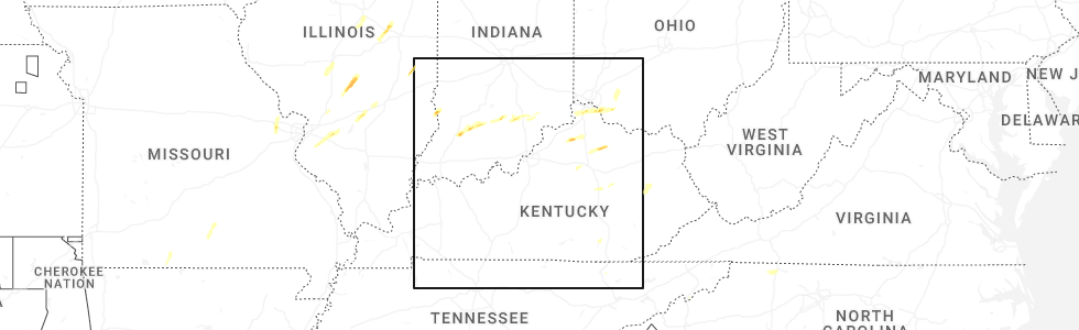
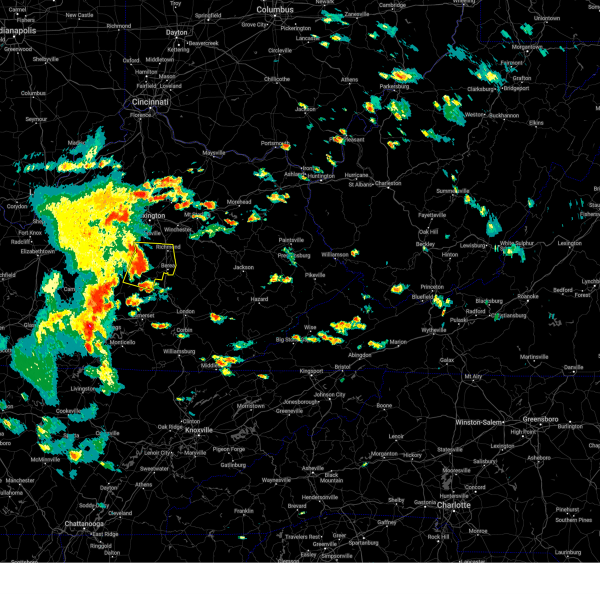
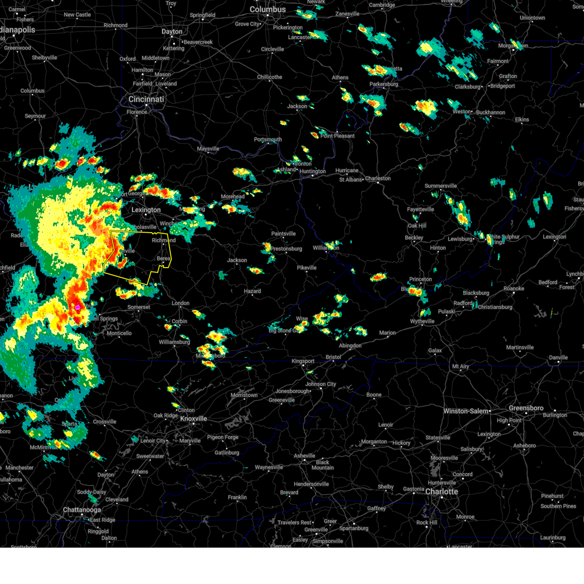
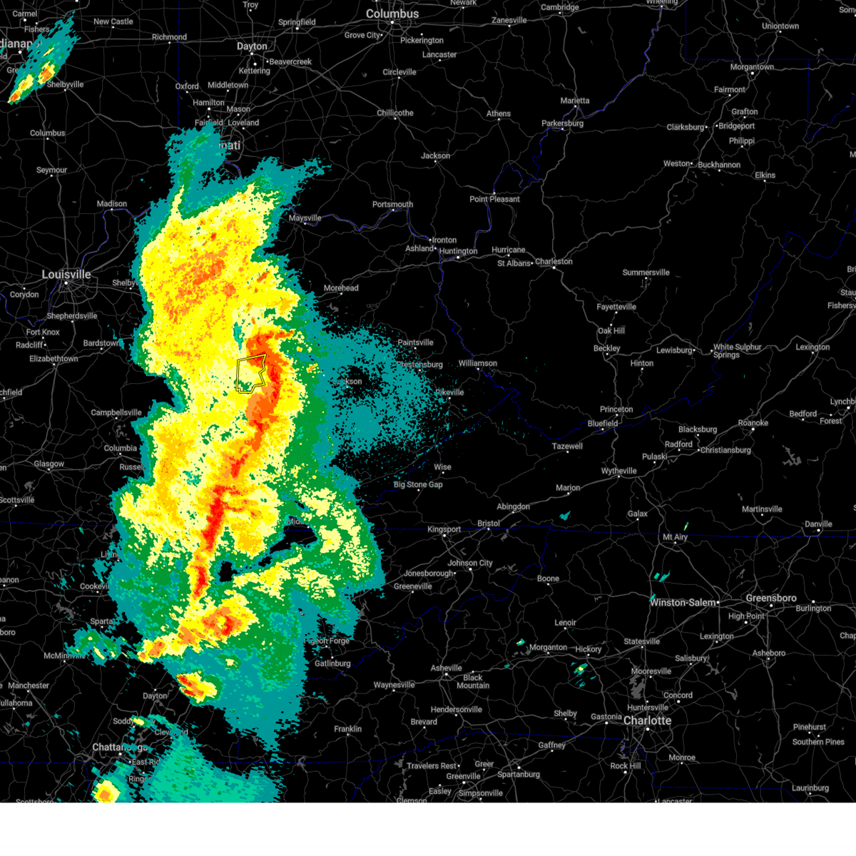
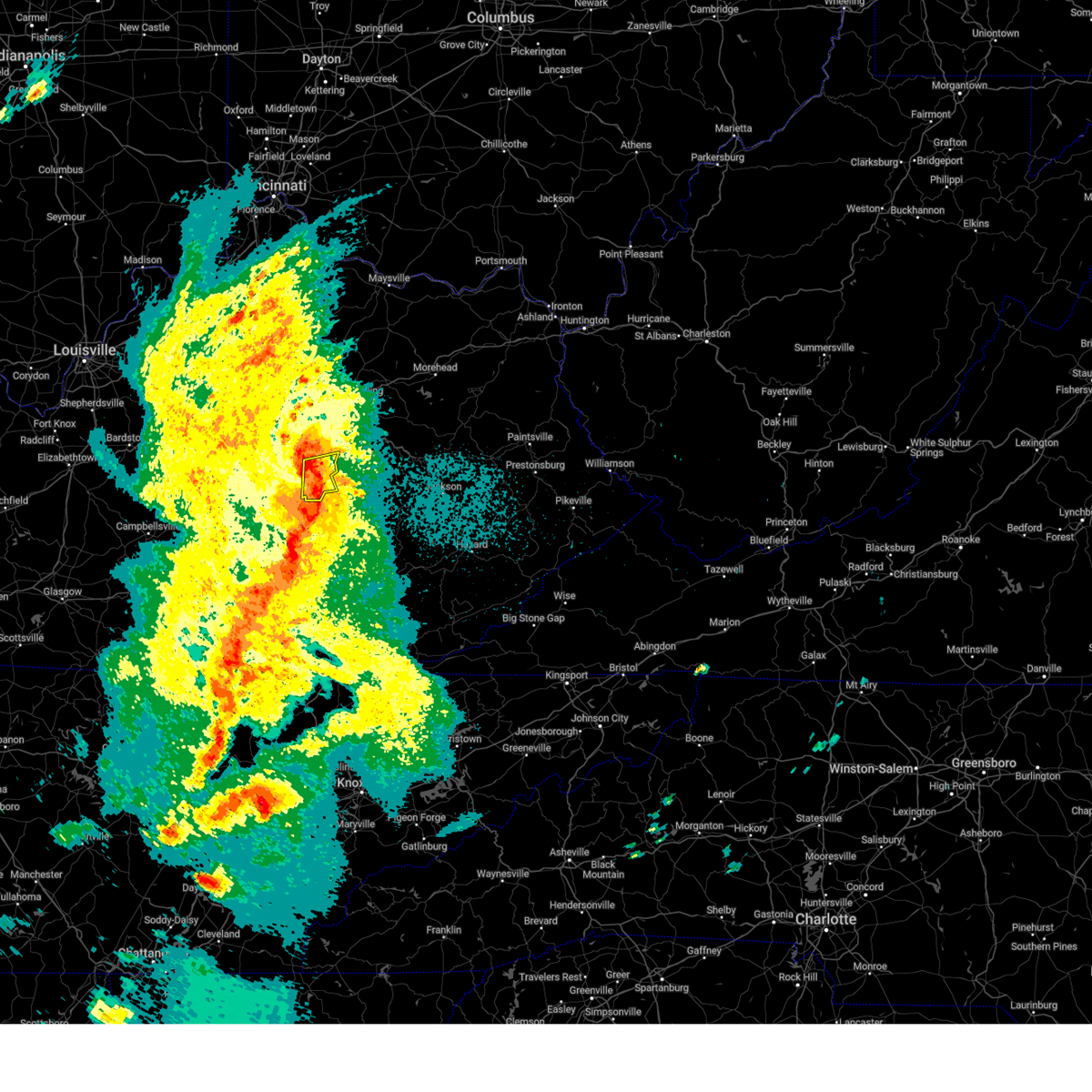
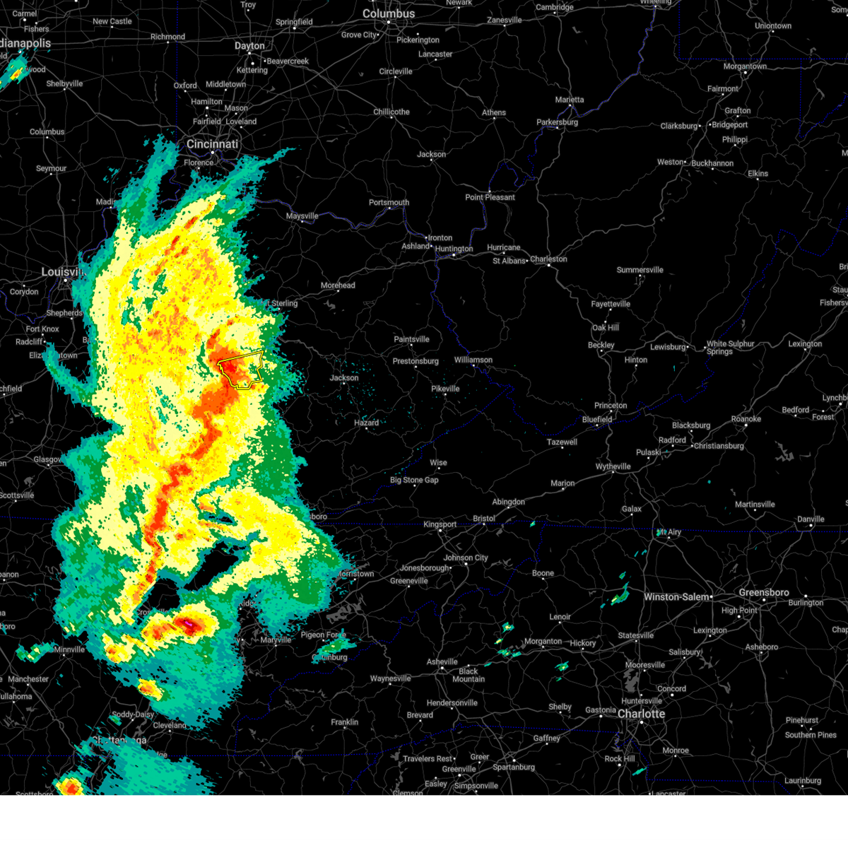
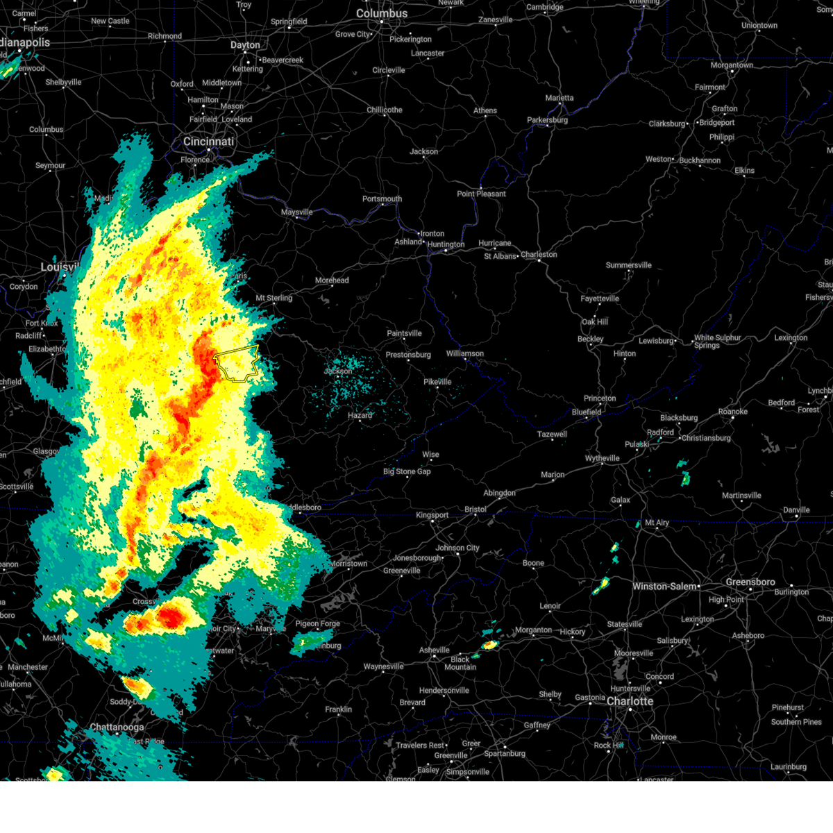
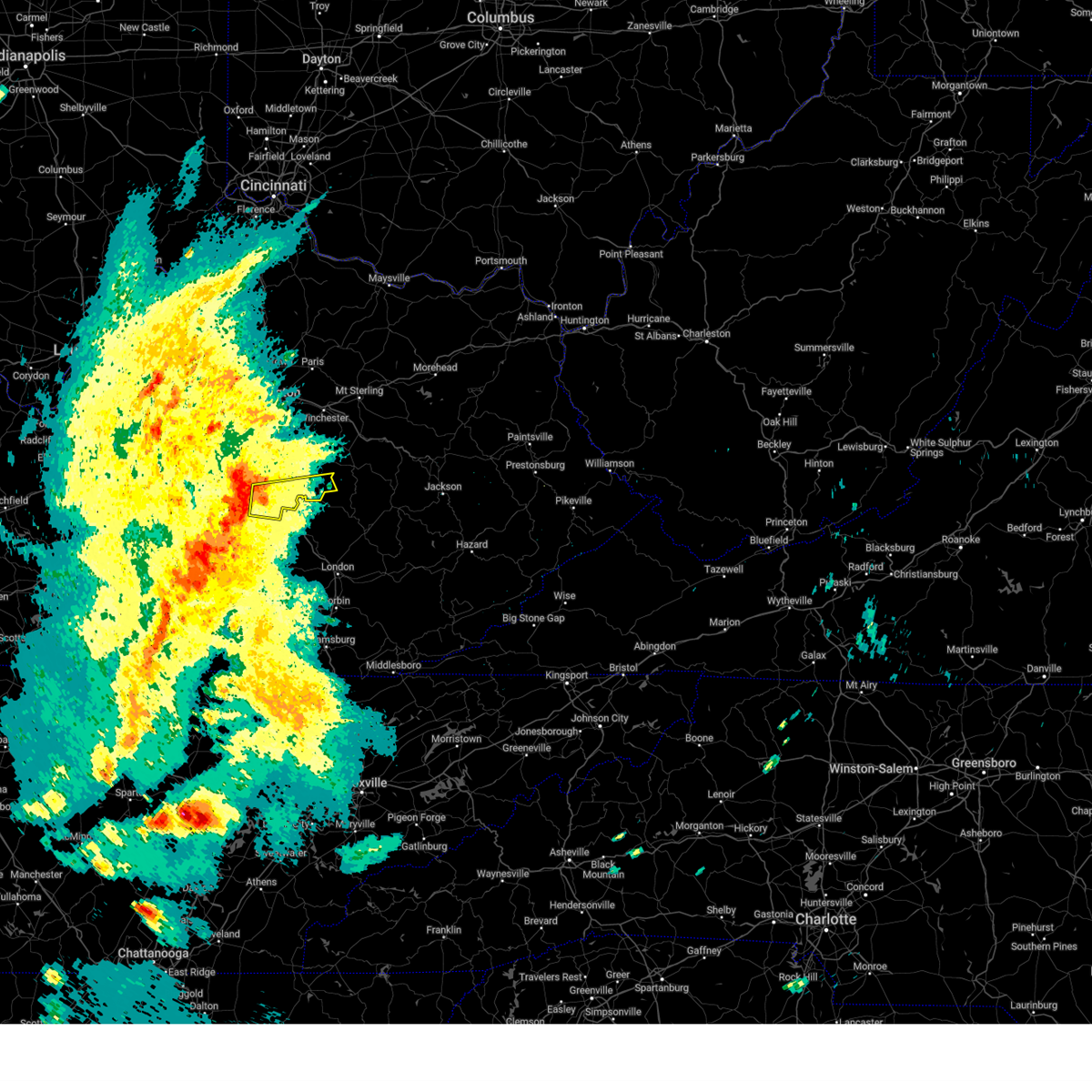
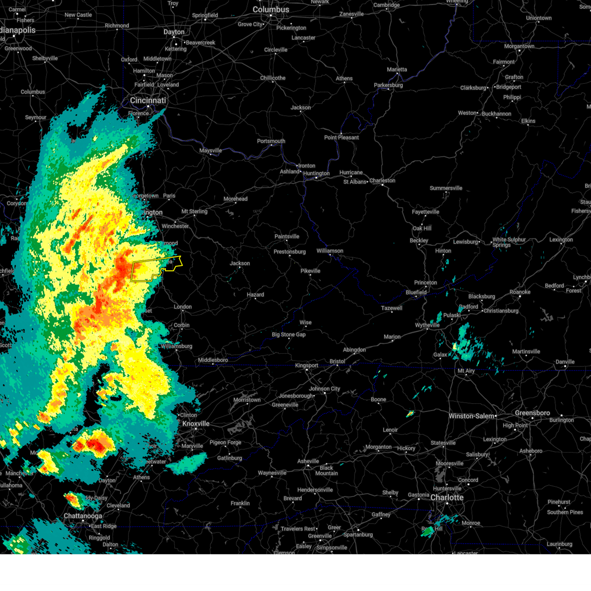
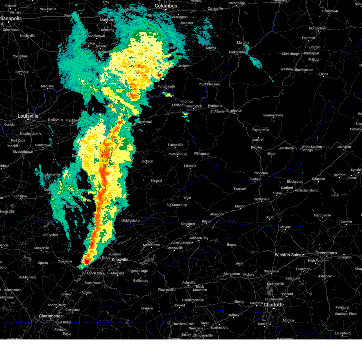
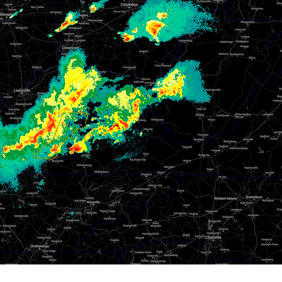
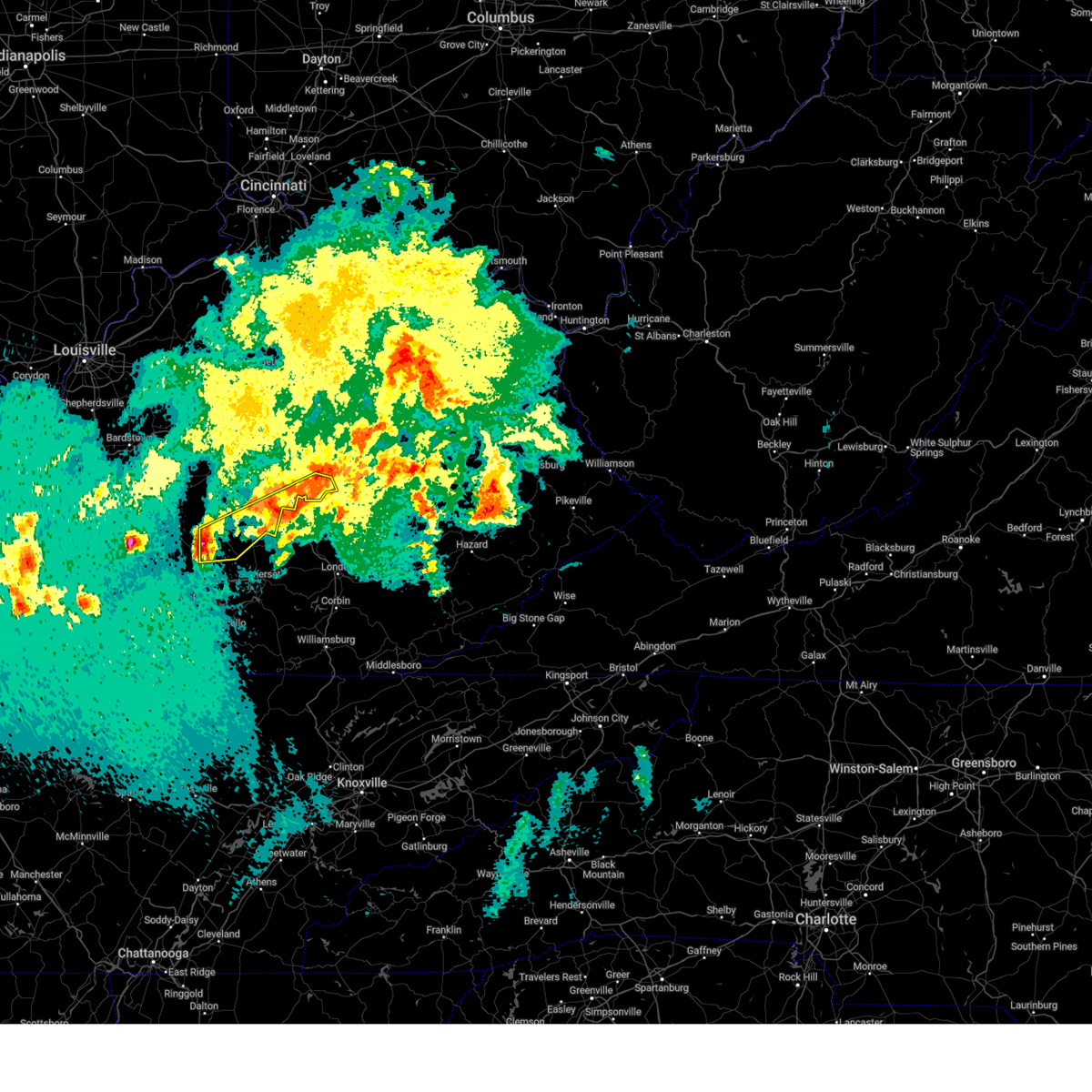
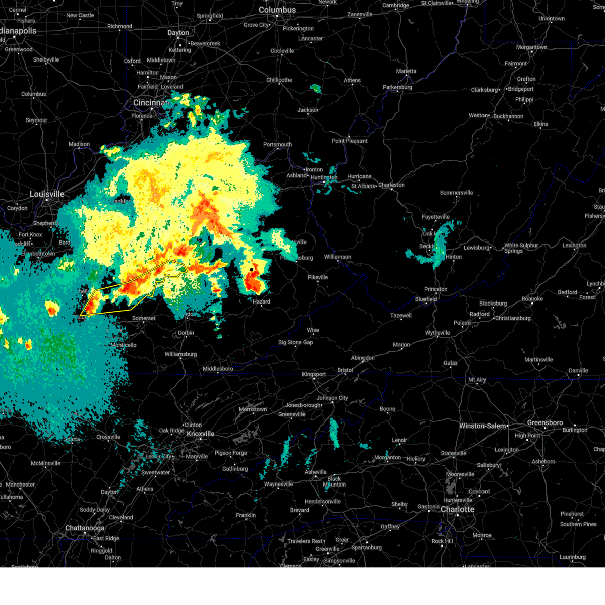
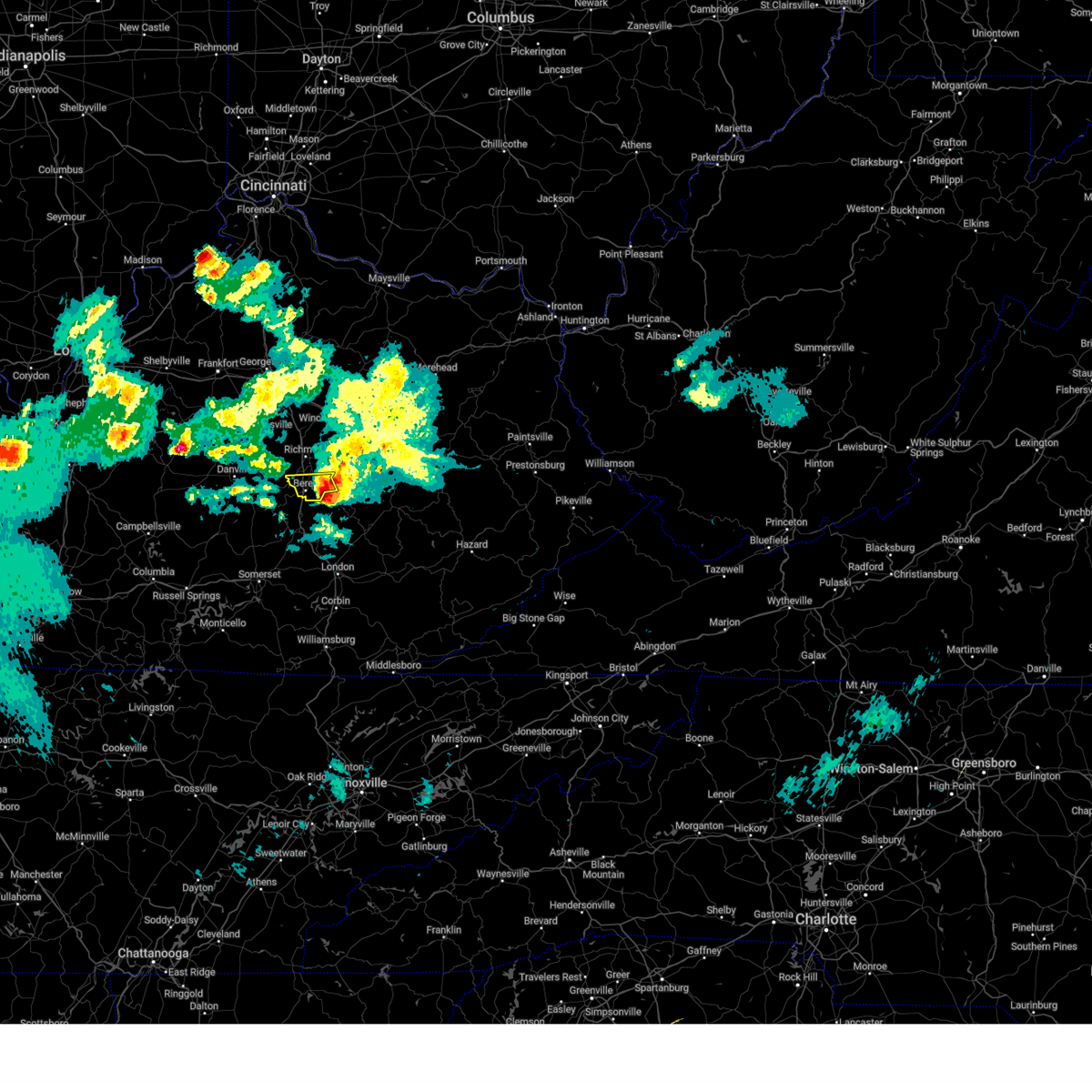
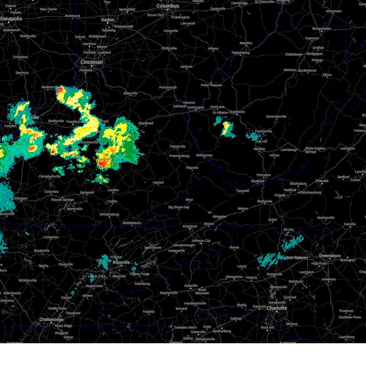
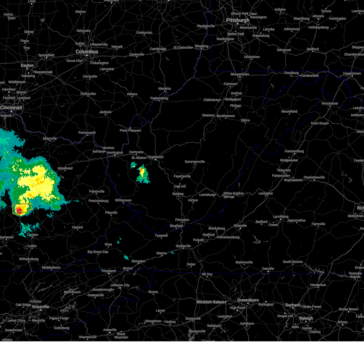
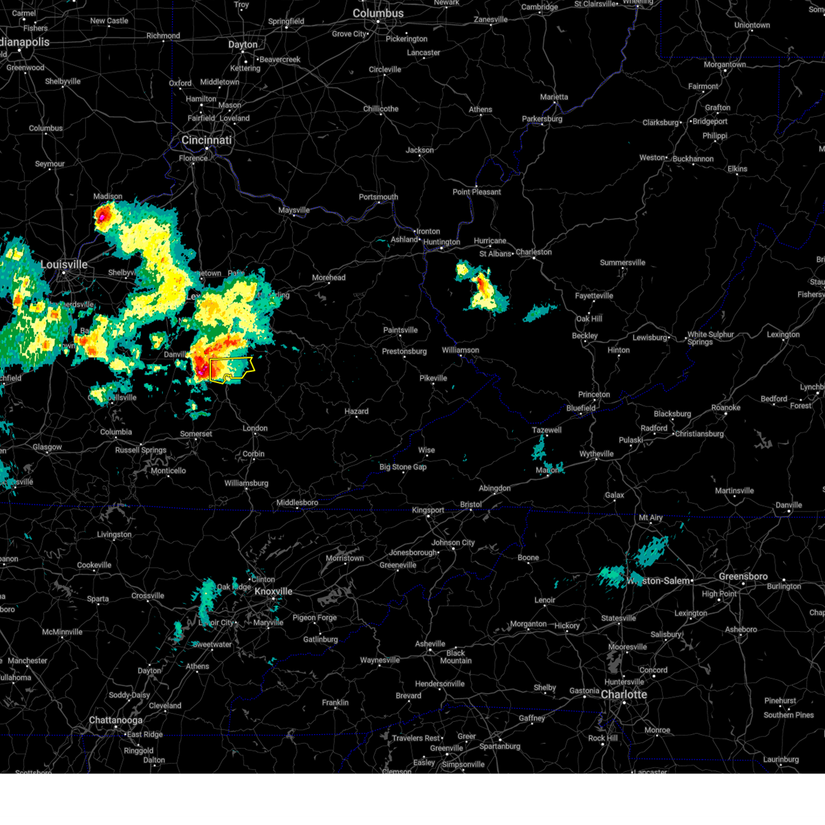
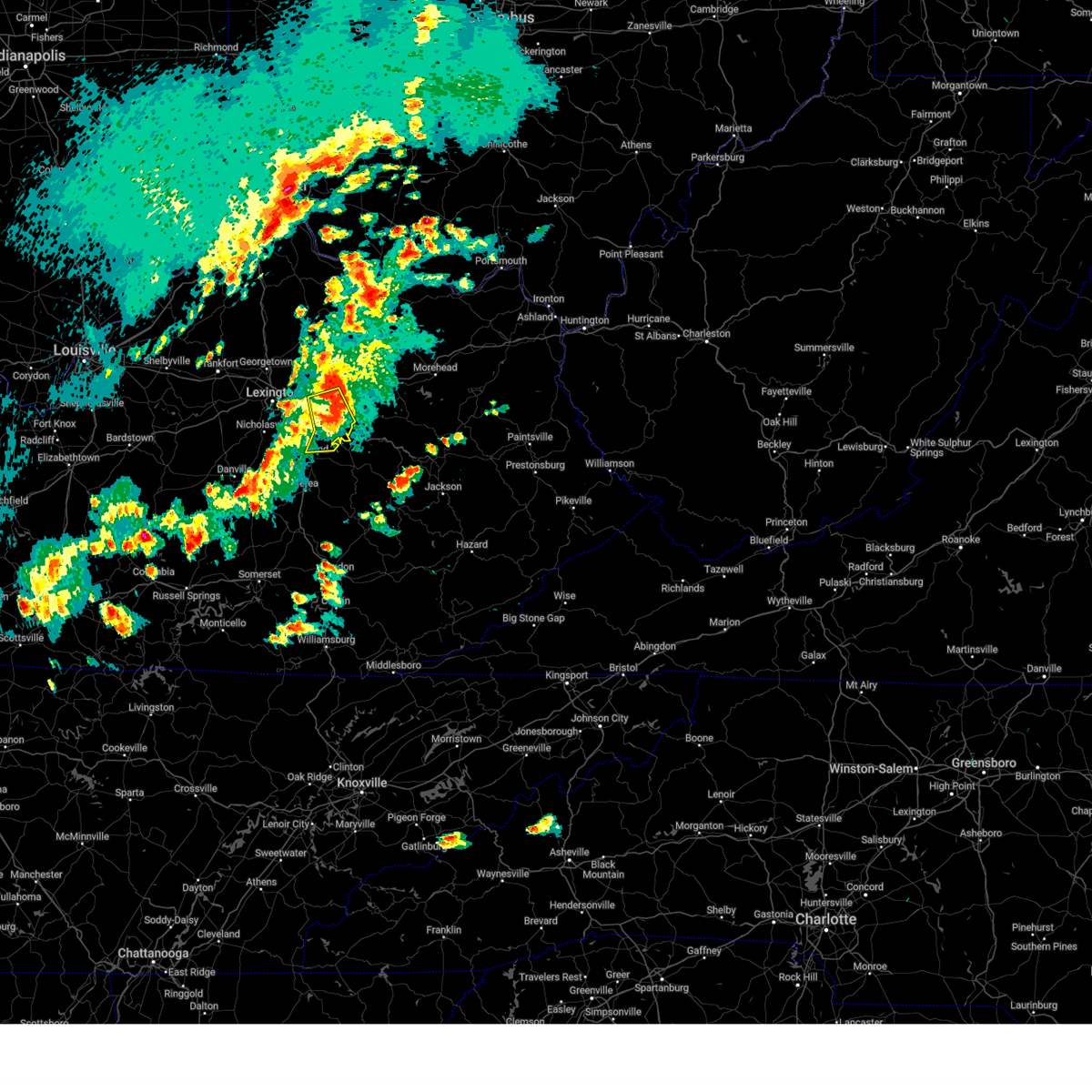
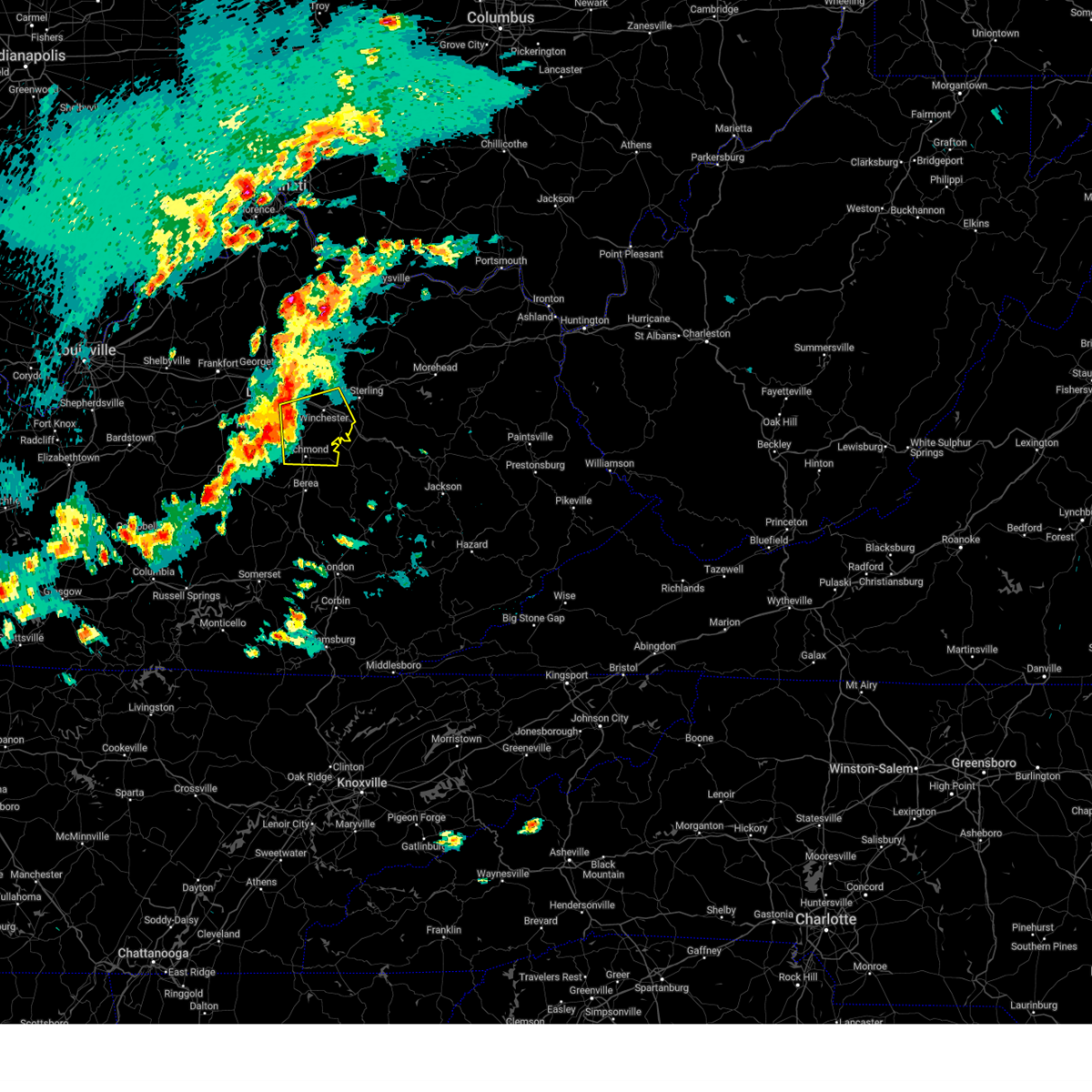
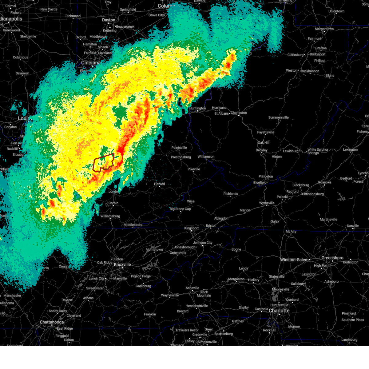
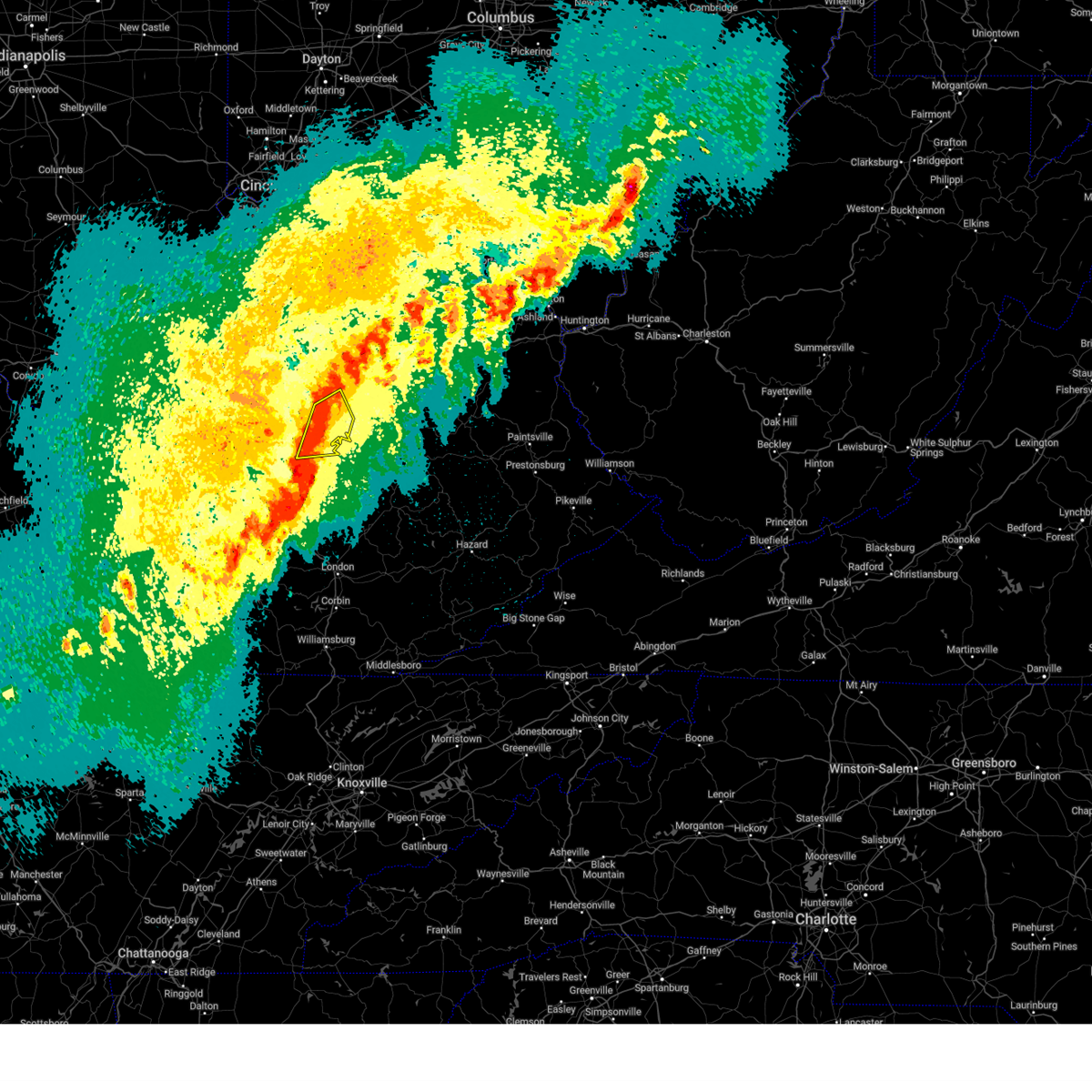
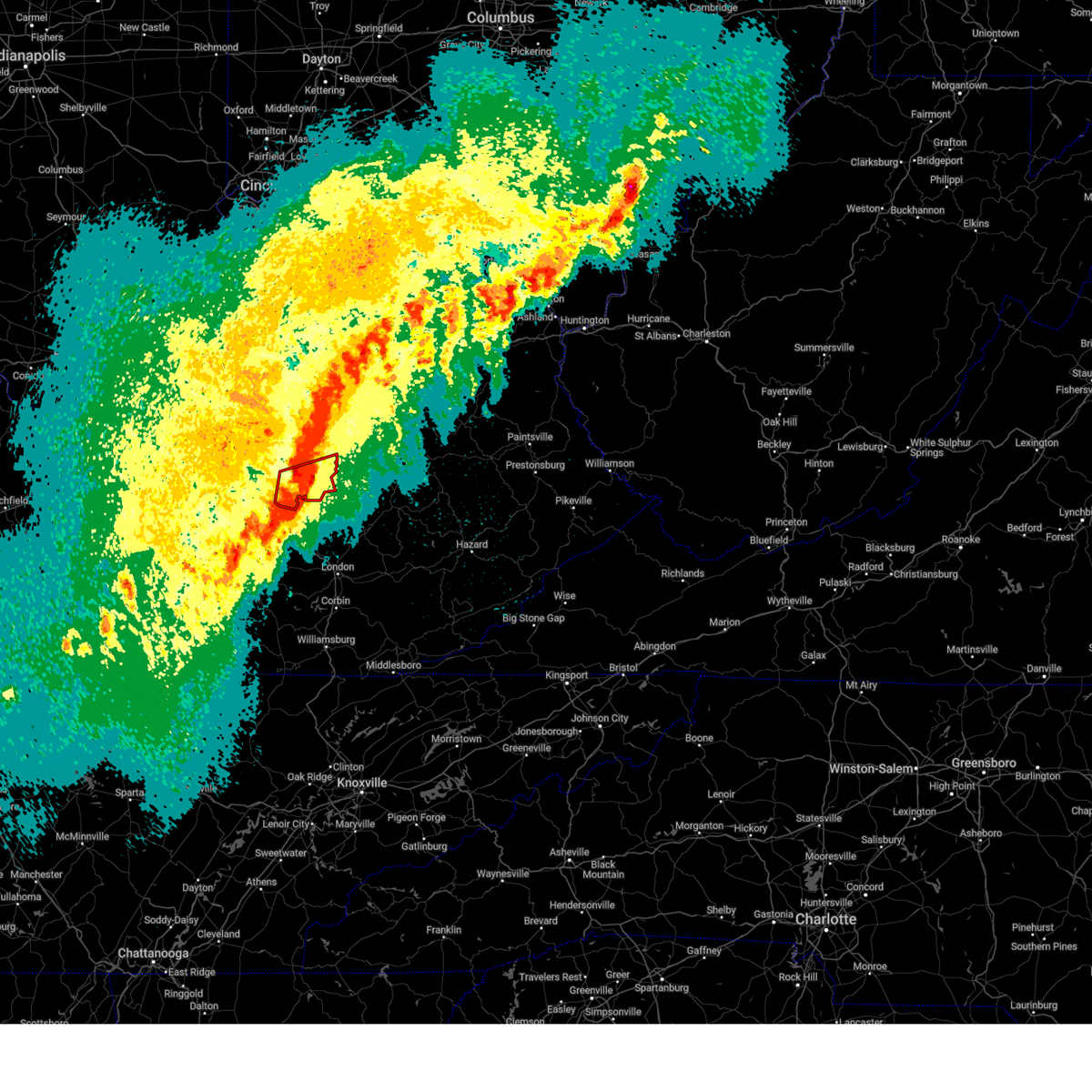
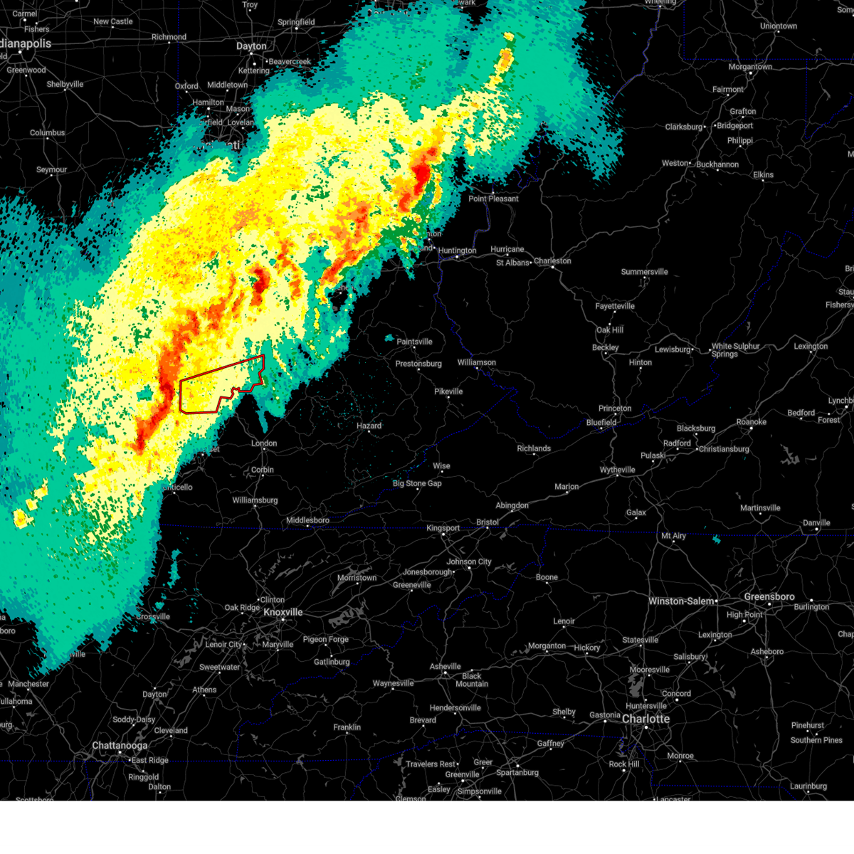
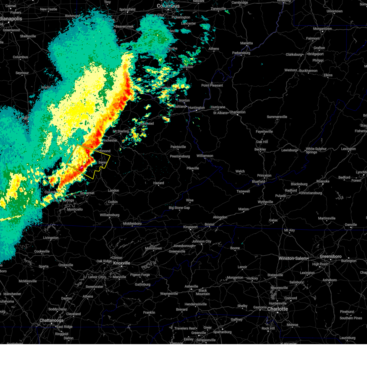
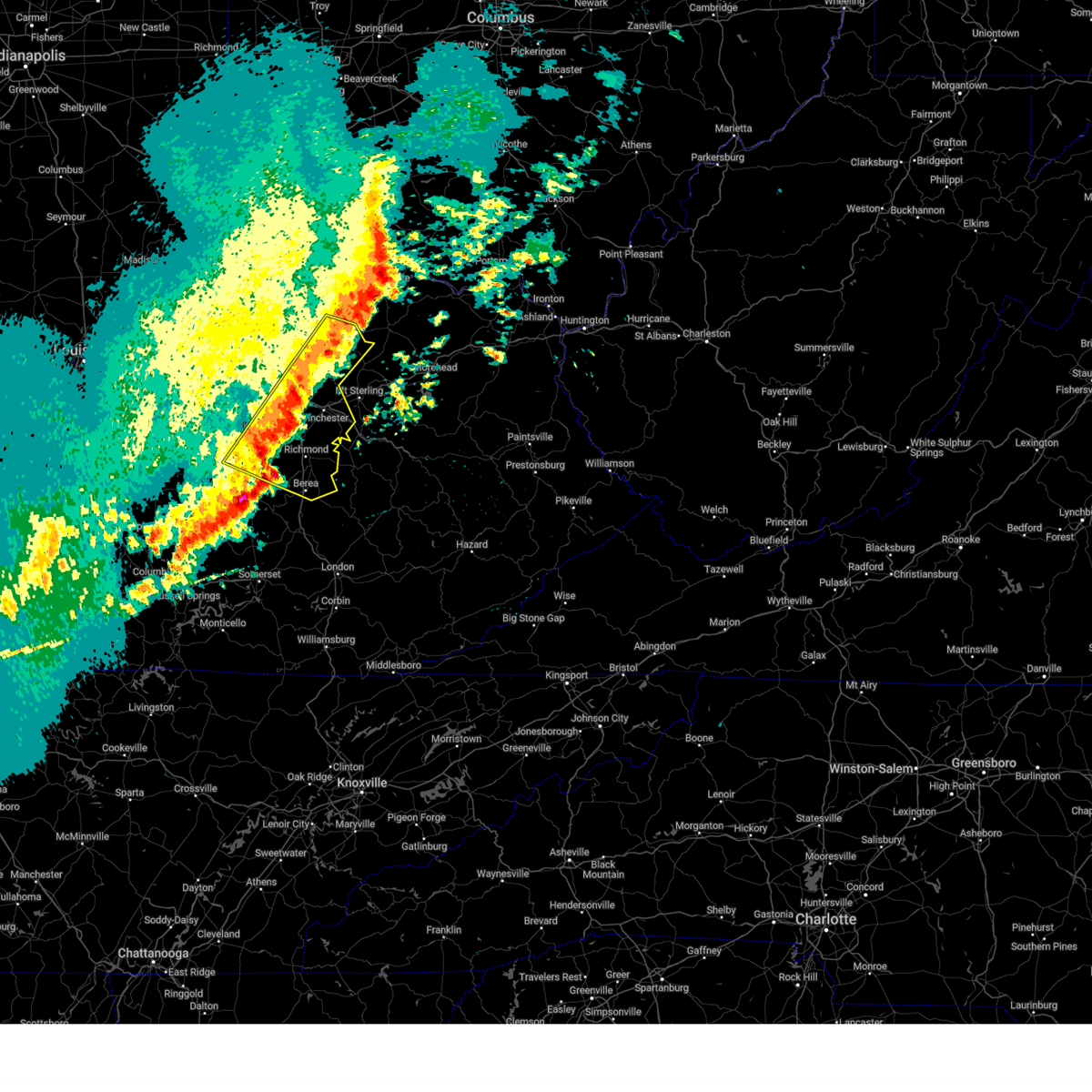
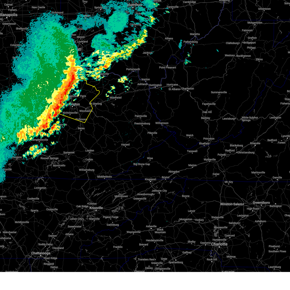
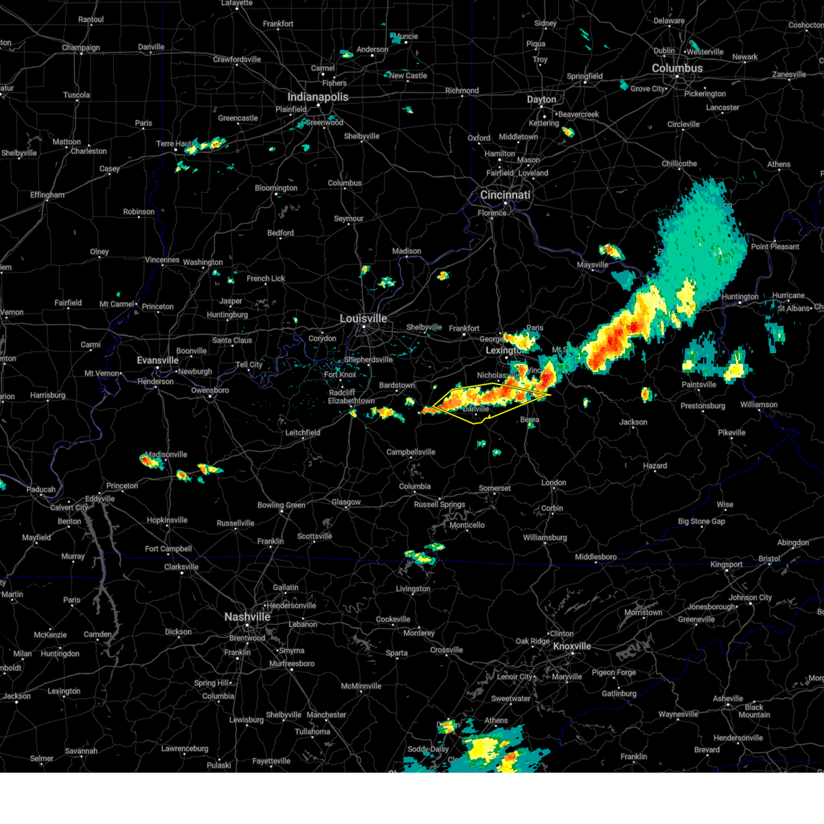
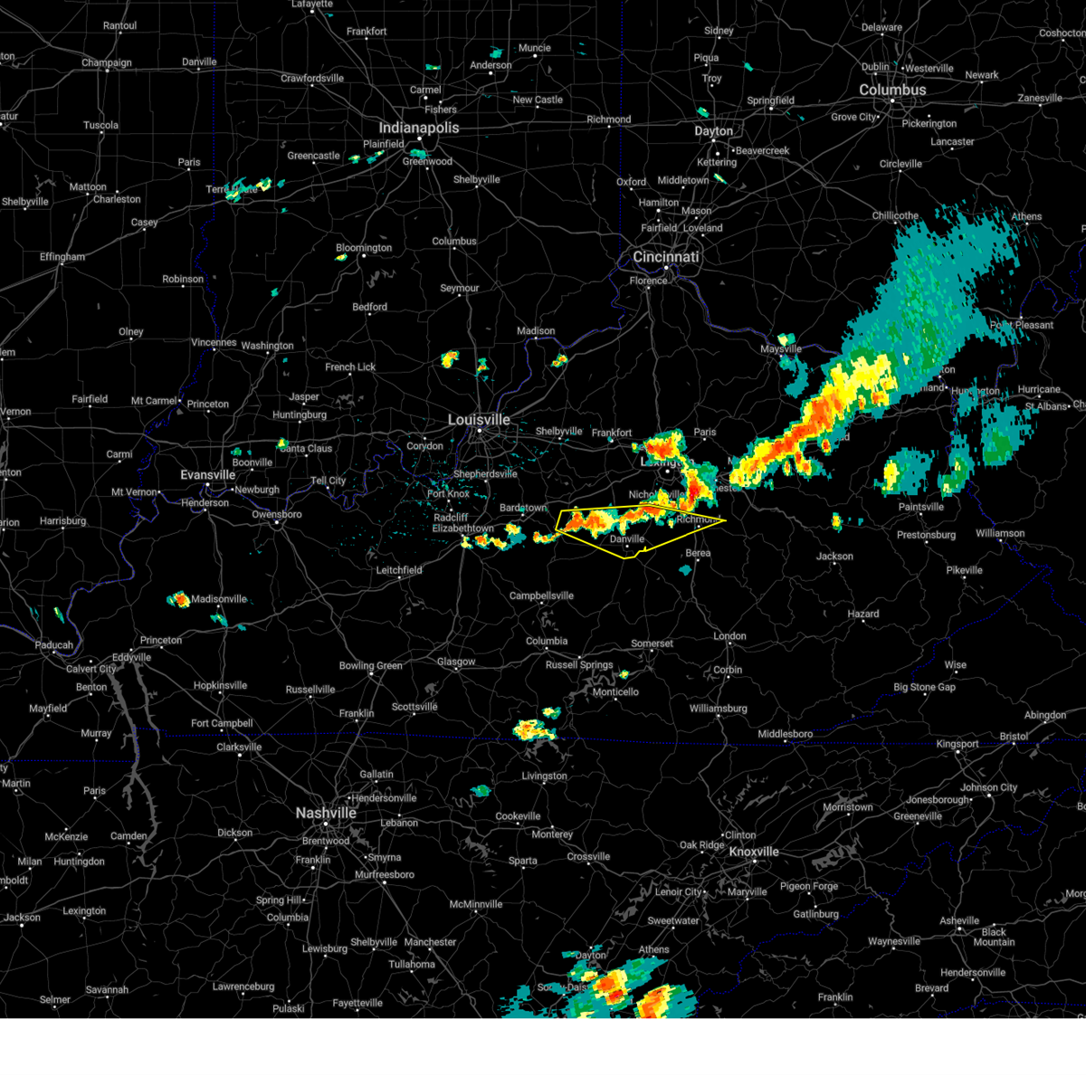
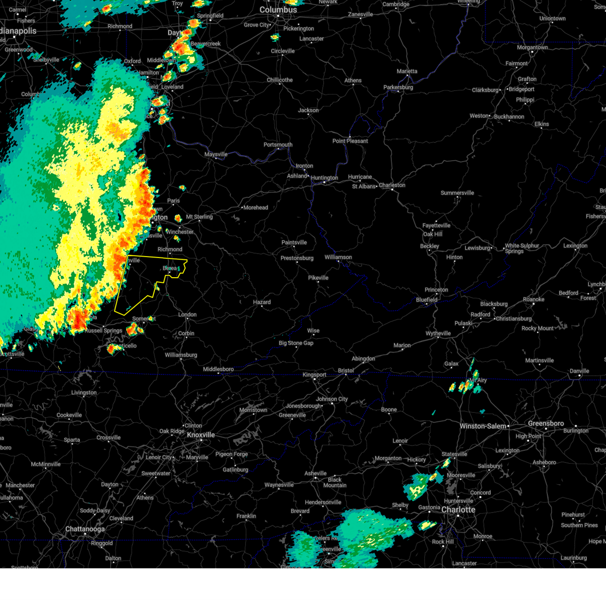
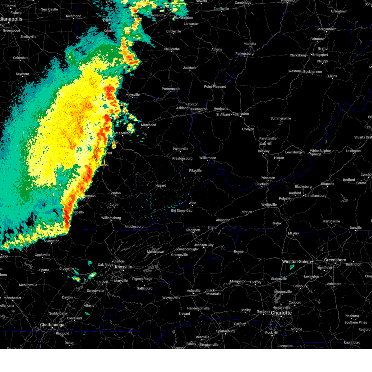
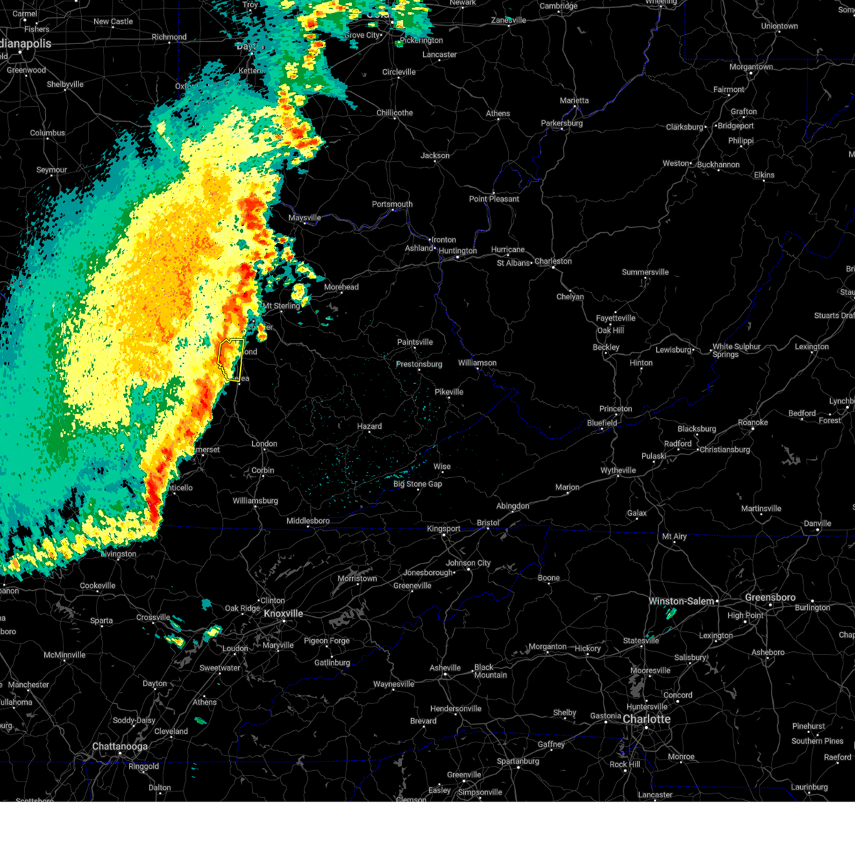
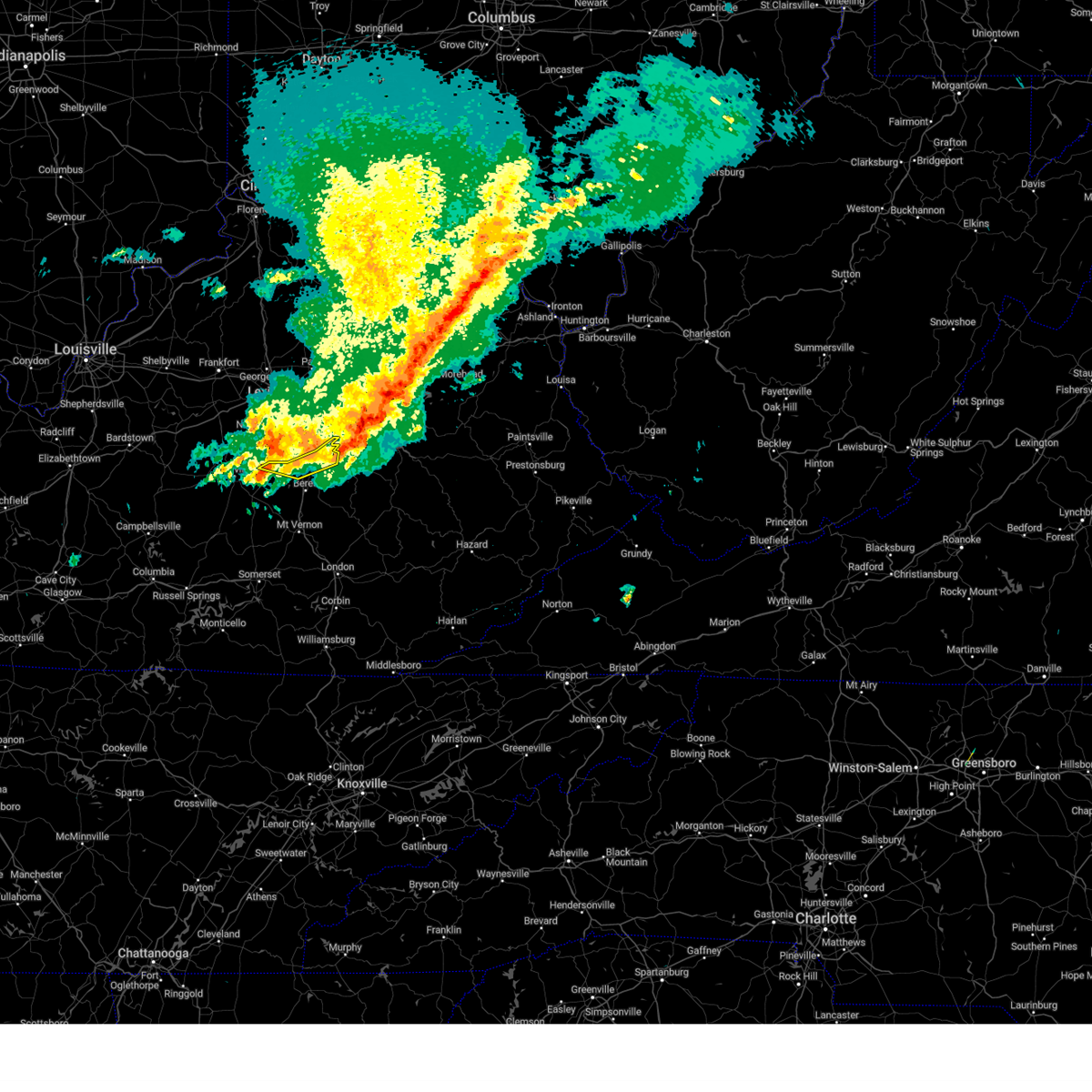
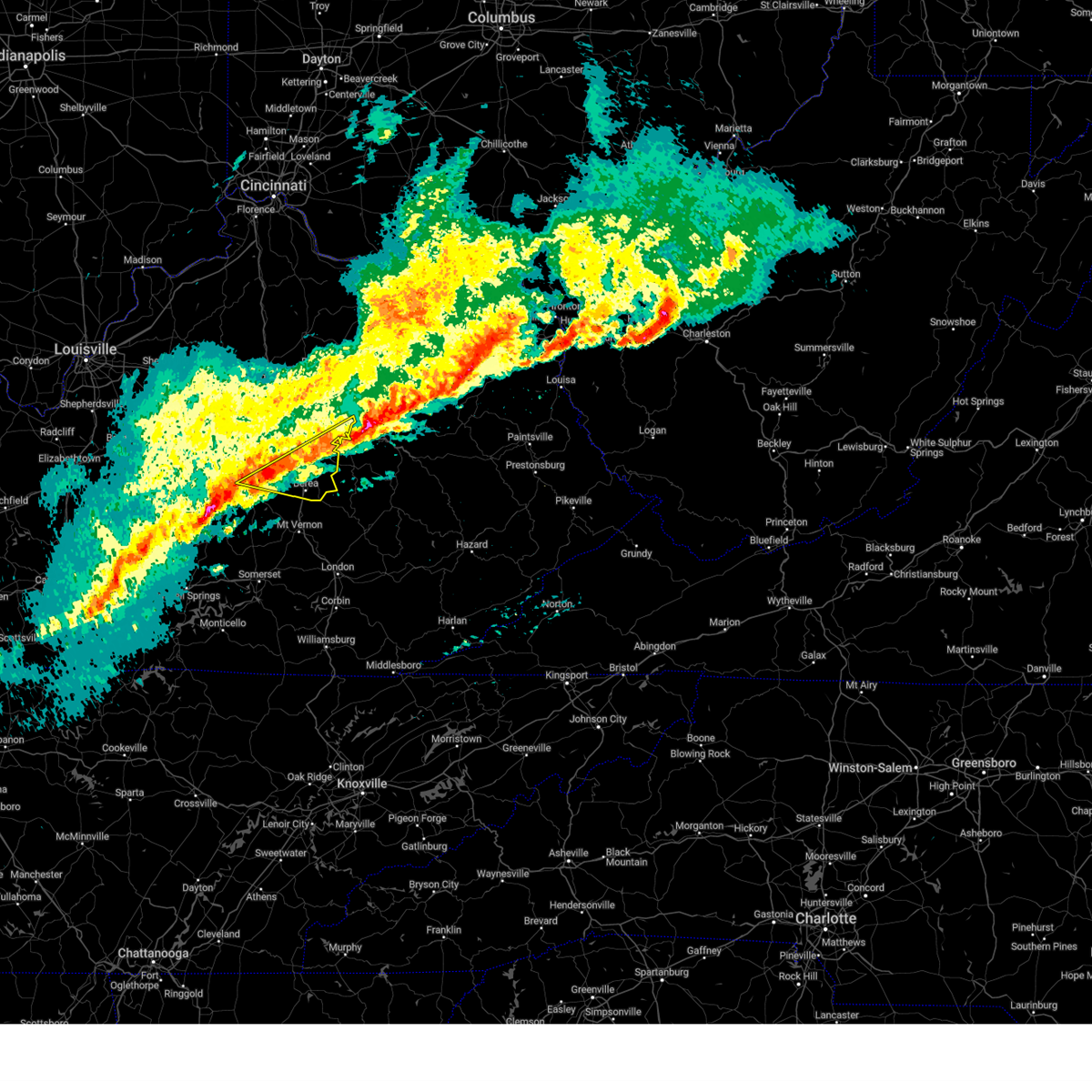
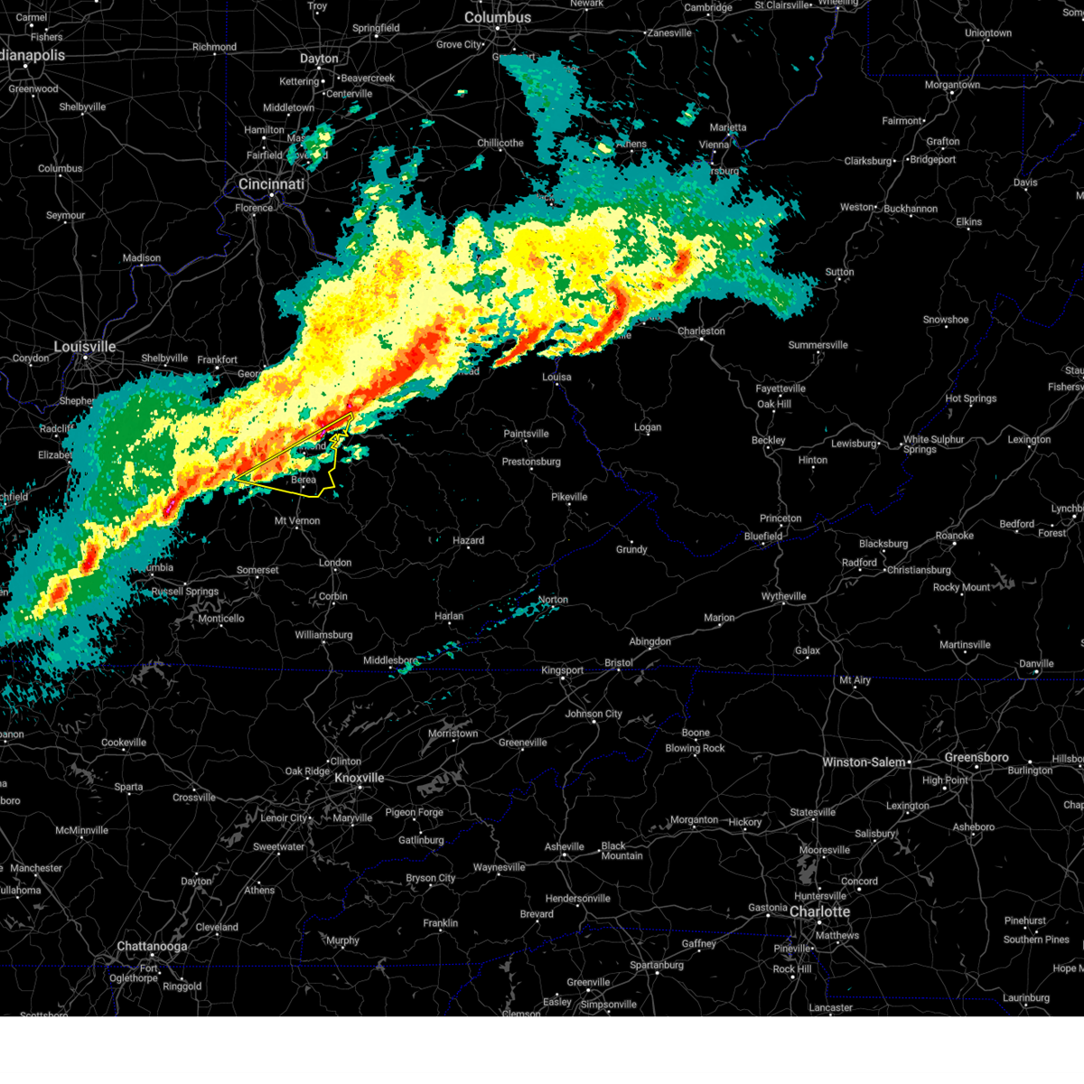
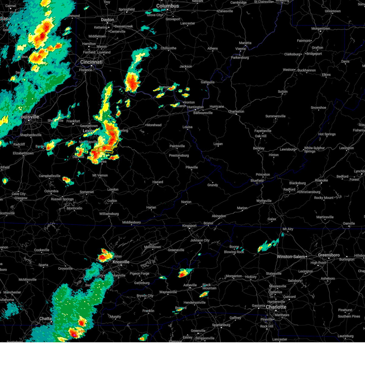
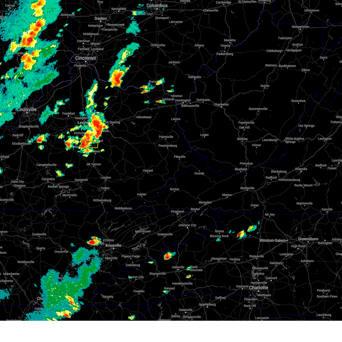
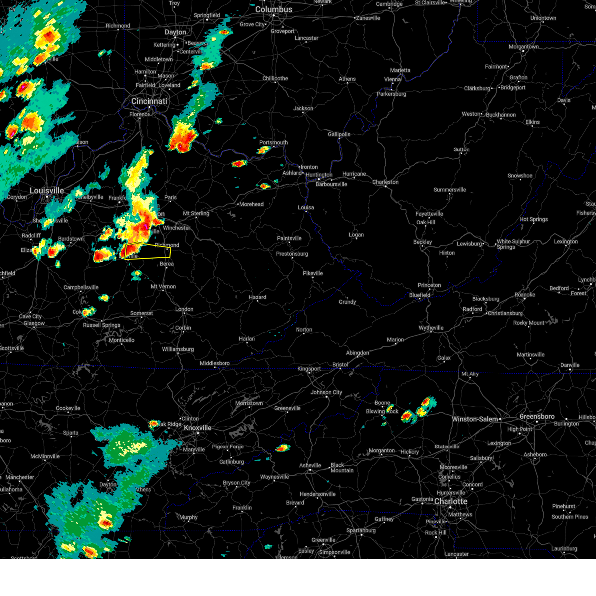
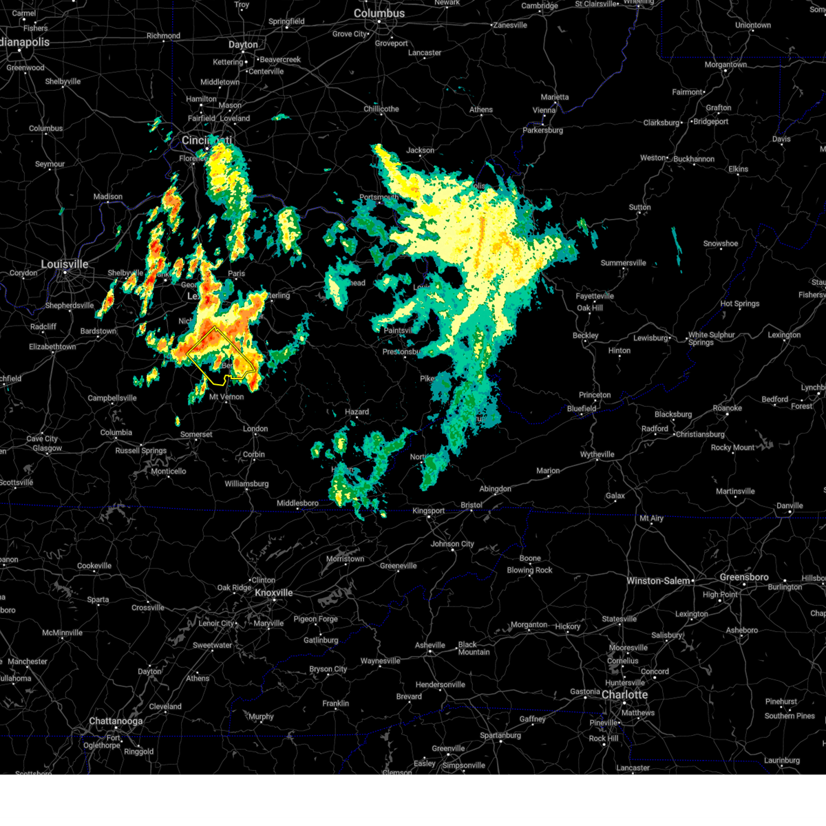
Hail Map for Richmond, KY
The Richmond, KY area has had 16 reports of on-the-ground hail by trained spotters, and has been under severe weather warnings 63 times during the past 12 months. Doppler radar has detected hail at or near Richmond, KY on 58 occasions, including 4 occasions during the past year.
| Name: | Richmond, KY |
| Where Located: | 17.9 miles W of Irvine, KY |
| Map: | Google Map for Richmond, KY |
| Population: | 31364 |
| Housing Units: | 13788 |
| More Info: | Search Google for Richmond, KY |
1
The Top Recent Hail Date for Richmond, KY is Wednesday, April 30, 2025 (13th out of 58)
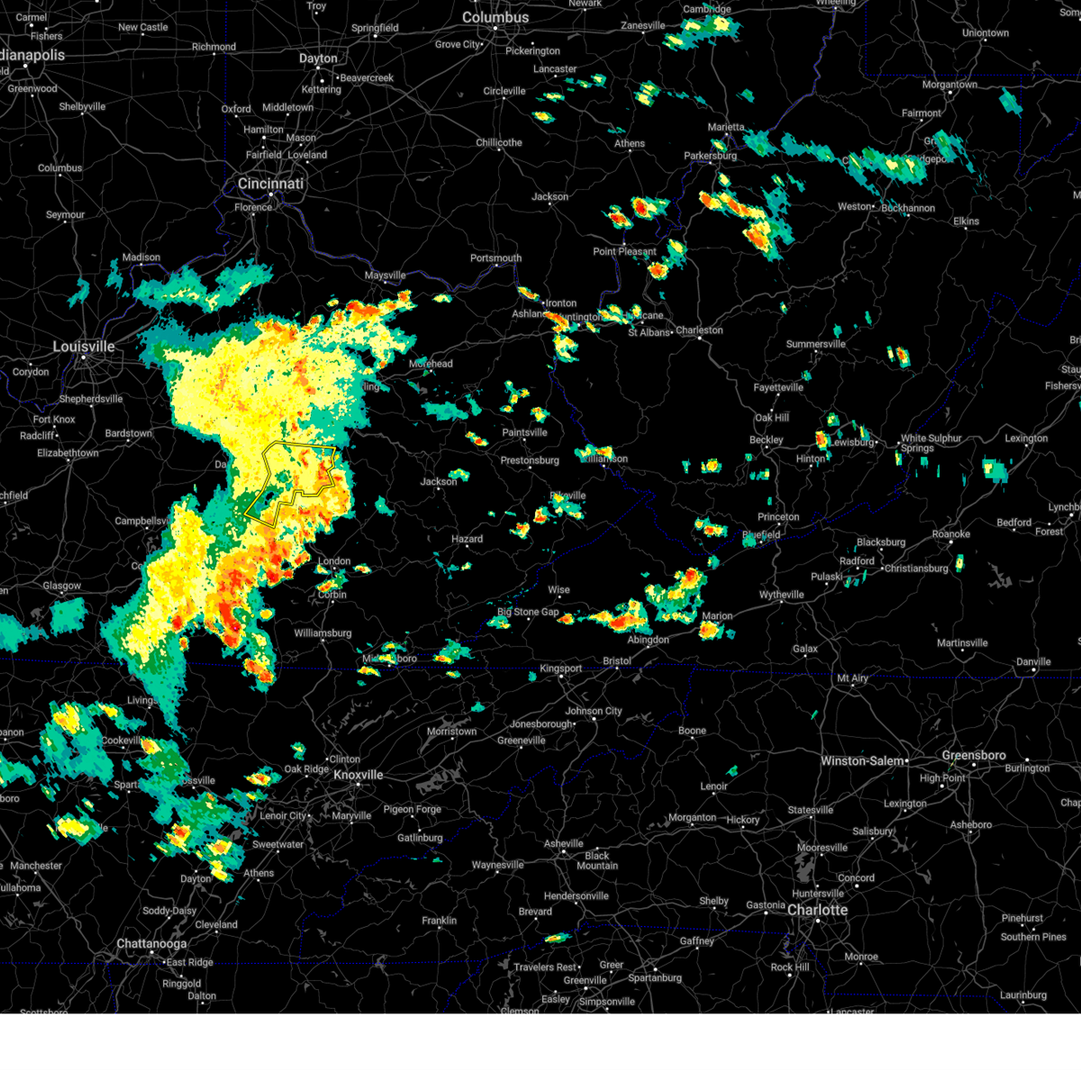
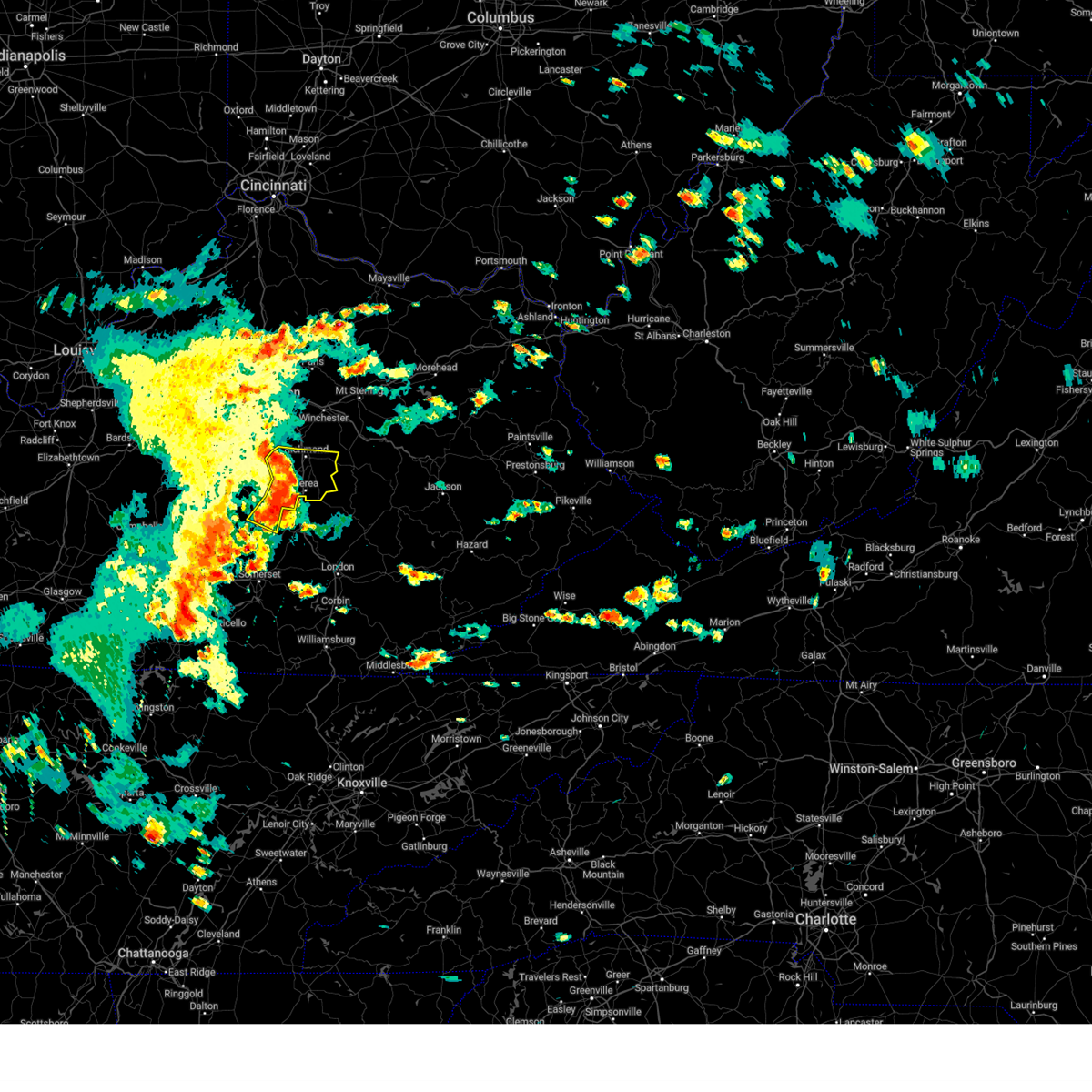
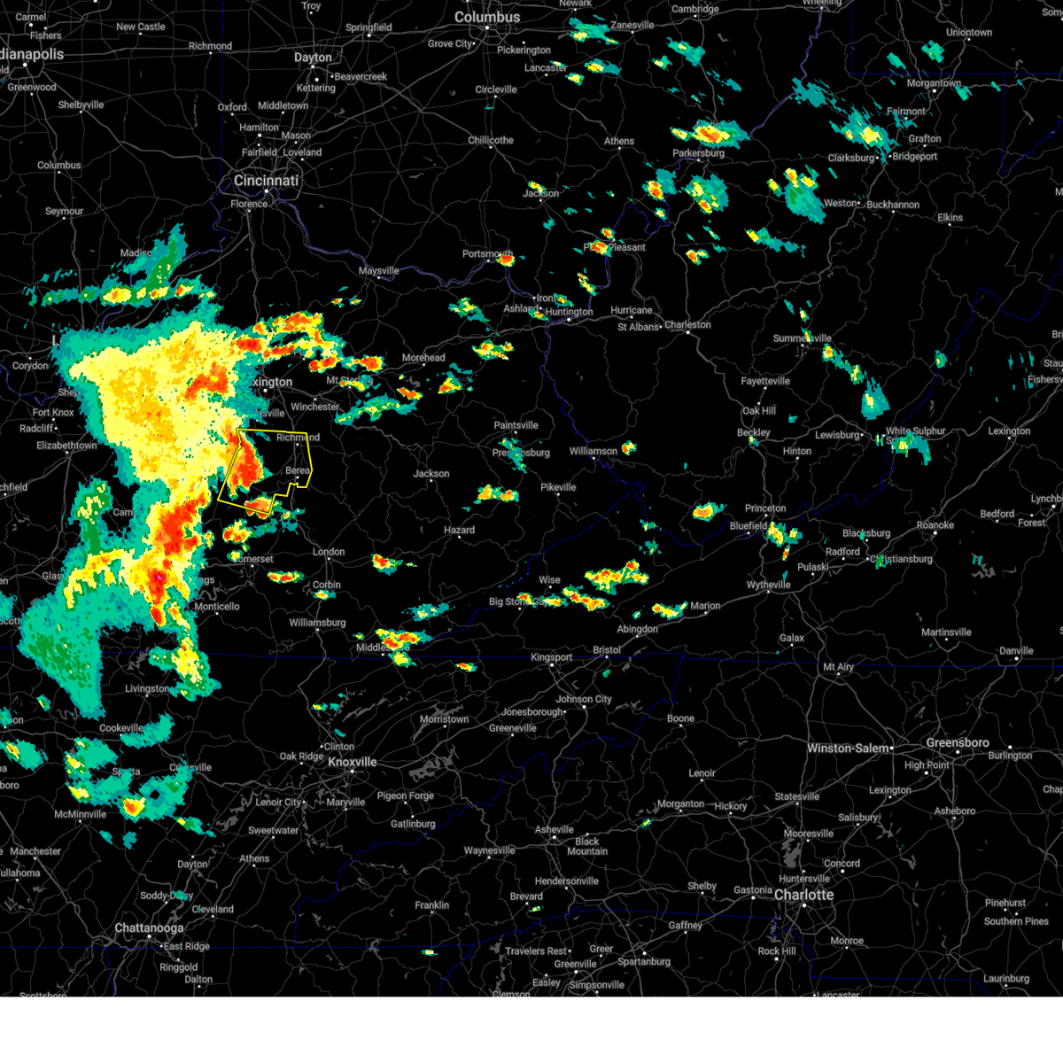
Hail and Wind Damage Spotted near Richmond, KY
| Date / Time | Report Details |
|---|---|
| 6/6/2025 3:25 PM EDT |
 The storms which prompted the warning have weakened below severe limits, and have exited the warned area. therefore, the warning will be allowed to expire. to report severe weather, contact your nearest law enforcement agency. they will relay your report to the national weather service louisville. The storms which prompted the warning have weakened below severe limits, and have exited the warned area. therefore, the warning will be allowed to expire. to report severe weather, contact your nearest law enforcement agency. they will relay your report to the national weather service louisville.
|
| 6/6/2025 2:58 PM EDT |
 Svrlmk the national weather service in louisville has issued a * severe thunderstorm warning for, northeastern lincoln county in central kentucky, eastern garrard county in central kentucky, madison county in central kentucky, * until 330 pm edt. * at 258 pm edt, severe thunderstorms were located along a line extending from 8 miles southeast of nicholasville to near richmond to near conway to near gum sulphur, moving east at 45 mph (radar indicated). Hazards include 60 mph wind gusts. expect damage to roofs, siding, and trees Svrlmk the national weather service in louisville has issued a * severe thunderstorm warning for, northeastern lincoln county in central kentucky, eastern garrard county in central kentucky, madison county in central kentucky, * until 330 pm edt. * at 258 pm edt, severe thunderstorms were located along a line extending from 8 miles southeast of nicholasville to near richmond to near conway to near gum sulphur, moving east at 45 mph (radar indicated). Hazards include 60 mph wind gusts. expect damage to roofs, siding, and trees
|
| 6/6/2025 2:52 PM EDT | Large branches snapped at 300 turner ridge rd. time estimated from rada in madison county KY, 7.7 miles E of Richmond, KY |
| 6/6/2025 2:40 PM EDT |
 the severe thunderstorm warning has been cancelled and is no longer in effect the severe thunderstorm warning has been cancelled and is no longer in effect
|
| 6/6/2025 2:40 PM EDT |
 At 240 pm edt, severe thunderstorms were located along a line extending from 9 miles southwest of nicholasville to lancaster to near stanford, moving east at 40 mph (radar indicated). Hazards include 60 mph wind gusts. Expect damage to roofs, siding, and trees. Locations impacted include, richmond, danville, stanford, lancaster, mccreary, berea, junction city, crab orchard, hustonville, and boneyville. At 240 pm edt, severe thunderstorms were located along a line extending from 9 miles southwest of nicholasville to lancaster to near stanford, moving east at 40 mph (radar indicated). Hazards include 60 mph wind gusts. Expect damage to roofs, siding, and trees. Locations impacted include, richmond, danville, stanford, lancaster, mccreary, berea, junction city, crab orchard, hustonville, and boneyville.
|
| 6/6/2025 2:20 PM EDT |
 Svrlmk the national weather service in louisville has issued a * severe thunderstorm warning for, lincoln county in central kentucky, central mercer county in central kentucky, south central woodford county in central kentucky, garrard county in central kentucky, southern jessamine county in central kentucky, boyle county in central kentucky, madison county in central kentucky, north central casey county in central kentucky, * until 300 pm edt. * at 220 pm edt, severe thunderstorms were located along a line extending from near harrodsburg to near danville to 14 miles north of liberty, moving east at 45 mph (radar indicated). Hazards include 60 mph wind gusts. expect damage to roofs, siding, and trees Svrlmk the national weather service in louisville has issued a * severe thunderstorm warning for, lincoln county in central kentucky, central mercer county in central kentucky, south central woodford county in central kentucky, garrard county in central kentucky, southern jessamine county in central kentucky, boyle county in central kentucky, madison county in central kentucky, north central casey county in central kentucky, * until 300 pm edt. * at 220 pm edt, severe thunderstorms were located along a line extending from near harrodsburg to near danville to 14 miles north of liberty, moving east at 45 mph (radar indicated). Hazards include 60 mph wind gusts. expect damage to roofs, siding, and trees
|
| 5/20/2025 9:39 PM EDT |
 The storm which prompted the warning has moved out of the area. therefore, the warning will be allowed to expire. to report severe weather, contact your nearest law enforcement agency. they will relay your report to the national weather service louisville. The storm which prompted the warning has moved out of the area. therefore, the warning will be allowed to expire. to report severe weather, contact your nearest law enforcement agency. they will relay your report to the national weather service louisville.
|
| 5/20/2025 9:18 PM EDT |
 At 918 pm edt, a severe thunderstorm was located 7 miles southeast of richmond, moving east at 30 mph (radar indicated). Hazards include 60 mph wind gusts. Expect damage to roofs, siding, and trees. Locations impacted include, richmond, berea, duluth, moberly, bighill, panola, kingston, whites, speedwell, bybee, combs, terrill, dreyfus, brassfield, reeds crossing, slate lick, and elliston. At 918 pm edt, a severe thunderstorm was located 7 miles southeast of richmond, moving east at 30 mph (radar indicated). Hazards include 60 mph wind gusts. Expect damage to roofs, siding, and trees. Locations impacted include, richmond, berea, duluth, moberly, bighill, panola, kingston, whites, speedwell, bybee, combs, terrill, dreyfus, brassfield, reeds crossing, slate lick, and elliston.
|
| 5/20/2025 9:12 PM EDT | Tree down near the entrance to battlefield golf course. time estimated from rada in madison county KY, 3.8 miles NW of Richmond, KY |
| 5/20/2025 9:09 PM EDT |
 At 909 pm edt, a severe thunderstorm was located 7 miles north of boone, or 7 miles south of richmond, moving east at 30 mph (radar indicated). Hazards include 60 mph wind gusts. Expect damage to roofs, siding, and trees. Locations impacted include, richmond, berea, round hill, caleast, duluth, peytontown, bighill, panola, kingston, buggytown, combs, terrill, dreyfus, reeds crossing, slate lick, elliston, silver creek, moberly, whites, and duncanon. At 909 pm edt, a severe thunderstorm was located 7 miles north of boone, or 7 miles south of richmond, moving east at 30 mph (radar indicated). Hazards include 60 mph wind gusts. Expect damage to roofs, siding, and trees. Locations impacted include, richmond, berea, round hill, caleast, duluth, peytontown, bighill, panola, kingston, buggytown, combs, terrill, dreyfus, reeds crossing, slate lick, elliston, silver creek, moberly, whites, and duncanon.
|
| 5/20/2025 8:57 PM EDT |
 At 857 pm edt, severe thunderstorms were located along a line extending from 7 miles east of lancaster to gum sulphur, moving east at 30 mph (radar indicated). Hazards include 60 mph wind gusts. Expect damage to roofs, siding, and trees. Locations impacted include, berea, crab orchard, duluth, paint lick, bighill, manse, whites, cartersville, preachersville, walnut flat, wallaceton, dreyfus, point leavell, and slate lick. At 857 pm edt, severe thunderstorms were located along a line extending from 7 miles east of lancaster to gum sulphur, moving east at 30 mph (radar indicated). Hazards include 60 mph wind gusts. Expect damage to roofs, siding, and trees. Locations impacted include, berea, crab orchard, duluth, paint lick, bighill, manse, whites, cartersville, preachersville, walnut flat, wallaceton, dreyfus, point leavell, and slate lick.
|
| 5/20/2025 8:53 PM EDT |
 Svrlmk the national weather service in louisville has issued a * severe thunderstorm warning for, southern madison county in central kentucky, * until 945 pm edt. * at 853 pm edt, a severe thunderstorm was located near lancaster, or 13 miles southwest of richmond, moving east at 30 mph (radar indicated). Hazards include 60 mph wind gusts. expect damage to roofs, siding, and trees Svrlmk the national weather service in louisville has issued a * severe thunderstorm warning for, southern madison county in central kentucky, * until 945 pm edt. * at 853 pm edt, a severe thunderstorm was located near lancaster, or 13 miles southwest of richmond, moving east at 30 mph (radar indicated). Hazards include 60 mph wind gusts. expect damage to roofs, siding, and trees
|
| 5/20/2025 8:44 PM EDT |
 At 844 pm edt, a severe thunderstorm was located near lancaster, or 16 miles northwest of mount vernon, moving east at 50 mph (radar indicated). Hazards include 60 mph wind gusts. Expect damage to roofs, siding, and trees. Locations impacted include, stanford, lancaster, berea, crab orchard, duluth, paint lick, bighill, manse, gilbert, whites, cartersville, preachersville, rowland, hyattsville, halls gap, walnut flat, maywood, wallaceton, dreyfus, and point leavell. At 844 pm edt, a severe thunderstorm was located near lancaster, or 16 miles northwest of mount vernon, moving east at 50 mph (radar indicated). Hazards include 60 mph wind gusts. Expect damage to roofs, siding, and trees. Locations impacted include, stanford, lancaster, berea, crab orchard, duluth, paint lick, bighill, manse, gilbert, whites, cartersville, preachersville, rowland, hyattsville, halls gap, walnut flat, maywood, wallaceton, dreyfus, and point leavell.
|
| 5/20/2025 8:35 PM EDT |
 Svrlmk the national weather service in louisville has issued a * severe thunderstorm warning for, central lincoln county in central kentucky, southeastern garrard county in central kentucky, southeastern madison county in central kentucky, * until 915 pm edt. * at 835 pm edt, a severe thunderstorm was located over stanford, or 19 miles northwest of mount vernon, moving east at 55 mph (radar indicated). Hazards include 60 mph wind gusts. expect damage to roofs, siding, and trees Svrlmk the national weather service in louisville has issued a * severe thunderstorm warning for, central lincoln county in central kentucky, southeastern garrard county in central kentucky, southeastern madison county in central kentucky, * until 915 pm edt. * at 835 pm edt, a severe thunderstorm was located over stanford, or 19 miles northwest of mount vernon, moving east at 55 mph (radar indicated). Hazards include 60 mph wind gusts. expect damage to roofs, siding, and trees
|
| 5/20/2025 2:57 PM EDT |
 The storm which prompted the warning has moved out of the area. therefore, the warning will be allowed to expire. a tornado watch remains in effect until 800 pm edt for central kentucky. The storm which prompted the warning has moved out of the area. therefore, the warning will be allowed to expire. a tornado watch remains in effect until 800 pm edt for central kentucky.
|
| 5/20/2025 2:44 PM EDT |
 At 244 pm edt, a severe thunderstorm was located near blackburn, or 8 miles southeast of richmond, moving east at 40 mph (radar indicated). Hazards include 60 mph wind gusts. Expect damage to roofs, siding, and trees. Locations impacted include, richmond, duluth, moberly, bighill, panola, kingston, speedwell, bybee, college hill, combs, terrill, dreyfus, brassfield, reeds crossing, and elliston. At 244 pm edt, a severe thunderstorm was located near blackburn, or 8 miles southeast of richmond, moving east at 40 mph (radar indicated). Hazards include 60 mph wind gusts. Expect damage to roofs, siding, and trees. Locations impacted include, richmond, duluth, moberly, bighill, panola, kingston, speedwell, bybee, college hill, combs, terrill, dreyfus, brassfield, reeds crossing, and elliston.
|
| 5/20/2025 2:44 PM EDT |
 the severe thunderstorm warning has been cancelled and is no longer in effect the severe thunderstorm warning has been cancelled and is no longer in effect
|
| 5/20/2025 2:31 PM EDT | Svrlmk the national weather service in louisville has issued a * severe thunderstorm warning for, east central garrard county in central kentucky, southern madison county in central kentucky, * until 300 pm edt. * at 231 pm edt, a severe thunderstorm was located near boone, or 9 miles south of richmond, moving east at 40 mph (radar indicated). Hazards include 60 mph wind gusts. expect damage to roofs, siding, and trees |
| 5/16/2025 11:49 PM EDT | A tree blew down on hampton wa in madison county KY, 1.9 miles ESE of Richmond, KY |
| 5/16/2025 11:14 PM EDT |
 Svrlmk the national weather service in louisville has issued a * severe thunderstorm warning for, lincoln county in central kentucky, southeastern mercer county in central kentucky, garrard county in central kentucky, russell county in south central kentucky, southern jessamine county in central kentucky, eastern boyle county in central kentucky, madison county in central kentucky, casey county in central kentucky, southern adair county in south central kentucky, * until midnight edt/1100 pm cdt/. * at 1113 pm edt/1013 pm cdt/, severe thunderstorms were located along a line extending from 6 miles west of nicholasville to 10 miles southwest of danville to near greensburg, moving east at 75 mph (radar indicated). Hazards include 70 mph wind gusts and quarter size hail. Hail damage to vehicles is expected. expect considerable tree damage. Wind damage is also likely to mobile homes, roofs, and outbuildings. Svrlmk the national weather service in louisville has issued a * severe thunderstorm warning for, lincoln county in central kentucky, southeastern mercer county in central kentucky, garrard county in central kentucky, russell county in south central kentucky, southern jessamine county in central kentucky, eastern boyle county in central kentucky, madison county in central kentucky, casey county in central kentucky, southern adair county in south central kentucky, * until midnight edt/1100 pm cdt/. * at 1113 pm edt/1013 pm cdt/, severe thunderstorms were located along a line extending from 6 miles west of nicholasville to 10 miles southwest of danville to near greensburg, moving east at 75 mph (radar indicated). Hazards include 70 mph wind gusts and quarter size hail. Hail damage to vehicles is expected. expect considerable tree damage. Wind damage is also likely to mobile homes, roofs, and outbuildings.
|
| 5/16/2025 11:28 AM EDT | The storms which prompted the warning have moved out of most of the area. therefore, the warning will be allowed to expire. a severe thunderstorm watch remains in effect until noon edt for central kentucky. to report severe weather, contact your nearest law enforcement agency. they will relay your report to the national weather service louisville. remember, a severe thunderstorm warning still remains in effect for southern lincoln county until 1145 pm edt. |
| 5/16/2025 11:11 AM EDT |
 At 1110 am edt, severe thunderstorms were located along a line extending from gum sulphur to near liberty, moving east at 60 mph (radar indicated). Hazards include 60 mph wind gusts and half dollar size hail. Hail damage to vehicles is expected. expect wind damage to roofs, siding, and trees. Locations impacted include, liberty, berea, crab orchard, duluth, lawhorn hill, bighill, ottenheim, gilpin, broughtentown, and kingston. At 1110 am edt, severe thunderstorms were located along a line extending from gum sulphur to near liberty, moving east at 60 mph (radar indicated). Hazards include 60 mph wind gusts and half dollar size hail. Hail damage to vehicles is expected. expect wind damage to roofs, siding, and trees. Locations impacted include, liberty, berea, crab orchard, duluth, lawhorn hill, bighill, ottenheim, gilpin, broughtentown, and kingston.
|
| 5/16/2025 11:11 AM EDT |
 the severe thunderstorm warning has been cancelled and is no longer in effect the severe thunderstorm warning has been cancelled and is no longer in effect
|
| 5/16/2025 10:56 AM EDT |
 Svrlmk the national weather service in louisville has issued a * severe thunderstorm warning for, lincoln county in central kentucky, southeastern garrard county in central kentucky, southeastern taylor county in central kentucky, southeastern madison county in central kentucky, casey county in central kentucky, northeastern adair county in south central kentucky, * until 1130 am edt/1030 am cdt/. * at 1056 am edt/956 am cdt/, severe thunderstorms were located along a line extending from 8 miles south of stanford to 10 miles southeast of campbellsville, moving east at 60 mph (radar indicated). Hazards include 60 mph wind gusts and quarter size hail. Hail damage to vehicles is expected. Expect wind damage to roofs, siding, and trees. Svrlmk the national weather service in louisville has issued a * severe thunderstorm warning for, lincoln county in central kentucky, southeastern garrard county in central kentucky, southeastern taylor county in central kentucky, southeastern madison county in central kentucky, casey county in central kentucky, northeastern adair county in south central kentucky, * until 1130 am edt/1030 am cdt/. * at 1056 am edt/956 am cdt/, severe thunderstorms were located along a line extending from 8 miles south of stanford to 10 miles southeast of campbellsville, moving east at 60 mph (radar indicated). Hazards include 60 mph wind gusts and quarter size hail. Hail damage to vehicles is expected. Expect wind damage to roofs, siding, and trees.
|
| 5/16/2025 8:18 AM EDT |
 the severe thunderstorm warning has been cancelled and is no longer in effect the severe thunderstorm warning has been cancelled and is no longer in effect
|
| 5/16/2025 8:07 AM EDT |
 At 807 am edt, a severe thunderstorm was located over morrill, moving east at 60 mph (radar indicated). Hazards include half dollar size hail. Damage to vehicles is expected. Locations impacted include, berea, duluth, bighill, kingston, dreyfus, whites, buggytown, slate lick, wallaceton, and paint lick. At 807 am edt, a severe thunderstorm was located over morrill, moving east at 60 mph (radar indicated). Hazards include half dollar size hail. Damage to vehicles is expected. Locations impacted include, berea, duluth, bighill, kingston, dreyfus, whites, buggytown, slate lick, wallaceton, and paint lick.
|
| 5/16/2025 8:07 AM EDT |
 the severe thunderstorm warning has been cancelled and is no longer in effect the severe thunderstorm warning has been cancelled and is no longer in effect
|
| 5/16/2025 8:02 AM EDT |
 At 801 am edt, a severe thunderstorm was located 4 miles west of berea, moving east at 60 mph (radar indicated). Hazards include half dollar size hail. Damage to vehicles is expected. Locations impacted include, berea, duluth, paint lick, bighill, manse, kingston, whites, buggytown, cartersville, and hackley. At 801 am edt, a severe thunderstorm was located 4 miles west of berea, moving east at 60 mph (radar indicated). Hazards include half dollar size hail. Damage to vehicles is expected. Locations impacted include, berea, duluth, paint lick, bighill, manse, kingston, whites, buggytown, cartersville, and hackley.
|
| 5/16/2025 7:57 AM EDT |
 Svrlmk the national weather service in louisville has issued a * severe thunderstorm warning for, southeastern garrard county in central kentucky, southern madison county in central kentucky, * until 830 am edt. * at 757 am edt, a severe thunderstorm was located near boone, moving east at 60 mph (radar indicated). Hazards include quarter size hail. damage to vehicles is expected Svrlmk the national weather service in louisville has issued a * severe thunderstorm warning for, southeastern garrard county in central kentucky, southern madison county in central kentucky, * until 830 am edt. * at 757 am edt, a severe thunderstorm was located near boone, moving east at 60 mph (radar indicated). Hazards include quarter size hail. damage to vehicles is expected
|
| 4/29/2025 7:14 PM EDT |
 the severe thunderstorm warning has been cancelled and is no longer in effect the severe thunderstorm warning has been cancelled and is no longer in effect
|
| 4/29/2025 7:14 PM EDT |
 At 713 pm edt, severe thunderstorms were located along a line extending from winchester to 6 miles northwest of harris ferry to near richmond, moving east at 45 mph (radar indicated). Hazards include 60 mph wind gusts. Expect damage to roofs, siding, and trees. Locations impacted include, winchester, harris ferry, goffs corner, constant station, vianna, renick, lyndale, jackson ferry, mina, and judianne estates. At 713 pm edt, severe thunderstorms were located along a line extending from winchester to 6 miles northwest of harris ferry to near richmond, moving east at 45 mph (radar indicated). Hazards include 60 mph wind gusts. Expect damage to roofs, siding, and trees. Locations impacted include, winchester, harris ferry, goffs corner, constant station, vianna, renick, lyndale, jackson ferry, mina, and judianne estates.
|
| 4/29/2025 6:46 PM EDT | Svrlmk the national weather service in louisville has issued a * severe thunderstorm warning for, clark county in central kentucky, east central jessamine county in central kentucky, northern madison county in central kentucky, southeastern fayette county in central kentucky, * until 730 pm edt. * at 646 pm edt, severe thunderstorms were located along a line extending from fayette mall to near nicholasville to 11 miles north of lancaster, moving east at 45 mph (radar indicated). Hazards include 60 mph wind gusts. expect damage to roofs, siding, and trees |
| 4/29/2025 6:46 PM EDT |
 Svrlmk the national weather service in louisville has issued a * severe thunderstorm warning for, clark county in central kentucky, east central jessamine county in central kentucky, northern madison county in central kentucky, southeastern fayette county in central kentucky, * until 730 pm edt. * at 646 pm edt, severe thunderstorms were located along a line extending from fayette mall to near nicholasville to 11 miles north of lancaster, moving east at 45 mph (radar indicated). Hazards include 60 mph wind gusts. expect damage to roofs, siding, and trees Svrlmk the national weather service in louisville has issued a * severe thunderstorm warning for, clark county in central kentucky, east central jessamine county in central kentucky, northern madison county in central kentucky, southeastern fayette county in central kentucky, * until 730 pm edt. * at 646 pm edt, severe thunderstorms were located along a line extending from fayette mall to near nicholasville to 11 miles north of lancaster, moving east at 45 mph (radar indicated). Hazards include 60 mph wind gusts. expect damage to roofs, siding, and trees
|
| 4/3/2025 3:43 AM EDT |
 The storm which prompted the warning has moved out of the area. therefore, the warning will be allowed to expire. however, gusty winds and heavy rain are still possible with this thunderstorm. a tornado watch remains in effect until 700 am edt for central kentucky. to report severe weather, contact your nearest law enforcement agency. they will relay your report to the national weather service louisville. The storm which prompted the warning has moved out of the area. therefore, the warning will be allowed to expire. however, gusty winds and heavy rain are still possible with this thunderstorm. a tornado watch remains in effect until 700 am edt for central kentucky. to report severe weather, contact your nearest law enforcement agency. they will relay your report to the national weather service louisville.
|
| 4/3/2025 3:42 AM EDT | The storm which prompted the warning has moved out of the area. therefore, the warning will be allowed to expire. however, gusty winds and heavy rain are still possible with this thunderstorm. a tornado watch remains in effect until 700 am edt for central kentucky. to report severe weather, contact your nearest law enforcement agency. they will relay your report to the national weather service louisville. |
| 4/3/2025 3:29 AM EDT |
 At 329 am edt, a severe thunderstorm was located near klondike, moving east at 60 mph (radar indicated). Hazards include 70 mph wind gusts. Expect considerable tree damage. damage is likely to mobile homes, roofs, and outbuildings. Locations impacted include, richmond, winchester, harris ferry, goffs corner, constant station, lyndale, redhouse, jackson ferry, mina, and union city. At 329 am edt, a severe thunderstorm was located near klondike, moving east at 60 mph (radar indicated). Hazards include 70 mph wind gusts. Expect considerable tree damage. damage is likely to mobile homes, roofs, and outbuildings. Locations impacted include, richmond, winchester, harris ferry, goffs corner, constant station, lyndale, redhouse, jackson ferry, mina, and union city.
|
| 4/3/2025 3:29 AM EDT |
 the severe thunderstorm warning has been cancelled and is no longer in effect the severe thunderstorm warning has been cancelled and is no longer in effect
|
| 4/3/2025 3:24 AM EDT |
 At 323 am edt, a severe thunderstorm capable of producing a tornado was located near boone, moving east at 70 mph (radar indicated rotation). Hazards include tornado. Flying debris will be dangerous to those caught without shelter. mobile homes will be damaged or destroyed. damage to roofs, windows, and vehicles will occur. tree damage is likely. This tornadic thunderstorm will remain over mainly rural areas of southeastern garrard and southern madison counties, including the following locations, round hill, caleast, duluth, peytontown, bighill, panola, kingston, buggytown, cartersville, and hackley. At 323 am edt, a severe thunderstorm capable of producing a tornado was located near boone, moving east at 70 mph (radar indicated rotation). Hazards include tornado. Flying debris will be dangerous to those caught without shelter. mobile homes will be damaged or destroyed. damage to roofs, windows, and vehicles will occur. tree damage is likely. This tornadic thunderstorm will remain over mainly rural areas of southeastern garrard and southern madison counties, including the following locations, round hill, caleast, duluth, peytontown, bighill, panola, kingston, buggytown, cartersville, and hackley.
|
| 4/3/2025 3:24 AM EDT |
 the tornado warning has been cancelled and is no longer in effect the tornado warning has been cancelled and is no longer in effect
|
| 4/3/2025 3:18 AM EDT | At 318 am edt, a severe thunderstorm was located near winchester, moving east at 60 mph (radar indicated). Hazards include 70 mph wind gusts. Expect considerable tree damage. damage is likely to mobile homes, roofs, and outbuildings. Locations impacted include, lexington, richmond, winchester, cadentown, bryan station, harris ferry, goffs corner, chilesburg, lyndale, and valley view. |
| 4/3/2025 3:18 AM EDT | the severe thunderstorm warning has been cancelled and is no longer in effect |
| 4/3/2025 3:05 AM EDT |
 At 304 am edt, a severe thunderstorm capable of producing a tornado was located near stanford, moving east at 70 mph (radar indicated rotation). Hazards include tornado. Flying debris will be dangerous to those caught without shelter. mobile homes will be damaged or destroyed. damage to roofs, windows, and vehicles will occur. tree damage is likely. this dangerous storm will be near, stanford around 310 am edt. Other locations impacted by this tornadic thunderstorm include boneyville, peytontown, panola, broughtentown, buggytown, combs, terrill, stuart powell field airport, dreyfus, and berea. At 304 am edt, a severe thunderstorm capable of producing a tornado was located near stanford, moving east at 70 mph (radar indicated rotation). Hazards include tornado. Flying debris will be dangerous to those caught without shelter. mobile homes will be damaged or destroyed. damage to roofs, windows, and vehicles will occur. tree damage is likely. this dangerous storm will be near, stanford around 310 am edt. Other locations impacted by this tornadic thunderstorm include boneyville, peytontown, panola, broughtentown, buggytown, combs, terrill, stuart powell field airport, dreyfus, and berea.
|
| 4/3/2025 3:05 AM EDT |
 the tornado warning has been cancelled and is no longer in effect the tornado warning has been cancelled and is no longer in effect
|
| 4/3/2025 2:58 AM EDT |
 Torlmk the national weather service in louisville has issued a * tornado warning for, lincoln county in central kentucky, southeastern garrard county in central kentucky, southeastern boyle county in central kentucky, southern madison county in central kentucky, northeastern casey county in central kentucky, * until 345 am edt. * at 257 am edt, a severe thunderstorm capable of producing a tornado was located 9 miles north of liberty, moving east at 70 mph (radar indicated rotation). Hazards include tornado. Flying debris will be dangerous to those caught without shelter. mobile homes will be damaged or destroyed. damage to roofs, windows, and vehicles will occur. tree damage is likely. this dangerous storm will be near, stanford around 305 am edt. Other locations impacted by this tornadic thunderstorm include boneyville, peytontown, panola, broughtentown, buggytown, combs, terrill, stuart powell field airport, dreyfus, and berea. Torlmk the national weather service in louisville has issued a * tornado warning for, lincoln county in central kentucky, southeastern garrard county in central kentucky, southeastern boyle county in central kentucky, southern madison county in central kentucky, northeastern casey county in central kentucky, * until 345 am edt. * at 257 am edt, a severe thunderstorm capable of producing a tornado was located 9 miles north of liberty, moving east at 70 mph (radar indicated rotation). Hazards include tornado. Flying debris will be dangerous to those caught without shelter. mobile homes will be damaged or destroyed. damage to roofs, windows, and vehicles will occur. tree damage is likely. this dangerous storm will be near, stanford around 305 am edt. Other locations impacted by this tornadic thunderstorm include boneyville, peytontown, panola, broughtentown, buggytown, combs, terrill, stuart powell field airport, dreyfus, and berea.
|
| 4/3/2025 2:53 AM EDT |
 Svrlmk the national weather service in louisville has issued a * severe thunderstorm warning for, southeastern mercer county in central kentucky, southeastern woodford county in central kentucky, northwestern garrard county in central kentucky, clark county in central kentucky, jessamine county in central kentucky, north central boyle county in central kentucky, northern madison county in central kentucky, fayette county in central kentucky, * until 345 am edt. * at 253 am edt, a severe thunderstorm was located near nicholasville, moving east at 60 mph (radar indicated). Hazards include 70 mph wind gusts. Expect considerable tree damage. Damage is likely to mobile homes, roofs, and outbuildings. Svrlmk the national weather service in louisville has issued a * severe thunderstorm warning for, southeastern mercer county in central kentucky, southeastern woodford county in central kentucky, northwestern garrard county in central kentucky, clark county in central kentucky, jessamine county in central kentucky, north central boyle county in central kentucky, northern madison county in central kentucky, fayette county in central kentucky, * until 345 am edt. * at 253 am edt, a severe thunderstorm was located near nicholasville, moving east at 60 mph (radar indicated). Hazards include 70 mph wind gusts. Expect considerable tree damage. Damage is likely to mobile homes, roofs, and outbuildings.
|
| 3/31/2025 12:00 AM EDT | The storms which prompted the warning have moved out of the area. therefore, the warning has been allowed to expire. another warning has been issued downstream. a tornado watch remains in effect until 100 am edt for central kentucky. |
| 3/30/2025 11:59 PM EDT | Svrlmk the national weather service in louisville has issued a * severe thunderstorm warning for, southeastern garrard county in central kentucky, eastern clark county in central kentucky, madison county in central kentucky, * until 1215 am edt. * at 1159 pm edt, severe thunderstorms were located along a line extending from upper spencer to climax, moving east at 65 mph (radar indicated). Hazards include 60 mph wind gusts and penny size hail. expect damage to roofs, siding, and trees |
| 3/30/2025 11:54 PM EDT | the severe thunderstorm warning has been cancelled and is no longer in effect |
| 3/30/2025 11:43 PM EDT | the severe thunderstorm warning has been cancelled and is no longer in effect |
| 3/30/2025 11:43 PM EDT | At 1142 pm edt, severe thunderstorms were located along a line extending from near tollesboro to near winchester, moving east at 60 mph (radar indicated). Hazards include 60 mph wind gusts and penny size hail. Expect damage to roofs, siding, and trees. Locations impacted include, lexington, richmond, winchester, lancaster, carlisle, harris ferry, mccreary, berea, north middletown, and goffs corner. |
| 3/30/2025 11:29 PM EDT |
 The storms which prompted the warning have moved out of the area. therefore, the warning will be allowed to expire. another warning has been issued downstream. a tornado watch remains in effect until 100 am edt for central kentucky. a tornado watch also remains in effect until 400 am edt for central kentucky. The storms which prompted the warning have moved out of the area. therefore, the warning will be allowed to expire. another warning has been issued downstream. a tornado watch remains in effect until 100 am edt for central kentucky. a tornado watch also remains in effect until 400 am edt for central kentucky.
|
| 3/30/2025 11:28 PM EDT |
 The storms which prompted the warning have moved out of the area. therefore, the warning will be allowed to expire. another warning has been issued downstream. a tornado watch remains in effect until 100 am edt for central kentucky. The storms which prompted the warning have moved out of the area. therefore, the warning will be allowed to expire. another warning has been issued downstream. a tornado watch remains in effect until 100 am edt for central kentucky.
|
| 3/30/2025 11:27 PM EDT |
 Svrlmk the national weather service in louisville has issued a * severe thunderstorm warning for, southeastern mercer county in central kentucky, garrard county in central kentucky, clark county in central kentucky, jessamine county in central kentucky, bourbon county in central kentucky, northeastern boyle county in central kentucky, nicholas county in central kentucky, madison county in central kentucky, fayette county in central kentucky, southeastern harrison county in central kentucky, * until midnight edt. * at 1127 pm edt, severe thunderstorms were located along a line extending from near fairview to 6 miles southeast of veterans park, moving east at 60 mph (radar indicated). Hazards include 60 mph wind gusts and penny size hail. expect damage to roofs, siding, and trees Svrlmk the national weather service in louisville has issued a * severe thunderstorm warning for, southeastern mercer county in central kentucky, garrard county in central kentucky, clark county in central kentucky, jessamine county in central kentucky, bourbon county in central kentucky, northeastern boyle county in central kentucky, nicholas county in central kentucky, madison county in central kentucky, fayette county in central kentucky, southeastern harrison county in central kentucky, * until midnight edt. * at 1127 pm edt, severe thunderstorms were located along a line extending from near fairview to 6 miles southeast of veterans park, moving east at 60 mph (radar indicated). Hazards include 60 mph wind gusts and penny size hail. expect damage to roofs, siding, and trees
|
| 3/30/2025 11:05 PM EDT | Svrlmk the national weather service in louisville has issued a * severe thunderstorm warning for, lincoln county in central kentucky, southeastern mercer county in central kentucky, south central woodford county in central kentucky, garrard county in central kentucky, southern jessamine county in central kentucky, boyle county in central kentucky, central madison county in central kentucky, * until 1130 pm edt. * at 1105 pm edt, severe thunderstorms were located along a line extending from 8 miles west of nicholasville to 10 miles southwest of danville, moving east at 55 mph (radar indicated). Hazards include 60 mph wind gusts. expect damage to roofs, siding, and trees |
| 3/30/2025 10:50 PM EDT |
 Svrlmk the national weather service in louisville has issued a * severe thunderstorm warning for, northeastern mercer county in central kentucky, woodford county in central kentucky, scott county in central kentucky, east central anderson county in central kentucky, clark county in central kentucky, jessamine county in central kentucky, bourbon county in central kentucky, nicholas county in central kentucky, northern madison county in central kentucky, fayette county in central kentucky, harrison county in central kentucky, * until 1130 pm edt. * at 1050 pm edt, severe thunderstorms were located along a line extending from 10 miles northwest of cynthiana to near georgetown to near lawrenceburg, moving east at 60 mph (radar indicated). Hazards include 60 mph wind gusts and nickel size hail. expect damage to roofs, siding, and trees Svrlmk the national weather service in louisville has issued a * severe thunderstorm warning for, northeastern mercer county in central kentucky, woodford county in central kentucky, scott county in central kentucky, east central anderson county in central kentucky, clark county in central kentucky, jessamine county in central kentucky, bourbon county in central kentucky, nicholas county in central kentucky, northern madison county in central kentucky, fayette county in central kentucky, harrison county in central kentucky, * until 1130 pm edt. * at 1050 pm edt, severe thunderstorms were located along a line extending from 10 miles northwest of cynthiana to near georgetown to near lawrenceburg, moving east at 60 mph (radar indicated). Hazards include 60 mph wind gusts and nickel size hail. expect damage to roofs, siding, and trees
|
| 2/6/2025 12:45 AM EST |
 Svrlmk the national weather service in louisville has issued a * severe thunderstorm warning for, southern mercer county in central kentucky, northwestern garrard county in central kentucky, southwestern clark county in central kentucky, jessamine county in central kentucky, northern boyle county in central kentucky, northern madison county in central kentucky, southeastern fayette county in central kentucky, * until 115 am est. * at 1245 am est, a severe thunderstorm was located near harrodsburg, moving northeast at 75 mph (radar indicated). Hazards include 60 mph wind gusts and quarter size hail. Hail damage to vehicles is expected. Expect wind damage to roofs, siding, and trees. Svrlmk the national weather service in louisville has issued a * severe thunderstorm warning for, southern mercer county in central kentucky, northwestern garrard county in central kentucky, southwestern clark county in central kentucky, jessamine county in central kentucky, northern boyle county in central kentucky, northern madison county in central kentucky, southeastern fayette county in central kentucky, * until 115 am est. * at 1245 am est, a severe thunderstorm was located near harrodsburg, moving northeast at 75 mph (radar indicated). Hazards include 60 mph wind gusts and quarter size hail. Hail damage to vehicles is expected. Expect wind damage to roofs, siding, and trees.
|
| 9/24/2024 8:55 AM EDT | Uprooted tree at this locatio in madison county KY, 8.2 miles E of Richmond, KY |
| 8/17/2024 5:03 PM EDT | Twitter post with picture of tree down in richmond battlefield park. time estimated from rada in madison county KY, 4.7 miles NW of Richmond, KY |
| 8/17/2024 4:57 PM EDT |
 The storms which prompted the warning have moved out of the area. therefore, the warning will be allowed to expire. however, gusty winds and heavy rain are still possible with these thunderstorms. to report severe weather, contact your nearest law enforcement agency. they will relay your report to the national weather service louisville. remember, severe thunderstorm warnings remain in effect for portions of mercer, garrard, boyle, and madison counies. The storms which prompted the warning have moved out of the area. therefore, the warning will be allowed to expire. however, gusty winds and heavy rain are still possible with these thunderstorms. to report severe weather, contact your nearest law enforcement agency. they will relay your report to the national weather service louisville. remember, severe thunderstorm warnings remain in effect for portions of mercer, garrard, boyle, and madison counies.
|
| 8/17/2024 4:50 PM EDT | At 449 pm edt, severe thunderstorms were located along a line extending from harris ferry to near danville, moving east at 35 mph (radar indicated). Hazards include 60 mph wind gusts and quarter size hail. Hail damage to vehicles is expected. expect wind damage to roofs, siding, and trees. Locations impacted include, richmond, danville, mccreary, junction city, perryville, caldwell manor, marksbury, faulconer, stone, and toddville. |
| 8/17/2024 4:50 PM EDT | the severe thunderstorm warning has been cancelled and is no longer in effect |
| 8/17/2024 4:47 PM EDT | Metal siding removed from hom in madison county KY, 8.2 miles E of Richmond, KY |
| 8/17/2024 4:47 PM EDT |
 Svrlmk the national weather service in louisville has issued a * severe thunderstorm warning for, central garrard county in central kentucky, madison county in central kentucky, * until 515 pm edt. * at 446 pm edt, a severe thunderstorm was located 9 miles northeast of lancaster, moving east at 35 mph (radar indicated). Hazards include 60 mph wind gusts. expect damage to roofs, siding, and trees Svrlmk the national weather service in louisville has issued a * severe thunderstorm warning for, central garrard county in central kentucky, madison county in central kentucky, * until 515 pm edt. * at 446 pm edt, a severe thunderstorm was located 9 miles northeast of lancaster, moving east at 35 mph (radar indicated). Hazards include 60 mph wind gusts. expect damage to roofs, siding, and trees
|
| 8/17/2024 4:28 PM EDT |
 At 427 pm edt, severe thunderstorms were located along a line extending from 7 miles northwest of richmond to 10 miles east of springfield, moving east at 35 mph (radar indicated). Hazards include 60 mph wind gusts and quarter size hail. Hail damage to vehicles is expected. expect wind damage to roofs, siding, and trees. Locations impacted include, richmond, nicholasville, danville, harrodsburg, mccreary, wilmore, junction city, burgin, perryville, and mackville. At 427 pm edt, severe thunderstorms were located along a line extending from 7 miles northwest of richmond to 10 miles east of springfield, moving east at 35 mph (radar indicated). Hazards include 60 mph wind gusts and quarter size hail. Hail damage to vehicles is expected. expect wind damage to roofs, siding, and trees. Locations impacted include, richmond, nicholasville, danville, harrodsburg, mccreary, wilmore, junction city, burgin, perryville, and mackville.
|
| 8/17/2024 4:15 PM EDT |
 Svrlmk the national weather service in louisville has issued a * severe thunderstorm warning for, mercer county in central kentucky, northwestern garrard county in central kentucky, southern jessamine county in central kentucky, southeastern washington county in central kentucky, boyle county in central kentucky, central madison county in central kentucky, * until 500 pm edt. * at 415 pm edt, severe thunderstorms were located along a line extending from near nicholasville to 6 miles northeast of springfield, moving east at 35 mph (radar indicated). Hazards include 60 mph wind gusts and quarter size hail. Hail damage to vehicles is expected. Expect wind damage to roofs, siding, and trees. Svrlmk the national weather service in louisville has issued a * severe thunderstorm warning for, mercer county in central kentucky, northwestern garrard county in central kentucky, southern jessamine county in central kentucky, southeastern washington county in central kentucky, boyle county in central kentucky, central madison county in central kentucky, * until 500 pm edt. * at 415 pm edt, severe thunderstorms were located along a line extending from near nicholasville to 6 miles northeast of springfield, moving east at 35 mph (radar indicated). Hazards include 60 mph wind gusts and quarter size hail. Hail damage to vehicles is expected. Expect wind damage to roofs, siding, and trees.
|
| 8/1/2024 7:30 PM EDT |
 The storms which prompted the warning have weakened below severe limits, and have exited the warned area. therefore, the warning has been allowed to expire. however, heavy rain is still possible with these thunderstorms. a severe thunderstorm watch remains in effect until 800 pm edt for central kentucky. The storms which prompted the warning have weakened below severe limits, and have exited the warned area. therefore, the warning has been allowed to expire. however, heavy rain is still possible with these thunderstorms. a severe thunderstorm watch remains in effect until 800 pm edt for central kentucky.
|
| 8/1/2024 7:20 PM EDT | Dispatch reports trees down across madison county. krga measured a peak wind gust of 46 mp in madison county KY, 1.8 miles SSW of Richmond, KY |
| 8/1/2024 7:08 PM EDT |
 Svrlmk the national weather service in louisville has issued a * severe thunderstorm warning for, clark county in central kentucky, northeastern madison county in central kentucky, southeastern fayette county in central kentucky, * until 745 pm edt. * at 708 pm edt, a severe thunderstorm was located near winchester, moving east at 55 mph (radar indicated). Hazards include 60 mph wind gusts. expect damage to roofs, siding, and trees Svrlmk the national weather service in louisville has issued a * severe thunderstorm warning for, clark county in central kentucky, northeastern madison county in central kentucky, southeastern fayette county in central kentucky, * until 745 pm edt. * at 708 pm edt, a severe thunderstorm was located near winchester, moving east at 55 mph (radar indicated). Hazards include 60 mph wind gusts. expect damage to roofs, siding, and trees
|
| 8/1/2024 6:43 PM EDT |
 Svrlmk the national weather service in louisville has issued a * severe thunderstorm warning for, lincoln county in central kentucky, southeastern mercer county in central kentucky, garrard county in central kentucky, eastern boyle county in central kentucky, southern madison county in central kentucky, eastern casey county in central kentucky, * until 730 pm edt. * at 643 pm edt, severe thunderstorms were located along a line extending from near danville to near liberty, moving east at 35 mph (radar indicated). Hazards include 60 mph wind gusts. expect damage to roofs, siding, and trees Svrlmk the national weather service in louisville has issued a * severe thunderstorm warning for, lincoln county in central kentucky, southeastern mercer county in central kentucky, garrard county in central kentucky, eastern boyle county in central kentucky, southern madison county in central kentucky, eastern casey county in central kentucky, * until 730 pm edt. * at 643 pm edt, severe thunderstorms were located along a line extending from near danville to near liberty, moving east at 35 mph (radar indicated). Hazards include 60 mph wind gusts. expect damage to roofs, siding, and trees
|
| 8/1/2024 6:30 PM EDT |
 Svrlmk the national weather service in louisville has issued a * severe thunderstorm warning for, southeastern mercer county in central kentucky, southeastern woodford county in central kentucky, northwestern garrard county in central kentucky, clark county in central kentucky, jessamine county in central kentucky, northern madison county in central kentucky, fayette county in central kentucky, * until 715 pm edt. * at 630 pm edt, a severe thunderstorm was located near dunbar high school, moving east at 50 mph (radar indicated). Hazards include 60 mph wind gusts. expect damage to roofs, siding, and trees Svrlmk the national weather service in louisville has issued a * severe thunderstorm warning for, southeastern mercer county in central kentucky, southeastern woodford county in central kentucky, northwestern garrard county in central kentucky, clark county in central kentucky, jessamine county in central kentucky, northern madison county in central kentucky, fayette county in central kentucky, * until 715 pm edt. * at 630 pm edt, a severe thunderstorm was located near dunbar high school, moving east at 50 mph (radar indicated). Hazards include 60 mph wind gusts. expect damage to roofs, siding, and trees
|
| 5/27/2024 1:40 AM EDT | Multiple trees down. 1030 college hill rd... waco... k in madison county KY, 10.3 miles WSW of Richmond, KY |
| 5/27/2024 1:18 AM EDT |
 At 118 am edt, a severe thunderstorm was located over richmond, moving east at 45 mph (radar indicated). Hazards include 60 mph wind gusts. Expect damage to roofs, siding, and trees. Locations impacted include, richmond, berea, round hill, silver creek, caleast, peytontown, ruthton, redhouse, baldwin, and valley view. At 118 am edt, a severe thunderstorm was located over richmond, moving east at 45 mph (radar indicated). Hazards include 60 mph wind gusts. Expect damage to roofs, siding, and trees. Locations impacted include, richmond, berea, round hill, silver creek, caleast, peytontown, ruthton, redhouse, baldwin, and valley view.
|
| 5/27/2024 1:18 AM EDT |
 the severe thunderstorm warning has been cancelled and is no longer in effect the severe thunderstorm warning has been cancelled and is no longer in effect
|
| 5/27/2024 12:57 AM EDT |
 At 1256 am edt, a severe thunderstorm was located 8 miles south of nicholasville, moving east at 45 mph (radar indicated). Hazards include 60 mph wind gusts. Expect damage to roofs, siding, and trees. Locations impacted include, richmond, nicholasville, mccreary, berea, wilmore, round hill, caleast, peytontown, redhouse, and marksbury. At 1256 am edt, a severe thunderstorm was located 8 miles south of nicholasville, moving east at 45 mph (radar indicated). Hazards include 60 mph wind gusts. Expect damage to roofs, siding, and trees. Locations impacted include, richmond, nicholasville, mccreary, berea, wilmore, round hill, caleast, peytontown, redhouse, and marksbury.
|
| 5/27/2024 12:57 AM EDT |
 the severe thunderstorm warning has been cancelled and is no longer in effect the severe thunderstorm warning has been cancelled and is no longer in effect
|
| 5/27/2024 12:43 AM EDT |
 Svrlmk the national weather service in louisville has issued a * severe thunderstorm warning for, southeastern mercer county in central kentucky, central garrard county in central kentucky, southern jessamine county in central kentucky, northeastern boyle county in central kentucky, western madison county in central kentucky, * until 130 am edt. * at 1243 am edt, a severe thunderstorm was located near harrodsburg, moving east at 45 mph (radar indicated). Hazards include 60 mph wind gusts. expect damage to roofs, siding, and trees Svrlmk the national weather service in louisville has issued a * severe thunderstorm warning for, southeastern mercer county in central kentucky, central garrard county in central kentucky, southern jessamine county in central kentucky, northeastern boyle county in central kentucky, western madison county in central kentucky, * until 130 am edt. * at 1243 am edt, a severe thunderstorm was located near harrodsburg, moving east at 45 mph (radar indicated). Hazards include 60 mph wind gusts. expect damage to roofs, siding, and trees
|
| 5/26/2024 1:56 PM EDT |
 The storms which prompted the warning have moved out of the area. therefore, the warning will be allowed to expire. a tornado watch remains in effect until 400 pm edt for central kentucky. a severe thunderstorm watch remains in effect until 800 pm edt for central kentucky. The storms which prompted the warning have moved out of the area. therefore, the warning will be allowed to expire. a tornado watch remains in effect until 400 pm edt for central kentucky. a severe thunderstorm watch remains in effect until 800 pm edt for central kentucky.
|
| 5/26/2024 1:49 PM EDT |
 the severe thunderstorm warning has been cancelled and is no longer in effect the severe thunderstorm warning has been cancelled and is no longer in effect
|
| 5/26/2024 1:49 PM EDT |
 At 148 pm edt, severe thunderstorms were located along a line extending from 10 miles south of brooksville to doe creek, moving east at 40 mph (radar indicated). Hazards include 60 mph wind gusts. Expect damage to roofs, siding, and trees. Locations impacted include, richmond, winchester, paris, cynthiana, carlisle, harris ferry, breckinridge, berea, millersburg, and north middletown. At 148 pm edt, severe thunderstorms were located along a line extending from 10 miles south of brooksville to doe creek, moving east at 40 mph (radar indicated). Hazards include 60 mph wind gusts. Expect damage to roofs, siding, and trees. Locations impacted include, richmond, winchester, paris, cynthiana, carlisle, harris ferry, breckinridge, berea, millersburg, and north middletown.
|
| 5/26/2024 1:11 PM EDT |
 Svrlmk the national weather service in louisville has issued a * severe thunderstorm warning for, northeastern lincoln county in central kentucky, eastern scott county in central kentucky, eastern garrard county in central kentucky, clark county in central kentucky, eastern jessamine county in central kentucky, bourbon county in central kentucky, nicholas county in central kentucky, madison county in central kentucky, fayette county in central kentucky, harrison county in central kentucky, * until 200 pm edt. * at 111 pm edt, severe thunderstorms were located along a line extending from 12 miles west of cynthiana to near boone, moving east at 40 mph (radar indicated). Hazards include 60 mph wind gusts. expect damage to roofs, siding, and trees Svrlmk the national weather service in louisville has issued a * severe thunderstorm warning for, northeastern lincoln county in central kentucky, eastern scott county in central kentucky, eastern garrard county in central kentucky, clark county in central kentucky, eastern jessamine county in central kentucky, bourbon county in central kentucky, nicholas county in central kentucky, madison county in central kentucky, fayette county in central kentucky, harrison county in central kentucky, * until 200 pm edt. * at 111 pm edt, severe thunderstorms were located along a line extending from 12 miles west of cynthiana to near boone, moving east at 40 mph (radar indicated). Hazards include 60 mph wind gusts. expect damage to roofs, siding, and trees
|
| 5/26/2024 1:03 PM EDT |
 At 102 pm edt, a severe thunderstorm was located near thoroughbred acres, moving northeast at 60 mph (radar indicated). Hazards include 70 mph wind gusts. Expect considerable tree damage. damage is likely to mobile homes, roofs, and outbuildings. Locations impacted include, lexington, richmond, georgetown, frankfort, nicholasville, winchester, danville, lawrenceburg, versailles, and paris. At 102 pm edt, a severe thunderstorm was located near thoroughbred acres, moving northeast at 60 mph (radar indicated). Hazards include 70 mph wind gusts. Expect considerable tree damage. damage is likely to mobile homes, roofs, and outbuildings. Locations impacted include, lexington, richmond, georgetown, frankfort, nicholasville, winchester, danville, lawrenceburg, versailles, and paris.
|
| 5/26/2024 12:22 PM EDT |
 Svrlmk the national weather service in louisville has issued a * severe thunderstorm warning for, eastern anderson county in central kentucky, garrard county in central kentucky, clark county in central kentucky, jessamine county in central kentucky, nicholas county in central kentucky, harrison county in central kentucky, franklin county in central kentucky, northern lincoln county in central kentucky, mercer county in central kentucky, woodford county in central kentucky, scott county in central kentucky, bourbon county in central kentucky, boyle county in central kentucky, madison county in central kentucky, fayette county in central kentucky, * until 115 pm edt. * at 1222 pm edt, a severe thunderstorm was located 14 miles southwest of lawrenceburg, moving northeast at 60 mph (radar indicated). Hazards include 70 mph wind gusts. Expect considerable tree damage. Damage is likely to mobile homes, roofs, and outbuildings. Svrlmk the national weather service in louisville has issued a * severe thunderstorm warning for, eastern anderson county in central kentucky, garrard county in central kentucky, clark county in central kentucky, jessamine county in central kentucky, nicholas county in central kentucky, harrison county in central kentucky, franklin county in central kentucky, northern lincoln county in central kentucky, mercer county in central kentucky, woodford county in central kentucky, scott county in central kentucky, bourbon county in central kentucky, boyle county in central kentucky, madison county in central kentucky, fayette county in central kentucky, * until 115 pm edt. * at 1222 pm edt, a severe thunderstorm was located 14 miles southwest of lawrenceburg, moving northeast at 60 mph (radar indicated). Hazards include 70 mph wind gusts. Expect considerable tree damage. Damage is likely to mobile homes, roofs, and outbuildings.
|
| 4/2/2024 9:59 AM EDT |
 the severe thunderstorm warning has been cancelled and is no longer in effect the severe thunderstorm warning has been cancelled and is no longer in effect
|
| 4/2/2024 9:52 AM EDT |
 the severe thunderstorm warning has been cancelled and is no longer in effect the severe thunderstorm warning has been cancelled and is no longer in effect
|
| 4/2/2024 9:52 AM EDT |
 At 952 am edt, severe thunderstorms were located along a line extending from near westbend to near harris ferry to near richmond, moving east at 45 mph (radar indicated). Hazards include 60 mph wind gusts. Expect damage to roofs, siding, and trees. Locations impacted include, richmond, mccreary, round hill, silver creek, caleast, peytontown, moberly, buggytown, nina, and duncanon. At 952 am edt, severe thunderstorms were located along a line extending from near westbend to near harris ferry to near richmond, moving east at 45 mph (radar indicated). Hazards include 60 mph wind gusts. Expect damage to roofs, siding, and trees. Locations impacted include, richmond, mccreary, round hill, silver creek, caleast, peytontown, moberly, buggytown, nina, and duncanon.
|
| 4/2/2024 9:41 AM EDT |
 At 940 am edt, severe thunderstorms were located along a line extending from near winchester to near richmond to 10 miles northeast of lancaster, moving east at 45 mph (radar indicated). Hazards include 60 mph wind gusts. Expect damage to roofs, siding, and trees. Locations impacted include, richmond, winchester, mccreary, goffs corner, peytontown, lyndale, jackson ferry, buggytown, stone, and toddville. At 940 am edt, severe thunderstorms were located along a line extending from near winchester to near richmond to 10 miles northeast of lancaster, moving east at 45 mph (radar indicated). Hazards include 60 mph wind gusts. Expect damage to roofs, siding, and trees. Locations impacted include, richmond, winchester, mccreary, goffs corner, peytontown, lyndale, jackson ferry, buggytown, stone, and toddville.
|
| 4/2/2024 9:38 AM EDT |
 the severe thunderstorm warning has been cancelled and is no longer in effect the severe thunderstorm warning has been cancelled and is no longer in effect
|
| 4/2/2024 9:38 AM EDT |
 At 937 am edt, severe thunderstorms were located along a line extending from near winchester to near richmond to 9 miles northeast of lancaster, moving southeast at 55 mph (radar indicated). Hazards include 60 mph wind gusts. Expect damage to roofs, siding, and trees. Locations impacted include, richmond, winchester, harris ferry, mccreary, goffs corner, peytontown, lyndale, jackson ferry, buggytown, and stone. At 937 am edt, severe thunderstorms were located along a line extending from near winchester to near richmond to 9 miles northeast of lancaster, moving southeast at 55 mph (radar indicated). Hazards include 60 mph wind gusts. Expect damage to roofs, siding, and trees. Locations impacted include, richmond, winchester, harris ferry, mccreary, goffs corner, peytontown, lyndale, jackson ferry, buggytown, and stone.
|
| 4/2/2024 9:35 AM EDT |
 At 935 am edt, severe thunderstorms were located along a line extending from near cadentown to 8 miles southeast of nicholasville to 9 miles north of lancaster, moving east at 45 mph (radar indicated). Hazards include 60 mph wind gusts. Expect damage to roofs, siding, and trees. Locations impacted include, lexington, richmond, nicholasville, winchester, cadentown, harris ferry, mccreary, goffs corner, chilesburg, and peytontown. At 935 am edt, severe thunderstorms were located along a line extending from near cadentown to 8 miles southeast of nicholasville to 9 miles north of lancaster, moving east at 45 mph (radar indicated). Hazards include 60 mph wind gusts. Expect damage to roofs, siding, and trees. Locations impacted include, lexington, richmond, nicholasville, winchester, cadentown, harris ferry, mccreary, goffs corner, chilesburg, and peytontown.
|
| 4/2/2024 9:15 AM EDT |
 Svrlmk the national weather service in louisville has issued a * severe thunderstorm warning for, southern mercer county in central kentucky, northern garrard county in central kentucky, clark county in central kentucky, jessamine county in central kentucky, madison county in central kentucky, fayette county in central kentucky, * until 1015 am edt. * at 915 am edt, severe thunderstorms were located along a line extending from dunbar high school to 6 miles west of nicholasville to near harrodsburg, moving east at 50 mph (radar indicated). Hazards include 60 mph wind gusts. expect damage to roofs, siding, and trees Svrlmk the national weather service in louisville has issued a * severe thunderstorm warning for, southern mercer county in central kentucky, northern garrard county in central kentucky, clark county in central kentucky, jessamine county in central kentucky, madison county in central kentucky, fayette county in central kentucky, * until 1015 am edt. * at 915 am edt, severe thunderstorms were located along a line extending from dunbar high school to 6 miles west of nicholasville to near harrodsburg, moving east at 50 mph (radar indicated). Hazards include 60 mph wind gusts. expect damage to roofs, siding, and trees
|
| 3/6/2024 10:06 AM EST |
 Torlmk the national weather service in louisville has issued a * this is a test message. tornado warning for, meade county in central kentucky, larue county in central kentucky, jessamine county in central kentucky, nicholas county in central kentucky, adair county in south central kentucky, bourbon county in central kentucky, warren county in south central kentucky, cumberland county in south central kentucky, henry county in central kentucky, russell county in south central kentucky, taylor county in central kentucky, jefferson county in central kentucky, hardin county in central kentucky, spencer county in central kentucky, scott county in central kentucky, hancock county in central kentucky, trimble county in central kentucky, monroe county in south central kentucky, metcalfe county in south central kentucky, shelby county in central kentucky, logan county in south central kentucky, nelson county in central kentucky, anderson county in central kentucky, clark county in central kentucky, marion county in central kentucky, simpson county in south central kentucky, grayson county in central kentucky, casey county in central kentucky, franklin county in central kentucky, edmonson county in south central kentucky, lincoln county in central kentucky, woodford county in central kentucky, butler county in south central kentucky, madison county in central kentucky, barren county in south central kentucky, ohio county in central kentucky, oldham county in central kentucky, garrard county in central kentucky, hart county in central kentucky, bullitt county in central kentucky, harrison county in central kentucky, mercer county in central kentucky, clinton county in south central kentucky, green county in central kentucky, allen county in south central kentucky, washington county in central kentucky, boyle county in central kentucky, breckinridge county in central kentucky, fayette county in central kentucky, * this is a test message. until 1030 am est/930 am cst/. * this is a test message. Torlmk the national weather service in louisville has issued a * this is a test message. tornado warning for, meade county in central kentucky, larue county in central kentucky, jessamine county in central kentucky, nicholas county in central kentucky, adair county in south central kentucky, bourbon county in central kentucky, warren county in south central kentucky, cumberland county in south central kentucky, henry county in central kentucky, russell county in south central kentucky, taylor county in central kentucky, jefferson county in central kentucky, hardin county in central kentucky, spencer county in central kentucky, scott county in central kentucky, hancock county in central kentucky, trimble county in central kentucky, monroe county in south central kentucky, metcalfe county in south central kentucky, shelby county in central kentucky, logan county in south central kentucky, nelson county in central kentucky, anderson county in central kentucky, clark county in central kentucky, marion county in central kentucky, simpson county in south central kentucky, grayson county in central kentucky, casey county in central kentucky, franklin county in central kentucky, edmonson county in south central kentucky, lincoln county in central kentucky, woodford county in central kentucky, butler county in south central kentucky, madison county in central kentucky, barren county in south central kentucky, ohio county in central kentucky, oldham county in central kentucky, garrard county in central kentucky, hart county in central kentucky, bullitt county in central kentucky, harrison county in central kentucky, mercer county in central kentucky, clinton county in south central kentucky, green county in central kentucky, allen county in south central kentucky, washington county in central kentucky, boyle county in central kentucky, breckinridge county in central kentucky, fayette county in central kentucky, * this is a test message. until 1030 am est/930 am cst/. * this is a test message.
|
| 2/28/2024 8:06 AM EST |
 The storms which prompted the warning have moved out of the area. therefore, the warning will be allowed to expire. a tornado watch remains in effect until 900 am est for central kentucky. The storms which prompted the warning have moved out of the area. therefore, the warning will be allowed to expire. a tornado watch remains in effect until 900 am est for central kentucky.
|
| 2/28/2024 8:05 AM EST | Delayed report. tree down at wilgreen lake r in madison county KY, 3.3 miles E of Richmond, KY |
| 2/28/2024 7:42 AM EST |
 Svrlmk the national weather service in louisville has issued a * severe thunderstorm warning for, north central lincoln county in central kentucky, central garrard county in central kentucky, southeastern clark county in central kentucky, east central boyle county in central kentucky, madison county in central kentucky, * until 815 am est. * at 742 am est, severe thunderstorms were located along a line extending from bean to near danville, moving east at 40 mph (radar indicated). Hazards include 60 mph wind gusts and half dollar size hail. Hail damage to vehicles is expected. Expect wind damage to roofs, siding, and trees. Svrlmk the national weather service in louisville has issued a * severe thunderstorm warning for, north central lincoln county in central kentucky, central garrard county in central kentucky, southeastern clark county in central kentucky, east central boyle county in central kentucky, madison county in central kentucky, * until 815 am est. * at 742 am est, severe thunderstorms were located along a line extending from bean to near danville, moving east at 40 mph (radar indicated). Hazards include 60 mph wind gusts and half dollar size hail. Hail damage to vehicles is expected. Expect wind damage to roofs, siding, and trees.
|
| 2/28/2024 7:36 AM EST |
 At 735 am est, severe thunderstorms were located along a line extending from goddard to 8 miles south of nicholasville, moving east at 60 mph (doppler radar indicated). Hazards include 60 mph wind gusts and half dollar size hail. Hail damage to vehicles is expected. expect wind damage to roofs, siding, and trees. Locations impacted include, richmond, nicholasville, winchester, danville, lancaster, harris ferry, mccreary, berea, goffs corner, and valley view. At 735 am est, severe thunderstorms were located along a line extending from goddard to 8 miles south of nicholasville, moving east at 60 mph (doppler radar indicated). Hazards include 60 mph wind gusts and half dollar size hail. Hail damage to vehicles is expected. expect wind damage to roofs, siding, and trees. Locations impacted include, richmond, nicholasville, winchester, danville, lancaster, harris ferry, mccreary, berea, goffs corner, and valley view.
|
| 2/28/2024 7:18 AM EST |
 At 716 am est, severe thunderstorms were located along a line extending from near bethel to near danville, moving east at 60 mph (public. at 706 am est, one inch hail was reported 4 miles northeast of keene, kentucky). Hazards include 60 mph wind gusts and half dollar size hail. Hail damage to vehicles is expected. expect wind damage to roofs, siding, and trees. Locations impacted include, lexington, richmond, nicholasville, winchester, danville, lancaster, harris ferry, mccreary, berea, and junction city. At 716 am est, severe thunderstorms were located along a line extending from near bethel to near danville, moving east at 60 mph (public. at 706 am est, one inch hail was reported 4 miles northeast of keene, kentucky). Hazards include 60 mph wind gusts and half dollar size hail. Hail damage to vehicles is expected. expect wind damage to roofs, siding, and trees. Locations impacted include, lexington, richmond, nicholasville, winchester, danville, lancaster, harris ferry, mccreary, berea, and junction city.
|
| 2/28/2024 7:09 AM EST |
 Svrlmk the national weather service in louisville has issued a * severe thunderstorm warning for, north central lincoln county in central kentucky, southeastern mercer county in central kentucky, garrard county in central kentucky, clark county in central kentucky, southern jessamine county in central kentucky, southeastern bourbon county in central kentucky, northeastern boyle county in central kentucky, south central nicholas county in central kentucky, madison county in central kentucky, southeastern fayette county in central kentucky, * until 745 am est. * at 709 am est, severe thunderstorms were located along a line extending from near carlisle to 6 miles southwest of harrodsburg, moving east at 60 mph (kentucky mesonet). Hazards include 60 mph wind gusts and half dollar size hail. Hail damage to vehicles is expected. Expect wind damage to roofs, siding, and trees. Svrlmk the national weather service in louisville has issued a * severe thunderstorm warning for, north central lincoln county in central kentucky, southeastern mercer county in central kentucky, garrard county in central kentucky, clark county in central kentucky, southern jessamine county in central kentucky, southeastern bourbon county in central kentucky, northeastern boyle county in central kentucky, south central nicholas county in central kentucky, madison county in central kentucky, southeastern fayette county in central kentucky, * until 745 am est. * at 709 am est, severe thunderstorms were located along a line extending from near carlisle to 6 miles southwest of harrodsburg, moving east at 60 mph (kentucky mesonet). Hazards include 60 mph wind gusts and half dollar size hail. Hail damage to vehicles is expected. Expect wind damage to roofs, siding, and trees.
|
| 7/18/2023 3:37 PM EDT |
 At 337 pm edt, severe thunderstorms were located along a line extending from near paris to near sideview to richmond, moving east at 30 mph (radar indicated). Hazards include 60 mph wind gusts and quarter size hail. Hail damage to vehicles is expected. Expect wind damage to roofs, siding, and trees. At 337 pm edt, severe thunderstorms were located along a line extending from near paris to near sideview to richmond, moving east at 30 mph (radar indicated). Hazards include 60 mph wind gusts and quarter size hail. Hail damage to vehicles is expected. Expect wind damage to roofs, siding, and trees.
|
| 7/2/2023 5:07 PM EDT |
 At 507 pm edt, a severe thunderstorm was located over powell valley, moving east at 45 mph (radar indicated). Hazards include 70 mph wind gusts and quarter size hail. Hail damage to vehicles is expected. expect considerable tree damage. wind damage is also likely to mobile homes, roofs, and outbuildings. Locations impacted include, richmond, goffs corner, vianna, redhouse, mina, college hill, cotton branch, hedges, trapp and log lick. At 507 pm edt, a severe thunderstorm was located over powell valley, moving east at 45 mph (radar indicated). Hazards include 70 mph wind gusts and quarter size hail. Hail damage to vehicles is expected. expect considerable tree damage. wind damage is also likely to mobile homes, roofs, and outbuildings. Locations impacted include, richmond, goffs corner, vianna, redhouse, mina, college hill, cotton branch, hedges, trapp and log lick.
|
| 7/2/2023 4:56 PM EDT |
 At 455 pm edt, a severe thunderstorm was located 8 miles north of lancaster, moving east at 30 mph (radar indicated). Hazards include 60 mph wind gusts and quarter size hail. Hail damage to vehicles is expected. expect wind damage to roofs, siding, and trees. locations impacted include, richmond, mccreary, round hill, caleast, ruthton, stone, newby, little hickman, crow valley and buckeye. hail threat, radar indicated max hail size, 1. 00 in wind threat, radar indicated max wind gust, 60 mph. At 455 pm edt, a severe thunderstorm was located 8 miles north of lancaster, moving east at 30 mph (radar indicated). Hazards include 60 mph wind gusts and quarter size hail. Hail damage to vehicles is expected. expect wind damage to roofs, siding, and trees. locations impacted include, richmond, mccreary, round hill, caleast, ruthton, stone, newby, little hickman, crow valley and buckeye. hail threat, radar indicated max hail size, 1. 00 in wind threat, radar indicated max wind gust, 60 mph.
|
| 7/2/2023 4:54 PM EDT |
 At 454 pm edt, a severe thunderstorm was located near harris ferry, moving east at 45 mph (radar indicated). Hazards include 70 mph wind gusts and quarter size hail. Hail damage to vehicles is expected. expect considerable tree damage. wind damage is also likely to mobile homes, roofs, and outbuildings. Locations impacted include, lexington, richmond, winchester, goffs corner, chilesburg, renick, lyndale, valley view, jackson ferry and locust grove. At 454 pm edt, a severe thunderstorm was located near harris ferry, moving east at 45 mph (radar indicated). Hazards include 70 mph wind gusts and quarter size hail. Hail damage to vehicles is expected. expect considerable tree damage. wind damage is also likely to mobile homes, roofs, and outbuildings. Locations impacted include, lexington, richmond, winchester, goffs corner, chilesburg, renick, lyndale, valley view, jackson ferry and locust grove.
|
| 7/2/2023 4:35 PM EDT |
 At 435 pm edt, a severe thunderstorm was located near harrodsburg, moving east at 30 mph (radar indicated). Hazards include 60 mph wind gusts and quarter size hail. Hail damage to vehicles is expected. Expect wind damage to roofs, siding, and trees. At 435 pm edt, a severe thunderstorm was located near harrodsburg, moving east at 30 mph (radar indicated). Hazards include 60 mph wind gusts and quarter size hail. Hail damage to vehicles is expected. Expect wind damage to roofs, siding, and trees.
|
| 7/2/2023 4:30 PM EDT |
 At 429 pm edt, a severe thunderstorm was located near nicholasville, moving east at 45 mph (radar indicated). Hazards include 70 mph wind gusts and quarter size hail. Hail damage to vehicles is expected. expect considerable tree damage. Wind damage is also likely to mobile homes, roofs, and outbuildings. At 429 pm edt, a severe thunderstorm was located near nicholasville, moving east at 45 mph (radar indicated). Hazards include 70 mph wind gusts and quarter size hail. Hail damage to vehicles is expected. expect considerable tree damage. Wind damage is also likely to mobile homes, roofs, and outbuildings.
|
| 6/30/2023 3:24 AM EDT |
 At 324 am edt, a severe thunderstorm was located 8 miles northeast of lancaster, moving southeast at 55 mph (radar indicated). Hazards include 60 mph wind gusts. expect damage to roofs, siding, and trees At 324 am edt, a severe thunderstorm was located 8 miles northeast of lancaster, moving southeast at 55 mph (radar indicated). Hazards include 60 mph wind gusts. expect damage to roofs, siding, and trees
|
| 6/25/2023 11:00 PM EDT | Kentucky mesonet station elst richmond 8 in madison county KY, 8.2 miles W of Richmond, KY |
| 6/25/2023 10:56 PM EDT |
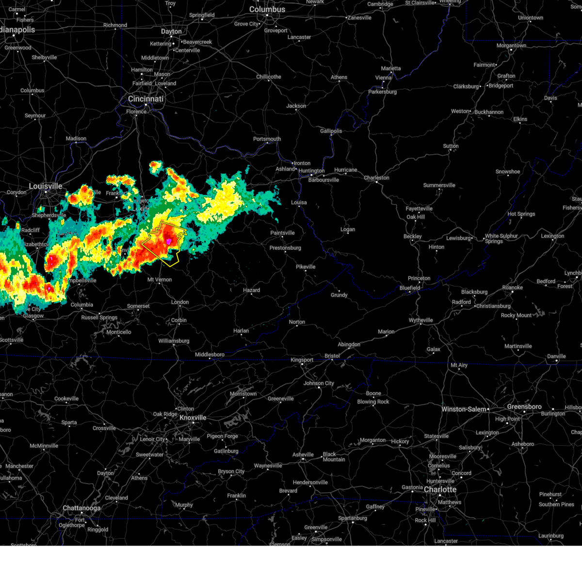 At 1055 pm edt, a severe thunderstorm was located near harris ferry, moving southeast at 25 mph. this is a destructive storm for richmond and union city kentucky (radar indicated). Hazards include 80 mph wind gusts and three inch hail. Flying debris will be dangerous to those caught without shelter. mobile homes will be heavily damaged. expect considerable damage to roofs, windows, and vehicles. extensive tree damage and power outages are likely. locations impacted include, richmond, harris ferry, berea, peytontown, valley view, jackson ferry, panola, buggytown, locust grove and hunt. thunderstorm damage threat, destructive hail threat, radar indicated max hail size, 3. 00 in wind threat, radar indicated max wind gust, 80 mph. At 1055 pm edt, a severe thunderstorm was located near harris ferry, moving southeast at 25 mph. this is a destructive storm for richmond and union city kentucky (radar indicated). Hazards include 80 mph wind gusts and three inch hail. Flying debris will be dangerous to those caught without shelter. mobile homes will be heavily damaged. expect considerable damage to roofs, windows, and vehicles. extensive tree damage and power outages are likely. locations impacted include, richmond, harris ferry, berea, peytontown, valley view, jackson ferry, panola, buggytown, locust grove and hunt. thunderstorm damage threat, destructive hail threat, radar indicated max hail size, 3. 00 in wind threat, radar indicated max wind gust, 80 mph.
|
| 6/25/2023 10:52 PM EDT | Storm damage reported in madison county KY, 2.4 miles S of Richmond, KY |
| 6/25/2023 10:52 PM EDT | Quarter sized hail reported 5.2 miles WSW of Richmond, KY |
| 6/25/2023 10:46 PM EDT | Tennis Ball sized hail reported 3.9 miles SSE of Richmond, KY |
| 6/25/2023 10:45 PM EDT | Ping Pong Ball sized hail reported 2.4 miles S of Richmond, KY |
| 6/25/2023 10:44 PM EDT | Baseball sized hail reported 11.7 miles SE of Richmond, KY |
| 6/25/2023 10:29 PM EDT |
 At 1027 pm edt, a severe thunderstorm was located 8 miles north of richmond, moving southeast at 30 mph. this is a destructive storm for blue grass and far southern fayette county (radar indicated). Hazards include baseball size hail and 70 mph wind gusts. People and animals outdoors will be severely injured. Expect shattered windows, extensive damage to roofs, siding, and vehicles. At 1027 pm edt, a severe thunderstorm was located 8 miles north of richmond, moving southeast at 30 mph. this is a destructive storm for blue grass and far southern fayette county (radar indicated). Hazards include baseball size hail and 70 mph wind gusts. People and animals outdoors will be severely injured. Expect shattered windows, extensive damage to roofs, siding, and vehicles.
|
| 6/25/2023 10:21 PM EDT |
 At 1020 pm edt, a severe thunderstorm was located 8 miles southeast of veterans park, moving southeast at 30 mph. this is a destructive storm for southern fayette county (radar indicated). Hazards include baseball size hail and 60 mph wind gusts. People and animals outdoors will be severely injured. expect shattered windows, extensive damage to roofs, siding, and vehicles. locations impacted include, lexington, richmond, nicholasville, dunbar high school, veterans park, fayette mall, wilmore, round hill, coletown and valley view. thunderstorm damage threat, destructive hail threat, radar indicated max hail size, 2. 75 in wind threat, radar indicated max wind gust, 60 mph. At 1020 pm edt, a severe thunderstorm was located 8 miles southeast of veterans park, moving southeast at 30 mph. this is a destructive storm for southern fayette county (radar indicated). Hazards include baseball size hail and 60 mph wind gusts. People and animals outdoors will be severely injured. expect shattered windows, extensive damage to roofs, siding, and vehicles. locations impacted include, lexington, richmond, nicholasville, dunbar high school, veterans park, fayette mall, wilmore, round hill, coletown and valley view. thunderstorm damage threat, destructive hail threat, radar indicated max hail size, 2. 75 in wind threat, radar indicated max wind gust, 60 mph.
|
| 6/25/2023 9:54 PM EDT |
 At 954 pm edt, a severe thunderstorm was located near nicholasville, moving southeast at 30 mph (radar indicated). Hazards include golf ball size hail and 60 mph wind gusts. People and animals outdoors will be injured. expect hail damage to roofs, siding, windows, and vehicles. Expect wind damage to roofs, siding, and trees. At 954 pm edt, a severe thunderstorm was located near nicholasville, moving southeast at 30 mph (radar indicated). Hazards include golf ball size hail and 60 mph wind gusts. People and animals outdoors will be injured. expect hail damage to roofs, siding, windows, and vehicles. Expect wind damage to roofs, siding, and trees.
|
| 5/16/2023 3:30 PM EDT |
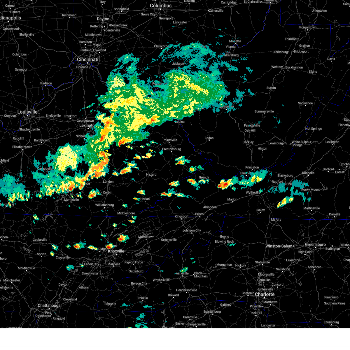 At 329 pm edt, a severe thunderstorm was located over shirley, moving east at 45 mph (radar indicated). Hazards include 60 mph wind gusts. expect damage to roofs, siding, and trees At 329 pm edt, a severe thunderstorm was located over shirley, moving east at 45 mph (radar indicated). Hazards include 60 mph wind gusts. expect damage to roofs, siding, and trees
|
| 5/16/2023 3:11 PM EDT |
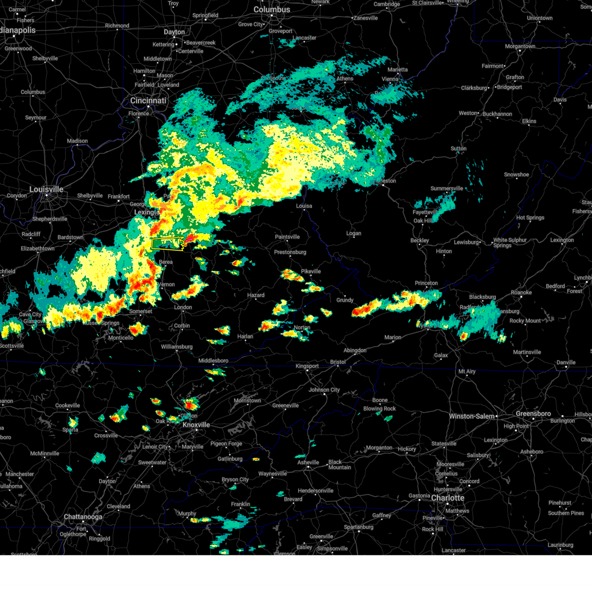 The severe thunderstorm warning for northern madison county will expire at 315 pm edt, the storm which prompted the warning moved out of the area. a severe thunderstorm watch remains in effect until 800 pm edt. to report severe weather, contact your nearest law enforcement agency. they will relay your report to the national weather service louisville. The severe thunderstorm warning for northern madison county will expire at 315 pm edt, the storm which prompted the warning moved out of the area. a severe thunderstorm watch remains in effect until 800 pm edt. to report severe weather, contact your nearest law enforcement agency. they will relay your report to the national weather service louisville.
|
| 5/16/2023 2:45 PM EDT |
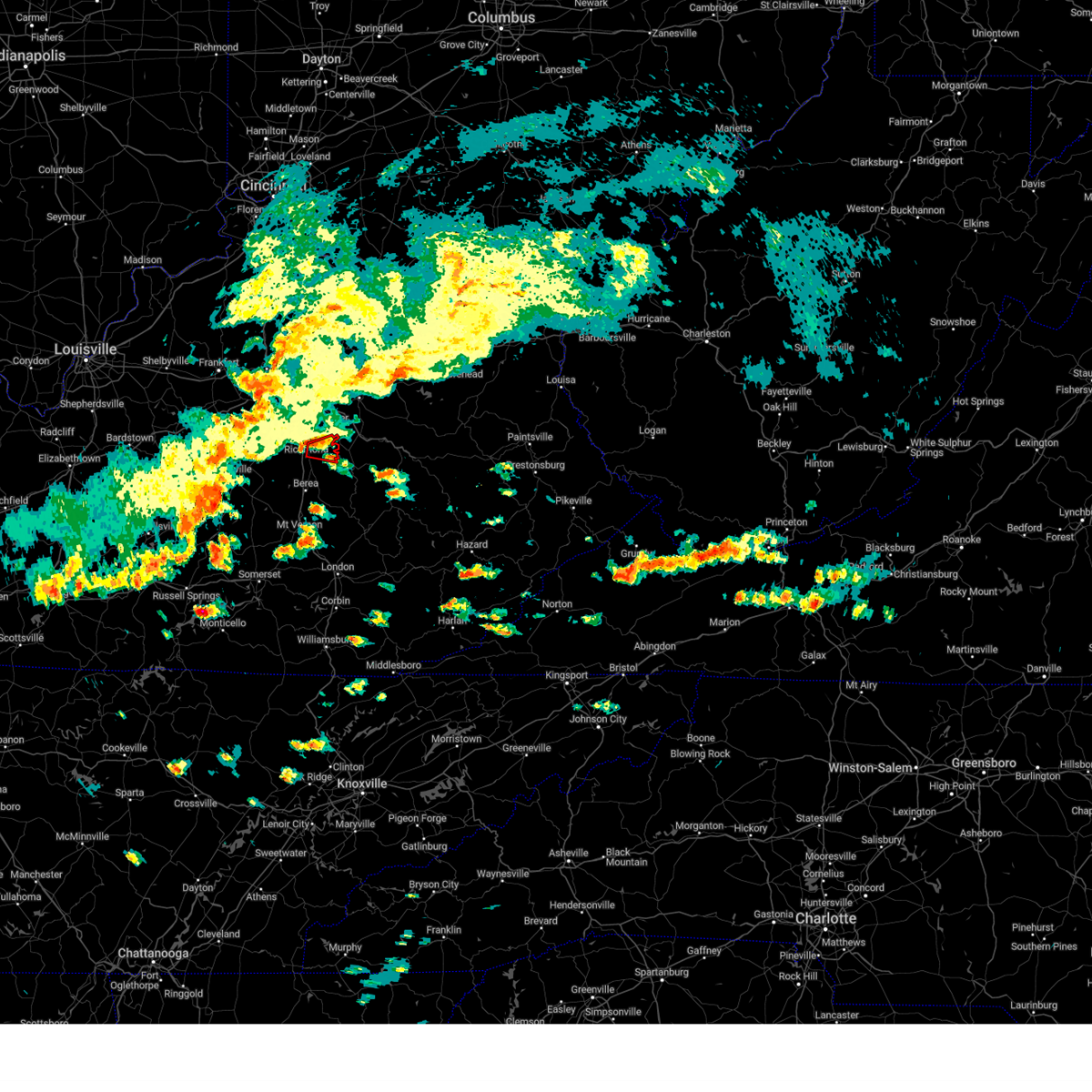 At 244 pm edt, a severe thunderstorm capable of producing a tornado was located between redhouse and richmond, moving east at 30 mph. storm spotters have reported rotation aloft with this storm (radar indicated rotation). Hazards include tornado. Flying debris will be dangerous to those caught without shelter. mobile homes will be damaged or destroyed. damage to roofs, windows, and vehicles will occur. tree damage is likely. Locations impacted include, richmond, harris ferry, bybee, college hill, moberly, doylesville, elliston, and reeds crossing. At 244 pm edt, a severe thunderstorm capable of producing a tornado was located between redhouse and richmond, moving east at 30 mph. storm spotters have reported rotation aloft with this storm (radar indicated rotation). Hazards include tornado. Flying debris will be dangerous to those caught without shelter. mobile homes will be damaged or destroyed. damage to roofs, windows, and vehicles will occur. tree damage is likely. Locations impacted include, richmond, harris ferry, bybee, college hill, moberly, doylesville, elliston, and reeds crossing.
|
| 5/16/2023 2:41 PM EDT | Received two reports of a tree down on red house roa in madison county KY, 8.1 miles SSW of Richmond, KY |
| 5/16/2023 2:40 PM EDT |
 At 239 pm edt, a severe thunderstorm capable of producing a tornado was located southwest of redhouse near i-75, northwest of richmond, moving east at 30 mph (radar indicated rotation). Hazards include tornado. Flying debris will be dangerous to those caught without shelter. mobile homes will be damaged or destroyed. damage to roofs, windows, and vehicles will occur. tree damage is likely. Locations impacted include, richmond, harris ferry, bybee, college hill, moberly, doylesville, hillcrest, reeds crossing and elliston. At 239 pm edt, a severe thunderstorm capable of producing a tornado was located southwest of redhouse near i-75, northwest of richmond, moving east at 30 mph (radar indicated rotation). Hazards include tornado. Flying debris will be dangerous to those caught without shelter. mobile homes will be damaged or destroyed. damage to roofs, windows, and vehicles will occur. tree damage is likely. Locations impacted include, richmond, harris ferry, bybee, college hill, moberly, doylesville, hillcrest, reeds crossing and elliston.
|
| 5/16/2023 2:35 PM EDT |
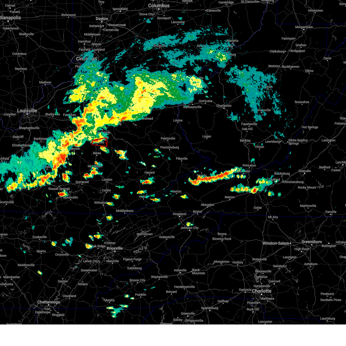 At 235 pm edt, a severe thunderstorm capable of producing a tornado was located near richmond, moving east at 30 mph (radar indicated rotation). Hazards include tornado. Flying debris will be dangerous to those caught without shelter. mobile homes will be damaged or destroyed. damage to roofs, windows, and vehicles will occur. Tree damage is likely. At 235 pm edt, a severe thunderstorm capable of producing a tornado was located near richmond, moving east at 30 mph (radar indicated rotation). Hazards include tornado. Flying debris will be dangerous to those caught without shelter. mobile homes will be damaged or destroyed. damage to roofs, windows, and vehicles will occur. Tree damage is likely.
|
| 5/16/2023 2:29 PM EDT |
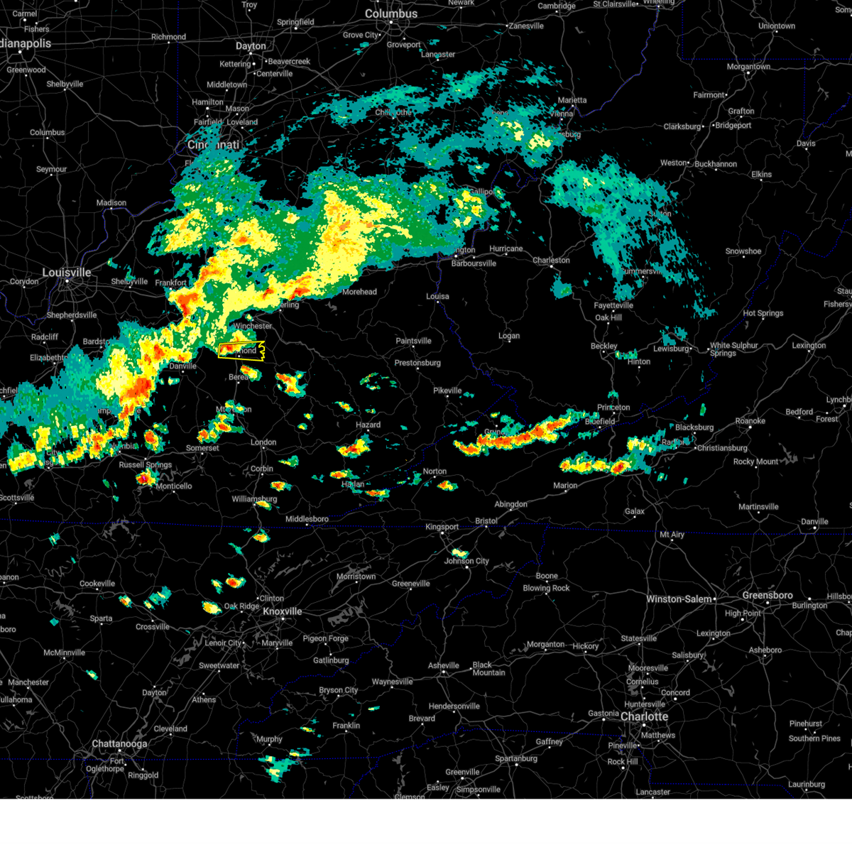 At 229 pm edt, a severe thunderstorm was located near stringtown northwest of richmond, moving east at 30 mph (radar indicated). Hazards include 60 mph wind gusts. expect damage to roofs, siding, and trees At 229 pm edt, a severe thunderstorm was located near stringtown northwest of richmond, moving east at 30 mph (radar indicated). Hazards include 60 mph wind gusts. expect damage to roofs, siding, and trees
|
| 5/7/2023 10:57 AM EDT |
 The severe thunderstorm warning for clark, northeastern madison and southeastern fayette counties will expire at 1100 am edt, the storm which prompted the warning has weakened below severe limits, and no longer poses an immediate threat to life or property. therefore, the warning will be allowed to expire. however gusty winds and heavy rain are still possible with this thunderstorm. The severe thunderstorm warning for clark, northeastern madison and southeastern fayette counties will expire at 1100 am edt, the storm which prompted the warning has weakened below severe limits, and no longer poses an immediate threat to life or property. therefore, the warning will be allowed to expire. however gusty winds and heavy rain are still possible with this thunderstorm.
|
| 5/7/2023 10:39 AM EDT |
 At 1038 am edt, a severe thunderstorm was located near winchester, moving southeast at 30 mph (radar indicated). Hazards include 60 mph wind gusts and penny size hail. Expect damage to roofs, siding, and trees. locations impacted include, richmond, winchester, goffs corner, constant station, lyndale, redhouse, jackson ferry, mina, tebbs and judianne estates. hail threat, radar indicated max hail size, 0. 75 in wind threat, radar indicated max wind gust, 60 mph. At 1038 am edt, a severe thunderstorm was located near winchester, moving southeast at 30 mph (radar indicated). Hazards include 60 mph wind gusts and penny size hail. Expect damage to roofs, siding, and trees. locations impacted include, richmond, winchester, goffs corner, constant station, lyndale, redhouse, jackson ferry, mina, tebbs and judianne estates. hail threat, radar indicated max hail size, 0. 75 in wind threat, radar indicated max wind gust, 60 mph.
|
| 5/7/2023 10:18 AM EDT |
 At 1018 am edt, a severe thunderstorm was located over bryan station, moving southeast at 30 mph (radar indicated). Hazards include 60 mph wind gusts and penny size hail. expect damage to roofs, siding, and trees At 1018 am edt, a severe thunderstorm was located over bryan station, moving southeast at 30 mph (radar indicated). Hazards include 60 mph wind gusts and penny size hail. expect damage to roofs, siding, and trees
|
| 4/5/2023 6:58 PM EDT |
 The severe thunderstorm warning for clark, bourbon, nicholas, madison, eastern fayette and harrison counties will expire at 700 pm edt, the storms which prompted the warning have moved out of the area. therefore, the warning will be allowed to expire. a severe thunderstorm watch remains in effect until 1000 pm edt for central kentucky. The severe thunderstorm warning for clark, bourbon, nicholas, madison, eastern fayette and harrison counties will expire at 700 pm edt, the storms which prompted the warning have moved out of the area. therefore, the warning will be allowed to expire. a severe thunderstorm watch remains in effect until 1000 pm edt for central kentucky.
|
| 4/5/2023 6:42 PM EDT |
 At 642 pm edt, severe thunderstorms were located along a line extending from near cynthiana to 6 miles northwest of winchester to near lancaster, moving east at 45 mph (radar indicated). Hazards include 60 mph wind gusts. Expect damage to roofs, siding, and trees. locations impacted include, lexington, richmond, winchester, paris, cynthiana, carlisle, cadentown, bryan station, harris ferry and breckinridge. hail threat, radar indicated max hail size, <. 75 in wind threat, radar indicated max wind gust, 60 mph. At 642 pm edt, severe thunderstorms were located along a line extending from near cynthiana to 6 miles northwest of winchester to near lancaster, moving east at 45 mph (radar indicated). Hazards include 60 mph wind gusts. Expect damage to roofs, siding, and trees. locations impacted include, lexington, richmond, winchester, paris, cynthiana, carlisle, cadentown, bryan station, harris ferry and breckinridge. hail threat, radar indicated max hail size, <. 75 in wind threat, radar indicated max wind gust, 60 mph.
|
| 4/5/2023 6:39 PM EDT |
 At 638 pm edt, severe thunderstorms were located along a line extending from cynthiana to near bryan station to near lancaster, moving east at 45 mph (radar indicated). Hazards include 60 mph wind gusts. Expect damage to roofs, siding, and trees. locations impacted include, lexington, richmond, georgetown, nicholasville, winchester, danville, paris, cynthiana, lancaster and carlisle. hail threat, radar indicated max hail size, <. 75 in wind threat, radar indicated max wind gust, 60 mph. At 638 pm edt, severe thunderstorms were located along a line extending from cynthiana to near bryan station to near lancaster, moving east at 45 mph (radar indicated). Hazards include 60 mph wind gusts. Expect damage to roofs, siding, and trees. locations impacted include, lexington, richmond, georgetown, nicholasville, winchester, danville, paris, cynthiana, lancaster and carlisle. hail threat, radar indicated max hail size, <. 75 in wind threat, radar indicated max wind gust, 60 mph.
|
| 4/5/2023 6:12 PM EDT |
 At 612 pm edt, severe thunderstorms were located along a line extending from 9 miles northwest of cynthiana to 8 miles southwest of danville, moving east at 50 mph (radar indicated). Hazards include 60 mph wind gusts. expect damage to roofs, siding, and trees At 612 pm edt, severe thunderstorms were located along a line extending from 9 miles northwest of cynthiana to 8 miles southwest of danville, moving east at 50 mph (radar indicated). Hazards include 60 mph wind gusts. expect damage to roofs, siding, and trees
|
| 1/12/2023 9:48 AM EST | Dispatcher reported several damage reports here. homes... trees... rvs. in the braemar dr... tazwell dr... and hoover circle area. time estimated based on rada in madison county KY, 5.9 miles SW of Richmond, KY |
| 1/12/2023 9:45 AM EST | Dispatcher reported a barn damaged on runyon grove rd. time estimated from rada in madison county KY, 5 miles SW of Richmond, KY |
| 1/12/2023 9:42 AM EST |
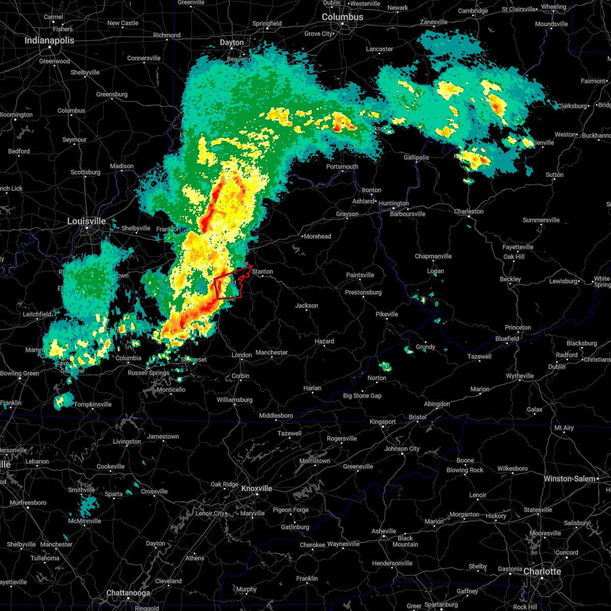 At 941 am est, a severe thunderstorm capable of producing a tornado was located over richmond, moving east at 60 mph (radar indicated rotation). Hazards include tornado. Flying debris will be dangerous to those caught without shelter. mobile homes will be damaged or destroyed. damage to roofs, windows, and vehicles will occur. tree damage is likely. This dangerous storm will be near, harris ferry around 950 am est. At 941 am est, a severe thunderstorm capable of producing a tornado was located over richmond, moving east at 60 mph (radar indicated rotation). Hazards include tornado. Flying debris will be dangerous to those caught without shelter. mobile homes will be damaged or destroyed. damage to roofs, windows, and vehicles will occur. tree damage is likely. This dangerous storm will be near, harris ferry around 950 am est.
|
| 1/12/2023 9:35 AM EST | Via social media... images show a car flipped on its side... trees down along with roof and gutter damage on lakeridge drive in richmon in madison county KY, 3.8 miles SE of Richmond, KY |
| 1/12/2023 9:34 AM EST |
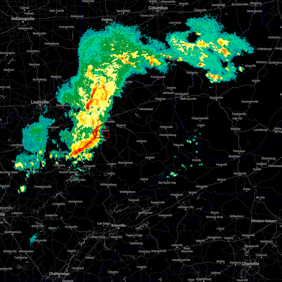 At 934 am est, a severe thunderstorm capable of producing a tornado was located near richmond, moving east at 55 mph (radar indicated rotation). Hazards include tornado. Flying debris will be dangerous to those caught without shelter. mobile homes will be damaged or destroyed. damage to roofs, windows, and vehicles will occur. tree damage is likely. Locations impacted include, richmond, round hill, caleast, peytontown, redhouse, cottonburg, terrill, hillcrest, reeds crossing and million. At 934 am est, a severe thunderstorm capable of producing a tornado was located near richmond, moving east at 55 mph (radar indicated rotation). Hazards include tornado. Flying debris will be dangerous to those caught without shelter. mobile homes will be damaged or destroyed. damage to roofs, windows, and vehicles will occur. tree damage is likely. Locations impacted include, richmond, round hill, caleast, peytontown, redhouse, cottonburg, terrill, hillcrest, reeds crossing and million.
|
| 1/12/2023 9:27 AM EST |
 At 927 am est, a severe thunderstorm capable of producing a tornado was located 8 miles west of richmond, moving east at 55 mph (radar indicated rotation). Hazards include tornado. Flying debris will be dangerous to those caught without shelter. mobile homes will be damaged or destroyed. damage to roofs, windows, and vehicles will occur. tree damage is likely. Locations impacted include, lexington, richmond, nicholasville, lancaster, mccreary, wilmore, peytontown, marksbury, valley view and stone. At 927 am est, a severe thunderstorm capable of producing a tornado was located 8 miles west of richmond, moving east at 55 mph (radar indicated rotation). Hazards include tornado. Flying debris will be dangerous to those caught without shelter. mobile homes will be damaged or destroyed. damage to roofs, windows, and vehicles will occur. tree damage is likely. Locations impacted include, lexington, richmond, nicholasville, lancaster, mccreary, wilmore, peytontown, marksbury, valley view and stone.
|
| 1/12/2023 9:14 AM EST |
 At 913 am est, a severe thunderstorm capable of producing a tornado was located near danville, moving east at 55 mph (radar indicated rotation). Hazards include tornado. Flying debris will be dangerous to those caught without shelter. mobile homes will be damaged or destroyed. damage to roofs, windows, and vehicles will occur. Tree damage is likely. At 913 am est, a severe thunderstorm capable of producing a tornado was located near danville, moving east at 55 mph (radar indicated rotation). Hazards include tornado. Flying debris will be dangerous to those caught without shelter. mobile homes will be damaged or destroyed. damage to roofs, windows, and vehicles will occur. Tree damage is likely.
|
| 1/12/2023 9:09 AM EST |
 At 909 am est, a severe thunderstorm was located near harrodsburg, moving east at 60 mph (radar indicated). Hazards include 60 mph wind gusts. Expect damage to roofs, siding, and trees. this severe thunderstorm will be near, nicholasville around 920 am est. other locations in the path of this severe thunderstorm include veterans park. hail threat, radar indicated max hail size, <. 75 in wind threat, radar indicated max wind gust, 60 mph. At 909 am est, a severe thunderstorm was located near harrodsburg, moving east at 60 mph (radar indicated). Hazards include 60 mph wind gusts. Expect damage to roofs, siding, and trees. this severe thunderstorm will be near, nicholasville around 920 am est. other locations in the path of this severe thunderstorm include veterans park. hail threat, radar indicated max hail size, <. 75 in wind threat, radar indicated max wind gust, 60 mph.
|
| 7/17/2022 4:50 PM EDT |
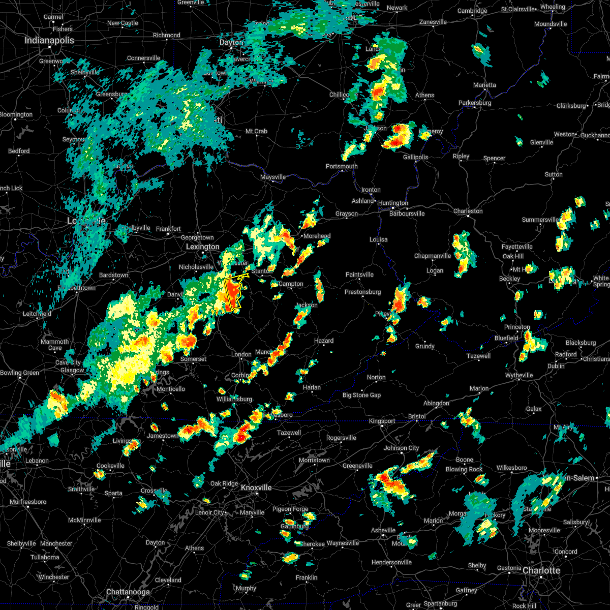 At 450 pm edt, a severe thunderstorm was located over blackburn, moving east at 20 mph (radar indicated). Hazards include 60 mph wind gusts and penny size hail. Expect damage to roofs, siding, and trees. this severe thunderstorm will remain over mainly rural areas of southeastern clark and eastern madison counties, including the following locations, bybee, duluth, college hill, moberly, combs, panola, dreyfus, brassfield, reeds crossing and speedwell. hail threat, radar indicated max hail size, 0. 75 in wind threat, radar indicated max wind gust, 60 mph. At 450 pm edt, a severe thunderstorm was located over blackburn, moving east at 20 mph (radar indicated). Hazards include 60 mph wind gusts and penny size hail. Expect damage to roofs, siding, and trees. this severe thunderstorm will remain over mainly rural areas of southeastern clark and eastern madison counties, including the following locations, bybee, duluth, college hill, moberly, combs, panola, dreyfus, brassfield, reeds crossing and speedwell. hail threat, radar indicated max hail size, 0. 75 in wind threat, radar indicated max wind gust, 60 mph.
|
| 7/6/2022 5:37 PM EDT |
 The severe thunderstorm warning for central garrard, southeastern jessamine and northern madison counties will expire at 545 pm edt, the storms which prompted the warning have weakened below severe limits, and no longer pose an immediate threat to life or property. therefore, the warning will be allowed to expire. a severe thunderstorm watch remains in effect until 700 pm edt for central kentucky. The severe thunderstorm warning for central garrard, southeastern jessamine and northern madison counties will expire at 545 pm edt, the storms which prompted the warning have weakened below severe limits, and no longer pose an immediate threat to life or property. therefore, the warning will be allowed to expire. a severe thunderstorm watch remains in effect until 700 pm edt for central kentucky.
|
| 7/6/2022 5:31 PM EDT |
 At 531 pm edt, severe thunderstorms were located along a line extending from 7 miles southeast of cadentown to 7 miles north of lancaster, moving east at 25 mph (radar indicated). Hazards include 60 mph wind gusts. Expect damage to roofs, siding, and trees. these severe thunderstorms will remain over mainly rural areas of central garrard, southeastern jessamine and northern madison counties, including the following locations, round hill, redhouse, marksbury, valley view, stone, toddville, little hickman, buckeye, hackley and pollard. hail threat, radar indicated max hail size, <. 75 in wind threat, radar indicated max wind gust, 60 mph. At 531 pm edt, severe thunderstorms were located along a line extending from 7 miles southeast of cadentown to 7 miles north of lancaster, moving east at 25 mph (radar indicated). Hazards include 60 mph wind gusts. Expect damage to roofs, siding, and trees. these severe thunderstorms will remain over mainly rural areas of central garrard, southeastern jessamine and northern madison counties, including the following locations, round hill, redhouse, marksbury, valley view, stone, toddville, little hickman, buckeye, hackley and pollard. hail threat, radar indicated max hail size, <. 75 in wind threat, radar indicated max wind gust, 60 mph.
|
| 7/6/2022 5:06 PM EDT |
 At 505 pm edt, severe thunderstorms were located along a line extending from near fayette mall to near harrodsburg, moving east at 25 mph (radar indicated). Hazards include 60 mph wind gusts and penny size hail. Expect damage to roofs, siding, and trees. severe thunderstorms will be near, nicholasville around 510 pm edt. other locations in the path of these severe thunderstorms include lancaster and richmond. hail threat, radar indicated max hail size, 0. 75 in wind threat, radar indicated max wind gust, 60 mph. At 505 pm edt, severe thunderstorms were located along a line extending from near fayette mall to near harrodsburg, moving east at 25 mph (radar indicated). Hazards include 60 mph wind gusts and penny size hail. Expect damage to roofs, siding, and trees. severe thunderstorms will be near, nicholasville around 510 pm edt. other locations in the path of these severe thunderstorms include lancaster and richmond. hail threat, radar indicated max hail size, 0. 75 in wind threat, radar indicated max wind gust, 60 mph.
|
| 6/22/2022 6:42 PM EDT |
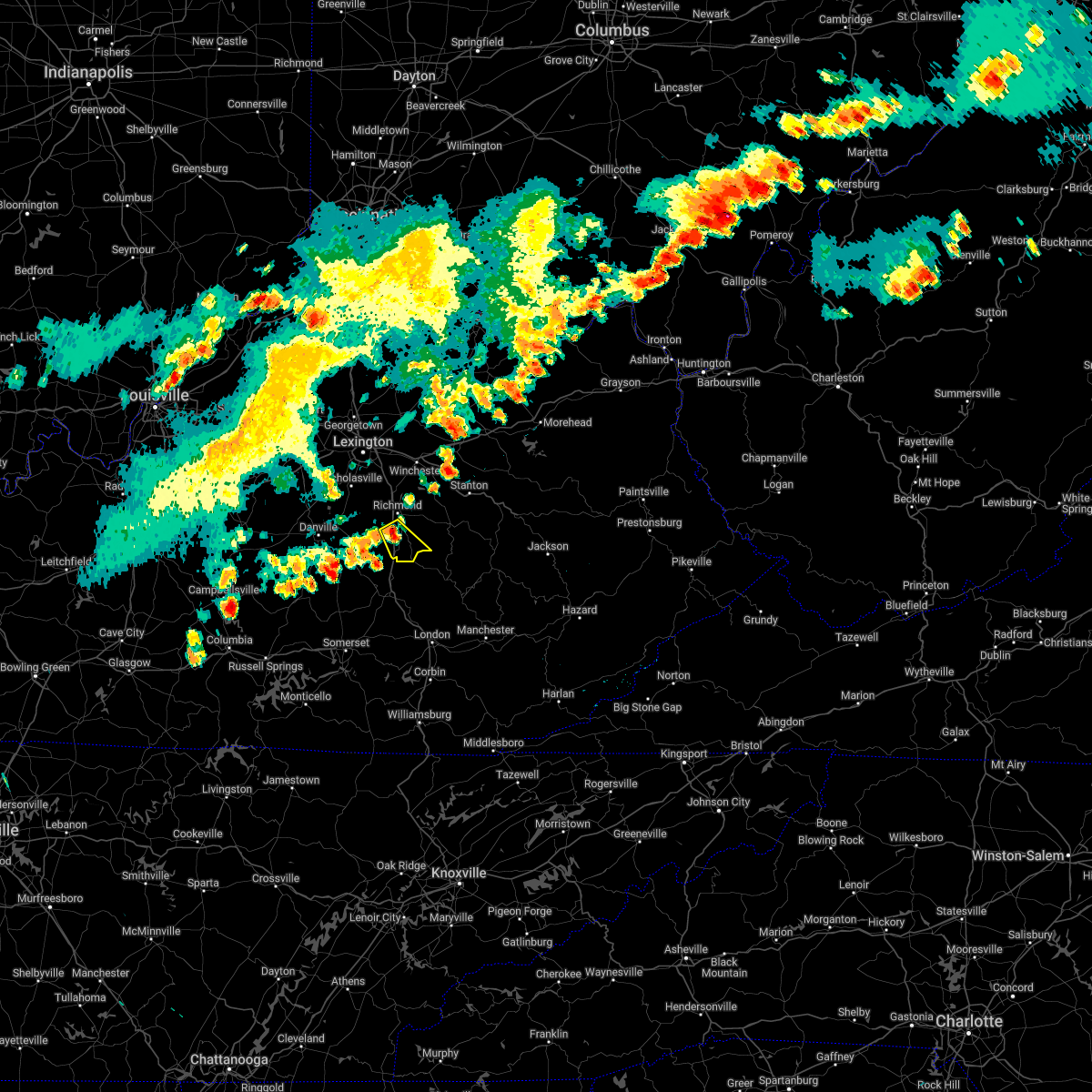 At 642 pm edt, a severe thunderstorm was located 7 miles north of boone, moving southeast at 30 mph (radar indicated). Hazards include 60 mph wind gusts and nickel size hail. expect damage to roofs, siding, and trees At 642 pm edt, a severe thunderstorm was located 7 miles north of boone, moving southeast at 30 mph (radar indicated). Hazards include 60 mph wind gusts and nickel size hail. expect damage to roofs, siding, and trees
|
| 5/26/2022 5:26 PM EDT |
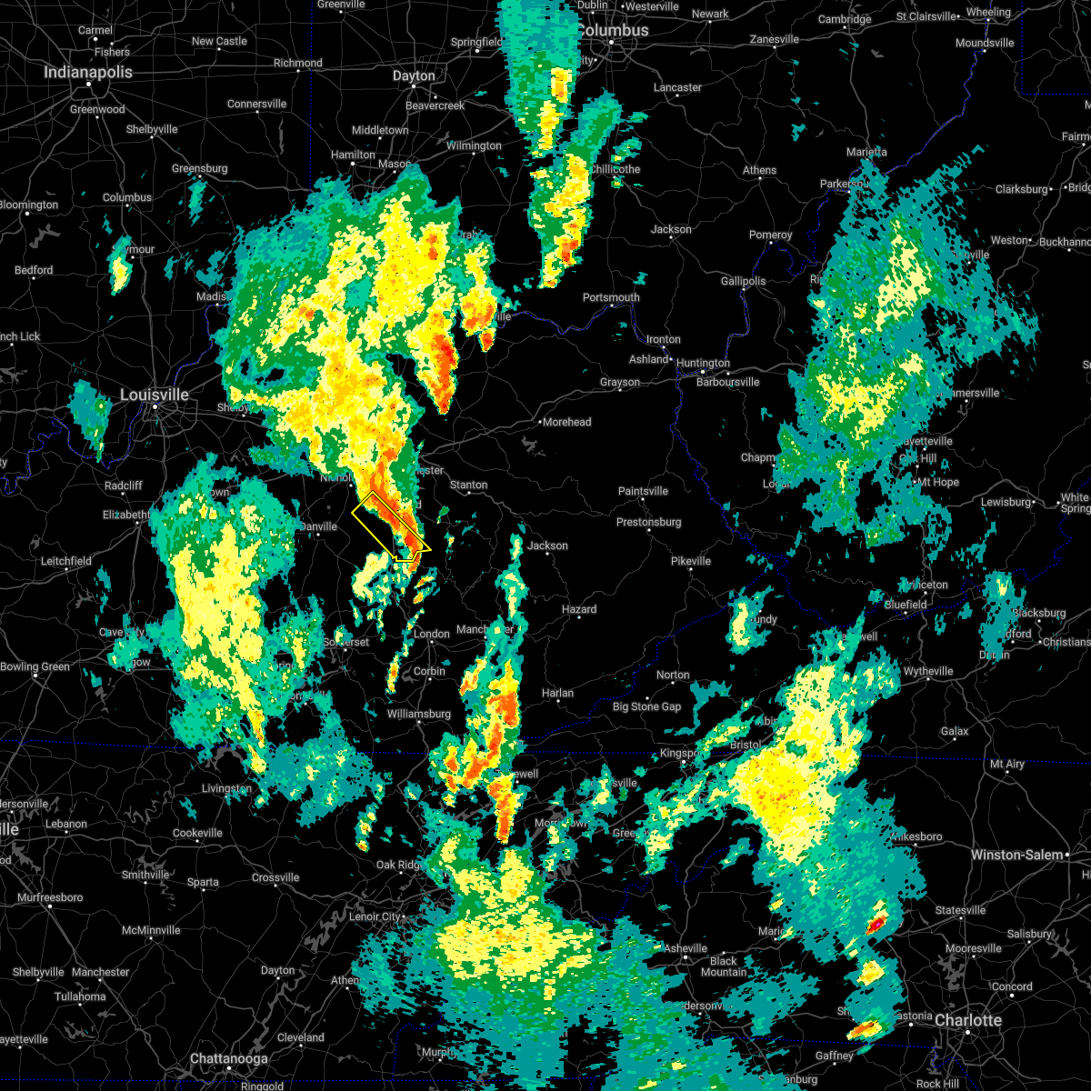 The severe thunderstorm warning for northeastern garrard, southeastern jessamine and southwestern madison counties will expire at 530 pm edt, the storm which prompted the warning has moved out of the area. therefore, the warning will be allowed to expire. however gusty winds and heavy rain are still possible with this thunderstorm. The severe thunderstorm warning for northeastern garrard, southeastern jessamine and southwestern madison counties will expire at 530 pm edt, the storm which prompted the warning has moved out of the area. therefore, the warning will be allowed to expire. however gusty winds and heavy rain are still possible with this thunderstorm.
|
| 5/26/2022 5:21 PM EDT |
 At 520 pm edt, severe thunderstorms were located along a line extending from 8 miles northwest of richmond to near locust branch, moving east at 45 mph (radar indicated). Hazards include 60 mph wind gusts. Expect damage to roofs, siding, and trees. severe thunderstorms will be near, winchester and harris ferry around 540 pm edt. hail threat, radar indicated max hail size, <. 75 in wind threat, radar indicated max wind gust, 60 mph. At 520 pm edt, severe thunderstorms were located along a line extending from 8 miles northwest of richmond to near locust branch, moving east at 45 mph (radar indicated). Hazards include 60 mph wind gusts. Expect damage to roofs, siding, and trees. severe thunderstorms will be near, winchester and harris ferry around 540 pm edt. hail threat, radar indicated max hail size, <. 75 in wind threat, radar indicated max wind gust, 60 mph.
|
| 5/26/2022 5:16 PM EDT | Emergency manager reports tree down on peytontown road. time estimated from rada in madison county KY, 4.4 miles NNE of Richmond, KY |
| 5/26/2022 5:16 PM EDT |
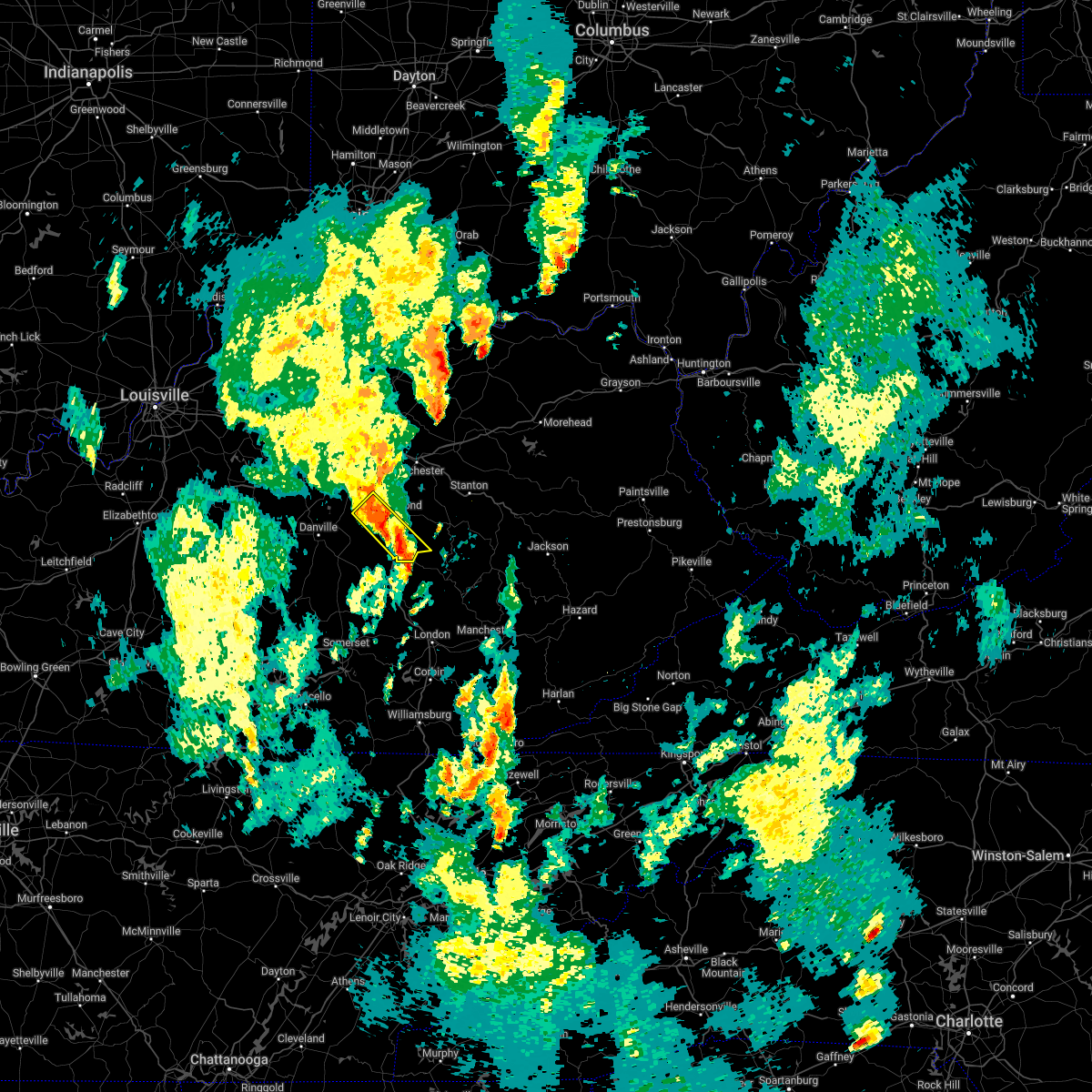 At 516 pm edt, a severe thunderstorm was located near richmond, moving northeast at 45 mph (radar indicated). Hazards include 60 mph wind gusts. Expect damage to roofs, siding, and trees. this severe thunderstorm will remain over mainly rural areas of northeastern garrard, southeastern jessamine and southwestern madison counties, including the following locations, round hill, caleast, duluth, peytontown, bighill, kingston, buggytown, buckeye, cottonburg and cuzick. hail threat, radar indicated max hail size, <. 75 in wind threat, radar indicated max wind gust, 60 mph. At 516 pm edt, a severe thunderstorm was located near richmond, moving northeast at 45 mph (radar indicated). Hazards include 60 mph wind gusts. Expect damage to roofs, siding, and trees. this severe thunderstorm will remain over mainly rural areas of northeastern garrard, southeastern jessamine and southwestern madison counties, including the following locations, round hill, caleast, duluth, peytontown, bighill, kingston, buggytown, buckeye, cottonburg and cuzick. hail threat, radar indicated max hail size, <. 75 in wind threat, radar indicated max wind gust, 60 mph.
|
| 5/26/2022 5:01 PM EDT |
 At 500 pm edt, a severe thunderstorm was located near lancaster, moving northeast at 45 mph (radar indicated). Hazards include 60 mph wind gusts. Expect damage to roofs, siding, and trees. this severe thunderstorm will be near, richmond around 520 pm edt. hail threat, radar indicated max hail size, <. 75 in wind threat, radar indicated max wind gust, 60 mph. At 500 pm edt, a severe thunderstorm was located near lancaster, moving northeast at 45 mph (radar indicated). Hazards include 60 mph wind gusts. Expect damage to roofs, siding, and trees. this severe thunderstorm will be near, richmond around 520 pm edt. hail threat, radar indicated max hail size, <. 75 in wind threat, radar indicated max wind gust, 60 mph.
|
| 5/26/2022 4:44 PM EDT |
 At 444 pm edt, a severe thunderstorm was located near stanford, moving northeast at 45 mph (radar indicated). Hazards include 60 mph wind gusts. Expect damage to roofs, siding, and trees. this severe thunderstorm will be near, lancaster around 500 pm edt. other locations in the path of this severe thunderstorm include richmond. hail threat, radar indicated max hail size, <. 75 in wind threat, radar indicated max wind gust, 60 mph. At 444 pm edt, a severe thunderstorm was located near stanford, moving northeast at 45 mph (radar indicated). Hazards include 60 mph wind gusts. Expect damage to roofs, siding, and trees. this severe thunderstorm will be near, lancaster around 500 pm edt. other locations in the path of this severe thunderstorm include richmond. hail threat, radar indicated max hail size, <. 75 in wind threat, radar indicated max wind gust, 60 mph.
|
| 5/19/2022 4:41 PM EDT |
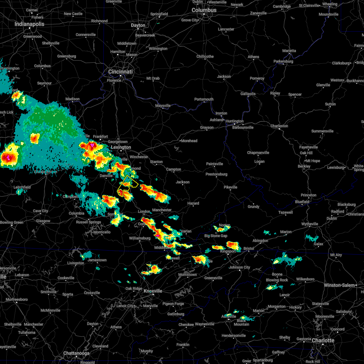 At 440 pm edt, a severe thunderstorm was located near gum sulphur, moving northeast at 25 mph (radar indicated). Hazards include quarter size hail. Damage to vehicles is expected. locations impacted include, berea, crab orchard, silver creek, paint lick, bighill, manse, whites, buggytown, cartersville and duncanon. hail threat, radar indicated max hail size, 1. 00 in wind threat, radar indicated max wind gust, <50 mph. At 440 pm edt, a severe thunderstorm was located near gum sulphur, moving northeast at 25 mph (radar indicated). Hazards include quarter size hail. Damage to vehicles is expected. locations impacted include, berea, crab orchard, silver creek, paint lick, bighill, manse, whites, buggytown, cartersville and duncanon. hail threat, radar indicated max hail size, 1. 00 in wind threat, radar indicated max wind gust, <50 mph.
|
| 5/19/2022 4:29 PM EDT |
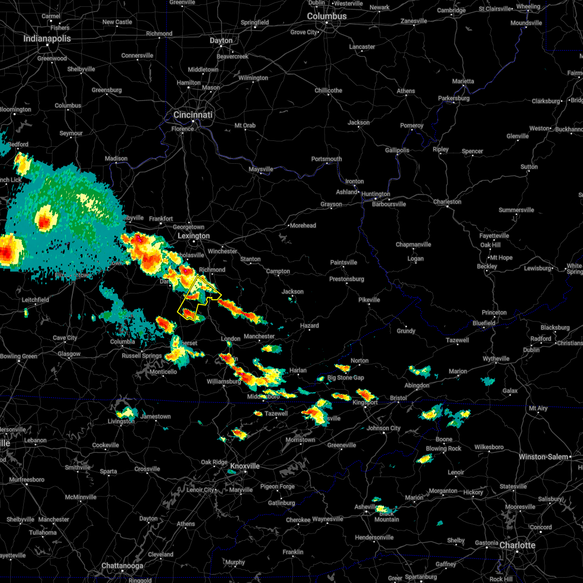 At 428 pm edt, a severe thunderstorm was located near indian lakes park, moving northeast at 25 mph (radar indicated). Hazards include quarter size hail. Damage to vehicles is expected. this severe thunderstorm will remain over mainly rural areas of northeastern lincoln, southeastern garrard and southwestern madison counties, including the following locations, round hill, crab orchard, bighill, ottenheim, broughtentown, buggytown, cartersville, hackley, maywood and berea. hail threat, radar indicated max hail size, 1. 00 in wind threat, radar indicated max wind gust, <50 mph. At 428 pm edt, a severe thunderstorm was located near indian lakes park, moving northeast at 25 mph (radar indicated). Hazards include quarter size hail. Damage to vehicles is expected. this severe thunderstorm will remain over mainly rural areas of northeastern lincoln, southeastern garrard and southwestern madison counties, including the following locations, round hill, crab orchard, bighill, ottenheim, broughtentown, buggytown, cartersville, hackley, maywood and berea. hail threat, radar indicated max hail size, 1. 00 in wind threat, radar indicated max wind gust, <50 mph.
|
| 5/19/2022 4:22 PM EDT |
 At 422 pm edt, a severe thunderstorm was located 8 miles south of nicholasville, moving east at 25 mph (radar indicated). Hazards include 60 mph wind gusts and quarter size hail. Hail damage to vehicles is expected. Expect wind damage to roofs, siding, and trees. At 422 pm edt, a severe thunderstorm was located 8 miles south of nicholasville, moving east at 25 mph (radar indicated). Hazards include 60 mph wind gusts and quarter size hail. Hail damage to vehicles is expected. Expect wind damage to roofs, siding, and trees.
|
| 1/1/0001 12:00 AM | Madison county kentucky mesonet station els in madison county KY, 8.2 miles W of Richmond, KY |
| 1/1/0001 12:00 AM | Public reports tree down blocking the road on sara leigh drive in richmond. time estimated from rada in madison county KY, 1.2 miles SSE of Richmond, KY |
| 4/13/2022 9:45 PM EDT |
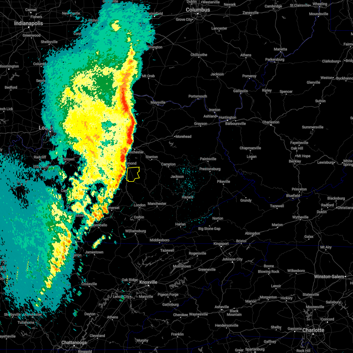 At 945 pm edt, severe thunderstorms were located along a line extending from near richmond to 7 miles west of snider, moving northeast at 60 mph (radar indicated). Hazards include 60 mph wind gusts. Expect damage to roofs, siding, and trees. Severe thunderstorms will be near, richmond around 950 pm edt. At 945 pm edt, severe thunderstorms were located along a line extending from near richmond to 7 miles west of snider, moving northeast at 60 mph (radar indicated). Hazards include 60 mph wind gusts. Expect damage to roofs, siding, and trees. Severe thunderstorms will be near, richmond around 950 pm edt.
|
| 4/13/2022 9:42 PM EDT |
 At 941 pm edt/841 pm cdt/, severe thunderstorms were located along a line extending from 9 miles south of nicholasville to near bee lick to nancy, moving east at 55 mph (radar indicated). Hazards include 60 mph wind gusts and penny size hail. Expect damage to roofs, siding, and trees. Locations impacted include, richmond. At 941 pm edt/841 pm cdt/, severe thunderstorms were located along a line extending from 9 miles south of nicholasville to near bee lick to nancy, moving east at 55 mph (radar indicated). Hazards include 60 mph wind gusts and penny size hail. Expect damage to roofs, siding, and trees. Locations impacted include, richmond.
|
| 4/13/2022 9:13 PM EDT |
 At 912 pm edt, severe thunderstorms were located along a line extending from 7 miles south of owenton to 7 miles east of frankfort to near harrodsburg, moving east at 60 mph (radar indicated). Hazards include 70 mph wind gusts and penny size hail. Expect considerable tree damage. damage is likely to mobile homes, roofs, and outbuildings. severe thunderstorms will be near, georgetown and lexington around 925 pm edt. Other locations in the path of these severe thunderstorms include richmond, paris, cynthiana, carlisle and harris ferry. At 912 pm edt, severe thunderstorms were located along a line extending from 7 miles south of owenton to 7 miles east of frankfort to near harrodsburg, moving east at 60 mph (radar indicated). Hazards include 70 mph wind gusts and penny size hail. Expect considerable tree damage. damage is likely to mobile homes, roofs, and outbuildings. severe thunderstorms will be near, georgetown and lexington around 925 pm edt. Other locations in the path of these severe thunderstorms include richmond, paris, cynthiana, carlisle and harris ferry.
|
| 4/13/2022 9:08 PM EDT |
 At 907 pm edt/807 pm cdt/, severe thunderstorms were located along a line extending from 10 miles east of springfield to 7 miles west of liberty to 7 miles south of columbia, moving east at 55 mph (radar indicated). Hazards include 60 mph wind gusts and penny size hail. Expect damage to roofs, siding, and trees. severe thunderstorms will be near, liberty around 915 pm edt. danville around 920 pm edt. Other locations in the path of these severe thunderstorms include richmond. At 907 pm edt/807 pm cdt/, severe thunderstorms were located along a line extending from 10 miles east of springfield to 7 miles west of liberty to 7 miles south of columbia, moving east at 55 mph (radar indicated). Hazards include 60 mph wind gusts and penny size hail. Expect damage to roofs, siding, and trees. severe thunderstorms will be near, liberty around 915 pm edt. danville around 920 pm edt. Other locations in the path of these severe thunderstorms include richmond.
|
| 3/6/2022 3:46 PM EST |
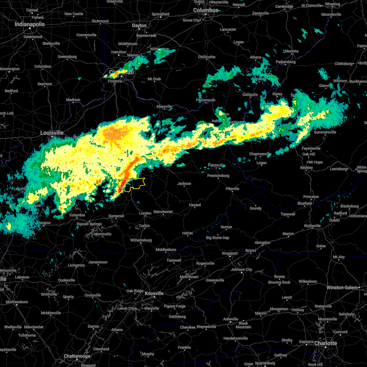 At 346 pm est, a severe thunderstorm was located 7 miles southeast of lancaster, moving east at 50 mph (radar indicated). Hazards include 60 mph wind gusts. Expect damage to roofs, siding, and trees. this severe thunderstorm will remain over mainly rural areas of southeastern garrard and southern madison counties, including the following locations, duluth, paint lick, bighill, manse, panola, kingston, whites, buggytown, cartersville and hyattsville. hail threat, radar indicated max hail size, <. 75 in wind threat, radar indicated max wind gust, 60 mph. At 346 pm est, a severe thunderstorm was located 7 miles southeast of lancaster, moving east at 50 mph (radar indicated). Hazards include 60 mph wind gusts. Expect damage to roofs, siding, and trees. this severe thunderstorm will remain over mainly rural areas of southeastern garrard and southern madison counties, including the following locations, duluth, paint lick, bighill, manse, panola, kingston, whites, buggytown, cartersville and hyattsville. hail threat, radar indicated max hail size, <. 75 in wind threat, radar indicated max wind gust, 60 mph.
|
| 2/17/2022 7:14 PM EST | Reported damage to a building near 3rd street and chesnut in richmond. sporadic tree damage in county as wel in madison county KY, 3.1 miles S of Richmond, KY |
| 2/17/2022 6:58 PM EST |
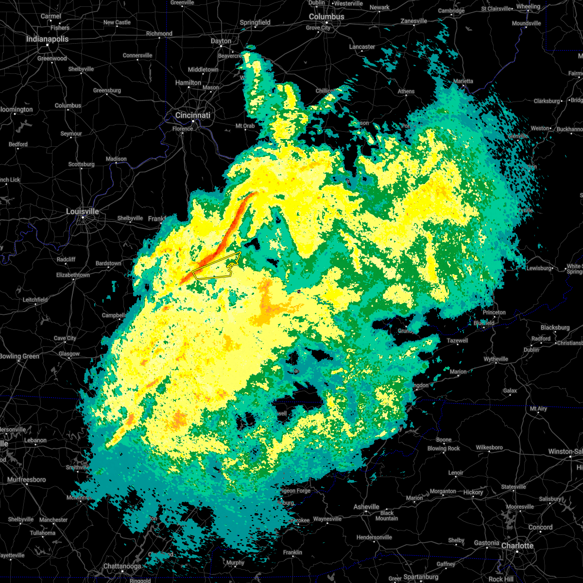 At 658 pm est, a severe thunderstorm was located near richmond, moving east at 65 mph (radar indicated). Hazards include 60 mph wind gusts. Expect damage to roofs, siding, and trees. This severe thunderstorm will be near, harris ferry around 710 pm est. At 658 pm est, a severe thunderstorm was located near richmond, moving east at 65 mph (radar indicated). Hazards include 60 mph wind gusts. Expect damage to roofs, siding, and trees. This severe thunderstorm will be near, harris ferry around 710 pm est.
|
| 1/1/2022 2:08 PM EST | Damage to roof of barn on college hill roa in madison county KY, 11.4 miles SW of Richmond, KY |
| 12/11/2021 7:16 AM EST | Report from mping: trees uprooted or snapped; roof blown of in madison county KY, 12.2 miles S of Richmond, KY |
| 12/11/2021 5:17 AM EST | Trees down blocking roadwa in madison county KY, 4.7 miles SW of Richmond, KY |
| 12/11/2021 4:38 AM EST |
 At 438 am est, severe thunderstorms were located along a line extending from near winchester to 6 miles north of rockford, moving northeast at 25 mph (radar indicated). Hazards include 60 mph wind gusts. Expect damage to roofs, siding, and trees. severe thunderstorms will be near, winchester around 445 am est. Other locations in the path of these severe thunderstorms include harris ferry. At 438 am est, severe thunderstorms were located along a line extending from near winchester to 6 miles north of rockford, moving northeast at 25 mph (radar indicated). Hazards include 60 mph wind gusts. Expect damage to roofs, siding, and trees. severe thunderstorms will be near, winchester around 445 am est. Other locations in the path of these severe thunderstorms include harris ferry.
|
| 12/11/2021 4:30 AM EST | Downed tree blocking roadway near exit 95 on i-7 in madison county KY, 8.8 miles S of Richmond, KY |
| 7/16/2021 3:22 PM EDT | Tree down over hunter lan in madison county KY, 5.3 miles SSW of Richmond, KY |
| 6/21/2021 2:29 PM EDT | Tree dow in madison county KY, 11.1 miles SSW of Richmond, KY |
| 6/12/2021 3:27 PM EDT | Tree down on simpson lane. time estimated from rada in madison county KY, 10.7 miles S of Richmond, KY |
| 6/11/2021 6:21 PM EDT |
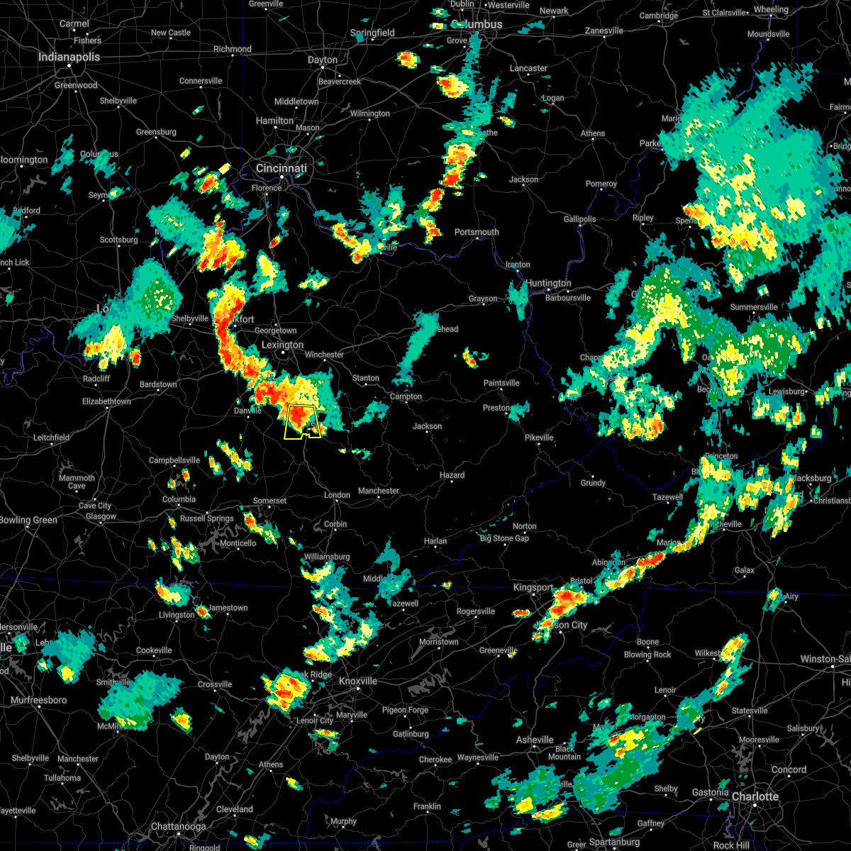 At 621 pm edt, a severe thunderstorm was located 8 miles southwest of richmond, moving south at 15 mph (radar indicated). Hazards include 60 mph wind gusts and nickel size hail. Expect damage to roofs, siding, and trees. Locations impacted include, richmond, berea, round hill, silver creek, caleast, peytontown, paint lick, manse, whites and buggytown. At 621 pm edt, a severe thunderstorm was located 8 miles southwest of richmond, moving south at 15 mph (radar indicated). Hazards include 60 mph wind gusts and nickel size hail. Expect damage to roofs, siding, and trees. Locations impacted include, richmond, berea, round hill, silver creek, caleast, peytontown, paint lick, manse, whites and buggytown.
|
| 6/11/2021 6:05 PM EDT |
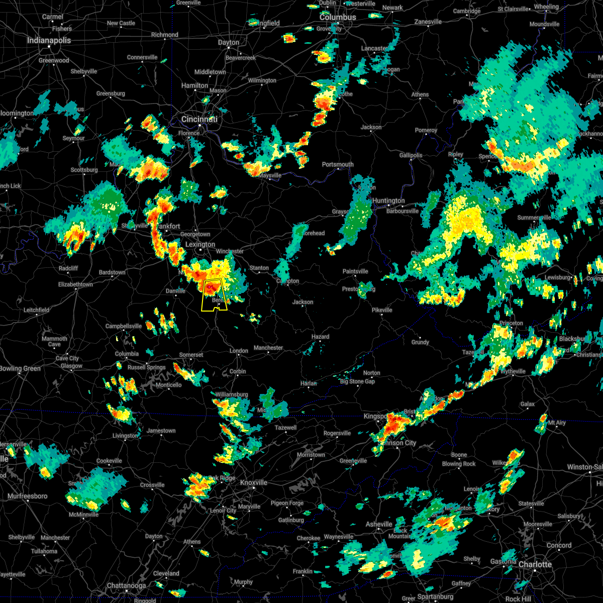 At 605 pm edt, a severe thunderstorm was located near richmond, moving south at 15 mph (radar indicated). Hazards include 60 mph wind gusts and quarter size hail. Hail damage to vehicles is expected. expect wind damage to roofs, siding, and trees. This severe thunderstorm will remain over mainly rural areas of southeastern garrard and southwestern madison counties, including the following locations, round hill, silver creek, caleast, peytontown, paint lick, ruthton, manse, whites, buggytown and cartersville. At 605 pm edt, a severe thunderstorm was located near richmond, moving south at 15 mph (radar indicated). Hazards include 60 mph wind gusts and quarter size hail. Hail damage to vehicles is expected. expect wind damage to roofs, siding, and trees. This severe thunderstorm will remain over mainly rural areas of southeastern garrard and southwestern madison counties, including the following locations, round hill, silver creek, caleast, peytontown, paint lick, ruthton, manse, whites, buggytown and cartersville.
|
| 7/11/2020 10:25 PM EDT |
 At 1023 pm edt, a severe thunderstorm was located near lancaster, moving southeast at 30 mph (radar indicated). Hazards include 70 mph wind gusts and penny size hail. Expect considerable tree damage. damage is likely to mobile homes, roofs, and outbuildings. Locations impacted include, richmond, lancaster, mccreary, berea, round hill, marksbury, gilbert, buggytown, cartersville, and toddville. At 1023 pm edt, a severe thunderstorm was located near lancaster, moving southeast at 30 mph (radar indicated). Hazards include 70 mph wind gusts and penny size hail. Expect considerable tree damage. damage is likely to mobile homes, roofs, and outbuildings. Locations impacted include, richmond, lancaster, mccreary, berea, round hill, marksbury, gilbert, buggytown, cartersville, and toddville.
|
| 7/11/2020 10:06 PM EDT |
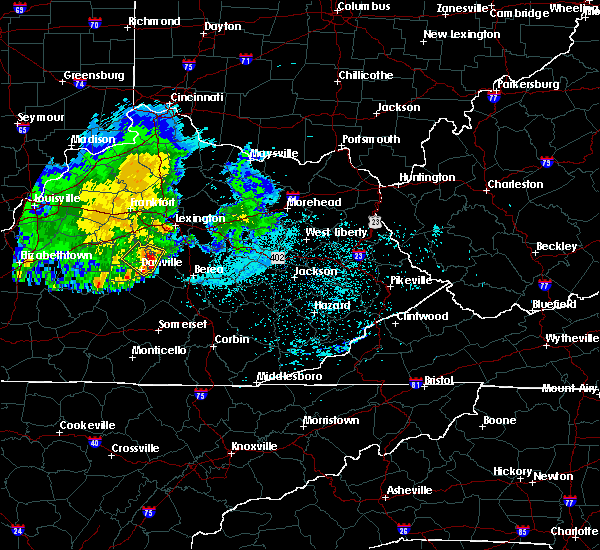 At 1005 pm edt, a severe thunderstorm was located near herrington lake, moving southeast at 30 mph (radar indicated). Hazards include 60 mph wind gusts and penny size hail. expect damage to roofs, siding, and trees At 1005 pm edt, a severe thunderstorm was located near herrington lake, moving southeast at 30 mph (radar indicated). Hazards include 60 mph wind gusts and penny size hail. expect damage to roofs, siding, and trees
|
| 6/10/2020 6:20 PM EDT | Trees down in richmond along highway 388 and berea along highway 101 in madison county KY, 2.5 miles SSW of Richmond, KY |
| 6/10/2020 6:18 PM EDT |
 At 617 pm edt, a severe thunderstorm was located over richmond, moving northeast at 50 mph (radar indicated). Hazards include 60 mph wind gusts. expect damage to roofs, siding, and trees At 617 pm edt, a severe thunderstorm was located over richmond, moving northeast at 50 mph (radar indicated). Hazards include 60 mph wind gusts. expect damage to roofs, siding, and trees
|
| 6/10/2020 5:32 PM EDT | Trees down in the community of redhouse... blocking road near red house and peacock road in madison county KY, 8.1 miles SSW of Richmond, KY |
| 6/10/2020 5:32 PM EDT | Downed trees blocking lost fork roa in madison county KY, 8.8 miles S of Richmond, KY |
| 4/9/2020 12:28 AM EDT | Report of power outages in the wilgreen lake are in madison county KY, 3.3 miles E of Richmond, KY |
| 4/8/2020 11:59 PM EDT |
 At 1159 pm edt, severe thunderstorms were located along a line extending from near fayette mall to 12 miles southeast of springfield to 12 miles northwest of campbellsville, moving southeast at 50 mph (radar indicated). Hazards include 60 mph wind gusts. expect damage to roofs, siding, and trees At 1159 pm edt, severe thunderstorms were located along a line extending from near fayette mall to 12 miles southeast of springfield to 12 miles northwest of campbellsville, moving southeast at 50 mph (radar indicated). Hazards include 60 mph wind gusts. expect damage to roofs, siding, and trees
|
| 1/11/2020 1:36 PM EST | Broadcast media significant structural damage along charlie norris roa in madison county KY, 6.7 miles SW of Richmond, KY |
| 1/11/2020 1:36 PM EST | *** 1 inj *** a mobile home was flipped over on charlie norris road. two occupants were inside with 1 person receiving minor injurie in madison county KY, 7.1 miles SW of Richmond, KY |
| 1/11/2020 1:34 PM EST |
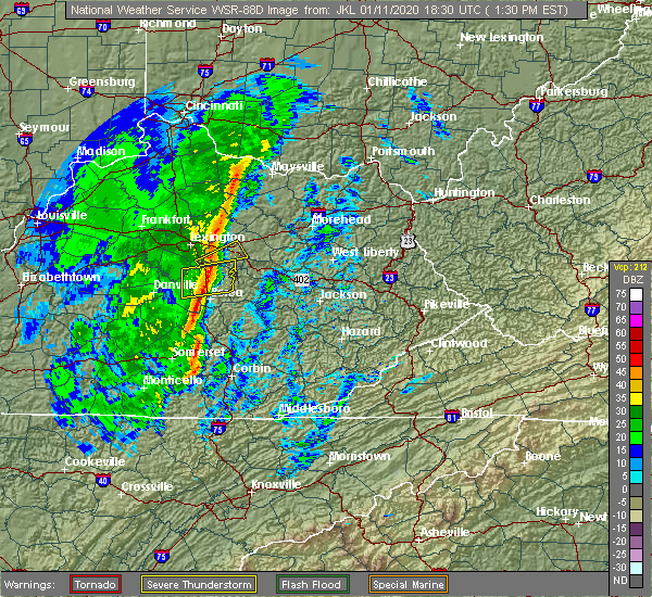 At 133 pm est, severe thunderstorms were located along a line extending from 6 miles northwest of harris ferry to near richmond, moving east at 50 mph (radar indicated). Hazards include 60 mph wind gusts. Expect damage to roofs, siding, and trees. Locations impacted include, richmond, harris ferry, moberly, redhouse, jackson ferry, panola, kingston, whites, olivers and agawam. At 133 pm est, severe thunderstorms were located along a line extending from 6 miles northwest of harris ferry to near richmond, moving east at 50 mph (radar indicated). Hazards include 60 mph wind gusts. Expect damage to roofs, siding, and trees. Locations impacted include, richmond, harris ferry, moberly, redhouse, jackson ferry, panola, kingston, whites, olivers and agawam.
|
| 1/11/2020 1:29 PM EST | Broadcast media reports pictures of barns flattened in the boonesboro are in clark county KY, 13.5 miles S of Richmond, KY |
| 1/11/2020 1:25 PM EST | Broadcast media reported a large barn sustained significant damage along poosey ridge roa in madison county KY, 7.1 miles E of Richmond, KY |
| 1/11/2020 1:25 PM EST | A large bard suffered significant damage on poosey ridge roa in madison county KY, 7.7 miles E of Richmond, KY |
| 1/11/2020 1:24 PM EST | Relayed report from eku about damage at white hall...significant roof damage. also had several trees blown down at eku campus and some property damage there as wel in madison county KY, 8.4 miles SSE of Richmond, KY |
| 1/11/2020 1:18 PM EST |
 At 118 pm est, severe thunderstorms were located along a line extending from 7 miles east of nicholasville to 6 miles northeast of lancaster, moving northeast at 50 mph (radar indicated). Hazards include 60 mph wind gusts. Expect damage to roofs, siding, and trees. Locations impacted include, richmond, harris ferry, mccreary, peytontown, valley view, jackson ferry, panola, buggytown, buckeye and pollard. At 118 pm est, severe thunderstorms were located along a line extending from 7 miles east of nicholasville to 6 miles northeast of lancaster, moving northeast at 50 mph (radar indicated). Hazards include 60 mph wind gusts. Expect damage to roofs, siding, and trees. Locations impacted include, richmond, harris ferry, mccreary, peytontown, valley view, jackson ferry, panola, buggytown, buckeye and pollard.
|
| 1/11/2020 1:06 PM EST |
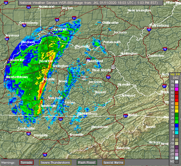 At 106 pm est, severe thunderstorms were located along a line extending from 6 miles south of nicholasville to near stanford, moving northeast at 50 mph (radar indicated). Hazards include 60 mph wind gusts. expect damage to roofs, siding, and trees At 106 pm est, severe thunderstorms were located along a line extending from 6 miles south of nicholasville to near stanford, moving northeast at 50 mph (radar indicated). Hazards include 60 mph wind gusts. expect damage to roofs, siding, and trees
|
| 7/11/2019 4:56 PM EDT | One tree down along griggs lan in madison county KY, 10.3 miles WSW of Richmond, KY |
| 7/11/2019 4:45 PM EDT | Multiple trees down along concord road outside of richmond... k in madison county KY, 5.4 miles SW of Richmond, KY |
| 7/11/2019 4:40 PM EDT |
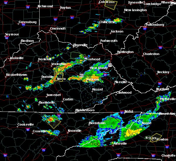 The national weather service in louisville has issued a * severe thunderstorm warning for. eastern madison county in central kentucky. until 515 pm edt. At 440 pm edt, a severe thunderstorm was located over richmond, moving east at 25 mph. The national weather service in louisville has issued a * severe thunderstorm warning for. eastern madison county in central kentucky. until 515 pm edt. At 440 pm edt, a severe thunderstorm was located over richmond, moving east at 25 mph.
|
| 7/11/2019 4:34 PM EDT |
 A severe thunderstorm warning remains in effect until 445 pm edt for southwestern clark and north central madison counties. at 434 pm edt, a severe thunderstorm was located 9 miles north of richmond, moving east at 15 mph. hazard. 60 mph wind gusts. source. Radar indicated. A severe thunderstorm warning remains in effect until 445 pm edt for southwestern clark and north central madison counties. at 434 pm edt, a severe thunderstorm was located 9 miles north of richmond, moving east at 15 mph. hazard. 60 mph wind gusts. source. Radar indicated.
|
| 7/11/2019 4:30 PM EDT | 1 tree down on lexington r in madison county KY, 6.7 miles SSE of Richmond, KY |
| 7/11/2019 4:10 PM EDT |
 At 409 pm edt, a severe thunderstorm was located near veterans park, moving southeast at 15 mph (radar indicated). Hazards include 60 mph wind gusts and penny size hail. expect damage to roofs, siding, and trees At 409 pm edt, a severe thunderstorm was located near veterans park, moving southeast at 15 mph (radar indicated). Hazards include 60 mph wind gusts and penny size hail. expect damage to roofs, siding, and trees
|
| 7/3/2019 7:28 PM EDT |
 At 709 pm edt, severe thunderstorms were located from 7 miles west of richmond to conway, moving northeast at 20 mph (radar indicated). Hazards include 60 mph wind gusts. expect damage to roofs, siding, and trees At 709 pm edt, severe thunderstorms were located from 7 miles west of richmond to conway, moving northeast at 20 mph (radar indicated). Hazards include 60 mph wind gusts. expect damage to roofs, siding, and trees
|
| 7/3/2019 7:10 PM EDT |
 At 709 pm edt, severe thunderstorms were located from 7 miles west of richmond to conway, moving northeast at 20 mph (radar indicated). Hazards include 60 mph wind gusts. expect damage to roofs, siding, and trees At 709 pm edt, severe thunderstorms were located from 7 miles west of richmond to conway, moving northeast at 20 mph (radar indicated). Hazards include 60 mph wind gusts. expect damage to roofs, siding, and trees
|
| 7/3/2019 7:04 PM EDT |
 At 703 pm edt, severe thunderstorms were located from 8 miles southeast of nicholasville to near conway, moving northeast at 20 mph (radar indicated). Hazards include 60 mph wind gusts. Expect damage to roofs, siding, and trees. Locations impacted include, richmond, lancaster, mccreary, berea, round hill, peytontown, buggytown, cartersville, stone, and buckeye. At 703 pm edt, severe thunderstorms were located from 8 miles southeast of nicholasville to near conway, moving northeast at 20 mph (radar indicated). Hazards include 60 mph wind gusts. Expect damage to roofs, siding, and trees. Locations impacted include, richmond, lancaster, mccreary, berea, round hill, peytontown, buggytown, cartersville, stone, and buckeye.
|
| 7/3/2019 6:49 PM EDT |
 The national weather service in louisville has issued a * severe thunderstorm warning for. garrard county in central kentucky. southwestern madison county in central kentucky. until 715 pm edt. At 648 pm edt, severe thunderstorms were from near lancaster to. The national weather service in louisville has issued a * severe thunderstorm warning for. garrard county in central kentucky. southwestern madison county in central kentucky. until 715 pm edt. At 648 pm edt, severe thunderstorms were from near lancaster to.
|
| 6/24/2019 4:03 PM EDT | Damage to barn and outbuilding on colonel road just south of i-75 exit 95. public report relayed by medi in madison county KY, 8.7 miles S of Richmond, KY |
| 6/24/2019 3:57 PM EDT |
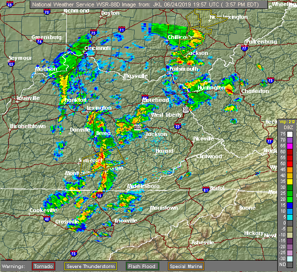 At 357 pm edt, a severe thunderstorm was located near richmond, moving northeast at 30 mph (radar indicated). Hazards include 60 mph wind gusts. expect damage to roofs, siding, and trees At 357 pm edt, a severe thunderstorm was located near richmond, moving northeast at 30 mph (radar indicated). Hazards include 60 mph wind gusts. expect damage to roofs, siding, and trees
|
| 5/26/2019 6:18 PM EDT |
 At 618 pm edt, a severe thunderstorm was located near blackburn, moving east at 30 mph (radar indicated). Hazards include 60 mph wind gusts. Expect damage to roofs, siding, and trees. Locations impacted include, richmond, berea, duluth, moberly, bighill, panola, kingston, speedwell, bybee and combs. At 618 pm edt, a severe thunderstorm was located near blackburn, moving east at 30 mph (radar indicated). Hazards include 60 mph wind gusts. Expect damage to roofs, siding, and trees. Locations impacted include, richmond, berea, duluth, moberly, bighill, panola, kingston, speedwell, bybee and combs.
|
| 5/26/2019 6:08 PM EDT |
 At 608 pm edt, a severe thunderstorm capable of producing a tornado was located near richmond, moving east at 40 mph (radar indicated rotation). Hazards include tornado. Flying debris will be dangerous to those caught without shelter. mobile homes will be damaged or destroyed. damage to roofs, windows, and vehicles will occur. tree damage is likely. Locations impacted include, richmond, caleast, peytontown, terrill, kingston, dreyfus, brassfield and speedwell. At 608 pm edt, a severe thunderstorm capable of producing a tornado was located near richmond, moving east at 40 mph (radar indicated rotation). Hazards include tornado. Flying debris will be dangerous to those caught without shelter. mobile homes will be damaged or destroyed. damage to roofs, windows, and vehicles will occur. tree damage is likely. Locations impacted include, richmond, caleast, peytontown, terrill, kingston, dreyfus, brassfield and speedwell.
|
| 5/26/2019 5:59 PM EDT |
 The national weather service in louisville has issued a * tornado warning for. central madison county in central kentucky. until 630 pm edt. At 559 pm edt, a severe thunderstorm capable of producing a tornado was located near richmond, moving east at 45 mph. The national weather service in louisville has issued a * tornado warning for. central madison county in central kentucky. until 630 pm edt. At 559 pm edt, a severe thunderstorm capable of producing a tornado was located near richmond, moving east at 45 mph.
|
| 5/26/2019 5:56 PM EDT |
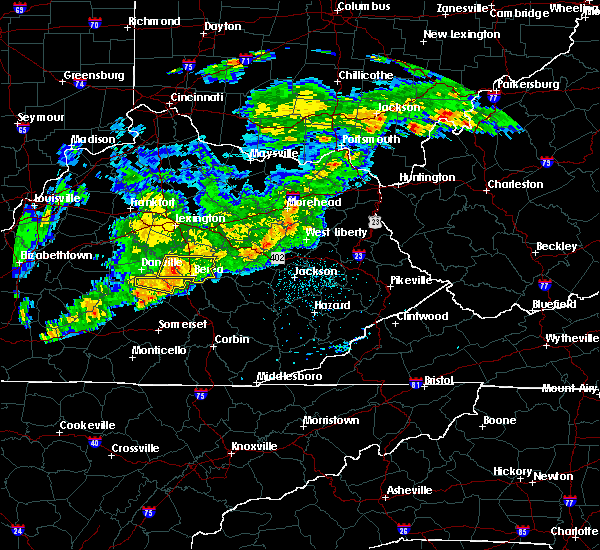 At 556 pm edt, a severe thunderstorm was located 7 miles southwest of richmond, moving east at 30 mph (radar indicated). Hazards include 60 mph wind gusts. expect damage to roofs, siding, and trees At 556 pm edt, a severe thunderstorm was located 7 miles southwest of richmond, moving east at 30 mph (radar indicated). Hazards include 60 mph wind gusts. expect damage to roofs, siding, and trees
|
| 9/8/2018 2:25 PM EDT |
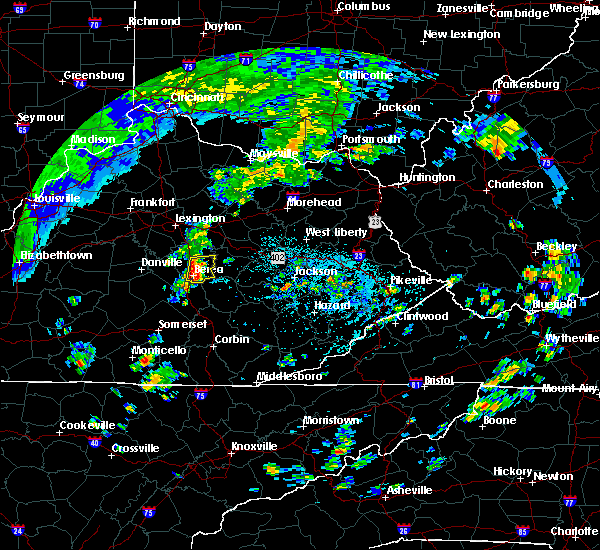 At 224 pm edt, severe thunderstorms were from near richmond to near boone, moving northeast at 15 mph (radar indicated). Hazards include 60 mph wind gusts. expect damage to roofs, siding, and trees At 224 pm edt, severe thunderstorms were from near richmond to near boone, moving northeast at 15 mph (radar indicated). Hazards include 60 mph wind gusts. expect damage to roofs, siding, and trees
|
| 7/20/2018 5:49 PM EDT |
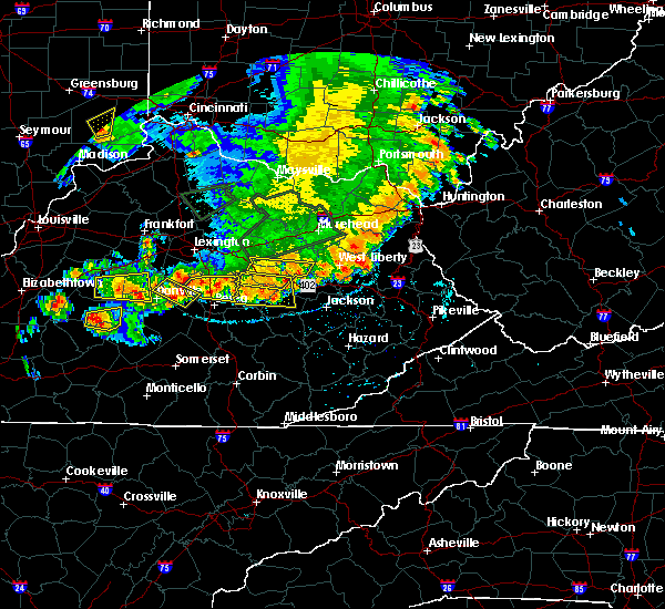 At 549 pm edt, severe thunderstorms were located along a line extending from 8 miles southeast of nicholasville to near lancaster, moving east at 40 mph (radar indicated). Hazards include 60 mph wind gusts and quarter size hail. Hail damage to vehicles is expected. Expect wind damage to roofs, siding, and trees. At 549 pm edt, severe thunderstorms were located along a line extending from 8 miles southeast of nicholasville to near lancaster, moving east at 40 mph (radar indicated). Hazards include 60 mph wind gusts and quarter size hail. Hail damage to vehicles is expected. Expect wind damage to roofs, siding, and trees.
|
| 7/20/2018 5:20 PM EDT |
 At 520 pm edt, severe thunderstorms were located along a line extending from near harris ferry to richmond to 10 miles northeast of lancaster, moving east at 35 mph (radar indicated). Hazards include 70 mph wind gusts and half dollar size hail. Hail damage to vehicles is expected. expect considerable tree damage. Wind damage is also likely to mobile homes, roofs, and outbuildings. At 520 pm edt, severe thunderstorms were located along a line extending from near harris ferry to richmond to 10 miles northeast of lancaster, moving east at 35 mph (radar indicated). Hazards include 70 mph wind gusts and half dollar size hail. Hail damage to vehicles is expected. expect considerable tree damage. Wind damage is also likely to mobile homes, roofs, and outbuildings.
|
| 7/20/2018 5:18 PM EDT | Trees dow in madison county KY, 10.1 miles S of Richmond, KY |
| 7/20/2018 8:10 AM EDT | Trees down on us 25 and interstate 75 near mm 9 in fayette county KY, 13 miles SSE of Richmond, KY |
| 6/26/2018 2:49 PM EDT |
 At 249 pm edt, severe thunderstorms were located along a line extending from near nicholasville to 11 miles south of stanford, moving east at 40 mph (radar indicated). Hazards include 60 mph wind gusts. expect damage to roofs, siding, and trees At 249 pm edt, severe thunderstorms were located along a line extending from near nicholasville to 11 miles south of stanford, moving east at 40 mph (radar indicated). Hazards include 60 mph wind gusts. expect damage to roofs, siding, and trees
|
| 6/11/2018 5:35 PM EDT |
 At 535 pm edt, severe thunderstorms were located along a line extending from 6 miles southeast of richmond to near rockford to snider, moving east at 35 to 40 mph (radar indicated). Hazards include 60 mph wind gusts and penny size hail. Expect damage to roofs, siding, and trees. Locations impacted include, richmond, berea, crab orchard, silver creek, duluth, peytontown, paint lick, bighill, manse and panola. At 535 pm edt, severe thunderstorms were located along a line extending from 6 miles southeast of richmond to near rockford to snider, moving east at 35 to 40 mph (radar indicated). Hazards include 60 mph wind gusts and penny size hail. Expect damage to roofs, siding, and trees. Locations impacted include, richmond, berea, crab orchard, silver creek, duluth, peytontown, paint lick, bighill, manse and panola.
|
| 6/11/2018 5:03 PM EDT |
 At 503 pm edt, severe thunderstorms were located along a line extending from 11 miles south of nicholasville to lancaster to stanford, moving east at 35 mph (radar indicated). Hazards include 60 mph wind gusts and penny size hail. expect damage to roofs, siding, and trees At 503 pm edt, severe thunderstorms were located along a line extending from 11 miles south of nicholasville to lancaster to stanford, moving east at 35 mph (radar indicated). Hazards include 60 mph wind gusts and penny size hail. expect damage to roofs, siding, and trees
|
| 5/31/2018 4:31 PM EDT |
 At 431 pm edt, severe thunderstorms were located along a line extending from near fairview to cat creek to 6 miles west of blackburn, moving east at 50 mph (radar indicated). Hazards include 60 mph wind gusts. Expect damage to roofs, siding, and trees. Locations impacted include, richmond, winchester, paris, cynthiana, carlisle, harris ferry, breckinridge, millersburg, north middletown and berry. At 431 pm edt, severe thunderstorms were located along a line extending from near fairview to cat creek to 6 miles west of blackburn, moving east at 50 mph (radar indicated). Hazards include 60 mph wind gusts. Expect damage to roofs, siding, and trees. Locations impacted include, richmond, winchester, paris, cynthiana, carlisle, harris ferry, breckinridge, millersburg, north middletown and berry.
|
| 5/31/2018 4:08 PM EDT |
 At 408 pm edt, severe thunderstorms were located along a line extending from 8 miles south of falmouth to near winchester to 7 miles northeast of lancaster, moving east at 50 mph (radar indicated). Hazards include 60 mph wind gusts. expect damage to roofs, siding, and trees At 408 pm edt, severe thunderstorms were located along a line extending from 8 miles south of falmouth to near winchester to 7 miles northeast of lancaster, moving east at 50 mph (radar indicated). Hazards include 60 mph wind gusts. expect damage to roofs, siding, and trees
|
| 5/31/2018 1:05 PM EDT |
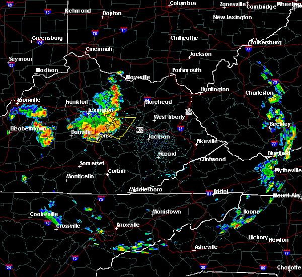 At 105 pm edt, a severe thunderstorm was located near boone, moving east at 20 mph (radar indicated). Hazards include 60 mph wind gusts. Expect damage to roofs, siding, and trees. Locations impacted include, berea, whites, buggytown, slate lick, wallaceton and paint lick. At 105 pm edt, a severe thunderstorm was located near boone, moving east at 20 mph (radar indicated). Hazards include 60 mph wind gusts. Expect damage to roofs, siding, and trees. Locations impacted include, berea, whites, buggytown, slate lick, wallaceton and paint lick.
|
| 5/31/2018 12:58 PM EDT |
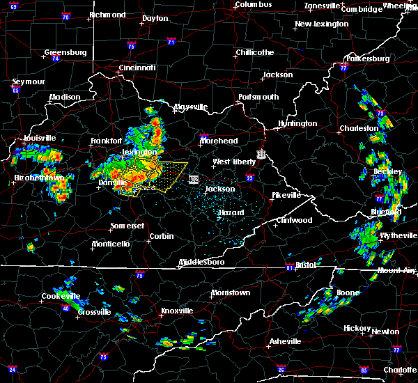 At 1258 pm edt, a severe thunderstorm was located 7 miles northwest of boone, moving east at 15 mph (radar indicated). Hazards include 70 mph wind gusts. Expect considerable tree damage. Damage is likely to mobile homes, roofs, and outbuildings. At 1258 pm edt, a severe thunderstorm was located 7 miles northwest of boone, moving east at 15 mph (radar indicated). Hazards include 70 mph wind gusts. Expect considerable tree damage. Damage is likely to mobile homes, roofs, and outbuildings.
|
| 5/31/2018 12:29 PM EDT |
 At 1229 pm edt, a severe thunderstorm was located near richmond, moving east at 30 mph (radar indicated). Hazards include 60 mph wind gusts. expect damage to roofs, siding, and trees At 1229 pm edt, a severe thunderstorm was located near richmond, moving east at 30 mph (radar indicated). Hazards include 60 mph wind gusts. expect damage to roofs, siding, and trees
|
| 5/31/2018 12:24 PM EDT |
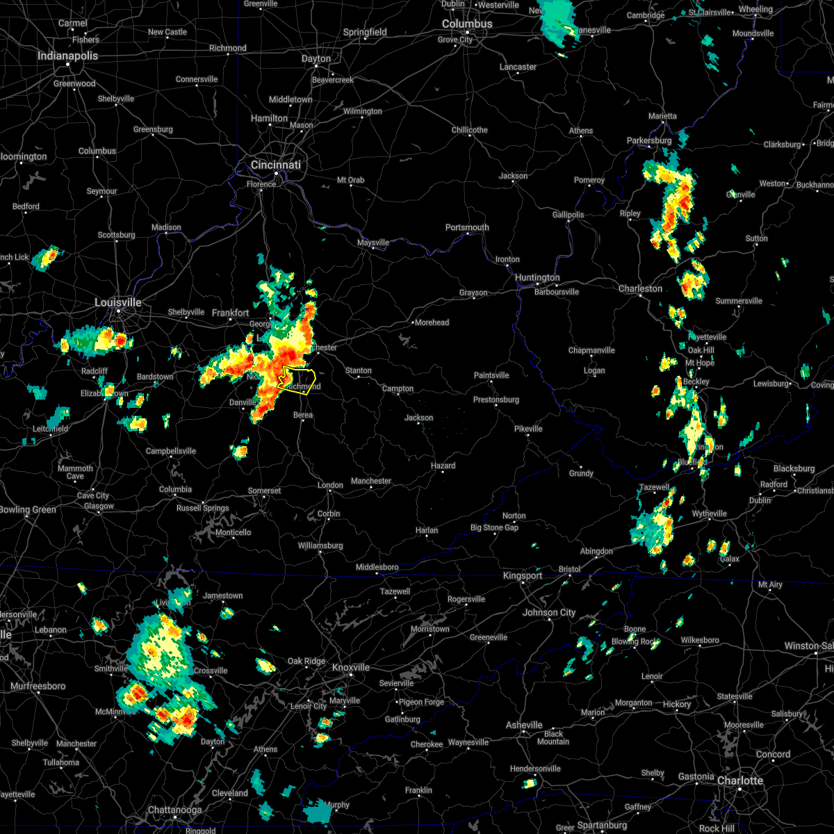 At 1223 pm edt, a severe thunderstorm was located 9 miles north of richmond, moving east at 45 mph (radar indicated). Hazards include 70 mph wind gusts. Expect considerable tree damage. damage is likely to mobile homes, roofs, and outbuildings. Locations impacted include, richmond, spears, blue grass, redhouse, baldwin, valley view, cuzick, hillcrest, ford and newby. At 1223 pm edt, a severe thunderstorm was located 9 miles north of richmond, moving east at 45 mph (radar indicated). Hazards include 70 mph wind gusts. Expect considerable tree damage. damage is likely to mobile homes, roofs, and outbuildings. Locations impacted include, richmond, spears, blue grass, redhouse, baldwin, valley view, cuzick, hillcrest, ford and newby.
|
| 5/31/2018 12:16 PM EDT |
 At 1216 pm edt, a severe thunderstorm was located near nicholasville, moving east at 30 mph (radar indicated). Hazards include 70 mph wind gusts. Expect considerable tree damage. damage is likely to mobile homes, roofs, and outbuildings. Locations impacted include, richmond, nicholasville, spears, redhouse, baldwin, valley view, logana, newby, union mills and crow valley. At 1216 pm edt, a severe thunderstorm was located near nicholasville, moving east at 30 mph (radar indicated). Hazards include 70 mph wind gusts. Expect considerable tree damage. damage is likely to mobile homes, roofs, and outbuildings. Locations impacted include, richmond, nicholasville, spears, redhouse, baldwin, valley view, logana, newby, union mills and crow valley.
|
| 5/31/2018 12:03 PM EDT |
 The national weather service in louisville has issued a * severe thunderstorm warning for. jessamine county in central kentucky. northern madison county in central kentucky. southern fayette county in central kentucky. Until 1230 pm edt. The national weather service in louisville has issued a * severe thunderstorm warning for. jessamine county in central kentucky. northern madison county in central kentucky. southern fayette county in central kentucky. Until 1230 pm edt.
|
| 4/3/2018 10:37 PM EDT |
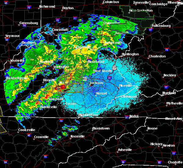 The severe thunderstorm warning for southeastern clark and northeastern madison counties will expire at 1045 pm edt, the storm which prompted the warning has moved out of the area. therefore the warning will be allowed to expire. a tornado watch remains in effect until 100 am edt for central kentucky. report severe weather to local law enforcement, post your report to the national weather service louisville facebook page, or tweet your report using hashtag l, m, k, spotter. The severe thunderstorm warning for southeastern clark and northeastern madison counties will expire at 1045 pm edt, the storm which prompted the warning has moved out of the area. therefore the warning will be allowed to expire. a tornado watch remains in effect until 100 am edt for central kentucky. report severe weather to local law enforcement, post your report to the national weather service louisville facebook page, or tweet your report using hashtag l, m, k, spotter.
|
| 4/3/2018 10:25 PM EDT | Trees downed on power lines on drowning creek road. time estimated from rada in madison county KY, 10 miles W of Richmond, KY |
| 4/3/2018 10:21 PM EDT |
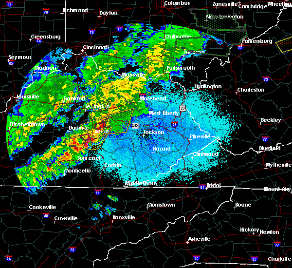 At 1020 pm edt, a severe thunderstorm was located over harris ferry, moving east at 50 mph (radar indicated). Hazards include 60 mph wind gusts and penny size hail. Expect damage to roofs, siding, and trees. locations impacted include, richmond, rightangle, moberly, vianna, mina, bybee, college hill, cotton branch, trapp and log lick. A tornado watch remains in effect until 100 am edt for central kentucky. At 1020 pm edt, a severe thunderstorm was located over harris ferry, moving east at 50 mph (radar indicated). Hazards include 60 mph wind gusts and penny size hail. Expect damage to roofs, siding, and trees. locations impacted include, richmond, rightangle, moberly, vianna, mina, bybee, college hill, cotton branch, trapp and log lick. A tornado watch remains in effect until 100 am edt for central kentucky.
|
| 4/3/2018 10:16 PM EDT |
 At 1016 pm edt, a severe thunderstorm capable of producing a tornado was located near richmond, moving east at 55 mph (radar indicated rotation). Hazards include tornado. Flying debris will be dangerous to those caught without shelter. mobile homes will be damaged or destroyed. damage to roofs, windows, and vehicles will occur. Tree damage is likely. At 1016 pm edt, a severe thunderstorm capable of producing a tornado was located near richmond, moving east at 55 mph (radar indicated rotation). Hazards include tornado. Flying debris will be dangerous to those caught without shelter. mobile homes will be damaged or destroyed. damage to roofs, windows, and vehicles will occur. Tree damage is likely.
|
| 4/3/2018 10:04 PM EDT |
 At 1004 pm edt, a severe thunderstorm was located near boone, moving east at 50 mph (radar indicated). Hazards include 60 mph wind gusts and quarter size hail. Hail damage to vehicles is expected. Expect wind damage to roofs, siding, and trees. At 1004 pm edt, a severe thunderstorm was located near boone, moving east at 50 mph (radar indicated). Hazards include 60 mph wind gusts and quarter size hail. Hail damage to vehicles is expected. Expect wind damage to roofs, siding, and trees.
|
| 4/3/2018 9:56 PM EDT |
 At 955 pm edt, a severe thunderstorm was located 7 miles northeast of lancaster, moving east at 50 mph (radar indicated). Hazards include 60 mph wind gusts and penny size hail. expect damage to roofs, siding, and trees At 955 pm edt, a severe thunderstorm was located 7 miles northeast of lancaster, moving east at 50 mph (radar indicated). Hazards include 60 mph wind gusts and penny size hail. expect damage to roofs, siding, and trees
|
| 1/22/2018 9:40 PM EST |
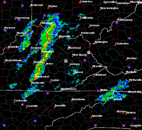 The severe thunderstorm warning for central garrard and southwestern madison counties will expire at 945 pm est, the storm which prompted the warning has weakened below severe limits, and no longer poses an immediate threat to life or property. therefore the warning will be allowed to expire. however small hail is still possible with this thunderstorm. report severe weather to local law enforcement, post your report to the national weather service louisville facebook page, or tweet your report using hashtag l, m, k, spotter. The severe thunderstorm warning for central garrard and southwestern madison counties will expire at 945 pm est, the storm which prompted the warning has weakened below severe limits, and no longer poses an immediate threat to life or property. therefore the warning will be allowed to expire. however small hail is still possible with this thunderstorm. report severe weather to local law enforcement, post your report to the national weather service louisville facebook page, or tweet your report using hashtag l, m, k, spotter.
|
| 1/22/2018 9:27 PM EST |
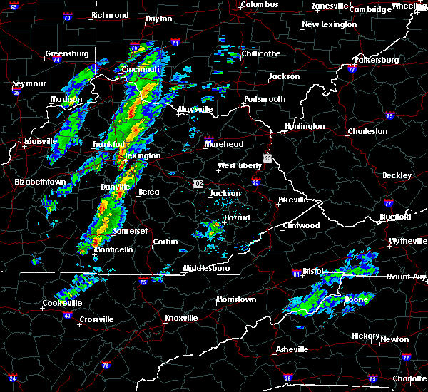 At 927 pm est, a severe thunderstorm was located over lancaster, moving northeast at 45 mph (radar indicated). Hazards include 60 mph wind gusts and quarter size hail. Hail damage to vehicles is expected. expect wind damage to roofs, siding, and trees. Locations impacted include, lancaster, mccreary, berea, round hill, silver creek, paint lick, ruthton, manse, whites and buggytown. At 927 pm est, a severe thunderstorm was located over lancaster, moving northeast at 45 mph (radar indicated). Hazards include 60 mph wind gusts and quarter size hail. Hail damage to vehicles is expected. expect wind damage to roofs, siding, and trees. Locations impacted include, lancaster, mccreary, berea, round hill, silver creek, paint lick, ruthton, manse, whites and buggytown.
|
| 1/22/2018 9:16 PM EST |
 At 915 pm est, a severe thunderstorm was located over stanford, moving northeast at 45 mph (radar indicated). Hazards include 60 mph wind gusts and quarter size hail. Hail damage to vehicles is expected. Expect wind damage to roofs, siding, and trees. At 915 pm est, a severe thunderstorm was located over stanford, moving northeast at 45 mph (radar indicated). Hazards include 60 mph wind gusts and quarter size hail. Hail damage to vehicles is expected. Expect wind damage to roofs, siding, and trees.
|
| 11/18/2017 6:41 PM EST |
 At 641 pm est, a severe thunderstorm was located 8 miles southeast of nicholasville, moving east at 50 mph (radar indicated). Hazards include 60 mph wind gusts. Expect damage to roofs, siding, and trees. Locations impacted include, richmond, crow valley, ruthton, blue grass, cottonburg, baldwin, cuzick, newby, million and edenton. At 641 pm est, a severe thunderstorm was located 8 miles southeast of nicholasville, moving east at 50 mph (radar indicated). Hazards include 60 mph wind gusts. Expect damage to roofs, siding, and trees. Locations impacted include, richmond, crow valley, ruthton, blue grass, cottonburg, baldwin, cuzick, newby, million and edenton.
|
| 11/18/2017 6:27 PM EST |
 At 627 pm est, a severe thunderstorm was located 8 miles northeast of danville, moving east at 50 mph (radar indicated). Hazards include 60 mph wind gusts. expect damage to roofs, siding, and trees At 627 pm est, a severe thunderstorm was located 8 miles northeast of danville, moving east at 50 mph (radar indicated). Hazards include 60 mph wind gusts. expect damage to roofs, siding, and trees
|
| 8/22/2017 2:29 PM EDT |
 At 229 pm edt, a severe thunderstorm was located near richmond, moving east at 35 mph (radar indicated). Hazards include 60 mph wind gusts. Expect damage to roofs, siding, and trees. Locations impacted include, richmond, harris ferry, caleast, moberly, panola, speedwell, bybee, college hill, combs and terrill. At 229 pm edt, a severe thunderstorm was located near richmond, moving east at 35 mph (radar indicated). Hazards include 60 mph wind gusts. Expect damage to roofs, siding, and trees. Locations impacted include, richmond, harris ferry, caleast, moberly, panola, speedwell, bybee, college hill, combs and terrill.
|
| 8/22/2017 2:15 PM EDT |
 At 215 pm edt, a severe thunderstorm was located over richmond, moving east at 35 mph (radar indicated). Hazards include 60 mph wind gusts and penny size hail. expect damage to roofs, siding, and trees At 215 pm edt, a severe thunderstorm was located over richmond, moving east at 35 mph (radar indicated). Hazards include 60 mph wind gusts and penny size hail. expect damage to roofs, siding, and trees
|
| 6/23/2017 8:05 PM EDT | Numerous trees down countywid in madison county KY, 2.5 miles SSW of Richmond, KY |
| 6/18/2017 6:22 PM EDT |
 The severe thunderstorm warning for clark and eastern madison counties will expire at 630 pm edt, the storms which prompted the warning have moved out of the area. therefore the warning will be allowed to expire. report severe weather to local law enforcement, post your report to the national weather service louisville facebook page, or tweet your report using hashtag l, m, k, spotter. The severe thunderstorm warning for clark and eastern madison counties will expire at 630 pm edt, the storms which prompted the warning have moved out of the area. therefore the warning will be allowed to expire. report severe weather to local law enforcement, post your report to the national weather service louisville facebook page, or tweet your report using hashtag l, m, k, spotter.
|
| 6/18/2017 6:01 PM EDT |
 At 601 pm edt, severe thunderstorms were located along a line extending from winchester to 6 miles northwest of shirley, moving northeast at 30 mph (radar indicated). Hazards include 60 mph wind gusts. expect damage to roofs, siding, and trees At 601 pm edt, severe thunderstorms were located along a line extending from winchester to 6 miles northwest of shirley, moving northeast at 30 mph (radar indicated). Hazards include 60 mph wind gusts. expect damage to roofs, siding, and trees
|
| 6/18/2017 5:39 PM EDT | Two trees down west of richmon in madison county KY, 2.4 miles SE of Richmond, KY |
| 6/18/2017 5:37 PM EDT |
 At 537 pm edt, a severe thunderstorm was located 7 miles north of richmond, moving northeast at 40 mph (radar indicated). Hazards include 60 mph wind gusts. expect damage to roofs, siding, and trees At 537 pm edt, a severe thunderstorm was located 7 miles north of richmond, moving northeast at 40 mph (radar indicated). Hazards include 60 mph wind gusts. expect damage to roofs, siding, and trees
|
| 5/27/2017 4:14 PM EDT |
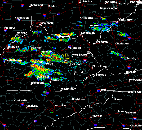 At 414 pm edt, a severe thunderstorm was located near harris ferry, moving east at 25 mph (radar indicated). Hazards include 60 mph wind gusts and quarter size hail. Hail damage to vehicles is expected. Expect wind damage to roofs, siding, and trees. At 414 pm edt, a severe thunderstorm was located near harris ferry, moving east at 25 mph (radar indicated). Hazards include 60 mph wind gusts and quarter size hail. Hail damage to vehicles is expected. Expect wind damage to roofs, siding, and trees.
|
| 4/5/2017 8:27 PM EDT |
 At 826 pm edt, a severe squall line capable of producing both tornadoes and extensive straight line wind damage was located near winchester, moving northeast at 40 mph. winds in excess of 70 mph will be possible across all of clark county and northern madison county (radar indicated rotation). Hazards include tornado and quarter size hail. Flying debris will be dangerous to those caught without shelter. mobile homes will be damaged or destroyed. damage to roofs, windows, and vehicles will occur. tree damage is likely. Locations impacted include, winchester, harris ferry, goffs corner, constant station, vianna, lyndale, jackson ferry, mina, hunt and flanagan. At 826 pm edt, a severe squall line capable of producing both tornadoes and extensive straight line wind damage was located near winchester, moving northeast at 40 mph. winds in excess of 70 mph will be possible across all of clark county and northern madison county (radar indicated rotation). Hazards include tornado and quarter size hail. Flying debris will be dangerous to those caught without shelter. mobile homes will be damaged or destroyed. damage to roofs, windows, and vehicles will occur. tree damage is likely. Locations impacted include, winchester, harris ferry, goffs corner, constant station, vianna, lyndale, jackson ferry, mina, hunt and flanagan.
|
| 4/5/2017 8:21 PM EDT |
 At 821 pm edt, severe thunderstorms were located along a line extending from near richmond to near boone, moving northeast at 55 mph (radar indicated). Hazards include 60 mph wind gusts and quarter size hail. Hail damage to vehicles is expected. Expect wind damage to roofs, siding, and trees. At 821 pm edt, severe thunderstorms were located along a line extending from near richmond to near boone, moving northeast at 55 mph (radar indicated). Hazards include 60 mph wind gusts and quarter size hail. Hail damage to vehicles is expected. Expect wind damage to roofs, siding, and trees.
|
| 4/5/2017 8:15 PM EDT |
 At 815 pm edt, a severe thunderstorm capable of producing a tornado was located near winchester, moving northeast at 40 mph (radar indicated rotation). Hazards include tornado and golf ball size hail. Flying debris will be dangerous to those caught without shelter. mobile homes will be damaged or destroyed. damage to roofs, windows, and vehicles will occur. Tree damage is likely. At 815 pm edt, a severe thunderstorm capable of producing a tornado was located near winchester, moving northeast at 40 mph (radar indicated rotation). Hazards include tornado and golf ball size hail. Flying debris will be dangerous to those caught without shelter. mobile homes will be damaged or destroyed. damage to roofs, windows, and vehicles will occur. Tree damage is likely.
|
| 4/5/2017 8:07 PM EDT | Quarter sized hail reported 9.4 miles S of Richmond, KY, hail half inch to quarter size. |
| 4/5/2017 8:07 PM EDT |
 At 807 pm edt, a severe thunderstorm capable of producing a tornado was located 8 miles north of richmond, moving northeast at 40 mph (radar indicated rotation). Hazards include tornado and ping pong ball size hail. Flying debris will be dangerous to those caught without shelter. mobile homes will be damaged or destroyed. damage to roofs, windows, and vehicles will occur. tree damage is likely. Locations impacted include, richmond, winchester, constant station, lyndale, redhouse, jackson ferry, tebbs, judianne estates, locust grove and hunt. At 807 pm edt, a severe thunderstorm capable of producing a tornado was located 8 miles north of richmond, moving northeast at 40 mph (radar indicated rotation). Hazards include tornado and ping pong ball size hail. Flying debris will be dangerous to those caught without shelter. mobile homes will be damaged or destroyed. damage to roofs, windows, and vehicles will occur. tree damage is likely. Locations impacted include, richmond, winchester, constant station, lyndale, redhouse, jackson ferry, tebbs, judianne estates, locust grove and hunt.
|
| 4/5/2017 8:07 PM EDT |
 At 807 pm edt, a severe thunderstorm was located near richmond, moving northeast at 60 mph (radar indicated). Hazards include 70 mph wind gusts and quarter size hail. Hail damage to vehicles is expected. expect considerable tree damage. Wind damage is also likely to mobile homes, roofs, and outbuildings. At 807 pm edt, a severe thunderstorm was located near richmond, moving northeast at 60 mph (radar indicated). Hazards include 70 mph wind gusts and quarter size hail. Hail damage to vehicles is expected. expect considerable tree damage. Wind damage is also likely to mobile homes, roofs, and outbuildings.
|
| 4/5/2017 8:04 PM EDT | Hen Egg sized hail reported 9.1 miles SE of Richmond, KY |
| 4/5/2017 8:01 PM EDT |
 At 801 pm edt, a severe thunderstorm capable of producing a tornado was located 7 miles northwest of richmond, moving northeast at 40 mph (radar indicated rotation). Hazards include tornado and quarter size hail. Flying debris will be dangerous to those caught without shelter. mobile homes will be damaged or destroyed. damage to roofs, windows, and vehicles will occur. Tree damage is likely. At 801 pm edt, a severe thunderstorm capable of producing a tornado was located 7 miles northwest of richmond, moving northeast at 40 mph (radar indicated rotation). Hazards include tornado and quarter size hail. Flying debris will be dangerous to those caught without shelter. mobile homes will be damaged or destroyed. damage to roofs, windows, and vehicles will occur. Tree damage is likely.
|
| 4/5/2017 7:53 PM EDT |
 At 753 pm edt, a severe thunderstorm capable of producing a tornado was located 9 miles southeast of nicholasville, moving northeast at 45 mph (radar indicated rotation). Hazards include tornado and quarter size hail. Flying debris will be dangerous to those caught without shelter. mobile homes will be damaged or destroyed. damage to roofs, windows, and vehicles will occur. tree damage is likely. Locations impacted include, richmond, spears, ruthton, baldwin, valley view, newby, crow valley, buckeye, pink and pollard. At 753 pm edt, a severe thunderstorm capable of producing a tornado was located 9 miles southeast of nicholasville, moving northeast at 45 mph (radar indicated rotation). Hazards include tornado and quarter size hail. Flying debris will be dangerous to those caught without shelter. mobile homes will be damaged or destroyed. damage to roofs, windows, and vehicles will occur. tree damage is likely. Locations impacted include, richmond, spears, ruthton, baldwin, valley view, newby, crow valley, buckeye, pink and pollard.
|
| 4/5/2017 7:47 PM EDT |
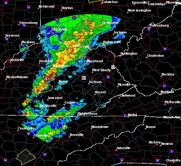 At 747 pm edt, a severe thunderstorm capable of producing a tornado was located near lancaster, moving northeast at 40 mph (radar indicated rotation). Hazards include tornado. Flying debris will be dangerous to those caught without shelter. mobile homes will be damaged or destroyed. damage to roofs, windows, and vehicles will occur. Tree damage is likely. At 747 pm edt, a severe thunderstorm capable of producing a tornado was located near lancaster, moving northeast at 40 mph (radar indicated rotation). Hazards include tornado. Flying debris will be dangerous to those caught without shelter. mobile homes will be damaged or destroyed. damage to roofs, windows, and vehicles will occur. Tree damage is likely.
|
| 3/30/2017 10:39 PM EDT |
 At 1038 pm edt, a severe thunderstorm was located near gum sulphur, moving northeast at 50 mph (radar indicated). Hazards include 60 mph wind gusts and quarter size hail. Hail damage to vehicles is expected. Expect wind damage to roofs, siding, and trees. At 1038 pm edt, a severe thunderstorm was located near gum sulphur, moving northeast at 50 mph (radar indicated). Hazards include 60 mph wind gusts and quarter size hail. Hail damage to vehicles is expected. Expect wind damage to roofs, siding, and trees.
|
| 3/27/2017 7:46 PM EDT |
 At 746 pm edt, severe thunderstorms were located along a line extending from near winchester to near richmond to snider, moving east at 45 mph (radar indicated). Hazards include 60 mph wind gusts. expect damage to roofs, siding, and trees At 746 pm edt, severe thunderstorms were located along a line extending from near winchester to near richmond to snider, moving east at 45 mph (radar indicated). Hazards include 60 mph wind gusts. expect damage to roofs, siding, and trees
|
| 3/27/2017 7:40 PM EDT |
 The severe thunderstorm warning for central lincoln, garrard, southern jessamine, western madison and south central fayette counties will expire at 745 pm edt, the storms which prompted the warning have weakened below severe limits, and have exited the warned area. therefore the warning will be allowed to expire. however gusty winds and heavy rain are still possible with these thunderstorms. a severe thunderstorm watch remains in effect until 1100 pm edt for central kentucky. report severe weather to local law enforcement, post your report to the national weather service louisville facebook page, or tweet your report using hashtag l, m, k, spotter. The severe thunderstorm warning for central lincoln, garrard, southern jessamine, western madison and south central fayette counties will expire at 745 pm edt, the storms which prompted the warning have weakened below severe limits, and have exited the warned area. therefore the warning will be allowed to expire. however gusty winds and heavy rain are still possible with these thunderstorms. a severe thunderstorm watch remains in effect until 1100 pm edt for central kentucky. report severe weather to local law enforcement, post your report to the national weather service louisville facebook page, or tweet your report using hashtag l, m, k, spotter.
|
| 3/27/2017 7:31 PM EDT |
 At 730 pm edt, severe thunderstorms were located along a line extending from 8 miles northeast of harrodsburg to 6 miles northeast of danville to near stanford, moving northeast at 60 mph (radar indicated). Hazards include 60 mph wind gusts. Expect damage to roofs, siding, and trees. Locations impacted include, nicholasville, stanford, lancaster, mccreary, wilmore, crab orchard, boneyville, marksbury, valley view and broughtentown. At 730 pm edt, severe thunderstorms were located along a line extending from 8 miles northeast of harrodsburg to 6 miles northeast of danville to near stanford, moving northeast at 60 mph (radar indicated). Hazards include 60 mph wind gusts. Expect damage to roofs, siding, and trees. Locations impacted include, nicholasville, stanford, lancaster, mccreary, wilmore, crab orchard, boneyville, marksbury, valley view and broughtentown.
|
| 3/27/2017 7:01 PM EDT |
 At 701 pm edt, severe thunderstorms were located along a line extending from near springfield to 8 miles east of lebanon to 11 miles northwest of liberty, moving northeast at 60 mph (radar indicated). Hazards include 60 mph wind gusts and quarter size hail. Hail damage to vehicles is expected. Expect wind damage to roofs, siding, and trees. At 701 pm edt, severe thunderstorms were located along a line extending from near springfield to 8 miles east of lebanon to 11 miles northwest of liberty, moving northeast at 60 mph (radar indicated). Hazards include 60 mph wind gusts and quarter size hail. Hail damage to vehicles is expected. Expect wind damage to roofs, siding, and trees.
|
| 3/27/2017 5:56 PM EDT |
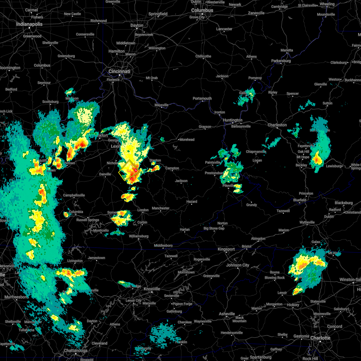 The severe thunderstorm warning for east central garrard and central madison counties will expire at 600 pm edt, the storm which prompted the warning has weakened below severe limits, and have exited the warned area. therefore the warning will be allowed to expire. a severe thunderstorm watch remains in effect until 1100 pm edt for central kentucky. report severe weather to local law enforcement, post your report to the national weather service louisville facebook page, or tweet your report using hashtag l, m, k, spotter. The severe thunderstorm warning for east central garrard and central madison counties will expire at 600 pm edt, the storm which prompted the warning has weakened below severe limits, and have exited the warned area. therefore the warning will be allowed to expire. a severe thunderstorm watch remains in effect until 1100 pm edt for central kentucky. report severe weather to local law enforcement, post your report to the national weather service louisville facebook page, or tweet your report using hashtag l, m, k, spotter.
|
| 3/27/2017 5:14 PM EDT |
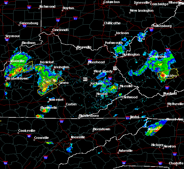 At 514 pm edt, a severe thunderstorm was located 7 miles east of lancaster, moving northeast at 20 mph (radar indicated). Hazards include 60 mph wind gusts and quarter size hail. Hail damage to vehicles is expected. Expect wind damage to roofs, siding, and trees. At 514 pm edt, a severe thunderstorm was located 7 miles east of lancaster, moving northeast at 20 mph (radar indicated). Hazards include 60 mph wind gusts and quarter size hail. Hail damage to vehicles is expected. Expect wind damage to roofs, siding, and trees.
|
| 3/1/2017 9:17 AM EST | Several mobile homes damage in madison county KY, 1 miles S of Richmond, KY |
| 3/1/2017 9:14 AM EST | Several barns flattene in madison county KY, 7.3 miles ENE of Richmond, KY |
| 3/1/2017 8:37 AM EST |
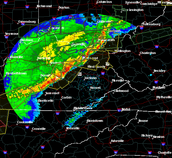 At 837 am est, severe thunderstorms were located along a line extending from near blackburn to near hiatt to near stab, moving southeast at 45 mph (radar indicated). Hazards include 60 mph wind gusts. Expect damage to roofs, siding, and trees. locations impacted include, richmond, liberty, berea, crab orchard, eubank, peytontown, lawhorn hill, teddy, gilpin and broughtentown. A tornado watch remains in effect until 1100 am est for central kentucky. At 837 am est, severe thunderstorms were located along a line extending from near blackburn to near hiatt to near stab, moving southeast at 45 mph (radar indicated). Hazards include 60 mph wind gusts. Expect damage to roofs, siding, and trees. locations impacted include, richmond, liberty, berea, crab orchard, eubank, peytontown, lawhorn hill, teddy, gilpin and broughtentown. A tornado watch remains in effect until 1100 am est for central kentucky.
|
| 3/1/2017 8:30 AM EST | Kentucky mesonet sit in madison county KY, 8.2 miles W of Richmond, KY |
| 3/1/2017 8:21 AM EST |
 At 820 am est, severe thunderstorms were located along a line extending from near grassy lick to richmond, moving east at 70 mph (radar indicated). Hazards include 60 mph wind gusts. Expect damage to roofs, siding, and trees. locations impacted include, richmond, winchester, goffs corner, renick, lyndale, jackson ferry, locust grove, hunt, flanagan and cotton branch. a tornado watch remains in effect until 900 am est for central kentucky. A tornado watch also remains in effect until 1100 am est for central kentucky. At 820 am est, severe thunderstorms were located along a line extending from near grassy lick to richmond, moving east at 70 mph (radar indicated). Hazards include 60 mph wind gusts. Expect damage to roofs, siding, and trees. locations impacted include, richmond, winchester, goffs corner, renick, lyndale, jackson ferry, locust grove, hunt, flanagan and cotton branch. a tornado watch remains in effect until 900 am est for central kentucky. A tornado watch also remains in effect until 1100 am est for central kentucky.
|
| 3/1/2017 8:19 AM EST | Gas station damage on berea r in madison county KY, 2.8 miles NW of Richmond, KY |
| 3/1/2017 8:17 AM EST | Trees snapped and roof damag in madison county KY, 1.8 miles SSE of Richmond, KY |
| 3/1/2017 8:14 AM EST |
 At 813 am est, severe thunderstorms were located along a line extending from near sideview to 7 miles northwest of richmond, moving east at 70 mph (radar indicated). Hazards include 60 mph wind gusts. expect damage to roofs, siding, and trees At 813 am est, severe thunderstorms were located along a line extending from near sideview to 7 miles northwest of richmond, moving east at 70 mph (radar indicated). Hazards include 60 mph wind gusts. expect damage to roofs, siding, and trees
|
| 3/1/2017 8:10 AM EST | A storm survey conducted by nws jackson concluded that two areas of straight line wind damage occurred near richmond... ky. the most significant damage occurred just so in madison county KY, 2.5 miles SSW of Richmond, KY |
| 3/1/2017 8:06 AM EST |
 At 806 am est, severe thunderstorms were located along a line extending from 6 miles north of winchester to near veterans park, moving east at 60 mph (radar indicated). Hazards include 60 mph wind gusts. Expect damage to roofs, siding, and trees. locations impacted include, lexington, richmond, nicholasville, winchester, paris, cardinal hill, cadentown, fayette mall, veterans park and bryan station. a tornado watch remains in effect until 900 am est for central kentucky. A tornado watch also remains in effect until 1100 am est for central kentucky. At 806 am est, severe thunderstorms were located along a line extending from 6 miles north of winchester to near veterans park, moving east at 60 mph (radar indicated). Hazards include 60 mph wind gusts. Expect damage to roofs, siding, and trees. locations impacted include, lexington, richmond, nicholasville, winchester, paris, cardinal hill, cadentown, fayette mall, veterans park and bryan station. a tornado watch remains in effect until 900 am est for central kentucky. A tornado watch also remains in effect until 1100 am est for central kentucky.
|
| 3/1/2017 8:04 AM EST |
 At 804 am est, severe thunderstorms were located along a line extending from near nicholasville to near danville to 8 miles northeast of campbellsville, moving southeast at 50 mph (radar indicated). Hazards include 60 mph wind gusts. expect damage to roofs, siding, and trees At 804 am est, severe thunderstorms were located along a line extending from near nicholasville to near danville to 8 miles northeast of campbellsville, moving southeast at 50 mph (radar indicated). Hazards include 60 mph wind gusts. expect damage to roofs, siding, and trees
|
| 3/1/2017 7:28 AM EST |
 At 727 am est, severe thunderstorms were located along a line extending from near georgetown to near lawrenceburg, moving southeast at 55 mph (radar indicated). Hazards include 60 mph wind gusts and penny size hail. expect damage to roofs, siding, and trees At 727 am est, severe thunderstorms were located along a line extending from near georgetown to near lawrenceburg, moving southeast at 55 mph (radar indicated). Hazards include 60 mph wind gusts and penny size hail. expect damage to roofs, siding, and trees
|
| 8/28/2016 4:38 PM EDT |
 At 438 pm edt, a severe thunderstorm was located over boone, and is nearly stationary (radar indicated). Hazards include 60 mph wind gusts and quarter size hail. Hail damage to vehicles is expected. Expect wind damage to roofs, siding, and trees. At 438 pm edt, a severe thunderstorm was located over boone, and is nearly stationary (radar indicated). Hazards include 60 mph wind gusts and quarter size hail. Hail damage to vehicles is expected. Expect wind damage to roofs, siding, and trees.
|
| 7/4/2016 4:53 PM EDT |
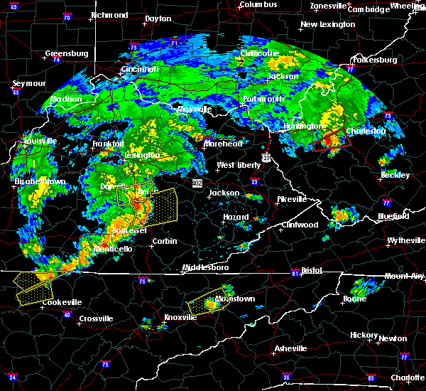 At 453 pm edt, a severe thunderstorm was located near blackburn, moving east at 45 mph (radar indicated). Hazards include 60 mph wind gusts. Expect damage to roofs. siding. and trees. Locations impacted include, richmond, berea, moberly, buggytown, combs, peytontown, panola, bighill, slate lick and duluth. At 453 pm edt, a severe thunderstorm was located near blackburn, moving east at 45 mph (radar indicated). Hazards include 60 mph wind gusts. Expect damage to roofs. siding. and trees. Locations impacted include, richmond, berea, moberly, buggytown, combs, peytontown, panola, bighill, slate lick and duluth.
|
| 7/4/2016 4:24 PM EDT |
 At 423 pm edt, a severe thunderstorm was located near lancaster, moving east at 50 mph (radar indicated). Hazards include 60 mph wind gusts. Expect damage to roofs. siding. And trees. At 423 pm edt, a severe thunderstorm was located near lancaster, moving east at 50 mph (radar indicated). Hazards include 60 mph wind gusts. Expect damage to roofs. siding. And trees.
|
| 6/23/2016 6:58 PM EDT |
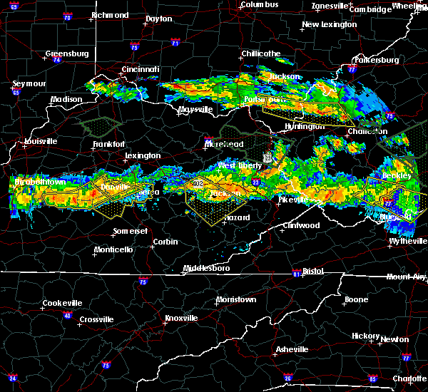 At 657 pm edt, severe thunderstorms were located along a line extending from near richmond to 8 miles north of liberty, moving east at 60 mph (radar indicated). Hazards include 60 mph wind gusts. Expect damage to roofs. siding. And trees. At 657 pm edt, severe thunderstorms were located along a line extending from near richmond to 8 miles north of liberty, moving east at 60 mph (radar indicated). Hazards include 60 mph wind gusts. Expect damage to roofs. siding. And trees.
|
| 6/23/2016 6:40 PM EDT |
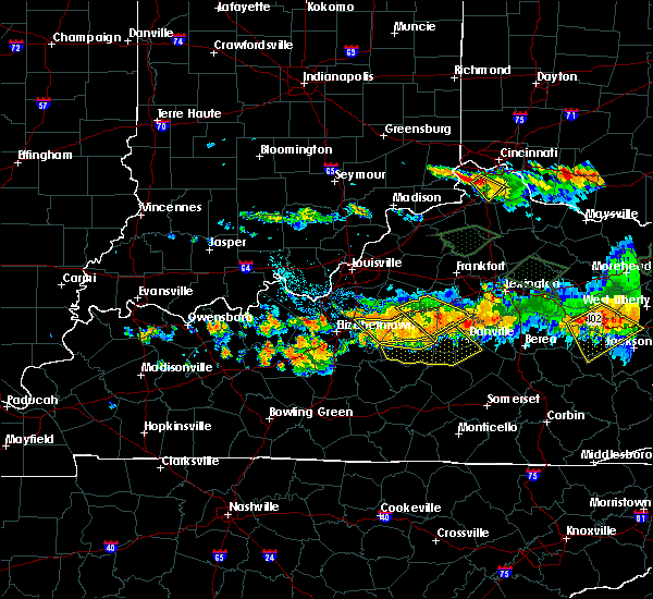 At 640 pm edt, a severe thunderstorm was located 7 miles northeast of danville, moving southeast at 40 mph (radar indicated). Hazards include 60 mph wind gusts and penny size hail. Expect damage to roofs. siding. And trees. At 640 pm edt, a severe thunderstorm was located 7 miles northeast of danville, moving southeast at 40 mph (radar indicated). Hazards include 60 mph wind gusts and penny size hail. Expect damage to roofs. siding. And trees.
|
| 6/15/2016 9:32 PM EDT | Tree down blocking stoney run rd. at phelps rd. time estimated based on rada in madison county KY, 10.7 miles SSW of Richmond, KY |
| 5/10/2016 7:23 PM EDT |
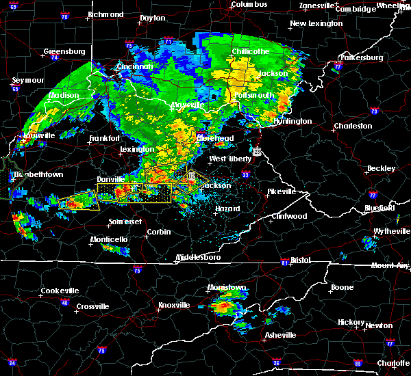 At 722 pm edt, a severe thunderstorm was located over boone, moving east at 30 mph (radar indicated). Hazards include 60 mph wind gusts and half dollar size hail. Hail damage to vehicles is expected. expect wind damage to roofs, siding, and trees. Locations impacted include, berea, crab orchard, buggytown, bighill, slate lick, duluth, hackley, paint lick, whites and wallaceton. At 722 pm edt, a severe thunderstorm was located over boone, moving east at 30 mph (radar indicated). Hazards include 60 mph wind gusts and half dollar size hail. Hail damage to vehicles is expected. expect wind damage to roofs, siding, and trees. Locations impacted include, berea, crab orchard, buggytown, bighill, slate lick, duluth, hackley, paint lick, whites and wallaceton.
|
| 5/10/2016 6:58 PM EDT |
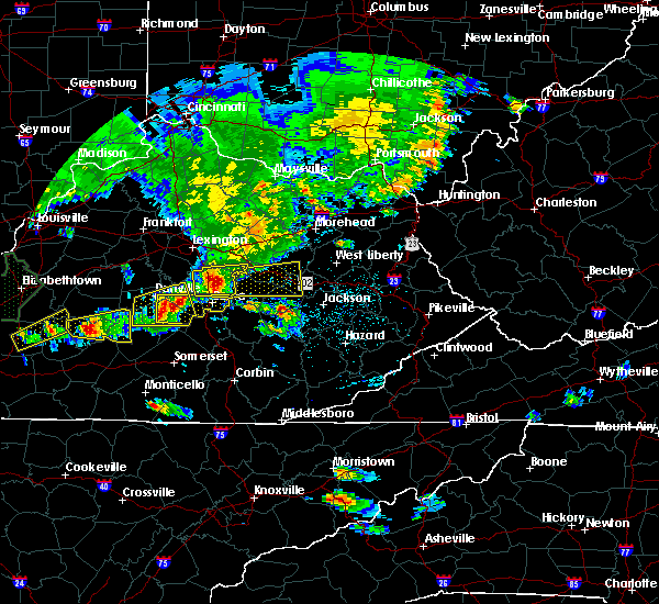 At 658 pm edt, a severe thunderstorm was located near lancaster, moving east at 30 mph (radar indicated). Hazards include 60 mph wind gusts and quarter size hail. Hail damage to vehicles is expected. Expect wind damage to roofs, siding, and trees. At 658 pm edt, a severe thunderstorm was located near lancaster, moving east at 30 mph (radar indicated). Hazards include 60 mph wind gusts and quarter size hail. Hail damage to vehicles is expected. Expect wind damage to roofs, siding, and trees.
|
| 5/10/2016 6:51 PM EDT |
 At 650 pm edt, a severe thunderstorm was located over richmond, moving east at 35 mph (trained weather spotters reported golf ball size hail in the richmond area). Hazards include golf ball size hail and 60 mph wind gusts. some weak rotation has also been noted with this storm. People and animals outdoors will be injured. expect hail damage to roofs, siding, windows, and vehicles. expect wind damage to roofs, siding, and trees. Locations impacted include, richmond, kirksville, doylesville, log lick, combs, blue grass, olivers, peytontown, panola and crow valley. At 650 pm edt, a severe thunderstorm was located over richmond, moving east at 35 mph (trained weather spotters reported golf ball size hail in the richmond area). Hazards include golf ball size hail and 60 mph wind gusts. some weak rotation has also been noted with this storm. People and animals outdoors will be injured. expect hail damage to roofs, siding, windows, and vehicles. expect wind damage to roofs, siding, and trees. Locations impacted include, richmond, kirksville, doylesville, log lick, combs, blue grass, olivers, peytontown, panola and crow valley.
|
| 5/10/2016 6:47 PM EDT | Quarter sized hail reported 1.8 miles SSW of Richmond, KY |
| 5/10/2016 6:45 PM EDT | Golf Ball sized hail reported 1.8 miles SSE of Richmond, KY |
| 5/10/2016 6:40 PM EDT |
 The severe thunderstorm warning for north central garrard, fayette, northwestern madison, western bourbon, eastern jessamine, western clark, southern scott and northern woodford counties will expire at 645 pm edt, the storms which prompted the warning have moved out of the area. therefore the warning will be allowed to expire. a severe thunderstorm watch remains in effect until 800 pm edt for central kentucky. The severe thunderstorm warning for north central garrard, fayette, northwestern madison, western bourbon, eastern jessamine, western clark, southern scott and northern woodford counties will expire at 645 pm edt, the storms which prompted the warning have moved out of the area. therefore the warning will be allowed to expire. a severe thunderstorm watch remains in effect until 800 pm edt for central kentucky.
|
| 5/10/2016 6:38 PM EDT |
 At 638 pm edt, a severe thunderstorm was located 8 miles west of richmond, moving east at 35 mph (radar indicated). Hazards include ping pong ball size hail and 60 mph wind gusts. People and animals outdoors will be injured. expect hail damage to roofs, siding, windows, and vehicles. Expect wind damage to roofs, siding, and trees. At 638 pm edt, a severe thunderstorm was located 8 miles west of richmond, moving east at 35 mph (radar indicated). Hazards include ping pong ball size hail and 60 mph wind gusts. People and animals outdoors will be injured. expect hail damage to roofs, siding, windows, and vehicles. Expect wind damage to roofs, siding, and trees.
|
| 5/10/2016 6:07 PM EDT |
 At 607 pm edt, severe thunderstorms were located along a line extending from near dunbar high school to 9 miles north of lancaster, moving east at 30 mph (radar indicated). Hazards include 60 mph wind gusts and penny size hail. Expect damage to roofs. siding. And trees. At 607 pm edt, severe thunderstorms were located along a line extending from near dunbar high school to 9 miles north of lancaster, moving east at 30 mph (radar indicated). Hazards include 60 mph wind gusts and penny size hail. Expect damage to roofs. siding. And trees.
|
| 10/9/2015 1:49 PM EDT | Large tree down in madison county KY, 2.4 miles SW of Richmond, KY |
| 10/9/2015 1:49 PM EDT | Large tree down in madison county KY, 2.4 miles SW of Richmond, KY |
| 10/9/2015 1:49 PM EDT | Tree and powerline down at 195 fores in madison county KY, 7 miles WSW of Richmond, KY |
| 10/9/2015 1:48 PM EDT | Large tree dow in madison county KY, 2.4 miles S of Richmond, KY |
| 10/9/2015 1:48 PM EDT | Large tree dow in madison county KY, 2.4 miles S of Richmond, KY |
| 7/14/2015 6:06 AM EDT |
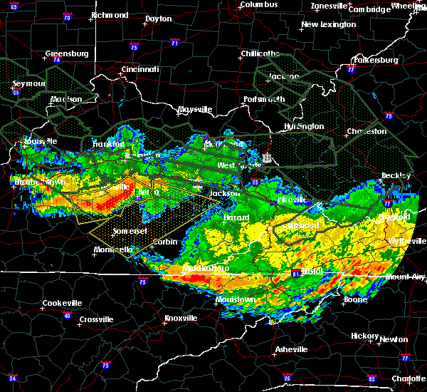 At 602 am edt, severe thunderstorms were located along a line extending from richmond to 8 miles southeast of lancaster to 8 miles southwest of stanford, and moving southeast at 60 mph (radar indicated). Hazards include 60-70 mph wind gusts. Expect damage to roofs. siding and trees. Locations impacted include, berea, middletown, turkeytown, bobtown, speedwell, waynesburg, brassfield, broughtentown, slate lick, panola, combs, dreyfus, dog walk, bighill and duluth. At 602 am edt, severe thunderstorms were located along a line extending from richmond to 8 miles southeast of lancaster to 8 miles southwest of stanford, and moving southeast at 60 mph (radar indicated). Hazards include 60-70 mph wind gusts. Expect damage to roofs. siding and trees. Locations impacted include, berea, middletown, turkeytown, bobtown, speedwell, waynesburg, brassfield, broughtentown, slate lick, panola, combs, dreyfus, dog walk, bighill and duluth.
|
| 7/14/2015 5:49 AM EDT |
 At 546 am edt, severe thunderstorms were located along a line extending from 5 miles southeast of nicholasville to 8 miles north of lancaster to 12 miles west of danville, and moving southeast at 65 mph (radar indicated). Hazards include 60 mph wind gusts. Expect damage to roofs. Siding and trees. At 546 am edt, severe thunderstorms were located along a line extending from 5 miles southeast of nicholasville to 8 miles north of lancaster to 12 miles west of danville, and moving southeast at 65 mph (radar indicated). Hazards include 60 mph wind gusts. Expect damage to roofs. Siding and trees.
|
| 7/14/2015 3:20 AM EDT |
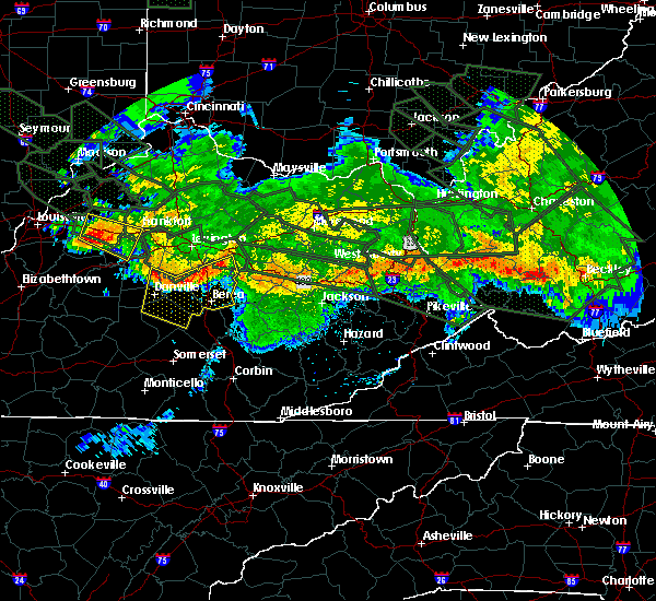 At 317 am edt, severe thunderstorms were located along a line extending from 7 miles northeast of harrodsburg to 6 miles north of lancaster to 5 miles northwest of richmond, and moving southeast at 45 mph (radar indicated). Hazards include 60 mph wind gusts. Expect damage to roofs. Siding and trees. At 317 am edt, severe thunderstorms were located along a line extending from 7 miles northeast of harrodsburg to 6 miles north of lancaster to 5 miles northwest of richmond, and moving southeast at 45 mph (radar indicated). Hazards include 60 mph wind gusts. Expect damage to roofs. Siding and trees.
|
| 7/13/2015 4:22 PM EDT | The severe thunderstorm warning for garrard, boyle, washington, southern nelson, mercer, northern marion, madison, northwestern lincoln and southern jessamine counties will expire at 425 pm edt/325 pm cdt/, the line of storms which prompted the warning has weakened below severe limits, and no longer poses an immediate threat to life or property. to report severe weather, contact your nearest law enforcement agency. they will relay your report to the national weather service in louisville. |
| 7/13/2015 4:06 PM EDT |
 At 403 pm edt, severe thunderstorms were located along a line extending from 8 miles east of ravenna to 10 miles northeast of danville to 7 miles southwest of bardstown, and moving southeast at 25 mph (radar indicated). Hazards include 60 mph wind gusts. Expect damage to roofs. siding and trees. Locations impacted include, springfield, danville, lancaster, lebanon, toddville, stone, manton, culvertown, bearwallow, saint catharine, blue gap, buckeye, dixville, faulconer, cisselville, bryantsville, briartown, bourne, nevada and teatersville. At 403 pm edt, severe thunderstorms were located along a line extending from 8 miles east of ravenna to 10 miles northeast of danville to 7 miles southwest of bardstown, and moving southeast at 25 mph (radar indicated). Hazards include 60 mph wind gusts. Expect damage to roofs. siding and trees. Locations impacted include, springfield, danville, lancaster, lebanon, toddville, stone, manton, culvertown, bearwallow, saint catharine, blue gap, buckeye, dixville, faulconer, cisselville, bryantsville, briartown, bourne, nevada and teatersville.
|
| 7/13/2015 3:53 PM EDT | Power lines down in the road on north 1st s in madison county KY, 2.5 miles SSW of Richmond, KY |
| 7/13/2015 3:50 PM EDT | Tree down on high st in madison county KY, 2.4 miles S of Richmond, KY |
| 7/13/2015 3:48 PM EDT | Tree down on power line on whitlock rd in madison county KY, 9.2 miles SE of Richmond, KY |
| 7/13/2015 3:26 PM EDT |
 At 323 pm edt, severe thunderstorms were located along a line extending from 6 miles southwest of camargo to 7 miles southwest of versailles to shepherdsville, and moving southeast at 25 mph (radar indicated). Hazards include 60 mph wind gusts. Expect damage to roofs. Siding and trees. At 323 pm edt, severe thunderstorms were located along a line extending from 6 miles southwest of camargo to 7 miles southwest of versailles to shepherdsville, and moving southeast at 25 mph (radar indicated). Hazards include 60 mph wind gusts. Expect damage to roofs. Siding and trees.
|
| 7/10/2015 11:55 AM EDT |
 At 1152 am edt, severe thunderstorms were located along a line extending from 7 miles east of new castle to versailles to 6 miles southeast of springfield, and moving east at 35 mph (radar indicated). Hazards include 70 mph wind gusts. Expect considerable tree damage. Damage is likely to mobile homes, roofs and outbuildings. At 1152 am edt, severe thunderstorms were located along a line extending from 7 miles east of new castle to versailles to 6 miles southeast of springfield, and moving east at 35 mph (radar indicated). Hazards include 70 mph wind gusts. Expect considerable tree damage. Damage is likely to mobile homes, roofs and outbuildings.
|
| 7/9/2015 2:35 PM EDT |
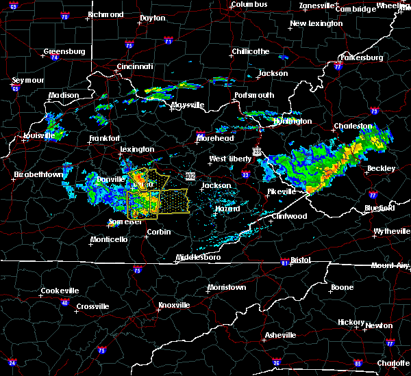 At 233 pm edt, severe thunderstorms were located along a line extending from 7 miles east of richmond to 10 miles southwest of irvine, and moving northeast at 45 mph (radar indicated). Hazards include 60 mph wind gusts. Expect damage to roofs. siding and trees. Locations impacted include, college hill and doylesville. At 233 pm edt, severe thunderstorms were located along a line extending from 7 miles east of richmond to 10 miles southwest of irvine, and moving northeast at 45 mph (radar indicated). Hazards include 60 mph wind gusts. Expect damage to roofs. siding and trees. Locations impacted include, college hill and doylesville.
|
| 7/9/2015 2:22 PM EDT |
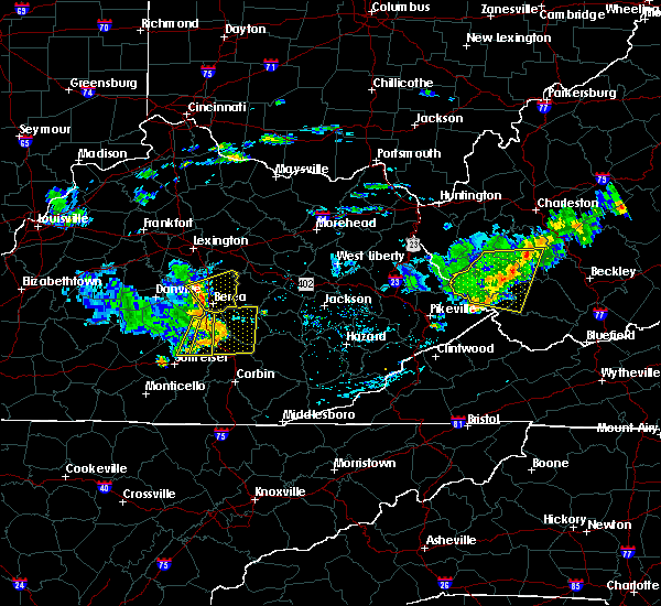 At 220 pm edt, severe thunderstorms were located along a line extending from richmond to 5 miles south of richmond to 10 miles south of richmond, and moving east northeast at 45 mph (radar indicated). Hazards include 60 mph wind gusts. Expect damage to roofs. siding and trees. Locations impacted include, hillcrest, terrill, bighill, bobtown, kingston, reeds crossing, duluth, moberly, dreyfus, union city, elliston, brassfield, speedwell, doylesville, college hill, bybee, panola and combs. At 220 pm edt, severe thunderstorms were located along a line extending from richmond to 5 miles south of richmond to 10 miles south of richmond, and moving east northeast at 45 mph (radar indicated). Hazards include 60 mph wind gusts. Expect damage to roofs. siding and trees. Locations impacted include, hillcrest, terrill, bighill, bobtown, kingston, reeds crossing, duluth, moberly, dreyfus, union city, elliston, brassfield, speedwell, doylesville, college hill, bybee, panola and combs.
|
| 7/9/2015 2:13 PM EDT |
 At 211 pm edt, severe thunderstorms were located along a line extending from 9 miles west of richmond to 9 miles east of lancaster to 7 miles north of brodhead, and moving northeast at 55 mph (radar indicated). Hazards include 60 mph wind gusts. Expect damage to roofs. Siding and trees. At 211 pm edt, severe thunderstorms were located along a line extending from 9 miles west of richmond to 9 miles east of lancaster to 7 miles north of brodhead, and moving northeast at 55 mph (radar indicated). Hazards include 60 mph wind gusts. Expect damage to roofs. Siding and trees.
|
| 7/7/2015 8:07 PM EDT |
 At 805 pm edt, severe thunderstorms were located along a line extending from 5 miles northwest of winchester to 5 miles east of richmond to 7 miles west of sandgap, and moving east at 35 mph (radar indicated). Hazards include 60 mph wind gusts. Expect damage to roofs. siding and trees. Locations impacted include, winchester, elliston, lyndale, brassfield, constant station, doylesville, bybee, college hill, panola, hunt, pinchem, cotton branch, bloomingdale, combs, haggard and franklin. At 805 pm edt, severe thunderstorms were located along a line extending from 5 miles northwest of winchester to 5 miles east of richmond to 7 miles west of sandgap, and moving east at 35 mph (radar indicated). Hazards include 60 mph wind gusts. Expect damage to roofs. siding and trees. Locations impacted include, winchester, elliston, lyndale, brassfield, constant station, doylesville, bybee, college hill, panola, hunt, pinchem, cotton branch, bloomingdale, combs, haggard and franklin.
|
| 7/7/2015 7:49 PM EDT |
 At 747 pm edt, severe thunderstorms were located along a line extending from lexington to 5 miles west of richmond to brodhead, and moving east at 35 mph (radar indicated). Hazards include 60 mph wind gusts. Expect damage to roofs. Siding and trees. At 747 pm edt, severe thunderstorms were located along a line extending from lexington to 5 miles west of richmond to brodhead, and moving east at 35 mph (radar indicated). Hazards include 60 mph wind gusts. Expect damage to roofs. Siding and trees.
|
| 6/8/2015 5:03 PM EDT | The severe thunderstorm warning for eastern madison county will expire at 505 pm edt/405 pm cdt/, to report severe weather, contact your nearest law enforcement agency. they will relay your report to the national weather service in louisville. |
| 6/8/2015 4:46 PM EDT | At 444 pm edt, a severe thunderstorm was located near richmond, and moving east at 50 mph (radar indicated). Hazards include 60 mph wind gusts. Expect damage to roofs. Siding and trees. |
| 6/8/2015 4:33 PM EDT |
 At 430 pm edt, a severe thunderstorm was located 8 miles northeast of lancaster, and moving east at 45 mph (radar indicated). Hazards include 60 mph wind gusts. Expect damage to roofs. siding and trees. Locations impacted include, valley view, ruthton, baldwin, stringtown, newby, manse, crow valley, round hill, lowell, kirksville, paint lick, million, buggytown, silver creek, blue grass, wallaceton, duncanon, caleast, peytontown and arlington. At 430 pm edt, a severe thunderstorm was located 8 miles northeast of lancaster, and moving east at 45 mph (radar indicated). Hazards include 60 mph wind gusts. Expect damage to roofs. siding and trees. Locations impacted include, valley view, ruthton, baldwin, stringtown, newby, manse, crow valley, round hill, lowell, kirksville, paint lick, million, buggytown, silver creek, blue grass, wallaceton, duncanon, caleast, peytontown and arlington.
|
| 6/8/2015 4:19 PM EDT |
 At 417 pm edt, a severe thunderstorm was located 7 miles east of harrodsburg, and moving east at 45 mph (radar indicated). Hazards include 60 mph wind gusts. Expect damage to roofs. Siding and trees. At 417 pm edt, a severe thunderstorm was located 7 miles east of harrodsburg, and moving east at 45 mph (radar indicated). Hazards include 60 mph wind gusts. Expect damage to roofs. Siding and trees.
|
| 5/26/2015 6:46 PM EDT | At 644 pm edt, a severe thunderstorm was located 7 miles southwest of richmond, and moving northeast at 35 mph (radar indicated). Hazards include 60 mph wind gusts and quarter size hail. Hail damage to vehicles is expected. expect wind damage to roofs, siding and trees. Locations impacted include, richmond, caleast, baldwin, million, stringtown, terrill, arlington, hillcrest and blue grass. |
| 5/26/2015 6:34 PM EDT | At 633 pm edt, a severe thunderstorm was located near lancaster, and moving northeast at 35 mph (radar indicated). Hazards include 60 mph wind gusts and quarter size hail. Hail damage to vehicles is expected. expect wind damage to roofs, siding and trees. Locations impacted include, richmond, hackley, lowell, teatersville, stone, nina, paint lick, buckeye, kirksville, round hill, buggytown, cottonburg, edenton, silver creek, ruthton, duncanon, crow valley, peytontown, newby and caleast. |
| 5/26/2015 6:26 PM EDT | At 625 pm edt, a severe thunderstorm was located near lancaster, and moving northeast at 35 mph (radar indicated). Hazards include 60 mph wind gusts and quarter size hail. Hail damage to vehicles is expected. Expect wind damage to roofs, siding and trees. |
| 5/11/2015 3:48 PM EDT | At 345 pm edt, a severe thunderstorm was located near richmond, and moving northeast at 30 mph (ham radio operator reported small hail and strong winds near richmond). Hazards include 60 mph wind gusts. Expect damage to roofs. siding and trees. locations impacted include, reeds crossing, redhouse, moberly, elliston, union city, college hill, jackson ferry, doylesville, olivers, cotton branch, bloomingdale and hunt. 75in. |
| 5/11/2015 3:42 PM EDT | Trees down in richmond. one was blown on a ca in madison county KY, 1.8 miles SSW of Richmond, KY |
| 5/11/2015 3:42 PM EDT | Trees and power lines down along hunter lan in madison county KY, 4.7 miles SW of Richmond, KY |
| 5/11/2015 3:42 PM EDT | Tree down on a house on crescent hills driv in madison county KY, 2.5 miles SSE of Richmond, KY |
| 5/11/2015 3:33 PM EDT | At 332 pm edt, a severe thunderstorm was located 6 miles southwest of richmond, and moving northeast at 30 mph (radar indicated). Hazards include 60 mph wind gusts. Expect damage to roofs. Siding and trees. |
| 5/11/2015 3:30 PM EDT | Trees down and roof ripped off barn. time estimated based on rada in madison county KY, 7.3 miles ENE of Richmond, KY |
| 4/25/2015 9:04 PM EDT | At 901 pm edt, a severe thunderstorm was located 12 miles northwest of sandgap, and moving east at 35 mph (public). Hazards include golf ball size hail. People and animals outdoors will be injured. expect damage to roofs, siding, windows and vehicles. locations impacted include, bobtown, bighill, dreyfus and duluth. 1. 75in. |
| 4/25/2015 8:57 PM EDT | At 848 pm edt, a severe thunderstorm was located 8 miles east of lancaster, and moving east at 35 mph (public). Hazards include golf ball size hail. People and animals outdoors will be injured. expect damage to roofs, siding, windows and vehicles. locations impacted include, whites, middletown, slate lick, berea, bobtown, bighill, dreyfus and duluth. 1. 75in. |
| 4/25/2015 8:39 PM EDT | At 832 pm edt, a severe thunderstorm was located near lancaster, and moving east at 35 mph (radar indicated). Hazards include 60 mph wind gusts and quarter size hail. Hail damage to vehicles is expected. Expect wind damage to roofs, siding and trees. |
| 4/25/2015 7:45 PM EDT | At 739 pm edt, a severe thunderstorm was located near lancaster, and moving east at 35 mph (radar indicated). Hazards include 60 mph wind gusts and quarter size hail. Hail damage to vehicles is expected. Expect wind damage to roofs, siding and trees. |
| 4/7/2015 7:33 PM EDT | A severe thunderstorm warning remains in effect for eastern clark and northeastern madison counties until 745 pm edt. at 731 pm edt. severe thunderstorms were located along a line extending from 8 miles east of winchester to 8 miles west of clay city to 7 miles east of richmond. and moving east at 45 mph. hazard. 60 mph wind gusts and penny size hail. |
| 4/7/2015 7:15 PM EDT | The national weather service in louisville has issued a * severe thunderstorm warning for. clark county in east central kentucky. northern madison county in east central kentucky. until 745 pm edt * at 713 pm edt. Severe thunderstorms were located along a line. |
| 4/7/2015 6:59 PM EDT | A tornado warning remains in effect for southeastern madison county until 710 pm edt. at 657 pm edt. a severe thunderstorm capable of producing a tornado was located 9 miles southeast of richmond. and moving east at 30 mph. hazard. Tornado and quarter size hail. |
| 4/7/2015 6:47 PM EDT | The tornado warning for central garrard and southern madison counties has been reissued. please refer to that bulletin for the latest severe weather information. additional strong thunderstorms are still possible. And a severe thunderstorm watch remains in effect until 8 pm edt. |
| 4/7/2015 6:46 PM EDT | The national weather service in louisville has issued a * tornado warning for. southern madison county in east central kentucky. until 710 pm edt * at 644 pm edt. a severe thunderstorm capable of producing a tornado was located 6 miles south of richmond. And moving east at. |
| 4/7/2015 6:32 PM EDT | A tornado warning remains in effect for central garrard and southern madison counties until 650 pm edt. at 631 pm edt. a severe thunderstorm capable of producing a tornado was located 9 miles southwest of richmond. and moving east at 30 mph. hazard. Tornado and baseball size hail. |
| 4/7/2015 6:21 PM EDT | The national weather service in louisville has issued a * tornado warning for. central garrard county in east central kentucky. southern madison county in east central kentucky. until 650 pm edt * at 620 pm edt. A severe thunderstorm capable of producing a. |
| 10/6/2014 10:03 PM EDT | Thunderstorm winds downed a tree near the intersection of concord road and state highway 52 east of irvin in madison county KY, 5.8 miles WSW of Richmond, KY |
| 10/6/2014 4:45 PM EDT | Madison county mesonet measured 62.6 mph wind gust in madison county KY, 8.4 miles WSW of Richmond, KY |
| 7/27/2014 12:05 AM EDT | Tree down north of richmond in madison county KY, 3.1 miles S of Richmond, KY |
| 6/10/2014 6:20 PM EDT | Multiple trees down on highway 52 in madison county KY, 8.3 miles W of Richmond, KY |
| 6/10/2014 6:15 PM EDT | Trees down at mt. vernon road and liberty avenue... hwy 421 and battlefield road... and near waco baptist churc in madison county KY, 1.8 miles SSW of Richmond, KY |
| 5/21/2014 9:06 PM EDT | Quarter sized hail reported 1.8 miles SSW of Richmond, KY |
| 5/21/2014 9:06 PM EDT | A severe line of storms downed trees and brought scattered power outages throughout the county. several trees were downed in richmon in madison county KY, 1.8 miles SSW of Richmond, KY |
| 11/1/2013 1:30 AM EDT | Waco fire dept reported trees down on goggins lane... redhouse rd blocking the roadway... tates creek rd... four mile rd at runyon grove rd... and summit street blockin in madison county KY, 1.8 miles SSW of Richmond, KY |
| 8/21/2013 3:40 PM EDT | Tree down in madison county KY, 1.8 miles SSW of Richmond, KY |
| 5/21/2013 5:20 PM EDT | Hotel sign down on truc in madison county KY, 1.8 miles SSW of Richmond, KY |
| 4/11/2013 6:28 PM EDT | Awos reported 53 knot gust in madison county KY, 6.1 miles NNE of Richmond, KY |
| 1/30/2013 6:33 AM EST | Portions of a barn roof blown off along with several downed trees in madison county KY, 5.2 miles ESE of Richmond, KY |
| 7/19/2012 5:05 PM EDT | Tree blocking lancaster roa in madison county KY, 2.4 miles NW of Richmond, KY |
| 7/19/2012 5:00 PM EDT | Trees down over much of northwest madison count in madison county KY, 1.8 miles SSW of Richmond, KY |
| 7/19/2012 4:56 PM EDT | Trees dow in madison county KY, 9.4 miles SE of Richmond, KY |
| 7/19/2012 4:56 PM EDT | Tree blocking tates creek road in madison county KY, 5.8 miles SE of Richmond, KY |
| 7/18/2012 4:30 PM EDT | Quarter sized hail reported 5.2 miles S of Richmond, KY, wkyt relayed viewer report of quarer sized hail north of richmond kentucky. |
| 7/8/2012 6:04 PM EDT | Tree down on raintree driv in madison county KY, 1.8 miles SSW of Richmond, KY |
| 4/3/2012 6:40 PM EDT | Quarter sized hail reported 6.4 miles SW of Richmond, KY |
| 4/3/2012 6:19 PM EDT | A tree down across curtis pik in madison county KY, 5.5 miles E of Richmond, KY |
| 1/1/0001 12:00 AM | Storm damage reported in madison county KY, 8.4 miles WSW of Richmond, KY |
| 3/2/2012 5:55 PM EST | Golf Ball sized hail reported 7.3 miles ENE of Richmond, KY |
| 3/2/2012 5:51 PM EST | Golf Ball sized hail reported 1.8 miles SSW of Richmond, KY |
| 1/1/0001 12:00 AM | Roof off residence and barn at 880 duncannon lane in madison county KY, 1.8 miles SSW of Richmond, KY |
| 3/2/2012 5:46 PM EST | Hen Egg sized hail reported 2.4 miles SE of Richmond, KY |
| 3/2/2012 5:42 PM EST | Quarter sized hail reported 7.3 miles ENE of Richmond, KY |
| 1/1/0001 12:00 AM | Golf Ball sized hail reported 8.1 miles SSW of Richmond, KY |
| 1/1/0001 12:00 AM | Tree down on lower hines creek roa in madison county KY, 10.9 miles SSE of Richmond, KY |
| 1/1/0001 12:00 AM | Report of tree and power lines down in madison county KY, 9.3 miles SW of Richmond, KY |
| 1/1/0001 12:00 AM | One tree dow in madison county KY, 11.4 miles SE of Richmond, KY |
| 1/1/0001 12:00 AM | Storm damage reported in madison county KY, 9.9 miles W of Richmond, KY |
Hail Maps for Richmond, KY

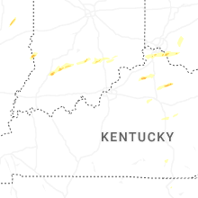


Connect with Interactive Hail Maps