

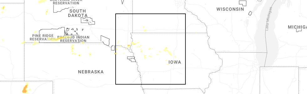
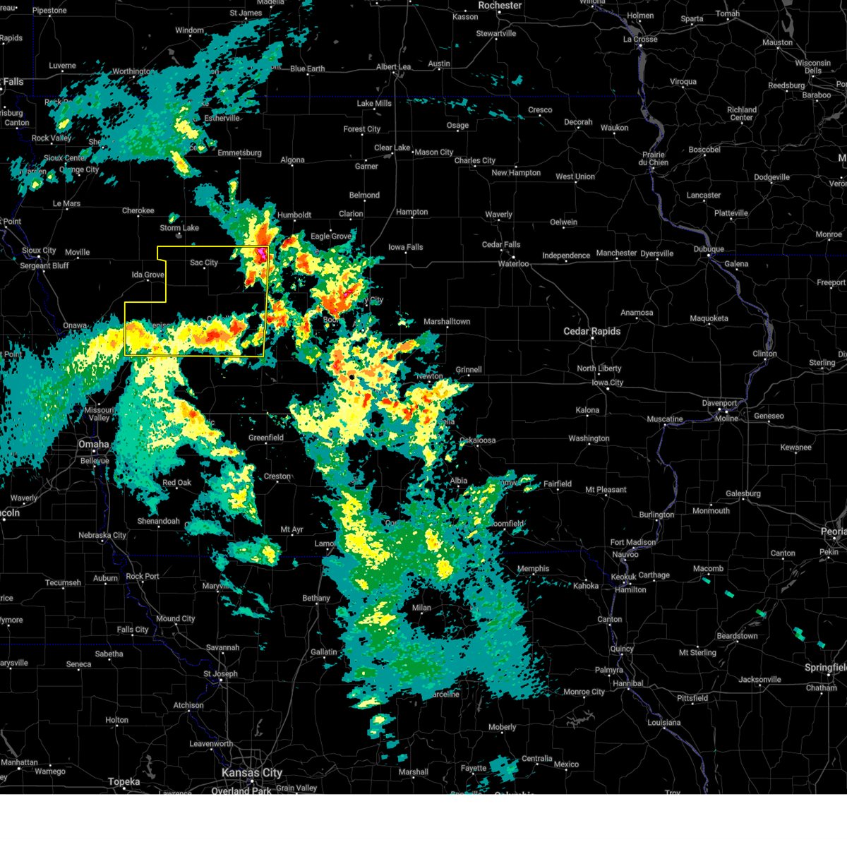
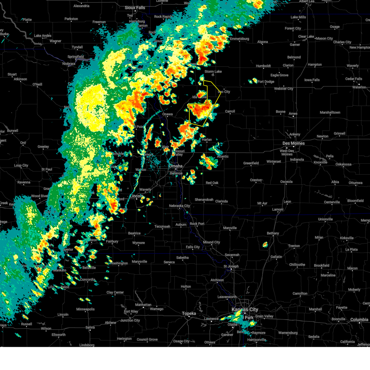
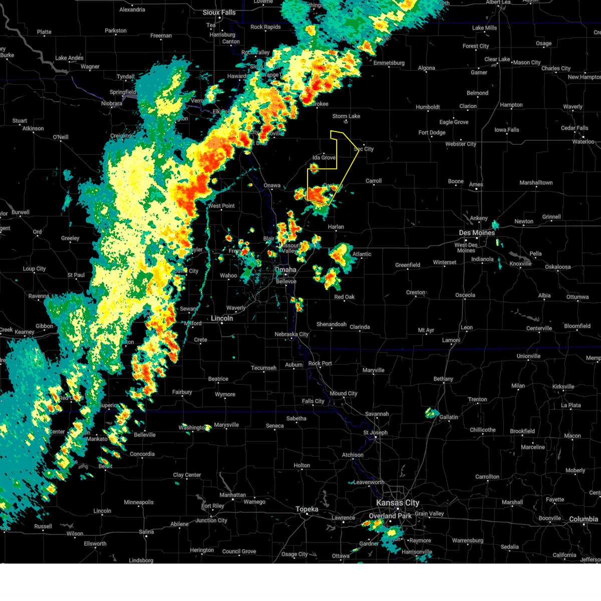
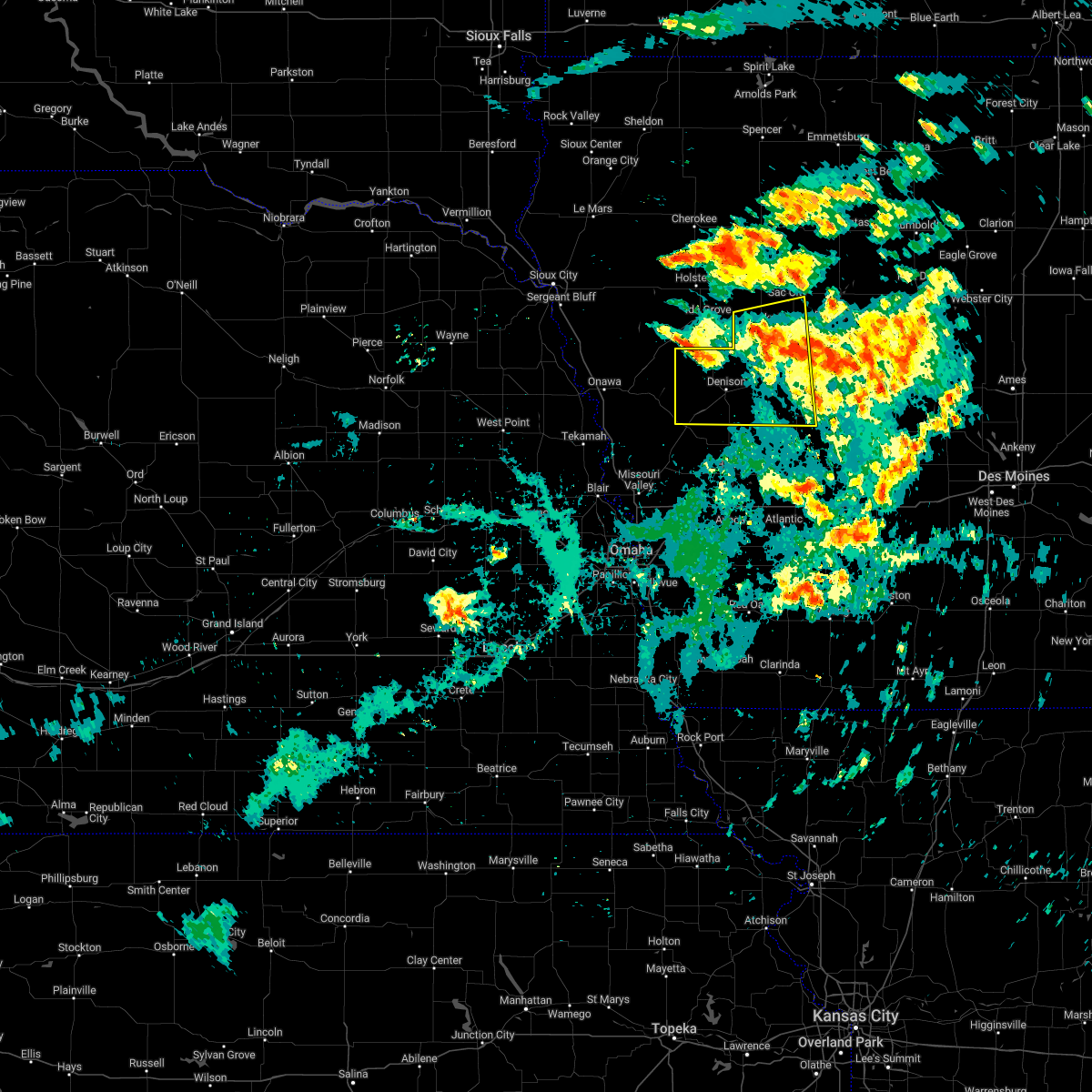
Hail Map for Ricketts, IA
The Ricketts, IA area has had 0 reports of on-the-ground hail by trained spotters, and has been under severe weather warnings 8 times during the past 12 months. Doppler radar has detected hail at or near Ricketts, IA on 68 occasions, including 3 occasions during the past year.
| Name: | Ricketts, IA |
| Where Located: | 40.7 miles SSW of Storm Lake, IA |
| Map: | Google Map for Ricketts, IA |
| Population: | 145 |
| Housing Units: | 55 |
| More Info: | Search Google for Ricketts, IA |
0
The Top Recent Hail Date for Ricketts, IA is Saturday, June 14, 2025 (52nd out of 68)
Hail and Wind Damage Spotted near Ricketts, IA
| Date / Time | Report Details |
|---|---|
| 3/14/2025 6:04 PM CDT |
 Svrdmx the national weather service in des moines has issued a * severe thunderstorm warning for, western greene county in west central iowa, sac county in west central iowa, calhoun county in west central iowa, crawford county in west central iowa, carroll county in west central iowa, * until 645 pm cdt. * at 603 pm cdt, severe thunderstorms were located along a line extending from near ute to 4 miles northeast of scranton, moving north at 50 mph (radar indicated). Hazards include 60 mph wind gusts and nickel size hail. expect damage to roofs, siding, and trees Svrdmx the national weather service in des moines has issued a * severe thunderstorm warning for, western greene county in west central iowa, sac county in west central iowa, calhoun county in west central iowa, crawford county in west central iowa, carroll county in west central iowa, * until 645 pm cdt. * at 603 pm cdt, severe thunderstorms were located along a line extending from near ute to 4 miles northeast of scranton, moving north at 50 mph (radar indicated). Hazards include 60 mph wind gusts and nickel size hail. expect damage to roofs, siding, and trees
|
| 8/29/2024 5:28 PM CDT | The storm which prompted the warning has weakened below severe limits, and has exited the warned area. therefore, the warning will be allowed to expire. however, additional thunderstorms are still affecting the area and gusty winds and heavy rain remain possible. to report severe weather, contact your nearest law enforcement agency. they will relay your report to the national weather service des moines. |
| 8/29/2024 5:06 PM CDT |
 At 506 pm cdt, a severe thunderstorm was located over odebolt, or 12 miles east of ida grove, moving northeast at 40 mph. while the clusters of thunderstorms that prompted the warning have moved into sac county, additional strong storms also continue to move into crawford county from the southwest (radar indicated). Hazards include 60 mph wind gusts and penny size hail. Expect damage to roofs, siding, and trees. Locations impacted include, denison, sac city, pocahontas, laurens, lake view, dunlap, odebolt, black hawk lake, schleswig, wall lake, schaller, fonda, rolfe, early, dow city, charter oak, vail, lytton, kiron, and deloit. At 506 pm cdt, a severe thunderstorm was located over odebolt, or 12 miles east of ida grove, moving northeast at 40 mph. while the clusters of thunderstorms that prompted the warning have moved into sac county, additional strong storms also continue to move into crawford county from the southwest (radar indicated). Hazards include 60 mph wind gusts and penny size hail. Expect damage to roofs, siding, and trees. Locations impacted include, denison, sac city, pocahontas, laurens, lake view, dunlap, odebolt, black hawk lake, schleswig, wall lake, schaller, fonda, rolfe, early, dow city, charter oak, vail, lytton, kiron, and deloit.
|
| 8/29/2024 4:43 PM CDT |
 Svrdmx the national weather service in des moines has issued a * severe thunderstorm warning for, pocahontas county in northwestern iowa, sac county in west central iowa, northwestern calhoun county in west central iowa, crawford county in west central iowa, * until 530 pm cdt. * at 442 pm cdt, a severe thunderstorm was located over schleswig, or 10 miles northwest of denison, moving northeast at 45 mph (radar indicated). Hazards include 60 mph wind gusts and penny size hail. expect damage to roofs, siding, and trees Svrdmx the national weather service in des moines has issued a * severe thunderstorm warning for, pocahontas county in northwestern iowa, sac county in west central iowa, northwestern calhoun county in west central iowa, crawford county in west central iowa, * until 530 pm cdt. * at 442 pm cdt, a severe thunderstorm was located over schleswig, or 10 miles northwest of denison, moving northeast at 45 mph (radar indicated). Hazards include 60 mph wind gusts and penny size hail. expect damage to roofs, siding, and trees
|
| 8/29/2024 4:20 PM CDT |
 At 418 pm cdt, a severe thunderstorm was located over schleswig, or 10 miles south of ida grove, moving northeast at 30 mph. the cluster of thunderstorms that prompted the initial warning has moved into northern crawford county, however, additional strong storms are also moving into crawford county from the southwest (radar indicated). Hazards include 60 mph wind gusts and penny size hail. Expect damage to roofs, siding, and trees. Locations impacted include, denison, odebolt, schleswig, schaller, early, dow city, charter oak, kiron, deloit, ricketts, arion, buck grove, and denison municipal airport. At 418 pm cdt, a severe thunderstorm was located over schleswig, or 10 miles south of ida grove, moving northeast at 30 mph. the cluster of thunderstorms that prompted the initial warning has moved into northern crawford county, however, additional strong storms are also moving into crawford county from the southwest (radar indicated). Hazards include 60 mph wind gusts and penny size hail. Expect damage to roofs, siding, and trees. Locations impacted include, denison, odebolt, schleswig, schaller, early, dow city, charter oak, kiron, deloit, ricketts, arion, buck grove, and denison municipal airport.
|
| 8/29/2024 4:01 PM CDT |
 Svrdmx the national weather service in des moines has issued a * severe thunderstorm warning for, western sac county in west central iowa, crawford county in west central iowa, * until 445 pm cdt. * at 401 pm cdt, a severe thunderstorm was located near charter oak, or 9 miles northwest of denison, moving northeast at 35 mph (radar indicated). Hazards include 60 mph wind gusts and penny size hail. expect damage to roofs, siding, and trees Svrdmx the national weather service in des moines has issued a * severe thunderstorm warning for, western sac county in west central iowa, crawford county in west central iowa, * until 445 pm cdt. * at 401 pm cdt, a severe thunderstorm was located near charter oak, or 9 miles northwest of denison, moving northeast at 35 mph (radar indicated). Hazards include 60 mph wind gusts and penny size hail. expect damage to roofs, siding, and trees
|
| 7/30/2024 12:37 AM CDT | Svrdmx the national weather service in des moines has issued a * severe thunderstorm warning for, sac county in west central iowa, crawford county in west central iowa, western carroll county in west central iowa, * until 115 am cdt. * at 1236 am cdt, severe thunderstorms were located along a line extending from near marcus to 4 miles northwest of battle creek to 4 miles southeast of turin, moving east at 60 mph (radar indicated). Hazards include 60 mph wind gusts. Expect damage to roofs, siding, and trees. severe thunderstorms will be near, charter oak and ricketts around 1245 am cdt. schleswig and schaller around 1250 am cdt. denison, odebolt, dow city, kiron and arion around 1255 am cdt. Other locations in the path of these severe thunderstorms include early, deloit, buck grove, denison municipal airport, sac city, lake view, black hawk lake, wall lake, vail, nemaha, blackhawk lake state park and sac city municipal airport. |
| 7/30/2024 12:24 AM CDT | Svrdmx the national weather service in des moines has issued a * severe thunderstorm warning for, sac county in west central iowa, crawford county in west central iowa, western carroll county in west central iowa, * until 115 am cdt. * at 1224 am cdt, severe thunderstorms were located along a line extending from near quimby to near battle creek to near danbury to near turin, moving east at 50 mph (radar indicated). Hazards include 60 mph wind gusts. expect damage to roofs, siding, and trees |
| 5/24/2024 3:36 AM CDT |
 At 336 am cdt, severe thunderstorms were located along a line extending from 5 miles northwest of lake view to 4 miles northeast of aspinwall to 5 miles south of lake anita state park, moving east at 50 mph (radar indicated). Hazards include 70 mph wind gusts and quarter size hail. Hail damage to vehicles is expected. expect considerable tree damage. wind damage is also likely to mobile homes, roofs, and outbuildings. locations impacted include, carroll, denison, creston, atlantic, sac city, audubon, greenfield, rockwell city, corning, guthrie center, lake city, manning, lenox, coon rapids, glidden, lake view, griswold, odebolt, black hawk lake, and north twin lake. This includes interstate 80 between mile markers 50 and 87. At 336 am cdt, severe thunderstorms were located along a line extending from 5 miles northwest of lake view to 4 miles northeast of aspinwall to 5 miles south of lake anita state park, moving east at 50 mph (radar indicated). Hazards include 70 mph wind gusts and quarter size hail. Hail damage to vehicles is expected. expect considerable tree damage. wind damage is also likely to mobile homes, roofs, and outbuildings. locations impacted include, carroll, denison, creston, atlantic, sac city, audubon, greenfield, rockwell city, corning, guthrie center, lake city, manning, lenox, coon rapids, glidden, lake view, griswold, odebolt, black hawk lake, and north twin lake. This includes interstate 80 between mile markers 50 and 87.
|
| 5/24/2024 3:07 AM CDT |
 Svrdmx the national weather service in des moines has issued a * severe thunderstorm warning for, western greene county in west central iowa, cass county in southwestern iowa, western union county in south central iowa, guthrie county in west central iowa, audubon county in west central iowa, sac county in west central iowa, adams county in southwestern iowa, calhoun county in west central iowa, crawford county in west central iowa, northern taylor county in southwestern iowa, carroll county in west central iowa, adair county in southwestern iowa, * until 400 am cdt. * at 307 am cdt, severe thunderstorms were located along a line extending from 4 miles south of battle creek to dunlap to farm creek public wildlife area, moving east at 85 mph (radar indicated). Hazards include 70 mph wind gusts and quarter size hail. Hail damage to vehicles is expected. expect considerable tree damage. Wind damage is also likely to mobile homes, roofs, and outbuildings. Svrdmx the national weather service in des moines has issued a * severe thunderstorm warning for, western greene county in west central iowa, cass county in southwestern iowa, western union county in south central iowa, guthrie county in west central iowa, audubon county in west central iowa, sac county in west central iowa, adams county in southwestern iowa, calhoun county in west central iowa, crawford county in west central iowa, northern taylor county in southwestern iowa, carroll county in west central iowa, adair county in southwestern iowa, * until 400 am cdt. * at 307 am cdt, severe thunderstorms were located along a line extending from 4 miles south of battle creek to dunlap to farm creek public wildlife area, moving east at 85 mph (radar indicated). Hazards include 70 mph wind gusts and quarter size hail. Hail damage to vehicles is expected. expect considerable tree damage. Wind damage is also likely to mobile homes, roofs, and outbuildings.
|
| 5/21/2024 2:11 PM CDT |
 At 211 pm cdt, severe thunderstorms were located along a line extending from near ida grove to buck grove, moving east at 45 mph (radar indicated). Hazards include 60 mph wind gusts and quarter size hail. Hail damage to vehicles is expected. expect wind damage to roofs, siding, and trees. Locations impacted include, denison, schleswig, dow city, charter oak, kiron, deloit, ricketts, arion, buck grove, and denison municipal airport. At 211 pm cdt, severe thunderstorms were located along a line extending from near ida grove to buck grove, moving east at 45 mph (radar indicated). Hazards include 60 mph wind gusts and quarter size hail. Hail damage to vehicles is expected. expect wind damage to roofs, siding, and trees. Locations impacted include, denison, schleswig, dow city, charter oak, kiron, deloit, ricketts, arion, buck grove, and denison municipal airport.
|
| 5/21/2024 1:38 PM CDT |
 Svrdmx the national weather service in des moines has issued a * severe thunderstorm warning for, crawford county in west central iowa, * until 230 pm cdt. * at 137 pm cdt, severe thunderstorms were located along a line extending from oto to near magnolia, moving northeast at 50 mph (radar indicated). Hazards include 60 mph wind gusts and quarter size hail. Hail damage to vehicles is expected. Expect wind damage to roofs, siding, and trees. Svrdmx the national weather service in des moines has issued a * severe thunderstorm warning for, crawford county in west central iowa, * until 230 pm cdt. * at 137 pm cdt, severe thunderstorms were located along a line extending from oto to near magnolia, moving northeast at 50 mph (radar indicated). Hazards include 60 mph wind gusts and quarter size hail. Hail damage to vehicles is expected. Expect wind damage to roofs, siding, and trees.
|
| 5/21/2024 7:13 AM CDT |
 The storms which prompted the warning have moved out of the area. therefore, the warning will be allowed to expire. a severe thunderstorm watch remains in effect until 100 pm cdt for west central iowa. The storms which prompted the warning have moved out of the area. therefore, the warning will be allowed to expire. a severe thunderstorm watch remains in effect until 100 pm cdt for west central iowa.
|
| 5/21/2024 6:53 AM CDT |
 At 652 am cdt, severe thunderstorms were located along a line extending from 5 miles north of battle creek to denison to near harlan, moving east at 60 mph (radar indicated). Hazards include 60 mph wind gusts and penny size hail. Expect damage to roofs, siding, and trees. Locations impacted include, denison, manning, odebolt, schleswig, manilla, dow city, charter oak, arcadia, vail, westside, kiron, deloit, halbur, ricketts, arion, buck grove, aspinwall, manning municipal airport, and denison municipal airport. At 652 am cdt, severe thunderstorms were located along a line extending from 5 miles north of battle creek to denison to near harlan, moving east at 60 mph (radar indicated). Hazards include 60 mph wind gusts and penny size hail. Expect damage to roofs, siding, and trees. Locations impacted include, denison, manning, odebolt, schleswig, manilla, dow city, charter oak, arcadia, vail, westside, kiron, deloit, halbur, ricketts, arion, buck grove, aspinwall, manning municipal airport, and denison municipal airport.
|
| 5/21/2024 6:28 AM CDT |
 Svrdmx the national weather service in des moines has issued a * severe thunderstorm warning for, western sac county in west central iowa, crawford county in west central iowa, southwestern carroll county in west central iowa, * until 715 am cdt. * at 628 am cdt, severe thunderstorms were located along a line extending from 5 miles northeast of hornick to near moorhead to 4 miles southeast of historical village welcome center, moving east at 60 mph (trained weather spotters). Hazards include 70 mph wind gusts and quarter size hail. Hail damage to vehicles is expected. expect considerable tree damage. Wind damage is also likely to mobile homes, roofs, and outbuildings. Svrdmx the national weather service in des moines has issued a * severe thunderstorm warning for, western sac county in west central iowa, crawford county in west central iowa, southwestern carroll county in west central iowa, * until 715 am cdt. * at 628 am cdt, severe thunderstorms were located along a line extending from 5 miles northeast of hornick to near moorhead to 4 miles southeast of historical village welcome center, moving east at 60 mph (trained weather spotters). Hazards include 70 mph wind gusts and quarter size hail. Hail damage to vehicles is expected. expect considerable tree damage. Wind damage is also likely to mobile homes, roofs, and outbuildings.
|
| 5/6/2024 9:35 PM CDT |
 Svrdmx the national weather service in des moines has issued a * severe thunderstorm warning for, western greene county in west central iowa, sac county in west central iowa, southwestern calhoun county in west central iowa, crawford county in west central iowa, carroll county in west central iowa, * until 1015 pm cdt. * at 934 pm cdt, severe thunderstorms were located along a line extending from 5 miles south of charter oak to westphalia to near walnut, moving north at 80 mph (radar indicated). Hazards include 70 mph wind gusts and nickel size hail. Expect considerable tree damage. Damage is likely to mobile homes, roofs, and outbuildings. Svrdmx the national weather service in des moines has issued a * severe thunderstorm warning for, western greene county in west central iowa, sac county in west central iowa, southwestern calhoun county in west central iowa, crawford county in west central iowa, carroll county in west central iowa, * until 1015 pm cdt. * at 934 pm cdt, severe thunderstorms were located along a line extending from 5 miles south of charter oak to westphalia to near walnut, moving north at 80 mph (radar indicated). Hazards include 70 mph wind gusts and nickel size hail. Expect considerable tree damage. Damage is likely to mobile homes, roofs, and outbuildings.
|
| 4/30/2024 4:00 PM CDT |
 Svrdmx the national weather service in des moines has issued a * severe thunderstorm warning for, northwestern crawford county in west central iowa, * until 445 pm cdt. * at 400 pm cdt, a severe thunderstorm was located near soldier, or 20 miles west of denison, moving northeast at 35 mph (radar indicated). Hazards include 60 mph wind gusts and quarter size hail. Hail damage to vehicles is expected. Expect wind damage to roofs, siding, and trees. Svrdmx the national weather service in des moines has issued a * severe thunderstorm warning for, northwestern crawford county in west central iowa, * until 445 pm cdt. * at 400 pm cdt, a severe thunderstorm was located near soldier, or 20 miles west of denison, moving northeast at 35 mph (radar indicated). Hazards include 60 mph wind gusts and quarter size hail. Hail damage to vehicles is expected. Expect wind damage to roofs, siding, and trees.
|
| 7/12/2023 6:07 AM CDT |
 At 607 am cdt, severe thunderstorms were located along a line extending from near battle creek to near woodbine to omaha, moving southeast at 55 mph (radar indicated). Hazards include 70 mph wind gusts. Expect considerable tree damage. Damage is likely to mobile homes, roofs, and outbuildings. At 607 am cdt, severe thunderstorms were located along a line extending from near battle creek to near woodbine to omaha, moving southeast at 55 mph (radar indicated). Hazards include 70 mph wind gusts. Expect considerable tree damage. Damage is likely to mobile homes, roofs, and outbuildings.
|
| 7/4/2023 7:25 PM CDT |
 At 724 pm cdt, a severe thunderstorm was located over mapleton, or 21 miles southwest of ida grove, moving east at 30 mph (radar indicated). Hazards include 60 mph wind gusts and penny size hail. expect damage to roofs, siding, and trees At 724 pm cdt, a severe thunderstorm was located over mapleton, or 21 miles southwest of ida grove, moving east at 30 mph (radar indicated). Hazards include 60 mph wind gusts and penny size hail. expect damage to roofs, siding, and trees
|
| 4/19/2023 7:26 PM CDT |
 At 724 pm cdt, a severe thunderstorm was located over ricketts, or 11 miles northwest of denison, moving northeast at 30 mph. this is a destructive storm for northern crawford county, including ricketts and schleswig (radar indicated). Hazards include baseball size hail and 60 mph wind gusts. baseball sized hail was reported recent in charter oak by emergency management. People and animals outdoors will be severely injured. expect shattered windows, extensive damage to roofs, siding, and vehicles. locations impacted include, schleswig, deloit and kiron. thunderstorm damage threat, destructive hail threat, observed max hail size, 2. 75 in wind threat, radar indicated max wind gust, 60 mph. At 724 pm cdt, a severe thunderstorm was located over ricketts, or 11 miles northwest of denison, moving northeast at 30 mph. this is a destructive storm for northern crawford county, including ricketts and schleswig (radar indicated). Hazards include baseball size hail and 60 mph wind gusts. baseball sized hail was reported recent in charter oak by emergency management. People and animals outdoors will be severely injured. expect shattered windows, extensive damage to roofs, siding, and vehicles. locations impacted include, schleswig, deloit and kiron. thunderstorm damage threat, destructive hail threat, observed max hail size, 2. 75 in wind threat, radar indicated max wind gust, 60 mph.
|
| 4/19/2023 7:12 PM CDT |
 At 712 pm cdt, a severe thunderstorm was located over charter oak, or 13 miles northwest of denison, moving northeast at 30 mph (radar indicated). Hazards include two inch hail and 60 mph wind gusts. People and animals outdoors will be injured. expect hail damage to roofs, siding, windows, and vehicles. expect wind damage to roofs, siding, and trees. this severe thunderstorm will be near, ricketts around 715 pm cdt. other locations in the path of this severe thunderstorm include schleswig, deloit and kiron. thunderstorm damage threat, considerable hail threat, radar indicated max hail size, 2. 00 in wind threat, radar indicated max wind gust, 60 mph. At 712 pm cdt, a severe thunderstorm was located over charter oak, or 13 miles northwest of denison, moving northeast at 30 mph (radar indicated). Hazards include two inch hail and 60 mph wind gusts. People and animals outdoors will be injured. expect hail damage to roofs, siding, windows, and vehicles. expect wind damage to roofs, siding, and trees. this severe thunderstorm will be near, ricketts around 715 pm cdt. other locations in the path of this severe thunderstorm include schleswig, deloit and kiron. thunderstorm damage threat, considerable hail threat, radar indicated max hail size, 2. 00 in wind threat, radar indicated max wind gust, 60 mph.
|
| 4/19/2023 7:02 PM CDT |
 At 701 pm cdt, a severe thunderstorm was located over charter oak, or 14 miles west of denison, moving northeast at 20 mph (radar indicated). Hazards include 60 mph wind gusts and half dollar size hail. Hail damage to vehicles is expected. expect wind damage to roofs, siding, and trees. locations impacted include, charter oak, ricketts and schleswig. hail threat, radar indicated max hail size, 1. 25 in wind threat, radar indicated max wind gust, 60 mph. At 701 pm cdt, a severe thunderstorm was located over charter oak, or 14 miles west of denison, moving northeast at 20 mph (radar indicated). Hazards include 60 mph wind gusts and half dollar size hail. Hail damage to vehicles is expected. expect wind damage to roofs, siding, and trees. locations impacted include, charter oak, ricketts and schleswig. hail threat, radar indicated max hail size, 1. 25 in wind threat, radar indicated max wind gust, 60 mph.
|
| 4/19/2023 6:46 PM CDT |
 At 646 pm cdt, a severe thunderstorm was located over ute, or 20 miles west of denison, moving northeast at 35 mph (radar indicated). Hazards include 60 mph wind gusts and quarter size hail. Hail damage to vehicles is expected. expect wind damage to roofs, siding, and trees. this severe thunderstorm will be near, charter oak around 655 pm cdt. ricketts around 700 pm cdt. other locations in the path of this severe thunderstorm include schleswig. hail threat, radar indicated max hail size, 1. 00 in wind threat, radar indicated max wind gust, 60 mph. At 646 pm cdt, a severe thunderstorm was located over ute, or 20 miles west of denison, moving northeast at 35 mph (radar indicated). Hazards include 60 mph wind gusts and quarter size hail. Hail damage to vehicles is expected. expect wind damage to roofs, siding, and trees. this severe thunderstorm will be near, charter oak around 655 pm cdt. ricketts around 700 pm cdt. other locations in the path of this severe thunderstorm include schleswig. hail threat, radar indicated max hail size, 1. 00 in wind threat, radar indicated max wind gust, 60 mph.
|
| 7/23/2022 9:33 PM CDT |
 At 933 pm cdt, a severe thunderstorm was located 10 miles northwest of carroll, moving east at 50 mph (trained weather spotters). Hazards include 60 mph wind gusts and penny size hail. Expect damage to roofs, siding, and trees. locations impacted include, carroll, denison, sac city, manning, lake view, odebolt, black hawk lake, schleswig, wall lake, manilla, dow city, charter oak, arcadia, breda, vail, templeton, auburn, westside, kiron and dedham. hail threat, radar indicated max hail size, 0. 75 in wind threat, radar indicated max wind gust, 60 mph. At 933 pm cdt, a severe thunderstorm was located 10 miles northwest of carroll, moving east at 50 mph (trained weather spotters). Hazards include 60 mph wind gusts and penny size hail. Expect damage to roofs, siding, and trees. locations impacted include, carroll, denison, sac city, manning, lake view, odebolt, black hawk lake, schleswig, wall lake, manilla, dow city, charter oak, arcadia, breda, vail, templeton, auburn, westside, kiron and dedham. hail threat, radar indicated max hail size, 0. 75 in wind threat, radar indicated max wind gust, 60 mph.
|
| 7/23/2022 9:04 PM CDT |
 At 903 pm cdt, a severe thunderstorm was located 12 miles south of odebolt, or 12 miles northeast of denison, moving east at 45 mph (trained weather spotters). Hazards include 70 mph wind gusts and penny size hail. Expect considerable tree damage. damage is likely to mobile homes, roofs, and outbuildings. this severe storm will be near, arcadia and wall lake municipal airport around 910 pm cdt. other locations in the path of this severe thunderstorm include breda, carroll and auburn. thunderstorm damage threat, considerable hail threat, radar indicated max hail size, 0. 75 in wind threat, radar indicated max wind gust, 70 mph. At 903 pm cdt, a severe thunderstorm was located 12 miles south of odebolt, or 12 miles northeast of denison, moving east at 45 mph (trained weather spotters). Hazards include 70 mph wind gusts and penny size hail. Expect considerable tree damage. damage is likely to mobile homes, roofs, and outbuildings. this severe storm will be near, arcadia and wall lake municipal airport around 910 pm cdt. other locations in the path of this severe thunderstorm include breda, carroll and auburn. thunderstorm damage threat, considerable hail threat, radar indicated max hail size, 0. 75 in wind threat, radar indicated max wind gust, 70 mph.
|
| 7/23/2022 8:55 PM CDT |
 At 855 pm cdt, a severe thunderstorm was located 7 miles north of denison, moving east at 45 mph (radar indicated). Hazards include 60 mph wind gusts and penny size hail. Expect damage to roofs, siding, and trees. this severe thunderstorm will be near, vail around 900 pm cdt. arcadia and westside around 910 pm cdt. wall lake municipal airport around 915 pm cdt. other locations in the path of this severe thunderstorm include breda, carroll and auburn. hail threat, radar indicated max hail size, 0. 75 in wind threat, radar indicated max wind gust, 60 mph. At 855 pm cdt, a severe thunderstorm was located 7 miles north of denison, moving east at 45 mph (radar indicated). Hazards include 60 mph wind gusts and penny size hail. Expect damage to roofs, siding, and trees. this severe thunderstorm will be near, vail around 900 pm cdt. arcadia and westside around 910 pm cdt. wall lake municipal airport around 915 pm cdt. other locations in the path of this severe thunderstorm include breda, carroll and auburn. hail threat, radar indicated max hail size, 0. 75 in wind threat, radar indicated max wind gust, 60 mph.
|
| 7/11/2022 3:51 AM CDT |
 At 350 am cdt, severe thunderstorms were located along a line extending from 6 miles south of arthur to 12 miles south of odebolt to 7 miles west of carroll, moving northeast at 45 mph (radar indicated. at 337 am, 69 mph winds were reported at the denison airport). Hazards include 60 mph wind gusts and quarter size hail. Hail damage to vehicles is expected. expect wind damage to roofs, siding, and trees. these severe thunderstorms will remain over mainly rural areas of crawford county, including the following locations, kiron, charter oak, deloit, vail, dow city, schleswig, denison municipal airport and buck grove. hail threat, radar indicated max hail size, 1. 00 in wind threat, observed max wind gust, 60 mph. At 350 am cdt, severe thunderstorms were located along a line extending from 6 miles south of arthur to 12 miles south of odebolt to 7 miles west of carroll, moving northeast at 45 mph (radar indicated. at 337 am, 69 mph winds were reported at the denison airport). Hazards include 60 mph wind gusts and quarter size hail. Hail damage to vehicles is expected. expect wind damage to roofs, siding, and trees. these severe thunderstorms will remain over mainly rural areas of crawford county, including the following locations, kiron, charter oak, deloit, vail, dow city, schleswig, denison municipal airport and buck grove. hail threat, radar indicated max hail size, 1. 00 in wind threat, observed max wind gust, 60 mph.
|
| 7/11/2022 3:19 AM CDT |
 At 319 am cdt, severe thunderstorms were located along a line extending from ute to 6 miles northeast of dunlap to defiance, moving northeast at 45 mph (radar indicated). Hazards include 60 mph wind gusts. Expect damage to roofs, siding, and trees. severe thunderstorms will be near, buck grove around 325 am cdt. manilla and denison municipal airport around 330 am cdt. denison, ricketts and aspinwall around 335 am cdt. deloit around 340 am cdt. schleswig, vail and westside around 345 am cdt. kiron around 350 am cdt. other locations impacted by these severe thunderstorms include kiron, charter oak, deloit, vail, dow city, schleswig, denison municipal airport and buck grove. hail threat, radar indicated max hail size, <. 75 in wind threat, radar indicated max wind gust, 60 mph. At 319 am cdt, severe thunderstorms were located along a line extending from ute to 6 miles northeast of dunlap to defiance, moving northeast at 45 mph (radar indicated). Hazards include 60 mph wind gusts. Expect damage to roofs, siding, and trees. severe thunderstorms will be near, buck grove around 325 am cdt. manilla and denison municipal airport around 330 am cdt. denison, ricketts and aspinwall around 335 am cdt. deloit around 340 am cdt. schleswig, vail and westside around 345 am cdt. kiron around 350 am cdt. other locations impacted by these severe thunderstorms include kiron, charter oak, deloit, vail, dow city, schleswig, denison municipal airport and buck grove. hail threat, radar indicated max hail size, <. 75 in wind threat, radar indicated max wind gust, 60 mph.
|
| 5/12/2022 7:25 PM CDT |
 At 724 pm cdt, severe thunderstorms were located along a line extending from near danbury to near dunlap to near underwood, moving east at 55 mph (trained weather spotters). Hazards include 70 mph wind gusts. Expect considerable tree damage. damage is likely to mobile homes, roofs, and outbuildings. locations impacted include, dow city, arion, buck grove, denison municipal airport, denison, deloit and vail. thunderstorm damage threat, considerable hail threat, radar indicated max hail size, <. 75 in wind threat, radar indicated max wind gust, 70 mph. At 724 pm cdt, severe thunderstorms were located along a line extending from near danbury to near dunlap to near underwood, moving east at 55 mph (trained weather spotters). Hazards include 70 mph wind gusts. Expect considerable tree damage. damage is likely to mobile homes, roofs, and outbuildings. locations impacted include, dow city, arion, buck grove, denison municipal airport, denison, deloit and vail. thunderstorm damage threat, considerable hail threat, radar indicated max hail size, <. 75 in wind threat, radar indicated max wind gust, 70 mph.
|
| 5/12/2022 7:07 PM CDT |
 At 707 pm cdt, severe thunderstorms were located along a line extending from near smithland to near moorhead to 7 miles southeast of fort calhoun, moving east at 55 mph (trained weather spotters). Hazards include 70 mph wind gusts. Expect considerable tree damage. damage is likely to mobile homes, roofs, and outbuildings. severe thunderstorms will be near, dow city around 725 pm cdt. other locations in the path of these severe thunderstorms include arion, denison, buck grove, denison municipal airport, manilla, deloit and vail. thunderstorm damage threat, considerable hail threat, radar indicated max hail size, <. 75 in wind threat, radar indicated max wind gust, 70 mph. At 707 pm cdt, severe thunderstorms were located along a line extending from near smithland to near moorhead to 7 miles southeast of fort calhoun, moving east at 55 mph (trained weather spotters). Hazards include 70 mph wind gusts. Expect considerable tree damage. damage is likely to mobile homes, roofs, and outbuildings. severe thunderstorms will be near, dow city around 725 pm cdt. other locations in the path of these severe thunderstorms include arion, denison, buck grove, denison municipal airport, manilla, deloit and vail. thunderstorm damage threat, considerable hail threat, radar indicated max hail size, <. 75 in wind threat, radar indicated max wind gust, 70 mph.
|
| 4/23/2022 6:06 AM CDT |
 The severe thunderstorm warning for northwestern crawford county will expire at 615 am cdt, the storm which prompted the warning has moved out of the area. therefore, the warning will be allowed to expire. however small hail and gusty winds are still possible with this thunderstorm. to report severe weather, contact your nearest law enforcement agency. they will relay your report to the national weather service des moines. The severe thunderstorm warning for northwestern crawford county will expire at 615 am cdt, the storm which prompted the warning has moved out of the area. therefore, the warning will be allowed to expire. however small hail and gusty winds are still possible with this thunderstorm. to report severe weather, contact your nearest law enforcement agency. they will relay your report to the national weather service des moines.
|
| 4/23/2022 5:59 AM CDT |
 At 559 am cdt, a severe thunderstorm was located near danbury, or 11 miles southwest of ida grove, moving north at 50 mph (radar indicated). Hazards include 60 mph wind gusts and quarter size hail. Hail damage to vehicles is expected. expect wind damage to roofs, siding, and trees. this severe thunderstorm will remain over mainly rural areas of northwestern crawford county, including the following locations, ricketts, schleswig and charter oak. hail threat, radar indicated max hail size, 1. 00 in wind threat, radar indicated max wind gust, 60 mph. At 559 am cdt, a severe thunderstorm was located near danbury, or 11 miles southwest of ida grove, moving north at 50 mph (radar indicated). Hazards include 60 mph wind gusts and quarter size hail. Hail damage to vehicles is expected. expect wind damage to roofs, siding, and trees. this severe thunderstorm will remain over mainly rural areas of northwestern crawford county, including the following locations, ricketts, schleswig and charter oak. hail threat, radar indicated max hail size, 1. 00 in wind threat, radar indicated max wind gust, 60 mph.
|
| 4/23/2022 5:36 AM CDT |
 At 536 am cdt, a severe thunderstorm was located near dunlap, or 17 miles west of denison, moving north at 50 mph (radar indicated). Hazards include 60 mph wind gusts and quarter size hail. Hail damage to vehicles is expected. expect wind damage to roofs, siding, and trees. this severe thunderstorm will be near, charter oak around 550 am cdt. ricketts around 555 am cdt. hail threat, radar indicated max hail size, 1. 00 in wind threat, radar indicated max wind gust, 60 mph. At 536 am cdt, a severe thunderstorm was located near dunlap, or 17 miles west of denison, moving north at 50 mph (radar indicated). Hazards include 60 mph wind gusts and quarter size hail. Hail damage to vehicles is expected. expect wind damage to roofs, siding, and trees. this severe thunderstorm will be near, charter oak around 550 am cdt. ricketts around 555 am cdt. hail threat, radar indicated max hail size, 1. 00 in wind threat, radar indicated max wind gust, 60 mph.
|
| 4/12/2022 5:54 PM CDT |
 The severe thunderstorm warning for northwestern crawford county will expire at 600 pm cdt, the storm which prompted the warning has moved out of the area. therefore, the warning will be allowed to expire. a tornado watch remains in effect until 1000 pm cdt for west central iowa. The severe thunderstorm warning for northwestern crawford county will expire at 600 pm cdt, the storm which prompted the warning has moved out of the area. therefore, the warning will be allowed to expire. a tornado watch remains in effect until 1000 pm cdt for west central iowa.
|
| 4/12/2022 5:36 PM CDT |
 At 535 pm cdt, a severe thunderstorm was located near ute, or 16 miles west of denison, moving northeast at 65 mph (radar indicated). Hazards include ping pong ball size hail and 60 mph wind gusts. People and animals outdoors will be injured. expect hail damage to roofs, siding, windows, and vehicles. expect wind damage to roofs, siding, and trees. this severe thunderstorm will remain over mainly rural areas of northwestern crawford county, including the following locations, kiron, charter oak, ricketts and schleswig. hail threat, radar indicated max hail size, 1. 50 in wind threat, radar indicated max wind gust, 60 mph. At 535 pm cdt, a severe thunderstorm was located near ute, or 16 miles west of denison, moving northeast at 65 mph (radar indicated). Hazards include ping pong ball size hail and 60 mph wind gusts. People and animals outdoors will be injured. expect hail damage to roofs, siding, windows, and vehicles. expect wind damage to roofs, siding, and trees. this severe thunderstorm will remain over mainly rural areas of northwestern crawford county, including the following locations, kiron, charter oak, ricketts and schleswig. hail threat, radar indicated max hail size, 1. 50 in wind threat, radar indicated max wind gust, 60 mph.
|
| 8/30/2021 11:39 PM CDT |
 The severe thunderstorm warning for southwestern crawford and southwestern carroll counties will expire at 1145 pm cdt, the storm which prompted the warning has weakened below severe limits, and no longer poses an immediate threat to life or property. therefore, the warning will be allowed to expire. however small hail and gusty winds are still possible with this thunderstorm. to report severe weather, contact your nearest law enforcement agency. they will relay your report to the national weather service des moines. The severe thunderstorm warning for southwestern crawford and southwestern carroll counties will expire at 1145 pm cdt, the storm which prompted the warning has weakened below severe limits, and no longer poses an immediate threat to life or property. therefore, the warning will be allowed to expire. however small hail and gusty winds are still possible with this thunderstorm. to report severe weather, contact your nearest law enforcement agency. they will relay your report to the national weather service des moines.
|
| 8/30/2021 11:21 PM CDT |
 At 1121 pm cdt, a severe thunderstorm was located near denison, moving southeast at 25 mph (radar indicated). Hazards include 60 mph wind gusts and half dollar size hail. Hail damage to vehicles is expected. expect wind damage to roofs, siding, and trees. locations impacted include, denison, manning, dunlap, manilla, dow city, charter oak, ricketts, arion, buck grove, aspinwall, manning municipal airport and denison municipal airport. hail threat, radar indicated max hail size, 1. 25 in wind threat, radar indicated max wind gust, 60 mph. At 1121 pm cdt, a severe thunderstorm was located near denison, moving southeast at 25 mph (radar indicated). Hazards include 60 mph wind gusts and half dollar size hail. Hail damage to vehicles is expected. expect wind damage to roofs, siding, and trees. locations impacted include, denison, manning, dunlap, manilla, dow city, charter oak, ricketts, arion, buck grove, aspinwall, manning municipal airport and denison municipal airport. hail threat, radar indicated max hail size, 1. 25 in wind threat, radar indicated max wind gust, 60 mph.
|
| 8/30/2021 10:50 PM CDT |
 At 1050 pm cdt, a severe thunderstorm was located near ute, or 15 miles west of denison, moving southeast at 25 mph (radar indicated). Hazards include 60 mph wind gusts and half dollar size hail. Hail damage to vehicles is expected. Expect wind damage to roofs, siding, and trees. At 1050 pm cdt, a severe thunderstorm was located near ute, or 15 miles west of denison, moving southeast at 25 mph (radar indicated). Hazards include 60 mph wind gusts and half dollar size hail. Hail damage to vehicles is expected. Expect wind damage to roofs, siding, and trees.
|
| 8/30/2021 10:36 PM CDT |
 At 1035 pm cdt, a severe thunderstorm was located 11 miles west of carroll, moving southeast at 25 mph (radar indicated). Hazards include 60 mph wind gusts and half dollar size hail. Hail damage to vehicles is expected. expect wind damage to roofs, siding, and trees. locations impacted include, denison, manning, schleswig, arcadia, breda, vail, templeton, westside, kiron, deloit, halbur, ricketts and manning municipal airport. hail threat, radar indicated max hail size, 1. 25 in wind threat, radar indicated max wind gust, 60 mph. At 1035 pm cdt, a severe thunderstorm was located 11 miles west of carroll, moving southeast at 25 mph (radar indicated). Hazards include 60 mph wind gusts and half dollar size hail. Hail damage to vehicles is expected. expect wind damage to roofs, siding, and trees. locations impacted include, denison, manning, schleswig, arcadia, breda, vail, templeton, westside, kiron, deloit, halbur, ricketts and manning municipal airport. hail threat, radar indicated max hail size, 1. 25 in wind threat, radar indicated max wind gust, 60 mph.
|
| 8/30/2021 10:25 PM CDT |
 At 1024 pm cdt, a severe thunderstorm was located 7 miles southwest of black hawk lake, or 14 miles northwest of carroll, moving southeast at 30 mph (radar indicated). Hazards include 60 mph wind gusts and half dollar size hail. Hail damage to vehicles is expected. expect wind damage to roofs, siding, and trees. locations impacted include, denison, manning, lake view, odebolt, black hawk lake, schleswig, wall lake, arcadia, breda, vail, templeton, westside, kiron, deloit, halbur, ricketts, blackhawk lake state park, wall lake municipal airport and manning municipal airport. hail threat, radar indicated max hail size, 1. 25 in wind threat, radar indicated max wind gust, 60 mph. At 1024 pm cdt, a severe thunderstorm was located 7 miles southwest of black hawk lake, or 14 miles northwest of carroll, moving southeast at 30 mph (radar indicated). Hazards include 60 mph wind gusts and half dollar size hail. Hail damage to vehicles is expected. expect wind damage to roofs, siding, and trees. locations impacted include, denison, manning, lake view, odebolt, black hawk lake, schleswig, wall lake, arcadia, breda, vail, templeton, westside, kiron, deloit, halbur, ricketts, blackhawk lake state park, wall lake municipal airport and manning municipal airport. hail threat, radar indicated max hail size, 1. 25 in wind threat, radar indicated max wind gust, 60 mph.
|
| 8/30/2021 9:58 PM CDT |
 The national weather service in des moines has issued a * severe thunderstorm warning for. sac county in west central iowa. northern crawford county in west central iowa. western carroll county in west central iowa. Until 1100 pm cdt. The national weather service in des moines has issued a * severe thunderstorm warning for. sac county in west central iowa. northern crawford county in west central iowa. western carroll county in west central iowa. Until 1100 pm cdt.
|
| 8/10/2020 9:10 AM CDT |
 At 910 am cdt, a severe thunderstorm was located 8 miles west of denison, moving east at 55 mph (radar indicated). Hazards include 70 mph wind gusts and quarter size hail. Hail damage to vehicles is expected. expect considerable tree damage. wind damage is also likely to mobile homes, roofs, and outbuildings. Locations impacted include, denison, sac city, manning, lake view, dunlap, odebolt, black hawk lake, schleswig, wall lake, manilla, schaller, early, dow city, charter oak, arcadia, vail, westside, kiron, deloit and ricketts. At 910 am cdt, a severe thunderstorm was located 8 miles west of denison, moving east at 55 mph (radar indicated). Hazards include 70 mph wind gusts and quarter size hail. Hail damage to vehicles is expected. expect considerable tree damage. wind damage is also likely to mobile homes, roofs, and outbuildings. Locations impacted include, denison, sac city, manning, lake view, dunlap, odebolt, black hawk lake, schleswig, wall lake, manilla, schaller, early, dow city, charter oak, arcadia, vail, westside, kiron, deloit and ricketts.
|
| 8/10/2020 8:53 AM CDT |
 At 853 am cdt, a severe thunderstorm was located near ute, or 23 miles west of denison, moving east at 55 mph (radar indicated). Hazards include 60 mph wind gusts and quarter size hail. Hail damage to vehicles is expected. Expect wind damage to roofs, siding, and trees. At 853 am cdt, a severe thunderstorm was located near ute, or 23 miles west of denison, moving east at 55 mph (radar indicated). Hazards include 60 mph wind gusts and quarter size hail. Hail damage to vehicles is expected. Expect wind damage to roofs, siding, and trees.
|
| 6/5/2020 1:27 AM CDT |
 At 127 am cdt, a severe thunderstorm was located 10 miles south of battle creek, or 12 miles south of ida grove, moving east at 40 mph (radar indicated). Hazards include 60 mph wind gusts and quarter size hail. Hail damage to vehicles is expected. Expect wind damage to roofs, siding, and trees. At 127 am cdt, a severe thunderstorm was located 10 miles south of battle creek, or 12 miles south of ida grove, moving east at 40 mph (radar indicated). Hazards include 60 mph wind gusts and quarter size hail. Hail damage to vehicles is expected. Expect wind damage to roofs, siding, and trees.
|
| 6/2/2020 9:47 PM CDT |
 At 947 pm cdt, a severe thunderstorm was located near danbury, or 16 miles southwest of ida grove, moving east at 30 mph (radar indicated). Hazards include 60 mph wind gusts and quarter size hail. Hail damage to vehicles is expected. Expect wind damage to roofs, siding, and trees. At 947 pm cdt, a severe thunderstorm was located near danbury, or 16 miles southwest of ida grove, moving east at 30 mph (radar indicated). Hazards include 60 mph wind gusts and quarter size hail. Hail damage to vehicles is expected. Expect wind damage to roofs, siding, and trees.
|
| 9/20/2018 5:43 PM CDT |
 At 543 pm cdt, severe thunderstorms were located along a line extending from 8 miles southeast of battle creek to near dunlap, moving northeast at 65 mph (radar indicated). Hazards include 60 mph wind gusts. expect damage to roofs, siding, and trees At 543 pm cdt, severe thunderstorms were located along a line extending from 8 miles southeast of battle creek to near dunlap, moving northeast at 65 mph (radar indicated). Hazards include 60 mph wind gusts. expect damage to roofs, siding, and trees
|
| 6/11/2018 7:42 PM CDT |
 The severe thunderstorm warning for western crawford county will expire at 745 pm cdt, the storm which prompted the warning has been replaced with a new severe thunderstorm warning. therefore, this warning will be allowed to expire. a tornado watch remains in effect until 1100 pm cdt for west central iowa. The severe thunderstorm warning for western crawford county will expire at 745 pm cdt, the storm which prompted the warning has been replaced with a new severe thunderstorm warning. therefore, this warning will be allowed to expire. a tornado watch remains in effect until 1100 pm cdt for west central iowa.
|
| 6/11/2018 7:20 PM CDT |
 At 720 pm cdt, a severe thunderstorm was located near ute, or 13 miles west of denison, moving northeast at 30 mph (radar indicated). Hazards include 60 mph wind gusts and quarter size hail. Hail damage to vehicles is expected. expect wind damage to roofs, siding, and trees. locations impacted include, schleswig, charter oak, kiron, ricketts and arion. A tornado watch remains in effect until 1100 pm cdt for west central iowa. At 720 pm cdt, a severe thunderstorm was located near ute, or 13 miles west of denison, moving northeast at 30 mph (radar indicated). Hazards include 60 mph wind gusts and quarter size hail. Hail damage to vehicles is expected. expect wind damage to roofs, siding, and trees. locations impacted include, schleswig, charter oak, kiron, ricketts and arion. A tornado watch remains in effect until 1100 pm cdt for west central iowa.
|
| 6/11/2018 7:09 PM CDT |
 At 709 pm cdt, a severe thunderstorm was located near ute, or 16 miles west of denison, moving northeast at 30 mph (radar indicated). Hazards include 60 mph wind gusts and quarter size hail. Hail damage to vehicles is expected. Expect wind damage to roofs, siding, and trees. At 709 pm cdt, a severe thunderstorm was located near ute, or 16 miles west of denison, moving northeast at 30 mph (radar indicated). Hazards include 60 mph wind gusts and quarter size hail. Hail damage to vehicles is expected. Expect wind damage to roofs, siding, and trees.
|
| 5/29/2018 4:28 PM CDT |
 The severe thunderstorm warning for western crawford county will expire at 430 pm cdt, the storm which prompted the warning has weakened below severe limits, and has exited the warned area. therefore, the warning will be allowed to expire. however gusty winds are still possible with additional thunderstorms. a severe thunderstorm watch remains in effect until 800 pm cdt for west central iowa. The severe thunderstorm warning for western crawford county will expire at 430 pm cdt, the storm which prompted the warning has weakened below severe limits, and has exited the warned area. therefore, the warning will be allowed to expire. however gusty winds are still possible with additional thunderstorms. a severe thunderstorm watch remains in effect until 800 pm cdt for west central iowa.
|
| 5/29/2018 4:07 PM CDT |
 At 406 pm cdt, a severe thunderstorm was located 7 miles southeast of ute, or 12 miles west of denison, moving north at 25 mph (radar indicated). Hazards include 60 mph wind gusts and quarter size hail. Hail damage to vehicles is expected. expect wind damage to roofs, siding, and trees. Locations impacted include, charter oak and ricketts. At 406 pm cdt, a severe thunderstorm was located 7 miles southeast of ute, or 12 miles west of denison, moving north at 25 mph (radar indicated). Hazards include 60 mph wind gusts and quarter size hail. Hail damage to vehicles is expected. expect wind damage to roofs, siding, and trees. Locations impacted include, charter oak and ricketts.
|
| 5/29/2018 3:49 PM CDT |
 At 349 pm cdt, a severe thunderstorm was located over dunlap, or 14 miles southwest of denison, moving north at 25 mph (radar indicated). Hazards include 60 mph wind gusts and quarter size hail. Hail damage to vehicles is expected. Expect wind damage to roofs, siding, and trees. At 349 pm cdt, a severe thunderstorm was located over dunlap, or 14 miles southwest of denison, moving north at 25 mph (radar indicated). Hazards include 60 mph wind gusts and quarter size hail. Hail damage to vehicles is expected. Expect wind damage to roofs, siding, and trees.
|
| 8/20/2017 11:22 PM CDT |
 At 1122 pm cdt, a severe thunderstorm was located 10 miles south of arthur, or 10 miles south of ida grove, moving east at 20 mph (radar indicated). Hazards include ping pong ball size hail and 60 mph wind gusts. People and animals outdoors will be injured. expect hail damage to roofs, siding, windows, and vehicles. expect wind damage to roofs, siding, and trees. Locations impacted include, lake view, black hawk lake, schleswig, wall lake, arcadia, vail, westside, kiron, deloit, ricketts, wall lake municipal airport and blackhawk lake state park. At 1122 pm cdt, a severe thunderstorm was located 10 miles south of arthur, or 10 miles south of ida grove, moving east at 20 mph (radar indicated). Hazards include ping pong ball size hail and 60 mph wind gusts. People and animals outdoors will be injured. expect hail damage to roofs, siding, windows, and vehicles. expect wind damage to roofs, siding, and trees. Locations impacted include, lake view, black hawk lake, schleswig, wall lake, arcadia, vail, westside, kiron, deloit, ricketts, wall lake municipal airport and blackhawk lake state park.
|
| 8/20/2017 11:05 PM CDT |
 At 1104 pm cdt, a severe thunderstorm was located 11 miles southeast of battle creek, or 12 miles south of ida grove, moving east at 30 mph (radar indicated). Hazards include 60 mph wind gusts and quarter size hail. Hail damage to vehicles is expected. Expect wind damage to roofs, siding, and trees. At 1104 pm cdt, a severe thunderstorm was located 11 miles southeast of battle creek, or 12 miles south of ida grove, moving east at 30 mph (radar indicated). Hazards include 60 mph wind gusts and quarter size hail. Hail damage to vehicles is expected. Expect wind damage to roofs, siding, and trees.
|
| 6/29/2017 1:15 PM CDT |
 At 615 pm cdt, a severe thunderstorm was located over danbury, or 17 miles southwest of ida grove, moving east at 30 mph (radar indicated). Hazards include 60 mph wind gusts and quarter size hail. Hail damage to vehicles is expected. Expect wind damage to roofs, siding, and trees. At 615 pm cdt, a severe thunderstorm was located over danbury, or 17 miles southwest of ida grove, moving east at 30 mph (radar indicated). Hazards include 60 mph wind gusts and quarter size hail. Hail damage to vehicles is expected. Expect wind damage to roofs, siding, and trees.
|
| 5/16/2017 8:27 PM CDT |
 The severe thunderstorm warning for audubon, sac, crawford and carroll counties will expire at 830 pm cdt, new severe thunderstorm warnings have been issued for portions of the area where a threat remains. a severe thunderstorm watch remains in effect until midnight cdt for west central iowa. to report severe weather, contact your nearest law enforcement agency. they will relay your report to the national weather service des moines . remember, a severe thunderstorm warning still remains in effect for 9 pm cdt. The severe thunderstorm warning for audubon, sac, crawford and carroll counties will expire at 830 pm cdt, new severe thunderstorm warnings have been issued for portions of the area where a threat remains. a severe thunderstorm watch remains in effect until midnight cdt for west central iowa. to report severe weather, contact your nearest law enforcement agency. they will relay your report to the national weather service des moines . remember, a severe thunderstorm warning still remains in effect for 9 pm cdt.
|
| 5/16/2017 7:56 PM CDT |
 At 755 pm cdt, severe thunderstorms were located along a line extending from near odebolt to near manning to 11 miles southwest of audubon, moving northeast at 45 mph (emergency management reported 70 mph wind gusts between buck grove and manila). Hazards include 60 mph wind gusts and quarter size hail. there will be swaths of higher wind gusts in a few areas. Hail damage to vehicles is expected. expect wind damage to roofs, siding, and trees. Locations impacted include, carroll, denison, audubon, manning, glidden, lake view, odebolt, black hawk lake, schleswig, exira, wall lake, manilla, schaller, elk horn, early, dow city, charter oak, arcadia, breda and vail. At 755 pm cdt, severe thunderstorms were located along a line extending from near odebolt to near manning to 11 miles southwest of audubon, moving northeast at 45 mph (emergency management reported 70 mph wind gusts between buck grove and manila). Hazards include 60 mph wind gusts and quarter size hail. there will be swaths of higher wind gusts in a few areas. Hail damage to vehicles is expected. expect wind damage to roofs, siding, and trees. Locations impacted include, carroll, denison, audubon, manning, glidden, lake view, odebolt, black hawk lake, schleswig, exira, wall lake, manilla, schaller, elk horn, early, dow city, charter oak, arcadia, breda and vail.
|
| 5/16/2017 7:41 PM CDT |
 At 741 pm cdt, severe thunderstorms were located along a line extending from 11 miles northwest of denison to near irwin to near walnut, moving northeast at 45 mph (radar indicated). Hazards include 60 mph wind gusts and quarter size hail. Hail damage to vehicles is expected. Expect wind damage to roofs, siding, and trees. At 741 pm cdt, severe thunderstorms were located along a line extending from 11 miles northwest of denison to near irwin to near walnut, moving northeast at 45 mph (radar indicated). Hazards include 60 mph wind gusts and quarter size hail. Hail damage to vehicles is expected. Expect wind damage to roofs, siding, and trees.
|
| 5/16/2017 7:25 PM CDT |
 At 725 pm cdt, a severe thunderstorm was located near denison, moving northeast at 40 mph (radar indicated). Hazards include 60 mph wind gusts and quarter size hail. Hail damage to vehicles is expected. expect wind damage to roofs, siding, and trees. Locations impacted include, denison, dunlap, schleswig, manilla, dow city, charter oak, vail, westside, kiron, deloit, ricketts, arion, buck grove, aspinwall and denison municipal airport. At 725 pm cdt, a severe thunderstorm was located near denison, moving northeast at 40 mph (radar indicated). Hazards include 60 mph wind gusts and quarter size hail. Hail damage to vehicles is expected. expect wind damage to roofs, siding, and trees. Locations impacted include, denison, dunlap, schleswig, manilla, dow city, charter oak, vail, westside, kiron, deloit, ricketts, arion, buck grove, aspinwall and denison municipal airport.
|
| 5/16/2017 7:02 PM CDT |
 At 702 pm cdt, a severe thunderstorm was located over dunlap, or 18 miles southwest of denison, moving northeast at 50 mph (radar indicated). Hazards include 60 mph wind gusts and quarter size hail. Hail damage to vehicles is expected. Expect wind damage to roofs, siding, and trees. At 702 pm cdt, a severe thunderstorm was located over dunlap, or 18 miles southwest of denison, moving northeast at 50 mph (radar indicated). Hazards include 60 mph wind gusts and quarter size hail. Hail damage to vehicles is expected. Expect wind damage to roofs, siding, and trees.
|
| 3/6/2017 3:50 PM CST |
 At 349 pm cst, a severe thunderstorm was located 7 miles west of denison, moving northeast at 45 mph (radar indicated). Hazards include 60 mph wind gusts and quarter size hail. Hail damage to vehicles is expected. Expect wind damage to roofs, siding, and trees. At 349 pm cst, a severe thunderstorm was located 7 miles west of denison, moving northeast at 45 mph (radar indicated). Hazards include 60 mph wind gusts and quarter size hail. Hail damage to vehicles is expected. Expect wind damage to roofs, siding, and trees.
|
| 8/11/2016 6:52 PM CDT |
 At 652 pm cdt, a severe thunderstorm was located near ute, or 15 miles west of denison, moving east at 55 mph (radar indicated). Hazards include 60 mph wind gusts and quarter size hail. Hail damage to vehicles is expected. Expect wind damage to roofs, siding, and trees. At 652 pm cdt, a severe thunderstorm was located near ute, or 15 miles west of denison, moving east at 55 mph (radar indicated). Hazards include 60 mph wind gusts and quarter size hail. Hail damage to vehicles is expected. Expect wind damage to roofs, siding, and trees.
|
| 7/11/2016 9:08 PM CDT |
 The severe thunderstorm warning for crawford county will expire at 915 pm cdt, the storms which prompted the warning have moved out of the area. therefore the warning will be allowed to expire. however gusty winds and heavy rain are still possible with these thunderstorms. a severe thunderstorm watch remains in effect until 1000 pm cdt for west central iowa. The severe thunderstorm warning for crawford county will expire at 915 pm cdt, the storms which prompted the warning have moved out of the area. therefore the warning will be allowed to expire. however gusty winds and heavy rain are still possible with these thunderstorms. a severe thunderstorm watch remains in effect until 1000 pm cdt for west central iowa.
|
| 7/11/2016 8:58 PM CDT |
 At 857 pm cdt, severe thunderstorms were located along a line extending from 7 miles southwest of odebolt to near defiance, moving east at 35 mph (trained weather spotters reported power outages and trees down 5 miles west of dow city at 850 pm). Hazards include 60 mph wind gusts and penny size hail. Expect damage to roofs. siding. and trees. Locations impacted include, denison, dunlap, schleswig, manilla, dow city, charter oak, vail, kiron, deloit, ricketts, arion, buck grove and denison municipal airport. At 857 pm cdt, severe thunderstorms were located along a line extending from 7 miles southwest of odebolt to near defiance, moving east at 35 mph (trained weather spotters reported power outages and trees down 5 miles west of dow city at 850 pm). Hazards include 60 mph wind gusts and penny size hail. Expect damage to roofs. siding. and trees. Locations impacted include, denison, dunlap, schleswig, manilla, dow city, charter oak, vail, kiron, deloit, ricketts, arion, buck grove and denison municipal airport.
|
| 7/11/2016 8:29 PM CDT |
 At 829 pm cdt, a severe thunderstorm was located near ute, or 18 miles southwest of ida grove, moving east at 45 mph (radar indicated). Hazards include 60 mph wind gusts and penny size hail. Expect damage to roofs. siding. And trees. At 829 pm cdt, a severe thunderstorm was located near ute, or 18 miles southwest of ida grove, moving east at 45 mph (radar indicated). Hazards include 60 mph wind gusts and penny size hail. Expect damage to roofs. siding. And trees.
|
| 7/7/2016 12:56 AM CDT |
 The severe thunderstorm warning for northern crawford, southwestern pocahontas, western calhoun, northwestern carroll and sac counties will expire at 100 am cdt, the storms which prompted the warning have moved out of the area. therefore the warning will be allowed to expire. however gusty winds and heavy rain are still possible with these thunderstorms. a severe thunderstorm watch remains in effect until 700 am cdt for west central and northwestern iowa. remember, a severe thunderstorm warning still remains in effect for eastern sac county and northern carroll county until 130 am. The severe thunderstorm warning for northern crawford, southwestern pocahontas, western calhoun, northwestern carroll and sac counties will expire at 100 am cdt, the storms which prompted the warning have moved out of the area. therefore the warning will be allowed to expire. however gusty winds and heavy rain are still possible with these thunderstorms. a severe thunderstorm watch remains in effect until 700 am cdt for west central and northwestern iowa. remember, a severe thunderstorm warning still remains in effect for eastern sac county and northern carroll county until 130 am.
|
| 7/7/2016 12:41 AM CDT |
 At 1241 am cdt, severe thunderstorms were located along a line extending from near newell to near sac city to near lake view to 6 miles north of denison, moving east at 55 mph (radar indicated). Hazards include 70 mph wind gusts and nickel size hail. Expect considerable tree damage. damage is likely to mobile homes, roofs, and outbuildings. these severe storms will be near, sac city, lake view and black hawk lake around 1245 am cdt. Other locations impacted by these severe thunderstorms include early, fonda, yetter, lytton, wall lake municipal airport, blackhawk lake state park, schleswig, wall lake, ricketts and varina. At 1241 am cdt, severe thunderstorms were located along a line extending from near newell to near sac city to near lake view to 6 miles north of denison, moving east at 55 mph (radar indicated). Hazards include 70 mph wind gusts and nickel size hail. Expect considerable tree damage. damage is likely to mobile homes, roofs, and outbuildings. these severe storms will be near, sac city, lake view and black hawk lake around 1245 am cdt. Other locations impacted by these severe thunderstorms include early, fonda, yetter, lytton, wall lake municipal airport, blackhawk lake state park, schleswig, wall lake, ricketts and varina.
|
| 7/7/2016 12:20 AM CDT |
 At 1220 am cdt, severe thunderstorms were located along a line extending from near alta to galva to near ida grove to near ute, moving east at 55 mph (radar indicated). Hazards include 70 mph wind gusts and nickel size hail. Expect considerable tree damage. damage is likely to mobile homes, roofs, and outbuildings. severe thunderstorms will be near, odebolt around 1230 am cdt. sac city around 1240 am cdt. lake view and black hawk lake around 1245 am cdt. Other locations impacted by these severe thunderstorms include early, fonda, yetter, lytton, wall lake municipal airport, blackhawk lake state park, schleswig, wall lake, ricketts and varina. At 1220 am cdt, severe thunderstorms were located along a line extending from near alta to galva to near ida grove to near ute, moving east at 55 mph (radar indicated). Hazards include 70 mph wind gusts and nickel size hail. Expect considerable tree damage. damage is likely to mobile homes, roofs, and outbuildings. severe thunderstorms will be near, odebolt around 1230 am cdt. sac city around 1240 am cdt. lake view and black hawk lake around 1245 am cdt. Other locations impacted by these severe thunderstorms include early, fonda, yetter, lytton, wall lake municipal airport, blackhawk lake state park, schleswig, wall lake, ricketts and varina.
|
| 7/5/2016 11:00 PM CDT |
 At 1100 pm cdt, a severe thunderstorm was located near denison, moving northeast at 60 mph. this is a very dangerous storm (radar indicated). Hazards include 80 mph wind gusts and quarter size hail. Flying debris will be dangerous to those caught without shelter. mobile homes will be heavily damaged. expect considerable damage to roofs, windows, and vehicles. extensive tree damage and power outages are likely. Locations impacted include, denison, schleswig, manilla, dow city, charter oak, kiron, deloit, ricketts, arion, buck grove and denison municipal airport. At 1100 pm cdt, a severe thunderstorm was located near denison, moving northeast at 60 mph. this is a very dangerous storm (radar indicated). Hazards include 80 mph wind gusts and quarter size hail. Flying debris will be dangerous to those caught without shelter. mobile homes will be heavily damaged. expect considerable damage to roofs, windows, and vehicles. extensive tree damage and power outages are likely. Locations impacted include, denison, schleswig, manilla, dow city, charter oak, kiron, deloit, ricketts, arion, buck grove and denison municipal airport.
|
| 7/5/2016 10:40 PM CDT |
 At 1039 pm cdt, a severe thunderstorm was located near ute, or 12 miles west of denison, moving northeast at 65 mph (radar indicated). Hazards include 70 mph wind gusts and quarter size hail. Hail damage to vehicles is expected. expect considerable tree damage. wind damage is also likely to mobile homes, roofs, and outbuildings. Locations impacted include, denison, schleswig, manilla, dow city, charter oak, kiron, deloit, ricketts, arion, buck grove and denison municipal airport. At 1039 pm cdt, a severe thunderstorm was located near ute, or 12 miles west of denison, moving northeast at 65 mph (radar indicated). Hazards include 70 mph wind gusts and quarter size hail. Hail damage to vehicles is expected. expect considerable tree damage. wind damage is also likely to mobile homes, roofs, and outbuildings. Locations impacted include, denison, schleswig, manilla, dow city, charter oak, kiron, deloit, ricketts, arion, buck grove and denison municipal airport.
|
| 7/5/2016 10:24 PM CDT |
 At 1024 pm cdt, a severe thunderstorm was located over moorhead, or 23 miles west of denison, moving northeast at 55 mph (radar indicated). Hazards include 70 mph wind gusts and quarter size hail. Hail damage to vehicles is expected. expect considerable tree damage. Wind damage is also likely to mobile homes, roofs, and outbuildings. At 1024 pm cdt, a severe thunderstorm was located over moorhead, or 23 miles west of denison, moving northeast at 55 mph (radar indicated). Hazards include 70 mph wind gusts and quarter size hail. Hail damage to vehicles is expected. expect considerable tree damage. Wind damage is also likely to mobile homes, roofs, and outbuildings.
|
| 8/9/2015 11:02 PM CDT |
 At 1102 pm cdt, a severe thunderstorm was located 6 miles east of ute, or 11 miles west of denison, moving southeast at 40 mph (radar indicated). Hazards include 60 mph wind gusts and quarter size hail. Hail damage to vehicles is expected. expect wind damage to roofs, siding and trees. this severe storm will be near, denison around 1120 pm cdt. Other locations impacted by this severe thunderstorm include buck grove, denison municipal airport, arion, dow city, ricketts and charter oak. At 1102 pm cdt, a severe thunderstorm was located 6 miles east of ute, or 11 miles west of denison, moving southeast at 40 mph (radar indicated). Hazards include 60 mph wind gusts and quarter size hail. Hail damage to vehicles is expected. expect wind damage to roofs, siding and trees. this severe storm will be near, denison around 1120 pm cdt. Other locations impacted by this severe thunderstorm include buck grove, denison municipal airport, arion, dow city, ricketts and charter oak.
|
| 8/9/2015 10:40 PM CDT |
 At 1039 pm cdt, a severe thunderstorm was located 7 miles southeast of smithland, or 24 miles southwest of ida grove, moving southeast at 40 mph (radar indicated. at 1023 pm...quarter size hail was reported west of smithland). Hazards include 60 mph wind gusts and quarter size hail. Hail damage to vehicles is expected. expect wind damage to roofs, siding and trees. this severe thunderstorm will be near, denison around 1120 pm cdt. Other locations impacted by this severe thunderstorm include denison municipal airport, schleswig, dow city, ricketts, buck grove, deloit, arion, kiron, charter oak and vail. At 1039 pm cdt, a severe thunderstorm was located 7 miles southeast of smithland, or 24 miles southwest of ida grove, moving southeast at 40 mph (radar indicated. at 1023 pm...quarter size hail was reported west of smithland). Hazards include 60 mph wind gusts and quarter size hail. Hail damage to vehicles is expected. expect wind damage to roofs, siding and trees. this severe thunderstorm will be near, denison around 1120 pm cdt. Other locations impacted by this severe thunderstorm include denison municipal airport, schleswig, dow city, ricketts, buck grove, deloit, arion, kiron, charter oak and vail.
|
| 6/24/2015 12:58 PM CDT |
 At 1258 pm cdt, a severe thunderstorm was located 10 miles southwest of lake view, or 15 miles northeast of denison, moving east at 60 mph (radar indicated). Hazards include 60 mph wind gusts and nickel size hail. Expect damage to roofs. siding and trees. Locations impacted include, carroll, denison, sac city, manning, lake view, odebolt, black hawk lake, schleswig, wall lake, manilla, schaller, early, dow city, charter oak, arcadia, breda, vail, templeton, auburn and westside. At 1258 pm cdt, a severe thunderstorm was located 10 miles southwest of lake view, or 15 miles northeast of denison, moving east at 60 mph (radar indicated). Hazards include 60 mph wind gusts and nickel size hail. Expect damage to roofs. siding and trees. Locations impacted include, carroll, denison, sac city, manning, lake view, odebolt, black hawk lake, schleswig, wall lake, manilla, schaller, early, dow city, charter oak, arcadia, breda, vail, templeton, auburn and westside.
|
| 6/24/2015 12:36 PM CDT |
 At 1236 pm cdt, a severe thunderstorm was located 8 miles southeast of danbury, or 14 miles southwest of ida grove, moving east at 55 mph (radar indicated). Hazards include 60 mph wind gusts and nickel size hail. Expect damage to roofs. Siding and trees. At 1236 pm cdt, a severe thunderstorm was located 8 miles southeast of danbury, or 14 miles southwest of ida grove, moving east at 55 mph (radar indicated). Hazards include 60 mph wind gusts and nickel size hail. Expect damage to roofs. Siding and trees.
|
| 6/24/2015 3:00 AM CDT |
 At 300 am cdt, a severe thunderstorm was located 8 miles southeast of danbury, or 12 miles southwest of ida grove, moving east at 35 mph (radar indicated). Hazards include half dollar size hail. damage to vehicles is expected At 300 am cdt, a severe thunderstorm was located 8 miles southeast of danbury, or 12 miles southwest of ida grove, moving east at 35 mph (radar indicated). Hazards include half dollar size hail. damage to vehicles is expected
|
| 6/6/2015 11:54 PM CDT | At 1154 pm cdt, severe thunderstorms were located along a line extending from near arthur to 9 miles southwest of odebolt to near dunlap, moving east at 40 mph (radar indicated). Hazards include 60 mph wind gusts. Expect damage to roofs. Siding and trees. |
| 6/6/2015 11:46 PM CDT | Crawford county dispatch reported public report of large tree limbs down. time estimated by rada in crawford county IA, 0.3 miles SW of Ricketts, IA |
| 5/23/2012 7:10 PM CDT | A number of trees in a nearby grove either downed or lost large limbs. likely gustnado also observed. winds were estimated at 60 to 65 mph. time estimated from rada in crawford county IA, 3 miles S of Ricketts, IA |
| 5/19/2012 8:50 PM CDT | Power out and branches down in town. trampoline wrapped around a tree. time estimated from rada in crawford county IA, 0.3 miles SW of Ricketts, IA |
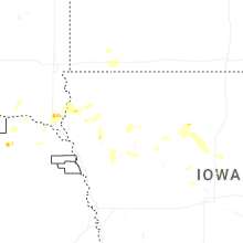
Hail Maps for Ricketts, IA


Connect with Interactive Hail Maps