

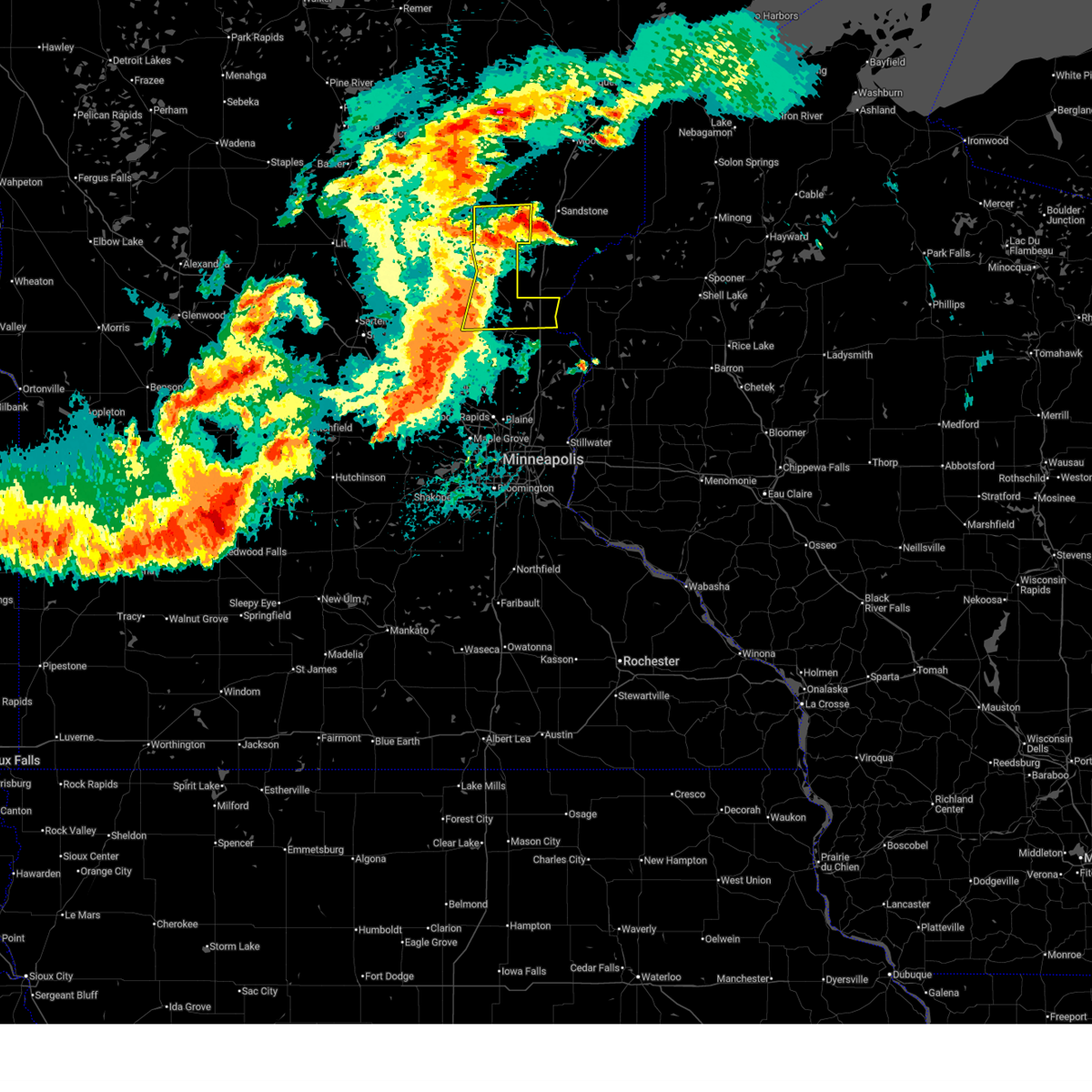
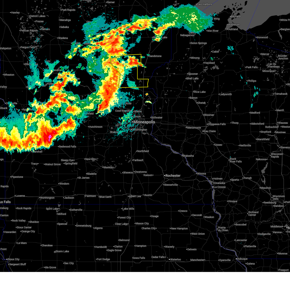
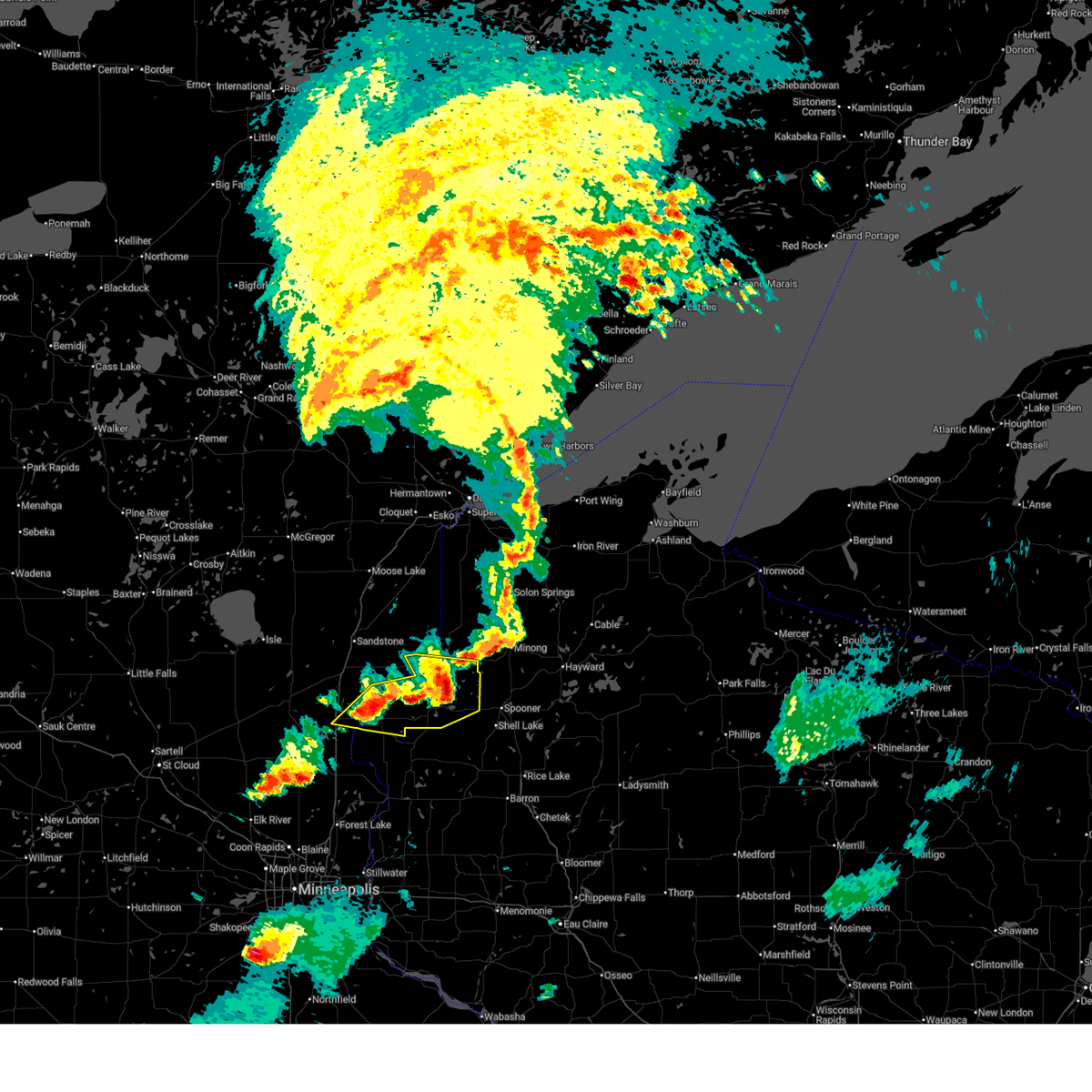
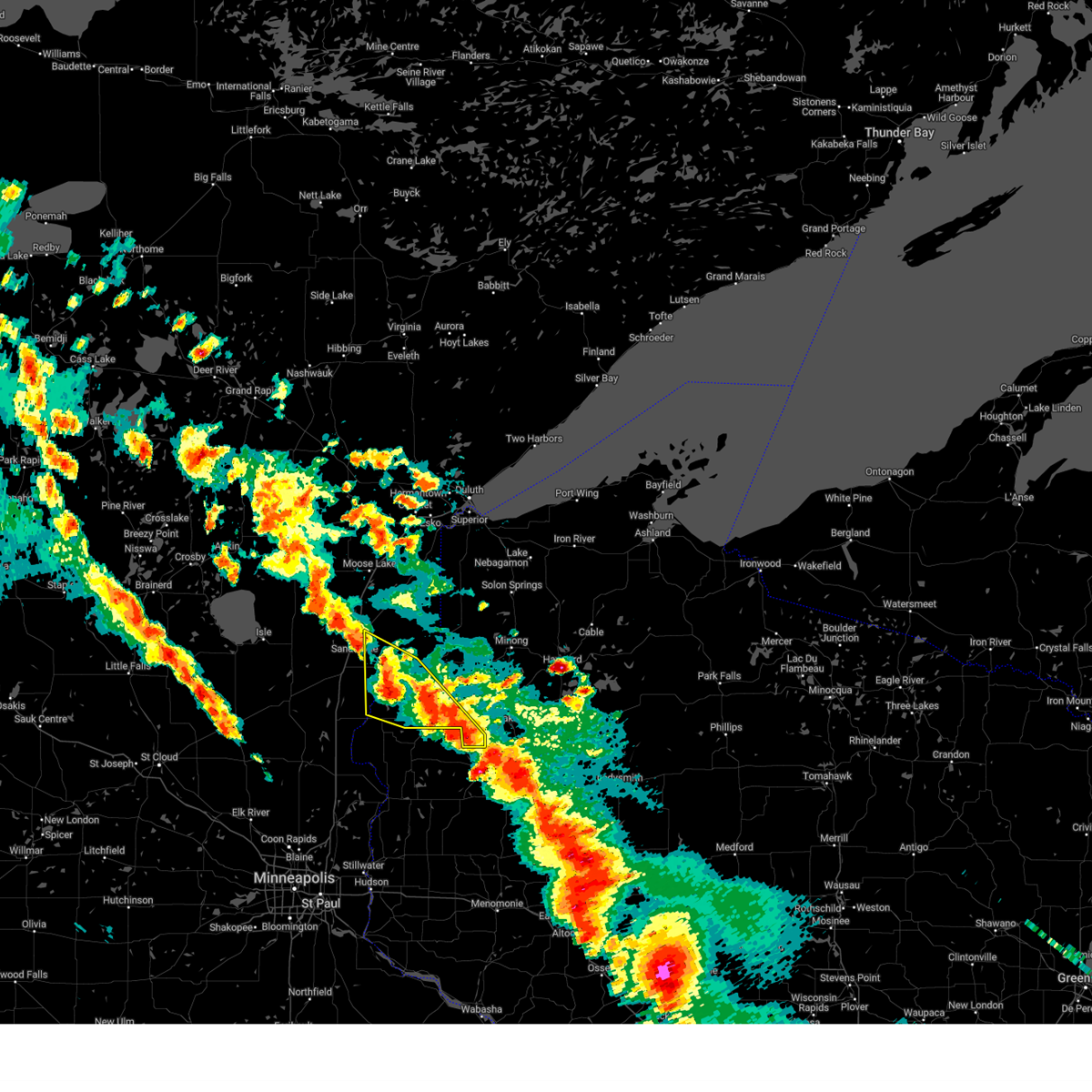
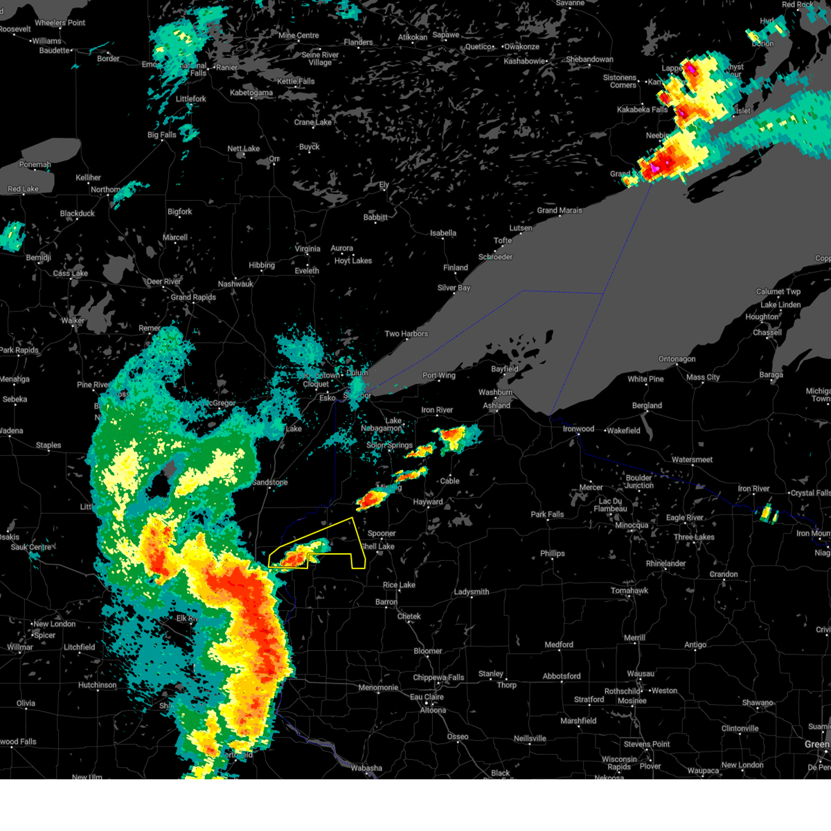
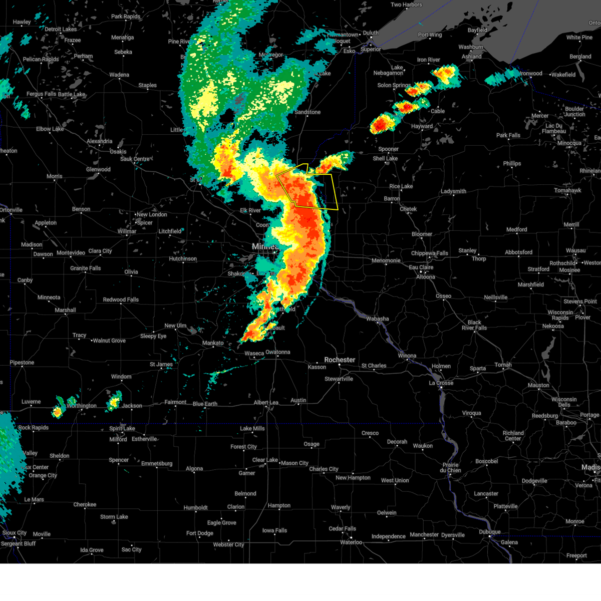
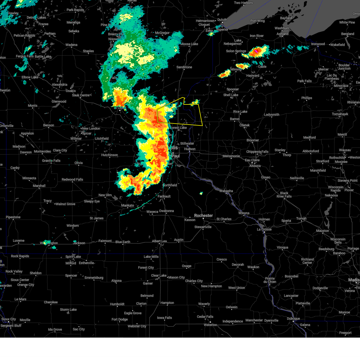
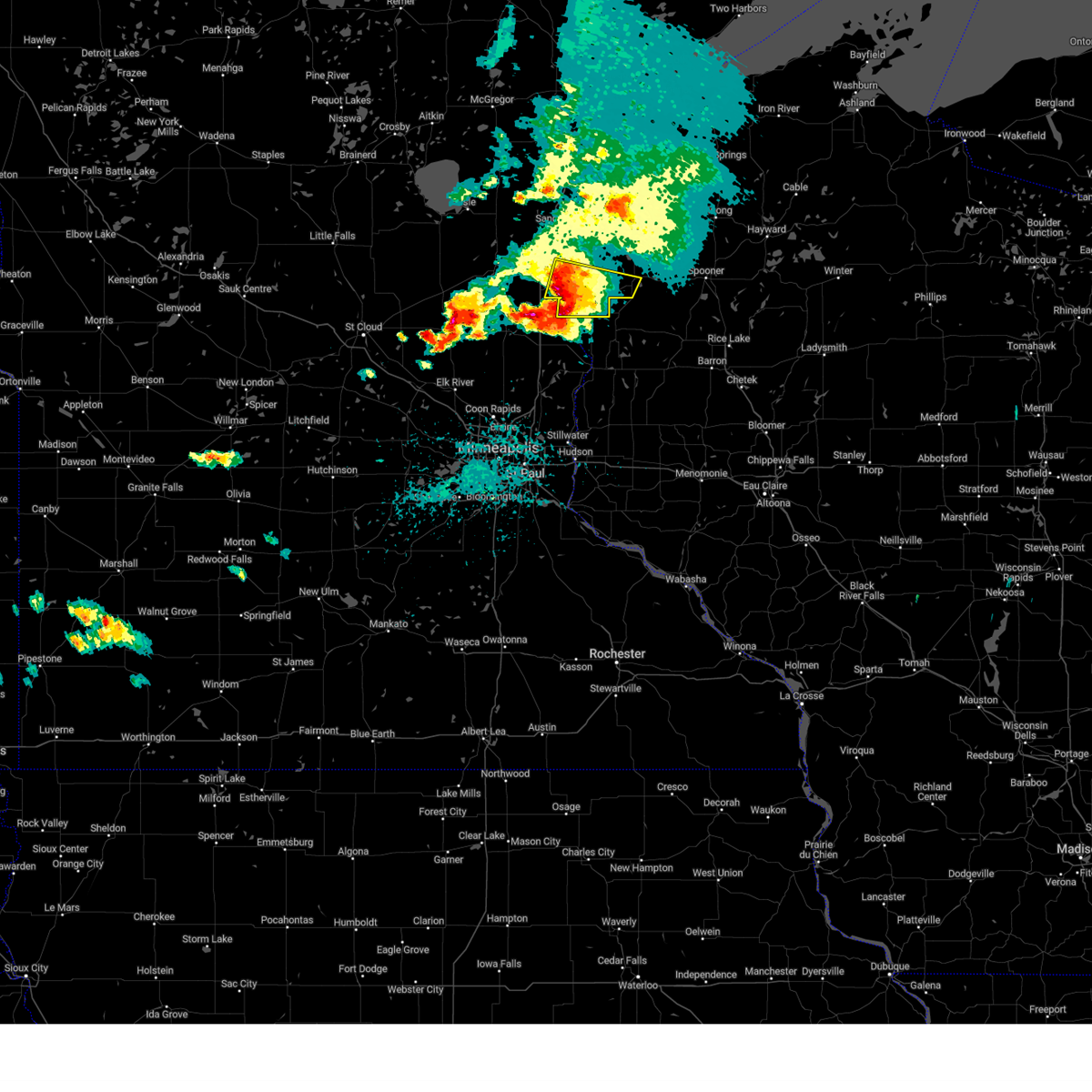
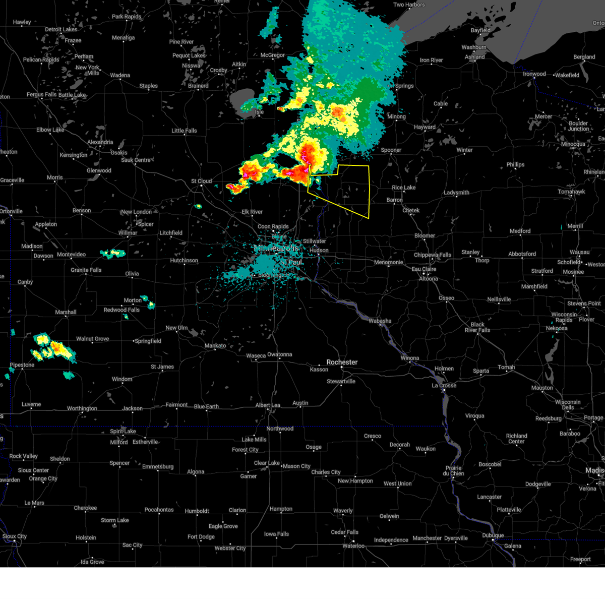
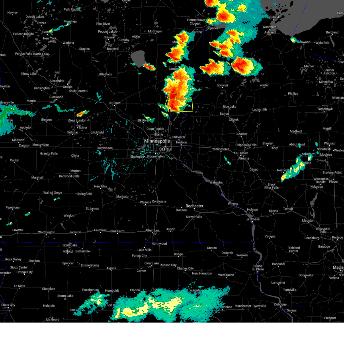
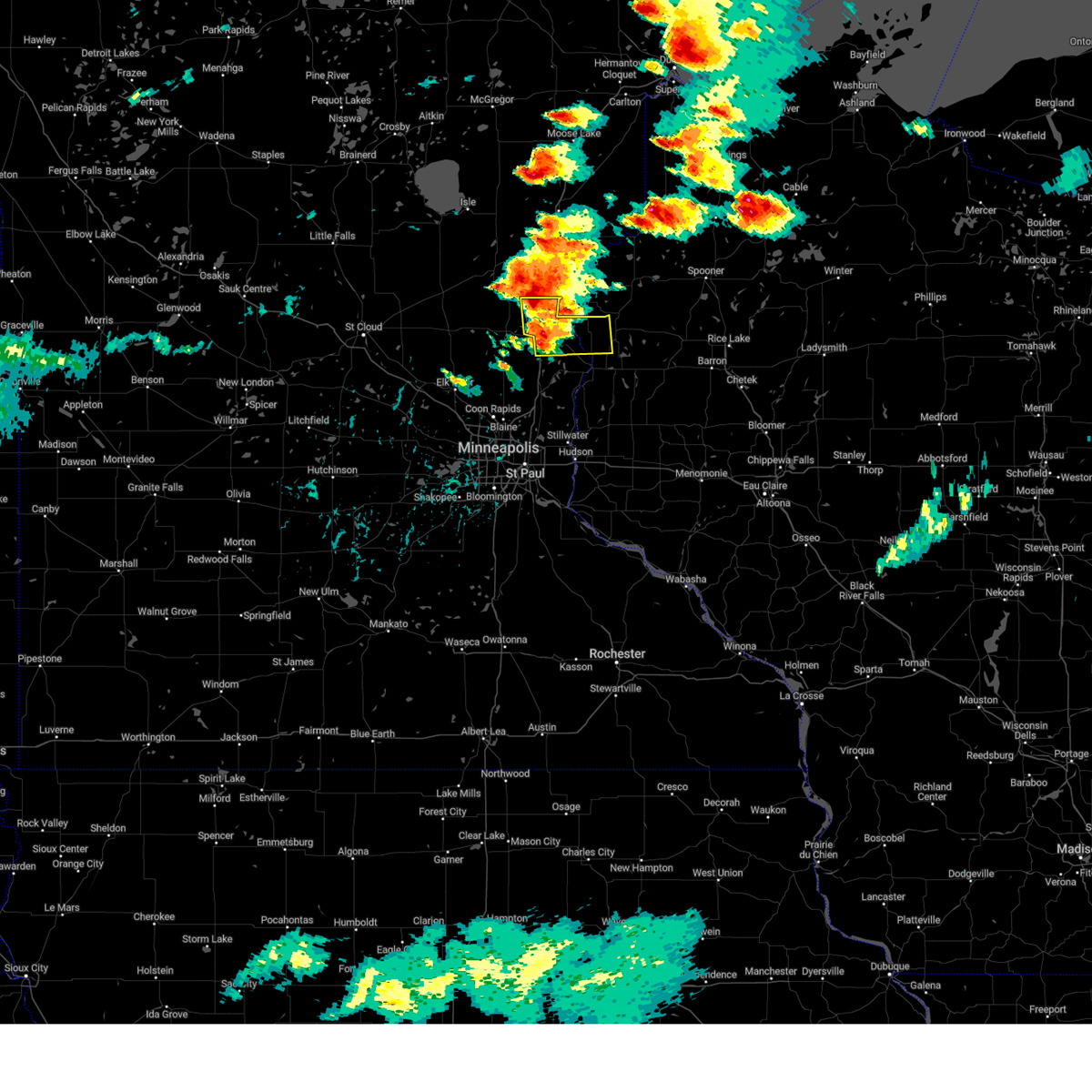
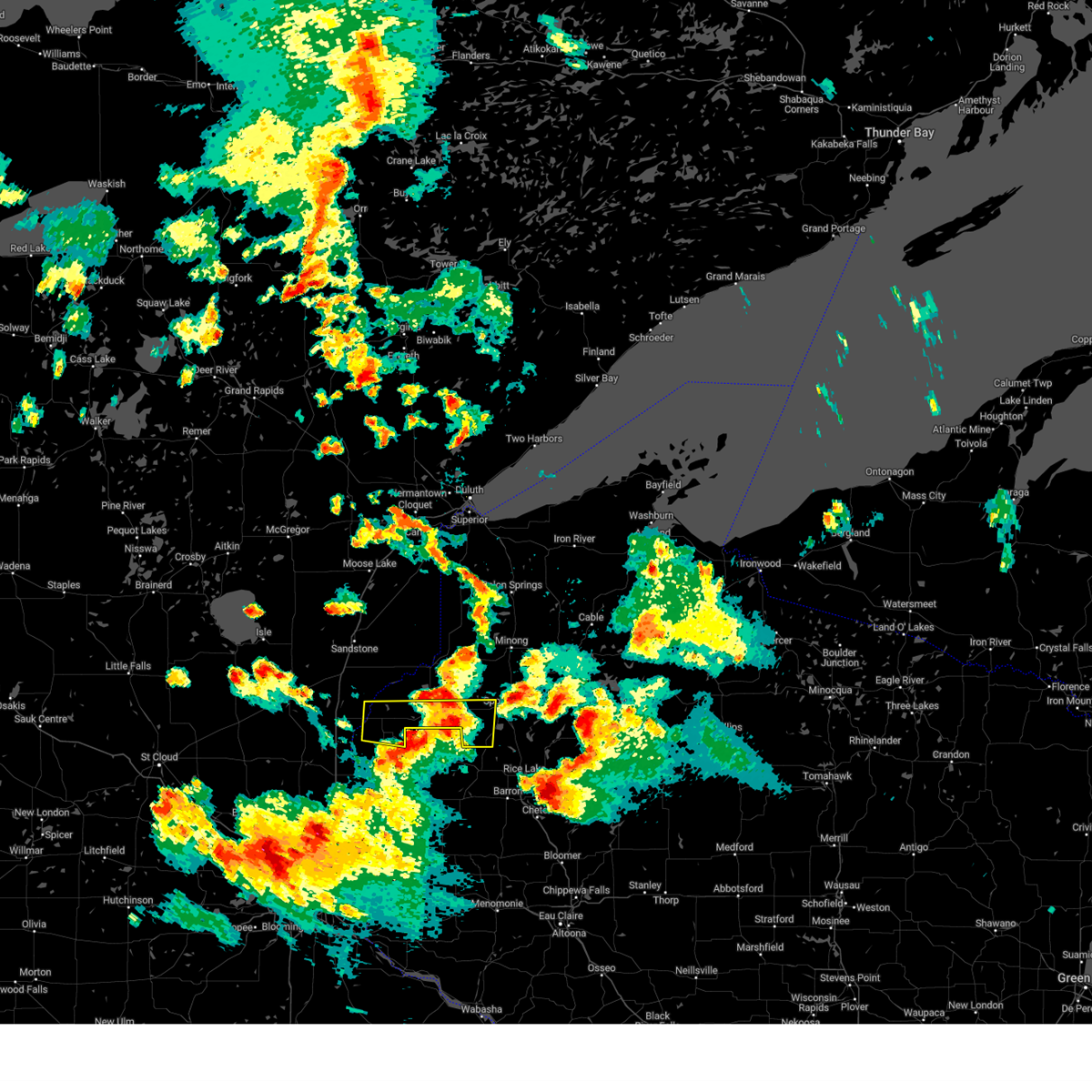
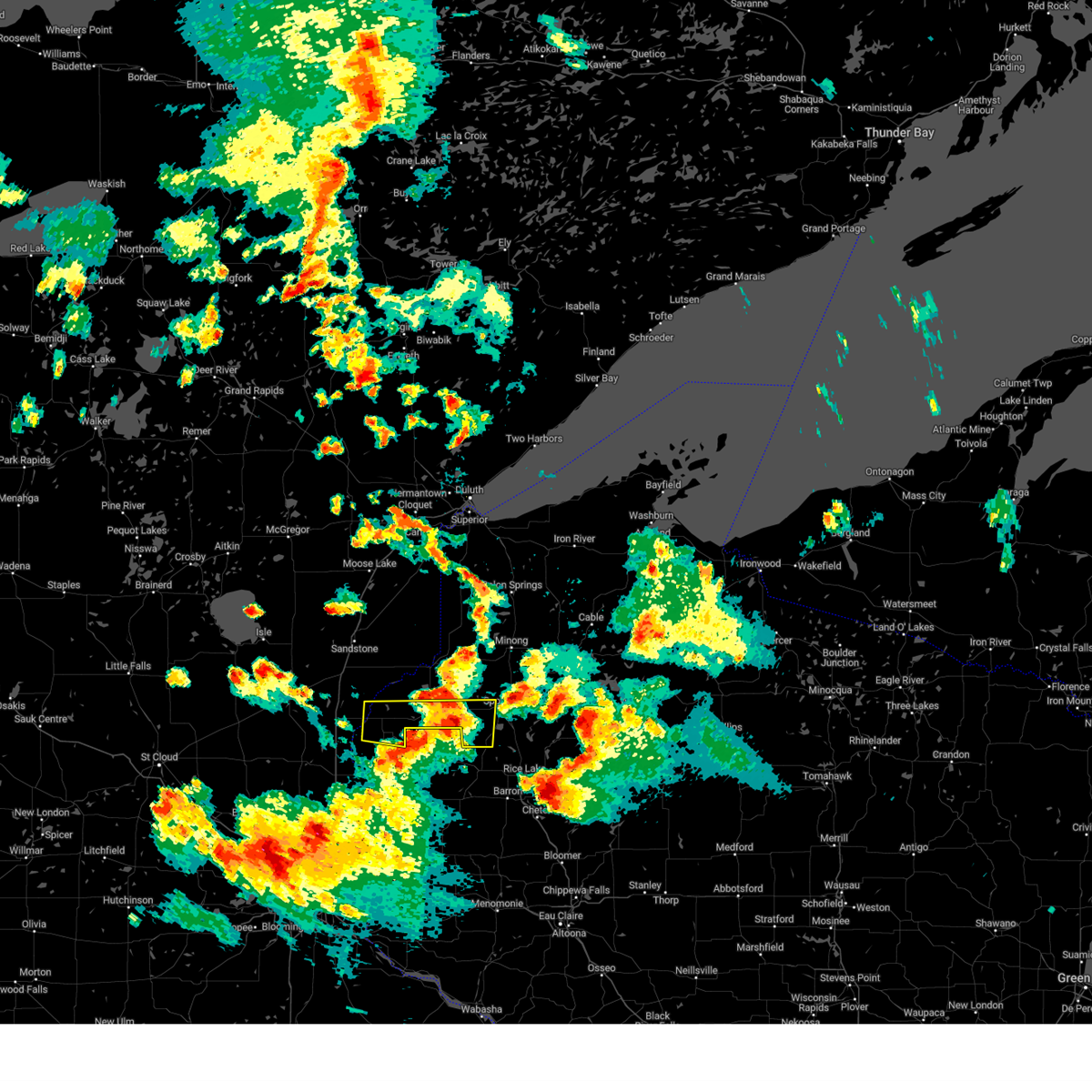
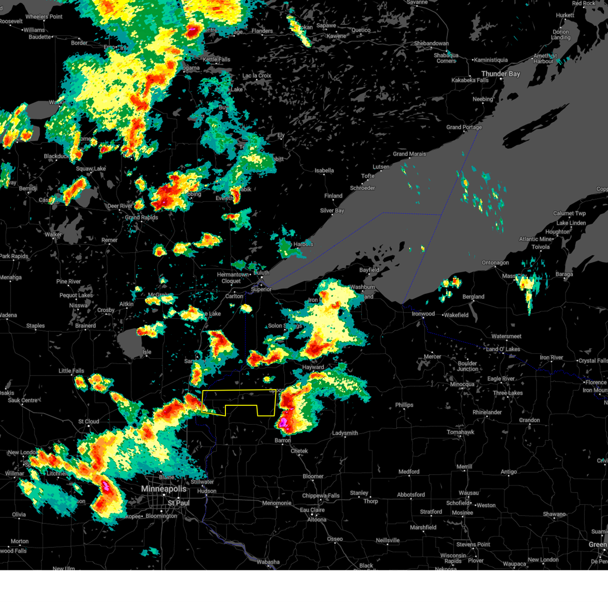
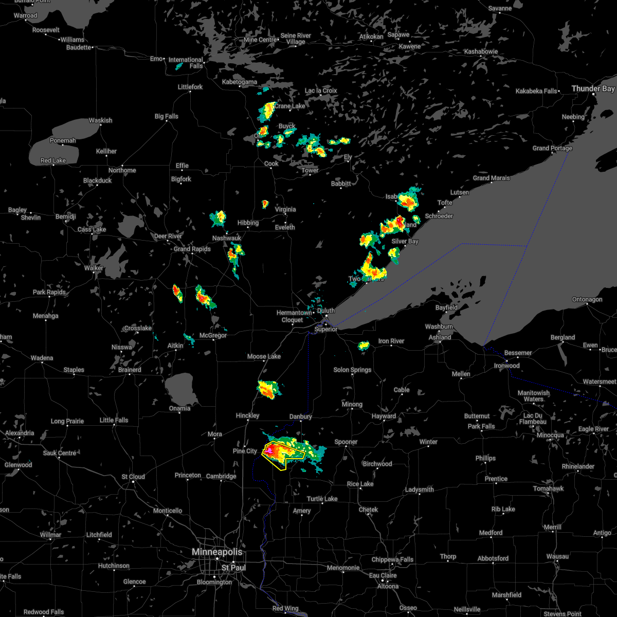
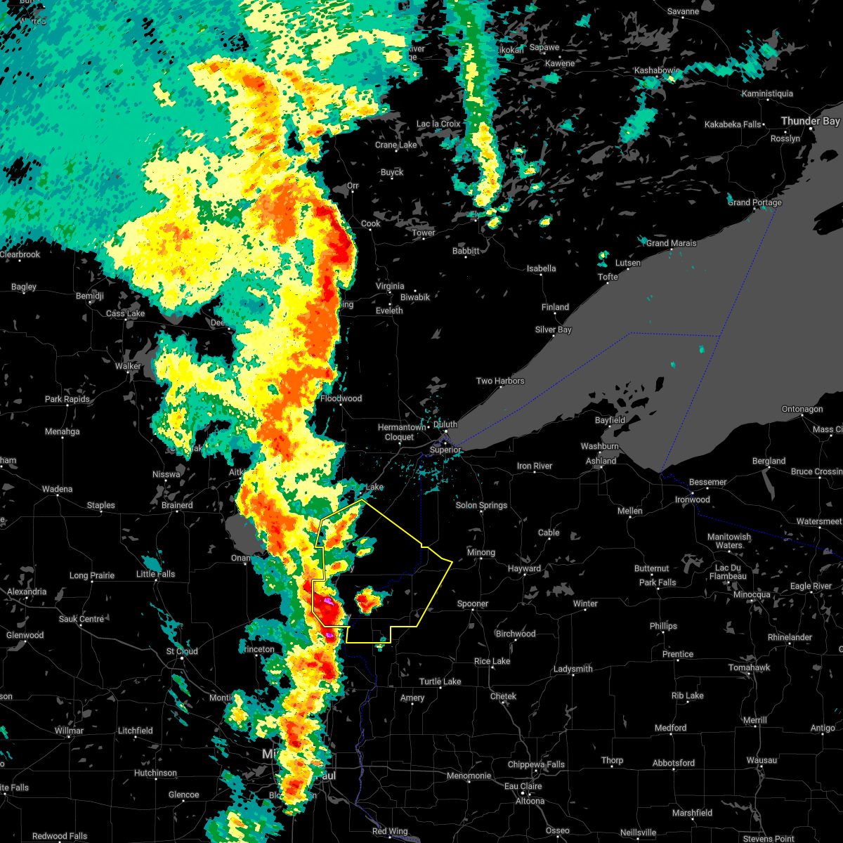
Hail Map for Rock Creek, MN
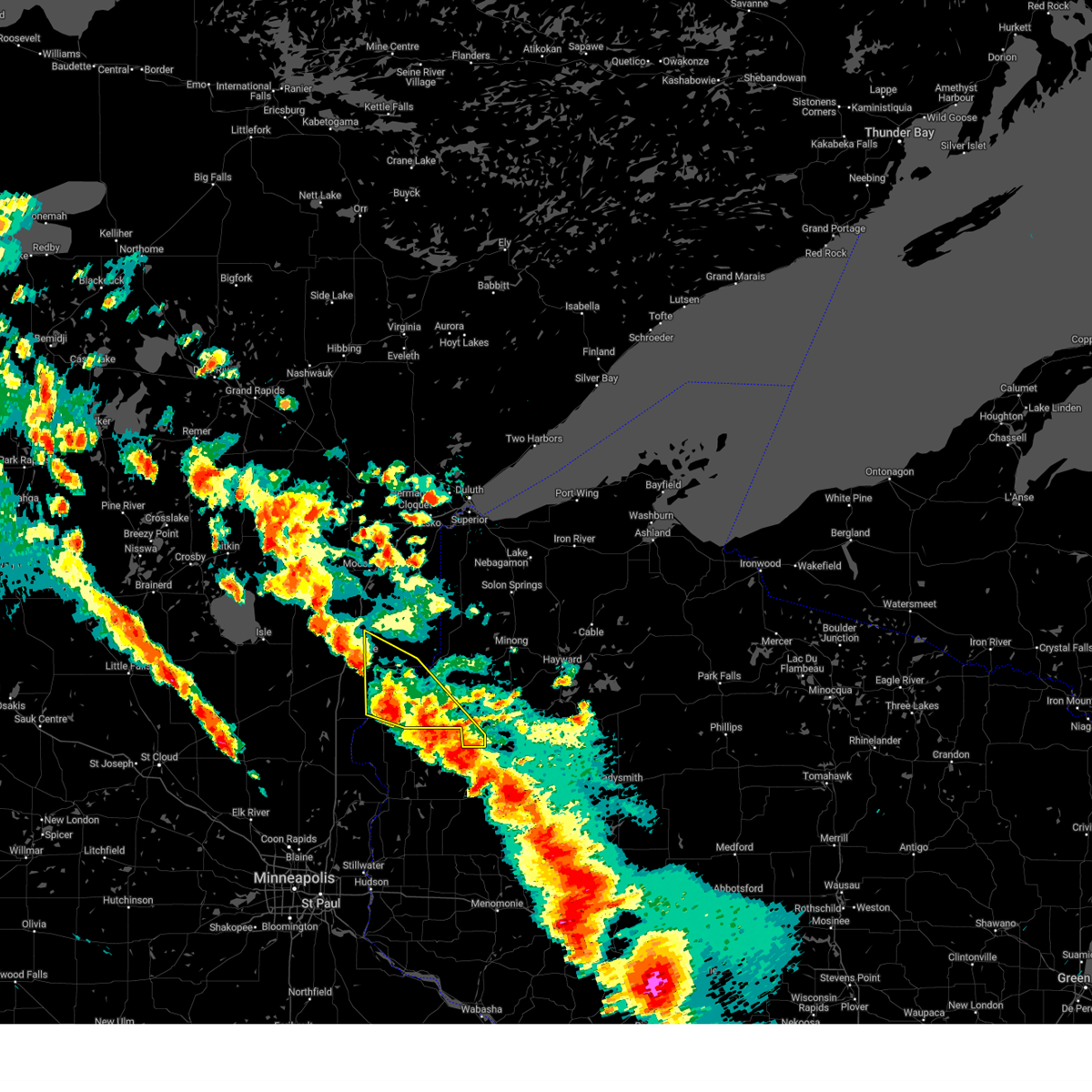
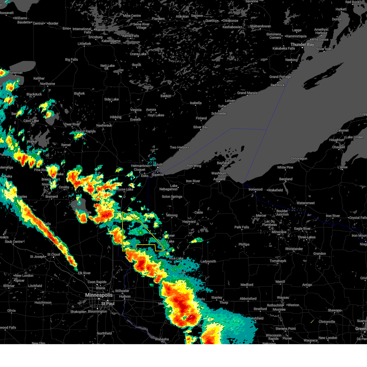
The Rock Creek, MN area has had 0 reports of on-the-ground hail by trained spotters, and has been under severe weather warnings 19 times during the past 12 months. Doppler radar has detected hail at or near Rock Creek, MN on 66 occasions, including 3 occasions during the past year.
| Name: | Rock Creek, MN |
| Where Located: | 56.9 miles NNE of Minneapolis, MN |
| Map: | Google Map for Rock Creek, MN |
| Population: | 1628 |
| Housing Units: | 635 |
| More Info: | Search Google for Rock Creek, MN |
1
The Top Recent Hail Date for Rock Creek, MN is Sunday, July 28, 2024 (31st out of 66)

Hail and Wind Damage Spotted near Rock Creek, MN
| Date / Time | Report Details |
|---|---|
| 6/28/2025 11:04 PM CDT |
 the severe thunderstorm warning has been cancelled and is no longer in effect the severe thunderstorm warning has been cancelled and is no longer in effect
|
| 6/28/2025 11:01 PM CDT |
 At 1101 pm cdt, severe thunderstorms were located along a line from 11 miles east of isle to 7 miles south of grasston, or along a line from 41 miles north of cambridge to 12 miles north of cambridge, moving east at 55 mph (radar indicated). Hazards include 60 mph wind gusts and small hail. Expect damage to roofs, siding, and trees. Locations impacted include, cambridge, mora, rush city, brunswick, ogilvie, grasston, quamba, stanchfield, knife lake, harris, dalbo, mora airport, lewis lake, grandy, warman, snake river state forest, rush city airport, chengwatana state forest and wild river state park. At 1101 pm cdt, severe thunderstorms were located along a line from 11 miles east of isle to 7 miles south of grasston, or along a line from 41 miles north of cambridge to 12 miles north of cambridge, moving east at 55 mph (radar indicated). Hazards include 60 mph wind gusts and small hail. Expect damage to roofs, siding, and trees. Locations impacted include, cambridge, mora, rush city, brunswick, ogilvie, grasston, quamba, stanchfield, knife lake, harris, dalbo, mora airport, lewis lake, grandy, warman, snake river state forest, rush city airport, chengwatana state forest and wild river state park.
|
| 6/28/2025 11:01 PM CDT |
 the severe thunderstorm warning has been cancelled and is no longer in effect the severe thunderstorm warning has been cancelled and is no longer in effect
|
| 6/28/2025 10:44 PM CDT |
 Svrmpx the national weather service in the twin cities has issued a * severe thunderstorm warning for, northwestern chisago county in east central minnesota, northwestern isanti county in east central minnesota, kanabec county in east central minnesota, northeastern mille lacs county in east central minnesota, * until 1130 pm cdt. * at 1044 pm cdt, severe thunderstorms were located along a line from over onamia to 7 miles northeast of princeton, or along a line from 35 miles east of little falls to 13 miles northwest of cambridge, moving east at 40 mph (radar indicated). Hazards include 60 mph wind gusts and small hail. expect damage to roofs, siding, and trees Svrmpx the national weather service in the twin cities has issued a * severe thunderstorm warning for, northwestern chisago county in east central minnesota, northwestern isanti county in east central minnesota, kanabec county in east central minnesota, northeastern mille lacs county in east central minnesota, * until 1130 pm cdt. * at 1044 pm cdt, severe thunderstorms were located along a line from over onamia to 7 miles northeast of princeton, or along a line from 35 miles east of little falls to 13 miles northwest of cambridge, moving east at 40 mph (radar indicated). Hazards include 60 mph wind gusts and small hail. expect damage to roofs, siding, and trees
|
| 6/16/2025 7:44 PM CDT |
 At 743 pm cdt, severe thunderstorms were located along a line extending from near danbury to near webster to near grantsburg to 6 miles east of rock creek, moving east at 50 mph (radar indicated). Hazards include 60 mph wind gusts. Expect damage to roofs, siding, and trees. Locations impacted include, rock creek, grantsburg, siren, webster, webb lake wisconsin, saint croix band sand lake area, saint croix band clam lake area, danbury, hertel, saint croix band pike lake area, branstad, mille lacs band lena lake area, saint croix state park, oakland, falun, mckenzie lake, birch island lake, yellow lake, clam lake near siren, and phantom lake. At 743 pm cdt, severe thunderstorms were located along a line extending from near danbury to near webster to near grantsburg to 6 miles east of rock creek, moving east at 50 mph (radar indicated). Hazards include 60 mph wind gusts. Expect damage to roofs, siding, and trees. Locations impacted include, rock creek, grantsburg, siren, webster, webb lake wisconsin, saint croix band sand lake area, saint croix band clam lake area, danbury, hertel, saint croix band pike lake area, branstad, mille lacs band lena lake area, saint croix state park, oakland, falun, mckenzie lake, birch island lake, yellow lake, clam lake near siren, and phantom lake.
|
| 6/16/2025 7:17 PM CDT | At 716 pm cdt, severe thunderstorms were located along a line extending from 7 miles east of hinckley to 6 miles southwest of saint croix state park to near pine city to grasston, moving east at 55 mph (radar indicated). Hazards include 60 mph wind gusts. Expect damage to roofs, siding, and trees. Locations impacted include, pine city, hinckley, rock creek, grantsburg, trade lake, siren, webster, webb lake wisconsin, brook park, henriette, saint croix band sand lake area, saint croix band bashaw area, saint croix band clam lake area, danbury, hertel, saint croix state park, saint croix band pike lake area, branstad, mille lacs band lena lake area, and randall. |
| 6/16/2025 6:53 PM CDT | Svrdlh the national weather service in duluth mn has issued a * severe thunderstorm warning for, southern pine county in east central minnesota, burnett county in northwestern wisconsin, * until 800 pm cdt. * at 653 pm cdt, severe thunderstorms were located along a line extending from 6 miles north of brook park to near quamba to near bock, moving east at 45 mph (radar indicated). Hazards include 60 mph wind gusts and penny size hail. expect damage to roofs, siding, and trees |
| 5/15/2025 4:29 PM CDT |
 The storms which prompted the warning have weakened below severe limits, and no longer pose an immediate threat to life or property. therefore, the warning will be allowed to expire. a tornado watch remains in effect until 800 pm cdt for east central minnesota, and northwestern wisconsin. The storms which prompted the warning have weakened below severe limits, and no longer pose an immediate threat to life or property. therefore, the warning will be allowed to expire. a tornado watch remains in effect until 800 pm cdt for east central minnesota, and northwestern wisconsin.
|
| 5/15/2025 4:22 PM CDT |
 At 421 pm cdt, severe thunderstorms were located along a line extending from near grantsburg to near siren to near cumberland, moving north at 55 mph (radar indicated). Hazards include 60 mph wind gusts and quarter size hail. Hail damage to vehicles is expected. expect wind damage to roofs, siding, and trees. these severe storms will be near, siren, saint croix state park, and saint croix band clam lake area around 425 pm cdt. Other locations in the path of these severe thunderstorms include webster, saint croix band pike lake area, saint croix band sand lake area, hertel, mille lacs band lena lake area and saint croix band bashaw area. At 421 pm cdt, severe thunderstorms were located along a line extending from near grantsburg to near siren to near cumberland, moving north at 55 mph (radar indicated). Hazards include 60 mph wind gusts and quarter size hail. Hail damage to vehicles is expected. expect wind damage to roofs, siding, and trees. these severe storms will be near, siren, saint croix state park, and saint croix band clam lake area around 425 pm cdt. Other locations in the path of these severe thunderstorms include webster, saint croix band pike lake area, saint croix band sand lake area, hertel, mille lacs band lena lake area and saint croix band bashaw area.
|
| 5/15/2025 4:06 PM CDT |
 Svrdlh the national weather service in duluth mn has issued a * severe thunderstorm warning for, central pine county in east central minnesota, southwestern washburn county in northwestern wisconsin, burnett county in northwestern wisconsin, * until 430 pm cdt. * at 405 pm cdt, severe thunderstorms were located along a line extending from 7 miles southwest of trade lake to near milltown to near clayton, moving north at 55 mph (radar indicated). Hazards include 60 mph wind gusts and quarter size hail. Hail damage to vehicles is expected. expect wind damage to roofs, siding, and trees. severe thunderstorms will be near, grantsburg, trade lake, and branstad around 410 pm cdt. saint croix state park around 420 pm cdt. Siren around 425 pm cdt. Svrdlh the national weather service in duluth mn has issued a * severe thunderstorm warning for, central pine county in east central minnesota, southwestern washburn county in northwestern wisconsin, burnett county in northwestern wisconsin, * until 430 pm cdt. * at 405 pm cdt, severe thunderstorms were located along a line extending from 7 miles southwest of trade lake to near milltown to near clayton, moving north at 55 mph (radar indicated). Hazards include 60 mph wind gusts and quarter size hail. Hail damage to vehicles is expected. expect wind damage to roofs, siding, and trees. severe thunderstorms will be near, grantsburg, trade lake, and branstad around 410 pm cdt. saint croix state park around 420 pm cdt. Siren around 425 pm cdt.
|
| 8/29/2024 5:13 PM CDT | Svrdlh the national weather service in duluth mn has issued a * severe thunderstorm warning for, western washburn county in northwestern wisconsin, burnett county in northwestern wisconsin, * until 615 pm cdt. * at 513 pm cdt, severe thunderstorms were located along a line extending from 6 miles southeast of rush city to 10 miles northwest of st. croix falls to near taylors falls, moving northeast at 45 mph (radar indicated). Hazards include 60 mph wind gusts. Expect damage to roofs, siding, and trees. severe thunderstorms will be near, trade lake and branstad around 525 pm cdt. grantsburg around 530 pm cdt. Other locations in the path of these severe thunderstorms include siren, saint croix band clam lake area, webster, saint croix band pike lake area, saint croix band sand lake area, hertel and saint croix band bashaw area. |
| 8/29/2024 5:13 PM CDT | the tornado warning has been cancelled and is no longer in effect |
| 8/29/2024 5:01 PM CDT | At 501 pm cdt, a severe thunderstorm capable of producing a tornado was located near rush city, or 13 miles east of cambridge, moving northeast at 45 mph (radar indicated rotation). Hazards include tornado. Flying debris will be dangerous to those caught without shelter. mobile homes will be damaged or destroyed. damage to roofs, windows, and vehicles will occur. tree damage is likely. this dangerous storm will be near, rush city around 505 pm cdt. Other locations impacted by this tornadic thunderstorm include harris, rush city airport, wild river state park, and chengwatana state forest. |
| 8/29/2024 4:53 PM CDT |
 Tormpx the national weather service in the twin cities has issued a * tornado warning for, northwestern chisago county in east central minnesota, northwestern polk county in northwestern wisconsin, * until 530 pm cdt. * at 452 pm cdt, a confirmed tornado was located near north branch, or 8 miles east of cambridge, moving northeast at 45 mph (law enforcement confirmed tornado). Hazards include damaging tornado. Flying debris will be dangerous to those caught without shelter. mobile homes will be damaged or destroyed. damage to roofs, windows, and vehicles will occur. tree damage is likely. the tornado will be near, rush city around 500 pm cdt. Other locations impacted by this tornadic thunderstorm include harris, rush city airport, wild river state park, and chengwatana state forest. Tormpx the national weather service in the twin cities has issued a * tornado warning for, northwestern chisago county in east central minnesota, northwestern polk county in northwestern wisconsin, * until 530 pm cdt. * at 452 pm cdt, a confirmed tornado was located near north branch, or 8 miles east of cambridge, moving northeast at 45 mph (law enforcement confirmed tornado). Hazards include damaging tornado. Flying debris will be dangerous to those caught without shelter. mobile homes will be damaged or destroyed. damage to roofs, windows, and vehicles will occur. tree damage is likely. the tornado will be near, rush city around 500 pm cdt. Other locations impacted by this tornadic thunderstorm include harris, rush city airport, wild river state park, and chengwatana state forest.
|
| 8/26/2024 8:41 PM CDT |
 Svrdlh the national weather service in duluth mn has issued a * severe thunderstorm warning for, southeastern pine county in east central minnesota, southwestern douglas county in northwestern wisconsin, washburn county in northwestern wisconsin, burnett county in northwestern wisconsin, western sawyer county in northwestern wisconsin, * until 930 pm cdt. * at 837 pm cdt, severe thunderstorms were located along a line extending from near grantsburg to 8 miles northwest of cumberland to near glenwood city, moving northeast at 55 mph (radar indicated). Hazards include 60 mph wind gusts and quarter size hail. Hail damage to vehicles is expected. expect wind damage to roofs, siding, and trees. severe thunderstorms will be near, siren, webster, hertel, saint croix state park, saint croix band pike lake area, saint croix band bashaw area, saint croix band clam lake area, and saint croix band sand lake area around 845 pm cdt. shell lake and mille lacs band lena lake area around 850 pm cdt. spooner and danbury around 855 pm cdt. Other locations in the path of these severe thunderstorms include webb lake wisconsin, trego, cloverton, minong, stone lake, birchwood, dairyland and hayward. Svrdlh the national weather service in duluth mn has issued a * severe thunderstorm warning for, southeastern pine county in east central minnesota, southwestern douglas county in northwestern wisconsin, washburn county in northwestern wisconsin, burnett county in northwestern wisconsin, western sawyer county in northwestern wisconsin, * until 930 pm cdt. * at 837 pm cdt, severe thunderstorms were located along a line extending from near grantsburg to 8 miles northwest of cumberland to near glenwood city, moving northeast at 55 mph (radar indicated). Hazards include 60 mph wind gusts and quarter size hail. Hail damage to vehicles is expected. expect wind damage to roofs, siding, and trees. severe thunderstorms will be near, siren, webster, hertel, saint croix state park, saint croix band pike lake area, saint croix band bashaw area, saint croix band clam lake area, and saint croix band sand lake area around 845 pm cdt. shell lake and mille lacs band lena lake area around 850 pm cdt. spooner and danbury around 855 pm cdt. Other locations in the path of these severe thunderstorms include webb lake wisconsin, trego, cloverton, minong, stone lake, birchwood, dairyland and hayward.
|
| 8/26/2024 8:03 PM CDT |
 Svrdlh the national weather service in duluth mn has issued a * severe thunderstorm warning for, southern burnett county in northwestern wisconsin, * until 845 pm cdt. * at 803 pm cdt, severe thunderstorms were located along a line extending from 6 miles southeast of rush city to near scandia to near prescott, moving east at 45 mph (radar indicated). Hazards include 60 mph wind gusts and quarter size hail. Hail damage to vehicles is expected. expect wind damage to roofs, siding, and trees. Severe thunderstorms will be near, trade lake around 820 pm cdt. Svrdlh the national weather service in duluth mn has issued a * severe thunderstorm warning for, southern burnett county in northwestern wisconsin, * until 845 pm cdt. * at 803 pm cdt, severe thunderstorms were located along a line extending from 6 miles southeast of rush city to near scandia to near prescott, moving east at 45 mph (radar indicated). Hazards include 60 mph wind gusts and quarter size hail. Hail damage to vehicles is expected. expect wind damage to roofs, siding, and trees. Severe thunderstorms will be near, trade lake around 820 pm cdt.
|
| 8/26/2024 7:58 PM CDT |
 At 757 pm cdt, a severe thunderstorm was located 8 miles north of taylors falls, or 24 miles southeast of pine city, moving east at 35 mph (radar indicated). Hazards include 60 mph wind gusts and quarter size hail. Hail damage to vehicles is expected. expect wind damage to roofs, siding, and trees. locations impacted include, north branch, chisago city, lindstrom, rush city, osceola, st. Croix falls, stacy, taylors falls, centuria, dresser, center city, and spring lake. At 757 pm cdt, a severe thunderstorm was located 8 miles north of taylors falls, or 24 miles southeast of pine city, moving east at 35 mph (radar indicated). Hazards include 60 mph wind gusts and quarter size hail. Hail damage to vehicles is expected. expect wind damage to roofs, siding, and trees. locations impacted include, north branch, chisago city, lindstrom, rush city, osceola, st. Croix falls, stacy, taylors falls, centuria, dresser, center city, and spring lake.
|
| 8/26/2024 7:58 PM CDT |
 the severe thunderstorm warning has been cancelled and is no longer in effect the severe thunderstorm warning has been cancelled and is no longer in effect
|
| 8/26/2024 7:26 PM CDT |
 Svrmpx the national weather service in the twin cities has issued a * severe thunderstorm warning for, chisago county in east central minnesota, northeastern anoka county in east central minnesota, southern isanti county in east central minnesota, northwestern polk county in northwestern wisconsin, * until 815 pm cdt. * at 726 pm cdt, a severe thunderstorm was located over isanti, or near cambridge, moving east at 45 mph (radar indicated). Hazards include 70 mph wind gusts and quarter size hail. Hail damage to vehicles is expected. expect considerable tree damage. Wind damage is also likely to mobile homes, roofs, and outbuildings. Svrmpx the national weather service in the twin cities has issued a * severe thunderstorm warning for, chisago county in east central minnesota, northeastern anoka county in east central minnesota, southern isanti county in east central minnesota, northwestern polk county in northwestern wisconsin, * until 815 pm cdt. * at 726 pm cdt, a severe thunderstorm was located over isanti, or near cambridge, moving east at 45 mph (radar indicated). Hazards include 70 mph wind gusts and quarter size hail. Hail damage to vehicles is expected. expect considerable tree damage. Wind damage is also likely to mobile homes, roofs, and outbuildings.
|
| 6/12/2024 8:28 PM CDT |
 The storm which prompted the warning has weakened below severe limits, and no longer poses an immediate threat to life or property. therefore, the warning will be allowed to expire. a tornado watch remains in effect until 1000 pm cdt for east central minnesota, and northwestern wisconsin. to report severe weather, contact your nearest law enforcement agency. they will relay your report to the national weather service the twin cities. The storm which prompted the warning has weakened below severe limits, and no longer poses an immediate threat to life or property. therefore, the warning will be allowed to expire. a tornado watch remains in effect until 1000 pm cdt for east central minnesota, and northwestern wisconsin. to report severe weather, contact your nearest law enforcement agency. they will relay your report to the national weather service the twin cities.
|
| 6/12/2024 8:22 PM CDT |
 At 822 pm cdt, a severe thunderstorm was located 6 miles south of rush city, or 14 miles east of cambridge, moving east at 60 mph (radar indicated). Hazards include 60 mph wind gusts and nickel size hail. Expect damage to roofs, siding, and trees. Locations impacted include, cambridge, north branch, isanti, rush city, spring lake, athens, harris, rush city airport, branch, weber, bodum, and wild river state park. At 822 pm cdt, a severe thunderstorm was located 6 miles south of rush city, or 14 miles east of cambridge, moving east at 60 mph (radar indicated). Hazards include 60 mph wind gusts and nickel size hail. Expect damage to roofs, siding, and trees. Locations impacted include, cambridge, north branch, isanti, rush city, spring lake, athens, harris, rush city airport, branch, weber, bodum, and wild river state park.
|
| 6/12/2024 7:59 PM CDT |
 Svrmpx the national weather service in the twin cities has issued a * severe thunderstorm warning for, northwestern chisago county in east central minnesota, isanti county in east central minnesota, * until 830 pm cdt. * at 759 pm cdt, a severe thunderstorm was located 9 miles northeast of princeton, or 10 miles northwest of cambridge, moving east at 60 mph (radar indicated). Hazards include 60 mph wind gusts and nickel size hail. expect damage to roofs, siding, and trees Svrmpx the national weather service in the twin cities has issued a * severe thunderstorm warning for, northwestern chisago county in east central minnesota, isanti county in east central minnesota, * until 830 pm cdt. * at 759 pm cdt, a severe thunderstorm was located 9 miles northeast of princeton, or 10 miles northwest of cambridge, moving east at 60 mph (radar indicated). Hazards include 60 mph wind gusts and nickel size hail. expect damage to roofs, siding, and trees
|
| 8/11/2023 3:49 PM CDT |
 At 348 pm cdt, a severe thunderstorm was located near branstad, or 12 miles southeast of pine city, moving southeast at 45 mph. this is a destructive storm for southern pine and burnett counties (radar indicated). Hazards include 80 mph wind gusts and quarter size hail. Flying debris will be dangerous to those caught without shelter. mobile homes will be heavily damaged. expect considerable damage to roofs, windows, and vehicles. extensive tree damage and power outages are likely. locations impacted include, branstad and trade lake. thunderstorm damage threat, destructive hail threat, radar indicated max hail size, 1. 00 in wind threat, radar indicated max wind gust, 80 mph. At 348 pm cdt, a severe thunderstorm was located near branstad, or 12 miles southeast of pine city, moving southeast at 45 mph. this is a destructive storm for southern pine and burnett counties (radar indicated). Hazards include 80 mph wind gusts and quarter size hail. Flying debris will be dangerous to those caught without shelter. mobile homes will be heavily damaged. expect considerable damage to roofs, windows, and vehicles. extensive tree damage and power outages are likely. locations impacted include, branstad and trade lake. thunderstorm damage threat, destructive hail threat, radar indicated max hail size, 1. 00 in wind threat, radar indicated max wind gust, 80 mph.
|
| 8/11/2023 3:47 PM CDT |
 At 347 pm cdt, a severe thunderstorm was located 7 miles southwest of branstad, or 15 miles southeast of pine city, moving east at 50 mph (radar indicated). Hazards include 60 mph wind gusts and quarter size hail. Hail damage to vehicles is expected. expect wind damage to roofs, siding, and trees. this severe thunderstorm will be near, frederic, luck and milltown around 405 pm cdt. hail threat, radar indicated max hail size, 1. 00 in wind threat, radar indicated max wind gust, 60 mph. At 347 pm cdt, a severe thunderstorm was located 7 miles southwest of branstad, or 15 miles southeast of pine city, moving east at 50 mph (radar indicated). Hazards include 60 mph wind gusts and quarter size hail. Hail damage to vehicles is expected. expect wind damage to roofs, siding, and trees. this severe thunderstorm will be near, frederic, luck and milltown around 405 pm cdt. hail threat, radar indicated max hail size, 1. 00 in wind threat, radar indicated max wind gust, 60 mph.
|
| 8/11/2023 3:32 PM CDT |
 At 332 pm cdt, a severe thunderstorm was located over rock creek, or near pine city, moving southeast at 45 mph. this is a destructive storm for southern pine and burnett counties (radar indicated). Hazards include 80 mph wind gusts and quarter size hail. Flying debris will be dangerous to those caught without shelter. mobile homes will be heavily damaged. expect considerable damage to roofs, windows, and vehicles. extensive tree damage and power outages are likely. this severe thunderstorm will be near, rock creek around 335 pm cdt. grantsburg around 350 pm cdt. other locations in the path of this severe thunderstorm include branstad and trade lake. thunderstorm damage threat, destructive hail threat, radar indicated max hail size, 1. 00 in wind threat, radar indicated max wind gust, 80 mph. At 332 pm cdt, a severe thunderstorm was located over rock creek, or near pine city, moving southeast at 45 mph. this is a destructive storm for southern pine and burnett counties (radar indicated). Hazards include 80 mph wind gusts and quarter size hail. Flying debris will be dangerous to those caught without shelter. mobile homes will be heavily damaged. expect considerable damage to roofs, windows, and vehicles. extensive tree damage and power outages are likely. this severe thunderstorm will be near, rock creek around 335 pm cdt. grantsburg around 350 pm cdt. other locations in the path of this severe thunderstorm include branstad and trade lake. thunderstorm damage threat, destructive hail threat, radar indicated max hail size, 1. 00 in wind threat, radar indicated max wind gust, 80 mph.
|
| 8/11/2023 3:06 PM CDT |
 At 306 pm cdt, a severe thunderstorm was located near mora, or 18 miles west of pine city, moving southeast at 40 mph (radar indicated). Hazards include 70 mph wind gusts and quarter size hail. Hail damage to vehicles is expected. expect considerable tree damage. wind damage is also likely to mobile homes, roofs, and outbuildings. this severe thunderstorm will be near, henriette around 320 pm cdt. other locations in the path of this severe thunderstorm include pine city, rock creek and grantsburg. thunderstorm damage threat, considerable hail threat, radar indicated max hail size, 1. 00 in wind threat, radar indicated max wind gust, 70 mph. At 306 pm cdt, a severe thunderstorm was located near mora, or 18 miles west of pine city, moving southeast at 40 mph (radar indicated). Hazards include 70 mph wind gusts and quarter size hail. Hail damage to vehicles is expected. expect considerable tree damage. wind damage is also likely to mobile homes, roofs, and outbuildings. this severe thunderstorm will be near, henriette around 320 pm cdt. other locations in the path of this severe thunderstorm include pine city, rock creek and grantsburg. thunderstorm damage threat, considerable hail threat, radar indicated max hail size, 1. 00 in wind threat, radar indicated max wind gust, 70 mph.
|
| 7/27/2023 7:24 PM CDT |
 At 724 pm cdt, a severe thunderstorm was located over grasston, or near pine city, moving east at 35 mph (radar indicated). Hazards include 60 mph wind gusts and half dollar size hail. Hail damage to vehicles is expected. expect wind damage to roofs, siding, and trees. this severe thunderstorm will be near, pine city and rock creek around 735 pm cdt. other locations in the path of this severe thunderstorm include grantsburg. hail threat, radar indicated max hail size, 1. 25 in wind threat, radar indicated max wind gust, 60 mph. At 724 pm cdt, a severe thunderstorm was located over grasston, or near pine city, moving east at 35 mph (radar indicated). Hazards include 60 mph wind gusts and half dollar size hail. Hail damage to vehicles is expected. expect wind damage to roofs, siding, and trees. this severe thunderstorm will be near, pine city and rock creek around 735 pm cdt. other locations in the path of this severe thunderstorm include grantsburg. hail threat, radar indicated max hail size, 1. 25 in wind threat, radar indicated max wind gust, 60 mph.
|
| 7/27/2023 3:44 PM CDT |
 At 344 pm cdt, a severe thunderstorm was located near north branch, or 17 miles east of cambridge, moving east at 35 mph (radar indicated). Hazards include tennis ball size hail and 60 mph wind gusts. People and animals outdoors will be injured. expect hail damage to roofs, siding, windows, and vehicles. expect wind damage to roofs, siding, and trees. locations impacted include, north branch, rush city, harris, rush city airport, wolf creek, branch, cushing, wild river state park and chengwatana state forest. thunderstorm damage threat, considerable hail threat, radar indicated max hail size, 2. 50 in wind threat, radar indicated max wind gust, 60 mph. At 344 pm cdt, a severe thunderstorm was located near north branch, or 17 miles east of cambridge, moving east at 35 mph (radar indicated). Hazards include tennis ball size hail and 60 mph wind gusts. People and animals outdoors will be injured. expect hail damage to roofs, siding, windows, and vehicles. expect wind damage to roofs, siding, and trees. locations impacted include, north branch, rush city, harris, rush city airport, wolf creek, branch, cushing, wild river state park and chengwatana state forest. thunderstorm damage threat, considerable hail threat, radar indicated max hail size, 2. 50 in wind threat, radar indicated max wind gust, 60 mph.
|
| 7/27/2023 3:33 PM CDT |
 At 333 pm cdt, a severe thunderstorm was located 6 miles southwest of rush city, or 11 miles northeast of cambridge, moving east at 35 mph (radar indicated). Hazards include golf ball size hail and 60 mph wind gusts. People and animals outdoors will be injured. expect hail damage to roofs, siding, windows, and vehicles. expect wind damage to roofs, siding, and trees. this severe thunderstorm will remain over mainly rural areas of northern chisago and northwestern polk counties, including the following locations, rush city airport, wolf creek, branch, cushing, wild river state park, harris and chengwatana state forest. thunderstorm damage threat, considerable hail threat, radar indicated max hail size, 1. 75 in wind threat, radar indicated max wind gust, 60 mph. At 333 pm cdt, a severe thunderstorm was located 6 miles southwest of rush city, or 11 miles northeast of cambridge, moving east at 35 mph (radar indicated). Hazards include golf ball size hail and 60 mph wind gusts. People and animals outdoors will be injured. expect hail damage to roofs, siding, windows, and vehicles. expect wind damage to roofs, siding, and trees. this severe thunderstorm will remain over mainly rural areas of northern chisago and northwestern polk counties, including the following locations, rush city airport, wolf creek, branch, cushing, wild river state park, harris and chengwatana state forest. thunderstorm damage threat, considerable hail threat, radar indicated max hail size, 1. 75 in wind threat, radar indicated max wind gust, 60 mph.
|
| 7/27/2023 3:31 PM CDT |
 At 330 pm cdt, a severe thunderstorm was located over pine city, moving east at 25 mph (radar indicated). Hazards include golf ball size hail and 60 mph wind gusts. People and animals outdoors will be injured. expect hail damage to roofs, siding, windows, and vehicles. expect wind damage to roofs, siding, and trees. locations impacted include, rock creek, grantsburg and branstad. thunderstorm damage threat, considerable hail threat, radar indicated max hail size, 1. 75 in wind threat, radar indicated max wind gust, 60 mph. At 330 pm cdt, a severe thunderstorm was located over pine city, moving east at 25 mph (radar indicated). Hazards include golf ball size hail and 60 mph wind gusts. People and animals outdoors will be injured. expect hail damage to roofs, siding, windows, and vehicles. expect wind damage to roofs, siding, and trees. locations impacted include, rock creek, grantsburg and branstad. thunderstorm damage threat, considerable hail threat, radar indicated max hail size, 1. 75 in wind threat, radar indicated max wind gust, 60 mph.
|
| 7/27/2023 3:04 PM CDT |
 At 304 pm cdt, a severe thunderstorm was located over brunswick, or 13 miles west of pine city, moving east at 25 mph (radar indicated). Hazards include golf ball size hail and 60 mph wind gusts. People and animals outdoors will be injured. expect hail damage to roofs, siding, windows, and vehicles. expect wind damage to roofs, siding, and trees. this severe thunderstorm will be near, henriette around 320 pm cdt. other locations in the path of this severe thunderstorm include pine city, rock creek, grantsburg and branstad. thunderstorm damage threat, considerable hail threat, radar indicated max hail size, 1. 75 in wind threat, radar indicated max wind gust, 60 mph. At 304 pm cdt, a severe thunderstorm was located over brunswick, or 13 miles west of pine city, moving east at 25 mph (radar indicated). Hazards include golf ball size hail and 60 mph wind gusts. People and animals outdoors will be injured. expect hail damage to roofs, siding, windows, and vehicles. expect wind damage to roofs, siding, and trees. this severe thunderstorm will be near, henriette around 320 pm cdt. other locations in the path of this severe thunderstorm include pine city, rock creek, grantsburg and branstad. thunderstorm damage threat, considerable hail threat, radar indicated max hail size, 1. 75 in wind threat, radar indicated max wind gust, 60 mph.
|
| 7/19/2023 6:36 PM CDT |
 The severe thunderstorm warning for southern pine, southwestern washburn and southern burnett counties will expire at 645 pm cdt, the storm which prompted the warning has weakened below severe limits, and no longer poses an immediate threat to life or property. therefore, the warning will be allowed to expire. a severe thunderstorm watch remains in effect until 1000 pm cdt for east central minnesota, and northwestern wisconsin. The severe thunderstorm warning for southern pine, southwestern washburn and southern burnett counties will expire at 645 pm cdt, the storm which prompted the warning has weakened below severe limits, and no longer poses an immediate threat to life or property. therefore, the warning will be allowed to expire. a severe thunderstorm watch remains in effect until 1000 pm cdt for east central minnesota, and northwestern wisconsin.
|
| 7/19/2023 6:07 PM CDT |
 At 607 pm cdt, a severe thunderstorm was located near rock creek, or near pine city, moving east at 40 mph (radar indicated). Hazards include 60 mph wind gusts and quarter size hail. Hail damage to vehicles is expected. expect wind damage to roofs, siding, and trees. this severe thunderstorm will be near, grantsburg around 620 pm cdt. branstad around 625 pm cdt. other locations in the path of this severe thunderstorm include trade lake and siren. hail threat, radar indicated max hail size, 1. 00 in wind threat, radar indicated max wind gust, 60 mph. At 607 pm cdt, a severe thunderstorm was located near rock creek, or near pine city, moving east at 40 mph (radar indicated). Hazards include 60 mph wind gusts and quarter size hail. Hail damage to vehicles is expected. expect wind damage to roofs, siding, and trees. this severe thunderstorm will be near, grantsburg around 620 pm cdt. branstad around 625 pm cdt. other locations in the path of this severe thunderstorm include trade lake and siren. hail threat, radar indicated max hail size, 1. 00 in wind threat, radar indicated max wind gust, 60 mph.
|
| 6/27/2022 5:47 PM CDT |
 At 545 pm cdt, a severe thunderstorm was located over grantsburg, or 14 miles east of pine city, moving southeast at 25 mph (radar indicated). Hazards include ping pong ball size hail. People and animals outdoors will be injured. expect damage to roofs, siding, windows, and vehicles. locations impacted include, trade lake and siren. hail threat, radar indicated max hail size, 1. 50 in wind threat, radar indicated max wind gust, <50 mph. At 545 pm cdt, a severe thunderstorm was located over grantsburg, or 14 miles east of pine city, moving southeast at 25 mph (radar indicated). Hazards include ping pong ball size hail. People and animals outdoors will be injured. expect damage to roofs, siding, windows, and vehicles. locations impacted include, trade lake and siren. hail threat, radar indicated max hail size, 1. 50 in wind threat, radar indicated max wind gust, <50 mph.
|
| 6/27/2022 5:38 PM CDT |
 At 538 pm cdt, a severe thunderstorm was located near grantsburg, or 10 miles east of pine city, moving southeast at 20 mph (radar indicated). Hazards include ping pong ball size hail. People and animals outdoors will be injured. expect damage to roofs, siding, windows, and vehicles. this severe thunderstorm will be near, grantsburg around 550 pm cdt. branstad around 555 pm cdt. other locations in the path of this severe thunderstorm include trade lake and siren. hail threat, radar indicated max hail size, 1. 50 in wind threat, radar indicated max wind gust, <50 mph. At 538 pm cdt, a severe thunderstorm was located near grantsburg, or 10 miles east of pine city, moving southeast at 20 mph (radar indicated). Hazards include ping pong ball size hail. People and animals outdoors will be injured. expect damage to roofs, siding, windows, and vehicles. this severe thunderstorm will be near, grantsburg around 550 pm cdt. branstad around 555 pm cdt. other locations in the path of this severe thunderstorm include trade lake and siren. hail threat, radar indicated max hail size, 1. 50 in wind threat, radar indicated max wind gust, <50 mph.
|
| 6/27/2022 5:23 PM CDT |
 At 522 pm cdt, a severe thunderstorm was located 7 miles northeast of pine city, moving southeast at 25 mph (trained weather spotters reported half dollar sized hail in beroun at 508 pm). Hazards include half dollar size hail. Damage to vehicles is expected. locations impacted include, grantsburg, phantom lake, chengwatana state forest, and saint croix state park. hail threat, observed max hail size, 1. 25 in wind threat, radar indicated max wind gust, <50 mph. At 522 pm cdt, a severe thunderstorm was located 7 miles northeast of pine city, moving southeast at 25 mph (trained weather spotters reported half dollar sized hail in beroun at 508 pm). Hazards include half dollar size hail. Damage to vehicles is expected. locations impacted include, grantsburg, phantom lake, chengwatana state forest, and saint croix state park. hail threat, observed max hail size, 1. 25 in wind threat, radar indicated max wind gust, <50 mph.
|
| 6/27/2022 5:10 PM CDT |
 At 508 pm cdt, a severe thunderstorm was located near pine city, moving southeast at 25 mph (radar indicated). Hazards include ping pong ball size hail. People and animals outdoors will be injured. expect damage to roofs, siding, windows, and vehicles. locations impacted include, grantsburg. hail threat, radar indicated max hail size, 1. 50 in wind threat, radar indicated max wind gust, <50 mph. At 508 pm cdt, a severe thunderstorm was located near pine city, moving southeast at 25 mph (radar indicated). Hazards include ping pong ball size hail. People and animals outdoors will be injured. expect damage to roofs, siding, windows, and vehicles. locations impacted include, grantsburg. hail threat, radar indicated max hail size, 1. 50 in wind threat, radar indicated max wind gust, <50 mph.
|
| 6/27/2022 4:56 PM CDT |
 At 455 pm cdt, a severe thunderstorm was located over brook park, or near hinckley, moving southeast at 25 mph (radar indicated). Hazards include quarter size hail. Damage to vehicles is expected. this severe thunderstorm will be near, pine city around 510 pm cdt. other locations in the path of this severe thunderstorm include grantsburg. hail threat, radar indicated max hail size, 1. 00 in wind threat, radar indicated max wind gust, <50 mph. At 455 pm cdt, a severe thunderstorm was located over brook park, or near hinckley, moving southeast at 25 mph (radar indicated). Hazards include quarter size hail. Damage to vehicles is expected. this severe thunderstorm will be near, pine city around 510 pm cdt. other locations in the path of this severe thunderstorm include grantsburg. hail threat, radar indicated max hail size, 1. 00 in wind threat, radar indicated max wind gust, <50 mph.
|
| 6/23/2022 10:40 PM CDT |
 The severe thunderstorm warning for southwestern pine and southwestern burnett counties will expire at 1045 pm cdt, the storms which prompted the warning have weakened below severe limits, and no longer pose an immediate threat to life or property. therefore, the warning will be allowed to expire. however small hail and gusty winds are still possible with these thunderstorms. a severe thunderstorm watch remains in effect until 100 am cdt for east central minnesota. The severe thunderstorm warning for southwestern pine and southwestern burnett counties will expire at 1045 pm cdt, the storms which prompted the warning have weakened below severe limits, and no longer pose an immediate threat to life or property. therefore, the warning will be allowed to expire. however small hail and gusty winds are still possible with these thunderstorms. a severe thunderstorm watch remains in effect until 100 am cdt for east central minnesota.
|
| 6/23/2022 10:32 PM CDT |
 At 1031 pm cdt, severe thunderstorms were located along a line extending from near pine city, to siren, moving east at 25 mph (trained weather spotters). Hazards include 60 mph wind gusts and quarter size hail. Hail damage to vehicles is expected. expect wind damage to roofs, siding, and trees. Locations impacted include, siren and grantsburg. At 1031 pm cdt, severe thunderstorms were located along a line extending from near pine city, to siren, moving east at 25 mph (trained weather spotters). Hazards include 60 mph wind gusts and quarter size hail. Hail damage to vehicles is expected. expect wind damage to roofs, siding, and trees. Locations impacted include, siren and grantsburg.
|
| 6/23/2022 10:08 PM CDT |
 At 1006 pm cdt, severe thunderstorms were located along a line extending from quamba, to 7 miles east of grantsburg, moving southeast at 25 mph (trained weather spotters reported funnel clouds near grantsburg). Hazards include 60 mph wind gusts and quarter size hail. Hail damage to vehicles is expected. expect wind damage to roofs, siding, and trees. severe thunderstorms will be near, siren around 1025 pm cdt. Other locations in the path of these severe thunderstorms include pine city, rock creek and grantsburg. At 1006 pm cdt, severe thunderstorms were located along a line extending from quamba, to 7 miles east of grantsburg, moving southeast at 25 mph (trained weather spotters reported funnel clouds near grantsburg). Hazards include 60 mph wind gusts and quarter size hail. Hail damage to vehicles is expected. expect wind damage to roofs, siding, and trees. severe thunderstorms will be near, siren around 1025 pm cdt. Other locations in the path of these severe thunderstorms include pine city, rock creek and grantsburg.
|
| 5/30/2022 8:05 PM CDT |
 At 803 pm cdt, severe thunderstorms were located along a line extending from 6 miles northwest of rutledge, to near askov, to grantsburg, moving northeast at 70 mph (law enforcement. at 742 pm trees and power lines were reported down in and near pine city). Hazards include 70 mph wind gusts and quarter size hail. Hail damage to vehicles is expected. expect considerable tree damage. wind damage is also likely to mobile homes, roofs, and outbuildings. Locations impacted include, pine city, hinckley, sandstone, rock creek, grantsburg, trade lake, siren, webster, willow river, askov, webb lake wisconsin, rutledge, bruno, cloverton, duxbury, danbury, branstad, mille lacs band lena lake area, randall, and oakland. At 803 pm cdt, severe thunderstorms were located along a line extending from 6 miles northwest of rutledge, to near askov, to grantsburg, moving northeast at 70 mph (law enforcement. at 742 pm trees and power lines were reported down in and near pine city). Hazards include 70 mph wind gusts and quarter size hail. Hail damage to vehicles is expected. expect considerable tree damage. wind damage is also likely to mobile homes, roofs, and outbuildings. Locations impacted include, pine city, hinckley, sandstone, rock creek, grantsburg, trade lake, siren, webster, willow river, askov, webb lake wisconsin, rutledge, bruno, cloverton, duxbury, danbury, branstad, mille lacs band lena lake area, randall, and oakland.
|
| 5/30/2022 8:00 PM CDT |
 At 800 pm cdt, severe thunderstorms were located along a line extending from 6 miles west of rutledge, to near askov, to branstad, moving northeast at 70 mph (radar indicated). Hazards include 70 mph wind gusts and quarter size hail. Hail damage to vehicles is expected. expect considerable tree damage. wind damage is also likely to mobile homes, roofs, and outbuildings. Locations impacted include, pine city, hinckley, sandstone, rock creek, grantsburg, trade lake, siren, webster, willow river, askov, webb lake wisconsin, rutledge, bruno, cloverton, duxbury, danbury, branstad, mille lacs band lena lake area, randall, and oakland. At 800 pm cdt, severe thunderstorms were located along a line extending from 6 miles west of rutledge, to near askov, to branstad, moving northeast at 70 mph (radar indicated). Hazards include 70 mph wind gusts and quarter size hail. Hail damage to vehicles is expected. expect considerable tree damage. wind damage is also likely to mobile homes, roofs, and outbuildings. Locations impacted include, pine city, hinckley, sandstone, rock creek, grantsburg, trade lake, siren, webster, willow river, askov, webb lake wisconsin, rutledge, bruno, cloverton, duxbury, danbury, branstad, mille lacs band lena lake area, randall, and oakland.
|
| 5/30/2022 7:54 PM CDT |
 At 754 pm cdt, severe thunderstorms were located along a line extending from 8 miles southwest of rutledge, to 7 miles southeast of sandstone, to 7 miles southwest of branstad, moving northeast at 70 mph (radar indicated). Hazards include 70 mph wind gusts and quarter size hail. Hail damage to vehicles is expected. expect considerable tree damage. wind damage is also likely to mobile homes, roofs, and outbuildings. Locations impacted include, pine city, hinckley, sandstone, rock creek, grantsburg, trade lake, siren, webster, willow river, askov, webb lake wisconsin, rutledge, brook park, bruno, henriette, cloverton, duxbury, danbury, branstad, and mille lacs band lena lake area. At 754 pm cdt, severe thunderstorms were located along a line extending from 8 miles southwest of rutledge, to 7 miles southeast of sandstone, to 7 miles southwest of branstad, moving northeast at 70 mph (radar indicated). Hazards include 70 mph wind gusts and quarter size hail. Hail damage to vehicles is expected. expect considerable tree damage. wind damage is also likely to mobile homes, roofs, and outbuildings. Locations impacted include, pine city, hinckley, sandstone, rock creek, grantsburg, trade lake, siren, webster, willow river, askov, webb lake wisconsin, rutledge, brook park, bruno, henriette, cloverton, duxbury, danbury, branstad, and mille lacs band lena lake area.
|
| 5/30/2022 7:45 PM CDT |
 At 744 pm cdt, a severe thunderstorm was located near pine city, moving northeast at 65 mph (radar indicated). Hazards include 60 mph wind gusts and quarter size hail. Hail damage to vehicles is expected. expect wind damage to roofs, siding, and trees. this severe thunderstorm will be near, hinckley around 750 pm cdt. Other locations in the path of this severe thunderstorm include askov, mille lacs band lena lake area and duxbury. At 744 pm cdt, a severe thunderstorm was located near pine city, moving northeast at 65 mph (radar indicated). Hazards include 60 mph wind gusts and quarter size hail. Hail damage to vehicles is expected. expect wind damage to roofs, siding, and trees. this severe thunderstorm will be near, hinckley around 750 pm cdt. Other locations in the path of this severe thunderstorm include askov, mille lacs band lena lake area and duxbury.
|
| 5/30/2022 7:40 PM CDT |
 The severe thunderstorm warning for kanabec, northwestern chisago and central isanti counties will expire at 745 pm cdt, the storms which prompted the warning have moved out of the area. therefore, the warning will be allowed to expire. a tornado watch remains in effect until 1000 pm cdt for east central minnesota. The severe thunderstorm warning for kanabec, northwestern chisago and central isanti counties will expire at 745 pm cdt, the storms which prompted the warning have moved out of the area. therefore, the warning will be allowed to expire. a tornado watch remains in effect until 1000 pm cdt for east central minnesota.
|
| 5/30/2022 7:37 PM CDT |
 At 737 pm cdt, severe thunderstorms were located along a line extending from 7 miles south of mcgrath, to rock creek, to near north branch, moving northeast at 55 mph (radar indicated). Hazards include 60 mph wind gusts and quarter size hail. Hail damage to vehicles is expected. expect wind damage to roofs, siding, and trees. Locations impacted include, pine city, hinckley, sandstone, rock creek, grantsburg, trade lake, askov, rutledge, brook park, henriette, branstad, randall, finlayson, arthyde, banning state park, four corners, west rock, trade river, friesland, and beroun. At 737 pm cdt, severe thunderstorms were located along a line extending from 7 miles south of mcgrath, to rock creek, to near north branch, moving northeast at 55 mph (radar indicated). Hazards include 60 mph wind gusts and quarter size hail. Hail damage to vehicles is expected. expect wind damage to roofs, siding, and trees. Locations impacted include, pine city, hinckley, sandstone, rock creek, grantsburg, trade lake, askov, rutledge, brook park, henriette, branstad, randall, finlayson, arthyde, banning state park, four corners, west rock, trade river, friesland, and beroun.
|
| 5/30/2022 7:33 PM CDT |
 At 733 pm cdt, severe thunderstorms were located along a line extending from 6 miles northwest of quamba to near grasston to 7 miles southwest of rush city, moving northeast at 60 mph (public). Hazards include 60 mph wind gusts and half dollar size hail. Hail damage to vehicles is expected. expect wind damage to roofs, siding, and trees. these severe thunderstorms will remain over mainly rural areas of kanabec, northwestern chisago and central isanti counties, including the following locations, grandy, spring lake, mora airport, rush city airport, warman, knife lake, bodum, harris, athens and stanchfield. hail threat, radar indicated max hail size, 1. 25 in wind threat, radar indicated max wind gust, 60 mph. At 733 pm cdt, severe thunderstorms were located along a line extending from 6 miles northwest of quamba to near grasston to 7 miles southwest of rush city, moving northeast at 60 mph (public). Hazards include 60 mph wind gusts and half dollar size hail. Hail damage to vehicles is expected. expect wind damage to roofs, siding, and trees. these severe thunderstorms will remain over mainly rural areas of kanabec, northwestern chisago and central isanti counties, including the following locations, grandy, spring lake, mora airport, rush city airport, warman, knife lake, bodum, harris, athens and stanchfield. hail threat, radar indicated max hail size, 1. 25 in wind threat, radar indicated max wind gust, 60 mph.
|
| 5/30/2022 7:25 PM CDT |
 At 724 pm cdt, severe thunderstorms were located along a line extending from near mora to 6 miles southwest of grasston to near cambridge, moving northeast at 60 mph (public). Hazards include 60 mph wind gusts and half dollar size hail. Hail damage to vehicles is expected. expect wind damage to roofs, siding, and trees. these severe storms will be near, grasston and quamba around 730 pm cdt. other locations in the path of these severe thunderstorms include rush city. hail threat, radar indicated max hail size, 1. 25 in wind threat, radar indicated max wind gust, 60 mph. At 724 pm cdt, severe thunderstorms were located along a line extending from near mora to 6 miles southwest of grasston to near cambridge, moving northeast at 60 mph (public). Hazards include 60 mph wind gusts and half dollar size hail. Hail damage to vehicles is expected. expect wind damage to roofs, siding, and trees. these severe storms will be near, grasston and quamba around 730 pm cdt. other locations in the path of these severe thunderstorms include rush city. hail threat, radar indicated max hail size, 1. 25 in wind threat, radar indicated max wind gust, 60 mph.
|
| 5/30/2022 7:19 PM CDT |
 At 718 pm cdt, severe thunderstorms were located along a line extending from near mora, to 8 miles northeast of cambridge, to near east bethel, moving northeast at 60 mph (radar indicated). Hazards include 60 mph wind gusts and half dollar size hail. Hail damage to vehicles is expected. Expect wind damage to roofs, siding, and trees. At 718 pm cdt, severe thunderstorms were located along a line extending from near mora, to 8 miles northeast of cambridge, to near east bethel, moving northeast at 60 mph (radar indicated). Hazards include 60 mph wind gusts and half dollar size hail. Hail damage to vehicles is expected. Expect wind damage to roofs, siding, and trees.
|
| 5/30/2022 7:12 PM CDT |
 At 712 pm cdt, severe thunderstorms were located along a line extending from near milaca to 6 miles northwest of cambridge to near st. francis, moving northeast at 60 mph (public). Hazards include 60 mph wind gusts and half dollar size hail. Hail damage to vehicles is expected. expect wind damage to roofs, siding, and trees. severe thunderstorms will be near, bock around 715 pm cdt. cambridge and ogilvie around 720 pm cdt. mora and brunswick around 725 pm cdt. grasston around 730 pm cdt. other locations in the path of these severe thunderstorms include rush city and quamba. hail threat, radar indicated max hail size, 1. 25 in wind threat, radar indicated max wind gust, 60 mph. At 712 pm cdt, severe thunderstorms were located along a line extending from near milaca to 6 miles northwest of cambridge to near st. francis, moving northeast at 60 mph (public). Hazards include 60 mph wind gusts and half dollar size hail. Hail damage to vehicles is expected. expect wind damage to roofs, siding, and trees. severe thunderstorms will be near, bock around 715 pm cdt. cambridge and ogilvie around 720 pm cdt. mora and brunswick around 725 pm cdt. grasston around 730 pm cdt. other locations in the path of these severe thunderstorms include rush city and quamba. hail threat, radar indicated max hail size, 1. 25 in wind threat, radar indicated max wind gust, 60 mph.
|
| 5/12/2022 8:41 PM CDT |
 At 840 pm cdt, a gust front was located along a line extending from 6 miles northeast of cambridge to near ham lake to near roseville to near elko new market, moving east at 50 mph (radar indicated). Hazards include 60 mph wind gusts. Expect damage to roofs, siding, and trees. the gust front will be near, maplewood, lino lakes, hugo and vadnais heights around 845 pm cdt. oakdale, white bear lake, forest lake, north branch and mahtomedi around 850 pm cdt. lake elmo, chisago city and rush city around 855 pm cdt. stillwater, lindstrom, cannon falls, scandia and bayport around 900 pm cdt. hudson and osceola around 905 pm cdt. taylors falls around 910 pm cdt. hail threat, radar indicated max hail size, <. 75 in wind threat, radar indicated max wind gust, 60 mph. At 840 pm cdt, a gust front was located along a line extending from 6 miles northeast of cambridge to near ham lake to near roseville to near elko new market, moving east at 50 mph (radar indicated). Hazards include 60 mph wind gusts. Expect damage to roofs, siding, and trees. the gust front will be near, maplewood, lino lakes, hugo and vadnais heights around 845 pm cdt. oakdale, white bear lake, forest lake, north branch and mahtomedi around 850 pm cdt. lake elmo, chisago city and rush city around 855 pm cdt. stillwater, lindstrom, cannon falls, scandia and bayport around 900 pm cdt. hudson and osceola around 905 pm cdt. taylors falls around 910 pm cdt. hail threat, radar indicated max hail size, <. 75 in wind threat, radar indicated max wind gust, 60 mph.
|
| 5/12/2022 8:25 PM CDT |
 At 823 pm cdt, a gust front was located along a line extending from 7 miles east of princeton to anoka to near plymouth to 5 miles east of new prague, moving east at 50 mph (radar indicated. at 819 pm cdt, a 67 mph wind gust was reported 1 mile west southwest of shakopee). Hazards include 60 mph wind gusts. Expect damage to roofs, siding, and trees. severe thunderstorms will be near, minneapolis, columbia heights and ham lake around 830 pm cdt. blaine, roseville, new brighton, lino lakes and mounds view around 835 pm cdt. shoreview and arden hills around 840 pm cdt. st. paul, maplewood, farmington, hugo and vadnais heights around 845 pm cdt. oakdale, white bear lake, forest lake, north branch and mahtomedi around 850 pm cdt. lake elmo, chisago city, cannon falls and rush city around 855 pm cdt. stillwater, lindstrom, scandia, bayport and center city around 900 pm cdt. thunderstorms with heavy rain will follow the gust front by up to 30 minutes. hail threat, radar indicated max hail size, <. 75 in wind threat, observed max wind gust, 60 mph. At 823 pm cdt, a gust front was located along a line extending from 7 miles east of princeton to anoka to near plymouth to 5 miles east of new prague, moving east at 50 mph (radar indicated. at 819 pm cdt, a 67 mph wind gust was reported 1 mile west southwest of shakopee). Hazards include 60 mph wind gusts. Expect damage to roofs, siding, and trees. severe thunderstorms will be near, minneapolis, columbia heights and ham lake around 830 pm cdt. blaine, roseville, new brighton, lino lakes and mounds view around 835 pm cdt. shoreview and arden hills around 840 pm cdt. st. paul, maplewood, farmington, hugo and vadnais heights around 845 pm cdt. oakdale, white bear lake, forest lake, north branch and mahtomedi around 850 pm cdt. lake elmo, chisago city, cannon falls and rush city around 855 pm cdt. stillwater, lindstrom, scandia, bayport and center city around 900 pm cdt. thunderstorms with heavy rain will follow the gust front by up to 30 minutes. hail threat, radar indicated max hail size, <. 75 in wind threat, observed max wind gust, 60 mph.
|
| 5/12/2022 1:10 PM CDT |
 At 109 pm cdt, a severe thunderstorm was located over rock creek, or near pine city, moving northeast at 45 mph (trained weather spotters). Hazards include half dollar size hail. Damage to vehicles is expected. locations impacted include, pine city, hinckley, sandstone, rock creek, grantsburg, trade lake, askov, brook park, branstad, mille lacs band lena lake area, randall, finlayson, grindstone lake pine county, falun, phantom lake, chengwatana state forest, banning state park, saint croix state park, four corners, and alpha. hail threat, observed max hail size, 1. 25 in wind threat, radar indicated max wind gust, <50 mph. At 109 pm cdt, a severe thunderstorm was located over rock creek, or near pine city, moving northeast at 45 mph (trained weather spotters). Hazards include half dollar size hail. Damage to vehicles is expected. locations impacted include, pine city, hinckley, sandstone, rock creek, grantsburg, trade lake, askov, brook park, branstad, mille lacs band lena lake area, randall, finlayson, grindstone lake pine county, falun, phantom lake, chengwatana state forest, banning state park, saint croix state park, four corners, and alpha. hail threat, observed max hail size, 1. 25 in wind threat, radar indicated max wind gust, <50 mph.
|
| 5/12/2022 12:43 PM CDT |
 At 1242 pm cdt, a severe thunderstorm was located 6 miles southeast of brunswick, or 11 miles north of cambridge, moving northeast at 35 mph (radar indicated). Hazards include half dollar size hail. Damage to vehicles is expected. this severe thunderstorm will be near, grasston around 1255 pm cdt. hail threat, radar indicated max hail size, 1. 25 in wind threat, radar indicated max wind gust, <50 mph. At 1242 pm cdt, a severe thunderstorm was located 6 miles southeast of brunswick, or 11 miles north of cambridge, moving northeast at 35 mph (radar indicated). Hazards include half dollar size hail. Damage to vehicles is expected. this severe thunderstorm will be near, grasston around 1255 pm cdt. hail threat, radar indicated max hail size, 1. 25 in wind threat, radar indicated max wind gust, <50 mph.
|
| 5/12/2022 12:40 PM CDT |
 At 1239 pm cdt, a severe thunderstorm was located near brunswick, or 10 miles north of cambridge, moving northeast at 40 mph (radar indicated). Hazards include half dollar size hail. damage to vehicles is expected At 1239 pm cdt, a severe thunderstorm was located near brunswick, or 10 miles north of cambridge, moving northeast at 40 mph (radar indicated). Hazards include half dollar size hail. damage to vehicles is expected
|
| 5/11/2022 9:06 PM CDT |
 At 906 pm cdt, severe thunderstorms were located along a line extending from near ogilvie, to near rock creek, to 7 miles north of center city, moving northeast at 55 mph (radar indicated). Hazards include 70 mph wind gusts and quarter size hail. Hail damage to vehicles is expected. expect considerable tree damage. wind damage is also likely to mobile homes, roofs, and outbuildings. Locations impacted include, pine city, hinckley, rock creek, grantsburg, trade lake, siren, webster, brook park, henriette, branstad, randall, falun, greely, phantom lake, chengwatana state forest, four corners, west rock, alpha, trade river, and beroun. At 906 pm cdt, severe thunderstorms were located along a line extending from near ogilvie, to near rock creek, to 7 miles north of center city, moving northeast at 55 mph (radar indicated). Hazards include 70 mph wind gusts and quarter size hail. Hail damage to vehicles is expected. expect considerable tree damage. wind damage is also likely to mobile homes, roofs, and outbuildings. Locations impacted include, pine city, hinckley, rock creek, grantsburg, trade lake, siren, webster, brook park, henriette, branstad, randall, falun, greely, phantom lake, chengwatana state forest, four corners, west rock, alpha, trade river, and beroun.
|
| 5/11/2022 8:46 PM CDT |
 At 846 pm cdt, severe thunderstorms were located along a line extending from near foreston, to 7 miles northwest of cambridge, to near east bethel, moving east at 55 mph (radar indicated). Hazards include 70 mph wind gusts and ping pong ball size hail. People and animals outdoors will be injured. expect hail damage to roofs, siding, windows, and vehicles. expect considerable tree damage. Wind damage is also likely to mobile homes, roofs, and outbuildings. At 846 pm cdt, severe thunderstorms were located along a line extending from near foreston, to 7 miles northwest of cambridge, to near east bethel, moving east at 55 mph (radar indicated). Hazards include 70 mph wind gusts and ping pong ball size hail. People and animals outdoors will be injured. expect hail damage to roofs, siding, windows, and vehicles. expect considerable tree damage. Wind damage is also likely to mobile homes, roofs, and outbuildings.
|
| 5/11/2022 4:57 PM CDT |
 The severe thunderstorm warning for northwestern chisago county will expire at 500 pm cdt, the storm which prompted the warning has moved out of the area. therefore, the warning will be allowed to expire. The severe thunderstorm warning for northwestern chisago county will expire at 500 pm cdt, the storm which prompted the warning has moved out of the area. therefore, the warning will be allowed to expire.
|
| 5/11/2022 4:51 PM CDT |
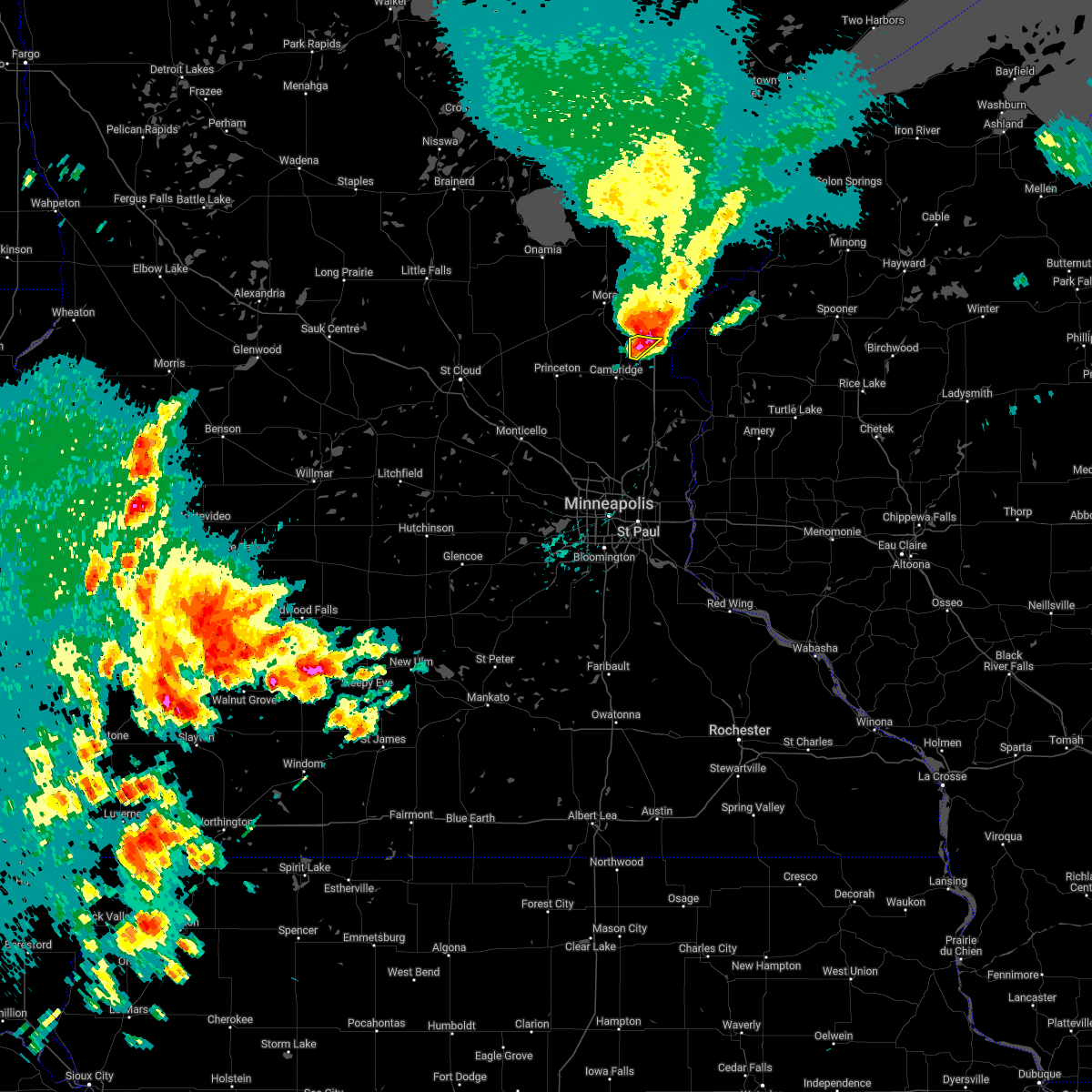 At 450 pm cdt, a severe thunderstorm was located over sandstone, or 8 miles north of hinckley, moving northeast at 30 mph (radar indicated). Hazards include 60 mph wind gusts and half dollar size hail. Hail damage to vehicles is expected. expect wind damage to roofs, siding, and trees. this severe thunderstorm will remain over mainly rural areas of northwestern chisago county. hail threat, radar indicated max hail size, 1. 25 in wind threat, radar indicated max wind gust, 60 mph. At 450 pm cdt, a severe thunderstorm was located over sandstone, or 8 miles north of hinckley, moving northeast at 30 mph (radar indicated). Hazards include 60 mph wind gusts and half dollar size hail. Hail damage to vehicles is expected. expect wind damage to roofs, siding, and trees. this severe thunderstorm will remain over mainly rural areas of northwestern chisago county. hail threat, radar indicated max hail size, 1. 25 in wind threat, radar indicated max wind gust, 60 mph.
|
| 5/11/2022 4:43 PM CDT |
 At 442 pm cdt, a severe thunderstorm was located near hinckley, moving northeast at 30 mph (radar indicated). Hazards include 60 mph wind gusts and half dollar size hail. Hail damage to vehicles is expected. expect wind damage to roofs, siding, and trees. locations impacted include, grasston, stanchfield and grandy. hail threat, radar indicated max hail size, 1. 25 in wind threat, radar indicated max wind gust, 60 mph. At 442 pm cdt, a severe thunderstorm was located near hinckley, moving northeast at 30 mph (radar indicated). Hazards include 60 mph wind gusts and half dollar size hail. Hail damage to vehicles is expected. expect wind damage to roofs, siding, and trees. locations impacted include, grasston, stanchfield and grandy. hail threat, radar indicated max hail size, 1. 25 in wind threat, radar indicated max wind gust, 60 mph.
|
| 5/11/2022 4:43 PM CDT |
 At 442 pm cdt, a severe thunderstorm was located near rock creek, or 8 miles southwest of pine city, moving northeast at 30 mph (radar indicated). Hazards include 60 mph wind gusts and half dollar size hail. Hail damage to vehicles is expected. expect wind damage to roofs, siding, and trees. locations impacted include, pine city, hinckley, rock creek, grantsburg, brook park, henriette, branstad, randall, greely, west rock, chengwatana state forest, and beroun. hail threat, radar indicated max hail size, 1. 25 in wind threat, radar indicated max wind gust, 60 mph. At 442 pm cdt, a severe thunderstorm was located near rock creek, or 8 miles southwest of pine city, moving northeast at 30 mph (radar indicated). Hazards include 60 mph wind gusts and half dollar size hail. Hail damage to vehicles is expected. expect wind damage to roofs, siding, and trees. locations impacted include, pine city, hinckley, rock creek, grantsburg, brook park, henriette, branstad, randall, greely, west rock, chengwatana state forest, and beroun. hail threat, radar indicated max hail size, 1. 25 in wind threat, radar indicated max wind gust, 60 mph.
|
| 5/11/2022 4:27 PM CDT |
 At 426 pm cdt, a severe thunderstorm was located over brook park, or 7 miles southwest of hinckley, moving northeast at 30 mph (radar indicated). Hazards include 60 mph wind gusts and half dollar size hail. Hail damage to vehicles is expected. expect wind damage to roofs, siding, and trees. locations impacted include, cambridge, grasston, stanchfield, grandy and cambridge airport. hail threat, radar indicated max hail size, 1. 25 in wind threat, radar indicated max wind gust, 60 mph. At 426 pm cdt, a severe thunderstorm was located over brook park, or 7 miles southwest of hinckley, moving northeast at 30 mph (radar indicated). Hazards include 60 mph wind gusts and half dollar size hail. Hail damage to vehicles is expected. expect wind damage to roofs, siding, and trees. locations impacted include, cambridge, grasston, stanchfield, grandy and cambridge airport. hail threat, radar indicated max hail size, 1. 25 in wind threat, radar indicated max wind gust, 60 mph.
|
| 5/11/2022 4:26 PM CDT |
 At 426 pm cdt, a severe thunderstorm was located 8 miles south of grasston, or 9 miles north of cambridge, moving northeast at 25 mph (radar indicated). Hazards include 60 mph wind gusts and half dollar size hail. Hail damage to vehicles is expected. Expect wind damage to roofs, siding, and trees. At 426 pm cdt, a severe thunderstorm was located 8 miles south of grasston, or 9 miles north of cambridge, moving northeast at 25 mph (radar indicated). Hazards include 60 mph wind gusts and half dollar size hail. Hail damage to vehicles is expected. Expect wind damage to roofs, siding, and trees.
|
| 5/11/2022 4:14 PM CDT |
 At 413 pm cdt, a severe thunderstorm was located over quamba, or 10 miles west of pine city, moving northeast at 30 mph (radar indicated). Hazards include 60 mph wind gusts and quarter size hail. Hail damage to vehicles is expected. expect wind damage to roofs, siding, and trees. this severe thunderstorm will remain over mainly rural areas of southeastern kanabec, northwestern chisago and western isanti counties, including the following locations, grandy, stanchfield, cambridge airport, lewis lake, spencer brook and dalbo. hail threat, radar indicated max hail size, 1. 00 in wind threat, radar indicated max wind gust, 60 mph. At 413 pm cdt, a severe thunderstorm was located over quamba, or 10 miles west of pine city, moving northeast at 30 mph (radar indicated). Hazards include 60 mph wind gusts and quarter size hail. Hail damage to vehicles is expected. expect wind damage to roofs, siding, and trees. this severe thunderstorm will remain over mainly rural areas of southeastern kanabec, northwestern chisago and western isanti counties, including the following locations, grandy, stanchfield, cambridge airport, lewis lake, spencer brook and dalbo. hail threat, radar indicated max hail size, 1. 00 in wind threat, radar indicated max wind gust, 60 mph.
|
| 5/11/2022 4:00 PM CDT |
 At 400 pm cdt, a severe thunderstorm was located over brunswick, or 15 miles west of pine city, moving northeast at 25 mph (radar indicated). Hazards include ping pong ball size hail and 60 mph wind gusts. People and animals outdoors will be injured. expect hail damage to roofs, siding, windows, and vehicles. Expect wind damage to roofs, siding, and trees. At 400 pm cdt, a severe thunderstorm was located over brunswick, or 15 miles west of pine city, moving northeast at 25 mph (radar indicated). Hazards include ping pong ball size hail and 60 mph wind gusts. People and animals outdoors will be injured. expect hail damage to roofs, siding, windows, and vehicles. Expect wind damage to roofs, siding, and trees.
|
| 5/11/2022 3:57 PM CDT |
 At 357 pm cdt, a severe thunderstorm was located over brunswick, or 16 miles west of pine city, moving northeast at 30 mph (radar indicated). Hazards include ping pong ball size hail. People and animals outdoors will be injured. expect damage to roofs, siding, windows, and vehicles. this severe thunderstorm will be near, mora and grasston around 405 pm cdt. quamba around 415 pm cdt. hail threat, radar indicated max hail size, 1. 50 in wind threat, radar indicated max wind gust, <50 mph. At 357 pm cdt, a severe thunderstorm was located over brunswick, or 16 miles west of pine city, moving northeast at 30 mph (radar indicated). Hazards include ping pong ball size hail. People and animals outdoors will be injured. expect damage to roofs, siding, windows, and vehicles. this severe thunderstorm will be near, mora and grasston around 405 pm cdt. quamba around 415 pm cdt. hail threat, radar indicated max hail size, 1. 50 in wind threat, radar indicated max wind gust, <50 mph.
|
| 5/9/2022 5:33 PM CDT |
 At 532 pm cdt, a severe thunderstorm capable of producing a tornado was located 6 miles east of north branch, or 18 miles east of cambridge, moving northeast at 65 mph (radar indicated rotation). Hazards include tornado and half dollar size hail. Flying debris will be dangerous to those caught without shelter. mobile homes will be damaged or destroyed. damage to roofs, windows, and vehicles will occur. tree damage is likely. This tornadic thunderstorm will remain over mainly rural areas of central chisago and northwestern polk counties, including the following locations, wolf creek, wyoming, branch, cushing and wild river state park. At 532 pm cdt, a severe thunderstorm capable of producing a tornado was located 6 miles east of north branch, or 18 miles east of cambridge, moving northeast at 65 mph (radar indicated rotation). Hazards include tornado and half dollar size hail. Flying debris will be dangerous to those caught without shelter. mobile homes will be damaged or destroyed. damage to roofs, windows, and vehicles will occur. tree damage is likely. This tornadic thunderstorm will remain over mainly rural areas of central chisago and northwestern polk counties, including the following locations, wolf creek, wyoming, branch, cushing and wild river state park.
|
| 5/9/2022 5:20 PM CDT |
 At 519 pm cdt, a severe thunderstorm capable of producing a tornado was located near stacy, or 15 miles southeast of cambridge, moving northeast at 65 mph (radar indicated rotation). Hazards include tornado and half dollar size hail. Flying debris will be dangerous to those caught without shelter. mobile homes will be damaged or destroyed. damage to roofs, windows, and vehicles will occur. tree damage is likely. this dangerous storm will be near, chisago city around 525 pm cdt. North branch around 530 pm cdt. At 519 pm cdt, a severe thunderstorm capable of producing a tornado was located near stacy, or 15 miles southeast of cambridge, moving northeast at 65 mph (radar indicated rotation). Hazards include tornado and half dollar size hail. Flying debris will be dangerous to those caught without shelter. mobile homes will be damaged or destroyed. damage to roofs, windows, and vehicles will occur. tree damage is likely. this dangerous storm will be near, chisago city around 525 pm cdt. North branch around 530 pm cdt.
|
| 5/9/2022 5:03 PM CDT |
 At 503 pm cdt, a severe thunderstorm was located near east bethel, or 9 miles south of cambridge, moving northeast at 60 mph (radar indicated). Hazards include ping pong ball size hail and 60 mph wind gusts. People and animals outdoors will be injured. expect hail damage to roofs, siding, windows, and vehicles. expect wind damage to roofs, siding, and trees. this severe thunderstorm will be near, north branch around 520 pm cdt. other locations in the path of this severe thunderstorm include rush city. hail threat, radar indicated max hail size, 1. 50 in wind threat, radar indicated max wind gust, 60 mph. At 503 pm cdt, a severe thunderstorm was located near east bethel, or 9 miles south of cambridge, moving northeast at 60 mph (radar indicated). Hazards include ping pong ball size hail and 60 mph wind gusts. People and animals outdoors will be injured. expect hail damage to roofs, siding, windows, and vehicles. expect wind damage to roofs, siding, and trees. this severe thunderstorm will be near, north branch around 520 pm cdt. other locations in the path of this severe thunderstorm include rush city. hail threat, radar indicated max hail size, 1. 50 in wind threat, radar indicated max wind gust, 60 mph.
|
| 5/9/2022 10:26 AM CDT |
 The severe thunderstorm warning for central pine and southwestern burnett counties will expire at 1030 am cdt, the storm which prompted the warning has moved out of the area. therefore, the warning will be allowed to expire. however small hail and gusty winds are still possible with this thunderstorm. a severe thunderstorm watch remains in effect until 100 pm cdt for east central minnesota. a severe thunderstorm watch also remains in effect until 300 pm cdt for northwestern wisconsin. The severe thunderstorm warning for central pine and southwestern burnett counties will expire at 1030 am cdt, the storm which prompted the warning has moved out of the area. therefore, the warning will be allowed to expire. however small hail and gusty winds are still possible with this thunderstorm. a severe thunderstorm watch remains in effect until 100 pm cdt for east central minnesota. a severe thunderstorm watch also remains in effect until 300 pm cdt for northwestern wisconsin.
|
| 5/9/2022 10:24 AM CDT |
 At 1024 am cdt, a severe thunderstorm was located near bruno, or 28 miles south of cloquet, moving northeast at 60 mph (radar indicated). Hazards include 60 mph wind gusts and quarter size hail. Hail damage to vehicles is expected. expect wind damage to roofs, siding, and trees. locations impacted include, pine city, hinckley, sandstone, rock creek, grantsburg, askov, bruno, duxbury, mille lacs band lena lake area, randall, greely, phantom lake, chengwatana state forest, banning state park, saint croix state park, west rock, cloverdale, friesland, and beroun. hail threat, radar indicated max hail size, 1. 00 in wind threat, radar indicated max wind gust, 60 mph. At 1024 am cdt, a severe thunderstorm was located near bruno, or 28 miles south of cloquet, moving northeast at 60 mph (radar indicated). Hazards include 60 mph wind gusts and quarter size hail. Hail damage to vehicles is expected. expect wind damage to roofs, siding, and trees. locations impacted include, pine city, hinckley, sandstone, rock creek, grantsburg, askov, bruno, duxbury, mille lacs band lena lake area, randall, greely, phantom lake, chengwatana state forest, banning state park, saint croix state park, west rock, cloverdale, friesland, and beroun. hail threat, radar indicated max hail size, 1. 00 in wind threat, radar indicated max wind gust, 60 mph.
|
| 5/9/2022 10:15 AM CDT |
 At 1014 am cdt, a severe thunderstorm was located 7 miles northeast of north branch, or 17 miles east of cambridge, moving east at 45 mph (radar indicated). Hazards include ping pong ball size hail and 60 mph wind gusts. People and animals outdoors will be injured. expect hail damage to roofs, siding, windows, and vehicles. expect wind damage to roofs, siding, and trees. this severe thunderstorm will remain over mainly rural areas of chisago county, including the following locations, harris, rush city airport, branch and wild river state park. hail threat, radar indicated max hail size, 1. 50 in wind threat, radar indicated max wind gust, 60 mph. At 1014 am cdt, a severe thunderstorm was located 7 miles northeast of north branch, or 17 miles east of cambridge, moving east at 45 mph (radar indicated). Hazards include ping pong ball size hail and 60 mph wind gusts. People and animals outdoors will be injured. expect hail damage to roofs, siding, windows, and vehicles. expect wind damage to roofs, siding, and trees. this severe thunderstorm will remain over mainly rural areas of chisago county, including the following locations, harris, rush city airport, branch and wild river state park. hail threat, radar indicated max hail size, 1. 50 in wind threat, radar indicated max wind gust, 60 mph.
|
| 5/9/2022 10:08 AM CDT |
 At 1007 am cdt, a severe thunderstorm was located 7 miles southeast of askov, or 12 miles northeast of hinckley, moving northeast at 60 mph (radar indicated). Hazards include 60 mph wind gusts and quarter size hail. Hail damage to vehicles is expected. expect wind damage to roofs, siding, and trees. locations impacted include, duxbury and bruno. hail threat, radar indicated max hail size, 1. 00 in wind threat, radar indicated max wind gust, 60 mph. At 1007 am cdt, a severe thunderstorm was located 7 miles southeast of askov, or 12 miles northeast of hinckley, moving northeast at 60 mph (radar indicated). Hazards include 60 mph wind gusts and quarter size hail. Hail damage to vehicles is expected. expect wind damage to roofs, siding, and trees. locations impacted include, duxbury and bruno. hail threat, radar indicated max hail size, 1. 00 in wind threat, radar indicated max wind gust, 60 mph.
|
| 5/9/2022 9:53 AM CDT |
 At 953 am cdt, a severe thunderstorm was located over cambridge, moving east at 45 mph (radar indicated). Hazards include ping pong ball size hail and 60 mph wind gusts. People and animals outdoors will be injured. expect hail damage to roofs, siding, windows, and vehicles. expect wind damage to roofs, siding, and trees. this severe thunderstorm will be near, north branch around 1010 am cdt. other locations in the path of this severe thunderstorm include rush city. hail threat, radar indicated max hail size, 1. 50 in wind threat, radar indicated max wind gust, 60 mph. At 953 am cdt, a severe thunderstorm was located over cambridge, moving east at 45 mph (radar indicated). Hazards include ping pong ball size hail and 60 mph wind gusts. People and animals outdoors will be injured. expect hail damage to roofs, siding, windows, and vehicles. expect wind damage to roofs, siding, and trees. this severe thunderstorm will be near, north branch around 1010 am cdt. other locations in the path of this severe thunderstorm include rush city. hail threat, radar indicated max hail size, 1. 50 in wind threat, radar indicated max wind gust, 60 mph.
|
| 5/9/2022 9:42 AM CDT |
 At 939 am cdt, a severe thunderstorm was located over rush city, or 7 miles south of pine city, moving northeast at 60 mph (radar indicated). Hazards include 60 mph wind gusts and quarter size hail. Hail damage to vehicles is expected. expect wind damage to roofs, siding, and trees. this severe thunderstorm will be near, pine city around 950 am cdt. other locations in the path of this severe thunderstorm include hinckley, sandstone, askov, mille lacs band lena lake area, duxbury and bruno. hail threat, radar indicated max hail size, 1. 00 in wind threat, radar indicated max wind gust, 60 mph. At 939 am cdt, a severe thunderstorm was located over rush city, or 7 miles south of pine city, moving northeast at 60 mph (radar indicated). Hazards include 60 mph wind gusts and quarter size hail. Hail damage to vehicles is expected. expect wind damage to roofs, siding, and trees. this severe thunderstorm will be near, pine city around 950 am cdt. other locations in the path of this severe thunderstorm include hinckley, sandstone, askov, mille lacs band lena lake area, duxbury and bruno. hail threat, radar indicated max hail size, 1. 00 in wind threat, radar indicated max wind gust, 60 mph.
|
| 8/28/2021 1:24 PM CDT |
 At 124 pm cdt, severe thunderstorms were located along a line extending from 9 miles east of mcgrath, to near hinckley, to near rock creek, moving east at 45 mph (radar indicated). Hazards include 60 mph wind gusts and quarter size hail. Hail damage to vehicles is expected. expect wind damage to roofs, siding, and trees. Locations impacted include, pine city, hinckley, rock creek, grantsburg, trade lake, branstad, randall, falun, greely, phantom lake, chengwatana state forest, saint croix state park, four corners, west rock, alpha, trade river, cloverdale, beroun, and yellow lake. At 124 pm cdt, severe thunderstorms were located along a line extending from 9 miles east of mcgrath, to near hinckley, to near rock creek, moving east at 45 mph (radar indicated). Hazards include 60 mph wind gusts and quarter size hail. Hail damage to vehicles is expected. expect wind damage to roofs, siding, and trees. Locations impacted include, pine city, hinckley, rock creek, grantsburg, trade lake, branstad, randall, falun, greely, phantom lake, chengwatana state forest, saint croix state park, four corners, west rock, alpha, trade river, cloverdale, beroun, and yellow lake.
|
| 8/28/2021 1:11 PM CDT |
 At 110 pm cdt, severe thunderstorms were located along a line extending from near mcgrath, to near brook park, to near rock creek, moving east northeast at 45 mph (radar indicated). Hazards include 70 mph wind gusts and ping pong ball size hail. People and animals outdoors will be injured. expect hail damage to roofs, siding, windows, and vehicles. expect considerable tree damage. wind damage is also likely to mobile homes, roofs, and outbuildings. Locations impacted include, pine city, rock creek, hinckley, grantsburg and branstad. At 110 pm cdt, severe thunderstorms were located along a line extending from near mcgrath, to near brook park, to near rock creek, moving east northeast at 45 mph (radar indicated). Hazards include 70 mph wind gusts and ping pong ball size hail. People and animals outdoors will be injured. expect hail damage to roofs, siding, windows, and vehicles. expect considerable tree damage. wind damage is also likely to mobile homes, roofs, and outbuildings. Locations impacted include, pine city, rock creek, hinckley, grantsburg and branstad.
|
| 8/28/2021 12:47 PM CDT |
 At 1247 pm cdt, severe thunderstorms were located along a line extending from isle, to mora, to 6 miles south of brunswick, moving east northeast at 45 mph (radar indicated). Hazards include two inch hail and 70 mph wind gusts. People and animals outdoors will be injured. expect hail damage to roofs, siding, windows, and vehicles. expect considerable tree damage. wind damage is also likely to mobile homes, roofs, and outbuildings. severe thunderstorms will be near, henriette around 100 pm cdt. brook park around 105 pm cdt. Other locations in the path of these severe thunderstorms include pine city, rock creek, hinckley, grantsburg and branstad. At 1247 pm cdt, severe thunderstorms were located along a line extending from isle, to mora, to 6 miles south of brunswick, moving east northeast at 45 mph (radar indicated). Hazards include two inch hail and 70 mph wind gusts. People and animals outdoors will be injured. expect hail damage to roofs, siding, windows, and vehicles. expect considerable tree damage. wind damage is also likely to mobile homes, roofs, and outbuildings. severe thunderstorms will be near, henriette around 100 pm cdt. brook park around 105 pm cdt. Other locations in the path of these severe thunderstorms include pine city, rock creek, hinckley, grantsburg and branstad.
|
| 7/28/2021 7:58 PM CDT |
 At 757 pm cdt, a severe thunderstorm capable of producing a tornado was located near rock creek, or near pine city, moving southeast at 40 mph (radar indicated rotation. spotter report of rotating wall cloud). Hazards include tornado and quarter size hail. Flying debris will be dangerous to those caught without shelter. mobile homes will be damaged or destroyed. damage to roofs, windows, and vehicles will occur. tree damage is likely. this dangerous storm will be near, branstad around 810 pm cdt. Other locations in the path of this tornadic thunderstorm include trade lake. At 757 pm cdt, a severe thunderstorm capable of producing a tornado was located near rock creek, or near pine city, moving southeast at 40 mph (radar indicated rotation. spotter report of rotating wall cloud). Hazards include tornado and quarter size hail. Flying debris will be dangerous to those caught without shelter. mobile homes will be damaged or destroyed. damage to roofs, windows, and vehicles will occur. tree damage is likely. this dangerous storm will be near, branstad around 810 pm cdt. Other locations in the path of this tornadic thunderstorm include trade lake.
|
| 7/28/2021 7:51 PM CDT |
 At 751 pm cdt, a severe thunderstorm was located near rock creek, or near pine city, moving southeast at 40 mph (radar indicated). Hazards include 60 mph wind gusts and quarter size hail. Hail damage to vehicles is expected. expect wind damage to roofs, siding, and trees. this severe thunderstorm will be near, grantsburg and branstad around 805 pm cdt. trade lake around 815 pm cdt. Other locations impacted by this severe thunderstorm include four corners, alpha, trade river, chengwatana state forest, randall and falun. At 751 pm cdt, a severe thunderstorm was located near rock creek, or near pine city, moving southeast at 40 mph (radar indicated). Hazards include 60 mph wind gusts and quarter size hail. Hail damage to vehicles is expected. expect wind damage to roofs, siding, and trees. this severe thunderstorm will be near, grantsburg and branstad around 805 pm cdt. trade lake around 815 pm cdt. Other locations impacted by this severe thunderstorm include four corners, alpha, trade river, chengwatana state forest, randall and falun.
|
| 8/10/2020 4:00 AM CDT |
 At 359 am cdt, a severe thunderstorm was located over pine city, moving east at 35 mph (radar indicated). Hazards include 60 mph wind gusts and half dollar size hail. Hail damage to vehicles is expected. expect wind damage to roofs, siding, and trees. Locations impacted include, pine city, rock creek, grantsburg, brook park, henriette, branstad, randall, greely, phantom lake, chengwatana state forest, saint croix state park, west rock, and beroun. At 359 am cdt, a severe thunderstorm was located over pine city, moving east at 35 mph (radar indicated). Hazards include 60 mph wind gusts and half dollar size hail. Hail damage to vehicles is expected. expect wind damage to roofs, siding, and trees. Locations impacted include, pine city, rock creek, grantsburg, brook park, henriette, branstad, randall, greely, phantom lake, chengwatana state forest, saint croix state park, west rock, and beroun.
|
| 8/10/2020 3:35 AM CDT |
 At 335 am cdt, a severe thunderstorm was located over brunswick, or 14 miles west of pine city, moving east at 35 mph (radar indicated). Hazards include 60 mph wind gusts and half dollar size hail. Hail damage to vehicles is expected. Expect wind damage to roofs, siding, and trees. At 335 am cdt, a severe thunderstorm was located over brunswick, or 14 miles west of pine city, moving east at 35 mph (radar indicated). Hazards include 60 mph wind gusts and half dollar size hail. Hail damage to vehicles is expected. Expect wind damage to roofs, siding, and trees.
|
| 7/18/2020 1:26 AM CDT |
 The tornado warning for northwestern chisago county will expire at 130 am cdt, the storm which prompted the warning has weakened below severe limits, and has exited the warned area. therefore, the warning will be allowed to expire. a severe thunderstorm watch remains in effect until 600 am cdt for east central minnesota, and northwestern wisconsin. to report severe weather, contact your nearest law enforcement agency. they will relay your report to the national weather service the twin cities. The tornado warning for northwestern chisago county will expire at 130 am cdt, the storm which prompted the warning has weakened below severe limits, and has exited the warned area. therefore, the warning will be allowed to expire. a severe thunderstorm watch remains in effect until 600 am cdt for east central minnesota, and northwestern wisconsin. to report severe weather, contact your nearest law enforcement agency. they will relay your report to the national weather service the twin cities.
|
| 7/18/2020 1:22 AM CDT |
 At 121 am cdt, a severe thunderstorm capable of producing a tornado was located over rush city, or 7 miles south of pine city, moving southeast at 60 mph (radar indicated rotation). Hazards include tornado. Flying debris will be dangerous to those caught without shelter. mobile homes will be damaged or destroyed. damage to roofs, windows, and vehicles will occur. tree damage is likely. This tornadic thunderstorm will remain over mainly rural areas of southwestern pine and southwestern burnett counties, including the following locations, greely, west rock and chengwatana state forest. At 121 am cdt, a severe thunderstorm capable of producing a tornado was located over rush city, or 7 miles south of pine city, moving southeast at 60 mph (radar indicated rotation). Hazards include tornado. Flying debris will be dangerous to those caught without shelter. mobile homes will be damaged or destroyed. damage to roofs, windows, and vehicles will occur. tree damage is likely. This tornadic thunderstorm will remain over mainly rural areas of southwestern pine and southwestern burnett counties, including the following locations, greely, west rock and chengwatana state forest.
|
| 7/18/2020 1:18 AM CDT |
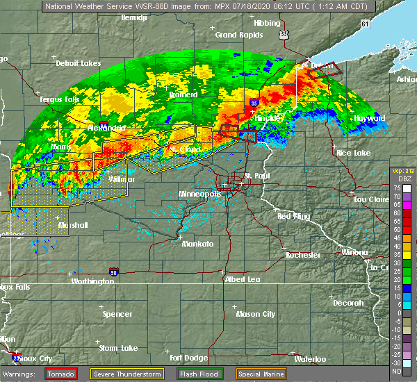 At 118 am cdt, severe thunderstorms capable of producing both tornadoes and extensive straight-line wind damage were located near rock creek, or near pine city, moving east at 40 mph (radar indicated rotation). Hazards include tornado. Flying debris will be dangerous to those caught without shelter. mobile homes will be damaged or destroyed. damage to roofs, windows, and vehicles will occur. tree damage is likely. these dangerous storms will be near, rock creek around 125 am cdt. Other locations impacted by this tornadic thunderstorm include greely, west rock and chengwatana state forest. At 118 am cdt, severe thunderstorms capable of producing both tornadoes and extensive straight-line wind damage were located near rock creek, or near pine city, moving east at 40 mph (radar indicated rotation). Hazards include tornado. Flying debris will be dangerous to those caught without shelter. mobile homes will be damaged or destroyed. damage to roofs, windows, and vehicles will occur. tree damage is likely. these dangerous storms will be near, rock creek around 125 am cdt. Other locations impacted by this tornadic thunderstorm include greely, west rock and chengwatana state forest.
|
| 7/18/2020 1:16 AM CDT |
 At 116 am cdt, a severe thunderstorm capable of producing a tornado was located near rush city, or 10 miles southwest of pine city, moving east at 50 mph (radar indicated rotation). Hazards include tornado. Flying debris will be dangerous to those caught without shelter. mobile homes will be damaged or destroyed. damage to roofs, windows, and vehicles will occur. tree damage is likely. this dangerous storm will be near, rush city around 125 am cdt. Other locations impacted by this tornadic thunderstorm include harris, rush city airport and wild river state park. At 116 am cdt, a severe thunderstorm capable of producing a tornado was located near rush city, or 10 miles southwest of pine city, moving east at 50 mph (radar indicated rotation). Hazards include tornado. Flying debris will be dangerous to those caught without shelter. mobile homes will be damaged or destroyed. damage to roofs, windows, and vehicles will occur. tree damage is likely. this dangerous storm will be near, rush city around 125 am cdt. Other locations impacted by this tornadic thunderstorm include harris, rush city airport and wild river state park.
|
| 7/18/2020 1:03 AM CDT |
 At 103 am cdt, a severe thunderstorm capable of producing a tornado was located near brunswick, or 14 miles north of cambridge, moving east at 50 mph (radar indicated rotation). Hazards include tornado. Flying debris will be dangerous to those caught without shelter. mobile homes will be damaged or destroyed. damage to roofs, windows, and vehicles will occur. tree damage is likely. this dangerous storm will be near, grasston around 110 am cdt. Rush city around 125 am cdt. At 103 am cdt, a severe thunderstorm capable of producing a tornado was located near brunswick, or 14 miles north of cambridge, moving east at 50 mph (radar indicated rotation). Hazards include tornado. Flying debris will be dangerous to those caught without shelter. mobile homes will be damaged or destroyed. damage to roofs, windows, and vehicles will occur. tree damage is likely. this dangerous storm will be near, grasston around 110 am cdt. Rush city around 125 am cdt.
|
| 7/19/2019 5:15 PM CDT |
 At 515 pm cdt, a large and dangerous severe thunderstorm was located near trade lake, or 20 miles southeast of pine city, moving southeast at 40 mph (radar indicated). Hazards include 70 mph wind gusts and half dollar size hail. Hail damage to vehicles is expected. expect considerable tree damage. wind damage is also likely to mobile homes, roofs, and outbuildings. Locations impacted include, grantsburg, trade lake, branstad, randall, falun, four corners, alpha, trade river, and chengwatana state forest. At 515 pm cdt, a large and dangerous severe thunderstorm was located near trade lake, or 20 miles southeast of pine city, moving southeast at 40 mph (radar indicated). Hazards include 70 mph wind gusts and half dollar size hail. Hail damage to vehicles is expected. expect considerable tree damage. wind damage is also likely to mobile homes, roofs, and outbuildings. Locations impacted include, grantsburg, trade lake, branstad, randall, falun, four corners, alpha, trade river, and chengwatana state forest.
|
| 7/19/2019 4:58 PM CDT |
 At 456 pm cdt, a large and extremely dangerous severe thunderstorm was located just east of rush city, or 12 miles southeast of pine city, moving southeast at 45 mph (radar indicated. baseball size hail was reported in pine city at 440 pm cdt). Hazards include 90 mph wind gusts and baseball size hail. You are in a life-threatening situation. flying debris may be deadly to those caught without shelter. mobile homes will be heavily damaged or destroyed. homes and businesses will have substantial roof and window damage. Expect extensive tree damage and power outages. At 456 pm cdt, a large and extremely dangerous severe thunderstorm was located just east of rush city, or 12 miles southeast of pine city, moving southeast at 45 mph (radar indicated. baseball size hail was reported in pine city at 440 pm cdt). Hazards include 90 mph wind gusts and baseball size hail. You are in a life-threatening situation. flying debris may be deadly to those caught without shelter. mobile homes will be heavily damaged or destroyed. homes and businesses will have substantial roof and window damage. Expect extensive tree damage and power outages.
|
| 7/19/2019 4:58 PM CDT |
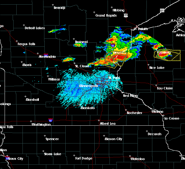 At 456 pm cdt, a large and extremely dangerous severe thunderstorm was located just east of rush city, or 12 miles southeast of pine city, moving southeast at 45 mph (radar indicated. baseball size hail was reported in pine city at 440 pm cdt). Hazards include 90 mph wind gusts and baseball size hail. You are in a life-threatening situation. flying debris may be deadly to those caught without shelter. mobile homes will be heavily damaged or destroyed. homes and businesses will have substantial roof and window damage. Expect extensive tree damage and power outages. At 456 pm cdt, a large and extremely dangerous severe thunderstorm was located just east of rush city, or 12 miles southeast of pine city, moving southeast at 45 mph (radar indicated. baseball size hail was reported in pine city at 440 pm cdt). Hazards include 90 mph wind gusts and baseball size hail. You are in a life-threatening situation. flying debris may be deadly to those caught without shelter. mobile homes will be heavily damaged or destroyed. homes and businesses will have substantial roof and window damage. Expect extensive tree damage and power outages.
|
| 7/19/2019 4:48 PM CDT |
 At 447 pm cdt, a large and extremely dangerous severe thunderstorm was located over pine city and rush city in southern pine county, moving southeast at 50 mph (radar indicated. golf ball sized hail was reported just east of pine city at 444 pm cdt, and trees were reported blown down across state highway 70 around 440 pm cdt in southern pine county). Hazards include 90 mph wind gusts and golf ball size hail. You are in a life-threatening situation. flying debris may be deadly to those caught without shelter. mobile homes will be heavily damaged or destroyed. homes and businesses will have substantial roof and window damage. expect extensive tree damage and power outages. Locations impacted include, pine city, rock creek, grantsburg, trade lake, branstad, randall, falun, greely, phantom lake, four corners, west rock, alpha, trade river, beroun, and saint croix state park. At 447 pm cdt, a large and extremely dangerous severe thunderstorm was located over pine city and rush city in southern pine county, moving southeast at 50 mph (radar indicated. golf ball sized hail was reported just east of pine city at 444 pm cdt, and trees were reported blown down across state highway 70 around 440 pm cdt in southern pine county). Hazards include 90 mph wind gusts and golf ball size hail. You are in a life-threatening situation. flying debris may be deadly to those caught without shelter. mobile homes will be heavily damaged or destroyed. homes and businesses will have substantial roof and window damage. expect extensive tree damage and power outages. Locations impacted include, pine city, rock creek, grantsburg, trade lake, branstad, randall, falun, greely, phantom lake, four corners, west rock, alpha, trade river, beroun, and saint croix state park.
|
| 7/19/2019 4:48 PM CDT |
 At 447 pm cdt, a severe thunderstorm was located over rush city, or 11 miles south of pine city, moving southeast at 40 mph. this is a very dangerous storm (radar indicated). Hazards include 80 mph wind gusts and golf ball size hail. Flying debris will be dangerous to those caught without shelter. mobile homes will be heavily damaged. expect considerable damage to roofs, windows, and vehicles. extensive tree damage and power outages are likely. This severe thunderstorm will remain over mainly rural areas of northern chisago and northwestern polk counties, including the following locations, harris, rush city airport, wolf creek, cushing and wild river state park. At 447 pm cdt, a severe thunderstorm was located over rush city, or 11 miles south of pine city, moving southeast at 40 mph. this is a very dangerous storm (radar indicated). Hazards include 80 mph wind gusts and golf ball size hail. Flying debris will be dangerous to those caught without shelter. mobile homes will be heavily damaged. expect considerable damage to roofs, windows, and vehicles. extensive tree damage and power outages are likely. This severe thunderstorm will remain over mainly rural areas of northern chisago and northwestern polk counties, including the following locations, harris, rush city airport, wolf creek, cushing and wild river state park.
|
| 7/19/2019 4:48 PM CDT |
 At 447 pm cdt, a large and extremely dangerous severe thunderstorm was located over pine city and rush city in southern pine county, moving southeast at 50 mph (radar indicated. golf ball sized hail was reported just east of pine city at 444 pm cdt, and trees were reported blown down across state highway 70 around 440 pm cdt in southern pine county). Hazards include 90 mph wind gusts and golf ball size hail. You are in a life-threatening situation. flying debris may be deadly to those caught without shelter. mobile homes will be heavily damaged or destroyed. homes and businesses will have substantial roof and window damage. expect extensive tree damage and power outages. Locations impacted include, pine city, rock creek, grantsburg, trade lake, branstad, randall, falun, greely, phantom lake, four corners, west rock, alpha, trade river, beroun, and saint croix state park. At 447 pm cdt, a large and extremely dangerous severe thunderstorm was located over pine city and rush city in southern pine county, moving southeast at 50 mph (radar indicated. golf ball sized hail was reported just east of pine city at 444 pm cdt, and trees were reported blown down across state highway 70 around 440 pm cdt in southern pine county). Hazards include 90 mph wind gusts and golf ball size hail. You are in a life-threatening situation. flying debris may be deadly to those caught without shelter. mobile homes will be heavily damaged or destroyed. homes and businesses will have substantial roof and window damage. expect extensive tree damage and power outages. Locations impacted include, pine city, rock creek, grantsburg, trade lake, branstad, randall, falun, greely, phantom lake, four corners, west rock, alpha, trade river, beroun, and saint croix state park.
|
| 7/19/2019 4:48 PM CDT |
 At 447 pm cdt, a severe thunderstorm was located over rush city, or 11 miles south of pine city, moving southeast at 40 mph. this is a very dangerous storm (radar indicated). Hazards include 80 mph wind gusts and golf ball size hail. Flying debris will be dangerous to those caught without shelter. mobile homes will be heavily damaged. expect considerable damage to roofs, windows, and vehicles. extensive tree damage and power outages are likely. This severe thunderstorm will remain over mainly rural areas of northern chisago and northwestern polk counties, including the following locations, harris, rush city airport, wolf creek, cushing and wild river state park. At 447 pm cdt, a severe thunderstorm was located over rush city, or 11 miles south of pine city, moving southeast at 40 mph. this is a very dangerous storm (radar indicated). Hazards include 80 mph wind gusts and golf ball size hail. Flying debris will be dangerous to those caught without shelter. mobile homes will be heavily damaged. expect considerable damage to roofs, windows, and vehicles. extensive tree damage and power outages are likely. This severe thunderstorm will remain over mainly rural areas of northern chisago and northwestern polk counties, including the following locations, harris, rush city airport, wolf creek, cushing and wild river state park.
|
| 7/19/2019 4:36 PM CDT |
 At 434 pm cdt, a large and extremely dangerous severe thunderstorm was located over rock creek, or near pine city, moving southeast at 50 mph (radar indicated. golf ball size hail was reported just north of henriette at 430 pm cdt). Hazards include 90 mph wind gusts and golf ball size hail. You are in a life-threatening situation. flying debris may be deadly to those caught without shelter. mobile homes will be heavily damaged or destroyed. homes and businesses will have substantial roof and window damage. expect extensive tree damage and power outages. Locations impacted include, pine city, hinckley, rock creek, grantsburg, trade lake, brook park, henriette, branstad, randall, falun, greely, phantom lake, chengwatana state forest, four corners, west rock, alpha, trade river, beroun, yellow lake, and saint croix state park. At 434 pm cdt, a large and extremely dangerous severe thunderstorm was located over rock creek, or near pine city, moving southeast at 50 mph (radar indicated. golf ball size hail was reported just north of henriette at 430 pm cdt). Hazards include 90 mph wind gusts and golf ball size hail. You are in a life-threatening situation. flying debris may be deadly to those caught without shelter. mobile homes will be heavily damaged or destroyed. homes and businesses will have substantial roof and window damage. expect extensive tree damage and power outages. Locations impacted include, pine city, hinckley, rock creek, grantsburg, trade lake, brook park, henriette, branstad, randall, falun, greely, phantom lake, chengwatana state forest, four corners, west rock, alpha, trade river, beroun, yellow lake, and saint croix state park.
|
| 7/19/2019 4:33 PM CDT |
 At 433 pm cdt, a severe thunderstorm was located over rock creek, or near pine city, moving southeast at 40 mph. this is a very dangerous storm (radar indicated). Hazards include 80 mph wind gusts and golf ball size hail. Flying debris will be dangerous to those caught without shelter. mobile homes will be heavily damaged. expect considerable damage to roofs, windows, and vehicles. extensive tree damage and power outages are likely. This severe thunderstorm will remain over mainly rural areas of northern chisago and northwestern polk counties, including the following locations, harris, rush city airport, wolf creek, cushing and wild river state park. At 433 pm cdt, a severe thunderstorm was located over rock creek, or near pine city, moving southeast at 40 mph. this is a very dangerous storm (radar indicated). Hazards include 80 mph wind gusts and golf ball size hail. Flying debris will be dangerous to those caught without shelter. mobile homes will be heavily damaged. expect considerable damage to roofs, windows, and vehicles. extensive tree damage and power outages are likely. This severe thunderstorm will remain over mainly rural areas of northern chisago and northwestern polk counties, including the following locations, harris, rush city airport, wolf creek, cushing and wild river state park.
|
| 7/19/2019 4:33 PM CDT |
 The national weather service in the twin cities has issued a * severe thunderstorm warning for. northern chisago county in east central minnesota. northwestern polk county in northwestern wisconsin. until 515 pm cdt. At 433 pm cdt, a severe thunderstorm was located over rock creek,. The national weather service in the twin cities has issued a * severe thunderstorm warning for. northern chisago county in east central minnesota. northwestern polk county in northwestern wisconsin. until 515 pm cdt. At 433 pm cdt, a severe thunderstorm was located over rock creek,.
|
| 7/19/2019 4:28 PM CDT |
 At 425 pm cdt, a large and extremely dangerous severe thunderstorm was located over henriette, moving southeast at 50 mph (radar indicated). Hazards include 90 mph wind gusts and golf ball size hail. You are in a life-threatening situation. flying debris may be deadly to those caught without shelter. mobile homes will be heavily damaged or destroyed. homes and businesses will have substantial roof and window damage. expect extensive tree damage and power outages. locations impacted include, pine city, hinckley, rock creek, grantsburg, trade lake, brook park, henriette, branstad, randall, falun, greely, phantom lake, chengwatana state forest, saint croix state park, four corners, west rock, alpha, trade river, beroun, and yellow lake. This also includes interstate 35 between rush city and hinckley. At 425 pm cdt, a large and extremely dangerous severe thunderstorm was located over henriette, moving southeast at 50 mph (radar indicated). Hazards include 90 mph wind gusts and golf ball size hail. You are in a life-threatening situation. flying debris may be deadly to those caught without shelter. mobile homes will be heavily damaged or destroyed. homes and businesses will have substantial roof and window damage. expect extensive tree damage and power outages. locations impacted include, pine city, hinckley, rock creek, grantsburg, trade lake, brook park, henriette, branstad, randall, falun, greely, phantom lake, chengwatana state forest, saint croix state park, four corners, west rock, alpha, trade river, beroun, and yellow lake. This also includes interstate 35 between rush city and hinckley.
|
| 7/19/2019 4:28 PM CDT |
 At 415 pm cdt, a large and extremely dangerous severe thunderstorm was located over quamba, or 10 miles northwest of pine city, moving east-southeast at 50 mph (radar indicated). Hazards include 80 mph wind gusts and golf ball size hail. Flying debris will be dangerous to those caught without shelter. mobile homes will be heavily damaged. expect considerable damage to roofs, windows, and vehicles. Extensive tree damage and power outages are likely. At 415 pm cdt, a large and extremely dangerous severe thunderstorm was located over quamba, or 10 miles northwest of pine city, moving east-southeast at 50 mph (radar indicated). Hazards include 80 mph wind gusts and golf ball size hail. Flying debris will be dangerous to those caught without shelter. mobile homes will be heavily damaged. expect considerable damage to roofs, windows, and vehicles. Extensive tree damage and power outages are likely.
|
| 7/19/2019 4:16 PM CDT |
 At 415 pm cdt, a large and extremely dangerous severe thunderstorm was located over quamba, or 10 miles northwest of pine city, moving east-southeast at 50 mph (radar indicated). Hazards include 80 mph wind gusts and golf ball size hail. Flying debris will be dangerous to those caught without shelter. mobile homes will be heavily damaged. expect considerable damage to roofs, windows, and vehicles. Extensive tree damage and power outages are likely. At 415 pm cdt, a large and extremely dangerous severe thunderstorm was located over quamba, or 10 miles northwest of pine city, moving east-southeast at 50 mph (radar indicated). Hazards include 80 mph wind gusts and golf ball size hail. Flying debris will be dangerous to those caught without shelter. mobile homes will be heavily damaged. expect considerable damage to roofs, windows, and vehicles. Extensive tree damage and power outages are likely.
|
| 7/15/2019 6:03 PM CDT |
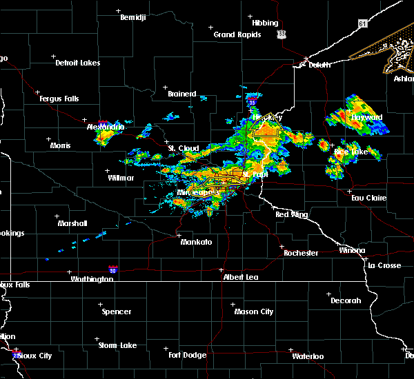 At 602 pm cdt, a severe thunderstorm was located over branstad, or 17 miles east of pine city, moving northeast at 20 mph (radar indicated). Hazards include 60 mph wind gusts and quarter size hail. Hail damage to vehicles is expected. expect wind damage to roofs, siding, and trees. Locations impacted include, grantsburg, trade lake, branstad, randall, falun, saint croix state park, four corners, alpha, trade river, phantom lake, and chengwatana state forest. At 602 pm cdt, a severe thunderstorm was located over branstad, or 17 miles east of pine city, moving northeast at 20 mph (radar indicated). Hazards include 60 mph wind gusts and quarter size hail. Hail damage to vehicles is expected. expect wind damage to roofs, siding, and trees. Locations impacted include, grantsburg, trade lake, branstad, randall, falun, saint croix state park, four corners, alpha, trade river, phantom lake, and chengwatana state forest.
|
| 7/15/2019 5:51 PM CDT |
 At 550 pm cdt, a severe thunderstorm was located over branstad, or 15 miles southeast of pine city, moving northeast at 20 mph (radar indicated). Hazards include 60 mph wind gusts and quarter size hail. Hail damage to vehicles is expected. expect wind damage to roofs, siding, and trees. Locations impacted include, pine city, rock creek, grantsburg, trade lake, branstad, randall, falun, phantom lake, chengwatana state forest, saint croix state park, four corners, alpha, and trade river. At 550 pm cdt, a severe thunderstorm was located over branstad, or 15 miles southeast of pine city, moving northeast at 20 mph (radar indicated). Hazards include 60 mph wind gusts and quarter size hail. Hail damage to vehicles is expected. expect wind damage to roofs, siding, and trees. Locations impacted include, pine city, rock creek, grantsburg, trade lake, branstad, randall, falun, phantom lake, chengwatana state forest, saint croix state park, four corners, alpha, and trade river.
|
| 7/15/2019 5:38 PM CDT |
 At 537 pm cdt, a severe thunderstorm was located near branstad, or 13 miles southeast of pine city, moving northeast at 20 mph (radar indicated). Hazards include 60 mph wind gusts and quarter size hail. Hail damage to vehicles is expected. Expect wind damage to roofs, siding, and trees. At 537 pm cdt, a severe thunderstorm was located near branstad, or 13 miles southeast of pine city, moving northeast at 20 mph (radar indicated). Hazards include 60 mph wind gusts and quarter size hail. Hail damage to vehicles is expected. Expect wind damage to roofs, siding, and trees.
|
| 7/14/2019 9:06 PM CDT |
 At 905 pm cdt, severe thunderstorms were located along a line extending from near pine city to 6 miles southwest of rush city, moving east at 35 mph (radar indicated). Hazards include 60 mph wind gusts. Expect damage to roofs, siding, and trees. Locations impacted include, rush city, stanchfield and rush city airport. At 905 pm cdt, severe thunderstorms were located along a line extending from near pine city to 6 miles southwest of rush city, moving east at 35 mph (radar indicated). Hazards include 60 mph wind gusts. Expect damage to roofs, siding, and trees. Locations impacted include, rush city, stanchfield and rush city airport.
|
| 7/14/2019 8:45 PM CDT |
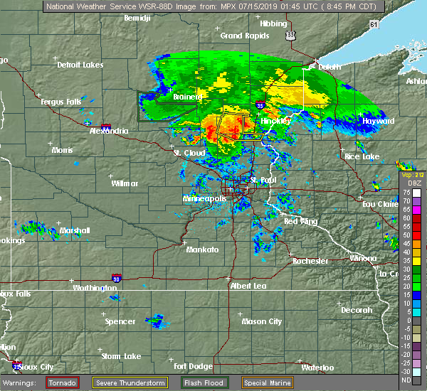 At 845 pm cdt, severe thunderstorms were located along a line extending from henriette to 8 miles south of brunswick, moving southeast at 40 mph (radar indicated). Hazards include 60 mph wind gusts. Expect damage to roofs, siding, and trees. Locations impacted include, rush city, brunswick, grasston, quamba, stanchfield and rush city airport. At 845 pm cdt, severe thunderstorms were located along a line extending from henriette to 8 miles south of brunswick, moving southeast at 40 mph (radar indicated). Hazards include 60 mph wind gusts. Expect damage to roofs, siding, and trees. Locations impacted include, rush city, brunswick, grasston, quamba, stanchfield and rush city airport.
|
| 7/14/2019 8:29 PM CDT |
 At 829 pm cdt, severe thunderstorms were located along a line extending from 8 miles north of mora to ogilvie, moving east at 35 mph (radar indicated). Hazards include 60 mph wind gusts. expect damage to roofs, siding, and trees At 829 pm cdt, severe thunderstorms were located along a line extending from 8 miles north of mora to ogilvie, moving east at 35 mph (radar indicated). Hazards include 60 mph wind gusts. expect damage to roofs, siding, and trees
|
| 6/30/2019 11:39 AM CDT |
 The severe thunderstorm warning for southwestern burnett county will expire at 1145 am cdt, the storm which prompted the warning has moved out of the area. therefore, the warning will be allowed to expire. The severe thunderstorm warning for southwestern burnett county will expire at 1145 am cdt, the storm which prompted the warning has moved out of the area. therefore, the warning will be allowed to expire.
|
| 6/30/2019 11:33 AM CDT |
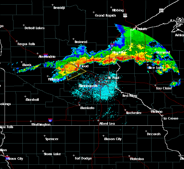 At 1133 am cdt, a severe thunderstorm was located over frederic, or 25 miles southeast of pine city, moving southeast at 55 mph (radar indicated). Hazards include 60 mph wind gusts and half dollar size hail. Hail damage to vehicles is expected. expect wind damage to roofs, siding, and trees. Locations impacted include, grantsburg, trade lake, siren, branstad, falun, four corners, and alpha. At 1133 am cdt, a severe thunderstorm was located over frederic, or 25 miles southeast of pine city, moving southeast at 55 mph (radar indicated). Hazards include 60 mph wind gusts and half dollar size hail. Hail damage to vehicles is expected. expect wind damage to roofs, siding, and trees. Locations impacted include, grantsburg, trade lake, siren, branstad, falun, four corners, and alpha.
|
| 6/30/2019 11:21 AM CDT |
 The severe thunderstorm warning for southern pine, northwestern washburn and central burnett counties will expire at 1130 am cdt, the storms which prompted the warning have moved out of the area. therefore, the warning will be allowed to expire. The severe thunderstorm warning for southern pine, northwestern washburn and central burnett counties will expire at 1130 am cdt, the storms which prompted the warning have moved out of the area. therefore, the warning will be allowed to expire.
|
| 6/30/2019 11:16 AM CDT |
 At 1116 am cdt, a severe thunderstorm was located near grantsburg, or 11 miles east of pine city, moving southeast at 55 mph (radar indicated). Hazards include 60 mph wind gusts and half dollar size hail. Hail damage to vehicles is expected. Expect wind damage to roofs, siding, and trees. At 1116 am cdt, a severe thunderstorm was located near grantsburg, or 11 miles east of pine city, moving southeast at 55 mph (radar indicated). Hazards include 60 mph wind gusts and half dollar size hail. Hail damage to vehicles is expected. Expect wind damage to roofs, siding, and trees.
|
| 6/30/2019 10:59 AM CDT |
 A severe thunderstorm warning remains in effect until 1130 am cdt for southern pine. northwestern washburn and central burnett counties. At 1058 am cdt, severe thunderstorms were located along a line extending from 7 miles northeast of webb lake wisconsin, to near webster, to 9 miles northwest of grantsburg, moving southeast at 55. A severe thunderstorm warning remains in effect until 1130 am cdt for southern pine. northwestern washburn and central burnett counties. At 1058 am cdt, severe thunderstorms were located along a line extending from 7 miles northeast of webb lake wisconsin, to near webster, to 9 miles northwest of grantsburg, moving southeast at 55.
|
| 6/30/2019 10:59 AM CDT |
 At 1058 am cdt, severe thunderstorms were located along a line extending from 7 miles northeast of webb lake wisconsin, to near webster, to 9 miles northwest of grantsburg, moving southeast at 55 mph (radar indicated). Hazards include 60 mph wind gusts and quarter size hail. Hail damage to vehicles is expected. expect wind damage to roofs, siding, and trees. Locations impacted include, pine city, hinckley, rock creek, webster, webb lake wisconsin, brook park, henriette, danbury, oakland, greely, minong flowage, phantom lake, chengwatana state forest, markville, saint croix state park, west rock, cloverdale, beroun, riverside, and yellow lake. At 1058 am cdt, severe thunderstorms were located along a line extending from 7 miles northeast of webb lake wisconsin, to near webster, to 9 miles northwest of grantsburg, moving southeast at 55 mph (radar indicated). Hazards include 60 mph wind gusts and quarter size hail. Hail damage to vehicles is expected. expect wind damage to roofs, siding, and trees. Locations impacted include, pine city, hinckley, rock creek, webster, webb lake wisconsin, brook park, henriette, danbury, oakland, greely, minong flowage, phantom lake, chengwatana state forest, markville, saint croix state park, west rock, cloverdale, beroun, riverside, and yellow lake.
|
| 6/30/2019 10:38 AM CDT |
 At 1037 am cdt, severe thunderstorms were located along a line extending from 8 miles north of cloverton, to 8 miles west of duxbury, to 6 miles northwest of hinckley, moving southeast at 55 mph (radar indicated). Hazards include 60 mph wind gusts and quarter size hail. Hail damage to vehicles is expected. Expect wind damage to roofs, siding, and trees. At 1037 am cdt, severe thunderstorms were located along a line extending from 8 miles north of cloverton, to 8 miles west of duxbury, to 6 miles northwest of hinckley, moving southeast at 55 mph (radar indicated). Hazards include 60 mph wind gusts and quarter size hail. Hail damage to vehicles is expected. Expect wind damage to roofs, siding, and trees.
|
| 8/27/2018 6:12 PM CDT |
 At 612 pm cdt, severe thunderstorms were located along a line extending from 7 miles southeast of nemadji, to near duxbury, to near grantsburg, moving northeast at 45 mph (radar indicated). Hazards include 60 mph wind gusts. Expect damage to roofs, siding, and trees. a flash flood warning is also in effect for much of the warned area. Locations impacted include, grantsburg, siren, webster, willow river, askov, webb lake wisconsin, dairyland, holyoke, bruno, cloverton, south range, duxbury, foxboro, danbury, hertel, nemadji, oakland, sturgeon lake, nickerson, and kerrick. At 612 pm cdt, severe thunderstorms were located along a line extending from 7 miles southeast of nemadji, to near duxbury, to near grantsburg, moving northeast at 45 mph (radar indicated). Hazards include 60 mph wind gusts. Expect damage to roofs, siding, and trees. a flash flood warning is also in effect for much of the warned area. Locations impacted include, grantsburg, siren, webster, willow river, askov, webb lake wisconsin, dairyland, holyoke, bruno, cloverton, south range, duxbury, foxboro, danbury, hertel, nemadji, oakland, sturgeon lake, nickerson, and kerrick.
|
| 8/27/2018 6:12 PM CDT |
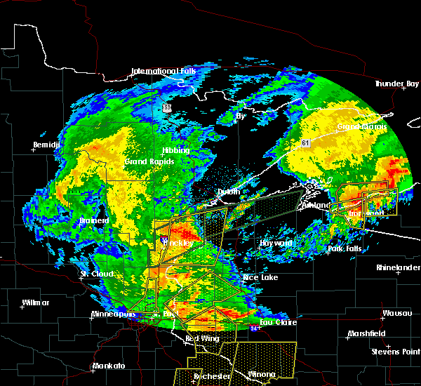 At 612 pm cdt, severe thunderstorms were located along a line extending from 7 miles southeast of nemadji, to near duxbury, to near grantsburg, moving northeast at 45 mph (radar indicated). Hazards include 60 mph wind gusts. Expect damage to roofs, siding, and trees. a flash flood warning is also in effect for much of the warned area. Locations impacted include, grantsburg, siren, webster, willow river, askov, webb lake wisconsin, dairyland, holyoke, bruno, cloverton, south range, duxbury, foxboro, danbury, hertel, nemadji, oakland, sturgeon lake, nickerson, and kerrick. At 612 pm cdt, severe thunderstorms were located along a line extending from 7 miles southeast of nemadji, to near duxbury, to near grantsburg, moving northeast at 45 mph (radar indicated). Hazards include 60 mph wind gusts. Expect damage to roofs, siding, and trees. a flash flood warning is also in effect for much of the warned area. Locations impacted include, grantsburg, siren, webster, willow river, askov, webb lake wisconsin, dairyland, holyoke, bruno, cloverton, south range, duxbury, foxboro, danbury, hertel, nemadji, oakland, sturgeon lake, nickerson, and kerrick.
|
| 8/27/2018 5:58 PM CDT |
 At 558 pm cdt, severe thunderstorms were located along a line extending from near bruno, to 9 miles southeast of sandstone, to near rock creek, moving northeast at 40 mph (radar indicated). Hazards include 60 mph wind gusts and torrential rainfall. expect damage to roofs, siding, and trees At 558 pm cdt, severe thunderstorms were located along a line extending from near bruno, to 9 miles southeast of sandstone, to near rock creek, moving northeast at 40 mph (radar indicated). Hazards include 60 mph wind gusts and torrential rainfall. expect damage to roofs, siding, and trees
|
| 8/27/2018 5:45 PM CDT |
 At 545 pm cdt, a severe thunderstorm was located near sandstone, or 8 miles northeast of hinckley, moving northeast at 50 mph (radar indicated). Hazards include 60 mph wind gusts. Expect damage to roofs, siding, and trees. locations impacted include, pine city, hinckley, sandstone, rock creek, willow river, askov, rutledge, brook park, bruno, henriette, cloverton, duxbury, sturgeon lake, finlayson, kerrick, denham, duquette, banning state park, kingsdale, and west rock. This includes interstate 35 between pine city and willow river. At 545 pm cdt, a severe thunderstorm was located near sandstone, or 8 miles northeast of hinckley, moving northeast at 50 mph (radar indicated). Hazards include 60 mph wind gusts. Expect damage to roofs, siding, and trees. locations impacted include, pine city, hinckley, sandstone, rock creek, willow river, askov, rutledge, brook park, bruno, henriette, cloverton, duxbury, sturgeon lake, finlayson, kerrick, denham, duquette, banning state park, kingsdale, and west rock. This includes interstate 35 between pine city and willow river.
|
| 8/27/2018 5:34 PM CDT |
 At 534 pm cdt, a severe thunderstorm was located over hinckley, moving northeast at 50 mph (radar indicated). Hazards include 60 mph wind gusts and torrential rainfall. expect damage to roofs, siding, and trees At 534 pm cdt, a severe thunderstorm was located over hinckley, moving northeast at 50 mph (radar indicated). Hazards include 60 mph wind gusts and torrential rainfall. expect damage to roofs, siding, and trees
|
| 8/27/2018 3:06 PM CDT |
 At 306 pm cdt, severe thunderstorms were located along a line extending from near askov, to 10 miles east of hinckley, to 6 miles west of grantsburg, moving east at 40 mph (radar indicated). Hazards include 60 mph wind gusts and torrential rainfall. Expect damage to roofs, siding, and trees. locations impacted include, pine city, hinckley, sandstone, rock creek, grantsburg, askov, duxbury, finlayson, falun, grindstone lake pine county, greely, phantom lake, banning state park, saint croix state park, west rock, alpha, cloverdale, friesland, and beroun. This also includes interstate 35 between pine city and sandstone. At 306 pm cdt, severe thunderstorms were located along a line extending from near askov, to 10 miles east of hinckley, to 6 miles west of grantsburg, moving east at 40 mph (radar indicated). Hazards include 60 mph wind gusts and torrential rainfall. Expect damage to roofs, siding, and trees. locations impacted include, pine city, hinckley, sandstone, rock creek, grantsburg, askov, duxbury, finlayson, falun, grindstone lake pine county, greely, phantom lake, banning state park, saint croix state park, west rock, alpha, cloverdale, friesland, and beroun. This also includes interstate 35 between pine city and sandstone.
|
| 8/27/2018 2:55 PM CDT |
 At 255 pm cdt, severe thunderstorms were located along a line extending from near sandstone, to near hinckley, to rock creek, moving east at 40 mph (radar indicated). Hazards include 60 mph wind gusts and torrential rainfall. Expect damage to roofs, siding, and trees. locations impacted include, pine city, hinckley, sandstone, rock creek, grantsburg, trade lake, askov, brook park, henriette, duxbury, branstad, danbury, randall, finlayson, falun, banning state park, four corners, west rock, trade river, and friesland. This also includes interstate 35 between rush city and sandstone. At 255 pm cdt, severe thunderstorms were located along a line extending from near sandstone, to near hinckley, to rock creek, moving east at 40 mph (radar indicated). Hazards include 60 mph wind gusts and torrential rainfall. Expect damage to roofs, siding, and trees. locations impacted include, pine city, hinckley, sandstone, rock creek, grantsburg, trade lake, askov, brook park, henriette, duxbury, branstad, danbury, randall, finlayson, falun, banning state park, four corners, west rock, trade river, and friesland. This also includes interstate 35 between rush city and sandstone.
|
| 8/27/2018 2:41 PM CDT |
 At 229 pm cdt, a severe thunderstorm was located over just east of mora, or 8 miles west of pine city, moving east at 40 mph (radar indicated). Hazards include 60 mph wind gusts and penny size hail and torrential rainfall. expect damage to roofs, siding, and trees At 229 pm cdt, a severe thunderstorm was located over just east of mora, or 8 miles west of pine city, moving east at 40 mph (radar indicated). Hazards include 60 mph wind gusts and penny size hail and torrential rainfall. expect damage to roofs, siding, and trees
|
| 8/27/2018 2:41 PM CDT |
 At 241 pm cdt, severe thunderstorms were located along a line extending from 7 miles northwest of hinckley, to near brook park, to near grasston, moving east at 30 mph (radar indicated). Hazards include 60 mph wind gusts and penny size hail. Expect damage to roofs, siding, and trees. locations impacted include, pine city, hinckley, sandstone, rock creek, grantsburg, trade lake, askov, brook park, henriette, duxbury, branstad, danbury, randall, finlayson, falun, banning state park, four corners, west rock, trade river, and friesland. This also includes interstate 35 between rush city and sandstone. At 241 pm cdt, severe thunderstorms were located along a line extending from 7 miles northwest of hinckley, to near brook park, to near grasston, moving east at 30 mph (radar indicated). Hazards include 60 mph wind gusts and penny size hail. Expect damage to roofs, siding, and trees. locations impacted include, pine city, hinckley, sandstone, rock creek, grantsburg, trade lake, askov, brook park, henriette, duxbury, branstad, danbury, randall, finlayson, falun, banning state park, four corners, west rock, trade river, and friesland. This also includes interstate 35 between rush city and sandstone.
|
| 8/27/2018 2:30 PM CDT |
 At 229 pm cdt, a severe thunderstorm was located over just east of mora, or 8 miles west of pine city, moving east at 40 mph (radar indicated). Hazards include 60 mph wind gusts and penny size hail and torrential rainfall. expect damage to roofs, siding, and trees At 229 pm cdt, a severe thunderstorm was located over just east of mora, or 8 miles west of pine city, moving east at 40 mph (radar indicated). Hazards include 60 mph wind gusts and penny size hail and torrential rainfall. expect damage to roofs, siding, and trees
|
| 8/26/2018 5:47 AM CDT |
 At 547 am cdt, severe thunderstorms were located along a line extending from near spencer brook to st. francis, moving east at 50 mph (radar indicated). Hazards include half dollar size hail. damage to vehicles is expected At 547 am cdt, severe thunderstorms were located along a line extending from near spencer brook to st. francis, moving east at 50 mph (radar indicated). Hazards include half dollar size hail. damage to vehicles is expected
|
| 8/26/2018 5:11 AM CDT |
 The severe thunderstorm warning for south central pine and southwestern burnett counties will expire at 515 am cdt, the storm which prompted the warning has weakened below severe limits, and no longer poses an immediate threat to life or property. therefore, the warning will be allowed to expire. however small hail, gusty winds, and heavy rain are still possible with this thunderstorm. The severe thunderstorm warning for south central pine and southwestern burnett counties will expire at 515 am cdt, the storm which prompted the warning has weakened below severe limits, and no longer poses an immediate threat to life or property. therefore, the warning will be allowed to expire. however small hail, gusty winds, and heavy rain are still possible with this thunderstorm.
|
| 8/26/2018 5:00 AM CDT |
 At 500 am cdt, a severe thunderstorm was located near rock creek, or near pine city, moving east at 45 mph (radar indicated). Hazards include 60 mph wind gusts and half dollar size hail. Hail damage to vehicles is expected. expect wind damage to roofs, siding, and trees. This severe thunderstorm will remain over mainly rural areas of south central pine and southwestern burnett counties, including the following locations: chengwatana state forest and randall. At 500 am cdt, a severe thunderstorm was located near rock creek, or near pine city, moving east at 45 mph (radar indicated). Hazards include 60 mph wind gusts and half dollar size hail. Hail damage to vehicles is expected. expect wind damage to roofs, siding, and trees. This severe thunderstorm will remain over mainly rural areas of south central pine and southwestern burnett counties, including the following locations: chengwatana state forest and randall.
|
| 8/26/2018 4:48 AM CDT |
 At 447 am cdt, a severe thunderstorm was located near grasston, or 9 miles southwest of pine city, moving east at 45 mph (radar indicated). Hazards include 60 mph wind gusts and half dollar size hail. Hail damage to vehicles is expected. expect wind damage to roofs, siding, and trees. this severe storm will be near, pine city and rock creek around 455 am cdt. Other locations impacted by this severe thunderstorm include chengwatana state forest, greely, randall, and west rock. At 447 am cdt, a severe thunderstorm was located near grasston, or 9 miles southwest of pine city, moving east at 45 mph (radar indicated). Hazards include 60 mph wind gusts and half dollar size hail. Hail damage to vehicles is expected. expect wind damage to roofs, siding, and trees. this severe storm will be near, pine city and rock creek around 455 am cdt. Other locations impacted by this severe thunderstorm include chengwatana state forest, greely, randall, and west rock.
|
| 8/26/2018 4:29 AM CDT |
 At 428 am cdt, a severe thunderstorm was located 8 miles southwest of brunswick, or 14 miles northwest of cambridge, moving east at 45 mph (radar indicated). Hazards include 60 mph wind gusts and half dollar size hail. Hail damage to vehicles is expected. expect wind damage to roofs, siding, and trees. this severe thunderstorm will be near, rock creek around 455 am cdt. pine city around 500 am cdt. Other locations impacted by this severe thunderstorm include chengwatana state forest, greely, randall, and west rock. At 428 am cdt, a severe thunderstorm was located 8 miles southwest of brunswick, or 14 miles northwest of cambridge, moving east at 45 mph (radar indicated). Hazards include 60 mph wind gusts and half dollar size hail. Hail damage to vehicles is expected. expect wind damage to roofs, siding, and trees. this severe thunderstorm will be near, rock creek around 455 am cdt. pine city around 500 am cdt. Other locations impacted by this severe thunderstorm include chengwatana state forest, greely, randall, and west rock.
|
| 6/17/2018 3:26 PM CDT |
 At 326 pm cdt, severe thunderstorms were located along a line extending from near lake nebagamon, to near solon springs, to near webster, moving east at 60 mph. in this line a stronger storm is near solon springs, moving east at 50 to 60 mph. these are very dangerous storms (radar indicated). Hazards include 80 mph wind gusts and quarter size hail. Hail damage to vehicles is expected. locations impacted include, pine city, grantsburg, trego, trade lake, siren, barnes, wascott, webster, solon springs, minong, webb lake wisconsin, gordon, dairyland, cloverton, duxbury, danbury, hertel, branstad, oakland, and bennett. A tornado watch remains in effect until 900 pm cdt for northeastern and east central minnesota, and northwestern wisconsin. At 326 pm cdt, severe thunderstorms were located along a line extending from near lake nebagamon, to near solon springs, to near webster, moving east at 60 mph. in this line a stronger storm is near solon springs, moving east at 50 to 60 mph. these are very dangerous storms (radar indicated). Hazards include 80 mph wind gusts and quarter size hail. Hail damage to vehicles is expected. locations impacted include, pine city, grantsburg, trego, trade lake, siren, barnes, wascott, webster, solon springs, minong, webb lake wisconsin, gordon, dairyland, cloverton, duxbury, danbury, hertel, branstad, oakland, and bennett. A tornado watch remains in effect until 900 pm cdt for northeastern and east central minnesota, and northwestern wisconsin.
|
| 6/17/2018 3:01 PM CDT |
 At 300 pm cdt, severe thunderstorms were located along a line extending from 6 miles southeast of foxboro, to near cloverton, to near grantsburg, moving east at 45 mph (radar indicated). Hazards include 70 mph wind gusts and quarter size hail. Hail damage to vehicles is expected. expect considerable tree damage. Wind damage is also likely to mobile homes, roofs, and outbuildings. At 300 pm cdt, severe thunderstorms were located along a line extending from 6 miles southeast of foxboro, to near cloverton, to near grantsburg, moving east at 45 mph (radar indicated). Hazards include 70 mph wind gusts and quarter size hail. Hail damage to vehicles is expected. expect considerable tree damage. Wind damage is also likely to mobile homes, roofs, and outbuildings.
|
| 6/17/2018 2:47 PM CDT |
 At 247 pm cdt, severe thunderstorms were located along a line extending from near holyoke, to 7 miles southeast of hinckley, moving east at 40 mph (radar indicated). Hazards include 70 mph wind gusts and quarter size hail. Hail damage to vehicles is expected. expect considerable tree damage. wind damage is also likely to mobile homes, roofs, and outbuildings. locations impacted include, pine city, hinckley, sandstone, rock creek, grantsburg, carlton, mahtowa, barnum, willow river, wrenshall, oliver, askov, rutledge, holyoke, thomson, brook park, bruno, henriette, cloverton, and nemadji. A tornado watch remains in effect until 900 pm cdt for northeastern and east central minnesota, and northwestern wisconsin. At 247 pm cdt, severe thunderstorms were located along a line extending from near holyoke, to 7 miles southeast of hinckley, moving east at 40 mph (radar indicated). Hazards include 70 mph wind gusts and quarter size hail. Hail damage to vehicles is expected. expect considerable tree damage. wind damage is also likely to mobile homes, roofs, and outbuildings. locations impacted include, pine city, hinckley, sandstone, rock creek, grantsburg, carlton, mahtowa, barnum, willow river, wrenshall, oliver, askov, rutledge, holyoke, thomson, brook park, bruno, henriette, cloverton, and nemadji. A tornado watch remains in effect until 900 pm cdt for northeastern and east central minnesota, and northwestern wisconsin.
|
| 6/17/2018 2:29 PM CDT |
 At 228 pm cdt, severe thunderstorms were located along a line extending from near barnum, to near quamba, moving east at 45 mph (radar indicated). Hazards include 70 mph wind gusts and quarter size hail. Hail damage to vehicles is expected. expect considerable tree damage. Wind damage is also likely to mobile homes, roofs, and outbuildings. At 228 pm cdt, severe thunderstorms were located along a line extending from near barnum, to near quamba, moving east at 45 mph (radar indicated). Hazards include 70 mph wind gusts and quarter size hail. Hail damage to vehicles is expected. expect considerable tree damage. Wind damage is also likely to mobile homes, roofs, and outbuildings.
|
| 5/29/2018 4:25 PM CDT |
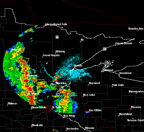 At 424 pm cdt, a severe thunderstorm was located over trade lake, or 22 miles southeast of pine city, moving north at 30 mph (radar indicated). Hazards include 60 mph wind gusts and quarter size hail. Hail damage to vehicles is expected. expect wind damage to roofs, siding, and trees. Locations impacted include, grantsburg, trade lake, siren, webster, branstad, oakland, falun, phantom lake, chengwatana state forest, saint croix state park, four corners, alpha, and yellow lake. At 424 pm cdt, a severe thunderstorm was located over trade lake, or 22 miles southeast of pine city, moving north at 30 mph (radar indicated). Hazards include 60 mph wind gusts and quarter size hail. Hail damage to vehicles is expected. expect wind damage to roofs, siding, and trees. Locations impacted include, grantsburg, trade lake, siren, webster, branstad, oakland, falun, phantom lake, chengwatana state forest, saint croix state park, four corners, alpha, and yellow lake.
|
| 5/29/2018 4:06 PM CDT |
 At 406 pm cdt, a severe thunderstorm was located over milltown, or 27 miles southeast of pine city, moving north at 30 mph (radar indicated). Hazards include 60 mph wind gusts and half dollar size hail. Hail damage to vehicles is expected. Expect wind damage to roofs, siding, and trees. At 406 pm cdt, a severe thunderstorm was located over milltown, or 27 miles southeast of pine city, moving north at 30 mph (radar indicated). Hazards include 60 mph wind gusts and half dollar size hail. Hail damage to vehicles is expected. Expect wind damage to roofs, siding, and trees.
|
| 5/29/2018 4:06 PM CDT |
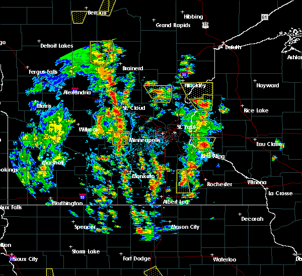 At 406 pm cdt, a severe thunderstorm was located over milltown, or 27 miles southeast of pine city, moving north at 30 mph (radar indicated). Hazards include 60 mph wind gusts and half dollar size hail. Hail damage to vehicles is expected. Expect wind damage to roofs, siding, and trees. At 406 pm cdt, a severe thunderstorm was located over milltown, or 27 miles southeast of pine city, moving north at 30 mph (radar indicated). Hazards include 60 mph wind gusts and half dollar size hail. Hail damage to vehicles is expected. Expect wind damage to roofs, siding, and trees.
|
| 5/28/2018 6:37 PM CDT |
 At 636 pm cdt, a severe thunderstorm was located over harris, or 10 miles northeast of cambridge, moving north at 25 mph (public). Hazards include 60 mph wind gusts and half dollar size hail. Hail damage to vehicles is expected. expect wind damage to roofs, siding, and trees. this severe storm will be near, rush city around 650 pm cdt. grasston around 700 pm cdt. Other locations impacted by this severe thunderstorm include grandy, spring lake, rush city airport, branch, weber, bodum, harris, stanchfield, cambridge airport and wild river state park. At 636 pm cdt, a severe thunderstorm was located over harris, or 10 miles northeast of cambridge, moving north at 25 mph (public). Hazards include 60 mph wind gusts and half dollar size hail. Hail damage to vehicles is expected. expect wind damage to roofs, siding, and trees. this severe storm will be near, rush city around 650 pm cdt. grasston around 700 pm cdt. Other locations impacted by this severe thunderstorm include grandy, spring lake, rush city airport, branch, weber, bodum, harris, stanchfield, cambridge airport and wild river state park.
|
| 5/28/2018 6:13 PM CDT |
 At 612 pm cdt, a severe thunderstorm was located over weber, or 9 miles southeast of cambridge, moving north at 25 mph. these storms have a history of producing damaging wind (public). Hazards include 60 mph wind gusts and half dollar size hail. Hail damage to vehicles is expected. expect wind damage to roofs, siding, and trees. this severe thunderstorm will be near, north branch around 625 pm cdt. rush city around 650 pm cdt. other locations impacted by this severe thunderstorm include grandy, spring lake, rush city airport, branch, weber, bodum, harris, stanchfield, cambridge airport and wild river state park. This includes interstate 35 between mile markers 144 and 163. At 612 pm cdt, a severe thunderstorm was located over weber, or 9 miles southeast of cambridge, moving north at 25 mph. these storms have a history of producing damaging wind (public). Hazards include 60 mph wind gusts and half dollar size hail. Hail damage to vehicles is expected. expect wind damage to roofs, siding, and trees. this severe thunderstorm will be near, north branch around 625 pm cdt. rush city around 650 pm cdt. other locations impacted by this severe thunderstorm include grandy, spring lake, rush city airport, branch, weber, bodum, harris, stanchfield, cambridge airport and wild river state park. This includes interstate 35 between mile markers 144 and 163.
|
| 9/22/2017 5:44 AM CDT |
 At 544 am cdt, a severe thunderstorm was located near pine city, moving northeast at 35 mph (radar indicated). Hazards include ping pong ball size hail and 60 mph wind gusts. People and animals outdoors will be injured. expect hail damage to roofs, siding, windows, and vehicles. Expect wind damage to roofs, siding, and trees. At 544 am cdt, a severe thunderstorm was located near pine city, moving northeast at 35 mph (radar indicated). Hazards include ping pong ball size hail and 60 mph wind gusts. People and animals outdoors will be injured. expect hail damage to roofs, siding, windows, and vehicles. Expect wind damage to roofs, siding, and trees.
|
| 7/17/2017 8:19 PM CDT |
 At 819 pm cdt, severe thunderstorms were located along a line extending from near cloverton, to near trade lake, moving east at 35 mph (radar indicated). Hazards include 60 mph wind gusts and quarter size hail. Hail damage to vehicles is expected. expect wind damage to roofs, siding, and trees. These severe thunderstorms will remain over mainly rural areas of southeastern pine and central burnett counties, including the following locations: markville, falun, saint croix state park, four corners, alpha, trade river, phantom lake, oakland, randall and riverside. At 819 pm cdt, severe thunderstorms were located along a line extending from near cloverton, to near trade lake, moving east at 35 mph (radar indicated). Hazards include 60 mph wind gusts and quarter size hail. Hail damage to vehicles is expected. expect wind damage to roofs, siding, and trees. These severe thunderstorms will remain over mainly rural areas of southeastern pine and central burnett counties, including the following locations: markville, falun, saint croix state park, four corners, alpha, trade river, phantom lake, oakland, randall and riverside.
|
| 7/17/2017 8:01 PM CDT |
 At 800 pm cdt, severe thunderstorms were located along a line extending from duxbury, to near rush city, moving east at 30 mph (radar indicated). Hazards include 60 mph wind gusts and quarter size hail. Hail damage to vehicles is expected. expect wind damage to roofs, siding, and trees. these severe storms will be near, duxbury around 805 pm cdt. danbury around 815 pm cdt. trade lake around 830 pm cdt. Other locations impacted by these severe thunderstorms include falun, phantom lake, oakland, markville, saint croix state park, four corners, west rock, alpha, trade river, and cloverdale. At 800 pm cdt, severe thunderstorms were located along a line extending from duxbury, to near rush city, moving east at 30 mph (radar indicated). Hazards include 60 mph wind gusts and quarter size hail. Hail damage to vehicles is expected. expect wind damage to roofs, siding, and trees. these severe storms will be near, duxbury around 805 pm cdt. danbury around 815 pm cdt. trade lake around 830 pm cdt. Other locations impacted by these severe thunderstorms include falun, phantom lake, oakland, markville, saint croix state park, four corners, west rock, alpha, trade river, and cloverdale.
|
| 7/17/2017 7:39 PM CDT |
 At 738 pm cdt, severe thunderstorms were located along a line extending from near askov, to near grasston, moving east at 30 mph (radar indicated). Hazards include 60 mph wind gusts and quarter size hail. Hail damage to vehicles is expected. expect wind damage to roofs, siding, and trees. severe thunderstorms will be near, duxbury around 755 pm cdt. danbury around 815 pm cdt. grantsburg and branstad around 820 pm cdt. trade lake around 830 pm cdt. Other locations impacted by these severe thunderstorms include falun, greely, phantom lake, oakland, markville, saint croix state park, four corners, west rock, alpha, and trade river. At 738 pm cdt, severe thunderstorms were located along a line extending from near askov, to near grasston, moving east at 30 mph (radar indicated). Hazards include 60 mph wind gusts and quarter size hail. Hail damage to vehicles is expected. expect wind damage to roofs, siding, and trees. severe thunderstorms will be near, duxbury around 755 pm cdt. danbury around 815 pm cdt. grantsburg and branstad around 820 pm cdt. trade lake around 830 pm cdt. Other locations impacted by these severe thunderstorms include falun, greely, phantom lake, oakland, markville, saint croix state park, four corners, west rock, alpha, and trade river.
|
| 7/6/2017 5:35 AM CDT |
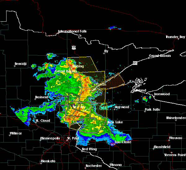 At 535 am cdt, severe thunderstorms were located along a line extending from 6 miles northeast of duxbury, to 8 miles west of webster, to 10 miles southwest of trade lake, moving east at 45 mph (radar indicated). Hazards include 60 mph wind gusts and penny size hail. expect damage to roofs, siding, and trees At 535 am cdt, severe thunderstorms were located along a line extending from 6 miles northeast of duxbury, to 8 miles west of webster, to 10 miles southwest of trade lake, moving east at 45 mph (radar indicated). Hazards include 60 mph wind gusts and penny size hail. expect damage to roofs, siding, and trees
|
| 7/6/2017 5:17 AM CDT |
 At 517 am cdt, severe thunderstorms were located along a line extending from near askov, to 6 miles east of pine city, to 8 miles northeast of cambridge, moving east at 45 mph (radar indicated). Hazards include 60 mph wind gusts and quarter size hail. Hail damage to vehicles is expected. expect wind damage to roofs, siding, and trees. Locations impacted include, pine city, hinckley, sandstone, rock creek, grantsburg, trade lake, siren, webster, askov, rutledge, brook park, henriette, cloverton, duxbury, danbury, branstad, randall, oakland, finlayson, and falun. At 517 am cdt, severe thunderstorms were located along a line extending from near askov, to 6 miles east of pine city, to 8 miles northeast of cambridge, moving east at 45 mph (radar indicated). Hazards include 60 mph wind gusts and quarter size hail. Hail damage to vehicles is expected. expect wind damage to roofs, siding, and trees. Locations impacted include, pine city, hinckley, sandstone, rock creek, grantsburg, trade lake, siren, webster, askov, rutledge, brook park, henriette, cloverton, duxbury, danbury, branstad, randall, oakland, finlayson, and falun.
|
| 7/6/2017 5:13 AM CDT |
 At 512 am cdt, severe thunderstorms were located along a line extending from askov, to near pine city, to 8 miles south of brunswick, moving east at 45 mph (radar indicated). Hazards include 60 mph wind gusts and quarter size hail. Hail damage to vehicles is expected. Expect wind damage to roofs, siding, and trees. At 512 am cdt, severe thunderstorms were located along a line extending from askov, to near pine city, to 8 miles south of brunswick, moving east at 45 mph (radar indicated). Hazards include 60 mph wind gusts and quarter size hail. Hail damage to vehicles is expected. Expect wind damage to roofs, siding, and trees.
|
| 7/6/2017 4:48 AM CDT |
 At 448 am cdt, severe thunderstorms were located along a line extending from 7 miles east of mcgrath, to near quamba, to near bock, moving east at 45 mph (radar indicated). Hazards include 60 mph wind gusts and quarter size hail. Hail damage to vehicles is expected. Expect wind damage to roofs, siding, and trees. At 448 am cdt, severe thunderstorms were located along a line extending from 7 miles east of mcgrath, to near quamba, to near bock, moving east at 45 mph (radar indicated). Hazards include 60 mph wind gusts and quarter size hail. Hail damage to vehicles is expected. Expect wind damage to roofs, siding, and trees.
|
| 6/11/2017 5:52 PM CDT |
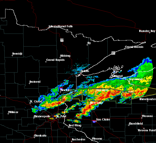 At 551 pm cdt, severe thunderstorms were located along a line extending from near grantsburg, to 11 miles northwest of taylors falls, moving east at 35 mph (radar indicated). Hazards include 70 mph wind gusts and quarter size hail. Hail damage to vehicles is expected. expect considerable tree damage. Wind damage is also likely to mobile homes, roofs, and outbuildings. At 551 pm cdt, severe thunderstorms were located along a line extending from near grantsburg, to 11 miles northwest of taylors falls, moving east at 35 mph (radar indicated). Hazards include 70 mph wind gusts and quarter size hail. Hail damage to vehicles is expected. expect considerable tree damage. Wind damage is also likely to mobile homes, roofs, and outbuildings.
|
| 3/6/2017 6:34 PM CST |
 At 634 pm cst, a severe thunderstorm was located near stanchfield, or 11 miles southwest of pine city, moving northeast at 30 mph (radar indicated). Hazards include 60 mph wind gusts and nickel size hail. Expect damage to roofs, siding, and trees. this severe storm will be near, rush city around 645 pm cst. other locations impacted by this severe thunderstorm include grandy and stanchfield. A tornado watch remains in effect until 1000 pm cst for east central minnesota. At 634 pm cst, a severe thunderstorm was located near stanchfield, or 11 miles southwest of pine city, moving northeast at 30 mph (radar indicated). Hazards include 60 mph wind gusts and nickel size hail. Expect damage to roofs, siding, and trees. this severe storm will be near, rush city around 645 pm cst. other locations impacted by this severe thunderstorm include grandy and stanchfield. A tornado watch remains in effect until 1000 pm cst for east central minnesota.
|
| 3/6/2017 6:10 PM CST |
 At 609 pm cst, a severe thunderstorm was located near dalbo, or 9 miles northwest of cambridge, moving northeast at 45 mph (radar indicated). Hazards include 60 mph wind gusts and quarter size hail. Hail damage to vehicles is expected. expect wind damage to roofs, siding, and trees. this severe thunderstorm will be near, brunswick around 620 pm cst. grasston around 625 pm cst. other locations impacted by this severe thunderstorm include grandy, stanchfield, and dalbo. this includes interstate 35 between mile markers 159 and 163. A tornado watch remains in effect until 1000 pm cst for east central minnesota. At 609 pm cst, a severe thunderstorm was located near dalbo, or 9 miles northwest of cambridge, moving northeast at 45 mph (radar indicated). Hazards include 60 mph wind gusts and quarter size hail. Hail damage to vehicles is expected. expect wind damage to roofs, siding, and trees. this severe thunderstorm will be near, brunswick around 620 pm cst. grasston around 625 pm cst. other locations impacted by this severe thunderstorm include grandy, stanchfield, and dalbo. this includes interstate 35 between mile markers 159 and 163. A tornado watch remains in effect until 1000 pm cst for east central minnesota.
|
| 8/19/2016 3:51 AM CDT |
 At 350 am cdt, severe thunderstorms were located along a line extending from near harris to cushing to cylon, moving northeast at 45 mph (radar indicated). Hazards include 60 mph wind gusts. Expect damage to roofs. siding. and trees. these severe storms will be near, frederic, luck and clear lake around 400 am cdt. Other locations impacted by these severe thunderstorms include branch, otisville, wild river state park, cushing, nye, osceola airport, rush city airport, deronda, wanderoos and stanchfield. At 350 am cdt, severe thunderstorms were located along a line extending from near harris to cushing to cylon, moving northeast at 45 mph (radar indicated). Hazards include 60 mph wind gusts. Expect damage to roofs. siding. and trees. these severe storms will be near, frederic, luck and clear lake around 400 am cdt. Other locations impacted by these severe thunderstorms include branch, otisville, wild river state park, cushing, nye, osceola airport, rush city airport, deronda, wanderoos and stanchfield.
|
| 8/19/2016 3:15 AM CDT |
 At 315 am cdt, severe thunderstorms were located along a line extending from near st. francis to near wyoming to near river falls, moving northeast at 45 mph (radar indicated). Hazards include 60 mph wind gusts. Expect damage to roofs. siding. and trees. severe thunderstorms will be near, stacy around 325 am cdt. chisago city, lindstrom and center city around 330 am cdt. rush city around 355 am cdt. frederic and luck around 400 am cdt. other locations impacted by these severe thunderstorms include branch, otisville, wild river state park, athens, cushing, nye, osceola airport, rush city airport, deronda and spencer brook. this includes the following highways, interstate 35 between mile markers 133 and 163. u. s. highway 8 in minnesota between mile markers 1 and 5, and between mile markers 7 and 22. u. s. Highway 61 between mile markers 161 and 165. At 315 am cdt, severe thunderstorms were located along a line extending from near st. francis to near wyoming to near river falls, moving northeast at 45 mph (radar indicated). Hazards include 60 mph wind gusts. Expect damage to roofs. siding. and trees. severe thunderstorms will be near, stacy around 325 am cdt. chisago city, lindstrom and center city around 330 am cdt. rush city around 355 am cdt. frederic and luck around 400 am cdt. other locations impacted by these severe thunderstorms include branch, otisville, wild river state park, athens, cushing, nye, osceola airport, rush city airport, deronda and spencer brook. this includes the following highways, interstate 35 between mile markers 133 and 163. u. s. highway 8 in minnesota between mile markers 1 and 5, and between mile markers 7 and 22. u. s. Highway 61 between mile markers 161 and 165.
|
| 8/16/2016 7:30 PM CDT |
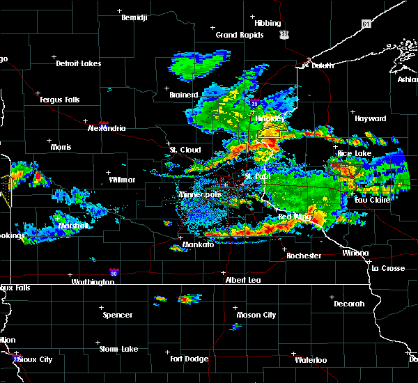 At 730 pm cdt, a severe thunderstorm was located over branstad, or 17 miles southeast of pine city, moving east at 10 mph (radar indicated). Hazards include 60 mph wind gusts and quarter size hail. Hail damage to vehicles is expected. expect wind damage to roofs, siding, and trees. this severe storm will be near, trade lake around 750 pm cdt. Other locations impacted by this severe thunderstorm include four corners, alpha, falun, randall and trade river. At 730 pm cdt, a severe thunderstorm was located over branstad, or 17 miles southeast of pine city, moving east at 10 mph (radar indicated). Hazards include 60 mph wind gusts and quarter size hail. Hail damage to vehicles is expected. expect wind damage to roofs, siding, and trees. this severe storm will be near, trade lake around 750 pm cdt. Other locations impacted by this severe thunderstorm include four corners, alpha, falun, randall and trade river.
|
| 8/16/2016 7:21 PM CDT |
 At 721 pm cdt, a severe thunderstorm was located over branstad, or 16 miles southeast of pine city, and is nearly stationary (radar indicated). Hazards include 60 mph wind gusts and half dollar size hail. Hail damage to vehicles is expected. expect wind damage to roofs, siding, and trees. this severe storm will be near, grantsburg around 735 pm cdt. branstad around 740 pm cdt. trade lake around 800 pm cdt. Other locations impacted by this severe thunderstorm include four corners, alpha, falun, randall and trade river. At 721 pm cdt, a severe thunderstorm was located over branstad, or 16 miles southeast of pine city, and is nearly stationary (radar indicated). Hazards include 60 mph wind gusts and half dollar size hail. Hail damage to vehicles is expected. expect wind damage to roofs, siding, and trees. this severe storm will be near, grantsburg around 735 pm cdt. branstad around 740 pm cdt. trade lake around 800 pm cdt. Other locations impacted by this severe thunderstorm include four corners, alpha, falun, randall and trade river.
|
| 8/16/2016 7:09 PM CDT |
 At 708 pm cdt, a severe thunderstorm was located near branstad, or 16 miles southeast of pine city, moving east at 10 mph (radar indicated). Hazards include ping pong ball size hail and 60 mph wind gusts. People and animals outdoors will be injured. expect hail damage to roofs, siding, windows, and vehicles. expect wind damage to roofs, siding, and trees. this severe thunderstorm will be near, grantsburg and branstad around 720 pm cdt. trade lake around 745 pm cdt. Other locations impacted by this severe thunderstorm include four corners, alpha, falun, randall and trade river. At 708 pm cdt, a severe thunderstorm was located near branstad, or 16 miles southeast of pine city, moving east at 10 mph (radar indicated). Hazards include ping pong ball size hail and 60 mph wind gusts. People and animals outdoors will be injured. expect hail damage to roofs, siding, windows, and vehicles. expect wind damage to roofs, siding, and trees. this severe thunderstorm will be near, grantsburg and branstad around 720 pm cdt. trade lake around 745 pm cdt. Other locations impacted by this severe thunderstorm include four corners, alpha, falun, randall and trade river.
|
| 8/10/2016 7:03 PM CDT |
 At 701 pm cdt, a severe thunderstorm was located near pine city, moving east at 25 mph (radar indicated). Hazards include 60 mph wind gusts and penny size hail. Expect damage to roofs. siding. and trees. locations impacted include, pine city, hinckley, sandstone, rock creek, brook park, henriette, greely, beroun, west rock, cloverdale, friesland, saint croix state park, grindstone lake pine county and banning state park. This also affects interstate 35 between sandstone and rush city. At 701 pm cdt, a severe thunderstorm was located near pine city, moving east at 25 mph (radar indicated). Hazards include 60 mph wind gusts and penny size hail. Expect damage to roofs. siding. and trees. locations impacted include, pine city, hinckley, sandstone, rock creek, brook park, henriette, greely, beroun, west rock, cloverdale, friesland, saint croix state park, grindstone lake pine county and banning state park. This also affects interstate 35 between sandstone and rush city.
|
| 8/10/2016 6:55 PM CDT |
 The severe thunderstorm warning for eastern sherburne, isanti, southern kanabec, northern anoka, southeastern mille lacs and western chisago counties will expire at 700 pm cdt, the storms which prompted the warning have moved out of the area. therefore the warning will be allowed to expire. however gusty winds of 40 to 50 mph and heavy rain are still occurring with these thunderstorms. a severe thunderstorm watch remains in effect until midnight cdt for central and east central minnesota, and northwestern wisconsin. The severe thunderstorm warning for eastern sherburne, isanti, southern kanabec, northern anoka, southeastern mille lacs and western chisago counties will expire at 700 pm cdt, the storms which prompted the warning have moved out of the area. therefore the warning will be allowed to expire. however gusty winds of 40 to 50 mph and heavy rain are still occurring with these thunderstorms. a severe thunderstorm watch remains in effect until midnight cdt for central and east central minnesota, and northwestern wisconsin.
|
| 8/10/2016 6:48 PM CDT |
 At 647 pm cdt, a severe thunderstorm was located over henriette, or just west of pine city, moving east at 25 mph (radar indicated). Hazards include 60 mph wind gusts and penny size hail. Expect damage to roofs. siding. and trees. locations impacted include, pine city, hinckley, sandstone, rock creek, brook park, henriette, greely, beroun, west rock, cloverdale, friesland, saint croix state park, grindstone lake pine county and banning state park. This also affects interstate 35 between sandstone and rush city. At 647 pm cdt, a severe thunderstorm was located over henriette, or just west of pine city, moving east at 25 mph (radar indicated). Hazards include 60 mph wind gusts and penny size hail. Expect damage to roofs. siding. and trees. locations impacted include, pine city, hinckley, sandstone, rock creek, brook park, henriette, greely, beroun, west rock, cloverdale, friesland, saint croix state park, grindstone lake pine county and banning state park. This also affects interstate 35 between sandstone and rush city.
|
| 8/10/2016 6:43 PM CDT |
 At 643 pm cdt, severe thunderstorms were located along a line extending from near grasston to cambridge to orrock, moving southeast at 45 mph (radar indicated). Hazards include 60 mph wind gusts. Expect damage to roofs. siding. and trees. these severe storms will be near, cambridge and isanti around 650 pm cdt. ramsey, east bethel, st. francis, rush city and stacy around 700 pm cdt. Other locations impacted by these severe thunderstorms include stanchfield, branch, grandy, athens, harris, spring lake, bethel, cedar and knife lake. At 643 pm cdt, severe thunderstorms were located along a line extending from near grasston to cambridge to orrock, moving southeast at 45 mph (radar indicated). Hazards include 60 mph wind gusts. Expect damage to roofs. siding. and trees. these severe storms will be near, cambridge and isanti around 650 pm cdt. ramsey, east bethel, st. francis, rush city and stacy around 700 pm cdt. Other locations impacted by these severe thunderstorms include stanchfield, branch, grandy, athens, harris, spring lake, bethel, cedar and knife lake.
|
| 8/10/2016 6:33 PM CDT |
 At 633 pm cdt, a severe thunderstorm was located near quamba, or 11 miles west of pine city, moving southeast at 40 mph (radar indicated). Hazards include 60 mph wind gusts and penny size hail. Expect damage to roofs. siding. And trees. At 633 pm cdt, a severe thunderstorm was located near quamba, or 11 miles west of pine city, moving southeast at 40 mph (radar indicated). Hazards include 60 mph wind gusts and penny size hail. Expect damage to roofs. siding. And trees.
|
| 8/10/2016 6:25 PM CDT |
 At 625 pm cdt, severe thunderstorms were located along a line extending from near knife lake to dalbo to duelm, moving southeast at 45 mph (radar indicated). Hazards include 60 mph wind gusts. Expect damage to roofs. siding. and trees. severe thunderstorms will be near, mora around 630 pm cdt. brunswick and quamba around 635 pm cdt. grasston around 640 pm cdt. cambridge, isanti and zimmerman around 650 pm cdt. elk river, east bethel and st. francis around 655 pm cdt. ramsey, rush city and stacy around 700 pm cdt. Other locations impacted by these severe thunderstorms include stanchfield, branch, grandy, athens, harris, spring lake, bethel, cedar and knife lake. At 625 pm cdt, severe thunderstorms were located along a line extending from near knife lake to dalbo to duelm, moving southeast at 45 mph (radar indicated). Hazards include 60 mph wind gusts. Expect damage to roofs. siding. and trees. severe thunderstorms will be near, mora around 630 pm cdt. brunswick and quamba around 635 pm cdt. grasston around 640 pm cdt. cambridge, isanti and zimmerman around 650 pm cdt. elk river, east bethel and st. francis around 655 pm cdt. ramsey, rush city and stacy around 700 pm cdt. Other locations impacted by these severe thunderstorms include stanchfield, branch, grandy, athens, harris, spring lake, bethel, cedar and knife lake.
|
| 7/21/2016 4:06 AM CDT |
 At 406 am cdt, severe thunderstorms were located along a line extending from near south range, to 6 miles south of trade lake, moving east at 50 mph (radar indicated). Hazards include 60 mph wind gusts and quarter size hail. Hail damage to vehicles is expected. expect wind damage to roofs, siding, and trees. these severe storms will be near, hawthorne around 410 am cdt. poplar in douglas county around 415 am cdt. lake nebagamon around 425 am cdt. Other locations impacted by these severe thunderstorms include pattison state park, alpha, falun, riverside, patzau, cloverdale, minong flowage, trade river, blueberry and bennett. At 406 am cdt, severe thunderstorms were located along a line extending from near south range, to 6 miles south of trade lake, moving east at 50 mph (radar indicated). Hazards include 60 mph wind gusts and quarter size hail. Hail damage to vehicles is expected. expect wind damage to roofs, siding, and trees. these severe storms will be near, hawthorne around 410 am cdt. poplar in douglas county around 415 am cdt. lake nebagamon around 425 am cdt. Other locations impacted by these severe thunderstorms include pattison state park, alpha, falun, riverside, patzau, cloverdale, minong flowage, trade river, blueberry and bennett.
|
| 7/21/2016 4:06 AM CDT |
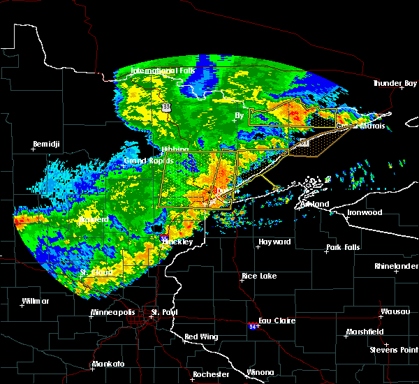 At 406 am cdt, severe thunderstorms were located along a line extending from near south range, to 6 miles south of trade lake, moving east at 50 mph (radar indicated). Hazards include 60 mph wind gusts and quarter size hail. Hail damage to vehicles is expected. expect wind damage to roofs, siding, and trees. these severe storms will be near, hawthorne around 410 am cdt. poplar in douglas county around 415 am cdt. lake nebagamon around 425 am cdt. Other locations impacted by these severe thunderstorms include pattison state park, alpha, falun, riverside, patzau, cloverdale, minong flowage, trade river, blueberry and bennett. At 406 am cdt, severe thunderstorms were located along a line extending from near south range, to 6 miles south of trade lake, moving east at 50 mph (radar indicated). Hazards include 60 mph wind gusts and quarter size hail. Hail damage to vehicles is expected. expect wind damage to roofs, siding, and trees. these severe storms will be near, hawthorne around 410 am cdt. poplar in douglas county around 415 am cdt. lake nebagamon around 425 am cdt. Other locations impacted by these severe thunderstorms include pattison state park, alpha, falun, riverside, patzau, cloverdale, minong flowage, trade river, blueberry and bennett.
|
| 7/21/2016 3:50 AM CDT |
 At 349 am cdt, severe thunderstorms were located along a line extending from 6 miles northeast of foxboro, to 7 miles southeast of rush city, moving east at 50 mph (radar indicated). Hazards include 60 mph wind gusts and quarter size hail. Hail damage to vehicles is expected. expect wind damage to roofs, siding, and trees. severe thunderstorms will be near, foxboro around 355 am cdt. trade lake around 405 am cdt. hawthorne around 410 am cdt. poplar in douglas county around 415 am cdt. lake nebagamon around 420 am cdt. Other locations impacted by these severe thunderstorms include pattison state park, alpha, falun, west rock, riverside, patzau, cloverdale, minong flowage, trade river and blueberry. At 349 am cdt, severe thunderstorms were located along a line extending from 6 miles northeast of foxboro, to 7 miles southeast of rush city, moving east at 50 mph (radar indicated). Hazards include 60 mph wind gusts and quarter size hail. Hail damage to vehicles is expected. expect wind damage to roofs, siding, and trees. severe thunderstorms will be near, foxboro around 355 am cdt. trade lake around 405 am cdt. hawthorne around 410 am cdt. poplar in douglas county around 415 am cdt. lake nebagamon around 420 am cdt. Other locations impacted by these severe thunderstorms include pattison state park, alpha, falun, west rock, riverside, patzau, cloverdale, minong flowage, trade river and blueberry.
|
| 7/11/2016 6:00 PM CDT |
 At 600 pm cdt, a severe thunderstorm was located 8 miles northeast of grantsburg, or 20 miles east of pine city, moving northeast at 45 mph (radar indicated). Hazards include 60 mph wind gusts and quarter size hail. Hail damage to vehicles is expected. expect wind damage to roofs, siding, and trees. this severe storm will be near, siren around 605 pm cdt. webster around 610 pm cdt. danbury around 615 pm cdt. Other locations impacted by this severe thunderstorm include saint croix state park, alpha, falun, yellow lake, oakland, cloverdale, phantom lake and riverside. At 600 pm cdt, a severe thunderstorm was located 8 miles northeast of grantsburg, or 20 miles east of pine city, moving northeast at 45 mph (radar indicated). Hazards include 60 mph wind gusts and quarter size hail. Hail damage to vehicles is expected. expect wind damage to roofs, siding, and trees. this severe storm will be near, siren around 605 pm cdt. webster around 610 pm cdt. danbury around 615 pm cdt. Other locations impacted by this severe thunderstorm include saint croix state park, alpha, falun, yellow lake, oakland, cloverdale, phantom lake and riverside.
|
| 7/11/2016 6:00 PM CDT |
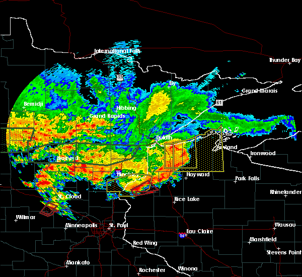 At 600 pm cdt, a severe thunderstorm was located 8 miles northeast of grantsburg, or 20 miles east of pine city, moving northeast at 45 mph (radar indicated). Hazards include 60 mph wind gusts and quarter size hail. Hail damage to vehicles is expected. expect wind damage to roofs, siding, and trees. this severe storm will be near, siren around 605 pm cdt. webster around 610 pm cdt. danbury around 615 pm cdt. Other locations impacted by this severe thunderstorm include saint croix state park, alpha, falun, yellow lake, oakland, cloverdale, phantom lake and riverside. At 600 pm cdt, a severe thunderstorm was located 8 miles northeast of grantsburg, or 20 miles east of pine city, moving northeast at 45 mph (radar indicated). Hazards include 60 mph wind gusts and quarter size hail. Hail damage to vehicles is expected. expect wind damage to roofs, siding, and trees. this severe storm will be near, siren around 605 pm cdt. webster around 610 pm cdt. danbury around 615 pm cdt. Other locations impacted by this severe thunderstorm include saint croix state park, alpha, falun, yellow lake, oakland, cloverdale, phantom lake and riverside.
|
| 7/11/2016 5:21 PM CDT |
 At 521 pm cdt, a severe thunderstorm was located over rush city, or 8 miles south of pine city, moving northeast at 35 mph (radar indicated). Hazards include 60 mph wind gusts and quarter size hail. Hail damage to vehicles is expected. expect wind damage to roofs, siding, and trees. this severe thunderstorm will be near, pine city around 530 pm cdt. grantsburg and branstad around 540 pm cdt. webster around 610 pm cdt. danbury around 615 pm cdt. Other locations impacted by this severe thunderstorm include greely, beroun, alpha, falun, randall, west rock, four corners, cloverdale, phantom lake and saint croix state park. At 521 pm cdt, a severe thunderstorm was located over rush city, or 8 miles south of pine city, moving northeast at 35 mph (radar indicated). Hazards include 60 mph wind gusts and quarter size hail. Hail damage to vehicles is expected. expect wind damage to roofs, siding, and trees. this severe thunderstorm will be near, pine city around 530 pm cdt. grantsburg and branstad around 540 pm cdt. webster around 610 pm cdt. danbury around 615 pm cdt. Other locations impacted by this severe thunderstorm include greely, beroun, alpha, falun, randall, west rock, four corners, cloverdale, phantom lake and saint croix state park.
|
| 6/25/2016 6:05 PM CDT |
 At 604 pm cdt, severe thunderstorms were located along a line extending from west rock to near cedar, moving northeast at 55 mph (radar indicated). Hazards include 60 mph wind gusts. Expect damage to roofs. siding. and trees. these severe storms will be near, rush city around 610 pm cdt. forest lake and stacy around 620 pm cdt. other locations impacted by these severe thunderstorms include wyoming, weber, branch, rush city airport, harris, spring lake, wild river state park and oak grove. A tornado watch remains in effect until 900 pm cdt for east central minnesota. At 604 pm cdt, severe thunderstorms were located along a line extending from west rock to near cedar, moving northeast at 55 mph (radar indicated). Hazards include 60 mph wind gusts. Expect damage to roofs. siding. and trees. these severe storms will be near, rush city around 610 pm cdt. forest lake and stacy around 620 pm cdt. other locations impacted by these severe thunderstorms include wyoming, weber, branch, rush city airport, harris, spring lake, wild river state park and oak grove. A tornado watch remains in effect until 900 pm cdt for east central minnesota.
|
| 6/25/2016 5:53 PM CDT |
 At 552 pm cdt, severe thunderstorms were located along a line extending from near stanchfield to ramsey, moving northeast at 60 mph (trained weather spotters). Hazards include 60 mph wind gusts. Expect damage to roofs. siding. and trees. severe thunderstorms will be near, cambridge, east bethel and isanti around 610 pm cdt. stacy around 615 pm cdt. north branch around 625 pm cdt. other locations impacted by these severe thunderstorms include stanchfield, branch, grandy, athens, harris, spring lake, bethel, cedar, bodum and wyoming. this includes the following highways, interstate 35 between mile markers 135 and 163. u. s. highway 10 in minnesota near mile marker 219. A tornado watch remains in effect until 900 pm cdt for east central minnesota. At 552 pm cdt, severe thunderstorms were located along a line extending from near stanchfield to ramsey, moving northeast at 60 mph (trained weather spotters). Hazards include 60 mph wind gusts. Expect damage to roofs. siding. and trees. severe thunderstorms will be near, cambridge, east bethel and isanti around 610 pm cdt. stacy around 615 pm cdt. north branch around 625 pm cdt. other locations impacted by these severe thunderstorms include stanchfield, branch, grandy, athens, harris, spring lake, bethel, cedar, bodum and wyoming. this includes the following highways, interstate 35 between mile markers 135 and 163. u. s. highway 10 in minnesota near mile marker 219. A tornado watch remains in effect until 900 pm cdt for east central minnesota.
|
| 7/12/2015 9:24 PM CDT |
 At 923 pm cdt, a severe thunderstorm was located over braham, or 11 miles north of cambridge, moving southeast at 25 mph (radar indicated). Hazards include 60 mph wind gusts and nickel size hail. Expect damage to roofs. siding and trees. this severe thunderstorm will be near, rush city around 950 pm cdt. north branch around 1005 pm cdt. chisago city around 1015 pm cdt. other locations impacted by this severe thunderstorm include stanchfield, branch, wolf creek, wild river state park, grandy, athens, harris, spring lake, bodum and cushing. this includes interstate 35 between mile markers 134 and 163. A tornado watch remains in effect until 100 am cdt for east central minnesota and northwestern wisconsin. At 923 pm cdt, a severe thunderstorm was located over braham, or 11 miles north of cambridge, moving southeast at 25 mph (radar indicated). Hazards include 60 mph wind gusts and nickel size hail. Expect damage to roofs. siding and trees. this severe thunderstorm will be near, rush city around 950 pm cdt. north branch around 1005 pm cdt. chisago city around 1015 pm cdt. other locations impacted by this severe thunderstorm include stanchfield, branch, wolf creek, wild river state park, grandy, athens, harris, spring lake, bodum and cushing. this includes interstate 35 between mile markers 134 and 163. A tornado watch remains in effect until 100 am cdt for east central minnesota and northwestern wisconsin.
|
| 7/12/2015 11:29 AM CDT |
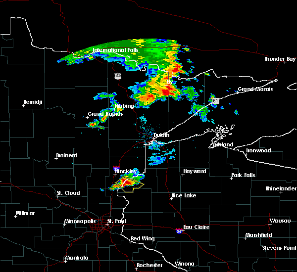 At 1129 am cdt, a severe thunderstorm was located near grantsburg, or 12 miles east of pine city, moving southeast at 25 mph (radar indicated). Hazards include 60 mph wind gusts and quarter size hail. Hail damage to vehicles is expected. expect wind damage to roofs, siding and trees. Locations impacted include, grantsburg, trade lake, siren, branstad, alpha, falun, trade river, four corners and phantom lake. At 1129 am cdt, a severe thunderstorm was located near grantsburg, or 12 miles east of pine city, moving southeast at 25 mph (radar indicated). Hazards include 60 mph wind gusts and quarter size hail. Hail damage to vehicles is expected. expect wind damage to roofs, siding and trees. Locations impacted include, grantsburg, trade lake, siren, branstad, alpha, falun, trade river, four corners and phantom lake.
|
| 7/12/2015 11:13 AM CDT |
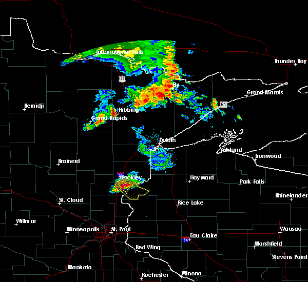 At 1112 am cdt, a severe thunderstorm was located 8 miles southeast of hinckley, moving southeast at 25 mph (trained weather spotters. at 1105 am ping pong ball size hail was reported at hinckley). Hazards include ping pong ball size hail and 60 mph wind gusts. People and animals outdoors will be injured. expect hail damage to roofs, siding, windows and vehicles. expect wind damage to roofs, siding and trees. this severe thunderstorm will be near, saint croix state park around 1125 am cdt. grantsburg around 1140 am cdt. branstad around 1145 am cdt. trade lake and siren around 1200 pm cdt. Other locations impacted by this severe thunderstorm include four corners, beroun, alpha, falun, trade river and phantom lake. At 1112 am cdt, a severe thunderstorm was located 8 miles southeast of hinckley, moving southeast at 25 mph (trained weather spotters. at 1105 am ping pong ball size hail was reported at hinckley). Hazards include ping pong ball size hail and 60 mph wind gusts. People and animals outdoors will be injured. expect hail damage to roofs, siding, windows and vehicles. expect wind damage to roofs, siding and trees. this severe thunderstorm will be near, saint croix state park around 1125 am cdt. grantsburg around 1140 am cdt. branstad around 1145 am cdt. trade lake and siren around 1200 pm cdt. Other locations impacted by this severe thunderstorm include four corners, beroun, alpha, falun, trade river and phantom lake.
|
| 9/19/2013 11:20 AM CDT | Several 6-8 inch tree branches blown down in pine county MN, 6.3 miles E of Rock Creek, MN |
| 9/19/2013 11:18 AM CDT | Numerous aspen branches blown down. twelve inch diameter poplar tree snapped 20 feet above ground leve in pine county MN, 4.8 miles WSW of Rock Creek, MN |
Hail Maps for Rock Creek, MN


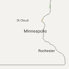


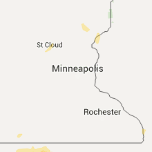


Connect with Interactive Hail Maps