

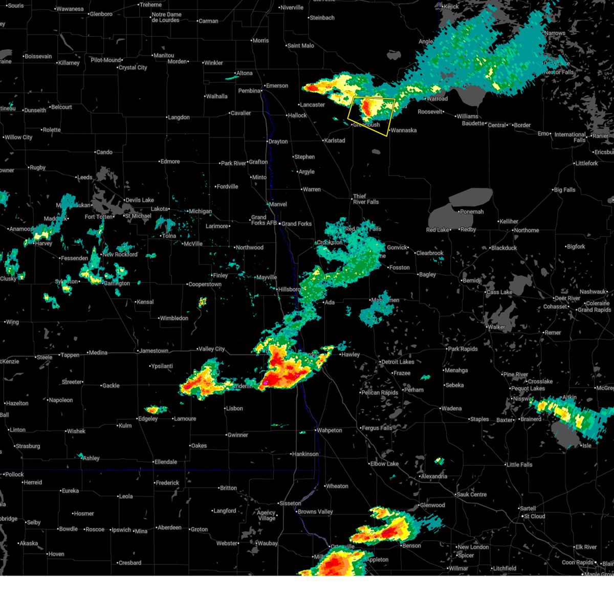
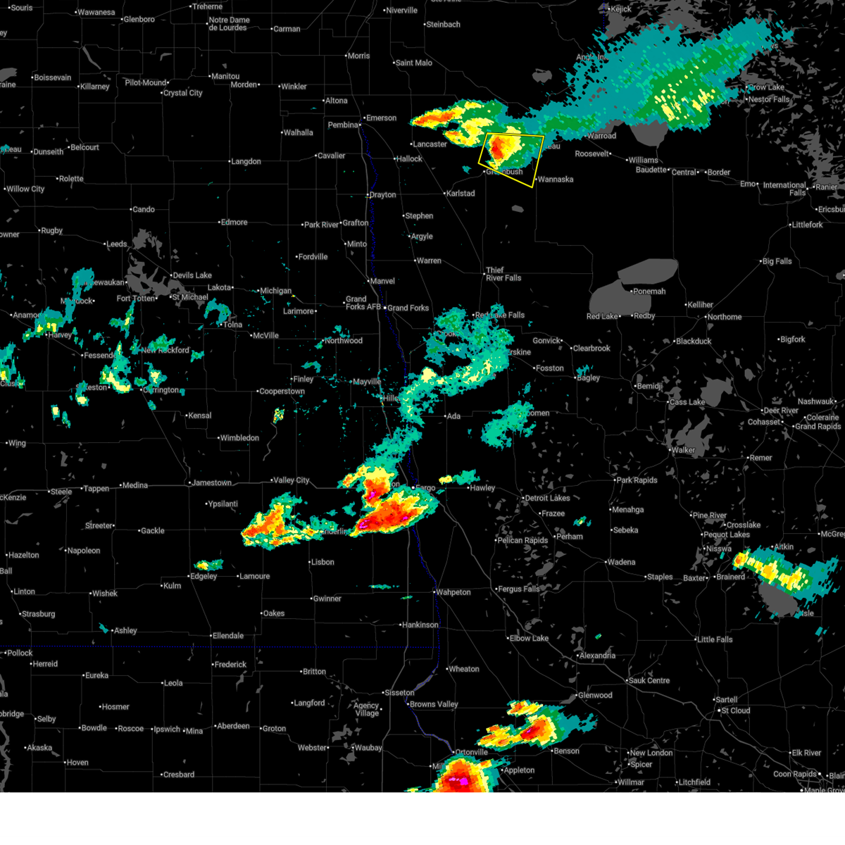
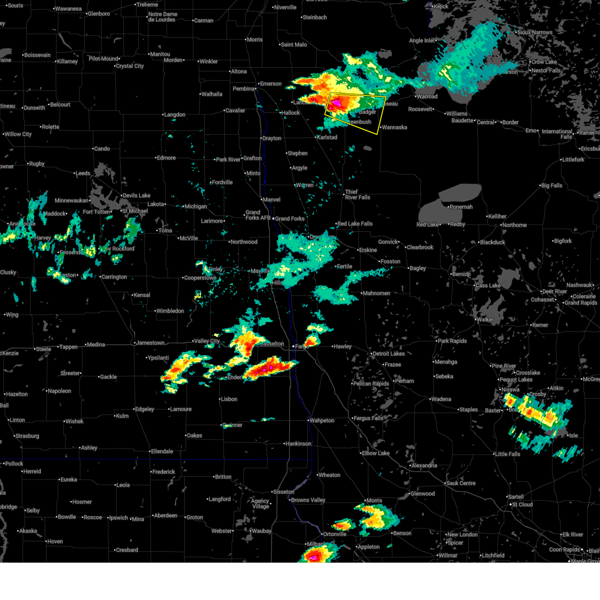
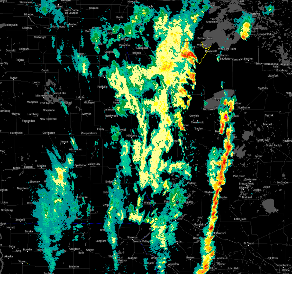
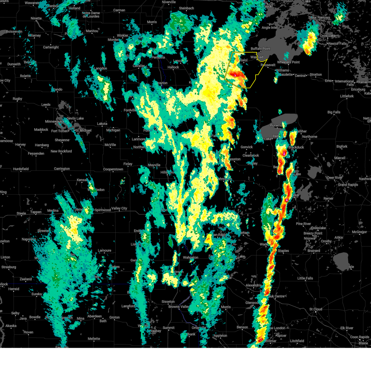
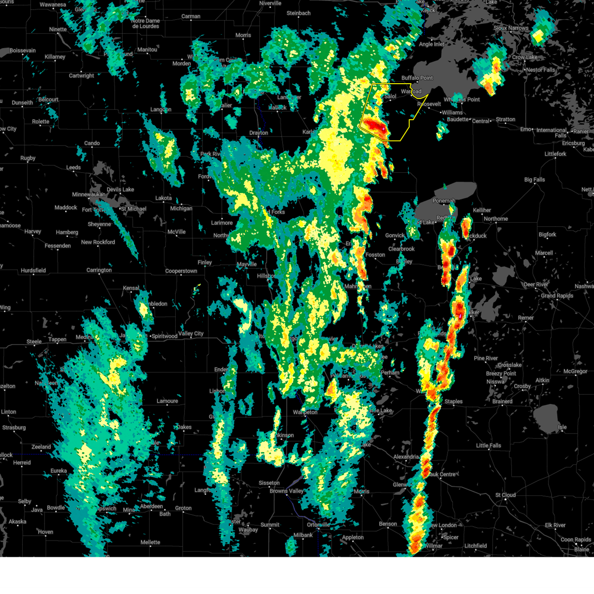
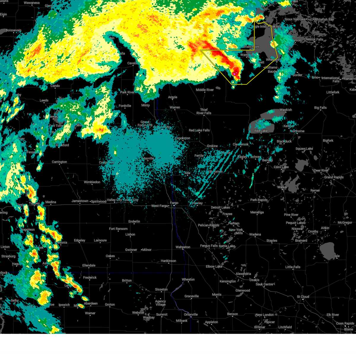
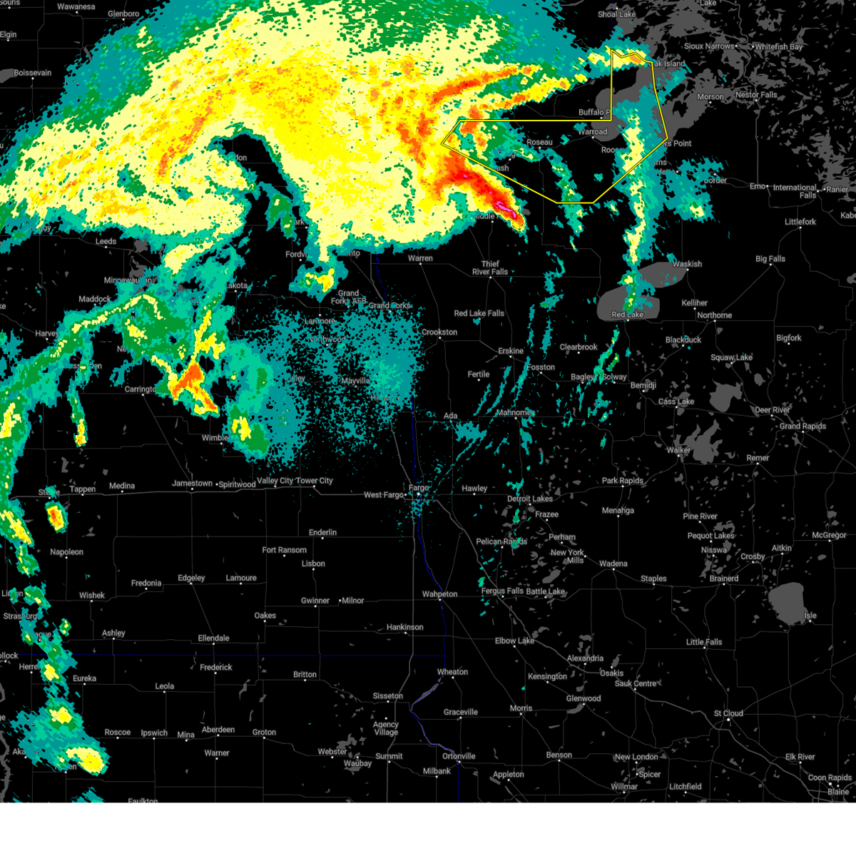
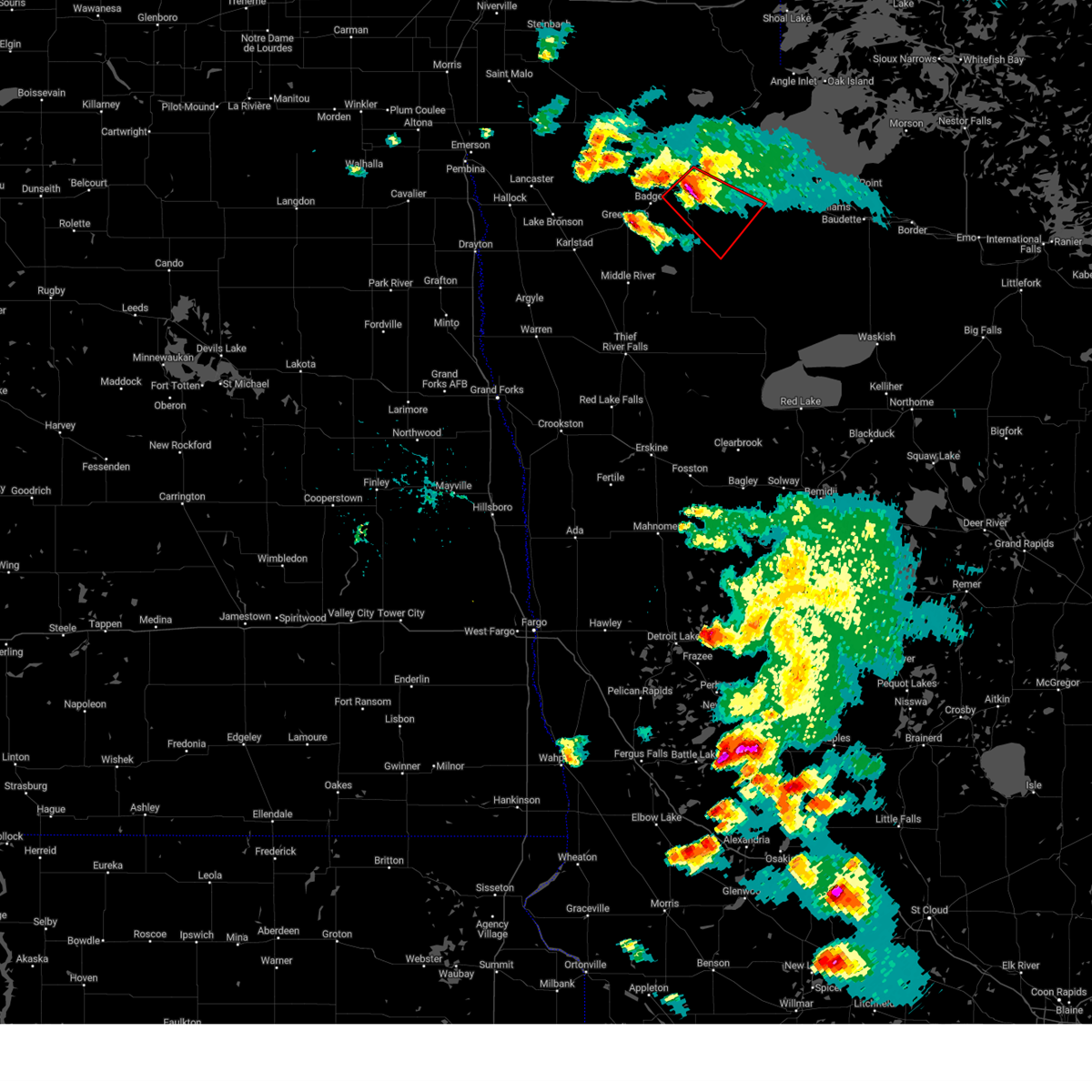
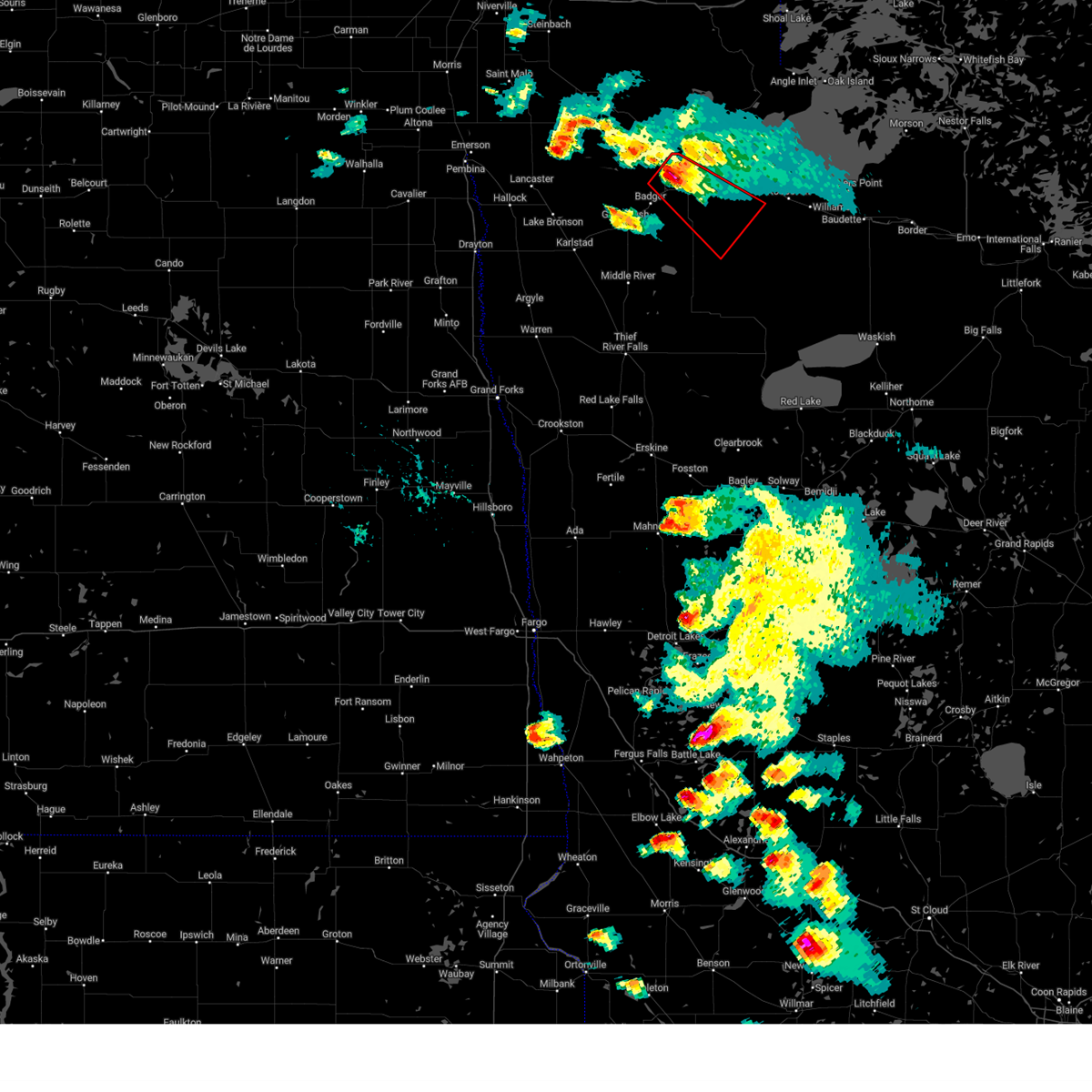
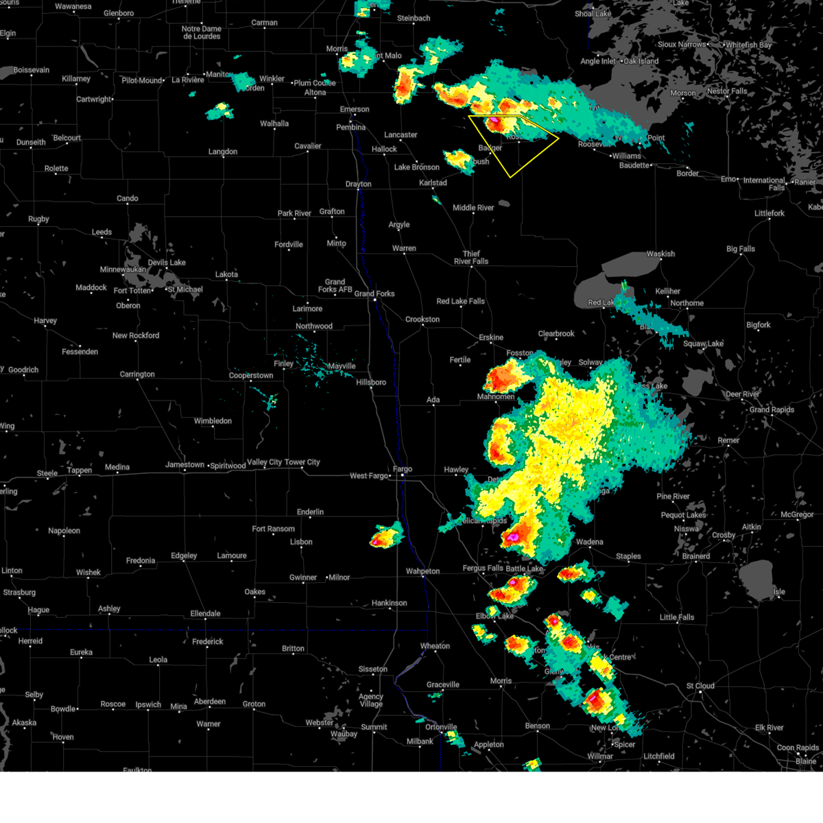
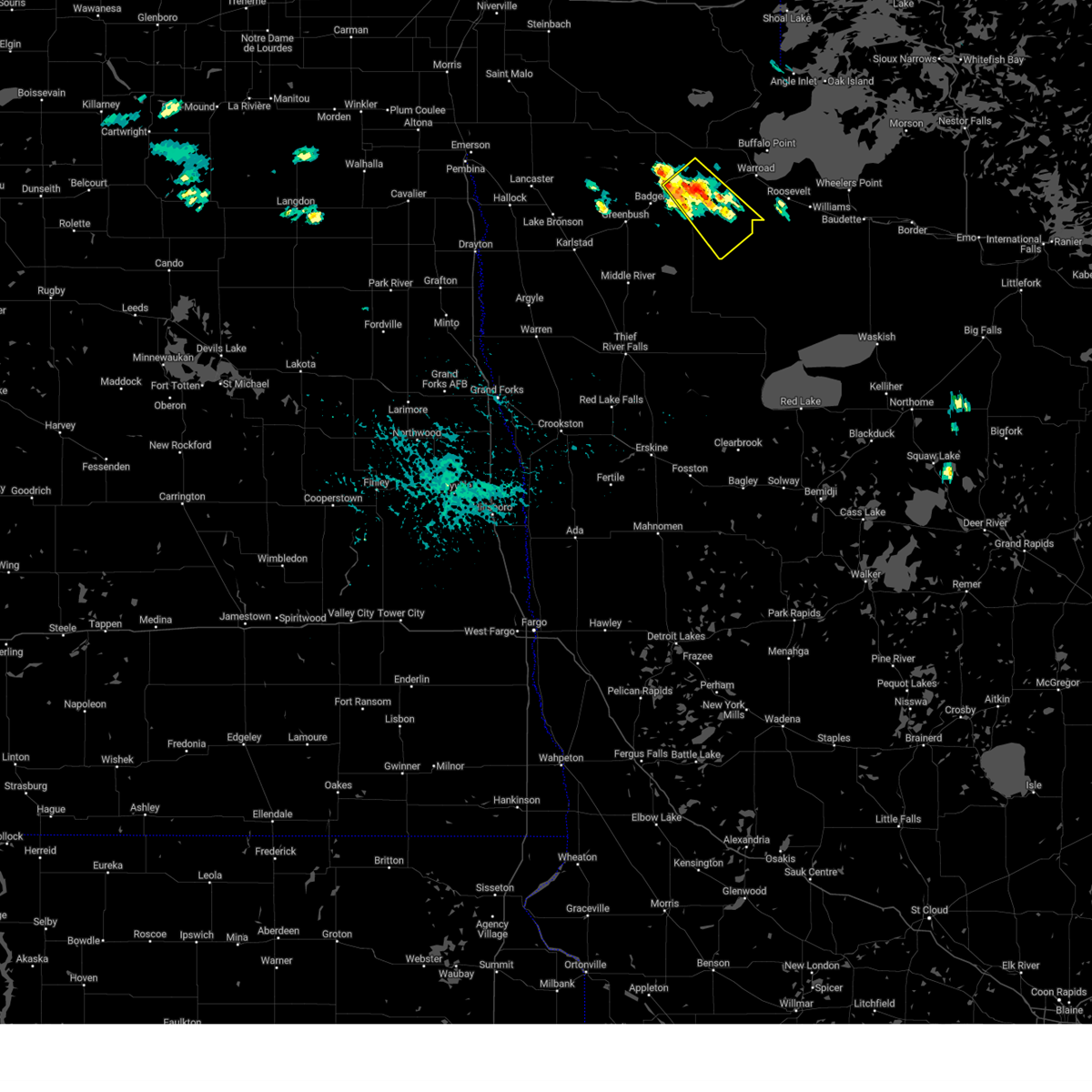
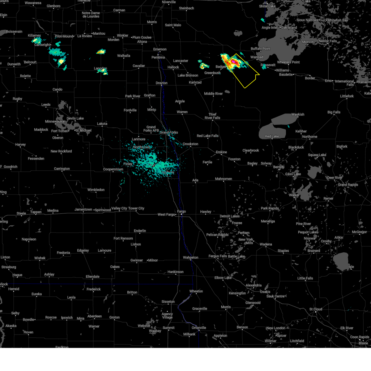
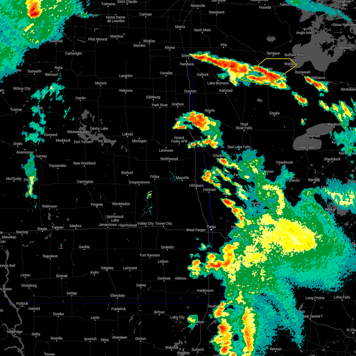
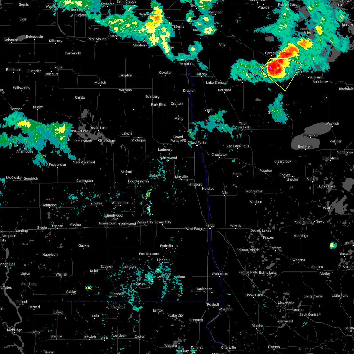
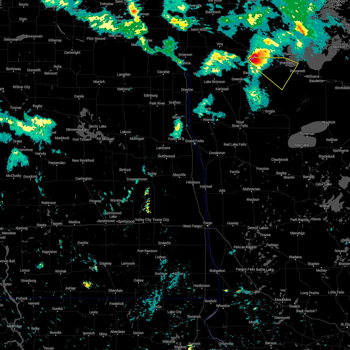
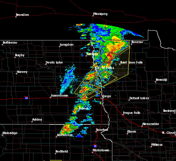
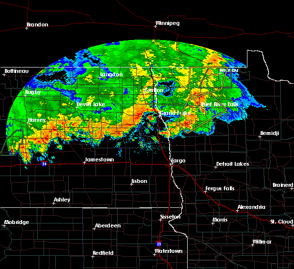
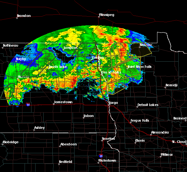
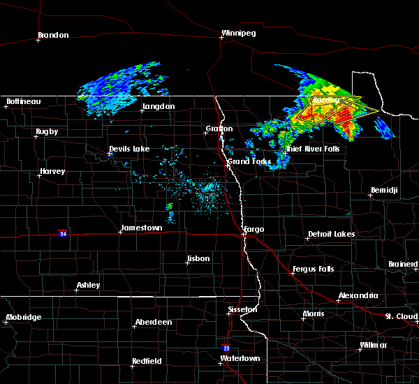
Hail Map for Roseau, MN
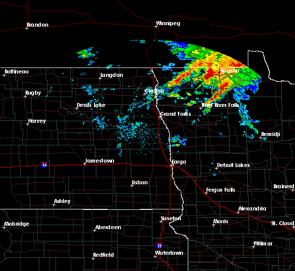
The Roseau, MN area has had 29 reports of on-the-ground hail by trained spotters, and has been under severe weather warnings 3 times during the past 12 months. Doppler radar has detected hail at or near Roseau, MN on 24 occasions, including 1 occasion during the past year.
| Name: | Roseau, MN |
| Where Located: | 0.3 miles E of Roseau, MN |
| Map: | Google Map for Roseau, MN |
| Population: | 2633 |
| Housing Units: | 1288 |
| More Info: | Search Google for Roseau, MN |
0
The Top Recent Hail Date for Roseau, MN is Saturday, August 3, 2024 (24th out of 24)

Hail and Wind Damage Spotted near Roseau, MN
| Date / Time | Report Details |
|---|---|
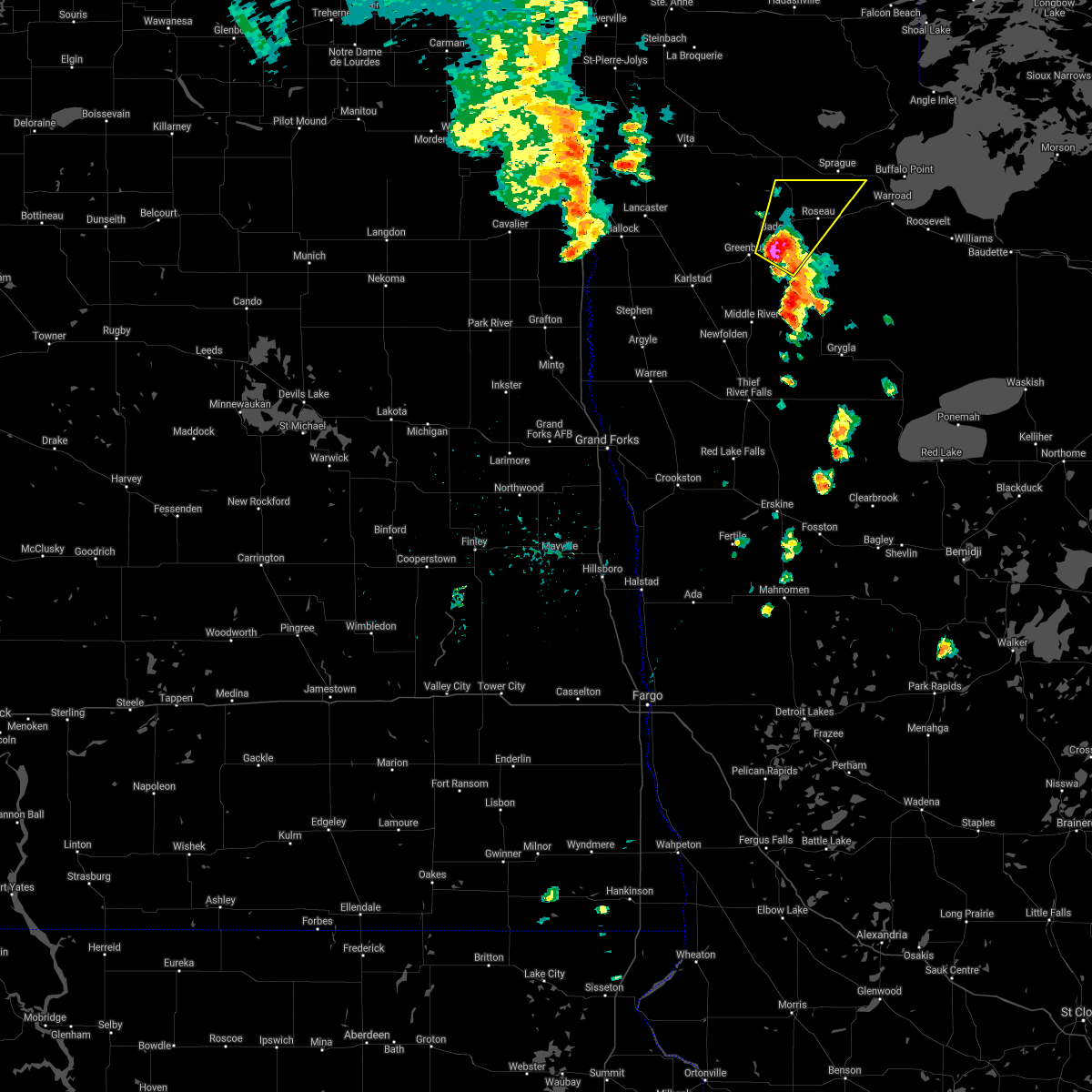
| 6/28/2025 7:03 PM CDT |
 the severe thunderstorm warning has been cancelled and is no longer in effect the severe thunderstorm warning has been cancelled and is no longer in effect
|
| 6/28/2025 6:54 PM CDT |
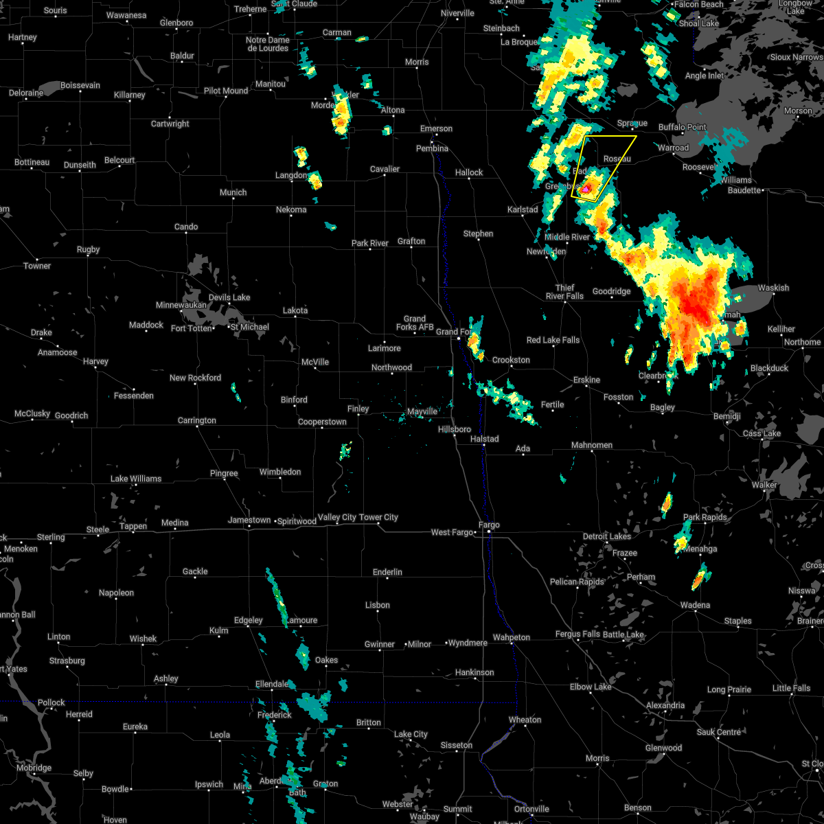
 At 654 pm cdt, a severe thunderstorm was located near haug, or 15 miles west of roseau, moving east at 25 mph (radar indicated). Hazards include ping pong ball size hail and 60 mph wind gusts. People and animals outdoors will be injured. expect hail damage to roofs, siding, windows, and vehicles. expect wind damage to roofs, siding, and trees. Locations impacted include, roseau, badger, fox, malung, ross, and haug. At 654 pm cdt, a severe thunderstorm was located near haug, or 15 miles west of roseau, moving east at 25 mph (radar indicated). Hazards include ping pong ball size hail and 60 mph wind gusts. People and animals outdoors will be injured. expect hail damage to roofs, siding, windows, and vehicles. expect wind damage to roofs, siding, and trees. Locations impacted include, roseau, badger, fox, malung, ross, and haug.
|
| 6/28/2025 6:32 PM CDT |
 Svrfgf the national weather service in grand forks has issued a * severe thunderstorm warning for, western roseau county in northwestern minnesota, * until 730 pm cdt. * at 631 pm cdt, a severe thunderstorm was located near haug, or 23 miles west of roseau, moving east at 25 mph (radar indicated). Hazards include two inch hail and 60 mph wind gusts. People and animals outdoors will be injured. expect hail damage to roofs, siding, windows, and vehicles. Expect wind damage to roofs, siding, and trees. Svrfgf the national weather service in grand forks has issued a * severe thunderstorm warning for, western roseau county in northwestern minnesota, * until 730 pm cdt. * at 631 pm cdt, a severe thunderstorm was located near haug, or 23 miles west of roseau, moving east at 25 mph (radar indicated). Hazards include two inch hail and 60 mph wind gusts. People and animals outdoors will be injured. expect hail damage to roofs, siding, windows, and vehicles. Expect wind damage to roofs, siding, and trees.
|
| 6/4/2024 2:09 PM CDT |
 At 209 pm cdt, a severe thunderstorm was located near salol, or 11 miles northeast of roseau, moving north at 45 mph (radar indicated). Hazards include 60 mph wind gusts and quarter size hail. Hail damage to vehicles is expected. expect wind damage to roofs, siding, and trees. Locations impacted include, roseau, warroad, springsteel island, salol, longworth, malung, and swift. At 209 pm cdt, a severe thunderstorm was located near salol, or 11 miles northeast of roseau, moving north at 45 mph (radar indicated). Hazards include 60 mph wind gusts and quarter size hail. Hail damage to vehicles is expected. expect wind damage to roofs, siding, and trees. Locations impacted include, roseau, warroad, springsteel island, salol, longworth, malung, and swift.
|
| 6/4/2024 1:50 PM CDT |
 At 150 pm cdt, a severe thunderstorm was located over pencer, or 10 miles southeast of roseau, moving north at 45 mph (radar indicated). Hazards include 60 mph wind gusts and quarter size hail. Hail damage to vehicles is expected. expect wind damage to roofs, siding, and trees. Locations impacted include, roseau, warroad, springsteel island, wannaska, salol, longworth, and malung. At 150 pm cdt, a severe thunderstorm was located over pencer, or 10 miles southeast of roseau, moving north at 45 mph (radar indicated). Hazards include 60 mph wind gusts and quarter size hail. Hail damage to vehicles is expected. expect wind damage to roofs, siding, and trees. Locations impacted include, roseau, warroad, springsteel island, wannaska, salol, longworth, and malung.
|
| 6/4/2024 1:48 PM CDT | A few small tree branches down. power lines down. also reported dime sized hai in roseau county MN, 13.9 miles NNW of Roseau, MN |
| 6/4/2024 1:45 PM CDT |
 Svrfgf the national weather service in grand forks has issued a * severe thunderstorm warning for, central roseau county in northwestern minnesota, * until 230 pm cdt. * at 145 pm cdt, a severe thunderstorm was located over wannaska, or 14 miles south of roseau, moving north at 50 mph (radar indicated). Hazards include 60 mph wind gusts and quarter size hail. Hail damage to vehicles is expected. Expect wind damage to roofs, siding, and trees. Svrfgf the national weather service in grand forks has issued a * severe thunderstorm warning for, central roseau county in northwestern minnesota, * until 230 pm cdt. * at 145 pm cdt, a severe thunderstorm was located over wannaska, or 14 miles south of roseau, moving north at 50 mph (radar indicated). Hazards include 60 mph wind gusts and quarter size hail. Hail damage to vehicles is expected. Expect wind damage to roofs, siding, and trees.
|
| 9/5/2023 2:18 AM CDT |
 At 218 am cdt, severe thunderstorms were located along a line extending from 10 miles north of pinecreek to near warroad to 7 miles east of hayes lake state park, moving northeast at 65 mph (radar indicated). Hazards include 70 mph wind gusts and quarter size hail. Hail damage to vehicles is expected. expect considerable tree damage. wind damage is also likely to mobile homes, roofs, and outbuildings. locations impacted include, roseau, warroad, arnesen, springsteel island, williams, angle inlet and roosevelt. thunderstorm damage threat, considerable hail threat, radar indicated max hail size, 1. 00 in wind threat, observed max wind gust, 70 mph. At 218 am cdt, severe thunderstorms were located along a line extending from 10 miles north of pinecreek to near warroad to 7 miles east of hayes lake state park, moving northeast at 65 mph (radar indicated). Hazards include 70 mph wind gusts and quarter size hail. Hail damage to vehicles is expected. expect considerable tree damage. wind damage is also likely to mobile homes, roofs, and outbuildings. locations impacted include, roseau, warroad, arnesen, springsteel island, williams, angle inlet and roosevelt. thunderstorm damage threat, considerable hail threat, radar indicated max hail size, 1. 00 in wind threat, observed max wind gust, 70 mph.
|
| 9/5/2023 1:49 AM CDT |
 At 148 am cdt, severe thunderstorms were located along a line extending from 7 miles north of lake bronson state park to near badger to gatzke, moving northeast at 65 mph. this storm has a history of producing up to 80 mph winds! these are destructive storms for the roseau area! (radar indicated). Hazards include 80 mph wind gusts. Flying debris will be dangerous to those caught without shelter. mobile homes will be heavily damaged. expect considerable damage to roofs, windows, and vehicles. Extensive tree damage and power outages are likely. At 148 am cdt, severe thunderstorms were located along a line extending from 7 miles north of lake bronson state park to near badger to gatzke, moving northeast at 65 mph. this storm has a history of producing up to 80 mph winds! these are destructive storms for the roseau area! (radar indicated). Hazards include 80 mph wind gusts. Flying debris will be dangerous to those caught without shelter. mobile homes will be heavily damaged. expect considerable damage to roofs, windows, and vehicles. Extensive tree damage and power outages are likely.
|
| 7/13/2023 6:33 PM CDT | Half Dollar sized hail reported 0.3 miles N of Roseau, MN |
| 7/13/2023 6:33 PM CDT |
 At 633 pm cdt, a severe thunderstorm capable of producing a tornado was located near malung, or near roseau, moving southeast at 30 mph (weather spotters reported a funnel cloud). Hazards include tornado and half dollar size hail. Flying debris will be dangerous to those caught without shelter. mobile homes will be damaged or destroyed. damage to roofs, windows, and vehicles will occur. tree damage is likely. Locations impacted include, roseau, salol, malung, hayes lake state park and pencer. At 633 pm cdt, a severe thunderstorm capable of producing a tornado was located near malung, or near roseau, moving southeast at 30 mph (weather spotters reported a funnel cloud). Hazards include tornado and half dollar size hail. Flying debris will be dangerous to those caught without shelter. mobile homes will be damaged or destroyed. damage to roofs, windows, and vehicles will occur. tree damage is likely. Locations impacted include, roseau, salol, malung, hayes lake state park and pencer.
|
| 7/13/2023 6:29 PM CDT | Half Dollar sized hail reported 0.3 miles N of Roseau, MN, corrects previous hail report from roseau. |
| 1/1/0001 12:00 AM | Quarter sized hail reported 0.4 miles S of Roseau, MN, 1 inch hail reported in roseau via twitter. time estimated via radar. |
| 7/13/2023 6:14 PM CDT |
 At 613 pm cdt, a severe thunderstorm capable of producing a tornado was located near ross, or near roseau, moving southeast at 30 mph (weather spotters reported funnel cloud). Hazards include tornado and half dollar size hail. Flying debris will be dangerous to those caught without shelter. mobile homes will be damaged or destroyed. damage to roofs, windows, and vehicles will occur. Tree damage is likely. At 613 pm cdt, a severe thunderstorm capable of producing a tornado was located near ross, or near roseau, moving southeast at 30 mph (weather spotters reported funnel cloud). Hazards include tornado and half dollar size hail. Flying debris will be dangerous to those caught without shelter. mobile homes will be damaged or destroyed. damage to roofs, windows, and vehicles will occur. Tree damage is likely.
|
| 7/13/2023 6:00 PM CDT |
 At 600 pm cdt, a severe thunderstorm was located over pinecreek, or 10 miles northwest of roseau, moving southeast at 25 mph (emergency management). Hazards include ping pong ball size hail. People and animals outdoors will be injured. expect damage to roofs, siding, windows, and vehicles. locations impacted include, roseau, salol, fox, malung, pinecreek and ross. hail threat, observed max hail size, 1. 50 in wind threat, radar indicated max wind gust, <50 mph. At 600 pm cdt, a severe thunderstorm was located over pinecreek, or 10 miles northwest of roseau, moving southeast at 25 mph (emergency management). Hazards include ping pong ball size hail. People and animals outdoors will be injured. expect damage to roofs, siding, windows, and vehicles. locations impacted include, roseau, salol, fox, malung, pinecreek and ross. hail threat, observed max hail size, 1. 50 in wind threat, radar indicated max wind gust, <50 mph.
|
| 7/13/2023 5:22 PM CDT |
 At 521 pm cdt, a severe thunderstorm was located 13 miles northwest of pinecreek, or 25 miles northwest of roseau, moving southeast at 25 mph (emergency management). Hazards include ping pong ball size hail. People and animals outdoors will be injured. Expect damage to roofs, siding, windows, and vehicles. At 521 pm cdt, a severe thunderstorm was located 13 miles northwest of pinecreek, or 25 miles northwest of roseau, moving southeast at 25 mph (emergency management). Hazards include ping pong ball size hail. People and animals outdoors will be injured. Expect damage to roofs, siding, windows, and vehicles.
|
| 6/26/2023 3:33 PM CDT | Public reports a bent foul pole and fencing being pushed down at the roseau gilbertson baseball field. additionally... a foot in diameter tree snapped in town and pulle in roseau county MN, 0.4 miles S of Roseau, MN |
| 6/26/2023 3:12 PM CDT | Quarter sized hail reported 1 miles WSW of Roseau, MN, public reports quarter sized hail on hwy 11 east of roseau. time estimated. |
| 6/26/2023 3:09 PM CDT | Corrects previous tstm wnd dmg report from roseau. public reports a bent foul pole and fencing being pushed down at the roseau gilbertson baseball field. additionally in roseau county MN, 0.4 miles S of Roseau, MN |
| 6/26/2023 3:09 PM CDT |
 At 309 pm cdt, a severe thunderstorm was located near malung, or near roseau, moving southeast at 20 mph (radar indicated). Hazards include quarter size hail. Damage to vehicles is expected. locations impacted include, roseau, salol, fox, malung, hayes lake state park and pencer. hail threat, radar indicated max hail size, 1. 00 in wind threat, radar indicated max wind gust, <50 mph. At 309 pm cdt, a severe thunderstorm was located near malung, or near roseau, moving southeast at 20 mph (radar indicated). Hazards include quarter size hail. Damage to vehicles is expected. locations impacted include, roseau, salol, fox, malung, hayes lake state park and pencer. hail threat, radar indicated max hail size, 1. 00 in wind threat, radar indicated max wind gust, <50 mph.
|
| 6/26/2023 2:58 PM CDT |
 At 258 pm cdt, a severe thunderstorm was located over roseau, moving southeast at 20 mph (radar indicated). Hazards include quarter size hail. damage to vehicles is expected At 258 pm cdt, a severe thunderstorm was located over roseau, moving southeast at 20 mph (radar indicated). Hazards include quarter size hail. damage to vehicles is expected
|
| 7/19/2022 7:07 AM CDT |
 The severe thunderstorm warning for northern marshall, kittson and roseau counties will expire at 715 am cdt, the storms which prompted the warning have weakened below severe limits, and no longer pose an immediate threat to life or property. therefore, the warning will be allowed to expire. however gusty winds are still possible with these thunderstorms. to report severe weather, contact your nearest law enforcement agency. they will relay your report to the national weather service grand forks. The severe thunderstorm warning for northern marshall, kittson and roseau counties will expire at 715 am cdt, the storms which prompted the warning have weakened below severe limits, and no longer pose an immediate threat to life or property. therefore, the warning will be allowed to expire. however gusty winds are still possible with these thunderstorms. to report severe weather, contact your nearest law enforcement agency. they will relay your report to the national weather service grand forks.
|
| 7/19/2022 6:27 AM CDT |
 At 626 am cdt, severe thunderstorms were located along a line extending from 13 miles northwest of caribou to 8 miles northeast of lake bronson to near donaldson, moving east at 55 mph (radar indicated). Hazards include 60 mph wind gusts and quarter size hail. Hail damage to vehicles is expected. expect wind damage to roofs, siding, and trees. locations impacted include, englund, florian, haug, halma, karlstad, strandquist, ross, pinecreek, fox, strathcona and greenbush. hail threat, radar indicated max hail size, 1. 00 in wind threat, observed max wind gust, 60 mph. At 626 am cdt, severe thunderstorms were located along a line extending from 13 miles northwest of caribou to 8 miles northeast of lake bronson to near donaldson, moving east at 55 mph (radar indicated). Hazards include 60 mph wind gusts and quarter size hail. Hail damage to vehicles is expected. expect wind damage to roofs, siding, and trees. locations impacted include, englund, florian, haug, halma, karlstad, strandquist, ross, pinecreek, fox, strathcona and greenbush. hail threat, radar indicated max hail size, 1. 00 in wind threat, observed max wind gust, 60 mph.
|
| 7/19/2022 6:11 AM CDT |
 At 610 am cdt, severe thunderstorms were located along a line extending from 12 miles north of orleans to near lancaster to near herrick, moving east at 55 mph (radar indicated. !** weakened). Hazards include 60 mph wind gusts and quarter size hail. Hail damage to vehicles is expected. expect wind damage to roofs, siding, and trees. severe thunderstorms will be near, lancaster around 615 am cdt. lake bronson around 620 am cdt. stephen and donaldson around 625 am cdt. other locations in the path of these severe thunderstorms include englund, florian, leo, karlstad and haug. this includes interstate 29 between mile markers 170 and 206. hail threat, radar indicated max hail size, 1. 00 in wind threat, observed max wind gust, 60 mph. At 610 am cdt, severe thunderstorms were located along a line extending from 12 miles north of orleans to near lancaster to near herrick, moving east at 55 mph (radar indicated. !** weakened). Hazards include 60 mph wind gusts and quarter size hail. Hail damage to vehicles is expected. expect wind damage to roofs, siding, and trees. severe thunderstorms will be near, lancaster around 615 am cdt. lake bronson around 620 am cdt. stephen and donaldson around 625 am cdt. other locations in the path of these severe thunderstorms include englund, florian, leo, karlstad and haug. this includes interstate 29 between mile markers 170 and 206. hail threat, radar indicated max hail size, 1. 00 in wind threat, observed max wind gust, 60 mph.
|
| 7/19/2022 2:29 AM CDT |
 At 229 am cdt, a severe thunderstorm was located over roseau, moving northeast at 30 mph (radar indicated). Hazards include 60 mph wind gusts and quarter size hail. Hail damage to vehicles is expected. expect wind damage to roofs, siding, and trees. locations impacted include, salol, longworth, springsteel island and warroad. hail threat, radar indicated max hail size, 1. 00 in wind threat, radar indicated max wind gust, 60 mph. At 229 am cdt, a severe thunderstorm was located over roseau, moving northeast at 30 mph (radar indicated). Hazards include 60 mph wind gusts and quarter size hail. Hail damage to vehicles is expected. expect wind damage to roofs, siding, and trees. locations impacted include, salol, longworth, springsteel island and warroad. hail threat, radar indicated max hail size, 1. 00 in wind threat, radar indicated max wind gust, 60 mph.
|
| 7/19/2022 2:00 AM CDT |
 At 200 am cdt, a severe thunderstorm was located near badger, or 13 miles southwest of roseau, moving northeast at 30 mph (radar indicated). Hazards include 60 mph wind gusts and half dollar size hail. Hail damage to vehicles is expected. expect wind damage to roofs, siding, and trees. this severe thunderstorm will be near, fox around 215 am cdt. other locations in the path of this severe thunderstorm include malung, roseau, salol, longworth, springsteel island and warroad. hail threat, radar indicated max hail size, 1. 25 in wind threat, radar indicated max wind gust, 60 mph. At 200 am cdt, a severe thunderstorm was located near badger, or 13 miles southwest of roseau, moving northeast at 30 mph (radar indicated). Hazards include 60 mph wind gusts and half dollar size hail. Hail damage to vehicles is expected. expect wind damage to roofs, siding, and trees. this severe thunderstorm will be near, fox around 215 am cdt. other locations in the path of this severe thunderstorm include malung, roseau, salol, longworth, springsteel island and warroad. hail threat, radar indicated max hail size, 1. 25 in wind threat, radar indicated max wind gust, 60 mph.
|
| 7/18/2022 5:54 AM CDT |
 At 554 am cdt, a severe thunderstorm was located over salol, or 8 miles east of roseau, moving southeast at 45 mph (trained weather spotters). Hazards include ping pong ball size hail. People and animals outdoors will be injured. expect damage to roofs, siding, windows, and vehicles. locations impacted include, swift. hail threat, observed max hail size, 1. 50 in wind threat, radar indicated max wind gust, <50 mph. At 554 am cdt, a severe thunderstorm was located over salol, or 8 miles east of roseau, moving southeast at 45 mph (trained weather spotters). Hazards include ping pong ball size hail. People and animals outdoors will be injured. expect damage to roofs, siding, windows, and vehicles. locations impacted include, swift. hail threat, observed max hail size, 1. 50 in wind threat, radar indicated max wind gust, <50 mph.
|
| 7/18/2022 5:48 AM CDT | Ping Pong Ball sized hail reported 2.4 miles W of Roseau, MN |
| 7/18/2022 5:42 AM CDT | Ping Pong Ball sized hail reported 3.9 miles S of Roseau, MN |
| 7/18/2022 5:32 AM CDT |
 At 532 am cdt, a severe thunderstorm was located near pinecreek, or 9 miles northwest of roseau, moving southeast at 45 mph (radar indicated). Hazards include quarter size hail. Damage to vehicles is expected. this severe thunderstorm will be near, roseau around 545 am cdt. other locations in the path of this severe thunderstorm include salol. hail threat, radar indicated max hail size, 1. 00 in wind threat, radar indicated max wind gust, <50 mph. At 532 am cdt, a severe thunderstorm was located near pinecreek, or 9 miles northwest of roseau, moving southeast at 45 mph (radar indicated). Hazards include quarter size hail. Damage to vehicles is expected. this severe thunderstorm will be near, roseau around 545 am cdt. other locations in the path of this severe thunderstorm include salol. hail threat, radar indicated max hail size, 1. 00 in wind threat, radar indicated max wind gust, <50 mph.
|
| 7/10/2022 8:22 AM CDT |
 At 822 am cdt, severe thunderstorms were located along a line extending from 6 miles west of lake bronson to near carpenters corner to greenview, moving east at 55 mph (radar indicated). Hazards include 60 mph wind gusts and quarter size hail. Hail damage to vehicles is expected. expect wind damage to roofs, siding, and trees. severe thunderstorms will be near, harold and carpenters corner around 825 am cdt. melvin and rosewood around 830 am cdt. thief river falls, st. hilaire and dakota junction around 835 am cdt. maple bay, hazel and dugdale around 840 am cdt. other locations in the path of these severe thunderstorms include mavie and mentor. hail threat, radar indicated max hail size, 1. 00 in wind threat, radar indicated max wind gust, 60 mph. At 822 am cdt, severe thunderstorms were located along a line extending from 6 miles west of lake bronson to near carpenters corner to greenview, moving east at 55 mph (radar indicated). Hazards include 60 mph wind gusts and quarter size hail. Hail damage to vehicles is expected. expect wind damage to roofs, siding, and trees. severe thunderstorms will be near, harold and carpenters corner around 825 am cdt. melvin and rosewood around 830 am cdt. thief river falls, st. hilaire and dakota junction around 835 am cdt. maple bay, hazel and dugdale around 840 am cdt. other locations in the path of these severe thunderstorms include mavie and mentor. hail threat, radar indicated max hail size, 1. 00 in wind threat, radar indicated max wind gust, 60 mph.
|
| 6/24/2022 9:04 AM CDT |
 At 904 am cdt, severe thunderstorms were located along a line extending from near roseau to near gatzke to red lake falls, moving east at 30 mph (radar indicated). Hazards include two inch hail and 60 mph wind gusts. People and animals outdoors will be injured. expect hail damage to roofs, siding, windows, and vehicles. expect wind damage to roofs, siding, and trees. these severe storms will be near, roseau, gatzke and malung around 905 am cdt. other locations in the path of these severe thunderstorms include salol, st. hilaire, grygla, hazel and plummer. thunderstorm damage threat, considerable hail threat, radar indicated max hail size, 2. 00 in wind threat, radar indicated max wind gust, 60 mph. At 904 am cdt, severe thunderstorms were located along a line extending from near roseau to near gatzke to red lake falls, moving east at 30 mph (radar indicated). Hazards include two inch hail and 60 mph wind gusts. People and animals outdoors will be injured. expect hail damage to roofs, siding, windows, and vehicles. expect wind damage to roofs, siding, and trees. these severe storms will be near, roseau, gatzke and malung around 905 am cdt. other locations in the path of these severe thunderstorms include salol, st. hilaire, grygla, hazel and plummer. thunderstorm damage threat, considerable hail threat, radar indicated max hail size, 2. 00 in wind threat, radar indicated max wind gust, 60 mph.
|
| 6/24/2022 8:50 AM CDT |
 At 850 am cdt, severe thunderstorms were located along a line extending from near roseau to 8 miles southwest of gatzke to near huot, moving east at 30 mph (radar indicated). Hazards include ping pong ball size hail and 60 mph wind gusts. People and animals outdoors will be injured. expect hail damage to roofs, siding, windows, and vehicles. expect wind damage to roofs, siding, and trees. severe thunderstorms will be near, roseau and malung around 900 am cdt. gatzke around 905 am cdt. other locations in the path of these severe thunderstorms include salol, grygla and hazel. hail threat, radar indicated max hail size, 1. 50 in wind threat, radar indicated max wind gust, 60 mph. At 850 am cdt, severe thunderstorms were located along a line extending from near roseau to 8 miles southwest of gatzke to near huot, moving east at 30 mph (radar indicated). Hazards include ping pong ball size hail and 60 mph wind gusts. People and animals outdoors will be injured. expect hail damage to roofs, siding, windows, and vehicles. expect wind damage to roofs, siding, and trees. severe thunderstorms will be near, roseau and malung around 900 am cdt. gatzke around 905 am cdt. other locations in the path of these severe thunderstorms include salol, grygla and hazel. hail threat, radar indicated max hail size, 1. 50 in wind threat, radar indicated max wind gust, 60 mph.
|
| 6/24/2022 8:44 AM CDT |
 At 842 am cdt, severe thunderstorms were located along a line extending from near fox to 9 miles northwest of gatzke to 6 miles east of holt, moving east at 30 mph (public report of quarter to ping pong size hail in greenbush). Hazards include ping pong ball size hail and 60 mph wind gusts. People and animals outdoors will be injured. expect hail damage to roofs, siding, windows, and vehicles. expect wind damage to roofs, siding, and trees. these severe storms will be near, fox around 845 am cdt. other locations in the path of these severe thunderstorms include malung, roseau, casperson, torfin, pencer, gatzke, skime and salol. hail threat, radar indicated max hail size, 1. 50 in wind threat, radar indicated max wind gust, 60 mph. At 842 am cdt, severe thunderstorms were located along a line extending from near fox to 9 miles northwest of gatzke to 6 miles east of holt, moving east at 30 mph (public report of quarter to ping pong size hail in greenbush). Hazards include ping pong ball size hail and 60 mph wind gusts. People and animals outdoors will be injured. expect hail damage to roofs, siding, windows, and vehicles. expect wind damage to roofs, siding, and trees. these severe storms will be near, fox around 845 am cdt. other locations in the path of these severe thunderstorms include malung, roseau, casperson, torfin, pencer, gatzke, skime and salol. hail threat, radar indicated max hail size, 1. 50 in wind threat, radar indicated max wind gust, 60 mph.
|
| 6/24/2022 8:26 AM CDT |
 At 824 am cdt, severe thunderstorms were located along a line extending from near badger to near strathcona to holt, moving east at 30 mph (public report of quarter size to ping pong size hail in greenbush). Hazards include ping pong ball size hail and 60 mph wind gusts. People and animals outdoors will be injured. expect hail damage to roofs, siding, windows, and vehicles. expect wind damage to roofs, siding, and trees. these severe storms will be near, badger around 830 am cdt. other locations in the path of these severe thunderstorms include fox, malung, gatzke, roseau, torfin, pencer and casperson. hail threat, radar indicated max hail size, 1. 50 in wind threat, radar indicated max wind gust, 60 mph. At 824 am cdt, severe thunderstorms were located along a line extending from near badger to near strathcona to holt, moving east at 30 mph (public report of quarter size to ping pong size hail in greenbush). Hazards include ping pong ball size hail and 60 mph wind gusts. People and animals outdoors will be injured. expect hail damage to roofs, siding, windows, and vehicles. expect wind damage to roofs, siding, and trees. these severe storms will be near, badger around 830 am cdt. other locations in the path of these severe thunderstorms include fox, malung, gatzke, roseau, torfin, pencer and casperson. hail threat, radar indicated max hail size, 1. 50 in wind threat, radar indicated max wind gust, 60 mph.
|
| 6/24/2022 8:15 AM CDT |
 At 815 am cdt, severe thunderstorms were located along a line extending from near greenbush to near strathcona to near newfolden, moving east at 30 mph (radar indicated). Hazards include ping pong ball size hail and 60 mph wind gusts. People and animals outdoors will be injured. expect hail damage to roofs, siding, windows, and vehicles. expect wind damage to roofs, siding, and trees. severe thunderstorms will be near, strathcona, haug and greenbush around 820 am cdt. badger around 830 am cdt. other locations in the path of these severe thunderstorms include fox, malung, torfin, roseau, casperson and pencer. hail threat, radar indicated max hail size, 1. 50 in wind threat, radar indicated max wind gust, 60 mph. At 815 am cdt, severe thunderstorms were located along a line extending from near greenbush to near strathcona to near newfolden, moving east at 30 mph (radar indicated). Hazards include ping pong ball size hail and 60 mph wind gusts. People and animals outdoors will be injured. expect hail damage to roofs, siding, windows, and vehicles. expect wind damage to roofs, siding, and trees. severe thunderstorms will be near, strathcona, haug and greenbush around 820 am cdt. badger around 830 am cdt. other locations in the path of these severe thunderstorms include fox, malung, torfin, roseau, casperson and pencer. hail threat, radar indicated max hail size, 1. 50 in wind threat, radar indicated max wind gust, 60 mph.
|
| 6/14/2022 4:53 PM CDT |
 At 452 pm cdt, a severe thunderstorm was located over ross, or 7 miles northwest of roseau, moving northeast at 40 mph (radar indicated). Hazards include 60 mph wind gusts and quarter size hail. Hail damage to vehicles is expected. expect wind damage to roofs, siding, and trees. locations impacted include, pinecreek. hail threat, radar indicated max hail size, 1. 00 in wind threat, radar indicated max wind gust, 60 mph. At 452 pm cdt, a severe thunderstorm was located over ross, or 7 miles northwest of roseau, moving northeast at 40 mph (radar indicated). Hazards include 60 mph wind gusts and quarter size hail. Hail damage to vehicles is expected. expect wind damage to roofs, siding, and trees. locations impacted include, pinecreek. hail threat, radar indicated max hail size, 1. 00 in wind threat, radar indicated max wind gust, 60 mph.
|
| 6/14/2022 4:33 PM CDT |
 At 433 pm cdt, a severe thunderstorm was located near badger, or 13 miles southwest of roseau, moving northeast at 40 mph (radar indicated). Hazards include 60 mph wind gusts and quarter size hail. Hail damage to vehicles is expected. expect wind damage to roofs, siding, and trees. this severe thunderstorm will be near, badger around 435 pm cdt. fox around 445 pm cdt. other locations in the path of this severe thunderstorm include ross, roseau and pinecreek. hail threat, radar indicated max hail size, 1. 00 in wind threat, radar indicated max wind gust, 60 mph. At 433 pm cdt, a severe thunderstorm was located near badger, or 13 miles southwest of roseau, moving northeast at 40 mph (radar indicated). Hazards include 60 mph wind gusts and quarter size hail. Hail damage to vehicles is expected. expect wind damage to roofs, siding, and trees. this severe thunderstorm will be near, badger around 435 pm cdt. fox around 445 pm cdt. other locations in the path of this severe thunderstorm include ross, roseau and pinecreek. hail threat, radar indicated max hail size, 1. 00 in wind threat, radar indicated max wind gust, 60 mph.
|
| 6/14/2022 8:53 AM CDT |
 The severe thunderstorm warning for eastern marshall, central roseau and northwestern beltrami counties will expire at 900 am cdt, the storm which prompted the warning has weakened below severe limits, and no longer poses an immediate threat to life or property. therefore, the warning will be allowed to expire. however gusty winds are still possible with this thunderstorm. a severe thunderstorm watch remains in effect until noon cdt for northwestern minnesota. The severe thunderstorm warning for eastern marshall, central roseau and northwestern beltrami counties will expire at 900 am cdt, the storm which prompted the warning has weakened below severe limits, and no longer poses an immediate threat to life or property. therefore, the warning will be allowed to expire. however gusty winds are still possible with this thunderstorm. a severe thunderstorm watch remains in effect until noon cdt for northwestern minnesota.
|
| 6/14/2022 8:36 AM CDT |
 At 835 am cdt, severe thunderstorms were located along a line extending from 6 miles east of noyes to 7 miles south of caribou to near greenbush, moving northeast at 50 mph (radar indicated). Hazards include 60 mph wind gusts. Expect damage to roofs, siding, and trees. locations impacted include, badger, caribou, fox, ross and roseau. this includes interstate 29 between mile markers 161 and 217. hail threat, radar indicated max hail size, <. 75 in wind threat, radar indicated max wind gust, 60 mph. At 835 am cdt, severe thunderstorms were located along a line extending from 6 miles east of noyes to 7 miles south of caribou to near greenbush, moving northeast at 50 mph (radar indicated). Hazards include 60 mph wind gusts. Expect damage to roofs, siding, and trees. locations impacted include, badger, caribou, fox, ross and roseau. this includes interstate 29 between mile markers 161 and 217. hail threat, radar indicated max hail size, <. 75 in wind threat, radar indicated max wind gust, 60 mph.
|
| 6/14/2022 8:19 AM CDT |
 At 818 am cdt, a severe thunderstorm was located 8 miles southwest of gatzke, or 19 miles northeast of thief river falls, moving north at 65 mph (radar indicated). Hazards include 60 mph wind gusts and quarter size hail. Hail damage to vehicles is expected. expect wind damage to roofs, siding, and trees. this severe thunderstorm will be near, gatzke around 825 am cdt. casperson and skime around 835 am cdt. other locations in the path of this severe thunderstorm include torfin, wannaska, hayes lake state park, pencer and malung. hail threat, radar indicated max hail size, 1. 00 in wind threat, radar indicated max wind gust, 60 mph. At 818 am cdt, a severe thunderstorm was located 8 miles southwest of gatzke, or 19 miles northeast of thief river falls, moving north at 65 mph (radar indicated). Hazards include 60 mph wind gusts and quarter size hail. Hail damage to vehicles is expected. expect wind damage to roofs, siding, and trees. this severe thunderstorm will be near, gatzke around 825 am cdt. casperson and skime around 835 am cdt. other locations in the path of this severe thunderstorm include torfin, wannaska, hayes lake state park, pencer and malung. hail threat, radar indicated max hail size, 1. 00 in wind threat, radar indicated max wind gust, 60 mph.
|
| 6/14/2022 8:07 AM CDT |
 At 806 am cdt, severe thunderstorms were located along a line extending from glasston to near donaldson to near old mill state park, moving northeast at 70 mph (radar indicated). Hazards include 60 mph wind gusts. Expect damage to roofs, siding, and trees. severe thunderstorms will be near, newfolden around 810 am cdt. lake bronson, halma and strandquist around 815 am cdt. middle river around 820 am cdt. strathcona, humboldt and noyes around 825 am cdt. other locations in the path of these severe thunderstorms include greenbush and caribou. this includes interstate 29 between mile markers 127 and 217. hail threat, radar indicated max hail size, <. 75 in wind threat, radar indicated max wind gust, 60 mph. At 806 am cdt, severe thunderstorms were located along a line extending from glasston to near donaldson to near old mill state park, moving northeast at 70 mph (radar indicated). Hazards include 60 mph wind gusts. Expect damage to roofs, siding, and trees. severe thunderstorms will be near, newfolden around 810 am cdt. lake bronson, halma and strandquist around 815 am cdt. middle river around 820 am cdt. strathcona, humboldt and noyes around 825 am cdt. other locations in the path of these severe thunderstorms include greenbush and caribou. this includes interstate 29 between mile markers 127 and 217. hail threat, radar indicated max hail size, <. 75 in wind threat, radar indicated max wind gust, 60 mph.
|
| 6/9/2021 1:40 PM CDT | Time estimated from rada in roseau county MN, 1.9 miles WSW of Roseau, MN |
| 6/9/2021 1:38 PM CDT |
 The severe thunderstorm warning for south central roseau county will expire at 145 pm cdt, the storm which prompted the warning has weakened below severe limits, and no longer poses an immediate threat to life or property. therefore, the warning will be allowed to expire. however gusty winds are still possible with this thunderstorm. to report severe weather, contact your nearest law enforcement agency. they will relay your report to the national weather service grand forks. The severe thunderstorm warning for south central roseau county will expire at 145 pm cdt, the storm which prompted the warning has weakened below severe limits, and no longer poses an immediate threat to life or property. therefore, the warning will be allowed to expire. however gusty winds are still possible with this thunderstorm. to report severe weather, contact your nearest law enforcement agency. they will relay your report to the national weather service grand forks.
|
| 6/9/2021 1:26 PM CDT |
 At 126 pm cdt, a severe thunderstorm was located near fox, or near roseau, moving northeast at 35 mph (radar indicated). Hazards include 60 mph wind gusts and quarter size hail. Hail damage to vehicles is expected. expect wind damage to roofs, siding, and trees. Locations impacted include, pinecreek. At 126 pm cdt, a severe thunderstorm was located near fox, or near roseau, moving northeast at 35 mph (radar indicated). Hazards include 60 mph wind gusts and quarter size hail. Hail damage to vehicles is expected. expect wind damage to roofs, siding, and trees. Locations impacted include, pinecreek.
|
| 6/9/2021 1:23 PM CDT |
 At 122 pm cdt, a severe thunderstorm was located near malung, or 7 miles southeast of roseau, moving northeast at 45 mph (radar indicated). Hazards include quarter size hail. Damage to vehicles is expected. This severe thunderstorm will remain over mainly rural areas of south central roseau county. At 122 pm cdt, a severe thunderstorm was located near malung, or 7 miles southeast of roseau, moving northeast at 45 mph (radar indicated). Hazards include quarter size hail. Damage to vehicles is expected. This severe thunderstorm will remain over mainly rural areas of south central roseau county.
|
| 6/9/2021 1:08 PM CDT |
 At 108 pm cdt, a severe thunderstorm was located near badger, or 12 miles southwest of roseau, moving northeast at 35 mph (radar indicated). Hazards include 60 mph wind gusts and quarter size hail. Hail damage to vehicles is expected. expect wind damage to roofs, siding, and trees. this severe thunderstorm will be near, fox around 120 pm cdt. ross around 125 pm cdt. Other locations in the path of this severe thunderstorm include roseau and pinecreek. At 108 pm cdt, a severe thunderstorm was located near badger, or 12 miles southwest of roseau, moving northeast at 35 mph (radar indicated). Hazards include 60 mph wind gusts and quarter size hail. Hail damage to vehicles is expected. expect wind damage to roofs, siding, and trees. this severe thunderstorm will be near, fox around 120 pm cdt. ross around 125 pm cdt. Other locations in the path of this severe thunderstorm include roseau and pinecreek.
|
| 6/9/2021 12:51 PM CDT |
 At 1251 pm cdt, a severe thunderstorm was located 8 miles northeast of middle river, or 26 miles southwest of roseau, moving northeast at 45 mph (radar indicated). Hazards include quarter size hail. Damage to vehicles is expected. this severe thunderstorm will be near, torfin and casperson around 110 pm cdt. Other locations in the path of this severe thunderstorm include wannaska, pencer, malung and roseau. At 1251 pm cdt, a severe thunderstorm was located 8 miles northeast of middle river, or 26 miles southwest of roseau, moving northeast at 45 mph (radar indicated). Hazards include quarter size hail. Damage to vehicles is expected. this severe thunderstorm will be near, torfin and casperson around 110 pm cdt. Other locations in the path of this severe thunderstorm include wannaska, pencer, malung and roseau.
|
| 8/9/2020 2:37 PM CDT | Peak wind measured at an ndawn station at 3 meter heigh in roseau county MN, 10.7 miles N of Roseau, MN |
| 7/4/2020 6:30 PM CDT | Quarter sized hail reported 16.9 miles N of Roseau, MN |
| 6/17/2020 10:19 PM CDT |
 At 1019 pm cdt, severe thunderstorms were located along a line extending from fox to near gates corner, moving northeast at 45 mph (radar indicated). Hazards include 70 mph wind gusts and penny size hail. Expect considerable tree damage. damage is likely to mobile homes, roofs, and outbuildings. These severe thunderstorms will remain over mainly rural areas of northeastern marshall, northeastern kittson, roseau, northwestern beltrami and west central lake of the woods counties. At 1019 pm cdt, severe thunderstorms were located along a line extending from fox to near gates corner, moving northeast at 45 mph (radar indicated). Hazards include 70 mph wind gusts and penny size hail. Expect considerable tree damage. damage is likely to mobile homes, roofs, and outbuildings. These severe thunderstorms will remain over mainly rural areas of northeastern marshall, northeastern kittson, roseau, northwestern beltrami and west central lake of the woods counties.
|
| 6/17/2020 9:43 PM CDT |
 At 942 pm cdt, severe thunderstorms were located along a line extending from 8 miles southeast of caribou to near torfin, moving northeast at 45 mph (radar indicated). Hazards include 70 mph wind gusts and penny size hail. Expect considerable tree damage. damage is likely to mobile homes, roofs, and outbuildings. severe thunderstorms will be near, torfin, casperson and skime around 950 pm cdt. wannaska and hayes lake state park around 955 pm cdt. pencer around 1000 pm cdt. malung around 1005 pm cdt. Salol around 1015 pm cdt. At 942 pm cdt, severe thunderstorms were located along a line extending from 8 miles southeast of caribou to near torfin, moving northeast at 45 mph (radar indicated). Hazards include 70 mph wind gusts and penny size hail. Expect considerable tree damage. damage is likely to mobile homes, roofs, and outbuildings. severe thunderstorms will be near, torfin, casperson and skime around 950 pm cdt. wannaska and hayes lake state park around 955 pm cdt. pencer around 1000 pm cdt. malung around 1005 pm cdt. Salol around 1015 pm cdt.
|
| 6/17/2020 9:35 PM CDT |
 At 935 pm cdt, severe thunderstorms were located along a line extending from near haug to badger to near wannaska, moving northeast at 45 mph (radar indicated). Hazards include 70 mph wind gusts and penny size hail. Expect considerable tree damage. damage is likely to mobile homes, roofs, and outbuildings. Locations impacted include, roseau, warroad, karlstad, greenbush, badger, springsteel island and strandquist. At 935 pm cdt, severe thunderstorms were located along a line extending from near haug to badger to near wannaska, moving northeast at 45 mph (radar indicated). Hazards include 70 mph wind gusts and penny size hail. Expect considerable tree damage. damage is likely to mobile homes, roofs, and outbuildings. Locations impacted include, roseau, warroad, karlstad, greenbush, badger, springsteel island and strandquist.
|
| 6/17/2020 9:03 PM CDT | Storm damage reported in roseau county MN, 4.4 miles SE of Roseau, MN |
| 6/17/2020 9:02 PM CDT |
 At 901 pm cdt, severe thunderstorms were located along a line extending from 15 miles north of pinecreek to ross to near middle river, moving northeast at 50 mph (radar indicated). Hazards include 70 mph wind gusts and penny size hail. Expect considerable tree damage. Damage is likely to mobile homes, roofs, and outbuildings. At 901 pm cdt, severe thunderstorms were located along a line extending from 15 miles north of pinecreek to ross to near middle river, moving northeast at 50 mph (radar indicated). Hazards include 70 mph wind gusts and penny size hail. Expect considerable tree damage. Damage is likely to mobile homes, roofs, and outbuildings.
|
| 6/17/2020 6:07 PM CDT |
 At 607 pm cdt, a severe thunderstorm capable of producing a tornado was located near fox, or 8 miles southwest of roseau, moving northeast at 30 mph (radar indicated rotation). Hazards include tornado and ping pong ball size hail. expect damage to mobile homes, roofs, and vehicles At 607 pm cdt, a severe thunderstorm capable of producing a tornado was located near fox, or 8 miles southwest of roseau, moving northeast at 30 mph (radar indicated rotation). Hazards include tornado and ping pong ball size hail. expect damage to mobile homes, roofs, and vehicles
|
| 6/17/2020 6:02 PM CDT |
 At 601 pm cdt, a severe thunderstorm capable of producing a tornado was located over pinecreek, or 12 miles northwest of roseau, moving northeast at 35 mph (radar indicated rotation). Hazards include tornado and quarter size hail. Expect damage to mobile homes, roofs, and vehicles. Locations impacted include, badger, fox, pinecreek and ross. At 601 pm cdt, a severe thunderstorm capable of producing a tornado was located over pinecreek, or 12 miles northwest of roseau, moving northeast at 35 mph (radar indicated rotation). Hazards include tornado and quarter size hail. Expect damage to mobile homes, roofs, and vehicles. Locations impacted include, badger, fox, pinecreek and ross.
|
| 6/8/2020 9:55 PM CDT | Quarter sized hail reported 7.5 miles WNW of Roseau, MN, very heavy rain and quite a few large hail mixed in. |
| 6/8/2020 8:18 PM CDT | Half Dollar sized hail reported 22.3 miles NW of Roseau, MN |
| 6/7/2020 10:45 PM CDT |
 At 1045 pm cdt, severe thunderstorms were located along a line extending from near badger to near gatzke to 7 miles southeast of espelie, moving northeast at 55 mph (radar indicated). Hazards include 60 mph wind gusts. Expect damage to roofs, siding, and trees. severe thunderstorms will be near, fox and skime around 1055 pm cdt. jelle, carmel and ross around 1100 pm cdt. roseau, thorhult and fourtown around 1105 pm cdt. salol around 1110 pm cdt. Norris camp around 1115 pm cdt. At 1045 pm cdt, severe thunderstorms were located along a line extending from near badger to near gatzke to 7 miles southeast of espelie, moving northeast at 55 mph (radar indicated). Hazards include 60 mph wind gusts. Expect damage to roofs, siding, and trees. severe thunderstorms will be near, fox and skime around 1055 pm cdt. jelle, carmel and ross around 1100 pm cdt. roseau, thorhult and fourtown around 1105 pm cdt. salol around 1110 pm cdt. Norris camp around 1115 pm cdt.
|
| 6/7/2020 10:33 PM CDT |
 At 1032 pm cdt, severe thunderstorms were located along a line extending from near old mill state park to 10 miles east of holt to near high landing, moving northeast at 65 mph (radar indicated). Hazards include 60 mph wind gusts. Expect damage to roofs, siding, and trees. a wind gust of 62 mph was reported at thief river falls regional airport at 1021 pm. these severe storms will be near, gatzke around 1045 pm cdt. strathcona around 1050 pm cdt. skime and greenbush around 1055 pm cdt. badger around 1105 pm cdt. Wannaska around 1110 pm cdt. At 1032 pm cdt, severe thunderstorms were located along a line extending from near old mill state park to 10 miles east of holt to near high landing, moving northeast at 65 mph (radar indicated). Hazards include 60 mph wind gusts. Expect damage to roofs, siding, and trees. a wind gust of 62 mph was reported at thief river falls regional airport at 1021 pm. these severe storms will be near, gatzke around 1045 pm cdt. strathcona around 1050 pm cdt. skime and greenbush around 1055 pm cdt. badger around 1105 pm cdt. Wannaska around 1110 pm cdt.
|
| 6/7/2020 10:24 PM CDT |
 At 1023 pm cdt, severe thunderstorms were located along a line extending from 8 miles southwest of caribou to leo to 8 miles east of middle river, moving northeast at 75 mph (radar indicated). Hazards include 70 mph wind gusts and penny size hail. Expect considerable tree damage. damage is likely to mobile homes, roofs, and outbuildings. these severe storms will be near, leo around 1025 pm cdt. caribou, haug and badger around 1030 pm cdt. wannaska, torfin and ross around 1035 pm cdt. pinecreek, malung and pencer around 1040 pm cdt. Roseau around 1045 pm cdt. At 1023 pm cdt, severe thunderstorms were located along a line extending from 8 miles southwest of caribou to leo to 8 miles east of middle river, moving northeast at 75 mph (radar indicated). Hazards include 70 mph wind gusts and penny size hail. Expect considerable tree damage. damage is likely to mobile homes, roofs, and outbuildings. these severe storms will be near, leo around 1025 pm cdt. caribou, haug and badger around 1030 pm cdt. wannaska, torfin and ross around 1035 pm cdt. pinecreek, malung and pencer around 1040 pm cdt. Roseau around 1045 pm cdt.
|
| 6/7/2020 10:04 PM CDT |
 At 1004 pm cdt, severe thunderstorms were located along a line extending from near donaldson to near strandquist to near rosewood, moving northeast at 75 mph (radar indicated). Hazards include 70 mph wind gusts and penny size hail. Expect considerable tree damage. damage is likely to mobile homes, roofs, and outbuildings. severe thunderstorms will be near, strandquist around 1005 pm cdt. holt, halma and karlstad around 1010 pm cdt. lake bronson and lake bronson state park around 1015 pm cdt. greenbush, leo and middle river around 1020 pm cdt. haug and badger around 1025 pm cdt. other locations impacted by these severe thunderstorms include grand forks airport. This includes interstate 29 between mile markers 124 and 151. At 1004 pm cdt, severe thunderstorms were located along a line extending from near donaldson to near strandquist to near rosewood, moving northeast at 75 mph (radar indicated). Hazards include 70 mph wind gusts and penny size hail. Expect considerable tree damage. damage is likely to mobile homes, roofs, and outbuildings. severe thunderstorms will be near, strandquist around 1005 pm cdt. holt, halma and karlstad around 1010 pm cdt. lake bronson and lake bronson state park around 1015 pm cdt. greenbush, leo and middle river around 1020 pm cdt. haug and badger around 1025 pm cdt. other locations impacted by these severe thunderstorms include grand forks airport. This includes interstate 29 between mile markers 124 and 151.
|
| 9/24/2019 8:23 PM CDT | Quarter sized hail reported 6.4 miles E of Roseau, MN, also wind gusts enough to bring down 3-4 inch tree branches |
| 9/24/2019 8:15 PM CDT | Quarter sized hail reported 6.4 miles E of Roseau, MN, also wind gusts enough to bring down 3-4 inch tree branches |
| 9/20/2019 10:44 PM CDT |
 At 1044 pm cdt, a severe thunderstorm was located near gatzke, or 27 miles northeast of thief river falls, moving northeast at 50 mph (radar indicated). Hazards include 60 mph wind gusts and penny size hail. Expect damage to roofs, siding, and trees. this severe storm will be near, gatzke around 1045 pm cdt. torfin, wannaska and casperson around 1100 pm cdt. hayes lake state park around 1105 pm cdt. pencer and malung around 1110 pm cdt. Salol around 1115 pm cdt. At 1044 pm cdt, a severe thunderstorm was located near gatzke, or 27 miles northeast of thief river falls, moving northeast at 50 mph (radar indicated). Hazards include 60 mph wind gusts and penny size hail. Expect damage to roofs, siding, and trees. this severe storm will be near, gatzke around 1045 pm cdt. torfin, wannaska and casperson around 1100 pm cdt. hayes lake state park around 1105 pm cdt. pencer and malung around 1110 pm cdt. Salol around 1115 pm cdt.
|
| 9/20/2019 10:13 PM CDT |
 The severe thunderstorm warning for northeastern marshall, east central kittson and roseau counties will expire at 1015 pm cdt, the storms which prompted the warning have moved out of the area. therefore, the warning will be allowed to expire. however gusty winds and heavy rain are still possible with these thunderstorms. a severe thunderstorm watch remains in effect until 300 am cdt for northwestern minnesota. to report severe weather, contact your nearest law enforcement agency. they will relay your report to the national weather service grand forks. remember, a severe thunderstorm warning still remains in effect for portions of roseau and eastern marshall counties. The severe thunderstorm warning for northeastern marshall, east central kittson and roseau counties will expire at 1015 pm cdt, the storms which prompted the warning have moved out of the area. therefore, the warning will be allowed to expire. however gusty winds and heavy rain are still possible with these thunderstorms. a severe thunderstorm watch remains in effect until 300 am cdt for northwestern minnesota. to report severe weather, contact your nearest law enforcement agency. they will relay your report to the national weather service grand forks. remember, a severe thunderstorm warning still remains in effect for portions of roseau and eastern marshall counties.
|
| 9/20/2019 10:11 PM CDT |
 At 1011 pm cdt, a severe thunderstorm was located near middle river, or 17 miles north of thief river falls, moving northeast at 45 mph (radar indicated). Hazards include 60 mph wind gusts and penny size hail. Expect damage to roofs, siding, and trees. this severe thunderstorm will be near, middle river around 1020 pm cdt. strathcona around 1025 pm cdt. badger around 1050 pm cdt. malung around 1055 pm cdt. Fox around 1100 pm cdt. At 1011 pm cdt, a severe thunderstorm was located near middle river, or 17 miles north of thief river falls, moving northeast at 45 mph (radar indicated). Hazards include 60 mph wind gusts and penny size hail. Expect damage to roofs, siding, and trees. this severe thunderstorm will be near, middle river around 1020 pm cdt. strathcona around 1025 pm cdt. badger around 1050 pm cdt. malung around 1055 pm cdt. Fox around 1100 pm cdt.
|
| 9/20/2019 10:04 PM CDT |
 At 1004 pm cdt, severe thunderstorms were located along a line extending from near haug to near middle river, moving northeast at 60 mph (radar indicated). Hazards include 60 mph wind gusts and penny size hail. Expect damage to roofs, siding, and trees. these severe storms will be near, haug and leo around 1005 pm cdt. Pinecreek and strathcona around 1015 pm cdt. At 1004 pm cdt, severe thunderstorms were located along a line extending from near haug to near middle river, moving northeast at 60 mph (radar indicated). Hazards include 60 mph wind gusts and penny size hail. Expect damage to roofs, siding, and trees. these severe storms will be near, haug and leo around 1005 pm cdt. Pinecreek and strathcona around 1015 pm cdt.
|
| 9/20/2019 9:27 PM CDT |
 At 927 pm cdt, severe thunderstorms were located along a line extending from caribou to near strandquist, moving northeast at 35 mph (radar indicated). Hazards include 60 mph wind gusts and penny size hail. Expect damage to roofs, siding, and trees. severe thunderstorms will be near, caribou around 930 pm cdt. strathcona around 940 pm cdt. greenbush and leo around 955 pm cdt. badger and haug around 1005 pm cdt. Fox and ross around 1015 pm cdt. At 927 pm cdt, severe thunderstorms were located along a line extending from caribou to near strandquist, moving northeast at 35 mph (radar indicated). Hazards include 60 mph wind gusts and penny size hail. Expect damage to roofs, siding, and trees. severe thunderstorms will be near, caribou around 930 pm cdt. strathcona around 940 pm cdt. greenbush and leo around 955 pm cdt. badger and haug around 1005 pm cdt. Fox and ross around 1015 pm cdt.
|
| 9/20/2019 2:18 PM CDT |
 At 217 pm cdt, a severe thunderstorm was located near wannaska, or 13 miles south of roseau, moving northeast at 40 mph (radar indicated). Hazards include 60 mph wind gusts and quarter size hail. Hail damage to vehicles is expected. expect wind damage to roofs, siding, and trees. this severe storm will be near, wannaska around 220 pm cdt. malung and pencer around 230 pm cdt. roseau around 235 pm cdt. Salol around 245 pm cdt. At 217 pm cdt, a severe thunderstorm was located near wannaska, or 13 miles south of roseau, moving northeast at 40 mph (radar indicated). Hazards include 60 mph wind gusts and quarter size hail. Hail damage to vehicles is expected. expect wind damage to roofs, siding, and trees. this severe storm will be near, wannaska around 220 pm cdt. malung and pencer around 230 pm cdt. roseau around 235 pm cdt. Salol around 245 pm cdt.
|
| 9/20/2019 1:55 PM CDT |
 At 155 pm cdt, a severe thunderstorm was located over wannaska, or 10 miles south of roseau, moving northeast at 45 mph (radar indicated). Hazards include 60 mph wind gusts and quarter size hail. Hail damage to vehicles is expected. expect wind damage to roofs, siding, and trees. this severe thunderstorm will be near, pencer and malung around 200 pm cdt. roseau around 205 pm cdt. salol around 215 pm cdt. Longworth, springsteel island and warroad around 230 pm cdt. At 155 pm cdt, a severe thunderstorm was located over wannaska, or 10 miles south of roseau, moving northeast at 45 mph (radar indicated). Hazards include 60 mph wind gusts and quarter size hail. Hail damage to vehicles is expected. expect wind damage to roofs, siding, and trees. this severe thunderstorm will be near, pencer and malung around 200 pm cdt. roseau around 205 pm cdt. salol around 215 pm cdt. Longworth, springsteel island and warroad around 230 pm cdt.
|
| 9/20/2019 1:15 PM CDT | Quarter sized hail reported 0.4 miles S of Roseau, MN, hail ranging in size from pennies to quarters in town. |
| 9/20/2019 1:10 PM CDT |
 At 109 pm cdt, a severe thunderstorm was located near malung, or near roseau, moving northeast at 30 mph (radar indicated). Hazards include 60 mph wind gusts and quarter size hail. Hail damage to vehicles is expected. Expect wind damage to roofs, siding, and trees. At 109 pm cdt, a severe thunderstorm was located near malung, or near roseau, moving northeast at 30 mph (radar indicated). Hazards include 60 mph wind gusts and quarter size hail. Hail damage to vehicles is expected. Expect wind damage to roofs, siding, and trees.
|
| 9/20/2019 12:44 PM CDT |
 At 1244 pm cdt, a severe thunderstorm was located near fox, or 10 miles west of roseau, moving northeast at 45 mph (radar indicated). Hazards include 60 mph wind gusts and quarter size hail. Hail damage to vehicles is expected. Expect wind damage to roofs, siding, and trees. At 1244 pm cdt, a severe thunderstorm was located near fox, or 10 miles west of roseau, moving northeast at 45 mph (radar indicated). Hazards include 60 mph wind gusts and quarter size hail. Hail damage to vehicles is expected. Expect wind damage to roofs, siding, and trees.
|
| 7/25/2019 2:15 PM CDT | Quarter sized hail reported 13.3 miles NNW of Roseau, MN, continued until 220 pm. mostly pea to dime size. |
| 7/15/2019 11:20 AM CDT | Several trees blown down at a campsite in the beltrami state fores in roseau county MN, 22.3 miles NW of Roseau, MN |
| 7/15/2019 11:00 AM CDT |
 At 1100 am cdt, severe thunderstorms were located along a line extending from 8 miles west of longworth to 7 miles south of espelie, moving east at 45 mph (radar indicated). Hazards include 60 mph wind gusts and quarter size hail. Hail damage to vehicles is expected. Expect wind damage to roofs, siding, and trees. At 1100 am cdt, severe thunderstorms were located along a line extending from 8 miles west of longworth to 7 miles south of espelie, moving east at 45 mph (radar indicated). Hazards include 60 mph wind gusts and quarter size hail. Hail damage to vehicles is expected. Expect wind damage to roofs, siding, and trees.
|
| 6/8/2019 3:20 PM CDT | Half Dollar sized hail reported 15.7 miles N of Roseau, MN |
| 9/12/2018 2:30 PM CDT |
 At 230 pm cdt, severe thunderstorms were located along a line extending from near holt to near espelie, moving north at 30 mph (radar indicated). Hazards include 60 mph wind gusts and half dollar size hail. Hail damage to vehicles is expected. expect wind damage to roofs, siding, and trees. severe thunderstorms will be near, espelie around 235 pm cdt. middle river and grygla around 245 pm cdt. carmel around 250 pm cdt. strathcona around 255 pm cdt. Gates corner and skime around 315 pm cdt. At 230 pm cdt, severe thunderstorms were located along a line extending from near holt to near espelie, moving north at 30 mph (radar indicated). Hazards include 60 mph wind gusts and half dollar size hail. Hail damage to vehicles is expected. expect wind damage to roofs, siding, and trees. severe thunderstorms will be near, espelie around 235 pm cdt. middle river and grygla around 245 pm cdt. carmel around 250 pm cdt. strathcona around 255 pm cdt. Gates corner and skime around 315 pm cdt.
|
| 8/26/2018 11:45 PM CDT |
 At 1145 pm cdt, severe thunderstorms were located along a line extending from 12 miles north of pinecreek to carmel, moving east at 45 mph (radar indicated). Hazards include 60 mph wind gusts and quarter size hail. Hail damage to vehicles is expected. expect wind damage to roofs, siding, and trees. severe thunderstorms will be near, jelle and carmel around 1150 pm cdt. fourtown and malcolm around 1155 pm cdt. thorhult around 1200 am cdt. Garden island state recreation area around 1245 am cdt. At 1145 pm cdt, severe thunderstorms were located along a line extending from 12 miles north of pinecreek to carmel, moving east at 45 mph (radar indicated). Hazards include 60 mph wind gusts and quarter size hail. Hail damage to vehicles is expected. expect wind damage to roofs, siding, and trees. severe thunderstorms will be near, jelle and carmel around 1150 pm cdt. fourtown and malcolm around 1155 pm cdt. thorhult around 1200 am cdt. Garden island state recreation area around 1245 am cdt.
|
| 8/26/2018 11:20 PM CDT |
 A severe thunderstorm warning remains in effect until 1145 pm cdt for eastern marshall and roseau counties. at 1120 pm cdt, severe thunderstorms were located along a line extending from 8 miles north of haug to near carpenters corner, moving east at 60 mph. hazard. 70 mph wind gusts and quarter size hail. A severe thunderstorm warning remains in effect until 1145 pm cdt for eastern marshall and roseau counties. at 1120 pm cdt, severe thunderstorms were located along a line extending from 8 miles north of haug to near carpenters corner, moving east at 60 mph. hazard. 70 mph wind gusts and quarter size hail.
|
| 8/26/2018 10:52 PM CDT |
 At 1051 pm cdt, severe thunderstorms were located along a line extending from near orleans to alvarado, moving east at 60 mph (radar indicated). Hazards include 70 mph wind gusts and quarter size hail. Hail damage to vehicles is expected. expect considerable tree damage. wind damage is also likely to mobile homes, roofs, and outbuildings. severe thunderstorms will be near, lancaster around 1055 pm cdt. warren around 1100 pm cdt. caribou and radium around 1110 pm cdt. viking and haug around 1120 pm cdt. Rosewood around 1125 pm cdt. At 1051 pm cdt, severe thunderstorms were located along a line extending from near orleans to alvarado, moving east at 60 mph (radar indicated). Hazards include 70 mph wind gusts and quarter size hail. Hail damage to vehicles is expected. expect considerable tree damage. wind damage is also likely to mobile homes, roofs, and outbuildings. severe thunderstorms will be near, lancaster around 1055 pm cdt. warren around 1100 pm cdt. caribou and radium around 1110 pm cdt. viking and haug around 1120 pm cdt. Rosewood around 1125 pm cdt.
|
| 7/4/2018 5:13 AM CDT |
 The severe thunderstorm warning for marshall, north central polk, kittson, roseau, northwestern beltrami and pennington counties will expire at 515 am cdt, the storms which prompted the warning have weakened below severe limits, and no longer poses an immediate threat to life or property. therefore, the warning will be allowed to expire. however gusty winds and heavy rain are still possible with these thunderstorms. a severe thunderstorm watch remains in effect until 900 am cdt for north central and northwestern minnesota, and northeastern north dakota. The severe thunderstorm warning for marshall, north central polk, kittson, roseau, northwestern beltrami and pennington counties will expire at 515 am cdt, the storms which prompted the warning have weakened below severe limits, and no longer poses an immediate threat to life or property. therefore, the warning will be allowed to expire. however gusty winds and heavy rain are still possible with these thunderstorms. a severe thunderstorm watch remains in effect until 900 am cdt for north central and northwestern minnesota, and northeastern north dakota.
|
| 7/4/2018 4:41 AM CDT |
 At 440 am cdt, severe thunderstorms were located along a line extending from 9 miles northeast of orleans to near leo to near holt, moving east at 60 mph (radar indicated). Hazards include 70 mph wind gusts and nickel size hail. Expect considerable tree damage. damage is likely to mobile homes, roofs, and outbuildings. these severe storms will be near, leo, greenbush and middle river around 445 am cdt. haug around 450 am cdt. badger around 455 am cdt. fox, gatzke and ross around 500 am cdt. roseau around 505 am cdt. Other locations impacted by these severe thunderstorms include thief river falls airport. At 440 am cdt, severe thunderstorms were located along a line extending from 9 miles northeast of orleans to near leo to near holt, moving east at 60 mph (radar indicated). Hazards include 70 mph wind gusts and nickel size hail. Expect considerable tree damage. damage is likely to mobile homes, roofs, and outbuildings. these severe storms will be near, leo, greenbush and middle river around 445 am cdt. haug around 450 am cdt. badger around 455 am cdt. fox, gatzke and ross around 500 am cdt. roseau around 505 am cdt. Other locations impacted by these severe thunderstorms include thief river falls airport.
|
| 7/4/2018 4:16 AM CDT |
 At 416 am cdt, severe thunderstorms were located along a line extending from near leroy to near kennedy to near radium, moving northeast at 60 mph (radar indicated). Hazards include 70 mph wind gusts and nickel size hail. Expect considerable tree damage. damage is likely to mobile homes, roofs, and outbuildings. severe thunderstorms will be near, radium, carpenters corner and kennedy around 420 am cdt. lake bronson, viking and halma around 425 am cdt. lake bronson state park around 430 am cdt. newfolden and holt around 435 am cdt. middle river around 445 am cdt. other locations impacted by these severe thunderstorms include thief river falls airport. This includes interstate 29 between mile markers 196 and 217. At 416 am cdt, severe thunderstorms were located along a line extending from near leroy to near kennedy to near radium, moving northeast at 60 mph (radar indicated). Hazards include 70 mph wind gusts and nickel size hail. Expect considerable tree damage. damage is likely to mobile homes, roofs, and outbuildings. severe thunderstorms will be near, radium, carpenters corner and kennedy around 420 am cdt. lake bronson, viking and halma around 425 am cdt. lake bronson state park around 430 am cdt. newfolden and holt around 435 am cdt. middle river around 445 am cdt. other locations impacted by these severe thunderstorms include thief river falls airport. This includes interstate 29 between mile markers 196 and 217.
|
| 7/20/2016 10:32 PM CDT |
 At 1031 pm cdt, a severe thunderstorm was located near fox, or 10 miles west of roseau, moving east at 40 mph (radar indicated). Hazards include 60 mph wind gusts and quarter size hail. Hail damage to vehicles is expected. expect wind damage to roofs, siding, and trees. this severe storm will be near, ross around 1035 pm cdt. fox around 1040 pm cdt. roseau and malung around 1050 pm cdt. Salol around 1100 pm cdt. At 1031 pm cdt, a severe thunderstorm was located near fox, or 10 miles west of roseau, moving east at 40 mph (radar indicated). Hazards include 60 mph wind gusts and quarter size hail. Hail damage to vehicles is expected. expect wind damage to roofs, siding, and trees. this severe storm will be near, ross around 1035 pm cdt. fox around 1040 pm cdt. roseau and malung around 1050 pm cdt. Salol around 1100 pm cdt.
|
| 7/20/2016 9:59 PM CDT |
 At 958 pm cdt, a severe thunderstorm was located 10 miles northwest of leo, or 31 miles west of roseau, moving east at 45 mph. wind gusts of 80 mph were reported in hallock from this storm. this is a very dangerous storm (radar indicated). Hazards include 80 mph wind gusts and quarter size hail. Flying debris will be dangerous to those caught without shelter. mobile homes will be heavily damaged. expect considerable damage to roofs, windows, and vehicles. extensive tree damage and power outages are likely. this severe thunderstorm will be near, leo around 1010 pm cdt. haug around 1015 pm cdt. badger around 1025 pm cdt. fox and ross around 1030 pm cdt. Roseau and malung around 1040 pm cdt. At 958 pm cdt, a severe thunderstorm was located 10 miles northwest of leo, or 31 miles west of roseau, moving east at 45 mph. wind gusts of 80 mph were reported in hallock from this storm. this is a very dangerous storm (radar indicated). Hazards include 80 mph wind gusts and quarter size hail. Flying debris will be dangerous to those caught without shelter. mobile homes will be heavily damaged. expect considerable damage to roofs, windows, and vehicles. extensive tree damage and power outages are likely. this severe thunderstorm will be near, leo around 1010 pm cdt. haug around 1015 pm cdt. badger around 1025 pm cdt. fox and ross around 1030 pm cdt. Roseau and malung around 1040 pm cdt.
|
| 6/25/2016 1:50 AM CDT |
 At 150 am cdt, a severe thunderstorm was located near espelie, or 22 miles northeast of thief river falls, moving northeast at 45 mph (radar indicated). Hazards include ping pong ball size hail and 60 mph wind gusts. People and animals outdoors will be injured. expect hail damage to roofs, siding, windows, and vehicles. expect wind damage to roofs, siding, and trees. this severe thunderstorm will be near, grygla around 155 am cdt. gatzke around 200 am cdt. skime around 215 am cdt. hayes lake state park around 225 am cdt. Roosevelt and swift around 245 am cdt. At 150 am cdt, a severe thunderstorm was located near espelie, or 22 miles northeast of thief river falls, moving northeast at 45 mph (radar indicated). Hazards include ping pong ball size hail and 60 mph wind gusts. People and animals outdoors will be injured. expect hail damage to roofs, siding, windows, and vehicles. expect wind damage to roofs, siding, and trees. this severe thunderstorm will be near, grygla around 155 am cdt. gatzke around 200 am cdt. skime around 215 am cdt. hayes lake state park around 225 am cdt. Roosevelt and swift around 245 am cdt.
|
| 6/19/2016 6:22 PM CDT |
 At 621 pm cdt, a severe thunderstorm capable of producing a tornado was located near salol, or 8 miles northeast of roseau, moving east at 30 mph (radar indicated rotation). Hazards include tornado and ping pong ball size hail. Expect damage to mobile homes. roofs. and vehicles. this dangerous storm will be near, salol around 625 pm cdt. longworth around 645 pm cdt. warroad and springsteel island around 650 pm cdt. Swift around 700 pm cdt. At 621 pm cdt, a severe thunderstorm capable of producing a tornado was located near salol, or 8 miles northeast of roseau, moving east at 30 mph (radar indicated rotation). Hazards include tornado and ping pong ball size hail. Expect damage to mobile homes. roofs. and vehicles. this dangerous storm will be near, salol around 625 pm cdt. longworth around 645 pm cdt. warroad and springsteel island around 650 pm cdt. Swift around 700 pm cdt.
|
| 6/19/2016 6:15 PM CDT | Ping Pong Ball sized hail reported 5.9 miles S of Roseau, MN |
| 6/19/2016 7:20 AM CDT | Ping Pong Ball sized hail reported 14.7 miles NNW of Roseau, MN, three waves of large hail occurred between 720 and 725 am cdt. |
| 6/17/2016 9:27 AM CDT |
 At 926 am cdt, severe thunderstorms were located along a line extending from 8 miles east of caribou to near gates corner to 7 miles west of little rock, moving east at 60 mph (radar indicated). Hazards include 60 mph wind gusts and quarter size hail. Hail damage to vehicles is expected. expect wind damage to roofs, siding, and trees. these severe storms will be near, lower red lake and gates corner around 930 am cdt. pinecreek, oaks corner and ross around 940 am cdt. Saum and shotley around 950 am cdt. At 926 am cdt, severe thunderstorms were located along a line extending from 8 miles east of caribou to near gates corner to 7 miles west of little rock, moving east at 60 mph (radar indicated). Hazards include 60 mph wind gusts and quarter size hail. Hail damage to vehicles is expected. expect wind damage to roofs, siding, and trees. these severe storms will be near, lower red lake and gates corner around 930 am cdt. pinecreek, oaks corner and ross around 940 am cdt. Saum and shotley around 950 am cdt.
|
| 6/17/2016 8:59 AM CDT |
 At 858 am cdt, severe thunderstorms were located along a line extending from near hallock to 7 miles southeast of middle river to near berner, moving northeast at 50 mph (radar indicated). Hazards include 60 mph wind gusts and quarter size hail. Hail damage to vehicles is expected. expect wind damage to roofs, siding, and trees. severe thunderstorms will be near, berner and gully around 900 am cdt. lower red lake and gatzke around 915 am cdt. skime and casperson around 925 am cdt. hayes lake state park around 930 am cdt. Ponemah around 935 am cdt. At 858 am cdt, severe thunderstorms were located along a line extending from near hallock to 7 miles southeast of middle river to near berner, moving northeast at 50 mph (radar indicated). Hazards include 60 mph wind gusts and quarter size hail. Hail damage to vehicles is expected. expect wind damage to roofs, siding, and trees. severe thunderstorms will be near, berner and gully around 900 am cdt. lower red lake and gatzke around 915 am cdt. skime and casperson around 925 am cdt. hayes lake state park around 930 am cdt. Ponemah around 935 am cdt.
|
| 8/12/2015 5:55 PM CDT | Quarter sized hail reported 4.1 miles NW of Roseau, MN |
| 8/12/2015 5:51 PM CDT |
 At 550 pm cdt, a severe thunderstorm was located over malung, or 7 miles southeast of roseau, moving southeast at 50 mph. at 550 pm cdt golf ball sized hail was reported by a spotter in roseau (radar indicated). Hazards include 60 mph wind gusts and half dollar size hail. Hail damage to vehicles is expected. expect wind damage to roofs, siding and trees. This severe storm will be near, hayes lake state park around 600 pm cdt. At 550 pm cdt, a severe thunderstorm was located over malung, or 7 miles southeast of roseau, moving southeast at 50 mph. at 550 pm cdt golf ball sized hail was reported by a spotter in roseau (radar indicated). Hazards include 60 mph wind gusts and half dollar size hail. Hail damage to vehicles is expected. expect wind damage to roofs, siding and trees. This severe storm will be near, hayes lake state park around 600 pm cdt.
|
| 8/12/2015 5:45 PM CDT | Golf Ball sized hail reported 0.4 miles S of Roseau, MN, a mix of quarter to golf ball sized hail... |
| 8/12/2015 5:30 PM CDT | Tea Cup sized hail reported 5.9 miles E of Roseau, MN, ruler measured 3.5 inch hail |
| 8/12/2015 5:29 PM CDT |
 At 528 pm cdt, a severe thunderstorm was located near fox, or near roseau, moving southeast at 35 mph. this is a very dangerous storm (radar indicated). Hazards include baseball size hail and 60 mph wind gusts. People and animals outdoors will be severely injured. expect shattered windows, extensive damage to roofs, siding and vehicles. this severe thunderstorm will be near, roseau around 530 pm cdt. malung around 535 pm cdt. wannaska around 545 pm cdt. pencer and torfin around 550 pm cdt. Casperson around 555 pm cdt. At 528 pm cdt, a severe thunderstorm was located near fox, or near roseau, moving southeast at 35 mph. this is a very dangerous storm (radar indicated). Hazards include baseball size hail and 60 mph wind gusts. People and animals outdoors will be severely injured. expect shattered windows, extensive damage to roofs, siding and vehicles. this severe thunderstorm will be near, roseau around 530 pm cdt. malung around 535 pm cdt. wannaska around 545 pm cdt. pencer and torfin around 550 pm cdt. Casperson around 555 pm cdt.
|
| 8/12/2015 5:26 PM CDT | Baseball sized hail reported 6.4 miles E of Roseau, MN |
| 8/12/2015 5:24 PM CDT | Golf Ball sized hail reported 6.4 miles E of Roseau, MN |
| 8/12/2015 5:04 PM CDT |
 At 502 pm cdt, a severe thunderstorm was located near pinecreek, or 14 miles northwest of roseau, moving southeast at 30 mph (radar indicated). Hazards include 60 mph wind gusts and half dollar size hail. at 5 pm cdt golf ball sized hail was reported by a spotter 5w of pine creek. Hail damage to vehicles is expected. expect wind damage to roofs, siding and trees. this severe storm will be near, pinecreek around 510 pm cdt. ross and fox around 515 pm cdt. roseau around 525 pm cdt. Malung and salol around 530 pm cdt. At 502 pm cdt, a severe thunderstorm was located near pinecreek, or 14 miles northwest of roseau, moving southeast at 30 mph (radar indicated). Hazards include 60 mph wind gusts and half dollar size hail. at 5 pm cdt golf ball sized hail was reported by a spotter 5w of pine creek. Hail damage to vehicles is expected. expect wind damage to roofs, siding and trees. this severe storm will be near, pinecreek around 510 pm cdt. ross and fox around 515 pm cdt. roseau around 525 pm cdt. Malung and salol around 530 pm cdt.
|
| 8/12/2015 5:00 PM CDT | Golf Ball sized hail reported 14.7 miles ESE of Roseau, MN |
| 8/12/2015 4:30 PM CDT |
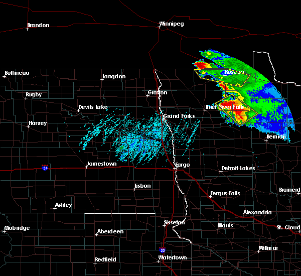 At 429 pm cdt, a severe thunderstorm was located 11 miles west of pinecreek, or 23 miles northwest of roseau, moving southeast at 30 mph (radar indicated). Hazards include quarter size hail. Damage to vehicles is expected. this severe thunderstorm will be near, pinecreek around 450 pm cdt. ross around 455 pm cdt. fox around 500 pm cdt. roseau and malung around 510 pm cdt. Salol around 520 pm cdt. At 429 pm cdt, a severe thunderstorm was located 11 miles west of pinecreek, or 23 miles northwest of roseau, moving southeast at 30 mph (radar indicated). Hazards include quarter size hail. Damage to vehicles is expected. this severe thunderstorm will be near, pinecreek around 450 pm cdt. ross around 455 pm cdt. fox around 500 pm cdt. roseau and malung around 510 pm cdt. Salol around 520 pm cdt.
|
| 8/7/2015 8:45 PM CDT | A few 3 to 4 inch diameter branches broken down. heavy rainfall of of 1.18 inches and some dime sized hai in roseau county MN, 6.3 miles NNW of Roseau, MN |
| 8/7/2015 8:35 PM CDT | Quarter sized hail reported 5.9 miles NE of Roseau, MN, very heavy rains and strong winds were accompanied by intermittent large hail. |
| 8/7/2015 8:10 PM CDT |
 At 809 pm cdt, severe thunderstorms were located along a line extending from 9 miles west of pinecreek to near pencer, moving east at 25 mph (radar indicated). Hazards include quarter size hail. Damage to vehicles is expected. severe thunderstorms will be near, salol around 825 pm cdt. warroad around 835 pm cdt. swift around 840 pm cdt. Roosevelt around 845 pm cdt. At 809 pm cdt, severe thunderstorms were located along a line extending from 9 miles west of pinecreek to near pencer, moving east at 25 mph (radar indicated). Hazards include quarter size hail. Damage to vehicles is expected. severe thunderstorms will be near, salol around 825 pm cdt. warroad around 835 pm cdt. swift around 840 pm cdt. Roosevelt around 845 pm cdt.
|
| 8/1/2015 11:54 PM CDT | Peak wind to 58 kts measured at the roseau airpor in roseau county MN, 2.3 miles SW of Roseau, MN |
| 8/1/2015 11:51 PM CDT |
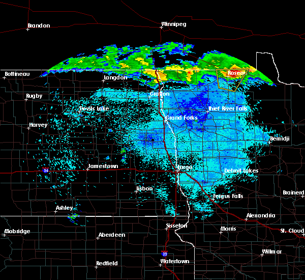 At 1150 pm cdt, a severe thunderstorm was located near salol, or 7 miles northeast of roseau, moving southeast at 80 mph (radar indicated). Hazards include quarter size hail. Damage to vehicles is expected. This severe thunderstorm will remain over mainly rural areas of central roseau county. At 1150 pm cdt, a severe thunderstorm was located near salol, or 7 miles northeast of roseau, moving southeast at 80 mph (radar indicated). Hazards include quarter size hail. Damage to vehicles is expected. This severe thunderstorm will remain over mainly rural areas of central roseau county.
|
| 8/1/2015 11:42 PM CDT |
 At 1141 pm cdt, a severe thunderstorm was located near lancaster, or 42 miles west of roseau, moving east at 35 mph (trained weather spotters). Hazards include quarter size hail. Damage to vehicles is expected. this severe storm will be near, leo and haug around 1200 am cdt. greenbush around 1205 am cdt. badger around 1210 am cdt. Fox and malung around 1215 am cdt. At 1141 pm cdt, a severe thunderstorm was located near lancaster, or 42 miles west of roseau, moving east at 35 mph (trained weather spotters). Hazards include quarter size hail. Damage to vehicles is expected. this severe storm will be near, leo and haug around 1200 am cdt. greenbush around 1205 am cdt. badger around 1210 am cdt. Fox and malung around 1215 am cdt.
|
| 8/1/2015 11:22 PM CDT |
 At 1121 pm cdt, a severe thunderstorm was located near humboldt, or 42 miles north of grafton, moving east at 35 mph (radar indicated). Hazards include half dollar size hail. Damage to vehicles is expected. this severe thunderstorm will be near, orleans around 1130 pm cdt. lancaster around 1140 pm cdt. caribou around 1200 am cdt. Haug and leo around 1215 am cdt. At 1121 pm cdt, a severe thunderstorm was located near humboldt, or 42 miles north of grafton, moving east at 35 mph (radar indicated). Hazards include half dollar size hail. Damage to vehicles is expected. this severe thunderstorm will be near, orleans around 1130 pm cdt. lancaster around 1140 pm cdt. caribou around 1200 am cdt. Haug and leo around 1215 am cdt.
|
| 7/12/2015 6:39 PM CDT |
 The severe thunderstorm warning for kittson, northeastern marshall, roseau, central pennington and southeastern pembina counties will expire at 645 pm cdt, the storms which prompted the warning have weakened below severe limits, and no longer pose an immediate threat to life or property. therefore the warning will be allowed to expire. a severe thunderstorm watch remains in effect until 1000 pm cdt for northwestern minnesota and northeastern north dakota. The severe thunderstorm warning for kittson, northeastern marshall, roseau, central pennington and southeastern pembina counties will expire at 645 pm cdt, the storms which prompted the warning have weakened below severe limits, and no longer pose an immediate threat to life or property. therefore the warning will be allowed to expire. a severe thunderstorm watch remains in effect until 1000 pm cdt for northwestern minnesota and northeastern north dakota.
|
| 7/12/2015 6:18 PM CDT |
 At 618 pm cdt, severe thunderstorms were located along a line extending from 7 miles northeast of orleans to near norris camp, moving northeast at 70 mph (radar indicated). Hazards include 60 mph wind gusts and half dollar size hail. Hail damage to vehicles is expected. expect wind damage to roofs, siding and trees. These severe thunderstorms will remain over mainly rural areas of kittson, northeastern marshall, roseau, central pennington and southeastern pembina counties. At 618 pm cdt, severe thunderstorms were located along a line extending from 7 miles northeast of orleans to near norris camp, moving northeast at 70 mph (radar indicated). Hazards include 60 mph wind gusts and half dollar size hail. Hail damage to vehicles is expected. expect wind damage to roofs, siding and trees. These severe thunderstorms will remain over mainly rural areas of kittson, northeastern marshall, roseau, central pennington and southeastern pembina counties.
|
| 7/12/2015 5:43 PM CDT |
 At 543 pm cdt, severe thunderstorms were located along a line extending from near auburn to near high landing, moving northeast at 70 mph (radar indicated). Hazards include 60 mph wind gusts and half dollar size hail. Hail damage to vehicles is expected. expect wind damage to roofs, siding and trees. severe thunderstorms will be near, goodridge and high landing around 545 pm cdt. espelie and robbin around 550 pm cdt. bowesmont and mattson around 555 pm cdt. joliette around 600 pm cdt. Northcote and humboldt around 605 pm cdt. At 543 pm cdt, severe thunderstorms were located along a line extending from near auburn to near high landing, moving northeast at 70 mph (radar indicated). Hazards include 60 mph wind gusts and half dollar size hail. Hail damage to vehicles is expected. expect wind damage to roofs, siding and trees. severe thunderstorms will be near, goodridge and high landing around 545 pm cdt. espelie and robbin around 550 pm cdt. bowesmont and mattson around 555 pm cdt. joliette around 600 pm cdt. Northcote and humboldt around 605 pm cdt.
|
| 7/12/2015 5:43 PM CDT | The national weather service in grand forks has issued a * severe thunderstorm warning for. kittson county in northwestern minnesota. marshall county in northwestern minnesota. roseau county in northwestern minnesota. Pennington county in northwestern minnesota. |
| 6/7/2015 3:39 PM CDT | At 338 pm cdt, a severe thunderstorm was located near roseau, moving southeast at 30 mph (radar indicated). Hazards include quarter size hail. Damage to vehicles is expected. this severe thunderstorm will be near, roseau around 345 pm cdt. malung around 350 pm cdt. wannaska around 355 pm cdt. pencer around 400 pm cdt. Hayes lake state park around 410 pm cdt. |
| 6/7/2015 3:37 PM CDT | Golf Ball sized hail reported 7.7 miles ESE of Roseau, MN |
| 6/20/2014 4:50 PM CDT | Quarter sized hail reported 7.3 miles E of Roseau, MN, dime to quarter sized hail. |
| 5/24/2014 4:48 PM CDT | Quarter sized hail reported 1 miles N of Roseau, MN, lots of pea size hail with some quarter size hail mixed in. |
| 8/24/2013 7:40 PM CDT | Hen Egg sized hail reported 9 miles WNW of Roseau, MN, public facebook report relayed via media partner. |
| 8/24/2013 7:37 PM CDT | Report of multiple 20-30 ft trees down. time estimated from rada in roseau county MN, 2.8 miles W of Roseau, MN |
| 7/29/2012 9:58 PM CDT | Quarter sized hail reported 4.7 miles SSE of Roseau, MN, winds gusting estimated to 45 mph. |
| 7/29/2012 9:55 PM CDT | One camper was flipped and a shed under construction was blown over. numerous trees downe in roseau county MN, 0.4 miles S of Roseau, MN |
| 7/29/2012 9:55 PM CDT | Several tree branches up to 6 inches in diameter were broken dow in roseau county MN, 0.4 miles S of Roseau, MN |
| 7/29/2012 9:25 PM CDT | Quarter sized hail reported 14.4 miles SE of Roseau, MN, dime to quarter sized hail... a few seemed larger. |
| 1/1/0001 12:00 AM | Dime size hail accompanied wind in roseau county MN, 1.8 miles S of Roseau, MN |
| 1/1/0001 12:00 AM | Large trees...greater than a foot in diameter...blown dow in roseau county MN, 8.7 miles N of Roseau, MN |
| 1/1/0001 12:00 AM | 6 to 8 inch diameter trees down in town. estimated wind gusts of 30 to 35 mp in roseau county MN, 0.4 miles S of Roseau, MN |
| 1/1/0001 12:00 AM | 6 to 8 inch diameter trees down in town. estimated wind gusts of 60 to 65 mp in roseau county MN, 0.4 miles S of Roseau, MN |
| 1/1/0001 12:00 AM | 4 inch diameter trees down in roseau county MN, 0.4 miles S of Roseau, MN |
| 1/1/0001 12:00 AM | Numerous trees of 4 inch diameter down in tow in roseau county MN, 0.4 miles S of Roseau, MN |
| 1/1/0001 12:00 AM | Storm damage reported in roseau county MN, 1.7 miles N of Roseau, MN |
| 1/1/0001 12:00 AM | Large trees...greater than a foot in diameter...blown dow in roseau county MN, 8.7 miles N of Roseau, MN |
| 1/1/0001 12:00 AM | Trees of 10 to 12 inches in diameter were snappe in roseau county MN, 12.8 miles N of Roseau, MN |
| 1/1/0001 12:00 AM | Trees up to 8 inches in diamter were uprooted and snappe in roseau county MN, 12.8 miles N of Roseau, MN |
Hail Maps for Roseau, MN


Connect with Interactive Hail Maps