

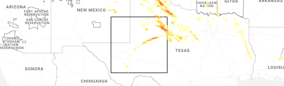
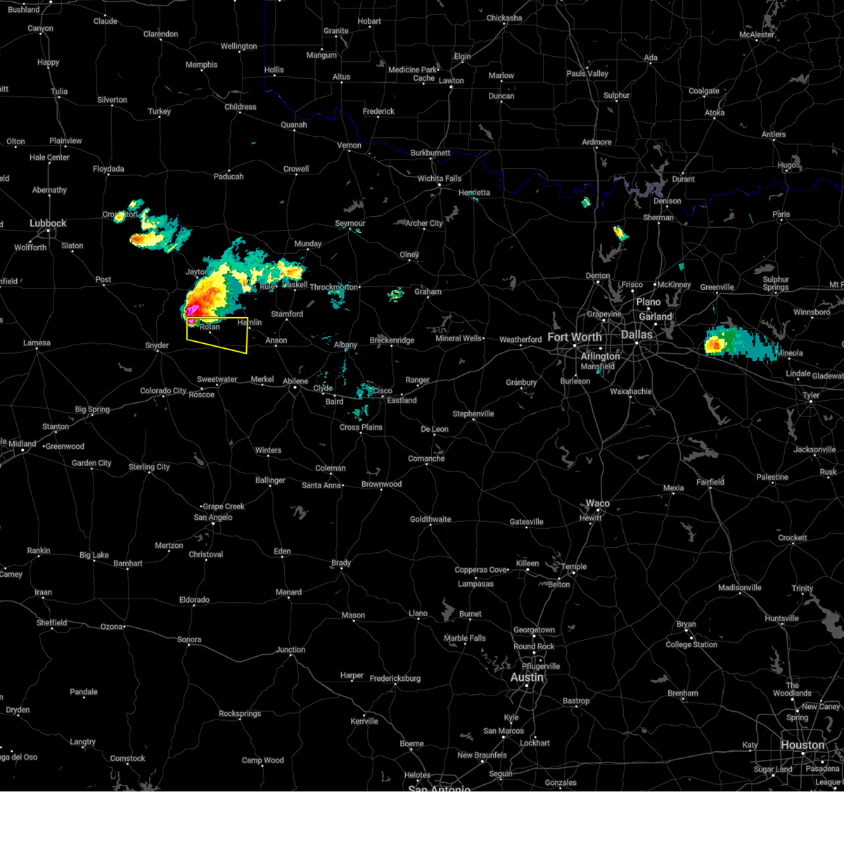
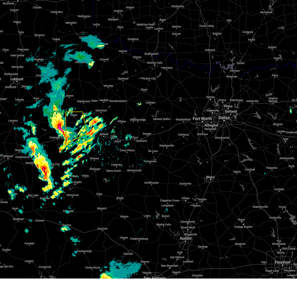
Hail Map for Rotan, TX
The Rotan, TX area has had 22 reports of on-the-ground hail by trained spotters, and has been under severe weather warnings 31 times during the past 12 months. Doppler radar has detected hail at or near Rotan, TX on 106 occasions, including 5 occasions during the past year.
| Name: | Rotan, TX |
| Where Located: | 50.5 miles WNW of Abilene, TX |
| Map: | Google Map for Rotan, TX |
| Population: | 1508 |
| Housing Units: | 771 |
| More Info: | Search Google for Rotan, TX |
4
The Top Recent Hail Date for Rotan, TX is Sunday, June 8, 2025 (2nd out of 106)
Hail and Wind Damage Spotted near Rotan, TX
| Date / Time | Report Details |
|---|---|
| 6/8/2025 11:41 PM CDT |
 Svrsjt the national weather service in san angelo has issued a * severe thunderstorm warning for, fisher county in west central texas, * until 1230 am cdt. * at 1140 pm cdt, a severe thunderstorm was located 9 miles north of hobbs, moving southeast at 40 mph (radar indicated). Hazards include 60 mph wind gusts and quarter size hail. Hail damage to vehicles is expected. expect wind damage to roofs, siding, and trees. this severe thunderstorm will be near, rotan and hobbs around 1145 pm cdt. roby around 1155 pm cdt. longworth around 1205 am cdt. sylvester around 1210 am cdt. Other locations impacted by this severe thunderstorm include hitson, us-180 near the fisher-scurry county line, capitola, and busby. Svrsjt the national weather service in san angelo has issued a * severe thunderstorm warning for, fisher county in west central texas, * until 1230 am cdt. * at 1140 pm cdt, a severe thunderstorm was located 9 miles north of hobbs, moving southeast at 40 mph (radar indicated). Hazards include 60 mph wind gusts and quarter size hail. Hail damage to vehicles is expected. expect wind damage to roofs, siding, and trees. this severe thunderstorm will be near, rotan and hobbs around 1145 pm cdt. roby around 1155 pm cdt. longworth around 1205 am cdt. sylvester around 1210 am cdt. Other locations impacted by this severe thunderstorm include hitson, us-180 near the fisher-scurry county line, capitola, and busby.
|
| 6/8/2025 10:32 PM CDT | At 1031 pm cdt, a severe thunderstorm was located over the intersection of us-180 and ranch road 126, or over neinda, moving east at 40 mph (radar indicated). Hazards include golf ball size hail and 60 mph wind gusts. People and animals outdoors will be injured. expect hail damage to roofs, siding, windows, and vehicles. expect wind damage to roofs, siding, and trees. this severe storm will be near, anson around 1035 pm cdt. hawley around 1055 pm cdt. nugent around 1105 pm cdt. northeastern abilene around 1110 pm cdt. lueders around 1120 pm cdt. Other locations impacted by this severe thunderstorm include hodges, funston, the intersection of us- 180 and ranch road 126, hitson, tuxedo, lake fort phantom hill, truby, and the intersection of us-180 and farm road 600. |
| 6/8/2025 10:15 PM CDT | Svrsjt the national weather service in san angelo has issued a * severe thunderstorm warning for, south central haskell county in west central texas, jones county in west central texas, fisher county in west central texas, * until 1115 pm cdt. * at 1014 pm cdt, a severe thunderstorm was located over mccaulley, moving east at 40 mph (radar indicated). Hazards include golf ball size hail and 60 mph wind gusts. People and animals outdoors will be injured. expect hail damage to roofs, siding, windows, and vehicles. expect wind damage to roofs, siding, and trees. this severe thunderstorm will be near, hamlin, neinda, and mccaulley around 1020 pm cdt. anson around 1040 pm cdt. hawley around 1055 pm cdt. Other locations impacted by this severe thunderstorm include hodges, funston, the intersection of us- 180 and ranch road 126, hitson, tuxedo, lake fort phantom hill, truby, and the intersection of us-180 and farm road 600. |
| 6/8/2025 8:44 PM CDT | Svrsjt the national weather service in san angelo has issued a * severe thunderstorm warning for, northwestern jones county in west central texas, fisher county in west central texas, * until 930 pm cdt. * at 843 pm cdt, a severe thunderstorm was located 12 miles northwest of rotan, moving southeast at 45 mph (radar indicated). Hazards include two inch hail and 70 mph wind gusts. People and animals outdoors will be injured. expect hail damage to roofs, siding, windows, and vehicles. expect considerable tree damage. wind damage is also likely to mobile homes, roofs, and outbuildings. this severe thunderstorm will be near, rotan around 850 pm cdt. roby around 905 pm cdt. mccaulley around 910 pm cdt. sylvester around 915 pm cdt. Other locations impacted by this severe thunderstorm include hitson. |
| 6/8/2025 8:17 PM CDT |
 At 816 pm cdt, a severe thunderstorm was located over sylvester, moving southeast at 45 mph. this is a destructive storm for north central fisher county (radar indicated). Hazards include 90 mph wind gusts and softball size hail. You are in a life-threatening situation. flying debris may be deadly to those caught without shelter. mobile homes will be heavily damaged or destroyed. homes and businesses will have substantial roof and window damage. expect extensive tree damage and power outages. this severe storm will be near, sylvester and mccaulley around 820 pm cdt. noodle around 825 pm cdt. Other locations impacted by this severe thunderstorm include the intersection of us- 180 and ranch road 126, truby, hitson, tuxedo, capitola, and busby. At 816 pm cdt, a severe thunderstorm was located over sylvester, moving southeast at 45 mph. this is a destructive storm for north central fisher county (radar indicated). Hazards include 90 mph wind gusts and softball size hail. You are in a life-threatening situation. flying debris may be deadly to those caught without shelter. mobile homes will be heavily damaged or destroyed. homes and businesses will have substantial roof and window damage. expect extensive tree damage and power outages. this severe storm will be near, sylvester and mccaulley around 820 pm cdt. noodle around 825 pm cdt. Other locations impacted by this severe thunderstorm include the intersection of us- 180 and ranch road 126, truby, hitson, tuxedo, capitola, and busby.
|
| 6/8/2025 7:58 PM CDT | Storm damage reported in fisher county TX, 4.5 miles E of Rotan, TX |
| 6/8/2025 7:57 PM CDT |
 the severe thunderstorm warning has been cancelled and is no longer in effect the severe thunderstorm warning has been cancelled and is no longer in effect
|
| 6/8/2025 7:57 PM CDT |
 At 755 pm cdt, a severe thunderstorm was located near rotan, moving southeast at 40 mph. this is a destructive storm for rotan (radar indicated). Hazards include 80 mph wind gusts and softball size hail. Flying debris will be dangerous to those caught without shelter. mobile homes will be heavily damaged. expect considerable damage to roofs, windows, and vehicles. extensive tree damage and power outages are likely. this severe storm will be near, rotan and roby around 800 pm cdt. sylvester around 810 pm cdt. longworth and mccaulley around 815 pm cdt. noodle around 830 pm cdt. Other locations impacted by this severe thunderstorm include the intersection of us- 180 and ranch road 126, truby, hitson, tuxedo, capitola, and busby. At 755 pm cdt, a severe thunderstorm was located near rotan, moving southeast at 40 mph. this is a destructive storm for rotan (radar indicated). Hazards include 80 mph wind gusts and softball size hail. Flying debris will be dangerous to those caught without shelter. mobile homes will be heavily damaged. expect considerable damage to roofs, windows, and vehicles. extensive tree damage and power outages are likely. this severe storm will be near, rotan and roby around 800 pm cdt. sylvester around 810 pm cdt. longworth and mccaulley around 815 pm cdt. noodle around 830 pm cdt. Other locations impacted by this severe thunderstorm include the intersection of us- 180 and ranch road 126, truby, hitson, tuxedo, capitola, and busby.
|
| 6/8/2025 7:45 PM CDT |
 At 744 pm cdt, a severe thunderstorm was located 10 miles north of hobbs or 10 miles northwest of rotan, moving southeast at 40 mph. this is a destructive storm for the locations of rotan and hobbs (radar indicated). Hazards include 80 mph wind gusts and baseball size hail. Flying debris will be dangerous to those caught without shelter. mobile homes will be heavily damaged. expect considerable damage to roofs, windows, and vehicles. extensive tree damage and power outages are likely. this severe storm will be near, rotan and hobbs around 750 pm cdt. roby around 800 pm cdt. longworth around 810 pm cdt. sylvester around 815 pm cdt. Other locations impacted by this severe thunderstorm include the intersection of us- 180 and ranch road 126, truby, hitson, tuxedo, capitola, and busby. At 744 pm cdt, a severe thunderstorm was located 10 miles north of hobbs or 10 miles northwest of rotan, moving southeast at 40 mph. this is a destructive storm for the locations of rotan and hobbs (radar indicated). Hazards include 80 mph wind gusts and baseball size hail. Flying debris will be dangerous to those caught without shelter. mobile homes will be heavily damaged. expect considerable damage to roofs, windows, and vehicles. extensive tree damage and power outages are likely. this severe storm will be near, rotan and hobbs around 750 pm cdt. roby around 800 pm cdt. longworth around 810 pm cdt. sylvester around 815 pm cdt. Other locations impacted by this severe thunderstorm include the intersection of us- 180 and ranch road 126, truby, hitson, tuxedo, capitola, and busby.
|
| 6/8/2025 7:23 PM CDT | Svrsjt the national weather service in san angelo has issued a * severe thunderstorm warning for, southern haskell county in west central texas, western jones county in west central texas, fisher county in west central texas, * until 830 pm cdt. * at 722 pm cdt, a severe thunderstorm was located 7 miles southwest of peacock, moving southeast at 55 mph (radar indicated). Hazards include golf ball size hail and 70 mph wind gusts. People and animals outdoors will be injured. expect hail damage to roofs, siding, windows, and vehicles. expect considerable tree damage. wind damage is also likely to mobile homes, roofs, and outbuildings. this severe thunderstorm will be near, hamlin around 745 pm cdt. stamford and anson around 805 pm cdt. Other locations impacted by this severe thunderstorm include the intersection of us- 180 and ranch road 126, truby, hitson, tuxedo, capitola, and busby. |
| 6/8/2025 8:22 AM CDT |
 At 822 am cdt, a severe thunderstorm was located over roby, moving southeast at 25 mph (radar indicated). Hazards include golf ball size hail and 60 mph wind gusts. People and animals outdoors will be injured. expect hail damage to roofs, siding, windows, and vehicles. expect wind damage to roofs, siding, and trees. this severe storm will be near, roby, sylvester, and mccaulley around 825 am cdt. Other locations impacted by this severe thunderstorm include hitson. At 822 am cdt, a severe thunderstorm was located over roby, moving southeast at 25 mph (radar indicated). Hazards include golf ball size hail and 60 mph wind gusts. People and animals outdoors will be injured. expect hail damage to roofs, siding, windows, and vehicles. expect wind damage to roofs, siding, and trees. this severe storm will be near, roby, sylvester, and mccaulley around 825 am cdt. Other locations impacted by this severe thunderstorm include hitson.
|
| 6/8/2025 8:16 AM CDT | Quarter sized hail reported 0.4 miles SSW of Rotan, TX, report from mping: quarter (1.00 in.). |
| 6/8/2025 8:10 AM CDT | Baseball sized hail reported 5.4 miles W of Rotan, TX, report from mping: baseball (2.75 in.). |
| 6/8/2025 8:08 AM CDT |
 At 807 am cdt, a severe thunderstorm was located over rotan, moving southeast at 35 mph. this is a destructive storm for northern fisher county (radar indicated). Hazards include baseball size hail and 60 mph wind gusts. People and animals outdoors will be severely injured. expect shattered windows, extensive damage to roofs, siding, and vehicles. this severe storm will be near, roby around 815 am cdt. sylvester and mccaulley around 820 am cdt. Other locations impacted by this severe thunderstorm include hitson. At 807 am cdt, a severe thunderstorm was located over rotan, moving southeast at 35 mph. this is a destructive storm for northern fisher county (radar indicated). Hazards include baseball size hail and 60 mph wind gusts. People and animals outdoors will be severely injured. expect shattered windows, extensive damage to roofs, siding, and vehicles. this severe storm will be near, roby around 815 am cdt. sylvester and mccaulley around 820 am cdt. Other locations impacted by this severe thunderstorm include hitson.
|
| 6/8/2025 8:07 AM CDT | Mesonet station 113 5w rotan rotan/fisher count in fisher county TX, 4.5 miles E of Rotan, TX |
| 6/8/2025 7:59 AM CDT |
 At 758 am cdt, a severe thunderstorm was located near rotan, moving southeast at 35 mph. this is a destructive storm for northwestern fisher county (radar indicated). Hazards include softball size hail and 60 mph wind gusts. People and animals outdoors will be severely injured. expect shattered windows, extensive damage to roofs, siding, and vehicles. this severe storm will be near, rotan and roby around 805 am cdt. sylvester and mccaulley around 815 am cdt. Other locations impacted by this severe thunderstorm include hitson. At 758 am cdt, a severe thunderstorm was located near rotan, moving southeast at 35 mph. this is a destructive storm for northwestern fisher county (radar indicated). Hazards include softball size hail and 60 mph wind gusts. People and animals outdoors will be severely injured. expect shattered windows, extensive damage to roofs, siding, and vehicles. this severe storm will be near, rotan and roby around 805 am cdt. sylvester and mccaulley around 815 am cdt. Other locations impacted by this severe thunderstorm include hitson.
|
| 6/8/2025 7:51 AM CDT |
 At 750 am cdt, a severe thunderstorm was located 8 miles northwest of rotan, moving southeast at 30 mph. this is a destructive storm for northwestern fisher county (radar indicated). Hazards include baseball size hail and 60 mph wind gusts. People and animals outdoors will be severely injured. expect shattered windows, extensive damage to roofs, siding, and vehicles. this severe storm will be near, rotan around 755 am cdt. roby around 810 am cdt. sylvester around 825 am cdt. mccaulley around 830 am cdt. Other locations impacted by this severe thunderstorm include hitson. At 750 am cdt, a severe thunderstorm was located 8 miles northwest of rotan, moving southeast at 30 mph. this is a destructive storm for northwestern fisher county (radar indicated). Hazards include baseball size hail and 60 mph wind gusts. People and animals outdoors will be severely injured. expect shattered windows, extensive damage to roofs, siding, and vehicles. this severe storm will be near, rotan around 755 am cdt. roby around 810 am cdt. sylvester around 825 am cdt. mccaulley around 830 am cdt. Other locations impacted by this severe thunderstorm include hitson.
|
| 6/8/2025 7:39 AM CDT |
 Svrsjt the national weather service in san angelo has issued a * severe thunderstorm warning for, northern fisher county in west central texas, * until 845 am cdt. * at 738 am cdt, a severe thunderstorm was located 12 miles southeast of clairemont, moving southeast at 20 mph (radar indicated). Hazards include golf ball size hail and 60 mph wind gusts. People and animals outdoors will be injured. expect hail damage to roofs, siding, windows, and vehicles. expect wind damage to roofs, siding, and trees. this severe thunderstorm will be near, rotan around 800 am cdt. Other locations impacted by this severe thunderstorm include hitson. Svrsjt the national weather service in san angelo has issued a * severe thunderstorm warning for, northern fisher county in west central texas, * until 845 am cdt. * at 738 am cdt, a severe thunderstorm was located 12 miles southeast of clairemont, moving southeast at 20 mph (radar indicated). Hazards include golf ball size hail and 60 mph wind gusts. People and animals outdoors will be injured. expect hail damage to roofs, siding, windows, and vehicles. expect wind damage to roofs, siding, and trees. this severe thunderstorm will be near, rotan around 800 am cdt. Other locations impacted by this severe thunderstorm include hitson.
|
| 6/6/2025 9:47 PM CDT |
 At 947 pm cdt, a severe thunderstorm was located near hitson, or 10 miles northeast of rotan, moving east at 25 mph (radar indicated). Hazards include ping pong ball size hail and 60 mph wind gusts. People and animals outdoors will be injured. expect hail damage to roofs, siding, windows, and vehicles. expect wind damage to roofs, siding, and trees. this severe storm will be near, hamlin around 955 pm cdt. Other locations impacted by this severe thunderstorm include the intersection of us-180 and ranch road 126 and hitson. At 947 pm cdt, a severe thunderstorm was located near hitson, or 10 miles northeast of rotan, moving east at 25 mph (radar indicated). Hazards include ping pong ball size hail and 60 mph wind gusts. People and animals outdoors will be injured. expect hail damage to roofs, siding, windows, and vehicles. expect wind damage to roofs, siding, and trees. this severe storm will be near, hamlin around 955 pm cdt. Other locations impacted by this severe thunderstorm include the intersection of us-180 and ranch road 126 and hitson.
|
| 6/6/2025 9:33 PM CDT |
 Svrsjt the national weather service in san angelo has issued a * severe thunderstorm warning for, northwestern jones county in west central texas, northern fisher county in west central texas, * until 1000 pm cdt. * at 932 pm cdt, a severe thunderstorm was located near rotan, moving southeast at 40 mph (radar indicated). Hazards include 60 mph wind gusts and penny size hail. Expect damage to roofs, siding, and trees. this severe thunderstorm will be near, hamlin and mccaulley around 940 pm cdt. Other locations impacted by this severe thunderstorm include the intersection of us-180 and ranch road 126 and hitson. Svrsjt the national weather service in san angelo has issued a * severe thunderstorm warning for, northwestern jones county in west central texas, northern fisher county in west central texas, * until 1000 pm cdt. * at 932 pm cdt, a severe thunderstorm was located near rotan, moving southeast at 40 mph (radar indicated). Hazards include 60 mph wind gusts and penny size hail. Expect damage to roofs, siding, and trees. this severe thunderstorm will be near, hamlin and mccaulley around 940 pm cdt. Other locations impacted by this severe thunderstorm include the intersection of us-180 and ranch road 126 and hitson.
|
| 5/25/2025 11:20 PM CDT |
 At 1120 pm cdt, a severe thunderstorm was located near rotan, moving east at 20 mph (radar indicated). Hazards include 60 mph wind gusts and quarter size hail. Hail damage to vehicles is expected. expect wind damage to roofs, siding, and trees. this severe storm will be near, hamlin around 1140 pm cdt. mccaulley around 1145 pm cdt. neinda around 1200 am cdt. Other locations impacted by this severe thunderstorm include the intersection of us-180 and ranch road 126 and hitson. At 1120 pm cdt, a severe thunderstorm was located near rotan, moving east at 20 mph (radar indicated). Hazards include 60 mph wind gusts and quarter size hail. Hail damage to vehicles is expected. expect wind damage to roofs, siding, and trees. this severe storm will be near, hamlin around 1140 pm cdt. mccaulley around 1145 pm cdt. neinda around 1200 am cdt. Other locations impacted by this severe thunderstorm include the intersection of us-180 and ranch road 126 and hitson.
|
| 5/25/2025 11:08 PM CDT |
 Svrsjt the national weather service in san angelo has issued a * severe thunderstorm warning for, northwestern jones county in west central texas, northern fisher county in west central texas, * until 1215 am cdt. * at 1107 pm cdt, a severe thunderstorm was located near rotan, moving east at 20 mph (radar indicated). Hazards include 60 mph wind gusts and quarter size hail. Hail damage to vehicles is expected. expect wind damage to roofs, siding, and trees. this severe thunderstorm will be near, rotan around 1115 pm cdt. hamlin around 1140 pm cdt. mccaulley around 1145 pm cdt. Other locations impacted by this severe thunderstorm include the intersection of us-180 and ranch road 126 and hitson. Svrsjt the national weather service in san angelo has issued a * severe thunderstorm warning for, northwestern jones county in west central texas, northern fisher county in west central texas, * until 1215 am cdt. * at 1107 pm cdt, a severe thunderstorm was located near rotan, moving east at 20 mph (radar indicated). Hazards include 60 mph wind gusts and quarter size hail. Hail damage to vehicles is expected. expect wind damage to roofs, siding, and trees. this severe thunderstorm will be near, rotan around 1115 pm cdt. hamlin around 1140 pm cdt. mccaulley around 1145 pm cdt. Other locations impacted by this severe thunderstorm include the intersection of us-180 and ranch road 126 and hitson.
|
| 5/25/2025 10:19 PM CDT | At 1018 pm cdt, a severe thunderstorm was located near hobbs, moving northeast at 25 mph (radar indicated). Hazards include 60 mph wind gusts and quarter size hail. Hail damage to vehicles is expected. expect wind damage to roofs, siding, and trees. This severe storm will be near, rotan around 1025 pm cdt. |
| 5/25/2025 9:58 PM CDT |
 Svrsjt the national weather service in san angelo has issued a * severe thunderstorm warning for, western fisher county in west central texas, * until 1045 pm cdt. * at 958 pm cdt, a severe thunderstorm was located over us-180 near the fisher-scurry county line, or near hobbs, moving northeast at 25 mph (radar indicated). Hazards include 60 mph wind gusts and quarter size hail. Hail damage to vehicles is expected. expect wind damage to roofs, siding, and trees. this severe thunderstorm will be near, hobbs around 1005 pm cdt. rotan around 1010 pm cdt. Other locations impacted by this severe thunderstorm include us- 180 near the fisher-scurry county line. Svrsjt the national weather service in san angelo has issued a * severe thunderstorm warning for, western fisher county in west central texas, * until 1045 pm cdt. * at 958 pm cdt, a severe thunderstorm was located over us-180 near the fisher-scurry county line, or near hobbs, moving northeast at 25 mph (radar indicated). Hazards include 60 mph wind gusts and quarter size hail. Hail damage to vehicles is expected. expect wind damage to roofs, siding, and trees. this severe thunderstorm will be near, hobbs around 1005 pm cdt. rotan around 1010 pm cdt. Other locations impacted by this severe thunderstorm include us- 180 near the fisher-scurry county line.
|
| 4/30/2025 2:00 AM CDT |
 the severe thunderstorm warning has been cancelled and is no longer in effect the severe thunderstorm warning has been cancelled and is no longer in effect
|
| 4/30/2025 1:57 AM CDT |
 At 156 am cdt, a severe thunderstorm was located over rotan, moving northeast at 40 mph (radar indicated). Hazards include quarter size hail. Damage to vehicles is expected. This severe thunderstorm will remain over mainly rural areas of north central fisher county. At 156 am cdt, a severe thunderstorm was located over rotan, moving northeast at 40 mph (radar indicated). Hazards include quarter size hail. Damage to vehicles is expected. This severe thunderstorm will remain over mainly rural areas of north central fisher county.
|
| 4/30/2025 1:48 AM CDT |
 At 147 am cdt, a severe thunderstorm was located near hobbs, moving northeast at 25 mph (radar indicated). Hazards include 60 mph wind gusts and quarter size hail. Hail damage to vehicles is expected. expect wind damage to roofs, siding, and trees. this severe storm will be near, roby and rotan around 155 am cdt. Other locations impacted by this severe thunderstorm include hitson. At 147 am cdt, a severe thunderstorm was located near hobbs, moving northeast at 25 mph (radar indicated). Hazards include 60 mph wind gusts and quarter size hail. Hail damage to vehicles is expected. expect wind damage to roofs, siding, and trees. this severe storm will be near, roby and rotan around 155 am cdt. Other locations impacted by this severe thunderstorm include hitson.
|
| 4/30/2025 1:27 AM CDT |
 Svrsjt the national weather service in san angelo has issued a * severe thunderstorm warning for, fisher county in west central texas, * until 215 am cdt. * at 127 am cdt, a severe thunderstorm was located over us-180 near the fisher-scurry county line, or near hobbs, moving northeast at 45 mph (radar indicated). Hazards include 60 mph wind gusts and half dollar size hail. Hail damage to vehicles is expected. expect wind damage to roofs, siding, and trees. this severe thunderstorm will be near, hobbs around 130 am cdt. rotan around 135 am cdt. roby around 140 am cdt. hamlin around 155 am cdt. Other locations impacted by this severe thunderstorm include hitson and us-180 near the fisher-scurry county line. Svrsjt the national weather service in san angelo has issued a * severe thunderstorm warning for, fisher county in west central texas, * until 215 am cdt. * at 127 am cdt, a severe thunderstorm was located over us-180 near the fisher-scurry county line, or near hobbs, moving northeast at 45 mph (radar indicated). Hazards include 60 mph wind gusts and half dollar size hail. Hail damage to vehicles is expected. expect wind damage to roofs, siding, and trees. this severe thunderstorm will be near, hobbs around 130 am cdt. rotan around 135 am cdt. roby around 140 am cdt. hamlin around 155 am cdt. Other locations impacted by this severe thunderstorm include hitson and us-180 near the fisher-scurry county line.
|
| 4/4/2025 11:58 PM CDT |
 Svrsjt the national weather service in san angelo has issued a * severe thunderstorm warning for, southwestern haskell county in west central texas, western jones county in west central texas, eastern fisher county in west central texas, * until 1230 am cdt. * at 1156 pm cdt, a severe thunderstorm was located over hitson, or near hamlin, moving northeast at 55 mph (radar indicated). Hazards include 60 mph wind gusts and half dollar size hail. Hail damage to vehicles is expected. expect wind damage to roofs, siding, and trees. this severe thunderstorm will be near, hamlin around 1200 am cdt. sagerton around 1210 am cdt. Other locations impacted by this severe thunderstorm include jud, the intersection of us-180 and ranch road 126, us-380 near the haskell- stonewall county line, truby, hitson, and tuxedo. Svrsjt the national weather service in san angelo has issued a * severe thunderstorm warning for, southwestern haskell county in west central texas, western jones county in west central texas, eastern fisher county in west central texas, * until 1230 am cdt. * at 1156 pm cdt, a severe thunderstorm was located over hitson, or near hamlin, moving northeast at 55 mph (radar indicated). Hazards include 60 mph wind gusts and half dollar size hail. Hail damage to vehicles is expected. expect wind damage to roofs, siding, and trees. this severe thunderstorm will be near, hamlin around 1200 am cdt. sagerton around 1210 am cdt. Other locations impacted by this severe thunderstorm include jud, the intersection of us-180 and ranch road 126, us-380 near the haskell- stonewall county line, truby, hitson, and tuxedo.
|
| 4/4/2025 11:44 PM CDT |
 the severe thunderstorm warning has been cancelled and is no longer in effect the severe thunderstorm warning has been cancelled and is no longer in effect
|
| 4/4/2025 11:44 PM CDT |
 At 1143 pm cdt, a severe thunderstorm was located near rotan, moving northeast at 60 mph (radar indicated). Hazards include 60 mph wind gusts and half dollar size hail. Hail damage to vehicles is expected. expect wind damage to roofs, siding, and trees. This severe thunderstorm will remain over mainly rural areas of fisher county, including the following locations, gannon, busby, and capitola. At 1143 pm cdt, a severe thunderstorm was located near rotan, moving northeast at 60 mph (radar indicated). Hazards include 60 mph wind gusts and half dollar size hail. Hail damage to vehicles is expected. expect wind damage to roofs, siding, and trees. This severe thunderstorm will remain over mainly rural areas of fisher county, including the following locations, gannon, busby, and capitola.
|
| 4/4/2025 11:22 PM CDT |
 Svrsjt the national weather service in san angelo has issued a * severe thunderstorm warning for, northern nolan county in west central texas, fisher county in west central texas, * until midnight cdt. * at 1119 pm cdt, a severe thunderstorm was located near hermleigh, or 7 miles northwest of inadale, moving northeast at 50 mph (radar indicated). Hazards include ping pong ball size hail and 60 mph wind gusts. People and animals outdoors will be injured. expect hail damage to roofs, siding, windows, and vehicles. expect wind damage to roofs, siding, and trees. this severe thunderstorm will be near, hobbs around 1130 pm cdt. roby and rotan around 1140 pm cdt. other locations impacted by this severe thunderstorm include gannon, busby, capitola, i-20 near the nolan-mitchell county line, us- 180 near the fisher-scurry county line, and us-84 near the nolan- fisher county line. This includes interstate 20 between mile markers 229 and 256. Svrsjt the national weather service in san angelo has issued a * severe thunderstorm warning for, northern nolan county in west central texas, fisher county in west central texas, * until midnight cdt. * at 1119 pm cdt, a severe thunderstorm was located near hermleigh, or 7 miles northwest of inadale, moving northeast at 50 mph (radar indicated). Hazards include ping pong ball size hail and 60 mph wind gusts. People and animals outdoors will be injured. expect hail damage to roofs, siding, windows, and vehicles. expect wind damage to roofs, siding, and trees. this severe thunderstorm will be near, hobbs around 1130 pm cdt. roby and rotan around 1140 pm cdt. other locations impacted by this severe thunderstorm include gannon, busby, capitola, i-20 near the nolan-mitchell county line, us- 180 near the fisher-scurry county line, and us-84 near the nolan- fisher county line. This includes interstate 20 between mile markers 229 and 256.
|
| 4/3/2025 4:15 AM CDT | 71 mph wind gust at the west texas mesonet site west of rota in fisher county TX, 5.1 miles E of Rotan, TX |
| 4/3/2025 4:14 AM CDT | Svrsjt the national weather service in san angelo has issued a * severe thunderstorm warning for, northern fisher county in west central texas, * until 500 am cdt. * at 414 am cdt, a severe thunderstorm was located near rotan, moving northeast at 60 mph (radar indicated). Hazards include 60 mph wind gusts. Expect damage to roofs, siding, and trees. This severe thunderstorm will remain over mainly rural areas of northern fisher county, including the following locations, hitson and us-180 near the fisher-scurry county line. |
| 11/18/2024 2:38 AM CST |
 At 238 am cst, a severe thunderstorm was located near hobbs, moving northeast at 60 mph (radar indicated). Hazards include 60 mph wind gusts and nickel size hail. Expect damage to roofs, siding, and trees. this severe storm will be near, rotan around 245 am cst. Other locations impacted by this severe thunderstorm include hitson. At 238 am cst, a severe thunderstorm was located near hobbs, moving northeast at 60 mph (radar indicated). Hazards include 60 mph wind gusts and nickel size hail. Expect damage to roofs, siding, and trees. this severe storm will be near, rotan around 245 am cst. Other locations impacted by this severe thunderstorm include hitson.
|
| 11/18/2024 2:14 AM CST |
 Svrsjt the national weather service in san angelo has issued a * severe thunderstorm warning for, fisher county in west central texas, * until 315 am cst. * at 213 am cst, a severe thunderstorm was located near inadale, moving northeast at 55 mph (radar indicated). Hazards include 60 mph wind gusts and nickel size hail. Expect damage to roofs, siding, and trees. this severe thunderstorm will be near, hobbs around 230 am cst. rotan and roby around 240 am cst. Other locations impacted by this severe thunderstorm include hitson and capitola. Svrsjt the national weather service in san angelo has issued a * severe thunderstorm warning for, fisher county in west central texas, * until 315 am cst. * at 213 am cst, a severe thunderstorm was located near inadale, moving northeast at 55 mph (radar indicated). Hazards include 60 mph wind gusts and nickel size hail. Expect damage to roofs, siding, and trees. this severe thunderstorm will be near, hobbs around 230 am cst. rotan and roby around 240 am cst. Other locations impacted by this severe thunderstorm include hitson and capitola.
|
| 5/23/2024 5:02 PM CDT |
 Svrsjt the national weather service in san angelo has issued a * severe thunderstorm warning for, southwestern haskell county in west central texas, northwestern jones county in west central texas, northeastern fisher county in west central texas, * until 545 pm cdt. * at 501 pm cdt, a severe thunderstorm was located over hitson, or near hamlin, moving east at 35 mph (radar indicated). Hazards include golf ball size hail and 70 mph wind gusts. People and animals outdoors will be injured. expect hail damage to roofs, siding, windows, and vehicles. expect considerable tree damage. wind damage is also likely to mobile homes, roofs, and outbuildings. this severe thunderstorm will be near, hamlin around 505 pm cdt. neinda around 510 pm cdt. stamford around 530 pm cdt. Other locations impacted by this severe thunderstorm include funston, the intersection of us-180 and ranch road 126, hitson, and tuxedo. Svrsjt the national weather service in san angelo has issued a * severe thunderstorm warning for, southwestern haskell county in west central texas, northwestern jones county in west central texas, northeastern fisher county in west central texas, * until 545 pm cdt. * at 501 pm cdt, a severe thunderstorm was located over hitson, or near hamlin, moving east at 35 mph (radar indicated). Hazards include golf ball size hail and 70 mph wind gusts. People and animals outdoors will be injured. expect hail damage to roofs, siding, windows, and vehicles. expect considerable tree damage. wind damage is also likely to mobile homes, roofs, and outbuildings. this severe thunderstorm will be near, hamlin around 505 pm cdt. neinda around 510 pm cdt. stamford around 530 pm cdt. Other locations impacted by this severe thunderstorm include funston, the intersection of us-180 and ranch road 126, hitson, and tuxedo.
|
| 5/23/2024 4:26 PM CDT |
 Svrsjt the national weather service in san angelo has issued a * severe thunderstorm warning for, northern fisher county in west central texas, * until 500 pm cdt. * at 426 pm cdt, a severe thunderstorm was located near rotan, moving northeast at 25 mph (radar indicated). Hazards include ping pong ball size hail and 60 mph wind gusts. People and animals outdoors will be injured. expect hail damage to roofs, siding, windows, and vehicles. expect wind damage to roofs, siding, and trees. this severe thunderstorm will be near, rotan around 430 pm cdt. Other locations impacted by this severe thunderstorm include hitson. Svrsjt the national weather service in san angelo has issued a * severe thunderstorm warning for, northern fisher county in west central texas, * until 500 pm cdt. * at 426 pm cdt, a severe thunderstorm was located near rotan, moving northeast at 25 mph (radar indicated). Hazards include ping pong ball size hail and 60 mph wind gusts. People and animals outdoors will be injured. expect hail damage to roofs, siding, windows, and vehicles. expect wind damage to roofs, siding, and trees. this severe thunderstorm will be near, rotan around 430 pm cdt. Other locations impacted by this severe thunderstorm include hitson.
|
| 5/22/2024 5:41 PM CDT |
 At 540 pm cdt, a severe thunderstorm was located near roby, moving northeast at 35 mph (radar indicated). Hazards include 60 mph wind gusts and half dollar size hail. Hail damage to vehicles is expected. expect wind damage to roofs, siding, and trees. This severe thunderstorm will remain over mainly rural areas of northeastern fisher county, including the following locations, hitson. At 540 pm cdt, a severe thunderstorm was located near roby, moving northeast at 35 mph (radar indicated). Hazards include 60 mph wind gusts and half dollar size hail. Hail damage to vehicles is expected. expect wind damage to roofs, siding, and trees. This severe thunderstorm will remain over mainly rural areas of northeastern fisher county, including the following locations, hitson.
|
| 5/22/2024 5:30 PM CDT |
 At 530 pm cdt, a severe thunderstorm was located near rotan, moving northeast at 35 mph (radar indicated). Hazards include 60 mph wind gusts and half dollar size hail. Hail damage to vehicles is expected. expect wind damage to roofs, siding, and trees. this severe storm will be near, rotan around 535 pm cdt. Other locations impacted by this severe thunderstorm include hitson. At 530 pm cdt, a severe thunderstorm was located near rotan, moving northeast at 35 mph (radar indicated). Hazards include 60 mph wind gusts and half dollar size hail. Hail damage to vehicles is expected. expect wind damage to roofs, siding, and trees. this severe storm will be near, rotan around 535 pm cdt. Other locations impacted by this severe thunderstorm include hitson.
|
| 5/22/2024 5:15 PM CDT |
 Svrsjt the national weather service in san angelo has issued a * severe thunderstorm warning for, fisher county in west central texas, * until 600 pm cdt. * at 515 pm cdt, a severe thunderstorm was located near capitola, or 7 miles south of hobbs, moving northeast at 35 mph (radar indicated). Hazards include ping pong ball size hail and 60 mph wind gusts. People and animals outdoors will be injured. expect hail damage to roofs, siding, windows, and vehicles. expect wind damage to roofs, siding, and trees. this severe thunderstorm will be near, rotan, roby, and hobbs around 520 pm cdt. Other locations impacted by this severe thunderstorm include hitson and capitola. Svrsjt the national weather service in san angelo has issued a * severe thunderstorm warning for, fisher county in west central texas, * until 600 pm cdt. * at 515 pm cdt, a severe thunderstorm was located near capitola, or 7 miles south of hobbs, moving northeast at 35 mph (radar indicated). Hazards include ping pong ball size hail and 60 mph wind gusts. People and animals outdoors will be injured. expect hail damage to roofs, siding, windows, and vehicles. expect wind damage to roofs, siding, and trees. this severe thunderstorm will be near, rotan, roby, and hobbs around 520 pm cdt. Other locations impacted by this severe thunderstorm include hitson and capitola.
|
| 5/16/2024 1:42 PM CDT |
 Svrsjt the national weather service in san angelo has issued a * severe thunderstorm warning for, southwestern haskell county in west central texas, northwestern jones county in west central texas, northeastern fisher county in west central texas, * until 230 pm cdt. * at 142 pm cdt, a severe thunderstorm was located near hitson, or 7 miles northeast of roby, moving east at 40 mph (radar indicated). Hazards include 60 mph wind gusts and half dollar size hail. Hail damage to vehicles is expected. expect wind damage to roofs, siding, and trees. this severe thunderstorm will be near, hamlin and mccaulley around 145 pm cdt. neinda around 155 pm cdt. stamford and sagerton around 220 pm cdt. Other locations impacted by this severe thunderstorm include the intersection of us-180 and ranch road 126, us-380 near the haskell- stonewall county line, hitson, and tuxedo. Svrsjt the national weather service in san angelo has issued a * severe thunderstorm warning for, southwestern haskell county in west central texas, northwestern jones county in west central texas, northeastern fisher county in west central texas, * until 230 pm cdt. * at 142 pm cdt, a severe thunderstorm was located near hitson, or 7 miles northeast of roby, moving east at 40 mph (radar indicated). Hazards include 60 mph wind gusts and half dollar size hail. Hail damage to vehicles is expected. expect wind damage to roofs, siding, and trees. this severe thunderstorm will be near, hamlin and mccaulley around 145 pm cdt. neinda around 155 pm cdt. stamford and sagerton around 220 pm cdt. Other locations impacted by this severe thunderstorm include the intersection of us-180 and ranch road 126, us-380 near the haskell- stonewall county line, hitson, and tuxedo.
|
| 5/16/2024 1:28 PM CDT |
 At 128 pm cdt, a severe thunderstorm was located over rotan, moving east at 40 mph (radar indicated). Hazards include 60 mph wind gusts and quarter size hail. Hail damage to vehicles is expected. expect wind damage to roofs, siding, and trees. this severe storm will be near, hamlin around 140 pm cdt. Other locations impacted by this severe thunderstorm include hitson. At 128 pm cdt, a severe thunderstorm was located over rotan, moving east at 40 mph (radar indicated). Hazards include 60 mph wind gusts and quarter size hail. Hail damage to vehicles is expected. expect wind damage to roofs, siding, and trees. this severe storm will be near, hamlin around 140 pm cdt. Other locations impacted by this severe thunderstorm include hitson.
|
| 5/16/2024 1:12 PM CDT |
 At 112 pm cdt, a severe thunderstorm was located over hobbs, moving east at 40 mph (radar indicated). Hazards include 60 mph wind gusts and half dollar size hail. Hail damage to vehicles is expected. expect wind damage to roofs, siding, and trees. this severe storm will be near, rotan around 115 pm cdt. roby around 120 pm cdt. hamlin and mccaulley around 140 pm cdt. Other locations impacted by this severe thunderstorm include hitson and us-180 near the fisher-scurry county line. At 112 pm cdt, a severe thunderstorm was located over hobbs, moving east at 40 mph (radar indicated). Hazards include 60 mph wind gusts and half dollar size hail. Hail damage to vehicles is expected. expect wind damage to roofs, siding, and trees. this severe storm will be near, rotan around 115 pm cdt. roby around 120 pm cdt. hamlin and mccaulley around 140 pm cdt. Other locations impacted by this severe thunderstorm include hitson and us-180 near the fisher-scurry county line.
|
| 5/16/2024 12:59 PM CDT |
 Svrsjt the national weather service in san angelo has issued a * severe thunderstorm warning for, fisher county in west central texas, * until 145 pm cdt. * at 1258 pm cdt, a severe thunderstorm was located near us-180 near the fisher-scurry county line, or 8 miles west of hobbs, moving east at 40 mph (radar indicated). Hazards include golf ball size hail and 60 mph wind gusts. People and animals outdoors will be injured. expect hail damage to roofs, siding, windows, and vehicles. expect wind damage to roofs, siding, and trees. this severe thunderstorm will be near, hobbs around 105 pm cdt. rotan around 110 pm cdt. roby around 120 pm cdt. Other locations impacted by this severe thunderstorm include hitson and us-180 near the fisher-scurry county line. Svrsjt the national weather service in san angelo has issued a * severe thunderstorm warning for, fisher county in west central texas, * until 145 pm cdt. * at 1258 pm cdt, a severe thunderstorm was located near us-180 near the fisher-scurry county line, or 8 miles west of hobbs, moving east at 40 mph (radar indicated). Hazards include golf ball size hail and 60 mph wind gusts. People and animals outdoors will be injured. expect hail damage to roofs, siding, windows, and vehicles. expect wind damage to roofs, siding, and trees. this severe thunderstorm will be near, hobbs around 105 pm cdt. rotan around 110 pm cdt. roby around 120 pm cdt. Other locations impacted by this severe thunderstorm include hitson and us-180 near the fisher-scurry county line.
|
| 5/3/2024 5:08 PM CDT | West texas mesonet sit in fisher county TX, 4.5 miles E of Rotan, TX |
| 4/30/2024 7:04 PM CDT |
 Svrsjt the national weather service in san angelo has issued a * severe thunderstorm warning for, northwestern nolan county in west central texas, western fisher county in west central texas, * until 745 pm cdt. * at 703 pm cdt, a severe thunderstorm was located over inadale, moving northeast at 30 mph (radar indicated). Hazards include 60 mph wind gusts and quarter size hail. Hail damage to vehicles is expected. expect wind damage to roofs, siding, and trees. This severe thunderstorm will remain over mainly rural areas of northwestern nolan and western fisher counties, including the following locations, gannon, busby, capitola, and us-84 near the nolan-fisher county line. Svrsjt the national weather service in san angelo has issued a * severe thunderstorm warning for, northwestern nolan county in west central texas, western fisher county in west central texas, * until 745 pm cdt. * at 703 pm cdt, a severe thunderstorm was located over inadale, moving northeast at 30 mph (radar indicated). Hazards include 60 mph wind gusts and quarter size hail. Hail damage to vehicles is expected. expect wind damage to roofs, siding, and trees. This severe thunderstorm will remain over mainly rural areas of northwestern nolan and western fisher counties, including the following locations, gannon, busby, capitola, and us-84 near the nolan-fisher county line.
|
| 4/27/2024 10:26 PM CDT |
 At 1025 pm cdt, severe thunderstorms were located over capitola to roby, or 8 miles west of longworth, moving northeast at 25 mph (radar indicated). Hazards include 60 mph wind gusts and quarter size hail. Hail damage to vehicles is expected. expect wind damage to roofs, siding, and trees. locations impacted include, hamlin, roscoe, rotan, roby, sylvester, hobbs, mccaulley, wastella, longworth, hitson, gannon, busby, capitola, i-20 near the nolan- mitchell county line, and us-84 near the nolan-fisher county line. This includes interstate 20 between mile markers 229 and 233. At 1025 pm cdt, severe thunderstorms were located over capitola to roby, or 8 miles west of longworth, moving northeast at 25 mph (radar indicated). Hazards include 60 mph wind gusts and quarter size hail. Hail damage to vehicles is expected. expect wind damage to roofs, siding, and trees. locations impacted include, hamlin, roscoe, rotan, roby, sylvester, hobbs, mccaulley, wastella, longworth, hitson, gannon, busby, capitola, i-20 near the nolan- mitchell county line, and us-84 near the nolan-fisher county line. This includes interstate 20 between mile markers 229 and 233.
|
| 4/27/2024 9:50 PM CDT |
 Svrsjt the national weather service in san angelo has issued a * severe thunderstorm warning for, northwestern nolan county in west central texas, fisher county in west central texas, * until 1045 pm cdt. * at 949 pm cdt, a severe thunderstorm was located over us-84 near the nolan-fisher county line, or over inadale, moving northeast at 20 mph (radar indicated). Hazards include 60 mph wind gusts and half dollar size hail. Hail damage to vehicles is expected. expect wind damage to roofs, siding, and trees. this severe thunderstorm will remain over mainly rural areas of northwestern nolan and fisher counties, including the following locations, gannon, hitson, busby, capitola, i-20 near the nolan-mitchell county line, and us-84 near the nolan-fisher county line. This includes interstate 20 between mile markers 229 and 233. Svrsjt the national weather service in san angelo has issued a * severe thunderstorm warning for, northwestern nolan county in west central texas, fisher county in west central texas, * until 1045 pm cdt. * at 949 pm cdt, a severe thunderstorm was located over us-84 near the nolan-fisher county line, or over inadale, moving northeast at 20 mph (radar indicated). Hazards include 60 mph wind gusts and half dollar size hail. Hail damage to vehicles is expected. expect wind damage to roofs, siding, and trees. this severe thunderstorm will remain over mainly rural areas of northwestern nolan and fisher counties, including the following locations, gannon, hitson, busby, capitola, i-20 near the nolan-mitchell county line, and us-84 near the nolan-fisher county line. This includes interstate 20 between mile markers 229 and 233.
|
| 4/27/2024 9:08 PM CDT |
 At 908 pm cdt, a severe thunderstorm was located over rotan, moving northeast at 35 mph (radar indicated). Hazards include 60 mph wind gusts and quarter size hail. Hail damage to vehicles is expected. expect wind damage to roofs, siding, and trees. Locations impacted include, rotan, roby, and hitson. At 908 pm cdt, a severe thunderstorm was located over rotan, moving northeast at 35 mph (radar indicated). Hazards include 60 mph wind gusts and quarter size hail. Hail damage to vehicles is expected. expect wind damage to roofs, siding, and trees. Locations impacted include, rotan, roby, and hitson.
|
| 4/27/2024 8:52 PM CDT |
 At 851 pm cdt, a severe thunderstorm was located near hitson, or 8 miles east of rotan, moving northeast at 40 mph (radar indicated). Hazards include 60 mph wind gusts and penny size hail. Expect damage to roofs, siding, and trees. This severe thunderstorm will remain over mainly rural areas of northern fisher county, including the following locations, hitson. At 851 pm cdt, a severe thunderstorm was located near hitson, or 8 miles east of rotan, moving northeast at 40 mph (radar indicated). Hazards include 60 mph wind gusts and penny size hail. Expect damage to roofs, siding, and trees. This severe thunderstorm will remain over mainly rural areas of northern fisher county, including the following locations, hitson.
|
| 4/27/2024 8:41 PM CDT |
 Svrsjt the national weather service in san angelo has issued a * severe thunderstorm warning for, northern fisher county in west central texas, * until 945 pm cdt. * at 841 pm cdt, a severe thunderstorm was located near rotan, moving northeast at 40 mph (radar indicated). Hazards include 60 mph wind gusts and half dollar size hail. Hail damage to vehicles is expected. expect wind damage to roofs, siding, and trees. this severe thunderstorm will be near, rotan around 845 pm cdt. Other locations impacted by this severe thunderstorm include hitson. Svrsjt the national weather service in san angelo has issued a * severe thunderstorm warning for, northern fisher county in west central texas, * until 945 pm cdt. * at 841 pm cdt, a severe thunderstorm was located near rotan, moving northeast at 40 mph (radar indicated). Hazards include 60 mph wind gusts and half dollar size hail. Hail damage to vehicles is expected. expect wind damage to roofs, siding, and trees. this severe thunderstorm will be near, rotan around 845 pm cdt. Other locations impacted by this severe thunderstorm include hitson.
|
| 4/27/2024 8:06 PM CDT | Quarter sized hail reported 0.5 miles NE of Rotan, TX |
| 4/27/2024 8:01 PM CDT |
 At 800 pm cdt, a severe thunderstorm was located over rotan, moving northeast at 25 mph (radar indicated). Hazards include 60 mph wind gusts and half dollar size hail. Hail damage to vehicles is expected. expect wind damage to roofs, siding, and trees. This severe thunderstorm will remain over mainly rural areas of northwestern fisher county, including the following locations, us- 180 near the fisher-scurry county line. At 800 pm cdt, a severe thunderstorm was located over rotan, moving northeast at 25 mph (radar indicated). Hazards include 60 mph wind gusts and half dollar size hail. Hail damage to vehicles is expected. expect wind damage to roofs, siding, and trees. This severe thunderstorm will remain over mainly rural areas of northwestern fisher county, including the following locations, us- 180 near the fisher-scurry county line.
|
| 4/27/2024 7:55 PM CDT | Quarter sized hail reported 0.4 miles SSW of Rotan, TX, report from mping: quarter (1.00 in.). |
| 4/27/2024 7:50 PM CDT |
 At 749 pm cdt, a severe thunderstorm was located near rotan, moving northeast at 30 mph (radar indicated). Hazards include two inch hail and 60 mph wind gusts. People and animals outdoors will be injured. expect hail damage to roofs, siding, windows, and vehicles. expect wind damage to roofs, siding, and trees. this severe storm will be near, rotan around 755 pm cdt. Other locations impacted by this severe thunderstorm include us- 180 near the fisher-scurry county line. At 749 pm cdt, a severe thunderstorm was located near rotan, moving northeast at 30 mph (radar indicated). Hazards include two inch hail and 60 mph wind gusts. People and animals outdoors will be injured. expect hail damage to roofs, siding, windows, and vehicles. expect wind damage to roofs, siding, and trees. this severe storm will be near, rotan around 755 pm cdt. Other locations impacted by this severe thunderstorm include us- 180 near the fisher-scurry county line.
|
| 4/27/2024 7:39 PM CDT |
 Svrsjt the national weather service in san angelo has issued a * severe thunderstorm warning for, northwestern fisher county in west central texas, * until 830 pm cdt. * at 739 pm cdt, a severe thunderstorm was located over hobbs, moving northeast at 25 mph (radar indicated). Hazards include 60 mph wind gusts and half dollar size hail. Hail damage to vehicles is expected. expect wind damage to roofs, siding, and trees. this severe thunderstorm will be near, rotan around 745 pm cdt. Other locations impacted by this severe thunderstorm include us- 180 near the fisher-scurry county line. Svrsjt the national weather service in san angelo has issued a * severe thunderstorm warning for, northwestern fisher county in west central texas, * until 830 pm cdt. * at 739 pm cdt, a severe thunderstorm was located over hobbs, moving northeast at 25 mph (radar indicated). Hazards include 60 mph wind gusts and half dollar size hail. Hail damage to vehicles is expected. expect wind damage to roofs, siding, and trees. this severe thunderstorm will be near, rotan around 745 pm cdt. Other locations impacted by this severe thunderstorm include us- 180 near the fisher-scurry county line.
|
| 4/27/2024 6:35 PM CDT | Storm damage reported in fisher county TX, 4.5 miles E of Rotan, TX |
| 4/23/2024 6:46 PM CDT |
 Svrsjt the national weather service in san angelo has issued a * severe thunderstorm warning for, central fisher county in west central texas, * until 730 pm cdt. * at 646 pm cdt, a severe thunderstorm was located near hobbs, moving southeast at 25 mph (radar indicated). Hazards include 70 mph wind gusts and half dollar size hail. Hail damage to vehicles is expected. expect considerable tree damage. wind damage is also likely to mobile homes, roofs, and outbuildings. this severe thunderstorm will be near, roby around 650 pm cdt. longworth around 655 pm cdt. Other locations impacted by this severe thunderstorm include busby, capitola, and gannon. Svrsjt the national weather service in san angelo has issued a * severe thunderstorm warning for, central fisher county in west central texas, * until 730 pm cdt. * at 646 pm cdt, a severe thunderstorm was located near hobbs, moving southeast at 25 mph (radar indicated). Hazards include 70 mph wind gusts and half dollar size hail. Hail damage to vehicles is expected. expect considerable tree damage. wind damage is also likely to mobile homes, roofs, and outbuildings. this severe thunderstorm will be near, roby around 650 pm cdt. longworth around 655 pm cdt. Other locations impacted by this severe thunderstorm include busby, capitola, and gannon.
|
| 4/23/2024 6:37 PM CDT |
 At 637 pm cdt, a severe thunderstorm was located near roby, moving southeast at 30 mph (radar indicated). Hazards include 70 mph wind gusts and ping pong ball size hail. People and animals outdoors will be injured. expect hail damage to roofs, siding, windows, and vehicles. expect considerable tree damage. wind damage is also likely to mobile homes, roofs, and outbuildings. this severe storm will be near, roby around 640 pm cdt. Other locations impacted by this severe thunderstorm include hitson. At 637 pm cdt, a severe thunderstorm was located near roby, moving southeast at 30 mph (radar indicated). Hazards include 70 mph wind gusts and ping pong ball size hail. People and animals outdoors will be injured. expect hail damage to roofs, siding, windows, and vehicles. expect considerable tree damage. wind damage is also likely to mobile homes, roofs, and outbuildings. this severe storm will be near, roby around 640 pm cdt. Other locations impacted by this severe thunderstorm include hitson.
|
| 4/23/2024 6:23 PM CDT |
 At 622 pm cdt, a severe thunderstorm was located near hobbs, moving southeast at 30 mph (radar indicated). Hazards include 70 mph wind gusts and ping pong ball size hail. People and animals outdoors will be injured. expect hail damage to roofs, siding, windows, and vehicles. expect considerable tree damage. wind damage is also likely to mobile homes, roofs, and outbuildings. this severe storm will be near, rotan, roby, and hobbs around 625 pm cdt. Other locations impacted by this severe thunderstorm include hitson. At 622 pm cdt, a severe thunderstorm was located near hobbs, moving southeast at 30 mph (radar indicated). Hazards include 70 mph wind gusts and ping pong ball size hail. People and animals outdoors will be injured. expect hail damage to roofs, siding, windows, and vehicles. expect considerable tree damage. wind damage is also likely to mobile homes, roofs, and outbuildings. this severe storm will be near, rotan, roby, and hobbs around 625 pm cdt. Other locations impacted by this severe thunderstorm include hitson.
|
| 4/23/2024 5:55 PM CDT |
 Svrsjt the national weather service in san angelo has issued a * severe thunderstorm warning for, northern fisher county in west central texas, * until 645 pm cdt. * at 554 pm cdt, a severe thunderstorm was located 14 miles north of hobbs, moving southeast at 30 mph (radar indicated). Hazards include 70 mph wind gusts and quarter size hail. Hail damage to vehicles is expected. expect considerable tree damage. wind damage is also likely to mobile homes, roofs, and outbuildings. this severe thunderstorm will be near, rotan and hobbs around 605 pm cdt. roby around 625 pm cdt. Other locations impacted by this severe thunderstorm include hitson. Svrsjt the national weather service in san angelo has issued a * severe thunderstorm warning for, northern fisher county in west central texas, * until 645 pm cdt. * at 554 pm cdt, a severe thunderstorm was located 14 miles north of hobbs, moving southeast at 30 mph (radar indicated). Hazards include 70 mph wind gusts and quarter size hail. Hail damage to vehicles is expected. expect considerable tree damage. wind damage is also likely to mobile homes, roofs, and outbuildings. this severe thunderstorm will be near, rotan and hobbs around 605 pm cdt. roby around 625 pm cdt. Other locations impacted by this severe thunderstorm include hitson.
|
| 4/9/2024 8:45 AM CDT |
 Svrsjt the national weather service in san angelo has issued a * severe thunderstorm warning for, central fisher county in west central texas, * until 930 am cdt. * at 845 am cdt, a severe thunderstorm was located near busby, or near longworth, moving northeast at 30 mph (radar indicated). Hazards include quarter size hail. Damage to vehicles is expected. this severe thunderstorm will be near, roby around 850 am cdt. rotan around 855 am cdt. Other locations impacted by this severe thunderstorm include busby and capitola. Svrsjt the national weather service in san angelo has issued a * severe thunderstorm warning for, central fisher county in west central texas, * until 930 am cdt. * at 845 am cdt, a severe thunderstorm was located near busby, or near longworth, moving northeast at 30 mph (radar indicated). Hazards include quarter size hail. Damage to vehicles is expected. this severe thunderstorm will be near, roby around 850 am cdt. rotan around 855 am cdt. Other locations impacted by this severe thunderstorm include busby and capitola.
|
| 4/8/2024 8:06 PM CDT |
 At 805 pm cdt, a severe thunderstorm was located near rotan, moving east at 40 mph (radar indicated). Hazards include 60 mph wind gusts and quarter size hail. Hail damage to vehicles is expected. expect wind damage to roofs, siding, and trees. This severe thunderstorm will remain over mainly rural areas of north central fisher county. At 805 pm cdt, a severe thunderstorm was located near rotan, moving east at 40 mph (radar indicated). Hazards include 60 mph wind gusts and quarter size hail. Hail damage to vehicles is expected. expect wind damage to roofs, siding, and trees. This severe thunderstorm will remain over mainly rural areas of north central fisher county.
|
| 4/8/2024 7:52 PM CDT |
 Svrsjt the national weather service in san angelo has issued a * severe thunderstorm warning for, northwestern fisher county in west central texas, * until 815 pm cdt. * at 751 pm cdt, a severe thunderstorm was located near rotan, moving east at 40 mph (radar indicated). Hazards include ping pong ball size hail and 60 mph wind gusts. People and animals outdoors will be injured. expect hail damage to roofs, siding, windows, and vehicles. expect wind damage to roofs, siding, and trees. This severe thunderstorm will be near, rotan around 755 pm cdt. Svrsjt the national weather service in san angelo has issued a * severe thunderstorm warning for, northwestern fisher county in west central texas, * until 815 pm cdt. * at 751 pm cdt, a severe thunderstorm was located near rotan, moving east at 40 mph (radar indicated). Hazards include ping pong ball size hail and 60 mph wind gusts. People and animals outdoors will be injured. expect hail damage to roofs, siding, windows, and vehicles. expect wind damage to roofs, siding, and trees. This severe thunderstorm will be near, rotan around 755 pm cdt.
|
| 10/4/2023 6:45 PM CDT |
 At 645 pm cdt, a severe thunderstorm was located over hitson, or near hamlin, moving east at 30 mph (radar indicated). Hazards include 60 mph wind gusts and half dollar size hail. Hail damage to vehicles is expected. expect wind damage to roofs, siding, and trees. this severe storm will be near, hamlin around 650 pm cdt. other locations impacted by this severe thunderstorm include the intersection of us- 180 and ranch road 126, hitson, tuxedo, busby, and capitola. hail threat, radar indicated max hail size, 1. 25 in wind threat, radar indicated max wind gust, 60 mph. At 645 pm cdt, a severe thunderstorm was located over hitson, or near hamlin, moving east at 30 mph (radar indicated). Hazards include 60 mph wind gusts and half dollar size hail. Hail damage to vehicles is expected. expect wind damage to roofs, siding, and trees. this severe storm will be near, hamlin around 650 pm cdt. other locations impacted by this severe thunderstorm include the intersection of us- 180 and ranch road 126, hitson, tuxedo, busby, and capitola. hail threat, radar indicated max hail size, 1. 25 in wind threat, radar indicated max wind gust, 60 mph.
|
| 10/4/2023 6:28 PM CDT |
 At 628 pm cdt, a severe thunderstorm was located 7 miles northeast of rotan, moving east at 30 mph (radar indicated). Hazards include 60 mph wind gusts and quarter size hail. Hail damage to vehicles is expected. expect wind damage to roofs, siding, and trees. this severe thunderstorm will be near, hamlin around 635 pm cdt. neinda around 655 pm cdt. other locations impacted by this severe thunderstorm include the intersection of us- 180 and ranch road 126, hitson, tuxedo, busby, and capitola. hail threat, radar indicated max hail size, 1. 00 in wind threat, radar indicated max wind gust, 60 mph. At 628 pm cdt, a severe thunderstorm was located 7 miles northeast of rotan, moving east at 30 mph (radar indicated). Hazards include 60 mph wind gusts and quarter size hail. Hail damage to vehicles is expected. expect wind damage to roofs, siding, and trees. this severe thunderstorm will be near, hamlin around 635 pm cdt. neinda around 655 pm cdt. other locations impacted by this severe thunderstorm include the intersection of us- 180 and ranch road 126, hitson, tuxedo, busby, and capitola. hail threat, radar indicated max hail size, 1. 00 in wind threat, radar indicated max wind gust, 60 mph.
|
| 10/4/2023 6:00 PM CDT | Storm damage reported in fisher county TX, 5.1 miles E of Rotan, TX |
| 10/4/2023 5:51 PM CDT |
 At 550 pm cdt, a severe thunderstorm was located 10 miles northwest of rotan, moving east at 25 mph (radar indicated). Hazards include 60 mph wind gusts and quarter size hail. Hail damage to vehicles is expected. expect wind damage to roofs, siding, and trees. this severe storm will be near, rotan around 600 pm cdt. other locations impacted by this severe thunderstorm include hitson. hail threat, radar indicated max hail size, 1. 00 in wind threat, radar indicated max wind gust, 60 mph. At 550 pm cdt, a severe thunderstorm was located 10 miles northwest of rotan, moving east at 25 mph (radar indicated). Hazards include 60 mph wind gusts and quarter size hail. Hail damage to vehicles is expected. expect wind damage to roofs, siding, and trees. this severe storm will be near, rotan around 600 pm cdt. other locations impacted by this severe thunderstorm include hitson. hail threat, radar indicated max hail size, 1. 00 in wind threat, radar indicated max wind gust, 60 mph.
|
| 10/4/2023 5:42 PM CDT |
 At 542 pm cdt, a severe thunderstorm was located 10 miles north of hobbs, moving east at 30 mph (radar indicated). Hazards include ping pong ball size hail and 60 mph wind gusts. People and animals outdoors will be injured. expect hail damage to roofs, siding, windows, and vehicles. expect wind damage to roofs, siding, and trees. this severe thunderstorm will be near, rotan around 550 pm cdt. other locations impacted by this severe thunderstorm include hitson. hail threat, radar indicated max hail size, 1. 50 in wind threat, radar indicated max wind gust, 60 mph. At 542 pm cdt, a severe thunderstorm was located 10 miles north of hobbs, moving east at 30 mph (radar indicated). Hazards include ping pong ball size hail and 60 mph wind gusts. People and animals outdoors will be injured. expect hail damage to roofs, siding, windows, and vehicles. expect wind damage to roofs, siding, and trees. this severe thunderstorm will be near, rotan around 550 pm cdt. other locations impacted by this severe thunderstorm include hitson. hail threat, radar indicated max hail size, 1. 50 in wind threat, radar indicated max wind gust, 60 mph.
|
| 10/3/2023 7:57 PM CDT | Storm damage reported in fisher county TX, 5.1 miles E of Rotan, TX |
| 7/16/2023 4:00 AM CDT |
 At 358 am cdt, severe thunderstorms were located along a line extending from 9 miles northwest of lake kemp to near jud to near rotan, moving southeast at 45 mph (radar indicated). Hazards include 60 mph wind gusts. Expect damage to roofs, siding, and trees. these severe storms will be near, rochester and o`brien around 410 am cdt. haskell around 420 am cdt. weinert and paint creek around 425 am cdt. stamford around 430 am cdt. millers creek reservoir around 445 am cdt. other locations impacted by these severe thunderstorms include the intersection of us-180 and ranch road 126, us-84 near the nolan- fisher county line, i-20 near the nolan-mitchell county line, hitson, tuxedo, capitola. this includes interstate 20 between mile markers 229 and 252. hail threat, radar indicated max hail size, <. 75 in wind threat, radar indicated max wind gust, 60 mph. At 358 am cdt, severe thunderstorms were located along a line extending from 9 miles northwest of lake kemp to near jud to near rotan, moving southeast at 45 mph (radar indicated). Hazards include 60 mph wind gusts. Expect damage to roofs, siding, and trees. these severe storms will be near, rochester and o`brien around 410 am cdt. haskell around 420 am cdt. weinert and paint creek around 425 am cdt. stamford around 430 am cdt. millers creek reservoir around 445 am cdt. other locations impacted by these severe thunderstorms include the intersection of us-180 and ranch road 126, us-84 near the nolan- fisher county line, i-20 near the nolan-mitchell county line, hitson, tuxedo, capitola. this includes interstate 20 between mile markers 229 and 252. hail threat, radar indicated max hail size, <. 75 in wind threat, radar indicated max wind gust, 60 mph.
|
| 7/16/2023 3:27 AM CDT |
 At 326 am cdt, severe thunderstorms were located along a line extending from 8 miles south of crowell to 8 miles northwest of swenson to 6 miles north of snyder, moving southeast at 45 mph (radar indicated). Hazards include 60 mph wind gusts. Expect damage to roofs, siding, and trees. severe thunderstorms will be near, roscoe around 355 am cdt. sagerton around 400 am cdt. roby, rule and rochester around 405 am cdt. sweetwater, o`brien and longworth around 410 am cdt. sylvester around 415 am cdt. haskell, weinert, mccaulley and paint creek around 420 am cdt. stamford and hamlin around 425 am cdt. neinda and millers creek reservoir around 430 am cdt. other locations impacted by these severe thunderstorms include the intersection of us-180 and ranch road 126, us-84 near the nolan- fisher county line, i-20 near the nolan- mitchell county line, hitson, us-180 near the fisher- scurry county line, tuxedo, gannon, busby, capitola and us- 277 near the haskell-knox county line. this includes interstate 20 between mile markers 229 and 252. hail threat, radar indicated max hail size, <. 75 in wind threat, radar indicated max wind gust, 60 mph. At 326 am cdt, severe thunderstorms were located along a line extending from 8 miles south of crowell to 8 miles northwest of swenson to 6 miles north of snyder, moving southeast at 45 mph (radar indicated). Hazards include 60 mph wind gusts. Expect damage to roofs, siding, and trees. severe thunderstorms will be near, roscoe around 355 am cdt. sagerton around 400 am cdt. roby, rule and rochester around 405 am cdt. sweetwater, o`brien and longworth around 410 am cdt. sylvester around 415 am cdt. haskell, weinert, mccaulley and paint creek around 420 am cdt. stamford and hamlin around 425 am cdt. neinda and millers creek reservoir around 430 am cdt. other locations impacted by these severe thunderstorms include the intersection of us-180 and ranch road 126, us-84 near the nolan- fisher county line, i-20 near the nolan- mitchell county line, hitson, us-180 near the fisher- scurry county line, tuxedo, gannon, busby, capitola and us- 277 near the haskell-knox county line. this includes interstate 20 between mile markers 229 and 252. hail threat, radar indicated max hail size, <. 75 in wind threat, radar indicated max wind gust, 60 mph.
|
| 6/30/2023 9:38 PM CDT | Storm damage reported in fisher county TX, 5.1 miles E of Rotan, TX |
| 6/21/2023 11:41 PM CDT |
 At 1141 pm cdt, a severe thunderstorm was located near noodle, moving south at 30 mph (radar indicated). Hazards include 70 mph wind gusts and quarter size hail. Hail damage to vehicles is expected. expect considerable tree damage. wind damage is also likely to mobile homes, roofs, and outbuildings. this severe thunderstorm will be near, sweetwater and roscoe around 1145 pm cdt. hawley around 1150 pm cdt. trent around 1155 pm cdt. merkel around 1200 am cdt. tye around 1205 am cdt. dyess afb around 1210 am cdt. maryneal around 1215 am cdt. wylie, nolan, view and caps around 1220 am cdt. other locations impacted by this severe thunderstorm include funston, impact, the intersection of us- 180 and ranch road 126, lake abilene, camp tonkawa, shep, lake fort phantom hill, gannon, lake sweetwater and ovalo. this includes interstate 20 between mile markers 229 and 290. thunderstorm damage threat, considerable hail threat, radar indicated max hail size, 1. 00 in wind threat, radar indicated max wind gust, 70 mph. At 1141 pm cdt, a severe thunderstorm was located near noodle, moving south at 30 mph (radar indicated). Hazards include 70 mph wind gusts and quarter size hail. Hail damage to vehicles is expected. expect considerable tree damage. wind damage is also likely to mobile homes, roofs, and outbuildings. this severe thunderstorm will be near, sweetwater and roscoe around 1145 pm cdt. hawley around 1150 pm cdt. trent around 1155 pm cdt. merkel around 1200 am cdt. tye around 1205 am cdt. dyess afb around 1210 am cdt. maryneal around 1215 am cdt. wylie, nolan, view and caps around 1220 am cdt. other locations impacted by this severe thunderstorm include funston, impact, the intersection of us- 180 and ranch road 126, lake abilene, camp tonkawa, shep, lake fort phantom hill, gannon, lake sweetwater and ovalo. this includes interstate 20 between mile markers 229 and 290. thunderstorm damage threat, considerable hail threat, radar indicated max hail size, 1. 00 in wind threat, radar indicated max wind gust, 70 mph.
|
| 6/21/2023 11:14 PM CDT |
 At 1113 pm cdt, a severe thunderstorm capable of producing a tornado was located over sylvester, moving south at 30 mph. this storm produced a wind gust of 95 mph a few minutes ago in rotan. this storm has the potential of producing up to 100 mph winds as it continues south southeast (radar indicated rotation). Hazards include tornado and softball size hail. Flying debris will be dangerous to those caught without shelter. mobile homes will be damaged or destroyed. damage to roofs, windows, and vehicles will occur. tree damage is likely. this dangerous storm will be near, longworth around 1120 pm cdt. sweetwater, roscoe and noodle around 1140 pm cdt. trent around 1155 pm cdt. merkel around 1200 am cdt. other locations impacted by this tornadic thunderstorm include the intersection of us- 180 and ranch road 126, hitson, stith, gannon, busby, capitola, us- 84 near the nolan-fisher county line and us-180 near the fisher- scurry county line. This includes interstate 20 between mile markers 240 and 241, and between mile markers 245 and 275. At 1113 pm cdt, a severe thunderstorm capable of producing a tornado was located over sylvester, moving south at 30 mph. this storm produced a wind gust of 95 mph a few minutes ago in rotan. this storm has the potential of producing up to 100 mph winds as it continues south southeast (radar indicated rotation). Hazards include tornado and softball size hail. Flying debris will be dangerous to those caught without shelter. mobile homes will be damaged or destroyed. damage to roofs, windows, and vehicles will occur. tree damage is likely. this dangerous storm will be near, longworth around 1120 pm cdt. sweetwater, roscoe and noodle around 1140 pm cdt. trent around 1155 pm cdt. merkel around 1200 am cdt. other locations impacted by this tornadic thunderstorm include the intersection of us- 180 and ranch road 126, hitson, stith, gannon, busby, capitola, us- 84 near the nolan-fisher county line and us-180 near the fisher- scurry county line. This includes interstate 20 between mile markers 240 and 241, and between mile markers 245 and 275.
|
| 6/21/2023 11:03 PM CDT | West texas mesonet 5w of rotan measured sustained winds at 83 and gusts to 95 mp in fisher county TX, 5.1 miles E of Rotan, TX |
| 6/21/2023 11:00 PM CDT |
 At 1059 pm cdt, a severe thunderstorm capable of producing a tornado was located near roby, moving south at 30 mph. this storm also has the potential of producing wind in excess of 70 mph (radar indicated rotation). Hazards include tornado and softball size hail. Flying debris will be dangerous to those caught without shelter. mobile homes will be damaged or destroyed. damage to roofs, windows, and vehicles will occur. tree damage is likely. this dangerous storm will be near, roby and mccaulley around 1110 pm cdt. sylvester and neinda around 1115 pm cdt. longworth around 1120 pm cdt. sweetwater, roscoe and noodle around 1140 pm cdt. merkel and trent around 1145 pm cdt. other locations impacted by this tornadic thunderstorm include the intersection of us- 180 and ranch road 126, hitson, stith, gannon, busby, capitola, us- 84 near the nolan-fisher county line and us-180 near the fisher- scurry county line. This includes interstate 20 between mile markers 240 and 241, and between mile markers 245 and 275. At 1059 pm cdt, a severe thunderstorm capable of producing a tornado was located near roby, moving south at 30 mph. this storm also has the potential of producing wind in excess of 70 mph (radar indicated rotation). Hazards include tornado and softball size hail. Flying debris will be dangerous to those caught without shelter. mobile homes will be damaged or destroyed. damage to roofs, windows, and vehicles will occur. tree damage is likely. this dangerous storm will be near, roby and mccaulley around 1110 pm cdt. sylvester and neinda around 1115 pm cdt. longworth around 1120 pm cdt. sweetwater, roscoe and noodle around 1140 pm cdt. merkel and trent around 1145 pm cdt. other locations impacted by this tornadic thunderstorm include the intersection of us- 180 and ranch road 126, hitson, stith, gannon, busby, capitola, us- 84 near the nolan-fisher county line and us-180 near the fisher- scurry county line. This includes interstate 20 between mile markers 240 and 241, and between mile markers 245 and 275.
|
| 6/21/2023 10:42 PM CDT |
 At 1041 pm cdt, a severe thunderstorm capable of producing a tornado was located over rotan, moving south at 40 mph. this storm also has a history of producing over 100 mph winds and up to softball size hail (radar indicated rotation). Hazards include tornado and softball size hail. Flying debris will be dangerous to those caught without shelter. mobile homes will be damaged or destroyed. damage to roofs, windows, and vehicles will occur. tree damage is likely. this dangerous storm will be near, roby around 1055 pm cdt. sylvester around 1100 pm cdt. longworth around 1105 pm cdt. Other locations impacted by this tornadic thunderstorm include busby, capitola and us-180 near the fisher-scurry county line. At 1041 pm cdt, a severe thunderstorm capable of producing a tornado was located over rotan, moving south at 40 mph. this storm also has a history of producing over 100 mph winds and up to softball size hail (radar indicated rotation). Hazards include tornado and softball size hail. Flying debris will be dangerous to those caught without shelter. mobile homes will be damaged or destroyed. damage to roofs, windows, and vehicles will occur. tree damage is likely. this dangerous storm will be near, roby around 1055 pm cdt. sylvester around 1100 pm cdt. longworth around 1105 pm cdt. Other locations impacted by this tornadic thunderstorm include busby, capitola and us-180 near the fisher-scurry county line.
|
| 6/21/2023 10:31 PM CDT |
 At 1030 pm cdt, a severe thunderstorm capable of producing a tornado was located 7 miles north of rotan, moving south at 40 mph (radar indicated rotation). Hazards include tornado and hail up to three inches in diameter. Flying debris will be dangerous to those caught without shelter. mobile homes will be damaged or destroyed. damage to roofs, windows, and vehicles will occur. tree damage is likely. this dangerous storm will be near, rotan around 1040 pm cdt. hobbs around 1045 pm cdt. roby around 1055 pm cdt. longworth and sylvester around 1100 pm cdt. Other locations impacted by this tornadic thunderstorm include busby, capitola and us-180 near the fisher-scurry county line. At 1030 pm cdt, a severe thunderstorm capable of producing a tornado was located 7 miles north of rotan, moving south at 40 mph (radar indicated rotation). Hazards include tornado and hail up to three inches in diameter. Flying debris will be dangerous to those caught without shelter. mobile homes will be damaged or destroyed. damage to roofs, windows, and vehicles will occur. tree damage is likely. this dangerous storm will be near, rotan around 1040 pm cdt. hobbs around 1045 pm cdt. roby around 1055 pm cdt. longworth and sylvester around 1100 pm cdt. Other locations impacted by this tornadic thunderstorm include busby, capitola and us-180 near the fisher-scurry county line.
|
| 6/17/2023 6:17 PM CDT |
 At 616 pm cdt, a severe thunderstorm was located 11 miles south of peacock, moving east at 40 mph (radar indicated). Hazards include golf ball size hail and 60 mph wind gusts. People and animals outdoors will be injured. expect hail damage to roofs, siding, windows, and vehicles. expect wind damage to roofs, siding, and trees. this severe thunderstorm will be near, hamlin around 640 pm cdt. sagerton around 650 pm cdt. stamford around 715 pm cdt. Other locations impacted by this severe thunderstorm include hitson and tuxedo. At 616 pm cdt, a severe thunderstorm was located 11 miles south of peacock, moving east at 40 mph (radar indicated). Hazards include golf ball size hail and 60 mph wind gusts. People and animals outdoors will be injured. expect hail damage to roofs, siding, windows, and vehicles. expect wind damage to roofs, siding, and trees. this severe thunderstorm will be near, hamlin around 640 pm cdt. sagerton around 650 pm cdt. stamford around 715 pm cdt. Other locations impacted by this severe thunderstorm include hitson and tuxedo.
|
| 5/23/2023 8:34 PM CDT |
 At 834 pm cdt, severe thunderstorms were located along a line extending from 11 miles northeast of hudd to near capitola, moving east at 45 mph (radar indicated). Hazards include 70 mph wind gusts and quarter size hail. Hail damage to vehicles is expected. expect considerable tree damage. wind damage is also likely to mobile homes, roofs, and outbuildings. these severe storms will be near, longworth around 850 pm cdt. hamlin and trent around 910 pm cdt. noodle around 915 pm cdt. other locations impacted by these severe thunderstorms include the intersection of us- 180 and ranch road 126, gannon, hitson, busby and capitola. this includes interstate 20 between mile markers 251 and 265. thunderstorm damage threat, considerable hail threat, radar indicated max hail size, 1. 00 in wind threat, radar indicated max wind gust, 70 mph. At 834 pm cdt, severe thunderstorms were located along a line extending from 11 miles northeast of hudd to near capitola, moving east at 45 mph (radar indicated). Hazards include 70 mph wind gusts and quarter size hail. Hail damage to vehicles is expected. expect considerable tree damage. wind damage is also likely to mobile homes, roofs, and outbuildings. these severe storms will be near, longworth around 850 pm cdt. hamlin and trent around 910 pm cdt. noodle around 915 pm cdt. other locations impacted by these severe thunderstorms include the intersection of us- 180 and ranch road 126, gannon, hitson, busby and capitola. this includes interstate 20 between mile markers 251 and 265. thunderstorm damage threat, considerable hail threat, radar indicated max hail size, 1. 00 in wind threat, radar indicated max wind gust, 70 mph.
|
| 5/23/2023 8:19 PM CDT |
 At 819 pm cdt, severe thunderstorms were located along a line extending from 8 miles southeast of clairemont to near hermleigh, moving east at 40 mph (radar indicated). Hazards include 70 mph wind gusts and quarter size hail. Hail damage to vehicles is expected. expect considerable tree damage. wind damage is also likely to mobile homes, roofs, and outbuildings. severe thunderstorms will be near, longworth around 845 pm cdt. hamlin and trent around 900 pm cdt. other locations impacted by these severe thunderstorms include the intersection of us- 180 and ranch road 126, gannon, hitson, busby and capitola. this includes interstate 20 between mile markers 251 and 265. thunderstorm damage threat, considerable hail threat, radar indicated max hail size, 1. 00 in wind threat, radar indicated max wind gust, 70 mph. At 819 pm cdt, severe thunderstorms were located along a line extending from 8 miles southeast of clairemont to near hermleigh, moving east at 40 mph (radar indicated). Hazards include 70 mph wind gusts and quarter size hail. Hail damage to vehicles is expected. expect considerable tree damage. wind damage is also likely to mobile homes, roofs, and outbuildings. severe thunderstorms will be near, longworth around 845 pm cdt. hamlin and trent around 900 pm cdt. other locations impacted by these severe thunderstorms include the intersection of us- 180 and ranch road 126, gannon, hitson, busby and capitola. this includes interstate 20 between mile markers 251 and 265. thunderstorm damage threat, considerable hail threat, radar indicated max hail size, 1. 00 in wind threat, radar indicated max wind gust, 70 mph.
|
| 5/12/2023 5:22 PM CDT |
 At 522 pm cdt, a severe thunderstorm was located near hobbs, moving south at 20 mph (radar indicated). Hazards include 70 mph wind gusts and half dollar size hail. Hail damage to vehicles is expected. expect considerable tree damage. wind damage is also likely to mobile homes, roofs, and outbuildings. this severe thunderstorm will be near, hobbs around 525 pm cdt. other locations impacted by this severe thunderstorm include gannon, hitson, busby and capitola. thunderstorm damage threat, considerable hail threat, radar indicated max hail size, 1. 25 in wind threat, radar indicated max wind gust, 70 mph. At 522 pm cdt, a severe thunderstorm was located near hobbs, moving south at 20 mph (radar indicated). Hazards include 70 mph wind gusts and half dollar size hail. Hail damage to vehicles is expected. expect considerable tree damage. wind damage is also likely to mobile homes, roofs, and outbuildings. this severe thunderstorm will be near, hobbs around 525 pm cdt. other locations impacted by this severe thunderstorm include gannon, hitson, busby and capitola. thunderstorm damage threat, considerable hail threat, radar indicated max hail size, 1. 25 in wind threat, radar indicated max wind gust, 70 mph.
|
| 5/7/2023 5:59 PM CDT | Quarter sized hail reported 0.6 miles SE of Rotan, TX, pea to quarter size hail reported in rotan... tx. |
| 5/7/2023 5:06 PM CDT |
 At 505 pm cdt, a severe thunderstorm was located over rotan, moving east at 25 mph (radar indicated). Hazards include 60 mph wind gusts and quarter size hail. Hail damage to vehicles is expected. expect wind damage to roofs, siding, and trees. this severe thunderstorm will be near, hamlin around 550 pm cdt. other locations impacted by this severe thunderstorm include hitson and tuxedo. hail threat, radar indicated max hail size, 1. 00 in wind threat, radar indicated max wind gust, 60 mph. At 505 pm cdt, a severe thunderstorm was located over rotan, moving east at 25 mph (radar indicated). Hazards include 60 mph wind gusts and quarter size hail. Hail damage to vehicles is expected. expect wind damage to roofs, siding, and trees. this severe thunderstorm will be near, hamlin around 550 pm cdt. other locations impacted by this severe thunderstorm include hitson and tuxedo. hail threat, radar indicated max hail size, 1. 00 in wind threat, radar indicated max wind gust, 60 mph.
|
| 5/7/2023 4:30 PM CDT | Tea Cup sized hail reported 0.6 miles SE of Rotan, TX, picture of 3 inch size hail on facebook. |
| 5/7/2023 4:26 PM CDT |
 At 426 pm cdt, a severe thunderstorm was located near rotan, moving north at 25 mph (radar indicated). Hazards include 60 mph wind gusts and half dollar size hail. Hail damage to vehicles is expected. expect wind damage to roofs, siding, and trees. this severe thunderstorm will remain over mainly rural areas of northeastern fisher county, including the following locations, hitson. hail threat, radar indicated max hail size, 1. 25 in wind threat, radar indicated max wind gust, 60 mph. At 426 pm cdt, a severe thunderstorm was located near rotan, moving north at 25 mph (radar indicated). Hazards include 60 mph wind gusts and half dollar size hail. Hail damage to vehicles is expected. expect wind damage to roofs, siding, and trees. this severe thunderstorm will remain over mainly rural areas of northeastern fisher county, including the following locations, hitson. hail threat, radar indicated max hail size, 1. 25 in wind threat, radar indicated max wind gust, 60 mph.
|
| 5/7/2023 4:25 PM CDT | Quarter sized hail reported 0.5 miles NE of Rotan, TX, quarter size hail reported by the public in rotan. |
| 5/7/2023 4:16 PM CDT |
 At 416 pm cdt, a severe thunderstorm was located near midway, or near hobbs, moving northeast at 25 mph (radar indicated). Hazards include 60 mph wind gusts and half dollar size hail. Hail damage to vehicles is expected. expect wind damage to roofs, siding, and trees. this severe thunderstorm will be near, hobbs around 425 pm cdt. rotan around 440 pm cdt. other locations impacted by this severe thunderstorm include us- 180 near the fisher-scurry county line. hail threat, radar indicated max hail size, 1. 25 in wind threat, radar indicated max wind gust, 60 mph. At 416 pm cdt, a severe thunderstorm was located near midway, or near hobbs, moving northeast at 25 mph (radar indicated). Hazards include 60 mph wind gusts and half dollar size hail. Hail damage to vehicles is expected. expect wind damage to roofs, siding, and trees. this severe thunderstorm will be near, hobbs around 425 pm cdt. rotan around 440 pm cdt. other locations impacted by this severe thunderstorm include us- 180 near the fisher-scurry county line. hail threat, radar indicated max hail size, 1. 25 in wind threat, radar indicated max wind gust, 60 mph.
|
| 5/7/2023 4:11 PM CDT |
 At 410 pm cdt, a severe thunderstorm was located over roby, moving northeast at 30 mph (radar indicated). Hazards include 60 mph wind gusts and quarter size hail. Hail damage to vehicles is expected. expect wind damage to roofs, siding, and trees. this severe thunderstorm will be near, rotan around 420 pm cdt. other locations impacted by this severe thunderstorm include hitson. hail threat, radar indicated max hail size, 1. 00 in wind threat, radar indicated max wind gust, 60 mph. At 410 pm cdt, a severe thunderstorm was located over roby, moving northeast at 30 mph (radar indicated). Hazards include 60 mph wind gusts and quarter size hail. Hail damage to vehicles is expected. expect wind damage to roofs, siding, and trees. this severe thunderstorm will be near, rotan around 420 pm cdt. other locations impacted by this severe thunderstorm include hitson. hail threat, radar indicated max hail size, 1. 00 in wind threat, radar indicated max wind gust, 60 mph.
|
| 4/25/2023 9:35 PM CDT |
 At 935 pm cdt, a severe thunderstorm was located over us-180 near the fisher-scurry county line, or near hobbs, moving southeast at 30 mph (radar indicated). Hazards include 60 mph wind gusts and half dollar size hail. Hail damage to vehicles is expected. expect wind damage to roofs, siding, and trees. this severe thunderstorm will be near, longworth around 1010 pm cdt. other locations impacted by this severe thunderstorm include gannon, busby, capitola and us-180 near the fisher-scurry county line. hail threat, radar indicated max hail size, 1. 25 in wind threat, radar indicated max wind gust, 60 mph. At 935 pm cdt, a severe thunderstorm was located over us-180 near the fisher-scurry county line, or near hobbs, moving southeast at 30 mph (radar indicated). Hazards include 60 mph wind gusts and half dollar size hail. Hail damage to vehicles is expected. expect wind damage to roofs, siding, and trees. this severe thunderstorm will be near, longworth around 1010 pm cdt. other locations impacted by this severe thunderstorm include gannon, busby, capitola and us-180 near the fisher-scurry county line. hail threat, radar indicated max hail size, 1. 25 in wind threat, radar indicated max wind gust, 60 mph.
|
| 4/9/2023 5:40 PM CDT | Mesonet station 113 5w rotan rotan/fisher count in fisher county TX, 4.5 miles E of Rotan, TX |
| 4/9/2023 5:26 PM CDT | Quarter sized hail reported 3.3 miles E of Rotan, TX, a spotter reported quarter size hail piled up along county road 327. |
| 4/9/2023 5:18 PM CDT |
 At 517 pm cdt, a severe thunderstorm was located near hudd, or 10 miles north of hobbs, moving south at 30 mph (radar indicated). Hazards include two inch hail and 60 mph wind gusts. People and animals outdoors will be injured. expect hail damage to roofs, siding, windows, and vehicles. expect wind damage to roofs, siding, and trees. this severe storm will be near, rotan around 535 pm cdt. hobbs around 540 pm cdt. other locations impacted by this severe thunderstorm include us- 180 near the fisher-scurry county line. thunderstorm damage threat, considerable hail threat, radar indicated max hail size, 2. 00 in wind threat, radar indicated max wind gust, 60 mph. At 517 pm cdt, a severe thunderstorm was located near hudd, or 10 miles north of hobbs, moving south at 30 mph (radar indicated). Hazards include two inch hail and 60 mph wind gusts. People and animals outdoors will be injured. expect hail damage to roofs, siding, windows, and vehicles. expect wind damage to roofs, siding, and trees. this severe storm will be near, rotan around 535 pm cdt. hobbs around 540 pm cdt. other locations impacted by this severe thunderstorm include us- 180 near the fisher-scurry county line. thunderstorm damage threat, considerable hail threat, radar indicated max hail size, 2. 00 in wind threat, radar indicated max wind gust, 60 mph.
|
| 4/9/2023 5:07 PM CDT |
 At 506 pm cdt, a severe thunderstorm was located near hudd, or 12 miles south of clairemont, moving southeast at 25 mph (radar indicated). Hazards include ping pong ball size hail and 60 mph wind gusts. People and animals outdoors will be injured. expect hail damage to roofs, siding, windows, and vehicles. expect wind damage to roofs, siding, and trees. this severe thunderstorm will be near, hobbs around 545 pm cdt. other locations impacted by this severe thunderstorm include us- 180 near the fisher-scurry county line. hail threat, radar indicated max hail size, 1. 50 in wind threat, radar indicated max wind gust, 60 mph. At 506 pm cdt, a severe thunderstorm was located near hudd, or 12 miles south of clairemont, moving southeast at 25 mph (radar indicated). Hazards include ping pong ball size hail and 60 mph wind gusts. People and animals outdoors will be injured. expect hail damage to roofs, siding, windows, and vehicles. expect wind damage to roofs, siding, and trees. this severe thunderstorm will be near, hobbs around 545 pm cdt. other locations impacted by this severe thunderstorm include us- 180 near the fisher-scurry county line. hail threat, radar indicated max hail size, 1. 50 in wind threat, radar indicated max wind gust, 60 mph.
|
| 3/8/2023 5:27 PM CST |
 At 526 pm cst, a severe thunderstorm was located 2 miles northwest rotan, moving northeast at 20 mph (radar indicated). Hazards include 60 mph wind gusts and half dollar size hail. Hail damage to vehicles is expected. expect wind damage to roofs, siding, and trees. this severe storm will be near, rotan around 535 pm cst. other locations impacted by this severe thunderstorm include hitson. hail threat, radar indicated max hail size, 1. 25 in wind threat, radar indicated max wind gust, 60 mph. At 526 pm cst, a severe thunderstorm was located 2 miles northwest rotan, moving northeast at 20 mph (radar indicated). Hazards include 60 mph wind gusts and half dollar size hail. Hail damage to vehicles is expected. expect wind damage to roofs, siding, and trees. this severe storm will be near, rotan around 535 pm cst. other locations impacted by this severe thunderstorm include hitson. hail threat, radar indicated max hail size, 1. 25 in wind threat, radar indicated max wind gust, 60 mph.
|
| 3/8/2023 5:14 PM CST |
 At 512 pm cst, severe thunderstorms were located near hobbs and 7 miles west of hitson, moving east at 25 mph (radar indicated). Hazards include 60 mph wind gusts and penny size hail. Expect damage to roofs, siding, and trees. this severe thunderstorm will be near, rotan around 530 pm cst. other locations impacted by these severe thunderstorms include hitson and rotan. hail threat, radar indicated max hail size, 0. 75 in wind threat, radar indicated max wind gust, 60 mph. At 512 pm cst, severe thunderstorms were located near hobbs and 7 miles west of hitson, moving east at 25 mph (radar indicated). Hazards include 60 mph wind gusts and penny size hail. Expect damage to roofs, siding, and trees. this severe thunderstorm will be near, rotan around 530 pm cst. other locations impacted by these severe thunderstorms include hitson and rotan. hail threat, radar indicated max hail size, 0. 75 in wind threat, radar indicated max wind gust, 60 mph.
|
| 2/26/2023 7:45 PM CST | Storm damage reported in fisher county TX, 0.4 miles SSW of Rotan, TX |
| 5/4/2022 8:15 PM CDT |
 At 814 pm cdt, a severe thunderstorm was located over roby, moving northeast at 25 mph (radar indicated). Hazards include 60 mph wind gusts and half dollar size hail. Hail damage to vehicles is expected. expect wind damage to roofs, siding, and trees. this severe thunderstorm will remain over mainly rural areas of central fisher county. hail threat, radar indicated max hail size, 1. 25 in wind threat, radar indicated max wind gust, 60 mph. At 814 pm cdt, a severe thunderstorm was located over roby, moving northeast at 25 mph (radar indicated). Hazards include 60 mph wind gusts and half dollar size hail. Hail damage to vehicles is expected. expect wind damage to roofs, siding, and trees. this severe thunderstorm will remain over mainly rural areas of central fisher county. hail threat, radar indicated max hail size, 1. 25 in wind threat, radar indicated max wind gust, 60 mph.
|
| 5/4/2022 8:04 PM CDT |
 At 803 pm cdt, a severe thunderstorm was located near hobbs, moving northeast at 25 mph (radar indicated). Hazards include 60 mph wind gusts and quarter size hail. Hail damage to vehicles is expected. expect wind damage to roofs, siding, and trees. this severe storm will be near, roby around 810 pm cdt. rotan around 820 pm cdt. hail threat, radar indicated max hail size, 1. 00 in wind threat, radar indicated max wind gust, 60 mph. At 803 pm cdt, a severe thunderstorm was located near hobbs, moving northeast at 25 mph (radar indicated). Hazards include 60 mph wind gusts and quarter size hail. Hail damage to vehicles is expected. expect wind damage to roofs, siding, and trees. this severe storm will be near, roby around 810 pm cdt. rotan around 820 pm cdt. hail threat, radar indicated max hail size, 1. 00 in wind threat, radar indicated max wind gust, 60 mph.
|
| 5/4/2022 7:47 PM CDT |
 At 746 pm cdt, a severe thunderstorm was located near capitola, or near hobbs, moving northeast at 25 mph (radar indicated). Hazards include 60 mph wind gusts and quarter size hail. Hail damage to vehicles is expected. expect wind damage to roofs, siding, and trees. this severe thunderstorm will be near, hobbs around 755 pm cdt. roby around 810 pm cdt. rotan around 820 pm cdt. other locations impacted by this severe thunderstorm include capitola. hail threat, radar indicated max hail size, 1. 00 in wind threat, radar indicated max wind gust, 60 mph. At 746 pm cdt, a severe thunderstorm was located near capitola, or near hobbs, moving northeast at 25 mph (radar indicated). Hazards include 60 mph wind gusts and quarter size hail. Hail damage to vehicles is expected. expect wind damage to roofs, siding, and trees. this severe thunderstorm will be near, hobbs around 755 pm cdt. roby around 810 pm cdt. rotan around 820 pm cdt. other locations impacted by this severe thunderstorm include capitola. hail threat, radar indicated max hail size, 1. 00 in wind threat, radar indicated max wind gust, 60 mph.
|
| 5/4/2022 7:16 PM CDT |
 At 715 pm cdt, a severe thunderstorm was located 10 miles north of rotan, moving northeast at 25 mph (radar indicated). Hazards include 60 mph wind gusts and half dollar size hail. Hail damage to vehicles is expected. expect wind damage to roofs, siding, and trees. locations impacted include, rotan. hail threat, radar indicated max hail size, 1. 25 in wind threat, radar indicated max wind gust, 60 mph. At 715 pm cdt, a severe thunderstorm was located 10 miles north of rotan, moving northeast at 25 mph (radar indicated). Hazards include 60 mph wind gusts and half dollar size hail. Hail damage to vehicles is expected. expect wind damage to roofs, siding, and trees. locations impacted include, rotan. hail threat, radar indicated max hail size, 1. 25 in wind threat, radar indicated max wind gust, 60 mph.
|
| 5/4/2022 6:58 PM CDT |
 At 657 pm cdt, a severe thunderstorm was located near inadale, moving northeast at 45 mph (radar indicated). Hazards include 50 mph wind gusts and quarter size hail. Hail damage to vehicles is expected. expect wind damage to roofs, siding, and trees. this severe thunderstorm will be near, roby around 725 pm cdt. rotan around 730 pm cdt. other locations impacted by this severe thunderstorm include gannon, busby, capitola and us-84 near the nolan-fisher county line. hail threat, radar indicated max hail size, 1. 00 in wind threat, radar indicated max wind gust, 60 mph. At 657 pm cdt, a severe thunderstorm was located near inadale, moving northeast at 45 mph (radar indicated). Hazards include 50 mph wind gusts and quarter size hail. Hail damage to vehicles is expected. expect wind damage to roofs, siding, and trees. this severe thunderstorm will be near, roby around 725 pm cdt. rotan around 730 pm cdt. other locations impacted by this severe thunderstorm include gannon, busby, capitola and us-84 near the nolan-fisher county line. hail threat, radar indicated max hail size, 1. 00 in wind threat, radar indicated max wind gust, 60 mph.
|
| 5/4/2022 6:53 PM CDT |
 At 652 pm cdt, a severe thunderstorm was located near rotan, moving northeast at 25 mph (radar indicated). Hazards include ping pong ball size hail and 60 mph wind gusts. People and animals outdoors will be injured. expect hail damage to roofs, siding, windows, and vehicles. expect wind damage to roofs, siding, and trees. this severe thunderstorm will remain over mainly rural areas of northern fisher county. hail threat, radar indicated max hail size, 1. 50 in wind threat, radar indicated max wind gust, 60 mph. At 652 pm cdt, a severe thunderstorm was located near rotan, moving northeast at 25 mph (radar indicated). Hazards include ping pong ball size hail and 60 mph wind gusts. People and animals outdoors will be injured. expect hail damage to roofs, siding, windows, and vehicles. expect wind damage to roofs, siding, and trees. this severe thunderstorm will remain over mainly rural areas of northern fisher county. hail threat, radar indicated max hail size, 1. 50 in wind threat, radar indicated max wind gust, 60 mph.
|
| 5/4/2022 6:51 PM CDT | The west texas mesonet station measured a gust to 61 mp in fisher county TX, 5.1 miles E of Rotan, TX |
| 5/4/2022 6:22 PM CDT |
 At 621 pm cdt, a severe thunderstorm was located near hitson, or 11 miles northwest of hamlin, moving northeast at 30 mph (radar indicated). Hazards include ping pong ball size hail and 60 mph wind gusts. People and animals outdoors will be injured. expect hail damage to roofs, siding, windows, and vehicles. expect wind damage to roofs, siding, and trees. locations impacted include, hamlin, rotan, hitson and tuxedo. hail threat, radar indicated max hail size, 1. 50 in wind threat, radar indicated max wind gust, 60 mph. At 621 pm cdt, a severe thunderstorm was located near hitson, or 11 miles northwest of hamlin, moving northeast at 30 mph (radar indicated). Hazards include ping pong ball size hail and 60 mph wind gusts. People and animals outdoors will be injured. expect hail damage to roofs, siding, windows, and vehicles. expect wind damage to roofs, siding, and trees. locations impacted include, hamlin, rotan, hitson and tuxedo. hail threat, radar indicated max hail size, 1. 50 in wind threat, radar indicated max wind gust, 60 mph.
|
| 5/4/2022 6:06 PM CDT | Quarter sized hail reported 2.6 miles NW of Rotan, TX |
| 5/4/2022 6:06 PM CDT |
 At 604 pm cdt, a severe thunderstorm was located near hitson, or 10 miles west of hamlin, moving northeast at 55 mph (radar indicated). Hazards include 60 mph wind gusts and quarter size hail. Hail damage to vehicles is expected. expect wind damage to roofs, siding, and trees. this severe thunderstorm will remain over mainly rural areas of northwestern jones and northeastern fisher counties, including the following locations, hitson and tuxedo. hail threat, radar indicated max hail size, 1. 00 in wind threat, radar indicated max wind gust, 60 mph. At 604 pm cdt, a severe thunderstorm was located near hitson, or 10 miles west of hamlin, moving northeast at 55 mph (radar indicated). Hazards include 60 mph wind gusts and quarter size hail. Hail damage to vehicles is expected. expect wind damage to roofs, siding, and trees. this severe thunderstorm will remain over mainly rural areas of northwestern jones and northeastern fisher counties, including the following locations, hitson and tuxedo. hail threat, radar indicated max hail size, 1. 00 in wind threat, radar indicated max wind gust, 60 mph.
|
| 2/16/2022 11:33 PM CST |
 At 1130 pm cst, a cluster of severe thunderstorms continued from sweetwater north into central fisher county moving east at 55 mph. a west texas mesonet site 11 miles south of sweetwater recorded a 55 mph wind gust (radar indicated). Hazards include 60 mph wind gusts. Expect damage to roofs, siding, and trees. this severe storm will be near, noodle around 1140 pm cst. other locations impacted by this severe thunderstorm include hitson, tuxedo, stith, gannon, truby, lake sweetwater, camp boothe oaks, busby, capitola and the intersection of us-180 and ranch road 126. this includes interstate 20 between mile markers 230 and 273. hail threat, radar indicated max hail size, <. 75 in wind threat, radar indicated max wind gust, 60 mph. At 1130 pm cst, a cluster of severe thunderstorms continued from sweetwater north into central fisher county moving east at 55 mph. a west texas mesonet site 11 miles south of sweetwater recorded a 55 mph wind gust (radar indicated). Hazards include 60 mph wind gusts. Expect damage to roofs, siding, and trees. this severe storm will be near, noodle around 1140 pm cst. other locations impacted by this severe thunderstorm include hitson, tuxedo, stith, gannon, truby, lake sweetwater, camp boothe oaks, busby, capitola and the intersection of us-180 and ranch road 126. this includes interstate 20 between mile markers 230 and 273. hail threat, radar indicated max hail size, <. 75 in wind threat, radar indicated max wind gust, 60 mph.
|
| 2/16/2022 11:23 PM CST |
 At 1123 pm cst, a severe thunderstorm was located near gannon, or near sweetwater, moving east at 55 mph (radar indicated). Hazards include 60 mph wind gusts. Expect damage to roofs, siding, and trees. this severe thunderstorm will be near, sylvester around 1135 pm cst. noodle around 1140 pm cst. other locations impacted by this severe thunderstorm include hitson, tuxedo, stith, gannon, truby, lake sweetwater, camp boothe oaks, busby, capitola and the intersection of us-180 and ranch road 126. this includes interstate 20 between mile markers 230 and 273. hail threat, radar indicated max hail size, <. 75 in wind threat, radar indicated max wind gust, 60 mph. At 1123 pm cst, a severe thunderstorm was located near gannon, or near sweetwater, moving east at 55 mph (radar indicated). Hazards include 60 mph wind gusts. Expect damage to roofs, siding, and trees. this severe thunderstorm will be near, sylvester around 1135 pm cst. noodle around 1140 pm cst. other locations impacted by this severe thunderstorm include hitson, tuxedo, stith, gannon, truby, lake sweetwater, camp boothe oaks, busby, capitola and the intersection of us-180 and ranch road 126. this includes interstate 20 between mile markers 230 and 273. hail threat, radar indicated max hail size, <. 75 in wind threat, radar indicated max wind gust, 60 mph.
|
| 5/25/2021 9:16 PM CDT |
 At 915 pm cdt, a severe thunderstorm was located over hudd, or 13 miles northwest of hobbs, moving east at 20 mph (radar indicated). Hazards include 60 mph wind gusts and half dollar size hail. Hail damage to vehicles is expected. expect wind damage to roofs, siding, and trees. this severe thunderstorm will be near, rotan around 1000 pm cdt. Other locations impacted by this severe thunderstorm include hitson. At 915 pm cdt, a severe thunderstorm was located over hudd, or 13 miles northwest of hobbs, moving east at 20 mph (radar indicated). Hazards include 60 mph wind gusts and half dollar size hail. Hail damage to vehicles is expected. expect wind damage to roofs, siding, and trees. this severe thunderstorm will be near, rotan around 1000 pm cdt. Other locations impacted by this severe thunderstorm include hitson.
|
| 5/17/2021 2:30 AM CDT |
 At 230 am cdt, a severe thunderstorm was located near roby, moving southeast at 40 mph (radar indicated). Hazards include 60 mph wind gusts and quarter size hail. Hail damage to vehicles is expected. expect wind damage to roofs, siding, and trees. this severe storm will be near, longworth around 245 am cdt. other locations impacted by this severe thunderstorm include hitson. hail threat, radar indicated max hail size, 1. 00 in wind threat, radar indicated max wind gust, 60 mph. At 230 am cdt, a severe thunderstorm was located near roby, moving southeast at 40 mph (radar indicated). Hazards include 60 mph wind gusts and quarter size hail. Hail damage to vehicles is expected. expect wind damage to roofs, siding, and trees. this severe storm will be near, longworth around 245 am cdt. other locations impacted by this severe thunderstorm include hitson. hail threat, radar indicated max hail size, 1. 00 in wind threat, radar indicated max wind gust, 60 mph.
|
| 5/17/2021 2:02 AM CDT |
 At 201 am cdt, a severe thunderstorm was located 8 miles northeast of hudd, moving southeast at 25 mph (radar indicated). Hazards include 60 mph wind gusts and quarter size hail. Hail damage to vehicles is expected. expect wind damage to roofs, siding, and trees. this severe thunderstorm will be near, rotan around 225 am cdt. roby around 245 am cdt. other locations impacted by this severe thunderstorm include hitson. hail threat, radar indicated max hail size, 1. 00 in wind threat, radar indicated max wind gust, 60 mph. At 201 am cdt, a severe thunderstorm was located 8 miles northeast of hudd, moving southeast at 25 mph (radar indicated). Hazards include 60 mph wind gusts and quarter size hail. Hail damage to vehicles is expected. expect wind damage to roofs, siding, and trees. this severe thunderstorm will be near, rotan around 225 am cdt. roby around 245 am cdt. other locations impacted by this severe thunderstorm include hitson. hail threat, radar indicated max hail size, 1. 00 in wind threat, radar indicated max wind gust, 60 mph.
|
| 5/16/2021 9:49 PM CDT |
 At 948 pm cdt, a severe thunderstorm was located 7 miles west of hitson, or 8 miles northeast of rotan, moving northeast at 35 mph (radar indicated). Hazards include 60 mph wind gusts and quarter size hail. Hail damage to vehicles is expected. expect wind damage to roofs, siding, and trees. locations impacted include, rotan, roby and mccaulley. hail threat, radar indicated max hail size, 1. 00 in wind threat, radar indicated max wind gust, 60 mph. At 948 pm cdt, a severe thunderstorm was located 7 miles west of hitson, or 8 miles northeast of rotan, moving northeast at 35 mph (radar indicated). Hazards include 60 mph wind gusts and quarter size hail. Hail damage to vehicles is expected. expect wind damage to roofs, siding, and trees. locations impacted include, rotan, roby and mccaulley. hail threat, radar indicated max hail size, 1. 00 in wind threat, radar indicated max wind gust, 60 mph.
|
| 5/16/2021 9:32 PM CDT |
 At 928 pm cdt, a severe thunderstorm was located near rotan, moving northeast at 35 mph. this is a destructive storm headed towards the city of rotan! (radar indicated). Hazards include baseball size hail and 60 mph wind gusts. People and animals outdoors will be severely injured. expect shattered windows, extensive damage to roofs, siding, and vehicles. locations impacted include, rotan, roby, mccaulley and hobbs. thunderstorm damage threat, destructive hail threat, radar indicated max hail size, 2. 75 in wind threat, radar indicated max wind gust, 60 mph. At 928 pm cdt, a severe thunderstorm was located near rotan, moving northeast at 35 mph. this is a destructive storm headed towards the city of rotan! (radar indicated). Hazards include baseball size hail and 60 mph wind gusts. People and animals outdoors will be severely injured. expect shattered windows, extensive damage to roofs, siding, and vehicles. locations impacted include, rotan, roby, mccaulley and hobbs. thunderstorm damage threat, destructive hail threat, radar indicated max hail size, 2. 75 in wind threat, radar indicated max wind gust, 60 mph.
|
| 5/16/2021 9:12 PM CDT |
 At 909 pm cdt, a severe thunderstorm was located over midway, or near hobbs, moving northeast at 30 mph (radar indicated). Hazards include golf ball size hail and 60 mph wind gusts. People and animals outdoors will be injured. expect hail damage to roofs, siding, windows, and vehicles. Expect wind damage to roofs, siding, and trees. At 909 pm cdt, a severe thunderstorm was located over midway, or near hobbs, moving northeast at 30 mph (radar indicated). Hazards include golf ball size hail and 60 mph wind gusts. People and animals outdoors will be injured. expect hail damage to roofs, siding, windows, and vehicles. Expect wind damage to roofs, siding, and trees.
|
| 5/3/2021 8:39 PM CDT |
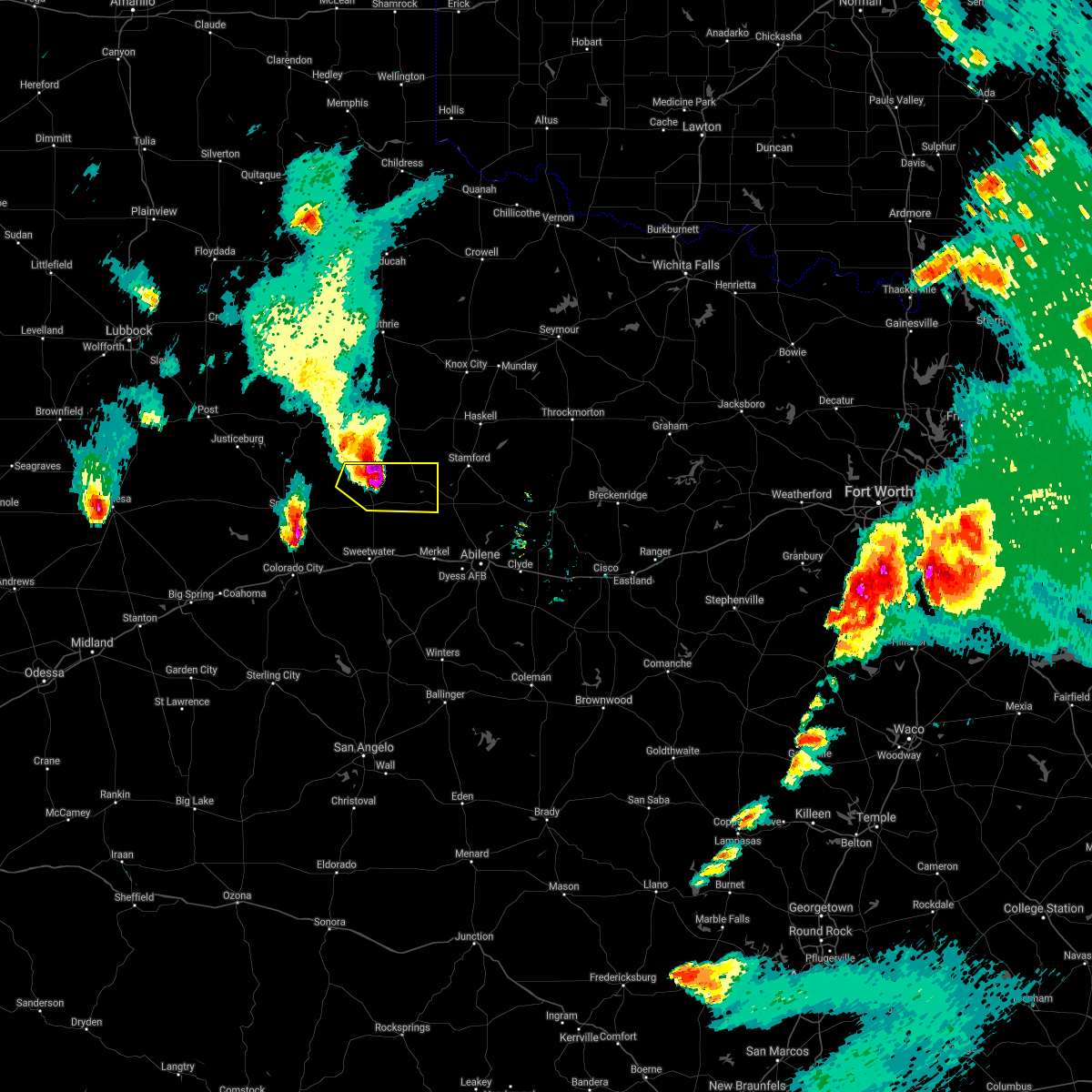 At 808 pm cdt, a severe thunderstorm was located 11 miles northwest of hobbs, or 18 miles northeast of snyder, moving east at 35 mph (radar indicated). Hazards include golf ball size hail and 60 mph wind gusts. People and animals outdoors will be injured. expect hail damage to roofs, siding, windows, and vehicles. expect wind damage to roofs, siding, and trees. this severe thunderstorm will be near, rotan around 835 pm cdt. mccaulley around 900 pm cdt. hamlin around 905 pm cdt. neinda around 910 pm cdt. Other locations impacted by this severe thunderstorm include the intersection of us-180 and ranch road 126, and us-180 near the fisher-scurry county line. At 808 pm cdt, a severe thunderstorm was located 11 miles northwest of hobbs, or 18 miles northeast of snyder, moving east at 35 mph (radar indicated). Hazards include golf ball size hail and 60 mph wind gusts. People and animals outdoors will be injured. expect hail damage to roofs, siding, windows, and vehicles. expect wind damage to roofs, siding, and trees. this severe thunderstorm will be near, rotan around 835 pm cdt. mccaulley around 900 pm cdt. hamlin around 905 pm cdt. neinda around 910 pm cdt. Other locations impacted by this severe thunderstorm include the intersection of us-180 and ranch road 126, and us-180 near the fisher-scurry county line.
|
| 5/3/2021 8:25 PM CDT | Baseball sized hail reported 0.5 miles NE of Rotan, TX, golf ball to baseball sized hail reported by the rotan fire department. |
| 5/3/2021 8:22 PM CDT | Storm damage reported in fisher county TX, 5.1 miles E of Rotan, TX |
| 5/3/2021 8:20 PM CDT | Storm damage reported in fisher county TX, 5.1 miles E of Rotan, TX |
| 5/3/2021 8:09 PM CDT |
 At 808 pm cdt, a severe thunderstorm was located 11 miles northwest of hobbs, or 18 miles northeast of snyder, moving east at 35 mph (radar indicated). Hazards include golf ball size hail and 60 mph wind gusts. People and animals outdoors will be injured. expect hail damage to roofs, siding, windows, and vehicles. expect wind damage to roofs, siding, and trees. this severe thunderstorm will be near, rotan around 835 pm cdt. mccaulley around 900 pm cdt. hamlin around 905 pm cdt. neinda around 910 pm cdt. Other locations impacted by this severe thunderstorm include the intersection of us-180 and ranch road 126, and us-180 near the fisher-scurry county line. At 808 pm cdt, a severe thunderstorm was located 11 miles northwest of hobbs, or 18 miles northeast of snyder, moving east at 35 mph (radar indicated). Hazards include golf ball size hail and 60 mph wind gusts. People and animals outdoors will be injured. expect hail damage to roofs, siding, windows, and vehicles. expect wind damage to roofs, siding, and trees. this severe thunderstorm will be near, rotan around 835 pm cdt. mccaulley around 900 pm cdt. hamlin around 905 pm cdt. neinda around 910 pm cdt. Other locations impacted by this severe thunderstorm include the intersection of us-180 and ranch road 126, and us-180 near the fisher-scurry county line.
|
| 3/13/2021 8:37 PM CDT |
 At 736 pm cst, severe thunderstorms were located along a line extending from near rotan to 6 miles north of roscoe to 9 miles north of silver, moving northeast at 35 mph (radar indicated). Hazards include 60 mph wind gusts and quarter size hail. Hail damage to vehicles is expected. expect wind damage to roofs, siding, and trees. these severe storms will be near, rotan and roby around 740 pm cst. sweetwater around 745 pm cst. hamlin around 800 pm cst. other locations impacted by these severe thunderstorms include hitson, gannon, the intersection of highway 70 and ranch road 53, lake sweetwater, the intersection of ranch road 608 and highway 147, camp boothe oaks, busby, capitola, us-84 near the nolan- fisher county line and i-20 near the nolan-mitchell county line. People near rattlesnake roundup should seek safe shelter immediately! this includes interstate 20 between mile markers 229 and 260. At 736 pm cst, severe thunderstorms were located along a line extending from near rotan to 6 miles north of roscoe to 9 miles north of silver, moving northeast at 35 mph (radar indicated). Hazards include 60 mph wind gusts and quarter size hail. Hail damage to vehicles is expected. expect wind damage to roofs, siding, and trees. these severe storms will be near, rotan and roby around 740 pm cst. sweetwater around 745 pm cst. hamlin around 800 pm cst. other locations impacted by these severe thunderstorms include hitson, gannon, the intersection of highway 70 and ranch road 53, lake sweetwater, the intersection of ranch road 608 and highway 147, camp boothe oaks, busby, capitola, us-84 near the nolan- fisher county line and i-20 near the nolan-mitchell county line. People near rattlesnake roundup should seek safe shelter immediately! this includes interstate 20 between mile markers 229 and 260.
|
| 3/13/2021 8:12 PM CDT |
 At 711 pm cst, severe thunderstorms were located along a line extending from 8 miles south of hobbs to near loraine to 10 miles south of champion creek reservoir, moving northeast at 45 mph (radar indicated). Hazards include 60 mph wind gusts and quarter size hail. Hail damage to vehicles is expected. expect wind damage to roofs, siding, and trees. severe thunderstorms will be near, hobbs around 720 pm cst. wastella around 725 pm cst. rotan around 730 pm cst. champion around 735 pm cst. roscoe, roby and longworth around 750 pm cst. sweetwater and sylvester around 800 pm cst. mccaulley around 805 pm cst. hamlin around 815 pm cst. other locations impacted by these severe thunderstorms include hitson, gannon, the intersection of highway 70 and ranch road 53, lake sweetwater, the intersection of ranch road 608 and highway 147, camp boothe oaks, busby, capitola, us-180 near the fisher- scurry county line and i-20 near the nolan-mitchell county line. People near rattlesnake roundup should seek safe shelter immediately! this includes interstate 20 between mile markers 229 and 260. At 711 pm cst, severe thunderstorms were located along a line extending from 8 miles south of hobbs to near loraine to 10 miles south of champion creek reservoir, moving northeast at 45 mph (radar indicated). Hazards include 60 mph wind gusts and quarter size hail. Hail damage to vehicles is expected. expect wind damage to roofs, siding, and trees. severe thunderstorms will be near, hobbs around 720 pm cst. wastella around 725 pm cst. rotan around 730 pm cst. champion around 735 pm cst. roscoe, roby and longworth around 750 pm cst. sweetwater and sylvester around 800 pm cst. mccaulley around 805 pm cst. hamlin around 815 pm cst. other locations impacted by these severe thunderstorms include hitson, gannon, the intersection of highway 70 and ranch road 53, lake sweetwater, the intersection of ranch road 608 and highway 147, camp boothe oaks, busby, capitola, us-180 near the fisher- scurry county line and i-20 near the nolan-mitchell county line. People near rattlesnake roundup should seek safe shelter immediately! this includes interstate 20 between mile markers 229 and 260.
|
| 6/19/2020 7:56 PM CDT |
 At 755 pm cdt, a severe thunderstorm was located near hermleigh, or 9 miles east of snyder, moving east at 30 mph (radar indicated). Hazards include 60 mph wind gusts and penny size hail. Expect damage to roofs, siding, and trees. this severe thunderstorm will be near, hobbs around 810 pm cdt. roby around 835 pm cdt. longworth around 840 pm cdt. other locations impacted by this severe thunderstorm include gannon, hitson, busby, capitola and us-84 near the nolan-fisher county line. This includes interstate 20 between mile markers 246 and 260. At 755 pm cdt, a severe thunderstorm was located near hermleigh, or 9 miles east of snyder, moving east at 30 mph (radar indicated). Hazards include 60 mph wind gusts and penny size hail. Expect damage to roofs, siding, and trees. this severe thunderstorm will be near, hobbs around 810 pm cdt. roby around 835 pm cdt. longworth around 840 pm cdt. other locations impacted by this severe thunderstorm include gannon, hitson, busby, capitola and us-84 near the nolan-fisher county line. This includes interstate 20 between mile markers 246 and 260.
|
| 5/15/2020 6:01 PM CDT | Mesonet site recorded a 64 mph wind gust at 6:01 pm cdt. this mesonet is located 5 miles west of rota in fisher county TX, 4.5 miles E of Rotan, TX |
| 4/11/2020 4:32 PM CDT |
 At 431 pm cdt, a severe thunderstorm was located near roby, or 15 miles southwest of hamlin, moving east at 35 mph (radar indicated). Hazards include half dollar size hail. Damage to vehicles is expected. this severe thunderstorm will be near, sylvester around 435 pm cdt. mccaulley around 445 pm cdt. hamlin and neinda around 455 pm cdt. anson around 515 pm cdt. Other locations impacted by this severe thunderstorm include the intersection of us-180 and ranch road 126, hitson and tuxedo. At 431 pm cdt, a severe thunderstorm was located near roby, or 15 miles southwest of hamlin, moving east at 35 mph (radar indicated). Hazards include half dollar size hail. Damage to vehicles is expected. this severe thunderstorm will be near, sylvester around 435 pm cdt. mccaulley around 445 pm cdt. hamlin and neinda around 455 pm cdt. anson around 515 pm cdt. Other locations impacted by this severe thunderstorm include the intersection of us-180 and ranch road 126, hitson and tuxedo.
|
| 7/10/2019 6:45 PM CDT |
 A severe thunderstorm warning remains in effect until 715 pm cdt for northwestern fisher county. at 644 pm cdt, a severe thunderstorm was located near rotan, or 17 miles west of hamlin, moving southwest at 15 mph. hazard. 60 mph wind gusts. source. Radar indicated. A severe thunderstorm warning remains in effect until 715 pm cdt for northwestern fisher county. at 644 pm cdt, a severe thunderstorm was located near rotan, or 17 miles west of hamlin, moving southwest at 15 mph. hazard. 60 mph wind gusts. source. Radar indicated.
|
| 7/10/2019 6:26 PM CDT |
 The national weather service in san angelo has issued a * severe thunderstorm warning for. northwestern fisher county in west central texas. until 715 pm cdt. At 626 pm cdt, a severe thunderstorm was located near rotan, or 17 miles west of hamlin, moving southwest at 15 mph. The national weather service in san angelo has issued a * severe thunderstorm warning for. northwestern fisher county in west central texas. until 715 pm cdt. At 626 pm cdt, a severe thunderstorm was located near rotan, or 17 miles west of hamlin, moving southwest at 15 mph.
|
| 7/8/2019 5:18 PM CDT |
 At 517 pm cdt, a severe thunderstorm was located over rotan, or 19 miles west of hamlin, moving east at 5 mph (radar indicated). Hazards include 60 mph wind gusts. Expect damage to roofs, siding, and trees. This severe thunderstorm will remain over mainly rural areas of northwestern fisher county. At 517 pm cdt, a severe thunderstorm was located over rotan, or 19 miles west of hamlin, moving east at 5 mph (radar indicated). Hazards include 60 mph wind gusts. Expect damage to roofs, siding, and trees. This severe thunderstorm will remain over mainly rural areas of northwestern fisher county.
|
| 7/8/2019 4:56 PM CDT |
 The national weather service in san angelo has issued a * severe thunderstorm warning for. northwestern fisher county in west central texas. until 545 pm cdt. At 456 pm cdt, a severe thunderstorm was located near rotan, or 23 miles west of hamlin, and is nearly stationary. The national weather service in san angelo has issued a * severe thunderstorm warning for. northwestern fisher county in west central texas. until 545 pm cdt. At 456 pm cdt, a severe thunderstorm was located near rotan, or 23 miles west of hamlin, and is nearly stationary.
|
| 7/8/2019 4:40 PM CDT |
 At 439 pm cdt, a severe thunderstorm was located near rotan, or 21 miles southwest of aspermont, and is nearly stationary (radar indicated). Hazards include 60 mph wind gusts. Expect damage to roofs, siding, and trees. Locations impacted include, rotan. At 439 pm cdt, a severe thunderstorm was located near rotan, or 21 miles southwest of aspermont, and is nearly stationary (radar indicated). Hazards include 60 mph wind gusts. Expect damage to roofs, siding, and trees. Locations impacted include, rotan.
|
| 7/8/2019 4:15 PM CDT |
 At 414 pm cdt, a severe thunderstorm was located near rotan, or 19 miles southwest of aspermont, moving north at 15 mph (radar indicated). Hazards include 60 mph wind gusts. Expect damage to roofs, siding, and trees. This severe thunderstorm will remain over mainly rural areas of northwestern fisher county. At 414 pm cdt, a severe thunderstorm was located near rotan, or 19 miles southwest of aspermont, moving north at 15 mph (radar indicated). Hazards include 60 mph wind gusts. Expect damage to roofs, siding, and trees. This severe thunderstorm will remain over mainly rural areas of northwestern fisher county.
|
| 6/18/2019 8:02 PM CDT |
 At 802 pm cdt, a severe thunderstorm was located over roby, or 17 miles southwest of hamlin, moving east at 30 mph (radar indicated). Hazards include 60 mph wind gusts and quarter size hail. Hail damage to vehicles is expected. expect wind damage to roofs, siding, and trees. this severe storm will be near, sylvester around 815 pm cdt. mccaulley around 825 pm cdt. Other locations impacted by this severe thunderstorm include busby and capitola. At 802 pm cdt, a severe thunderstorm was located over roby, or 17 miles southwest of hamlin, moving east at 30 mph (radar indicated). Hazards include 60 mph wind gusts and quarter size hail. Hail damage to vehicles is expected. expect wind damage to roofs, siding, and trees. this severe storm will be near, sylvester around 815 pm cdt. mccaulley around 825 pm cdt. Other locations impacted by this severe thunderstorm include busby and capitola.
|
| 6/18/2019 7:52 PM CDT |
 At 751 pm cdt, a severe thunderstorm was located near roby, or 18 miles north of sweetwater, moving northeast at 35 mph (radar indicated). Hazards include 60 mph wind gusts and quarter size hail. Hail damage to vehicles is expected. expect wind damage to roofs, siding, and trees. this severe thunderstorm will be near, roby around 800 pm cdt. sylvester around 815 pm cdt. mccaulley around 830 pm cdt. Other locations impacted by this severe thunderstorm include busby and capitola. At 751 pm cdt, a severe thunderstorm was located near roby, or 18 miles north of sweetwater, moving northeast at 35 mph (radar indicated). Hazards include 60 mph wind gusts and quarter size hail. Hail damage to vehicles is expected. expect wind damage to roofs, siding, and trees. this severe thunderstorm will be near, roby around 800 pm cdt. sylvester around 815 pm cdt. mccaulley around 830 pm cdt. Other locations impacted by this severe thunderstorm include busby and capitola.
|
| 6/5/2019 9:29 PM CDT |
 At 927 pm cdt, severe thunderstorms were located along a line extending from near rotan to near broome, moving southeast at 35 mph. near zero visibility and 55 to 60 miles per hour winds were reported just west of sweetwater on interstate 20 due to blowing dust. blowing dust was also reported in sterling county (radar indicated). Hazards include 60 mph wind gusts and quarter size hail. Hail damage to vehicles is expected. expect wind damage to roofs, siding, and trees. these severe storms will be near, broome around 935 pm cdt. roby around 950 pm cdt. sylvester, mccaulley and longworth around 1000 pm cdt. other locations impacted by these severe thunderstorms include hitson, gannon, lake sweetwater, busby, capitola, the intersection of highway 208 and ranch road 2662, the intersection of highway 158 and ranch road 2059, the intersection of highway 70 and ranch road 53, oak creek reservoir and the intersection of ranch road 608 and highway 147. This includes interstate 20 between mile markers 229 and 260. At 927 pm cdt, severe thunderstorms were located along a line extending from near rotan to near broome, moving southeast at 35 mph. near zero visibility and 55 to 60 miles per hour winds were reported just west of sweetwater on interstate 20 due to blowing dust. blowing dust was also reported in sterling county (radar indicated). Hazards include 60 mph wind gusts and quarter size hail. Hail damage to vehicles is expected. expect wind damage to roofs, siding, and trees. these severe storms will be near, broome around 935 pm cdt. roby around 950 pm cdt. sylvester, mccaulley and longworth around 1000 pm cdt. other locations impacted by these severe thunderstorms include hitson, gannon, lake sweetwater, busby, capitola, the intersection of highway 208 and ranch road 2662, the intersection of highway 158 and ranch road 2059, the intersection of highway 70 and ranch road 53, oak creek reservoir and the intersection of ranch road 608 and highway 147. This includes interstate 20 between mile markers 229 and 260.
|
| 6/5/2019 9:06 PM CDT |
 At 905 pm cdt, a line of severe thunderstorms were located along a line extending from 8 miles east of fluvanna to 14 miles southeast of garden city, moving east at 35 mph (radar indicated). Hazards include 60 mph wind gusts and quarter size hail. Hail damage to vehicles is expected. expect wind damage to roofs, siding, and trees. severe thunderstorms will be near, sterling city around 935 pm cdt. other locations impacted by these severe thunderstorms include hitson, gannon, lake sweetwater, busby, capitola, the intersection of highway 208 and ranch road 2662, the intersection of highway 158 and ranch road 2059, the intersection of highway 70 and ranch road 53, oak creek reservoir and the intersection of ranch road 608 and highway 147. This includes interstate 20 between mile markers 229 and 260. At 905 pm cdt, a line of severe thunderstorms were located along a line extending from 8 miles east of fluvanna to 14 miles southeast of garden city, moving east at 35 mph (radar indicated). Hazards include 60 mph wind gusts and quarter size hail. Hail damage to vehicles is expected. expect wind damage to roofs, siding, and trees. severe thunderstorms will be near, sterling city around 935 pm cdt. other locations impacted by these severe thunderstorms include hitson, gannon, lake sweetwater, busby, capitola, the intersection of highway 208 and ranch road 2662, the intersection of highway 158 and ranch road 2059, the intersection of highway 70 and ranch road 53, oak creek reservoir and the intersection of ranch road 608 and highway 147. This includes interstate 20 between mile markers 229 and 260.
|
| 6/2/2019 2:50 AM CDT |
 At 249 am cdt, a severe thunderstorm was located near neinda, or 7 miles southeast of hamlin, moving east at 15 mph (radar indicated). Hazards include 60 mph wind gusts. Expect damage to roofs, siding, and trees. this severe storm will be near, anson around 310 am cdt. Other locations impacted by this severe thunderstorm include funston, hodges, the intersection of us- 180 and ranch road 126, hitson, tuxedo, lake fort phantom hill, stith, gannon, truby and the intersection of us- 180 and farm road 600. At 249 am cdt, a severe thunderstorm was located near neinda, or 7 miles southeast of hamlin, moving east at 15 mph (radar indicated). Hazards include 60 mph wind gusts. Expect damage to roofs, siding, and trees. this severe storm will be near, anson around 310 am cdt. Other locations impacted by this severe thunderstorm include funston, hodges, the intersection of us- 180 and ranch road 126, hitson, tuxedo, lake fort phantom hill, stith, gannon, truby and the intersection of us- 180 and farm road 600.
|
| 6/2/2019 2:14 AM CDT |
 At 214 am cdt, a severe thunderstorm was located near hamlin, moving southeast at 40 mph (radar indicated). Hazards include 60 mph wind gusts and quarter size hail. Hail damage to vehicles is expected. expect wind damage to roofs, siding, and trees. this severe thunderstorm will be near, hamlin around 220 am cdt. neinda around 230 am cdt. anson around 245 am cdt. hawley around 300 am cdt. abilene and nugent around 305 am cdt. Other locations impacted by this severe thunderstorm include funston, hodges, the intersection of us- 180 and ranch road 126, hitson, tuxedo, lake fort phantom hill, stith, gannon, truby and the intersection of us- 180 and farm road 600. At 214 am cdt, a severe thunderstorm was located near hamlin, moving southeast at 40 mph (radar indicated). Hazards include 60 mph wind gusts and quarter size hail. Hail damage to vehicles is expected. expect wind damage to roofs, siding, and trees. this severe thunderstorm will be near, hamlin around 220 am cdt. neinda around 230 am cdt. anson around 245 am cdt. hawley around 300 am cdt. abilene and nugent around 305 am cdt. Other locations impacted by this severe thunderstorm include funston, hodges, the intersection of us- 180 and ranch road 126, hitson, tuxedo, lake fort phantom hill, stith, gannon, truby and the intersection of us- 180 and farm road 600.
|
| 5/20/2019 11:54 PM CDT |
 At 1129 pm cdt, severe thunderstorms were located along a line extending from 11 miles south of clairemont to near hermleigh, moving northeast at 60 mph (radar indicated). Hazards include 70 mph wind gusts and quarter size hail. Hail damage to vehicles is expected. expect considerable tree damage. wind damage is also likely to mobile homes, roofs, and outbuildings. these severe storms will be near, hobbs around 1140 pm cdt. rotan and roby around 1150 pm cdt. hamlin around 1210 am cdt. Other locations impacted by these severe thunderstorms include the intersection of us- 180 and ranch road 126, gannon, hitson, busby, capitola and us- 180 near the fisher-scurry county line. At 1129 pm cdt, severe thunderstorms were located along a line extending from 11 miles south of clairemont to near hermleigh, moving northeast at 60 mph (radar indicated). Hazards include 70 mph wind gusts and quarter size hail. Hail damage to vehicles is expected. expect considerable tree damage. wind damage is also likely to mobile homes, roofs, and outbuildings. these severe storms will be near, hobbs around 1140 pm cdt. rotan and roby around 1150 pm cdt. hamlin around 1210 am cdt. Other locations impacted by these severe thunderstorms include the intersection of us- 180 and ranch road 126, gannon, hitson, busby, capitola and us- 180 near the fisher-scurry county line.
|
| 5/20/2019 11:30 PM CDT |
 At 1129 pm cdt, severe thunderstorms were located along a line extending from 11 miles south of clairemont to near hermleigh, moving northeast at 60 mph (radar indicated). Hazards include 70 mph wind gusts and quarter size hail. Hail damage to vehicles is expected. expect considerable tree damage. wind damage is also likely to mobile homes, roofs, and outbuildings. these severe storms will be near, hobbs around 1140 pm cdt. rotan and roby around 1150 pm cdt. hamlin around 1210 am cdt. Other locations impacted by these severe thunderstorms include the intersection of us- 180 and ranch road 126, gannon, hitson, busby, capitola and us- 180 near the fisher-scurry county line. At 1129 pm cdt, severe thunderstorms were located along a line extending from 11 miles south of clairemont to near hermleigh, moving northeast at 60 mph (radar indicated). Hazards include 70 mph wind gusts and quarter size hail. Hail damage to vehicles is expected. expect considerable tree damage. wind damage is also likely to mobile homes, roofs, and outbuildings. these severe storms will be near, hobbs around 1140 pm cdt. rotan and roby around 1150 pm cdt. hamlin around 1210 am cdt. Other locations impacted by these severe thunderstorms include the intersection of us- 180 and ranch road 126, gannon, hitson, busby, capitola and us- 180 near the fisher-scurry county line.
|
| 5/20/2019 11:18 PM CDT |
 At 1117 pm cdt, severe thunderstorms were located along a line extending from 12 miles southeast of lake alan henry to 6 miles south of snyder, moving northeast at 60 mph (radar indicated). Hazards include 60 mph wind gusts and quarter size hail. Hail damage to vehicles is expected. expect wind damage to roofs, siding, and trees. severe thunderstorms will be near, hobbs around 1140 pm cdt. rotan and roby around 1150 pm cdt. hamlin around 1205 am cdt. Other locations impacted by these severe thunderstorms include the intersection of us- 180 and ranch road 126, gannon, hitson, busby, capitola and us- 180 near the fisher-scurry county line. At 1117 pm cdt, severe thunderstorms were located along a line extending from 12 miles southeast of lake alan henry to 6 miles south of snyder, moving northeast at 60 mph (radar indicated). Hazards include 60 mph wind gusts and quarter size hail. Hail damage to vehicles is expected. expect wind damage to roofs, siding, and trees. severe thunderstorms will be near, hobbs around 1140 pm cdt. rotan and roby around 1150 pm cdt. hamlin around 1205 am cdt. Other locations impacted by these severe thunderstorms include the intersection of us- 180 and ranch road 126, gannon, hitson, busby, capitola and us- 180 near the fisher-scurry county line.
|
| 5/20/2019 10:16 PM CDT | Golf Ball sized hail reported 0.4 miles NNW of Rotan, TX, trained spotter reports golf ball size hail in the city of rotan. |
| 5/20/2019 10:16 PM CDT | Baseball sized hail reported 4.5 miles E of Rotan, TX, baseball size hail was reported 4 miles west of rotan. |
| 5/20/2019 10:06 PM CDT |
 At 1006 pm cdt, a severe thunderstorm capable of producing a tornado was located 8 miles southwest of roby, or 14 miles north of sweetwater, moving northeast at 50 mph (radar indicated rotation). Hazards include tornado and hail up to two inches in diameter. Flying debris will be dangerous to those caught without shelter. mobile homes will be damaged or destroyed. damage to roofs, windows, and vehicles will occur. tree damage is likely. this dangerous storm will be near, roby and longworth around 1015 pm cdt. Other locations impacted by this tornadic thunderstorm include busby and capitola. At 1006 pm cdt, a severe thunderstorm capable of producing a tornado was located 8 miles southwest of roby, or 14 miles north of sweetwater, moving northeast at 50 mph (radar indicated rotation). Hazards include tornado and hail up to two inches in diameter. Flying debris will be dangerous to those caught without shelter. mobile homes will be damaged or destroyed. damage to roofs, windows, and vehicles will occur. tree damage is likely. this dangerous storm will be near, roby and longworth around 1015 pm cdt. Other locations impacted by this tornadic thunderstorm include busby and capitola.
|
| 5/20/2019 9:14 PM CDT |
 At 910 pm cdt, a severe thunderstorm capable of producing a tornado was located 11 miles southwest of aspermont, moving northeast at 65 mph. at 908 pm cdt, storm spotters reported a tornado southwest of rotan along fm 1657 and state road 310 (spotter confirmed a tornado). Hazards include tornado and half dollar size hail. Flying debris will be dangerous to those caught without shelter. mobile homes will be damaged or destroyed. damage to roofs, windows, and vehicles will occur. tree damage is likely. Locations impacted include, rotan and hitson. At 910 pm cdt, a severe thunderstorm capable of producing a tornado was located 11 miles southwest of aspermont, moving northeast at 65 mph. at 908 pm cdt, storm spotters reported a tornado southwest of rotan along fm 1657 and state road 310 (spotter confirmed a tornado). Hazards include tornado and half dollar size hail. Flying debris will be dangerous to those caught without shelter. mobile homes will be damaged or destroyed. damage to roofs, windows, and vehicles will occur. tree damage is likely. Locations impacted include, rotan and hitson.
|
| 5/20/2019 9:09 PM CDT |
 At 854 pm cdt, a severe thunderstorm capable of producing a tornado was located over hobbs, or 20 miles east of snyder, moving northeast at 45 mph (radar indicated rotation). Hazards include tornado and half dollar size hail. Flying debris will be dangerous to those caught without shelter. mobile homes will be damaged or destroyed. damage to roofs, windows, and vehicles will occur. tree damage is likely. this dangerous storm will be near, rotan around 900 pm cdt. Other locations impacted by this tornadic thunderstorm include hitson. At 854 pm cdt, a severe thunderstorm capable of producing a tornado was located over hobbs, or 20 miles east of snyder, moving northeast at 45 mph (radar indicated rotation). Hazards include tornado and half dollar size hail. Flying debris will be dangerous to those caught without shelter. mobile homes will be damaged or destroyed. damage to roofs, windows, and vehicles will occur. tree damage is likely. this dangerous storm will be near, rotan around 900 pm cdt. Other locations impacted by this tornadic thunderstorm include hitson.
|
| 5/20/2019 8:54 PM CDT |
 At 854 pm cdt, a severe thunderstorm capable of producing a tornado was located over hobbs, or 20 miles east of snyder, moving northeast at 45 mph (radar indicated rotation). Hazards include tornado and half dollar size hail. Flying debris will be dangerous to those caught without shelter. mobile homes will be damaged or destroyed. damage to roofs, windows, and vehicles will occur. tree damage is likely. this dangerous storm will be near, rotan around 900 pm cdt. Other locations impacted by this tornadic thunderstorm include hitson. At 854 pm cdt, a severe thunderstorm capable of producing a tornado was located over hobbs, or 20 miles east of snyder, moving northeast at 45 mph (radar indicated rotation). Hazards include tornado and half dollar size hail. Flying debris will be dangerous to those caught without shelter. mobile homes will be damaged or destroyed. damage to roofs, windows, and vehicles will occur. tree damage is likely. this dangerous storm will be near, rotan around 900 pm cdt. Other locations impacted by this tornadic thunderstorm include hitson.
|
| 5/20/2019 8:49 PM CDT |
 The national weather service in san angelo has issued a * severe thunderstorm warning for. northwestern jones county in west central texas. northern fisher county in west central texas. until 930 pm cdt. At 848 pm cdt, a severe thunderstorm was located 7 miles west of. The national weather service in san angelo has issued a * severe thunderstorm warning for. northwestern jones county in west central texas. northern fisher county in west central texas. until 930 pm cdt. At 848 pm cdt, a severe thunderstorm was located 7 miles west of.
|
| 5/18/2019 5:48 AM CDT |
 At 548 am cdt, a severe thunderstorm was located near hobbs, or 17 miles north of roscoe, moving northeast at 50 mph (radar indicated). Hazards include 60 mph wind gusts and half dollar size hail. Hail damage to vehicles is expected. expect wind damage to roofs, siding, and trees. this severe thunderstorm will be near, rotan and roby around 605 am cdt. mccaulley around 615 am cdt. hamlin around 625 am cdt. Other locations impacted by this severe thunderstorm include the intersection of us-180 and ranch road 126, hitson and capitola. At 548 am cdt, a severe thunderstorm was located near hobbs, or 17 miles north of roscoe, moving northeast at 50 mph (radar indicated). Hazards include 60 mph wind gusts and half dollar size hail. Hail damage to vehicles is expected. expect wind damage to roofs, siding, and trees. this severe thunderstorm will be near, rotan and roby around 605 am cdt. mccaulley around 615 am cdt. hamlin around 625 am cdt. Other locations impacted by this severe thunderstorm include the intersection of us-180 and ranch road 126, hitson and capitola.
|
| 4/6/2019 5:38 AM CDT |
 The severe thunderstorm warning for western fisher county will expire at 545 am cdt, the storm which prompted the warning has weakened below severe limits, and no longer pose an immediate threat to life or property. therefore, the warning will be allowed to expire. The severe thunderstorm warning for western fisher county will expire at 545 am cdt, the storm which prompted the warning has weakened below severe limits, and no longer pose an immediate threat to life or property. therefore, the warning will be allowed to expire.
|
| 4/6/2019 5:31 AM CDT |
 At 530 am cdt, a severe thunderstorm was located near roby, or 16 miles west of hamlin, moving northeast at 40 mph (radar indicated). Hazards include 60 mph wind gusts. Expect damage to roofs, siding, and trees. Locations impacted include, rotan, roby, hobbs, longworth and busby. At 530 am cdt, a severe thunderstorm was located near roby, or 16 miles west of hamlin, moving northeast at 40 mph (radar indicated). Hazards include 60 mph wind gusts. Expect damage to roofs, siding, and trees. Locations impacted include, rotan, roby, hobbs, longworth and busby.
|
| 4/6/2019 5:01 AM CDT |
 At 500 am cdt, a severe thunderstorm was located near hermleigh, or 14 miles northwest of roscoe, moving northeast at 40 mph (radar indicated). Hazards include 60 mph wind gusts. expect damage to roofs, siding, and trees At 500 am cdt, a severe thunderstorm was located near hermleigh, or 14 miles northwest of roscoe, moving northeast at 40 mph (radar indicated). Hazards include 60 mph wind gusts. expect damage to roofs, siding, and trees
|
| 3/13/2019 12:45 AM CDT |
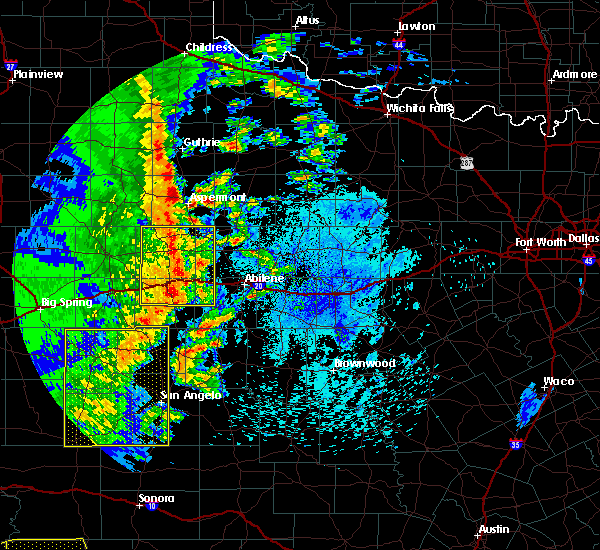 At 1244 am cdt, severe thunderstorms were located along a line extending from near rotan to near longworth to near champion, moving east at 45 mph (radar indicated). Hazards include 70 mph wind gusts. Expect considerable tree damage. damage is likely to mobile homes, roofs, and outbuildings. these severe storms will be near, longworth around 1250 am cdt. merkel, trent and noodle around 100 am cdt. other locations impacted by these severe thunderstorms include the intersection of us- 180 and ranch road 126, hitson, camp butman, gannon, the intersection of highway 70 and ranch road 53, lake sweetwater, the intersection of ranch road 608 and highway 147, camp boothe oaks, busby and capitola. A tornado watch remains in effect until 500 am cdt for west central texas. At 1244 am cdt, severe thunderstorms were located along a line extending from near rotan to near longworth to near champion, moving east at 45 mph (radar indicated). Hazards include 70 mph wind gusts. Expect considerable tree damage. damage is likely to mobile homes, roofs, and outbuildings. these severe storms will be near, longworth around 1250 am cdt. merkel, trent and noodle around 100 am cdt. other locations impacted by these severe thunderstorms include the intersection of us- 180 and ranch road 126, hitson, camp butman, gannon, the intersection of highway 70 and ranch road 53, lake sweetwater, the intersection of ranch road 608 and highway 147, camp boothe oaks, busby and capitola. A tornado watch remains in effect until 500 am cdt for west central texas.
|
| 3/13/2019 12:31 AM CDT |
 At 1230 am cdt, severe thunderstorms were located along a line extending from near jayton to near roscoe, moving east at 45 mph (radar indicated). Hazards include 60 mph wind gusts and penny size hail. Expect damage to roofs, siding, and trees. these severe storms will be near, sweetwater around 1245 am cdt. merkel, trent and noodle around 100 am cdt. other locations impacted by these severe thunderstorms include the intersection of us-180 and ranch road 126, us-84 near the nolan- fisher county line, i-20 near the nolan- mitchell county line, hitson, camp butman, gannon, the intersection of highway 70 and ranch road 53, lake sweetwater, the intersection of ranch road 608 and highway 147 and camp boothe oaks. A tornado watch remains in effect until 500 am cdt for west central texas. At 1230 am cdt, severe thunderstorms were located along a line extending from near jayton to near roscoe, moving east at 45 mph (radar indicated). Hazards include 60 mph wind gusts and penny size hail. Expect damage to roofs, siding, and trees. these severe storms will be near, sweetwater around 1245 am cdt. merkel, trent and noodle around 100 am cdt. other locations impacted by these severe thunderstorms include the intersection of us-180 and ranch road 126, us-84 near the nolan- fisher county line, i-20 near the nolan- mitchell county line, hitson, camp butman, gannon, the intersection of highway 70 and ranch road 53, lake sweetwater, the intersection of ranch road 608 and highway 147 and camp boothe oaks. A tornado watch remains in effect until 500 am cdt for west central texas.
|
| 3/13/2019 12:15 AM CDT |
 At 1214 am cdt, severe thunderstorms were located along a line extending from near clairemont to near colorado city, moving east at 55 mph (radar indicated). Hazards include 60 mph wind gusts and penny size hail. Expect damage to roofs, siding, and trees. severe thunderstorms will be near, wastella and champion around 1225 am cdt. roscoe around 1235 am cdt. sweetwater around 1245 am cdt. merkel, trent and noodle around 100 am cdt. other locations impacted by these severe thunderstorms include the intersection of us-180 and ranch road 126, us-84 near the nolan- fisher county line, i-20 near the nolan- mitchell county line, hitson, camp butman, gannon, the intersection of highway 70 and ranch road 53, lake sweetwater, the intersection of ranch road 608 and highway 147 and camp boothe oaks. this includes interstate 20 between mile markers 229 and 269. A tornado watch remains in effect until 500 am cdt for west central texas. At 1214 am cdt, severe thunderstorms were located along a line extending from near clairemont to near colorado city, moving east at 55 mph (radar indicated). Hazards include 60 mph wind gusts and penny size hail. Expect damage to roofs, siding, and trees. severe thunderstorms will be near, wastella and champion around 1225 am cdt. roscoe around 1235 am cdt. sweetwater around 1245 am cdt. merkel, trent and noodle around 100 am cdt. other locations impacted by these severe thunderstorms include the intersection of us-180 and ranch road 126, us-84 near the nolan- fisher county line, i-20 near the nolan- mitchell county line, hitson, camp butman, gannon, the intersection of highway 70 and ranch road 53, lake sweetwater, the intersection of ranch road 608 and highway 147 and camp boothe oaks. this includes interstate 20 between mile markers 229 and 269. A tornado watch remains in effect until 500 am cdt for west central texas.
|
| 12/26/2018 3:29 PM CST | Minor wind damage was reported in rotan. report relayed by abilene district coordinator for the texas division of emergency managemen in fisher county TX, 0.5 miles NE of Rotan, TX |
| 12/26/2018 3:26 PM CST | Storm damage reported in fisher county TX, 5.1 miles E of Rotan, TX |
| 7/30/2018 6:27 AM CDT |
 At 622 am cdt, a severe thunderstorm was located 8 miles northwest of trent, or 12 miles northeast of sweetwater, moving south at 20 mph (radar indicated). Hazards include 60 mph wind gusts. Expect damage to roofs, siding, and trees. this severe thunderstorm will be near, abilene around 630 am cdt. trent around 630 am cdt. nolan around 645 am cdt. coronados camp around 650 am cdt. happy valley around 700 am cdt. bradshaw around 705 am cdt. This includes interstate 20 between mile markers 229 and 323. At 622 am cdt, a severe thunderstorm was located 8 miles northwest of trent, or 12 miles northeast of sweetwater, moving south at 20 mph (radar indicated). Hazards include 60 mph wind gusts. Expect damage to roofs, siding, and trees. this severe thunderstorm will be near, abilene around 630 am cdt. trent around 630 am cdt. nolan around 645 am cdt. coronados camp around 650 am cdt. happy valley around 700 am cdt. bradshaw around 705 am cdt. This includes interstate 20 between mile markers 229 and 323.
|
| 6/30/2018 7:44 PM CDT |
 At 744 pm cdt, a severe thunderstorm was located near rotan, or 14 miles west of hamlin, moving northeast at 20 mph (radar indicated). Hazards include 60 mph wind gusts and quarter size hail. Hail damage to vehicles is expected. expect wind damage to roofs, siding, and trees. This severe thunderstorm will remain over mainly rural areas of northeastern fisher county. At 744 pm cdt, a severe thunderstorm was located near rotan, or 14 miles west of hamlin, moving northeast at 20 mph (radar indicated). Hazards include 60 mph wind gusts and quarter size hail. Hail damage to vehicles is expected. expect wind damage to roofs, siding, and trees. This severe thunderstorm will remain over mainly rural areas of northeastern fisher county.
|
| 6/30/2018 7:34 PM CDT |
 At 733 pm cdt, a severe thunderstorm was located over rotan, or 18 miles west of hamlin, moving northeast at 20 mph (radar indicated). Hazards include 60 mph wind gusts and quarter size hail. Hail damage to vehicles is expected. expect wind damage to roofs, siding, and trees. This severe thunderstorm will remain over mainly rural areas of northeastern fisher county. At 733 pm cdt, a severe thunderstorm was located over rotan, or 18 miles west of hamlin, moving northeast at 20 mph (radar indicated). Hazards include 60 mph wind gusts and quarter size hail. Hail damage to vehicles is expected. expect wind damage to roofs, siding, and trees. This severe thunderstorm will remain over mainly rural areas of northeastern fisher county.
|
| 6/30/2018 7:22 PM CDT |
 At 722 pm cdt, a severe thunderstorm was located near roby, or 20 miles west of hamlin, moving northeast at 20 mph (radar indicated). Hazards include 60 mph wind gusts and quarter size hail. Hail damage to vehicles is expected. expect wind damage to roofs, siding, and trees. this severe thunderstorm will be near, roby around 725 pm cdt. Rotan around 740 pm cdt. At 722 pm cdt, a severe thunderstorm was located near roby, or 20 miles west of hamlin, moving northeast at 20 mph (radar indicated). Hazards include 60 mph wind gusts and quarter size hail. Hail damage to vehicles is expected. expect wind damage to roofs, siding, and trees. this severe thunderstorm will be near, roby around 725 pm cdt. Rotan around 740 pm cdt.
|
| 6/23/2018 8:56 PM CDT | Golf Ball sized hail reported 12.9 miles ESE of Rotan, TX |
| 5/15/2018 6:56 PM CDT |
 The national weather service in san angelo has issued a * severe thunderstorm warning for. jones county in west central texas. central fisher county in west central texas. Until 800 pm cdt * at 656 pm cdt, a severe thunderstorm was located over neinda, or. The national weather service in san angelo has issued a * severe thunderstorm warning for. jones county in west central texas. central fisher county in west central texas. Until 800 pm cdt * at 656 pm cdt, a severe thunderstorm was located over neinda, or.
|
| 5/2/2018 9:43 PM CDT | Storm damage reported in fisher county TX, 5.1 miles E of Rotan, TX |
| 7/1/2017 4:17 AM CDT |
 At 416 am cdt, severe thunderstorms were located along a line extending from near knox city to 6 miles northeast of hamlin to near buford, moving east at 50 mph (radar indicated). Hazards include 60 mph wind gusts and penny size hail. Expect damage to roofs, siding, and trees. these severe storms will be near, hamlin around 420 am cdt. weinert around 425 am cdt. roscoe around 440 am cdt. sweetwater and avoca around 445 am cdt. Other locations impacted by these severe thunderstorms include the intersection of us-180 and ranch road 126, hitson, tuxedo, us- 380 near the haskell- stonewall county line, gannon, lake sweetwater, busby, camp boothe oaks, capitola and i-20 near the nolan-mitchell county line. At 416 am cdt, severe thunderstorms were located along a line extending from near knox city to 6 miles northeast of hamlin to near buford, moving east at 50 mph (radar indicated). Hazards include 60 mph wind gusts and penny size hail. Expect damage to roofs, siding, and trees. these severe storms will be near, hamlin around 420 am cdt. weinert around 425 am cdt. roscoe around 440 am cdt. sweetwater and avoca around 445 am cdt. Other locations impacted by these severe thunderstorms include the intersection of us-180 and ranch road 126, hitson, tuxedo, us- 380 near the haskell- stonewall county line, gannon, lake sweetwater, busby, camp boothe oaks, capitola and i-20 near the nolan-mitchell county line.
|
| 7/1/2017 3:58 AM CDT |
 At 354 am cdt, severe thunderstorms were located along a line extending from 12 miles west of o`brien to 11 miles northeast of rotan to near lake j b thomas, moving east at 55 mph (radar indicated). Hazards include 70 mph wind gusts and penny size hail. Expect considerable tree damage. damage is likely to mobile homes, roofs, and outbuildings. severe thunderstorms will be near, rochester and o`brien around 405 am cdt. hamlin around 410 am cdt. weinert around 415 am cdt. wastella around 420 am cdt. roscoe around 430 am cdt. avoca around 435 am cdt. sweetwater around 440 am cdt. other locations impacted by these severe thunderstorms include the intersection of us-180 and ranch road 126, hitson, tuxedo, us- 380 near the haskell- stonewall county line, gannon, lake sweetwater, busby, camp boothe oaks, capitola and i-20 near the nolan-mitchell county line. This includes interstate 20 between mile markers 229 and 257. At 354 am cdt, severe thunderstorms were located along a line extending from 12 miles west of o`brien to 11 miles northeast of rotan to near lake j b thomas, moving east at 55 mph (radar indicated). Hazards include 70 mph wind gusts and penny size hail. Expect considerable tree damage. damage is likely to mobile homes, roofs, and outbuildings. severe thunderstorms will be near, rochester and o`brien around 405 am cdt. hamlin around 410 am cdt. weinert around 415 am cdt. wastella around 420 am cdt. roscoe around 430 am cdt. avoca around 435 am cdt. sweetwater around 440 am cdt. other locations impacted by these severe thunderstorms include the intersection of us-180 and ranch road 126, hitson, tuxedo, us- 380 near the haskell- stonewall county line, gannon, lake sweetwater, busby, camp boothe oaks, capitola and i-20 near the nolan-mitchell county line. This includes interstate 20 between mile markers 229 and 257.
|
| 6/15/2017 8:18 PM CDT |
 At 815 pm cdt, a line of severe thunderstorms was located over southern fisher and northern nolan counties, moving southeast at 35 mph (radar indicated). Hazards include 60 mph wind gusts and quarter size hail. Hail damage to vehicles is expected. expect wind damage to roofs, siding, and trees. this severe storm will be near, nolan around 840 pm cdt. Other locations impacted by this severe thunderstorm include hitson, tuxedo, gannon, lake sweetwater, busby, capitola, the intersection of us-180 and ranch road 126, truby, camp butman and stith. At 815 pm cdt, a line of severe thunderstorms was located over southern fisher and northern nolan counties, moving southeast at 35 mph (radar indicated). Hazards include 60 mph wind gusts and quarter size hail. Hail damage to vehicles is expected. expect wind damage to roofs, siding, and trees. this severe storm will be near, nolan around 840 pm cdt. Other locations impacted by this severe thunderstorm include hitson, tuxedo, gannon, lake sweetwater, busby, capitola, the intersection of us-180 and ranch road 126, truby, camp butman and stith.
|
| 6/15/2017 7:57 PM CDT |
 At 755 pm cdt, a cluster of severe thunderstorms was located over northwestern fisher county near roby and rotan, moving south at 35 mph (radar indicated). Hazards include 60 mph wind gusts and quarter size hail. Hail damage to vehicles is expected. expect wind damage to roofs, siding, and trees. this severe thunderstorm will be near, sweetwater around 810 pm cdt. nolan around 840 pm cdt. other locations impacted by this severe thunderstorm include hitson, tuxedo, gannon, lake sweetwater, busby, capitola, the intersection of us-180 and ranch road 126, truby, camp butman and stith. This includes interstate 20 between mile markers 229 and 274. At 755 pm cdt, a cluster of severe thunderstorms was located over northwestern fisher county near roby and rotan, moving south at 35 mph (radar indicated). Hazards include 60 mph wind gusts and quarter size hail. Hail damage to vehicles is expected. expect wind damage to roofs, siding, and trees. this severe thunderstorm will be near, sweetwater around 810 pm cdt. nolan around 840 pm cdt. other locations impacted by this severe thunderstorm include hitson, tuxedo, gannon, lake sweetwater, busby, capitola, the intersection of us-180 and ranch road 126, truby, camp butman and stith. This includes interstate 20 between mile markers 229 and 274.
|
| 5/22/2017 6:40 PM CDT |
 At 638 pm cdt, a severe thunderstorm was located 8 miles northwest of mccaulley, or 8 miles west of hamlin, moving southeast at 20 mph (radar indicated). Hazards include 60 mph wind gusts and quarter size hail. Hail damage to vehicles is expected. expect wind damage to roofs, siding, and trees. this severe storm will be near, hamlin around 650 pm cdt. mccaulley around 655 pm cdt. neinda around 705 pm cdt. anson around 715 pm cdt. Other locations impacted by this severe thunderstorm include hitson, funston and the intersection of us-180 and ranch road 126. At 638 pm cdt, a severe thunderstorm was located 8 miles northwest of mccaulley, or 8 miles west of hamlin, moving southeast at 20 mph (radar indicated). Hazards include 60 mph wind gusts and quarter size hail. Hail damage to vehicles is expected. expect wind damage to roofs, siding, and trees. this severe storm will be near, hamlin around 650 pm cdt. mccaulley around 655 pm cdt. neinda around 705 pm cdt. anson around 715 pm cdt. Other locations impacted by this severe thunderstorm include hitson, funston and the intersection of us-180 and ranch road 126.
|
| 5/22/2017 6:18 PM CDT |
 At 617 pm cdt, a severe thunderstorm was located 8 miles north of rotan, or 17 miles west of hamlin, moving southeast at 25 mph (radar indicated). Hazards include two inch hail and 60 mph wind gusts. People and animals outdoors will be injured. expect hail damage to roofs, siding, windows, and vehicles. expect wind damage to roofs, siding, and trees. this severe thunderstorm will be near, hamlin around 650 pm cdt. mccaulley around 655 pm cdt. neinda around 705 pm cdt. anson around 715 pm cdt. Other locations impacted by this severe thunderstorm include funston, the intersection of us-180 and ranch road 126, hitson and busby. At 617 pm cdt, a severe thunderstorm was located 8 miles north of rotan, or 17 miles west of hamlin, moving southeast at 25 mph (radar indicated). Hazards include two inch hail and 60 mph wind gusts. People and animals outdoors will be injured. expect hail damage to roofs, siding, windows, and vehicles. expect wind damage to roofs, siding, and trees. this severe thunderstorm will be near, hamlin around 650 pm cdt. mccaulley around 655 pm cdt. neinda around 705 pm cdt. anson around 715 pm cdt. Other locations impacted by this severe thunderstorm include funston, the intersection of us-180 and ranch road 126, hitson and busby.
|
| 5/16/2017 11:22 PM CDT |
 At 1120 pm cdt, severe thunderstorms were located along a line extending from 7 miles northeast of rotan to near longworth to near roscoe, moving northeast at 50 mph (radar indicated). Hazards include 60 mph wind gusts and quarter size hail. Hail damage to vehicles is expected. expect wind damage to roofs, siding, and trees. these severe storms will be near, hamlin and sylvester around 1130 pm cdt. mccaulley around 1135 pm cdt. Other locations impacted by these severe thunderstorms include gannon, hitson, busby and capitola. At 1120 pm cdt, severe thunderstorms were located along a line extending from 7 miles northeast of rotan to near longworth to near roscoe, moving northeast at 50 mph (radar indicated). Hazards include 60 mph wind gusts and quarter size hail. Hail damage to vehicles is expected. expect wind damage to roofs, siding, and trees. these severe storms will be near, hamlin and sylvester around 1130 pm cdt. mccaulley around 1135 pm cdt. Other locations impacted by these severe thunderstorms include gannon, hitson, busby and capitola.
|
| 5/16/2017 10:58 PM CDT |
 At 1057 pm cdt, severe thunderstorms were located along a line extending from near hudd to midway in scurry county to near china grove, moving northeast at 45 mph (radar indicated). Hazards include 60 mph wind gusts and quarter size hail. Hail damage to vehicles is expected. expect wind damage to roofs, siding, and trees. severe thunderstorms will be near, hobbs around 1105 pm cdt. rotan around 1120 pm cdt. roby and longworth around 1130 pm cdt. sylvester around 1140 pm cdt. mccaulley around 1145 pm cdt. hamlin around 1155 pm cdt. other locations impacted by these severe thunderstorms include us- 84 near the nolan-fisher county line, i-20 near the nolan- mitchell county line, hitson, gannon, lake sweetwater, busby, camp boothe oaks and capitola. This includes interstate 20 between mile markers 229 and 260. At 1057 pm cdt, severe thunderstorms were located along a line extending from near hudd to midway in scurry county to near china grove, moving northeast at 45 mph (radar indicated). Hazards include 60 mph wind gusts and quarter size hail. Hail damage to vehicles is expected. expect wind damage to roofs, siding, and trees. severe thunderstorms will be near, hobbs around 1105 pm cdt. rotan around 1120 pm cdt. roby and longworth around 1130 pm cdt. sylvester around 1140 pm cdt. mccaulley around 1145 pm cdt. hamlin around 1155 pm cdt. other locations impacted by these severe thunderstorms include us- 84 near the nolan-fisher county line, i-20 near the nolan- mitchell county line, hitson, gannon, lake sweetwater, busby, camp boothe oaks and capitola. This includes interstate 20 between mile markers 229 and 260.
|
| 3/28/2017 9:41 PM CDT |
 At 940 pm cdt, severe thunderstorms were located along a line extending from near rotan to 7 miles southwest of trent to blackwell, moving east at 35 mph (radar indicated). Hazards include 70 mph wind gusts and quarter size hail. Hail damage to vehicles is expected. expect considerable tree damage. wind damage is also likely to mobile homes, roofs, and outbuildings. severe thunderstorms will be near, trent and hylton around 955 pm cdt. merkel and sylvester around 1000 pm cdt. mccaulley and happy valley around 1005 pm cdt. hamlin, neinda, dyess afb and view around 1015 pm cdt. tye around 1020 pm cdt. bradshaw and abilene around 1025 pm cdt. anson, tuscola and potosi around 1035 pm cdt. lawn around 1040 pm cdt. other locations impacted by these severe thunderstorms include funston, impact, lake abilene, camp tonkawa, hitson, lake fort phantom hill, gannon, lake sweetwater, ovalo and busby. This includes interstate 20 between mile markers 236 and 291. At 940 pm cdt, severe thunderstorms were located along a line extending from near rotan to 7 miles southwest of trent to blackwell, moving east at 35 mph (radar indicated). Hazards include 70 mph wind gusts and quarter size hail. Hail damage to vehicles is expected. expect considerable tree damage. wind damage is also likely to mobile homes, roofs, and outbuildings. severe thunderstorms will be near, trent and hylton around 955 pm cdt. merkel and sylvester around 1000 pm cdt. mccaulley and happy valley around 1005 pm cdt. hamlin, neinda, dyess afb and view around 1015 pm cdt. tye around 1020 pm cdt. bradshaw and abilene around 1025 pm cdt. anson, tuscola and potosi around 1035 pm cdt. lawn around 1040 pm cdt. other locations impacted by these severe thunderstorms include funston, impact, lake abilene, camp tonkawa, hitson, lake fort phantom hill, gannon, lake sweetwater, ovalo and busby. This includes interstate 20 between mile markers 236 and 291.
|
| 3/28/2017 8:54 PM CDT |
 At 852 pm cdt, severe thunderstorms were located along a line extending from near hudd to silver, moving east at 50 mph (radar indicated). Hazards include 60 mph wind gusts and quarter size hail. Hail damage to vehicles is expected. expect wind damage to roofs, siding, and trees. severe thunderstorms will be near, rotan around 910 pm cdt. blackwell around 920 pm cdt. hylton around 925 pm cdt. hamlin around 930 pm cdt. happy valley around 935 pm cdt. other locations impacted by these severe thunderstorms include the intersection of us- 180 and ranch road 126, hitson, gannon, camp butman, the intersection of highway 70 and ranch road 53, lake sweetwater, the intersection of ranch road 608 and highway 147, busby, camp boothe oaks and capitola. this includes interstate 20 between mile markers 230 and 267. A tornado watch remains in effect until 1100 pm cdt for west central texas. At 852 pm cdt, severe thunderstorms were located along a line extending from near hudd to silver, moving east at 50 mph (radar indicated). Hazards include 60 mph wind gusts and quarter size hail. Hail damage to vehicles is expected. expect wind damage to roofs, siding, and trees. severe thunderstorms will be near, rotan around 910 pm cdt. blackwell around 920 pm cdt. hylton around 925 pm cdt. hamlin around 930 pm cdt. happy valley around 935 pm cdt. other locations impacted by these severe thunderstorms include the intersection of us- 180 and ranch road 126, hitson, gannon, camp butman, the intersection of highway 70 and ranch road 53, lake sweetwater, the intersection of ranch road 608 and highway 147, busby, camp boothe oaks and capitola. this includes interstate 20 between mile markers 230 and 267. A tornado watch remains in effect until 1100 pm cdt for west central texas.
|
| 3/28/2017 4:22 PM CDT |
 At 421 pm cdt, a severe thunderstorm was located over sylvester, or 12 miles southwest of hamlin, moving north at 35 mph (radar indicated). Hazards include two inch hail and 60 mph wind gusts. People and animals outdoors will be injured. expect hail damage to roofs, siding, windows, and vehicles. expect wind damage to roofs, siding, and trees. this severe storm will be near, mccaulley around 425 pm cdt. hamlin around 440 pm cdt. other locations impacted by this severe thunderstorm include hitson and busby. A tornado watch remains in effect until 1100 pm cdt for west central texas. At 421 pm cdt, a severe thunderstorm was located over sylvester, or 12 miles southwest of hamlin, moving north at 35 mph (radar indicated). Hazards include two inch hail and 60 mph wind gusts. People and animals outdoors will be injured. expect hail damage to roofs, siding, windows, and vehicles. expect wind damage to roofs, siding, and trees. this severe storm will be near, mccaulley around 425 pm cdt. hamlin around 440 pm cdt. other locations impacted by this severe thunderstorm include hitson and busby. A tornado watch remains in effect until 1100 pm cdt for west central texas.
|
| 3/28/2017 4:07 PM CDT |
 At 406 pm cdt, a severe thunderstorm was located over longworth, or 12 miles northeast of sweetwater, moving north at 40 mph (radar indicated). Hazards include 60 mph wind gusts and half dollar size hail. Hail damage to vehicles is expected. expect wind damage to roofs, siding, and trees. this severe thunderstorm will be near, roby and sylvester around 415 pm cdt. mccaulley around 425 pm cdt. hamlin around 440 pm cdt. other locations impacted by this severe thunderstorm include hitson and busby. A tornado watch remains in effect until 1100 pm cdt for west central texas. At 406 pm cdt, a severe thunderstorm was located over longworth, or 12 miles northeast of sweetwater, moving north at 40 mph (radar indicated). Hazards include 60 mph wind gusts and half dollar size hail. Hail damage to vehicles is expected. expect wind damage to roofs, siding, and trees. this severe thunderstorm will be near, roby and sylvester around 415 pm cdt. mccaulley around 425 pm cdt. hamlin around 440 pm cdt. other locations impacted by this severe thunderstorm include hitson and busby. A tornado watch remains in effect until 1100 pm cdt for west central texas.
|
| 3/28/2017 4:02 PM CDT |
 At 401 pm cdt, a severe thunderstorm was located 7 miles northwest of midway in scurry county, or 8 miles northeast of snyder, moving northeast at 25 mph (radar indicated). Hazards include golf ball size hail and 60 mph wind gusts. People and animals outdoors will be injured. expect hail damage to roofs, siding, windows, and vehicles. expect wind damage to roofs, siding, and trees. this severe thunderstorm will remain over mainly rural areas of northwestern fisher county, including the following locations: us-180 near the fisher-scurry county line. A tornado watch remains in effect until 1100 pm cdt for west central texas. At 401 pm cdt, a severe thunderstorm was located 7 miles northwest of midway in scurry county, or 8 miles northeast of snyder, moving northeast at 25 mph (radar indicated). Hazards include golf ball size hail and 60 mph wind gusts. People and animals outdoors will be injured. expect hail damage to roofs, siding, windows, and vehicles. expect wind damage to roofs, siding, and trees. this severe thunderstorm will remain over mainly rural areas of northwestern fisher county, including the following locations: us-180 near the fisher-scurry county line. A tornado watch remains in effect until 1100 pm cdt for west central texas.
|
| 5/29/2016 9:14 PM CDT |
 At 914 pm cdt, a severe thunderstorm was located near midway in scurry county, or 15 miles northeast of snyder, moving northeast at 30 mph (radar indicated). Hazards include 60 mph wind gusts and half dollar size hail. Hail damage to vehicles is expected. expect wind damage to roofs, siding, and trees. this severe thunderstorm will be near, hobbs around 920 pm cdt. rotan around 940 pm cdt. Other locations impacted by this severe thunderstorm include hitson. At 914 pm cdt, a severe thunderstorm was located near midway in scurry county, or 15 miles northeast of snyder, moving northeast at 30 mph (radar indicated). Hazards include 60 mph wind gusts and half dollar size hail. Hail damage to vehicles is expected. expect wind damage to roofs, siding, and trees. this severe thunderstorm will be near, hobbs around 920 pm cdt. rotan around 940 pm cdt. Other locations impacted by this severe thunderstorm include hitson.
|
| 5/28/2016 9:07 PM CDT |
 At 907 pm cdt, a severe thunderstorm was located 7 miles north of rotan, or 20 miles south of jayton, moving east at 15 mph (radar indicated). Hazards include 60 mph wind gusts and quarter size hail. Hail damage to vehicles is expected. expect wind damage to roofs, siding, and trees. this severe storm will move east along the northern fisher county line. Other locations impacted by this severe thunderstorm include hitson. At 907 pm cdt, a severe thunderstorm was located 7 miles north of rotan, or 20 miles south of jayton, moving east at 15 mph (radar indicated). Hazards include 60 mph wind gusts and quarter size hail. Hail damage to vehicles is expected. expect wind damage to roofs, siding, and trees. this severe storm will move east along the northern fisher county line. Other locations impacted by this severe thunderstorm include hitson.
|
| 5/28/2016 8:47 PM CDT |
 At 847 pm cdt, a severe thunderstorm was located near hudd, or 22 miles northeast of snyder, moving east at 10 mph (radar indicated). Hazards include ping pong ball size hail and 60 mph wind gusts. People and animals outdoors will be injured. expect hail damage to roofs, siding, windows, and vehicles. expect wind damage to roofs, siding, and trees. this severe thunderstorm will be near, rotan around 935 pm cdt. Other locations impacted by this severe thunderstorm include hitson. At 847 pm cdt, a severe thunderstorm was located near hudd, or 22 miles northeast of snyder, moving east at 10 mph (radar indicated). Hazards include ping pong ball size hail and 60 mph wind gusts. People and animals outdoors will be injured. expect hail damage to roofs, siding, windows, and vehicles. expect wind damage to roofs, siding, and trees. this severe thunderstorm will be near, rotan around 935 pm cdt. Other locations impacted by this severe thunderstorm include hitson.
|
| 5/11/2016 5:33 PM CDT |
 At 532 pm cdt, a severe thunderstorm was located over hamlin, moving southeast at 20 mph. this is a very dangerous storm (golfball hail was reported in hamlin at 529 pm cdt by public). Hazards include up to baseball size hail and 70 mph wind gusts. People and animals outdoors will be severely injured. expect shattered windows, extensive damage to roofs, siding, and vehicles. this severe storm will be near, neinda around 540 pm cdt. anson around 600 pm cdt. Other locations impacted by this severe thunderstorm include the intersection of us-180 and ranch road 126, tuxedo and hitson. At 532 pm cdt, a severe thunderstorm was located over hamlin, moving southeast at 20 mph. this is a very dangerous storm (golfball hail was reported in hamlin at 529 pm cdt by public). Hazards include up to baseball size hail and 70 mph wind gusts. People and animals outdoors will be severely injured. expect shattered windows, extensive damage to roofs, siding, and vehicles. this severe storm will be near, neinda around 540 pm cdt. anson around 600 pm cdt. Other locations impacted by this severe thunderstorm include the intersection of us-180 and ranch road 126, tuxedo and hitson.
|
| 5/11/2016 5:15 PM CDT |
 At 514 pm cdt, a severe thunderstorm was located near hamlin, moving southeast at 25 mph. this is a very dangerous storm (radar indicated). Hazards include baseball size hail and 70 mph wind gusts. People and animals outdoors will be severely injured. expect shattered windows, extensive damage to roofs, siding, and vehicles. this severe storm will be near, hamlin around 520 pm cdt. mccaulley around 525 pm cdt. neinda around 535 pm cdt. anson around 600 pm cdt. Other locations impacted by this severe thunderstorm include the intersection of us-180 and ranch road 126, tuxedo and hitson. At 514 pm cdt, a severe thunderstorm was located near hamlin, moving southeast at 25 mph. this is a very dangerous storm (radar indicated). Hazards include baseball size hail and 70 mph wind gusts. People and animals outdoors will be severely injured. expect shattered windows, extensive damage to roofs, siding, and vehicles. this severe storm will be near, hamlin around 520 pm cdt. mccaulley around 525 pm cdt. neinda around 535 pm cdt. anson around 600 pm cdt. Other locations impacted by this severe thunderstorm include the intersection of us-180 and ranch road 126, tuxedo and hitson.
|
| 5/11/2016 5:04 PM CDT |
 At 503 pm cdt, a severe thunderstorm was located 7 miles northwest of hamlin, moving southeast at 25 mph (radar indicated). Hazards include golf ball size hail and 70 mph wind gusts. People and animals outdoors will be injured. expect hail damage to roofs, siding, windows, and vehicles. expect considerable tree damage. wind damage is also likely to mobile homes, roofs, and outbuildings. this severe thunderstorm will be near, hamlin around 520 pm cdt. mccaulley around 525 pm cdt. neinda around 535 pm cdt. anson around 600 pm cdt. Other locations impacted by this severe thunderstorm include the intersection of us-180 and ranch road 126, tuxedo and hitson. At 503 pm cdt, a severe thunderstorm was located 7 miles northwest of hamlin, moving southeast at 25 mph (radar indicated). Hazards include golf ball size hail and 70 mph wind gusts. People and animals outdoors will be injured. expect hail damage to roofs, siding, windows, and vehicles. expect considerable tree damage. wind damage is also likely to mobile homes, roofs, and outbuildings. this severe thunderstorm will be near, hamlin around 520 pm cdt. mccaulley around 525 pm cdt. neinda around 535 pm cdt. anson around 600 pm cdt. Other locations impacted by this severe thunderstorm include the intersection of us-180 and ranch road 126, tuxedo and hitson.
|
| 4/26/2016 4:30 PM CDT |
 At 430 pm cdt, a severe thunderstorm was located over hobbs, or 17 miles east of snyder, moving northeast at 50 mph (radar indicated). Hazards include golf ball size hail and 60 mph wind gusts. People and animals outdoors will be injured. expect hail damage to roofs, siding, windows, and vehicles. expect wind damage to roofs, siding, and trees. this severe storm will be near, rotan around 440 pm cdt. other locations impacted by this severe thunderstorm include us- 180 near the fisher-scurry county line. A tornado watch remains in effect until midnight cdt for west central texas. At 430 pm cdt, a severe thunderstorm was located over hobbs, or 17 miles east of snyder, moving northeast at 50 mph (radar indicated). Hazards include golf ball size hail and 60 mph wind gusts. People and animals outdoors will be injured. expect hail damage to roofs, siding, windows, and vehicles. expect wind damage to roofs, siding, and trees. this severe storm will be near, rotan around 440 pm cdt. other locations impacted by this severe thunderstorm include us- 180 near the fisher-scurry county line. A tornado watch remains in effect until midnight cdt for west central texas.
|
| 4/26/2016 4:24 PM CDT |
 At 423 pm cdt, a severe thunderstorm was located over midway in scurry county, or 13 miles east of snyder, moving northeast at 50 mph (radar indicated). Hazards include 60 mph wind gusts and quarter size hail. Hail damage to vehicles is expected. expect wind damage to roofs, siding, and trees. this severe thunderstorm will be near, hobbs around 430 pm cdt. rotan around 445 pm cdt. other locations impacted by this severe thunderstorm include us- 180 near the fisher-scurry county line. A tornado watch remains in effect until midnight cdt for west central texas. At 423 pm cdt, a severe thunderstorm was located over midway in scurry county, or 13 miles east of snyder, moving northeast at 50 mph (radar indicated). Hazards include 60 mph wind gusts and quarter size hail. Hail damage to vehicles is expected. expect wind damage to roofs, siding, and trees. this severe thunderstorm will be near, hobbs around 430 pm cdt. rotan around 445 pm cdt. other locations impacted by this severe thunderstorm include us- 180 near the fisher-scurry county line. A tornado watch remains in effect until midnight cdt for west central texas.
|
| 4/16/2016 9:16 PM CDT |
 At 916 pm cdt, a severe thunderstorm was located 8 miles west of longworth, or 12 miles northwest of sweetwater, moving northeast at 25 mph. this storm continues to have the potential to produce large hail and damaging winds (radar indicated). Hazards include 60 mph wind gusts and half dollar size hail. Hail damage to vehicles is expected. expect wind damage to roofs, siding, and trees. this severe storm will be near, roby and longworth around 940 pm cdt. other locations impacted by this severe thunderstorm include capitola, gannon, busby, us-180 near the fisher- scurry county line and us-84 near the nolan-fisher county line. this includes interstate 20 between mile markers 238 and 241, and between mile markers 246 and 256. A tornado watch remains in effect until midnight cdt for west central texas. At 916 pm cdt, a severe thunderstorm was located 8 miles west of longworth, or 12 miles northwest of sweetwater, moving northeast at 25 mph. this storm continues to have the potential to produce large hail and damaging winds (radar indicated). Hazards include 60 mph wind gusts and half dollar size hail. Hail damage to vehicles is expected. expect wind damage to roofs, siding, and trees. this severe storm will be near, roby and longworth around 940 pm cdt. other locations impacted by this severe thunderstorm include capitola, gannon, busby, us-180 near the fisher- scurry county line and us-84 near the nolan-fisher county line. this includes interstate 20 between mile markers 238 and 241, and between mile markers 246 and 256. A tornado watch remains in effect until midnight cdt for west central texas.
|
| 4/16/2016 8:59 PM CDT |
 At 858 pm cdt, a severe thunderstorm was located near inadale, or 10 miles north of roscoe, moving northeast at 25 mph. this storm has the potential to produce large hail and damaging winds. in addition this storm is producing locally heavy rainfall (radar indicated). Hazards include 60 mph wind gusts and half dollar size hail. Hail damage to vehicles is expected. expect wind damage to roofs, siding, and trees. this severe thunderstorm will be near, roby and longworth around 940 pm cdt. other locations impacted by this severe thunderstorm include capitola, gannon, busby, us-180 near the fisher- scurry county line and us-84 near the nolan-fisher county line. this includes interstate 20 between mile markers 238 and 241, and between mile markers 246 and 256. A tornado watch remains in effect until midnight cdt for west central texas. At 858 pm cdt, a severe thunderstorm was located near inadale, or 10 miles north of roscoe, moving northeast at 25 mph. this storm has the potential to produce large hail and damaging winds. in addition this storm is producing locally heavy rainfall (radar indicated). Hazards include 60 mph wind gusts and half dollar size hail. Hail damage to vehicles is expected. expect wind damage to roofs, siding, and trees. this severe thunderstorm will be near, roby and longworth around 940 pm cdt. other locations impacted by this severe thunderstorm include capitola, gannon, busby, us-180 near the fisher- scurry county line and us-84 near the nolan-fisher county line. this includes interstate 20 between mile markers 238 and 241, and between mile markers 246 and 256. A tornado watch remains in effect until midnight cdt for west central texas.
|
| 4/16/2016 5:59 PM CDT |
 At 559 pm cdt, a severe thunderstorm was located near longworth, or 12 miles north of sweetwater, moving northeast at 20 mph (radar indicated). Hazards include 60 mph wind gusts and half dollar size hail. Hail damage to vehicles is expected. expect wind damage to roofs, siding, and trees. this severe storm will be near, longworth around 610 pm cdt. roby around 615 pm cdt. sylvester around 625 pm cdt. other locations impacted by this severe thunderstorm include capitola, gannon and busby. A tornado watch remains in effect until midnight cdt for west central texas. At 559 pm cdt, a severe thunderstorm was located near longworth, or 12 miles north of sweetwater, moving northeast at 20 mph (radar indicated). Hazards include 60 mph wind gusts and half dollar size hail. Hail damage to vehicles is expected. expect wind damage to roofs, siding, and trees. this severe storm will be near, longworth around 610 pm cdt. roby around 615 pm cdt. sylvester around 625 pm cdt. other locations impacted by this severe thunderstorm include capitola, gannon and busby. A tornado watch remains in effect until midnight cdt for west central texas.
|
| 4/16/2016 5:43 PM CDT |
 At 543 pm cdt, a severe thunderstorm was located 7 miles northeast of wastella, or 9 miles north of roscoe, moving northeast at 20 mph (radar indicated). Hazards include 60 mph wind gusts and half dollar size hail. Hail damage to vehicles is expected. expect wind damage to roofs, siding, and trees. this severe thunderstorm will be near, longworth around 610 pm cdt. roby around 615 pm cdt. sylvester around 625 pm cdt. other locations impacted by this severe thunderstorm include capitola, gannon and busby. A tornado watch remains in effect until midnight cdt for west central texas. At 543 pm cdt, a severe thunderstorm was located 7 miles northeast of wastella, or 9 miles north of roscoe, moving northeast at 20 mph (radar indicated). Hazards include 60 mph wind gusts and half dollar size hail. Hail damage to vehicles is expected. expect wind damage to roofs, siding, and trees. this severe thunderstorm will be near, longworth around 610 pm cdt. roby around 615 pm cdt. sylvester around 625 pm cdt. other locations impacted by this severe thunderstorm include capitola, gannon and busby. A tornado watch remains in effect until midnight cdt for west central texas.
|
| 12/12/2015 8:21 PM CST |
 At 820 pm cst, severe thunderstorms were located along a line extending from near rotan to sweetwater to near maryneal, moving east at 50 mph (radar indicated). Hazards include 60 mph wind gusts. Expect damage to roofs. siding and trees. these severe storms will be near, nolan around 830 pm cst. other locations impacted by these severe thunderstorms include lake sweetwater, capitola, the intersection of highway 70 and ranch road 53, gannon, busby, camp boothe oaks and the intersection of ranch road 608 and highway 147. This includes interstate 20 between mile markers 234 and 256. At 820 pm cst, severe thunderstorms were located along a line extending from near rotan to sweetwater to near maryneal, moving east at 50 mph (radar indicated). Hazards include 60 mph wind gusts. Expect damage to roofs. siding and trees. these severe storms will be near, nolan around 830 pm cst. other locations impacted by these severe thunderstorms include lake sweetwater, capitola, the intersection of highway 70 and ranch road 53, gannon, busby, camp boothe oaks and the intersection of ranch road 608 and highway 147. This includes interstate 20 between mile markers 234 and 256.
|
| 12/12/2015 8:07 PM CST |
 At 805 pm cst, severe thunderstorms were located along a line extending from 6 miles northwest of hudd to near maryneal, moving east at 45 mph (radar indicated). Hazards include 60 mph wind gusts. Expect damage to roofs. siding and trees. severe thunderstorms will be near, sweetwater around 815 pm cst. roby, rotan, and nolan around 825 pm cst. other locations impacted by these severe thunderstorms include lake sweetwater, capitola, the intersection of highway 70 and ranch road 53, hitson, gannon, busby, camp boothe oaks and the intersection of ranch road 608 and highway 147. This includes interstate 20 between mile markers 229 and 259. At 805 pm cst, severe thunderstorms were located along a line extending from 6 miles northwest of hudd to near maryneal, moving east at 45 mph (radar indicated). Hazards include 60 mph wind gusts. Expect damage to roofs. siding and trees. severe thunderstorms will be near, sweetwater around 815 pm cst. roby, rotan, and nolan around 825 pm cst. other locations impacted by these severe thunderstorms include lake sweetwater, capitola, the intersection of highway 70 and ranch road 53, hitson, gannon, busby, camp boothe oaks and the intersection of ranch road 608 and highway 147. This includes interstate 20 between mile markers 229 and 259.
|
| 8/14/2015 5:30 PM CDT |
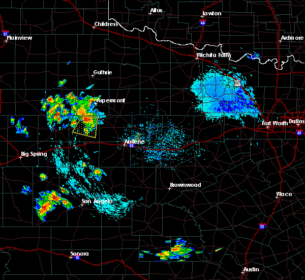 At 530 pm cdt, a severe thunderstorm was located near rotan, or 13 miles west of hamlin, moving south at 25 mph (radar indicated). Hazards include 60 mph wind gusts. Expect damage to roofs. Siding and trees. At 530 pm cdt, a severe thunderstorm was located near rotan, or 13 miles west of hamlin, moving south at 25 mph (radar indicated). Hazards include 60 mph wind gusts. Expect damage to roofs. Siding and trees.
|
| 6/13/2015 11:17 PM CDT |
 At 1114 pm cdt, a line of severe thunderstorms extended from roby to sweetwater to maryneal. movement was east at 25 mph (radar indicated). Hazards include 60 mph wind gusts. Expect damage to roofs. siding and trees. The severe thunderstorm will affect mainly rural areas of fisher and nolan counties, including the following locations, lake sweetwater. At 1114 pm cdt, a line of severe thunderstorms extended from roby to sweetwater to maryneal. movement was east at 25 mph (radar indicated). Hazards include 60 mph wind gusts. Expect damage to roofs. siding and trees. The severe thunderstorm will affect mainly rural areas of fisher and nolan counties, including the following locations, lake sweetwater.
|
| 6/13/2015 10:44 PM CDT |
 At 1040 pm cdt, a line of severe thunderstorms were located along the western fisher and nolan county line, moving east at 30 mph (radar indicated). Hazards include 60 mph wind gusts. Expect damage to roofs. siding and trees. the severe thunderstorm will be near, roby, sweetwater around 1115 pm cdt. other locations in the warning include capitola, gannon and busby. This includes interstate 20 between mile markers 227 and 255. At 1040 pm cdt, a line of severe thunderstorms were located along the western fisher and nolan county line, moving east at 30 mph (radar indicated). Hazards include 60 mph wind gusts. Expect damage to roofs. siding and trees. the severe thunderstorm will be near, roby, sweetwater around 1115 pm cdt. other locations in the warning include capitola, gannon and busby. This includes interstate 20 between mile markers 227 and 255.
|
| 5/25/2015 10:04 AM CDT | At 959 am cdt, a severe thunderstorm capable of producing a tornado was located near sylvester, and moving northeast at 35 mph. this line of storms has produced several areas of rotation and weak funnel clouds across fisher county (radar indicated rotation). Hazards include tornado. Flying debris will be dangerous to those caught without shelter. mobile homes will be damaged or destroyed. damage to roofs, windows and vehicles will occur. tree damage is likely. this dangerous storm will be near, mccaulley around 1010 am cdt. Other locations in the warning include hitson. |
| 5/25/2015 9:58 AM CDT | At 955 am cdt, severe thunderstorms were located along a line extending from longworth to silver, moving east at 40 mph (radar indicated). Hazards include 60 mph wind gusts. Expect damage to roofs. siding and trees. severe thunderstorms will be near, trent and nolan around 1015 am cdt. merkel and hylton around 1025 am cdt. happy valley around 1030 am cdt. coronados camp around 1035 am cdt. other locations in the warning include lake sweetwater, the intersection of highway 70 and ranch road 53, camp butman and shep. This includes interstate 20 between mile markers 228 and 270. |
| 5/25/2015 9:51 AM CDT | At 948 am cdt, a severe thunderstorm capable of producing a tornado was located near longworth, and moving northeast at 35 mph (radar indicated rotation). Hazards include tornado. Flying debris will be dangerous to those caught without shelter. mobile homes will be damaged or destroyed. damage to roofs, windows and vehicles will occur. tree damage is likely. this dangerous storm will be near, sylvester around 1000 am cdt. mccaulley around 1010 am cdt. roby around 1010 am cdt. Other locations in the warning include hitson. |
| 5/25/2015 9:30 AM CDT | At 929 am cdt, severe thunderstorms were located along a line extending from 5 miles southeast of hudd to 6 miles northwest of silver, and moving east at 45 mph (radar indicated). Hazards include 60 mph wind gusts and quarter size hail. Hail damage to vehicles is expected. expect wind damage to roofs, siding and trees. severe thunderstorms will be near, rotan and roscoe around 940 am cdt. sweetwater and roby around 950 am cdt. sylvester and longworth around 955 am cdt. mccaulley and blackwell around 1000 am cdt. other locations in the warning include capitola, the intersection of ranch road 608 and highway 147, gannon, camp boothe oaks, busby, lake sweetwater, the intersection of highway 70 and ranch road 53 and hitson. This includes interstate 20 between mile markers 227 and 251. |
| 5/25/2015 9:12 AM CDT | At 908 am cdt, severe thunderstorms were located along a line extending from 8 miles northwest of midway to 16 miles south of westbrook, moving east at 40 mph (radar indicated). Hazards include 60 mph wind gusts and quarter size hail. Hail damage to vehicles is expected. expect wind damage to roofs, siding and trees. severe thunderstorms will be near, wastella and hobbs around 925 am cdt. champion around 930 am cdt. rotan and roscoe around 935 am cdt. roby around 940 am cdt. sweetwater and longworth around 945 am cdt. sylvester and maryneal around 950 am cdt. other locations in the warning include capitola, gannon, the intersection of ranch road 608 and highway 147, busby, camp boothe oaks, hitson, lake sweetwater and the intersection of highway 70 and ranch road 53. This includes interstate 20 between mile markers 227 and 251. |
| 5/23/2015 6:05 PM CDT | At 604 pm cdt, a severe thunderstorm was located near rotan, moving north at 30 mph (radar indicated). Hazards include 60 mph wind gusts and quarter size hail. Hail damage to vehicles is expected. expect wind damage to roofs, siding and trees. The severe thunderstorm will be near, rotan around 610 pm cdt. |
| 4/16/2015 7:08 PM CDT | At 707 pm cdt, a severe thunderstorm was located 7 miles southwest of roby, and moving northeast at 15 mph (radar indicated). Hazards include hen egg size hail and 60 mph wind gusts. People and pets outdoors will be injured. expect hail damage to roofs, siding, windows and vehicles. expect wind damage to roofs, siding and trees. the severe thunderstorm will be near, roby around 735 pm cdt. 2. 00in. |
| 4/16/2015 6:56 PM CDT | At 653 pm cdt, a severe thunderstorm was located 11 miles northeast of inadale, moving northeast at 15 mph (radar indicated). Hazards include ping pong ball size hail and 60 mph wind gusts. People and pets outdoors will be injured. expect hail damage to roofs, siding, windows and vehicles. expect wind damage to roofs, siding and trees. the severe thunderstorm will be near, longworth around 730 pm cdt. roby around 740 pm cdt. other locations in the warning include busby. 1. 50in. |
| 4/16/2015 5:29 PM CDT | At 528 pm cdt, a severe thunderstorm was located 10 miles west of hamlin, and moving northeast at 25 mph (radar indicated). Hazards include 60 mph wind gusts and quarter size hail. Hail damage to vehicles is expected. expect wind damage to roofs, siding and trees. locations impacted include, mainly rural areas of extreme northern fisher county. 1. 00in. |
| 4/16/2015 5:10 PM CDT | At 508 pm cdt, a severe thunderstorm was located near rotan, and moving north at 25 mph (radar indicated). Hazards include 60 mph wind gusts and half dollar size hail. Hail damage to vehicles is expected. expect wind damage to roofs, siding and trees. the severe thunderstorm will affect mainly rural areas of fisher county. 1. 25in. |
| 4/16/2015 4:55 PM CDT | At 454 pm cdt, a severe thunderstorm was located near roby, moving northeast at 20 mph (radar indicated). Hazards include golf ball size hail and 60 mph wind gusts. People and pets outdoors will be injured. expect hail damage to roofs, siding, windows and vehicles. expect wind damage to roofs, siding and trees. the severe thunderstorm will be near, roby around 505 pm cdt. other locations in the warning include hitson. 1. 75in. |
| 4/16/2015 4:47 PM CDT | At 446 pm cdt, a severe thunderstorm was located 6 miles southwest of roby, and moving north at 20 mph (radar indicated). Hazards include golf ball size hail and 60 mph wind gusts. People and pets outdoors will be injured. expect hail damage to roofs, siding, windows and vehicles. expect wind damage to roofs, siding and trees. the severe thunderstorm will be near, roby around 500 pm cdt. 1. 75in. |
| 4/16/2015 4:32 PM CDT | At 429 pm cdt, a severe thunderstorm was located near hobbs, and moving northeast at 20 mph (radar indicated). Hazards include golf ball size hail and 60 mph wind gusts. People and pets outdoors will be injured. expect hail damage to roofs, siding, windows and vehicles. expect wind damage to roofs, siding and trees. the severe thunderstorm will be near, roby around 450 pm cdt. rotan around 455 pm cdt. 1. 75in. |
| 4/16/2015 4:13 PM CDT | At 409 pm cdt, a severe thunderstorm was located 6 miles southeast of midway, moving northeast at 20 mph (radar indicated). Hazards include golf ball size hail and 60 mph wind gusts. People and pets outdoors will be injured. expect hail damage to roofs, siding, windows and vehicles. expect wind damage to roofs, siding and trees. the severe thunderstorm will be near, hobbs around 430 pm cdt. roby and rotan around 450 pm cdt. 1. 75in. |
| 10/10/2014 6:21 PM CDT | Quarter sized hail reported 0.5 miles NE of Rotan, TX |
| 5/24/2014 2:28 PM CDT | Storm damage reported in fisher county TX, 0.5 miles NE of Rotan, TX |
| 8/8/2013 4:45 PM CDT | Storm damage reported in fisher county TX, 0.5 miles NE of Rotan, TX |
| 8/8/2013 4:45 PM CDT | Large pecan tree limbs dow in fisher county TX, 0.5 miles NE of Rotan, TX |
| 6/6/2013 12:20 AM CDT | Powerline down on east lee street in fisher county TX, 0.8 miles WNW of Rotan, TX |
| 6/5/2013 10:10 PM CDT | Golf Ball sized hail reported 0.5 miles NE of Rotan, TX |
| 6/5/2013 10:07 PM CDT | Storm damage reported in fisher county TX, 0.5 miles NE of Rotan, TX |
| 6/5/2013 10:07 PM CDT | Quarter sized hail reported 0.5 miles NE of Rotan, TX |
| 5/23/2013 6:45 PM CDT | Storm damage reported in fisher county TX, 3.8 miles N of Rotan, TX |
| 5/23/2013 6:45 PM CDT | Damage to roof... uprooted trees... and downed power lines east side of rotan in fisher county TX, 0.5 miles NE of Rotan, TX |
| 5/23/2013 6:30 PM CDT | Trees down on hwy 92. possible tornado damag in fisher county TX, 0.8 miles WNW of Rotan, TX |
| 5/23/2013 6:30 PM CDT | Trees down on hwy 9 in fisher county TX, 0.8 miles WNW of Rotan, TX |
| 5/23/2013 6:30 PM CDT | Barn roof collapsed on hwy 7 in fisher county TX, 1.1 miles NNE of Rotan, TX |
| 5/23/2013 6:25 PM CDT | Storm damage reported in fisher county TX, 3.1 miles N of Rotan, TX |
| 5/23/2013 6:24 PM CDT | Golf Ball sized hail reported 0.5 miles NE of Rotan, TX |
| 5/23/2013 6:12 PM CDT | Storm damage reported in fisher county TX, 0.5 miles NE of Rotan, TX |
| 5/23/2013 6:12 PM CDT | Roofs missing off of house in fisher county TX, 0.5 miles NE of Rotan, TX |
| 5/23/2013 6:10 PM CDT | Storm damage reported in fisher county TX, 0.5 miles NE of Rotan, TX |
| 5/23/2013 6:10 PM CDT | 100 block of mcarther st. brick wall down from a hous in fisher county TX, 0.5 miles NE of Rotan, TX |
| 5/23/2013 6:06 PM CDT | Storm damage reported in fisher county TX, 0.5 miles NE of Rotan, TX |
| 5/23/2013 6:03 PM CDT | Golf Ball sized hail reported 0.5 miles NE of Rotan, TX |
| 5/23/2013 6:02 PM CDT | Rotan fire department estimated a 60 mph wind gust in rota in fisher county TX, 0.5 miles NE of Rotan, TX |
| 5/23/2013 5:52 PM CDT | Golf Ball sized hail reported 2.5 miles SSW of Rotan, TX, golf ball size just east of rotan |
| 5/8/2013 5:46 PM CDT | Golf Ball sized hail reported 1.1 miles SSE of Rotan, TX |
| 5/8/2013 5:34 PM CDT | Baseball sized hail reported 1.8 miles SSE of Rotan, TX |
| 9/18/2012 5:06 AM CDT | Nws storm survey found widespread damage to tree limbs across the eastern half of rotan. a few trees were blown over and several large storage tanks were also knocked o in fisher county TX, 0.5 miles NE of Rotan, TX |
| 9/18/2012 5:04 AM CDT | Additional information from the storm survey...widespread tree limb damage across the eastern half of rotan. a few trees blown over as well. winds esimated at 60 to 70 in fisher county TX, 0.4 miles NNW of Rotan, TX |
| 9/18/2012 5:04 AM CDT | Thunderstorm winds blew a tree onto a power line in rota in fisher county TX, 0.5 miles NE of Rotan, TX |
| 4/21/2011 8:10 PM CDT | Ping Pong Ball sized hail reported 0.5 miles NE of Rotan, TX, ping pong ball size hail in rotan |
Hail Maps for Rotan, TX


Connect with Interactive Hail Maps