

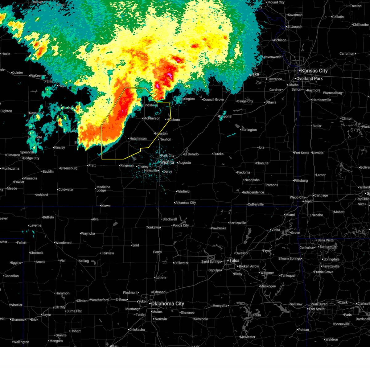
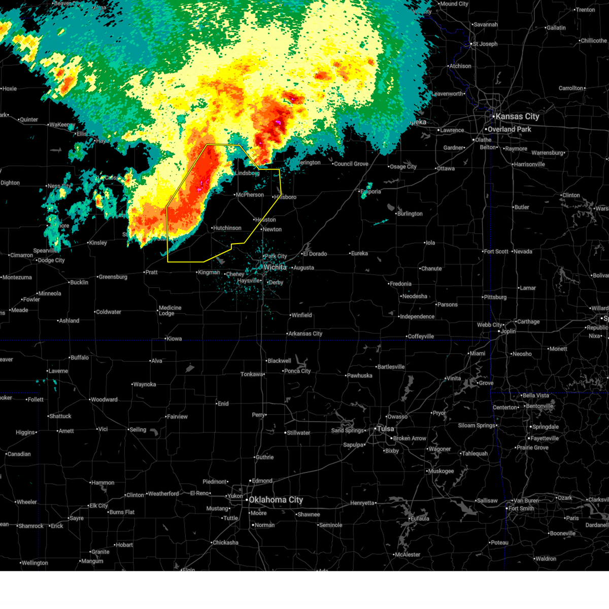
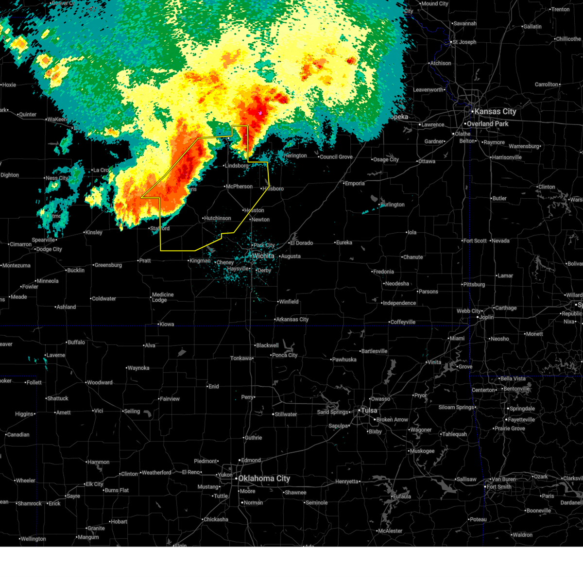
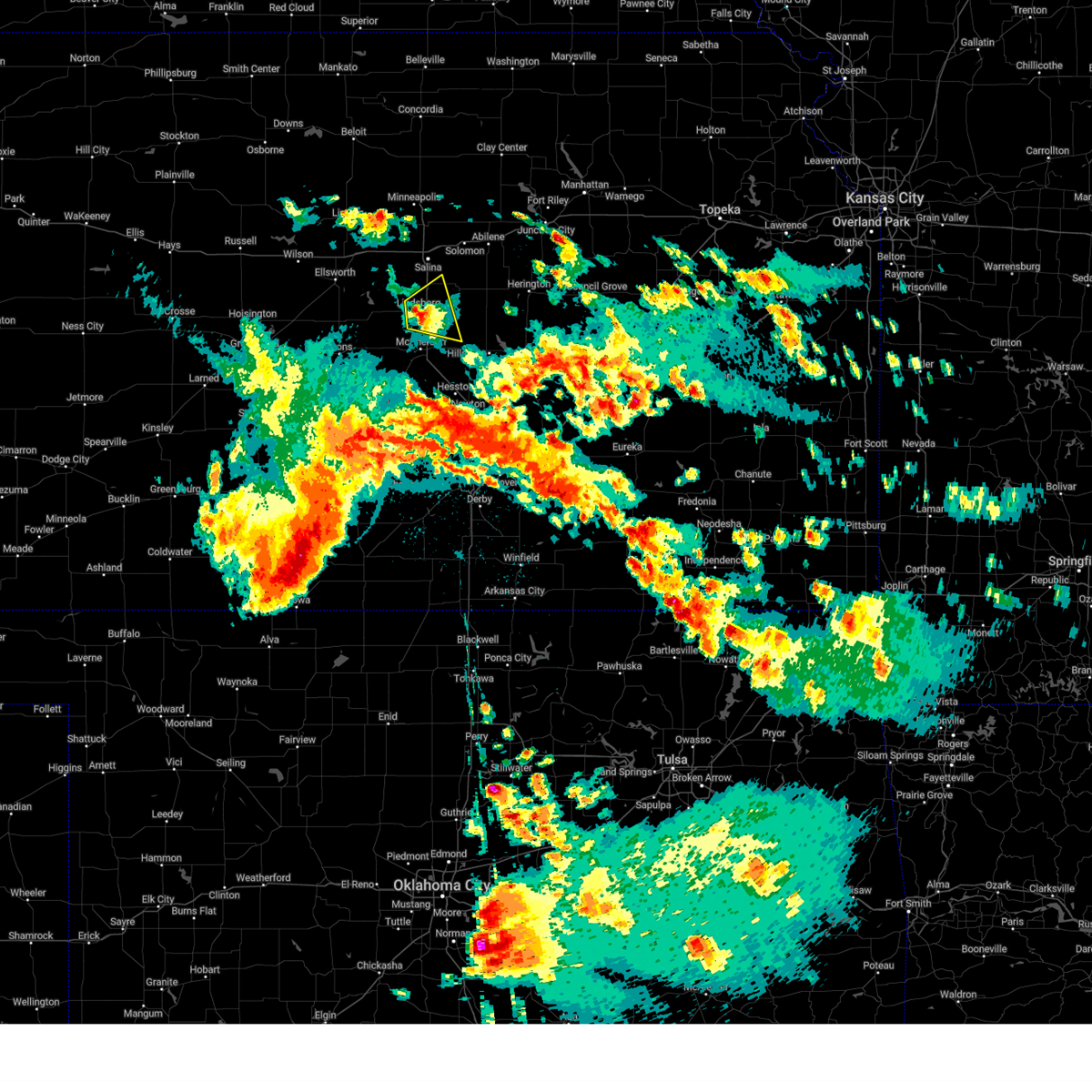
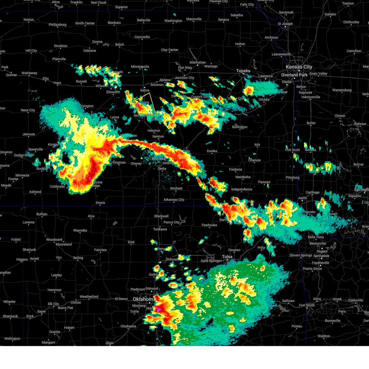
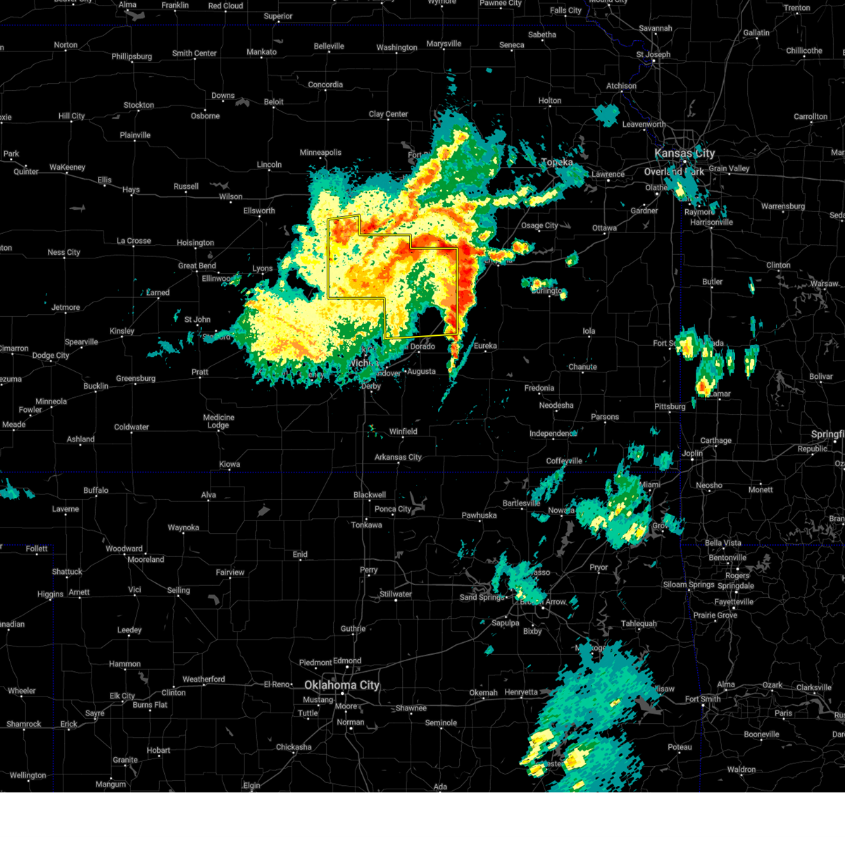
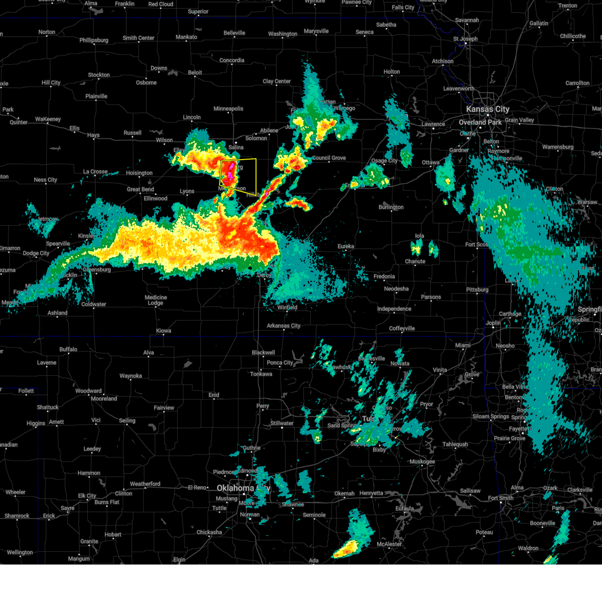
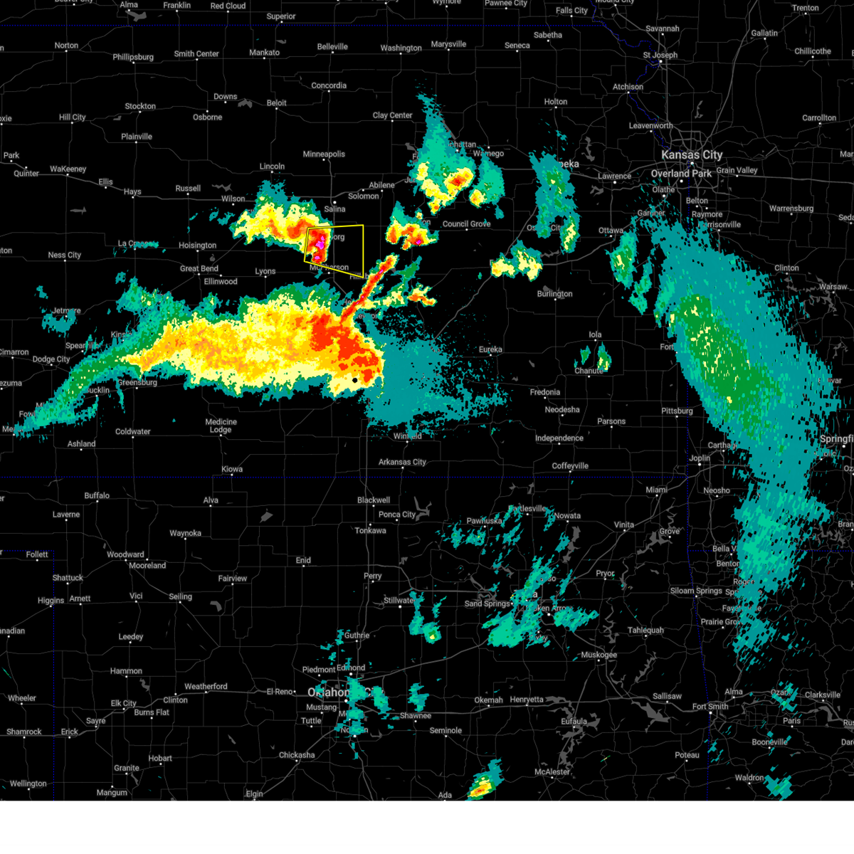
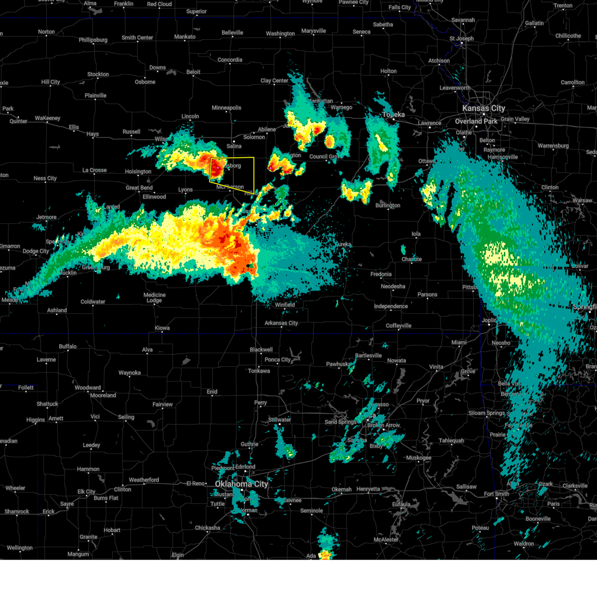
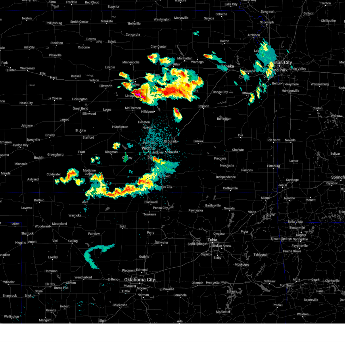
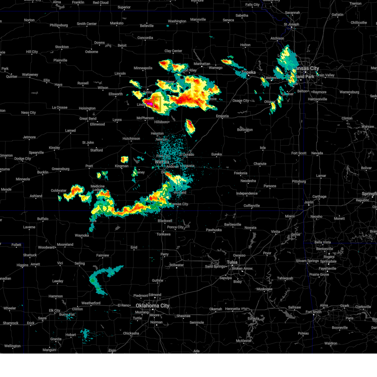
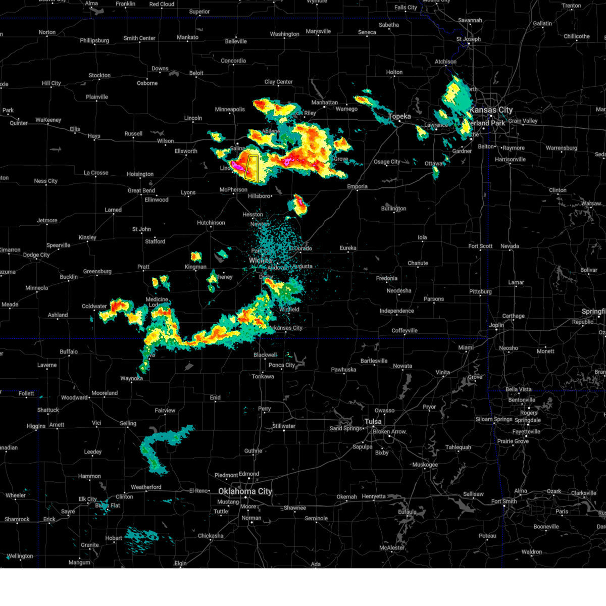
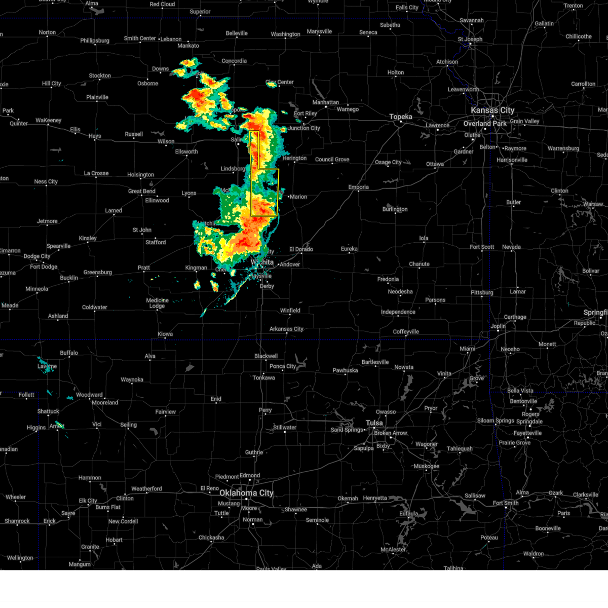
Hail Map for Roxbury, KS
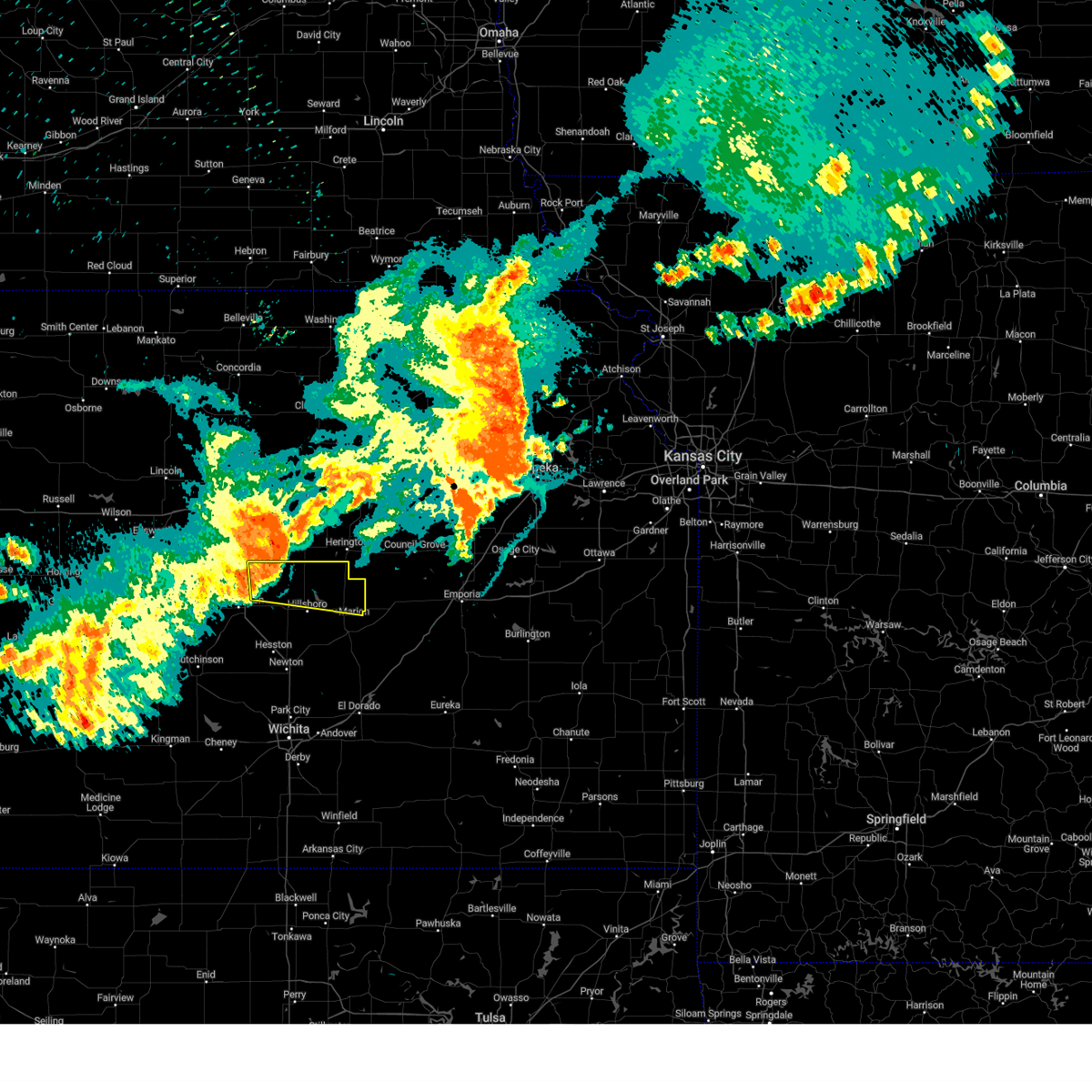
The Roxbury, KS area has had 1 report of on-the-ground hail by trained spotters, and has been under severe weather warnings 29 times during the past 12 months. Doppler radar has detected hail at or near Roxbury, KS on 94 occasions, including 7 occasions during the past year.
| Name: | Roxbury, KS |
| Where Located: | 59.7 miles N of Wichita, KS |
| Map: | Google Map for Roxbury, KS |
| Population: | 104 |
| Housing Units: | 52 |
| More Info: | Search Google for Roxbury, KS |
2
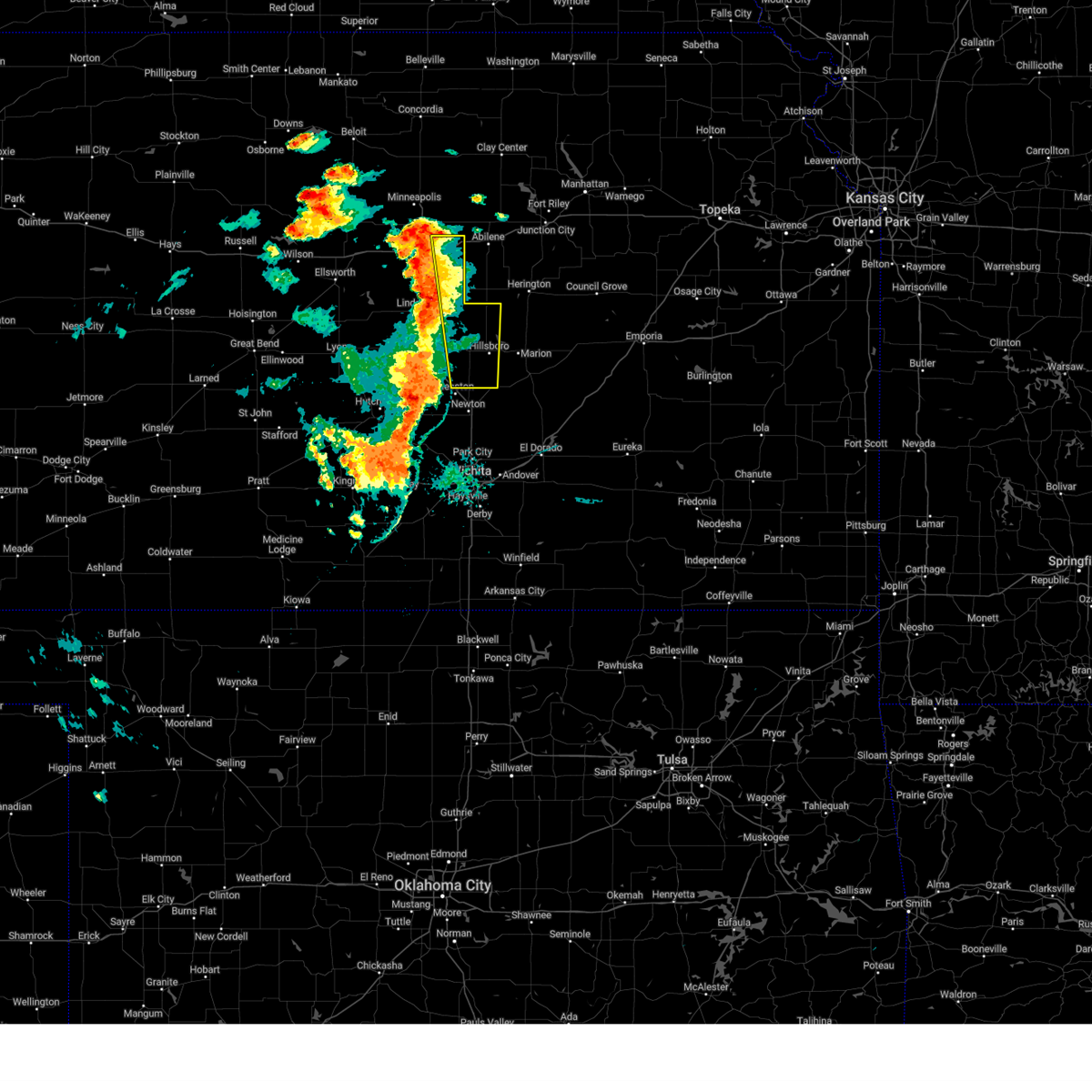
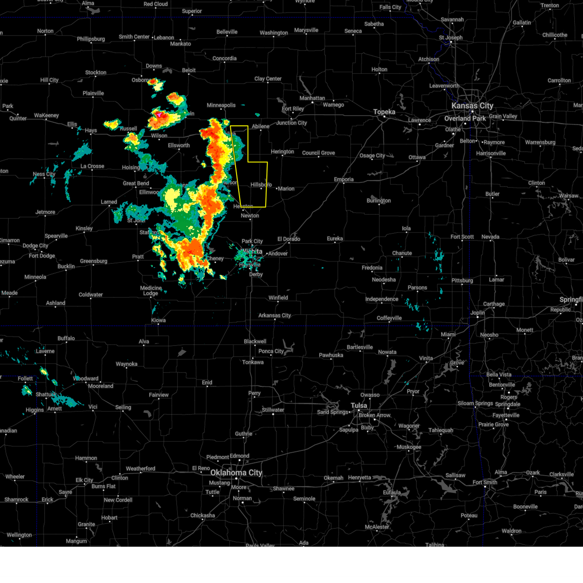
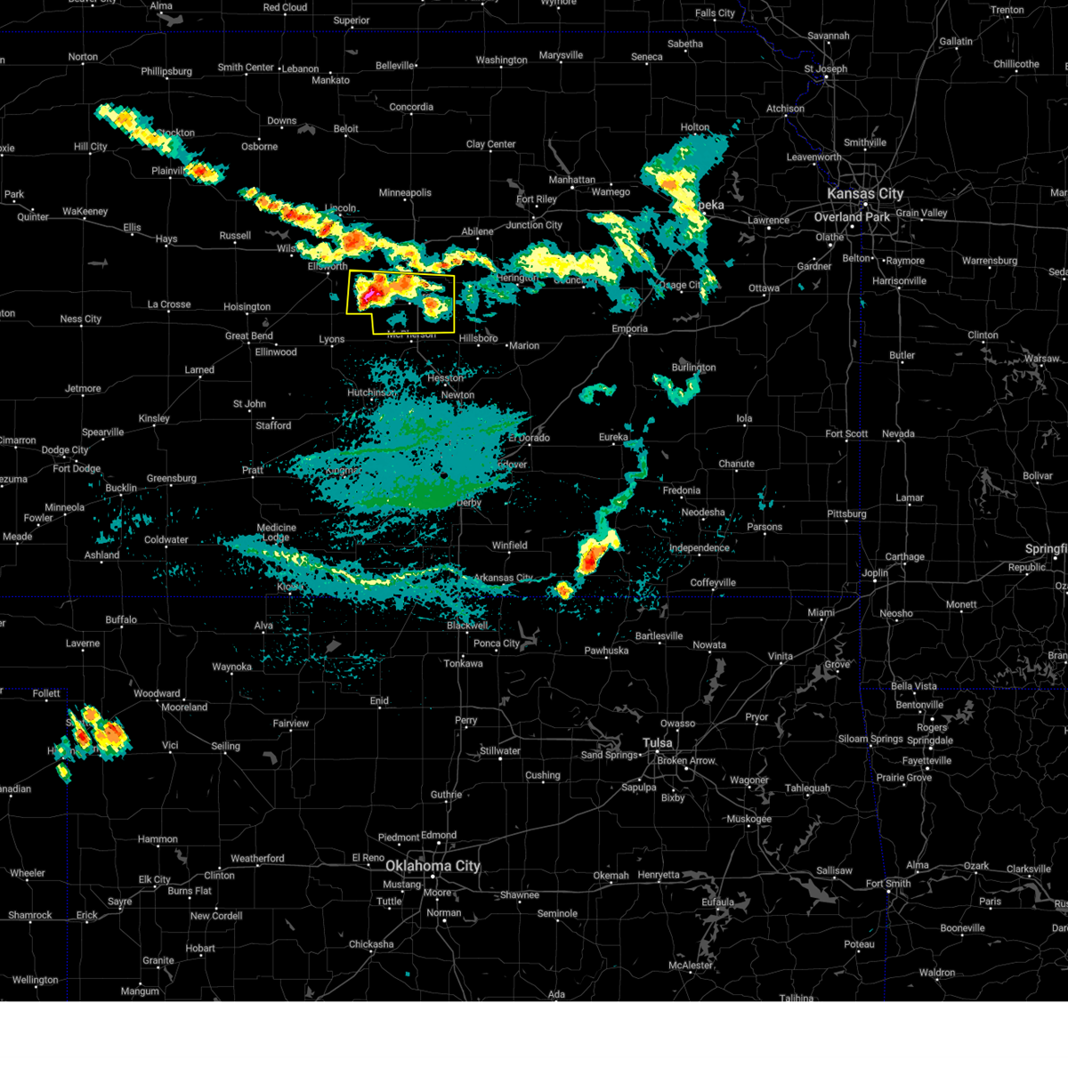
The Top Recent Hail Date for Roxbury, KS is Tuesday, April 22, 2025 (11th out of 94)

Hail and Wind Damage Spotted near Roxbury, KS
| Date / Time | Report Details |
|---|---|
| 6/17/2025 3:10 AM CDT |
 At 309 am cdt, severe thunderstorms were located along a line extending from near marquette to near abbyville to near st. john, moving southeast at 60 mph (trained weather spotters). Hazards include 70 mph wind gusts. Expect considerable tree damage. damage is likely to mobile homes, roofs, and outbuildings. locations impacted include, salina, hutchinson, mcpherson, lyons, hesston, lindsborg, hillsboro, south hutchinson, sterling, halstead, moundridge, inman, buhler, haven, nickerson, burrton, galva, canton, pretty prairie, and marquette. This includes interstate 135 between mile markers 37 and 92. At 309 am cdt, severe thunderstorms were located along a line extending from near marquette to near abbyville to near st. john, moving southeast at 60 mph (trained weather spotters). Hazards include 70 mph wind gusts. Expect considerable tree damage. damage is likely to mobile homes, roofs, and outbuildings. locations impacted include, salina, hutchinson, mcpherson, lyons, hesston, lindsborg, hillsboro, south hutchinson, sterling, halstead, moundridge, inman, buhler, haven, nickerson, burrton, galva, canton, pretty prairie, and marquette. This includes interstate 135 between mile markers 37 and 92.
|
| 6/17/2025 3:10 AM CDT |
 the severe thunderstorm warning has been cancelled and is no longer in effect the severe thunderstorm warning has been cancelled and is no longer in effect
|
| 6/17/2025 2:59 AM CDT |
 At 258 am cdt, severe thunderstorms were located along a line extending from 8 miles southwest of brookville to near sterling to near st. john, moving southeast at 55 mph (asos weather station). Hazards include 70 mph wind gusts. Expect considerable tree damage. damage is likely to mobile homes, roofs, and outbuildings. locations impacted include, salina, hutchinson, mcpherson, lyons, hesston, lindsborg, hillsboro, south hutchinson, sterling, ellinwood, halstead, moundridge, inman, buhler, haven, nickerson, burrton, galva, canton, and pretty prairie. this includes the following highways, interstate 135 between mile markers 37 and 94. Interstate 70 between mile markers 256 and 266. At 258 am cdt, severe thunderstorms were located along a line extending from 8 miles southwest of brookville to near sterling to near st. john, moving southeast at 55 mph (asos weather station). Hazards include 70 mph wind gusts. Expect considerable tree damage. damage is likely to mobile homes, roofs, and outbuildings. locations impacted include, salina, hutchinson, mcpherson, lyons, hesston, lindsborg, hillsboro, south hutchinson, sterling, ellinwood, halstead, moundridge, inman, buhler, haven, nickerson, burrton, galva, canton, and pretty prairie. this includes the following highways, interstate 135 between mile markers 37 and 94. Interstate 70 between mile markers 256 and 266.
|
| 6/17/2025 2:41 AM CDT |
 Svrict the national weather service in wichita has issued a * severe thunderstorm warning for, mcpherson county in central kansas, reno county in south central kansas, western harvey county in south central kansas, rice county in central kansas, ellsworth county in central kansas, northwestern marion county in central kansas, southern barton county in central kansas, saline county in central kansas, * until 345 am cdt. * at 240 am cdt, severe thunderstorms were located along a line extending from 7 miles east of kanopolis to near bushton to near pawnee rock, moving southeast at 45 mph (weather station observed). Hazards include 60 mph wind gusts. expect damage to roofs, siding, and trees Svrict the national weather service in wichita has issued a * severe thunderstorm warning for, mcpherson county in central kansas, reno county in south central kansas, western harvey county in south central kansas, rice county in central kansas, ellsworth county in central kansas, northwestern marion county in central kansas, southern barton county in central kansas, saline county in central kansas, * until 345 am cdt. * at 240 am cdt, severe thunderstorms were located along a line extending from 7 miles east of kanopolis to near bushton to near pawnee rock, moving southeast at 45 mph (weather station observed). Hazards include 60 mph wind gusts. expect damage to roofs, siding, and trees
|
| 5/24/2025 2:56 AM CDT |
 the severe thunderstorm warning has been cancelled and is no longer in effect the severe thunderstorm warning has been cancelled and is no longer in effect
|
| 5/24/2025 2:49 AM CDT |
 At 247 am cdt, a severe thunderstorm was located near lindsborg, moving east at 15 mph (radar indicated). Hazards include quarter size hail. Damage to vehicles is expected. locations impacted include, lindsborg, assaria, and bridgeport. This includes interstate 135 between mile markers 67 and 83. At 247 am cdt, a severe thunderstorm was located near lindsborg, moving east at 15 mph (radar indicated). Hazards include quarter size hail. Damage to vehicles is expected. locations impacted include, lindsborg, assaria, and bridgeport. This includes interstate 135 between mile markers 67 and 83.
|
| 5/24/2025 2:27 AM CDT |
 Svrict the national weather service in wichita has issued a * severe thunderstorm warning for, northeastern mcpherson county in central kansas, southeastern saline county in central kansas, * until 330 am cdt. * at 227 am cdt, a severe thunderstorm was located over lindsborg, moving east at 15 mph (radar indicated). Hazards include quarter size hail. damage to vehicles is expected Svrict the national weather service in wichita has issued a * severe thunderstorm warning for, northeastern mcpherson county in central kansas, southeastern saline county in central kansas, * until 330 am cdt. * at 227 am cdt, a severe thunderstorm was located over lindsborg, moving east at 15 mph (radar indicated). Hazards include quarter size hail. damage to vehicles is expected
|
| 5/20/2025 12:55 AM CDT |
 The storms which prompted the warning have weakened below severe limits, and no longer pose an immediate threat to life or property. therefore, the warning will be allowed to expire. however, gusty winds are still possible with these thunderstorms. The storms which prompted the warning have weakened below severe limits, and no longer pose an immediate threat to life or property. therefore, the warning will be allowed to expire. however, gusty winds are still possible with these thunderstorms.
|
| 5/20/2025 12:39 AM CDT | At 1238 am cdt, severe thunderstorms were located along a line extending from near enterprise to near tampa to 11 miles south of cottonwood falls, moving northeast at 45 mph (numerous reports of trees down). Hazards include 70 mph wind gusts. Expect considerable tree damage. damage is likely to mobile homes, roofs, and outbuildings. locations impacted include, mcpherson, hillsboro, marion, moundridge, peabody, cottonwood falls, galva, canton, whitewater, strong city, florence, goessel, potwin, assaria, gypsum, elbing, burns, lincolnville, ramona, and lehigh. this includes the following highways, interstate 135 between mile markers 44 and 84. Interstate 35 between mile markers 81 and 101. |
| 5/20/2025 12:39 AM CDT | the severe thunderstorm warning has been cancelled and is no longer in effect |
| 5/20/2025 12:05 AM CDT | At 1204 am cdt, severe thunderstorms were located along a line extending from near gypsum to galva to 6 miles south of burns, moving northeast at 45 mph (a measured wind gust of 67 mph was recorded in newton). Hazards include 70 mph wind gusts and quarter size hail. Hail damage to vehicles is expected. expect considerable tree damage. wind damage is also likely to mobile homes, roofs, and outbuildings. locations impacted include, newton, mcpherson, hesston, hillsboro, halstead, marion, north newton, moundridge, sedgwick, peabody, cottonwood falls, galva, canton, whitewater, strong city, florence, goessel, potwin, assaria, and gypsum. this includes the following highways, interstate 135 between mile markers 23 and 84. Interstate 35 between mile markers 81 and 101. |
| 5/19/2025 11:57 PM CDT | Svrict the national weather service in wichita has issued a * severe thunderstorm warning for, eastern mcpherson county in central kansas, harvey county in south central kansas, chase county in east central kansas, northern butler county in south central kansas, marion county in central kansas, southeastern saline county in central kansas, * until 100 am cdt. * at 1156 pm cdt, severe thunderstorms were located along a line extending from near assaria to near galva to near potwin, moving northeast at 45 mph (trained weather spotters have reported numerous gusts to 60 mph and hail up to quarter size). Hazards include 60 mph wind gusts and quarter size hail. Hail damage to vehicles is expected. Expect wind damage to roofs, siding, and trees. |
| 5/19/2025 11:46 PM CDT |
 At 1145 pm cdt, a severe thunderstorm was located over lindsborg, moving east at 25 mph (trained weather spotter measured a 75 mph wind gust in bridgeport). Hazards include 70 mph wind gusts and quarter size hail. Hail damage to vehicles is expected. expect considerable tree damage. wind damage is also likely to mobile homes, roofs, and outbuildings. locations impacted include, lindsborg, galva, canton, assaria, falun, bridgeport, and roxbury. This includes interstate 135 between mile markers 63 and 81. At 1145 pm cdt, a severe thunderstorm was located over lindsborg, moving east at 25 mph (trained weather spotter measured a 75 mph wind gust in bridgeport). Hazards include 70 mph wind gusts and quarter size hail. Hail damage to vehicles is expected. expect considerable tree damage. wind damage is also likely to mobile homes, roofs, and outbuildings. locations impacted include, lindsborg, galva, canton, assaria, falun, bridgeport, and roxbury. This includes interstate 135 between mile markers 63 and 81.
|
| 5/19/2025 11:32 PM CDT |
 At 1132 pm cdt, a severe thunderstorm was located over lindsborg, moving east at 35 mph (radar indicated). Hazards include golf ball size hail and 60 mph wind gusts. People and animals outdoors will be injured. expect hail damage to roofs, siding, windows, and vehicles. expect wind damage to roofs, siding, and trees. locations impacted include, lindsborg, galva, canton, marquette, assaria, falun, bridgeport, and roxbury. This includes interstate 135 between mile markers 63 and 81. At 1132 pm cdt, a severe thunderstorm was located over lindsborg, moving east at 35 mph (radar indicated). Hazards include golf ball size hail and 60 mph wind gusts. People and animals outdoors will be injured. expect hail damage to roofs, siding, windows, and vehicles. expect wind damage to roofs, siding, and trees. locations impacted include, lindsborg, galva, canton, marquette, assaria, falun, bridgeport, and roxbury. This includes interstate 135 between mile markers 63 and 81.
|
| 5/19/2025 11:22 PM CDT |
 Svrict the national weather service in wichita has issued a * severe thunderstorm warning for, northern mcpherson county in central kansas, southern saline county in central kansas, * until midnight cdt. * at 1121 pm cdt, a severe thunderstorm was located over marquette, or 7 miles west of lindsborg, moving east at 35 mph (radar indicated). Hazards include 60 mph wind gusts and quarter size hail. Hail damage to vehicles is expected. Expect wind damage to roofs, siding, and trees. Svrict the national weather service in wichita has issued a * severe thunderstorm warning for, northern mcpherson county in central kansas, southern saline county in central kansas, * until midnight cdt. * at 1121 pm cdt, a severe thunderstorm was located over marquette, or 7 miles west of lindsborg, moving east at 35 mph (radar indicated). Hazards include 60 mph wind gusts and quarter size hail. Hail damage to vehicles is expected. Expect wind damage to roofs, siding, and trees.
|
| 4/22/2025 10:27 PM CDT |
 the severe thunderstorm warning has been cancelled and is no longer in effect the severe thunderstorm warning has been cancelled and is no longer in effect
|
| 4/22/2025 10:18 PM CDT |
 At 1018 pm cdt, a severe thunderstorm was located 7 miles south of gypsum, or 15 miles north of canton, moving east at 15 mph (radar indicated). Hazards include 60 mph wind gusts and half dollar size hail. Hail damage to vehicles is expected. expect wind damage to roofs, siding, and trees. Locations impacted include, gypsum and roxbury. At 1018 pm cdt, a severe thunderstorm was located 7 miles south of gypsum, or 15 miles north of canton, moving east at 15 mph (radar indicated). Hazards include 60 mph wind gusts and half dollar size hail. Hail damage to vehicles is expected. expect wind damage to roofs, siding, and trees. Locations impacted include, gypsum and roxbury.
|
| 4/22/2025 10:05 PM CDT |
 At 1005 pm cdt, a severe thunderstorm was located 7 miles south of gypsum, or 12 miles east of lindsborg, moving east at 15 mph (radar indicated). Hazards include two inch hail and 60 mph wind gusts. People and animals outdoors will be injured. expect hail damage to roofs, siding, windows, and vehicles. expect wind damage to roofs, siding, and trees. Locations impacted include, gypsum and roxbury. At 1005 pm cdt, a severe thunderstorm was located 7 miles south of gypsum, or 12 miles east of lindsborg, moving east at 15 mph (radar indicated). Hazards include two inch hail and 60 mph wind gusts. People and animals outdoors will be injured. expect hail damage to roofs, siding, windows, and vehicles. expect wind damage to roofs, siding, and trees. Locations impacted include, gypsum and roxbury.
|
| 4/22/2025 9:52 PM CDT |
 At 951 pm cdt, a severe thunderstorm was located 6 miles southeast of assaria, or 8 miles east of lindsborg, moving east at 15 mph (trained spotter reported hail completely covering the roadway near bridgeport. hail estimated near quarter size). Hazards include two inch hail. People and animals outdoors will be injured. expect damage to roofs, siding, windows, and vehicles. Locations impacted include, gypsum and roxbury. At 951 pm cdt, a severe thunderstorm was located 6 miles southeast of assaria, or 8 miles east of lindsborg, moving east at 15 mph (trained spotter reported hail completely covering the roadway near bridgeport. hail estimated near quarter size). Hazards include two inch hail. People and animals outdoors will be injured. expect damage to roofs, siding, windows, and vehicles. Locations impacted include, gypsum and roxbury.
|
| 4/22/2025 9:42 PM CDT |
 At 941 pm cdt, a severe thunderstorm was located near assaria, or 6 miles northeast of lindsborg, moving east at 15 mph (radar indicated). Hazards include tennis ball size hail and 60 mph wind gusts. People and animals outdoors will be injured. expect damage to roofs, siding, windows, and vehicles. Locations impacted include, gypsum and roxbury. At 941 pm cdt, a severe thunderstorm was located near assaria, or 6 miles northeast of lindsborg, moving east at 15 mph (radar indicated). Hazards include tennis ball size hail and 60 mph wind gusts. People and animals outdoors will be injured. expect damage to roofs, siding, windows, and vehicles. Locations impacted include, gypsum and roxbury.
|
| 4/22/2025 9:39 PM CDT |
 Svrict the national weather service in wichita has issued a * severe thunderstorm warning for, northeastern mcpherson county in central kansas, southeastern saline county in central kansas, * until 1045 pm cdt. * at 938 pm cdt, a severe thunderstorm was located near lindsborg, moving east at 15 mph (radar indicated). Hazards include golf ball size hail. People and animals outdoors will be injured. Expect damage to roofs, siding, windows, and vehicles. Svrict the national weather service in wichita has issued a * severe thunderstorm warning for, northeastern mcpherson county in central kansas, southeastern saline county in central kansas, * until 1045 pm cdt. * at 938 pm cdt, a severe thunderstorm was located near lindsborg, moving east at 15 mph (radar indicated). Hazards include golf ball size hail. People and animals outdoors will be injured. Expect damage to roofs, siding, windows, and vehicles.
|
| 9/20/2024 7:33 PM CDT |
 At 732 pm cdt, severe thunderstorms were located along a line extending from near talmage to 7 miles south of carlton to near lehigh, moving northeast at 35 mph (radar indicated). Hazards include 70 mph wind gusts. Expect considerable tree damage. damage is likely to mobile homes, roofs, and outbuildings. Locations impacted include, hillsboro, canton, goessel, gypsum, lehigh, tampa, durham, roxbury, kipp, and marion lake. At 732 pm cdt, severe thunderstorms were located along a line extending from near talmage to 7 miles south of carlton to near lehigh, moving northeast at 35 mph (radar indicated). Hazards include 70 mph wind gusts. Expect considerable tree damage. damage is likely to mobile homes, roofs, and outbuildings. Locations impacted include, hillsboro, canton, goessel, gypsum, lehigh, tampa, durham, roxbury, kipp, and marion lake.
|
| 9/20/2024 7:09 PM CDT |
 At 708 pm cdt, severe thunderstorms were located along a line extending from near new cambria to 7 miles north of galva to 5 miles northwest of moundridge, moving northeast at 40 mph (at 703 pm the salina airport reported a 67 mph wind gust). Hazards include 70 mph wind gusts. Expect considerable tree damage. damage is likely to mobile homes, roofs, and outbuildings. Locations impacted include, hillsboro, canton, goessel, gypsum, lehigh, new cambria, tampa, durham, roxbury, kipp, and marion lake. At 708 pm cdt, severe thunderstorms were located along a line extending from near new cambria to 7 miles north of galva to 5 miles northwest of moundridge, moving northeast at 40 mph (at 703 pm the salina airport reported a 67 mph wind gust). Hazards include 70 mph wind gusts. Expect considerable tree damage. damage is likely to mobile homes, roofs, and outbuildings. Locations impacted include, hillsboro, canton, goessel, gypsum, lehigh, new cambria, tampa, durham, roxbury, kipp, and marion lake.
|
| 9/20/2024 6:50 PM CDT |
 Svrict the national weather service in wichita has issued a * severe thunderstorm warning for, eastern mcpherson county in central kansas, western marion county in central kansas, eastern saline county in central kansas, * until 800 pm cdt. * at 650 pm cdt, severe thunderstorms were located along a line extending from 6 miles south of culver to 5 miles northwest of mcpherson to near inman, moving northeast at 35 mph (trained weather spotters reported 70 mph winds 2.5 miles west of inman at 649 pm). Hazards include 70 mph wind gusts. Expect considerable tree damage. Damage is likely to mobile homes, roofs, and outbuildings. Svrict the national weather service in wichita has issued a * severe thunderstorm warning for, eastern mcpherson county in central kansas, western marion county in central kansas, eastern saline county in central kansas, * until 800 pm cdt. * at 650 pm cdt, severe thunderstorms were located along a line extending from 6 miles south of culver to 5 miles northwest of mcpherson to near inman, moving northeast at 35 mph (trained weather spotters reported 70 mph winds 2.5 miles west of inman at 649 pm). Hazards include 70 mph wind gusts. Expect considerable tree damage. Damage is likely to mobile homes, roofs, and outbuildings.
|
| 8/16/2024 3:49 PM CDT |
 the severe thunderstorm warning has been cancelled and is no longer in effect the severe thunderstorm warning has been cancelled and is no longer in effect
|
| 8/16/2024 3:17 PM CDT |
 At 317 pm cdt, a severe thunderstorm was located over marquette, or 6 miles west of lindsborg, moving east at 45 mph (radar indicated). Hazards include 60 mph wind gusts and half dollar size hail. Hail damage to vehicles is expected. expect wind damage to roofs, siding, and trees. Locations impacted include, lindsborg, marquette, assaria, gypsum, falun, bridgeport, and roxbury. At 317 pm cdt, a severe thunderstorm was located over marquette, or 6 miles west of lindsborg, moving east at 45 mph (radar indicated). Hazards include 60 mph wind gusts and half dollar size hail. Hail damage to vehicles is expected. expect wind damage to roofs, siding, and trees. Locations impacted include, lindsborg, marquette, assaria, gypsum, falun, bridgeport, and roxbury.
|
| 8/16/2024 3:17 PM CDT |
 the severe thunderstorm warning has been cancelled and is no longer in effect the severe thunderstorm warning has been cancelled and is no longer in effect
|
| 8/16/2024 3:05 PM CDT |
 Svrict the national weather service in wichita has issued a * severe thunderstorm warning for, northern mcpherson county in central kansas, southeastern ellsworth county in central kansas, southern saline county in central kansas, * until 400 pm cdt. * at 305 pm cdt, a severe thunderstorm was located 6 miles northwest of marquette, or 13 miles southeast of kanopolis, moving east at 45 mph (radar indicated). Hazards include 60 mph wind gusts and quarter size hail. Hail damage to vehicles is expected. Expect wind damage to roofs, siding, and trees. Svrict the national weather service in wichita has issued a * severe thunderstorm warning for, northern mcpherson county in central kansas, southeastern ellsworth county in central kansas, southern saline county in central kansas, * until 400 pm cdt. * at 305 pm cdt, a severe thunderstorm was located 6 miles northwest of marquette, or 13 miles southeast of kanopolis, moving east at 45 mph (radar indicated). Hazards include 60 mph wind gusts and quarter size hail. Hail damage to vehicles is expected. Expect wind damage to roofs, siding, and trees.
|
| 7/31/2024 9:32 PM CDT |
 Svrict the national weather service in wichita has issued a * severe thunderstorm warning for, northeastern mcpherson county in central kansas, northern marion county in central kansas, * until 1030 pm cdt. * at 932 pm cdt, a severe thunderstorm was located 9 miles south of gypsum, or 12 miles north of canton, moving east at 55 mph (broadcast media). Hazards include 70 mph wind gusts. Expect considerable tree damage. Damage is likely to mobile homes, roofs, and outbuildings. Svrict the national weather service in wichita has issued a * severe thunderstorm warning for, northeastern mcpherson county in central kansas, northern marion county in central kansas, * until 1030 pm cdt. * at 932 pm cdt, a severe thunderstorm was located 9 miles south of gypsum, or 12 miles north of canton, moving east at 55 mph (broadcast media). Hazards include 70 mph wind gusts. Expect considerable tree damage. Damage is likely to mobile homes, roofs, and outbuildings.
|
| 7/4/2024 1:39 AM CDT |
 The storms which prompted the warning have moved out of the area. therefore, the warning will be allowed to expire. The storms which prompted the warning have moved out of the area. therefore, the warning will be allowed to expire.
|
| 7/4/2024 12:45 AM CDT |
 Svrict the national weather service in wichita has issued a * severe thunderstorm warning for, mcpherson county in central kansas, * until 145 am cdt. * at 1245 am cdt, severe thunderstorms were located along a line extending from niles to assaria to near little river, moving east at 50 mph (radar indicated). Hazards include 70 mph wind gusts. Expect considerable tree damage. Damage is likely to mobile homes, roofs, and outbuildings. Svrict the national weather service in wichita has issued a * severe thunderstorm warning for, mcpherson county in central kansas, * until 145 am cdt. * at 1245 am cdt, severe thunderstorms were located along a line extending from niles to assaria to near little river, moving east at 50 mph (radar indicated). Hazards include 70 mph wind gusts. Expect considerable tree damage. Damage is likely to mobile homes, roofs, and outbuildings.
|
| 7/2/2024 5:21 PM CDT |
 Svrict the national weather service in wichita has issued a * severe thunderstorm warning for, southeastern mcpherson county in central kansas, northeastern reno county in south central kansas, harvey county in south central kansas, western marion county in central kansas, * until 615 pm cdt. * at 521 pm cdt, a severe thunderstorm was located over burrton, moving northeast at 40 mph (radar indicated). Hazards include 60 mph wind gusts. expect damage to roofs, siding, and trees Svrict the national weather service in wichita has issued a * severe thunderstorm warning for, southeastern mcpherson county in central kansas, northeastern reno county in south central kansas, harvey county in south central kansas, western marion county in central kansas, * until 615 pm cdt. * at 521 pm cdt, a severe thunderstorm was located over burrton, moving northeast at 40 mph (radar indicated). Hazards include 60 mph wind gusts. expect damage to roofs, siding, and trees
|
| 6/18/2024 9:10 PM CDT |
 the severe thunderstorm warning has been cancelled and is no longer in effect the severe thunderstorm warning has been cancelled and is no longer in effect
|
| 6/18/2024 8:56 PM CDT |
 Svrict the national weather service in wichita has issued a * severe thunderstorm warning for, northeastern mcpherson county in central kansas, saline county in central kansas, * until 930 pm cdt. * at 855 pm cdt, severe thunderstorms were located along a line extending from near culver to near smolan to lindsborg, moving east at 35 mph (radar indicated). Hazards include 60 mph wind gusts. expect damage to roofs, siding, and trees Svrict the national weather service in wichita has issued a * severe thunderstorm warning for, northeastern mcpherson county in central kansas, saline county in central kansas, * until 930 pm cdt. * at 855 pm cdt, severe thunderstorms were located along a line extending from near culver to near smolan to lindsborg, moving east at 35 mph (radar indicated). Hazards include 60 mph wind gusts. expect damage to roofs, siding, and trees
|
| 6/15/2024 4:35 PM CDT |
 The storm which prompted the warning has weakened below severe limits, and no longer poses an immediate threat to life or property. therefore, the warning will be allowed to expire. however, gusty winds are still possible with this thunderstorm. a severe thunderstorm watch remains in effect until 1000 pm cdt for south central and central kansas. The storm which prompted the warning has weakened below severe limits, and no longer poses an immediate threat to life or property. therefore, the warning will be allowed to expire. however, gusty winds are still possible with this thunderstorm. a severe thunderstorm watch remains in effect until 1000 pm cdt for south central and central kansas.
|
| 6/15/2024 4:15 PM CDT |
 At 415 pm cdt, a severe thunderstorm was located over buhler, moving northeast at 35 mph (radar indicated). Hazards include 70 mph wind gusts. Expect considerable tree damage. damage is likely to mobile homes, roofs, and outbuildings. Locations impacted include, mcpherson, lindsborg, inman, galva, mcpherson airport, and roxbury. At 415 pm cdt, a severe thunderstorm was located over buhler, moving northeast at 35 mph (radar indicated). Hazards include 70 mph wind gusts. Expect considerable tree damage. damage is likely to mobile homes, roofs, and outbuildings. Locations impacted include, mcpherson, lindsborg, inman, galva, mcpherson airport, and roxbury.
|
| 6/15/2024 3:52 PM CDT |
 Svrict the national weather service in wichita has issued a * severe thunderstorm warning for, mcpherson county in central kansas, * until 445 pm cdt. * at 351 pm cdt, a severe thunderstorm was located near buhler, moving northeast at 30 mph (radar indicated). Hazards include 60 mph wind gusts. Expect damage to roofs, siding, and trees. This new warning replaces the previous thunderstorm warning in effect for western mcpherson county. Svrict the national weather service in wichita has issued a * severe thunderstorm warning for, mcpherson county in central kansas, * until 445 pm cdt. * at 351 pm cdt, a severe thunderstorm was located near buhler, moving northeast at 30 mph (radar indicated). Hazards include 60 mph wind gusts. Expect damage to roofs, siding, and trees. This new warning replaces the previous thunderstorm warning in effect for western mcpherson county.
|
| 6/7/2024 11:11 PM CDT |
 At 1110 pm cdt, a severe thunderstorm was located 6 miles northwest of durham, or 11 miles northeast of canton, moving east at 45 mph (public). Hazards include 60 mph wind gusts. Expect damage to roofs, siding, and trees. Locations impacted include, salina, lindsborg, assaria, gypsum, smolan, new cambria, bridgeport, salina airport, roxbury, and kipp. At 1110 pm cdt, a severe thunderstorm was located 6 miles northwest of durham, or 11 miles northeast of canton, moving east at 45 mph (public). Hazards include 60 mph wind gusts. Expect damage to roofs, siding, and trees. Locations impacted include, salina, lindsborg, assaria, gypsum, smolan, new cambria, bridgeport, salina airport, roxbury, and kipp.
|
| 6/7/2024 11:11 PM CDT |
 the severe thunderstorm warning has been cancelled and is no longer in effect the severe thunderstorm warning has been cancelled and is no longer in effect
|
| 6/7/2024 11:00 PM CDT |
 At 1100 pm cdt, a severe thunderstorm was located 7 miles south of gypsum, or 13 miles east of lindsborg, moving east at 50 mph (radar indicated). Hazards include 60 mph wind gusts. Expect damage to roofs, siding, and trees. Locations impacted include, salina, lindsborg, marquette, little river, assaria, gypsum, geneseo, brookville, smolan, windom, new cambria, falun, glendale, frederick, salina airport, roxbury, bridgeport, and kipp. At 1100 pm cdt, a severe thunderstorm was located 7 miles south of gypsum, or 13 miles east of lindsborg, moving east at 50 mph (radar indicated). Hazards include 60 mph wind gusts. Expect damage to roofs, siding, and trees. Locations impacted include, salina, lindsborg, marquette, little river, assaria, gypsum, geneseo, brookville, smolan, windom, new cambria, falun, glendale, frederick, salina airport, roxbury, bridgeport, and kipp.
|
| 6/7/2024 10:23 PM CDT |
 Svrict the national weather service in wichita has issued a * severe thunderstorm warning for, northern mcpherson county in central kansas, northeastern rice county in central kansas, saline county in central kansas, * until 1130 pm cdt. * at 1022 pm cdt, a severe thunderstorm was located near brookville, or 12 miles northeast of kanopolis, moving east at 50 mph (radar indicated). Hazards include 70 mph wind gusts and penny size hail. Expect considerable tree damage. Damage is likely to mobile homes, roofs, and outbuildings. Svrict the national weather service in wichita has issued a * severe thunderstorm warning for, northern mcpherson county in central kansas, northeastern rice county in central kansas, saline county in central kansas, * until 1130 pm cdt. * at 1022 pm cdt, a severe thunderstorm was located near brookville, or 12 miles northeast of kanopolis, moving east at 50 mph (radar indicated). Hazards include 70 mph wind gusts and penny size hail. Expect considerable tree damage. Damage is likely to mobile homes, roofs, and outbuildings.
|
| 6/4/2024 5:34 PM CDT |
 At 534 pm cdt, a severe thunderstorm was located near lehigh, or near canton, moving east at 35 mph (trained weather spotters). Hazards include 60 mph wind gusts and half dollar size hail. Hail damage to vehicles is expected. expect wind damage to roofs, siding, and trees. Locations impacted include, hillsboro, canton, goessel, lehigh, tampa, durham, roxbury, and marion lake. At 534 pm cdt, a severe thunderstorm was located near lehigh, or near canton, moving east at 35 mph (trained weather spotters). Hazards include 60 mph wind gusts and half dollar size hail. Hail damage to vehicles is expected. expect wind damage to roofs, siding, and trees. Locations impacted include, hillsboro, canton, goessel, lehigh, tampa, durham, roxbury, and marion lake.
|
| 6/4/2024 5:18 PM CDT |
 At 518 pm cdt, a severe thunderstorm was located over galva, moving east at 25 mph (trained weather spotters). Hazards include golf ball size hail and 60 mph wind gusts. People and animals outdoors will be injured. expect hail damage to roofs, siding, windows, and vehicles. expect wind damage to roofs, siding, and trees. Locations impacted include, mcpherson, hillsboro, galva, canton, goessel, lehigh, tampa, durham, roxbury, and marion lake. At 518 pm cdt, a severe thunderstorm was located over galva, moving east at 25 mph (trained weather spotters). Hazards include golf ball size hail and 60 mph wind gusts. People and animals outdoors will be injured. expect hail damage to roofs, siding, windows, and vehicles. expect wind damage to roofs, siding, and trees. Locations impacted include, mcpherson, hillsboro, galva, canton, goessel, lehigh, tampa, durham, roxbury, and marion lake.
|
| 6/4/2024 5:14 PM CDT |
 Svrict the national weather service in wichita has issued a * severe thunderstorm warning for, eastern mcpherson county in central kansas, northwestern marion county in central kansas, * until 615 pm cdt. * at 513 pm cdt, a severe thunderstorm was located over mcpherson, moving east at 25 mph (trained weather spotters). Hazards include 70 mph wind gusts and half dollar size hail. Hail damage to vehicles is expected. expect considerable tree damage. Wind damage is also likely to mobile homes, roofs, and outbuildings. Svrict the national weather service in wichita has issued a * severe thunderstorm warning for, eastern mcpherson county in central kansas, northwestern marion county in central kansas, * until 615 pm cdt. * at 513 pm cdt, a severe thunderstorm was located over mcpherson, moving east at 25 mph (trained weather spotters). Hazards include 70 mph wind gusts and half dollar size hail. Hail damage to vehicles is expected. expect considerable tree damage. Wind damage is also likely to mobile homes, roofs, and outbuildings.
|
| 5/31/2024 7:45 PM CDT |
 the severe thunderstorm warning has been cancelled and is no longer in effect the severe thunderstorm warning has been cancelled and is no longer in effect
|
| 5/31/2024 7:45 PM CDT |
 At 745 pm cdt, a severe thunderstorm was located 8 miles north of canton, moving southeast at 30 mph (radar indicated). Hazards include 60 mph wind gusts and quarter size hail. Hail damage to vehicles is expected. expect wind damage to roofs, siding, and trees. Locations impacted include, mcpherson, lindsborg, galva, marquette, tampa, mcpherson airport, and roxbury. At 745 pm cdt, a severe thunderstorm was located 8 miles north of canton, moving southeast at 30 mph (radar indicated). Hazards include 60 mph wind gusts and quarter size hail. Hail damage to vehicles is expected. expect wind damage to roofs, siding, and trees. Locations impacted include, mcpherson, lindsborg, galva, marquette, tampa, mcpherson airport, and roxbury.
|
| 5/31/2024 7:35 PM CDT |
 At 735 pm cdt, a severe thunderstorm was located 8 miles east of lindsborg, moving southeast at 30 mph (radar indicated). Hazards include 60 mph wind gusts and half dollar size hail. Hail damage to vehicles is expected. expect wind damage to roofs, siding, and trees. Locations impacted include, mcpherson, lindsborg, galva, marquette, assaria, gypsum, tampa, bridgeport, mcpherson airport, and roxbury. At 735 pm cdt, a severe thunderstorm was located 8 miles east of lindsborg, moving southeast at 30 mph (radar indicated). Hazards include 60 mph wind gusts and half dollar size hail. Hail damage to vehicles is expected. expect wind damage to roofs, siding, and trees. Locations impacted include, mcpherson, lindsborg, galva, marquette, assaria, gypsum, tampa, bridgeport, mcpherson airport, and roxbury.
|
| 5/31/2024 7:26 PM CDT |
 Svrict the national weather service in wichita has issued a * severe thunderstorm warning for, northern mcpherson county in central kansas, northwestern marion county in central kansas, southeastern saline county in central kansas, * until 830 pm cdt. * at 725 pm cdt, a severe thunderstorm was located near assaria, or near lindsborg, moving southeast at 20 mph (radar indicated). Hazards include 60 mph wind gusts. expect damage to roofs, siding, and trees Svrict the national weather service in wichita has issued a * severe thunderstorm warning for, northern mcpherson county in central kansas, northwestern marion county in central kansas, southeastern saline county in central kansas, * until 830 pm cdt. * at 725 pm cdt, a severe thunderstorm was located near assaria, or near lindsborg, moving southeast at 20 mph (radar indicated). Hazards include 60 mph wind gusts. expect damage to roofs, siding, and trees
|
| 5/19/2024 7:03 PM CDT |
 Svrict the national weather service in wichita has issued a * severe thunderstorm warning for, mcpherson county in central kansas, marion county in central kansas, * until 800 pm cdt. * at 703 pm cdt, severe thunderstorms were located along a line extending from 6 miles northeast of little river to near durham, moving east at 30 mph (radar indicated). Hazards include 60 mph wind gusts and quarter size hail. Hail damage to vehicles is expected. Expect wind damage to roofs, siding, and trees. Svrict the national weather service in wichita has issued a * severe thunderstorm warning for, mcpherson county in central kansas, marion county in central kansas, * until 800 pm cdt. * at 703 pm cdt, severe thunderstorms were located along a line extending from 6 miles northeast of little river to near durham, moving east at 30 mph (radar indicated). Hazards include 60 mph wind gusts and quarter size hail. Hail damage to vehicles is expected. Expect wind damage to roofs, siding, and trees.
|
| 5/6/2024 6:56 PM CDT |
 The storm which prompted the warning has weakened below severe limits, and no longer poses an immediate threat to life or property. therefore, the warning will be allowed to expire. however, small hail and gusty winds are still possible with this thunderstorm. a tornado watch remains in effect until 1100 pm cdt for central kansas. The storm which prompted the warning has weakened below severe limits, and no longer poses an immediate threat to life or property. therefore, the warning will be allowed to expire. however, small hail and gusty winds are still possible with this thunderstorm. a tornado watch remains in effect until 1100 pm cdt for central kansas.
|
| 5/6/2024 6:52 PM CDT |
 At 651 pm cdt, a severe thunderstorm was located 7 miles northwest of mcpherson, moving northeast at 55 mph (radar indicated). Hazards include 60 mph wind gusts and quarter size hail. Hail damage to vehicles is expected. expect wind damage to roofs, siding, and trees. Locations impacted include, lindsborg and roxbury. At 651 pm cdt, a severe thunderstorm was located 7 miles northwest of mcpherson, moving northeast at 55 mph (radar indicated). Hazards include 60 mph wind gusts and quarter size hail. Hail damage to vehicles is expected. expect wind damage to roofs, siding, and trees. Locations impacted include, lindsborg and roxbury.
|
| 5/6/2024 6:43 PM CDT |
 At 642 pm cdt, severe thunderstorms were located along a line extending from 7 miles southeast of new cambria to near gypsum to 8 miles southwest of carlton, moving northeast at 50 mph (radar indicated). Hazards include 70 mph wind gusts and nickel size hail. Expect considerable tree damage. damage is likely to mobile homes, roofs, and outbuildings. Locations impacted include, mcpherson, lindsborg, assaria, gypsum, bridgeport, roxbury, and kipp. At 642 pm cdt, severe thunderstorms were located along a line extending from 7 miles southeast of new cambria to near gypsum to 8 miles southwest of carlton, moving northeast at 50 mph (radar indicated). Hazards include 70 mph wind gusts and nickel size hail. Expect considerable tree damage. damage is likely to mobile homes, roofs, and outbuildings. Locations impacted include, mcpherson, lindsborg, assaria, gypsum, bridgeport, roxbury, and kipp.
|
| 5/6/2024 6:38 PM CDT |
 At 637 pm cdt, severe thunderstorms were located along a line extending from 8 miles south of new cambria to near gypsum to 11 miles north of canton, moving northeast at 50 mph (radar indicated). Hazards include 70 mph wind gusts and nickel size hail. Expect considerable tree damage. damage is likely to mobile homes, roofs, and outbuildings. Locations impacted include, mcpherson, lindsborg, galva, assaria, gypsum, smolan, bridgeport, roxbury, and kipp. At 637 pm cdt, severe thunderstorms were located along a line extending from 8 miles south of new cambria to near gypsum to 11 miles north of canton, moving northeast at 50 mph (radar indicated). Hazards include 70 mph wind gusts and nickel size hail. Expect considerable tree damage. damage is likely to mobile homes, roofs, and outbuildings. Locations impacted include, mcpherson, lindsborg, galva, assaria, gypsum, smolan, bridgeport, roxbury, and kipp.
|
| 5/6/2024 6:26 PM CDT |
 At 626 pm cdt, severe thunderstorms were located along a line extending from assaria to 5 miles east of lindsborg to 5 miles northwest of galva, moving northeast at 50 mph (trained weather spotters reported 57 mph winds on the mcpherson and saline county line at 624 pm). Hazards include 70 mph wind gusts and nickel size hail. Expect considerable tree damage. damage is likely to mobile homes, roofs, and outbuildings. Locations impacted include, mcpherson, lindsborg, galva, canton, marquette, assaria, gypsum, smolan, falun, bridgeport, roxbury, and kipp. At 626 pm cdt, severe thunderstorms were located along a line extending from assaria to 5 miles east of lindsborg to 5 miles northwest of galva, moving northeast at 50 mph (trained weather spotters reported 57 mph winds on the mcpherson and saline county line at 624 pm). Hazards include 70 mph wind gusts and nickel size hail. Expect considerable tree damage. damage is likely to mobile homes, roofs, and outbuildings. Locations impacted include, mcpherson, lindsborg, galva, canton, marquette, assaria, gypsum, smolan, falun, bridgeport, roxbury, and kipp.
|
| 5/6/2024 6:22 PM CDT |
 At 622 pm cdt, severe thunderstorms were located along a line extending from near assaria to near lindsborg to near mcpherson, moving northeast at 50 mph (radar indicated). Hazards include 70 mph wind gusts and nickel size hail. Expect considerable tree damage. damage is likely to mobile homes, roofs, and outbuildings. Locations impacted include, mcpherson, lindsborg, galva, canton, marquette, assaria, gypsum, smolan, falun, bridgeport, roxbury, and kipp. At 622 pm cdt, severe thunderstorms were located along a line extending from near assaria to near lindsborg to near mcpherson, moving northeast at 50 mph (radar indicated). Hazards include 70 mph wind gusts and nickel size hail. Expect considerable tree damage. damage is likely to mobile homes, roofs, and outbuildings. Locations impacted include, mcpherson, lindsborg, galva, canton, marquette, assaria, gypsum, smolan, falun, bridgeport, roxbury, and kipp.
|
| 5/6/2024 6:17 PM CDT |
 At 616 pm cdt, severe thunderstorms were located along a line extending from near lindsborg to mcpherson, moving northeast at 50 mph (radar indicated). Hazards include 70 mph wind gusts and nickel size hail. Expect considerable tree damage. damage is likely to mobile homes, roofs, and outbuildings. Locations impacted include, mcpherson, lindsborg, galva, canton, marquette, assaria, gypsum, smolan, falun, bridgeport, roxbury, and kipp. At 616 pm cdt, severe thunderstorms were located along a line extending from near lindsborg to mcpherson, moving northeast at 50 mph (radar indicated). Hazards include 70 mph wind gusts and nickel size hail. Expect considerable tree damage. damage is likely to mobile homes, roofs, and outbuildings. Locations impacted include, mcpherson, lindsborg, galva, canton, marquette, assaria, gypsum, smolan, falun, bridgeport, roxbury, and kipp.
|
| 5/6/2024 6:02 PM CDT |
 Svrict the national weather service in wichita has issued a * severe thunderstorm warning for, mcpherson county in central kansas, southeastern saline county in central kansas, * until 700 pm cdt. * at 601 pm cdt, severe thunderstorms were located along a line extending from 6 miles northeast of little river to near windom to 6 miles west of inman, moving northeast at 50 mph (radar indicated). Hazards include 70 mph wind gusts and nickel size hail. Expect considerable tree damage. Damage is likely to mobile homes, roofs, and outbuildings. Svrict the national weather service in wichita has issued a * severe thunderstorm warning for, mcpherson county in central kansas, southeastern saline county in central kansas, * until 700 pm cdt. * at 601 pm cdt, severe thunderstorms were located along a line extending from 6 miles northeast of little river to near windom to 6 miles west of inman, moving northeast at 50 mph (radar indicated). Hazards include 70 mph wind gusts and nickel size hail. Expect considerable tree damage. Damage is likely to mobile homes, roofs, and outbuildings.
|
| 4/6/2024 4:36 PM CDT |
 The storm which prompted the warning has weakened below severe limits, and no longer poses an immediate threat to life or property. therefore, the warning will be allowed to expire. however, gusty winds are still possible with this thunderstorm. a severe thunderstorm watch remains in effect until 900 pm cdt for central kansas. The storm which prompted the warning has weakened below severe limits, and no longer poses an immediate threat to life or property. therefore, the warning will be allowed to expire. however, gusty winds are still possible with this thunderstorm. a severe thunderstorm watch remains in effect until 900 pm cdt for central kansas.
|
| 4/6/2024 4:20 PM CDT |
 the severe thunderstorm warning has been cancelled and is no longer in effect the severe thunderstorm warning has been cancelled and is no longer in effect
|
| 4/6/2024 4:20 PM CDT |
 At 420 pm cdt, a severe thunderstorm was located near inman, moving northeast at 50 mph (radar indicated). Hazards include 70 mph wind gusts. Expect considerable tree damage. damage is likely to mobile homes, roofs, and outbuildings. Locations impacted include, mcpherson, lindsborg, inman, galva, mcpherson airport, and roxbury. At 420 pm cdt, a severe thunderstorm was located near inman, moving northeast at 50 mph (radar indicated). Hazards include 70 mph wind gusts. Expect considerable tree damage. damage is likely to mobile homes, roofs, and outbuildings. Locations impacted include, mcpherson, lindsborg, inman, galva, mcpherson airport, and roxbury.
|
| 4/6/2024 4:04 PM CDT |
 Svrict the national weather service in wichita has issued a * severe thunderstorm warning for, mcpherson county in central kansas, northeastern reno county in south central kansas, * until 445 pm cdt. * at 403 pm cdt, a severe thunderstorm was located near hutchinson, moving northeast at 50 mph (radar indicated). Hazards include 70 mph wind gusts and hail less than penny in size. Expect considerable tree damage. Damage is likely to mobile homes, roofs, and outbuildings. Svrict the national weather service in wichita has issued a * severe thunderstorm warning for, mcpherson county in central kansas, northeastern reno county in south central kansas, * until 445 pm cdt. * at 403 pm cdt, a severe thunderstorm was located near hutchinson, moving northeast at 50 mph (radar indicated). Hazards include 70 mph wind gusts and hail less than penny in size. Expect considerable tree damage. Damage is likely to mobile homes, roofs, and outbuildings.
|
| 7/22/2023 7:22 PM CDT |
 At 721 pm cdt, a severe thunderstorm was located near canton, moving south at 30 mph (radar indicated). Hazards include 60 mph wind gusts and quarter size hail. Hail damage to vehicles is expected. expect wind damage to roofs, siding, and trees. locations impacted include, hillsboro, moundridge, galva, canton, goessel, lehigh, durham and roxbury. hail threat, radar indicated max hail size, 1. 00 in wind threat, radar indicated max wind gust, 60 mph. At 721 pm cdt, a severe thunderstorm was located near canton, moving south at 30 mph (radar indicated). Hazards include 60 mph wind gusts and quarter size hail. Hail damage to vehicles is expected. expect wind damage to roofs, siding, and trees. locations impacted include, hillsboro, moundridge, galva, canton, goessel, lehigh, durham and roxbury. hail threat, radar indicated max hail size, 1. 00 in wind threat, radar indicated max wind gust, 60 mph.
|
| 7/22/2023 7:07 PM CDT |
 At 707 pm cdt, a severe thunderstorm was located 10 miles south of gypsum, or 12 miles north of canton, moving south at 30 mph (radar indicated). Hazards include 60 mph wind gusts and quarter size hail. Hail damage to vehicles is expected. Expect wind damage to roofs, siding, and trees. At 707 pm cdt, a severe thunderstorm was located 10 miles south of gypsum, or 12 miles north of canton, moving south at 30 mph (radar indicated). Hazards include 60 mph wind gusts and quarter size hail. Hail damage to vehicles is expected. Expect wind damage to roofs, siding, and trees.
|
| 7/14/2023 3:14 PM CDT |
 At 314 pm cdt, severe thunderstorms were located along a line extending from near tampa to near burrton, moving east at 50 mph (radar indicated). Hazards include 60 mph wind gusts. Expect damage to roofs, siding, and trees. locations impacted include, newton, hesston, hillsboro, marion, north newton, moundridge, peabody, galva, canton, whitewater, goessel, walton, elbing, lincolnville, ramona, lehigh, durham, tampa, lost springs and newton airport. hail threat, radar indicated max hail size, <. 75 in wind threat, radar indicated max wind gust, 60 mph. At 314 pm cdt, severe thunderstorms were located along a line extending from near tampa to near burrton, moving east at 50 mph (radar indicated). Hazards include 60 mph wind gusts. Expect damage to roofs, siding, and trees. locations impacted include, newton, hesston, hillsboro, marion, north newton, moundridge, peabody, galva, canton, whitewater, goessel, walton, elbing, lincolnville, ramona, lehigh, durham, tampa, lost springs and newton airport. hail threat, radar indicated max hail size, <. 75 in wind threat, radar indicated max wind gust, 60 mph.
|
| 7/14/2023 3:00 PM CDT |
 At 259 pm cdt, severe thunderstorms were located along a line extending from 9 miles south of gypsum to near buhler, moving east at 55 mph (radar indicated). Hazards include 60 mph wind gusts. expect damage to roofs, siding, and trees At 259 pm cdt, severe thunderstorms were located along a line extending from 9 miles south of gypsum to near buhler, moving east at 55 mph (radar indicated). Hazards include 60 mph wind gusts. expect damage to roofs, siding, and trees
|
| 7/4/2023 11:28 PM CDT |
 At 1128 pm cdt, severe thunderstorms were located along a line extending from near wilsey to near tampa to 7 miles southwest of windom, moving east at 25 mph (radar indicated). Hazards include 50 to 60 mph wind gusts. Expect damage to roofs, siding, and trees. locations impacted include, mcpherson, lindsborg, sterling, galva, canton, little river, ramona, windom, durham, tampa, lost springs, mcpherson airport and roxbury. hail threat, radar indicated max hail size, <. 75 in wind threat, radar indicated max wind gust, 60 mph. At 1128 pm cdt, severe thunderstorms were located along a line extending from near wilsey to near tampa to 7 miles southwest of windom, moving east at 25 mph (radar indicated). Hazards include 50 to 60 mph wind gusts. Expect damage to roofs, siding, and trees. locations impacted include, mcpherson, lindsborg, sterling, galva, canton, little river, ramona, windom, durham, tampa, lost springs, mcpherson airport and roxbury. hail threat, radar indicated max hail size, <. 75 in wind threat, radar indicated max wind gust, 60 mph.
|
| 7/4/2023 10:58 PM CDT |
 At 1057 pm cdt, severe thunderstorms were located along a line extending from herington to 9 miles south of gypsum to lyons, moving east to southeast at 20 mph (radar indicated). Hazards include 60 mph wind gusts and pea to dime size hail. Expect damage to roofs, siding, and trees. locations impacted include, salina, mcpherson, lyons, lindsborg, sterling, galva, canton, marquette, little river, chase, assaria, gypsum, geneseo, smolan, ramona, alden, windom, durham, tampa and raymond. hail threat, radar indicated max hail size, <. 75 in wind threat, radar indicated max wind gust, 60 mph. At 1057 pm cdt, severe thunderstorms were located along a line extending from herington to 9 miles south of gypsum to lyons, moving east to southeast at 20 mph (radar indicated). Hazards include 60 mph wind gusts and pea to dime size hail. Expect damage to roofs, siding, and trees. locations impacted include, salina, mcpherson, lyons, lindsborg, sterling, galva, canton, marquette, little river, chase, assaria, gypsum, geneseo, smolan, ramona, alden, windom, durham, tampa and raymond. hail threat, radar indicated max hail size, <. 75 in wind threat, radar indicated max wind gust, 60 mph.
|
| 7/4/2023 10:43 PM CDT |
 At 1043 pm cdt, severe thunderstorms were located along a line extending from near woodbine to near assaria to near lyons, moving east to southeast at 25 mph (radar indicated). Hazards include 60 mph wind gusts. expect damage to roofs, siding, and trees At 1043 pm cdt, severe thunderstorms were located along a line extending from near woodbine to near assaria to near lyons, moving east to southeast at 25 mph (radar indicated). Hazards include 60 mph wind gusts. expect damage to roofs, siding, and trees
|
| 6/17/2023 11:43 PM CDT |
 At 1143 pm cdt, severe thunderstorms were located along a line extending from 5 miles south of marion to near leon to 6 miles southwest of cedar vale, moving northeast at 55 mph (radar indicated). Hazards include 70 mph wind gusts and quarter size hail. Hail damage to vehicles is expected. expect considerable tree damage. wind damage is also likely to mobile homes, roofs, and outbuildings. locations impacted include, wichita, derby, newton, el dorado, arkansas city, winfield, andover, haysville, augusta, wellington, park city, valley center, bel aire, mulvane, rose hill, hesston, maize, hillsboro, clearwater and marion. thunderstorm damage threat, considerable hail threat, radar indicated max hail size, 1. 00 in wind threat, radar indicated max wind gust, 70 mph. At 1143 pm cdt, severe thunderstorms were located along a line extending from 5 miles south of marion to near leon to 6 miles southwest of cedar vale, moving northeast at 55 mph (radar indicated). Hazards include 70 mph wind gusts and quarter size hail. Hail damage to vehicles is expected. expect considerable tree damage. wind damage is also likely to mobile homes, roofs, and outbuildings. locations impacted include, wichita, derby, newton, el dorado, arkansas city, winfield, andover, haysville, augusta, wellington, park city, valley center, bel aire, mulvane, rose hill, hesston, maize, hillsboro, clearwater and marion. thunderstorm damage threat, considerable hail threat, radar indicated max hail size, 1. 00 in wind threat, radar indicated max wind gust, 70 mph.
|
| 6/17/2023 11:26 PM CDT |
 At 1125 pm cdt, severe thunderstorms were located along a line extending from near potwin to 8 miles east of arkansas city, moving east at 40 mph (radar indicated). Hazards include 70 mph wind gusts and quarter size hail. Hail damage to vehicles is expected. expect considerable tree damage. Wind damage is also likely to mobile homes, roofs, and outbuildings. At 1125 pm cdt, severe thunderstorms were located along a line extending from near potwin to 8 miles east of arkansas city, moving east at 40 mph (radar indicated). Hazards include 70 mph wind gusts and quarter size hail. Hail damage to vehicles is expected. expect considerable tree damage. Wind damage is also likely to mobile homes, roofs, and outbuildings.
|
| 6/17/2023 11:23 PM CDT |
 At 1123 pm cdt, a severe thunderstorm was located near mcpherson, moving northeast at 25 mph (radar indicated). Hazards include 60 mph wind gusts and penny size hail. Expect damage to roofs, siding, and trees. locations impacted include, mcpherson, lindsborg, hillsboro, moundridge, inman, galva, canton, marquette, goessel, lehigh, windom, mcpherson airport and roxbury. hail threat, radar indicated max hail size, 0. 75 in wind threat, radar indicated max wind gust, 60 mph. At 1123 pm cdt, a severe thunderstorm was located near mcpherson, moving northeast at 25 mph (radar indicated). Hazards include 60 mph wind gusts and penny size hail. Expect damage to roofs, siding, and trees. locations impacted include, mcpherson, lindsborg, hillsboro, moundridge, inman, galva, canton, marquette, goessel, lehigh, windom, mcpherson airport and roxbury. hail threat, radar indicated max hail size, 0. 75 in wind threat, radar indicated max wind gust, 60 mph.
|
| 6/17/2023 11:07 PM CDT |
 At 1106 pm cdt, a severe thunderstorm was located 6 miles east of inman, moving northeast at 40 mph (radar indicated). Hazards include 60 mph wind gusts and nickel size hail. Expect damage to roofs, siding, and trees. locations impacted include, hutchinson, mcpherson, lindsborg, hillsboro, south hutchinson, moundridge, inman, nickerson, galva, canton, marquette, little river, goessel, lehigh, windom, willowbrook, mcpherson airport, roxbury and hutchinson airport. hail threat, radar indicated max hail size, 0. 88 in wind threat, radar indicated max wind gust, 60 mph. At 1106 pm cdt, a severe thunderstorm was located 6 miles east of inman, moving northeast at 40 mph (radar indicated). Hazards include 60 mph wind gusts and nickel size hail. Expect damage to roofs, siding, and trees. locations impacted include, hutchinson, mcpherson, lindsborg, hillsboro, south hutchinson, moundridge, inman, nickerson, galva, canton, marquette, little river, goessel, lehigh, windom, willowbrook, mcpherson airport, roxbury and hutchinson airport. hail threat, radar indicated max hail size, 0. 88 in wind threat, radar indicated max wind gust, 60 mph.
|
| 6/17/2023 10:52 PM CDT |
 At 1052 pm cdt, a severe thunderstorm was located near buhler, moving northeast at 40 mph (radar indicated). Hazards include 60 mph wind gusts and quarter size hail. Hail damage to vehicles is expected. Expect wind damage to roofs, siding, and trees. At 1052 pm cdt, a severe thunderstorm was located near buhler, moving northeast at 40 mph (radar indicated). Hazards include 60 mph wind gusts and quarter size hail. Hail damage to vehicles is expected. Expect wind damage to roofs, siding, and trees.
|
| 6/11/2023 12:04 AM CDT |
 At 1204 am cdt, severe thunderstorms were located along a line extending from near gypsum to 5 miles north of canton to near galva to near mcpherson to windom, moving southeast at 50 mph (radar indicated). Hazards include 60 mph wind gusts and penny size hail. Expect damage to roofs, siding, and trees. locations impacted include, mcpherson, lindsborg, galva, assaria, windom, bridgeport, mcpherson airport and roxbury. hail threat, radar indicated max hail size, 0. 75 in wind threat, radar indicated max wind gust, 60 mph. At 1204 am cdt, severe thunderstorms were located along a line extending from near gypsum to 5 miles north of canton to near galva to near mcpherson to windom, moving southeast at 50 mph (radar indicated). Hazards include 60 mph wind gusts and penny size hail. Expect damage to roofs, siding, and trees. locations impacted include, mcpherson, lindsborg, galva, assaria, windom, bridgeport, mcpherson airport and roxbury. hail threat, radar indicated max hail size, 0. 75 in wind threat, radar indicated max wind gust, 60 mph.
|
| 6/10/2023 11:53 PM CDT |
 At 1153 pm cdt, severe thunderstorms were located along a line extending from near assaria to 5 miles south of lindsborg to near windom to 5 miles north of little river, moving southeast at 50 mph (radar indicated). Hazards include 60 mph wind gusts and penny size hail. Expect damage to roofs, siding, and trees. locations impacted include, mcpherson, lindsborg, galva, marquette, little river, assaria, windom, bridgeport, mcpherson airport and roxbury. hail threat, radar indicated max hail size, 0. 75 in wind threat, radar indicated max wind gust, 60 mph. At 1153 pm cdt, severe thunderstorms were located along a line extending from near assaria to 5 miles south of lindsborg to near windom to 5 miles north of little river, moving southeast at 50 mph (radar indicated). Hazards include 60 mph wind gusts and penny size hail. Expect damage to roofs, siding, and trees. locations impacted include, mcpherson, lindsborg, galva, marquette, little river, assaria, windom, bridgeport, mcpherson airport and roxbury. hail threat, radar indicated max hail size, 0. 75 in wind threat, radar indicated max wind gust, 60 mph.
|
| 6/10/2023 11:43 PM CDT |
 At 1143 pm cdt, severe thunderstorms were located along a line extending from near assaria to near lindsborg to near marquette to 7 miles north of little river to near geneseo, moving southeast at 50 mph (radar indicated). Hazards include 60 mph wind gusts and penny size hail. Expect damage to roofs, siding, and trees. locations impacted include, mcpherson, lindsborg, galva, marquette, little river, assaria, bushton, geneseo, windom, frederick, mcpherson airport, roxbury and bridgeport. hail threat, radar indicated max hail size, 0. 75 in wind threat, radar indicated max wind gust, 60 mph. At 1143 pm cdt, severe thunderstorms were located along a line extending from near assaria to near lindsborg to near marquette to 7 miles north of little river to near geneseo, moving southeast at 50 mph (radar indicated). Hazards include 60 mph wind gusts and penny size hail. Expect damage to roofs, siding, and trees. locations impacted include, mcpherson, lindsborg, galva, marquette, little river, assaria, bushton, geneseo, windom, frederick, mcpherson airport, roxbury and bridgeport. hail threat, radar indicated max hail size, 0. 75 in wind threat, radar indicated max wind gust, 60 mph.
|
| 6/10/2023 11:35 PM CDT |
 At 1135 pm cdt, severe thunderstorms were located along a line extending from near smolan to 7 miles northwest of lindsborg to near marquette to near geneseo, moving southeast at 50 mph (radar indicated). Hazards include 60 mph wind gusts and penny size hail. Expect damage to roofs, siding, and trees. locations impacted include, mcpherson, lindsborg, galva, marquette, little river, assaria, bushton, geneseo, windom, frederick, mcpherson airport, roxbury and bridgeport. hail threat, radar indicated max hail size, 0. 75 in wind threat, radar indicated max wind gust, 60 mph. At 1135 pm cdt, severe thunderstorms were located along a line extending from near smolan to 7 miles northwest of lindsborg to near marquette to near geneseo, moving southeast at 50 mph (radar indicated). Hazards include 60 mph wind gusts and penny size hail. Expect damage to roofs, siding, and trees. locations impacted include, mcpherson, lindsborg, galva, marquette, little river, assaria, bushton, geneseo, windom, frederick, mcpherson airport, roxbury and bridgeport. hail threat, radar indicated max hail size, 0. 75 in wind threat, radar indicated max wind gust, 60 mph.
|
| 6/10/2023 11:23 PM CDT |
 At 1123 pm cdt, severe thunderstorms were located along a line extending from near brookville to near kanopolis to 5 miles southwest of ellsworth, moving southeast at 45 mph (radar indicated). Hazards include 60 mph wind gusts and penny size hail. expect damage to roofs, siding, and trees At 1123 pm cdt, severe thunderstorms were located along a line extending from near brookville to near kanopolis to 5 miles southwest of ellsworth, moving southeast at 45 mph (radar indicated). Hazards include 60 mph wind gusts and penny size hail. expect damage to roofs, siding, and trees
|
| 8/19/2022 5:18 PM CDT |
 At 518 pm cdt, a severe thunderstorm was located near lindsborg, moving southeast at 25 mph (radar indicated). Hazards include 60 mph wind gusts and penny size hail. expect damage to roofs, siding, and trees At 518 pm cdt, a severe thunderstorm was located near lindsborg, moving southeast at 25 mph (radar indicated). Hazards include 60 mph wind gusts and penny size hail. expect damage to roofs, siding, and trees
|
| 6/1/2022 12:28 AM CDT |
 At 1228 am cdt, a severe thunderstorm was located near galva, moving northeast at 20 mph (radar indicated). Hazards include half dollar size hail. damage to vehicles is expected At 1228 am cdt, a severe thunderstorm was located near galva, moving northeast at 20 mph (radar indicated). Hazards include half dollar size hail. damage to vehicles is expected
|
| 5/31/2022 9:53 PM CDT |
 The severe thunderstorm warning for eastern mcpherson and marion counties will expire at 1000 pm cdt, the severe thunderstorm which prompted the warning has weakened. therefore, the warning will be allowed to expire. however small hail, gusty winds and heavy rain are still possible with this thunderstorm. a severe thunderstorm watch remains in effect until 300 am cdt for south central and central kansas. The severe thunderstorm warning for eastern mcpherson and marion counties will expire at 1000 pm cdt, the severe thunderstorm which prompted the warning has weakened. therefore, the warning will be allowed to expire. however small hail, gusty winds and heavy rain are still possible with this thunderstorm. a severe thunderstorm watch remains in effect until 300 am cdt for south central and central kansas.
|
| 5/31/2022 9:23 PM CDT |
 At 923 pm cdt, a severe thunderstorm was located near hillsboro, moving northeast at 30 mph (radar indicated). Hazards include half dollar size hail. Damage to vehicles is expected. locations impacted include, hillsboro, marion, peabody, canton, goessel, lincolnville, ramona, lehigh, durham, tampa, lost springs, roxbury, marion lake and pilsen. hail threat, radar indicated max hail size, 1. 25 in wind threat, radar indicated max wind gust, <50 mph. At 923 pm cdt, a severe thunderstorm was located near hillsboro, moving northeast at 30 mph (radar indicated). Hazards include half dollar size hail. Damage to vehicles is expected. locations impacted include, hillsboro, marion, peabody, canton, goessel, lincolnville, ramona, lehigh, durham, tampa, lost springs, roxbury, marion lake and pilsen. hail threat, radar indicated max hail size, 1. 25 in wind threat, radar indicated max wind gust, <50 mph.
|
| 5/31/2022 9:06 PM CDT |
 At 906 pm cdt, a severe thunderstorm was located just south of goessel, or 7 miles northeast of hesston, moving northeast at 35 mph (radar indicated). Hazards include golf ball size hail. People and animals outdoors will be injured. Expect damage to roofs, siding, windows, and vehicles. At 906 pm cdt, a severe thunderstorm was located just south of goessel, or 7 miles northeast of hesston, moving northeast at 35 mph (radar indicated). Hazards include golf ball size hail. People and animals outdoors will be injured. Expect damage to roofs, siding, windows, and vehicles.
|
| 5/17/2022 10:48 PM CDT |
 At 1048 pm cdt, severe thunderstorms were located along a line extending from 8 miles south of abilene to 7 miles south of carlton to 7 miles northwest of mcpherson, moving east at 45 mph (trained weather spotters). Hazards include 60 mph wind gusts and nickel size hail. Expect damage to roofs, siding, and trees. locations impacted include, mcpherson, lindsborg, galva, canton, marquette, little river, bushton, geneseo, windom, frederick, roxbury and mcpherson airport. hail threat, radar indicated max hail size, 0. 88 in wind threat, observed max wind gust, 60 mph. At 1048 pm cdt, severe thunderstorms were located along a line extending from 8 miles south of abilene to 7 miles south of carlton to 7 miles northwest of mcpherson, moving east at 45 mph (trained weather spotters). Hazards include 60 mph wind gusts and nickel size hail. Expect damage to roofs, siding, and trees. locations impacted include, mcpherson, lindsborg, galva, canton, marquette, little river, bushton, geneseo, windom, frederick, roxbury and mcpherson airport. hail threat, radar indicated max hail size, 0. 88 in wind threat, observed max wind gust, 60 mph.
|
| 5/17/2022 10:38 PM CDT |
 At 1038 pm cdt, severe thunderstorms were located along a line extending from 6 miles south of solomon to 6 miles south of gypsum to near marquette, moving east at 45 mph (trained weather spotters have reported 60 mph winds in ellsworth). Hazards include 60 mph wind gusts and nickel size hail. Expect damage to roofs, siding, and trees. locations impacted include, mcpherson, lindsborg, galva, canton, marquette, little river, gypsum, bushton, geneseo, windom, frederick, roxbury, bridgeport, kipp and mcpherson airport. hail threat, radar indicated max hail size, 0. 88 in wind threat, observed max wind gust, 60 mph. At 1038 pm cdt, severe thunderstorms were located along a line extending from 6 miles south of solomon to 6 miles south of gypsum to near marquette, moving east at 45 mph (trained weather spotters have reported 60 mph winds in ellsworth). Hazards include 60 mph wind gusts and nickel size hail. Expect damage to roofs, siding, and trees. locations impacted include, mcpherson, lindsborg, galva, canton, marquette, little river, gypsum, bushton, geneseo, windom, frederick, roxbury, bridgeport, kipp and mcpherson airport. hail threat, radar indicated max hail size, 0. 88 in wind threat, observed max wind gust, 60 mph.
|
| 5/17/2022 10:36 PM CDT |
 At 1036 pm cdt, a severe thunderstorm was located near chase, or 10 miles southeast of claflin, moving southeast at 85 mph (radar indicated). Hazards include 60 mph wind gusts and quarter size hail. Hail damage to vehicles is expected. Expect wind damage to roofs, siding, and trees. At 1036 pm cdt, a severe thunderstorm was located near chase, or 10 miles southeast of claflin, moving southeast at 85 mph (radar indicated). Hazards include 60 mph wind gusts and quarter size hail. Hail damage to vehicles is expected. Expect wind damage to roofs, siding, and trees.
|
| 5/17/2022 10:33 PM CDT |
 At 1032 pm cdt, severe thunderstorms were located along a line extending from 6 miles south of solomon to 7 miles southwest of gypsum to near marquette, moving east at 45 mph (trained weather spotters have reported 60 mph in ellsworth). Hazards include 60 mph wind gusts and penny size hail. Expect damage to roofs, siding, and trees. locations impacted include, mcpherson, lindsborg, galva, canton, marquette, little river, holyrood, assaria, gypsum, bushton, geneseo, lorraine, windom, new cambria, falun, frederick, roxbury, bridgeport, kanopolis lake and kipp. hail threat, radar indicated max hail size, 0. 75 in wind threat, observed max wind gust, 60 mph. At 1032 pm cdt, severe thunderstorms were located along a line extending from 6 miles south of solomon to 7 miles southwest of gypsum to near marquette, moving east at 45 mph (trained weather spotters have reported 60 mph in ellsworth). Hazards include 60 mph wind gusts and penny size hail. Expect damage to roofs, siding, and trees. locations impacted include, mcpherson, lindsborg, galva, canton, marquette, little river, holyrood, assaria, gypsum, bushton, geneseo, lorraine, windom, new cambria, falun, frederick, roxbury, bridgeport, kanopolis lake and kipp. hail threat, radar indicated max hail size, 0. 75 in wind threat, observed max wind gust, 60 mph.
|
| 5/17/2022 10:23 PM CDT |
 At 1022 pm cdt, severe thunderstorms were located along a line extending from niles to near smolan to 9 miles northwest of marquette, moving east at 45 mph (61 mph winds have been reported at the ellsworth airport). Hazards include 60 mph wind gusts and penny size hail. Expect damage to roofs, siding, and trees. locations impacted include, salina, mcpherson, lindsborg, galva, canton, marquette, little river, holyrood, assaria, gypsum, bushton, geneseo, smolan, lorraine, windom, new cambria, falun, frederick, bridgeport and kanopolis lake. hail threat, radar indicated max hail size, 0. 75 in wind threat, observed max wind gust, 60 mph. At 1022 pm cdt, severe thunderstorms were located along a line extending from niles to near smolan to 9 miles northwest of marquette, moving east at 45 mph (61 mph winds have been reported at the ellsworth airport). Hazards include 60 mph wind gusts and penny size hail. Expect damage to roofs, siding, and trees. locations impacted include, salina, mcpherson, lindsborg, galva, canton, marquette, little river, holyrood, assaria, gypsum, bushton, geneseo, smolan, lorraine, windom, new cambria, falun, frederick, bridgeport and kanopolis lake. hail threat, radar indicated max hail size, 0. 75 in wind threat, observed max wind gust, 60 mph.
|
| 5/17/2022 10:02 PM CDT |
 At 1001 pm cdt, severe thunderstorms were located along a line extending from near culver to near brookville to 5 miles south of ellsworth, moving east at 45 mph (61 mph winds have been reported at the ellsworth airport). Hazards include 70 mph wind gusts and penny size hail. Expect considerable tree damage. Damage is likely to mobile homes, roofs, and outbuildings. At 1001 pm cdt, severe thunderstorms were located along a line extending from near culver to near brookville to 5 miles south of ellsworth, moving east at 45 mph (61 mph winds have been reported at the ellsworth airport). Hazards include 70 mph wind gusts and penny size hail. Expect considerable tree damage. Damage is likely to mobile homes, roofs, and outbuildings.
|
| 5/15/2022 7:36 AM CDT |
 At 735 am cdt, a severe thunderstorm was located over hillsboro, moving east at 35 mph (radar indicated). Hazards include two inch hail and 60 mph wind gusts. People and animals outdoors will be injured. expect hail damage to roofs, siding, windows, and vehicles. expect wind damage to roofs, siding, and trees. locations impacted include, mcpherson, lindsborg, hillsboro, marion, galva, canton, florence, goessel, lehigh, durham, mcpherson airport, roxbury, marion lake and pilsen. thunderstorm damage threat, considerable hail threat, radar indicated max hail size, 2. 00 in wind threat, radar indicated max wind gust, 60 mph. At 735 am cdt, a severe thunderstorm was located over hillsboro, moving east at 35 mph (radar indicated). Hazards include two inch hail and 60 mph wind gusts. People and animals outdoors will be injured. expect hail damage to roofs, siding, windows, and vehicles. expect wind damage to roofs, siding, and trees. locations impacted include, mcpherson, lindsborg, hillsboro, marion, galva, canton, florence, goessel, lehigh, durham, mcpherson airport, roxbury, marion lake and pilsen. thunderstorm damage threat, considerable hail threat, radar indicated max hail size, 2. 00 in wind threat, radar indicated max wind gust, 60 mph.
|
| 5/15/2022 7:28 AM CDT |
 At 727 am cdt, a severe thunderstorm was located near carlton, or 15 miles southwest of abilene, moving east at 35 mph (radar indicated). Hazards include 60 mph wind gusts and quarter size hail. Hail damage to vehicles is expected. expect wind damage to roofs, siding, and trees. locations impacted include, gypsum, lincolnville, ramona, tampa and lost springs. hail threat, radar indicated max hail size, 1. 00 in wind threat, radar indicated max wind gust, 60 mph. At 727 am cdt, a severe thunderstorm was located near carlton, or 15 miles southwest of abilene, moving east at 35 mph (radar indicated). Hazards include 60 mph wind gusts and quarter size hail. Hail damage to vehicles is expected. expect wind damage to roofs, siding, and trees. locations impacted include, gypsum, lincolnville, ramona, tampa and lost springs. hail threat, radar indicated max hail size, 1. 00 in wind threat, radar indicated max wind gust, 60 mph.
|
| 5/15/2022 7:23 AM CDT |
 At 722 am cdt, a severe thunderstorm was located over lehigh, or 6 miles northwest of hillsboro, moving east at 35 mph (radar indicated). Hazards include 60 mph wind gusts and quarter size hail. Hail damage to vehicles is expected. expect wind damage to roofs, siding, and trees. locations impacted include, mcpherson, lindsborg, hillsboro, marion, galva, canton, florence, marquette, goessel, lehigh, windom, durham, mcpherson airport, roxbury, marion lake and pilsen. hail threat, radar indicated max hail size, 1. 00 in wind threat, radar indicated max wind gust, 60 mph. At 722 am cdt, a severe thunderstorm was located over lehigh, or 6 miles northwest of hillsboro, moving east at 35 mph (radar indicated). Hazards include 60 mph wind gusts and quarter size hail. Hail damage to vehicles is expected. expect wind damage to roofs, siding, and trees. locations impacted include, mcpherson, lindsborg, hillsboro, marion, galva, canton, florence, marquette, goessel, lehigh, windom, durham, mcpherson airport, roxbury, marion lake and pilsen. hail threat, radar indicated max hail size, 1. 00 in wind threat, radar indicated max wind gust, 60 mph.
|
| 5/15/2022 7:13 AM CDT |
 At 712 am cdt, a severe thunderstorm was located near gypsum, or 8 miles southeast of salina, moving east at 35 mph (radar indicated). Hazards include 60 mph wind gusts and quarter size hail. Hail damage to vehicles is expected. Expect wind damage to roofs, siding, and trees. At 712 am cdt, a severe thunderstorm was located near gypsum, or 8 miles southeast of salina, moving east at 35 mph (radar indicated). Hazards include 60 mph wind gusts and quarter size hail. Hail damage to vehicles is expected. Expect wind damage to roofs, siding, and trees.
|
| 5/15/2022 7:02 AM CDT |
 At 702 am cdt, a severe thunderstorm was located over galva, moving east at 35 mph (radar indicated). Hazards include 60 mph wind gusts and quarter size hail. Hail damage to vehicles is expected. Expect wind damage to roofs, siding, and trees. At 702 am cdt, a severe thunderstorm was located over galva, moving east at 35 mph (radar indicated). Hazards include 60 mph wind gusts and quarter size hail. Hail damage to vehicles is expected. Expect wind damage to roofs, siding, and trees.
|
| 4/12/2022 10:18 PM CDT |
 At 1017 pm cdt, severe thunderstorms were located along a line extending from near enterprise to hutchinson, moving east at 20 mph (radar indicated). Hazards include 60 mph wind gusts and nickel size hail. Expect damage to roofs, siding, and trees. locations impacted include, hutchinson, mcpherson, lindsborg, south hutchinson, inman, buhler, galva, gypsum, willowbrook, mcpherson airport, roxbury, hutchinson airport, bridgeport and kipp. hail threat, radar indicated max hail size, 0. 88 in wind threat, radar indicated max wind gust, 60 mph. At 1017 pm cdt, severe thunderstorms were located along a line extending from near enterprise to hutchinson, moving east at 20 mph (radar indicated). Hazards include 60 mph wind gusts and nickel size hail. Expect damage to roofs, siding, and trees. locations impacted include, hutchinson, mcpherson, lindsborg, south hutchinson, inman, buhler, galva, gypsum, willowbrook, mcpherson airport, roxbury, hutchinson airport, bridgeport and kipp. hail threat, radar indicated max hail size, 0. 88 in wind threat, radar indicated max wind gust, 60 mph.
|
| 4/12/2022 9:59 PM CDT |
 At 959 pm cdt, severe thunderstorms were located along a line extending from 5 miles southwest of abilene to near south hutchinson, moving east at 20 mph (radar indicated). Hazards include 60 mph wind gusts and quarter size hail. Hail damage to vehicles is expected. expect wind damage to roofs, siding, and trees. locations impacted include, salina, hutchinson, mcpherson, lindsborg, south hutchinson, inman, buhler, nickerson, galva, assaria, gypsum, windom, new cambria, willowbrook, mcpherson airport, roxbury, hutchinson airport, bridgeport and kipp. hail threat, radar indicated max hail size, 1. 00 in wind threat, radar indicated max wind gust, 60 mph. At 959 pm cdt, severe thunderstorms were located along a line extending from 5 miles southwest of abilene to near south hutchinson, moving east at 20 mph (radar indicated). Hazards include 60 mph wind gusts and quarter size hail. Hail damage to vehicles is expected. expect wind damage to roofs, siding, and trees. locations impacted include, salina, hutchinson, mcpherson, lindsborg, south hutchinson, inman, buhler, nickerson, galva, assaria, gypsum, windom, new cambria, willowbrook, mcpherson airport, roxbury, hutchinson airport, bridgeport and kipp. hail threat, radar indicated max hail size, 1. 00 in wind threat, radar indicated max wind gust, 60 mph.
|
| 4/12/2022 9:30 PM CDT |
 At 929 pm cdt, severe thunderstorms were located along a line extending from near new cambria to 5 miles north of abbyville, moving east at 20 mph. this warning replaces the previous severe thunderstorm warnings that are in effect for the warned areas (radar indicated). Hazards include 60 mph wind gusts and quarter size hail. Hail damage to vehicles is expected. Expect wind damage to roofs, siding, and trees. At 929 pm cdt, severe thunderstorms were located along a line extending from near new cambria to 5 miles north of abbyville, moving east at 20 mph. this warning replaces the previous severe thunderstorm warnings that are in effect for the warned areas (radar indicated). Hazards include 60 mph wind gusts and quarter size hail. Hail damage to vehicles is expected. Expect wind damage to roofs, siding, and trees.
|
| 12/15/2021 3:21 PM CST |
 The severe thunderstorm warning for mcpherson and saline counties will expire at 330 pm cst, the line of storms which prompted the warning have moved out of the area. therefore, the warning will be allowed to expire. The severe thunderstorm warning for mcpherson and saline counties will expire at 330 pm cst, the line of storms which prompted the warning have moved out of the area. therefore, the warning will be allowed to expire.
|
| 12/15/2021 3:00 PM CST |
 At 300 pm cst, severe thunderstorms were located along a line extending from near idana to 6 miles southeast of lindsborg, moving northeast at 55 mph (radar indicated). Hazards include 70 mph wind gusts. Expect considerable tree damage. damage is likely to mobile homes, roofs, and outbuildings. locations impacted include, salina, mcpherson, lindsborg, galva, canton, marquette, assaria, gypsum, smolan, new cambria, falun, salina airport, mcpherson airport, roxbury, bridgeport and kipp. thunderstorm damage threat, considerable hail threat, radar indicated max hail size, <. 75 in wind threat, radar indicated max wind gust, 70 mph. At 300 pm cst, severe thunderstorms were located along a line extending from near idana to 6 miles southeast of lindsborg, moving northeast at 55 mph (radar indicated). Hazards include 70 mph wind gusts. Expect considerable tree damage. damage is likely to mobile homes, roofs, and outbuildings. locations impacted include, salina, mcpherson, lindsborg, galva, canton, marquette, assaria, gypsum, smolan, new cambria, falun, salina airport, mcpherson airport, roxbury, bridgeport and kipp. thunderstorm damage threat, considerable hail threat, radar indicated max hail size, <. 75 in wind threat, radar indicated max wind gust, 70 mph.
|
| 12/15/2021 2:36 PM CST |
 At 235 pm cst, severe thunderstorms were located along a line extending from near delphos to windom, moving east at 55 mph (radar indicated). Hazards include 70 mph wind gusts. Expect considerable tree damage. damage is likely to mobile homes, roofs, and outbuildings. locations impacted include, salina, mcpherson, lindsborg, galva, canton, marquette, assaria, gypsum, brookville, smolan, windom, new cambria, falun, salina airport, mcpherson airport, roxbury, bridgeport and kipp. thunderstorm damage threat, considerable hail threat, radar indicated max hail size, <. 75 in wind threat, radar indicated max wind gust, 70 mph. At 235 pm cst, severe thunderstorms were located along a line extending from near delphos to windom, moving east at 55 mph (radar indicated). Hazards include 70 mph wind gusts. Expect considerable tree damage. damage is likely to mobile homes, roofs, and outbuildings. locations impacted include, salina, mcpherson, lindsborg, galva, canton, marquette, assaria, gypsum, brookville, smolan, windom, new cambria, falun, salina airport, mcpherson airport, roxbury, bridgeport and kipp. thunderstorm damage threat, considerable hail threat, radar indicated max hail size, <. 75 in wind threat, radar indicated max wind gust, 70 mph.
|
| 12/15/2021 2:12 PM CST |
 At 211 pm cst, severe thunderstorms were located along a line extending from 6 miles south of barnard to near alden, moving northeast at 55 mph (radar indicated). Hazards include 70 mph wind gusts. Expect considerable tree damage. Damage is likely to mobile homes, roofs, and outbuildings. At 211 pm cst, severe thunderstorms were located along a line extending from 6 miles south of barnard to near alden, moving northeast at 55 mph (radar indicated). Hazards include 70 mph wind gusts. Expect considerable tree damage. Damage is likely to mobile homes, roofs, and outbuildings.
|
| 8/20/2021 8:13 PM CDT |
 At 813 pm cdt, severe thunderstorms were located along a line extending from ramona to near inman, moving east at 20 mph (radar indicated). Hazards include 70 mph wind gusts and quarter size hail. Hail damage to vehicles is expected. expect considerable tree damage. wind damage is also likely to mobile homes, roofs, and outbuildings. locations impacted include, mcpherson, moundridge, inman, galva, canton, goessel, ramona, lehigh, durham, tampa, mcpherson airport and roxbury. thunderstorm damage threat, considerable hail threat, radar indicated max hail size, 1. 00 in wind threat, radar indicated max wind gust, 70 mph. At 813 pm cdt, severe thunderstorms were located along a line extending from ramona to near inman, moving east at 20 mph (radar indicated). Hazards include 70 mph wind gusts and quarter size hail. Hail damage to vehicles is expected. expect considerable tree damage. wind damage is also likely to mobile homes, roofs, and outbuildings. locations impacted include, mcpherson, moundridge, inman, galva, canton, goessel, ramona, lehigh, durham, tampa, mcpherson airport and roxbury. thunderstorm damage threat, considerable hail threat, radar indicated max hail size, 1. 00 in wind threat, radar indicated max wind gust, 70 mph.
|
| 8/20/2021 7:56 PM CDT |
 At 756 pm cdt, a severe thunderstorm was located near inman, moving east to northeast at 25 mph (radar indicated). Hazards include 70 mph wind gusts and ping pong ball size hail. People and animals outdoors will be injured. expect hail damage to roofs, siding, windows, and vehicles. expect considerable tree damage. wind damage is also likely to mobile homes, roofs, and outbuildings. locations impacted include, mcpherson, lindsborg, moundridge, inman, galva, canton, marquette, goessel, ramona, lehigh, windom, durham, tampa, mcpherson airport and roxbury. thunderstorm damage threat, considerable hail threat, radar indicated max hail size, 1. 50 in wind threat, radar indicated max wind gust, 70 mph. At 756 pm cdt, a severe thunderstorm was located near inman, moving east to northeast at 25 mph (radar indicated). Hazards include 70 mph wind gusts and ping pong ball size hail. People and animals outdoors will be injured. expect hail damage to roofs, siding, windows, and vehicles. expect considerable tree damage. wind damage is also likely to mobile homes, roofs, and outbuildings. locations impacted include, mcpherson, lindsborg, moundridge, inman, galva, canton, marquette, goessel, ramona, lehigh, windom, durham, tampa, mcpherson airport and roxbury. thunderstorm damage threat, considerable hail threat, radar indicated max hail size, 1. 50 in wind threat, radar indicated max wind gust, 70 mph.
|
| 8/20/2021 7:49 PM CDT |
 At 748 pm cdt, severe thunderstorms were located along a line extending from 5 miles northwest of galva to inman, moving northeast at 25 mph (radar indicated). Hazards include 70 mph wind gusts and quarter size hail. Hail damage to vehicles is expected. expect considerable tree damage. wind damage is also likely to mobile homes, roofs, and outbuildings. locations impacted include, mcpherson, lindsborg, moundridge, inman, galva, canton, marquette, goessel, ramona, lehigh, windom, durham, tampa, mcpherson airport and roxbury. thunderstorm damage threat, considerable hail threat, radar indicated max hail size, 1. 00 in wind threat, radar indicated max wind gust, 70 mph. At 748 pm cdt, severe thunderstorms were located along a line extending from 5 miles northwest of galva to inman, moving northeast at 25 mph (radar indicated). Hazards include 70 mph wind gusts and quarter size hail. Hail damage to vehicles is expected. expect considerable tree damage. wind damage is also likely to mobile homes, roofs, and outbuildings. locations impacted include, mcpherson, lindsborg, moundridge, inman, galva, canton, marquette, goessel, ramona, lehigh, windom, durham, tampa, mcpherson airport and roxbury. thunderstorm damage threat, considerable hail threat, radar indicated max hail size, 1. 00 in wind threat, radar indicated max wind gust, 70 mph.
|
| 8/20/2021 7:35 PM CDT |
 At 734 pm cdt, severe thunderstorms were located along a line extending from 5 miles east of lindsborg to near inman, moving east at 25 mph (radar indicated). Hazards include 60 mph wind gusts and nickel size hail. Expect damage to roofs, siding, and trees. locations impacted include, mcpherson, lindsborg, moundridge, inman, galva, canton, marquette, goessel, ramona, lehigh, windom, durham, tampa, mcpherson airport, roxbury, bridgeport and marion lake. hail threat, radar indicated max hail size, 0. 88 in wind threat, radar indicated max wind gust, 60 mph. At 734 pm cdt, severe thunderstorms were located along a line extending from 5 miles east of lindsborg to near inman, moving east at 25 mph (radar indicated). Hazards include 60 mph wind gusts and nickel size hail. Expect damage to roofs, siding, and trees. locations impacted include, mcpherson, lindsborg, moundridge, inman, galva, canton, marquette, goessel, ramona, lehigh, windom, durham, tampa, mcpherson airport, roxbury, bridgeport and marion lake. hail threat, radar indicated max hail size, 0. 88 in wind threat, radar indicated max wind gust, 60 mph.
|
| 8/20/2021 7:23 PM CDT |
 At 722 pm cdt, severe thunderstorms were located along a line extending from 5 miles east of lindsborg to 5 miles northwest of mcpherson to 8 miles south of windom, moving northeast at 30 mph (radar indicated). Hazards include 60 mph wind gusts and penny size hail. expect damage to roofs, siding, and trees At 722 pm cdt, severe thunderstorms were located along a line extending from 5 miles east of lindsborg to 5 miles northwest of mcpherson to 8 miles south of windom, moving northeast at 30 mph (radar indicated). Hazards include 60 mph wind gusts and penny size hail. expect damage to roofs, siding, and trees
|
| 8/20/2021 6:38 PM CDT |
 At 637 pm cdt, a severe thunderstorm was located over little river, or 9 miles northeast of lyons, moving northeast at 30 mph (radar indicated. this storm has a history of producing 67 mph winds at lyons airport). Hazards include 60 mph wind gusts and quarter size hail. Hail damage to vehicles is expected. expect wind damage to roofs, siding, and trees. locations impacted include, lyons, lindsborg, sterling, marquette, little river, chase, geneseo, alden, windom, raymond and kanopolis lake. hail threat, radar indicated max hail size, 1. 00 in wind threat, radar indicated max wind gust, 60 mph. At 637 pm cdt, a severe thunderstorm was located over little river, or 9 miles northeast of lyons, moving northeast at 30 mph (radar indicated. this storm has a history of producing 67 mph winds at lyons airport). Hazards include 60 mph wind gusts and quarter size hail. Hail damage to vehicles is expected. expect wind damage to roofs, siding, and trees. locations impacted include, lyons, lindsborg, sterling, marquette, little river, chase, geneseo, alden, windom, raymond and kanopolis lake. hail threat, radar indicated max hail size, 1. 00 in wind threat, radar indicated max wind gust, 60 mph.
|
| 8/20/2021 6:20 PM CDT |
 At 618 pm cdt, a severe thunderstorm was located across central and eastern rice county, and into northwest mcpherson county, moving northeast at 30 mph (radar indicated. this storm has a history of producing 67 mph winds at the lyons airport). Hazards include 60 mph wind gusts. Expect damage to roofs, siding, and trees. locations impacted include, lyons, lindsborg, sterling, marquette, little river, chase, geneseo, alden, windom, raymond and kanopolis lake. hail threat, radar indicated max hail size, <. 75 in wind threat, radar indicated max wind gust, 60 mph. At 618 pm cdt, a severe thunderstorm was located across central and eastern rice county, and into northwest mcpherson county, moving northeast at 30 mph (radar indicated. this storm has a history of producing 67 mph winds at the lyons airport). Hazards include 60 mph wind gusts. Expect damage to roofs, siding, and trees. locations impacted include, lyons, lindsborg, sterling, marquette, little river, chase, geneseo, alden, windom, raymond and kanopolis lake. hail threat, radar indicated max hail size, <. 75 in wind threat, radar indicated max wind gust, 60 mph.
|
| 8/20/2021 6:01 PM CDT |
 At 601 pm cdt, a severe thunderstorm was located over lyons, moving northeast at 25 mph (radar indicated). Hazards include 60 mph wind gusts. expect damage to roofs, siding, and trees At 601 pm cdt, a severe thunderstorm was located over lyons, moving northeast at 25 mph (radar indicated). Hazards include 60 mph wind gusts. expect damage to roofs, siding, and trees
|
| 8/7/2021 9:25 PM CDT |
 The severe thunderstorm warning for northern mcpherson, rice, southeastern ellsworth and saline counties will expire at 930 pm cdt, the storms which prompted the warning have weakened below severe limits, and no longer pose an immediate threat to life or property. therefore, the warning will be allowed to expire at 930 pm. however gusty winds and heavy rain are still possible with these thunderstorms. a severe thunderstorm watch remains in effect until 100 am cdt for central kansas. The severe thunderstorm warning for northern mcpherson, rice, southeastern ellsworth and saline counties will expire at 930 pm cdt, the storms which prompted the warning have weakened below severe limits, and no longer pose an immediate threat to life or property. therefore, the warning will be allowed to expire at 930 pm. however gusty winds and heavy rain are still possible with these thunderstorms. a severe thunderstorm watch remains in effect until 100 am cdt for central kansas.
|
| 8/7/2021 8:53 PM CDT |
 At 852 pm cdt, severe thunderstorms were located along a line extending from near culver to near lindsborg to lyons, moving east at 50 mph (radar indicated). Hazards include 70 mph wind gusts and nickel size hail. Expect considerable tree damage. damage is likely to mobile homes, roofs, and outbuildings. locations impacted include, salina, lyons, lindsborg, kanopolis, marquette, little river, chase, holyrood, assaria, gypsum, bushton, geneseo, brookville, smolan, lorraine, windom, new cambria, raymond, falun and glendale. thunderstorm damage threat, considerable hail threat, radar indicated max hail size, 0. 88 in wind threat, radar indicated max wind gust, 70 mph. At 852 pm cdt, severe thunderstorms were located along a line extending from near culver to near lindsborg to lyons, moving east at 50 mph (radar indicated). Hazards include 70 mph wind gusts and nickel size hail. Expect considerable tree damage. damage is likely to mobile homes, roofs, and outbuildings. locations impacted include, salina, lyons, lindsborg, kanopolis, marquette, little river, chase, holyrood, assaria, gypsum, bushton, geneseo, brookville, smolan, lorraine, windom, new cambria, raymond, falun and glendale. thunderstorm damage threat, considerable hail threat, radar indicated max hail size, 0. 88 in wind threat, radar indicated max wind gust, 70 mph.
|
| 8/7/2021 8:39 PM CDT |
 At 838 pm cdt, severe thunderstorms were located along a line extending from near ada to 10 miles east of kanopolis to 5 miles west of raymond, moving east at 45 mph (radar indicated). Hazards include 70 mph wind gusts and nickel size hail. Expect considerable tree damage. damage is likely to mobile homes, roofs, and outbuildings. locations impacted include, salina, great bend, lyons, lindsborg, ellsworth, ellinwood, claflin, kanopolis, lincoln, marquette, little river, chase, holyrood, assaria, gypsum, bushton, geneseo, brookville, smolan and beverly. thunderstorm damage threat, considerable hail threat, radar indicated max hail size, 0. 88 in wind threat, radar indicated max wind gust, 70 mph. At 838 pm cdt, severe thunderstorms were located along a line extending from near ada to 10 miles east of kanopolis to 5 miles west of raymond, moving east at 45 mph (radar indicated). Hazards include 70 mph wind gusts and nickel size hail. Expect considerable tree damage. damage is likely to mobile homes, roofs, and outbuildings. locations impacted include, salina, great bend, lyons, lindsborg, ellsworth, ellinwood, claflin, kanopolis, lincoln, marquette, little river, chase, holyrood, assaria, gypsum, bushton, geneseo, brookville, smolan and beverly. thunderstorm damage threat, considerable hail threat, radar indicated max hail size, 0. 88 in wind threat, radar indicated max wind gust, 70 mph.
|
| 8/7/2021 8:25 PM CDT |
 At 823 pm cdt, severe thunderstorms were located along a line extending from near barnard to near ellsworth to 6 miles south of great bend, moving east at 35 mph (radar indicated). Hazards include 70 mph wind gusts and nickel size hail. Expect considerable tree damage. Damage is likely to mobile homes, roofs, and outbuildings. At 823 pm cdt, severe thunderstorms were located along a line extending from near barnard to near ellsworth to 6 miles south of great bend, moving east at 35 mph (radar indicated). Hazards include 70 mph wind gusts and nickel size hail. Expect considerable tree damage. Damage is likely to mobile homes, roofs, and outbuildings.
|
| 6/25/2021 9:23 PM CDT |
 At 923 pm cdt, a severe thunderstorm was located near assaria, or 8 miles northeast of lindsborg, moving northeast at 40 mph (radar indicated). Hazards include 60 mph wind gusts and penny size hail. Expect damage to roofs, siding, and trees. this severe thunderstorm will be near, gypsum around 935 pm cdt. this includes the following highways, interstate 135 between mile markers 68 and 95. Interstate 70 between mile markers 246 and 266. At 923 pm cdt, a severe thunderstorm was located near assaria, or 8 miles northeast of lindsborg, moving northeast at 40 mph (radar indicated). Hazards include 60 mph wind gusts and penny size hail. Expect damage to roofs, siding, and trees. this severe thunderstorm will be near, gypsum around 935 pm cdt. this includes the following highways, interstate 135 between mile markers 68 and 95. Interstate 70 between mile markers 246 and 266.
|
| 6/25/2021 8:53 PM CDT |
 The severe thunderstorm warning for mcpherson and marion counties will expire at 900 pm cdt, the storms which prompted the warning have weakened below severe limits, and no longer pose an immediate threat to life or property. therefore, the warning will be allowed to expire. however gusty winds are still possible with these thunderstorms. a severe thunderstorm watch remains in effect until 900 pm cdt for south central, central and east central kansas. The severe thunderstorm warning for mcpherson and marion counties will expire at 900 pm cdt, the storms which prompted the warning have weakened below severe limits, and no longer pose an immediate threat to life or property. therefore, the warning will be allowed to expire. however gusty winds are still possible with these thunderstorms. a severe thunderstorm watch remains in effect until 900 pm cdt for south central, central and east central kansas.
|
| 6/25/2021 7:59 PM CDT |
 At 759 pm cdt, severe thunderstorms were located along a line extending from 6 miles north of hutchinson to moundridge to near newton, moving east at 35 mph (radar indicated). Hazards include 60 mph wind gusts and penny size hail. Expect damage to roofs, siding, and trees. severe thunderstorms will be near, moundridge around 805 pm cdt. goessel around 815 pm cdt. other locations in the path of these severe thunderstorms include hillsboro, peabody, burns, marion, canton, florence and lehigh. This includes interstate 135 between mile markers 44 and 71. At 759 pm cdt, severe thunderstorms were located along a line extending from 6 miles north of hutchinson to moundridge to near newton, moving east at 35 mph (radar indicated). Hazards include 60 mph wind gusts and penny size hail. Expect damage to roofs, siding, and trees. severe thunderstorms will be near, moundridge around 805 pm cdt. goessel around 815 pm cdt. other locations in the path of these severe thunderstorms include hillsboro, peabody, burns, marion, canton, florence and lehigh. This includes interstate 135 between mile markers 44 and 71.
|
| 5/26/2021 9:00 PM CDT |
 At 859 pm cdt, a severe thunderstorm was located just east of mcpherson, moving east at 15 mph (radar indicated). Hazards include golf ball size hail and 60 mph wind gusts. People and animals outdoors will be injured. expect hail damage to roofs, siding, windows, and vehicles. expect wind damage to roofs, siding, and trees. Locations impacted include, mcpherson, galva, canton, mcpherson airport and roxbury. At 859 pm cdt, a severe thunderstorm was located just east of mcpherson, moving east at 15 mph (radar indicated). Hazards include golf ball size hail and 60 mph wind gusts. People and animals outdoors will be injured. expect hail damage to roofs, siding, windows, and vehicles. expect wind damage to roofs, siding, and trees. Locations impacted include, mcpherson, galva, canton, mcpherson airport and roxbury.
|
| 5/26/2021 8:50 PM CDT |
 At 849 pm cdt, a severe thunderstorm was located over mcpherson, moving east at 15 mph. this storm produced golf ball size hail in mcpherson at 843 pm (radar indicated). Hazards include golf ball size hail and 60 mph wind gusts. People and animals outdoors will be injured. expect hail damage to roofs, siding, windows, and vehicles. expect wind damage to roofs, siding, and trees. Locations impacted include, galva and canton. At 849 pm cdt, a severe thunderstorm was located over mcpherson, moving east at 15 mph. this storm produced golf ball size hail in mcpherson at 843 pm (radar indicated). Hazards include golf ball size hail and 60 mph wind gusts. People and animals outdoors will be injured. expect hail damage to roofs, siding, windows, and vehicles. expect wind damage to roofs, siding, and trees. Locations impacted include, galva and canton.
|
| 5/26/2021 8:28 PM CDT |
 At 827 pm cdt, a severe thunderstorm was located just west of mcpherson, moving east at 20 mph (radar indicated). Hazards include 60 mph wind gusts and quarter size hail. Hail damage to vehicles is expected. expect wind damage to roofs, siding, and trees. this severe thunderstorm will be near, mcpherson around 840 pm cdt. other locations in the path of this severe thunderstorm include galva and canton. This includes interstate 135 between mile markers 53 and 73. At 827 pm cdt, a severe thunderstorm was located just west of mcpherson, moving east at 20 mph (radar indicated). Hazards include 60 mph wind gusts and quarter size hail. Hail damage to vehicles is expected. expect wind damage to roofs, siding, and trees. this severe thunderstorm will be near, mcpherson around 840 pm cdt. other locations in the path of this severe thunderstorm include galva and canton. This includes interstate 135 between mile markers 53 and 73.
|
| 4/6/2021 11:56 PM CDT |
 At 1156 pm cdt, a severe thunderstorm was located near geneseo, or 7 miles north of lyons, moving northeast at 45 mph (law enforcement has reported one inch hail in lyons). Hazards include 60 mph wind gusts and quarter size hail. Hail damage to vehicles is expected. Expect wind damage to roofs, siding, and trees. At 1156 pm cdt, a severe thunderstorm was located near geneseo, or 7 miles north of lyons, moving northeast at 45 mph (law enforcement has reported one inch hail in lyons). Hazards include 60 mph wind gusts and quarter size hail. Hail damage to vehicles is expected. Expect wind damage to roofs, siding, and trees.
|
| 7/30/2020 2:37 AM CDT |
 At 236 am cdt, severe thunderstorms were located along a line extending from 5 miles north of beverly to 7 miles south of brookville to 6 miles northeast of nickerson, moving east at 50 mph (radar indicated). Hazards include 60 mph wind gusts and penny size hail. expect damage to roofs, siding, and trees At 236 am cdt, severe thunderstorms were located along a line extending from 5 miles north of beverly to 7 miles south of brookville to 6 miles northeast of nickerson, moving east at 50 mph (radar indicated). Hazards include 60 mph wind gusts and penny size hail. expect damage to roofs, siding, and trees
|
| 7/15/2020 2:42 AM CDT |
 At 241 am cdt, severe thunderstorms were located along a line extending from 7 miles south of carlton to 5 miles east of hillsboro to near peabody, moving northeast at 50 mph (radar indicated). Hazards include 70 mph wind gusts. Expect considerable tree damage. damage is likely to mobile homes, roofs, and outbuildings. Locations impacted include, hesston, hillsboro, marion, north newton, peabody, florence, goessel, walton, lincolnville, ramona, lehigh, durham, tampa, lost springs, roxbury, marion lake and pilsen. At 241 am cdt, severe thunderstorms were located along a line extending from 7 miles south of carlton to 5 miles east of hillsboro to near peabody, moving northeast at 50 mph (radar indicated). Hazards include 70 mph wind gusts. Expect considerable tree damage. damage is likely to mobile homes, roofs, and outbuildings. Locations impacted include, hesston, hillsboro, marion, north newton, peabody, florence, goessel, walton, lincolnville, ramona, lehigh, durham, tampa, lost springs, roxbury, marion lake and pilsen.
|
| 7/15/2020 2:34 AM CDT |
 At 234 am cdt, severe thunderstorms were located along a line extending from 9 miles south of gypsum to hillsboro to walton, moving northeast at 50 mph (radar indicated). Hazards include 70 mph wind gusts. Expect considerable tree damage. damage is likely to mobile homes, roofs, and outbuildings. Locations impacted include, hesston, hillsboro, marion, north newton, moundridge, peabody, galva, canton, florence, goessel, walton, lincolnville, ramona, lehigh, durham, tampa, lost springs, roxbury, marion lake and pilsen. At 234 am cdt, severe thunderstorms were located along a line extending from 9 miles south of gypsum to hillsboro to walton, moving northeast at 50 mph (radar indicated). Hazards include 70 mph wind gusts. Expect considerable tree damage. damage is likely to mobile homes, roofs, and outbuildings. Locations impacted include, hesston, hillsboro, marion, north newton, moundridge, peabody, galva, canton, florence, goessel, walton, lincolnville, ramona, lehigh, durham, tampa, lost springs, roxbury, marion lake and pilsen.
|
| 7/15/2020 2:06 AM CDT |
 At 206 am cdt, a severe thunderstorm was located over moundridge, moving northeast at 50 mph (radar indicated). Hazards include 70 mph wind gusts. Expect considerable tree damage. Damage is likely to mobile homes, roofs, and outbuildings. At 206 am cdt, a severe thunderstorm was located over moundridge, moving northeast at 50 mph (radar indicated). Hazards include 70 mph wind gusts. Expect considerable tree damage. Damage is likely to mobile homes, roofs, and outbuildings.
|
| 7/3/2020 12:07 AM CDT |
 The severe thunderstorm warning for northern mcpherson and saline counties will expire at 1215 am cdt, the storms which prompted the warning have weakened below severe limits, and no longer pose an immediate threat to life or property. therefore, the warning will be allowed to expire. however gusty winds are still possible with these thunderstorms. a severe thunderstorm watch remains in effect until 200 am cdt for central kansas. The severe thunderstorm warning for northern mcpherson and saline counties will expire at 1215 am cdt, the storms which prompted the warning have weakened below severe limits, and no longer pose an immediate threat to life or property. therefore, the warning will be allowed to expire. however gusty winds are still possible with these thunderstorms. a severe thunderstorm watch remains in effect until 200 am cdt for central kansas.
|
| 7/2/2020 11:41 PM CDT |
 At 1141 pm cdt, severe thunderstorms were located along a line extending from near oak hill to 5 miles north of carlton to near marquette, moving east at 55 mph (66 mph winds have been reported in salina). Hazards include 60 mph wind gusts. Expect damage to roofs, siding, and trees. Locations impacted include, salina, mcpherson, lindsborg, galva, canton, marquette, assaria, gypsum, brookville, smolan, new cambria, falun, glendale, salina airport, roxbury, bridgeport and kipp. At 1141 pm cdt, severe thunderstorms were located along a line extending from near oak hill to 5 miles north of carlton to near marquette, moving east at 55 mph (66 mph winds have been reported in salina). Hazards include 60 mph wind gusts. Expect damage to roofs, siding, and trees. Locations impacted include, salina, mcpherson, lindsborg, galva, canton, marquette, assaria, gypsum, brookville, smolan, new cambria, falun, glendale, salina airport, roxbury, bridgeport and kipp.
|
| 7/2/2020 11:19 PM CDT |
 At 1118 pm cdt, severe thunderstorms were located along a line extending from 5 miles north of minneapolis to near smolan to near geneseo, moving east at 55 mph (radar indicated). Hazards include 60 mph wind gusts. expect damage to roofs, siding, and trees At 1118 pm cdt, severe thunderstorms were located along a line extending from 5 miles north of minneapolis to near smolan to near geneseo, moving east at 55 mph (radar indicated). Hazards include 60 mph wind gusts. expect damage to roofs, siding, and trees
|
| 10/1/2019 4:55 PM CDT |
 At 455 pm cdt, a severe thunderstorm was located near moundridge, moving northeast at 45 mph (radar indicated). Hazards include 70 mph wind gusts. Expect considerable tree damage. damage is likely to mobile homes, roofs, and outbuildings. Locations impacted include, mcpherson, hesston, hillsboro, marion, moundridge, galva, canton, florence, goessel, lehigh, durham, tampa, roxbury and marion lake. At 455 pm cdt, a severe thunderstorm was located near moundridge, moving northeast at 45 mph (radar indicated). Hazards include 70 mph wind gusts. Expect considerable tree damage. damage is likely to mobile homes, roofs, and outbuildings. Locations impacted include, mcpherson, hesston, hillsboro, marion, moundridge, galva, canton, florence, goessel, lehigh, durham, tampa, roxbury and marion lake.
|
| 10/1/2019 4:37 PM CDT |
 At 437 pm cdt, a severe thunderstorm was located over buhler, moving northeast at 50 mph. the hutchinson aiport has gusted to 71 mph (trained weather spotters). Hazards include 70 mph wind gusts. Expect considerable tree damage. damage is likely to mobile homes, roofs, and outbuildings. Locations impacted include, hutchinson, mcpherson, hesston, hillsboro, marion, moundridge, inman, buhler, burrton, galva, canton, florence, goessel, lehigh, durham, tampa, roxbury, marion lake and hutchinson airport. At 437 pm cdt, a severe thunderstorm was located over buhler, moving northeast at 50 mph. the hutchinson aiport has gusted to 71 mph (trained weather spotters). Hazards include 70 mph wind gusts. Expect considerable tree damage. damage is likely to mobile homes, roofs, and outbuildings. Locations impacted include, hutchinson, mcpherson, hesston, hillsboro, marion, moundridge, inman, buhler, burrton, galva, canton, florence, goessel, lehigh, durham, tampa, roxbury, marion lake and hutchinson airport.
|
| 10/1/2019 4:32 PM CDT |
 At 432 pm cdt, a severe thunderstorm was located near hutchinson, moving northeast at 50 mph (trained weather spotters). Hazards include 60 mph wind gusts. expect damage to roofs, siding, and trees At 432 pm cdt, a severe thunderstorm was located near hutchinson, moving northeast at 50 mph (trained weather spotters). Hazards include 60 mph wind gusts. expect damage to roofs, siding, and trees
|
| 9/27/2019 9:56 PM CDT |
 At 956 pm cdt, a severe thunderstorm was located near gypsum, or 12 miles northeast of lindsborg, moving east at 35 mph (radar indicated). Hazards include quarter size hail. Damage to vehicles is expected. Locations impacted include, assaria, gypsum, kipp and roxbury. At 956 pm cdt, a severe thunderstorm was located near gypsum, or 12 miles northeast of lindsborg, moving east at 35 mph (radar indicated). Hazards include quarter size hail. Damage to vehicles is expected. Locations impacted include, assaria, gypsum, kipp and roxbury.
|
| 9/27/2019 9:41 PM CDT |
 At 941 pm cdt, a severe thunderstorm was located near lindsborg, moving east at 35 mph (radar indicated). Hazards include quarter size hail. Damage to vehicles is expected. Locations impacted include, lindsborg, assaria, gypsum, falun, bridgeport, roxbury and kipp. At 941 pm cdt, a severe thunderstorm was located near lindsborg, moving east at 35 mph (radar indicated). Hazards include quarter size hail. Damage to vehicles is expected. Locations impacted include, lindsborg, assaria, gypsum, falun, bridgeport, roxbury and kipp.
|
| 9/27/2019 9:28 PM CDT |
 At 928 pm cdt, a severe thunderstorm was located near marquette, or near lindsborg, moving east at 35 mph (radar indicated). Hazards include half dollar size hail. damage to vehicles is expected At 928 pm cdt, a severe thunderstorm was located near marquette, or near lindsborg, moving east at 35 mph (radar indicated). Hazards include half dollar size hail. damage to vehicles is expected
|
| 9/7/2019 8:48 PM CDT |
 At 847 pm cdt, a severe thunderstorm was located over gypsum, or 15 miles southeast of salina, moving east at 40 mph (radar indicated). Hazards include 60 mph wind gusts and quarter size hail. Hail damage to vehicles is expected. expect wind damage to roofs, siding, and trees. locations impacted include, mcpherson, lindsborg, galva, canton, marquette, assaria, gypsum, lehigh, durham, falun, bridgeport and roxbury. The thunderstorm is restrengthening. At 847 pm cdt, a severe thunderstorm was located over gypsum, or 15 miles southeast of salina, moving east at 40 mph (radar indicated). Hazards include 60 mph wind gusts and quarter size hail. Hail damage to vehicles is expected. expect wind damage to roofs, siding, and trees. locations impacted include, mcpherson, lindsborg, galva, canton, marquette, assaria, gypsum, lehigh, durham, falun, bridgeport and roxbury. The thunderstorm is restrengthening.
|
| 9/7/2019 8:37 PM CDT |
 At 836 pm cdt, a severe thunderstorm was located over gypsum, or 12 miles southeast of salina, moving east at 40 mph (radar indicated). Hazards include 60 mph wind gusts and quarter size hail. Hail damage to vehicles is expected. expect wind damage to roofs, siding, and trees. Locations impacted include, mcpherson, lindsborg, galva, canton, marquette, assaria, gypsum, lehigh, durham, falun, bridgeport and roxbury. At 836 pm cdt, a severe thunderstorm was located over gypsum, or 12 miles southeast of salina, moving east at 40 mph (radar indicated). Hazards include 60 mph wind gusts and quarter size hail. Hail damage to vehicles is expected. expect wind damage to roofs, siding, and trees. Locations impacted include, mcpherson, lindsborg, galva, canton, marquette, assaria, gypsum, lehigh, durham, falun, bridgeport and roxbury.
|
| 9/7/2019 8:17 PM CDT |
 At 816 pm cdt, a severe thunderstorm was located near marquette, or 6 miles southwest of lindsborg, moving east at 35 mph (radar indicated). Hazards include 60 mph wind gusts and quarter size hail. Hail damage to vehicles is expected. Expect wind damage to roofs, siding, and trees. At 816 pm cdt, a severe thunderstorm was located near marquette, or 6 miles southwest of lindsborg, moving east at 35 mph (radar indicated). Hazards include 60 mph wind gusts and quarter size hail. Hail damage to vehicles is expected. Expect wind damage to roofs, siding, and trees.
|
| 8/29/2019 11:59 PM CDT |
 At 1143 pm cdt, severe thunderstorms were located along a line extending from near solomon to 5 miles east of buhler, moving southeast at 45 mph (radar indicated). Hazards include 60 mph wind gusts and penny size hail. expect damage to roofs, siding, and trees At 1143 pm cdt, severe thunderstorms were located along a line extending from near solomon to 5 miles east of buhler, moving southeast at 45 mph (radar indicated). Hazards include 60 mph wind gusts and penny size hail. expect damage to roofs, siding, and trees
|
| 8/29/2019 11:43 PM CDT |
 At 1143 pm cdt, severe thunderstorms were located along a line extending from near solomon to 5 miles east of buhler, moving southeast at 45 mph (radar indicated). Hazards include 60 mph wind gusts and penny size hail. expect damage to roofs, siding, and trees At 1143 pm cdt, severe thunderstorms were located along a line extending from near solomon to 5 miles east of buhler, moving southeast at 45 mph (radar indicated). Hazards include 60 mph wind gusts and penny size hail. expect damage to roofs, siding, and trees
|
| 8/29/2019 11:23 PM CDT |
 A severe thunderstorm warning remains in effect until 1145 pm cdt for mcpherson. northern reno. rice and saline counties. At 1122 pm cdt, severe thunderstorms were located along a line extending from near new cambria to near mcpherson to 7 miles northeast of nickerson to 8 miles north of sylvia, moving southeast at 55 mph. A severe thunderstorm warning remains in effect until 1145 pm cdt for mcpherson. northern reno. rice and saline counties. At 1122 pm cdt, severe thunderstorms were located along a line extending from near new cambria to near mcpherson to 7 miles northeast of nickerson to 8 miles north of sylvia, moving southeast at 55 mph.
|
| 8/29/2019 10:58 PM CDT |
 At 1058 pm cdt, severe thunderstorms were located along a line extending from 5 miles south of beverly to 7 miles east of geneseo to 5 miles east of great bend, moving southeast at 50 mph. these are very dangerous storms (radar indicated). Hazards include 80 mph wind gusts and quarter size hail. Flying debris will be dangerous to those caught without shelter. mobile homes will be heavily damaged. expect considerable damage to roofs, windows, and vehicles. extensive tree damage and power outages are likely. Locations impacted include, salina, mcpherson, lyons, lindsborg, sterling, moundridge, inman, galva, canton, kanopolis, marquette, little river, chase, assaria, gypsum, bushton, geneseo, brookville, smolan and alden. At 1058 pm cdt, severe thunderstorms were located along a line extending from 5 miles south of beverly to 7 miles east of geneseo to 5 miles east of great bend, moving southeast at 50 mph. these are very dangerous storms (radar indicated). Hazards include 80 mph wind gusts and quarter size hail. Flying debris will be dangerous to those caught without shelter. mobile homes will be heavily damaged. expect considerable damage to roofs, windows, and vehicles. extensive tree damage and power outages are likely. Locations impacted include, salina, mcpherson, lyons, lindsborg, sterling, moundridge, inman, galva, canton, kanopolis, marquette, little river, chase, assaria, gypsum, bushton, geneseo, brookville, smolan and alden.
|
| 8/29/2019 10:30 PM CDT |
 At 1030 pm cdt, severe thunderstorms were located along a line extending from 7 miles southeast of victor to near kanopolis to near olmitz, moving southeast at 60 mph (radar indicated). Hazards include 70 mph wind gusts and quarter size hail. Hail damage to vehicles is expected. expect considerable tree damage. Wind damage is also likely to mobile homes, roofs, and outbuildings. At 1030 pm cdt, severe thunderstorms were located along a line extending from 7 miles southeast of victor to near kanopolis to near olmitz, moving southeast at 60 mph (radar indicated). Hazards include 70 mph wind gusts and quarter size hail. Hail damage to vehicles is expected. expect considerable tree damage. Wind damage is also likely to mobile homes, roofs, and outbuildings.
|
| 8/25/2019 2:00 AM CDT |
 At 159 am cdt, severe thunderstorms were located along a line extending from 5 miles southwest of carlton to near hesston to 5 miles northwest of bentley to near arlington, moving southeast at 40 mph (radar indicated). Hazards include 60 mph wind gusts and penny size hail. Expect damage to roofs, siding, and trees. Locations impacted include, wichita, hutchinson, derby, newton, el dorado, andover, haysville, augusta, park city, valley center, bel aire, mulvane, goddard, rose hill, hesston, maize, kingman, hillsboro, clearwater and south hutchinson. At 159 am cdt, severe thunderstorms were located along a line extending from 5 miles southwest of carlton to near hesston to 5 miles northwest of bentley to near arlington, moving southeast at 40 mph (radar indicated). Hazards include 60 mph wind gusts and penny size hail. Expect damage to roofs, siding, and trees. Locations impacted include, wichita, hutchinson, derby, newton, el dorado, andover, haysville, augusta, park city, valley center, bel aire, mulvane, goddard, rose hill, hesston, maize, kingman, hillsboro, clearwater and south hutchinson.
|
| 8/25/2019 1:44 AM CDT |
 At 144 am cdt, severe thunderstorms were located along a line extending from near gypsum to near moundridge to near burrton to near plevna, moving southeast at 40 mph (radar indicated). Hazards include 60 mph wind gusts and nickel size hail. expect damage to roofs, siding, and trees At 144 am cdt, severe thunderstorms were located along a line extending from near gypsum to near moundridge to near burrton to near plevna, moving southeast at 40 mph (radar indicated). Hazards include 60 mph wind gusts and nickel size hail. expect damage to roofs, siding, and trees
|
| 8/25/2019 1:29 AM CDT |
 At 128 am cdt, severe thunderstorms were located along a line extending from near salina to mcpherson to near hutchinson to near sylvia, moving southeast at 40 mph (radar indicated). Hazards include 60 mph wind gusts and nickel size hail. Expect damage to roofs, siding, and trees. Locations impacted include, salina, hutchinson, mcpherson, lyons, hesston, lindsborg, south hutchinson, sterling, moundridge, inman, buhler, haven, nickerson, burrton, galva, canton, marquette, little river, arlington and assaria. At 128 am cdt, severe thunderstorms were located along a line extending from near salina to mcpherson to near hutchinson to near sylvia, moving southeast at 40 mph (radar indicated). Hazards include 60 mph wind gusts and nickel size hail. Expect damage to roofs, siding, and trees. Locations impacted include, salina, hutchinson, mcpherson, lyons, hesston, lindsborg, south hutchinson, sterling, moundridge, inman, buhler, haven, nickerson, burrton, galva, canton, marquette, little river, arlington and assaria.
|
| 8/25/2019 1:14 AM CDT |
 At 112 am cdt, severe thunderstorms were located along a line extending from 5 miles northwest of assaria to 9 miles west of inman to just north of sylvia, moving southeast at 50 mph (radar indicated). Hazards include 70 mph wind gusts and nickel size hail. Expect considerable tree damage. damage is likely to mobile homes, roofs, and outbuildings. Locations impacted include, salina, hutchinson, mcpherson, lyons, hesston, lindsborg, south hutchinson, sterling, moundridge, inman, buhler, haven, nickerson, burrton, galva, canton, marquette, little river, arlington and assaria. At 112 am cdt, severe thunderstorms were located along a line extending from 5 miles northwest of assaria to 9 miles west of inman to just north of sylvia, moving southeast at 50 mph (radar indicated). Hazards include 70 mph wind gusts and nickel size hail. Expect considerable tree damage. damage is likely to mobile homes, roofs, and outbuildings. Locations impacted include, salina, hutchinson, mcpherson, lyons, hesston, lindsborg, south hutchinson, sterling, moundridge, inman, buhler, haven, nickerson, burrton, galva, canton, marquette, little river, arlington and assaria.
|
| 8/25/2019 12:59 AM CDT |
 At 1258 am cdt, severe thunderstorms were located along a line extending from near brookville to 6 miles southeast of lyons to near hudson, moving southeast at 45 mph (radar indicated). Hazards include 70 mph wind gusts and nickel size hail. Expect considerable tree damage. damage is likely to mobile homes, roofs, and outbuildings. Locations impacted include, salina, hutchinson, mcpherson, lyons, hesston, lindsborg, south hutchinson, sterling, moundridge, inman, buhler, haven, nickerson, burrton, galva, canton, marquette, little river, arlington and assaria. At 1258 am cdt, severe thunderstorms were located along a line extending from near brookville to 6 miles southeast of lyons to near hudson, moving southeast at 45 mph (radar indicated). Hazards include 70 mph wind gusts and nickel size hail. Expect considerable tree damage. damage is likely to mobile homes, roofs, and outbuildings. Locations impacted include, salina, hutchinson, mcpherson, lyons, hesston, lindsborg, south hutchinson, sterling, moundridge, inman, buhler, haven, nickerson, burrton, galva, canton, marquette, little river, arlington and assaria.
|
| 8/25/2019 12:45 AM CDT |
 At 1244 am cdt, severe thunderstorms were located along a line extending from 8 miles northwest of brookville to near lyons to near seward, moving southeast at 50 mph (radar indicated). Hazards include 70 mph wind gusts and nickel size hail. Expect considerable tree damage. Damage is likely to mobile homes, roofs, and outbuildings. At 1244 am cdt, severe thunderstorms were located along a line extending from 8 miles northwest of brookville to near lyons to near seward, moving southeast at 50 mph (radar indicated). Hazards include 70 mph wind gusts and nickel size hail. Expect considerable tree damage. Damage is likely to mobile homes, roofs, and outbuildings.
|
| 8/18/2019 12:06 AM CDT |
 The severe thunderstorm warning for mcpherson, northwestern harvey and west central marion counties will expire at 1215 am cdt, the storms which prompted the warning have moved out of the area. therefore, the warning will be allowed to expire. however gusty winds and heavy rain are still possible with this area of thunderstorms. a severe thunderstorm watch remains in effect until 300 am cdt for south central and central kansas. The severe thunderstorm warning for mcpherson, northwestern harvey and west central marion counties will expire at 1215 am cdt, the storms which prompted the warning have moved out of the area. therefore, the warning will be allowed to expire. however gusty winds and heavy rain are still possible with this area of thunderstorms. a severe thunderstorm watch remains in effect until 300 am cdt for south central and central kansas.
|
| 8/17/2019 11:44 PM CDT |
 At 1143 pm cdt, a severe thunderstorm was located near peabody, moving southeast at 50 mph (radar indicated). Hazards include 60 mph wind gusts and penny size hail. Expect damage to roofs, siding, and trees. Locations impacted include, newton, mcpherson, hesston, lindsborg, moundridge, inman, galva, canton, marquette, windom, mcpherson airport and roxbury. At 1143 pm cdt, a severe thunderstorm was located near peabody, moving southeast at 50 mph (radar indicated). Hazards include 60 mph wind gusts and penny size hail. Expect damage to roofs, siding, and trees. Locations impacted include, newton, mcpherson, hesston, lindsborg, moundridge, inman, galva, canton, marquette, windom, mcpherson airport and roxbury.
|
| 8/17/2019 11:31 PM CDT |
 A severe thunderstorm warning remains in effect until 1215 am cdt for mcpherson. northwestern harvey. west central marion and southeastern saline counties. at 1131 pm cdt, a severe thunderstorm was located over goessel, or 9 miles southeast of canton, moving southeast at 45 mph. hazard. 70 mph wind gusts and nickel size hail. A severe thunderstorm warning remains in effect until 1215 am cdt for mcpherson. northwestern harvey. west central marion and southeastern saline counties. at 1131 pm cdt, a severe thunderstorm was located over goessel, or 9 miles southeast of canton, moving southeast at 45 mph. hazard. 70 mph wind gusts and nickel size hail.
|
| 8/17/2019 10:43 PM CDT |
 At 1043 pm cdt, a severe thunderstorm was located over little river, or 12 miles northeast of lyons, moving southeast at 50 mph (radar indicated). Hazards include 70 mph wind gusts and nickel size hail. Expect considerable tree damage. Damage is likely to mobile homes, roofs, and outbuildings. At 1043 pm cdt, a severe thunderstorm was located over little river, or 12 miles northeast of lyons, moving southeast at 50 mph (radar indicated). Hazards include 70 mph wind gusts and nickel size hail. Expect considerable tree damage. Damage is likely to mobile homes, roofs, and outbuildings.
|
| 6/23/2019 8:20 PM CDT |
 The severe thunderstorm warning for northeastern mcpherson county will expire at 830 pm cdt, the storm which prompted the warning has weakened below severe limits, and no longer poses an immediate threat to life or property. therefore, the warning will be allowed to expire. The severe thunderstorm warning for northeastern mcpherson county will expire at 830 pm cdt, the storm which prompted the warning has weakened below severe limits, and no longer poses an immediate threat to life or property. therefore, the warning will be allowed to expire.
|
| 6/23/2019 8:15 PM CDT |
 At 814 pm cdt, a severe thunderstorm was located 9 miles east of lindsborg, moving east at 40 mph (radar indicated). Hazards include 60 mph wind gusts and penny size hail. Expect damage to roofs, siding, and trees. Locations impacted include, roxbury. At 814 pm cdt, a severe thunderstorm was located 9 miles east of lindsborg, moving east at 40 mph (radar indicated). Hazards include 60 mph wind gusts and penny size hail. Expect damage to roofs, siding, and trees. Locations impacted include, roxbury.
|
| 6/23/2019 8:07 PM CDT |
 At 807 pm cdt, a severe thunderstorm was located near lindsborg, moving east at 35 mph (radar indicated). Hazards include 60 mph wind gusts and nickel size hail. Expect damage to roofs, siding, and trees. Locations impacted include, bridgeport and roxbury. At 807 pm cdt, a severe thunderstorm was located near lindsborg, moving east at 35 mph (radar indicated). Hazards include 60 mph wind gusts and nickel size hail. Expect damage to roofs, siding, and trees. Locations impacted include, bridgeport and roxbury.
|
| 6/23/2019 7:55 PM CDT |
 At 755 pm cdt, a severe thunderstorm was located over lindsborg, moving east at 35 mph (radar indicated). Hazards include 60 mph wind gusts and quarter size hail. Hail damage to vehicles is expected. expect wind damage to roofs, siding, and trees. Locations impacted include, lindsborg, assaria, gypsum, bridgeport and roxbury. At 755 pm cdt, a severe thunderstorm was located over lindsborg, moving east at 35 mph (radar indicated). Hazards include 60 mph wind gusts and quarter size hail. Hail damage to vehicles is expected. expect wind damage to roofs, siding, and trees. Locations impacted include, lindsborg, assaria, gypsum, bridgeport and roxbury.
|
| 6/23/2019 7:39 PM CDT |
 At 739 pm cdt, a severe thunderstorm was located 7 miles south of brookville, or 10 miles northwest of lindsborg, moving east at 40 mph (radar indicated). Hazards include ping pong ball size hail and 60 mph wind gusts. People and animals outdoors will be injured. expect hail damage to roofs, siding, windows, and vehicles. expect wind damage to roofs, siding, and trees. Locations impacted include, lindsborg, assaria, gypsum, smolan, falun, bridgeport and roxbury. At 739 pm cdt, a severe thunderstorm was located 7 miles south of brookville, or 10 miles northwest of lindsborg, moving east at 40 mph (radar indicated). Hazards include ping pong ball size hail and 60 mph wind gusts. People and animals outdoors will be injured. expect hail damage to roofs, siding, windows, and vehicles. expect wind damage to roofs, siding, and trees. Locations impacted include, lindsborg, assaria, gypsum, smolan, falun, bridgeport and roxbury.
|
| 6/23/2019 7:26 PM CDT |
 At 726 pm cdt, a severe thunderstorm was located 8 miles east of kanopolis, moving east at 40 mph (radar indicated). Hazards include ping pong ball size hail and 60 mph wind gusts. People and animals outdoors will be injured. expect hail damage to roofs, siding, windows, and vehicles. Expect wind damage to roofs, siding, and trees. At 726 pm cdt, a severe thunderstorm was located 8 miles east of kanopolis, moving east at 40 mph (radar indicated). Hazards include ping pong ball size hail and 60 mph wind gusts. People and animals outdoors will be injured. expect hail damage to roofs, siding, windows, and vehicles. Expect wind damage to roofs, siding, and trees.
|
| 6/22/2019 7:23 PM CDT |
 At 722 pm cdt, a severe thunderstorm was located 7 miles southeast of assaria, or 8 miles east of lindsborg, moving northeast at 35 mph (radar indicated). Hazards include 60 mph wind gusts and quarter size hail. Hail damage to vehicles is expected. expect wind damage to roofs, siding, and trees. Locations impacted include, salina, mcpherson, lindsborg, inman, galva, canton, marquette, assaria, gypsum, smolan, falun, salina airport, mcpherson airport, roxbury, bridgeport and kipp. At 722 pm cdt, a severe thunderstorm was located 7 miles southeast of assaria, or 8 miles east of lindsborg, moving northeast at 35 mph (radar indicated). Hazards include 60 mph wind gusts and quarter size hail. Hail damage to vehicles is expected. expect wind damage to roofs, siding, and trees. Locations impacted include, salina, mcpherson, lindsborg, inman, galva, canton, marquette, assaria, gypsum, smolan, falun, salina airport, mcpherson airport, roxbury, bridgeport and kipp.
|
| 6/22/2019 6:56 PM CDT |
 At 655 pm cdt, a severe thunderstorm was located over mcpherson, moving northeast at 35 mph (trained weather spotters. this storm has a history of producing large hail and damaging wind gusts in excess of 60 mph). Hazards include two inch hail and 70 mph wind gusts. People and animals outdoors will be injured. expect hail damage to roofs, siding, windows, and vehicles. expect considerable tree damage. Wind damage is also likely to mobile homes, roofs, and outbuildings. At 655 pm cdt, a severe thunderstorm was located over mcpherson, moving northeast at 35 mph (trained weather spotters. this storm has a history of producing large hail and damaging wind gusts in excess of 60 mph). Hazards include two inch hail and 70 mph wind gusts. People and animals outdoors will be injured. expect hail damage to roofs, siding, windows, and vehicles. expect considerable tree damage. Wind damage is also likely to mobile homes, roofs, and outbuildings.
|
| 6/15/2019 12:26 AM CDT |
 At 1226 am cdt, severe thunderstorms were located along a line extending from 6 miles southwest of carlton to near hesston, moving east at 40 mph (radar indicated). Hazards include 60 mph wind gusts and quarter size hail. Hail damage to vehicles is expected. Expect wind damage to roofs, siding, and trees. At 1226 am cdt, severe thunderstorms were located along a line extending from 6 miles southwest of carlton to near hesston, moving east at 40 mph (radar indicated). Hazards include 60 mph wind gusts and quarter size hail. Hail damage to vehicles is expected. Expect wind damage to roofs, siding, and trees.
|
| 6/15/2019 12:14 AM CDT |
 At 1214 am cdt, severe thunderstorms were located along a line extending from 6 miles east of lindsborg to 5 miles west of moundridge, moving east at 50 mph (radar indicated). Hazards include 60 mph wind gusts and quarter size hail. Hail damage to vehicles is expected. expect wind damage to roofs, siding, and trees. Locations impacted include, mcpherson, moundridge, inman, galva, canton, windom, mcpherson airport and roxbury. At 1214 am cdt, severe thunderstorms were located along a line extending from 6 miles east of lindsborg to 5 miles west of moundridge, moving east at 50 mph (radar indicated). Hazards include 60 mph wind gusts and quarter size hail. Hail damage to vehicles is expected. expect wind damage to roofs, siding, and trees. Locations impacted include, mcpherson, moundridge, inman, galva, canton, windom, mcpherson airport and roxbury.
|
| 6/14/2019 11:56 PM CDT |
 At 1156 pm cdt, severe thunderstorms were located along a line extending from near lindsborg to 8 miles west of inman, moving east at 25 mph (radar indicated). Hazards include 60 mph wind gusts and quarter size hail. Hail damage to vehicles is expected. expect wind damage to roofs, siding, and trees. Locations impacted include, mcpherson, sterling, moundridge, inman, galva, canton, little river, windom, mcpherson airport and roxbury. At 1156 pm cdt, severe thunderstorms were located along a line extending from near lindsborg to 8 miles west of inman, moving east at 25 mph (radar indicated). Hazards include 60 mph wind gusts and quarter size hail. Hail damage to vehicles is expected. expect wind damage to roofs, siding, and trees. Locations impacted include, mcpherson, sterling, moundridge, inman, galva, canton, little river, windom, mcpherson airport and roxbury.
|
| 6/14/2019 11:27 PM CDT |
 The national weather service in wichita has issued a * severe thunderstorm warning for. mcpherson county in central kansas. rice county in central kansas. until 1230 am cdt. At 1127 pm cdt, a severe thunderstorm was located over little. The national weather service in wichita has issued a * severe thunderstorm warning for. mcpherson county in central kansas. rice county in central kansas. until 1230 am cdt. At 1127 pm cdt, a severe thunderstorm was located over little.
|
| 5/28/2019 11:05 AM CDT |
 The severe thunderstorm warning for eastern mcpherson and northern marion counties will expire at 1115 am cdt, the storm which prompted the warning has weakened below severe limits, and no longer poses an immediate threat to life or property. therefore, the warning will be allowed to expire. however small hail is still possible with this thunderstorm. The severe thunderstorm warning for eastern mcpherson and northern marion counties will expire at 1115 am cdt, the storm which prompted the warning has weakened below severe limits, and no longer poses an immediate threat to life or property. therefore, the warning will be allowed to expire. however small hail is still possible with this thunderstorm.
|
| 5/28/2019 10:58 AM CDT |
 At 1058 am cdt, a severe thunderstorm was located over lehigh, or near hillsboro, moving northeast at 60 mph (radar indicated). Hazards include quarter size hail. Damage to vehicles is expected. Locations impacted include, hillsboro, canton, goessel, lincolnville, lehigh, durham, tampa, pilsen, roxbury and marion lake. At 1058 am cdt, a severe thunderstorm was located over lehigh, or near hillsboro, moving northeast at 60 mph (radar indicated). Hazards include quarter size hail. Damage to vehicles is expected. Locations impacted include, hillsboro, canton, goessel, lincolnville, lehigh, durham, tampa, pilsen, roxbury and marion lake.
|
| 5/28/2019 10:42 AM CDT |
 A severe thunderstorm warning remains in effect until 1115 am cdt for eastern mcpherson. northern marion and southeastern saline counties. at 1042 am cdt, a severe thunderstorm was located 10 miles south of gypsum, or 11 miles north of canton, moving northeast at 55 mph. hazard. Quarter size hail. A severe thunderstorm warning remains in effect until 1115 am cdt for eastern mcpherson. northern marion and southeastern saline counties. at 1042 am cdt, a severe thunderstorm was located 10 miles south of gypsum, or 11 miles north of canton, moving northeast at 55 mph. hazard. Quarter size hail.
|
| 5/28/2019 10:30 AM CDT |
 At 1030 am cdt, a severe thunderstorm was located near galva, moving northeast at 50 mph (radar indicated). Hazards include half dollar size hail. Damage to vehicles is expected. Locations impacted include, mcpherson, hesston, lindsborg, hillsboro, moundridge, burrton, galva, canton, goessel, assaria, gypsum, lincolnville, lehigh, durham, tampa, mcpherson airport, roxbury, marion lake, bridgeport and pilsen. At 1030 am cdt, a severe thunderstorm was located near galva, moving northeast at 50 mph (radar indicated). Hazards include half dollar size hail. Damage to vehicles is expected. Locations impacted include, mcpherson, hesston, lindsborg, hillsboro, moundridge, burrton, galva, canton, goessel, assaria, gypsum, lincolnville, lehigh, durham, tampa, mcpherson airport, roxbury, marion lake, bridgeport and pilsen.
|
| 5/28/2019 10:12 AM CDT |
 At 1012 am cdt, a severe thunderstorm was located over buhler, moving northeast at 50 mph (radar indicated). Hazards include half dollar size hail. damage to vehicles is expected At 1012 am cdt, a severe thunderstorm was located over buhler, moving northeast at 50 mph (radar indicated). Hazards include half dollar size hail. damage to vehicles is expected
|
| 5/27/2019 2:21 AM CDT |
 The severe thunderstorm warning for eastern mcpherson and marion counties will expire at 230 am cdt, the storms which prompted the warning have moved out of the area. therefore, the warning will be allowed to expire. however gusty winds are still possible with these thunderstorms. a severe thunderstorm watch remains in effect until 500 am cdt for south central, central and east central kansas. The severe thunderstorm warning for eastern mcpherson and marion counties will expire at 230 am cdt, the storms which prompted the warning have moved out of the area. therefore, the warning will be allowed to expire. however gusty winds are still possible with these thunderstorms. a severe thunderstorm watch remains in effect until 500 am cdt for south central, central and east central kansas.
|
| 5/27/2019 2:05 AM CDT |
 At 205 am cdt, severe thunderstorms were located along a line extending from near tampa to near peabody, moving east at 50 mph (radar indicated). Hazards include 70 mph wind gusts and penny size hail. Expect considerable tree damage. damage is likely to mobile homes, roofs, and outbuildings. Locations impacted include, hillsboro, marion, peabody, canton, florence, goessel, burns, lincolnville, ramona, lehigh, durham, tampa, lost springs, roxbury, marion lake and pilsen. At 205 am cdt, severe thunderstorms were located along a line extending from near tampa to near peabody, moving east at 50 mph (radar indicated). Hazards include 70 mph wind gusts and penny size hail. Expect considerable tree damage. damage is likely to mobile homes, roofs, and outbuildings. Locations impacted include, hillsboro, marion, peabody, canton, florence, goessel, burns, lincolnville, ramona, lehigh, durham, tampa, lost springs, roxbury, marion lake and pilsen.
|
| 5/27/2019 1:35 AM CDT |
 At 134 am cdt, severe thunderstorms were located along a line extending from 5 miles southeast of assaria to near hesston, moving east at 25 mph (radar indicated). Hazards include 70 mph wind gusts and penny size hail. Expect considerable tree damage. Damage is likely to mobile homes, roofs, and outbuildings. At 134 am cdt, severe thunderstorms were located along a line extending from 5 miles southeast of assaria to near hesston, moving east at 25 mph (radar indicated). Hazards include 70 mph wind gusts and penny size hail. Expect considerable tree damage. Damage is likely to mobile homes, roofs, and outbuildings.
|
| 5/27/2019 1:30 AM CDT |
 At 129 am cdt, severe thunderstorms were located along a line extending from near delphos to new cambria to near galva, moving northeast at 60 mph (trained weather spotters). Hazards include 70 mph wind gusts and nickel size hail. Expect considerable tree damage. damage is likely to mobile homes, roofs, and outbuildings. Locations impacted include, salina, mcpherson, lindsborg, moundridge, inman, galva, canton, kanopolis, lincoln, marquette, assaria, gypsum, sylvan grove, brookville, smolan, beverly, new cambria, barnard, falun and glendale. At 129 am cdt, severe thunderstorms were located along a line extending from near delphos to new cambria to near galva, moving northeast at 60 mph (trained weather spotters). Hazards include 70 mph wind gusts and nickel size hail. Expect considerable tree damage. damage is likely to mobile homes, roofs, and outbuildings. Locations impacted include, salina, mcpherson, lindsborg, moundridge, inman, galva, canton, kanopolis, lincoln, marquette, assaria, gypsum, sylvan grove, brookville, smolan, beverly, new cambria, barnard, falun and glendale.
|
| 5/27/2019 1:10 AM CDT |
 At 110 am cdt, severe thunderstorms were located along a line extending from 5 miles north of lincoln to near brookville to near inman, moving northeast at 60 mph (radar indicated). Hazards include 70 mph wind gusts and nickel size hail. Expect considerable tree damage. damage is likely to mobile homes, roofs, and outbuildings. Locations impacted include, salina, mcpherson, lindsborg, moundridge, inman, galva, canton, kanopolis, lincoln, marquette, assaria, gypsum, sylvan grove, brookville, smolan, beverly, new cambria, barnard, falun and glendale. At 110 am cdt, severe thunderstorms were located along a line extending from 5 miles north of lincoln to near brookville to near inman, moving northeast at 60 mph (radar indicated). Hazards include 70 mph wind gusts and nickel size hail. Expect considerable tree damage. damage is likely to mobile homes, roofs, and outbuildings. Locations impacted include, salina, mcpherson, lindsborg, moundridge, inman, galva, canton, kanopolis, lincoln, marquette, assaria, gypsum, sylvan grove, brookville, smolan, beverly, new cambria, barnard, falun and glendale.
|
| 5/27/2019 12:38 AM CDT |
 At 1237 am cdt, severe thunderstorms were located along a line extending from near dorrance to 5 miles south of bushton to near plevna, moving northeast at 65 mph (radar indicated). Hazards include 70 mph wind gusts and nickel size hail. Expect considerable tree damage. Damage is likely to mobile homes, roofs, and outbuildings. At 1237 am cdt, severe thunderstorms were located along a line extending from near dorrance to 5 miles south of bushton to near plevna, moving northeast at 65 mph (radar indicated). Hazards include 70 mph wind gusts and nickel size hail. Expect considerable tree damage. Damage is likely to mobile homes, roofs, and outbuildings.
|
| 5/21/2019 3:46 PM CDT |
 At 346 pm cdt, a severe thunderstorm was located 6 miles southwest of carlton, or 16 miles east of lindsborg, moving north at 45 mph (radar indicated). Hazards include quarter size hail. Damage to vehicles is expected. Locations impacted include, roxbury. At 346 pm cdt, a severe thunderstorm was located 6 miles southwest of carlton, or 16 miles east of lindsborg, moving north at 45 mph (radar indicated). Hazards include quarter size hail. Damage to vehicles is expected. Locations impacted include, roxbury.
|
| 5/21/2019 3:34 PM CDT |
 At 334 pm cdt, a severe thunderstorm was located 8 miles north of canton, moving north at 25 mph (radar indicated). Hazards include quarter size hail. Damage to vehicles is expected. Locations impacted include, roxbury. At 334 pm cdt, a severe thunderstorm was located 8 miles north of canton, moving north at 25 mph (radar indicated). Hazards include quarter size hail. Damage to vehicles is expected. Locations impacted include, roxbury.
|
| 5/21/2019 3:24 PM CDT |
 At 324 pm cdt, a severe thunderstorm was located near canton, moving north at 45 mph (radar indicated). Hazards include quarter size hail. Damage to vehicles is expected. Locations impacted include, galva, canton, lehigh, durham and roxbury. At 324 pm cdt, a severe thunderstorm was located near canton, moving north at 45 mph (radar indicated). Hazards include quarter size hail. Damage to vehicles is expected. Locations impacted include, galva, canton, lehigh, durham and roxbury.
|
| 5/21/2019 3:09 PM CDT |
 At 309 pm cdt, a severe thunderstorm was located near galva, moving northeast at 45 mph (radar indicated). Hazards include quarter size hail. damage to vehicles is expected At 309 pm cdt, a severe thunderstorm was located near galva, moving northeast at 45 mph (radar indicated). Hazards include quarter size hail. damage to vehicles is expected
|
| 5/18/2019 9:43 PM CDT |
 The severe thunderstorm warning for east central mcpherson and northern marion counties will expire at 945 pm cdt, the storms which prompted the warning have weakened below severe limits, and no longer pose an immediate threat to life or property. therefore, the warning will be allowed to expire. however small hail and gusty winds are still possible with these thunderstorms. a severe thunderstorm watch remains in effect until 1000 pm cdt for central kansas. The severe thunderstorm warning for east central mcpherson and northern marion counties will expire at 945 pm cdt, the storms which prompted the warning have weakened below severe limits, and no longer pose an immediate threat to life or property. therefore, the warning will be allowed to expire. however small hail and gusty winds are still possible with these thunderstorms. a severe thunderstorm watch remains in effect until 1000 pm cdt for central kansas.
|
| 5/18/2019 9:28 PM CDT |
 At 927 pm cdt, severe thunderstorms were located along a line extending from near hope to near durham, moving northeast at 55 mph (trained weather spotters). Hazards include 60 mph wind gusts and nickel size hail. Expect damage to roofs, siding, and trees. Locations impacted include, hillsboro, galva, canton, lincolnville, ramona, lehigh, durham, tampa, lost springs, pilsen, roxbury and marion lake. At 927 pm cdt, severe thunderstorms were located along a line extending from near hope to near durham, moving northeast at 55 mph (trained weather spotters). Hazards include 60 mph wind gusts and nickel size hail. Expect damage to roofs, siding, and trees. Locations impacted include, hillsboro, galva, canton, lincolnville, ramona, lehigh, durham, tampa, lost springs, pilsen, roxbury and marion lake.
|
| 5/18/2019 8:57 PM CDT |
 At 857 pm cdt, severe thunderstorms were located along a line extending from near salina to near gypsum to 8 miles northwest of durham to near galva, moving east at 30 mph (trained weather spotters). Hazards include 60 mph wind gusts and nickel size hail. Expect damage to roofs, siding, and trees. Locations impacted include, salina, hillsboro, galva, canton, assaria, gypsum, smolan, lincolnville, ramona, lehigh, new cambria, durham, tampa, lost springs, salina airport, roxbury, marion lake, bridgeport, pilsen and kipp. At 857 pm cdt, severe thunderstorms were located along a line extending from near salina to near gypsum to 8 miles northwest of durham to near galva, moving east at 30 mph (trained weather spotters). Hazards include 60 mph wind gusts and nickel size hail. Expect damage to roofs, siding, and trees. Locations impacted include, salina, hillsboro, galva, canton, assaria, gypsum, smolan, lincolnville, ramona, lehigh, new cambria, durham, tampa, lost springs, salina airport, roxbury, marion lake, bridgeport, pilsen and kipp.
|
| 5/18/2019 8:53 PM CDT |
 At 852 pm cdt, severe thunderstorms were located along a line extending from near smolan to 5 miles southeast of assaria to 10 miles west of durham to near galva, moving east at 30 mph (trained weather spotters). Hazards include 60 mph wind gusts and nickel size hail. Expect damage to roofs, siding, and trees. Locations impacted include, salina, mcpherson, lindsborg, hillsboro, galva, canton, assaria, gypsum, smolan, lincolnville, ramona, lehigh, new cambria, durham, tampa, falun, lost springs, salina airport, mcpherson airport and roxbury. At 852 pm cdt, severe thunderstorms were located along a line extending from near smolan to 5 miles southeast of assaria to 10 miles west of durham to near galva, moving east at 30 mph (trained weather spotters). Hazards include 60 mph wind gusts and nickel size hail. Expect damage to roofs, siding, and trees. Locations impacted include, salina, mcpherson, lindsborg, hillsboro, galva, canton, assaria, gypsum, smolan, lincolnville, ramona, lehigh, new cambria, durham, tampa, falun, lost springs, salina airport, mcpherson airport and roxbury.
|
| 5/18/2019 8:43 PM CDT |
 At 842 pm cdt, severe thunderstorms were located along a line extending from near smolan to near assaria to 9 miles north of canton to near mcpherson, moving east at 30 mph (radar indicated). Hazards include 70 mph wind gusts and nickel size hail. Expect considerable tree damage. Damage is likely to mobile homes, roofs, and outbuildings. At 842 pm cdt, severe thunderstorms were located along a line extending from near smolan to near assaria to 9 miles north of canton to near mcpherson, moving east at 30 mph (radar indicated). Hazards include 70 mph wind gusts and nickel size hail. Expect considerable tree damage. Damage is likely to mobile homes, roofs, and outbuildings.
|
| 5/18/2019 8:20 PM CDT |
 At 819 pm cdt, severe thunderstorms were located along a line extending from near brookville to near lindsborg to 7 miles north of mcpherson to 5 miles west of inman, moving northeast at 25 mph (trained weather spotters). Hazards include 70 mph wind gusts and quarter size hail. Hail damage to vehicles is expected. expect considerable tree damage. wind damage is also likely to mobile homes, roofs, and outbuildings. Locations impacted include, salina, mcpherson, lindsborg, moundridge, inman, galva, canton, marquette, little river, assaria, gypsum, brookville, smolan, windom, falun, salina airport, mcpherson airport, roxbury, bridgeport and kanopolis lake. At 819 pm cdt, severe thunderstorms were located along a line extending from near brookville to near lindsborg to 7 miles north of mcpherson to 5 miles west of inman, moving northeast at 25 mph (trained weather spotters). Hazards include 70 mph wind gusts and quarter size hail. Hail damage to vehicles is expected. expect considerable tree damage. wind damage is also likely to mobile homes, roofs, and outbuildings. Locations impacted include, salina, mcpherson, lindsborg, moundridge, inman, galva, canton, marquette, little river, assaria, gypsum, brookville, smolan, windom, falun, salina airport, mcpherson airport, roxbury, bridgeport and kanopolis lake.
|
| 5/18/2019 8:09 PM CDT |
 At 744 pm cdt, severe thunderstorms were located along a line extending from 6 miles southeast of kanopolis to near windom to 5 miles northeast of nickerson, moving northeast at 25 mph (radar indicated). Hazards include 70 mph wind gusts and half dollar size hail. Hail damage to vehicles is expected. expect considerable tree damage. Wind damage is also likely to mobile homes, roofs, and outbuildings. At 744 pm cdt, severe thunderstorms were located along a line extending from 6 miles southeast of kanopolis to near windom to 5 miles northeast of nickerson, moving northeast at 25 mph (radar indicated). Hazards include 70 mph wind gusts and half dollar size hail. Hail damage to vehicles is expected. expect considerable tree damage. Wind damage is also likely to mobile homes, roofs, and outbuildings.
|
| 5/18/2019 7:44 PM CDT |
 At 744 pm cdt, severe thunderstorms were located along a line extending from 6 miles southeast of kanopolis to near windom to 5 miles northeast of nickerson, moving northeast at 25 mph (radar indicated). Hazards include 70 mph wind gusts and half dollar size hail. Hail damage to vehicles is expected. expect considerable tree damage. Wind damage is also likely to mobile homes, roofs, and outbuildings. At 744 pm cdt, severe thunderstorms were located along a line extending from 6 miles southeast of kanopolis to near windom to 5 miles northeast of nickerson, moving northeast at 25 mph (radar indicated). Hazards include 70 mph wind gusts and half dollar size hail. Hail damage to vehicles is expected. expect considerable tree damage. Wind damage is also likely to mobile homes, roofs, and outbuildings.
|
| 5/7/2019 1:23 AM CDT |
 At 123 am cdt, severe thunderstorms were located along a line extending from 7 miles south of gypsum to near canton, moving east at 40 mph (radar indicated). Hazards include 60 mph wind gusts and penny size hail. Expect damage to roofs, siding, and trees. Locations impacted include, roxbury. At 123 am cdt, severe thunderstorms were located along a line extending from 7 miles south of gypsum to near canton, moving east at 40 mph (radar indicated). Hazards include 60 mph wind gusts and penny size hail. Expect damage to roofs, siding, and trees. Locations impacted include, roxbury.
|
| 5/7/2019 1:04 AM CDT |
 At 104 am cdt, severe thunderstorms were located along a line extending from lindsborg to near canton to near moundridge, moving east at 65 mph (radar indicated). Hazards include 60 mph wind gusts and penny size hail. Expect damage to roofs, siding, and trees. Locations impacted include, mcpherson, lindsborg, moundridge, inman, galva, canton, marquette, mcpherson airport and roxbury. At 104 am cdt, severe thunderstorms were located along a line extending from lindsborg to near canton to near moundridge, moving east at 65 mph (radar indicated). Hazards include 60 mph wind gusts and penny size hail. Expect damage to roofs, siding, and trees. Locations impacted include, mcpherson, lindsborg, moundridge, inman, galva, canton, marquette, mcpherson airport and roxbury.
|
| 5/7/2019 12:28 AM CDT |
 At 1228 am cdt, severe thunderstorms were located along a line extending from near geneseo to 5 miles northeast of nickerson, moving east at 45 mph (radar indicated). Hazards include 60 mph wind gusts and penny size hail. expect damage to roofs, siding, and trees At 1228 am cdt, severe thunderstorms were located along a line extending from near geneseo to 5 miles northeast of nickerson, moving east at 45 mph (radar indicated). Hazards include 60 mph wind gusts and penny size hail. expect damage to roofs, siding, and trees
|
| 5/6/2019 8:17 PM CDT |
 At 817 pm cdt, a severe thunderstorm was located near canton, moving east at 20 mph (radar indicated). Hazards include two inch hail and 60 mph wind gusts. People and animals outdoors will be injured. expect hail damage to roofs, siding, windows, and vehicles. Expect wind damage to roofs, siding, and trees. At 817 pm cdt, a severe thunderstorm was located near canton, moving east at 20 mph (radar indicated). Hazards include two inch hail and 60 mph wind gusts. People and animals outdoors will be injured. expect hail damage to roofs, siding, windows, and vehicles. Expect wind damage to roofs, siding, and trees.
|
| 5/6/2019 8:07 PM CDT |
 At 807 pm cdt, a severe thunderstorm capable of producing a tornado was located near galva, moving east at 20 mph. this storm is also producing very large hail (radar indicated rotation). Hazards include tornado and baseball size hail. Flying debris will be dangerous to those caught without shelter. mobile homes will be damaged or destroyed. damage to roofs, windows, and vehicles will occur. tree damage is likely. Locations impacted include, galva, canton and roxbury. At 807 pm cdt, a severe thunderstorm capable of producing a tornado was located near galva, moving east at 20 mph. this storm is also producing very large hail (radar indicated rotation). Hazards include tornado and baseball size hail. Flying debris will be dangerous to those caught without shelter. mobile homes will be damaged or destroyed. damage to roofs, windows, and vehicles will occur. tree damage is likely. Locations impacted include, galva, canton and roxbury.
|
| 5/6/2019 7:44 PM CDT |
 At 744 pm cdt, a severe thunderstorm capable of producing a tornado was located near mcpherson, moving northeast at 15 mph (radar indicated rotation). Hazards include tornado and baseball size hail. Flying debris will be dangerous to those caught without shelter. mobile homes will be damaged or destroyed. damage to roofs, windows, and vehicles will occur. Tree damage is likely. At 744 pm cdt, a severe thunderstorm capable of producing a tornado was located near mcpherson, moving northeast at 15 mph (radar indicated rotation). Hazards include tornado and baseball size hail. Flying debris will be dangerous to those caught without shelter. mobile homes will be damaged or destroyed. damage to roofs, windows, and vehicles will occur. Tree damage is likely.
|
| 5/6/2019 7:38 PM CDT |
 At 737 pm cdt, a severe thunderstorm was located 6 miles south of lindsborg, moving east at 15 mph (radar indicated). Hazards include two inch hail and 60 mph wind gusts. People and animals outdoors will be injured. expect hail damage to roofs, siding, windows, and vehicles. expect wind damage to roofs, siding, and trees. Locations impacted include, mcpherson, lindsborg, gypsum, ramona, tampa, bridgeport and roxbury. At 737 pm cdt, a severe thunderstorm was located 6 miles south of lindsborg, moving east at 15 mph (radar indicated). Hazards include two inch hail and 60 mph wind gusts. People and animals outdoors will be injured. expect hail damage to roofs, siding, windows, and vehicles. expect wind damage to roofs, siding, and trees. Locations impacted include, mcpherson, lindsborg, gypsum, ramona, tampa, bridgeport and roxbury.
|
| 5/6/2019 7:04 PM CDT |
 At 704 pm cdt, a severe thunderstorm was located near lindsborg, moving northeast at 25 mph (radar indicated). Hazards include 60 mph wind gusts and half dollar size hail. Hail damage to vehicles is expected. Expect wind damage to roofs, siding, and trees. At 704 pm cdt, a severe thunderstorm was located near lindsborg, moving northeast at 25 mph (radar indicated). Hazards include 60 mph wind gusts and half dollar size hail. Hail damage to vehicles is expected. Expect wind damage to roofs, siding, and trees.
|
| 7/30/2018 6:25 PM CDT |
 At 624 pm cdt, a severe thunderstorm was located 6 miles west of assaria, or 10 miles northwest of lindsborg, moving southeast at 25 mph (radar indicated). Hazards include 60 mph wind gusts. Expect damage to roofs, siding, and trees. Locations impacted include, salina, lindsborg, marquette, assaria, smolan, falun, bridgeport and salina airport. At 624 pm cdt, a severe thunderstorm was located 6 miles west of assaria, or 10 miles northwest of lindsborg, moving southeast at 25 mph (radar indicated). Hazards include 60 mph wind gusts. Expect damage to roofs, siding, and trees. Locations impacted include, salina, lindsborg, marquette, assaria, smolan, falun, bridgeport and salina airport.
|
| 7/30/2018 6:08 PM CDT |
 At 608 pm cdt, a severe thunderstorm was located near smolan, or near salina, moving south at 25 mph (radar indicated). Hazards include 60 mph wind gusts and penny size hail. expect damage to roofs, siding, and trees At 608 pm cdt, a severe thunderstorm was located near smolan, or near salina, moving south at 25 mph (radar indicated). Hazards include 60 mph wind gusts and penny size hail. expect damage to roofs, siding, and trees
|
| 7/29/2018 2:29 AM CDT |
 At 228 am cdt, severe thunderstorms were located along a line extending from 5 miles west of marquette to near windom to near nickerson, moving southeast at 45 mph (radar indicated). Hazards include 70 mph wind gusts. Expect considerable tree damage. Damage is likely to mobile homes, roofs, and outbuildings. At 228 am cdt, severe thunderstorms were located along a line extending from 5 miles west of marquette to near windom to near nickerson, moving southeast at 45 mph (radar indicated). Hazards include 70 mph wind gusts. Expect considerable tree damage. Damage is likely to mobile homes, roofs, and outbuildings.
|
| 6/11/2018 10:04 PM CDT |
 At 1004 pm cdt, a severe thunderstorm was located 7 miles south of little river, or 10 miles northeast of nickerson, and is nearly stationary (radar indicated). Hazards include two inch hail and 70 mph wind gusts. People and animals outdoors will be injured. expect hail damage to roofs, siding, windows, and vehicles. expect considerable tree damage. wind damage is also likely to mobile homes, roofs, and outbuildings. Locations impacted include, mcpherson, lindsborg, galva, canton, marquette, ramona, windom, durham, tampa, lost springs, mcpherson airport and roxbury. At 1004 pm cdt, a severe thunderstorm was located 7 miles south of little river, or 10 miles northeast of nickerson, and is nearly stationary (radar indicated). Hazards include two inch hail and 70 mph wind gusts. People and animals outdoors will be injured. expect hail damage to roofs, siding, windows, and vehicles. expect considerable tree damage. wind damage is also likely to mobile homes, roofs, and outbuildings. Locations impacted include, mcpherson, lindsborg, galva, canton, marquette, ramona, windom, durham, tampa, lost springs, mcpherson airport and roxbury.
|
| 6/11/2018 9:57 PM CDT |
 At 957 pm cdt, a severe thunderstorm was located 6 miles south of lindsborg, and is nearly stationary (radar indicated). Hazards include golf ball size hail and 70 mph wind gusts. People and animals outdoors will be injured. expect hail damage to roofs, siding, windows, and vehicles. expect considerable tree damage. wind damage is also likely to mobile homes, roofs, and outbuildings. Locations impacted include, mcpherson, lindsborg, galva, canton, marquette, ramona, windom, durham, tampa, lost springs, mcpherson airport and roxbury. At 957 pm cdt, a severe thunderstorm was located 6 miles south of lindsborg, and is nearly stationary (radar indicated). Hazards include golf ball size hail and 70 mph wind gusts. People and animals outdoors will be injured. expect hail damage to roofs, siding, windows, and vehicles. expect considerable tree damage. wind damage is also likely to mobile homes, roofs, and outbuildings. Locations impacted include, mcpherson, lindsborg, galva, canton, marquette, ramona, windom, durham, tampa, lost springs, mcpherson airport and roxbury.
|
| 6/11/2018 9:42 PM CDT |
 At 941 pm cdt, a severe thunderstorm was located 6 miles northwest of mcpherson, moving east at 25 mph (radar indicated). Hazards include 70 mph wind gusts and quarter size hail. Hail damage to vehicles is expected. expect considerable tree damage. Wind damage is also likely to mobile homes, roofs, and outbuildings. At 941 pm cdt, a severe thunderstorm was located 6 miles northwest of mcpherson, moving east at 25 mph (radar indicated). Hazards include 70 mph wind gusts and quarter size hail. Hail damage to vehicles is expected. expect considerable tree damage. Wind damage is also likely to mobile homes, roofs, and outbuildings.
|
| 5/29/2018 8:03 PM CDT |
 At 801 pm cdt, severe thunderstorms were located along a line extending from near assaria to near nickerson, and are nearly stationary. at 755 pm cdt a trained spotter reported an estimated 60mph wind gust near inman (trained weather spotters). Hazards include 60 mph wind gusts and quarter size hail. Hail damage to vehicles is expected. expect wind damage to roofs, siding, and trees. Locations impacted include, mcpherson, lindsborg, moundridge, inman, galva, canton, marquette, little river, lehigh, windom, durham, mcpherson airport and roxbury. At 801 pm cdt, severe thunderstorms were located along a line extending from near assaria to near nickerson, and are nearly stationary. at 755 pm cdt a trained spotter reported an estimated 60mph wind gust near inman (trained weather spotters). Hazards include 60 mph wind gusts and quarter size hail. Hail damage to vehicles is expected. expect wind damage to roofs, siding, and trees. Locations impacted include, mcpherson, lindsborg, moundridge, inman, galva, canton, marquette, little river, lehigh, windom, durham, mcpherson airport and roxbury.
|
| 5/29/2018 7:48 PM CDT |
 At 747 pm cdt, severe thunderstorms were located along a line extending from near assaria to nickerson, moving east at 35 mph (radar indicated). Hazards include 60 mph wind gusts and quarter size hail. Hail damage to vehicles is expected. Expect wind damage to roofs, siding, and trees. At 747 pm cdt, severe thunderstorms were located along a line extending from near assaria to nickerson, moving east at 35 mph (radar indicated). Hazards include 60 mph wind gusts and quarter size hail. Hail damage to vehicles is expected. Expect wind damage to roofs, siding, and trees.
|
| 5/29/2018 7:16 PM CDT |
 At 715 pm cdt, a severe thunderstorm was located near galva, moving northeast at 20 mph (radar indicated). Hazards include 60 mph wind gusts and half dollar size hail. Hail damage to vehicles is expected. Expect wind damage to roofs, siding, and trees. At 715 pm cdt, a severe thunderstorm was located near galva, moving northeast at 20 mph (radar indicated). Hazards include 60 mph wind gusts and half dollar size hail. Hail damage to vehicles is expected. Expect wind damage to roofs, siding, and trees.
|
| 5/29/2018 6:56 PM CDT |
 At 656 pm cdt, a severe thunderstorm was located near mcpherson, moving north at 20 mph (radar indicated). Hazards include golf ball size hail and 60 mph wind gusts. People and animals outdoors will be injured. expect hail damage to roofs, siding, windows, and vehicles. expect wind damage to roofs, siding, and trees. Locations impacted include, mcpherson, lindsborg, galva, canton, mcpherson airport and roxbury. At 656 pm cdt, a severe thunderstorm was located near mcpherson, moving north at 20 mph (radar indicated). Hazards include golf ball size hail and 60 mph wind gusts. People and animals outdoors will be injured. expect hail damage to roofs, siding, windows, and vehicles. expect wind damage to roofs, siding, and trees. Locations impacted include, mcpherson, lindsborg, galva, canton, mcpherson airport and roxbury.
|
| 5/29/2018 6:47 PM CDT |
 At 647 pm cdt, a severe thunderstorm was located 6 miles south of mcpherson, moving north at 20 mph (radar indicated). Hazards include ping pong ball size hail and 60 mph wind gusts. People and animals outdoors will be injured. expect hail damage to roofs, siding, windows, and vehicles. Expect wind damage to roofs, siding, and trees. At 647 pm cdt, a severe thunderstorm was located 6 miles south of mcpherson, moving north at 20 mph (radar indicated). Hazards include ping pong ball size hail and 60 mph wind gusts. People and animals outdoors will be injured. expect hail damage to roofs, siding, windows, and vehicles. Expect wind damage to roofs, siding, and trees.
|
| 5/29/2018 5:08 PM CDT |
 At 508 pm cdt, a severe thunderstorm was located near galva, moving north at 25 mph (radar indicated). Hazards include 60 mph wind gusts and half dollar size hail. Hail damage to vehicles is expected. Expect wind damage to roofs, siding, and trees. At 508 pm cdt, a severe thunderstorm was located near galva, moving north at 25 mph (radar indicated). Hazards include 60 mph wind gusts and half dollar size hail. Hail damage to vehicles is expected. Expect wind damage to roofs, siding, and trees.
|
| 5/2/2018 5:25 PM CDT |
 At 525 pm cdt, a severe thunderstorm was located over canton, moving northeast at 35 mph (radar indicated). Hazards include 60 mph wind gusts and quarter size hail. Hail damage to vehicles is expected. Expect wind damage to roofs, siding, and trees. At 525 pm cdt, a severe thunderstorm was located over canton, moving northeast at 35 mph (radar indicated). Hazards include 60 mph wind gusts and quarter size hail. Hail damage to vehicles is expected. Expect wind damage to roofs, siding, and trees.
|
| 10/6/2017 9:51 PM CDT |
 At 948 pm cdt, a severe thunderstorm was located over lindsborg, moving northeast at 55 mph (radar indicated). Hazards include 60 mph winds and quarter size hail. Hail damage to vehicles is expected. expect wind damage to roofs, siding, and trees. Locations impacted include, mcpherson, lindsborg, marquette, assaria, gypsum, windom, falun, bridgeport and roxbury. At 948 pm cdt, a severe thunderstorm was located over lindsborg, moving northeast at 55 mph (radar indicated). Hazards include 60 mph winds and quarter size hail. Hail damage to vehicles is expected. expect wind damage to roofs, siding, and trees. Locations impacted include, mcpherson, lindsborg, marquette, assaria, gypsum, windom, falun, bridgeport and roxbury.
|
| 10/6/2017 9:37 PM CDT |
 At 936 pm cdt, a severe thunderstorm was located near windom, or 12 miles northwest of mcpherson, moving northeast at 50 mph (radar indicated). Hazards include 60 mph wind gusts and quarter size hail. Hail damage to vehicles is expected. Expect wind damage to roofs, siding, and trees. At 936 pm cdt, a severe thunderstorm was located near windom, or 12 miles northwest of mcpherson, moving northeast at 50 mph (radar indicated). Hazards include 60 mph wind gusts and quarter size hail. Hail damage to vehicles is expected. Expect wind damage to roofs, siding, and trees.
|
| 9/16/2017 8:09 PM CDT |
 At 809 pm cdt, a severe thunderstorm was located 6 miles northwest of durham, or 14 miles northeast of canton, moving east at 10 mph (radar indicated). Hazards include 60 mph wind gusts and half dollar size hail. Hail damage to vehicles is expected. expect wind damage to roofs, siding, and trees. Locations impacted include, ramona, tampa, durham, lost springs and roxbury. At 809 pm cdt, a severe thunderstorm was located 6 miles northwest of durham, or 14 miles northeast of canton, moving east at 10 mph (radar indicated). Hazards include 60 mph wind gusts and half dollar size hail. Hail damage to vehicles is expected. expect wind damage to roofs, siding, and trees. Locations impacted include, ramona, tampa, durham, lost springs and roxbury.
|
| 9/16/2017 7:56 PM CDT |
 At 755 pm cdt, a severe thunderstorm was located 6 miles northwest of durham, or 12 miles northeast of canton, moving east at 10 mph (radar indicated). Hazards include 60 mph wind gusts and half dollar size hail. Hail damage to vehicles is expected. Expect wind damage to roofs, siding, and trees. At 755 pm cdt, a severe thunderstorm was located 6 miles northwest of durham, or 12 miles northeast of canton, moving east at 10 mph (radar indicated). Hazards include 60 mph wind gusts and half dollar size hail. Hail damage to vehicles is expected. Expect wind damage to roofs, siding, and trees.
|
| 9/16/2017 7:42 PM CDT |
 At 742 pm cdt, a severe thunderstorm was located 9 miles northwest of durham, or 11 miles north of canton, moving northeast at 10 mph (radar indicated). Hazards include 60 mph wind gusts and quarter size hail. Hail damage to vehicles is expected. expect wind damage to roofs, siding, and trees. Locations impacted include, roxbury. At 742 pm cdt, a severe thunderstorm was located 9 miles northwest of durham, or 11 miles north of canton, moving northeast at 10 mph (radar indicated). Hazards include 60 mph wind gusts and quarter size hail. Hail damage to vehicles is expected. expect wind damage to roofs, siding, and trees. Locations impacted include, roxbury.
|
| 9/16/2017 7:27 PM CDT |
 At 726 pm cdt, a severe thunderstorm was located 10 miles south of gypsum, or 12 miles north of canton, moving east at 15 mph (radar indicated). Hazards include 60 mph wind gusts and quarter size hail. Hail damage to vehicles is expected. expect wind damage to roofs, siding, and trees. Locations impacted include, gypsum and roxbury. At 726 pm cdt, a severe thunderstorm was located 10 miles south of gypsum, or 12 miles north of canton, moving east at 15 mph (radar indicated). Hazards include 60 mph wind gusts and quarter size hail. Hail damage to vehicles is expected. expect wind damage to roofs, siding, and trees. Locations impacted include, gypsum and roxbury.
|
| 9/16/2017 7:14 PM CDT |
 At 714 pm cdt, a severe thunderstorm was located 6 miles southwest of gypsum, moving northeast at 15 mph (radar indicated). Hazards include 60 mph wind gusts and half dollar size hail. Hail damage to vehicles is expected. expect wind damage to roofs, siding, and trees. Locations impacted include, gypsum, kipp, roxbury and bridgeport. At 714 pm cdt, a severe thunderstorm was located 6 miles southwest of gypsum, moving northeast at 15 mph (radar indicated). Hazards include 60 mph wind gusts and half dollar size hail. Hail damage to vehicles is expected. expect wind damage to roofs, siding, and trees. Locations impacted include, gypsum, kipp, roxbury and bridgeport.
|
| 9/16/2017 6:57 PM CDT |
 At 657 pm cdt, a severe thunderstorm was located 7 miles east of lindsborg, moving northeast at 15 mph (radar indicated). Hazards include 60 mph wind gusts and half dollar size hail. Hail damage to vehicles is expected. Expect wind damage to roofs, siding, and trees. At 657 pm cdt, a severe thunderstorm was located 7 miles east of lindsborg, moving northeast at 15 mph (radar indicated). Hazards include 60 mph wind gusts and half dollar size hail. Hail damage to vehicles is expected. Expect wind damage to roofs, siding, and trees.
|
| 6/29/2017 6:54 PM CDT |
 The severe thunderstorm warning for mcpherson, eastern rice and southeastern saline counties will expire at midnight cdt, the storms which prompted the warning have weakened below severe limits, and no longer pose an immediate threat to life or property. therefore the warning will be allowed to expire. a severe thunderstorm watch remains in effect until 500 am cdt for central kansas. The severe thunderstorm warning for mcpherson, eastern rice and southeastern saline counties will expire at midnight cdt, the storms which prompted the warning have weakened below severe limits, and no longer pose an immediate threat to life or property. therefore the warning will be allowed to expire. a severe thunderstorm watch remains in effect until 500 am cdt for central kansas.
|
| 6/29/2017 6:18 PM CDT |
 At 1118 pm cdt, severe thunderstorms were located along a line extending from 7 miles south of gypsum to 7 miles northeast of sterling, moving east at 15 mph (radar indicated). Hazards include 60 mph wind gusts and quarter size hail. Hail damage to vehicles is expected. expect wind damage to roofs, siding, and trees. Locations impacted include, mcpherson, lyons, lindsborg, galva, canton, marquette, little river, assaria, gypsum, windom, mcpherson airport, roxbury and bridgeport. At 1118 pm cdt, severe thunderstorms were located along a line extending from 7 miles south of gypsum to 7 miles northeast of sterling, moving east at 15 mph (radar indicated). Hazards include 60 mph wind gusts and quarter size hail. Hail damage to vehicles is expected. expect wind damage to roofs, siding, and trees. Locations impacted include, mcpherson, lyons, lindsborg, galva, canton, marquette, little river, assaria, gypsum, windom, mcpherson airport, roxbury and bridgeport.
|
| 6/29/2017 5:55 PM CDT |
 At 1054 pm cdt, a severe thunderstorm was located 7 miles northeast of windom, or 9 miles northwest of mcpherson, moving east at 35 mph (radar indicated). Hazards include 60 mph wind gusts and quarter size hail. Hail damage to vehicles is expected. Expect wind damage to roofs, siding, and trees. At 1054 pm cdt, a severe thunderstorm was located 7 miles northeast of windom, or 9 miles northwest of mcpherson, moving east at 35 mph (radar indicated). Hazards include 60 mph wind gusts and quarter size hail. Hail damage to vehicles is expected. Expect wind damage to roofs, siding, and trees.
|
| 6/17/2017 7:24 PM CDT |
 At 723 pm cdt, a severe thunderstorm was located 10 miles south of gypsum, or 12 miles north of canton, moving southeast at 20 mph (radar indicated). Hazards include 60 mph wind gusts and quarter size hail. Hail damage to vehicles is expected. expect wind damage to roofs, siding, and trees. Locations impacted include, hillsboro, ramona, lehigh, tampa, durham, roxbury and marion lake. At 723 pm cdt, a severe thunderstorm was located 10 miles south of gypsum, or 12 miles north of canton, moving southeast at 20 mph (radar indicated). Hazards include 60 mph wind gusts and quarter size hail. Hail damage to vehicles is expected. expect wind damage to roofs, siding, and trees. Locations impacted include, hillsboro, ramona, lehigh, tampa, durham, roxbury and marion lake.
|
| 6/17/2017 7:11 PM CDT |
 At 711 pm cdt, a severe thunderstorm was located 8 miles south of gypsum, or 10 miles east of lindsborg, moving southeast at 20 mph (radar indicated). Hazards include 60 mph wind gusts and quarter size hail. Hail damage to vehicles is expected. Expect wind damage to roofs, siding, and trees. At 711 pm cdt, a severe thunderstorm was located 8 miles south of gypsum, or 10 miles east of lindsborg, moving southeast at 20 mph (radar indicated). Hazards include 60 mph wind gusts and quarter size hail. Hail damage to vehicles is expected. Expect wind damage to roofs, siding, and trees.
|
| 6/15/2017 6:38 PM CDT |
 At 637 pm cdt, a severe thunderstorm was located near canton, moving east at 25 mph (trained spotters). Hazards include 70 mph wind gusts and quarter size hail. Hail damage to vehicles is expected. expect considerable tree damage. wind damage is also likely to mobile homes, roofs, and outbuildings. Locations impacted include, mcpherson, galva, canton, lehigh, durham and roxbury. At 637 pm cdt, a severe thunderstorm was located near canton, moving east at 25 mph (trained spotters). Hazards include 70 mph wind gusts and quarter size hail. Hail damage to vehicles is expected. expect considerable tree damage. wind damage is also likely to mobile homes, roofs, and outbuildings. Locations impacted include, mcpherson, galva, canton, lehigh, durham and roxbury.
|
| 6/15/2017 6:29 PM CDT |
 At 628 pm cdt, a severe thunderstorm was located near galva, moving east at 25 mph (radar indicated). Hazards include 60 mph wind gusts and quarter size hail. Hail damage to vehicles is expected. expect wind damage to roofs, siding, and trees. Locations impacted include, mcpherson, lindsborg, galva, canton, marquette, lehigh, durham and roxbury. At 628 pm cdt, a severe thunderstorm was located near galva, moving east at 25 mph (radar indicated). Hazards include 60 mph wind gusts and quarter size hail. Hail damage to vehicles is expected. expect wind damage to roofs, siding, and trees. Locations impacted include, mcpherson, lindsborg, galva, canton, marquette, lehigh, durham and roxbury.
|
| 6/15/2017 6:14 PM CDT |
 At 614 pm cdt, a severe thunderstorm was located near galva, moving east at 25 mph (radar indicated). Hazards include 60 mph wind gusts and quarter size hail. Hail damage to vehicles is expected. Expect wind damage to roofs, siding, and trees. At 614 pm cdt, a severe thunderstorm was located near galva, moving east at 25 mph (radar indicated). Hazards include 60 mph wind gusts and quarter size hail. Hail damage to vehicles is expected. Expect wind damage to roofs, siding, and trees.
|
| 6/15/2017 6:05 PM CDT |
 At 603 pm cdt, a severe thunderstorm was located 6 miles southwest of carlton, or 15 miles north of canton, moving east at 25 mph (law enforcement). Hazards include 60 mph wind gusts and quarter size hail. Hail damage to vehicles is expected. expect wind damage to roofs, siding, and trees. Locations impacted include, mcpherson, lindsborg, hillsboro, galva, canton, goessel, ramona, lehigh, tampa, durham, mcpherson airport, roxbury and marion lake. At 603 pm cdt, a severe thunderstorm was located 6 miles southwest of carlton, or 15 miles north of canton, moving east at 25 mph (law enforcement). Hazards include 60 mph wind gusts and quarter size hail. Hail damage to vehicles is expected. expect wind damage to roofs, siding, and trees. Locations impacted include, mcpherson, lindsborg, hillsboro, galva, canton, goessel, ramona, lehigh, tampa, durham, mcpherson airport, roxbury and marion lake.
|
| 6/15/2017 5:51 PM CDT |
 At 550 pm cdt, a severe thunderstorm was located 8 miles south of gypsum, or 12 miles east of lindsborg, moving east at 25 mph. this is a very dangerous storm (law enforcement). Hazards include 80 mph wind gusts and half dollar size hail. Flying debris will be dangerous to those caught without shelter. mobile homes will be heavily damaged. expect considerable damage to roofs, windows, and vehicles. extensive tree damage and power outages are likely. Locations impacted include, salina, mcpherson, lindsborg, hillsboro, galva, canton, goessel, assaria, gypsum, ramona, lehigh, new cambria, tampa, durham, mcpherson airport, roxbury, marion lake, bridgeport and kipp. At 550 pm cdt, a severe thunderstorm was located 8 miles south of gypsum, or 12 miles east of lindsborg, moving east at 25 mph. this is a very dangerous storm (law enforcement). Hazards include 80 mph wind gusts and half dollar size hail. Flying debris will be dangerous to those caught without shelter. mobile homes will be heavily damaged. expect considerable damage to roofs, windows, and vehicles. extensive tree damage and power outages are likely. Locations impacted include, salina, mcpherson, lindsborg, hillsboro, galva, canton, goessel, assaria, gypsum, ramona, lehigh, new cambria, tampa, durham, mcpherson airport, roxbury, marion lake, bridgeport and kipp.
|
| 6/15/2017 5:30 PM CDT |
 At 528 pm cdt, a severe thunderstorm was located over lindsborg, moving east at 25 mph. this is a very dangerous storm (law enforcement has reported tractor trailers blown off i- 135 south of salina). Hazards include 80 mph wind gusts and half dollar size hail. Flying debris will be dangerous to those caught without shelter. mobile homes will be heavily damaged. expect considerable damage to roofs, windows, and vehicles. extensive tree damage and power outages are likely. Locations impacted include, salina, mcpherson, lindsborg, hillsboro, galva, canton, goessel, assaria, gypsum, ramona, lehigh, new cambria, tampa, durham, mcpherson airport, roxbury, marion lake, bridgeport and kipp. At 528 pm cdt, a severe thunderstorm was located over lindsborg, moving east at 25 mph. this is a very dangerous storm (law enforcement has reported tractor trailers blown off i- 135 south of salina). Hazards include 80 mph wind gusts and half dollar size hail. Flying debris will be dangerous to those caught without shelter. mobile homes will be heavily damaged. expect considerable damage to roofs, windows, and vehicles. extensive tree damage and power outages are likely. Locations impacted include, salina, mcpherson, lindsborg, hillsboro, galva, canton, goessel, assaria, gypsum, ramona, lehigh, new cambria, tampa, durham, mcpherson airport, roxbury, marion lake, bridgeport and kipp.
|
| 6/15/2017 5:23 PM CDT |
 At 522 pm cdt, a severe thunderstorm was located near lindsborg, moving east at 25 mph (radar indicated). Hazards include 70 mph wind gusts and half dollar size hail. Hail damage to vehicles is expected. expect considerable tree damage. Wind damage is also likely to mobile homes, roofs, and outbuildings. At 522 pm cdt, a severe thunderstorm was located near lindsborg, moving east at 25 mph (radar indicated). Hazards include 70 mph wind gusts and half dollar size hail. Hail damage to vehicles is expected. expect considerable tree damage. Wind damage is also likely to mobile homes, roofs, and outbuildings.
|
| 6/15/2017 5:12 PM CDT |
 At 511 pm cdt, a severe thunderstorm was located near lindsborg, moving east at 20 mph (trained weather spotters). Hazards include 60 mph wind gusts and quarter size hail. Hail damage to vehicles is expected. expect wind damage to roofs, siding, and trees. Locations impacted include, salina, mcpherson, lindsborg, galva, canton, marquette, assaria, gypsum, brookville, smolan, windom, new cambria, falun, glendale, salina airport, mcpherson airport, roxbury, bridgeport and kipp. At 511 pm cdt, a severe thunderstorm was located near lindsborg, moving east at 20 mph (trained weather spotters). Hazards include 60 mph wind gusts and quarter size hail. Hail damage to vehicles is expected. expect wind damage to roofs, siding, and trees. Locations impacted include, salina, mcpherson, lindsborg, galva, canton, marquette, assaria, gypsum, brookville, smolan, windom, new cambria, falun, glendale, salina airport, mcpherson airport, roxbury, bridgeport and kipp.
|
| 6/15/2017 5:04 PM CDT |
 At 504 pm cdt, a severe thunderstorm was located over marquette, or 7 miles west of lindsborg, moving east at 20 mph (trained weather spotters). Hazards include 60 mph wind gusts and quarter size hail. Hail damage to vehicles is expected. expect wind damage to roofs, siding, and trees. Locations impacted include, salina, mcpherson, lindsborg, galva, canton, kanopolis, marquette, assaria, gypsum, brookville, smolan, windom, new cambria, falun, glendale, salina airport, mcpherson airport, roxbury, bridgeport and kanopolis lake. At 504 pm cdt, a severe thunderstorm was located over marquette, or 7 miles west of lindsborg, moving east at 20 mph (trained weather spotters). Hazards include 60 mph wind gusts and quarter size hail. Hail damage to vehicles is expected. expect wind damage to roofs, siding, and trees. Locations impacted include, salina, mcpherson, lindsborg, galva, canton, kanopolis, marquette, assaria, gypsum, brookville, smolan, windom, new cambria, falun, glendale, salina airport, mcpherson airport, roxbury, bridgeport and kanopolis lake.
|
| 6/15/2017 4:50 PM CDT |
 At 448 pm cdt, a severe thunderstorm was located near marquette, or 13 miles west of lindsborg, moving east at 25 mph (trained weather spotters have reported 1 inch hail in geneseo). Hazards include 60 mph wind gusts and half dollar size hail. Hail damage to vehicles is expected. expect wind damage to roofs, siding, and trees. Locations impacted include, salina, mcpherson, lindsborg, galva, canton, kanopolis, marquette, little river, assaria, gypsum, geneseo, brookville, smolan, windom, new cambria, falun, glendale, salina airport, mcpherson airport and roxbury. At 448 pm cdt, a severe thunderstorm was located near marquette, or 13 miles west of lindsborg, moving east at 25 mph (trained weather spotters have reported 1 inch hail in geneseo). Hazards include 60 mph wind gusts and half dollar size hail. Hail damage to vehicles is expected. expect wind damage to roofs, siding, and trees. Locations impacted include, salina, mcpherson, lindsborg, galva, canton, kanopolis, marquette, little river, assaria, gypsum, geneseo, brookville, smolan, windom, new cambria, falun, glendale, salina airport, mcpherson airport and roxbury.
|
| 6/15/2017 4:27 PM CDT |
 At 425 pm cdt, a severe thunderstorm was located 8 miles east of geneseo, or 14 miles southeast of kanopolis, moving east at 20 mph (trained weather spotters have reported quarter sized hail but this storm is still capable of producing half dollar sized hail). Hazards include 60 mph wind gusts and half dollar size hail. Hail damage to vehicles is expected. expect wind damage to roofs, siding, and trees. Locations impacted include, salina, mcpherson, lindsborg, galva, canton, kanopolis, lincoln, marquette, little river, assaria, gypsum, geneseo, brookville, smolan, beverly, windom, new cambria, falun, glendale and mcpherson airport. At 425 pm cdt, a severe thunderstorm was located 8 miles east of geneseo, or 14 miles southeast of kanopolis, moving east at 20 mph (trained weather spotters have reported quarter sized hail but this storm is still capable of producing half dollar sized hail). Hazards include 60 mph wind gusts and half dollar size hail. Hail damage to vehicles is expected. expect wind damage to roofs, siding, and trees. Locations impacted include, salina, mcpherson, lindsborg, galva, canton, kanopolis, lincoln, marquette, little river, assaria, gypsum, geneseo, brookville, smolan, beverly, windom, new cambria, falun, glendale and mcpherson airport.
|
| 6/15/2017 4:15 PM CDT |
 At 415 pm cdt, a severe thunderstorm was located near geneseo, or 12 miles south of kanopolis, moving east at 20 mph (radar indicated). Hazards include 60 mph wind gusts and half dollar size hail. Hail damage to vehicles is expected. Expect wind damage to roofs, siding, and trees. At 415 pm cdt, a severe thunderstorm was located near geneseo, or 12 miles south of kanopolis, moving east at 20 mph (radar indicated). Hazards include 60 mph wind gusts and half dollar size hail. Hail damage to vehicles is expected. Expect wind damage to roofs, siding, and trees.
|
| 5/27/2017 2:23 PM CDT |
 At 217 pm cdt, a severe thunderstorm was located near canton, moving east at 35 mph (radar indicated). Hazards include ping pong ball size hail and 60 mph wind gusts. People and animals outdoors will be injured. expect hail damage to roofs, siding, windows, and vehicles. expect wind damage to roofs, siding, and trees. Locations impacted include, galva, canton and roxbury. At 217 pm cdt, a severe thunderstorm was located near canton, moving east at 35 mph (radar indicated). Hazards include ping pong ball size hail and 60 mph wind gusts. People and animals outdoors will be injured. expect hail damage to roofs, siding, windows, and vehicles. expect wind damage to roofs, siding, and trees. Locations impacted include, galva, canton and roxbury.
|
| 5/27/2017 2:17 PM CDT |
 At 217 pm cdt, a severe thunderstorm was located near canton, moving east at 35 mph (radar indicated). Hazards include ping pong ball size hail and 60 mph wind gusts. People and animals outdoors will be injured. expect hail damage to roofs, siding, windows, and vehicles. expect wind damage to roofs, siding, and trees. Locations impacted include, galva, canton and roxbury. At 217 pm cdt, a severe thunderstorm was located near canton, moving east at 35 mph (radar indicated). Hazards include ping pong ball size hail and 60 mph wind gusts. People and animals outdoors will be injured. expect hail damage to roofs, siding, windows, and vehicles. expect wind damage to roofs, siding, and trees. Locations impacted include, galva, canton and roxbury.
|
| 5/27/2017 2:10 PM CDT |
 At 209 pm cdt, a severe thunderstorm was located near galva, moving east at 35 mph (radar indicated). Hazards include ping pong ball size hail and 60 mph wind gusts. People and animals outdoors will be injured. expect hail damage to roofs, siding, windows, and vehicles. expect wind damage to roofs, siding, and trees. Locations impacted include, galva, canton and roxbury. At 209 pm cdt, a severe thunderstorm was located near galva, moving east at 35 mph (radar indicated). Hazards include ping pong ball size hail and 60 mph wind gusts. People and animals outdoors will be injured. expect hail damage to roofs, siding, windows, and vehicles. expect wind damage to roofs, siding, and trees. Locations impacted include, galva, canton and roxbury.
|
| 5/27/2017 2:01 PM CDT |
 At 200 pm cdt, a severe thunderstorm was located near galva, moving east at 35 mph (radar indicated). Hazards include 60 mph wind gusts and quarter size hail. Hail damage to vehicles is expected. expect wind damage to roofs, siding, and trees. Locations impacted include, mcpherson, galva, canton, mcpherson airport and roxbury. At 200 pm cdt, a severe thunderstorm was located near galva, moving east at 35 mph (radar indicated). Hazards include 60 mph wind gusts and quarter size hail. Hail damage to vehicles is expected. expect wind damage to roofs, siding, and trees. Locations impacted include, mcpherson, galva, canton, mcpherson airport and roxbury.
|
| 5/27/2017 1:42 PM CDT |
 At 142 pm cdt, a severe thunderstorm was located 6 miles west of mcpherson, moving east at 35 mph (radar indicated). Hazards include 60 mph wind gusts and quarter size hail. Hail damage to vehicles is expected. expect wind damage to roofs, siding, and trees. Locations impacted include, mcpherson, inman, galva, canton, windom, mcpherson airport and roxbury. At 142 pm cdt, a severe thunderstorm was located 6 miles west of mcpherson, moving east at 35 mph (radar indicated). Hazards include 60 mph wind gusts and quarter size hail. Hail damage to vehicles is expected. expect wind damage to roofs, siding, and trees. Locations impacted include, mcpherson, inman, galva, canton, windom, mcpherson airport and roxbury.
|
| 5/27/2017 1:27 PM CDT |
 At 127 pm cdt, a severe thunderstorm was located over little river, or 13 miles east of lyons, moving east at 35 mph (radar indicated). Hazards include 60 mph wind gusts and quarter size hail. Hail damage to vehicles is expected. Expect wind damage to roofs, siding, and trees. At 127 pm cdt, a severe thunderstorm was located over little river, or 13 miles east of lyons, moving east at 35 mph (radar indicated). Hazards include 60 mph wind gusts and quarter size hail. Hail damage to vehicles is expected. Expect wind damage to roofs, siding, and trees.
|
| 4/19/2017 8:26 PM CDT |
 At 825 pm cdt, a severe thunderstorm was located over lindsborg, moving east at 20 mph (radar indicated). Hazards include 60 mph wind gusts and quarter size hail. Hail damage to vehicles is expected. Expect wind damage to roofs, siding, and trees. At 825 pm cdt, a severe thunderstorm was located over lindsborg, moving east at 20 mph (radar indicated). Hazards include 60 mph wind gusts and quarter size hail. Hail damage to vehicles is expected. Expect wind damage to roofs, siding, and trees.
|
| 3/24/2017 6:16 PM CDT |
 At 614 pm cdt, a severe thunderstorm was located near moundridge, moving north at 20 mph (radar indicated). Hazards include 60 mph wind gusts and quarter size hail. Hail damage to vehicles is expected. expect wind damage to roofs, siding, and trees. Locations impacted include, mcpherson, lindsborg, moundridge, galva, canton, mcpherson airport and roxbury. At 614 pm cdt, a severe thunderstorm was located near moundridge, moving north at 20 mph (radar indicated). Hazards include 60 mph wind gusts and quarter size hail. Hail damage to vehicles is expected. expect wind damage to roofs, siding, and trees. Locations impacted include, mcpherson, lindsborg, moundridge, galva, canton, mcpherson airport and roxbury.
|
| 3/24/2017 5:58 PM CDT |
 At 558 pm cdt, a severe thunderstorm was located over moundridge, moving north at 20 mph (radar indicated). Hazards include 60 mph wind gusts and quarter size hail. Hail damage to vehicles is expected. Expect wind damage to roofs, siding, and trees. At 558 pm cdt, a severe thunderstorm was located over moundridge, moving north at 20 mph (radar indicated). Hazards include 60 mph wind gusts and quarter size hail. Hail damage to vehicles is expected. Expect wind damage to roofs, siding, and trees.
|
| 9/9/2016 6:20 PM CDT |
 At 620 pm cdt, a severe thunderstorm was located over mcpherson, moving northeast at 15 mph (radar indicated). Hazards include 60 mph wind gusts and quarter size hail. Hail damage to vehicles is expected. expect wind damage to roofs, siding, and trees. Locations impacted include, mcpherson, inman, galva, canton, mcpherson airport and roxbury. At 620 pm cdt, a severe thunderstorm was located over mcpherson, moving northeast at 15 mph (radar indicated). Hazards include 60 mph wind gusts and quarter size hail. Hail damage to vehicles is expected. expect wind damage to roofs, siding, and trees. Locations impacted include, mcpherson, inman, galva, canton, mcpherson airport and roxbury.
|
| 9/9/2016 6:08 PM CDT |
 At 608 pm cdt, a severe thunderstorm was located near mcpherson, moving east at 15 mph (radar indicated). Hazards include 60 mph wind gusts and quarter size hail. Hail damage to vehicles is expected. Expect wind damage to roofs, siding, and trees. At 608 pm cdt, a severe thunderstorm was located near mcpherson, moving east at 15 mph (radar indicated). Hazards include 60 mph wind gusts and quarter size hail. Hail damage to vehicles is expected. Expect wind damage to roofs, siding, and trees.
|
| 7/13/2016 7:50 AM CDT |
 At 749 am cdt, severe thunderstorms were located along a line extending from near culver to near assaria to 6 miles south of lindsborg, moving east at 40 mph (radar indicated). Hazards include 60 mph wind gusts. Expect damage to roofs. siding. and trees. Locations impacted include, salina, lindsborg, marquette, assaria, gypsum, brookville, smolan, new cambria, falun, glendale, kipp, salina airport, bridgeport and roxbury. At 749 am cdt, severe thunderstorms were located along a line extending from near culver to near assaria to 6 miles south of lindsborg, moving east at 40 mph (radar indicated). Hazards include 60 mph wind gusts. Expect damage to roofs. siding. and trees. Locations impacted include, salina, lindsborg, marquette, assaria, gypsum, brookville, smolan, new cambria, falun, glendale, kipp, salina airport, bridgeport and roxbury.
|
| 7/13/2016 7:33 AM CDT |
 At 733 am cdt, severe thunderstorms were located along a line extending from tescott to near smolan to marquette, moving east at 35 mph (radar indicated). Hazards include 60 mph wind gusts. Expect damage to roofs. siding. and trees. Locations impacted include, salina, lindsborg, marquette, assaria, gypsum, brookville, smolan, new cambria, falun, glendale, kipp, salina airport, bridgeport and roxbury. At 733 am cdt, severe thunderstorms were located along a line extending from tescott to near smolan to marquette, moving east at 35 mph (radar indicated). Hazards include 60 mph wind gusts. Expect damage to roofs. siding. and trees. Locations impacted include, salina, lindsborg, marquette, assaria, gypsum, brookville, smolan, new cambria, falun, glendale, kipp, salina airport, bridgeport and roxbury.
|
| 7/13/2016 7:21 AM CDT |
 At 720 am cdt, severe thunderstorms were located along a line extending from near beverly to 5 miles north of brookville to 8 miles northwest of marquette, moving east at 50 mph (radar indicated). Hazards include 70 mph wind gusts. Expect considerable tree damage. damage is likely to mobile homes, roofs, and outbuildings. Locations impacted include, salina, lindsborg, marquette, assaria, gypsum, brookville, smolan, new cambria, falun, glendale, kipp, salina airport, bridgeport and roxbury. At 720 am cdt, severe thunderstorms were located along a line extending from near beverly to 5 miles north of brookville to 8 miles northwest of marquette, moving east at 50 mph (radar indicated). Hazards include 70 mph wind gusts. Expect considerable tree damage. damage is likely to mobile homes, roofs, and outbuildings. Locations impacted include, salina, lindsborg, marquette, assaria, gypsum, brookville, smolan, new cambria, falun, glendale, kipp, salina airport, bridgeport and roxbury.
|
| 7/13/2016 7:05 AM CDT |
 At 703 am cdt, severe thunderstorms were located along a line extending from 5 miles west of lincoln to 9 miles northeast of ellsworth to 6 miles northeast of lorraine, moving east at 45 mph (radar indicated). Hazards include 70 mph wind gusts. Expect considerable tree damage. Damage is likely to mobile homes, roofs, and outbuildings. At 703 am cdt, severe thunderstorms were located along a line extending from 5 miles west of lincoln to 9 miles northeast of ellsworth to 6 miles northeast of lorraine, moving east at 45 mph (radar indicated). Hazards include 70 mph wind gusts. Expect considerable tree damage. Damage is likely to mobile homes, roofs, and outbuildings.
|
| 7/12/2016 3:51 AM CDT |
 The severe thunderstorm warning for southern saline, northern harvey, western marion, eastern rice, mcpherson and southeastern ellsworth counties will expire at 400 am cdt, the storm which prompted the warning has weakened below severe limits and exited the warned area. therefore the warning will be allowed to expire. however gusty winds and heavy rain are still possible with this thunderstorm. The severe thunderstorm warning for southern saline, northern harvey, western marion, eastern rice, mcpherson and southeastern ellsworth counties will expire at 400 am cdt, the storm which prompted the warning has weakened below severe limits and exited the warned area. therefore the warning will be allowed to expire. however gusty winds and heavy rain are still possible with this thunderstorm.
|
| 7/12/2016 3:33 AM CDT |
 At 332 am cdt, a severe thunderstorm was located near canton, moving southeast at 20 mph (radar indicated). Hazards include 60 mph wind gusts and penny size hail. Expect damage to roofs. siding. and trees. Locations impacted include, mcpherson, lyons, lindsborg, hillsboro, sterling, moundridge, inman, galva, canton, marquette, little river, goessel, assaria, gypsum, geneseo, lehigh, windom, durham, tampa and falun. At 332 am cdt, a severe thunderstorm was located near canton, moving southeast at 20 mph (radar indicated). Hazards include 60 mph wind gusts and penny size hail. Expect damage to roofs. siding. and trees. Locations impacted include, mcpherson, lyons, lindsborg, hillsboro, sterling, moundridge, inman, galva, canton, marquette, little river, goessel, assaria, gypsum, geneseo, lehigh, windom, durham, tampa and falun.
|
| 7/12/2016 3:12 AM CDT |
 At 312 am cdt, a severe thunderstorm was located 7 miles northwest of mcpherson, moving southeast at 30 mph (radar indicated). Hazards include 60 mph wind gusts and penny size hail. Expect damage to roofs. siding. and trees. Locations impacted include, mcpherson, lyons, lindsborg, hillsboro, sterling, moundridge, inman, galva, canton, marquette, little river, goessel, assaria, gypsum, geneseo, lehigh, windom, durham, tampa and falun. At 312 am cdt, a severe thunderstorm was located 7 miles northwest of mcpherson, moving southeast at 30 mph (radar indicated). Hazards include 60 mph wind gusts and penny size hail. Expect damage to roofs. siding. and trees. Locations impacted include, mcpherson, lyons, lindsborg, hillsboro, sterling, moundridge, inman, galva, canton, marquette, little river, goessel, assaria, gypsum, geneseo, lehigh, windom, durham, tampa and falun.
|
| 7/12/2016 2:59 AM CDT |
 At 258 am cdt, a severe thunderstorm was located near marquette, or near lindsborg, moving east at 15 mph (radar indicated). Hazards include 60 mph wind gusts and penny size hail. Expect damage to roofs. siding. And trees. At 258 am cdt, a severe thunderstorm was located near marquette, or near lindsborg, moving east at 15 mph (radar indicated). Hazards include 60 mph wind gusts and penny size hail. Expect damage to roofs. siding. And trees.
|
| 7/6/2016 2:01 AM CDT |
 At 200 am cdt, severe thunderstorms were located along a line extending from near new cambria to near mcpherson to near haven, moving east at 55 mph (radar indicated). Hazards include 70 mph wind gusts and nickel size hail. Expect considerable tree damage. damage is likely to mobile homes, roofs, and outbuildings. Locations impacted include, salina, hutchinson, newton, mcpherson, hesston, lindsborg, south hutchinson, halstead, north newton, moundridge, sedgwick, inman, buhler, haven, burrton, galva, canton, marquette, goessel and assaria. At 200 am cdt, severe thunderstorms were located along a line extending from near new cambria to near mcpherson to near haven, moving east at 55 mph (radar indicated). Hazards include 70 mph wind gusts and nickel size hail. Expect considerable tree damage. damage is likely to mobile homes, roofs, and outbuildings. Locations impacted include, salina, hutchinson, newton, mcpherson, hesston, lindsborg, south hutchinson, halstead, north newton, moundridge, sedgwick, inman, buhler, haven, burrton, galva, canton, marquette, goessel and assaria.
|
| 7/6/2016 1:48 AM CDT |
 At 148 am cdt, severe thunderstorms were located along a line extending from near culver to 6 miles east of windom to 7 miles west of haven, moving east at 55 mph (radar indicated). Hazards include 70 mph wind gusts and nickel size hail. Expect considerable tree damage. damage is likely to mobile homes, roofs, and outbuildings. locations impacted include, salina, hutchinson, newton, mcpherson, hesston, lindsborg, south hutchinson, halstead, north newton, moundridge, sedgwick, inman, buhler, haven, burrton, galva, canton, marquette, goessel and assaria. This line of storms has a history of producing severe wind gusts of 60 mph or greater. At 148 am cdt, severe thunderstorms were located along a line extending from near culver to 6 miles east of windom to 7 miles west of haven, moving east at 55 mph (radar indicated). Hazards include 70 mph wind gusts and nickel size hail. Expect considerable tree damage. damage is likely to mobile homes, roofs, and outbuildings. locations impacted include, salina, hutchinson, newton, mcpherson, hesston, lindsborg, south hutchinson, halstead, north newton, moundridge, sedgwick, inman, buhler, haven, burrton, galva, canton, marquette, goessel and assaria. This line of storms has a history of producing severe wind gusts of 60 mph or greater.
|
| 7/6/2016 1:23 AM CDT |
 At 123 am cdt, severe thunderstorms were located along a line extending from near culver to near nickerson, moving east at 55 mph (radar indicated). Hazards include 70 mph wind gusts and nickel size hail. Expect considerable tree damage. Damage is likely to mobile homes, roofs, and outbuildings. At 123 am cdt, severe thunderstorms were located along a line extending from near culver to near nickerson, moving east at 55 mph (radar indicated). Hazards include 70 mph wind gusts and nickel size hail. Expect considerable tree damage. Damage is likely to mobile homes, roofs, and outbuildings.
|
| 6/23/2016 2:32 PM CDT |
 At 231 pm cdt, severe thunderstorms were located along a line extending from 5 miles southwest of mcpherson to halstead, moving northeast at 25 mph (radar indicated). Hazards include 60 mph wind gusts and quarter size hail. Hail damage to vehicles is expected. expect wind damage to roofs, siding, and trees. Locations impacted include, mcpherson, hesston, lindsborg, halstead, moundridge, inman, burrton, galva, canton, marquette, mcpherson airport and roxbury. At 231 pm cdt, severe thunderstorms were located along a line extending from 5 miles southwest of mcpherson to halstead, moving northeast at 25 mph (radar indicated). Hazards include 60 mph wind gusts and quarter size hail. Hail damage to vehicles is expected. expect wind damage to roofs, siding, and trees. Locations impacted include, mcpherson, hesston, lindsborg, halstead, moundridge, inman, burrton, galva, canton, marquette, mcpherson airport and roxbury.
|
| 6/23/2016 2:17 PM CDT |
 At 217 pm cdt, a severe thunderstorm was located near buhler, moving northeast at 25 mph (radar indicated). Hazards include 70 mph wind gusts and quarter size hail. Hail damage to vehicles is expected. expect considerable tree damage. Wind damage is also likely to mobile homes, roofs, and outbuildings. At 217 pm cdt, a severe thunderstorm was located near buhler, moving northeast at 25 mph (radar indicated). Hazards include 70 mph wind gusts and quarter size hail. Hail damage to vehicles is expected. expect considerable tree damage. Wind damage is also likely to mobile homes, roofs, and outbuildings.
|
| 6/15/2016 8:26 PM CDT |
 The severe thunderstorm warning for mcpherson county will expire at 830 pm cdt, the storm which prompted the warning has weakened below severe limits, and no longer pose an immediate threat to life or property. therefore the warning will be allowed to expire. The severe thunderstorm warning for mcpherson county will expire at 830 pm cdt, the storm which prompted the warning has weakened below severe limits, and no longer pose an immediate threat to life or property. therefore the warning will be allowed to expire.
|
| 6/15/2016 8:13 PM CDT |
 At 813 pm cdt, a severe thunderstorm was located near windom, or 10 miles west of mcpherson, moving southeast at 15 mph (radar indicated). Hazards include 60 mph wind gusts and penny size hail. Expect damage to roofs. siding. and trees. Locations impacted include, mcpherson, lindsborg, moundridge, inman, galva, canton, marquette, windom and mcpherson airport. At 813 pm cdt, a severe thunderstorm was located near windom, or 10 miles west of mcpherson, moving southeast at 15 mph (radar indicated). Hazards include 60 mph wind gusts and penny size hail. Expect damage to roofs. siding. and trees. Locations impacted include, mcpherson, lindsborg, moundridge, inman, galva, canton, marquette, windom and mcpherson airport.
|
| 6/15/2016 7:23 PM CDT |
 At 723 pm cdt, a severe thunderstorm was located 6 miles south of mcpherson, moving northeast at 20 mph (radar indicated). Hazards include 60 mph wind gusts and half dollar size hail. Hail damage to vehicles is expected. Expect wind damage to roofs, siding, and trees. At 723 pm cdt, a severe thunderstorm was located 6 miles south of mcpherson, moving northeast at 20 mph (radar indicated). Hazards include 60 mph wind gusts and half dollar size hail. Hail damage to vehicles is expected. Expect wind damage to roofs, siding, and trees.
|
| 6/15/2016 5:56 PM CDT |
 At 555 pm cdt, a severe thunderstorm was located near lehigh, or near canton, moving northeast at 20 mph (radar indicated). Hazards include ping pong ball size hail and 60 mph wind gusts. People and animals outdoors will be injured. expect hail damage to roofs, siding, windows, and vehicles. Expect wind damage to roofs, siding, and trees. At 555 pm cdt, a severe thunderstorm was located near lehigh, or near canton, moving northeast at 20 mph (radar indicated). Hazards include ping pong ball size hail and 60 mph wind gusts. People and animals outdoors will be injured. expect hail damage to roofs, siding, windows, and vehicles. Expect wind damage to roofs, siding, and trees.
|
| 5/26/2016 10:16 PM CDT |
 At 1016 pm cdt, severe thunderstorms were located along a line extending from near assaria to mcpherson, moving east at 15 mph (radar indicated). Hazards include 60 mph wind gusts and penny size hail. Expect damage to roofs. siding. and trees. locations impacted include, mcpherson, lindsborg, galva, canton, assaria, gypsum, falun, kipp, mcpherson airport, roxbury and bridgeport. A tornado watch remains in effect until 1100 pm cdt for central kansas. At 1016 pm cdt, severe thunderstorms were located along a line extending from near assaria to mcpherson, moving east at 15 mph (radar indicated). Hazards include 60 mph wind gusts and penny size hail. Expect damage to roofs. siding. and trees. locations impacted include, mcpherson, lindsborg, galva, canton, assaria, gypsum, falun, kipp, mcpherson airport, roxbury and bridgeport. A tornado watch remains in effect until 1100 pm cdt for central kansas.
|
| 5/26/2016 9:57 PM CDT |
 At 957 pm cdt, severe thunderstorms were located along a line extending from 6 miles northwest of lindsborg to 5 miles southwest of mcpherson, moving east at 20 mph (radar indicated). Hazards include 60 mph wind gusts and quarter size hail. Hail damage to vehicles is expected. Expect wind damage to roofs, siding, and trees. At 957 pm cdt, severe thunderstorms were located along a line extending from 6 miles northwest of lindsborg to 5 miles southwest of mcpherson, moving east at 20 mph (radar indicated). Hazards include 60 mph wind gusts and quarter size hail. Hail damage to vehicles is expected. Expect wind damage to roofs, siding, and trees.
|
| 5/26/2016 7:26 PM CDT |
 At 726 pm cdt, a severe thunderstorm was located 6 miles southeast of mcpherson, moving northeast at 30 mph (radar indicated). Hazards include 60 mph wind gusts and quarter size hail. Hail damage to vehicles is expected. expect wind damage to roofs, siding, and trees. locations impacted include, mcpherson, moundridge, galva, canton, roxbury and mcpherson airport. A tornado watch remains in effect until 1000 pm cdt for south central kansas. At 726 pm cdt, a severe thunderstorm was located 6 miles southeast of mcpherson, moving northeast at 30 mph (radar indicated). Hazards include 60 mph wind gusts and quarter size hail. Hail damage to vehicles is expected. expect wind damage to roofs, siding, and trees. locations impacted include, mcpherson, moundridge, galva, canton, roxbury and mcpherson airport. A tornado watch remains in effect until 1000 pm cdt for south central kansas.
|
| 5/26/2016 7:15 PM CDT |
 At 715 pm cdt, a severe thunderstorm was located 7 miles west of moundridge, moving northeast at 25 mph (radar indicated). Hazards include ping pong ball size hail and 60 mph wind gusts. People and animals outdoors will be injured. expect hail damage to roofs, siding, windows, and vehicles. expect wind damage to roofs, siding, and trees. locations impacted include, mcpherson, moundridge, inman, buhler, galva, canton, mcpherson airport and roxbury. A tornado watch remains in effect until 1000 pm cdt for south central kansas. At 715 pm cdt, a severe thunderstorm was located 7 miles west of moundridge, moving northeast at 25 mph (radar indicated). Hazards include ping pong ball size hail and 60 mph wind gusts. People and animals outdoors will be injured. expect hail damage to roofs, siding, windows, and vehicles. expect wind damage to roofs, siding, and trees. locations impacted include, mcpherson, moundridge, inman, buhler, galva, canton, mcpherson airport and roxbury. A tornado watch remains in effect until 1000 pm cdt for south central kansas.
|
| 5/26/2016 7:06 PM CDT |
 At 705 pm cdt, a severe thunderstorm was located near moundridge, moving northeast at 25 mph (radar indicated). Hazards include ping pong ball size hail and 60 mph wind gusts. People and animals outdoors will be injured. expect hail damage to roofs, siding, windows, and vehicles. Expect wind damage to roofs, siding, and trees. At 705 pm cdt, a severe thunderstorm was located near moundridge, moving northeast at 25 mph (radar indicated). Hazards include ping pong ball size hail and 60 mph wind gusts. People and animals outdoors will be injured. expect hail damage to roofs, siding, windows, and vehicles. Expect wind damage to roofs, siding, and trees.
|
| 5/26/2016 6:25 PM CDT |
 At 625 pm cdt, a severe thunderstorm was located 7 miles southwest of moundridge, moving north at 35 mph (radar indicated). Hazards include 60 mph wind gusts and quarter size hail. Hail damage to vehicles is expected. expect wind damage to roofs, siding, and trees. locations impacted include, newton, mcpherson, hesston, lindsborg, north newton, moundridge, burrton, galva, canton, goessel, lehigh, mcpherson airport and roxbury. A tornado watch remains in effect until 1000 pm cdt for south central kansas. At 625 pm cdt, a severe thunderstorm was located 7 miles southwest of moundridge, moving north at 35 mph (radar indicated). Hazards include 60 mph wind gusts and quarter size hail. Hail damage to vehicles is expected. expect wind damage to roofs, siding, and trees. locations impacted include, newton, mcpherson, hesston, lindsborg, north newton, moundridge, burrton, galva, canton, goessel, lehigh, mcpherson airport and roxbury. A tornado watch remains in effect until 1000 pm cdt for south central kansas.
|
| 5/26/2016 6:18 PM CDT |
 At 618 pm cdt, a severe thunderstorm was located near moundridge, moving north at 30 mph (radar indicated). Hazards include 60 mph wind gusts and quarter size hail. Hail damage to vehicles is expected. Expect wind damage to roofs, siding, and trees. At 618 pm cdt, a severe thunderstorm was located near moundridge, moving north at 30 mph (radar indicated). Hazards include 60 mph wind gusts and quarter size hail. Hail damage to vehicles is expected. Expect wind damage to roofs, siding, and trees.
|
| 5/26/2016 5:47 PM CDT |
 At 547 pm cdt, a severe thunderstorm was located near mcpherson, moving northeast at 30 mph (radar indicated). Hazards include 60 mph wind gusts and quarter size hail. Hail damage to vehicles is expected. expect wind damage to roofs, siding, and trees. locations impacted include, mcpherson, galva, canton, gypsum, kipp and roxbury. A tornado watch remains in effect until 1000 pm cdt for central kansas. At 547 pm cdt, a severe thunderstorm was located near mcpherson, moving northeast at 30 mph (radar indicated). Hazards include 60 mph wind gusts and quarter size hail. Hail damage to vehicles is expected. expect wind damage to roofs, siding, and trees. locations impacted include, mcpherson, galva, canton, gypsum, kipp and roxbury. A tornado watch remains in effect until 1000 pm cdt for central kansas.
|
| 5/26/2016 5:20 PM CDT |
 At 520 pm cdt, a severe thunderstorm was located near assaria, or 7 miles east of lindsborg, moving northeast at 20 mph (radar indicated). Hazards include 60 mph wind gusts and quarter size hail. Hail damage to vehicles is expected. Expect wind damage to roofs, siding, and trees. At 520 pm cdt, a severe thunderstorm was located near assaria, or 7 miles east of lindsborg, moving northeast at 20 mph (radar indicated). Hazards include 60 mph wind gusts and quarter size hail. Hail damage to vehicles is expected. Expect wind damage to roofs, siding, and trees.
|
| 5/26/2016 5:02 PM CDT |
 At 501 pm cdt, a severe thunderstorm was located near durham, or 8 miles northeast of canton, moving northeast at 30 mph (radar indicated). Hazards include golf ball size hail and 60 mph wind gusts. People and animals outdoors will be injured. expect hail damage to roofs, siding, windows, and vehicles. expect wind damage to roofs, siding, and trees. locations impacted include, canton, durham, tampa and roxbury. A tornado watch remains in effect until 1000 pm cdt for central kansas. At 501 pm cdt, a severe thunderstorm was located near durham, or 8 miles northeast of canton, moving northeast at 30 mph (radar indicated). Hazards include golf ball size hail and 60 mph wind gusts. People and animals outdoors will be injured. expect hail damage to roofs, siding, windows, and vehicles. expect wind damage to roofs, siding, and trees. locations impacted include, canton, durham, tampa and roxbury. A tornado watch remains in effect until 1000 pm cdt for central kansas.
|
| 5/26/2016 4:56 PM CDT |
 At 456 pm cdt, a severe thunderstorm was located 6 miles west of durham, or 8 miles northeast of canton, moving northeast at 20 mph (radar indicated). Hazards include golf ball size hail and 60 mph wind gusts. People and animals outdoors will be injured. expect hail damage to roofs, siding, windows, and vehicles. expect wind damage to roofs, siding, and trees. locations impacted include, canton, durham, tampa and roxbury. A tornado watch remains in effect until 1000 pm cdt for central kansas. At 456 pm cdt, a severe thunderstorm was located 6 miles west of durham, or 8 miles northeast of canton, moving northeast at 20 mph (radar indicated). Hazards include golf ball size hail and 60 mph wind gusts. People and animals outdoors will be injured. expect hail damage to roofs, siding, windows, and vehicles. expect wind damage to roofs, siding, and trees. locations impacted include, canton, durham, tampa and roxbury. A tornado watch remains in effect until 1000 pm cdt for central kansas.
|
| 5/26/2016 4:50 PM CDT |
 At 449 pm cdt, a severe thunderstorm was located 6 miles west of durham, or 9 miles northeast of canton, moving northeast at 35 mph (radar indicated). Hazards include 60 mph wind gusts and half dollar size hail. Hail damage to vehicles is expected. Expect wind damage to roofs, siding, and trees. At 449 pm cdt, a severe thunderstorm was located 6 miles west of durham, or 9 miles northeast of canton, moving northeast at 35 mph (radar indicated). Hazards include 60 mph wind gusts and half dollar size hail. Hail damage to vehicles is expected. Expect wind damage to roofs, siding, and trees.
|
| 5/9/2016 5:35 PM CDT |
 At 534 pm cdt, a severe thunderstorm was located 7 miles east of lindsborg, moving northeast at 30 mph (radar indicated). Hazards include 60 mph wind gusts and quarter size hail. Hail damage to vehicles is expected. Expect wind damage to roofs, siding, and trees. At 534 pm cdt, a severe thunderstorm was located 7 miles east of lindsborg, moving northeast at 30 mph (radar indicated). Hazards include 60 mph wind gusts and quarter size hail. Hail damage to vehicles is expected. Expect wind damage to roofs, siding, and trees.
|
| 4/24/2016 10:50 PM CDT |
 At 1050 pm cdt, a severe thunderstorm was located 8 miles northwest of tampa, or 19 miles northeast of canton, moving east at 30 mph (radar indicated). Hazards include quarter size hail. Damage to vehicles is expected. locations impacted include, lincolnville, ramona, durham, tampa, lost springs and roxbury. A tornado watch remains in effect until 1100 pm cdt for central kansas. At 1050 pm cdt, a severe thunderstorm was located 8 miles northwest of tampa, or 19 miles northeast of canton, moving east at 30 mph (radar indicated). Hazards include quarter size hail. Damage to vehicles is expected. locations impacted include, lincolnville, ramona, durham, tampa, lost springs and roxbury. A tornado watch remains in effect until 1100 pm cdt for central kansas.
|
| 4/24/2016 10:24 PM CDT |
 At 1023 pm cdt, a severe thunderstorm was located 6 miles southeast of assaria, or 8 miles east of lindsborg, moving east at 30 mph (radar indicated). Hazards include ping pong ball size hail. People and animals outdoors will be injured. Expect damage to roofs, siding, windows, and vehicles. At 1023 pm cdt, a severe thunderstorm was located 6 miles southeast of assaria, or 8 miles east of lindsborg, moving east at 30 mph (radar indicated). Hazards include ping pong ball size hail. People and animals outdoors will be injured. Expect damage to roofs, siding, windows, and vehicles.
|
| 4/24/2016 10:04 PM CDT |
 At 1003 pm cdt, a severe thunderstorm was located near assaria, or 7 miles northeast of lindsborg, moving east at 30 mph (trained weather spotters). Hazards include ping pong ball size hail. People and animals outdoors will be injured. expect damage to roofs, siding, windows, and vehicles. locations impacted include, lindsborg, assaria, gypsum, roxbury and bridgeport. A tornado watch remains in effect until 1100 pm cdt for central kansas. At 1003 pm cdt, a severe thunderstorm was located near assaria, or 7 miles northeast of lindsborg, moving east at 30 mph (trained weather spotters). Hazards include ping pong ball size hail. People and animals outdoors will be injured. expect damage to roofs, siding, windows, and vehicles. locations impacted include, lindsborg, assaria, gypsum, roxbury and bridgeport. A tornado watch remains in effect until 1100 pm cdt for central kansas.
|
| 4/24/2016 9:51 PM CDT |
 At 951 pm cdt, a severe thunderstorm was located near lindsborg, moving east at 15 mph (trained weather spotters). Hazards include ping pong ball size hail. People and animals outdoors will be injured. expect damage to roofs, siding, windows, and vehicles. locations impacted include, lindsborg, marquette, assaria, gypsum, falun, roxbury and bridgeport. A tornado watch remains in effect until 1100 pm cdt for central kansas. At 951 pm cdt, a severe thunderstorm was located near lindsborg, moving east at 15 mph (trained weather spotters). Hazards include ping pong ball size hail. People and animals outdoors will be injured. expect damage to roofs, siding, windows, and vehicles. locations impacted include, lindsborg, marquette, assaria, gypsum, falun, roxbury and bridgeport. A tornado watch remains in effect until 1100 pm cdt for central kansas.
|
| 4/24/2016 9:40 PM CDT |
 At 940 pm cdt, a severe thunderstorm was located over lindsborg, moving east at 30 mph (radar indicated). Hazards include tennis ball size hail and 60 mph wind gusts. People and animals outdoors will be injured. expect hail damage to roofs, siding, windows, and vehicles. Expect wind damage to roofs, siding, and trees. At 940 pm cdt, a severe thunderstorm was located over lindsborg, moving east at 30 mph (radar indicated). Hazards include tennis ball size hail and 60 mph wind gusts. People and animals outdoors will be injured. expect hail damage to roofs, siding, windows, and vehicles. Expect wind damage to roofs, siding, and trees.
|
| 4/24/2016 9:20 PM CDT |
 At 920 pm cdt, a severe thunderstorm was located near marquette, or 7 miles west of lindsborg, moving east at 25 mph (radar indicated). Hazards include two inch hail and 60 mph wind gusts. People and animals outdoors will be injured. expect hail damage to roofs, siding, windows, and vehicles. expect wind damage to roofs, siding, and trees. locations impacted include, salina, lindsborg, marquette, assaria, gypsum, smolan, new cambria, falun, kipp, bridgeport, salina airport, roxbury and kanopolis lake. A tornado watch remains in effect until 1100 pm cdt for central kansas. At 920 pm cdt, a severe thunderstorm was located near marquette, or 7 miles west of lindsborg, moving east at 25 mph (radar indicated). Hazards include two inch hail and 60 mph wind gusts. People and animals outdoors will be injured. expect hail damage to roofs, siding, windows, and vehicles. expect wind damage to roofs, siding, and trees. locations impacted include, salina, lindsborg, marquette, assaria, gypsum, smolan, new cambria, falun, kipp, bridgeport, salina airport, roxbury and kanopolis lake. A tornado watch remains in effect until 1100 pm cdt for central kansas.
|
| 4/24/2016 9:12 PM CDT |
 At 911 pm cdt, a severe thunderstorm was located near marquette, or 9 miles west of lindsborg, moving east at 25 mph (radar indicated). Hazards include golf ball size hail and 60 mph wind gusts. People and animals outdoors will be injured. expect hail damage to roofs, siding, windows, and vehicles. expect wind damage to roofs, siding, and trees. locations impacted include, salina, lindsborg, marquette, assaria, gypsum, smolan, new cambria, falun, kipp, bridgeport, salina airport, roxbury, kanopolis state park and kanopolis lake. A tornado watch remains in effect until 1100 pm cdt for central kansas. At 911 pm cdt, a severe thunderstorm was located near marquette, or 9 miles west of lindsborg, moving east at 25 mph (radar indicated). Hazards include golf ball size hail and 60 mph wind gusts. People and animals outdoors will be injured. expect hail damage to roofs, siding, windows, and vehicles. expect wind damage to roofs, siding, and trees. locations impacted include, salina, lindsborg, marquette, assaria, gypsum, smolan, new cambria, falun, kipp, bridgeport, salina airport, roxbury, kanopolis state park and kanopolis lake. A tornado watch remains in effect until 1100 pm cdt for central kansas.
|
| 4/24/2016 9:03 PM CDT |
 At 902 pm cdt, a severe thunderstorm was located near marquette, or 8 miles west of lindsborg, moving east at 15 mph (radar indicated). Hazards include golf ball size hail and 60 mph wind gusts. People and animals outdoors will be injured. expect hail damage to roofs, siding, windows, and vehicles. expect wind damage to roofs, siding, and trees. locations impacted include, salina, lindsborg, marquette, assaria, gypsum, brookville, smolan, new cambria, falun, kipp, bridgeport, salina airport, kanopolis state park, roxbury and kanopolis lake. other severe thunderstorms with large hail indications were 2 miles southwest of new cambria, and near gypsum. these storms were also moving east at 15 to 20 mph. A tornado watch remains in effect until 1100 pm cdt for central kansas. At 902 pm cdt, a severe thunderstorm was located near marquette, or 8 miles west of lindsborg, moving east at 15 mph (radar indicated). Hazards include golf ball size hail and 60 mph wind gusts. People and animals outdoors will be injured. expect hail damage to roofs, siding, windows, and vehicles. expect wind damage to roofs, siding, and trees. locations impacted include, salina, lindsborg, marquette, assaria, gypsum, brookville, smolan, new cambria, falun, kipp, bridgeport, salina airport, kanopolis state park, roxbury and kanopolis lake. other severe thunderstorms with large hail indications were 2 miles southwest of new cambria, and near gypsum. these storms were also moving east at 15 to 20 mph. A tornado watch remains in effect until 1100 pm cdt for central kansas.
|
| 4/24/2016 8:53 PM CDT |
 At 852 pm cdt, a severe thunderstorm was located near marquette, or 7 miles northwest of lindsborg, moving east at 35 mph (radar indicated). Hazards include golf ball size hail and 60 mph wind gusts. People and animals outdoors will be injured. expect hail damage to roofs, siding, windows, and vehicles. expect wind damage to roofs, siding, and trees. This thunderstorm warning replaces the previous severe warnings that were in effect for the warned areas. At 852 pm cdt, a severe thunderstorm was located near marquette, or 7 miles northwest of lindsborg, moving east at 35 mph (radar indicated). Hazards include golf ball size hail and 60 mph wind gusts. People and animals outdoors will be injured. expect hail damage to roofs, siding, windows, and vehicles. expect wind damage to roofs, siding, and trees. This thunderstorm warning replaces the previous severe warnings that were in effect for the warned areas.
|
| 4/24/2016 8:37 PM CDT |
 At 837 pm cdt, a severe thunderstorm was located near lindsborg, moving east at 25 mph (radar indicated). Hazards include ping pong ball size hail and 60 mph wind gusts. People and animals outdoors will be injured. expect hail damage to roofs, siding, windows, and vehicles. expect wind damage to roofs, siding, and trees. locations impacted include, lindsborg, assaria, gypsum, roxbury and bridgeport. this storm has a history of producing large hail. A tornado watch remains in effect until 1100 pm cdt for central kansas. At 837 pm cdt, a severe thunderstorm was located near lindsborg, moving east at 25 mph (radar indicated). Hazards include ping pong ball size hail and 60 mph wind gusts. People and animals outdoors will be injured. expect hail damage to roofs, siding, windows, and vehicles. expect wind damage to roofs, siding, and trees. locations impacted include, lindsborg, assaria, gypsum, roxbury and bridgeport. this storm has a history of producing large hail. A tornado watch remains in effect until 1100 pm cdt for central kansas.
|
| 4/24/2016 8:22 PM CDT |
 At 821 pm cdt, a severe thunderstorm was located over assaria, or 7 miles south of salina, moving east at 25 mph (radar indicated). Hazards include ping pong ball size hail and 60 mph wind gusts. People and animals outdoors will be injured. expect hail damage to roofs, siding, windows, and vehicles. expect wind damage to roofs, siding, and trees. locations impacted include, salina, lindsborg, marquette, assaria, gypsum, smolan, falun, kipp, roxbury and bridgeport. a second severe thunderstorm was located near lindsborg, moving east at 25 mph. this storm is capable of quarter to pingpong ball sized hail. A tornado watch remains in effect until 1100 pm cdt for central kansas. At 821 pm cdt, a severe thunderstorm was located over assaria, or 7 miles south of salina, moving east at 25 mph (radar indicated). Hazards include ping pong ball size hail and 60 mph wind gusts. People and animals outdoors will be injured. expect hail damage to roofs, siding, windows, and vehicles. expect wind damage to roofs, siding, and trees. locations impacted include, salina, lindsborg, marquette, assaria, gypsum, smolan, falun, kipp, roxbury and bridgeport. a second severe thunderstorm was located near lindsborg, moving east at 25 mph. this storm is capable of quarter to pingpong ball sized hail. A tornado watch remains in effect until 1100 pm cdt for central kansas.
|
| 4/24/2016 8:12 PM CDT |
 At 811 pm cdt, a severe thunderstorm was located over assaria, or 8 miles south of salina, moving east at 40 mph (radar indicated). Hazards include ping pong ball size hail and 60 mph wind gusts. People and animals outdoors will be injured. expect hail damage to roofs, siding, windows, and vehicles. Expect wind damage to roofs, siding, and trees. At 811 pm cdt, a severe thunderstorm was located over assaria, or 8 miles south of salina, moving east at 40 mph (radar indicated). Hazards include ping pong ball size hail and 60 mph wind gusts. People and animals outdoors will be injured. expect hail damage to roofs, siding, windows, and vehicles. Expect wind damage to roofs, siding, and trees.
|
| 9/7/2015 6:19 PM CDT | Storm damage reported in marion county KS, 6.3 miles W of Roxbury, KS |
| 9/7/2015 6:12 PM CDT |
 At 612 pm cdt, a severe thunderstorm was located 7 miles northwest of durham, or 12 miles north of canton, moving east at 25 mph (radar indicated). Hazards include 60 mph wind gusts and quarter size hail. Hail damage to vehicles is expected. Expect wind damage to roofs, siding and trees. At 612 pm cdt, a severe thunderstorm was located 7 miles northwest of durham, or 12 miles north of canton, moving east at 25 mph (radar indicated). Hazards include 60 mph wind gusts and quarter size hail. Hail damage to vehicles is expected. Expect wind damage to roofs, siding and trees.
|
| 8/22/2015 11:29 PM CDT |
 At 1129 pm cdt, a severe thunderstorm was located near goessel, or 8 miles northeast of hesston, moving southeast at 30 mph (trained weather spotters). Hazards include 70 mph wind gusts and quarter size hail. Hail damage to vehicles is expected. expect considerable tree damage. wind damage is also likely to mobile homes, roofs and outbuildings. Locations impacted include, mcpherson, hesston, hillsboro, marion, moundridge, galva, canton, goessel, lehigh, durham, tampa, mcpherson airport, marion lake and pilsen. At 1129 pm cdt, a severe thunderstorm was located near goessel, or 8 miles northeast of hesston, moving southeast at 30 mph (trained weather spotters). Hazards include 70 mph wind gusts and quarter size hail. Hail damage to vehicles is expected. expect considerable tree damage. wind damage is also likely to mobile homes, roofs and outbuildings. Locations impacted include, mcpherson, hesston, hillsboro, marion, moundridge, galva, canton, goessel, lehigh, durham, tampa, mcpherson airport, marion lake and pilsen.
|
| 8/22/2015 11:12 PM CDT |
 At 1111 pm cdt, a severe thunderstorm was located over canton, moving southeast at 25 mph (radar indicated). Hazards include golf ball size hail and 70 mph wind gusts. People and animals outdoors will be injured. expect hail damage to roofs, siding, windows and vehicles. expect considerable tree damage. Wind damage is also likely to mobile homes, roofs and outbuildings. At 1111 pm cdt, a severe thunderstorm was located over canton, moving southeast at 25 mph (radar indicated). Hazards include golf ball size hail and 70 mph wind gusts. People and animals outdoors will be injured. expect hail damage to roofs, siding, windows and vehicles. expect considerable tree damage. Wind damage is also likely to mobile homes, roofs and outbuildings.
|
| 8/22/2015 11:02 PM CDT |
 At 1101 pm cdt, a severe thunderstorm was located over canton, moving southeast at 30 mph (radar indicated). Hazards include 70 mph wind gusts and half dollar size hail. Hail damage to vehicles is expected. expect considerable tree damage. wind damage is also likely to mobile homes, roofs and outbuildings. Locations impacted include, mcpherson, lindsborg, hillsboro, moundridge, galva, canton, goessel, lincolnville, ramona, lehigh, durham, tampa, lost springs, mcpherson airport, marion lake, pilsen and roxbury. At 1101 pm cdt, a severe thunderstorm was located over canton, moving southeast at 30 mph (radar indicated). Hazards include 70 mph wind gusts and half dollar size hail. Hail damage to vehicles is expected. expect considerable tree damage. wind damage is also likely to mobile homes, roofs and outbuildings. Locations impacted include, mcpherson, lindsborg, hillsboro, moundridge, galva, canton, goessel, lincolnville, ramona, lehigh, durham, tampa, lost springs, mcpherson airport, marion lake, pilsen and roxbury.
|
| 8/22/2015 10:40 PM CDT |
 At 1040 pm cdt, a severe thunderstorm was located 8 miles east of lindsborg, moving southeast at 30 mph (trained weather spotters). Hazards include golf ball size hail and 70 mph wind gusts. People and animals outdoors will be injured. expect hail damage to roofs, siding, windows and vehicles. expect considerable tree damage. Wind damage is also likely to mobile homes, roofs and outbuildings. At 1040 pm cdt, a severe thunderstorm was located 8 miles east of lindsborg, moving southeast at 30 mph (trained weather spotters). Hazards include golf ball size hail and 70 mph wind gusts. People and animals outdoors will be injured. expect hail damage to roofs, siding, windows and vehicles. expect considerable tree damage. Wind damage is also likely to mobile homes, roofs and outbuildings.
|
| 8/22/2015 10:37 PM CDT |
 At 1036 pm cdt, a severe thunderstorm was located near lindsborg, moving southeast at 45 mph (trained weather spotters). Hazards include golf ball size hail and 70 mph wind gusts. People and animals outdoors will be injured. expect hail damage to roofs, siding, windows and vehicles. expect considerable tree damage. wind damage is also likely to mobile homes, roofs and outbuildings. Locations impacted include, salina, mcpherson, lindsborg, assaria, gypsum, smolan, new cambria, falun, kipp, roxbury, bridgeport and salina airport. At 1036 pm cdt, a severe thunderstorm was located near lindsborg, moving southeast at 45 mph (trained weather spotters). Hazards include golf ball size hail and 70 mph wind gusts. People and animals outdoors will be injured. expect hail damage to roofs, siding, windows and vehicles. expect considerable tree damage. wind damage is also likely to mobile homes, roofs and outbuildings. Locations impacted include, salina, mcpherson, lindsborg, assaria, gypsum, smolan, new cambria, falun, kipp, roxbury, bridgeport and salina airport.
|
| 8/22/2015 10:26 PM CDT |
 At 1025 pm cdt, a severe thunderstorm was located near gypsum, or 12 miles east of lindsborg, moving southeast at 45 mph (radar indicated). Hazards include 60 mph wind gusts and quarter size hail. Hail damage to vehicles is expected. expect wind damage to roofs, siding and trees. Locations impacted include, salina, mcpherson, lindsborg, assaria, gypsum, smolan, new cambria, falun, kipp, roxbury, bridgeport and salina airport. At 1025 pm cdt, a severe thunderstorm was located near gypsum, or 12 miles east of lindsborg, moving southeast at 45 mph (radar indicated). Hazards include 60 mph wind gusts and quarter size hail. Hail damage to vehicles is expected. expect wind damage to roofs, siding and trees. Locations impacted include, salina, mcpherson, lindsborg, assaria, gypsum, smolan, new cambria, falun, kipp, roxbury, bridgeport and salina airport.
|
| 8/22/2015 10:11 PM CDT |
 At 1009 pm cdt, a severe thunderstorm was located near salina, moving southeast at 45 mph (radar indicated). Hazards include 60 mph wind gusts and quarter size hail. Hail damage to vehicles is expected. Expect wind damage to roofs, siding and trees. At 1009 pm cdt, a severe thunderstorm was located near salina, moving southeast at 45 mph (radar indicated). Hazards include 60 mph wind gusts and quarter size hail. Hail damage to vehicles is expected. Expect wind damage to roofs, siding and trees.
|
| 8/5/2015 4:25 AM CDT |
 At 425 am cdt, severe thunderstorms were located along a line extending from lehigh to near windom, moving southeast at 25 mph (radar indicated). Hazards include 60 mph wind gusts and nickel size hail. Expect damage to roofs. siding and trees. Locations impacted include, mcpherson, lindsborg, hillsboro, galva, canton, marquette, little river, geneseo, lehigh, windom, tampa, durham, mcpherson airport, marion lake, roxbury and kanopolis lake. At 425 am cdt, severe thunderstorms were located along a line extending from lehigh to near windom, moving southeast at 25 mph (radar indicated). Hazards include 60 mph wind gusts and nickel size hail. Expect damage to roofs. siding and trees. Locations impacted include, mcpherson, lindsborg, hillsboro, galva, canton, marquette, little river, geneseo, lehigh, windom, tampa, durham, mcpherson airport, marion lake, roxbury and kanopolis lake.
|
| 8/5/2015 4:03 AM CDT |
 At 402 am cdt, severe thunderstorms were located along a line extending from 10 miles south of gypsum to near geneseo, moving southeast at 35 mph (radar indicated). Hazards include 60 mph wind gusts and nickel size hail. Expect damage to roofs. Siding and trees. At 402 am cdt, severe thunderstorms were located along a line extending from 10 miles south of gypsum to near geneseo, moving southeast at 35 mph (radar indicated). Hazards include 60 mph wind gusts and nickel size hail. Expect damage to roofs. Siding and trees.
|
| 7/13/2015 5:22 PM CDT |
 The national weather service in wichita has issued a * severe thunderstorm warning for. northwestern marion county in central kansas. southeastern saline county in central kansas. northeastern mcpherson county in central kansas. Until 600 pm cdt. The national weather service in wichita has issued a * severe thunderstorm warning for. northwestern marion county in central kansas. southeastern saline county in central kansas. northeastern mcpherson county in central kansas. Until 600 pm cdt.
|
| 5/25/2015 4:11 PM CDT | The severe thunderstorm warning for northwestern marion and eastern mcpherson counties will expire at 415 pm cdt, the storm which prompted the warning has weakened below severe limits, and no longer pose an immediate threat to life or property. therefore the warning will be allowed to expire. however gusty winds are still possible with this thunderstorm. a severe thunderstorm watch remains in effect until 1000 pm cdt for central kansas. |
| 5/25/2015 3:39 PM CDT | At 339 pm cdt, a severe thunderstorm was located near canton, moving northeast at 35 mph (radar indicated). Hazards include 60 mph wind gusts and quarter size hail. Hail damage to vehicles is expected. Expect wind damage to roofs, siding and trees. |
| 5/6/2015 5:26 PM CDT | At 526 pm cdt, a severe thunderstorm was located over hesston, moving northeast at 40 mph (radar indicated). Hazards include 60 mph wind gusts and half dollar size hail. Hail damage to vehicles is expected. Expect wind damage to roofs, siding and trees. |
| 4/16/2015 6:20 PM CDT | At 619 pm cdt, a severe thunderstorm was located 6 miles southeast of lindsborg, moving northeast at 20 mph (radar indicated). Hazards include dime to quarter size hail. Damage to vehicles is expected. locations impacted include, lindsborg, galva, assaria, gypsum, bridgeport and roxbury. 1. 00in. |
| 4/16/2015 6:12 PM CDT | At 611 pm cdt, a severe thunderstorm was located 6 miles southeast of lindsborg, moving northeast at 40 mph (radar indicated). Hazards include quarter size hail. damage to vehicles is expected |
| 4/16/2015 5:05 PM CDT | At 505 pm cdt, a severe thunderstorm was located near moundridge, moving north at 20 mph. another strong to severe thunderstorm was located over far western mcpherson county, moving northeast (radar indicated). Hazards include half dollar size hail. Damage to vehicles is expected. locations impacted include, mcpherson, lindsborg, moundridge, inman, galva, canton, marquette, windom, mcpherson airport and roxbury. 1. 25in. |
| 4/16/2015 4:51 PM CDT | At 450 pm cdt, a severe thunderstorm was located near moundridge, moving north at 20 mph. additional strong to severe thunderstorms were located in western mcpherson county (radar indicated). Hazards include quarter size hail. damage to vehicles is expected |
| 4/3/2015 12:18 AM CDT | A severe thunderstorm warning remains in effect until 1245 am cdt for mcpherson county. at 1217 am cdt. severe thunderstorms were located along a line extending from 6 miles northwest of mcpherson to near moundridge. moving east at 55 mph. hazard. Quarter size hail and 60 mph wind gusts. |
| 4/2/2015 11:59 PM CDT | A severe thunderstorm warning remains in effect until 1245 am cdt for northeastern rice and mcpherson counties. at 1159 pm cdt. severe thunderstorms were located along a line extending from little river to near inman. moving east at 55 mph. hazard. half dollar size hail and 60 mph wind gusts. source. Radar indicated. |
| 4/2/2015 11:49 PM CDT | The national weather service in wichita has issued a * severe thunderstorm warning for. northeastern rice county in central kansas. mcpherson county in central kansas. until 1245 am cdt * at 1148 pm cdt. Severe thunderstorms were located along a line. |
| 1/1/0001 12:00 AM | Golf Ball sized hail reported 0.3 miles W of Roxbury, KS |
Hail Maps for Roxbury, KS


Connect with Interactive Hail Maps