

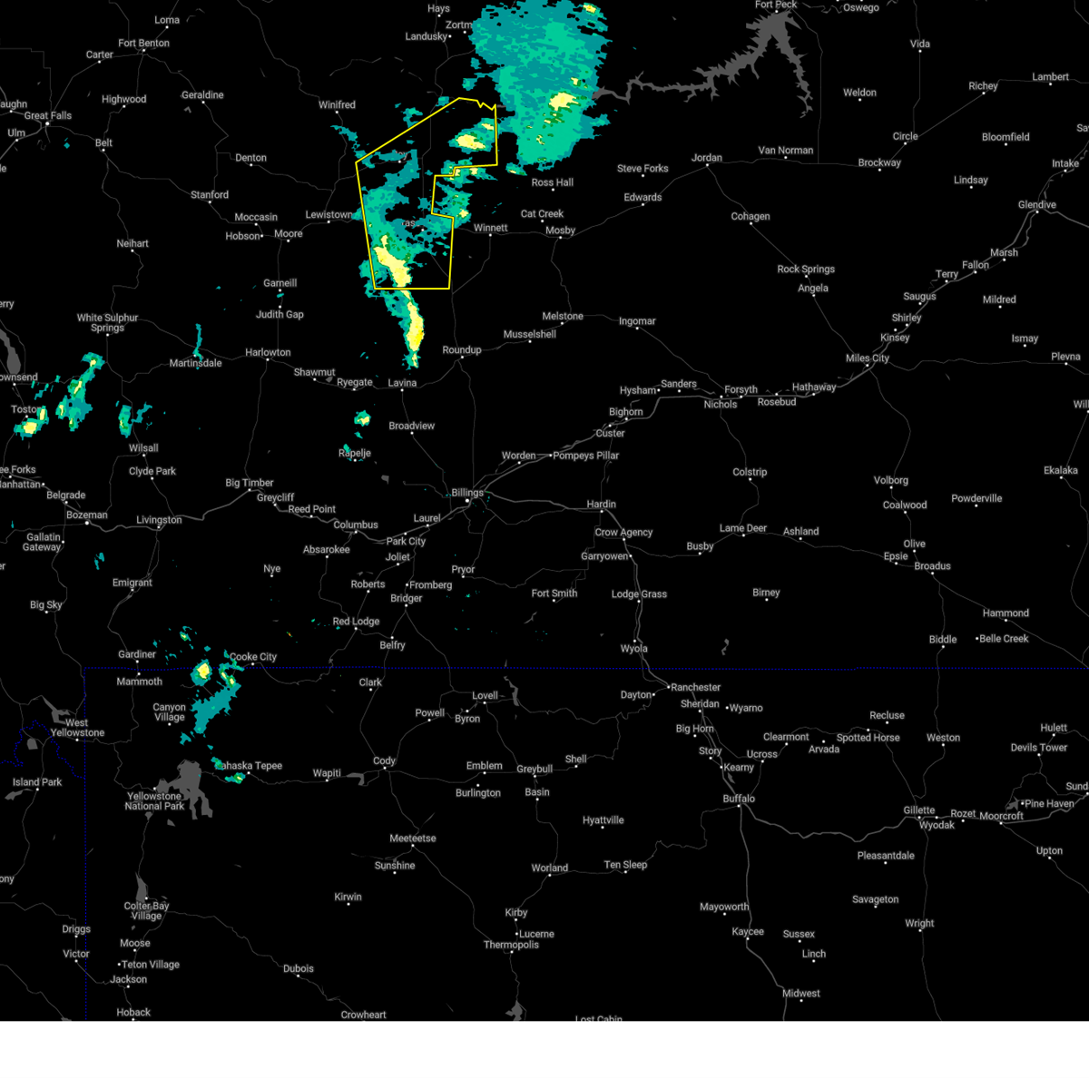
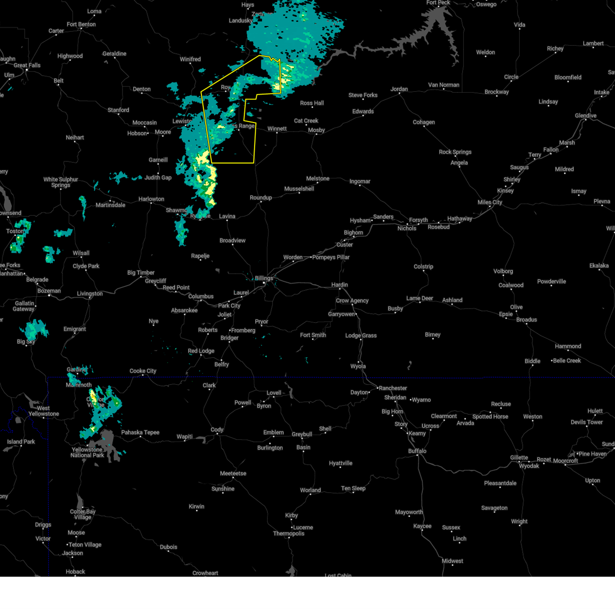
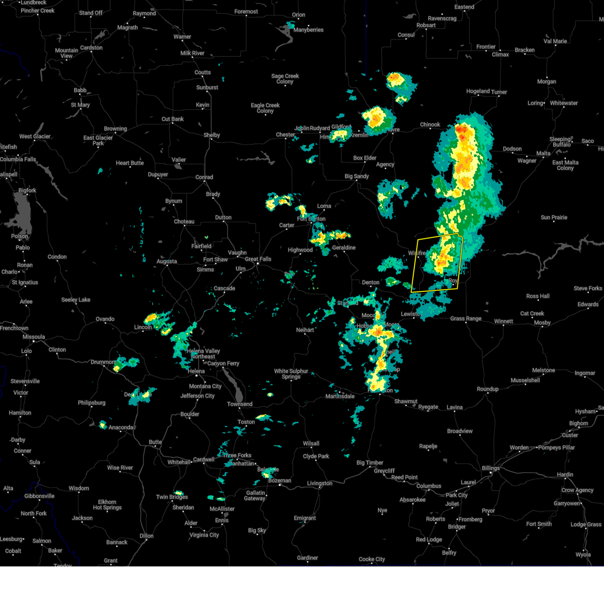
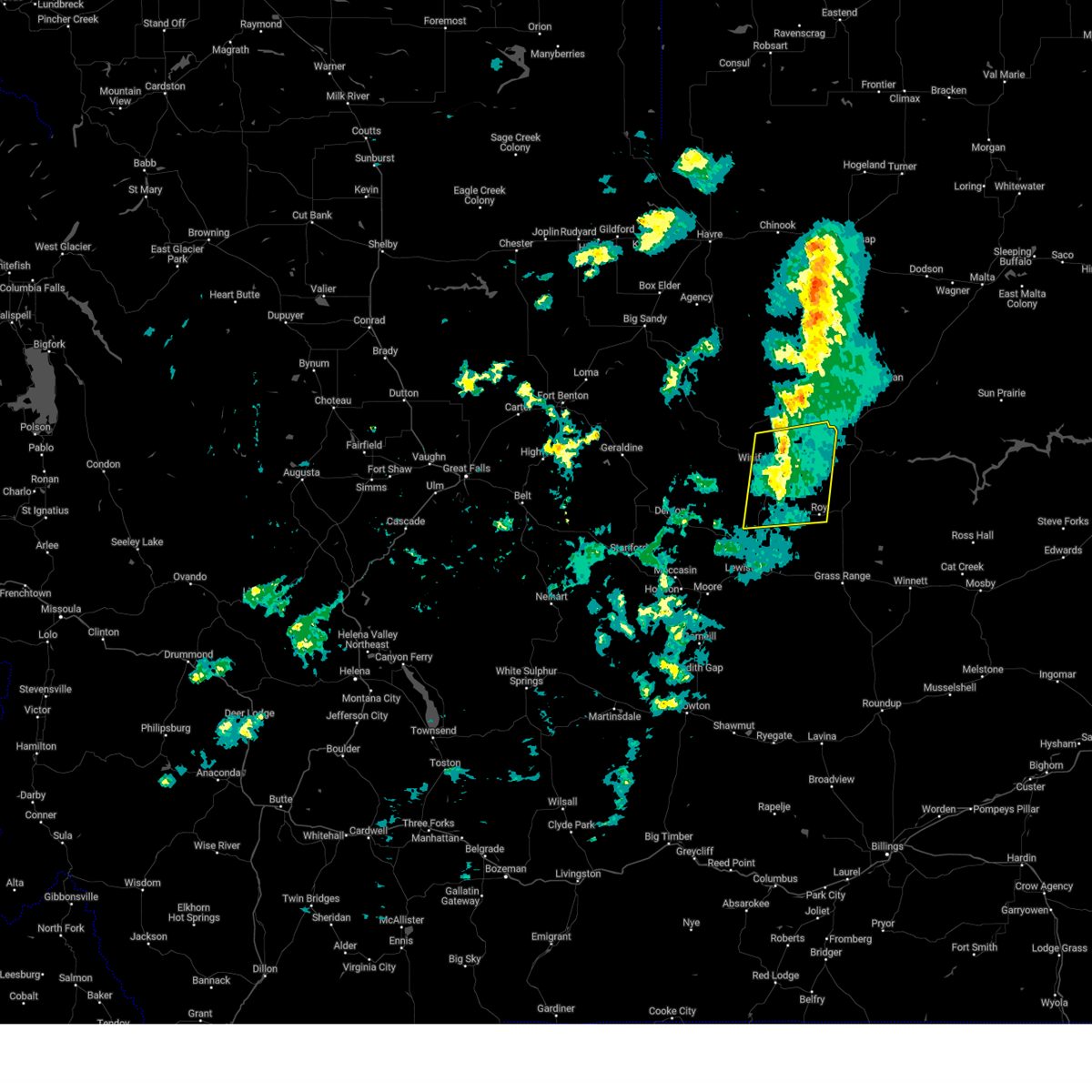
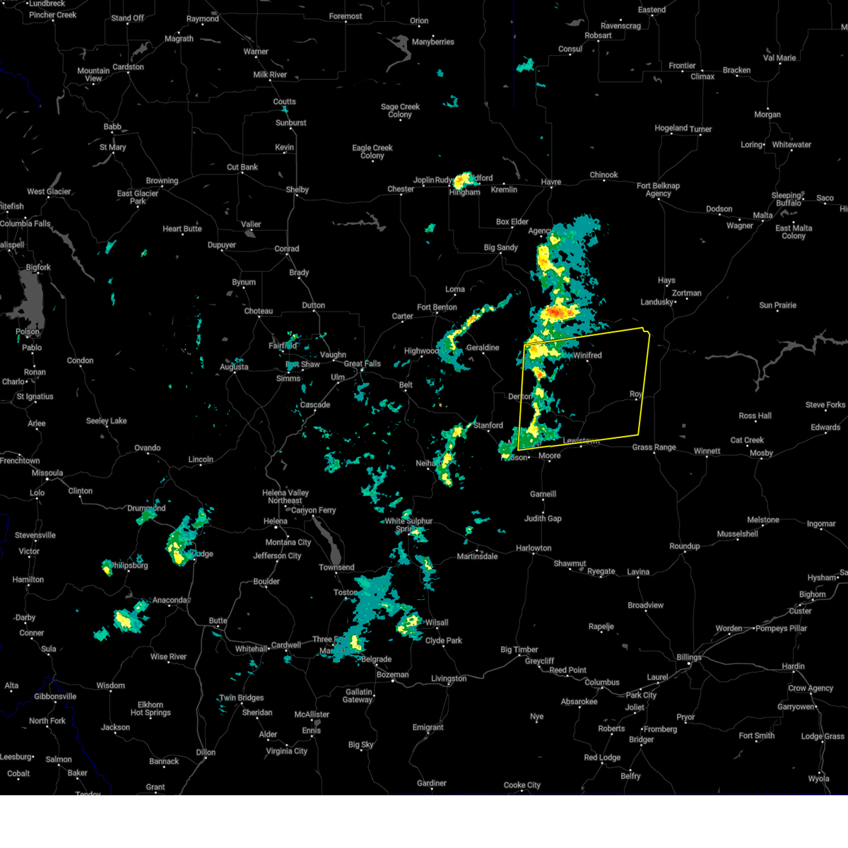
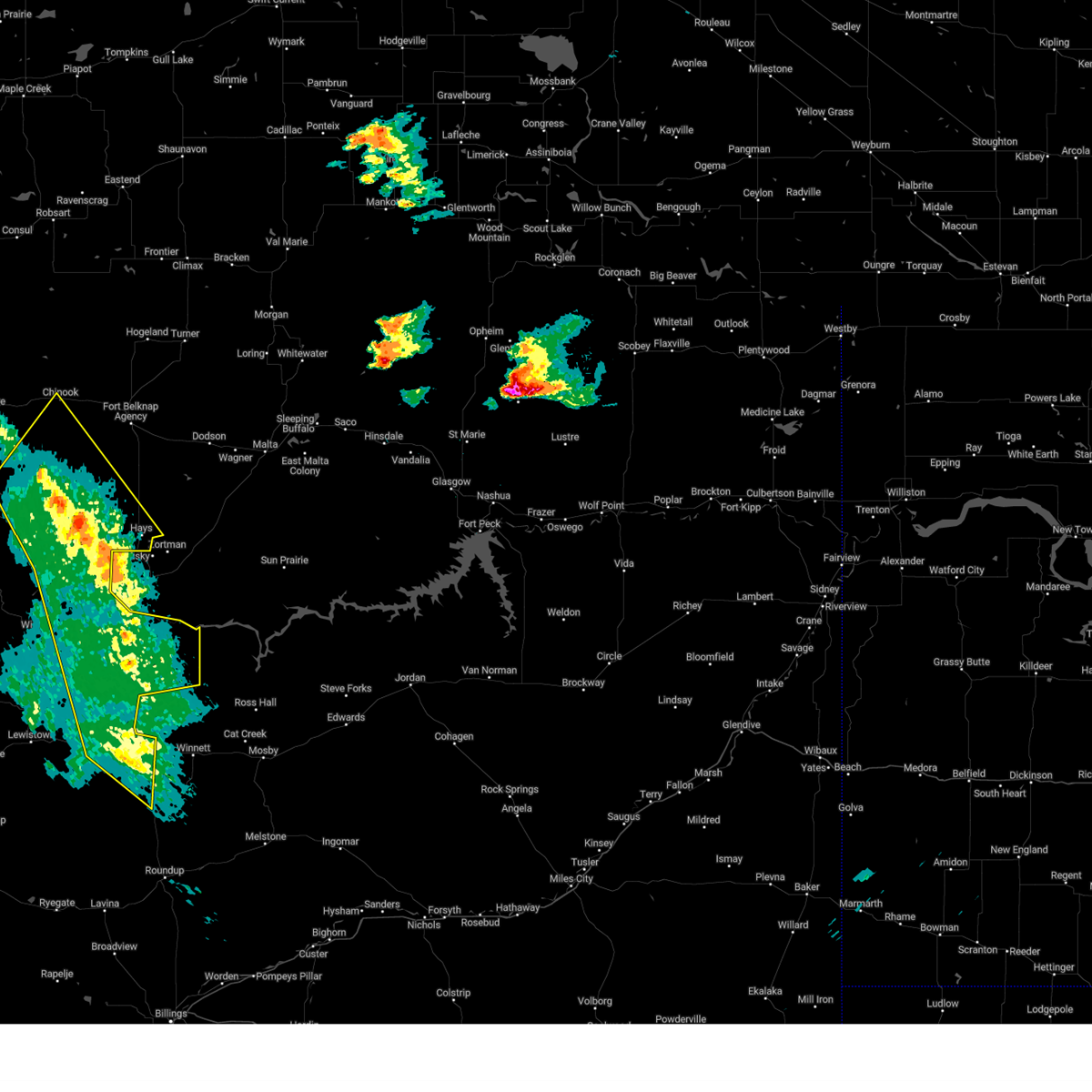
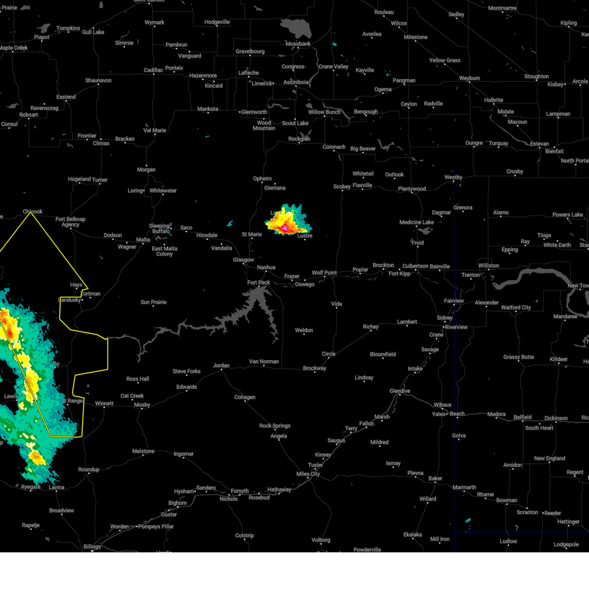
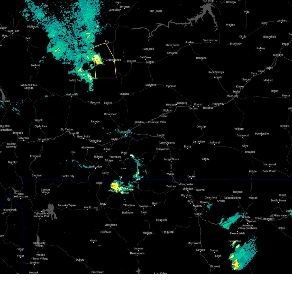
Hail Map for Roy, MT
The Roy, MT area has had 11 reports of on-the-ground hail by trained spotters, and has been under severe weather warnings 13 times during the past 12 months. Doppler radar has detected hail at or near Roy, MT on 21 occasions.
| Name: | Roy, MT |
| Where Located: | 90.5 miles SSE of Havre, MT |
| Map: | Google Map for Roy, MT |
| Population: | 108 |
| Housing Units: | 57 |
| More Info: | Search Google for Roy, MT |
5
The Top Recent Hail Date for Roy, MT is Friday, June 10, 2016 (1st out of 21)

Hail and Wind Damage Spotted near Roy, MT
| Date / Time | Report Details |
|---|---|
| 5/10/2025 7:40 PM MDT |
 The storms which prompted the warning have weakened below severe limits, and no longer pose an immediate threat to life or property. therefore, the warning will be allowed to expire. however, gusty winds are still possible with these thunderstorms. The storms which prompted the warning have weakened below severe limits, and no longer pose an immediate threat to life or property. therefore, the warning will be allowed to expire. however, gusty winds are still possible with these thunderstorms.
|
| 5/10/2025 7:30 PM MDT | Mt dot sensor bohemian corner (mtboh in fergus county MT, 7.6 miles W of Roy, MT |
| 5/10/2025 7:21 PM MDT |
 Svrtfx the national weather service in great falls has issued a * severe thunderstorm warning for, southeastern fergus county in central montana, * until 745 pm mdt. * at 721 pm mdt, severe thunderstorms were located along a line extending from 6 miles west of roy to 21 miles northwest of roundup, moving northeast at 40 mph (radar indicated). Hazards include 60 mph wind gusts. expect damage to roofs, siding, and trees Svrtfx the national weather service in great falls has issued a * severe thunderstorm warning for, southeastern fergus county in central montana, * until 745 pm mdt. * at 721 pm mdt, severe thunderstorms were located along a line extending from 6 miles west of roy to 21 miles northwest of roundup, moving northeast at 40 mph (radar indicated). Hazards include 60 mph wind gusts. expect damage to roofs, siding, and trees
|
| 5/10/2025 7:15 PM MDT | Awos station k1om osca in fergus county MT, 1.5 miles W of Roy, MT |
| 5/10/2025 6:14 PM MDT |
 this warning will be replaced by new warning this warning will be replaced by new warning
|
| 5/10/2025 6:03 PM MDT |
 At 603 pm mdt, severe thunderstorms were located along a line extending from 31 miles northwest of roy to 11 miles south of winifred, moving northeast at 40 mph (radar indicated). Hazards include 60 mph wind gusts. Expect damage to roofs, siding, and trees. Locations impacted include, winifred, suffolk, roy, fergus, and christina. At 603 pm mdt, severe thunderstorms were located along a line extending from 31 miles northwest of roy to 11 miles south of winifred, moving northeast at 40 mph (radar indicated). Hazards include 60 mph wind gusts. Expect damage to roofs, siding, and trees. Locations impacted include, winifred, suffolk, roy, fergus, and christina.
|
| 5/10/2025 5:39 PM MDT |
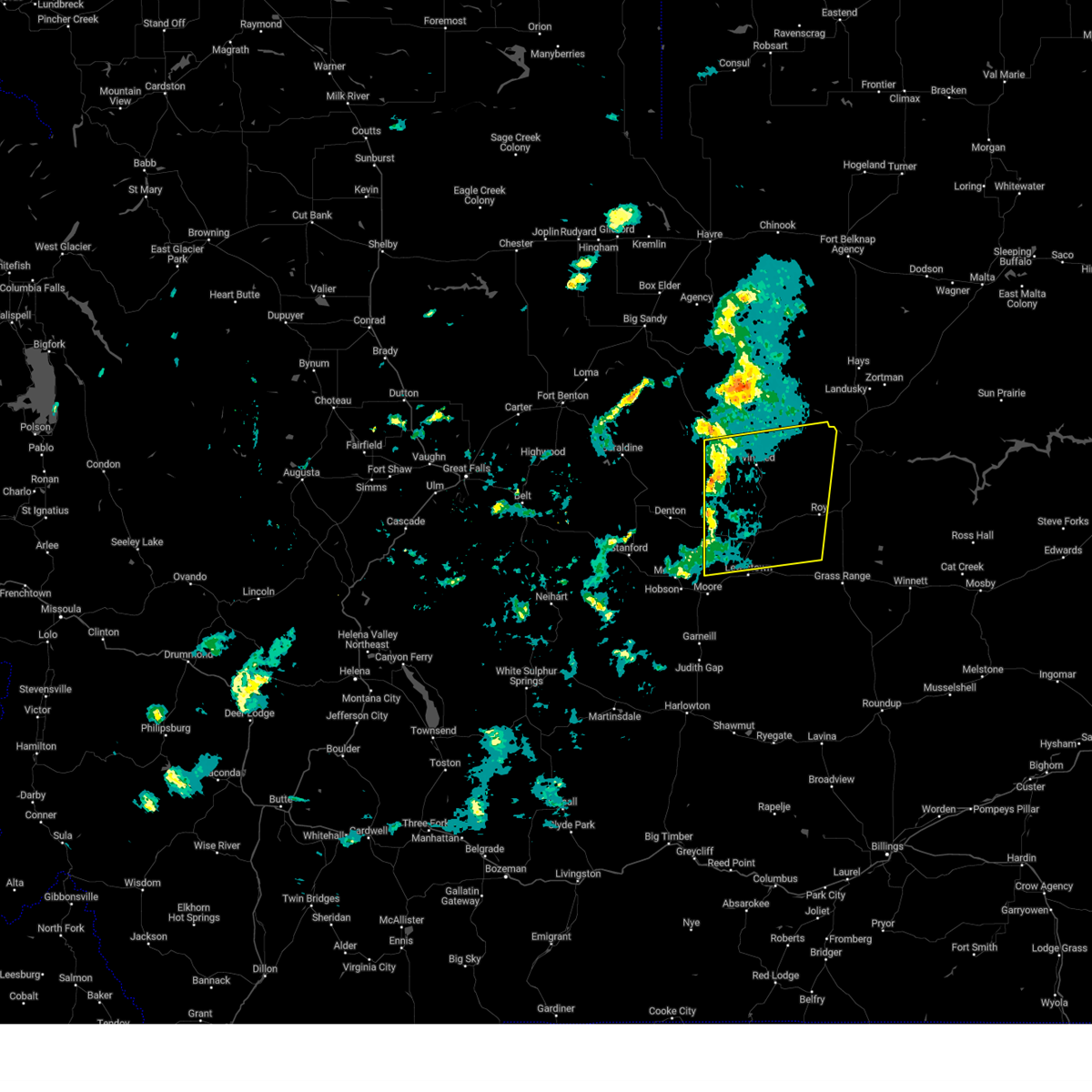 At 538 pm mdt, severe thunderstorms were located along a line extending from 10 miles west of winifred to 15 miles east of denton, moving northeast at 55 mph (radar indicated). Hazards include 60 mph wind gusts. Expect damage to roofs, siding, and trees. Locations impacted include, danvers, suffolk, fergus, giltedge, winifred, roy, hilger, and christina. At 538 pm mdt, severe thunderstorms were located along a line extending from 10 miles west of winifred to 15 miles east of denton, moving northeast at 55 mph (radar indicated). Hazards include 60 mph wind gusts. Expect damage to roofs, siding, and trees. Locations impacted include, danvers, suffolk, fergus, giltedge, winifred, roy, hilger, and christina.
|
| 5/10/2025 5:39 PM MDT |
 the severe thunderstorm warning has been cancelled and is no longer in effect the severe thunderstorm warning has been cancelled and is no longer in effect
|
| 5/10/2025 5:21 PM MDT |
 Svrtfx the national weather service in great falls has issued a * severe thunderstorm warning for, northeastern judith basin county in central montana, central fergus county in central montana, south central blaine county in north central montana, southeastern chouteau county in north central montana, * until 615 pm mdt. * at 520 pm mdt, severe thunderstorms were located along a line extending from 18 miles north of denton to 6 miles north of hobson, moving northeast at 40 mph (radar indicated). Hazards include 60 mph wind gusts. expect damage to roofs, siding, and trees Svrtfx the national weather service in great falls has issued a * severe thunderstorm warning for, northeastern judith basin county in central montana, central fergus county in central montana, south central blaine county in north central montana, southeastern chouteau county in north central montana, * until 615 pm mdt. * at 520 pm mdt, severe thunderstorms were located along a line extending from 18 miles north of denton to 6 miles north of hobson, moving northeast at 40 mph (radar indicated). Hazards include 60 mph wind gusts. expect damage to roofs, siding, and trees
|
| 8/23/2024 7:07 PM MDT |
 The storms which prompted the warning have weakened below severe limits, and no longer pose an immediate threat to life or property. therefore, the warning will be allowed to expire. a severe thunderstorm watch remains in effect until 900 pm mdt for central and north central montana. The storms which prompted the warning have weakened below severe limits, and no longer pose an immediate threat to life or property. therefore, the warning will be allowed to expire. a severe thunderstorm watch remains in effect until 900 pm mdt for central and north central montana.
|
| 8/23/2024 6:59 PM MDT |
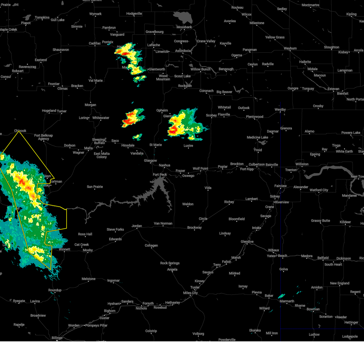 At 659 pm mdt, severe thunderstorms were located along a line extending from 22 miles west of hays to 11 miles northwest of winnett, moving east at 40 mph (radar indicated). Hazards include 60 mph wind gusts. Expect damage to roofs, siding, and trees. Locations impacted include, chinook, grass range, hays, roy, fergus, fred robinson bridge, valentine, lloyd, and cleveland. At 659 pm mdt, severe thunderstorms were located along a line extending from 22 miles west of hays to 11 miles northwest of winnett, moving east at 40 mph (radar indicated). Hazards include 60 mph wind gusts. Expect damage to roofs, siding, and trees. Locations impacted include, chinook, grass range, hays, roy, fergus, fred robinson bridge, valentine, lloyd, and cleveland.
|
| 8/23/2024 6:16 PM MDT |
 Svrtfx the national weather service in great falls has issued a * severe thunderstorm warning for, eastern fergus county in central montana, southern blaine county in north central montana, southeastern hill county in north central montana, east central chouteau county in north central montana, * until 715 pm mdt. * at 615 pm mdt, severe thunderstorms were located along a line extending from 20 miles northwest of winifred to 16 miles southwest of grass range, moving northeast at 40 mph (radar indicated). Hazards include 60 mph wind gusts. expect damage to roofs, siding, and trees Svrtfx the national weather service in great falls has issued a * severe thunderstorm warning for, eastern fergus county in central montana, southern blaine county in north central montana, southeastern hill county in north central montana, east central chouteau county in north central montana, * until 715 pm mdt. * at 615 pm mdt, severe thunderstorms were located along a line extending from 20 miles northwest of winifred to 16 miles southwest of grass range, moving northeast at 40 mph (radar indicated). Hazards include 60 mph wind gusts. expect damage to roofs, siding, and trees
|
| 8/19/2024 8:52 PM MDT |
 The storms which prompted the warning have weakened below severe limits, and no longer pose an immediate threat to life or property. therefore, the warning will be allowed to expire. however, gusty winds are still possible with these thunderstorms. a severe thunderstorm watch remains in effect until 1000 pm mdt for central montana. The storms which prompted the warning have weakened below severe limits, and no longer pose an immediate threat to life or property. therefore, the warning will be allowed to expire. however, gusty winds are still possible with these thunderstorms. a severe thunderstorm watch remains in effect until 1000 pm mdt for central montana.
|
| 8/19/2024 8:40 PM MDT |
 At 839 pm mdt, severe thunderstorms were located along a line extending from 10 miles northeast of lewistown to 18 miles west of grass range to 29 miles southeast of moore, moving east at 30 mph (radar indicated). Hazards include 60 mph wind gusts. Expect damage to roofs, siding, and trees. Locations impacted include, grass range, giltedge, and forestgrove. At 839 pm mdt, severe thunderstorms were located along a line extending from 10 miles northeast of lewistown to 18 miles west of grass range to 29 miles southeast of moore, moving east at 30 mph (radar indicated). Hazards include 60 mph wind gusts. Expect damage to roofs, siding, and trees. Locations impacted include, grass range, giltedge, and forestgrove.
|
| 8/19/2024 8:12 PM MDT |
 Svrtfx the national weather service in great falls has issued a * severe thunderstorm warning for, south central fergus county in central montana, * until 900 pm mdt. * at 812 pm mdt, severe thunderstorms were located along a line extending from 13 miles northeast of moore to near lewistown to 26 miles north of deadmans basin reservoir, moving east at 30 mph (radar indicated). Hazards include 60 mph wind gusts. expect damage to roofs, siding, and trees Svrtfx the national weather service in great falls has issued a * severe thunderstorm warning for, south central fergus county in central montana, * until 900 pm mdt. * at 812 pm mdt, severe thunderstorms were located along a line extending from 13 miles northeast of moore to near lewistown to 26 miles north of deadmans basin reservoir, moving east at 30 mph (radar indicated). Hazards include 60 mph wind gusts. expect damage to roofs, siding, and trees
|
| 8/4/2022 4:06 PM MDT | Corrects previous tstm wnd gst report from 18 nne roy. time estimated from radar. temperature also fell from 101 degrees f to 74 degrees f between 341 pm and 441 p in fergus county MT, 18.2 miles SSW of Roy, MT |
| 8/4/2022 4:05 PM MDT | At 403 pm mdt, severe thunderstorms were located along a line extending from 15 miles west of hays to 10 miles south of grass range, moving northeast at 60 mph. however, a few additional storms were also moving over northwestern and southwestern fergus county (radar indicated). Hazards include 60 mph wind gusts. Expect damage to roofs, siding, and trees. locations impacted include, lewistown, winifred, grass range, hays, roy, fergus, forestgrove, fred robinson bridge, lodge pole, suffolk, giltedge, judith landing, hilger, heath and christina. hail threat, radar indicated max hail size, <. 75 in wind threat, observed max wind gust, 60 mph. |
| 8/4/2022 3:41 PM MDT | At 340 pm mdt, severe thunderstorms were located along a line extending from 19 miles north of winifred to 24 miles southeast of lewistown, moving northeast at 60 mph (radar indicated). Hazards include 60 mph wind gusts. expect damage to roofs, siding, and trees |
| 7/9/2022 7:35 PM MDT |
 At 734 pm mdt, severe thunderstorms were located along a line extending from 26 miles north of winifred to 15 miles northeast of denton, moving northeast at 40 mph (radar indicated). Hazards include 60 mph wind gusts and penny size hail. Expect damage to roofs, siding, and trees. locations impacted include, winifred, hays, roy, suffolk, fred robinson bridge, judith landing and christina. hail threat, radar indicated max hail size, 0. 75 in wind threat, radar indicated max wind gust, 60 mph. At 734 pm mdt, severe thunderstorms were located along a line extending from 26 miles north of winifred to 15 miles northeast of denton, moving northeast at 40 mph (radar indicated). Hazards include 60 mph wind gusts and penny size hail. Expect damage to roofs, siding, and trees. locations impacted include, winifred, hays, roy, suffolk, fred robinson bridge, judith landing and christina. hail threat, radar indicated max hail size, 0. 75 in wind threat, radar indicated max wind gust, 60 mph.
|
| 7/9/2022 7:06 PM MDT |
 At 706 pm mdt, severe thunderstorms were located along a line extending from 21 miles south of st. pierre to stanford, moving east at 45 mph (radar indicated). Hazards include 70 mph wind gusts. Expect considerable tree damage. Damage is likely to mobile homes, roofs, and outbuildings. At 706 pm mdt, severe thunderstorms were located along a line extending from 21 miles south of st. pierre to stanford, moving east at 45 mph (radar indicated). Hazards include 70 mph wind gusts. Expect considerable tree damage. Damage is likely to mobile homes, roofs, and outbuildings.
|
| 7/8/2022 8:26 PM MDT |
 At 826 pm mdt, severe thunderstorms were located along a line extending from 19 miles east of parker school to 16 miles southwest of hays to 22 miles southwest of zortman to 11 miles southeast of grass range, moving east at 40 mph (radar indicated). Hazards include 70 mph wind gusts and nickel size hail. Expect considerable tree damage. Damage is likely to mobile homes, roofs, and outbuildings. At 826 pm mdt, severe thunderstorms were located along a line extending from 19 miles east of parker school to 16 miles southwest of hays to 22 miles southwest of zortman to 11 miles southeast of grass range, moving east at 40 mph (radar indicated). Hazards include 70 mph wind gusts and nickel size hail. Expect considerable tree damage. Damage is likely to mobile homes, roofs, and outbuildings.
|
| 7/5/2022 3:54 PM MDT |
 At 353 pm mdt, severe thunderstorms were located along a line extending from 10 miles northeast of roy to 26 miles northwest of winnett to 9 miles northwest of grass range, moving east at 35 mph (radar indicated). Hazards include ping pong ball size hail and 60 mph wind gusts. People and animals outdoors will be injured. expect hail damage to roofs, siding, windows, and vehicles. expect wind damage to roofs, siding, and trees. localized flash flooding possible. locations impacted include, grass range and roy. hail threat, radar indicated max hail size, 1. 50 in wind threat, radar indicated max wind gust, 60 mph. At 353 pm mdt, severe thunderstorms were located along a line extending from 10 miles northeast of roy to 26 miles northwest of winnett to 9 miles northwest of grass range, moving east at 35 mph (radar indicated). Hazards include ping pong ball size hail and 60 mph wind gusts. People and animals outdoors will be injured. expect hail damage to roofs, siding, windows, and vehicles. expect wind damage to roofs, siding, and trees. localized flash flooding possible. locations impacted include, grass range and roy. hail threat, radar indicated max hail size, 1. 50 in wind threat, radar indicated max wind gust, 60 mph.
|
| 7/5/2022 3:48 PM MDT |
 At 348 pm mdt, severe thunderstorms were located along a line extending from 7 miles northeast of roy to 28 miles northwest of winnett to 12 miles northwest of grass range, moving east at 35 mph (radar indicated). Hazards include 60 mph wind gusts and quarter size hail. Hail damage to vehicles is expected. expect wind damage to roofs, siding, and trees. localized flash flooding possible. locations impacted include, grass range and roy. hail threat, radar indicated max hail size, 1. 00 in wind threat, radar indicated max wind gust, 60 mph. At 348 pm mdt, severe thunderstorms were located along a line extending from 7 miles northeast of roy to 28 miles northwest of winnett to 12 miles northwest of grass range, moving east at 35 mph (radar indicated). Hazards include 60 mph wind gusts and quarter size hail. Hail damage to vehicles is expected. expect wind damage to roofs, siding, and trees. localized flash flooding possible. locations impacted include, grass range and roy. hail threat, radar indicated max hail size, 1. 00 in wind threat, radar indicated max wind gust, 60 mph.
|
| 7/5/2022 3:36 PM MDT |
 The severe thunderstorm warning for northeastern fergus county will expire at 345 pm mdt, this will be replaced by another severe thunderstorm warning. The severe thunderstorm warning for northeastern fergus county will expire at 345 pm mdt, this will be replaced by another severe thunderstorm warning.
|
| 7/5/2022 3:34 PM MDT |
 At 334 pm mdt, severe thunderstorms were located along a line extending from near roy to 16 miles north of grass range to 14 miles east of lewistown, moving east at 35 mph (radar indicated). Hazards include 60 mph wind gusts and quarter size hail. Hail damage to vehicles is expected. Expect wind damage to roofs, siding, and trees. At 334 pm mdt, severe thunderstorms were located along a line extending from near roy to 16 miles north of grass range to 14 miles east of lewistown, moving east at 35 mph (radar indicated). Hazards include 60 mph wind gusts and quarter size hail. Hail damage to vehicles is expected. Expect wind damage to roofs, siding, and trees.
|
| 7/5/2022 3:24 PM MDT |
 At 323 pm mdt, a severe thunderstorm was located 7 miles south of roy, or 24 miles northeast of lewistown, moving east at 35 mph (radar indicated). Hazards include 60 mph wind gusts and penny size hail. Expect damage to roofs, siding, and trees. locations impacted include, roy and fergus. hail threat, radar indicated max hail size, 0. 75 in wind threat, radar indicated max wind gust, 60 mph. At 323 pm mdt, a severe thunderstorm was located 7 miles south of roy, or 24 miles northeast of lewistown, moving east at 35 mph (radar indicated). Hazards include 60 mph wind gusts and penny size hail. Expect damage to roofs, siding, and trees. locations impacted include, roy and fergus. hail threat, radar indicated max hail size, 0. 75 in wind threat, radar indicated max wind gust, 60 mph.
|
| 7/5/2022 3:17 PM MDT |
 At 316 pm mdt, a severe thunderstorm was located 8 miles southwest of roy, or 20 miles northeast of lewistown, moving east at 35 mph (radar indicated). Hazards include 60 mph wind gusts and quarter size hail. Hail damage to vehicles is expected. expect wind damage to roofs, siding, and trees. localized flash flooding possible. locations impacted include, roy and fergus. hail threat, radar indicated max hail size, 1. 00 in wind threat, radar indicated max wind gust, 60 mph. At 316 pm mdt, a severe thunderstorm was located 8 miles southwest of roy, or 20 miles northeast of lewistown, moving east at 35 mph (radar indicated). Hazards include 60 mph wind gusts and quarter size hail. Hail damage to vehicles is expected. expect wind damage to roofs, siding, and trees. localized flash flooding possible. locations impacted include, roy and fergus. hail threat, radar indicated max hail size, 1. 00 in wind threat, radar indicated max wind gust, 60 mph.
|
| 7/5/2022 3:07 PM MDT |
 At 307 pm mdt, a severe thunderstorm was located 12 miles southwest of roy, or 17 miles northeast of lewistown, moving east at 35 mph (radar indicated). Hazards include 60 mph wind gusts and quarter size hail. Hail damage to vehicles is expected. expect wind damage to roofs, siding, and trees. localized flash flooding possible. locations impacted include, roy and fergus. hail threat, radar indicated max hail size, 1. 00 in wind threat, radar indicated max wind gust, 60 mph. At 307 pm mdt, a severe thunderstorm was located 12 miles southwest of roy, or 17 miles northeast of lewistown, moving east at 35 mph (radar indicated). Hazards include 60 mph wind gusts and quarter size hail. Hail damage to vehicles is expected. expect wind damage to roofs, siding, and trees. localized flash flooding possible. locations impacted include, roy and fergus. hail threat, radar indicated max hail size, 1. 00 in wind threat, radar indicated max wind gust, 60 mph.
|
| 7/5/2022 2:57 PM MDT |
 At 256 pm mdt, a severe thunderstorm was located 13 miles north of lewistown, moving northeast at 35 mph (radar indicated). Hazards include 60 mph wind gusts and quarter size hail. Hail damage to vehicles is expected. expect wind damage to roofs, siding, and trees. localized flash flooding possible. locations impacted include, roy, fergus, hilger and christina. hail threat, radar indicated max hail size, 1. 00 in wind threat, radar indicated max wind gust, 60 mph. At 256 pm mdt, a severe thunderstorm was located 13 miles north of lewistown, moving northeast at 35 mph (radar indicated). Hazards include 60 mph wind gusts and quarter size hail. Hail damage to vehicles is expected. expect wind damage to roofs, siding, and trees. localized flash flooding possible. locations impacted include, roy, fergus, hilger and christina. hail threat, radar indicated max hail size, 1. 00 in wind threat, radar indicated max wind gust, 60 mph.
|
| 7/5/2022 2:52 PM MDT |
 At 251 pm mdt, a severe thunderstorm was located 13 miles north of lewistown, moving northeast at 35 mph (radar indicated). Hazards include 60 mph wind gusts and quarter size hail. Hail damage to vehicles is expected. expect wind damage to roofs, siding, and trees. Localized flash flooding possible. At 251 pm mdt, a severe thunderstorm was located 13 miles north of lewistown, moving northeast at 35 mph (radar indicated). Hazards include 60 mph wind gusts and quarter size hail. Hail damage to vehicles is expected. expect wind damage to roofs, siding, and trees. Localized flash flooding possible.
|
| 7/4/2022 7:05 PM MDT |
 At 705 pm mdt, a severe thunderstorm was located 9 miles west of roy, or 20 miles northeast of lewistown, moving east at 25 mph (radar indicated). Hazards include 60 mph wind gusts and quarter size hail. Hail damage to vehicles is expected. expect wind damage to roofs, siding, and trees. locations impacted include, roy and fergus. hail threat, radar indicated max hail size, 1. 00 in wind threat, radar indicated max wind gust, 60 mph. At 705 pm mdt, a severe thunderstorm was located 9 miles west of roy, or 20 miles northeast of lewistown, moving east at 25 mph (radar indicated). Hazards include 60 mph wind gusts and quarter size hail. Hail damage to vehicles is expected. expect wind damage to roofs, siding, and trees. locations impacted include, roy and fergus. hail threat, radar indicated max hail size, 1. 00 in wind threat, radar indicated max wind gust, 60 mph.
|
| 7/4/2022 6:51 PM MDT |
 At 650 pm mdt, a severe thunderstorm was located 13 miles west of roy, or 18 miles northeast of lewistown, moving east at 30 mph (radar indicated). Hazards include 60 mph wind gusts and quarter size hail. Hail damage to vehicles is expected. expect wind damage to roofs, siding, and trees. localized flash flooding possible. locations impacted include, roy, fergus, hilger and christina. hail threat, radar indicated max hail size, 1. 00 in wind threat, radar indicated max wind gust, 60 mph. At 650 pm mdt, a severe thunderstorm was located 13 miles west of roy, or 18 miles northeast of lewistown, moving east at 30 mph (radar indicated). Hazards include 60 mph wind gusts and quarter size hail. Hail damage to vehicles is expected. expect wind damage to roofs, siding, and trees. localized flash flooding possible. locations impacted include, roy, fergus, hilger and christina. hail threat, radar indicated max hail size, 1. 00 in wind threat, radar indicated max wind gust, 60 mph.
|
| 7/4/2022 6:40 PM MDT |
 At 639 pm mdt, a severe thunderstorm was located 16 miles south of winifred, or 17 miles north of lewistown, moving east at 30 mph (radar indicated). Hazards include 60 mph wind gusts and quarter size hail. Hail damage to vehicles is expected. Expect wind damage to roofs, siding, and trees. At 639 pm mdt, a severe thunderstorm was located 16 miles south of winifred, or 17 miles north of lewistown, moving east at 30 mph (radar indicated). Hazards include 60 mph wind gusts and quarter size hail. Hail damage to vehicles is expected. Expect wind damage to roofs, siding, and trees.
|
| 6/18/2022 7:15 PM MDT | Mesonet station mtm42 blm ro in fergus county MT, 10.8 miles S of Roy, MT |
| 12/23/2021 7:30 PM MST |
 At 728 pm mst, severe thunderstorms were located along a line extending from 24 miles north of winifred to 9 miles south of stanford, moving east at 55 mph (radar indicated). Hazards include 60 mph wind gusts. expect damage to roofs, siding, and trees At 728 pm mst, severe thunderstorms were located along a line extending from 24 miles north of winifred to 9 miles south of stanford, moving east at 55 mph (radar indicated). Hazards include 60 mph wind gusts. expect damage to roofs, siding, and trees
|
| 6/10/2021 3:55 PM MDT |
 The severe thunderstorm warning for east central fergus county will expire at 400 pm mdt, the storm which prompted the warning has moved out of the area. therefore, the warning will be allowed to expire. however gusty winds and heavy rain are still possible with this thunderstorm. a severe thunderstorm watch remains in effect until 1000 pm mdt for central montana. to report severe weather, contact your nearest law enforcement agency. they will relay your report to the national weather service great falls. The severe thunderstorm warning for east central fergus county will expire at 400 pm mdt, the storm which prompted the warning has moved out of the area. therefore, the warning will be allowed to expire. however gusty winds and heavy rain are still possible with this thunderstorm. a severe thunderstorm watch remains in effect until 1000 pm mdt for central montana. to report severe weather, contact your nearest law enforcement agency. they will relay your report to the national weather service great falls.
|
| 6/10/2021 3:34 PM MDT |
 At 308 pm mdt, a severe thunderstorm was located near grass range, or 24 miles east of lewistown, moving north at 35 mph (radar indicated). Hazards include quarter size hail. damage to vehicles is expected At 308 pm mdt, a severe thunderstorm was located near grass range, or 24 miles east of lewistown, moving north at 35 mph (radar indicated). Hazards include quarter size hail. damage to vehicles is expected
|
| 6/10/2021 3:08 PM MDT |
 At 308 pm mdt, a severe thunderstorm was located near grass range, or 24 miles east of lewistown, moving north at 35 mph (radar indicated). Hazards include quarter size hail. damage to vehicles is expected At 308 pm mdt, a severe thunderstorm was located near grass range, or 24 miles east of lewistown, moving north at 35 mph (radar indicated). Hazards include quarter size hail. damage to vehicles is expected
|
| 8/20/2020 7:00 PM MDT | Awos station k1om osca in fergus county MT, 1.5 miles W of Roy, MT |
| 7/7/2020 3:44 PM MDT |
 At 343 pm mdt, severe thunderstorms were located along a line extending from 13 miles east of winifred to 7 miles north of grass range to 28 miles north of ryegate, moving east at 40 mph (radar indicated). Hazards include 60 mph wind gusts and half dollar size hail. Hail damage to vehicles is expected. Expect wind damage to roofs, siding, and trees. At 343 pm mdt, severe thunderstorms were located along a line extending from 13 miles east of winifred to 7 miles north of grass range to 28 miles north of ryegate, moving east at 40 mph (radar indicated). Hazards include 60 mph wind gusts and half dollar size hail. Hail damage to vehicles is expected. Expect wind damage to roofs, siding, and trees.
|
| 7/7/2020 3:39 PM MDT |
 At 338 pm mdt, a severe thunderstorm was located 7 miles northwest of u l bend rec area, or 34 miles southeast of zortman, moving northeast at 50 mph (radar indicated). Hazards include ping pong ball size hail and 60 mph wind gusts. People and animals outdoors will be injured. expect hail damage to roofs, siding, windows, and vehicles. expect wind damage to roofs, siding, and trees. Locations impacted include, winifred, grass range, roy, fergus, suffolk, forestgrove and christina. At 338 pm mdt, a severe thunderstorm was located 7 miles northwest of u l bend rec area, or 34 miles southeast of zortman, moving northeast at 50 mph (radar indicated). Hazards include ping pong ball size hail and 60 mph wind gusts. People and animals outdoors will be injured. expect hail damage to roofs, siding, windows, and vehicles. expect wind damage to roofs, siding, and trees. Locations impacted include, winifred, grass range, roy, fergus, suffolk, forestgrove and christina.
|
| 7/7/2020 3:34 PM MDT | Awos station k1om osca in fergus county MT, 1.5 miles W of Roy, MT |
| 7/7/2020 3:23 PM MDT |
 At 321 pm mdt, a severe thunderstorm was located 13 miles west of crooked creek rec area, or 32 miles north of winnett, moving northeast at 50 mph (radar indicated). Hazards include ping pong ball size hail and 60 mph wind gusts. People and animals outdoors will be injured. expect hail damage to roofs, siding, windows, and vehicles. expect wind damage to roofs, siding, and trees. Locations impacted include, lewistown, winifred, grass range, roy, fergus, suffolk, forestgrove, giltedge, glengarry, heath, hilger and christina. At 321 pm mdt, a severe thunderstorm was located 13 miles west of crooked creek rec area, or 32 miles north of winnett, moving northeast at 50 mph (radar indicated). Hazards include ping pong ball size hail and 60 mph wind gusts. People and animals outdoors will be injured. expect hail damage to roofs, siding, windows, and vehicles. expect wind damage to roofs, siding, and trees. Locations impacted include, lewistown, winifred, grass range, roy, fergus, suffolk, forestgrove, giltedge, glengarry, heath, hilger and christina.
|
| 7/7/2020 3:13 PM MDT |
 At 312 pm mdt, a broken line of severe thunderstorms were located over western and central fergus county, moving east northeast at 50 mph (radar indicated). Hazards include ping pong ball size hail and 60 mph wind gusts. People and animals outdoors will be injured. expect hail damage to roofs, siding, windows, and vehicles. Expect wind damage to roofs, siding, and trees. At 312 pm mdt, a broken line of severe thunderstorms were located over western and central fergus county, moving east northeast at 50 mph (radar indicated). Hazards include ping pong ball size hail and 60 mph wind gusts. People and animals outdoors will be injured. expect hail damage to roofs, siding, windows, and vehicles. Expect wind damage to roofs, siding, and trees.
|
| 7/4/2020 6:43 PM MDT |
 The severe thunderstorm warning for east central fergus county will expire at 645 pm mdt, the storm which prompted the warning has weakened below severe limits, and no longer poses an immediate threat to life or property. therefore, the warning will be allowed to expire. however heavy rain is still possible with this thunderstorm. The severe thunderstorm warning for east central fergus county will expire at 645 pm mdt, the storm which prompted the warning has weakened below severe limits, and no longer poses an immediate threat to life or property. therefore, the warning will be allowed to expire. however heavy rain is still possible with this thunderstorm.
|
| 7/4/2020 6:29 PM MDT |
 At 629 pm mdt, a severe thunderstorm was located over roy, or 28 miles northeast of lewistown, moving east at 30 mph (radar indicated). Hazards include quarter size hail. Damage to vehicles is expected. Locations impacted include, roy and fergus. At 629 pm mdt, a severe thunderstorm was located over roy, or 28 miles northeast of lewistown, moving east at 30 mph (radar indicated). Hazards include quarter size hail. Damage to vehicles is expected. Locations impacted include, roy and fergus.
|
| 7/4/2020 6:05 PM MDT |
 At 603 pm mdt, a severe thunderstorm was located 14 miles west of roy, or 19 miles northeast of lewistown, moving east at 25 mph (radar indicated. earlier this evening, this storm brought quarter-sized hail near stanford). Hazards include quarter size hail. damage to vehicles is expected At 603 pm mdt, a severe thunderstorm was located 14 miles west of roy, or 19 miles northeast of lewistown, moving east at 25 mph (radar indicated. earlier this evening, this storm brought quarter-sized hail near stanford). Hazards include quarter size hail. damage to vehicles is expected
|
| 7/14/2019 6:13 PM MDT |
 At 612 pm mdt, severe thunderstorms were located along a line extending from near winifred to 9 miles northwest of roy to 14 miles west of grass range to 23 miles southeast of lewistown, moving east at 55 mph (radar indicated). Hazards include 70 mph wind gusts and nickel size hail. Expect considerable tree damage. damage is likely to mobile homes, roofs, and outbuildings. Locations impacted include, lewistown, winifred, grass range, roy, fergus, suffolk, forestgrove, fred robinson bridge, giltedge, heath, hilger and christina. At 612 pm mdt, severe thunderstorms were located along a line extending from near winifred to 9 miles northwest of roy to 14 miles west of grass range to 23 miles southeast of lewistown, moving east at 55 mph (radar indicated). Hazards include 70 mph wind gusts and nickel size hail. Expect considerable tree damage. damage is likely to mobile homes, roofs, and outbuildings. Locations impacted include, lewistown, winifred, grass range, roy, fergus, suffolk, forestgrove, fred robinson bridge, giltedge, heath, hilger and christina.
|
| 7/14/2019 5:51 PM MDT |
 At 551 pm mdt, severe thunderstorms were located along a line extending from 20 miles northeast of denton to 15 miles south of winifred to near lewistown to 17 miles southeast of moore to 21 miles northeast of harlowton, moving east at 55 mph (radar indicated). Hazards include 60 mph wind gusts and nickel size hail. expect damage to roofs, siding, and trees At 551 pm mdt, severe thunderstorms were located along a line extending from 20 miles northeast of denton to 15 miles south of winifred to near lewistown to 17 miles southeast of moore to 21 miles northeast of harlowton, moving east at 55 mph (radar indicated). Hazards include 60 mph wind gusts and nickel size hail. expect damage to roofs, siding, and trees
|
| 7/13/2019 5:18 PM MDT |
 At 517 pm mdt, severe thunderstorms were located along a line extending from 16 miles east of winifred to 16 miles northeast of roy to 24 miles northeast of grass range to near winnett, moving northeast at 60 mph (radar indicated). Hazards include 60 mph wind gusts and penny size hail. Expect damage to roofs, siding, and trees. Locations impacted include, grass range, roy, fergus, suffolk and fred robinson bridge. At 517 pm mdt, severe thunderstorms were located along a line extending from 16 miles east of winifred to 16 miles northeast of roy to 24 miles northeast of grass range to near winnett, moving northeast at 60 mph (radar indicated). Hazards include 60 mph wind gusts and penny size hail. Expect damage to roofs, siding, and trees. Locations impacted include, grass range, roy, fergus, suffolk and fred robinson bridge.
|
| 7/13/2019 4:53 PM MDT |
 At 452 pm mdt, severe thunderstorms were located along a line extending from 14 miles south of winifred to 8 miles southwest of roy to grass range to 14 miles west of flatwillow, moving northeast at 60 mph (radar indicated). Hazards include 60 mph wind gusts and penny size hail. expect damage to roofs, siding, and trees At 452 pm mdt, severe thunderstorms were located along a line extending from 14 miles south of winifred to 8 miles southwest of roy to grass range to 14 miles west of flatwillow, moving northeast at 60 mph (radar indicated). Hazards include 60 mph wind gusts and penny size hail. expect damage to roofs, siding, and trees
|
| 7/1/2019 3:45 PM MDT |
 The national weather service in great falls has issued a * severe thunderstorm warning for. east central fergus county in central montana. until 430 pm mdt. At 344 pm mdt, a severe thunderstorm was located 10 miles south of roy, or 20 miles northeast of lewistown, moving east at 35 mph. The national weather service in great falls has issued a * severe thunderstorm warning for. east central fergus county in central montana. until 430 pm mdt. At 344 pm mdt, a severe thunderstorm was located 10 miles south of roy, or 20 miles northeast of lewistown, moving east at 35 mph.
|
| 6/28/2019 7:55 PM MDT |
 The severe thunderstorm warning for southeastern fergus county will expire at 800 pm mdt, the storm which prompted the warning has moved out of the area. therefore, the warning will be allowed to expire. a tornado watch remains in effect until midnight mdt for central montana. remember, a severe thunderstorm warning still remains in effect for eastern fergus county. The severe thunderstorm warning for southeastern fergus county will expire at 800 pm mdt, the storm which prompted the warning has moved out of the area. therefore, the warning will be allowed to expire. a tornado watch remains in effect until midnight mdt for central montana. remember, a severe thunderstorm warning still remains in effect for eastern fergus county.
|
| 6/28/2019 7:43 PM MDT |
 At 743 pm mdt, a severe thunderstorm was located 10 miles south of roy, or 22 miles east of lewistown, moving northeast at 40 mph (trained weather spotters). Hazards include 60 mph wind gusts and half dollar size hail. Hail damage to vehicles is expected. expect wind damage to roofs, siding, and trees. Locations impacted include, grass range, roy and fergus. At 743 pm mdt, a severe thunderstorm was located 10 miles south of roy, or 22 miles east of lewistown, moving northeast at 40 mph (trained weather spotters). Hazards include 60 mph wind gusts and half dollar size hail. Hail damage to vehicles is expected. expect wind damage to roofs, siding, and trees. Locations impacted include, grass range, roy and fergus.
|
| 6/28/2019 7:42 PM MDT |
 The national weather service in great falls has issued a * severe thunderstorm warning for. southeastern fergus county in central montana. until 830 pm mdt. At 741 pm mdt, a severe thunderstorm was located 10 miles south of roy, or 25 miles east of lewistown, moving northeast at 45 mph. The national weather service in great falls has issued a * severe thunderstorm warning for. southeastern fergus county in central montana. until 830 pm mdt. At 741 pm mdt, a severe thunderstorm was located 10 miles south of roy, or 25 miles east of lewistown, moving northeast at 45 mph.
|
| 6/28/2019 7:29 PM MDT |
 At 715 pm mdt, a severe thunderstorm was located over lewistown, moving northeast at 50 mph (trained weather spotters). Hazards include 60 mph wind gusts and quarter size hail. Hail damage to vehicles is expected. Expect wind damage to roofs, siding, and trees. At 715 pm mdt, a severe thunderstorm was located over lewistown, moving northeast at 50 mph (trained weather spotters). Hazards include 60 mph wind gusts and quarter size hail. Hail damage to vehicles is expected. Expect wind damage to roofs, siding, and trees.
|
| 6/28/2019 7:16 PM MDT |
 At 715 pm mdt, a severe thunderstorm was located over lewistown, moving northeast at 50 mph (trained weather spotters). Hazards include 60 mph wind gusts and quarter size hail. Hail damage to vehicles is expected. Expect wind damage to roofs, siding, and trees. At 715 pm mdt, a severe thunderstorm was located over lewistown, moving northeast at 50 mph (trained weather spotters). Hazards include 60 mph wind gusts and quarter size hail. Hail damage to vehicles is expected. Expect wind damage to roofs, siding, and trees.
|
| 6/27/2019 6:45 PM MDT |
 At 645 pm mdt, severe thunderstorms were located along a line extending from 27 miles north of chinook to near roy, moving east at 35 mph (radar indicated). Hazards include 60 mph wind gusts and quarter size hail. Hail damage to vehicles is expected. Expect wind damage to roofs, siding, and trees. At 645 pm mdt, severe thunderstorms were located along a line extending from 27 miles north of chinook to near roy, moving east at 35 mph (radar indicated). Hazards include 60 mph wind gusts and quarter size hail. Hail damage to vehicles is expected. Expect wind damage to roofs, siding, and trees.
|
| 6/7/2018 10:42 AM MDT |
 The severe thunderstorm warning for southeastern fergus county will expire at 1045 am mdt, the storm which prompted the warning has weakened below severe limits, and no longer poses an immediate threat to life or property. therefore, the warning will be allowed to expire. however heavy rain is still possible with this thunderstorm. to report severe weather, contact your nearest law enforcement agency. they will relay your report to the national weather service great falls. The severe thunderstorm warning for southeastern fergus county will expire at 1045 am mdt, the storm which prompted the warning has weakened below severe limits, and no longer poses an immediate threat to life or property. therefore, the warning will be allowed to expire. however heavy rain is still possible with this thunderstorm. to report severe weather, contact your nearest law enforcement agency. they will relay your report to the national weather service great falls.
|
| 6/7/2018 9:59 AM MDT |
 At 957 am mdt, a severe thunderstorm was located 20 miles south of grass range, or 24 miles northwest of roundup, moving northeast at 30 mph (radar indicated). Hazards include 60 mph wind gusts and quarter size hail. Hail damage to vehicles is expected. Expect wind damage to roofs, siding, and trees. At 957 am mdt, a severe thunderstorm was located 20 miles south of grass range, or 24 miles northwest of roundup, moving northeast at 30 mph (radar indicated). Hazards include 60 mph wind gusts and quarter size hail. Hail damage to vehicles is expected. Expect wind damage to roofs, siding, and trees.
|
| 6/4/2018 4:57 PM MDT |
 At 456 pm mdt, a severe thunderstorm was located 11 miles southeast of moore, or 12 miles south of lewistown, moving northeast at 35 mph (radar indicated). Hazards include 60 mph wind gusts and half dollar size hail. Hail damage to vehicles is expected. Expect wind damage to roofs, siding, and trees. At 456 pm mdt, a severe thunderstorm was located 11 miles southeast of moore, or 12 miles south of lewistown, moving northeast at 35 mph (radar indicated). Hazards include 60 mph wind gusts and half dollar size hail. Hail damage to vehicles is expected. Expect wind damage to roofs, siding, and trees.
|
| 6/12/2017 9:57 PM MDT |
 The severe thunderstorm warning for fergus county will expire at 1000 pm mdt, the storms which prompted the warning have weakened below severe limits, and no longer pose an immediate threat to life or property. therefore the warning will be allowed to expire. however gusty winds and heavy rain are still possible with these thunderstorms. The severe thunderstorm warning for fergus county will expire at 1000 pm mdt, the storms which prompted the warning have weakened below severe limits, and no longer pose an immediate threat to life or property. therefore the warning will be allowed to expire. however gusty winds and heavy rain are still possible with these thunderstorms.
|
| 6/12/2017 9:13 PM MDT |
 At 912 pm mdt, severe thunderstorms were located along a line extending from 12 miles east of denton to near grass range, moving north at 35 mph (wind gusts up to 60 mph were reported at lewistown airport and near grass range as these stormed moved through). Hazards include 60 mph wind gusts and penny size hail. expect damage to roofs, siding, and trees At 912 pm mdt, severe thunderstorms were located along a line extending from 12 miles east of denton to near grass range, moving north at 35 mph (wind gusts up to 60 mph were reported at lewistown airport and near grass range as these stormed moved through). Hazards include 60 mph wind gusts and penny size hail. expect damage to roofs, siding, and trees
|
| 8/9/2016 8:40 PM MDT | Half Dollar sized hail reported 18.1 miles SW of Roy, MT, largest hail was quarter to half dollar-size. |
| 6/10/2016 8:45 PM MDT | Tennis Ball sized hail reported 31.5 miles WSW of Roy, MT |
| 6/10/2016 8:45 PM MDT | Storm damage reported in fergus county MT, 31.5 miles WSW of Roy, MT |
| 6/10/2016 8:12 PM MDT |
 At 811 pm mdt, severe thunderstorms were located along a line extending from near winifred to 31 miles north of lewistown to near roy, moving east at 50 mph (radar indicated). Hazards include ping pong ball size hail and 60 mph wind gusts. People and animals outdoors will be injured. expect hail damage to roofs, siding, windows, and vehicles. Expect wind damage to roofs, siding, and trees. At 811 pm mdt, severe thunderstorms were located along a line extending from near winifred to 31 miles north of lewistown to near roy, moving east at 50 mph (radar indicated). Hazards include ping pong ball size hail and 60 mph wind gusts. People and animals outdoors will be injured. expect hail damage to roofs, siding, windows, and vehicles. Expect wind damage to roofs, siding, and trees.
|
| 6/10/2016 7:58 PM MDT |
 At 757 pm mdt, a line of severe thunderstorms was located over and near winifred, or 34 miles north of lewistown, moving northeast at 45 mph (radar indicated). Hazards include 60 mph wind gusts and quarter size hail. Hail damage to vehicles is expected. expect wind damage to roofs, siding, and trees. Locations impacted include, winifred, roy, fergus, suffolk and christina. At 757 pm mdt, a line of severe thunderstorms was located over and near winifred, or 34 miles north of lewistown, moving northeast at 45 mph (radar indicated). Hazards include 60 mph wind gusts and quarter size hail. Hail damage to vehicles is expected. expect wind damage to roofs, siding, and trees. Locations impacted include, winifred, roy, fergus, suffolk and christina.
|
| 6/10/2016 7:45 PM MDT | Golf Ball sized hail reported 16.4 miles E of Roy, MT, broken window. |
| 6/10/2016 7:37 PM MDT |
 At 735 pm mdt, a line of severe thunderstorms was located 11 miles southwest of winifred, or 25 miles north of lewistown, moving east at 45 mph. these storms have a history of producing quarter size hail and damaging wind gusts up to 60 mph (radar indicated). Hazards include 60 mph wind gusts and quarter size hail. Hail damage to vehicles is expected. expect wind damage to roofs, siding, and trees. Locations impacted include, winifred, roy, fergus, suffolk, christina and hilger. At 735 pm mdt, a line of severe thunderstorms was located 11 miles southwest of winifred, or 25 miles north of lewistown, moving east at 45 mph. these storms have a history of producing quarter size hail and damaging wind gusts up to 60 mph (radar indicated). Hazards include 60 mph wind gusts and quarter size hail. Hail damage to vehicles is expected. expect wind damage to roofs, siding, and trees. Locations impacted include, winifred, roy, fergus, suffolk, christina and hilger.
|
| 6/10/2016 7:21 PM MDT | Hen Egg sized hail reported 14.8 miles SW of Roy, MT |
| 6/10/2016 7:16 PM MDT |
 At 716 pm mdt, a severe thunderstorm was located 10 miles northeast of denton, or 27 miles northwest of lewistown, moving east at 55 mph (radar indicated). Hazards include 60 mph wind gusts and quarter size hail. Hail damage to vehicles is expected. Expect wind damage to roofs, siding, and trees. At 716 pm mdt, a severe thunderstorm was located 10 miles northeast of denton, or 27 miles northwest of lewistown, moving east at 55 mph (radar indicated). Hazards include 60 mph wind gusts and quarter size hail. Hail damage to vehicles is expected. Expect wind damage to roofs, siding, and trees.
|
| 6/10/2016 7:10 PM MDT | Golf Ball sized hail reported 9.7 miles SW of Roy, MT |
| 6/10/2016 6:52 PM MDT |
 At 651 pm mdt, a severe thunderstorm was located 7 miles northeast of roy, or 35 miles northeast of lewistown, moving east at 40 mph. this storm has a history of producing large hail across northern fergus county (trained spotters). Hazards include golf ball size hail and 60 mph wind gusts. People and animals outdoors will be injured. expect hail damage to roofs, siding, windows, and vehicles. Expect wind damage to roofs, siding, and trees. At 651 pm mdt, a severe thunderstorm was located 7 miles northeast of roy, or 35 miles northeast of lewistown, moving east at 40 mph. this storm has a history of producing large hail across northern fergus county (trained spotters). Hazards include golf ball size hail and 60 mph wind gusts. People and animals outdoors will be injured. expect hail damage to roofs, siding, windows, and vehicles. Expect wind damage to roofs, siding, and trees.
|
| 6/10/2016 6:45 PM MDT |
 At 644 pm mdt, a severe thunderstorm was located near roy, or 31 miles northeast of lewistown, moving east at 40 mph. this storm has a history of producing hail up to hen egg size near christina (trained weather spotters). Hazards include two inch hail and 70 mph wind gusts. People and animals outdoors will be injured. expect hail damage to roofs, siding, windows, and vehicles. expect considerable tree damage. wind damage is also likely to mobile homes, roofs, and outbuildings. Locations impacted include, roy and fergus. At 644 pm mdt, a severe thunderstorm was located near roy, or 31 miles northeast of lewistown, moving east at 40 mph. this storm has a history of producing hail up to hen egg size near christina (trained weather spotters). Hazards include two inch hail and 70 mph wind gusts. People and animals outdoors will be injured. expect hail damage to roofs, siding, windows, and vehicles. expect considerable tree damage. wind damage is also likely to mobile homes, roofs, and outbuildings. Locations impacted include, roy and fergus.
|
| 6/10/2016 6:31 PM MDT |
 At 630 pm mdt, a severe thunderstorm was located 11 miles west of roy, or 24 miles northeast of lewistown, moving east at 45 mph (trained spotters. at 623pm...trained spotters reported hen egg size hail near christina). Hazards include golf ball size hail and 70 mph wind gusts. People and animals outdoors will be injured. expect hail damage to roofs, siding, windows, and vehicles. expect considerable tree damage. Wind damage is also likely to mobile homes, roofs, and outbuildings. At 630 pm mdt, a severe thunderstorm was located 11 miles west of roy, or 24 miles northeast of lewistown, moving east at 45 mph (trained spotters. at 623pm...trained spotters reported hen egg size hail near christina). Hazards include golf ball size hail and 70 mph wind gusts. People and animals outdoors will be injured. expect hail damage to roofs, siding, windows, and vehicles. expect considerable tree damage. Wind damage is also likely to mobile homes, roofs, and outbuildings.
|
| 6/10/2016 6:30 PM MDT | Quarter sized hail reported 16.4 miles E of Roy, MT |
| 6/9/2016 3:30 PM MDT |
 At 330 pm mdt, a severe thunderstorm was located 8 miles northwest of roy, or 31 miles northeast of lewistown, moving east at 50 mph (radar indicated). Hazards include 60 mph wind gusts and quarter size hail. Hail damage to vehicles is expected. expect wind damage to roofs, siding, and trees. Locations impacted include, fergus. At 330 pm mdt, a severe thunderstorm was located 8 miles northwest of roy, or 31 miles northeast of lewistown, moving east at 50 mph (radar indicated). Hazards include 60 mph wind gusts and quarter size hail. Hail damage to vehicles is expected. expect wind damage to roofs, siding, and trees. Locations impacted include, fergus.
|
| 6/9/2016 3:16 PM MDT |
 At 315 pm mdt, severe thunderstorms were located along a line extending from 7 miles northeast of winifred to 15 miles west of roy, moving northeast at 40 mph (radar indicated). Hazards include 60 mph wind gusts and quarter size hail. Hail damage to vehicles is expected. expect wind damage to roofs, siding, and trees. Locations impacted include, roy, fergus and christina. At 315 pm mdt, severe thunderstorms were located along a line extending from 7 miles northeast of winifred to 15 miles west of roy, moving northeast at 40 mph (radar indicated). Hazards include 60 mph wind gusts and quarter size hail. Hail damage to vehicles is expected. expect wind damage to roofs, siding, and trees. Locations impacted include, roy, fergus and christina.
|
| 6/9/2016 3:04 PM MDT |
 At 304 pm mdt, severe thunderstorms were located along a line extending from near winifred to 17 miles east of denton, moving east at 40 mph (radar indicated). Hazards include 60 mph wind gusts and quarter size hail. Hail damage to vehicles is expected. expect wind damage to roofs, siding, and trees. Locations impacted include, winifred, roy, fergus, suffolk, christina and hilger. At 304 pm mdt, severe thunderstorms were located along a line extending from near winifred to 17 miles east of denton, moving east at 40 mph (radar indicated). Hazards include 60 mph wind gusts and quarter size hail. Hail damage to vehicles is expected. expect wind damage to roofs, siding, and trees. Locations impacted include, winifred, roy, fergus, suffolk, christina and hilger.
|
| 6/9/2016 2:51 PM MDT |
 At 250 pm mdt, severe thunderstorms were located along a line extending from 9 miles west of winifred to 10 miles east of denton, moving east at 40 mph (radar indicated). Hazards include 60 mph wind gusts and quarter size hail. Hail damage to vehicles is expected. Expect wind damage to roofs, siding, and trees. At 250 pm mdt, severe thunderstorms were located along a line extending from 9 miles west of winifred to 10 miles east of denton, moving east at 40 mph (radar indicated). Hazards include 60 mph wind gusts and quarter size hail. Hail damage to vehicles is expected. Expect wind damage to roofs, siding, and trees.
|
| 6/9/2016 2:50 PM MDT |
 At 250 pm mdt, a severe thunderstorm was located 9 miles southwest of roy, or 20 miles northeast of lewistown, moving northeast at 55 mph (radar indicated). Hazards include ping pong ball size hail and 60 mph wind gusts. People and animals outdoors will be injured. expect hail damage to roofs, siding, windows, and vehicles. expect wind damage to roofs, siding, and trees. Locations impacted include, roy, fergus and giltedge. At 250 pm mdt, a severe thunderstorm was located 9 miles southwest of roy, or 20 miles northeast of lewistown, moving northeast at 55 mph (radar indicated). Hazards include ping pong ball size hail and 60 mph wind gusts. People and animals outdoors will be injured. expect hail damage to roofs, siding, windows, and vehicles. expect wind damage to roofs, siding, and trees. Locations impacted include, roy, fergus and giltedge.
|
| 6/9/2016 2:31 PM MDT |
 At 230 pm mdt, a severe thunderstorm was located 9 miles northeast of lewistown, moving northeast at 45 mph (radar indicated). Hazards include ping pong ball size hail and 60 mph wind gusts. People and animals outdoors will be injured. expect hail damage to roofs, siding, windows, and vehicles. Expect wind damage to roofs, siding, and trees. At 230 pm mdt, a severe thunderstorm was located 9 miles northeast of lewistown, moving northeast at 45 mph (radar indicated). Hazards include ping pong ball size hail and 60 mph wind gusts. People and animals outdoors will be injured. expect hail damage to roofs, siding, windows, and vehicles. Expect wind damage to roofs, siding, and trees.
|
| 6/9/2016 1:55 PM MDT |
 At 155 pm mdt, a severe thunderstorm was located 10 miles northwest of roy, or 25 miles northeast of lewistown, moving northeast at 30 mph (radar indicated). Hazards include 60 mph wind gusts and quarter size hail. Hail damage to vehicles is expected. Expect wind damage to roofs, siding, and trees. At 155 pm mdt, a severe thunderstorm was located 10 miles northwest of roy, or 25 miles northeast of lewistown, moving northeast at 30 mph (radar indicated). Hazards include 60 mph wind gusts and quarter size hail. Hail damage to vehicles is expected. Expect wind damage to roofs, siding, and trees.
|
| 1/1/0001 12:00 AM | Quarter sized hail reported 17.4 miles W of Roy, MT, quarter sized hail and gusty winds. |
| 1/1/0001 12:00 AM | Quarter sized hail reported 22.1 miles W of Roy, MT, quarter sized hail and gusty winds. |
| 1/1/0001 12:00 AM | Golf Ball sized hail reported 21.6 miles W of Roy, MT, hail up to the size of golf balls covering the ground. front windshield broken out of a truck. 0.24 inches of rainfall. |
| 1/1/0001 12:00 AM | Quarter sized hail reported 21.6 miles W of Roy, MT, quarter sized hail and wind gusts estimated at 30 mph. |
| 1/1/0001 12:00 AM | Quarter sized hail reported 17.4 miles W of Roy, MT, quarter sized hail and gusty winds. |
Hail Maps for Roy, MT


Connect with Interactive Hail Maps