

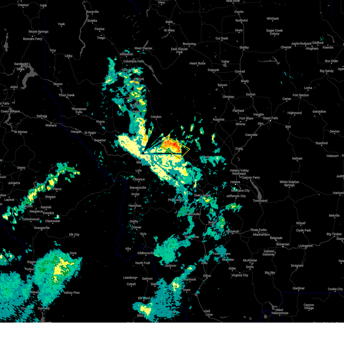
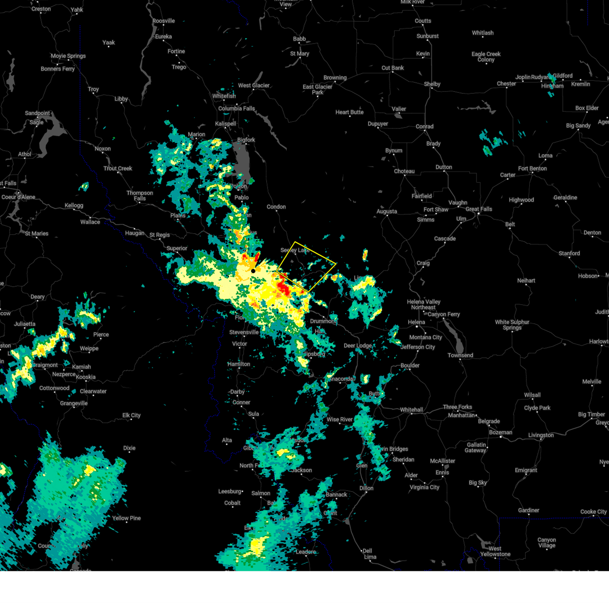
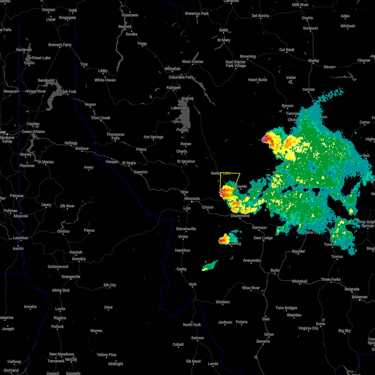
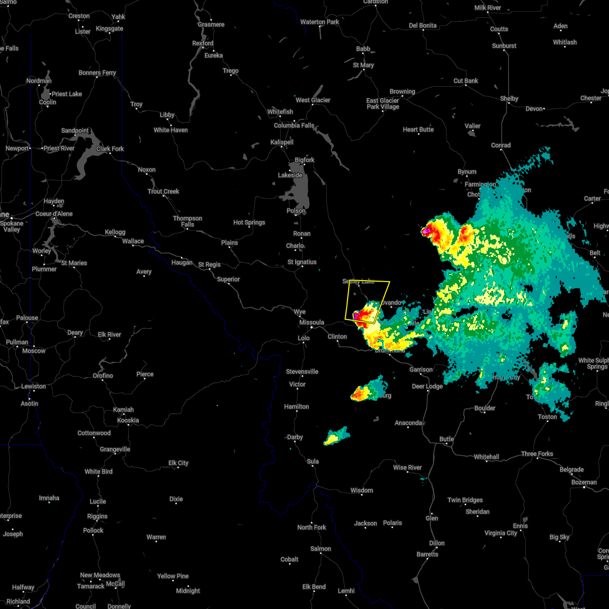
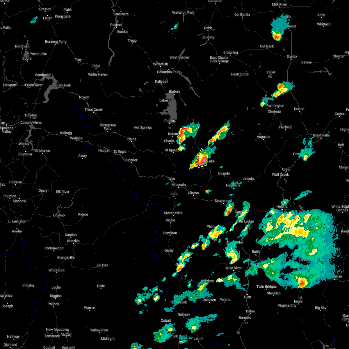
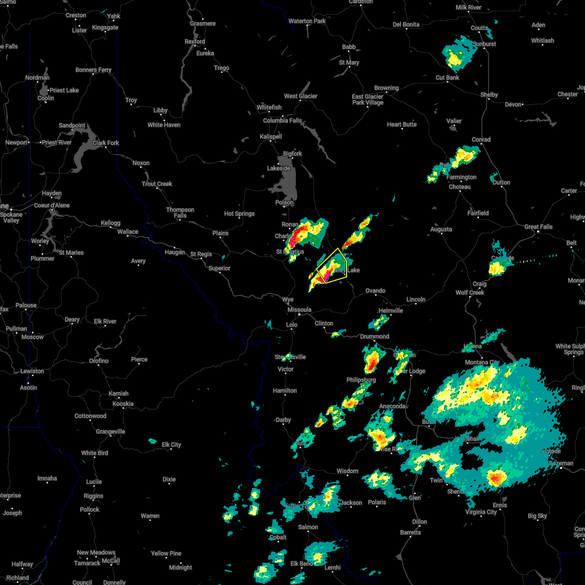
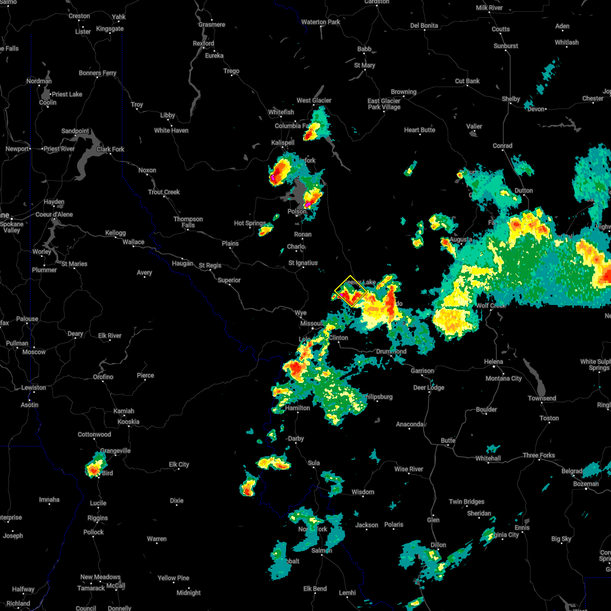
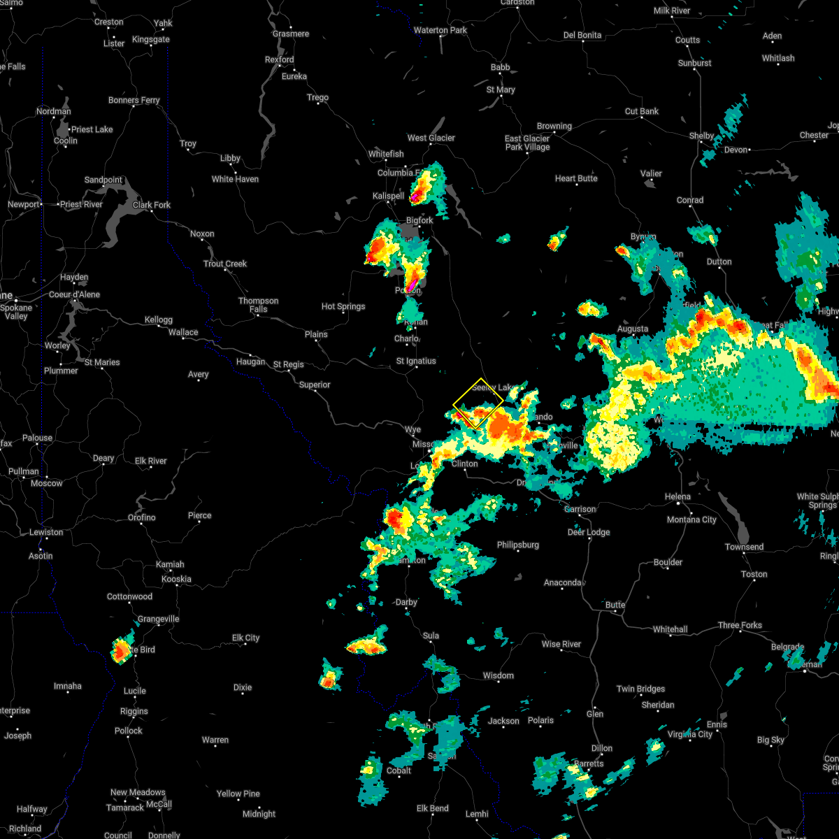
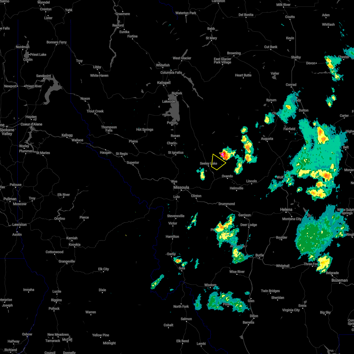
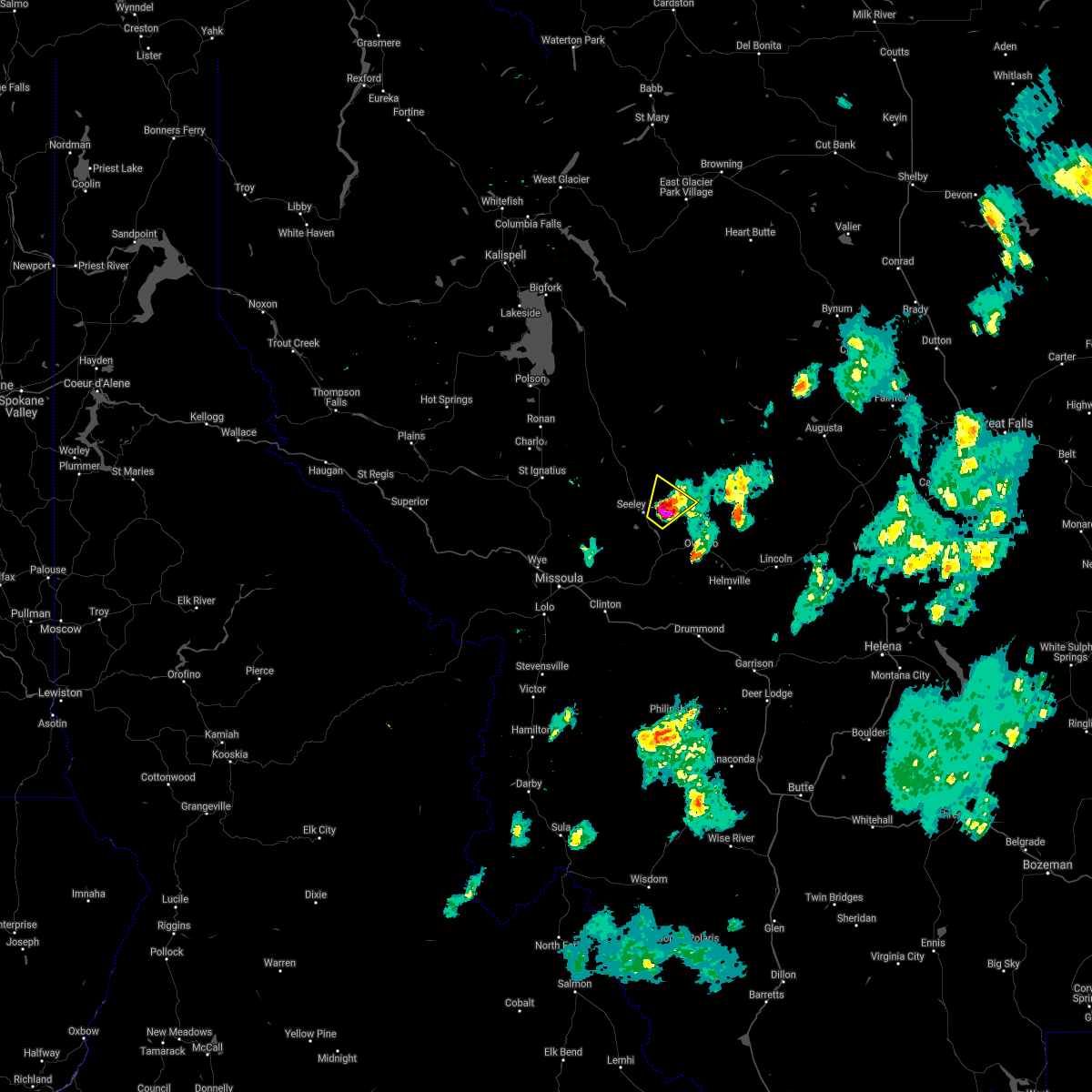
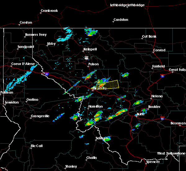
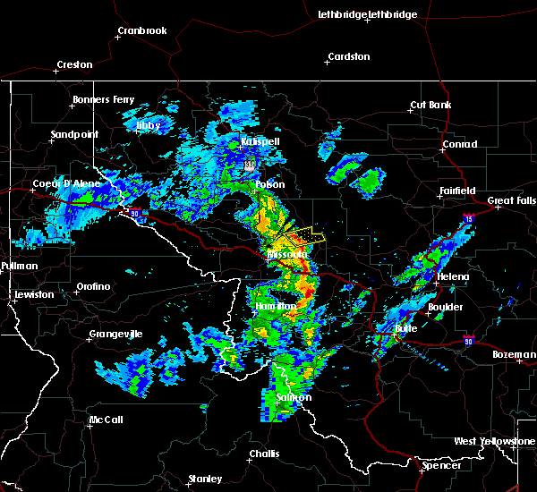
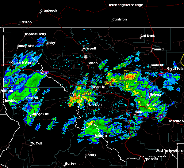
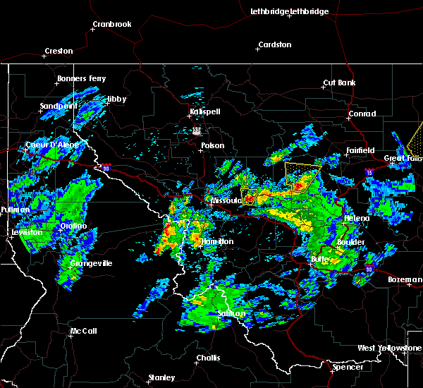
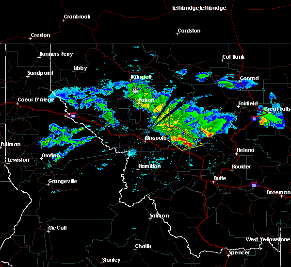
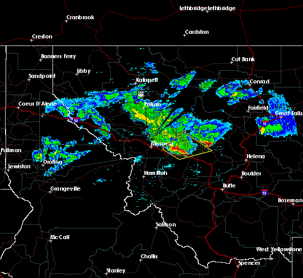
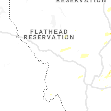
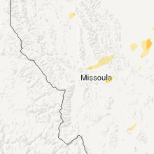
Hail Map for Seeley Lake, MT
The Seeley Lake, MT area has had 11 reports of on-the-ground hail by trained spotters, and has been under severe weather warnings 5 times during the past 12 months. Doppler radar has detected hail at or near Seeley Lake, MT on 15 occasions, including 1 occasion during the past year.
| Name: | Seeley Lake, MT |
| Where Located: | 32.1 miles NE of Missoula, MT |
| Map: | Google Map for Seeley Lake, MT |
| Population: | 1659 |
| Housing Units: | 1262 |
| More Info: | Search Google for Seeley Lake, MT |
1
The Top Recent Hail Date for Seeley Lake, MT is Monday, August 19, 2024 (7th out of 15)

Hail and Wind Damage Spotted near Seeley Lake, MT
| Date / Time | Report Details |
|---|---|
| 8/23/2024 6:30 PM MDT | Missoula county is reporting essential travel only around seeley lake due to trees and power lines dow in missoula county MT, 1.4 miles SSE of Seeley Lake, MT |
| 8/23/2024 4:30 PM MDT | Corrects previous tstm wnd dmg report from seeley lake. missoula county is reporting essential travel only around seeley lake due to trees and power lines dow in missoula county MT, 1.4 miles SSE of Seeley Lake, MT |
| 8/18/2024 6:23 PM MDT | At 623 pm mdt, severe thunderstorms were located along a line extending from wye to 11 miles southwest of ovando, moving northeast at 35 mph (public). Hazards include 70 mph wind gusts. Expect considerable tree damage. damage is likely to mobile homes, roofs, and outbuildings. Locations impacted include, missoula, bonner-west riverside, wye, east missoula, evaro, frenchtown, seeley lake, potomac, clearwater, greenough, and twin creeks. |
| 8/18/2024 6:06 PM MDT |
 Svrmso the national weather service in missoula has issued a * severe thunderstorm warning for, southeastern missoula county in west central montana, * until 645 pm mdt. * at 605 pm mdt, severe thunderstorms were located along a line extending from near lolo to 14 miles northwest of drummond, moving northeast at 35 mph (radar indicated). Hazards include 60 mph wind gusts. expect damage to roofs, siding, and trees Svrmso the national weather service in missoula has issued a * severe thunderstorm warning for, southeastern missoula county in west central montana, * until 645 pm mdt. * at 605 pm mdt, severe thunderstorms were located along a line extending from near lolo to 14 miles northwest of drummond, moving northeast at 35 mph (radar indicated). Hazards include 60 mph wind gusts. expect damage to roofs, siding, and trees
|
| 7/24/2024 9:55 PM MDT |
 The storm which prompted the warning has moved out of the area. therefore, the warning will be allowed to expire. The storm which prompted the warning has moved out of the area. therefore, the warning will be allowed to expire.
|
| 7/24/2024 9:50 PM MDT |
 At 950 pm mdt, a severe thunderstorm was located over seeley lake, or 33 miles northeast of missoula, moving northeast at 20 mph (radar indicated). Hazards include 60 mph wind gusts. Expect damage to roofs, siding, and trees. Locations impacted include, ovando, seeley lake, and woodworth. At 950 pm mdt, a severe thunderstorm was located over seeley lake, or 33 miles northeast of missoula, moving northeast at 20 mph (radar indicated). Hazards include 60 mph wind gusts. Expect damage to roofs, siding, and trees. Locations impacted include, ovando, seeley lake, and woodworth.
|
| 7/24/2024 9:28 PM MDT |
 Svrmso the national weather service in missoula has issued a * severe thunderstorm warning for, east central missoula county in west central montana, west central powell county in west central montana, * until 1000 pm mdt. * at 928 pm mdt, a severe thunderstorm was located 7 miles southwest of seeley lake, or 26 miles northeast of missoula, moving northeast at 20 mph (radar indicated). Hazards include 60 mph wind gusts. expect damage to roofs, siding, and trees Svrmso the national weather service in missoula has issued a * severe thunderstorm warning for, east central missoula county in west central montana, west central powell county in west central montana, * until 1000 pm mdt. * at 928 pm mdt, a severe thunderstorm was located 7 miles southwest of seeley lake, or 26 miles northeast of missoula, moving northeast at 20 mph (radar indicated). Hazards include 60 mph wind gusts. expect damage to roofs, siding, and trees
|
| 7/8/2022 9:30 PM MDT | Quarter sized hail reported 4.9 miles NW of Seeley Lake, MT |
| 7/8/2022 9:25 PM MDT |
 At 924 pm mdt, a severe thunderstorm was located near seeley lake, or 32 miles north of drummond, moving northeast at 35 mph (radar indicated). Hazards include tennis ball size hail and 70 mph wind gusts. People and animals outdoors will be injured. expect hail damage to roofs, siding, windows, and vehicles. expect considerable tree damage. wind damage is also likely to mobile homes, roofs, and outbuildings. locations impacted include, salmon lake and woodworth. thunderstorm damage threat, considerable hail threat, radar indicated max hail size, 2. 50 in wind threat, radar indicated max wind gust, 70 mph. At 924 pm mdt, a severe thunderstorm was located near seeley lake, or 32 miles north of drummond, moving northeast at 35 mph (radar indicated). Hazards include tennis ball size hail and 70 mph wind gusts. People and animals outdoors will be injured. expect hail damage to roofs, siding, windows, and vehicles. expect considerable tree damage. wind damage is also likely to mobile homes, roofs, and outbuildings. locations impacted include, salmon lake and woodworth. thunderstorm damage threat, considerable hail threat, radar indicated max hail size, 2. 50 in wind threat, radar indicated max wind gust, 70 mph.
|
| 7/8/2022 9:19 PM MDT |
 At 919 pm mdt, a severe thunderstorm was located 7 miles south of seeley lake, or 30 miles northwest of drummond, moving northeast at 35 mph (radar indicated). Hazards include tennis ball size hail and 70 mph wind gusts. People and animals outdoors will be injured. expect hail damage to roofs, siding, windows, and vehicles. expect considerable tree damage. wind damage is also likely to mobile homes, roofs, and outbuildings. locations impacted include, seeley lake, woodworth and clearwater. thunderstorm damage threat, considerable hail threat, radar indicated max hail size, 2. 50 in wind threat, radar indicated max wind gust, 70 mph. At 919 pm mdt, a severe thunderstorm was located 7 miles south of seeley lake, or 30 miles northwest of drummond, moving northeast at 35 mph (radar indicated). Hazards include tennis ball size hail and 70 mph wind gusts. People and animals outdoors will be injured. expect hail damage to roofs, siding, windows, and vehicles. expect considerable tree damage. wind damage is also likely to mobile homes, roofs, and outbuildings. locations impacted include, seeley lake, woodworth and clearwater. thunderstorm damage threat, considerable hail threat, radar indicated max hail size, 2. 50 in wind threat, radar indicated max wind gust, 70 mph.
|
| 7/8/2022 9:09 PM MDT |
 At 908 pm mdt, a severe thunderstorm was located 13 miles south of seeley lake, or 26 miles northwest of drummond, moving northeast at 35 mph (radar indicated). Hazards include tennis ball size hail and 60 mph wind gusts. People and animals outdoors will be injured. expect hail damage to roofs, siding, windows, and vehicles. Expect wind damage to roofs, siding, and trees. At 908 pm mdt, a severe thunderstorm was located 13 miles south of seeley lake, or 26 miles northwest of drummond, moving northeast at 35 mph (radar indicated). Hazards include tennis ball size hail and 60 mph wind gusts. People and animals outdoors will be injured. expect hail damage to roofs, siding, windows, and vehicles. Expect wind damage to roofs, siding, and trees.
|
| 7/8/2022 4:45 PM MDT | Hen Egg sized hail reported 1.4 miles SSE of Seeley Lake, MT |
| 7/8/2022 4:39 PM MDT |
 At 439 pm mdt, a severe thunderstorm was located 8 miles northwest of seeley lake, or 34 miles northeast of missoula, moving northeast at 20 mph (radar indicated). Hazards include two inch hail and 60 mph wind gusts. People and animals outdoors will be injured. expect hail damage to roofs, siding, windows, and vehicles. expect wind damage to roofs, siding, and trees. locations impacted include, seeley lake. thunderstorm damage threat, considerable hail threat, radar indicated max hail size, 2. 00 in wind threat, radar indicated max wind gust, 60 mph. At 439 pm mdt, a severe thunderstorm was located 8 miles northwest of seeley lake, or 34 miles northeast of missoula, moving northeast at 20 mph (radar indicated). Hazards include two inch hail and 60 mph wind gusts. People and animals outdoors will be injured. expect hail damage to roofs, siding, windows, and vehicles. expect wind damage to roofs, siding, and trees. locations impacted include, seeley lake. thunderstorm damage threat, considerable hail threat, radar indicated max hail size, 2. 00 in wind threat, radar indicated max wind gust, 60 mph.
|
| 7/8/2022 4:36 PM MDT | Golf Ball sized hail reported 1.4 miles SSE of Seeley Lake, MT |
| 7/8/2022 4:28 PM MDT |
 At 428 pm mdt, a severe thunderstorm was located 9 miles northwest of seeley lake, or 30 miles northeast of missoula, moving northeast at 20 mph (radar indicated). Hazards include two inch hail and 60 mph wind gusts. People and animals outdoors will be injured. expect hail damage to roofs, siding, windows, and vehicles. expect wind damage to roofs, siding, and trees. locations impacted include, seeley lake. thunderstorm damage threat, considerable hail threat, radar indicated max hail size, 2. 00 in wind threat, radar indicated max wind gust, 60 mph. At 428 pm mdt, a severe thunderstorm was located 9 miles northwest of seeley lake, or 30 miles northeast of missoula, moving northeast at 20 mph (radar indicated). Hazards include two inch hail and 60 mph wind gusts. People and animals outdoors will be injured. expect hail damage to roofs, siding, windows, and vehicles. expect wind damage to roofs, siding, and trees. locations impacted include, seeley lake. thunderstorm damage threat, considerable hail threat, radar indicated max hail size, 2. 00 in wind threat, radar indicated max wind gust, 60 mph.
|
| 7/8/2022 4:16 PM MDT |
 At 416 pm mdt, a severe thunderstorm was located 11 miles west of seeley lake, or 26 miles northeast of missoula, moving northeast at 20 mph (radar indicated). Hazards include 60 mph wind gusts and quarter size hail. Hail damage to vehicles is expected. Expect wind damage to roofs, siding, and trees. At 416 pm mdt, a severe thunderstorm was located 11 miles west of seeley lake, or 26 miles northeast of missoula, moving northeast at 20 mph (radar indicated). Hazards include 60 mph wind gusts and quarter size hail. Hail damage to vehicles is expected. Expect wind damage to roofs, siding, and trees.
|
| 7/7/2022 8:54 PM MDT | Quarter sized hail reported 1.4 miles SSE of Seeley Lake, MT |
| 7/7/2022 8:46 PM MDT |
 At 845 pm mdt, a severe thunderstorm was located near seeley lake, or 30 miles northeast of missoula, moving northeast at 25 mph (radar indicated). Hazards include 60 mph wind gusts and quarter size hail. Hail damage to vehicles is expected. expect wind damage to roofs, siding, and trees. locations impacted include, seeley lake. hail threat, radar indicated max hail size, 1. 00 in wind threat, radar indicated max wind gust, 60 mph. At 845 pm mdt, a severe thunderstorm was located near seeley lake, or 30 miles northeast of missoula, moving northeast at 25 mph (radar indicated). Hazards include 60 mph wind gusts and quarter size hail. Hail damage to vehicles is expected. expect wind damage to roofs, siding, and trees. locations impacted include, seeley lake. hail threat, radar indicated max hail size, 1. 00 in wind threat, radar indicated max wind gust, 60 mph.
|
| 7/7/2022 8:33 PM MDT |
 At 832 pm mdt, a severe thunderstorm was located 9 miles west of seeley lake, or 24 miles northeast of missoula, moving northeast at 25 mph (radar indicated). Hazards include 60 mph wind gusts and quarter size hail. Hail damage to vehicles is expected. Expect wind damage to roofs, siding, and trees. At 832 pm mdt, a severe thunderstorm was located 9 miles west of seeley lake, or 24 miles northeast of missoula, moving northeast at 25 mph (radar indicated). Hazards include 60 mph wind gusts and quarter size hail. Hail damage to vehicles is expected. Expect wind damage to roofs, siding, and trees.
|
| 7/21/2021 6:20 PM MDT |
 The severe thunderstorm warning for northeastern missoula and west central powell counties will expire at 630 pm mdt, the severe thunderstorm which prompted the warning has weakened. moved out of the warned area. therefore, the warning will be allowed to expire. The severe thunderstorm warning for northeastern missoula and west central powell counties will expire at 630 pm mdt, the severe thunderstorm which prompted the warning has weakened. moved out of the warned area. therefore, the warning will be allowed to expire.
|
| 7/21/2021 6:07 PM MDT | Quarter sized hail reported 6.1 miles WSW of Seeley Lake, MT, hailed for 20-30 minutes... max size of 1 inch. gusty winds around 40mph... heavy rain. |
| 7/21/2021 6:07 PM MDT |
 At 606 pm mdt, a severe thunderstorm was located 7 miles northeast of seeley lake, or 38 miles north of drummond, moving northeast at 20 mph (radar indicated). Hazards include ping pong ball size hail and 60 mph wind gusts. People and animals outdoors will be injured. expect hail damage to roofs, siding, windows, and vehicles. expect wind damage to roofs, siding, and trees. This severe thunderstorm will remain over mainly rural areas of northeastern missoula and west central powell counties. At 606 pm mdt, a severe thunderstorm was located 7 miles northeast of seeley lake, or 38 miles north of drummond, moving northeast at 20 mph (radar indicated). Hazards include ping pong ball size hail and 60 mph wind gusts. People and animals outdoors will be injured. expect hail damage to roofs, siding, windows, and vehicles. expect wind damage to roofs, siding, and trees. This severe thunderstorm will remain over mainly rural areas of northeastern missoula and west central powell counties.
|
| 7/21/2021 6:01 PM MDT |
 At 601 pm mdt, a severe thunderstorm was located near seeley lake, or 37 miles north of drummond, moving northeast at 20 mph (radar indicated). Hazards include 60 mph wind gusts and quarter size hail. Hail damage to vehicles is expected. Expect wind damage to roofs, siding, and trees. At 601 pm mdt, a severe thunderstorm was located near seeley lake, or 37 miles north of drummond, moving northeast at 20 mph (radar indicated). Hazards include 60 mph wind gusts and quarter size hail. Hail damage to vehicles is expected. Expect wind damage to roofs, siding, and trees.
|
| 7/1/2021 7:00 PM MDT | Mdt reports downed tree blocking mt-83 north of seeley lake. time of damage estimated by radar dat in missoula county MT, 2.5 miles SE of Seeley Lake, MT |
| 6/13/2021 7:30 PM MDT | Reported 60 foot ponderosa pine fell onto shop. 2 feet in diameter. section jack fences were tipped ove in missoula county MT, 1.2 miles WSW of Seeley Lake, MT |
| 6/13/2021 7:30 PM MDT | Rocks and tree blocking north bound lane of highway 83... 4 miles north of highway 20 in missoula county MT, 7.7 miles NNW of Seeley Lake, MT |
| 6/13/2021 7:30 PM MDT | Large tree blocking north bound lane of highway 83... 9 miles north of highway 20 in missoula county MT, 4 miles NNW of Seeley Lake, MT |
| 7/14/2019 1:47 PM MDT |
 At 146 pm mdt, a severe thunderstorm was located 13 miles southwest of seeley lake, or 19 miles northeast of missoula, moving east at 35 mph (radar indicated). Hazards include wind gusts up to 60 mph and quarter size hail. Hail damage to vehicles is expected. Expect wind damage to roofs, siding, and trees. At 146 pm mdt, a severe thunderstorm was located 13 miles southwest of seeley lake, or 19 miles northeast of missoula, moving east at 35 mph (radar indicated). Hazards include wind gusts up to 60 mph and quarter size hail. Hail damage to vehicles is expected. Expect wind damage to roofs, siding, and trees.
|
| 5/31/2018 2:36 PM MDT | Quarter sized hail reported 1.4 miles SSE of Seeley Lake, MT, time estimated from radar. |
| 5/31/2018 2:19 PM MDT |
 At 219 pm mdt, a severe thunderstorm was located 9 miles southwest of seeley lake, or 23 miles northeast of missoula, moving east at 30 mph (radar indicated). Hazards include 60 mph wind gusts and nickel size hail. expect damage to roofs, siding, and trees At 219 pm mdt, a severe thunderstorm was located 9 miles southwest of seeley lake, or 23 miles northeast of missoula, moving east at 30 mph (radar indicated). Hazards include 60 mph wind gusts and nickel size hail. expect damage to roofs, siding, and trees
|
| 6/4/2017 5:40 PM MDT |
 The severe thunderstorm warning for eastern missoula county will expire at 545 pm mdt, the severe thunderstorm which prompted the warning has weakened. moved out of the warned area. therefore, the warning will be allowed to expire. The severe thunderstorm warning for eastern missoula county will expire at 545 pm mdt, the severe thunderstorm which prompted the warning has weakened. moved out of the warned area. therefore, the warning will be allowed to expire.
|
| 6/4/2017 5:31 PM MDT |
 At 530 pm mdt, a severe thunderstorm was located 7 miles south of seeley lake, or 30 miles northeast of missoula, moving north at 25 mph (radar indicated. locations impacted include, woodworth and clearwater). Hazards include 60 mph wind gusts and quarter size hail. At 530 pm mdt, a severe thunderstorm was located 7 miles south of seeley lake, or 30 miles northeast of missoula, moving north at 25 mph (radar indicated. locations impacted include, woodworth and clearwater). Hazards include 60 mph wind gusts and quarter size hail.
|
| 6/4/2017 5:13 PM MDT |
 At 513 pm mdt, a severe thunderstorm was located 14 miles south of seeley lake, or 25 miles northwest of drummond, moving north at 25 mph (radar indicated). Hazards include 60 mph wind gusts and quarter size hail. At 513 pm mdt, a severe thunderstorm was located 14 miles south of seeley lake, or 25 miles northwest of drummond, moving north at 25 mph (radar indicated). Hazards include 60 mph wind gusts and quarter size hail.
|
| 7/17/2016 10:49 PM MDT |
 At 1049 pm mdt, a dangerous storm with a history of producing quarter size hail and damaging winds in excess of 60 mph was located 8 miles north of ovando, or 32 miles north of drummond, moving northeast at 45 mph. locations impacted include, ovando, helmville, clearwater, greenough, garnet and woodworth. At 1049 pm mdt, a dangerous storm with a history of producing quarter size hail and damaging winds in excess of 60 mph was located 8 miles north of ovando, or 32 miles north of drummond, moving northeast at 45 mph. locations impacted include, ovando, helmville, clearwater, greenough, garnet and woodworth.
|
| 7/17/2016 10:35 PM MDT |
 At 1034 pm mdt, trained weather spotter just south of rock creek reported a severe thunderstorm producing quarter size hail. this storm was located 7 miles west of ovando, or 25 miles north of drummond, moving northeast at 45 mph. winds in excess of 60 mph and heavy rainfall should also be expected with this storm. localized flooding may occur as a result of heavy rainfall. locations impacted include, ovando, potomac, helmville, clearwater, greenough, woodworth, bearmouth, nimrod and garnet. At 1034 pm mdt, trained weather spotter just south of rock creek reported a severe thunderstorm producing quarter size hail. this storm was located 7 miles west of ovando, or 25 miles north of drummond, moving northeast at 45 mph. winds in excess of 60 mph and heavy rainfall should also be expected with this storm. localized flooding may occur as a result of heavy rainfall. locations impacted include, ovando, potomac, helmville, clearwater, greenough, woodworth, bearmouth, nimrod and garnet.
|
| 7/17/2016 10:31 PM MDT |
 At 1028 pm mdt, the public reported a severe thunderstorm producing up to quarter size hail and damaging winds in excess of 60 mph. this storm was located 10 miles west of ovando, or 22 miles northwest of drummond, moving northeast at 45 mph. heavy rain could cause localized flooding. in addition, a spotter from rock creek reported heavy amounts of nickel sized hail. this storm has a history of producing larger hail 1 inch in diameter, and should this storm intensify further, could produce large hail again. locations impacted include, ovando, potomac, helmville, clearwater, greenough, woodworth, bearmouth, nimrod and garnet. At 1028 pm mdt, the public reported a severe thunderstorm producing up to quarter size hail and damaging winds in excess of 60 mph. this storm was located 10 miles west of ovando, or 22 miles northwest of drummond, moving northeast at 45 mph. heavy rain could cause localized flooding. in addition, a spotter from rock creek reported heavy amounts of nickel sized hail. this storm has a history of producing larger hail 1 inch in diameter, and should this storm intensify further, could produce large hail again. locations impacted include, ovando, potomac, helmville, clearwater, greenough, woodworth, bearmouth, nimrod and garnet.
|
| 7/17/2016 10:08 PM MDT |
 At 1008 pm mdt, doppler radar indicated a severe thunderstorm capable of producing quarter size hail and damaging winds in excess of 60 mph. this storm was located 17 miles east of bonner- west riverside, or 20 miles northwest of drummond, and moving northeast at 45 mph. At 1008 pm mdt, doppler radar indicated a severe thunderstorm capable of producing quarter size hail and damaging winds in excess of 60 mph. this storm was located 17 miles east of bonner- west riverside, or 20 miles northwest of drummond, and moving northeast at 45 mph.
|
| 8/10/2015 7:09 PM MDT |
 At 707 pm mdt, a severe thunderstorm was located 16 miles south of seeley lake, moving northeast at 45 mph. this storm has had a history of producing wind gusts over 70 mph. any downed power lines could cause a new fire start (nws observation). Hazards include 70 mph wind gusts. Expect considerable tree damage. damage is likely to mobile homes, roofs, powerlines and outbuildings. Locations impacted include, seeley lake, ovando, clinton, potomac, clearwater, greenough, woodworth, twin creeks, nimrod and garnet. At 707 pm mdt, a severe thunderstorm was located 16 miles south of seeley lake, moving northeast at 45 mph. this storm has had a history of producing wind gusts over 70 mph. any downed power lines could cause a new fire start (nws observation). Hazards include 70 mph wind gusts. Expect considerable tree damage. damage is likely to mobile homes, roofs, powerlines and outbuildings. Locations impacted include, seeley lake, ovando, clinton, potomac, clearwater, greenough, woodworth, twin creeks, nimrod and garnet.
|
| 8/10/2015 6:44 PM MDT |
 At 642 pm mdt, doppler radar indicated a severe thunderstorm capable of producing damaging winds in excess of 60 mph. this storm was located 12 miles northeast of bonner-west riverside, or 16 miles east of missoula, and moving north at 25 mph. this storm has a history of damaging winds, capable of downing power lines and trees. At 642 pm mdt, doppler radar indicated a severe thunderstorm capable of producing damaging winds in excess of 60 mph. this storm was located 12 miles northeast of bonner-west riverside, or 16 miles east of missoula, and moving north at 25 mph. this storm has a history of damaging winds, capable of downing power lines and trees.
|
| 8/12/2013 7:06 PM MDT | Multiple trees and power lines down on whitetail dr and dolly varden dr in missoula county MT, 0.3 miles NW of Seeley Lake, MT |
| 6/18/2013 5:30 PM MDT | Multiple trees down in seeley lake area. resulted in a propane fire at one house. one single family home destroye in missoula county MT, 1.4 miles SSE of Seeley Lake, MT |
| 6/18/2013 5:00 PM MDT | Multiple large lodgepole pinetrees blown down. trees estimated to be about 50 to 80 feet tall and 8-10 inches in diameter. one tree down on a neighboring home but no si in missoula county MT, 0.9 miles NNE of Seeley Lake, MT |
| 6/26/2012 10:45 AM MDT | Over one hundred trees down between 7 and 14 miles north of seeley lak in missoula county MT, 10.9 miles S of Seeley Lake, MT |
| 6/23/2012 8:15 PM MDT | Quarter sized hail reported 12.2 miles SSE of Seeley Lake, MT |
| 1/1/0001 12:00 AM | Quarter sized hail reported 5.3 miles NNW of Seeley Lake, MT, public report from salmon lake area |
| 1/1/0001 12:00 AM | Half Dollar sized hail reported 6.7 miles NNW of Seeley Lake, MT, hail reported at big sky lake. |
| 1/1/0001 12:00 AM | Half Dollar sized hail reported 6.7 miles NNW of Seeley Lake, MT, hail reported at big sky lake. |
| 1/1/0001 12:00 AM | Quarter sized hail reported 1.7 miles NNE of Seeley Lake, MT |
Hail Maps for Seeley Lake, MT


Connect with Interactive Hail Maps